Homeland Security Goes Searching for a Bomb… Rafting through the Grand Canyon: Part 3

Essential Grand Canyon supplies DG

All of my wilderness experiences have been motivated by a go-light philosophy when it comes to food, which makes sense if you carry it on your backs. River runners, on the other hand, have rafts to carry everything. Other rules apply. Extra pounds don’t matter. And if you are going to carry all of these oranges, you might as well carry some alcohol to mix with your orange juice. (Photo by Don Green.)


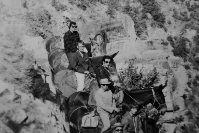
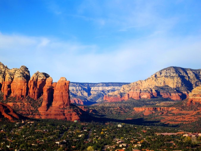
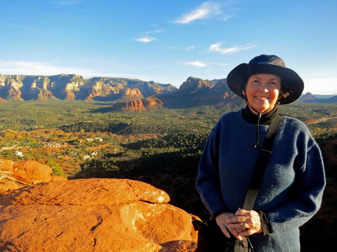
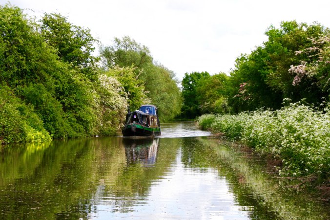
The fact that we were full-time travelers made our Grand Canyon trip easier. There was no house, mail, job, pet or the other factors of normal life to worry about. We just pointed our van toward Flagstaff and drove, stopping along the way at places like Arches and Bryce Canyon National Parks.

Bryce Canyon

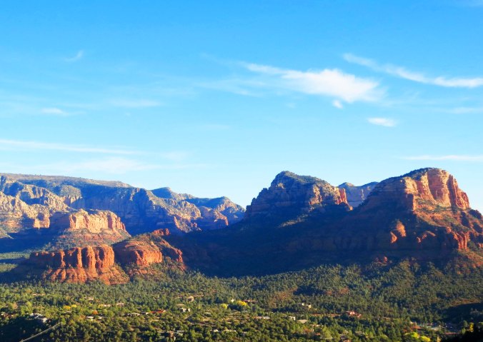
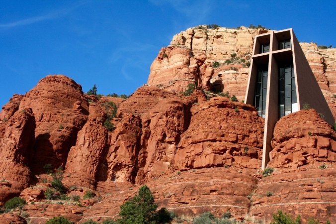
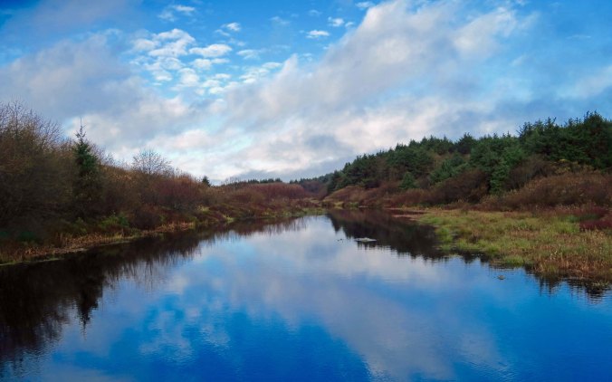
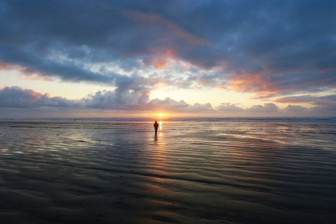
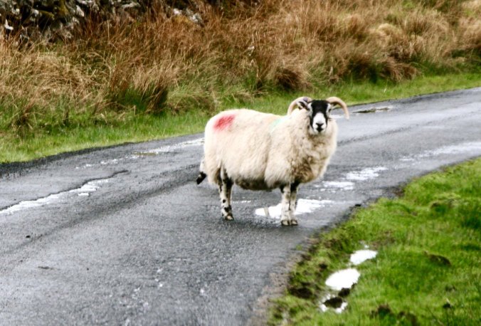
While our fellow rafters were scurrying to wrap up business to prepare for our 18-day raft trip though the Grand Canyon, Peggy and I were visiting Nationals Parks in Utah. This is Bryce Canyon.

Bryce Canyon 1

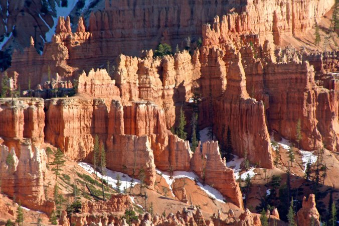
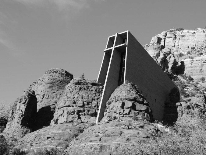
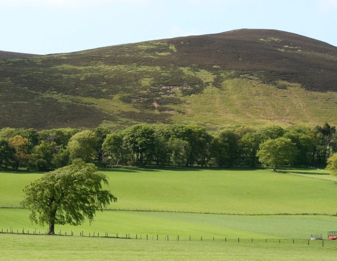
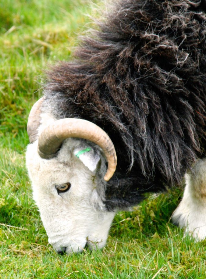
Another view of Bryce.

Great adventures usually start with mundane tasks, as most of you know. For example, did you cancel the paper? Common sense, travel pundits, (and probably your mother) admonish you that devious burglars have nothing better to do than to cruise the streets looking for rolled newspapers in front of your home.

More importantly, what about the cat?

Once upon a time Peggy and I had a cat named FE. Vacations meant I would carefully measure out twice as much food and water as she could possibly eat or drink and four times the kitty litter she might use. The likelihood of her using our house as a litter box was much greater that the likelihood of her starving. As a reward for my thoughtfulness, she would shed enough fur in our absence to fill a dump truck. For weeks after we arrived home, she would also pad into our bedroom in the wee hours each night and meow loudly to make sure we hadn’t abandoned her again. Or possibly it was punishment…

FE and Sylvester dressed for Christmas

FE and her buddy, Sylvester, dressed for Christmas. Note FE’s Rudolph-red nose. I recall that a bit of photoshopping was required to get her ready for the Christmas letter.

We weren’t getting off scot-free on preparation for the river trip, however. In Flagstaff, we had food to worry about. Lots of it. Tom Lovering, his wife Beth and their friend Jamie Wilson arrived in Flagstaff three days in advance of our Colorado River trip. Their car was packed to the brim with empty ammo cans for things like cameras and huge ice chests for food. They were late.

The Department of Homeland Security had delayed their journey at Hoover Dam. The Agency is paranoid about mad bombers, rightfully so. And this was before the new bridge across the river had been completed; people still had to drive across the dam. A vehicle packed with C-4 could conceivably blow a big hole. Stern faced agents carrying guns were posted at each entrance. No smiling was allowed. Homeland Security’s normally low sense of humor (have you ever joked about a bomb during a security check at an airport) dropped to zero when the agents saw all the ammo cans Tom had packed in his vehicle. Rafters love these containers because they are waterproof and easily obtainable at Army Surplus stores. You can imagine what went through the minds of the agents. The whole car had to be unpacked and each ammo can carefully checked out.

Tom Lovering

This was the face that Tom greeted the Homeland Security agents with— furry but friendly. His looks were about to change…

Tom getting a do

Tom getting a ‘do’ in Flagstaff…

Tom Lovering with horns

What if Tom would have met the agents looking like this with green horns? We still might be waiting for him in Flagstaff.

Tom is even more paranoid about food than DHS is about terrorists. In addition to being a highly experienced rafter and trip leader, he’s an old restaurateur who had spent months planning the menu.  Each dish had been tested several times and quantities had been measured down to the teaspoon. Recipes were spelled out in minute detail. We would eat gourmet on the trip and cook it Tom’s way— or die. The options were clear.

Beth, Peggy and I were dispatched to Sam’s Club with marching orders. We filled seven large shopping carts with food. Think of it this way. There were 16 people going on an 18-day trip and eating three meals a day. This equaled 864 individual meals.

When we arrived back at the motel, Tom and Jamie had set up a staging area. Food needed to be organized by meal and day and then stuffed in the appropriate containers. The containers would then be assigned to rafts. It was important that we knew where to find the beer.

Large food containers for Grand Canyon trip

Large food chests waited for us when we got back to our motel. Each would be filled with food. Dry ice would be added to keep our food fresh for 18-days.

We still had to shop for perishables and more food was also coming from Sacramento. Our room, we discovered, was to be the recipient of most of the food. Apparently, it was written into the fine print of being ‘permit holder.’ There was barely space to sleep. Not that we slept much. Soon, we would be on the river! But first, Bone had to be appropriately dressed for his trip.

Supplies for Grand Canyon trip

We went to Safeway to purchase our perishable goods, and once more our small RV was filled to the brim.

Gear and food Grand Canyon trip

We discovered that the majority of the large food containers would be stowed in our room. With our own gear spread out on the bed, it was questionable if we would have room to sleep! Tom provides a perspective on the size of the ice chests. The yellow container is an ammunition can.

Bone in life vest

One of our final responsibilities was to make sure that Bone was adequately dressed for the trip in his PFD. Once, he almost fell off a boat in the piranha infested water of the Amazon. It would not do to lose him in the roaring rapids of the Colorado. Next Saturday and Sunday, I will provide background on Bone since he was an active participant on the river trip.

Loading truck for Grand Canyon trip DG

Finally, it was time to load our food and gear on this truck for transport down to Lee’s Ferry and the beginning of the trip. The truck was completely stuffed by the time we were finished. We were finally on our way! (Photo by Don Green.)


WEDNESDAY’S Photo Essay POST: A river boat trip on the Amazon River. The piranhas are biting and we bite back.

FRIDAY’S MisAdventure’s POST: There is nothing like reading to seduce you into becoming a wanderer.

MONDAY’S Travel Blog POST: We start our raft journey through the Grand Canyon with 30 MPH headwinds. So much for a peaceful (between rapids) float down the Colorado!


SaveSave

SaveSave

SaveSave

The Tragedy and Glory of Ancient Pompeii… The Wednesday Photo Essay


Pompeii body

A blanket of ash rushed down from Mt. Vesuvius on Pompeii in 79 CE, suffocating many of the city’s residents. Those who could escape, did. Those who didn’t were covered by a flow of molten rock the next day, preserving their bodies as they died in poses that can still be seen today.


It’s time for another Wednesday photo essay where I scroll through the 75,000+ photos that Peggy and I have taken from around the world and find something that catches my attention. Today it is Ancient Pompeii. Next Wednesday it will be Costa Rica.


Their lives would have been interrupted by a series of small tremors. It had to be worrisome; seventeen years earlier Pompeii had come close to being destroyed in a massive earthquake. The city was still being rebuilt. Possibly the residents woke on the morning of August 24, 79 CE and looked fearfully at the restless mountain that loomed over them— and then went on about their business.

Temple of Jupiter and Mt. Vesuvius

Mt. Vesuvius still looms above Pompeii today. This is what it looks like from the Temple of Jupiter.

Ruins at Pompeii and Mt. Vesuvius

Another perspective.

Everything ended at 1:00 PM.

Mt. Vesuvius exploded in a massive eruption sending tons of ash, gas and rocks spewing 20 miles into the sky and forming a dense mushroom cloud. Winds quickly carried the ash into Pompeii, turning day into night and dreams into nightmares. The majority fled, escaping by whatever means available. Those who stayed behind died— suffocating at first under the blanket of thick ash and ultimately, the next morning, by being buried alive under a pyroclastic flow of molten rock and gas that flew down the mountain at speeds close to 100 miles per hour.

Buried alive in Pompeii

It must have been incredibly fast, and frightening.

Pompeii's dead

You have to wonder if this person was simply asleep when it happened.

Viewed from an archeological perspective, history’s tragedy has become today’s blessing. The molten rock and ash that covered Pompeii, also preserved it, providing historians with their most complete view of what life was like in the ancient Roman Empire.

Pompeii street with raised crossing

Buildings and streets in Pompeii are well-preserved. Ruts from vehicles using the roads can still be seen, as can road crossings.

Street crossing in Pompeii

Streets were cleaned by flooding them with water. People kept their feet dry by using these crossing stones.

Street in Pompeii

Another street scene. Note how carefully the buildings had been aligned. The square box might have been a community water cistern.


Water faucet in Pompeii

Peggy and I were amused by its modern day equivalent where a faucet was added to the mouth of an early sculpture.

Side of bathhouse in Pompeii

Public baths were a part of most Roman towns and cities. This one was decorated with a detailed relief…

Father and child, Pompeii

Which included a father and child walking down stairs.

Pompeii bathhouse

An inside view of the baths provides an idea of how luxurious the baths would have been. Remnants of murals that once covered the walls still remain.

Ceiling of bathhouse in Pompeii

Ceilings were decorated as well. This one shows bas-reliefs of people and animals.

Columns in a row at Pompeii

Columns are another thing that most Roman towns shared. These set off a training school of gladiators, who were expected to go out and die for the greater glory of Rome, or to fight and possibly die to entertain Roman citizens. When I closed my eyes, I could almost hear the clashing of swords.

Pompeii Column

Looking up at one of the columns.

Column in Pompeii

Close-up.

Apollo at Pompeii with his temple

Peggy did a clever job of catching Jupiter with his hand seemingly wrapped around a column in his temple. The god was apparently traveling light that day.

Pompeii building

Many of the buildings were remarkably preserved.

Ruins at Pompeii

Others more closely resembled other Roman ruins found throughout the Mediterranean.

Pompeii House of Pleasure

The Lupanar House of Pleasure or brothel is one of Pompeii’s best preserved buildings and our guide gave us a tour…

House of Lupenare bed in Pompeii

This was one of the beds. It would have been covered with a mattress, but still… The walls of the brothel included paintings that showed the various services available.

Fastfood holders at Pompeii

A meal out may have included stopping by this place. These were designed to hold prepared food and keep it hot. It strikes me as a fast food/takeout restaurant.

Bread oven in Pompeii

Bread was baked in this oven.

Jars at Pompeii

A large number of storage jars, such as these, were found in the city.

Amphitheater at Pompeii

The large amphitheater would have accommodated most of Pompeii’s residents. The rich folks got the lower seats. Those not so fortunate, the upper ‘nosebleed’ seats.

Street scene in Pompeii

Another street scene in Pompeii. Murals were  included on the walls. There must have been a great deal of civic pride in the city.

Child with dog at Pompeii

A little girl and her dog…

Dog at Pompeii

And a modern resident of Pompeii.

Edge of Pompeii

I’ll conclude with this photo from the Mediterranean side of Pompeii. In 79 CE, the sea was only a couple of hundred yards away. Today it is a couple of miles. Those who had boats or access to boats would have been fleeing from here on that fateful August day, escaping the death that was raining down on their fair city.


FRIDAY’S POST: I determine it’s my job to rule the first grade but no one else seems to agree. Mrs. Young gives me a spanking for my effort.

MONDAY’S POST: It’s all about food on our river trip. And why did Homeland Security determine it was necessary to check our food boxes for a bomb?

WEDNESDAY’S POST: We leave Italy and the Mediterranean to venture off to the Amazon..


SaveSaveSaveSave

SaveSave

SaveSave

SaveSave

SaveSave

SaveSave

SaveSave

SaveSave

SaveSave

Peggy Wins the Lottery… Rafting through the Grand Canyon: Part 2

Mule trip into Grand Canyon

I have journeyed into the Grand Canyon several times over the years. The first was in the late 60s. That’s me, second from the top on Charlie the mule. I was heavier than Charlie liked, so he kept trying to bite me. He also walked as close to the thousand foot drop off as he could. His ultimate revenge, however, was that I was sore for a week afterwards!


Having reported on being in Flagstaff for the beginning of our raft trip down the Colorado River on last Monday’s travel blog, I thought I should back up a step and tell you how we got there.

It started with a strange phone call.

Peggy and I were in the middle of a three-year trip around North American in our small RV when the phone rang late one night. It was 10:00 p.m., far past the time I normally accept calls. They make me grumpy. Usually they are from a Nigerian Prince who wants to make me incredibly wealthy. All I have to do is send him a thousand bucks. But this was from my old friend Tom Lovering. I’m used to him calling at weird hours. He has zero sense of what constitutes a normal day and fervently believes that no one else should either.

He wanted me to immediately stop whatever I was doing (sleeping), jump on-line, and apply for a private permit to raft down the Colorado River through the Grand Canyon. Permits are scarce and the number of people who apply could fill a rock concert. So the Park Service does an open lottery for interested folks. Odds of getting a permit are small— teeny tiny— and Tom wanted to increase his. He’d been scrolling through his list of friends and had already talked a number of people into applying. The clock was ticking; the lottery closed at midnight. Given the late hour, I must have been near the end of Tom’s likely candidates, which isn’t surprising. I know zilch about running rapids.

Thrill sports aren’t my thing. I have always figured that the type of outdoor things I do (like bicycling 10,000 miles around North America by myself, or disappearing into grizzly bear country alone) have enough inherent danger without my challenging raft-eating, people swallowing rapids, or climbing up the sheer face of a thousand-foot rock. Not that I have any problem with the sports. In fact, I have nothing but admiration for people who have the skill and temerity to pursue them and make a career out of flipping off the old guy in a hoodie who carries a big scythe.

My normal response would have been, “Sure, Tom, I’ll get right on it,” followed by promptly rolling over and going back to sleep. But this wasn’t accounting for the love of my life, Peggy, who actually likes water sports and enjoys jumping off cliffs. During college, she had actually attended a session of the Nantahala White Water School in North Carolina where you learn to maneuver rafts through raging rapids. She followed up on Tom’s request immediately: jumping on-line and putting in for a permit— in my name.

I was checking my E-mail the next morning when I came across the note from the National Park Service: “Congratulations you have won a permit for you and 15 other people to raft down the Colorado River through the Grand Canyon! We will be sending you a 5000-page document (slight exaggeration) that outlines your responsibilities.” Oh joy. I called Tom immediately. He was the experienced river runner. He had promised the night before that if, by some miracle I did win, he would take full responsibility for organizing and leading the event. It’s a huge job that takes considerable knowledge about white water rafting.

At first, Tom didn’t believe me. He thought I was joking. Neither he nor any of his rafting buddies had won a Canyon permit in several years. And then he was ecstatic. Yes, he would recruit experienced boat people and their boats for the trip! Yes, he would make all necessary arrangements. Yes, he would plan the menus and organize the food! Yes, he would lead the adventure!

Then the other shoe dropped. Doesn’t it always? I was, after all, “the permit holder.” It was my job to turn in paperwork. But I also had serious responsibilities. If anything went wrong; it was on my shoulders. This ranged from people pooping in the wrong places, to how we washed our dishes, to more serious things. The Park Service had a long list of safety and environmental concerns. I’d be signing on the dotted line. There would be an inspection before we left!

I admit I had concerns. But these were countered by the fact that I love the Grand Canyon. I have returned to it numerous times over the years. I have both hiked and backpacked into it. One time I rode mules into the Canyon. Another time I flew in by helicopter. And I am perfectly happy just sitting on the edge and staring out into the vast space at the incredible rock formations. I did that for Christmas one year (and many other times). Floating down the Colorado would give me a totally new perspective. I was almost as excited as Tom and Peggy. Almost.

Between three tours of duty as a Marine helicopter pilot in Iraq and then serving as a Coast Guard pilot flying rescue missions, our son Tony did a brief stint of flying tourists over the Grand Canyon and into the Havasupai Indian village in the canyon.  When he flew Peggy and me into the village, he was playing the theme song from Star Wars as he swooped down past the steep cliffs.

Waterfalls at Havusupai

This gorgeous waterfall was the main attraction at the Havasupai Village.

I am sitting on the edge of the Colorado River, red with mud.  Peggy and I had backpacked down the Tanner Trail retracing a solo trip I had made several years earlier. Our raft trip would bring us through this section of the Canyon and over the Tanner Rapids. (Photo by Peggy Mekemson.)

Occasionally, backpacking through the Canyon requires a bit of scrambling.

But you don’t have to hike or backpack into the canyon, or raft, or fly, or ride grouchy mules to enjoy the beauty of the Canyon. You can drive up, and enjoy numerous pull-offs that give you incredible views. Short walks provide many more. Be sure to include early morning and late afternoon to capture the full beauty.

Grand Canyon 38

The rocks come in a seemingly infinite number of shapes and colors.

A final view.

WEDNESDAY’S POST: We travel to the ancient Roman city of Pompeii.

FRIDAY’S POST: I learn that there is more to life than dead people.

MONDAY’S POST: And why is Homeland Security checking out our food containers for a bomb on the our Grand Canyon rafting adventure?


The Red, Red Rocks of Sedona, Arizona… Part 2

Sunrise on rocks west of Sedona

The best time to be out and about for photography in Sedona is either early in the morning or late in the afternoon when the red rocks of Sedona at are their most colorful.


It’s photo essay Wednesday so I am returning to Sedona, Arizona to wrap up my look at some of the colorful red rocks that surround the town. Last Wednesday, I focused on the formations east of town and the striking Chapel of the Holy Cross. Today I will include photos of the rock formations west of town and take a trip up the ‘mystical’ Boynton Canyon.


Sedona rocks in morning

Peggy and I took these photos from up near the Sedona airport looking west across the town. The rock formation I featured at the beginning of the post is shown on the left here.

Peggy and view across Sedona

Peggy was standing on the ‘vortex’ near the airport when I took this photo. (Actually, looking at it, I think it is toward the east.)

Sedona view

Another perspective. Possibly my blogging friend who lives in Sedona, Johanna Massey, can provide the location.

Sunset west of Sedona

Definitely looking west here. This time the formation that I included in the first photo is on the right.

Sunrise west of Sedona

A close up…

Sedona Sunset

Sedona Sunset.

Layers upon layers, Sedona

I liked this photo because the ridges seemed to fade off into infinity.

Capstone rocks in Boynton Canyon

We took a detour on our hike up Boynton Canyon to visit with the Kachina Woman, on the left. There is supposedly another vortex in the area that emphasizes balance. (Photo by Peggy Mekemson.)

Capped rock in Boynton Canyon

A photo of the same formation from the Boynton Canyon Trail. Some claim that the vortex is between the Kachina Woman and the knoll. Since a little balance never hurts, I stood between the two formations for a few minutes. (Photo by Peggy Mekemson.)

Boynton Canyon

This is the type of view you can expect hiking up Boynton Canyon. No wonder people find the area mystical.

Sandstone rock in Boynton Canyon

Each sandstone formation provides several views as you hike up the short trail. Following are examples of this one…

Sandstone formations in Boynton Canyon

Sandstone in Boynton Canyon

Stacked rocks in Boynton Canyon

Stacked rocks and circles of rocks apparently reflect hiker’s spiritual journey up the canyon. There are so many that some people are beginning to feel that they detract from the beauty of the area. Not to worry; they are easily removed. I wonder if it gives you bad Karma.

Pinted by mineral water, Sedona

Mineral rich waters created this dry waterfall. If I remember correctly the cave on the left belonged to early Native Americans. (Photo by Peggy Mekemson.)

Anasazi dwelling in Boynton Canyon

This Anasazi dwelling definitely did. (Photo by Peggy Mekemson.)

Fortress rock in Boynton Canyon

Another of the impressive rock formations up Boynton Canyon.

Red rock of Boynton Canyon near Sedona

And another!

Peggy at end of trail in Boynton Canyon

That’s it for today, folks!


FRIDAY’S Blog-a-Book POST: The great tree race where my brother and I face off against each other in a death-defying race up and down the 70-foot tall Incense Cedar tree in the Graveyard.

MONDAY’S Travel Blog POST: Where Homeland Security checks out our food supply for the Colorado River trip.

WEDNESDAY’S Photo Essay POST: A visit to the ancient Roman city of Pompeii, Italy that was buried by the volcanic eruption of Mt. Vesuvius in 79 CE.

SaveSave

SaveSave

SaveSave

SaveSave

SaveSave

Hopi Gods and Squirrelly Squirrels… Rafting the Grand Canyon: Part 1

Rowing on the Colorado through the Grand Canyon

While a veteran crew of boatmen handled the more dangerous parts of our 18 day journey through the Grand Canyon, I was allowed near oars on some of the tamer sections.


Since Peggy and I will actually be hanging out at our home in Southern Oregon for a couple of months and not generating new material for my travel blog, I thought I would dip back in time to the very beginning of my posts.  I had attended a writer’s conference in San Francisco during the winter of 2010 and been told that writers need an Internet presence. I felt doing a series on an 18-day trip we had just completed rafting on the Colorado River through the Grand Canyon would make an excellent start. It was an epic-adventure, one that was burned into my memory banks.  Part of the experience was that Peggy and I would be traversing some of the earth’s most challenging rapids with a true cast of characters. That alone was enough to make it an epic adventure, but even more important, at least for me, was that we would be traveling through the heart of the Grand Canyon, one of the seven natural wonders of the world. Please join us on this adventure. By the end, I think you will see why the Grand Canyon has earned its world-class status. I will start with Peggy and me in Flagstaff, Arizona getting ready for our adventure…


Tom and Bone

One of the ‘cast of characters’ and our group leader, Tom Lovering with Bone in his hair. Tom and I had found Bone when we were backpacking in the Sierra Nevada Mountains in 1977 and he has traveled the world ever since.

Five squirrels with long tufted ears just went charging past our van— in a row. I think it must be love and Peggy agrees. We speculate that a female is leading the boys on a glorious romp. “Catch me if you can!” she giggles. It’s that time of the year when the Albert Squirrels are excited to make babies and perpetuate the species. Lust is in their hearts. Or maybe it’s just the guys working out territorial differences.

Someone they won’t be mating with are their northern cousins, the Kaibab Squirrels. It isn’t that they couldn’t or wouldn’t if they could, it’s just that the giant hole in the ground known as the Grand Canyon is too deep and too wide for them to cross. As a result, a new species has been created. Scientists and natural history folks call this process allopatric speciation— a pair of two-bit words for sure.

We are located at a KOA in Flagstaff, Arizona as we prepare for our raft trip down the Colorado River. It’s a big campground. Everywhere we look men and women wearing yellow shirts are busily preparing for the onslaught of summer tourists. It feels like a beehive, or squirrel’s nest. The camp cook tells us 28 people work here. Jobs are highly specialized. The man who straightens misplaced rocks stopped by to chat with us this morning.

Yesterday we watched two employees struggle for an hour on laying out the base of Teepee. It had all the flavor of an old Laurel and Hardy film. They kept measuring and re-measuring the angles. I expected one to leap up and start chasing the other around camp with a 2×4.

We wonder what the Kachina deities who live in the San Francisco Mountains overlooking our campground think about the squirrelly activity taking place beneath them. There are bunches of them up there, over 300 according to Hopi lore, and each one has a lesson to teach, wisdom to disperse. They come down from their perch in the winter to share their knowledge. I’m sure that they would have made quick work of the Teepee project.

Peggy and I hike up the mountain following Fat Man’s trail. Of course, there is no irony here as we desperately try to beat our bodies into shape for the Canyon trip. We’ve been out travelling in our van for months and the pounds have accumulated. The trail’s name suggests this is a gentle start. Instead it takes us straight up into a snowstorm. The Kachinas are rumored to mislead people under such circumstances. I once spent a week up on the mountain by myself and restricted my wandering to fair weather.

Grand Canyon rock formation

I’ve sometimes wondered what, if any, role that rock formations in the Grand Canyon influenced how the Hopi Indians pictured their Kachina gods.

Once they had the mountain to themselves but now they have competition. Technology has arrived— modern gods. Tower after tower bristling with arrays of tracking, listening and sending devices look out over the sacred lands of the Hopi, Navaho and other Native Americans.

It’s hard not to think Big Brother is watching or not be disturbed by the towers’ visual intrusion. But their presence means we can get cell phone coverage and climb on the Internet. We are addicted to these modern forms of communication so it is hypocritical to whine, at least too much.

But back to the squirrel theme, Peggy and I are a little squirrelly ourselves as we go through our gear and get ready for our grand adventure. I am nervous. This is my first multi-day river trip. What have we gotten ourselves into? Do we have the equipment we need? Will we survive the rapids? What will the people who are joining us be like? What challenges will we face that we are ill prepared for? There are many questions and few answers.

Would people who should not be let near knives suddenly be wielding them?

Would Canyon spirits stalk us?

Would we be required to paint our toenails so our rafts wouldn’t flip.


A note on photos: Peggy and I took most of the pictures that will be included in these posts on the Grand Canyon trip. Our friend Don Green was also along, however, and has generously shared his photos with us. I will note which photos are his.

WEDNESDAY’s Photo Essay POST: It’s back to the featuring the beautiful red rocks of Sedona, Arizona.

FRIDAY’S Blog a Book POST: The next chapter in MisAdventures sees my brother and I in a death-defying race to the top of the 75-foot tall Incense Cedar in the Graveyard.

MONDAY’S Travel Blog POST: It’s all about food, seemingly tons of it, as we make our final preparations for the Colorado River trip. Homeland Security puts a crimp in our efforts as it checks our supply for bombs.

SaveSave

SaveSave

SaveSave

SaveSave

SaveSave

SaveSave

SaveSave

SaveSave

SaveSave

SaveSave

SaveSave

SaveSave

The Incredible Red Rock Country of Sedona— and a Chapel… Part 1

Sedona west

The town of Sedona (center photo) is surrounded by striking scenery. I took this picture from near the airport looking west.


It’s time again for the Wednesday Photo Essay. Today and next Wednesday, I will be featuring Sedona, Arizona.


I still remember the first time I followed Oak Creek Canyon down from Flagstaff, Arizona to Sedona. I had been up backpacking down in the Grand Canyon in 1986 and the side trip was something of an afterthought. I’d seen photos of the area’s striking red rocks and knew of the town’s New Age reputation. There were supposedly vortexes found there, psychic hot-spots that UFOs liked to visit. How could I resist? On the other hand, how could it possibly match my experience in the Canyon? Would I be disappointed?

The answer is a firm no; the detour was different— but very worthwhile.

I’ve been back several times since. The beauty of the red rocks calls to me and I find the New Age character of its inhabitants both interesting and amusing. I read recently that there are 176 New Age-oriented businesses in Sedona. I doubt that any other community in the world can claim such a concentration. The Age of Aquarius is alive and well!

Sitting on a vortex in Sedona, Arizona

Ommm. Here I am, sitting on a red rock vortex point below the Sedona airport practicing my meditation technique and waiting for a UFO. A heretofore unnoticed aura is wrapped around my head. Grin. (Photo by Peggy Mekemson.)

My last visit was three years ago when Peggy and I visited for a week in November along with our friends Ken and Leslie Lake. The pictures from this and next week’s Wednesday photo essays are from that trip. Today’s will be mainly from the east side of town. Next week I will post photos from the west side including a hike up Boynton Canyon. Enjoy.

Chapel of the Holy Cross

One of Sedona’s most famous sites is the Chapel of the Holy Cross. (Photo by Peggy Mekemson.)

Chapel of the Holy Cross in Sedona

I decided that the chapel and its surroundings would do well as a black and white photo.

Chapel of Holy Cross in Sedona, Arizona photo taken by Curtis Mekemson

Another perspective.

Twin rocks in Sedona, Arizona

These striking rocks are located east of the chapel. We took several photos. This one was by Peggy. I think this pair is known as the Two Nuns.

Twin rocks in Sedona, AZ

I added a tree for contrast.

Sedona Cactus

Peggy caught this cactus just down from the chapel.

Cactus and twin rocks in Sedona

And I took a photo of its companion with the Nuns!

Twin rocks in Sedona

Several other towers were located above the Nuns…

Sedona red rock column

Including this beauty. (Photo by Peggy Mekemson.)

Sedona, Arizona

The view south wasn’t bad either!

Sedona Arizona rock

Bell Rock in Sedona

Most of the prominent rock formations around Sedona have been named. I’ll close today with Bell Rock. Be sure to check in next Wednesday for more of the red rocks of Sedona as we journey east of the town to the area featured at the top of this post.


FRIDAY’S POST: My sister Nancy Jo is attacked by the Graveyard Ghost. A very scary tale.

MONDAY’S POST: A trip through the Grand Canyon by raft on the Colorado River.

WEDNESDAY’S POST: We return to Sedona for more gorgeous red rocks.

SaveSave

SaveSave

SaveSave

Ocean Shores … Final Post on the Washington Coast Series

Grays Harbor photo by Curtis Mekemson.

There is no doubt about the beauty of Ocean Shores. This photo looks out into Grays Harbor. The Pacific Ocean is off to the right.


Several years ago, Peggy owned some property in Florida down around Port Charlotte. She and her first husband had purchased two pieces as an investment in one of the huge Florida land schemes. The first parcel, located on a man-made canal, had sold easily long before I knew Peggy. The second piece, which might best be described as swamp-land, was still hanging around when we met many years later and was valued at less than the original price. With skyrocketing real estate values in the mid 2000s, we were finally able to sell the land to some questionable characters out of Miami who had dollars to burn for a small profit. We breathed a huge sigh of relief and turned the money over to our kids.

I only tell this story now because Ocean Shores on the central coast of Washington has a similar history. Developers were going crazy in the 60s and purchasing oceanfront property as cheaply and as quickly as they could put together deals. Land was then subdivided, roads put in, and prices jacked up to create substantial profits. Potential buyers were fed glowing stories about the beauty of the land, its recreational value, and the potential for future profit. It didn’t matter if the land was part of a swamp or that profits would be far into the future.

Land speculation in the US is as old as our country. George Washington may have been the “Father of the Nation” but he was also the father of rampant land speculation, a pursuit he was joined in by the likes of Ben Franklin, John Adams, and other founding fathers who invested in as much land out on the western frontier as they could lay their hands on. (It didn’t matter if the land was already occupied by Native Americans.) It can be argued that one of the reasons for the Revolution was that the British wanted to curtail such speculation.

The Ocean Shores Development Company purchased the area that would become Ocean Shores in 1960 for $1 million. Its location on a peninsula with the Pacific Ocean on one side and Grays Harbor on the other provided a lot of waterfront property to sell. The company quickly brought in a dredge to build canals to create more.  Hollywood personalities such as Pat Boone were recruited for promotion and the land boom was underway. In 2003, National Recreation Properties bought hundreds of lots in Ocean Shores and then resold them at three and four times what it paid. Eric Estrada from CHIPS was brought in for promotion purposes this time. Today, with limited oceanfront property available on the West Coast, property values continue to escalate.

Ocean Shores

Ocean Shores’ peninsula location means it has lots of waterfront property. Man-made canals built throughout the area have added even more. We were staying north of the community up toward the Highway 109 marker.

Peggy and I drove around the peninsula and checked things out. It was an attractive area and I could see why people would want to live in Ocean Shores, but I couldn’t help but think about the community’s low elevation. It would provide scant protection in a Tsunami and, barring that disaster, might be inundated by rising ocean levels. But that’s me. I am sure potential buyers and real estate agents see it differently. Following are a few photos from Ocean Shores and more from where we were staying at Copalis Beach.

Tide coming in at Grays Harbor

Another view looking out into Grays Harbor as the tide rolls in.

Driftwood seahorse at Ocean Shores

The city of Ocean Shores has added some neat driftwood art as an attraction. This seahorse was decked out for Christmas. (Photo by Peggy Mekemson.)

Photo of a driftwood seahorse in Ocean Shores, Washington by Peggy Mekemson.

Another perspective by Peggy.

Driftwood horse at Ocean Shores, Washington photo by Peggy Mekemson.

Having decided that she really liked the driftwood art, Peggy walked across the road and captured this skinny-legged horse.

Driftwood deer in Ocean Shores, Washington photo by Curtis Mekemson.

While I photographed a deer. I liked its antlers.

Small lake at Ocean City Washington

A small lake north of Ocean Shores caught our attention. (Photo by Peggy Mekemson.)

Seagrass and dunes at Copalis Beach

Back at where we were staying in Copalis, we decided to celebrate our final evening by hiking out to the ocean again. It was just across the small dunes.

Copalis beach sunset in Washington

As the sun started to set, we were joined by a bald eagle.

Sunset central coast of state of Washington

Then the sun captured our attention.

Peggy Mekemson at Copalis Beach

Peggy decided to go in search of it across the long, flat beach…

Peggy Mekemson at Copalis Beach

And celebrated…

Peggy Mekemson and sunset at Copalis Beach

Before returning…

Moon over Copalis Beach

Where she was greeted by moonrise.

Sunset central coast of Washington

We stood holding hands as the sun completed its journey. And then returned to the condo. It was time to pack up and head home…


WEDNESDAY’S POST: The gorgeous red rock country of Sedona, Arizona

FRIDAY’S POST: Nancy Jo and the attack of the Graveyard Ghost


SaveSave

SaveSave

Searching for Roots… A Photo Essay on Southwestern Scotland

Scenic Scotland

Peggy and I explored the southern and southwestern part of Scotland with its rolling hills and green, green pasture lands.


Today I am returning to the Wednesday photographic essay part of my blog. This time I will feature the southwestern area of Scotland with a few photos of Edinburgh thrown in. Peggy and I shared in taking the photographs.


Peggy, Jane, Jim and I wrapped up our narrowboat tour and then hopped on a train bound for Edinburgh, Scotland where we hung out together for a few more days before parting company. Jane and Jim returned to London while Peggy and I rented a car and headed out on a quest. I was eager to see some of the areas my ancestors had come from including the grave of a long dead Presbyterian martyr, John Brown, who had been shot down in the 1600s because he refused to recognize England’s king as God’s representative on earth. The Presbyterians were stubborn that way.

Edinburgh is an impressive city that is very easy to get lost in, or at least get lost trying to get out of!

Edinburg Scotland 1

Edinburg 3

Edinburg 4

Sir Walter Scott’s Memorial.

Edinburg 2

Duke of Wellington

The Duke of Wellington.

The car rental place upgraded us to a Mercedes and wished us good luck on finding our way out of the city.

Peggy and mercedes

Is this woman determined or deranged? And is she really biting the steering wheel? I thought that she was a bit old for a teething ring.

We quickly discovered that there are a lot of sheep in Scotland— big woolly creatures. They like to stand in the middle of the road and refuse to move.

Sheep in Scotland 2

My road

“My road!” Peggy and I were on a great detour (we were lost again) when we came on this sheep blocking the road. I thought I might have to get out of our car and pull a Crocodile Dundee on it. The red marking is to show ownership.

Sheep in Scotland

Smug.

Scottish sheep

Hungry. The great range wars of the Western United States between cattlemen and sheepmen in the 1800s were partially because sheep like to crop the grass so close to the ground.

Scottish cow

This steer seems to agree about sheep.

Shetland pony

And who knows what this wild Shetland was thinking?  It may have thought we were good for an apple. Or maybe it was a reincarnated ancestor of mine trying to make contact…

We checked out several graveyards. I was, after all, searching for dead people.

Scottish graveyard

These tombstones were so large they could have had books written on them. Wait, they did. Check out the light gray marker on the right.

Peggy and Scotland grave

Peggy demonstrates just how big the tombstones were.   If I am correct in reading her body language, she is saying, “And how many more graveyards are we going to visit today, Curt? Don’t you realize it is raining and cold out here?” (Actually, Peggy is a great sport about visiting graveyards and this might have been one of her ancestors.)

John Brown's grave

The lonely grave of John Brown, the Presbyterian martyr, who would have been a great, great, great, great, great, grandfather of mine, or something like that. My story of John Brown and the Presbyterian Covenanters, as they were known, can be found here.

Castles were also on our itinerary. There are bunches in Scotland. Each lord wanted one to protect himself from the English— or his neighbor. One of my fifth cousins had assured me that the Mekemson family once owned a Scottish Castle, but it was north of Edinburgh.

Scottish castle 4

Old castles are a feature of Scotland. They are well built, but a bit airy.

Scottish castle 2

Scottish castle 1

Cat

Here kitty, kitty, kitty. Wonderful whiskers. Nice bouquet.

Peggy in castle

I found a winsome wench in one. Oh wait, that was a fair maiden!

Most of our time was spent admiring the beautiful scenery and fun towns plus visiting with the warm and welcoming people of Scotland.

Scenic river in Scotland

The River Nith in Dumfries.

Scottish broom

Scotch broom

Scotch Broom was everywhere, adding its beautiful yellow to hillsides.

Scene in Scotland

I am a fan of stone walls. Fences don’t get much classier! But imagine the work…

Stone circles in Scotland

Speaking of moving rocks, these boulders were placed here several thousand years ago as part of a sacred site.

Homes in Scotland

Small towns were colorful and clean. Kirkcolm was where my great-grandmother on the Thompson side was from. It’s where we met the Shetland.

Great grandfather's home

And this might have been the home of her father.

Window in Scotland

A fun window with posies.

Flowers in Scotland

And a flower pot built into the front of a building to wrap up today’s post.


FRIDAY’S Blog-a-Book POST: The animal kingdom is kicked off my bed

MONDAY’S Travel Blog POST: A wrap up on the central coast of Washington

WEDNESDAY’S Photo Essay POST: The beauty of Sedona Arizona

A Think-Disaster Kind of Day… When It Comes Down to Move Your Town or Drown

Gift of salmon totem pole at Taholah, WA

The ocean has provided sustenance to the Quinault Indians for thousands of years. This totem pole that Peggy and I found in the community of Taholah represents that bounty. But now both the community and salmon fishing are threatened by global warming.

The small town of Taholah located on the edge of the mighty Pacific has a plan. It’s going to move back from the rising ocean. Global warming is a reality for the self-governing Quinault Indian Nation encompassing some 316 square miles (819 square kilometers) on Washington’s Olympic Peninsula. Storm surges in 2014 and 2015 have inundated the lower part of the town where critical police, fire, education, and governing services for the nation are located. Moving will be a challenge, but it is one that has to be faced as ocean waters rise.

One can only wonder what cities like Los Angeles, New York and other major population centers located along the world’s oceans will do as they face similar problems.

Quinault River at Taholah, WA

The Quinault River empties into the Pacific Ocean at Taholah. A low seawall protects the community from the river and ocean, but it isn’t enough.

Taholah Memorial Park

A memorial park is one of the areas threatened by the rising water.

Thunderbird in Taholah, WA

We also found Thunderbird in the park.

Beaver totem pole at Ocean Shores Interpretive Center

Beaver, on the other hand, was hanging out at the Ocean Interpretive Center in Ocean Shores.

Peggy and I drove up to Taholah and checked out the town from where we were staying at Copalis Beach.  The area is rich in natural resources from both the forests and the ocean. Taholah sits on the edge of the Quinault River, which has provided a bounty of salmon to the natives for hundreds, if not thousands, of years. (The Quinault Indians believe that they have lived in the area from the beginning when Raven upended a clam shell and found humanity lurking underneath.) But even the salmon are facing the impacts of global warming. The glaciers that provided fresh, cold water to the Quinault are melting and severely impacting the salmon population with both warmer water and extensive silt.

Since hiking is limited on tribal lands, Peggy and I returned to Copalis and headed out to Griffith-Pride State Park for a walk. It was much flatter than the area around Taholah. My thoughts turned from global warming to tsunamis. The whole area from Copalis to Ocean shores could be wiped out in a big one. I couldn’t help but be a tad nervous. It was a think-disaster kind of day.

Wet boardwalk at Griffith-Pride State Park, WA

An interesting trail leads out to the ocean over the low sand dunes at Griffith-Pride State Park.

Douglas fir at Copalis Beach

It was wet along the way!

Old road through Griffiths-Pride State Park in Washington

At one time, the trail had been a road.

Half a rainbow at Griffith-Pride State Park in Copalis Beach, Washington

A half rainbow caught our attention. Clearing skies promised sunny weather. (Photo by Peggy Mekemson.)

Peggy on disappearing trail in Griffiths-Pride State Park

Occasionally, the trail disappeared into brush!

Connor Creek and rainbow at Griffith-Pride State Park, WA

Eventually we came on to Connor Creek and found the other half of the rainbow.

Connor Creek at Surfcrest Condominiums

Connor Creek also flowed by where we were staying. More time would have found us kayaking it! (Photo by Peggy Mekemson.)

Looking out to sea at Copalis Beach, WA

The creek flowing into the ocean provided a perspective on just how flat Copalis Beach is. Crashing waves can be seen in the distance. It would take a lot of running to escape a Tsunami!

Sunset at the Quinault Casino

We had a tender prime rib that night at the Quinault Indian Casino in Ocean City, where we were treated to this sunset. It’s a fitting end for today’s post.


WEDNESDAY’S POST: A photographic essay from Scotland

FRIDAY’S POST: Back to blogging “MisAdventures.” The animal kingdom gets banned from my bed

MONDAY’S POST: The end of my series on the Northwest Coast of northern Oregon and central Washington


SaveSave

Want a Small House— Think Narrowboat… A Trip on the Trent and Mersey Canal: Part 2

Swan in black and white on Trent and Mersey Canal

Graceful swans share the Trent and Mersey Canal with narrowboats. I decided to render this fellow in black and white to emphasize its feathers and show how swans tuck their wings over their backs.


This is my second post on the Trent and Mersey Canal. My first post took us from Sawley to Burton upon Trent. In today’s post, Peggy and I, along with her sister and brother-in-law, Jane and Jim Hagedorn, visit Burton on Trent and return to Sawley. 


Josiah Wedgewood’s concern about his pottery was a driving force behind the building of the Trent and Mersey Canal in the 1770s. Too many of his fine dishes were being broken when they were transported over the bumpy, rough roads of the time. A canal would provide for smooth sailing, or, at least smooth boating, and every industrialist wanted one to connect his plant with growing markets. For a brief period of time in the early industrial revolution, canals were the in-thing. Hundreds were built throughout England and Europe— as well as in the youthful United States.

Jilly Dee Narrowboat

This painting on the Jilly-Dee narrowboat spoke of earlier times on the canals when manufactured goods were carried on barges towed by horses and mules.

The painting reminded me of Erie Canal in New York state and one of the first songs I learned in elementary school. Here it is:

I’ve got a mule and her name is Sal
Fifteen miles on the Erie Canal
She’s a good old worker and a good old pal
Fifteen miles on the Erie Canal
We hauled some barges in our day
Filled with lumber, coal and hay
We know every inch of the way
From Albany to Buffalo

Low bridge, everybody down
Low bridge, we’re coming to a town
You’ll always know your neighbor
And you’ll always know your pal
If you ever navigated on the Erie Canal.

It was one of my favorite tunes, right up there with Old Dog Tray. I was particularly enamored with the idea of having a mule as a pal.

We passed under several low bridges during our trip, but none made us duck. Fortunately, our journey didn’t involve any of the long, low tunnels located on other parts of England’s canal system. I read that the earliest tunnel on the Trent and Mersey Canal was so low that the boatmen would lay down on their backs and push the boat through with their feet, using the top of the tunnel for leverage— for a mile! The mere thought of this sent claustrophobic twinges through my body!

Low Bridge on Trent and Mersey Canal

“Low bridge, everybody down!”

Railroads and modern highways made canals obsolete for transporting goods and would have spelled their doom except for the interest of historians, hobbyists, and the recreational industry starting in the 1950s. Recreation is booming today and numerous people have also discovered that narrowboats can provide the ultimate in an inexpensive, small house lifestyle for those with a gypsy nature. Sounds good to me. Most of these homes are uniquely decorated and come with interesting names like Belly Button, Idunno, and In the Mood. Others, such as Nomad Dreams, Sacagawea, and Gone Roaming, suggested the wandering nature of their owners.

Belly Button narrowboat on Trent and Mersey Canal

Narrowboats that people use for homes are often gaily painted and uniquely named!

Narrow boat dog on barrel on Trent and Mercy Canal

One of the boats had this painted barrel sitting on top…

Narrowboat dog on Trent and Mercy Canal

And then we spotted the model!

Peggy, Jim, Jane and I explored Burton upon Trent, spent the night, and then began our journey back on the Trent and Mersey Canal to the Sawley Marina. Once again, we enjoyed the challenge of piloting our 65-foot boat around obstacles and through locks, while appreciating the beauty and peace of the British countryside. Our most exciting moment was when Jim decided to park our boat up on the bank…

View near St. Pauls in Burton upon Trent

We wandered around admiring buildings in Burton.

Gargoyle on St. Paul's church in Burton on Trent

And found this gargoyle with its tongue sticking out at St. Paul’s Church.

Row houses and chimneys in Burton upon the Trent

Row houses, chimneys and threatening skies provided a photo-op…

Marston's brewery in Burton upon Trent

Marston’s original brewery is located in Burton on Trent and has been a longterm mainstay of the city’s economy. I went onto Marston’s website and found this quote: “No Marston’s, no beer, no beer, no Burton.”

Bargain booze in Burton upon Trent

Of course beer wasn’t the only alcohol available…

Carved kingfisher sculpture with fish in Burton upon Trent

Walking back to the canal, we were reminded by this carved kingfisher of the birds that make the canal their home.

Swan profile on Trent and Mersey Canal

Including swans and their Canadian Geese cousins.

Mallard moves along on Trent and Mersey Canal

A mallard moved along on some important mission…

Swans mating on Trent and Mersey Canal

While a pair of swans decided to make babies.

Baby ducks on Trent and Mersey Canal

Of which the mallards had already contributed a substantial number. There was no lack of baby ducks on our trip back…

Swan and narrowboats on Trent and Mersey Canal

Or swans.

Resting cattle along Trent and Mersey Canal

Cattle enjoyed a moment of sun…

Peggy Mekemson enjoying sunshine on Trent and Mersey Canal

As did Peggy!

Scenic view along Trent and Mersey Canal

We all continued to enjoy the scenery and serenity along the Trent and Mersey.

Buildings along Trent and Mersey Canal

Including the buildings.

Narrowboat with rain cover on Trent and Mersey Canal

And other narrowboats. This boater had created a canvas pilot house as protection from the elements. There were occasions when we were envious.

Poling narrowboat off shore on Trent and Mersey Canal

Our progress was delayed when Jim decided to park us on the bank. That’s when we really learned just how heavy our boat was.

Double-wide lock on Trent and Mersey Canal

Locks continued to slow us down as well. This was a double-wide. Just barely.

Church near Sawley Marina

When we spotted this steeple, we knew that we were close to home.

Sawley Marina

And thus we arrived.

Intrepid narrowboat crew in Burton on Trent and Mersey Canal

A final shot of Peggy, Jane, Jim and our moored boat.


SATURDAY’S POST: It’s back to blogging my book on MisAdventures. This time I hire the family pets to protect me from the dangerous ghosts that live in the graveyard next to my childhood home.

MONDAY’S POST: Peggy and I return to our before-Christmas adventure along Washington’s coast.

WEDNESDAY’S POST: A photograph essay on Scotland, which is where we went after our narrowboat trip.