From Winchester, Virginia to Halifax, Nova Scotia… The 10,000-Mile Bike Trek

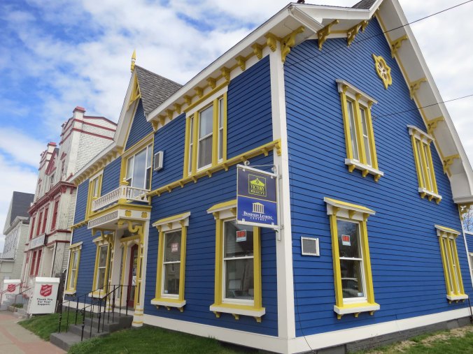
After three months of bicycling, I left the US and entered Canada. This is a photo of the Consulate Building in Yarmouth, Nova Scotia.

After three months of bicycling, I left the US and entered Canada. This is a photo of the Consulate Building in Yarmouth, Nova Scotia.

In my last post, I had arrived in Winchester, Virginia on my 1989 bike trek and decided I needed to make up for some lost time and give myself a break from bicycling by taking the Greyhound bus to Bangor, Maine.

I was lucky to find the Greyhound bus depot, a motel, and a bike shop all within a few blocks of each other in Winchester. The bicycle shop gave me a bike box, which I hauled back to my motel room. I recruited a trashcan newspaper to cover the floor. Motels have little tolerance for bicycle grease (understandably), and I had a bike to dismantle. Handlebars, pedals, seat, and front wheel had to come off.

While spreading the newspaper, a headline caught my attention. Zsa Zsa Gabor had been arrested for slapping a Beverly Hills motorcycle policeman who had stopped the 66-year-old in her $215,000 Rolls Royce. Apparently Jack, as in Jack Daniels, had been involved in the altercation.

I’ve traveled by Greyhound several times in my life, starting as a child. There was a local bus we had used a few times that connected Diamond Springs and Placerville (three miles away). The bus driver’s name was Pat, which I remember because I named a stray dog after him. The dog had been wandering our neighborhood for weeks, catching an occasional jack rabbit or ground squirrel for food. My mother had watched the stray grow thinner and thinner until one day she stopped the family’s well-used car, opened the door, and invited it home for a meal. Since the dog was part greyhound, I promptly named her after the bus driver. Pat was happy with the name, eternally grateful for her food bowl, and became my faithful companion for several years. I am not sure how the bus driver felt about his namesake.

I wish I had taken more notes about my bus trip from Virginia to Maine. Traveling by Greyhound is always an experience. But I was so happy for the break from peddling, I just sat back and watched the scenery fly by. Going uphill faster than five miles per hour seemed almost unreal. I do remember that I had a layover in Washington DC that I used to visit the National Art Gallery. I was lost for several hours among the Van Gogh’s, Picasso’s, Rembrandts, and Dali’s.

I also remember I had a four-hour layover in New York City from 1:00 a.m. to 5:00. Being in any Greyhound station in the middle of the night is memorable. Multiply that by 10 for downtown NYC. I watched in awe as homeless people, hookers, beggars, and, quite possibly, vampires, zombies, and an alien or two claimed the station as their own. I was careful to mind my own business and kept my gear within easy reach. Other than distributing ‘spare change,’ and passing on an offer from a scantily dressed lady, I was left alone to wonder about the nature of my fellow denizens of the night.

Morning found me on my way to Boston, Massachusetts through Connecticut and then through New Hampshire into Maine. Having stayed awake at the NYC bus station, I was in desperate need of a nap, but New England was far too interesting for sleep. Strong coffee helped keep my eyes open for most of the journey. Arriving in Bangor, Maine I quickly found a motel and slept for 12 hours.
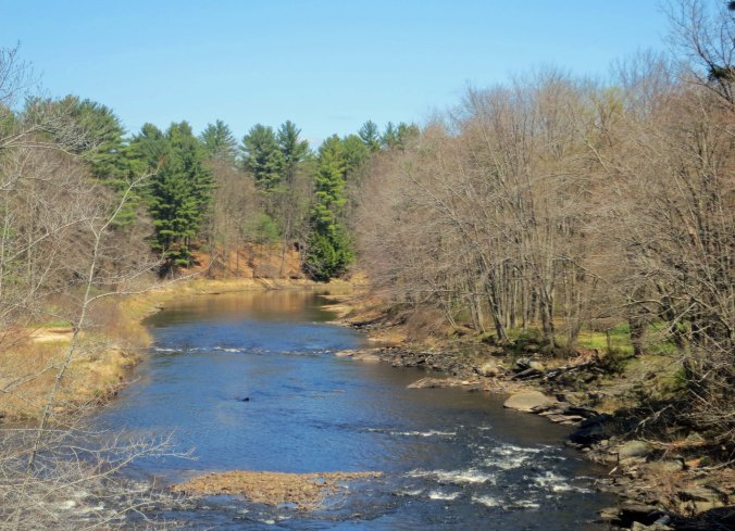
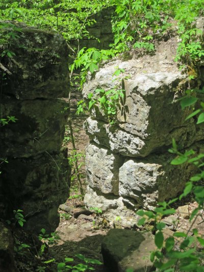
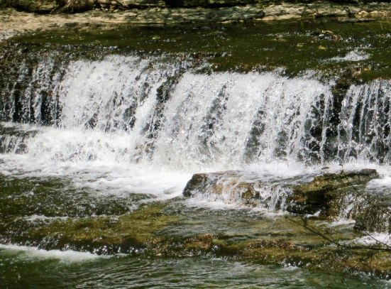
New England has great beauty.

New England has great scenery as demonstrated by this gently flowing stream…
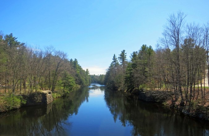
And this dark beauty.
And this dark beauty.

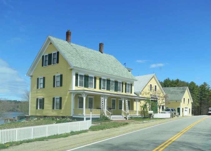
Houses, especially older ones, tend to be big. Imagine yourself cooped up with a large family over winter.

Houses, especially older ones, tend to be big. Imagine yourself cooped up with a large family over winter. These three structures are all connected and are part of the house.
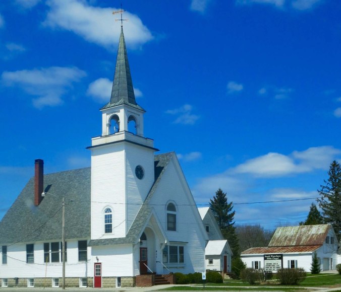
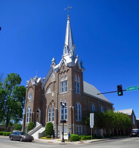
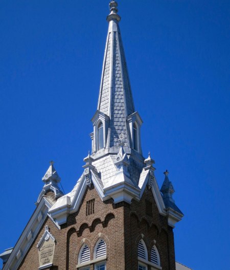
I wonder how many Christmas Cards over the years have featured a New England church like this one surrounded by snow and a small village.
I wonder how many Christmas cards over the years have featured a New England church like this one surrounded by snow and a small village.

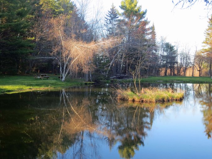
A small pond in Bangor provided me with a reflection shot.

A pond in Bangor provided me with a reflection shot.

I had been in Maine once before. In 1976, my first wife, Jo Ann, and I had taken a year off to travel through the South Pacific and Asia. But first we had bought a VW Camper Van and made a leisurely trip across the US with our Basset Hound, Socrates. My friend Morris had volunteered to keep the dog while we traveled overseas. After dropping Soc off with Morris and his wife Marianna, we had hung around for another week and backpacked on the Appalachian Trail in Maine. I wanted to make sure that Morris and the dog were compatible.

It had been a long week for us with 24/7 rain, muddy trails, black flies, mosquitoes and no-see-ums. It was much easier for Morris and Socrates. They had bonded instantly and apparently had a grand time. Upon our return from the backwoods, we had received a couple of wags from Soc before he returned to drooling over whatever treats Morris was offering him. Food had always been an important factor in determining the dog’s loyalty.

I had thought about Socrates when I woke up from my 12-hours of sleep in Bangor and put my bike back together. Shortly after breakfast, I was on Highway 1 making my way toward Bar Harbor, Maine and Acadia National Park. It was a short trip, hardly longer than 50 miles. I was there by early afternoon and settled into a campground.
You might wonder why I would feature this Dunkin' Donuts sign I found outside of Bangor on the way to Bar Harbor. The reason is I never passed up a donut shop on my trip!

You might wonder why I would feature this Dunkin’ Donuts sign I found outside of Bangor on the way to Bar Harbor. The reason is I never passed up a donut shop on my trip! I’d look like an elephant if I did that now.

I promised myself I would do absolutely nothing for a week while I waited for my friends Jean Snuggs and Lyndell Wilken who were going to bicycle around Nova Scotia with me. It almost worked— and would have except for two things. One, I had a responsibility to catch mosquitos with my hands and squash them before they landed on me and started to suck my blood. Given how numerous and hungry they were, I pursued this responsibility with passion.

Second, I discovered David Eddings’ series of five fantasy books on the Belgariad in a small bookshop a few miles from my camp. I’d picked up the first one and become hooked. I found I could hold a book in my left hand while squashing mosquitos with my right. Needless to say, the days passed quickly and soon Jean and Lyndell had arrived at my campsite, smiling and eager to catch the ferry to Yarmouth, Nova Scotia, which we did. Since our goal was to bike the northern part of the Province, we took a bus into Halifax. The Canadian part of my bicycling adventure was about to begin.
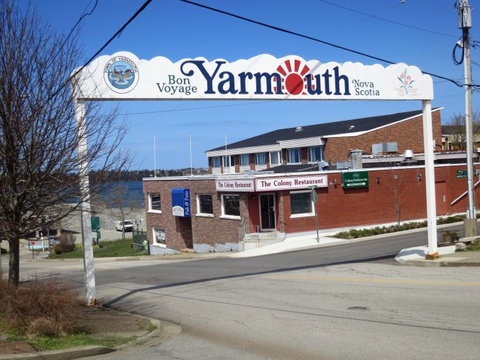
Ferry terminal entry in Yarmouth Nova Scotia.

The entry to the ferry terminal in Yarmouth.

Crab fishing is important off of Nova Scotia and there must be thousands of crab traps such as this in Yarmouth.
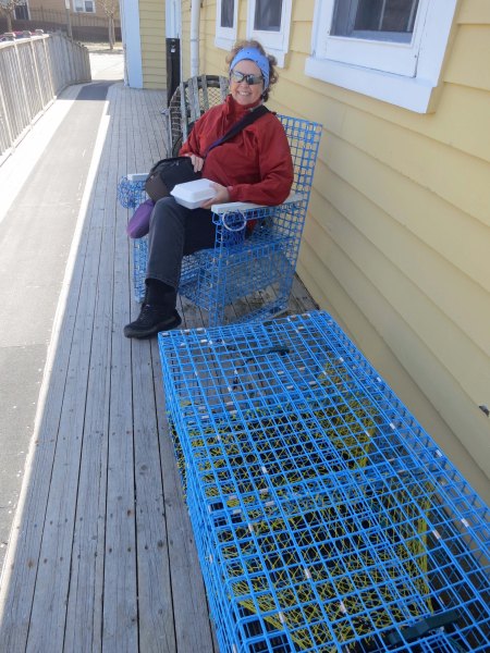
Crab fishing is important off of Nova Scotia and there must be thousands of crab traps such as this in Yarmouth.

Peggy makes herself at home on furniture made out of crab traps next to a restaurant where we had dined on crab.
Peggy makes herself at home on furniture made out of crab traps next to a restaurant where we had dined on crab.

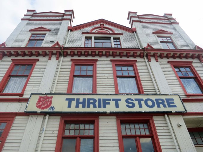
Salvation Army building in Yarmouth, Nova Scotia.

Yarmouth has done a good job of renovating historical buildings. This may be the fanciest Salvation Army Thrift Store I have ever seen. It is next to the Consulate building I featured at the beginning of the post.
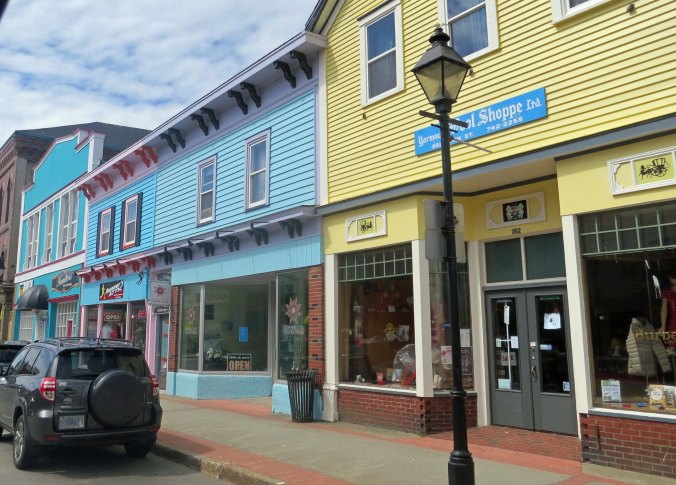
More fun buildings in Yarmouth.

More fun and colorful buildings in Yarmouth.

This mural featured a number of inhabitants in the town.
This mural featured a number of inhabitants in the town.

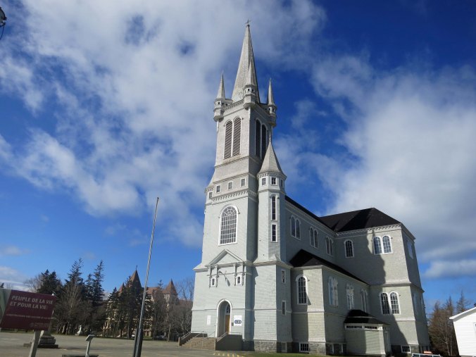
While my bike journey took us southeast toward Halifax, Peggy and I also explored the west coast of Nova Scotia along what is known as the Evangeline Trail. A number of impressive catholic Churches reflect the French Acadian history of the area.

While my bike journey took us southeast toward Halifax, Peggy and I also explored the west coast of Nova Scotia along what is known as the Evangeline Trail. A number of impressive Catholic Churches reflect the French Acadian history of the area. The road, which travels along the Bay of Fundy, noted for its extreme tides, is well worth a side trip.
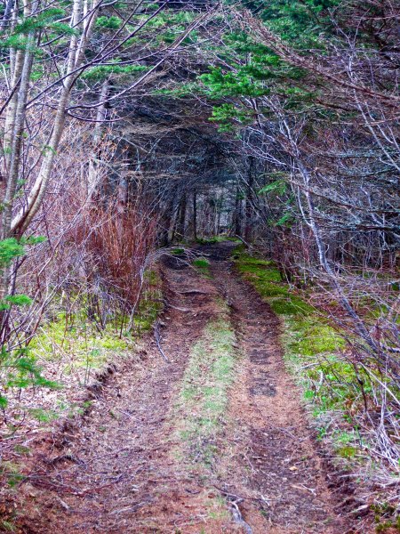
We found this mysterious 'road less traveled' along the Evangeline Trail.

We found this mysterious ‘road less traveled’ along the Evangeline Trail.
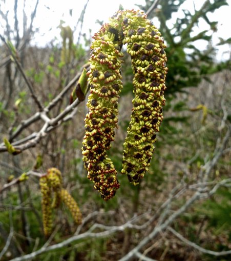
And this impressive Catkin.
And this impressive Catkin.

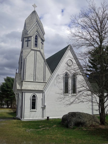
Back on track, following the coast south out of Yarmouth, we came on this unusual Anglican Church, which represented Nova Scotia's English heritage for me.

Back on track, following the coast south out of Yarmouth, we came on this unusual Anglican Church, which represented Nova Scotia’s English heritage for me.
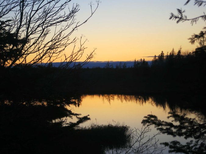
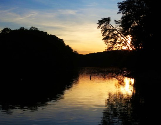
A small lake near Halifax provided a sunset shot...

A small lake near Halifax provided a sunset shot…
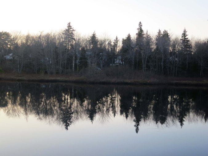
A small lake just west of Halifax provided this reflection shot...

…And a late evening view, which is an appropriate place to end today’s post.

NEXT BLOG: Bicycling north from Halifax toward Cape Breton Island.
 

A Foggy Day in Shenandoah National Park… The 10,000-Mile Bike Trek

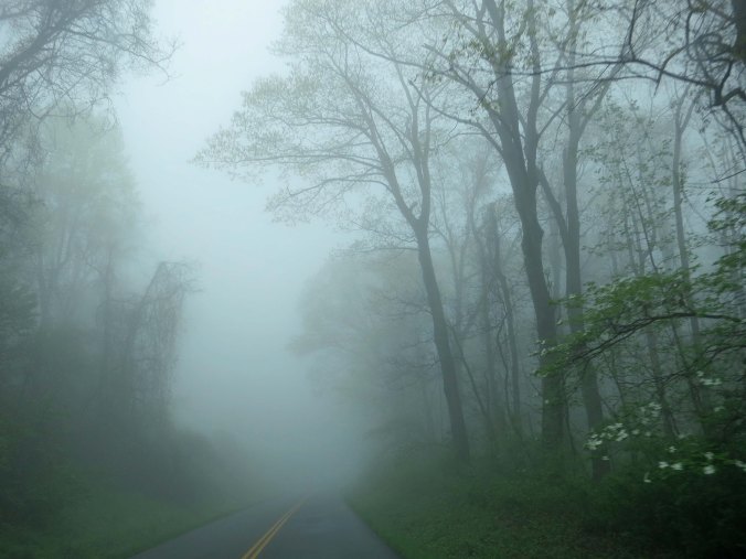
Regulations on the Blue Ridge Parkway and Skyline Drive understandably recommend that bicyclists not travel on foggy days. The fog does present some good photo ops, however.

Regulations on the Blue Ridge Parkway and Skyline Drive understandably recommend that bicyclists not travel on foggy days. The fog does present some good photo ops, however.


“Oh Shenandoah, I long to see you/Away you rolling River/Oh Shenandoah, I long to see you/Away, I’m bound away/Cross the wide Missouri.”

There are songs that you hear as a child that bury themselves deep in your brain and are forever being replayed. Oh Shenandoah was one such song for me. It had a yearning that even my 9-year-old soul understood. I longed to see the Shenandoah River, and return to it— even though I had never been there.

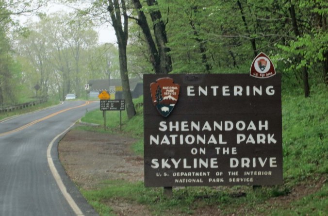
It isn’t surprising then that Shenandoah became my song of the day as I wrapped up my bike tour of the Blue Ridge Parkway and entered Skyline Drive and the Shenandoah National Park. I often sang on my bike. It helped wile away the hours. But this time I sang with the same longing I had felt as a fourth grader.

Peggy and I woke up to a foggy morning on our last day of retracing my bike route along the Blue Ridge Parkway. I was glad I wasn't riding my bike.

Visibility can be a real issue when the fog sets in for bicyclists as well as motorists.

A pine tree stands out in the fog along the Blue Ridge Parkway.

But fog has a way of shrouding everything in mystery.

Skyline Drive provides the same beauty, lack of commercial traffic and slow speed limit as found on the Blue Ridge Parkway, without the severe ups and downs.

Skyline Drive starts where the Blue Ridge Parkway ends when you are riding south to north. It provides the same beauty, lack of commercial traffic, and slow speed limit as found on the Parkway, without as many ups and downs.

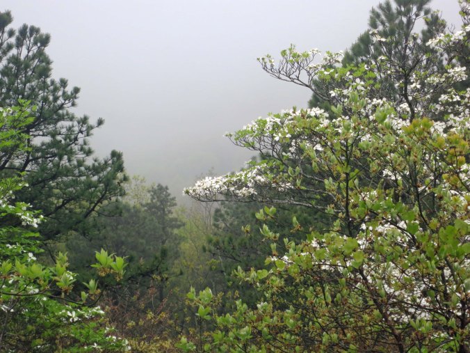
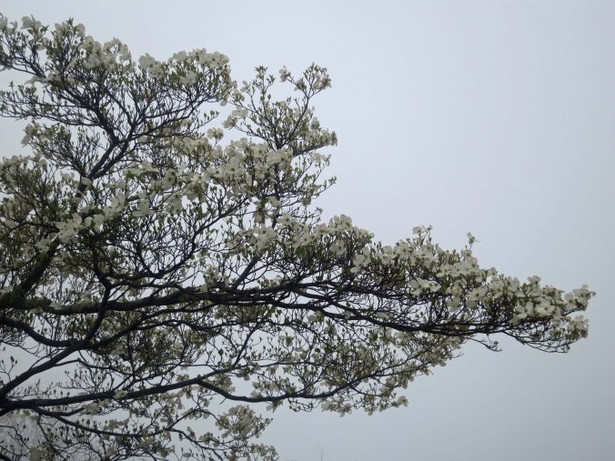
Dogwood in fog along Skyline Drive in Virginia.

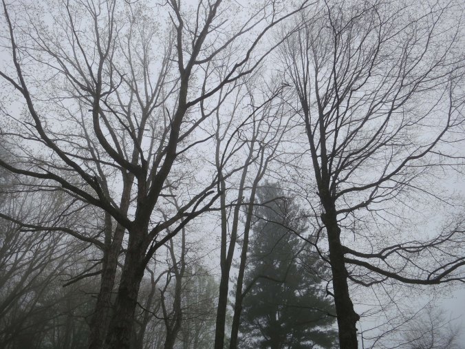
Distant vistas disappear in the fog. The traveller is left with views closer to the road…

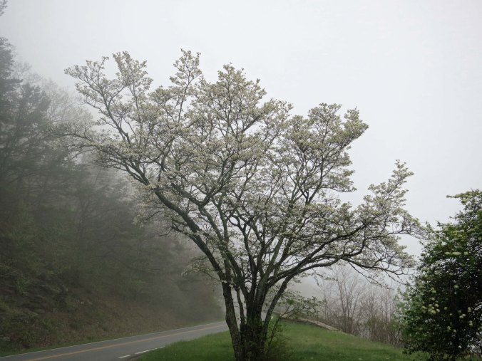
A tree of dogwood blooming along the Skyline Drive in Virginia.

That bring their own beauty…

Trees along the Skyline Drive in Shenandoah National Park.

With a different perspective.

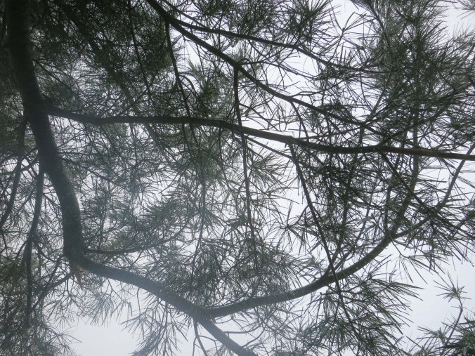
Pine needles provided an interesting pattern in the fog.

The grey backdrop made these pine needles stand out.

Not sure what these flowers were, but I found their green hue appealing.

Fog or not, I always like close-ups. The yellow-green hue of these flowers, and their abundance, caught my attention.

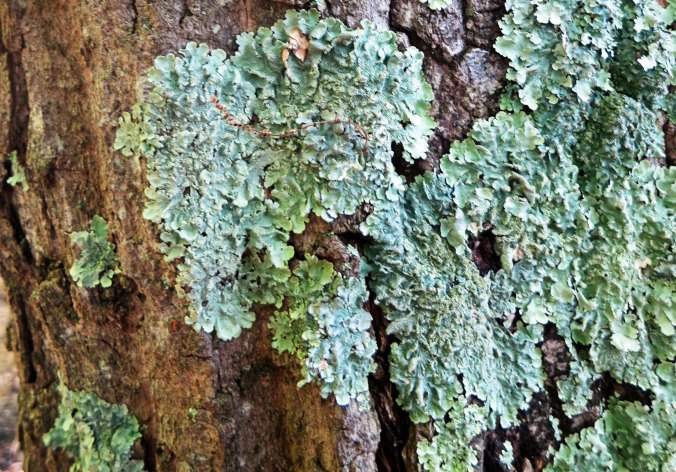
Tree lichens caught the attention of my camera.

Lichens are always worth a closer look..

Riding along the Skyline wasn’t enough for me, however. Oh Shenandoah was about the river and I had to see it! I reached US Highway 33 and made a snap decision. Instead of following Skyline Drive the rest of the way to Front Royal, Virginia, I would turn left and drop down into the Shenandoah Valley where I could sing to the river. And that is what I did. In Elkton, I picked up US 340 and followed it along the south fork of the Shenandoah River to Front Royal.

A cow and her calf welcomed me to the Shenandoah Valley.

Peggy and I followed the same route in our van as we retraced my route. A cow and her calf welcomed us to the Shenandoah Valley.

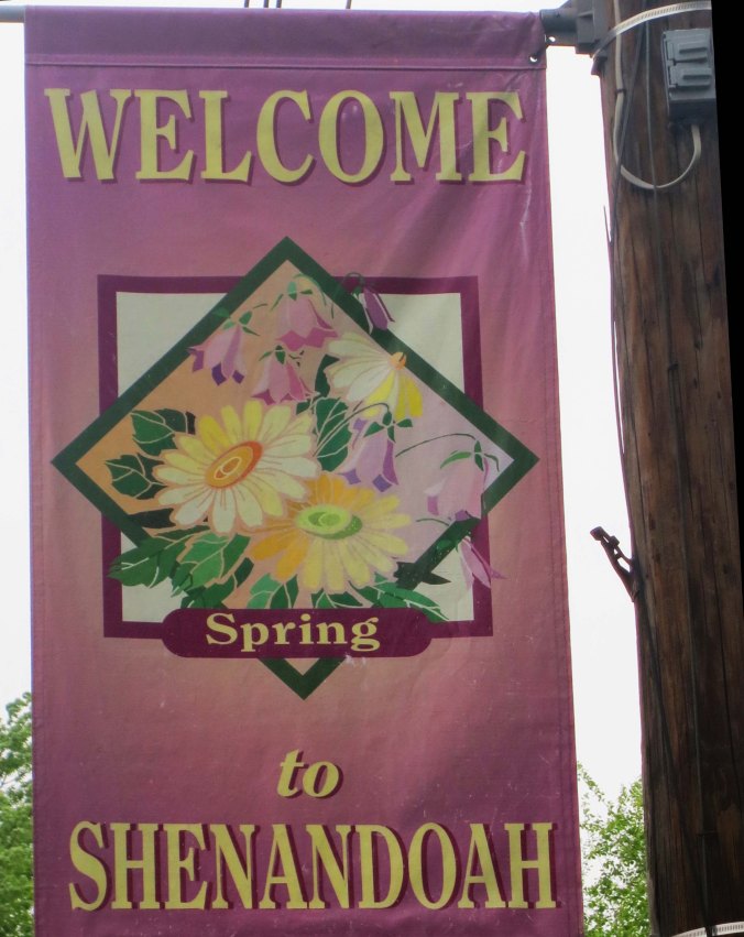
Welcome sign to Shenandoah.

As did this sign.

As this pasture land demonstrates.

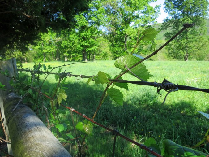
Spring was bursting out all over!

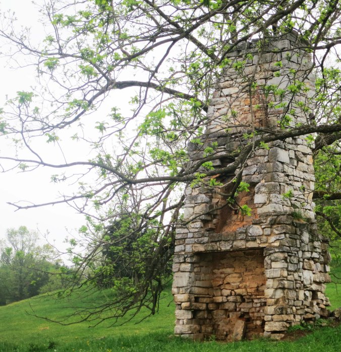
This old fireplace was all that remained of an earlier Shenandoah Valley home.

This old fireplace was all that remained of an earlier Shenandoah Valley home. It isn’t unusual to find fireplaces standing alone, the one thing that wouldn’t burn when pioneers lost their homes to fires. This one would have gone with a large home.

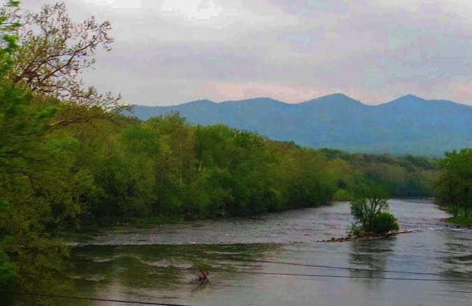
And yes, I did find the Shenandoah River with its mountain backdrop.

And yes, I did find the Shenandoah River with its mountain backdrop.

From Front Royal I biked on to Winchester where a billboard announced I was entering Patsy Cline’s hometown. I had another decision to make, this one more dramatic than my quick decision to check out the Shenandoah River. I had been bicycling for three months and I needed a break. A friend was supposed to meet me in two weeks in Maine and join me in bicycling through Nova Scotia. I could make it, just barely, maybe. But I would have to push hard through urban areas with urban traffic. Finally, I had developed a sore on my inner thigh in Mississippi and a sore on your inner thigh when you are bicycling is not a good thing. It would not go away.

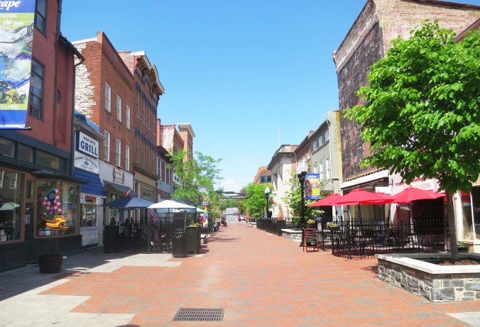
Old Town in Winchester Virginia has bee turned into a pleasant and attractive auto-free zone. Patsy Cline would recognize the buildings.

Old Town in Winchester, Virginia has been turned into a pleasant and attractive auto-free zone. I think that Patsy Cline would like it..

So I decided to become good friends with the Dog. I would take the Greyhound from Winchester up though Washington DC, New York City, Boston and New England to Bangor, Maine. It would drop the total distance of my trip to around 10,000 miles, but I could live with that— and I would have a two-week break.

Next Blog: I make it to Maine and begin my exploration of Nova Scotia.

Things that Go Bump in the Night… The 10,000-Mile Bike Trek

I decided that my title today called for this 'ghost tree' I found along the Parkway. Imagine it at night with a full moon behind it and a black cat sitting on the lower branch.

I decided that my title today called for this ‘ghost tree’ I found along the Parkway. Imagine the tree at night with a full moon behind it and a black cat sitting on the lower branch.


From ghoulies and ghosties / And long-legged beasties / And things that go bump in the night, / Good Lord, deliver us! —An old Scottish Prayer

Having spent a considerable amount of time out in the woods at night, including a fair amount by myself, I’ve had my share of nighttime encounters. To say they can be disconcerting is understatement at its best. Even a cow walking through your camp can send your heart racing when you wake up from a deep sleep.

I’ve written about some of my encounters before. Why not? They make great blog material. For example, there was the time I found myself nervously loading a 357-magnum pistol because I had heard a loud bang outside my tent. A doctor friend had insisted I carry his gun in backcountry Alaska. I was damned lucky I didn’t shoot myself in the foot. I was amused (or was that embarrassed) to discover it was only a beaver that had slapped its tail against the water. He had discovered me in his territory and was protesting.

And then there was the time I woke up with a bear standing on me, his snout inches away from mine. I screamed. So much for being manly. Truth is, the smallest twig cracking out in the dark night can lead brave souls to become hyper-alert, or maybe just hyper.

Camping out in the woods away from established campgrounds on my bike trip added another level of concern, being faced with the most dangerous animal of all— the two-legged type. I’ll take a bear anytime. Breaking twigs in the night become even more menacing. As I mentioned before, I was always careful to select a place where I was hidden from the road, or any other human observation, as far as that goes.

The Blue Ridge Parkway has a policy on not camping outside of designated campgrounds. For the most part this isn’t a problem, but I had decided to have my bike tuned in Asheville and didn’t get out of the town until late in the afternoon. (Having learned my lesson on dark tunnels, I had also bought a new bike light.) A considerable hill outside of Asheville had slowed me down, and the sun had started to slip behind a mountain.

Being tired and a bit grumpy, I decided a couple of hours of bicycling were sufficient. So I pulled off the road and went looking for a flat spot in the steep terrain, one that wouldn’t have me rolling down hill all night. Eventually I found a place that was only slightly askew. There was just enough room for my tent. Blue, my bike, had to be satisfied with leaning against a tree. Tossing and turning because a rock insisted on poking me in the back, it took a while to fall asleep.

Having crested one long climb with an even longer one ahead, I decided to camp out in the woods. The steep terrain made finding a flat spot difficult.

Having crested one long climb with an even longer one ahead, I decided to camp out in the woods. Finding a flat spot other than the road was the challenge.

I woke up to someone/thing stamping outside my tent. Make that several things. I am sure you can see where this might be a bit alarming. I lay there wondering whether I should jump out of my tent or pretend that no one was home. Sometimes ignored problems go away. Sometimes they don’t. I had decided on the latter course when the problem started hissing. Stamping is one thing; hissing is another. Had the Appalachian ghosts of Tom Dooley and his mistresses come to haunt me?

This sign along the Parkway describes the origin of the Kingston Trio Song, "Hang Down Your Head Tom Dooley."

This sign along the Parkway describes the origin of the Kingston Trio Song, “Hang Down Your Head Tom Dooley.” Their song was the PG version, however. Tom was living with a much older guy who had a younger wife. With mutual consent from all parties, Tom started sleeping with the wife. When a cousin of the wife showed up, he added her to the mix, often at the same time. Another cousin appeared on the scene and Tom once more sacrificed himself for the good of all. She brought syphilis into the mix, however. Eventually, one of the cousins killed another one with Tom’s help. Being a gentleman, Tom confessed to the murder and she went free. Tom was hung. At least I think that’s how it went. I became distracted with the appearance of the first cousin. Undoubtedly, the event left some ghosts hanging around.

This was the point where I started wishing my backpacking flashlight had a ton more of candle power. I unzipped my tent and pointed the dim light up the hill where several large things went crashing off into the brush. There’s a point here. It is always better to have large things crashing away from you instead of toward you, even more so on a dark night. Anyway, I recognized the thump, thump, thump as they disappeared. A herd of several deer had discovered my hiding place, and like the beaver, been surprised and irritated. I had simply never heard deer do their stamping and hissing routine before. (I have since.)

I went back to sleep, woke up refreshed (sort of), and resumed my journey. Today’s blog photos along the Blue Ridge Parkway will take you from Asheville to Little Glade Mill Pond, a distance of approximately 170 miles. Enjoy.

The ultra modern Park Headquarters in Asheville includes all of the latest environmental friendly designs, including plants growing on the roof.

The ultra modern Park Headquarters in Asheville includes all of the latest environmental friendly designs, including plants growing on the roof.

Bike sculpture in Blue Ridge Park Headquarters, Asheville, North Carolina.

I enjoyed the bike sculpture at the headquarters.

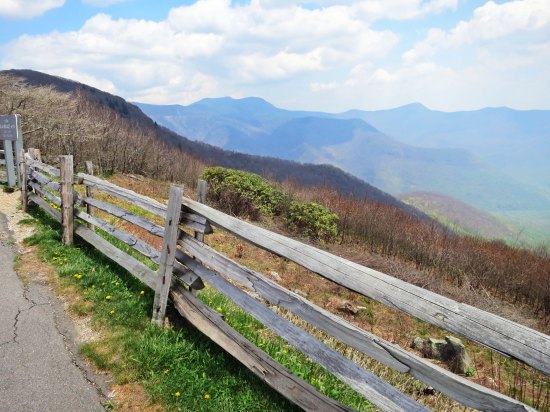
My first stop the next day was at the Craggy Garden's Visitor's Center. It's high location provided a great scenic view of the Black Mountains. The fence was a plus.

My first stop the next day was at the Craggy Garden’s Visitor’s Center. Its high location provided a scenic view of the Black Mountains. The fence was a plus.When I bicycled through the area in June of 1989, the area was covered with blooming Rhododendrons. Peggy and I were too early for the display on our redrive of the route this spring.

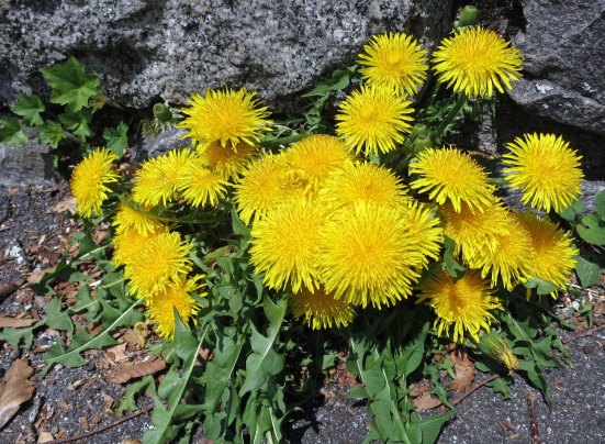
Dandelions had no problem with spring. Peggy and I found them happily blooming away throughout our trip.

Dandelions had no problems with spring. They were happily blooming away throughout our trip.

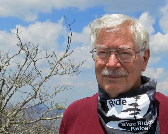
Peggy insisted on buying me a neckerchief at the Visitor's Center, which featured biking the Parkway.

Peggy insisted on buying me a neckerchief at the Visitor’s Center. It featured biking the Parkway. Like the bushy look? I was honoring my bike trek where I had three haircuts in six months.

One of numerous tunnels along the Parkway. I found the stone work quite beautiful. Sone masons from Europe were brought in during the 1930s to help.

One of numerous tunnels along the Parkway. I found the stone work quite appealing. Stone masons from Europe were brought in during the 1930s to help.

This is the twin to the tree I featured at the beginning of the blog.

This is the twin to the tree I featured at the beginning of the blog. It was actually standing next to the other tree.

Dogwood is another plant that enjoys spring and was blooming in profusion all the way along the Parkway.

Dogwood is another plant that enjoys spring and was blooming in profusion all the way along the Parkway.

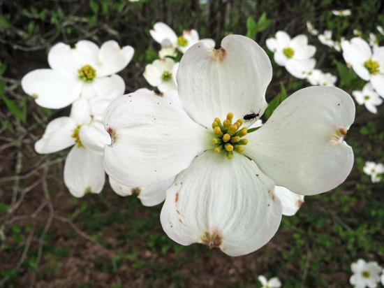
A close up of the dogwood.

A close up of the dogwood complete with beetle.

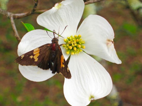
Dogwood on Blue Ridge Parkway with butterfly.

And a  butterfly.

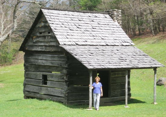
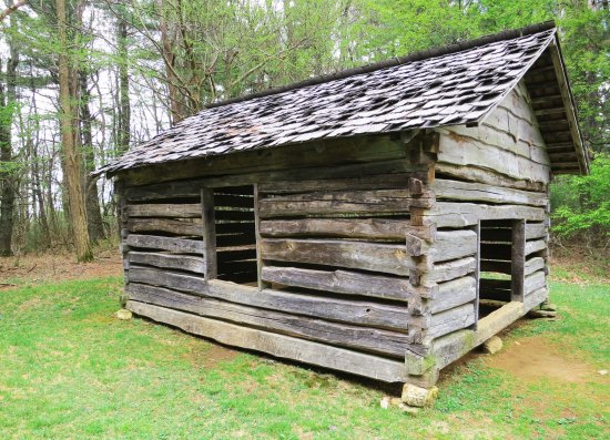
Jesse Brown's cabin on the Blue Ridge Parkway.

Peggy provides perspective on Jesse Brown’s pioneer cabin.

Cool Spring's Batist Church on the Blue Ridge Parkway.

The Cool Spring’s Baptist Church was next door to Jesse Brown’s cabin. Usually, services were held outdoors. There wasn’t much difference.

And the cool spring.

And the cool spring. The wooden channel carries water into the spring house.

I doubt the early pioneers would have seen this Scottish cow in the mountains.

I doubt the early pioneers would have seen this Scottish bull in the mountains.

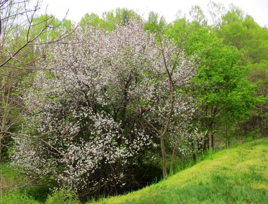
Apple tree on the Blue Ridge Parkway.

Apple trees, on the other hand, were quite common. Hard cider was a pioneer staple.

Farm on Blue Ridge Parkway.

Farm lands add as much to the beauty to the Parkway as forests and mountains.

Little Glade Mill Pond on the Blue Ridge Highway.

Little Glade Mill Pond provides a great lunch stop. While Peggy whipped up sandwiches, I hiked around the pond.

Reflection shot on Little Glade Mill Pond on the Blue Ridge Parkway.

Naturally, I had to focus on the reflection shots. Our van is off to the right. Lunch is being prepared! Breakfast is my responsibility.

I'll complete today's post with this final shot of Little Glade Mill Pond. Next Blog: We'll continue out journey along the beautiful Blue Ridge Parkway.

I’ll complete today’s post with this final shot of Little Glade Mill Pond. Next Blog: We’ll continue out journey along the beautiful Blue Ridge Parkway.


Bicycling across Great Smoky Mountains National Park… The 10,000-Mile Bike Trek

Great Smoky Mountains National Park waterfall in North Carolina.

In addition to its tree covered mountains, the Great Smoky Mountains National Park is noted for its beautiful waterfalls. Peggy and I found this little beauty next to the road on the east side of the Park.


HAPPY 100th BIRTHDAY TO AMERICA’S NATIONAL PARKS

I can’t imagine a future without wild places for our children, grandchildren and future generations to love and explore. Preserving our wilderness areas and the diversity of life on earth are two of the most important responsibilities we have as humans.

A few years ago, Peggy and I took time off to visit America’s National Parks from Alaska to Florida. It was an incredible trip. The beauty and variety of landscapes, plants and animals found in these parks are a gift of incalculable value. As are all the wild places set aside by other countries.

Given that this week is America’s 100th Anniversary of its National Park system, it seems appropriate that I am writing today about my bike ride through (make that up and over) Great Smoky National Park. (And yes, smoky is how it is spelled.) With over nine million visitors this past year, it is America’s most visited park.

First, of course, I had to get there. In the last post about my bike tour of North America, I was in Dayton, Tennessee checking out the courthouse where the Scopes’ trial took place. I left there continuing to follow Route 30 east as it made its steep, winding way up and over ridges of the Cumberland Plateau. In Athens, Tennessee, I picked up an even smaller road, Route 39, that carried me over another ridge into the small community of Englewood.

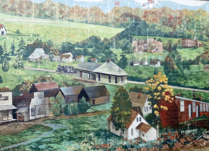
Mural depicting the historic town of Englewood in eastern Tennessee.

This mural of historic Englewood is prominently featured on the side of a building entering town.

From here, it was time to make my way north over the relatively flat Highway 411 to Maryville. Bucolic countryside, Mennonite farms, a humorous Spit and Whittle Club, and the Little Tennessee River provided pleasant distractions from the work of bicycling. As I left Maryville on Highway 321 going toward Pigeon Ford, the countryside shifted dramatically, providing scenic views of the Smokies. The road from Pigeon Ford to Gatlinburg, Highway 441, was all about separating tourists from their dollars. I’ve rarely seen such a concentration of “tourist attractions.” Today, there are eight different Ripley’s venues alone— “believe it or not!”

This Mennonite farmer was apparently out enjoying his/her farm.

This Mennonite farmer was apparently out enjoying his/her farm since I didn’t see any work going on.

Spit and Whittle Clubs, sometimes know as Liar's Clubs, can be found throughout the US. In general, their members are story tellers who focus on 'tall tales.' I expect that this is one of their most unusual club houses!

Spit and Whittle Clubs, sometimes know as Liar’s Clubs, can be found throughout the US. In general, their members are story tellers who focus on ‘tall tales.’ I expect that this is one of their most unusual club houses!

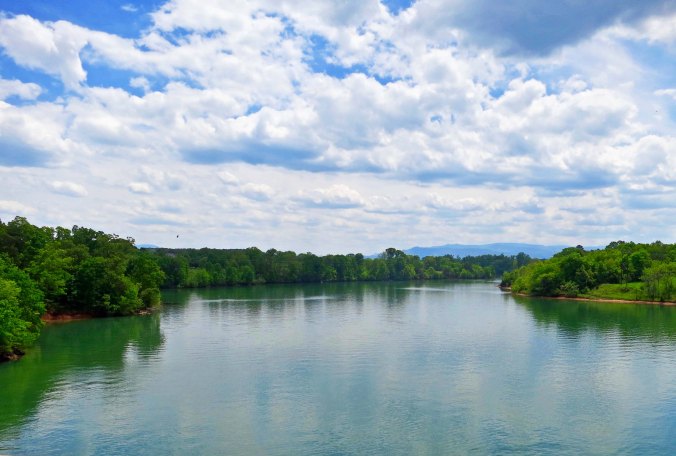
Little Tennessee River flowing through eastern Tennessee.

Highway 411 took me across the Little Tennessee River, which didn’t seem so little to me.

The Great Smoky Mountains can be seen in the distance as you leave Maryville, Tennessee on Highway 312.

The Great Smoky Mountains can be seen in the distance as you leave Maryville, Tennessee on Highway 321.

I spent the night in Gatlinburg, not because I wanted to sample the attractions, but because I wanted to develop the proper mental attitude I would need for climbing 4000 feet in the morning to Newfound Gap at 5046 feet (1538 meters). Two beers and a steak just about did it.

The Smokies, as they are often called, received their name from a blue haze early pioneers found hovering over the mountains. It wasn’t actually caused by smoke, however, it was caused by plant respiration (breathing, so to speak). The park is part of the Appalachian Mountains, an ancient range going back some 250-300 million years. (Some rocks in the area date back over a billion years.) Compare that with the Rocky Mountains at 80-85 million years and the Sierra Nevada Mountains, a mere baby at 40 million. Once, the Smokies reached for the sky like their younger western cousins; now they are old and worn down. This doesn’t make them less steep; ask any hiker or biker who wanders through them. Nor does it make them any less beautiful.

The 17-mile trip up to the Gap was, as I expected, a workout. People shouted encouragement from their cars on some of the steeper parts. I grunted in return. At one stop a little kid looked at me wide-eyed. “Are you really bicycling to the top?” “Sure,” I replied. “It’s fun. Maybe you will do it some day.” “Maybe not,” he responded. I passed the Appalachian Trail and thought of the hikers making their way north on a journey far different from mine but similar in its challenge. And I entered North Carolina, leaving Tennessee behind. After a leisurely lunch on top, it was time to zoom down the mountain, a thrill I had earned. Following are some photos that I took when Peggy and I redrove the route though the Great Smoky Mountain National Park this spring.

View of Great Smokey Mountains National Park in Tennessee.

Peggy and I drove across the Smokies a month earlier than  when I biked across them in 1989. A number of trees had yet to leaf out.

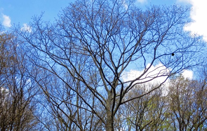
Tree in Great Smoky Mountains National Park in early spring.

By June this tree would be dressed in green. I am not sure who the round nest on the right belongs to. Or if it is even a nest.

I liked this canyon view.

I liked this canyon view.

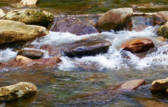
This stream kept me company as I biked up the mountain.

This stream kept me company as I biked up the mountain. At one point I had stopped and dangled my toes in its refreshing water.

Because the road over the mountain is so steep and filled with traffic, the National Park recommends that people not bicycle on it.

Because the road over the mountain is so steep and filled with traffic, the park recommends that people not bicycle on it. Naturally, I caught a section of the road that was car free and had a decent shoulder.

Waterfall in Great Smoky Mountain National Park in North Carolina.

This small waterfall was part of the same stream I placed at the top of the post.

I flew past the turn off that marks the southern beginning of the Blue Ridge Highway and into Cherokee, headquarters for the Eastern Band of the Cherokee Nation. I remember two things about my 1989 stop in Cherokee. One was that the town seemed economically depressed. The second was a bear in a cage. I felt sorry for it. The Smokies are known for having the largest concentration of black bears in the East. The caged bear would have been much happier running around in the woods with them.

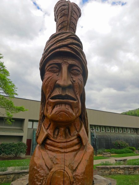
The town seems much healthier now, largely thanks to the Harrah’s-Cherokee Hotel and Casino. It draws several million visitors (and their money) into Cherokee annually. As for the bear, I didn’t see it. Instead, brightly painted bear sculptures were found throughout the community representing, for the most part, Cherokee themes. A large, carved wooden sculpture of a Cherokee stands in front of the community’s administrative center. Three tears are streaming down his face— a memorial to the Trail of Tears where the Cherokee were forced off their homeland and marched to Oklahoma so white settlers could take their property.

Wood sculpture of a crying Cherokee representing the Trail of Tears in Cherokee, North Carolina.

The wood sculpture of a crying Cherokee.

Bear sculpture located in Cherokee, North Carolina.

This bear featured a scenic painting with an elk and an eagle or hawk.

I found this scene on another bear, representing the region in historic times

I found this scene on another bear, representing the region in earlier times.

Bear sculpture painted to resemble eagle in Cherokee, North Carolina.

Another rendition of a bald eagle. I liked how the artist turned the nose of the bear into the beak of the eagle. An eagle shaman dances on the rear hindquarters.

Bear sculpture in Cherokee, North Carolina

This bear was decorated with symbols you might expect to find on Native American rock art.

Bear sculpture in Cherokee, North Carolina smoking pie and dressed like an artist.

And, for my final photo today, a little humor.

NEXT BLOG: I ride back up the road from Cherokee to the Blue Ridge Highway entrance and begin my journey north toward Maine and Nova Scotia.

The Scopes Trial, a BIG dog, and a Speeding Semi… The 10,000 Mile Bike Trek

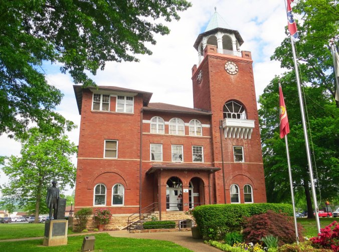
In 1925, William Jennings Bryan debated with Clarence Darrow in this courthouse over whether evolution should be taught in Tennessee schools.

The Dayton, Tennessee Courthouse where the Scopes Trial took place in 1925.

I had left Spencer and was heading for Pikeville on Highway 30 when the dog came roaring out to eat me. He was a big dog, a really BIG, ugly dog. His daddy must have been a Bullmastiff and his mommy a Rottweiler. And I am sure that he had experienced an unhappy puppyhood. I was about to drop down a steep hill; thirty feet farther and I could have cranked down on my pedals and been gone. As it was, I leapt off my bike and grabbed my air pump, careful to keep my bike between the monster and me. “No, bad dog!” I yelled. He growled. I reached down and grabbed a large rock. Usually this is a sign for the dog to exit the scene. All he did was snarl deep snarls and creep forward, salivating, ready to pounce. Oh boy, I thought, this is it.

And then fate intervened. It was almost enough to make me change my ideas about God. A bee landed on his nose and stung him. Or maybe it was a large horsefly that bit him. Whatever it was, I was on my bike and out of there faster than he could fall to the ground and start pawing at his abused snout. Had he been a cheetah, he might have caught me. But I doubt it.

The dog would have had to run very fast to catch me.

The dog would have had to run very fast to catch me.

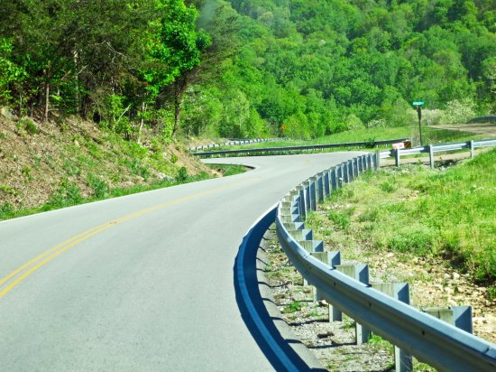
Highway 30 in eastern Tennessee runs in an east-west direction and cuts across the Cumberland Plateau.

Highway 30 at a more leisurely pace.

Another view.

Another view.

I forgave the dog. It was up to his owner to keep him leashed or in his yard. And I suspect he had been trained to behave as he did. I wasn’t so forgiving of the truck driver that gave me flying lessons.

I had been daydreaming and taken a wrong turn out of Pikeville. Discovering my mistake, I had turned around and was happily contemplating a hamburger. That’s when the 18-wheeler came up behind me going about 60.  A car was coming from the other direction. The truck driver didn’t even slow down. He flew by inches away. The turbulence from the rear of the truck literally raised my bike and me three feet off of the ground. I landed hard. How I managed to stay upright, I don’t know. The only damage was two flats. It could have been ever so worse. A kind, Tennessee driver stopped to make sure I was okay. The trucker just kept on trucking.

I made it into Dayton without any further incidents. It’s a pretty town that borders on the Tennessee River. The Scopes Trial is its claim to fame. The event started as a publicity stunt.

Dayton is next to the Tennessee River. After crossing it in Alabama on the Natchez Trace, I had returned to it.

Dayton is next to the Tennessee River. After crossing it in Alabama on the Natchez Trace, I had returned to it.

The Tennessee River flows by Dayton, TN where the 1925 Scopes Trail took place.

I liked this view of it with the sun captured in the trees.

Sunset on the Tennessee River near Dayton in eastern Tennessee.

And at sunset.

In 1925, the State of Tennessee had passed a law that outlawed teaching evolution in public schools. The American Civil Liberties Union (ACLU) had responded by offering to support anyone who would challenge the law. Some business people in Dayton, meeting over coffee at the local drug store, had decided that jumping into the fray would give their community some much-needed publicity and improve its stagnant economy. They recruited a substitute science teacher, John Scopes, to claim he had taught evolution in the local high school. (Scopes actually didn’t remember whether he had or not.) He was duly arrested and the circus came to town.

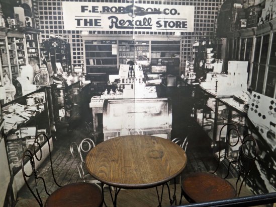
The actual table where the business leaders of Dayton plotted out the steps that would lead to the Scopes Trial. The background photograph is of Robinson's drug store where they met with John Scopes.

The actual table where the business leaders of Dayton plotted out the steps that would lead to the Scopes Trial. The background photograph is of Robinson’s drug store where they met. This display is included in an excellent small museum in the basement of the courthouse.

William Jennings Bryan arrived for the prosecution. He was a populist who had run for President (unsuccessfully) three times on the Democratic ticket and was considered the best orator in the US. He had fought against big banks and big corporations. You may be familiar with his most famous quote: “You shall not crucify mankind on a cross of gold.” He supported women getting the right to vote. He was also a devout Christian who favored prohibition and fervently believed that humans had jumped from clay and ribs to who we are— without any messy steps between. The World’s Christian Fundamentals Association sponsored him.

Another view of the Rhea County Courthouse in Dayton. A state of William Jennings Bryan is located in front. A debate is going on in the community now over whether to add a statue of Clarence Darrow.

Another view of the Rhea County Courthouse in Dayton. A statue of William Jennings Bryan is located in front. A debate is going on in the community now over whether to add a statue of Clarence Darrow, who argued on behalf of evolution.

The architect who planned the Rhea County Courthouse where the Scopes trial took place designed the windows to look like crosses.

A guard at the courthouse was quite proud to show us that the architect of the building had incorporated windows that look like crosses, reflecting the Christian influence of the time.

Clarence Darrow came to defend John Scopes and the cause of teaching evolution in schools on behalf of the ACLU. He shared many of Bryan’s beliefs. He was a populist and Democrat who devoted his life to defending those he considered underdogs. He represented labor interests and became known as one of the best criminal defense lawyers ever. He passionately opposed the death penalty. His religious views were that of an agnostic, believing that we cannot know for sure whether God exists, and, if so, what his (or her) true nature is.

Media came from around the world to witness this colossal battle between science and religion, as did every huckster for hundreds of miles around. The Baltimore Sun sent its nationally renowned reporter, H.L. Mencken, to report on the event. Mencken was noted for his sharp tongue, cynicism, and biting humor. He had coined the phrase ‘Bible Belt’ and had immediately dubbed the Scopes Trial the ‘monkey trial.’ He described the prosecution and jury as “unanimously hot for Genesis.” It was Mencken who had encouraged Darrow to participate.

For all of the hoopla, little was decided by the trial. The judge, a man with fundamentalist beliefs, suppressed any evidence on behalf of evolution. The jury was only allowed to consider whether Scopes was guilty of breaking Tennessee law, which he had according to his own testimony. He was found guilty and fined $100. (The charge and fine were later dropped on a technicality.)

The issue obviously didn’t go away. Millions of words have been written about the trial. It was recreated in the 1960 movie, Inherit the Wind, starring Spencer Tracy.  Tennessee didn’t remove the statute barring evolution from being taught until 1967.

Today, fundamentalists argue that evolution should be taught in US schools only as a theory with “intelligent design” being given equal billing. Teachers, principals, school boards and state legislatures continue to be pressured to bring the Bible back into the classroom. I’ve told the story before how a parent walked into Peggy’s office when she was principal of an elementary school and demanded that all books on dinosaurs in the school library be removed because dinosaurs weren’t in the Bible. She had told the man that he had the right to remove his son from the school, but the books were staying. If the son stayed, he was going to learn about dinosaurs.

Dayton is still reaping the benefits of the trial. It has rebuilt the courtroom where the Scopes Trial took place to look exactly like it did in 1925. Once a year it has a pageant that relives the trial. Peggy and I made a point of visiting the courthouse on our route review.

The stairway up to the courtroom where the Scopes Trial took place in Dayton, Tennessee in 1925.

Clarence Darrow, William Jennings Bryan, John Scopes and everyone else involved in the trial would have walked up these elegant steps.

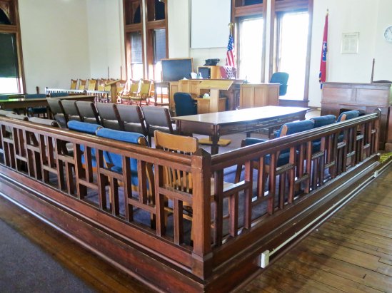
An exact recreation of the courtroom in Dayton, Tennessee where the scopes trial was held.

The actual courtroom as it has been recreated.

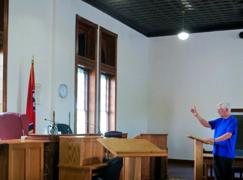
Given that I am 96% great ape, genetically speaking, I take the stand as Clarence Darrow. (grin)

Given that I am 96% great ape, genetically speaking, I take the stand as Clarence Darrow. (grin) The ghostly judge objected to my attire and opinions.

NEXT BLOG: It’s up and over the Great Smokey Mountains and into Cherokee, North Carolina where bears roam the streets! (Sort of.)


Man or Monkey? The Scopes Trial: Part I… The 10,000 Mile Bicycle Trek

Monkey photo from the Scopes' Monkey Trial museum at the courthouse in Dayton, Tennessee.

Speaking into an old-fashioned microphone, a monkey reports on the Scopes 1925 trial on teaching evolution in Dayton, Tennessee. I found this photo in the museum of the courthouse where the trial took place.

My father once told me that the world was 6,000 years old and that evolution was “a bunch of hooey.” Those were his exact words. He hadn’t always thought this way, but he was in his mid-80’s and the Pearly Gates were beckoning. His occasional reading of the Bible had turned into a full-time passion. He didn’t acquire this viewpoint from the Bible, however. He got it direct— from a radio preacher, a man he regularly sent generous donations to from his meager social security income.

I thought of this as I bicycled up the steep ridges of the Cumberland Plateau and passed by rocks that dated back 500 million years. And I thought about it even more as I biked on toward the town of Dayton, Tennessee. Dayton was the site of the famous Scopes Trial where William Jennings Bryan and Clarence Darrow had gone toe to toe in 1925 over whether evolution could be taught in the public schools of Tennessee. The trial turned out to be a media circus, a first-rate dog and pony show, or, maybe I should say, a man and monkey show. Trained chimpanzees performed on the courthouse lawn.

The rocks along Tennessee Highway 30 as it climbs up on to the Cumberland Plateau in Tennessee are 500 million years old, or 6000 if you accept the Bible account.

The rocks along Tennessee Highway 30 as it climbs up on to the Cumberland Plateau in Tennessee are 500 million years old, or 6,000 if you accept the Bible account.

I started this particular section of my journey through Tennessee at Old Stone Fort State Park near Manchester. It’s a delightful place perched between deep gorges carved out by the Duck and Little Duck Rivers. Indigenous people in the area took advantage of its location to build what archeologists think was a ceremonial center over 1500 years ago. In the early 1800s, Americans discovered that the quick flowing Duck River was ideal for running water-powered mills. A gun powder mill was operated at the location during the Civil War to supply Confederate armies, until Union Troops destroyed it.

Old Stone Fort Park outside of Manchester, Tennessee.

All that remains of the 1500 plus year old Native American ceremonial center at Old Stone Fort Park is this peaceful meadow.

Indigenous people built an earthen wall around their ceremonial center that came to be known as the Old Stone Fort State Park near Manchester, Tennessee.

An ancient earthen wall, seen on the left, surrounds the ceremonial center. Visitors are invited to stroll along this pleasant wooded path around Old Stone Fort.

Dugout canoe at Old Stone Fort State Park near Manchester, TN.

Peggy checks out a replica of a dugout canoe that Native Americans would have used in the region. Fire was used to hollow out these canoes.

All that remains of a water driven paper mill at Old Stone Fort. The mill supplied paper for a number of Southern Newspapers,

All that remains of a water-driven mill at Old Stone Fort. The mill supplied paper for a number of Southern newspapers.

The interesting history of the park is matched by its beauty. Multiple waterfalls are created as the rapidly descending Duck and Little Duck Rivers cascade over ledges made of limestone.

Waterfall on Duck River at Old Stone Fort State Park near Manchester, Tennessee.

One of several beautiful waterfalls found on the Duck River of Tennessee as it flows through Old Stone Fort State Park.

Old Stone Fort State Park waterfall on Duck River in Tennessee.

Another.

Waterfall flowing off of a limestone ledge at Old Stone State Park in Tennessee.

And another.

I was reluctant to leave, but the open road called. I followed Tennessee State Route 55 out of Manchester and on toward McMinnville. For those of you into music, Manchester is the site of the Bonnaroo Music and Arts Festival, which attracts tens of thousands of fans annually. It is like a modern-day Woodstock or, if you will, a musical Burning Man. Attendees camp out for four days on a 700-acre farm.

The ride into McMinnville was relative easy in terms of terrain. This was about to change. In McMinnville, I picked up Highway 30. A look at a map of eastern Tennessee will show that most roads in the region follow a north-south direction. There’s a reason. Fast flowing rivers running south off of the Cumberland Plateau have cut deep valleys, leaving behind high, steep ridges. It’s a lot easier to build roads following the river valleys than it is to scramble up and over the ridges.

McMinnville is an attractive town which includes, among other things, this striking Methodist Church built in the 1800s.

McMinnville is an attractive town which includes, among other things, this striking Methodist Church built in the 1800s.

Steeple of Methodist Church found in McMinnville, Tennessee.

I was particularly impressed with the steeple. It would be fun to check out the view from the upper windows.

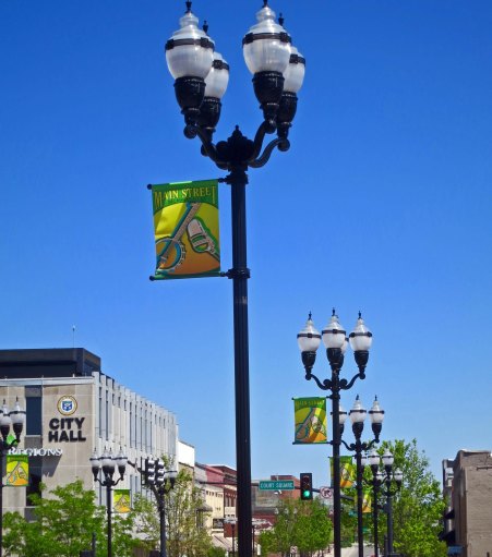
Street lamps decorate the main street of McMinnville, Tennessee.

These street lamps added a feel of authenticity to McMinnville’s Main Street running through the revitalized historic section of town.

Peggy and I found this shop in McMinnville and I had to post it: A music store that sells ice cream and guns!

Peggy and I found this shop in McMinnville and I had to post a photo: A music store that sells ice cream and guns! What can I say…

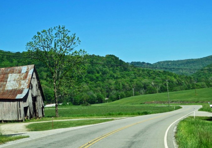
Highway 30 follows the scramble route; it runs east and west. I was about to climb on a roller coaster: 1000 feet up, 1000 feet down, 1000 feet up, 1000 feet down. And these were serious ups or downs, as I quickly discovered a few miles out of McMinnville when I started a switchback ascent to the small town of Spencer.

An old building along Highway 30 in Tennessee.

Highway 30 outside of McMinnville going east provided a hint that I was entering the hilly terrain of the Cumberland Plateau. Here I was dropping into a creek canyon. I would soon be climbing toward Spencer.

An old barn along highway 30 outside of McMinnville, Tennessee.

An old barn I found along the highway.

Although this was from a recent election, I found it interesting. Long before billboards lined the highways of America, advertising was done on old barns.

Although this was from a recent political campaign, I found it interesting. Long before billboards lined the highways of America, advertising was done on buildings.

Spencer was named for one of the longhunters of the 1700’s who made their way from Virginia into the wilds of Kentucky and Tennessee. I used to think they were given the name for the long muskets they carried, guns that they were amazingly accurate with— as the British were to learn. (They also shot at the Red Coats from behind trees and rocks, which wasn’t considered fair in the European wars of the times. You were supposed to walk at each other in long lines wearing bright uniforms and be mowed down like real men.)

I later learned that they were named longhunters because they went on long hunts. Duh. Daniel Boone was one such fellow. He’d be away for months at a time, only to return home long enough to get his wife pregnant before taking off again. Poor Rebecca was left behind to tend the crops and kids. Pioneer women were tough. But they could also get lonely. Once, when Boone was captured by Indians and was away for a couple of years, he returned home to find Rebecca with another baby. It looked a lot like his brother. Legend has it that Daniel was heard to mutter, “Well, it’s best to keep it in the family.”

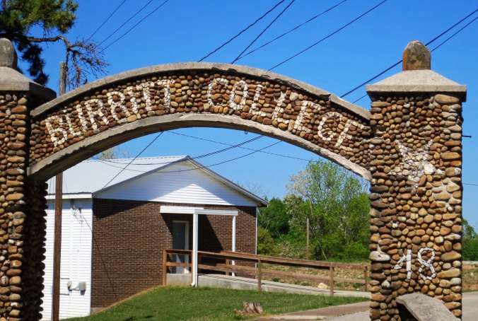
Burritt College in Spencer, Tennessee has been closed since 1939 but now has a Facebook Page.

The gateway to Burritt College in Spencer. Closed in 1939, the college now has a Facebook Page. Doesn’t everyone?

There had been a college in Spencer at one time, which surprised me. It’s a small town. The gateway still stands. I decided to do some research. Burritt College, it turns out, was founded in 1848 as one of the first co-educational colleges in the South. At the time, putting young men and women together created a bit of a firestorm. They weren’t to be trusted. Who knows what temptations the devil might send their way? To solve the problem, the college adopted a strict moral code. Members of the opposite sex could only communicate with each other during class and at supervised events.

The students weren’t supposed to cuss, gamble, smoke or drink either. The latter presented a bit of a problem. This was moonshine country. The guys couldn’t resist an occasional sip, or several. Out of frustration, the president of the college went to the sheriff and asked him to destroy all stills in the area. He learned a valuable lesson: You don’t get between a Tennessee moonshiner and his still. The President’s house was burned down.

I made it through Spencer without running into any irate moonshiners, but I was soon to have personal encounters with a big, ugly dog and a speeding 18-wheeler. Those are stories for my next blog, however. I’ll also report in greater detail on the Scopes Monkey Trial, as the renowned journalist, H.L. Mencken, dubbed it.

NOTE: I occasionally post this reminder since new people regularly check in on my blog. In 1989, I did a six month solo bicycle journey around North America. This past spring, my wife Peggy and I re-drove the route. Most photos on these blogs about the trip were taken this spring.

Three Billion Shots of Jack Daniel’s Whiskey… The 10,000 Mile North American Bike Tour


"It's the water" is a frequent claim of those who produce alcohol. All Jack Daniel products come from Cave Spring shown here. The spring produces 800 gallons per minute.

“It’s the water” is a frequent claim of those who produce alcohol. All Jack Daniel’s products start with water from Cave Spring shown here. The spring produces 800 gallons per minute. I should have it talk to our five gallon per minute well.

It’s amazing what you can learn when you are out bicycling around North America. For example, today I am going to talk about visiting the Jack Daniel’s Distillery in Lynchburg, Tennessee.  It comes at the end of this post. But I thought I would start with a little whiskey math for fun.

Using American measurements, a barrel of Jack Daniel’s whiskey contains 260 bottles, or fifths, of whiskey. A fifth contains 17 shots. This translates into 4,420 shots per barrel. That’s a lot of drinking. But consider this: Our guide told us that Jack Daniel’s is the leading distributor of whiskey in the world. This means the company needs to have a lot in production at any given time. It also means they need to have a lot of whiskey in storage to allow for aging and for keeping up with demand.

The company can store 40,000 barrels on site. That used to be enough. No longer. The guide told us that Jack Daniel’s now has 11 buildings off site that store 60,000 barrels each.  Doing the math, I came up with 700,000 barrels. Here’s the fun part— that comes to over three billion shots of whisky. Bottoms up!

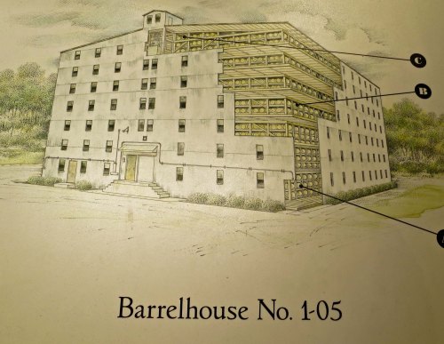
An illustration at the Jack Daniels Distillery showing one of its on-site barrel houses.

An illustration at the Jack Daniel’s Distillery showing one of its on-site barrel houses.

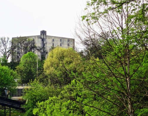
Barrel House No. 1 at the Jack Daniels Distillery in Lynchburg, TN.

A view of the actual barrel house in Lynchburg.

I left you at Tishomingo State Park in northern Mississippi at the end of my last blog, recovering from my close encounter with the tornado. I could have used a shot or two of Jack Daniels then! But I had a ways to go to reach Lynchburg, including another 60 miles of the Natchez Trace. My Trace portion included a short 30 mile ride across the northwest corner of Alabama and another 30 mile ride into southern Tennessee where I picked up US Route 64. Along the way, I crossed over the Tennessee River, admired some blooming Dogwood, and stopped for a final view of the original Trace.

The Tennessee River as see from the Natchez Trace bridge across in in Alabama.

The Tennessee River as see from the Natchez Trace bridge in Alabama.

We were a little late to capture the Dogwood along the Natchez Trace at it's best, but even here it adds its own beauty along the road.

We were a little late to capture the Dogwood along the Natchez Trace at its best, but even here (on the left),  it adds its etherial beauty to the scenery.

The Natchez Trace was used so much during its heyday of the early 1800s, it cut deep grooves in the ground.

The Natchez Trace was used so much during its heyday of the early 1800s, it cut deep paths into the ground that can still be seen today.

I had travelled 359 miles on the Trace at this point and only had another 10 miles to go before I left it. I would miss its beauty and tranquility.

I had travelled 359 miles on the Trace at this point, and only had another 10 miles to go. I would miss its beauty and tranquility.

As I approached US 64, a sign informed me I would be heading toward David Crockett State Park and following the Trail of Tears.

My last sign on the Natchez Trace.

As I approached Route 64, a sign announced I would be following the Trail of Tears and heading toward David Crockett State Park. I had learned about Davy as a kid by watching Fess Parker’s 1955/56 television program at Allen Green’s house. I still remember the theme:

“Born on a mountain top in Tennessee— Greenest state in the land of the free— Raised in the woods so he knew ev’ry tree— Kilt him a be’ar when he was only three— Davy, Davy Crockett, King of the wild frontier!”

Being a want-to-be woodsman at the time, how could I forget such stirring words? Crockett was a genuine folk hero, however. In addition to his mythical knowledge of trees and killing bears at a young age, he served in Congress and adamantly opposed Andrew Jackson’s Indian Removal Policies. Disgusted with Washington politics, he headed off to Texas where he was killed at the Battle of the Alamo in 1836.

It was President Jackson’s Indian Removal Policy that led to the tragic Trail of Tears, another dark spot in America’s history. Of all the Native Americans in the East, the Cherokee were among the best in adapting to the coming of the Europeans. They had intermarried with settlers, become farmers, and even created their own constitution for self-government. But none of this was enough. The American settlers on the frontier wanted their land.

Jackson and Congress aided them in their efforts by insisting that the Cherokee move. To achieve this, the military gathered the Cherokee into stockades and force-marched them 800 miles to Oklahoma. The journey was particularly hard on infants, children and the elderly. An estimated 4000 died along the way, nearly a fifth of the Cherokee population. It was because of this, that the Cherokee named the route the Trail of Tears.

On a much less significant level, I shed a virtual tear or two myself on leaving the Natchez Trace. I was leaving the commercial-free tranquility of the National Parkway to return to the world of crowded roads, fast-moving traffic, and ubiquitous 18 wheelers. I would also be dodging my way through towns and cities. On my way to Lynchburg, these included Lawrenceburg, Pulaski, and Fayetteville. Although the distance bordered on 90 miles, I figured I could make the trip in a long day.

A torrential downpour outside of Pulaski persuaded me otherwise. It wasn’t enough that the rain was flooding the road 3-5 inches deep in places; I managed to get a flat. I pulled off the highway, retrieved my waterproof emergency blanket, put it over the top of me, and proceeded to fix the flat, while somehow getting 100 gallons of water down the back of my neck.  (I am exaggerating, of course. It was only 98.) Although I was traveling east, my sense of humor went south. I grabbed a motel room in Pulaski and dried off while watching reruns of reruns on TV. Unfortunately, Davey Crockett wasn’t included.

US Route 64. As I have noted earlier, many of the two lane roads I travelled on in 1989 have become four-lane highways, often rerouted.

US Route 64. As I have noted earlier, many of the two lane roads I travelled on in 1989 have become four-lane highways today, often rerouted. Nice shoulder, though.

Limestone walls, such as this on US 64, are common on Tennessee Highways.

Limestone walls, such as this on US 64, are common on Tennessee Highways.

I have always found old barns interesting because of their character and photogenic quality. There were several along US 64.

I have always found old barns interesting because of their character and photogenic quality. There were several along US 64.

Another example.

Another example.

In Fayetteville, I left Route 64 and picked up Tennessee 50 toward Lynchburg.

In Fayetteville, I left Route 64 and picked up Tennessee 50 toward Lynchburg. Note the old windows in the red building. Some have been bricked in.

I easily made it into Lynchburg the next day and, in fact, biked on to Manchester. I did make a quick detour into the Jack Daniel’s Distillery, however. Peggy and I made a much more thorough visit on our route review this spring and were given an excellent tour of the facility. Here are a few things we learned.

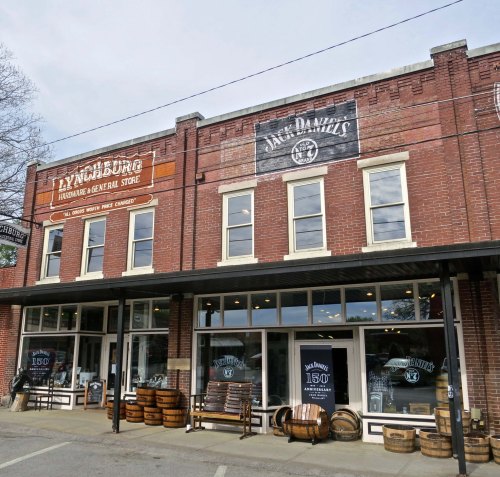
A view of the "Company Store" in Lynchburg, Tennessee where you can even pick up used whisky barrels for planters.

A view of the “Company Store” in Lynchburg, Tennessee where you can pick up used whisky barrels for planters.

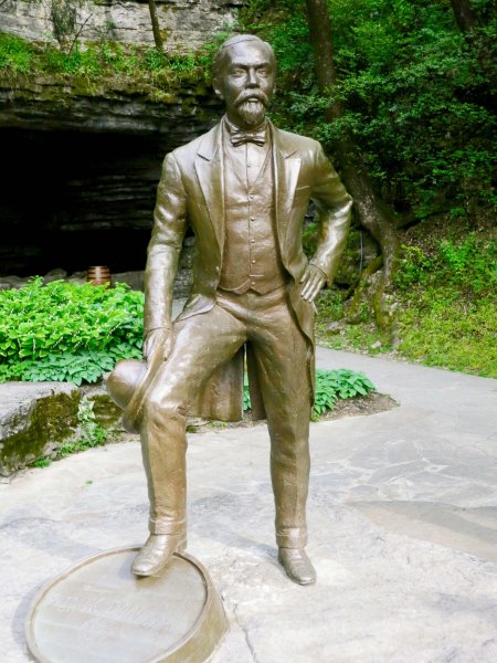
A sculpture of Jack Daniels with his foot resting on a barrel. The state was located on a rock. It's title was Jack Daniels on the Rocks.

A sculpture of Jack Daniel with his foot resting on a barrel. The statue was located on a rock. It’s title was Jack Daniel on the Rocks. Cave Spring is behind him.

Jack was either born in 1846, 49 or 50. People are still sorting that out. At a relatively young age, he was taken in by a minister and taught how to make whiskey. Does this make it God’s will? (I know, I am going to be struck down. BTW, don’t expect to be served any Jack Daniel’s in local restaurants. Lynchburg is located in a dry county.) By 1866 or 1875, Jack was operating his own distillery and using water from Cave Spring shown at the top.

A view of the creek leading out from Cave Spring. Again, note the lime. It adds interesting qualities to Jack Daniel's, and also serves to take out the iron that would give the whiskey a bad taste.

A view of the creek leading out from Cave Spring. Again, note the lime. It adds interesting qualities to Jack Daniel’s, and also serves to take out the iron that would give the whiskey a bad taste.

The creek as it makes its way through the distillery.

The creek as it makes its way through the distillery.

The primary ingredients for Jack Daniels. These are ground up into a mash, water from Cave Spring is added, and the concoction is boiled. It is then put into a fermenting vat where yeast is added creating alcohol. The alcohol is ten distilled and begins it journey through ten feet of sugar maple charcoal.

The primary ingredients for Jack Daniel’s. These are ground up, water from Cave Spring is added to make mash, and then the concoction is boiled. It is then put into a fermenting vat where yeast is added creating alcohol. The alcohol is then distilled and begins it journey through ten feet of sugar maple charcoal. We were taken on a tour where we witnessed the process but weren’t allowed to take any photographs.

The whiskey would be a bourbon except for the fact that it is filtered through 10-feet of sugar maple charcoal at a drip-drip rate, a process that takes a week for the drop to make it from the top to the bottom. Its journey removes impurities from the alcohol. The whiskey is then put into oaken barrels that have been scorched on the inside and is aged for four years. The barrels are made on site and only used once. Tasters determine when the brew is ready. Whiskey from several barrels is blended to produce the distinctive Jack Daniels taste such as that found in Jack’s most famous blend, Old No 7.

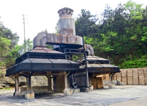
Rick oven for turning the sugar maple wood seen here into charcoal.

Rick oven for turning the sugar maple wood (ricks) seen here into charcoal.

The company uses the 1866 date for its beginning, thus making 2016 its 150th Anniversary. To celebrate, it has produced a special whiskey called Sinatra Select. What, you say? Turns out that Frank was a great friend of Old No. 7. He always had a bottle within easy reach, whether he was singing in concert or on a TV special, flying on an airplane, visiting with friends, or in almost any other conceivable situation.  He was even buried with a bottle.

It is possible to obtain a bottle of single barrel select whiskey that hasn’t been blended. In fact, Jack Daniels wants you to buy it by the barrel for $10,000 each. The Master Taster or the Master Distiller will personally meet with you to provide a tour and help you in your selection. The company will even put your name up on its Single Barrel Wall of Fame. I walked around and checked out who was buying barrels. I found some particularly amusing.

If you choose to put down $10,000 and buy a barrel, it will be bottled up for you. You also get to keep the barrel.

If you choose to plop down $10,000 and buy a barrel, it will be bottled up for you. You also get to keep the barrel! Our guide uses the display as a leaning post. On the right, behind the bottles, you can see the Wall of Fame for people who have purchased a barrel— or more.

The Marines from Camp Pendleton seemed especially thirsty Each barrel on the plaque represents a barrel the Marines purchased. It's amazing how much a 'few good men' (and women today) can consume.

The Marines from Camp Pendleton seemed especially thirsty. Each barrel on the plaque represents a barrel they purchased. It’s amazing how much a ‘few good men’ (and women today) can consume.

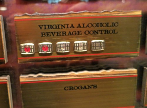
This has to be all about quality control, right?

This has to be all about making sure that Jack Daniels meets state standards, right. A lot of testing has to go on…

Okay, I don't get this. These folks are Mormons, and, as far as i know, Mormons don't drink! I wonder if this has anything to do with the fact that Jack learned his trade from a minister. (grin)

Okay, here’s my last photo for today. I don’t get it. The majority of folks in Utah’s government, as far as I know, are Mormons— and Mormons don’t drink! Hmmm.

NEXT BLOG: I visit some beautiful waterfalls. An 18-wheeler misses me by about 6-inches while going over 60 and teaches me how to fly. I have a nose to nose confrontation with a humongous dog. We end the day in Dayton, Tennessee where man took on monkey in the infamous Scopes Trial.


Hiding Out from a Tornado on the Natchez Trace… The 10,000 Mile North American Bike Tour

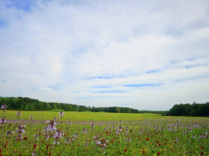
The Pharr Mounds on the Natchez Trace were built around 2000 years ago.

The Pharr Mounds, ancient burial sites, are one of the most interesting views along the Natchez Trace. They became almost too interesting for me when a tornado roared through the area.

I left Tupelo with dark clouds hanging on the horizon. Nothing new here, I thought. It was a rare day when I didn’t see something threatening to pounce on me from the sky. Usually, nothing happened. Or I’d get caught in a downpour or two and dry off.  Why worry? Down in Texas I’d dodged a few hail storms and tornadoes, but dodged is the operative word. Besides, the weather is supposed to behave like that in the Lone Star State. I would have been disappointed without pavement-melting sun and golf ball size hail stones. Where would the stories be?

I was ten miles up the Natchez Trace from Tupelo when a driver flagged me down. “There’s a serious tornado warning on,” he told me. “You should consider getting off the Trace.” I thanked him for his concern. My alarm level climbed up the worry meter a few degrees. But it wasn’t a massive leap. I’d save that for when I spotted a flying cow. Besides, there wasn’t a side road where I was. And when I found one, who’s to say that my detour wouldn’t take me toward a tornado instead of away from it. So I biked on.

At mile marker 286.7, I came on the Pharr Mounds, one of the most interesting sites along the Natchez Trace. Eight large burial mounds cover some 90 acres. Built by hunter/gatherer tribes in the area some 2000 years ago, the mounds range from 3 to 18 feet in height. Artifacts found in the mounds suggest the builders were part of a trading culture that stretched from the Great Lakes to the Gulf of Mexico.

One of numerous arrow head looking signs along the Natchez Trace that announce historic sites.

One of numerous ‘arrowhead’ signs along the Natchez Trace that announce historic sites.

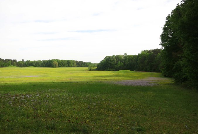
This photo of the Pharr Mounds site provides a perspective on just how large the site is.

This photo of the Pharr Mounds’ site provides a perspective on just how large the area is. Note the mounds in the distance. They are up to 18 feet tall.

The Pharr Mounds north of Tupelo, Mississippi cover some 90 acres.

Another shot that provides perspective on the size of the area.

Flowers growing on the Pharr Mounds along the Natchez Trace in Northern Mississippi.

A close up of the flowers that added color to the green grass.

A group of model airplane enthusiasts were flying their toys over the huge field. The planes were big ones with wide wingspans. I stopped to watch the action and check out the mounds. I became a little concerned when the hobbyists had a hurried discussion, brought in their planes, packed them up, and took off— quickly. Ah well, I thought, climbing back on my bike. But something wasn’t right. The sky had turned an eerie color. I looked at the clouds; they were circling, ominously. Now my alarm level made its massive leap, even without the flying cow. “Oh shit,” I thought.

I hurriedly looked around. The Pharr mounds had a sturdy looking restroom. I had just peed there. I might be peeing there again, real soon, having it scared out of me. The bottom half of the facility was made up of a rock wall. “Okay, Curt,” I commented to me, “this is your port in the storm.” The restrooms had a further advantage of having a covered porch. I could stay outside, be protected from the weather, and watch developments. If necessary, I could scurry inside and duck. I made myself comfortable and waited for the show.

A bright flash of light lit up the sky, followed instantly by an earth-shaking rumble, followed seconds later by a flood causing rain. Noah would have been impressed. The rain didn’t have the good sense to fall straight down. It came at me sidewise, drenching my thoughts of a dry porch. I love a good storm, but this one was becoming worrisome. “Well, Blue,” I said to my bike, “I think it is time to head inside.” I couldn’t be sure, but I think Blue responded with something like, “What took you so long?”

Sopping wet, Blue and I made a beeline for the bathroom. It was dry inside, even warm in comparison to the porch, but I could hear the storm tearing around the building. It sounded like a monster trying to smash its way in. And then it was calm, uncannily so. The monster was gone. Except it wasn’t. In the distance I heard a rumbling sound, like a herd of buffalo seeking revenge, coming for me. I almost lost it at this point. I pictured myself on the floor, snuggling up to the base of the toilet, and holding on for dear life while the roof came off and my bike took off like Dorothy in the Wizard of Oz.

Here I am, standing next to the restrooms that provided me with shelter in 1989. Peggy took this photo when we retraced my route this spring. (Photo by Peggy Mekemson.)

Here I am, standing next to the restrooms that provided me with shelter in 1989. Peggy took this photo when we retraced my route this spring. (Photo by Peggy Mekemson.)

I don’t know how long the roaring lasted: seconds, a few minutes, forever? I do know that it grew louder and louder— and then it was gone. The roof was still on; my bike was still there; and I had missed my close encounter with the toilet. I opened the door for a tentative look, not knowing what to expect. The sun had the nerve to peek out from behind a cloud. A few branches were on the ground. That was it; I had dodged the herd of buffalo (or tornado?) that came roaring through. A celebration was called for, and lunch.

I returned to the porch, retrieved my backpacking stove and boiled up a pot of water for tea and soup. The celebration part involved adding a generous dollop of 151 proof rum to the tea. I almost added another one to the soup. I was half way through the tea when a car pulled up. A woman piled out.

“Did you see a tornado?” she asked excitedly. “There was one just down the road!”

I figured “just down the road” was far too close. I finished my tea and soup, visited the restroom one last time and rode on to Tishomingo State Park, which is near the Alabama border. My ride up the Trace was nearing its end. Fortunately, I’d be there to enjoy it.

Tishomingo State Park on the Natchez Trace.

One of the campgrounds at Tishomingo State Park is located on this beautiful lake. I stayed here during my bile trip and Peggy and I have stayed here twice since.

Peggy toasts my avoiding the tornado.

Peggy toasts my avoiding the tornado. Had it carried me off, I wouldn’t have met her at the end of my bike trek.

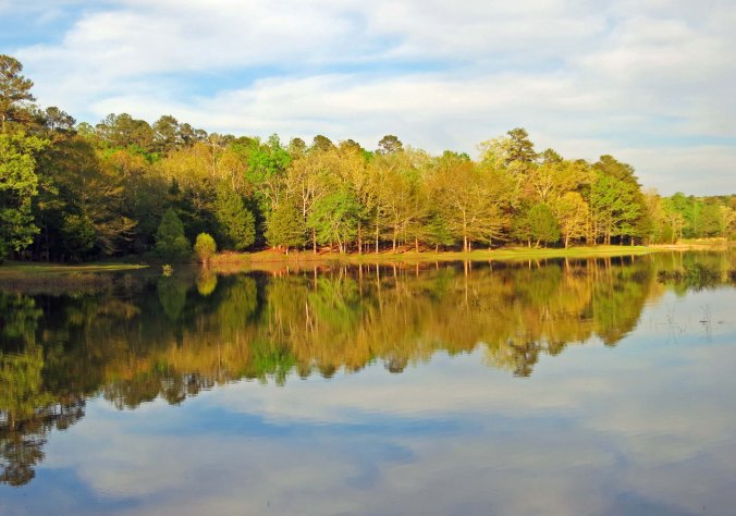
Being an absolute sucker for reflection shots, here are three more from Tishomingo State Park:

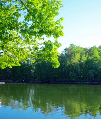
A reflection shot at Tishomingo State Park along the Natchez Trace in northern Mississippi.

Tishomingo State Park near the Alabama border in Northern Mississippi.

I will conclude with this one I took as the sun set.

I will conclude with this one I took as the sun set.

NEXT BLOG: I finish up my ride on the Trace and cut across Tennessee to the Jack Daniel’s Distillery in Lynchburg.


Mississippi Burning— Plus Elvis… The 10,000 Mile North America Bike Tour

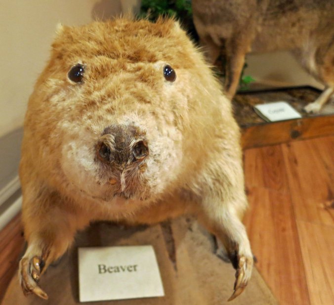
I met this little fellow in a Natchez Trace Information Center in Kosciusko, Mississippi. He looked like he wanted to give me a hug so I decided to pass him on to you.

I met this little fellow in a Natchez Trace Information Center in Kosciusko, Mississippi. He looked like he wanted to give me a hug so I decided to pass him on to you.


“That boy is one tough son of a bitch.” –John Hamilton Carpenter


My friend, Morris Carpenter, picked me up in Jackson and gave me and my bicycle a ride to his home in Philadelphia, Mississippi. I’d be spending a week with him and his wife Marianna, the first major break in my bike ride. Morris and I go way back, all the way to 1961 when we were in student politics together at a community college in Northern California. Later, we both served as Peace Corps Volunteers in West Africa. I’ve written about that experience in my book, The Bush Devil Ate Sam. Our paths have crossed numerous times since.

Morris lives on Azalea Drive so I photographed one.

Morris lives on Azalea Drive so I photographed a bush of them.

When my first wife and I parted ways, Morris even got the kid, our 70-pound Basset Hound, Socrates. Morris was living in Maine at the time, working for the Penobscot Indians. He had kept Socrates for us while Jo and I had spent six months travelling in the South Pacific and Asia. When we had returned and Jo had decided that she wanted a more stable, middle class life than my love of wandering and work for nonprofits supported, I’d called Morris with the bad news and asked if he could keep Socrates for a while longer. “He’s my dog now,” Morris had declared. He had fallen for the lovable, stubborn hound.

Socrates' grand dad had been a Canadian and America champion, or at least his papers so claimed. To us he was just a lovable dog who kept me company on backpacking trips.

Socrates’ grand dad had been a Canadian and America champion, or at least his papers so claimed. To me, he was just a lovable dog who kept me company on backpacking trips. Those feet could move more dirt than a steam shovel. I sometimes had to file environmental impact reports on his digging. (Kidding.)

Now Morris was working for the Choctaw Indians as their housing director. He had picked up his expertise by rebuilding villages in Vietnam destroyed by the Viet Cong.  In coming to Mississippi, he had come home. His roots were deep. His mom and dad had moved from the state to Northern California in the early 40s where his father had gone to work in the lumber industry. Morris, like me, had been born in Southern Oregon. For a while, when his dad had gone off to fight the Japanese in World War II, his mom had moved Morris and his sister back to the small town of Conway, Mississippi to live with their Uncle Wilson. The community is approximately 25 miles west of Philadelphia.

Morris has now retired. When he worked for the tribe, their primary source of income was light industry. Now it is this Casino located just outside of Philadelphia.

Morris has now retired. When he worked for the Choctaw, their primary source of income was light industry. Now it is this Casino located just outside of Philadelphia.

Morris still had many relatives living in the area. I was invited to a gathering of the clan. They wanted to meet Morris’s friend who was so crazy he would go on a 10,000-mile bike ride by himself. We sat around drinking bourbon and eating delicious Southern fried chicken while I entertained them with tales of life on a bicycle. Afterwards, Morris told me that his cousin, John Hamilton Carter, had said, “That boy is one tough son-of-a-bitch.” Morris assured me it was a compliment.

One day he had taken me for a ride over to Conway to revisit his childhood home. While we were out and about, he had driven me by the earthen dam outside of Philadelphia where three young civil right’s workers had been buried in 1964. They had been killed by the Ku Klux Clan in cooperation with the local city police and county sheriff’s department. A Baptist preacher had orchestrated the murders.

The Pearl River as it winds through Neshoba County Mississippi. Authorities would drag the river for the slain civil rights workers until an informal told them about the dam.

The Pearl River as it winds through Neshoba County, Mississippi. Authorities would drag the river for the slain civil rights workers until an informant told them about the dam.

You see a beautiful, bucolic sight like this in Neshoba County and wonder about the prejudice, hatred and violence that once existed in the county.

You see a bucolic site like this in Neshoba County and wonder how such prejudice, hatred and violence could exist in such a beautiful place.

The three had been working to register black voters. Mississippi had passed a constitution in 1890 effectively blocking blacks from voting. Using law and violence, the state had maintained the status quo since. Supreme Court rulings in the early 60s had challenged such laws. College students from throughout the nation had been recruited by civil rights organizations to help out during Mississippi’s “Freedom Summer.” Many Mississippians had been infuriated with this outside interference in their state. Thousands had joined the KKK.

I had listened to recruiters for the effort that spring at Berkeley. The idea appealed to me but I had to work summers to pay for my education. While I was driving a laundry truck between Placerville and Lake Tahoe, the young people were killed. Several students at Berkeley, including Mario Savio, had heeded the call, however, and spent their summer in Mississippi. The Free Speech Movement at Berkeley that fall had grown out of the University’s efforts to block students from participating in such efforts. I’ve blogged about my involvement in the protest.

A massive investigation by the FBI was ordered by the US Attorney General, Bobby Kennedy. The FBI designated the effort, Mississippi Burning. (The 1988 movie  Mississippi Burning starring Gene Hackman and Willem Dafoe was loosely based on the 1964 incident.) Eighteen individuals were eventually charged. When the state refused to prosecute them, they were tried in federal courts. Seven were eventually found guilty and received relatively light sentences. None served more than six years.

Interestingly, in 2004, a multi-ethnic group from Philadelphia urged that the issue be revisited. As a result, the 80-year old Baptist minister and sawmill owner Edgar Ray Killen, who had avoided prison earlier, was charged with orchestrating the murders, found guilty, and sentenced to serve 60 years in prison.

At the end of the week, Morris had driven me back to the Trace and I had restarted my journey. He had watched me until I disappeared. “I was afraid I might never see you again.” he confessed. Morris thought what I was doing was too dangerous. If you want danger, I had thought to myself, try rebuilding a village the Viet Cong had burned down when the Viet Cong was still in the area.

This pull off along the Natchez Trace is known as Pigeons Roost for the thousands of Passenger Pigeons (now extinct) that once roasted in them.

This pull off along the Natchez Trace is known as Pigeons’ Roost for the thousands of Passenger Pigeons (now extinct) that once roosted in these trees.

There is nothing endangered about this pretty daisy (Fleabane, I think) that was growing at the site.

There is nothing endangered about this pretty daisy (Fleabane, I think) that was growing at the site.

We pulled off to check out these beautiful horses.

Peggy and I pulled off to check out these  horses.

While we were there, a bike tourist who was riding the Trace, Don Glennon, stopped to talk with us.

While we were there, a bike tourist who was riding the Trace, Don Glennon, stopped to talk with us. His outfit looked a little neater, more organized, and more waterproof  than mine had.

While Peggy and I were talking with Don, I suddenly felt several bites on my leg. Fire ants had worked they way up though a crack in the cement sidewalk and were rapidly moving up my leg. Much faster than it has taken to write this description, I was in the van and had taken by pants off. Nasty, nasty bugs they are! I had scars for weeks afterwards. The photo above is a fire ants nest.

While Peggy and I were talking with Don, I suddenly felt several bites on my leg. Fire ants had worked their way up though a crack in the cement sidewalk and were rapidly moving up my leg. Much faster than it has taken me to write this description, I was in the van and had taken my pants off. Nasty, nasty bugs! I had scars for weeks afterwards. The photo above is a fire ants’ nest.

A day later found me in Tupelo where Elvis Presley had been born. What better place for an Elvis-sighting? Maybe he still haunted the area. When I had graduated from the eighth grade in 1957, our music teacher had asked us to choose a song to sing at the ceremony. We had chosen Love Me Tender. Our choice was immediately squashed. Young women were already swooning at Elvis concerts and they squealed when he wiggled his hips. The older generation was going bonkers over this threat to our morals. We were offered a compromise: The Civil War era song, Aura Lea.  Presley had used the tune from the song for Love Me Tender.

BTW: Elvis claimed, “I’m not trying to be sexy. It’s just my way of expressing myself when I move around.” Um, yeah.

This road takes you to the Presley Museum in Tupelo that is located where Elvis was born.

This road takes you to the Presley Museum in Tupelo that is located where Elvis was born.

The house that Elvis was born in and where he spent his first years.

The house that Elvis was born in and where he spent his first years.

A bronze statue of the young Elvis with guitar in hand.
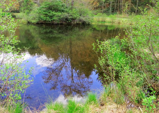
A bronze statue of the young Elvis with guitar in hand.
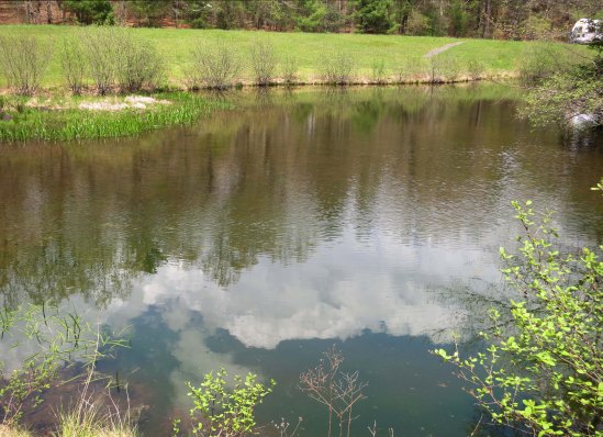
NEXT BLOG: I hide in a brick outhouse to avoid a tornado.

Roadkill A-la-Carte and the Mighty Mississippi… Travelling 10,000 miles by Bicycle

The Natchez-Vidalia Bridge across the Mississippi River.

The Natchez-Vidalia Bridge across the Mississippi River.


What was it with all of the dead Armadillos? This was the weighty question I found myself pondering as I bicycled down Louisiana Highway 71 south toward Alexandria.

Bicyclists develop a thick-skinned attitude toward road kill. The shoulder we ride on contains the flotsam and jetsam of two worlds, the highway and the land next to it. Broken car parts, discarded (often smoldering) cigarette butts, empty beer cans, fast-food trash, and dead animals come with the territory. Maintaining a sense of humor is important.

To keep myself amused, I would sometimes make up tombstone epitaphs for the animals. Here lies Spot, who was finally cured of chasing cars. Or how about this: Old Tom had been warned time and again about not chasing girl kitties on the other side of the road.
Those of you who have been hanging around my blog for a while know I like to develop weird cards. This is my vision of Old Tom's tombstone.

Those of you who have been hanging around my blog for a while know I like to develop weird cards. This is my vision of Old Tom’s tombstone.

A couple of friends of mine who operated the Lung Association Trek Program in Sacramento after I went off to Alaska, developed a different approach to roadside debris: a scavenger hunt. I’ve blogged about this before. On the last day of the Trek, participants would be given a list of different items they were supposed to collect— things like an empty pack of Camels, a Budweiser beer can, a McDs’ cup, plastic from a broken brake light, a sail cat, etc.

“A sail cat? What’s that?” you ask.

A sail cat, simply put, is a cat who has met its demise at the wrong end of a logging truck. Think of it as a pancake with legs. After a week or two of curing in the hot summer sun, you can pick it up and sail it like a Frisbee. Even your dog can join in the fun. It gives a whole new meaning to chasing cats. Of course, Fido may prefer to roll on it. Lucky you.

A particular scavenger hunt was described to me. One couple had actually found a sail cat and brought it into camp. Naturally they won, as they should have. But the story goes on. After dropping the unfortunate cat into a dumpster, the couple packed up and headed home. When they arrived and opened their trunk, there was kitty. Scary, huh. Turns out another couple had slipped the cat into the trunk. With friends like that, eh, who needs enemies. That should end the story, except it doesn’t. Both husbands worked for the State of California. A couple of days later the perpetrator of the prank received a large interoffice mail packet at work. He opened it. Out slid kitty. The end.

One person’s road kill is another person’s feast, right? Somewhere I have a newspaper picture of my brother Marshall chowing down on an armadillo when he was in Florida. I checked the Internet and there are a number of recipes, so I assume it is edible. Marsh said it was. And I saw a lot of happy buzzards along Highway 71.

I had never encountered as much roadkill as I did following this attractive highway into Alexandria on my bicycle in 1989. I never did figure out why.

I had never encountered as much roadkill as I did following this attractive highway into Alexandria on my bicycle in 1989.

None of this explains the sheer number of dead armadillos, however. After six or seven I began to lose my sense of humor. Were they migrating across the road in large numbers at night? Had the people whose job it was to remove roadkill gone on strike. I never did figure it out, but I am happy to report when Peggy and I drove the same road to Alexandria a couple of months ago, we didn’t see one dead armadillo.

I really hadn’t planned on going to Alexandria, in fact the jaunt added a hundred miles to my journey. Motels and bike repairs had reduced my cash to around $50, however, and this was still a time when ATMs didn’t grow on every corner. Alexandria was the nearest city that accepted my particular brand of plastic. The town, I quickly learned, was not bike friendly, at least at the time. Few cities were. And I had the misfortune of arriving at the height of rush hour and then immediately getting lost. My already low sense of humor dropped another notch.

Several map checks persuaded me that a narrow bridge making a steep climb up and over a small bayou provided a way out. A long line of commuters was struggling to get through the bottleneck, and, judging from the honking, not happy about the delay. Adding to my woes, there wasn’t enough room for two cars and me to co-exist side by side on the bridge. Steeling myself, I forced my way into the insanity and became leader of the pack, adding several more minutes to an already long day for the homeward bound. I swear there must have been 10,000 cars behind me. At least it felt that way. It was one hell of a parade. All I needed was a baton.

I have to hand it to the good folks of Alexandria, however. Not one of them honked at me. Several waved when I pulled off the road on the other side. A couple of young women even rolled down their window and whistled. Up went my sense of humor.

I found a motel that fit my budget that night and the ATM the next morning. Heading out of town I became lost again, of course, this time on an expressway where drivers were competing with each other to see how fast they could drive beyond the speed limit. My thoughts turned to the armadillos and their unfortunate end. The first exit found me departing the road at a speed that would have impressed Mario Andreotti.

A not very pretty picture of the expressway I ended up on and Highway 28 where I was supposed to be.

A not very pretty picture of the expressway I ended up on and Highway 28 where I was supposed to be.

I pulled into the driveway of a mortuary to check my map again. Much to my surprise, the double doors opened and out popped the mortician, who made a beeline for me. My mind leapt back in time to an early Clint Eastwood Spaghetti Western where the mortician measured strangers who rode into town to see what size casket he should build. While laughing to myself, I still checked the mortician’s hands to see if he was carrying a tape measure. Turns out the mortician was a minister and the mortuary was a church. He invited me in for coffee, a morning snack and directions. As I left, he handed me his card. “If you have any problems between here and Mississippi,” he told me, “call and I’ll come out and give you a lift.”

Soon I was heading out of town on Highway 28 to rejoin Louisiana 84, my original route across the state. From there, I biked on to the mighty Mississippi River. The route from Alexandria proved to be quite varied. I biked past dark swamps, lakes, shacks, mansions and cotton fields that were once worked by slaves. Finally, I arrived at Vidalia and the imposing Vidalia-Natchez Bridge that would take me across the Mississippi and out of Louisiana. The historic town of Natchez and the Natchez Trace were waiting.

Intriguing swamps lined the highway. I spent a lot of time glancing down into them looking for snakes.

Intriguing swamps lined the highway. I spent a lot of time looking down for swamp life.

I should have spent more time looking up. These egrets reminded me of a Japanese print.

I should have spent more time looking up. These egrets reminded me of a Japanese print.

This was an interesting little store that Peggy and I found along the road. It sent me scurrying to the Internet to find out if there was anything on Root Hog or Die. I thought maybe the owner was an Arkansas Razorback fan. Turns out the phrase dates back to the early 1800s when hogs were turned loose in the woods to survive on their own. It came to mean self-reliance.

This was an interesting little store that Peggy and I found along the road. It sent me scurrying to the Internet to find out if there was anything on Root Hog or Die. I thought maybe the owner was an Arkansas Razorback fan. Turns out the phrase dates back to the early 1800s when hogs were turned loose in the woods to survive on their own. It came to mean self-reliance.

This lake was worth a photo.

This lake was worth a photo. It made me wish that Peggy and I had brought our kayaks along.

The Frogmore Cotton Plantation near Vidalia provides an interesting overview what it would have been like to have been a slave working on a Southern Plantation. Peggy models the bag that picked cotton was put in out in the fields.

The Frogmore Cotton Plantation near Vidalia provides an interesting overview on what it would have been like to have been a slave working on a Southern Plantation. Peggy models a bag  where the picked cotton would have been placed.

This mocking bird wondered how bicycling compared to flying. (Photo by Peggy Mekemson.)

This mocking-bird wondered how bicycling compared to flying. (Photo by Peggy Mekemson.)

A side view of the Visalia-Natchez Bridge across the Mississippi River with a barge passing under it.

A side view of the Vidalia-Natchez Bridge across the Mississippi River with a barge passing under it.

A view of the Natchez-Vidalia Bridge.

An interesting perspective of the bridge. (Photo by Peggy Mekemson.)

The Natchez-Vidalia Bridge across the Mississippi River at night.

The bridge at night.

On our way into Natchez, Mississippi and the beginning of the Natchez Trace, which will be the subject of my next blog.

On our way into Natchez, Mississippi and the beginning of the Natchez Trace, which will be the subject of my next blog. The wide shoulder is appreciated; not so much the long drop into the Mississippi River.