Louisiana, and an Offer of Hooch plus… Traveling 10,000 Miles by Bicycle

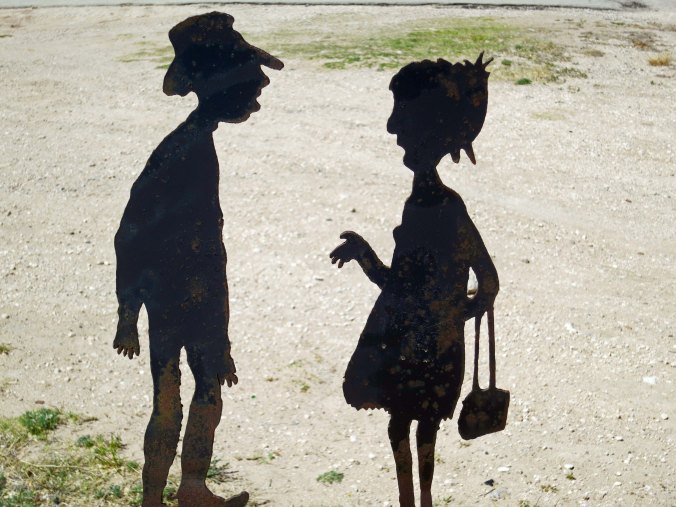
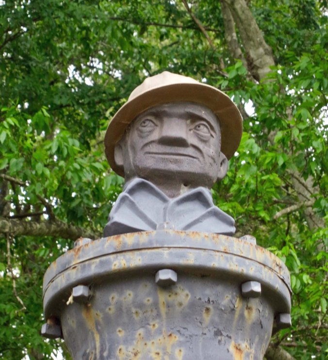
Joe Roughneck, the symbol of the oil industry. My father worked as a roughneck in the Oklahoma oil boom of the late 20s until he decided he would prefer to paint scenery for plays.

Joe Roughneck, the symbol of the oil industry. My father worked as a roughneck in the Oklahoma oil boom of the late 20s until he decided he would prefer to paint scenery for plays.


Hooch: Slang for moonshine or bootleg alcohol. —The Urban Dictionary

I biked out of Greenville, ever so glad to be on my way. One week of dealing with a wheel and weather was enough. A mile and a half later my back tire went flat. This wasn’t a normal flat that I could fix with my eyes closed. My strong new spokes were digging into the tube. Something really didn’t want me to leave Texas. I walked my bike back into Greenville and checked in with a small bike shop, resigned to deal with whatever fate the bike gods had in store for me. Not much, it turned out. The shop quickly fixed the problem with a thicker rim tape and I was on my way.

I hightailed it down Texas Highway 69, making up for lost time. Small towns flew by. Lone Oak, Emory, and Mineola provided sustenance to keep my legs pumping. My journal reports I stopped for coffee and pie, a hamburger and an ice cream cone.

A couple of buildings as they look today in Lone Oak. I am a fan of communities that decide to renovate their historic buildings.

A couple of buildings as they look today in Lone Oak. I am a fan of communities that decide to renovate their historic buildings.

A car and RV wash in Mineola. They didn't do bikes.

A car and RV wash in Mineola. They did “bikes” but not bicycles.

Everything was green, an amazing contrast to the dry desert country I had been bicycling through since California. And, this is big news— there were pine trees! I hadn’t seen one since Lincoln County in New Mexico. It made me feel at home, almost.

Green, green grass and pine trees in the rolling hills as East Texas.

Green, green grass and pine trees in the rolling hills of East Texas.

Happy cows for me to moo at.

Happy cows for me to moo at.

One of the things about Mineola that caught my attention was that the Texas Governor, Jim Hogg, had lived in the town. His daughter was born there and he named her Ima, as in Ima Hogg. To the degree karma works, I’ve always imagined the Governor being reborn as a pig with a pork chop factory in his future. Ima never married (I would have done it for the name change alone), reportedly was close to her father, and went on to be an important figure in Texas Society. Maybe she was like Sue in the Johnny Cash song, A Boy Named Sue; the name made her tough.

Willie Brown, the flamboyant California politician, was born here as well. He was serving as Speaker of the California Assembly while I was cycling across the country. Brown was incredibly effective at passing and suppressing legislation. Voting Willie’s way brought substantial rewards. Voting against him brought swift punishment. Like him or not, he made government work. Washington could learn a thing or two.

I had run into Brown’s ability to kill bills a couple of years earlier when I was working with a group to increase tobacco taxes in California and devote a significant portion of the revenues to prevention programs. Almost every state in the country had increased tobacco taxes since California had last raised its tax in the 70s. The tobacco industry paid big bucks to California legislators to keep it that way. The bill was assigned to a committee guaranteed to kill it. We couldn’t even get a second. Fortunately, we had been prepared for this likelihood and had quietly planned to run an initiative campaign if the legislative effort failed. I called a press conference immediately after the vote and we announced our initiative.  The committee’s no-vote gave us a great kickoff. The press conference received major media attention throughout California. Thanks Willie.

I rode another 15 miles from Mineola to Interstate 20 where darkening clouds led me to call it a day. It had been a good day of bicycling, the first since my spoke had broken outside of Decatur.

The next morning, I was up early and heading into Tyler. The road had a wide shoulder, which is always appreciated by bicyclists.  I could relax a bit and not worry so much about being flattened by a car or semi. Most drivers are cautious and courteous when around bicyclists, but there are exceptions. I always rode as far to the right as was safe and kept a wary eye out for developing situations. Several times on my trip, I was forced to bail out, riding my bike off the road into the dirt and weeds, or even a ditch. Somehow, I always avoided crashing.

In Tyler, I was almost taken out, however. The city was more urban than most I traveled through on my trip and hillier than I had become used to in Texas. I was riding along, minding my own business when a woman turned right across my route, missing my front tire by inches— and then only because I had slammed on my brakes! She must have been half blind since I was wearing bright clothes.  Either that or she was high on something. She didn’t seem to hear very well either. When I suggested, loudly, that she be more careful, she ignored me and drove off. I sent a bird flying after her. Bad Curt.

There was nothing to do but stop at a DQ and quiet my nerves by downing a hamburger and a milkshake. The owner came out and sat down to chat. I told him about my encounter. He was quite empathetic. His brother owned a bike shop. Afterwards I was feeling a little punky. It may have had something to do with how fast I had sucked down the milkshake. Anyway, I made it a short day, stopping in Henderson.
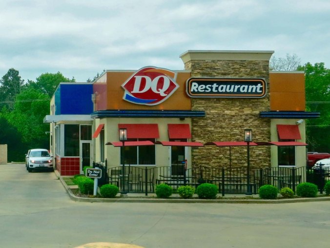
A Tyler Texas DQ.

A Tyler, Texas DQ.

The area around Henderson had been part of one of the largest oil booms in Texas history. In 1930, “Dad” Joiner, a 70-year-old oilman out of Tennessee and Oklahoma, had refused to give up on his belief that there was oil in the area, almost bankrupting himself in his search. Finally, at 8:00 pm on October 3, one of the wells he had drilled on Daisy Bradford’s farm eight miles west of Henderson gushed out oil and a ‘black gold’ rush was under way. I’m pretty sure that Daisy did a dance of joy. Henderson grew from a sleepy town of 2,000 to a booming 10,000, the roads became clogged with fortune seekers, and oil derricks sprang up in the surrounding region thicker than fleas on a hound, as the good ol’ boys down South like to say. To date, over five billion barrels of oil have been taken from the East Texas Oil Field.

A rest area near Henderson appropriately featured oil derrick decorations as covers of the picnic tables.

A rest area near Henderson appropriately featured oil derrick decorations as covers of the picnic tables. This is also where Peggy and I found the Joe Roughneck statue.

The next day found me traveling through piney woods that contained almost as many Baptist Churches as there were people. Or at least it seemed like it. I’d definitely made it to the Bible Belt. Following a round about way, I hit one road that was so remote it had me thinking Deliverance. Finally, I picked up Route 84, crossed the Sabine River, and entered Logansport, Louisiana. It was May 7th. I’d been in Texas for 18 days, or was that 1800?

Road construction, dust, and impatient drivers hurried me through Logansport. I stopped at a small bayou outside of town to catch my breath and spotted a water moccasin/cotton mouth slithering through the murky water. He was one big ugly dude, a pit viper with a serious attitude problem. I didn’t hang around. A few miles later, I started looking for a place to camp. It was approaching dark. I spotted an old, overgrown road that made its way into a pine forest where I could hide out. I set up my tent, climbed in, and zipped it up tight. That night I dreamed of gigantic snakes chasing me down the highway, mouths wide open, fangs dripping with poison. Two or three times I woke up to creatures stirring around in the forest outside my tent.
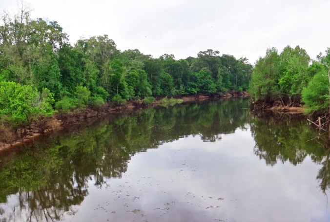
A Louisiana bayou: half river and half swamp. All jungle. Picture a large water moccasin slithering across its smooth surface.

A Louisiana bayou: half river and half swamp. All jungle. Picture a large water moccasin slithering across its smooth surface. The photo reminds Peggy and me of our boat trip up the Amazon.

I found an overgrown road leading into a pine forest for my campsite.

I found an overgrown road leading into a pine forest for my campsite. It provided cover from the road, but were there any snakes?

I was glad to be up and on my way the next morning, continuing to follow Highway 84. No monstrous serpents were hounding me but I still made good time. I stopped in Mansfield for breakfast and headed on. Large logging trucks carrying long, toothpick size logs kept me company, zipping by at speeds guaranteed to give me grey hair. Intense poverty was reflected in barely standing small houses. Dark, jungle-like growth edged the highway. I was sure it was crawling with snakes. A young man yelled at me to get off the road. His white-haired granny was too nervous to pass me on the narrow highway.

I crossed the Red River into Coushatta and worked my way south. Threatening clouds filled the sky and decided to let loose between the small towns of Campi and Clarence. And boy did they let loose. Soaked to the bone, I began thinking about a warm, dry, snake-free motel room. I found one outside of Clarence.

Coushatta, like its Texas cousins featured its his school and sports heroes.

Coushatta, like its Texas cousins, featured its high school and sports heroes dating all the way back to 1938. Since we took this photo in April it appears they haven’t had any champion teams for a long time. Either that or their sign is in desperate need of updating. Given that it still had a Seasons Greeting sign on it, I am thinking the latter.

Dark clouds over Clarence.

Dark clouds over Clarence.

After unpacking and putting on a set of dry clothes, I went outside to sit under the porch overhang, read a book, and sip on a beer. A large, black woman came over and plopped down in the chair next to mine. She had watched me bicycle in.

“What you all doing, Honey?” she asked. I explained I was in the middle of a 10,000-mile bike trip. “No way! You are one crazy man!” she exclaimed. “Say,” she went on, “I have some hooch over in my room. Why don’t you come over and try some?” I’d been propositioned before, but never with hooch. “Tempting,” I’d replied laughing, but then claimed a non-existent wife who didn’t want me “drinking hooch” on the trip. Instead I offered her a beer which she readily accepted. She was a funny woman and we had a delightful conversation. As she left she told me again, “If you change your mind about the hooch, Honey, just come over and knock on my door. Anytime tonight.”

NEXT BLOG: I bike a hundred miles out of my way to find an ATM in Alexandria, Louisiana and then head on to the mighty Mississippi River.
PING: The Sound of One Spoke Breaking… The 10,000 Mile Bike Trek

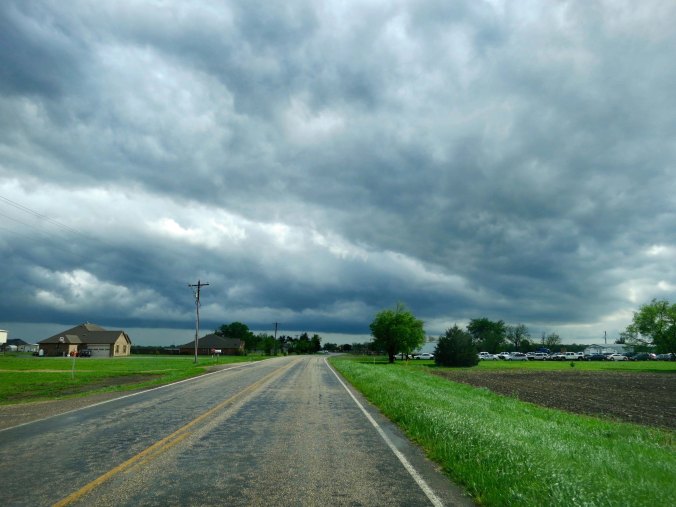
Stormy skies give credence to a tornado warning near Greenville, Texas.

The adventure part about a journey like mine is dealing with the unexpected, whether it is a broken spoke or a tornado warning. Peggy and I took this photo near Greenville, Texas. We had called ahead to reserve a campsite a few miles away and caught the manager in her storm shelter. “The clouds are circling,” she told us. It was scary enough in our van. Imagine what it is like on a bicycle.

The bike trek was going well. I was actually making progress across Texas and had rediscovered trees on my way into Jacksboro. Here’s the one-line journal entry for my day of bicycling from Throckmorton to Jacksboro:

“TREES, real TREES!”

Fort Richardson, a Texas State Park just outside of Jacksboro, was so pleasant that I declared a layover day. I’d gone for walks, read a book of poetry (Gary Snyder’s Turtle Island), and biked into town for a steak dinner. April 26th had dawned clear and slightly cool, which made it a perfect day for cycling. I was feeling so good I sang “Oh what a beautiful morning” to a cottontail that had come nibbling its way into my camp. The rabbit had looked up, startled, and scampered off into the mesquite, hippity-hop. Apparently it had no appreciation for music. Certainly it couldn’t have been my singing.

“It’s going to be a great day!” I yelled after my furry friend. I shouldn’t have done that. It jinxed the week; I am pretty sure.  Maybe if I had only quietly said, “It should be a good day…”

Fort Richardson had some of the best campsites I found on my journey, but the mesquite could be a little thorny...

Fort Richardson had some of the best campsites I found on my journey, but the mesquite could be a little thorny…

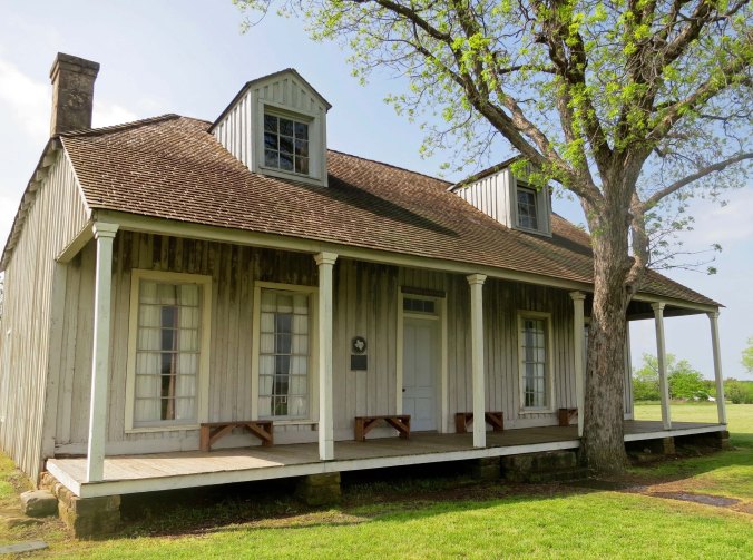
Fort Richardson was established just outside of Jacksboro, Texas in the late 1860s to counter the Native Americans who had gone on the warpath because their land was being taken away and the buffalo herds wiped out. This was the officer's quarters.

Fort Richardson was established just outside of Jacksboro, Texas in the late 1860s to counter the Native Americans who had gone on the warpath because their land was being taken away and the buffalo herds wiped out. This was the officers’ quarters.

I really liked this bridge at the fort. Originally it had crossed a stream just behind the fort. Today it rests on what would have been parade grounds.

I really liked this bridge at the fort. Originally it had crossed a stream just behind the fort. Today it rests on what would have been parade grounds, preserved for visitors to admire.

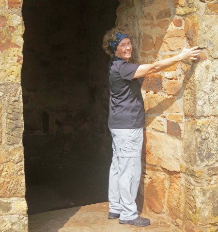
Peggy demonstrates the thickness of the ammunition magazine at the fort.

Peggy demonstrates the thickness of the ammunition magazine at the fort.

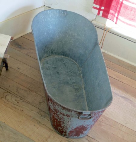
A modern hospital, for its time has also been preserved at Fort Richardson. A ranger provided a tour. Bath anyone?

A modern hospital, for its time, has also been preserved at Fort Richardson. A ranger provided a tour. Bath anyone?

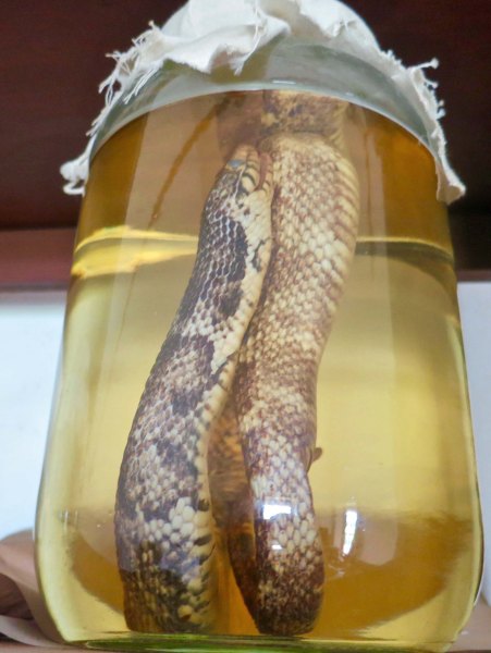
Pickled snake. The park ranger told us that the Smithsonian had requested that the fort gather up snakes and ship them back to Washing ton to study. This one was still hanging around.

Pickled snake. The park ranger told us that the Smithsonian had requested that the fort gather up snakes and ship them back to Washington to study. This one was still hanging around.

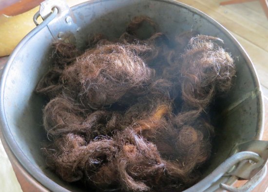
I can pretty well guarantee no one will guess what this is all about. The ranger told us these were hairs from a horse's tail. The hospital had used them as sutures,

I can pretty well guarantee no one will guess what this is all about. The ranger told us these were hairs from a horse’s tail. The hospital had used them as sutures. Apparently, they were less likely to cause infection than thread.

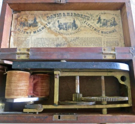
Shocking! It was believed that electrical shock was the best treatment for nervous disorders. This device provided the shock.

Shocking! It was believed that electrical shock was the best treatment for nervous disorders. This device provided the shock. My brother and I had a similar device when we were children. It was an old phone that you cranked up to generate electricity to send a phone message. We’d invite our little friends over to experience the shock.

I was about five miles outside of Decatur when I heard “Ping!” Unlike the sound of one hand clapping, which is underwhelming, the sound of one spoke breaking is quite distinctive. My response was very un-Zen like, even more so when I found the broken spoke on my back wheel. I’d need a bike shop.

A small cement plant was across the road. The receptionist offered me her phone, good luck, and the yellow pages. A Mel’s Bike shop was listed in Decatur. I called and got Mel. “Wait there,” he said. “I’ll be right out to pick you up.” And he was. Twenty minutes later, a smiling, older man showed up to collect me. He was another one of those people who reminded me of just how good folks can be. His shop, it turned out, was behind his home. He quickly fixed my spoke and started looking for other things to work on. My derailleur cable was too short; he replaced it. I was on my way to a complete tune up. When he was finally finished, I asked what I owed him.

“Nothing,” he said. And stuck to it.

“At least, Mel,” I argued, “you have to let me take you to lunch.” Two hours later we were still talking over dessert. I was chatting about snowstorms, rattlesnakes, mountains, deserts, dinosaurs and Texas. Mel was talking about his life, and how he had always dreamed of doing what I was doing. Finally, the time came when I had to bicycle on. He was still watching as I disappeared around the block. I waved one final time.

Peggy and I stopped off at Mel's home in Decatur in April. I would have loved to have seen him but the house was shuttered and empty. A woman at the local Post Office told us it had been quite some time since she had see the bike shop sign.

Peggy and I stopped off at Mel’s home in Decatur in April. I would have loved to have seen him but no one was there. A woman at the local Post Office told us it had been quite some time since she had seen the bike shop sign. Possibly Mel had moved or passed on.

Memories came flooding back as I entered Denton. In the spring of 1978, I had recruited for Peace Corps at the University of North Texas along with my first wife and an African-American woman who had also served as a Volunteer. We had gone out for breakfast one morning and you could have heard a pin drop when we entered the restaurant. The Civil Right’s act was young and the South was still adjusting. Black and white people did not eat together. We had just sat down when this young head popped up from the adjoining booth, wide-eyed, and announced to the whole room, “Momma, there’s a Nigger sitting with those people.” From the mouth of an innocent child, the insane prejudice of generations was repeated. As I write these words today, I am saddened by the fact that this prejudice continues to repeat itself in a seemingly endless and violent cycle. Such senseless waste. When will we ever learn…

The roads around Denton have become clogged with traffic and the usual fast food joints. The Dallas/Fort Worth area has become one of the fastest growing regions in the nation. Even on my bike trip, I was faced with traffic I hadn't experienced in a thousand miles.

The roads around Denton have become clogged with traffic and the usual fast food joints. The Dallas/Fort Worth area has become one of the fastest growing regions in the nation. Even on my bike trip, I was faced with traffic I hadn’t experienced in a thousand miles.

Peggy and I found suburb after suburb where there had been farms in 1989.

Peggy and I found suburb after suburb where there had been farms in 1989.

And the country roads I had ridden over, have now become multi-lane freeways providing ample room for even guys like this.

And the country roads I had ridden over have now become multi-lane roads providing ample room for even guys like this. I would not have liked to have met up with him on my bike!

But such thoughts were rare on my bike trip. And I soon had another thought to occupy my mind. A ping announced that another spoke had given up the ghost, gone to the great spoke factory in the sky. This isn’t unusual; when one spoke breaks, others may follow. Mine were simply reacting to all of the weight I was carrying. They’d had enough. I was faced with the fact that I needed a new wheel, preferably one with more spokes made out of a heavier gauged steel. I did what I could to true my wheel and limped for another 15 miles into McKinney.

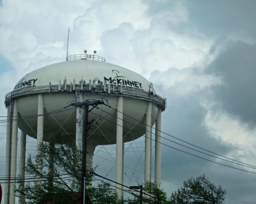
Dark skies over McKinney. My wheel challenges plus the weather added a week's time to my stay in Texas.

Dark skies over McKinney. My wheel challenges plus the weather added a week’s time to my stay in Texas.

Calling around the next morning, I quickly realized I couldn’t find what I needed in McKinney, nor, apparently, in Dallas. Finally, a mechanic at a bike shop near Southern Methodist University told me she could build what I needed but it would take a day. And, I might add, cost $100. Early the next morning I climbed on the Dog, the Greyhound bus, and zipped into Dallas on I-75. A bit of futzing and I found my way out to SMU on a municipal bus. My wheel wasn’t ready but there was a bookstore next to SMU, so what did I care. Two hours later found me on my way back to McKinney with my shiny new wheel and a book, The Quickening Universe by Eugene Mallove.

I’d like to report that the new wheel solved my problem, that my next 8000 miles were worry free. Sigh. I was half way between McKinney and Greenville the next day, having ridden all of 15 miles, when the wheel pretzeled on me.  Instead of Ping, it was more like SPRONG! I couldn’t even turn the wheel. I’m not sure whether it was my innovative language or the truing but I finally persuaded the wheel to make wobbly turns and crawled my way into Greenville. I found a motel next to I-30 with the thought that I would soon be returning to Dallas. Which is what happened.

I was greeted by silence when I called the bike shop the next morning. Make that consternation. After apologizing, the mechanic told me if I would bring the wheel back in the next day, she would have another one ready that she would guarantee would get me through the trip. Fortunately, the Dog also had a route along I-30. So the next morning, there I was, me, my pretzel wheel and The Quickening Universe, just in case my new wheel wasn’t ready.

It was. The mechanic greeted me at the door and handed me my second new wheel in three days. 26 years later, it still resides on the back of my bike.

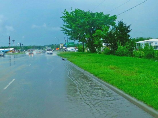
I was up at 5:30 the next morning, eager to hit the road. My wheel problems had cost me four days. I turned the TV on for company while I packed my panniers. “Expect severe weather in the Dallas area and eastward the next few days,” a stern-faced weatherman was warning. Thunderstorms, heavy rain, hail and tornadoes were forecast. Flash floods were expected. People were advised to stay home unless they had to travel. As if I needed more bad news, the room was suddenly lit up by a flash of intense light followed instantly by a loud boom that bounced around the motel. The intense storm had already started. Curt wasn’t going anywhere.

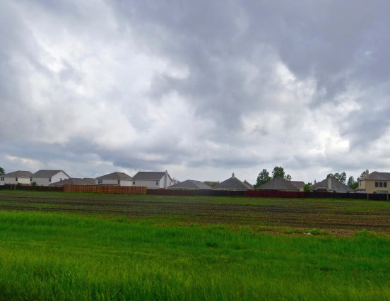
When this happened on my bike trip, I would get off the road and seek shelter. If nothing man-made was around, I had a small tarp that just covered me. This storm pictured here, became so intense that even Peggy and I were forced to pull off the road in our van.

When this happened on my bike trip, I would get off the road and seek shelter. If nothing man-made was around, I had a small tarp that just covered me. This storm near Greenville, became so intense that even Peggy and I were forced to pull off the road in our van.

But nature is going to do what nature is going to do. I had a book to read and the motel had a private club. Private clubs were how Texans got around the drinking laws. Staying at the motel gave me an instant membership, which I took advantage of the next three evenings while the storm continued to rage. And rage it did. One time I looked outside and saw hailstones the size of golf balls falling. I imagined being on my bike. The third day, the storm headed out, prepared to do its nastiness somewhere else.

I stopped by the club for a final beer that evening and was cornered by a window-washer who wanted to talk. When he learned I had lived in Alaska, he got really excited. “I am going to move there,” he told me. And then he told me why. He had been having an affaire and the woman’s husband had found out. “He’s hunting for me,” he confided. “I am carrying a 357 Magnum for protection.” Oh great, I thought to myself. The way my luck has been running this week, the husband is going to show up.

I’d carried a 357 once in Alaska. A doctor friend had insisted on it for my health. I was going backpacking in grizzly bear country. I had put the pistol in one section of my backpack and the bullets in another, convinced that there was a lot more danger of me shooting myself than being attacked by a grizzly.

“Hey,” my best new window-washer friend asked with light bulbs going off, “would you like to see my gun?”

“Um, no thanks,” had been my response. It was definitely time I was hitting the road.

NEXT BLOG: Out of Texas and into Louisiana with an offer of hooch and…

A Sizzling Sun, A Reclining Rattler, and A Hellaceous Headwind… The 10,000 Mile Bike Trek

The sun in Texas can beat down unmercifully.

The sun in Texas can beat down unmercifully. For a bicyclist on the open road in West Texas, the only escape is to cycle on to the next town.


“Only mad dogs and Englishmen (plus Curt) go out in the noonday sun.” Indian Proverb


Life becomes incredibly simple out on the road. The normal aspects of our lives— jobs, family, friends, deadlines, houses, yards, bills, etc., drop behind us. There is a freedom here: the freedom to unwind, the freedom to think about our lives, and the freedom to live in the moment.

This freedom is strengthened by the physical challenge of long distance backpacking or bicycling. The difficulty of getting through the event pulls us even farther out of our normal life while our success changes our perspective on who we are and what we can accomplish. When I led nine-day, 100-mile backpack treks and 500-mile bike treks, I could see people’s lives changing, literally before my eyes. Some profoundly.

There was ample challenge built into my day of cycling between Post and Aspermont. To start with, the temperature was pushing 80°F when I left Post around 7:00 AM. The day promised to be a scorcher. By 1:00 PM, the thermometer had climbed beyond 100 (38°C). I was down to minimum clothing and maximum sunblock, sucking on my water bottle, and worrying about sunstroke, always a danger in the hot sun. Tar began to seep up through the pavement. I climbed off my bike to take a look at the phenomena and my shoes stuck like I was walking on well-chewed gum. I noted in my journal, “I wonder if this is what the saber tooth tigers felt like when they encountered the La Brea Tar Pits in Southern California.”  I imagined my foot sinking into the pavement and me becoming a fossil for future generations to ponder over.

There were also ups and downs, a welcome change from the flat, flat of West Texas I had been cycling across. Several tributaries to the Brazos River flow through the area, cutting down through the plains. I even caught view of what Texans consider a mountain, or two to be more specific. The Double Mountains are a pair of flat-topped buttes that rise 500-800 feet above the surrounding plains and can be seen for hundreds of square miles. Pioneers traveling by horse and covered wagons used them for land marks. Native Americans probably used them to spot the pioneers.

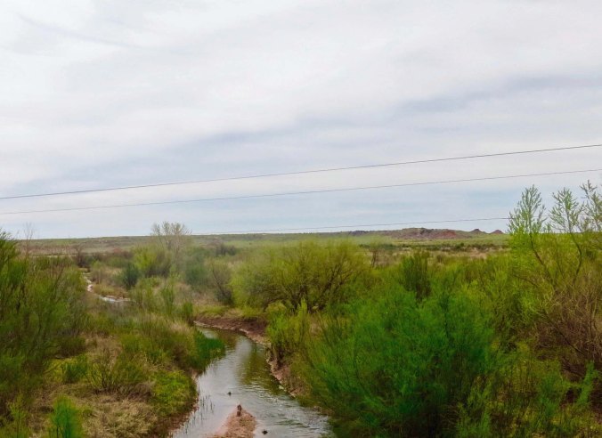
A number of tributaries feed into the Brazos River in West Texas. Eventually the river flows into the Gulf of Mexico south of Huston.

A number of tributaries feed into the Brazos River in West Texas. Eventually the river flows into the Gulf of Mexico south of Houston.

The Brazos River near Aspermont Texas.

The river cuts through the Llano Estacado providing travelers with a break from the flat terrain of West Texas.

A distant view of the Double Mountains of West Texas near Aspermont.

A distant view of the Double Mountains of West Texas near Aspermont.

The break in terrain was welcome. My over-heated body appreciated the 20-30 mile per hour breeze generated by my downhill dashes— although it whined about the climb afterward.  There was even an occasional shade tree! The challenge here is that it becomes difficult to see in the shade when you are quickly moving between shadows and sunlight. Loose gravel, broken glass, and other road hazards lurk in the dark, waiting to provide nasty surprises.

That’s the way it was with the rattlesnake. I was racing down a hill and he/she was relaxing in the shade, enjoying the warm pavement.  I was a few feet away from a fanged encounter when I spotted him, all coiled up. I prefer my rattlesnakes rattling a warning when I approach. But there wasn’t time for him to rattle or me to think, “Oh, there’s a rattlesnake.” Instincts honed by a million years of my ancestors fearing snakes and two thousand miles of me bicycling took over. I zigged, damn lucky I didn’t land on top of four feet of extremely irritated serpent.

Heart beating like a jack hammer, I executed a U-turn at the bottom of the hill and pedaled back up to the rattlesnake. It hadn’t budged. That changed when I lobbed a couple of rocks his way (from a distance). As he grouchily slithered off the road wanting to bite someone— me, I told him how lucky he was to have encountered a bicyclist and not an 18-wheeler.

Adding insult to almost injury, a strong headwind caught me about ten miles outside of Aspermont. The wind had to be blowing at least 40 miles per hour. Tired, hot, and cranky, I dropped into my lowest gear and climbed out of the saddle. Two hours later I reached the town. My journal tells me I drank a gallon of ice tea.

Aspermont was like most of the west Texas towns I rode through: small, isolated, and slightly depressed. Employment opportunities were few. Population was going down, not up. The town’s population had been 1,357 in 1980. By 1989 it had dropped by a hundred or so.  The young people were leaving, heading off to the brighter lights of Dallas, Houston and other urban areas.

High school sports were a bright spot, however. Most towns had signs announcing when their kids had won state or regional championships, even if it was 10-20 years ago. I spent a pleasant evening in Aspermont recovering from my long day and chatting with the friendly locals who laughed at my adventures and regaled me with tales of their own. Texas is a place for story telling. That night there was another impressive thunder and lightning show, reflecting the heat and wind I had experienced during the day.

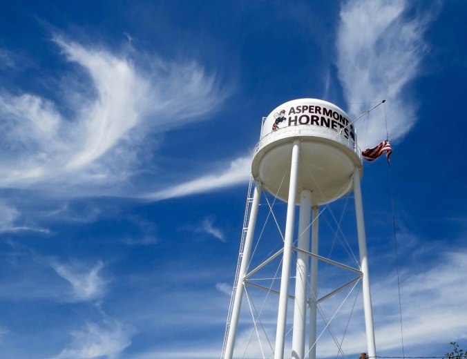
High school sports are very important in the small towns of West Texas. The local team, the Aspermont Hornets, is featured on the town's water tower.

High school sports are very important in the small towns of West Texas. The local team, the Aspermont Hornets, is featured today on the town’s water tower.

Abandoned homes reflect the dropping population of many West Texas towns. This was once somebody's dream.

Abandoned homes reflect the dropping population of many West Texas towns. This was once somebody’s dream.

The next day, I bicycled on to Throckmorton, a short 60 miles without excessive heat, wind or rattlesnakes. I was really impressed with the town’s beautiful city hall. Not so much with the local grocery store where I went to buy some fresh fruit. The oranges looked like rejects of rejects. (I admit to being spoiled by the fruits and vegetables of California.) Throckmorton is cow country so I booked myself into the Cow Country Motel and ate dinner at the Rancher’s Restaurant.

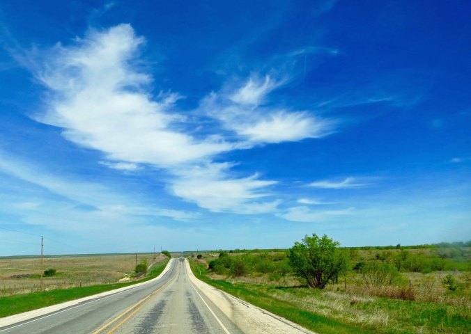
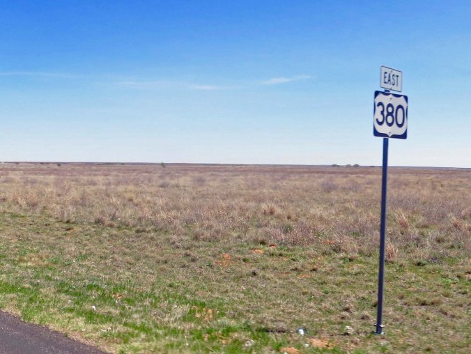
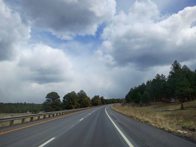
Highway 380 between Aspermont and Throckmorton.

Highway 380 between Aspermont and Throckmorton.

Some appropriate cattle on the way to Throckmorton.

Some appropriate cattle on the way to Throckmorton.

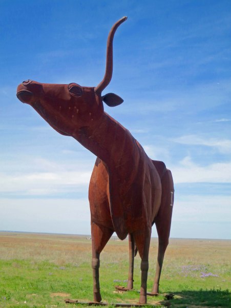
Peggy and I found this 22 foot high sculpture of a Texas Longhorn bull just a few miles west of Throckmorton.

Peggy and I found this 22 foot high sculpture of a Texas Longhorn bull a few miles west of Throckmorton. It wasn’t there when I bicycled through the area in 1989. The artist, Joe Barrington, is noted for creating  anatomically correct animals.

A side view of the sculpture, which is known as the Bridle Bit Bull. The local rancher who owns the property commissioned the art.

A side view of the sculpture, which is known as the Bridle Bit Bull. The local rancher who owns the property commissioned the art.

A side view of the City Hall in Throckmorton.

A side view of the City Hall in Throckmorton.

And a front view to conclude this post.

And a front view to conclude this post.

NEXT BLOG: A side trip to Archer, Texas, the home of Larry McMurtry and his fabulous bookstore. I also continue my bike trip on to Jacksboro and Fort Richardson, one of my favorite campgrounds on the bike trip.


And Just How Big Is Texas? The 10,000 Mile Bike Trek

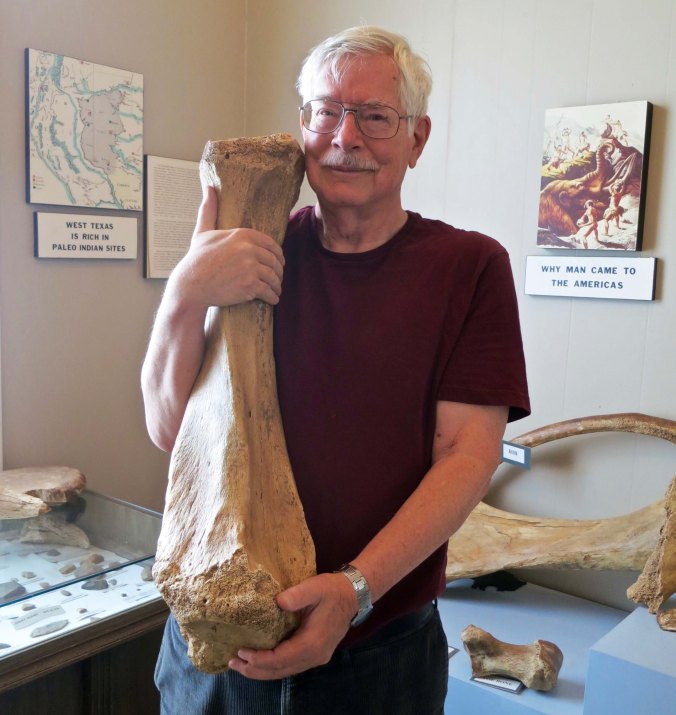
Texas is like this bone, big. I found this mastodon bone at the Garza County Museum in Post, Texas.

Texas is like this bone, BIG. I found this fossil at the Garza County Museum in Post, Texas. Peggy and I often stop in small museums as we travel. We are never disappointed and often delighted. Where else could I play with mastodon bones? There are more photos from the museum below. (Photo by Peggy Mekemson.)


“You must remember that space is large; it is even larger than Texas.” — Werner von Braun, the great rocket scientist. I don’t know if you could persuade a true Texan of this, or even me, after I rode my bicycle across the state.


Every state greets you with a welcome sign.

Every state greets you with a welcome sign.

My first major landmark the next day was a sign declaring I was about to enter Texas. I stopped, of course. I had now bicycled through four states: California, Nevada, Arizona and New Mexico. Texas with its heat, thunderstorms, hailstorms,and tornadoes was next.

I knew something about distances in the state. I had driven across it twice. I also knew a little about the weather. In search of the perfect steak on one of my trips, I barely escaped a flash flood. A day later it was hailstones the size of hardballs. In the early 80s, I taught a workshop in Houston, Texas on using long distance bicycle trips as fundraisers. None of this, however, prepared me for bicycling across the state.

Sometimes it is best not to know too much about what you are getting into. A lot of adventures would be missed.

I climbed back on my bike and spontaneously broke into the song, All My Ex’s Live in Texas. George Strait had made the country-western tune popular a couple of years earlier and I had been singing it with flair ever since. My first wife lived outside of Houston.

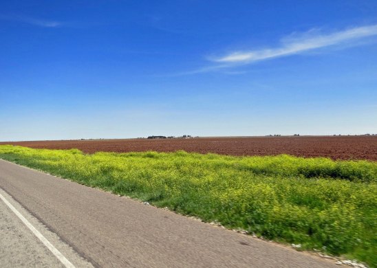
My initial view of the state surprised me. Where I had expected scrub brush and cacti, large farms stretched into the distance. Huge, insect-like, irrigations systems crawled across the land shooting long showers of water over several acres at a time. Plowed areas were so red they reminded me of the laterite soils of the West African rain forests, where I had served as a Peace Corps Volunteer.

I wasn't prepared for the extensive farms and the red soil I found in West Texas.

I wasn’t prepared for the extensive farms and the red soil I found in West Texas.

Cotton was king here. The crop had been harvested the previous fall but scroungy grey cotton balls could still be seen clinging desperately to weeds just off the highway. Bicyclists, who live on highway shoulders, tend to notice such things, along with dead animals and broken auto parts. And they have a lot of time to contemplate what they see.

I biked on through the small town of Plains and on to Brownfield. Natural landmarks are few and far between in flat country. I came to rely on two man-made additions to the skyline: water towers and grain elevators. Almost every town in the Texas dry-country had a water tower, which would proudly display its name. Many farming towns with rail connections also had grain elevators. Both of these structures reach for the sky. My challenge was to dampen my Pavlovian responses and not get too excited about food and drinks when I first spotted them. Usually, they were miles away. I’d arrive at DQ (Dairy Queen), when I arrived at DQ.

A water tower seen in the distance marking the town of Plains, Texas.

Water towers became one of my main land marks as I biked across Texas. Do you see that tiny dot in the air?

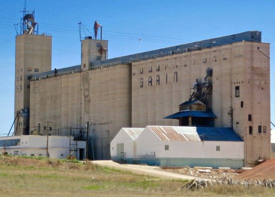
I always wonder where they find enough grain to fill these grain elevators up. This particular elevator was in Brownfield.

I always wonder where they find enough grain to fill these huge grain elevators. This particular storage facility was in Brownfield.

The local DQ in Brownfield must have taken its cue from the water towers and grain elevators. I ate in enough DQs as I bike across the country that the company should have sponsored me. Peggy and I stopped here for old times sake.

The local DQ in Brownfield must have taken its cue from the water towers and grain elevators. I ate in enough DQs as I biked across the country that the company should have sponsored me. Peggy and I stopped here for old times sake.

That night, billowing dark clouds stretched across the sky. There was a tornado watch on, the first of several I would face. To prepare myself, I went in search of a beer. Unfortunately, Brownfield was a dry town. Blue Laws were still in effect and there was no booze available, at least publicly. I’m pretty sure that 99%, or more, of the adults in town drank. Luckily, someone directed me to a liquor store drive-through a few miles outside of town. The clerk laughed when I rode my bike through. As I recall, they only sold their beer in cases or six-packs. Darn.

There was a spectacular thunder and lightning storm that night, but fortunately no tornadoes. I only had to drink three beers out of the six-pack.

I awoke to a clear, warm day and bicycled 47 miles into Post, a town that had been founded by CW Post of cereal fame in 1907 as a utopian experiment. There were to be no whores or alcohol in town. People could eat all the cereal they wanted. Post was something of a fanatic when it came to breakfast food.  He thought his Grape Nuts product could cure appendicitis. (Don’t try this at home, kids.)

CW Post founded the town of Post, Texas on 200,000 acres on property he bought from the Cattle Baron Slaughter.

CW Post founded the town of Post, Texas on 200,000 acres he bought from the cattle baron John Slaughter.

Post picked up his ideas on the curative properties of his products from another cereal magnate, John Harvey Kellogg. My favorite health food advocate of the time, however, was the Presbyterian minister, Sylvester Graham. The good reverend thought his creation, Graham Crackers, would curb people’s sexual appetites.

It’s something you might want to think about the next time you scarf down a S’more.

The Garza County Museum in Post is housed in what was once a sanitarium built for the town by CW Post. It was choked full of almost everything imaginable.

The Garza County Museum in Post is housed in what was once a sanitarium built for the town by its founder. The museum was  full of almost everything imaginable. Following are a few examples.

There is nothing particularly unusual about finding a stuffed buffalo head in a museum. But i found the sign on the side quite interesting. A quote: "In order to subdue the Plains Indians, mass extermination of the buffalo was ordered by the US Government."

There is nothing particularly unusual about finding a stuffed buffalo head in a western museum. But I found a quote on the sign quite disturbing:  “In order to subdue the Plains Indians, mass extermination of the buffalo was ordered by the US Government.” To the degree this is true, it is a dark moment in US history indeed.

There was also a bear rug. My toes, unbidden by my more rational mind which thought 'poor bear,' wanted to bury themselves in the rug.

There was also a bear rug. My toes, unbidden by my more rational mind that thought ‘poor bear,’ wanted to bury themselves in the fur.

I am not sure how Harvey the rabbit made it into the museum, but there he was, all six feet of him.

I’ll close today with Harvey, the rabbit. I am not sure how he made it into the Garza County Museum, but there he was, all six feet three and one half inches of him. Originally, Harvey was an invisible rabbit who starred in a 1950 movie with James Stewart.

NEXT BLOG: I leave Post and find sizzling heat, high winds, and a misplaced rattlesnake.

A final note: A friend of mine who lives in Alaska, David McElroy, has recently finished a book of poetry, Mark Making, that is now available for preorder. David somehow combines working as a bush pilot and extensive travel with writing poems. According to the publisher:

“He has been published in national journals and has a previous book of poems called Making It Simple.  He is an award winner of grants from the National Council on the Arts and the State of Alaska Council on the Arts and Humanities.”

I quite enjoy his work, and you may, as well. If you are interested, here is the preorder information. When you arrive at Finishing Line Press, just type in Mark Making in the search box at top.

David's poetry book

Adios UFOs; Hello Pecos Bill… The 10,000 Mile Bike Trek

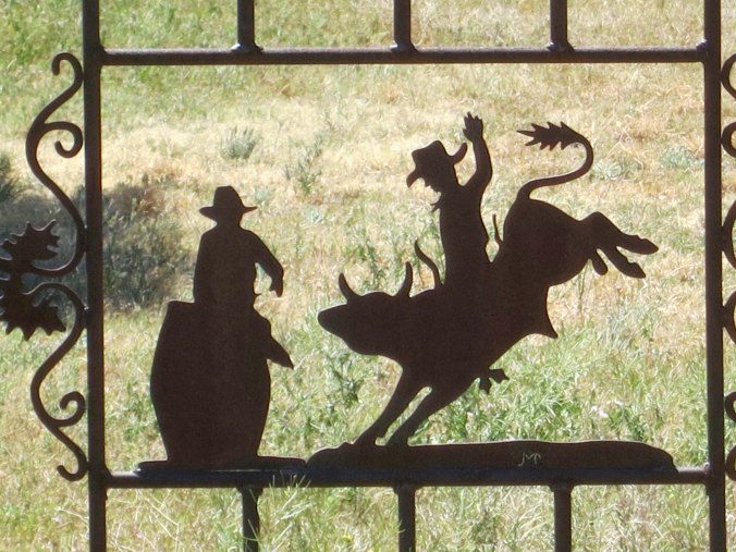
The Western United States still rings with the legends of cowboys such as the mythical Pecos Bill and the very real Judge Roy Beam. Cowboy lore lives on today in modern rodeos.

The Western United States still celebrates the legends of cowboys such as the mythical Pecos Bill and the very real Judge Roy Bean. Cowboy lore lives on today in modern rodeos. Metal art in Tatum New Mexico has captured many of the themes of the West.


“Hang ’em first, try ’em later.” Judge Roy Bean


As I said goodbye to aliens and UFOs and pedaled out of Roswell on Highway 380, my thoughts turned to the Pecos River, about ten miles away. Like the Rio Grande, it was another river of cowboy fame. This was the land of the mythical Pecos Bill, who could accomplish such prodigious feats as lassoing a whole herd of cattle at one time. He carried a rattle snake for a whip and was said to ride cyclones and mountain lions as well as his horse, Widow Maker, who feasted on dynamite with the same relish that Peggy eats dark chocolate.

Judge Roy Bean, a Justice of the Peace and saloon keeper, was another legend of the Pecos. He was the real thing, however, a ‘hanging judge’ who billed himself as the ‘last law west of the Pecos.’ Cowboys could stop off at his place for whiskey or justice, depending on their needs.  His courtroom/saloon was down on the Texas border with Mexico, far south of where I would be crossing the Pecos, however.

Most of my knowledge of the Pecos came from Westerns. Between ages 11 and 13, I read every Zane Grey, Luke Short and Max Brand book I could lay my hands on. When I was off riding the range, punching cattle, and chasing outlaws, not even the call to dinner could pull me off the great stallion I rode. I carried my own brand of justice, blazing six-guns. And I was lightning fast. Step aside Billy the Kid. (No wonder Americans are so gun-crazy, given the legacy of the West.)

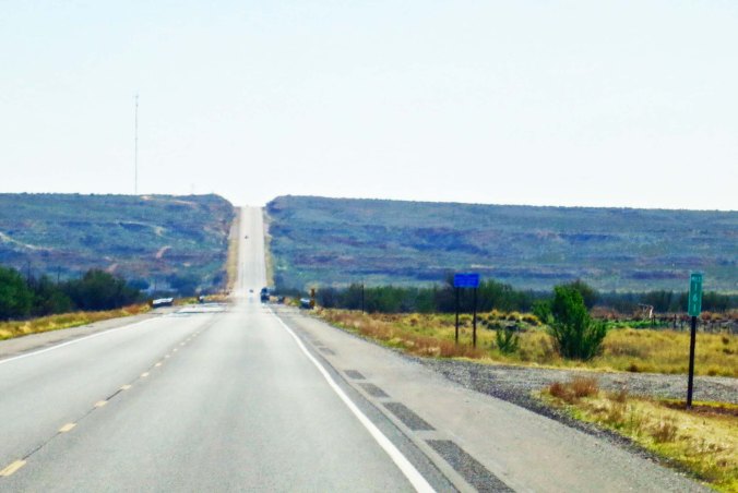
My roads in the west were always disappearing over the horizon. This is New Mexico 380 dropping down into the Pecos river and climbing out the other side.

My roads out-west were always disappearing over the horizon. This is New Mexico 380 dropping down into the Pecos River (lined with trees) and climbing out the other side.

I paused at the Pecos and threw a rock into the water as a symbolic gesture to my youth. Then I returned to the present and checked out a hill I had to climb on the other side. It wasn’t much. I had passed the 1500-mile mark on my journey and was on my way to 2000. My legs and lungs now laughed at such obstacles.

What did bother me was that I was saying goodbye to the West I loved, the west of towering mountains. I would soon be biking across land that was flatter than the proverbial pancake. Yes, rivers and streams cut through these lands, there would be canyons and steep ups and downs, there would even be impressive hills as I made my way east. This land had a beauty and personality of its own. But I wouldn’t see another mountain until I reached Gatlinburg, Tennessee and started over the Smoky Mountains. And they don’t tower.

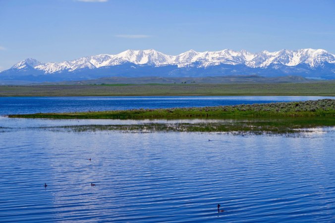
I would have to return to the west to get views like this. The Rocky Mountains would be waiting for me in Montana.

I would have to return to the west to get views like this. The Rocky Mountains would be waiting for me in Montana.

Does land really get any later and featureless than this?

Here’s what I would find in eastern New Mexico and western Texas. Does land really get any flatter?

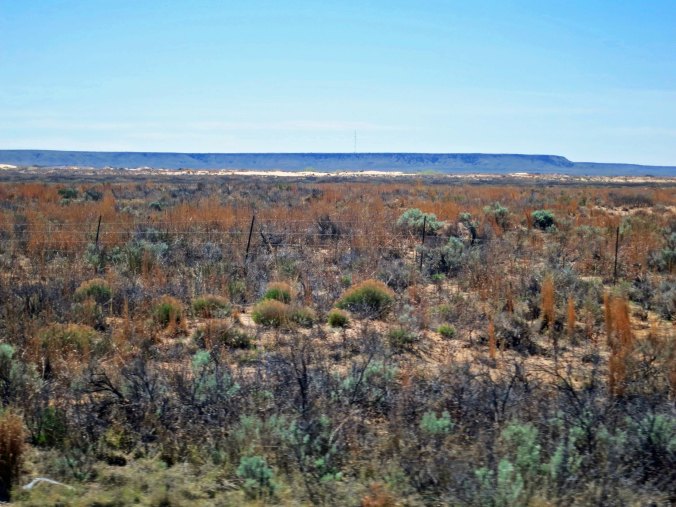
I was soon cycling across the flat plains and the mountains were receding into the west. This was sagebrush and cattle country. What trees existed were small, little more than tall bushes in comparison to their far western counterparts. In the distance I could see a long escarpment that signified the beginning of the Llano Estacado, one of the largest tablelands in North America. Between the road and the escarpment, I was surprised to see sand dunes. Later I learned that they were the Mescalero Sand Dunes, apparently an ATV paradise. (The dunes took their name from the Mescalero Apaches. Maybe their ghosts hassle the four-wheelers for disturbing the peace.)

The looms in the distance. The tan line that seems to be at the base is the Mescalero Dunes.

The Llano Estacado looms in the distance. The tan line at their base is the Mescalero Dunes.

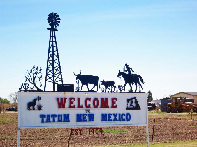
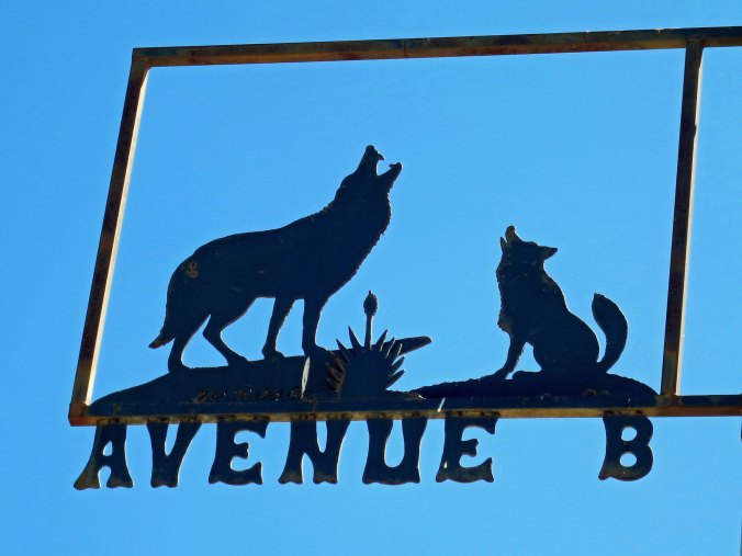
I climbed up onto the Llano, passed through the non-town of Caprock, and eventually reached Tatum, New Mexico. As I approached the community, I started noticing metal art, everywhere, scads of it. It seems that everyone in town and for miles around supported the local artist. There were cowboys, buffalo, coyotes and other western themes, each simply and clearly outlined, dark shadows against the sky and countryside. Figuring I had found a town that supported art, I just had to spend the night.

It wasn't surprising that the Welcome to Tatum sig would feature a cowboy, windmill and cattle, representative symbols of the Old West. But note the oil well on the lower right, a symbol of the new/old west that has been given a whole new life with fracking.

It wasn’t surprising that the Welcome to Tatum sign would feature a coyote, cowboy, windmill and cattle— representative symbols of the Old West. But note the oil well on the lower right, a symbol of the West that has been given a whole new life with fracking. Welcome to earthquake country!

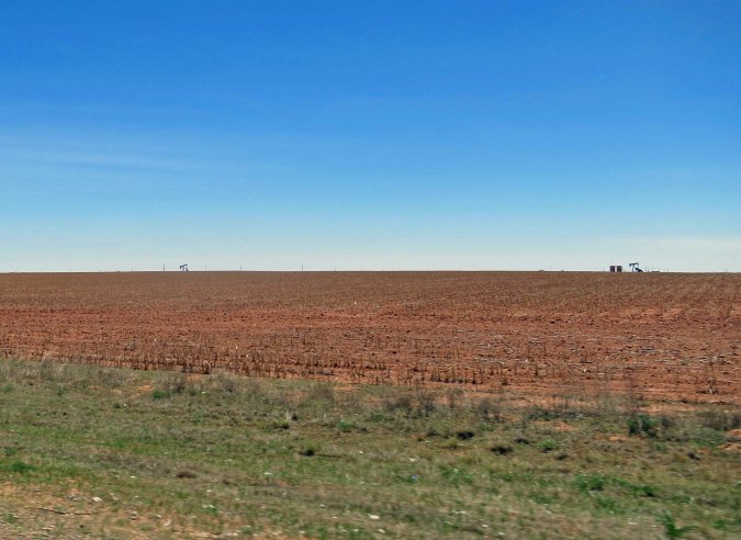
Check out the horizon here. Those are oil wells pumping away.

Check out the horizon here. Those are oil wells pumping away.

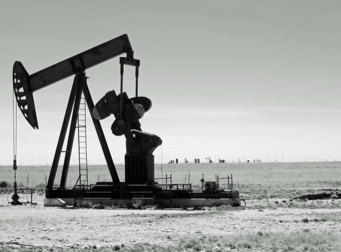
A close up rendered in black and white. To me, these pumps appear as some type of primitive bird, forever pecking away.

A close up rendered in black and white. To me, these pumps appear as some type of primitive bird, forever pecking away.

More of Tatum's metal art. I am thinking gossip.

More of Tatum’s metal art. I am thinking gossip. “Did you hear that they found more oil south of 380? We are all going to be rich, oil rich!”

Who better to represent the vanished Old West than the buffalo. Fortunately, they are making something of a comeback, but never again will millions wander across the unfenced plains.

Who better to represent the vanished Old West than the buffalo. Fortunately, they are making something of a comeback, but never again will millions wander across the unfenced plains.

Coyotes are survivors, ultimately adaptable to their environment. Have the rabbits been wiped out? "Here kitty, kitty, kitty."

Coyotes are survivors, ultimately adaptable to their environment. Have the rabbits been wiped out? “Here kitty, kitty, kitty.”

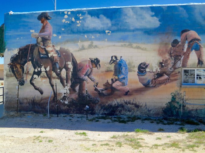
For my final photo of the day, this mural adorned the side of a business in Tatum. The spirit of the Old West lives on.

This mural adorned the side of a business in Tatum. The spirit of the Old West lives on as cowboys rope and brand cattle. We had our own touch of the Old West a few miles away from where Peggy and I live in Oregon a couple of weeks ago. A thief stole a bicycle. A local cowboy jumped on his horse, rode after him and lassoed him. Imagine what might have happened if he’d had a branding iron…

NEXT BLOG: I enter the forever state of Texas and prepare for my first tornado watch— with a six-pack of beer.

Bicycling 70 Miles Up the Rocky Mountains for a Piece of Pie… The 10,000 Mile Bike Trek

1 Cherry Pie at Pie Town

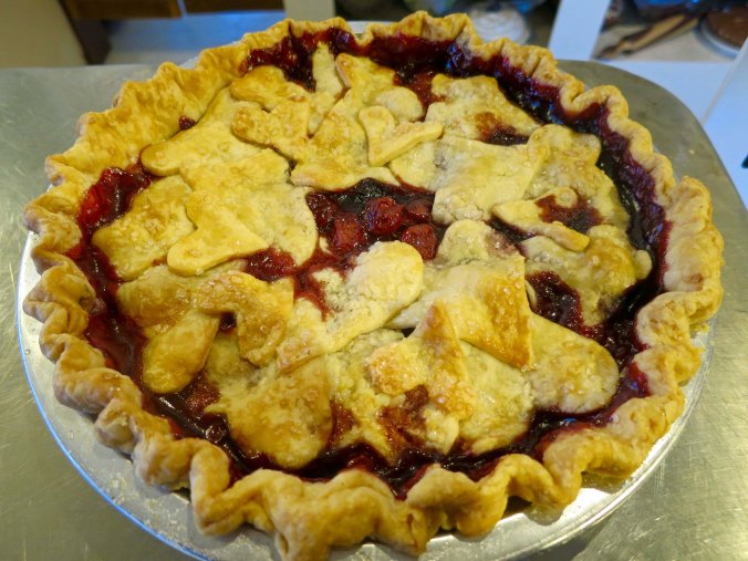
And how far will a long distance bicyclist go for a piece of pie? Quite a ways if you throw in the whole pie. Check out the little hearts in the crust. They were a special touch from the Pie Lady of Pie Town.


May your trails be crooked, winding, lonesome, and dangerous, leading to the most amazing view. May your mountains rise into and above the clouds. – Edward Abbey


The Rocky Mountains were waiting for me. I wasn’t particularly concerned. By this point in my journey, I had learned that the way to get through the day was to get up, climb on my bike, and start peddling. Life was pretty simple.

I am not as familiar with the Rocky Mountains as I am with the Sierra Nevada Mountains of California. But I have driven back and forth back across their 3000-mile spine several times. More importantly, I have sampled their beauty on foot in Canada, Montana, Colorado, Wyoming and New Mexico.

My first ever backpack trip was near Lake Louise in Banff National Park. It was 1969. I had read Colin Fletcher’s “The Complete Walker” to learn about backpacking and then stopped by REI in Seattle (when it was REI’s first and only store) to buy my equipment. It was early in the season and I remember lying awake at night in my tent with the rain pouring down while I listened to large rocks and minor avalanches tumbling off the surrounding cliffs and wondered just what it was that had made me think backpacking would be fun. Later, I backpacked into the more remote Canadian Rocky’s with a geologist from the University of Arizona in search of some of the world’s oldest rocks. It was my job to help carry out the samples. Lucky me.

Once, while backpacking in Montana’s Glacier National Park, I was treated to listening to Peggy sing numerous repeats of “99 bottles of beer on the wall” at the top of her lungs. We were hiking through brush and kept finding massive piles of steaming grizzly poop.

I backpacked by myself following “crooked, winding, lonesome and dangerous” trails in the Wind River Mountains of Wyoming and the Gila Wilderness of New Mexico. In the Wind River’s, a not-dangerous marmot nibbled on my shoe— with my foot in it. At first I was amused, but his sharp, chisel-like teeth led me to shoo him back to eating flowers. Slightly more dangerous, a cow elk played tag with me in the Gila Wilderness. That game ended with her charging and sliding to a stop five-feet away. Elks are big animals, even from a distance. Up close, this girl looked and sounded like a steam locomotive.

With the exception of Peggy singing to the bears, which was yet to come, I thought of these Rocky Mountain experiences as I checked out my map during my layover day in Springerville.  I would be following New Mexico 60 for most of the trip across the mountains, which was a road I had never travelled. I didn’t know what to expect in terms of a climb but it was easy to see that services were few and far between— nothing new there.

I also noted that the distance to the top was further than I thought, closer to 70 miles than 50. Whether steep or not, the climb would be long. The good news: A small community named Pie Town was located on the Continental Divide. A town with that name would have pie to sell, right? Visions of a large slice of hot apple pie with a generous scoop of vanilla ice cream made me drool like a Pavlovian dog.

2 Looking east toward the Rocky's from Springerville, AZ

The view from my campground in Springerville, looking eastward toward the Rockies. The mountains didn’t look as steep as the towering giants further to the north.

The time came to climb on my bike, as it inevitably did, and I was out at 6:00 AM. I grabbed breakfast in Springerville. Pickings looked slim along the way. My day unfolded with three surprises. First, the climb was not difficult. There were even a few decent downhills. I am not, however, a fan of downhills when I am climbing a pass. Lost elevation has to be regained! I think there is a basic law of physics involved.

3 Climbing up the Rocky's on US 60 on the west side

As expected, there were ups as I climbed toward the Continental divide.

5 Highway 60 in New Mexico

But there were also downs as I made my way toward the distant mountains and Pie Town.

I replenished my water in the small town of Quemado and passed by a couple of wide spots in the road that may have had booming businesses once, but that was ancient history. Beyond that, there was nothing, nada.  I began to hallucinate pie. I would eat two pieces of apple pie with ice cream and then switch to cherry pie with ice cream. Maybe there would even be the prize of all prizes: coconut cream pie, no ice cream required. I had loved that as a youth. I worked as a janitor cleaning the Episcopal Church in Placerville on Saturdays when I was 12. They paid me four dollars. Afterwards I would make a beeline to the Golden Chain Restaurant for a cup of coffee and a piece of coconut cream pie. It cost me a buck, one-fourth of my weekly salary. Talk about an addiction…

My second surprise came as a rude shock. The pie shop in Pie Town was out of business. The owner had retired. There would be no apple, cherry, or coconut cream pie for Curt. I whined loudly at the pie gods and was met with silence. There was nothing to do but climb on my bike and start down the mountain. But there is more to this story.

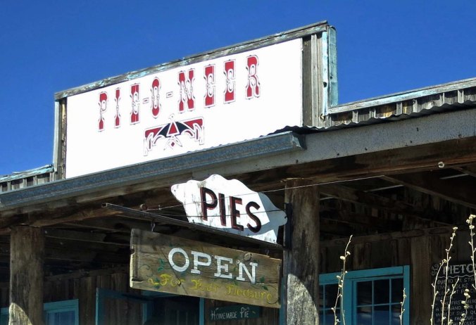
Several years later I passed though Pie Town again and an open sign pulled me into the Pie-O-Neer Restaurant. I was greeted by its delightful owner, Kathy Knapp. Kathy and her mom, Mary, had driven through the town in the mid-90s and her mom had found it a travesty that a town with the name of Pie Town had no pies to sell. So Kathy, an advertising executive from Dallas, had purchased the restaurant and she and her mom had gone into business. I told my tale of woe to Kathy. As I left, she presented me with a piece of coconut cream pie in a to-go box, for free. “This is for when you biked through and didn’t get any pie,” Kathy told me. Had I not already been married to Peggy, I might have fallen in love.

Peggy and I stopped by again in April as we retraced my bike route. Kathy was as bubbly as ever. Her restaurant is now famous and Kathy is something of a celebrity. Numerous newspaper articles, Sunset Magazine, national TV news, and an award-winning documentary have featured the Pie-O-Neer Pie Shop. People drive for hundreds of miles to sample the delicious pastry. Kathy and her business partner, Stanley King, posed for a photo and then Kathy insisted on coming out and having her photo taken with us and the van. As for pie, Peggy and I ate more than we should have. There will be no more said on the subject.

6 Pie-O-Neer Pies in Pietown New Mexico

Good news, the pie shop was open.

7 The pie bar at pie town

What a find: 12 different types of pie! All cut up and ready to eat. But how to choose? That was the question.

8 Kathy Knapp and Stan at Pie Town

Kathy Knapp, the Pie Lady, and her business partner, Stan King. Stan’s T-shirt showed a bit of geekiness with its ‘piece of pie symbols.’

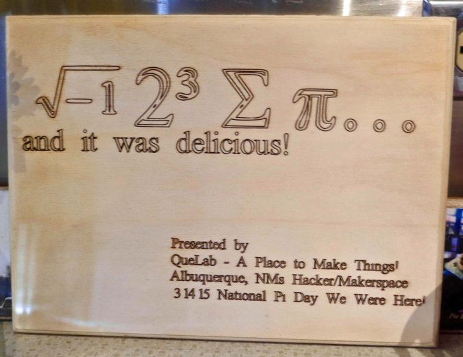
Geeks and Pie Town

A note from the QueLab of Albuquerque, a gathering place for geeks, displayed even more geekiness.

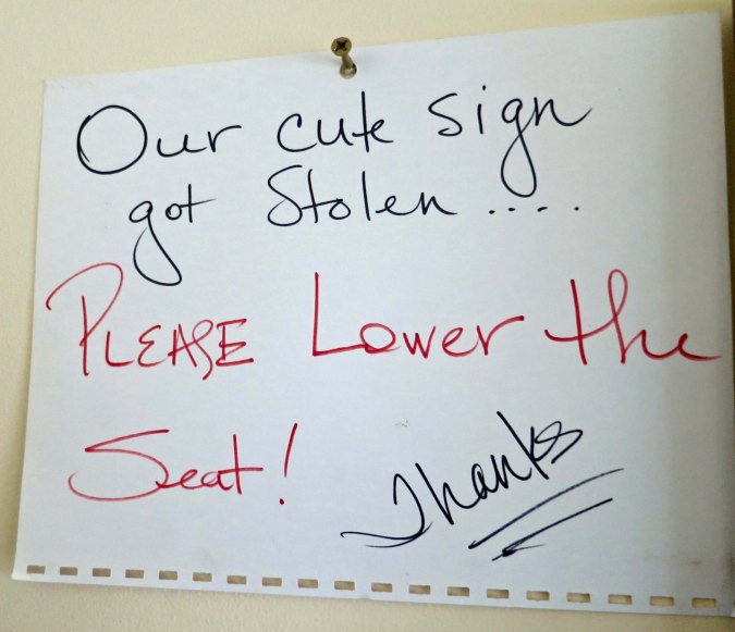
10 Restroom sign at Pie Town

At least this message in the restroom was plain and simple.

11 Kathy Knapp the Pie Lady

Peggy, Kathy and I standing behind Quivera the Van. I am holding onto Blue, the bike I travelled 10,000 miles on.

But back to bicycling. What a romp! I had forty plus miles of downhill in front of me. I bicycled past a museum featuring windmills, through Ponderosa Pine forests, and by massive rocks with strange faces. I hardly touched my brakes. A cool wind caressed my face.  All too soon I left the forests behind and returned to the high plains desert. Then something magical happened, I came on my third surprise: A collection of huge radio telescopes scattered across the Plains of San Augustin and pointed toward the sky. A thought buried in the nether regions of my brain came skipping to the surface: VLA, the Very Large Array. Naturally, I had read about them; the huge telescopes enabled scientists to explore the universe using radio waves, unlocking secrets withheld from optical telescopes. But I didn’t have a clue that they were located on my route. I looked on in wonder, wanting to see more.

12 Windmill

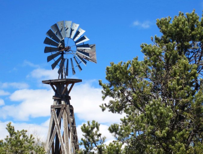
Windmills are a common sight in the arid west. A windmill museum sits next to the Pie-O-Neer restaurant.

13 Off the summit on New Mexico Highway 60

Downhill for 40 plus miles— a bicyclist’s dream.

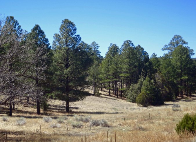
Ponderosa pines on New Mexico Highway 70

I bicycled through Ponderosa Pine forests…

15 Rock Face on New Mexico Highway 60

And past massive rocks. I never have any trouble spotting faces in rocks. Is it because I have an active imagination, or am I just weird? No, don’t answer that. BTW, this guy looked friendly.

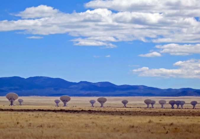
VLA telescopes in late afternoon

Imagine coming on these in a high plains desert and not having a clue what they were. I’d start thinking aliens.

Dusk was approaching, however, and I needed a home for the night. I told the VLA I would be back and biked on. A few more miles brought me to a small camping area. As I was unpacking my tent, I was struck by another thought. Aided by a great downhill, I had biked over 100 miles and crossed the Rocky Mountains, all in one day! It was my first ever 100-mile day.

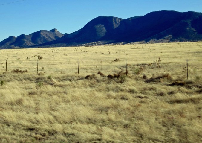
Highway 60 in New Mexico near the VLA

As I biked toward camp, the setting sun turned the grass a golden color.

NEXT POST: A blog special on the Very Large Array. Peggy and I were lucky to arrive at the VLA when the facility was hosting its annual open house. A scientist took us on a tour that allowed us to see the giant telescopes and the massive amount of computer power that allows astronomers and astrophysicists from around the world to study the universe back to the very beginning of time.

A Very Scary Night in Winslow… The 10,000 Mile Bike Trek

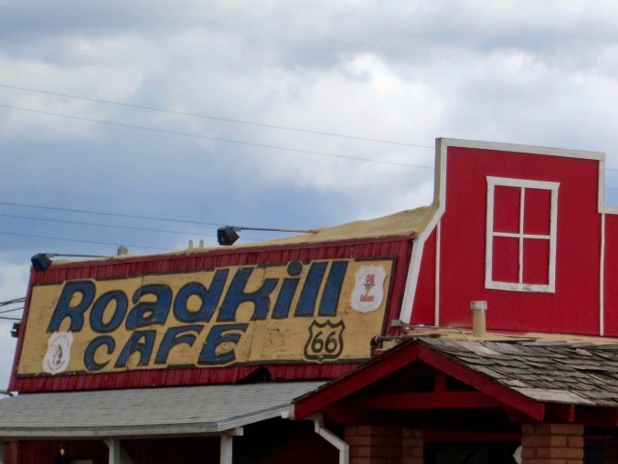
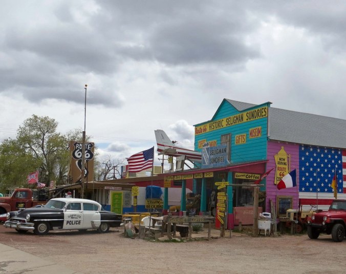
This cafe in Seligman, Arizona on Route 66 has a special significance for bicyclists whose view of road kill is often up close.

This cafe in Seligman, Arizona on Route 66 has a special significance for bicyclists whose view of road kill is often up close.

I recognized there were inherent risks when I decided to undertake my bike trip. I would be traveling for 10,000 miles on 1¼ inch tires through all types of terrain and weather conditions. The roads would range from smooth and modern, to filled with pot holes, to dirt. Some came with wide shoulders to ride on, others with none. Everything from 18-wheelers to drunk drivers would be passing me, and some frighteningly close. I would be traveling over some of the most remote roads in North America. And, I would be by myself. (I might also note here that it was the era before cell phones.)

I accepted these risks willingly; it is the nature of adventures. Besides, I was an experienced bicyclist and camper, carried appropriate clothing and equipment, and didn’t take unnecessary chances. I am not a thrill seeker. When I camped out beside the road, for example, I hid. When the weather was particularly severe, I headed for shelter. On steep downhills, I didn’t say, “Wow, let’s see how fast I can go!”  (Okay, there were a few times.) There was ample challenge in what I was doing; I didn’t need to wave my finger at fate.

Most days reminded me of my mortality in some way or the other. A truck would brush by me; I’d pick up a flat in a tight situation, a drenching rain would hit when I was miles from nowhere, a big dog would decide I’d make a nice dinner. But these went with the territory and didn’t particularly worry me. Anybody who does a bit of cycling has experienced them. Occasionally, however, something would get my heart beating like a rock drummer on steroids. One such event took place in Winslow, Arizona. But I wasn’t ‘standing on a corner,’ in Winslow as in the Eagle’s song “Taking It Easy”; I was happily zonked out in bed. The story is coming up at the end of this post. First, I had to get there.

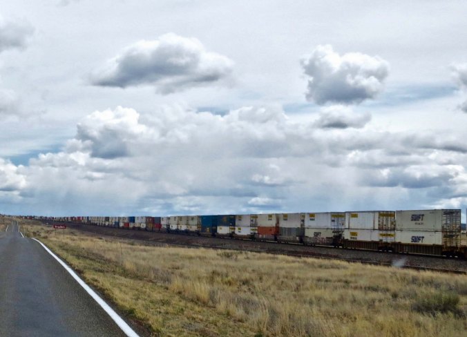
As I rejoined Route 66 from my camp at the Grand Canyon Caverns, dark clouds threatened on the horizon. There were showers about, and I was hoping to dodge them. Although deserts don’t get a lot of rain (the definition is under 10 inches a year), when it rains, it can pour— so to speak, and there is nothing to absorb the water. This is a bad time to be camped out in a gully. Or be bicycling, as far as that goes. Thunder and lightning frequently accompany the storms and you and your metal lighting-rod bike may be the tallest thing around. Fortunately, the storms hit elsewhere and the most exciting thing I did on my morning ride into Seligman was watch the long freight trains of the Santa Fe Railroad cross the desert.

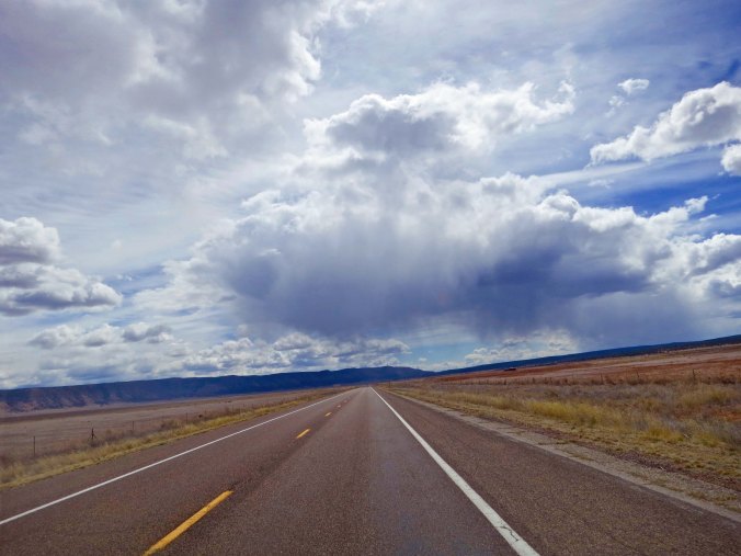
You have a lot more time to worry about storms in the desert! You can see them from a long ways off.

You have a lot more time to worry about storms in the desert! You can see them from a long ways off.

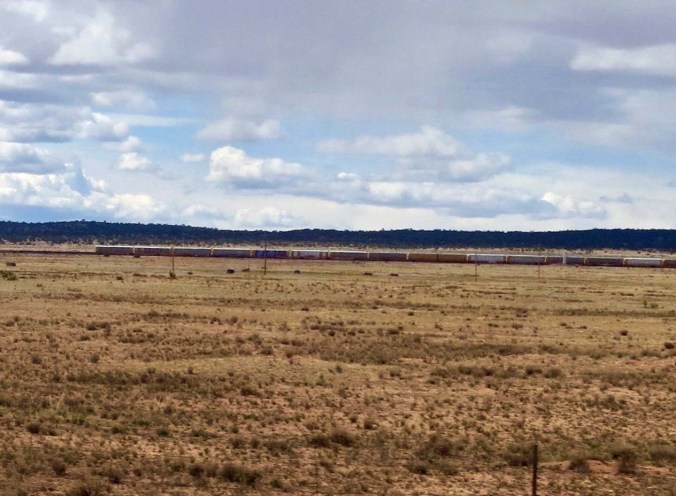
Trains provided me with a from of companionship on my journey, or at least a distraction. I usually climbed off my bike and watched them pass.

Trains provided me with a form of companionship on my journey, or at least a distraction. I usually climbed off my bike and watched them pass.

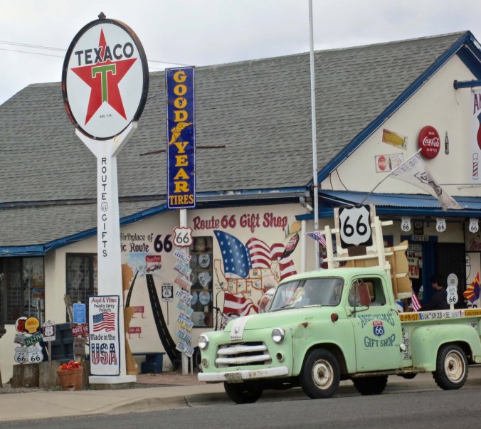
Breakfast provided an opportunity to look around the small town. I am pretty sure there is not another community on Route 66 that is so dedicated to making money off the fact. It was in 1989 and it still is today. Consider the photos that Peggy and I recently took when we drove through the town retracing my bike trip:

I don't think this store could have worked in more Route 66 signs. How many can you count?

I don’t think this store could have worked in more Route 66 signs. How many can you count?

Here's another example of Seligman merchants struggling to make a profit off of their Route 66 heritage.

Here’s another example of Seligman merchants struggling to make a profit off of their Route 66 heritage.

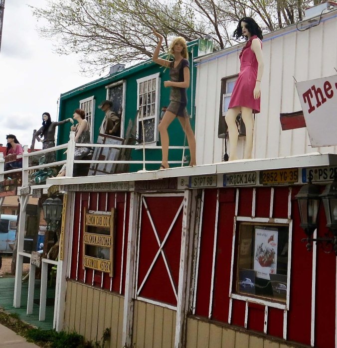
This bar featured what I can only assume were supposed to be ladies of the evening.

This bar featured what I can only assume were supposed to be ladies of the evening.

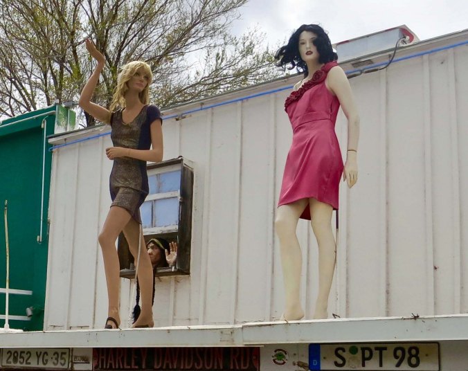
I understood the girls but what was with the Lord of the Rings type character staring out the window?

I understood the girls but what was with the Lord of the Rings type character staring out the window? And what did he have in mind doing with his hand?

Historic Route 66 travelled on for another 20 or so miles before dropping me on to Interstate 40. If you were around in 1989, you may have heard my sigh. I left one of America’s bluest highways to one of its busiest, chock full of big rigs travelling as fast as the speed limits allowed— and faster.  Fortunately, there was a decent shoulder. Five miles of freeway travel brought me to Ash Fork, another town that once served Route 66 travelers. Unlike, Seligman, Ash Fork has another claim to fame: The Flagstone Capital of the USA. If all of the rocks piled around the town are any indication, it is probably true. I spent the night. The next morning found me out on the freeway again. It was my only route to Winslow.

The railroad tracks came closer to the road just outside of Seligman. This happens to be one of the busiest freight lines in America. When I traveled through it was the Santa Fe Railroad of Aitchison, Topeka and Santa Fe fame. Now it is part of the Burlington North Santa Fe Railroad one by Warren Buffet.

The railroad tracks came closer to the road just outside of Seligman. This happens to be one of the busiest freight lines in America. When I traveled through it was the Santa Fe Railroad of Atchison, Topeka and Santa Fe fame. Now it is part of the Burlington North Santa Fe Railroad owned by Warren Buffet.

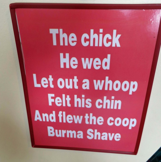
Do you remember the days of the Burma Shave signs posted along the highways of America. This would have been five different signs stretched out over a mile or so. The chick he wed— Let out a whoop— Felt his chin— And Flew the coop— Burma Shave. New signs with similar humor are now posted along Route 66 in Arizona promoting humor.

Do you remember the days of the Burma Shave signs posted along the highways of America? This would have been five different signs stretched out over a mile or so. The chick he wed— Let out a whoop— Felt his chin— And Flew the coop— Burma Shave. New signs with similar humor are now posted along Route 66 in Arizona promoting safety.

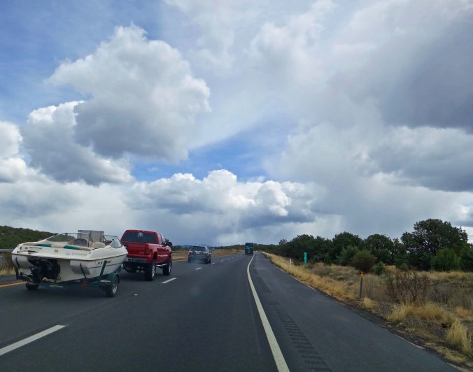
So much for my peaceful road. Route 66 dumped me on to Interstate 40.

So much for my peaceful road. Route 66 dumped me on to Interstate 40.

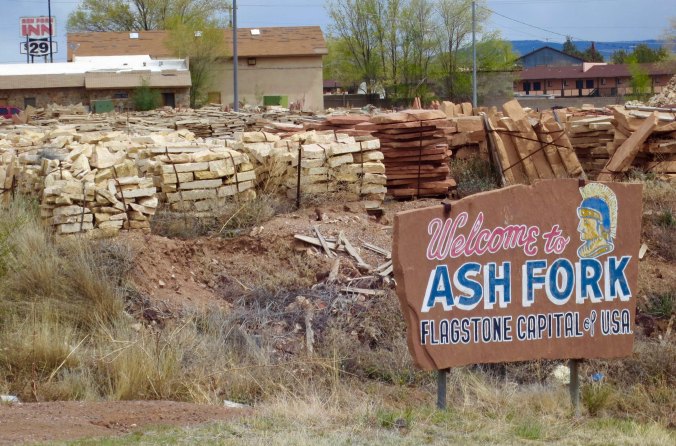
Fortunately it wasn't far. I came to Ash Fork just up the road, which is quite proud of its association with flagstone.

Fortunately it wasn’t far. I came to Ash Fork just up the road, which is quite proud of its association with flagstone. The small campground where I stayed was located somewhere on the other side of the rocks. There was also my kind of motel off to the right.

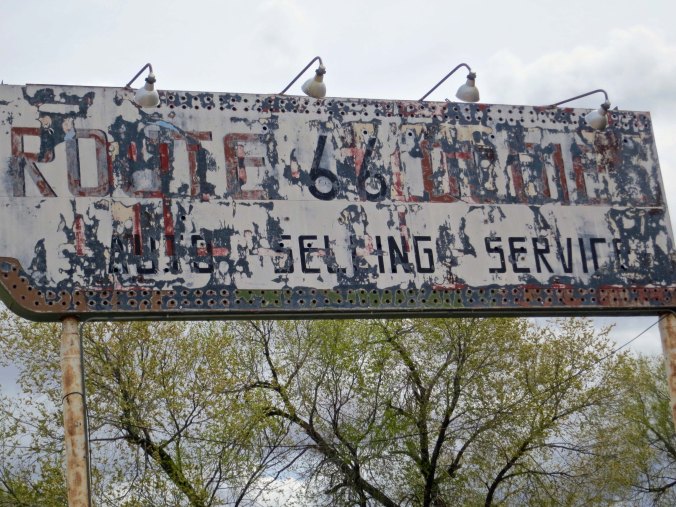
Ash Fork is also an historic Route 66 town as indicated by this sign.

Ash Fork is also an historic Route 66 town as indicated by this sign.

Climbing was the order of the day, all the way to Flagstaff, one of my favorite Arizona towns. Nestled in the pines beneath the towering San Francisco Mountains, it features decent restaurants, coffee, bookstores, and campgrounds… everything I needed to keep me rolling down the road. I’ve stopped there many times, both on my way east and west and on my way north and south to the Grand Canyon and Sedona. I enjoyed myself so much that evening, I didn’t get out until two the next day. Fortunately, the 50 plus miles to Winslow on I-40 were mainly downhill or flat so I arrived before dark. My only disappointment was that I didn’t have time to stop off and see the huge meteor crater along the route. (Peggy and I stopped to check it out. It’s impressive.)

It was a steady climb out of Ash Fork to Flagstaff. But it had its rewards. I came on the first pine trees I had seen since I left Greenhorn Pass. I was so excited that I got off my bike and did a dance. Then I had to pee. You know how that goes...

It was a steady climb out of Ash Fork to Flagstaff. But it had its rewards. I came on the first pine trees I had seen since I left Greenhorn Pass. I was so excited that I got off my bike and did a dance. Then I had to pee. You know how that goes…

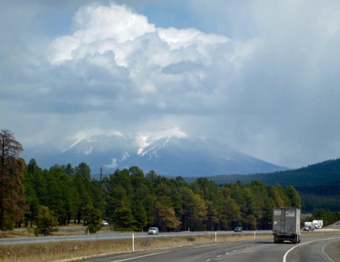
A storm rages over the San Francisco Mountains. Hopi legend has it that their Kachina gods wander the mountains during storms. Apparently they don't like to be disturbed. Nasty things can happen to the unweary human.

A storm rages over the San Francisco Mountains. Hopi legend has it that their Kachina gods wander the mountains during storms. Apparently they don’t like to be disturbed. Nasty things can happen to the unwary human. I camped up there once and was quite careful.

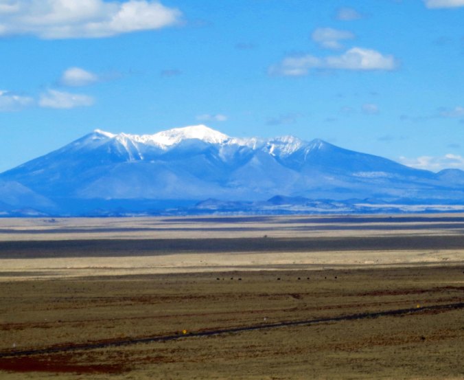
Another view of the San Francisco Mountains— this time from the east. Flagstaff nestles at their base.

Another view of the San Francisco Mountains— this time from the east. Flagstaff nestles at their base.

I missed seeing the Arizona meteor Crater on my bike trip so Peggy and I stopped by there a few weeks ago as I retrace my route. It is a very impressive hole in the ground.

I missed seeing the Arizona meteor Crater on my bike trip so Peggy and I stopped by there a few weeks ago as I retrace my route. It is a very impressive hole in the ground.

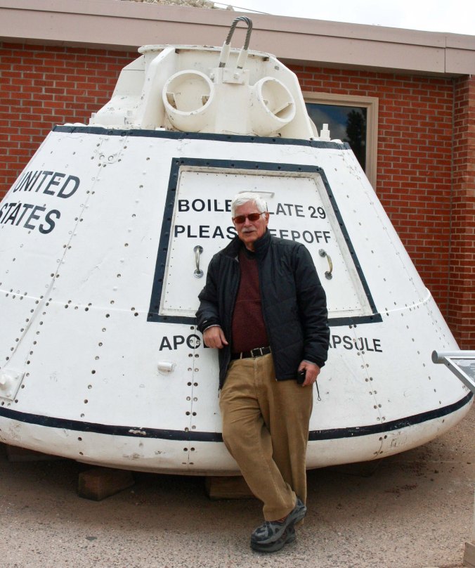
Because of its similarity to craters on the moon, the Arizona Crater was used of early astronaut traIning.

Because of its similarity to craters on the moon, the Arizona Crater was used of early astronaut traIning. And no, I wasn’t ‘on’ the boiler plate. (Photo by Peggy Mekemson.)

But now to Winslow and my story. Since it was late, I didn’t have a lot of time to search for lodging and I did what I rarely do… stopped at a motel with a huge sign proclaiming it was “American Owned.” It’s not that an American owned the motel that bothered me; it’s the prejudice that it likely reflected. Anyway, a very, very old lady was behind the desk. She stared at me and demanded to know what I wanted. (My showing up on a bicycle made me very suspicious, I’m sure.) “A room?” I hazarded a guess. “It’s $20 up front.” The emphasis was on ‘up front.’ The price was right and I handed over the cash. She seemed surprised but checked me in, a process that went on and on. Finally, she showed me the key. “There is a five-dollar deposit,” she announced, holding onto the key. I was becoming a bit ouchy but turned over the money.

Twenty-dollars was too much for the room. It was small, poorly lit, and came with a television that may have worked when “I Love Lucy” was a hit. It smelled like 50-years of tobacco smoke. The bed seemed hardly made, if at all. I wondered what kind of vermin it might contain. I checked. I also decided that my bike would be much safer inside. Exhaustion alone drove me to bed and asleep.

It was around one a.m. when I awoke with a start as I heard a key being inserted into the door and the door knob begin to turn. I sat up so fast I left my brains behind. A dark form was looming in the doorway. It screamed. I screamed back, primeval.

“What in the fuck are you doing in my bed?” he yelled!

“What in the fuck are you doing in my room?” I yelled right back.

“I am getting the manager,” he shouted in parting. I breathed a sigh of relief— too soon, as it turned out. The manager must have heard the ruckus because he was there faster than I could put on my pants, foaming at the mouth.

“What are you doing in this room,” he demanded. “I am calling the police.”

“An old woman checked me in and gave me a key,” I jumped in to deflect a 911 call.

“Oh,” he responded, deflated. “Mother.” As if that explained it all. “Her sight is gone and her memory is worse. I left her here when I had to run to the grocery store.”

That was it for an apology, but I was allowed to stay in the room and the police weren’t called.  Small compensation, to say the least. No offer was made to return my money. It was a while before I fell back asleep and I was out early. New adventures were waiting.

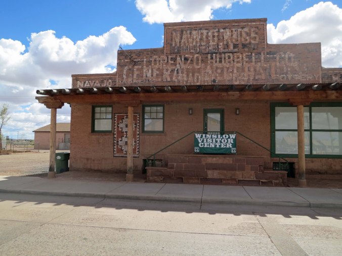
The Winslow visitor center. Once again, the connection with Route 66 is emphasized. This was once a store that sold Navajo blankets and jewelry. Many such stores were located along historic Route 66 in Arizona and New Mexico.

The Winslow Visitor Center. Once again, the connection with Route 66 is emphasized. This was once a store that sold Navajo blankets and jewelry. Many such stores were located along historic Route 66 in Arizona and New Mexico.

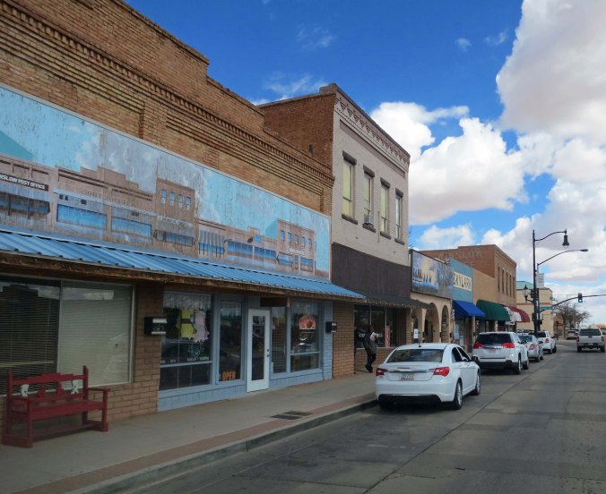
Downtown Winslow as it looks today, pretty much as it looked in 1989 and 1949.

Downtown Winslow as it looks today, pretty much as it looked in 1989 and 1949.

NEXT BLOG: On to the edge of the Rocky Mountains.

Route 66: A Journey Back in Time… The 10,000 Mile Bike Trek

While historic Route 66 travels through six states and numerous climate zones, I always think of it as being in the desert, a prejudice I developed from reading my grandfather's Arizona Highways as a child.

While historic Route 66 travels through eight states and numerous climate zones, I always think of it as being in the desert, a prejudice I developed from reading my Grandfather’s “Arizona Highways” as a child. This photo I took a couple of years ago near Oatman, Arizona would have been the same 60 years ago.


Nostalgia: Pleasure and sadness that is caused by remembering something from the past and wishing that you could experience it again. — Merriam-Webster Dictionary

Route 66 represents nostalgia in mythic proportions. It harkens back to an earlier era— back before the hustle and bustle of modern-day freeways, back before the advent of McDs, BKs, and numerous other fast food restaurants, and back before cell phones insisted that we keep in contact with anyone and everyone all the time, even when on the open road.

It is a blue highway incarnate, and, as I am sure you have figured out, I am a blue highway kind of guy.  When I was planning my bike trip, I designed it to follow some of the loneliest, bluest roads in the US and Canada. Of course there were compromises, Las Vegas being a glaring example. And there were times when my only option was to climb onto a freeway. As I followed busy Boulder Highway up and out of Las Vegas, however, it was Route 66 and North America’s other historic byways that I was dreaming of.

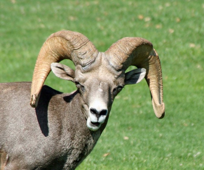
I worked my way up to Railroad Pass, which marks the dividing line between Las Vegas/Henderson and Boulder City. It had been a long haul out of Vegas so breakfast at the Railroad Casino seemed in order. The casino has been there forever and lacks the glamor of its Las Vegas cousins. It even came with an old-fashioned café. I ordered one of my favorites: sausage, two eggs over medium, hash browns, whole wheat toast and coffee. It cost four bucks. I left with a happy tummy and a smile on my face, retrieved my bike from the post it was locked to, and headed for Hoover Dam, keeping an eye out for the Desert Big Horned Sheep that hang out in the mountains above the highway.

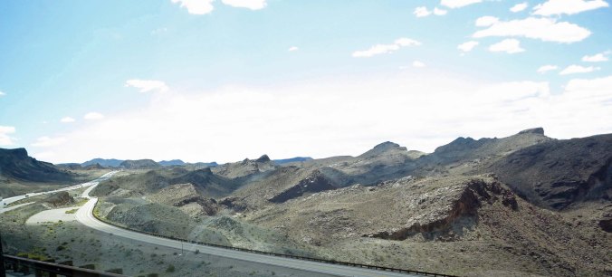
Boulder Highway as it looks today... not much different than it looked in 1989.

Boulder Highway as it looks today… not much different from it looked in 1989.

“Watch the road, Curt!” I admonished me. Do you talk to yourself? I always have. Riding on a bike for six months by myself made me much more fluent, or maybe the word is verbose.

There is a fun story about the Big Horn Sheep in the area that I related in an earlier blog but is worth repeating here. A small park is located just off the road that bypasses Boulder City to Hoover Dam. The bright green grass beckons to the sheep up on the mountainside during Nevada’s hot, dry summers and down they come. I’ve stopped by a couple of times to photograph them. An acquaintance of my friend Ken Lake lives across the road from the park and related this tale.

The path the sheep follow down to the park passes right by a house that has a shiny, aluminum garage door. One day the herd ram noticed another large ram in the door— staring back at him, challenging him. Here was competition for his lovely ewes! This wasn’t to be allowed, of course, so he reared up and charged the door full tilt, crashing into it with his mighty horns. But the other ram was still standing, albeit a bit beat up. So he charged again and then again. The door was trashed. Apparently the owner had a hard time persuading his insurance agent how the damage was caused.

The herd ram determining whether my taking his photo was something he should be objecting to.

The herd ram determining whether my taking his photo was something he should be objecting to.

Peggy and I have a similar problem at our home in Oregon. The big tom turkeys that live in the forest like to parade their harems through our yard. The largest of the toms has discovered the turkey that lives in the bumper of our Toyota Tacoma pickup. He is not happy. I’ve seem him stand in front of the bumper for thirty minutes at a time, fluffing out his feathers, sticking out his neck in a loud gobble, and pecking the bumper. The other turkey fluffs his feathers, sticks out his neck and pecks right back. All of this would just be humorous except the big tom goes looking for the other turkey. He flies up, lands in the pickup bed… and poops. Admittedly, turkey poop isn’t as traumatic as having your garage door trashed, but it is copious and messy. The tom and I have had several discussions about my love of roast turkey.

I was yet unaware of the Big Horn Sheep and a long way off from owning a wilderness retreat in Oregon when I cycled by the park on my bike trip. I made my way down to Lake Mead and crossed over Hoover Dam. Looking out over the lake and the distant drop on the far side from a bicycle was quite an experience. If I were to cross the dam today on my bike, TSA would stop me at its check point and make me empty out my panniers to determine whether I was a mad bomber. Why else would someone bike across the dam— and up the other side?

The climb out was hot and steep, filled with hairpin turns, autos and large RVs. I sweated all of them, so to speak. Reaching the top, I was faced with another challenge, miles and miles of sizzling, desolate desert with minimal facilities. My kind of country.

A high four multi-lane bridge has replaced crossing over Hoover Dam when traveling between Nevada and Arizona. This shot looks down on the old highway I was following after climbing out of the canyon.

A high, multi-lane bridge has replaced crossing over Hoover Dam when traveling between Nevada and Arizona. This shot looks down on the old highway I was following after climbing out of the canyon.

A bit farther up the road looking south. Dante would have found this site suitable for his concept of hell.

A bit farther up the road looking south. This photo could have served as an illustration for Dante’s Inferno.

I biked on, catching far off views of the Colorado River and then picking out a distant mountain to bike toward. As I reached my goal, the sun began to set, and warm breezes turned slightly cool. It was time to search for a home. Unfortunately, a sturdy fence blocked easy access to the desert. I wasn’t particularly interested in being caught climbing over. There are a lot of guns in Nevada. A kindly dirt road came to my rescue. I took advantage of a break in traffic and zipped down it and into a dry gulch, the perfect hiding place— as long as it didn’t rain and the local rattlesnake was elsewhere. I fired up my backpacking stove, made a cup of coffee, added a dash of 151 proof rum, and downed a granola bar. Life was good. Coyote music lulled me to sleep.

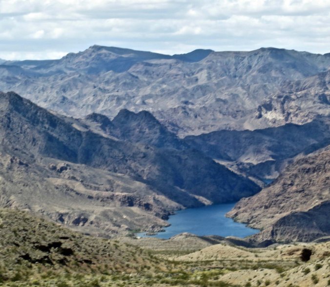
Looking down on the Colorado River from a viewpoint on the Las Vegas-Kingman road.

Looking down on the Colorado River from a viewpoint on the Las Vegas-Kingman road.

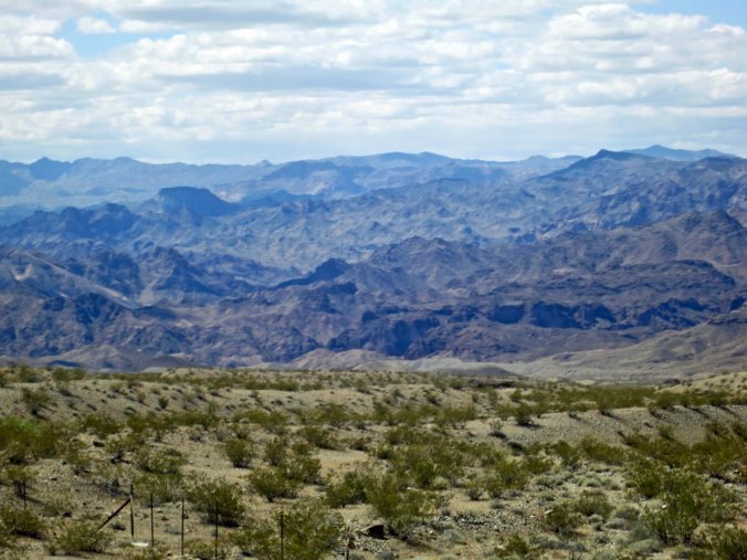
I used this mountain as a marker to determine my progress.

I used this distinctive mountain as a marker to determine my progress.

Looking out toward my home for the night.

Looking out toward my home for the night. Not bad, eh? Or is it that 151 proof rum improves how everything looks?

I was up early in the morning and out before the traffic. Fifty-miles later I was in Kingman, Arizona, a town bursting with pride about its Route 66 heritage, and hoping to harvest a bundle of tourist dollars because of it. I grabbed a room in a beat up old motel that claimed Route 66 vintage and prices. Following a much-needed shower, I headed out to follow the road through the town and absorb some of its ambience.

Kingman, Arizona is quite proud of its connection to Route 66. Two different museums in town feature Route 66 themes.

Kingman, Arizona is quite proud of its connection to Route 66. Two different museums in town feature Route 66 themes.

A number of murals depict a romanticized view of travel on the highway.

A number of murals depict a romanticized view of travel on the highway.

When I talk about the inexpensive motels I found along my bike route, this is what Peggy assumes they looked like.

When I talk about the inexpensive motels I found along my bike route, this is what Peggy assumes they looked like.

A beautiful desert sunset as seen from Route 66 in Kingman.

A desert sunset as seen from Route 66 in Kingman.

The next day found me absorbing much more as I left the town behind and made my way east on what was once one of America’s main cross-country routes. Today it is a quiet road. The majority of the people traveling east and west are zipping by on Interstate 40, rushing toward whatever destination/destiny awaits them.

When I think of Route 66, I think desert. When I was a small boy, I was enthralled by my grandfather’s subscription to “Arizona Highways.” It often featured Route 66, and it featured deserts. My first acquaintance with the highway was when I was driving west from Atlanta in 1968 and followed portions of it through Arizona, including the one I was biking on.

My route for the day took me on a gentle climb up through arid lands with views of mesas along the way. Occasional creeks were teaming with life that was seeking the desert’s most treasured commodity, water. I passed by ramshackle old buildings that had seen their heyday in the 40s and 50s. I waved at the few cars that passed me, either locals going about their business, or romantics like me, seeking a taste of a bygone era. A train whistle receding into the distance fit right in. I ended my day at the Grand Canyon Caverns, a tourist attraction of the early Route 66 that still pulls in visitors today.

Route 66 above Kingman.

Route 66 above Kingman.

A mesa above the highway. Traveling over the mets and beyond will bring you to the Grand Canyon.

A mesa above the highway. Traveling over the mesa and beyond will bring you to the Grand Canyon.

An old building that served as a gas station and garage during the heyday of Route 66. The gas pumps had been updated, but even they were no longer in use. I rendered the photo in black and white to represent the era.

An old building that served as a gas station and garage during the heyday of Route 66. The gas pumps had been updated, but even they were no longer in use. I rendered the photo in black and white to represent the era.

My campground for the evening with a typical Route 66 sign.

My campground for the evening with a typical Route 66 sign.

The campground/motel and caverns also featured dinosaurs. (Photo by Peggy Mekemson.)

The campground/motel and caverns also featured dinosaurs. (Photo by Peggy Mekemson.)

The restaurant featured Betty Boop.

The restaurant featured Betty Boop.

And this map showing historic Route 66.

And this map showing historic Route 66. The arrow points to the Grand Canyon Caverns.

Sunshine lights up dark clouds that were promising rain at the campground.

Sunshine on the juniper trees provides an interesting contrast to the dark clouds that were promising rain at the campground.

Sunset at the Grand Canyons Cavern Campground.

I’ll conclude this post with sunset at the Grand Canyons Cavern Campground.

Note: If you are new to this series, my wife Peggy and I are retracing my 1989 bike route, this time in our van. Most of the photos come from our present trip.

NEXT BLOG: I will feature the rest of my bike trip across Arizona, including a very scary one a.m. invasion of a motel room I was sleeping in.


Bicycling through Death Valley… The 10,000 Mile Bike Trek

These gorgeous sand dunes are located next to Stove Pipe Wells.

Of the many reasons for cycling into Death Valley, these gorgeous sand dunes next to Stove Pipe Wells are among the top. Portions of Star Wars were filmed here.

I didn’t have to bicycle through Death Valley, but how could I resist. It is known as the hottest, driest, and lowest place in North America. It holds the world record for heat at 134° F, receives an average of less than two inches of rain a year, and is 282 feet below sea level at its lowest spot. It also happens to be drop-dead beautiful and is close to balmy in spring.

So I packed up my panniers at Isabella Lake and hit the road. Four days of moderate cycling were ahead of me before I arrived at Stove Pipe Wells in the heart of the Valley. At least I was hoping they would be moderate.

Day one was a three-beer day. It wasn’t overly difficult; it’s just that I made a novice mistake, one that can cost you dearly in the desert: I didn’t carry enough water. I know better. Over the years I have lectured hundreds of backpackers and bicyclists on the necessity of staying well-hydrated. Yellow pee is bad. (There is a newspaper at Burning Man in the Nevada Desert called “Piss Clear” to remind Burners of this fact.)

I was carrying two, one-liter bottles of water on my bike, close to a half-gallon. I should have been carrying four. By the time I had cycled 8-miles downhill to the town of Lake Isabella and then climbed for 35-miles and 3000 feet to the 5,250-foot Walker Pass, I had consumed all of it. I had drunk my last drop and was sucking on the nipple of my water bottle like a hungry baby sucks on a tit. Had screaming like a one-month old helped, I would have. What’s worse, not a drop was to be had before I reached my day’s destination at Inyokern. I had arrived in the great southwestern deserts of America where people are few and water is less.

Fortunately, it was only 15 miles and much of the way was downhill on a gentle 6% grade. I arrived at Inyokern, found a cheap motel, and consumed several glasses of its bad tasting water. Immediately afterwards, I headed for the restaurant across the road and had my three beers. Gulp, gulp, gulp. That night I was peeing clear, several times. The first thing I did the next morning was to go out and buy a two-liter back-up bottle of water and add 4.4 pounds to my bike. Here’s the thing, I never drank it; I never had to. But I carried it the next 9000 plus miles, as a reminder.

My next two days of cycling were typical desert cycling with nothing but me, rattlesnakes, scorpions, jackrabbits, mining operations— and the US military. Vast areas in the southern desert regions of California and Nevada have been set aside for practicing war and testing weapons. Leaving Inyokern, I biked through Ridgecrest, the site of the US Naval Air Weapons Station, which covers some 1,100,000 acres, an area the size of Rhode Island. It includes 329 miles of paved road and 1,108 miles of dirt roads, none of which were available to me. It did share the sound of jets flying overhead, however. One was so close it almost knocked me off my bike, so to speak. “The sound of freedom,” an air force pilot friend told me. Right.

I decided to spend my night in Trona, since my other option was camping out with the scorpions. Trona was founded as a company town to harvest its namesake mineral, trona, which you probably know as baking soda. Employees were paid in script that could only be used at the company store. (So much for shopping around for the best price.) Trona is still known as a mining town, rightfully so. And it is also known for having the only dirt football field in the US. Grass won’t grow there. The team is known as the Tornados. They should probably be called the Dust Devils. I saw several as I biked through the area.

I am not sure what particular mineral this huge white mound in Trona consisted of, but I don't think it was baking soda.

I am not sure what particular mineral this huge white mound in Trona consisted of, but I don’t think it was baking soda.

My goal for the next day was to bike through the Panamint Valley to Highway 190, the primary route into Death Valley from the west, and then climb up and over the Panamint Mountain Range down to Stove Pipe Wells, where I would be meeting a friend the next day. It was close to 76 miles with zero services along the way, miles and miles of nothing except magnificently lonely desert and million dollar views. I left at seven and made it to Highway 190 around two. Hiding out behind a highway sign, the only shade I could find, I contemplated the road snaking up the mountain and thought, “NO.” I would be climbing close to 4,000 feet in 12 miles in the heat of a Death Valley afternoon. Panamint Springs, known for a good restaurant, its shade and cool water, was a mile or so in the other direction with a minimal climb. My decision was easy… and it was one of my better decisions on the trek.

The road out of Trona was so empty, I would have loved to come across a donkey.

The road out of Trona was so empty, I would have loved to come across a burro. You will see a lot of roads like this as Peggy and I follow my bike route through the Southwest.

A view of the road through the Panamint Valley.

A view of the road through the Panamint Valley.

Looking up at the Panamint Range, the mountains I had to bicycle over.

Looking up at the Panamint Range, the mountains I had to bicycle over.

The sign that welcomes you to Death Valley today.

The sign that welcomes you to Death Valley today.

I was on the road at six the next morning. Within twenty minutes of starting my climb, I was out of the saddle in my lowest gear, travelling about three miles per hour. The climb to Town Pass was the most challenging climb of my journey. On the steepest parts, I would pedal 100 times and stop for a quick break. Only sheer stubbornness kept me on the bike and not walking. I was still irritated at having to walk through the snowstorm on Greenhorn Pass. The total climb took me four hours. I don’t think I could have done it the day before. What goes up, must come down, however, and there was a splendid downhill into Stovepipe Wells. The only challenge was that my bike wanted to go over 40 miles per hour. I told it no.

Climbing up this pass was one of the toughest climbs of my journey, much more tough than climbing over the Rockies.

Climbing up this pass was one of the toughest climbs of my journey, much tougher than climbing over the Rockies.

The road into Death Valley couldn't match the 13% grade coming off of Green Horn Pass but it was definitely steeper than the 6% coming off of Walker Pass. The breaks on our van were smelling of burnt rubber by the bottom. Our friends Ken and Leslie Lake, who joined us in Death Valley, had to replace a rotor on their left front wheel.

The road into Death Valley couldn’t match the 13% grade coming off of Green Horn Pass but it was definitely steeper than the 6% coming off of Walker Pass.

My friend joined me at noon and I allowed her to give me a ride over to Furnace Creek and Park Headquarters. I had earned a break. It was Easter weekend so we ended up camping with RVs in the overflow area. No matter, I slept solidly that night. The next morning, we biked down to Bad Water Basin and the lowest spot in Death Valley. It was all downhill, which sounds like a good thing, except we had to pedal, in low gear. That’s how strong the head winds were. The good thing was they almost blew us back up the mountain. We arrived back in camp and discovered that my beautiful, light weight and expensive Moss tent had disappeared. My stakes hadn’t withstood the wind. I found it a tenth of a mile away, pretty much trashed.

Still, I enjoyed Death Valley, as I always do, and I enjoyed the break in my solo journey my friend provided. The next morning, we attended a non-denominational Sunrise Easter service on top of a sand dune. I said my goodbyes, hopped on my bike, and headed for the glittering lights of Las Vegas.

Peggy and I took the above and following photos as we retrace my original 1989 bike trip. (We’ve now made it to Nova Scotia. Traveling by van is considerably faster than by bike! Eventually, my posts will catch up.) Our friends Ken and Leslie Lake joined us in Death Valley and Las Vegas. 

 Death Valley Sand Dunes

Another view of the sand dunes next to Stovepipe Wells.

This is the same lot at Furnace Creek where my tent had flying lessons. Ken, Leslie, Peggy and I were about to enjoy afternoon snacks.

This is the same parking lot at Furnace Creek where my tent had flying lessons. Ken, Leslie, Peggy and I were about to enjoy afternoon snacks.

People who have never been to Death Valley think of it mainly in terms of heat and desolation. It is actually quite beautiful. This photo was taken in Twenty Mule Canyon.

People who have never been to Death Valley think of it mainly in terms of heat and desolation. It is actually quite beautiful. This photo was taken in Twenty Mule Canyon.

Zabriskie Point is a short distance from Furnace Creek. I biked right by it on may way out. (Photo by Peggy Mekemson.)

Zabriskie Point is a short distance from Furnace Creek. I biked right by it on my way out. (Photo by Peggy Mekemson.)

Our friends Ken and Leslie Lake in Golden Canyon. Ken, too, has bicycled across the US.

Our friends Ken and Leslie Lake in Golden Canyon. Ken, too, has bicycled across the US.

Another view of Golden Canyon. (Photo by Peggy Mekemson.)

Another view of Golden Canyon. (Photo by Peggy Mekemson.)

We just missed the major display of flowers in Death Valley, but I caught these guys in Golden Canyon.

We just missed the major display of flowers in Death Valley, but I caught these guys in Golden Canyon.

This gargoyle-like rock was on the edge of the Canyon.

This gargoyle-like rock was on the edge of the Canyon.

Devil's Golf Course is on the way to Bad Water. The Panamint Mountains are in the background.

Devil’s Golf Course is on the way to Bad Water. The Panamint Mountains are in the background.

Ken and Leslie, 282 Feet below sea level at the lowest point in North America.

Ken and Leslie, 282 Feet below sea level at the lowest point in North America.

We found this character at Furnace Creek demonstrating how to make arrowheads. For a moment, I though Santa Clause may have made a wrong turn.

I’ll conclude with this volunteer we found at Furnace Creek demonstrating how to make arrowheads. For a moment, I thought Santa Clause may have made a wrong turn.

NEXT BLOG: On to Las Vegas

“NO! BAD DOG!!!” The 10,000 Mile Bike Trek

I camped out for the first time on my bike journey at McConnell State Recreation Area on the Merced River

I camped out for the first time on my bike journey at McConnell State Recreation Area on the Merced River.

There’s this thing about my body: it’s tough. Bouncing back from the second day of my bike trip is a good example. Once my body and its fat cells learned there were no options, they resigned themselves to hitting the road. It helped that I would be cycling over flat land. Make that flat, flat, flat.

I attribute my body’s toughness to working hard as a kid. This isn’t an Old Fartism; I didn’t walk five miles to school through a blinding snowstorm and five feet of snow. I lived a block away from school and we were lucky if we had five inches of snow once every five years. But starting at 14, I worked in the fruit orchards around Diamond, and it was hard, grueling labor that I somehow found fun. Both my body and mind learned that hard work didn’t kill me— and that there is a certain satisfaction from meeting hard physical challenges. It was a lesson that served me well in my years of backpacking and bicycling.

Leaving Escalon, I had some 250 miles of the Central Valley of California ahead of me— five days to get in shape before tackling the Sierra Nevada Mountains.

The Central Valley is one of the richest farm lands in the US, and, indeed, the world. I saw a lot of walnut trees, fruit trees and grapes. If you are a farmer, this is exciting stuff. If not, well the first three hours of cycling through grape orchards might be interesting. After that, it is good to have other things to occupy your mind, like dogs for example. They are always good for a few seconds of heart-thumping entertainment. Loose dogs are the bane of bicyclists. Here’s what I had to say in my journal.

3/15/89: It was a long day through raisin land. I must have had 20 dogs ranging in size from Chihuahua to Doberman decide they wanted a piece of me. I varied my tactics depending on the size of the dog. I slowed down for little ones, cycling just fast enough to keep ahead of them while telling them what good dogs they were. I would speed up for mid-sized dogs and get away. The big ones were the problem. First I would try a sharp, “No! Bad Dog!” If that didn’t work, I would calculate my chance of escaping. Having a down hill helped. If all else failed, I would get off my bike and have a discussion with the dog. Bending down and picking up a rock was a language that most of them understood. One particularly large brute didn’t get the message. I yanked off my air pump and prepared for confrontation. All that stood between us was my bike. He issued a deep, hungry growl while I waved my pump around ninja style. Only a whistle and then demand from his master saved the day. Reluctantly, very reluctantly, he returned to his house.

One road, Conejo, was by far the worst. I think that there must have been a requirement that each house have at least one large dog, that it be loose, and that it have a strong belief that cyclists were wild game to be chased down and eaten.

Congo Road featured this market as well as big dogs. The graffiti is a modern addition.

Conejo Road featured this market as well as big dogs. The graffiti is a modern addition.

My journey from Escalon led me down the west side of the Central Valley following Santa Fe Drive, a road with railroad tracks on one side and farms on the other. Traffic ranged from being busy with big trucks to isolated with a few tractors and pickup trucks. One 18-wheeler brushed by my bike and sent me scurrying off the road, causing my first flat. That was the bad part of the day, followed by some very bad words.

Cycling down Santa Fe Drive featured long, straight stretches, fruit trees and a train track.

Cycling down Santa Fe Drive featured long, straight stretches, fruit trees and a train track.

Train tracks meant trains, which I always considered an excuse to get off my bike and watch them pass.

Train tracks meant trains, which I always considered an excuse to get off my bike and wave at as they passed.

The good part was ending up that night at McConnell State Recreation area on the banks of the Merced River. Stately cottonwoods and other trees provided shade while a variety of birds provided music. It was my first camping out on the trip. When I unloaded my tent, Bone fell out. Apparently, he had been napping. A friend had slipped him into my pack. That night, I wrote letters by candlelight.
(Wi-Fi, Facebook, blogs, texting and cell phones and other forms of modern communication were not yet available in 1989. Except for pay phones, letters were the only way I had to communicate during my six-months of travel.)

The Merced River as it flows through McConnell State Park. When Peggy and I drove through there a few weeks ago, a sign warned swimmers that there were leeches in the water. We didn't go swimming.

The Merced River as it flows through McConnell State Park. When Peggy and I camped there a few weeks ago, a sign warned swimmers that there were leeches in the water. We didn’t go swimming.
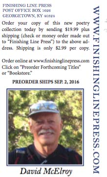
After the park, I continued my journey down Santa Fe Drive, passing Castle Air Force Base and its impressive museum (A blog special). Next came dodging traffic in Merced followed by more lonely miles on Santa Fe Drive. I spent the night in Chowchilla and then crossed Highway 99 and made my way around Fresno and down to the town of Corcoran.

Castle Air Force Museum features over 60 vintage airplanes.

Castle Air Force Museum features over 60 airplanes dating back to World War II and up to the present. (I am going to give it a special blog.)

In the tiny community of Raisin City, I stopped at a grocery store and discussed cycling with its Indian owner. He told me his job in India as a young man had been to carry water on his bike with 20 gallons (167 pounds) on each side. It made my carrying 50 pounds of gear seem like child’s play.
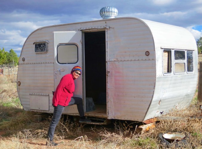
Raised City reflected the poverty faced by many farm workers in the Central Valley... a poverty not shared by the majority of farmers.

Raisin City reflected the poverty faced by many farm workers in the Central Valley… a poverty not shared by the majority of farmers.

Much of the history of California as been marked by battles over who gets water.
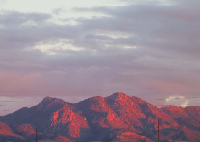
Much of the history of California has been marked by battles over who gets water. California’s drought has brought this battle to the forefront once again. Farmers consider more dams to be the answer to their problems.
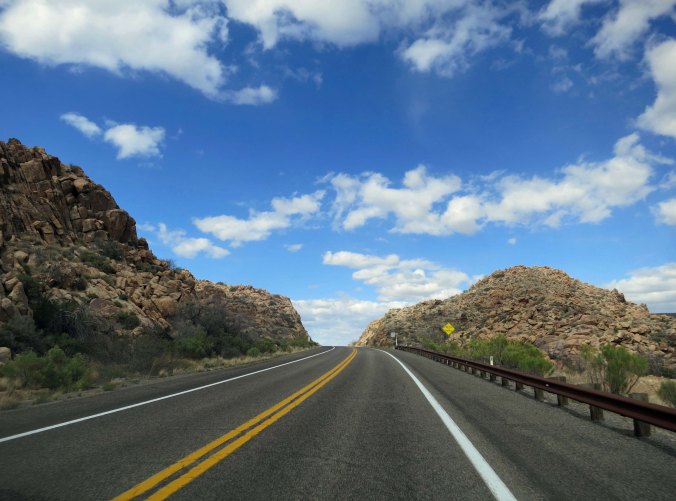
When I rode into Corcoran, the big news was that Charles Manson was being transferred to the state prison there on that day. He had been held in Folsom Prison from 1972-76 near Sacramento where I lived. At the time, one of his followers, Squeaky Fromme, had come to town to be near him. In her spare time, she worked a plot of ground at the Terra Firma Community Garden. The garden had been created by the Ecology Information Center where I had been Executive Director. Squeaky took a liking to my friend Steve Crowle who was the Exec at the time. (He had intense dark eyes, like Manson.)

On the morning of September 5, 1975, Squeaky laid off cultivating her garden, put on a red dress, and walked down to Capitol Park where she made history by pointing her pistol at President Gerald Ford. Shortly afterwards, the FBI showed up on Steve’s doorstep. Fortunately, he hadn’t had a clue who she was when she had been working at the garden.

I am going to conclude this blog with a bit of a rant. I promise to get back to the fun of cycling in my next blog. Here’s the rant: my bike trip down through the Central Valley took me by a number of cattle feedlots where thousands of cattle were penned up in small enclosures. The smell and sight of these lots is enough to turn your stomach, but that isn’t my point. My point is our inhumane treatment of animals. Let me put this bluntly, how would you like to stand around in your poop all day? There has to be a better way to raise cattle, even if it means we pay more for beef.

A feedlot steer checked us out. His feet told the story of his incarceration.

A feedlot steer checked us out. His feet told the story of his incarceration.

This photo tells another story about feed lots.

This photo tells another story about the tragedy of feedlots.

Maybe I am adding a human interpretation, but I can't help but believe that these cattle standing out in their fields are much happier than the cattle locked up in feed lots.

Maybe I am adding a human interpretation, but I can’t help but believe that these cattle standing out in their fields are much happier than the cattle locked up in feed lots.

Next Blog: I will slip in a special on Castle Air Force Base Museum.