Peggy Wins the Lottery… Rafting through the Grand Canyon: Part 2

Mule trip into Grand Canyon

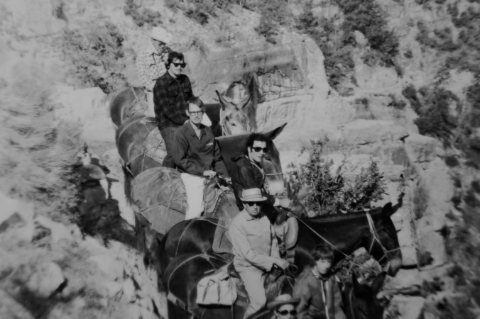
I have journeyed into the Grand Canyon several times over the years. The first was in the late 60s. That’s me, second from the top on Charlie the mule. I was heavier than Charlie liked, so he kept trying to bite me. He also walked as close to the thousand foot drop off as he could. His ultimate revenge, however, was that I was sore for a week afterwards!


Having reported on being in Flagstaff for the beginning of our raft trip down the Colorado River on last Monday’s travel blog, I thought I should back up a step and tell you how we got there.

It started with a strange phone call.

Peggy and I were in the middle of a three-year trip around North American in our small RV when the phone rang late one night. It was 10:00 p.m., far past the time I normally accept calls. They make me grumpy. Usually they are from a Nigerian Prince who wants to make me incredibly wealthy. All I have to do is send him a thousand bucks. But this was from my old friend Tom Lovering. I’m used to him calling at weird hours. He has zero sense of what constitutes a normal day and fervently believes that no one else should either.

He wanted me to immediately stop whatever I was doing (sleeping), jump on-line, and apply for a private permit to raft down the Colorado River through the Grand Canyon. Permits are scarce and the number of people who apply could fill a rock concert. So the Park Service does an open lottery for interested folks. Odds of getting a permit are small— teeny tiny— and Tom wanted to increase his. He’d been scrolling through his list of friends and had already talked a number of people into applying. The clock was ticking; the lottery closed at midnight. Given the late hour, I must have been near the end of Tom’s likely candidates, which isn’t surprising. I know zilch about running rapids.

Thrill sports aren’t my thing. I have always figured that the type of outdoor things I do (like bicycling 10,000 miles around North America by myself, or disappearing into grizzly bear country alone) have enough inherent danger without my challenging raft-eating, people swallowing rapids, or climbing up the sheer face of a thousand-foot rock. Not that I have any problem with the sports. In fact, I have nothing but admiration for people who have the skill and temerity to pursue them and make a career out of flipping off the old guy in a hoodie who carries a big scythe.

My normal response would have been, “Sure, Tom, I’ll get right on it,” followed by promptly rolling over and going back to sleep. But this wasn’t accounting for the love of my life, Peggy, who actually likes water sports and enjoys jumping off cliffs. During college, she had actually attended a session of the Nantahala White Water School in North Carolina where you learn to maneuver rafts through raging rapids. She followed up on Tom’s request immediately: jumping on-line and putting in for a permit— in my name.

I was checking my E-mail the next morning when I came across the note from the National Park Service: “Congratulations you have won a permit for you and 15 other people to raft down the Colorado River through the Grand Canyon! We will be sending you a 5000-page document (slight exaggeration) that outlines your responsibilities.” Oh joy. I called Tom immediately. He was the experienced river runner. He had promised the night before that if, by some miracle I did win, he would take full responsibility for organizing and leading the event. It’s a huge job that takes considerable knowledge about white water rafting.

At first, Tom didn’t believe me. He thought I was joking. Neither he nor any of his rafting buddies had won a Canyon permit in several years. And then he was ecstatic. Yes, he would recruit experienced boat people and their boats for the trip! Yes, he would make all necessary arrangements. Yes, he would plan the menus and organize the food! Yes, he would lead the adventure!

Then the other shoe dropped. Doesn’t it always? I was, after all, “the permit holder.” It was my job to turn in paperwork. But I also had serious responsibilities. If anything went wrong; it was on my shoulders. This ranged from people pooping in the wrong places, to how we washed our dishes, to more serious things. The Park Service had a long list of safety and environmental concerns. I’d be signing on the dotted line. There would be an inspection before we left!

I admit I had concerns. But these were countered by the fact that I love the Grand Canyon. I have returned to it numerous times over the years. I have both hiked and backpacked into it. One time I rode mules into the Canyon. Another time I flew in by helicopter. And I am perfectly happy just sitting on the edge and staring out into the vast space at the incredible rock formations. I did that for Christmas one year (and many other times). Floating down the Colorado would give me a totally new perspective. I was almost as excited as Tom and Peggy. Almost.

Between three tours of duty as a Marine helicopter pilot in Iraq and then serving as a Coast Guard pilot flying rescue missions, our son Tony did a brief stint of flying tourists over the Grand Canyon and into the Havasupai Indian village in the canyon.  When he flew Peggy and me into the village, he was playing the theme song from Star Wars as he swooped down past the steep cliffs.

Waterfalls at Havusupai

This gorgeous waterfall was the main attraction at the Havasupai Village.

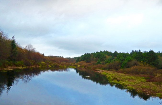
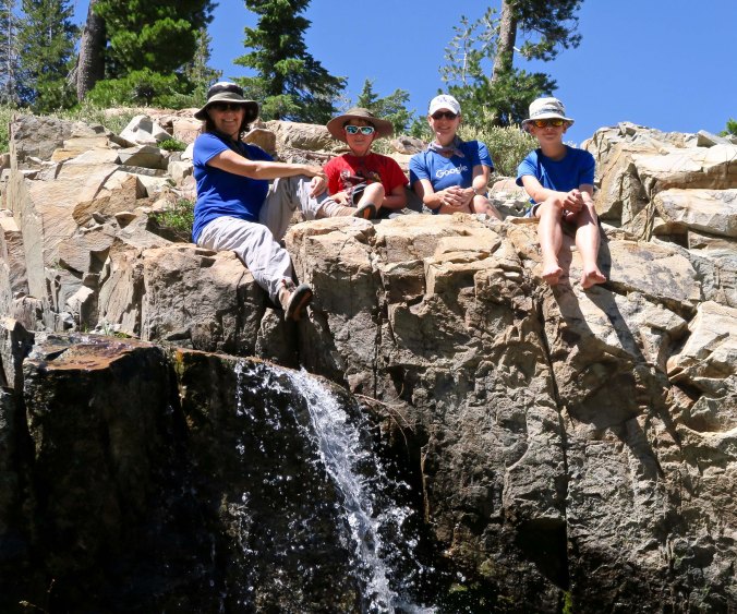
I am sitting on the edge of the Colorado River, red with mud.  Peggy and I had backpacked down the Tanner Trail retracing a solo trip I had made several years earlier. Our raft trip would bring us through this section of the Canyon and over the Tanner Rapids. (Photo by Peggy Mekemson.)

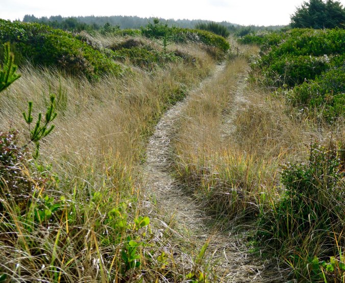
Occasionally, backpacking through the Canyon requires a bit of scrambling.

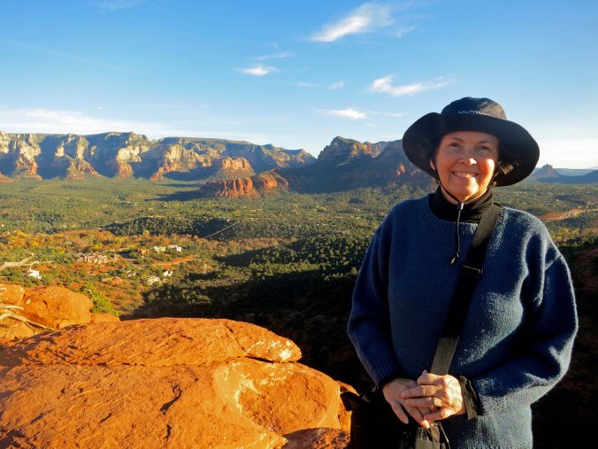
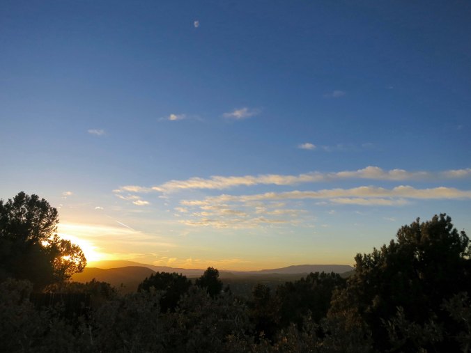
But you don’t have to hike or backpack into the canyon, or raft, or fly, or ride grouchy mules to enjoy the beauty of the Canyon. You can drive up, and enjoy numerous pull-offs that give you incredible views. Short walks provide many more. Be sure to include early morning and late afternoon to capture the full beauty.

Grand Canyon 38

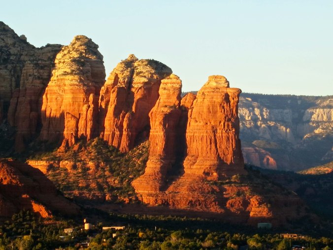
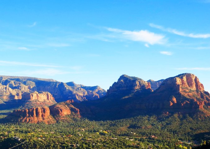
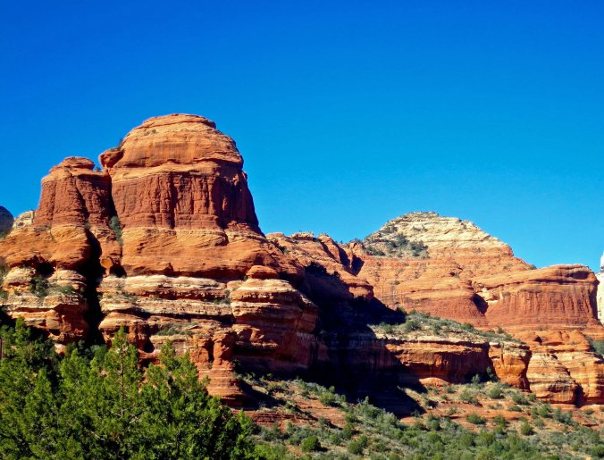
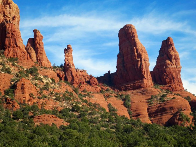
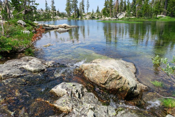
The rocks come in a seemingly infinite number of shapes and colors.
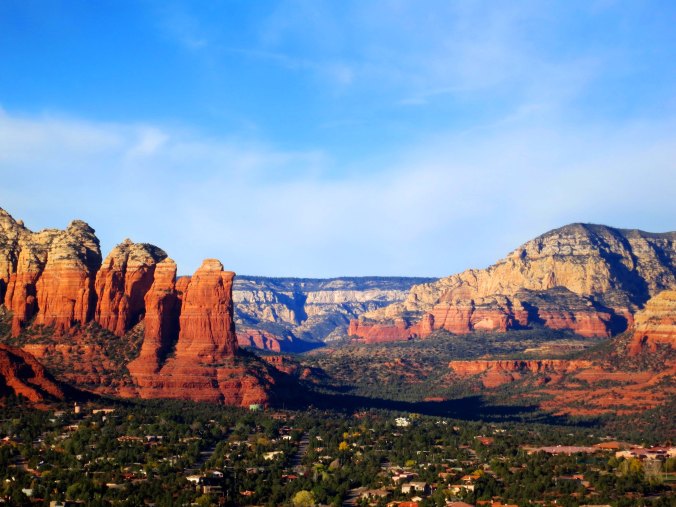
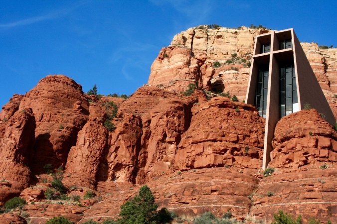
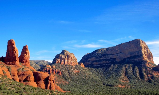
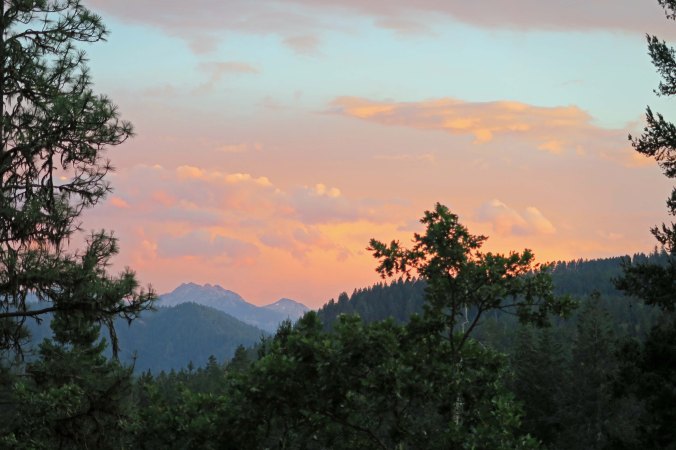
A final view.

WEDNESDAY’S POST: We travel to the ancient Roman city of Pompeii.

FRIDAY’S POST: I learn that there is more to life than dead people.

MONDAY’S POST: And why is Homeland Security checking out our food containers for a bomb on the our Grand Canyon rafting adventure?


The Red, Red Rocks of Sedona, Arizona… Part 2

Sunrise on rocks west of Sedona

The best time to be out and about for photography in Sedona is either early in the morning or late in the afternoon when the red rocks of Sedona at are their most colorful.


It’s photo essay Wednesday so I am returning to Sedona, Arizona to wrap up my look at some of the colorful red rocks that surround the town. Last Wednesday, I focused on the formations east of town and the striking Chapel of the Holy Cross. Today I will include photos of the rock formations west of town and take a trip up the ‘mystical’ Boynton Canyon.


Sedona rocks in morning

Peggy and I took these photos from up near the Sedona airport looking west across the town. The rock formation I featured at the beginning of the post is shown on the left here.

Peggy and view across Sedona

Peggy was standing on the ‘vortex’ near the airport when I took this photo. (Actually, looking at it, I think it is toward the east.)

Sedona view

Another perspective. Possibly my blogging friend who lives in Sedona, Johanna Massey, can provide the location.

Sunset west of Sedona

Definitely looking west here. This time the formation that I included in the first photo is on the right.

Sunrise west of Sedona

A close up…

Sedona Sunset

Sedona Sunset.

Layers upon layers, Sedona

I liked this photo because the ridges seemed to fade off into infinity.

Capstone rocks in Boynton Canyon

We took a detour on our hike up Boynton Canyon to visit with the Kachina Woman, on the left. There is supposedly another vortex in the area that emphasizes balance. (Photo by Peggy Mekemson.)

Capped rock in Boynton Canyon

A photo of the same formation from the Boynton Canyon Trail. Some claim that the vortex is between the Kachina Woman and the knoll. Since a little balance never hurts, I stood between the two formations for a few minutes. (Photo by Peggy Mekemson.)

Boynton Canyon

This is the type of view you can expect hiking up Boynton Canyon. No wonder people find the area mystical.

Sandstone rock in Boynton Canyon

Each sandstone formation provides several views as you hike up the short trail. Following are examples of this one…

Sandstone formations in Boynton Canyon

Sandstone in Boynton Canyon

Stacked rocks in Boynton Canyon

Stacked rocks and circles of rocks apparently reflect hiker’s spiritual journey up the canyon. There are so many that some people are beginning to feel that they detract from the beauty of the area. Not to worry; they are easily removed. I wonder if it gives you bad Karma.

Pinted by mineral water, Sedona

Mineral rich waters created this dry waterfall. If I remember correctly the cave on the left belonged to early Native Americans. (Photo by Peggy Mekemson.)

Anasazi dwelling in Boynton Canyon

This Anasazi dwelling definitely did. (Photo by Peggy Mekemson.)

Fortress rock in Boynton Canyon

Another of the impressive rock formations up Boynton Canyon.

Red rock of Boynton Canyon near Sedona

And another!

Peggy at end of trail in Boynton Canyon

That’s it for today, folks!


FRIDAY’S Blog-a-Book POST: The great tree race where my brother and I face off against each other in a death-defying race up and down the 70-foot tall Incense Cedar tree in the Graveyard.

MONDAY’S Travel Blog POST: Where Homeland Security checks out our food supply for the Colorado River trip.

WEDNESDAY’S Photo Essay POST: A visit to the ancient Roman city of Pompeii, Italy that was buried by the volcanic eruption of Mt. Vesuvius in 79 CE.

SaveSave

SaveSave

SaveSave

SaveSave

SaveSave

Hopi Gods and Squirrelly Squirrels… Rafting the Grand Canyon: Part 1

Rowing on the Colorado through the Grand Canyon

While a veteran crew of boatmen handled the more dangerous parts of our 18 day journey through the Grand Canyon, I was allowed near oars on some of the tamer sections.


Since Peggy and I will actually be hanging out at our home in Southern Oregon for a couple of months and not generating new material for my travel blog, I thought I would dip back in time to the very beginning of my posts.  I had attended a writer’s conference in San Francisco during the winter of 2010 and been told that writers need an Internet presence. I felt doing a series on an 18-day trip we had just completed rafting on the Colorado River through the Grand Canyon would make an excellent start. It was an epic-adventure, one that was burned into my memory banks.  Part of the experience was that Peggy and I would be traversing some of the earth’s most challenging rapids with a true cast of characters. That alone was enough to make it an epic adventure, but even more important, at least for me, was that we would be traveling through the heart of the Grand Canyon, one of the seven natural wonders of the world. Please join us on this adventure. By the end, I think you will see why the Grand Canyon has earned its world-class status. I will start with Peggy and me in Flagstaff, Arizona getting ready for our adventure…


Tom and Bone

One of the ‘cast of characters’ and our group leader, Tom Lovering with Bone in his hair. Tom and I had found Bone when we were backpacking in the Sierra Nevada Mountains in 1977 and he has traveled the world ever since.

Five squirrels with long tufted ears just went charging past our van— in a row. I think it must be love and Peggy agrees. We speculate that a female is leading the boys on a glorious romp. “Catch me if you can!” she giggles. It’s that time of the year when the Albert Squirrels are excited to make babies and perpetuate the species. Lust is in their hearts. Or maybe it’s just the guys working out territorial differences.

Someone they won’t be mating with are their northern cousins, the Kaibab Squirrels. It isn’t that they couldn’t or wouldn’t if they could, it’s just that the giant hole in the ground known as the Grand Canyon is too deep and too wide for them to cross. As a result, a new species has been created. Scientists and natural history folks call this process allopatric speciation— a pair of two-bit words for sure.

We are located at a KOA in Flagstaff, Arizona as we prepare for our raft trip down the Colorado River. It’s a big campground. Everywhere we look men and women wearing yellow shirts are busily preparing for the onslaught of summer tourists. It feels like a beehive, or squirrel’s nest. The camp cook tells us 28 people work here. Jobs are highly specialized. The man who straightens misplaced rocks stopped by to chat with us this morning.

Yesterday we watched two employees struggle for an hour on laying out the base of Teepee. It had all the flavor of an old Laurel and Hardy film. They kept measuring and re-measuring the angles. I expected one to leap up and start chasing the other around camp with a 2×4.

We wonder what the Kachina deities who live in the San Francisco Mountains overlooking our campground think about the squirrelly activity taking place beneath them. There are bunches of them up there, over 300 according to Hopi lore, and each one has a lesson to teach, wisdom to disperse. They come down from their perch in the winter to share their knowledge. I’m sure that they would have made quick work of the Teepee project.

Peggy and I hike up the mountain following Fat Man’s trail. Of course, there is no irony here as we desperately try to beat our bodies into shape for the Canyon trip. We’ve been out travelling in our van for months and the pounds have accumulated. The trail’s name suggests this is a gentle start. Instead it takes us straight up into a snowstorm. The Kachinas are rumored to mislead people under such circumstances. I once spent a week up on the mountain by myself and restricted my wandering to fair weather.

Grand Canyon rock formation

I’ve sometimes wondered what, if any, role that rock formations in the Grand Canyon influenced how the Hopi Indians pictured their Kachina gods.

Once they had the mountain to themselves but now they have competition. Technology has arrived— modern gods. Tower after tower bristling with arrays of tracking, listening and sending devices look out over the sacred lands of the Hopi, Navaho and other Native Americans.

It’s hard not to think Big Brother is watching or not be disturbed by the towers’ visual intrusion. But their presence means we can get cell phone coverage and climb on the Internet. We are addicted to these modern forms of communication so it is hypocritical to whine, at least too much.

But back to the squirrel theme, Peggy and I are a little squirrelly ourselves as we go through our gear and get ready for our grand adventure. I am nervous. This is my first multi-day river trip. What have we gotten ourselves into? Do we have the equipment we need? Will we survive the rapids? What will the people who are joining us be like? What challenges will we face that we are ill prepared for? There are many questions and few answers.

Would people who should not be let near knives suddenly be wielding them?

Would Canyon spirits stalk us?

Would we be required to paint our toenails so our rafts wouldn’t flip.


A note on photos: Peggy and I took most of the pictures that will be included in these posts on the Grand Canyon trip. Our friend Don Green was also along, however, and has generously shared his photos with us. I will note which photos are his.

WEDNESDAY’s Photo Essay POST: It’s back to the featuring the beautiful red rocks of Sedona, Arizona.

FRIDAY’S Blog a Book POST: The next chapter in MisAdventures sees my brother and I in a death-defying race to the top of the 75-foot tall Incense Cedar in the Graveyard.

MONDAY’S Travel Blog POST: It’s all about food, seemingly tons of it, as we make our final preparations for the Colorado River trip. Homeland Security puts a crimp in our efforts as it checks our supply for bombs.

SaveSave

SaveSave

SaveSave

SaveSave

SaveSave

SaveSave

SaveSave

SaveSave

SaveSave

SaveSave

SaveSave

SaveSave

The Incredible Red Rock Country of Sedona— and a Chapel… Part 1

Sedona west

The town of Sedona (center photo) is surrounded by striking scenery. I took this picture from near the airport looking west.


It’s time again for the Wednesday Photo Essay. Today and next Wednesday, I will be featuring Sedona, Arizona.


I still remember the first time I followed Oak Creek Canyon down from Flagstaff, Arizona to Sedona. I had been up backpacking down in the Grand Canyon in 1986 and the side trip was something of an afterthought. I’d seen photos of the area’s striking red rocks and knew of the town’s New Age reputation. There were supposedly vortexes found there, psychic hot-spots that UFOs liked to visit. How could I resist? On the other hand, how could it possibly match my experience in the Canyon? Would I be disappointed?

The answer is a firm no; the detour was different— but very worthwhile.

I’ve been back several times since. The beauty of the red rocks calls to me and I find the New Age character of its inhabitants both interesting and amusing. I read recently that there are 176 New Age-oriented businesses in Sedona. I doubt that any other community in the world can claim such a concentration. The Age of Aquarius is alive and well!

Sitting on a vortex in Sedona, Arizona

Ommm. Here I am, sitting on a red rock vortex point below the Sedona airport practicing my meditation technique and waiting for a UFO. A heretofore unnoticed aura is wrapped around my head. Grin. (Photo by Peggy Mekemson.)

My last visit was three years ago when Peggy and I visited for a week in November along with our friends Ken and Leslie Lake. The pictures from this and next week’s Wednesday photo essays are from that trip. Today’s will be mainly from the east side of town. Next week I will post photos from the west side including a hike up Boynton Canyon. Enjoy.

Chapel of the Holy Cross

One of Sedona’s most famous sites is the Chapel of the Holy Cross. (Photo by Peggy Mekemson.)

Chapel of the Holy Cross in Sedona

I decided that the chapel and its surroundings would do well as a black and white photo.

Chapel of Holy Cross in Sedona, Arizona photo taken by Curtis Mekemson

Another perspective.

Twin rocks in Sedona, Arizona

These striking rocks are located east of the chapel. We took several photos. This one was by Peggy. I think this pair is known as the Two Nuns.

Twin rocks in Sedona, AZ

I added a tree for contrast.

Sedona Cactus

Peggy caught this cactus just down from the chapel.

Cactus and twin rocks in Sedona

And I took a photo of its companion with the Nuns!

Twin rocks in Sedona

Several other towers were located above the Nuns…

Sedona red rock column

Including this beauty. (Photo by Peggy Mekemson.)

Sedona, Arizona

The view south wasn’t bad either!

Sedona Arizona rock

Bell Rock in Sedona

Most of the prominent rock formations around Sedona have been named. I’ll close today with Bell Rock. Be sure to check in next Wednesday for more of the red rocks of Sedona as we journey east of the town to the area featured at the top of this post.


FRIDAY’S POST: My sister Nancy Jo is attacked by the Graveyard Ghost. A very scary tale.

MONDAY’S POST: A trip through the Grand Canyon by raft on the Colorado River.

WEDNESDAY’S POST: We return to Sedona for more gorgeous red rocks.

SaveSave

SaveSave

SaveSave

Ocean Shores … Final Post on the Washington Coast Series

Grays Harbor photo by Curtis Mekemson.

There is no doubt about the beauty of Ocean Shores. This photo looks out into Grays Harbor. The Pacific Ocean is off to the right.


Several years ago, Peggy owned some property in Florida down around Port Charlotte. She and her first husband had purchased two pieces as an investment in one of the huge Florida land schemes. The first parcel, located on a man-made canal, had sold easily long before I knew Peggy. The second piece, which might best be described as swamp-land, was still hanging around when we met many years later and was valued at less than the original price. With skyrocketing real estate values in the mid 2000s, we were finally able to sell the land to some questionable characters out of Miami who had dollars to burn for a small profit. We breathed a huge sigh of relief and turned the money over to our kids.

I only tell this story now because Ocean Shores on the central coast of Washington has a similar history. Developers were going crazy in the 60s and purchasing oceanfront property as cheaply and as quickly as they could put together deals. Land was then subdivided, roads put in, and prices jacked up to create substantial profits. Potential buyers were fed glowing stories about the beauty of the land, its recreational value, and the potential for future profit. It didn’t matter if the land was part of a swamp or that profits would be far into the future.

Land speculation in the US is as old as our country. George Washington may have been the “Father of the Nation” but he was also the father of rampant land speculation, a pursuit he was joined in by the likes of Ben Franklin, John Adams, and other founding fathers who invested in as much land out on the western frontier as they could lay their hands on. (It didn’t matter if the land was already occupied by Native Americans.) It can be argued that one of the reasons for the Revolution was that the British wanted to curtail such speculation.

The Ocean Shores Development Company purchased the area that would become Ocean Shores in 1960 for $1 million. Its location on a peninsula with the Pacific Ocean on one side and Grays Harbor on the other provided a lot of waterfront property to sell. The company quickly brought in a dredge to build canals to create more.  Hollywood personalities such as Pat Boone were recruited for promotion and the land boom was underway. In 2003, National Recreation Properties bought hundreds of lots in Ocean Shores and then resold them at three and four times what it paid. Eric Estrada from CHIPS was brought in for promotion purposes this time. Today, with limited oceanfront property available on the West Coast, property values continue to escalate.

Ocean Shores

Ocean Shores’ peninsula location means it has lots of waterfront property. Man-made canals built throughout the area have added even more. We were staying north of the community up toward the Highway 109 marker.

Peggy and I drove around the peninsula and checked things out. It was an attractive area and I could see why people would want to live in Ocean Shores, but I couldn’t help but think about the community’s low elevation. It would provide scant protection in a Tsunami and, barring that disaster, might be inundated by rising ocean levels. But that’s me. I am sure potential buyers and real estate agents see it differently. Following are a few photos from Ocean Shores and more from where we were staying at Copalis Beach.

Tide coming in at Grays Harbor

Another view looking out into Grays Harbor as the tide rolls in.

Driftwood seahorse at Ocean Shores

The city of Ocean Shores has added some neat driftwood art as an attraction. This seahorse was decked out for Christmas. (Photo by Peggy Mekemson.)

Photo of a driftwood seahorse in Ocean Shores, Washington by Peggy Mekemson.

Another perspective by Peggy.

Driftwood horse at Ocean Shores, Washington photo by Peggy Mekemson.

Having decided that she really liked the driftwood art, Peggy walked across the road and captured this skinny-legged horse.

Driftwood deer in Ocean Shores, Washington photo by Curtis Mekemson.

While I photographed a deer. I liked its antlers.

Small lake at Ocean City Washington

A small lake north of Ocean Shores caught our attention. (Photo by Peggy Mekemson.)

Seagrass and dunes at Copalis Beach

Back at where we were staying in Copalis, we decided to celebrate our final evening by hiking out to the ocean again. It was just across the small dunes.

Copalis beach sunset in Washington

As the sun started to set, we were joined by a bald eagle.

Sunset central coast of state of Washington

Then the sun captured our attention.

Peggy Mekemson at Copalis Beach

Peggy decided to go in search of it across the long, flat beach…

Peggy Mekemson at Copalis Beach

And celebrated…

Peggy Mekemson and sunset at Copalis Beach

Before returning…

Moon over Copalis Beach

Where she was greeted by moonrise.

Sunset central coast of Washington

We stood holding hands as the sun completed its journey. And then returned to the condo. It was time to pack up and head home…


WEDNESDAY’S POST: The gorgeous red rock country of Sedona, Arizona

FRIDAY’S POST: Nancy Jo and the attack of the Graveyard Ghost


SaveSave

SaveSave

A Think-Disaster Kind of Day… When It Comes Down to Move Your Town or Drown

Gift of salmon totem pole at Taholah, WA

The ocean has provided sustenance to the Quinault Indians for thousands of years. This totem pole that Peggy and I found in the community of Taholah represents that bounty. But now both the community and salmon fishing are threatened by global warming.

The small town of Taholah located on the edge of the mighty Pacific has a plan. It’s going to move back from the rising ocean. Global warming is a reality for the self-governing Quinault Indian Nation encompassing some 316 square miles (819 square kilometers) on Washington’s Olympic Peninsula. Storm surges in 2014 and 2015 have inundated the lower part of the town where critical police, fire, education, and governing services for the nation are located. Moving will be a challenge, but it is one that has to be faced as ocean waters rise.

One can only wonder what cities like Los Angeles, New York and other major population centers located along the world’s oceans will do as they face similar problems.

Quinault River at Taholah, WA

The Quinault River empties into the Pacific Ocean at Taholah. A low seawall protects the community from the river and ocean, but it isn’t enough.

Taholah Memorial Park

A memorial park is one of the areas threatened by the rising water.

Thunderbird in Taholah, WA

We also found Thunderbird in the park.

Beaver totem pole at Ocean Shores Interpretive Center

Beaver, on the other hand, was hanging out at the Ocean Interpretive Center in Ocean Shores.

Peggy and I drove up to Taholah and checked out the town from where we were staying at Copalis Beach.  The area is rich in natural resources from both the forests and the ocean. Taholah sits on the edge of the Quinault River, which has provided a bounty of salmon to the natives for hundreds, if not thousands, of years. (The Quinault Indians believe that they have lived in the area from the beginning when Raven upended a clam shell and found humanity lurking underneath.) But even the salmon are facing the impacts of global warming. The glaciers that provided fresh, cold water to the Quinault are melting and severely impacting the salmon population with both warmer water and extensive silt.

Since hiking is limited on tribal lands, Peggy and I returned to Copalis and headed out to Griffith-Pride State Park for a walk. It was much flatter than the area around Taholah. My thoughts turned from global warming to tsunamis. The whole area from Copalis to Ocean shores could be wiped out in a big one. I couldn’t help but be a tad nervous. It was a think-disaster kind of day.

Wet boardwalk at Griffith-Pride State Park, WA

An interesting trail leads out to the ocean over the low sand dunes at Griffith-Pride State Park.

Douglas fir at Copalis Beach

It was wet along the way!

Old road through Griffiths-Pride State Park in Washington

At one time, the trail had been a road.

Half a rainbow at Griffith-Pride State Park in Copalis Beach, Washington

A half rainbow caught our attention. Clearing skies promised sunny weather. (Photo by Peggy Mekemson.)

Peggy on disappearing trail in Griffiths-Pride State Park

Occasionally, the trail disappeared into brush!

Connor Creek and rainbow at Griffith-Pride State Park, WA

Eventually we came on to Connor Creek and found the other half of the rainbow.

Connor Creek at Surfcrest Condominiums

Connor Creek also flowed by where we were staying. More time would have found us kayaking it! (Photo by Peggy Mekemson.)

Looking out to sea at Copalis Beach, WA

The creek flowing into the ocean provided a perspective on just how flat Copalis Beach is. Crashing waves can be seen in the distance. It would take a lot of running to escape a Tsunami!

Sunset at the Quinault Casino

We had a tender prime rib that night at the Quinault Indian Casino in Ocean City, where we were treated to this sunset. It’s a fitting end for today’s post.


WEDNESDAY’S POST: A photographic essay from Scotland

FRIDAY’S POST: Back to blogging “MisAdventures.” The animal kingdom gets banned from my bed

MONDAY’S POST: The end of my series on the Northwest Coast of northern Oregon and central Washington


SaveSave

2017 in Review… What a Year!

Heading off into the wilderness on one of my five backpacking trips in 2017.


I always approach the new year in a reflective mood that is divided between looking back and looking forward. This past year has been a tough one for the US, one of the toughest that I can remember. The turmoil has made me want to run off to the ocean, or the mountains, or the desert, or the rainforests— anywhere that the constant blare of modern media and Washington tweets is missing or limited. But then, I always want to run off to the mountains, the ocean and the desert. The wilderness serves as a second home for me— a place to think, a place to heal, and a place to play.

Living out in the woods, as Peggy and I do, also helps!

Sunset view from Mekemson patio on Upper Applegate River

A view of the sun setting in the west from our patio reminds me of beauty in our world, but also of the million-plus acres of forest lands and wilderness that surround us.

Applegate River

The Applegate River that runs in front of our house is quiet and peaceful in the summer, but can become a raging torrent in the winter. It is beautiful in all conditions, and the sound of its flowing waters always soothes.

Madrone tree in Mekemson back yard

Nothing marks the change of time like the changing of seasons. This large madrone that lives in our backyard and provides coveted shade in the summer, shows its winter face here.

spring at home

In the spring, our world turns green. Over 100 white oaks provide homes for animals as well as shade. In fall, their acorns provide food for squirrels, deer, turkeys and bears.

Fall at home

Fall always adds its splash of color, as it does with this Big Leaf Maple.

Ground squirrel with attitude

The wildlife that considers our property home provides constant entertainment and education. This ground squirrel had just managed to steal a cheek full of sunflower seeds from the bird feeder and had zero tolerance for my lecture.

Squirrel on birdfeeder

And this grey squirrel is trying to repeat its success. “Let’s see, if I rock this thing hard enough…”

Blacktail deer in Mekemson yard on upper Applegate River

The local deer herd provides us with an inside view of their lives, from birth to death.  The herd has scattered now. Wisely so. There is a cougar hanging out on our property and in the national forest land behind us. I haven’t seen it yet, but I have seen its scat in our back yard— and it is full of deer hair!

Fawn on our property

The cougar will move on, however. The deer will return. And the does will bring their children by for visits, as they always do. Life in its endless cycles will repeat itself.

Given my desire to escape this past year, it’s not surprising that the majority of my posts have revolved around trips to the ocean, mountains and deserts. That and Burning Man, which may be the ultimate escape to an alternative universe. Here are some photos that reflect our travels in 2017.

I’ll start with the ocean which includes trips I made on my own and trips the two of us did. Altogether, we covered some 1000 miles of coast between Big Sur, California and Forks, Washington.

Big Sur Coast

In the spring I made my way down to the Big Sur/Carmel/Monterey area while Peggy was playing Grandmother. This is the Big Sur coast.

Iconic Big Sur Bridge

An iconic Big Sur Bridge.

Ocean on 17 Mile Drive

The coast along Monterey’s 17 Mile Drive.

Cypress on 17 Mile Drive

A Monterey Cypress located on one of several world-famous golf courses found along Monterey’s 17 Mile Drive.

Seal at Point Lobos

A contented seal I found at Point Lobos just south of Carmel.

Bigfoot rock at Bandon, Oregon

Peggy and I found this marvelous rock on the beach just south of Bandon, Oregon. Note the toes. They stood about as high as Peggy. I called it Bigfoot, of course.

Face Rock at bandon Beach

We were also impressed with what is known as Face Rock. You can see the chin, mouth, nose and eyes on the right.

Ocean trash fish at Bandon, Oregon

This marvelous fish sculpture in Bandon had been created out of trash collected along the local beach.

Seal Cave near Florence, Oregon

I found these seals located in Seal Cave just above Florence, Oregon.

Heceta Head Lighthouse

And the beautiful Heceta Head Lighthouse a couple of miles away.

Sea serpent at Rockaway Beach

Our trip before Christmas took us up to Rockaway Beach where we found a pair of rocks that reminded me of the Loch Ness Monster, Nessie.

Alpaca near Tillamook, Oregon

And this cutie near Tillamook.

Peggy Mekemson at Copalis Beach

We stayed at Copalis Beach in Washington where Peggy went for a walk on the beach at sunset.

The ultimate in escaping the noise and busyness of the world is backpacking. There are no phones, or TVs, or newspapers, or Internet.  Not surprising, I went out five times. Twice by myself, twice with Peggy, and once with Peggy, our daughter Tasha, and our two grandkids, Ethan and Cody. We backpacked in the Siskiyou Mountains near where we live and in the Sierra Nevada Mountains east of Sacramento, an area I have wandered in for 50 years.

Oregon stream

One of the streams we camped on in the Siskiyou Mountains.

Peggy's Lake

I found this lovely little un-named lake when I was hiking off trail in the Sierras and promptly gave it a name: Peggy’s Lake.

Black Buttes

The Black Buttes east of Interstate 80 looking golden.

Five Lakes Basin

I’ve had a number of trout dinners from this lake over the years.

Thunderheads at Glacier Lake in Five Lakes Basin

Thunderheads. Rain, hail and lightning storms added excitement to our trips.

Family backpacking

My trail companions: Peggy, Cody, Tasha and Ethan.

And of course we traveled elsewhere. Two of our trips involved returning to the desert. Peggy and I journeyed down through the Sacramento Valley and into southern Nevada where we visited the Valley of Fire State Park. I made my way back to Burning Man in the remote Black Rock Desert of Northern Nevada.

Mt. Shasta

We always travel somewhere on my birthday, usually with our friends Ken and Leslie Lake. This year took us down past Mt. Shasta still wearing its winter coat…

California's Central Valley

Through California’s Central Valley looking very spring-like.

Rock sculpture in Valley of Fire State Park

And into southern Nevada’s very dry Valley of Fire State Park…

Arch at Valley of Fire State Park

Which included this small but colorful arch.

Tony's promotion

Summer took us across the USA to Charleston, South Carolina where we celebrated our son’s promotion to Lieutenant Commander in the Coast Guard. His wife, Cammie, and boys Chris, Connor and Cooper help add his new rank.

Man at Burning Man 2017

I returned to Burning Man…

Rabid Express at Burning Man 2017

Where I found this marvellous mutant vehicle known as Rabid Transit.

Pumpkin carving festival in Rhode Island

October found us back East again where we attended a pumpkin carving spectacular in Providence, Rhode Island.

Did I succeed in escaping the world of political turmoil? Not quite. And neither would I want to. I spent my life working as a community advocate with non-profit organizations on environmental and public health issues. Time and again, I have seen that concerned people can, and do make a positive difference.

Ultimately, I am an optimist. The majority of the people in the US believe that our nation should serve as a positive force in the world, want to breathe clean air and drink clean water, think that neither sex, age, ethnicity, religion, or sexual preference should be a limiting factor in determining what a person might become or contribute, believe that there is value in protecting the wild, beautiful and historic areas of the world, support a more equitable distribution of wealth, want to reduce violence, and believe that affordable health care and education should be available to all.

It is my hope for this country that leaders (be they Republicans, or Democrats, or Independents) will step forward with the vision to heal the nation and move it toward the point where it reflects what the majority of Americans support— and hope for. Likewise, I have a similar hope for the world. While I realize that this sounds naïve (and I’ve been around the block enough times to know), I also believe that we live in a rapidly changing world with great promise but even greater danger. If we are to achieve the promise and avoid the danger, which may include our very survival, we must learn to work together much more effectively for the good of all as opposed to the few. We all have a stake in the outcome, as do our children, grandchildren and future generations.

I have both enjoyed and learned from the people I follow on Word Press this past year as you have taken me along on your travels, adventures, and personal journeys through life. Even more, I have enjoyed the friendships we have created. My thanks to you— and to everyone who stops by to visit my blog.

Peggy and I wish each of you and your families a happy and healthy 2018.

They Had a Conference on Bigfoot and I Missed It… Darn!

Peggy Mekemson holds hands with large Sasquatch

Peggy holds hands with a very big Bigfoot/Sasquatch in Ocean City, Washington. BTW… Is that an SST being followed by a flying saucer up in the sky? (I think the SST was honking.)


You don’t have to know much about me to know that I am a Bigfoot/Sasquatch fan. How could I not be, having the world’s only Bigfoot trap about three miles away from where Peggy and I live? People seriously thought they might catch the big fellow, or his wife, or the kids back in the 70s. They even hired an old miner to keep an eye on the trap, outfitting him with a tranquilizer gun and a very large set of handcuffs. The fact that they never caught him may be a comment on his existence— or the fact that he was a lot smarter than the people trying to catch him. Or maybe Bigfoot is a vegetarian and wanted nothing to do with the large hunk of well-aged beef they baited the trap with— unlike the bear they did catch.

The world’s only Bigfoot trap is located about three miles from where we live. The doors have long since been welded shut and local high school students have added graffiti.

When Peggy and I traveled up to the central Washington coast a few weeks ago, you can imagine my consternation when I discovered that I had just missed a conference on Sasquatch. I’ve attended lectures before, our Genealogical Society hosted one, but never a whole conference. The Washington event even included a bona fide scientist or two. Posters, signs, and a billboard announced the ‘Sasquatch Summit.’ It would have made a fun post.

Sasquatch Summit Billboard

A billboard…

Bigfoot crossing sign

One road sign announces the conference while another warns drivers to watch out for Bigfoot crossing the road.

Sasquatch Conference poster

A poster provides details.

My dismay was countered somewhat by the fact that Bigfoot was a commercial success in the area. It seemed like everyone in the communities of Ocean Shores, Ocean City and Copalis wanted in on the action. Motels, resorts and a pub used him to advertise. The area, like many along the coast from California to Washington, is also into wood carving as an occupation. For a few hundred bucks, we could have had our own Sasquatch to bring home.

Large sasquatch 1

A close up of Peggy’s friend.

Surfing Sasquatch flashes hang loose symbol

A local motel featured Bigfoot and his buddy Bigfoot running with a surfboard while flashing the ‘hang loose’ sign.

Bigfoot surfing

Buddy Bigfoot.

Sasquatch hangs out with carved heron

The Ocean City Market, which focuses on wood carving, featured Peggy’s Bigfoot as a marketing tool and had this smaller one for sale.

Fu Manchu Sasquatch

We also found this fellow sporting a Fu Manchu mustache.

This guy up the road looked a bit more primitive.

I was looking into a puddle when I caught this reflection of Bigfoot staring back at me.

Sasquatch at Green Lantern Pub in Copalis, Wa

The Sasquatch at the Green Lantern Pub was outfitted with a clam digging shovel and a green lantern.

Green Lantern Pub BLT in Corpalis, WA

The pub featured this Bigfoot sized BLT…

BLT at Green Lantern Pub, Copalis

…that I had to sample. I don’t think eating another one is included in my New Year’s resolutions for 2018!

Women's restroom at Green lantern Pub, Copalis

And the women’s restroom at the pub featured this guy, who apparently wasn’t known for his big feet. Peggy, who is infinitely curious, just had to raise the fig leaf, not knowing that a buzzer was going to go off in the pub when she did! So, assuming you didn’t know about the buzzer, how many of you are as curious as Peggy?


THURSDAY’S POST: The flowers of England’s Chatsworth House.

SATURDAY’S POST: 2017 in Review

TUESDAY’S POST: Wandering around the central coast of Washington

Olympic National Park, Vampires, Werewolves and Seagulls

Seagulls lined the tops of ocean rocks at Ruby Beach in Olympic National Park. (Photo by Peggy Mekemson.)

It’s wet up on the central coast of Washington, up where vampires and werewolves once roamed free. The small town of Forks— where Bella of Twilight fame was first smitten-bitten by her vampire lover— receives up to 10 feet (3 meters) of rain annually. The man at the small Visitors’ Center told us that he embraces the rain and loves it. But he was real estate salesmen selling visitors on his small town in hopes of selling a house. He showed us a telephone booth covered in moss. There was no question that the moss embraced the rain.

Photo of rainfall at Forks, Wa. by Curtis Mekemson.

Peggy at (I’m not short) 5 feet 7 inches points out the amount of rain Forks had received by the middle of November.

Old Fashioned phonebooth in Forks, Wa

The National Park people were going to trash this moss-covered relic of the past that once stood at the Hoh Visitor Center in Olympic National Park. Forks rescued it.

The woman behind the counter gave us a map that outlined where we could locate various places found in the three book/four movie Twilight saga. Peggy loves the movies, which means that I have had the opportunity to see them several times. They’re okay, but an angst-driven teenage girl torn between her love for a vampire and a werewolf is a bit outside my preferred genre.

A sign in the window of the Visitors’ Center. Bella represented the .5.

Cardboard cutouts of Victoria, Jacob, Edward and Bella from the Twilight movies greeted us at the Forks’ Visitors Center. Jacob was the werewolf and Edward the vampire, if you haven’t seen the movies. I found Victoria, also a vampire, a more attractive character than Bella. More humor; less angst.

This map of visitors from around the world suggested that Peggy wasn’t the only person with an interest in vampires and werewolves. As an aside, I prefer Bigfoot, who is also known to wander the area. He will show up in my next post on the area.

On the other hand, rainforests, rugged coastlines, and restless oceans call to me in a voice I can’t deny— even if I have to keep a wary eye out for supernatural beings. I’d hoped to take Peggy into the Hoh Visitor Center, which is located deep in the rainforest that makes up a significant part of Olympic National Park, but all of the rain had washed out the roads. That figures. We were left with visiting the jagged coastline that is part of Olympic National Park on a dark day that would have had vampires calling for more. Mainly, it just threatened rain and we were free to admire interesting rock sculptures, driftwood trees, seagulls, crashing waves, and tide driven spume (foam) that left white tracks across the dark sand.

Warning about swimming in ocean, Olympic National Park

Really? Not that we were about to take a dip into the cold waters of the Pacific Ocean on a rainy day.

Driftwood log on Beach Five, Olympic National Park

Peggy provides perspective on the ‘driftwood’ you might find out in the ocean.

Driftwood roots on Beach Five in Olympic National Park

I also decided that this massive root system wasn’t something I wanted to go swimming with.

Roots of tree at Beach 5, Olympic National Park

A close up of the roots.

Photo of a bridge made out of driftwood by Curtis Mekemson.

This bridge made out of driftwood was quite ingenious.

Bridge at Beach 5, Olympic National Park

Looking across the bridge. (Photo by Peggy Mekemson.)

Layered rocks at Beach 5 in Olympic National Park

Rocks tilted at odd angles had once been laid down flat on the floor of the ocean. Plate tectonics brought them ashore and tilted them upward. (Photo by Peggy Mekemson.)

Clam carved rocks at Beach 5, Olympic National Park

These holes in the sandstone were carved by piddock clams using a rocking motion. There must have been lots of ‘rocking’ going on. Shake, rattle and roll! (Photo by Peggy Mekemson.)

Curt Mekemaon at Beach 5, Olympic National Park P

A last look at Beach 5, and yes, the National Park Service has also named beaches 1,2,3,and 4. (Photo by Peggy Mekemson.)

Ferns in rainforest, Olympic National Park

Walking back to the car from Beach 5, the luxuriant growth reminded us that we were in a rainforest.

Nursery tree along trail, Olympic National Park

As did this tree growing out of a stump. Such stumps are known as nursery trees and are common in the rainforests of the Northwest.

Photo of driftwood and rocks at Ruby Beach by Curtis Mekemson.

An island, rock sculptures and driftwood dominated Ruby Beach.

Sea stacks in Olympic National Park

I caught this photo of Peggy admiring the rocks, which are known as sea stacks. They would have been part of the shore at one time.

Ruby Beach under dark clouds, Olympic National Park

The beach became more desolate to the south and seemed to stretch on forever at low tide. The grey skies prompted me to render these photos in black and white.

Seagulls outline rock at Ruby Beach in Olympic National Park

Coming closer, we discovered that the rocks were full of life. I was curious as to why the gulls lined up the way they did.

Seagulls in surf at Ruby Beach, Olympic National Park

I like to walk up on them and encourage them to fly for action shots.

Seagulls running and flying at Ruby Beach

The one in the middle had decided to hoof it.

Seagull takes flight at Ruby Beach, Olympic National Park

Until I got too close. I really like the pattern on the gull’s wings and the way it is kicking up water.

Twin rocks at Ruby Beach, Olympic National Park

A pair of twin rocks asked for a photo.

Ruby Beach sea stack in Olympic National Park

As did this bird-decorated sea stack with a hint of sun.

Ruby Beach, Olympic National Park

The sun peeked out just as we were leaving, giving a warmer feel to Ruby Beach and providing closure for this post.


WEDNESDAY: The second post on the beautiful island of Santorini.

FRIDAY: Happy holidays.

MONDAY: Bigfoot is all over the Copalis Beach area but we missed the annual Sasquatch Conference.


SaveSave

SaveSave

A Cow Has Four Stomachs and Other Tales from the Pacific Northwest

Cow T-shirt at Tillamook Cheese Factory

Raising cattle to produce dairy products is big business in the Tillamook area. Peggy and I found this T-shirt at the Tillamook Cheese Factory.


I am going to get to the cows and their four stomachs, but first I want to cover our stay at Rockaway Beach, which is about 15 miles north of Tillamook on Highway 101. Our suite looked out on the ocean. We could watch the waves roll in and hear the continuous roar of the ocean. Wintry skies brought rain but the clouds were also great for beautiful sunsets. We headed out whenever there was a break in the weather, and even when there wasn’t. We walked the beach, visited local shops, and ate out at the town’s restaurants. Thanksgiving dinner was at Grumpy’s and Mrs. Grumpy hovered over us to make sure we ate our veggies. How much more down-home can you get? The complete meal, which included all of the Thanksgiving favorites, cost a whopping 12 bucks. “I want it to be affordable for everyone,” Mrs. Grumpy primly informed us.

Gentle waves roll in at Rockaway Beach, Or P

The ocean was shallow and produced a long line of waves that created a roar as opposed to the sound of single waves crashing.

Sunset over Rockaway Beach on the Oregon Coast near Tillamook.

We were treated to several beautiful sunsets looking out from our suite at Rockaway Beach. (Photo by Peggy Mekemson.)

Small shops had the usual touristy stuff found in coastal tourist shops everywhere. “Go to Flamingo Jims,” we were urged. As to why it was named Flamingo in an area where the tropical bird would freeze, I didn’t have a clue. But we went. And we weren’t disappointed; it was filled to the brim with cheap souvenirs. We wandered around and checked out T-shirts, mermaids and sea shells. We could have bought a sand dollar for a dollar, but Peggy prefers to find her own. I was reminded of this old tongue twister. Try saying it as fast as you can without a mistake.

She sells sea shells by the sea shore.
The shells she sells are surely seashells.
So if she sells shells on the seashore,
I’m sure she sells seashore shells.

Seashells for sell at Flamingo Jim's in Rockaway Beach, Oregon.

Any good tourist souvenir shop on the ocean has seashells to sell.

Mermaids for sell at Rockaway Beach in Oregon

And mermaids. A twist for the Northwest is Bigfoot(s), or is that Bigfeet? You can see some up in the righthand corner.

The beach seemed to go on forever. One end was dominated by the sea rocks that Rockaway Beach is famous for; the other by a forest covered mountain. If you look at the rocks from the right angle, they make an excellent sea dragon. Welcome to Oregon, Nessie! A creek divided the beach about halfway along. Sea gulls patrolled the waterfront, checking out both the ocean and tourists for possible food. A small boy threw out a couple of pieces of bread and was suddenly surrounded by 50 of the birds, in seconds! They seemed to materialize out of nowhere. How do they do that?

Rockaway Beach Oregon Beach

Looking north up the beach at Rockaway. Our suite was on the second floor of the building on the right. Our footprints lead down to where we took the photo. (Photo by Peggy Mekemson.)

The rocks of Rockaway beach photographed by Curtis Mekemson.

The sole rocks of Rockaway Beach look very much like a sea serpent with its head under water searching for tasty fish. (Photo by Peggy Mekemson.)

creek that divides Rockaway Beach, Oregon

A creek flowing across Rockaway Beach limited how far we could hike south.

A seagull steps out at Rockaway Beach, Or

A seagull steps out on his gull-friend at Rockaway Beach.

When we ran out of things to do in Rockaway, we drove 15-miles south to Tillamook. I’ve already done posts on Cape Meares, Munson Creek Falls, and some very wet alpacas. On our way, we decided to check out a small county park in Barview and found the Coast Guard practicing air to sea rescue missions by helicopter, which is what our son Tony does.

Seagull stops to watch Coast Guard practice rescues

And here, a seagull joins us in watching the Coast Guard practice rescue operations at Barview, just north of Tillamook.

Practice rescue mission by the Coast Guard

Part of this practice included dropping a man down on to a rocking boat to help in a rescue effort, which was a operation our son was involved with several times while flying  helicopters over rough Alaska waters.

In Tillamook, it is almost required that people stop off at Tillamook Cheese and Ice Cream factory. The cheese is good and can be found throughout the US, but the ice cream is to die for. Our refrigerator is always stocked with a half-gallon.  I should probably weigh 300 pounds but we limit our consumption to Date Night, which falls on Wednesday, as it has for the past 27 years.

Welcome to Tillamook Cheese Factory

The visitor’s center at the Tillamook Cheese Factory included a number of exhibits on the dairy industry, from beginning…

Rear view rear at Tillamook Cheese Factory

…To the end.

cow stomach

I was particularly interested to learn that a cow has four stomachs, which were two more than I was aware of. I also learned that when a cow chews its cud it’s know an ruminating, is case you ever wondered about where the word came from. So, next time you find yourself ruminating, you might want to break out some gum.

When we were out and about and lost, we also came on the Latimer Quilt and Textile Museum where I found the alpacas. Peggy’s love of quilting demanded a visit. We found numerous quilts, a doll collection, looms, and a lot of history.

Alpaca photo in Tillamook, Oregon by Curtis Mekemson.

You will probably remember the alpacas. Check out the blue eyelashes on this gal.

Quilts at Latimer Quilt and Textile Center

As might be expected, the Latimer Quilt and Textile Center was filled with quilts. The Center was preparing for a big sale. These are more traditional quilts.

Quilt at Latimer Quilt and Textile Center in Tillamook, Or

And this one a more modern version.

Interesting dress at Latimer Quilt and Textile Center

A number of other textile products were offered as well, including this dress. We assumed something would be worn under it, but possibly not at Burning Man.

Looms at Latimer Quilt and Textile Center

A number of looms were available for weaving.

Doll at quilt shop

There was even an extensive doll collection. I picked this one out for her reading material. 

Peggy Mekemson quilt

I’ll conclude today’s post with this gorgeous quilt that Peggy made for our bed using a vintage Singer Featherweight sewing machine that her grandmother bought in 1933.


WEDNESDAY’S PHOTO POST: Join Peggy and me as we explore the Greek island of Santorini.

SaveSave

SaveSave

SaveSave