Ocean Shores … Final Post on the Washington Coast Series

Grays Harbor photo by Curtis Mekemson.

There is no doubt about the beauty of Ocean Shores. This photo looks out into Grays Harbor. The Pacific Ocean is off to the right.


Several years ago, Peggy owned some property in Florida down around Port Charlotte. She and her first husband had purchased two pieces as an investment in one of the huge Florida land schemes. The first parcel, located on a man-made canal, had sold easily long before I knew Peggy. The second piece, which might best be described as swamp-land, was still hanging around when we met many years later and was valued at less than the original price. With skyrocketing real estate values in the mid 2000s, we were finally able to sell the land to some questionable characters out of Miami who had dollars to burn for a small profit. We breathed a huge sigh of relief and turned the money over to our kids.

I only tell this story now because Ocean Shores on the central coast of Washington has a similar history. Developers were going crazy in the 60s and purchasing oceanfront property as cheaply and as quickly as they could put together deals. Land was then subdivided, roads put in, and prices jacked up to create substantial profits. Potential buyers were fed glowing stories about the beauty of the land, its recreational value, and the potential for future profit. It didn’t matter if the land was part of a swamp or that profits would be far into the future.

Land speculation in the US is as old as our country. George Washington may have been the “Father of the Nation” but he was also the father of rampant land speculation, a pursuit he was joined in by the likes of Ben Franklin, John Adams, and other founding fathers who invested in as much land out on the western frontier as they could lay their hands on. (It didn’t matter if the land was already occupied by Native Americans.) It can be argued that one of the reasons for the Revolution was that the British wanted to curtail such speculation.

The Ocean Shores Development Company purchased the area that would become Ocean Shores in 1960 for $1 million. Its location on a peninsula with the Pacific Ocean on one side and Grays Harbor on the other provided a lot of waterfront property to sell. The company quickly brought in a dredge to build canals to create more.  Hollywood personalities such as Pat Boone were recruited for promotion and the land boom was underway. In 2003, National Recreation Properties bought hundreds of lots in Ocean Shores and then resold them at three and four times what it paid. Eric Estrada from CHIPS was brought in for promotion purposes this time. Today, with limited oceanfront property available on the West Coast, property values continue to escalate.

Ocean Shores

Ocean Shores’ peninsula location means it has lots of waterfront property. Man-made canals built throughout the area have added even more. We were staying north of the community up toward the Highway 109 marker.

Peggy and I drove around the peninsula and checked things out. It was an attractive area and I could see why people would want to live in Ocean Shores, but I couldn’t help but think about the community’s low elevation. It would provide scant protection in a Tsunami and, barring that disaster, might be inundated by rising ocean levels. But that’s me. I am sure potential buyers and real estate agents see it differently. Following are a few photos from Ocean Shores and more from where we were staying at Copalis Beach.

Tide coming in at Grays Harbor

Another view looking out into Grays Harbor as the tide rolls in.

Driftwood seahorse at Ocean Shores

The city of Ocean Shores has added some neat driftwood art as an attraction. This seahorse was decked out for Christmas. (Photo by Peggy Mekemson.)

Photo of a driftwood seahorse in Ocean Shores, Washington by Peggy Mekemson.

Another perspective by Peggy.

Driftwood horse at Ocean Shores, Washington photo by Peggy Mekemson.

Having decided that she really liked the driftwood art, Peggy walked across the road and captured this skinny-legged horse.

Driftwood deer in Ocean Shores, Washington photo by Curtis Mekemson.

While I photographed a deer. I liked its antlers.

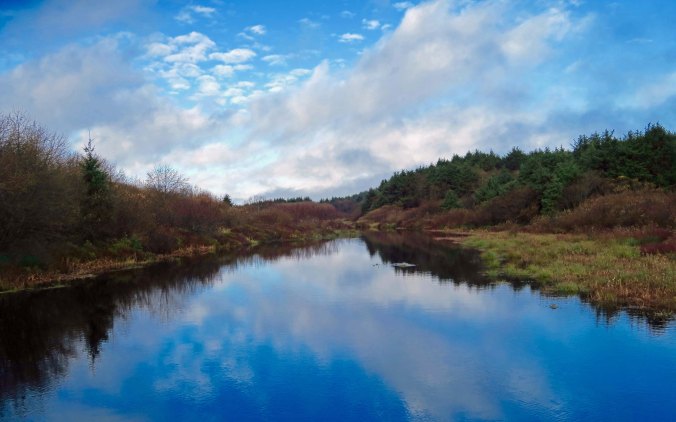
Small lake at Ocean City Washington

A small lake north of Ocean Shores caught our attention. (Photo by Peggy Mekemson.)

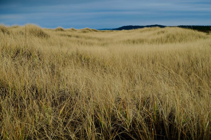
Seagrass and dunes at Copalis Beach

Back at where we were staying in Copalis, we decided to celebrate our final evening by hiking out to the ocean again. It was just across the small dunes.

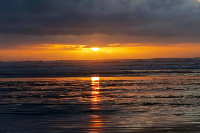
Copalis beach sunset in Washington

As the sun started to set, we were joined by a bald eagle.

Sunset central coast of state of Washington

Then the sun captured our attention.

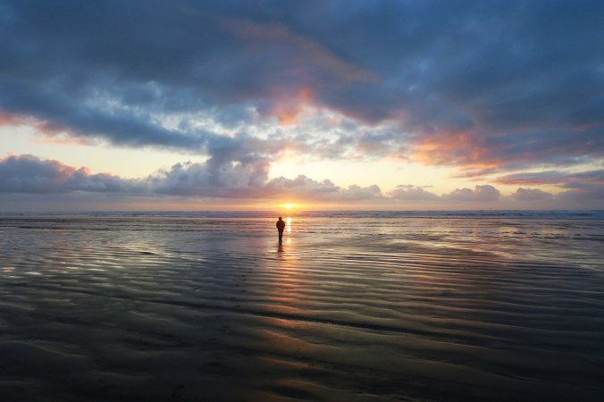
Peggy Mekemson at Copalis Beach

Peggy decided to go in search of it across the long, flat beach…

Peggy Mekemson at Copalis Beach

And celebrated…

Peggy Mekemson and sunset at Copalis Beach

Before returning…

Moon over Copalis Beach

Where she was greeted by moonrise.

Sunset central coast of Washington

We stood holding hands as the sun completed its journey. And then returned to the condo. It was time to pack up and head home…


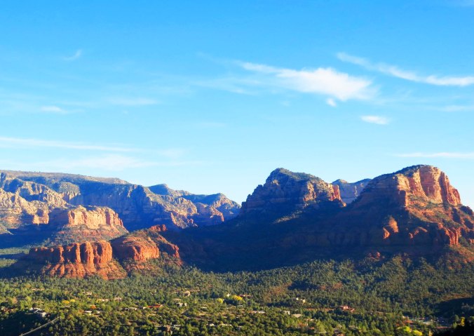
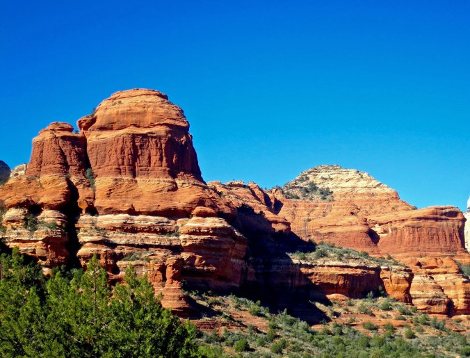
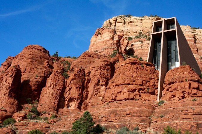
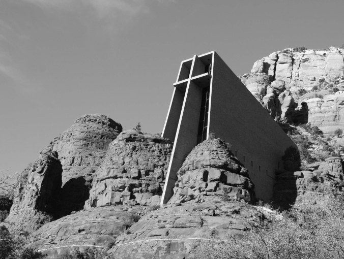
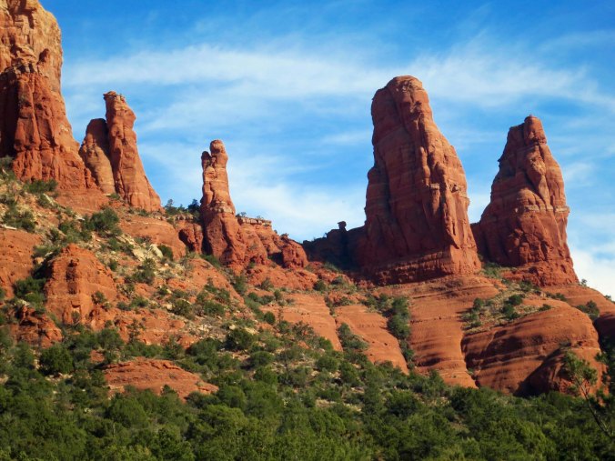
WEDNESDAY’S POST: The gorgeous red rock country of Sedona, Arizona

FRIDAY’S POST: Nancy Jo and the attack of the Graveyard Ghost


SaveSave

SaveSave

A Think-Disaster Kind of Day… When It Comes Down to Move Your Town or Drown

Gift of salmon totem pole at Taholah, WA

The ocean has provided sustenance to the Quinault Indians for thousands of years. This totem pole that Peggy and I found in the community of Taholah represents that bounty. But now both the community and salmon fishing are threatened by global warming.

The small town of Taholah located on the edge of the mighty Pacific has a plan. It’s going to move back from the rising ocean. Global warming is a reality for the self-governing Quinault Indian Nation encompassing some 316 square miles (819 square kilometers) on Washington’s Olympic Peninsula. Storm surges in 2014 and 2015 have inundated the lower part of the town where critical police, fire, education, and governing services for the nation are located. Moving will be a challenge, but it is one that has to be faced as ocean waters rise.

One can only wonder what cities like Los Angeles, New York and other major population centers located along the world’s oceans will do as they face similar problems.

Quinault River at Taholah, WA

The Quinault River empties into the Pacific Ocean at Taholah. A low seawall protects the community from the river and ocean, but it isn’t enough.

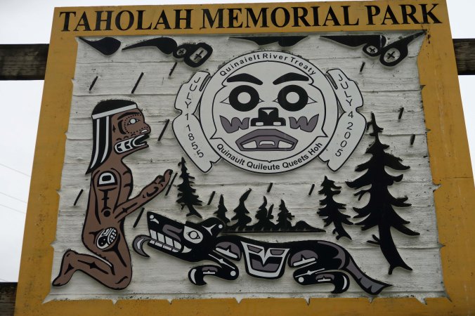
Taholah Memorial Park

A memorial park is one of the areas threatened by the rising water.

Thunderbird in Taholah, WA

We also found Thunderbird in the park.

Beaver totem pole at Ocean Shores Interpretive Center

Beaver, on the other hand, was hanging out at the Ocean Interpretive Center in Ocean Shores.

Peggy and I drove up to Taholah and checked out the town from where we were staying at Copalis Beach.  The area is rich in natural resources from both the forests and the ocean. Taholah sits on the edge of the Quinault River, which has provided a bounty of salmon to the natives for hundreds, if not thousands, of years. (The Quinault Indians believe that they have lived in the area from the beginning when Raven upended a clam shell and found humanity lurking underneath.) But even the salmon are facing the impacts of global warming. The glaciers that provided fresh, cold water to the Quinault are melting and severely impacting the salmon population with both warmer water and extensive silt.

Since hiking is limited on tribal lands, Peggy and I returned to Copalis and headed out to Griffith-Pride State Park for a walk. It was much flatter than the area around Taholah. My thoughts turned from global warming to tsunamis. The whole area from Copalis to Ocean shores could be wiped out in a big one. I couldn’t help but be a tad nervous. It was a think-disaster kind of day.

Wet boardwalk at Griffith-Pride State Park, WA

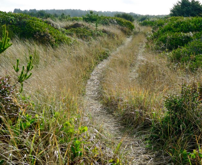
An interesting trail leads out to the ocean over the low sand dunes at Griffith-Pride State Park.

Douglas fir at Copalis Beach

It was wet along the way!

Old road through Griffiths-Pride State Park in Washington

At one time, the trail had been a road.

Half a rainbow at Griffith-Pride State Park in Copalis Beach, Washington

A half rainbow caught our attention. Clearing skies promised sunny weather. (Photo by Peggy Mekemson.)

Peggy on disappearing trail in Griffiths-Pride State Park

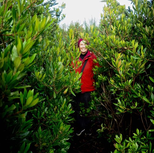
Occasionally, the trail disappeared into brush!

Connor Creek and rainbow at Griffith-Pride State Park, WA

Eventually we came on to Connor Creek and found the other half of the rainbow.

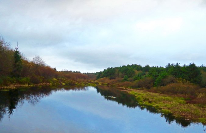
Connor Creek at Surfcrest Condominiums

Connor Creek also flowed by where we were staying. More time would have found us kayaking it! (Photo by Peggy Mekemson.)

Looking out to sea at Copalis Beach, WA

The creek flowing into the ocean provided a perspective on just how flat Copalis Beach is. Crashing waves can be seen in the distance. It would take a lot of running to escape a Tsunami!

Sunset at the Quinault Casino

We had a tender prime rib that night at the Quinault Indian Casino in Ocean City, where we were treated to this sunset. It’s a fitting end for today’s post.


WEDNESDAY’S POST: A photographic essay from Scotland

FRIDAY’S POST: Back to blogging “MisAdventures.” The animal kingdom gets banned from my bed

MONDAY’S POST: The end of my series on the Northwest Coast of northern Oregon and central Washington


SaveSave

2017 in Review… What a Year!

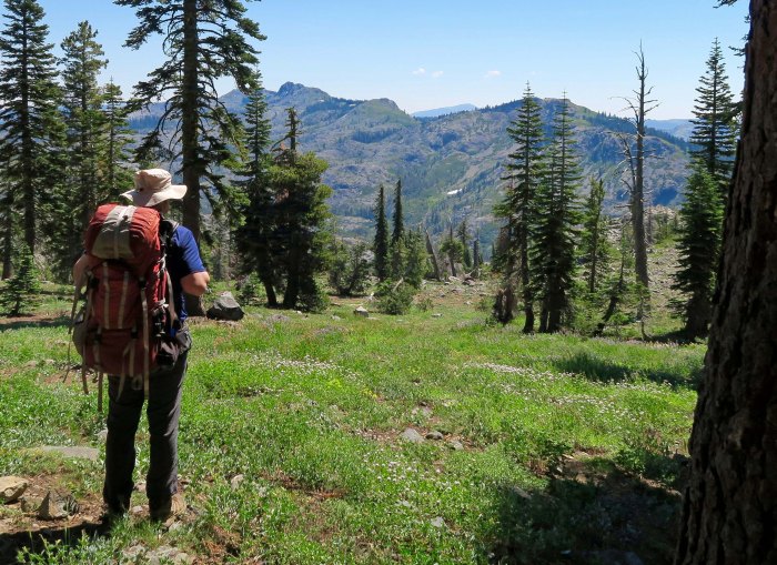
Heading off into the wilderness on one of my five backpacking trips in 2017.


I always approach the new year in a reflective mood that is divided between looking back and looking forward. This past year has been a tough one for the US, one of the toughest that I can remember. The turmoil has made me want to run off to the ocean, or the mountains, or the desert, or the rainforests— anywhere that the constant blare of modern media and Washington tweets is missing or limited. But then, I always want to run off to the mountains, the ocean and the desert. The wilderness serves as a second home for me— a place to think, a place to heal, and a place to play.

Living out in the woods, as Peggy and I do, also helps!

Sunset view from Mekemson patio on Upper Applegate River

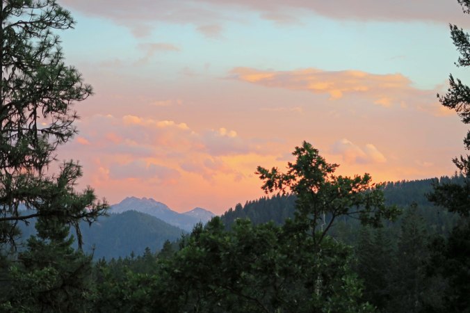
A view of the sun setting in the west from our patio reminds me of beauty in our world, but also of the million-plus acres of forest lands and wilderness that surround us.

Applegate River

The Applegate River that runs in front of our house is quiet and peaceful in the summer, but can become a raging torrent in the winter. It is beautiful in all conditions, and the sound of its flowing waters always soothes.

Madrone tree in Mekemson back yard

Nothing marks the change of time like the changing of seasons. This large madrone that lives in our backyard and provides coveted shade in the summer, shows its winter face here.

spring at home

In the spring, our world turns green. Over 100 white oaks provide homes for animals as well as shade. In fall, their acorns provide food for squirrels, deer, turkeys and bears.

Fall at home

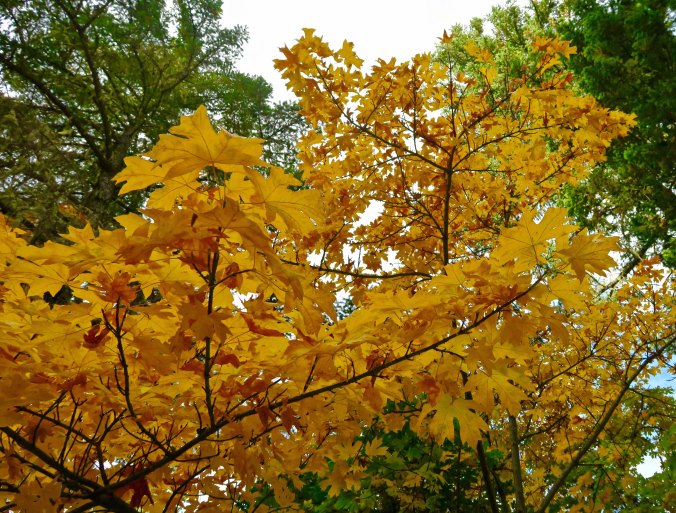
Fall always adds its splash of color, as it does with this Big Leaf Maple.

Ground squirrel with attitude

The wildlife that considers our property home provides constant entertainment and education. This ground squirrel had just managed to steal a cheek full of sunflower seeds from the bird feeder and had zero tolerance for my lecture.

Squirrel on birdfeeder

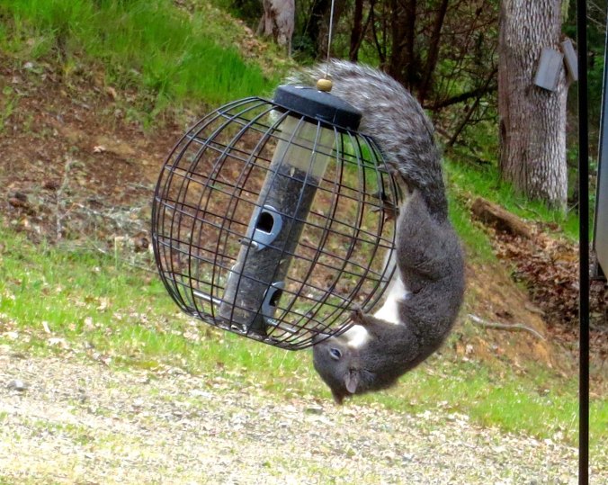
And this grey squirrel is trying to repeat its success. “Let’s see, if I rock this thing hard enough…”

Blacktail deer in Mekemson yard on upper Applegate River

The local deer herd provides us with an inside view of their lives, from birth to death.  The herd has scattered now. Wisely so. There is a cougar hanging out on our property and in the national forest land behind us. I haven’t seen it yet, but I have seen its scat in our back yard— and it is full of deer hair!

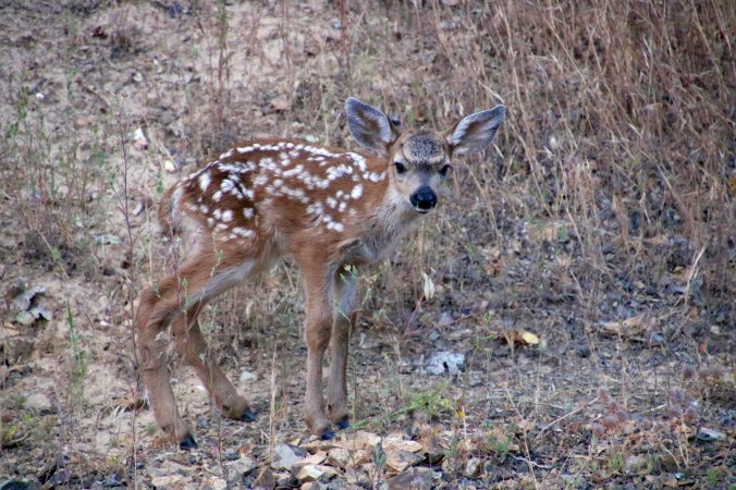
Fawn on our property

The cougar will move on, however. The deer will return. And the does will bring their children by for visits, as they always do. Life in its endless cycles will repeat itself.

Given my desire to escape this past year, it’s not surprising that the majority of my posts have revolved around trips to the ocean, mountains and deserts. That and Burning Man, which may be the ultimate escape to an alternative universe. Here are some photos that reflect our travels in 2017.

I’ll start with the ocean which includes trips I made on my own and trips the two of us did. Altogether, we covered some 1000 miles of coast between Big Sur, California and Forks, Washington.

Big Sur Coast

In the spring I made my way down to the Big Sur/Carmel/Monterey area while Peggy was playing Grandmother. This is the Big Sur coast.

Iconic Big Sur Bridge

An iconic Big Sur Bridge.

Ocean on 17 Mile Drive

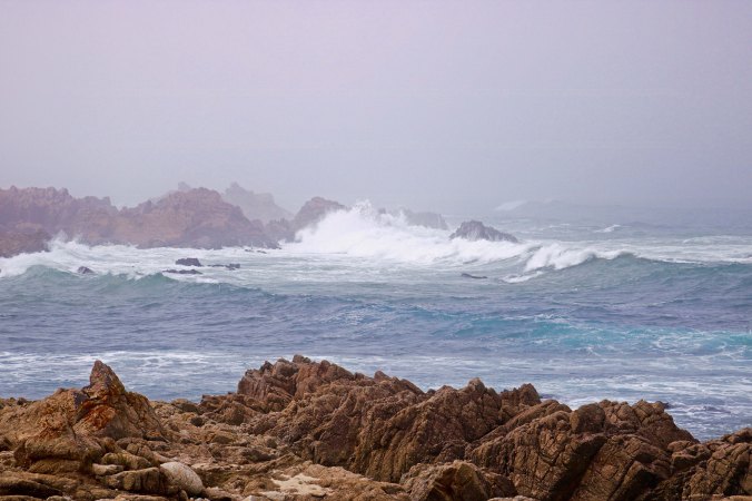
The coast along Monterey’s 17 Mile Drive.

Cypress on 17 Mile Drive

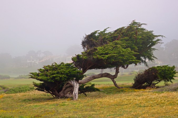
A Monterey Cypress located on one of several world-famous golf courses found along Monterey’s 17 Mile Drive.

Seal at Point Lobos

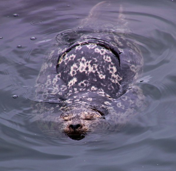
A contented seal I found at Point Lobos just south of Carmel.

Bigfoot rock at Bandon, Oregon

Peggy and I found this marvelous rock on the beach just south of Bandon, Oregon. Note the toes. They stood about as high as Peggy. I called it Bigfoot, of course.

Face Rock at bandon Beach

We were also impressed with what is known as Face Rock. You can see the chin, mouth, nose and eyes on the right.

Ocean trash fish at Bandon, Oregon

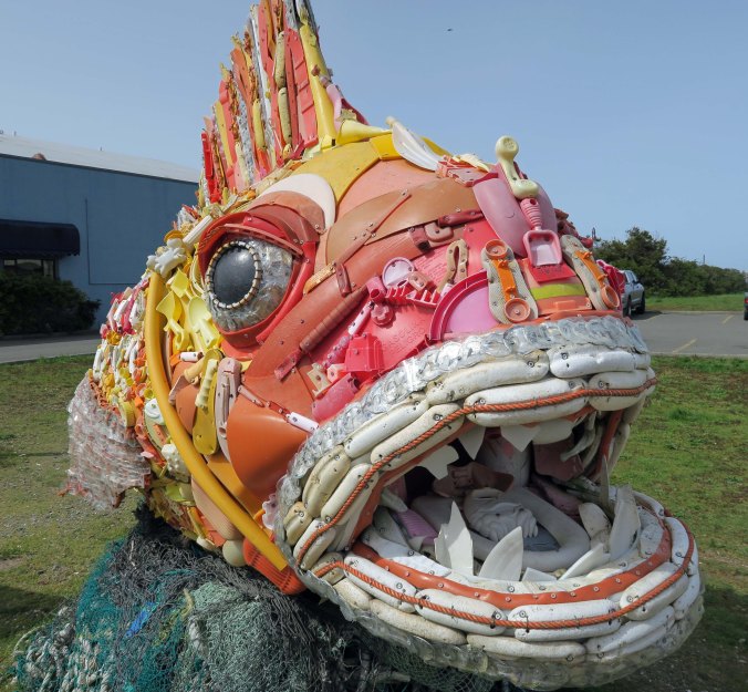
This marvelous fish sculpture in Bandon had been created out of trash collected along the local beach.

Seal Cave near Florence, Oregon

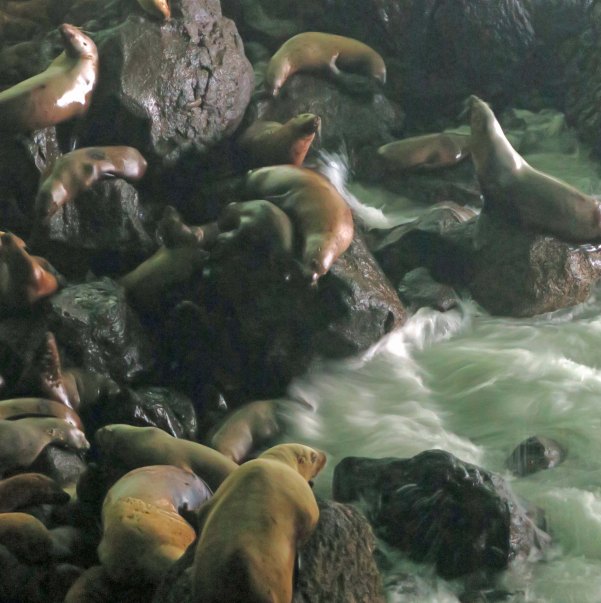
I found these seals located in Seal Cave just above Florence, Oregon.

Heceta Head Lighthouse

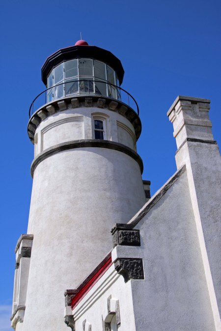
And the beautiful Heceta Head Lighthouse a couple of miles away.

Sea serpent at Rockaway Beach

Our trip before Christmas took us up to Rockaway Beach where we found a pair of rocks that reminded me of the Loch Ness Monster, Nessie.

Alpaca near Tillamook, Oregon

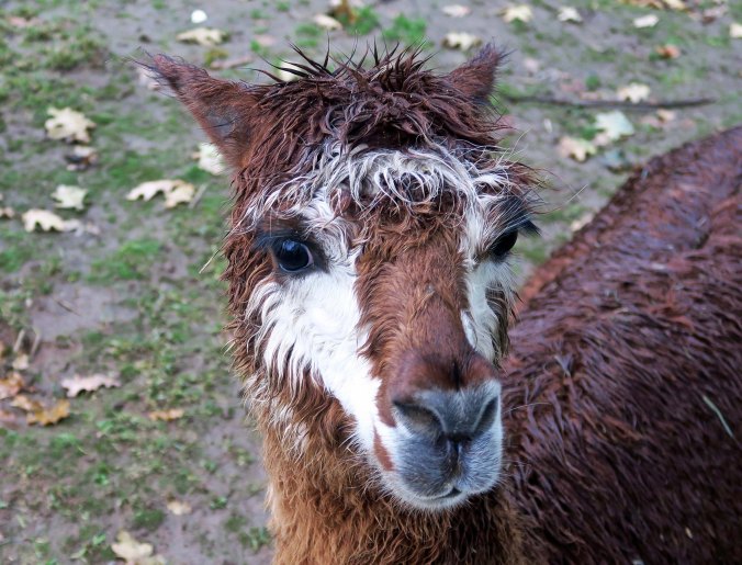
And this cutie near Tillamook.

Peggy Mekemson at Copalis Beach

We stayed at Copalis Beach in Washington where Peggy went for a walk on the beach at sunset.

The ultimate in escaping the noise and busyness of the world is backpacking. There are no phones, or TVs, or newspapers, or Internet.  Not surprising, I went out five times. Twice by myself, twice with Peggy, and once with Peggy, our daughter Tasha, and our two grandkids, Ethan and Cody. We backpacked in the Siskiyou Mountains near where we live and in the Sierra Nevada Mountains east of Sacramento, an area I have wandered in for 50 years.

Oregon stream

One of the streams we camped on in the Siskiyou Mountains.

Peggy's Lake

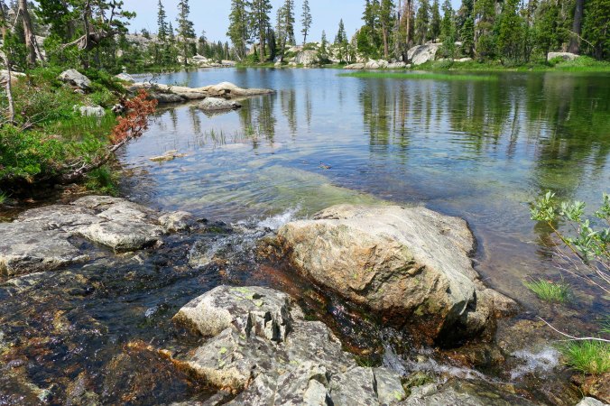
I found this lovely little un-named lake when I was hiking off trail in the Sierras and promptly gave it a name: Peggy’s Lake.

Black Buttes

The Black Buttes east of Interstate 80 looking golden.

Five Lakes Basin

I’ve had a number of trout dinners from this lake over the years.

Thunderheads at Glacier Lake in Five Lakes Basin

Thunderheads. Rain, hail and lightning storms added excitement to our trips.

Family backpacking

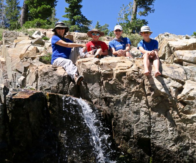
My trail companions: Peggy, Cody, Tasha and Ethan.

And of course we traveled elsewhere. Two of our trips involved returning to the desert. Peggy and I journeyed down through the Sacramento Valley and into southern Nevada where we visited the Valley of Fire State Park. I made my way back to Burning Man in the remote Black Rock Desert of Northern Nevada.

Mt. Shasta

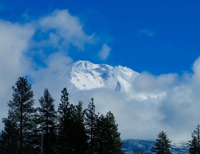
We always travel somewhere on my birthday, usually with our friends Ken and Leslie Lake. This year took us down past Mt. Shasta still wearing its winter coat…

California's Central Valley

Through California’s Central Valley looking very spring-like.

Rock sculpture in Valley of Fire State Park

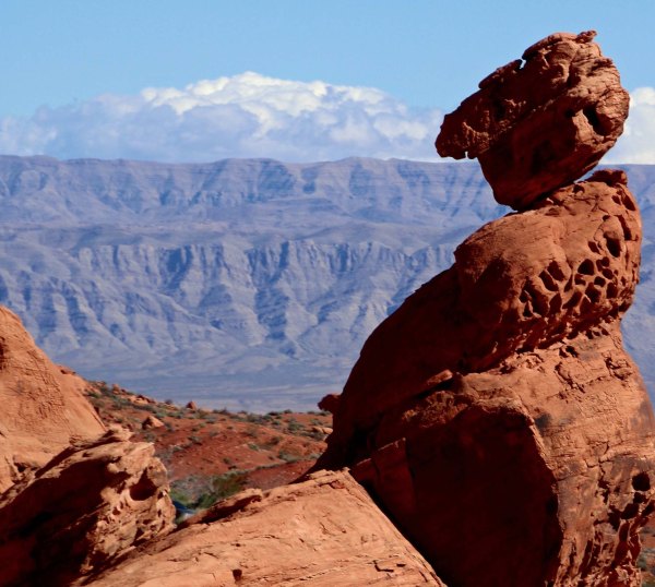
And into southern Nevada’s very dry Valley of Fire State Park…

Arch at Valley of Fire State Park

Which included this small but colorful arch.

Tony's promotion

Summer took us across the USA to Charleston, South Carolina where we celebrated our son’s promotion to Lieutenant Commander in the Coast Guard. His wife, Cammie, and boys Chris, Connor and Cooper help add his new rank.

Man at Burning Man 2017

I returned to Burning Man…

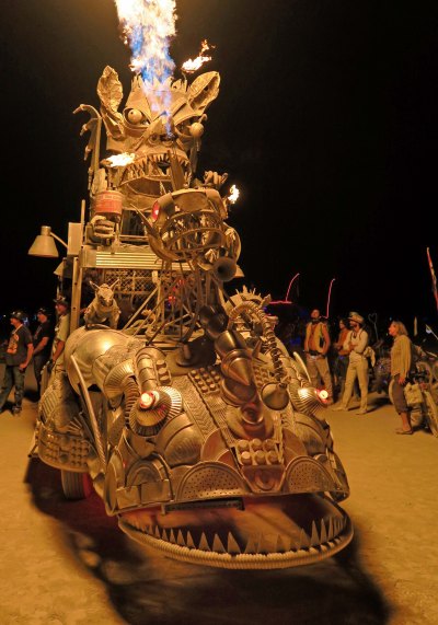
Rabid Express at Burning Man 2017

Where I found this marvellous mutant vehicle known as Rabid Transit.

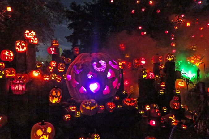
Pumpkin carving festival in Rhode Island

October found us back East again where we attended a pumpkin carving spectacular in Providence, Rhode Island.

Did I succeed in escaping the world of political turmoil? Not quite. And neither would I want to. I spent my life working as a community advocate with non-profit organizations on environmental and public health issues. Time and again, I have seen that concerned people can, and do make a positive difference.

Ultimately, I am an optimist. The majority of the people in the US believe that our nation should serve as a positive force in the world, want to breathe clean air and drink clean water, think that neither sex, age, ethnicity, religion, or sexual preference should be a limiting factor in determining what a person might become or contribute, believe that there is value in protecting the wild, beautiful and historic areas of the world, support a more equitable distribution of wealth, want to reduce violence, and believe that affordable health care and education should be available to all.

It is my hope for this country that leaders (be they Republicans, or Democrats, or Independents) will step forward with the vision to heal the nation and move it toward the point where it reflects what the majority of Americans support— and hope for. Likewise, I have a similar hope for the world. While I realize that this sounds naïve (and I’ve been around the block enough times to know), I also believe that we live in a rapidly changing world with great promise but even greater danger. If we are to achieve the promise and avoid the danger, which may include our very survival, we must learn to work together much more effectively for the good of all as opposed to the few. We all have a stake in the outcome, as do our children, grandchildren and future generations.

I have both enjoyed and learned from the people I follow on Word Press this past year as you have taken me along on your travels, adventures, and personal journeys through life. Even more, I have enjoyed the friendships we have created. My thanks to you— and to everyone who stops by to visit my blog.

Peggy and I wish each of you and your families a happy and healthy 2018.

They Had a Conference on Bigfoot and I Missed It… Darn!

Peggy Mekemson holds hands with large Sasquatch

Peggy holds hands with a very big Bigfoot/Sasquatch in Ocean City, Washington. BTW… Is that an SST being followed by a flying saucer up in the sky? (I think the SST was honking.)


You don’t have to know much about me to know that I am a Bigfoot/Sasquatch fan. How could I not be, having the world’s only Bigfoot trap about three miles away from where Peggy and I live? People seriously thought they might catch the big fellow, or his wife, or the kids back in the 70s. They even hired an old miner to keep an eye on the trap, outfitting him with a tranquilizer gun and a very large set of handcuffs. The fact that they never caught him may be a comment on his existence— or the fact that he was a lot smarter than the people trying to catch him. Or maybe Bigfoot is a vegetarian and wanted nothing to do with the large hunk of well-aged beef they baited the trap with— unlike the bear they did catch.

The world’s only Bigfoot trap is located about three miles from where we live. The doors have long since been welded shut and local high school students have added graffiti.

When Peggy and I traveled up to the central Washington coast a few weeks ago, you can imagine my consternation when I discovered that I had just missed a conference on Sasquatch. I’ve attended lectures before, our Genealogical Society hosted one, but never a whole conference. The Washington event even included a bona fide scientist or two. Posters, signs, and a billboard announced the ‘Sasquatch Summit.’ It would have made a fun post.

Sasquatch Summit Billboard

A billboard…

Bigfoot crossing sign

One road sign announces the conference while another warns drivers to watch out for Bigfoot crossing the road.

Sasquatch Conference poster

A poster provides details.

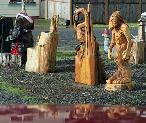
My dismay was countered somewhat by the fact that Bigfoot was a commercial success in the area. It seemed like everyone in the communities of Ocean Shores, Ocean City and Copalis wanted in on the action. Motels, resorts and a pub used him to advertise. The area, like many along the coast from California to Washington, is also into wood carving as an occupation. For a few hundred bucks, we could have had our own Sasquatch to bring home.

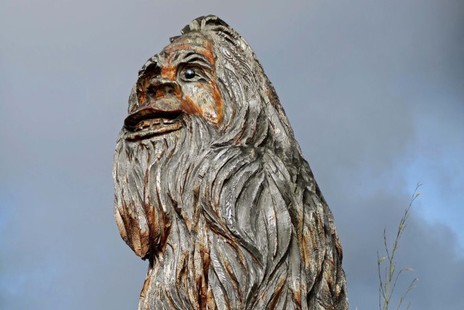
Large sasquatch 1

A close up of Peggy’s friend.

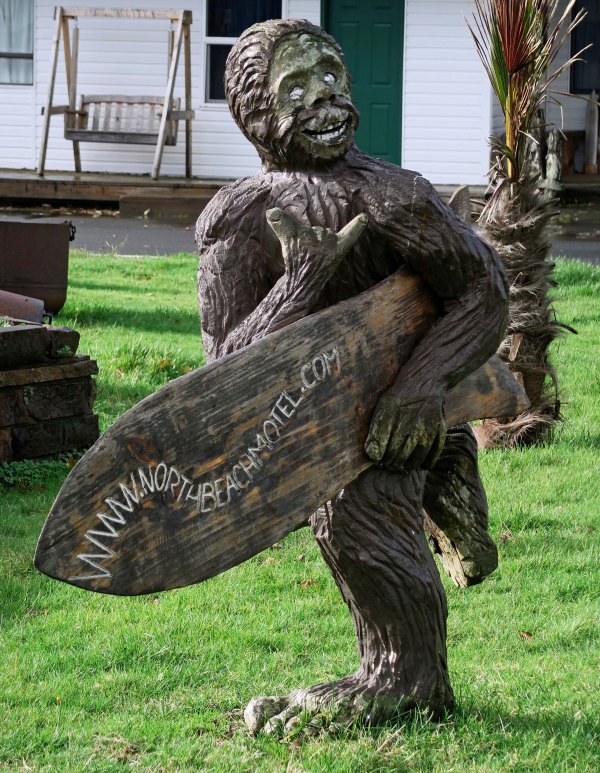
Surfing Sasquatch flashes hang loose symbol

A local motel featured Bigfoot and his buddy Bigfoot running with a surfboard while flashing the ‘hang loose’ sign.

Bigfoot surfing

Buddy Bigfoot.

Sasquatch hangs out with carved heron

The Ocean City Market, which focuses on wood carving, featured Peggy’s Bigfoot as a marketing tool and had this smaller one for sale.

Fu Manchu Sasquatch

We also found this fellow sporting a Fu Manchu mustache.

This guy up the road looked a bit more primitive.

I was looking into a puddle when I caught this reflection of Bigfoot staring back at me.

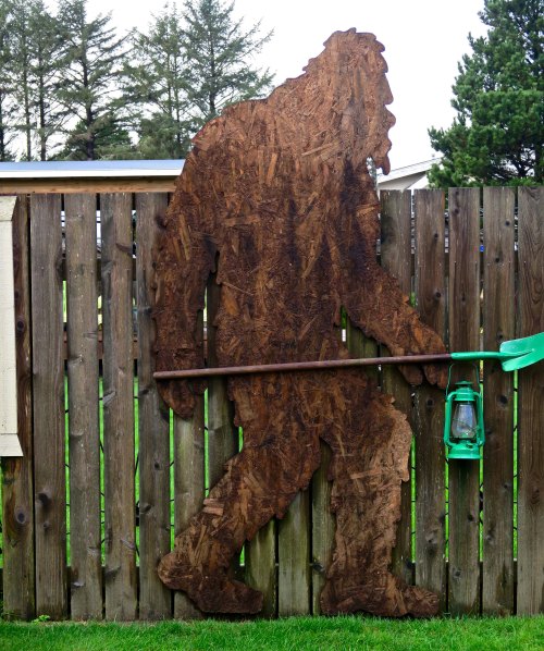
Sasquatch at Green Lantern Pub in Copalis, Wa

The Sasquatch at the Green Lantern Pub was outfitted with a clam digging shovel and a green lantern.

Green Lantern Pub BLT in Corpalis, WA

The pub featured this Bigfoot sized BLT…

BLT at Green Lantern Pub, Copalis

…that I had to sample. I don’t think eating another one is included in my New Year’s resolutions for 2018!

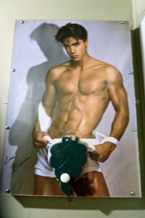
Women's restroom at Green lantern Pub, Copalis

And the women’s restroom at the pub featured this guy, who apparently wasn’t known for his big feet. Peggy, who is infinitely curious, just had to raise the fig leaf, not knowing that a buzzer was going to go off in the pub when she did! So, assuming you didn’t know about the buzzer, how many of you are as curious as Peggy?


THURSDAY’S POST: The flowers of England’s Chatsworth House.

SATURDAY’S POST: 2017 in Review

TUESDAY’S POST: Wandering around the central coast of Washington

Olympic National Park, Vampires, Werewolves and Seagulls

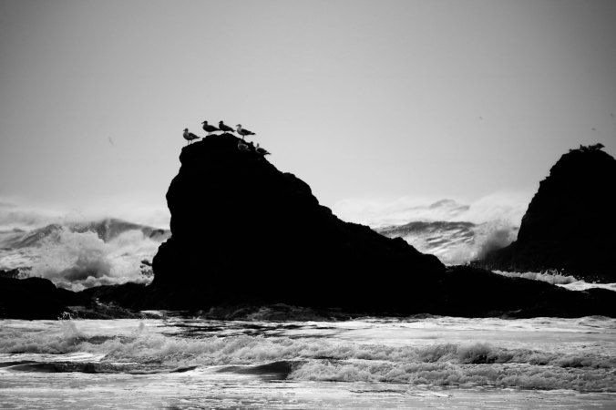
Seagulls lined the tops of ocean rocks at Ruby Beach in Olympic National Park. (Photo by Peggy Mekemson.)

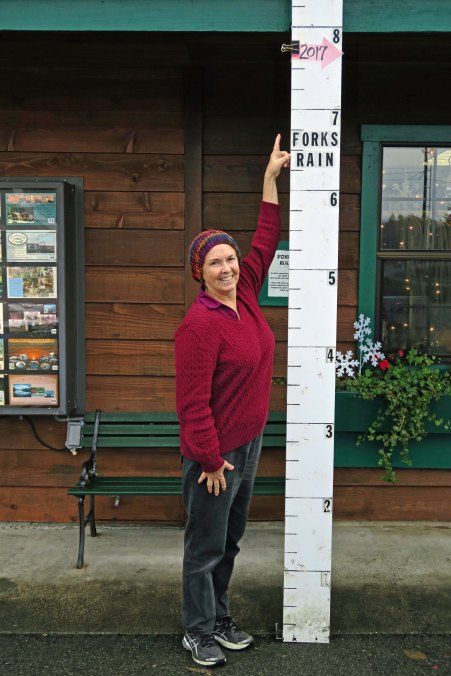
It’s wet up on the central coast of Washington, up where vampires and werewolves once roamed free. The small town of Forks— where Bella of Twilight fame was first smitten-bitten by her vampire lover— receives up to 10 feet (3 meters) of rain annually. The man at the small Visitors’ Center told us that he embraces the rain and loves it. But he was real estate salesmen selling visitors on his small town in hopes of selling a house. He showed us a telephone booth covered in moss. There was no question that the moss embraced the rain.

Photo of rainfall at Forks, Wa. by Curtis Mekemson.

Peggy at (I’m not short) 5 feet 7 inches points out the amount of rain Forks had received by the middle of November.

Old Fashioned phonebooth in Forks, Wa

The National Park people were going to trash this moss-covered relic of the past that once stood at the Hoh Visitor Center in Olympic National Park. Forks rescued it.

The woman behind the counter gave us a map that outlined where we could locate various places found in the three book/four movie Twilight saga. Peggy loves the movies, which means that I have had the opportunity to see them several times. They’re okay, but an angst-driven teenage girl torn between her love for a vampire and a werewolf is a bit outside my preferred genre.

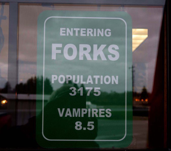
A sign in the window of the Visitors’ Center. Bella represented the .5.

Cardboard cutouts of Victoria, Jacob, Edward and Bella from the Twilight movies greeted us at the Forks’ Visitors Center. Jacob was the werewolf and Edward the vampire, if you haven’t seen the movies. I found Victoria, also a vampire, a more attractive character than Bella. More humor; less angst.

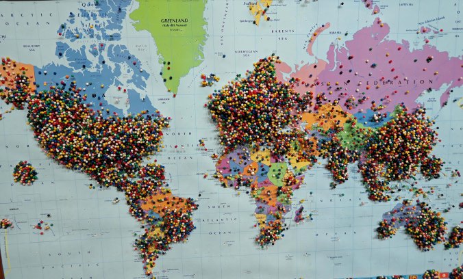
This map of visitors from around the world suggested that Peggy wasn’t the only person with an interest in vampires and werewolves. As an aside, I prefer Bigfoot, who is also known to wander the area. He will show up in my next post on the area.

On the other hand, rainforests, rugged coastlines, and restless oceans call to me in a voice I can’t deny— even if I have to keep a wary eye out for supernatural beings. I’d hoped to take Peggy into the Hoh Visitor Center, which is located deep in the rainforest that makes up a significant part of Olympic National Park, but all of the rain had washed out the roads. That figures. We were left with visiting the jagged coastline that is part of Olympic National Park on a dark day that would have had vampires calling for more. Mainly, it just threatened rain and we were free to admire interesting rock sculptures, driftwood trees, seagulls, crashing waves, and tide driven spume (foam) that left white tracks across the dark sand.

Warning about swimming in ocean, Olympic National Park

Really? Not that we were about to take a dip into the cold waters of the Pacific Ocean on a rainy day.

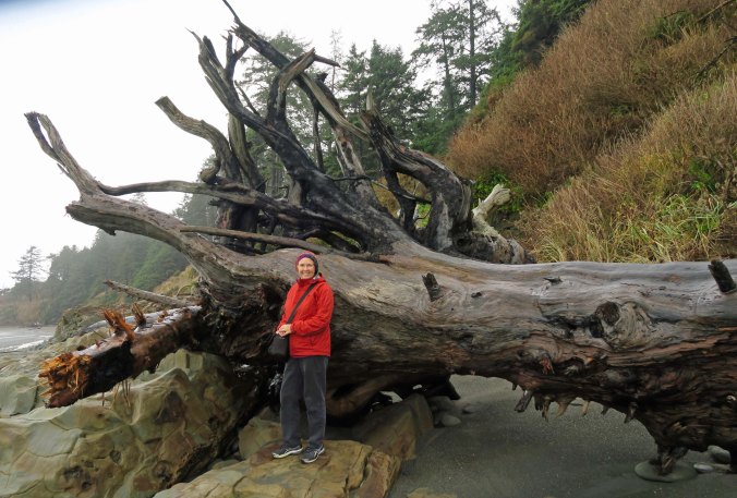
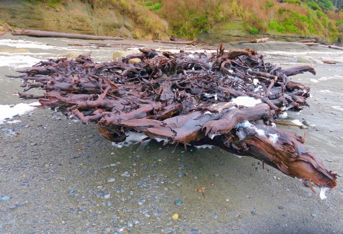
Driftwood log on Beach Five, Olympic National Park

Peggy provides perspective on the ‘driftwood’ you might find out in the ocean.

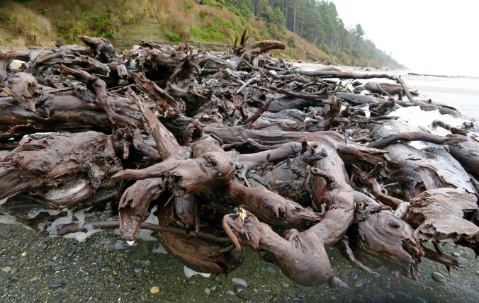
Driftwood roots on Beach Five in Olympic National Park

I also decided that this massive root system wasn’t something I wanted to go swimming with.

Roots of tree at Beach 5, Olympic National Park

A close up of the roots.

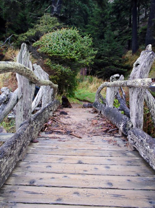
Photo of a bridge made out of driftwood by Curtis Mekemson.

This bridge made out of driftwood was quite ingenious.

Bridge at Beach 5, Olympic National Park

Looking across the bridge. (Photo by Peggy Mekemson.)

Layered rocks at Beach 5 in Olympic National Park

Rocks tilted at odd angles had once been laid down flat on the floor of the ocean. Plate tectonics brought them ashore and tilted them upward. (Photo by Peggy Mekemson.)

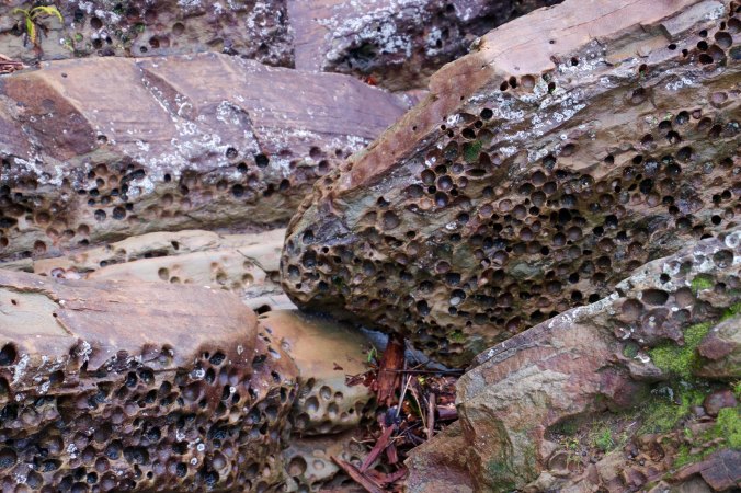
Clam carved rocks at Beach 5, Olympic National Park

These holes in the sandstone were carved by piddock clams using a rocking motion. There must have been lots of ‘rocking’ going on. Shake, rattle and roll! (Photo by Peggy Mekemson.)

Curt Mekemaon at Beach 5, Olympic National Park P

A last look at Beach 5, and yes, the National Park Service has also named beaches 1,2,3,and 4. (Photo by Peggy Mekemson.)

Ferns in rainforest, Olympic National Park

Walking back to the car from Beach 5, the luxuriant growth reminded us that we were in a rainforest.

Nursery tree along trail, Olympic National Park

As did this tree growing out of a stump. Such stumps are known as nursery trees and are common in the rainforests of the Northwest.

Photo of driftwood and rocks at Ruby Beach by Curtis Mekemson.

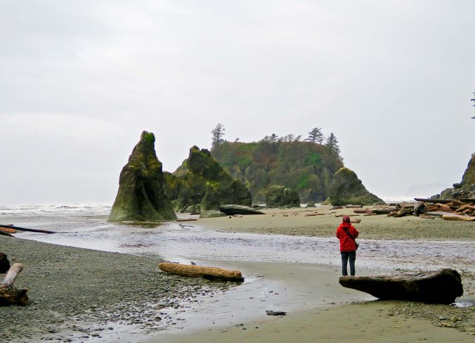
An island, rock sculptures and driftwood dominated Ruby Beach.

Sea stacks in Olympic National Park

I caught this photo of Peggy admiring the rocks, which are known as sea stacks. They would have been part of the shore at one time.

Ruby Beach under dark clouds, Olympic National Park

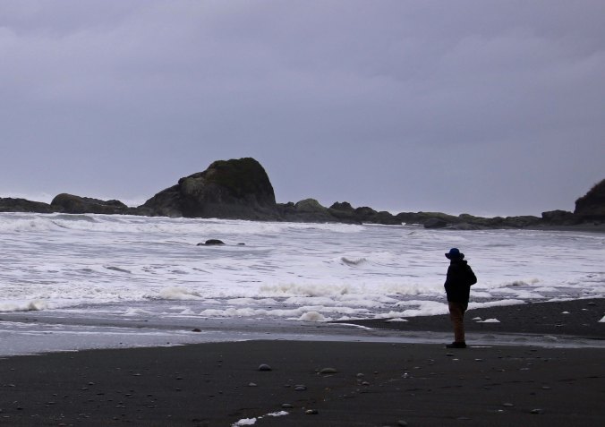
The beach became more desolate to the south and seemed to stretch on forever at low tide. The grey skies prompted me to render these photos in black and white.

Seagulls outline rock at Ruby Beach in Olympic National Park

Coming closer, we discovered that the rocks were full of life. I was curious as to why the gulls lined up the way they did.

Seagulls in surf at Ruby Beach, Olympic National Park

I like to walk up on them and encourage them to fly for action shots.

Seagulls running and flying at Ruby Beach

The one in the middle had decided to hoof it.

Seagull takes flight at Ruby Beach, Olympic National Park

Until I got too close. I really like the pattern on the gull’s wings and the way it is kicking up water.

Twin rocks at Ruby Beach, Olympic National Park

A pair of twin rocks asked for a photo.

Ruby Beach sea stack in Olympic National Park

As did this bird-decorated sea stack with a hint of sun.

Ruby Beach, Olympic National Park

The sun peeked out just as we were leaving, giving a warmer feel to Ruby Beach and providing closure for this post.


WEDNESDAY: The second post on the beautiful island of Santorini.

FRIDAY: Happy holidays.

MONDAY: Bigfoot is all over the Copalis Beach area but we missed the annual Sasquatch Conference.


SaveSave

SaveSave

A Cow Has Four Stomachs and Other Tales from the Pacific Northwest

Cow T-shirt at Tillamook Cheese Factory

Raising cattle to produce dairy products is big business in the Tillamook area. Peggy and I found this T-shirt at the Tillamook Cheese Factory.


I am going to get to the cows and their four stomachs, but first I want to cover our stay at Rockaway Beach, which is about 15 miles north of Tillamook on Highway 101. Our suite looked out on the ocean. We could watch the waves roll in and hear the continuous roar of the ocean. Wintry skies brought rain but the clouds were also great for beautiful sunsets. We headed out whenever there was a break in the weather, and even when there wasn’t. We walked the beach, visited local shops, and ate out at the town’s restaurants. Thanksgiving dinner was at Grumpy’s and Mrs. Grumpy hovered over us to make sure we ate our veggies. How much more down-home can you get? The complete meal, which included all of the Thanksgiving favorites, cost a whopping 12 bucks. “I want it to be affordable for everyone,” Mrs. Grumpy primly informed us.

Gentle waves roll in at Rockaway Beach, Or P

The ocean was shallow and produced a long line of waves that created a roar as opposed to the sound of single waves crashing.

Sunset over Rockaway Beach on the Oregon Coast near Tillamook.

We were treated to several beautiful sunsets looking out from our suite at Rockaway Beach. (Photo by Peggy Mekemson.)

Small shops had the usual touristy stuff found in coastal tourist shops everywhere. “Go to Flamingo Jims,” we were urged. As to why it was named Flamingo in an area where the tropical bird would freeze, I didn’t have a clue. But we went. And we weren’t disappointed; it was filled to the brim with cheap souvenirs. We wandered around and checked out T-shirts, mermaids and sea shells. We could have bought a sand dollar for a dollar, but Peggy prefers to find her own. I was reminded of this old tongue twister. Try saying it as fast as you can without a mistake.

She sells sea shells by the sea shore.
The shells she sells are surely seashells.
So if she sells shells on the seashore,
I’m sure she sells seashore shells.

Seashells for sell at Flamingo Jim's in Rockaway Beach, Oregon.

Any good tourist souvenir shop on the ocean has seashells to sell.

Mermaids for sell at Rockaway Beach in Oregon

And mermaids. A twist for the Northwest is Bigfoot(s), or is that Bigfeet? You can see some up in the righthand corner.

The beach seemed to go on forever. One end was dominated by the sea rocks that Rockaway Beach is famous for; the other by a forest covered mountain. If you look at the rocks from the right angle, they make an excellent sea dragon. Welcome to Oregon, Nessie! A creek divided the beach about halfway along. Sea gulls patrolled the waterfront, checking out both the ocean and tourists for possible food. A small boy threw out a couple of pieces of bread and was suddenly surrounded by 50 of the birds, in seconds! They seemed to materialize out of nowhere. How do they do that?

Rockaway Beach Oregon Beach

Looking north up the beach at Rockaway. Our suite was on the second floor of the building on the right. Our footprints lead down to where we took the photo. (Photo by Peggy Mekemson.)

The rocks of Rockaway beach photographed by Curtis Mekemson.

The sole rocks of Rockaway Beach look very much like a sea serpent with its head under water searching for tasty fish. (Photo by Peggy Mekemson.)

creek that divides Rockaway Beach, Oregon

A creek flowing across Rockaway Beach limited how far we could hike south.

A seagull steps out at Rockaway Beach, Or

A seagull steps out on his gull-friend at Rockaway Beach.

When we ran out of things to do in Rockaway, we drove 15-miles south to Tillamook. I’ve already done posts on Cape Meares, Munson Creek Falls, and some very wet alpacas. On our way, we decided to check out a small county park in Barview and found the Coast Guard practicing air to sea rescue missions by helicopter, which is what our son Tony does.

Seagull stops to watch Coast Guard practice rescues

And here, a seagull joins us in watching the Coast Guard practice rescue operations at Barview, just north of Tillamook.

Practice rescue mission by the Coast Guard

Part of this practice included dropping a man down on to a rocking boat to help in a rescue effort, which was a operation our son was involved with several times while flying  helicopters over rough Alaska waters.

In Tillamook, it is almost required that people stop off at Tillamook Cheese and Ice Cream factory. The cheese is good and can be found throughout the US, but the ice cream is to die for. Our refrigerator is always stocked with a half-gallon.  I should probably weigh 300 pounds but we limit our consumption to Date Night, which falls on Wednesday, as it has for the past 27 years.

Welcome to Tillamook Cheese Factory

The visitor’s center at the Tillamook Cheese Factory included a number of exhibits on the dairy industry, from beginning…

Rear view rear at Tillamook Cheese Factory

…To the end.

cow stomach

I was particularly interested to learn that a cow has four stomachs, which were two more than I was aware of. I also learned that when a cow chews its cud it’s know an ruminating, is case you ever wondered about where the word came from. So, next time you find yourself ruminating, you might want to break out some gum.

When we were out and about and lost, we also came on the Latimer Quilt and Textile Museum where I found the alpacas. Peggy’s love of quilting demanded a visit. We found numerous quilts, a doll collection, looms, and a lot of history.

Alpaca photo in Tillamook, Oregon by Curtis Mekemson.

You will probably remember the alpacas. Check out the blue eyelashes on this gal.

Quilts at Latimer Quilt and Textile Center

As might be expected, the Latimer Quilt and Textile Center was filled with quilts. The Center was preparing for a big sale. These are more traditional quilts.

Quilt at Latimer Quilt and Textile Center in Tillamook, Or

And this one a more modern version.

Interesting dress at Latimer Quilt and Textile Center

A number of other textile products were offered as well, including this dress. We assumed something would be worn under it, but possibly not at Burning Man.

Looms at Latimer Quilt and Textile Center

A number of looms were available for weaving.

Doll at quilt shop

There was even an extensive doll collection. I picked this one out for her reading material. 

Peggy Mekemson quilt

I’ll conclude today’s post with this gorgeous quilt that Peggy made for our bed using a vintage Singer Featherweight sewing machine that her grandmother bought in 1933.


WEDNESDAY’S PHOTO POST: Join Peggy and me as we explore the Greek island of Santorini.

SaveSave

SaveSave

SaveSave

The Highest Waterfalls on the Oregon Coast: Munson Creek Falls

Munson Creek Falls near Tillamook, Oregon. Photo by Curtis Mekemson.

The upper section of Munson Creek Falls.

Peggy has been lobbying for a tour of Oregon waterfalls for quite a while. So, when I read that Munson Creek Falls was near Tillamook, I knew we would have to pay a visit on our recent trip to the coast. We drove over to Tillamook from Rockaway Beach where we were staying and then south for seven miles following Highway 101. Along the way, we passed the giant blimp hangar built during World War II that now serves as an air museum. I visited the hangar a couple of years ago when I was passing through the area. Close to the turnoff, we also passed the campground where I had stayed. At the time, I wasn’t aware of the falls— I’d been too busy counting rabbits.

A view of the blimp hangar during World War II. The blimps were used for spotting Japanese submarines off the coast. (Photo from Tillamook Air Museum.)

The Tillamook Air Museum shown here, served as a blimp hangar during World War II.

A photograph of the Air Museum I took on my previous visit. The airplane in front is known as a guppy. The house provides a perspective on size.

White rabbit near Tillamook, Oregon. Photo by Curtis Mekemson.

This lovely creature was one of over a hundred rabbits wandering around freely at Pleasant Valley Campground near the exit to Munson Creek Falls.

A sign along 101 told us to turn inland for the falls. We followed a narrow, pothole filled road that became narrower as we went, making it more difficult to dodge the potholes that were simultaneously becoming deeper and more numerous! The short three and a half miles felt like twenty. We finally reached the parking lot, however, and discovered that we had entered a rainforest. Trees covered in moss gave a magical feel to the area.  An easy, quarter of a mile trail led off toward the falls. More moss-covered trees and rocks, the dashing Munson Creek, brightly colored fallen leaves, mushrooms and ferns lined the trail.

Moos covered tree along path to Munson Creek Falls. Photo by Curtis Mekemson.

Moss covered trees gave a magical feeling to the path leading to the falls.

Hanging moss at Munson Creek Falls near Tillamook, Oregon.

A close up of the hanging moss. (Photo by Peggy Mekemson.)

Moss draped across branch along trail to Munson Creek Falls on the north coast of Oregon.

And another. (Photo by Peggy Mekemson.)

Fall leaves along trail to Munson Creek Falls near Tillamook, Oregon. Photo by Curtis Mekemson.

The damp conditions added to the colors of the leaves that had fallen along the trail.

Fallen leaves along trail to Munson Creek Falls near Tillamook, Oregon.

A close up. This is from a Big Leaf Maple tree. (Photo by Peggy Mekemson.)

Mushrooms along the trail to Munson Creek Falls off of Highway 101 in northern Oregon.

These reddish mushrooms caught my eye.

Munson Creek near Munson Creek Falls on north coast of Oregon.

Munson Creek dashed along beside the trail, keeping us company. (Photo by Peggy Mekemson.)

Moss covered rock in Munson Creek near Munson Creek Falls on north Oregon Coast. (Photo by Curtis Mekemson.)

A moss-covered rock decorated with fall leaves sat in the middle of the creek.

Moss, ferns and leaves on a tree near Munson Creek Falls near Tillamook, Oregon. Photo by Curtis Mekemson.

Moss, ferns and fallen leaves on a tree had a Christmas look.

Trail to Munson Creek Falls near Tillamook, Oregon. (Photo by Curtis Mekemson.)

A view of the trail.

Our first view of the falls assured us that we had made the right decision to make the trip. Water shot out from the top and tumbled some 319 feet to the bottom, making Munson Creek Falls the highest on the Oregon coat. Halfway down a log jam gave testimony to the power of the stream. The rainforest provided a dramatic backdrop. We wandered around seeking various vantage points to appreciate the beauty, and finally, being satiated, hiked back to the parking lot. The drive out went much faster, or so it seemed.

Munson Creek falls in the coastal mountains near Tillamook, Oregon. Photo by Curtis Mekemson.

The 319 foot tall falls. The log jam with its large logs spoke to the power of the creek. I also like the moss-covered tree to the right.

Photo by Peggy Mekemson of Munson Creek Falls near Tillamook, Oregon.

A final look at the falls above the log jam. (Photo by Peggy Mekemson.)


Photos: Most of the photos I use on this blog are taken by either Peggy or me. Photos without attribution are taken by me. I always note any other sources such as the Air Museum above.

NEXT POSTS: Almost everyone I know who tries to maintain a blog while writing books runs into a challenge with time. There isn’t enough. Solutions range from dropping out of the blogosphere for a while to limiting blogs. I am going to try something else for the next month. If it doesn’t work, I’ll have to a move to a more dramatic solution. Here’s what I am going to try: On Mondays I will do my usual travel blog; on Wednesdays I will put up photos from my collection of 76,000; on Fridays, I am going to blog my book on MisAdventures. The theory is that this will allow me most of the week to work on the book. We’ll see.

WEDNESDAY: We will drop down to the South Island of New Zealand and visit the beautiful Milford Sound.


SaveSaveSaveSave

SaveSave

SaveSave

SaveSave

SaveSaveSaveSave

SaveSaveSaveSave

SaveSave

SaveSave

The Cape Meares Lighthouse, an Octopus Tree, and the Three Rock Arches of Oregon

Cape Meares Lighthouse

At 38-feet tall, the Cape Meares Lighthouse is the shortest lighthouse in Oregon. (Photo by Peggy Mekemson.)

Towering cliffs, abundant sea life, a lighthouse, massive rocks rising out of the ocean, the Octopus Tree, and an old-growth forest of Sitka Spruce… How could we resist? With the sun tentatively breaking through the clouds, Peggy and I grabbed our cameras, packed our raingear, and headed out to Cape Meares, which is located about 30 minutes away from Tillamook, Oregon.

But first, our stomachs demanded lunch, so we stopped at the Pelican Brewing Company in Tillamook for a hamburger and, of course, a beer. Peggy and I shared a pint of tasteful ale. The Northwest is noted for its great craft beers and Pelican has some dandies. Several have won national and international awards.

Pelican Brewing Company

Good things were brewing at the Pelican Brewing Company in Tillamook, Oregon.

Curt Mekemson enjoying a pint at Pelican Brewing Company in Tillamook, Oregon.

Cheers! (Photo by Peggy Mekemson.)

Having tamed our hunger and thirst, we headed out to the coast and were soon perched on an overlook admiring the Three Arch Rocks, so named because each one contains an arch. Of greater significance, the rocks are known for their large nesting colonies of Common Murres, Cormorants, Western Gulls, storm-petrels, auklets, Black Oystercatchers, Tufted Puffins, and Pigeon Guillemots. In 1907, Teddy Roosevelt declared the area a wildlife sanctuary, the first in the US west of the Mississippi. He did so on the recommendation of a pair of young conservationists, William Finley and Herman Bohlman, who had watched hunters decimate the sea lion population on the rocks, and even worse, observed local ‘sportsmen’ row out to the rocks on Sundays and use the birds for target practice, killing thousands.


Three Rock Arches near Cape Meares

Three Rock Arches as seen from an overlook just before the small town of Oceanside.

Three Rock Arches near Oceanside

Peggy used her telephoto to pull in the middle of the Three Arch Rocks. While you can’t see through the arch at this angle, you can see how big it is. (Photo by Peggy Mekemson.)

Three Rock Arches 1

A convenient pine provided a different perspective.

We drove on to the Cape Meares Lighthouse where a sign in the parking lot suggested a detour toward the Octopus Tree that sent our imaginations spiraling out of control. Was this a magic tree of fantasy lore? Would we be swept up in its tentacles? Naturally, we had to check it out. The tree turned out to be a Sitka Spruce with eight trunk-like limbs that once made it into Ripley’s Believe It or Not. The story behind its unique shape is that the local Tillamook Indians shaped it to grow that way, created a sacred site where elders could gather to make important decisions and Shamans would travel on their mystical journeys. A few yards away from the tree, a plunging cliff provided more views of the Three Arch Rocks, this time backlit by the sun. Peggy found a man operating a camera drone on the edge of the cliff, capturing pictures of the 200-foot drop off that we weren’t willing to lean out far enough to get.

Sitka Spruce forest at Cape Meares

We walked through a Sitka Spruce forest to get to the Octopus Tree.

Octopus Tree

The Octopus Tree is surrounded by a fence to keep it from eating people. Whoops, fake news. It’s surround by a fence to keep young and old kids from climbing on it.

Octopus Tree

The Tillamook Indians were said to place their canoes on the branches. (Photo by Peggy Mekemson.)

Three Rock Arches backlit

We were south of the cape looking north when we took the first photos of the Three Rock Arches. Here we were looking south with the rocks back lit by the sun. (Photo by Peggy Mekemson.)

Three Rock Arches backlit

This shot of the rocks gave the feeling of a lurking sea monster with the light showing through one of the arches serving as its eye.

Three Rock Arches

Two of the arches can be seen in this photo by Peggy. The rock on the left is the same one she took a close up of from the other direction.

Man with drone at Cape Meares.

The drone man who was capturing shots of the cliffs.

Walking back toward the lighthouse, we found more cliffs on the other side of the peninsula where the lighthouse sits. These featured a waterfall that tumbled down into the ocean. We also noticed white guano (bird poop) decorating the cliff sides, a sure sign that birds build their nests along the cliffs. Imagine being a young bird looking over the edge of your nest and pondering your fate.

Waterfalls 1

The waterfalls came tumbling down. The white spots on the opposite cliff show the sites of bird nests.

A sign at the site informed us that baby birds are either flyers or jumpers. Murrelet chicks, who are fliers, have been observed pacing back and forth in their nest for a couple of days, flapping their wings frantically, and nervously peering over the edge before they finally take the plunge. It’s worse for Common Murres. Their mom kicks them out of the nest when they are three weeks old… before they can fly! No Mom of the Year there.  They simply stand on the edge and jump, hoping that their stubby wings will guide them to them into the ocean instead of the rocks below. Dad patiently waits in the ocean where he will take over parenting responsibilities for a few weeks until the babies can fend for themselves. Meanwhile, a whole host of hungry predators are waiting below chanting “Crash! Crash! Crash!”

While I am on the subject of birds and food, I learned at Cape Meares that the Tufted Puffins have a barbed tongue that they use to spear fish. They can get three or so minnow-sized fish on their tongue at once. The first one is pushed up the tongue by the second and the second by the third. The barbs hold them in place until, I assume, baby birds wrest them free. I also found out that a pair of Peregrine Falcons were known to nest in the area. These birds are the fastest animals in the world. They fly high above their prey, fold their wings and literally fall, or dive, hitting speeds up to 250 miles per hour (402 KPH) before smacking into their dinner.

At 38-feet tall, The Cape Meares Lighthouse is known for being the shortest lighthouse in Oregon. Given that it stands on a 217-foot tall cliff, however, size probably doesn’t matter. The lighthouse was built on location but the first order Fresnel lens (pronounced ‘fraynel’) was wrestled up the cliff in 1899 using a wood crane built from local timber. The lens had been manufactured in France and shipped around Cape Horn and up the coast to Oregon. It was built with four primary lenses and four bull’s-eye lenses providing light that can be seen 21 miles out at sea.

Cape Meares

This T-Rex perspective of Cape Meares by the Fish and Wildlife Service provides a good view of the cliffs. The lighthouse is the white speck at the end of the lower ‘jaw.’ The Octopus Tree is on the upper end of the lower jaw. The waterfall was inside the lower jaw.

Cape Meares Lighthouse

The Trail down to the Cape Meares Lighthouse. (Photo by Peggy Mekemson.)

Fresnel Lens in Cape Meares Lighthouse

A close up of the Fresnel lens with its red bullseye.

Cape Meares Lighthouse 2

A final view of the Cape Meares Lighthouse.


NEXT POST: Peggy and I make our way through a rainforest to the highest waterfall on the Oregon Coast.


SaveSave

We’re Just Glad We Aren’t Turkeys…

White alpaca 4

This alpaca greeted me at the Latimer Quilt Center near Tillamook, Oregon. She had just been through a downpour.


I got us a bit lost yesterday and was grumpy. I zigged when I should have zagged. Peggy and I had been visiting the Tillamook Cheese and Ice Cream factory and I had made a left turn onto a country road instead of a right.

“I think you need to go right,” Peggy had suggested as I drove on, thinking I knew where I was going. Teach me. We had continued down the country road, far past where I realized that Peggy was correct, when we saw a sign to the Latimer Quilt Center.

“Oh, I want to go there!” Peggy said eagerly. “Not me,” I’d replied, still grouchy. Whoops. I was thinking it was getting late and we still had to drive into Tillamook and shop at Safeway before returning to Rockaway Beach. And I was thinking we’d be driving home after dark on a stormy night along the coast. I was thinking wrong.

I spotted the alpacas as we drove into the quilting museum. “I’ll see you inside,” my buddy had noted, realizing that I could not resist the charming four-legged sweater factories.

“Oh, you poor fellows,” I had declared when I got closer, barely able to speak I was laughing so hard. A downpour had just passed and they were drenched, the epitome of a bad-hair day. I think one of then mumbled, “We’re just glad we aren’t turkeys.”

Actually, they had a spacious shed they could have hidden out in if they had chosen. Maybe their Andean DNA insisted on them being out in the cold and wet. Anyway, here they are looking half drowned…

Wild haired apaca 2

This gal was definitely having a bad hair day!

Wild hair alpaca 1

As I watched, she worked on lunch.

Brown alpaca 3

I think that this fellow took umbrage at my laughter…

Brown alpaca 4

Eyed me suspiciously…

Brown alpaca 5

And gave me a squinty look.

White alpaca 7

Meanwhile, the cutie shown at the top of the post happily rested on the soaking wet ground.

White alpaca 3

Provided a profile shot…

White alpaca 2

And looked pretty!


The alpacas, Peggy and I wish each of you a Happy Thanksgiving.

PS… I found the quilting museum quite interesting and took this photo of a quilt featuring a lighthouse as a lead in to my next post where Peggy and I will visit the rugged Cape Meares and the Cape Meares Lighthouse.

Lighthouse quilt from the Latimer Quilt Center


SaveSave

Rock Art, a Civil War Veteran, and Magnificent Mountains… The Arches National Park Series: Conclusion

The La Sal Mountains provide a dramatic backdrop for Arches National Park.

The first people came wandering through Arches some 10,000 years ago as the last of the glaciers were retreating north or scooting up mountains, seeking colder climates. The nomads were hunter-gatherers, killing wild animals for food and seeking out edible plants where they grew naturally. They must have been impressed with the magnificent rock sculptures they saw. Possibly they even gave the soaring arches, spires and fins spiritual significance. What caught their attention from a practical point of view, however, were the chert and chalcedony rocks that could be chipped into stone tools such as knives and scrapers. Left over debris piles can still be seen by those trained to look for them.

The wandering hunters and gatherers were replaced by farmers some 2,000 years ago. The Arches area was on the northern edge of the Puebloan culture, which was known for its cliff dwellings. A lack of such abodes in the area, however, suggest that Arches was more of a place to visit than occupy. About 700 years ago, the Puebloans apparently abandoned the area altogether for whatever reason they were disappearing from their homes throughout the Southwest. Drought, disease, or invasion are among the causes normally given.

When the first Europeans entered the area, they found it occupied by the Utes, a Native American tribe from which Utah took its name. It is assumed that the rock art panel shown below was created by the Utes since the Indians were riding horses and there weren’t any in North America prior to the arrival of the Spanish Conquistadors. Interestingly, a section of the Old Spanish Trail that was used by Spaniards to travel between Santa Fe, New Mexico and Los Angeles in the late 1700s/early 1800s actually runs in front of the park headquarters following Highway 191.

Utes on horses hunt big horn sheep on the petroglyph panel found at Arches National Park.

A closer look suggests that the Utes were waving their arms and driving the sheep with the help of dogs. Native Americans were known to drive buffalo but I have never heard of the technique in relation to sheep.

In hopes that the arid climate of the region would be good for an old Civil War war wound, 69-year-old John Wesley Wolfe left his wife in Ohio in 1898 and settled near Delicate Arch and the Ute rock art north of the town of Moab. He brought his son with him and built a primitive cabin. There was enough space to raise a few head of cattle and vegetables. More sophisticated needs were met by shopping out of the Sears and Roebuck catalogue. When his daughter, her husband, and two children arrived a few years later, she insisted that Wolfe provide more modern accommodations. He complied by building the 11 by 17 foot one room cabin that still stands today. It must have been cozy.

The Wolfe’s cabin as it looks today. Delicate Arch is off to the right. The Ute rock art is located on the cliffs behind the cabin.

A closeup of the cabin rendered in black and white.

While the Colorado River forms the southeastern border to Arches National Park, it is the La Sal Mountains that provide a dramatic backdrop for many of the rock sculptures found in the park. Towering over 12,000 feet in height, the La Sal’s are part of the Rocky Mountain chain. I’ll conclude my series on Arches with several photos that Peggy and I took of the mountains as seen from Arches.

I liked the contrast between the red rocks, green brush and blue mountains.

La Sal Mountains framed by pillars in Arches.

Clouds, mountains and red rocks.

I’ll conclude with this tree that was set off by the red rocks.

NEXT POSTS: Hot off the press: Peggy and I are on a two-week trip up the coast of northern Oregon and southern Washington to celebrate our 25th Anniversary. Expect crashing waves, tumbling waterfalls, rainforests, a picturesque lighthouse, towering ocean rocks and quaint towns.

SaveSaveSaveSave

SaveSave

SaveSave

SaveSave

SaveSave

SaveSave

SaveSave

SaveSaveSaveSave

SaveSaveSaveSaveSaveSave

SaveSaveSaveSaveSaveSave