Mt. Whitney: 14,505 feet— Or Is that 14,496.811 Feet… But Who’s Counting?

Highway 395 is one of America's most scenic drives. This view looking up at Mt. Whitney, center top, is one of the reasons why.

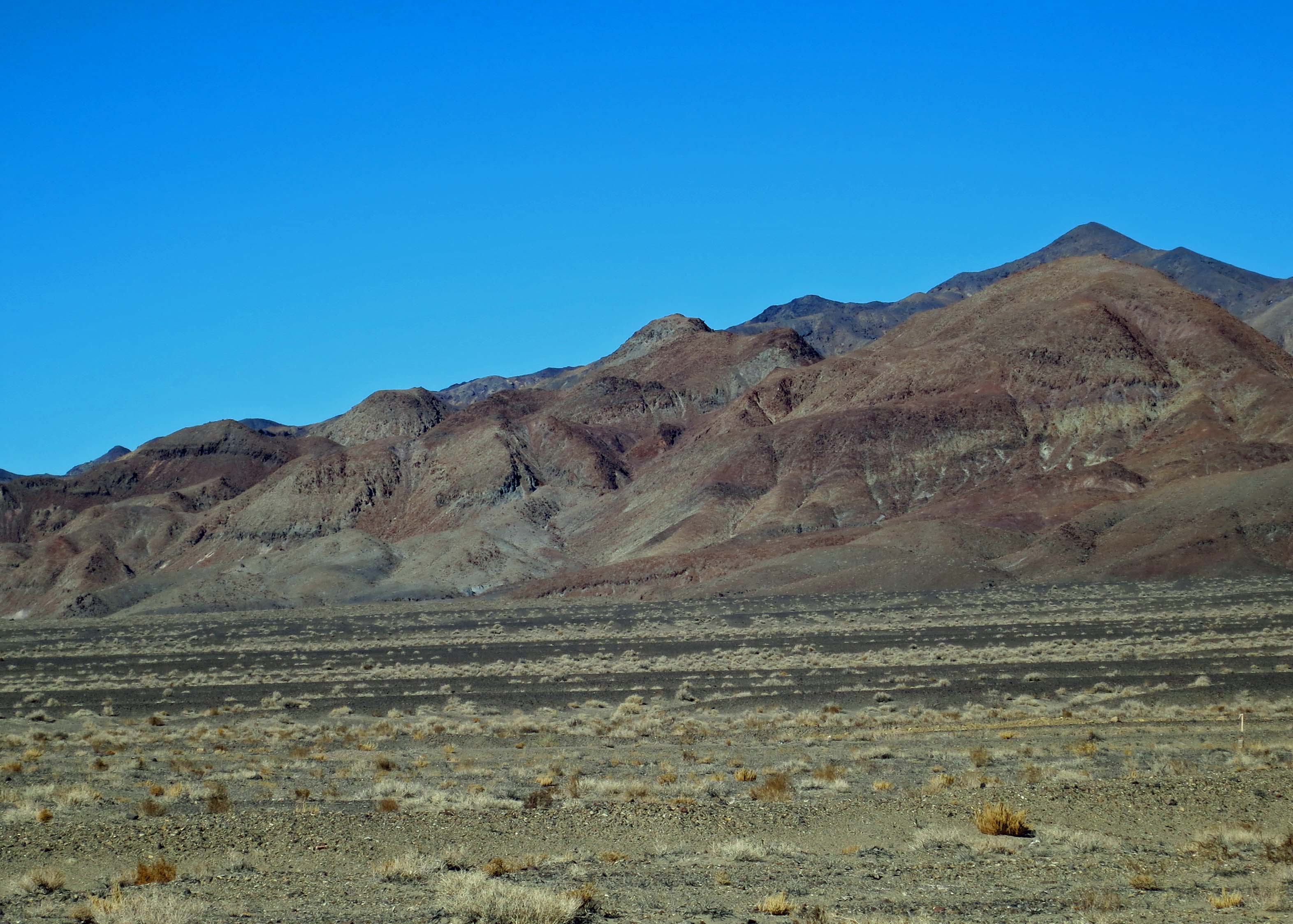
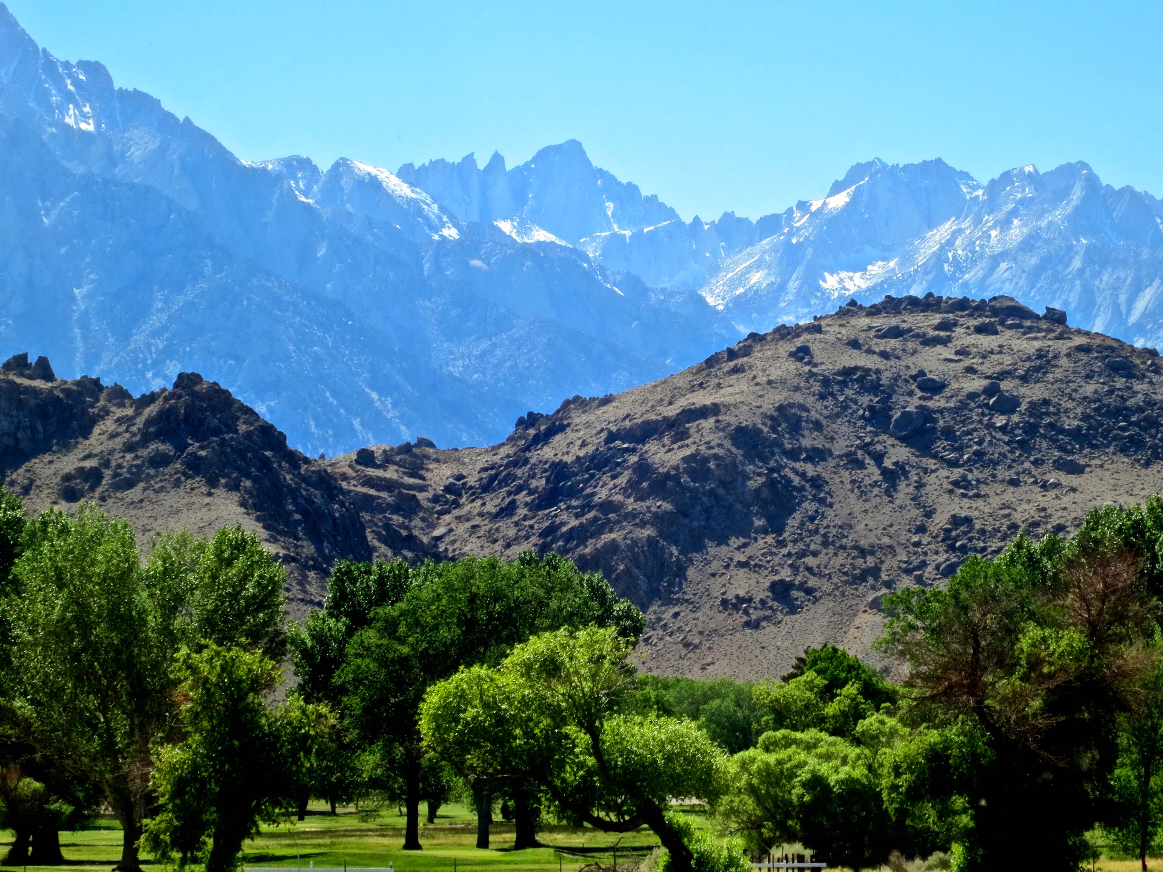
Highway 395 is one of America’s most scenic drives. This view looking up at Mt. Whitney, center top, is one of the reasons why.

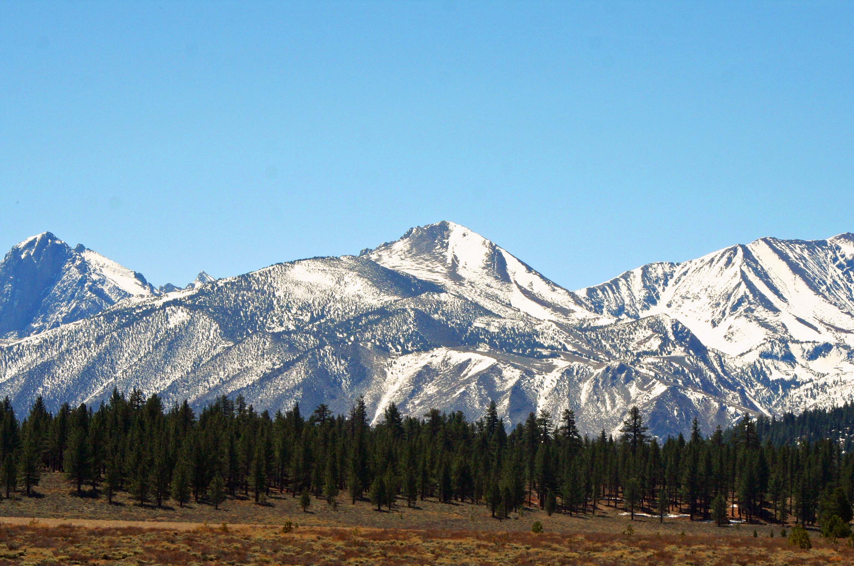
Highway 395, with its panoramic views of the eastern Sierra Nevada Mountains, is one of the most scenic highways in the United States. I will admit to a degree of prejudice, however. John Muir called the High Sierras the Range of Light. I think of them as ‘home.’ I have backpacked up and down the range numerous times. The mountains call to me in a way that no city or town does.

Driving up California's Highway 395 provides and ever changing perspective of the eastern Sierra Nevada Mountains.

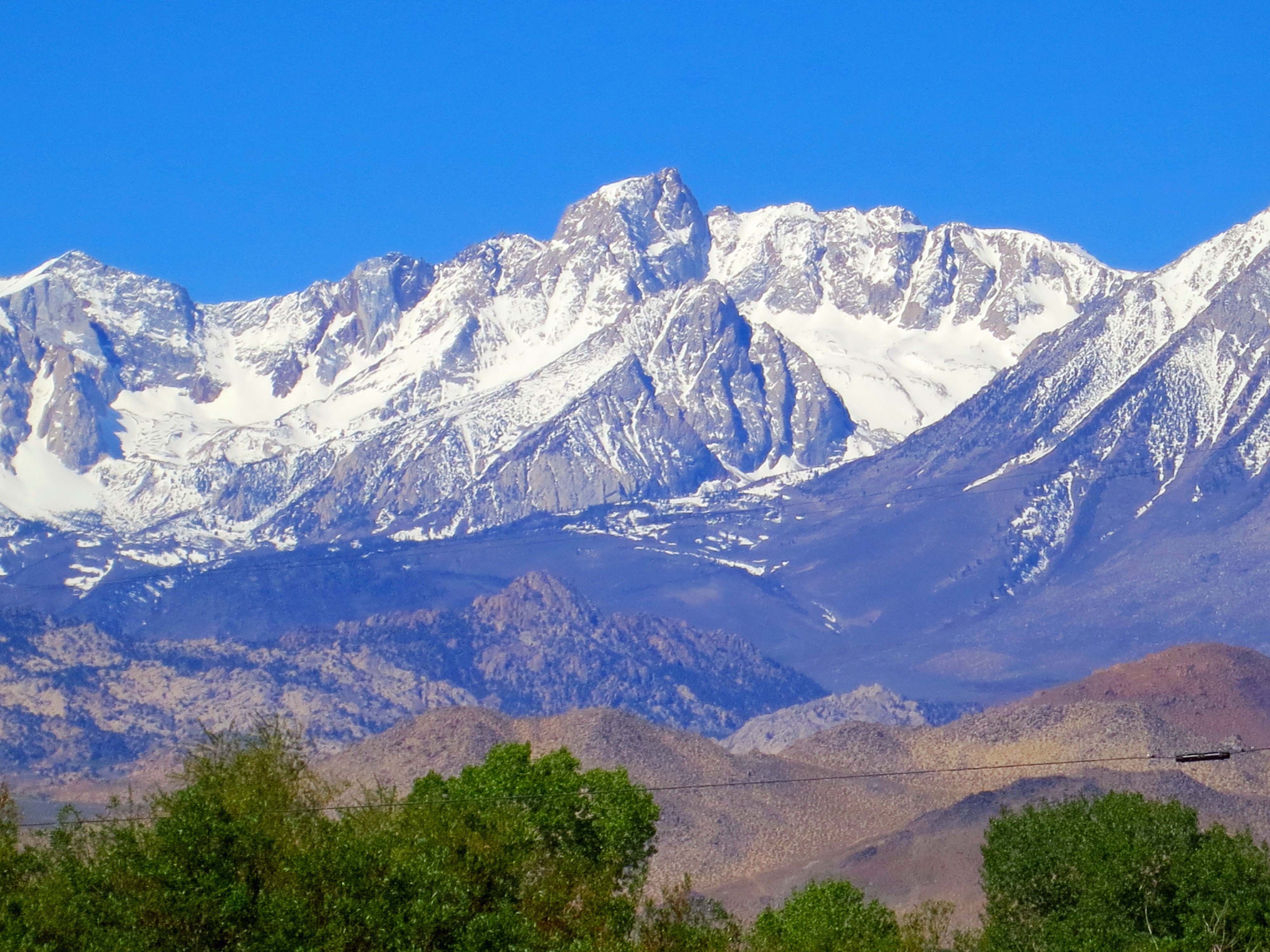
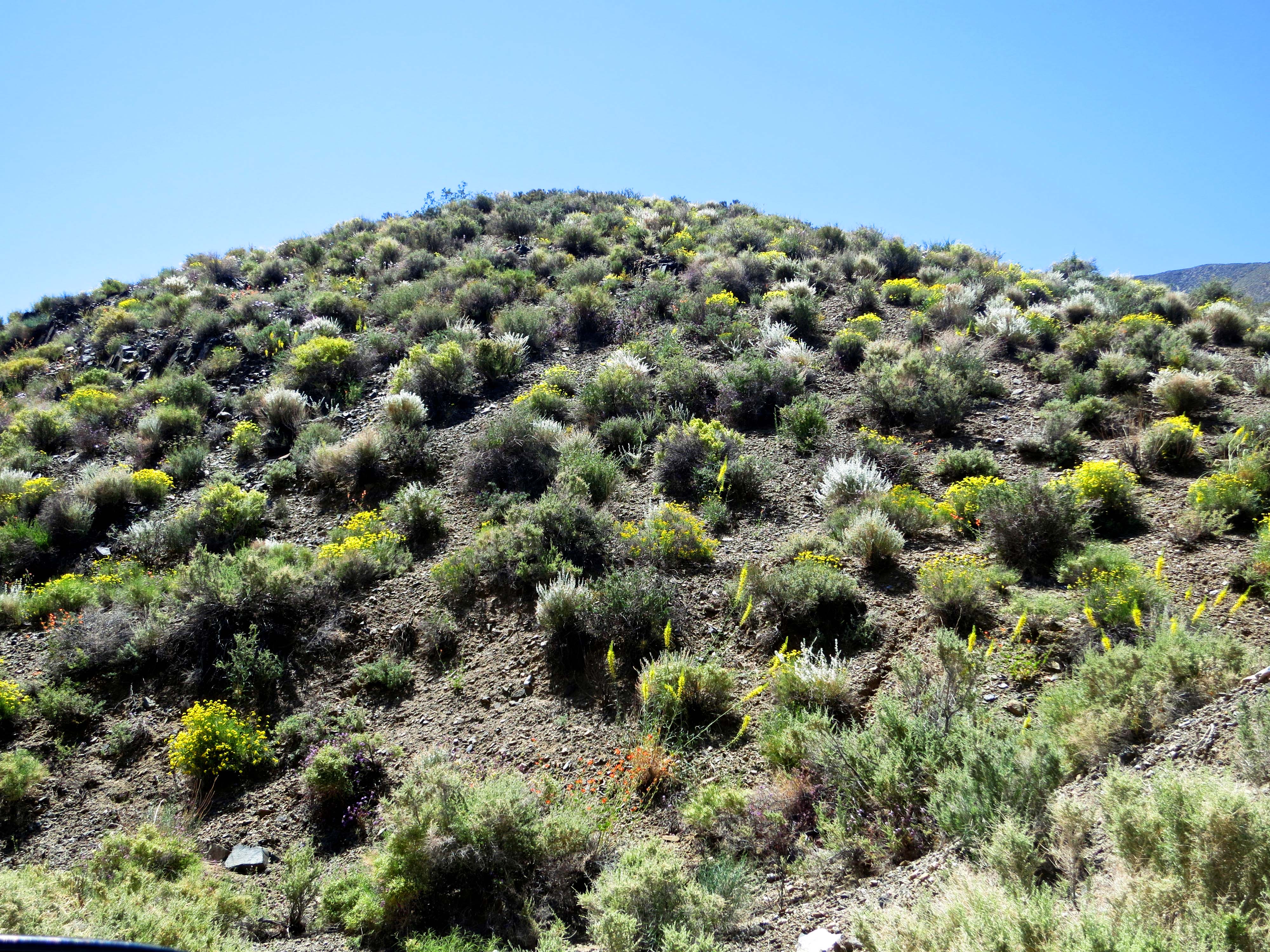
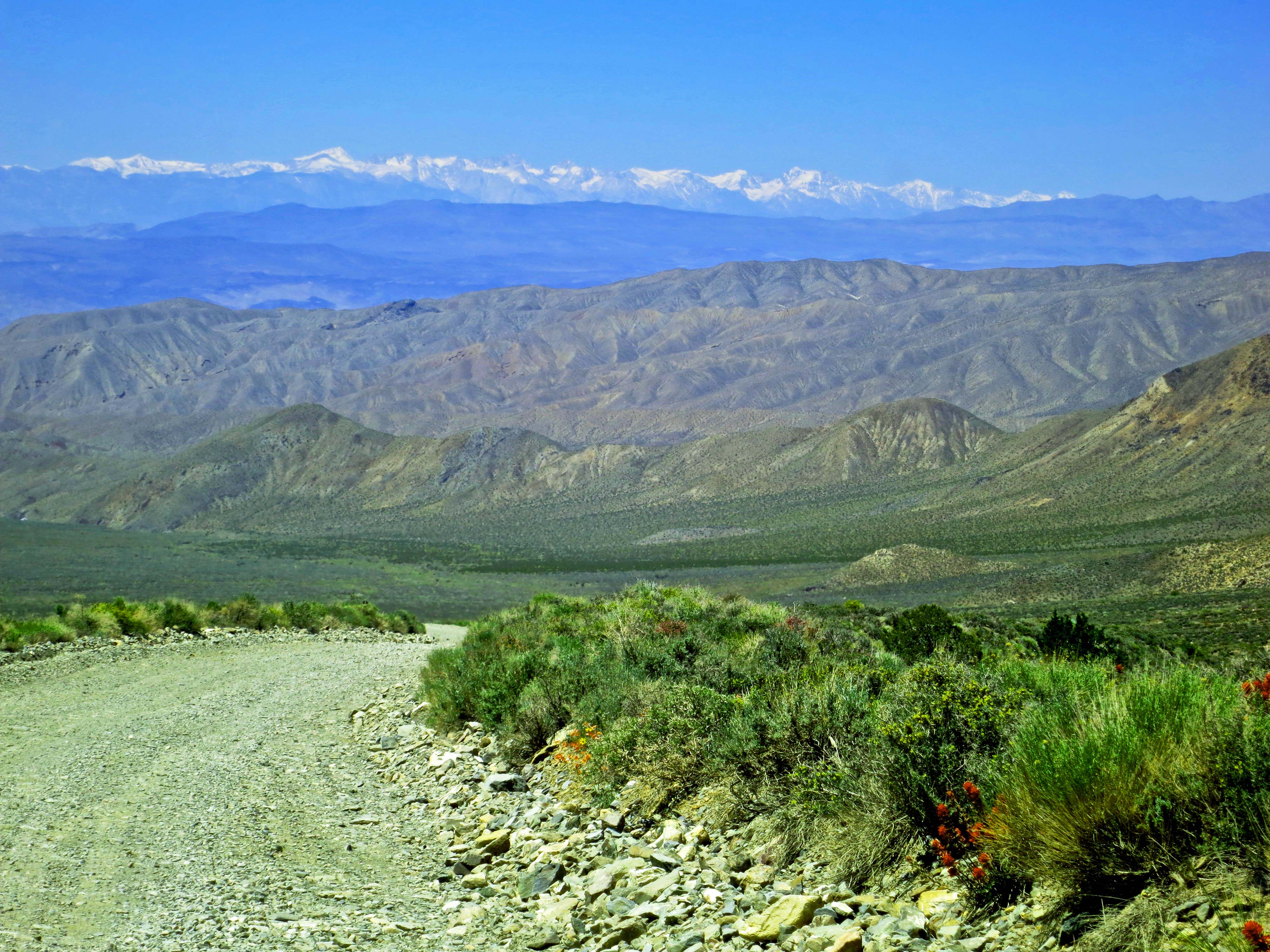
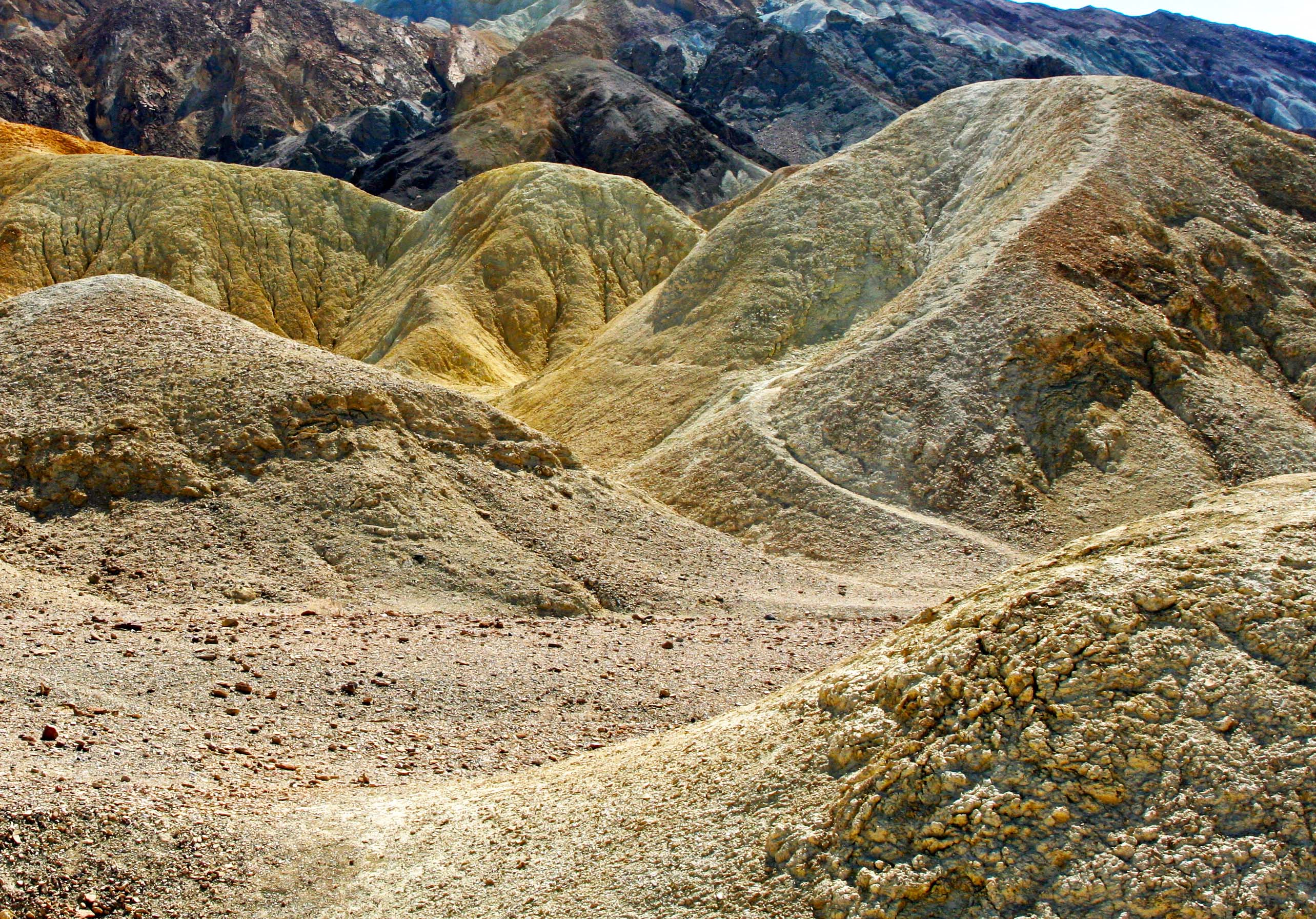
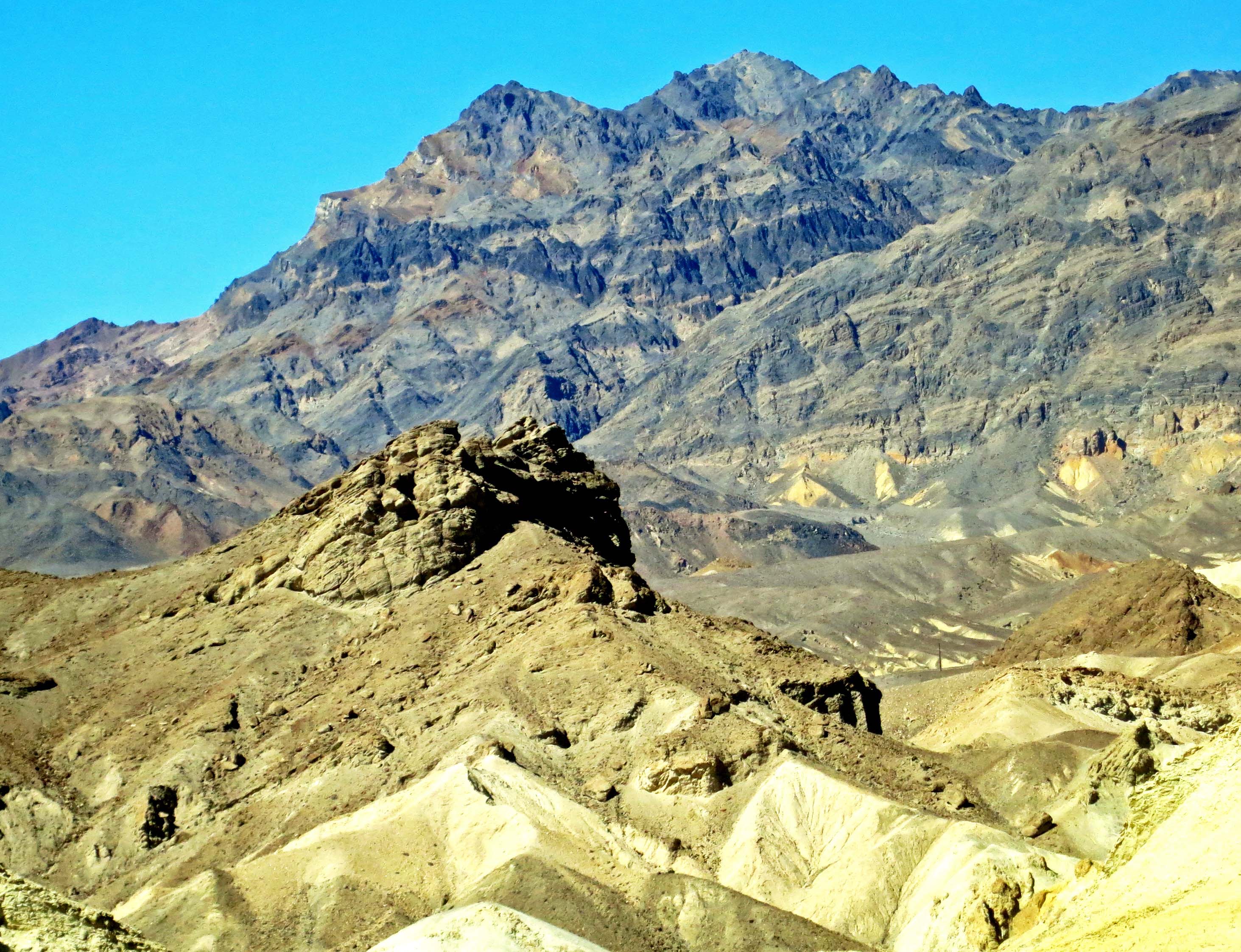
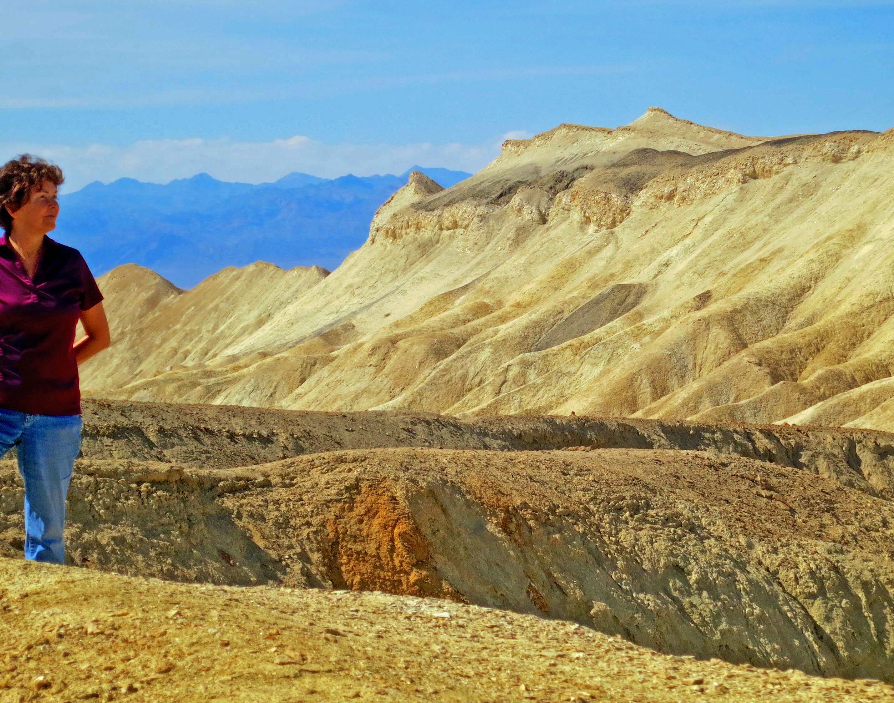
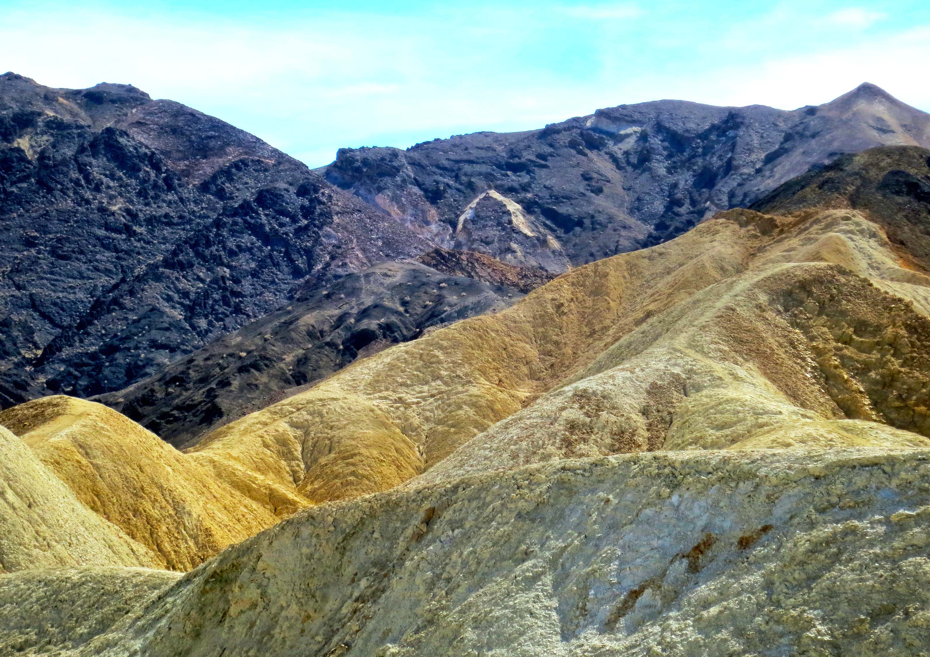
Driving up California’s Highway 395 provides an ever-changing perspective of the eastern Sierra Nevada Mountains.

Another view of the Sierra Nevada Mountains along highway 395.

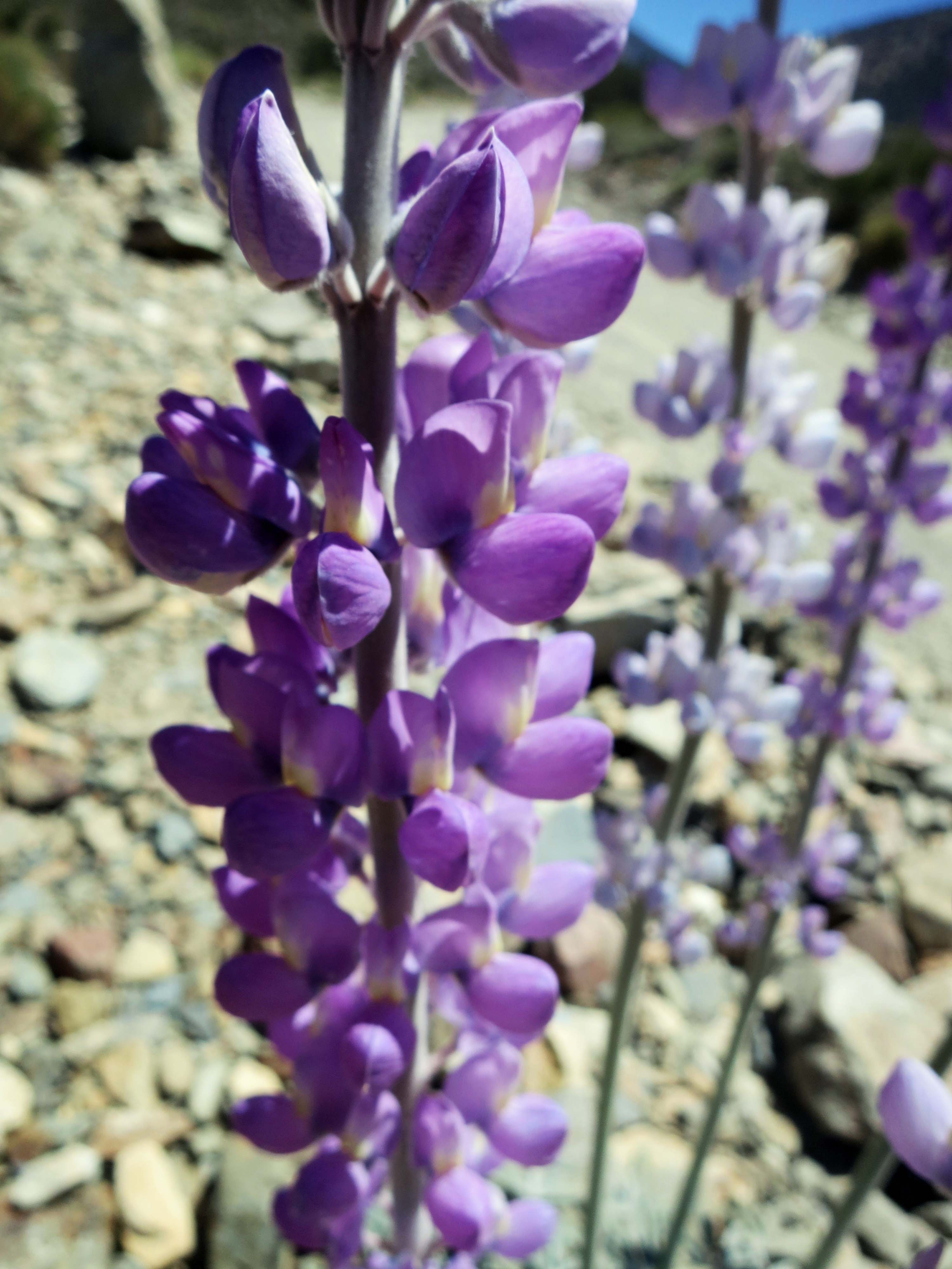
Another view of the Sierra Nevada Mountains along highway 395. This seems to fit Muir’s Range of Light description. (Photo by Peggy Mekemson.)

I celebrated my 60th birthday by backpacking over 300 miles down the spine of the Sierras, I started at Squaw Valley, which is north-west of Lake Tahoe, and ended by climbing up Mt. Whitney. It was my sixth trip up Whitney. I figured it would be a fitting way to kick off my sixth decade.

View of Mt. Whitney from the west including Curtis Mekemson.

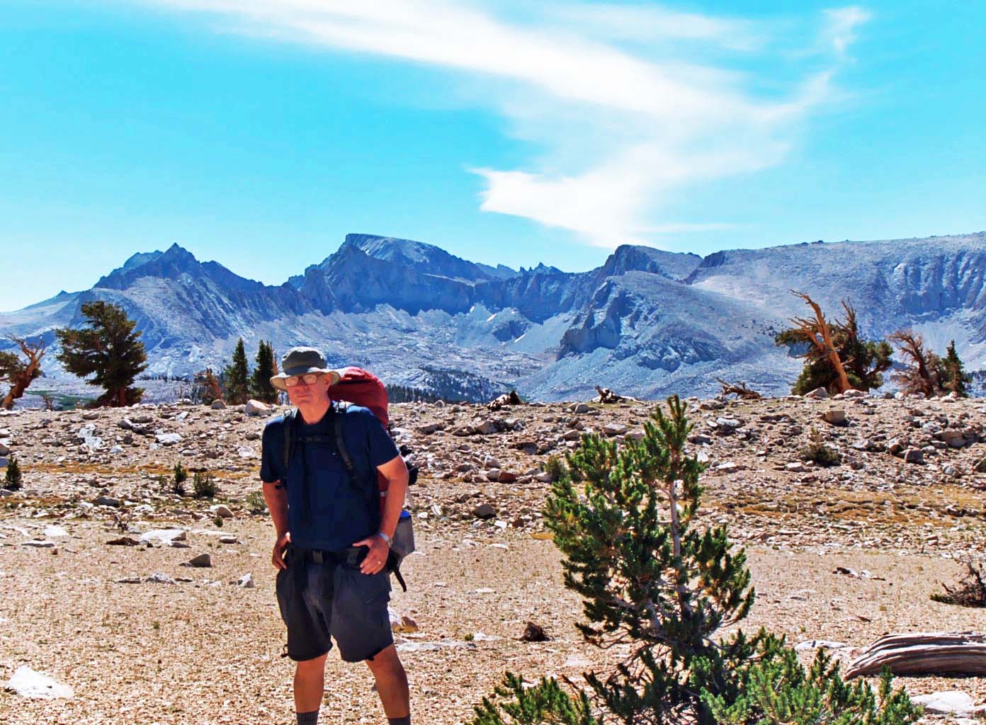
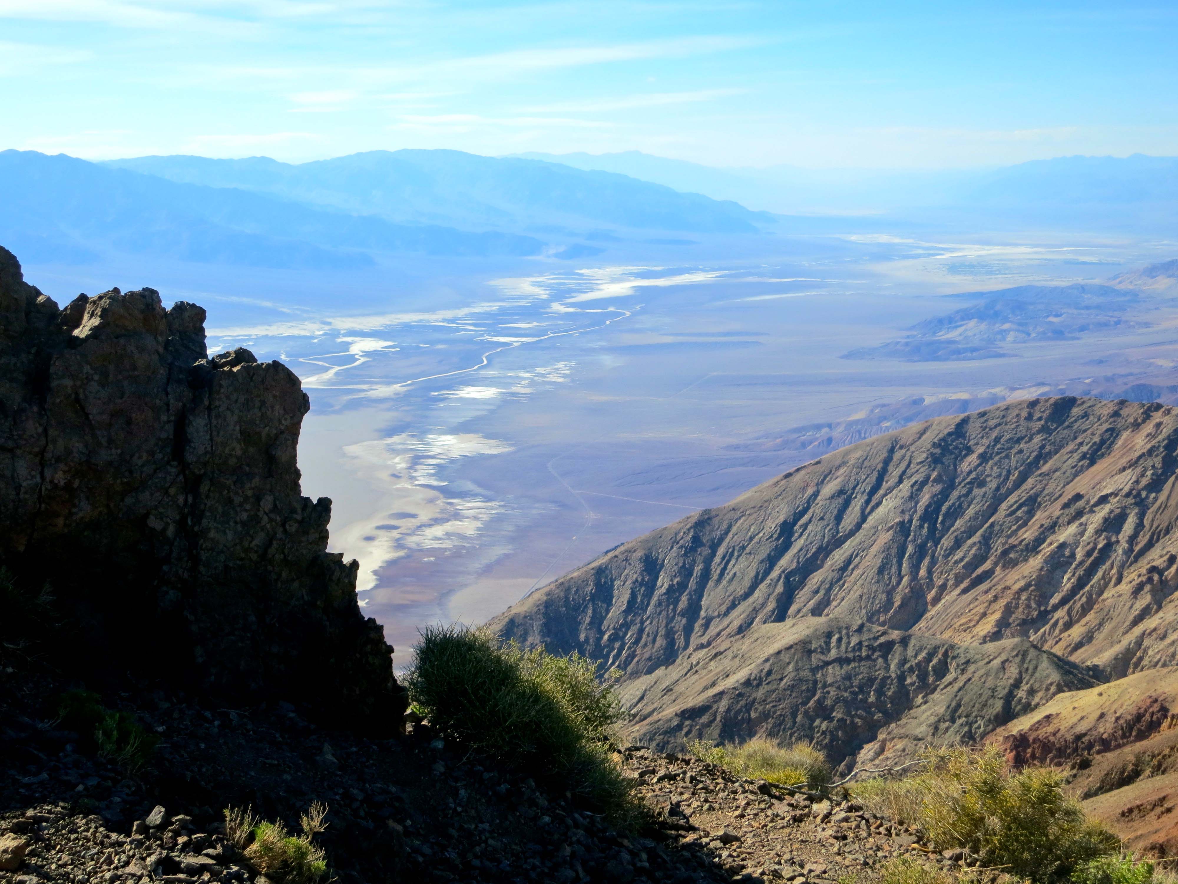
Wrapping up five weeks of backpacking, my final climb looms in the distance. The curved mountain just to the right of my head is Whitney. I will be sitting on top the next day. The Sierras are fault block mountains, climbing gradually on their western slope and dropping off rapidly in the east. (Photo by Jay Dallen.)

Curtis Mekemson sitting on top of Mt. Whitney.

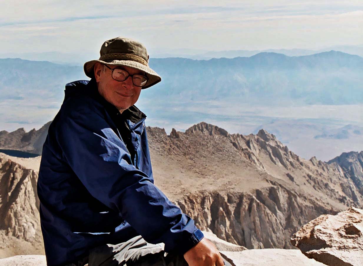
And here I am on top, complete with a large grin. The Owens Valley and Highway 395 lie some 10,000 feet below. (Photo by Jay Dallen.)

Looking north form Mt. Whitney up the crest of the Sierra Nevada Mountains that I had just hiked through following the Pacific Crest and John Muir Trails.

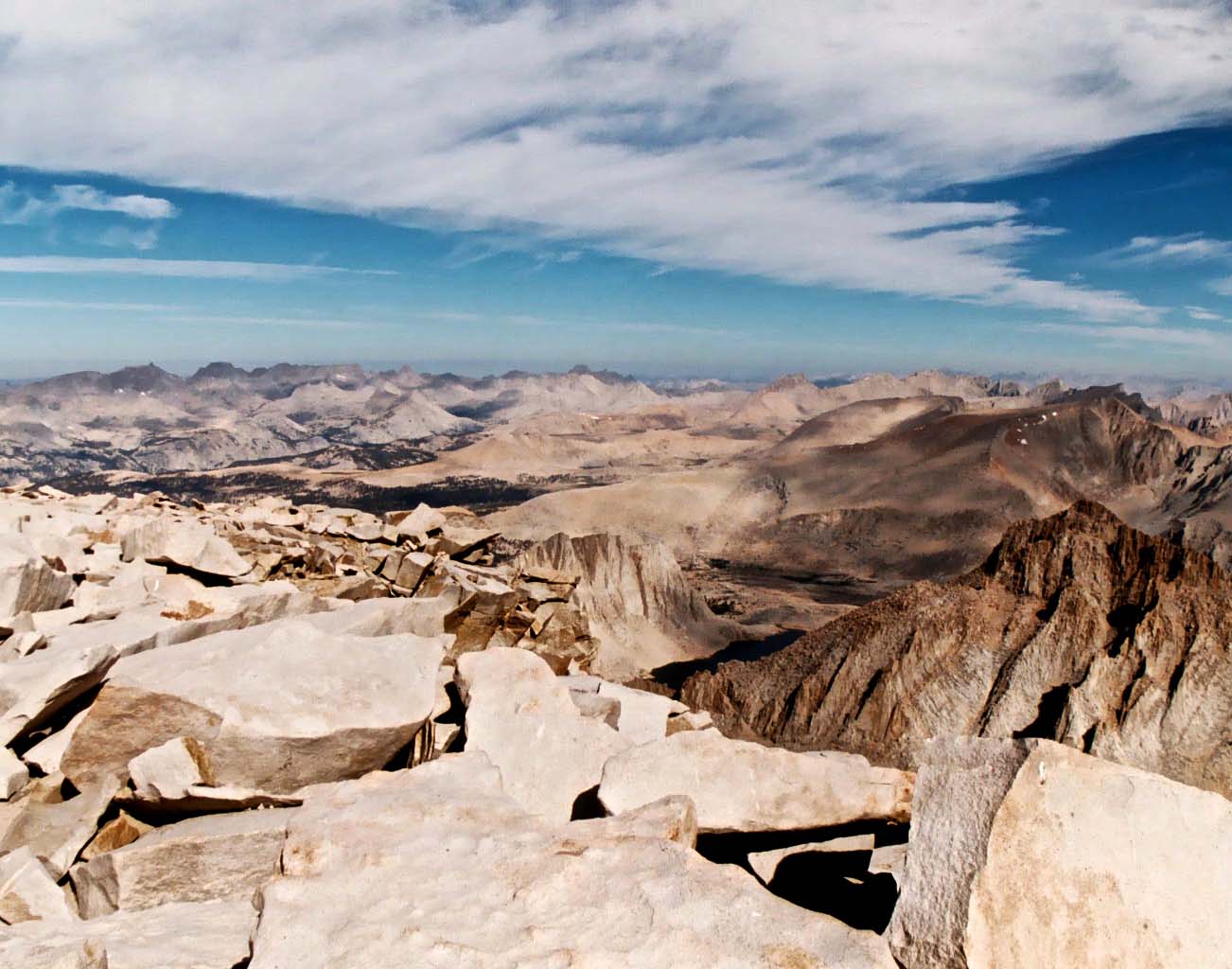
Looking north from Mt. Whitney up the crest of the Sierra Nevada Mountains where I had just backpacked following the Pacific Crest and John Muir Trails.

View looking down from the top of Mt. Whitney. Photo by Curtis Mekemson.

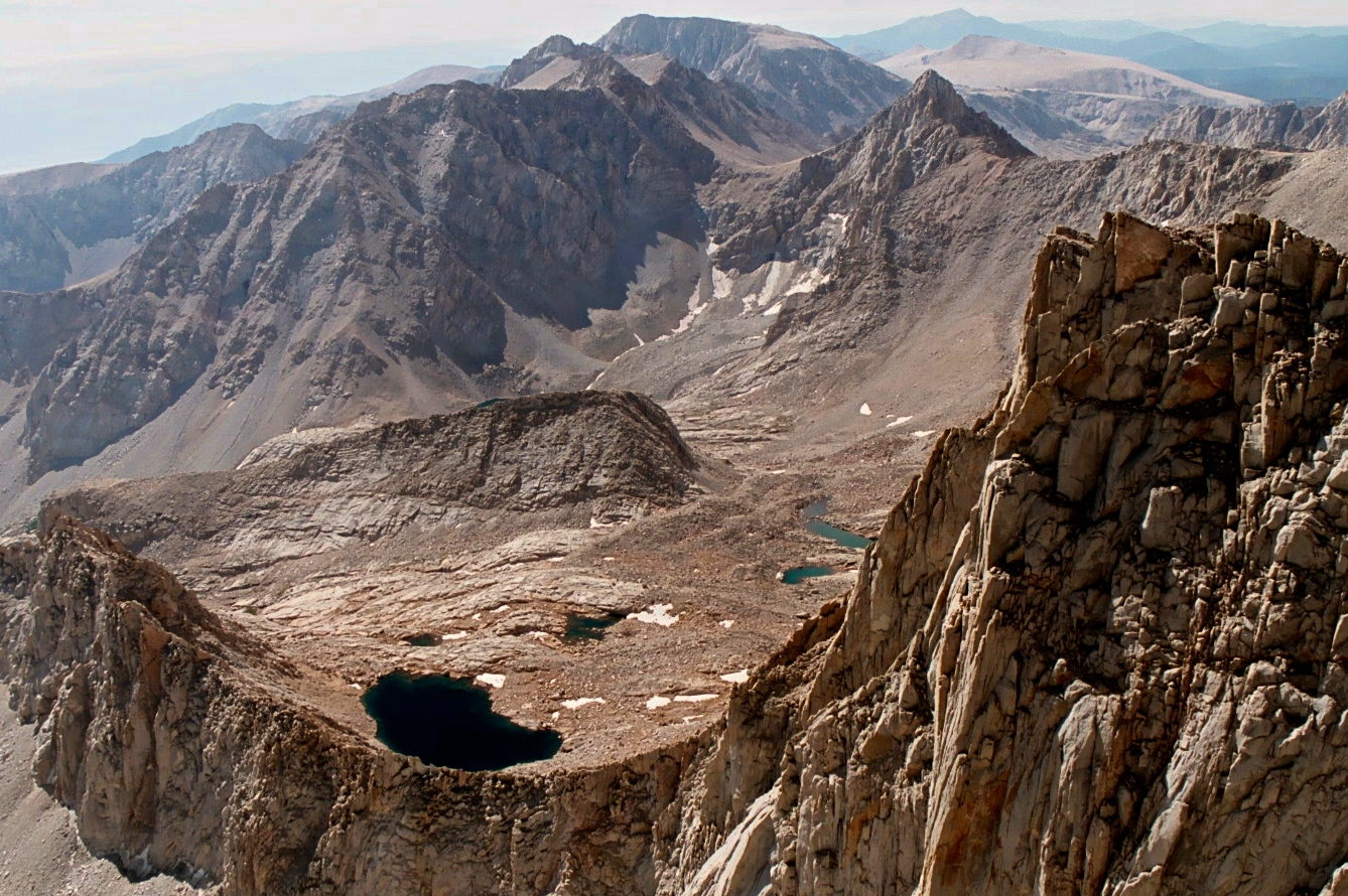
Another view from the top of Mt. Whitney.

The mountain’s claim to fame is being the highest mountain in the contiguous United States. It stands at 14,505 feet (4,421 meters). My friends in Alaska are quick to point out that Mt. McKinley/Denali is 20,322 feet. Mt. Shasta, where I began this particular series, is 14, 180 feet. And finally, for comparison, Mt. Everest, the world’s highest mountain, tops out at 29,029 feet (8,848 meters).

Mt. Shasta is one of the world's most beautiful mountains. Driving up I-5 through Northern California on a clear day presents this view.

Mt. Shasta.

Once the snow has melted, climbing Whitney does not require any technical climbing skills. A good trail leads to the top. According to the plaque on top, it is the highest trail in the United States. It was started in 1928 and completed in 1930. The plaque used to (and still may) claim that the mountain is 14, 496.811 feet high, which would seem pretty darn accurate, especially given the .811 feet. Apparently modern measuring techniques have added a few feet. Not that it matters, unless you happen to be the person climbing those last nine feet.

Getting to the top requires stamina, lots of it. The eastern route up the mountain starts at Whitney Portal and climbs 6000 feet. That’s a bunch of up, and the higher you climb, the thinner the air becomes. Most people slow way down near the top as their bodies fight to get enough oxygen.

I’ve always started from the west since I am either ending or in the middle of a backpack trip. There are two advantages. Most important, I’ve already spent several days hiking at higher elevations. My body has both toughened up and adjusted to thinner air. Second, by starting at Guitar Lake, the climb is only 4,000 feet. Still that’s 4000 feet up and 6,000 feet down on a 15-mile day carrying a 40-pound pack— hardly a walk in the park. (Grin)

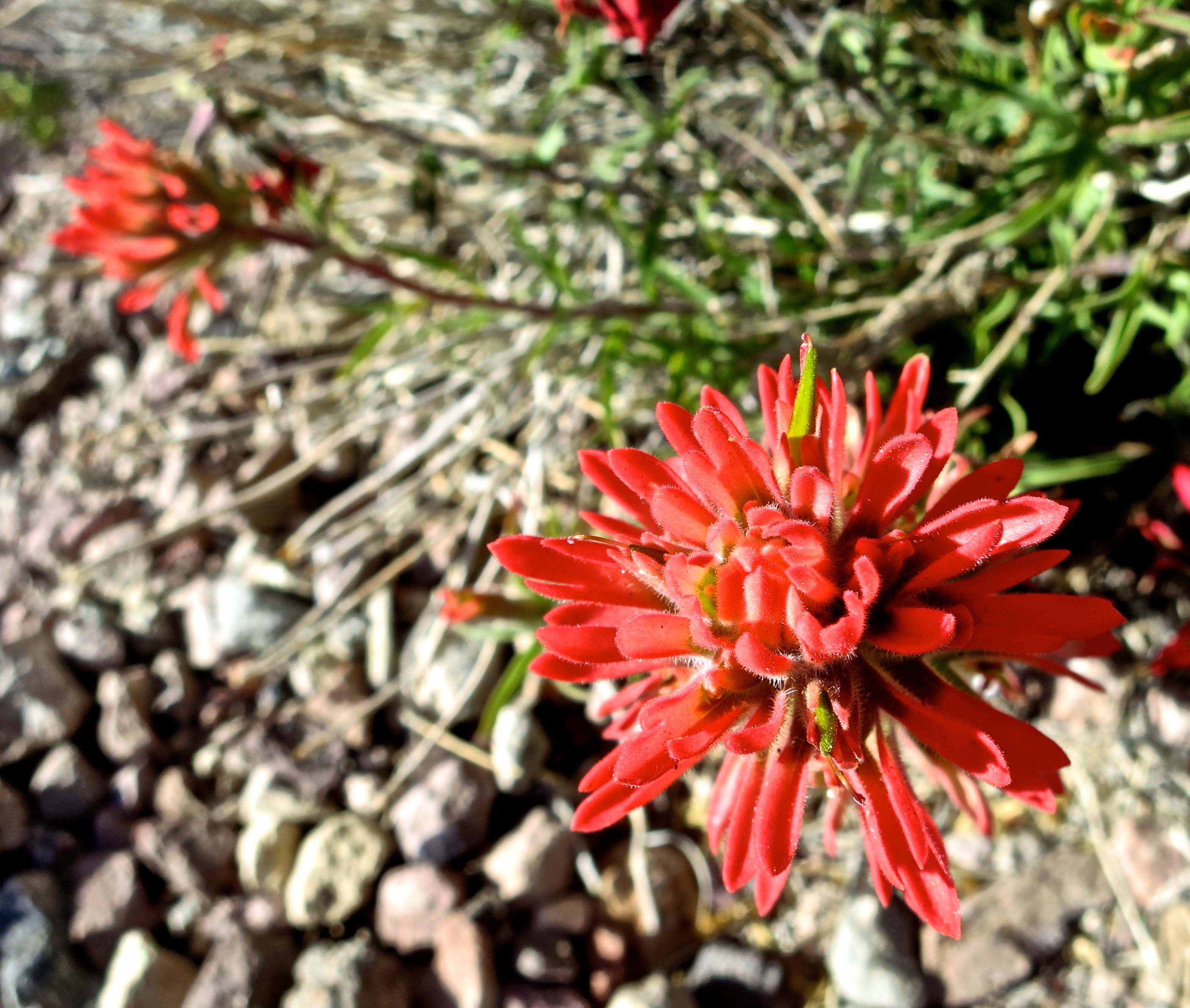
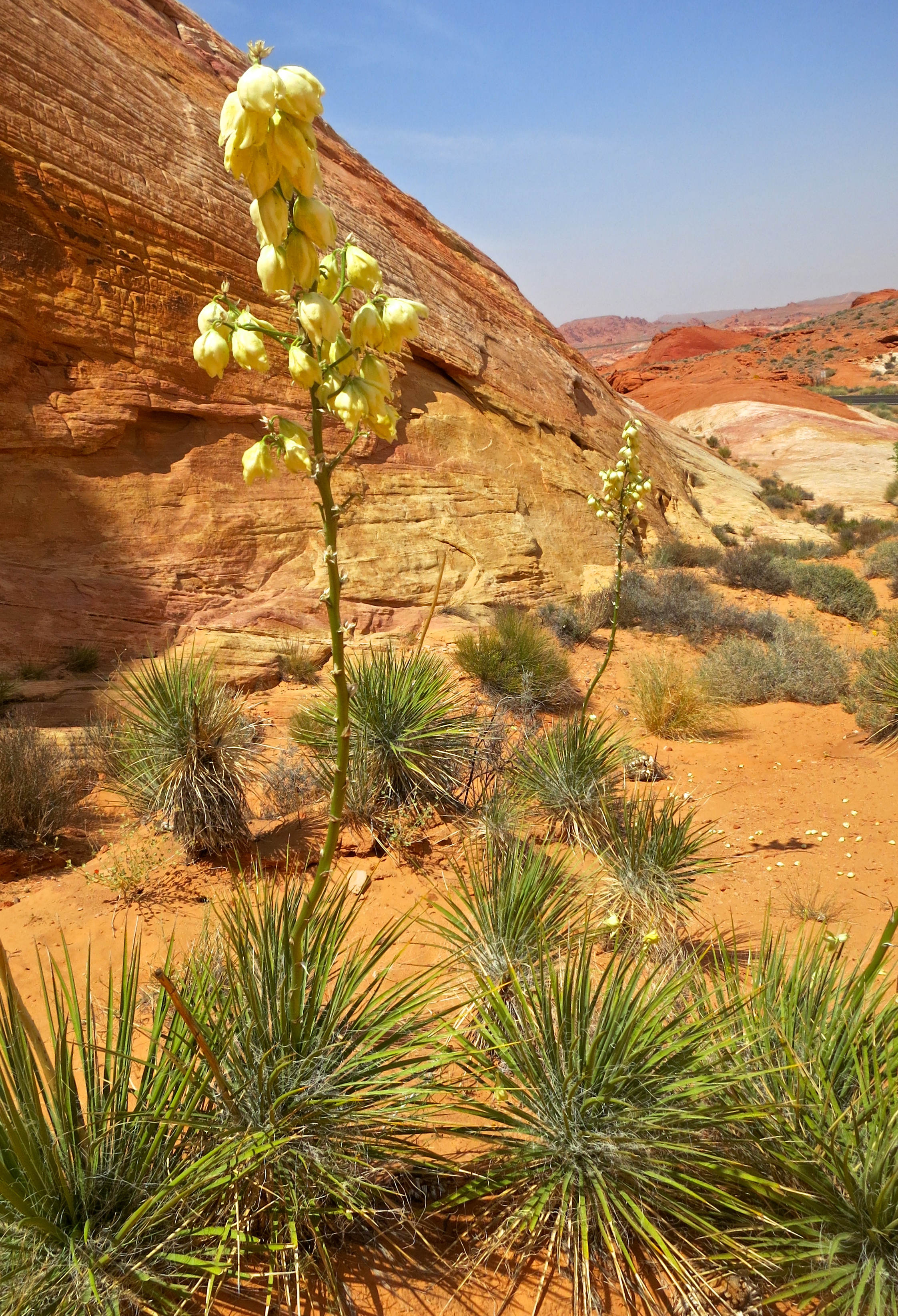
The reason for climbing the mountain, beyond being able to say you have, is the spectacular scenery. I wouldn’t recommend the trip for anyone with acrophobia (fear of heights), however, given that all of the views involve looking down several thousand feet.

Jay Dallen standing on the edge of Mt. Whitney.

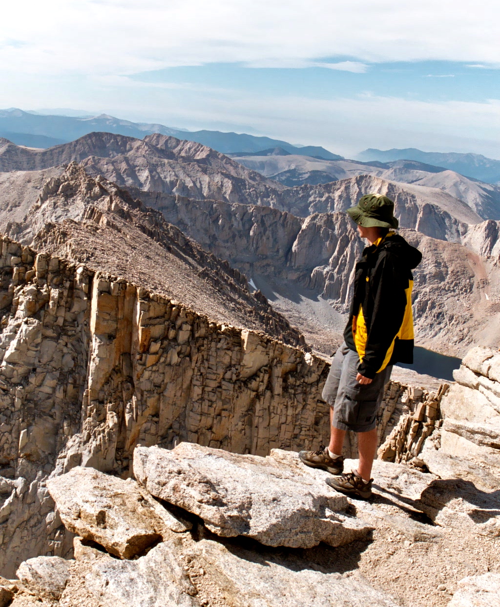
My nephew, Jay Dallen, stands on the edge of a thousand foot precipice and looks down. He obviously does not suffer from acrophobia. Different people joined me on each of my five-week segments. Jay was 16 at the time.

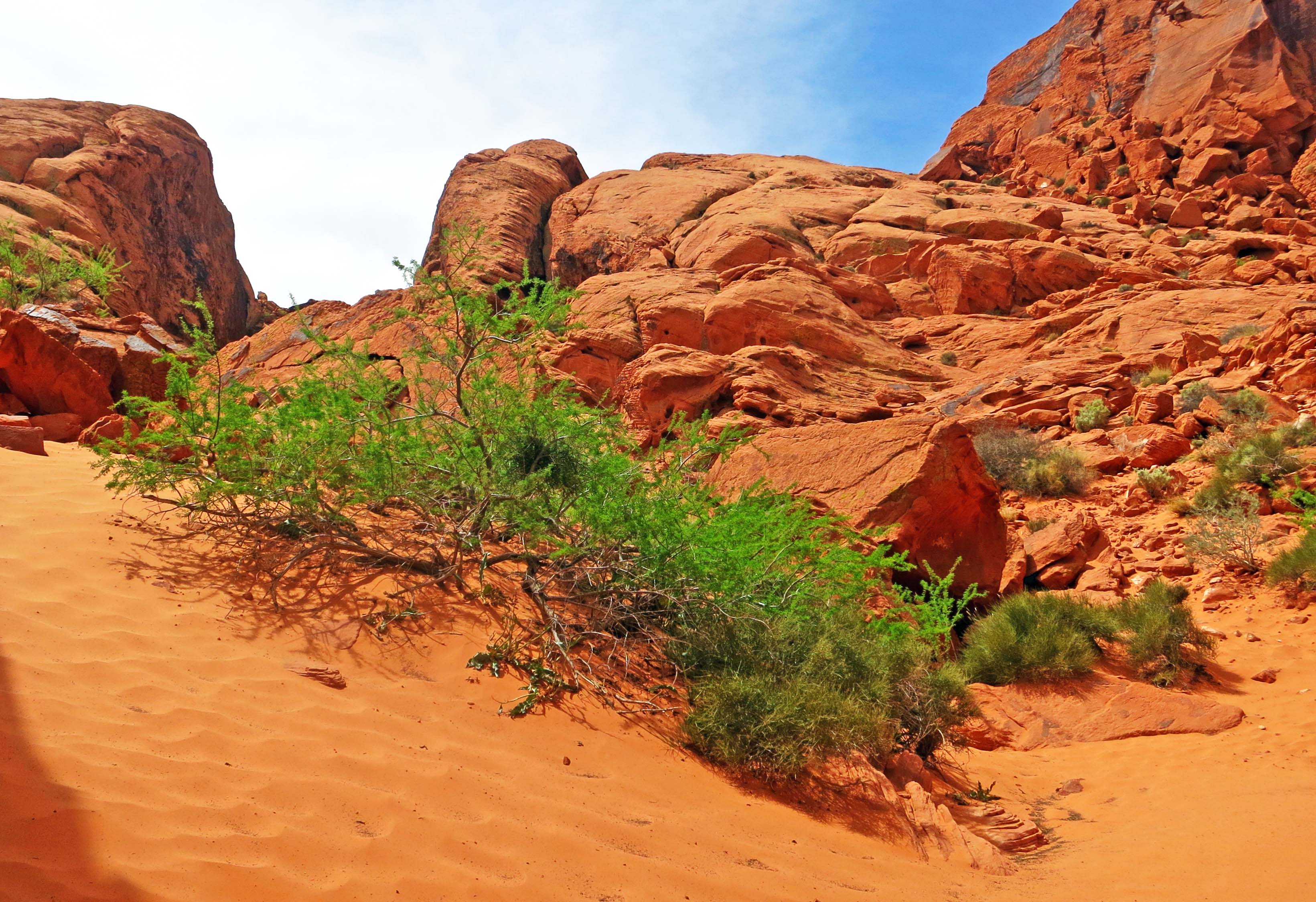
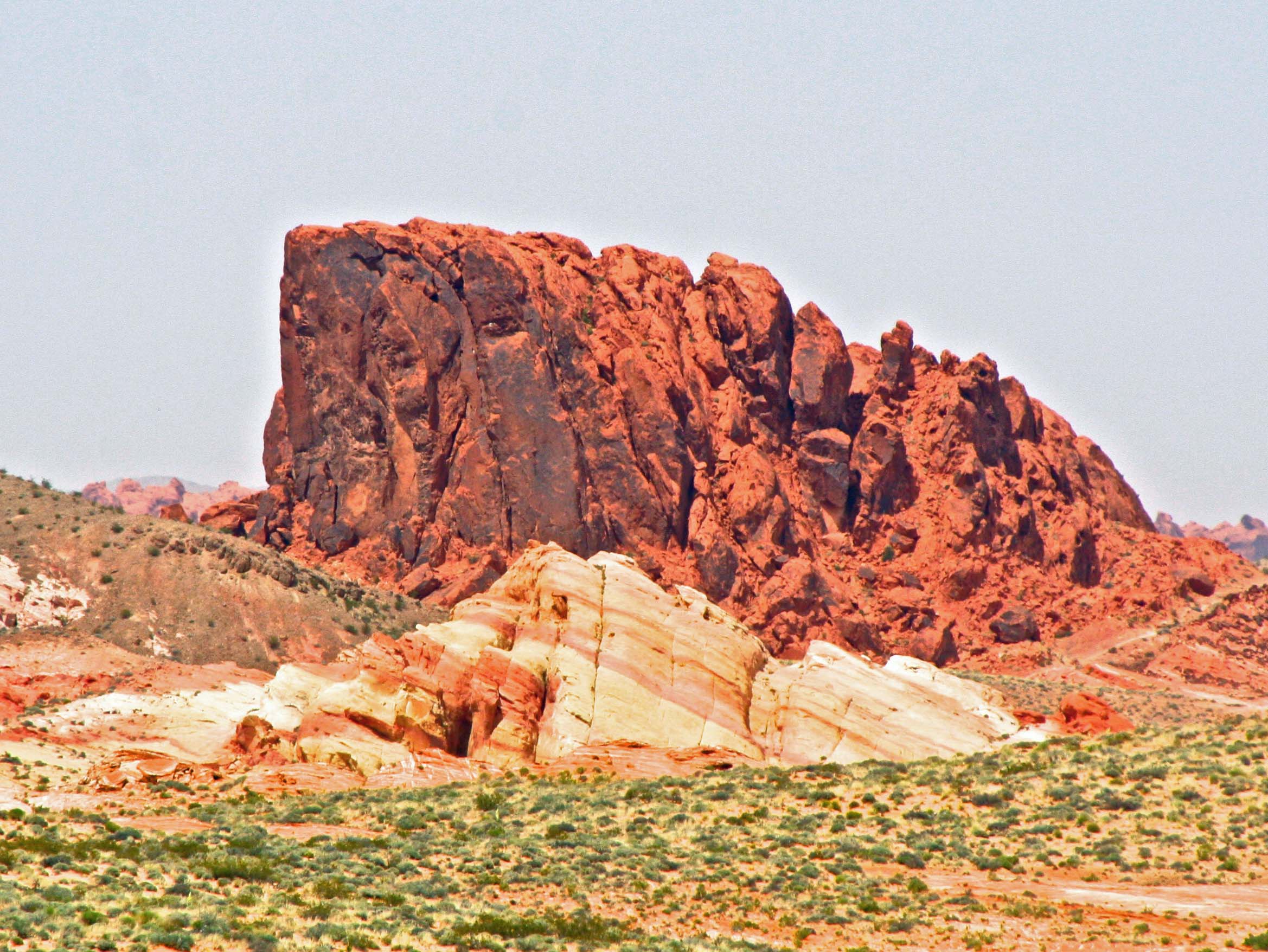
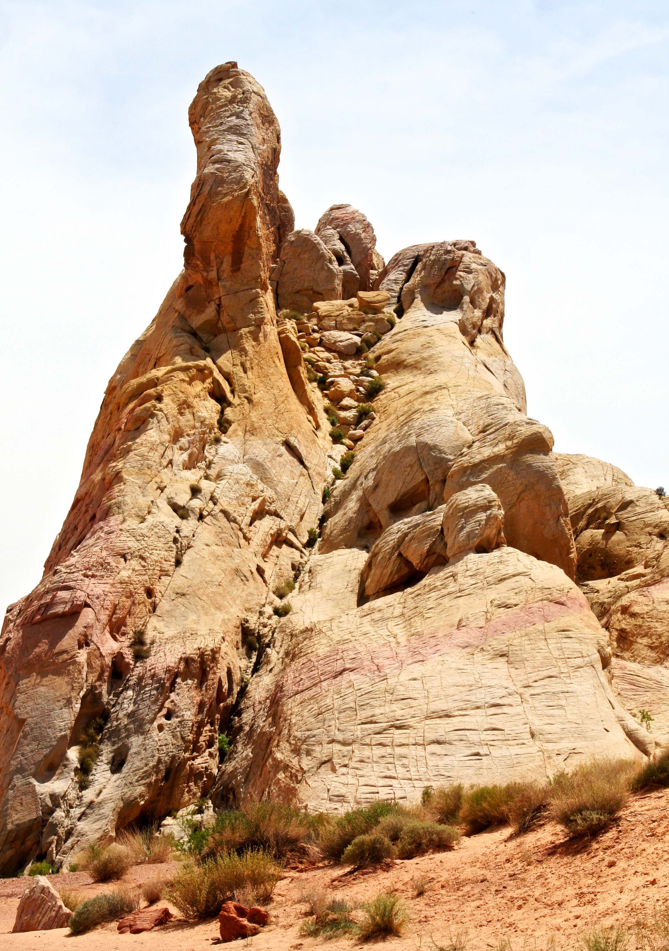
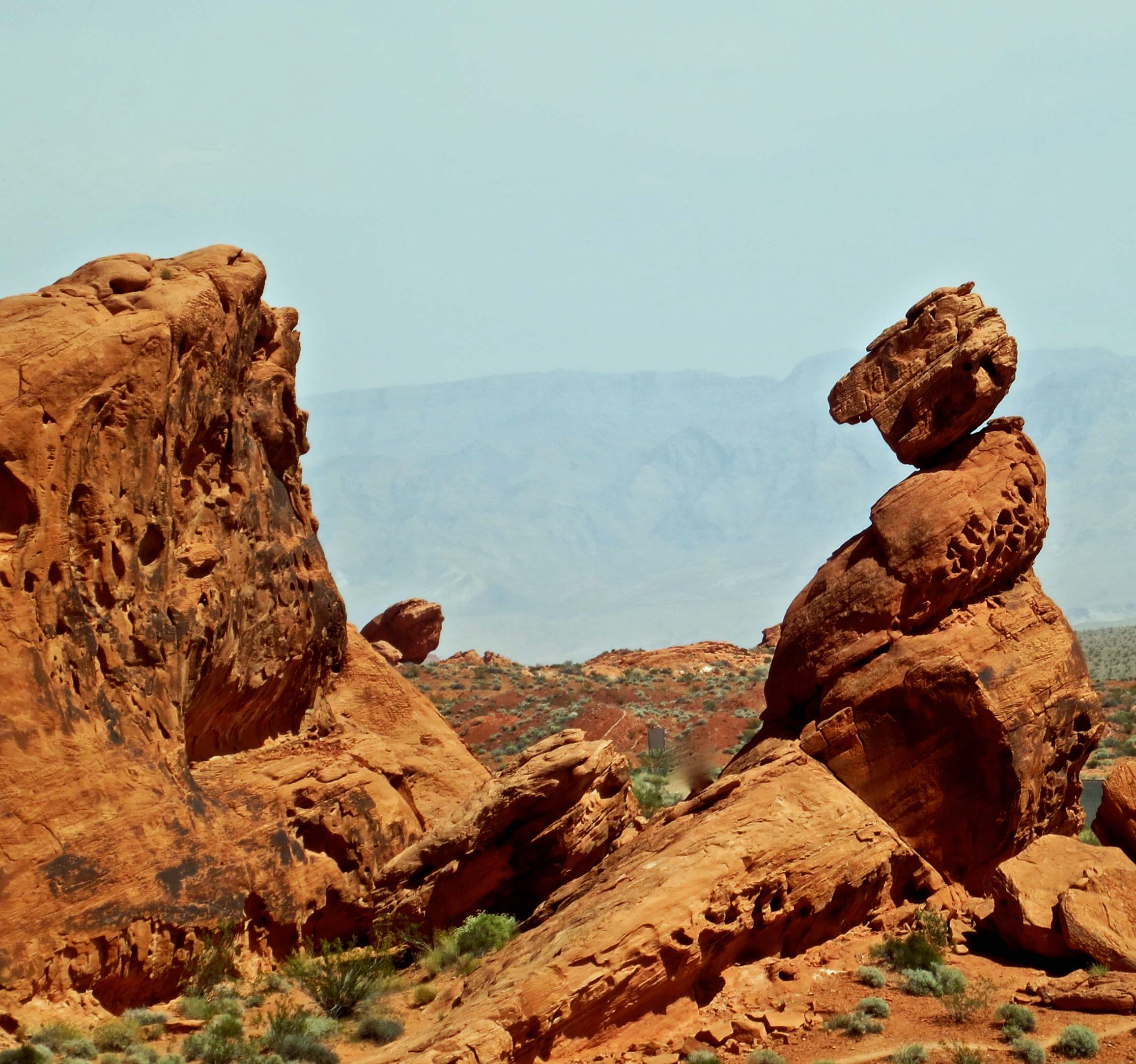
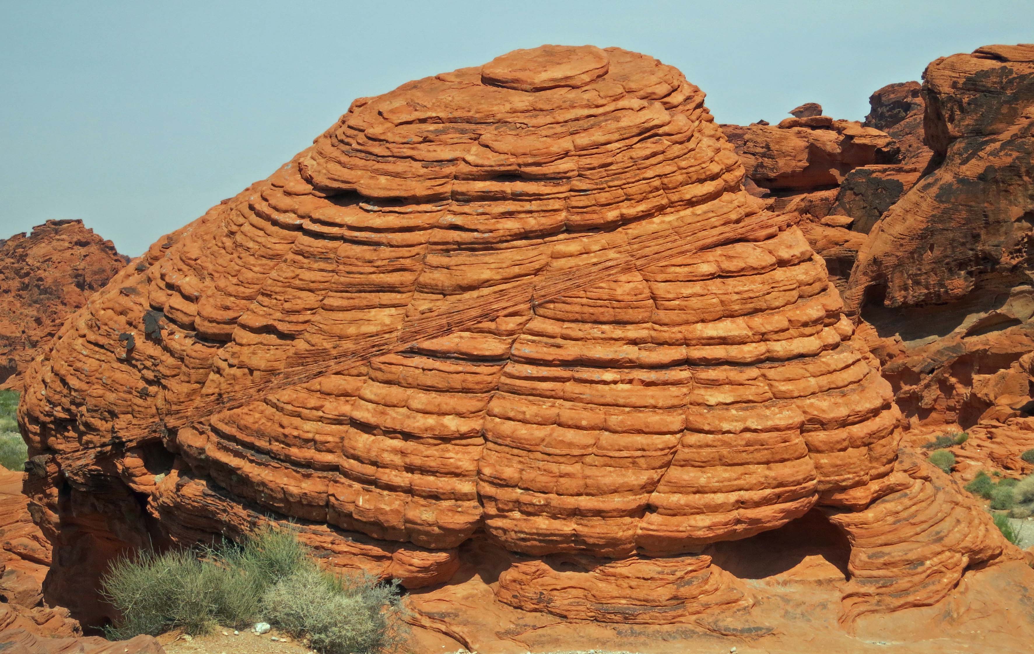
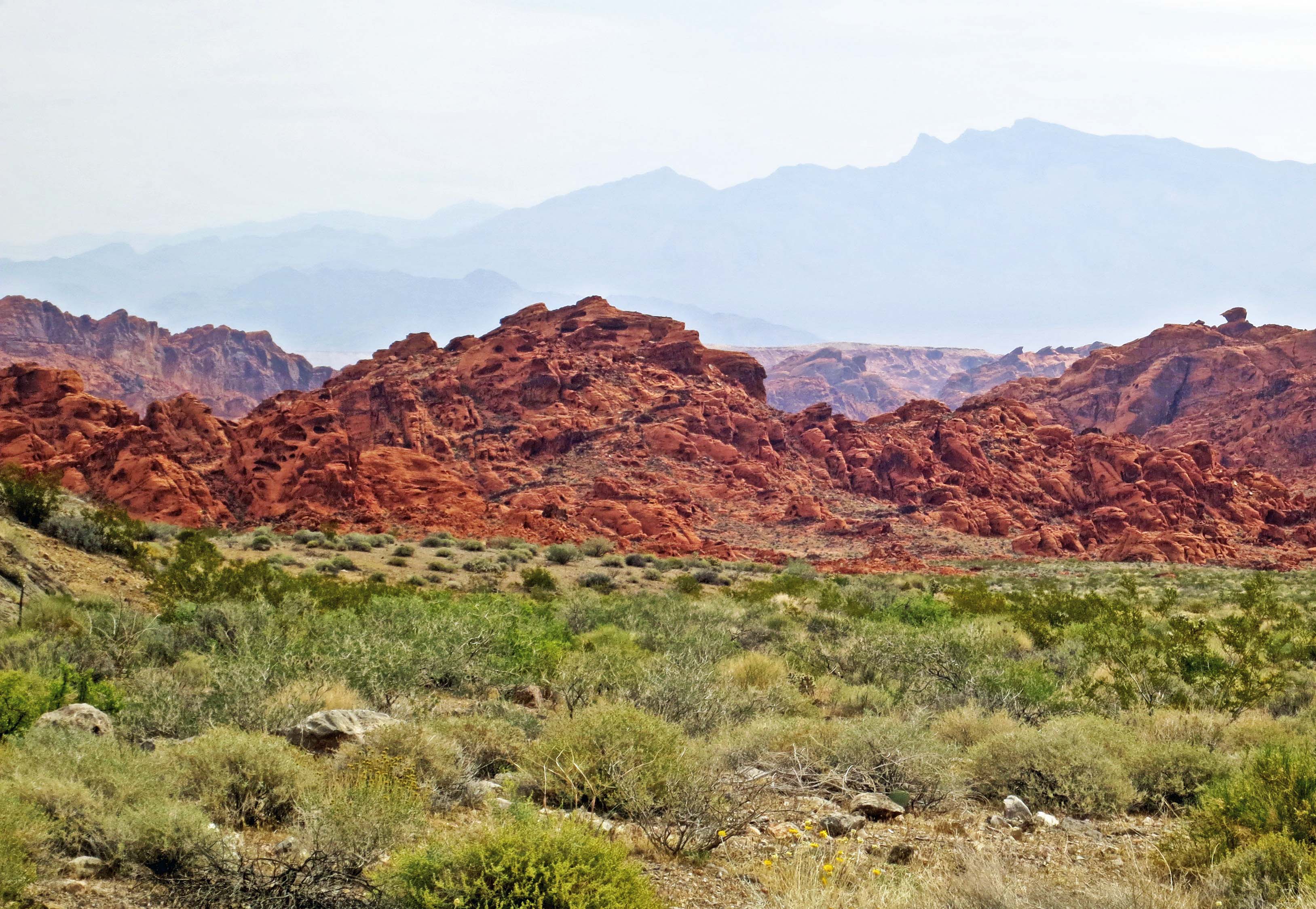
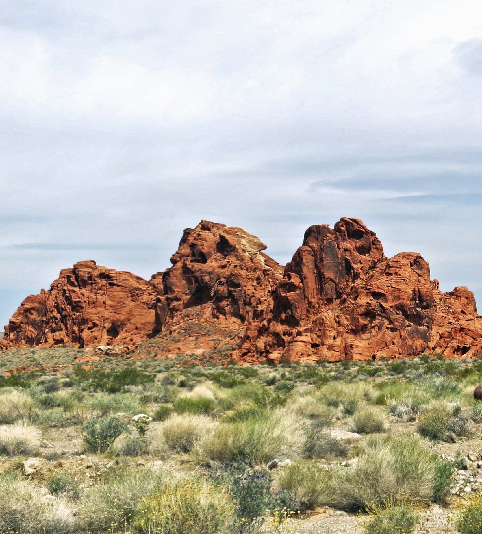
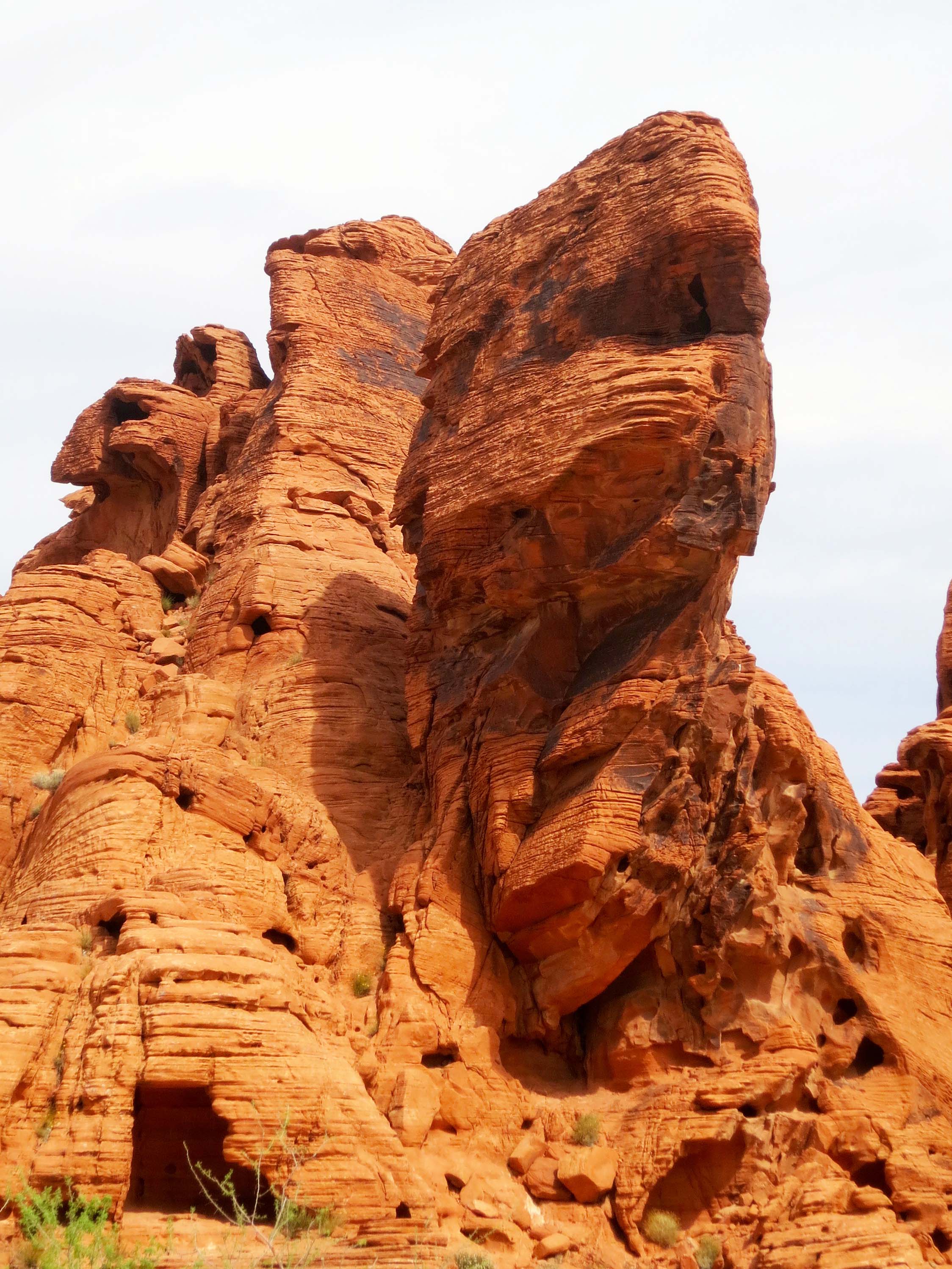
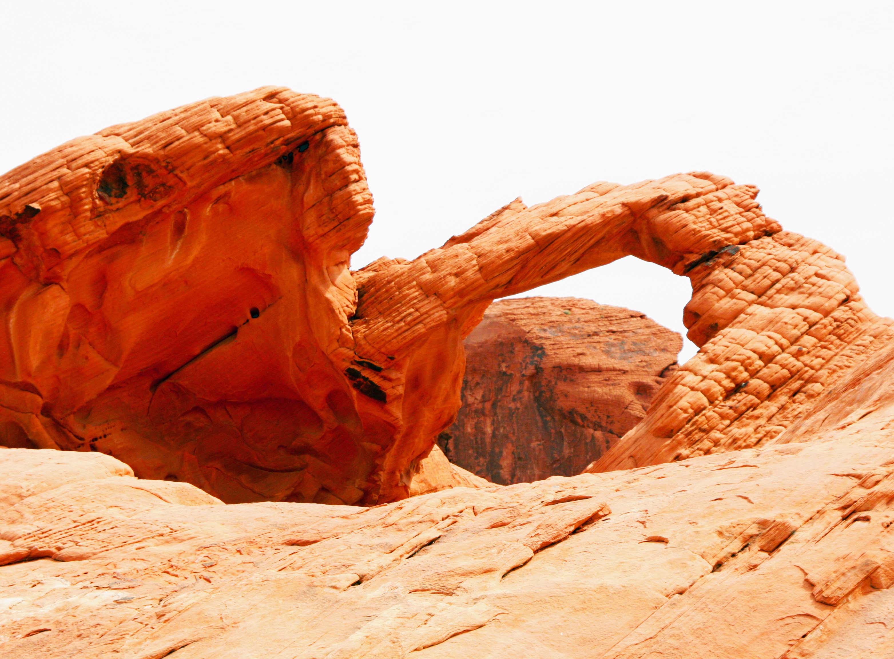
The Alabama Hills, featured in the photo below, are located just outside of Lone Pine at the base of Mt. Whitney. Over 300 movies, mainly Westerns, have been filmed in the area. Almost every major Hollywood cowboy from the 1920s up to the present have made movies there. (Photo by Peggy Mekemson.)

A final view of Mt. Whitney. This one features the Alabama Hills, the site of many early movies featuring the likes of Hop-a-long Cassidy and the Lone Ranger.

A final view of Mt. Whitney. This one features the Alabama Hills, the site of many Western movies featuring everyone from Tom Mix, Hop-along Cassidy and Roy Rogers to John Wayne and Johnny Depp. (Photo by Peggy Mekemson.)

The Panamint Range of Death Valley: A Rattlesnake, Flowers, and Very Large Kilns… The Desert Series


Panamint Rattlesnake in Death Valley.

We found this rather handsome fellow on our way up to Wildrose in Death Valley. Check out the shadow! (Photo by Peggy Mekemson.)

I crossed over the Panamint Range once on a bicycle. It wasn’t fun. Or let me put it this way, the nine-mile climb up out of Panamint Valley wasn’t fun. It was at the beginning of my 10,000-mile solo trip around the US. I only had seven days of cycling behind me so I was still getting in shape (massive understatement).  Adding to the challenge, I was carrying over 50 pounds of gear, everything I needed to survive six months on the open road.

Standing out of the saddle in my lowest gear, and exerting every bit of muscle power I could, I averaged two miles an hour. And yes, it would have been much easier to get off my bike and push. But I am a stubborn when it comes to things physical. The ride down, on the other hand, was lovely and about 20 times as fast.

Our Toyota Tacoma thought nothing of the climb out of Death Valley to the Emigrant Canyon Road and on to Wildrose Canyon. In fact the pickup loves a challenge and likes to be on the road as much as Peggy and I do. Or maybe I am anthropomorphizing a bit too much here. (And don’t you just love that word, all 18 letters of it.)

We were lollygagging along on the Wildrose road and stopping often to photograph flowers when we passed the rattlesnake. Peggy was driving. “Stop, back up,” I urged. Laughing, Peggy complied. She’s used to my fascination with rattlesnakes. I’ve had dozens of encounters over the years. One of my favorite tricks is to get down on my belly in front of them to take photos as they crawl toward me. Unfortunately, my headshots are usually blurry. Could it be that I am backing up too fast?

Panamint Rattlesnake in the Panamint Mountains, Death valley.

Having determined that we weren’t edible, the large snake went on his way. Isn’t the head magnificent? It shouts pit viper.(Photo by Peggy Mekemson.)

This guy was a beauty, a Panamint rattler (Crotalus stephensi), and I would guess almost record size. He was on the driver’s side of the truck so I handed Peggy her camera and she snapped three shots. And then, before I could get out to the truck for some close-ups, she stepped on the gas and we were out of there. Can you imagine that? I whined for an hour.

The flowers soon assuaged my disappointment, however. At our elevation of around 5,000-7,000 feet, they were everywhere. While we were too late to catch flowers blooming in the valley, our trips up to Dante’s View and Wildrose more than made up for it.

Desert flowers in the Panamint Range of Death Valley.

I was taken by this old desert road that cut off the main road and was covered with flowers as far as the eye could see.

Hill covered with flowers in the Panamint Range of Death Valley.

And how about this hillside?

Prickly poppies growing in the Panamint Range of Death Valley.

These prickly poppies were attractive. Petals were tissue paper thin. The red beetle was quite busy.

Death Valley flower.

I don’t know what this striking yellow beauty was. Maybe one of my readers can identify it. (Finally found it in one of my field guides. It’s called Desert Plume and is a member of the mustard family.)

Lupine growing in the Panamint Range of Death Valley.

This lupine, however, is an old friend. It is common throughout the west. Peggy is even growing some. What was amazing about this plant was its size. I would say around four feet tall.

Beyond the rattlesnake and the flowers, the highlight of the tour was the ten charcoal kilns built in by the Modoc Consolidated Mining Company in 1877 to prepare charcoal to be used in smelters at its lead-silver mine about 25 miles away. Local pinion pines and junipers were cut down and hauled to the kilns. It took approximately four cords of wood to fill one kiln. After 6-8 days for burning and another 5 days for cooling the charcoal was then transported by an army of jackasses.

Charcoal kilns located in Death Valley.

The kilns, which were used for about three years, have sat quietly for over a century. Navajo Indian stonemasons from Arizona restored the kilns in 1971. (Photo by Peggy Mekemson.)

An interesting aside is that George Hearst was the principal investor in the mining company. His son, William Randolph Hearst, would go on to found the Hearst media empire. And it was his great grand-daughter, Patty Hearst, who was kidnapped by the Symbionese Liberation Army in the 70s. Where this is going is that I met Patty and her abductors in the Sierra Nevada Mountains. I was up with some friends scouting out streams for trout fishing when a van roared around us and got stuck in a snow bank, which we found rather amusing. A group of folks came tumbled out of the van including a young woman who came over to talk with us while her companions tried to dig out of the snow.

“Do you have any guns in your car?” she asked. “My friends have been teaching me how to shoot automatic weapons in the Bay Area and we are up here for practice today.” That’s when the alarm bells started going off for me. We were talking to Patty Hearst and her ‘friends’ were SLA members. When Patty wandered off to check on the van’s progress, I whispered my concerns to my friends and suggested we help get the van on its way, which is what we did.

But so much for the detour (grin). I was either going to tell you stories about rattlesnakes today or the Patty Hearst. Patty won. Back to the kilns.

Charcoal kiln in Panamint Mountains in Death Valley.

Peggy provides perspective on the size of the kilns that are 25 feet tall.

Back view of charcoal kilns in Death Valley.

Back view of kilns showing window where smoke escaped. You can still smell the smoke inside.

View looking out from inside a charcoal kiln in Death Valley.

View from inside the kiln looking out at the pines.

A final view from Wildrose. What appears to be puffy white clouds on the horizons are the snow covered Sierra Nevada Mountains.

A final view from Wildrose. What appears to be puffy white clouds on the horizons are the snow-covered Sierra Nevada Mountains.

NEXT BLOG: What’s a desert without a ghost town, or two. We head off to the old mining town of Rhyolite sitting on the edge of  Death Valley.

Death Valley Part II: We Are At Zabriskie Point but Where Is R2-D2… The Desert Series

Erosion of rocks created in an ancient lake bed gives Zabriskie Point its unique look.

Erosion of rocks gives Zabriskie Point its unique look.

Zabriskie Point is one of the most photographed spots in Death Valley. Tour busses stop here and disgorge thousands of passengers annually. Everyone comes armed with a camera, or at least a cell phone camera. Twenty shots or so later they are on their way, scurrying back to the bus and Death Valley’s next must-see sight. We are more leisurely in our approach, but we also take a more photos. Erosion is king here, wearing away rocks that were deposited in a lakebed some five million years ago– back before tectonic forces created Death Valley and back before the region became a desert.

Zabriskie Point Death Valley.

As in other parts of Death Valley, the rocks of Zabriskie Point are multi-hued. (Photo by Peggy Mekemson.)

Manly Beacon in Death Valley.

Manly Beacon or Point, is another popular view from Zabriskie Point. Justifiably so.

Peggy and I were at Zabriskie Point in the late afternoon. The rocks above Manly Beacon seemed to take on an inner glow.

Peggy and I were at Zabriskie Point in the late afternoon. The rocks above Manly Beacon seemed to take on an inner glow.

The volcanic caprock provides an interesting contrast. (Photo by Peggy Mekemson.)

The volcanic caprock provides an interesting contrast. (Photo by Peggy Mekemson.)

A three-mile trail leads down to the Valley floor from Zabriskie Point and passes through Golden Canyon on the way. For fans of Star Wars IV, segments of the movie were filmed in Golden Canyon. The diminutive, eye glowing Jawas captured R2-D2 and C-3PO there.  So you can think of Death Valley as Tatooine, the home planet of Luke Skywalker. (Tunisia was also used for scenes on Tatooine.)

Golden Canyon looking out toward Death Valley

Golden Canyon looking out toward Death Valley. This photo and the one below were taken from an earlier trip. R2-D2 and C-3PO were captured in the canyon by the Jawas.

Golden Canyon in Death Valley

Golden Canyon looking up toward Zabriskie Point. I am on the trail. (Photo by Peggy Mekemson.)

Here’s some Star Wars trivia I picked up when doing research for this blog that you can use to wow your friends: sounds made by dogs, bears, lions, tigers and walruses were combined to create Chewbacca’s voice.

The Twenty Mule Team Canyon that I blogged about in my last post starts a mile or so above Zabriskie Point. A few miles farther, a road jogs off to the right that leads to Dante’s View, which towers some 5000 feet above the valley floor. The last part of the road is steep and narrow but the view is worth it.

Looking down into Death Valley from Dante's View.

Looking down into Death Valley from Dante’s View.

Dante's View provides a spectacular view of Death Valley.

Another perspective.

Given the higher elevation at Dante's View, Spring Flowers were still blooming.

Given the higher elevation at Dante’s View, spring flowers were still blooming.

Indian Paintbrush at Dante's View in Death Valley National Park.

This is an Indian Paintbrush.

I took this photo to capture the very impressive alluvial fan spreading out on the Death Valley floor far below Dante's View. Debris coming down off the mountain had built this fan up over thousands of year.

I took this final photo from Dante’s View to capture the very impressive alluvial fan spreading out on the Death Valley floor far below. Debris coming down off the mountain had built this fan up over thousands of year.

NEXT BLOG: Traveling into the Panamint Range of Death Valley: wild flowers, huge charcoal kilns, and one very large, irritated rattlesnake.

Death Valley: Part I: The Twenty Mule Team Canyon… The Desert Series

Prepare to be dazzled with a kalaidiscope of color on a drive through Twenty Mule Team canyon in Death Valley.

Prepare to be dazzled with a kaleidoscope of color on a drive through Twenty Mule Team Canyon in Death Valley. Various minerals are responsible for the colors.

Death Valley is a land of superlatives. Think hottest, lowest, and driest place in North America. It holds the world record for heat at 134 ˚ F (57˚ C). Ground temperatures have actually been measured at 201˚ F. As for rainfall, there are years without any and the annual average is 2.36 inches (60 mm). Finally, a trip into Badwater Basin, easily reachable by car, will drop you down to 282 feet below sea level.

Given these extremes, a person might wish to travel to Death Valley for the sole purpose of saying he or she has been there. (Or conversely avoid Death Valley passionately.) But from my perspective, the reason for visiting Death Valley is its exotic beauty. Over the past three weeks, I’ve taken you to the Valley of Fire and Red Rock Canyon. Not bad on scenery, eh? Consider it a warm up.

I’ve been to Death Valley numerous times and have blogged about it in the past. On our recent trip, we climbed out of the valley and explored other parts of the National Park including Twenty Mule Team Canyon, Dante’s View, Zabriskie Point and the unusual Charcoal Kilns high up in the Panamint Mountains.

Today, we will begin our journey with a drive through the colorful badlands of Twenty Mule Team Canyon. Imagine for the moment, taking 18 mules and two horses, hitching them to a huge wagon, and hauling 10 tons of borax over desert terrain for 160 miles. That is how borax was hauled out of Death Valley between 1883-1889 and it has become part of the local lore and legend. Francis Smith, the founder of Pacific Borax was also a first class promoter and sent his mule teams out to major cities across the US to push his soap products.  At one point, they paraded down Broadway in New York City.

This early, unattributed photo in the public domain, provides a view of the team with its Death Valley backdrop.

This early, unattributed photo in the public domain, provides a view of the 20 mule team with its Death Valley backdrop. The driver had a very long bullwhip to encourage his mules along the way.

Old Dinah steam tractor in Death Valley National Park.

The mules were eventually replaced by a steam tractor. “Old Dinah” is featured at Furnace Creek. Dinah, in turn, was replaced by a railroad.

Twenty Mule Team Canyon was never part of the route the mules followed. So why the name? It could have been to honor the teams but I suspect it was the bright idea of a tour agent. Whatever, no harm was done. Twenty Mule Team Canyon provides a kaleidoscope of color, a laboratory of erosion, and a fun drive.

Road through Twenty Mule Team Canyon in Death Valley.

The 2.8 mile road through Twenty Mule Team Canyon is a fun drive but it isn’t made for large RVs or fifth wheels. (Photo by Peggy Mekemson.)

Scene on Twenty Mule Team Canyon road in Death Valley. Photo by Curtis Mekemson.

Every corner you turn brings a new view and most are quite dramatic…

Dramatic view along Twenty Mule Team Canyon road in Death Valley.

Case in point.

Road shot traveling through Twenty Mule Team Canyon in Death Valley National Park.

Another road shot. (Photo by Peggy Mekemson.)

View along the Twenty Mule Team Canyon road in Death Valley.

I liked the effect of these contrasting light and dark colors.

Photo of blue skies with puffy clouds provides backdrop for Twenty Mule Team Canyon in Death Valley.

Blue skies, light clouds provide a backdrop for gold, reddish-brown and tan rocks.

Trail in Twenty Mule Team Canyon, Death Valley.

A number of trails wander off into the rocks, inviting visitors to stay for a while and explore. (Photo by Peggy Mekemson.)

Funeral Mountains provide a dramatic backdrop in Twenty Mule Team Canyon, Death Valley.

Mountains provide the backdrop here. These, BTW, are the Funeral Mountains.

Distant mountains appear purple in Twenty Mule Team Canyon, Death Valley.

More distant mountains appear almost purple. (Photo by Peggy Mekemson.)

Peggy Mekemson checks out the view at Twenty Mule Team Canyon in Death Valley.

Peggy admires the view.

A final view of the riotous colors found in Twenty Mule Team Canyon.

A final view of the riotous colors found in Twenty Mule Team Canyon.

NEXT BLOG: We check out what is probably the most photographed area of Death Valley, Zabriskie Point, and climb 5000 feet above the valley to Dante’s View floor for a bird’s eye perspective.

Escape from Las Vegas to the Red Rock Canyon… The Desert Series

Depending on traffic conditions, Red Rock Canyon National Conservation Area is 30-45 minutes outside of Las Vegas. It is hard to imagine two more diverse worlds.

Depending on traffic conditions, Red Rock Canyon National Conservation Area is 30-45 minutes outside of Las Vegas. It is hard to imagine two more diverse worlds.


Las Vegas shouldn’t exist.

Why would any sane person build a city in middle of a desert where summer temperatures regularly climb over 110 degrees F and annual rainfall hangs around 4 inches? Sure, it’s a great place for jackrabbits and rattlesnakes and scorpions and cacti and desert tortoises. Maybe even lonely miners, ladies of the evening, jet jockeys, crotchety cowmen, and aliens belong there.

What Las Vegas would look like without water.

What Las Vegas would look like without imported water.

But putting 1.8 million people into Las Vegas and the surrounding Clark County– what were they thinking? Everything has to be imported… and I mean everything including the ever-precious water for golf courses and tourists with bucks to toss. Cut off either one and Las Vegas is SOL. The city returns to the jackrabbits and LA sucks up any extra water from the Colorado River.

A jackrabbit. (Photo at Red Rock Canyon Museum.)

“I want my desert back.” Hoppy Jackrabbit. (Photo from Red Rock Canyon Museum.)

MONEY, of course, is the answer for the city’s existence– obscene amounts of it, like bundles and bundles and bundles. Mafia hit men joined together with Mormon bankers following World War II to build the Flamingo Casino and start milking the proverbial cash cow. This kicked off a spree of building pleasure palaces that continues even today, with each one being bigger and glitzier than the one before. The names and faces have changed, but the basic underlying purpose remains the same: separate tourists from their hard-earned cash, as quickly as possible.

Down around Fremont Street a touch of Old Vegas here mobsters ruled as been preserved. If you go down there, be sure to visit the Mobster Museum.

Down around Fremont Street, a touch of Old Vegas where mobsters ruled has been preserved. If you go down there, and you should, be sure to visit the mobster museum. The cowboy above  would have been the epitome of neon lighting in its day.

Most of the older casinos in Las Vegas have now been replaced with fantasy creations that out-Disney Disney.

Most of the older casinos in Las Vegas have now been replaced with fantasy creations that out-Disney Disney.

Now I confess to liking a little glitter from time to time. A stroll down the Strip drops me into Venice, New York City, Paris or even a pyramid. While pale in comparison to the real thing, the moguls of Las Vegas have spent billions creating these make-believe worlds. And the price of admission is right: free. At least it is if you can avoid the multiple temptations. I can’t. I am sure there is a quarter video poker machine out there that will make me rich beyond my wildest dreams, or at least pay for dinner. Or, failing all of that, cover the tourist tax. (Remember here, however, that I also believe in UFOs.)

Venice, Las Vegas style.

Venice, Las Vegas style complete with fake sky and a singing gondolier.

Venice, Italy from our 2012 visit. (Photo by Peggy Mekemson.)

The real thing from our 2012 visit to the Mediterranean. (Photo by Peggy Mekemson.)

There comes that inevitable moment, however, when I have to escape the glitter, noise, and crowds for the wilderness. I have to return to my roots, to commune with nature. Luckily, it’s easy from Las Vegas. Last week I took you out to the Valley of Fire, a short hour drive away. Today we are going to visit Red Rock Canyon National Conservation Area, which is even closer, 30–45 minutes.

Truth be told, if I have to choose between urban fantasies and natural wonders, I'll go for the natural wonders. We found this desert tortoise outside the Red Rock Canyon Visitor Center but you might see them anywhere in the park, as the sign below attests.

Truth be told, if I have to choose between urban fantasies and natural wonders, I’ll go for the natural wonders. We found this desert tortoise outside the Red Rock Canyon Visitor Center but you might see them anywhere in the park, as the sign below attests.

Watch out for tortoises on the road sign in Red Rock Canyon park outside of Las Vegas, Nevada.

This gem sits on the edge of Las Vegas. An easy morning trip will get you there, around the park and back. The park features a one way, 13-mile drive with numerous turnouts. There are several hiking trails that crisscross the area. Many people also enjoy biking the route. I highly recommend starting your trip at the excellent visitor’s center.

Here are some views along the way.

Be sure to stop off at the Visitor's Center for an overview of Red Rock Canyon. In addition to having excellent information on the park, it includes lots of fun things like this kid-sized snail sculpture.

Be sure to stop off at the Visitor’s Center for an overview of Red Rock Canyon. In addition to having excellent information on the park, it includes lots of fun things like this kid-sized snail sculpture.

Red Rock Canyon National Conservation Area.

You can also preview your route from the Visitor’s Center. The road snakes around the colorful hill in the foreground. (Photo by Peggy Mekemson.)

Red sandstone hill in Red Rock Canyon National Conservation Area outside of Las Vegas, Nevada.

A close up of the same hill taken from the road. One of Red Rock Canyon’s many hiking trails is seen at the base of hill.

As in the Valley of Fire, the various rock formations in Red Rock Canyon are carved out of  ancient sand dunes that have been turned to rock. Peggy captures one of the formations here.

As in the Valley of Fire, the various rock formations in Red Rock Canyon are carved out of ancient sand dunes that have been turned to rock. Peggy captures one of the formations here.

Photograph of Red Rock Canyon near Las Vegas Nevada.

What she saw through her lens. (Photograph by Peggy Mekemson.)

Sand Stone Quarry pull off in Red Rock Canyon National Conservation Area.

Pull offs from the road provide a number of opportunities to stop and admire the scenery. I took this shot from the Sand Stone Quarry pull off.

Which is where I also found this flower.

Which is where I also found this flower.

Pictoglyphs found in Red Rock Canyon National Conservation Area.

We found these Native American pictoglyphs near Willow Springs. Petroglyphs are made by pecking the rock surface with a rock. Pictoglyphs are made with natural paint derived from minerals. flowers, etc. The pigment for these handprints came from hematite, iron oxide.

Scenic mountain in Red Rock Canyon National Conservation Area.

I enjoyed the contrast in this Red Rock Canyon scene.

Mountains in Red Rock Canyon National Conservation Area framed by a juniper tree.

Juniper provided a frame for this photo of Red Rock Canyon mountains.

I thought these twin cactus flowers would provide a fitting conclusion for my blog on Red Rock Canyon National Conservation Area.

I thought these twin cactus flowers would provide a fitting conclusion for my blog on Red Rock Canyon National Conservation Area.

NEXT BLOG: Hello Death Valley!


Ancient Petroglyphs in the Valley of Fire State Park… The Desert Series

Petroglyphs found at the Valley of Fire State Park

Imagine walking around a corner and coming on this wall of petroglyphs. The red sandstone provided a dramatic canvas for early artists. (Photo by Peggy Mekemson.)

I first became aware of art from traditional cultures as a Peace Corps Volunteer in Liberia, West Africa. The power of its simplicity and almost magical connection with another world caught my imagination– as it had artists such as Picasso and Matisse in the early 1900s. I collected several pieces and brought them home. Two of my favorites are the medicine mask and the bush devil shown below.

African medicine mask from the Ivory Coast.

African medicine mask from the Ivory Coast.

African Bush Devil from Liberia, West Africa.

African Bush Devil from Liberia

It was a natural transition for me to like and appreciate the rock art of Native Americans in the Southwestern United States. Found in hundreds of locations, it reflects several thousand years of cultural traditions. The arid climate of the Southwest combined with the fact that petroglyphs are carved in stone has allowed for their preservation. Only modern man with his graffiti poses a threat.

The Valley of Fire State Park near Las Vegas, Nevada hosts a significant collection of petroglyphs. The rock art was created by a culture known as the Basket makers (2000-1450 years ago) and the Anasazi/Ancient Pueblo group (1500-850 years ago). The Anasazi lived throughout the Southwest and were responsible for creating the impressive cliff dwellings at Mesa Verde National Park. They mysteriously disappeared around 1300, a fact which still has archeologists searching for answers.

The majority of the petroglyphs at Valley Of Fire are found at a site named Atlatl Rock by the park. The atlatl was a carved stick used for throwing spears and is featured in petroglyphs at the site. A steep, metal stairway leads up to the petroglyphs. Most tourists stop, climb the stairs and then hurry on their way. Walking a few hundred feet in either direction, which most tourists don’t do, leads to the discovery of hundreds of other petroglyphs– and Chuck. Following is a sample of what we found on our walk-about.

Petroglyph wall at Valley Of Fire State Park in Nevada.

A closeup of the petroglyph wall shown above. Can you find the dog?

Dog petroglyph at the Valley of Fire State Park.

The dog– or what I think is a dog, is located in the photo above on the left beneath what may be a river.

Petroglyph trees at Valley of Fire State Park in southern Nevada.

I have never seen such a direct representation of trees in petroglyphs. It is possible they are being struck by lightning. And check out the strange horned being on the right. He likely has shamanistic connections.

Petroglyph showing use of an atlatl at Valley of Fire State Park near Las Vegas, Nevada.

I am intrigued by this petroglyph. The figure in the upper left is using an atlatl to launch a spear. But follow the line down. It starts from his left leg, passes through what appears to be a fox or coyote, and then becomes a big foot. How would you interpret this? On the left, you can see graffiti scratched on the stone by more recent visitors.

Petroglyph showing birth at Nevada's Valley Of Fire State Park.

Early rock artists could be quite graphic in their depictions. This shows a child being born. I like to think of it as an early day birth announcement: “Big Bear and Bird Song are proud to announce the birth of their first daughter…” Not sure what the bird is doing sitting on her head. Maybe it’s a singing telegram. (Photo by Peggy Mekemson.)

Big horn sheep petroglyph at Valley of Fire State Park in Nevada.

Big horn sheep, from our experience, are the most common animal found on Southwest petroglyphs, which speaks to their importance, probably as a food source.

Donkey-like petroglyph at Valley of Fire State Park.

Given that donkeys weren’t around in North America when this petroglyph was created, I don’t have a clue what this animal is. The ears may be antlers, but even then… Any ideas?

Big horn sheep petroglyph with sun at Valley of Fire State Park.

The sun is shining down on this big horn sheep. What surprised me were the eyes. It is unusual to see eyes on an animal petroglyphs. (Photo by Peggy Mekemson.)

Petroglyphs high on cliff at Valley of Fire State Park.

We often find petroglyphs perched high up on cliffs and marvel at the rock artists ability to climb up and do their work.

Petroglyphs on cliff at Valley of Fire State Park in Nevada.

Here is a closer photo of the work they were doing, and my final photo for this blog.

NEXT BLOG: On to Red Rock Canyon.


The Valley of Fire State Park: Part II… The Desert Series

Chuckwallas are commonly found in the Valley of Fire State Park in Nevada and throughout the Mojave Desert.

Chuck, the chuckwalla, was quite curious about why we were wandering around his rock pile.

Meet Chuck. Peggy and I discovered him as we were hiking around in the rocks looking for petroglyphs at the Valley of Fire State Park. I can’t say he was friendly, but he certainly wasn’t scared. Mainly he was curious. I was almost on top of him before he crawled into a shadowy crevice.

Chuckwallas are rather impressive members of the lizard family that can grow up to 16 inches in length. Their primarily vegetarian diet apparently serves them well. (Not that they are above scarfing down an occasional insect.) They are found throughout the deserts of the Southwest. They hide in cracks when being chased and puff up their bodies so whatever is chasing them can’t yank them out. Most predators depart with little more than a bony lizard tail for dinner. The chuckwalla is then free to go on its way and grow a new one.

Having tired of me snapping photos, Chuck heads into a crevice. He is still keeping an eye on me, though.

Having tired of me snapping photos, Chuck heads into a crevice. He is still keeping a curious eye on me, though. Note the loose skin– just waiting to be puffed out.

As I mentioned in my last blog, plants have done a remarkable job of adapting to desert life. Dilly-dallying is not an option when rain falls. Annual desert plants can grow, bloom, and produce seeds in a few short weeks. The seeds then wait a year, or longer, for the next rain to come along. Others, like cacti, slurp up and store enormous amount of water for later use. Some plants have deep roots to gather water and tiny leaves to prevent its loss.

Scene from the Valley of Fire State Park in Nevada.

Desert plants have adapted well to their environment. I really like the touch of green here.

Valley of Fire near Las Vegas, Nevada.

I thought this dead bush spoke to the harsh living conditions found in the desert. I also thought it made a great subject for my camera.

Yucca plants in Valley of Fire State Park. Photo by Curtis Mekemson.

Yucca plants have a two tier root system. One shoots out laterally from the plant and is designed to capture rain when it falls. The other is a deep tap-root designed to reach water during dry times.

Flowering yucca in the Valley of Fire State Park. Photo by Curtis Mekemson.

A close up of the yucca’s flowers.

The primary reason for visiting the Valley of Fire is its magnificent rocks, however. I presented several photos in my last blog. Here are more.

Red and tan sandstone in the Valley of Fire.

The sandstone formations found in the Valley of Fire are close to pure silica. The difference between the tan and red rock is that a small amount of iron has produced a rust-like stain.

Peggy captured this impressive red mountain, which along with the red and tan sandstone rock on front provides another example of iron staining. The famous Red Wall of the Grand Canyon is also an example. (Photo by Peggy Mekemson.)

Peggy captured this impressive red mountain, which along with the red and tan sandstone rock in front, provides another example of iron staining. The famous Red Wall of the Grand Canyon is also an example. (Photo by Peggy Mekemson.)

White Dome in Valley of Fire State Park outside of Las Vegas, Nevada.

The White Dome graces the end of the road in the Valley of Fire. (Photo by Peggy Mekemson.)

The White Domes of the Valley of Fire.

White Dome and companion peak.

Balanced Rock in the Valley of Fire State Park, Nevada. Photo by Curtis Mekemson.

Balanced Rock. How does it do it?

The Beehive Rock in Valley of Fire State Park outside of Las Vegas, Nevada.

This rock in the Valley of Fire State Park is appropriately named the Beehive.

Valley of Fire State Park scenic view.

A final view of the beauty.

NEXT BLOG: The ancient Native America rock art found in the Valley of Fire State Park.

The Mystery and Beauty of Deserts: The Valley of Fire State Park… Part I

Valley of Fire State Park outside of Las Vegas, Nevada.

Traveling through deserts, you occasionally have the feeling that you can see forever as range after range of mountains disappear into the distance.

Deserts are known for their minimal water, fiery temperatures and vast open spaces. Most people believe they are best seen while travelling at 70 plus miles per hour on a modern freeway with the air conditioning cranked up high. It’s unfortunate.

Deserts can be places of rare beauty. Mountains and rock formations burst into riotous colors at sunrise and sunset. Spring rains bring carpets of wildflowers. Even the open spaces have a unique appeal. At times you feel you can see forever.

Deserts also have a fascinating story to tell. Ancient petroglyphs whisper of human occupation dating back thousands of years. Geology is up front and personal– what you see is what you get. And plants and animals demonstrate the amazing ability of nature to adapt, and even thrive, under extreme conditions.

Over the next three weeks I’ll be blogging about three desert areas that Peggy and I recently visited: the Valley of Fire, Red Rock Canyon and Death Valley. All three are an easy day trip outside of Las Vegas, Nevada and all three are definitely worth a visit. Spring and fall are the best times to go.

First up: Valley of Fire.

Located 58 miles northeast of Las Vegas off of I-15, the Valley of Fire’s main attraction is erosion-carved red sandstone that owes its existence to massive sand dunes that covered the region some 150 million years ago, back when dinosaurs still roamed the earth.

The first ‘tourists’ to visit the area were the Anasazi, who apparently dropped in on a regular basis between 300 BC and 1150 AD. Limited water discouraged permanent settlement but they left behind numerous petroglyphs, which I will feature in another blog.

Hollywood, too, has discovered the Valley of Fire. Portions of several movies have been filmed in the area including Total Recall with Arnold Schwarzenegger and Star Trek Generations, where Captain Kirk fell to his death– until he was reborn as a slightly pudgy spokesperson for Priceline. “Beam me up, Scotty.”

The Valley of Fire is Nevada’s oldest state park. The best way to experience it (beyond going there) is through photos. Enjoy.

Folded and eroded red sandstone welcomes the visitor to the Valley of Fire State Park.

Folded and eroded red sandstone welcomes the visitor to the Valley of Fire State Park.

Valley of Fire State Park sandstone.

Up close, the sandstone rocks reveal a fascinating world of caves and shapes.

Valley of Fire sandstone caves.

Caves invite exploration. (Photo by Peggy Mekemson.)

Valley of Fire State Park outside of Las Vegas, Nevada.

What hides inside? Will there be treasure? Or a grumpy Indiana Jones type snake?

It definitely fits my concept of treasure. (Photo by Peggy Mekemson.)

It definitely fits my concept of treasure. (Photo by Peggy Mekemson.)

Rock image at Valley of Fire State Park

It easy to see faces and creatures in the carved sandstone. Is this a dinosaur from 150 million years ago striving to break free?

Arch at Valley of Fire State Park.

There is also an occasional arch that demands to be admired. (Photo by Peggy Mekemson.)

Spring rains can bring an amazing display of flowers in the desert. (Photo by Peggy Mekemson.)

Spring rains can bring a display of flowers in the desert. (Photo by Peggy Mekemson.)

Blooming cactus at Valley of Fire State Park.

I found this and the following cacti blooming outside of the Visitor’s Center. Check out the spines.

Cactus blooming at Valley of the Fire State Park near Las Vegas, Nevada.

A yellow beauty.

Cactus Flower buds at Valley of Fire State Park in Nevada.

The buds are almost as pretty as the flowers.

Next blog: More great scenery from the Valley of Fire State Park.