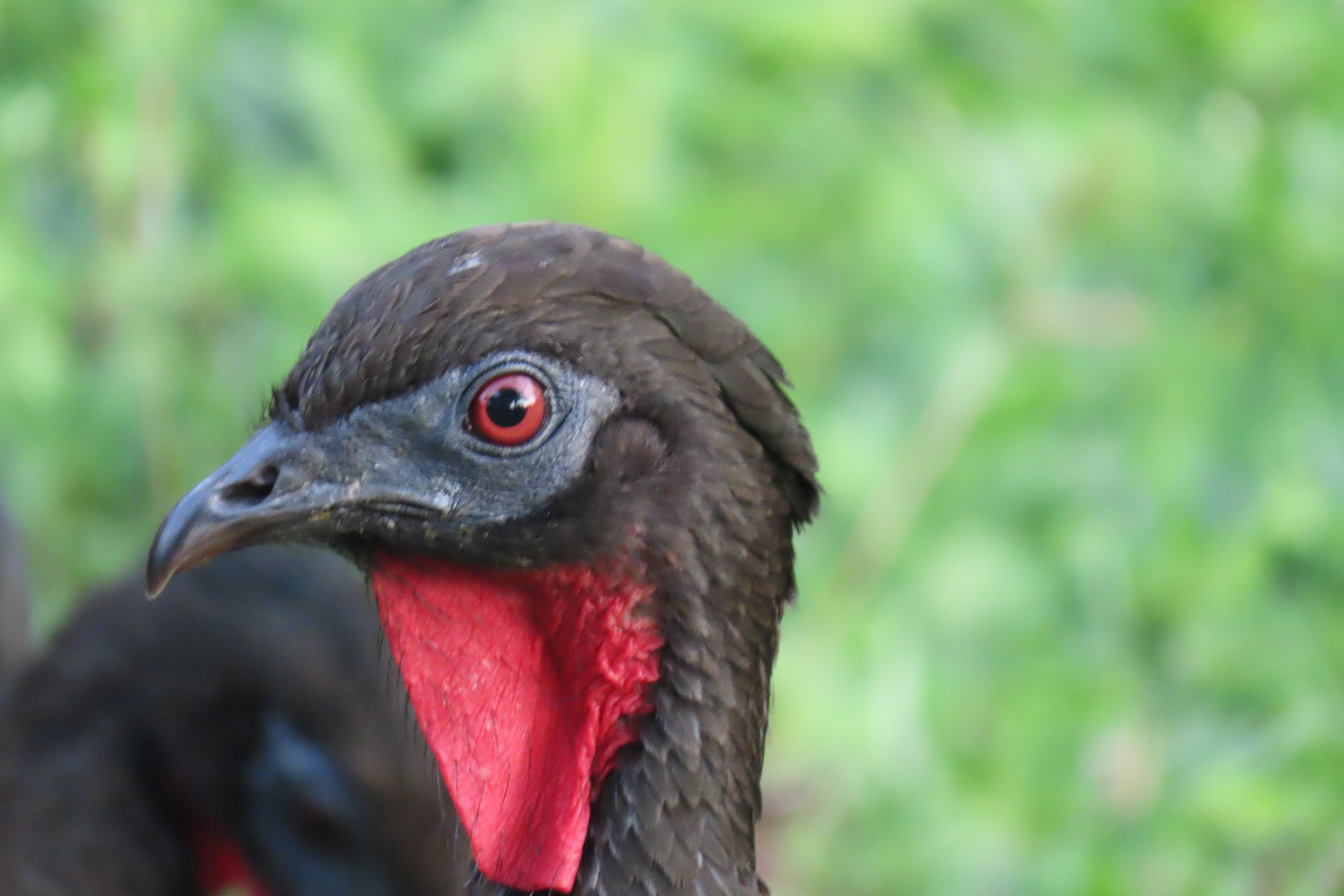
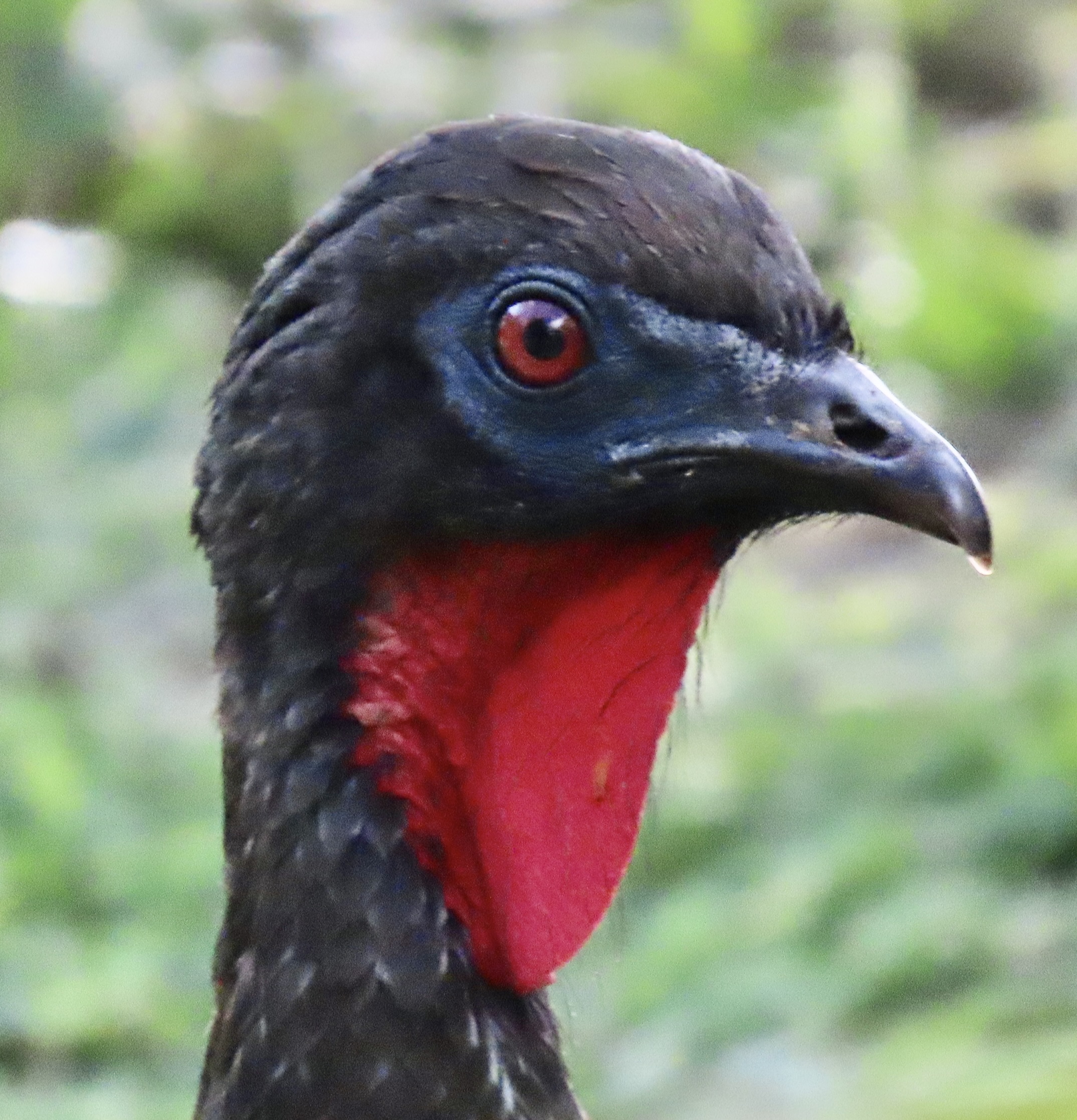
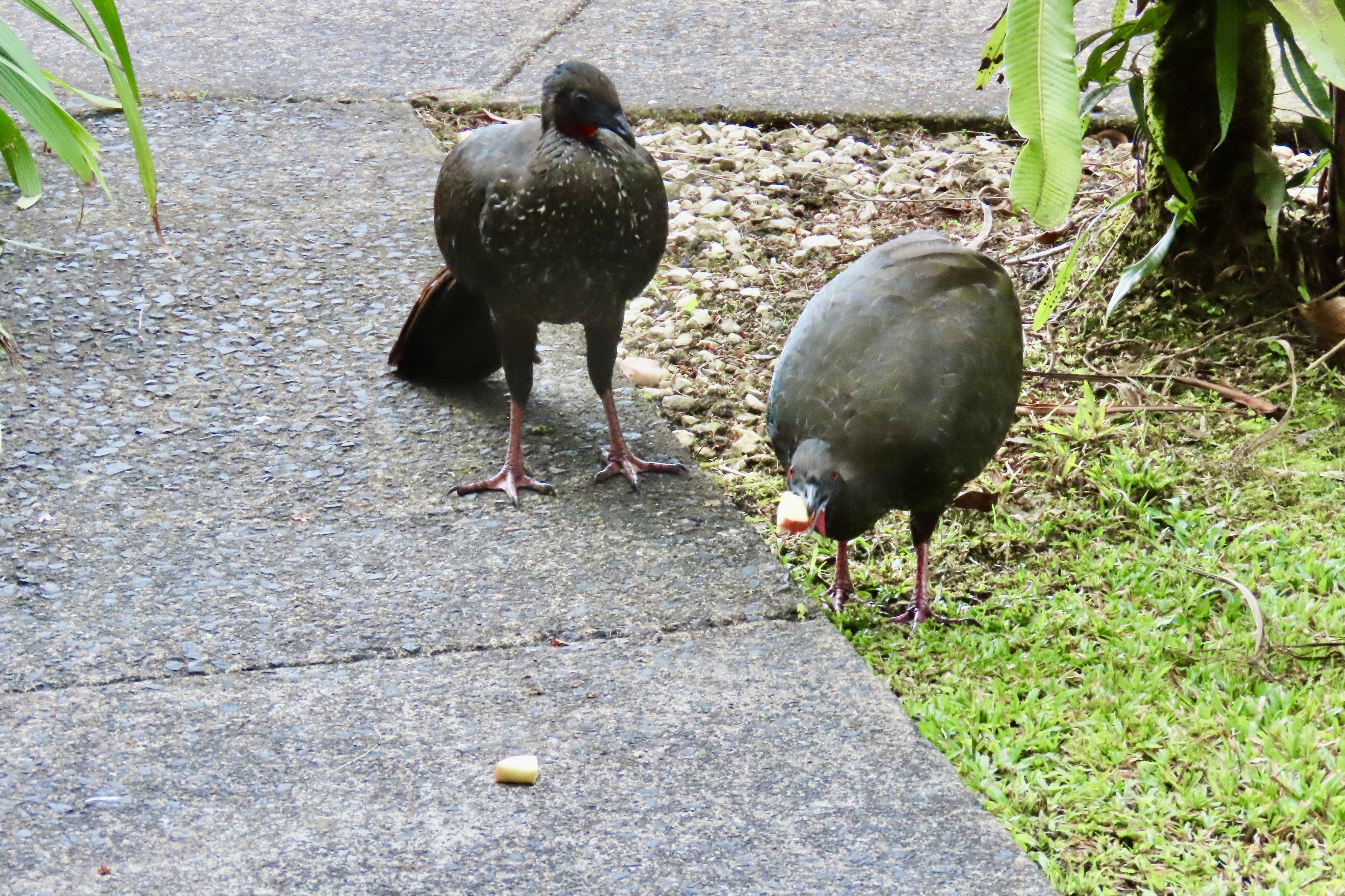
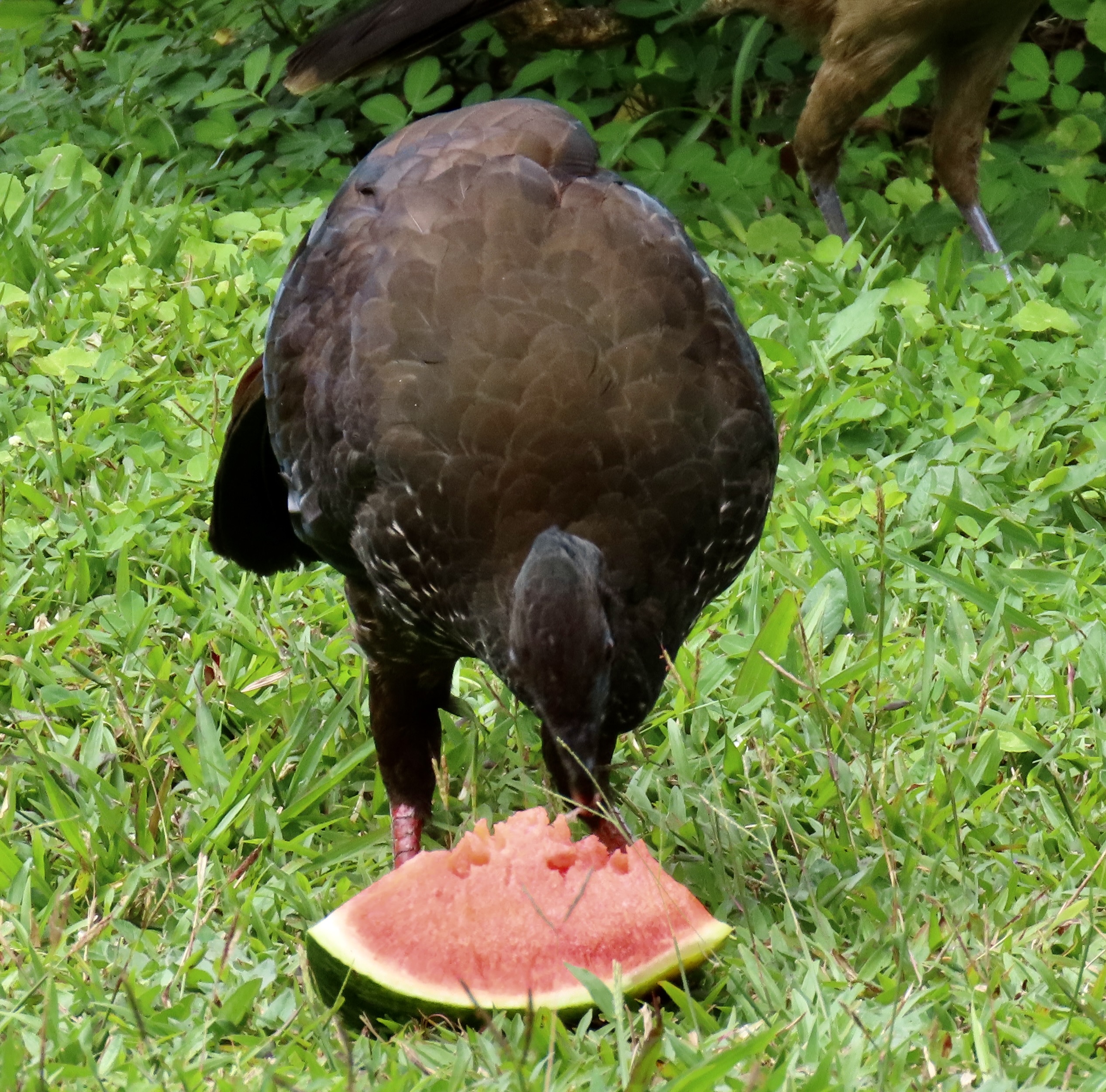
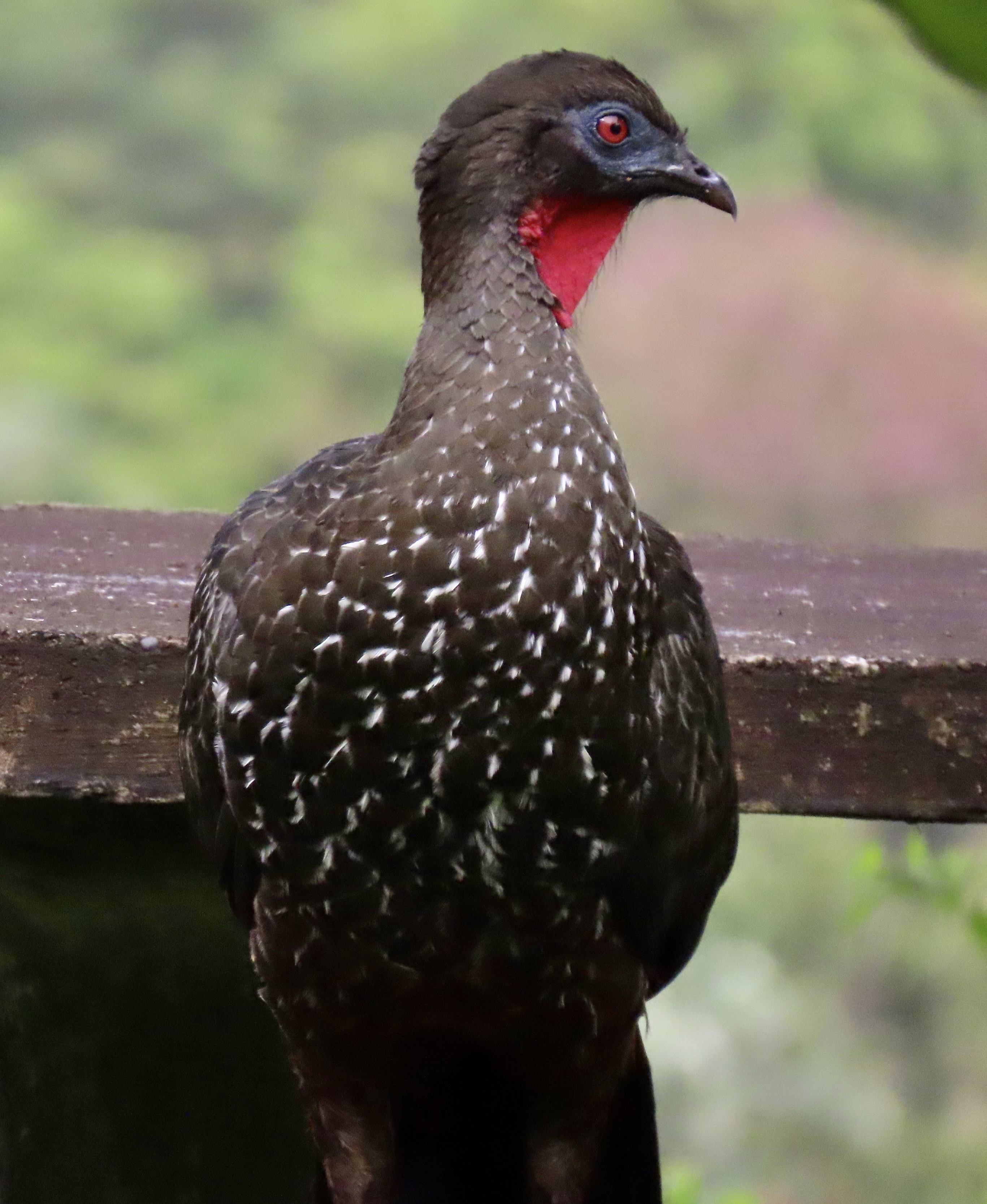
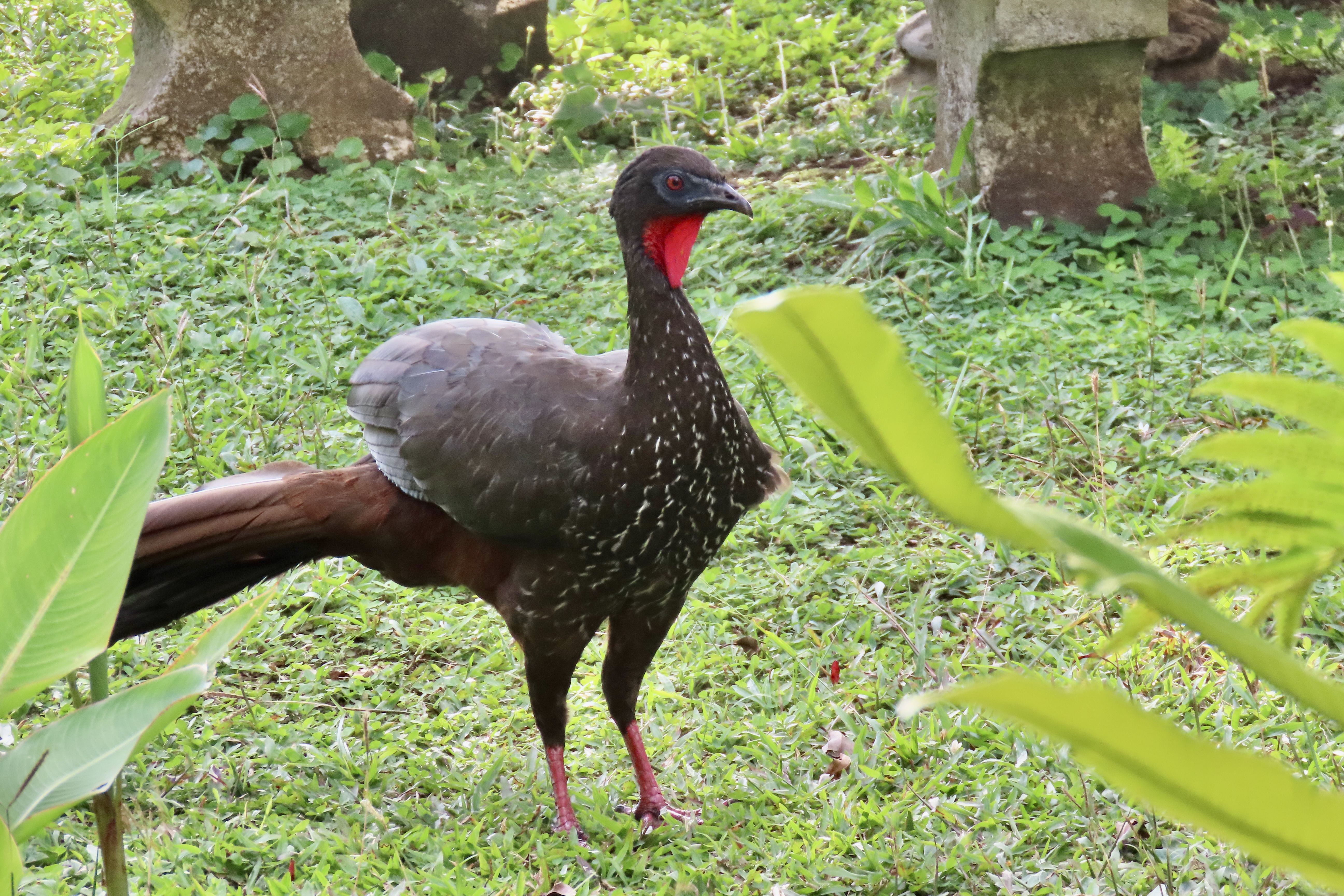
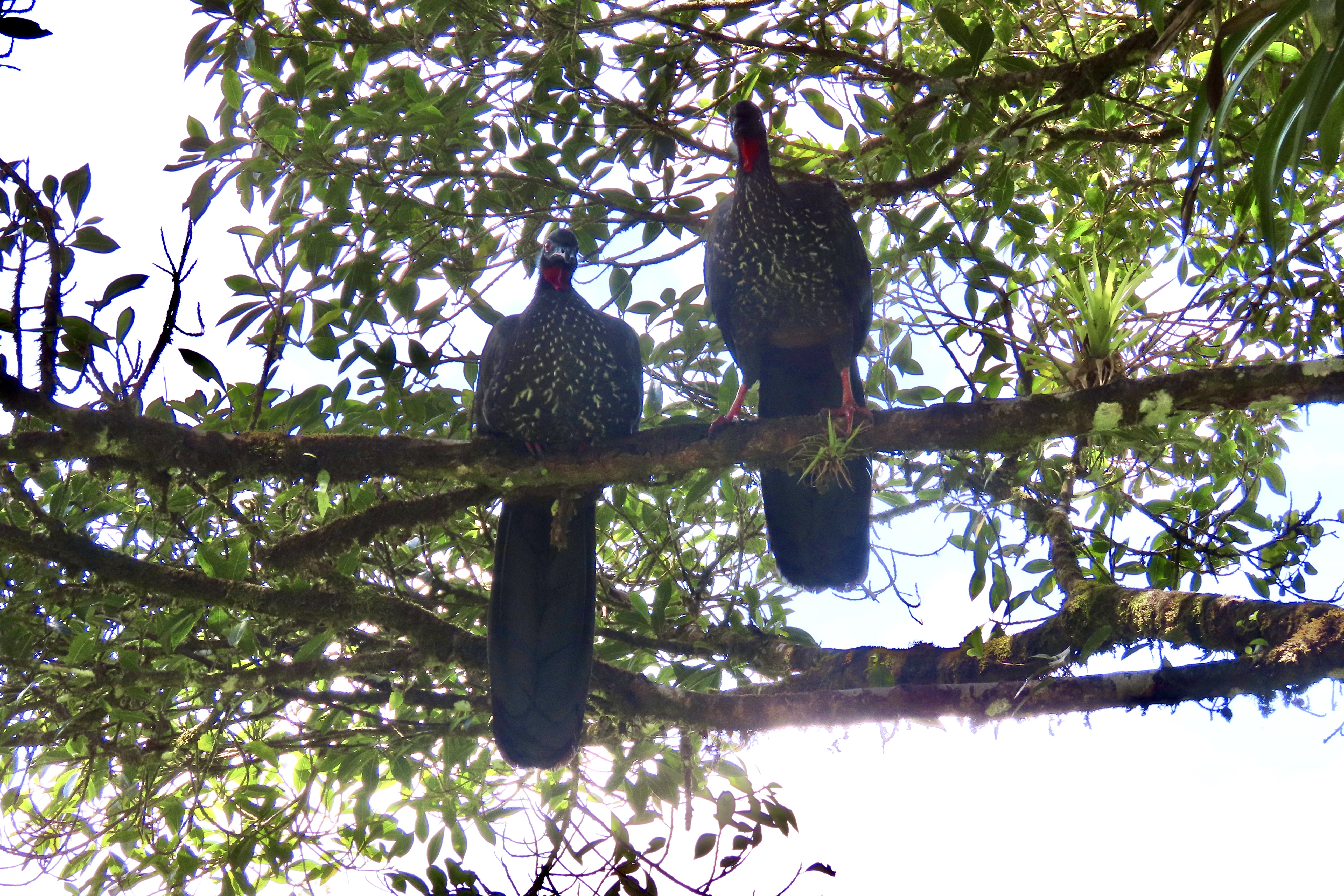
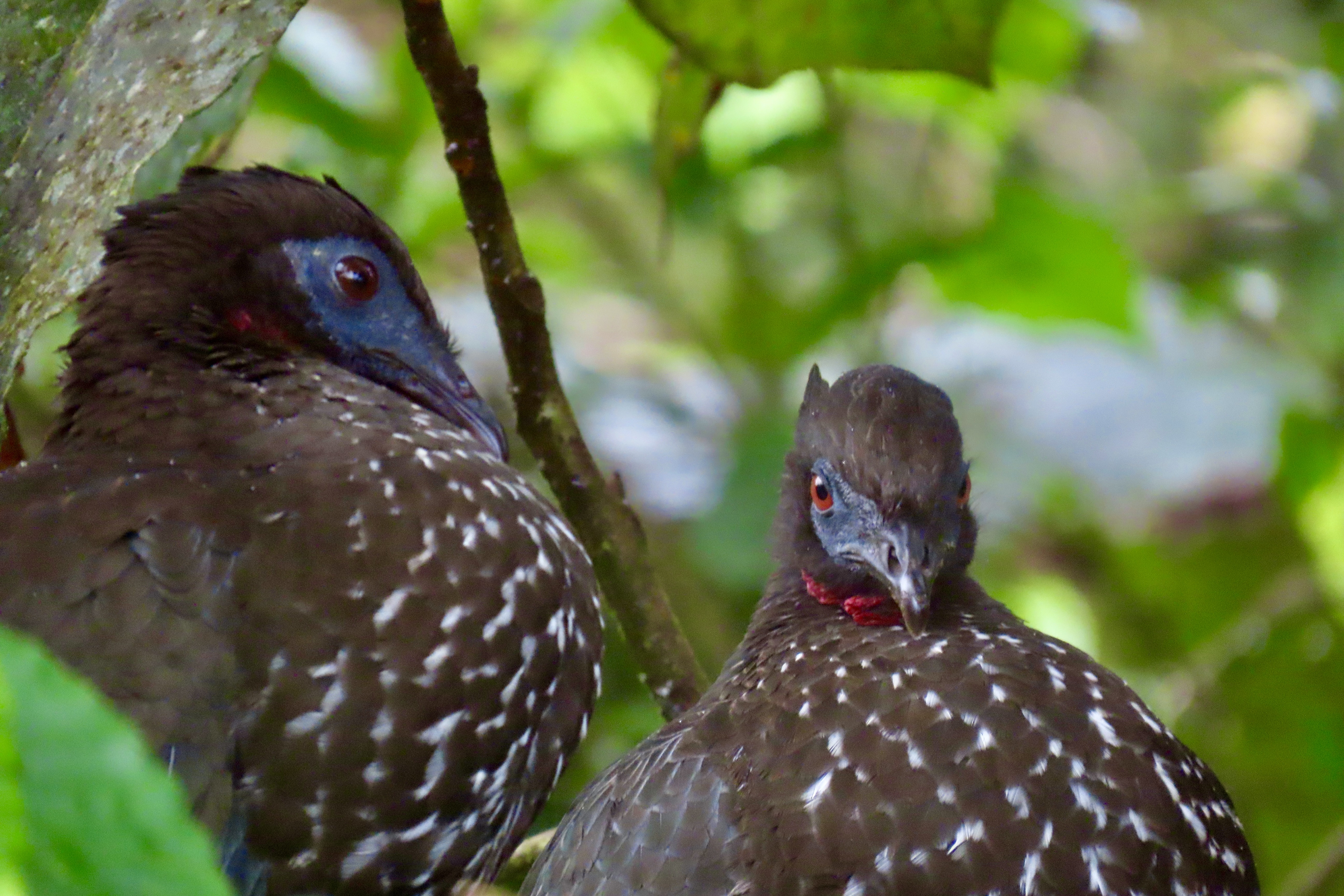
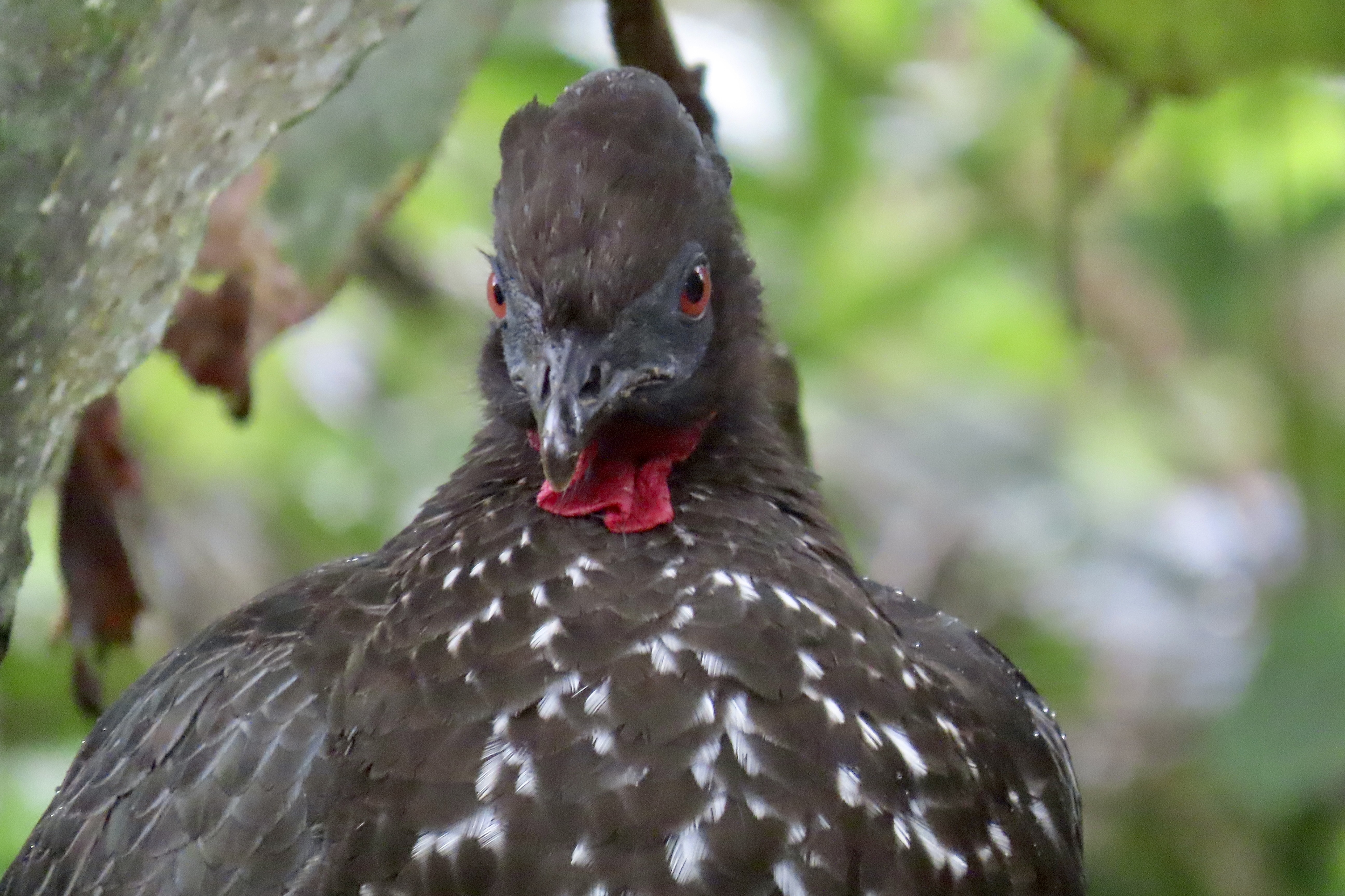
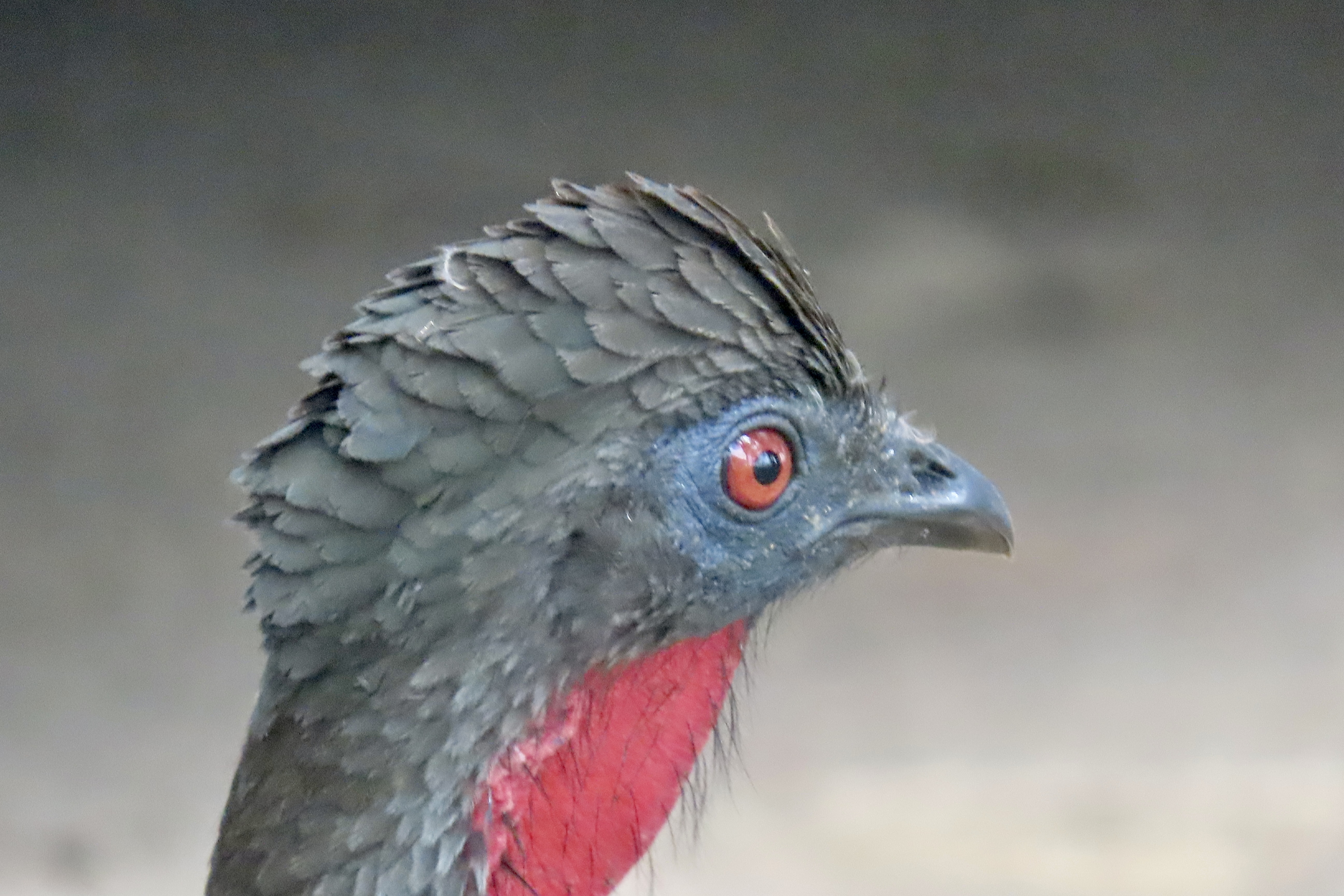
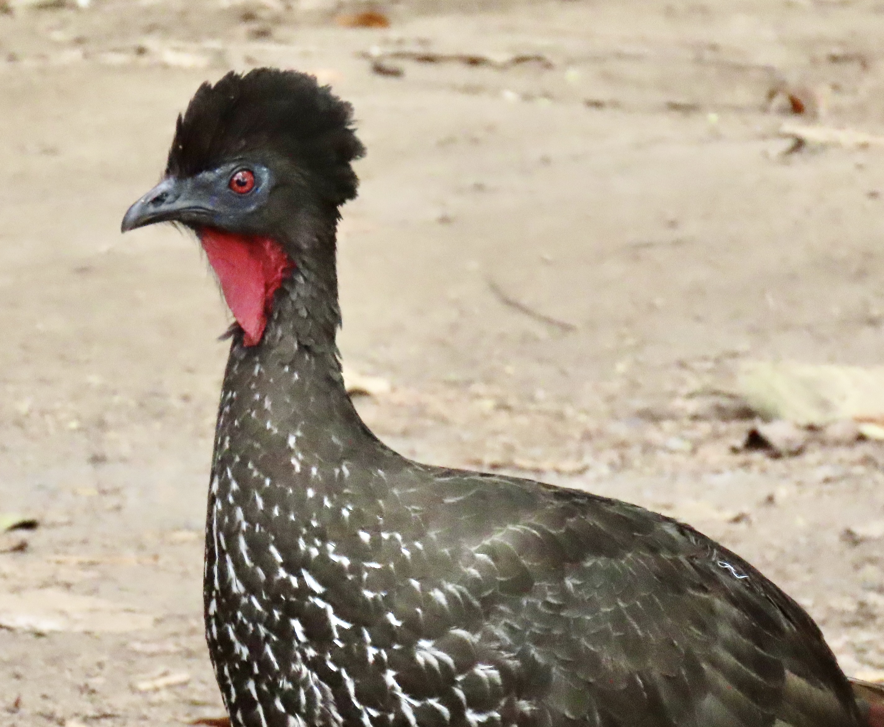
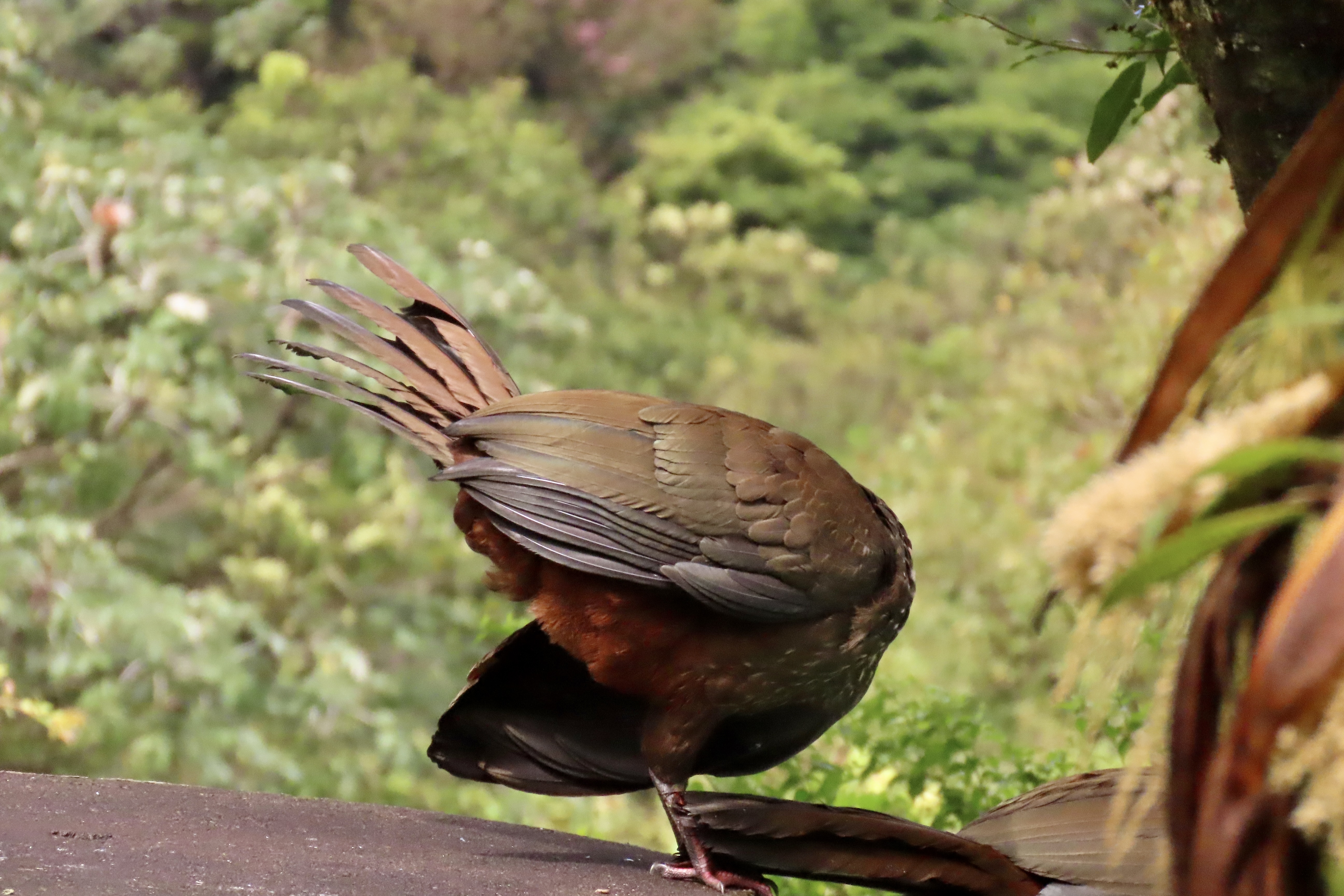
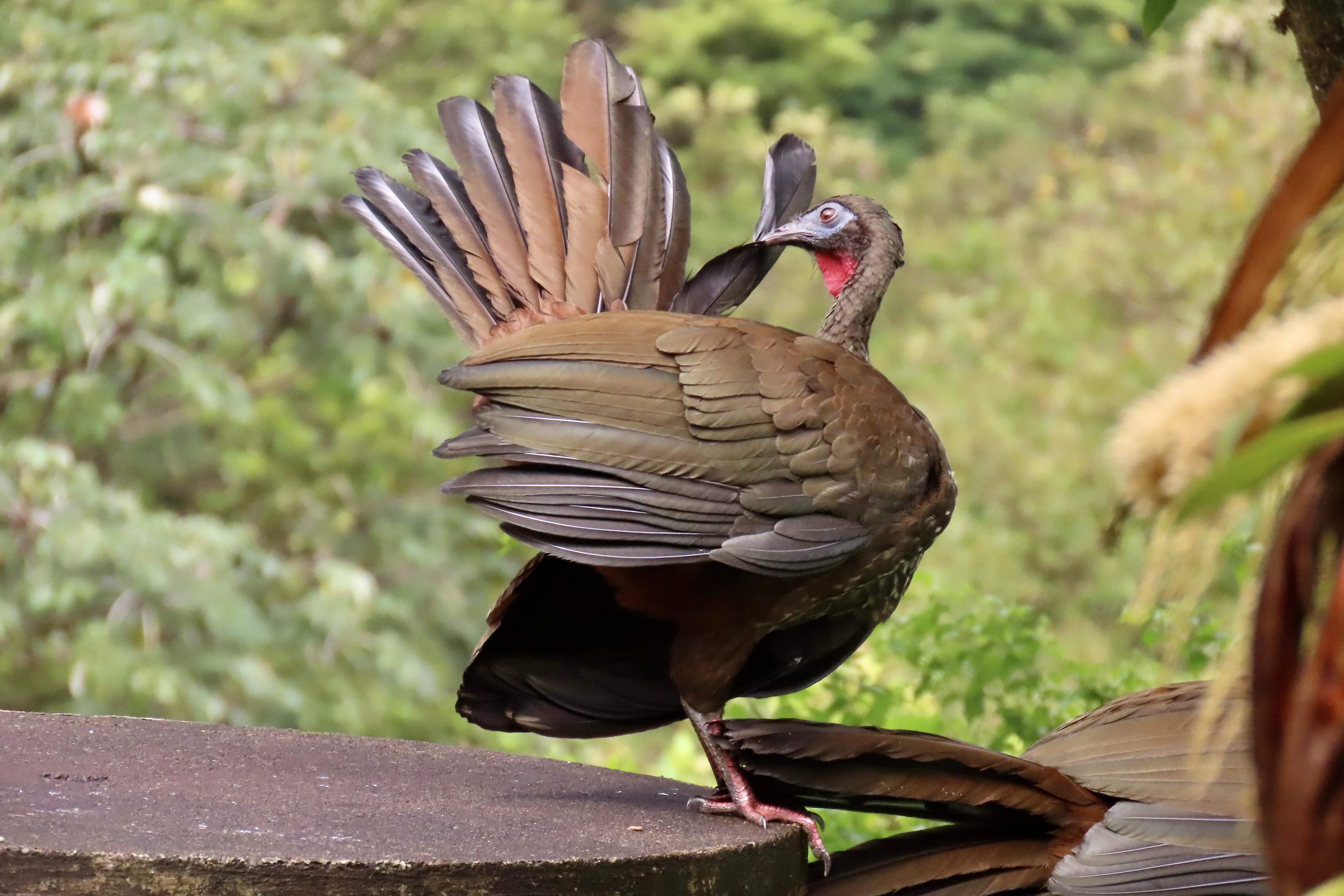
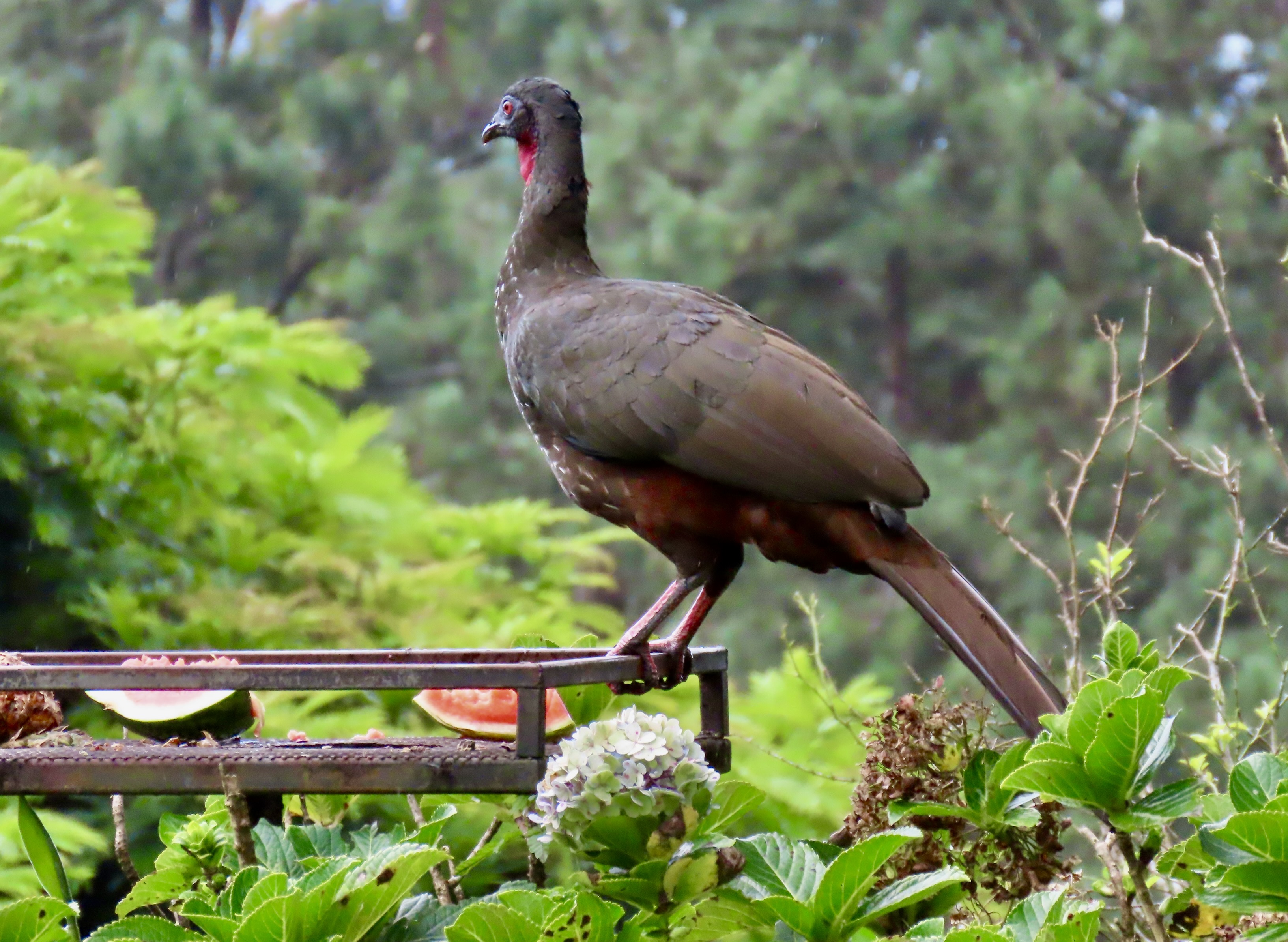
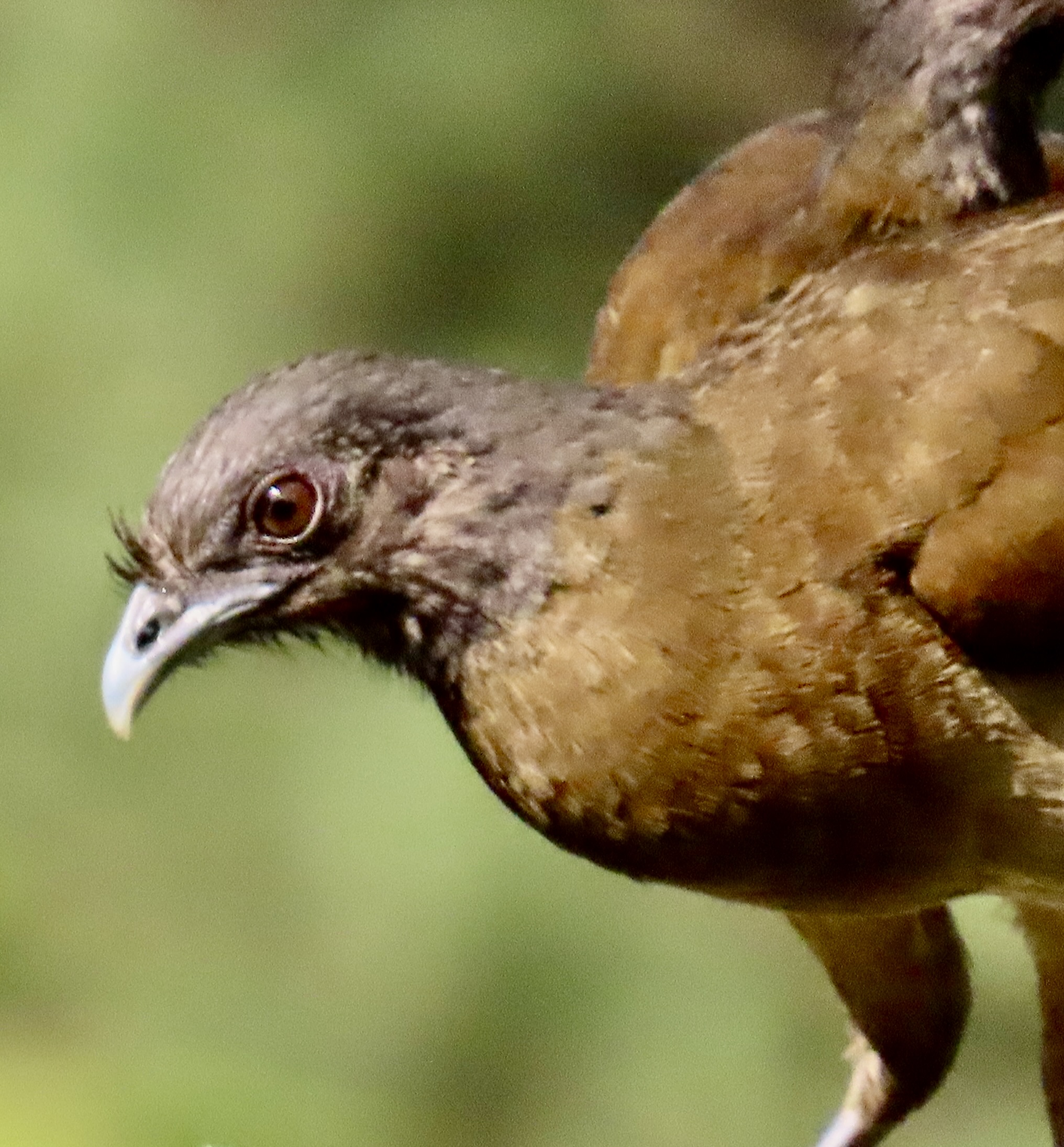
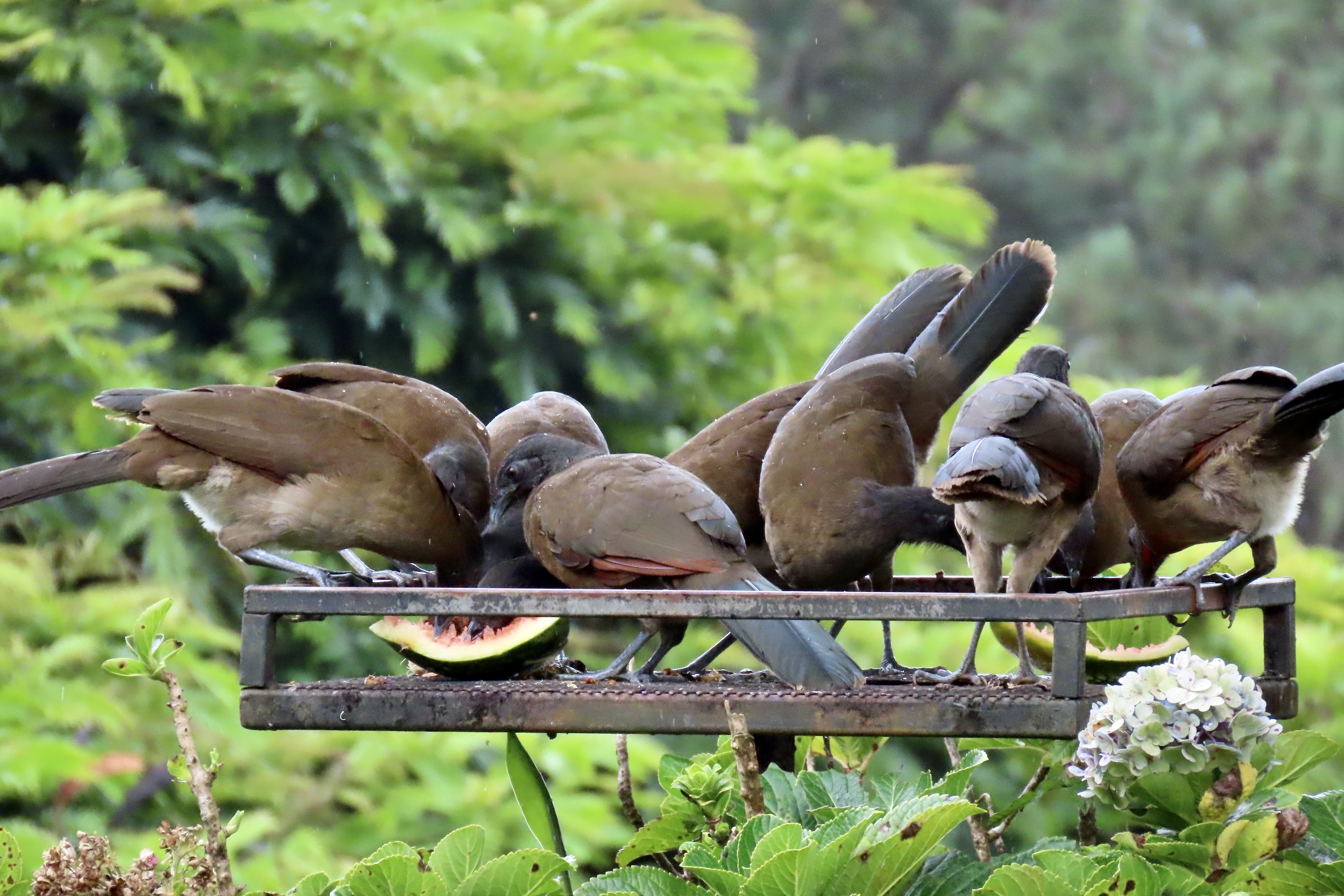
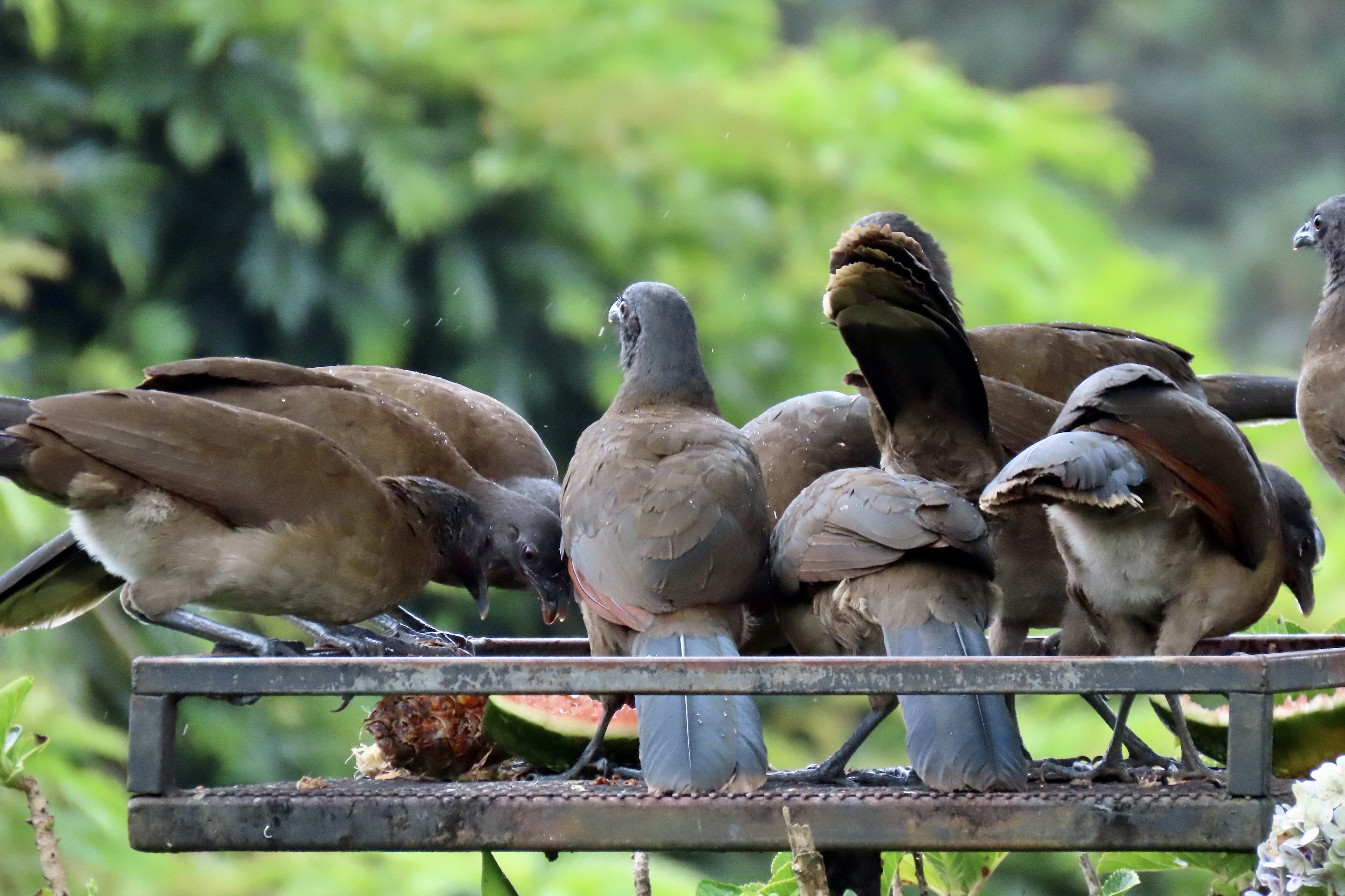
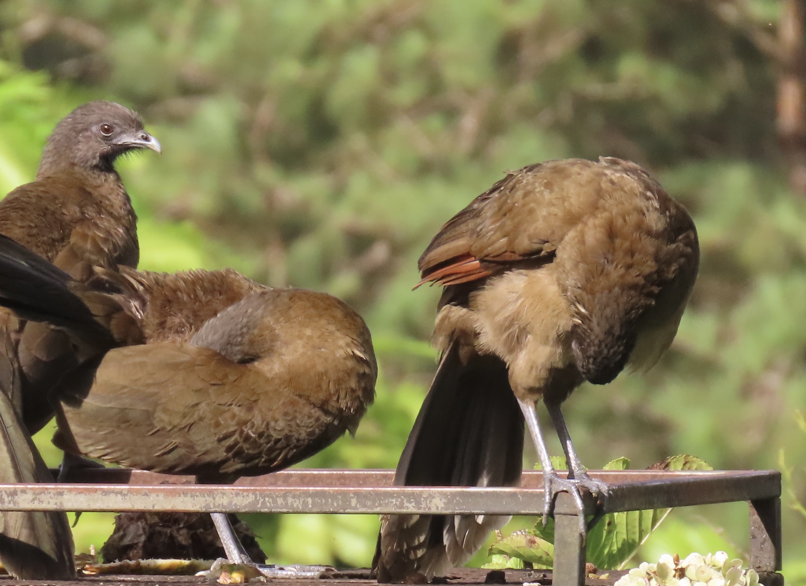
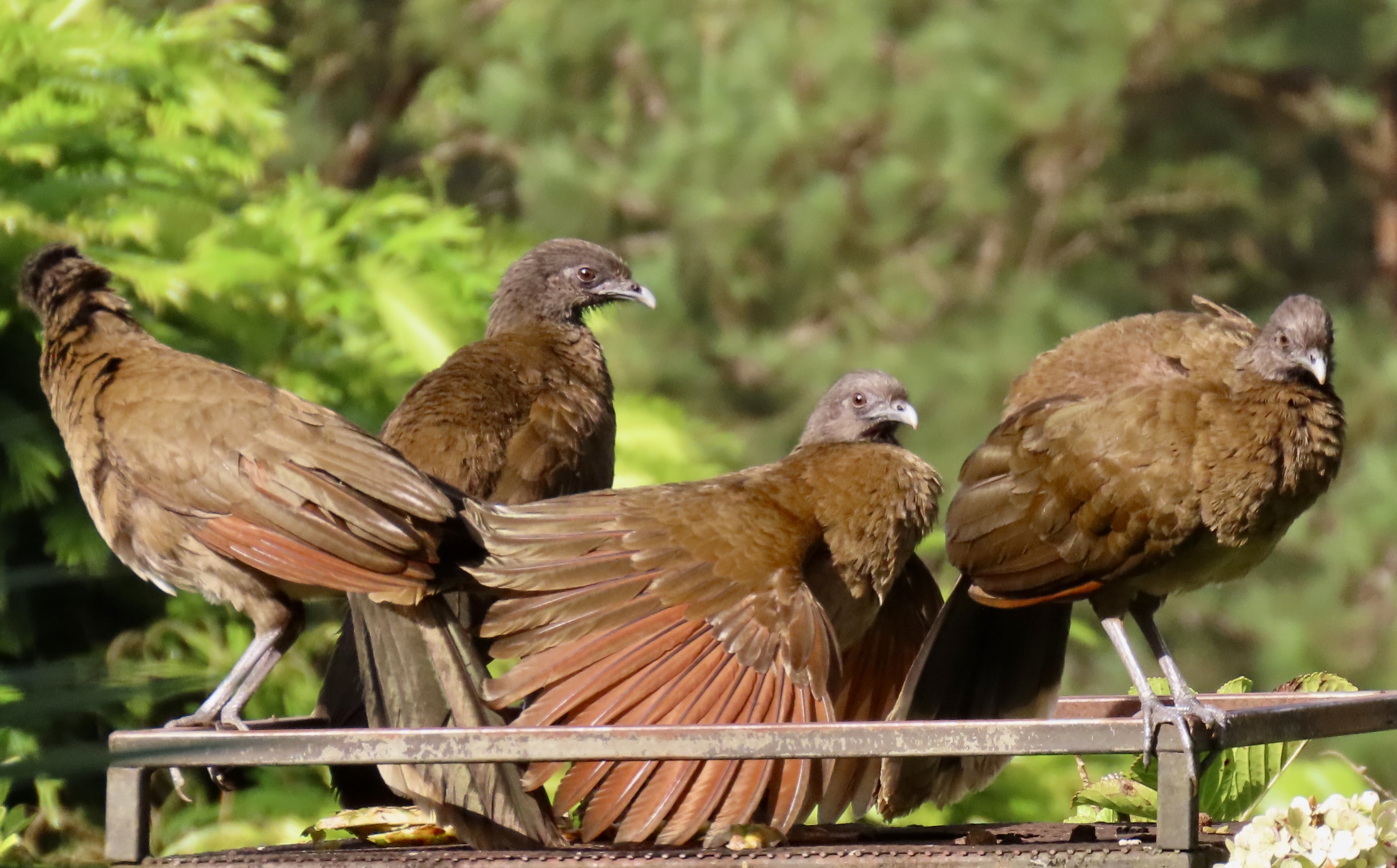
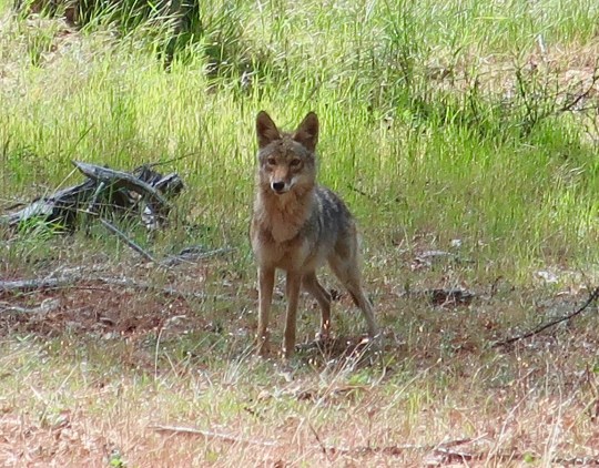
When Peggy opened the drapes on our first morning in Nuevo Arenal, Costa Rica a few weeks ago, this is what greeted her: A hungry Crested Guam demanding an apple, an orange, or a pineapple. We immediately noticed the Guam’s bright red wattle, eyes and long tails. The ‘laidback’ feathers on its head can stand straight up when the Guam is excited. Thus the description ‘crested.’Actually, there were three of them. (They hung out together the whole time we were in Nuevo Arena.) Peggy immediately grabbed her camera and caught this photo of them backlit by the sun. I must say, they were quite polite, just standing there, staring at us.But we couldn’t escape the hungry look. It’s sort of like ‘Feed me or else…’We were soon sharing apples, pineapple, oranges…And even watermelon with our new ‘companions.’Even when they weren’t on our walkway, the Guams monitored our behavior from the lawn and picnic table in front of our Villa.From the lawn. Note its raised wings. I think it was about to chase a Grey-headed Chachalaca that was chowing down on a bite of pineapple the Guam considered its lunch. (See the two videos at the end of today’s post.)They also watched us from the trees behind the villa. Note the long tails.They could see in our back window…A close up.We met this Guam on a hike by Lake Arenal. It was preparing to show off its crest.In full display! “Aren’t I beautiful/handsome.”Some grooming is required. For birds, it’s called primping and is used for feather maintenance.Even down to keeping them oiled! Is the other Guam massaging its legs with its tail feathers? It’s obvious that these big birds like each other, in fact they are monogamous. But I doubt that includes tail-feather leg massages. (Any Guam experts out there that would know?)The primary dining room for the Guams and all of the other fruit eating birds in our neighborhood was a bird feeding table that we and our neighbors kept supplied. Fortunately, it was right in front of our villa. We could sit inside or on our porch and take bird photos all day if we wanted to. You’ll be seeing a few…
Normally, the crested Guams (Penelope purpurascens) are not as tame as the ones that have found an endless supply of food at the Lakeview Villas where we were staying. Nor are they ground dwellers, preferring to live high up in the forest canopy and feed off of fruit they find up there, like the figs from the ficus trees we featured in our post last Monday. Similar to the Gray-headed Chachalacas (Ortalis cinereiceps) that you will meet next, they are members of the long-tailed family, Cracidae. Above them on the animal classification system they are also related to chickens, turkeys and other Galliformes, which is hardly surprising, given their body shape. They range from Mexico in the north to Ecuador and Venezuela in the south.
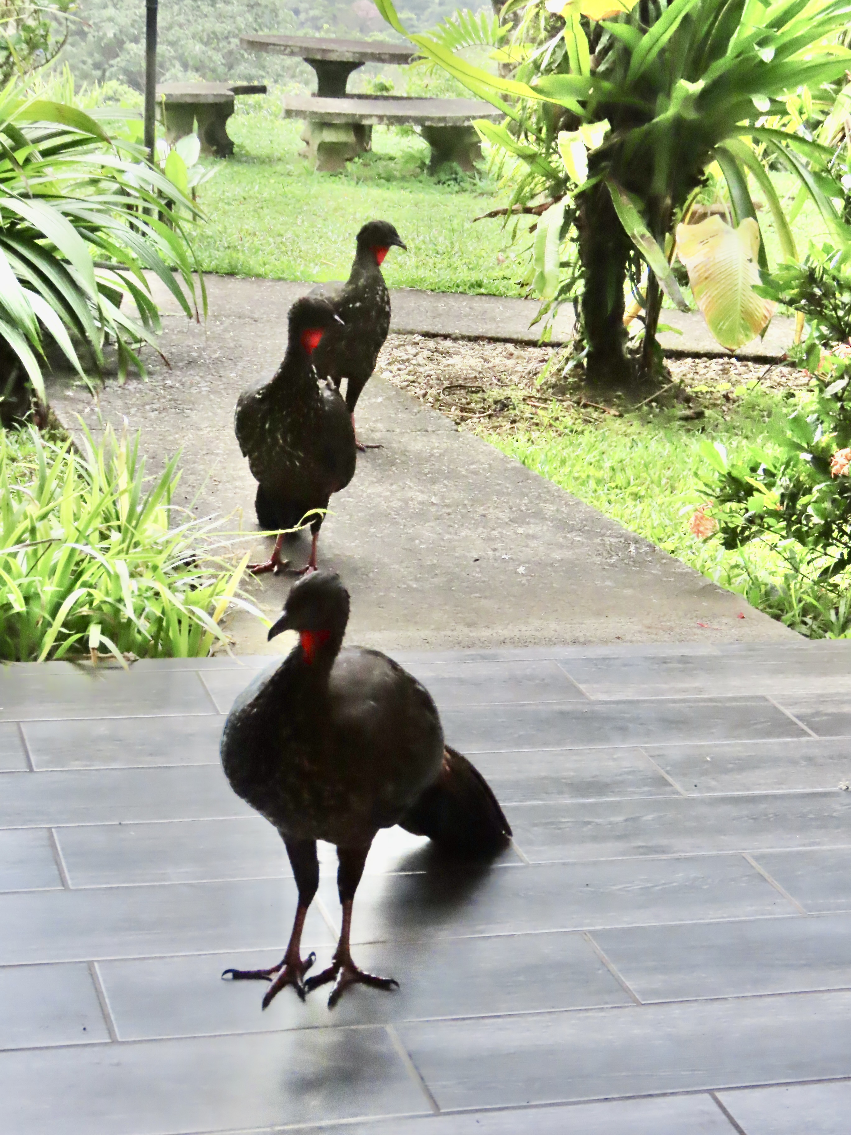
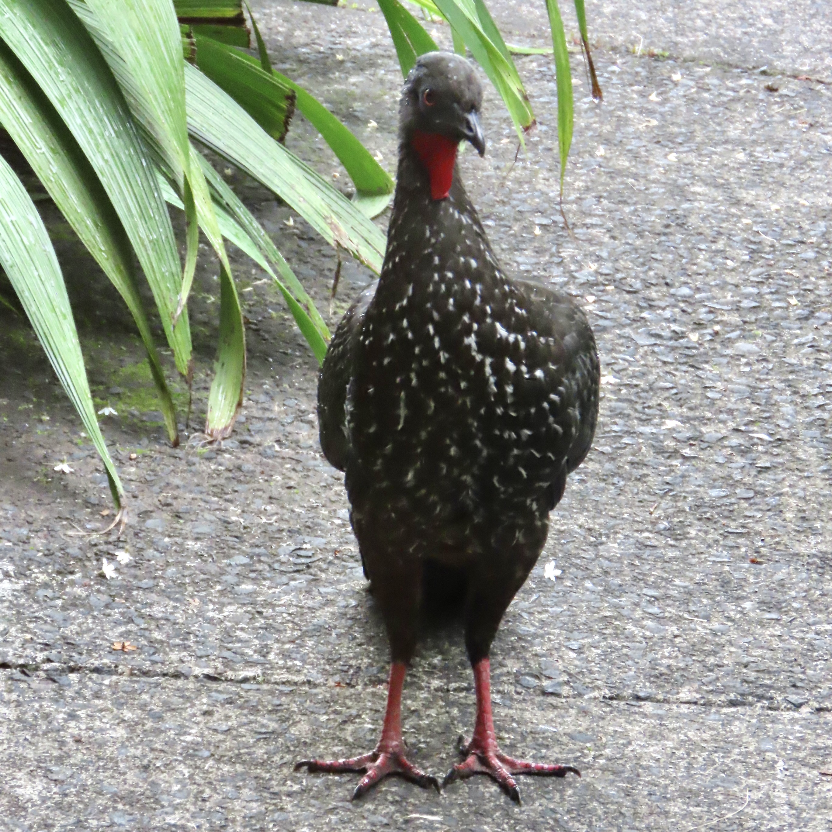
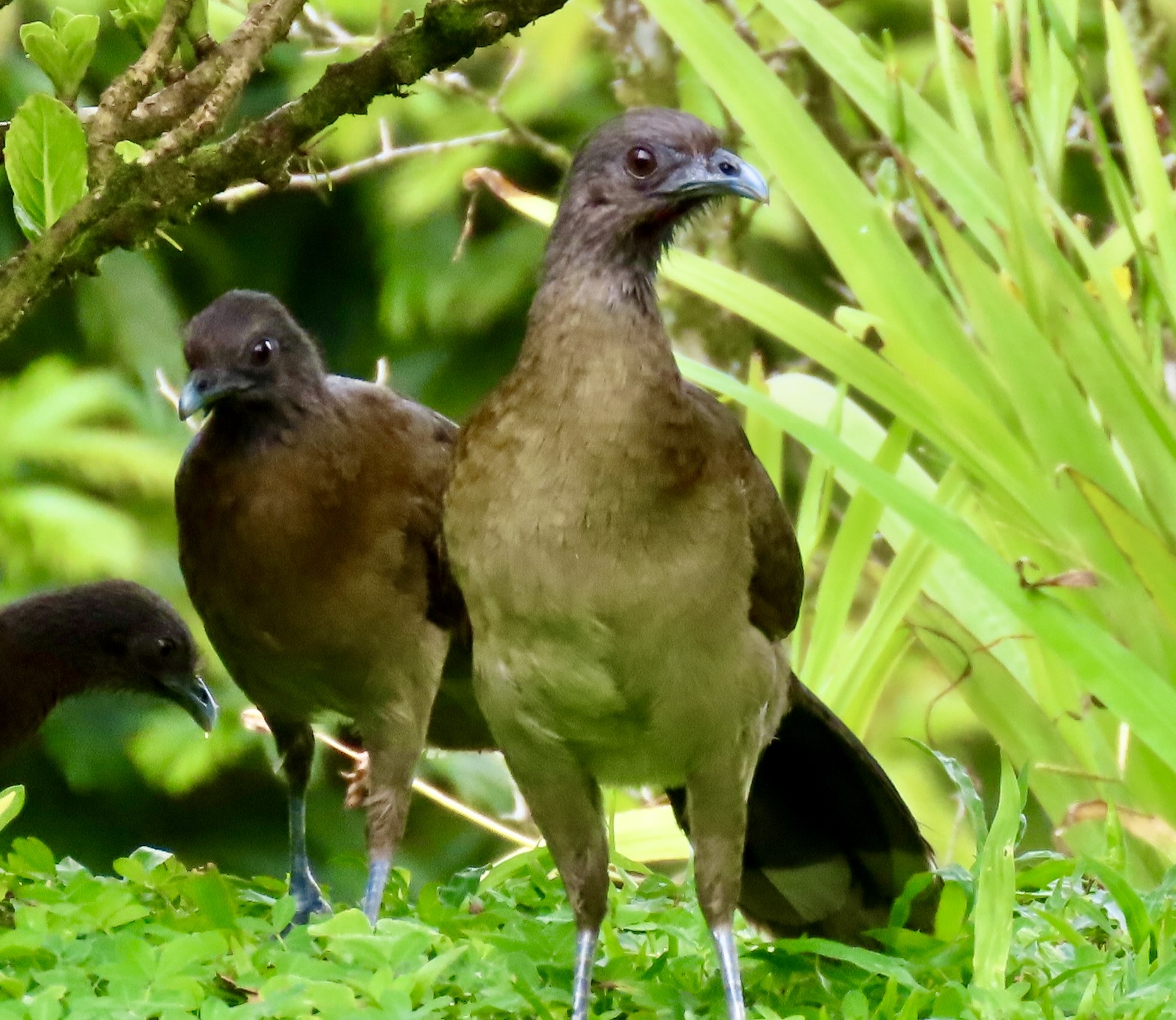
The smaller Chachalacas look a lot like the Guams minus the wattles and crests. At first we thought they might be their kids, especially given their obvious love of fruit. Closer inspection and a little research quickly defined them as a different species. Beyond looks, another defining characteristic is that they travel in groups ranging in size from 6 all the way up to 20. Ours was around 12. When these large birds make their way through trees, they sound like a herd of marauding elephants (slight exaggeration, but they are noisy.) It’s said that their name, Chachalacas, is derived from a sound they make early in the morning and late in the evening. We didn’t hear it in Nuevo Arenal, but I did one evening in Monteverde. I love the name.
The ‘here’s looking at you’ pose of a Chachalaca. Impressive nose hairs.Another perspective.They would arrive at the food station en masse. Any fruit was quickly disposed of…Tails down and looking around, at half mast and breaking fast, fully up and having sup. (A little humor for my poet friends who follow this blog.)Grooming/primping Chachalaca style. Were they getting ready for a group photo?Maybe. Grin. You may wonder what the Crested Guams felt about the Chachalacas showing up and gulping down all of the fruit. The following videos will give you an idea. The first demonstrates the greed of the Chachalacas at the food table and the Guams’ response. The second shows what Peggy and I found to be a rather hilarious chase scene where the Guam kept losing track of the Chachalaca it was supposed to be chasing! (Click on the photos.)
BTW: Wednesday’s UT-OH! Post is on “first dates and squashed skunks!”
As you might have expected the Guams had little tolerance for the Chachalacas scarfing down the fruit!
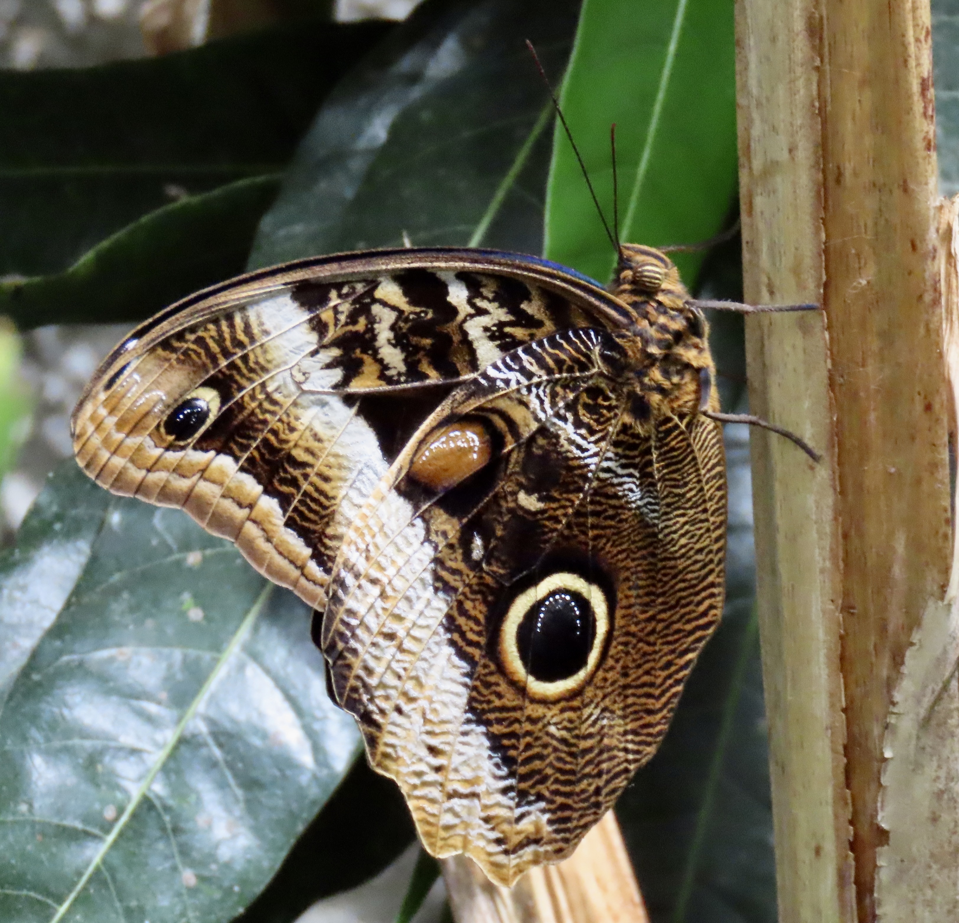
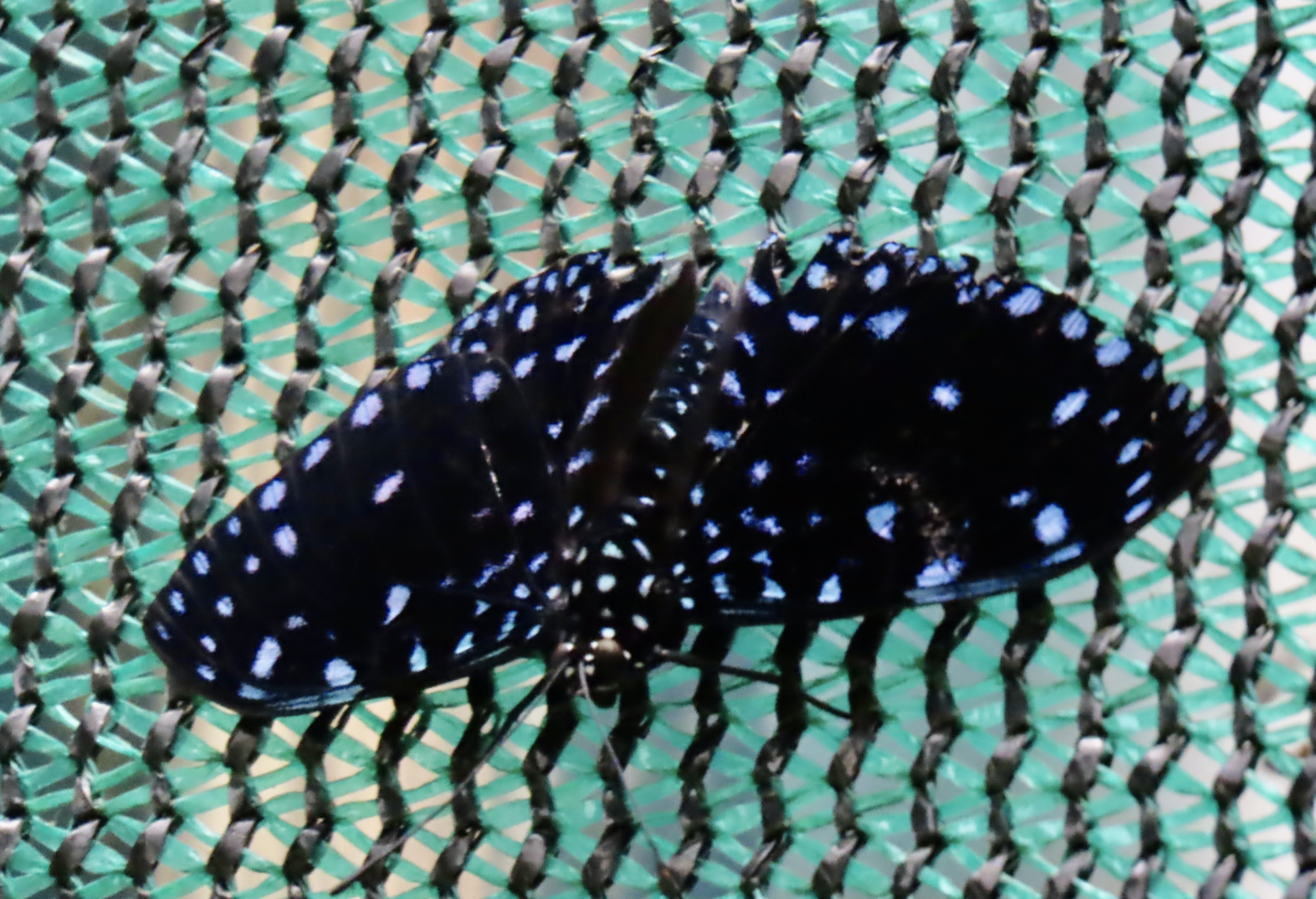
Our jungle night hike in Costa Rica introduced us to the Owl Butterfly in addition to the tarantula, pit vipers, and scorpions we featured on that post. Some fun, huh. This owl butterfly photo was taken during the day at the Monteverde Butterfly Gardens, where we visited to see it, and other butterflies of Costa Rica, up close.
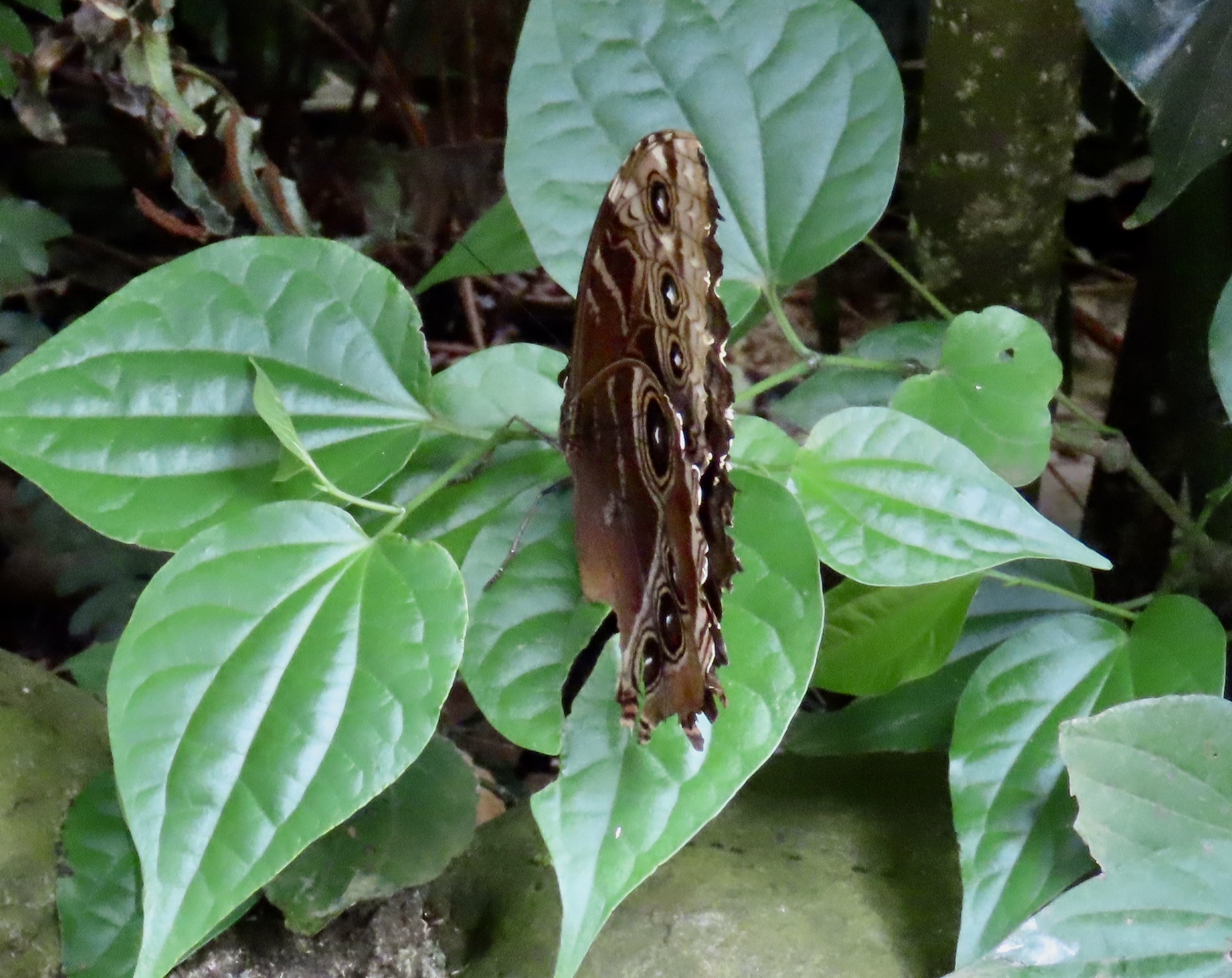
The owl butterfly is so named because the large spot on the lower part of the wing. It has a matching spot on the other wing that resemble an owl’s eyes when the wings are open and seen from below. It’s called mimicry. One theory is that predators see the eyes and decide that fleeing is a better option than chomping lest they end up being the chompee. Another theory is that the predator sees the eyes and thinks that they represent the head of the butterfly, bites down, and get a mouthful of wing instead of the body. Given that the owl butterfly is one of the giants of the butterfly world with a 6-8 inch wing span, it has plenty of wing left to still fly. Either theory leaves the butterfly free to complete its goal in life, which is to breed and have babies, i.e. lay eggs.
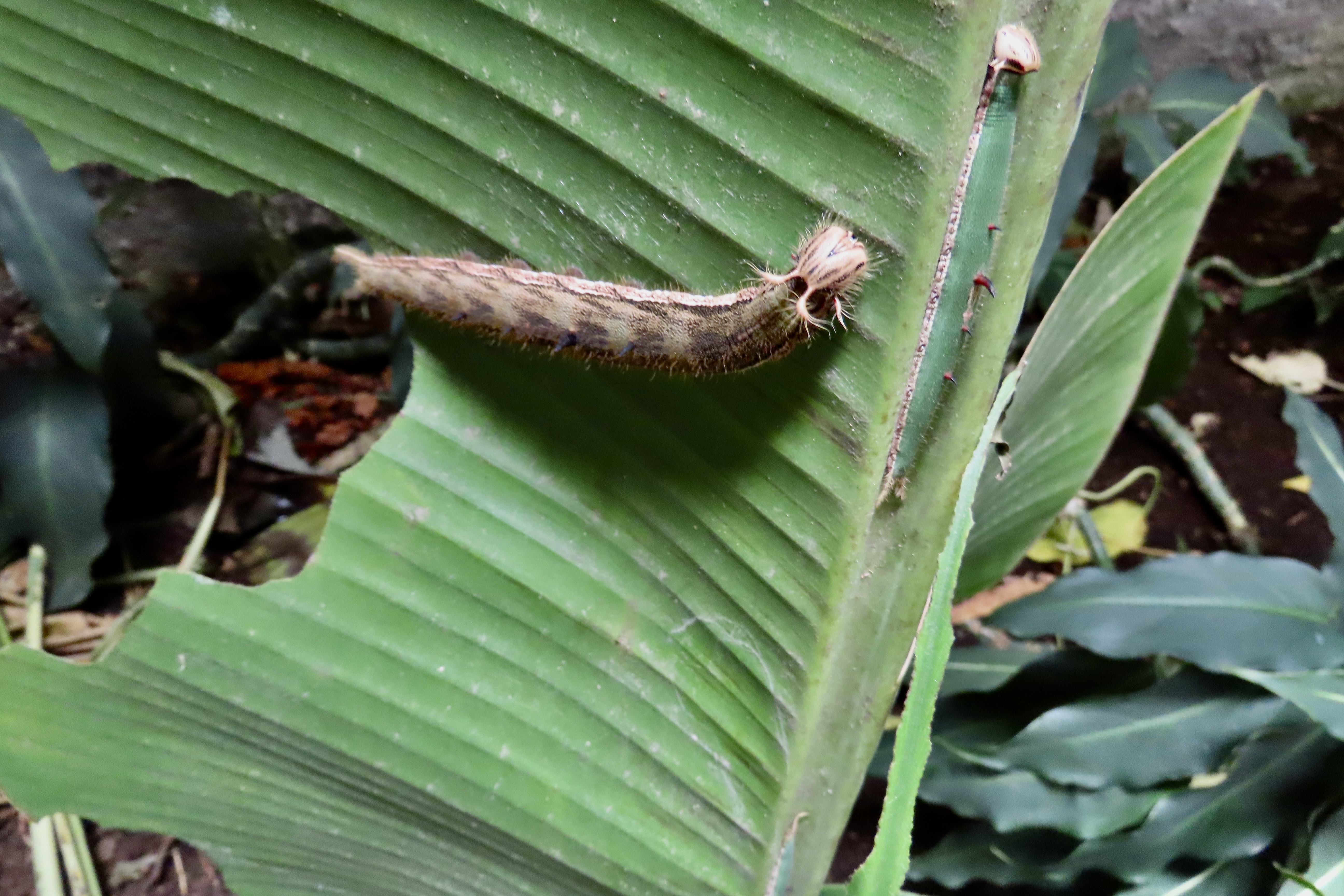
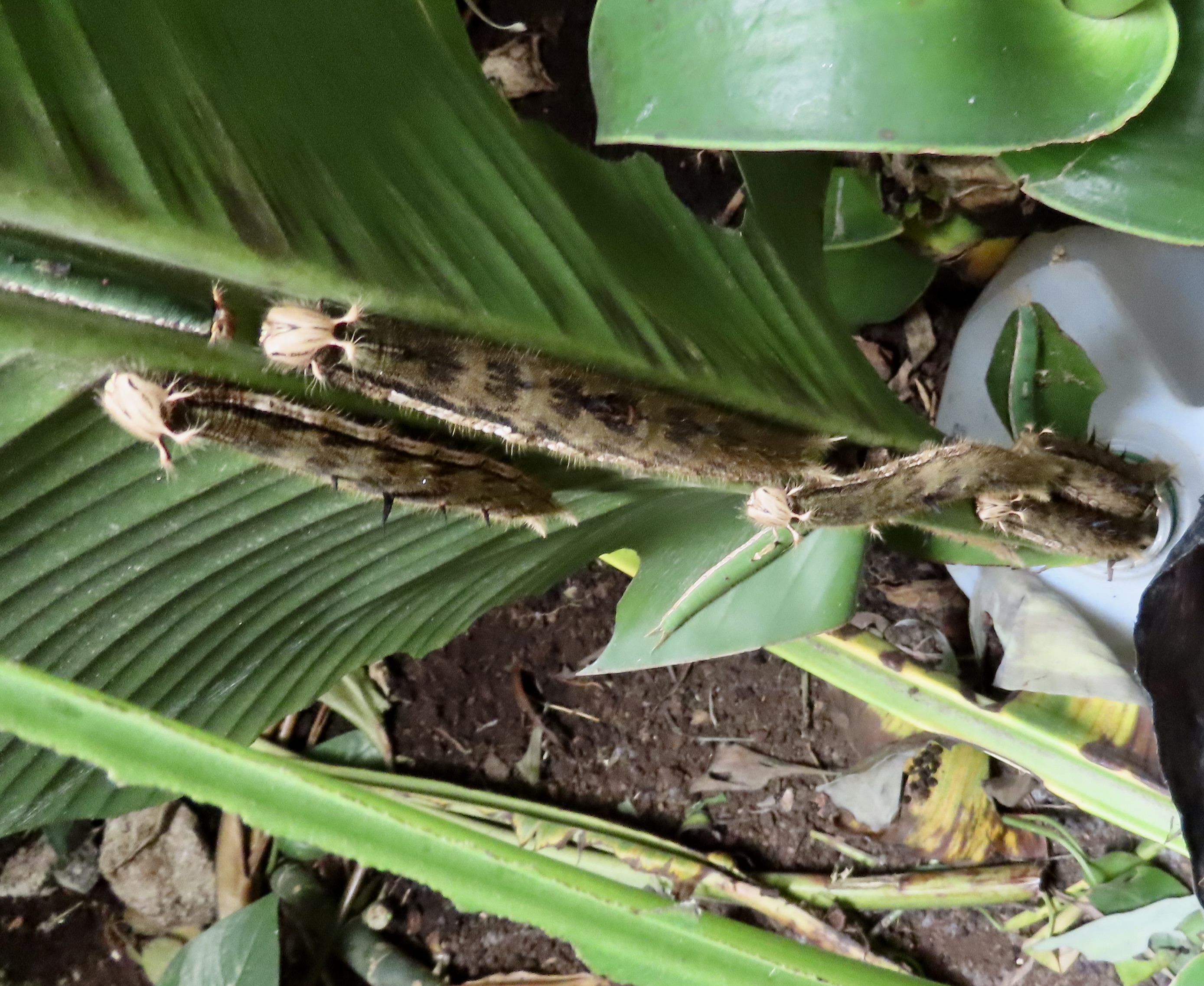
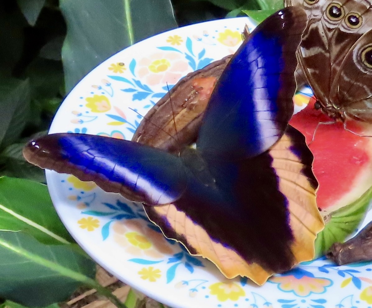
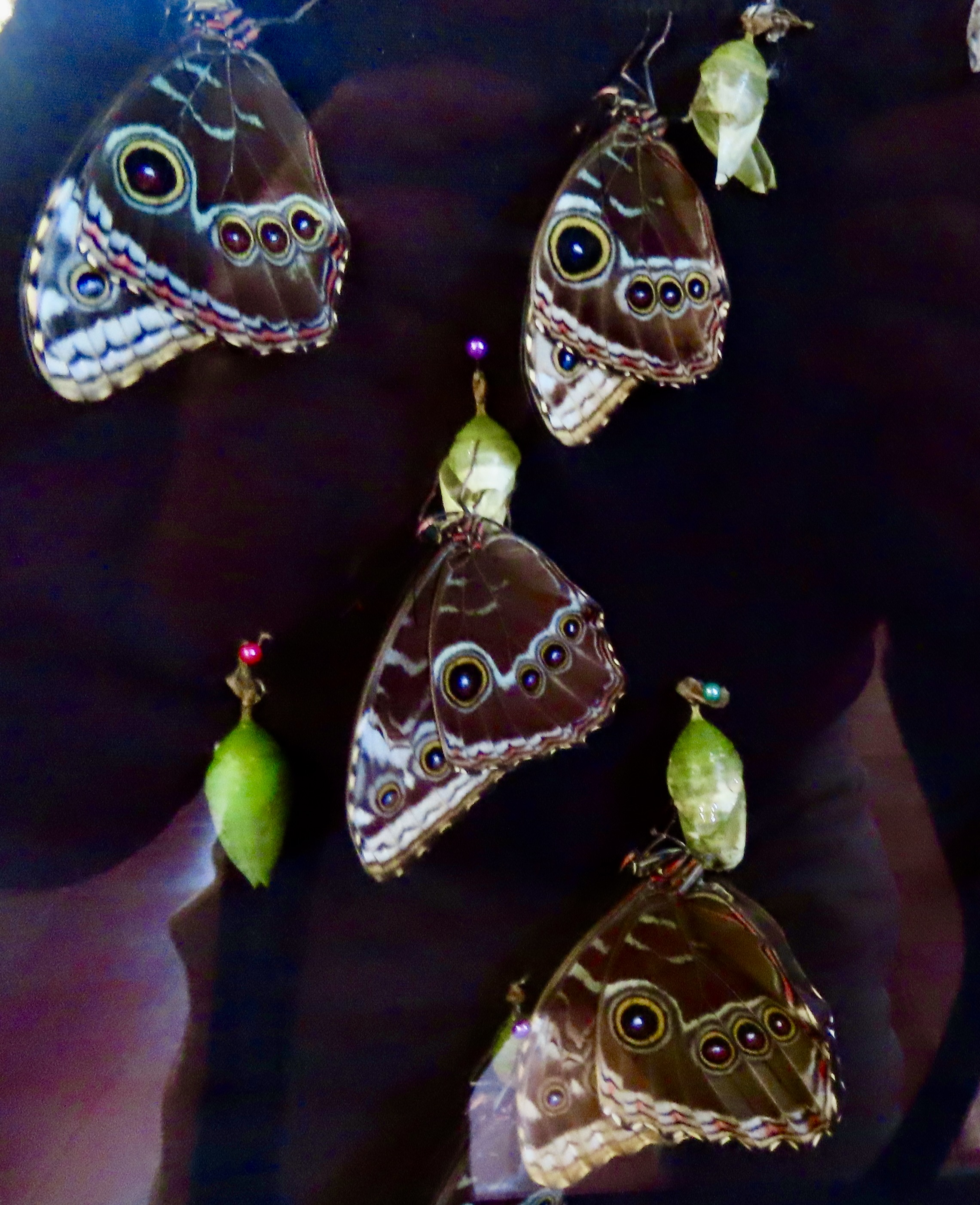
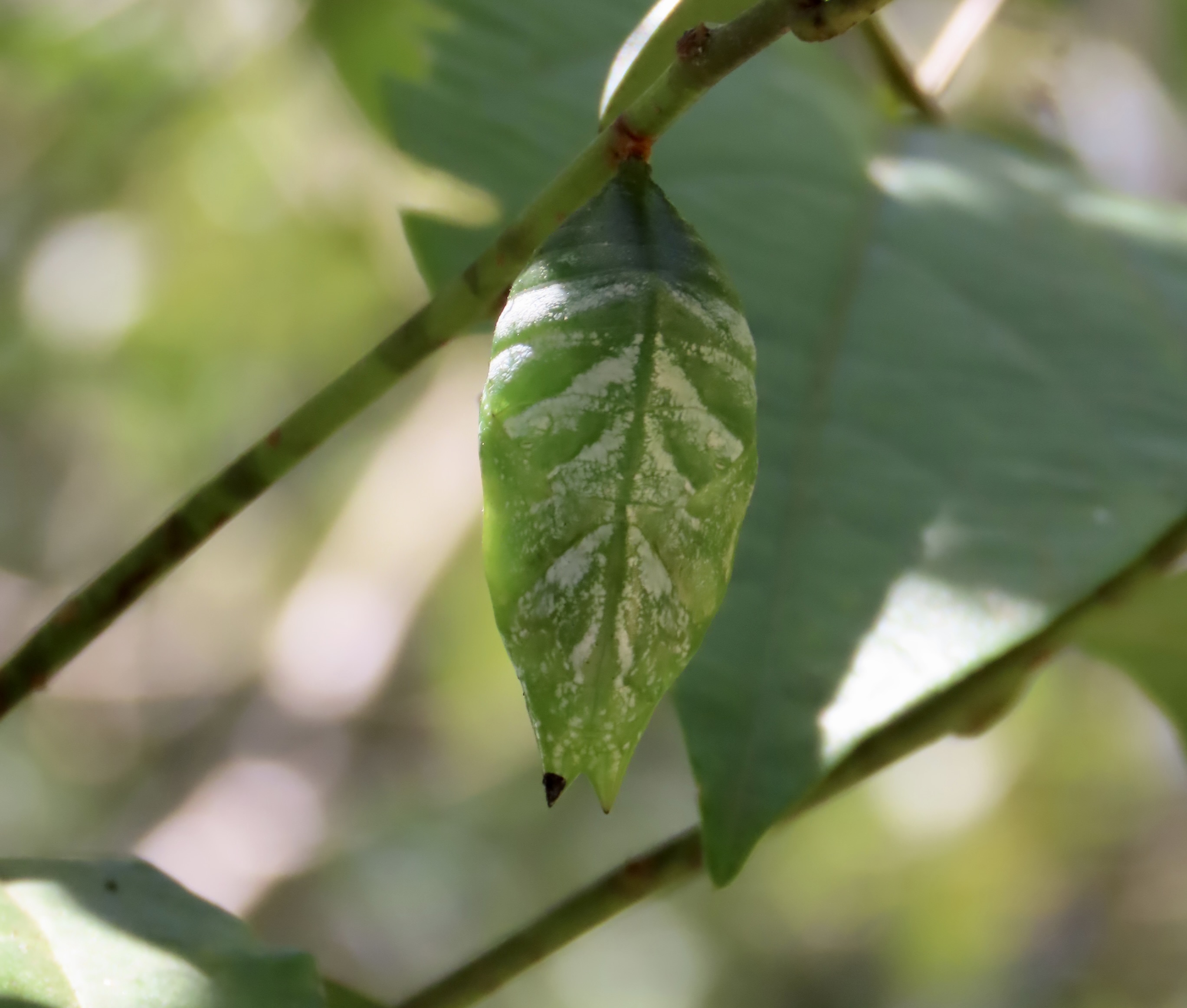
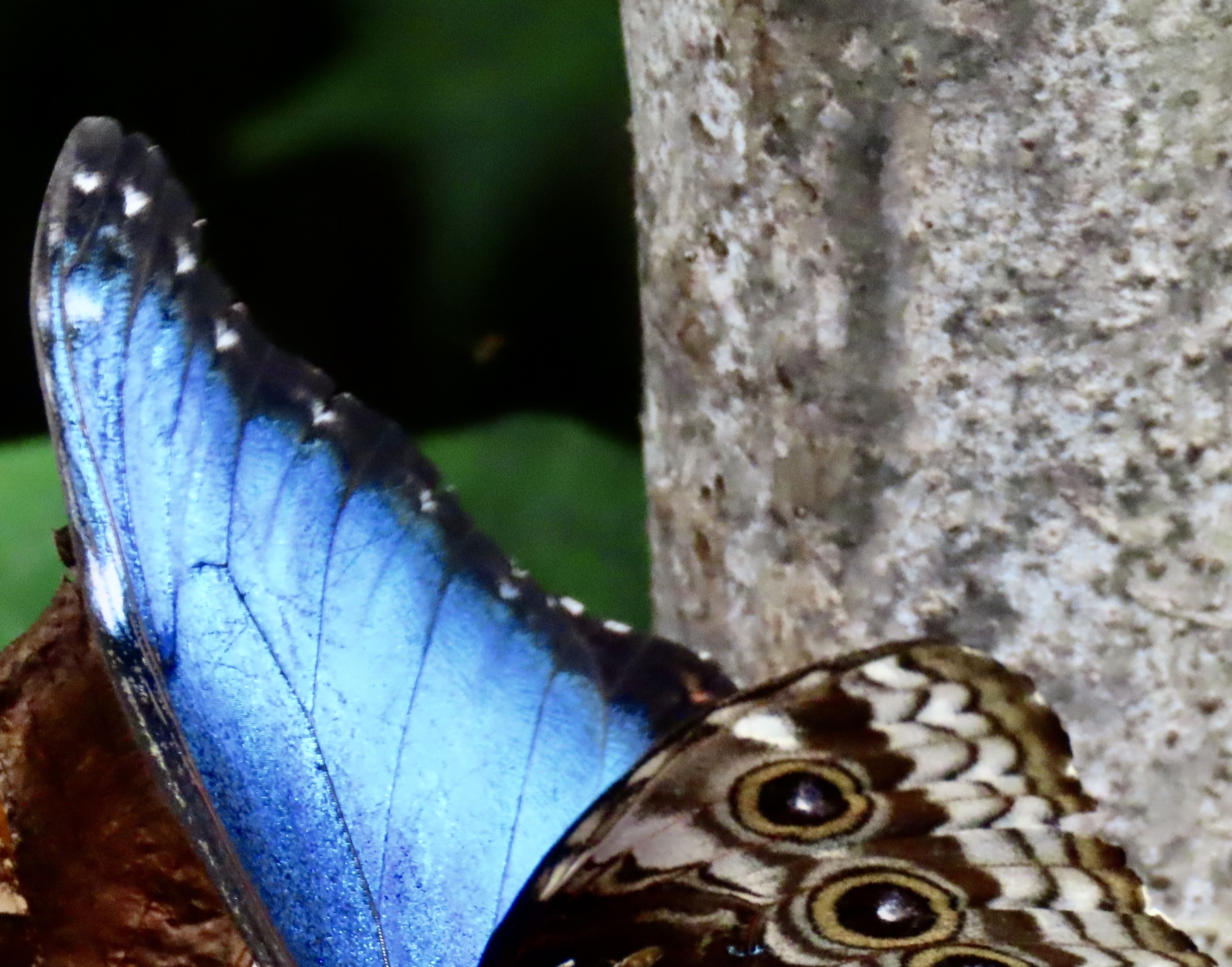
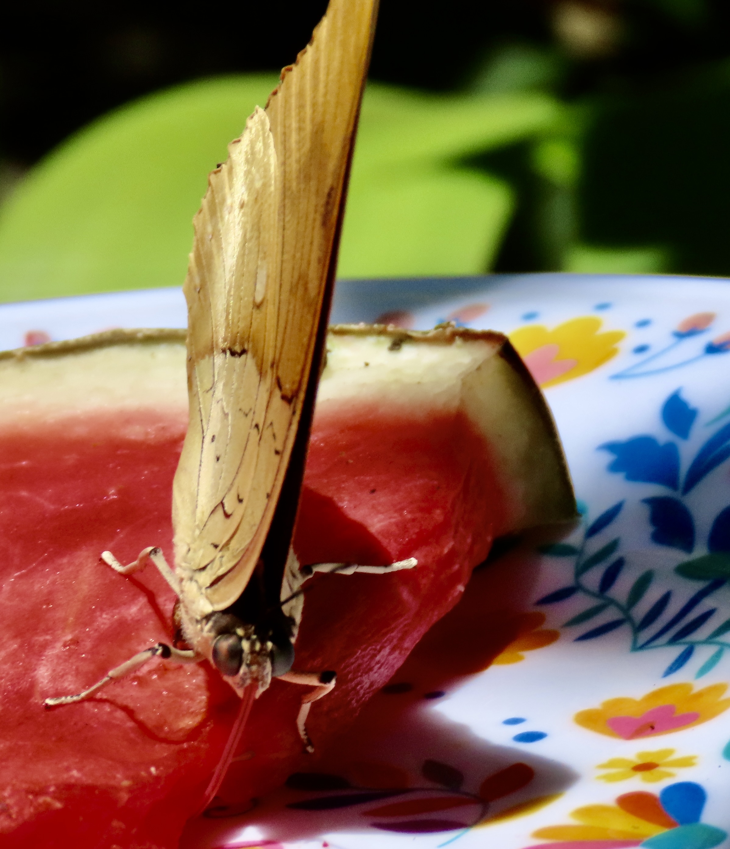
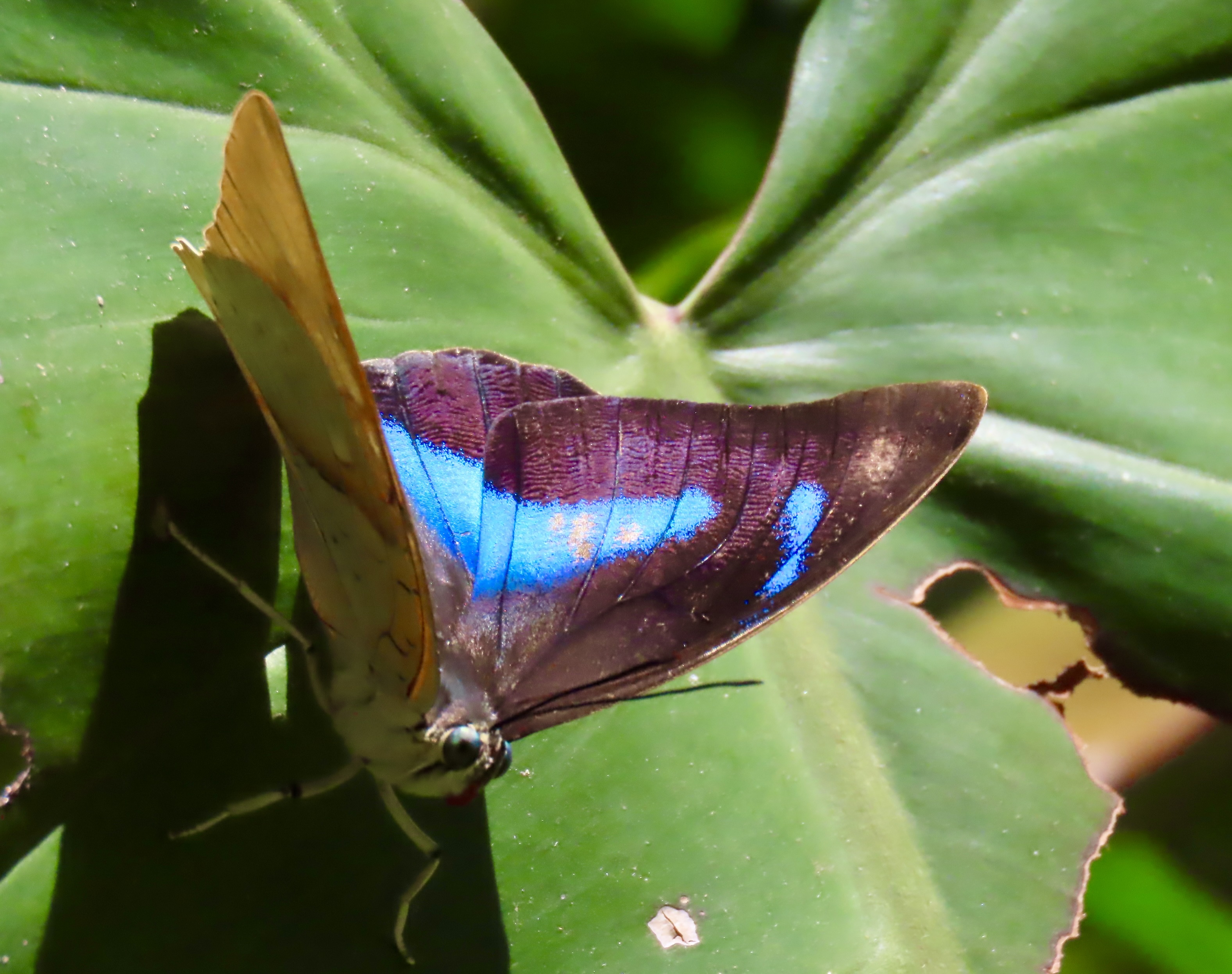
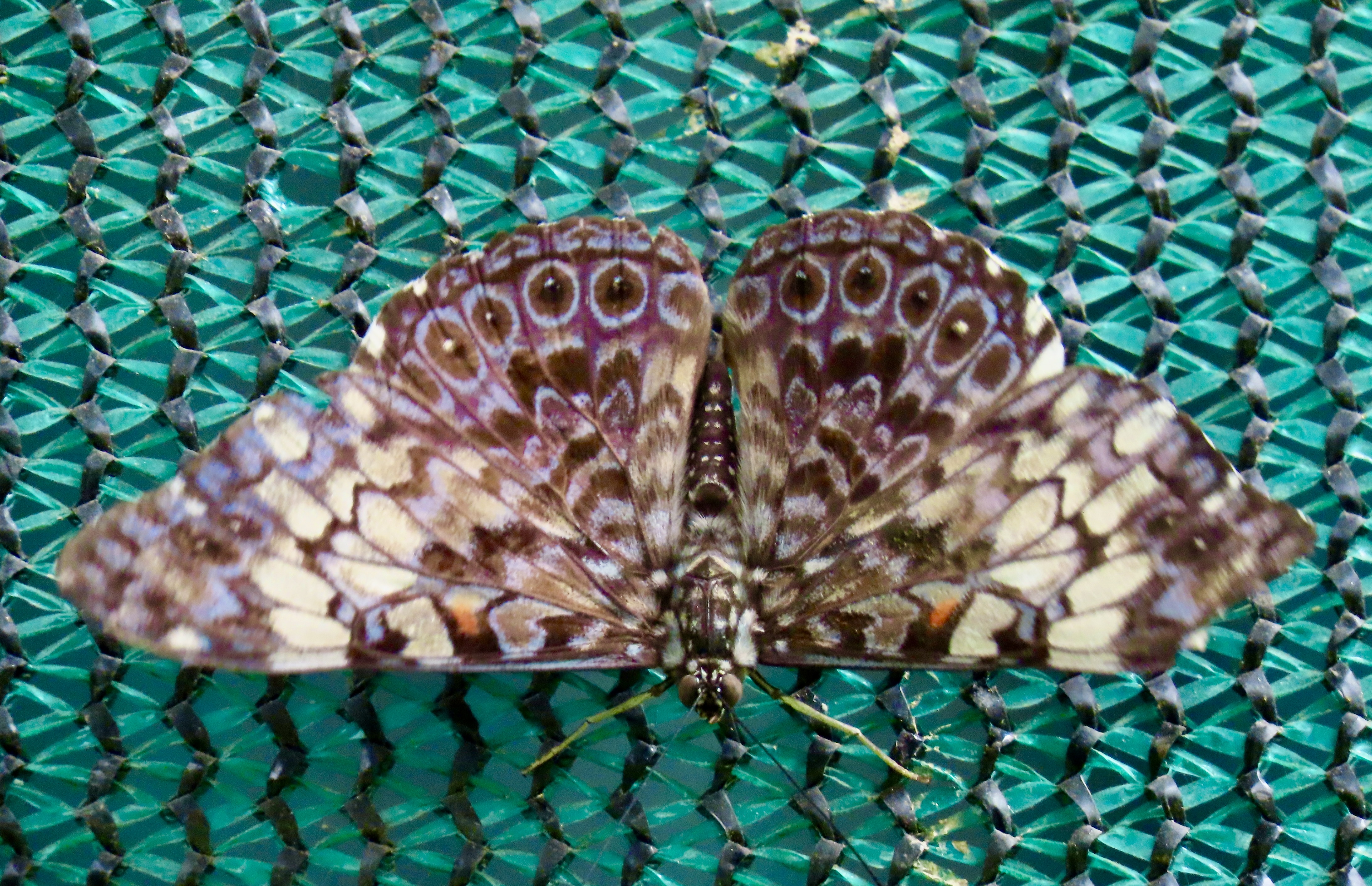
The eggs hatch into tiny caterpillars that come with a voracious appetite and quickly grow in size. Molting frequently, they change their looks each time. The caterpillar on the right is a younger version of the caterpillar on the left. The large hole in the banana leaf is why the big caterpillar is so big. It’s also the reason why banana farmers aren’t particularly fond of these insects that can grow 5 to 6 inches long off of devouring their plants before entering their chrysalis stage.From the perspective of the banana leaf, these owl caterpillars must look like one long gut approaching. The biggest one is about to enter the chrysalis stage of the metamorphous from caterpillar to butterfly. The first step is for to dissolve into a nutrient rich goop. Specialized cells that survive the melting process then utilize the nutrients to develop into the adult butterfly.The owl butterfly is quite beautiful when seen from above with its wings in open position. Here it was busy consuming watermelon that staff had left out for it. On the right is another one of Costa Rica’s best known butterflies, the blue morpho.Here a number of blue morpho are simultaneously hatching out of their chrysalis at a special hatching station that the Monteverde Butterfly Garden maintains for this purpose. Their wings have to dry and harden before they are ready to fly.Peggy found this blue morph chrysalis looking leaflike out in the Monteverde Butterfly Gardens. The chrysalis of the owl butterfly, btw, resembles the head of a viper. Both the leaf and the viper chrysalises are two more examples of evolutionary mimicry.A blue morph resting on leaves.A blue morpho gave us a brief glimpse of the vibrant blue color of its inner wing that gives the butterfly its name.
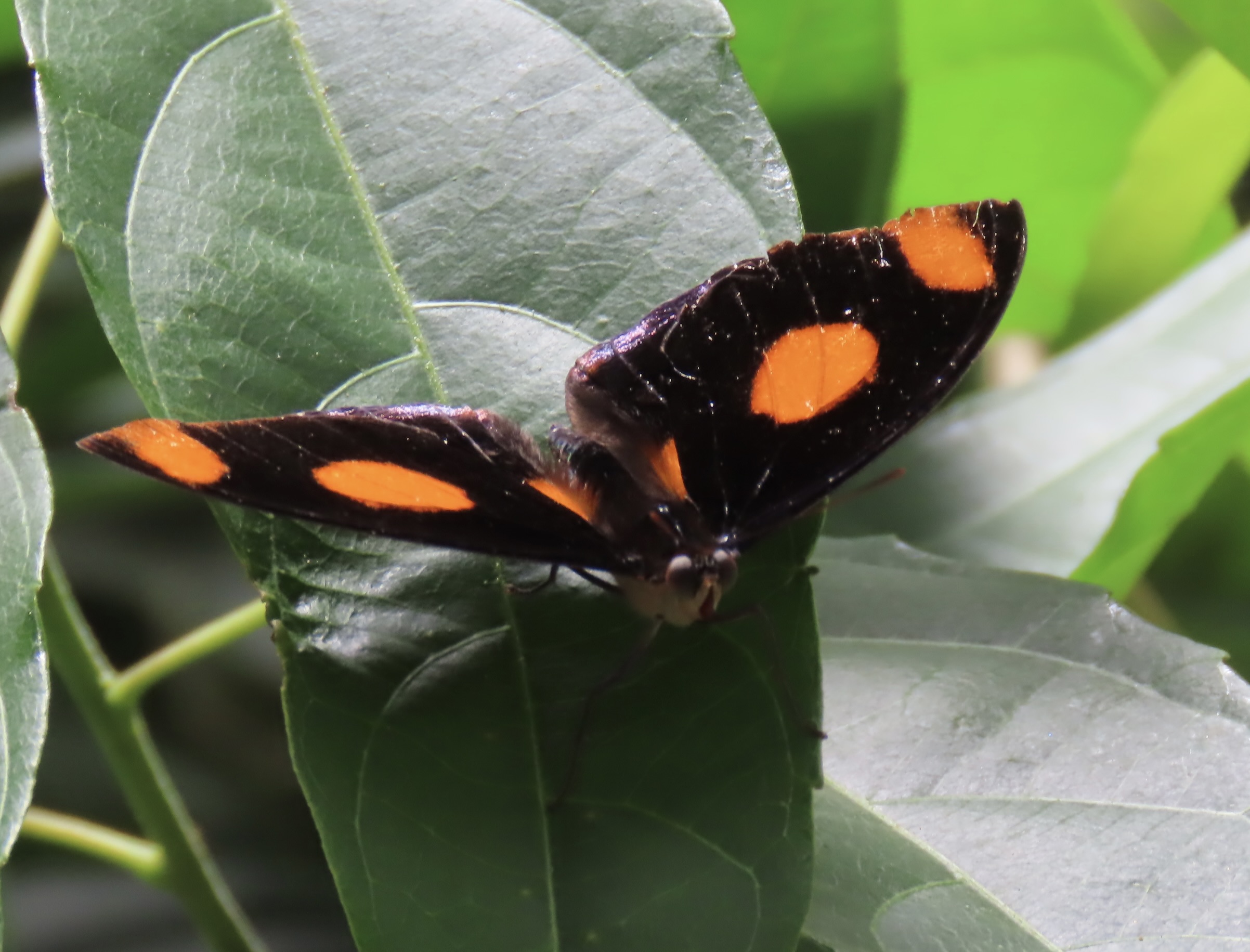
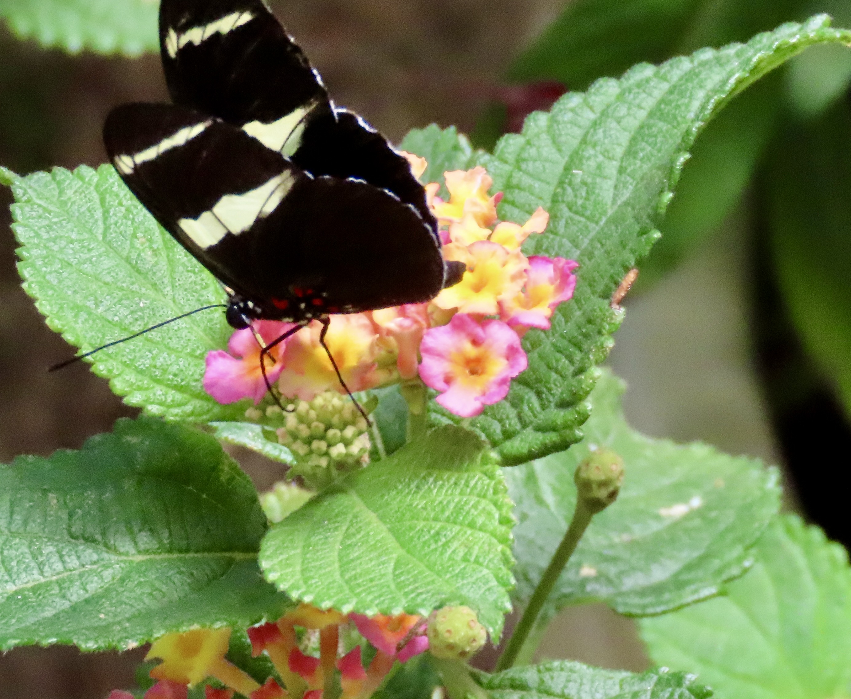
And now, for a quick look at some of the other beauties we photographed at the Monteverde Butterfly Gardens. Given that there are between 1200 and 1500 species of butterflies in Costa Rica, I’m late with this post, and my mind is on butterfly overload, I didn’t have time to pin down all the names.
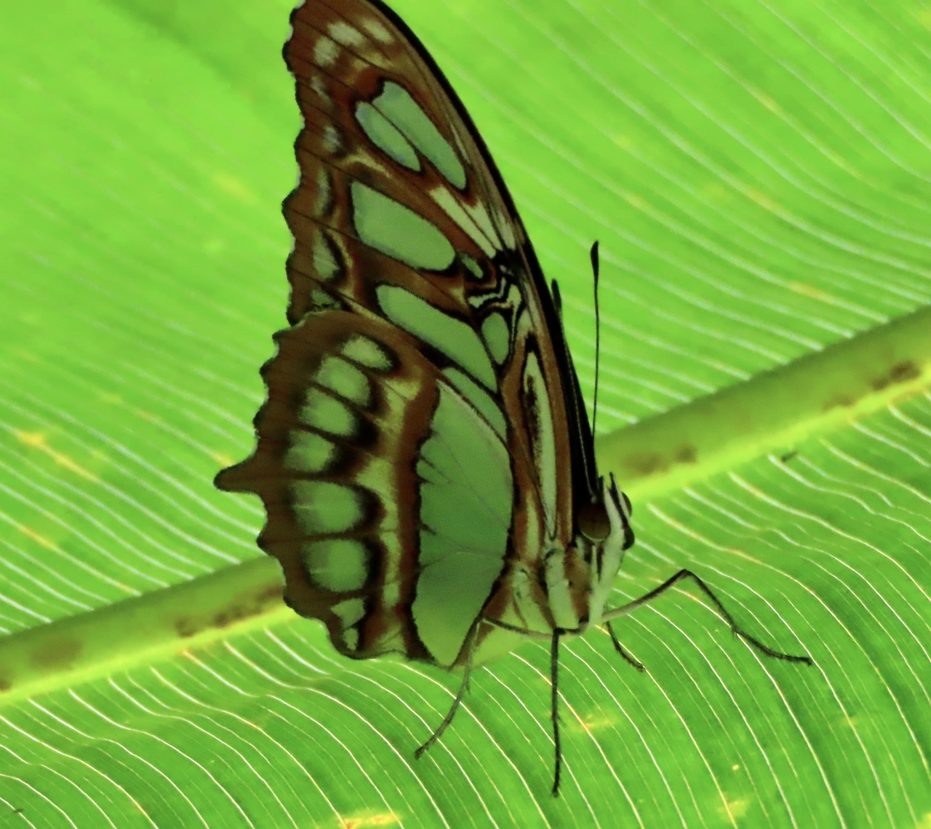
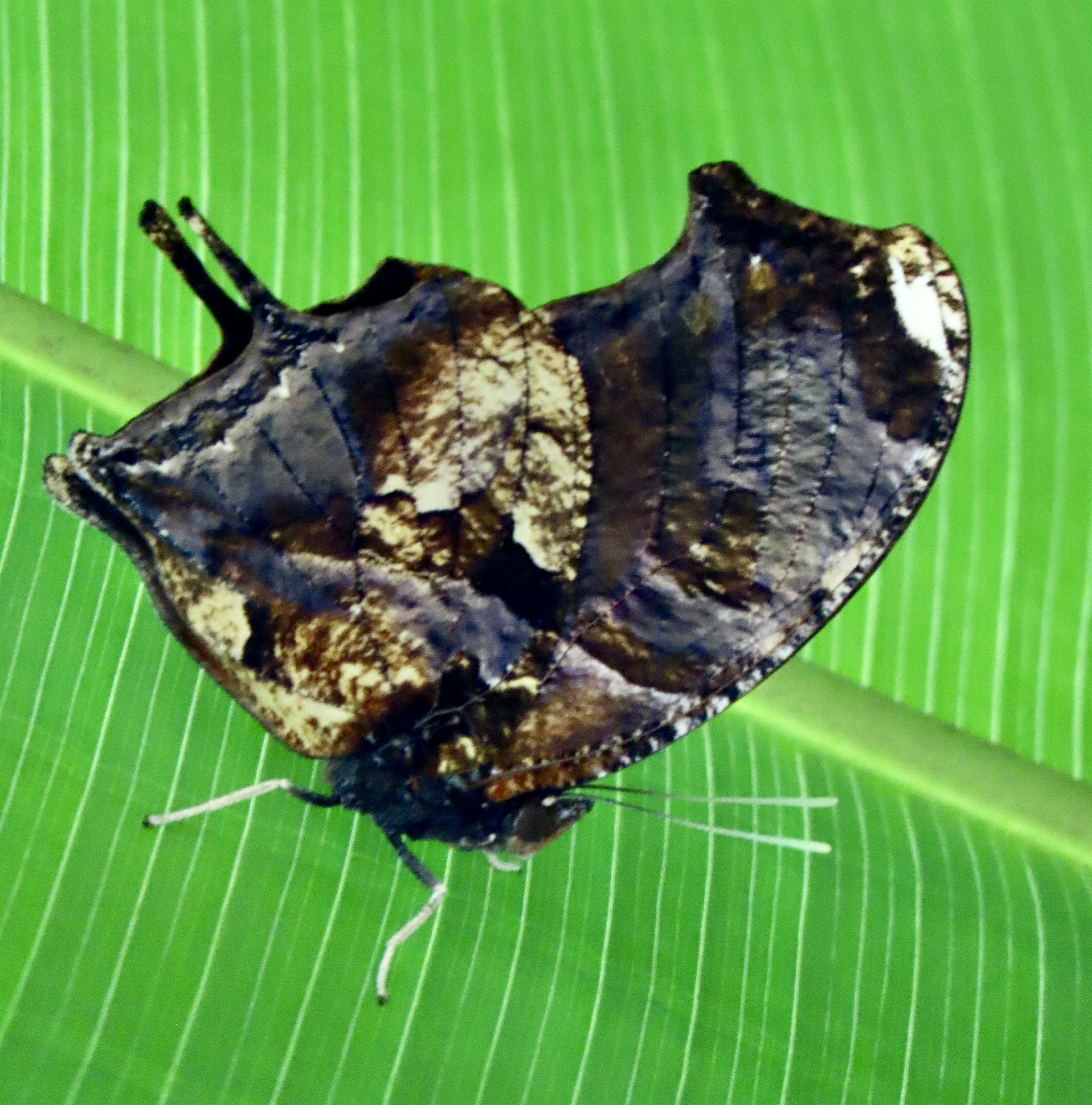
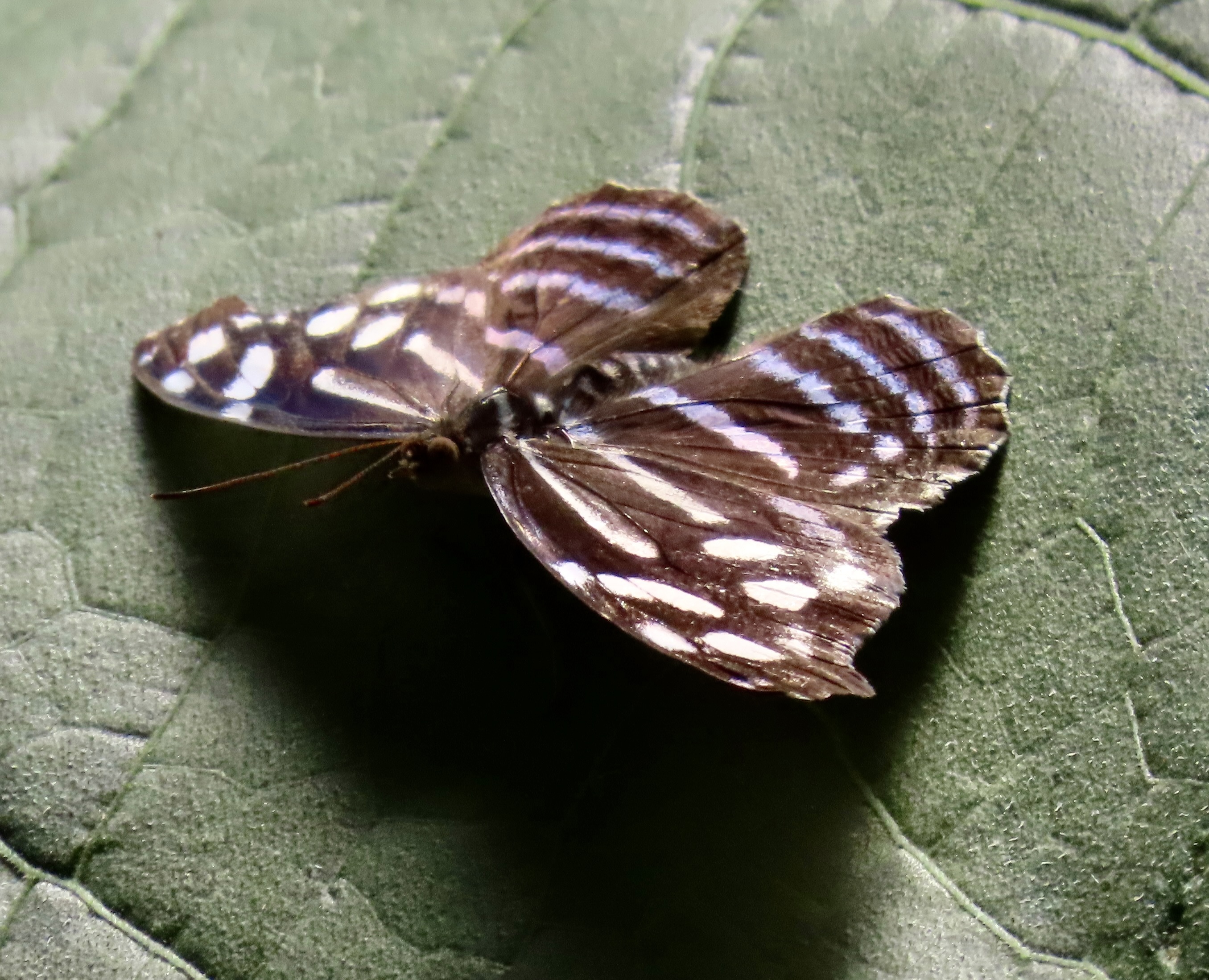
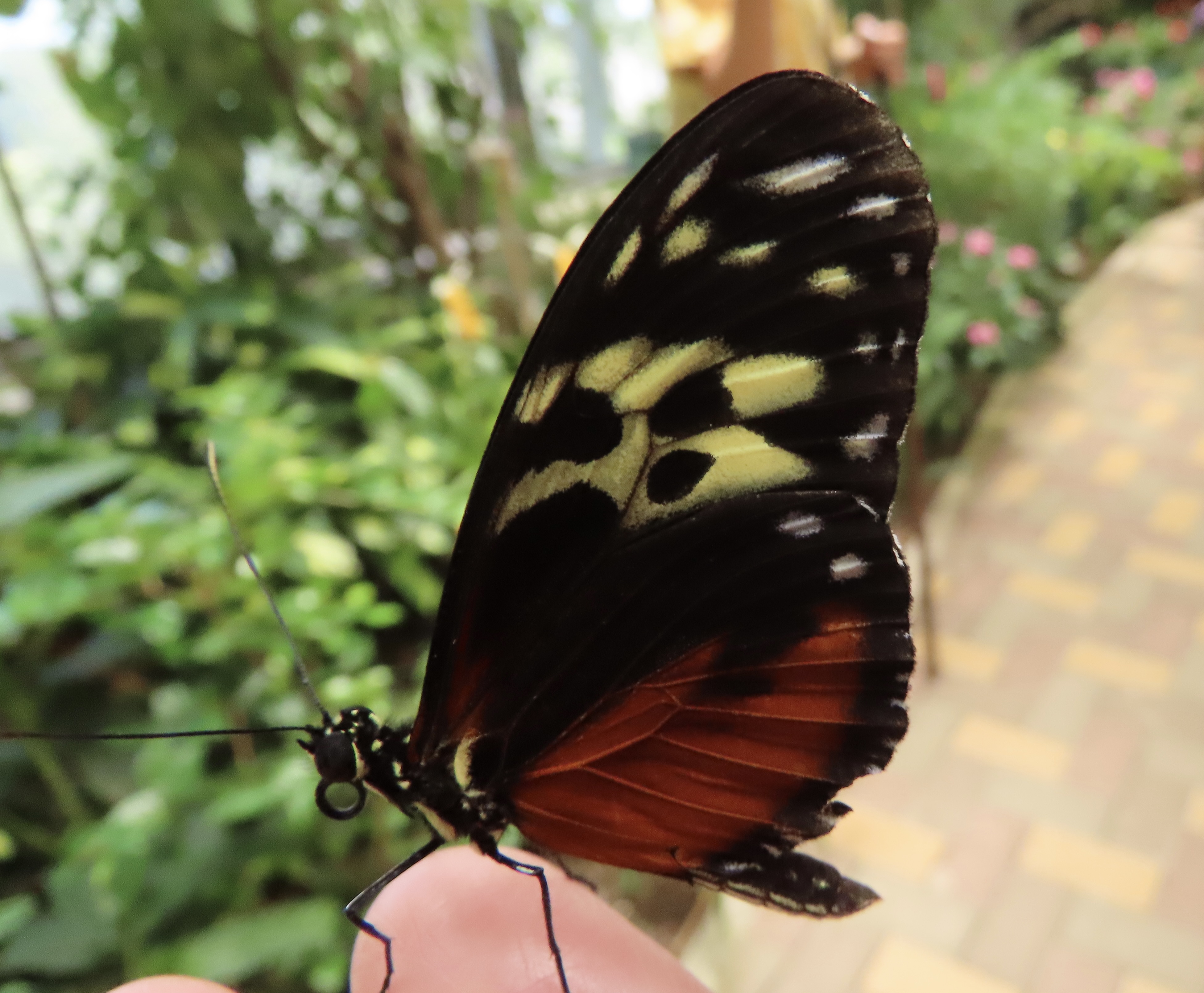
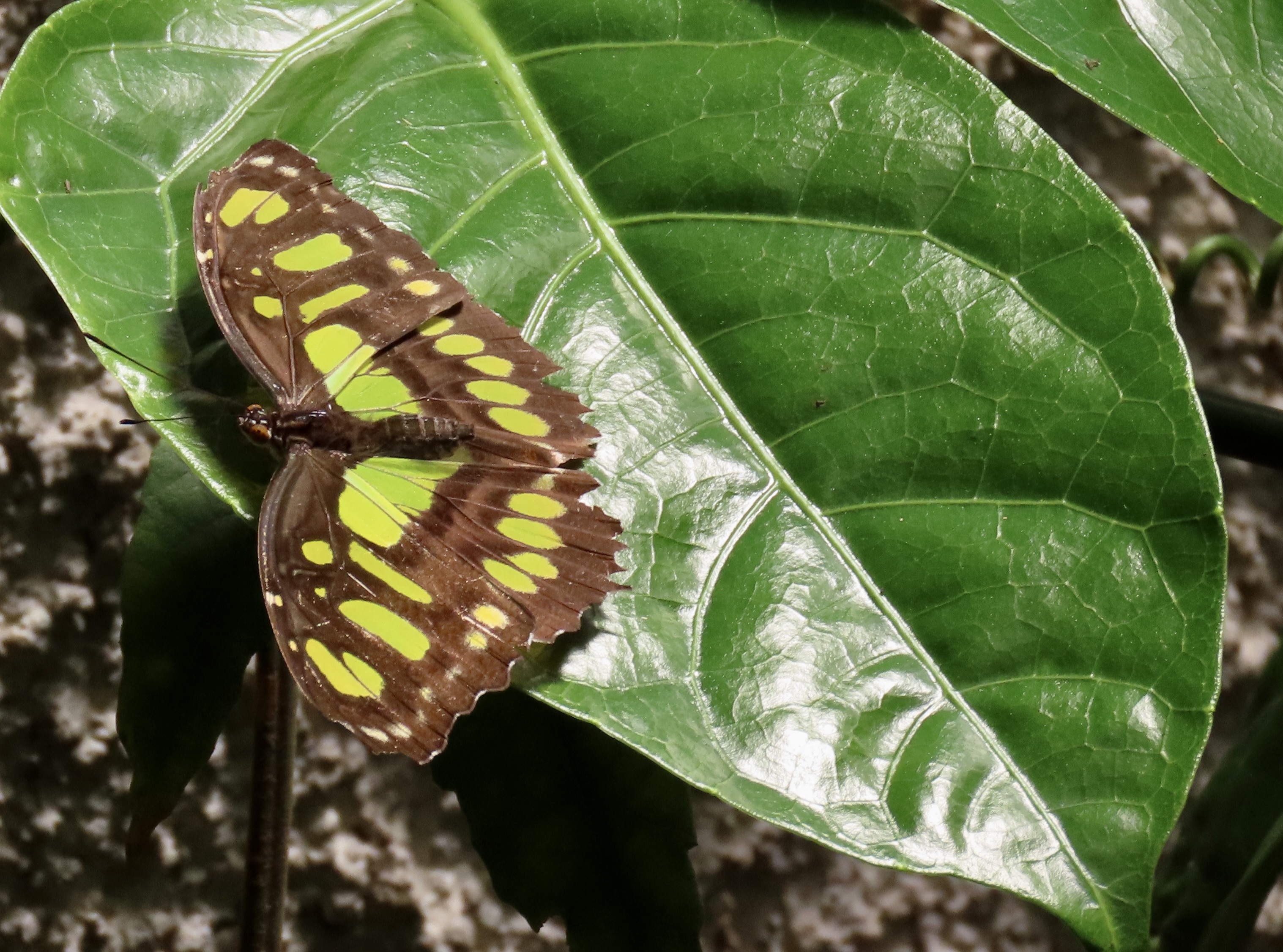
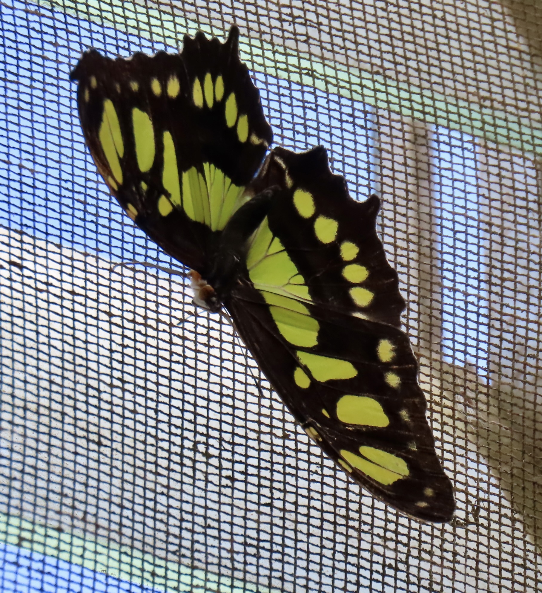
Set off by green, a Green Longwing Butterfly. Great camouflage. One of a number of butterflies that pretend to be dead leaves. This may be excellent camouflage on leaf litter covered forest floor. Not so good here.Red spots. This may be a ‘see me, see me’ look as opposed to camouflage. The caterpillars of some butterflies feast on plants that are poisonous to birds, lizards and other predators. The poison is transferred to the butterfly. Instead of hiding, the butterfly, announces its presence with bright colors that are designed to tell predators ‘You really don’t want to eat me.’ Other butterflies may adopt the same colorization in what is known as Batesian mimicry. They aren’t poisonous, but who’s to know the difference?Lunch. Butterflies, unlike caterpillars, sip nectar with their long proboscis instead of eating leaves. This is a HeliconiusSara (I think.)This sulfur colored butterfly is using its proboscis to sip watermelon juice. Note the color of the proboscis. Many Costa Rican butterflies take advantage of fallen, rotting (translate fermenting) fruit for food. They can actually become a little tipsy.This one looks like the same species as above with its wings open.Brown on green.I call this a finger butterfly since it landed on Peggy’s finger and refused to get off. It may be a Crimson Longwing.I’m going with a Malachite Butterfly on this one.And this one as well even through the colors are dramatically different. But note how close the pattern of their spots is. The butterflies often rested on the screens that kept them in the butterfly houses. Maybe they were longing to be free.Peggy’s favorite, a Starry Night Cracker Butterfly.And a final beauty. This is a Variable Cracker Butterfly. The unusual cracker name is said to come from the noise they make when they are flying.As for what noise that is, I lifted this: “The Cracker butterfly gets its name because the males are able to produce a crackling sound, reminiscent of bacon cooking in a frying pan. They make the sound when they take off, by twanging a pair of spiny rods on their abdomen against their anal claspers.” Not sure about the anal clasper but it brings a vision to mind.
Next Post: It’s back to UT-OH with two more final tales about the Mekemson Gang. There’s the issue of how I lived up to Bertha Brays expectations about my leading her son astray (although there’s an issue of who led who.) And there’s a question about why Tony Pavy wanted to shoot me. It had to do with his pig.
I’d love to show you a photo of the Pond, or the Woods. Unfortunately I didn’t take any photos of either when I was young. I went back a few years ago to photograph the sites that were so important to my childhood— and life. The Pond had become a large gas station and the Woods had become a trailer park. It’s called progress. There was money to be made.
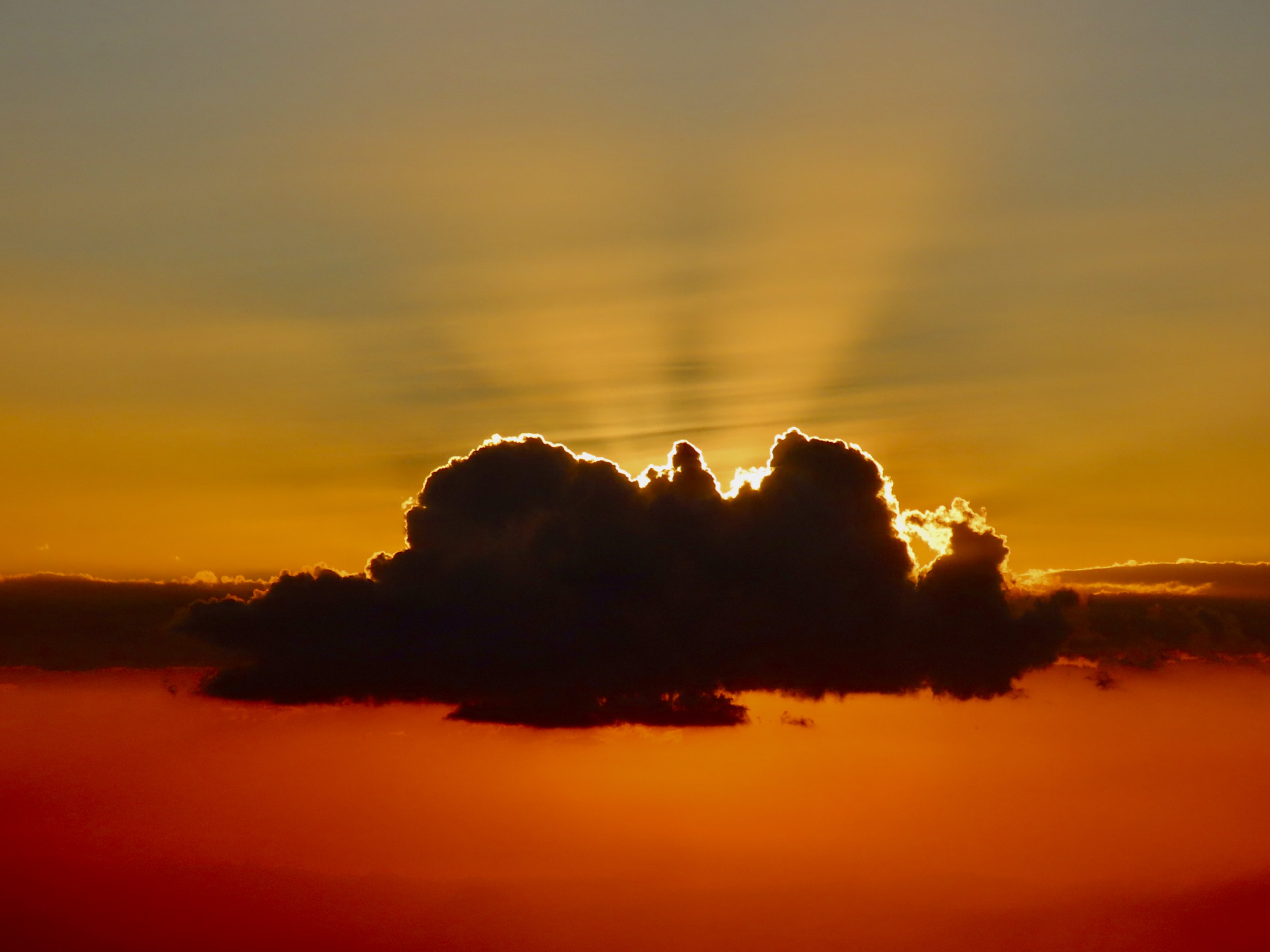
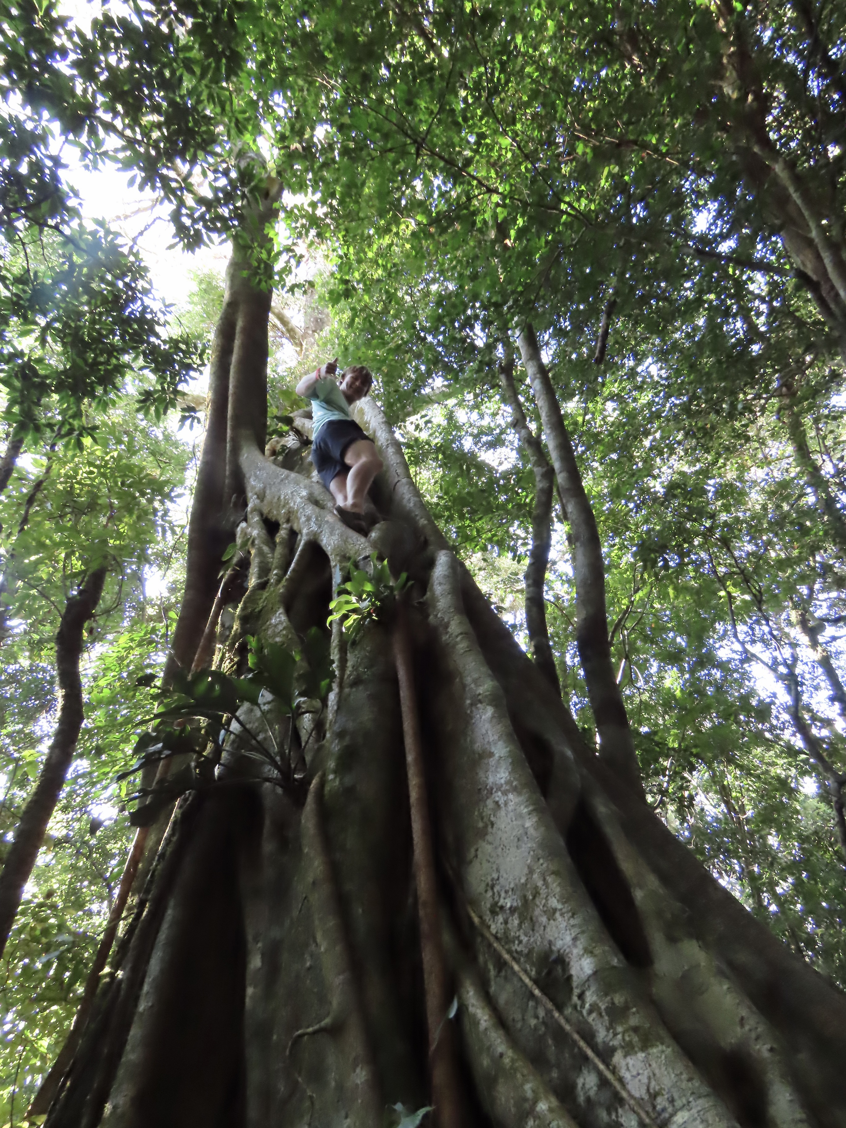
Instead you have a gorgeous sunset photo over Monteverde, Costa Rica taken by our grandson, Cooper, who is in the eighth grade. Our son, Tony, his wife, Cammie and their three boys, Connor, Chris, and Cooper have joined us this week. We are situated up on a high hill surrounded by rainforest. It even has vines that are safe to swing on and a view that looks all the way to the Pacific Ocean. We sent the boys out with our cameras to explore the surrounding woods and take photos of what they found most interesting. There are more pictures after today’s UT-OH tale.
Part 1: The Pond
There came a time when the Graveyard no longer met my wandering needs. I started traveling farther and farther afield, 15 minutes at a time. That’s how far the Pond and the Woods were away. They were where I played and, more importantly, where I developed a life-long love of the natural world. As such, they earned a capital P and capital W. First up: The Pond.
There were a number of ponds in the area. Oscar ‘Ot’ Jones had one on his ranch for cattle; Caldor had one where logs waited for their appointment with the buzz saw; Forni had one over the hill from his slaughterhouse, and Tony Pavy had one that was supposedly off-limits. But there was only one capital P Pond, the one next to the Community Hall. If I told Marshall, my parents or my friends I was going to the Pond, they knew immediately where I would be.
It was a magical place filled with catfish, mud turtles, bullfrogs and pirates. Although the Pond was small, it had a peninsula, island, deep channel, cattails and shallows. In the spring, redwing blackbirds nested in the cattails and filled the air with melodic sounds. Mallards took advantage of the island’s safety to set up housekeeping. Catfish used holes in the bank of the peninsula to deposit hundreds of eggs that eventually turned into large schools of small black torpedoes dashing about in frenetic unison. Momma bullfrogs laid eggs in strings that grew into chubby pollywogs. When they reached walnut size, tiny legs sprouted in one of nature’s miracles of transformation. Water snakes slithered through the water with the sole purpose of thinning out the burgeoning frog population. I quickly learned to recognize the piteous cry of a frog being consumed whole. Turtles liked to hang out in the shallows where any log or board provided a convenient sunning spot. They always slid off at our appearance but a few quiet minutes would find them surfacing to reclaim lost territory.
By mid-summer the Pond would start to evaporate. The shallow areas surrendered first, sopped up by the burning sun. Life became concentrated in a few square yards of thick, tepid water, only inches deep and supported by a foot of squishy mud. All too soon the Pond was bone-dry with mud cracked and curled. Turtles, snakes and frogs crawled, slithered and hopped away to other nearby water. Catfish dug their way into the mud and entered a deep sleep, waiting for the princely kiss of winter rains. Ducks flew away quacking loudly, leaving only silence behind.
Fall and winter rains found the Pond refilling and then brimming. Cloudy, gray, wind-swept days rippled the water and created a sense of melancholy that even an eight-year-old could feel.
But melancholy was a rare emotion for the Pond. To us, it was a playground with more options than an amusement park. A few railroad ties borrowed from Caldor and nailed together with varying sized boards made great rafts for exploring the furthest, most secret corners of the Pond. Imagination turned the rafts into ferocious pirate ships that ravaged and pillaged the far shores, or primitive bumper cars guaranteed to dunk someone, usually me.
In late spring, the Pond became a swimming hole, inviting us to test still cold waters. One spring, thin ice required a double and then triple-dare before we plunged in. It was a short swim. Swimsuits were always optional and rarely worn. I took my first swimming lessons there and mastered dog paddling with my cocker spaniel, Tickle, providing instructions. More sophisticated strokes would wait for more sophisticated lakes.
Frogs and catfish were for catching and adding to the family larder. During the day, a long pole with fishing line attached to a three-pronged hook and decorated with red cloth became irresistible bait for bullfrogs. At night, a flashlight and a spear-like gig provided an even more primitive means of earning dinner. The deep chug-a-rums so prominent from a distance became silent as we approached. Stealth was required. A splash signified failure as our quarry decided that sitting on the bottom of the Pond was preferable to joining us for dinner.
Victory meant a gourmet treat, frog legs. Preparation involved amputating the frog’s hind legs at the hips and then pealing the skin off like tights. It was a lesson I learned early: If you catch it, you clean it. We were required to chop off the big feet as well. Mother didn’t like being reminded that a happy frog had been attached hours earlier. She also insisted on delayed gratification. Cooking the frog legs on the same day they were caught encouraged them to jump around in the frying pan. “Too creepy!” she declared.
Catching catfish required nerves of steel. We caught them by hand as they lurked with heads protruding from their holes in the banks. Nerves were required because the catfish had serious weapons, needle sharp fins tipped with stingers that packed a wallop. They had to be caught exactly right and held firmly, which was not easy when dealing with a slimy fish trying to avoid the frying pan. But their taste was out of this world and had the slightly exotic quality of something that ate anything that couldn’t eat them.
Next up on Wednesday: The Woods. On Friday, we will focus on some of our Costa Rica adventures.
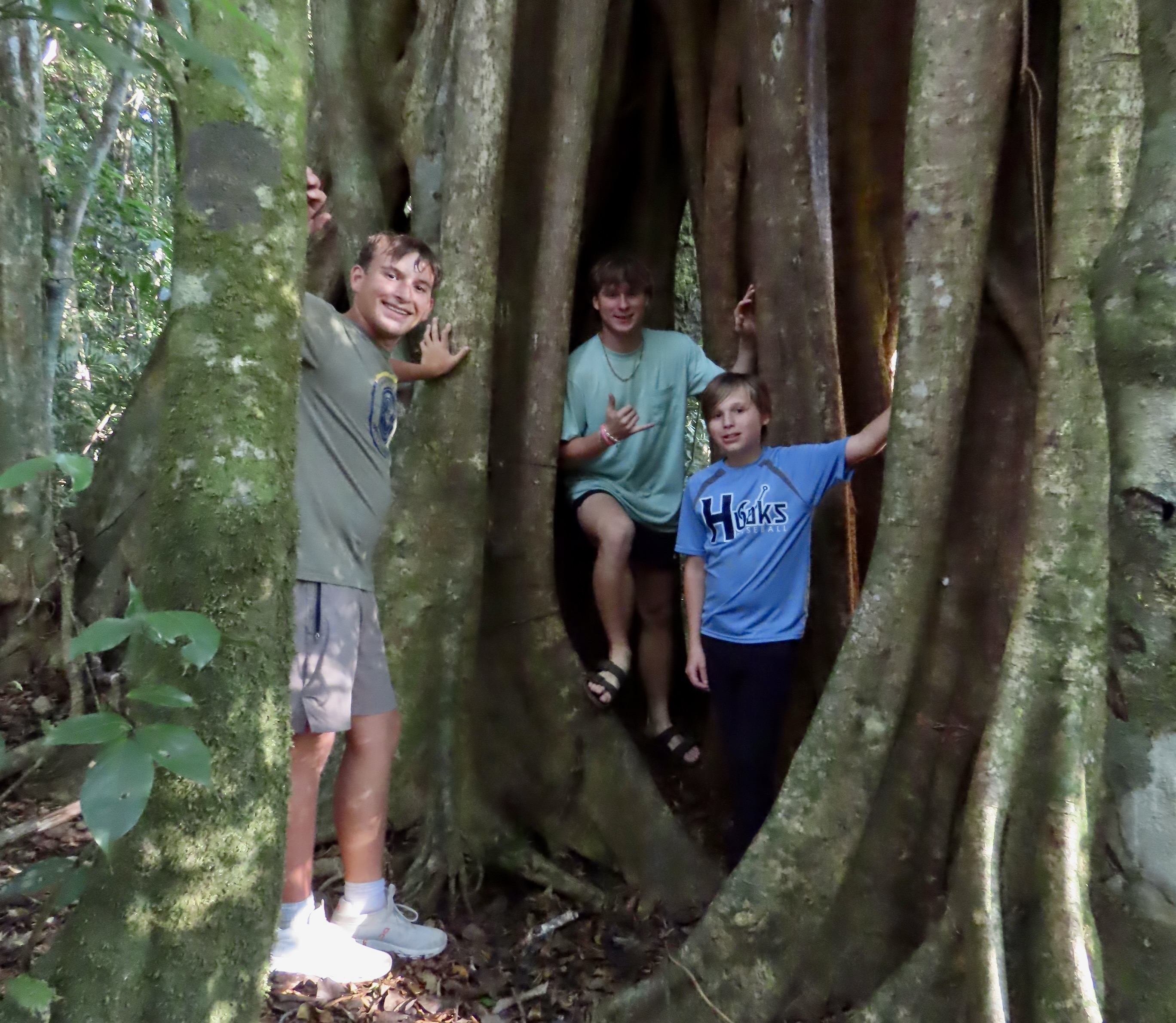
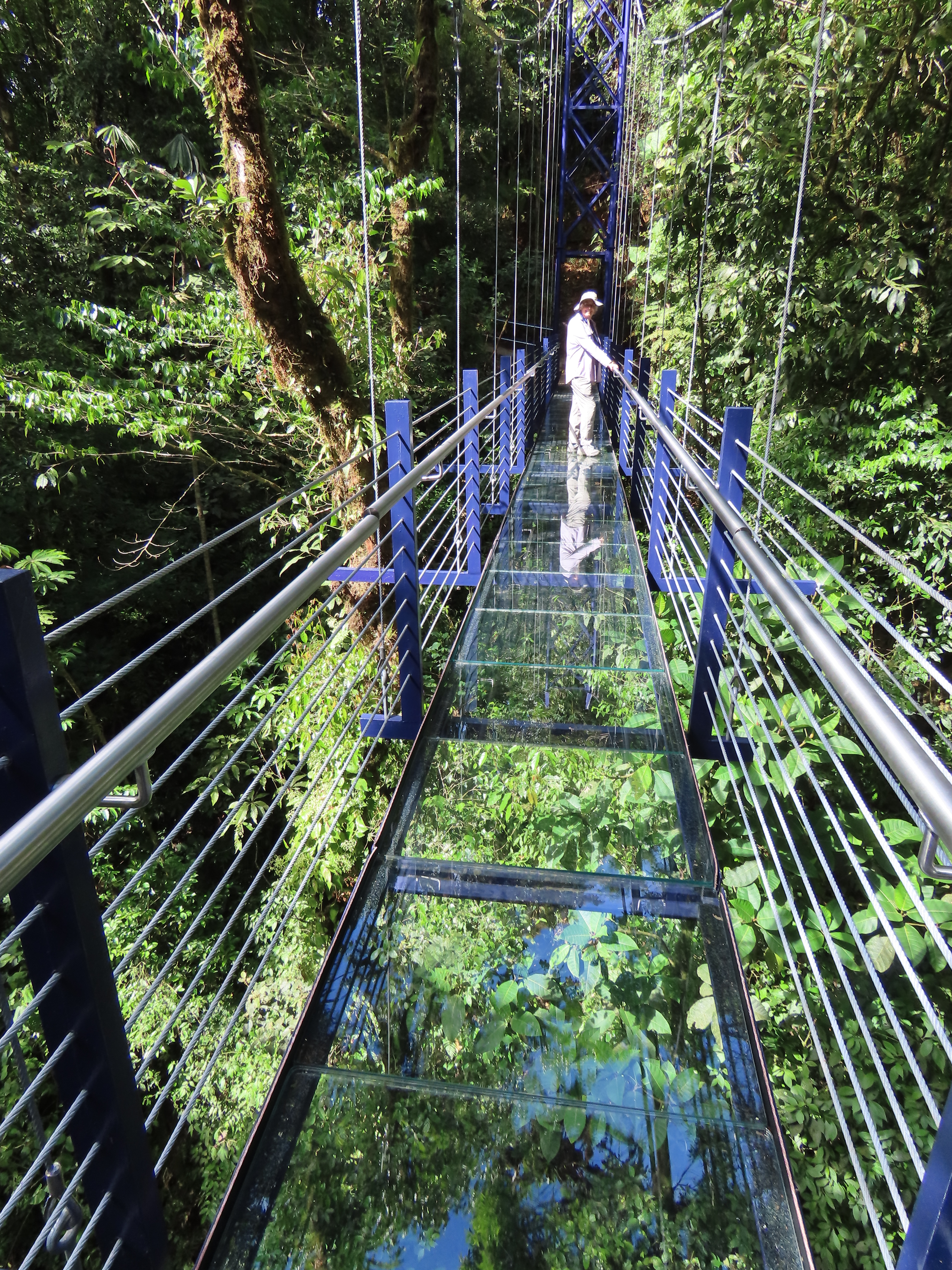
Chris, who is a sophomore in high school, had watched a capybara as it disappeared into the woods. Later when he was visiting a waterfall, one did him the courtesy of hanging out long enough for a photo.Connor, who is a junior, actually preferred to have a photo of himself taken up a banyan tree without a ladder. His passion for high places reminds us of his dad when he was his age. Here are the boys together at the base of the banyan tree: Chris on the left, Connor in the back, and Cooper on the right.Our other activity of the day was to explore the forest canopy on hanging bridges. There were 6 different bridges. This one had a glass bottom you could see the jungle below. That’s grandma, Peggy, down on the end. Next up on Wednesday, the Woods.
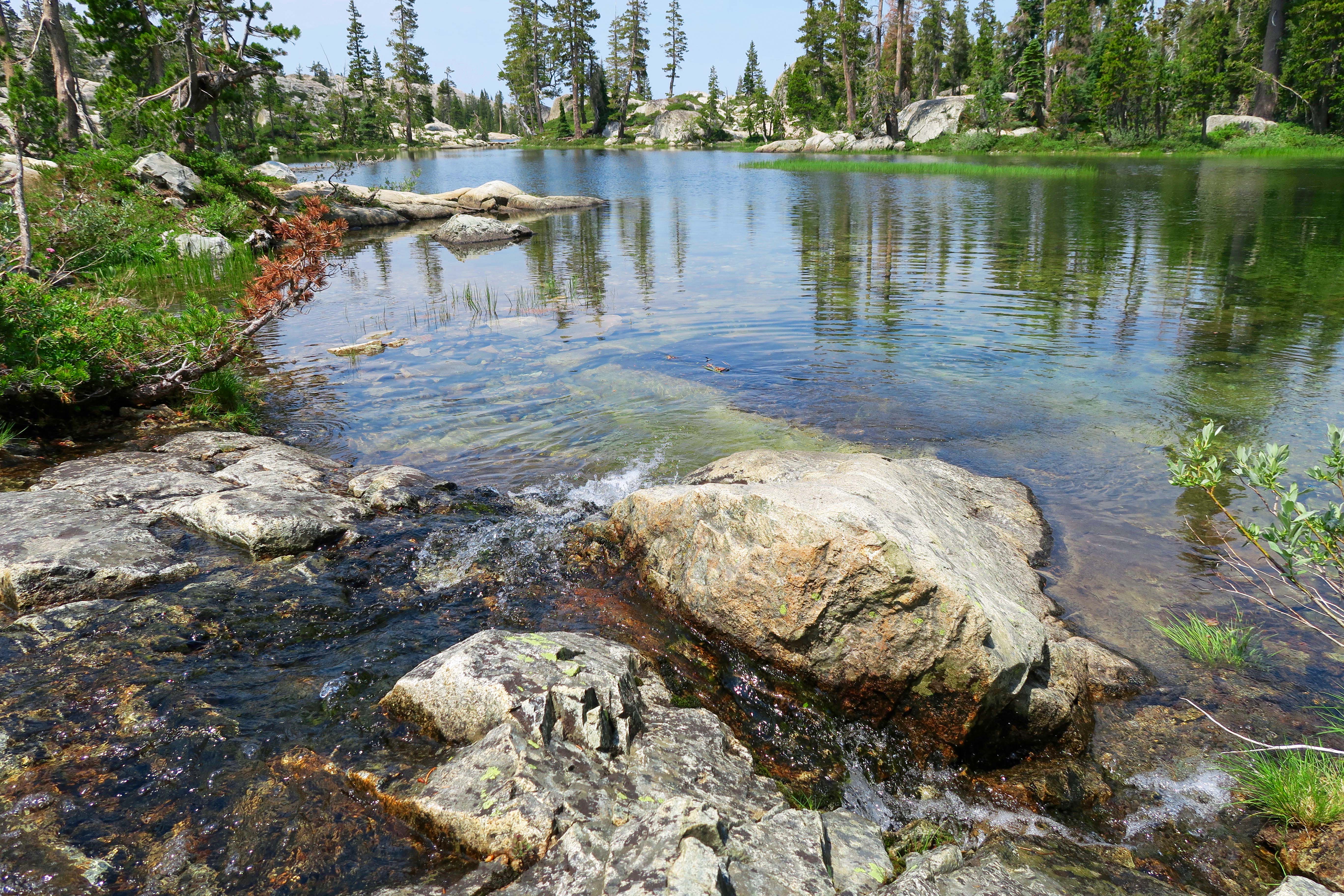
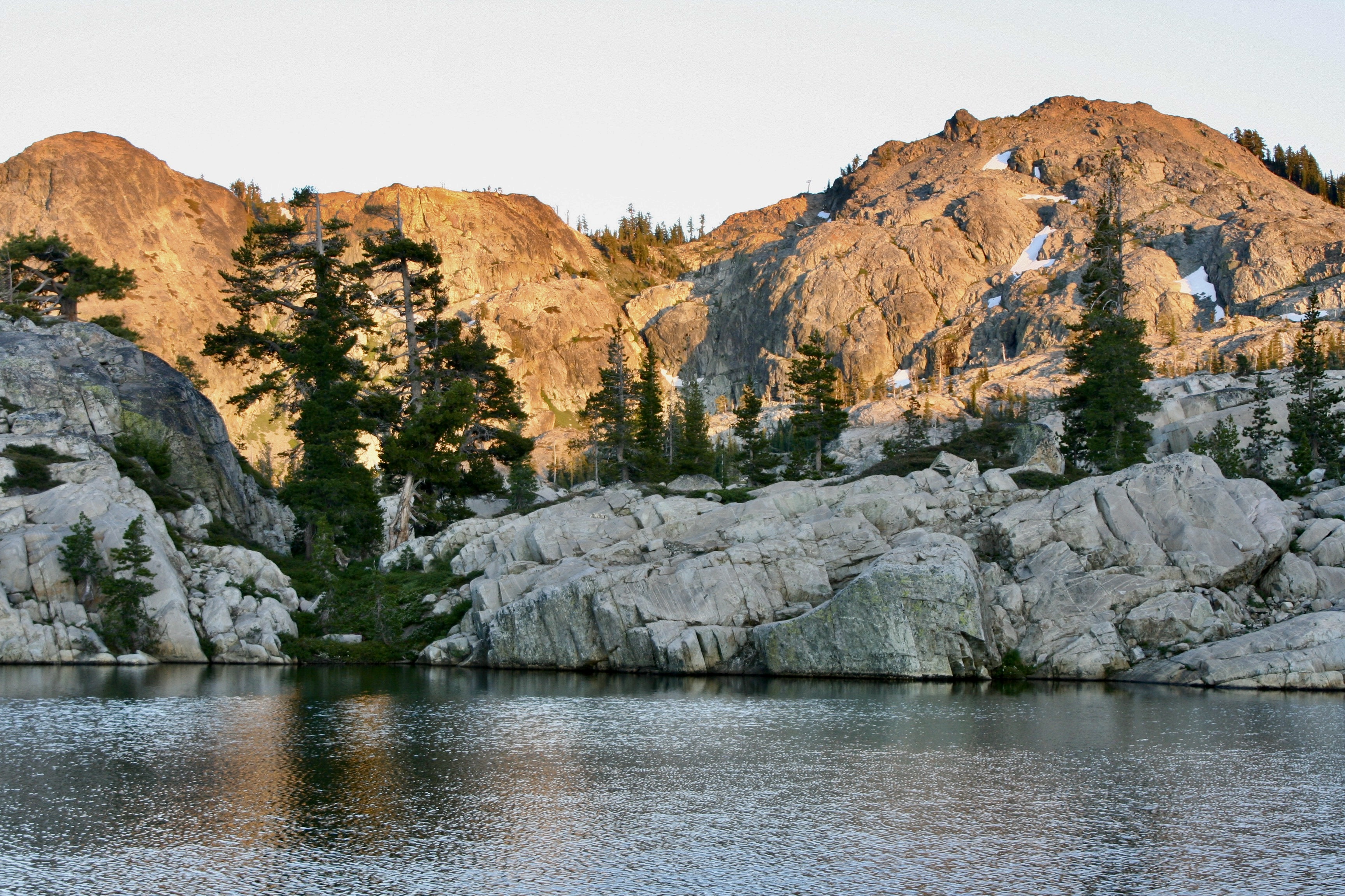
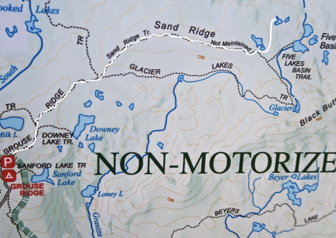
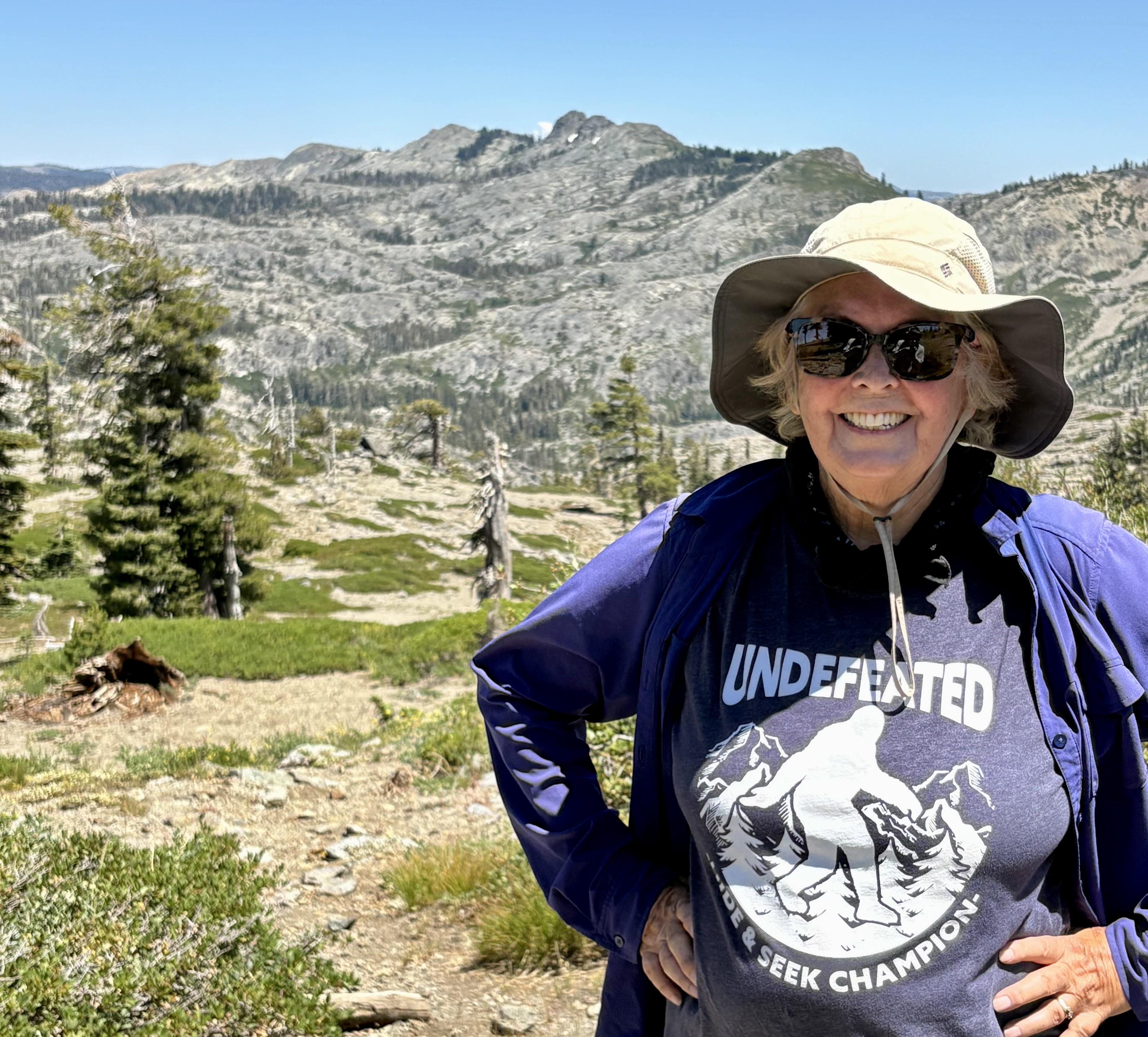
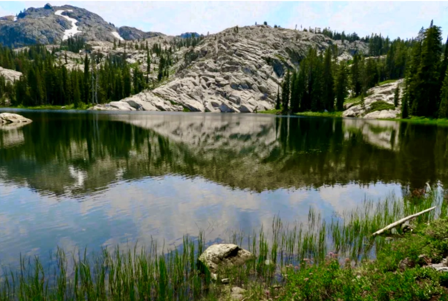
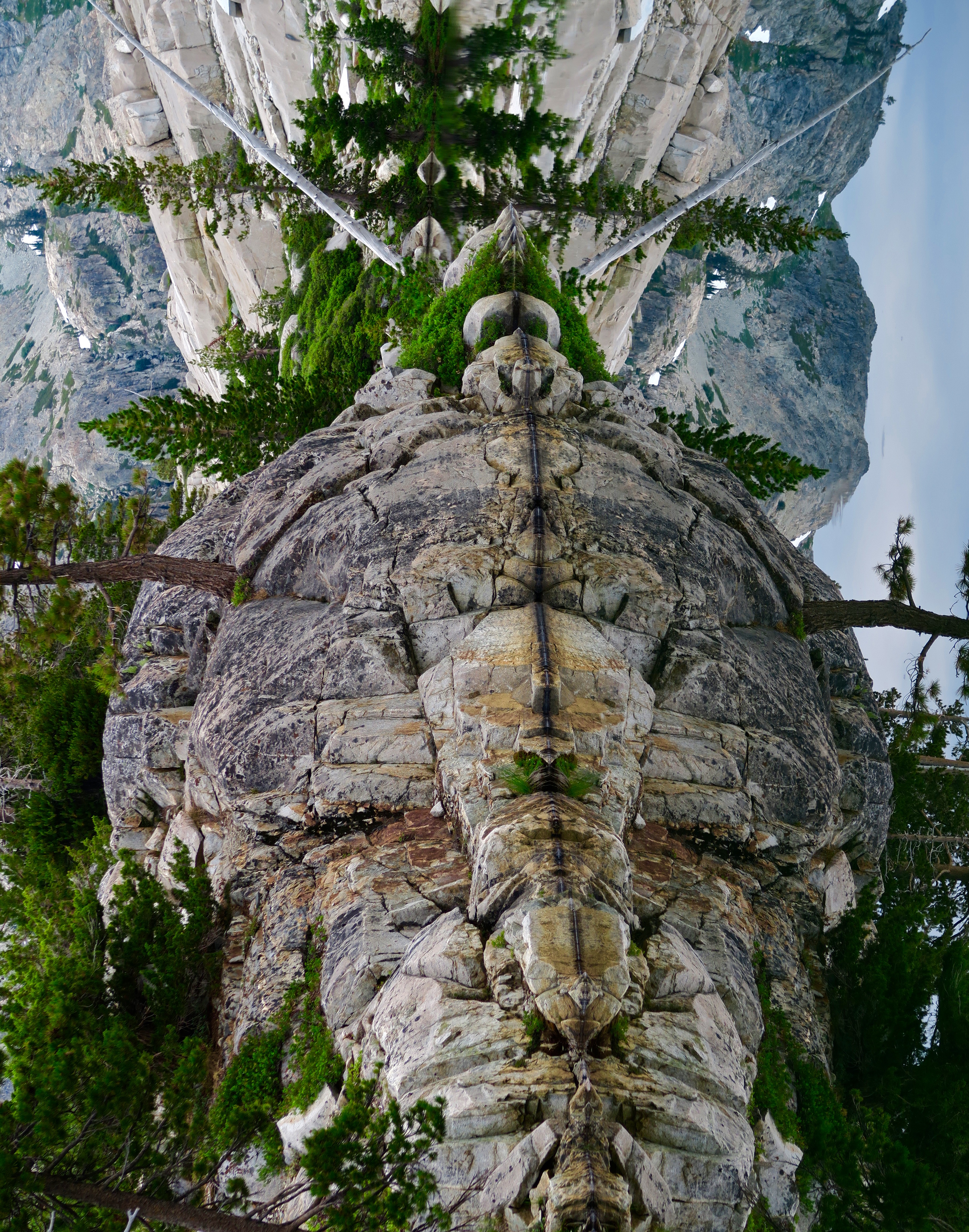
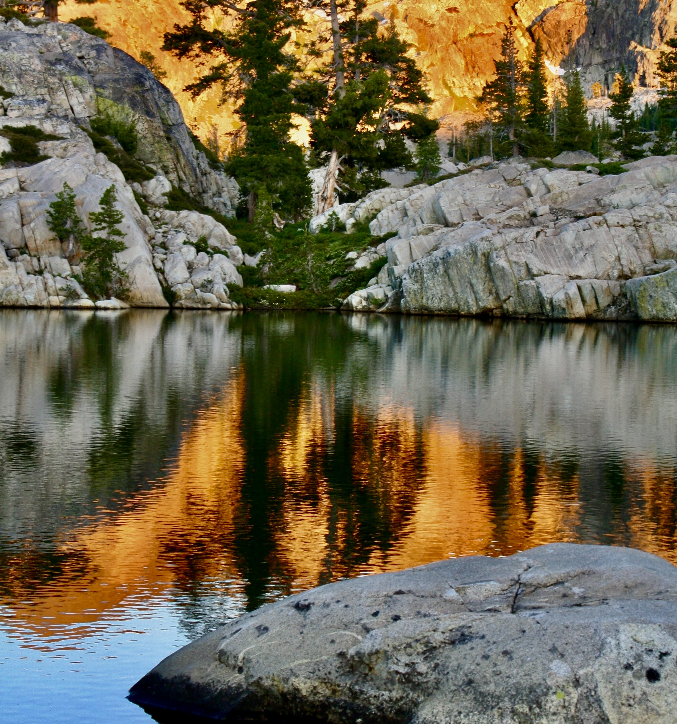
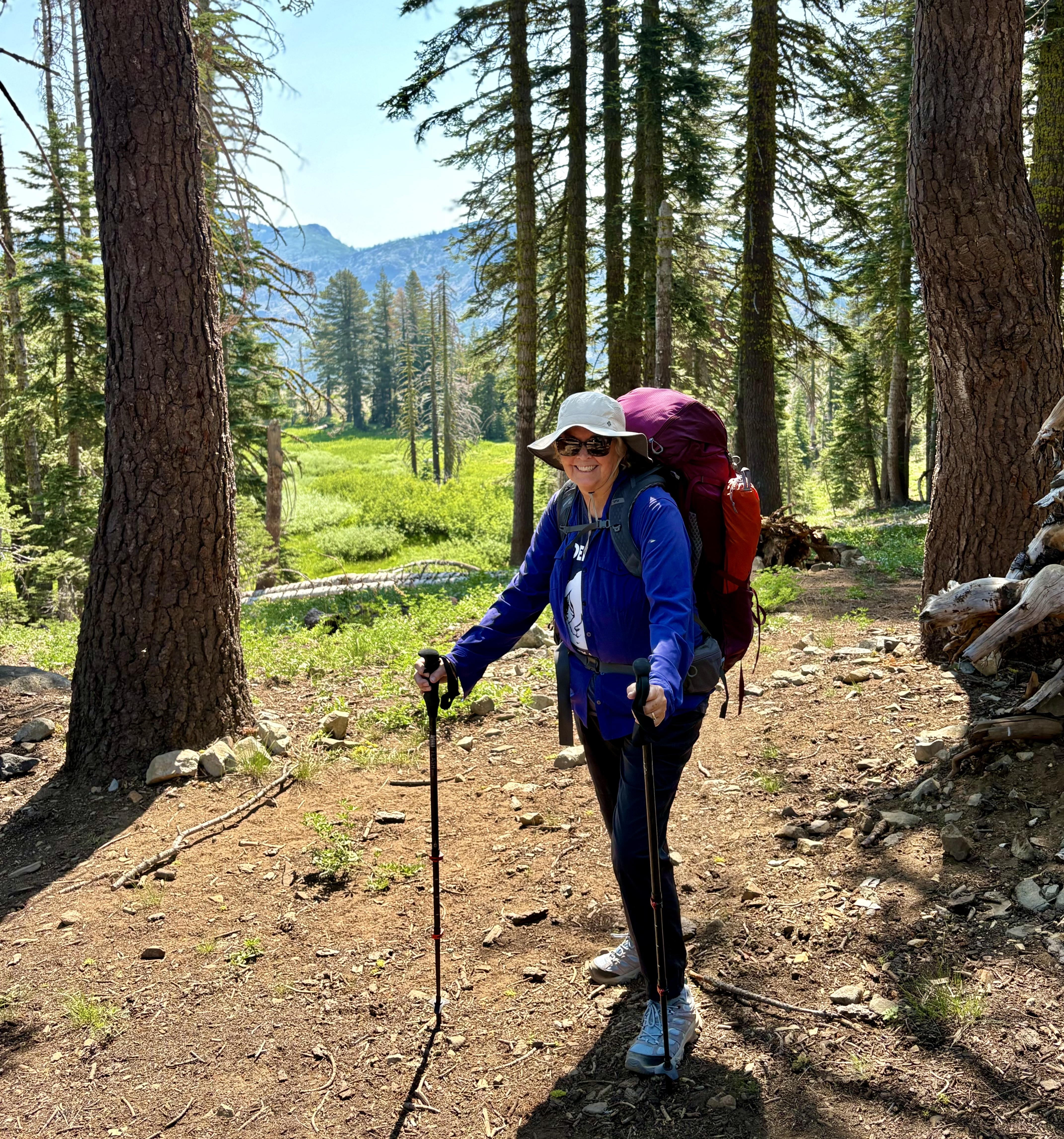
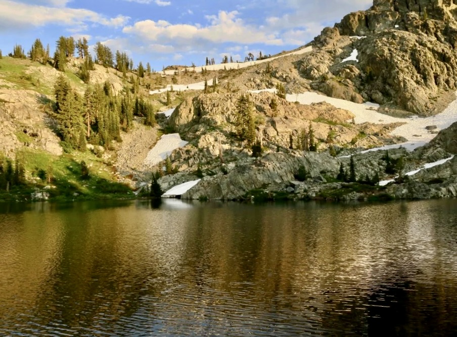
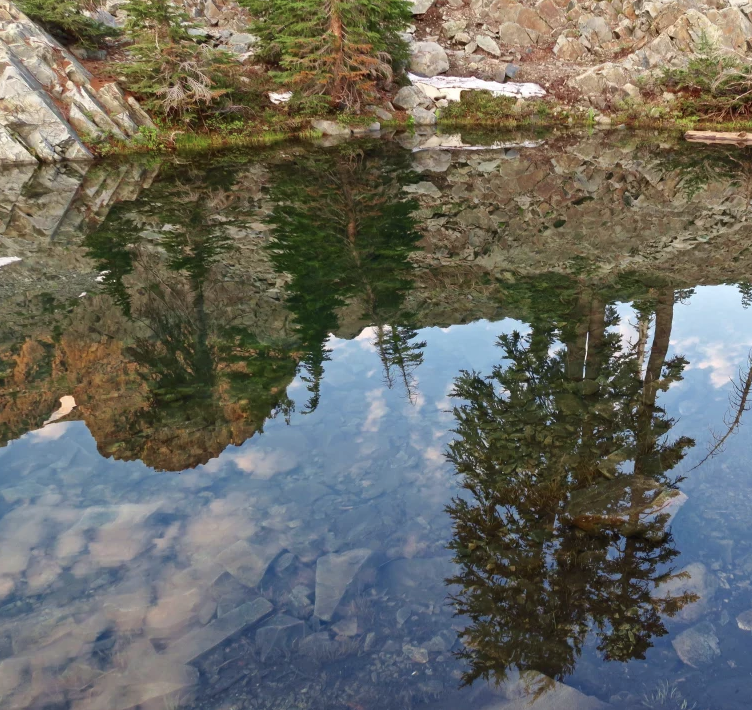
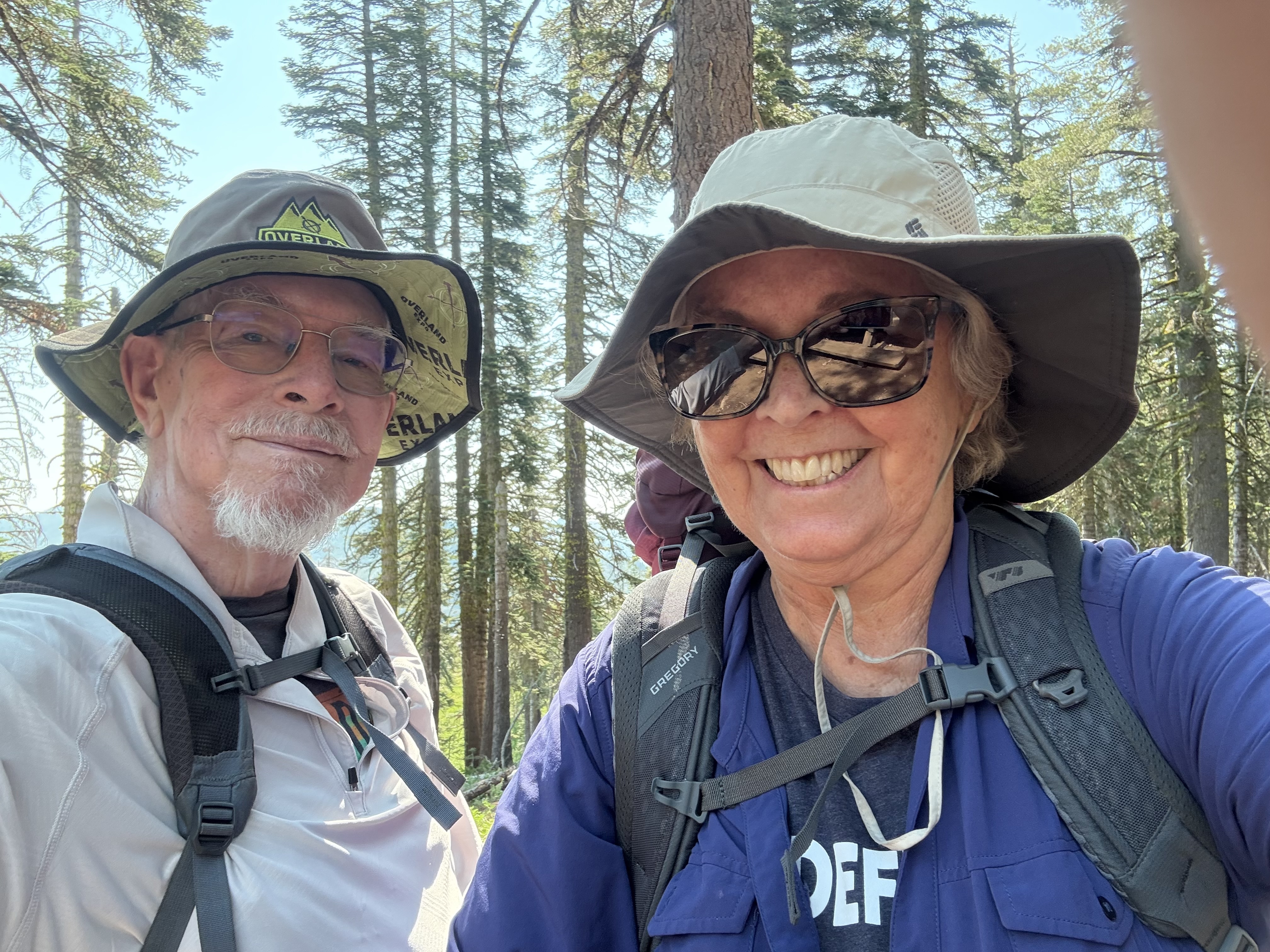
One of many lakes found in the Tahoe National Forest’s Grouse Ridge Non-Motorized Area where Peggy and I went backpacking last week. I’d asked Peggy what she wanted to do for her 75th Birthday. Her first answer was to visit our son Tony and his family in Florida, which we did and had a great time. The second thing was go backpacking! “I’ll pass on the 750 miles you did for your 75th, however, Curt,” she informed me. “I think 7.5 sounds more reasonable.” We laughed. At 82, I also gave a sigh of relief. Possibly you heard me.Since we were visiting friends and family in Sacramento on a break from our five-month exploration of the Southwest, the Five Lakes Basin was a natural for our trip. This is a view from one of the lakes looking up at the Black Buttes. While there are several ways to enter the Grouse Ridge Non-Motorized area, our normal way is to follow I-80 from Sacramento and take the Highway 20 cutoff toward Nevada City for approximately 5 miles. Turn right on Bowman Lake Road and continue on that road for 5 miles. Turn right on the unimproved, ultra-bouncy, dirt Grouse Ridge Road for 6 miles until you reach the Grouse Ridge Campground. The road has always been a challenge. This time it featured holes that would eat a VW bug! (Slight exaggeration but not much.)I’ve been backpacking in the Grouse Ridge/Five Lakes Basin since 1969, 56 years ago. It’s an all time favorite of mine. I actually remember the exact day I started to backpack: July 20, 1969. The day Neil Armstrong took his first step on the moon, I took my first step backpacking near Grouse Ridge. I made it into the Five Lake Basin in 1970 and camped just to the right of this little waterfall.Twenty years later in 1990, a few months after I had met Peggy, I bought her a backpack for her 40th birthday and took her into my favorite lake. Her only requirement was that I carry in a water bottle full of Harvey’s Bristol Cream Sherry. I don’t know whether it was the beauty of the area or the sherry, but Peggy came to love backpacking and the Basin— almost as much as I do.This map shows the trail system from Grouse Ridge Campground into Five Lakes Basin and Glacier Lake. Peggy and I followed the Glacier Lakes Trail for her 75th birthday, the Sand Ridge trail for her 40th. In the early 70s, off-road enthusiasts could follow the route I outlined here up to the first lake at the end of Sand Ridge. I did that once with my friends. The following year I watched an off-road dirt bike rider tear up a beautiful meadow doing brodies, which led me to join forces with the Nevada County Sierra Club in advocating for the non-motorized status, an effort that was successful.Having just finished her 75th Birthday backpack trip, Peggy stands with a big smile at the Grouse Ridge Campground with the Black Buttes behind her. We camped just beneath the highest peak at Glacier Lake. The Five Lakes Basin lies just beneath Glacier Lake. (Her T-Shirt features Big Foot, the world’s hide and seek champion.) I’ll include more photos of our trip at the end of this blog.
I’ve done a number of posts on the area over the years. People researching the Basin are bound to come across them. In fact, I was amused a couple of days ago when I was trying to remember when glaciers carved the basin with its lakes and googled the question. 20,000 years ago was the AI response. I looked up the source, as I usually do with AI answers. It was Wandering-Through-Time-and-Place. A fairly reliable source, I’d say. Grin.
I noted in an earlier post that the Grouse Ridge Non-Motorized Area is well-loved. Maybe too much so, especially for someone like me who prefers his/her wilderness rugged, wild and relatively people-free. But I make an exception for this region. It’s an easy place for people to get to and is very backpacker-friendly for families and newcomers to the sport. It serves as a great introduction. There is considerable value in this— for the people of course— but also for our world. People who experience the wilderness in a positive way are much more likely to appreciate it, and want to protect it, which is critically important for ourselves, our children, and future generations. As I have emphasized over and over in this series.
Especially in this era when the Trump Administration wants to open up national forests, BLM lands, and national monuments for logging, mining and housing developments. His most recent target is roadless areas. Information this month suggests that the administration is moving to repeal the 2001 Roadless Area Conservation Rule, opening up approximately 58 million acres of national forest lands to road building and logging. I doubt it will include the Grouse Ridge area. But it could.
Here are some photos taken from my posts that emphasize what might be lost.
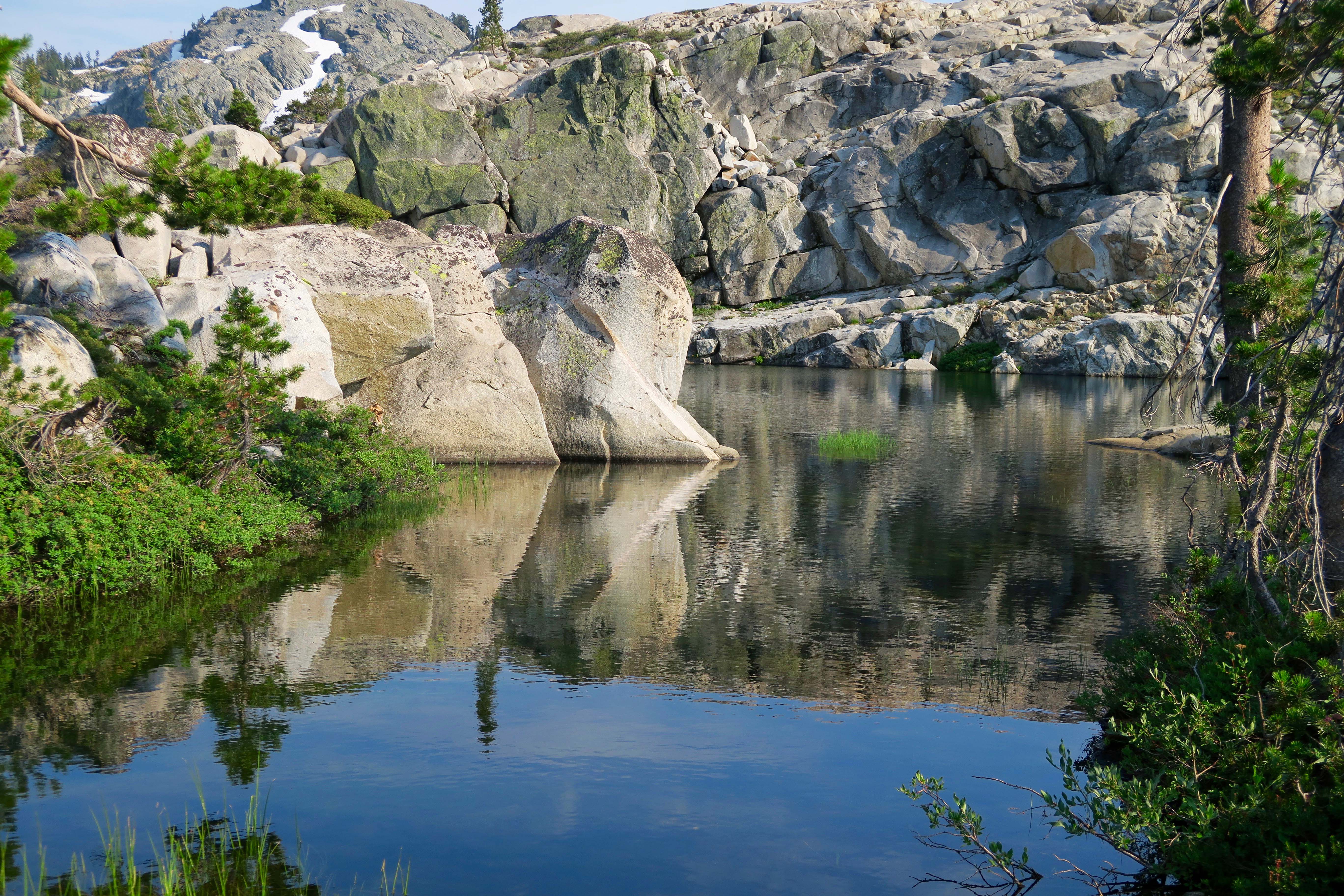
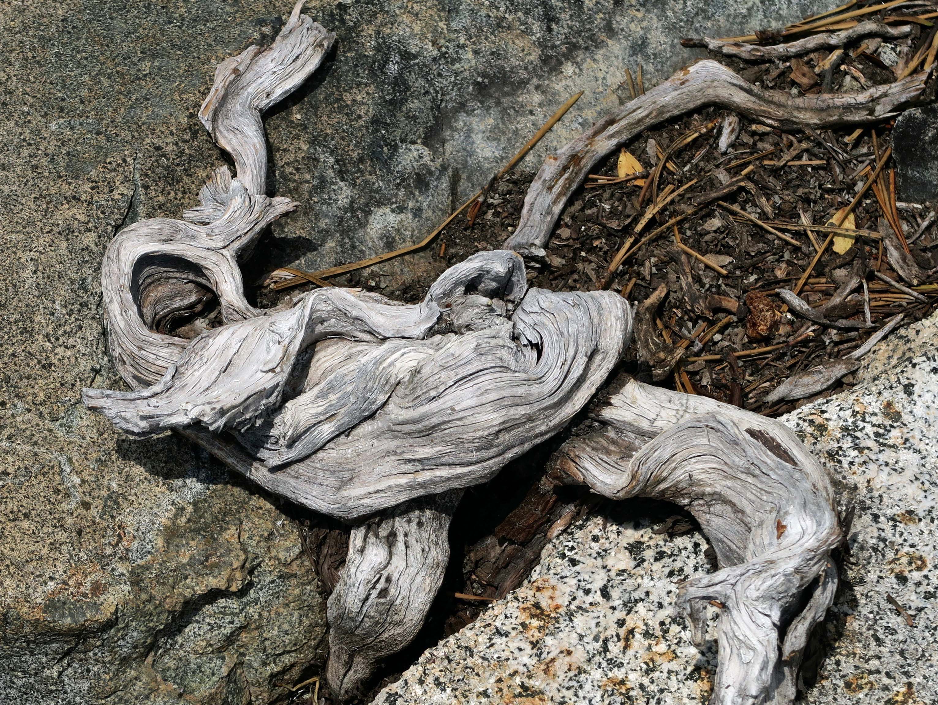
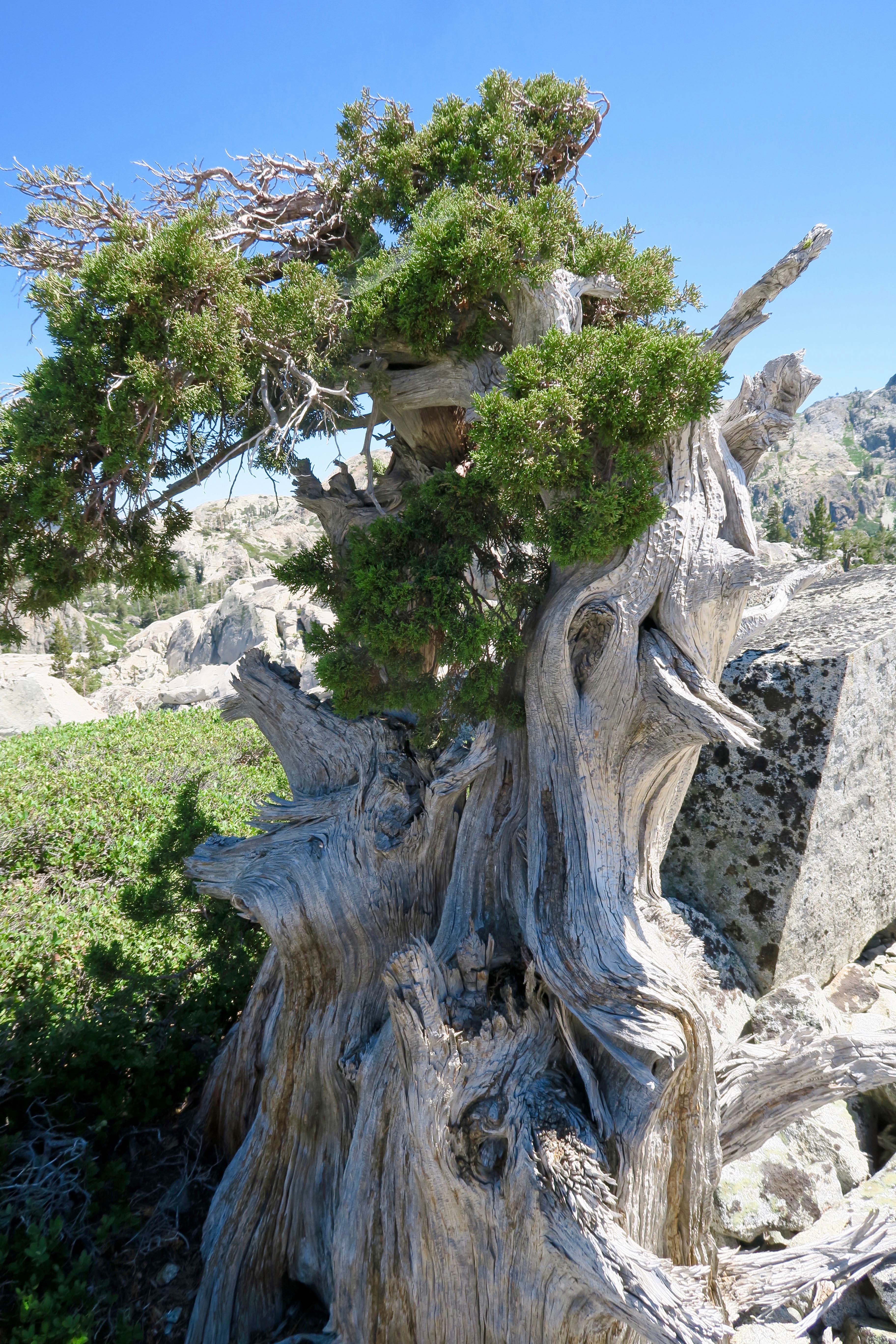
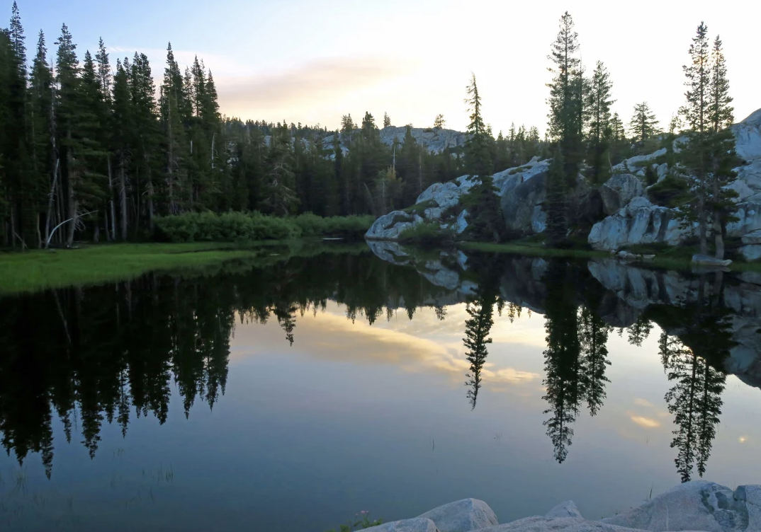
The serenity of the Five Lakes Basin’s ‘biggest little lake’ could be shattered by the sound of chainsaws. When I see this photo, I always think of Gary Snyder, the Nobel Prize winner, “poet laureate of Deep Ecology,” and who— along with his friends Jack Kerouac, Allen Ginsberg and Alan Watts— was prominent in introducing Zen Buddhism to America. Living on San Juan Ridge near Nevada City, he fell in love with the Sierras and the Grouse Ridge area in much the same way I did. He even wrote a poem about the Five Lakes Basin:
Old Pond
Blue mountain, white snow gleam Through pine bulk and slender needle-sprays; little hemlock half in shade, ragged rocky skyline,
single clear flat nuthatch call: down from the tree trunks
up through time.
At Five Lakes Basin’s Biggest little lake after all day scrambling on the peaks, a naked bug with a white body and brown hair
dives in the water,
Splash!
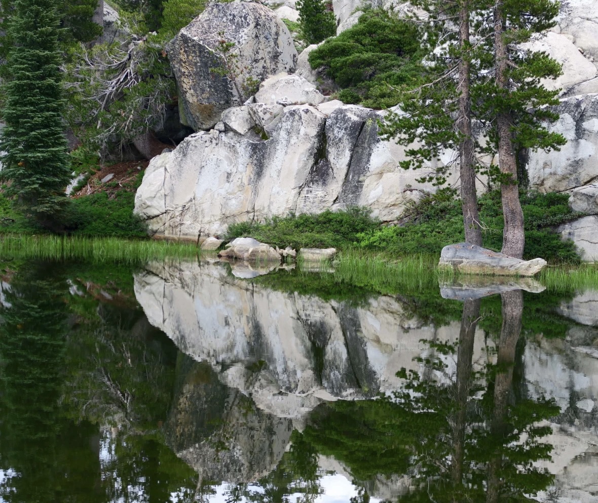
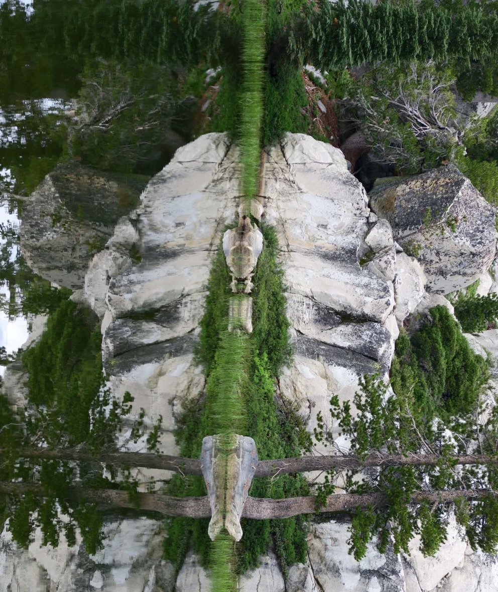
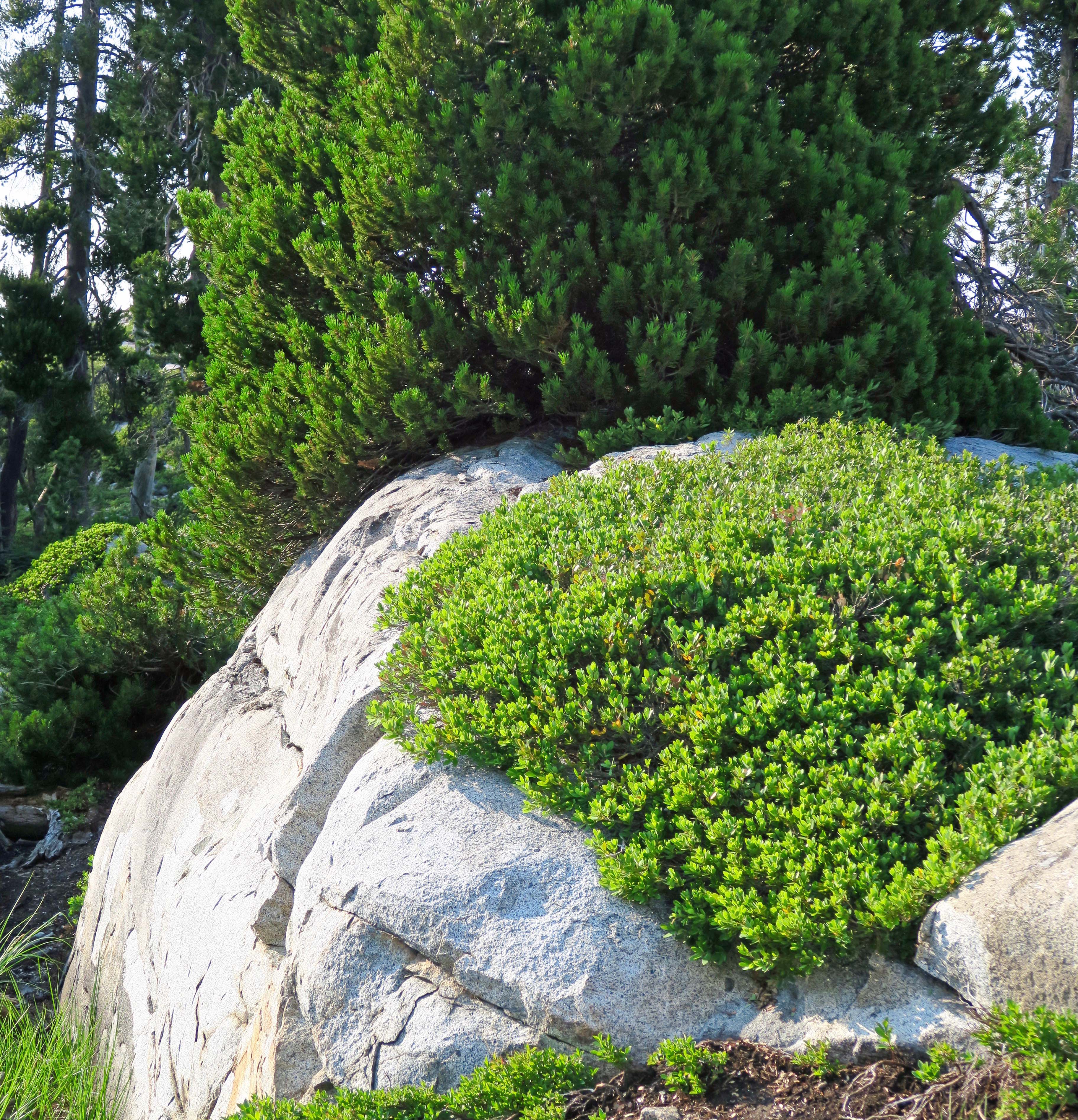
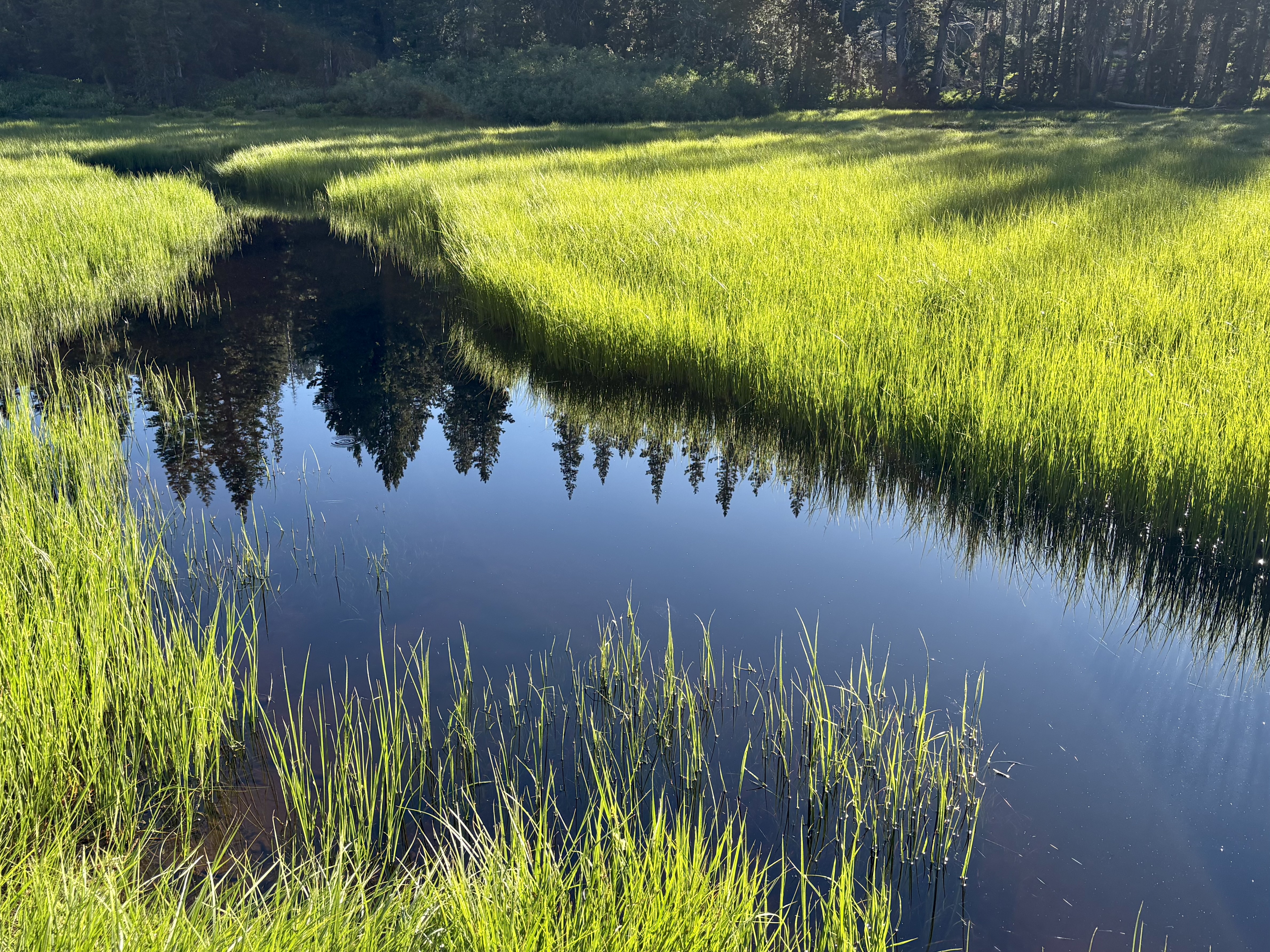
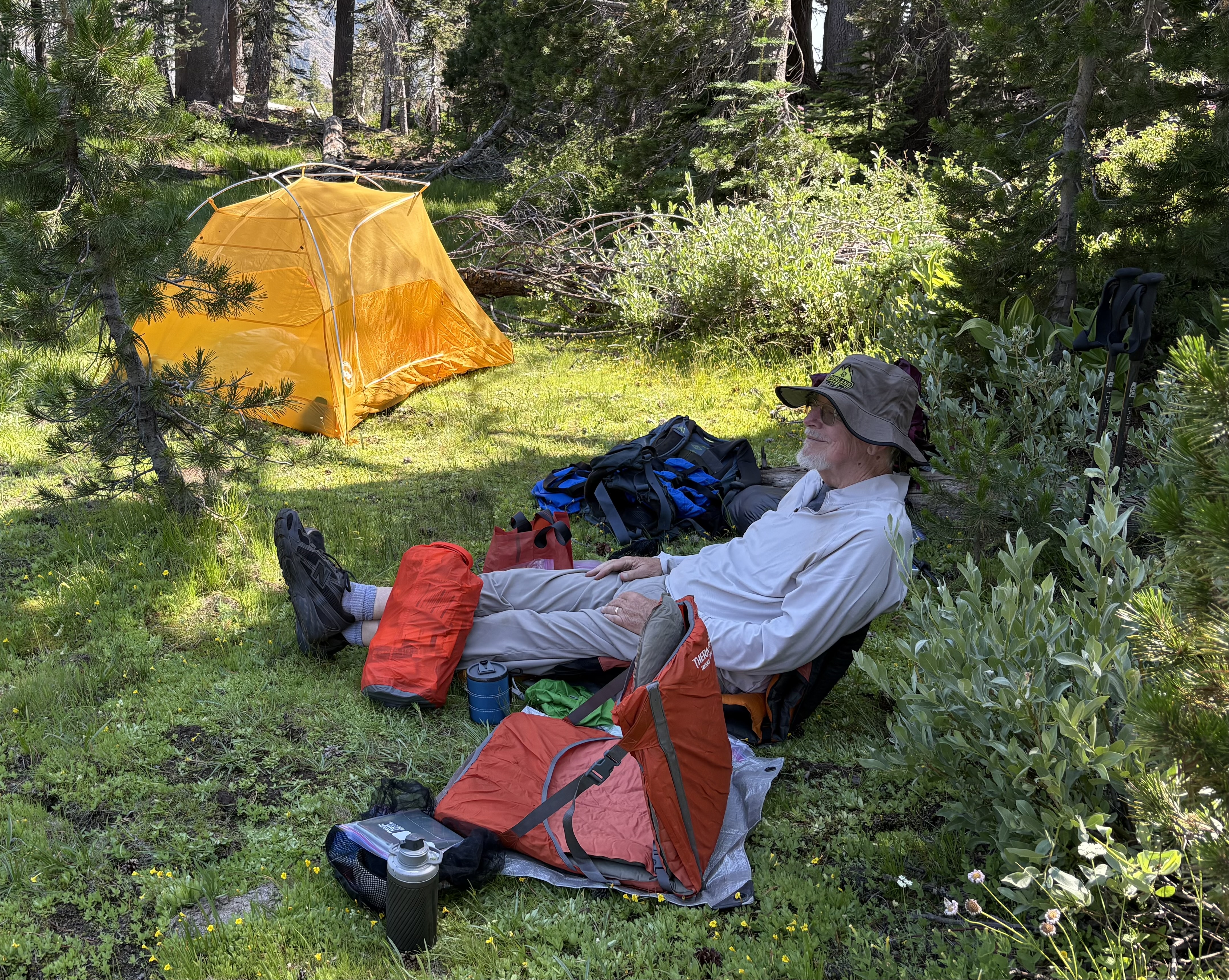
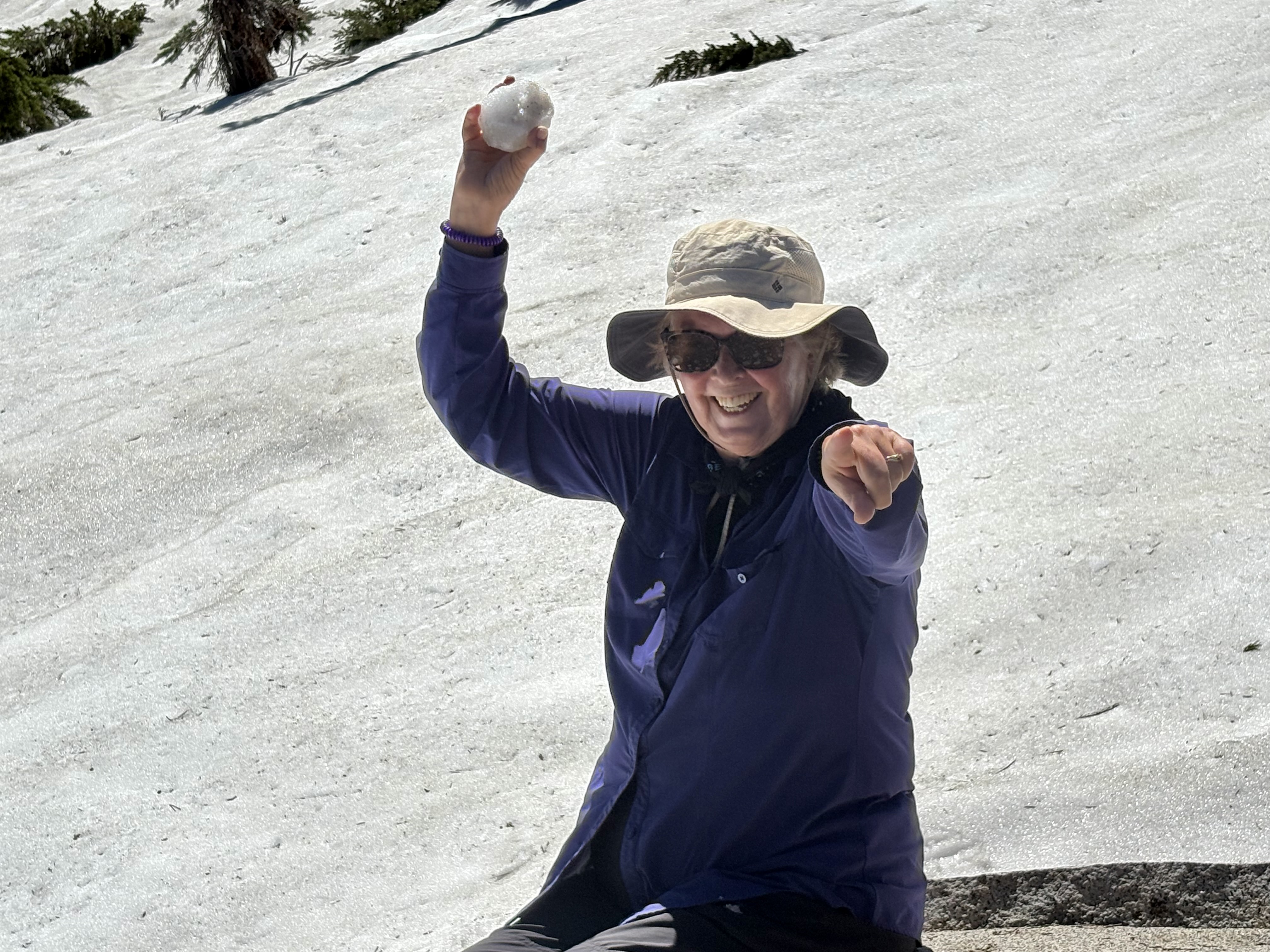
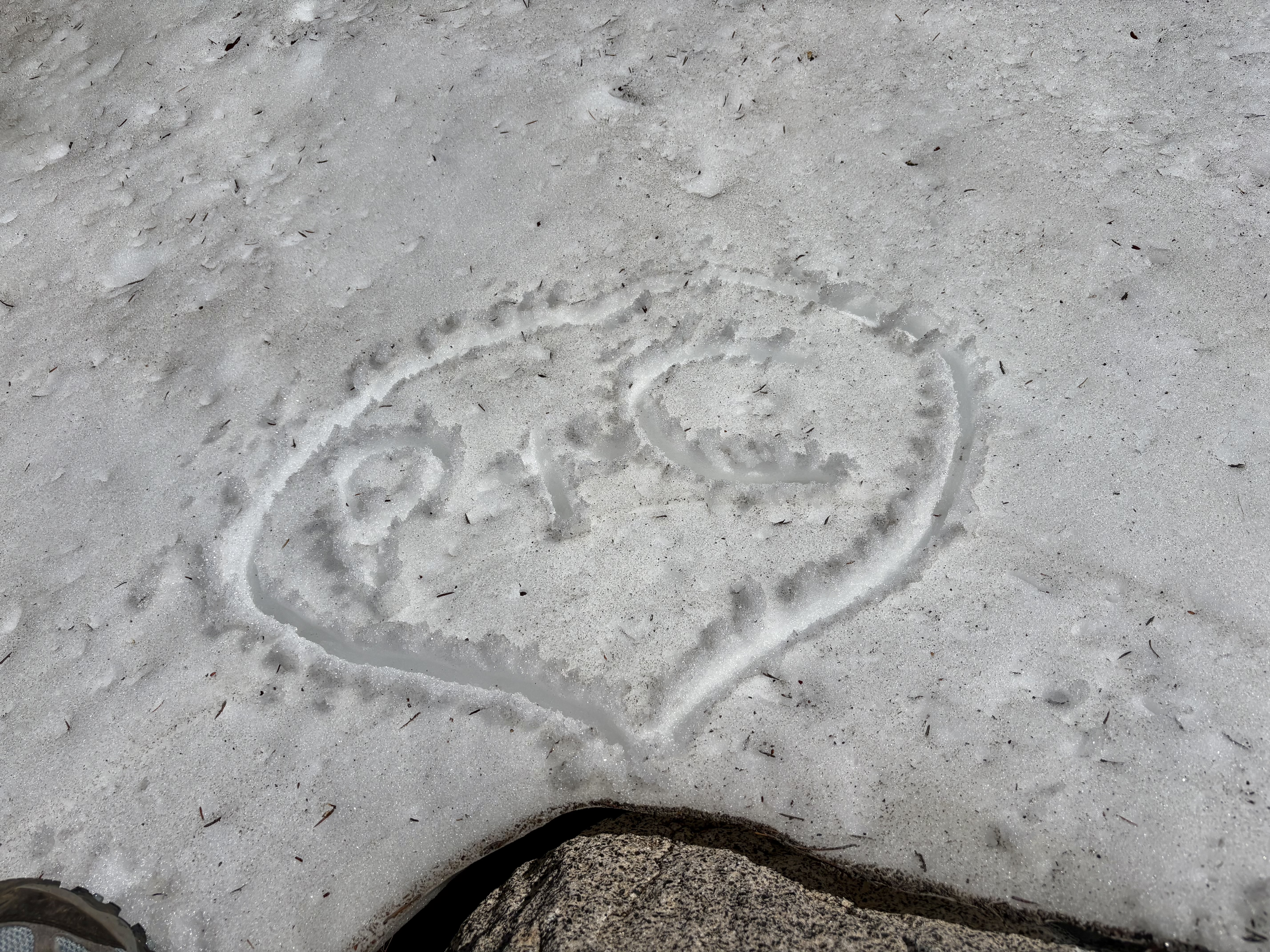
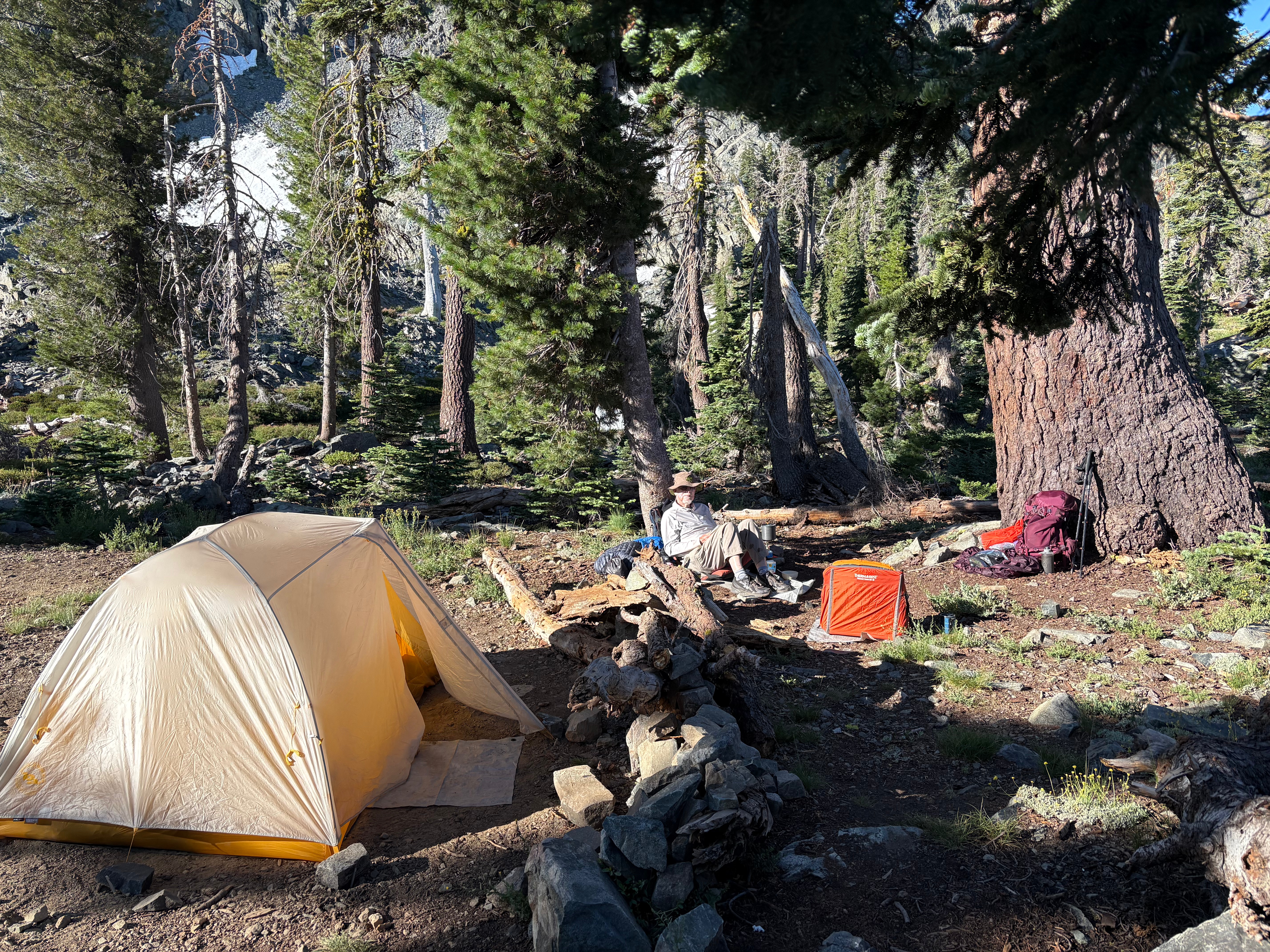
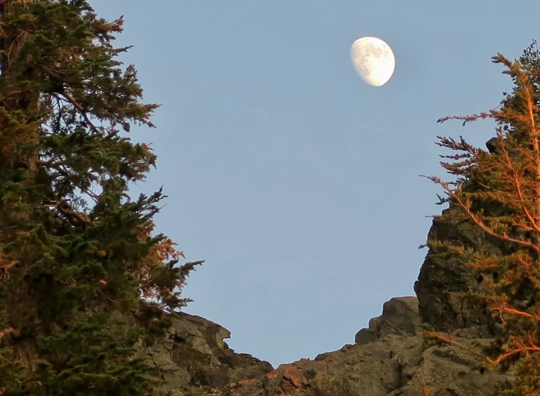
Like Snyder, my spiritual views of the world are more Eastern than Western, but it really doesn’t matter what your religious perspective is when it comes to the value gained by connecting with nature. I agree with John Muir’s statement: “The clearest way into the Universe is through a forest wilderness.” Here, in this photo by Peggy, I am reading Hermann Hess’s classic about a young man’s spiritual journey at the time of Buddha, Siddhartha. I suspect that Snyder would love this twisted manzanita I found near his biggest little lake.And this ancient juniper. I’m a fan of reflection shots. Every lake in the Five Lakes Basin provides examples of why. This is morning on a lake I once named Peggy’s since I couldn’t find a name for it.Evening on the same lake.Just for fun, I’ve discovered that turning reflection shots on their side can provide interesting results. This one had a wonderfully-fat-monster-insect look. Start with the feelers and work down.Another example from a normal perspective.Flipped it on its side. Beyond the monster look, there was the woman in a green dress with the long green hair.The basin is filled with granite. I liked the green contrast of the manzanita growing on the boulder.As you might imagine, Peggy and I have taken hundreds of photos of the Basin and Non-Motorized Area over the years, but I’ll conclude our quick tour of the basin with a sunset photo and move on to Peggy’s 75th Birthday trip to Glacier Lake.Peggy poses for her ‘official’ backpacker photo looking snazzy. Note the hiking sticks (poles). ‘We don’t leave home without them’ when venturing into the woods. They are essential for balance, even more so as we age. My hips and knees were screaming at me as we made our way down Grouse Ridge, like “What the F are you doing.” (Growing older is so much fun.) The sticks assured we stayed upright.The area was much drier than we had expected from previous trips in July, thus we were grateful when we came across this meadow. One look and we simultaneously thought CAMP!One tired, but happy, puppy. Or maybe that should be old dog. That’s my food bag draped across my legs. Camp was set up. We’d had a cup of hot soup, cheese, a beef stick, and a celebratory shot of Irish liqueur. I still had to cook Peggy a post-birthday dinner, but that consisted of boiling water, pouring it into a container of freeze-dried backpacking food, letting it sit for five minutes, and eating. Mmmm, beef stroganoff. All was right with the world. Just don’t ask me to get up! Peggy managed to abandon her Therma-rest seat for this photo. Good thing I married a younger woman.The next morning we found a snow bank on our way up to the lake. I don’t think Peggy has ever found snow without lobbing a snowball at me!She followed up by carving a heart with P+C in it. Aw….The trip up to the lake was relatively easy, considering we took two days to do what is normally a one day trip. (I’ll note here that some of these photos here are from earlier trips since we were only carrying our iPhone to save weight.)An obligatory photo of camp. Looks peaceful, doesn’t it. Shortly afterwards, a group of 35 teenage girls and their adult leaders showed up and camped next to us. Must say they were relatively quiet, polite, and only spent the night. The most noise was their scream as they jumped into the lake’s snow fed water. While the group size was too large, I appreciated the effort their leaders put into introducing them to backpacking and the beautiful area. They left their camp immaculate. After the girls packed up and left, we had the camp and lake to ourselves for the day.While the moon was only partial, at 8000 feet it was like someone was shining a flashlight on our tent at night.Bone, who had joined us on the trip, insisted on having his photo taken before we headed back for Grouse Ridge.Naturally, we took a selfie when we made it back to our truck— happy to be back but ever so glad we had gone. That’s it for now. Peggy and I are in Albuquerque, New Mexico for a week before we begin our journey back East. Next up…Canyon de Chelly National Monument
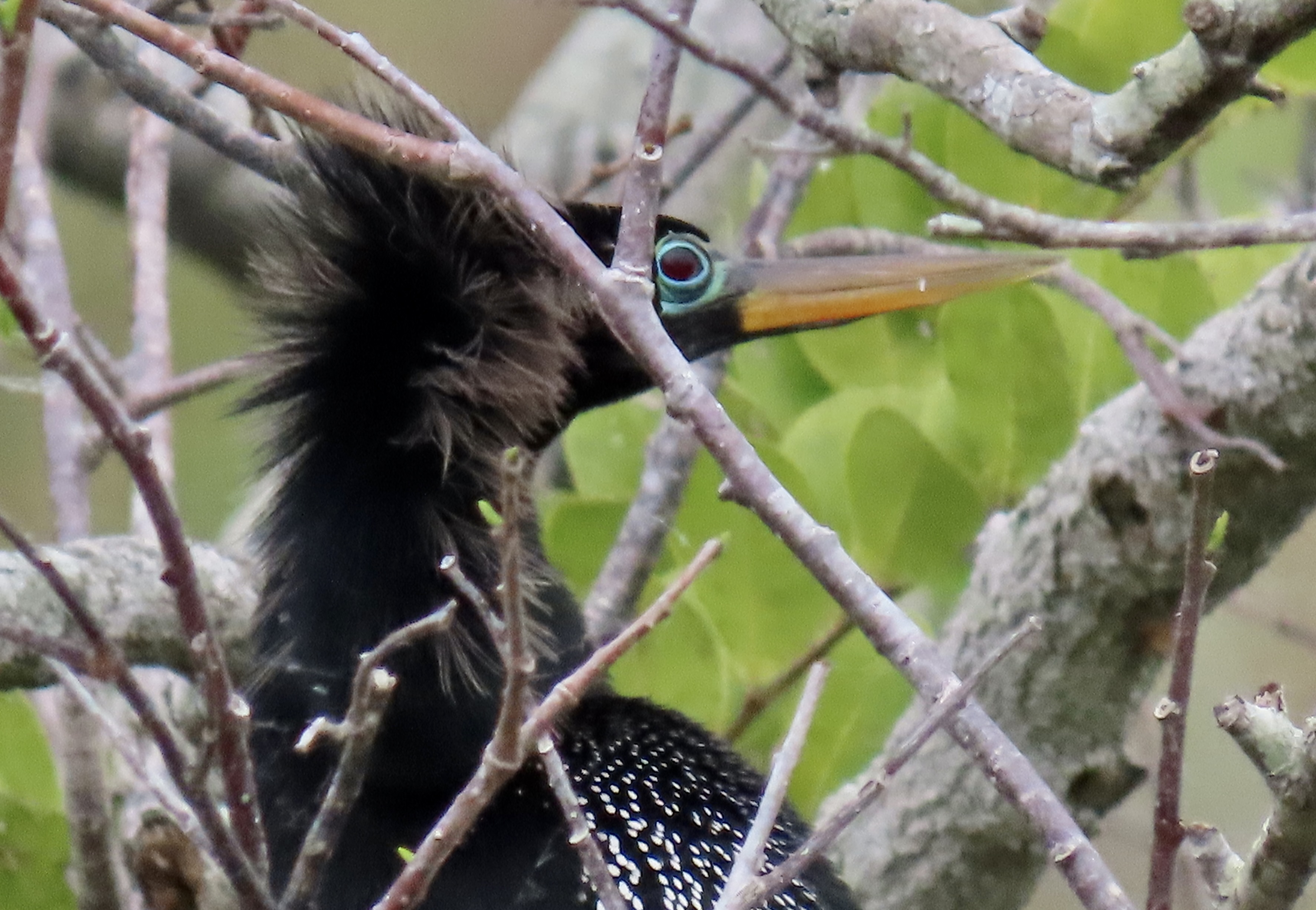
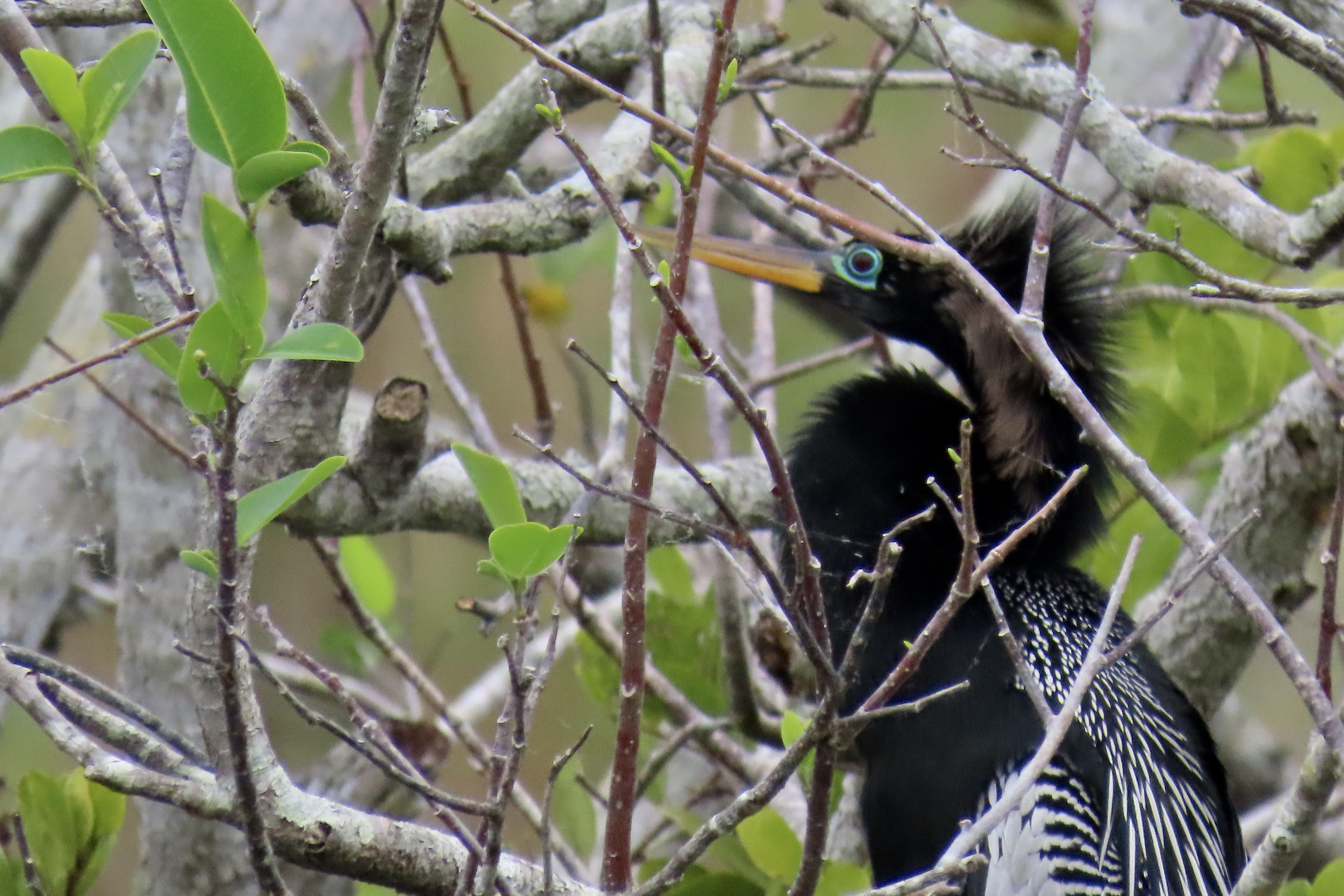
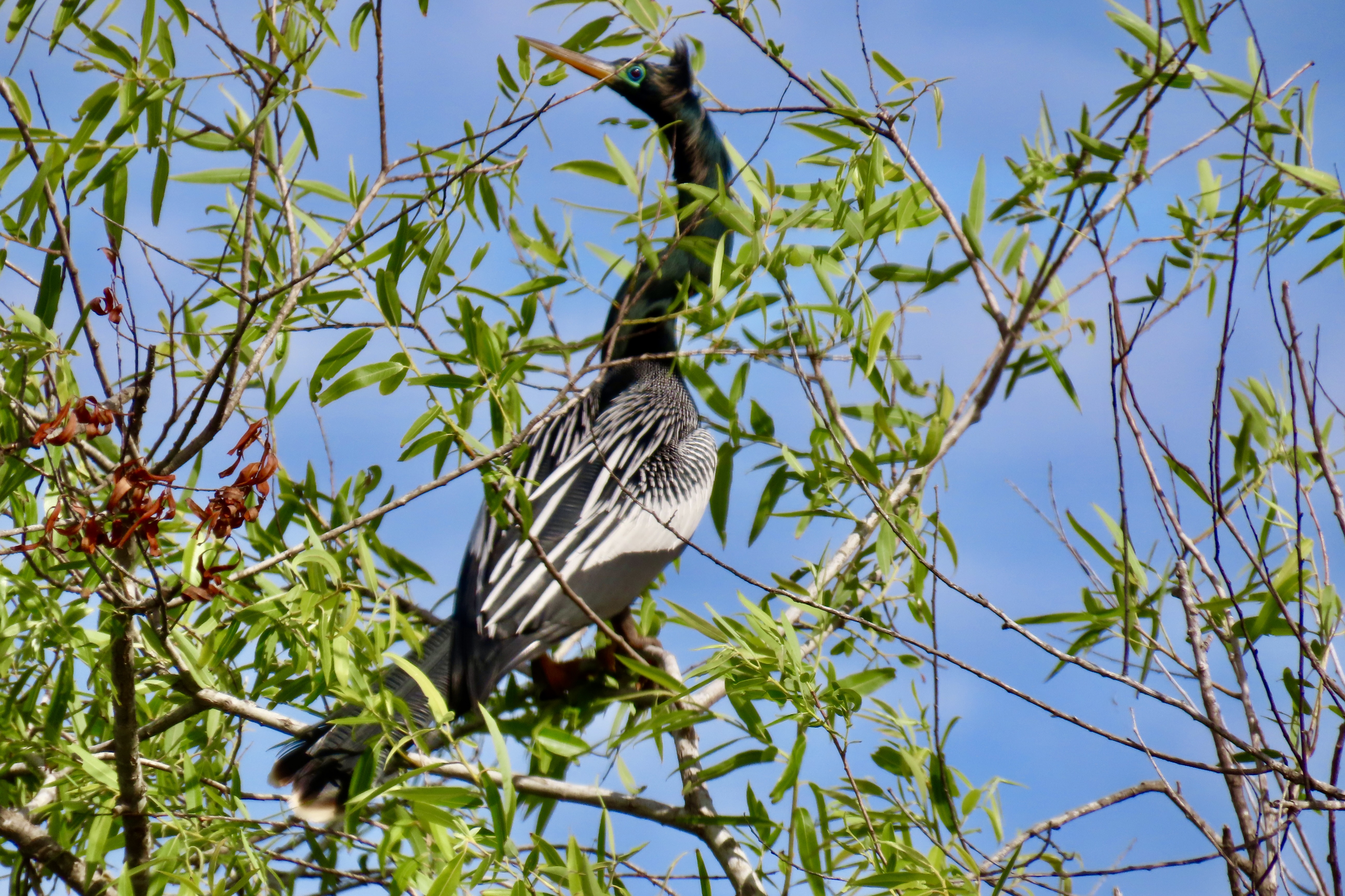
If you’ve been following my blog over the past couple of months, you have already met Anhingas: In Africa. I showed one demonstrating the proper way to eat a fish in Chobe National Park, Botswana. We found this fellow with its googly eyes along the Anhinga Trail in the Everglades National Park, Florida.
Peggy and I traveled to Everglades National Park a few weeks ago, came back to our basecamp in Virginia, spent two weeks rushing to prepare for our five-month road trip, and are now in Terre Haute, Indiana sitting on the border of Missouri. We were supposed to be continuing west today, but the National Weather Service had a severe thunder and lightning storm warning up for Missouri. It’s not the type of weather to be out on the road, especially when pulling a small, light trailer.
The storm introduced itself last night. We could hear it approaching from miles away, at first a distant constant rumble, it became an earth-shaking roar. We hunkered down and wondered if Armageddon had arrived. I worried about hail. Baseball size chunks were crashing down on Kansas City. Serafina, our trailer, would not have been happy. But the storm passed us by without any damage.
On top of that, we had a propane leak, which can be more dangerous than softball-size hail. My solution, other than a few chosen words, was to shut the tanks off and wait until we could find an RV service facility to fix it, which often takes days or even weeks to schedule. Fortunately, we have options that allow us to function without propane.
Peggy and I have learned in our recent travels that mobile techs can solve most RV problems, however, often on a same-day basis and at a fair cost. Since we were here for the day, I called a local business in Terre Haute: At Your Service— Mobile RV Repair. And boy did we luck out. I reached the owner, Allen Grota, and he told me he would be over as soon as the storm stopped. He went through everything, tanks, connections and regulator. Finally he found the problem. The hose to the trailer had been left hanging next to one of our levelers and the lowering and rising of the leveler had cut it. As soon as this had happened, the regulator had shut down the tank. We weren’t in danger, but neither would we have propane. Allen then ran downtown to get what he needed to fix the problem. The cost was incredibly reasonable. And it turns out, Allen is a heck off a nice guy.
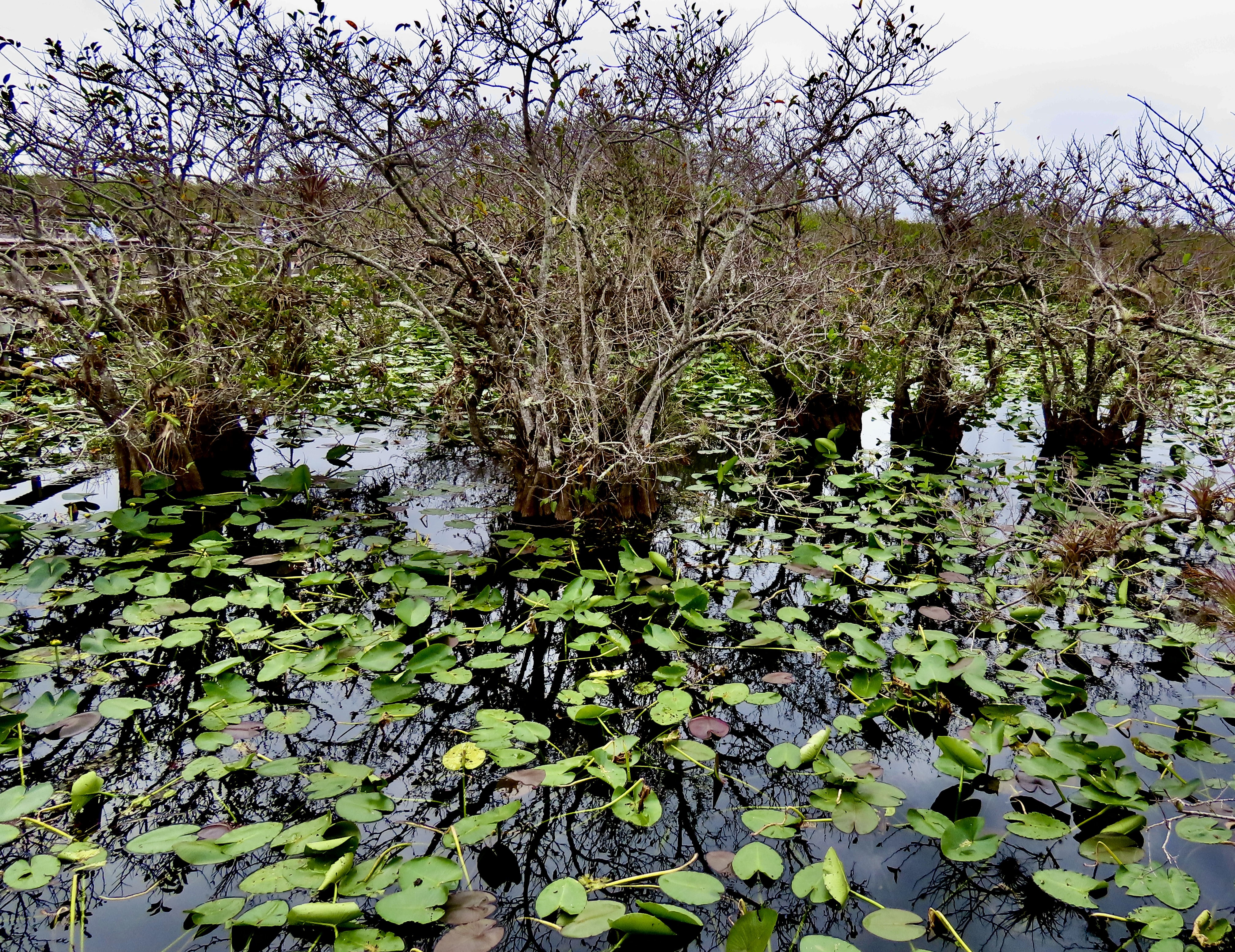
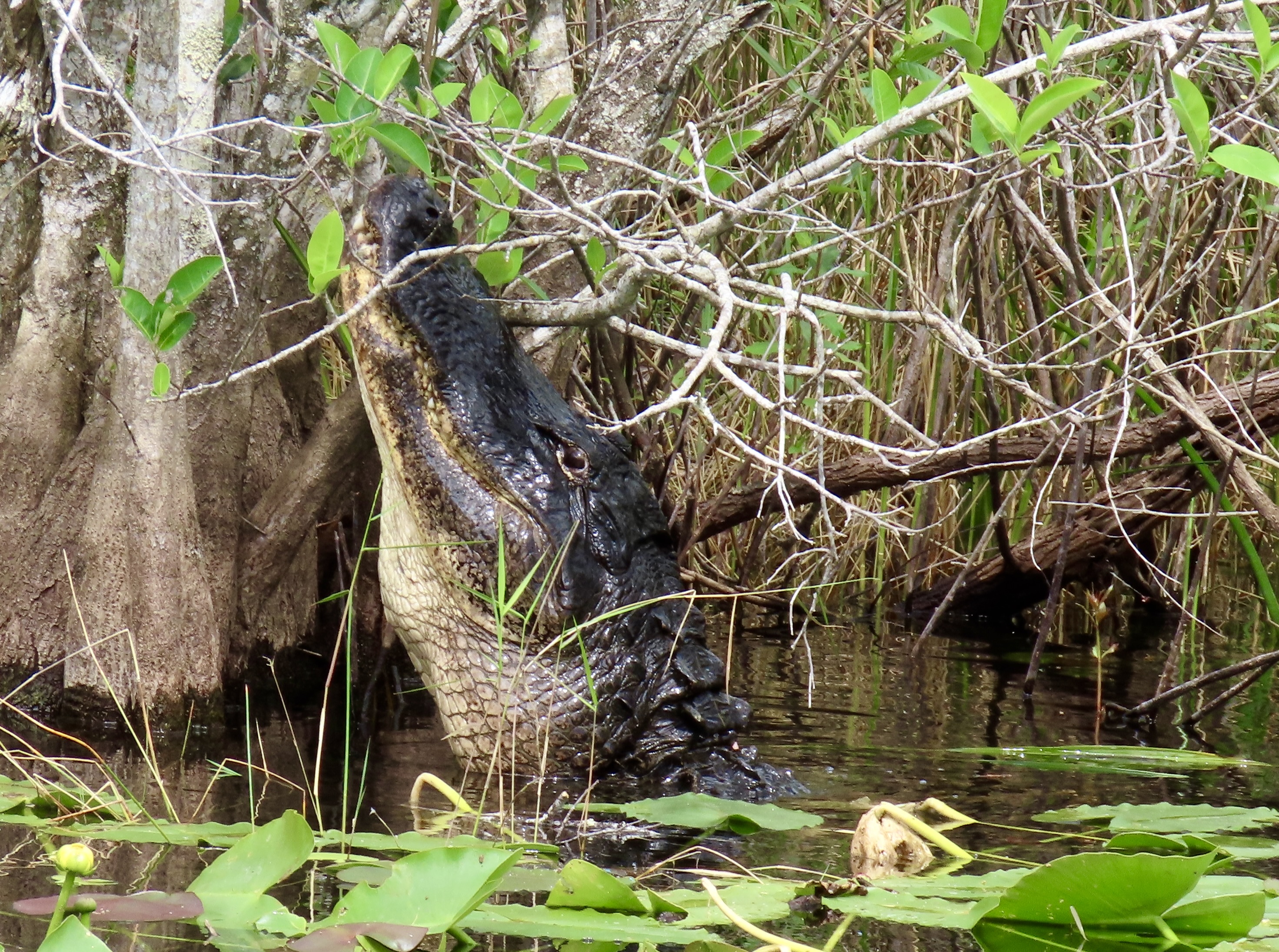
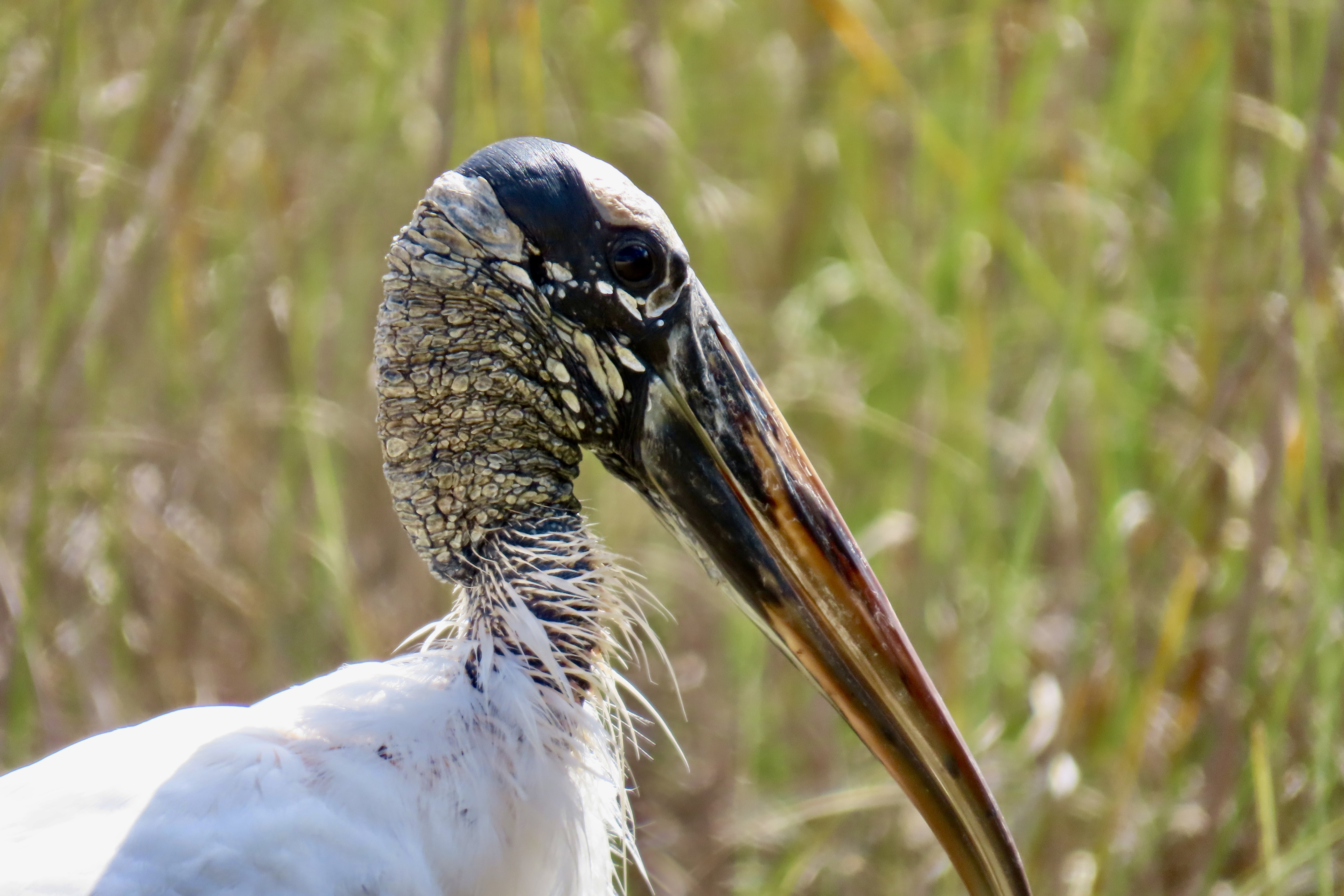
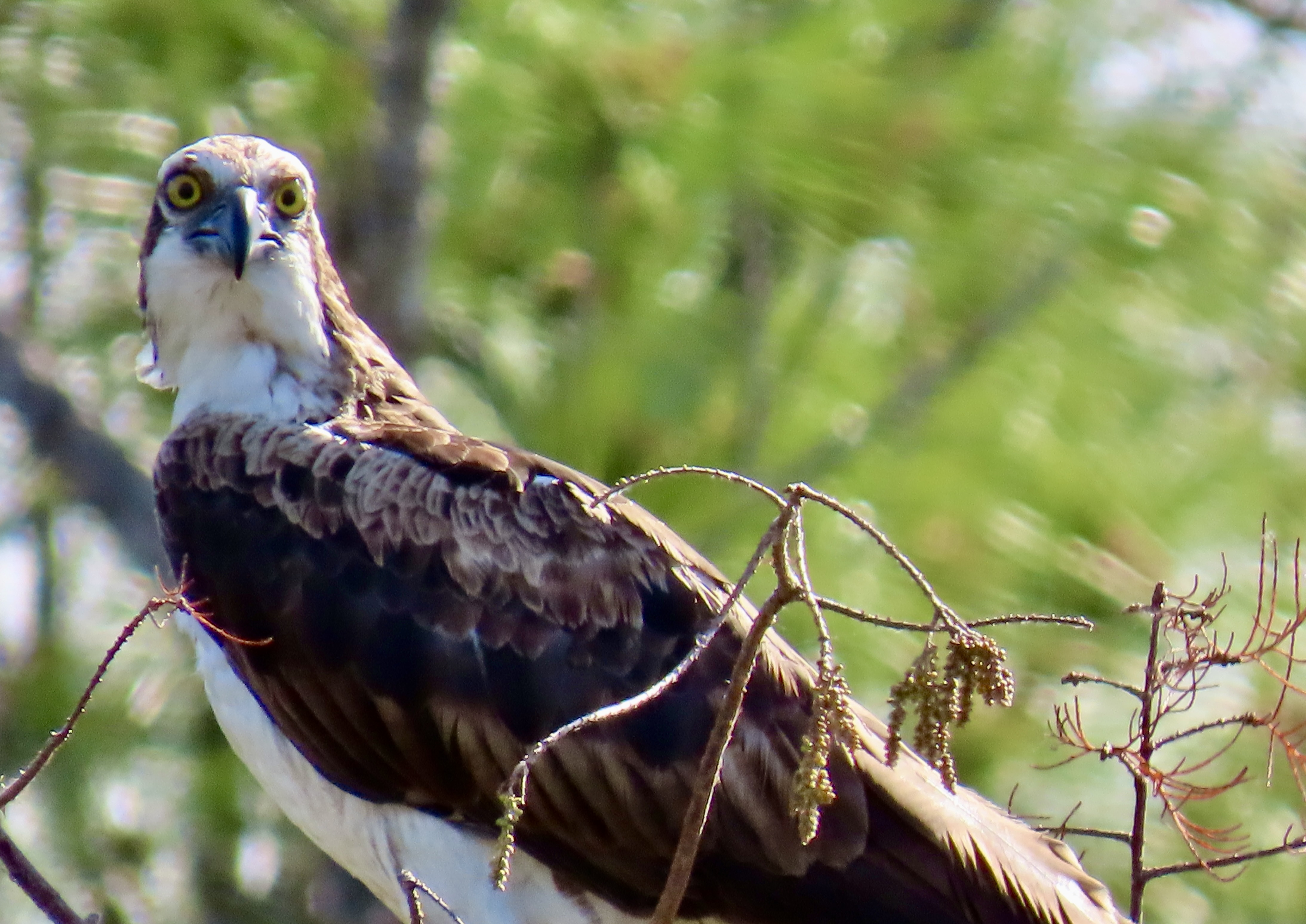
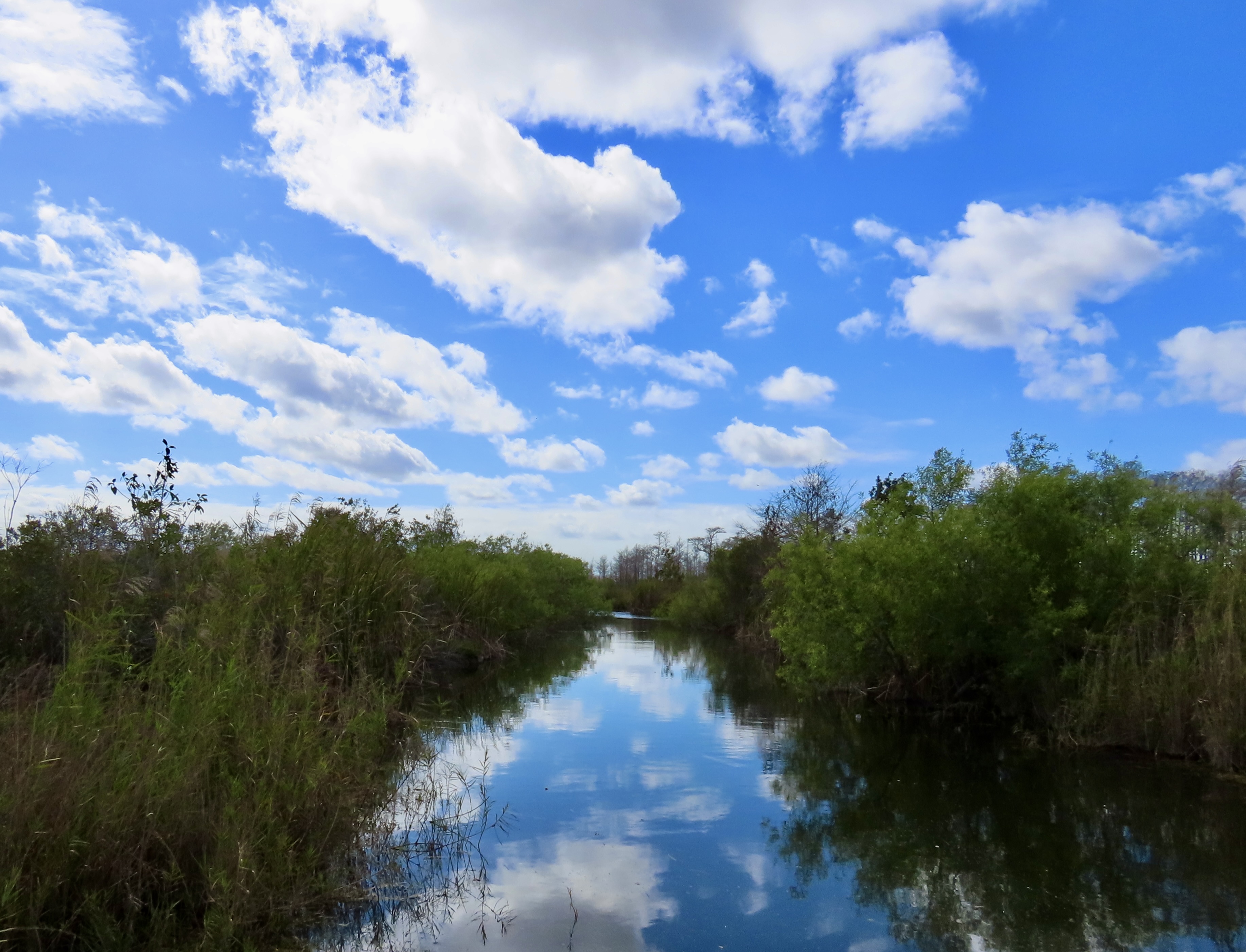
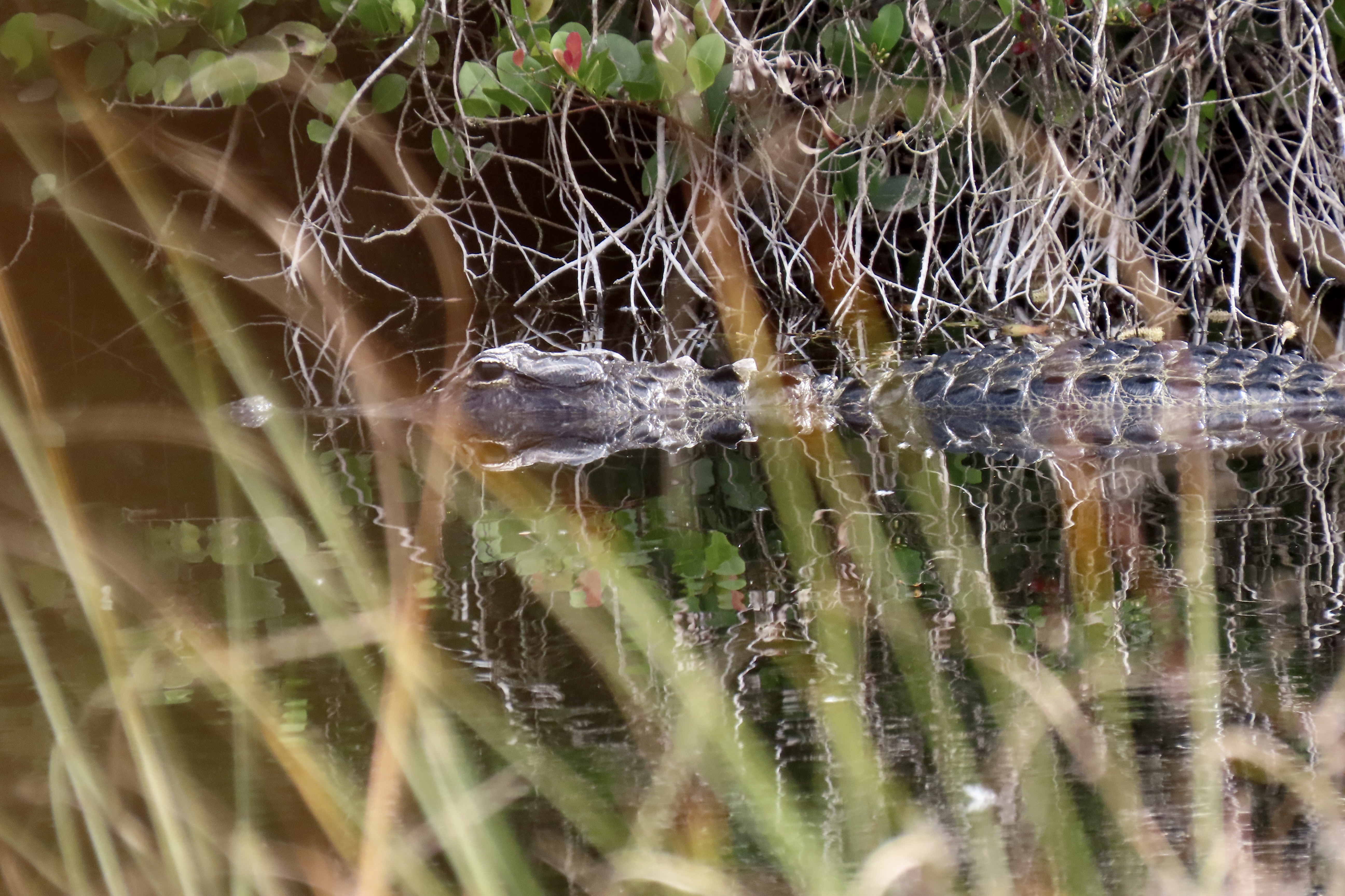
I’ve already done three posts on our Everglades trip: One on white pelicans, one on osprey, and one on the area around Everglade City on the Gulf Coast. I’ll conclude today featuring more of the Atlantic Coast side where we found the osprey and white pelicans. We entered the park at the Ernest F. Coe entrance. After stopping off at the Visitor Center, we made a beeline for the Anhinga Trail, just inside the park. Peggy and I had been there before and were quite impressed with the alligators and birdlife.
From there, we drove down through the park to Flamingo, where we would be glamping. We stopped along the way at various pulloffs to check out features of the Everglades emphasized by the National Park. First up, the Anhinga Trail.
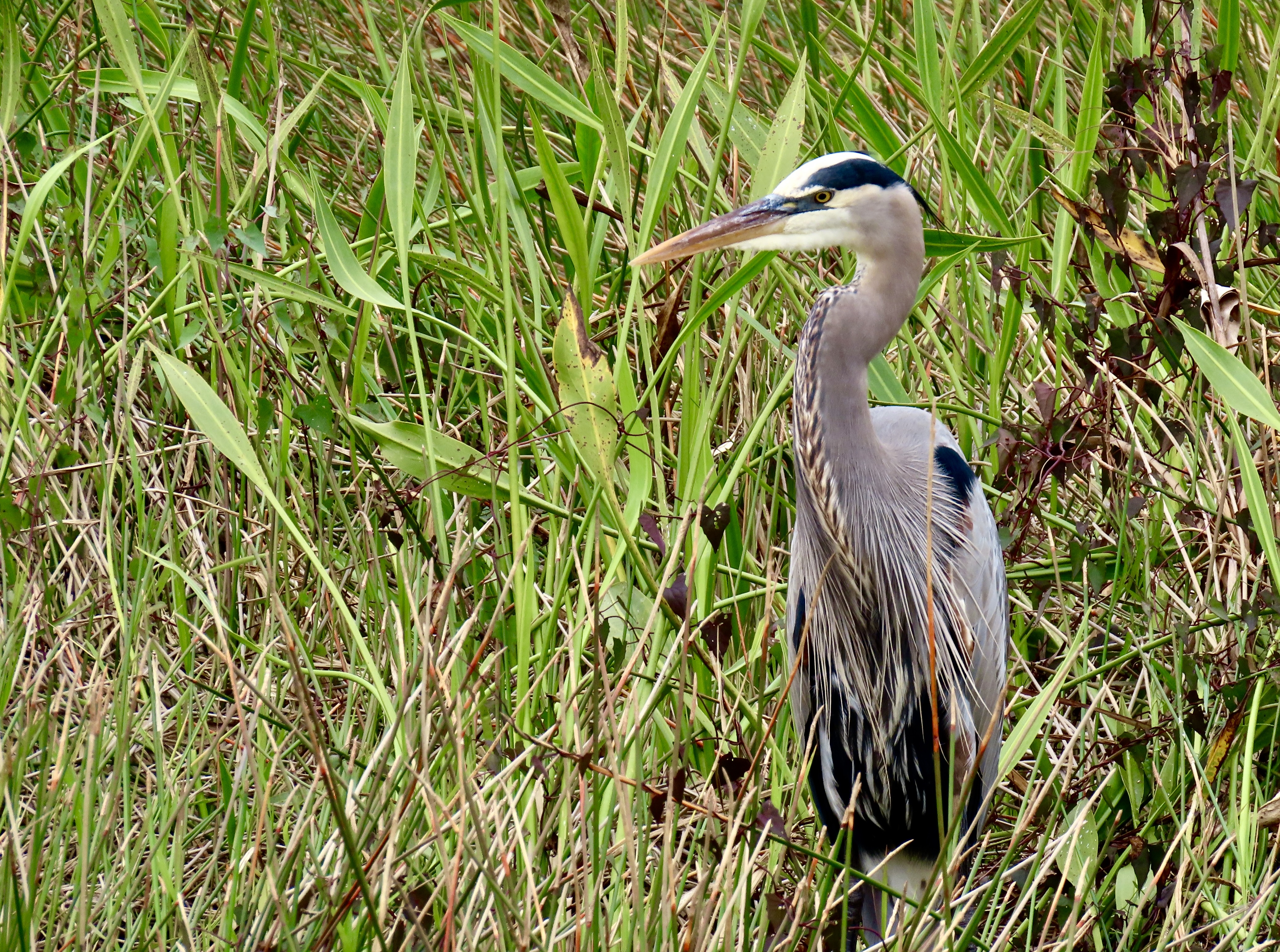
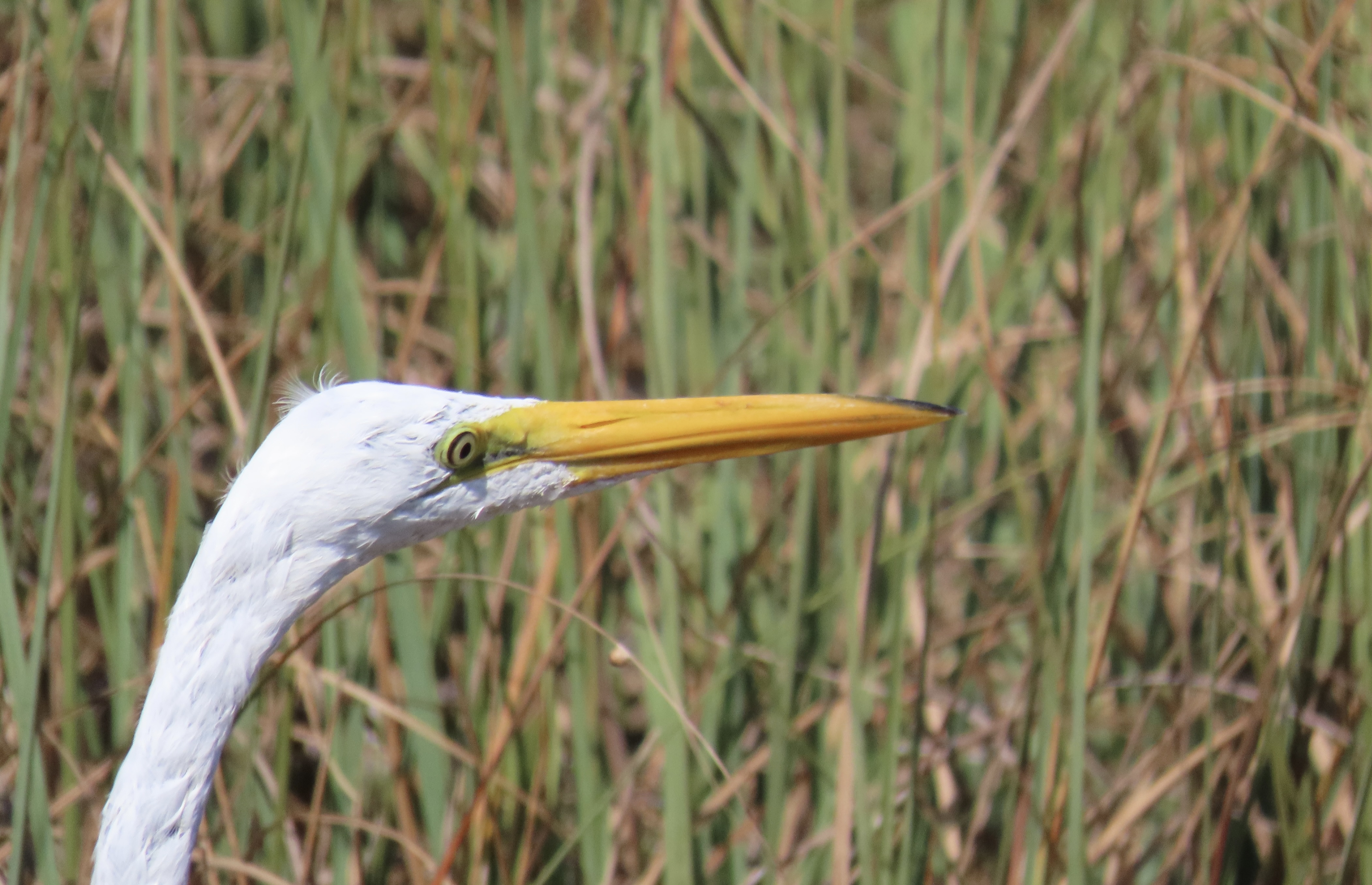
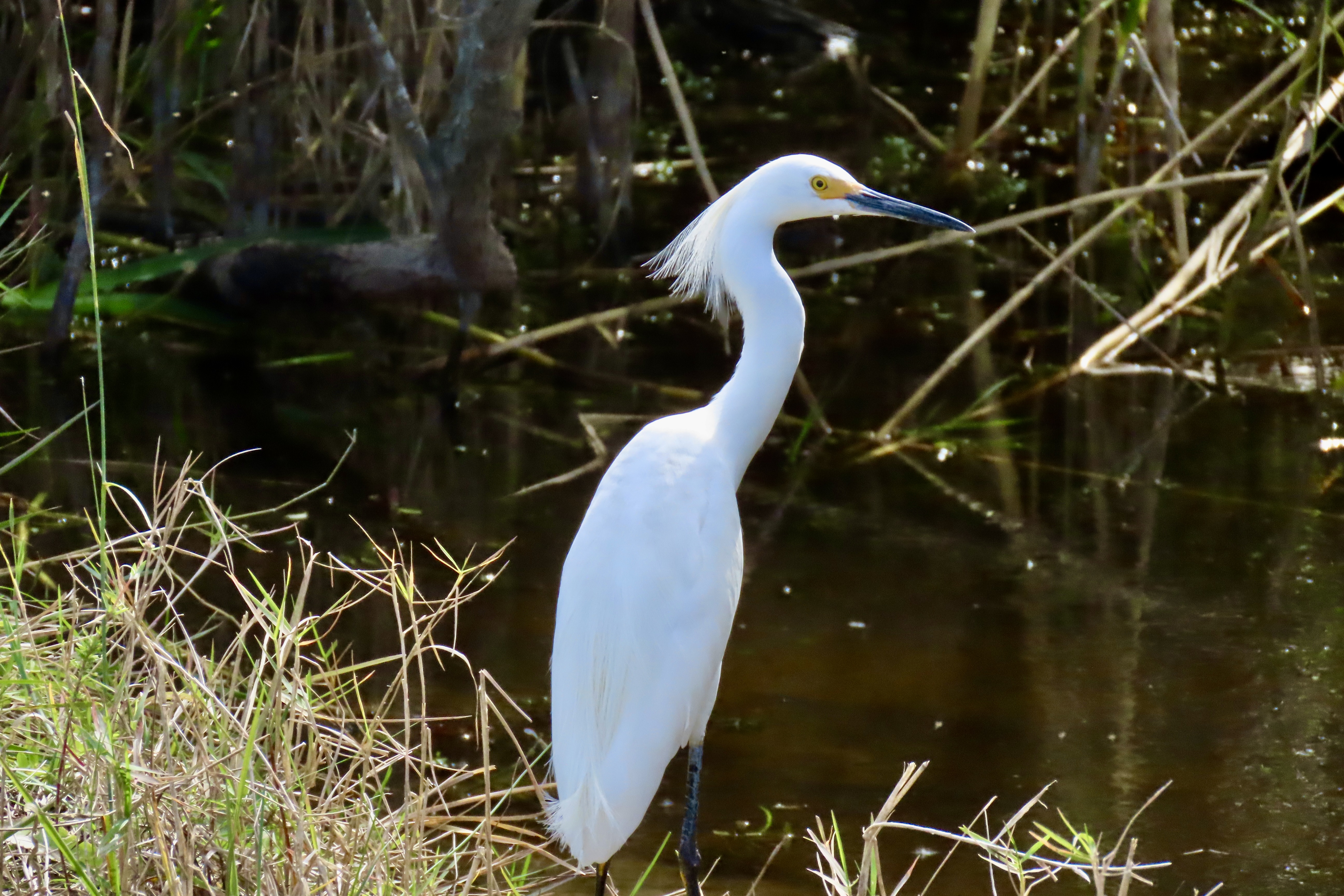
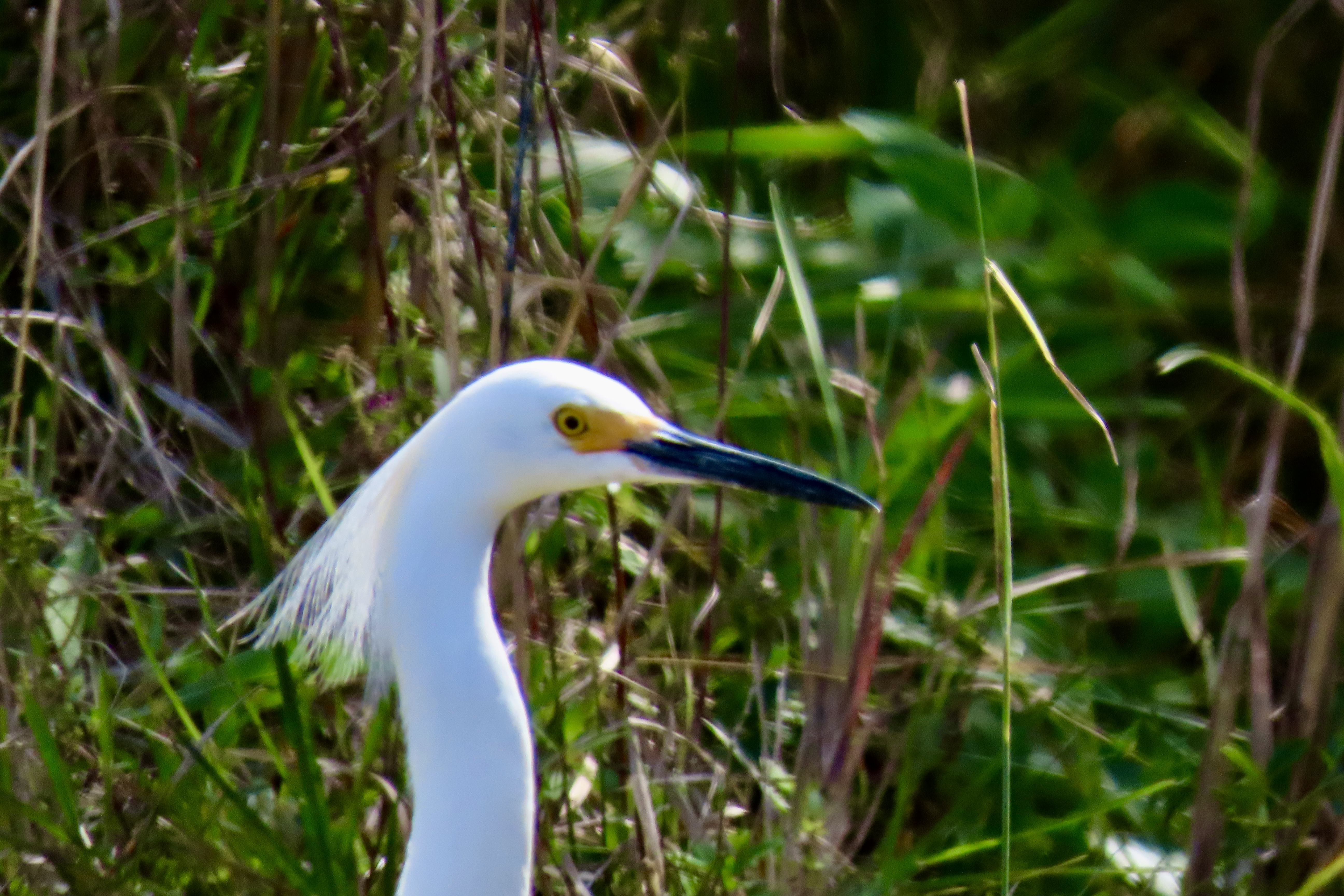
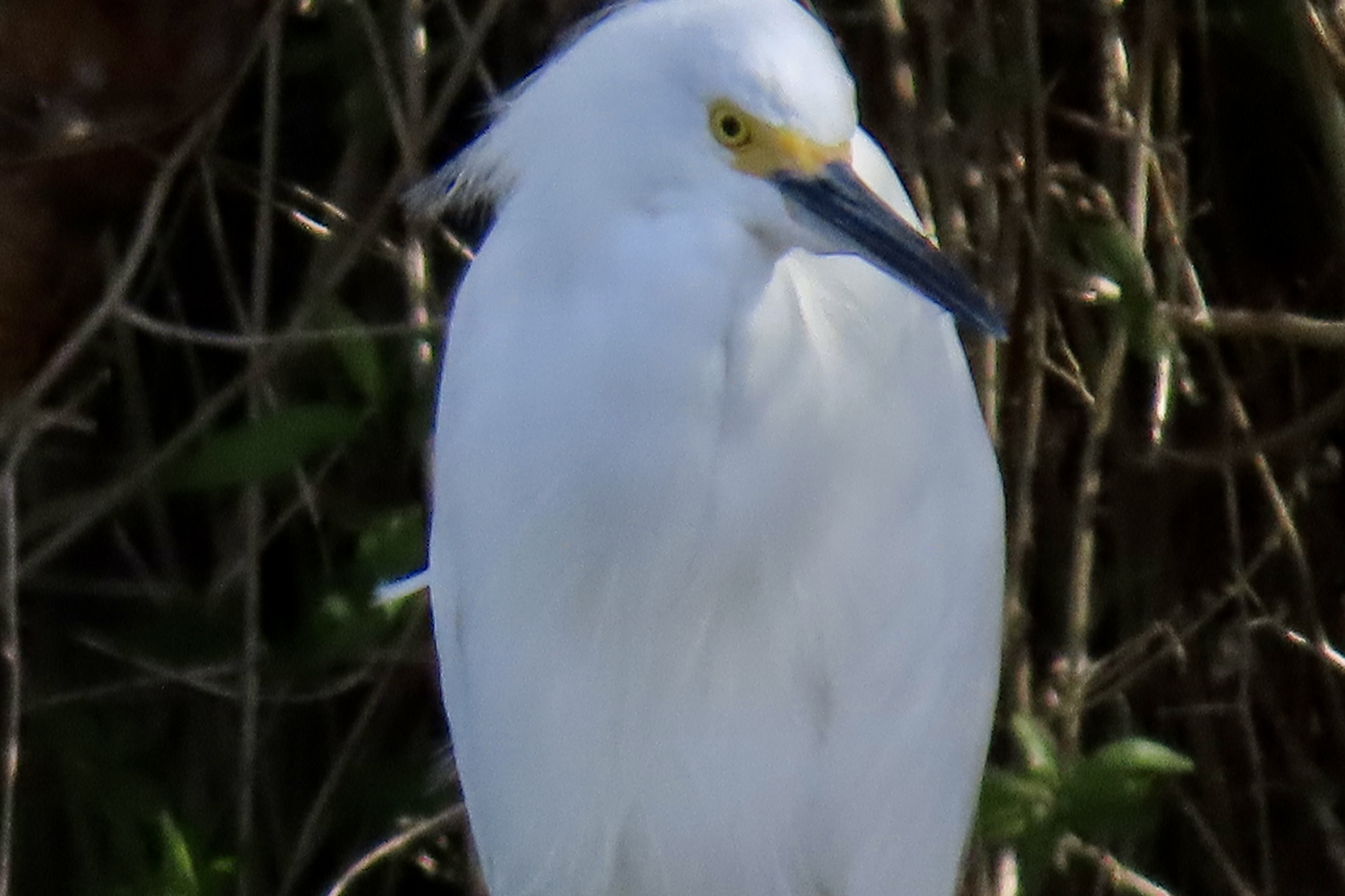
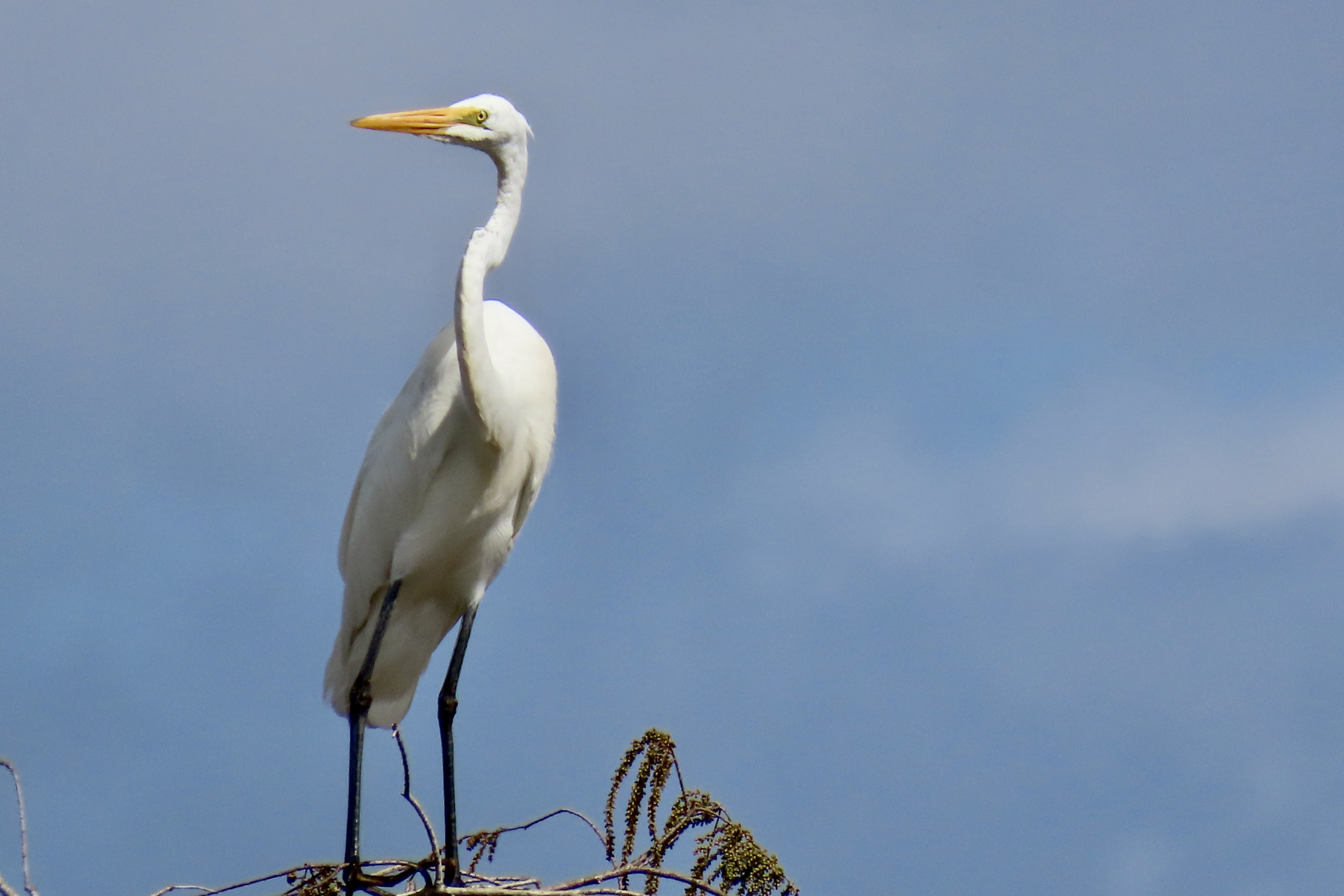
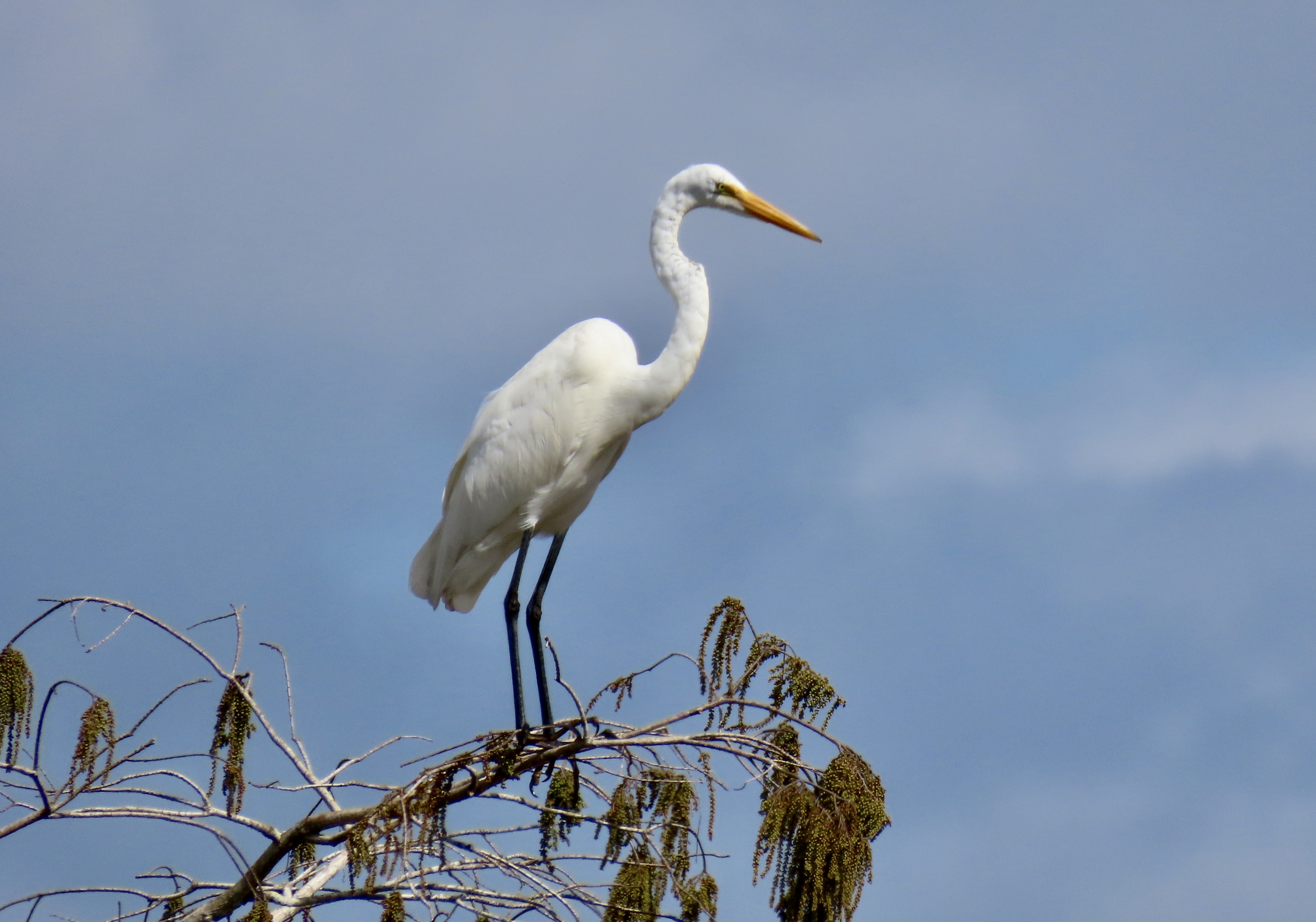
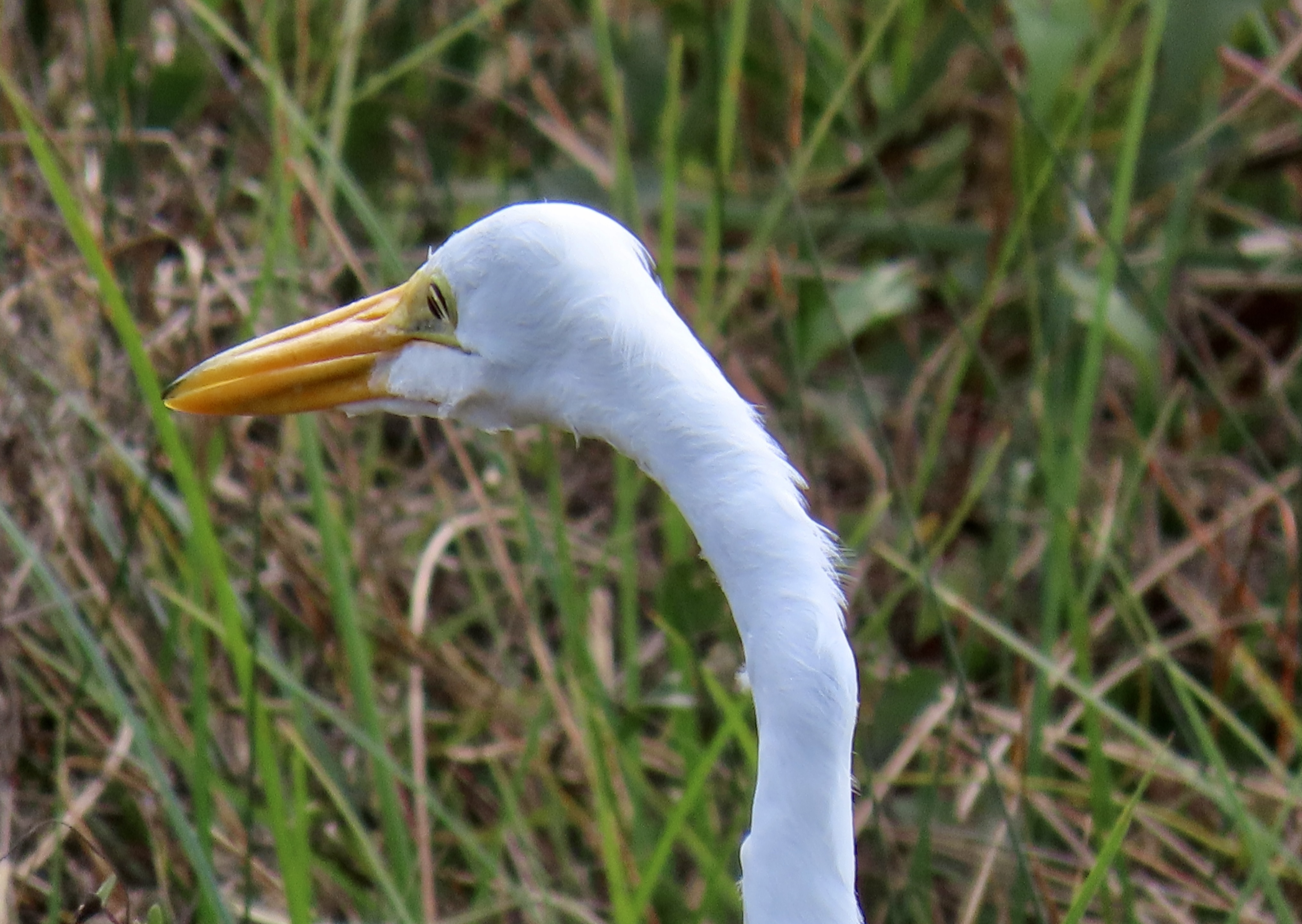
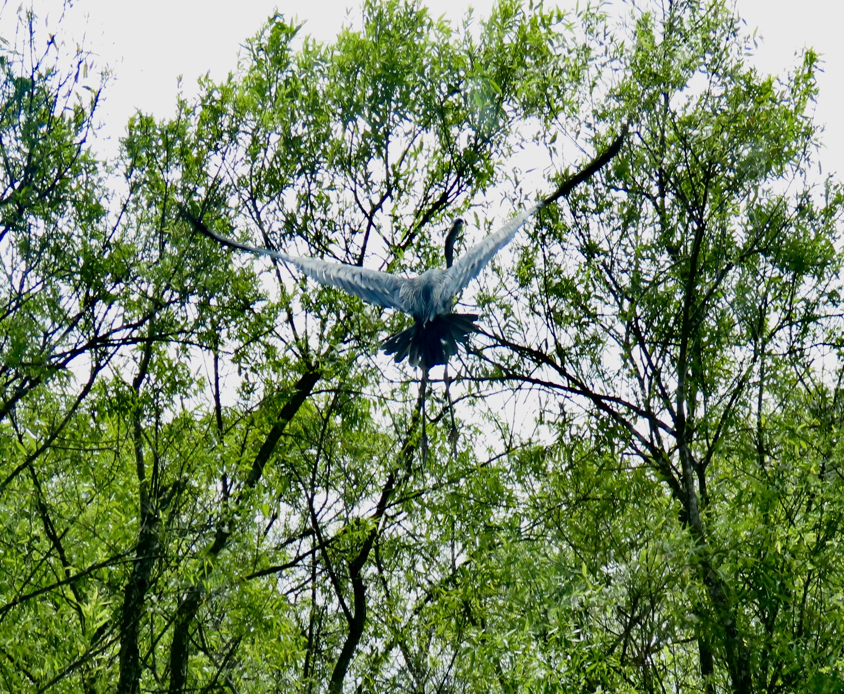
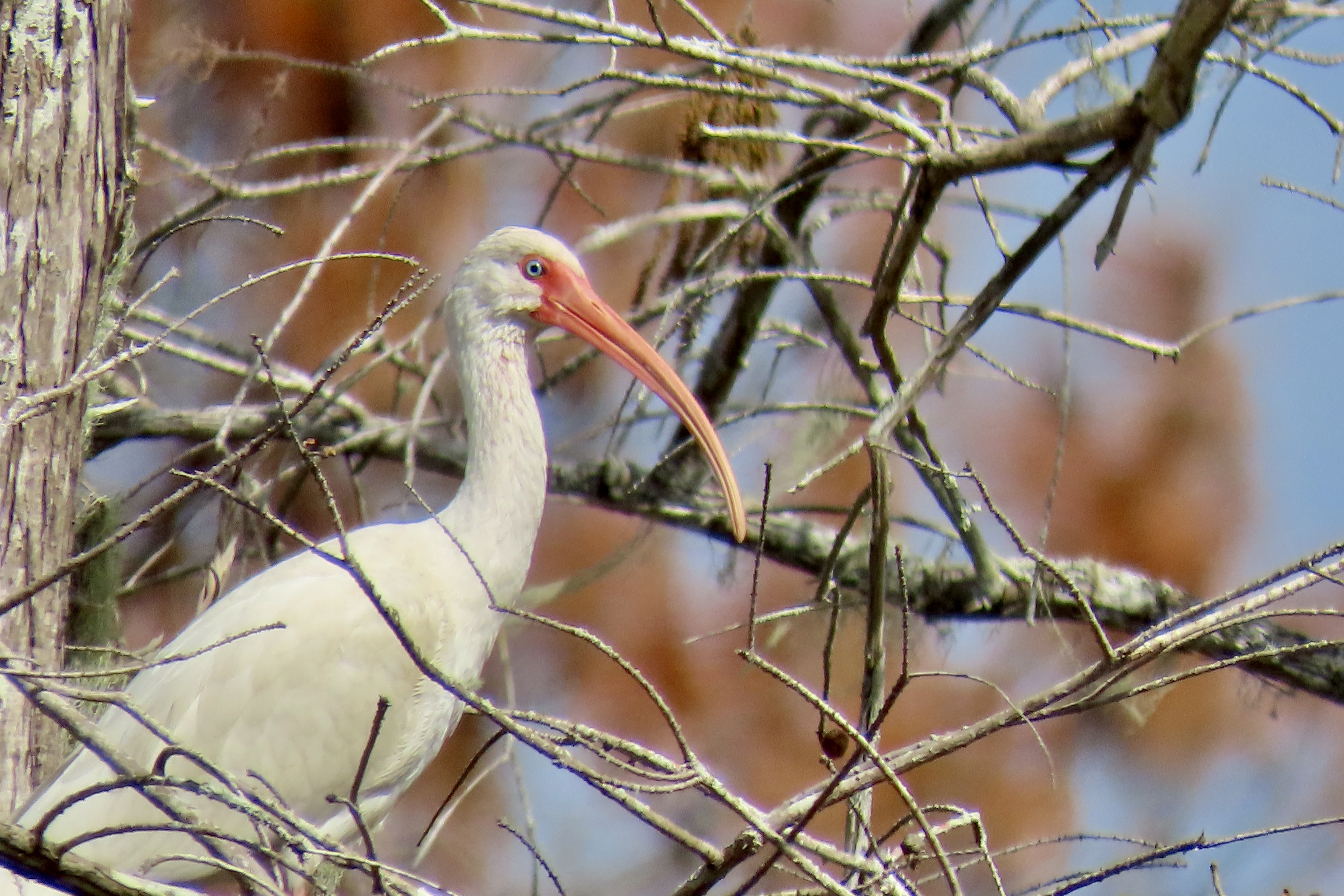
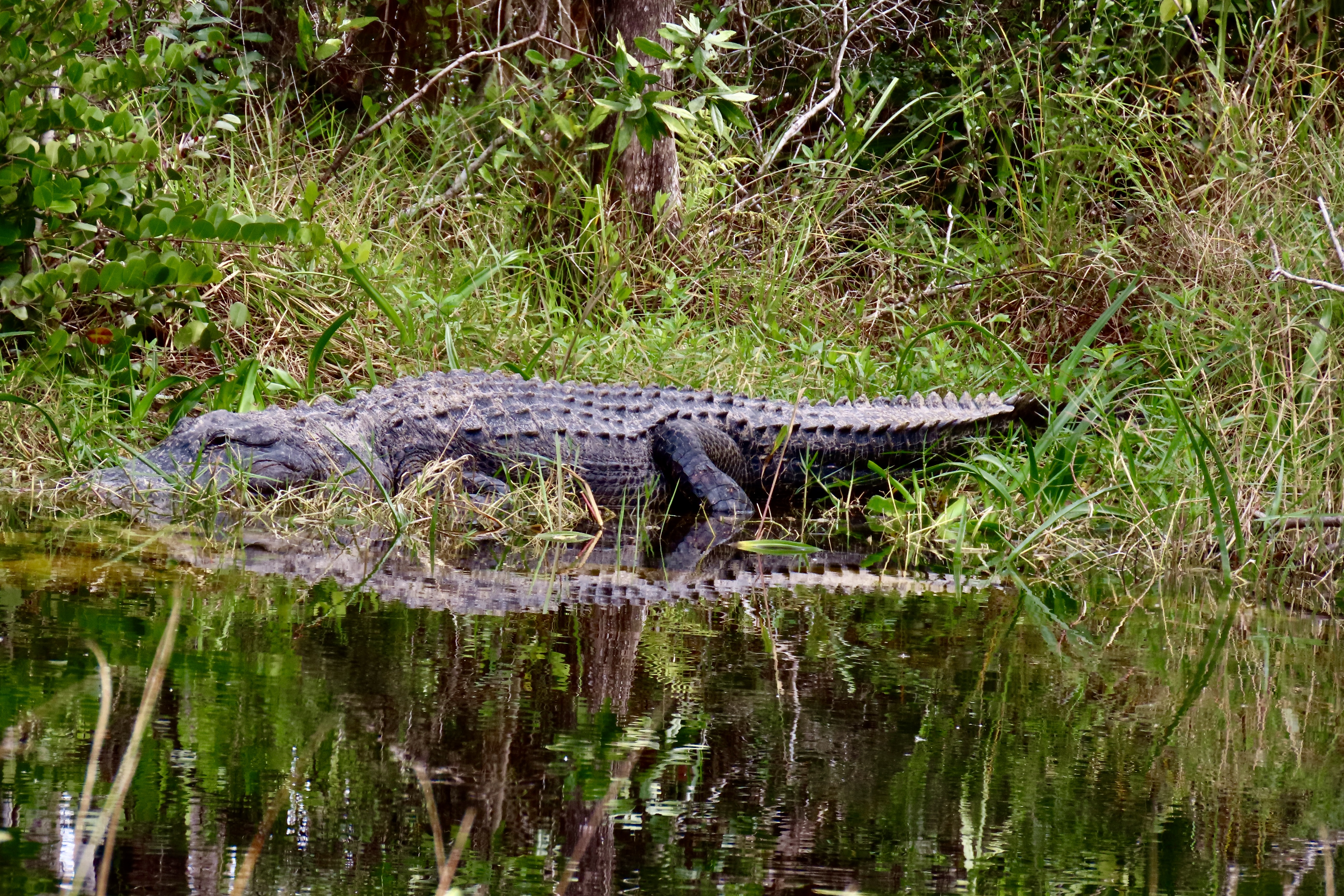
Our first stop was to admire this impressive mangrove. Peggy provided perspective. Shortly afterwards, we came on this colorful bird that was busily walking over lily pads. It’s a Purple Gallinule.Quite the stretch! Check out the feet.Pretty amazing, huh.Next on our list of colorful birds along the Anhinga Trail was this great blue heron.Head shot.Here’s another shot of the googly-eyed Anhinga. One of its relatives was busily fishing in the pond below.Anhinga style, only its head was above the water. We liked the shadow.It had been fishing under water and came up for air here.A turtle also swam by underwater while we were watching the Anhinga.In addition to the wildlife, the scenery along Anhinga Trail is also quite attractive. A loud noise in the middle of it caught our attention…A large alligator had raised its head among the trees and was bellowing.A close up. Remember, one way you can tell the difference between a crocodile and an alligator is that the crocodile shows its teeth. The alligator doesn’t. Another is the alligator has a shorter snout.Having made his point, whatever it was, the big fellow swam toward us. We liked this photo as well.One of our stops along the way toward Flamingo was the Mahogany Hammock Trail where we found this great egret. I called it scruffy neck. They say that great egrets have really long necks.That would certainly appear to be true from this photo. But it got longer…We wondered if it had inherited giraffe genes!A head shot. Our glamping tent in Flamingo. It had a good view of Florida Bay. Low tide brought in various birds to take advantage of the the feast it made available.Among them were these guys hungrily scarfing down miscellaneous delicacies, at least from their perspective. While they may seem like different birds, they are all white ibis in their various development stages from juvenile to adult. A reflection shot of one of the adults.A snowy egret joined the white ibis.I close with this shot of the egret. Next up, we take a look at some of the excellent wildlife carvings we found in Victoria Falls, Zimbabwe and take you to the workshop where they were made. You will be surprised.
Well maybe not pretty, but we thought the neck colors of this wood stork we found standing next to the road in Big Cypress National Preserve rather striking. We asked her if she hired out for delivering babies. Her response was, “Are they tasty?”
Peggy and I visited two different areas during our recent trip to the Everglades. The first was Everglade City that I will be blogging about today. It’s a small town on the southwest Gulf Coast that has a feel of old Florida. It’s far away from the huge populations and hustle-bustle of the southeast coast where Miami reigns. We could easily walk anywhere in town and meet friendly people, including a few old timers who fit the description of quirky. Our kind of folks.
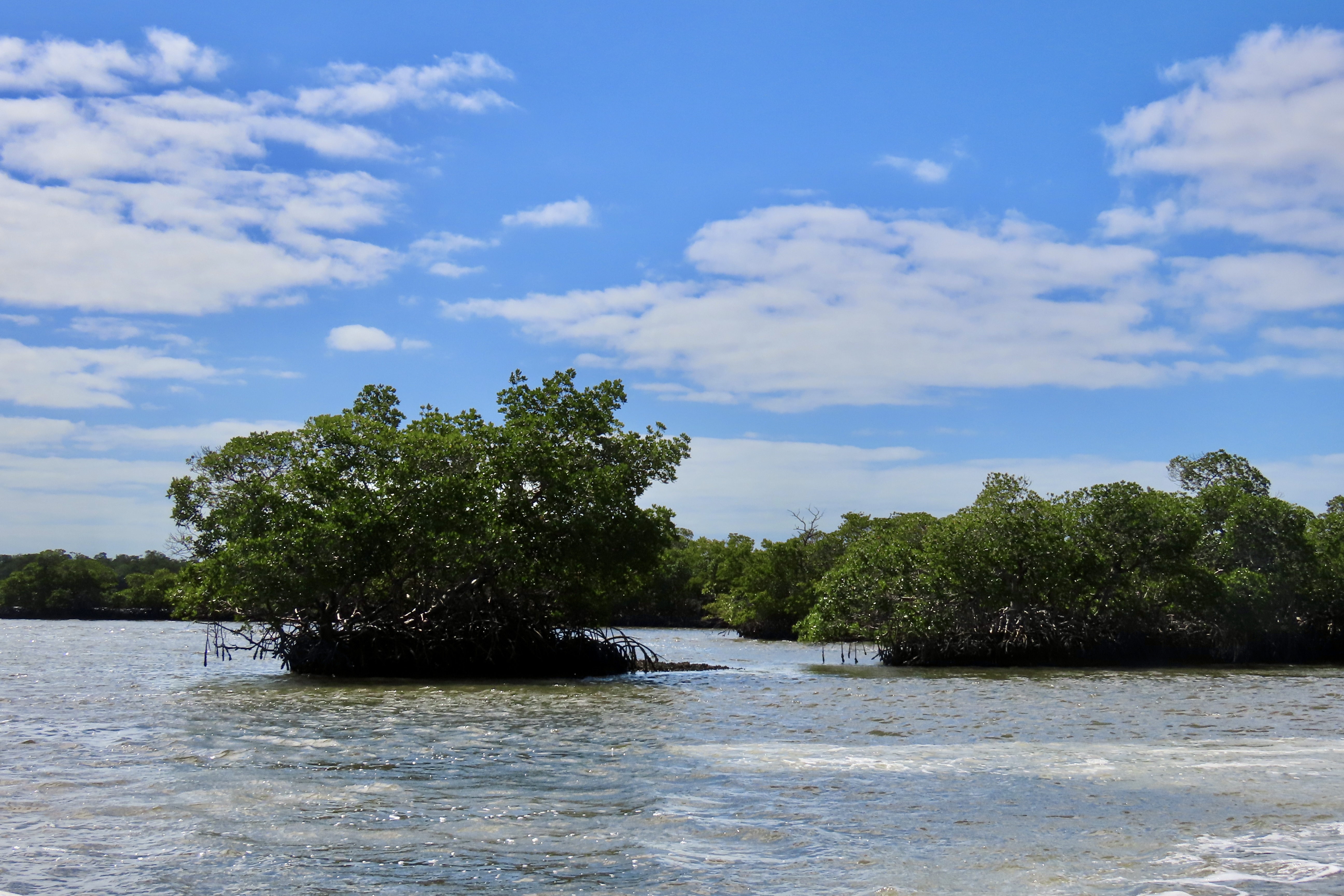
The town’s primary source of income is the tourist trade that comes to experience the natural wonders and adventures provided by the Everglades 10,000 Islands and the Big Cypress National Preserve. Local businesses offer a variety of options for exploring inside and outside of the park from airboats and swamp buggies to eco-tours and kayaks. We chose a motorboat eco-tour for the 10,000 Islands area. To start, we drove south from Everglade City for a couple of miles to Chokoloskee Island and the end of the road. Our objective was the old Smallwood Store, which does double duty as a museum and a tour center. The store provided a perspective on the first white settlers in the area. We met out tour guide/boat captain there and headed out into the 10,000 Islands with one other couple. Following are a few highlights.
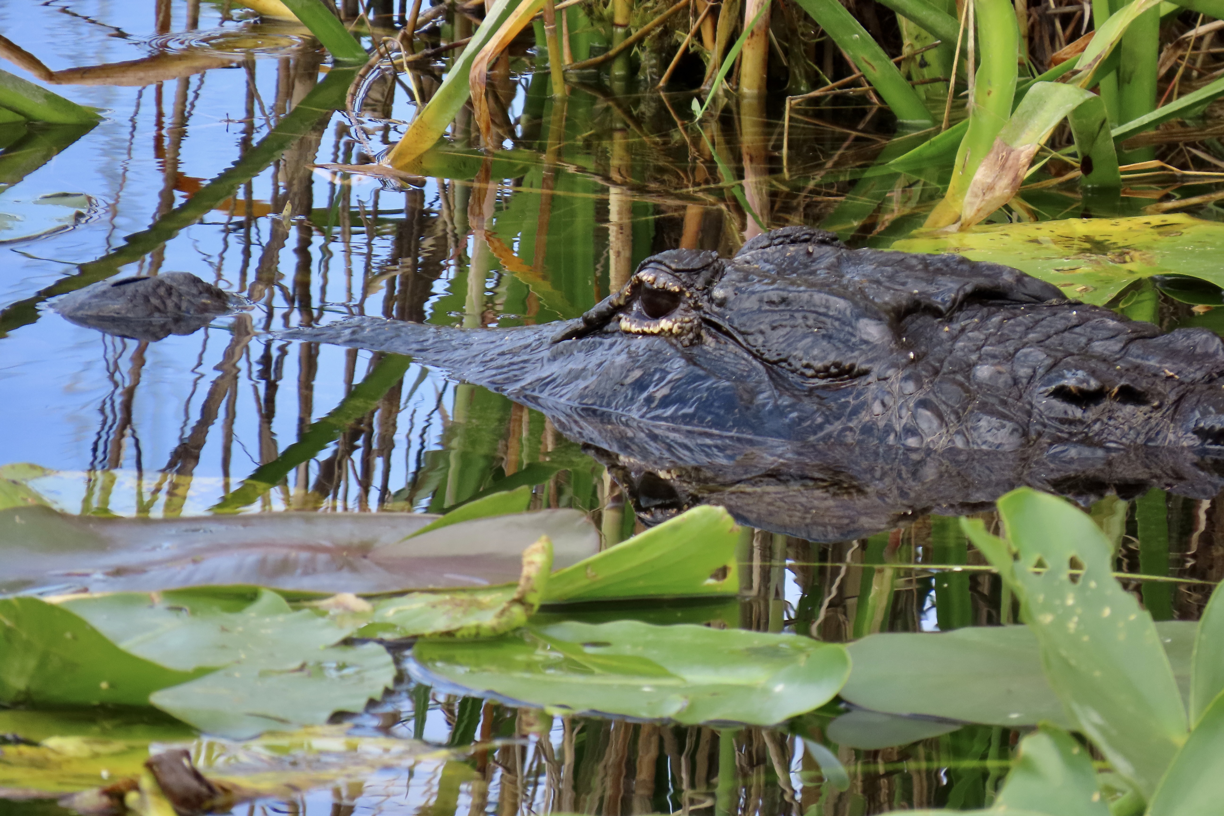
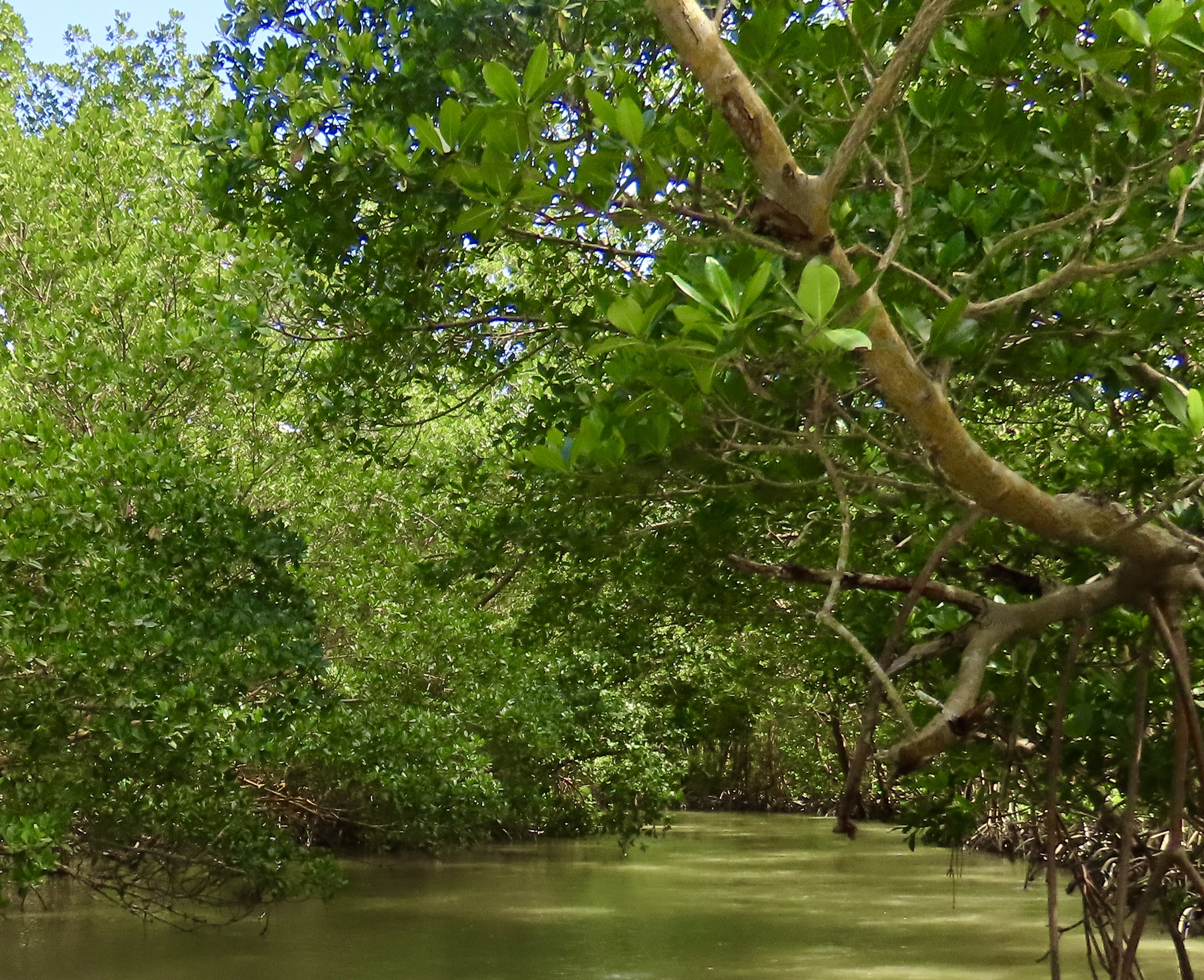
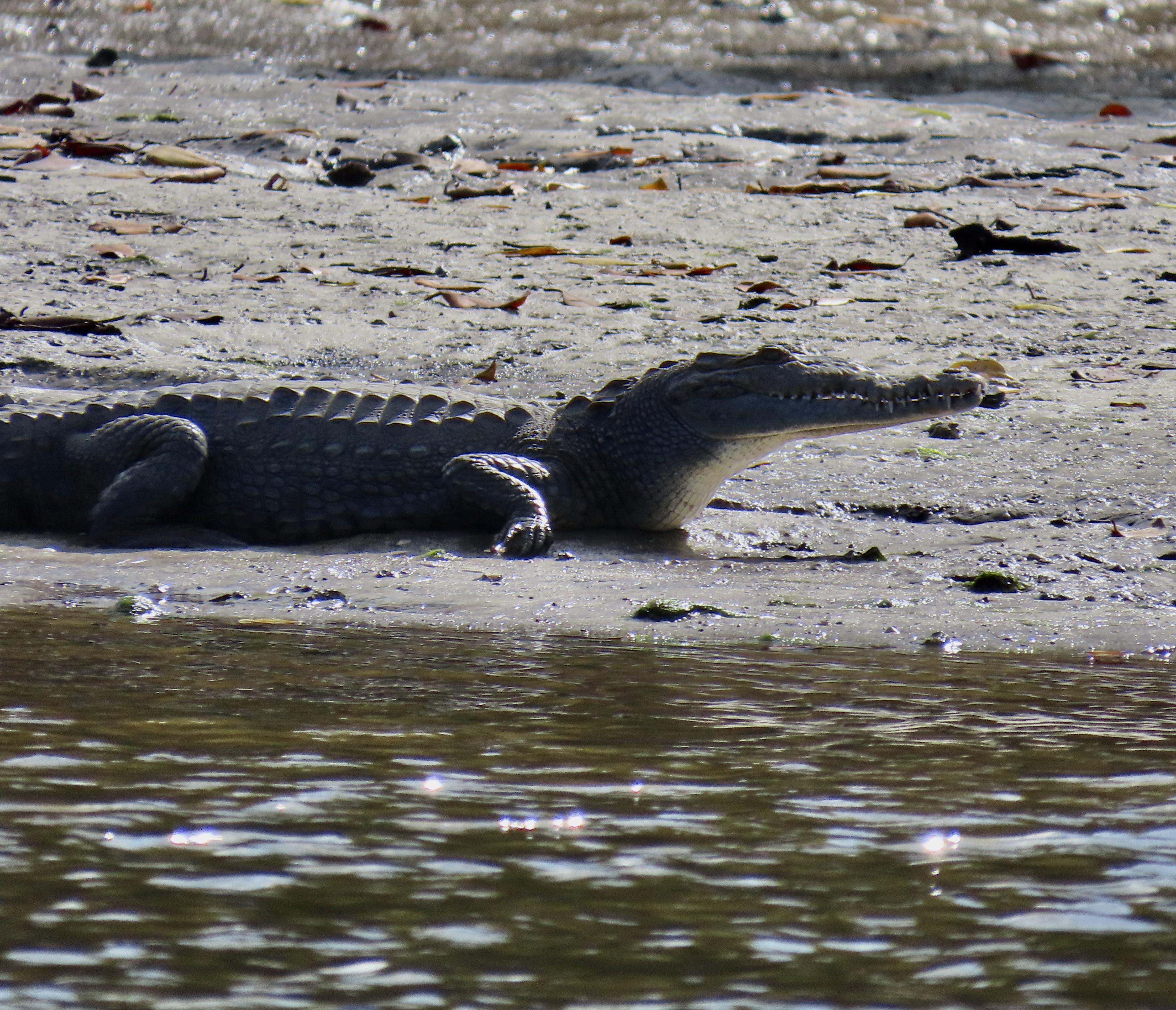
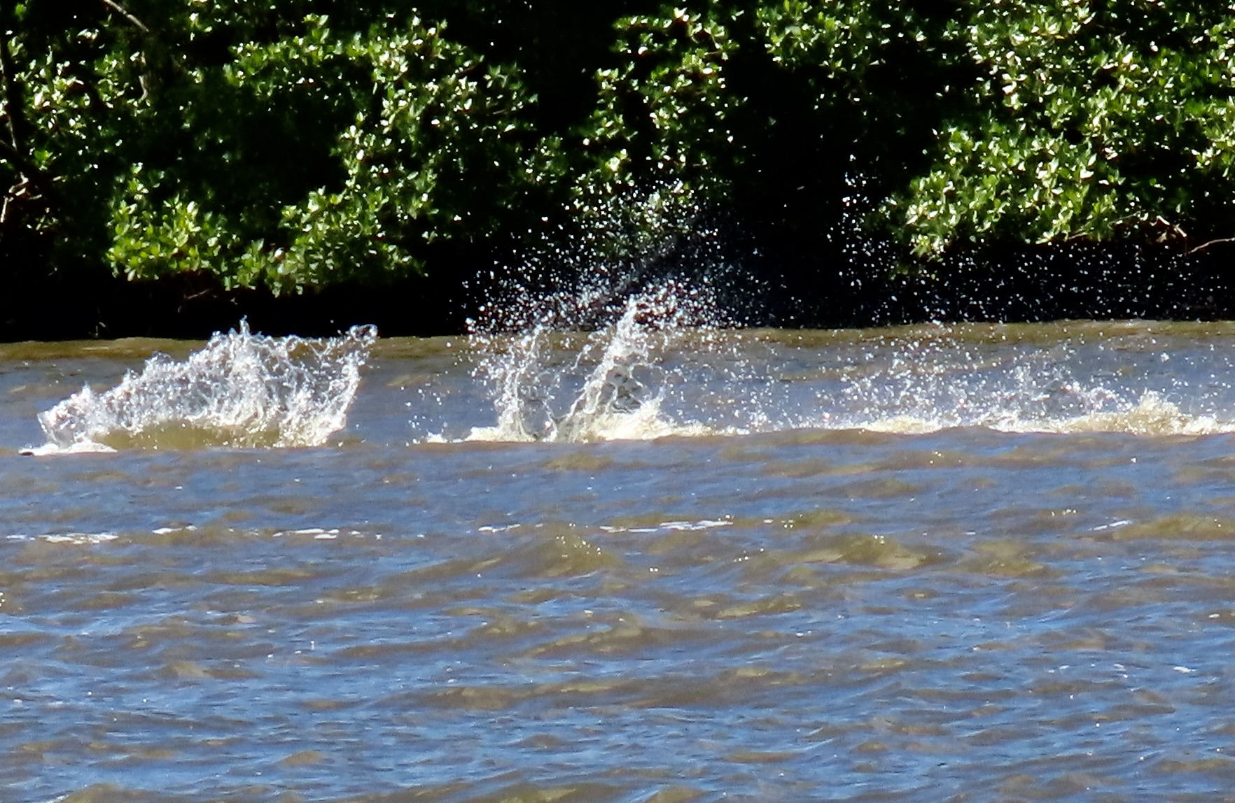
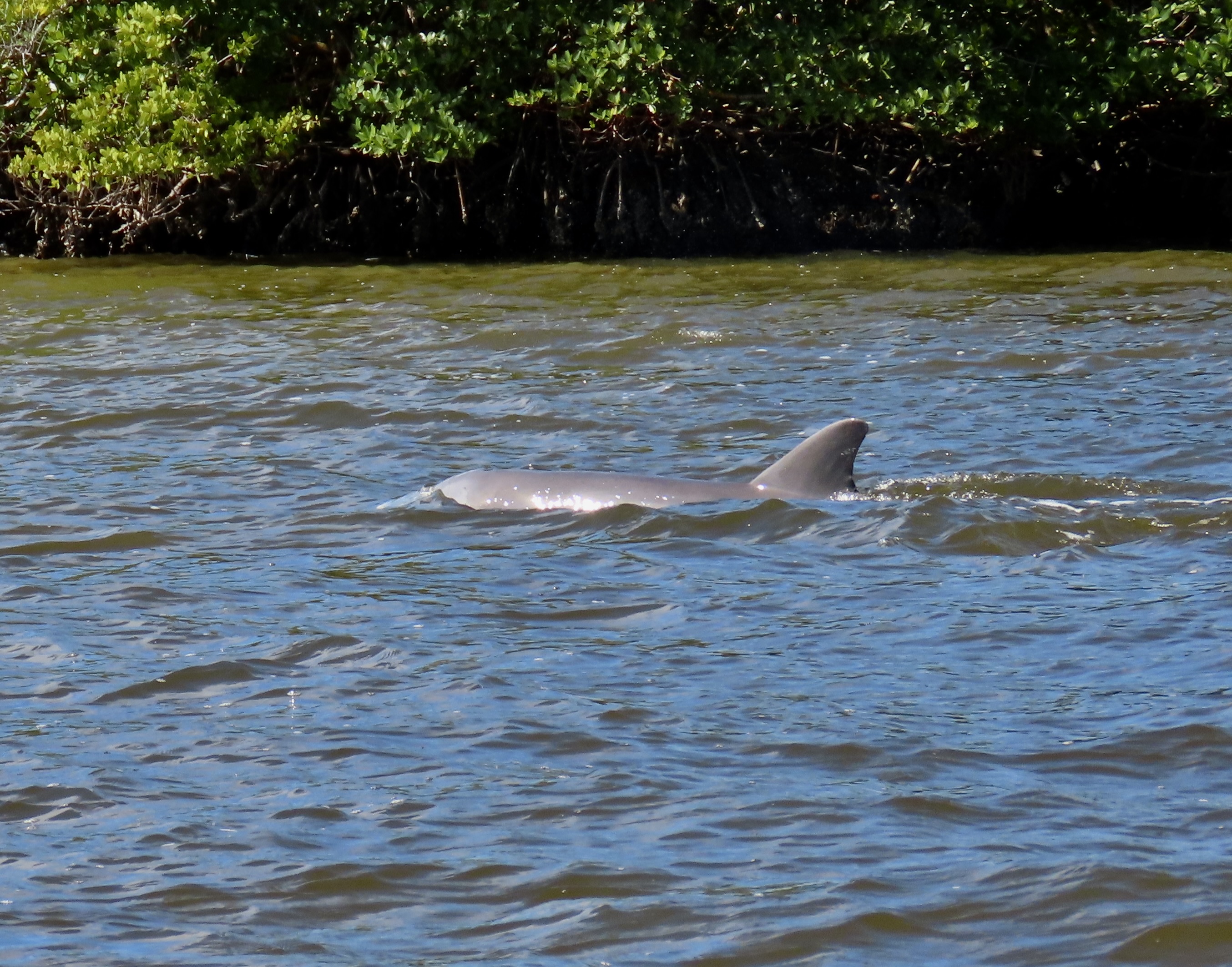
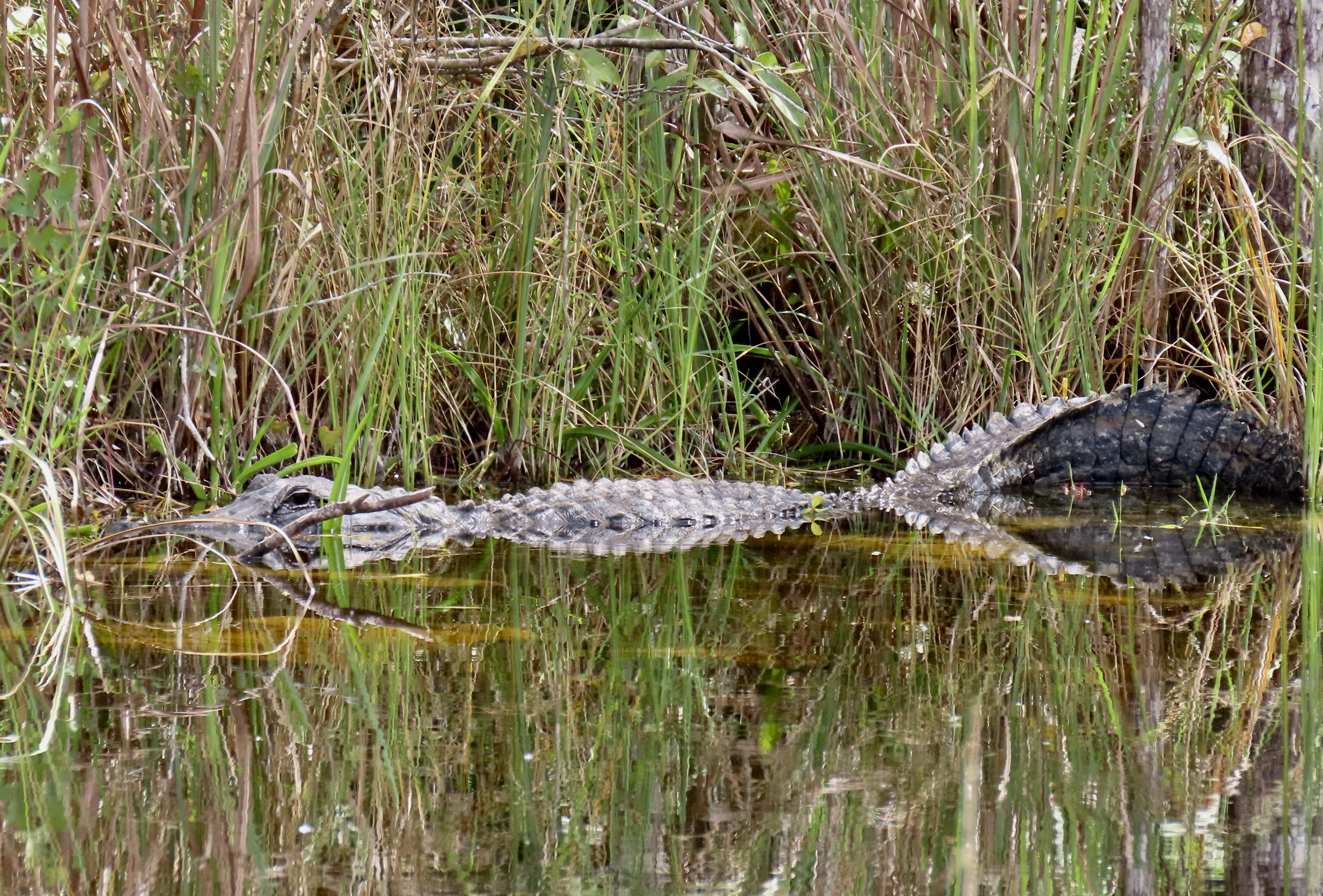
Three different species of mangroves provide the base for most of Florida’s 10,000 Islands. These trees have adaptations that allow them to take in extra oxygen and to remove salt that allows them to thrive in coastal intertidal zones. The creation of new islands is an ongoing process. 10,000 is a guesstimate at best. Our two hour trip took us through the relatively open waterways shown above to the enclosed jungle-like canal shown here. Speed varied from zoom to put-put with occasional stops to admire the local flora and fauna.The Everglades are one of the few places on earth where crocodiles and alligators co-exist. While our small, bouncy boat wasn’t the best platform for photography, it’s easy to see that this is a crocodile from its long, thin snout and visible teeth. Our tour through the 10,000 Islands also produced this colorful bird with its interesting top-knot, a yellow-crowned night heron.Something moving very fast left this trail through the water in a split second. Can you guess what it was?It was a dolphin. Several of them had chased fish into the shallow water and were working to catch them. I had never realized how fast they are. Apparently they are quite common in the area. One tour operater offered, “If you don’t see dolphins on our trip we will refund your tickets.”
After our tour, we stopped at a local Chokoloski Island institution, the HavAnnA Cafe for lunch. It’s a charming, roofed-over, open air restaurant with lots of greenery— and chickens. A flock came clucking through while we were eating, eager to pick up any crumbs that had escaped to the floor. “The officials won’t let me sell their eggs to our customers,” the owner complained to us. I was both surprised and pleased that the officials allowed the chickens visiting rights at all. I did see chicken on the menu, however. I ordered a Cuban Sandwich instead.
We decided to drive ourselves on a tour of the Big Cypress National Preserve, which was just north of Everglade City. The name of the road we would start on is Birdon Road. How could we resist? And it was true. The three roads we drove over— Birdon, Wagon Wheel, and the Turner River— followed streams and were packed with birds, and alligators.
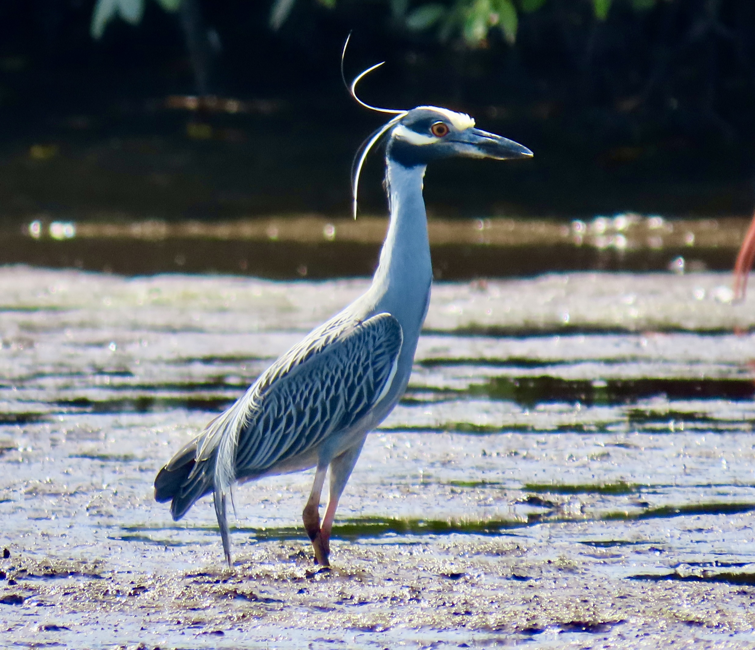
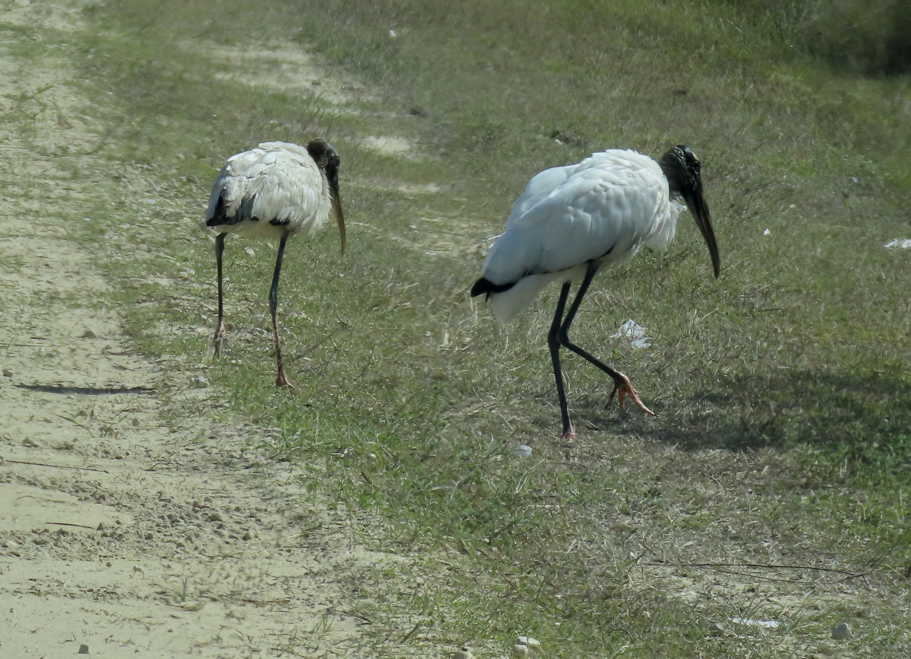
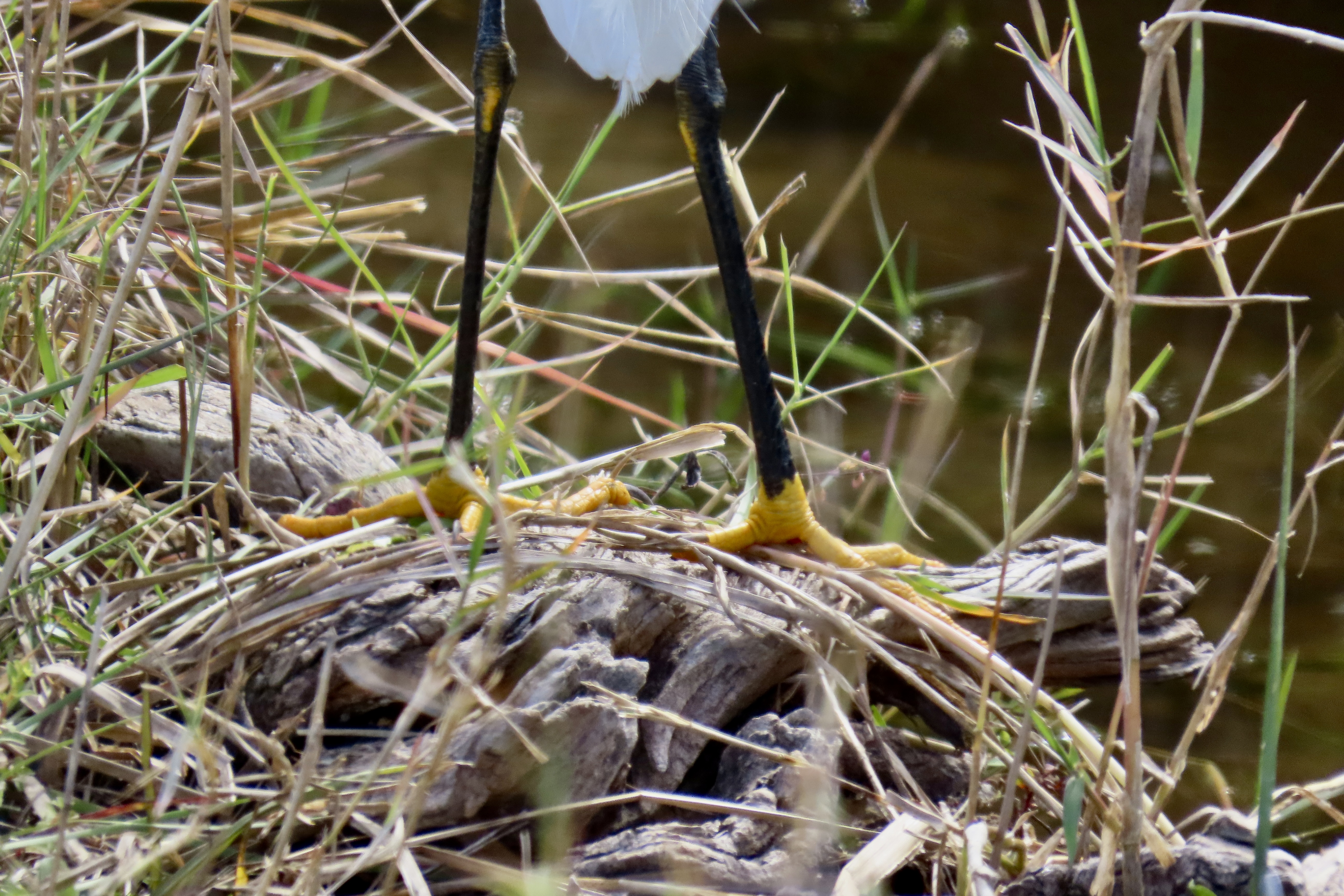
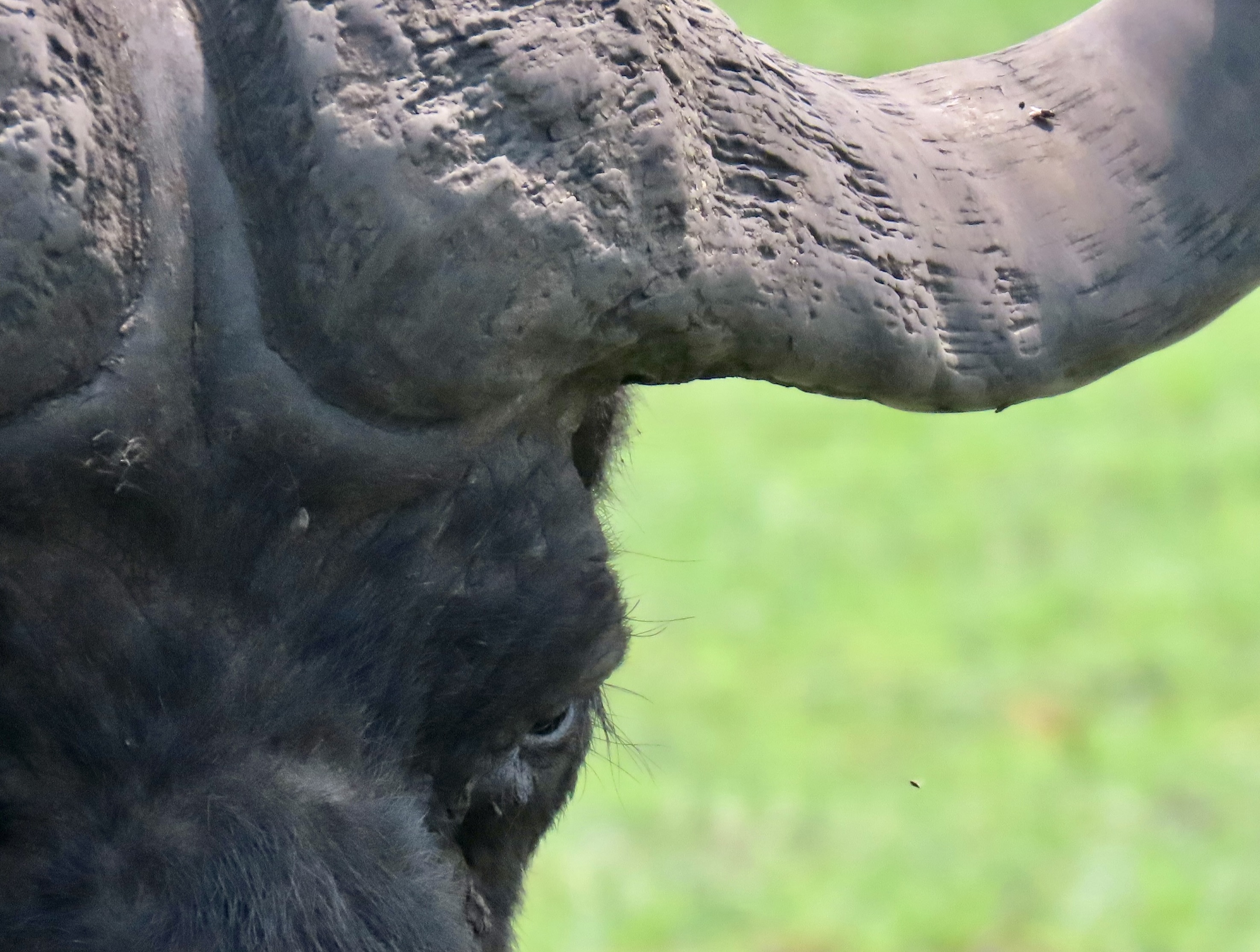
A pair of wood storks barely bothered to move off of Birdon road as we drove by.An osprey seemed surprised by our presence. A snowy egret hovered over a stream where it was fishing.One of the defining chacteristics of a snowy egret is its yellow feet. Hard to miss!Close up.This snowy egret was perched in a tree. One of the streams we followed through the Preserve.This great white egret was surveying its world from the top of a tree.Another view.We found another one fishing by the stream and took a close up.A great blue heron flew away before we could take his photo. “Be that way,” I called after it and snapped a photo in flight. An anhinga twisted its neck so it could keep an eye on us.A white ibis was also curious.We also found alligators lurking along the stream. The clearness of the water and the time of day led to some interesting reflection shots.…such as this.And even more so here! I’ll wrap up today’s post with this ‘two tailed’ example. At first glance, Peggy and I thought we had spotted a monster! The next blog will be on the most dangerous animal in Africa, the Cape buffalo.
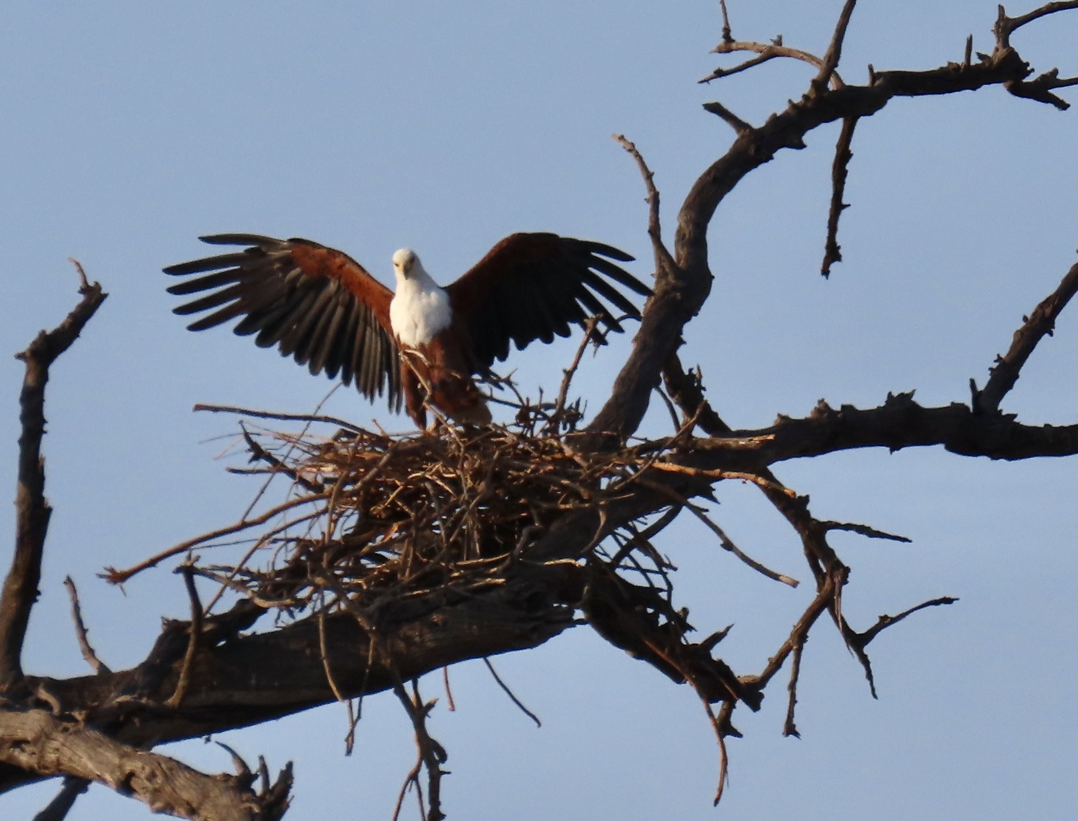
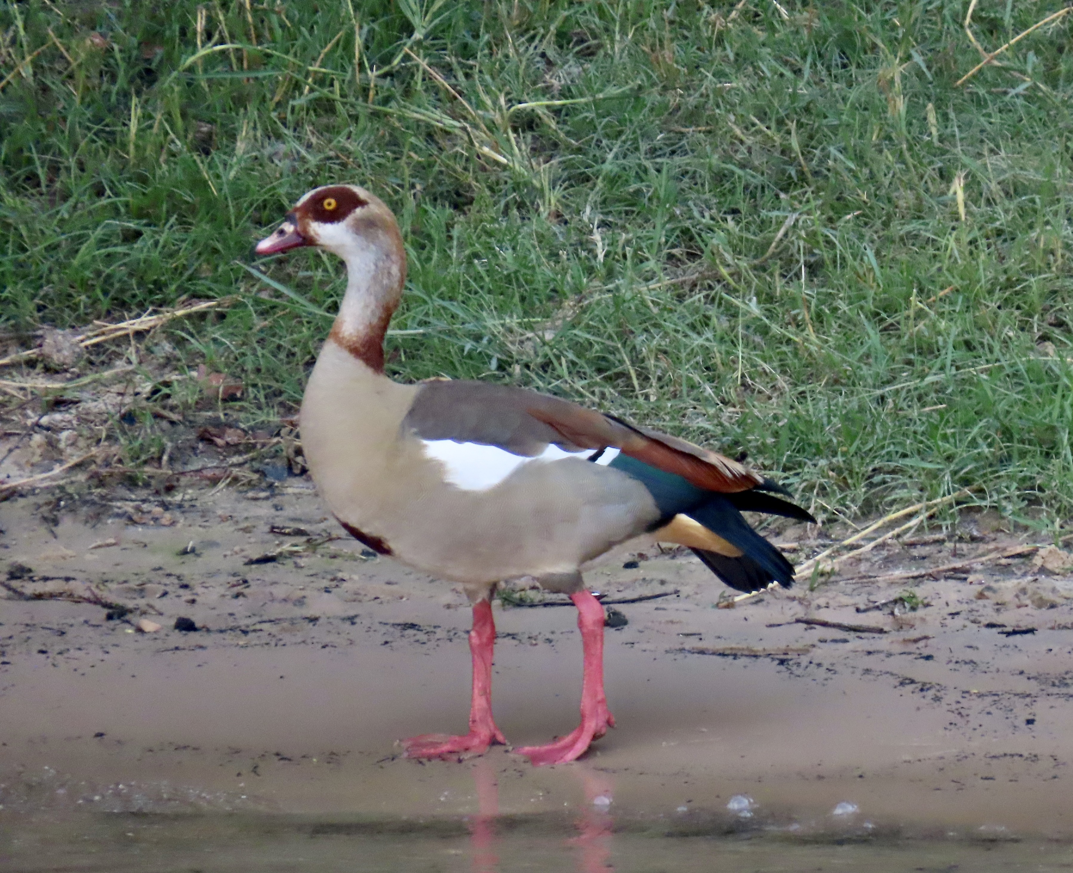
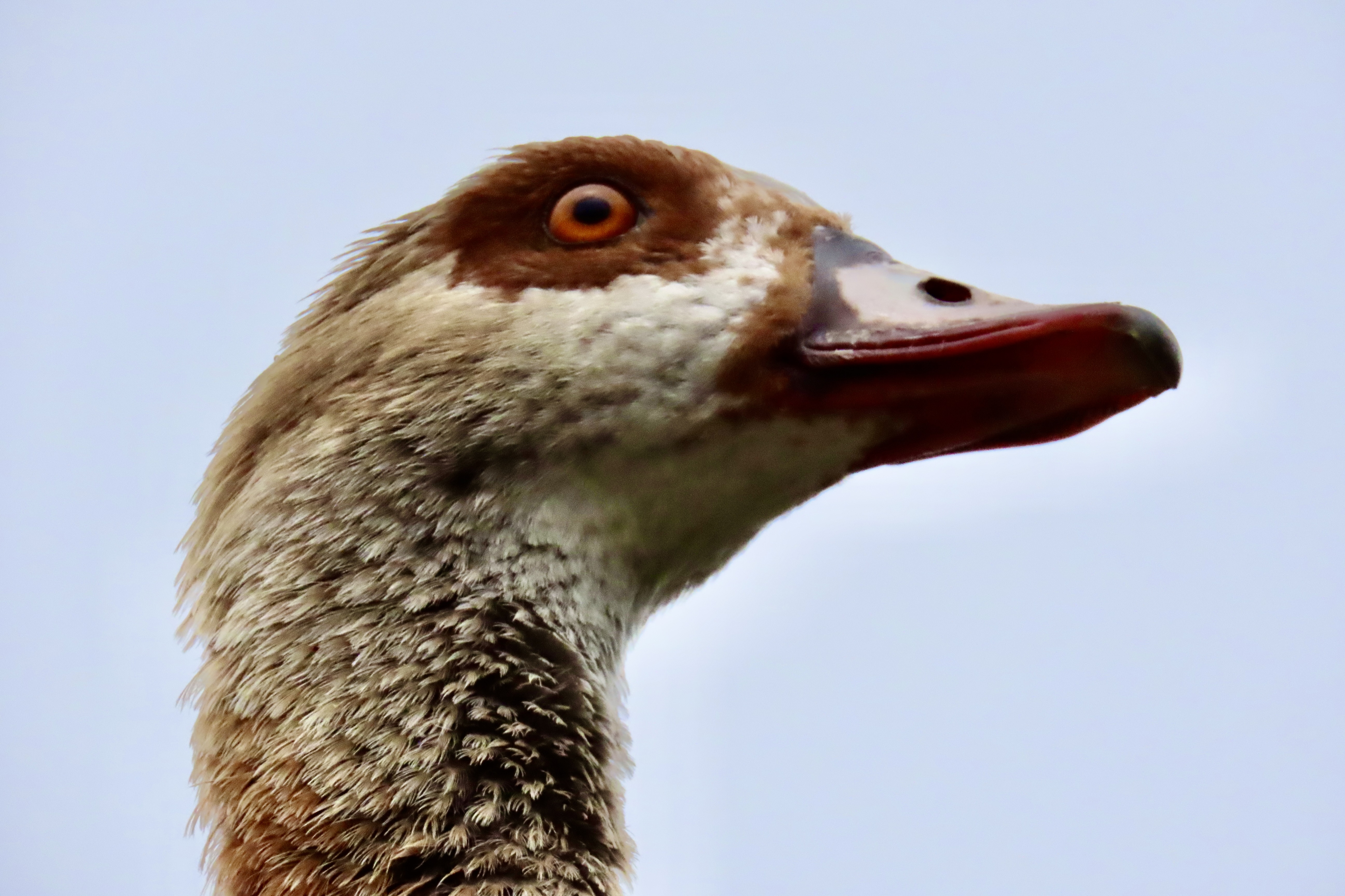
This stunning bird is an African sea eagle. Not surprisingly, it is the national bird of Malawi, Namibia, Zimbabwe and Zambia. Its national status, white head, and diet of fish immediately reminded us of America’s bald eagle. We had one that lived near our home in Oregon that flew by on occasion, looking for breakfast along the Applegate River. We watched it vary its diet one day, dive, and take a snake out of our yard, a very unhappy snake. The African fish eagle goes for reptiles on occasion as well. It has a taste for baby crocodiles. It also eats carrion like the bald eagle, but not with the same passion. When I lived in Alaska, I watched bald eagles tear into dead (very smelly) salmon with delight. I found it amusing that Ben Franklin felt that the eagle’s dining behavior gave it ‘bad character,’ and argued that the turkey should be the national bird of the fledgling nation.Another perspective on the African fish eagle. The chestnut color on its wings adds to its beauty.Sea eagles are thought to mate for life. We watched one in the distance as it added sticks to its nest. They tend to use the same nest year after year, adding on to it each time creating bigger and bigger homes that can reach over 6 feet in diameter.It then provided us with an opportunity for an iconic photo. We thanked it.We caught this photo of a juvenile fish eagle perched on a rock next to Lake Kariba in Zimbabwe.We have a copy of an Egyptian Goose painting on our wall that I brought back from our trip up the Nile a year ago. The original is in the Egyptian National Museum and came from a temple where it was painted over 4000 years ago. It was considered a sacred bird. I doubt this goose (which is actually a duck) is aware of its ancient history, but it does seem to be aware that it is a ‘pretty bird.’While the Egyptian Goose’s natural home is on the Nile and throughout sub-Saharan Africa, its striking good looks have led it to be imported into England and a number of other nations where it is now found in the wild.Egyptian Geese form strong bonds and mate for life. We saw a number of couples. These two on the edge of Lake Kariba seem to be marching in unison.We were in a park in Cape Town, South Africa when we came upon a gaggle Egyptian Geese.A lone goose was perched above the gaggle, possibly on guard duty.I snapped his photo. That’s it for today. On Wednesday we are going to feature the Naples’ Florida Botanical Gardens. On Friday, it will be all about crocodiles! We will be deep in the Everglades for the next few days and without an internet connection. I should be back online Thursday.
It’s time for more nature tales brought to you by the wild animals that live on our property and entertain us continually by doing what comes naturally.
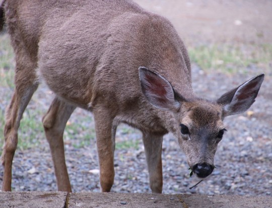
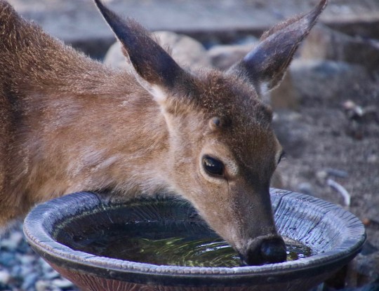
Let’s start with a very pregnant Floppy. This is what she looked like last week when she was grabbing a snack. I’d meant to catch her with a mouth full of oak leaves, but she’s fast when it comes to scarfing down food. It seems that the twigs sticking out of her mouth were dessert. She waddled off searching for more.Here she is on Monday! Notice the difference! Our very pregnant deer had become svelte! She has had her fawn, or fawns. Don’t expect to see it for a couple of weeks, however. It is carefully hidden away in our canyon. Babies are born virtually odor-free so predators can’t smell them. Ask a coyote. They also know how to freeze in place. I’ll do one of those ‘cute’ posts if and when Floppy brings her fawn or twins around.
Our property is a regular herpetarium. We have wall to wall lizards ranging in size from tiny babies that have hit the ground running up to foot-long alligator lizards that can scare the heck out of you. We also have skinks, beautifully iridescent lizards with bright blue tails.
Fence lizards dominate, however. You can’t go outside without seeing dozens at this time of the year. They are fun to watch as they scamper across our yard in search of bugs. And they are even more entertaining when they try to impress another lizard by doing push-ups and puffing up their bodies to almost twice their normal size.
They are also quite curious. Or at least they seem to be. Anytime I am outside working around the house, they show up and watch me, often choosing a high perch for a better view. If I do something that chases them away, they’re back in a minute or two. The fellow below came out to watch me when I was building a brick planter around our yellow rose bush earlier this week.
I was curious about the white spot on the back of its head and did some research. I learned that it is called the parietal or third eye. While the lizard can’t ‘see’ out of the eye, it is light sensitive. When a hawk flies over, it skedaddles! A kid’s hand poised to catch it has the same result. The eye is connected to the pineal gland and helps control circadian and seasonal rhythms.
I think we have seen all of one wren since Peggy and I moved here. But a couple of weeks ago, a pair showed up looking for a home. It was pretty funny. The male wren, it turns out, is responsible for house hunting and nest building. The location may be a tree cavity, a birdhouse, a drain pipe, etc. Even an old shoe will do in a pinch. Once he finds what he considers the ideal site, he fills it with twigs and invites his lady love over to check it out. She’s the one that makes the ultimate decision about his nest finding abilities. I can see where she might be concerned if he has picked an old shoe. The poor guy may find himself building 3 or 4 nests before she finally says yes.
I think ours must have been on number four— or maybe five— when he showed her our bird house. He seemed very eager, or maybe he was nervous, like a real estate agent about to close or lose a big sale. He talked and talked and talked. Finally, she hopped in to take a look. And immediately hopped out with a feather in her mouth that she spit out. I could almost hear the discussion. “You are trying to sell me a used house!” “No, no sweetie. Think of it as an already feathered nest.” Whatever he said, she went back inside and came out with another feather. This time she ate it! Apparently that meant yes because the little guy started hopping around and talking twice as fast. Then he zoomed off to pick up some grass to add to the nest. Soon, they were both busy at work.
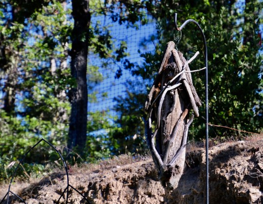
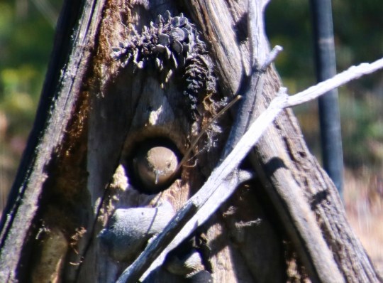
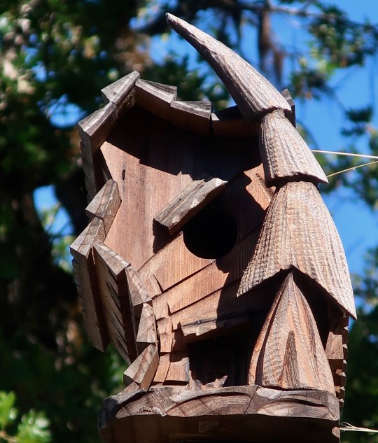
Here’s the new home. BTW, the fence you can see in the background was what the fox was climbing up.The female pokes her head out to take a break from sitting on the eggs.And the male drops by to visit with a typical wren tail flip. Soon he will be busy helping with feeding responsibilities.Peggy put this unique bird house on top of one of the 10-foots posts surrounding our garden. She thought of it as a decoration…But a pair of tree swallows thought otherwise! Now, Peggy is scolded any time she works in her garden. I could watch these birds forever as they perform their incredible aerial acrobatics. They arrive here in March and will leave once their babies can fly. (Photo by Peggy Mekemson.)
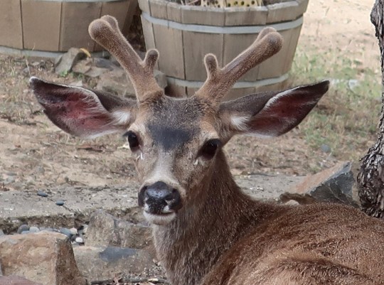
I’ll close today with a few more photos of the deer herd. Do you remember when I did the post on young buck and his fearless leaps over a wall and a fence to get at our honeysuckle and native shrub garden? Well, it turns out he isn’t so young…
You have to have some years behind you to grow a rack like this. He will be at least a three pointer and possibly a four pointer. If you have ever had the feeling that someone or something is watching you…Here he is under the madrone in our backyard. His antlers will be in velvet and continue to grow for at least a couple more months. The rounded knobs suggest that each of the top four antlers may split again. If so, he could be a five pointer!The bucks hang out together at this time of the year. While the older fellow stretched out beneath the madrone, the kid stopped for a drink of water in the bird bath. He also had a message… Be sure stop and smell the flowers.
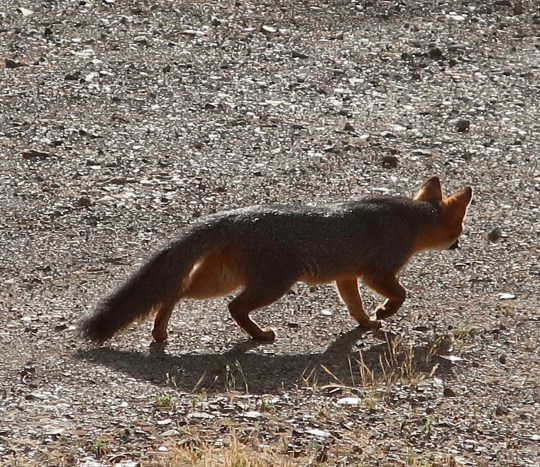
Peggy and I were sitting in our library downing an English muffin and a bowl of fruit on Friday morning when a movement outside caught my attention. A fox was climbing our eight-foot deer fence after a Stellar jay that was hassling it. Once again we found ourselves in a zoo looking out from our comfortable cage. The fox climbed down, made its way through our shrub garden, and climbed under the fence. I took this photo right after it climbed under the fence.
We weren’t fast enough with our cameras to catch the fox climbing the fence. We sat there in awe for too long. But fortunately, the fox was having a leisurely morning and hung around for a few minutes..
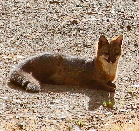
Given its reddish color, my first thought was red fox, but its black capped grey tail and climbing ability quickly identified it as a grey fox. Grey foxes are the only ones that climbs trees (and apparently deer fences). They have even been known to raise their families in tree dens high above the ground. We catch glimpses of them occasionally on our property but normally they are secretive. One time, we watched a doe stalk one, following along behind, carefully raising and placing each hoof. That was neat.
My guess is that they have a den (or dens) on our property. The male and female raise the kits together. For the first couple of weeks the mother tends to her babies while the male hunts and supplies food. Our experience is that they form a close bond. A few years ago a fox was run over on the highway below our property. Each night we would hear its partner howling down on the road. Only when I went down and buried the fox did the howling end.
The fox plopped down in our driveway for a brief rest. I suspect he was on his way home after an early morning hunt. (Photo by Peggy Mekemson.)He then looked up at us. Note the short legs. The literature says that’s what allows foxes to climb trees.And then he was off on the hunt again.
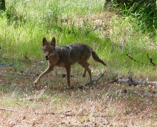
Having enjoyed the fox, it was only appropriate that we would see a coyote as well. We met up with it last week as we were hiking in the forest behind our house. It seemed as curious about us as we were about it.
It came trotting up through the forest and didn’t see us at first. Then he stopped and checked us out. I thought it looked quite regal. The coyote stared at us for a couple of minutes. I thought it might continue up toward us but it headed off in the other direction, stopping every few feet to look back at us.
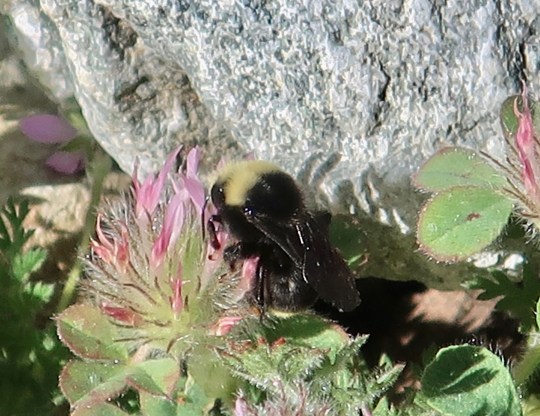
This is hot off the press, and it isn’t about Covid-19. Woohoo! I was skimming through Apple News this morning and I came across an article that bumble bees bite plants. How could I not read the article? Had the plants somehow irritated the bees. Was there a bee-plant war going on? No, there wasn’t a war. The bees depend on the pollen from the plants for their survival. But they were irritated. The plants weren’t blooming and providing the pollen. So the bees bit the plants to speed up the process. Apparently it cuts two to three weeks off the wait period. I rushed outside to see if I could spot a bumble bee biting a plant. No luck, the flowers were already blooming. I did catch a couple of photos of bumble bees harvesting pollen, however. I conclude my post with them. Bzzzzzzz.
Bumble bee harvesting pollen from the clover that grows in our back yard.
NEXT POSTS: Tomorrow I’ll take you window shopping in Venice. Thursday: Part 2 of nature tales. Among other things, you will meet a Buddhist lizard.
Unusual rock formations created by minerals from dripping water led the Oregon Caves to be set aside as a national treasure in the early 1900s.
Claustrophobia: A fear of confined places
Acrophobia came up in my blog about Mt. Whitney. No surprise there, thousands of feet are between the hiker and a rather unfortunate landing. Splat! It’s a reasonable fear. Claustrophobia is just as real as fears go, but more irrational. The odds of being squished in a tight space— unless you are Indiana Jones or a misplaced wookie caught in a starship’s garbage disposal unit— are between slim and none. Don’t sweat it, right?
Try telling that to someone who is claustrophobic. I suggest you don’t stand between her and the exit. I get it. I am not particularly fond of enclosed spaces myself, whether they are physical or mental. I don’t like driving through tunnels and I hate freeway construction where imposing cement barriers shrink down to your vehicle’s width and provide a view of what hell is like. And that’s even before the gigantic truck comes barreling down on you and breathes fire up your tail pipe because you insist on driving 45 MPH in a 45 MPH zone. At least I can take my revenge when they put up plastic cones instead of cement barriers, as Peggy might tell you. Crunch. Curt strikes another blow for freedom.
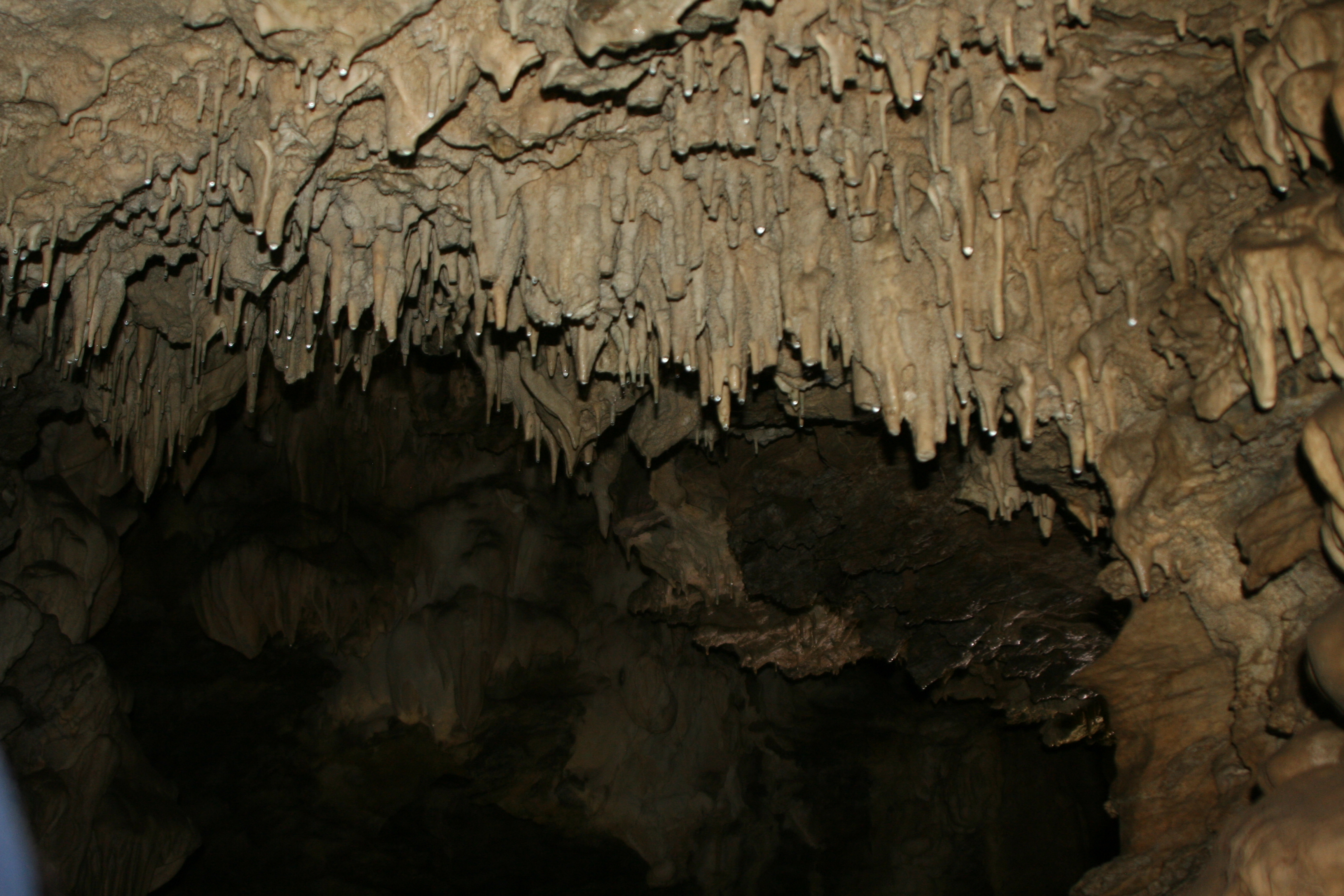
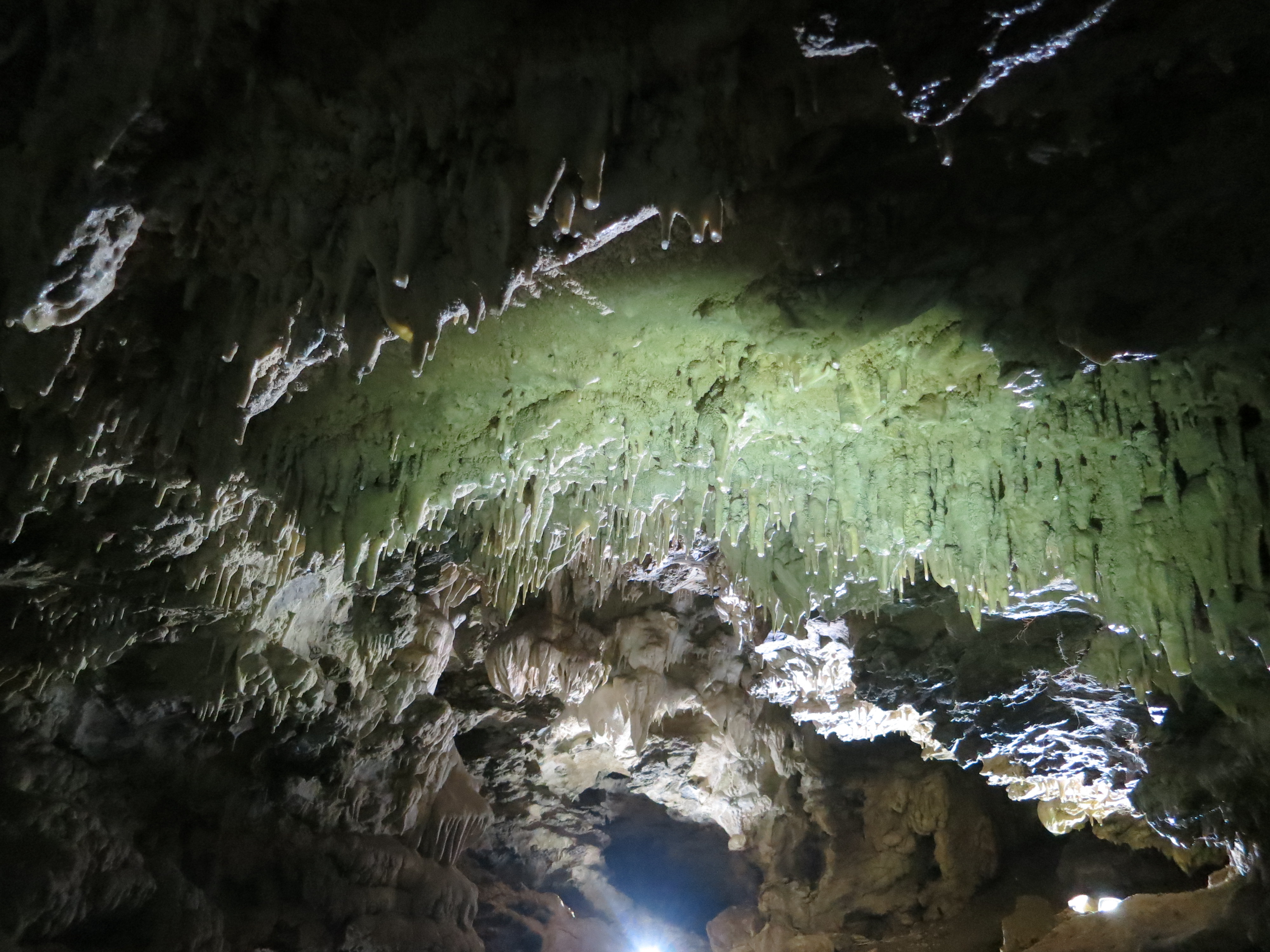
Where does this leave me with caving, or spelunking, as the sophisticates call it? How do I feel about getting down on my belly and crawling through a space my skinny fourteen-year-old body would have gotten stuck in several hundred feet under ground? Not a problem; it’s not on my to-do list. But for some unfathomable reason, the standard well-known cave tours don’t bother me. In fact, I find them fascinating. Stalactites and stalagmites tickle my fancy and stir my imagination.
These small stalactites show tiny drops of mineral laden water that come down from a tube in the center of the stalactite. They will add about an inch of growth in a thousand years. (Photo by Peggy Mekemson.)
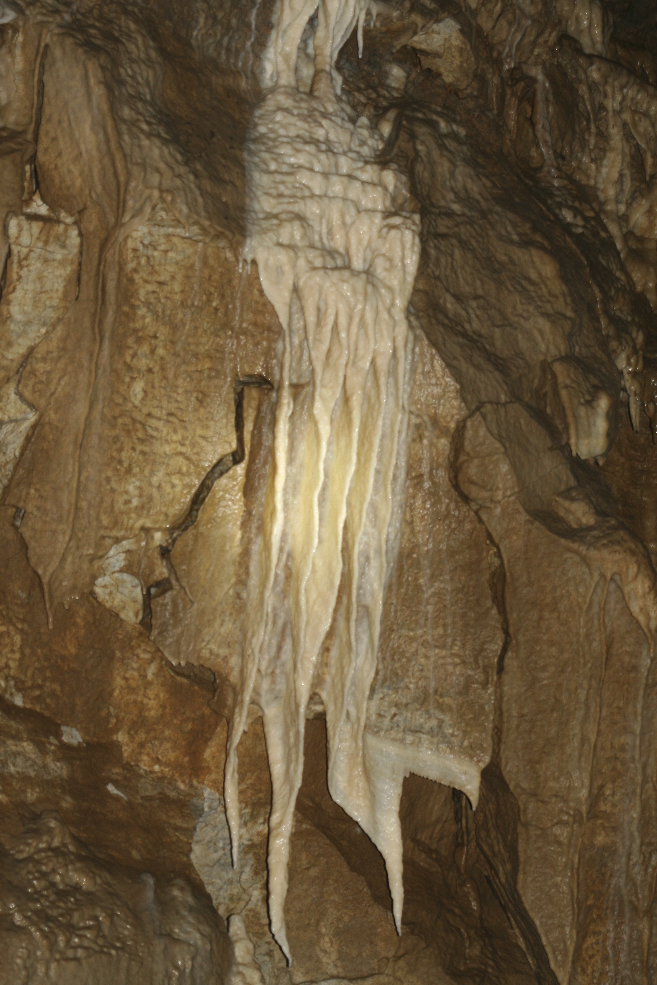
This photo from Oregon Cave National Monument shows the development of stalactites (coming down) and stalagmites (going up). Eventually they meet, as demonstrated on the left. (Photo by Peggy Mekemson.)
So when Peggy suggested we head off to the Oregon Cave National Monument for her birthday a couple of weeks ago, I readily agreed. We’d been talking about it ever since we moved to Oregon. Except for the last few miles of the road that shot up a mountain and redefined the meaning of curves, the hour and a half drive was quite pleasant.
A ranger greeted us and gave us the bad news. We should expect a two-hour wait. He also wanted to know if we had been in any eastern caves in the last five years. If so— no go. White nose syndrome was wiping out eastern bats. So far their western cousins had lucked out. It had been six years since we had visited Mammoth Cave in Kentucky. We were in by a cat’s whisker.
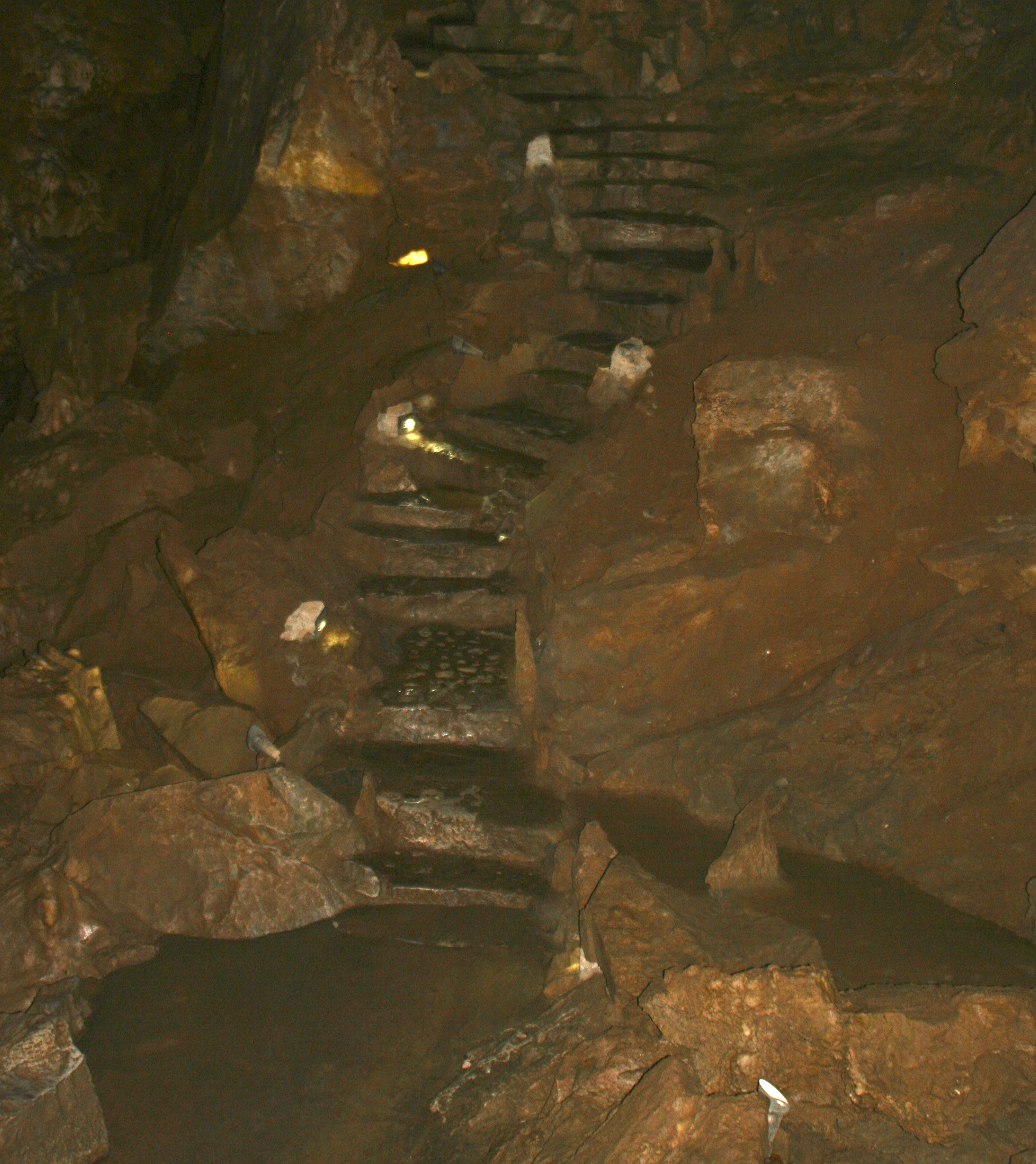
Our wait turned out to be just over an hour. There was barely time for lunch and a look through the visitor’s center before we found ourselves at the cave entrance shivering from a blast of 44˚ F air. “Cave’s breathe,” our guide stated. He also told us about the 500 narrow stairs we would be negotiating and the low ceilings. I would be bent over double with my size 14 shoes balanced precariously on wet slippery rocks. I looked enviously at a small girl who would be standing up straight with her feet resting solidly on the narrow stone steps. She gave me an impish grin.
Dimly lit stone steps make their way up from what is known as Ghost Cave. The narrowest ones were about half the depth of my size 14 shoes. (Photo by Peggy Mekemson.)
The Oregon Caves are somewhat unusual in that they are made out of marble. Once upon a time they were a coral reef far out in the Pacific. Plate tectonics sent the Pacific Plate diving under North America and scraped off portions of the ocean floor some 100 million years ago, adding new land to the continent. The tremendous heat and pressure involved changed the lime into marble. Folding, faulting and water created the caves.
This map shows the location of Oregon Caves National Monument. (Center Right)
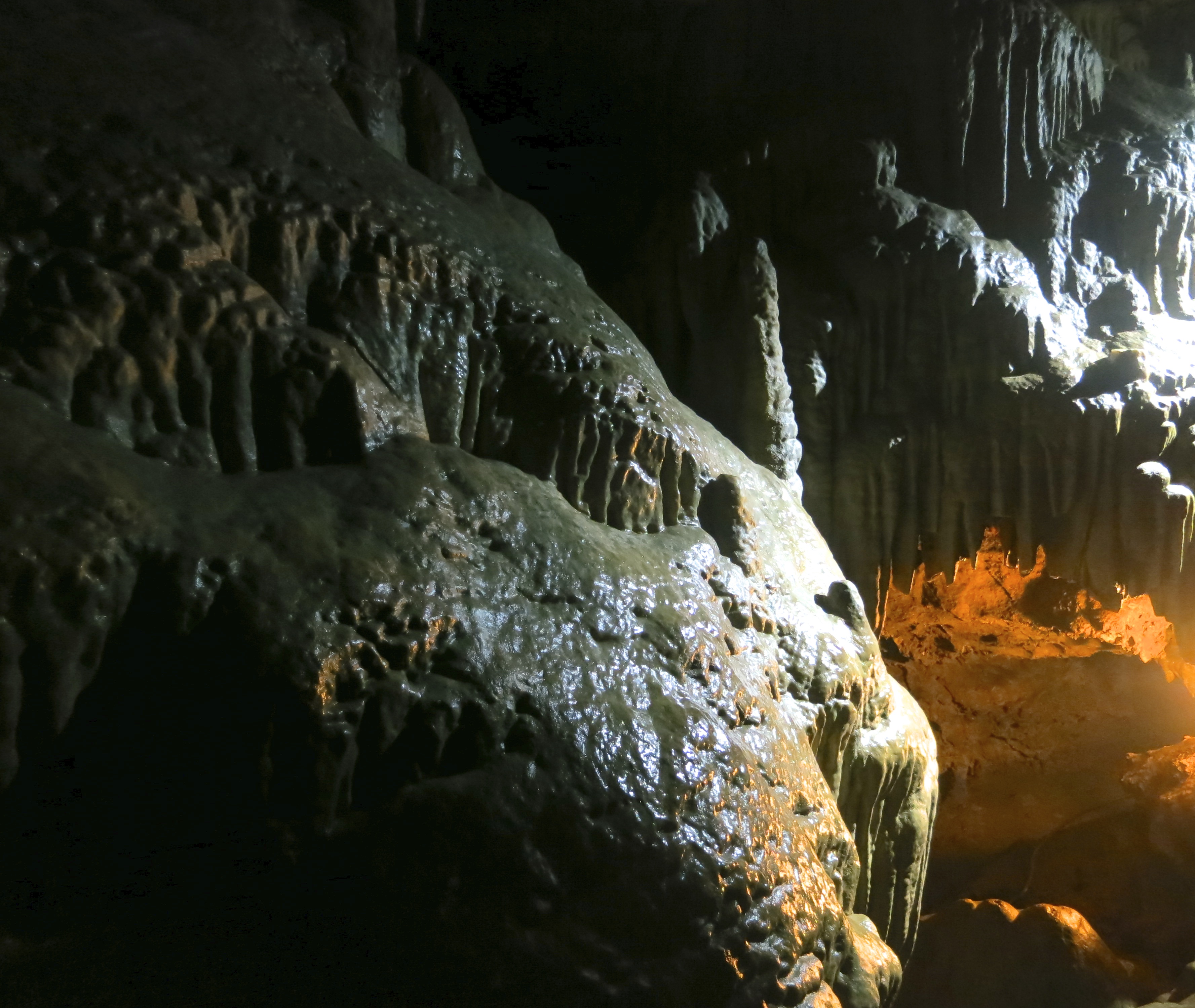
Artificial lighting adds to the magic of caves.
Another example of the impact of lighting. The rock on the left had been signed by all of the members of a geology class that had visited in the 1800s. Strict rules are now in place to protect the cave.
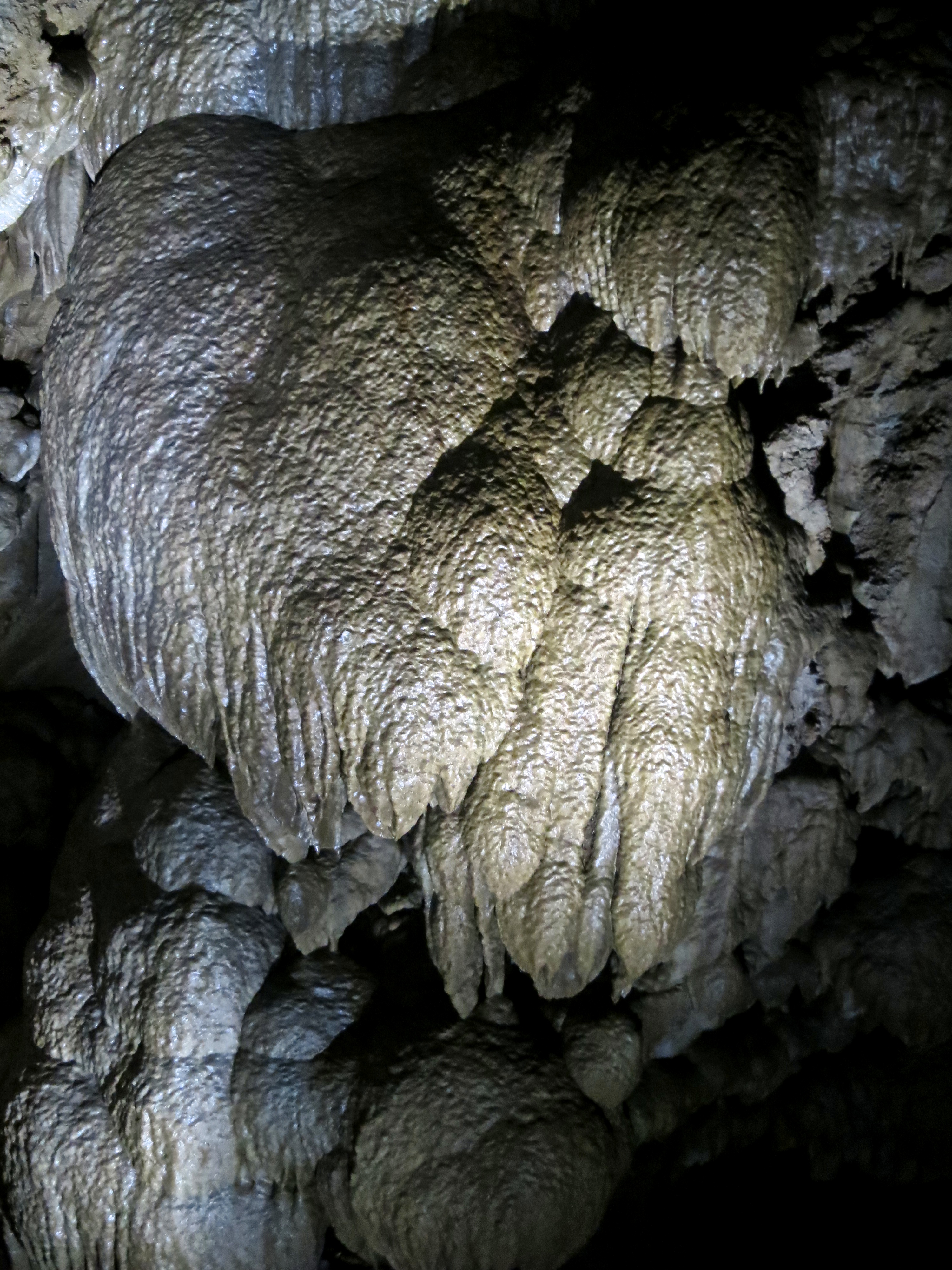
This unusual structure caught my camera’s attention.
Peggy captured this ghostly rock waterfall. (Photo by Peggy Mekemson.)
A view of where we came out from our 90 minute tour.
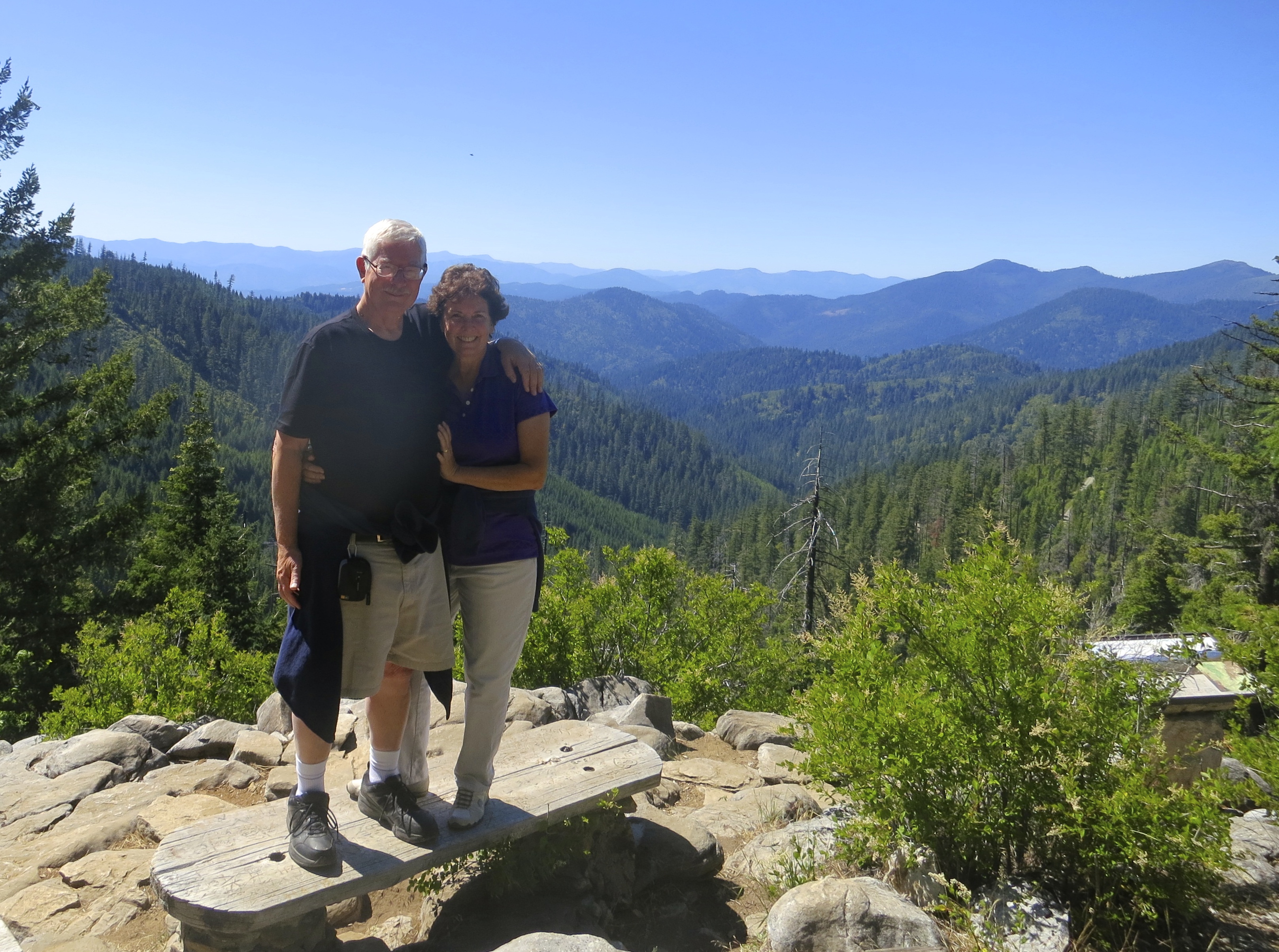
Tour over, Peggy and I stand on top of the mountain that contains the caves. This photo gives a perspective on the surrounding countryside.
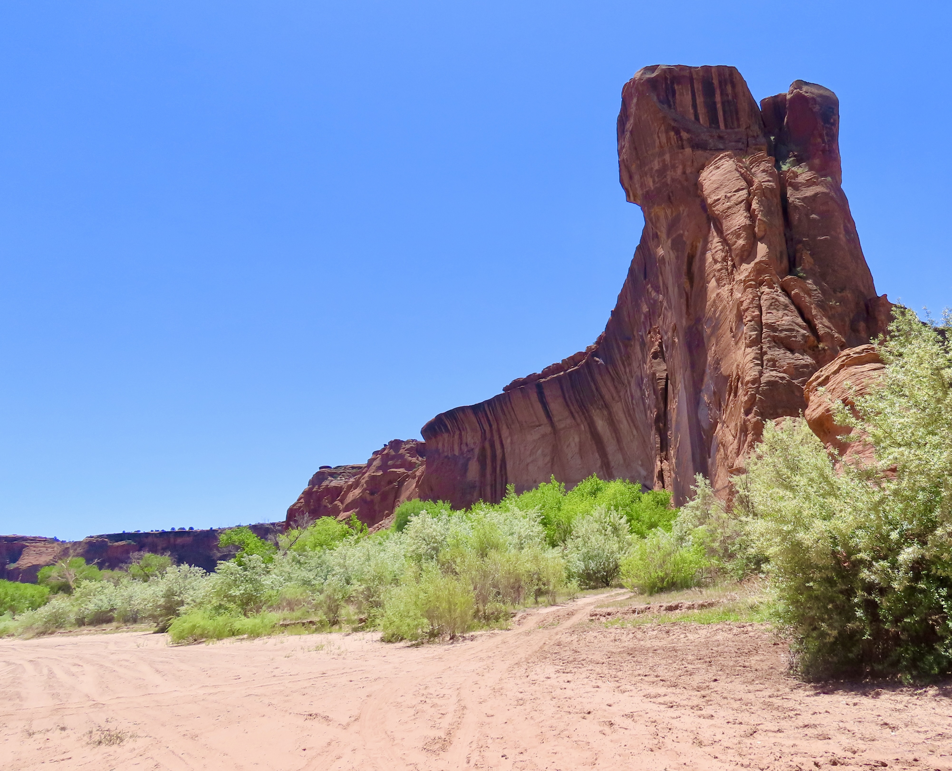
NEXT BLOG: Peggy and I are headed off for a brief hiking tour at Mt. Rainier National Park for the next several days so I may be out of computer range. When I come back I will report on my recent experience as a chicken farmer: The Chicken Whisperer.