First Grade Flunkee… Blogging the MisAdventures Book


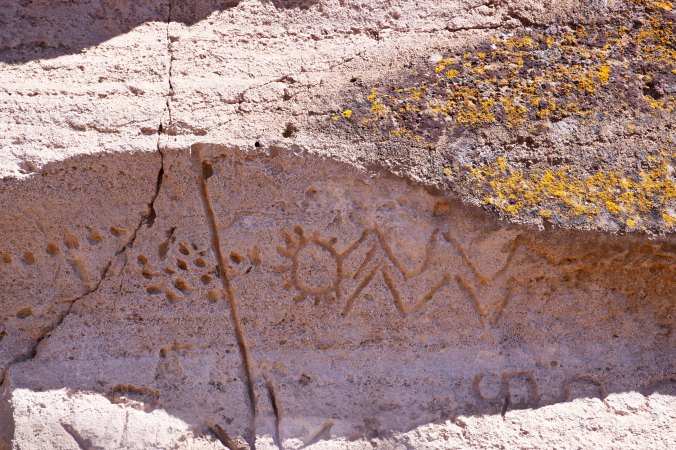
After being kicked out of the first grade for a year, I was given a second chance. This is my class photo. I am fourth from the left in the top row with my hands in my pocket. Don’t I look sweet and innocent?


This begins a series of tales that may or may not make it into my book on MisAdventures. My goal is to post one tale on each Friday until the book is concluded. For the most part, these stories stand alone. They are in the early stages of editing. Several of these tales will have been included in earlier posts. I apologize in advance for the language, but I had an extensive vocabulary of swear words as a youth.


I can still hear the clanking treads and feel the bite of the blade as my D-8 dug into the side of the steep hill. Dirt and rocks tumbled over the edge, crashing into the canyon below. I was working alone, cutting a logging road across mountainous terrain. The hot September summer sun was beating down; my body was drenched in sweat and covered in dirt. And then it happened. A portion of the cliff gave away— and the bulldozer went tumbling off the edge.

“Oh, fuck!” I had yelled.

It was a wonderful word, one that I had learned from my seven-year old brother. I didn’t have a clue what it meant, but it was deliciously bad and had an amazing effect on adults. At five years of age, I was too young to be operating a bulldozer by myself out in our backyard, even if it was only five-inches long and the road I was cutting was along the edge of our compost pit. But my mother wasn’t the hovering type; she drank a lot. Empty wine bottles had a way of mysteriously appearing under her bed and in the clothes’ hamper that hid out in the closet.

I wasn’t totally alone. Coaly, our black Cocker Spaniel, was assigned babysitting duty.  At “fuck!” she wagged her tail and barked into our compost pit where the toy had fallen.

“Go get the bulldozer, girl” I urged. She gave me a ‘go get it yourself’ look. She wasn’t the ideal little-boy companion. The gray hair around her nose and aching joints spoke to her advanced years.  She had little tolerance for my youthful pranks. Healing scars on my foot reflected how little. It was my job to feed the pets. I’d open a can of Bonnie dog food on both ends, push it out with one of the lids, and then use the lid to divide it up. The smell still lingers in my brain. Coaly got half, and each of our cats— the black Demon and the white MC— got a quarter.

That summer I had discovered that Coaly growled ferociously if I messed with her share. I fed the animals outside on paper towel plates.  I always went barefoot in the summer and it was easy to reach over with my big toe and slide their food away. I quickly learned to leave the cats with their lightning fast claws alone. But Coaly was all growls and no bite. At least she was until she sank her teeth into my foot. I ended up in the ER with a tetanus shot, stitches and zero sympathy. Coaly ended up gobbling her dinners in peace.

At the time of the bulldozer incident, I had been granted a reprieve from school, or, to put it bluntly, I had been kicked out of the first grade— for a year. My mother was not happy. She had been eager to get me out of the house. Make that desperate. The evidence is irrefutable. California had a rule then that five-year-olds could go to the first grade if they turned six on or before March 1 of the following year. There was no such thing as kindergarten, at least in Diamond Springs. Since my birthday was on March 3, I missed the deadline by two days. Darn. Mother’s reaction was more colorful. She made a command decision. Forty-eight hours were not going to stand in the way of her little boy’s education, or her freedom. So, she changed my birth certificate.  March 3 was erased and March 1 entered. I was bathed, dressed and shipped out, not the least bit aware that I had matured by two days. I think I recall hearing music and dancing as I left for school.

Things weren’t so rosy at school. The other kids were all older, bigger, and more coordinated. For example, one of the boys could draw a great horse. It came with four legs, a tail, a head and a flowing mane. Mine came with unrecognizable squiggles. It was hard to tell whether my objective was to draw a tarantula or a snake with legs, but the world’s wildest imagination on the world’s most potent drug wouldn’t have classified the picture as a horse. It was not refrigerator art. The whole exercise created big-time trauma.

This negative experience was compounded by the exercise of learning to print within lines. Forget that. If my letter came anywhere close to resembling a letter, any letter, I was happy. The teacher was more critical.

“Curtis, I asked you to make Bs, and here you are printing Zs.”

“So what’s your point?” was not an acceptable response. Mrs. Young was suspicious and that suspicion increased each day I was in school. She was a tough old coot who had been teaching first grade for decades. She knew first graders and I wasn’t one. As for the birth certificate, Mother’s forgery was in no danger of winning a blue ribbon at the county fair. I still have the original for proof. After a few weeks, Mrs. Young sent off to Oregon for a copy. I remember her calling me up to her desk on the day it arrived. (You don’t forget things like this, or at least I don’t.)

“Curtis” she explained, “you have a choice. You can either go home now or you can go home after lunch. But either way, you are going home and can’t come back until next year.”

Just like that I was a reject, a first grade flunkee.

Mrs. Young couldn’t have made it any clearer; Mother was going to get her little boomerang back. This was okay by me, if not by her. Playing out in the backyard was infinitely more fun than competing in ‘Scribble the Horse.’ I did decide to stay the day. Mrs. Young was reading about Goldilocks to us after lunch and I wanted to learn if the bears ate her.

It would have been interesting to listen in on the conversation that took place between Mother and Mrs. Young, or even more so between my mother and father, or Pop, as he was known to us. I’ve often wondered if he participated in the forgery or even knew about the March 1 rule. I doubt it. He was not the parent frantic to get me out of the house during the day.  (Had it been in the evening, the jury might still be out.) But I wasn’t privy to those high-level discussions. My job, which I took quite seriously, was to enjoy the reprieve. I was about to begin my wandering ways. Mother’s alcoholism was my freedom. The Graveyard was waiting.

SaveSave

SaveSave

SaveSave

SaveSave

South to New Zealand and Milford Sound: The Wednesday Photo Series

New Zealand Waterfall

Milford Sound is surrounded by spectacular waterfalls. We took a small tour boat that carried us out into the sound where we could visit them up close.

Today marks the beginning of my Wednesday photo series. Over the next month, or year, or several years, I am going to begin to post photos from around North America and the world. What else can you do with 76,000 photos? (grin)

I am starting off in Milford Sound. If you travel to New Zealand and then travel down to the South Island, and then travel even farther down to the southwest corner of the island, you come to the world-famous sound. It is a fame well deserved. These photos were taken the old-fashioned way, with film. I had to scan them into my computer so the quality isn’t quite the same, but the beauty of the area makes up for it. Enjoy.

Milford sound on the South Island of New Zealand. Photo by Curtis Mekemson.

This is a view you have when driving into the sound.

Photo of Milford Sound taken by Peggy Mekemson.

A view of Milford Sound and the surrounding mountains. (Photo by Peggy Mekemson.)

Photo of waterfalls in Milford Sound, New Zealand by Curtis Mekemson.

One of the waterfalls.

New Zealand waterfalls in Milford Sound

Another of the many falls. (Photo by Peggy Mekemson.)

Small rainbow in Milford Sound, New Zealand. (Photo by Curtis Mekemson.)

I was intrigued by this small rainbow caused by water dripping off the cliff.

New Zealand Moutain Top near Milford Sound

One of the things about the west coast of the South Island is that glaciers are never very far away. Peggy and I took a helicopter ride up from the sound to this mountain top. (Photo by Peggy Mekemson.)

New Zealand glacier photo by Curtis Mekemson.

We were allowed to get out of the helicopter and wander around. I took this photo of cracks in the glacier. That’s it for today. Next Wednesday, we will visit the island of Santorini in the Mediterranean Sea.


NEXT POST: I kick off my book on MisAdventures, whereupon I am kicked out of the first grade for a year and use foul language when falling off a cliff in a bulldozer.

SaveSave

SaveSave

The Highest Waterfalls on the Oregon Coast: Munson Creek Falls

Munson Creek Falls near Tillamook, Oregon. Photo by Curtis Mekemson.

The upper section of Munson Creek Falls.

Peggy has been lobbying for a tour of Oregon waterfalls for quite a while. So, when I read that Munson Creek Falls was near Tillamook, I knew we would have to pay a visit on our recent trip to the coast. We drove over to Tillamook from Rockaway Beach where we were staying and then south for seven miles following Highway 101. Along the way, we passed the giant blimp hangar built during World War II that now serves as an air museum. I visited the hangar a couple of years ago when I was passing through the area. Close to the turnoff, we also passed the campground where I had stayed. At the time, I wasn’t aware of the falls— I’d been too busy counting rabbits.

A view of the blimp hangar during World War II. The blimps were used for spotting Japanese submarines off the coast. (Photo from Tillamook Air Museum.)

The Tillamook Air Museum shown here, served as a blimp hangar during World War II.

A photograph of the Air Museum I took on my previous visit. The airplane in front is known as a guppy. The house provides a perspective on size.

White rabbit near Tillamook, Oregon. Photo by Curtis Mekemson.

This lovely creature was one of over a hundred rabbits wandering around freely at Pleasant Valley Campground near the exit to Munson Creek Falls.

A sign along 101 told us to turn inland for the falls. We followed a narrow, pothole filled road that became narrower as we went, making it more difficult to dodge the potholes that were simultaneously becoming deeper and more numerous! The short three and a half miles felt like twenty. We finally reached the parking lot, however, and discovered that we had entered a rainforest. Trees covered in moss gave a magical feel to the area.  An easy, quarter of a mile trail led off toward the falls. More moss-covered trees and rocks, the dashing Munson Creek, brightly colored fallen leaves, mushrooms and ferns lined the trail.

Moos covered tree along path to Munson Creek Falls. Photo by Curtis Mekemson.

Moss covered trees gave a magical feeling to the path leading to the falls.

Hanging moss at Munson Creek Falls near Tillamook, Oregon.

A close up of the hanging moss. (Photo by Peggy Mekemson.)

Moss draped across branch along trail to Munson Creek Falls on the north coast of Oregon.

And another. (Photo by Peggy Mekemson.)

Fall leaves along trail to Munson Creek Falls near Tillamook, Oregon. Photo by Curtis Mekemson.

The damp conditions added to the colors of the leaves that had fallen along the trail.

Fallen leaves along trail to Munson Creek Falls near Tillamook, Oregon.

A close up. This is from a Big Leaf Maple tree. (Photo by Peggy Mekemson.)

Mushrooms along the trail to Munson Creek Falls off of Highway 101 in northern Oregon.

These reddish mushrooms caught my eye.

Munson Creek near Munson Creek Falls on north coast of Oregon.

Munson Creek dashed along beside the trail, keeping us company. (Photo by Peggy Mekemson.)

Moss covered rock in Munson Creek near Munson Creek Falls on north Oregon Coast. (Photo by Curtis Mekemson.)

A moss-covered rock decorated with fall leaves sat in the middle of the creek.

Moss, ferns and leaves on a tree near Munson Creek Falls near Tillamook, Oregon. Photo by Curtis Mekemson.

Moss, ferns and fallen leaves on a tree had a Christmas look.

Trail to Munson Creek Falls near Tillamook, Oregon. (Photo by Curtis Mekemson.)

A view of the trail.

Our first view of the falls assured us that we had made the right decision to make the trip. Water shot out from the top and tumbled some 319 feet to the bottom, making Munson Creek Falls the highest on the Oregon coat. Halfway down a log jam gave testimony to the power of the stream. The rainforest provided a dramatic backdrop. We wandered around seeking various vantage points to appreciate the beauty, and finally, being satiated, hiked back to the parking lot. The drive out went much faster, or so it seemed.

Munson Creek falls in the coastal mountains near Tillamook, Oregon. Photo by Curtis Mekemson.

The 319 foot tall falls. The log jam with its large logs spoke to the power of the creek. I also like the moss-covered tree to the right.

Photo by Peggy Mekemson of Munson Creek Falls near Tillamook, Oregon.

A final look at the falls above the log jam. (Photo by Peggy Mekemson.)


Photos: Most of the photos I use on this blog are taken by either Peggy or me. Photos without attribution are taken by me. I always note any other sources such as the Air Museum above.

NEXT POSTS: Almost everyone I know who tries to maintain a blog while writing books runs into a challenge with time. There isn’t enough. Solutions range from dropping out of the blogosphere for a while to limiting blogs. I am going to try something else for the next month. If it doesn’t work, I’ll have to a move to a more dramatic solution. Here’s what I am going to try: On Mondays I will do my usual travel blog; on Wednesdays I will put up photos from my collection of 76,000; on Fridays, I am going to blog my book on MisAdventures. The theory is that this will allow me most of the week to work on the book. We’ll see.

WEDNESDAY: We will drop down to the South Island of New Zealand and visit the beautiful Milford Sound.


SaveSaveSaveSave

SaveSave

SaveSave

SaveSave

SaveSaveSaveSave

SaveSaveSaveSave

SaveSave

SaveSave

The Cape Meares Lighthouse, an Octopus Tree, and the Three Rock Arches of Oregon

Cape Meares Lighthouse

At 38-feet tall, the Cape Meares Lighthouse is the shortest lighthouse in Oregon. (Photo by Peggy Mekemson.)

Towering cliffs, abundant sea life, a lighthouse, massive rocks rising out of the ocean, the Octopus Tree, and an old-growth forest of Sitka Spruce… How could we resist? With the sun tentatively breaking through the clouds, Peggy and I grabbed our cameras, packed our raingear, and headed out to Cape Meares, which is located about 30 minutes away from Tillamook, Oregon.

But first, our stomachs demanded lunch, so we stopped at the Pelican Brewing Company in Tillamook for a hamburger and, of course, a beer. Peggy and I shared a pint of tasteful ale. The Northwest is noted for its great craft beers and Pelican has some dandies. Several have won national and international awards.

Pelican Brewing Company

Good things were brewing at the Pelican Brewing Company in Tillamook, Oregon.

Curt Mekemson enjoying a pint at Pelican Brewing Company in Tillamook, Oregon.

Cheers! (Photo by Peggy Mekemson.)

Having tamed our hunger and thirst, we headed out to the coast and were soon perched on an overlook admiring the Three Arch Rocks, so named because each one contains an arch. Of greater significance, the rocks are known for their large nesting colonies of Common Murres, Cormorants, Western Gulls, storm-petrels, auklets, Black Oystercatchers, Tufted Puffins, and Pigeon Guillemots. In 1907, Teddy Roosevelt declared the area a wildlife sanctuary, the first in the US west of the Mississippi. He did so on the recommendation of a pair of young conservationists, William Finley and Herman Bohlman, who had watched hunters decimate the sea lion population on the rocks, and even worse, observed local ‘sportsmen’ row out to the rocks on Sundays and use the birds for target practice, killing thousands.


Three Rock Arches near Cape Meares

Three Rock Arches as seen from an overlook just before the small town of Oceanside.

Three Rock Arches near Oceanside

Peggy used her telephoto to pull in the middle of the Three Arch Rocks. While you can’t see through the arch at this angle, you can see how big it is. (Photo by Peggy Mekemson.)

Three Rock Arches 1

A convenient pine provided a different perspective.

We drove on to the Cape Meares Lighthouse where a sign in the parking lot suggested a detour toward the Octopus Tree that sent our imaginations spiraling out of control. Was this a magic tree of fantasy lore? Would we be swept up in its tentacles? Naturally, we had to check it out. The tree turned out to be a Sitka Spruce with eight trunk-like limbs that once made it into Ripley’s Believe It or Not. The story behind its unique shape is that the local Tillamook Indians shaped it to grow that way, created a sacred site where elders could gather to make important decisions and Shamans would travel on their mystical journeys. A few yards away from the tree, a plunging cliff provided more views of the Three Arch Rocks, this time backlit by the sun. Peggy found a man operating a camera drone on the edge of the cliff, capturing pictures of the 200-foot drop off that we weren’t willing to lean out far enough to get.

Sitka Spruce forest at Cape Meares

We walked through a Sitka Spruce forest to get to the Octopus Tree.

Octopus Tree

The Octopus Tree is surrounded by a fence to keep it from eating people. Whoops, fake news. It’s surround by a fence to keep young and old kids from climbing on it.

Octopus Tree

The Tillamook Indians were said to place their canoes on the branches. (Photo by Peggy Mekemson.)

Three Rock Arches backlit

We were south of the cape looking north when we took the first photos of the Three Rock Arches. Here we were looking south with the rocks back lit by the sun. (Photo by Peggy Mekemson.)

Three Rock Arches backlit

This shot of the rocks gave the feeling of a lurking sea monster with the light showing through one of the arches serving as its eye.

Three Rock Arches

Two of the arches can be seen in this photo by Peggy. The rock on the left is the same one she took a close up of from the other direction.

Man with drone at Cape Meares.

The drone man who was capturing shots of the cliffs.

Walking back toward the lighthouse, we found more cliffs on the other side of the peninsula where the lighthouse sits. These featured a waterfall that tumbled down into the ocean. We also noticed white guano (bird poop) decorating the cliff sides, a sure sign that birds build their nests along the cliffs. Imagine being a young bird looking over the edge of your nest and pondering your fate.

Waterfalls 1

The waterfalls came tumbling down. The white spots on the opposite cliff show the sites of bird nests.

A sign at the site informed us that baby birds are either flyers or jumpers. Murrelet chicks, who are fliers, have been observed pacing back and forth in their nest for a couple of days, flapping their wings frantically, and nervously peering over the edge before they finally take the plunge. It’s worse for Common Murres. Their mom kicks them out of the nest when they are three weeks old… before they can fly! No Mom of the Year there.  They simply stand on the edge and jump, hoping that their stubby wings will guide them to them into the ocean instead of the rocks below. Dad patiently waits in the ocean where he will take over parenting responsibilities for a few weeks until the babies can fend for themselves. Meanwhile, a whole host of hungry predators are waiting below chanting “Crash! Crash! Crash!”

While I am on the subject of birds and food, I learned at Cape Meares that the Tufted Puffins have a barbed tongue that they use to spear fish. They can get three or so minnow-sized fish on their tongue at once. The first one is pushed up the tongue by the second and the second by the third. The barbs hold them in place until, I assume, baby birds wrest them free. I also found out that a pair of Peregrine Falcons were known to nest in the area. These birds are the fastest animals in the world. They fly high above their prey, fold their wings and literally fall, or dive, hitting speeds up to 250 miles per hour (402 KPH) before smacking into their dinner.

At 38-feet tall, The Cape Meares Lighthouse is known for being the shortest lighthouse in Oregon. Given that it stands on a 217-foot tall cliff, however, size probably doesn’t matter. The lighthouse was built on location but the first order Fresnel lens (pronounced ‘fraynel’) was wrestled up the cliff in 1899 using a wood crane built from local timber. The lens had been manufactured in France and shipped around Cape Horn and up the coast to Oregon. It was built with four primary lenses and four bull’s-eye lenses providing light that can be seen 21 miles out at sea.

Cape Meares

This T-Rex perspective of Cape Meares by the Fish and Wildlife Service provides a good view of the cliffs. The lighthouse is the white speck at the end of the lower ‘jaw.’ The Octopus Tree is on the upper end of the lower jaw. The waterfall was inside the lower jaw.

Cape Meares Lighthouse

The Trail down to the Cape Meares Lighthouse. (Photo by Peggy Mekemson.)

Fresnel Lens in Cape Meares Lighthouse

A close up of the Fresnel lens with its red bullseye.

Cape Meares Lighthouse 2

A final view of the Cape Meares Lighthouse.


NEXT POST: Peggy and I make our way through a rainforest to the highest waterfall on the Oregon Coast.


SaveSave

We’re Just Glad We Aren’t Turkeys…

White alpaca 4

This alpaca greeted me at the Latimer Quilt Center near Tillamook, Oregon. She had just been through a downpour.


I got us a bit lost yesterday and was grumpy. I zigged when I should have zagged. Peggy and I had been visiting the Tillamook Cheese and Ice Cream factory and I had made a left turn onto a country road instead of a right.

“I think you need to go right,” Peggy had suggested as I drove on, thinking I knew where I was going. Teach me. We had continued down the country road, far past where I realized that Peggy was correct, when we saw a sign to the Latimer Quilt Center.

“Oh, I want to go there!” Peggy said eagerly. “Not me,” I’d replied, still grouchy. Whoops. I was thinking it was getting late and we still had to drive into Tillamook and shop at Safeway before returning to Rockaway Beach. And I was thinking we’d be driving home after dark on a stormy night along the coast. I was thinking wrong.

I spotted the alpacas as we drove into the quilting museum. “I’ll see you inside,” my buddy had noted, realizing that I could not resist the charming four-legged sweater factories.

“Oh, you poor fellows,” I had declared when I got closer, barely able to speak I was laughing so hard. A downpour had just passed and they were drenched, the epitome of a bad-hair day. I think one of then mumbled, “We’re just glad we aren’t turkeys.”

Actually, they had a spacious shed they could have hidden out in if they had chosen. Maybe their Andean DNA insisted on them being out in the cold and wet. Anyway, here they are looking half drowned…

Wild haired apaca 2

This gal was definitely having a bad hair day!

Wild hair alpaca 1

As I watched, she worked on lunch.

Brown alpaca 3

I think that this fellow took umbrage at my laughter…

Brown alpaca 4

Eyed me suspiciously…

Brown alpaca 5

And gave me a squinty look.

White alpaca 7

Meanwhile, the cutie shown at the top of the post happily rested on the soaking wet ground.

White alpaca 3

Provided a profile shot…

White alpaca 2

And looked pretty!


The alpacas, Peggy and I wish each of you a Happy Thanksgiving.

PS… I found the quilting museum quite interesting and took this photo of a quilt featuring a lighthouse as a lead in to my next post where Peggy and I will visit the rugged Cape Meares and the Cape Meares Lighthouse.

Lighthouse quilt from the Latimer Quilt Center


SaveSave

Rock Art, a Civil War Veteran, and Magnificent Mountains… The Arches National Park Series: Conclusion

The La Sal Mountains provide a dramatic backdrop for Arches National Park.

The first people came wandering through Arches some 10,000 years ago as the last of the glaciers were retreating north or scooting up mountains, seeking colder climates. The nomads were hunter-gatherers, killing wild animals for food and seeking out edible plants where they grew naturally. They must have been impressed with the magnificent rock sculptures they saw. Possibly they even gave the soaring arches, spires and fins spiritual significance. What caught their attention from a practical point of view, however, were the chert and chalcedony rocks that could be chipped into stone tools such as knives and scrapers. Left over debris piles can still be seen by those trained to look for them.

The wandering hunters and gatherers were replaced by farmers some 2,000 years ago. The Arches area was on the northern edge of the Puebloan culture, which was known for its cliff dwellings. A lack of such abodes in the area, however, suggest that Arches was more of a place to visit than occupy. About 700 years ago, the Puebloans apparently abandoned the area altogether for whatever reason they were disappearing from their homes throughout the Southwest. Drought, disease, or invasion are among the causes normally given.

When the first Europeans entered the area, they found it occupied by the Utes, a Native American tribe from which Utah took its name. It is assumed that the rock art panel shown below was created by the Utes since the Indians were riding horses and there weren’t any in North America prior to the arrival of the Spanish Conquistadors. Interestingly, a section of the Old Spanish Trail that was used by Spaniards to travel between Santa Fe, New Mexico and Los Angeles in the late 1700s/early 1800s actually runs in front of the park headquarters following Highway 191.

Utes on horses hunt big horn sheep on the petroglyph panel found at Arches National Park.

A closer look suggests that the Utes were waving their arms and driving the sheep with the help of dogs. Native Americans were known to drive buffalo but I have never heard of the technique in relation to sheep.

In hopes that the arid climate of the region would be good for an old Civil War war wound, 69-year-old John Wesley Wolfe left his wife in Ohio in 1898 and settled near Delicate Arch and the Ute rock art north of the town of Moab. He brought his son with him and built a primitive cabin. There was enough space to raise a few head of cattle and vegetables. More sophisticated needs were met by shopping out of the Sears and Roebuck catalogue. When his daughter, her husband, and two children arrived a few years later, she insisted that Wolfe provide more modern accommodations. He complied by building the 11 by 17 foot one room cabin that still stands today. It must have been cozy.

The Wolfe’s cabin as it looks today. Delicate Arch is off to the right. The Ute rock art is located on the cliffs behind the cabin.

A closeup of the cabin rendered in black and white.

While the Colorado River forms the southeastern border to Arches National Park, it is the La Sal Mountains that provide a dramatic backdrop for many of the rock sculptures found in the park. Towering over 12,000 feet in height, the La Sal’s are part of the Rocky Mountain chain. I’ll conclude my series on Arches with several photos that Peggy and I took of the mountains as seen from Arches.

I liked the contrast between the red rocks, green brush and blue mountains.

La Sal Mountains framed by pillars in Arches.

Clouds, mountains and red rocks.

I’ll conclude with this tree that was set off by the red rocks.

NEXT POSTS: Hot off the press: Peggy and I are on a two-week trip up the coast of northern Oregon and southern Washington to celebrate our 25th Anniversary. Expect crashing waves, tumbling waterfalls, rainforests, a picturesque lighthouse, towering ocean rocks and quaint towns.

SaveSaveSaveSave

SaveSave

SaveSave

SaveSave

SaveSave

SaveSave

SaveSave

SaveSaveSaveSave

SaveSaveSaveSaveSaveSave

SaveSaveSaveSaveSaveSave

The Arches of Arches…. Arches National Park: Part 3

Photo of Double Arch at Arches national Park by Curt and Peggy Mekemson.

I can pretty well guarantee that you will see Double Arch on any trip to Arches National Park. It’s just off the road… and impressive.


“Wilderness is not a luxury but a necessity of the human spirit, and as vital to our lives as water and good bread. A civilization which destroys what little remains of the wild, the spare, the original, is cutting itself off from its origins and betraying the principle of civilization itself.” Edward Abby from his book about Arches NP, “Desert Solitaire.”


Arches is renowned for its arches, as it should be, given its name. They come in all shapes and sizes ranging from three feet across to 306 feet. I noted in my first post that there are some 2,000 of them at the park. Forces of erosion, including water, ice and wind, break out chunks of rocks from softer sandstone beneath harder layers above and eventually work through fins.  New arches are constantly being created while older ones fall.

Arch in progress at Arches NP

A new arch in the process of being born at Arches National Park.

Several arches are located along the road and are easily reached by short hikes. Others require longer hikes and more work. When Peggy and I were at Arches last time, we were rushing through on our way to our Grand Canyon raft trip. We could hardly begin to do the arches justice, but we did photograph three that I will share with you today: Delicate Arch, Skyline Arch, and Double Arch.

Delicate Arch, Arches National Park

While Peggy and I didn’t have time to visit Delicate Arch, we were able to snap its photo from a distance. It is the most famous arch in the park and possibly in the world.

Skyline Arch in Arches National Park

Skyline Arch is also easily seen from the road.

Skyline Arch and tree at Arches NP

Here it is with a tree to help set it off.

Skyline Arch close up at Arches NP

A close up of the arch.

Double Arch at Arches National Park. Photo by Curt and Peggy Mekemson.

People in the lower right hand corner provide perspective on the size of Double Arch.

Double Arches and green brush

Double Arch seen from a distance.

Double Arches up close, Arches NP

One of the arches of Double Arch up close.

Arch in Double Arch, Arches NP

And closer.

Curt Mekemson at Arches NP

I was up climbing around on the Double Arch to get photos when Peggy snapped my picture, which will serve as the last of this post.


NEXT POST:  We will explore the surrounding country, petroglyphs and settler history.


SaveSave

SaveSave

SaveSave

SaveSave

SaveSave

But Are You Balanced… Arches NP: Part 2

Balanced Rock, Arches National Park

Balanced Rock is one of the best known rock sculptures in Arches National Park. The cracked mudstone underneath it makes me wonder about how long it will last.


Ever have that feeling that you are teetering on the edge? What if you weighed 3,600 tons and stood 128 feet up in the air while you teetered? That’s the case of Balanced Rock, one of the most iconic rock sculptures of Arches National Park in Utah. Actually, the rock owes more to the super-glue mudstone that attaches the sculpture to its base than any super-power balancing capabilities. Someday, it will come crashing down, but until then, it is there to admire and astound.

Balanced Rock scene, Arches NP

A more balanced Balance Rock?

Balanced Rock in Arches NP

And a closer look.

Sliding off pedestal, Arches, NP

In terms of balance, I found this rock more talented. It lacks the glue-like mudstone and appears to be sliding off of its pedestal.

As the buried layers of salt that I mentioned in my last post work upward, it leads to parallel cracks in the sandstone above that eventually erode away leaving long fins, from which arches, balanced rocks and other rock formations of Arches National Park are created. The most impressive fin to me, Park Avenue, greets visitors on their way into the park. If you’ve ever walked down Park Avenue in New York City, you know it is lined by sky scrapers. That’s what folks had in mind when they named this impressive formation.

Park Avenue in Arches National Park 3_edited-1

Park Avenue with its sky-scraper like rocks.

Park Avenue at Arches NP

Another perspective.

Fin 2 Arches NP

This fin shows the beginning of the erosion process.

Creation of fins, Arches NP

And here, a number of fins reflect the parallel cracking of the sandstone.

My favorite!

Still a fin but with a different erosion look caused by thinner layers of sandstone..

And to conclude, here’s some more eye-candy from Arches National Park.

Courthouse Towers, Arches NP

Standing rock, Arches National Park

Sentinental 2

Climbers in Arches NP

Climbers.

Courthouse rock, Arches NP

And a final view for this post.


Note: All photos are taken by Curtis and Peggy Mekemson.

NEXT POST: The arches of arches.


SaveSave

SaveSave

SaveSave

SaveSave

SaveSave

There’s More to Arches National Park than Arches…. Arches NP: Part 1


Photos of Arches National Park by Curt and Peggy Mekemson.

The red rock sculptures of the Southwest US are both beautiful and strange, firing our imagination while calming our souls. Few areas capture this paradox as well as Arches National Park. It is one of our favorite places.


“The desert wears… a veil of mystery. Motionless and silent it evokes in us an elusive hint of something unknown, unknowable, about to be revealed. Since the desert does not act it seems to be waiting — but waiting for what?” – Edward Abbey, 1968 in his book Desert Solitaire where he recounts his two years, 1956-57, as a park ranger in Arches.


I have a confession to make. I suggested in my last post that I was going to feature the petroglyphs of Utah’s Arches National Park next— and there are petroglyphs there that I will include in this series. But my real reason for posting on Arches was that I wanted an excuse to revisit our last trip there and share the beauty of the area with you. Peggy and I had been on our way to a private raft trip on the Colorado River through the Grand Canyon when we stopped off at Arches. The clock was ticking. Consequently, we had been forced to rush through the park. Selecting and preparing the photos for this series on Arches allows me to relive the experience at a more leisurely pace.

Arches is known for its graceful arches: There are some 2,000 scattered throughout the park. But there is much more to Arches that arches! This beautiful red rock country also includes pinnacles, balanced rocks, spires, domes and fins— all of which I will be sharing.

Geologically speaking, we have to go back some 300 million years to discover the beginning of the forces that created Arches. The area was part of an extensive sea at the time, a sea that would retreat and refill some 29 times, leaving behind layers of salt several thousand feet thick. Eventually, the mountains and highlands that surround the region eroded away and covered the salt with multiple layers of sandstone. Since then, the salt, which is less dense than the rock, has forced the sandstone up, warping it and producing domes and mesas that have in turn been eroded away by wind, water, ice and gravity into the fantastic rock sculptures we see today.

My plan for this series is to include four posts:

  1. Look at domes, pinnacles and some rather impressive red rocks
  2. Feature balanced rocks and fins
  3. Introduce a few of the many arches
  4. Explore the surrounding country, petroglyphs and settler history

Peggy and I were sharing a camera with each of us taking shots whenever something caught our attention. We have long since lost track of who took what. So, we are sharing the photo credits.

Photos of Arches National Park by Curt and Peggy Mekemson.

These domes feature the two common sandstones found in Arches: The reddish entrada sandstone which evolved from desert sand and the more buff-colored Navajo sandstone.

Photos of Arches National Park by Curt and Peggy Mekemson.

A closer look.

Photos of Arches National Park by Curt and Peggy Mekemson.

And closer.

Photos of Arches National Park by Curt and Peggy Mekemson.

Peggy and I liked the way these pinnacles marched off into the distance.

Photos of Arches National Park by Curt and Peggy Mekemson.

And here seemed to lean on one another for support.

Photos of Arches National Park by Curt and Peggy Mekemson

In bright daylight, a family portrait.

Red rocks of Arches 2

Early morning and late afternoon adds color to the sculptures of Arches. Check out the little guy on the right with his hands in his pockets. He seems to be staring off into space. You can even see the buttons on his shirt!

Photos of Arches National Park by Curt and Peggy Mekemson.

More red, set off by the green of the plants that were capturing the sunlight.

Photos of Arches National Park by Curt and Peggy Mekemson.

Early morning light. If you make it to Arches, be sure to plan enough time there to visit during the early morning, mid-day and evening. Each will bring new treats, often giving a totally different perspective on the same rocks.

Photos of Arches National Park by Curt and Peggy Mekemson.

I’ll close today with the Three Gossips. Prominent rock sculptures at Arches National Park have all been named. To me, the rocks often seem to have an inner luminosity, glowing on their own!


NEXT POST: The balanced rocks and fins of Arches National Park.

Petroglyph Point of Lava Beds National Monument… A Very Sacred Place


Photo by Curtis Mekemson

Sheer cliffs announce Petroglyph Point. The fence here protects Native American rock art that has been carved into the light-colored tuff rock.


It is easy to understand why the Modoc Indians of the Tule Lake Basin and earlier peoples that lived in the area would have considered Petroglyph Point a holy place. High cliffs shoot up from the ground producing a mesa-like structure that once stood as an island in Tule Lake. The island-mesa was created when lava flowed into the lake from a vent beneath the surface. When the red-hot rock met the cool water, it caused a massive explosion that sent volcanic ash shooting into the sky. Returning to the surface, the ash settled into layer upon layer of tuff, a soft volcanic rock that was ideal for carving. Early natives would climb into boats made of reeds and row out to the cliffs where they would use rocks and sticks to carve their messages.

Petroglyph point

Once surrounded by water, Petroglyph Point is today surrounded by farmland. The dark shadow is caused by the cliffs where the rock art is located. (Google Map)

Setting for Petroglyph Point P

Another view of the cliffs. Other peaks are shown in the distance. This is arid land and the extensive farming depends upon irrigation. There is an ongoing battle over water rights between the farmers and the Native Americans. (Photo by Peggy Mekemson.)

Photo by Curt Mekemson.

Looking up. Numerous birds nest in the cliffs.

Photograph of swallow nests at Petroglyph Point by Curtis Mekemson.

Such as these cliff swallows.

When Peggy and I traveled to Petroglyph Point this summer as part of our visit to Lava Beds National Monument, it was no longer an island. Farmers had reclaimed the land by draining much of the lake. It was still impressive, however, as was the rock art left behind by the hundreds of generations of Native Americans who had rowed out to the island on a sacred quest. Some of the 5,000 petroglyphs may be up to 6,000 years old. Sheer numbers make this one of the most extensive collections of Native American rock art in North America. It’s definitely worth a visit. 

Rock Art of Petroglyph Point P1

This photo by Peggy gives an idea on just how many petroglyphs are located along the tuff wall. The rock art was basically as high as the Modoc Indians could reach from their boats.

Rock art of Petroglyph Point 1

A close up of the above panel.

Rock Art of Petroglyph Point

While much of the rock art features geometric forms, this is definitely an insect, complete with feelers. (Photo by Peggy Mekemson.)

Photograph of centipede rock art at Petroglyph Point by Curtis Mekemson.

And another insect!

Rock art at Petroglyph Point photographed by Curtis Mekemson.

There are numerous examples of what appears to be counting along the wall. I assume that this had to do with keeping track of time, but who knows.

Photograph of human figure petroglyph at Petroglyph Point by Curtis Mekemson.

Several of the petroglyphs made us smile. I quickly designated this as Mr. Arrowhead.

Rock art photo in Lava Beds National Monument by Curtis Mekemson.

I also found this running fellow humorous, although it might have been two streams running into a lake, or… Interpretation is often up to the viewer.

Rock Art of Petroglyph Point 3

And what do you make of the square, bug-eyed alien? Note another bug off to the left.

Rock Art of Petroglyph Point P6

I really liked this scenic portrait of the sun and the mountains. (Photo by Peggy Mekemson.)

Rock Art of Petroglyph Point 6

This seemed totally at odds with the other petroglyphs, leading me to wondering if it’s a modern contribution.


A Bonus: When I was going through our photos of Petroglyph Point, I came upon this photo I took of Peggy in one of the lava tube caves I featured in my last post.

Peggy Mekemson in lava tube at Lava Beds National Monument

Lava tube 1

Plus another photo from inside the lava tube. Magical.


NEXT POST: Sticking with the petroglyph theme, I will feature Native American rock art from Arches  and Canyonlands National Parks.