48,722 Feet of Climbing on the Blue Ridge Parkway… The 10,000-Mile Bike Trek

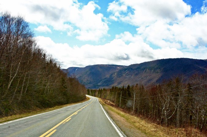
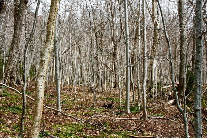
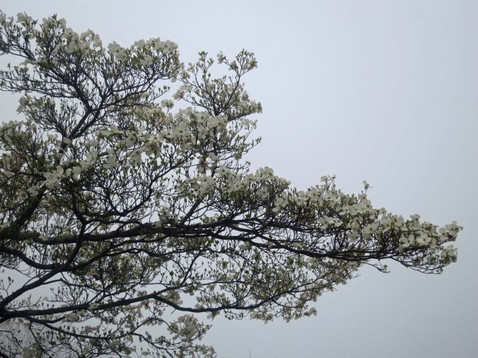
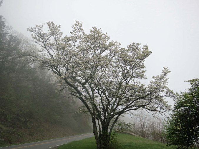
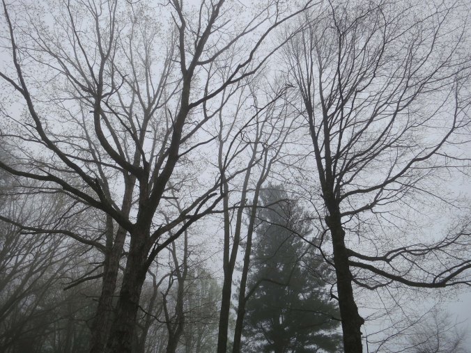
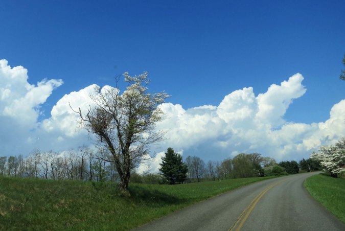
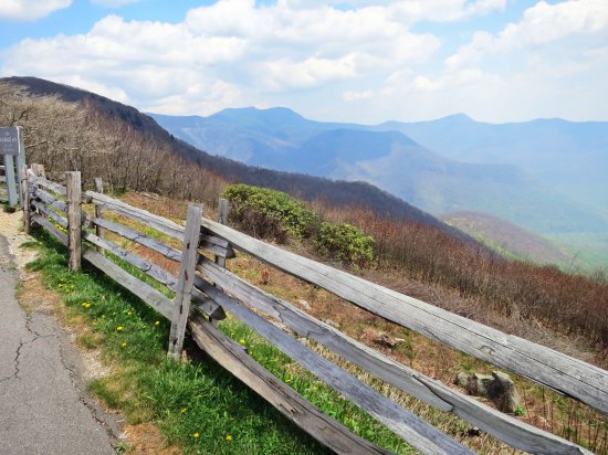
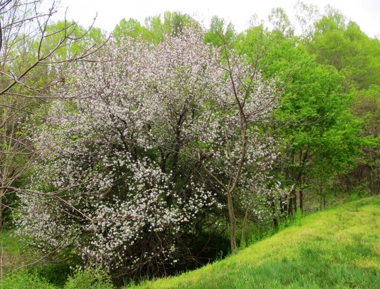
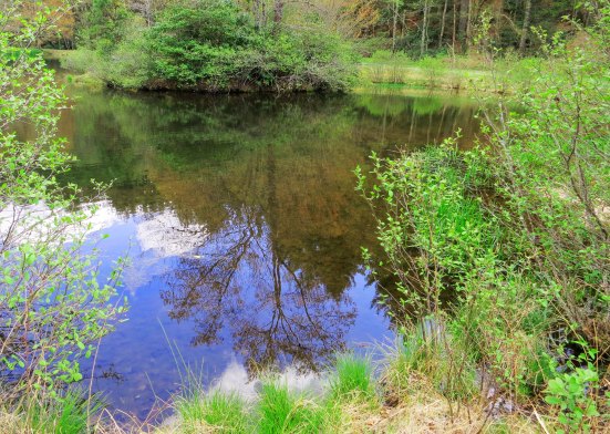
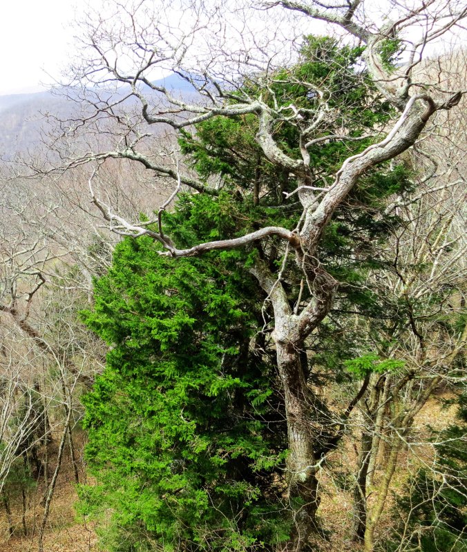
Every turn in the road on the Blue Ridge Parkway brings gorgeous views. Some are in distant vistas but many are up close and personal, like these two trees.

Every turn in the road on the Blue Ridge Parkway brings gorgeous views into sight. Some are in distant vistas but many are up close and personal, like these two trees.

There are two primary directions on the Blue Ridge Parkway: up and down. It’s a good thing I had gotten used to this idea while crossing the Cumberland Plateau and the Smokies because as soon as I passed the entrance sign to the Parkway, I started climbing. I quickly got used to the idea that I would be granny-gear-crawling my way up a mountain for 3-4 hours followed by a glorious 30-minute downhill run, followed by another 3-4 hours of climbing. If it wasn’t always like that, it certainly felt like it.

I took this graphic from the book by Elizabeth and Charlie Skinner featured below.

I took this graph from the book by Elizabeth and Charlie Skinner featured below. It represents about half of my first day of cycling the Parkway, starting at the Southern Terminus on the right. I thought it did a good job of summarizing my perspective on the climb.

The elevation change reflected by these ups and downs is impressive. In one week I would climb 48,722 feet and drop a similar amount, having an elevation gain and loss of over 97,000 feet! (I was amused by the Parkway’s specific claim of elevation gain right down to 22 feet. It definitely represents a biker or hiker’s perspective. Those 22 feet are important.)

It could have been worse.  Remember, in my last post, I mentioned that the Appalachians were much higher in their youth. Think 40,000 feet tall (12,192 Meters), 10,000 feet higher than Mt. Everest. The air would have been a bit thin up on top for cycling but can you imagine the downhill run! Wheeeeeeeeeeeee!

Other than the ups and downs, or maybe because of them (grin), the Blue Ridge Parkway is one of the premier destinations for bicyclists in the US. Like the Natchez Trace, there is great beauty and no commercial traffic. An added plus for the Blue Ridge is that the speed limit for vehicles is even lower than the Trace, 45 MPH (72.4 K) as compared to 55 MPH (88.5 K).

The number of T-shirts, scarves, patches, bumper strips and other memorabilia you can buy that feature bicycling on the Parkway speaks to its popularity today. There are also detailed brochures, maps and books to help you plan your trip, not to mention the Internet. It wasn’t always so. In 1989, the National Park Service gave me a mimeographed sheet. I didn’t see another bicycle tourist until I was close to the end of my 469-mile trip in Virginia.

The mimeographed sheet on bicycling the Blue Ridge Highway that the National Park Service handed out to me in 1989

The mimeographed sheet on bicycling the Blue Ridge Highway that the National Park Service handed out to me in 1989.

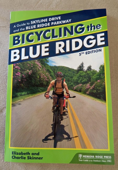
This information packed book by Elizabeth and Charlie Skinner is the type of information you can find today on cycling the Parkway.

This information packed book by Elizabeth and Charlie Skinner is the type of information you can find today on cycling the Parkway.

The final segment of the Parkway was finished in 1987, only two years earlier than my trip. Its inception dates back to the 1930s, however, when a number of people including Franklin Roosevelt and Senator Harry F. Byrd of Virginia decided that a parkway connecting Shenandoah National Park in Virginia with the Great Smoky Mountain National Park in North Carolina was a good idea. (Byrd, BTW, served in the US Senate from 1933 to 1965. His son succeeded him in his seat and held the position until 1982, giving the Byrds 50 continuous years in the Senate.)

My next four posts will cover my journey over the Blue Ridge Highway and be more in the nature of photographic essays. Photos will be from the trip Peggy and I took this spring. Today, I am covering the section between Cherokee and Ashville, North Carolina. Next Blog: A creature comes to visit me in the night.

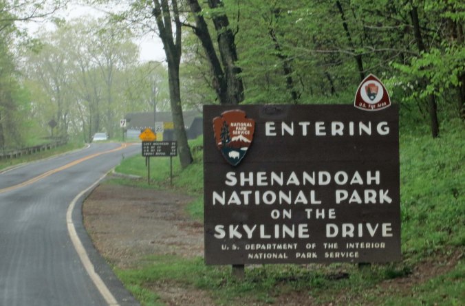
When biking the Blue Ridge Parkway, you can start in the north, in the south, or at several points along the way. Wherever, you will be greeted by this sign.

When biking the Blue Ridge Parkway, you can start in the north, in the south, or at several points along the way. Wherever, you will be greeted by this sign.

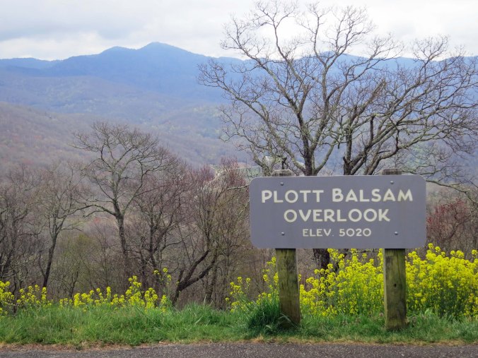
The Blue Ridge Mountains provide numerous opportunities to pull off the road and admire the scenery. Plot was an early pioneer who became famous for breeding bear hunting dogs. Once, according to legend, his dogs cornered a bear in a small cave. Lott went in after the bear with his knife. He won the encounter but the bear clawed him extensively. It was the last time Lott went after a bear with his knife.

The Blue Ridge Mountains provide numerous opportunities to pull off the road and admire the scenery. Plott was an early pioneer who became famous for breeding bear hunting dogs. Once, according to legend, his dogs cornered a bear in a small cave. Lott went in after the bear with his knife. He won the encounter but learned that chasing after bears with a knife is not a good idea.

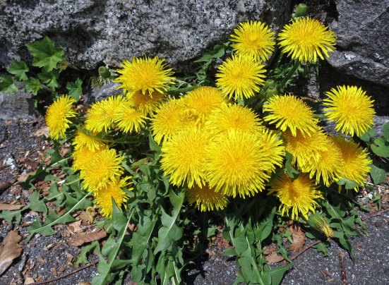
On the higer parts of the Parkway, flowers were just starting to come out.

On the higher parts of the Parkway, flowers were just starting to bloom.

This photo reflects how the Blue Ridge Mountains obtained their name.

I like this photo because it reflects for me how blue ridge after blue ridge after blue ridge gave the Blue Ridge Mountains their name.

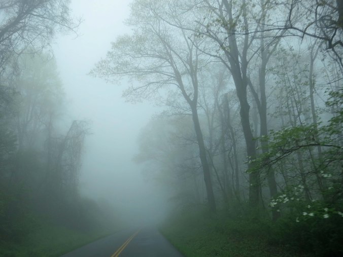
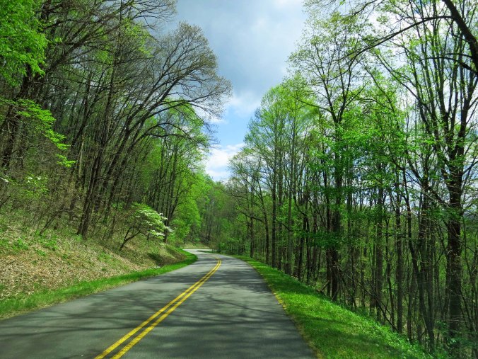
A tunnel of trees along the Blue Ridge Parkway leafing out in early spring green.

A tunnel of trees along the Blue Ridge Parkway leafing out in early spring green. Dogwood is blooming along the left side.

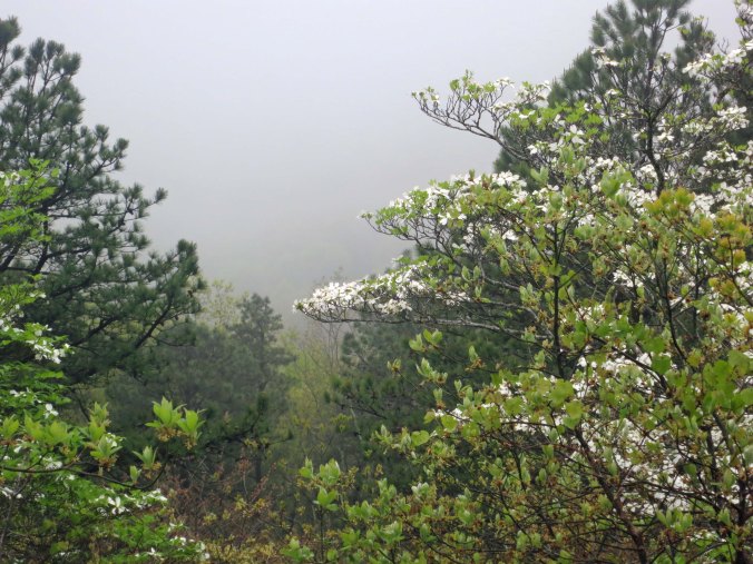
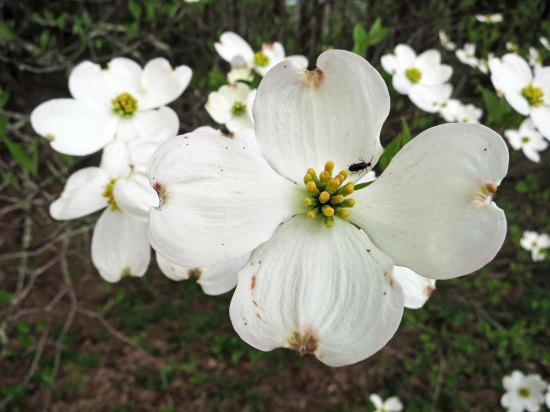
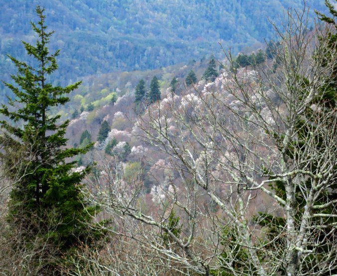
Some of the canyons along the Parkway were filled with blooming dogwood.

Some of the canyons along the Parkway were filled with blooming dogwood.

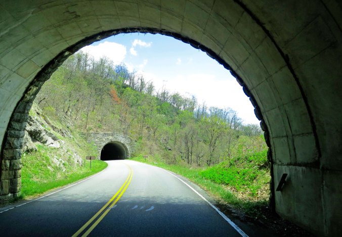
And highway tunnels. There are 26 along the Blue Ridge Parkway ranging in length from 150 feet to 1434 feet.

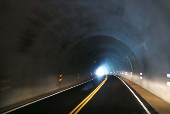
Twin highway tunnels. There are 26 tunnels along the Blue Ridge Parkway ranging in length from 150 feet to 1434 feet. Bicycling through them can be a bit scary, especially the longer tunnels. Going through the 1434 feet Pine Mountain Tunnel, my light chose to die, leaving me in the pitch dark. I immediately climbed off my bike, blindly found the right side of the tunnel, and walked the bike until I could see again. As you can see, there is no shoulder. Fortunately no cars came along.

The lights from our van lit up the tunnel. Imagine your perspective from a bicycle. This was one time when I was ever so glad to see the light at the end of the tunnel.

The lights from our van lit up the tunnel. Imagine your perspective from a bicycle. Pushing my bike with no lights at all, I was ever so glad to see the light at the end of the tunnel.

I climbed to the highest elevation along the Parkway on my first day out. I celebrated by thinking 'well, that's behind me.'

I climbed to the highest elevation along the Parkway on my first day out. I celebrated by thinking ‘well, that’s behind me.’

More fun going down than up!

More fun going down than up!

They call this outcrop the Devils Courthouse but I was hardput to see much that was devilish about it. Maybe on a foggy day...

They call this outcrop the Devils Courthouse but I was hard put to see much that was devilish about it. Maybe on a foggy day…

Looking Glass Rock was once a giant pluton of molten volcano rock located far under the surface. Early morning light reflects off of the rock, giving it the name.

Looking Glass Rock on the right was once a giant pluton of molten volcano rock located far under the surface. Light reflects off of the rock, giving it the name. This time, the sun chose to light up the trees in the foreground instead.

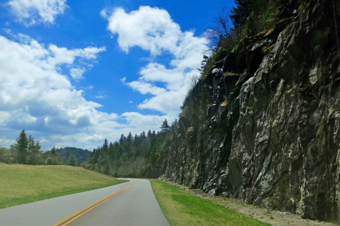
I'll conclude today's section of the Blue Ridge Parkway with this impressive road cut.

I’ll conclude today’s section of the Blue Ridge Parkway with this impressive road cut.


Bicycling across Great Smoky Mountains National Park… The 10,000-Mile Bike Trek

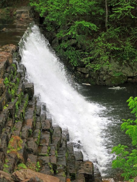
Great Smoky Mountains National Park waterfall in North Carolina.

In addition to its tree covered mountains, the Great Smoky Mountains National Park is noted for its beautiful waterfalls. Peggy and I found this little beauty next to the road on the east side of the Park.


HAPPY 100th BIRTHDAY TO AMERICA’S NATIONAL PARKS

I can’t imagine a future without wild places for our children, grandchildren and future generations to love and explore. Preserving our wilderness areas and the diversity of life on earth are two of the most important responsibilities we have as humans.

A few years ago, Peggy and I took time off to visit America’s National Parks from Alaska to Florida. It was an incredible trip. The beauty and variety of landscapes, plants and animals found in these parks are a gift of incalculable value. As are all the wild places set aside by other countries.

Given that this week is America’s 100th Anniversary of its National Park system, it seems appropriate that I am writing today about my bike ride through (make that up and over) Great Smoky National Park. (And yes, smoky is how it is spelled.) With over nine million visitors this past year, it is America’s most visited park.

First, of course, I had to get there. In the last post about my bike tour of North America, I was in Dayton, Tennessee checking out the courthouse where the Scopes’ trial took place. I left there continuing to follow Route 30 east as it made its steep, winding way up and over ridges of the Cumberland Plateau. In Athens, Tennessee, I picked up an even smaller road, Route 39, that carried me over another ridge into the small community of Englewood.

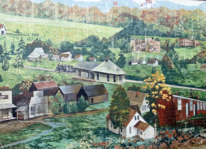
Mural depicting the historic town of Englewood in eastern Tennessee.

This mural of historic Englewood is prominently featured on the side of a building entering town.

From here, it was time to make my way north over the relatively flat Highway 411 to Maryville. Bucolic countryside, Mennonite farms, a humorous Spit and Whittle Club, and the Little Tennessee River provided pleasant distractions from the work of bicycling. As I left Maryville on Highway 321 going toward Pigeon Ford, the countryside shifted dramatically, providing scenic views of the Smokies. The road from Pigeon Ford to Gatlinburg, Highway 441, was all about separating tourists from their dollars. I’ve rarely seen such a concentration of “tourist attractions.” Today, there are eight different Ripley’s venues alone— “believe it or not!”

This Mennonite farmer was apparently out enjoying his/her farm.

This Mennonite farmer was apparently out enjoying his/her farm since I didn’t see any work going on.

Spit and Whittle Clubs, sometimes know as Liar's Clubs, can be found throughout the US. In general, their members are story tellers who focus on 'tall tales.' I expect that this is one of their most unusual club houses!

Spit and Whittle Clubs, sometimes know as Liar’s Clubs, can be found throughout the US. In general, their members are story tellers who focus on ‘tall tales.’ I expect that this is one of their most unusual club houses!

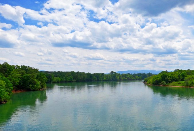
Little Tennessee River flowing through eastern Tennessee.

Highway 411 took me across the Little Tennessee River, which didn’t seem so little to me.

The Great Smoky Mountains can be seen in the distance as you leave Maryville, Tennessee on Highway 312.

The Great Smoky Mountains can be seen in the distance as you leave Maryville, Tennessee on Highway 321.

I spent the night in Gatlinburg, not because I wanted to sample the attractions, but because I wanted to develop the proper mental attitude I would need for climbing 4000 feet in the morning to Newfound Gap at 5046 feet (1538 meters). Two beers and a steak just about did it.

The Smokies, as they are often called, received their name from a blue haze early pioneers found hovering over the mountains. It wasn’t actually caused by smoke, however, it was caused by plant respiration (breathing, so to speak). The park is part of the Appalachian Mountains, an ancient range going back some 250-300 million years. (Some rocks in the area date back over a billion years.) Compare that with the Rocky Mountains at 80-85 million years and the Sierra Nevada Mountains, a mere baby at 40 million. Once, the Smokies reached for the sky like their younger western cousins; now they are old and worn down. This doesn’t make them less steep; ask any hiker or biker who wanders through them. Nor does it make them any less beautiful.

The 17-mile trip up to the Gap was, as I expected, a workout. People shouted encouragement from their cars on some of the steeper parts. I grunted in return. At one stop a little kid looked at me wide-eyed. “Are you really bicycling to the top?” “Sure,” I replied. “It’s fun. Maybe you will do it some day.” “Maybe not,” he responded. I passed the Appalachian Trail and thought of the hikers making their way north on a journey far different from mine but similar in its challenge. And I entered North Carolina, leaving Tennessee behind. After a leisurely lunch on top, it was time to zoom down the mountain, a thrill I had earned. Following are some photos that I took when Peggy and I redrove the route though the Great Smoky Mountain National Park this spring.

View of Great Smokey Mountains National Park in Tennessee.

Peggy and I drove across the Smokies a month earlier than  when I biked across them in 1989. A number of trees had yet to leaf out.

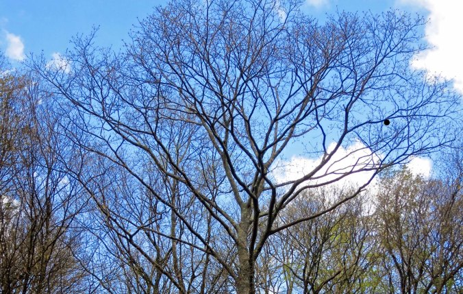
Tree in Great Smoky Mountains National Park in early spring.

By June this tree would be dressed in green. I am not sure who the round nest on the right belongs to. Or if it is even a nest.

I liked this canyon view.

I liked this canyon view.

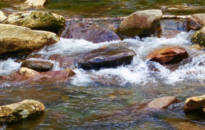
This stream kept me company as I biked up the mountain.

This stream kept me company as I biked up the mountain. At one point I had stopped and dangled my toes in its refreshing water.

Because the road over the mountain is so steep and filled with traffic, the National Park recommends that people not bicycle on it.

Because the road over the mountain is so steep and filled with traffic, the park recommends that people not bicycle on it. Naturally, I caught a section of the road that was car free and had a decent shoulder.

Waterfall in Great Smoky Mountain National Park in North Carolina.

This small waterfall was part of the same stream I placed at the top of the post.

I flew past the turn off that marks the southern beginning of the Blue Ridge Highway and into Cherokee, headquarters for the Eastern Band of the Cherokee Nation. I remember two things about my 1989 stop in Cherokee. One was that the town seemed economically depressed. The second was a bear in a cage. I felt sorry for it. The Smokies are known for having the largest concentration of black bears in the East. The caged bear would have been much happier running around in the woods with them.

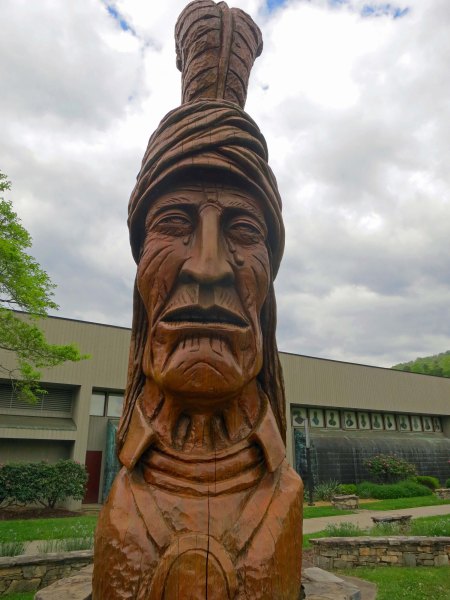
The town seems much healthier now, largely thanks to the Harrah’s-Cherokee Hotel and Casino. It draws several million visitors (and their money) into Cherokee annually. As for the bear, I didn’t see it. Instead, brightly painted bear sculptures were found throughout the community representing, for the most part, Cherokee themes. A large, carved wooden sculpture of a Cherokee stands in front of the community’s administrative center. Three tears are streaming down his face— a memorial to the Trail of Tears where the Cherokee were forced off their homeland and marched to Oklahoma so white settlers could take their property.

Wood sculpture of a crying Cherokee representing the Trail of Tears in Cherokee, North Carolina.

The wood sculpture of a crying Cherokee.

Bear sculpture located in Cherokee, North Carolina.

This bear featured a scenic painting with an elk and an eagle or hawk.

I found this scene on another bear, representing the region in historic times

I found this scene on another bear, representing the region in earlier times.

Bear sculpture painted to resemble eagle in Cherokee, North Carolina.

Another rendition of a bald eagle. I liked how the artist turned the nose of the bear into the beak of the eagle. An eagle shaman dances on the rear hindquarters.

Bear sculpture in Cherokee, North Carolina

This bear was decorated with symbols you might expect to find on Native American rock art.

Bear sculpture in Cherokee, North Carolina smoking pie and dressed like an artist.

And, for my final photo today, a little humor.

NEXT BLOG: I ride back up the road from Cherokee to the Blue Ridge Highway entrance and begin my journey north toward Maine and Nova Scotia.

Hiding Out from a Tornado on the Natchez Trace… The 10,000 Mile North American Bike Tour

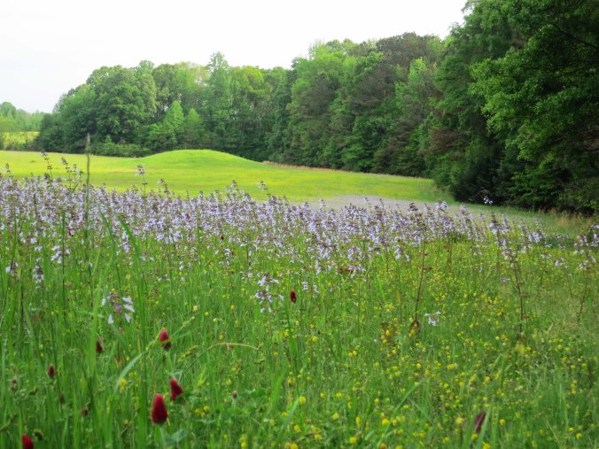
The Pharr Mounds on the Natchez Trace were built around 2000 years ago.

The Pharr Mounds, ancient burial sites, are one of the most interesting views along the Natchez Trace. They became almost too interesting for me when a tornado roared through the area.

I left Tupelo with dark clouds hanging on the horizon. Nothing new here, I thought. It was a rare day when I didn’t see something threatening to pounce on me from the sky. Usually, nothing happened. Or I’d get caught in a downpour or two and dry off.  Why worry? Down in Texas I’d dodged a few hail storms and tornadoes, but dodged is the operative word. Besides, the weather is supposed to behave like that in the Lone Star State. I would have been disappointed without pavement-melting sun and golf ball size hail stones. Where would the stories be?

I was ten miles up the Natchez Trace from Tupelo when a driver flagged me down. “There’s a serious tornado warning on,” he told me. “You should consider getting off the Trace.” I thanked him for his concern. My alarm level climbed up the worry meter a few degrees. But it wasn’t a massive leap. I’d save that for when I spotted a flying cow. Besides, there wasn’t a side road where I was. And when I found one, who’s to say that my detour wouldn’t take me toward a tornado instead of away from it. So I biked on.

At mile marker 286.7, I came on the Pharr Mounds, one of the most interesting sites along the Natchez Trace. Eight large burial mounds cover some 90 acres. Built by hunter/gatherer tribes in the area some 2000 years ago, the mounds range from 3 to 18 feet in height. Artifacts found in the mounds suggest the builders were part of a trading culture that stretched from the Great Lakes to the Gulf of Mexico.

One of numerous arrow head looking signs along the Natchez Trace that announce historic sites.

One of numerous ‘arrowhead’ signs along the Natchez Trace that announce historic sites.

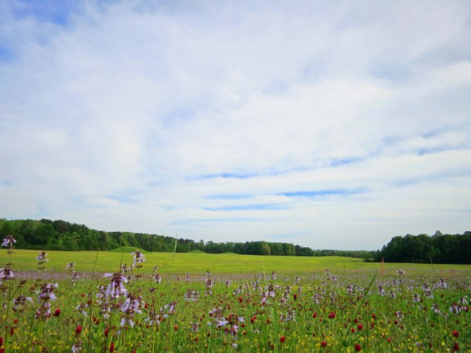
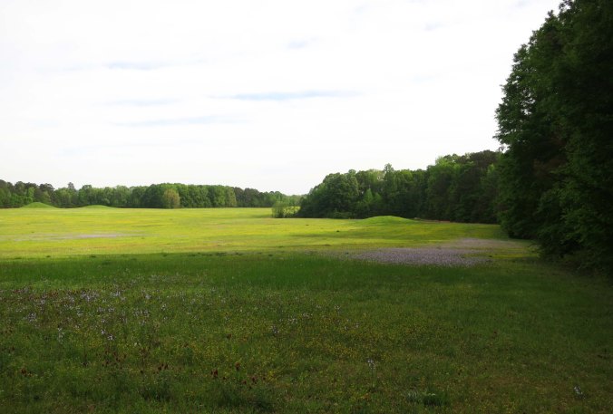
This photo of the Pharr Mounds site provides a perspective on just how large the site is.

This photo of the Pharr Mounds’ site provides a perspective on just how large the area is. Note the mounds in the distance. They are up to 18 feet tall.
The Pharr Mounds north of Tupelo, Mississippi cover some 90 acres.

Another shot that provides perspective on the size of the area.

Flowers growing on the Pharr Mounds along the Natchez Trace in Northern Mississippi.

A close up of the flowers that added color to the green grass.

A group of model airplane enthusiasts were flying their toys over the huge field. The planes were big ones with wide wingspans. I stopped to watch the action and check out the mounds. I became a little concerned when the hobbyists had a hurried discussion, brought in their planes, packed them up, and took off— quickly. Ah well, I thought, climbing back on my bike. But something wasn’t right. The sky had turned an eerie color. I looked at the clouds; they were circling, ominously. Now my alarm level made its massive leap, even without the flying cow. “Oh shit,” I thought.

I hurriedly looked around. The Pharr mounds had a sturdy looking restroom. I had just peed there. I might be peeing there again, real soon, having it scared out of me. The bottom half of the facility was made up of a rock wall. “Okay, Curt,” I commented to me, “this is your port in the storm.” The restrooms had a further advantage of having a covered porch. I could stay outside, be protected from the weather, and watch developments. If necessary, I could scurry inside and duck. I made myself comfortable and waited for the show.
A bright flash of light lit up the sky, followed instantly by an earth-shaking rumble, followed seconds later by a flood causing rain. Noah would have been impressed. The rain didn’t have the good sense to fall straight down. It came at me sidewise, drenching my thoughts of a dry porch. I love a good storm, but this one was becoming worrisome. “Well, Blue,” I said to my bike, “I think it is time to head inside.” I couldn’t be sure, but I think Blue responded with something like, “What took you so long?”

Sopping wet, Blue and I made a beeline for the bathroom. It was dry inside, even warm in comparison to the porch, but I could hear the storm tearing around the building. It sounded like a monster trying to smash its way in. And then it was calm, uncannily so. The monster was gone. Except it wasn’t. In the distance I heard a rumbling sound, like a herd of buffalo seeking revenge, coming for me. I almost lost it at this point. I pictured myself on the floor, snuggling up to the base of the toilet, and holding on for dear life while the roof came off and my bike took off like Dorothy in the Wizard of Oz.

Here I am, standing next to the restrooms that provided me with shelter in 1989. Peggy took this photo when we retraced my route this spring. (Photo by Peggy Mekemson.)

Here I am, standing next to the restrooms that provided me with shelter in 1989. Peggy took this photo when we retraced my route this spring. (Photo by Peggy Mekemson.)

I don’t know how long the roaring lasted: seconds, a few minutes, forever? I do know that it grew louder and louder— and then it was gone. The roof was still on; my bike was still there; and I had missed my close encounter with the toilet. I opened the door for a tentative look, not knowing what to expect. The sun had the nerve to peek out from behind a cloud. A few branches were on the ground. That was it; I had dodged the herd of buffalo (or tornado?) that came roaring through. A celebration was called for, and lunch.

I returned to the porch, retrieved my backpacking stove and boiled up a pot of water for tea and soup. The celebration part involved adding a generous dollop of 151 proof rum to the tea. I almost added another one to the soup. I was half way through the tea when a car pulled up. A woman piled out.

“Did you see a tornado?” she asked excitedly. “There was one just down the road!”

I figured “just down the road” was far too close. I finished my tea and soup, visited the restroom one last time and rode on to Tishomingo State Park, which is near the Alabama border. My ride up the Trace was nearing its end. Fortunately, I’d be there to enjoy it.

Tishomingo State Park on the Natchez Trace.

One of the campgrounds at Tishomingo State Park is located on this beautiful lake. I stayed here during my bile trip and Peggy and I have stayed here twice since.

Peggy toasts my avoiding the tornado.

Peggy toasts my avoiding the tornado. Had it carried me off, I wouldn’t have met her at the end of my bike trek.

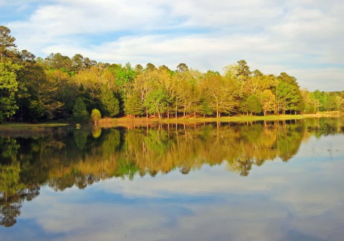
Being an absolute sucker for reflection shots, here are three more from Tishomingo State Park:

A reflection shot at Tishomingo State Park along the Natchez Trace in northern Mississippi.

Tishomingo State Park near the Alabama border in Northern Mississippi.

I will conclude with this one I took as the sun set.

I will conclude with this one I took as the sun set.

NEXT BLOG: I finish up my ride on the Trace and cut across Tennessee to the Jack Daniel’s Distillery in Lynchburg.


On to the Edge of the Rocky Mountains… The 10,000 Mile Bike Trek

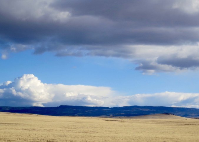
Desert lands can have great beauty.

Golden fields provide contrast to dark blue mountains, towering cumulus clouds and turquoise colored skies in eastern Arizona.

“…all of the golden lands ahead of you and all kinds of unforeseen events wait lurking to surprise you and make you glad you are alive to see.” – from Jack Kerouac “On the Road”

I was on my bike and out of Winslow by 7:00 the next morning. Not to demean the good folks of the community and their historic Route 66 town, but I was eager to leave my motel experience of the night behind. The broad shoulder of Interstate 40 provided a wide berth between the constant stream of large trucks and me. A slight headwind hassled me, slowing down my progress, but it was less than many I had experienced— or would experience. Mainly, I was free to gawk at the vast expanse of desert and fluffy clouds.

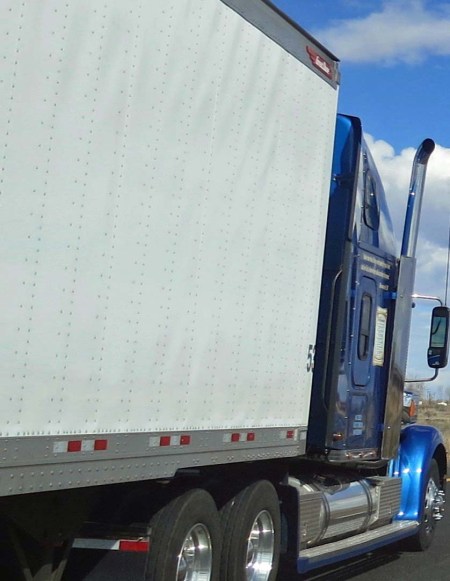
The normal view of an 18 wheeler from the perspective of a bicyclist.

The normal view of an 18 wheeler from the perspective of a bicyclist.

Wide open country, fluffy clouds, a broad shoulder— and for the moment, no vehicles.

Wide open country, fluffy clouds, a broad shoulder— and for the moment, no vehicles.

One non-natural thing I gawked at was the huge Cholla coal-fired power plant belching out black smoke into the clear desert skies. My years of serving as the Executive Director of American Lung Association affiliates in California and Alaska had educated me on the tremendous health and environmental costs associated with coal-fired power plants. The long list of pollutants spewed out are related to both heart and lung diseases. Exposure can also damage the brain, eyes, skin, and breathing passages. It can affect the kidneys, nervous, and respiratory systems. As if this isn’t enough, pollutants from coal-fired plants are also a major factor in global warming and the mercury poisoning of fish. (The plant is now being decommissioned.)

The Cholla coal fired energy plant located between Winslow and Holbrook Arizona just off Interstate 40.

The Cholla coal-fired power plant located between Winslow and Holbrook, Arizona just off Interstate 40.

At Holbrook, I cut off of I-40 and picked up Arizona 180 with a goal of reaching Springerville, a town perched on the edge of the Rocky Mountains. I waved goodbye to I-40 and Route 66 as they set off for Albuquerque. And I said hello to petrified wood. Holbrook identifies itself as the gateway to the Petrified Forest National Park, which was set aside to preserve a 225-million-year old forest made up of stone trees. Petrified wood that exists in surrounding private lands can still be harvested, however. Another whole forest’s worth was for sale in Holbrook.  The town also emphasizes its connection with dinosaurs. (Peggy and I found a bunch as we drove through.)

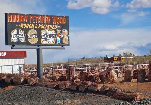
One of several places in Holbrook Arizona that sells petrified wood.

One of several places in Holbrook, Arizona that sells petrified wood. This photo provides an idea of how large the pieces are. You are looking at lots and lots of potential book ends and table tops!

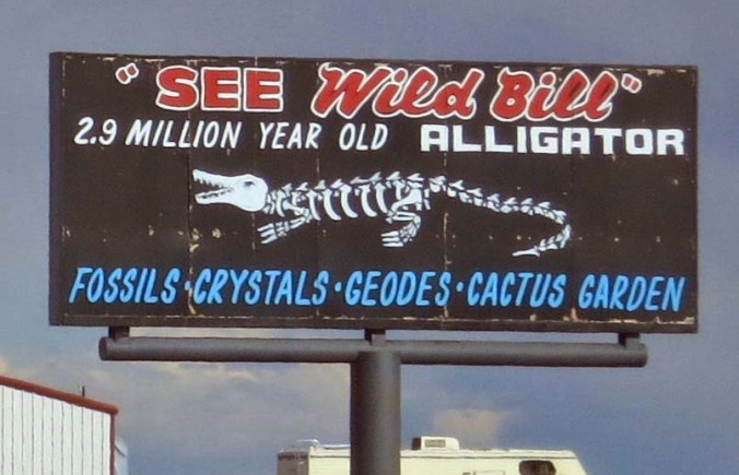
Fossils are found throughout the area. Wild Bill serves as an attraction to get people into the shop.

Fossils are found throughout the area. Wild Bill serves as an attraction to get people into the shop.

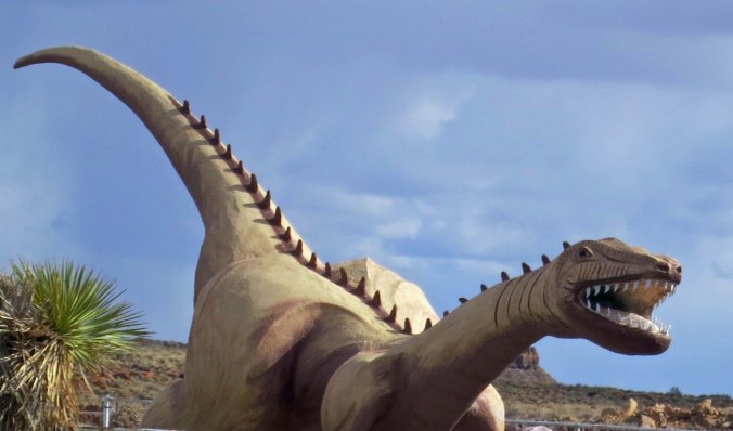
This dinosaur greeted Peggy and I as we drove out of town.

This dinosaur greeted Peggy and me as we drove out of town.

I think this sign was suggesting something about the route I had chosen.

I think this sign was suggesting something about the route I had chosen.

I followed AZ 180 east on bike for around 20 miles and reached the south entrance to the National Park. Since I had been through it before, I didn’t go in, but I did take advantage of the visitor’s center to refill my water bottles— always a good idea in the desert. I also checked out the petrified wood samples.

Arizona Highway 180.

Arizona Highway 180.

They did have petrified wood samples at the south entrance to Petrified Forest National Park. I have always been fascinated by the rocks.

They did have petrified wood samples at the south entrance to Petrified Forest National Park. I have always been fascinated by the rocks. Look closely and you can see the tree rings.

Immediately after the park, the road turned into a jumbled nightmare that had my bike crying ‘uncle’ in five minutes sharp. I told it to man-up and peddled on. The remoteness of the desert became more remote. I noted in my journal that I saw around four vehicles per hour.

I commented on the remoteness in a letter home to my father.

The isolation has an interesting impact on folks— they either love it or desperately want to escape. I spent the night in the small town of St. John. I’d planned on biking through, but a flat tire plus 60 miles persuaded me that the bicycling gods were suggesting I stop. The next morning, I was having breakfast in a small café when a woman and her teenage daughter came in. The woman made a beeline for me in a very predator-like fashion, like a hawk sweeping in on a mouse. She had blonde hair and two of the most intense blue eyes I have ever seen. I swear, Pop, she would have had me for breakfast had I been on the menu. She quickly slipped in that she was divorced. My guess was that there were slim pickings in St. John and an available man was an available man, even when his set of wheels was a bicycle.

But I wasn’t on the menu and I was soon bicycling the easy 25 miles into Springerville. I should have biked on for another 50, but the Rockies were looming and the next 50 miles involved climbing to the top. I holed up in a local campground and found it so pleasant I stayed the next day as well.

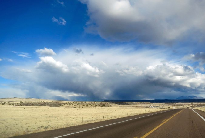
Storm clouds on the road into Springerville, Arizona.

Storm clouds on the road into Springerville, Arizona.(Note: The roads were in much better condition when Peggy and I drove over them.)

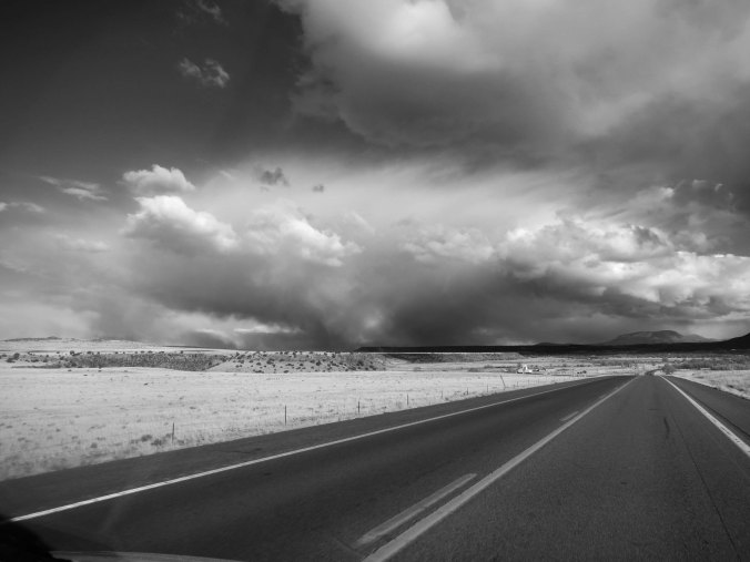
Just for fun, I rendered the same scene into a black and white photo.Which do you like? Which feels more threatening.

Just for fun, I rendered the same scene into a black and white photo.Which do you like? Which feels more threatening?

Speaking of threatening, I had little trouble transforming this cloud into a demon.

Speaking of threatening, I had little trouble transforming this cloud into a demon.

The region around Springerville is one of the major volcanic areas in the US, as the mounds of lava suggest.

The region around Springerville is one of the major volcanic areas in the US, as the mounds of lava suggest.

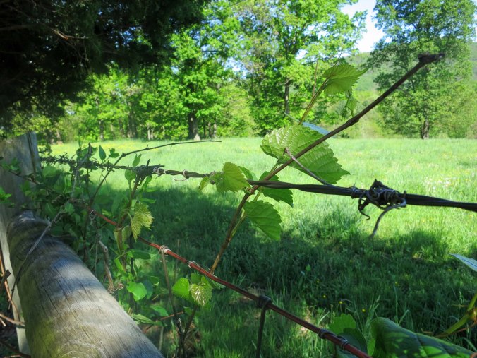
One expects to find barbed wire fences in the west. What made this one fun was that it was capturing tumble weed as it rolled across the plains.

One expects to find barbed wire fences in the west. What made this one fun was that it was capturing tumble weed as it rolled across the plains.

Peggy and I decided to visit the local museum in Springerville and check out its featured display on Casa Malpas, a prehistoric ceremonial site of the Mogollon Culture that was occupied between 1240 and 1350 CE. What we found was much more, including Rambo, the desert Big Horn.

Peggy and I decided to visit the local museum in Springerville and check out its featured display on Casa Malpais, a prehistoric ceremonial site of the Mogollon Culture that was occupied between 1240 and 1350 CE. What we found was much more, including Rambo, a desert Big Horn Sheep. I thought Rambo would fit right in at Burning Man. (Photo by Peggy Mekemson.)

As expected we, did find an excellent display of artifacts from Casa Malpais.

As expected, we did find an excellent display of artifacts from Casa Malpais.

What was totally unexpected was a Rembrandt sketch.

What was totally unexpected was a Rembrandt sketch.

This photo provides an example of how full the museum was.

This photo provides an example of how full the museum was.

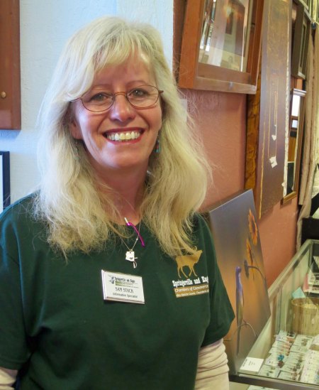
As Peggy and I retraced my bike route over the past couple of months and visited local museums along the way, we were struck by how friendly, knowledgeable and helpful local staff were. Sam Stack at the Springerville Museum is an excellent example.

As Peggy and I retraced my bike route over the past couple of months and visited local museums along the way, we were struck by how friendly, knowledgeable and helpful local staff were. Sam Stack at the Springerville Museum is an excellent example.

NEXT BLOG: It is up and over the Rocky Mountains where I bicycle 90 plus miles, stop off at Pie Town, and am impressed by a Very Large Array of radio telescopes that search for ET and are unlocking the early history of the Universe.


From Death Valley to Las Vegas… The 10,000 Mile Bike Trek

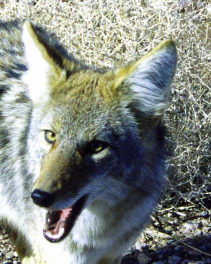
A coyote ran along beside me for a short while as I rode out of Death Valley. Here's a shot of a Death Valley coyote saying , "Feed me!"

A coyote ran along beside me for a short while as I rode out of Death Valley. Here’s a shot of a Death Valley coyote saying , “Feed me!” (Photo by Peggy Mekemson.)

I struggled with what to title this blog; Death Valley to Las Vegas seemed so ordinary.  I played with titles like ‘from wild to whacky’ and “from the sublime to the stupendous” but gave up. How do you compare Death Valley with Las Vegas? Is it even possible?

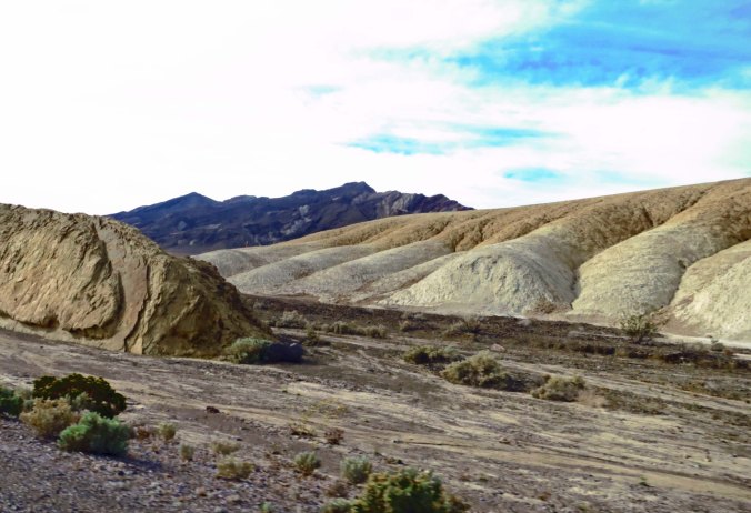
I wasn’t thinking about Las Vegas when I cycled out of Furnace Creek. There was another hill to climb. Not bad, just long— maybe 20 miles, and low gear the whole way. I cycled past Zabriskie Point and Twenty Mule Canyon, slowly. There was plenty of time to appreciate the scenery.

A view of Twenty Mule Canyon as seen from Highway 190.

A view of Twenty Mule Canyon as seen from Highway 190.

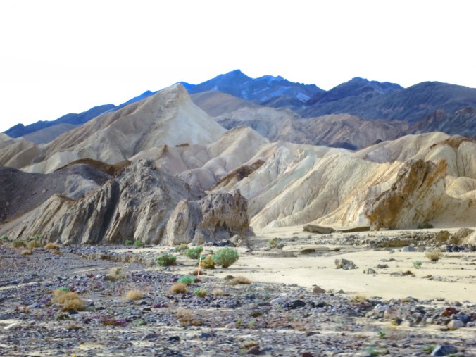
Another view of the Canyon.

Another view of the Canyon.

At one point, a curious coyote trotted along beside me in the bushes. A few minutes persuaded him I wasn’t going to slip him a snack. Coyotes are animals of opportunity when it comes to meals. The National Park has a strict rule on not feeding them. One time, Peggy and I were coming into Death Valley from Beatty, Nevada and a coyote was sitting beside the road just outside of the boundary, looking hungry. We laughed and stopped to snap its photo. Did the wily fellow (remember Wile E. Coyote and the Road Runner) know that tourists were fair game before entering the park?

Eventually I crested the hill I had been climbing and cycled down to Death Valley Junction. Twenty or so people live in the area. The town population sign announces less. Beside it’s minimal population, the Junction’s claim to fame is an opera house. I didn’t hear any arias, not even ghostly ones, but I was able to refill my water bottles.  I made my own music by blowing into the bottles. Leaving town, out where no one but the jackrabbits could hear me, I belted out O sole meo.

From Death Valley Junction, it was a straight, very flat 20-mile ride into Amargosa Valley and Highway 95. Along the way, I passed into Nevada. My adventure had truly begun. No one was around to help me celebrate except a far-distant free range cow. Or maybe it was a burro. Whatever, I mooed at it.

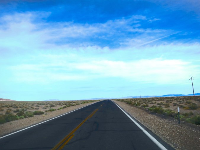
Highway 373 leading into Amargosa Valley was straight and flat. See any cattle or burros?

Highway 373 leading into Amargosa Valley was straight and flat. See any cattle or burros?

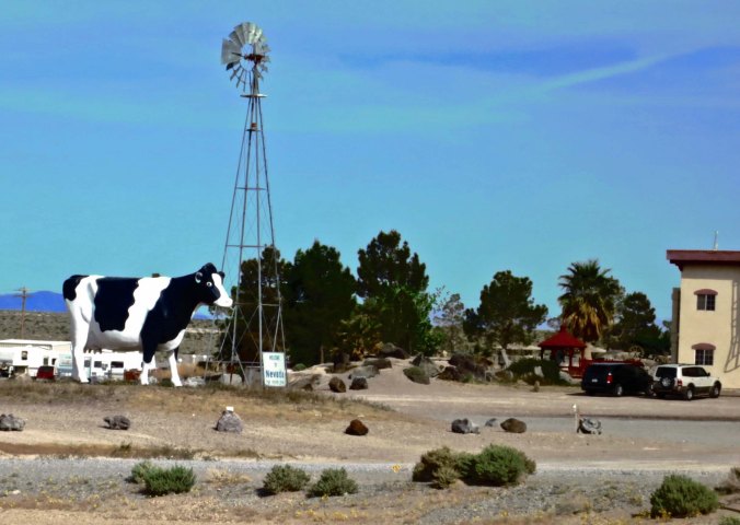
Peggy and I found this large one along the highway as we retraced my bike route. It wasn't there when I biked through the area. I think I would have spotted it.

Peggy and I found this large cow along the highway as we retraced my bike route. It wasn’t there when I biked through the area. I think I would have spotted it.

Highway 95 is Nevada’s main (only) road connecting Reno, Carson City, and Las Vegas. I stopped at the junction and decided to call it a day. A small restaurant/casino promised food and entertainment. A rest stop provided bathroom facilities. A bar across the road pointed out I was in ET country. Area 51 was near by. What more could a lone cyclist ask for? I biked over to the restaurant, downed a chiliburger, and was entertained by a seasoned waitress. “Where you headed, Honey?” Afterwards, a friendly video poker machine paid for my dinner. As dusk approached, I found a hidden area behind the rest stop and took out my ground cloth, sleeping pad and sleeping bag. I went to sleep looking for flying saucers zipping across the sky.

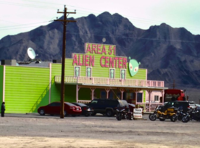
ETs and Area 51 have become tourist attractions. This establishment is in Amigos Valley on Nevada Highway 95.

ETs and Area 51 have become tourist attractions in Southern Nevada. This establishment is in Amargosa Valley on Nevada Highway 95. The more you drink, the more aliens you see.

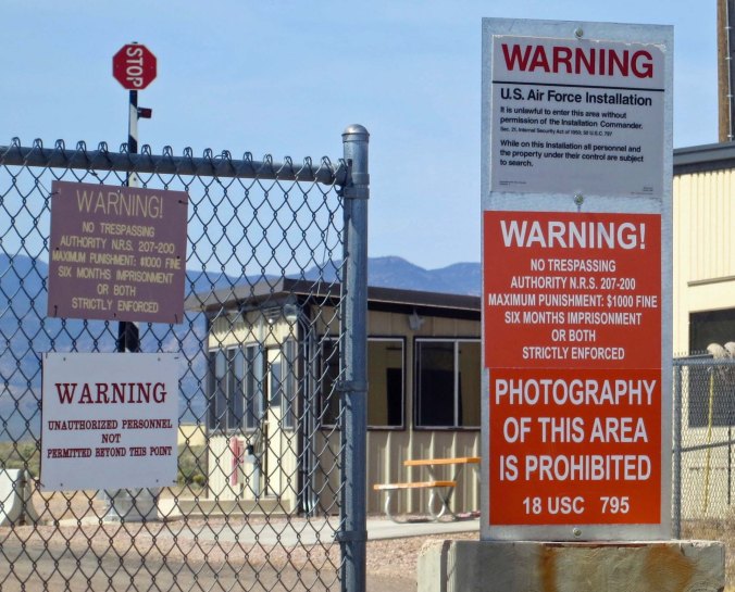
Area 51 in the Nevada Desert.

The actual Area 51 is a hundred or so miles across the desert. Peggy and I visited the area on one of our trips. I don’t think the government wants you on the site.

I was up early the next morning and on my way to the neon jungle— sin city. There really wasn’t much reason to hang out in the bushes behind the bathrooms, as I am sure you will agree. I did stop for a quick breakfast and chat with my favorite 70-plus waitress. “I see you are on your way dear. Can I ride along on the back?” “Only if you pedal, honey.” “Oh, I have something to peddle, alright. Is that what you have in mind?” I laughed and left a generous tip.

My video poker machine beckoned as I went out the door. It wanted its money back. “Not today,” I told it and patted it fondly.

Twenty-five miles or so down the road, I came on a bizarre sight for the middle of the desert: protesters. I thought maybe my lonely hours on the road were beginning to take their toll and I was seeing a mirage. But the protesters were real and they had a serious mission; they carried “Ban the Bomb” signs. Nevada’s nuclear test site was just off to the east and protests over America’s nuclear bomb testing program had been going on in the area for years. Seventy-five people had been arrested there the week before on Palm Sunday. Government records later revealed that over 37,000 people had participated in the test site protests with some 15,740 arrests made, including the likes of Carl Sagan, Kris Kristofferson, Martin Sheen, and Robert Blake.

As a child growing up in the 50s, I remember witnessing one of the first atom bomb tests in Nevada— from our home in the Sierra foothills! My brother, sister and I got up with our parents at some time in the wee hours in the morning and held a countdown. The whole southeastern sky lit up. Guests staying at hotels in Las Vegas actually got to see the tale-tale mushroom clouds from this and later tests. Strange entertainment indeed. I am sure the casinos protested; it took time away from gambling.

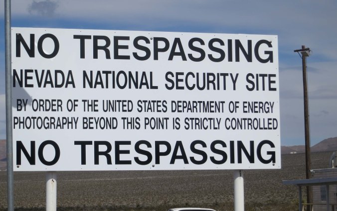
Peggy and I revisited the site a year ago. We took the exit off the road toward Mercury. Nothing was marked on the exit sign except “No Services.” A couple of hundred yards in, not visible from the freeway, a large sign demanded that we stop. Military property existed on the other side and all sorts of bad things would happen to us if we trespassed. No photographs were allowed. Suddenly a black SUV was parked next to us. We had no idea where it came from. A man in dark glasses and a suit, looking suspiciously like a character out of Men in Black, was demanding to know what we were doing and insisting that we turn around and get out of there. “We’re on our way,” I announced. As he drove off, I got out and took a photo of the sign, an admittedly small contribution to the protests of yore.

The sign at the Nevada Nuclear Bomb Test Sight.

The sign at the Nevada Nuclear Bomb Test Sight.

I didn’t make it to Las Vegas that night on my bike trip. It was well over 100 miles. My conditioning was coming along fine, but not that fine. The next day I cycled in, dodged insane traffic, found a KOA that wasn’t afraid of someone carrying a tent, and settled in for a layover day. My bike wanted a tune up and I wanted a day on the Strip.

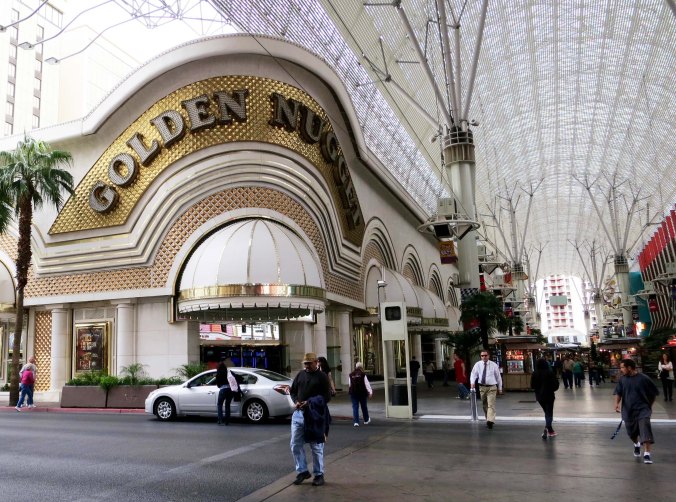
While Las Vegas has changed extensively over they years, it has retained its purpose of separating you from your money. Early casinos, like the nugget, suggested you would be taking gold home.

While Las Vegas has changed extensively over they years, it has retained its purpose of separating you from your money. Early casinos, like the Nugget, suggested you would be taking gold home.

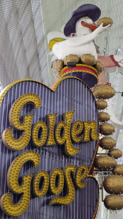
Another example. What's more symbolic of obtaining untold, unearned wealth than the Golden Goose.

Another example. What’s more symbolic of obtaining untold, unearned wealth than the Golden Goose?

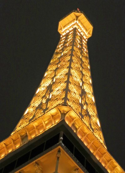
Today's emphasis is more on Las Vegas being a resort destination, somewhere you might take the family. Like to Paris for example...

Today’s emphasis is more on Las Vegas being a resort destination, somewhere you might take the family. The strip now features such places as Paris…

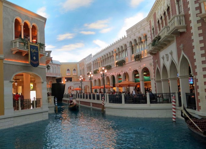
Or Venice...

Venice…

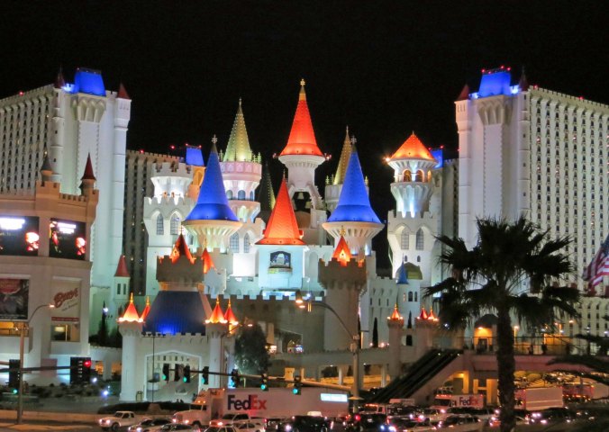
And fantasy land.

And fantasy land.

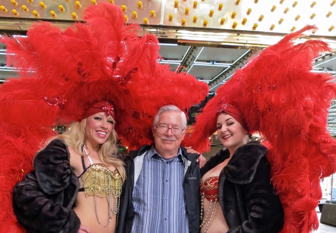
Show girls have always been popular. (Photo by Peggy Mekemson.)

Show girls have always been popular. (Photo by Peggy Mekemson.)

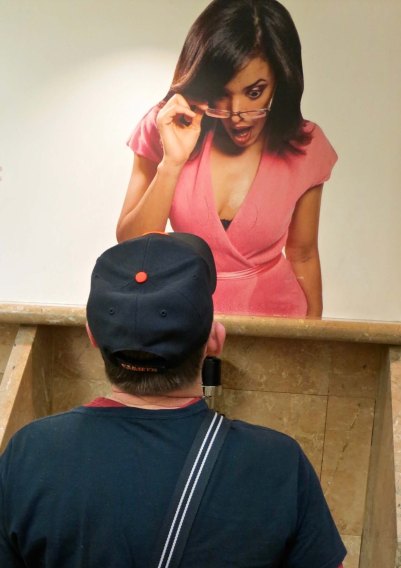
The city has always had a whacky side...

The city has always had a whacky side…

As demonstrated by this and the last photo.

As demonstrated by this and the last photo.

Note: All of the above photos were all taken during our present trip or on previous trips through the region. You may recognize some photos from earlier blogs I have posted.

NEXT BLOG: Join me as I make my way into Arizona and onto Historic Route 66.

The Ten Questions People Most Frequently Ask Bone… The 10,000 Mile Journey

Bone checks out Mt. Everest in Nepal

Bone checks out Mt. Everest in Nepal

Note: Last post I introduced you to my travelling companions as Peggy and I make our way around the US and Canada following my bike route. Peggy, Eeyore and I are relatively normal. Well, at least two of the three are. But Bone is way out there. For example, yesterday he was looking for Elvis Presley… but that’s a story for later. Today I want to provide greater insight into Bone’s character by reposting an earlier interview that Bone had. I think that you will agree he/she/it is really strange.
1: Do you really talk. We’re speaking ethics here, Bone. Blogging is about transparency. That means honesty.

Are you crazy? Have you ever heard a bone talk? Of course I don’t talk. I just think out loud.

2: Curt sometimes refers to you as he. Does this mean you are a male bone?

No. He makes assumptions, lot of them. He was showing me to a biologist at the San Francisco Writer’s Conference and she suggested I have my DNA tested. “Just cut a small chip off of it,” she said nonchalantly. “You can determine its sex and breed.”

 “Just cut a small chip off of it?Outrageous! I am not some it to have chips cut out of. Besides, I lead a rich fantasy life and have no desire to know whether I am male or female. Call me she, he, or Bone, but never it.

Um, I think Bone is definitely a male in this photo.

Um, there are reasons why I tend to think of Bone as a male.

3: You have travelled all over the world and met thousands of people. How do they usually react to you?

With befuddlement. You should have seen the look on the face of the customs agent in New Zealand who tried to seize me as ‘animal matter.’ But emotions run the gamut. There was a Japanese man who got off a tour bus at Yellowstone National Park and wanted to hold me for good luck. Soon there were 43 other Japanese handing me around and oohing. On the opposite side, I know a woman who refuses to touch me, like I have cooties. “I don’t know where Bone has been,” she states primly. Not surprisingly, there is also jealousy. “I want to be Bone and travel the world,” a good friend in Sacramento claims.

4:  What is your favorite thing to do?

Visit graveyards; there are lots of old bones there. My favorite grave is Smokey Bear’s in Capitan, New Mexico. I once stood on his tombstone for ten minutes trying to communicate but all I could get was something about ‘growling and a prowling and a sniffing the air.’ A close second is the grave of Calamity Jane in Deadwood, South Dakota. What a woman! These are difficult choices though when you toss in the likes of Hemingway, Daniel Boone and Billy the Kid. On the light side I once visited Ben and Jerry’s graveyard of discarded ice cream flavors in Vermont. My spookiest experience was a visit to the Capela dos Ossos, the Chapel of Bones, in Evora, Portugal. Those folks definitely have a skeleton in their closet, lots of them.

5: So, what’s your second most favorite thing to do?

Too hard; I am a dilettante dabbler, but here are a few.

  • Wandering, of course, anywhere and everywhere and by all modes: bikes, kayaks, rafts, skis, backpacks, sailboats, planes, helicopters, trains, cars, RVs, etc.
  • Visiting wild, remote and beautiful natural areas. I began life wandering the Sierra Nevada Mountains, John Muir’s Range of Light.
  • Seeking out strange phenomena such as ghosts, Big Foot and aliens (I’ve been to Roswell four times).
  • Attending unique events like Burning Man but I also have a fondness for any type of fair.
  • Meeting weird people like Tom.
Tom, being wonderfully weird on a raft trip down the Colorado River he was leading, put on a Bone headpiece.

Tom, being wonderfully weird on a raft trip down the Colorado River he was leading, put on a Bone headpiece.

Bone dressed up for the Canyon trip in his own life best.

Bone dressed up for the Canyon trip in his own life vest. The vest, BTW, was certified by our son Tony, who flies helicopters for the US Coast Guard.

6: Speaking of Tom, he and Curt ‘discovered’ you in 1977 and you have wandered extensively with both. Who do you like best?

Eeyore, the jackass who can’t keep track of his tail. We’re travelling companions and he saved me from being strung up and buried on Boot Hill in Tombstone, Arizona. I’d robbed a bank, cheated at cards and hung out with women of delightful character. (This is what I mean by having a rich fantasy life. It’s also known as evasion.)

7: Which of your journeys has been most memorable?

I would have to say traveling the length of Africa in the back of a truck from the Sahara Desert in the north to Cape Town in the south. Almost falling off the back of a riverboat into a piranha infested section of the Amazon River would have to be a close second. I was perched on the back railing doing a photo shoot. And of course there was my 10,000-mile bike journey.

Bone doing his photo shoot on the Amazon. Shortly after this he started to fall off. I made a quick leap and barely caught him. The photo shoot was over for the day.

Bone doing his photo shoot on the Amazon. Shortly after this he started to fall off. I made a quick leap and barely caught him. The photo shoot was over for the day. We did eat piranha that night in his honor, however. They taste like fish.

8: You are often seen scrambling over rocks in remote sections of the Southwestern United States. What’s that all about?

I’ve developed a fondness for Native American Rock art. It resonates with my bone-like nature. It’s also another excuse to go wandering around in the outdoors. Plus, some those places might be haunted and it is a great place to look for UFOs. Some of the petroglyphs look amazingly like aliens. Finally, wandering in the desert is known to be good for the soul. Ask the Prophets of yore.

9: Ah, being a Born Again Bone, do you have any insights into the great unknown?

Ommmmmmmmmmmmmmmmmmmmmmmmmmmmmmmmmmmmmmmmm.

10: Finally, and this may be a little sensitive, but do you always run around naked?

What kind of question is that? Do you think I am uncivilized? For shame. I am the epitome of haute couture! A bow and arrow toting, card-carrying NRA member in Montana who is building an airplane in his basement has designed and made me two leather vests. What’s more, an 80-plus year old woman in Kansas going on 20 with a crush on Johnny Depp and a room devoted to the Egyptian gods has made me a kilt and several other outfits. Face it; I am hot stuff, clothed or naked. I may take up a modeling career.

Bone celebrates on top of Mt. Kilimanjaro!

Bone celebrates on top of Mt. Kilimanjaro! (red coat above the O)

Here's Bone at the lowest point in North America in Bad Water Basin in Death Valley, 282 feet below sea level. (He was there on the bike trek and has since returned.)

Here’s Bone at the lowest point in North America in Bad Water Basin in Death Valley, 282 feet below sea level. (He was there on the bike trek and has since returned.)

NEXT BLOG: I return to my bike route. My first days are supposed to be easy short days, a time to make up for the fact that I didn’t do anything physical to prepare for my adventure. The second day turns out to be a doozy, however. And I am greeted by a great white whale at the end.

From Anchorage, Alaska to Fairbanks by Rail… A Perfect 10

One of many views we had of Mt. Denali as we rode the Alaska Railroad from Anchorage to Fairbanks.

One of many views we had of Mt. Denali as we rode the Alaska Railroad from Anchorage to Fairbanks.

The conductor told us we were a 10, or I should say he told us we were among the 10% of people who travel by rail from Anchorage to Fairbanks and get to see Mt. Denali. Normally it is covered in clouds, or maybe you get a teasing glimpse. Having lived in Alaska for three years, I know how special it is to see the mountain.

Once, I was camped out at Wonder Lake, which is way out at the end of Denali Highway. I’d been backpacking in Denali National Park dodging grizzlies and had a small backpacking tent that I had pointed in the direction of the cloud-hidden mountain. I woke up early with the sun (in summertime Alaska, that’s really early). A huge mountain had appeared out of the clouds. “Wow! I said to my friend. You have to see this.” And then a larger mountain appeared behind it. As we sat there in awe, the clouds parted and a third, even larger mountain appeared, a massive mountain, Mt. Denali. At 20,310 feet, is the tallest mountain in North America.

Denali has only recently reclaimed the name it was known as for centuries by the Athabaskan natives of the region. It means big mountain, or the tall one. In 1896, an Alaskan gold miner named it Mt. McKinley in honor of the man he hoped would become president. McKinley won and the name stuck. Alaskans have been lobbying for years, quite rightly I would argue, to return the name to Denali. Their efforts had been continually blocked by a small contingent of politicians from Ohio, McKinley’s home state. On August 28, 2015, President Obama renamed the mountain Denali on the basis of a recommendation by the Alaska Geographical Society. I suspect the Ohio politicians are trying to impeach the President because of his action.

The sky was clear on our whole 350 mile trip from Anchorage to Fairbanks and we had several views of the Mountain. The engineer would stop the train each time we saw it. In fact, the engineer stopped the train several times to point out other things of interest as well, like moose for example. There’s a reason why the trip took 12 hours! Alaska is a state of great natural beauty, and we were privileged to see much of it on our trip. Following are a few of the many photos that Peggy and I (along with grandsons) took along the way. Enjoy.

I used this photo earlier on another post but you are getting to see it again because I like it so much and feel it is symbolic of our trip.

I used this photo earlier on another post but you are getting to see it again because I like it so much and feel it is symbolic of our trip with the train, mountains, rivers and trees.

Another photo of the train. I liked the perspective, and the trees.

Another photo of the train. I liked the perspective, and the trees.

My nose was glued to the window for the whole trip. (Except of course to eat and pay attention to the family.) Many of the views, like this one, were right beside the track.

My nose was glued to the window for the whole trip. (Except of course to eat and pay attention to the family.) Many of the views, like this one, were right beside the track.

Snow, trees and shadows provided interesting compositions.

Snow, trees and shadows provided interesting compositions.

I thought these birch trees deserved a black and white look.

I thought these birch trees deserved a black and white look.

Numerous rivers dot the Alaska landscape we found several along the tracks.

Numerous rivers dot the Alaskan landscape. We found several beauties along the tracks.

Another example.

Another example.

Homesteaders living along the railroad give a new meaning to 'off the grid.' Most live several miles apart and all depend on the railroad to provide access to the outside world. The conductor/guide told us they stood along the tracks and flagged the train down when they needed a ride out.

Homesteaders living along the railroad give a new meaning to ‘off the grid.’ Most live several miles apart and all depend on the railroad to provide access to the outside world. The conductor/guide told us the homesteaders stood along the tracks and flagged the train down when they needed a ride out.

While bears hibernate during the winter, moose operate year around, this open, ice covered river provided a moose highway as indicated by the trails.

While bears hibernate during the winter, moose operate year around. This open, ice-covered river provided a moose highway as indicated by the trails.

We were there long enough to see them moving along at the upper end of the small lake.

The engineer had stopped the train on the bridge over Hurricane Canyon when we spotted this family of moose following a trail.

I liked the shadows they cast in the bright sunlight.

I liked the shadows they cast in the bright sunlight.

Looking the other way across Hurricane Canyon provided this magnificent view of the canyon and the Alaska Range.

Looking the other way across Hurricane Canyon provided this view of the canyon and the distant Alaska Range. (Click on this for a larger view.)

Much of our time was spent admiring magnificent mountains. A different kind of animal made the tracks in this photo, people on snowmobiles, a primary form of transportation in backcountry Alaska.

Much of our time was spent admiring magnificent mountains. A different kind of animal made the tracks in this photo, people on snowmobiles, which are a primary mode of transportation in backcountry Alaska. I think these guys was playing.

More impressive mountains...

More impressive mountains…

Mountain Scene on Alaska Railroad between Anchorage and Fairbanks.

And more.

And a final view of Mt. Denali in the distance.

And a final view of Mt. Denali in the distance.

Our son Tony and his family talked us into the railroad trip and other great adventures we had on this visit to Alaska. We owe the family big. In this photo, Tony and Cammie's son Cooper has decided my head is a good place for a snooze. (I took this as a selfie.)

Our son Tony and his family talked us into the railroad trip and other great adventures we had on this visit to Alaska. We owe the family big time. In this photo, Tony and Cammie’s son Cooper has decided my head is a good place for a snooze. (I took this photo as a selfie.)

I usually don't have much luck with photos taken out of airlines but I feel this photo of the Alaska Range taken on our Alaska Airways trip back to Anchorage from Fairbanks is an exception.

I usually don’t have much luck with photos taken out of airlines but I feel this one of the Alaska Range I took on our Alaska Airways trip back to Anchorage from Fairbanks is an exception. It seems worthy of concluding my series on Alaska. (Click on this for a larger view.)

NEXT BLOG: A new adventure! Peggy and I hit the road in our 22 foot van retracing the route I followed on my 10,000 solo bike trek I took around the US and Canada in 1989.


Encountering BIG Brown Bears and other Alaskan Wildlife…

I met my first Brown Bear in Katmai National Park, which is at the beginning of the Aleutian Peninsula. He was coming along a trail I was walking down. He and I had a discussion and then I slowly backed away. Never run from a bear.

I met my first Brown Bear in Katmai National Park, which is at the beginning of the Aleutian Peninsula. He was coming down a trail I was walking up. He and I had a discussion and then I slowly backed away. Never run from a bear unless you are hiking with someone slower than you are. (grin)

Peggy and I are off in Alaska as you read this blog. Since I won’t have time for blogging or reading blogs, I decided to repost a few blogs from the trip we made to Alaska three years ago. If you have been following me for a while, you will have read these blogs previously. I will try to respond to comments. –Curt

Back in the 1980s, I spent three years living in Alaska and dedicated as much time as I could to wandering in the woods. Along the way I met most of the wildlife Alaska is famous for. A grizzly bear stalked me on the Kenai Peninsula. I went to sleep listening to wolves howl on a winter cross-country ski trip in Denali National Park. Even more entertaining, a pair of Dahl Sheep had a head-butting contest in my campsite in Chugach State Park.

You don’t have to disappear into the vast wilderness of Alaska to encounter animals with big teeth, claws and antlers, however. Our friends Edith Barrowclough and David  McElroy reported that both a black bear and a moose wandered through their yard in Anchorage over the weekend. They have also seen a wolf and a lynx in the area.

Our friends David and Edie. Edie went to high school with Peggy in Port Clinton Ohio. She now works as a CPA in Anchorage. Her husband, David, is a bush pilot working on the North Slope and a published poet.

Our friends David and Edie. Edie went to high school with Peggy in Port Clinton, Ohio. She now works as a CPA in Anchorage. Her husband, David, is a pilot working on the North Slope and a published poet. (Photo by Peggy Mekemson.)

Peggy and I stayed with them for four days. Every time Chula the Dog barked Peggy darted outside in hopes of spotting something large and furry. All she saw was the neighbor’s dog but we did end up seeing our share of wild animals. David and Edie insisted on taking us to the Alaska Wildlife Conservation Center at the southern end of Turnagain Sound. The Center serves as a wildlife sanctuary and is designed to duplicate the animals’ natural surroundings. They have done a good job. The photos in this blog were taken there.

Our trip down Turnagain Arm to the sanctuary was a trip down memory lane for me. It was one of my favorite drives when I lived in Alaska.

Turnagain Arm and the Alaska Railway.

A shot of the railroad tracks running along Turnagain Sound. The V in the mountains on the right is where the town of Hope is located. Hope was the starting point for 100 mile backpack trips I led across the Kenai Peninsula.

Salmon fishing on the Bird River in Alaska.

We stopped off at Bird River on our way down Turnagain Arm. The dots on the river are people fishing for salmon. Three days later we would be fishing for salmon on Kodiak Island.

Black bear with cave in Alaska

Black bears are smaller than their cousins. I once woke up with one standing on my chest in Yosemite. I screamed loudly. You may have heard me. This guy was about to join his companion in the cave.

Black bear entering cave in Alaska.

Here he goes.

Alaskan Brown Bear

Our first view of the Brown Bears was of one playing in the water throwing a moose bone into the air. (Photo by Peggy Mekemson)

Alaska Brown Bear playing with moose bone.

Here he catches the bone with one paw while pointing out his skill with the other. He didn’t have to persuade us.

Alaska Brown Bear growling.

My, what big teeth you have. And no, we have no intention of taking away your bone. (Photo by Peggy Mekemson)

One wet Alaskan Brown Bear, up close.

One wet Alaskan Brown Bear, up close.

Alaska Brown Bear displaying his claws.

Check out the claws on this guy.

Head shot of Alaska Brown Bear.

My grandson Connor insisted I include this head shot I took of one of the Brown Bears. The bear was sitting up.

I though I would conclude with this photo because it emphasizes just how big Alaskan Brown Bears become on their diet of salmon.

I thought I would conclude with this photo because it emphasizes just how big Alaskan Brown Bears become on their diet of salmon. A large male can weigh up to 1200 pounds.


When …—… Saved Lives: The Marconi Telegraph Station at Point Reyes


1 Tunnel of Cypress Trees at Marconi-RCA wireless site Point Reyes

This tunnel of cypress trees leading into the Marconi-RCA wireless receiving station at Point Reyes National Seashore in California is considered one of the most beautiful tree tunnels in the world.

Do you recognize the dits and dahs? I memorized what they meant for a Boy Scout badge back in the Dark Ages, back before satellites and modern communication systems came to connect almost anyone, anywhere, anytime. Here’s a clue: the three dots stands for S, and the three dashes for O. Think SOS: Save Our Ship. You will recognize the whole alphabet spelled out in dits and dahs as Morse Code, named after the American inventor Samuel Morse, who developed it in 1838.

Morse Code

Morse Code

Combined with telegraph lines and operators, it revolutionized communication. Getting the quickest message between points A and B no longer required finding the fastest horse or train. Seconds instead of days or weeks became the rule for sending important communications over long distances.

What Morse did for land based communication, Guglielmo Marconi did for oceans. His claim to fame was being the prime inventor of wireless communication using radio waves. He started at the young age of 21, working in his attic in Italy with his butler Mignani. (I am reminded of the young Steve Jobs, sans butler, working out of his garage in Palo Alto.) Like Jobs, Marconi was an entrepreneurial genius as well as an electronics wizard, or geek, if you prefer. He began by sending a message across his attic in 1894 to ring a bell. By 1902, he’d cornered the market on sending wireless messages using Morse Code across the Atlantic Ocean.

Ships at sea and their passengers were among the primary beneficiaries of the new technology. “Surprise, you are a new father. Send money,” could now be transmitted immediately instead of weeks down the line. There was also a safety factor. For the iceberg bound Titanic, it meant that 30% of its passengers were saved— instead of none.

By 1914, Marconi had extended his operation to the Pacific Ocean and built sending and receiving stations in the Marin County towns of Bolinas and Marshall north of San Francisco. (Because of interference, sending and receiving stations had to be separated.) During and immediately after World War I, military concerns combined with a touch of nationalism, and, I suspect, a generous dollop of old-fashioned greed, led to the take over of Marconi’s American operation and its transformation into RCA, the Radio Corporation of America.

A Mural in Olema, California that provides a look at what the community looked like when it served as the sending station of Marconi telegraph. The blue surfboard represents a bit of artist creativity. (grin)

A mural in Olema, California just north of San Francisco that provides a look at what the community looked like when it served as the Pacific Ocean telegraph sending station for Marconi-RCA telegraph. The blue surfboard represents a bit of artist creativity. (grin)

An early photo of the Marconi receiving site in the small town of Marshall on Tomales Bay.

An early photo of the Marconi receiving site in the small town of Marshall on Tomales Bay. Workers lived in the hotel.

The hotel as it looks today as part of the Marconi Conference Center.

The hotel as it looks today as part of the Marconi Conference Center.

6. Old Highway 57 and Highway 1 in Marshall

Old Highway 57, the dirt road, once serviced the Marshall Marconi wireless receiving site. Modern Highway 1 is seen below along with Tomales Bay. The distant hills are part of Point Reyes National Seashore.

7 Old 1873 Seafood restaurant in Marshall Ca

Historic Marshall included this old/now deserted seafood restaurant built in 1873.

Today, Marshall is know for its oysters and kayak eco-tours.

Today, Marshall is known for its oysters and kayak eco-tours.

I hound this old rocking chair sitting alone Highway one. All it needed was an old codger to sit in it.

I found this old rocking chair sitting along Highway 1. All it needed was an old codger to sit in it.

In 1929, the Marshall operation was moved to Point Reyes. It was still there actively receiving messages when I first started visiting the National Seashore in the late 60s and early 70s. A forest of receiving antennas and no trespassing signs announced its presence. Most of the communication with American ships involved in the Vietnam War passed through the facility. On July 12, 1999, the station sent its last message. Dits and dahs had been made obsolete by bits and bytes.

I was drawn there on my August trip up the North Coast of California by a statement I had found on the Net stating that the cypress trees at the entrance formed one of the most beautiful tree tunnels in the world. Even though I had driven by the facility dozens of times over the years, I had never noticed. Shame on me. When I drove up, a group of amateur photographers with expensive cameras were busily proving the point. I joined the queue with my small Cannon S-100.

I was also blessed with a touch of serendipity. A display sign announced that the Maritime Radio Historical Society was featuring a display on telegraph use in Marconi’s impressive Art Deco headquarters. I drove down under the tunnel of trees and walked through the building’s open door. An hour later I emerged with the distinctive sound of a telegraph keys clattering away in my ears and enough information for a dozen blogs.

The lovely art deco building built by Marconi-RCA for its telegraph receiving station at Point Reyes National Seashore.

The lovely art deco building was built by Marconi-RCA for its telegraph receiving station at Point Reyes National Seashore.

Steven King, a volunteer with the Marine

Steven King, a volunteer with the Maritime Historical Radio Society and the Point Reyes National Seashore spent most of an hour explaining how the Marconi-RCA wireless receiving station worked during its heyday.

12 Telegraph call letters for ships at Marconi-RCA wireless site Point Reyes

Every ship at sea had its own call sign for receiving telegraphs. These were left when the last telegraphs were sent out in 1999.

A view of the telegraph receiving antennas as they look today.

A view of the telegraph receiving antennas as they look today.

This tunnel of cypress trees leading into the Marconi-RCA headquarters receiving station at Point Reyes National Seashore in California is considered one of the most beautiful tree tunnels in the world.

I had a final opportunity to drive under the beautiful bower of trees as I returned to the highway.

NEXT BLOG: I head north for the small town of Bodega to explore where Alfred Hitchcock’s movie The Birds was filmed and discover a church that was photographed by Ansel Adams.

What to Do When a Nike Missile Is Pointed at You… Surrender.

This Nike missile came out of the ground and was pointed at me when I was visiting Golden Gate National Recreation Area just north of San Francisco. I quickly moved aside and snapped its photo.

This Nike missile came out of the ground and was pointed at me when I was visiting Golden Gate National Recreation Area just north of San Francisco. I quickly moved aside and snapped its photo. Missiles were raised skyward before being fired.


I heard a whirring sound just before the large metal gates clanked open. A Nike missile rose ominously out of the ground. It was pointed at me. “I surrender,” I said to the missile as I slowly raised my hands. It seemed like the wise thing to do. Not very long ago (1953-1979), back in the disturbing days of the Cold War, this deadly weapon had been loaded with a nuclear warhead two-three times as powerful as the atom bombs America had dropped on Japan at the end of World War II. It still spoke of destruction, but now it was defanged. It had become a museum piece, a shell of its former self, a relic of our very scary past.

SF-88 is located in what is now the Golden Gate National Recreation Area just across the Golden Gate Bridge from San Francisco. It was one of 300 Nike missile sites across the US built as a last line of defense against Soviet bombers carrying nuclear weapons. It now serves as the only restored Nike site in America.

I visited the museum as part of my August trip up the North Coast of California. When I arrived, two park rangers sat outside enjoying the sun. I put one to work; he volunteered to take me on a personal tour of the underground facility. We climbed down the stairs with our footsteps echoing into a large room filled with missiles. After describing how the massive weapons were to be used, he suggested I try pulling one on its track. I couldn’t believe how easily it moved; I felt like I had super powers. He explained that the system was designed for getting the missiles up and ready to fire in 15 minutes. Several million lives depended on quick action.

Each of the 300 Nike missile sites around the US had several Nike missiles ready to fire off in 15 minutes to take down Russian bombers.

Each of the 300 Nike missile sites around the US had several Nike missiles ready to fire off in 15 minutes to take down Russian bombers approaching the country.

4. One of the Nike missiles at SF-88

A view of one of the missiles. They were large enough I couldn’t capture the full missile within the confines of its underground bunker.

I easily moved one of the Nike Missiles.

I easily moved one of the Nike Missiles along the track toward its launching station.

5.The Nike missiles at SF-88 would rise through these gates

These gates would open in preparation for a launch of the Nike Missiles.

The Nike missiles at SF-88 were intended to target Russian bombers 90 mile off the coast from the Golden Gate. The nuclear warheads were to assure that none got through. The greatest fear was that they might be carrying 50-megaton Tsar Hydrogen bombs, the mother of all bombs. The Russians had built one and blown it up as a warning to the US. To put things in perspective, it had 1,350–1,570 times the explosive power of the atom bombs that destroyed Hiroshima and Nagasaki.

“The Tsar Bomb,” the park ranger explained, “would be exploded a few thousand feet up in the air above San Francisco.” All people living in the region would be killed. There would no longer be a San Francisco, an Oakland, a San Jose, a Berkeley, or any of the other communities located in the Bay Area. Neither would there be any birds, mammals, reptiles, trees, grass, or other life left living. A chill settled over me as I recalled I was a student at Berkeley during the 60s, at the height of the Cold War.

I thought even the smaller Nike weapons would be devastating to the region. The prominent west winds would bring deadly radiation from the explosions raining down on the Bay Area and points east. “What would it matter?” the ranger asked. What indeed. Once a nuclear war started, the US and Russia had enough nuclear weapons to wipe out life on earth— several times over.

Having heard enough bad news, I climbed out of the bunker leaving the ranger to explain doomsday to another group of visitors that had arrived. I was outside by myself when Nike Missile came rumbling up from its underground hideout. No one had told me it was part of the tour.

The gates as seen from above. I don't know, but I suspect they would have been camouflaged during the Cold War.

The gates as seen from above. I don’t know, but I suspect they would have been camouflaged during the Cold War.

I heard a whirring sound, the gates clanked open, and the missile arose out of its bunker.

I heard a whirring sound, the gates clanked open, and the missile arose out of its bunker.

What would have been lost during a nuclear war.

A view of the Golden Gate Bridge and San Francisco from the Golden Gate National Recreation Area. The Nike missile site is over the hill from where I took this photo.

NEXT BLOG: I visit the Marconi Station at Point Reyes National Seashore where Morse Code messages were once sent out to all ships at sea in the Pacific Ocean— and are still sent out to the sunken Titanic in the Atlantic.