It Takes a Worried Man… The First Sierra Trek: Part 3

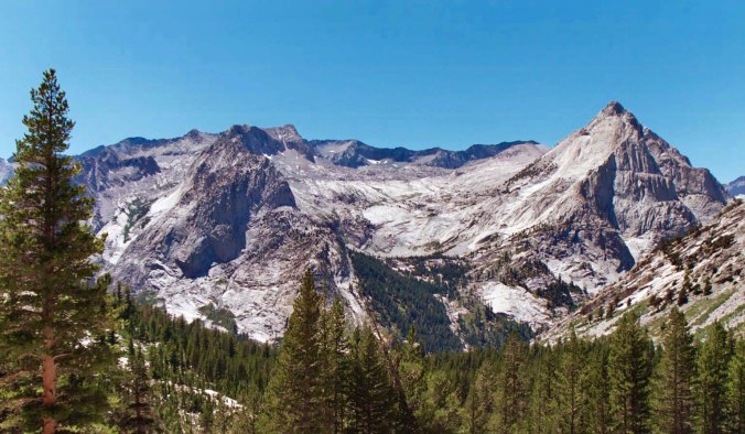
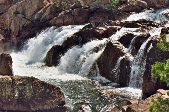
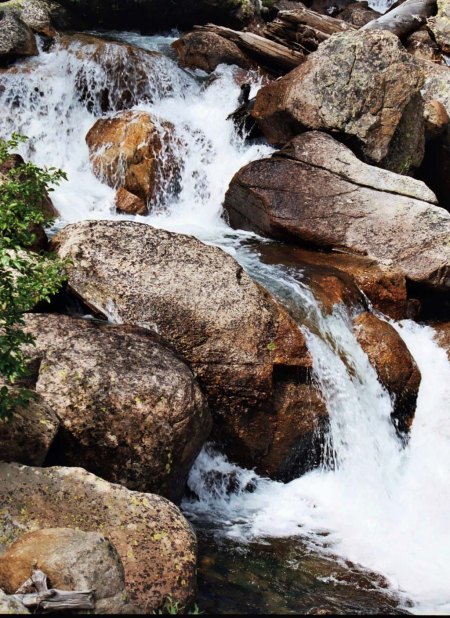
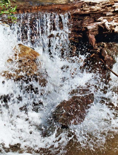
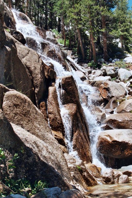
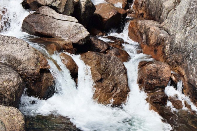
Water became a major problem on our first two days of the Sierra Trek. It was one of the reasons I decided to hike down the Sierras instead of across them on all future treks. Today I am featuring waterfalls.

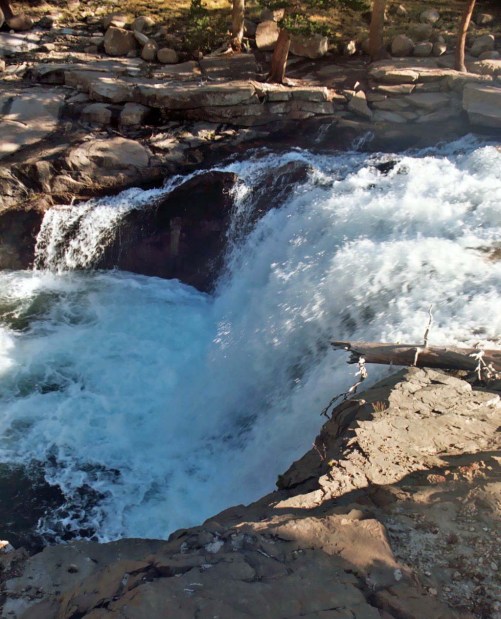
Water became a major problem on our first two days of the Sierra Trek. It was one of the reasons I decided to hike down the Sierras instead of across them on all future treks. Today I am featuring a few waterfalls you find along the range. All of these are along the Pacific Crest Trail.


When I last wrote about the first Sierra Trek, the morning of the event had arrived. I was a worried man. I found myself singing Woodie Guthrie’s fateful words as I drove up into the mountains:

“It takes a worried man to sing a worried song/I’m worried now, but I won’t be worried long/I went across the river and I laid down to sleep/When I woke up, I had shackles on my feet.”

Note: As I’ve mentioned before, the photos in this blog are from other Treks. I didn’t carry a camera on the first year. 


I met my support crew at a small restaurant just outside of Squaw Valley at 7:00 AM. Steve had recruited two friends to help out. One was Steve Locke, whose family owned large sections of Delta farm land and had a town named after them. The other was Bob with no last name, strong quiet Bob who was an excellent man to have along in an emergency, who loaned us valuable equipment such as walkie-talkies and a jeep, and who, I learned years later when he was in prison, made his living flying pot out of South America. Steve Crowle was to be my assistant leader, Steve Locke was going to drive a back-up jeep, and Bob was to be there just in case— in case of what I wasn’t sure.

We drove the last three miles into Squaw Valley to meet our fate. The Trekkers were arriving in droves and milling around like lost sheep. There was fat Charlie, skinny Orvis, beautiful Lisa, and 57 other people ready to follow us across the mountains. I felt a little like Moses must have felt in leading folks off into the wilderness, except I didn’t have his guidance system. I also wondered how Moses might have fared feeding the Israelites Ham Cheddarton instead of manna. We might have a different religion today.

Steve called the Trekkers together and I gave my first ever Trek orientation. I started by pointing out the tram. The first part of their day was to be spent saving 2000 feet and two miles of climbing. Steve had finagled free rides for all of us. This put the participants in a good mood. I then made a serious mistake. I told the Trekkers they should have an easy day.

Rule number one of Trekking is never, never, never tell people they will have an easy day backpacking. Each day is grueling and people may just survive. Period.

All too soon we were on our way, crammed like so many cattle onto the Squaw Valley trams dangling high above the ground as we bounced our way to the top. One of our Trekkers with a fear of heights had wanted to walk. She hid herself in the crowd and refused to look out, frightened that we were going to go careening down the cliffs. Her instincts were good. A few years later, the world watched as a rescue operation pulled people off of one of the very same trams as it dangled 100 feet off of the ground. We made it without any problems.

They started when we got off of the tram.

Steve’s job for the first three days was leading since we were going over the route he previewed. Mine was to be trail sweep or rear guard, as we called it. Our rules were very simple: don’t get ahead of Steve, follow the yellow ribbons left behind by the horse people, and don’t get behind Curt. We also required that Trekkers hike with at least one other person and that they let someone know if they had to leave the trail to ‘serve nature,’ as my students in Africa had called potty breaks.

I was not going to march people through the woods like an army. By allowing them to travel at their own pace, they could move at a speed their bodies and minds were comfortable with. It also allowed for something of a wilderness experience even though we were hiking with a large group. Sixty people would be spread out over 2-3 miles of trail.

Rear guard duty is always the toughest job on a Trek since it’s where the problems accumulate. That first day we made it exactly 50 yards before the first one popped up. The witch had shown up with an old boy scout pack with a rope tied on for a belt. (Remember she was the one who was going to come over in the middle of the night, bite me on the ear, and turn me into something. I think she had a sex-crazed maniac in mind.)

We were still in a transition stage where a few belt-less backpacks were wandering around in the mountains with people attached. Following the dictates of my Bible, “The Complete Walker,” by Colin Fletcher, I had insisted that all of our Trekkers have the belted kind. Not surprisingly, the witch’s ‘belt’ broke immediately. I was tempted to suggest she use her occult powers to fix it but Charlie Colin, the ex-ice hockey player, cheerfully took care of the problem. I loaned her some sun tan lotion and insisted she use it. In addition to having lily-white skin, she was wearing a tiny mini-halter, no bra, and short shorts with close to total exposure.

“But Curt,” she objected, “I want to go home with a complete tan.” Right. I told her she would be one roasted chickadee at the end of the first hour and I didn’t want to be accused of burning witches.

By the time we had taken care of her problems (or at least the ones we were qualified to take care of)— and those of several other Trekkers, Steve had covered a mile plus and was about to disappear over Emigrant Pass into the Granite Chief Wilderness. All the way up the mountainside, I could see our charges struggling with thin air, a steep trail and heavy backpacks. Some, having traveled for 10 minutes and 200 yards, were taking their first 20-minute break of the day. I resigned myself to a long, slow hike.

An hour or so later, Charlie and I crested the pass. Up ahead there may have been people having the easy day I had promised, but they certainly weren’t the 20 or so Trekkers I was now herding along the trail. I looked back at the now distant floor of Squaw Valley and sent a small thank you wafting upward that the first 2000 feet and two miles had been by tram.

I also sent up thanks for the fact that we truly did have a short day. Having cut off two miles from the beginning and hiked another, we only had four to go. Steve had carefully described our first campsite and I had reviewed my topographical map. We were going to drop down into the small valley behind Squaw Valley where the American River begins its journey to the Pacific as soggy ground, and then climb up the ridge that forms the side of Granite Chief Mountain and Needle Peak. Eventually the ridge trail crossed a small, glacier-caused hanging valley perched several hundred feet above the now creek size American River. A spring was running into the valley with ‘ample’ water for our Trekkers.

Apparently, I had used up all of my credit with thanks, though. When we arrived at the proposed campsite, there was only one Trekker present, Bob. I was about to learn what the ‘just in case’ part of his job description meant. This particular just in case was my arriving in camp and finding no one there.

“Everyone has gone on, Curt,” Bob reported. “There is no water. Steve has taken the Trekkers another two miles to Hodgkin’s Cabin.”

Ah that I would have come across a small stream. Even this would have provided enough water for our Trekkers.

Ah that I would have come across a small stream. Even this would have easily provided enough water for our Trekkers.

I am not sure this would have worked but many times I've made do with less when hiking alone.

I am not sure this would have worked but many times I’ve made do with less when hiking alone.

I wanted to whine. People had been whining at me all day. Certainly, it was my turn. The possibility of the small stream running dry must have been apparent two weeks before, I complained to myself, and wearily began rounding up my charges. They had scattered out and plopped down on the ground, like rocks.

There were two bright spots to my day. One was Charlie.  What a character and what a help; he told me his life story as we placed one foot in front of the other. Every once in a while, he would break out chanting: “cold beer, cold beer, cold beer.” It was pure fantasy but the thought kept us going.

The other was the fact that Lisa had joined us and was playing sheep dog with Charlie and me. We kept everyone moving forward with at least a semblance of humor. By this time, Charlie and I had set up a pole between us and were carrying two broken down packs in addition to our own. Somewhere along the trail I offered Lisa my hand to get over a rough spot and we had continued to hold hands. I felt guilty— a little. The rawness of Jo Ann’s confession was still burning a hole in my soul.

Eventually, we arrived at Hodgkin’s Cabin. We had survived day one. Tune in next Wednesday when I am accused of running a pot smoking orgy in the mountains— not true.

Here are a few more tantalizing waterfalls. BTW, I took most of these when I did a 360 mile backpack trip down the Sierras to celebrate my 60th birthday.

Tuolumne River Falls in Yosemite just outside of Tuolumne Meadows.

Tuolumne River Falls in Yosemite just outside of Tuolumne Meadows.

I enjoyed this cascading falls...

I enjoyed this cascading falls…

This split falls...

This split falls…

This narrow falls...

This narrow falls…

And this humdinger filled with snow melt.

And this humdinger filled with snow melt.

Friday and Saturday’s posts: I am excited. I have my ticket to Burning Man! So I spent my past week using an old, limping laptop to peruse my thousands of photos I have taken at the event since 2004, eliminate a bunch, and divide the rest up into categories. I actually got my number of pictures down to around 4,000. (grin) Don’t worry, I am not going to throw them all at you. But I will share select photos. On Friday and Saturday I will kick off my Burning Man posts with some of the wonderful— and weirdly wonderful, mutant vehicles that prowl the Playa and Black Rock City. I’ll move on from there to other categories such as sculpture, tribes, temples, the Man, etc.. This is a series you won’t want to miss!

It’s 4 AM and a Bear Is Standing on Top of Me… A Sierra Trek Tale

Oregon Black Bear
Black Bears are much smaller than either brown or grizzly bears, but this doesn’t mean they aren’t scary. This one was cruising our neighborhood in Oregon and  tipped over the heavy Webber Grill on our porch. Our daughter, Tasha, was sleeping in the bedroom next to the grill. “Curtis!” she screamed. Later, our neighbor captured the bear’s photo on a surveillance camera.

Bears like me, or at least they haven’t eaten me. They’ve had numerous opportunities over the years. It goes with the territory of backpacking throughout North America for over four decades. My scariest encounters, as it turns out, were also my first.

By the fifth year of the Sierra Trek, I had worked my way southward from Lake Tahoe into Yosemite National Park. Since we were utilizing a new route from Yosemite to Kennedy Meadows, I had to preview it. (Besides being another excuse to head out into the wilderness and be paid for it, I didn’t like to take people out on a hundred mile backpack trip on a trail I wan’t familiar with.)

My friends Ken Lake and Tom Lovering joined me on the first three days from the Yosemite Valley floor to Tuolumne Meadows. Day one found us climbing several thousand feet out of the Valley and camping above the Little Yosemite Valley. The bears dropped by for a visit on our first night in the Park.

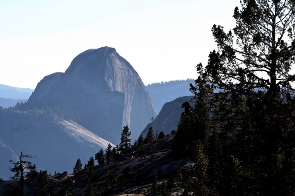
Half Dome, Yosemite. Little Yosemite Valley is on the other side.

After carefully hanging our food bags from a cable provided by the park service and burying the left over fake freeze-dried raspberry cobbler (it was made from apples), we trundled ourselves off to our sleeping bags. The problem was we buried the food a little too close to Lake. I think Tom may have been up to his usual mischief.

The next morning, a very excited Ken asked if we had seen the bears in our camp the previous night. Neither of us had and we attributed his sighting to an overactive imagination. Believe me, if a bear had been digging up food next to my head, my two companions would have known about it, immediately.

Day two was tough. What I hadn’t counted on was the amount of snow still left on the ground. We spent most of out time slipping, sliding and slogging through it. By three in the afternoon, Tom was ready to set up camp right in the middle of a snowfield. Ken and I threatened to leave him with the bears and he committed to another hour. Fortunately, that night was bear free. They would have found little resistance from the three of us.

Eventually, we made it into Tuolumne Meadows where I was faced with another challenge: hiking over 70 miles of snow-covered trails by myself while Ken and Tom returned to Sacramento and work. The journey was fraught with opportunities for breaking a leg, or losing the trail, or being washed away when crossing streams raging with water from melting snow. None of the above was a desirable outcome for someone hiking alone.

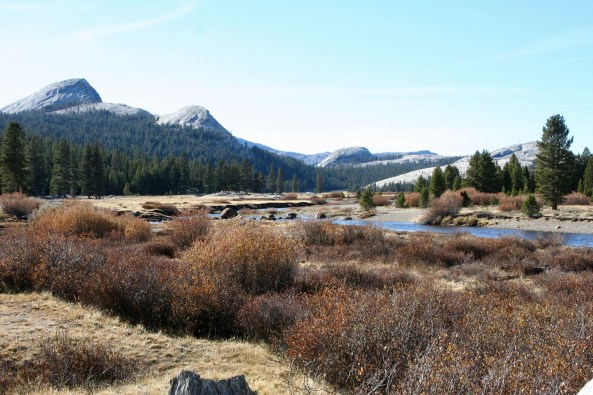
Tuolumne Meadows in the summer.

My other option was to return to Sacramento with Ken and Tom, which was not acceptable. I had a week off to wander in the woods and I was going to wander in the woods for a week. I compromised by heading back over the mountains toward Yosemite Valley. My fractured logic concluded that it was better to break a leg and get lost where I had been than where I was going. I also promised myself to be really careful. This included keeping my food from bears.

Hiking out of Tuolumne Meadows took me back around Cathedral Peaks shown here.

The first day was non eventful and the second idyllic. I was exploring new country, doing what I most love to do. As evening approached, I found a delightful campsite on the Cathedral Fork of Echo Creek. Amenities included a babbling brook to put me to sleep, a flat space for my sleeping bag and a great food-hanging tree with the perfectly placed limb. A hot dinner topped off by tea spiced up with a shot of 151-proof rum and I was ready for sleep.

I carefully hung my food bags at the recommended 12 feet off the ground and 9 feet away from the tree trunk and then snuggled down in my sleeping bag. As was my habit at the time, I slept out in the open, only using my tent when rain threatened.

It was somewhere around 4 am and very dark when I awoke with a pressure on my chest. I couldn’t see very far but I didn’t have to. Approximately five inches away from my face was a long black snout sniffing at me. It was filled with grinning teeth and topped off by a pair of beady eyes that were staring at me with a hungry look.

I let out a blood-curdling scream and vacated the premises.

As I flew in one direction, the equally surprised young bear that had been standing on me flew in the other. I don’t even remember getting out of the bag. The next thing I knew I was standing up, yelling and shining my flashlight into the woods where not one, but two pairs of orange eyes were staring back at me. I lost it. Never have so many rocks been hurled with so much vigor in such a short period of time. The bears wisely decided to head off over the mountain.

But the damage was already done. My camp was a disaster area. My carefully hung food was scattered all over the ground with literally every meal torn open and sampled. All I had left was a chunk of cheese and it had one large bear bite out of it. I hid the cheese under a heavy rock.

As a further insult, one of the bears had chomped down on my plastic rum bottle and all of the rum was gone. I couldn’t even drink. With that option eliminated, I policed the area, crawled back in my bag and went back to sleep. When I awoke in the morning it was obvious that the bears had come back into camp to clean up anything they had missed. Once again the previous night’s trash decorated my campsite. At least the bears let me sleep this time. And they had missed my cheese.

So I ate it for breakfast, cleaned the area again, packed up my gear and hiked 18 miles into the Yosemite Valley to resupply. But my week wasn’t over; neither were my bear experiences. And the summer had only begun. (I’ll get back to these stories in the future after I am finished with my series on the first Sierra Trek. You won’t want to miss the time a bear grabbed me by the head.)

NEXT BLOG: A return to my photo series on Burning Man.


There’s an Elk! There are 300! …The North Coast Series

This magnificent fellow was probably the bull of the herd, and proud of it!

This magnificent fellow was probably the bull of the herd, and proud of it! He was surrounded by some of his lady friends.


A blog quickie…

Peggy gets excited when she sees elk. So it’s not surprising that she multiplied the number she saw by 10. I can also get quite excitable. Roosevelt Elk are the largest members of six subspecies of elk in North America. Bulls can weigh up to 1100 pounds! Once, they were close to extinct in California. Today, there are seven herds in and around the Redwoods. The largest herd numbers 250. Most are closer to the size we saw. It was conveniently located in someone’s yard. I drove in so Peggy could take photos.

Elk herd near the Redwoods in Northern California.

There were probably 30 elk altogether.

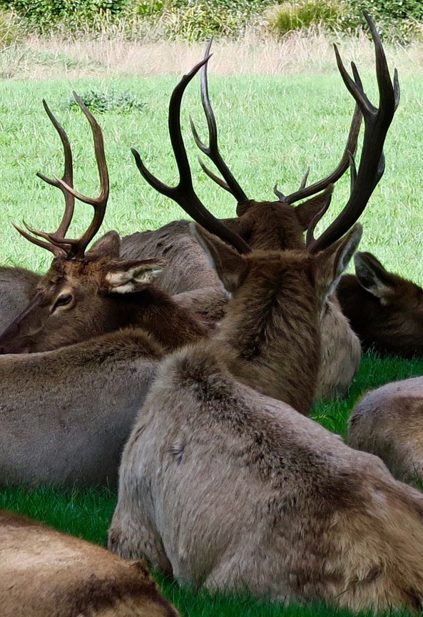
I was impressed by the antlers shown here...

Peggy was impressed by the antlers shown here…

elk with large racks near the Redwoods in Northern California

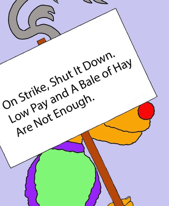
So she took a close up. Given the season, I figured that Santa could turn to these fellows if his Reindeer refused to fly.

Rudolph the Red Nosed Reindeer on strike. Xmas card by Curtis Mekemson.

Red-nosed reindeer goes on strike. (card by Curt Mekemson.)

The real deal: Alaskan Caribou. (Photo by Peggy Mekemson.)

The real deal: Alaskan Caribou. (Photo by Peggy Mekemson.)

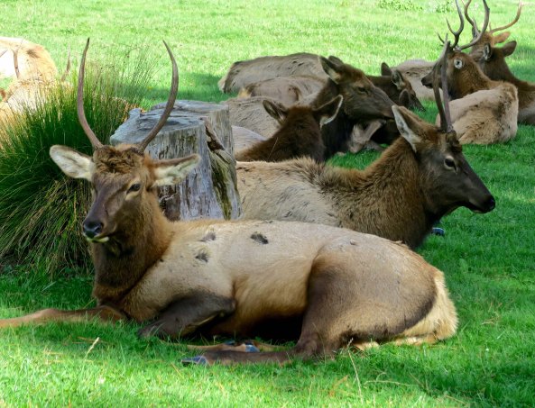
If this guy were a blacktail deer, we would call him a spike. I don't think I would want him mad at me!

If this guy were a black tail deer, we would call him Spike. I don’t think I would want him mad at me! The marks on his back suggest he has been nibbling at itches.

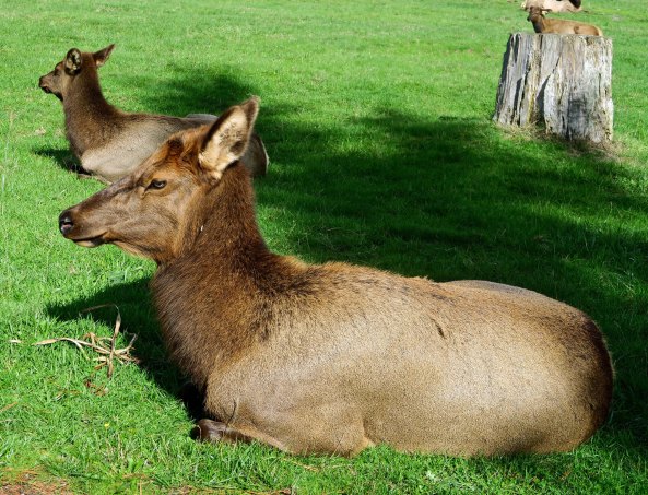
This doe was quite beautiful...

This cow elk was quite beautiful…

So we will end this short post with a close-up.

We will end this short post with a close-up of her. Lovely eyes!

NEXT BLOG: The Christmas lights of Shore Acres State Park

Jumping into and across the Snake River Canyon of Idaho… The 10,000-Mile Bike Trek

When Peggy and I arrived at the bridge across the Snake River, a man was hanging by his fingers on the edge of the bridge, 500 feet above the water.

When Peggy and I arrived at the Perrine Bridge across the Snake River, a man was hanging by his fingers on the edge, 500 feet above the water.

I biked out of Bozeman, Montana facing another climb across the Rockies. It turned out to be surprisingly easy. And beautiful. Highway 191 follows the scenic Gallatin River with its rushing waters up into the northwestern corner of Yellowstone National Park in Wyoming. Snowmelt during June turns this branch of the Missouri River into a seething whitewater-fantasy trip for rafters. Beyond its beauty and rapids, the river is also known for its world-class fly-fishing.

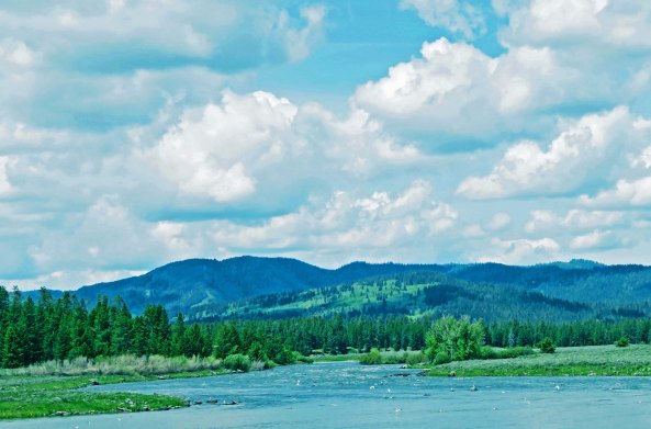
Snow melt turns the Gallatin River of Montana into a river runner's dream.

Snow melt turns the Gallatin River of Montana into a river runner’s dream.

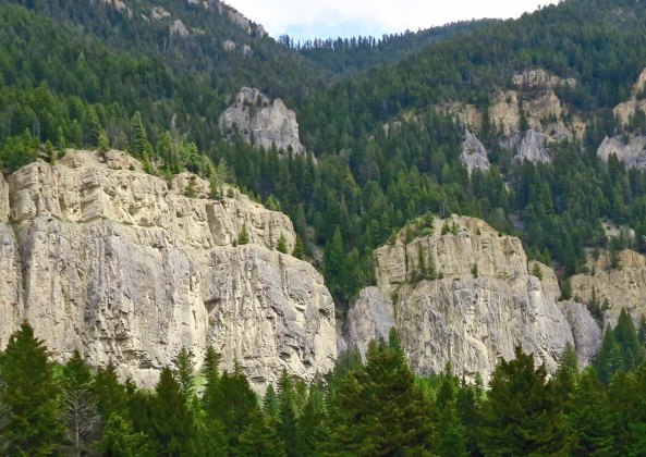
Cliffs along the Gallatin River on Montana's Highway 191 add to the areas scenic beauty.

Cliffs along the Gallatin River on Montana’s Highway 191 add to the area’s scenic beauty.

Trees along the Gallatin River on Montana's Highway 191.

As does the forest.

Fly fisherman try their luck in the upper waters of the Gallatin River in Wyoming's Yellowstone Park.

Fly fishermen try their luck in the upper waters of the Gallatin River in Wyoming’s Yellowstone Park.

By the time I had biked the route in August of 1989, the river had ceased its mighty roar but held onto its scenic beauty. Things were still roaring when Peggy and I drove up it in June as we re-traced my route. We stopped to admire the rapids and watch rafters. In the town of West Yellowstone, Peggy relived her youth by trying to find a bar she had once visited with a fake driver’s license in the early 70s.

She had obtained a summer job as a waitress in Yellowstone Park between her freshman and sophomore year at Mary Baldwin College in Virginia. (Mary Baldwin, once a finishing college for Southern Belles, was trying to make its way into the 20th Century. Peggy, a Northerner from Ohio, was much more interested in obtaining an education than becoming a ‘lady,’ and had only lasted for two years before transferring to the University of Tennessee in Knoxville. UT included certification for working with the hearing impaired as part of its curricula, which was where she wanted to focus.)

In the meantime, Yellowstone had provided a welcome reprieve from Mary Baldwin— plus first love. Between waitressing at the park’s lodge and watching Old Faithful shoot towering plumes of water skyward, Peggy had discovered Bill, who definitely wanted to show her a good time. Part of this had included the trip into West Yellowstone and barhopping with a fake driver’s license.

My bike route followed Highway 20 out of West Yellowstone up and over the Continental Divide at the 7072-foot Targhee Pass, which also served as the border of Idaho. From here on, rivers would be flowing into the Pacific Ocean. I continued on Highway 20 down to Rexburg following Henry’s Fork of the Snake River and then made my way west on Highways 33 and 93 to the Craters of the Moon National Monument.

Henry's Fork flows into the Snake River, which flows into the Colombia River and then into the Pacific Ocean. I had left the great Mississippi-Missouri River drainage system behind.

Henry’s Fork flows into the Snake River, which flows into the Colombia River and then into the Pacific Ocean. I had left the great Mississippi-Missouri River drainage system behind.

The mountains of central Idaho loomed in the distance above what was probably a potato farm near Rexburg.

The mountains of central Idaho loomed in the distance above what was probably a potato farm near Rexburg.

Idaho's Highway 33 seemingly stretches on forever as so many roads did during my 10,000 mile bike trek around North America.

Idaho’s Highway 33 seemingly stretches on forever as so many roads did during my 10,000 mile bike trek around North America.

Pickle's Place is one of many delightfully unique restaurants I found along the road. Located in Arco, Idaho (once known as Root Hog) it features the Atomic Burger in honor of the fact that Arco was the first place in the world to be lit with atomic power.

Pickle’s Place is one of many delightfully unique restaurants I found along the road. Located in Arco, Idaho (once known as Root Hog), it features the Atomic Burger in honor of the fact that Arco was the first place in the world to be lit with atomic power.

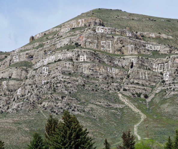
This mountain next to Arco features the local high school's graduating classes going back to the early 1900s.

This mountain next to Arco features the local high school’s graduating classes going back to the early 1900s.

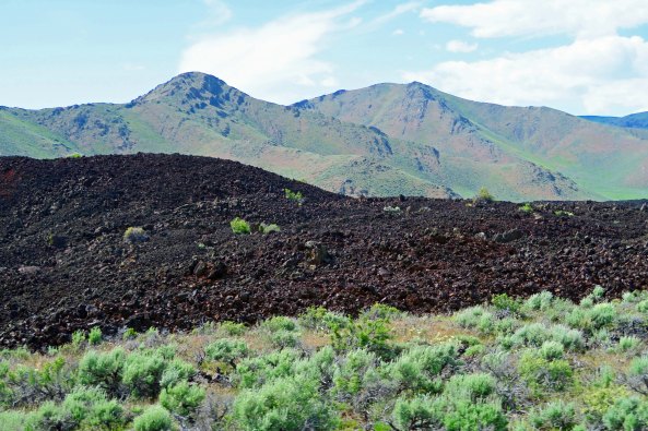
The Craters of the Moon National Monument encompasses a wonderfully weird lava flow on the Snake River Plain that covers 618 square miles and was formed between 15,000 and 2,000 years ago. Early astronauts, including Alan Shepard and Edgar Mitchell, had arrived here on August 29, 1969 to practice future landings on the moon— one month after Neil Armstrong had already taken his “one small step for man; one giant leap for mankind.”

Idaho's Highway 93 winding its way through the northern part of Craters of the Moon National Monument, seemingly disappears here.

Idaho’s Highway 93, winding its way through the northern part of Craters of the Moon National Monument, seemingly disappears here.

Nature, in her marvelous way, is gradually reclaiming the volcanic landscape.

Nature, in her marvelous way, is gradually reclaiming the volcanic landscape. Sagebrush is the most obvious plant in the area.

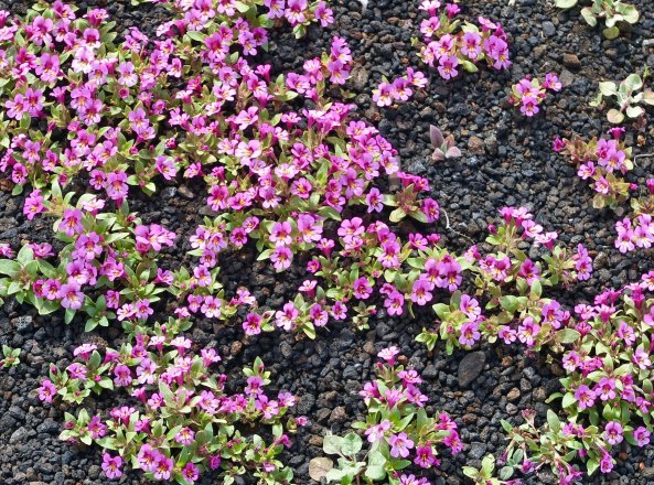
Flowers at Craters of the Moon National Monument in Idaho.

But Peggy and I also found these flowers.

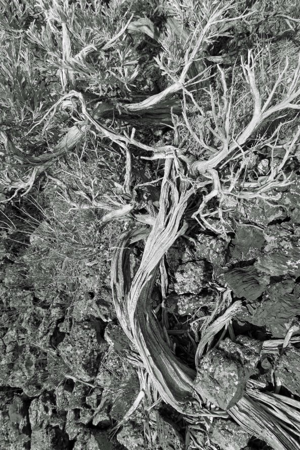
Dead sagebrush at Craters of the Moon National Monument in Idaho.

As well as this stark but beautiful reminder of how difficult it is to reclaim lava.

Art in the Park sculpture in Craters of the moon National Monument in Idaho.

This sculpture added a colorful touch to the monument.

Sculpture in Craters of the Moon National Monument in Idaho.

I also liked this perspective, which seemed to capture the strangeness of the monument. A small-explorer’s foot can be seen on the right.

From Craters of the Moon, it was a short 80-mile ride to the Snake River and Twin Falls over relatively flat country. The river features a dramatic 500 feet deep canyon, which was created by cascading water from melting glaciers. When Peggy and I arrived, a man was dangling on the edge of the Perrine Bridge by his fingers, ready to leap into the canyon (featured at top of this post). Fortunately he had a parachute on. Still, he plummeted for 200 feet or so before engaging it. Scary stuff.

Perrine Bridge across the Snake River near Twin Falls, Idaho.

See the shadow on the river. It’s made by the parachute, the small triangle located center-left above the shadow.

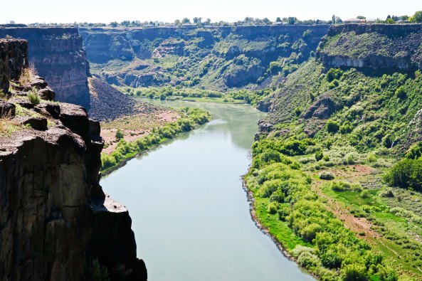
Snake River looking west from the Perrine Bridge overlook.

This view of the Snake River is looking west from the overlook next to the Perrine Bridge. Boats have created the wakes.

When I crossed the bridge on my bike in 1989, I was thinking of another leap across/into the canyon— that of Evel Knievel in 1974. Evel, at the time, was synonymous with the word daredevil. During his life he made some 275 motorcycle jumps over cars, busses, and trucks. Fifteen of the jumps involved spectacular accidents. He suffered numerous concussions and shattered his pelvis three times. Overall, he broke 35 bones. Maybe he should have pursued a much tamer sport, such as playing NFL football.

Knievel was always on the lookout for new ways to upgrade his act, obtain more publicity, and increase his income. Mainly this involved adding more vehicles to leap (for a number of years, he held the world record of 19 cars), but he also had a dream of jumping the Grand Canyon. Concerns with National Park regulations, however, eventually led him to the Snake River. The 1700-foot jump was a bit long for his Harley, though, and this is where Robert Truax came into the picture.

Truax was one of America’s premier, pioneer rocket engineers, beginning his career prior to World War II when a childhood interest in Robert Goddard led him to build rockets at his home in Alameda, California. He then went on to work with the Navy on rocket development during World War II and later helped build both the Thor and Polaris missiles. By the late 50s/early 60s, he had left the military and was heading up Aerojet-General’s advanced rocket development division in Sacramento, California. I met the man when I promised him I would have his daughter home by midnight.

Kathleen (Kathy) Truax was a dark-haired beauty with brains to match. She had transferred into El Dorado Unified High School in Placerville during my senior year. After graduation, I had worked up the nerve to ask her out on a date to the California State Fair in Sacramento. Her immediate “yes” had me kicking myself for not asking sooner.

The weekend turned into a marathon. I had worked ten hours on Friday hauling 50-pound boxes of pears out of an orchard and then gone to a party at a friend’s. My mother called at midnight to tell me that the forest service had just phoned wanting me to help fight a raging forest fire that was threatening to engulf the small foothill community of Foresthill. So away I had gone and spent from 2 a.m. until 10 a.m. chopping a fire trail across a steep American River canyon with a heavy pickaxe. The looming inferno encouraged fast work.

After a two-hour nap break and lunch, our crew chief had told us that the fire was burning back on itself and that we could leave if necessary. I’d buzzed home to Diamond Springs, showered, and taken off for Cameron Park where I picked up Kathy in my 54 Chevy, met her dad, and gone on to the State Fair. I returned her home promptly at midnight as promised. We’d had fun and I had won Kathy a large stuffed bear that hardly fit in the back seat.

Later that summer, we had gone on a date up into the Sierra foothills near Pleasant Valley where her grandmother lived. Kathy had told me that her dad shot off rockets in the area that he had built in his garage. His visionary dream was to build inexpensive rockets that would make space travel affordable for everyone. Eventually, 13 years after the summer I had dated Kathy, that dream would lead him to build the Volksrocket (Skycycle X3) designed to carry Evel Knievel across the Snake River Canyon. The rocket had worked fine, but the parachute had malfunctioned, deploying when the rocket took off, which allowed the wind to pull it back into the canyon. Evel had landed on the river’s edge with minimal injuries (for him), and Truax had taken responsibility for the accident.

While Knievel died in 2007 and Truax in 2010, their dream was finally realized on September 16th of this year. Professional Hollywood stuntman Eddie Braun working with Truax’s son Scott used an exact replica of the Skycycle X3 with a well-tested parachute to successfully jump the canyon. Children of both Knievel and Truax were there to witness the event. Had Peggy and I been a couple of months later in our route review, we would have been there as well.

Looking east up the Snake River from the Perrine Bridge toward where Evel Knievel tried his 1974 leap across the river.

Looking east up the Snake River from the Perrine Bridge toward where Evel Knievel tried his 1974 leap across the river.

NEXT BLOG: I bicycle across Nevada and hear voices. Seriously. Were the desert gods trying to tell me it was time to end my journey?

Quebec Independence plus a Dark and Stormy Night… The 10,000 Mile Bike Trek

As I climbed out of toward beautiful rivers such as the kept me company.

As I climbed out of Sainte-Simeon toward Lac Saint-Jean, beautiful rivers such the Little Saguenay kept me company.

I had ridden 110 miles when I arrived at Parc national de la Pointe-Taillon on Lac Saint-Jean in Quebec. The rain was coming down in buckets and I was exhausted. It was a perfect night for hypothermia and all I could think of was setting up my tent and crawling into my warm goose-down sleeping bag. I was pounding in my last tent stake when a woman came over and asked if I would like something hot to eat. I almost fell in love.

I’ve long since lost and forgotten her name, but what I remember was that she was a PhD candidate doing her thesis on some type of plant growing in the region. We’d had a brief conversation when I arrived with water dripping off my nose. She had wanted to know where I had biked from. “California,” had been my reply. Apparently my answer had impressed her, or maybe she was just nice person concerned about a guy who didn’t have enough sense to get out of the rain.

In addition to hot food, she had a large, dry van. I wasn’t the only one lusting after it. Three 20-something men from Montreal who were car camping soon joined us with a case of Labatt Beer, a Canadian brew out of Ontario. All I had to contribute to the party were tales of the open road, but apparently they were enough. I felt a bit like a troubadour who was singing for his dinner and drink.

It was another dark and stormy night on the road— but cozy. As the rain pounded down on the roof, our conversation had ranged far and wide. And, I might add, long, since it was close to 1:00 a.m. when we downed the last beer, wished each other good night, and stumbled off in the rain.

The topic that had interested me the most was the issue of Quebec independence from the rest of Canada. It turned out that the three young men were separatists and believed that Quebec would be better off going it alone. The dispute over independence was buried deep in past. Quebec, of course, was predominantly French in culture, while the rest of Canada was primarily English. French Canadians had long worried that their culture and language would be buried under an avalanche of English language and customs. In the late 60s and early 70s this concern had turned to violence. In 1980 a referendum had been held to determine whether Quebec should pursue independence. Sixty percent had voted no, but nine-years later the issue was still simmering.

Given that our group was made up of three French Canadians, one British Canadian, and one American, our discussion on Quebec independence had been quite animated, but surprisingly amicable.  It’s amazing what a rainy night, a dry van, and a case of beer can accomplish for international relations. We laughed a lot and as parted friends.

My photos today trace my journey from the St. Lawrence River ferry at Sainte-Simeon to Lac Saint-Jean. I followed Quebec Routes 170 and 372 up to Saguenay and then Routes 172 and 169 to Parc national de la Pointe-Taillon on the north side of the lake. (Peggy and I followed 170 up to 169 and went around the south side of the lake.) The ride included substantial climbs, rugged terrain, beautiful rivers and small to mid-sized communities. As I/we approached Lac Saint-Jean and climbed onto the Laurentian Plateau, the land flattened out considerably.

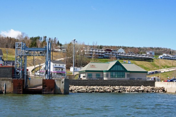
Landing at the ferry dock at St. Simeon.

Landing at the ferry dock at St. Simeon. The ship was maneuvering around to drop its ramp on the exit way.

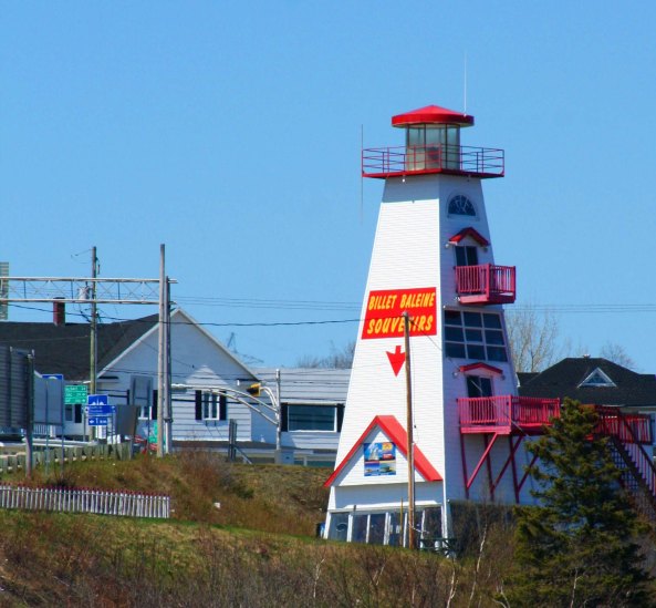
This one time lighthouse at St. Simeon had become a souvenir shop and ticket booth.

This one time lighthouse at St. Simeon had become a souvenir shop and ticket booth.

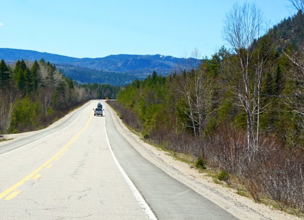
Quebec 170 out of St. Simeon had proven to be quite a climb.

Quebec Route 170 out of St. Simeon had proven to be quite a climb.

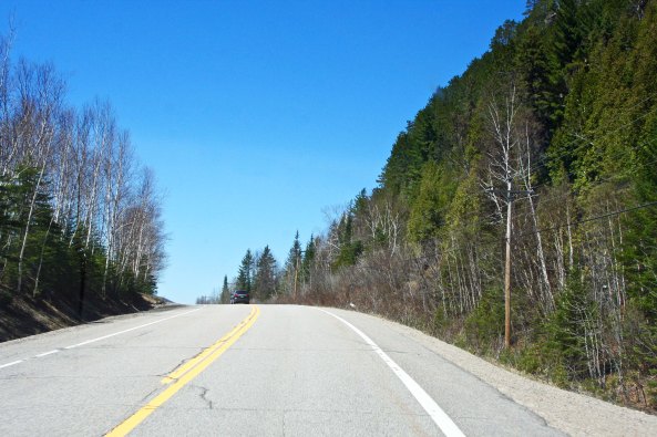
There was a lot of up and over...

There was a lot of up and over…

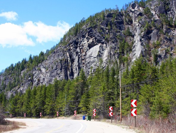
The Palisades on top were impressive. The signs suggested I make a left turn.

The Palisades on top were impressive. The signs suggested I make a left turn.

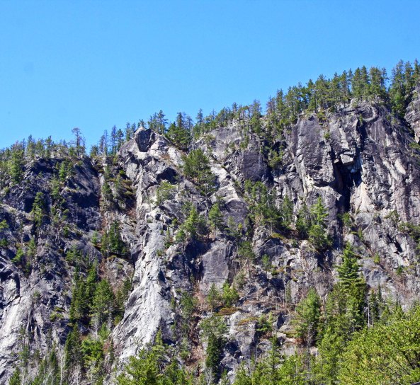
A close up...

A close up…

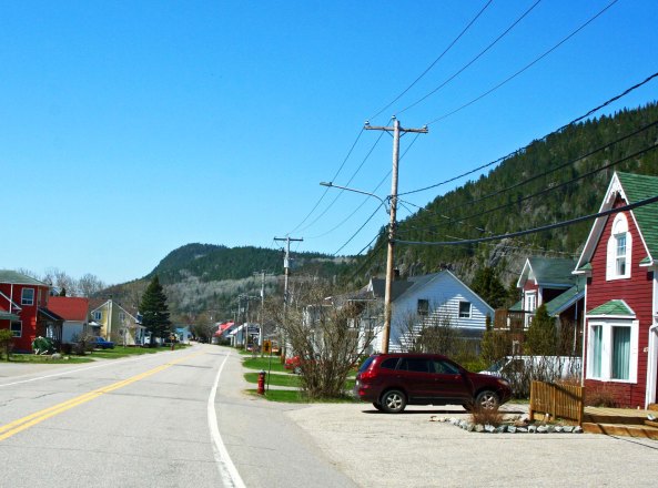
Small towns along the way were neat and orderly. I think this is Sagard.

Small towns along the way were neat and orderly. I think this is Sagard.

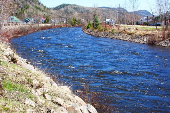
A river ran through it...

A river ran through it…

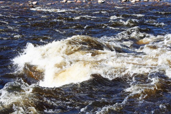
Spring time flows guaranteed rapids when Peggy and I re-drove the route.

Spring time flows guaranteed rapids when Peggy and I re-drove the route.

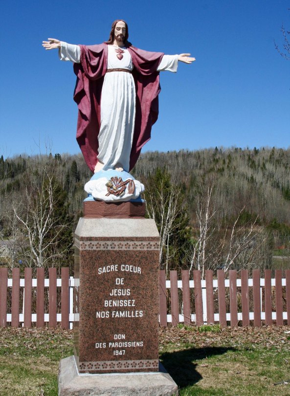
Jesus welcomed Peggy and I with open arms— not surprising in Quebec.

Jesus welcomed Peggy and me with open arms— not surprising in the Catholic province of Quebec.

The land flattened out as we neared Lac Saint Jean, providing scenes kill this one.

The land flattened out as we neared Lac Saint Jean, providing scenes like this one.

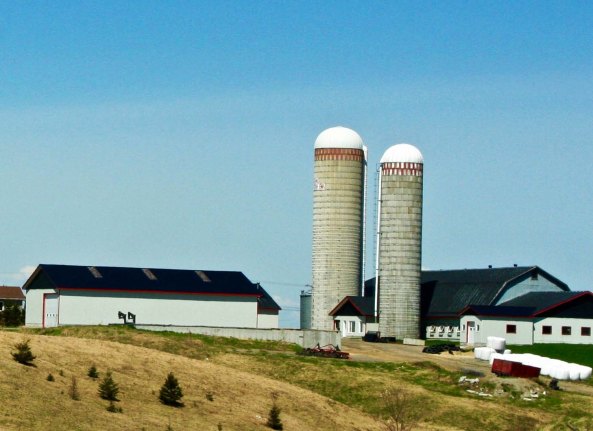
The gentler terrain supported large farms...

The gentler terrain supported large farms…

And wide open country.

With wide open country.

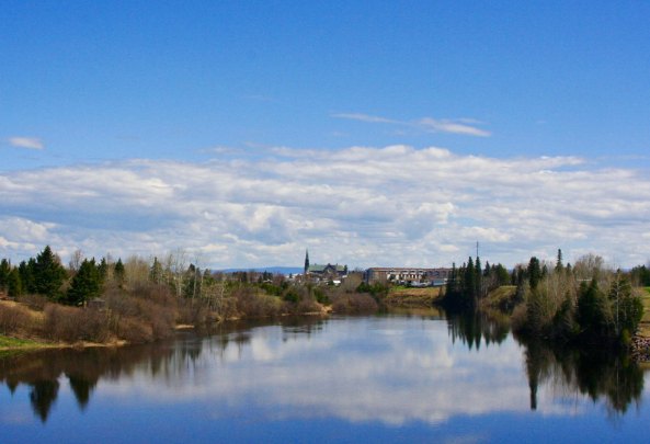
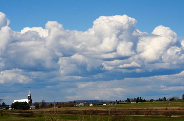
I took this photo with its tell-tale Catholic Church next to Lac Saint Jean.

I took this photo with its tell-tale Catholic Church next to Lac Saint Jean. The clouds were gorgeous.

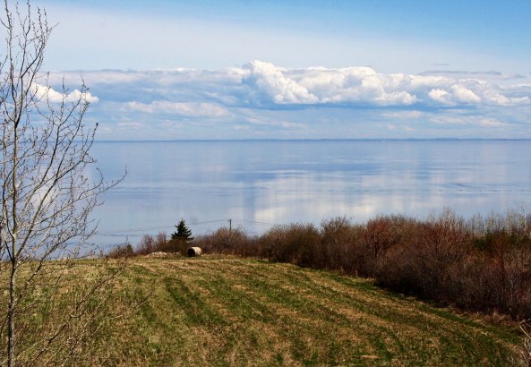
Looking out toward Lac Saint Jean.

Looking out toward the large Lac Saint Jean. The campground where I spent my rainy night is on the opposite shore.

NEXT BLOG: I continue my journey into the far north riding over muddy dirt roads, dodging three trailer logging trucks, and taking a bath with eight ounces of water.

Was It the Toughest Climb on the Journey… The 10,000 Mile Bike Trek

I found this spray painted bicycle at the top of Cape Breton's toughest climb and laughed. (photo by Jean Snuggs.)

I found this spray painted bicycle at the top of Cape Breton’s toughest climb and laughed. (Photo by Jean Snuggs.)

Gearing ratios on bicycles are complicated beyond my normal interest in things mechanical. Let’s just say there are high gears for scurrying down mountains, medium gears for flat road travel, and low gears for climbing mountains and fighting headwinds. The more gears you have, the greater your options and ease of travel. The goal is to bike at a speed that is comfortable for your level of physical conditioning while keeping undo pressure off your knees. (Trashed knees can ruin the most pleasant bike trip.) Maintaining cadence, which is the speed you pedal, and knowing when to shift are critical parts of keeping your knees happy. Beginners have to struggle through a steep learning curve, especially in climbing hills and mountains— and yes, I recognize the potential pun.

The reason for this discussion about gears is that it relates to the substantial mountain that Jean, Lindell and I faced when we left our camp at Cape North in Nova Scotia and cycled back up into the Cape Breton Highlands. It was a doozy. We could see it looming in front of us as we cycled through the canyon carved out by the Middle Aspy River. The closer we came, the more it looked like something a mountain climber might enjoy.

One of the steepest climbs along the Cabot Trail in Nova Scotia was climbing up this hill into the Highlands.

The hill loomed in front of us. It was obvious we were in for a climb.

Was it the toughest hill I climbed on my journey? No. It wasn’t nearly as steep as my climb over the Panamint Range in Death Valley. And I had pedaled up several others that were much longer on the Blue Ridge Parkway. What made it so damnably difficult were my low gears— they weren’t as low as Jean’s and Lindell’s! While I was out of the saddle pushing down on my pedals with knee-punishing grit, Jean and Lindell were sitting down and merrily teasing me about my inability to keep up. Talk about a challenge. (grin) Had I been by myself, I would have simply noted the difficulty, complained to the universe, and pedaled on. And I wouldn’t have stopped at the first bike shop I came to and added more gears!

Here I am biking up a mountain in Nova Scotia with 60 pounds of gear.

I posted this photo at the beginning of the series. Jean took it as we crested the mountain. Note the bulging leg muscles that couldn’t keep up with two slight women— even with 5,000 miles of travel.

One of my happiest sights on the 10,000 mile trip: the top of the hill.

One of my happiest sights on any steep climb: the top of the mountain.

Let me note here that Lindell and Jean had a lot more going for themselves than low gears. They had both graduated from the University of Illinois with top honors in physical education and gone on to become highly successful community college track coaches. They had just completed a bike trip that was all about climbing hills. In addition to being bright and competitive, they were as tough mentally as they were physically. They had managed to keep up with me on the flats and downhills as well as busting my butt going up the hill.

Topping the ridge, we came across a bicycle outline that a cyclist had spray painted on the shoulder with the words, “Why?” We laughed in sympathy. Continuing on, we followed the Cabot Trail across the Cape Breton Highlands and down to the small town of Chéticamp on the Gulf of St. Lawrence, leaving the highlands with their Scottish influence behind for flatter, coastal lands with French influence. France had originally named Cape Breton, Île Royale, and had considered the island part of Acadia. We cycled down the coast though villages and cut inland to Margaree Forks where we said goodbye to the Cabot Trail and picked up NS Highway 19 known as the Ceilidh Trail, which we followed for 60 miles back to the Canso Causeway.

A very fast downhill (brakes advised) brought us to this traditional Scotch cabin known as Lone Scheiling. We had flashed by it on our bikes but Peggy and I stopped to admire it.

A very fast downhill after our climb (brakes advised), brought us to this traditional Scottish cottage known as Lone Scheiling. We had flashed by it on our bikes but Peggy and I stopped to admire it.

I took this photo out the window.

I took this photo out the window.

It was surrounded by yellow birch.

The cottage was surrounded by yellow birch.

One of which featured this colorful knot.

One of the trees featured this colorful knot.

A few ghost leaves still flung to branches, waiting for spring growth to push them off.

A few ghost leaves still clung to branches, waiting for the budding spring growth to push them off.

And this creek burbled along beside the cottage.

And this creek burbled along beside the cottage.

Climbing again, we came on this view of the west coast of Cape Breton looking out toward the Gulf of St. Lawrence.

Climbing again, we came on this view of the west coast of Cape Breton looking out toward the Gulf of St. Lawrence.

Signs along the road had been warning us about moose...

Signs along the road had been warning us about moose…

Finally, we got to see one.

Finally, we got to see one. These wonderfully humorous animals can be quite dangerous. You don’t want one chasing you down the road when you are on a bicycle. When I lived in Alaska, a cyclist came around a blind curve on a bike trail and ran smack into one! Fortunately, the surprised moose decided to run away.

The Cabot Trail often requires road work after a rough winter.

The Cabot Trail often requires road work after a rough winter. Peggy and I were entertained by this effort at a traffic stop. Don’t you wonder they got the earth mover up on the hillside?

This impressive cliff was near the road work.

This impressive cliff was near the road work.

Leaving the Highlands, we came on several small communities along the coast where fishing is a major industry. Whale watching is also popular off the coast.

Leaving the Highlands, we came on several small communities along the coast where fishing is a major industry. Whale watching is also popular off the coast.

The Cabot Trail heads inland across much flatter country. Spring waters still flooded this field.

The Cabot Trail heads inland across much flatter country. Spring waters still flooded this field and the grass had yet to turn green. Last year’s cattails can be seen in the left foreground.

I'll finish off my Cape Breton photos with this rather lovely stream.

I’ll finish off my Cape Breton photos with this stream, which spoke to me again of the wild aspect of the island.

Our exploration of Cape Breton was over and my time with traveling companions was drawing to a close. We picked up highway 104 back through Antigonish and on to New Glasgow where Jean and Lindell said goodbye and biked south toward Halifax and their plane. I continued on my lonely journey west, following Highway 6 back to the coast and through towns with wonderful names like Tatamagouche and Pugwash. New Brunswick and new adventures were waiting.

NEXT BLOG: Peggy and I detour to Prince Edward Island, meet the mayor of Victoria, and eat a scrumptious lobster roll.

Beautiful Canada: Cape Breton and the Cabot Trail… The 10,000 Mile Bike Trek


Rocky shores touched by the Atlantic Ocean are a key element in the scenic beauty of the Cape Breton Highlands along the Cabot Trail.

Rocky shores touched by the Atlantic Ocean are a key element in the scenic beauty of the Cape Breton Highlands along the Cabot Trail.

Cape Breton is a big island: the 77th largest in the world and the 18th in Canada if you are a detail-oriented type of person. Once upon a very long time ago, before the continents got divorced and started drifting away from each other, it was snuggled up to Scotland and Norway on the ancient continent of Pangaea. I feel a certain amount of affinity since my ancient ancestors drifted away from Norway and Scotland, some 300 million years later.

It’s an island of superlatives and you will be hearing a fair number on this post. The tourist bureau should hire me. I’m not alone in my praise. The pretty-picture travel magazine Condé Nast considers Cape Breton to be one “of the best island destinations in the world.” Numerous other magazine and newspaper articles agree.

The Cape Breton Highlands on the northern part of the island are the primary reason for the acclaim. Considered a northern extension of the Appalachian Mountains, the Highlands are noted for their steep ups and downs. I agree; they provided me with some of the most challenging bicycling on my 10,000-mile trip. I was amused when doing research for this post to find a Cape Breton website recommending to motorists, “You may want to check your brakes.” Indeed.

The road around the Highlands is known as the Cabot Trail. It was named after the 15th Century explorer John Cabot who was searching for a way to China on behalf of King Henry VII. (Rumor has it that the King was seeking a new place to send his many wives. Just kidding— the reality is that he wanted to spice up his life, and Asia was the place to go for spices.) Cabot may or may not have landed on the island, but locals are eager to claim him. Most experts believe his landing site was more likely Newfoundland.

There is much more to Cape Breton Island than the Cabot Trail, but the scenic highway is the primary reason that visitors flock to the island.

There is much more to Cape Breton than the Cabot Trail, but the scenic highway is the primary reason that visitors flock to the island. This post and my next one will focus on views along the Trail.

A view form the beginning of the Cabot Trail looking not toward the Cape breton Highlands.

A view from the beginning of the Cabot Trail looking out toward the Cape Breton Highlands.

The Cabot Trail is world-famous. The sign says so. The highway is what I remember most about Nova Scotia. After crossing over the Canso Causeway, I, and my two bicycle-travelling companions, Jean and Lindell, had made a beeline for it. Peggy and I did as well, following the Trans-Canada Highway 105. Since the 185-mile scenic byway travels in a circle (more or less), we had a choice of whether to travel clockwise or counter-clockwise. The travel guides recommend clockwise since going in the opposite direction puts travelers on the outside of the road as it winds along towering cliffs with scary drop-offs. The theory is that most people prefer safety to death-defying edges. But what’s the fun in that? We chose the outside with its dramatic views of the Atlantic Ocean on the east side of the Highlands and Gulf of St. Lawrence on the west. (Besides, I am a veteran of Highway 1 on the California coast, which is much scarier.)

In addition to natural beauty, Cape Breton features both its Celtic and Acadian heritages. Some 50,000 Highland Scots migrated to the area between 1800 and 1850 as a result of the Highland Clearances where small farmers in Scotland were replaced by sheep, i.e. the hereditary aristocratic owners of the land found a better way to make money. Colaisde na Gàidhlig, the Gaelic College, was founded to promote and preserve the Scotch-Irish Gaelic Culture in Nova Scotia. Located on the Cabot Trail shortly after it leaves the Trans-Canada Highway, the college offers courses in Gaelic language, crafts, music, dance and history. Visitors are invited to stop by and see a ceilidh, a traditional Scottish dance, or even buy a kilt.

Scottish sheep photo by Curtis Mekemson.

Furry fellow. An ancestor of the sheep that replaced the Highland farmers. We were happily lost on a remote Scotland road when this guy greeted us. (Photo by Peggy Mekemson.)

The Gaelic College located along the Cabot Trail on Cape Breton Island.

The craft shop of the Gaelic College where everything Gaelic is promoted including the language.

St. Andrew’s Presbyterian Church, located several miles beyond the Gaelic College, reminded me of my own Scotch-Irish (Ulster Scot) family’s heritage— and our journey to the New World in the 1750s. We were Lowland Scots as opposed to the Highland Scots. The Mekemsons had been serious Presbyterians all the way back to the 1600s when Scottish Presbyterians had declared that God and not the King of England was their ruler. This had upset the King considerably. One of my ancestors, John Brown, was even a martyr to the cause. Peggy and I visited his gravesite in Scotland and I did a blog on him. Our family had remained Presbyterians right up until my father had become an Episcopalian (the American equivalent of the Anglican Church), a move that undoubtedly sent generations of our Presbyterian ancestors rolling over in their graves.

St. Andrews Presbyterian Church.

St. Andrews Presbyterian Church.

A close up of the grave of John Brown, the Scottish Martyr shot down in fron of his family in the late 1600s.

The lonely grave of John Brown, the Scottish Martyr shot down in front of his family in the late 1600s.

This shot of Peggy captures the isolation of John Brown's Grave, the white speck on the upper left of the photo.

This shot of Peggy captures the isolation of John Brown’s Grave, the white speck on the upper left of the photo.

Anyway, a series of religious, political, and economic factors had sent my ancestors first to Northern Ireland and then on to Pennsylvania and Maryland.

One third of the Cabot Trail runs through the Cape Breton Highlands National Park, which captures the ocean and highland scenery of the area as well as protects the wildlife and plants that call it home. Moose signs along the highway warn motorists of potential automobile-moose confrontations, which are not good for either man or moose. While Peggy and I are always aware of the potential danger, mainly we think of the signs as suggestions we may get to see a moose, always a plus. But that is a story for my next blog, along with the second toughest climb of my 10,000-mile trek and a visit to the Acadian side of the island. Following are several photos I took on the first half of the Cabot Trail.

St. Andrews Provincial Park in the Cape Breton Highlands.

Regional parks, such as St. Ann’s, demanded that we stop and admire them.

Looking the other direction at St. Ann's Provincial Park along the Cabot Trail.

Looking the other direction at St. Ann’s Provincial Park along the Cabot Trail.

Once again Peggy and I found ourselves looking at scenery that sported an early spring look.

Once again Peggy and I found ourselves looking at scenery that sported an early spring look.

Our day along the Cabot Trail varied between sunshine and threatening skies.

Our day along the Cabot Trail varied between sunshine and threatening skies.

We found these boats near the small town of Ingonish.

We found these fishing boats near the small town of Ingonish. Lobster traps are located on the pier.

I liked this lonely structure, which looks like a great place for a picnic.

I liked this lonely structure, which looks like a great place for a picnic.

And these quiet waters.

And these quiet waters.

Climbing up into the Highlands provides scenic views of the Atlantic coast.

Climbing up into the Highlands provides scenic views of the Atlantic coast.

A close-up.

A close-up.

Blue skies color the Atlantic Ocean blue.

Blue skies color the Atlantic Ocean blue.

The Cabot Trail moves between the Highlands and Coast. Give a choice between long sandy beaches and rocky coasts I will always prefer the rocky coasts, unless I happen to be on a tropical island.

The Cabot Trail moves between the highlands and coast. Given a choice between long sandy beaches and rocky coasts, I will always prefer the rocky coasts, unless, of course, I happen to be on a tropical island.

Another view.

Another view.

The cool, windy day fluffs Peggy's hair

The cool, windy day fluffs Peggy’s hair

The road leading down to Cape North, which will be the farthest point east I reach on my bike trip.

The road leading down to Cape North, the farthest east I would travel.

This church at North Bay marked my turning point. After this, I would be heading home.

This church at Cape North marked the turning point in my 10,000 mile trek. After this, I would be heading home.

Shortly after we left the church, Peggy and I came on these two bicycle tourists. How appropriate, I thought. The dark cliffs looming in the background would provide the second hardest climb in my whole trip, but that's a story for my next blog.

Shortly after we left the church, Peggy and I came on these two bicycle tourists. The dark cliffs looming in the background would provide the second hardest climb in my whole trip, but that’s a story for my next blog.

A Foggy Day in Shenandoah National Park… The 10,000-Mile Bike Trek

Regulations on the Blue Ridge Parkway and Skyline Drive understandably recommend that bicyclists not travel on foggy days. The fog does present some good photo ops, however.

Regulations on the Blue Ridge Parkway and Skyline Drive understandably recommend that bicyclists not travel on foggy days. The fog does present some good photo ops, however.


“Oh Shenandoah, I long to see you/Away you rolling River/Oh Shenandoah, I long to see you/Away, I’m bound away/Cross the wide Missouri.”

There are songs that you hear as a child that bury themselves deep in your brain and are forever being replayed. Oh Shenandoah was one such song for me. It had a yearning that even my 9-year-old soul understood. I longed to see the Shenandoah River, and return to it— even though I had never been there.

It isn’t surprising then that Shenandoah became my song of the day as I wrapped up my bike tour of the Blue Ridge Parkway and entered Skyline Drive and the Shenandoah National Park. I often sang on my bike. It helped wile away the hours. But this time I sang with the same longing I had felt as a fourth grader.

Peggy and I woke up to a foggy morning on our last day of retracing my bike route along the Blue Ridge Parkway. I was glad I wasn't riding my bike.

Visibility can be a real issue when the fog sets in for bicyclists as well as motorists.

A pine tree stands out in the fog along the Blue Ridge Parkway.

But fog has a way of shrouding everything in mystery.

Skyline Drive provides the same beauty, lack of commercial traffic and slow speed limit as found on the Blue Ridge Parkway, without the severe ups and downs.

Skyline Drive starts where the Blue Ridge Parkway ends when you are riding south to north. It provides the same beauty, lack of commercial traffic, and slow speed limit as found on the Parkway, without as many ups and downs.

Dogwood in fog along Skyline Drive in Virginia.

Distant vistas disappear in the fog. The traveller is left with views closer to the road…

A tree of dogwood blooming along the Skyline Drive in Virginia.

That bring their own beauty…

Trees along the Skyline Drive in Shenandoah National Park.

With a different perspective.

Pine needles provided an interesting pattern in the fog.

The grey backdrop made these pine needles stand out.

Not sure what these flowers were, but I found their green hue appealing.

Fog or not, I always like close-ups. The yellow-green hue of these flowers, and their abundance, caught my attention.

Tree lichens caught the attention of my camera.

Lichens are always worth a closer look..

Riding along the Skyline wasn’t enough for me, however. Oh Shenandoah was about the river and I had to see it! I reached US Highway 33 and made a snap decision. Instead of following Skyline Drive the rest of the way to Front Royal, Virginia, I would turn left and drop down into the Shenandoah Valley where I could sing to the river. And that is what I did. In Elkton, I picked up US 340 and followed it along the south fork of the Shenandoah River to Front Royal.

A cow and her calf welcomed me to the Shenandoah Valley.

Peggy and I followed the same route in our van as we retraced my route. A cow and her calf welcomed us to the Shenandoah Valley.

Welcome sign to Shenandoah.

As did this sign.

As this pasture land demonstrates.

Spring was bursting out all over!

This old fireplace was all that remained of an earlier Shenandoah Valley home.

This old fireplace was all that remained of an earlier Shenandoah Valley home. It isn’t unusual to find fireplaces standing alone, the one thing that wouldn’t burn when pioneers lost their homes to fires. This one would have gone with a large home.

And yes, I did find the Shenandoah River with its mountain backdrop.

And yes, I did find the Shenandoah River with its mountain backdrop.

From Front Royal I biked on to Winchester where a billboard announced I was entering Patsy Cline’s hometown. I had another decision to make, this one more dramatic than my quick decision to check out the Shenandoah River. I had been bicycling for three months and I needed a break. A friend was supposed to meet me in two weeks in Maine and join me in bicycling through Nova Scotia. I could make it, just barely, maybe. But I would have to push hard through urban areas with urban traffic. Finally, I had developed a sore on my inner thigh in Mississippi and a sore on your inner thigh when you are bicycling is not a good thing. It would not go away.

Old Town in Winchester Virginia has bee turned into a pleasant and attractive auto-free zone. Patsy Cline would recognize the buildings.

Old Town in Winchester, Virginia has been turned into a pleasant and attractive auto-free zone. I think that Patsy Cline would like it..

So I decided to become good friends with the Dog. I would take the Greyhound from Winchester up though Washington DC, New York City, Boston and New England to Bangor, Maine. It would drop the total distance of my trip to around 10,000 miles, but I could live with that— and I would have a two-week break.

Next Blog: I make it to Maine and begin my exploration of Nova Scotia.

Back When Having a Baby Cost Six Bucks… The 10,000-Mile Bike Trek

Mary Mill on the Blue Ridge Parkway in Virginia.

Mabry Mill is one of the most photographed sites on the Blue Ridge Parkway. (Photo by Peggy Mekemson.)

I continued my roller coaster ride along the Blue Ridge Parkway as I crossed into Virginia. The highlands weren’t as high but the lowlands were lower so my overall impression of the Parkway didn’t change. I was growing more used to the ups and downs, however. I won’t say I didn’t notice them— the 6000-foot elevation change involved in dropping into and climbing out of the James River guaranteed that, but the beauty of the ride, combined with the interesting history, was enough to divert my mind away from the work my legs, lungs and heart were doing.

View of Blue Ridge Mountains and meadow along the Blue Ridge Parkway in Virginia.

The beauty of the Parkway helped me forget I spent much of my time bicycling up mountains.

Dramatic clouds along the Parkway added to the scenery.

Dramatic clouds along the Parkway added to the scenery.

Tree silhouette backed up by clouds on the Blue Ridge Parkway in Virginia.

This tree silhouette also caught my attention.

Bridge on the the Blue Ridge Parkway in Virginia.

Man made structures such as this double arched bridge also add to the beauty.

Besides, the only person that I had to complain to about the difficulty of the climbs was myself, and he’s a stickler for pointing out that I am responsible for 99.9% of the difficulties I get into. You would think he would be more sympathetic, maybe even lie a little. But noooo, he has to be disturbingly honest.

Plus, there was Orlena Puckett. She put things into perspective. There is a sign next to her sister’s cabin on the Parkway. Orlena was born in 1837 and spent the first 50 years of her life trying to have children. She actually had 24, but they all died, most in stillbirth. Given everything I’ve ever heard about the pain involved in having a baby, I would have sworn off sex after the first three.

The Plackets cabin on the Blue Ridge Parkway in Virginia.

The Puckett’s cabin.

Orlena spent the second 50 years of her life as a midwife, helping other women have children. She is said to have delivered some 1,000, the last when she was 102. The tools of her trade were soap, water, and a nip of whiskey. When times were good, she charged six dollars; when they were bad, one— or a few chickens. Legend has it she would drive nails through her shoes in winter so she could travel over icy trails to help women who needed her services. Imagine that with today’s medical care system, even a nip of whiskey would cost $100!

This photo of Orlena, looking 102 and holding the last child she helped be born, is next to her sister's cabin.

This photo of Orlena, looking 102 and holding the last child she helped deliver, is on display next to her sister’s cabin.

Groundhog Hill is located a couple of miles away from the cabin. I am assuming there were a lot of them there. They were also called whistle pigs, which I get. I’ve often encountered their marmot cousins in western mountain meadows. These large, fat squirrels whistle at you in irritation when you disturb their afternoon naps in late August. They’ve chowed down all summer so they can sleep all winter. Folklore tells us that groundhogs appear on February 2 to predict how long winter will last. (This custom originated with European badgers, who, as far as I know, would consider it great luck to find a tasty groundhog out and about on February 2, regardless of whether you could see its shadow or not.)

Today, Groundhog Hill is topped off by a fort-like looking structure that the forest service once used for spotting fires. The area also features the various types of chestnut split-rail fences the pioneers used to keep their cattle from wandering off and being eaten by bears.

The Groundhog Mountain fire lookout tower on the Blue Ridge Parkway in Virginia.

The Groundhog Mountain fire lookout tower with a dramatic display of clouds.

Groundhog Mountain on the Blue Ridge Parkway in Virginia.

Peggy caught this photo with clouds, a dogwood tree, and two of the fence types. (Photo by Peggy Mekemson.)

Pioneer fence on display at Groundhog Mountain on the Blue Ridge Parkway in Virginia.

We saw this type of fence on the Natchez Trace as well. Easily constructed, it requires no fence posts.

Fence at Groundhog Mountain on the Blue Ridge Parkway in Virginia.

The fourth type of pioneer fence on display at Groundhog Mountain.

Further along, I came to Mabry Mill (featured at the top of the post), said to be the most photographed site on the Parkway. It is quite striking in its pond setting. The water wheel driven mill was built by Ed Mabry in the early 1900s and served as both a gristmill and a sawmill. During the summer months now, park volunteers offer demonstrations on a number of pioneer crafts practiced in the area. It’s a busy place. Several hundred thousand people stop by to visit each year.

The 13 mile ride downhill to the James River was quite a thrill; I practiced not using my brakes. When I passed an auto, I decided it was time to slow down. At the bottom, I stopped to admire the river. At 649 feet, it is the lowest spot on the Parkway. Further east, Virginia slaves once toiled on farms along the river producing what was considered some of the finest tobacco of the time. I first heard about it when I was backpacking in the Wind River Mountains of Wyoming and had stopped at a Fur Rendezvous site where early traders bought beaver pelts from mountain men.

The James River tobacco had been an important trade item. The mountain men smoked it on lonely winter nights when they were back in their trapping cabins. Lower quality tobaccos were mixed with whiskey in cooking kettles and consumed on the spot, out of the kettles. Drunken debauchery is a fairly good description of the results. Early journals described a rabid wolf wandering through camp and biting people at will. Another image that stuck in my mind was a group of men using a dead man as a poker table. Now it will probably be stuck in your mind as well. (Grin)

Reflection shot of the James River as see from the Blue Ridge Parkway bridge.

The James River looking calm on a cloudy day.

Otter Lake on the Blue Ridge Parkway in Virginia.

Pretty little Otter Lake is just a couple of miles beyond the James River going north on the Parkway.

Spillway to Otter Lake along the Blue Ridge Parkway in Virginia.

The spillway for Otter Lake is also quite picturesque.

Otter lake spillway along the Blue Ridge Parkway in Virginia.

Another perspective of the spillway.

Otter Creek along the Blue Ridge Parkway in Virginia.

Otter Creek below the spillway.

Further up the Parkway, the historic remnants of the Irish Creek narrow gauge railway caught my interest. Logging had once been the dominant industry of the region until most of the virgin forests had been cut down. Over 100-million board feet of lumber had passed over the Irish Creek line alone. My dad had worked as the electrician for a lumber company that had a narrow gauge railroad when I was a child. I remember watching the long trains of logs come rolling into town. I’d stand by the tracks with my friends and wave at the engineers. On a good day, they would throw candy out the window to us.

Railroad bridge for the Irish Creek railroad found along the Blue Ridge Parkway in Virginia.

Bridge on the Irish Creek narrow gauge railroad. (Photo by Peggy Mekemson.)

Irish Creek Railroad next to the Blue Ridge Parkway in Virginia.

The Irish Creek Railroad.

Small creek along the Irish Creek Railroad next the the Blue Ridge Parkway in Virginia.

A final view of the small creek.

Next Blog: We’ll say goodbye to the Blue Ridge Parkway and head into Shenandoah National Park on the Skyline Drive.

Things that Go Bump in the Night… The 10,000-Mile Bike Trek

I decided that my title today called for this 'ghost tree' I found along the Parkway. Imagine it at night with a full moon behind it and a black cat sitting on the lower branch.

I decided that my title today called for this ‘ghost tree’ I found along the Parkway. Imagine the tree at night with a full moon behind it and a black cat sitting on the lower branch.


From ghoulies and ghosties / And long-legged beasties / And things that go bump in the night, / Good Lord, deliver us! —An old Scottish Prayer

Having spent a considerable amount of time out in the woods at night, including a fair amount by myself, I’ve had my share of nighttime encounters. To say they can be disconcerting is understatement at its best. Even a cow walking through your camp can send your heart racing when you wake up from a deep sleep.

I’ve written about some of my encounters before. Why not? They make great blog material. For example, there was the time I found myself nervously loading a 357-magnum pistol because I had heard a loud bang outside my tent. A doctor friend had insisted I carry his gun in backcountry Alaska. I was damned lucky I didn’t shoot myself in the foot. I was amused (or was that embarrassed) to discover it was only a beaver that had slapped its tail against the water. He had discovered me in his territory and was protesting.

And then there was the time I woke up with a bear standing on me, his snout inches away from mine. I screamed. So much for being manly. Truth is, the smallest twig cracking out in the dark night can lead brave souls to become hyper-alert, or maybe just hyper.

Camping out in the woods away from established campgrounds on my bike trip added another level of concern, being faced with the most dangerous animal of all— the two-legged type. I’ll take a bear anytime. Breaking twigs in the night become even more menacing. As I mentioned before, I was always careful to select a place where I was hidden from the road, or any other human observation, as far as that goes.

The Blue Ridge Parkway has a policy on not camping outside of designated campgrounds. For the most part this isn’t a problem, but I had decided to have my bike tuned in Asheville and didn’t get out of the town until late in the afternoon. (Having learned my lesson on dark tunnels, I had also bought a new bike light.) A considerable hill outside of Asheville had slowed me down, and the sun had started to slip behind a mountain.

Being tired and a bit grumpy, I decided a couple of hours of bicycling were sufficient. So I pulled off the road and went looking for a flat spot in the steep terrain, one that wouldn’t have me rolling down hill all night. Eventually I found a place that was only slightly askew. There was just enough room for my tent. Blue, my bike, had to be satisfied with leaning against a tree. Tossing and turning because a rock insisted on poking me in the back, it took a while to fall asleep.

Having crested one long climb with an even longer one ahead, I decided to camp out in the woods. The steep terrain made finding a flat spot difficult.

Having crested one long climb with an even longer one ahead, I decided to camp out in the woods. Finding a flat spot other than the road was the challenge.

I woke up to someone/thing stamping outside my tent. Make that several things. I am sure you can see where this might be a bit alarming. I lay there wondering whether I should jump out of my tent or pretend that no one was home. Sometimes ignored problems go away. Sometimes they don’t. I had decided on the latter course when the problem started hissing. Stamping is one thing; hissing is another. Had the Appalachian ghosts of Tom Dooley and his mistresses come to haunt me?

This sign along the Parkway describes the origin of the Kingston Trio Song, "Hang Down Your Head Tom Dooley."

This sign along the Parkway describes the origin of the Kingston Trio Song, “Hang Down Your Head Tom Dooley.” Their song was the PG version, however. Tom was living with a much older guy who had a younger wife. With mutual consent from all parties, Tom started sleeping with the wife. When a cousin of the wife showed up, he added her to the mix, often at the same time. Another cousin appeared on the scene and Tom once more sacrificed himself for the good of all. She brought syphilis into the mix, however. Eventually, one of the cousins killed another one with Tom’s help. Being a gentleman, Tom confessed to the murder and she went free. Tom was hung. At least I think that’s how it went. I became distracted with the appearance of the first cousin. Undoubtedly, the event left some ghosts hanging around.

This was the point where I started wishing my backpacking flashlight had a ton more of candle power. I unzipped my tent and pointed the dim light up the hill where several large things went crashing off into the brush. There’s a point here. It is always better to have large things crashing away from you instead of toward you, even more so on a dark night. Anyway, I recognized the thump, thump, thump as they disappeared. A herd of several deer had discovered my hiding place, and like the beaver, been surprised and irritated. I had simply never heard deer do their stamping and hissing routine before. (I have since.)

I went back to sleep, woke up refreshed (sort of), and resumed my journey. Today’s blog photos along the Blue Ridge Parkway will take you from Asheville to Little Glade Mill Pond, a distance of approximately 170 miles. Enjoy.

The ultra modern Park Headquarters in Asheville includes all of the latest environmental friendly designs, including plants growing on the roof.

The ultra modern Park Headquarters in Asheville includes all of the latest environmental friendly designs, including plants growing on the roof.

Bike sculpture in Blue Ridge Park Headquarters, Asheville, North Carolina.

I enjoyed the bike sculpture at the headquarters.

My first stop the next day was at the Craggy Garden's Visitor's Center. It's high location provided a great scenic view of the Black Mountains. The fence was a plus.

My first stop the next day was at the Craggy Garden’s Visitor’s Center. Its high location provided a scenic view of the Black Mountains. The fence was a plus.When I bicycled through the area in June of 1989, the area was covered with blooming Rhododendrons. Peggy and I were too early for the display on our redrive of the route this spring.

Dandelions had no problem with spring. Peggy and I found them happily blooming away throughout our trip.

Dandelions had no problems with spring. They were happily blooming away throughout our trip.

Peggy insisted on buying me a neckerchief at the Visitor's Center, which featured biking the Parkway.

Peggy insisted on buying me a neckerchief at the Visitor’s Center. It featured biking the Parkway. Like the bushy look? I was honoring my bike trek where I had three haircuts in six months.

One of numerous tunnels along the Parkway. I found the stone work quite beautiful. Sone masons from Europe were brought in during the 1930s to help.

One of numerous tunnels along the Parkway. I found the stone work quite appealing. Stone masons from Europe were brought in during the 1930s to help.

This is the twin to the tree I featured at the beginning of the blog.

This is the twin to the tree I featured at the beginning of the blog. It was actually standing next to the other tree.

Dogwood is another plant that enjoys spring and was blooming in profusion all the way along the Parkway.

Dogwood is another plant that enjoys spring and was blooming in profusion all the way along the Parkway.

A close up of the dogwood.

A close up of the dogwood complete with beetle.

Dogwood on Blue Ridge Parkway with butterfly.

And a  butterfly.

Jesse Brown's cabin on the Blue Ridge Parkway.

Peggy provides perspective on Jesse Brown’s pioneer cabin.

Cool Spring's Batist Church on the Blue Ridge Parkway.

The Cool Spring’s Baptist Church was next door to Jesse Brown’s cabin. Usually, services were held outdoors. There wasn’t much difference.

And the cool spring.

And the cool spring. The wooden channel carries water into the spring house.

I doubt the early pioneers would have seen this Scottish cow in the mountains.

I doubt the early pioneers would have seen this Scottish bull in the mountains.

Apple tree on the Blue Ridge Parkway.

Apple trees, on the other hand, were quite common. Hard cider was a pioneer staple.

Farm on Blue Ridge Parkway.

Farm lands add as much to the beauty to the Parkway as forests and mountains.

Little Glade Mill Pond on the Blue Ridge Highway.

Little Glade Mill Pond provides a great lunch stop. While Peggy whipped up sandwiches, I hiked around the pond.

Reflection shot on Little Glade Mill Pond on the Blue Ridge Parkway.

Naturally, I had to focus on the reflection shots. Our van is off to the right. Lunch is being prepared! Breakfast is my responsibility.

I'll complete today's post with this final shot of Little Glade Mill Pond. Next Blog: We'll continue out journey along the beautiful Blue Ridge Parkway.

I’ll complete today’s post with this final shot of Little Glade Mill Pond. Next Blog: We’ll continue out journey along the beautiful Blue Ridge Parkway.