Rowing Against the Wind… The Grand Canyon Series

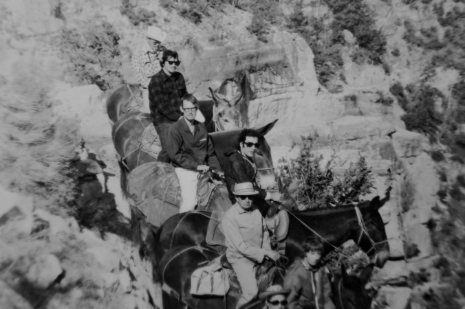
Peggy captures Dave Stalheim and me as we begin our journey on the Colorado River through the Grand Canyon. Note my clean and shaved look. It’s the last time you will see it.


With thoughts of facing headwind gusts up to 60 MPH, we began our journey down the Colorado River through Grand Canyon National Park.

Peggy and I performed the ritual of asking a boatman if we could ride with him. It seems like a strange practice to me, designed to remind us who’s in charge. But we have entered the world where each boatman/woman is the captain of his or her ship, even if the ship is a 16-foot raft with two or three passengers.

“May I have permission to come aboard, sir?” Although it’s more like “Can we ride with you today?” It is courteous but I would prefer to be assigned and have the assignment changed each day.

The tradition is so old that it fades into history. Democracy is not an option on a raging sea or, for that matter, in the middle of a roaring rapid. When the captain yells jump, you jump.

Most boatmen are mellow people, however; good folks. There are few Captain Blighs. If they are slightly more than equal, it goes with the territory. We are committed to riding with each boatman. First up is David Stalheim. He makes his living as a city and county planner in Washington.

“I’ve been applying for a permit to go on the Colorado River for 15 years,” he tells us. Our ten-minute effort of obtaining a permit seems grossly unfair.

We push-off from shore, excited and nervous. The wind strikes immediately, like it was waiting in ambush. “Are we moving at all?” Dave asks plaintively.

An old rock road makes its way tortuously down from the canyon rim on river left. (Left and right are determined by direction of travel.) They are important for giving directions as in “There is a raft ripping rock on river right!” Since boatmen often row with their backs facing downriver, they appreciate such information.

Up until 1929, this is how travelers made their way to Lees Ferry. It would have been a bumpy ride.

The old road is how people once made their way to Lee’s Ferry, which was one of the few ways to cross the Colorado River between 1858 and 1929. The infamous Mormon, John Doyle Lee, established the Ferry. Brigham Young assigned him the job. Later, Lee was executed by firing squad for his role in the Mountain Meadow Massacre where Mormons and Paiute Indians murdered a wagon train of immigrants near St. George, Utah. For awhile, my brother and I thought some of our ancestors had been involved, had ended up dead. But it wasn’t so.

After fighting the wind for what seems like hours, we finally come to the Navajo Bridge, which replaced Lee’s Ferry in 1929. It towers some 467 feet above the river and reminds us that we are already miles behind our planned itinerary.

Navajo Bridge by Don Green

A view of the Navajo Bridge. The first is the old one and is now used as a walkway. The second is used by cars and other vehicles. (Photo by Don Green.)

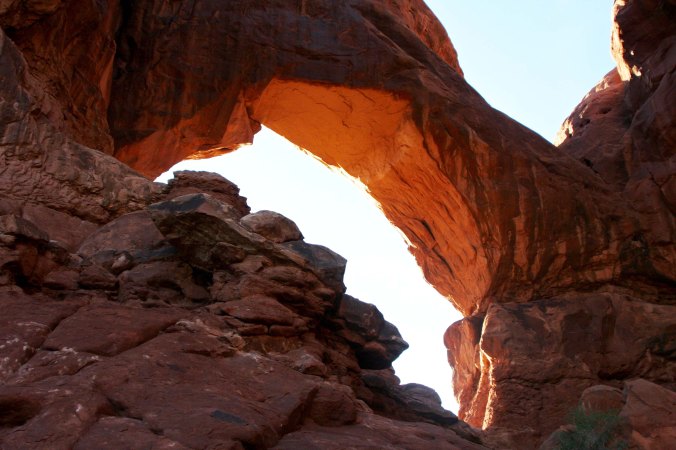
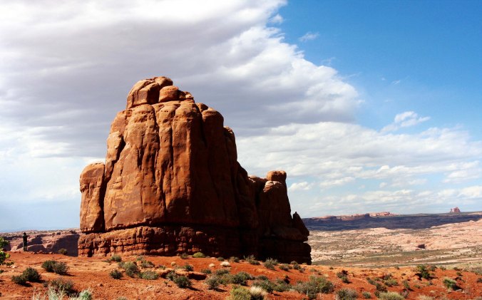
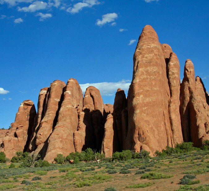
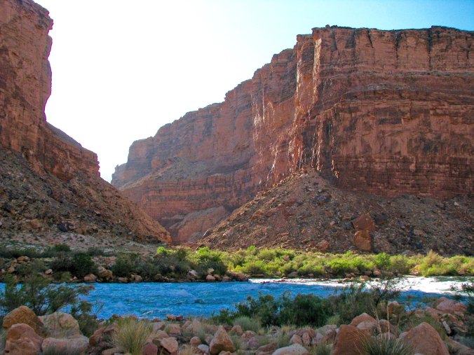
Just beyond the bridge we catch our first glimpse of Coconino Sandstone. Its geologic history dates back some 250 million years when a huge desert covered the area and the world’s landmasses were all part of the large continent named Pangaea— before the divorce, before plate tectonics demanded that the continents go their own way.

During our journey down the river we will travel through over a billion years of the earth’s history.

The wind continues to beat against us as we make our way down the Colorado River. Only Dave’s strenuous effort at the oars keeps us from being blown up-stream. “Go that way,” I suggest and point down the river.

The group pulls in at a tiny beach in hopes our mini-hurricane will die down. It doesn’t. Dave develops blisters and I develop guilt. A manly man would offer to take over at the oars.

An option floats by. Dave’s niece, Megan Stalheim, is also one of our boatmen. Don Green, a retired Probate Judge out of Martinez, California, is sitting opposite her and pushing on the oars while she pulls. It inspires me. I join the push-pull brigade. Peggy also takes a turn.

The push-pull approach to rowing where Don Green was helping Megan. Peggy and I have been friends with Don for over two decades. He belongs to the same book club we do and joins us on our annual journey to Burning Man (as does Tom). Don is also quite generous in sharing his photos, which was particularly helpful on our first day since neither Peggy nor I took many.

Word passes back to us that Tom wants to scout Badger Creek Rapids. In boatman terminology this means figuring out the best way to get through without flipping. Badger isn’t a particularly big rapid for the Colorado, but it is our first. We are allowed to be nervous. It’s labeled a 4-6 out of 10 in the method used in the Grand Canyon for determining difficulty. Ten is reserved for only the most dangerous. Badger involves a 15 foot drop from the top to bottom.

Badger Creek Rapids by Don Green

Photo of Badger Creek Rapids by Don Green.

There is good news included in the message. We will stop for the night at Jackass Camp just below the rapids on the left. We’ve only gone 8 miles but are eager to escape the wind.

Dave is a cautious boatman. He takes his time to study Badger Creek Rapids from shore and then stands up in his raft for a second opinion as the river sucks us in. Time runs out. Icy waves splash over the boat and soak us. Our hands grasp the safety lines with a death grip as we are tossed about like leaves in the wind. Mere seconds become an eternity. And then it is over.

Badger Creek Rapids Google photo

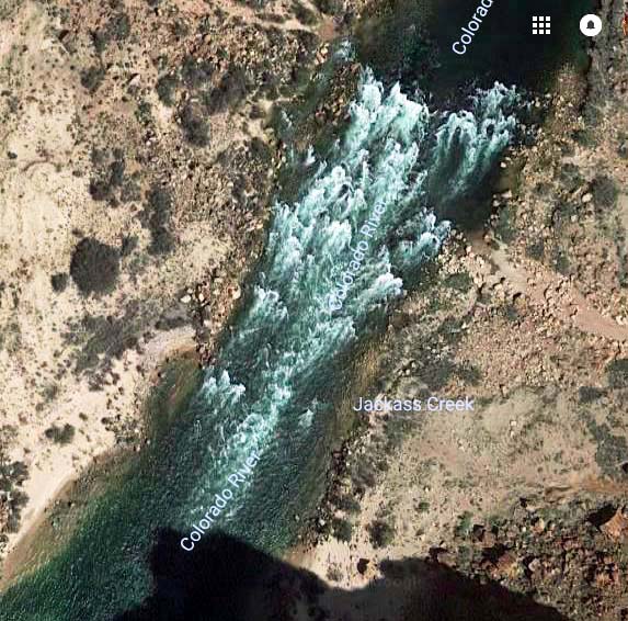
The view from above using a Google photo. Our camp would be on the right (river left)  at the bottom of the photo, in the shade here. Our raft came out on the left (river right) side of the river.

“Quick, Curt, I need your help,” Dave shouts. We have come out of the rapids on the opposite side of the river from the camp. The powerful current is pushing us down stream. If we don’t get across we will be camping by ourselves. Adrenaline pumping, I jump up and push the oars with all my strength while Dave pulls. Ever so slowly the boat makes its way to camp.

Jackass campsite on Colorado River by Don Green

Not the world’s most attractive campsite. We scatter out to find places for our tents after emptying the boats. (Photo by Don Green.)

Jackass Camp Area by Don Green

Boats tethered at Jackass Camp. (Photo by Don Green.)

View from Jackass camp on Colorado River by Don Green

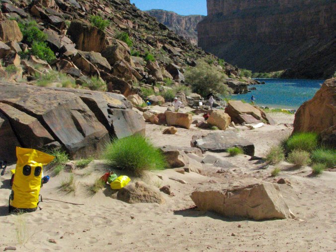
View from camp. (Photo by Don Green.)

Grand Canyon evening primrose by Don Green

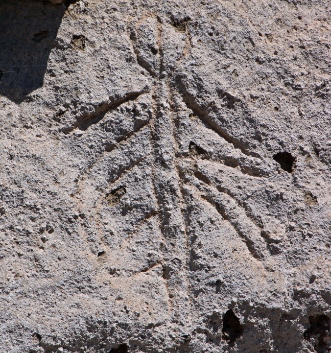
I liked this primrose captured by Don the next morning…

Grand Canyon floers and tracks by Don Green

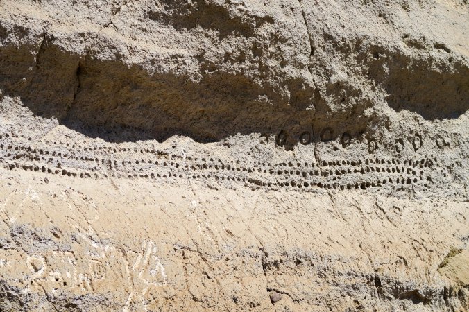
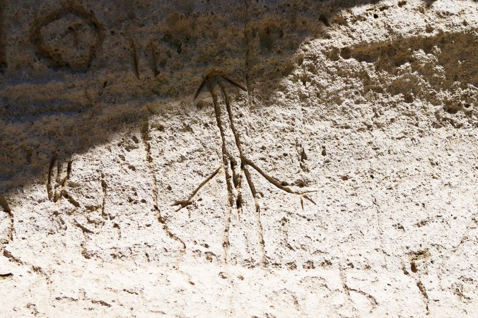
And found the tracks under it even more interesting. It’s like the lizard was sidestepping. Its tracks and tail trail can be seen coming down from the right. The hole on the right was made by an ant lion that uses the hole as a trap for insects. They fall in, can’t get out, and become lunch. Next Monday, we will continue our journey down the river.

WEDNESDAY’S Photo Essay POST: I begin my series on the Alaska Highway. We make our way to the start of the highway in Dawson Creek by traveling through British Columbia. Great wood carvings and dog agility trials entertain us along the way.

FRIDAY’S MisAdventures POST: I graduate from playing in the Graveyard to playing on a pond and discover a magical world.

MONDAY’S Grand Canyon Series POST: Beautiful waterfalls, a huge cavern, and ancient Native American ruins are featured.

Jackass campsite on Colorado River by Don GreenJackass campsite on Colorado River by Don GreenSaveSave

SaveSave

SaveSave

SaveSave

SaveSave

SaveSave

SaveSave

SaveSave

I Discover I Am No Longer 30, or 40, or 50, or even 60… Rafting Through the Grand Canyon: Part 4

On a private trip down the Colorado through the Grand Canyon National Park, everyone pitches into help. Here we are learning to rig the rafts. Straps and more straps! The  aluminum frame provided stability for the raft and held the heavy food containers. (Photo by Don Green)


It was time to make the leap from life on the road to life on the river. Laptops, cell phones, good clothes and the other accoutrements of modern civilization were stuffed into bags and dumped into our transport van.

Plus I had to paint my toenails. It was a virgin experience. Grand Canyon boatmen are a superstitious bunch. Many believe their boats will flip if a person is on board with naked toes. And it’s true— boats have flipped under such circumstances. It makes no difference if the opposite is also true. Tom lectured me. “I will not let you on my boat unless your toenails are painted.” In addition to being obnoxious, he was serious. Peggy dutifully applied blue polish on four of my toes. Did this mean we would only half flip?

Two acres of paved boat ramp greeted us when we arrived at Lee’s Ferry, some 130 miles from Flagstaff. It is the take off point for trips down the Canyon and the only bridge across the river in some 700 miles. The Mormons originally discovered the potential for the crossing and sent John Lee to set up a ferry, which began operation in 1873. Brigham Young was also hiding Lee. He had been a key player in the Mountain Meadows Massacre where some 120 eastern emigrants had been murdered. A practicing polygamist, Lee and his wives ran the ferry up until his execution in 1877.

The transport van disgorged us as the gear truck made a quick turn around and backed down the ramp. Another private party was busy rigging boats. People, gear and boats were scattered everywhere.

From off to the right, a longhaired, 50-something man had emerged. I had thought 60’s hippie or possibly the model for a Harlequin Romance cover. The pirate flag on his boat suggested otherwise. A ‘roll your own’ cigarette dangled from his lips. It was Steve Van Dore, the last member of our group and a boatman out of Colorado.  No one in our group had met him, but he came highly recommended.

Steve, a week or two into the trip.

“Please let this be the truck driver,” Steve later admitted was his first thought when he met our green and purple haired trip leader. He also confided that Tom hadn’t told him we were a smoke-free group. “On the other hand,” Steve confessed, “I didn’t tell him I was on probation.” Somehow this balanced out in Steve’s mind. There was no time to become acquainted; we had work to do.

There is an unwritten 11th Commandment on private river trips: Thou Shall Do Your Share. No one is paid to pamper you. Not helping will lead to bad things, like banishment from the tribe. The truck we had loaded in Flagstaff demanded unloading. Everybody did everything. There were no assignments. Peggy and I became stevedores. Piles of beer and soda and wine and food and personal gear and ammo cans and hefty ice chests quickly accumulated around the truck. There was no shade and the desert sun beat down ferociously. It was sucked up by the black asphalt and thrown back at us. We slathered on sun block and gulped down water.

The rafts were unloaded last. Rigging them was technical but relatively easy, assuming of course that you knew what you were doing and were mechanically inclined. I made no such claims. Steve’s Cat (catamaran) was already set up and in the water, its pirate flag was flapping in the breeze. Our other four boats were self-bailing Sotar Rafts with aluminum frames. Tom owned his own, a blue 14 footer named Peanut after the Jeff Dunham character. The three we had rented were yellow, 16 feet long and nameless.

Work also required that we get our feet wet. (Photo by Don Green)

Tom was the last to rig his boat. It was approaching dusk when he finished— the end of a very long day. I hiked down the river to find a campsite for our group while the rest boated down. Peggy and I struggled to set up our new tent in 30 MPH winds. A van was coming to pick us up for dinner at a nearby restaurant and we were late.

The walls of the restaurant were covered with photos of rafts and rafters being trashed by massive rapids. I walked around and admired them with more than a little awe and trepidation. I would have preferred to see photos that emphasized the beauty of the Canyon, but this was a rafters’ hangout.

The wind storm had changed to a dust storm when we arrived back at camp. Finding our tent in the dark proved to be a challenge, and the tent provided little protection when we crawled in. I was reminded of Burning Man as the dust assailed my eyes, ears, nose and mouth. I pulled out a handkerchief to cover my face. Exhausted, I finally fell asleep with the wind ripping at our tent.

I had underestimated the amount of work involved. We were floating down a river, weren’t we? I was out of shape and had a generous belly. Peggy and I had been traveling extensively, mainly helping our kids with their babies. I’d been over-eating and under-exercising. I might have gotten away with it at 30, or 40, or 50— and had. But now I was 67, and my body had some serious words for me. Mainly unprintable. A few years earlier I had undertaken a much more difficult task, backpacking for 360 miles between Lake Tahoe and Mt. Whitney. But I knew how tough that was and had spent a few months hiking 5-10 miles per day before hitting the trail. Now my only excuse was ignorance. And that is not a very good excuse.

We were awakened at five a.m. the next morning, as we would be on every day of our trip. There was personal gear to pack, breakfast to prepare, and boats to load. Any thoughts of a leisurely trip down the river were dashed in the cold reality of the early morning’s light.

We also had a lecture on the Grand Canyon’s numerous rules by Ranger Peggy. Somewhere in the middle of rigging boats the previous day she had stopped by to check our equipment. Life vests had been dutifully piled up; stoves and bar-b-que were unpacked. Even the groovers, which I will describe later, stood at attention. You don’t mess with Ranger Peggy.

She knew Tom from other river trips and was amused by his hair-do. He introduced me as the permit holder. “Tom’s in charge,” I noted. The smile dropped from her face. “You are responsible,” she said icily. “I’ll try to keep Tom under control,” I replied meekly. Yeah, fat chance that.

Bells, whistles and alarms started going off in my head. I would face heavy fines if any of our party misbehaved.

Our second encounter with Ranger Peggy began after the boats were packed for our first day on the river. Tom started off with a discussion on river safety. Naturally we were required to wear our PFD’s (Personal Flotation Devices) any time we were on the boat.

Tom, with his interesting hairdo, and Ranger Peggy check their lists to see which of the many rules they have forgotten to inform us about.

What’s the first rule if you fall overboard: Hang onto the boat. What’s the second rule? “Hang onto the boat,” we chanted in unison. And so it went. Tom saw his wife, Beth, go flying by him the year before as he bounced through a rapid. He caught up with her down river.

If the raft flips, what do you do? Hang onto the boat! “Easier said than done,” I think.

“Your head is the best tool you have in an emergency,” Ranger Peggy lectured. Right. When the river grabs you, sucks you under the water, and beats you against a rock— stay cool.

For all of the concern about safety on the river, the Park Service seemed more concerned about our behavior on shore.

Over 20,000 people float down the river annually. And 20,000 people can do a lot of damage to a sensitive desert environment. Campsites are few and far between and the major ones may have to accommodate several thousand people over the year.

Picture this: 20,000 people pooping and peeing in your back yard without bathroom facilities. It isn’t pretty. So we pack out the poop. And we pee in the river…

Packing out poop makes sense. But peeing in the river, no way! I’d led wilderness trips for 36 years and for 36 years I’ve preached a thousand times you never, never pee in the water. Bathroom chores are carried out at least 100 yards away from water and preferably farther.

The first time I lined up with the guys, I could barely dribble out of dismay.

The rules went on and on. Mainly they had to do with leaving a pristine campsite and washing our hands. Normally, I am not a rules type of guy but most of what Ranger Peggy preached made sense. Sixteen people with diarrhea is, um, shitty.

And few things disturb me more than a trashy campsite in the wilderness. The least we could do was to leave our campsites sparkling clean.

Finally, we were ready to launch. Eighteen days and 279 miles of the Colorado River and Grand Canyon stretched out ahead. Ranger Peggy checked our IDs against her list. We were who we claimed to be. The boatmen strapped down the gear. It was time to climb aboard and Tom was anxious to get going.

The same up-canyon winds that whipped dust into our tent were threatening to create a Herculean task of rowing. Headwinds of up to 60 MPH were predicted.

The group, ready to launch. Wife Peggy, as opposed to Ranger Peggy, is holding her and my purple PFDs. I’m second from the left, looking chunky.


WEDNESDAY’S POST: It’s back to the Amazon and monkey business. While Peggy gets the ‘good’ monkey, I get the ‘bad’ monkey.

FRIDAY’S POST: I learn a bit about cross cultural relations as a second grader— on a queen sized bed.

MONDAY’S POST: Fighting ferocious headwinds, we begin our journey through the Grand Canyon.


SaveSave

SaveSave

SaveSave

SaveSave

SaveSave

SaveSave

SaveSave

Homeland Security Goes Searching for a Bomb… Rafting through the Grand Canyon: Part 3

Essential Grand Canyon supplies DG

All of my wilderness experiences have been motivated by a go-light philosophy when it comes to food, which makes sense if you carry it on your backs. River runners, on the other hand, have rafts to carry everything. Other rules apply. Extra pounds don’t matter. And if you are going to carry all of these oranges, you might as well carry some alcohol to mix with your orange juice. (Photo by Don Green.)


The fact that we were full-time travelers made our Grand Canyon trip easier. There was no house, mail, job, pet or the other factors of normal life to worry about. We just pointed our van toward Flagstaff and drove, stopping along the way at places like Arches and Bryce Canyon National Parks.

Bryce Canyon

While our fellow rafters were scurrying to wrap up business to prepare for our 18-day raft trip though the Grand Canyon, Peggy and I were visiting Nationals Parks in Utah. This is Bryce Canyon.

Bryce Canyon 1

Another view of Bryce.

Great adventures usually start with mundane tasks, as most of you know. For example, did you cancel the paper? Common sense, travel pundits, (and probably your mother) admonish you that devious burglars have nothing better to do than to cruise the streets looking for rolled newspapers in front of your home.

More importantly, what about the cat?

Once upon a time Peggy and I had a cat named FE. Vacations meant I would carefully measure out twice as much food and water as she could possibly eat or drink and four times the kitty litter she might use. The likelihood of her using our house as a litter box was much greater that the likelihood of her starving. As a reward for my thoughtfulness, she would shed enough fur in our absence to fill a dump truck. For weeks after we arrived home, she would also pad into our bedroom in the wee hours each night and meow loudly to make sure we hadn’t abandoned her again. Or possibly it was punishment…

FE and Sylvester dressed for Christmas

FE and her buddy, Sylvester, dressed for Christmas. Note FE’s Rudolph-red nose. I recall that a bit of photoshopping was required to get her ready for the Christmas letter.

We weren’t getting off scot-free on preparation for the river trip, however. In Flagstaff, we had food to worry about. Lots of it. Tom Lovering, his wife Beth and their friend Jamie Wilson arrived in Flagstaff three days in advance of our Colorado River trip. Their car was packed to the brim with empty ammo cans for things like cameras and huge ice chests for food. They were late.

The Department of Homeland Security had delayed their journey at Hoover Dam. The Agency is paranoid about mad bombers, rightfully so. And this was before the new bridge across the river had been completed; people still had to drive across the dam. A vehicle packed with C-4 could conceivably blow a big hole. Stern faced agents carrying guns were posted at each entrance. No smiling was allowed. Homeland Security’s normally low sense of humor (have you ever joked about a bomb during a security check at an airport) dropped to zero when the agents saw all the ammo cans Tom had packed in his vehicle. Rafters love these containers because they are waterproof and easily obtainable at Army Surplus stores. You can imagine what went through the minds of the agents. The whole car had to be unpacked and each ammo can carefully checked out.

Tom Lovering

This was the face that Tom greeted the Homeland Security agents with— furry but friendly. His looks were about to change…

Tom getting a do

Tom getting a ‘do’ in Flagstaff…

Tom Lovering with horns

What if Tom would have met the agents looking like this with green horns? We still might be waiting for him in Flagstaff.

Tom is even more paranoid about food than DHS is about terrorists. In addition to being a highly experienced rafter and trip leader, he’s an old restaurateur who had spent months planning the menu.  Each dish had been tested several times and quantities had been measured down to the teaspoon. Recipes were spelled out in minute detail. We would eat gourmet on the trip and cook it Tom’s way— or die. The options were clear.

Beth, Peggy and I were dispatched to Sam’s Club with marching orders. We filled seven large shopping carts with food. Think of it this way. There were 16 people going on an 18-day trip and eating three meals a day. This equaled 864 individual meals.

When we arrived back at the motel, Tom and Jamie had set up a staging area. Food needed to be organized by meal and day and then stuffed in the appropriate containers. The containers would then be assigned to rafts. It was important that we knew where to find the beer.

Large food containers for Grand Canyon trip

Large food chests waited for us when we got back to our motel. Each would be filled with food. Dry ice would be added to keep our food fresh for 18-days.

We still had to shop for perishables and more food was also coming from Sacramento. Our room, we discovered, was to be the recipient of most of the food. Apparently, it was written into the fine print of being ‘permit holder.’ There was barely space to sleep. Not that we slept much. Soon, we would be on the river! But first, Bone had to be appropriately dressed for his trip.

Supplies for Grand Canyon trip

We went to Safeway to purchase our perishable goods, and once more our small RV was filled to the brim.

Gear and food Grand Canyon trip

We discovered that the majority of the large food containers would be stowed in our room. With our own gear spread out on the bed, it was questionable if we would have room to sleep! Tom provides a perspective on the size of the ice chests. The yellow container is an ammunition can.

Bone in life vest

One of our final responsibilities was to make sure that Bone was adequately dressed for the trip in his PFD. Once, he almost fell off a boat in the piranha infested water of the Amazon. It would not do to lose him in the roaring rapids of the Colorado. Next Saturday and Sunday, I will provide background on Bone since he was an active participant on the river trip.

Loading truck for Grand Canyon trip DG

Finally, it was time to load our food and gear on this truck for transport down to Lee’s Ferry and the beginning of the trip. The truck was completely stuffed by the time we were finished. We were finally on our way! (Photo by Don Green.)


WEDNESDAY’S Photo Essay POST: A river boat trip on the Amazon River. The piranhas are biting and we bite back.

FRIDAY’S MisAdventure’s POST: There is nothing like reading to seduce you into becoming a wanderer.

MONDAY’S Travel Blog POST: We start our raft journey through the Grand Canyon with 30 MPH headwinds. So much for a peaceful (between rapids) float down the Colorado!


SaveSave

SaveSave

SaveSave

Peggy Wins the Lottery… Rafting through the Grand Canyon: Part 2

Mule trip into Grand Canyon

I have journeyed into the Grand Canyon several times over the years. The first was in the late 60s. That’s me, second from the top on Charlie the mule. I was heavier than Charlie liked, so he kept trying to bite me. He also walked as close to the thousand foot drop off as he could. His ultimate revenge, however, was that I was sore for a week afterwards!


Having reported on being in Flagstaff for the beginning of our raft trip down the Colorado River on last Monday’s travel blog, I thought I should back up a step and tell you how we got there.

It started with a strange phone call.

Peggy and I were in the middle of a three-year trip around North American in our small RV when the phone rang late one night. It was 10:00 p.m., far past the time I normally accept calls. They make me grumpy. Usually they are from a Nigerian Prince who wants to make me incredibly wealthy. All I have to do is send him a thousand bucks. But this was from my old friend Tom Lovering. I’m used to him calling at weird hours. He has zero sense of what constitutes a normal day and fervently believes that no one else should either.

He wanted me to immediately stop whatever I was doing (sleeping), jump on-line, and apply for a private permit to raft down the Colorado River through the Grand Canyon. Permits are scarce and the number of people who apply could fill a rock concert. So the Park Service does an open lottery for interested folks. Odds of getting a permit are small— teeny tiny— and Tom wanted to increase his. He’d been scrolling through his list of friends and had already talked a number of people into applying. The clock was ticking; the lottery closed at midnight. Given the late hour, I must have been near the end of Tom’s likely candidates, which isn’t surprising. I know zilch about running rapids.

Thrill sports aren’t my thing. I have always figured that the type of outdoor things I do (like bicycling 10,000 miles around North America by myself, or disappearing into grizzly bear country alone) have enough inherent danger without my challenging raft-eating, people swallowing rapids, or climbing up the sheer face of a thousand-foot rock. Not that I have any problem with the sports. In fact, I have nothing but admiration for people who have the skill and temerity to pursue them and make a career out of flipping off the old guy in a hoodie who carries a big scythe.

My normal response would have been, “Sure, Tom, I’ll get right on it,” followed by promptly rolling over and going back to sleep. But this wasn’t accounting for the love of my life, Peggy, who actually likes water sports and enjoys jumping off cliffs. During college, she had actually attended a session of the Nantahala White Water School in North Carolina where you learn to maneuver rafts through raging rapids. She followed up on Tom’s request immediately: jumping on-line and putting in for a permit— in my name.

I was checking my E-mail the next morning when I came across the note from the National Park Service: “Congratulations you have won a permit for you and 15 other people to raft down the Colorado River through the Grand Canyon! We will be sending you a 5000-page document (slight exaggeration) that outlines your responsibilities.” Oh joy. I called Tom immediately. He was the experienced river runner. He had promised the night before that if, by some miracle I did win, he would take full responsibility for organizing and leading the event. It’s a huge job that takes considerable knowledge about white water rafting.

At first, Tom didn’t believe me. He thought I was joking. Neither he nor any of his rafting buddies had won a Canyon permit in several years. And then he was ecstatic. Yes, he would recruit experienced boat people and their boats for the trip! Yes, he would make all necessary arrangements. Yes, he would plan the menus and organize the food! Yes, he would lead the adventure!

Then the other shoe dropped. Doesn’t it always? I was, after all, “the permit holder.” It was my job to turn in paperwork. But I also had serious responsibilities. If anything went wrong; it was on my shoulders. This ranged from people pooping in the wrong places, to how we washed our dishes, to more serious things. The Park Service had a long list of safety and environmental concerns. I’d be signing on the dotted line. There would be an inspection before we left!

I admit I had concerns. But these were countered by the fact that I love the Grand Canyon. I have returned to it numerous times over the years. I have both hiked and backpacked into it. One time I rode mules into the Canyon. Another time I flew in by helicopter. And I am perfectly happy just sitting on the edge and staring out into the vast space at the incredible rock formations. I did that for Christmas one year (and many other times). Floating down the Colorado would give me a totally new perspective. I was almost as excited as Tom and Peggy. Almost.

Between three tours of duty as a Marine helicopter pilot in Iraq and then serving as a Coast Guard pilot flying rescue missions, our son Tony did a brief stint of flying tourists over the Grand Canyon and into the Havasupai Indian village in the canyon.  When he flew Peggy and me into the village, he was playing the theme song from Star Wars as he swooped down past the steep cliffs.

Waterfalls at Havusupai

This gorgeous waterfall was the main attraction at the Havasupai Village.

I am sitting on the edge of the Colorado River, red with mud.  Peggy and I had backpacked down the Tanner Trail retracing a solo trip I had made several years earlier. Our raft trip would bring us through this section of the Canyon and over the Tanner Rapids. (Photo by Peggy Mekemson.)

Occasionally, backpacking through the Canyon requires a bit of scrambling.

But you don’t have to hike or backpack into the canyon, or raft, or fly, or ride grouchy mules to enjoy the beauty of the Canyon. You can drive up, and enjoy numerous pull-offs that give you incredible views. Short walks provide many more. Be sure to include early morning and late afternoon to capture the full beauty.

Grand Canyon 38

The rocks come in a seemingly infinite number of shapes and colors.

A final view.

WEDNESDAY’S POST: We travel to the ancient Roman city of Pompeii.

FRIDAY’S POST: I learn that there is more to life than dead people.

MONDAY’S POST: And why is Homeland Security checking out our food containers for a bomb on the our Grand Canyon rafting adventure?


Hopi Gods and Squirrelly Squirrels… Rafting the Grand Canyon: Part 1

Rowing on the Colorado through the Grand Canyon

While a veteran crew of boatmen handled the more dangerous parts of our 18 day journey through the Grand Canyon, I was allowed near oars on some of the tamer sections.


Since Peggy and I will actually be hanging out at our home in Southern Oregon for a couple of months and not generating new material for my travel blog, I thought I would dip back in time to the very beginning of my posts.  I had attended a writer’s conference in San Francisco during the winter of 2010 and been told that writers need an Internet presence. I felt doing a series on an 18-day trip we had just completed rafting on the Colorado River through the Grand Canyon would make an excellent start. It was an epic-adventure, one that was burned into my memory banks.  Part of the experience was that Peggy and I would be traversing some of the earth’s most challenging rapids with a true cast of characters. That alone was enough to make it an epic adventure, but even more important, at least for me, was that we would be traveling through the heart of the Grand Canyon, one of the seven natural wonders of the world. Please join us on this adventure. By the end, I think you will see why the Grand Canyon has earned its world-class status. I will start with Peggy and me in Flagstaff, Arizona getting ready for our adventure…


Tom and Bone

One of the ‘cast of characters’ and our group leader, Tom Lovering with Bone in his hair. Tom and I had found Bone when we were backpacking in the Sierra Nevada Mountains in 1977 and he has traveled the world ever since.

Five squirrels with long tufted ears just went charging past our van— in a row. I think it must be love and Peggy agrees. We speculate that a female is leading the boys on a glorious romp. “Catch me if you can!” she giggles. It’s that time of the year when the Albert Squirrels are excited to make babies and perpetuate the species. Lust is in their hearts. Or maybe it’s just the guys working out territorial differences.

Someone they won’t be mating with are their northern cousins, the Kaibab Squirrels. It isn’t that they couldn’t or wouldn’t if they could, it’s just that the giant hole in the ground known as the Grand Canyon is too deep and too wide for them to cross. As a result, a new species has been created. Scientists and natural history folks call this process allopatric speciation— a pair of two-bit words for sure.

We are located at a KOA in Flagstaff, Arizona as we prepare for our raft trip down the Colorado River. It’s a big campground. Everywhere we look men and women wearing yellow shirts are busily preparing for the onslaught of summer tourists. It feels like a beehive, or squirrel’s nest. The camp cook tells us 28 people work here. Jobs are highly specialized. The man who straightens misplaced rocks stopped by to chat with us this morning.

Yesterday we watched two employees struggle for an hour on laying out the base of Teepee. It had all the flavor of an old Laurel and Hardy film. They kept measuring and re-measuring the angles. I expected one to leap up and start chasing the other around camp with a 2×4.

We wonder what the Kachina deities who live in the San Francisco Mountains overlooking our campground think about the squirrelly activity taking place beneath them. There are bunches of them up there, over 300 according to Hopi lore, and each one has a lesson to teach, wisdom to disperse. They come down from their perch in the winter to share their knowledge. I’m sure that they would have made quick work of the Teepee project.

Peggy and I hike up the mountain following Fat Man’s trail. Of course, there is no irony here as we desperately try to beat our bodies into shape for the Canyon trip. We’ve been out travelling in our van for months and the pounds have accumulated. The trail’s name suggests this is a gentle start. Instead it takes us straight up into a snowstorm. The Kachinas are rumored to mislead people under such circumstances. I once spent a week up on the mountain by myself and restricted my wandering to fair weather.

Grand Canyon rock formation

I’ve sometimes wondered what, if any, role that rock formations in the Grand Canyon influenced how the Hopi Indians pictured their Kachina gods.

Once they had the mountain to themselves but now they have competition. Technology has arrived— modern gods. Tower after tower bristling with arrays of tracking, listening and sending devices look out over the sacred lands of the Hopi, Navaho and other Native Americans.

It’s hard not to think Big Brother is watching or not be disturbed by the towers’ visual intrusion. But their presence means we can get cell phone coverage and climb on the Internet. We are addicted to these modern forms of communication so it is hypocritical to whine, at least too much.

But back to the squirrel theme, Peggy and I are a little squirrelly ourselves as we go through our gear and get ready for our grand adventure. I am nervous. This is my first multi-day river trip. What have we gotten ourselves into? Do we have the equipment we need? Will we survive the rapids? What will the people who are joining us be like? What challenges will we face that we are ill prepared for? There are many questions and few answers.

Would people who should not be let near knives suddenly be wielding them?

Would Canyon spirits stalk us?

Would we be required to paint our toenails so our rafts wouldn’t flip.


A note on photos: Peggy and I took most of the pictures that will be included in these posts on the Grand Canyon trip. Our friend Don Green was also along, however, and has generously shared his photos with us. I will note which photos are his.

WEDNESDAY’s Photo Essay POST: It’s back to the featuring the beautiful red rocks of Sedona, Arizona.

FRIDAY’S Blog a Book POST: The next chapter in MisAdventures sees my brother and I in a death-defying race to the top of the 75-foot tall Incense Cedar in the Graveyard.

MONDAY’S Travel Blog POST: It’s all about food, seemingly tons of it, as we make our final preparations for the Colorado River trip. Homeland Security puts a crimp in our efforts as it checks our supply for bombs.

SaveSave

SaveSave

SaveSave

SaveSave

SaveSave

SaveSave

SaveSave

SaveSave

SaveSave

SaveSave

SaveSave

SaveSave

Rock Art, a Civil War Veteran, and Magnificent Mountains… The Arches National Park Series: Conclusion

The La Sal Mountains provide a dramatic backdrop for Arches National Park.

The first people came wandering through Arches some 10,000 years ago as the last of the glaciers were retreating north or scooting up mountains, seeking colder climates. The nomads were hunter-gatherers, killing wild animals for food and seeking out edible plants where they grew naturally. They must have been impressed with the magnificent rock sculptures they saw. Possibly they even gave the soaring arches, spires and fins spiritual significance. What caught their attention from a practical point of view, however, were the chert and chalcedony rocks that could be chipped into stone tools such as knives and scrapers. Left over debris piles can still be seen by those trained to look for them.

The wandering hunters and gatherers were replaced by farmers some 2,000 years ago. The Arches area was on the northern edge of the Puebloan culture, which was known for its cliff dwellings. A lack of such abodes in the area, however, suggest that Arches was more of a place to visit than occupy. About 700 years ago, the Puebloans apparently abandoned the area altogether for whatever reason they were disappearing from their homes throughout the Southwest. Drought, disease, or invasion are among the causes normally given.

When the first Europeans entered the area, they found it occupied by the Utes, a Native American tribe from which Utah took its name. It is assumed that the rock art panel shown below was created by the Utes since the Indians were riding horses and there weren’t any in North America prior to the arrival of the Spanish Conquistadors. Interestingly, a section of the Old Spanish Trail that was used by Spaniards to travel between Santa Fe, New Mexico and Los Angeles in the late 1700s/early 1800s actually runs in front of the park headquarters following Highway 191.

Utes on horses hunt big horn sheep on the petroglyph panel found at Arches National Park.

A closer look suggests that the Utes were waving their arms and driving the sheep with the help of dogs. Native Americans were known to drive buffalo but I have never heard of the technique in relation to sheep.

In hopes that the arid climate of the region would be good for an old Civil War war wound, 69-year-old John Wesley Wolfe left his wife in Ohio in 1898 and settled near Delicate Arch and the Ute rock art north of the town of Moab. He brought his son with him and built a primitive cabin. There was enough space to raise a few head of cattle and vegetables. More sophisticated needs were met by shopping out of the Sears and Roebuck catalogue. When his daughter, her husband, and two children arrived a few years later, she insisted that Wolfe provide more modern accommodations. He complied by building the 11 by 17 foot one room cabin that still stands today. It must have been cozy.

The Wolfe’s cabin as it looks today. Delicate Arch is off to the right. The Ute rock art is located on the cliffs behind the cabin.

A closeup of the cabin rendered in black and white.

While the Colorado River forms the southeastern border to Arches National Park, it is the La Sal Mountains that provide a dramatic backdrop for many of the rock sculptures found in the park. Towering over 12,000 feet in height, the La Sal’s are part of the Rocky Mountain chain. I’ll conclude my series on Arches with several photos that Peggy and I took of the mountains as seen from Arches.

I liked the contrast between the red rocks, green brush and blue mountains.

La Sal Mountains framed by pillars in Arches.

Clouds, mountains and red rocks.

I’ll conclude with this tree that was set off by the red rocks.

NEXT POSTS: Hot off the press: Peggy and I are on a two-week trip up the coast of northern Oregon and southern Washington to celebrate our 25th Anniversary. Expect crashing waves, tumbling waterfalls, rainforests, a picturesque lighthouse, towering ocean rocks and quaint towns.

SaveSaveSaveSave

SaveSave

SaveSave

SaveSave

SaveSave

SaveSave

SaveSave

SaveSaveSaveSave

SaveSaveSaveSaveSaveSave

SaveSaveSaveSaveSaveSave

The Arches of Arches…. Arches National Park: Part 3

Photo of Double Arch at Arches national Park by Curt and Peggy Mekemson.

I can pretty well guarantee that you will see Double Arch on any trip to Arches National Park. It’s just off the road… and impressive.


“Wilderness is not a luxury but a necessity of the human spirit, and as vital to our lives as water and good bread. A civilization which destroys what little remains of the wild, the spare, the original, is cutting itself off from its origins and betraying the principle of civilization itself.” Edward Abby from his book about Arches NP, “Desert Solitaire.”


Arches is renowned for its arches, as it should be, given its name. They come in all shapes and sizes ranging from three feet across to 306 feet. I noted in my first post that there are some 2,000 of them at the park. Forces of erosion, including water, ice and wind, break out chunks of rocks from softer sandstone beneath harder layers above and eventually work through fins.  New arches are constantly being created while older ones fall.

Arch in progress at Arches NP

A new arch in the process of being born at Arches National Park.

Several arches are located along the road and are easily reached by short hikes. Others require longer hikes and more work. When Peggy and I were at Arches last time, we were rushing through on our way to our Grand Canyon raft trip. We could hardly begin to do the arches justice, but we did photograph three that I will share with you today: Delicate Arch, Skyline Arch, and Double Arch.

Delicate Arch, Arches National Park

While Peggy and I didn’t have time to visit Delicate Arch, we were able to snap its photo from a distance. It is the most famous arch in the park and possibly in the world.

Skyline Arch in Arches National Park

Skyline Arch is also easily seen from the road.

Skyline Arch and tree at Arches NP

Here it is with a tree to help set it off.

Skyline Arch close up at Arches NP

A close up of the arch.

Double Arch at Arches National Park. Photo by Curt and Peggy Mekemson.

People in the lower right hand corner provide perspective on the size of Double Arch.

Double Arches and green brush

Double Arch seen from a distance.

Double Arches up close, Arches NP

One of the arches of Double Arch up close.

Arch in Double Arch, Arches NP

And closer.

Curt Mekemson at Arches NP

I was up climbing around on the Double Arch to get photos when Peggy snapped my picture, which will serve as the last of this post.


NEXT POST:  We will explore the surrounding country, petroglyphs and settler history.


SaveSave

SaveSave

SaveSave

SaveSave

SaveSave

But Are You Balanced… Arches NP: Part 2

Balanced Rock, Arches National Park

Balanced Rock is one of the best known rock sculptures in Arches National Park. The cracked mudstone underneath it makes me wonder about how long it will last.


Ever have that feeling that you are teetering on the edge? What if you weighed 3,600 tons and stood 128 feet up in the air while you teetered? That’s the case of Balanced Rock, one of the most iconic rock sculptures of Arches National Park in Utah. Actually, the rock owes more to the super-glue mudstone that attaches the sculpture to its base than any super-power balancing capabilities. Someday, it will come crashing down, but until then, it is there to admire and astound.

Balanced Rock scene, Arches NP

A more balanced Balance Rock?

Balanced Rock in Arches NP

And a closer look.

Sliding off pedestal, Arches, NP

In terms of balance, I found this rock more talented. It lacks the glue-like mudstone and appears to be sliding off of its pedestal.

As the buried layers of salt that I mentioned in my last post work upward, it leads to parallel cracks in the sandstone above that eventually erode away leaving long fins, from which arches, balanced rocks and other rock formations of Arches National Park are created. The most impressive fin to me, Park Avenue, greets visitors on their way into the park. If you’ve ever walked down Park Avenue in New York City, you know it is lined by sky scrapers. That’s what folks had in mind when they named this impressive formation.

Park Avenue in Arches National Park 3_edited-1

Park Avenue with its sky-scraper like rocks.

Park Avenue at Arches NP

Another perspective.

Fin 2 Arches NP

This fin shows the beginning of the erosion process.

Creation of fins, Arches NP

And here, a number of fins reflect the parallel cracking of the sandstone.

My favorite!

Still a fin but with a different erosion look caused by thinner layers of sandstone..

And to conclude, here’s some more eye-candy from Arches National Park.

Courthouse Towers, Arches NP

Standing rock, Arches National Park

Sentinental 2

Climbers in Arches NP

Climbers.

Courthouse rock, Arches NP

And a final view for this post.


Note: All photos are taken by Curtis and Peggy Mekemson.

NEXT POST: The arches of arches.


SaveSave

SaveSave

SaveSave

SaveSave

SaveSave

There’s More to Arches National Park than Arches…. Arches NP: Part 1


Photos of Arches National Park by Curt and Peggy Mekemson.

The red rock sculptures of the Southwest US are both beautiful and strange, firing our imagination while calming our souls. Few areas capture this paradox as well as Arches National Park. It is one of our favorite places.


“The desert wears… a veil of mystery. Motionless and silent it evokes in us an elusive hint of something unknown, unknowable, about to be revealed. Since the desert does not act it seems to be waiting — but waiting for what?” – Edward Abbey, 1968 in his book Desert Solitaire where he recounts his two years, 1956-57, as a park ranger in Arches.


I have a confession to make. I suggested in my last post that I was going to feature the petroglyphs of Utah’s Arches National Park next— and there are petroglyphs there that I will include in this series. But my real reason for posting on Arches was that I wanted an excuse to revisit our last trip there and share the beauty of the area with you. Peggy and I had been on our way to a private raft trip on the Colorado River through the Grand Canyon when we stopped off at Arches. The clock was ticking. Consequently, we had been forced to rush through the park. Selecting and preparing the photos for this series on Arches allows me to relive the experience at a more leisurely pace.

Arches is known for its graceful arches: There are some 2,000 scattered throughout the park. But there is much more to Arches that arches! This beautiful red rock country also includes pinnacles, balanced rocks, spires, domes and fins— all of which I will be sharing.

Geologically speaking, we have to go back some 300 million years to discover the beginning of the forces that created Arches. The area was part of an extensive sea at the time, a sea that would retreat and refill some 29 times, leaving behind layers of salt several thousand feet thick. Eventually, the mountains and highlands that surround the region eroded away and covered the salt with multiple layers of sandstone. Since then, the salt, which is less dense than the rock, has forced the sandstone up, warping it and producing domes and mesas that have in turn been eroded away by wind, water, ice and gravity into the fantastic rock sculptures we see today.

My plan for this series is to include four posts:

  1. Look at domes, pinnacles and some rather impressive red rocks
  2. Feature balanced rocks and fins
  3. Introduce a few of the many arches
  4. Explore the surrounding country, petroglyphs and settler history

Peggy and I were sharing a camera with each of us taking shots whenever something caught our attention. We have long since lost track of who took what. So, we are sharing the photo credits.

Photos of Arches National Park by Curt and Peggy Mekemson.

These domes feature the two common sandstones found in Arches: The reddish entrada sandstone which evolved from desert sand and the more buff-colored Navajo sandstone.

Photos of Arches National Park by Curt and Peggy Mekemson.

A closer look.

Photos of Arches National Park by Curt and Peggy Mekemson.

And closer.

Photos of Arches National Park by Curt and Peggy Mekemson.

Peggy and I liked the way these pinnacles marched off into the distance.

Photos of Arches National Park by Curt and Peggy Mekemson.

And here seemed to lean on one another for support.

Photos of Arches National Park by Curt and Peggy Mekemson

In bright daylight, a family portrait.

Red rocks of Arches 2

Early morning and late afternoon adds color to the sculptures of Arches. Check out the little guy on the right with his hands in his pockets. He seems to be staring off into space. You can even see the buttons on his shirt!

Photos of Arches National Park by Curt and Peggy Mekemson.

More red, set off by the green of the plants that were capturing the sunlight.

Photos of Arches National Park by Curt and Peggy Mekemson.

Early morning light. If you make it to Arches, be sure to plan enough time there to visit during the early morning, mid-day and evening. Each will bring new treats, often giving a totally different perspective on the same rocks.

Photos of Arches National Park by Curt and Peggy Mekemson.

I’ll close today with the Three Gossips. Prominent rock sculptures at Arches National Park have all been named. To me, the rocks often seem to have an inner luminosity, glowing on their own!


NEXT POST: The balanced rocks and fins of Arches National Park.

Petroglyph Point of Lava Beds National Monument… A Very Sacred Place


Photo by Curtis Mekemson

Sheer cliffs announce Petroglyph Point. The fence here protects Native American rock art that has been carved into the light-colored tuff rock.


It is easy to understand why the Modoc Indians of the Tule Lake Basin and earlier peoples that lived in the area would have considered Petroglyph Point a holy place. High cliffs shoot up from the ground producing a mesa-like structure that once stood as an island in Tule Lake. The island-mesa was created when lava flowed into the lake from a vent beneath the surface. When the red-hot rock met the cool water, it caused a massive explosion that sent volcanic ash shooting into the sky. Returning to the surface, the ash settled into layer upon layer of tuff, a soft volcanic rock that was ideal for carving. Early natives would climb into boats made of reeds and row out to the cliffs where they would use rocks and sticks to carve their messages.

Petroglyph point

Once surrounded by water, Petroglyph Point is today surrounded by farmland. The dark shadow is caused by the cliffs where the rock art is located. (Google Map)

Setting for Petroglyph Point P

Another view of the cliffs. Other peaks are shown in the distance. This is arid land and the extensive farming depends upon irrigation. There is an ongoing battle over water rights between the farmers and the Native Americans. (Photo by Peggy Mekemson.)

Photo by Curt Mekemson.

Looking up. Numerous birds nest in the cliffs.

Photograph of swallow nests at Petroglyph Point by Curtis Mekemson.

Such as these cliff swallows.

When Peggy and I traveled to Petroglyph Point this summer as part of our visit to Lava Beds National Monument, it was no longer an island. Farmers had reclaimed the land by draining much of the lake. It was still impressive, however, as was the rock art left behind by the hundreds of generations of Native Americans who had rowed out to the island on a sacred quest. Some of the 5,000 petroglyphs may be up to 6,000 years old. Sheer numbers make this one of the most extensive collections of Native American rock art in North America. It’s definitely worth a visit. 

Rock Art of Petroglyph Point P1

This photo by Peggy gives an idea on just how many petroglyphs are located along the tuff wall. The rock art was basically as high as the Modoc Indians could reach from their boats.

Rock art of Petroglyph Point 1

A close up of the above panel.

Rock Art of Petroglyph Point

While much of the rock art features geometric forms, this is definitely an insect, complete with feelers. (Photo by Peggy Mekemson.)

Photograph of centipede rock art at Petroglyph Point by Curtis Mekemson.

And another insect!

Rock art at Petroglyph Point photographed by Curtis Mekemson.

There are numerous examples of what appears to be counting along the wall. I assume that this had to do with keeping track of time, but who knows.

Photograph of human figure petroglyph at Petroglyph Point by Curtis Mekemson.

Several of the petroglyphs made us smile. I quickly designated this as Mr. Arrowhead.

Rock art photo in Lava Beds National Monument by Curtis Mekemson.

I also found this running fellow humorous, although it might have been two streams running into a lake, or… Interpretation is often up to the viewer.

Rock Art of Petroglyph Point 3

And what do you make of the square, bug-eyed alien? Note another bug off to the left.

Rock Art of Petroglyph Point P6

I really liked this scenic portrait of the sun and the mountains. (Photo by Peggy Mekemson.)

Rock Art of Petroglyph Point 6

This seemed totally at odds with the other petroglyphs, leading me to wondering if it’s a modern contribution.


A Bonus: When I was going through our photos of Petroglyph Point, I came upon this photo I took of Peggy in one of the lava tube caves I featured in my last post.

Peggy Mekemson in lava tube at Lava Beds National Monument

Lava tube 1

Plus another photo from inside the lava tube. Magical.


NEXT POST: Sticking with the petroglyph theme, I will feature Native American rock art from Arches  and Canyonlands National Parks.