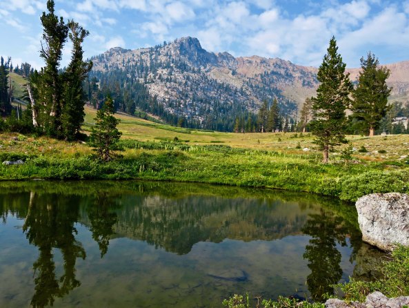
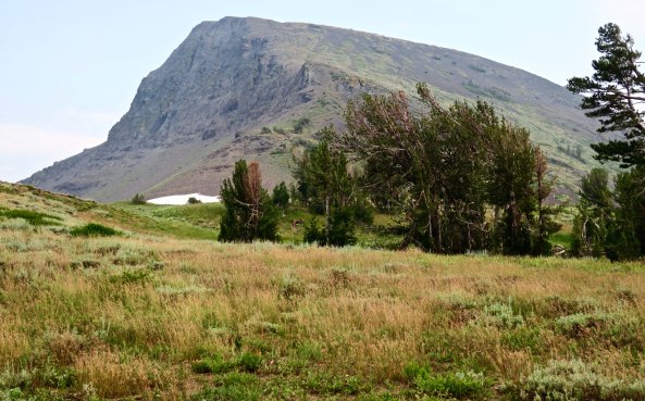
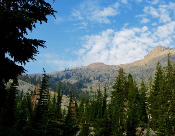
Lakes, mountains, and meadows, oh my. The Mokelumne Wilderness south of Carson Pass has it all, plus streams and rivers. I took this photo of Round Top Mountain from along the Pacific Crest Trail.
I’ve backpacked south from Carson Pass several times over the years, usually leading backpack treks following the old Tahoe Yosemite Trail. Those were the days before the present PCT route was built. I was excited to explore the new trail.
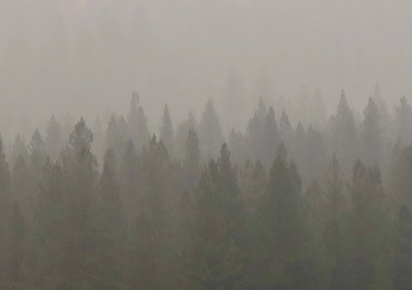
I arrived at the trailhead a few weeks earlier than I had planned. When I came out at Chester after hiking through Lassen National Park, smoke from the massive Carr Fire near Redding was so thick that it was difficult to see a couple of hundred yards into the trees. Having empathy for my 75-year-old lungs, I decided to skip south in hopes of finding clean air to breathe.
Smoke from the Carr Fire on the PCT near Chester, CA
The pass was named after the mountain man, explorer, military leader and rancher, Kit Carson. During California’s gold rush era, it had served as one of the main entrance points to California. The trail worked its way down the mountain eventually delivering its gold seeking 49ers to the small town of Diamond Springs where I was raised. The town was established when some miners from Missouri found a 20 pound nugget of gold lying on the ground and decided to stay. Which I get. As a youth wandering far and wide through the woods surrounding Diamond, I’d always dreamed of finding my own large nugget. It wasn’t to be. But I did develop a love for the outdoors, which is worth a lot more.
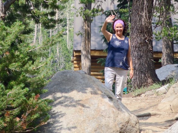
Peggy dropped me off at the trailhead and waved goodbye. She had seen me off several times by now, and was more confidant that she would see me at the other end. But my lovely friend was always a bit nervous…
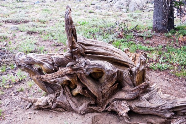
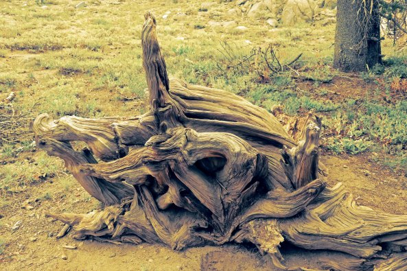
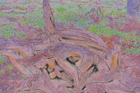
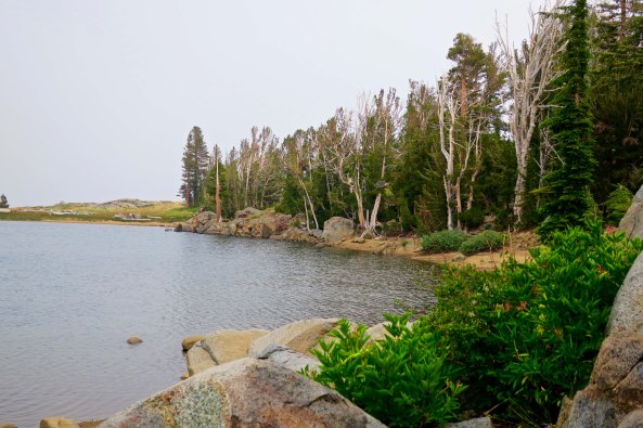
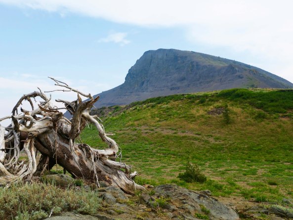
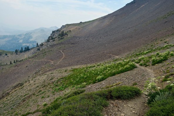
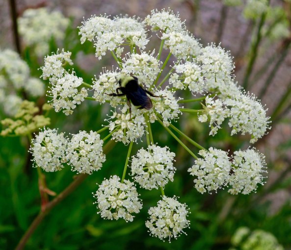
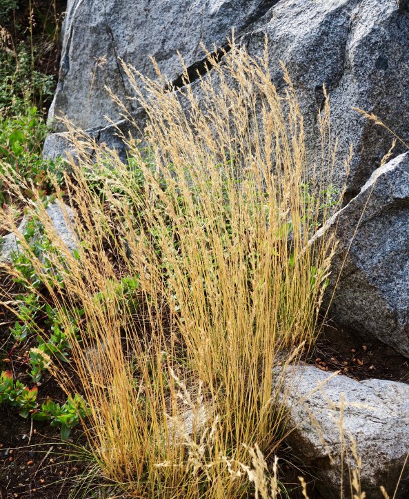
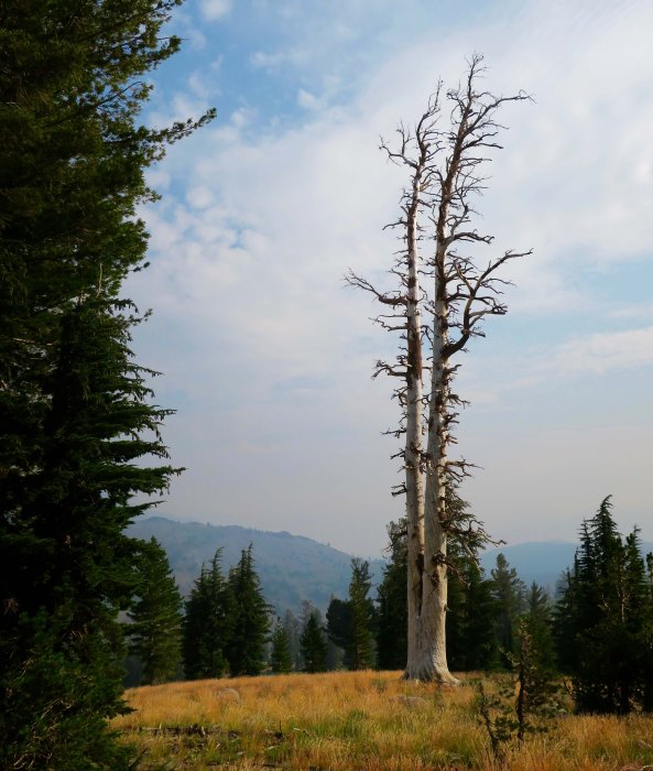
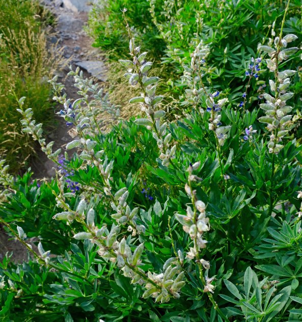
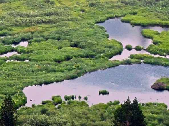
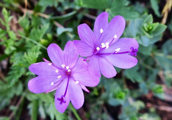
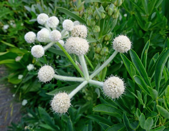
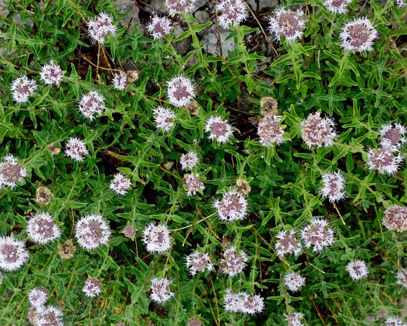
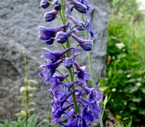
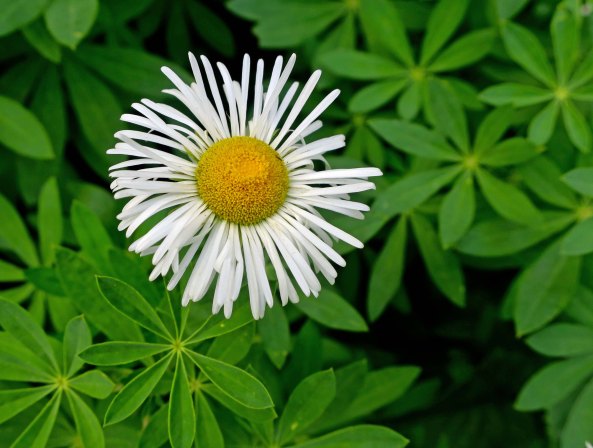
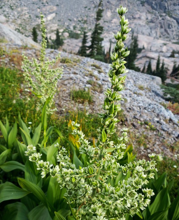
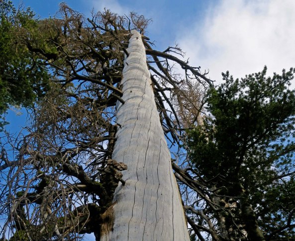
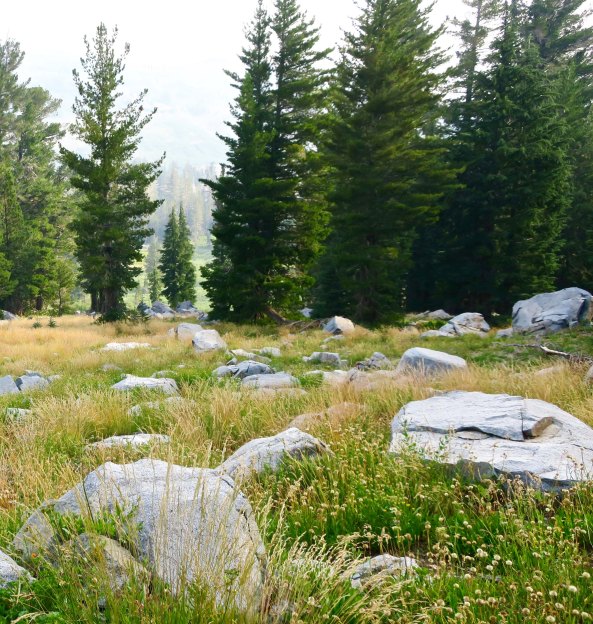
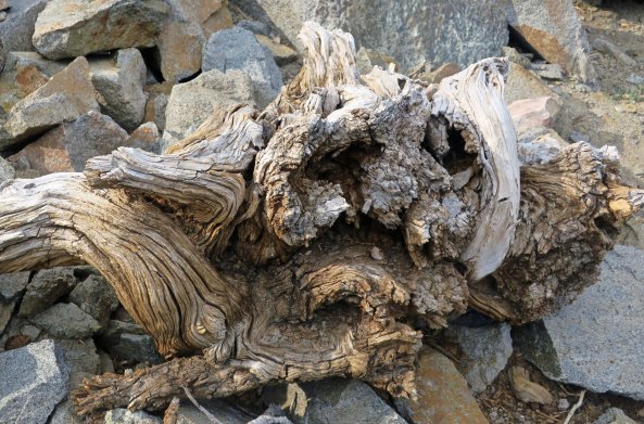
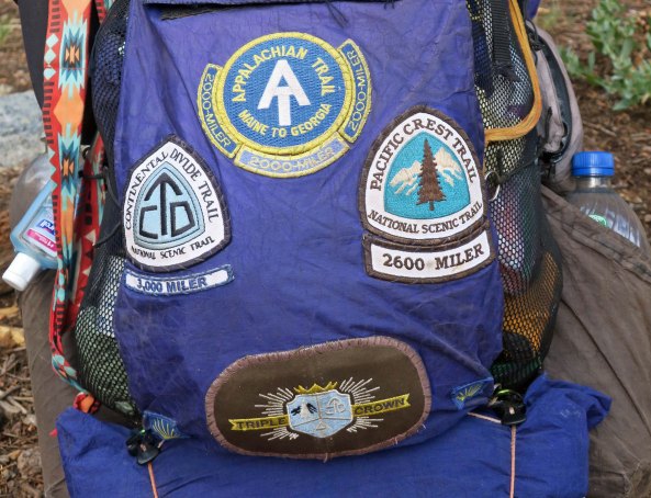
Peggy waves goodbye with sincere hopes that she will greet me at Sonora Pass when and where I predicted I would come out.Being a sucker for roots and wood sculptures, this was the first photo I took along the trail. I hit the wrong button and my camera took several more photos, rendering each one differently. Normally, I like to stick with realistic portrayals, but I was amused with the results…In yellow…And in strange, impressionistic colors, like a Van Gough haystack.I took a short detour up to Frog Pond. In the past, I had always hiked by it and wanted to see what it looked like. I thought it might connect to the PCT. It didn’t, but I enjoy detours. They added lots of miles to my journey. There weren’t any obvious croakers.The correct trail provided this view of Elephant Back, one of the primary landmarks of Mokelumne Wilderness. Another view of Elephant Back from the PCT.I had always hiked around the front of Elephant Back. The ‘new’ PCT took me behind it. The trail starts off making its way through Queen Anne’s Lace, a member of the parsley/wild carrot family.A close up of the flower with a bee providing perspective.Hiking on, I was reminded that I was well into summer. A granite rock provided the backdrop for this colorful grass.The brown grass here, which Californians insist on calling golden, provided a foreground for this photo of two snags.These pods on a lupine bush were also reminders of the fact that summer was winding down. They also show that lupine is a member of the pea family.There was still plenty of water along the trail, however, which was a fact that I appreciated given how often water was scarce along the PCT.And there were lots of flowers where I found water! This is rock fringe.And what I know as ranger’s buttons, another member of the carrot/parsley family.You can smell this one as you pass by. It is western pennyroyal, a member of the mint family. I always break off a leaf (it has lots) and urge people I am hiking with to sniff it and take a bite. It can also be used in making mint tea. Larkspur is always a challenge to photograph, but I wanted to emphasize the ‘spurs’ here, from which it gets its name.This daisy is known as fleabane. Pioneers believed that the bundled flowers would chase fleas out of their homes.And here we have greenish corn lily flowers.I found this half dead tree dramatic.Another grass, rock, and tree photo. The haze in the distance suggests that my hopes for escaping smoke were about to be thwarted. Smoke from the Carr Fire had followed me south!I almost tripped over this wood sculpture. Can you spot the sad owl-like face?My next PCT post will take us up this flower covered ridge and far beyond.I will also introduce you to a 65-year-old trekker who has hiked the PCT, the Appalachian Trail, and the Continental Divide Trail, giving him the right to wear a Triple Crown patch.
NEXT POST: For my next post, however, I will take you back to Puerto Vallarta again and some really neat art!
Thanks, Anne. And of course you would like the gold rush history, being the historian that you are. Ancestors on both sides of my family participated in the gold rush. My great grandfather on my mother’s side actually struck it rich. He was robbed, killed and thrown overboard on his ocean trip back home. Not good. Fortunately, he had left my great grandmother pregnant before he left. Otherwise I wouldn’t be here writing this. 🙂 –Curt
When I first read “Mokelumne,” I thought, “How in the world did Curt get to Hawaii?” Then I realized I was thinking of Molokai, and re-oriented myself. Farther into the post, I laughed aloud at your comemnt about the brown grasses, which Californians insist on calling “golden”!
Your photos of the flowers are gorgeous. Of course, the setting’s not bad, either. Carolina wolfberry’s fine, but if I’d pulled out a little, you would have seen that all those flowers and fruits were in the middle of mud flats: not the most attractive scenery. We have fleabane, too, and our bluebonnets are members of the lupine family. I think my favorite photo’s the rock/tree/grass, despite the smoke. There’s just something unusual and attractive about it.
Every time I have found myself writing about the Mokelumne Wilderness over the years, Linda, I’ve had to relearn how to spell it. The word is an Indian name that I just can’t seem to wrap my head around. Tuolumne Meadows is another one.
Thanks on the flowers. There were lots of them in this section. They were pretty much bloomed-out on the rest of my trip. I went through and pulled out 150 of my favorite flower photos from the summer last week. I’ll do a category wrap-up when I am finished writing about the hike that will focus on flowers, wood sculptures etc.
I, too, liked the rock/tree/grass photo. I think that it has to do with the balance/harmony. –Curt
Almost, G. He started just a few years after I did. 🙂 Long distant hiking has become a passion for some people. More and more long distant trails are being built. Glad you like wood sculptures since I post plenty. Grin. –Curt
Truly impressed with the dude that has the Triple Crown patch… where are your patches? Mokelumne is one of my favorite words to mangle. If you pronounce it as moke-eh-LUM-knee, it also helps with the spelling. I suppose the same would work for Two-ALL-um-knee? or should that be Two-eh-LUM-knee? Those Indian word spellings are such fun to play with. Oregon has a few as well… Yachats immediately springs to mind.
Quite amazing what those buttons on the camera will do to roots!
Can’t blame Peggy for being a bit uneasy, but she’s such a good sport. I’m just glad you opted out of that section of heavy smoke. That can’t possibly do any lungs any good… much less your well seasoned ones. 😉
You’d think, Gunta, after all of the time I have spent wandering in the Northern Sierras, those words would come ever so easy to me. But it just isn’t so. Sigh.
Usually the buttons are getting me in trouble. 🙂
Peggy gets major kudos from me for all of her support this year. And even dodging the smoke, I got much more than my share, especially as you note, for one who is well seasoned! 🙂 –Curt
Wonderful detail shots today although I also loved seeing the trail traversing Elephant Back. The flowers and grasses are so pretty; I often marvel at the delicacy of the things that survive out in the elements.
You are so right, Lexi. Life seems to thrive under the harshest of conditions. And often beautifully so. The trail behind Elephant Back was new to me, which is always fun. –Curt
Wow very nice pictures as usual! 🙂 And that’s so funny, I have read a bit about Kit Carson but didn’t put it together that the trail was named for him! Thanks for sharing 🙂
Kit Carson got around, M.B. Sometimes I am jealous that I didn’t live in those years of exploration, not that the Native Americans hadn’t already explored it. Thanks. 🙂 –Curt
Not surprise you skipped some territory, the smoky (or old Trump would say smocky) Carr Fire air looks awful! The later air looks much more breathable and the scenery beautiful.
Old Trump would escape the ‘smockey’ conditions by just flying off to a different one of his golf courses. 🙂 I was super glad to have my ‘trail angel’ Peggy available to drive me on down the road, however. Total escape is almost impossible in California, Oregon and Washington. All of them had fires impacting the PCT! –Curt

What gorgeous shots- it’s a pleasure to join you on another tour! I love the bit of gold rush history too 🙂
Thanks, Anne. And of course you would like the gold rush history, being the historian that you are. Ancestors on both sides of my family participated in the gold rush. My great grandfather on my mother’s side actually struck it rich. He was robbed, killed and thrown overboard on his ocean trip back home. Not good. Fortunately, he had left my great grandmother pregnant before he left. Otherwise I wouldn’t be here writing this. 🙂 –Curt
Oh My!!!
Yep. 🙂
When I first read “Mokelumne,” I thought, “How in the world did Curt get to Hawaii?” Then I realized I was thinking of Molokai, and re-oriented myself. Farther into the post, I laughed aloud at your comemnt about the brown grasses, which Californians insist on calling “golden”!
Your photos of the flowers are gorgeous. Of course, the setting’s not bad, either. Carolina wolfberry’s fine, but if I’d pulled out a little, you would have seen that all those flowers and fruits were in the middle of mud flats: not the most attractive scenery. We have fleabane, too, and our bluebonnets are members of the lupine family. I think my favorite photo’s the rock/tree/grass, despite the smoke. There’s just something unusual and attractive about it.
Every time I have found myself writing about the Mokelumne Wilderness over the years, Linda, I’ve had to relearn how to spell it. The word is an Indian name that I just can’t seem to wrap my head around. Tuolumne Meadows is another one.
Thanks on the flowers. There were lots of them in this section. They were pretty much bloomed-out on the rest of my trip. I went through and pulled out 150 of my favorite flower photos from the summer last week. I’ll do a category wrap-up when I am finished writing about the hike that will focus on flowers, wood sculptures etc.
I, too, liked the rock/tree/grass photo. I think that it has to do with the balance/harmony. –Curt
I never even knew there was a triple crown in hiking! I can’t believe he can match your years of hiking though. Liked the different wood sculptures.
Almost, G. He started just a few years after I did. 🙂 Long distant hiking has become a passion for some people. More and more long distant trails are being built. Glad you like wood sculptures since I post plenty. Grin. –Curt
Truly impressed with the dude that has the Triple Crown patch… where are your patches? Mokelumne is one of my favorite words to mangle. If you pronounce it as moke-eh-LUM-knee, it also helps with the spelling. I suppose the same would work for Two-ALL-um-knee? or should that be Two-eh-LUM-knee? Those Indian word spellings are such fun to play with. Oregon has a few as well… Yachats immediately springs to mind.
Quite amazing what those buttons on the camera will do to roots!
Can’t blame Peggy for being a bit uneasy, but she’s such a good sport. I’m just glad you opted out of that section of heavy smoke. That can’t possibly do any lungs any good… much less your well seasoned ones. 😉
You’d think, Gunta, after all of the time I have spent wandering in the Northern Sierras, those words would come ever so easy to me. But it just isn’t so. Sigh.
Usually the buttons are getting me in trouble. 🙂
Peggy gets major kudos from me for all of her support this year. And even dodging the smoke, I got much more than my share, especially as you note, for one who is well seasoned! 🙂 –Curt
Wonderful detail shots today although I also loved seeing the trail traversing Elephant Back. The flowers and grasses are so pretty; I often marvel at the delicacy of the things that survive out in the elements.
You are so right, Lexi. Life seems to thrive under the harshest of conditions. And often beautifully so. The trail behind Elephant Back was new to me, which is always fun. –Curt
Wow very nice pictures as usual! 🙂 And that’s so funny, I have read a bit about Kit Carson but didn’t put it together that the trail was named for him! Thanks for sharing 🙂
Kit Carson got around, M.B. Sometimes I am jealous that I didn’t live in those years of exploration, not that the Native Americans hadn’t already explored it. Thanks. 🙂 –Curt
Not surprise you skipped some territory, the smoky (or old Trump would say smocky) Carr Fire air looks awful! The later air looks much more breathable and the scenery beautiful.
Old Trump would escape the ‘smockey’ conditions by just flying off to a different one of his golf courses. 🙂 I was super glad to have my ‘trail angel’ Peggy available to drive me on down the road, however. Total escape is almost impossible in California, Oregon and Washington. All of them had fires impacting the PCT! –Curt