“The clearest way into the Universe is through a forest wilderness.” John Muir
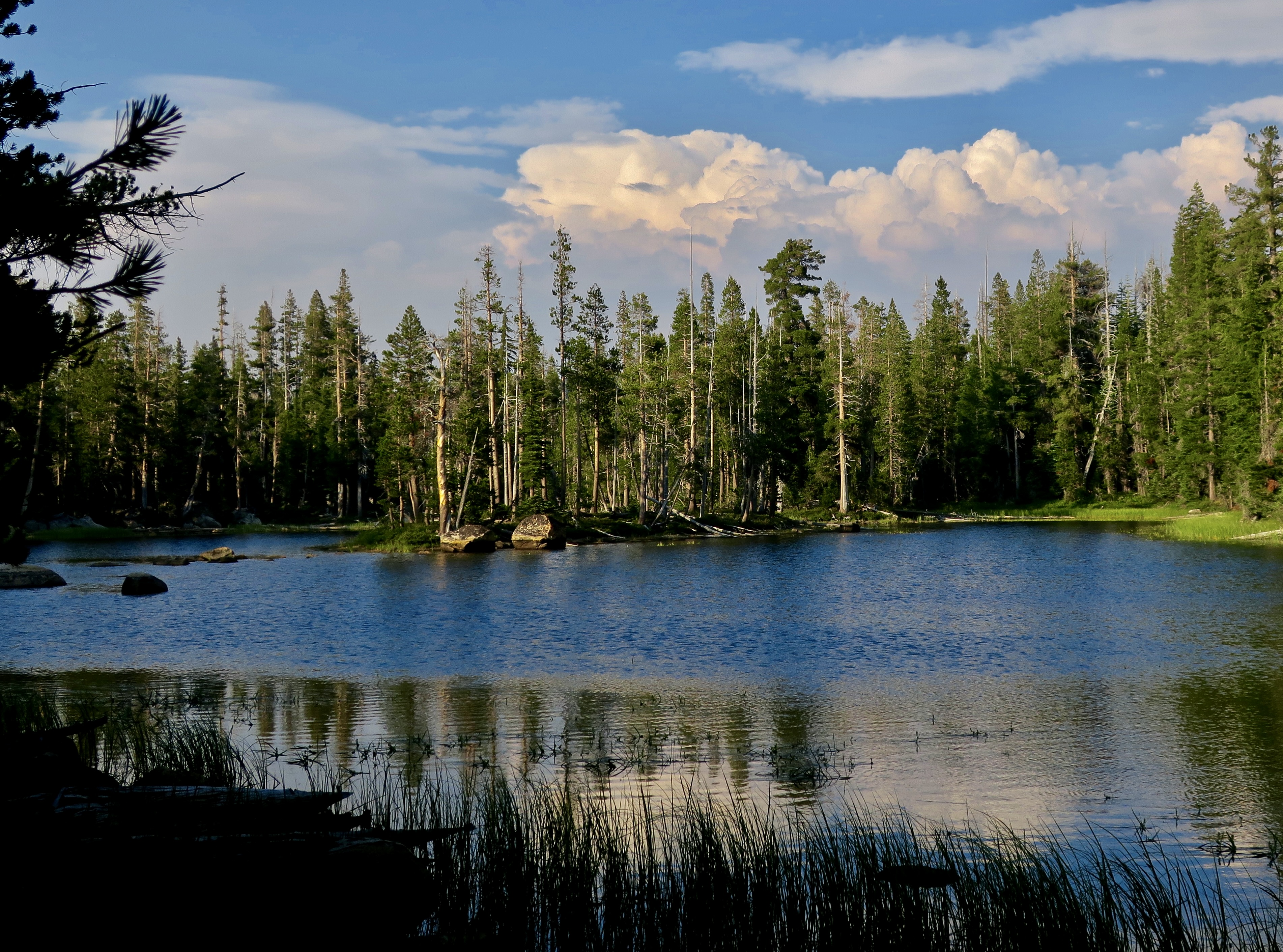
A small unnamed lake reflects the beauty and peace of the Mokelumne Wilderness. There’s a chance that John Muir stopped to admire it, given all of the time he spent exploring California’s Sierra Nevada Mountains. I’ve spent a bit of time wandering there as well— starting in 1957.
The Wilderness Act of 1964
“A wilderness, in contrast with those areas where man and his own works dominate the landscape, is hereby recognized as an area where the earth and its community of life are untrammeled by man, where man himself is a visitor who does not remain.” –Howard Zahniser, Author of the Wilderness Act
What does this mean? Transportation is by foot or horse. No bicycles or motor vehicles are allowed. Even chainsaws are banned for use on trail maintenance. No one can build permanent structures of any type. It’s just you and nature.
As of 2023, there were 806 wilderness areas located in 44 states and Puerto Rico. These areas are overseen by the National Park Service, the US Forest Service, the US Fish and Wildlife Service, and the US Bureau of Land Management. All in all, some 5% of land in the US is set aside as wilderness area, the majority in Alaska.
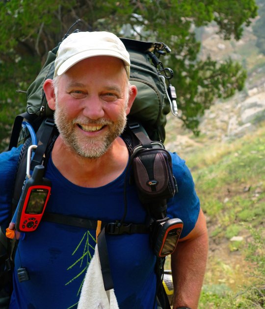
Over the past three months, I’ve been blogging (with Peggy’s help) about our national parks and monuments with an emphasis on their unique beauty, geology, flora, fauna and history that makes them so important to us— and about the threats that they are presently facing from the Trump Administration. Today we are switching to wilderness areas with the same emphasis. I’m going to cover three that I backpacked through on my 750 mile trip down the PCT in 2018 to celebrate my 75th birthday: The Mokelumne, Granite Chief/Desolation, and Marble Mountains Wilderness areas. If you’ve been with this blog for a while, some of the photos may be familiar to you.
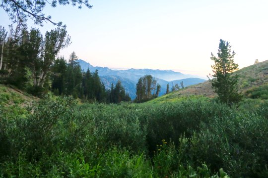
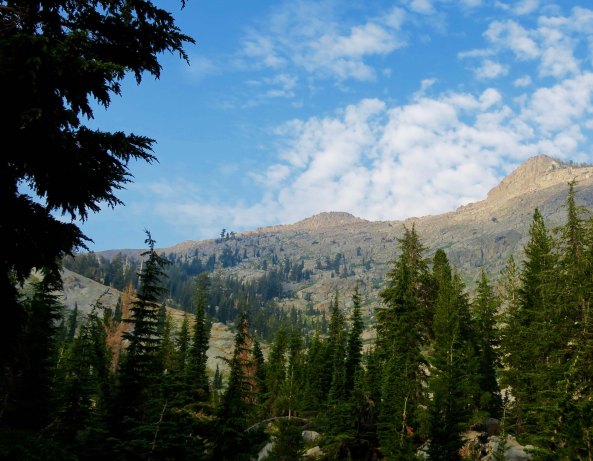
The Mokelumne Wilderness is conveniently located between two of California’s highways that cross the Sierras. Since I was hiking north to south, I started at Carson Pass (elevation 8573’) on Highway 88 and ended at Ebbet’s Pass (elevation 8732’) on Highway 4. The distance on the PCT is approximately 30 miles, which is relatively short— but there are plenty of ups and downs! And, as you will see, great diversity and beauty.
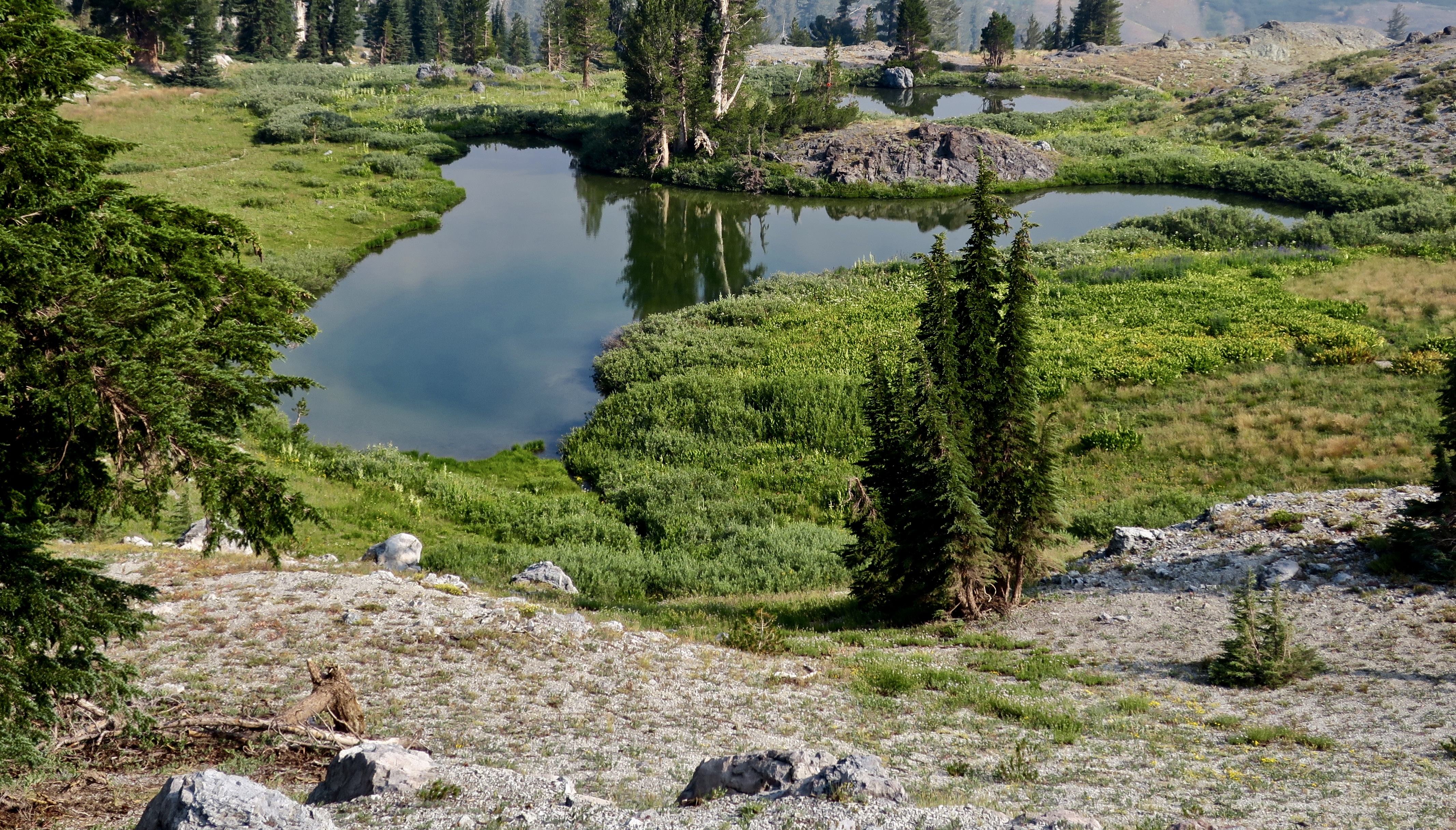
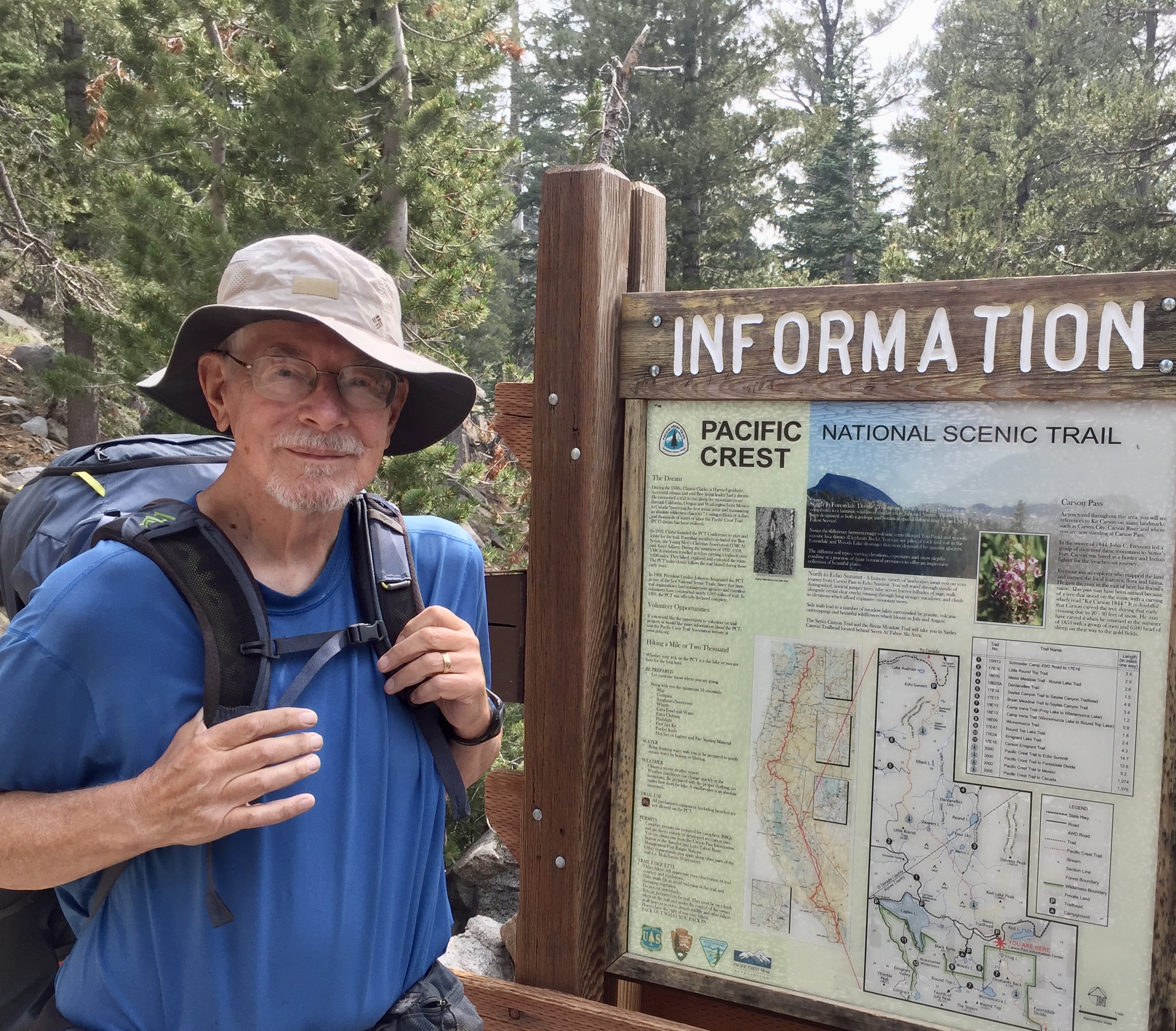
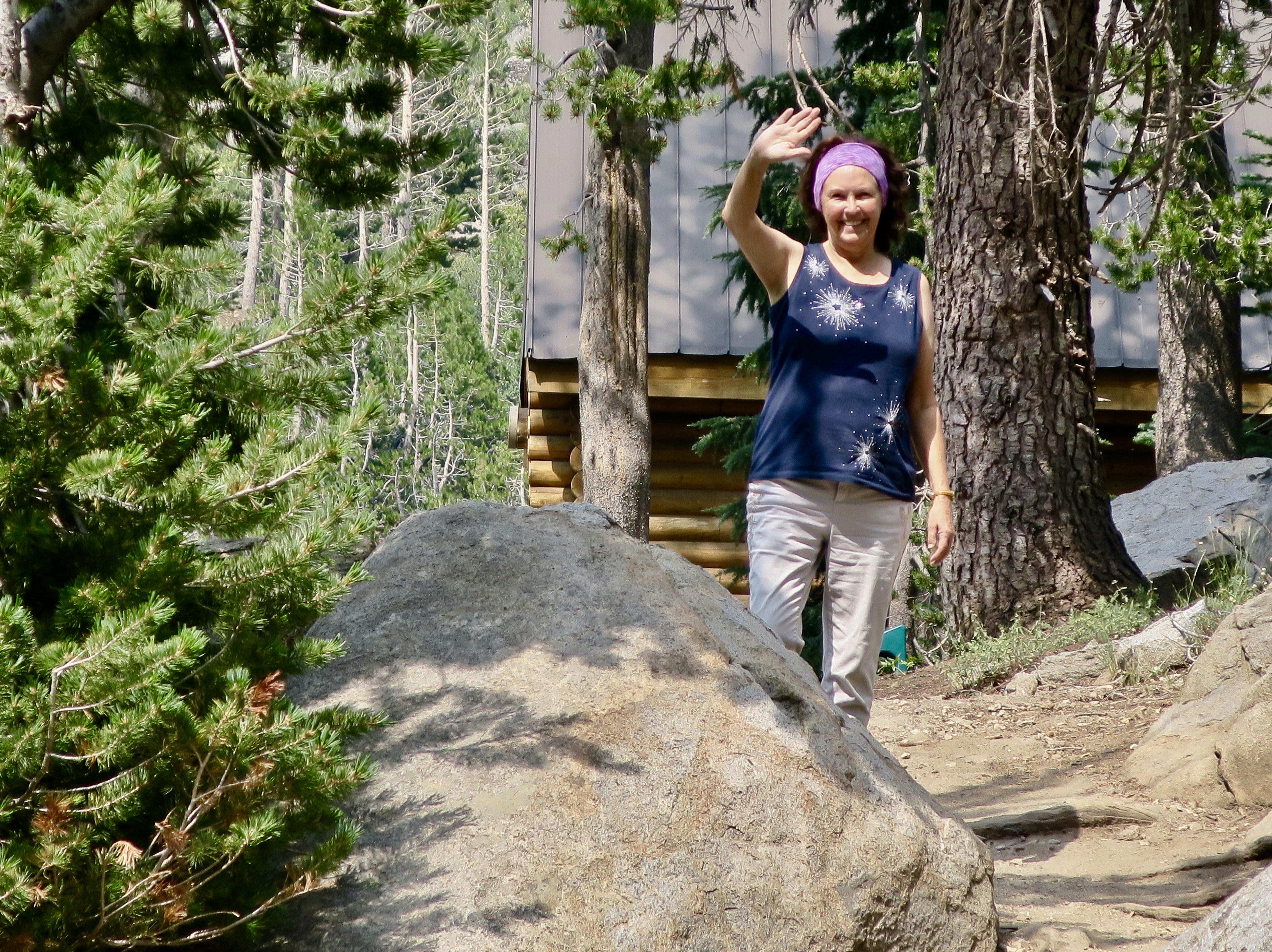
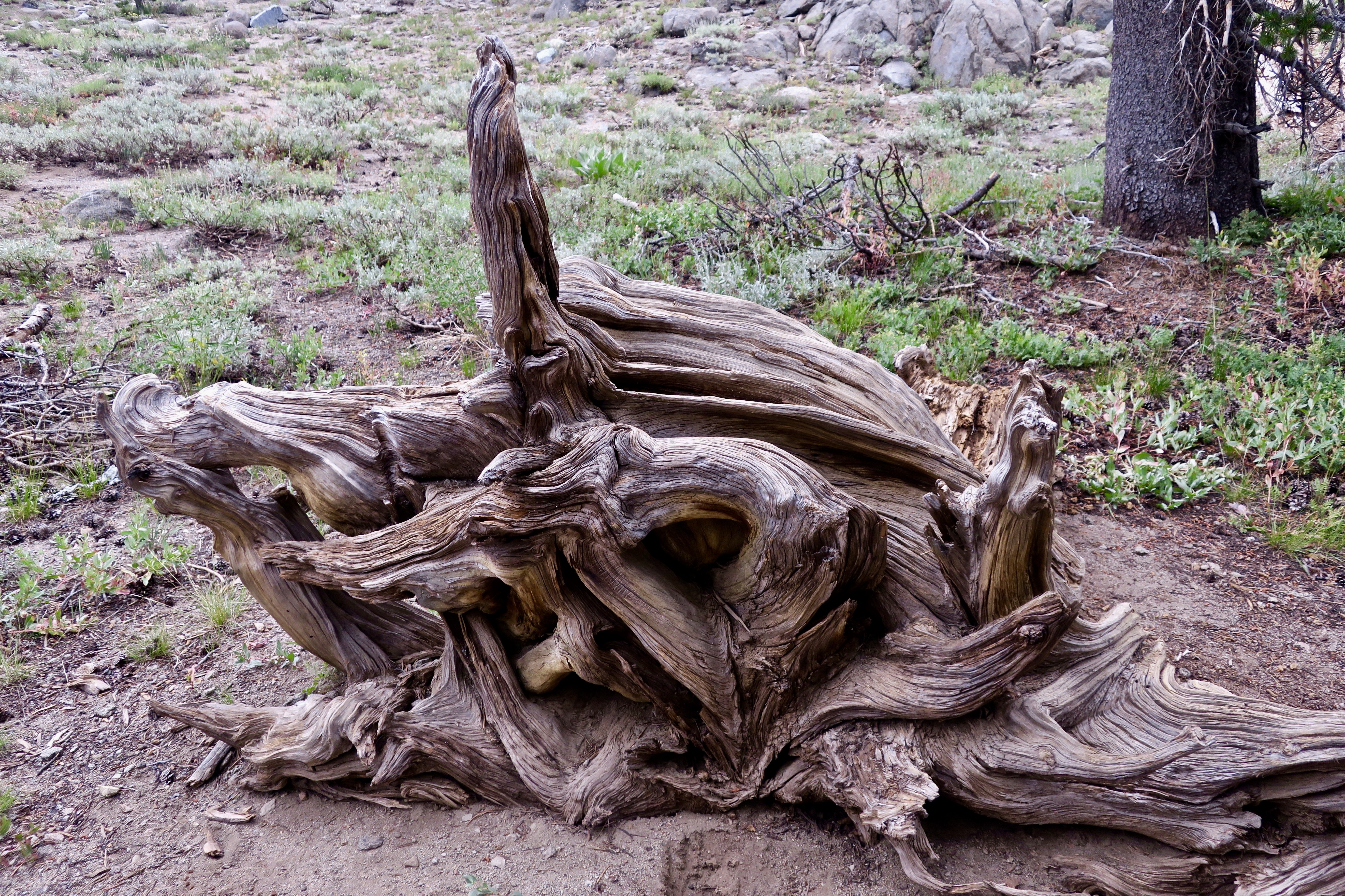
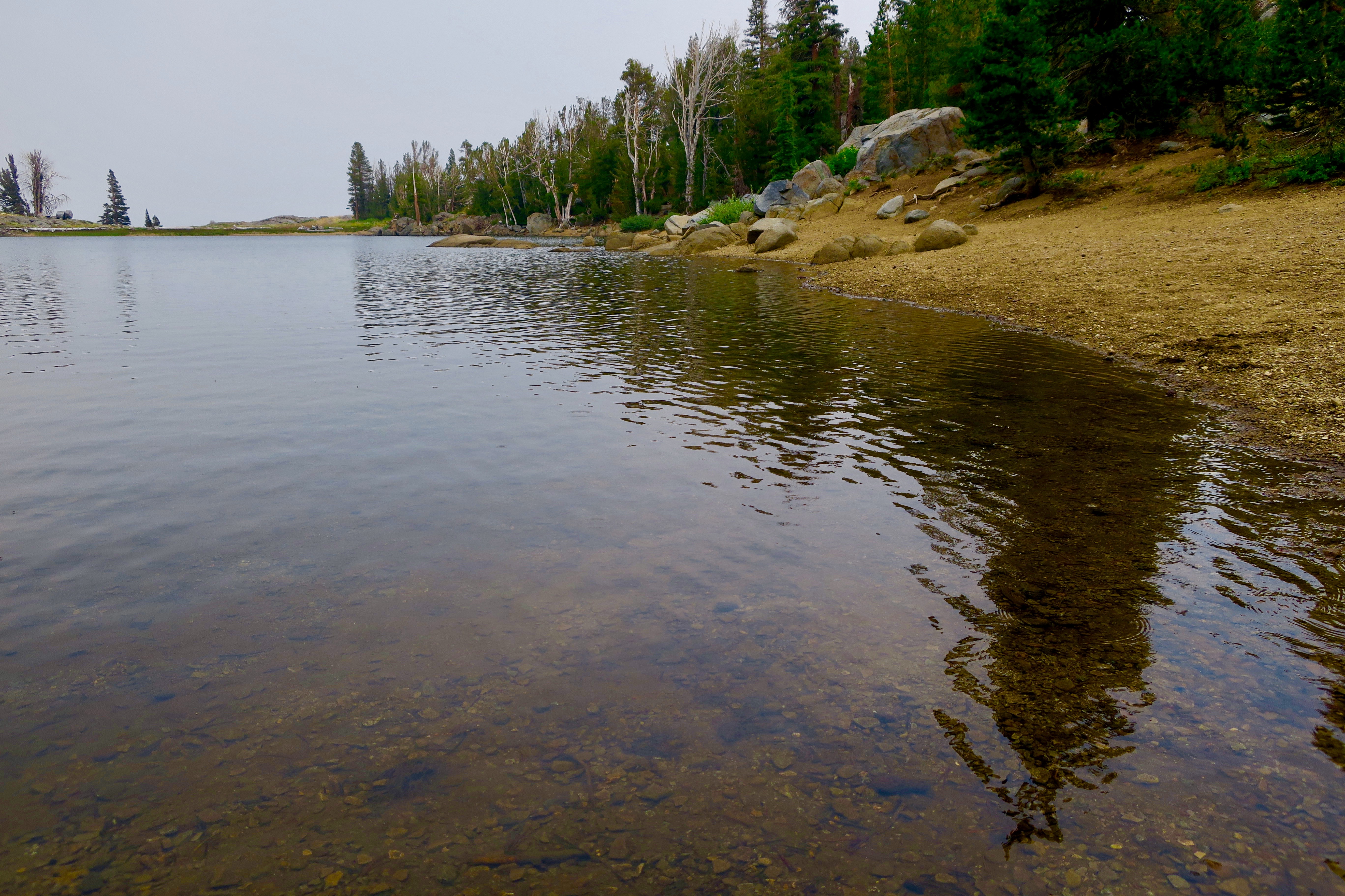
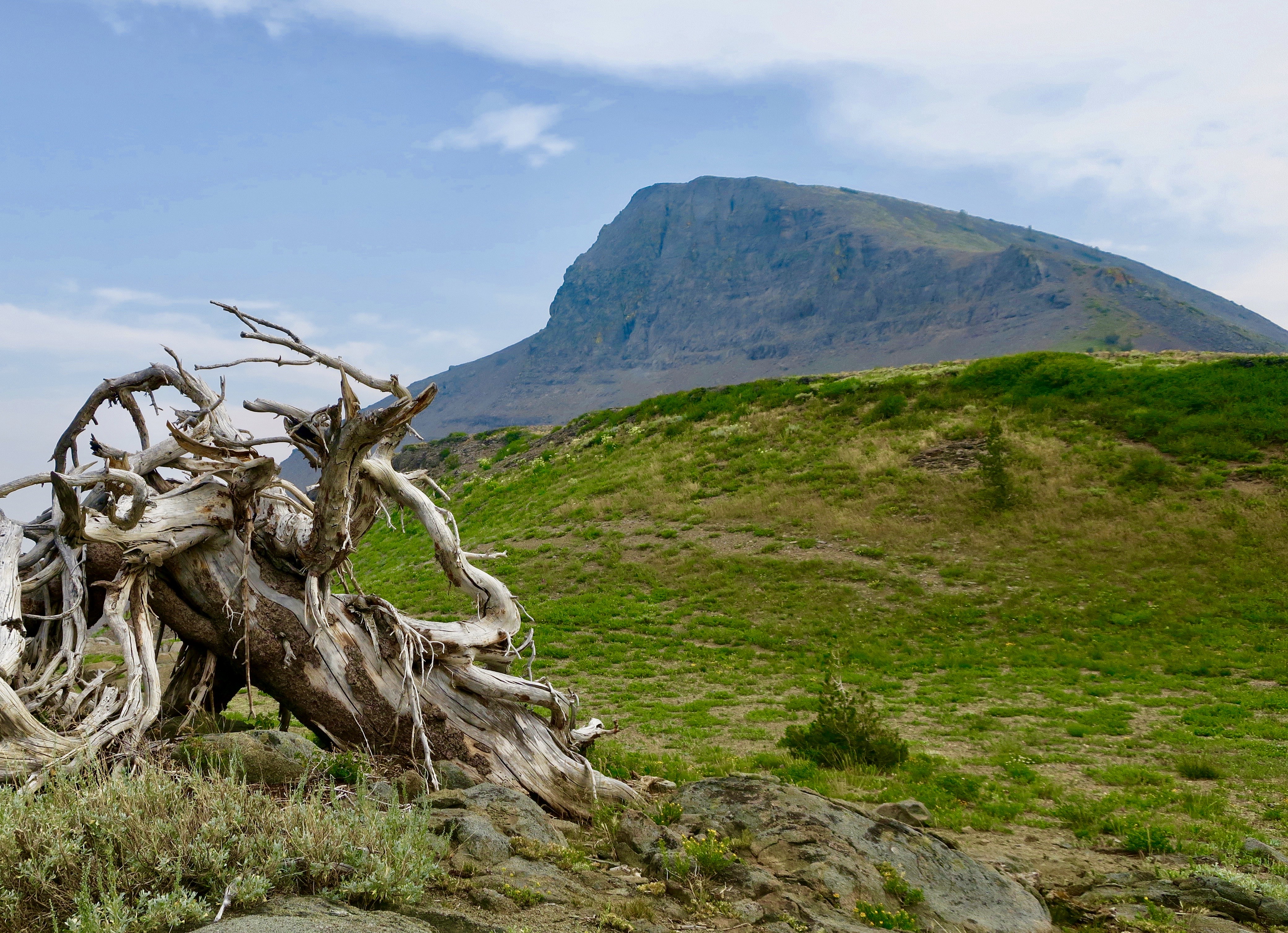
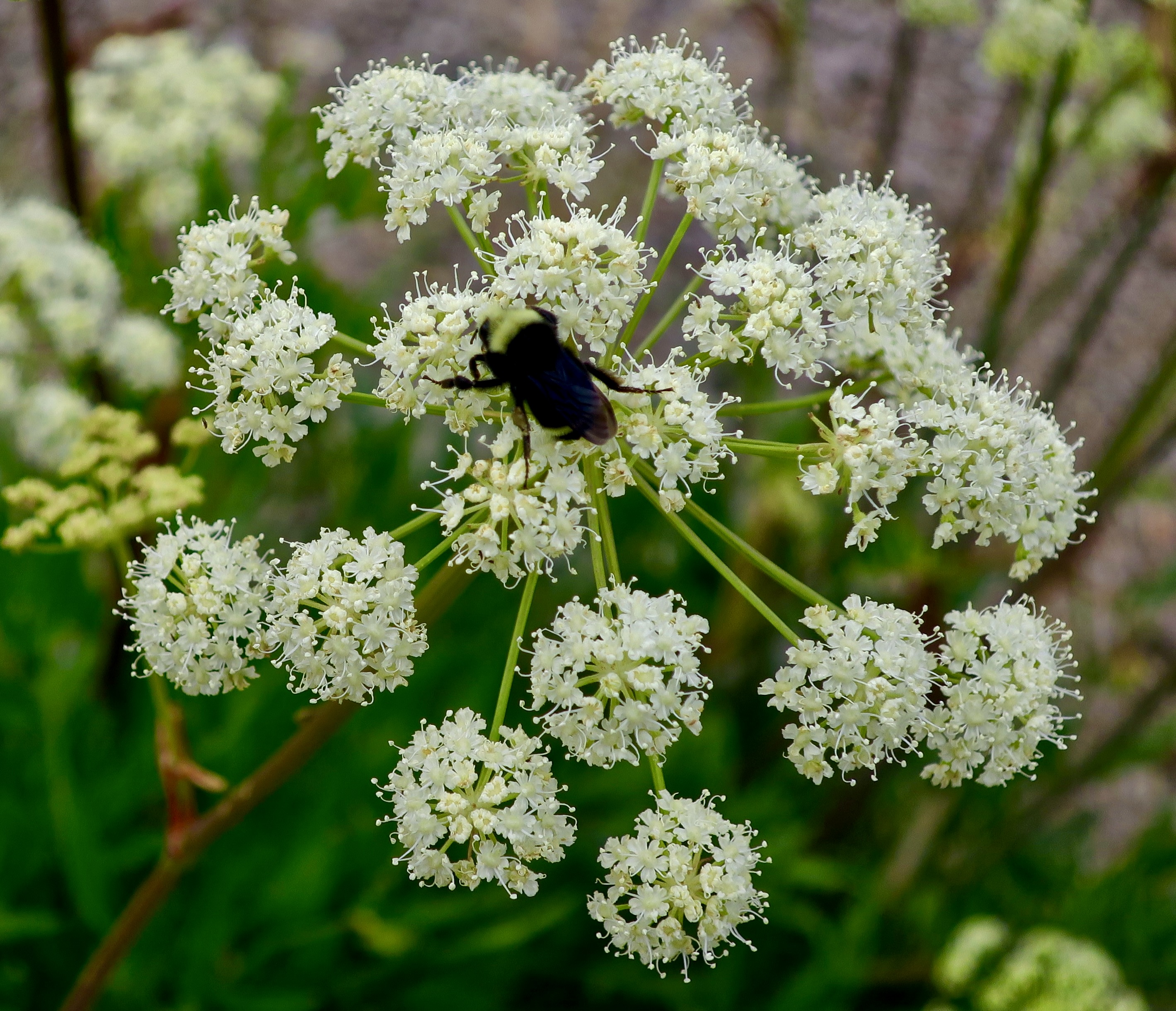
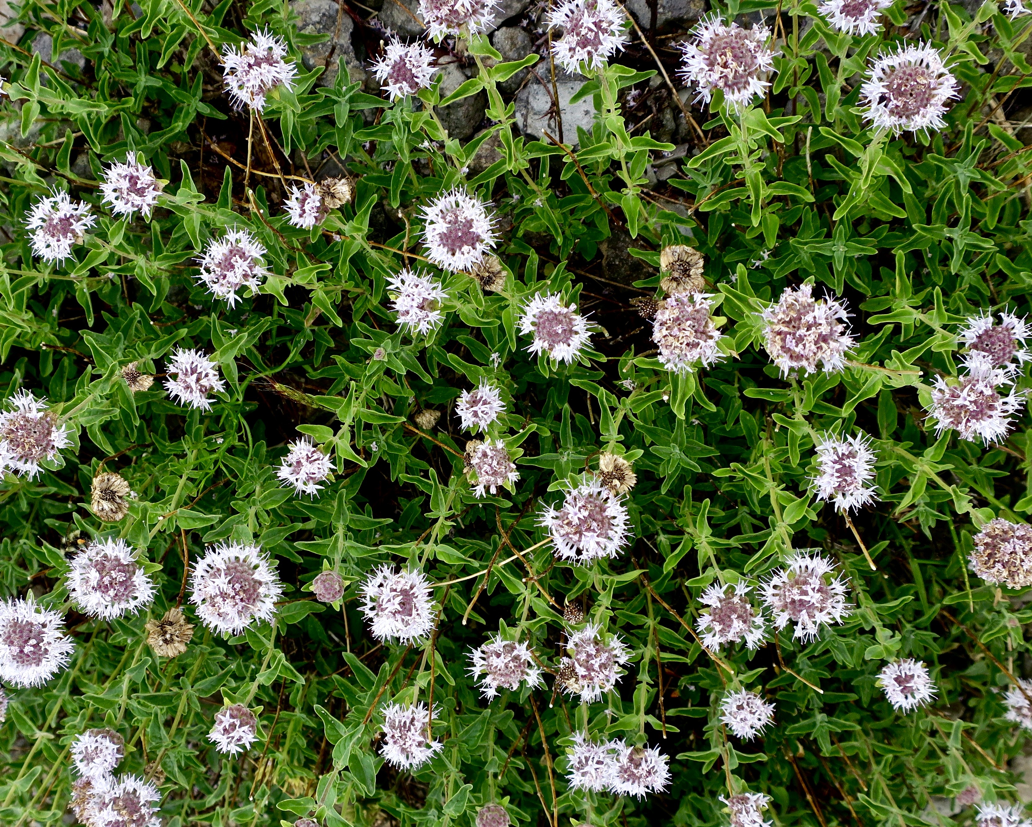
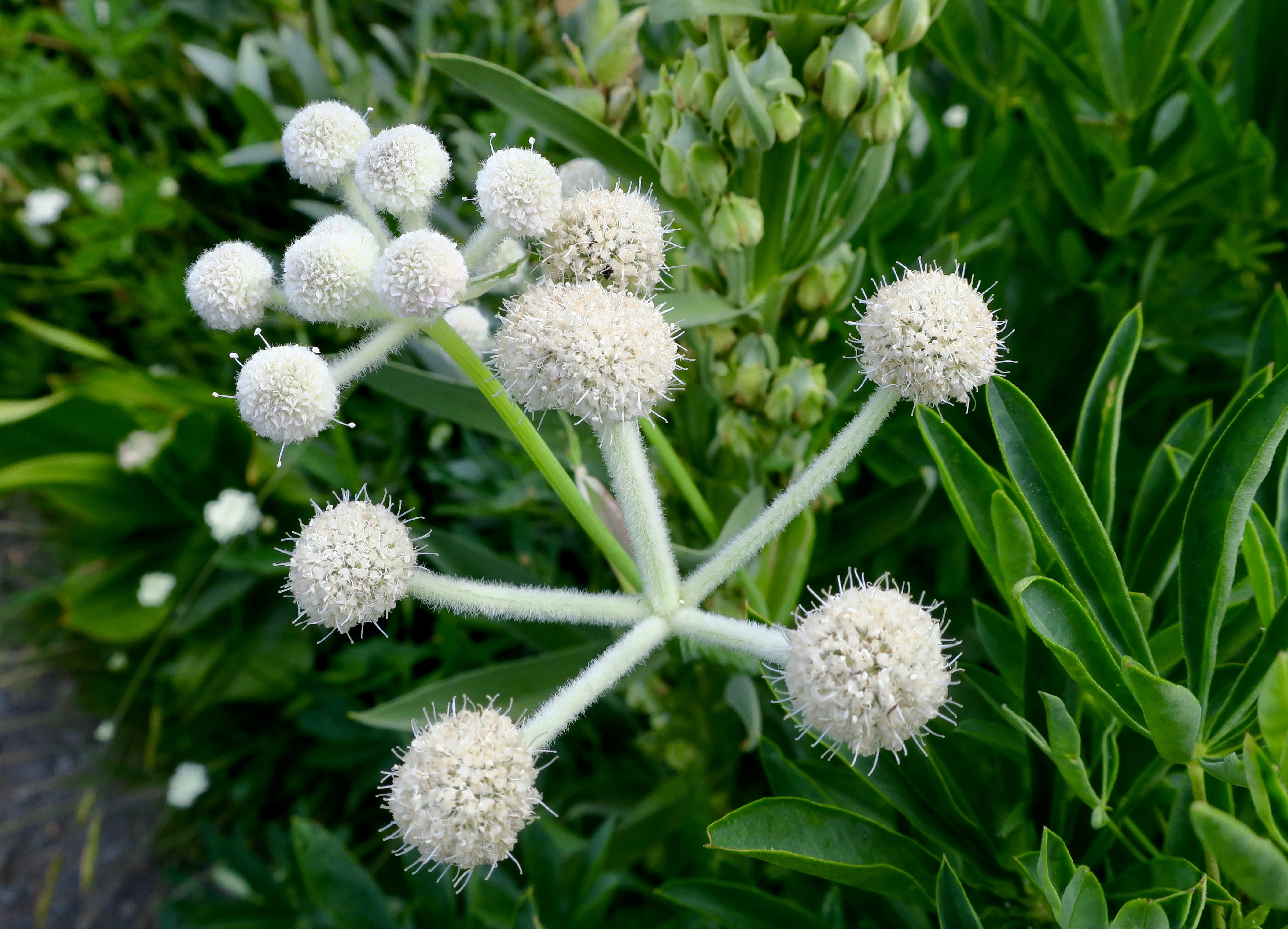
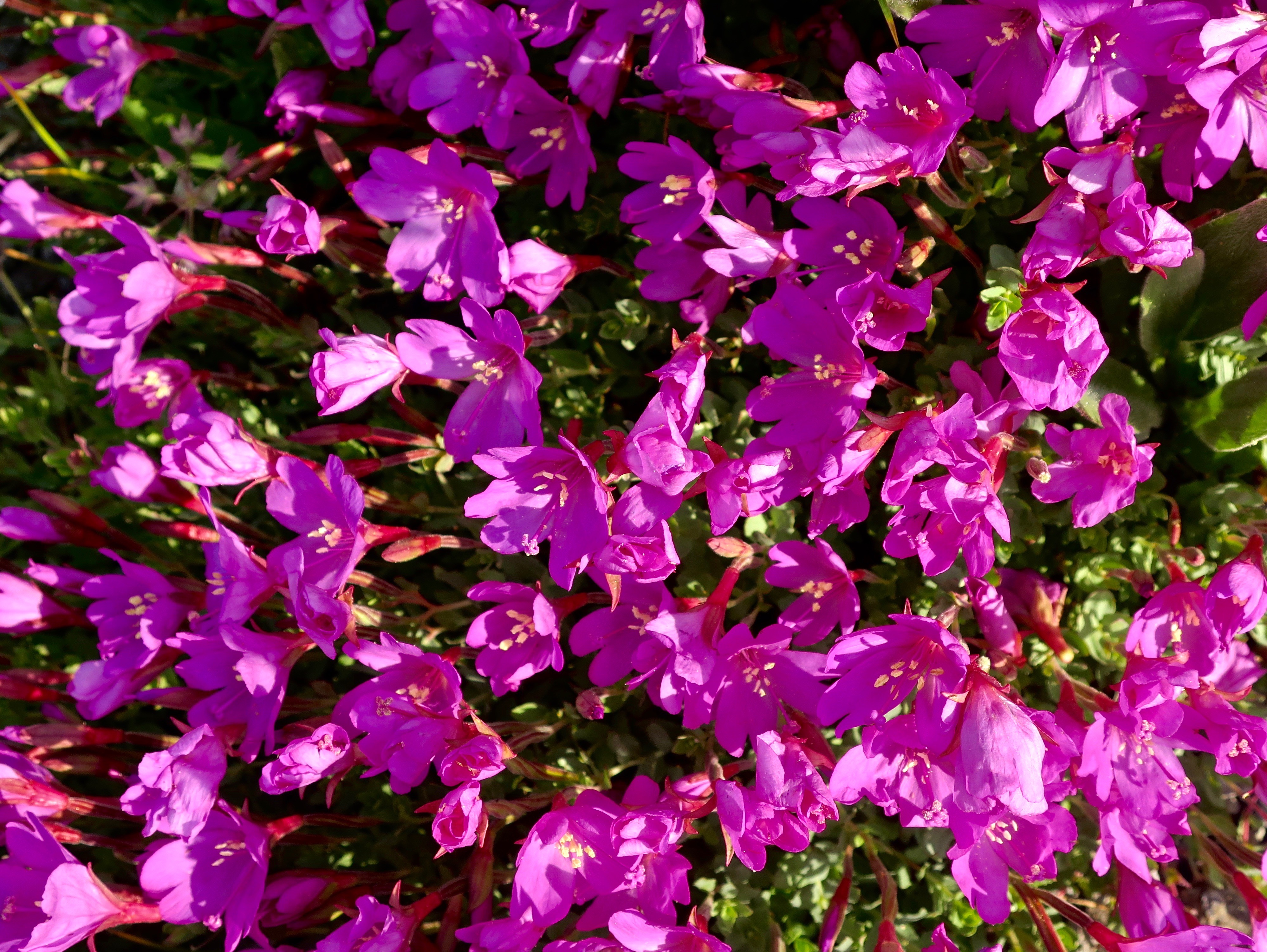
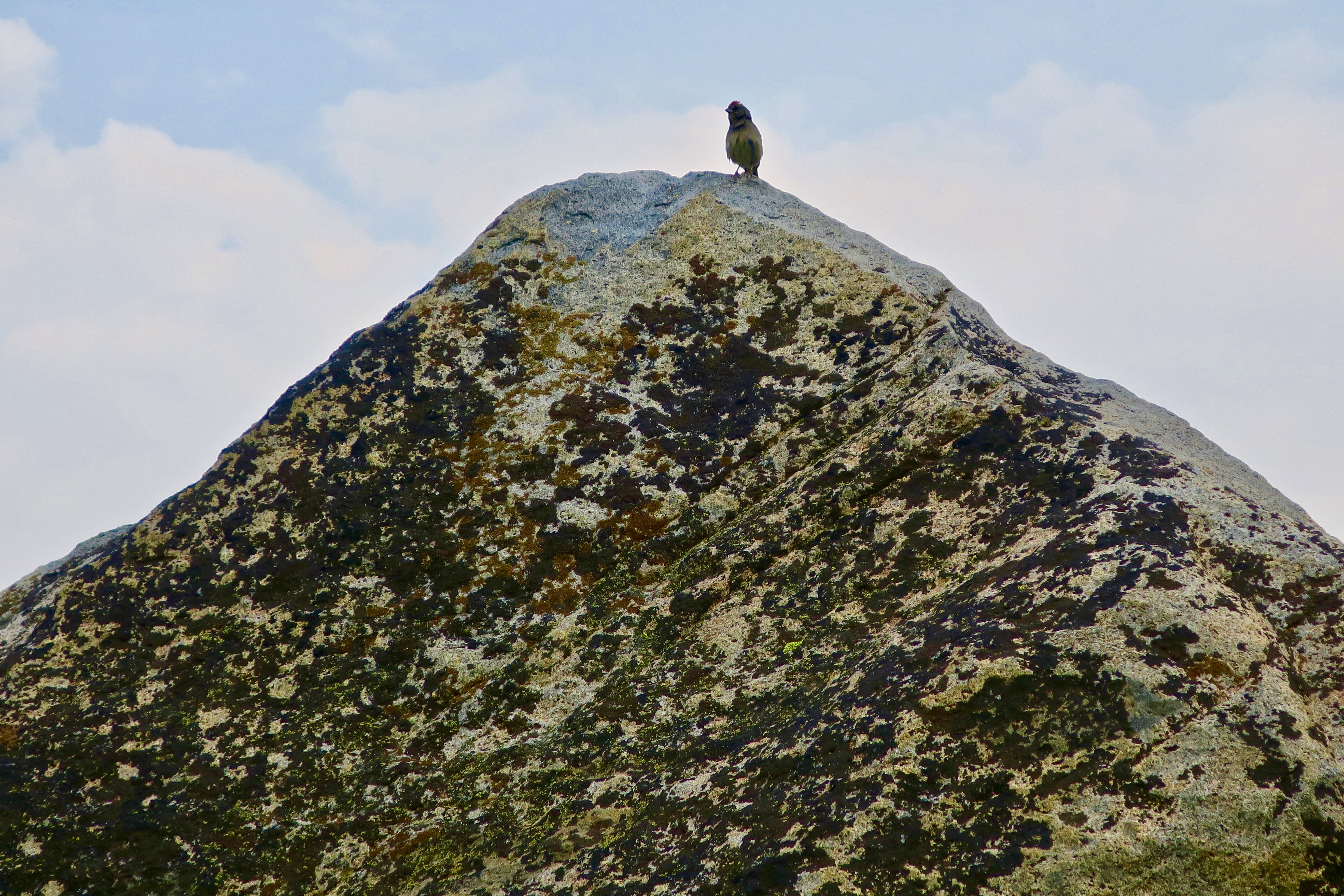
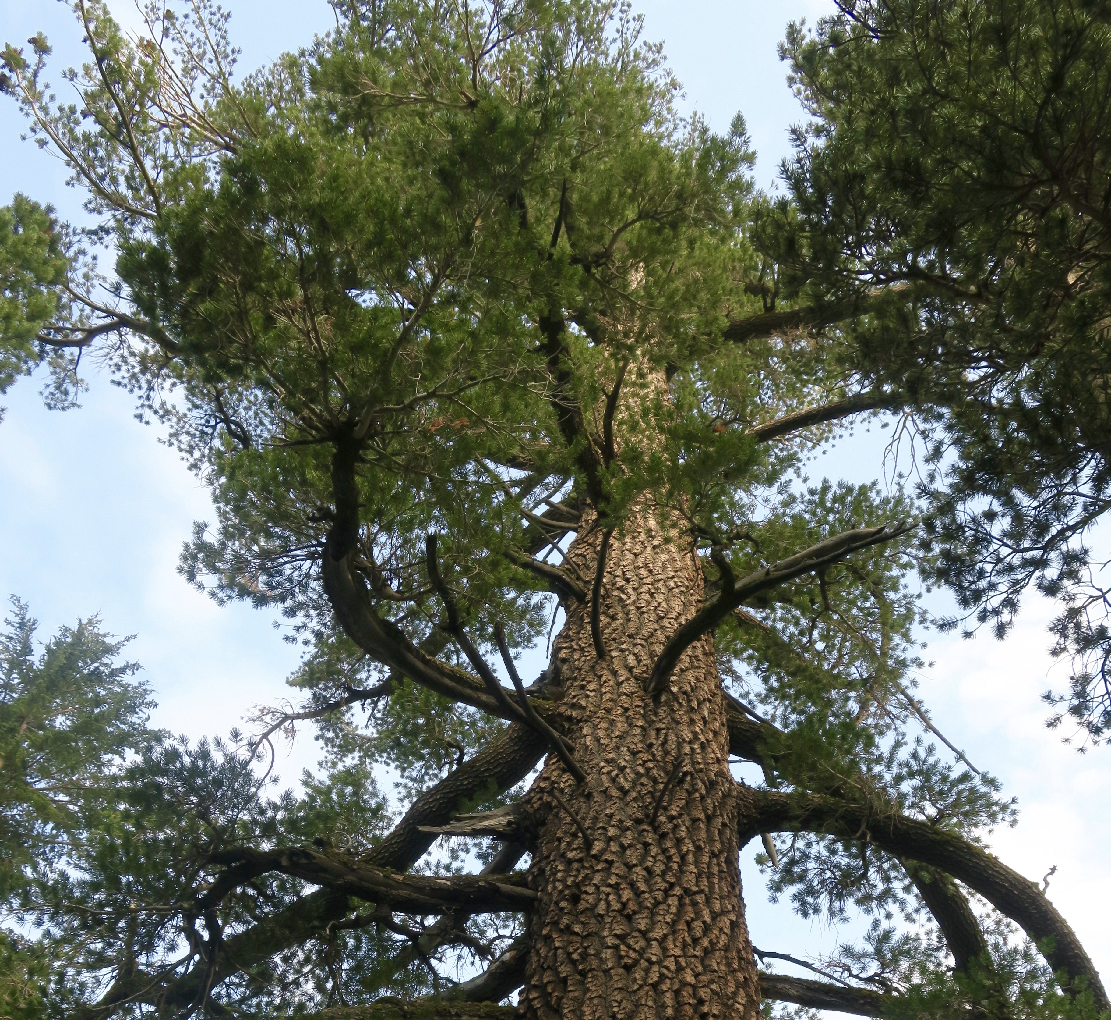
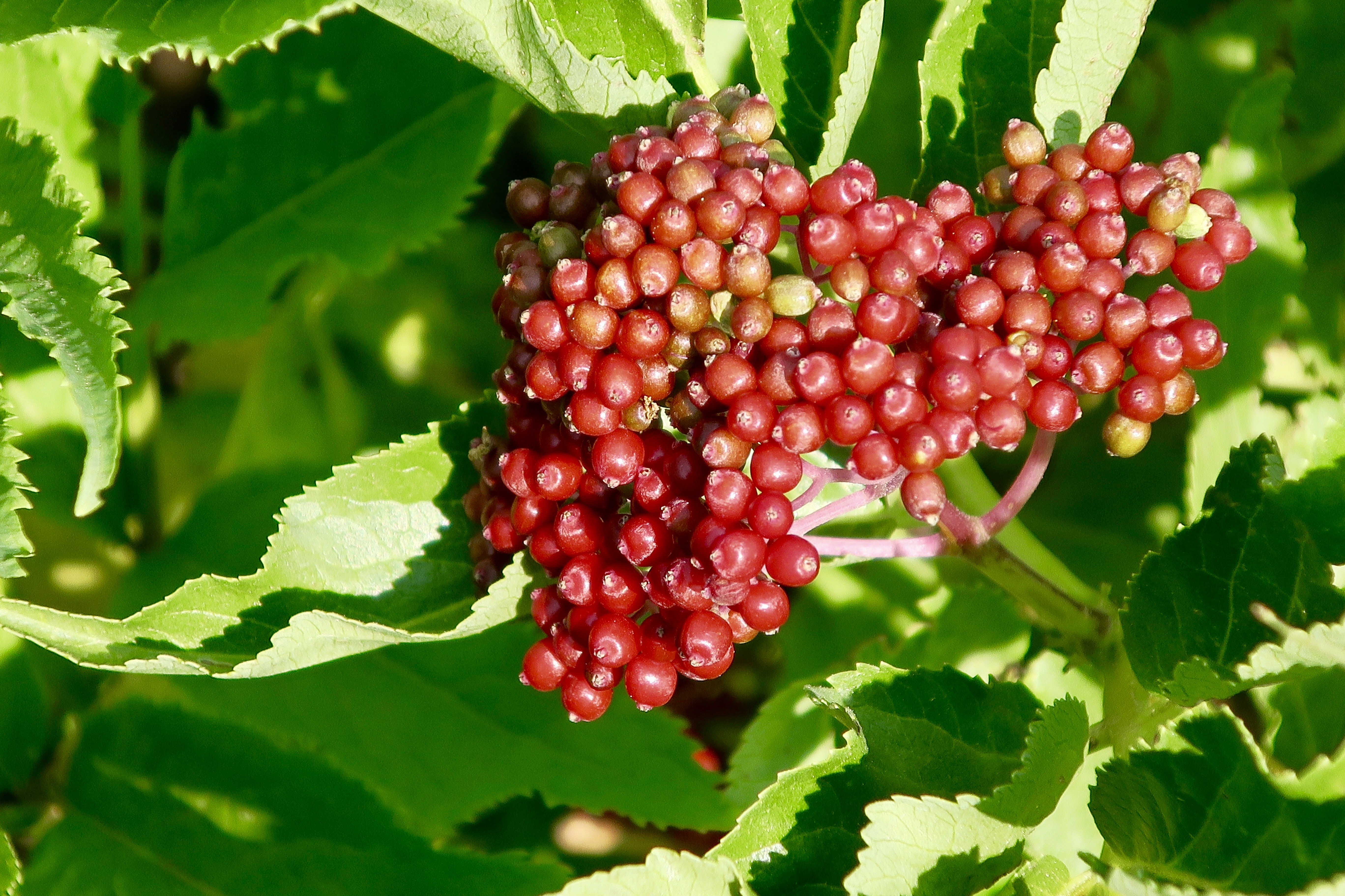
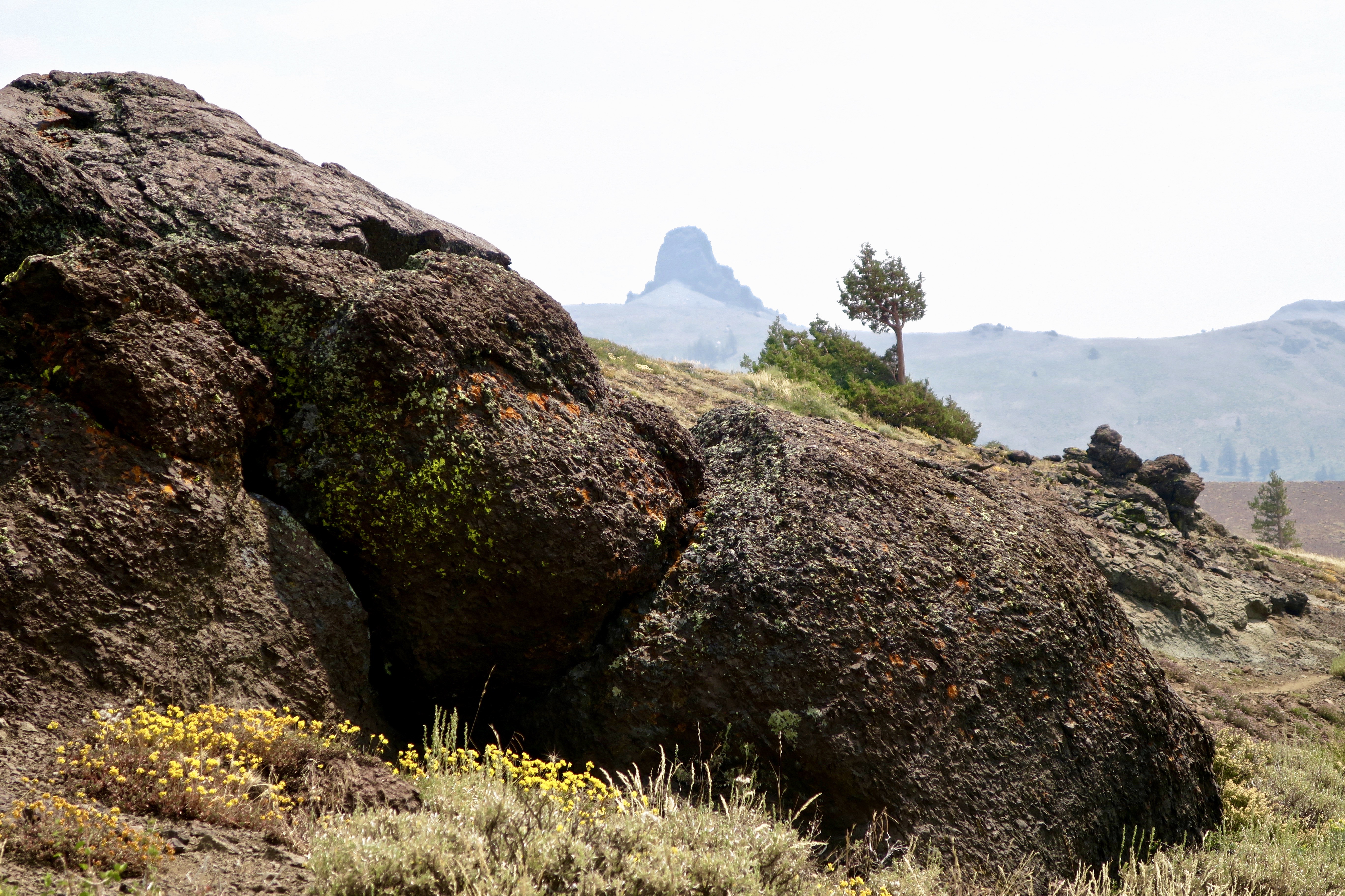
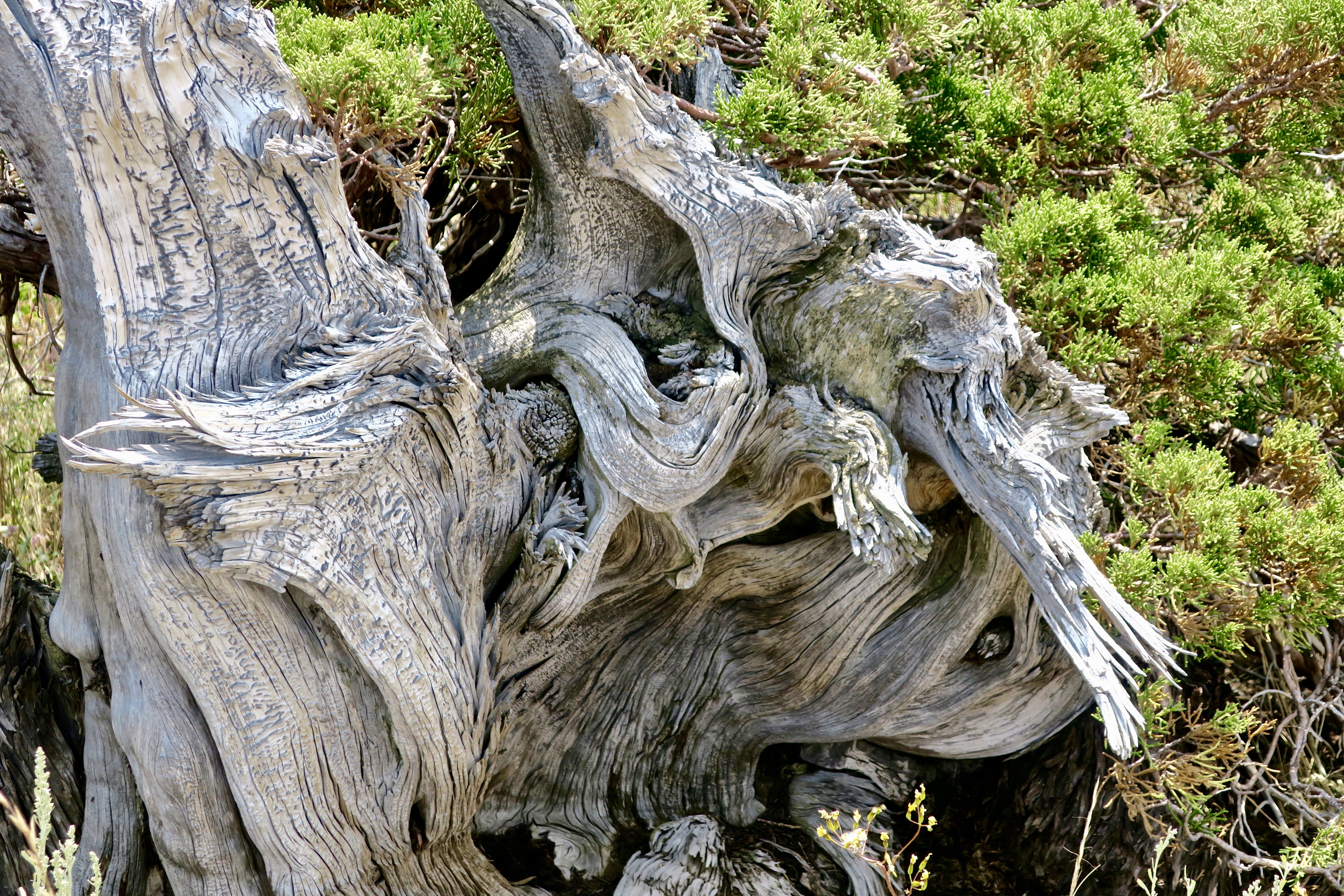
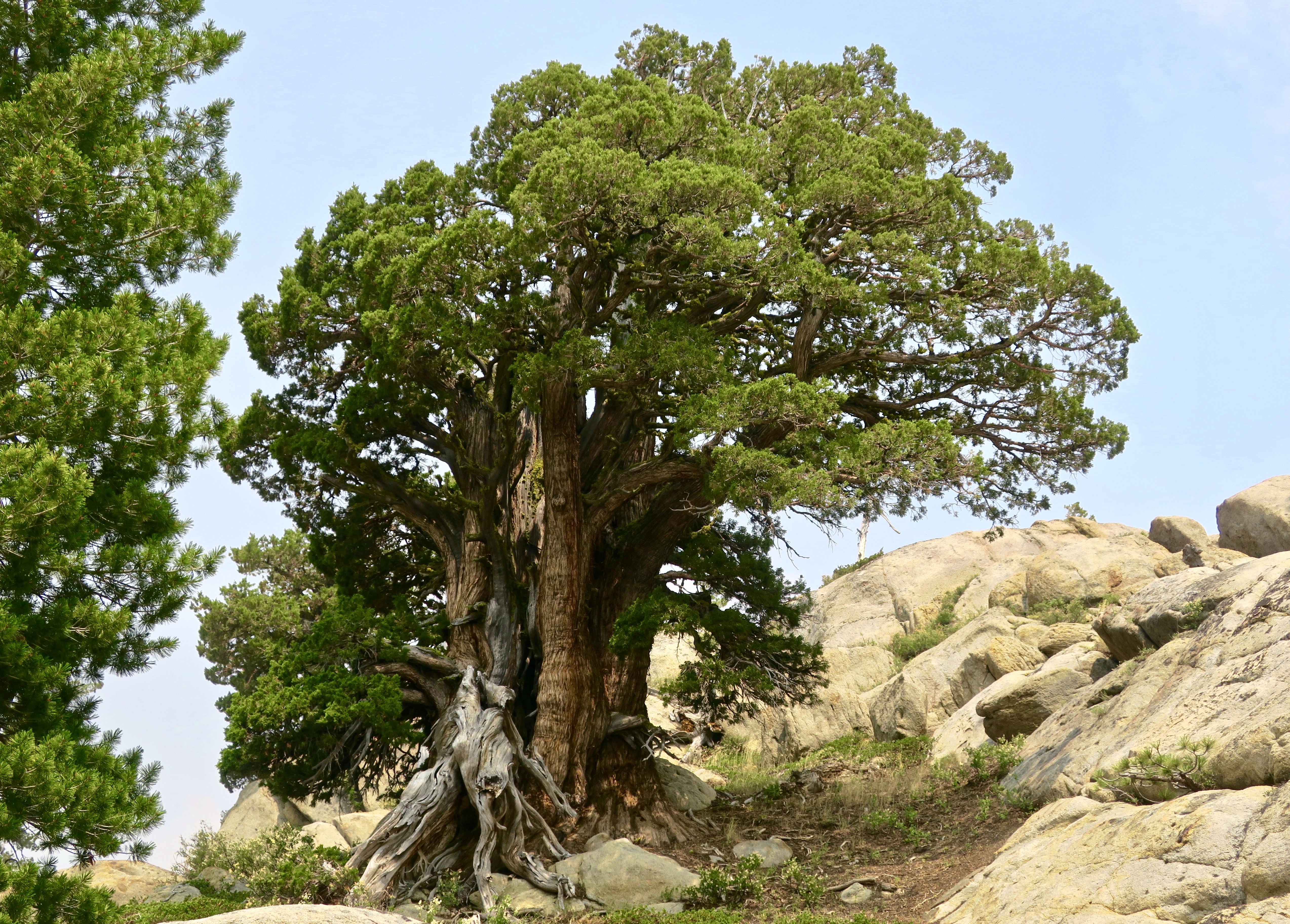
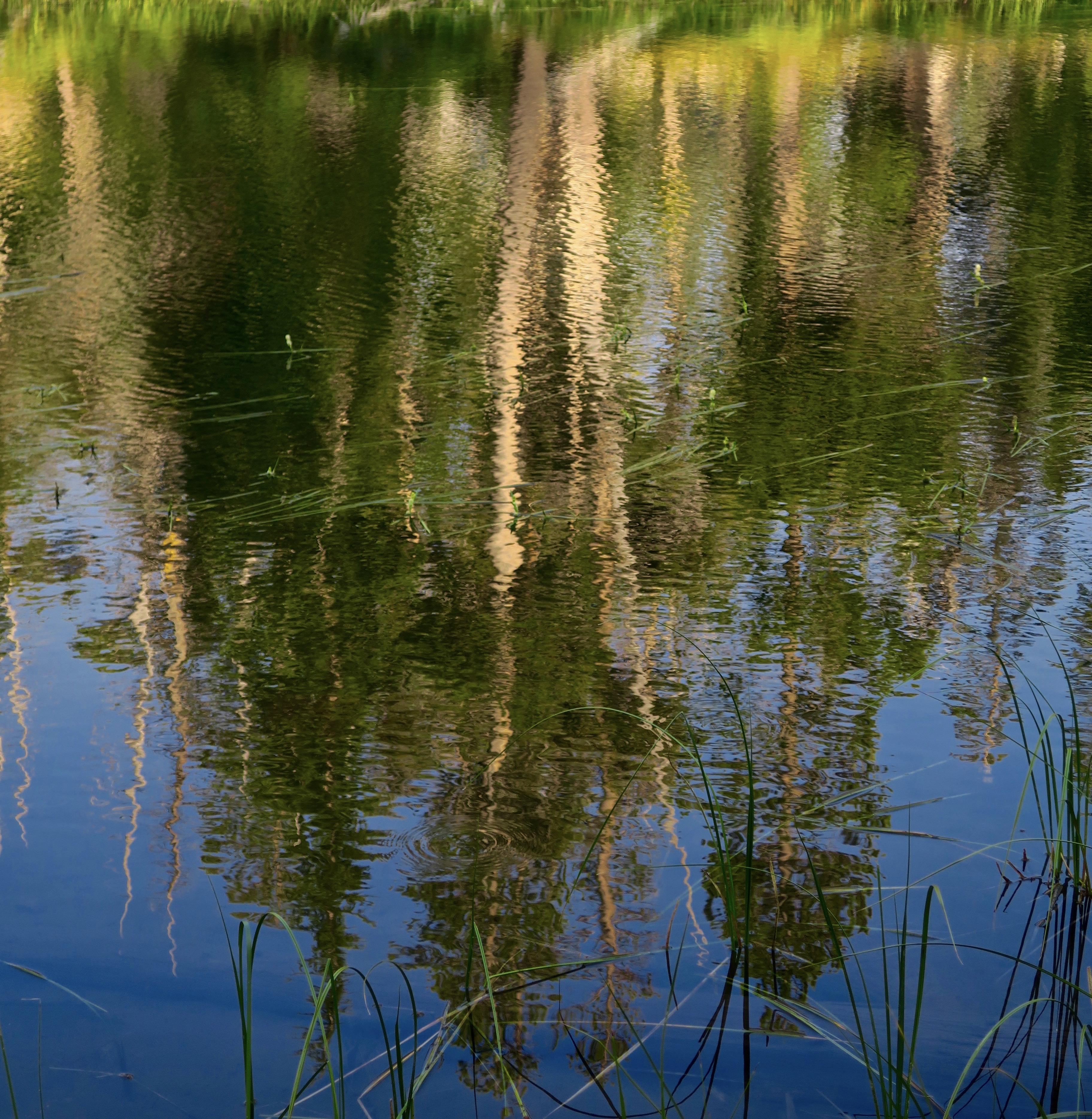
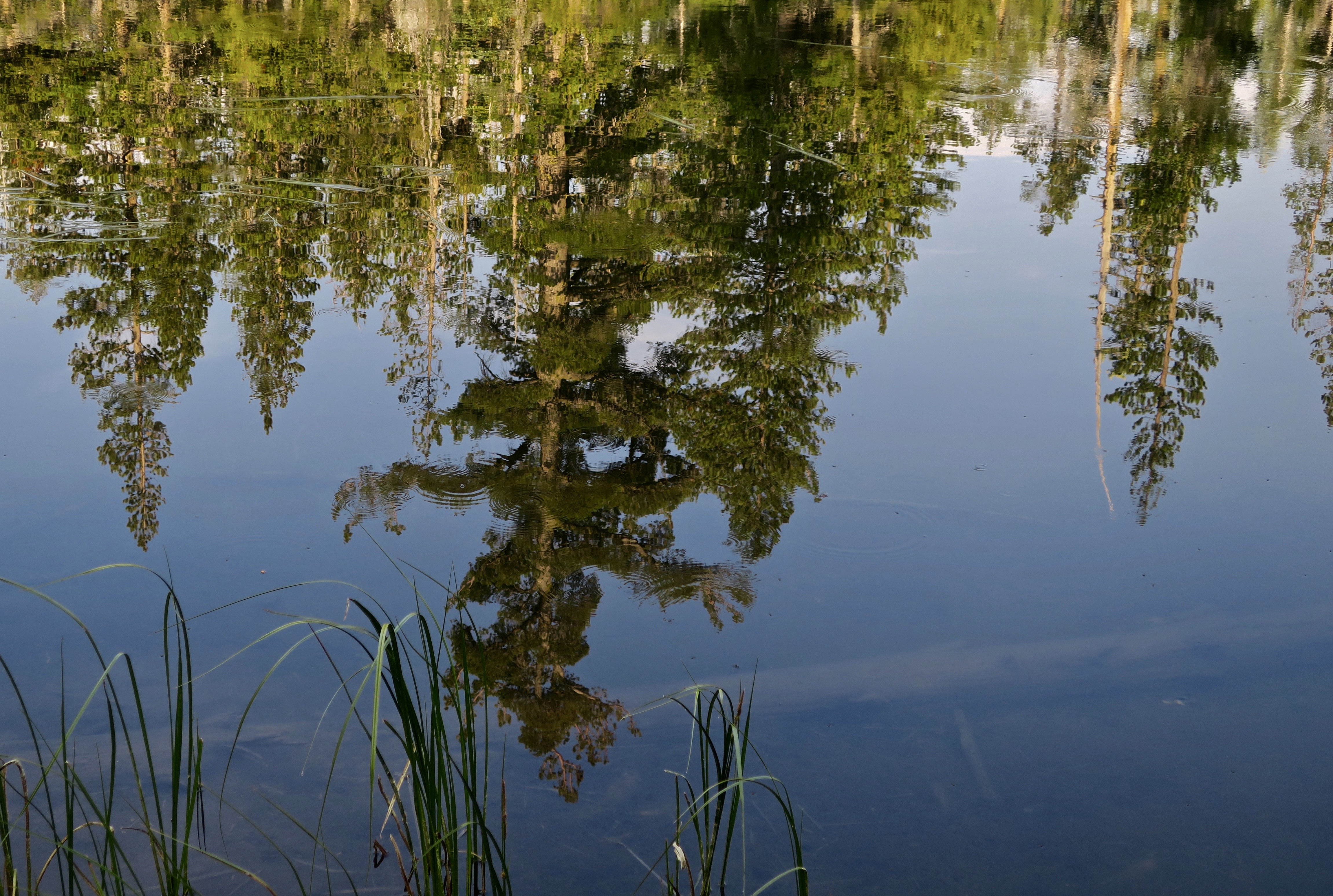
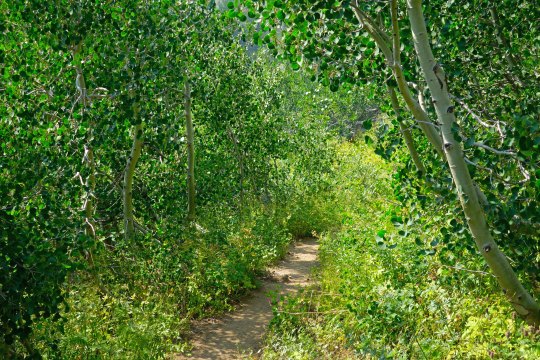
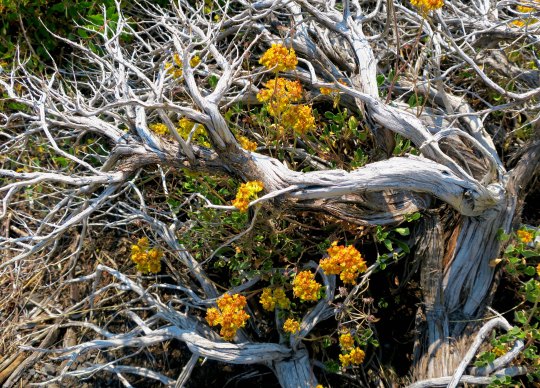
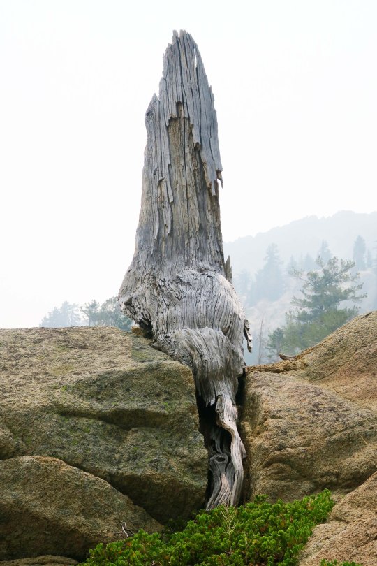
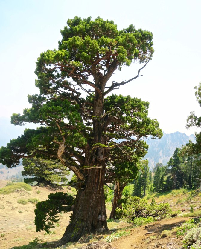
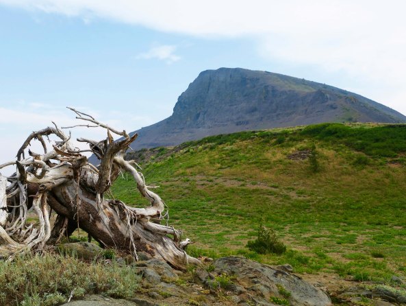
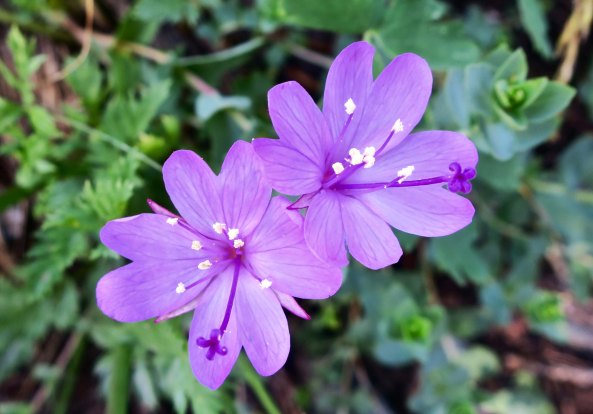
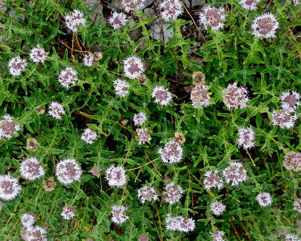
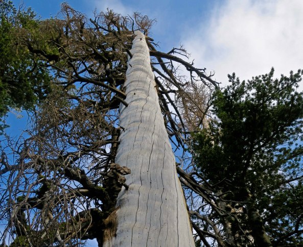
By the time I got to the Mokelumne Wilderness section of the PCT, I was looking a little scruffy, not to mention skinny.Peggy, who is never scruffy, sent me off with a smile. She hiked three sections with me and provided support on all of the others, for both me and through-hikers. By this point, she was almost over being nervous about sending me off on my own.Almost immediately, I came on this old snag. I always enjoy their personality and beauty. You will see several on my two Mokelumne Wilderness posts. This one is all about roots.And how about this lodgepole pine that was insisting on doubling back on itself. It must have had a warped childhood.This is Frog Pond, maybe a mile along the trail from Carson Pass and a tenth of a mile off the PCT. I’d hiked by it several times over the years and not stopped. My loss. If it looks like the end of the world on the opposite end, close. There is a steep drop off just beyond the rocks.This well known landmark is known as Elephant Back. My first challenge of the day would be hiking around it on the left.Fortunately, it was all downhill. But there’s a truism about hiking in the Sierras, what goes down inevitably goes up!The Mokelumne Wilderness features flowers galore. There were whole gardens of them, planted and tended by nature. This one was also tended by a bumble bee,Pennyroyal, a member of the mint family. I picked a leaf and munched on it as I hiked down the trail.Ranger’s buttons. People who name flowers have great imaginations. As noted in the beginning, there are lots of them along the trail.Birdie on a granite rock. It sang me a song so I took its photo.I camped under this magnificent Jeffrey pine my first night…And met this young fellow in his 60s. He had quite a story to tell.He had hiked all three of America’s National Scenic Trails including three times on the Appalachian. He was now doing the PCT a second time.Did I mention the trail went up?I figured an alien from a UFO planted this so I avoided touching it… just in case.This, on the other hand, was an old friend of mine from growing up in the Sierra foothills: California Holly.Looking down on Upper Blue Lake from the trail. Note the smoke. It was a summer of fires along the PCT and I ended up breathing lots of smoke and avoiding fires. The distant knob was a prominent landmark for pioneers. Any guess for what they named it? The Nipple.Another snag.The trail worked its way through granite boulders and junipers.Which are one of my favorite trees.Heading off the trail, I found an attractive small lake to camp on. The clouds were threatening a thunderstorm.But the lake remained calm, reflecting the surrounding trees from impressionistic…To realistic.The next morning found me back on the PCT by 7 am, which will be the subject of my next Mokelumne Wilderness post…With a very different terrain.
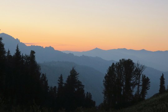
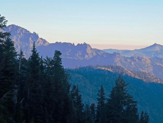
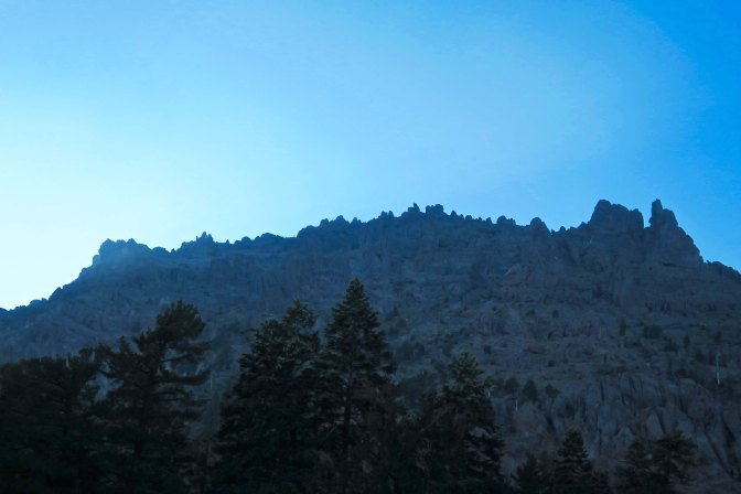
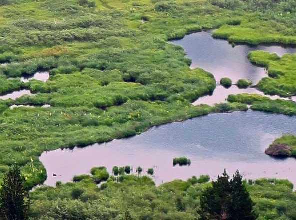
An evening view of the Mokelumne Wilderness from Noble Lake on the PCT.
I remembered Noble Lake from my 2003 trek when I backpacked 360 miles from Lake Tahoe to Mt. Whitney to celebrate my 60th birthday. For some reason, it didn’t seem as ‘noble’ this time. Maybe that’s because of all the other lakes I had passed on my hike down the PCT. But the views looking back toward the Mokelumne Wilderness were spectacular.
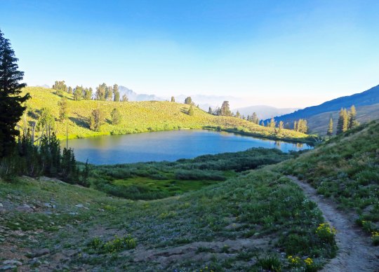
An afternoon view of Noble Lake. The lake is located south of Ebbetts Pass.
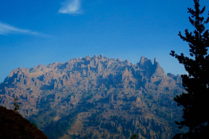
Another evening view of the Mokelumne Wilderness from Noble Lake. This is a situation where the smoke from the fires may have enhanced the photo.
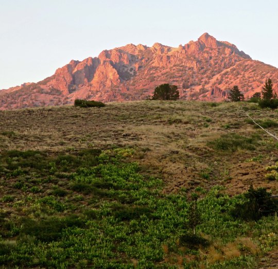
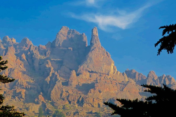
Looking up from the lake, I caught this mountain glowing in the evening sun.
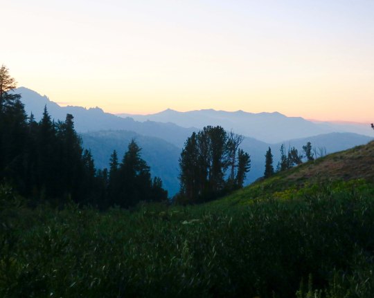
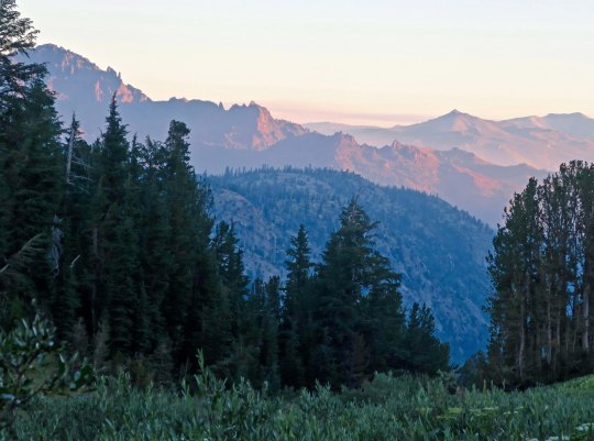
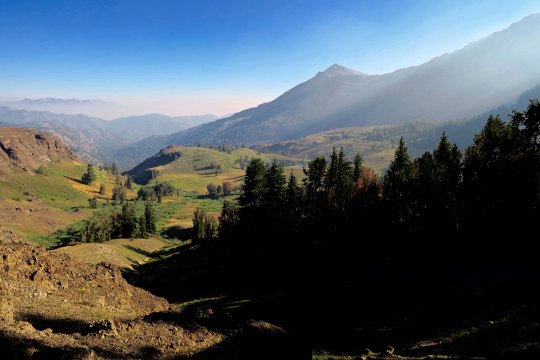
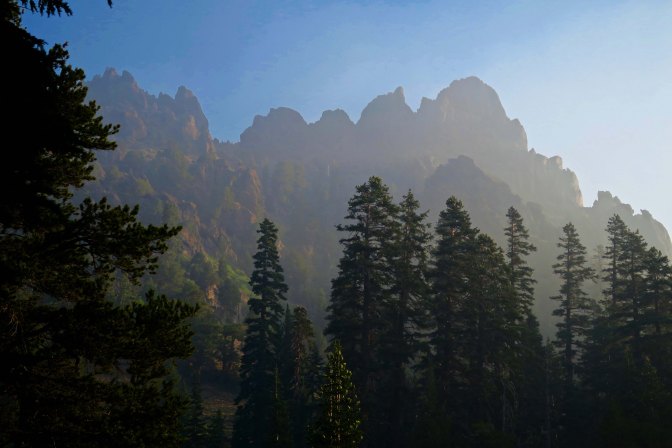
I was treated to more views of the Mokelumne Wilderness the next morning. It’s fun to think that I had been hiking through the area the previous day.
As I watched, the sun continued to rise, bathing the peaks in a soft glow.
I would have lingered, but Peggy expected me to be at Sonora Pass the next day, and I had miles to go. As I hiked up the early morning trail, I said goodbye to Noble Lake. Would I be back for my 80th birthday? (grin)
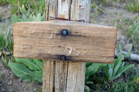
Up toward the pass, I was greeted by an old elevation sign. I think it told me I was at 9,980 something feet.
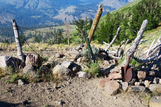
You know you are out West when you come to barbed wire fences. This provided a passage (sort of) that through-hikers could get through, but not cattle. The old shovel head spoke of earlier times.
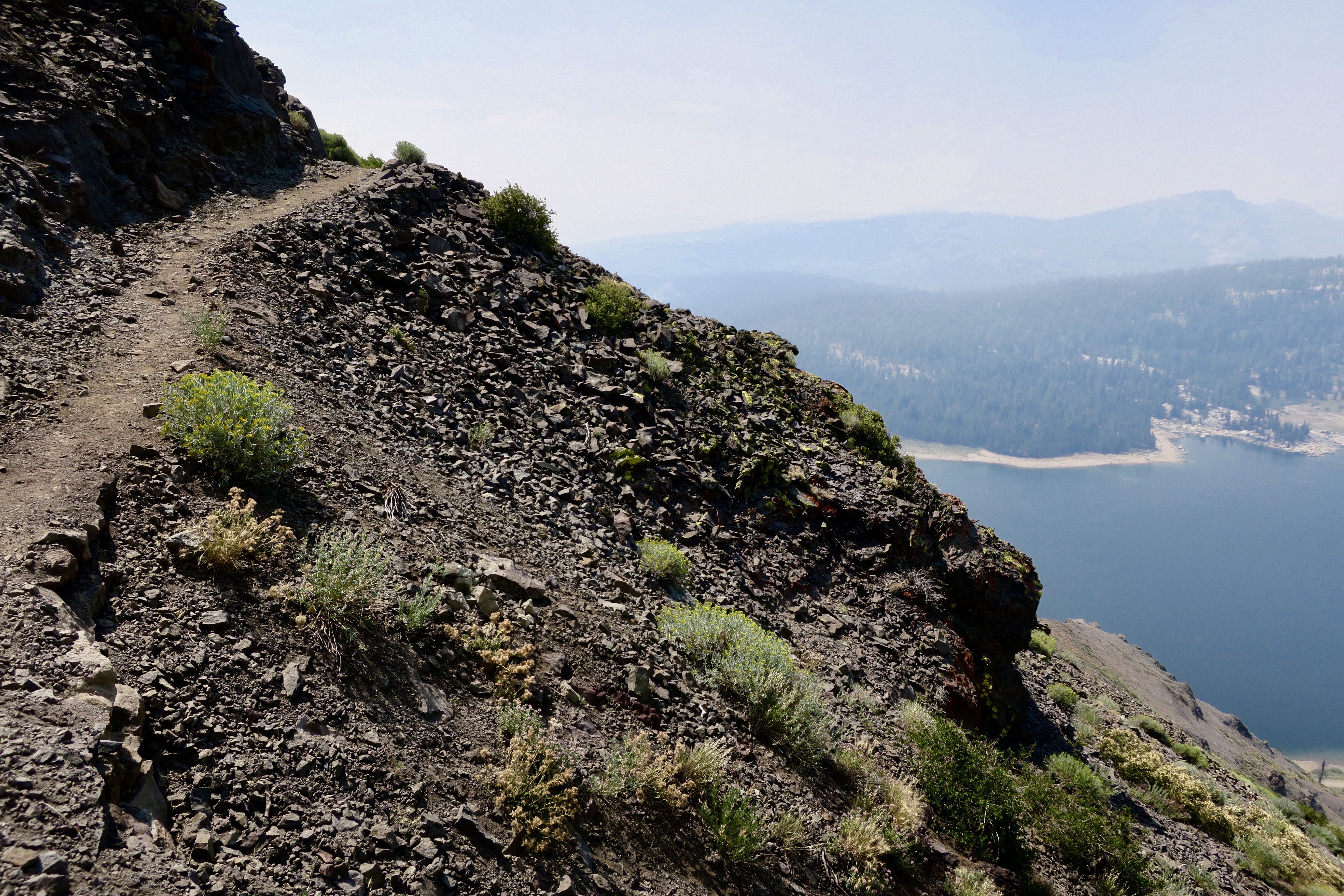
Looking through the wire, I could see my next destination, the Carson Iceberg Wilderness.
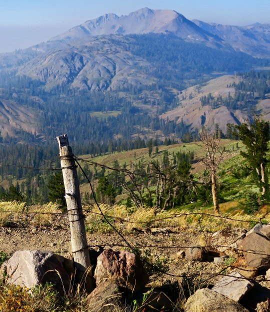
I’ll conclude today’s post with this view. It suggested another smoky day. Within 48 hours, the trail would be closed due to fire.
NEXT POSTS: Time’s limited since I am preparing for the San Francisco Writers’ Conference. I have one more post on this section of the PCT and then Peggy has two posts on her experiences as ‘trail angel.’ I think I will hold on these three posts until after the conference. In the meantime, I will put up some Burning Man eye candy since Peggy and I are hoping to go this year, assuming we can get tickets.
Another beautiful juniper along the PCT, this one just south of Ebbetts Pass. I was climbing up a very steep trail to Noble Lake. Check out the smoke. Excuse me while I go cough.
I left you in the last post about my hike down the PCT with photos of spectacular rocks and impressive trees. I say goodbye to the Mokelumne Wilderness in this post, hike across Highway 4 at Ebbetts Pass, and continue my journey southward. Of course there will be more pretty trees, but roots, snags, flowers, a family from Taiwan and through-hikers are the main subject for photos today.
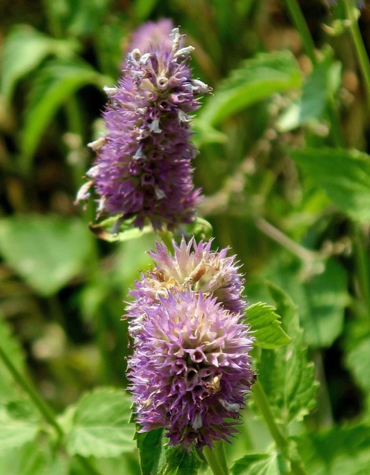
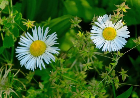
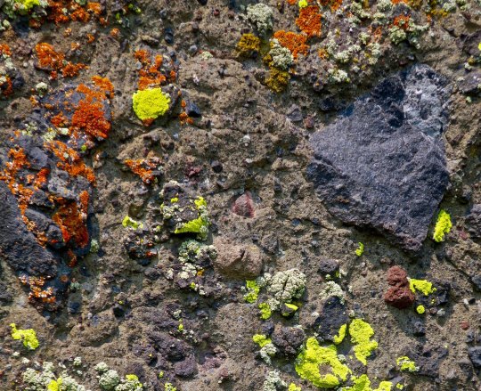
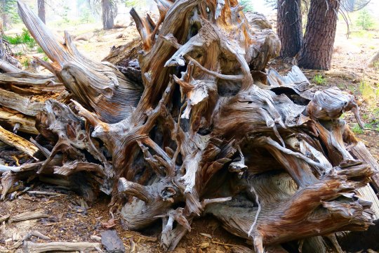
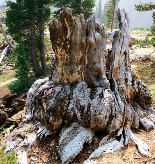
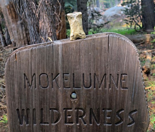
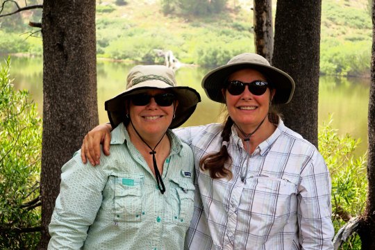
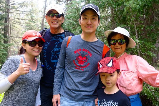
Have any aches and pains? Some people swear by this plant, self-heal, as being good for what ails you. I came across a list claiming it is good for ulcers, wounds, sore throats, hemorrhoids, high blood pressure, burns, insect bites, herpes and cancer. Woohoo. You might want to check with your doctor first. (grin)You’ve already met this fellow, flea bane, with its obvious name. Orange and yellow lichen— where algae and fungi co-habitate in a symbiotic relationship. An inviting green trail through aspen.A snag and dead flowers combine in a floral arrangement.This fellow was fun. I’ve never seen a snag sitting down with its tail hanging out behind. I was worried it might follow me home. How would I explain that to Peggy?Twisted roots!Stump with personality.Bone decided to get into the act when I left the Mokelumne Wilderness.These two sisters, Denise and Deborah were only doing part of the trail. Since we were hiking in the same direction, we kept crossing paths, so to speak. They were both carrying tents and explained to me, “We grew up having to share a room. That was enough.” They wrote me later saying that their hike was interrupted by the Sonora Pass fire. Mine too. I caught up with Wayne Chiang and his family along with their friend, Bass Chong, at Ebbetts Pass. They were out for a day hike. Wayne is a legislator with the Republic of Taiwan and has long term hopes of becoming Mayor of Taipei. Bass works at Ebay. This smiling fellow was from Germany and, I am sorry to say, I’ve misplaced his trail name. He wanted to take a photo of me to show friends and family back home that people of all ages hike the PCT. I was just glad that he didn’t say something like, “Really old people hike the PCT!” A final juniper photo for today.
NEXT POST: Adios, Puerto Vallarta… with a few spectacular sunsets.
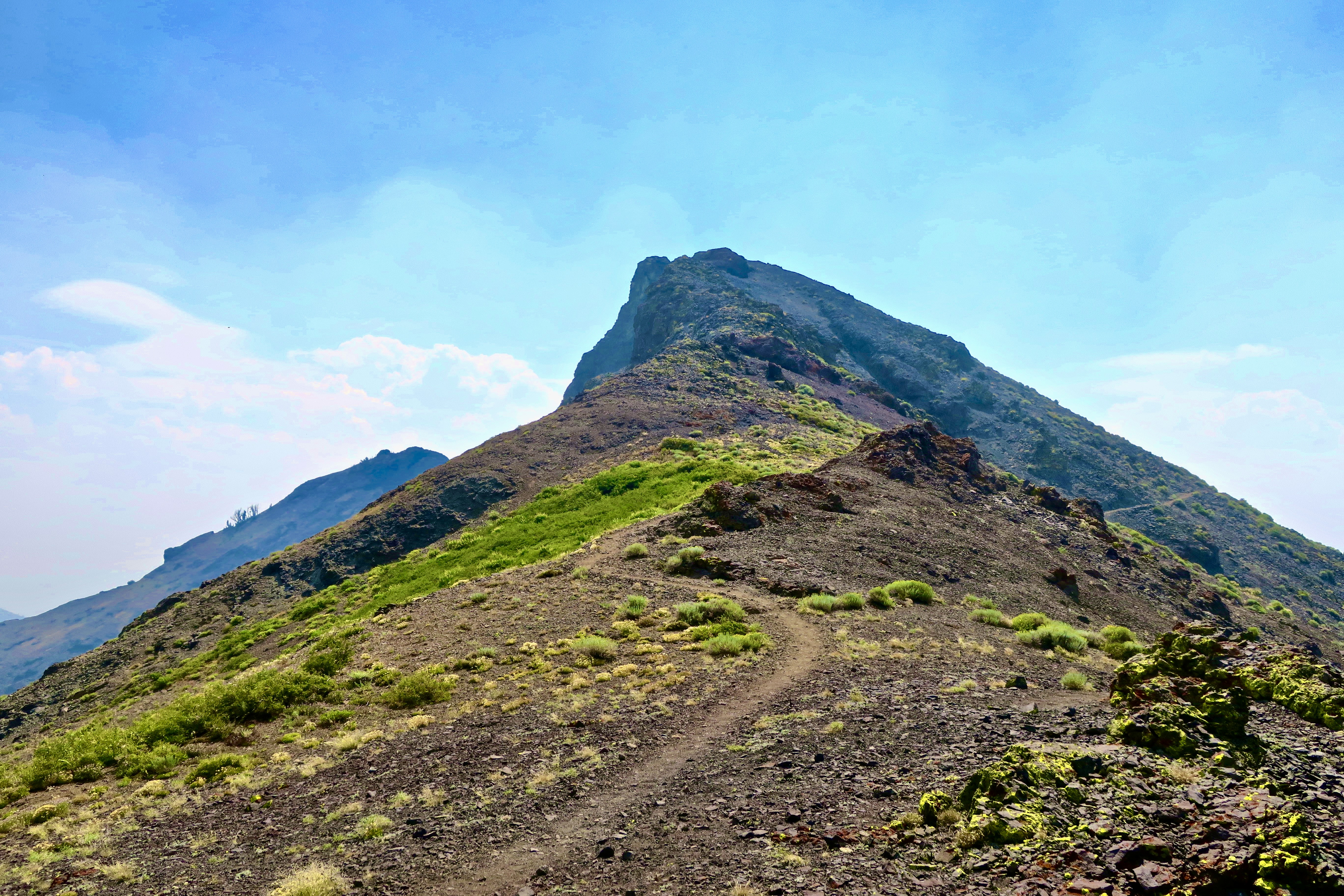
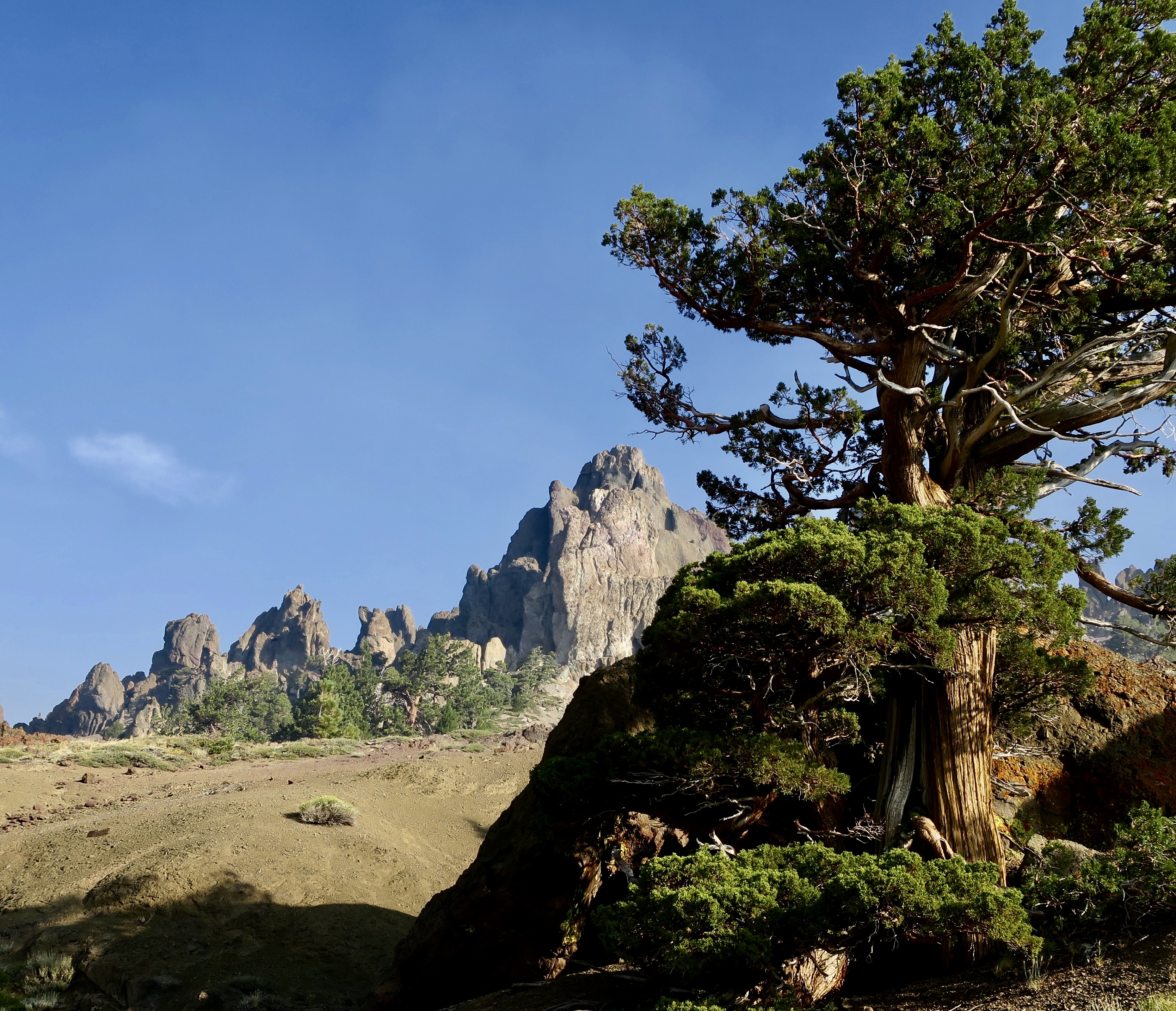
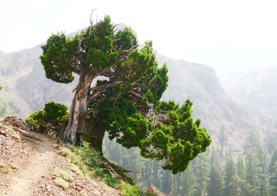
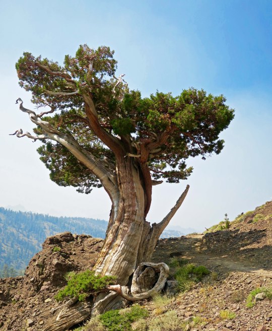
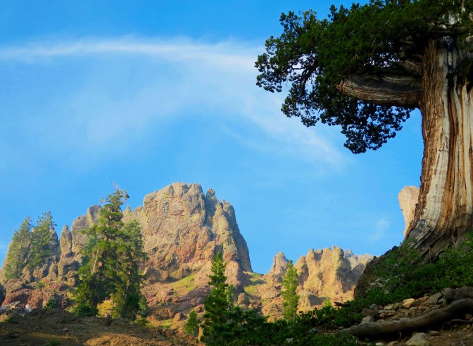
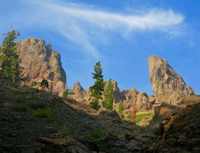
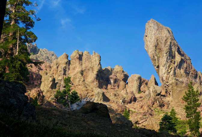
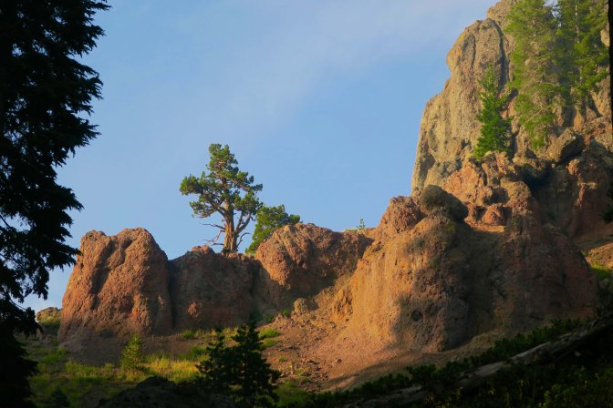
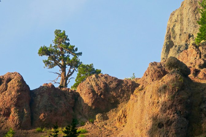
There is no hurrying through land like this. The combination of junipers and rock sculptures called to both me and my camera.
I was surprised by the sheer beauty along the PCT south of Carson Pass. I had hiked through the region several times over the years, but my trail had always been slightly to the west. Somehow I had missed the incredible rock sculptures. That, and the junipers. If you have ever wandered the West, you are familiar with this gnarly, photogenic tree. Most of todays photos were taken near Pennsylvania Creek in the Mokelumne Wilderness, maybe 15 miles north of State Highway 4 and Ebbetts Pass. I’ll let the photos speak for the area.
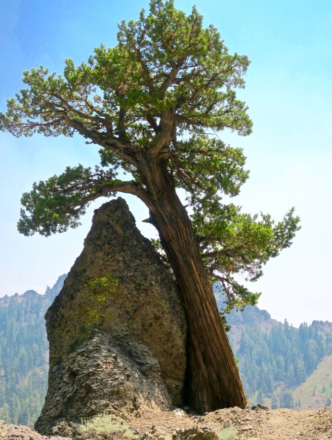
Hiking down into Pennsylvania Creek, I found this juniper.And then this one, wedded to a rock.That night, I camped on the south side of Pennsylvania Creek. This was the view !Later, at sunset, the whole ridge.The next morning, smoky skies and the sun provided a red cast to the view.Farther along, I was treated to this view.Near the crest of the canyon, I found the juniper tree and rocks I featured at the top pf the post.The view included this leaning rock, which could be seen just behind the juniper.Another perspective.I considered this a real treat. And photographed it several times. This is it for today. But I’ll have several more views of the rock sculptures on my next PCT post.
NEXT POST: Back to Puerto Vallarta. P.S. I will be playing with various themes over the next few weeks, so don’t be surprised by the changing looks of my blog. ALSO: For those of you who haven’t read “The Bush Devil Ate Sam,” I will be posting a chapter once a month on the top ‘pages’ to give you a feel for the book and encourage you to buy it. Many thanks! This chapter reflects our first night in our Gbarnga home, appropriately titled: Armies of the Night!
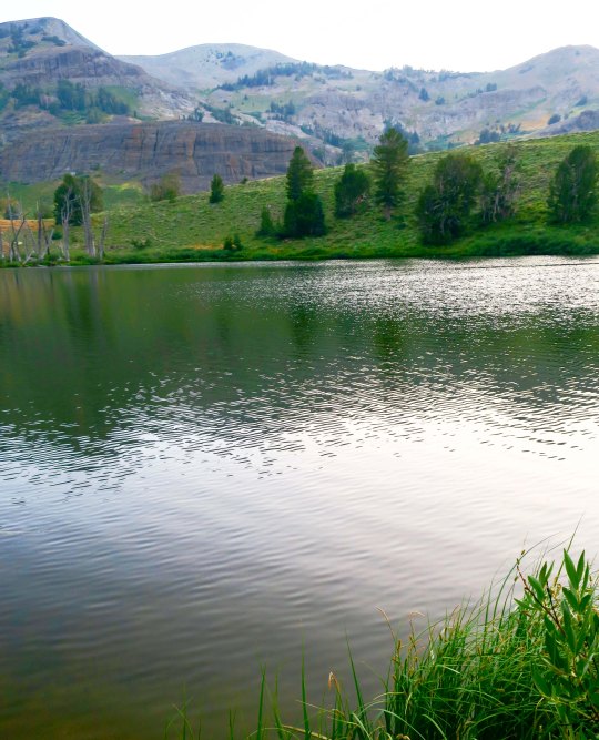
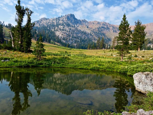
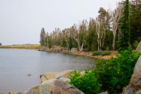
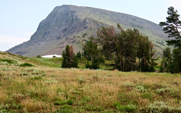
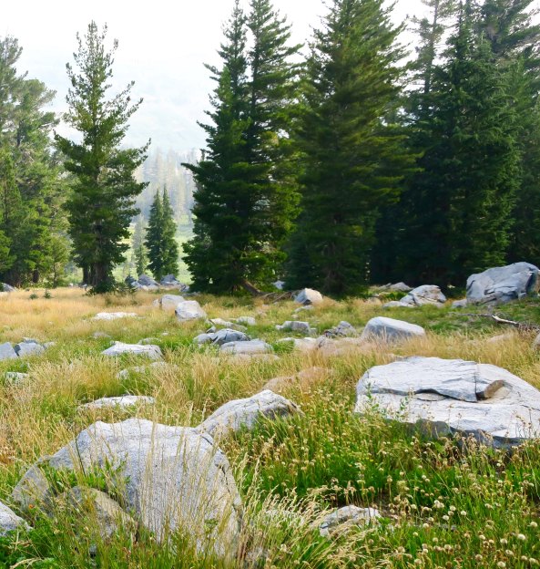
Lakes, mountains, and meadows, oh my. The Mokelumne Wilderness south of Carson Pass has it all, plus streams and rivers. I took this photo of Round Top Mountain from along the Pacific Crest Trail.
I’ve backpacked south from Carson Pass several times over the years, usually leading backpack treks following the old Tahoe Yosemite Trail. Those were the days before the present PCT route was built. I was excited to explore the new trail.
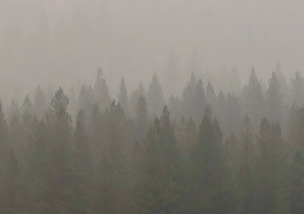
I arrived at the trailhead a few weeks earlier than I had planned. When I came out at Chester after hiking through Lassen National Park, smoke from the massive Carr Fire near Redding was so thick that it was difficult to see a couple of hundred yards into the trees. Having empathy for my 75-year-old lungs, I decided to skip south in hopes of finding clean air to breathe.
Smoke from the Carr Fire on the PCT near Chester, CA
The pass was named after the mountain man, explorer, military leader and rancher, Kit Carson. During California’s gold rush era, it had served as one of the main entrance points to California. The trail worked its way down the mountain eventually delivering its gold seeking 49ers to the small town of Diamond Springs where I was raised. The town was established when some miners from Missouri found a 20 pound nugget of gold lying on the ground and decided to stay. Which I get. As a youth wandering far and wide through the woods surrounding Diamond, I’d always dreamed of finding my own large nugget. It wasn’t to be. But I did develop a love for the outdoors, which is worth a lot more.
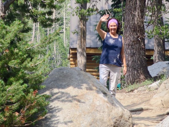
Peggy dropped me off at the trailhead and waved goodbye. She had seen me off several times by now, and was more confidant that she would see me at the other end. But my lovely friend was always a bit nervous…
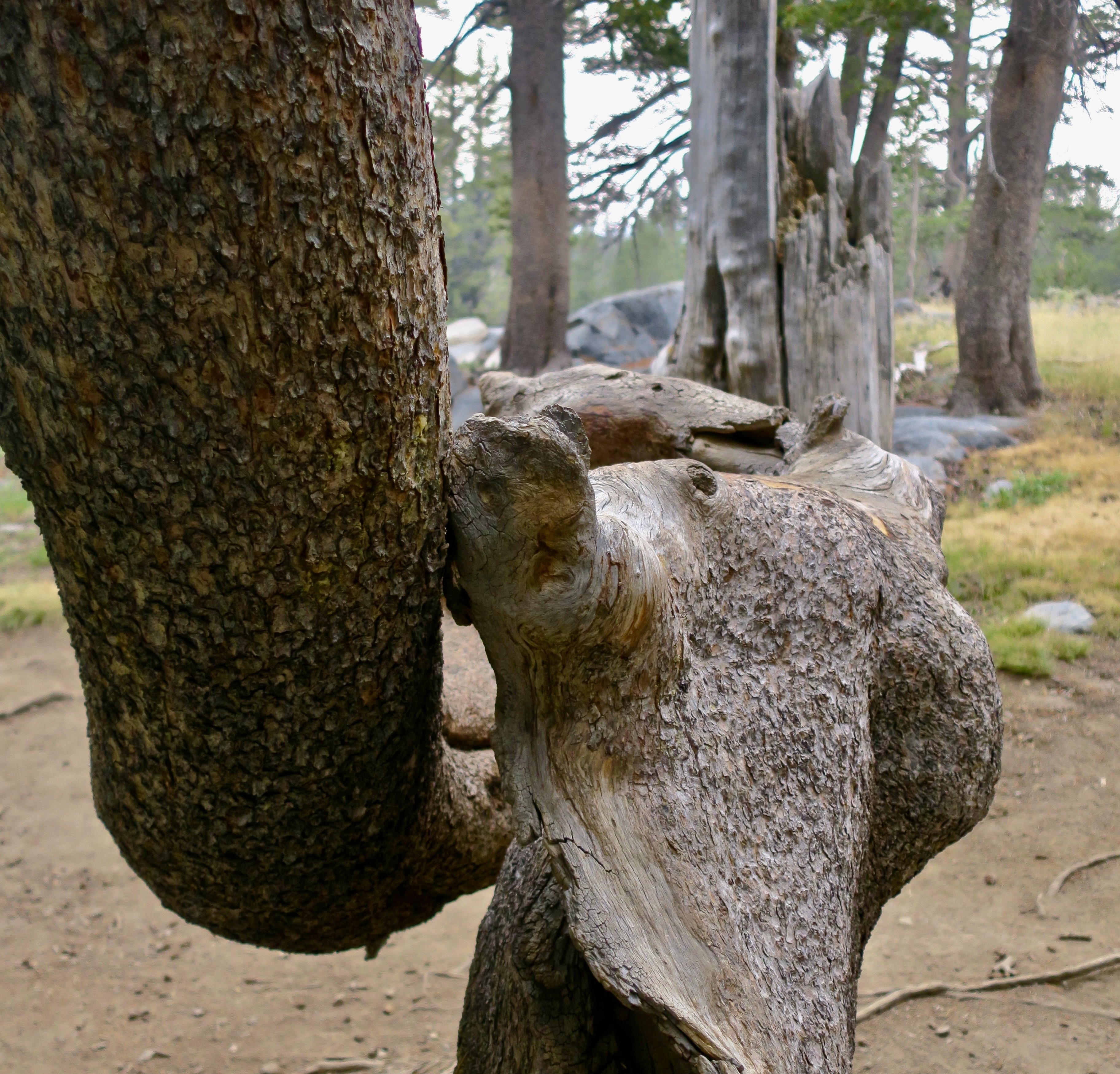
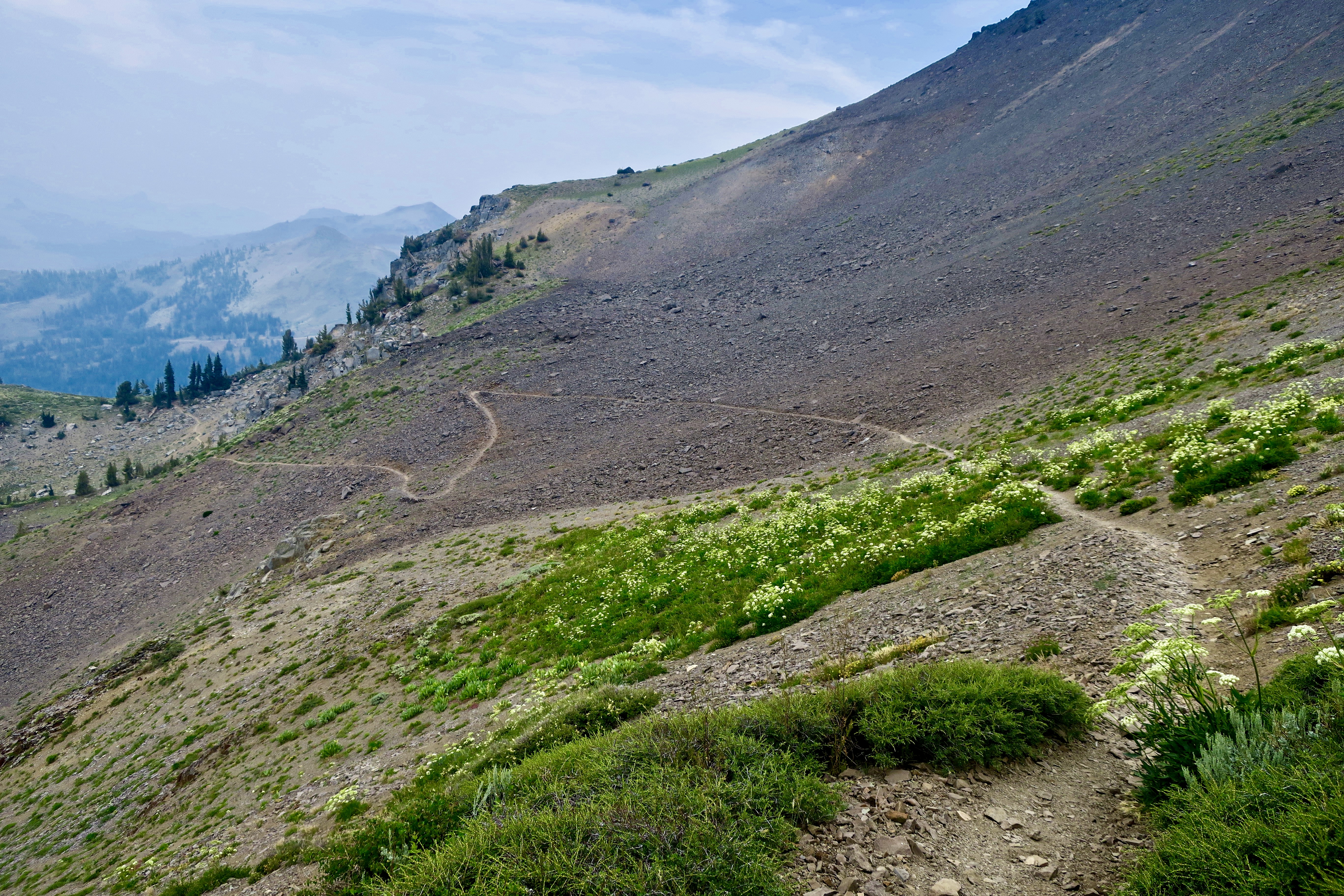
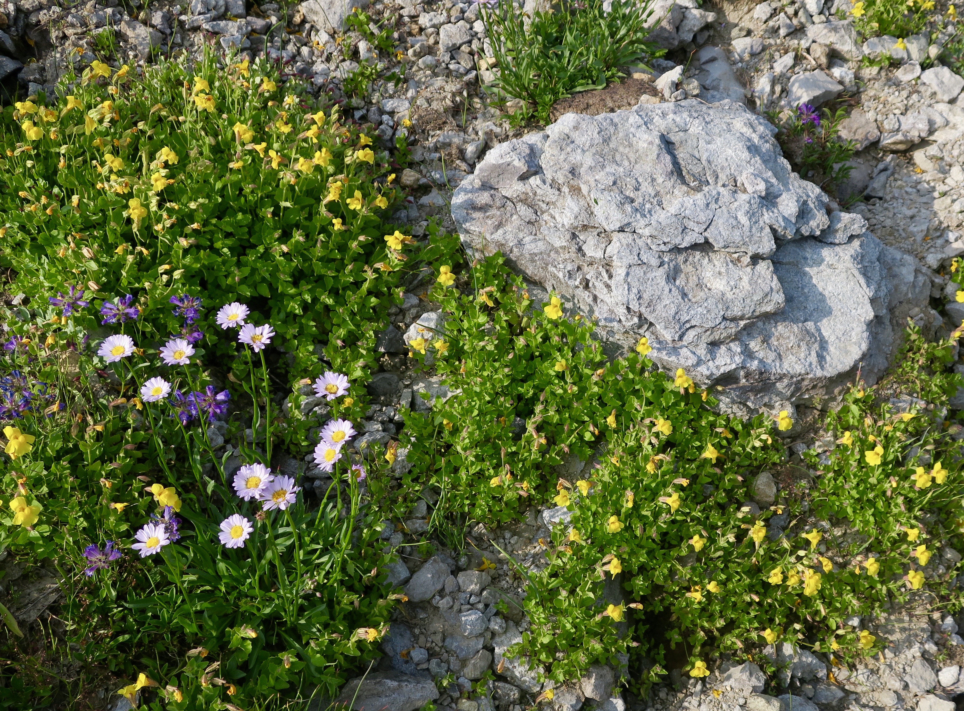
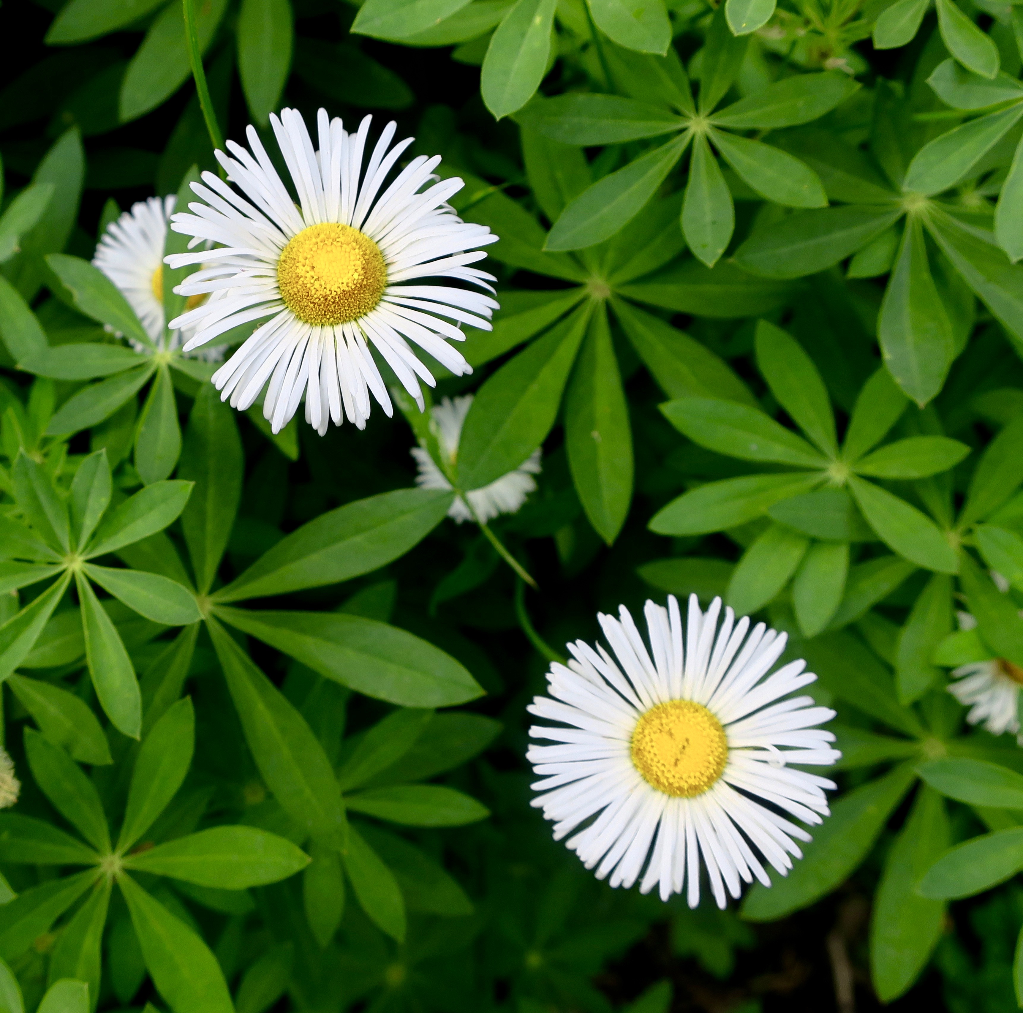
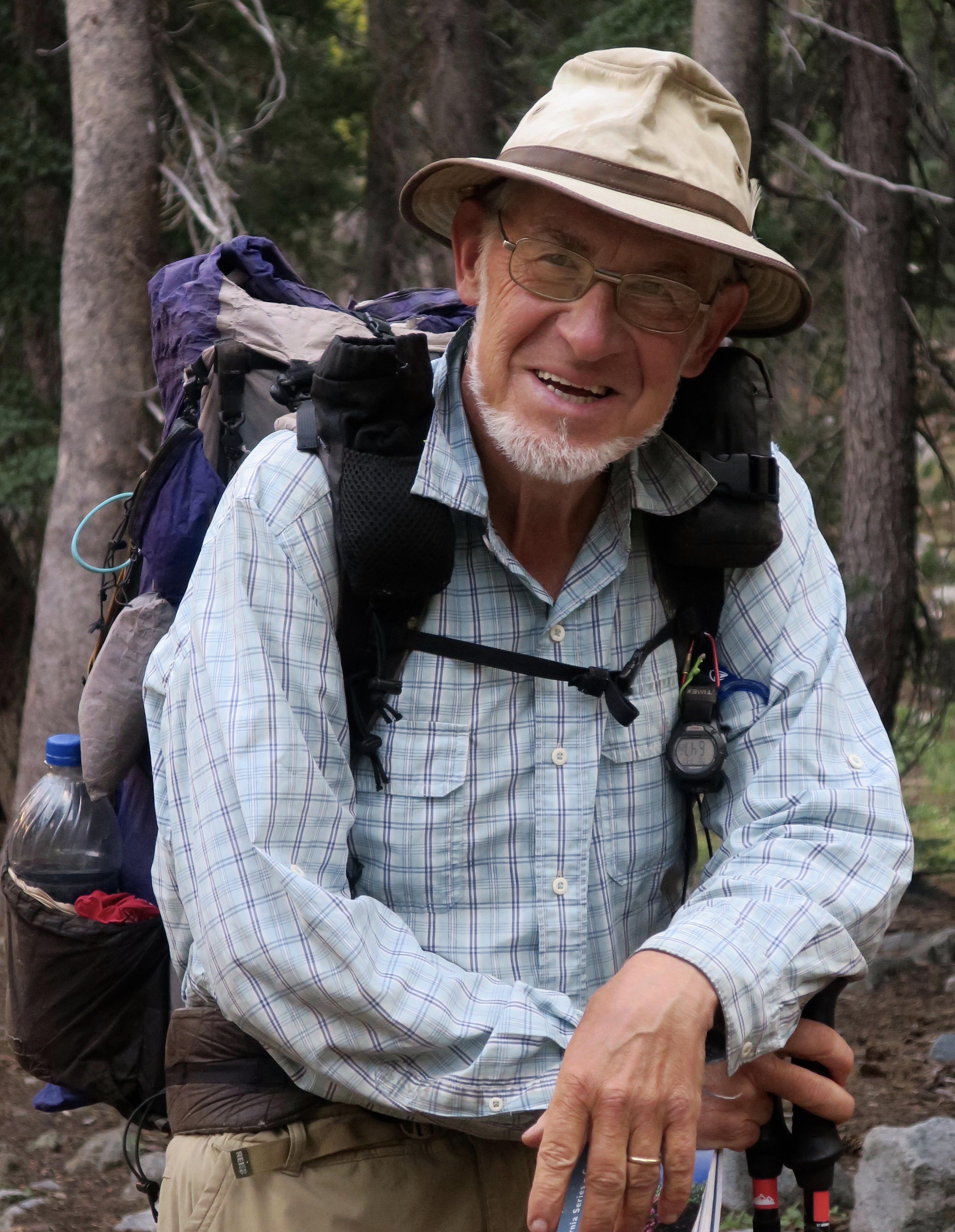
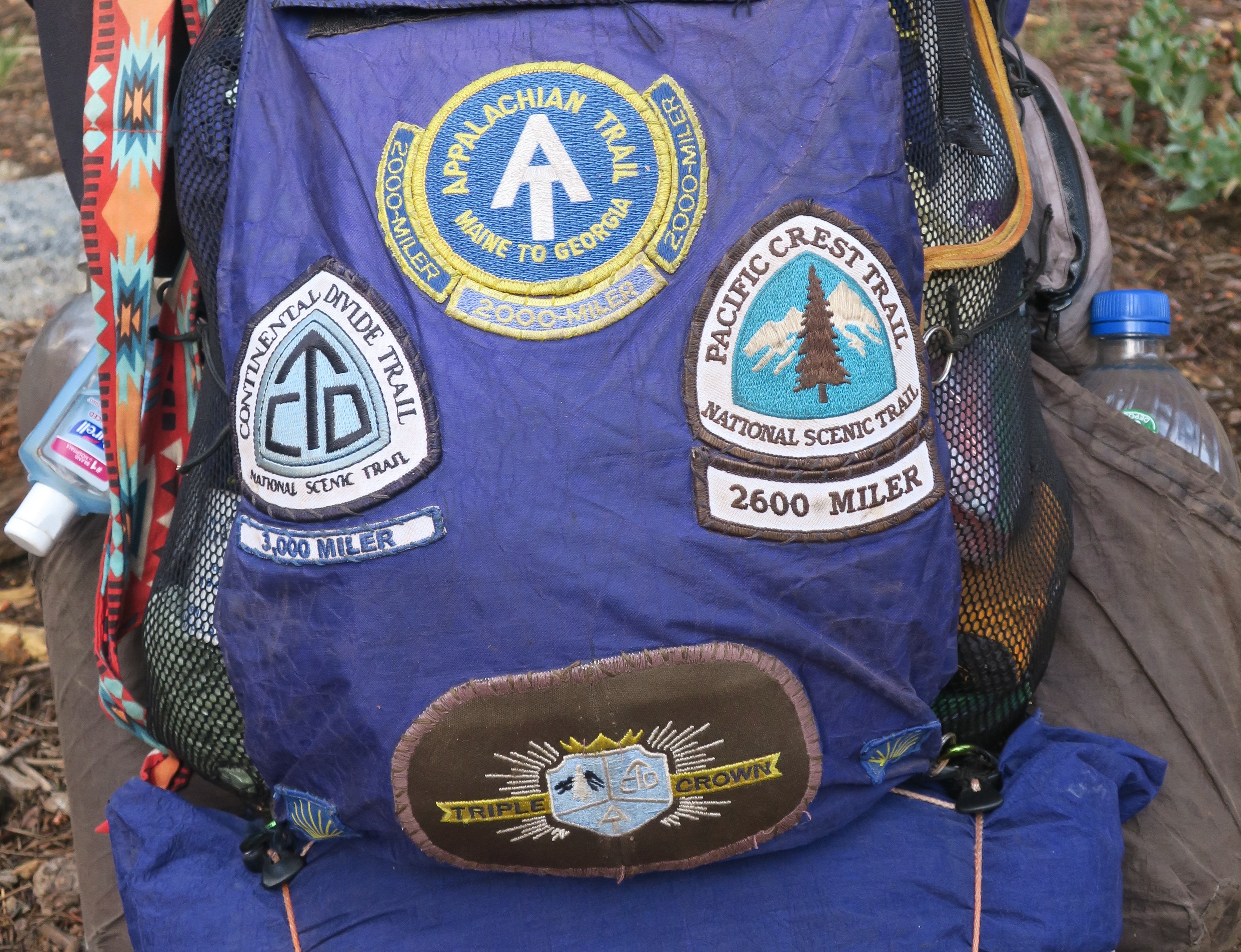
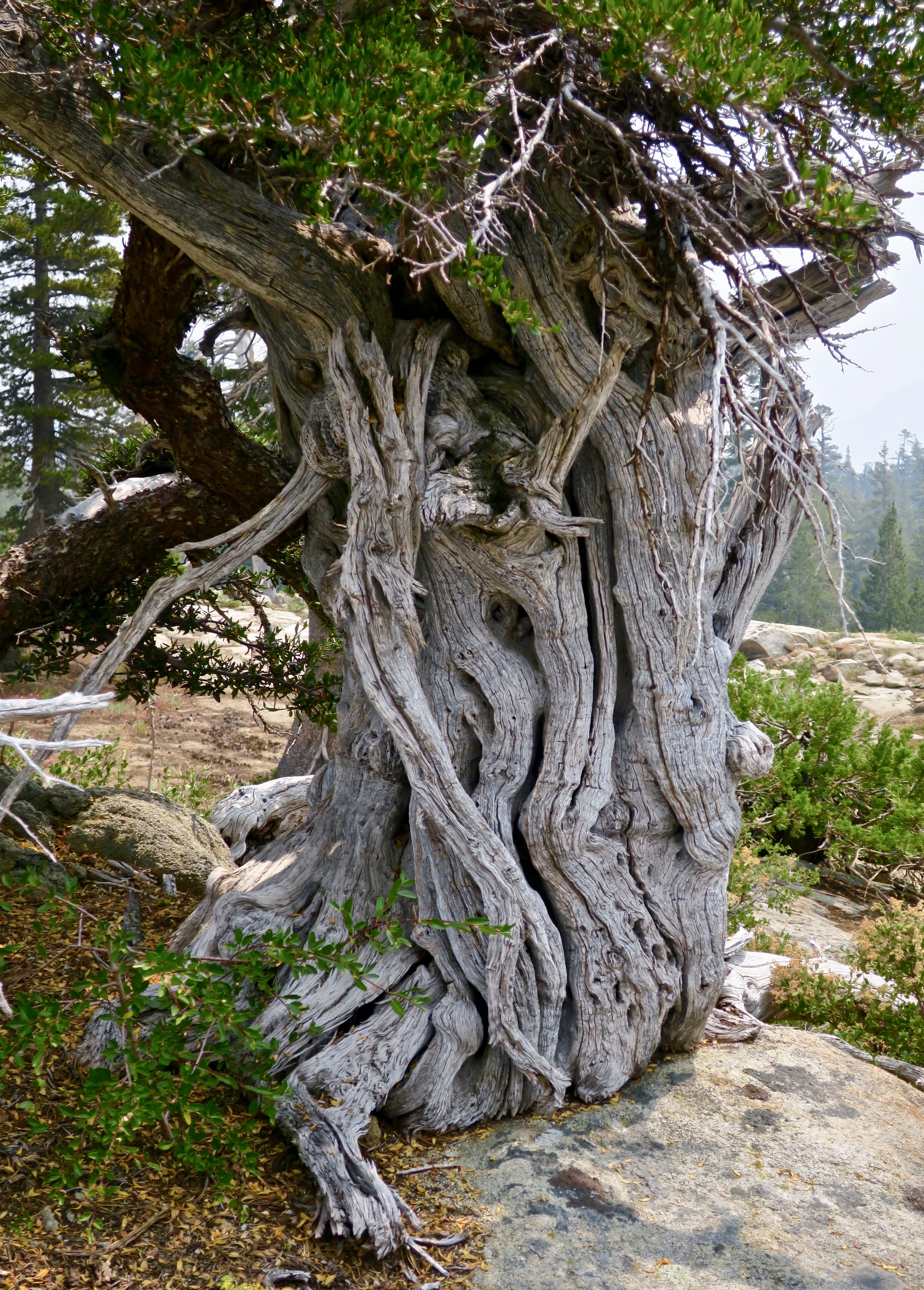
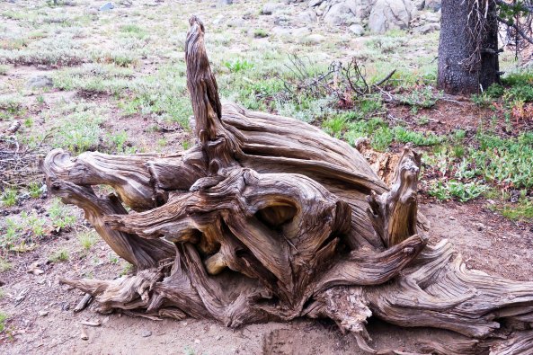
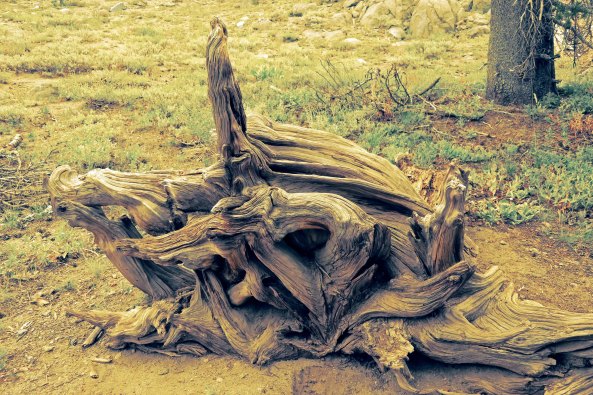
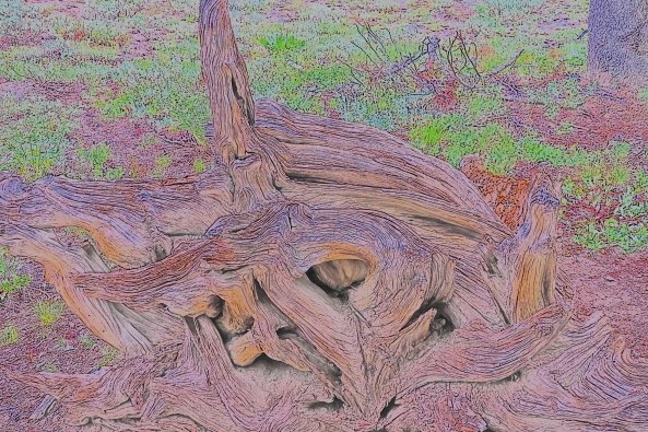
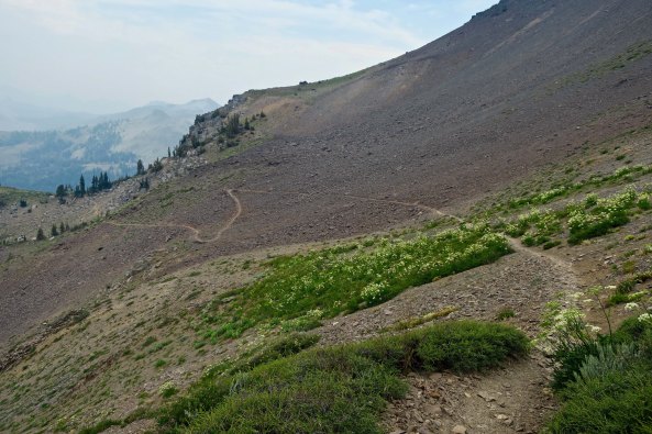
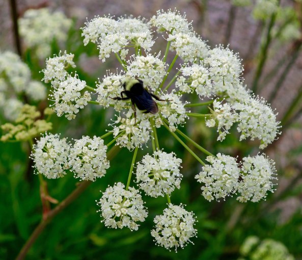
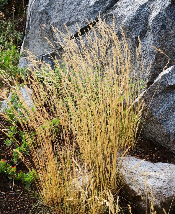
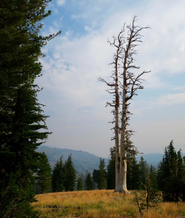
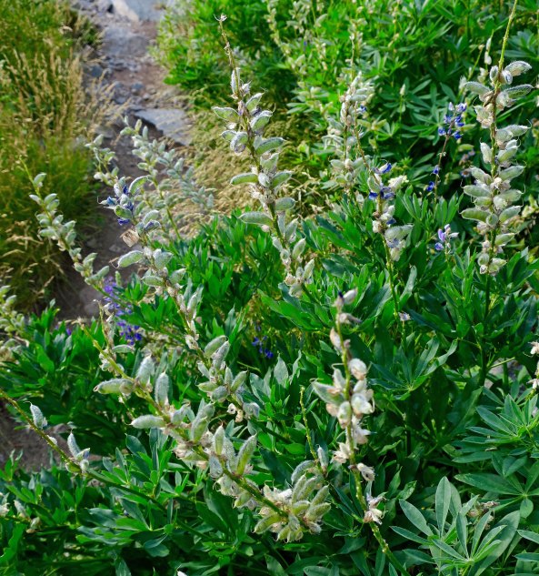
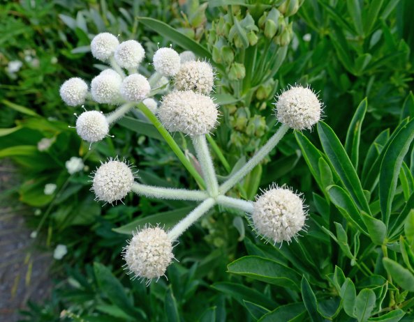
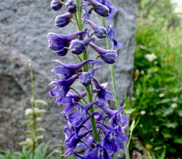
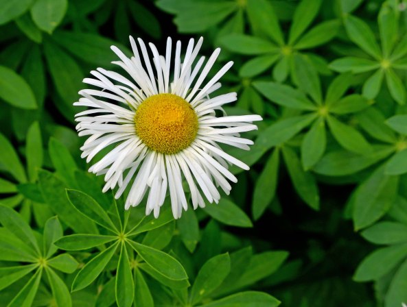
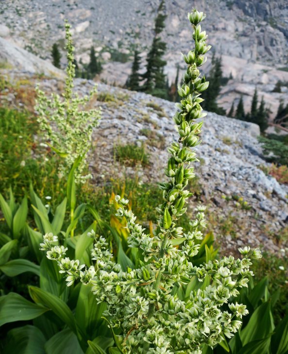
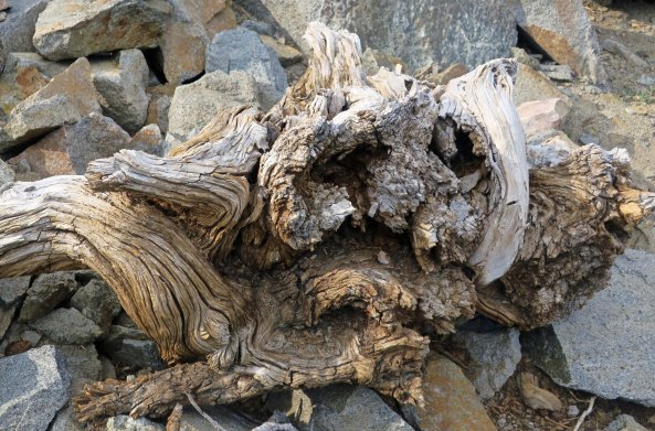
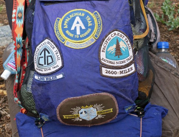
Peggy waves goodbye with sincere hopes that she will greet me at Sonora Pass when and where I predicted I would come out.Being a sucker for roots and wood sculptures, this was the first photo I took along the trail. I hit the wrong button and my camera took several more photos, rendering each one differently. Normally, I like to stick with realistic portrayals, but I was amused with the results…In yellow…And in strange, impressionistic colors, like a Van Gough haystack.I took a short detour up to Frog Pond. In the past, I had always hiked by it and wanted to see what it looked like. I thought it might connect to the PCT. It didn’t, but I enjoy detours. They added lots of miles to my journey. There weren’t any obvious croakers.The correct trail provided this view of Elephant Back, one of the primary landmarks of Mokelumne Wilderness. Another view of Elephant Back from the PCT.I had always hiked around the front of Elephant Back. The ‘new’ PCT took me behind it. The trail starts off making its way through Queen Anne’s Lace, a member of the parsley/wild carrot family.A close up of the flower with a bee providing perspective.Hiking on, I was reminded that I was well into summer. A granite rock provided the backdrop for this colorful grass.The brown grass here, which Californians insist on calling golden, provided a foreground for this photo of two snags.These pods on a lupine bush were also reminders of the fact that summer was winding down. They also show that lupine is a member of the pea family.There was still plenty of water along the trail, however, which was a fact that I appreciated given how often water was scarce along the PCT.And there were lots of flowers where I found water! This is rock fringe.And what I know as ranger’s buttons, another member of the carrot/parsley family.You can smell this one as you pass by. It is western pennyroyal, a member of the mint family. I always break off a leaf (it has lots) and urge people I am hiking with to sniff it and take a bite. It can also be used in making mint tea. Larkspur is always a challenge to photograph, but I wanted to emphasize the ‘spurs’ here, from which it gets its name.This daisy is known as fleabane. Pioneers believed that the bundled flowers would chase fleas out of their homes.And here we have greenish corn lily flowers.I found this half dead tree dramatic.Another grass, rock, and tree photo. The haze in the distance suggests that my hopes for escaping smoke were about to be thwarted. Smoke from the Carr Fire had followed me south!I almost tripped over this wood sculpture. Can you spot the sad owl-like face?My next PCT post will take us up this flower covered ridge and far beyond.I will also introduce you to a 65-year-old trekker who has hiked the PCT, the Appalachian Trail, and the Continental Divide Trail, giving him the right to wear a Triple Crown patch.
NEXT POST: For my next post, however, I will take you back to Puerto Vallarta again and some really neat art!