Rocky shores touched by the Atlantic Ocean are a key element in the scenic beauty of the Cape Breton Highlands along the Cabot Trail.
Cape Breton is a big island: the 77th largest in the world and the 18th in Canada if you are a detail-oriented type of person. Once upon a very long time ago, before the continents got divorced and started drifting away from each other, it was snuggled up to Scotland and Norway on the ancient continent of Pangaea. I feel a certain amount of affinity since my ancient ancestors drifted away from Norway and Scotland, some 300 million years later.
It’s an island of superlatives and you will be hearing a fair number on this post. The tourist bureau should hire me. I’m not alone in my praise. The pretty-picture travel magazine Condé Nast considers Cape Breton to be one “of the best island destinations in the world.” Numerous other magazine and newspaper articles agree.
The Cape Breton Highlands on the northern part of the island are the primary reason for the acclaim. Considered a northern extension of the Appalachian Mountains, the Highlands are noted for their steep ups and downs. I agree; they provided me with some of the most challenging bicycling on my 10,000-mile trip. I was amused when doing research for this post to find a Cape Breton website recommending to motorists, “You may want to check your brakes.” Indeed.
The road around the Highlands is known as the Cabot Trail. It was named after the 15th Century explorer John Cabot who was searching for a way to China on behalf of King Henry VII. (Rumor has it that the King was seeking a new place to send his many wives. Just kidding— the reality is that he wanted to spice up his life, and Asia was the place to go for spices.) Cabot may or may not have landed on the island, but locals are eager to claim him. Most experts believe his landing site was more likely Newfoundland.

There is much more to Cape Breton than the Cabot Trail, but the scenic highway is the primary reason that visitors flock to the island. This post and my next one will focus on views along the Trail.

A view from the beginning of the Cabot Trail looking out toward the Cape Breton Highlands.
The Cabot Trail is world-famous. The sign says so. The highway is what I remember most about Nova Scotia. After crossing over the Canso Causeway, I, and my two bicycle-travelling companions, Jean and Lindell, had made a beeline for it. Peggy and I did as well, following the Trans-Canada Highway 105. Since the 185-mile scenic byway travels in a circle (more or less), we had a choice of whether to travel clockwise or counter-clockwise. The travel guides recommend clockwise since going in the opposite direction puts travelers on the outside of the road as it winds along towering cliffs with scary drop-offs. The theory is that most people prefer safety to death-defying edges. But what’s the fun in that? We chose the outside with its dramatic views of the Atlantic Ocean on the east side of the Highlands and Gulf of St. Lawrence on the west. (Besides, I am a veteran of Highway 1 on the California coast, which is much scarier.)
In addition to natural beauty, Cape Breton features both its Celtic and Acadian heritages. Some 50,000 Highland Scots migrated to the area between 1800 and 1850 as a result of the Highland Clearances where small farmers in Scotland were replaced by sheep, i.e. the hereditary aristocratic owners of the land found a better way to make money. Colaisde na Gàidhlig, the Gaelic College, was founded to promote and preserve the Scotch-Irish Gaelic Culture in Nova Scotia. Located on the Cabot Trail shortly after it leaves the Trans-Canada Highway, the college offers courses in Gaelic language, crafts, music, dance and history. Visitors are invited to stop by and see a ceilidh, a traditional Scottish dance, or even buy a kilt.

Furry fellow. An ancestor of the sheep that replaced the Highland farmers. We were happily lost on a remote Scotland road when this guy greeted us. (Photo by Peggy Mekemson.)

The craft shop of the Gaelic College where everything Gaelic is promoted including the language.
St. Andrew’s Presbyterian Church, located several miles beyond the Gaelic College, reminded me of my own Scotch-Irish (Ulster Scot) family’s heritage— and our journey to the New World in the 1750s. We were Lowland Scots as opposed to the Highland Scots. The Mekemsons had been serious Presbyterians all the way back to the 1600s when Scottish Presbyterians had declared that God and not the King of England was their ruler. This had upset the King considerably. One of my ancestors, John Brown, was even a martyr to the cause. Peggy and I visited his gravesite in Scotland and I did a blog on him. Our family had remained Presbyterians right up until my father had become an Episcopalian (the American equivalent of the Anglican Church), a move that undoubtedly sent generations of our Presbyterian ancestors rolling over in their graves.

St. Andrews Presbyterian Church.

The lonely grave of John Brown, the Scottish Martyr shot down in front of his family in the late 1600s.

This shot of Peggy captures the isolation of John Brown’s Grave, the white speck on the upper left of the photo.
Anyway, a series of religious, political, and economic factors had sent my ancestors first to Northern Ireland and then on to Pennsylvania and Maryland.
One third of the Cabot Trail runs through the Cape Breton Highlands National Park, which captures the ocean and highland scenery of the area as well as protects the wildlife and plants that call it home. Moose signs along the highway warn motorists of potential automobile-moose confrontations, which are not good for either man or moose. While Peggy and I are always aware of the potential danger, mainly we think of the signs as suggestions we may get to see a moose, always a plus. But that is a story for my next blog, along with the second toughest climb of my 10,000-mile trek and a visit to the Acadian side of the island. Following are several photos I took on the first half of the Cabot Trail.

Regional parks, such as St. Ann’s, demanded that we stop and admire them.

Looking the other direction at St. Ann’s Provincial Park along the Cabot Trail.

Once again Peggy and I found ourselves looking at scenery that sported an early spring look.

Our day along the Cabot Trail varied between sunshine and threatening skies.

We found these fishing boats near the small town of Ingonish. Lobster traps are located on the pier.

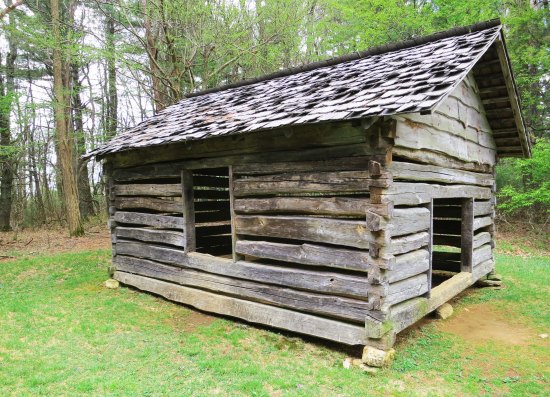
I liked this lonely structure, which looks like a great place for a picnic.

And these quiet waters.

Climbing up into the Highlands provides scenic views of the Atlantic coast.

A close-up.

Blue skies color the Atlantic Ocean blue.

The Cabot Trail moves between the highlands and coast. Given a choice between long sandy beaches and rocky coasts, I will always prefer the rocky coasts, unless, of course, I happen to be on a tropical island.

Another view.

The cool, windy day fluffs Peggy’s hair

The road leading down to Cape North, the farthest east I would travel.

This church at Cape North marked the turning point in my 10,000 mile trek. After this, I would be heading home.

Shortly after we left the church, Peggy and I came on these two bicycle tourists. The dark cliffs looming in the background would provide the second hardest climb in my whole trip, but that’s a story for my next blog.