The “not so usual” Rocks and Driftwood of Harris Beach SP, Oregon

The bright green moss and reflected sunlight are what caught my attention with this rock at Harris Beach State Park near Brookings, Oregon.

The pounding surf and towering sea stacks at Harris Beach State Park near Brookings, Oregon tend to pull your view up and outward. It’s easy to skip looking down. So far in this series, I’ve introduced tide pools and sea stacks. Today I am going to feature the beauty and personality of smaller rocks and driftwood.

I was amused that the bike tracks here look like they may have been left by this rock as it wandered across the beach and made a right turn.
The tide flowing in and out would soon disturb these calm waters among the rocks. I liked the contrast between the sunlight on the rock and the darker water.
A low tide shot with water flowing out toward the ocean.
The tide was flowing in here.
This rock had an obvious personality, but I’m not sure what it was.
Layers of sedimentary rock deposited over eons and then bent by the earth’s moving mantle.
This basalt rock had quartz veins running through it.
Chunks of the rock had broken off and been rounded by the pounding surf. Peggy gathered a number of them and put them in my pack. (One of my jobs is to carry rocks that Peggy gathers. ) She brought the rocks home and added them to her ever-growing rock garden.
Imagine how high the sea must have been to place this giant, storm-tossed log this far above the beach.
I find driftwood endlessly fascinating because of the way it displays patterns in the wood. Color was an added factor here.
I’ll conclude with my favorite. On next Friday’s travel blog I’ll feature a dramatic hole in one of the sea stacks and finish the series with sunset on the beach shots.

NEXT POST:

Monday’s Blog-a-Book… from “It’s 4 AM and a Bear is Standing on Top of Me” : You’ve met Demon the Black Cat, now it’s time to meet MC the White Cat who lived in the Graveyard except for dinner. There was a reason…

The Magnificent Sea Stacks of Harrison Beach… Marvels of Erosion

Once, these two magnificent sea stacks would have been part of the coast. Erosion made them part of the ocean. The evening sun was bathing them in a gentle glow.

I am continuing the exploration of the Oregon Coast on my Friday travel blog. This is part of the Harris Beach series. So far, Peggy and I have given you a tour of the tide pools teeming with interesting sea life. Today I will focus on the sea stacks that adorn the coast. Harris Beach State Park is located next to the town of Brookings, which is just north of the California border. The following photos are taken by both Peggy and me.

Goat (or Bird Island) at Harris Beach SP near Brookings is the largest Island on the Oregon Coast. According to the Audubon Society it is an IBA, an Important Bird Area. And it is. Over 100,000 birds nest there annually, including tufted puffins, a bird I more closely associate with my years of living in Alaska. The island is off-limits to people.
This massive sea stack appeared to have a face looking out toward sea. The rock base made me think of a many legged creature.
A closer view.
The reflection caught our attention here.
Peggy and I wandered among these rocks checking out tide pools.
Later in the day, the tide started coming in. It was time to stop playing in tide pools and start thinking about the sunset.
More color here.
I’ll conclude with this sea stack which was smaller but also colorful. My travel blog next Friday will include human-size rocks, an impressive hole in one of the sea stacks, and drift wood.

NEXT POST:

Monday’s Blog-a-Book Post… From “It’s 4 AM and a Bear Is Standing on Top of Me” : The shameless shenanigans of Pat the Greyhound and Demon the Black Cat get them fired from ghost guard duty.

Bunnies, Bunnies, Everywhere… An Easter Tale

I drove into the Pleasant Valley Campground near Tillamook, Oregon and there were bunnies everywhere, including this magnificent creature.

I drove into the Pleasant Valley Campground near Tillamook, Oregon and there were bunnies everywhere, including this magnificent creature.


With Easter having arrived, I couldn’t resist re-blogging/modifying a post I did on some really cute bunnies a while back.

I had stopped over in Tillamook, Oregon to visit the cheese factory. It sends out tons of the stuff annually. I assume all over the world. I watched women whip around 50 pound blocks of cheese like they had been working out with Arnold Schwarzenegger. This made me hungry, so I ordered a sample plate of Tillamook ice cream. Bad idea. It’s really good. I mean really, really good. But eating all of those calories made me tired. It was time to find a campground.

And this is where the bunnies came in. I pulled into Pleasant Valley Campground, a few miles south of Tillamook, and was greeted by (drum roll please) RABBITS, dozens of them. There were black ones, and brown ones, and white ones, all of whom seemed to be chasing each other around in a glorious romp to make more bunnies. After all, isn’t that what rabbits do beside deliver Easter eggs?

Ignoring the obvious, for the moment, I asked the owner where all the rabbits came from. “Oh they used to live across the street,” she informed me. “One day, a few moved over here. They didn’t do any harm and the campers seemed to like them. So I let them stay.” The rest is history, as they say. Anyway, here are some photos I took of the rabbits. Enjoy.

I am going for the awww factor with this baby bunny.

I am going for the “awww” factor with this baby bunny.

This was only a few of the rabbits, but it makes the point.

This was only a few of the rabbits, but it makes the point.

Furry rabbit near Tillamook, Oregon.

This furry gal was napping when I snuck up on her, but then, her eyes popped open…

Alert brown rabbit near Tillamook, Oregon.

And she was all wiggly ears and twitchy nose.

It rained really hard that night. I discovered I had several rabbits using my van as shelter. The step is the doorstep to my van.

It rained hard that night. I discovered I had several rabbits using my van as shelter. The step is my doorstep. My flashlight caught their eyes. Scary. Was it a case of when good bunnies go bad?

Tillamook, Oregon Bunny. Photo by Curtis Mekemson.

Nah. I’ll finish off with another baby bunny. It was cold out and this tyke looks cold. I almost invited it into my van to warm up. 

I don’t know how many of these bunnies participate in delivering Easter Eggs, but any of them would be welcomed here! A very Happy Easter to our friends throughout the blogging world— Curt and Peggy

Face Rock State Scenic Viewpoint… The Oregon Coast Series

The face of the Indian maiden is clearly seen here in the rock. If you start on the right you can see her chin, mouth, nose and eye. (Photo by Peggy Mekemson.)


Peggy and I have driven through the town of Bandon several times without stopping on our journeys up and down the Oregon Coast. We decided to correct that oversight this past week. I had googled the small town along Highway 101. Photos of striking rock sculptures at the Face Rock State Scenic Viewpoint were included on the site. That alone would have demanded a visit. But there was also the town of Bandon, Bullard Beach State Park, and the Coquille River Lighthouse to explore. Today, I will feature the scenic viewpoint. Next Monday I’ll focus on the town, park and lighthouse.

There’s a native American legend that goes along with Face Rock. It has to do with an evil spirit, a lovely maiden, and her favorite pets. The Indian maiden, Ewauna, had come with her father, Chief Siskiyou, to visit with several chiefs along the coast. In honor of the occasion, a great potlatch was thrown. After everyone had eaten far more bear and salmon than he or she should have and stumbled off to bed, Ewauna decided to go for a swim in the ocean, even though she had been warned not to. The evil spirit Seatka lived in the ocean and had a thing for fair maidens. Naturally, he captured Ewauna along with her dog, cat, and kittens. You can still see them today down among the rocks.

Face Rock near Bandon, Oregon.

Another view of the maiden, Ewauna. This one taken at sea level. (Photo by Peggy Mekemson.)

The maiden with her cat and kittens off to the right. (Photo by Peggy Mekemson.)

We were lucky to visit the scenic viewpoint at low tide, so we followed a wooden stairway down to the beach, wandered around among the rock sculptures, explored some caves, and admired the general beauty of the area.

Stairs led us down to the beach. (Photo by Peggy Mekemson.)

I caught a photo of Peggy making her way down the stairs. Marvelous rock sculptures were waiting for us.

A small stream crossed the path at the bottom of the stairways.

Peggy caught it coming out on the other side of the colorful rocks. (Photo by Peggy Mekemson.)

And I captured a broader perspective.

I promptly name this rock Elf.

Peggy took this for perspective.

Another towering giant caught our attention. I named it Bigfoot.

Peggy and Bigfoot’s toes.

This photo provides a Peggy perspective on Bigfoot’s big foot.

A distant view of Bigfoot looking small— and other rocks— from the scenic viewpoint.

These cliffs rose up dramatically behind the beach.

A pair of eye-like caves had been cut into the cliffs by the pounding waves. I was pretty sure that there would be pirate booty in them. (Photo by Peggy Mekemson.)

One of the caves was filled with rocks. I was tempted to dig.

A view out from inside the cave. We hadn’t been alone in checking out the cave. (Photo by Peggy Mekemson.)

The same rock looking down from the viewpoint.

Looking up at the rock from below.

The other cave provided a view through the rock cliff. (Photo by Peggy Mekemson.)

Another view. The yellow plant seen on the other side is gorse. (Photo by Peggy Mekemson.)

George Bennet, the founder of Bandon, brought the thorny gorse with him when he came from the town of Bandon, Ireland in 1873. He saw it as a touch of home. Local Oregonians view it as an invasive plant that crowds out native plants.

It does have a certain beauty, but don’t try to hike through its thorns. The cave comes through the cliff on the right.

Another view.

There were many more rocks to keep us entertained. (Photo by Peggy Mekemson.)

The cat and kittens looked a little more riled up here as the tide began to roll in. (And no, the cat and kittens aren’t obvious to me, either.)

Peggy caught the tide slipping in between thesis giants. Can you spot the misplaced Canadian Goose on top of the rock on the left? It flew off honking. (Photo by Peggy Mekemson.)

I photographed the tide edging around this rock. The bottom of the rock, BTW, is packed with sea life.

Peggy’s close up shows goose neck barnacles, regular barnacles and mussels. Every inch is filled!

Our exploration complete, it was time to head back up the stairs.


NEXT BLOGS:

Wednesday: The interview with Bone!

Friday: The beautiful temples of Burning Man.

Monday: It’s back to Bandon, Oregon.


Sorry, Sully, I Was Distracted… Oregon’s Gorgeous Harris Beach State Park

This is what you find on a sunny day at Harris Beach State Park near Brookings, Oregon. Peggy and I had to deal with stormy weather.

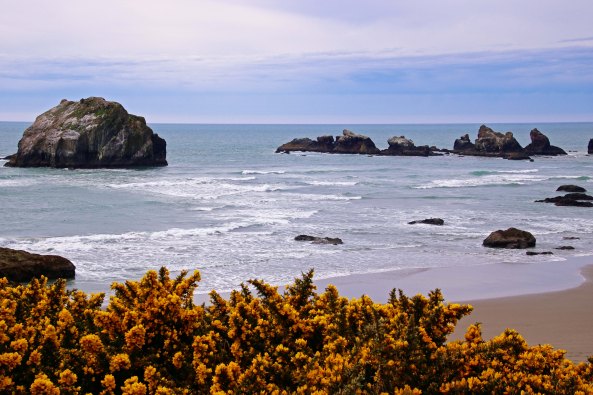
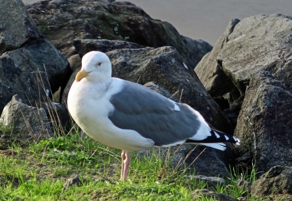
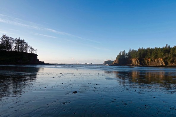
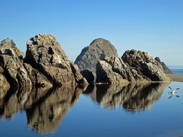
This is what you find on a sunny day at Harris Beach State Park near Brookings, Oregon. I was particularly pleased with the seagull who decided to photo-bomb my picture. Peggy and I had to deal with stormy weather when we visited there last week.


So, I was going to write about Chesley Burnett “Sully” Sullenberger III today, the heroic American Airlines pilot who saved 155 people in 2009 by landing his goose-disabled US Airways Flight 1549 on the Hudson River, but I got distracted. It happens, you know.

Peggy and I took a trip over to the Oregon Coast for Valentine’s Day and ended up at Harris Beach State Park in Brookings. It was a stormy three days filled with 40-60 MPH winds, slashing rain and crashing waves— the perfect weather for romantically snuggling down in our 22-foot RV and eating chocolate as the world roared by outside.

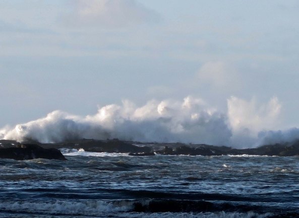
We had our rain hats, rain coats and rain pants, however, so we got out for a couple of walks: once when the sun was threatening to shine and once when the heavens were threatening to open up and dump oodles of rain. And we took our cameras. Peggy wanted to play with her new Canon EOS Rebel T6i with a Tamron 16-300 mm telephoto lens. I took my trusty little Canon Powershot G7x. The conditions weren’t ideal for photography— grey skies matched grey seas matched grey rocks, but we had fun seeing what we could capture.

Harris Beach State Park near Brookings, Oregon

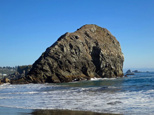
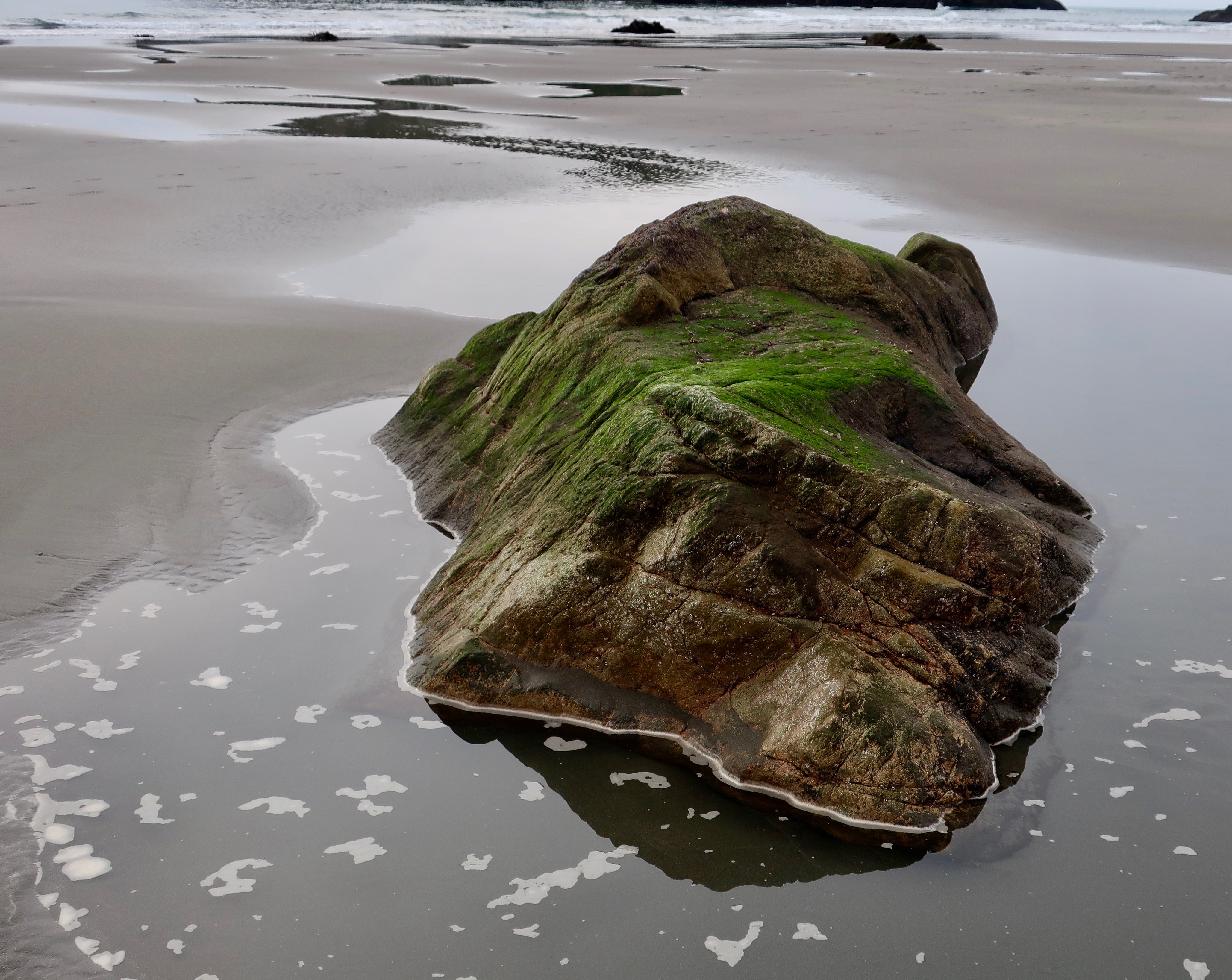
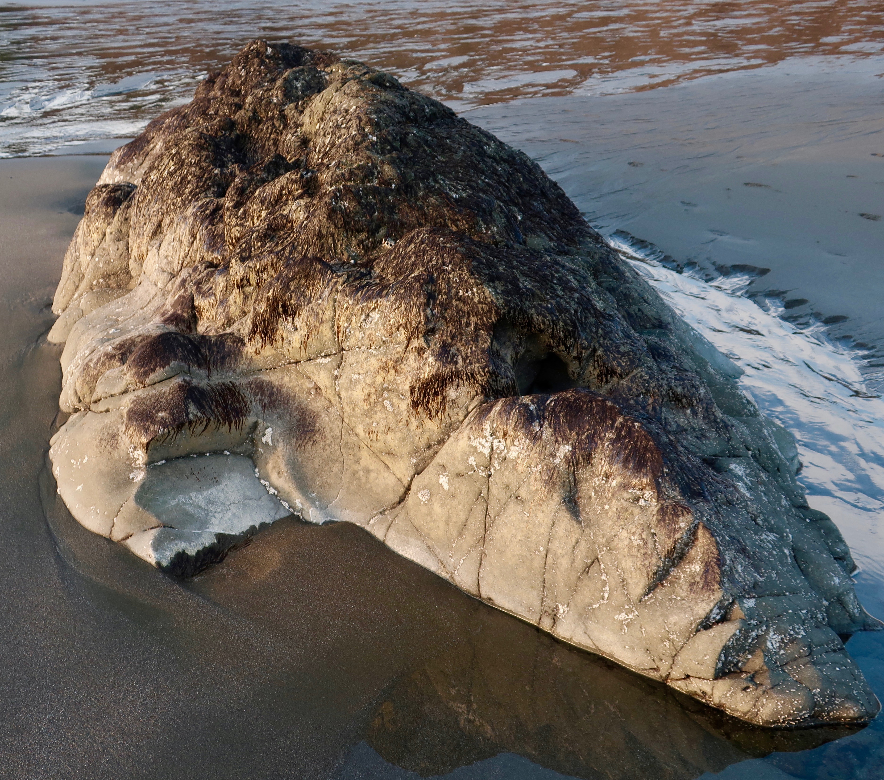
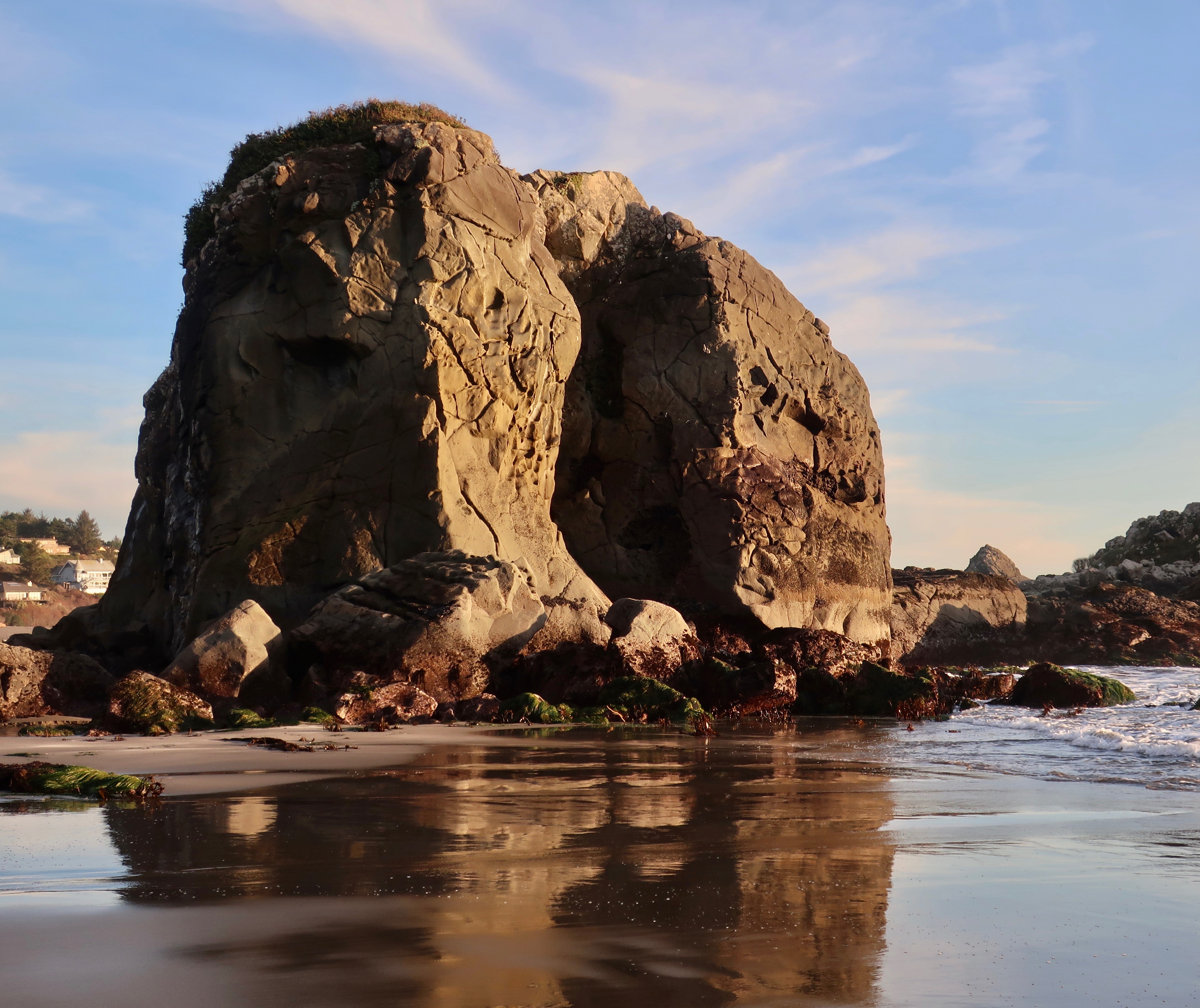
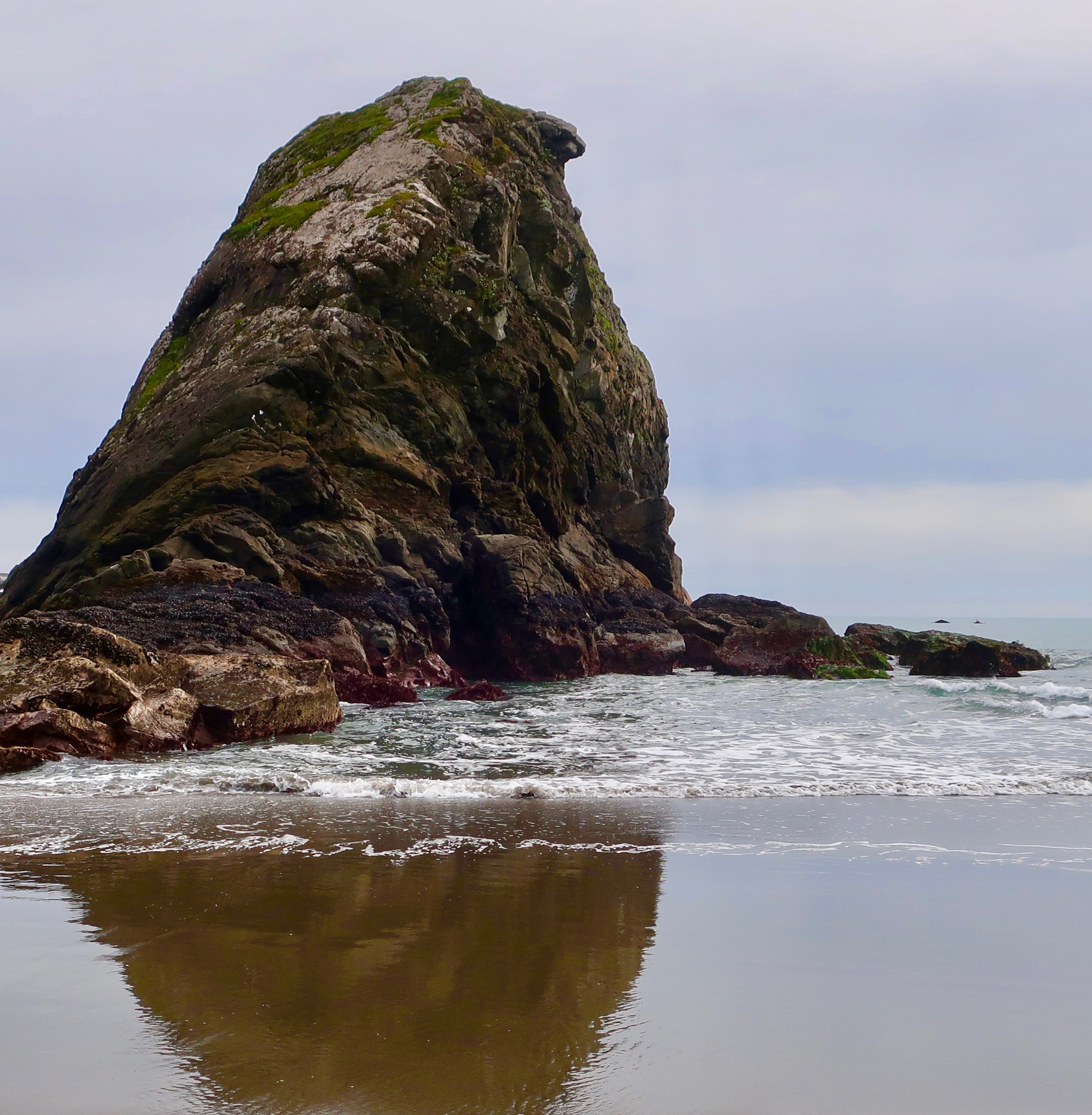
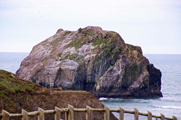
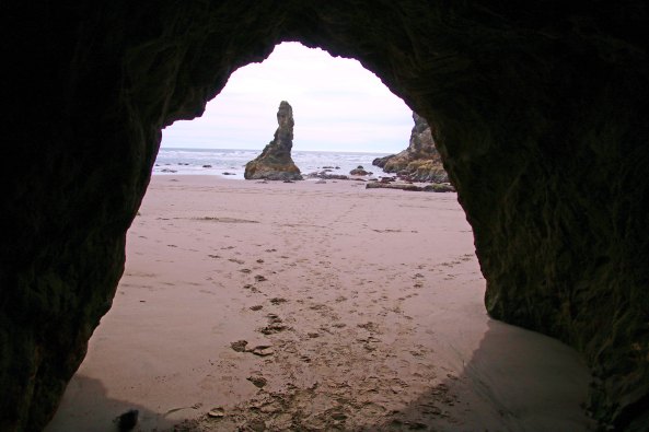
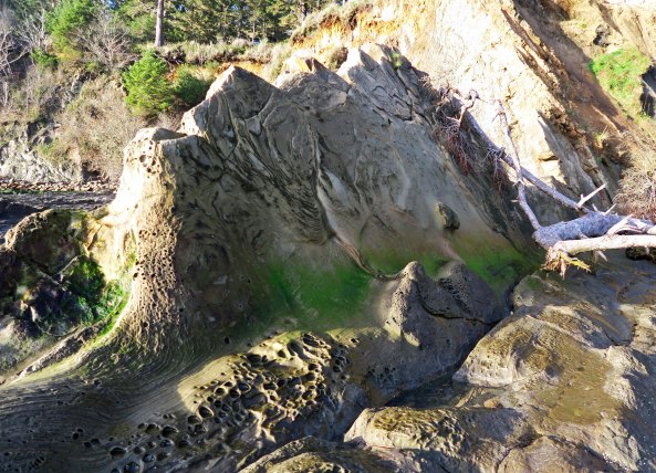
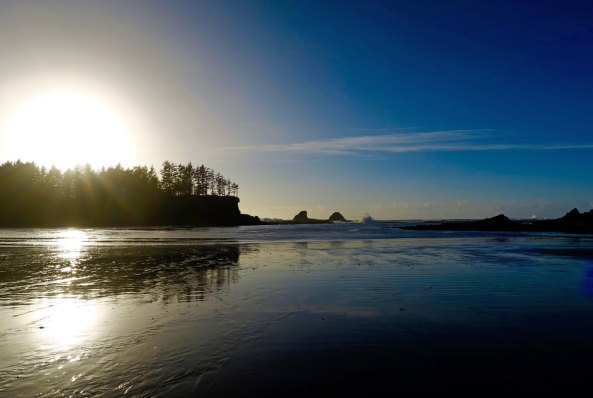
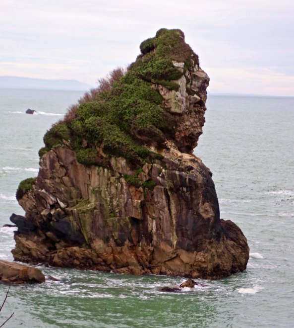
This sea stack was in the background on the lead picture for this post. Again, I took this photo on a sunny day. Note the large crack/cave on the front. (Sea stacks are rocks in the ocean that have been created by the endless waves eroding the shoreline.)

Storm tossed seas at Harris Beach State Park.

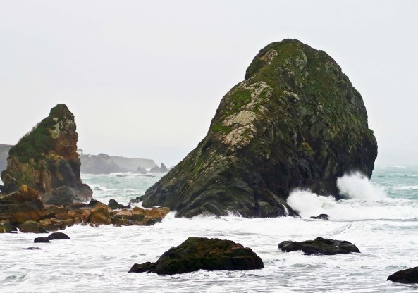
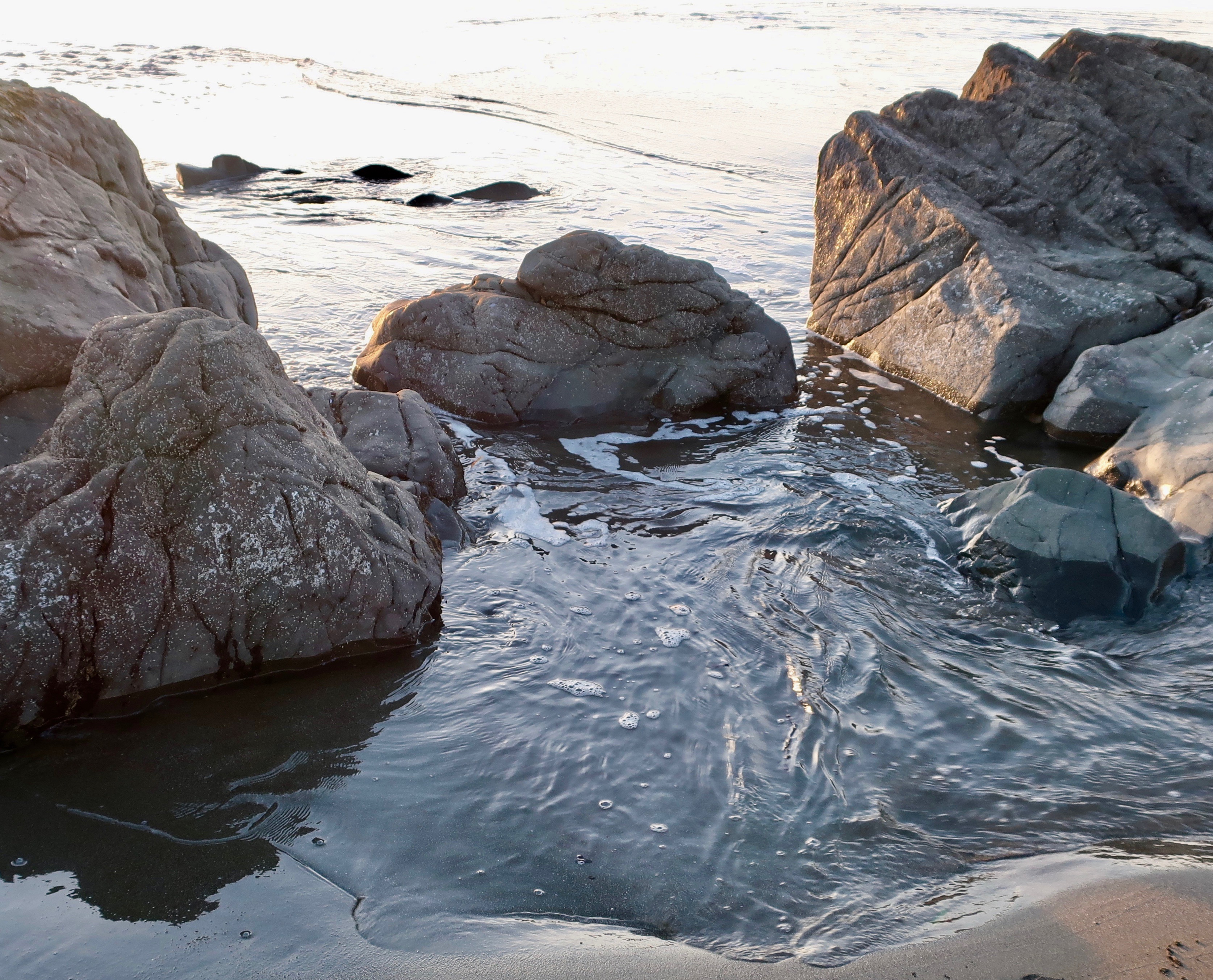
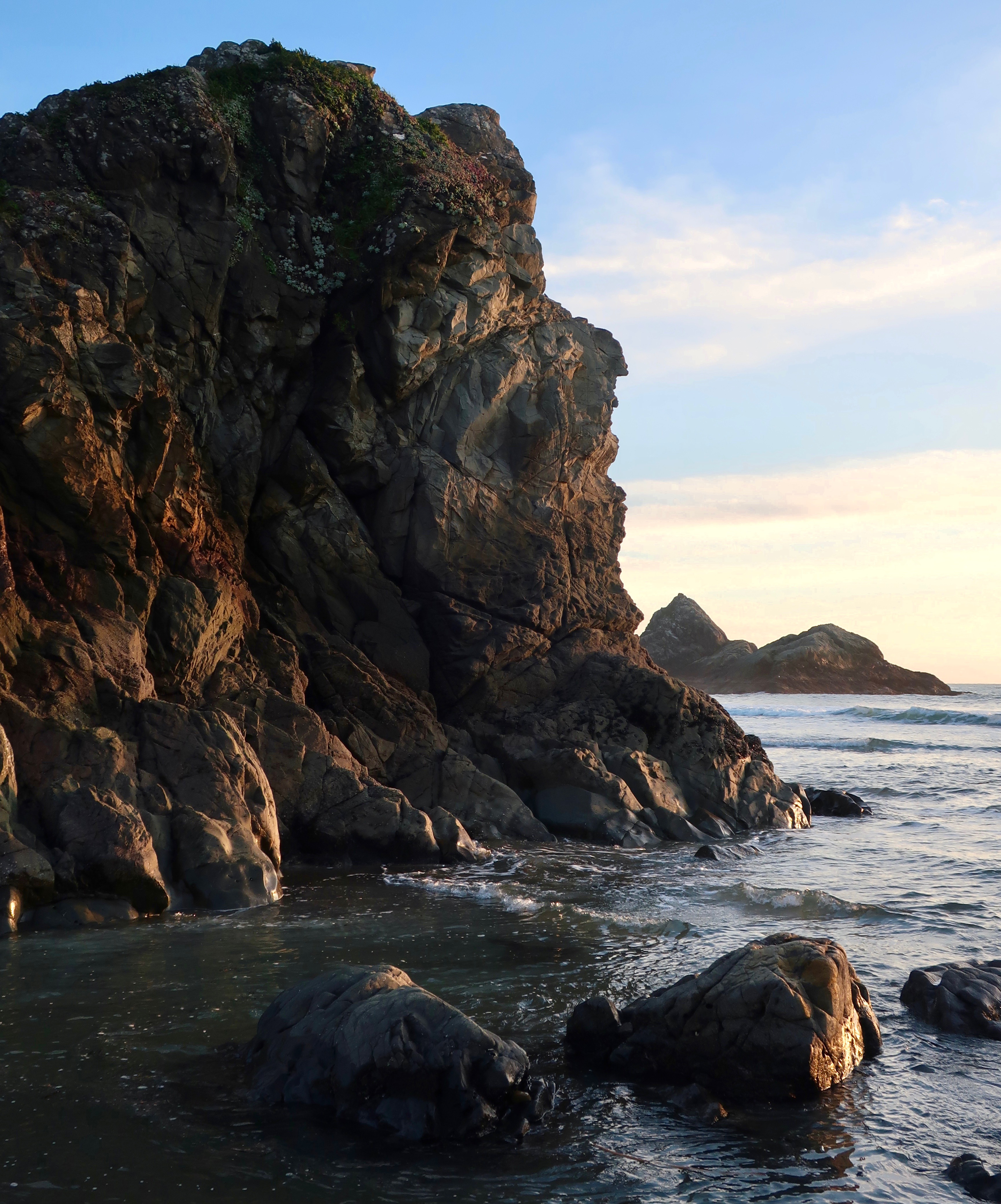
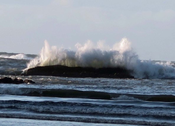
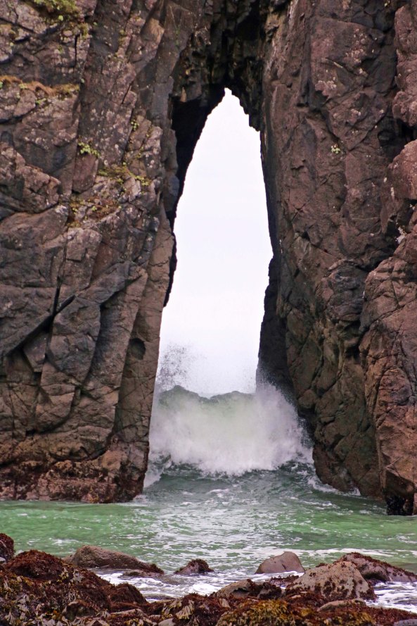
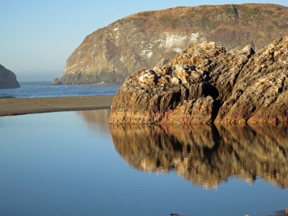
This is what it looked like last week. A wave is crashing into the cave. (Because of a high tide abetted by the stormy weather, I had to take this photo from a different angle.The sea stack on the left is included in photos below. Brookings is on the distant cliff.)

When we arrived home, I was eager to see the results and process the photos. I did that instead of working on the photos I took of Sully’s plane at the air museum in Charlotte, North Carolina when we visited there in early January. Bad Curt. As a result, today’s post is on Harris Beach. Sorry, Sully. Next Monday is yours. But then I will be in Las Vegas. Hmmm.

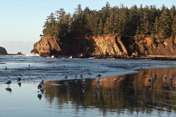
Harris Beach State Park sits on the edge of Brookings and is about three scenic hours away from where we live. We followed back roads to Highway 199, otherwise known as the Redwood Highway, to US 101 on the Pacific Coast and then followed it north to Brookings. It is a gorgeous park filled with imposing sea stacks and Oregon’s largest island, which happens to be reserved for the birds. Some 100,000 hang out there during mating season, including tufted puffins who use their webbed feet to dig their nests into the ground.

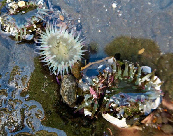
The island is off-limits for two-legged types like us, however, so we were left with taking photos of rocks, waves, and driftwood.

Split rock at Harris Beach State Park allows waves to go under rock.

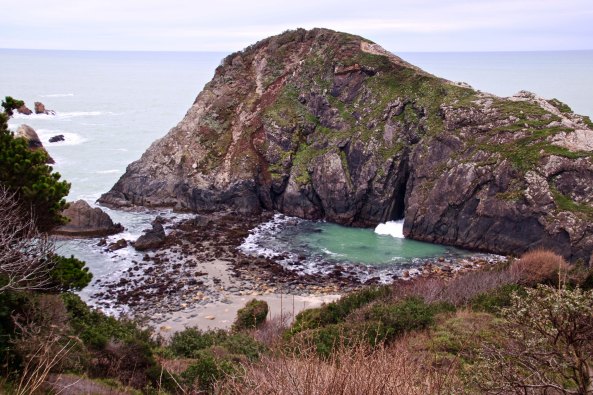
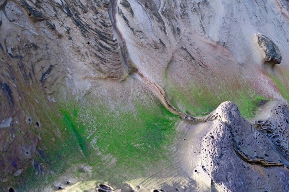
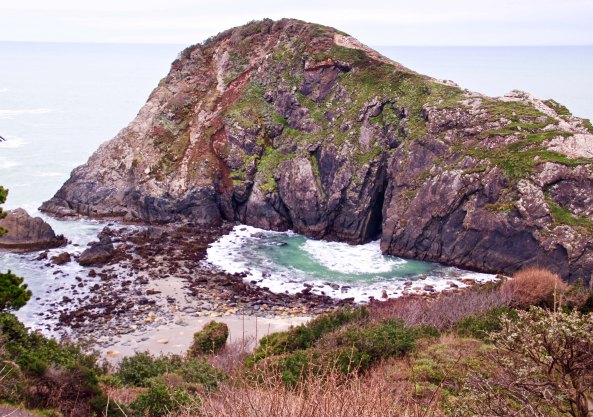
Our semi-sunny walk took us behind the large sea stack (small island?)  and showed us that the large cave we had seen on the front went all of the way through. The waves coming in had developed a small cove. (Photo by Peggy Mekemson.)

Harris Beach State Park on the Oregon Coast.

The waves created this interesting, fan-like look. (Photo by Peggy Mekemson.)

Massive rock face at Harris Beach State Park.

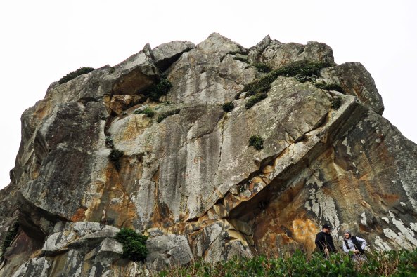
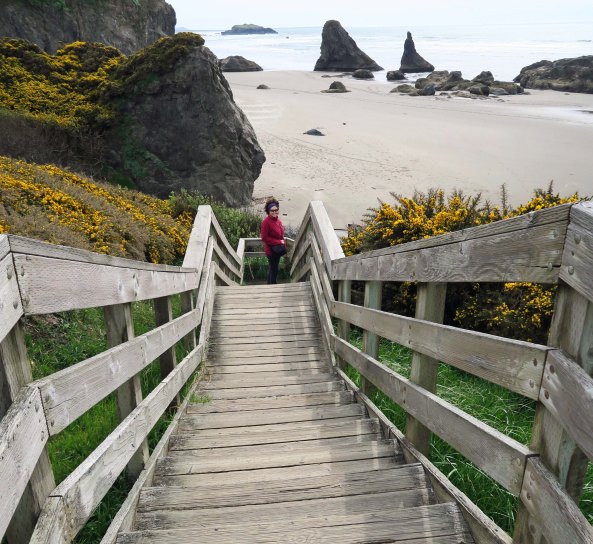
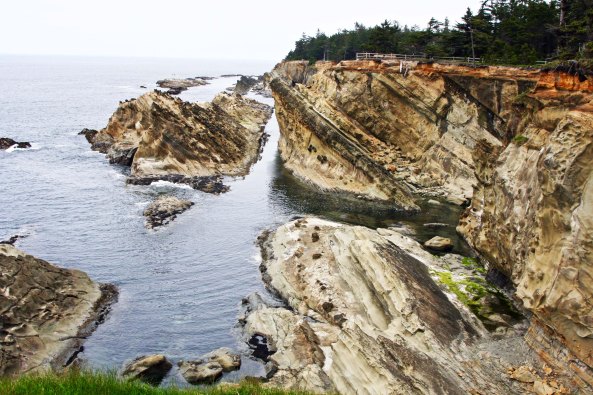
As we hiked down to the cove, I turned around and photographed the rock cliff we were walking around. Note the couple on the lower right for perspective. I felt that the grey sky set the cliff off more than a blue sky might have.

Peggy Mekemson hiking down trail at Harris beach State Park near Brookings, Oregon.

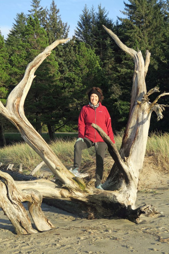
I caught a photo of ‘my Valentine’ appropriately dressed in red as she made her way down the trail. I had her move to the center of the trail so the Pacific would outline her and provide depth.

Rock 'bower' along trail at Harris Beach State Park on the Oregon Coast.

This rock overhang provided a bower for the trail. (Photo by Peggy Mekemson.)

Rock overhang at Harris Beach State Park near Brookings, Oregon.

I took a close up of the overhang.

Water caught in crevice at Harris Beach State Park near Brookings, Oregon.

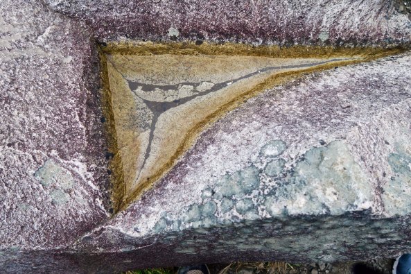
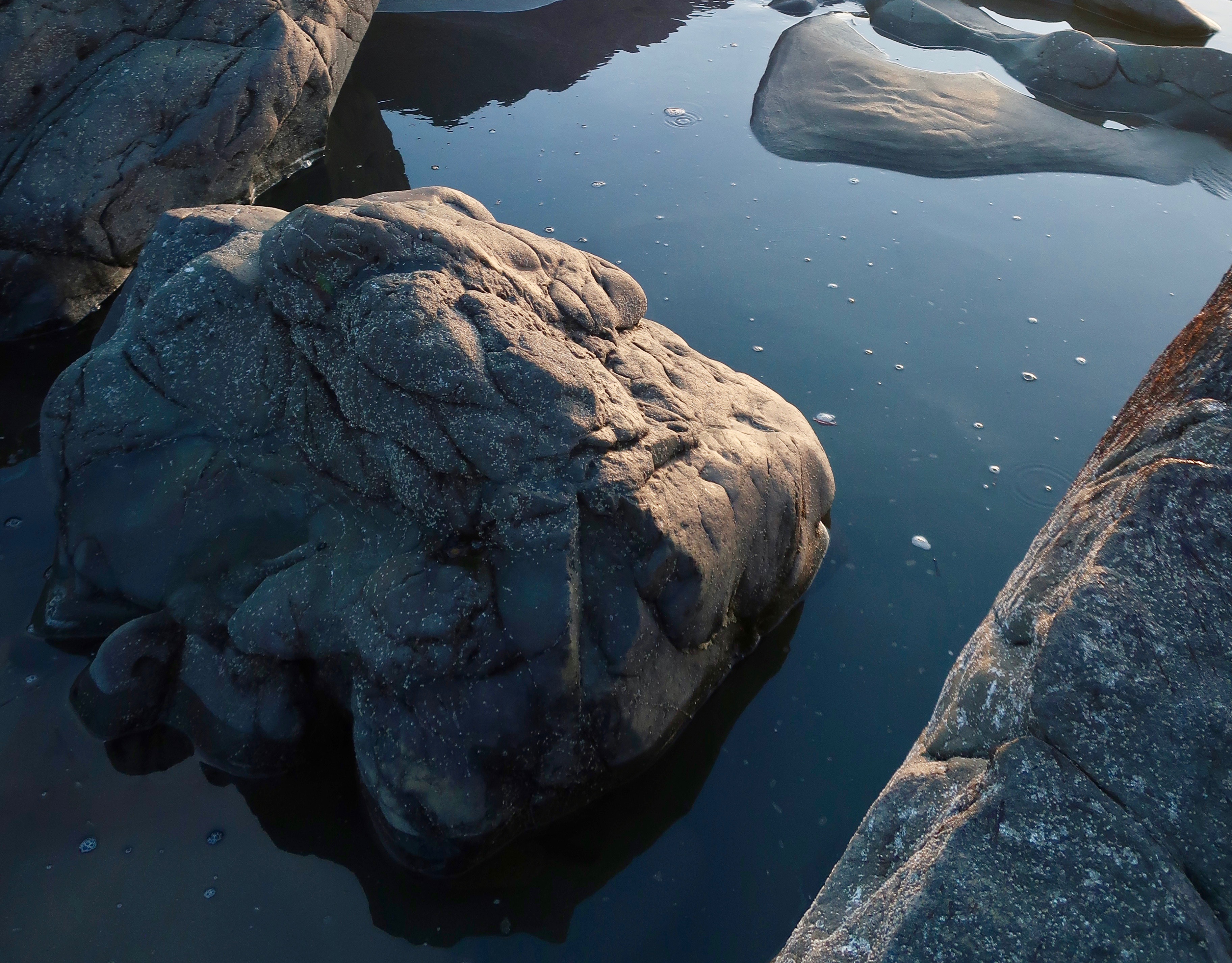
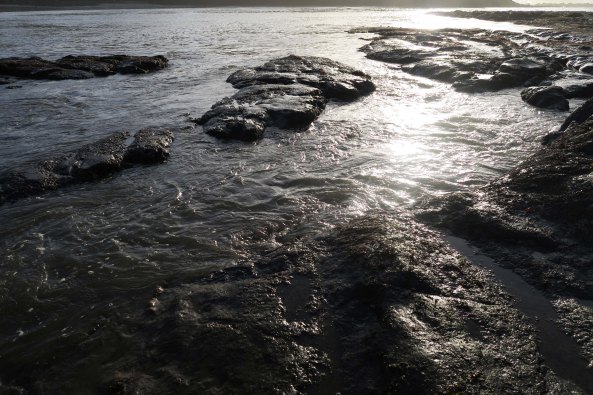
Another close up that intrigued me was this water caught in a small crevice that provided something of an abstract photo.

Down on the beach, Peggy caught a shot of a wave come through the split in the rock.

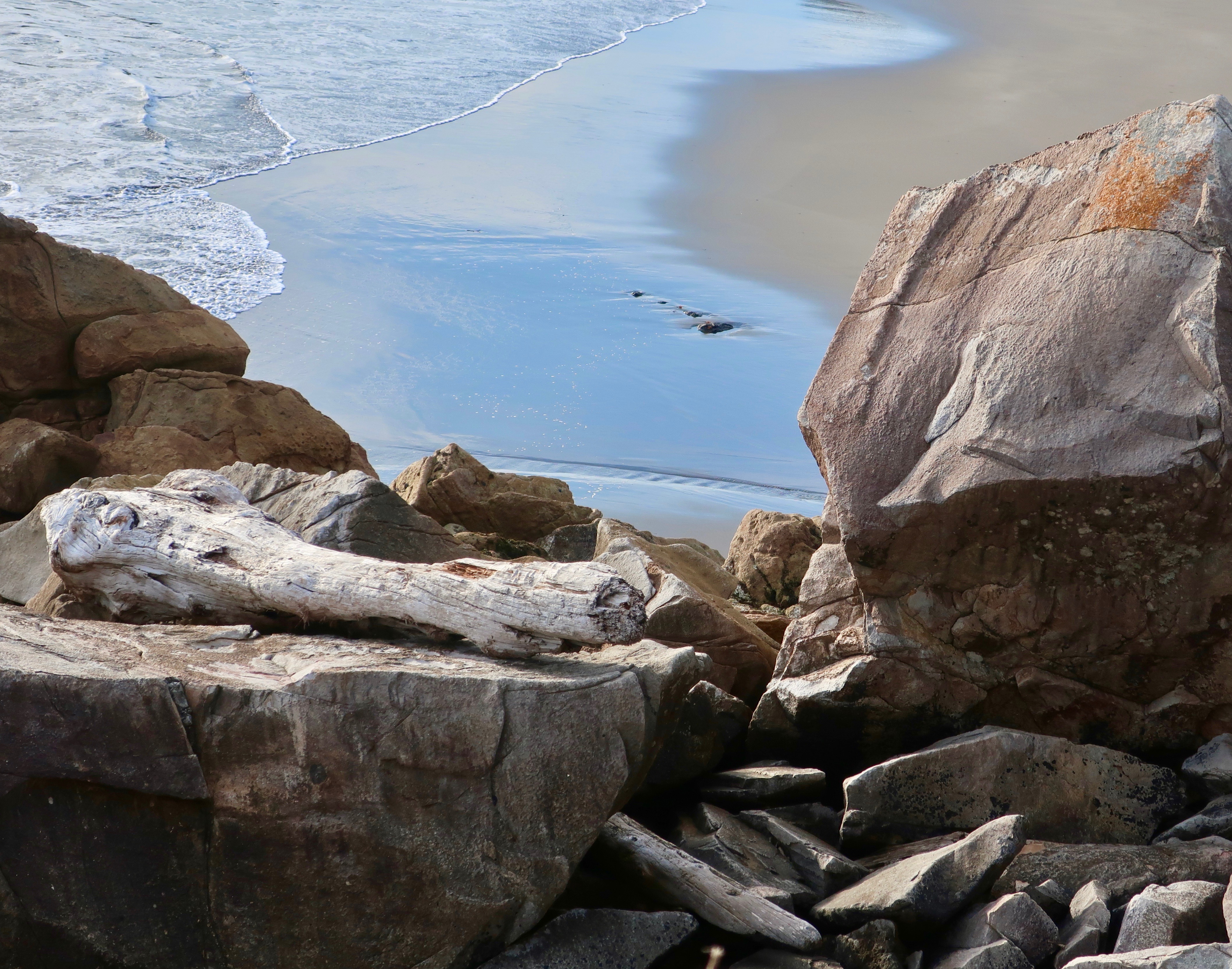
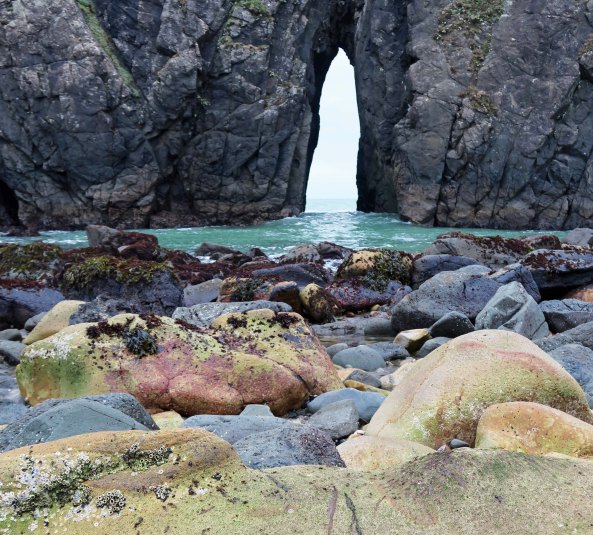
Down on the beach, Peggy caught a shot of a wave coming through the split in the rock. Blue skies may have provided more depth but I felt the grey skies placed the focus on the wave.

Split rock at Harris Beach State Park on the Oregon Coast.

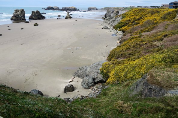
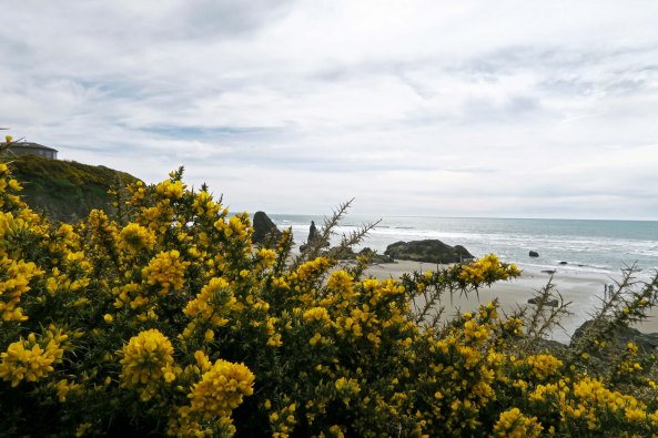
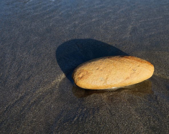
I moved back to capture some yellow rocks in the foreground to add color to our grey day.

Photo of sea stack rock by Peggy Mekemson at Harris Beach State Park near Brookings, Oregon.

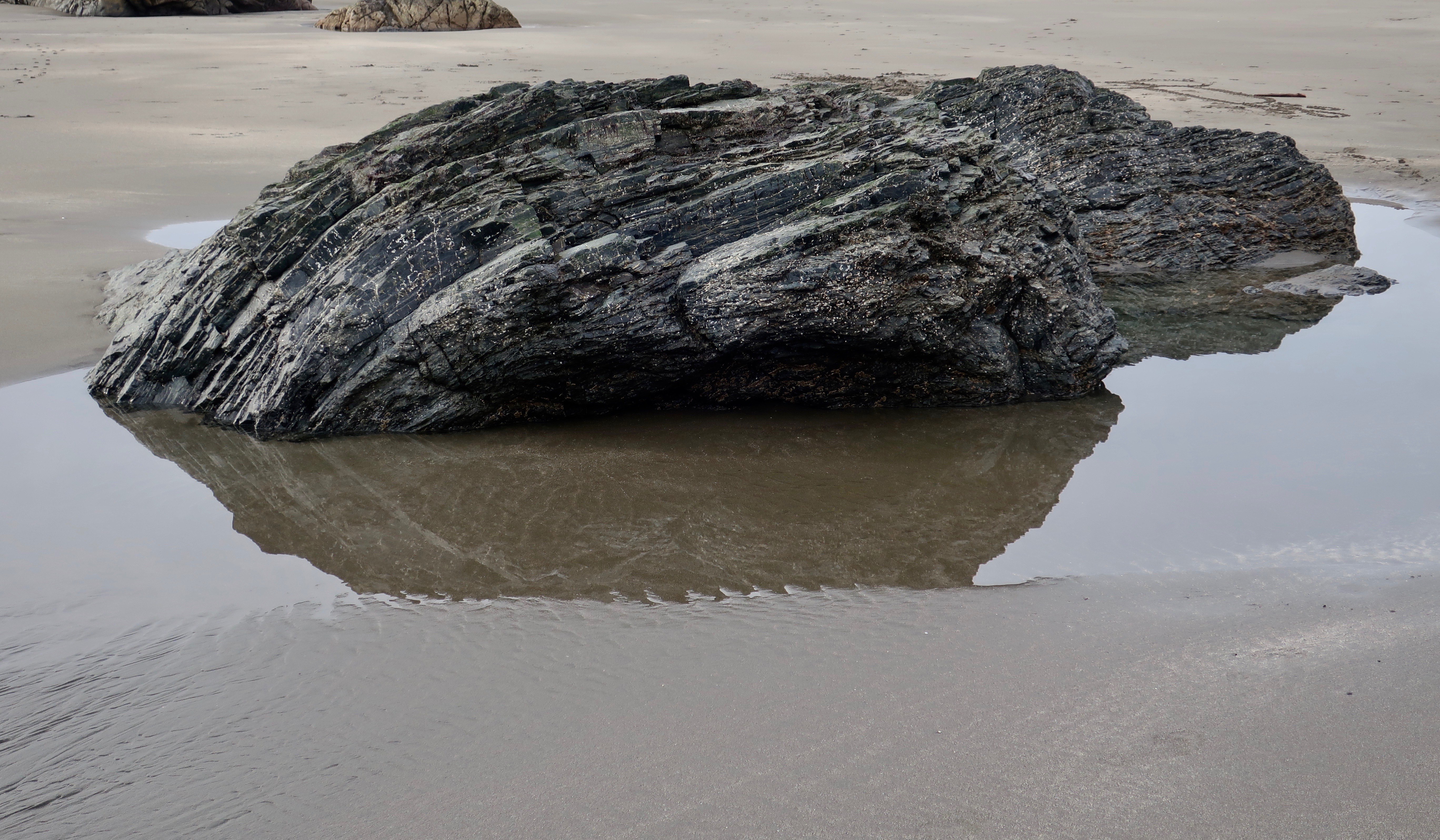
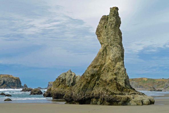
A sea stack  just south of the split rock caught Peggy’s attention and she filled her lens with it.

Photo of sea stack rock by Curtis Mekemson at Harris Beach State Park on the Pacific Ocean.

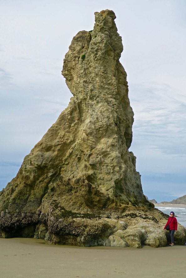
I placed the sea stack in its surroundings, again using a yellow rock on the beach for a splash of color.

I then rendered it in black and white to honor the black and white of the day.

I then rendered it in black and white to honor the black and white of the day.

Conglomerate rock at Harris Beach State Park near Brookings, Oregon.

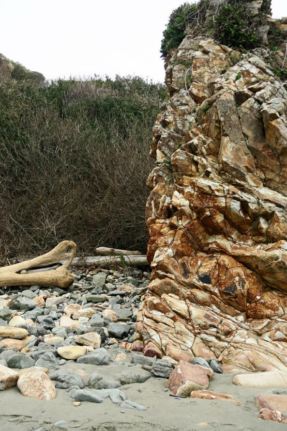
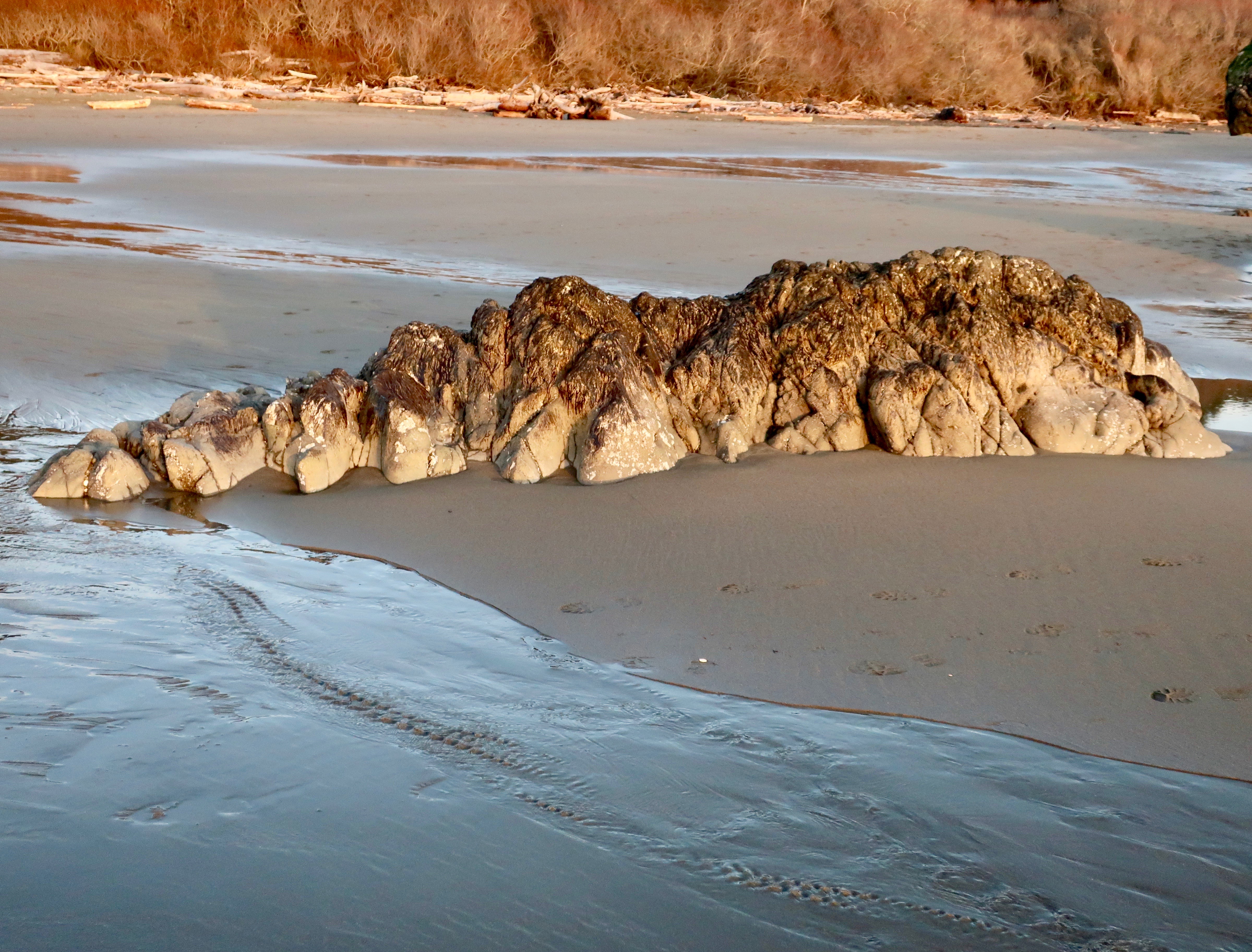
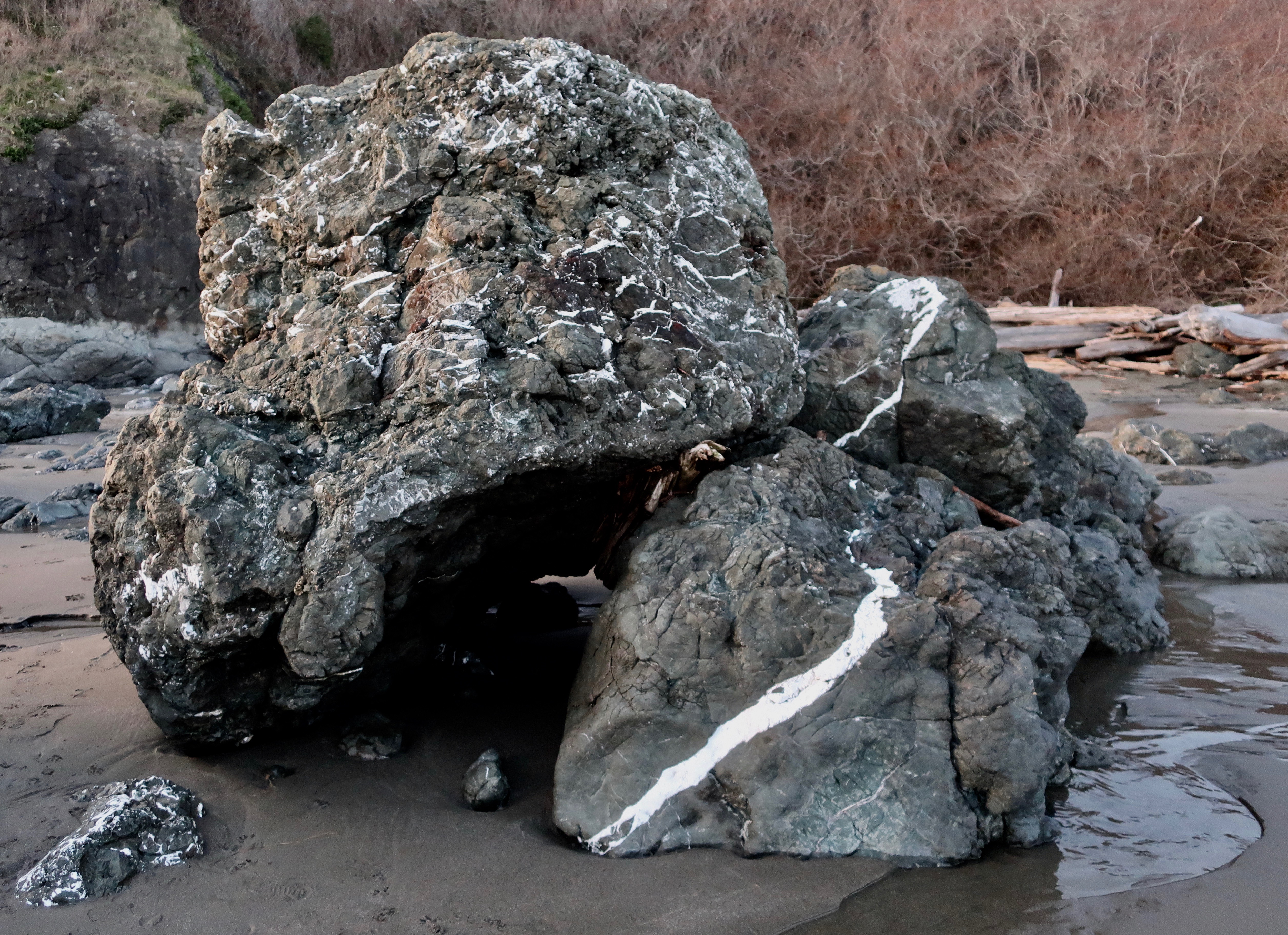
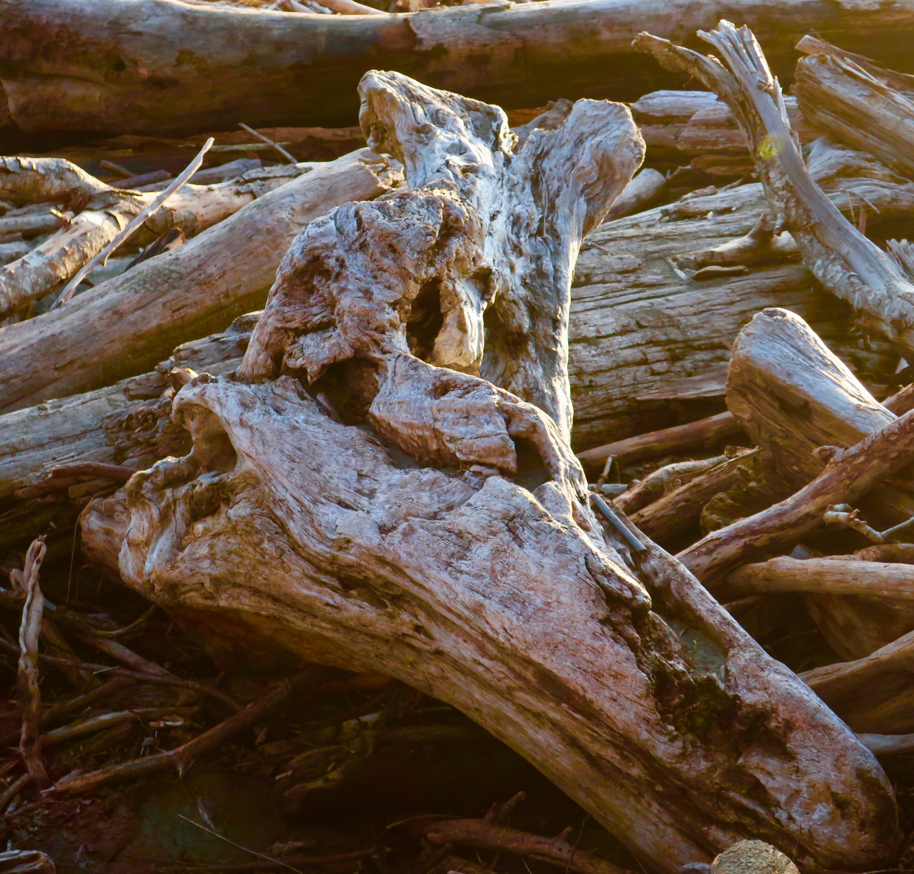
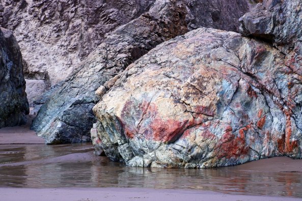
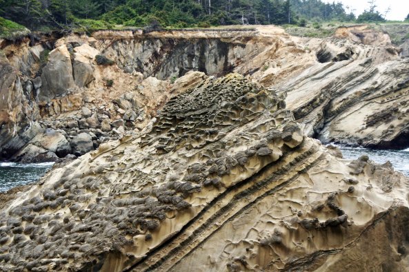
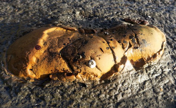
A conglomerate rock and driftwood caught my attention next.

Photo of conglomerate rock by Peggy Mekemson at Harris Beach State Park on the Oregon Coast.

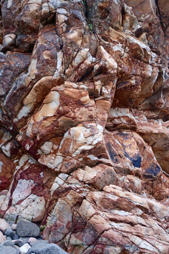
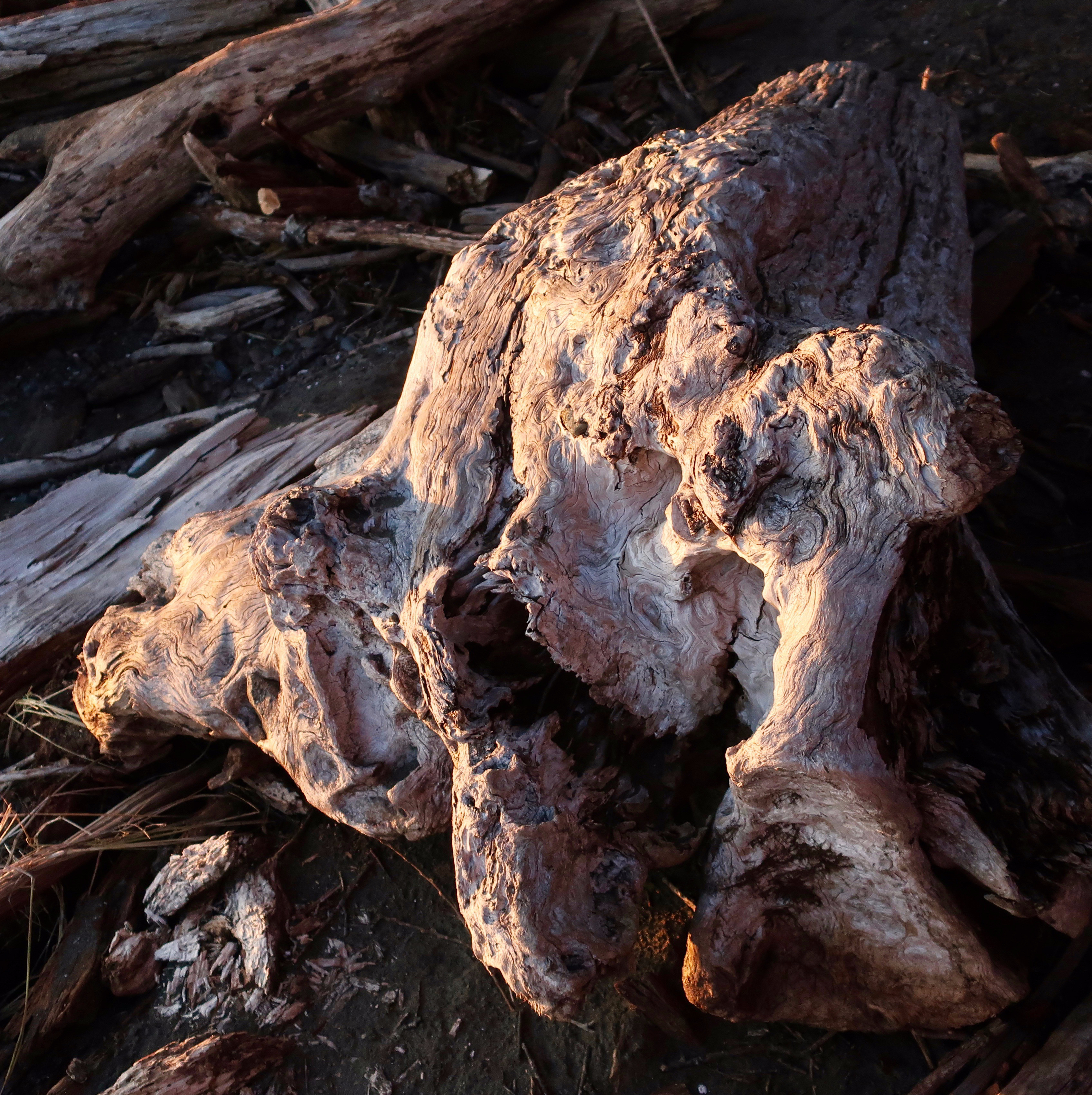
Peggy focused in on the incredible color and texture of conglomerate rock…

Driftwood at Harris Beach State Park.

While I went for the driftwood and the rock it had managed to capture.

Our second walk took us down to the main beach area at Harris Beach State Park. The weather was more iffy so Peggy was more careful with her camera, but my small Power Shot G7x is used to being abused.

Scotch Broom photo at Harris Beach State Park near Brookings, Oregon.

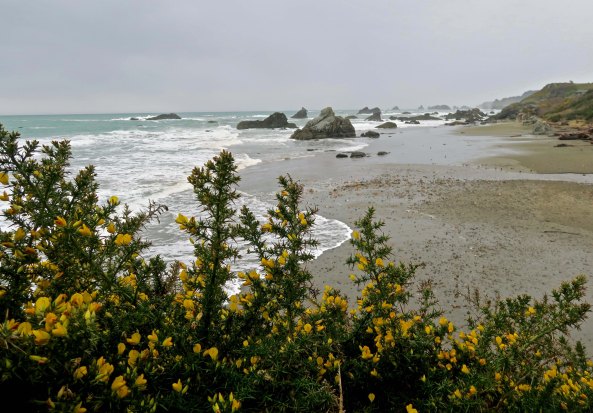
I used Scotch Broom to add color to a shot looking north up the beach.

Peggy's telephoto lens provided a better view of just how many sea stack rocks are found on Harris Beach State Park.

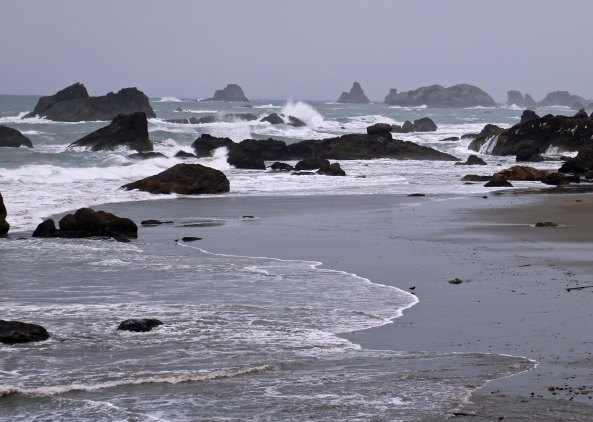
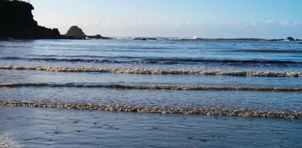
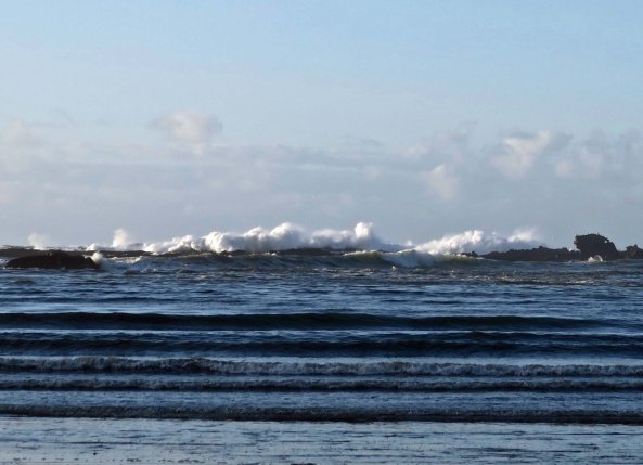
Peggy’s telephoto lens provided a better view of just how many sea stacks are found on Harris Beach State Park, and a sense of the grey day.

Sea stacks at Harris Beach State Park near Brookings, Oregon.

I used these waves to provide a lead in to the sea stacks.

Drift logs at Harris Beach State Park on the Oregon Coast.

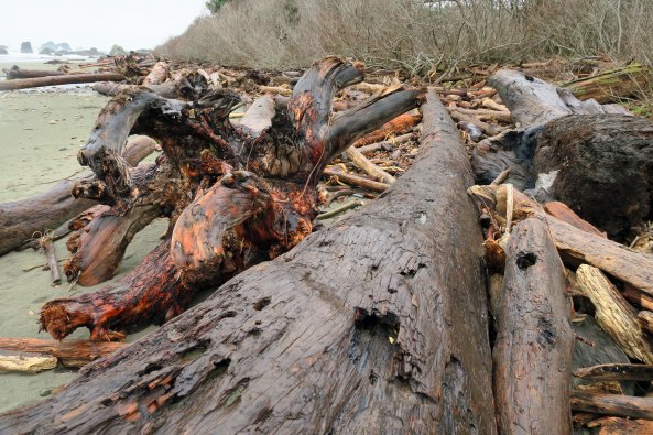
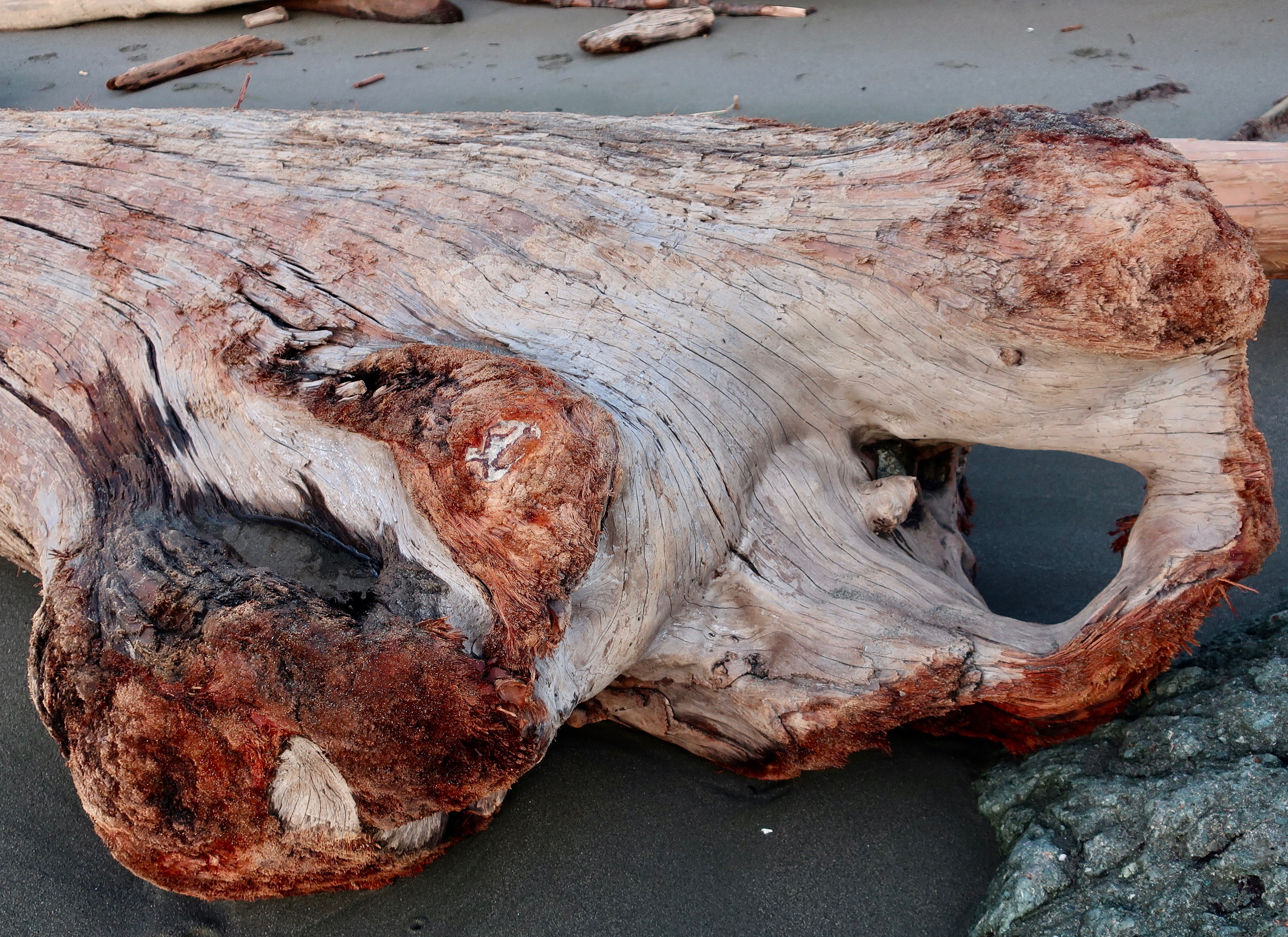
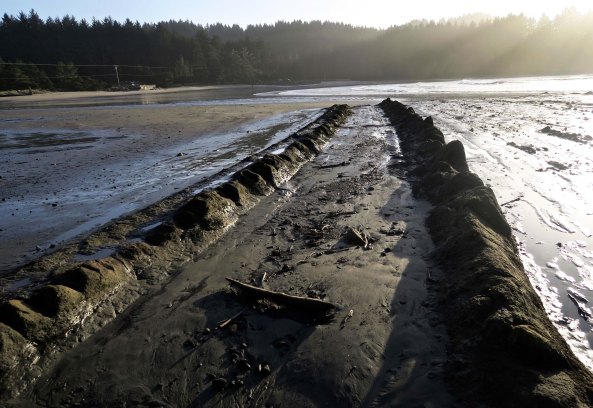
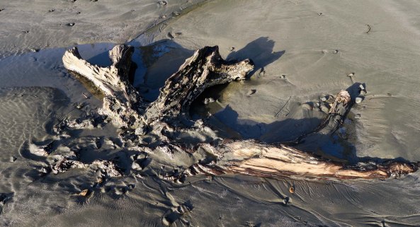
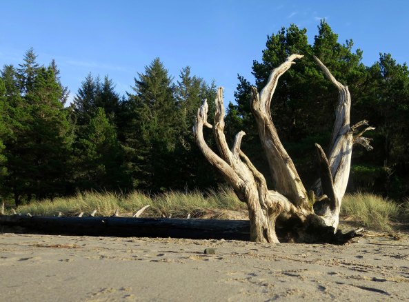
Talk about a lead in… What about this drift log? The driftwood speaks to the power of storm-tossed seas. Note the colorful roots on the left.

Flat roots on driftwood at Harris Beach State Park.

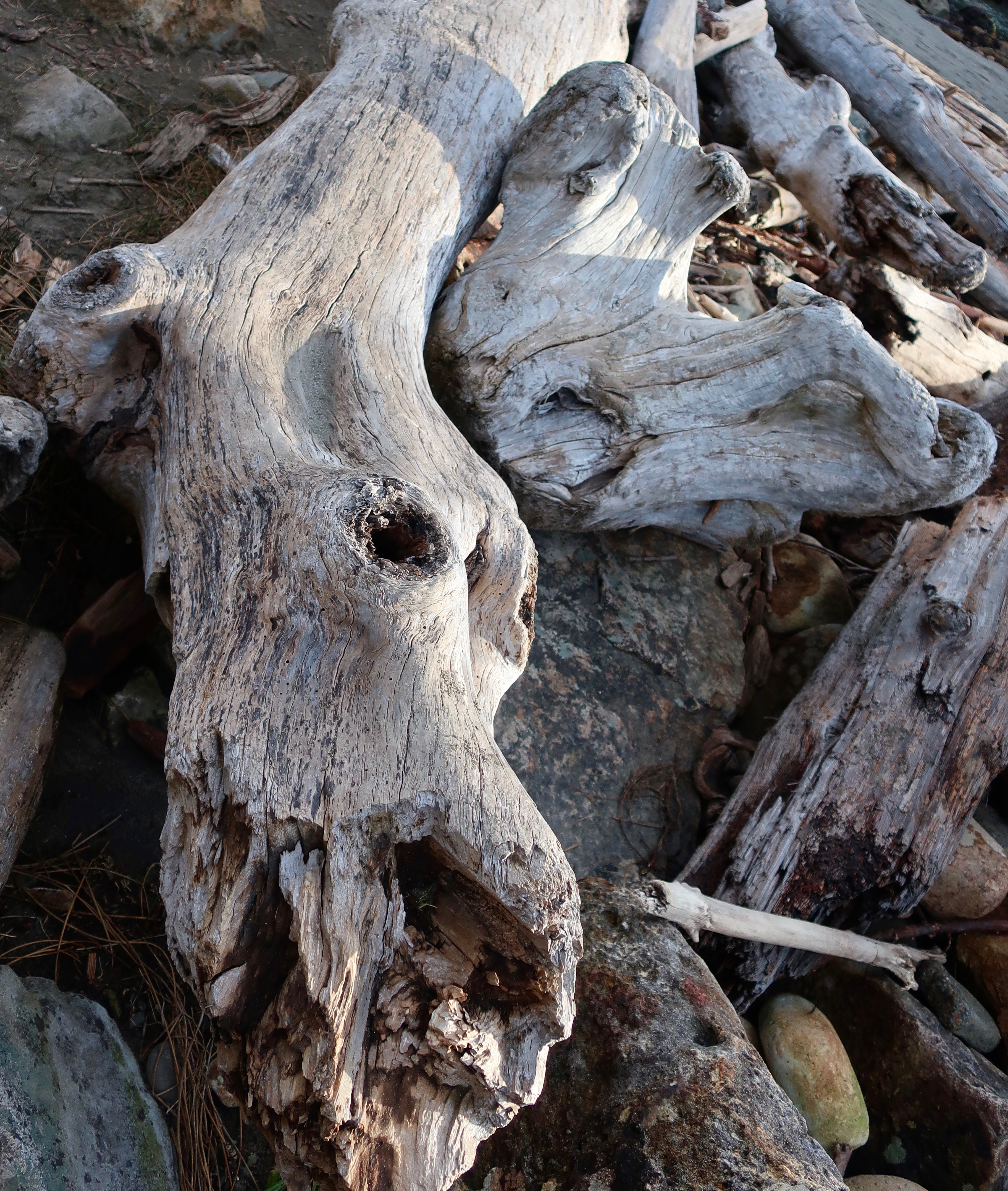
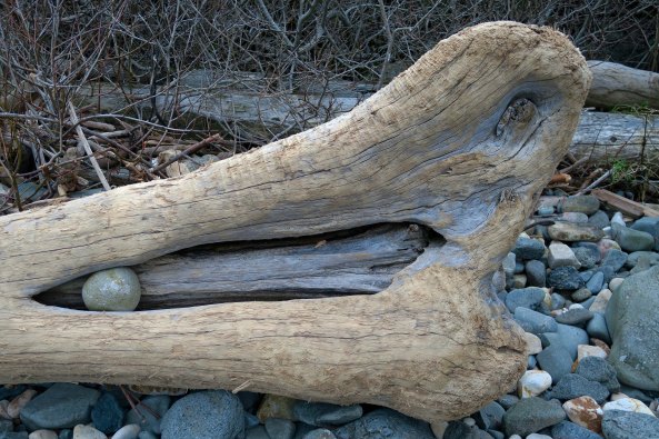
I also found these ‘moose antler’ roots interesting. With a little imagination I found the moose’s eye and nose.

Turtle-like rock at Harris Beach State Park near Brookings, Oregon.

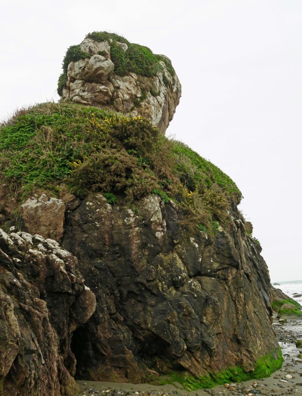
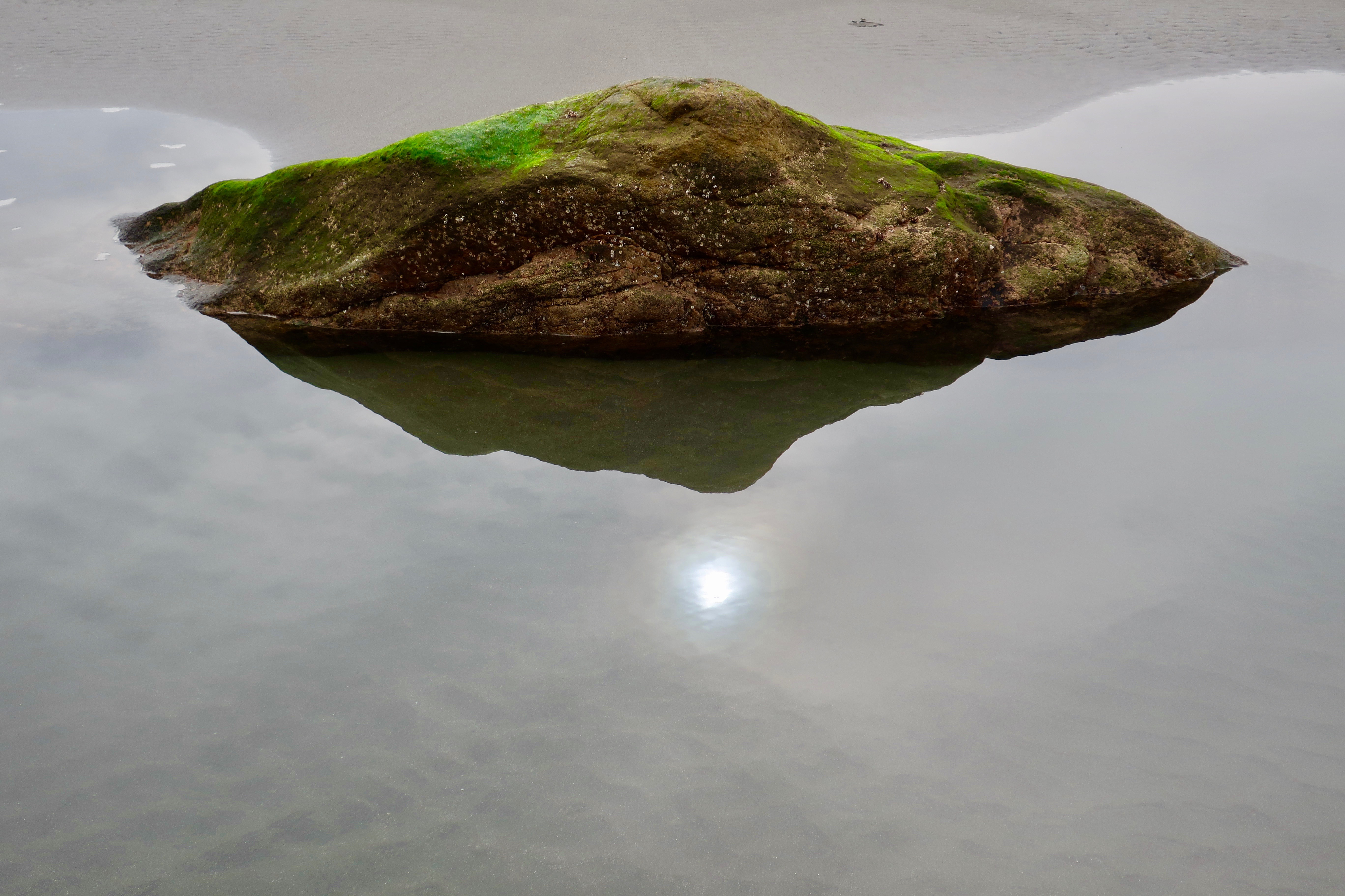
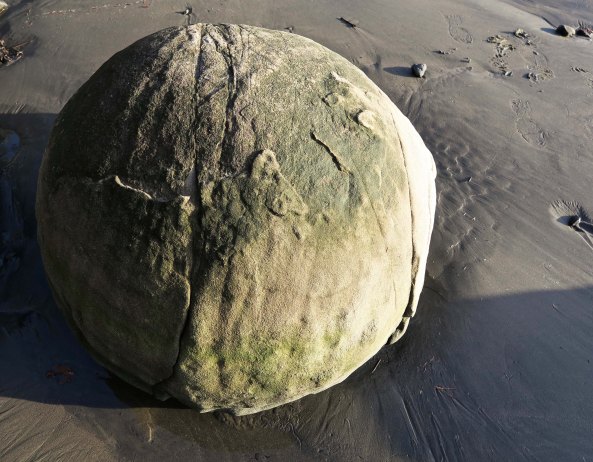
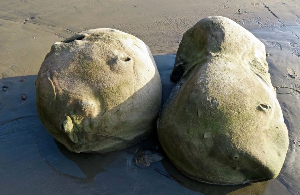
While I am on the subject of wildlife, I dubbed this Turtle Rock.

Another clear day shot take from the beach area. Bird Island is in the background.

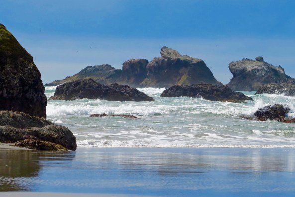
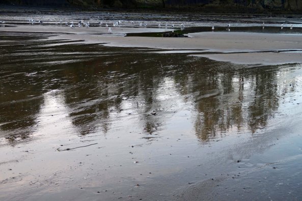
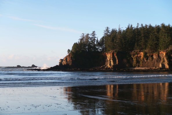
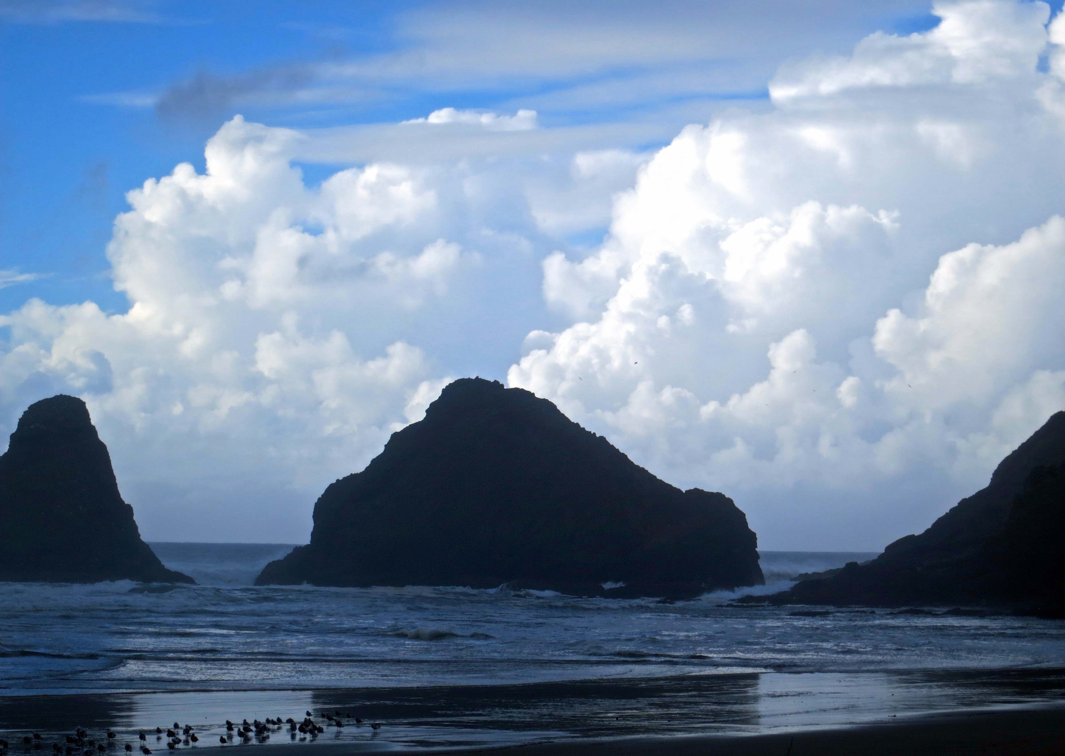
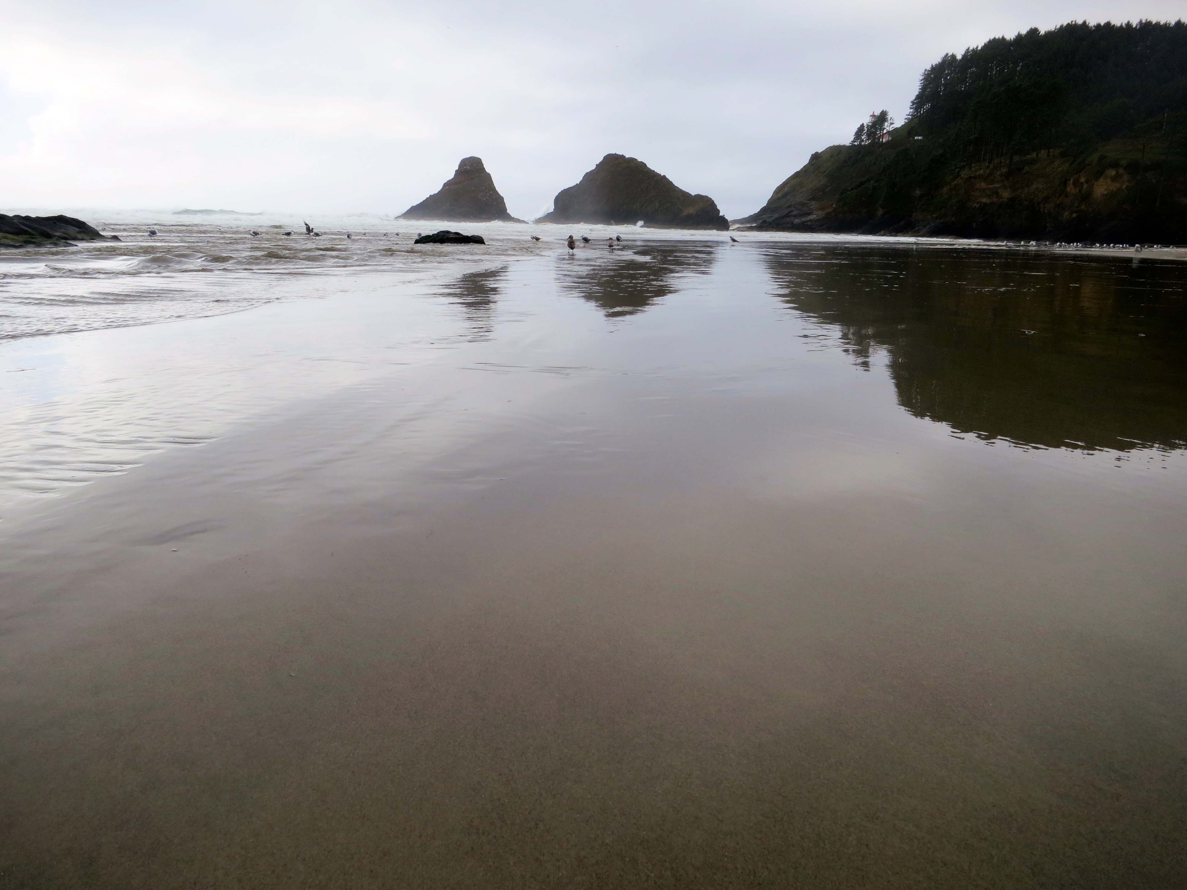
Another clear day shot taken from the beach area. Bird Island is in the background.

Peggy took this shot of the turbulent Smith River on our way home. She really like the contrast of the green moss growing on the oak tree.

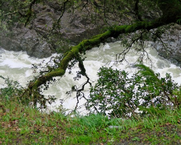
Peggy took this shot of the turbulent Smith River on our way home. She really liked the contrast of the green moss growing on the oak tree with the white rapids. The weather had been so wet we found 74 waterfalls careening off of the mountain and into the river as we drove up Highway 199.

I'll conclude with this hill hugging rainbow we found welcoming us back to the Applegate Valley. (Photo by Peggy Mekemson.)

I’ll conclude with this hill-hugging rainbow we found welcoming us back to the Applegate Valley.  Peggy shot this photo through raindrops on our windshield. Note: there is a slight double rainbow.

NEXT BLOGS:

Wednesday: It’s back to the Sierra Trek and a 16 mile day without any water sources. One Trekker is lost and I face a rebellion and a rattlesnake.

Friday: More great mutant vehicles at Burning Man.

Monday: Will it be Sully?


Sunset Bay: Up Close and Personal… The North Coast Series

Millions of years ago, Sunset Bay was part of a large delta where layer after layer of silt, sand, and marine deposits were laid down over eons creating sedimentary rocks. Once flat, these layers were tilted upward by plate tectonics as the Pacific plate crashed into and sank under the North America continent.

Millions of years ago, Sunset Bay was part of a large delta where layer after layer of silt, sand, and marine deposits were laid down over eons, creating sedimentary rocks. Once flat, these layers were tilted upward by plate tectonics as the Pacific plate crashed into and sank under the North America continent. Varying layers of hard and soft rock attacked by waves, wind, storms and salt crystals have created beautiful rock sculptures like this one.


Landscape photography is known for its grand views. I enjoy those views, always, but I am also intrigued by small things that catch my eye, a leaf perhaps, or a rock. Today I am going to focus more on the ‘up close and personal’ part of Sunset Bay and Shore Acres State Parks on the Oregon coast as well as touch on the geology of the area. This is my Friday photographic essay. Enjoy.


Sedimentary rock warn down by waves at Sunset Bay State Park on the Oregon Coast.

A close up of the tilted sedimentary rock shown in the opening photo. The holes in the rock at the right, BTW, are created by growing salt crystals from salt left behind by tides and waves. Algae grows on the sides of the holes and limits the growth of the crystals, thus creating the rounded shapes.

Another view. The white rocks have broken free from on of the tilted layers of sedimentary rock.

I found this view of the weathered sedimentary rocks at Sunset Bay fascinating. The late afternoon sun added the color. The white rocks had broken free from one of the sedimentary layers.

Sedimentary layers of rocks create tracks into Sunset Bay on the Oregon Coast.

Here, the sedimentary layers stretch out along the beach creating a ‘path.’

Coastline of Shore Acres Park on the Oregon Coast near Coos Bay, Oregon.

The next door Shore Acres State Park provides a different perspective on the erosive forces of nature on the tilted sandstone and siltstone rocks.

Erosion at Shore Acres State Park on the Oregon Coast.

A different perspective of the Shore Acres coastline.

Concretion rock found in Sunset Bay on the Oregon Coast near Coos Bay.

This weird rock is known as a concretion. Calcite forms around a small object such as a broken shell. Layer after layer is applied (think pearl in an oyster) until you get a rock like this.

Concretions found on the beach of Sunset Bay on the Oregon Coast.

If one is good, more are better, right?

Ancient spruce roots at Sunset Bay on the Oregon Coast near Coos Bay.

I figured this was just driftwood on the beach until I did some research. Apparently, this is the root system of an ancient spruce. A massive earthquake struck approximately 1200 years ago and sank major portions of the coast, covering local forests with water. The earthquake was the result of plate tectonics where the Pacific Plate is crashing up against and sinking under the North American continent. Known as the Cascadia Subduction Zone along the Oregon coast, this geological region is still active today and is threatening a major earthquake in the not too distant future. Coastal communities are all involved in disaster planning. We are told that if the Applegate Dam above our house breaks, flood waters will crest right about where we live, even though we are high above the river.

Just for fun, I found this ivy leaf adding a splash of green to the beach.

Just for fun, I found this ivy leaf adding a splash of green to the beach.

A rock added a dash of color...

A rock added a dash of yellow…

A rock with a barnacle found on Sunset Bay on the Oregon Coast.

Another yellow rock, which is part of an exposed sedimentary layer, displays a single barnacle.

Barnacles attached to a rock at Sunset Bay State Park on the Oregon Coast.

This one had a whole tribe of barnacles.

Sea anemones found in a tide pool at Sunset Bay on the Oregon Coast near Coos Bay.

Ever since I was a little kid visiting with my grandparents on the Central California coast, I have been unable to resist tide pools. These are sea anemones— an oldster and a youngster. The tentacles carry a toxin that is injected into prey such as a small fish. The prey is then moved to the center and stuffed into its mouth, which also serves as its anus, a fact I am sure you were just dying to learn!

Seaweed on the beach at Sunset Bay on the Oregon Coast.

This seaweed exists in the intertidal zone and is built with dense root system to grab onto rocks and withstand crashing waves. Recent storm had succeeded in breaking this one free. Tracks show that a seagull has stopped by to check it out. I also liked the reflection captured by water that barely covers the sand.

Another reflection shot, which includes seagulls.

Another reflection shot, which includes seagulls.

Seagull at Sunset Bay on the Oregon Coast near Coos Bay.

And a seagull up close with a touch of attitude that says feed me! Check out the knobby knees.

Dead tree with impressing root system on Sunset Bay near Coos Bay on the Oregon Coast.

Peggy has roots. This magnificent tree has been on the beach for a while.

Downed tree with roots reaching skyward on the beach at Sunset Bay State Park.

Another view.

Natural root sculpture food at Shore Acres State Park on the Oregon Coast.

I’ll use this fantastic creature that lives next door in Shore Acres State Park to wrap up today’s photo essay blog. I’ve used this jumble of roots in a previous blog.

Monday’s Blog: Revolutionary Boston and its message for today. Peggy and I were just there and walked the Revolutionary Trail. “Listen my children and you shall hear of the midnight ride of Paul Revere.” —Longfellow

Wednesday’s Blog: The Sierra Trek Part 3— Meet the incredible cast of characters that sign up to go; travel with Steve and me as we preview the route and Steve pees around the camp to scare away bears.

Friday’s Blog: It’s time to start thinking about Burning Man! Sign up is in February. For the next few weeks, I’ll be digging into my archive of thousands of Burning Man photos taken over a ten-year period for my Friday photograph essays.

My apologies to all of my blog friends for my slowness in responding to comments and tardiness in reading blogs over the past month. I will catch up. After a month of travel and visiting family (including five grandsons) on the East Coast, Peggy and I returned to some of the same weather that many of you have been facing. Our property was buried under two feet of snow. As a result, much of my time has been spent shoveling snow off of driveways and roofs, dealing with power outages and frozen pipes, and trying to persuade a roaring creek that it does not want to run down our driveway. Some fun! We are beginning to see the light at the end of the tunnel, however. Or at least the dirt under the snow.

Curt


Sunset Bay: A Hidden Treasure on the Oregon Coast… The North Coast Series

The setting sun illuminates the cliffs surrounding Sunset Bay, giving support to its name.

The setting sun lights up the cliffs surrounding Sunset Bay, providing support for the bay’s name.

The Oregon Coast is world-renowned for its combination of hidden coves, towering cliffs and crashing waves. Peggy and I are fortunate to live only a couple of hours away from this beauty and have resolved to spend much more time exploring the coastline in 2017. It should be one resolution that is easy to keep.

The Oregon Coast is noted for its crashing waves such as these at Sunset Bay near Coos bay, Oregon.

Towering Pacific Ocean waves crash on rocks just outside of Sunset Bay.

I called and made reservations to stay at Sunset Bay State Park on the Oregon Coast in November. Normally I wouldn’t bother with reservations during late fall, but the Christmas light show at nearby Shore Acres Park attracts up to 50,000 people annually. Odds were that a number of them would be staying at the campground.

I needn’t have worried. The park was under two feet of water when I called. A high tide had joined forces with a flooding stream. The park reservation company in California had happily collected its seven-dollar reservation fee and failed to fill us in on the little detail that we might need a boat to get to our campsite.

Peggy and I already had that experience. We had camped in our small RV at a private campground near Mendocino a few years ago and woke up to discover a seagull floating by our window. Water was lapping at our doorstep. We had departed quicker than a jack rabbit on steroids, not even stopping to pay our campground fee. They probably would have charged extra for the seagull. Besides, a warning in the night that the area was flooding would have been appreciated.

Fortunately we lucked out at Sunset Bay. We weren’t even aware of the flood until we arrived and the water had already receded. Apparently we had missed the flood by a day and a gang of prisoners had swept through the campground and cleaned up the debris. Other than the campground host, we pretty much had the area to ourselves.

Sunset Bay is a hidden jewel, snuggled in along the coast near Coos Bay. It is part of a 6000-feet thick geological formation known as the Coaledo Formation after the coal deposits found in the area. For a while, starting in the 1850s, coal mining was a major industry in the area. By 1904 there were some 40 active mines. The coal was used primarily for running steam locomotives. The appearance of diesel engines in the 1920s had reduced the demand for the Coos Bay coal, however, and the last coal mine was shut down in 1940.

Coal fired steam locomotives are mainly a footnote in history now, but Peggy and I ended up on a train being pulled by one just before Christmas. Our son Tony and his wife Cammie had purchased tickets for the family to travel on the Polar Express out of Essex, Connecticut. We arrived just about dark and the locomotive was warming up to leave. Manny Mistletoe entertained us on our way to the ‘North Pole’ where Mr. and Mrs. Clause greeted us and entertained our grandsons who were appropriately decked out in their pajamas. Hot chocolate was served.

Steam train rides are featured throughout the year in Essex, Connecticut.

The ‘Polar Express’ locomotive of Essex, Connecticut prepares to leave the station on its journey to the ‘North Pole.’

The sedimentary rocks of the Coaledo Formation, laid down in layers over millions of years, have been tilted steeply upward by the crashing Pacific and North American tectonic plates. Varying levels of hardness found among the sedimentary rocks have allowed for different levels of erosion and account for the interesting land formations found at Sunset Bay. I am going to do two posts on our visit. Today’s photos are focused on looking out toward the ocean. On Friday I will do a photographic essay on the fun things we found along the shoreline. (Wednesday’s blog returns to the Sierra Trek.)

Low tide at Sunset Bay on the Oregon Coast near Coos Bay.

Looking out toward the Pacific Ocean at low tide from the beach at Sunset Bay.

Seagulls and sunset at Sunset Bay near Coos Bay on the Oregon Coast.

Seagulls take advantage of the low tide to search for dinner.

A November sunset at Sunset Bay.

Shooting toward the sun provided this view. The sun is more centered on the bay during the summer months.

Tide pools at Sunset Bay in Oregon near Coos bay lit up by the sun at sunset.

I also liked the ‘black and white’ feel the sunset provided with these tide pools.

Early morning at Sunset Bay on the Oregon Coast near Coos Bay, Oregon.

Early morning light the next day and high tide provided a totally different scene at Sunset Bay.

Sun lights up small waves at Sunset Bay on the Oregon Coast near Coos Bay.

I liked the way the sun lit up these wavelets.

Backlit wave crashes over rock at Sunset bay near Coos Bay, Oregon.

And how it lit this wave as it crashed over a rock just outside of the Bay.

Waves crashing over rocks outside of Sunset Bay near Coos Bay, Oregon.

And a final view of the restless Pacific Ocean outside of Sunset Bay.

WEDNESDAY’S  BLOG: Part 2 of the Sierra Trek, a nine-day hundred mile backpack trip across the Sierra Nevada Mountain Range.

FRIDAY’S BLOG: The wrap up on Sunset Bay… a photographic essay.


The Beautiful Bridges of the Oregon Coast… Part Two

One of many bridges designed by Conde McCullough in the 1930s Yaquina Bay Bridge is located next to Newport on the Oregon Coast.

Gorgeous skies provide a dramatic backdrop for the Yaquina Bay Bridge near Newport, Oregon.

Last Monday I posted a story and photos on the Cape Creek Bridge designed by Conde McCullough. Today I am going to feature two more of his bridges: the Yaquina Bay Bridge near Newport, and the Siuslaw Bridge near Florence. I first became aware of these two beauties when I used to visit my dad who managed a hotel on the coast for my brother in the late 70s. Marshall later sold the place, an action for which I have never quite forgiven him. Neither have I forgiven my cousins who had the luck of growing up in Newport.

The property my brother owned and my dad managed. Writers, artists, and professors from the University of Oregon stayed there for $10 a night in the 70s. Now it is an expensive Bed and Breakfast.

Gull Haven: The property my brother co-owned and my dad managed. Writers, artists, and professors from the University of Oregon stayed there for $10 a night in the 70s. Now it is an expensive Bed and Breakfast.

I was driving across the Yaquina Bay Bridge on my trip down the coast last fall when I thought, damn, I have to get a photo of this (above). Being by myself meant I was designated photographer. You know all the warnings about driving and using your cell phone, or driving and texting— they should add driving and taking photos. Enough said. Once I got across the bridge I found a side road where I was able to get out of the car and take Highway Patrol approved photos.

Yaquina Bay Bridge near Newport, Oregon.

A side view of the Yaquina Bay Bridge. The gull on the right added a little action.

The Yaquina Bay Bridge on the Oregon coast designed by Conde McCullough.

A close up of the spans with the historic Newport waterfront in the background.

I spent the night at a delightful campground next to the Florence Marina. This gave me the opportunity to walk over to the Siuslaw Bridge and spend time admiring it. The bridge was built under Franklin Roosevelt’s New Deal Public Works Administration during the Great Depression. It was one of hundreds of projects across the nation designed to put Americans back to work. Both Peggy’s dad in Pennsylvania and my dad in Iowa benefited from this program. Some 140 men worked on the Siuslaw Bridge. It was opened March 31, 1936.

The bridge under construction. (Photo from display next to the bridge.)

The bridge under construction. (Photo from display next to the bridge.)

Ever the artist, McCullough incorporated Art Deco, Moderne, Gothic and Egyptian themes into his bridge.

Suislaw Bridge on the Oregon coast designed by Condi McCullough.

A view of the bridge as it looks today.

Siuslaw Bridge near Florence, Oregon.

A view of the bridge from the other side rendered in black and white., giving it the ‘old time’ feel.

Suislaw Bridge in Florence Oregon across the Suislaw River

I walked along the sidewalk going across the bridge to get this photo.

The walkway across the bridge.

The walkway across the bridge.

Structure on Siuslaw Bridge near Florence designed by Cond McCullough in the 1930s.

An art deco look? Or are we talking Egyptian here?

Siuslaw Bridge on the Oregon coast.

Having seen the bridge from both sides and on top, I decided to take a look underneath for my final view.

Oregon’s Coastal Bridges… Where Engineering, Environment, and Art Meet

Cape Creek Bridge north of Florence, Oregon was designed by Conde McCollough and built during the early 1930s.

Combining form and function, Cape Creek Bridge in Oregon is an example of how highway bridges can move vehicles, provide beauty, and fit into the natural environment.

With Earth Day 2015 coming up on Wednesday, I stopped to think about the battles we fought during the 70s to protect the environment. One of the toughest was against the highway lobby—bankrolled primarily by the oil industry. “Build more highways!” it and its allies screamed. Buried under a burgeoning population of automobiles, local and state transportation agencies usually agreed. Moving cars and trucks, not people and goods, was the objective. Most traffic engineers believed that their sole task was to move vehicles from point a to b as quickly and efficiently as possible. And they did their job extremely well. Nothing got in the way, including established communities, farmlands and valuable natural habitats. It was the bulldozer era of ‘pave Paradise and put in a parking lot.’ (Joni Mitchell)

In the mid to late 70s, I was working with a community group called the Modern Transit Society (MTS) that was fighting to bring light rail transit to Sacramento, California. The City Traffic Engineer was adamantly opposed to the idea. More dollars for mass transit meant fewer dollars for highways, and the Engineer, along with his counterpart in the County, had roads and freeways planned everywhere. My role with MTS was to oversee political strategy. At one point, relations became so tense between the traffic engineer and me that he would walk out of a room when I walked in. Eventually we won. Today, Sacramento has light rail lines stretching throughout the city and county.

Bridges built at the time, and also during the 50s and 60s, reflected the mania for moving cars. Function, not form, was what mattered. As a result, large ugly concrete structures with minimal aesthetic appeal often dominated urban and even rural landscapes. Bridge construction hadn’t always been that way.

The coastal bridges of Oregon reflect an earlier era. Many were constructed in the 1920s and 30s when Highway 101 was being built to connect coastal towns. Oregon was extremely fortunate to have Conde McCullough at the helm of the highway department’s bridge division for much of this time. Part civil engineer, part architect, and part artist, he believed that bridges should be built economically, efficiently, and aesthetically. His vision lives on today, as any trip down the Oregon Coast quickly demonstrates.

Conde McCollough served as Oregon's state bridge engineer from 1919 to 1935, following which he spent a couple of years designing bridges along the Pan American Highway in Central America.

Conde McCollough served as Oregon’s state bridge engineer from 1919 to 1935, following which he spent a couple of years designing bridges along the Pan American Highway in Central America. (Photo from information sign on Highway 101.)

Today I am going to feature one of McCullough’s creations, the Cape Creek Bridge located on Highway 101 north of Florence, Oregon, and a small park that lies below the bridge. Later, I will do posts on two of his other bridges plus a modern pedestrian and bike bridge in Redding, California that is breathtaking.

Cape Creek Bridge north of Florence, Oregon on Highway 101.

Another view of the Cape Creek Bridge, this time including Cape Creek. It had been raining hard, as reflected by the creek’s muddy waters.

Looking out from a span of the Cape Creek Bridge onto the small ocean cove the creek empties into.

Looking out from a span of the Cape Creek Bridge onto the small ocean cove the creek empties into.

Cumulous clouds outline sea stacks in Cape Cove on the Oregon Coast.

Small islands in Cape Cove outlined by the dramatic sky. Sea gulls are gathered in the lower left corner.

One of the sea gulls takes flight. I was walking along behind it, posed to takes its photo when it flew.

One of the sea gulls takes flight. I was walking along behind it, poised to takes its photo when it flew. There are three things I like about the picture: the wings, the gulls left foot as it runs, and the reflection.

The tide rolls onto shore at Cape Cove on the Oregon Coast near Florence, Oregon.

The tide rolls in to Cape Cove.

Low tide exposes the beach at Cape Cove off of Highway 101 on the Oregon Coast.

And the tide rolls out.

Cape Creek Bridge in Lane County on the Oregon Coast.

A final perspective on the Cape Creek Bridge. The bridge is 619 feet (188.6 meters) long and was designed to look like a Roman aqueduct. NEXT BLOG: Earth Day

Wandering the Far West in 2014… Interim 2

The cover: A tufa tower in Mono Lake with Sierra Nevada Mountains in Background. Eastern California.

The cover of our 2015 calendar: A tufa tower at Mono Lake with Sierra Nevada Mountains in background. Eastern California.

I am still working on my blog about Peg’s dad and his experience as a Hump pilot in World War II. In fact, Peggy’s brother, John Dallen Jr., is now helping. I’ve been learning a lot. For example, yesterday, I discovered the approximate location where the plane John Sr. was flying crashed in the Indian jungle. I find the new information fascinating, but the research is slowing down the post.

In the meantime, I decided to put up another interim post or two. Today is calendar day. Each year, Peggy and I create a calendar for our families using photos we have taken during the year. Family birthdays and anniversaries are included. This year we are mailing out 28 calendars, which include 80 birthdays and anniversaries.   It’s quite the production.

Since the photos we use on the calendar reflect this past year’s adventures and are among some of our favorites, I thought they would be fun to share on the blog. If you are a regular follower of Wandering through Time and Place, I am sure you will recognize several of them. All photos were taken by either Peggy or me. Enjoy.

January: Burney Falls. Northern California

January: Burney Falls. Northern California

February: Cactus flowers. Valley of Fire State Park, Southern Nevada.

February: Cactus flowers. Valley of Fire State Park, Southern Nevada.

March: Red Rock Canyon National Conservation Area in southern Nevada.

March: Red Rock Canyon National Conservation Area in southern Nevada.

April: Old road with April flowers in Death Valley National Park. Eastern California.

April: Old road with April flowers in Death Valley National Park. Eastern California.

May: Weathered buildings at Bodie State Historical Park, a ghost town in Eastern California.

May: Weathered buildings at Bodie State Historical Park, a ghost town in Eastern California.

June: Sierra Nevada Mountains form the East. Peggy and I have backpacked through these mountains numerous times.

June: Sierra Nevada Mountains from the East. Peggy and I have backpacked through these mountains numerous times.

July:: Mt. Rainier National Park. Washington State.

July:: Mt. Rainier National Park. Washington State.

August: Humpback whale dives when Peggy and I are on kayaking trip off Vancouver Island.

August: Humpback whale dives when Peggy and I are on kayaking trip off Vancouver Island.

September: Burning Man in remote northern Nevada desert.

September: Burning Man in remote northern Nevada desert.

October: Rainbow caught in waves on Oregon Coast.

October: Rainbow caught in waves on Oregon Coast.

November: Sunset in Sedona, Arizona.

November: Sunset in Sedona, Arizona.

December: Bell Rock in Sedona, Arizona.

December: Bell Rock in Sedona, Arizona.