The Skull with the Vacant Stare— The Woods… The MisAdventure Series

Woods in Diamond Springs, CA

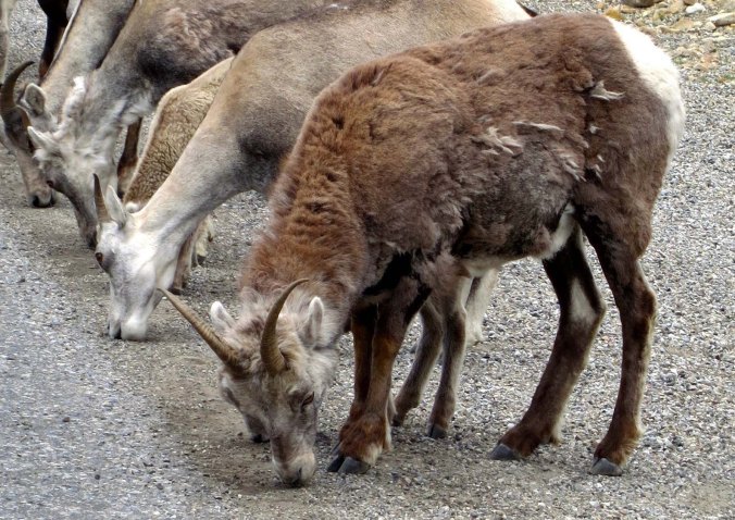
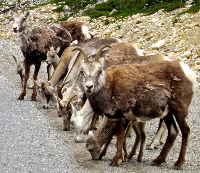
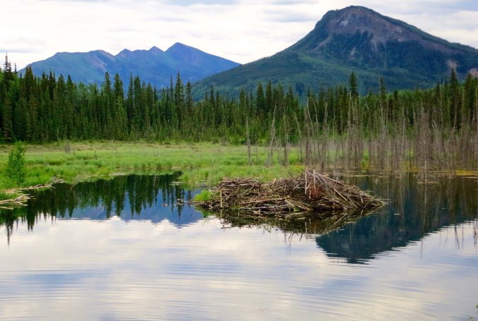
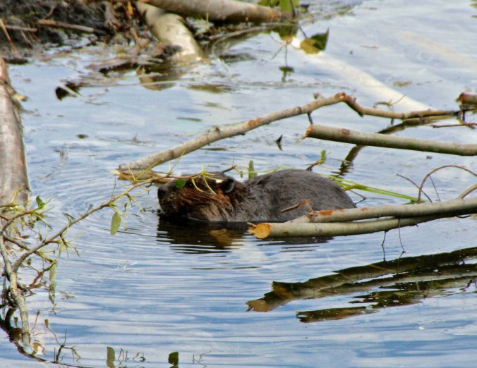
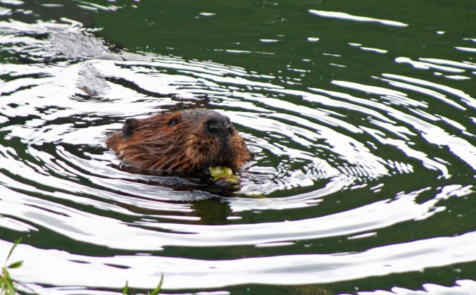
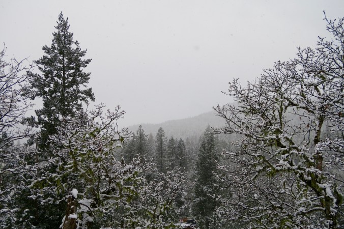
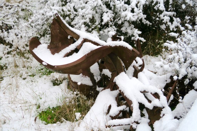
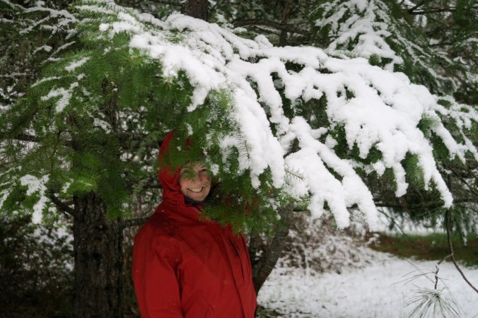
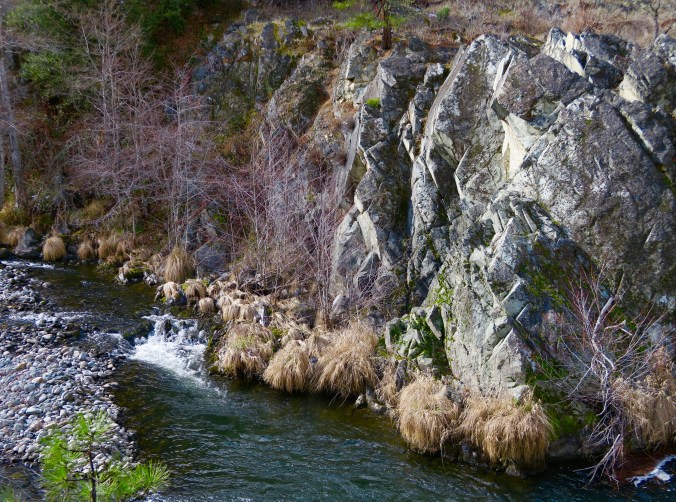
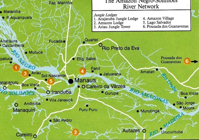
While I don’t have any pictures from the Woods growing up, this and the other photos here are of more recent vintage from Diamond Springs.


Even more than the Pond, the Woods introduced me to the beauty and magic of nature. It, too, earned a capital letter.

To get there, I walked out the back door, down the alley and through a pasture Jimmy Pagonni rented for his cattle. Tackling the pasture involved crawling through a rusty barbed wire fence, avoiding fresh cow pies, climbing a hill and jumping an irrigation ditch. The journey was fraught with danger.

Black oak and woods

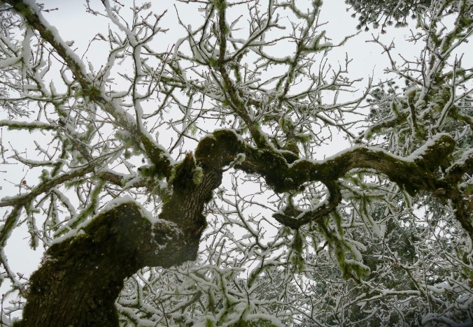
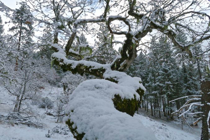
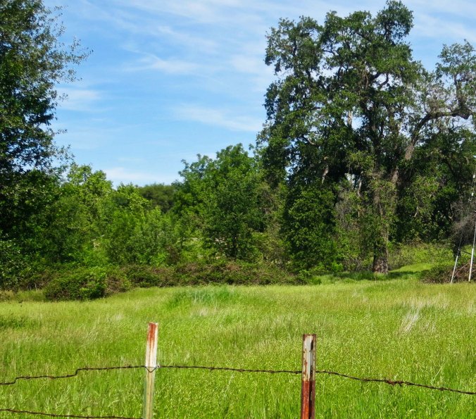
This black oak stood over the ditch I had to jump, and it still stands today.

Hungry barbed wire consumed several of my shirts and occasionally went for my back. Torn clothing and bleeding scratches were a minor irritation in comparison to stepping in fresh cow poop though. A thousand-pound, grass-eating machine produces acres of the stuff. Deep piles sneak up your foot and slosh over into your shoes. Toes hate this. Even more treacherous are the little piles that hide out in the grass. A well-placed patty can send you sliding faster than black ice. The real danger here is ending up with your butt in the pile. I did that, once. “Oh, shit,” I had exclaimed. Happily, no one was around to witness my misfortune, or hear my language— except Tickle the dog. And he was sworn to secrecy.

For all of its hazards, the total hike to the Woods took about 10 minutes. Digger pines with drunken windmill limbs guarded the borders while gnarly manzanita and spiked chaparral dared the casual visitor to venture off the trail. Poison oak proved more subtle but effective in discouraging exploration. I could count on raucous California jays to announce my presence, especially if I was stalking a band of notorious outlaws. Ground squirrels were also quick to whistle their displeasure. Less talkative jackrabbits merely ambled off upon spotting me, put on a little speed for a hyper Cocker, and became bounding blurs in the presence of a hungry greyhound. Flickers, California quail and acorn woodpeckers held discussions in distinctive voices I soon learned to recognize.

Woods in Diamond Springs

A trailer park now occupies the woods where I once played. It’s pleasant but no substitute. Even then, power lines cut through the woods. The tree reaching for the sky is a digger pine. Its large pine cones were filled with nuts that the squirrels harvested.

From the beginning, I felt at home in the Woods, like I belonged. I quickly learned that its hidden recesses contained a multitude of secrets. I was eager to learn what they had to teach me, but the process seemed glacial. It required patience and I hardly knew how to spell the word. I did know how to sit quietly, however. This was a skill I had picked up from the hours I spent with my nose buried in books. The woodland creatures prefer their people noisy. A Curt stomping down the trail, snapping dead twigs, and talking to himself about nefarious evil-doers was easy to avoid while a Curt being quiet might surprise them.

One gray squirrel was particularly loud in his objections. He lived in the top branches of a digger pine beside the trail and maintained an observation post on an overhanging limb. When he heard me coming, he would adopt his ‘you can’t see me gray squirrel playing statue pose.’ But I knew where to look. I would find a comfortable seat and stare at him. It drove him crazy. Soon he would start to thump the limb madly with his foot and chirr loudly. He had pine nuts to gather, a stick home to remodel, and a bright-eyed, bushy-tailed lady to woo. I was blocking progress. Eventually, if I didn’t move, his irritation would bring him scrambling down the trunk for a much more personal scolding.

After about 15 minutes of continuous haranguing, he’d decide I was a harmless, if obnoxious aberration and go about his business. That’s when I begin to learn valuable secrets, like where he hid his nuts. It was also a sign for the rest of the wildlife to come out of hiding. A western fence lizard might work its way to the top of the dead log next to me and start doing push-ups. Why, I couldn’t imagine. Or perhaps a thrush would begin to scratch up the leaves under the manzanita in search of creepy tidbits. The first time I heard one, it sounded like a very large animal interested in little boy flesh.

Occasionally there were special treats: a band of teenage gray squirrels playing tag and demonstrating their incredible acrobatics; a doe leading its shy, speckled fawn out to drink in the small stream that graced the Wood’s meadow; a coyote sneaking up on a ground squirrel hole with an intensity I could almost feel.

I also began to play at stalking animals. Sometime during the time period between childhood and becoming a teenager, I read James Fennimore Cooper and began to think I was a reincarnation of Natty Bumppo. Looking back, I can’t say I was particularly skilled, but no one could have told me so at the time. At least I learned to avoid dry twigs, walk slowly, and stop frequently. Occasionally, I even managed to sneak up on some unsuspecting animal.

If the birds and the animals weren’t present, they left signs for me. There was always the helter-skelter pack rat nest to explore. Tickle made it a specialty, quickly sending twigs flying in all directions. There were also numerous tracks to figure out. Was it a dog or coyote that had stopped for a drink out of the stream the night before? My greyhound knew instantly, but I had to piece it together. A sinuous trail left by a slithery serpent was guaranteed to catch my attention. This was rattlesnake country. Who’d been eating whom or what was another question? The dismantled pine cone was easy to figure out but who considered the bark on a young white fir a delicacy? And what about the quail feathers scattered haphazardly beside the trail?

Scat, I learned, was the tracker’s word for poop. It offered a multitude of clues for what animals had been ambling down the trail and what they had been eating. There were deer droppings and rabbit droppings and mouse droppings descending in size. Coyotes and foxes left their distinctive dog-like scat but the presence of fur and berries suggested that something other than dog food had been on the menu. Some scat was particularly fascinating, at least to me. Burped up owl pellets provided a treasure chest of bones— little feet, little legs and little skulls that grinned back with the vacant stare of slow mice.

While Tarzan hung out in the Graveyard and pirates infested the Pond, mountain men, cowboys, Indians, Robin Hood and various bad guys roamed the Woods. Each bush hid a potential enemy that I would indubitably vanquish. I had the fastest two fingers in the West and I could split a pine nut with an arrow at 50 yards.  I never lost. How could I— it was my fantasy. But daydreams were only a part of the picture.

I fell in love with wandering in the Woods and playing on the Pond. There was an encyclopedia of knowledge available and a multitude of lessons about life. Learning wasn’t a conscious effort, though; it was more like absorption. The world shifted for me when I entered the Woods and time slowed down. A spider with an egg sack was worth ten minutes, a gopher pushing dirt out of its hole an hour, and a deer with a fawn a lifetime.

Next Friday I will offer a slight diversion from MisAdventures tales for a week and include a chapter from my book, The Bush Devil Ate Sam.


SaveSave

SaveSave

SaveSave

From Dawson Creek to Toad River… The Alaska Highway Series: Part II

British Columbia view along Alaska Highway

There is a much natural beauty along the Alaska Highway and a lot of wilderness— millions of square miles, as far as the eye can see.

The Alaska Highway, or the Alcan highway as it was known at the time, was a hurry up project, rarely if ever matched as an engineering feat. World War II was raging. The Japanese had bombed Pearl Harbor and were threatening to invade Alaska, which they did in 1942, landing on the outer most islands of the Aleutian Chain. The only way to counter the threat was to travel by ship through the North Pacific or fly in by air. The US and Canada came to a quick agreement: a 1700-mile road (2700 K) would be built between Dawson Creek BC and Delta Junction, Alaska. It was a colossal project.

Sub-zero freezing temperatures ruled during the winter and suffocating heat dominated in the summer. Along with the heat came hordes of mosquitos, black flies, no-see-ems and other biting, blood-sucking insects. Temperatures were so cold in the winter that fires would be lit under equipment to warm it up enough to operate. Muskeg sucked the same equipment down into the mud in the summer, sometimes swallowing it whole.

Team sinking in mud when building Alaska Highway

Whoa! Working conditions along the Alaska Highway were not optimal. (grin) (Museums along the Alaska Highway feature numerous photos reflecting the difficulties encountered in building the road.)

Bulldozer buried in mud while building the Alaska Highway

This is a ‘what do we do now,’ pose. (Museum photo.)

Building log bridge on the Alaska Highway

Bridges were made from logs. (Museum photo.)

Recruitment notice for workers on building the Alaska Highway

While not as clear as I would like, this recruitment notice is worth reading. They should have won a prize for ‘truth in advertising.’ (Museum photo.)

WW II army truck on Alaska Highway

Lots of old equipment is also displayed along the highway.

Tow truck used on the Alaska Highway

Steam shovel used to build the Alaska Highway

Curt Mekemson standing on bulldozer used to build Alaska Highway

Here I am standing on one of the old bulldozers.

With the threat of an imminent invasion, there was no time to consider the usual niceties of road building. Some 11,000 soldiers and engineers, 16,000 civilians, and 7000 pieces of equipment were thrown at the epic undertaking. Airplanes flew out daily to help plan routes, ‘on the fly’ so to speak, while the men struggled under almost impossible conditions. Starting on March 2nd, 1942, the project was completed on September 24th, some eight months later.

It was rough, oh yes it was rough— steep, muddy roads, log bridges, trees laid down across muskeg 15-feet deep— but it was usable. At $140 million, it was the most expensive construction project of World War II.

Original Alcan Highway

A view of the old road on its completion. (Museum photo.)

Alaska Highway in British Columbia

And how much of it looks today.

The highway can still be a bit of a challenge, but not so much that 30-40 foot RVs aren’t seen in substantial numbers travelling north on it. For the most part, the road is paved except for construction work, which can seem to go on forever. And it is shorter, by some 300 miles!

Today, I will take you over the first 400 miles from Dawson Creek to the uniquely named Toad River. The thing about the scenery along the Alaska Highway is that it is all impressive, and the farther north you go the more impressive it becomes!

Green forests along Alaska Highway

Mountains and forests rule along the highway…

Blue mountains along the Alaska Highway in British Columbia

Mountains stretching off into the distance.

Rock Face along Alaska Highway

An impressive cliff face.

View along Alaska Highway in British Columbia

Between ranges the road follows rivers, all of which had to be crossed when building the highway.

River along Alaska Highway

Sikanni Chief River

This is the Sikanni Chief River.

Sign for Sikanni Chief River

As was noted by this totem pole sign.

Stone Mountain on Alaska Highway

We were excited to see Stone Mountain, not only for its beauty but because there was a good chance we would see Stone Mountain Sheep.

Stone Mountain sheep on Alaska Highway

We were not disappointed. The sheep had come down the mountain to eat the salt that had been washed off the road from the previous winter.

Being checked out by Stone Mountain sheep on Alaska Highway

They weren’t worried when we stopped, but they did check us out. Note the kids peeking out.

Stone sheep kid

To say that they were cute…

Stone sheep kid at Stone Mountain along the Alaska Highway

Is a considerable understatement.

Toad River Lodge on Alaska Highway

Not far up the road, we came to the Toad River Lodge, which is named after the Toad River. Roadhouses were common in the early days of the Alaska Highway and even up to the time when I first drove the road in 1986. It was hard to travel over more than a hundred miles a day on rough, unpaved roads. Many lodges are closed now, no longer needed.

Baseball caps at Toad River Lodge on Alaska Highway

The lodge was quite proud of its cap collection, some 7000 from all over the world. The name, so we were told, had derived from towed, not the warty frog. Before the Canadians and Americans had completed a bridge across the river in 1942, they had to be towed across it. So they named it the Towed River. Toad is much more creative.

Toat River Lodge Toad

This fellow was staring at us when we ate at the lodge.

Beaver dam near the Toad River along the Alaska Highway

We spent the night at lodge’s RV campground. This was the view from our campsite. It was obvious that beavers had been at work on building their own lodge.

Beaver dam and beaver along Alaska Highway

And we soon saw one of the lodge’s residents. Lower left. He/she was busy building a beaver dam to assure that their lodge continued to be prime, waterfront property.

Beaver Lodges and dam next to Toad River Lodge on Alaska Highway

A view of the dam, which was literally outside our door. The builders had certainly been ‘as busy as beavers.’

Beaver working on beaver dam

Beavers often work at night, so we were excited about having these chisel-toothed mammals continue their activity as we watched from a bench next to their lake.

Beaver pushing limb to Beaver Dam near Toad River Lodge

While they worked, for the most part, bringing limbs in from across the lake…

Beaver chewing on wood chip along Toad River

This didn’t stop them from stopping for an occasional snack from their dam building material! That’s it for the day… Next Wednesday, we will continue our journey up the Alaska Highway.

FRIDAY’S POST: MisAdventures finds me playing in the woods when I was growing up, a quick ten-minute walk from my home. While it may not have been wilderness, it was wilderness to me.

MONDAY’S POST: Peggy and I continue our journey down the Colorado River through the Grand Canyon.

WEDNESDAY’S POST: We continue on our journey up the fabled Alaska Highway through Canada, reaching the Yukon Territory. A strikingly beautiful lake, big bison, and a sign forest of 70,000 signs are featured.


SaveSave

SaveSave

They Say that Tom Operates with One Oar… Rafting through the Grand Canyon: Part 6

We started with an icy cold rapid. Peggy and I are in the first boat with Tom Lovering rowing— just before he lost his oar. (Photo by Don Green)

Day two starts as day one did: early.

Even the birds are sound asleep. Tom argues it’s six a.m., not the five my watch is showing. “Arizona does not honor Daylight Savings Time,” he primly informs us. He’s right. Adjusting my watch adjusts my attitude— a little.

Adding injury to insult, something akin to Folgers has been sewn up in burlap, thrown in boiling water, and called coffee.  Oh well, it’s hot, it’s brown, and we have a beautiful day of floating down the Colorado through the Grand Canyon ahead.

For those of you who like facts, here are a few about the river. At its widest point it reaches 750 feet from one bank to the other; at its deepest, it plunges down 90 feet. It flows along at a decent 3-4 mile clip but can speed up to 15 miles per hour in rapids. Since the water comes out of the base of Glen Canyon Dam, it is cold: somewhere around a frigid 46 degrees Fahrenheit during the upper part of our trip. Over the course of our adventure the river will drop 1700 feet in altitude, which is an average 8 feet per mile… 25 times that of the Mississippi River.

Our boatman for the day, Tom Lovering, with his wild, Canyon hairdo.

Bone on edge of Sotar Raft in Grand Canyon

Bone decides that it is time for a photo-op on the Sotar raft in the Grand Canyon. Having learned from his experience on the Amazon River, he quickly moved away from the edge…

Tom Lovering and Bone

And snuggled up with Tom.

Tom is our boatman for the day. He checks to make sure our toenails are painted and then lets us board. The wind is still blowing but it has lost its ferocious bite. A mile down the river we pass Ten Mile Rock, a prominent landmark that has fallen from the cliffs above and now juts up out of the river. Made of Toroweap Sandstone, it was laid down in shallow seas that covered the area some 250 million years ago.

Rafters pass Ten Mile Rock on the Colorado River in the Grand Canyon

Floating by Ten Mile Rock. You wouldn’t have wanted to be near here when this massive chunk of sandstone broke off from the Grand Canyon walls high above the river.

Shortly afterwards we hear our first rapid of the day, Soap Creek. You always hear rapids before you see them; it builds anticipation. Soap Creek roars like a teenage lion. Tom maneuvers through it like the excellent boatman he is but makes sure we get suitably wet. It’s like taking a cold shower outside on a frosty morning with a 15 mile per hour wind blowing.

“I love rowing,” Tom tells us— and it is obvious he does. It is more than the heart-stopping, adrenaline-pumping moments of major rapids where the boatman’s knowledge and skill is matched against the tremendous power of the river with its dangerous rocks and grasping holes. And it is more than the opportunity to enjoy incredible beauty of the Grand Canyon that rowing provides. Tom enjoys the rhythm and the hard work. He even liked the backbreaking challenge of rowing against the wind the day before.

Don Greens ducks along the Colorado River in the Grand Canyon

Nature, like this family of ducks, also adds to the experience of rafting through the Grand Canyon. (Photo by Don Green.)

Century Plant in Grand Canyon

As do plants and flowers. This is a century plant. (Photo by Don Green.)

Grand Canyon canyon

Keeping a sharp eye out will reward you with views of canyons within the Canyon. Don’t you want to go exploring?

Beauty of Grand Canyon

And almost any view up or down the river is a treat.

At mile 17 we come on our first, and only, major challenge of the day, House Rock Rapid, where we learn another fact about rafting through the Canyon: water levels depend on electricity needs in the West. Peak demands require large releases of water from Glen Canyon Dam to run its huge generators. Eventually, these releases catch up with rafters. The fluctuations in water levels have significant impacts.

House Rock Rapid demonstrates one of the more serious. The river is at its low point. More rocks are exposed and a massive hole lurks downstream from the largest rock. Even the most skilled boatman will be challenged to avoid it. We all land and climb off our boats to scout the rapid. Tom is eager to move on. Steve is adamant about waiting for more water. After a long discussion between the boatmen, a decision is made to take the more cautious approach. All of our boatmen are experienced, and Steve and Tom have been down the river many times. They respect each others opinions. As with most aspects of dealing with natural forces, it is best to error on the side of caution when you have the opportunity. There are plenty of times when you don’t.

Our group worriedly scouts House Rock Rapid. Peggy shows more enthusiasm than may be called for.

We have lunch, take naps, go for walks and watch as three large boats of commercial rafters chug through the rapids with their large engines. It is mid afternoon when the boatmen finally decide that enough water is flowing to reduce the hazard to a barely acceptable risk.

Tom’s fist knocks me on the head when we are halfway through. One of his oars has popped out. I look left and all I can see is churning, raft-eating hole. We are poised on the edge— about to be sucked in! Tom becomes a virtuoso of one-armed madness.  Ever so slowly, like about a thousand years, the boat decides to go where he wants. We land, and for one of the few times in his life, my ever-talkative friend is silent.

We looked to the left and saw that we were poised on the edge of a massive hole with a rock in the middle.

The next day, Eggin Stalheim, Dave’s niece, is our boat woman. This is Eggin’s first time rowing a raft and her first time rowing through the Grand Canyon. It would seem insane except Eggin is a world-class kayaker. She is an expert at reading water. The problem is that our large, fully loaded rafts do not move like feather-light kayaks—picture driving an 18-wheel Mack Truck with a Ferrari 458 attitude. We have some adventures.

This shot of Jamie’s raft provides a perspective on what our fully loaded rafts looked like.

Eggin keeps the messy side up, however, as rafters say. (The non-messy side is the smooth bottom of the raft.) So it’s all good. Eggin, like me, has served as a Peace Corps Volunteer in West Africa. When she gets off the river she is heading for Tanzania where she will work with a women’s craft co-op.

Beyond our “kayaking” experience with Eggin, the big news on day three is that we began our side-trips. Almost all journeys down the Canyon include stopping off to see the sights. Some are quite beautiful and others provide unique challenges, as if our daily challenges of negotiating rapids aren’t enough.

Our first stop at mile 29 is the Silver Grotto, which includes both beauty and challenge. Wanting a little downtime and solitude, I opt out and take photos. Peggy tells me, “We climbed an 8 foot wall, repelled down a rock face, slogged through a murky, cold pool and slid down a 20 foot rock slide.” The rock slide was more like free-fall.

As the group disappeared into the Silver grotto, I took some much needed Curt-time.

Raven arrives on raft in Colorado

One of the Grand Canyon’s large ravens stopped by for a chat. Note how the ammunition cans were arranged on the side of the boat. This is so we could have ready access to things we might need during the day: cameras, sun block, snacks, etc.

Raven visits on the Colorado in the Grand Canyon

Having determined that I was harmless, the raven settled in on the captain’s chair. I’m sure it would have preferred that I not be there and that we had left some food unprotected.

I didn’t get a photo of our group members leaping but this is what they slid off of into the muddy water below. Water was splashed on the rock slide from a pool behind the lip to make the slide more smooth. Or so they said.

Next we stopped off at Paradise, as in Vasey’s Paradise. A beautiful waterfall shot out of a redwall cliff and created a Garden of Eden at its base. It was worthy of the name.

The waterfall shooting out of the redwall at Vasey’s Paradise, Mile 32. It’s named after a botanist that was part of John Wesley Powell’s exploration of the Grand Canyon.  The water for the falls is made up of ground water that seeps down from above and shoots out of holes in the canyon’s wall.

Dave Stalheim and his niece Eggin perched on a rock at Vasey’s Paradise.

Peggy Mekemson at Vasey's Paradise in the Grand Canyon

Peggy enjoys our rest stop at the falls…

Retrieving water on the Colorado

And Jamie retrieves some of the icy fresh water. Whatever work needed to be done, Jamie was always in the middle of it— a good man.

Our final stop of the day is at Redwall Cavern. Major John Wesley Powell was the first non Native American to admire the Cavern’s unique beauty. Powell was a Civil War Veteran who had lost his right arm at Shiloh. His exploratory expedition through the Grand Canyon took place in 1869. Powell thought Redwall Cavern could accommodate up to 50,000 people. Modern estimates are closer to 5000, but it is still big…

Coming around a bend in the Colorado River, we saw our first view of Redwall Cavern.

This photo provides a perspective on the sheer size and beauty of Redwall Cavern.

Redwall Cavern on Colorado River with rafters

As does this photo.

Cool dip in Colorado River

Several folks, including Eggin, took advantage of the river here for a cool dip.

A view of the Grand Canyon looking upriver from the Redwall Cavern for my last photo today. (A note on photos: all pictures are taken by either Peggy or me unless attributed to Don.)

Next Monday in my Grand Canyon series we will visit an ancient Anasazi storage facility high on the cliffs above the river and play in the beautiful Little Colorado River.

Wednesday’s Photo Essay POST: We begin our journey up the Alaska Highway with beautiful views and abundant wildlife.

FRIDAY’S Blog-A-Book POST: The Woods, a ten minute walk from my childhood home, teach me a love of the wilderness that exists up until today.

SaveSaveSaveSaveSaveSave

SaveSave

SaveSave

SaveSaveSaveSave

SaveSave

SaveSave

SaveSave

SaveSave

A Walk in a Snowy Woods of Southern Oregon… Join Us!

Snowing in the Upper Applegate Valley

Woohoo! Peggy and I looked outside and the snow was coming down. We haven’t seen much in our neck of the woods lately. The D word is making the rounds again. The D stands for DROUGHT. We try not to use the word in case we might invoke it!

Fresh snow in the Upper Applegate Valley

New snow means we have to go out for a walk. And you are invited. Please join us.  We have to go out soon. The snow normally doesn’t last long here— a few hours at most! This view is from our patio looking west.

View from Mekemson patio of snow in Southern Oregon.

We will start on our patio…

Snow gathering on railing showing perspective

We may have all of two inches! But beware, danger lurks…

Peggy Mekemson and snowball

Peggy simply cannot resist new snow…

Ceramic sculpture by Jeremy Criswell

Moving around the house the sun breaks out briefly. I’m not sure Cockle Doodle is as happy about the snow as we are…

Daffodils in snow

Nor are the daffodils who are about to burst out in bloom proclaiming it is spring.

Toyota pickup on Upper Applegate

Big Red was disgusted…

Quivera the Van

…that Quivera the Van was protected in our pole barn while he was forced to sit out in the open.

Douglas Fir on Applegate River dusted with snow.

The walk up our road takes us past this Douglas fir lightly dusted with snow…

Young Douglas fir covered with fresh snow

And past its cousins.

Rogue River National Forest

Soon, we have entered the Rogue River National Forest that backs up to our property.

Quartz in Rogue River National Forest

A piece of quartz has retained enough heat to reject the snow and reminds us that “Thar is gold in them thar hills!”

Old Essex car wreck in Rogue River National Forest

Several miners’ cabins once stood above our home. All that remains is a cave and this old auto body. Our son-in-law’s dad, Doug Cox— who knows about such things— says that this is likely a 1919/20 Essex.

Oak tree branch covered in snow, Rogue River National Forest

Gnarly oak limbs have a way of pulling me in to admire their beauty in fresh snow…

IMG_0075

Ponderosa pine in snowstorm, Rogue River National Forest

As did this Ponderosa pine reaching for the heavens.

Madrone lightly dusted with snow in Rogue River National Forest

A madrone showed off its unique bark by forming a V.

Black and white photo of trees in snow, Rogue River National Forest

I thought these trees deserved a black and white treatment.

Manzanita in snow, Rogue River National Forest, Upper Applegate River

Peggy insisted that I photograph this manzanita.

Manzanita covered in snow, Rogue River National Forest in Southern Oregon

Manzanita leaves decorated with snow.

Sanctuary animal home covered in snow, Upper Applegate Valley Southern Oregon

A slight detour gave us a view of the Upper Applegate Valley and Sanctuary 1, a home for farm animals that don’t have a home. Blackberries have a front-row seat.

Oregon Junco tracks in snow, Rogue River National Forest

Normally fresh snow provides a whole world of animal tracks for us. This time, all we found were a few bird tracks. These were made by an Oregon Junco. Peggy and I wondered if the local cougar was hanging out in our area again.

Rogue River National Forest on a snowy day

Blue skies suggested that our snow storm was about over.

Old oak tree in Rouge River National Forest with Curt Mekemson

Peggy insisted that I pose in front of an old oak. We call it the Hobbit Tree because it looks like it would fit right into Fanghorn Forest or the Shire.

Fanghorn Forest tree in Rogue River National Forest, Southern Oregon

It’s a tough old coot. Wait, was that why Peggy insisted on photographing me there.

Peggy Mekemson under snow covered Douglas fir limb

“Why don’t you let me take a photo of you under the Douglas fir limb, Sweetheart?”

Snow falls off limb onto Peggy Mekemson

Whoops! 🙂

Upper Applegate River area

Later, when it was time to go on our newspaper and mail walk, the snow around our house had pretty much melted but was hanging on in the surrounding hills and mountains…

Applegate River looking spring-like in February

While the Applegate River had returned to looking spring-like.

Applegate River in February

My last photo for the day. On Monday we return to our trip down the Colorado River through the Grand Canyon. Thanks for joining us on our walk today!


SaveSave

Capital P is for Pond— Or Is that Pirates… The MisAdventure Series


Resting on top of tombstone in Diamond Springs, CA

There came a time when the Graveyard was too small to accommodate my wandering ways, about 65 years before this photo was taken. Both the Graveyard and I have changed a bit.


There came a time when the Graveyard wasn’t large enough to satisfy my wandering urges. I had crawled under the lilac bushes, climbed all of trees, found most of the downed tombstones— and even visited the new graves on the opposite side of the Graveyard. It was time to expand my horizons.

All of Diamond and its environs were fair game. I started close to home and gradually worked outward. At first I tagged along behind Marshall and our friends; later I spent a great deal of time alone with only the dogs for company. It was a Capital World. For example, there were a number of ponds in the area. Oscar ‘Ot’ Jones had one on his ranch for cattle; Caldor had one where logs waited for their appointment with the buzz saw; Forni had one over the hill from his slaughterhouse, and Tony Pavy had one that was supposedly off-limits. But there was only one Capital P Pond, the one next to the Community Hall. If I told Marshall, my parents or my friends I was going to the Pond, they knew immediately where I would be.

Mill pond

This was one of our ponds, the mill-pond where logs waited for their appointment with the buzzsaw. Sadly, I don’t have a picture of the Capital P Pond. But it was fed by water from here. Neither of the ponds exist today. Marshall liked to walk out on the logs.

It was a magical place filled with catfish, mud turtles, bullfrogs and pirates. Although the Pond was small, it had a peninsula, island, deep channel, cattails and shallows. In spring, Redwing Blackbirds nested in the cattails and filled the air with melodic sound. Mallards took advantage of the island’s safety to set up housekeeping. Catfish used holes in the bank of the peninsula to deposit hundreds of eggs that eventually turned into large schools of small black torpedoes dashing about in frenetic unison. Momma bullfrogs laid eggs in strings that grew into chubby pollywogs. When they reached walnut size, tiny legs sprouted in one of nature’s miracles of transformation. Water snakes slithered though the water with the sole purpose of thinning out the burgeoning frog population and I quickly learned to recognize the piteous cry of a frog being consumed whole. Turtles liked to hang out in the shallows where any log or board provided a convenient sunning spot. They always slid off at our appearance but a few quiet minutes would find them surfacing to reclaim lost territory.

By mid-summer the Pond would start to evaporate. The shallow areas surrendered first, sopped up by the burning sun. Life became concentrated in a few square yards of thick, tepid water, only inches deep and supported by a foot of squishy mud. All too soon the Pond was bone-dry with mud cracked and curled. Turtles, snakes and frogs crawled, slithered and hopped away to other nearby water. Catfish dug their way into the mud and entered a deep sleep, waiting for the princely kiss of winter rains. Ducks flew away quacking loudly, leaving only silence behind. Fall and winter rains found the pond refilling and then brimming. Cloudy, gray, wind-swept days rippled the water and created a sense of melancholy that even an eight-year old could feel.

But melancholy was a rare emotion for the Pond.  To us, it was a playground with more options than an amusement park. A few railroad ties borrowed from Caldor and nailed together with varying sized boards made great rafts for exploring the furthest, most secret corners of the Pond. Imagination turned the rafts into ferocious pirate ships that ravaged and pillaged the far shores or primitive bumper cars guaranteed to dunk someone, usually me. In late spring, the Pond became a swimming hole, inviting us to test still cold waters. One spring, thin ice required a double and then triple-dare before we plunged in. It was a short swim. Swimsuits were always optional and rarely worn. I took my first swimming lessons there and mastered dog paddling with my dog Tickle providing instructions. More sophisticated strokes would wait for more sophisticated lakes.

Tickle as a pup with my sister Nancy Jo.

Frogs and catfish were for catching and adding to the family larder. During the day, a long pole with a fishing line attached to a three-pronged hook and decorated with red cloth became irresistible bait for bullfrogs. At night, a flashlight and a spear-like gig provided an even more primitive means of earning dinner. The deep chug-a-rums so prominent from a distance became silent as we approached. Both patience and stealth were required. A splash signified failure as our quarry decided that sitting on the bottom of the Pond was preferable to joining us for dinner. Victory meant a gourmet treat, frog legs. Preparation involved amputating the frog’s legs at the hips and then pealing the skin off like tights. It was a lesson I learned early; if you catch it, you clean it. We were required to chop off the big feet as well. Mother didn’t like being reminded that a happy frog had been attached hours earlier. She also insisted on delayed gratification. Cooking the frog legs on the same day they were caught encouraged them to jump around in the frying pan. “Too creepy!” she declared.

Catching catfish required nerves of steel. We caught them by hand as they lurked with heads protruding from their holes in the banks. Nerves were required because the catfish had serious weapons, needle sharp fins tipped with stingers that packed a wallop. They had to be caught exactly right and held firmly, which was not easy when dealing with a slimy fish trying to avoid the frying pan. But their taste was out of this world and had the slightly exotic quality of something that ate anything that couldn’t eat them.

Next Friday in MisAdventures, we will visit the other great ‘wilderness’ of my childhood: The Woods.

TOMORROW (Saturday): It snowed here. Join Peggy and me on a walk through our winter-wonderland.

MONDAY’S Travel Blog POST: Dropping into the depths of the Grand Canyon we find a huge sandstone cavern and an ancient Native American granary.

WEDNESDAY’S Photo Essay POST: We leave Dawson Creek and begin our journey up the Alaska Highway.

SaveSaveSaveSave

SaveSaveSaveSave

SaveSave

Dogs and Dragons in British Columbia… The Alaska Highway Series

Fraser River at Hope, BC

The small town of Hope in southern British Columbia features this view of the Fraser River.

Adventure travel and the 1400-mile Alaska Highway go together like biscuits and gravy. I’ve driven it five times, once by myself in 1986 when I left Alaska to return to California and two round trips with Peggy since. The last time we traveled with our friends Bob and Linda Bray. Peggy and I were on our way up to visit our son and his family on Kodiak Island where Tony was working as a helicopter pilot flying rescue missions for the Coast Guard. Bob and Linda were going to join a nephew fishing for halibut.

Bob Bray

Bob Bray and I have been friends since he looked like this…

While driving the highway isn’t the challenge  that it once was, it still gives  travelers a taste of the Far North. Over the next few weeks I’ll take you over the highway from Dawson Creek, British Columbia to Anchorage Alaska as part of my Wednesday photo essays. Today, however, we have to get to Dawson Creek. There are various ways to reach the starting point but out last trip took us from Hope, British Columbia up through Prince George, which is the route we will follow today.

Alexandra Suspension Bridge across Fraser River

We followed Canada’s Highway 1/97 out of Hope following the Fraser River. One of our first stops was to admire the old Alexandra Suspension Bridge across the river. It’s a beauty that is no longer used.

Alexandra Suspension Bridge, BC

Another perspective on the Alexandra Bridge.

Grates on Alexzandra Bridge, BC

Looking down through the grates at the Fraser River!

World's largest cross country skis, 100 mile house, BC

The Visitor Information Center at the 100-mile house featured the world’s largest cross-country skis! Communities throughout Canada use such fun gimmicks to capture the attention of tourists.

William's Lake Visitor's Center, BC

I am a fan of tourist information centers in British Columbia. In addition to being chock-full of information and friendly people, they are often beautifully done, like this example in William’s Lake.

William's Lake Visitors Center

This car in the William’s Lake Visitor Center was a spoof on how much stuff tourists load on top of their cars.

Hanging basket petunias closeup, BC

Hanging baskets of petunias were featured outside. While such baskets are common now, I first became familiar with them on a trip to British Columbia in the late 60s.

Peggy kayaking on Dragon Lake, Quesnel, BC

We stopped at an attractive campground on Dragon Lake in Quesnel where Peggy went kayaking to celebrate her birthday.

Peggy Mekemson Kayaking in Quesnel

A closer look.

Ducklings on Dragon Lake near Quesnel, BC

Peggy’s Birthday Parade

Weaving dog agility trials in Quesnel, BC

The next morning, we found the campground had gone to the dogs. We were in the middle of dog agility competition. This little fellow was weaving between posts.

Dog agility trials, jumping in Quesnel, BC

Size didn’t matter in the trials. These bars were lowered for the little fellow shown above.

Dog agility trials in Quesnel, BC tunnel

Dogs are required to maneuver through a number of different obstacles including tunnels. The clock is ticking.

Dog agility trials, across bridge in Quesnel, BC

Watching the owners was as fun as watching the dogs. The woman in pink is urging her dog along. The man running along behind is the judge.

Fraser River Valley

The country changes as you move into the interior of British Columbia, becoming drier.

Train tracks along Fraser River

Rivers have always served as access to the interior, first for river travel and then for building railroads and roads along.

Wood carving of Praying Mantis at Chetwyn, BC

We were in for a real treat when we came to the town of Chetwynd, which is close to Dawson Creek. Wood carvers had been at work in an international competition. This praying mantis had taken first prize but it had a lot of competition!

Pumpkin scarecrow wood carving at Chetwynd

Such as this scary pumpkin head scare crow…

Drangon carving at Chetwyn, BC

And this dragon with an attitude. Or…

Dragon slayer Chetwynd woodcarving

…a bas-relief of St. George slaying a dragon.

Carving at Chetwynd, BC

Or this old gold miner apparently telling you to stay out of his claim.

Scary carving at Chetwynd

I am not sure what this fellow is up to but I wouldn’t want to meet him on a dark night— or in the middle of the day.

Mile zero of the Alaska Highway

And then we made it to Dawson Creek and mile 0 of the Alaska Highway. Bob, Linda and Sister.

Sign at Beginning of Alaska Highway in Dawson Creek

Peggy and I. Next Wednesday, we begin our trip up the Alaska Highway.


FRIDAY’S POST: Another in the MisAdventures series. I abandon the Graveyard for the Pond.

MONDAY’S POST: Rafting down the Colorado River through the Grand Canyon.

WEDNESDAY’S POST: We begin our journey up the Alaska Highway.


SaveSave

SaveSave

SaveSave

SaveSave

SaveSaveSaveSave

Rowing Against the Wind… The Grand Canyon Series

Peggy captures Dave Stalheim and me as we begin our journey on the Colorado River through the Grand Canyon. Note my clean and shaved look. It’s the last time you will see it.


With thoughts of facing headwind gusts up to 60 MPH, we began our journey down the Colorado River through Grand Canyon National Park.

Peggy and I performed the ritual of asking a boatman if we could ride with him. It seems like a strange practice to me, designed to remind us who’s in charge. But we have entered the world where each boatman/woman is the captain of his or her ship, even if the ship is a 16-foot raft with two or three passengers.

“May I have permission to come aboard, sir?” Although it’s more like “Can we ride with you today?” It is courteous but I would prefer to be assigned and have the assignment changed each day.

The tradition is so old that it fades into history. Democracy is not an option on a raging sea or, for that matter, in the middle of a roaring rapid. When the captain yells jump, you jump.

Most boatmen are mellow people, however; good folks. There are few Captain Blighs. If they are slightly more than equal, it goes with the territory. We are committed to riding with each boatman. First up is David Stalheim. He makes his living as a city and county planner in Washington.

“I’ve been applying for a permit to go on the Colorado River for 15 years,” he tells us. Our ten-minute effort of obtaining a permit seems grossly unfair.

We push-off from shore, excited and nervous. The wind strikes immediately, like it was waiting in ambush. “Are we moving at all?” Dave asks plaintively.

An old rock road makes its way tortuously down from the canyon rim on river left. (Left and right are determined by direction of travel.) They are important for giving directions as in “There is a raft ripping rock on river right!” Since boatmen often row with their backs facing downriver, they appreciate such information.

Up until 1929, this is how travelers made their way to Lees Ferry. It would have been a bumpy ride.

The old road is how people once made their way to Lee’s Ferry, which was one of the few ways to cross the Colorado River between 1858 and 1929. The infamous Mormon, John Doyle Lee, established the Ferry. Brigham Young assigned him the job. Later, Lee was executed by firing squad for his role in the Mountain Meadow Massacre where Mormons and Paiute Indians murdered a wagon train of immigrants near St. George, Utah. For awhile, my brother and I thought some of our ancestors had been involved, had ended up dead. But it wasn’t so.

After fighting the wind for what seems like hours, we finally come to the Navajo Bridge, which replaced Lee’s Ferry in 1929. It towers some 467 feet above the river and reminds us that we are already miles behind our planned itinerary.

Navajo Bridge by Don Green

A view of the Navajo Bridge. The first is the old one and is now used as a walkway. The second is used by cars and other vehicles. (Photo by Don Green.)

Just beyond the bridge we catch our first glimpse of Coconino Sandstone. Its geologic history dates back some 250 million years when a huge desert covered the area and the world’s landmasses were all part of the large continent named Pangaea— before the divorce, before plate tectonics demanded that the continents go their own way.

During our journey down the river we will travel through over a billion years of the earth’s history.

The wind continues to beat against us as we make our way down the Colorado River. Only Dave’s strenuous effort at the oars keeps us from being blown up-stream. “Go that way,” I suggest and point down the river.

The group pulls in at a tiny beach in hopes our mini-hurricane will die down. It doesn’t. Dave develops blisters and I develop guilt. A manly man would offer to take over at the oars.

An option floats by. Dave’s niece, Megan Stalheim, is also one of our boatmen. Don Green, a retired Probate Judge out of Martinez, California, is sitting opposite her and pushing on the oars while she pulls. It inspires me. I join the push-pull brigade. Peggy also takes a turn.

The push-pull approach to rowing where Don Green was helping Megan. Peggy and I have been friends with Don for over two decades. He belongs to the same book club we do and joins us on our annual journey to Burning Man (as does Tom). Don is also quite generous in sharing his photos, which was particularly helpful on our first day since neither Peggy nor I took many.

Word passes back to us that Tom wants to scout Badger Creek Rapids. In boatman terminology this means figuring out the best way to get through without flipping. Badger isn’t a particularly big rapid for the Colorado, but it is our first. We are allowed to be nervous. It’s labeled a 4-6 out of 10 in the method used in the Grand Canyon for determining difficulty. Ten is reserved for only the most dangerous. Badger involves a 15 foot drop from the top to bottom.

Badger Creek Rapids by Don Green

Photo of Badger Creek Rapids by Don Green.

There is good news included in the message. We will stop for the night at Jackass Camp just below the rapids on the left. We’ve only gone 8 miles but are eager to escape the wind.

Dave is a cautious boatman. He takes his time to study Badger Creek Rapids from shore and then stands up in his raft for a second opinion as the river sucks us in. Time runs out. Icy waves splash over the boat and soak us. Our hands grasp the safety lines with a death grip as we are tossed about like leaves in the wind. Mere seconds become an eternity. And then it is over.

Badger Creek Rapids Google photo

The view from above using a Google photo. Our camp would be on the right (river left)  at the bottom of the photo, in the shade here. Our raft came out on the left (river right) side of the river.

“Quick, Curt, I need your help,” Dave shouts. We have come out of the rapids on the opposite side of the river from the camp. The powerful current is pushing us down stream. If we don’t get across we will be camping by ourselves. Adrenaline pumping, I jump up and push the oars with all my strength while Dave pulls. Ever so slowly the boat makes its way to camp.

Jackass campsite on Colorado River by Don Green

Not the world’s most attractive campsite. We scatter out to find places for our tents after emptying the boats. (Photo by Don Green.)

Jackass Camp Area by Don Green

Boats tethered at Jackass Camp. (Photo by Don Green.)

View from Jackass camp on Colorado River by Don Green

View from camp. (Photo by Don Green.)

Grand Canyon evening primrose by Don Green

I liked this primrose captured by Don the next morning…

Grand Canyon floers and tracks by Don Green

And found the tracks under it even more interesting. It’s like the lizard was sidestepping. Its tracks and tail trail can be seen coming down from the right. The hole on the right was made by an ant lion that uses the hole as a trap for insects. They fall in, can’t get out, and become lunch. Next Monday, we will continue our journey down the river.

WEDNESDAY’S Photo Essay POST: I begin my series on the Alaska Highway. We make our way to the start of the highway in Dawson Creek by traveling through British Columbia. Great wood carvings and dog agility trials entertain us along the way.

FRIDAY’S MisAdventures POST: I graduate from playing in the Graveyard to playing on a pond and discover a magical world.

MONDAY’S Grand Canyon Series POST: Beautiful waterfalls, a huge cavern, and ancient Native American ruins are featured.

Jackass campsite on Colorado River by Don GreenJackass campsite on Colorado River by Don GreenSaveSave

SaveSave

SaveSave

SaveSave

SaveSave

SaveSave

SaveSave

SaveSave

Learning About Cross-Cultural Relations as a Second Grader… The MisAdventure Series

Caldor train

Caldor Lumber Company was one of two major places of employment in Diamond Springs. My dad worked as an electrician for the company. Logs were brought into Caldor by train on a narrow gauge railway up until the early 50s. Note the size of the logs! (Photo from newspaper archives.)


I was fortunate early in life to have close Mexican-American friends and experience some of the richness of cross-cultural experiences. The strength of America has always been in the diversity of the people who have come here from all over the world with dreams of improving their lives. That they retain a bit of their ‘home-country’ is a strength, whether that home country is Ireland, or Mexico, or China, or Nigeria. The mixing of cultures has almost always been the dynamism that drives humanity’s great leaps leap forward, that leads us to question old ways, and helps us find new solutions to seemingly intractable problems. 


My entry into the world of education also introduced me to a whole new set of friends. Up until that point in time, the kids I had hung out with had consisted of my brother and his buddies. We had roamed the country doing little boy things with me as a tag along. Mainly we got into mischief. I could look forward to a life of crime, or at least to becoming a world-class juvenile delinquent. I’m not sure that much changed during my first grade, but I started to make new friends. In the second grade, I became particularly close to Rudy (Raul) and Robert Rangel, a pair of Mexican-American brothers who lived in a small house in East Diamond Springs.

Raul Rangel

Rudy.

Robert Rangel

Robert.

We hit it off immediately and on a Saturday toward the end of the school year, the boys and their parents had invited me up to their house to spend the night. It was my first official play date and my first ever sleep-over. I was nervous. My mother took me up and dropped me off to a royal greeting by the boys, their parents and their siblings.

“Quick, “the boys had urged,” We have to go stand by the railroad tracks.” We could hear the train’s whistle a mile or so out of town.

The tracks were part of a narrow-gauge railway used by Caldor Lumber Company to bring logs from its forest operation 30 miles up in the mountains to its lumber mill in Diamond Springs. The company had been established in the early 1900s and at first used mules for hauling the logs. It had then switched to oxen followed by a giant steam tractor. The tractor made so much noise that the company was required to use outriders a quarter of a mile in front and behind to warn people so their horses wouldn’t be spooked.

Understandably, the company soon switched to a narrow-gauge railway. The trains had recently been converted to diesel engines, a task my father had helped with as one of Caldor’s two electricians. Soon the railroad would lose out to logging trucks but, for the time being, little kids still had the joy of watching these massive engines and their long line of rail cars carrying large logs out of the forest. More to the point, the engineers on the train carried an ample supply of candies that they would distribute to the boys and girls standing along the track.

The train was near; we could now hear it chugging along. Rudy and Robert, their siblings and I sprinted the hundred or so yards over the tracks. I leaned over and put my ear to the track, a trick I had learned from the Lone Ranger and his side-kick, Tonto. You can actually hear the vibrations and supposedly judge how far away the train is. It was an important skill for early train robbers. I needn’t have bothered since the train came into view when my head was on the track. I’m sure the engineers saw me. I jumped back at the urging of my buddies and we started waving madly. One of the engineers dutifully leaned out of the cab and tossed us candy, lots of it. We scrambled around picking it up.

Since dinner was an hour or so off, I suggested that we head out to the woods behind Rudy and Robert’s house and ride trees. Who needed horses? My brother, Alan, Lee and I had learned that we could climb up to the top of young, skinny pines and make them sway back and forth by leaning way out. It offered a free carnival-like ride 10-15 feet up in the air. If the tree was skinny enough, we could actually make it bend all of the way down to the ground, where we would drop off and allow it to snap back up. I suspect the trees didn’t enjoy the experience nearly as much as we did.

“It’s dinner time!” came the call so we rushed back to the house and made use of an outside water faucet to semi-wash the pitch off our hands. It can be quite stubborn.

“You have to try this,” Rudy enthused, dashing into the house and coming out with a red pepper. I should have been suspicious when the rest of the family followed him outside. But what does a second grader know? I gamely bit into the pepper and was introduced to habanero-hot. The whole family roared as I made a mad sprint for the faucet and glued my mouth to it, becoming a major part of the evening’s entertainment. The Mexican food that followed more than made up for the joke, however. I’ve been a fan ever since. The hot pepper became a dim memory when it became time to go to bed.

All of the boys slept on the same one. The family didn’t have a lot of money and space was limited. Admittedly it was much bigger than my small single at home. And, as you may recall, I had a number of animal companions that slept with me outside to scare the ghosts away. But I had never slept in a bed with another person, much less 3 or 4, or maybe it was 10. That’s what it felt like. I was mortified, but I tried. I really did. Ten came and there I was, eyes wide open, staring at the ceiling, body frozen in place— and midnight, and two, and four. At 5:30, I gently nudged Robert.

“I can’t sleep. I haven’t slept all night,” I confessed. “I have to go home.”

“Ummm,” the half-awake Robert had moaned. I got up, dressed, and slipped out of the house, careful not to wake anyone else. It was close to dark, with only a dim light announcing the morning. Home wasn’t that far away, maybe a mile, but I still remember the journey as long and spooky. Halfway there, I passed Murphy’s grocery store. Sodas were stacked in wood boxes in front. I looked around furtively— nobody was around. I was totally alone. So, I helped myself to a Coke. I carefully hid it outside when I arrived home. It wouldn’t do to have overly inquisitive parents discover it and ask questions. I happily enjoyed it later in the day, feeling much less guilty about stealing  the soda than I did about abandoning my friends.

Curt

My second grade photo.


MONDAY’S POST: The Grand Canyon trip begins. I help paddle the raft to keep it floating downriver.  The headwinds were insisting that we go in the opposite direction.

WEDNESDAY’S POST: Part 1 of a new photo essay on driving the Alaska Highway.

FRIDAY’S POST: My cocker spaniel, Tickle, teaches me how to swim and other tales of the magical Pond.

SaveSave

SaveSave

SaveSaveSaveSave

Good Monkey; Bad Monkey… A Visit to an Eco-Tourist Lodge in the Amazon

Spider Monkey hug

This spider monkey adopted Peggy. Here it gives Peggy a monkey hug. Later, Peggy wondered where all of her flea bites came from…

Spider monkey hitches a ride

Monkey hug from the back.


“The war of the future will be between those who defend nature and those who destroy it. The Amazon will be in the eye of the hurricane. Scientists, politicians, and artists will land here to see what is being done to the forest.” —Jacques Cousteau


Cousteau’s statement to Dr. Francisco Bernardino inspired him to erect the Ariau Amazon Tower Lodge in the mid 80s to accommodate the expected influx of ‘artists, scientists and politicians,’  which it did up until it was closed in 2015, attracting such luminaries as Bill Gates, Prince Charles and Jimmy Carter, not to mention the Mekemsons.

Since it was located a mere 30 miles outside of Manaus on the Rio Negro River, Peggy and I decided to visit. We ended up staying in the same room that Jimmy Carter had occupied. Today’s photo essay reflects our stay there and how we hung out with the monkeys…

Amazon jungle lodges

The Ariau is located at number 3 on the map. We took a boat out of Manaus to get there.

Map of Ariau Amazon Tower

This is a map of the complex with its long walkways that wander throughout the rainforest.

Jungle walkway in Brazil

A view of the walkways. Peggy and I had a lot of fun hiking on them, whether we were accompanied by our monkey friends or not.

Peggy Mekemson on jungle walkway

Peggy on one of the walkways in the tree canopy.

Jungle walkway at Ariau Lodge in Brazil

Another view.

View from Ariau Lodge walkway

Looking out at one of the sights along the walkway.

Boat on Rio Negro River

We arrived from Manaus on this double-decker boat.

Ariau Lodge pickup stick look

You didn’t want to spend a lot of time thinking about the structure. I doubt that it would meet earthquake standards. Pickup sticks come to mind.

Our room at the Ariau Lodge

We stayed in the Jimmy Carter room. The eel reminded me of current politics. You don’t want to be a small fish.

Treehouse room at Ariau Lodge

Not to disparage Carter, who I really like, but I would have preferred to stay in the Tarzan suite shown here. It was nestled up in the top of a tall ebony tree.

Snake tongue and Bone

Bone put in an appearance.

Wooley Amazon monkey

Wooly and Spider Monkeys were found around the lodge and out on the walkways. This Wooly Monkey was behaving how monkeys are supposed to behave, dangling by his tail from a tree.

Wooly monkey hat

And this one wasn’t. It isn’t my best photo. (grin) I was not happy about having a monkey for a hat!

Monkey rear view

When I suggested that he go play with an anaconda out in the jungle, he wrapped his tail around my arm and treated me to this view.

Scary monkey

And then gave me the evil monkey look…

a handful of monkey

Before threatening to take a chunk out of my hand.

Spider monkey near Manaus

Peggy got the good monkey. Given its heart-shaped face and adoring look, this seems an appropriate time to wish everyone a Happy Valentines Day!

Spider Monkey mouth

I will note that the spider monkey had an impressive set of choppers.

Peggy with spider monkey

When Peggy sat down, it settled into her lap and hammed it up for the camera..

Spider monkey in lap

Before deciding to take a nap.

Spider monkey on Peggy's lap

Monkey feet

I decided its feet and our “Travelers’ Tales of Brazil” would make a fitting photo to close my posts on the Amazon.


FRIDAY’S POST: I learn about cross-cultural relations as a second-grader— on a queen sized bed.

MONDAY’S POST: We finally start to make our way down the Colorado River through the Grand Canyon while fighting a strong headwind.

WEDNESDAY’S Photo Essay POST: Peggy and I begin a trip up the Alaska-Canada Highway, one of the world’s premier adventure-travel roads.

SaveSave

SaveSave

SaveSave

I Discover I Am No Longer 30, or 40, or 50, or even 60… Rafting Through the Grand Canyon: Part 4

On a private trip down the Colorado through the Grand Canyon National Park, everyone pitches into help. Here we are learning to rig the rafts. Straps and more straps! The  aluminum frame provided stability for the raft and held the heavy food containers. (Photo by Don Green)


It was time to make the leap from life on the road to life on the river. Laptops, cell phones, good clothes and the other accoutrements of modern civilization were stuffed into bags and dumped into our transport van.

Plus I had to paint my toenails. It was a virgin experience. Grand Canyon boatmen are a superstitious bunch. Many believe their boats will flip if a person is on board with naked toes. And it’s true— boats have flipped under such circumstances. It makes no difference if the opposite is also true. Tom lectured me. “I will not let you on my boat unless your toenails are painted.” In addition to being obnoxious, he was serious. Peggy dutifully applied blue polish on four of my toes. Did this mean we would only half flip?

Two acres of paved boat ramp greeted us when we arrived at Lee’s Ferry, some 130 miles from Flagstaff. It is the take off point for trips down the Canyon and the only bridge across the river in some 700 miles. The Mormons originally discovered the potential for the crossing and sent John Lee to set up a ferry, which began operation in 1873. Brigham Young was also hiding Lee. He had been a key player in the Mountain Meadows Massacre where some 120 eastern emigrants had been murdered. A practicing polygamist, Lee and his wives ran the ferry up until his execution in 1877.

The transport van disgorged us as the gear truck made a quick turn around and backed down the ramp. Another private party was busy rigging boats. People, gear and boats were scattered everywhere.

From off to the right, a longhaired, 50-something man had emerged. I had thought 60’s hippie or possibly the model for a Harlequin Romance cover. The pirate flag on his boat suggested otherwise. A ‘roll your own’ cigarette dangled from his lips. It was Steve Van Dore, the last member of our group and a boatman out of Colorado.  No one in our group had met him, but he came highly recommended.

Steve, a week or two into the trip.

“Please let this be the truck driver,” Steve later admitted was his first thought when he met our green and purple haired trip leader. He also confided that Tom hadn’t told him we were a smoke-free group. “On the other hand,” Steve confessed, “I didn’t tell him I was on probation.” Somehow this balanced out in Steve’s mind. There was no time to become acquainted; we had work to do.

There is an unwritten 11th Commandment on private river trips: Thou Shall Do Your Share. No one is paid to pamper you. Not helping will lead to bad things, like banishment from the tribe. The truck we had loaded in Flagstaff demanded unloading. Everybody did everything. There were no assignments. Peggy and I became stevedores. Piles of beer and soda and wine and food and personal gear and ammo cans and hefty ice chests quickly accumulated around the truck. There was no shade and the desert sun beat down ferociously. It was sucked up by the black asphalt and thrown back at us. We slathered on sun block and gulped down water.

The rafts were unloaded last. Rigging them was technical but relatively easy, assuming of course that you knew what you were doing and were mechanically inclined. I made no such claims. Steve’s Cat (catamaran) was already set up and in the water, its pirate flag was flapping in the breeze. Our other four boats were self-bailing Sotar Rafts with aluminum frames. Tom owned his own, a blue 14 footer named Peanut after the Jeff Dunham character. The three we had rented were yellow, 16 feet long and nameless.

Work also required that we get our feet wet. (Photo by Don Green)

Tom was the last to rig his boat. It was approaching dusk when he finished— the end of a very long day. I hiked down the river to find a campsite for our group while the rest boated down. Peggy and I struggled to set up our new tent in 30 MPH winds. A van was coming to pick us up for dinner at a nearby restaurant and we were late.

The walls of the restaurant were covered with photos of rafts and rafters being trashed by massive rapids. I walked around and admired them with more than a little awe and trepidation. I would have preferred to see photos that emphasized the beauty of the Canyon, but this was a rafters’ hangout.

The wind storm had changed to a dust storm when we arrived back at camp. Finding our tent in the dark proved to be a challenge, and the tent provided little protection when we crawled in. I was reminded of Burning Man as the dust assailed my eyes, ears, nose and mouth. I pulled out a handkerchief to cover my face. Exhausted, I finally fell asleep with the wind ripping at our tent.

I had underestimated the amount of work involved. We were floating down a river, weren’t we? I was out of shape and had a generous belly. Peggy and I had been traveling extensively, mainly helping our kids with their babies. I’d been over-eating and under-exercising. I might have gotten away with it at 30, or 40, or 50— and had. But now I was 67, and my body had some serious words for me. Mainly unprintable. A few years earlier I had undertaken a much more difficult task, backpacking for 360 miles between Lake Tahoe and Mt. Whitney. But I knew how tough that was and had spent a few months hiking 5-10 miles per day before hitting the trail. Now my only excuse was ignorance. And that is not a very good excuse.

We were awakened at five a.m. the next morning, as we would be on every day of our trip. There was personal gear to pack, breakfast to prepare, and boats to load. Any thoughts of a leisurely trip down the river were dashed in the cold reality of the early morning’s light.

We also had a lecture on the Grand Canyon’s numerous rules by Ranger Peggy. Somewhere in the middle of rigging boats the previous day she had stopped by to check our equipment. Life vests had been dutifully piled up; stoves and bar-b-que were unpacked. Even the groovers, which I will describe later, stood at attention. You don’t mess with Ranger Peggy.

She knew Tom from other river trips and was amused by his hair-do. He introduced me as the permit holder. “Tom’s in charge,” I noted. The smile dropped from her face. “You are responsible,” she said icily. “I’ll try to keep Tom under control,” I replied meekly. Yeah, fat chance that.

Bells, whistles and alarms started going off in my head. I would face heavy fines if any of our party misbehaved.

Our second encounter with Ranger Peggy began after the boats were packed for our first day on the river. Tom started off with a discussion on river safety. Naturally we were required to wear our PFD’s (Personal Flotation Devices) any time we were on the boat.

Tom, with his interesting hairdo, and Ranger Peggy check their lists to see which of the many rules they have forgotten to inform us about.

What’s the first rule if you fall overboard: Hang onto the boat. What’s the second rule? “Hang onto the boat,” we chanted in unison. And so it went. Tom saw his wife, Beth, go flying by him the year before as he bounced through a rapid. He caught up with her down river.

If the raft flips, what do you do? Hang onto the boat! “Easier said than done,” I think.

“Your head is the best tool you have in an emergency,” Ranger Peggy lectured. Right. When the river grabs you, sucks you under the water, and beats you against a rock— stay cool.

For all of the concern about safety on the river, the Park Service seemed more concerned about our behavior on shore.

Over 20,000 people float down the river annually. And 20,000 people can do a lot of damage to a sensitive desert environment. Campsites are few and far between and the major ones may have to accommodate several thousand people over the year.

Picture this: 20,000 people pooping and peeing in your back yard without bathroom facilities. It isn’t pretty. So we pack out the poop. And we pee in the river…

Packing out poop makes sense. But peeing in the river, no way! I’d led wilderness trips for 36 years and for 36 years I’ve preached a thousand times you never, never pee in the water. Bathroom chores are carried out at least 100 yards away from water and preferably farther.

The first time I lined up with the guys, I could barely dribble out of dismay.

The rules went on and on. Mainly they had to do with leaving a pristine campsite and washing our hands. Normally, I am not a rules type of guy but most of what Ranger Peggy preached made sense. Sixteen people with diarrhea is, um, shitty.

And few things disturb me more than a trashy campsite in the wilderness. The least we could do was to leave our campsites sparkling clean.

Finally, we were ready to launch. Eighteen days and 279 miles of the Colorado River and Grand Canyon stretched out ahead. Ranger Peggy checked our IDs against her list. We were who we claimed to be. The boatmen strapped down the gear. It was time to climb aboard and Tom was anxious to get going.

The same up-canyon winds that whipped dust into our tent were threatening to create a Herculean task of rowing. Headwinds of up to 60 MPH were predicted.

The group, ready to launch. Wife Peggy, as opposed to Ranger Peggy, is holding her and my purple PFDs. I’m second from the left, looking chunky.


WEDNESDAY’S POST: It’s back to the Amazon and monkey business. While Peggy gets the ‘good’ monkey, I get the ‘bad’ monkey.

FRIDAY’S POST: I learn a bit about cross cultural relations as a second grader— on a queen sized bed.

MONDAY’S POST: Fighting ferocious headwinds, we begin our journey through the Grand Canyon.


SaveSave

SaveSave

SaveSave

SaveSave

SaveSave

SaveSave

SaveSave