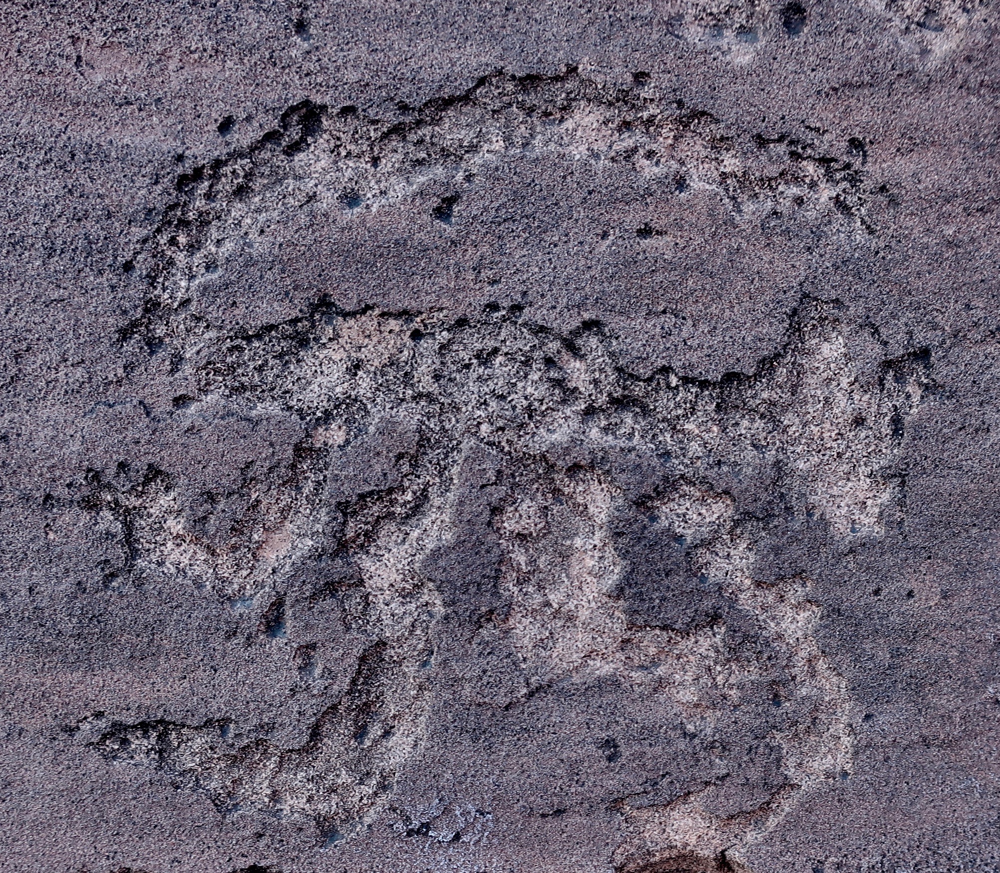
Here kitty, kitty, kitty. I was amused by this petroglyph of what appears to be a cougar running at Lyman State Park in Arizona. Other petroglyphs of cougars that Peggy and I have seen in the Southwest often have their tails over their backs.
We had started our backroad exploration of Highway 191 at Arches National Park in Utah and would wrap it up at Lyman State Park in Arizona. The two parks made nice bookends. I’d been by the park twice and considered stopping both times but thoughts of the Rocky Mountains looming ahead had kept me moving. The first time I was on my bicycle and planned to do a hundred mile trip across the range the next day. This time it was getting late and Peggy and I were tired from a long day of driving. We were lucky to get a space.
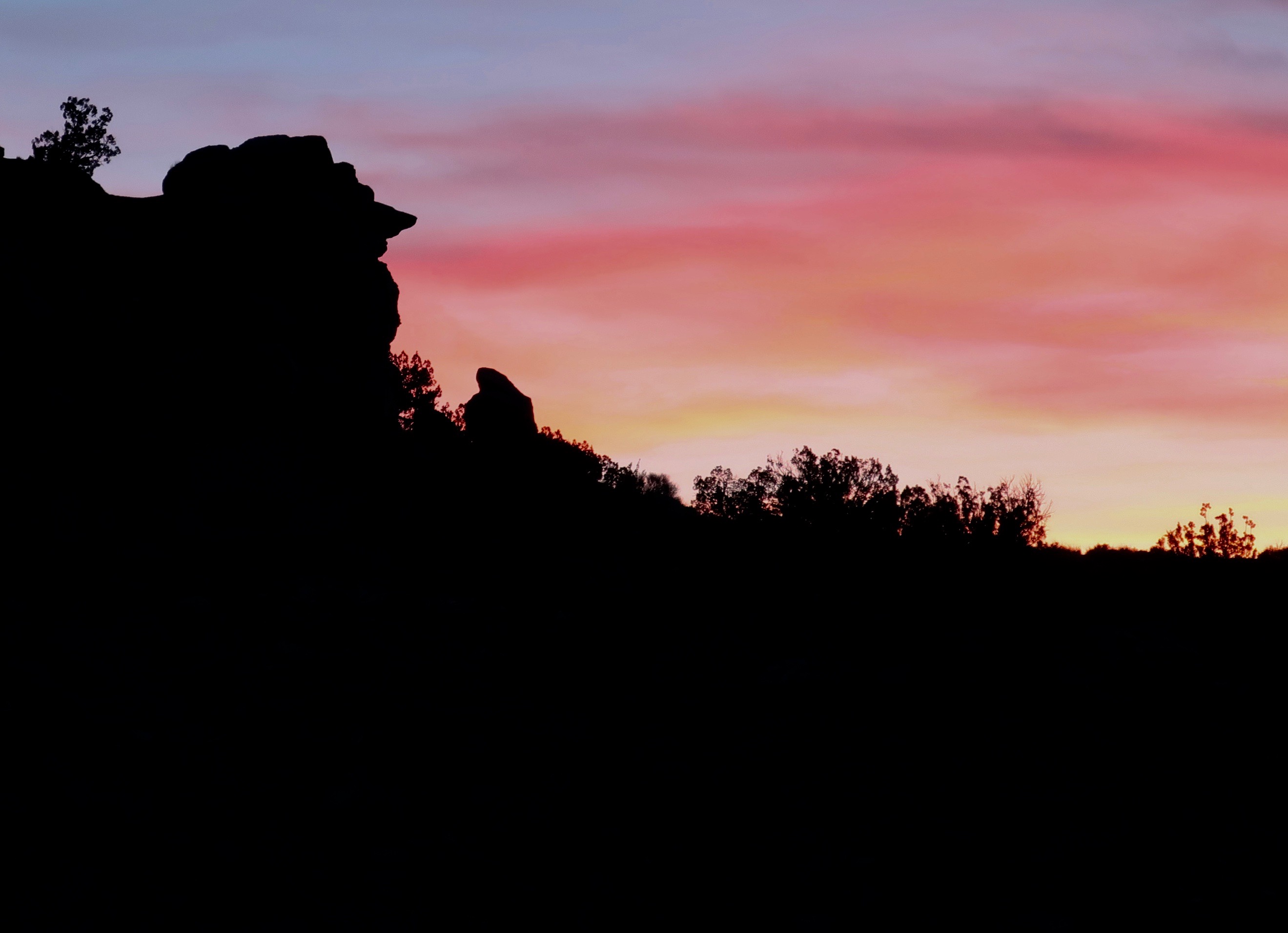
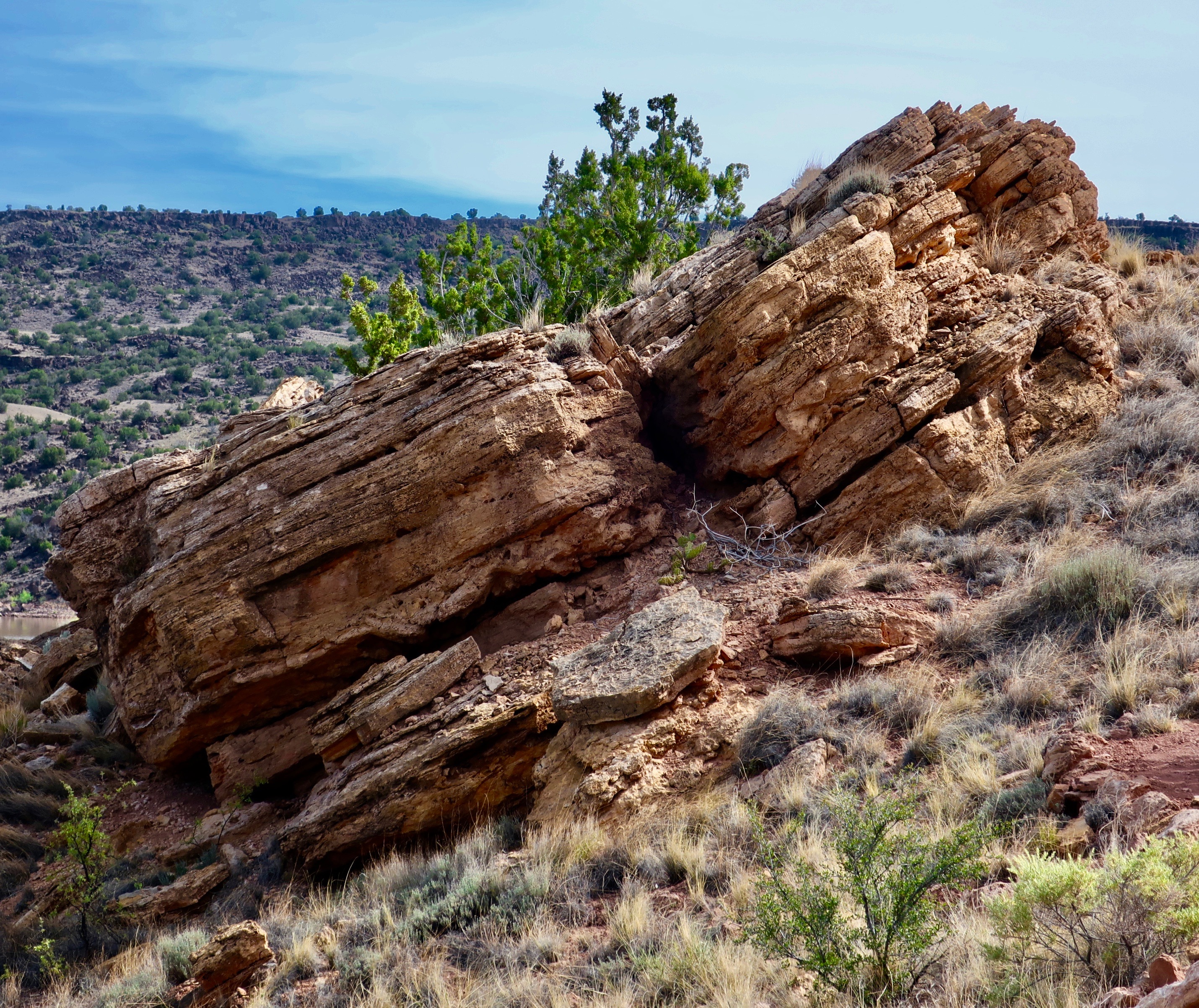
We went out for a walk as the sun was setting. The comic-appearing rock face on the left caught my attention. The nose was hard to ignore!
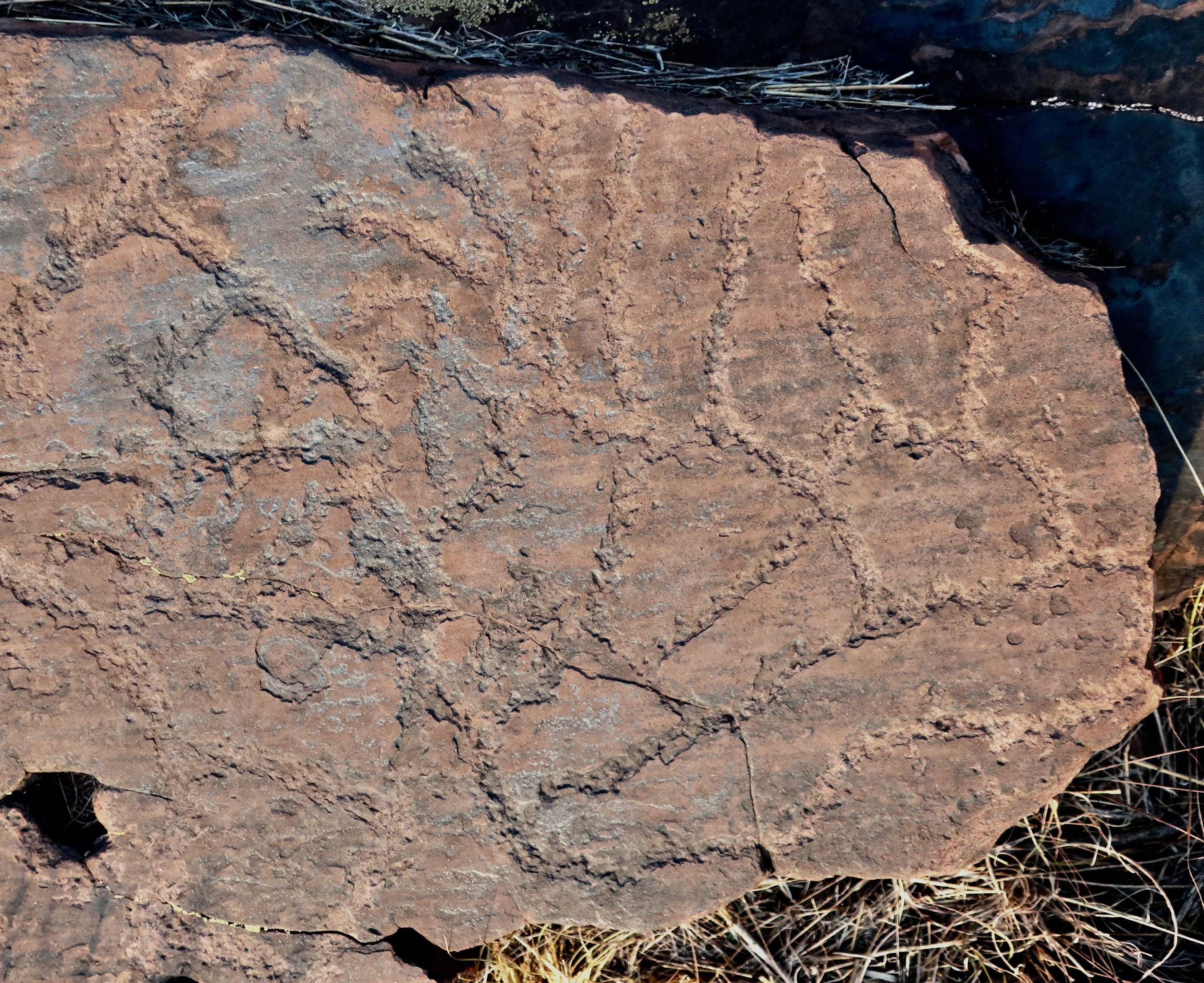
Our evening walk had taken us past a sign announcing a petroglyph trail, a happy surprise. Peggy and I have visited a number of petroglyph sites throughout the Southwest, many of which I have blogged about. We hadn’t realized that Lyman State Park also features the ancient rock art. We made a quick trip up the trail and vowed to return in the morning. Both the Anasazi and the Hopi had made their homes along the Little Colorado River, which was now damned up forming Lyman Lake. The petroglyphs were found in the rocks above the river. The Hopi believe they entered this world from another world near where the Little Colorado enters the Colorado River.
A sign placed by the park interpreted this rock art. The wiggly line represents the Water Serpent the Hopi would ask for water when water was scarce. Obviously they found it in the Little Colorado, which meant they could settle in the area. The guy on the right is jumping up and down holding corn they were able to grow. Or maybe he’s excited about his companion having a baby. You can see it hanging down. The umbilical cord hasn’t been cut yet. I’d be jumping up and down too. The wildlife looking on may symbolize the availability of game for hunting.
Behold the turtle who only makes progress when it sticks its neck out. At least, I think it’s a turtle. I also admired the lichen on the right.
A pair of very long snakes? Or at least their trail. Have you ever seen a snake trail crossing a dirt road?
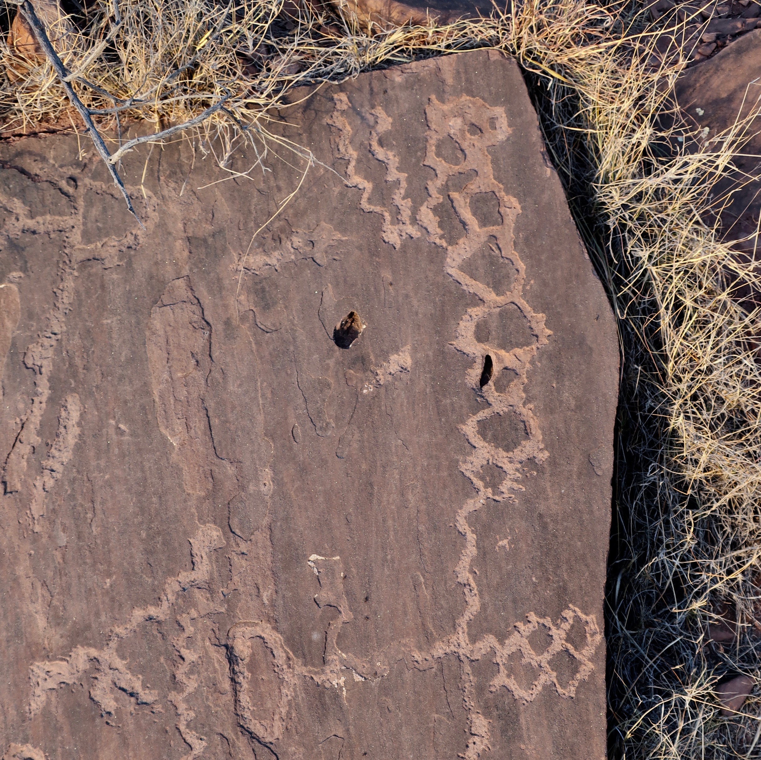
There was also an interpretation sign for this. The thick line in the middle was apparently a migration route. Off to the left are snakes. The guy on the right may be dead since that is how death is sometimes shown in petroglyphs. I wonder if the snakes got him. Or Kitty, which was just to the left.
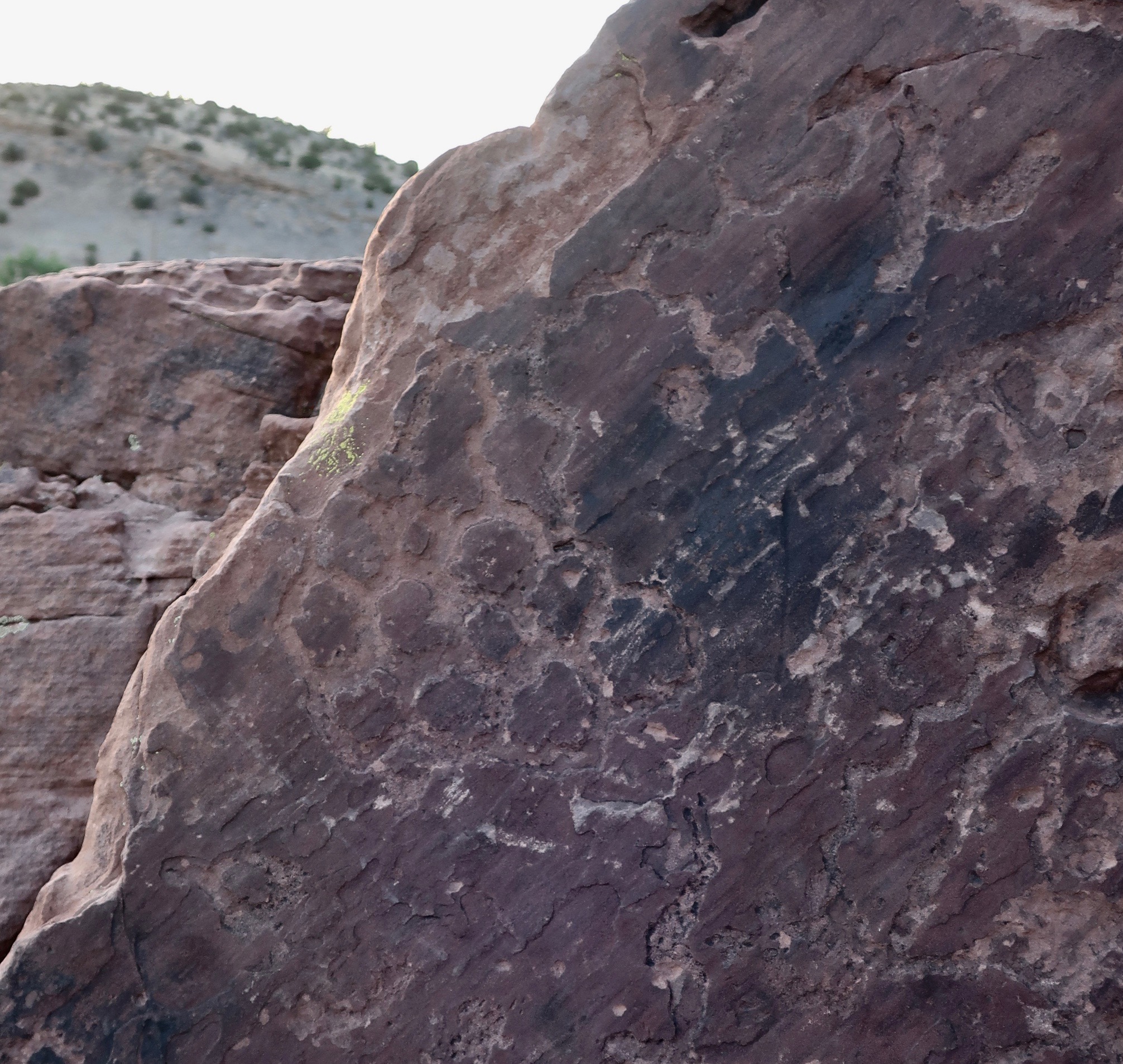
Land use planning? A sign suggested that this was a map that showed the various farms or settlements along the Little Colorado.
Another example of a petroglyph map.
Who knows?
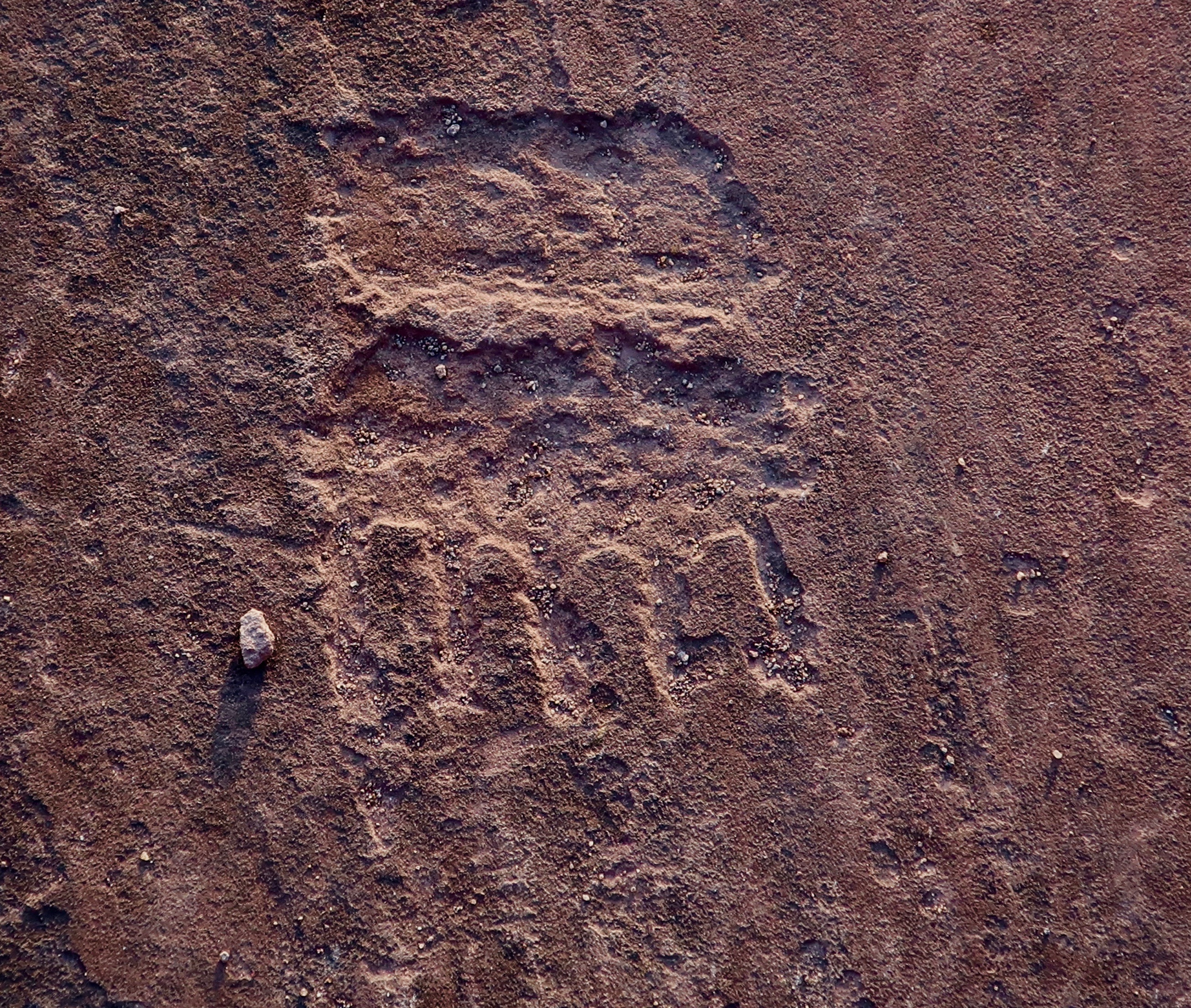
My interpretation here is of a bear print with lots of sharp claws…
There’s much more to Lyman State Park than petroglyphs. For one, the lake is apparently a popular boating lake. None were there at the time, which pleased us given the likely noise. We wandered around and took in the sights
What the…? How’d you like to come home to this?
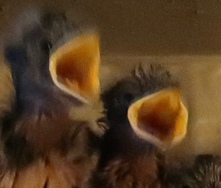
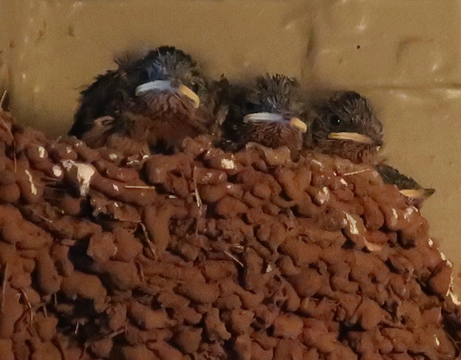
Hungry swallow chicks. 🙂
Who lives here? It’s a spider. I didn’t shove my finger down the hole.
Peggy made her way along the Petroglyph Trail.
Which overlooked the lake.
And featured this tree…
Rocks…
And more rocks.
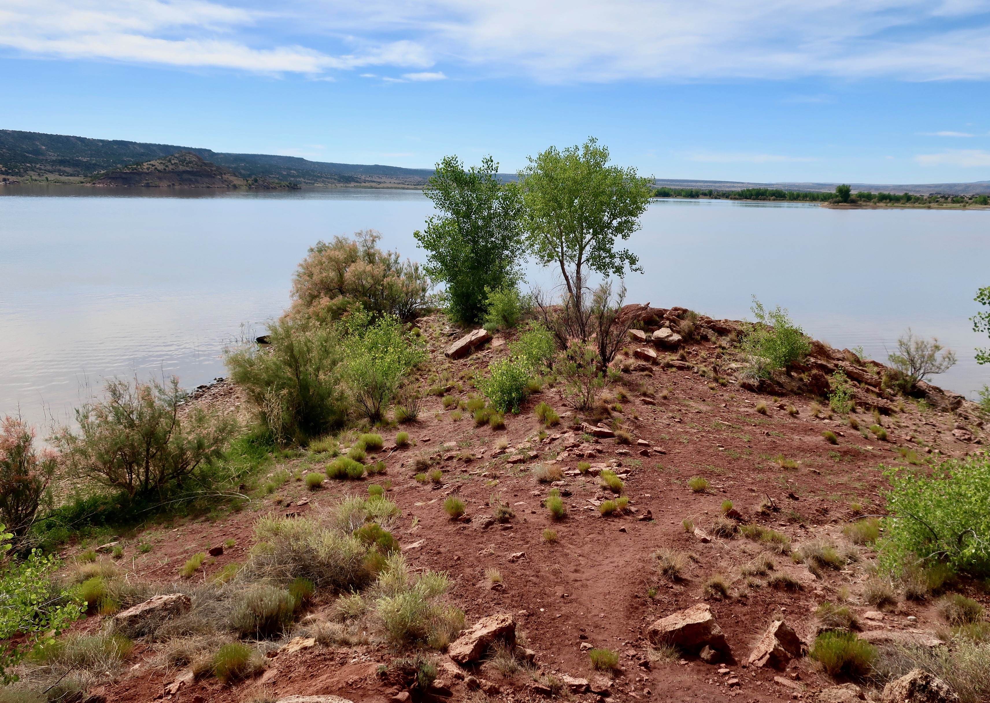
I’ll conclude with this attractive peninsula jutting out onto the lake.
NEXT POSTS:
Blog-a-Book Monday: It’s 4 AM and a Bear Is Standing on Top of Me… I conclude the Sierra Trek story with the greatest surprise of all.
Blog-a-Book Wednesday: The Bush Devil Ate Sam… I contemplate the wandering ways of my ancestors as a factor in my decision to join the Peace Corps. I’ve often been jealous of these early mountain men who travelled with the likes of Daniel Boone. But not Uncle Bill. He had his head cut off by a tomahawk and rolled down a hill…
Here I am in our backyard with the family pets. The overgrown graveyard next door and the alley that led off to the woods spelled adventure for me. While the cats stayed home, I could always depend upon a dog or two along for company.
August 1965. Tears tracked across Jo Ann’s cheeks. We had just left her parents in San Francisco and boarded a United Airlines jet bound for New York City. We were leaving family, friends and life in the US behind. I was sympathetic with Jo but my mind was elsewhere. While she was grieving over what we had left behind, I was celebrating where we were going. Mysterious Africa, teaching, and adventure beckoned.
Except for the time when I was 15 and surrendered five hard-earned, pear picking dollars for a helicopter ride at the El Dorado County Fair, it was my first flight ever. How could I not be excited? The jet taxied out on to the runway, climbed above the Bay, and banked toward the east. For seven hours, we would be winging across America and gazing down on cotton clouds, mountain ranges, deserts, rivers, cities, towns, farms and forests.
We waved goodbye to California as the plane flew over the Sierra-Nevada Mountains. The towering granite of the Crystal Range and Pyramid Peak gave way to the deep blue of Lake Tahoe. My mind turned to how the two of us, both from small Northern California towns, had ended up as Peace Corps Volunteers on our way to the remote jungles of West Africa. Certainly, the two years we had just spent at UC Berkeley were a factor. Our time at Sierra College near Sacramento had also played an important role, but my reasons went back farther, back to my very beginning.
Family legend is that I was conceived during a moment of weakness when my mother had the flu. For the record, I delivered my first squawk of protest on March 3, 1943 in Ashland, Oregon. At the time, according to Life Magazine, American and Australian forces were duking it out with the Japanese at the Battle of the Bismarck Sea, bow ties were the hot new fashion with American women, and Westinghouse engineers were firing dead chickens 200 miles per hour at airplane windows. They went splat. Success meant the windows didn’t crack.
I grew up in the small town of Diamond Springs, California about 35 miles east of Sacramento. Sleepy is too lively a word for describing the community during the 1940s and 50s. In Old West terminology, Diamond Springs was a one and one half horse town. There was one church, one barbershop, one hardware store, and one grammar school. On the two-horse side of the equation, there were two grocery stores, two gas stations, two restaurants, two bars, two graveyards and two major places of employment: The Diamond Lime Company and Caldor, the lumber company where my father worked as an electrician.
The town hadn’t always been quiet. Located in the foothills of the Sierra Nevada Mountain Range, Diamond Springs was once a major gathering spot for the Maidu Indians, and later became a bustling Gold Rush town. To the Maidu it was Mo-lok’epakan, or, Morning Star’s Spring and a very holy place. The Indians came from miles around bearing their dead on litters to cremate on pyres. The smoke and spirits were sent wafting through the air to wherever deceased Maidu went. They had lived in the area for a thousand years.
In 1848, John Marshall found some shiny yellow baubles in the American River at Sutter’s Mill, 13 miles away. The world of the Maidu and Morning Star’s Spring was about to be shattered. “Gold!” went out the cry to Sacramento, across the nation and around the world. Instant wealth was to be had in California and the 49ers were on their way. They came by boat, wagon, horse and foot— whatever it took. And they came in the thousands from Maine to Georgia, Yankee and Southerner alike. They left behind their wives, children, mothers, fathers, and half-plowed fields. The chance of ‘striking it rich’ was a siren call not to be denied.
Seemingly overnight the once quiet foothills were alive with the sound of the miners’ picks and shovels punctuated by the occasional gunshot. Boomtowns sprouted wherever gold was to be found. In 1850, a party of 200 Missourians stopped off at Morning Stars Spring and decided to stay. Timber was plentiful, the grazing good, and a 25-pound nugget of gold was found nearby. Soon there were numerous hotels, stables, a school, churches, doctors, a newspaper, lawyers, vineyards, a blacksmith, some 8000 miners and, undoubtedly, several unrecorded whore houses. Morning Stars Spring took on a new name, Diamond Springs. The Wells Fargo Stage Company opened an office and the Pony Express made it a stop on its two-year ride to glory.
By the time the Mekemsons arrived at the end of World War II, Diamond Spring’s glory years were over. The gold had long since been mined out, the town had burned down three times, and the population had dropped to somewhere around 700. And, as far as I know, there weren’t any whore houses. In this pre-TV, pre-digital era, our entertainment depended on our imaginations. For me, this meant disappearing into the woods as soon as I could escape the not too watchful eyes of my parents. While other boys lined up for Little League batting practice, I was out doing an inventory of the local skunk, coyote and deer population.
I was born to wander, I’m convinced of this…
Why? Check this space next Wednesday.
NEXT POST:
Travel Blog Friday: Lyman Lake State Park along Highway 191 in Arizona… The backroad series.
A photo of Leland Stanford and his store in Michigan Bluff from the Stanford Museum. This photo was likely taken in the summer. Can you feel the heat sizzling off the ground? 120-years later our Trekkers hiked by here on a similarly hot day.
On day seven of the Sierra Trek, we hiked into Foresthill, a small community 20 miles above Auburn. It was a long, hot, dusty 15-mile hike in and out of steep river canyons with temperatures soaring over 100°F. Along the way we passed through Michigan Bluff, which had once been an important gold rush community. Leland Stanford got his start here in the 1850s, running a grocery store for miners. It was a much surer way of striking it rich than gold panning. For example, eggs cost $3 each. Expensive huh? Taking inflation into consideration, the price would shoot up to $100 today.
Stanford continued to prove his smarts. His future included becoming one of the Big Four in building the Transcontinental Railroad, serving as the Governor of California, becoming a US Senator, and giving Stanford University its name.
In Foresthill, we had arranged to stay in the little city park that came with a swimming pool. Given the excessive heat of the day, I looked forward to diving into the cool, refreshing water. But my plunge was not to be.
First, I had to make sure we could find our way out of town and back onto the trail the next morning. We were now into the territory that Steve and I hadn’t reviewed— me because I was off on Vancouver Island deciding on my future, and Steve because who knows why. I hiked out of town for a mile or so down the road until I found the trail and then followed it for another half mile. It seemed well-marked, so I said headed back toward camp. It would be Steve’s job to lead the next day. He would have to deal with any surprises.
Back in camp, the situation quickly made me wish I had just kept hiking. Charlie came charging over. My always dependable backup, ex- ice hockey player, ex-bomb de-fuser and IRS dodger looked like he was about to break down and cry.
“Someone stole my grandfather’s watch at the swimming pool,” he blurted out.
It was a valuable family heirloom, precious to him. I did what I could to console Charlie and headed over to the pool to ask around. None of my Trekkers had seen anything suspicious, or Charlie’s watch. I had a hard time imagining any of them stealing it. He had done everything possible to help them down the trail. There were other folks at the pool, however. Fortunately, Charlie found the watch at his campsite, where he had left it.
My next challenge was Lose-Yourself-Dick, the forty something school teacher who had wandered off on his own. He had tackled his ample supply of snake bite medicine and was feeling no pain. In fact, he was challenging the teenage boys to wrestle him or at least jump on his stomach. I was sorely tempted to join the latter activity. He had also discovered a flagpole he insisted on climbing. I reasoned with him as best I could, but even when he was sober, persuading Dick not to do something was close to impossible. I had just completed my highly ineffective effort when a Sheriff’s car came cruising in to camp. I walked over. One of our Trekkers was sitting in the back seat.
“Can I help you?” I asked politely.
“Yes,” the Deputy Sheriff had responded, “I need to talk with the person in charge.”
I had another of those gut-wrenching feelings. Just three more days, I thought. Just get me through three more days. I desperately wanted to tell the deputy that the man in charge had checked out and gone home or was still on the trail.
“You’ve found him,” I said, putting on a brave smile.
“We just caught this young woman shoplifting,” the deputy reported in his official lawman voice.
“Damn!” I thought. But I said, “Okay, what do I need to do about it?” My unhappiness and resignation must have shown.
“Nothing this time,” he replied. “Because she is raising money for the American Lung Association, we are going to let her off with a warning.” And me as well, I read into his statement. “I am sorry, Curt,” she apologized and I just sighed.
Could anything else go wrong? Of course it could and likely would. I escaped by leaving camp when Steve came in and wandered off to a restaurant in town where I wasn’t likely to find any Trekkers. I drowned my sorrows in a large steak and a couple of well-earned beers. I seriously considered drinking more but I let my adult over-rule the temporarily insane me. He was demanding a six-pack.
We rolled our Trekkers out of Foresthill early the next morning. I breathed a sigh of relief as I followed the last one past the city limits. Once again, Steve was leading and I was playing rear guard. Fortunately, we had a short day. I was quickly reminded that being trail leader was a lot more fun than being rear guard. For one thing, you tended to get into camp a couple of hours earlier. For another, you weren’t constantly being bombarded by the question, “How much farther?” I had begun to respond with a stock answer, “Oh, it’s about twenty miles,” and had found that Trekkers stopped asking. If they persisted, my next response was, “It’s all up hill.”
Steve told me he had been moving some of the slowest Trekkers down the trail by telling them rattlesnake and bear stories and then walking on ahead. He said people made a real effort to keep up. Years later I would use the same technique in Alaska with grizzlies. I suspect that neither of us would have qualified for the Boy Scout Leader’s Seal of Approval. Or even the Sierra Club’s.
Around three, I came on Steve and our Trekkers milling about a closed gate. A vehicle was parked behind the gate and two official looking people were leaning against the vehicle. I was about to learn what price we were paying for not reviewing the final section of the trail.
“What’s up Steve?” I asked, wondering if we had managed to do something else to bring officialdom down on our heads.
“No problem,” Steve said, “they are just blasting with dynamite in the canyon.” Steve’s idea of what constituted a problem and mine were lightyears apart.
His words were punctuated by a rumbling sound. The guards were blocking the road so big rocks wouldn’t come rolling down on people using the canyon trails. It sounded like a good idea. In 1974, plans were underway for building the Auburn Dam and flooding another section of the beautiful American River canyon. Land speculators were greedily selling ‘lake front’ property along the future edge of the lake. Later, building the dam— or not building it— became one of the most contentious environmental issues in Northern California. The dam still isn’t built, and will likely never be. It had been planned on an earthquake fault.
“Um, how long do they plan on continuing to blast?” I asked as I pictured our Trek coming to an abrupt end. It wasn’t a totally unpleasant thought.
“We are in luck,” Steve reported. “They are just closing down their operations and won’t resume until Monday.”
Since it was Friday afternoon and we would be out of the canyon by Sunday, I had to agree. Luck was leaning our way for a change. It made me nervous. That night we celebrated the winding down of our adventure by feeding our Trekkers steak and fresh salad. The feast went off without a hitch, except it was amusing to see people gnawing the meat off the bones. Even vegetarian Bob! I was surprised that they weren’t growling. It wasn’t pretty, but no one seemed to mind. Civilization had definitely taken several steps backward. Everyone went to bed happy, including me.
NEXT POSTs:
Blog-a-Book Wednesday: The Bush Devil Ate Sam… I speculate how my DNA and my family’s wandering ways led me to join the Peace Corps
Travel Blog Friday: America’s backroads… Peggy and I discover interesting Native American rock art at Lyman State Park in Arizona along Highway 191.
Our first stop on Highway 191 was only a few miles south of I-70; Arches National Park. I’ve already posted on our visit, but here’s a photo from the park.
There are some backroads in America that we immediately recognize. Route 66 is one. Highway 1 along the California coast is another. Last summer, Peggy and I went on a road trip in our van exploring several other America’s backroads which aren’t quite so familiar, at least to me.
Highway 191 was one. This highway starts at the Canadian Border in Montana and ends in Arizona on the Mexican Border. I’ve driven much of it over the years. I’ve even bicycled several hundred miles on the highway. But I confess that if someone had asked me what I knew about Highway 191 before our trip last summer, I would have asked where it was.
Highway 191 travels from the border of Canada to the border of Mexico.
Peggy and I picked it up off of I-70 in Utah and followed it south into Arizona where we cut off on Highway 180 crossing the southern Rockies toward Silver City in New Mexico. Along the way we visited Arches National Park, made our way through Navajo country, passed by Canyon de Chelly and spent a delightful night at Lyman State Park in Arizona. I’ll feature some pictures that Peggy and I took along the road but will save Lyman Lake for next week’s post.
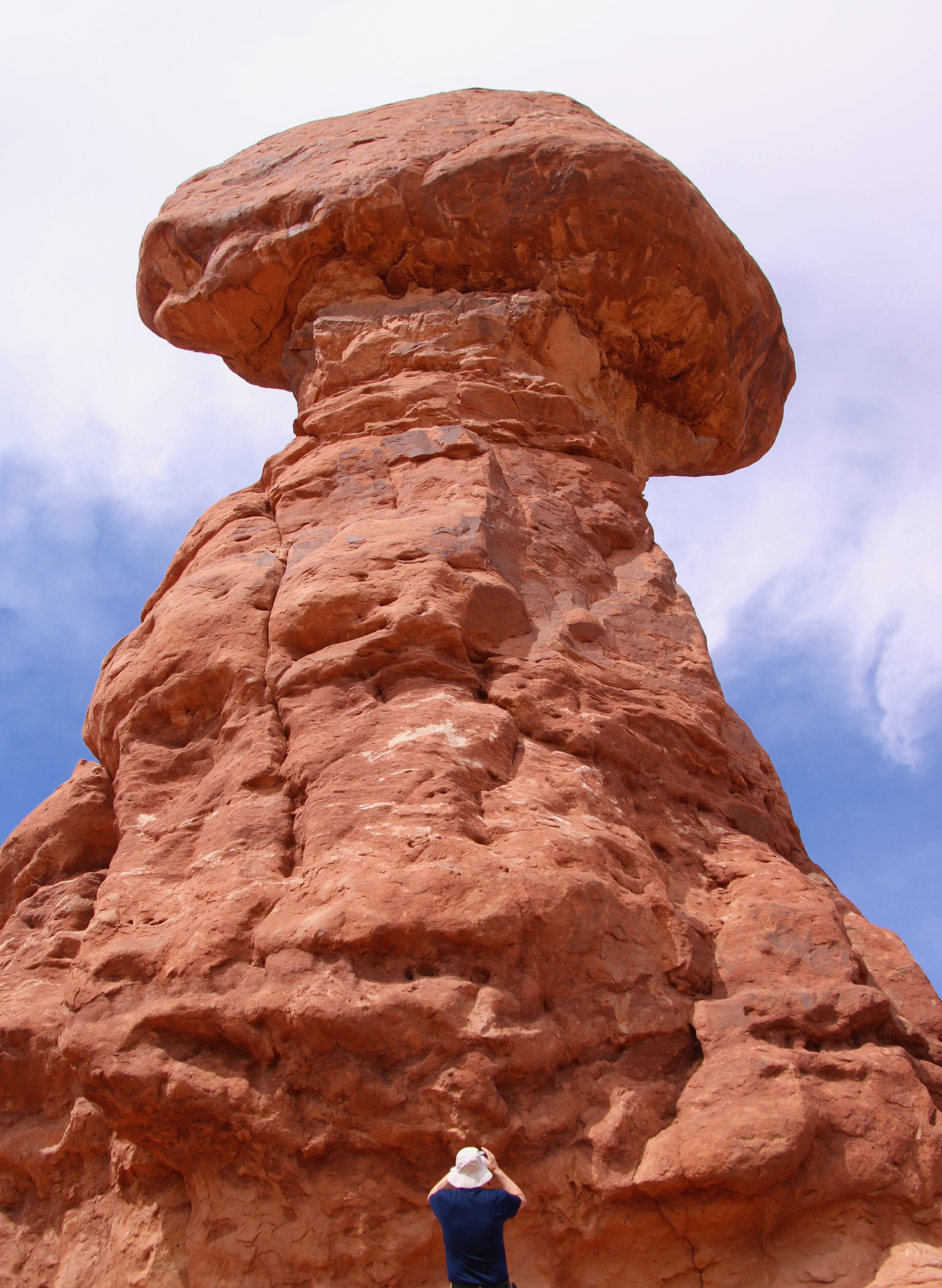
One more Arches photo. Peggy caught this photo of me checking out Balanced Rock.
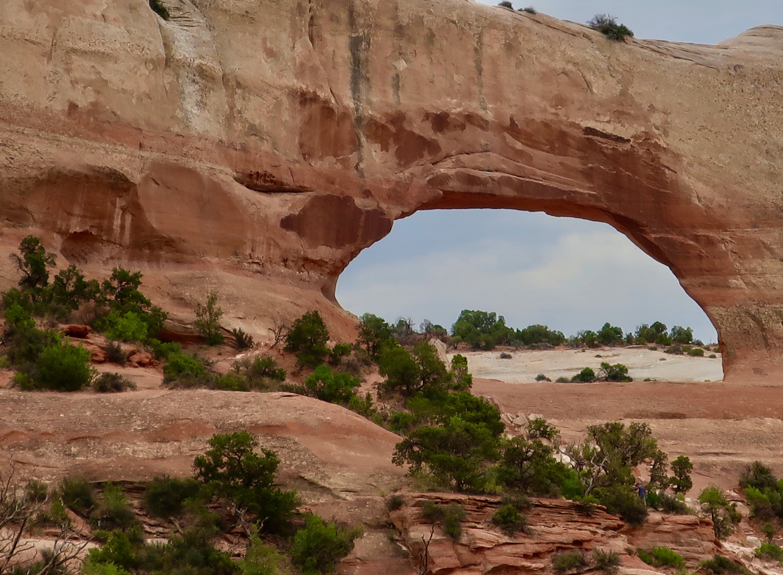
There are, of course, impressive arches outside of Arches National Park. Wilson Arch is found along Highway 191 south of the National Park.
Further south along Highway 191, Peggy and I came on this interesting sandstone monument known as Church Rock. BTW, the road into Canyonlands National Park is near here.
Views along 191 included badlands…
These trees…
And the San Juan River.
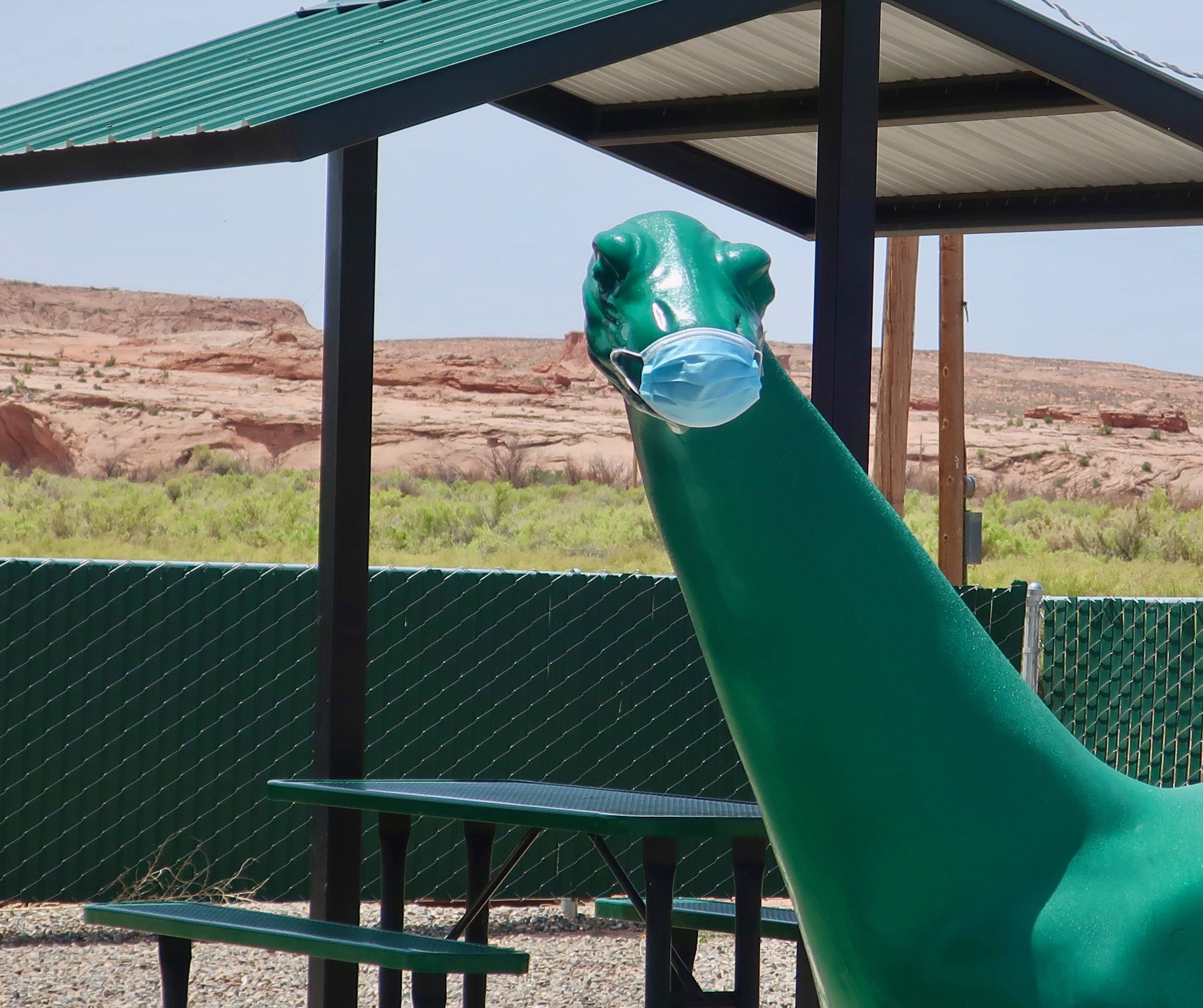
As we entered the Navajo nation, the concern over Covid 19 was immediately apparent. This dinosaur was wearing a mask at a service station.
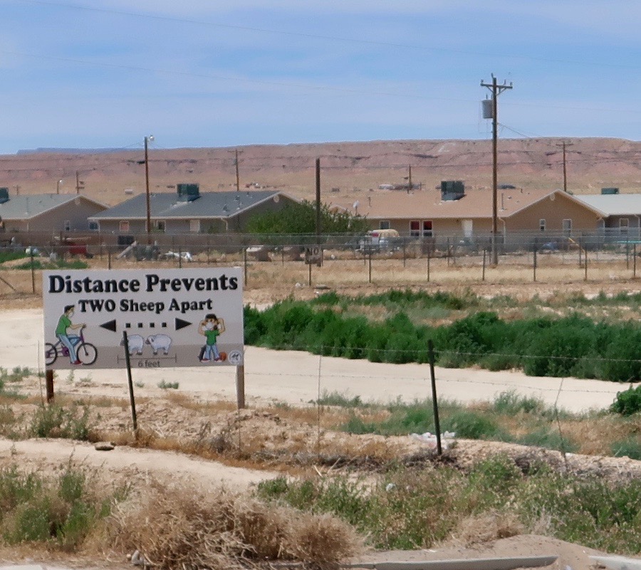
I love this sign that shows a sense of humor in the Navajo Nation about social distancing. Very few people were out and about in comparison to 9 months earlier when we had visited Canyon de Chelly. We saw perhaps a half dozen outside of Chinle, gateway to the National Monument.
Two Navajo Sheep. (Photo by Peggy Mekemson.)
A view looking down into Canyon de Chelly from our previous visit. Tourism and tourist dollars came to a dramatic halt with Covid-19 ravaging the Navajo Nation.
People like Alan Ba, from whom we bought this artwork, would have an important source of income eliminated.
As we neared I-40 on Highway 191, there was one more grim reminder of the problems facing the world, a massive forest fire brought on partially by global warming.
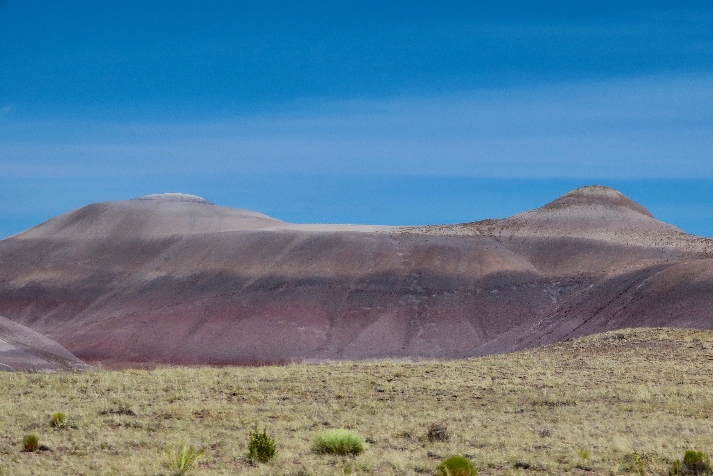
Traveling south of I-40 we found more badlands, not all that far from the Painted Desert.
Shortly after arriving at Arizona’s Lyman State Park, we were treated to a sunset over the lake. It had been a long day.
NEXT POSTS:
Blog-a-book Monday: Just when I thought we were out of trouble, the Sheriff pays the Sierra Trek a visit and dynamite threatens to rain rocks down on us.
Blog-a-book Wednesday: I start the book on my African Peace Corps adventure with asking the question: Why?
Travel Blog Friday: We explore the unique early American rock art of Lyman Lake, discover some birds that are more mouth than body, and appreciate the beauty of the area.
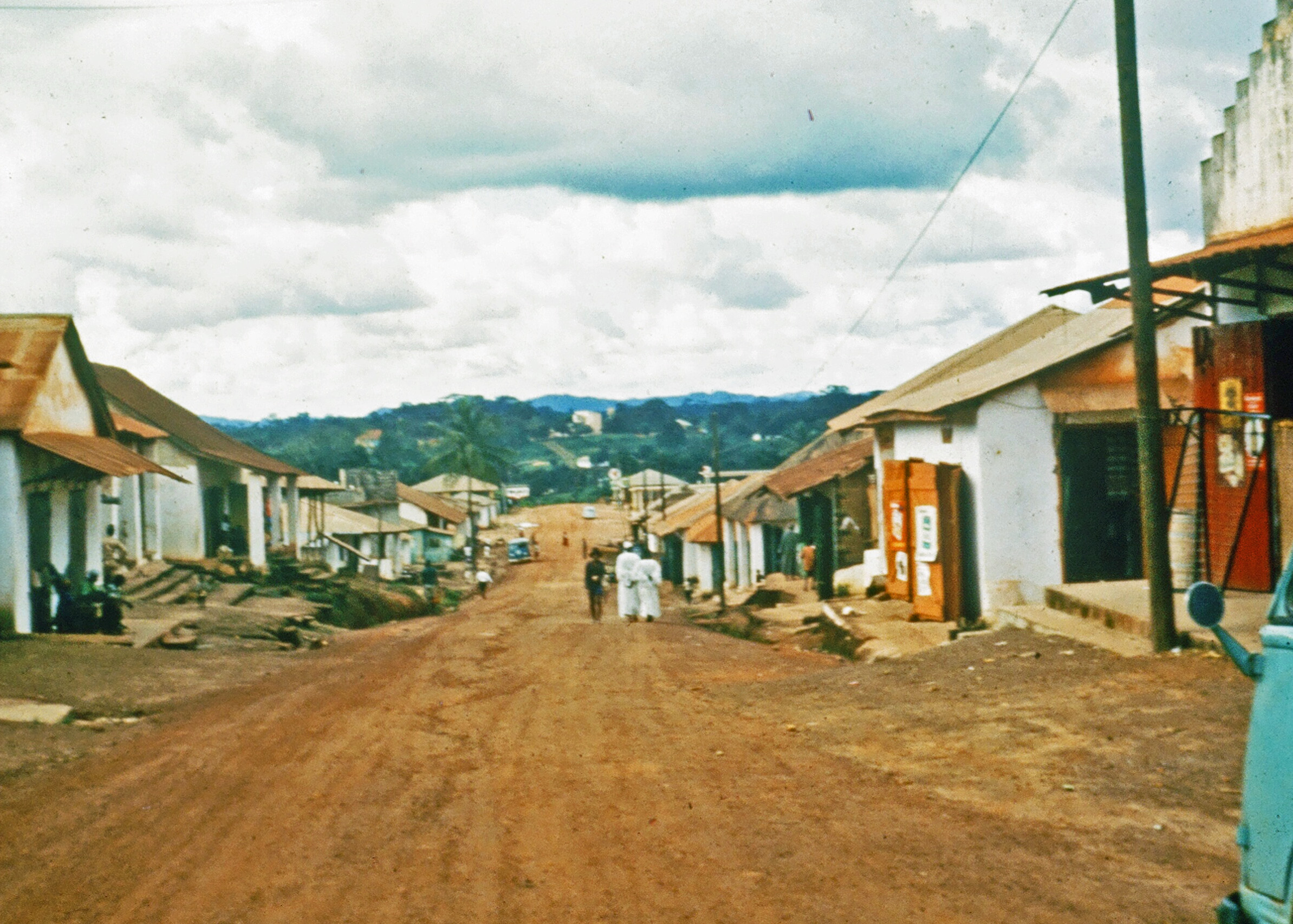
The main street of Gbarnga, Liberia (circa 1965) in West Africa where I served as a Peace Corps Volunteer from 1965-67. I lived near the large yellow building seen in the distance.
Scruffy soldiers with guns pointed helter-skelter were scattered around my yard when I returned from teaching. “What’s up?” I asked in a shaky voice that was supposed to come out calm. Liberian soldiers were scary.
“Your dog ate one of the Superintendent’s guinea fowl,” the sergeant growled. It was hardly what one would consider a major crime, but the Superintendent was the governor of Bong County. A power in Liberia. His compound was nearby and he was apparently quite fond of his fowl birds. But Boy the Bad Dog, the perpetrator of the crime, didn’t belong to me. And he regarded my cat Rasputin as dinner, a fact which neither Rasputin nor I approved.
“Why don’t you arrest him,” I suggested helpfully.
“Not him. You!” the sergeant roared. “You are coming with us.” The interview wasn’t going as planned.
“I am not going anywhere with you. He is not my dog,” I responded as I disappeared quickly into my house. Yanking a Peace Corps Volunteer out of his home for a dead, want-to-be chicken would have serious repercussions. Or at least I hoped that’s what the sergeant would think. He eventually left.
At 4:00 a.m., he was back, pounding on my door with the butt of his rifle. Jo and I woke up from a deep sleep with a start and sat up straight, frightened. I grabbed our baseball bat and headed for the back door. I yanked it open and there was the sergeant, his rifle poised for another strike.
“Your dog ate another one of the Superintendent’s guinea fowl,” Sarge announced with glee at the thought of dragging me off into the dark night. I was beginning to seriously question my decision to join the Peace Corps.
Nonetheless, joining was one of the best decisions in my life. The way I was raised and educated, even my DNA, had pointed me in the direction of striking off into the unknown. But there was more. I was very much a ‘child of the sixties.’ Civil Rights, the Vietnam War, and the student revolution dramatically affected how I viewed the world. Being a student at UC Berkeley during the Free Speech Movement of 1964 provided me with a front-row, head-bashing opportunity for involvement in these issues. Looking back, I can see how the Berkeley experience, my wandering genes, and the influence of family, friends and teachers encouraged me to sign on the dotted line.
John Kennedy created the Peace Corps in 1961 as one of his first acts as President of the United States. His reasons were both idealistic and pragmatic. Yes, he wanted to help third-world countries combat the terrible poverty, disease, hunger, illiteracy and conflict they faced, but he was also interested in winning hearts and minds for the West. Kennedy, like most other leaders of his generation, believed that we were in the midst of a worldwide conflict between capitalism and communism, democracy and totalitarianism, Christianity and Atheism. The Cold War was raging, and much of this war was being fought in third-world countries.
Today, after 60 years of existence, the agency reports that over a quarter of a million Americans have served in 142 countries worldwide with the mission “of developing partnerships with communities abroad to develop sustainable solutions to the world’s most pressing problems.” I would add developing cross-cultural understanding and friendship. Of equal importance to whatever they accomplished overseas, the volunteers have brought home to America the skills and commitment that they developed through their Peace Corps experience.
My assignment was to serve as a teacher in Liberia, West Africa. The country has a unique history dating back to the early 19th Century when freed slaves from America were shipped back to Africa. Within 30 years, the freed slaves, or Americo-Liberians as they came to be known, had established themselves as the rulers of Africa’s first black republic. When I arrived in 1965, their descendants still controlled the political, military, justice, education and economic systems of Liberia— almost everything. William Shadrach Tubman, president of the country since 1944, had invited Peace Corps into Liberia to help the tribal Liberians prepare for a larger role in the nation’s future. Not all Americo-Liberians agreed with this goal, as I would learn.
The Bush Devil Ate Sam includes a number of stories about the adventures that I, along my first wife, Jo Ann, had in Africa, but it also contains background information on my decision to join the Peace Corps, and some thoughts on the tragic history of Liberia since the 60s. I will conclude with a look at the Peace Corps experience in Liberia today.
So please join me as I leave the chaotic world of UC Berkeley and the student revolution of the mid 60s to become a Peace Corps Volunteer in the even stranger world of Liberia. You will meet fascinating characters like Crazy Flumo, learn valuable new skills such as how to fight off an invasion of army ants, meet a judge who determines guilt with a red-hot machete, and discover why the government determined a second-grade reader I wrote and a student government I formed were threats to the power of Liberia’s one-party state. And that’s only the beginning…
But now, it is time to jump into the book and determine what role DNA played in leading me to leave a small, rural town in Northern California for the far-off jungles of West Africa.
In my last blog-a-book post from “It’s 4 AM and a Bear Is Standing on Top of Me,” I wrote about finding our ‘lost’ Trekker and declaring a layover day. It was just what we needed. Feeling refreshed and rested, the group was ready to hit the trail. Today, I cover our 4th and 5th days. And the dong.
At the end of a long, hot day on the trail, a lake like this provides a powerful incentive to jump in— with or without clothes.
We hit the trail early. I took over leadership since we were now covering a section of the route I had previewed. It was where Sparky and I had the bear encounter. I was glad to leave the grueling chore of bringing up the rear to Steve.
It felt good being up with the hotdogs, all younger than I was by a decade. The miles sped by as we maintained our three to four-mile an hour pace. Of course, we were egging each other on. As the old man of the group at 29, I had to prove that the kids couldn’t outrun me. My only problem was blisters. My feet were still doing battle with the new Lowa boots, and the boots were winning. Since I couldn’t ignore the blisters in the same way I was ignoring the piteous cries of my fat cells, I kept slapping on moleskin. There wasn’t much bare skin left.
Camp that night was at an old mining area called ‘Last Chance.’ Obviously, some disgruntled forty-niner had named it as his dreams of wealth were fading. The area was a major checkpoint on the 100-mile Tevis Cup Horse Race. Veterinarians checked horses to see if they could continue on. I wandered around and carried out a similar effort with the Trekkers, paying special attention to their hooves. There were a couple of people I assigned to the jeep for a day and several whose feet I patched up. I was becoming quite the expert on blisters.
People were in an amazingly good mood. I set up camp next to Charlie, which involved unrolling my ground cloth, ensolite pad, and sleeping bag. We were sleeping out in the open at the time, which I almost always did unless weather forced me into my emergency tube tent. We lay there, looking up at the sky and contemplating the myriad of stars the clear Sierra night made available.
“What an experience,” Charlie offered. “I can’t believe I am out here. Someday, people will be doing these Treks all over the nation.”
My thoughts were more along the line of “Thank God we made it through another day.” But things were definitely getting easier as Steve and I adjusted to our group and the group adjusted to its long hiking days. The next day even found several of us trotting along the trail in sheer joy with Orvis trotting right along with us. We still had our share of challenges though.
Food was one. I spent a lot of time listening to complaints about Ham Cheddarton, which the Trekkers were eating every other day. They had even composed a little ditty about the meal and what I could do with it. I don’t think Lipton would have found it useful as a marketing song. Nor did I find the suggestion of where I might put it particularly enticing. At least the Trekkers were developing a sense of humor.
Three young teenagers from Auburn, a girl and her brothers, had the most legitimate gripe. I discovered they had broken their stove and were eating the goop with cold water. I turned down their ‘generous’ offer to sample a bite and loaned them my stove. We had three in our cook group so it wasn’t a problem. (The stove never quite recovered from the experience, however.)
Keeping the troops clean provided another interesting challenge. Some people simply didn’t bother. I suspected our Four Mouseketeers weren’t overly concerned about missing a bath or eight. But nobody was squeaky clean. People have a way of deteriorating in unison on the trail. Even the most conscientious develop a certain look, a certain patina. You don’t really recognize this state of deterioration until you arrive back at civilization and meet disgustingly clean people at trailheads. They smell so good…
Probably the easiest solution to bathing in the woods is to jump into a convenient lake or river. The major drawback here is that one can’t use soap because it damages the water supply. Truly lazy or tired Trekkers may jump in with their clothes on, thus rinsing their clothes as well as their body. I’ve used that option often. By now, I am sure the reader is beginning to grasp why backpackers gradually (quickly) become scruffier as the trip progresses.
One issue that is always present is the question of privacy. Do you slip off into the woods by yourself and take a sponge bath or do you shed all of your clothes and jump into the lake. The latter range from folks who jump in and make lots of noise, to more shy folks who quietly slip in business like. Our first Trek, a true 70’s type adventure, incorporated all types. I already mentioned the woman and her coterie of the Four Mouseketeers. She would have preferred a private bath but had to put up with her youthful admirers.
Two of our Trekkers, who I will call Y and Z, were definitely of the Hippie Generation when it came to bathing. Y was an amply endowed woman who floated in a most interesting way, but it was her boyfriend Z, who drew the most attention. Orvis, at 70, still had a fine appreciation of the female body and could be depended on to check out the action at the local swimming hole. We were camping on the middle fork of the American River when he came up to me with an impish grin on his face.
“Did you see Z, Curt?” he asked with wonder in his voice. “His dong goes all the way to his knees!” I just started laughing and couldn’t stop. I couldn’t help myself. But I also made an innocent trip by the swimming hole. Sure enough, Z had equipment that would have sent a mare running in the opposite direction.
NEXT POST:
Blog-a-book Wednesday: Now that I am well into my book on wilderness adventures, it’s time to start re-blogging the book on my experiences as a Peace Corps Volunteer in Africa, The Bush Devil Ate Sam. I’ve been making major revisions in the book: rewriting some chapters, adding chapters, updating my section on Liberia’s history since I left the country, and expanding the section on the Peace Corps in Liberia today. Perhaps you were around when I first blogged the book or maybe you have even read “The Bush Devil Ate Sam.” If so, much of this will be familiar to you.
Travel Blog Friday: We return to my ‘backroad series’ and journey down highway 191 through Utah and Arizona.
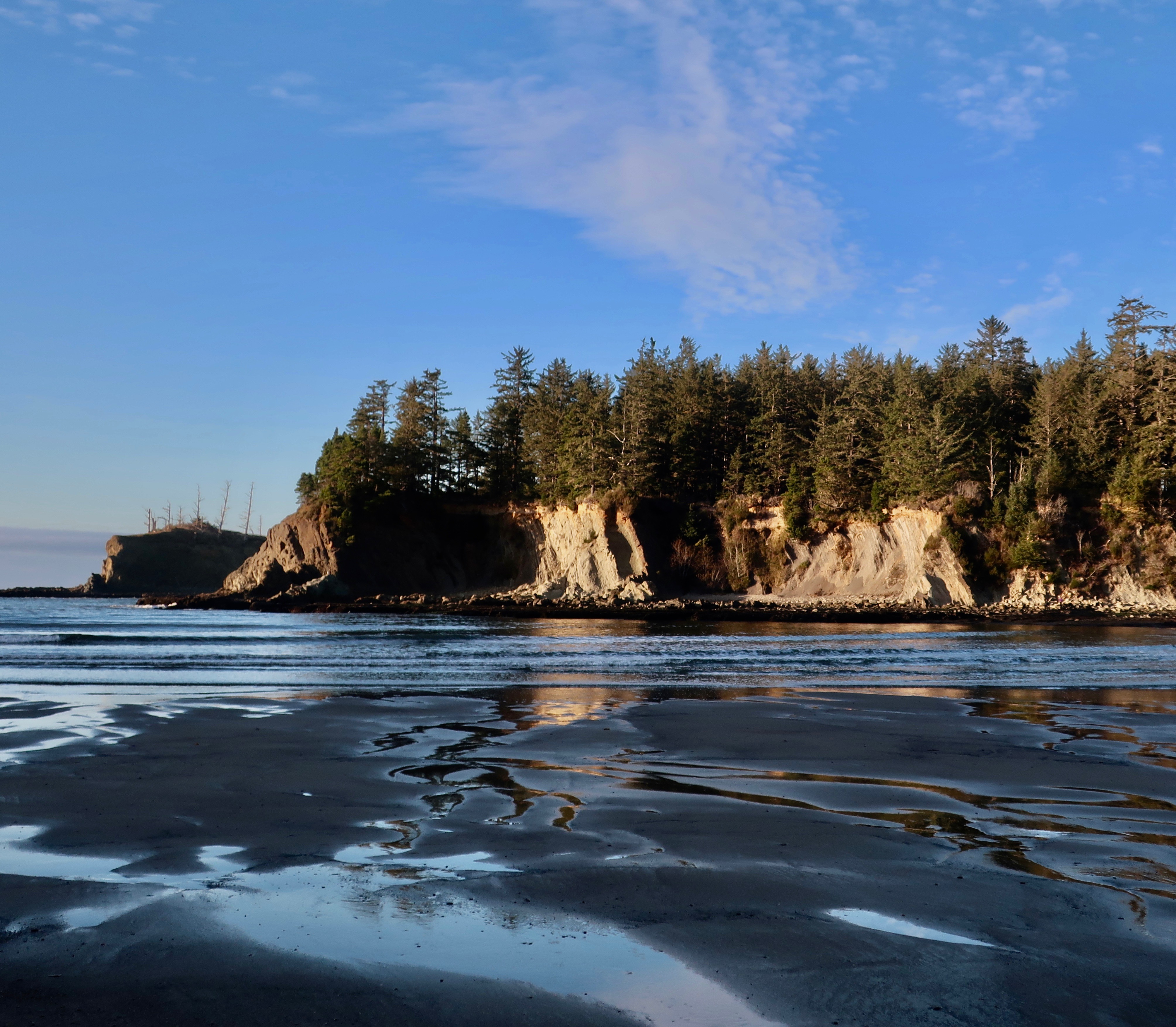
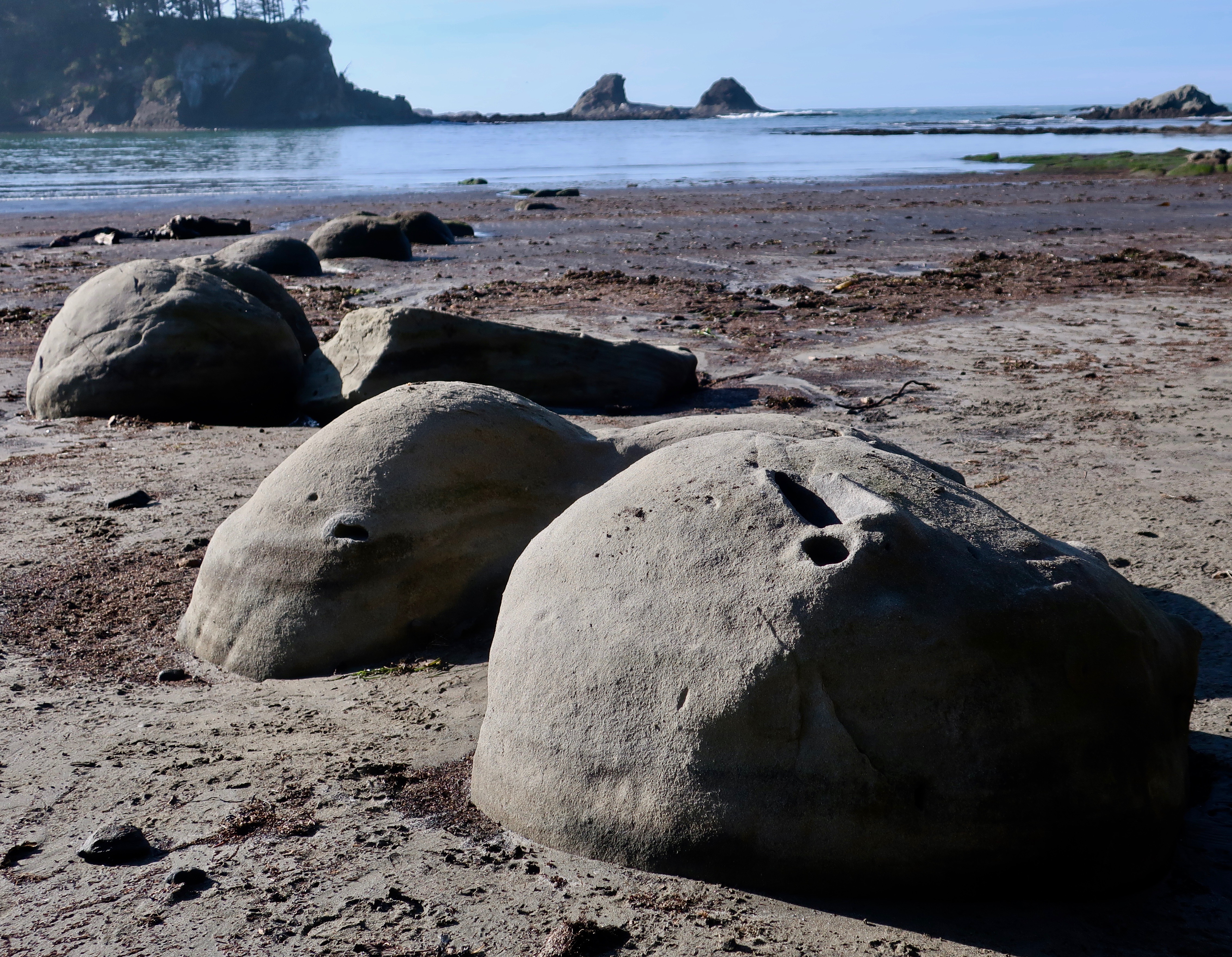
A couple of weeks before Christmas, Peggy and I made a trip over to Cape Arago on the Oregon Coast. The waves featured in my January 7th post were from this trip as is today’s post on Sunset Bay State Park, which is located at the beginning of the Cape just outside of Coos Bay.
Sunset Bay at sunset with the tide out.
The tourist and real estate industries of the Oregon Coast prefer to ignore the next BIG one, or put it off to sometime in the distant future. The folks involved in predicting earthquakes have a different perspective. The sheer number of tsunami evacuation route signs along the Oregon coast speak to their concerns. The Cascadia Subduction Zone is real. A massive 9-point something or other earthquake known as a mega–thrust is in our future. They happen every 300 to 600 years. The last one was in 1700. The oceanic Juan de Fuca plate is diving under the North American continental plate and it will not be denied. It’s stuck right now. Small earthquakes near the surface are creating pressure on the trapped area, however. When it gives, all hell will break loose.
I, for one, pay careful attention to the evacuation routes whenever Peggy and I visit the coast. If the earth shakes, we will be out of there! So what if we leave our welcome mat behind.
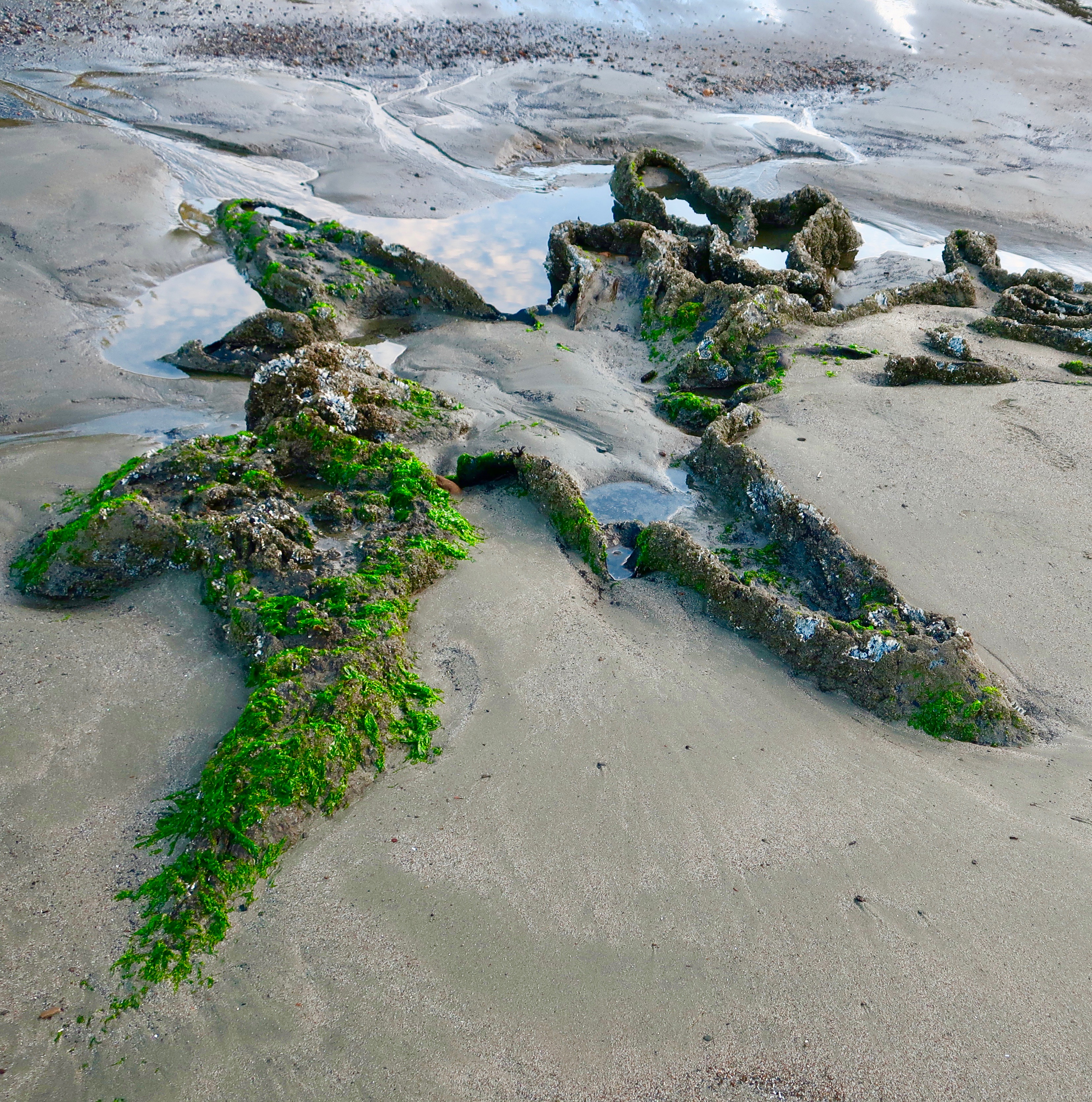
Sunset Bay State Park is a geological wonderland when it comes to featuring various aspects of what can happen when a massive earthquake strikes. The most fascinating to me are the stumps of ancient trees. Twelve hundred years ago, a forest stood above the ocean where Sunset Bay now stands. An earthquake caused a subsidence in the land, drowning the forest. At low tides, the remains can still be seen.
I was fascinated by the different shapes of trunks left by the ancient trees.
Octopus like…
A different perspective…
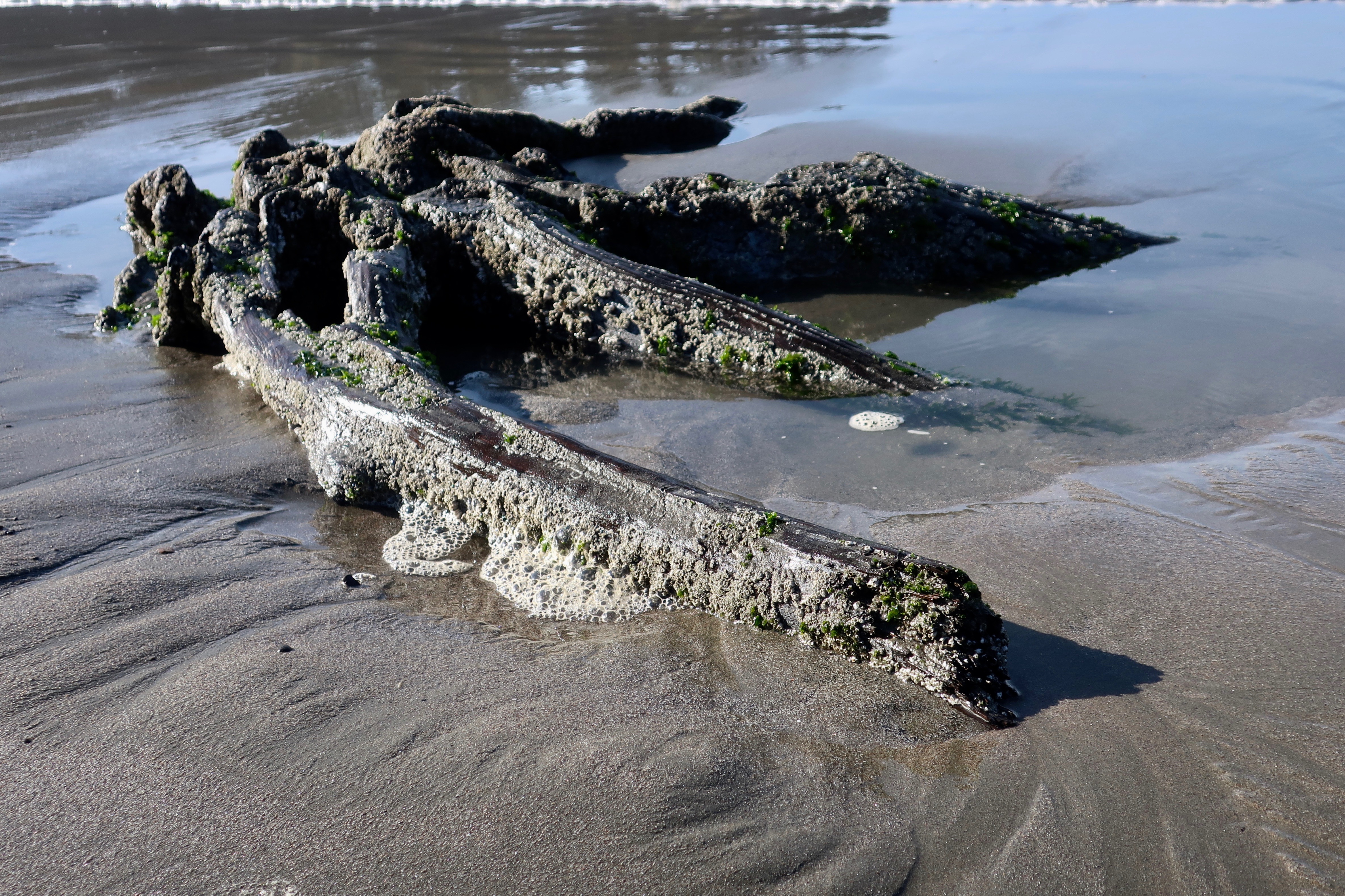
This ancient tree stump at Sunset Bay State Park bears a strong resemblance to a man doing jumping jacks.
This tree has roots on roots. A genealogist would be impressed.
Incoming tide surrounded the tree trunk and reflected the fluffy clouds in the sky.
Peggy stands in front the ancient tree trunks to provide perspective. Her Covid-19 mask serves as a scarf.
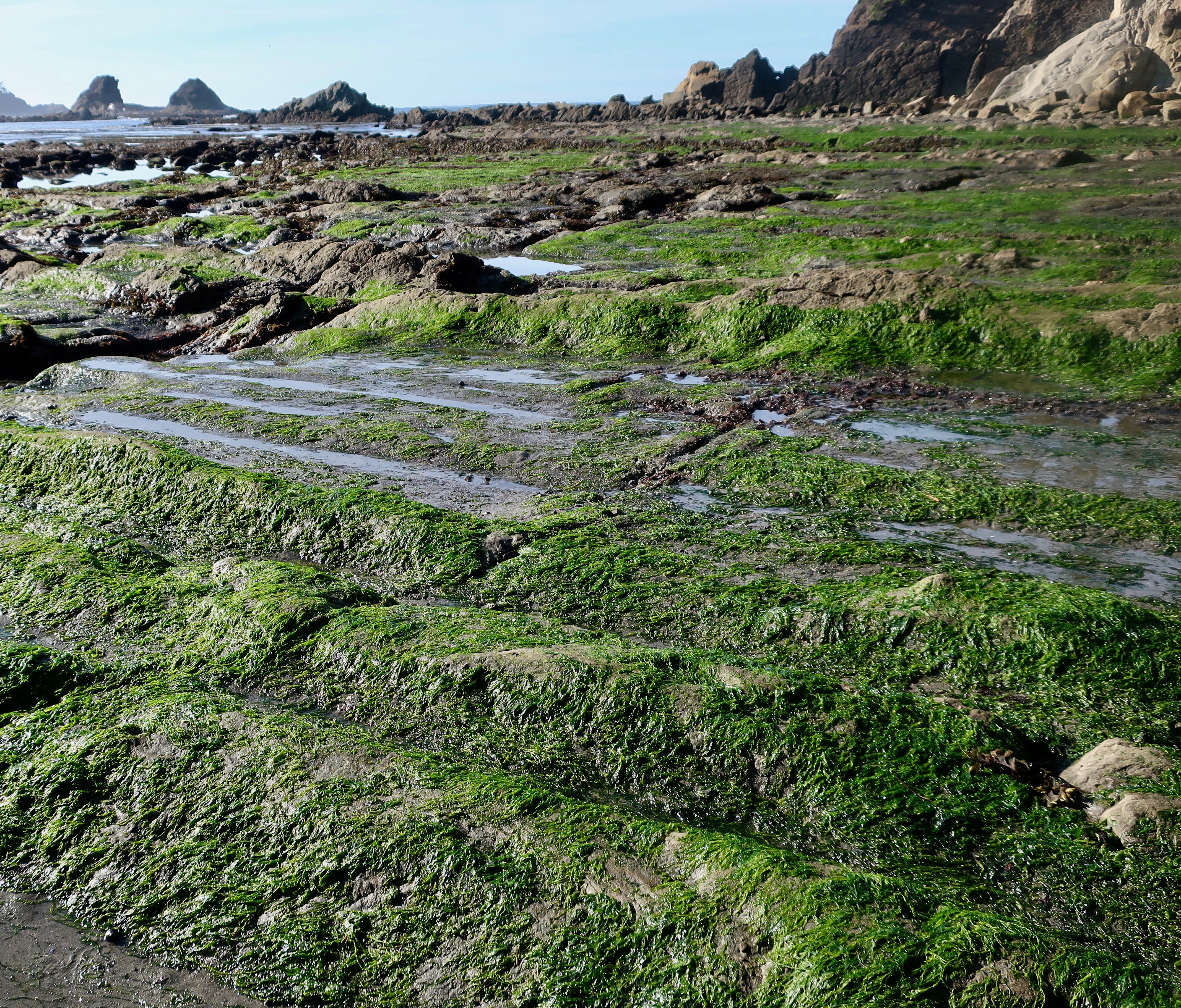
Faults, fractures in the earth’s surface along which the blocks of crust move relative to one another can be seen among the tilted and layered rocks of the Bay at low tide. The rocks, BTW, also provide an excellent area for tide pools that feature sea life loved by kids and adults alike.
Low tide at Sunset Bay. You can see a number of tide pools to explore, but it also shows a clear fault running from left to right. A second fault can be seen behind it. The crust between the faults moves when earthquakes strike.
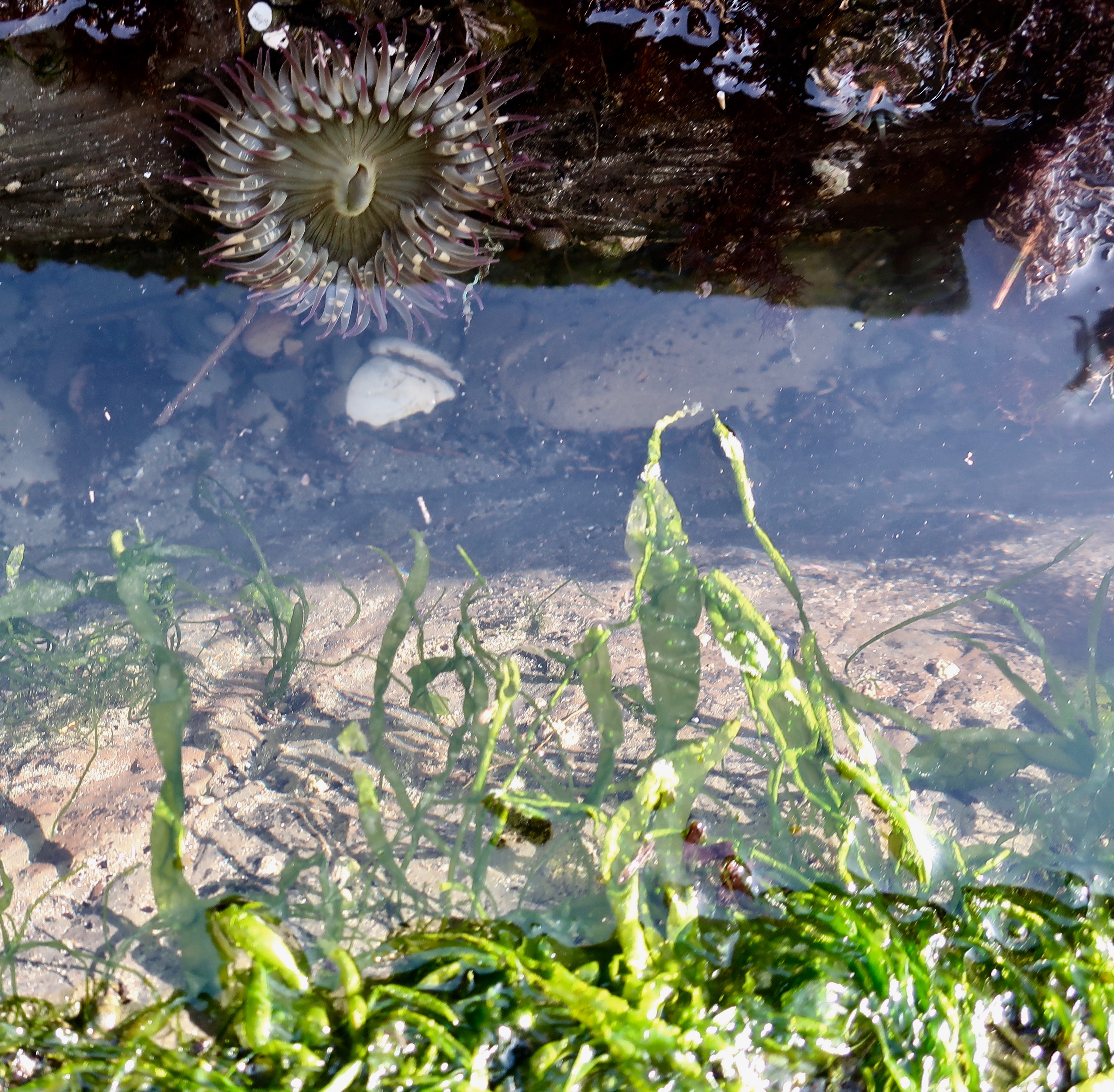
We spent a few minutes peering into tide pools.
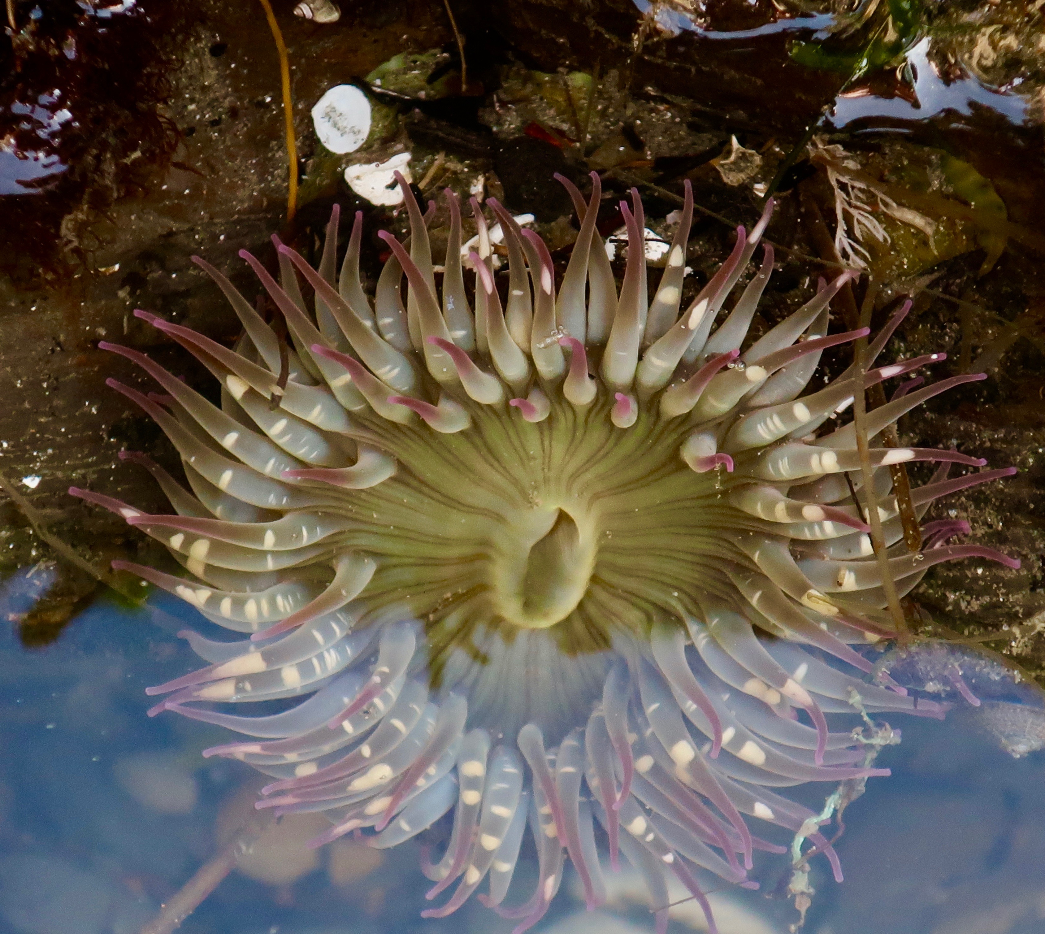
We were impressed by the sea anemone. The slit is the anemone’s mouth, and, for convenience, its anus as well. The tentacles contain stingers filled with a toxin for stunning dinner, which is then transported to its mouth.
For fun, I rendered the anemone in black and white.
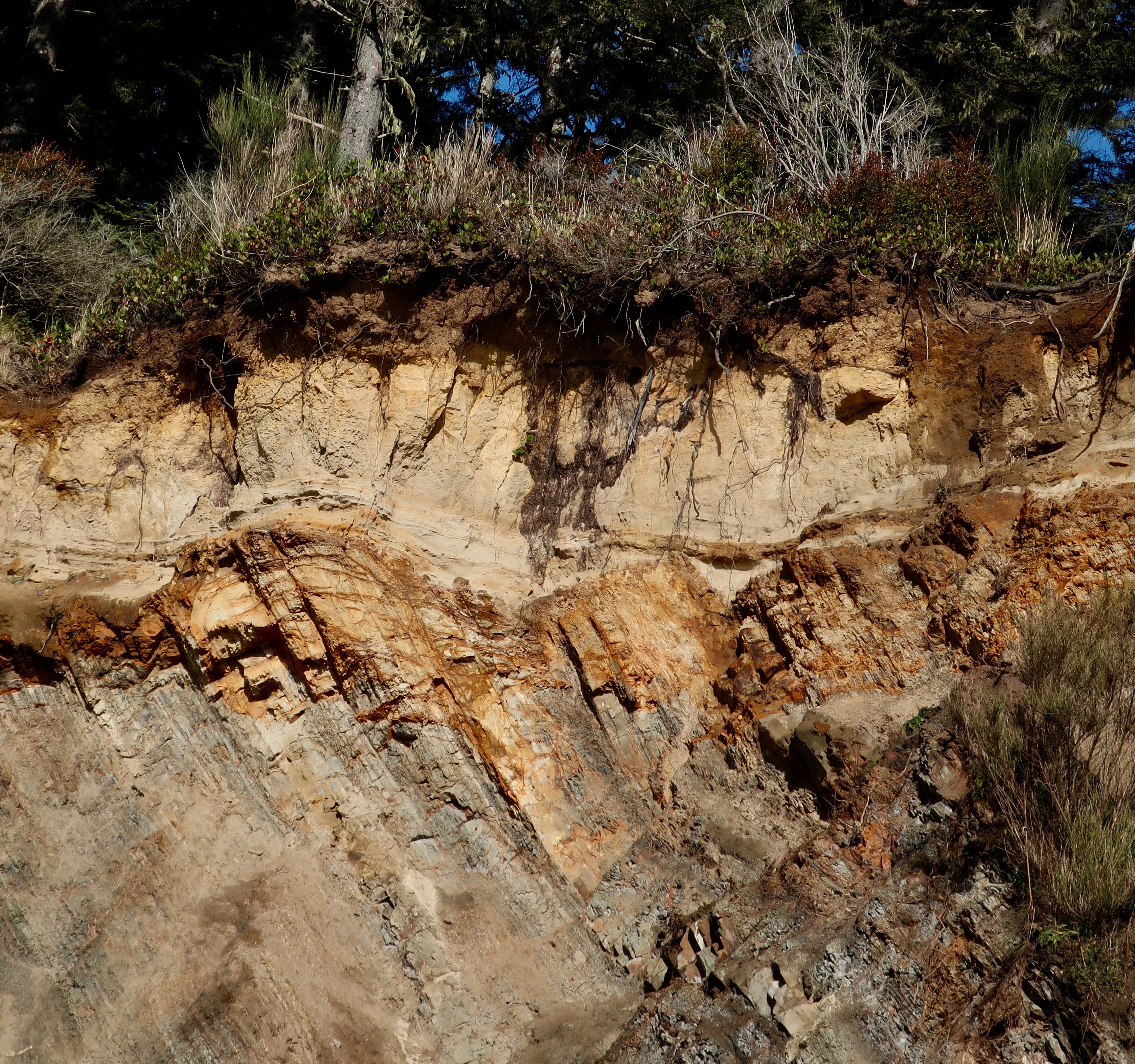
While the bay represents an earthquake caused subsidence, the Whiskey Run terrace surrounding the Bay represents uplifts and folding also created by tectonic activity related to the Cascadia Subduction Zone. The wave-caused erosion taking place in Sunset Bay operated on the terrace when it was at sea level. It’s estimated that the land rises approximately three feet every thousand years.
The terrace above Sunset Bay was once at sea level. Like the Bay, waves created the flatness of the terrace.
A close up of the Whiskey Run terrace. The sedimentary layers have been tilted down to the right by tectonic forces and then eroded away by wave action. A layer of dirt/rock has since been laid down on top, providing soil for the forest.
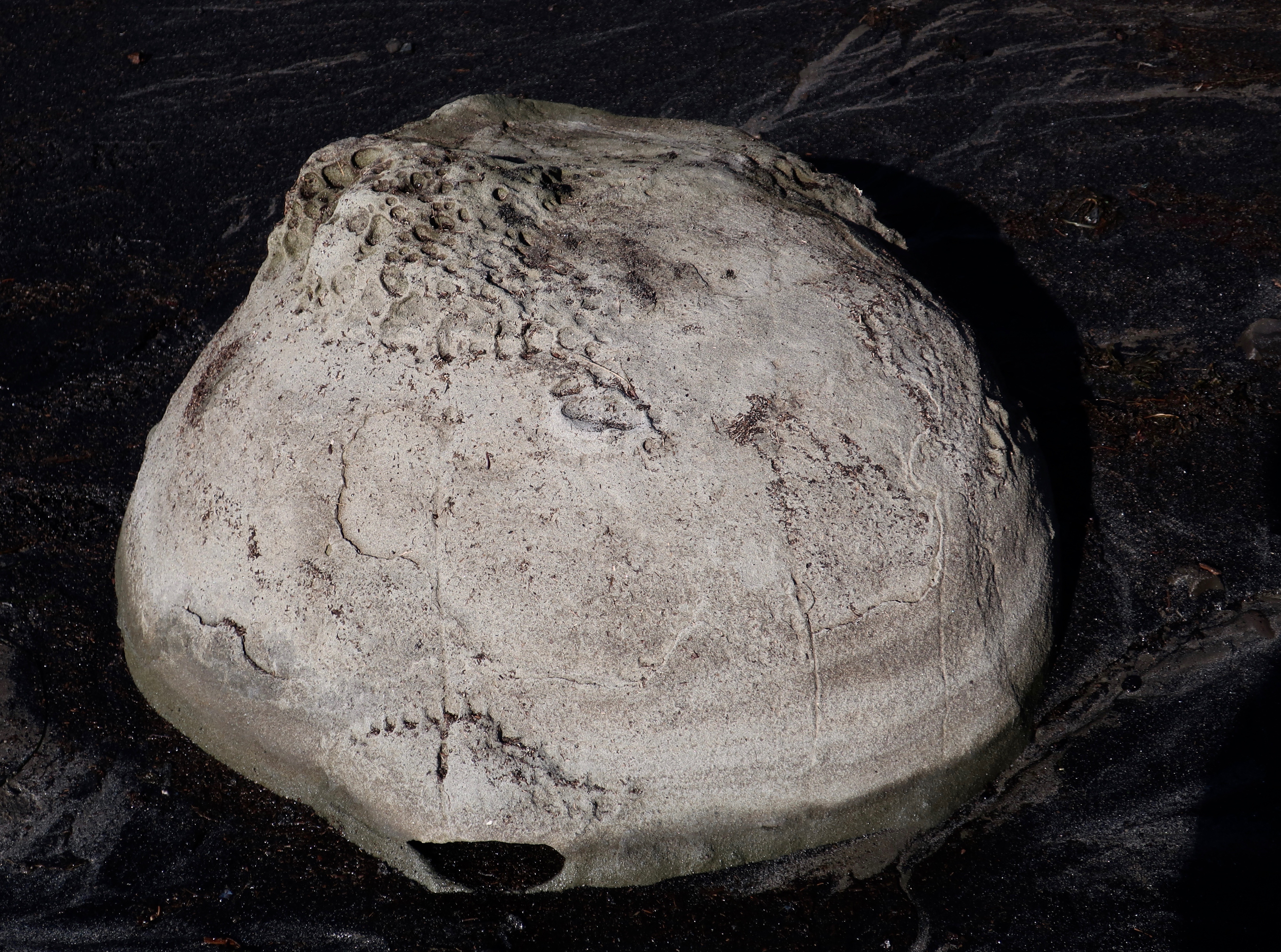
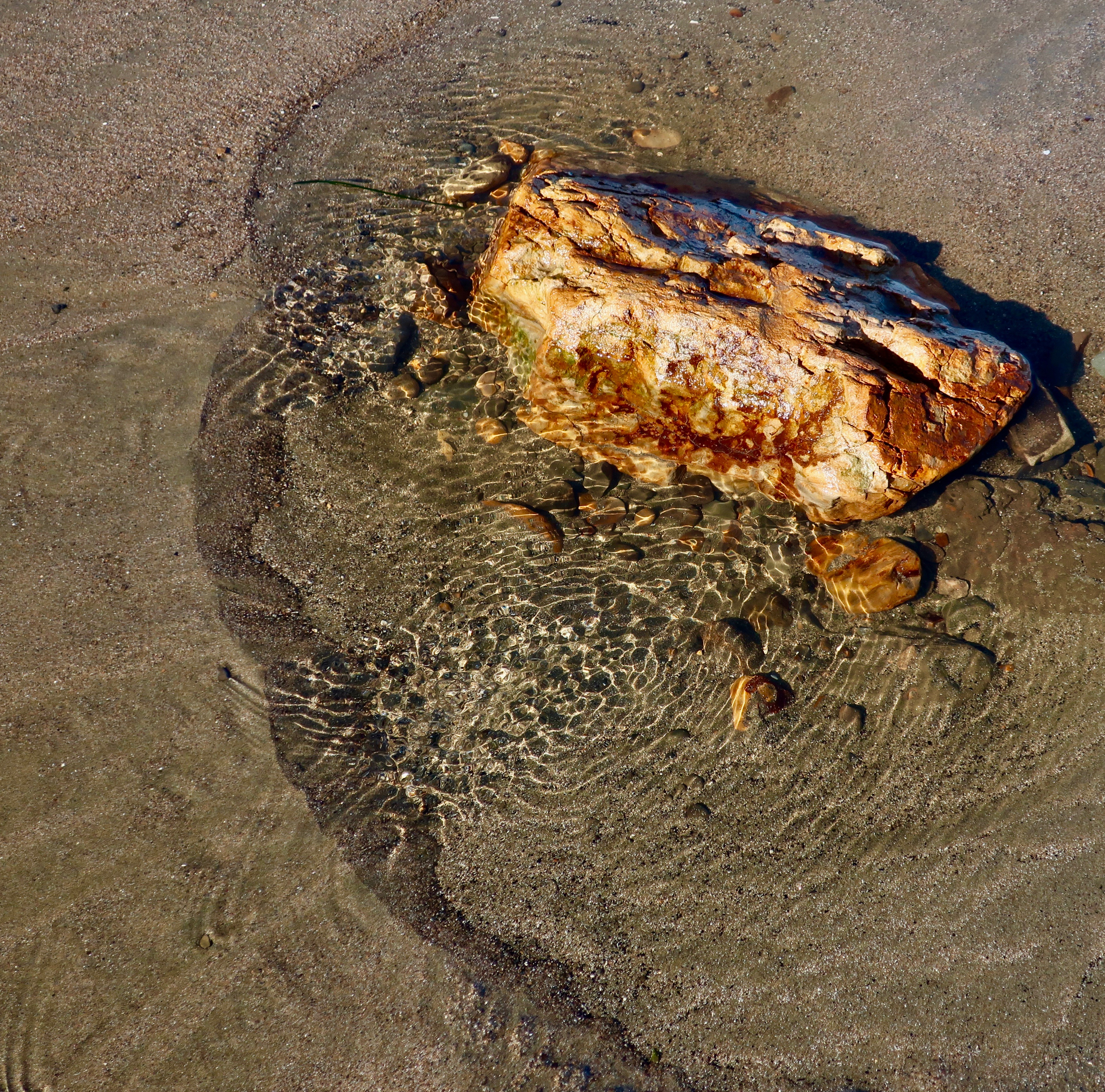
And finally, I would like to feature a strange, non-tectonic feature of Sunset Bay: concretions. Peggy and I first came across these round, rock-like structures on the southern coast of the South Island of New Zealand. They are created when groundwater triggers extra amounts of ‘cement’ around irregularities in the rock such as shells, creating a round structure that continues to grow as more cement is added. The hardness of the covering makes it harder to erode than the surrounding rock.
This is a concretion.
And these are concretions apparently marching out to sea. Why, I haven’t a clue.
I’ll conclude with a few other photos from Sunset Bay that I found interesting.
An orange rock with ripples…
A ghost tree…
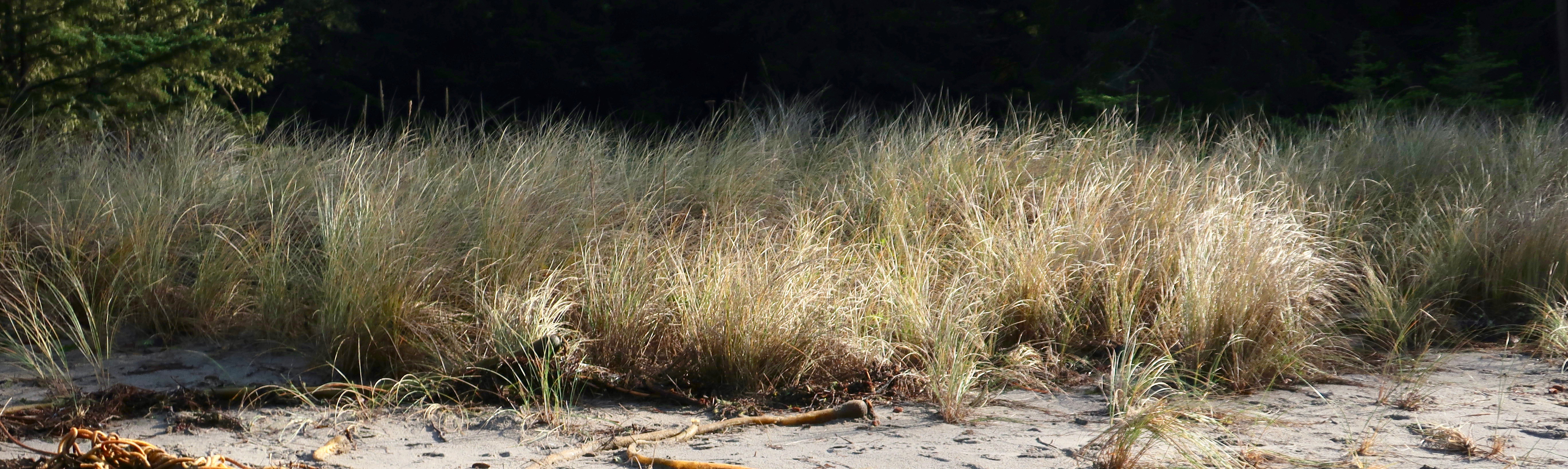
Sea grass in the late afternoon sun…
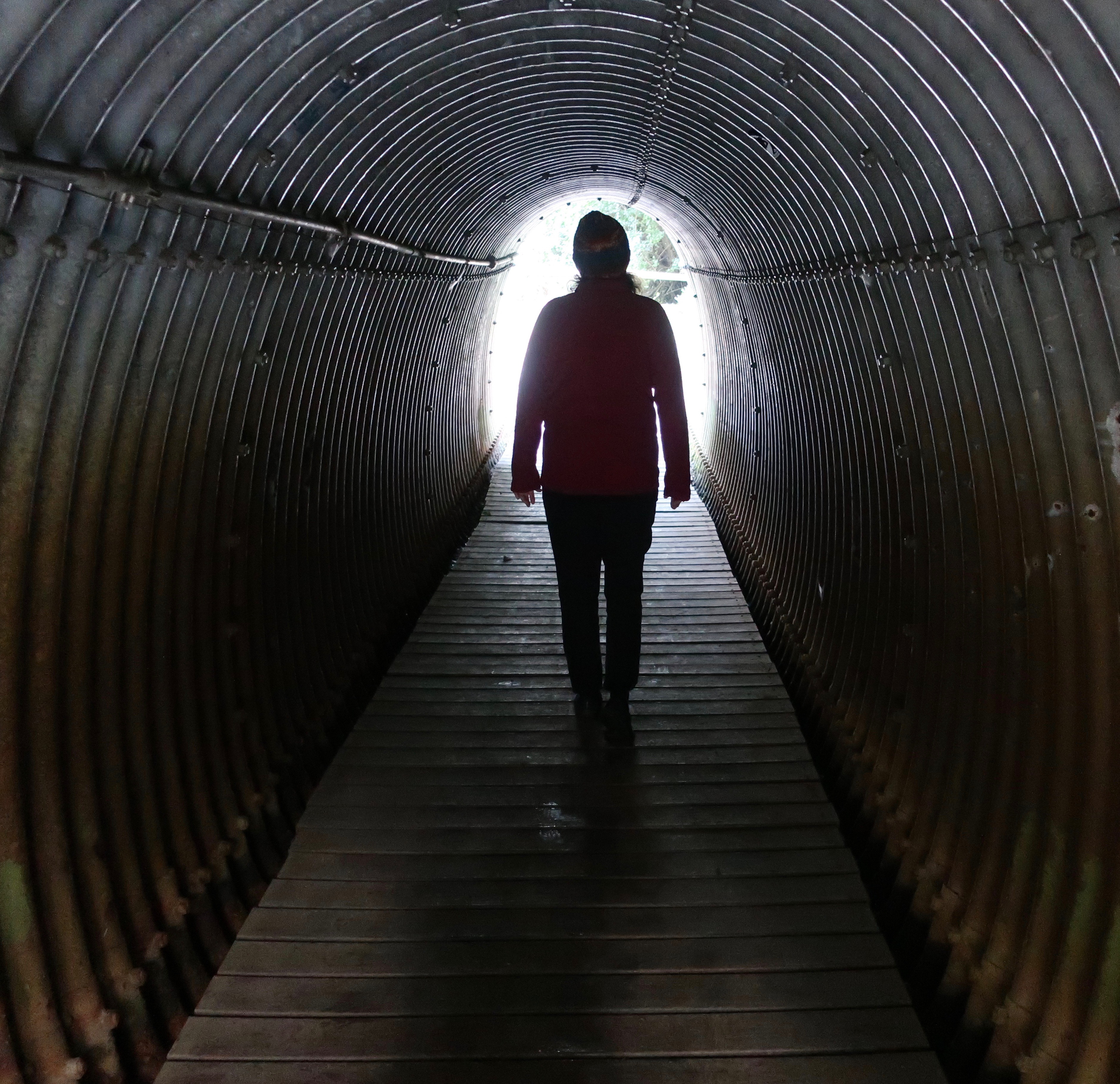
Peggy walking through the tunnel that connected our campground to the bay.
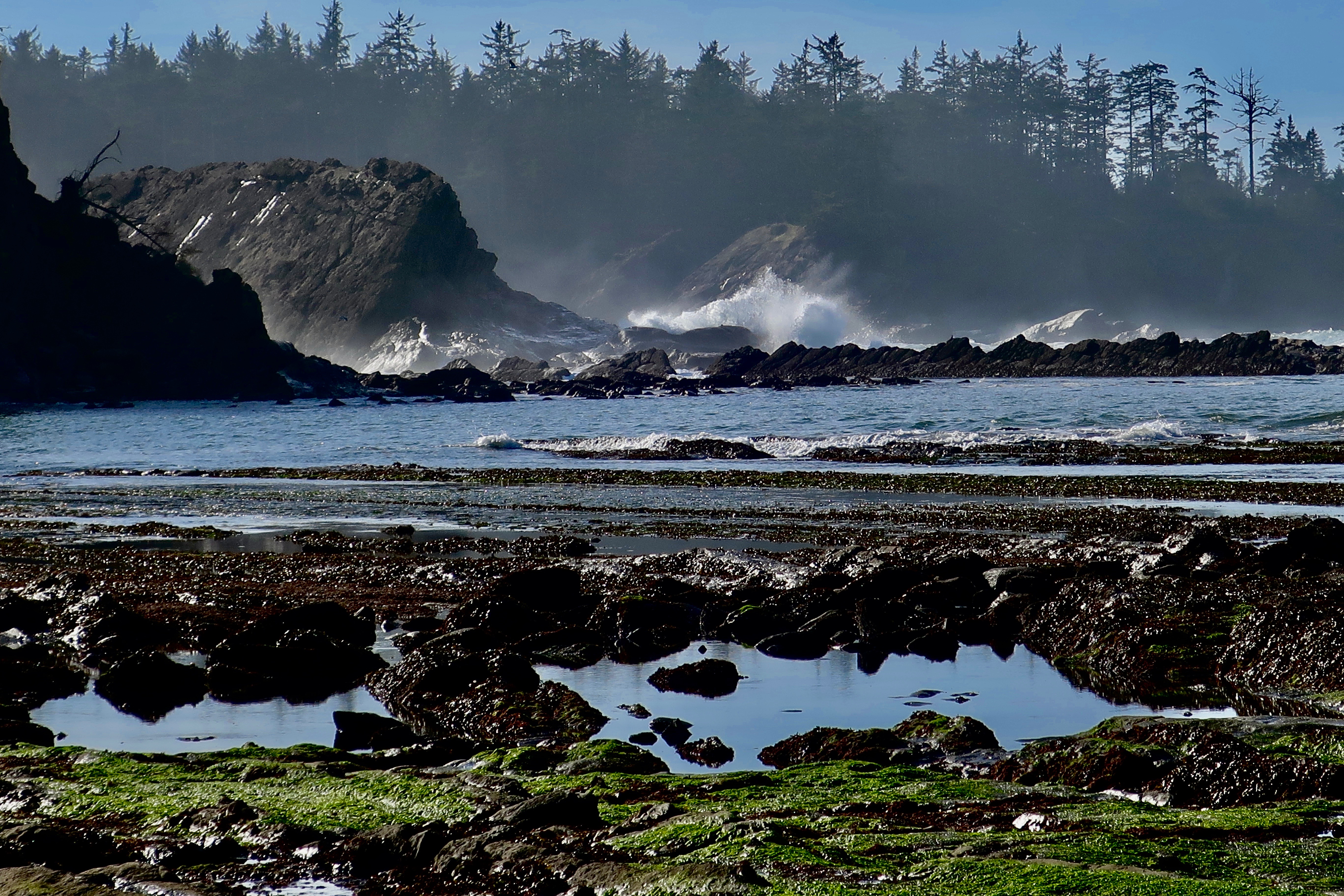
And finally, I’ll wrap up this post on Sunset Bay with more waves.
NEW BLOG SCHEDULE: I’ve been working on revising the book on my Liberia Peace Corps experience— adding a few chapters on my experience working for the Peace Corps after I was a Volunteer and updating the chapters I wrote about modern Liberia. Several of you have read the book and a few of you may have even been around when I first blogged it several years ago. Anyway, I am going to reblog it again, adding it to my schedule. On Mondays I will continue to blog my book, It’s 4 AM and a Bear is Standing on top of Me. On Wednesdays, I will blog The Bush Devil Ate Sam. On Fridays, I will continue my travel blog.
NEXT POSTS:
Blog a Book Monday: Will you believe I actually have a good day on the Sierra Trek?
Blog a Book Wednesday: Introduction to the Bush Devil Ate Sam
Travel Blog Friday: I return to my Backroad series following Highway 191 through Navajo country in Utah and ending up in Arizona’s Lyman State Park.
I watched the presentation of colors today at President Biden and Vice President Kamala Harris’s inauguration. I listened as Lady Gaga sang an incredible version of the Star-Spangled Banner. I noted the flags from our history that dated back to our very beginnings. I looked out on the 200,000 flags flying on the National Mall and the flags flying in the breeze on virtually every building.
And while I am not by nature a flag waver, I was proud, prouder than I have ever been of the flag.
Two weeks ago, my vision was totally different. I watched as an American Flag was used to beat a policeman whose only crime was protecting our Nation’s Capital from a band of thugs whose goal was an assault on our very democracy. I watched as they claimed they were patriots, wrapped themselves in flags, waved them from the ramparts, and carried them as they ran through the capitol corridors breaking windows, spray painting walls, and threatening the lives of Republican Vice President Mike Pence and the Democratic Speaker of the House, Nancy Pelosi.
That vision has now been wiped out of my mind.
May we now move forward to solve the very real problems this nation faces— from the raging pandemic that has killed 400,000 Americans to the racism that continues to haunt our lives, from the environmental degradation that has led to global warming to severe economic depression that has destroyed thousands of businesses and thrown hundreds of thousands of people out of work, from denying citizens the right to vote to governing with mistruths and conspiracy theories.
And finally, may we return to our role as a positive, responsible partner in addressing the problems of the broader world.
In the last blog-a-book post from “It’s 4 AM and a Bear Is Standing on Top of Me,” I had split the Sierra Trek with two thirds of the participants following an easy, jeep-supported route into Robinson Flat. My task was to follow the group that had gone on a much more difficult route without water and without leadership. I arrived in camp to find one Trekker lost and the others in a state of rebellion against the leader. Me. They had discussed hanging but thankfully decided on giving me the silent treatment instead…
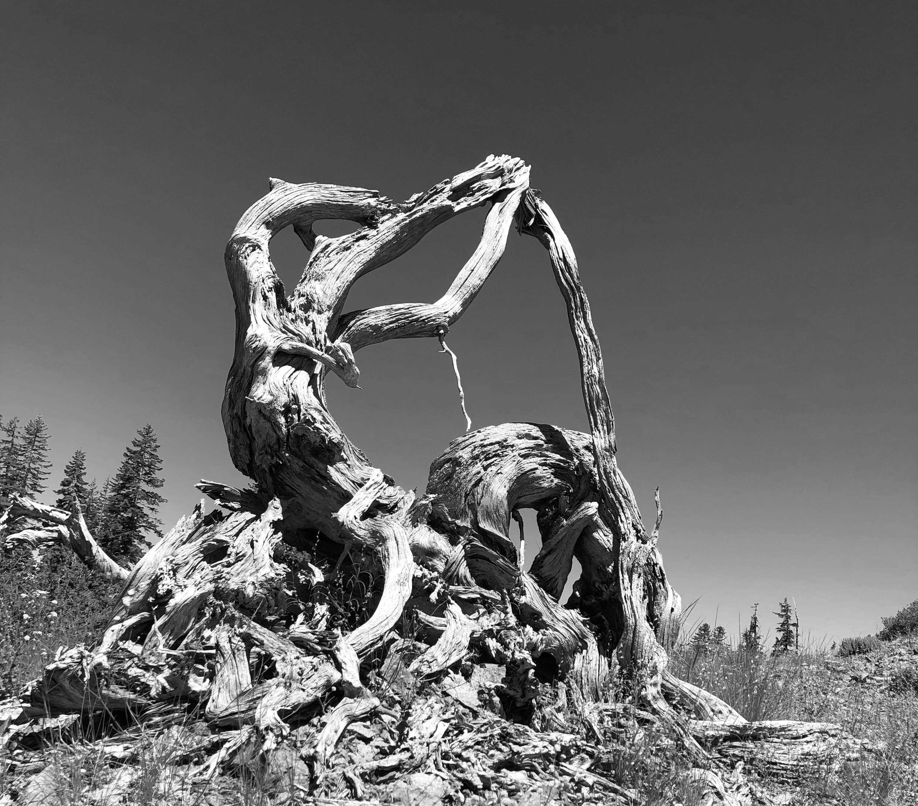
After two days of trekking, I was beginning to feel like this twisted tree trunk. Old. What would day three bring?
Before going to bed, I insisted that the Trekkers gather around so I could learn what I could about the missing person, Dick. Silent treatment or not, I needed to think through an action plan for the next day. Dick was the school teacher who had claimed he could carry his weight in booze. He had been hiking alone and hadn’t talked to anyone about leaving the route. The Trekkers could only give me an approximation of where they had last seen him.
I decided to get folks up in the pre-dawn hour of around 5 the next morning. As soon as I could see the trail, I would high-tail-it the two miles into Robinson Flat and see if Dick had made an appearance. If not, I would check with the ranger station and help organize a search party. Two of my strongest hikers would stay behind in camp in case Dick showed up there. Charlie would bring the rest of the Trekkers on to Robinson Flat.
I was exhausted and couldn’t go to sleep but somewhere in the wee hours I must have dozed off because I woke with a start as a rock pinged my head. Charlie was lobbing pebbles at my sleeping bag. I was up and packed in a zip. The troops had made a miraculous recovery over night. After a few encouraging words, I was bounding off up the trail like a hare with the hounds of hell in hot pursuit. Just as I came into camp at Robinson Flat, Dick came hoofing in from the opposite direction. I didn’t know whether to kiss or to kill him, but he was too ugly for the former and possibly too tough for the latter.
I settled for, “Are you okay, Dick?”
“Sure,” he replied in a why-wouldn’t-he-be tone.
“What happened,” I demanded, allowing my irritation to surface.
“I got thirsty,” Dick explained. “I could see French Meadow Reservoir at the bottom of the ridge so I hiked down to get a drink. When I got there, I was tired so I set up camp.” And, I am sure, dug into his booze reserves. Why worry?
My irritation boiled over.
“Why didn’t you tell someone you were leaving? Didn’t you realize we would be worried sick and mounting a search and rescue effort?” I was on a roll and Dick was on the receiving end of a great deal of frustration I was feeling. Fortunately, guilt had driven him to get up before dawn and make his way to Robinson Flat as quickly as he could. It might have been worse, much worse.
The crisis was over, but I still had chores. First up was to go back and collect the rearguard I had left at Duncan Creek. I could have sent Steve but I needed time to recover from my anger. As I hiked, I made my second command decision of the day. Even though we had only hiked for two days, the group could use a layover day. Hell, I could use a layover day. In fact, I needed a layover day. I deserved a layover day. The next day could wait for its turn. What else could go wrong? Hah! Along the way I met the rest of the Trekkers and told them that the lost Dick had found himself.
“I am beginning to understand what it means to be a manic-depressive,” I told Charlie. My life over the past three weeks had been one constant roller coaster. I allowed myself a slight glimmer of hope that we had made it beyond the low point of our adventure.
The other Trekkers had made it to Robinson Flat the day before without a hitch and I now had everyone back together again. A layover day gave all of us, including me, a chance to recoup. People were able to wash clothes, take baths, read, and just lounge around, swapping lies about their terrible ordeals.
Even the Four Mouseketeers were back in high spirits. I came over a hill and found them gathered around one of my older female participants as she sat in the middle of a tiny stream without a stitch of clothes on. They were struggling to appear cool and carry on a conversation while she bathed. I sent them scampering back to camp. At least I had answered my earlier question as to what kind of babysitting services we were providing.
Nan, one of my staff members from the Lung Association in Sacramento, showed up with resupply about midday, including food, cold beer, sodas— and Jo Ann. It was good of her to come, but we were uncomfortable. Still, I was glad to share my adventures and frustrations to date with her. I left out any references to hiking and holding hands with Lisa. After Nan and Jo departed and I had people settled in for the evening, I headed over a hill, loaded my pipe with Balkan Sobranie pipe tobacco, and settled in for a smoke. I hadn’t totally abandoned my pipe (adult pacifier). At that point, I needed the solace it provided. I must have sat there for an hour staring up at the stars, alone in my thoughts, sad.
By the end of day three, I was still in a funk…
But the sun was shining the next morning, as it usually does in the summer Sierra. I felt glad to be out in the woods and happy to be alive. My body was beginning to tone up and I could almost hear my pampered fat cells screaming in protest.
NEXT POST: On my Thursday Travel Blog I will take you over to the beautiful, geologically interesting, and slightly weird Sunset Bay on the Oregon Coast.
A note on photos: Since I don’t have any from the first Sierra Trek, I am using other wilderness photos I have taken from over the years. I found the two stumps on my 700 plus mile trip down the PCT two years ago.
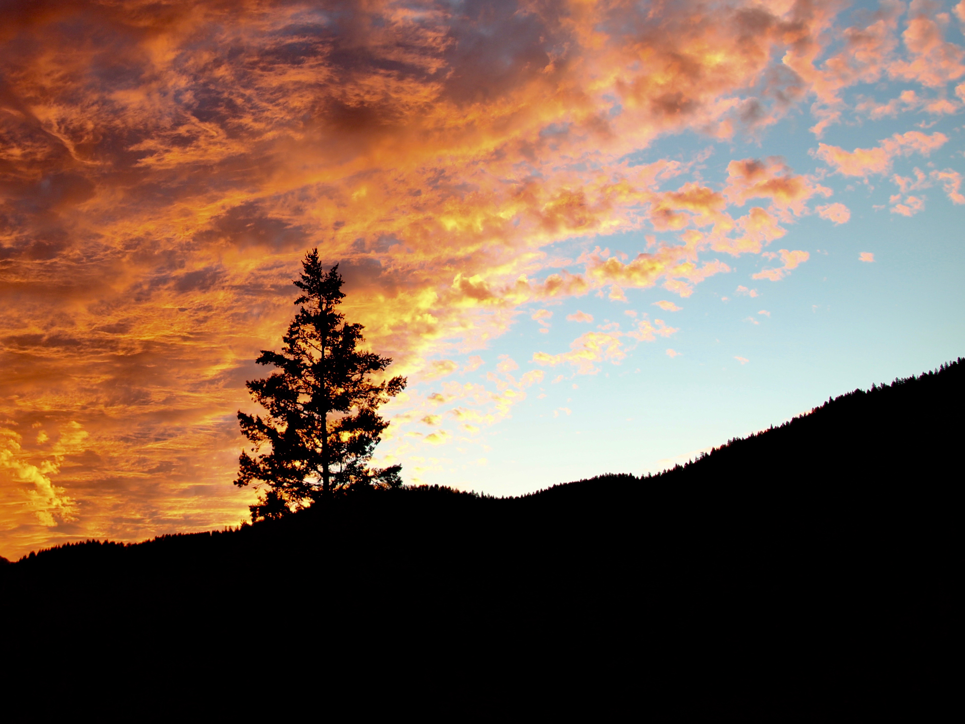
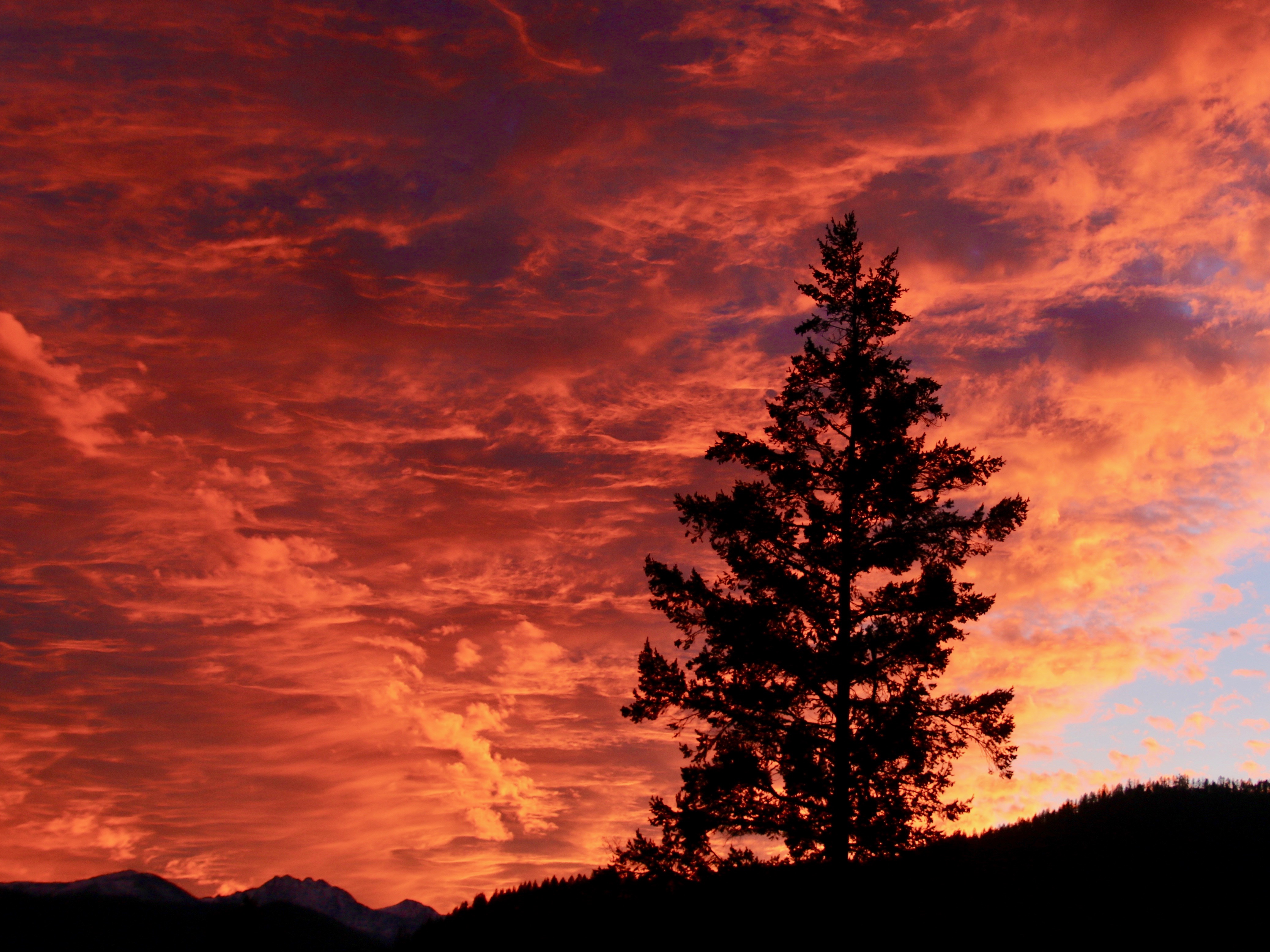
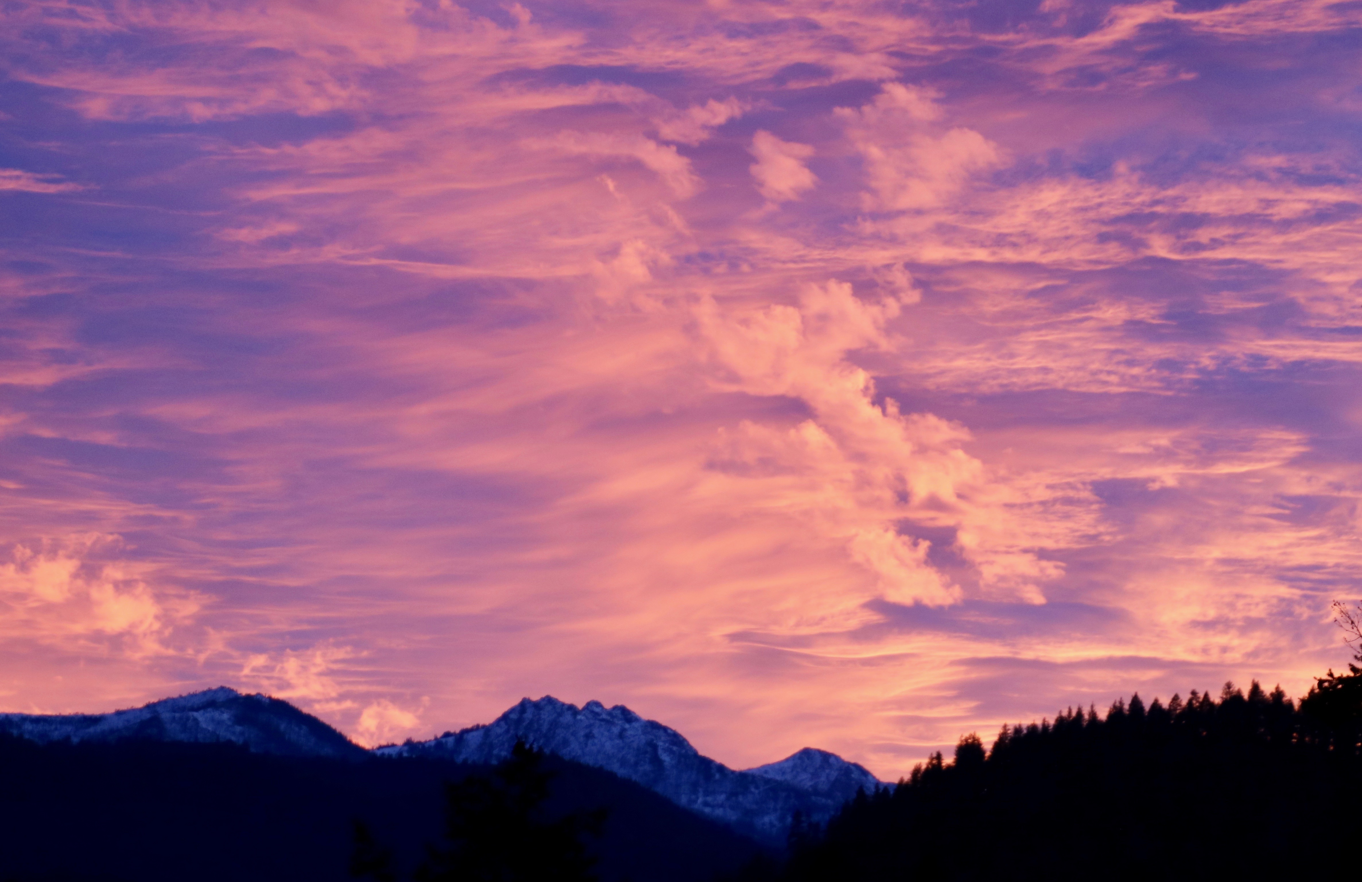
I was writing in our library when Peggy urged, “Curt, you have to come in here and check out the sunset.”
Four or five times a year we get dramatic sunsets at our house. It is always a time to stop whatever we are doing and watch as the sun lights up the clouds with gorgeous red, orange, yellow and purple colors. The front of our house, which faces a westerly direction, provides front row seats for watching the show. These photos don’t require any description. Enjoy.
As the sun completed its evening show, the Red Buttes took on a dark blue look. The show was over.
NEXT POSTS:
Blog-a-book Tuesday: I contemplate killing the ‘lost’ Trekker who had decided to go on a detour but failed to tell anyone. The Four Mouseketeers discover a new pastime at Robinson Flat that their mothers definitely would not approve.
Travel Blog Thursday: Sunset Bay: Beauty, weirdness, and geology