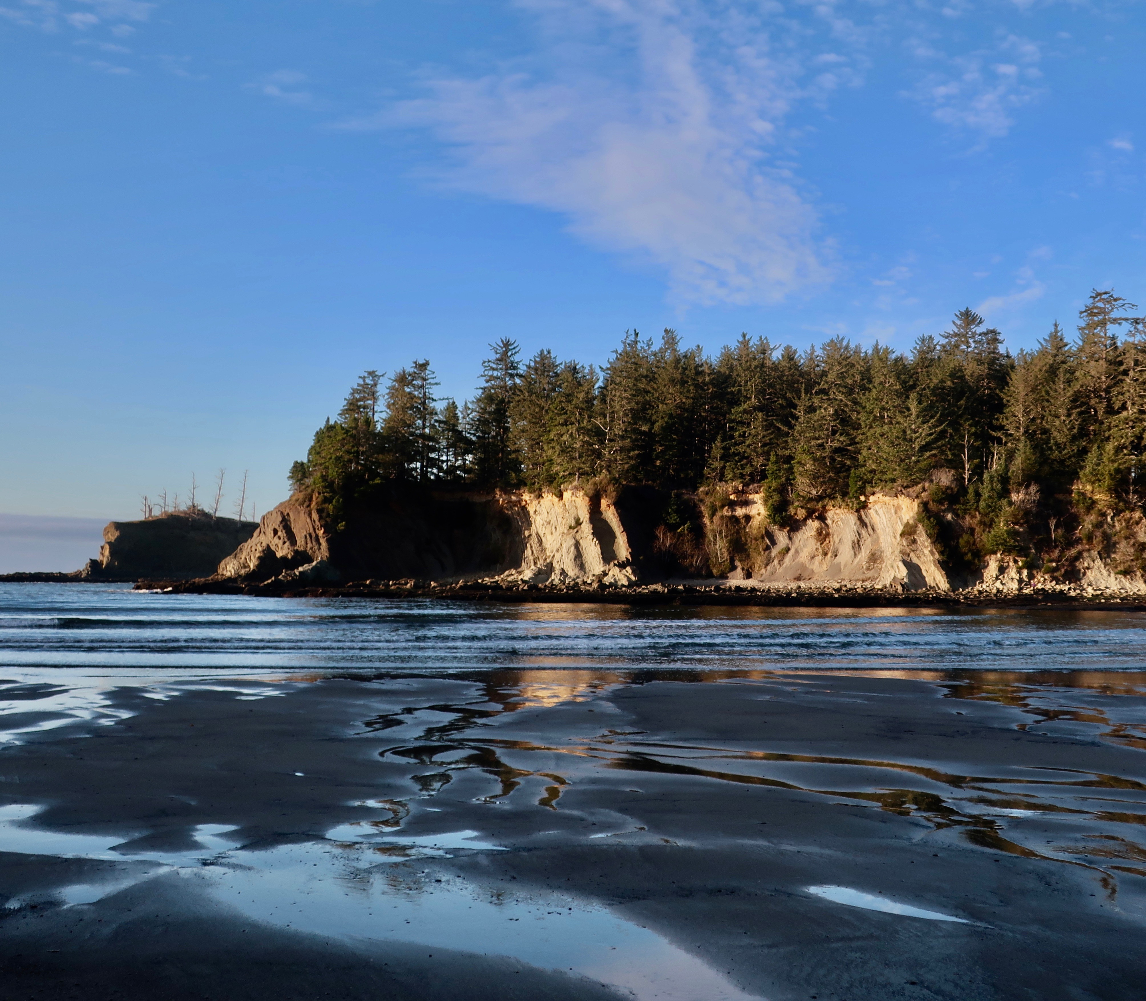
A couple of weeks before Christmas, Peggy and I made a trip over to Cape Arago on the Oregon Coast. The waves featured in my January 7th post were from this trip as is today’s post on Sunset Bay State Park, which is located at the beginning of the Cape just outside of Coos Bay.

The tourist and real estate industries of the Oregon Coast prefer to ignore the next BIG one, or put it off to sometime in the distant future. The folks involved in predicting earthquakes have a different perspective. The sheer number of tsunami evacuation route signs along the Oregon coast speak to their concerns. The Cascadia Subduction Zone is real. A massive 9-point something or other earthquake known as a mega–thrust is in our future. They happen every 300 to 600 years. The last one was in 1700. The oceanic Juan de Fuca plate is diving under the North American continental plate and it will not be denied. It’s stuck right now. Small earthquakes near the surface are creating pressure on the trapped area, however. When it gives, all hell will break loose.
I, for one, pay careful attention to the evacuation routes whenever Peggy and I visit the coast. If the earth shakes, we will be out of there! So what if we leave our welcome mat behind.
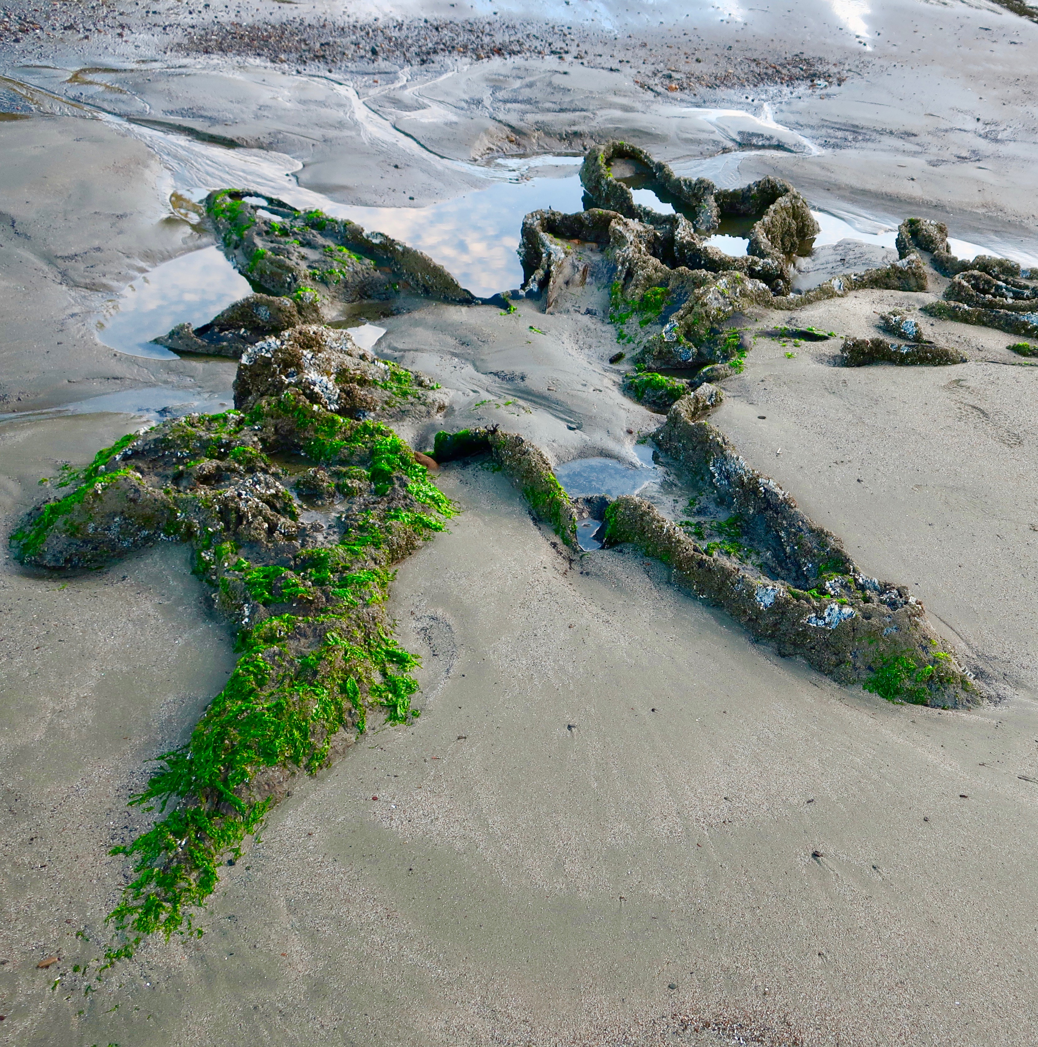
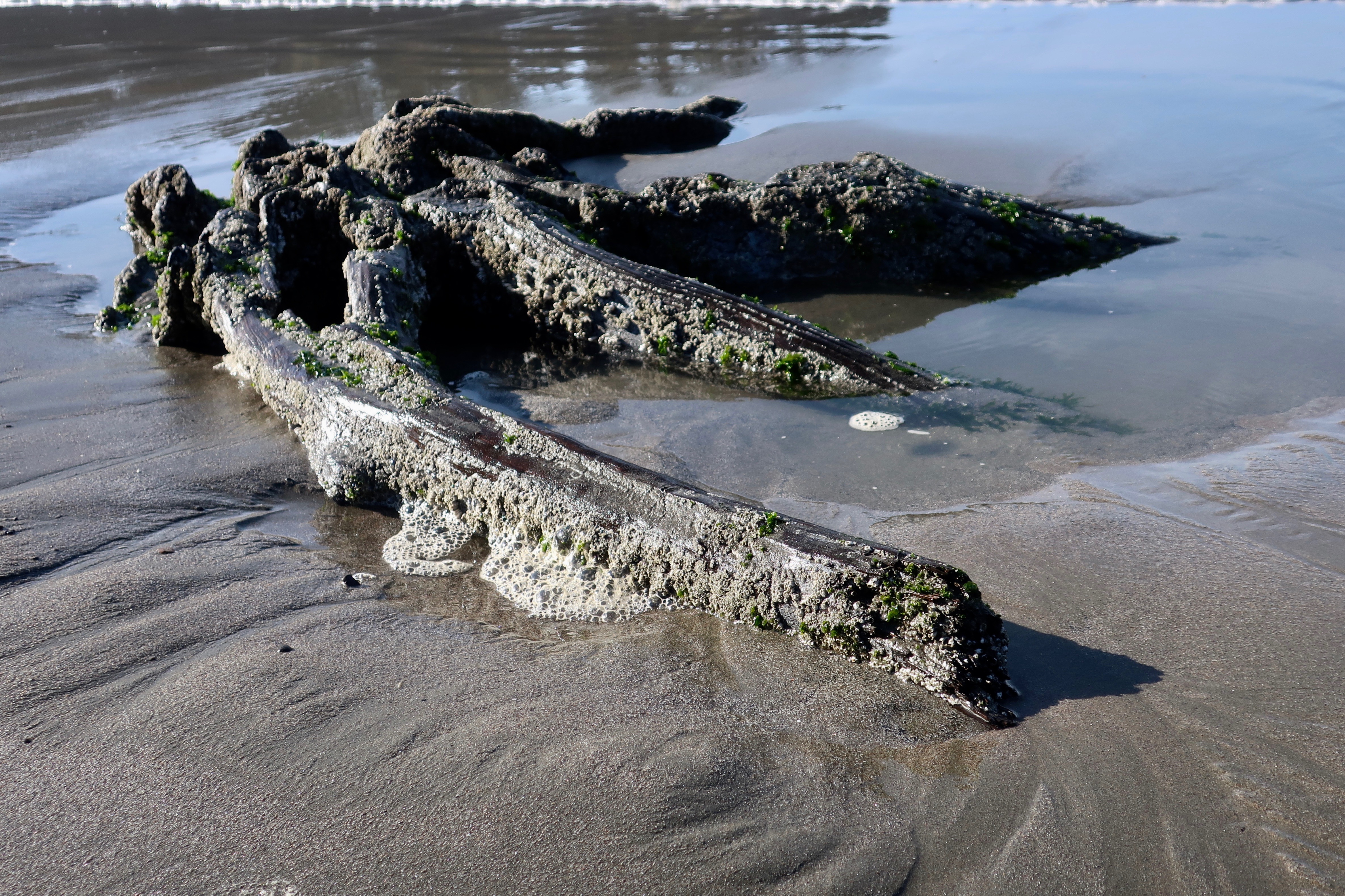
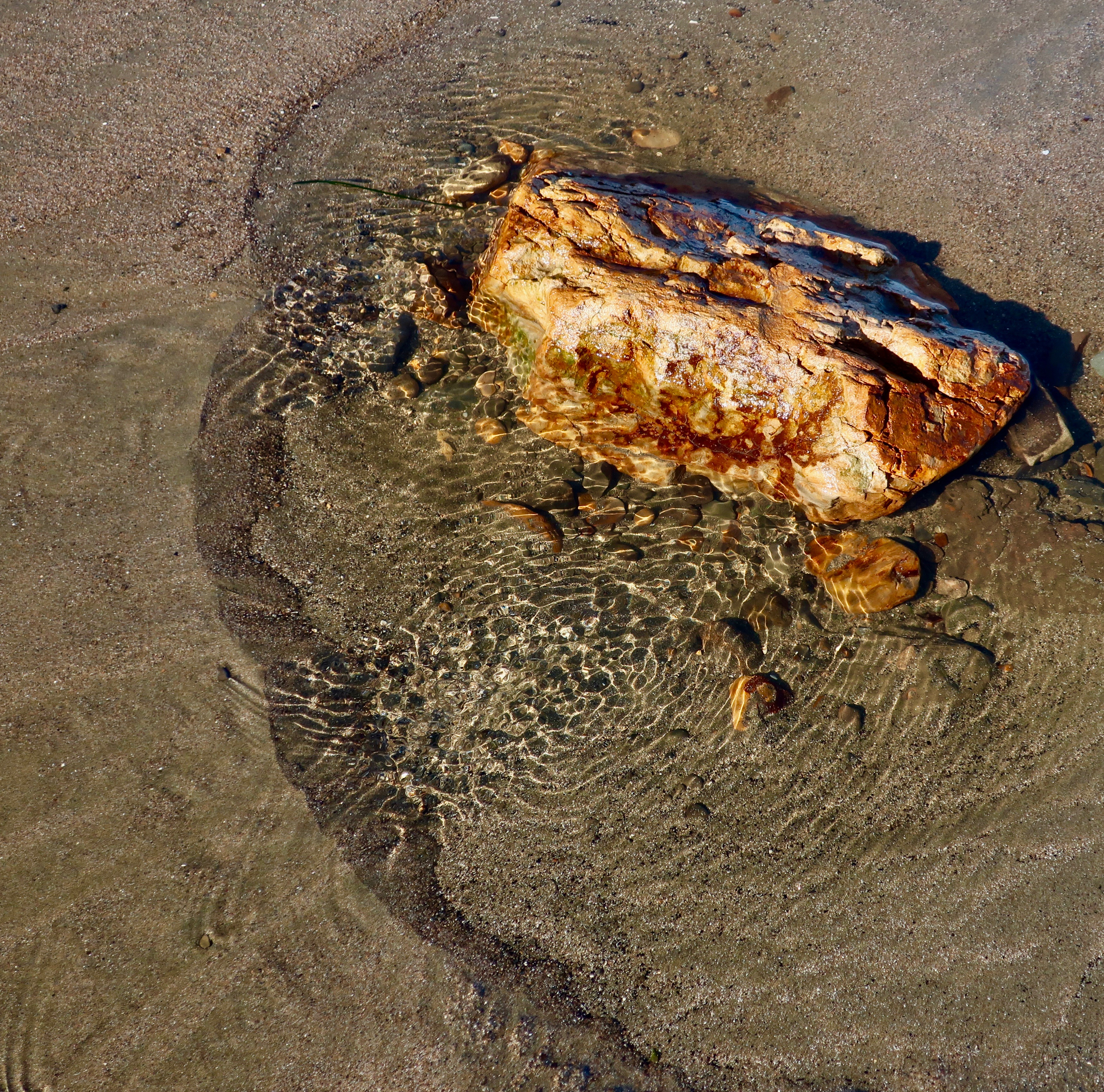
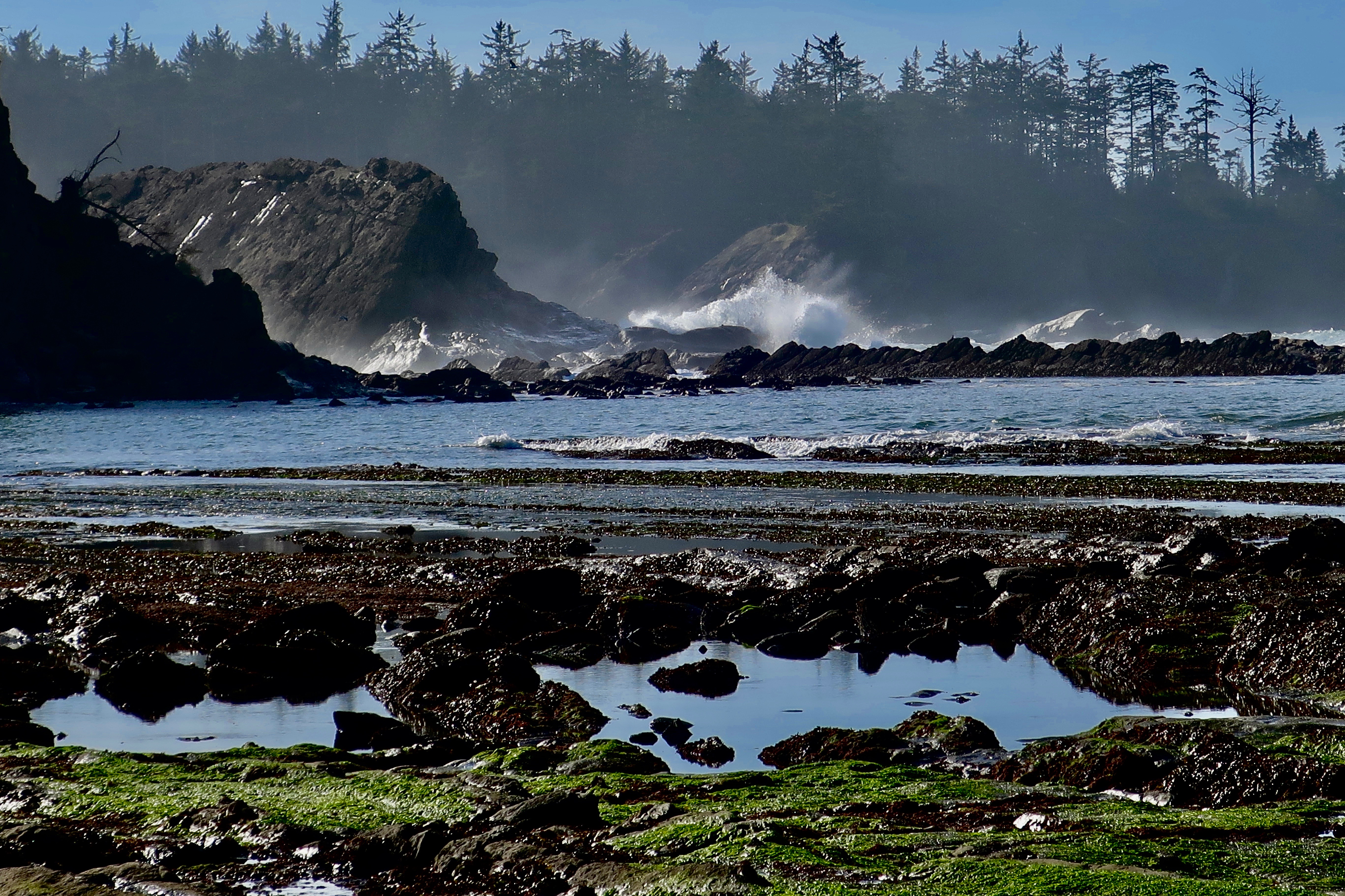
Sunset Bay State Park is a geological wonderland when it comes to featuring various aspects of what can happen when a massive earthquake strikes. The most fascinating to me are the stumps of ancient trees. Twelve hundred years ago, a forest stood above the ocean where Sunset Bay now stands. An earthquake caused a subsidence in the land, drowning the forest. At low tides, the remains can still be seen.


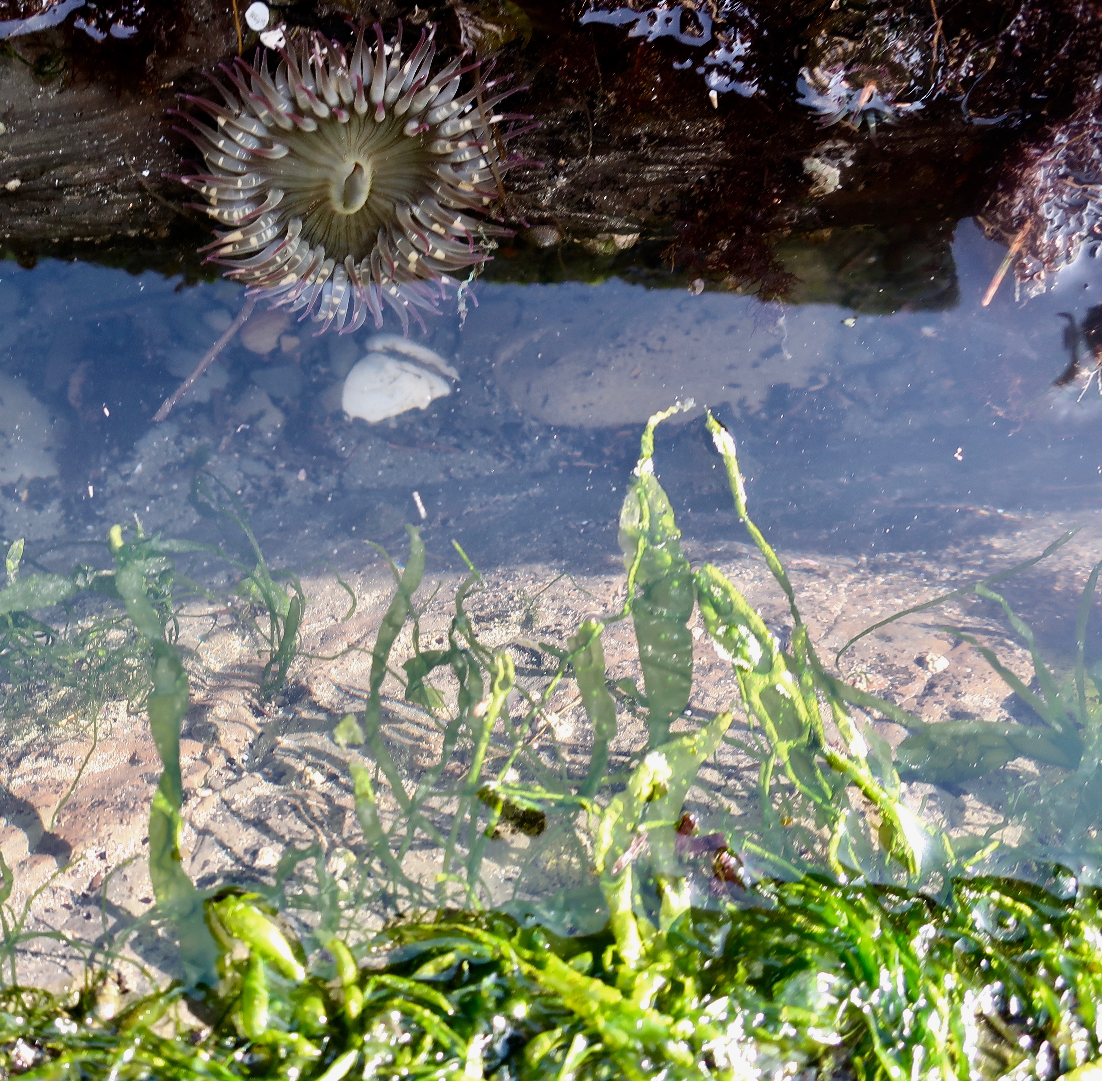
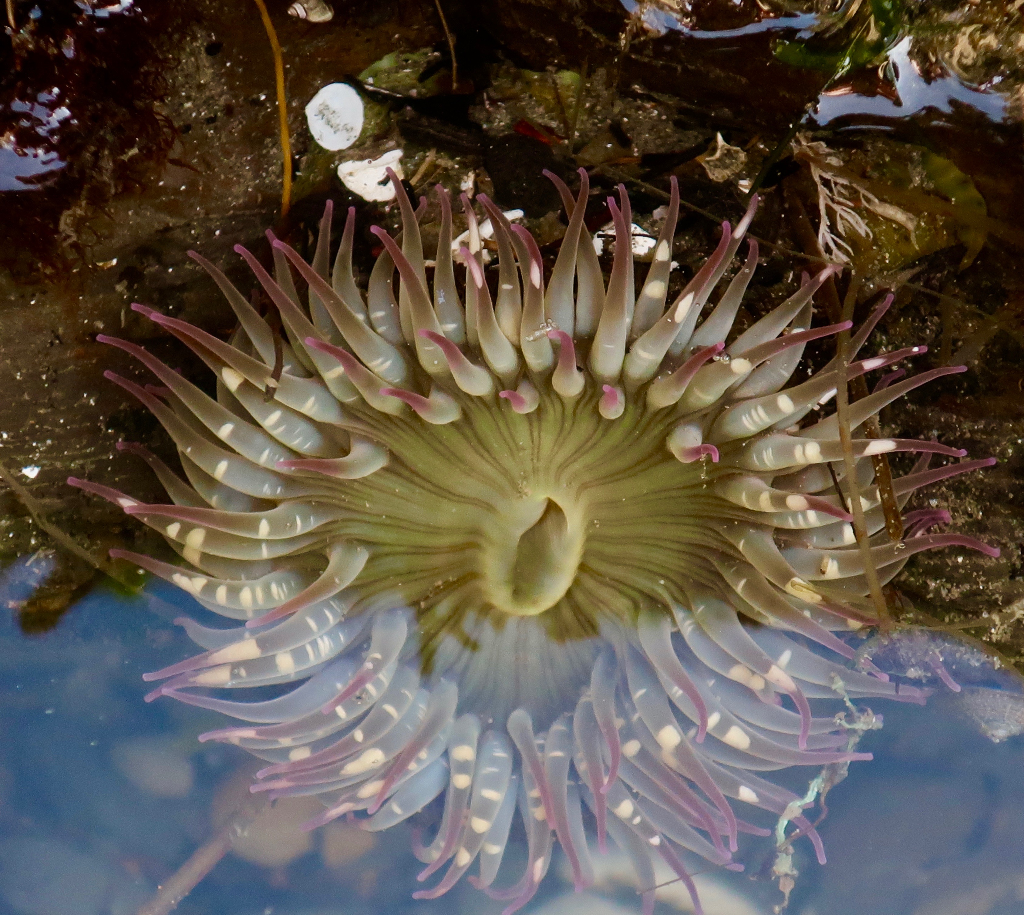
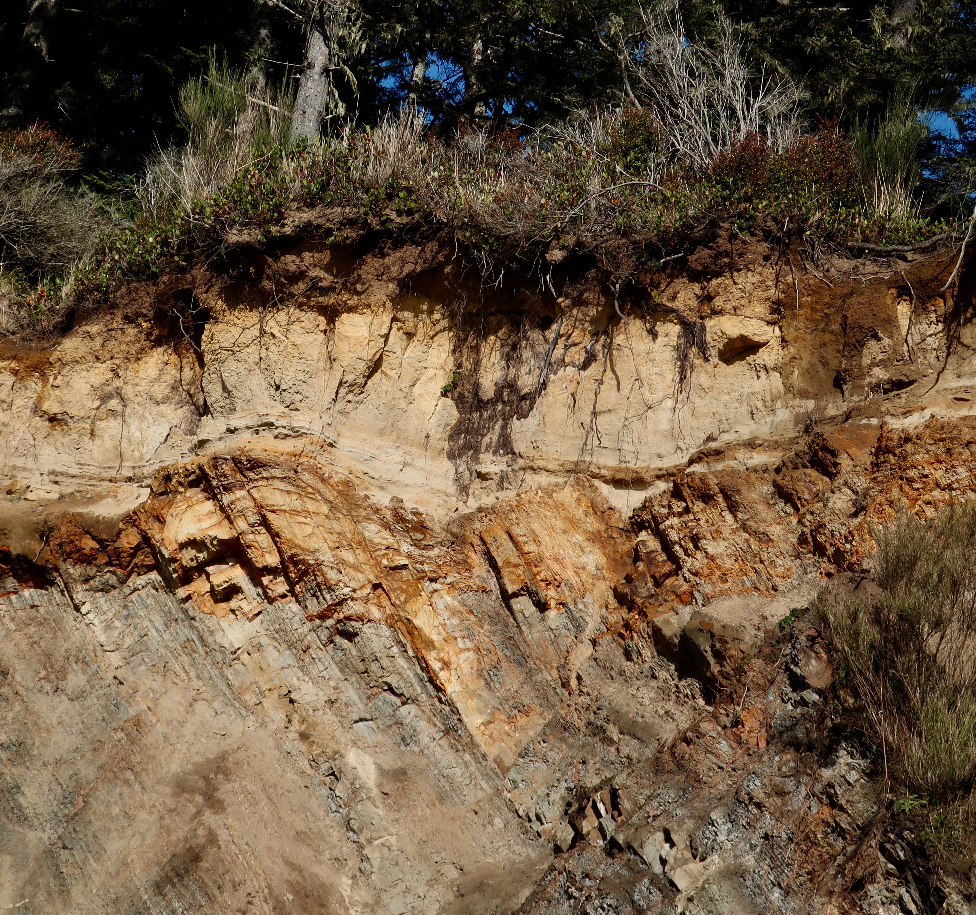
Faults, fractures in the earth’s surface along which the blocks of crust move relative to one another can be seen among the tilted and layered rocks of the Bay at low tide. The rocks, BTW, also provide an excellent area for tide pools that feature sea life loved by kids and adults alike.
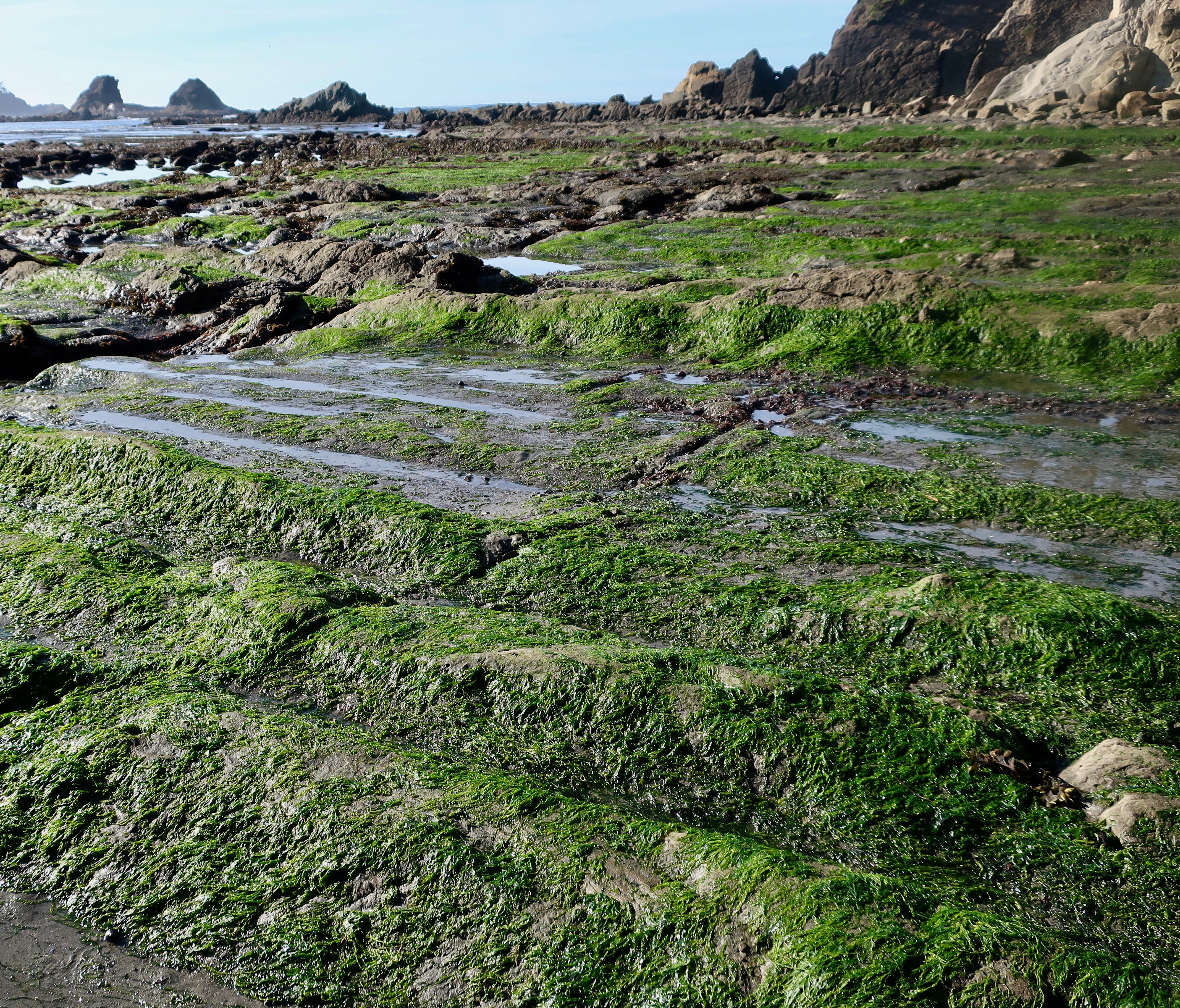

While the bay represents an earthquake caused subsidence, the Whiskey Run terrace surrounding the Bay represents uplifts and folding also created by tectonic activity related to the Cascadia Subduction Zone. The wave-caused erosion taking place in Sunset Bay operated on the terrace when it was at sea level. It’s estimated that the land rises approximately three feet every thousand years.
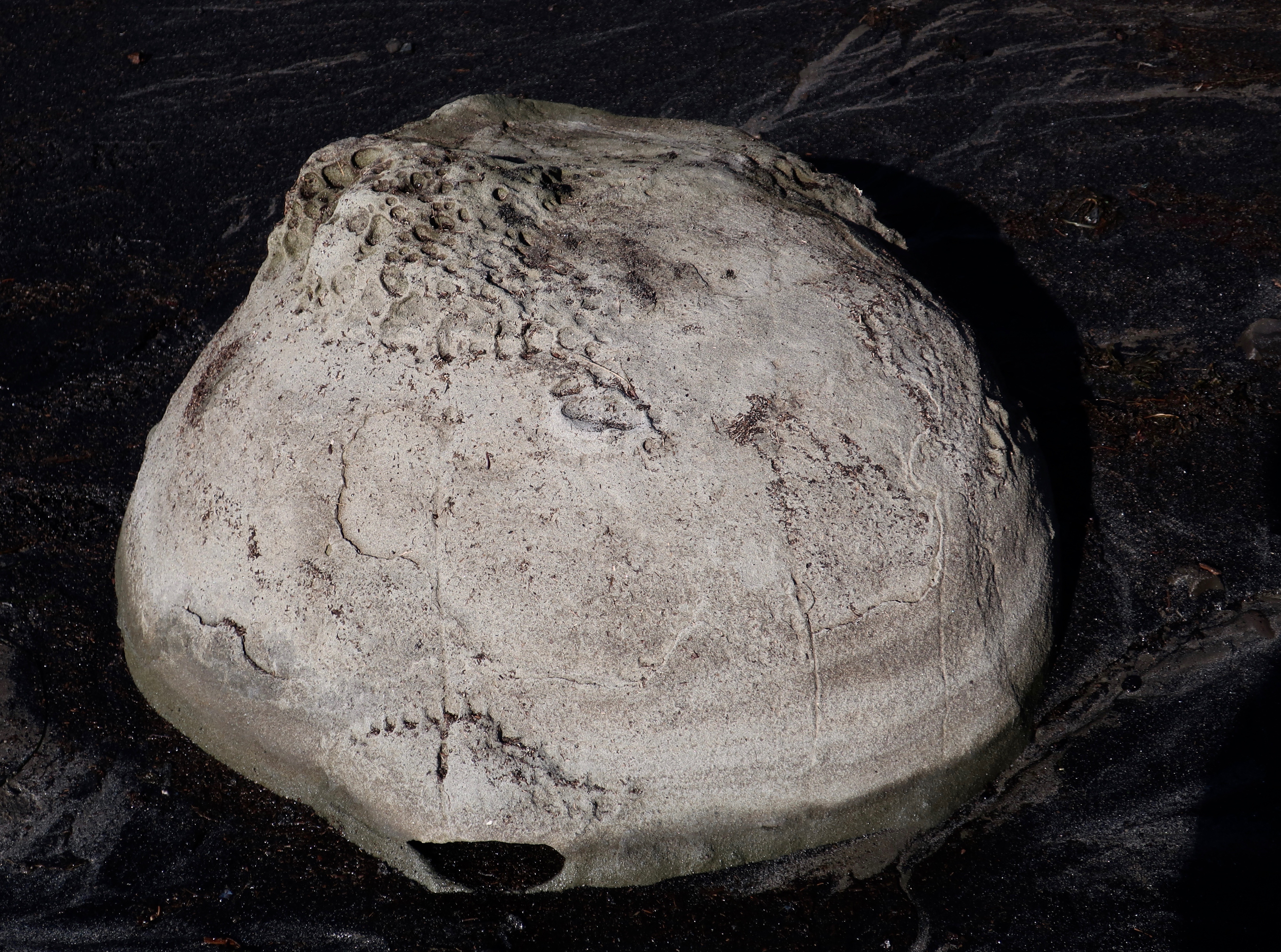
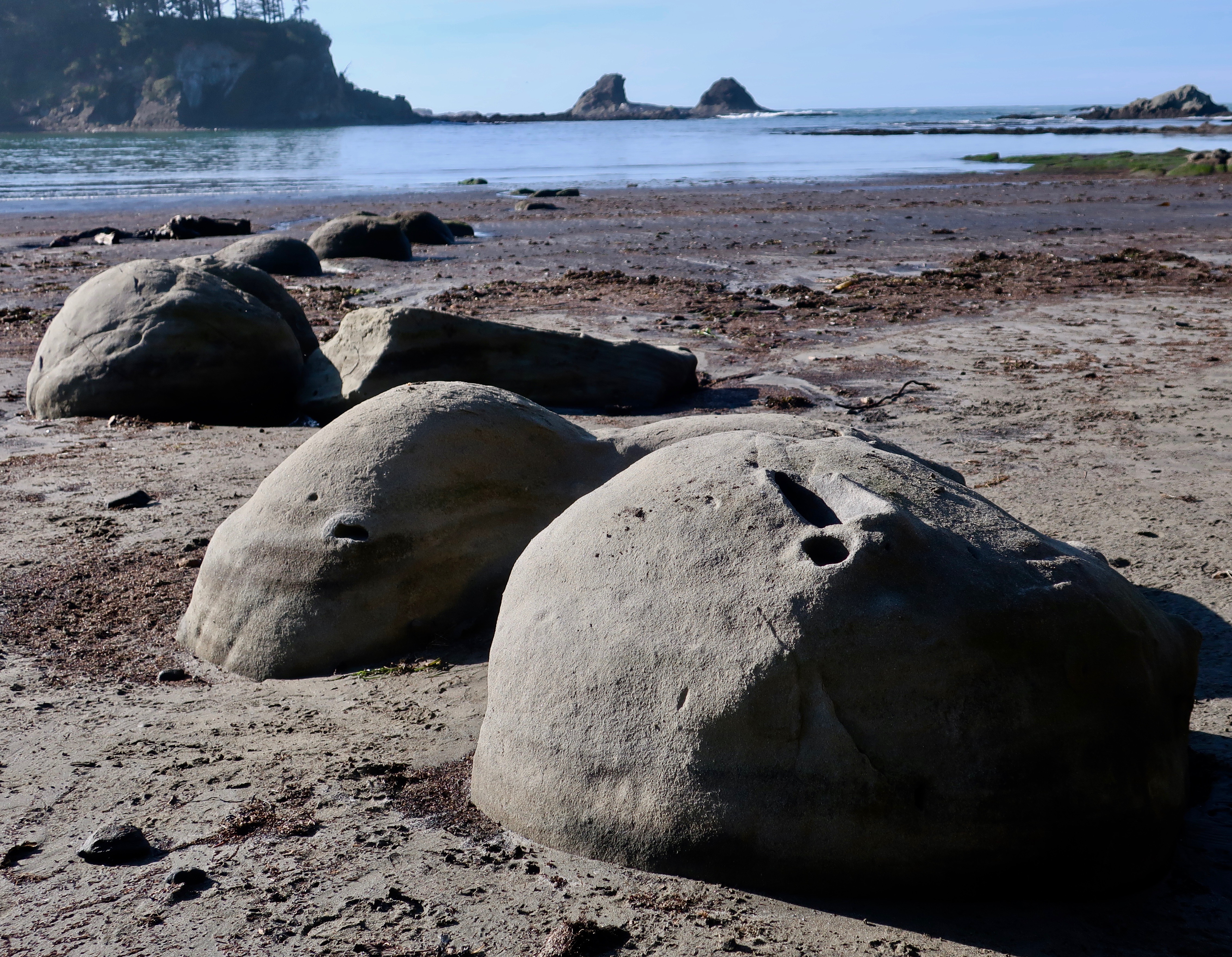
And finally, I would like to feature a strange, non-tectonic feature of Sunset Bay: concretions. Peggy and I first came across these round, rock-like structures on the southern coast of the South Island of New Zealand. They are created when groundwater triggers extra amounts of ‘cement’ around irregularities in the rock such as shells, creating a round structure that continues to grow as more cement is added. The hardness of the covering makes it harder to erode than the surrounding rock.
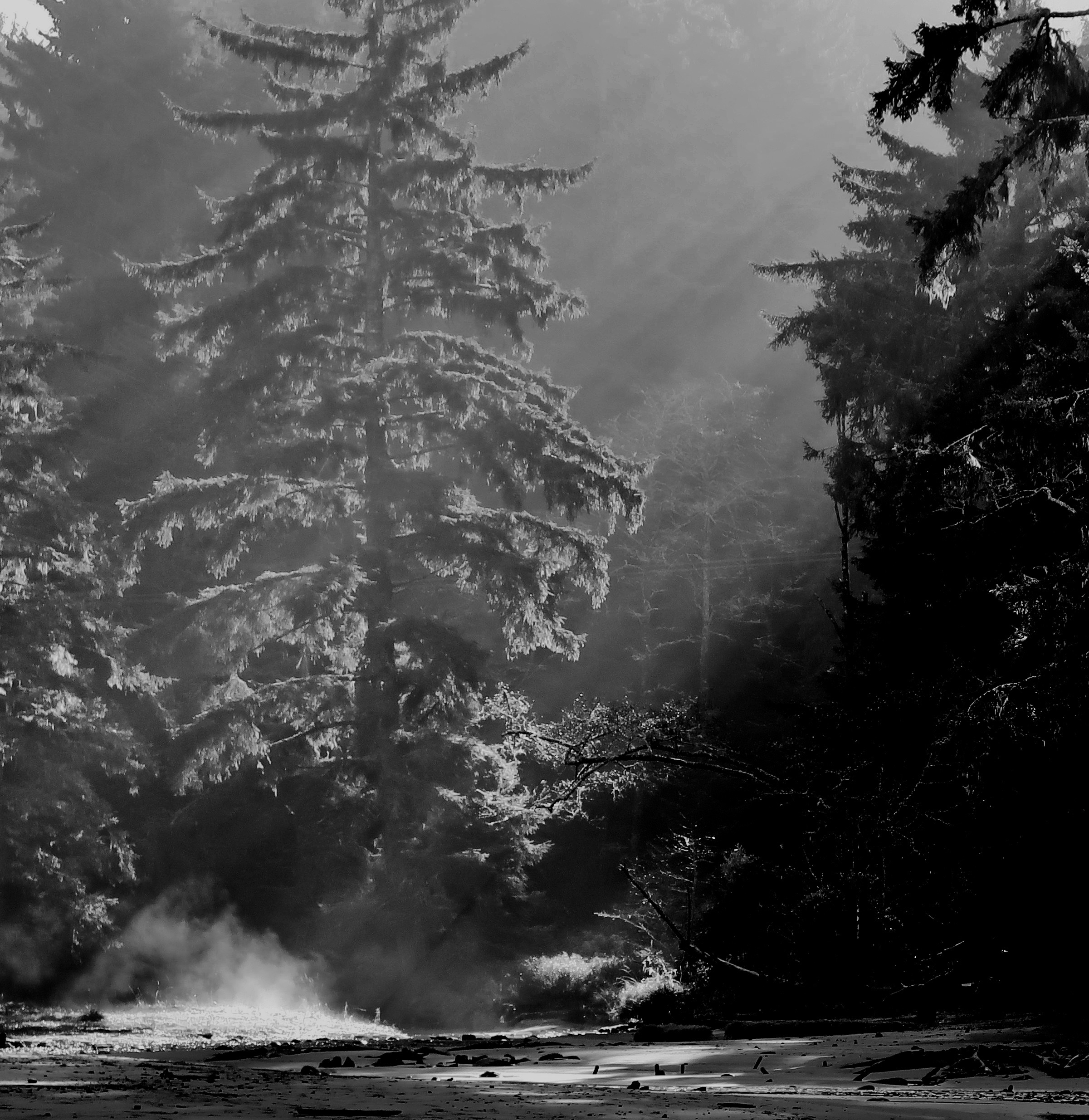
I’ll conclude with a few other photos from Sunset Bay that I found interesting.
NEW BLOG SCHEDULE: I’ve been working on revising the book on my Liberia Peace Corps experience— adding a few chapters on my experience working for the Peace Corps after I was a Volunteer and updating the chapters I wrote about modern Liberia. Several of you have read the book and a few of you may have even been around when I first blogged it several years ago. Anyway, I am going to reblog it again, adding it to my schedule. On Mondays I will continue to blog my book, It’s 4 AM and a Bear is Standing on top of Me. On Wednesdays, I will blog The Bush Devil Ate Sam. On Fridays, I will continue my travel blog.
NEXT POSTS:
Blog a Book Monday: Will you believe I actually have a good day on the Sierra Trek?
Blog a Book Wednesday: Introduction to the Bush Devil Ate Sam
Travel Blog Friday: I return to my Backroad series following Highway 191 through Navajo country in Utah and ending up in Arizona’s Lyman State Park.

This was an interesting collection of photos, Curt.
The force of nature can’t be denied, but we can be “cautious, not fearful” [our mantra for COVID-19] and check the emergency escape routes.
I was just looking at a photo of Mt. Rainer yesterday. We once passed by in the snow and nothing was visible; I really want to go back and see it, but at the first quiver of the earth, I will be out of there. 😊
Mt. Ranier is beautiful, Ray and far enough away from the ocean to avoid any Tsunamis. On the other hand, the right kind of earthquake might announce it is about to blow. 🙂 Another hazard of our great subduction zone. –Curt
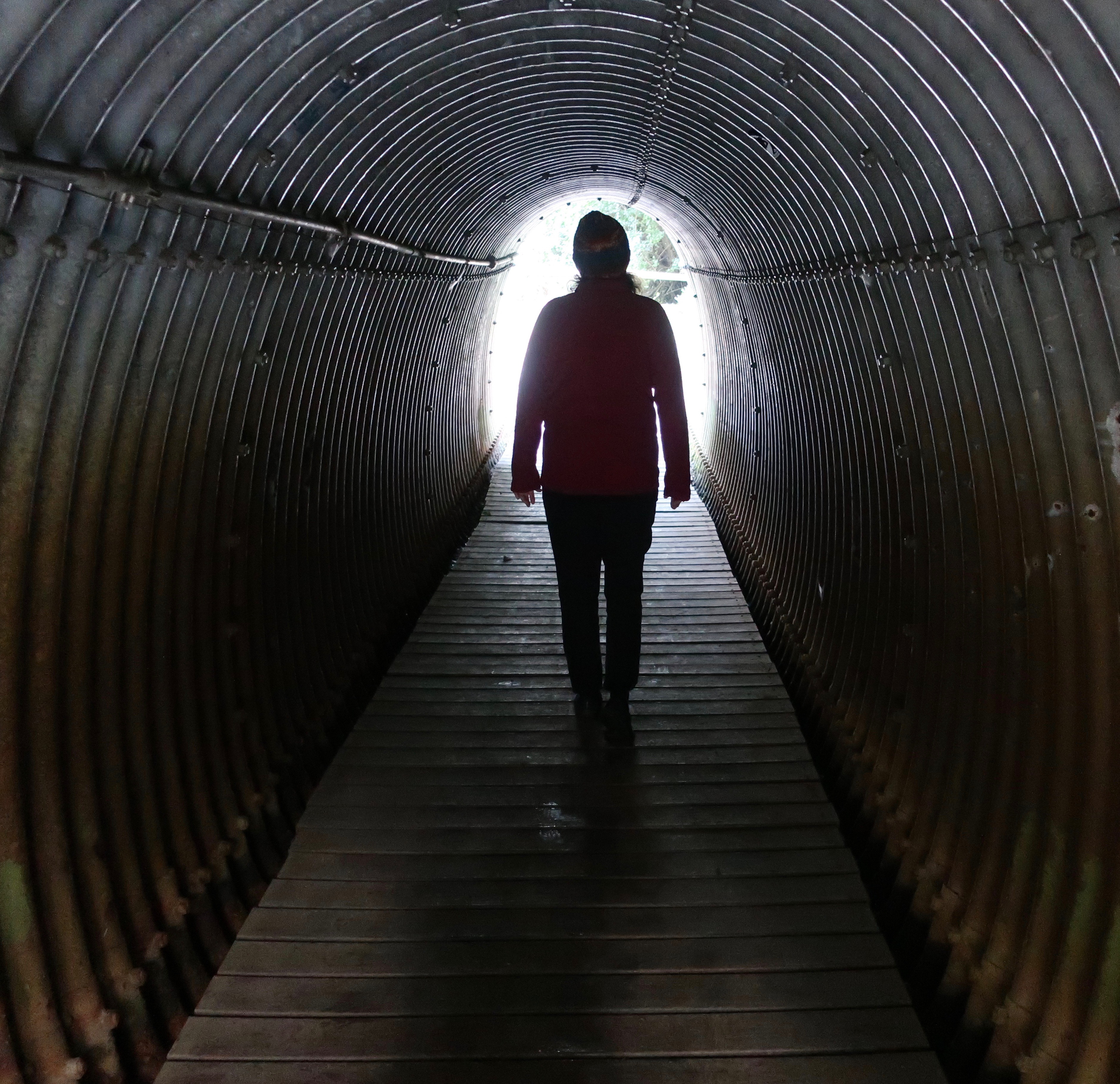
Curt, you’ve made me feel wary about visiting that coastline! I am not surprised you are prepared and ready to evacuate immediately if need be. Oh, I’m smitten with the ancient woodland tree trunks – an eerie sight that hearkens back to the lost forest. I feel my creative juices longing to write something around this! I like the picture of Peggy wrapped up warm to give a sense of perspective of the tree trunks remains – she does seem a smidgen too close to the ocean though! 😀
That earthquake could be another 300 years down the road, Annika. Or tomorrow. Grin. Peggy was fine. 🙂 It was low tide and the waves were crashing several hundred yards out. You definitely don’t want to be there when they are up close and personal. It’s one of those mistakes you only make once… I fell in love with the tree trunks as well! –Curt
There are concretions in Kansas, too. I missed them when I was there, but they’re certainly on my to-be-seen list for the future. The tree stumps look mostly like starfish to me; they’re very attractive. It’s the tide pools I love, though. We do have such here — we don’t have enough variability in either the tides or the beaches for them to form. We get great seaweed, though;sometimes there’s so much that they have to bring out front loaders to get the stuff up.
Seaweed is good. Not sure if you have so much it has to be removed by front loaders. 🙂 Big starfish. I think concretions are much more common than I thought. –Curt
Interesting creatures these concretions, the nature never stops to amaze us, isn’t it? I have read your book The Bush Devil Ate Sam awhile ago, I have learned a couple of things about Liberia I’ve had no idea before.
The ocean looks impressive, as always🙂
Thanks for reading the Bush Devil, Christie. I remember that. I suspect/hope that will be true for a number of you. Blogging the book again will force me to finish up my revisions. 🙂 Mother Nature never disappoints. Always something new. –Curt
What a treasure trove of unusual specimens for you to photograph, Curt. Those tree stumps seem like the past screaming out to be noticed. The one you said looked like jumping jacks, I thought resembled a man making sand-angels.
I like the sand angel analogy, G. Better than mine. 🙂 A tree graveyard for sure. It’s a fun place to play with a camera! –Curt
It sure looks that way!!
These are such great and interesting photos
Thanks much, Victoria. –Curt
My Mom has always had a fear of the Bay areas and its earthquakes. It never really bothered me until I was involved in Cascadia Fault line earthquake planning for the state…now I am scared s7!4less. This is naturally in complete contrast to my love of the ocean of course. So, who knows. These photos are GREAT. I can’t think of a beach with similar tree relics on the beach in California, can you? And I love that you pay attention to evacuation routes…
From what I have read about the planning, the damage would be almost beyond imagination. We live close to a large damn which the planners have warned us might go. Fortunately, it seems we are just above where the flood waters would hit. Maybe.
The Earthquake Trail at Pt. Reyes is a great example of how much the earth can shift!
Thanks on the photos. It is a unique and beautiful place. And no, in my wandering up and down the coast of California, I have never seen a similar phenomena, and you would think it would be emphasized if there was one. –Curt
Earthquake trail?! I’ll have to check that one out.
And yah the damage would be um. Very. Terrible. Fingers crossed it won’t be though.
Earthquake trail isn’t as clear as when I first started using it in the 70s (grin) but it is stlll very interesting. I’ll go with finger crossing. 🙂
Amazing photographs. I’d love to visit the Oregon coast.
And you could come and visit us. 🙂
It’s also a place for some of the most amazing sunsets…
https://gunta.photos/2014/02/21/unreal-sunset/
Something about the name… 🙂
So much still to see and limited time left. Thank goodness for your gifts of photos and narrations, Curt.
Appreciated, Gerard. My pleasure. –Curt
Let’s hope the Big one happens 300 years from now Curt!!! Looking forward to the day when I can say, “We are headed for the Coast this weekend” 🙂
Yes! Coming… 🙂
Again, your images are so beautiful. I love the black and white version of the anemone.
The anemone was fun, Sylvia. I thought, I wonder what would happen in I rendered it is black and white…