The Morris Burner Hotel in Reno… Where Each Room Is a Work of Art

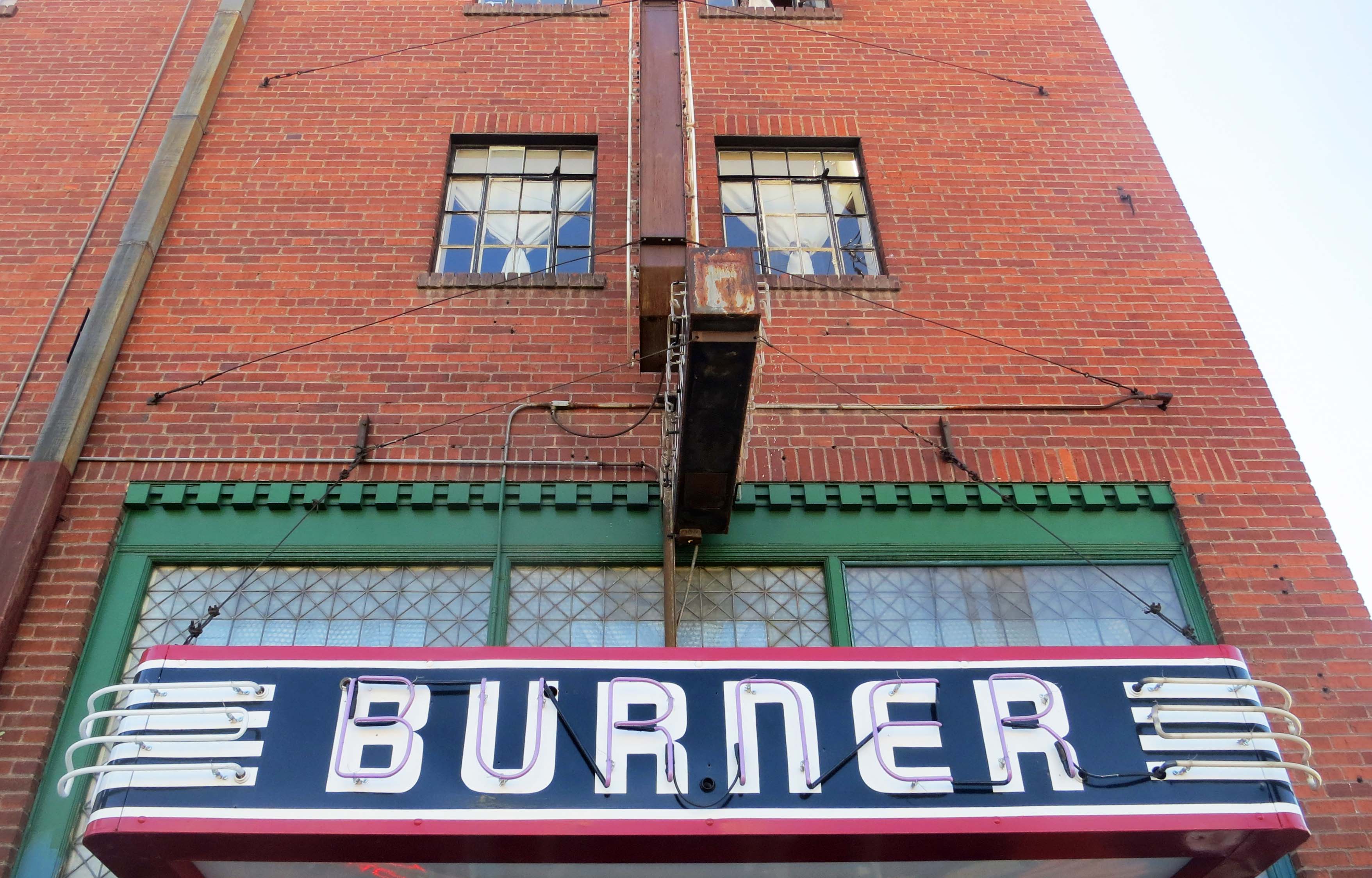
The old Morris Hotel in Reno, Nevada has now been renovated as the Morris Burner Hotel and will provide rooms for Burners on their way to Burning Man in August and people interested in art and the event year round.

The old Morris Hotel in Reno, Nevada has now been renovated as the Morris Burner Hotel and will provide rooms to people on their way to Burning Man in August and people interested in art and the event year round.

I’ve always liked Reno. As far back as I can remember the city has defined itself as the Biggest Little City in the World. It has also been known for its gambling, quick marriages and quicker divorces. My parents were married in the town. For years they teased me about my legitimacy. It probably scarred me for life. But I have the marriage certificate. It looks legit whether I am or not.

I personally became acquainted with Reno when I ran Peace Corp’s public affairs and recruitment program for Northern California and Nevada in the late 60s. The University of Nevada at Reno was one of the campuses where I recruited. I made the trip over the mountains two or three times a year. Those were the days when slot machines were still known as one-armed bandits and the mafia still thrived in Las Vegas– and probably Reno. I did my bit by contributing to the mob and Nevada’s economy but had little luck in persuading young Nevadans to leave the state, much less the country.

Reno is an event-oriented place. The city thrives on antique car shows, rib cook-offs, rodeos, Harley Motorcycle invasions, festivals, and innumerable races including hot air balloons, bicycles, airplanes and kayaks (the Truckee River flows through the middle of the city). Tourism is the lifeblood of the city. Recently, the Chamber of Commerce has added another major event to its things to do list: Burning Man. Each year tens of thousands of Burners pass through Reno on their annual pilgrimage to the Black Rock desert. Apparently they give the local economy a substantial boost.

The influence goes beyond economic to cultural. Reno has a thriving Burner community that brings it enthusiasm for Burning Man back to the city. The most unique contribution, from my perspective, is the Morris Burner Hotel. I read about it recently in Jack Rabbit Speaks, the Burning Man newsletter, and decided that Peggy and I had to add the hotel to our list of stops on our recent three-week journey through Nevada. As you probably know, I am a fan of Burning Man, having gone back regularly since my first visit in 2004. I’ve blogged about my experiences for the past four years. In fact, WordPress gave me its Freshly Pressed designation for my articles on the event.

The 80-year old Morris Hotel in downtown Reno is now the Morris Burner Hotel.

The 80-year old Morris Hotel in downtown Reno is now the Morris Burner Hotel.

The Morris Burner Hotel, according to its mission statement “is a Burning Man inspired housing facility and community space, dedicated to building community, fostering the arts, and helping to educate people in the Burning Man ethos. It is a place to share, create, participate, and build relationships.” The inspiration behind its creation is Jim Gibson, or Jungle Jim, as he is known in Black Rock City. (Most Burners have nicknames.)

Jim is an engineer who spent over 40 years in the microelectronics business, co-founded three companies, owns three patents, and, in 2007, was named Entrepreneur of the Year for Northern Nevada. In 2008 he retired and went to Burning Man. It changed his life. His purchase and renovation of the Morris Hotel is an example.

The hotel was built in 1931 along Historic Route 40, the Lincoln Highway, that ran through downtown Reno and on across the country. In its heyday, the Morris would have been a proud establishment, but over the years the neighborhood and the hotel had declined. As one of the Burners who worked on the hotel’s renovation noted, “It needed a bath something terrible… it was spine chilling disgusting.” A great introductory video on the hotel by Liz Margerum, photographer and videographer for the Reno Gazette Journal, captures workers wearing gas masks as they removed aged carpets.

Historic neon sign advertising Abby's Bar in Reno, Nevada.

Abby’s Bar is located next to the Morris Burner Hotel and is advertised with this sign of a bygone era when Historic Highway 40 was one of Americas major cross-country roads.

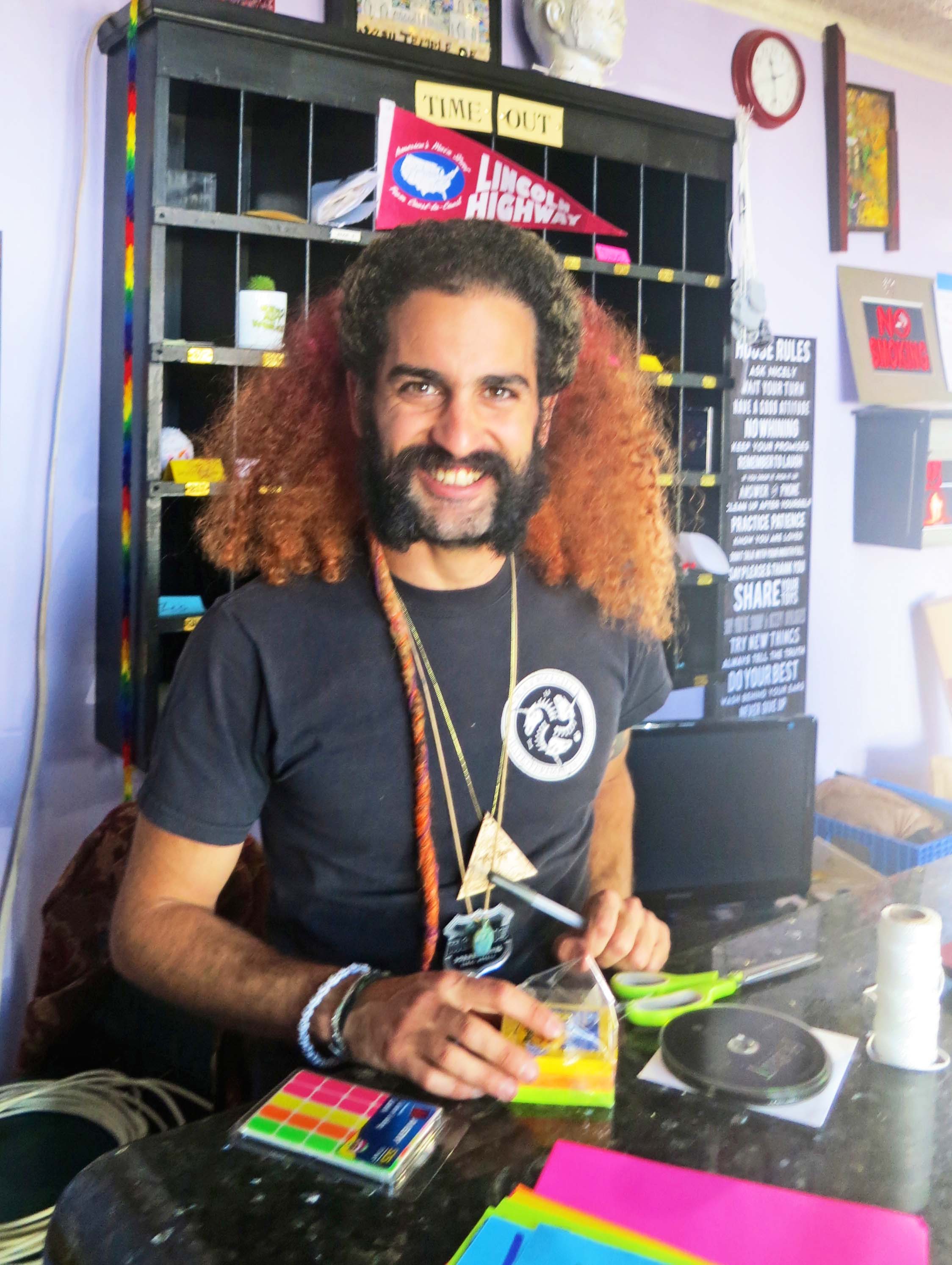
The hotel was still not open when I stopped to visit but I rang the doorbell and was greeted by Alon Vision Bar. Vision is Alon’s Burning Man name, and it fits. A former member of the Israel Navy who holds a degree in Business and Economics, he has a goal of bringing the Burning Man principle of community building home to his war-afflicted land. He is prepared to devote his life to efforts aimed at bringing peace to the Middle East.

Vision, seen here in the lobby of the Morris, greeted me with a smile.

Vision, seen here in the lobby of the Morris, greeted me with a smile. Note the “House Rules” on the right. They are pretty much what one would expect to find in a Burning Man establishment.

The House Rules at the Morris Burner Hotel. No whining and remember to laugh.

The “House Rules” at the Morris Burner Hotel. No whining and remember to laugh. I particularly like “Share Your Toys.” Guests at the hotel will be expected to clean their own rooms and help in preparing meals. Sounds like Black Rock City to me.

But for now, Vision is serving as manager of this rather unique hotel. He provided me with a tour of the guest rooms. Each one has a separate theme and has become a project for individual artists. Walls, ceilings, floors and even furniture serve as the ‘canvas.’ Sculptures add to the ambience. Halls, lobby, dining room, and restrooms also serve as space for artistic works. Outside, a large patio is being designed to accommodate performances. The whole hotel is an art work in progress.

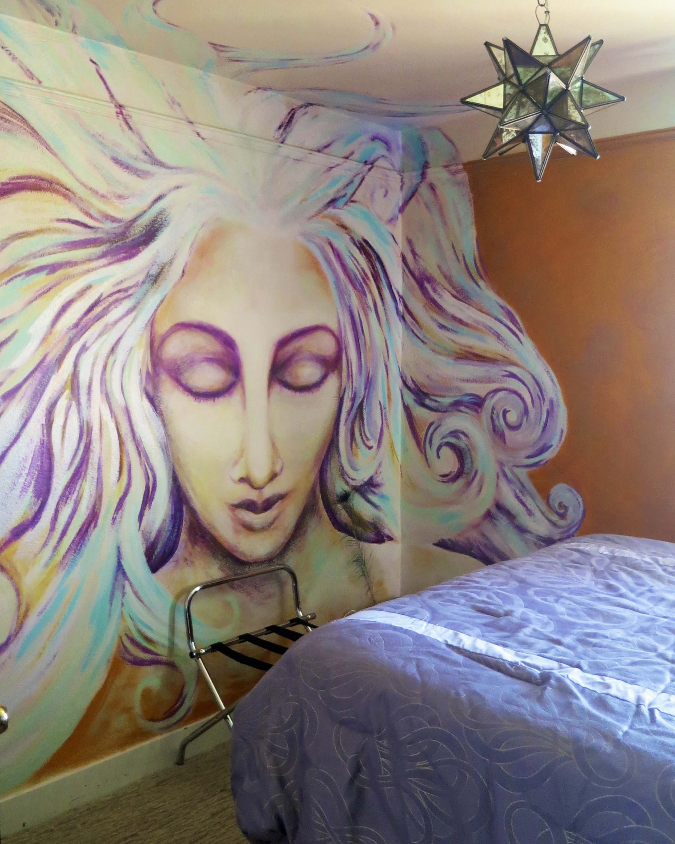
Guest room in the Morris Burner Hotel in Reno, Nevada.

Each guest room will have a different art theme. This is the Goddess Room done by artist Carole Ann Ricketts.

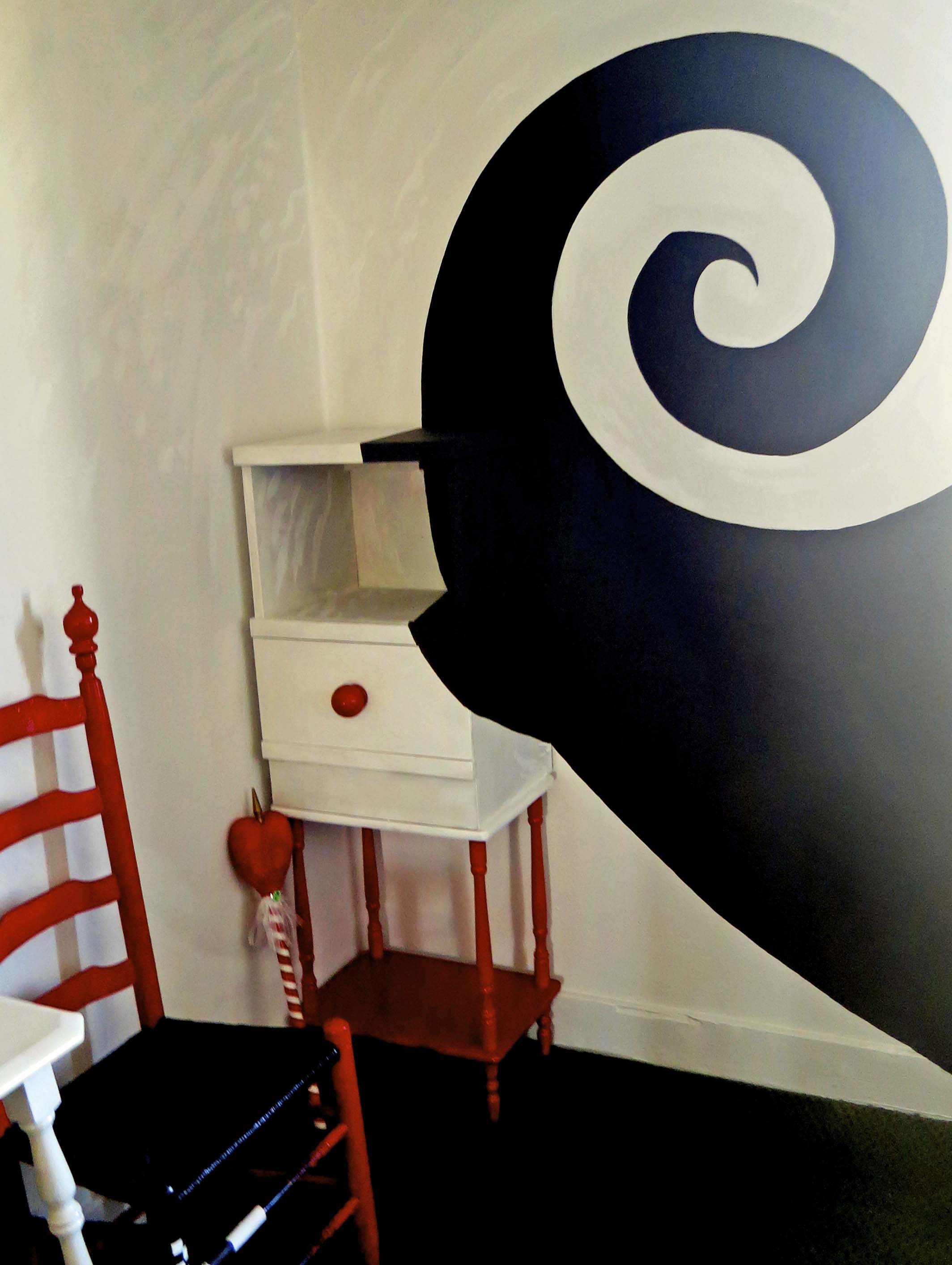
Guest room featuring art at Morris Burner Hotel in Reno.

Almost everything is fair game in the rooms for artists as long as safety is taken into consideration. Note the incorporation of the night stand into they painting. And down the rabbit hole we go.

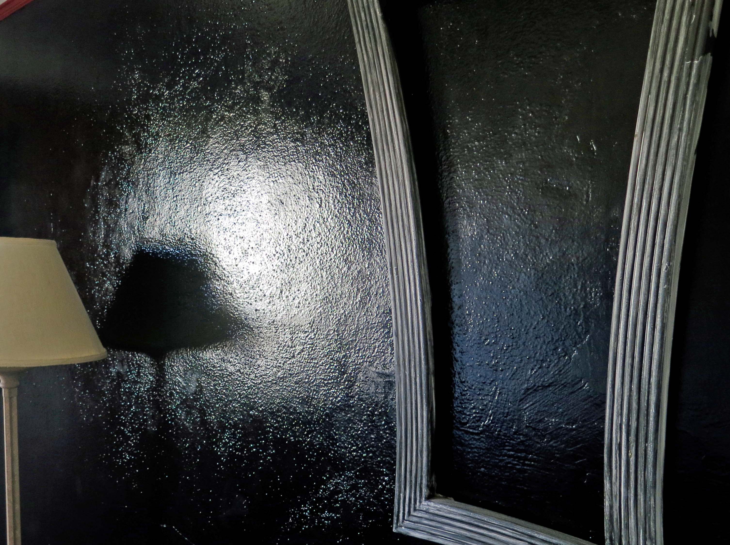
A room at the Morris Burner Hotel in Reno, Nevada.

This frame on the wall may give a new meaning to the ‘dark arts.’

This brightly decorated room at the Morris included a painting of the hotel.

This brightly decorated room at the Morris, the Cuban Gangster Room, included a painting of the hotel.

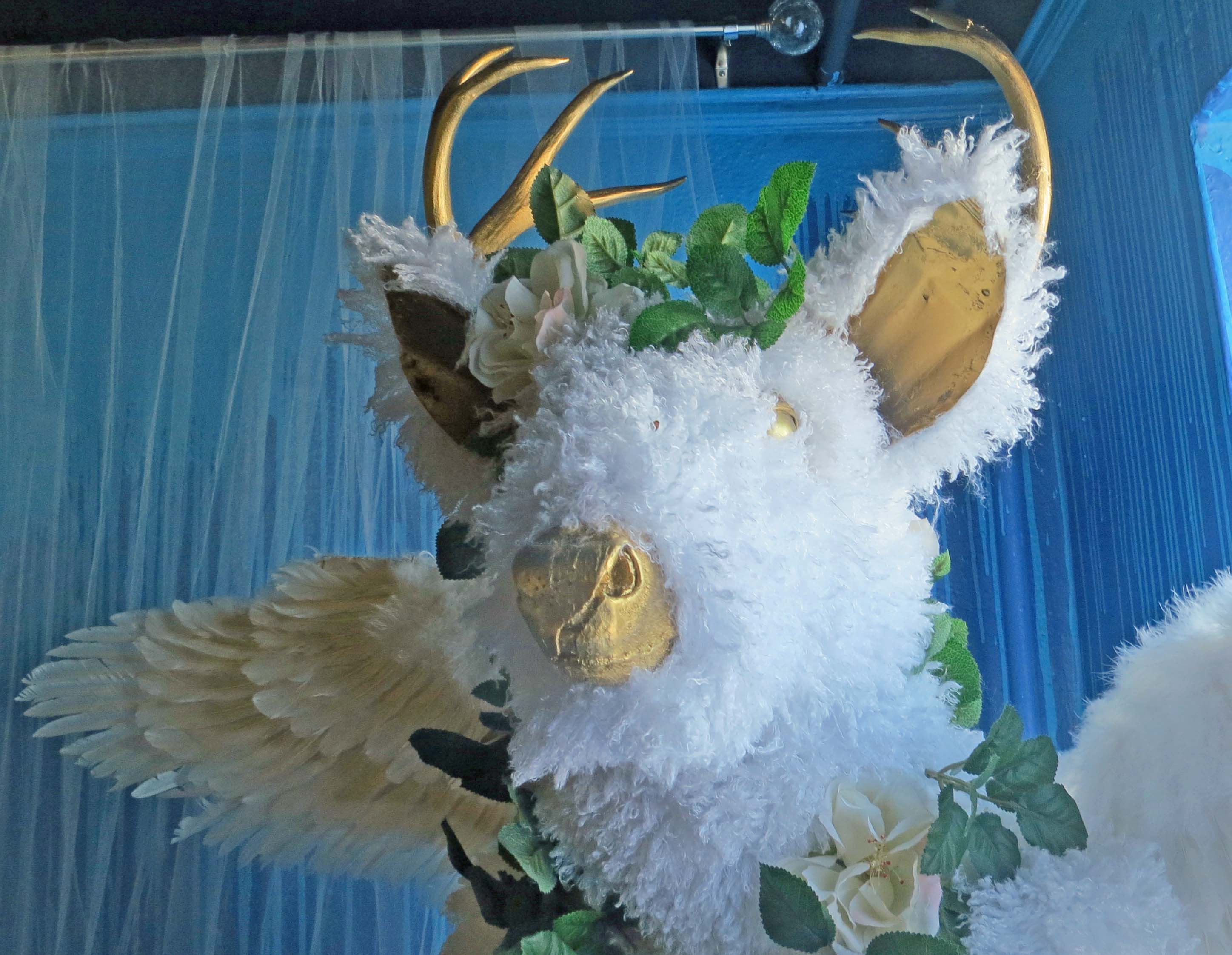
Enchanted Forest Room at Morris Burner Hotel in Reno, Nevada.

Rooms also incorporate sculpture. This “Enchanted Forest” deer god was created by Heather Lee Jones. It could be straight out of Greek Mythology.

Balcony at Morris Burner Hotel in Reno.

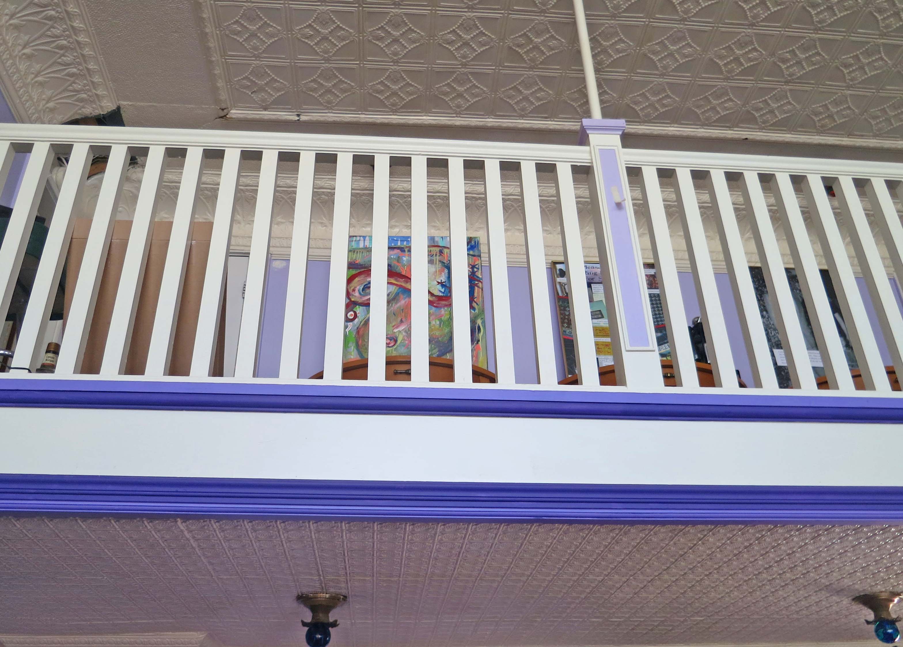
The whole hotel is an art work in progress. This photo is taken from the lobby looking up at the balcony. Art can be seen through the railing. Also note the ceiling.

Burning Man symbol hanging in lobby of Morris Burner Hotel in Reno Nevada.

There is no doubt about the Burning Man connection. This immediately recognizable symbol of “The Man” hangs in the lobby.

The City of Reno is very supportive of Gibson’s renovation of the Morris. The hotel is located in a run down area of 4th street three blocks from downtown. Its presence is encouraging other businesses to locate nearby and is leading to a gradual transformation of the area. The crime rate is already way down. Peggy and I look forward to the time we can return as guests.

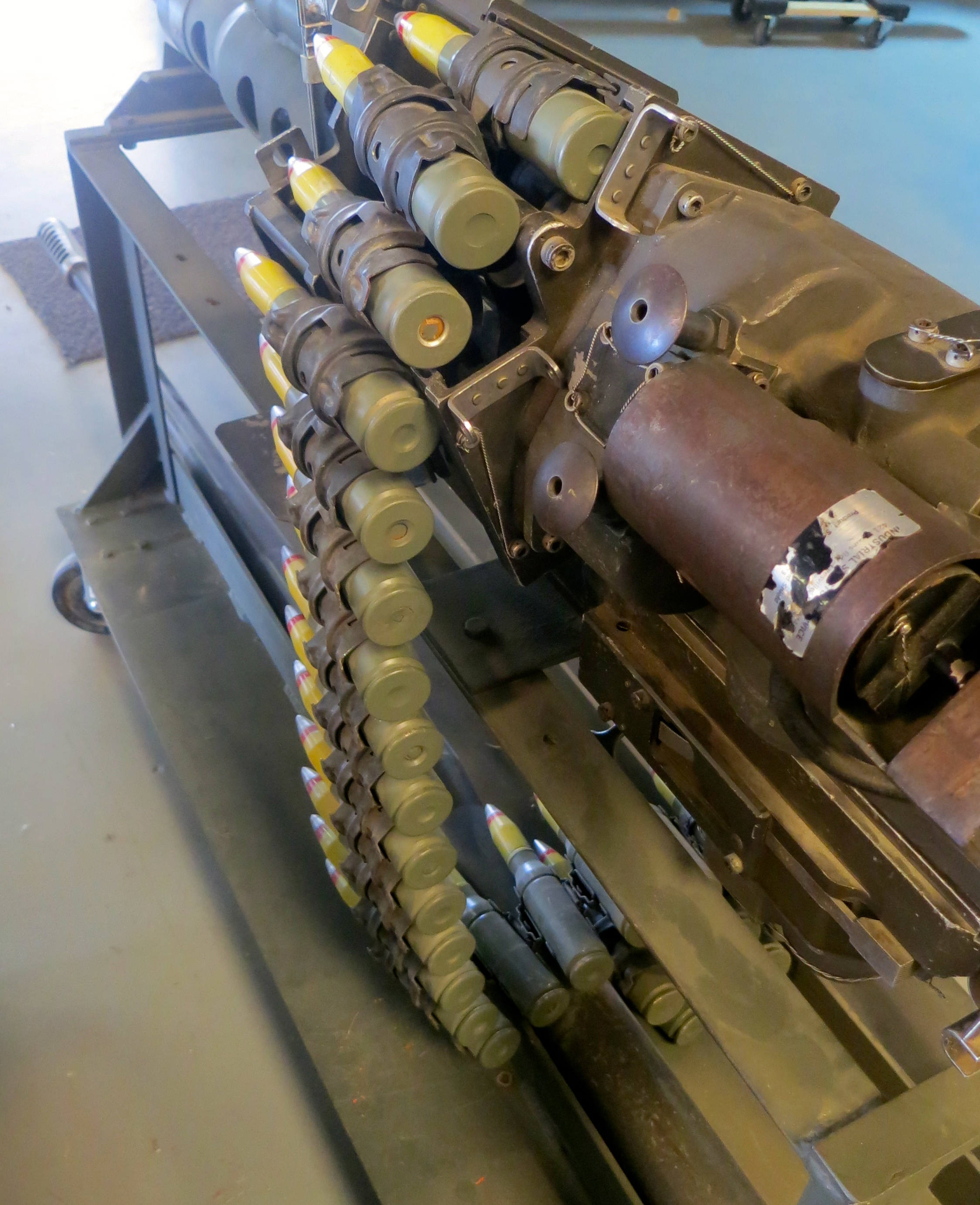
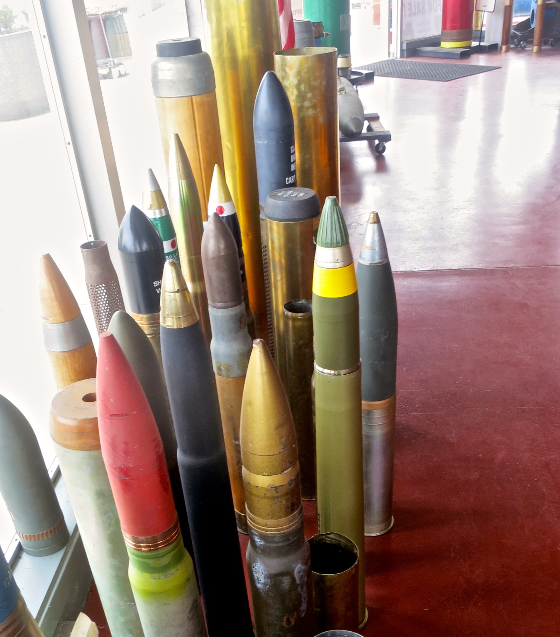
NEXT BLOG: We visit the town of Hawthorne, Nevada, which is where military ordinance goes when it retires. A very interesting museum provides insight into the town’s past. After that it is on to Area 51 and ET…

As this blog goes to press, Peggy and I are off backpacking in the Red Buttes Wilderness, home to bears, cougars, old growth forests and possibly a wolf or two. (Or-7 and his girlfriend are wandering around somewhere in our county.) There have also been several (unsubstantiated) sightings of Bigfoot in the area. We have a camera along. If we see one, you’ll be the first to know. (Grin.) The Red Buttes Wilderness is located on the border of Oregon and California 14 miles from our home.

On a related note, I did a guest blog this week on how I celebrated my 60th birthday by backpacking over 300 miles from Squaw Valley to Mt. Whitney following the crest of the Sierra Nevada Mountains. Check it out here if you are interested.

A Magnificent Mountain and Stunning Waterfalls: Mt. Shasta and Burney Falls

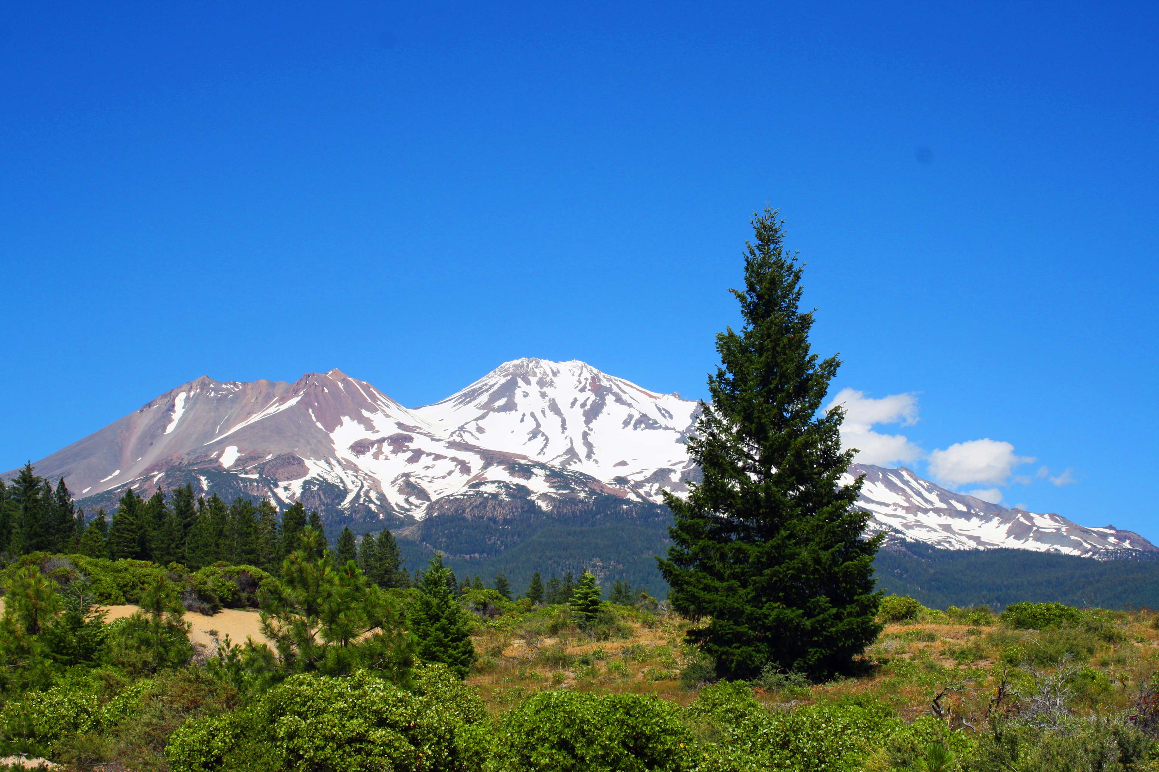
Mt. Shasta is one of the world's most beautiful mountains. Driving up I-5 through Northern California on a clear day presents this view.

Mt. Shasta is one of the world’s most beautiful mountains. Driving up I-5 through Northern California on a clear day presents this view.

California is jam-packed with world-class natural wonders. One immediately thinks of places like the Redwoods, Yosemite, and Death Valley. But there is ever so much more. Two gems in the northern part of the state are Mt. Shasta and Burney Falls. Our trip into Nevada three weeks ago took Peggy and me past both.

Mt. Shasta has been part of my world for decades. I first became aware of it as a child when my parents followed historic Highway 99 north from our home in the Sierra Nevada foothills to visit with my Dad’s parents in Ashland, Oregon. Over the years since, I’ve made dozens trips up and down Interstate 5. The beauty of the mountain has never ceased to awe me.

Mt. Shasta in Northern California.

Following different roads around the mountain presents different perspectives. This shot is from Highway 97, on the north side. You can clearly see that the mountain is made up of more than one volcano.

Mt. Shasta photo.

This photo is taken from a rest stop on I-5 west of Mt. Shasta

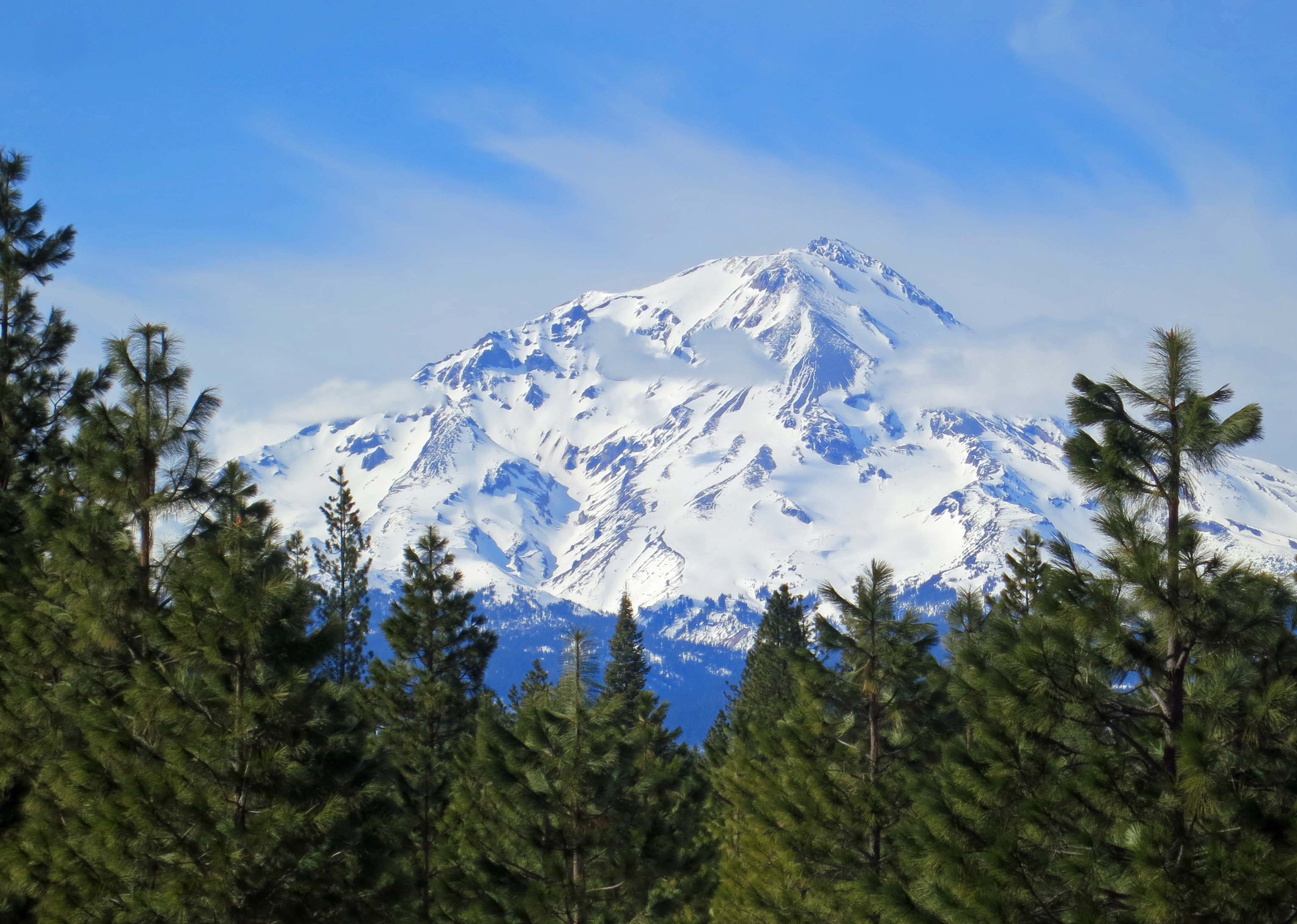
Picture of Mt. Shasta from Highway 89.

And finally, I took this picture south of the mountain on Highway 89.

The 14,162-foot volcanic peak dominates California’s more remote far north and, along with Mt. Lassen, serves as the southern anchor to the series of volcanoes that make up the Cascade Mountains of the Northwest.

In 1980, I was honored to climb Shasta with Orvis Agee, possibly the oldest man to ever climb the mountain. In 1974, the 71-year-old Orvis had persuaded me that he could handle a hundred mile backpack trip I was planning by informing me he had climbed Mt. Shasta three times the previous year. He made his last ascent up the mountain in 1988 at 85. It marked his 30th trip to the top. Two years later, in 1990, he did a 60-mile journey through the Granite Chief and Desolation Wildernesses west of Lake Tahoe with Peggy, me and other friends. He was still going strong at 87.

“Not bad for a guy who is just a bunch of bones held together by rubber bands,” Orvis told Jenny Coyle when she interviewed him for her book on Mt. Shasta.

Not surprisingly, Mt. Shasta plays a prominent role in the mythology of Native Americans who have lived in the area for thousands of years. On a somewhat stranger note, it is supposedly the home away from home of Lemurians who are said to live in a cave complex beneath the mountain and are occasionally seen walking on the surface. Lemuria was an Asian equivalent of Atlantis in that it too was considered a cradle of civilization that sank beneath the ocean. I don’t have a clue as to why the Lemurians chose to live on Shasta. And no, I haven’t seen any.

Located on California’s Highway 89, Burney Falls are even more remote than Mt. Shasta. Peggy and I had driven by the location several times but never stopped. If you are anywhere near, don’t make the same mistake. Our niece, Christina Dallen, had stopped by the falls after visiting with us and posted a photo on Facebook. It inspired us.

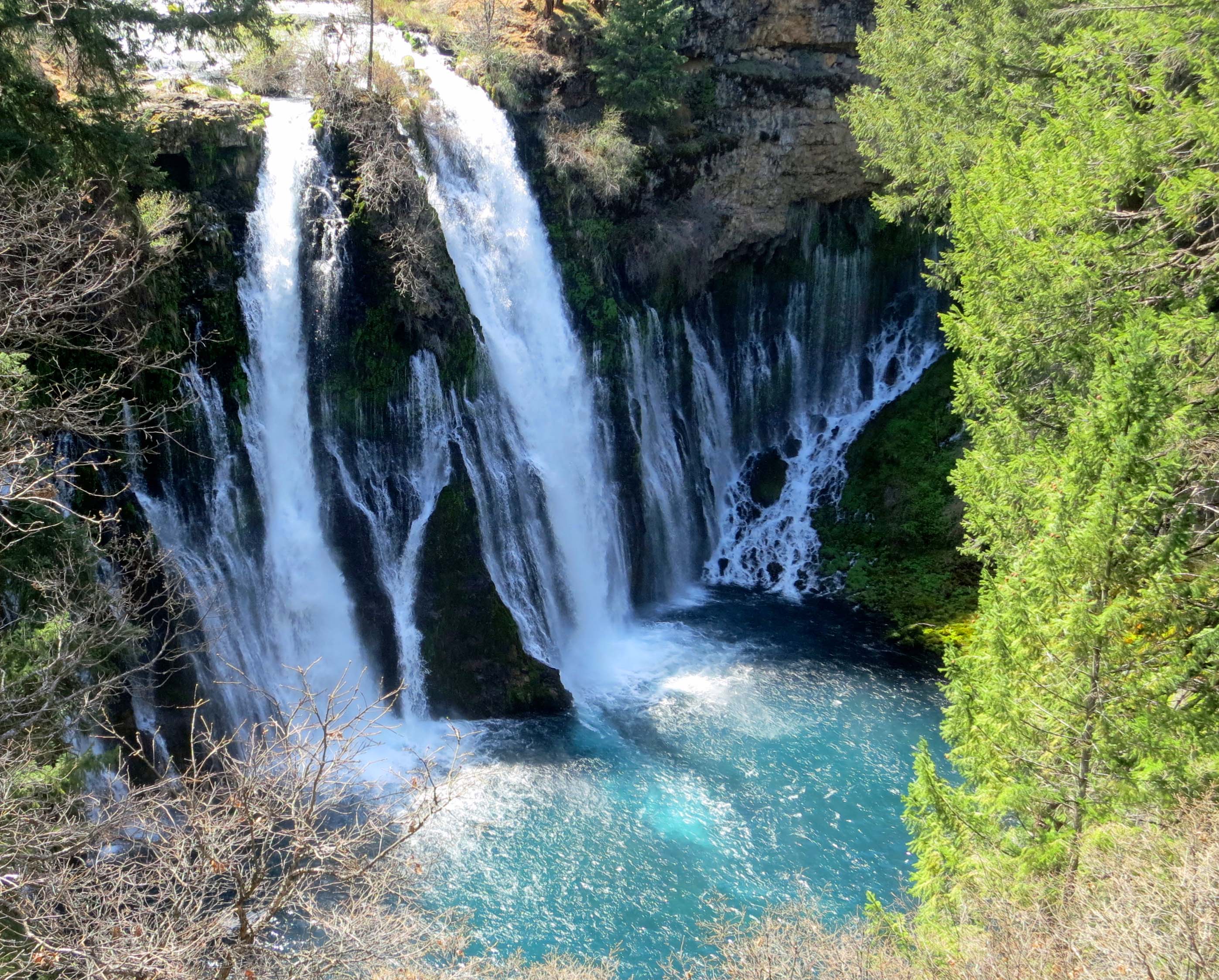
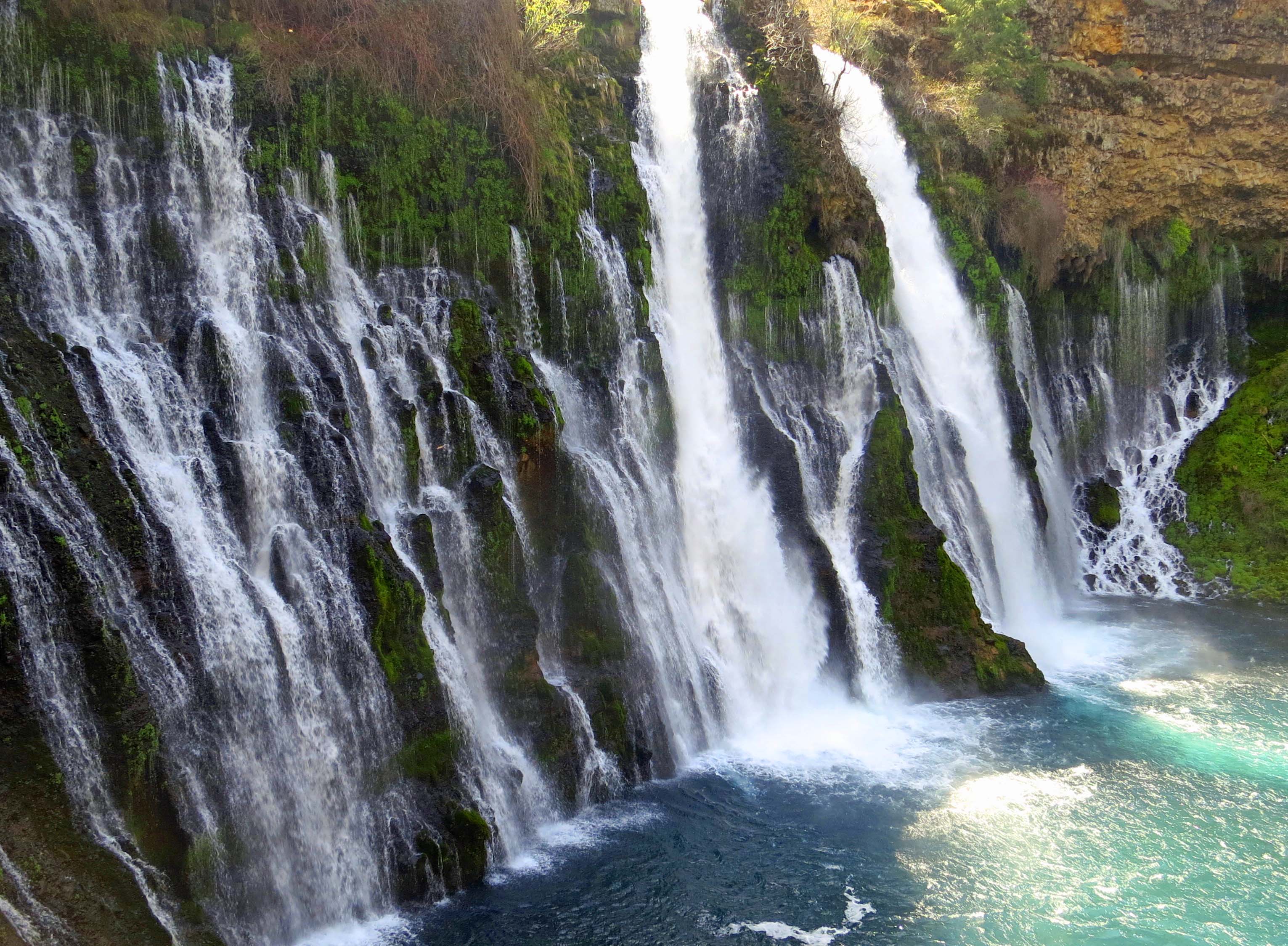
“Bully!” Theodore Roosevelt was said to utter when he saw the falls and declared them the eighth wonder of the world. They were declared a National Landmark in 1984. The following photos provide a glimpse as to why.

Burney Falls in Northern California. Photo by Curtis Mekemson.

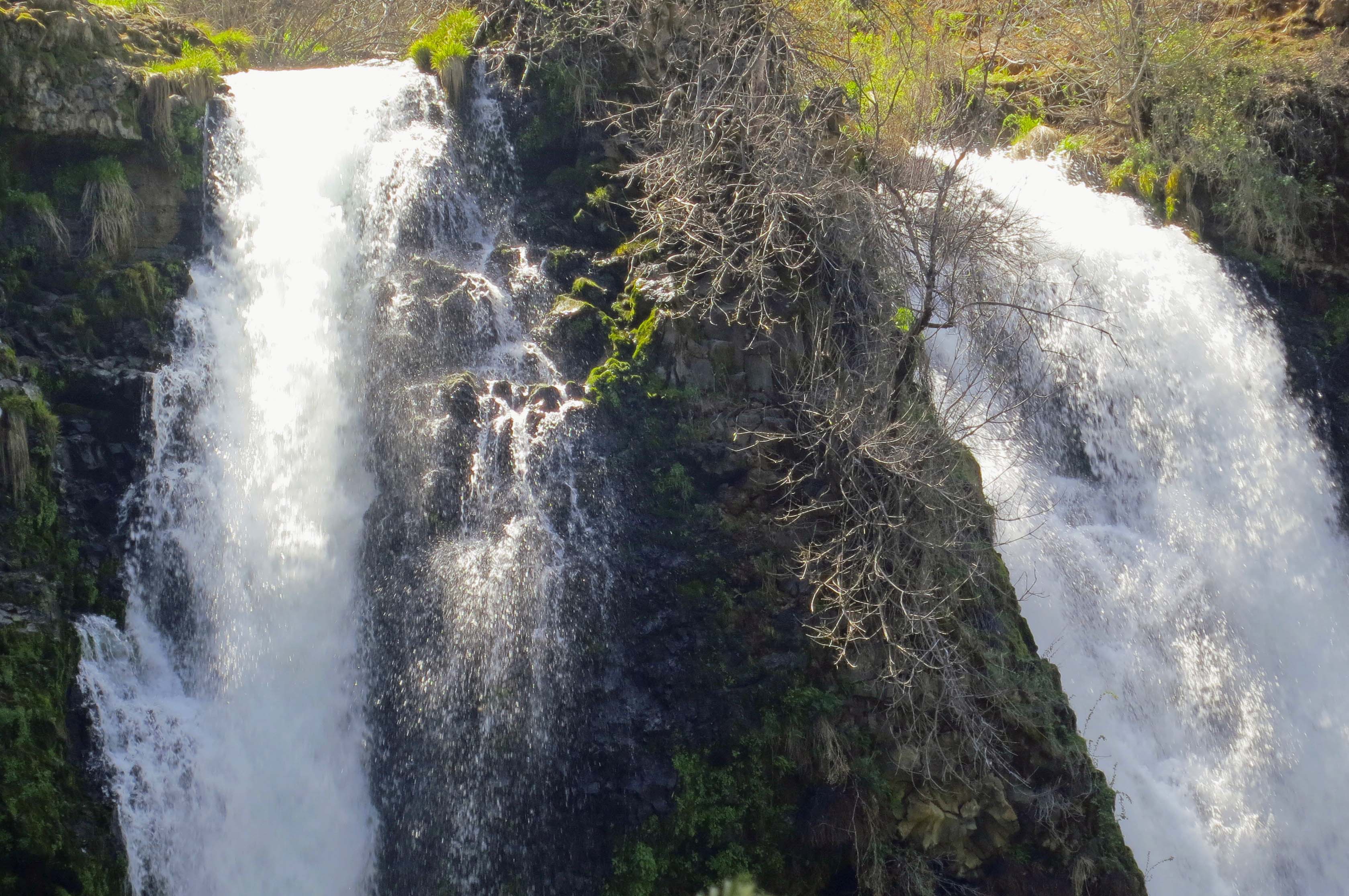
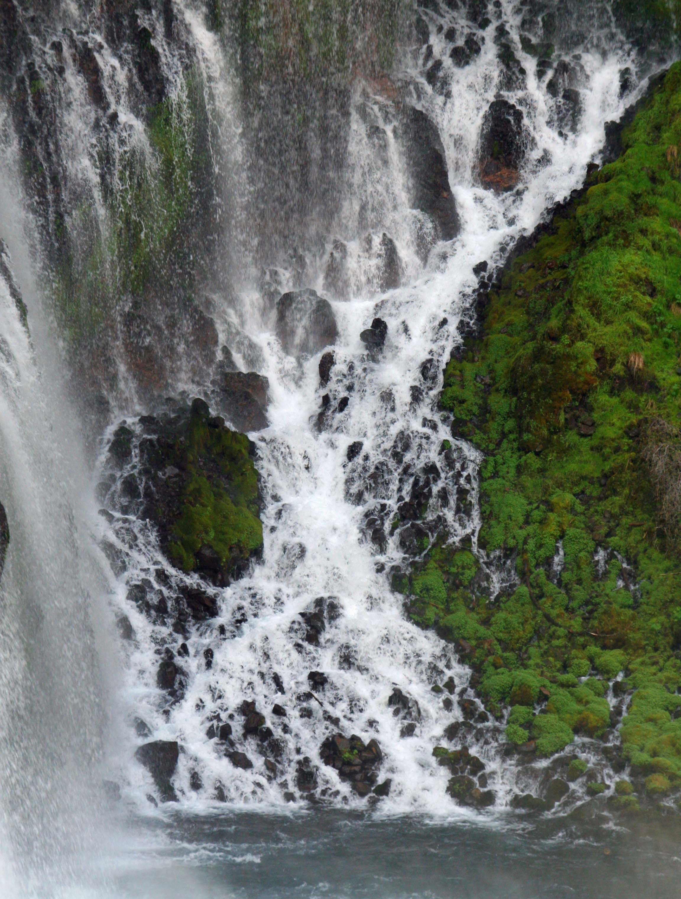
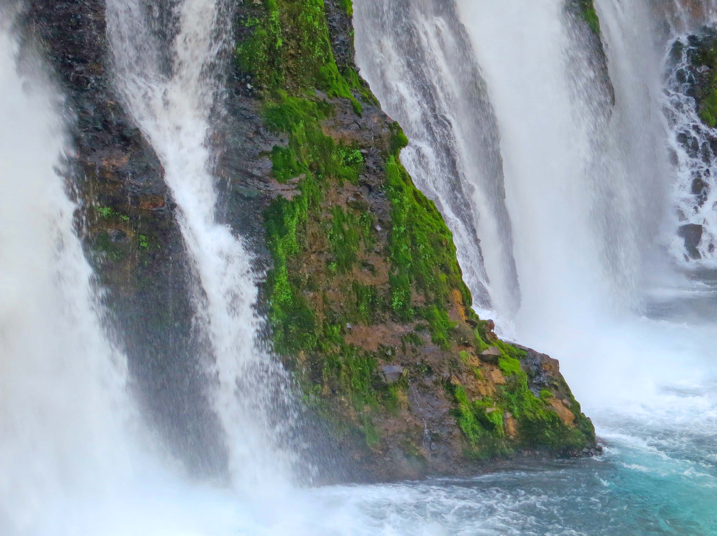
Burney Falls are located at McArthur-Burney State Park. Note how the falls originate out of various layers of rock as well as flowing over the top.

Burney Falls photo.

Here, the falls roar over the top.

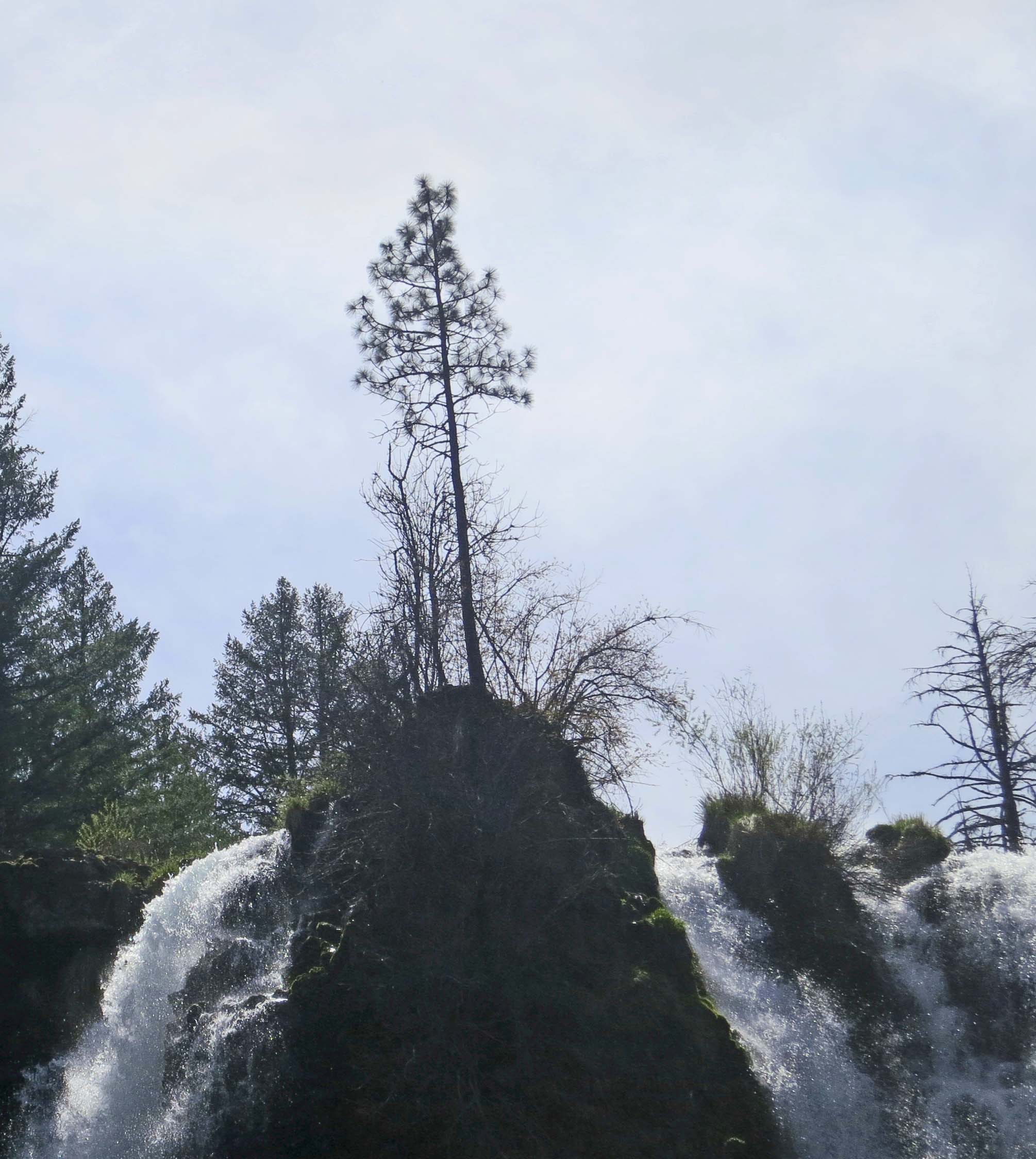
Ponderosa Pine tree and Burney Falls in Northern California.

A lone Ponderosa Pine grows between the two channels.

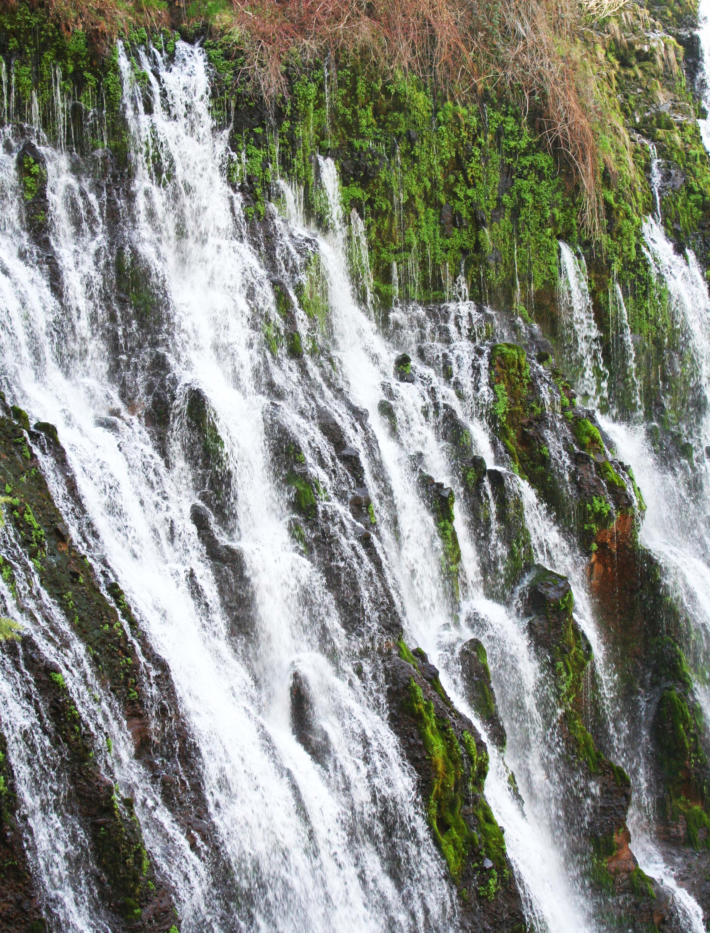
Water comes out from layers of rocks as well as over the top at Burney Falls.

The water shooting out from the rocks provides an almost etherial quality to the falls.

Burney Falls Northern California photo by Peggy Mekemson.

A close-up of the water emerging from the rocks. (Photo by Peggy Mekemson.)

Photo by Peggy Mekemson of Burney Falls in Northern California.

Peggy captured the braided quality of the falls on the right. (Photo by Peggy Mekemson.)

Water from Burney Falls crashes into the river.

A final shot catching the water crashing into the river.

NEXT BLOG: What if you could hire a different talented artist to paint each room of your house? The results would be fascinating. That is exactly what is happening at a hotel in Reno that takes its inspiration from Burning Man. I visit the hotel in my next blog.

Painted Rocks Petroglyph Site of Southern Arizona… Nice Doggy

Petroglyph at Painted Rock Petroglyph Site in Southern Arizona. Photo by Curtis Mekemson.

My sister had a Jack Terrier named Jack  that looked a lot like this petroglyph, except for floppy ears. And this is how I was greeted when I visited. Bounce, bounce, bounce. I like to speculate that ancient Native American artists created petroglyphs  just for fun on occasion. This might be a candidate.

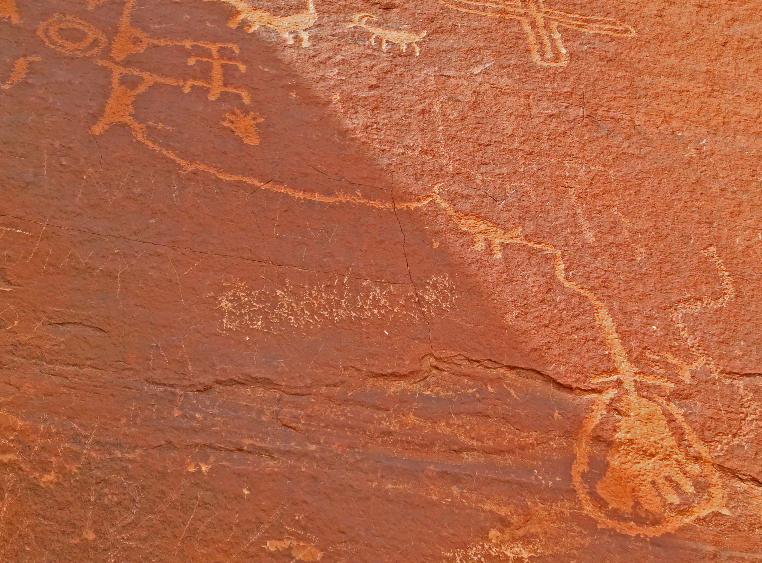
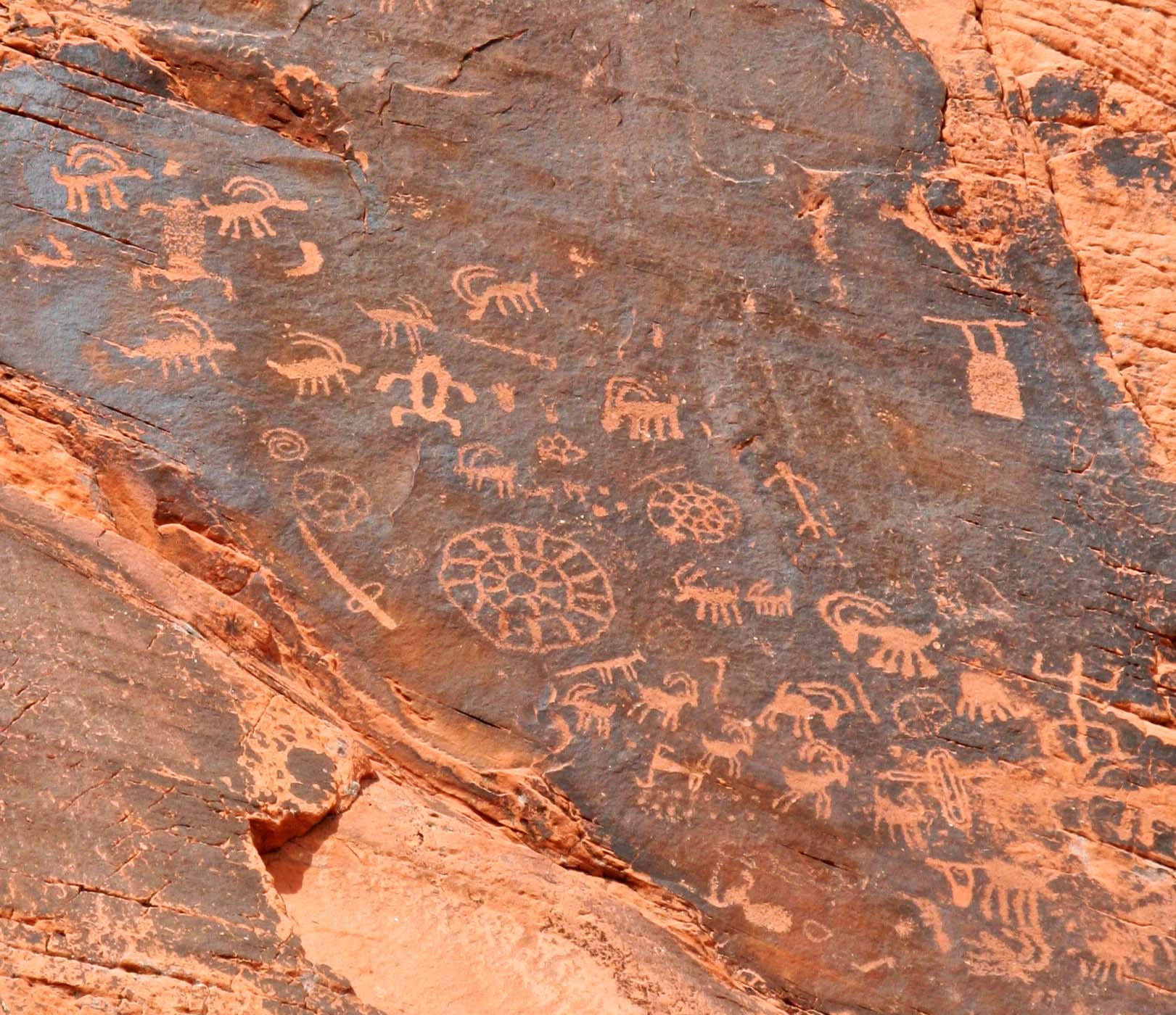
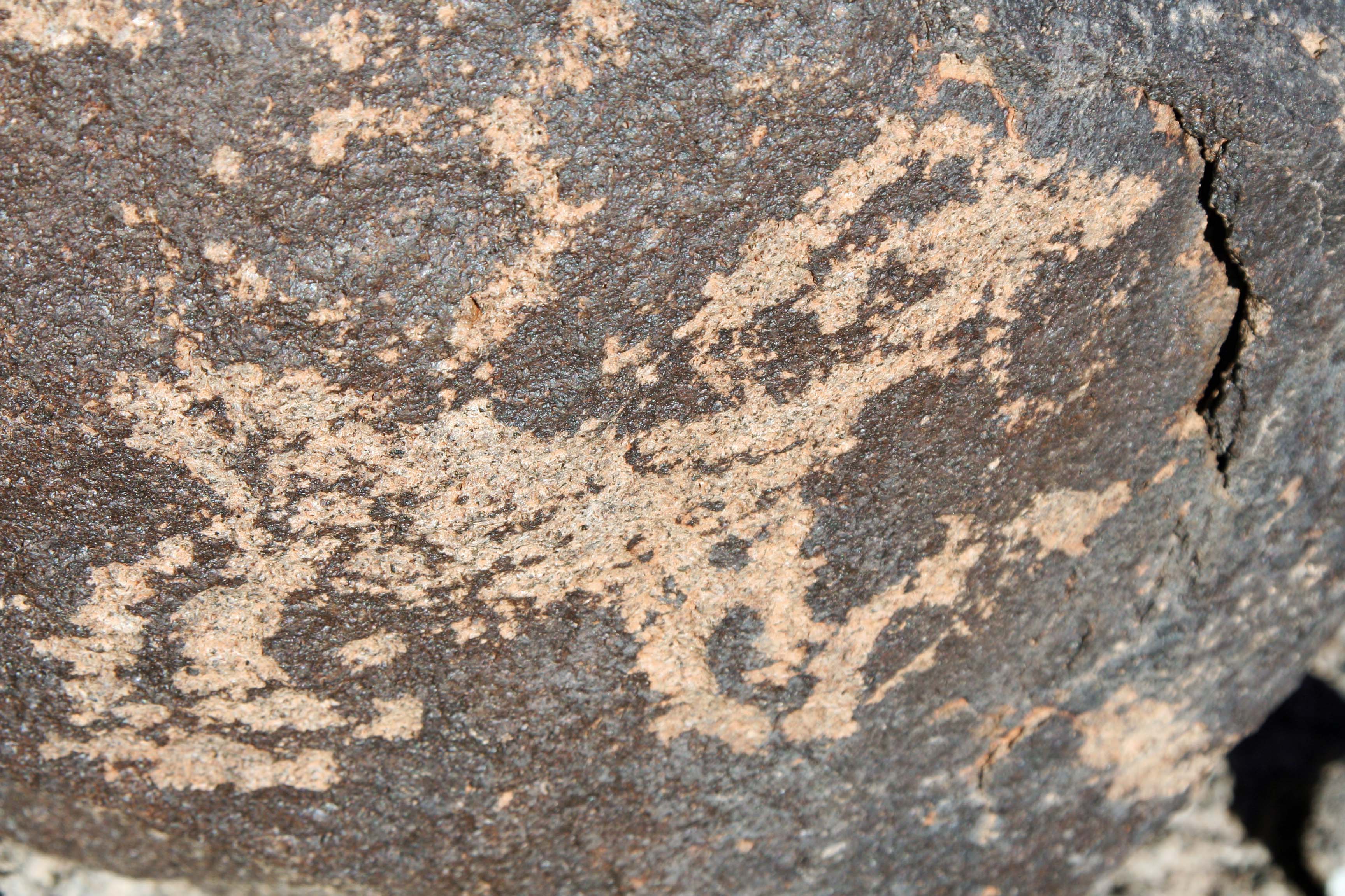
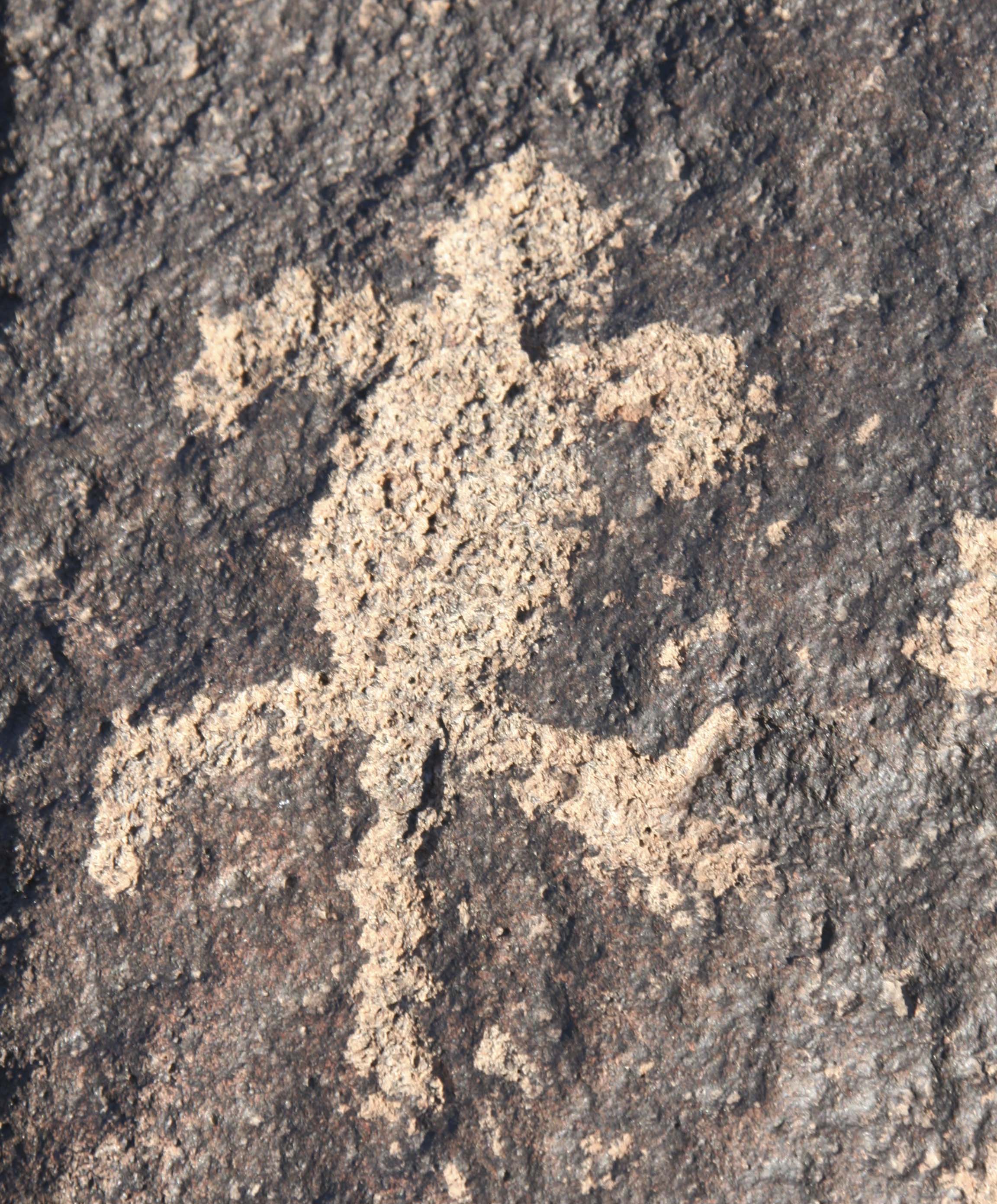
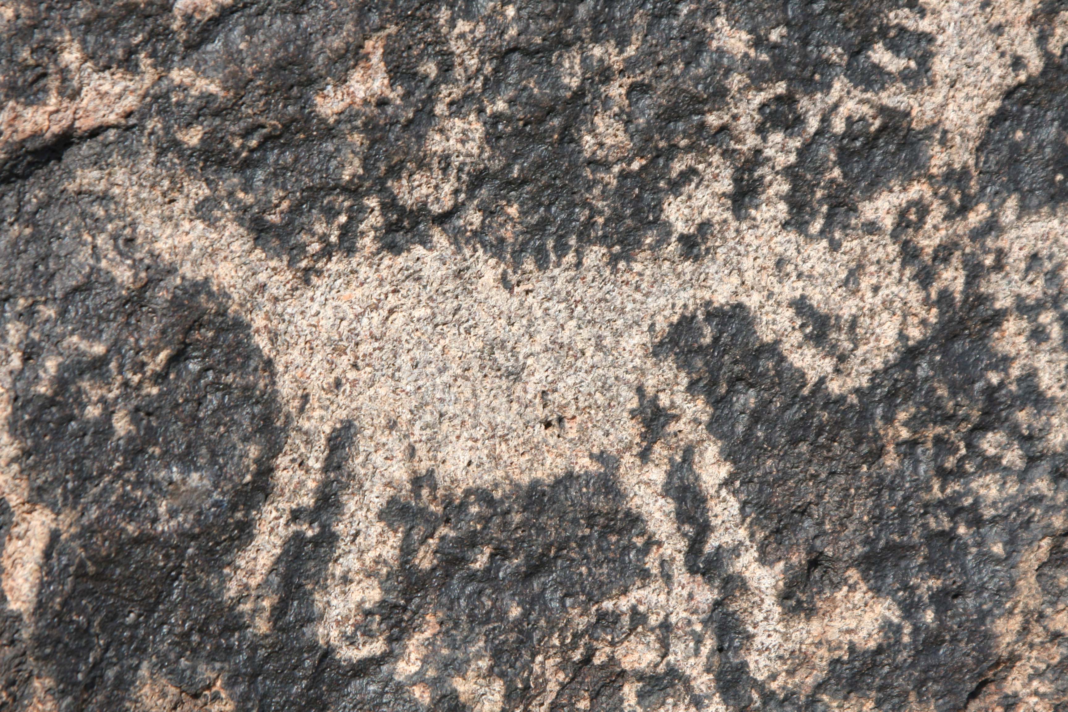
Anyone who wanders the Southwest and comes across petroglyphs wonders about their origins and what they mean. Some seem so clear: a mountain sheep, a man on a horse, a rattlesnake, a coyote, a hand. While others are more remote: wiggly lines, alien looking figures, concentric circles, and galaxy-like spirals for example.

Petroglyph of a hand found at Painted Rocks Petroglyph Site in southern Arizona.

No question about this petroglyph of a hand.

Scorpion petroglyph found at Painted Rock Petroglyph Site in southern Arizona.

Or this scorpion with its stinger, a common bane of the Southwest.

Chain petroglyph from Painted Rocks Petroglyph Site in southern Arizona.

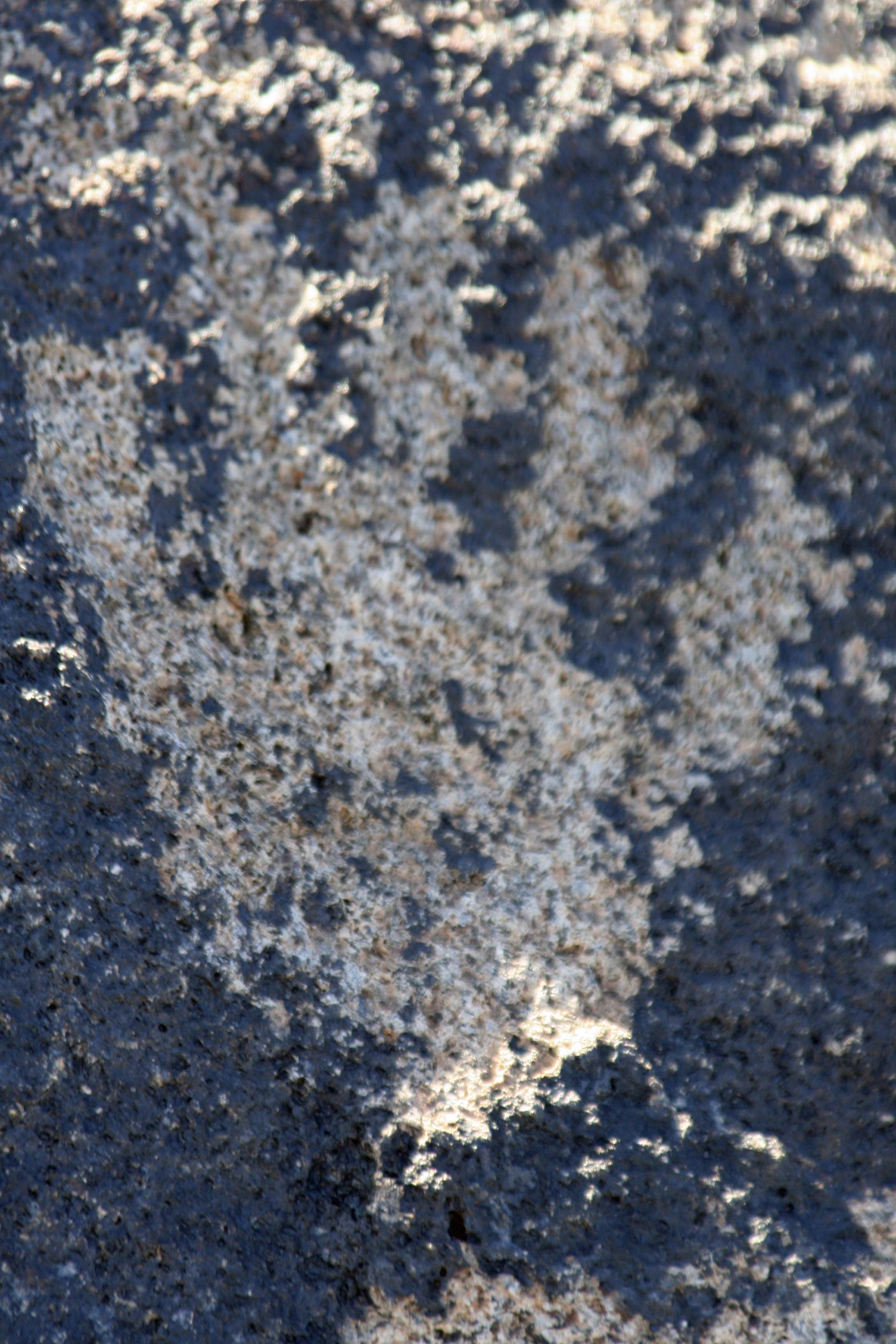
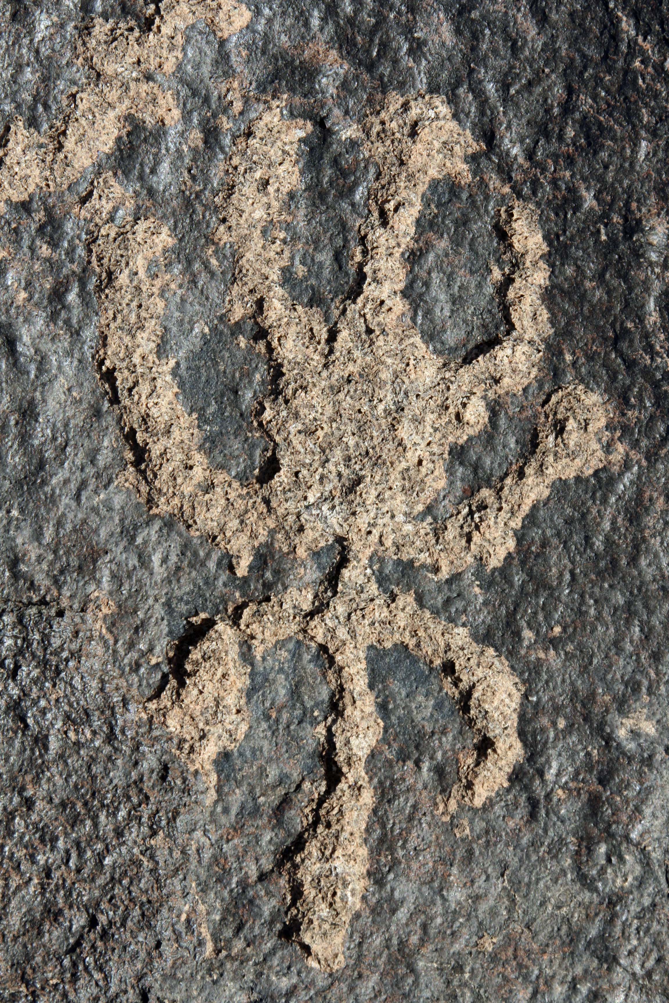
But what does this chain represent? My first thought: it was the path of a beetle that had sipped too much tequila. The information plaque told me that the more abstract designs represented the archaic cultures which would make this petroglyph over 2000 years old! (This certainly impressed me but one of my followers from Australia reminded me that Australian aboriginal rock art dates back 50,000 years.)

The grid on this rock is another example of archaic petroglyphs. There is some suggestion that the grid represents a rough map and the dots represent where people lived.

The grid on this rock is another example of archaic petroglyphs. There is some suggestion that the grid represents a rough map and the dots represent where people lived.

Experts say we can’t be sure about the meaning of petroglyphs. Some were created thousands of years ago and even the more recent can be several hundred years old. Since there were no written languages among the southwestern cultures of the time, we are left to speculate. Descendants of the ancient peoples provide our best clues. The Hopi, Navajo and other natives of the Southwest look backwards in time from their unique cultural perspectives and provide insights.

Certainly some petroglyphs have spiritual significance. Shamans would take drug-enhanced journeys into other worlds to learn the secrets of nature and gain control over natural elements. Some petroglyphs reflect these journeys and show the beings encountered along the way. (Either that or little green men were frequent visitors.) Shamans of the Huichol culture in western Mexico follow a similar path today.

Huichol work of art representing the journey to gather Peyote. Photo by Curtis Mekemson.

Peggy and I bought this Huichol yarn art painting several years ago in Mexico. The Huichol are a native people who live in the Sierra Madre Mountains of Mexico and practice a lifestyle similar to that of their ancestors. Their art represents visions their Shamans have on their mystical, peyote induced journeys. This piece represents the tribes annual journey to gather more peyote for more visions.

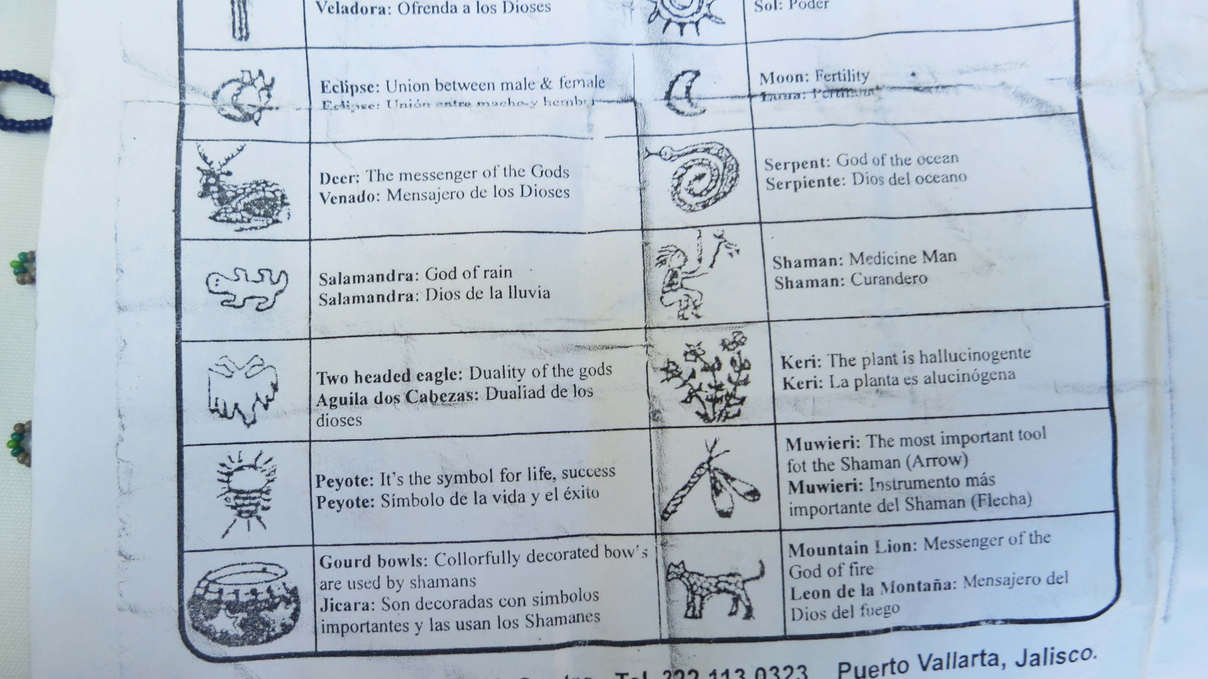
This sheet, conveniently provided by the Huichol man who sold us art, provides interpretations for some of the figures. The deer, for example, are messengers of the gods. People of the Huichol culture immediately recognize them as such whenever they are included in a painting. Early  Christian artists provided similar types of symbolism for their non-reading flocks. A head on a platter meant St. John the Baptist, for example. We can assume that the rock art of the Southwest also incorporated commonly recognized symbols.

This sheet, conveniently provided by the Huichol man who sold us art, provides interpretations for some of the figures. The deer, for example, are messengers of the gods. People of the Huichol culture immediately recognize them as such whenever they are included in a painting. Early Christian artists provided similar types of symbolism for their non-reading flocks. We can assume that the rock art of the Southwest was also highly symbolic.

Peggy and I photographed this petroglyph I call carrot top in Dinosaur National Monument. It is very likely it represents a shamanistic vision.

Peggy and I photographed this petroglyph I call Carrot Top and his dog in Dinosaur National Monument. It is very likely it represents a shamanistic vision. It would also make a great alien, however. Note the little legs.

Clan names, common animals, and important food sources like corn are common. Some may have even served as maps showing the layout of a village or where to find a spring.   And maybe some were created for the sheer joy of creation, pounded out by an early Michelangelo of the desert carving in stone. I am hitting a 9.99 on the speculation meter here, but I like to think the artist that created the dog/coyote (or possibly horse) featured at the beginning of the post was having fun.

Man on horse petroglyph from Painted Rock Petroglyph Site in Southern Arizona.

Petroglyphs are difficult to date but one thing is for sure: if you find a man riding a horse, it had to take place after Spaniards first introduced modern horses to North America in the 1500s.

Petroglyph of mountain sheep found at Painted Rocks Petroglyph Site in southern Arizona.

Big Horn sheep were common in the early Southwest, so it isn’t surprising that petroglyphs representing Big Horns are found at Painted Rock Petroglyph Site and at most other sites we have visited.

Big Horn Sheep photo by Curtis Mekemson.

I caught this family of wild Big Horn Sheep grazing in a public park near Hoover Dam. I considered the Jack Rabbit a bonus. Obviously, I was not their major concern.

Petroglyph of Mountain Sheep found at Painted Rocks Petroglyph Site in Southern Arizona.

The belly on this Big Horn Sheep suggests to me that this was one pregnant lady.

Elk petroglyphs in Painted Rock Petroglyph Site in Southern Arizona.

I thought these were deer at first but their large horns may suggest they are elk.

Petroglyph of a lizard found at Painted Rock Petroglyph Site in Southern Arizona.

Another common petroglyph found throughout the Southwest is that of the lizard.

Tortoise petroglyph at Painted Rocks Petroglyph Site.

I am going with tortoise on this one. It’s another petroglyph that makes me smile.

This petroglyph of a dog looks even more like Jack. He has floppy ears and is barking. (grin) So I'll end the post here.

This petroglyph of a dog/coyote/horse looks even more like Jack. He has floppy ears and is barking. (grin) So I’ll end the post here.

NEXT BLOGS: Peggy and I are heading out tomorrow for the remote corners of Nevada where there may or may not be Internet service. I’ll be gathering material for some fun blogs plus I want to finish up the last details on my book. So, I’ve decided to put my blog activities on hold for three weeks. See you all at the beginning of May with stories on the ET Highway, Area 51, Ghost Towns, and more! Plus I’ll be back checking in on your fun and interesting posts. –Curt


Painted Rock Petroglyph Site… Voices from the Ancient Past: Part I

The rocks at Painted Rock Petroglyph Site in Southern Arizona are covered with petroglyphs as shown in this photo with Peggy.

The rocks at Painted Rock Petroglyph Site in Southern Arizona are covered with hundreds of petroglyphs, as shown in this photo with Peggy. Some my be several thousand years old.

Peggy and I had just been through one of those checkpoints that make Arizona so endearing to visitors: armed men with guns and dogs and x-ray machines had slowed us to a crawl as men stared, dogs sniffed and x-rays probed. It was for our own good. Yeah, right.

Having survived yet another checkpoint on our way to Organ Pipe Cactus National Monument, I stepped on the gas and almost missed it. A small brown BLM sign on Interstate 8 announced we were passing the Painted Rock Petroglyph Site. At 70 plus miles per hour all that registered in my mind was petroglyph. “Whoa Quivera,” I said to our van who has little humor about stopping quickly at 20, much less 70.

Peggy and I are big petroglyph fans, having visited and blogged about several sites in the Southwestern US. This one was new to us– and now it was fading into the distance. America’s freeway system has little forgiveness for missed turns. Should we go on? No, the answer came easily. We decided that Organ Pipe could wait.

We soon found a place to turn around. After driving a few miles off the freeway, we arrived at the site. And were greeted by a large pile of rocks, flat ground, and a lonely saguaro. So much for this detour I thought– until Peggy pointed out that the rocks were covered from top to bottom with petroglyphs. A command decision was made. We would spend the night at the BLM campground.

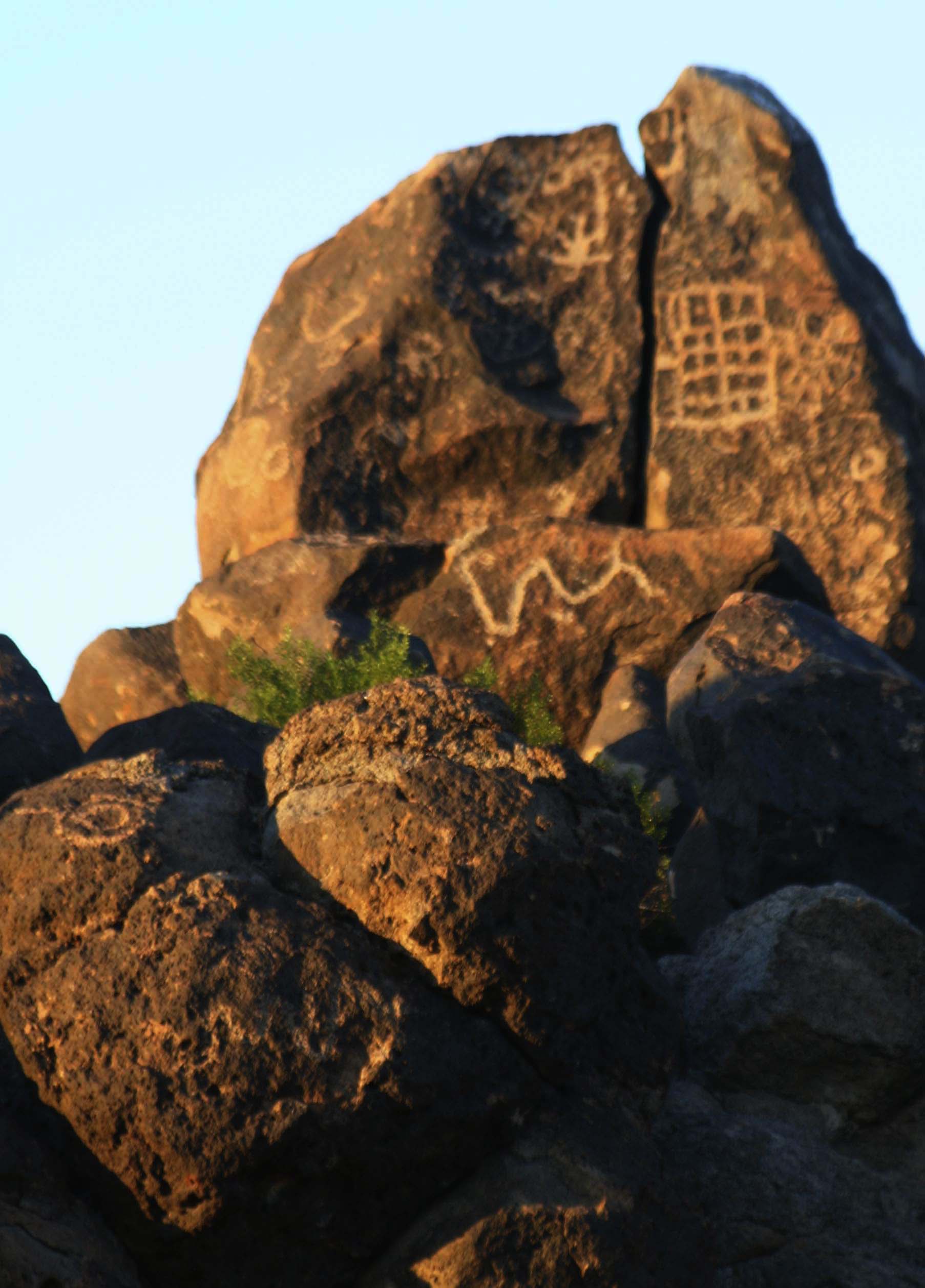
We arrived at Painted Rock Petroglyph Site in southern Arizona and found a large pile of volcanic rocks stacked up on the flat desert floor. Only when we got closer did we realize that the rocks were covered with Petroglyphs.

We arrived at Painted Rock Petroglyph Site in southern Arizona and found a large pile of volcanic rocks stacked up on the flat desert floor. Only when we got closer did we realize that the rocks were covered with Petroglyphs.

Painted Rock Petroglyph Site in Southern Arizona

The closer we got to the rocks, the more petroglyphs we could see.

Rock covered with petroglyphs at Painted Rock Petroglyph Site in southern Arizona.

Some, such as this rock Peggy is standing next to, were totally covered. Internet sites claim there are around 900 petroglyphs at Painted Rock. I would argue there must be more judging from this rock.

A sign nearby informed us that Native Americans had occupied the region for over 9000 years. (How much more native can you get?) Hunting and gathering peoples had lived in the area from approximately 7500 BC up until around 1 AD. A group, known as the Hohokam, had come afterwards and occupied the region up until the 1400s. Both cultures were represented by petroglyphs found at the site. We could almost hear their voices from the ancient past whispering to us.

Staying over night allowed us to capture the petroglyphs in different light.

Staying over night allowed us to capture the petroglyphs in different light.

Petroglyphs at Painted Rock Petroglyph Site.

In my next blog I’ll feature individual petroglyphs and discuss what we (assume) to know about their meanings. Meanwhile, I’ll finish today’s post off with photos of the saguaro cactus that dominated the site.

Saguaro cactus found at Painted Rock Petroglyph Site in Southern Arizona.

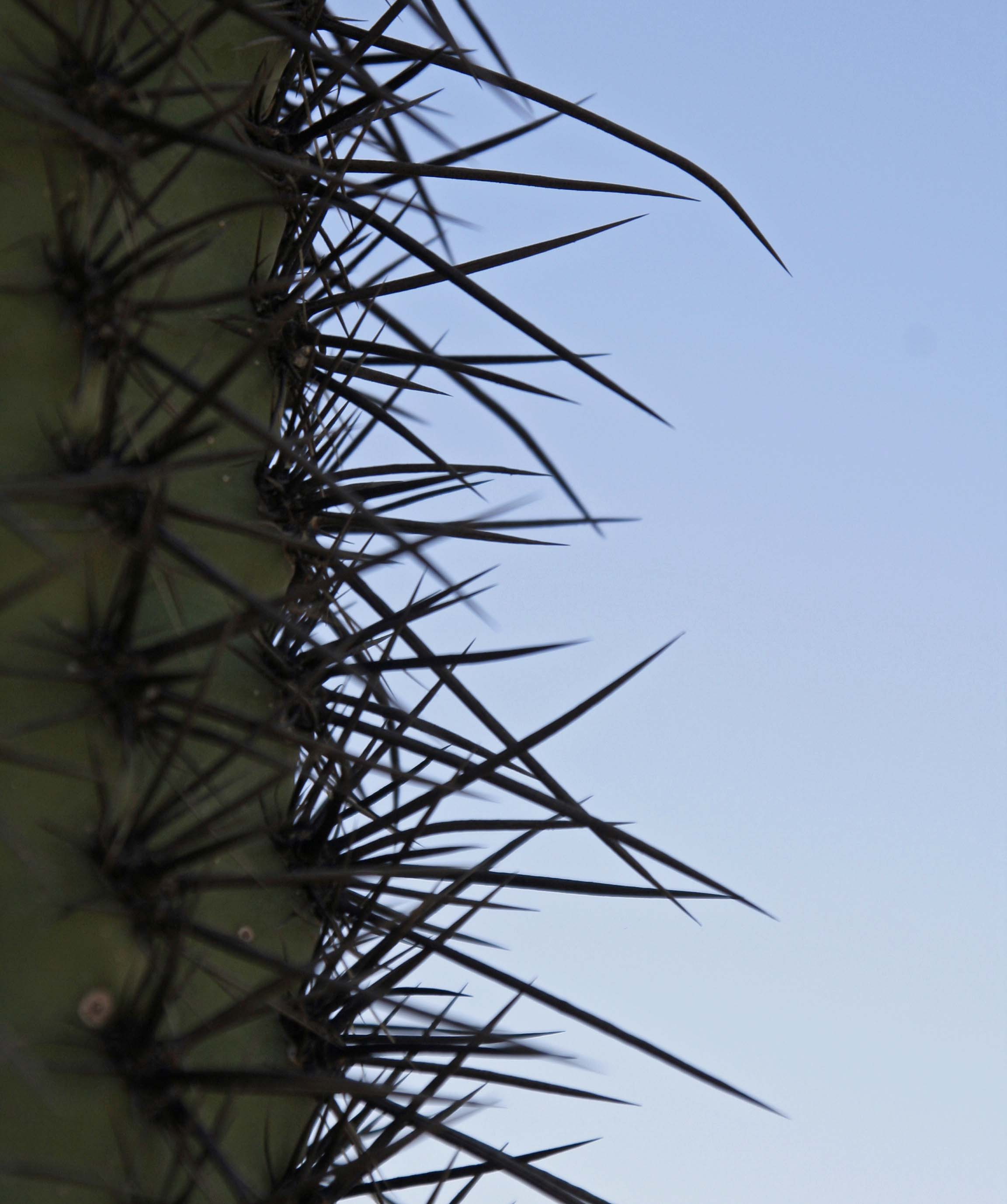
This saguaro may be a youngster since it had yet to grown any arms. Youngster is relative meaning 50-75 years old. Check out the spines…

Here's a close up.

Here’s a close up of why snuggling up to a saguaro is a bad idea.

Setting sun outlines Saguaro Cactus at Painted Rock Petroglyph Site in southern Arizona. Photo by Curtis Mekemson.

The setting sun outlined the Saguaro.


The American River Parkway: Part 2… Featuring Flowers

California Buckeye found on the American River Parkway in Sacramento, California. Photo by Curtis Mekemson

This beauty found along the American River Parkway in spring is the California Buckeye. Each individual flower is a potential buckeye.

The concept of creating the American River Parkway can be traced back as far as the 1920s, but the actual creation of the park took place in the 1950s, 60s and 70s. Impetus came when land speculators begin buying up the relatively inexpensive land along the river for future development.

Conservation-minded visionaries of the time realized a regional treasure was about to be lost.  A prized riparian habitat of great beauty and recreational value to the community of Sacramento would soon give way to bulldozers, for sale signs, and limited public access. Armed with passion and facts, these early environmental leaders were able to persuade the City and County of Sacramento to create the parkway.

And for that, we owe the environmentalists and elected officials a deep vote of gratitude. The American River Parkway is an urban asset that few communities throughout the US, or for that matter around the world, can claim.

The battle to maintain the natural resources of the parkway continues. The balance between recreational use and protection of the riparian habitat is a delicate one. Tough financial times and deep budget cuts led local politicians to insist that the parkway pay more of its maintenance costs. And this, unfortunately, has led to a demand for increased recreational use to pick up the tab, which is threatening the natural environment. Birds, plants and animals don’t contribute to the public till, at least not directly. Nor do they vote.

Although free parks benefit everyone, there is nothing wrong with insisting that people who use the park help pay for its maintenance. And it is healthy that volunteers have stepped in to take up the slack created by fewer park staff. Continued government support is needed as well, however.

The City of Sacramento recently voted to spend $250 million dollars to build a basketball stadium downtown. While it isn’t my purpose to oppose the stadium, it does seem to me if local politicians can find money to support what is basically a private venture that will serve some 700 thousand basketball fans per year, they should be able to find funds to support the community’s greatest asset that serves 5 million people per year. And will continue to– far into the future. Don’t you think?

The American River Parkway is used by people of all ages and persuasions. Below is a photo of Peggy with her dad, John Dallen, on the river. When John and his wife Helen reached their mid-80s, their children– Peggy, Jane Hagedorn, and John Jr.– insisted that they come out and live in Sacramento. John Sr. was not happy leaving his nature walks behind in Florida so I started taking him out to the parkway on Wednesday mornings. He absolutely fell in love with it, and I like to believe that the parkway made his last years much happier. The experience reminded me just how valuable the parkway, and other such natural areas around the world , are to the billions of people who live in urban centers.

John Dallen and his daughter, Peggy Mekemson, on the American River Parkway in Sacramento, California.

John Dallen and Peggy Mekemson on the American River Parkway

Three community-based organizations work exclusively to preserve the American River Parkway and deserve public support.  These organizations are:

The Save the American River Association (SARA) was founded in the 1960s to advocate for the American River Parkway. Its mission “is to protect and enhance the wildlife habitat, fishery, and recreational resources of the American River Parkway.”

The American River Parkway Foundation (ARPF) “coordinates programs and works with volunteers to foster environmental stewardship, facilitate volunteer opportunities, as well as fund and implement Parkway projects.”

The American River Natural History Association (ARNHA), “supports educational and interpretive activities in the American River Parkway through operating and funding Effie Yeaw Nature Center, a program that introduces thousands of school children each year to the beauty and diversity of the American River Parkway.”

Each spring, the parkway bursts out in bloom. So my photographs this time will feature flowers of the American River Parkway.

California Buckeye trees along the American River Parkway in Sacramento, California. Photo by Curtis Mekemson.

Bursting with bloom, these buckeye trees are found at William Pond Park. A close up of the flowers is found above.

Almond tree blossoms along the American River Parkway in Sacramento, California. Photo by Curtis Mekemson.

Pioneer farmers once raised crops along what is now the parkway. These are blossoms from a remaining almond tree.

Dutchman's Pipe plant on the American River Parkway. Photo by Curtis Mekemson.

Dutchman’s Pipe is one of my favorite flowers. It obtained its name, so they say, by looking  like a Dutchman’s pipe.

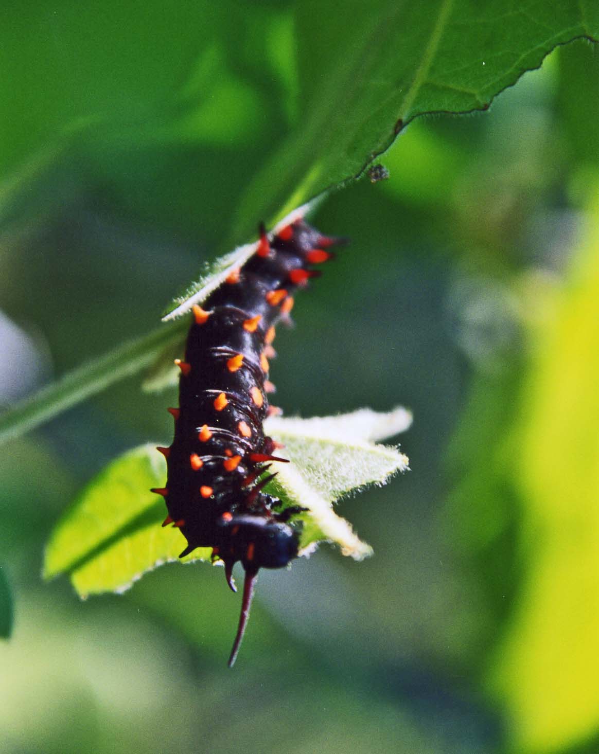
Pipevine caterpillar dining on Dutchman Pipevine Plant on the American River Parkway.

Here we have the Pipevine Caterpillar chomping away on a pipevine plant.

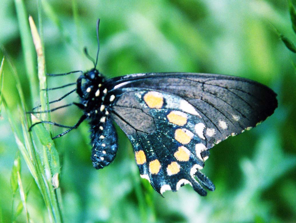
Pipevine Swallowtail Butterfly on the American River Parkway

The caterpillar morphs into the Pipevine Swallowtail Butterfly. The pipevine plant is poisonous, which doesn’t harm the caterpillar or the butterfly, but does harm predators that might want to eat them.The distinct marking on the butterfly’s wings translates into an “eat me and die” sign. Other butterflies mimic the wings in hopes of taking advantage of the message..

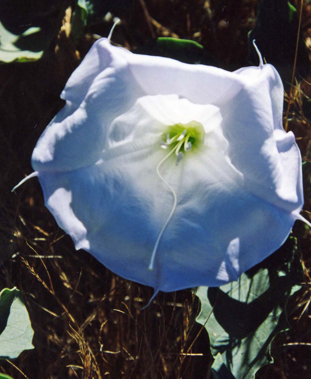
Opening Jimsonweed flower on the American River Parkway in Sacramento, California. Photo by Curtis Mekemson.

Speaking of poisonous, this stunning flower belongs to the Jimsonweed plant, which is a member of the nightshade family. It is just opening up in this photo.

Jimsonweed flower on the American River Parkway.

Most people are more familiar with the flower looking like this, which is a perspective made famous by Georgia O’Keeffe. Note the extremely long pistil.

Evening Primrose found near the Effie Yeaw Nature Center on the American River Parkway. Photo by Curtis Mekemson.

An Evening Primrose, which I found near the Effie Yeaw Nature Center.

Scotch Broom found on the American River Parkway. Photo by Curtis Mekemson.

Another yellow beauty, Scotch Broom. This plant was brought over from Scotland because of its beauty. Unfortunately it is a highly invasive plant that replaces native plants. Efforts are underway to eradicate it on the parkway.

Yellow Iris growing on the American River Parkway.

And a yellow iris.

Blue Elderberry flowers along the American River Parkway in Sacramento, California. Photo by Curtis Mekemson.

Elderberry flowers. The blue fruit of the plant was prized by  Native Americans. An elderly woman once tried to entice my father, who was in his late 70s at the time, by making him elderberry wine. He refused to comment on the success of the strategy.

Winter Vetch along the American River Parkway in Sacramento, California. Photo by Curtis Mekemson.

Another invader, winter vetch was originally brought in from Europe as a forage plant for livestock.

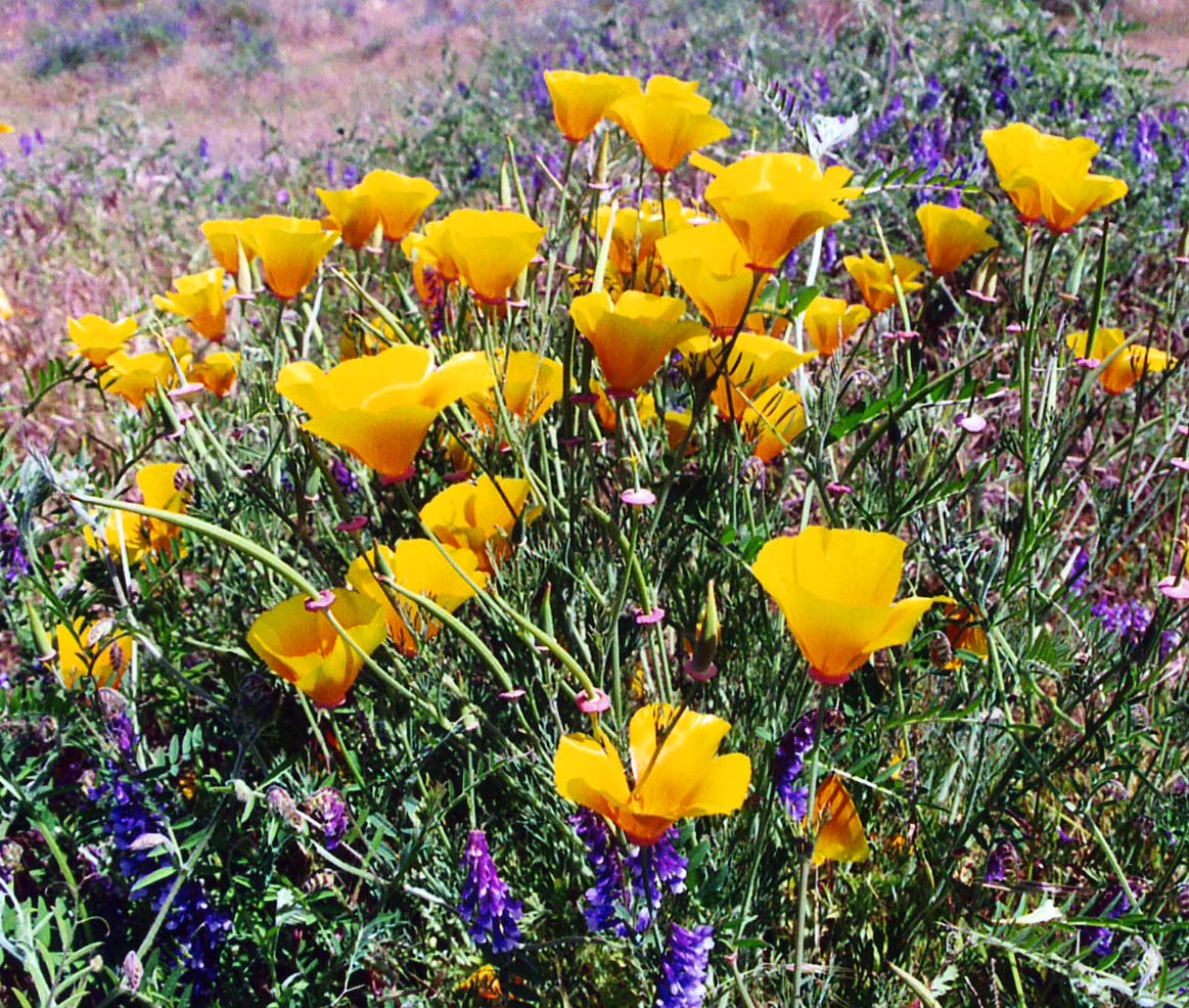
California Poppies and Winter Vetch growing together on the American River Parkway.

A mixed bouquet of California Poppies and Winter Vetch.

Plants don’t have to be flowering to be attractive, as the following photos demonstrate,

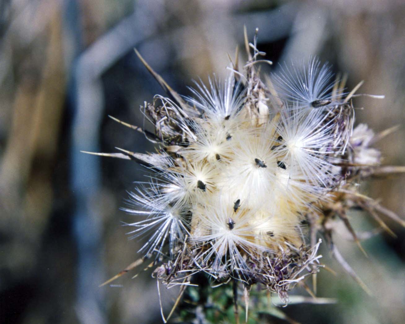
Seeding Milk Thistle plant on the American River Parkway. Photo by Curtis Mekemson.

This Milk Thistle is in the process of distributing its seeds. Note the insect that seems to fit right in.

Dried Milk Thistle on the American River Parkway in Sacramento, California. Photo by Curtis Mekemson.

An older Milk Thistle looking a bit ferocious. I think it would be interesting in a dried flower arrangement.

Dead leaves form a California Buckeye on the American River Parkway in Sacramento, California. Photo by Curtis Mekemson.

I found these dead leaves to be rather attractive as well. I believe they were on a buckeye tree.

Cluster of young, wild grapes found on the American River Parkway. Photo by Curtis Mekemson.

You can see grapes developing on this wild cousin to domestic grapes.

I conclude this post with a wild rose.

I conclude this post with a wild rose.

The American River Parkway… Sacramento’s Greatest Treasure: Part 1

The American River as it flows through William Pond Park on the American River Parkway.

The City and County of Sacramento, with strong urging by local citizen groups, made the decision in the 1960s and 70s to create a corridor along the American River that would protect its natural beauty and create recreation opportunities for the people of Sacramento for generations to come. This photo was taken in William Pond Park looking upriver.

“The American River Parkway is a true treasure in the landscape of Sacramento. The parkway is a 23 mile, 4,600-acre expanse of land, water and nature. Our forefathers were smart in wanting to protect this wonderful resource hence creating a regional park.”      American River Parkway Foundation

I was in Sacramento last week and decided to go for a hike on the American River Parkway. It wasn’t my first. If you count the years it was my primary bike route into town, I estimate I’ve been out on the parkway at least 2000 times. Beyond biking, the parkway served as my escape to the woods when I needed a quick break from the city, which was often. So I know a bit about it.

Drought and tight government budgets had taken their toll on the parkway, but it was still beautiful and crowded with visitors. (Some five million people use the parkway annually, which is as many who stop off at the Grand Canyon.)

I wandered along and happily visited my old haunts– first checking out William Pond Park and then hiking across the Harold Richey Memorial Bridge to River Bend Park. I once had a five-mile route that wound through the two parks. This time I kept it to three.

William Pond was the Director of Parks during the 1960s when the parkway was first proposed. This is the pond in William Pond Park. I cal it  William Pond Pond.

William Pond was the Director of Sacramento County Parks during the 1960s when the parkway was first proposed. This is the pond in William Pond Park. I call it William Pond Pond.

Reflection pool created by spring rains along the American River Parkway in Sacramento. Photo by Curtis Mekemson.

Springtime rains provide more opportunities for reflection shots along the American River Parkway.

Staring into shallow rapids can be a form of meditation. Arising from the nearby Sierra Nevada Mountains, the American River is noted for its pure water.

Staring into shallow rapids can be a form of meditation. Arising from the nearby Sierra Nevada Mountains, the American River is noted for its pure water.

Cliff swallows nesting under a bridge on the American River Parkway.

I found these baby cliff swallows nesting under the Harold Richey bridge that connects William Pond and River Bend Parks. Note the big mouths and tight fit.

This thumb sized spider lived up on the bridge between the metal railings and competed with the swallows for insects.

This large spider lived up on the bridge between the metal railings and competed with the swallows for insects. It was busily wrapping up its latest catch.

Woodland park on American River Parkway in Sacramento. Photo by Curtis Mekemson.

An inviting woodland found in River Bend Park. It always made me think of Robin Hood and Sherwood Forest.

I decided the Parkway would make a good post. Photos weren’t an issue. In fact, I have too many. I’d carried a camera on many of my outings during the 2000’s before Peggy and I took off on our three-year road trip in 2007.  Most of the photos on this post are from that time period.

Since I have been out of touch with the parkway for several years, I jumped online to do some research. That’s where I came across the above quote from the American River Parkway Foundation. The Foundation is a good organization, and I was happy to steal its quote, but I got a little hung up over the use of forefathers. Like I know what forefathers are– they are old, really old, like Mayflower old. I think you have to be dead to qualify.

And I was around when much of the parkway was being developed. In 1970 I served as the first Executive Director of Sacramento’s Ecology Information Center. I then went on to co-found the Environmental Council of Sacramento and, along with Bruce Kennedy, create an organization that supported local candidates based on their environmental stands. Each of these organizations provided strong support for the parkway, which put me in regular contact with the ‘forefathers,’ and brings me to the case in point. I may be older than your average John Doe, but I am not Mayflower old, or dead, for that matter.

I am just kidding about the forefather bit, of course, having some fun at the expense of the Foundation. Like I said, they are good kids. They should add foremothers to their list, however. In my next blog, I’ll talk more about the importance of the parkway to Sacramento and about the organizations that support it. But now it’s time to head out to the park.

Numerous hiking trails introduce visitors to the beauty and natural history of the American River Parkway. I took this photo in Effie Yeaw Park.

Numerous hiking trails introduce visitors to the beauty and natural history of the American River Parkway. I took this photo in Effie Yeaw Park.

Valley oaks on the American River Parkway in Sacramento.

The parkway is noted for its magnificent valley oaks. Peggy’s sister and my good friend, Jane Hagedorn, has a grove of oaks named after her in the parkway honoring her efforts in protecting Sacramento’s environment and in promoting the planting of trees throughout the urban area.

Leafy valley oaks on the American River Parkway.

Adding a lush green in summer…

Valley Oak on American River Parkway in winter.

…valley oaks take on a more stark beauty in winter.

Canadian Geese on the American River Parkway.

The area supports abundant wildlife including this family of Canadian Geese.

Mallard ducks on the American River Parkway in Sacramento, California.

A pair of mallard ducks keep an eye on me. I was particularly taken by the male’s yellow slit. I’d say that it is a ‘don’t mess with me’ look.

Brush rabbit on American River Parkway.

A brush rabbit pauses in his busy rounds. Rabbits, deer, beaver, coyotes, and a number of other animals call the parkway home. Once, I even came across cougar tracks.

Wasp on American River Parkway. Photo by Curtis Mekemson.

I considered this wasp a photo-op. It is actually on the opposite side of the leaf, outlined by the sun.

NEXT BOG: A continuing look at the parkway with a focus on flowers. The California Poppy below is to serve as an introduction– and to wish you a Happy Valentine’s Day.

California Poppy on the American River Parkway in Sacramento, California. Photo by Curtis Mekemson.

Bolinas: A Recluse Kind of Town… Pt. Reyes National Seashore

Mural of early Bolinas, California. Photo taken by Curtis Mekemson.

A mural depicting how Bolinas would have looked in the 50s. Not much has changed. The artist added a touch of humor with the blue surfboard the man in the brown sports coat is carrying.

Marin County had a problem. Its highway department would put up a sign on Highway 1 pointing west toward the town of Bolinas and the residents of the small coastal community would tear it down. Again and again. Located 30 miles north of San Francisco and just south of Pt. Reyes National Seashore, the town didn’t want anyone to know where it was; the town was a recluse.

Finally, out of frustration, Marin County held a vote: Did or did not the townspeople want the signs? They voted no. Today, nothing points toward the community. But a map or GPS will get you there.

I first made my way to Bolinas in the early 70s. Surfers, hippies, commune members, artists, writers and other alternative types called it home. I was running an environmental center in Sacramento at the time. Being ex-Berkeley and ex-Peace Corps, I more or less fit in. “I could live here,” I thought to myself.

The town was also known for its nude beach. I won’t incriminate myself other than to note that there are some places on the body it’s best not to get sunburned.

Ken, Leslie, Peggy and I made our way to Bolinas after we left Pierce Ranch. Other than a new park in the middle of town, I was happy to find that the community had changed little. The park, I was proudly informed by a shop owner, had been donated by one of the town’s billionaires. Big money had found its way to this small community, which is pretty much the story of Marin County. Extreme wealth and a laid back lifestyle go hand in hand. In Bolinas, VW Vans and BMW’s seemed to happily co-exist.

We wandered through town poking our heads in various shops and looking for a bookstore. It’s become a tradition whenever we travel. We love books and we like to support local bookstores. We found one on the edge of town next to the post office. It was quite unique; the owner was elsewhere and shoppers were invited to price their own selections. Seven suggested categories ranged from “unbelievably really great” for $20 to “ordinary” for a buck. It was possible (though not likely) that Peggy’s really great might be my ordinary. A small, metal box with a slot on top was set up for payment. A statue of the Virgin Mary fronted the box. I wasn’t sure whether she was there to say thank you or to haunt our conscience if we paid five bucks for a book we believed was worth ten.

Bolinas, California unique book pricing recommendations. Photo by Curtis Mekemson.

A sign with suggested prices for books in Bolinas, California that depended on your assessment of the book.

Bolinas Book Store photo by Curtis Mekemson.

Ken deposits $5 for a “great book” in the Virgin Mary box while Peggy, reflected in a mirror, looks on.

Bolinas, California  book store photo by  Curtis Mekemson.

I assume this was the missing owner’s office. I believe he painted the pictures.

Leslie, Ken and Peggy stand in front of the Bolinas Bookstore named Books.

Leslie, Ken and Peggy stand in front of the Bolinas Bookstore named Books.

Our visit also included stopping off at a stuffed-to-the-ceiling antique store, admiring quaint houses that had been around since day one, taking photos of murals and visiting a small shop featuring incense, eastern music, and a Humpty-Dumpty Buddha.

Photo of Bolinas California taken by Curtis Mekemson.

Bolinas today, which I did in black and white to give it a 70’s feeling. Take away the cars and the billboard building and you’ll find the Bolinas featured in the mural at the top of the post.

The Grand Hotel Shop and Gallery in Bolinas, California. Photo by Curtis Mekemson.

The Grand Hotel Shop and Gallery was stuffed top to bottom with antiques.

Mannequin in Bolinas, California. Photo by Curtis Mekemson.

I was intrigued with this aging mannequin I found looking out the window of the shop.

A home in the town of Bolinas, California. Photo by Curtis Mekemson.

The old homes in town have aged well.

Back in a hot-flash sign in Bolinas, California. Photo by Curtis Mekemson.

Incense, Eastern music, and this sign pulled us into a shop.

Eclectic Bolinas, California shop. Photo be Curtis Mekemson.

The laughing Buddha face on the upper left shelf made me think of Humpty Dumpty. The items in the shop were, um, eclectic…

Inside of shop in Bolinas California. Photo by Curtis Mekemson.

Very eclectic.

Bolinas Shrine. Photo by Curtis Mekemson.

We found a shrine next door that the community had put up after 9/11.

Surf shop ad in Bolinas, California. Photo by Curtis Mekemson.

A Bolinas surf shop advertised using broken surf boards featuring Native American/First Nation art.

Halloween pumpkin in Bolinas California. Photo by Curtis Mekemson.

This pumpkin reminded me that Halloween had just passed…

2013 gas prices in Bolinas, California. Photo by Curtis Mekemson.

And this sign reminded me that we would be buying our gas elsewhere. This station matched what I was paying in the Yukon territory this summer.

NEXT POST: Peggy and I heading off to Mexico for three weeks. To fill in, I’ve decided to put up photos that Peggy and I have taken in America’s National Parks. We’ve made a point of visiting close to all of them. I’ll close out my Pt. Reyes’ series with a Bolinas mural that I think reflects the area: ocean, wilderness, and a touch of magic.

Mural of mountain lion and mermaid in Bolinas, California. Photo by Curtis Mekemson.

Tsunami Ship Becomes Fish Processing Plant… And Other Kodiak Stories

Star of Kodiak fish processing plant in Kodiak, Alaska.

This big ship is parked in downtown Kodiak where it has rested ever since the 1964 Alaska Tsunami tossed it up on shore. It was too big to throw back, so the enterprising residents turned it into a fish processing plant, a fate it has happily pursued ever since.

I don’t know about you, but Peggy and I take lots of photographs. I am sure our trip to Alaska will be in the neighborhood of 3500 if I ever get around to counting them. Darn digital– why take one photo when five will suffice? And then there is sorting, and selecting, and cropping, and making slight color adjustments, and…

Ultimately, even with the most critical selection process, I end up with more than twice as many photos as I can use for a particular blog. Like where in the heck am I going to put the cute picture of the Golden Retriever lying on his back with his long legs stretched everywhere.

Fin is one happy Golden Retriever. This is one of his favorite sleeping poses.

Fin is one happy Golden Retriever. This is one of his favorite sleeping poses. Here he had his eyes open and was wondering if doggy decorum required him to move.

So this is my Kodiak wrap up where I will post some of the photos that got left out. I figure I will use about a third of the ones I’ve chosen. (grin)

Any clue what this is? It's the bone structure of a Grey Whale's head. The Kodiak Wildlife Refuge Museum has the whole skeleton.

Any clue what this is? It’s the head of a grey whale on display at the Kodiak Wildlife Refuge Museum.

Here's the whale before he was buried, dug up and scraped. I assume the process took a strong constitution. The skeleton is quite impressive. We owe the folks who did the job.

Here’s the whale before he was buried, dug up and scraped. I assume the process took a strong constitution. The skeleton is quite impressive. We owe the folks who did the job.

Grey Whales rib cage and hands, oh, I mean fins. Is there any question about a whale's mammal ancestry...

Grey Whales rib cage and hands, oh, I mean fins. It sure appears this guy may have once wandered on land.

Long before Americans made their way into the far north, the Russians were there... and still are, as this Russian Orthodox Church in Kodiak attests to.

Long before Americans made their way into the far north, the Russians were there… and still are, as this Russian Orthodox Church in Kodiak attests to.

Kodiak has a number of great walks and we went on a couple of them between fishing expeditions. We found this shelf fungus on a tree along one of the trails. The locals call it bear bread. We came on another one that had been torn apart. Here Bear!

Kodiak has a number of great walks and we went on a couple of them between fishing expeditions. We found this shelf fungus on a tree along one of the trails. The locals call it bear bread. We came on another one that had been torn apart. Hello Bear!

I found this lake reflection shot along the same trail. Moss covered trees and Devil's Club (the plant) also lined the trail.

I found this lake reflection shot along the same trail. Moss covered trees and Devil’s Club (the plant) also lined the route. You can’t see the thorns on the Devil’s Club, but I guarantee they are there having backpacked through them from time to time during the years I wandered Alaska’s back country.

Yellow pond lilies in Kodiak, Alaska.

Another reflection shot on the same lake captured these yellow pond lilies.

Yellow pond lily flower in Kodiak, Alaska.

Naturally, I had to take a close up of one of the pond lily flowers.

Pushki or Cow Parsnip in Alaska

I’d be remiss if I didn’t include a photo of what the locals called Pushki and I have always called Cow Parsnip. It is one of those plants that mothers are eager to keep their children out of since it can cause serious reactions on some people… including welts.

Another walk to us to the ocean and Pirate Booty Beach, a name our grandkids provided due to the treasures they found there. I considered this seaweed a treasure.

Another walk to us to the ocean and Pirate Booty Beach, a name our grandkids provided due to the treasures they found there. I considered this seaweed a treasure.

And these barnacles.

And these barnacles.

The boys thought these strange metallic sculptures were closer to pirate booty. Decades ago the area had been a dump. The ocean, time and waves had worked their wonders on what had once been cars.

The boys thought these strange metallic sculptures were closer to pirate booty. Decades ago the area had been a dump. The ocean, time and waves had worked their wonders on what had once been cars and other “useful” items.

We all agreed that tide pools contained treasures. Our grandson Connor is reflected in this one.

We all agreed that tide pools contained treasures. Our grandson Connor is reflected in this one.

Grandson Cooper joined us on our walks. I loved the grin. (Photo by Peggy Mekemson.)

Grandson Cooper joined us on our walks. I loved the grin. (Photo by Peggy Mekemson.)

The hard work of hiking and fishing deserves its reward. In this case, it was a soft ice cream cone from McDs, half of which ended up on Chris's face.

The hard work of hiking and fishing deserves its reward. In this case, it was a soft ice cream cone from McDs, half of which ended up on Chris’s face. (Photo by Peggy Mekemson.)

And there's the nap with Chris and Connor... two tired boys.

And there’s the nap with Chris and Connor… two tired boys.

I'll close with this photo of Tony and Cammie with a great thanks to them for making our Kodiak adventure as special as it was.

I’ll close with this photo of Tony and Cammie with a great thanks to them for making our Kodiak adventure as special as it was.

NEXT BLOGS: We will interrupt our Alaska Adventure for a week as Peggy and I prepare for our annual trip to Burning Man in the remote Nevada Desert. The week we are in Burning Man without Internet access, I will pre-post three more Alaska Highway blogs. Afterwards I will share our 2013 Burning Man Adventures.


Responsible for 4 Million Square Miles… The Coast Guard on Kodiak Island


H-60 ready to fly at Coast Guard Station in Kodiak, Alaska.

An H-60 helicopter located on the Coast Guard Station on Kodiak Island is fueled up and ready to fly on a moment’s notice.

An H-60 Helicopter sits in front of the large helicopter repair and maintenance hangar at the Coast Guard station on Kodiak Island. It’s on ready alert, fueled up and prepared to take off at a moment’s notice. Whether it’s a fishing boat in distress, a lost hiker, a wandering oil rig, or a remote village medical emergency, the pilots, cutter crews, maintenance crews, and rescue specialists of the Coast Guard are available around the clock to perform their errands of mercy.

Another view of the flight ready H-60.

Another view of the flight ready H-60.

They also monitor commercial fishing, keep an eye out for environmental disasters such as oil spills, and perform routine maintenance on buoys and other marine navigational aids. It’s a big job, especially when you consider that the Kodiak station is responsible for some four million square miles.

It is also a challenging and dangerous job. If you have watched the Weather Channel series, Coast Guard Alaska, you are aware that Alaska has some of the most severe weather in the world and that the Coast Guard teams are expected to perform their rescue efforts in almost all weather conditions. Think of trying to rescue someone off of a moving boat in high waves with low visibility, high winds, extreme cold and driving rain.

Artistic rendition of H-60 rescue effort at sea.

I found this artistic rendition of an H-60 rescue effort on an information board at the Kodiak Harbor. The pilot is required to hold his helicopter in place under severe conditions while the rescue crew performs its exacting, dangerous job.

When we arrived in Kodiak, our son Tony had just completed his first year of a three-year assignment in Alaska as a Coast Guard pilot for the long-range H-60 helicopters. With three tours in Iraq as a Marine Helicopter pilot and several years of flying H-60s out of San Diego for the Coast Guard, he came to Alaska well qualified for his duties in Kodiak and at remote locations such as the island of St. Paul north of the Aleutian Archipelago.

In addition to their regular assignment to Kodiak, Coast Guard H-60 pilots are also assigned to remote areas for one to three week tours. In this photo, Tony flies his H-60 over the remote island of St. Paul north of the Aleutian Island chain halfway between Alaska and Siberia.

In addition to their regular assignment to Kodiak, Coast Guard H-60 pilots are also assigned to remote areas for one to three-week tours. In this photo, Tony flies his H-60 over the remote island of St. Paul north of the Aleutian Island chain halfway between Alaska and Siberia.

In addition to touring us around the island and taking us fishing, Tony gave us a tour of the base and the helicopter maintenance facility. Cammie and the boys came with us.

The Coast Guard Air Station on Kodiak rightly features a Kodiak Bear on its logo.

The Coast Guard Air Station on Kodiak prominently features a Kodiak Bear on its logo.

The Coast Guard's helicopter hangar/maintenance facility on Kodiak Island.

The Coast Guard’s helicopter hangar/maintenance facility on Kodiak Island. We took this photo from the water when we were on our way halibut fishing.

A front view of one of the Coast Guard's H-60s in the Hangar on Kodiak Island. Tony sits on the left in the picture while our grandson Connor sits on the right.

A front view of one of the Coast Guard’s H-60s in the Hangar on Kodiak Island. Tony sits on the left in the picture while our grandson Connor sits on the right in Peggy’s lap. 

Our youngest grandson Chris gets to try out his dad's seat for size while Peggy looks on.

Our youngest grandson Chris gets to try out his dad’s seat for size in the H-60 while Peggy looks on.

The HH-65, a smaller short-range helicopter is designed to fly off of Coast Guard Cutters and accompanies them on their deployments.

The HH-65, a smaller short-range helicopter, is designed to fly off of Coast Guard Cutters and accompanies them on their deployments.

The fixed-wing C-130 also flies out of the Kodiak Air Station.

The fixed-wing C-130 also flies out of the Kodiak Air Station.

The H-60 shown above is featured here in its natural setting with the mountains of Kodiak Island forming the background.

A final view of the flight-ready H-60 is featured here with the mountains of Kodiak Island in the background.

NEXT BLOG: Some of my favorite Kodiak photographs.


Salmon Fishing with a Kodiak Bear… North to Alaska

Does it really matter whether you catch fish or not when this is your setting? Cape Chiniak, Kodiak.

Does it really matter whether you catch fish or not when this is your setting? Cape Chiniak, Kodiak.

The "old fishing hole" on the Chiniak River. We fished both the river and the ocean for pink salmon.

The “old fishing hole” on the Chiniak River. Not bad, huh?

I’d consumed far too much coffee, so I put down my fishing pole and walked over the hill to find a convenient tree. Instead, I found the neighborhood bear. He was dashing around in a small pool of water on the other side of the road doing what Kodiak Bears do best: chase salmon. He was far too occupied to have seen me so I slipped away. I didn’t want to surprise him. Bears don’t like surprises.

The Chiniak River flows under the road through this culvert. Salmon were plateful on both sides. While we were fishing downstream on this side of the culvert, the bear was fishing upstream.

The Chiniak River flows under the road through this culvert. Salmon were plentiful on both sides. While we were fishing downstream on this side of the culvert, the bear was fishing upstream.

Kodiak Bear prints.

While I didn’t hang around to photograph the bear, I came back to capture his prints.

When I first came to Alaska in the 80s, many backpackers and hikers wore bells to let bears know they were in the area. My thinking was that cows wore bells and bears liked to eat cattle. I talked and sang a lot. “Ninety-nine Bottles of Beer on the Wall” was a favorite. One rendition gets you through a lot of bear country. Peggy and I still sing it when we come on a pile of fresh, steaming bear poop in the woods. The bigger the pile, the louder we sing.

This time I walked backed to where Tony was fishing and quietly gave him the news. I didn’t want to alarm the boys. More to the point, if the boys knew the bear was nearby, they would immediately want to go see him.

Tony came loaded for bear. He carried an air horn and pepper spray as his first line of defense. You are supposed to stand tall and make lots of noise if a bear finds you interesting. Tony is 6’2”. The air horn would supply the noise. When it comes time to use the pepper spray, the situation has deteriorated considerably. If all else fails, you are supposed to play dead… or shoot the bear. Tony is a nationally ranked pistol marksman. If push came to shove, my money would be on him.

Fortunately, the bear headed upstream. We were left on our own to catch salmon.

The natural setting on the end of the Chiniak Peninsula on Kodiak Island is beautiful and this was our second time there. The first time we had been quite successful and we were eager to for a repeat performance. It wasn’t to be.

The results from our first trip out to the Chiniak Peninsula.

The results from our first trip out to the Chiniak Peninsula.

There was an extreme low tide. Pink salmon in the hundreds lay just off the shore, eager for the high tide to send them swimming on their way up the Chiniak River to perform their age-old ritual of laying eggs and then passing on to salmon heaven, where I assume salmon food is plentiful and bears aren’t.

Our challenge was in catching, not snagging the salmon. They were so thick we kept hooking them before they went for our lures. I even brought a couple in by their tails. It was all fun, at least for us. We dutifully released the snagged salmon as required and watched them swim back into the bay. After we had caught and released 16 or so we decided it was time to pack it in and head home.

We’d go out to dinner. Grilled salmon could wait for another night.

Cape Chiniak, Kodiak, Alaska

Another view of Cape Chiniak. This was taken from just above where we were fishing.

Here fish, fishy, fishy. Cammie tries to entice a salmon by dangling a lure in front of its mouth.

Here fishy, fishy, fishy. Cammie tries to entice a salmon by dangling a lure in front of its mouth.

Fishing on the the Chiniak Peninsula.

Our youngest grandson Cooper provides Tony with advice on where to cast his lure.

Fishing on the Buskin River on Kodiak Island, Alaska.

Our luck changed on the Buskin River a couple of days later. Here, Peggy signals the number of fish she caught. Note: In my last blog I reported that Peggy had only been fishing as a child. I forgot she had gone salmon fishing with my brother-in-law, Jim. That explains why she caught five salmon and I only caught four. (grin)

Pink salmon caught on the Buskin River in Kodiak, Alaska.

We hold up our catch of the day on the Buskin. And yes, Tony did grill salmon that night.

NEXT BLOG: The Coast Guard on Kodiak