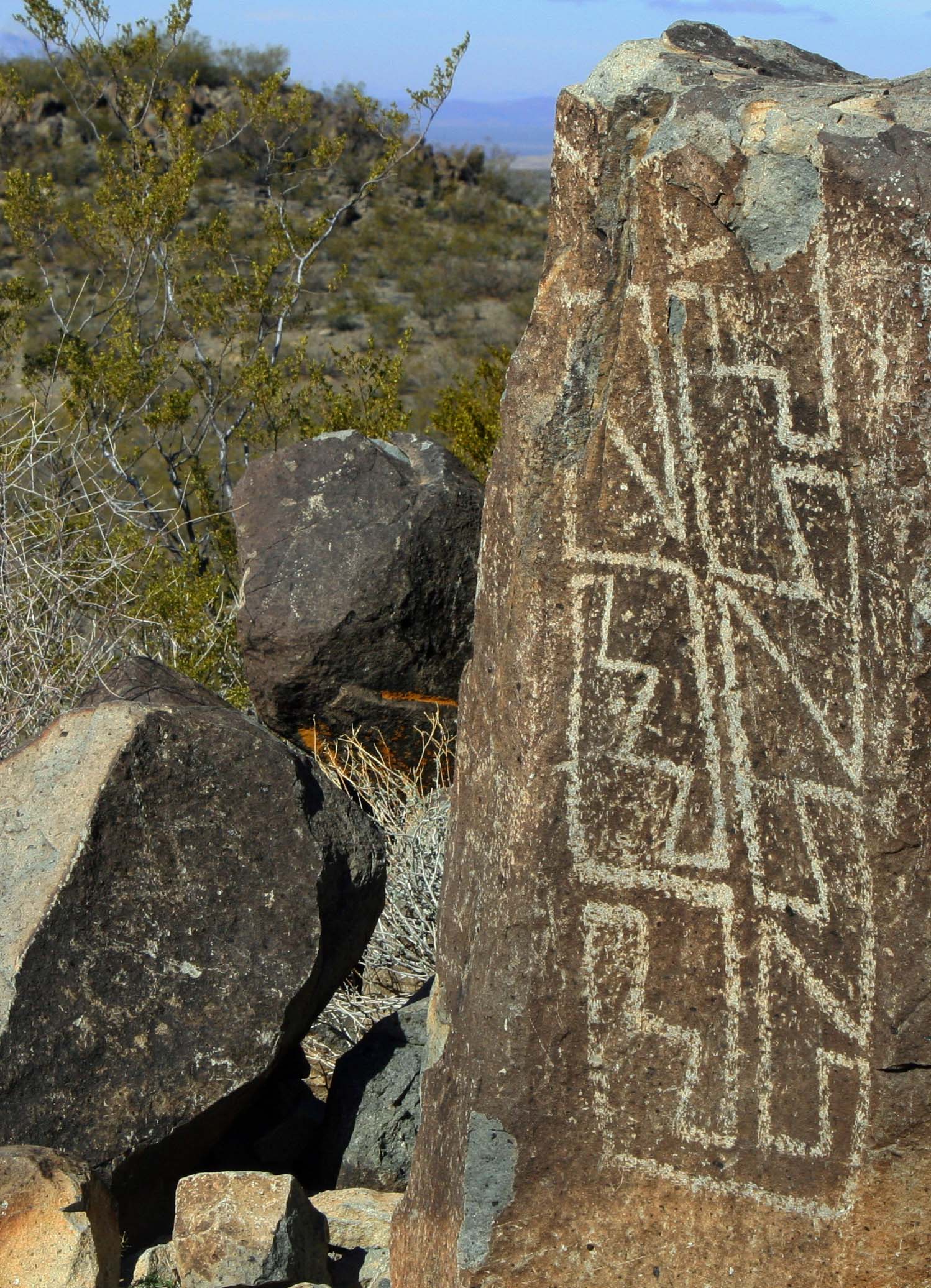
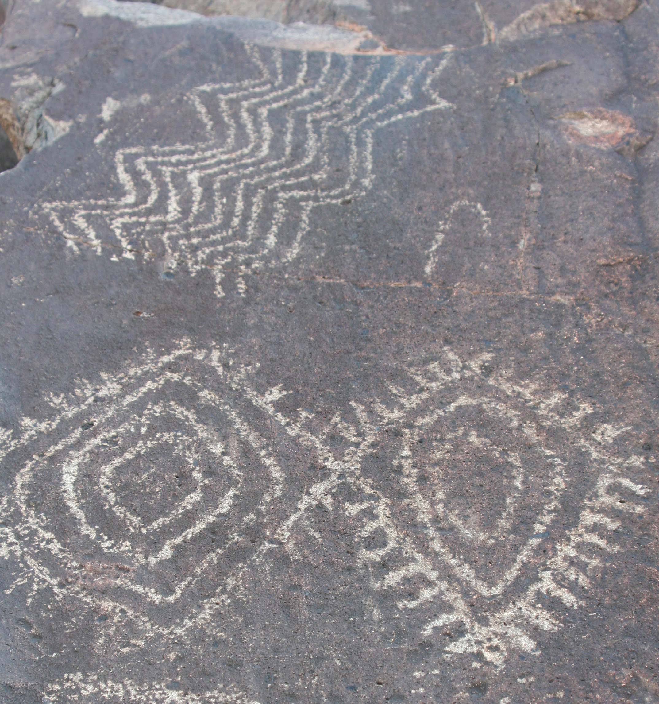
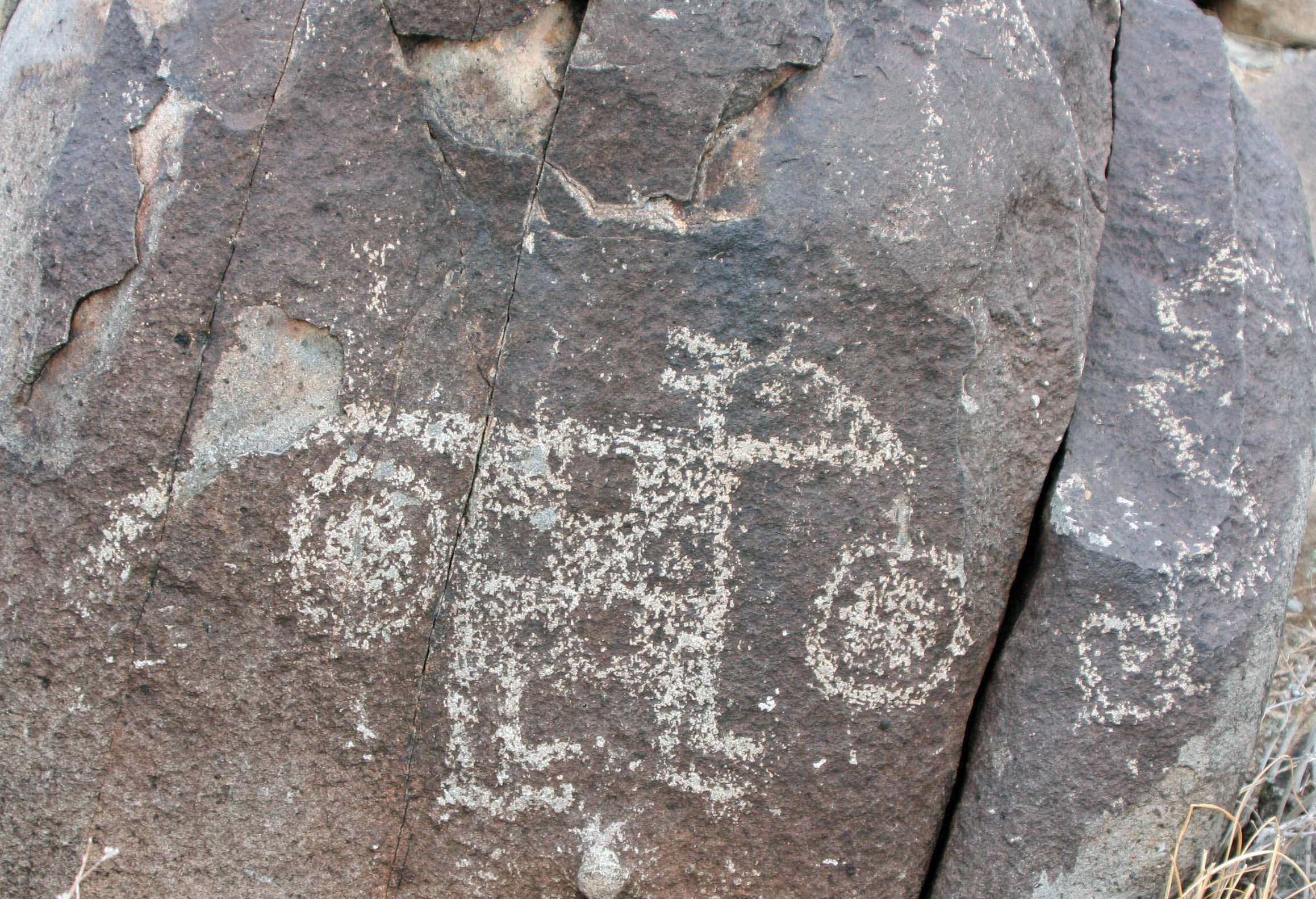
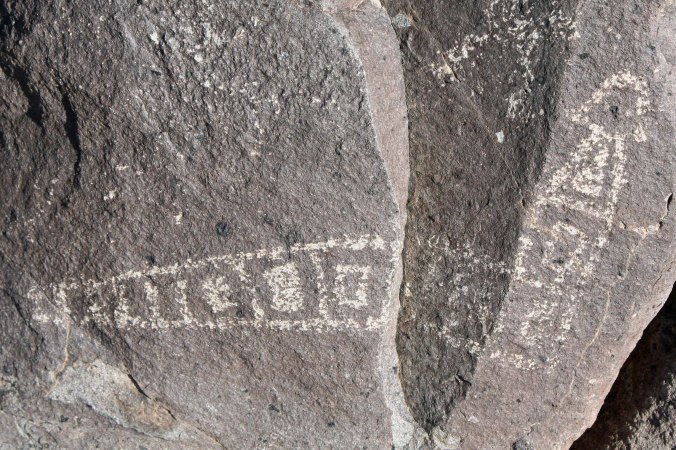
Thunderbird and Eagle Rule the Skies… Three Rivers Petroglyph Site

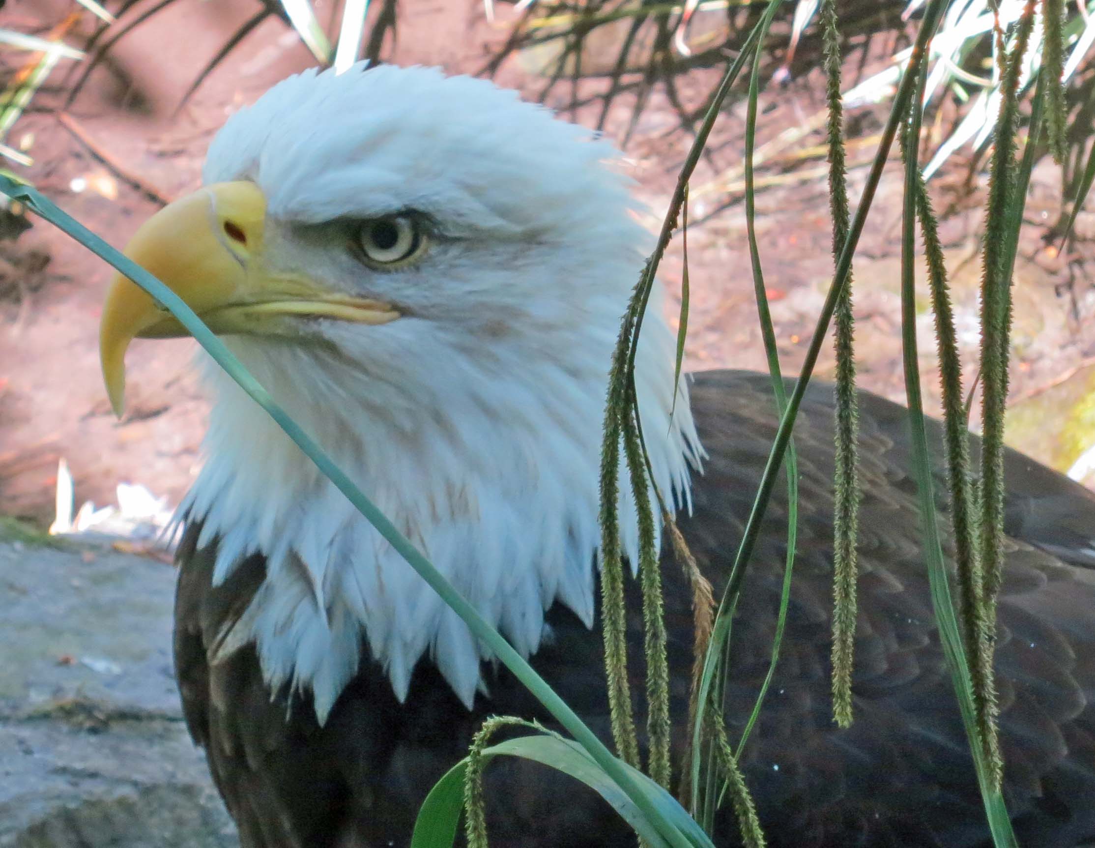
Close up of Bald Eagle

One look at this magnificent bird I photographed two weeks ago tells the story of why the eagle was regarded as sacred by Native Americans. This eagle is located at a wildlife sanctuary close to my home in southern Oregon. It was named Jefferson until it laid an egg. Now she is called Mrs. Jefferson.

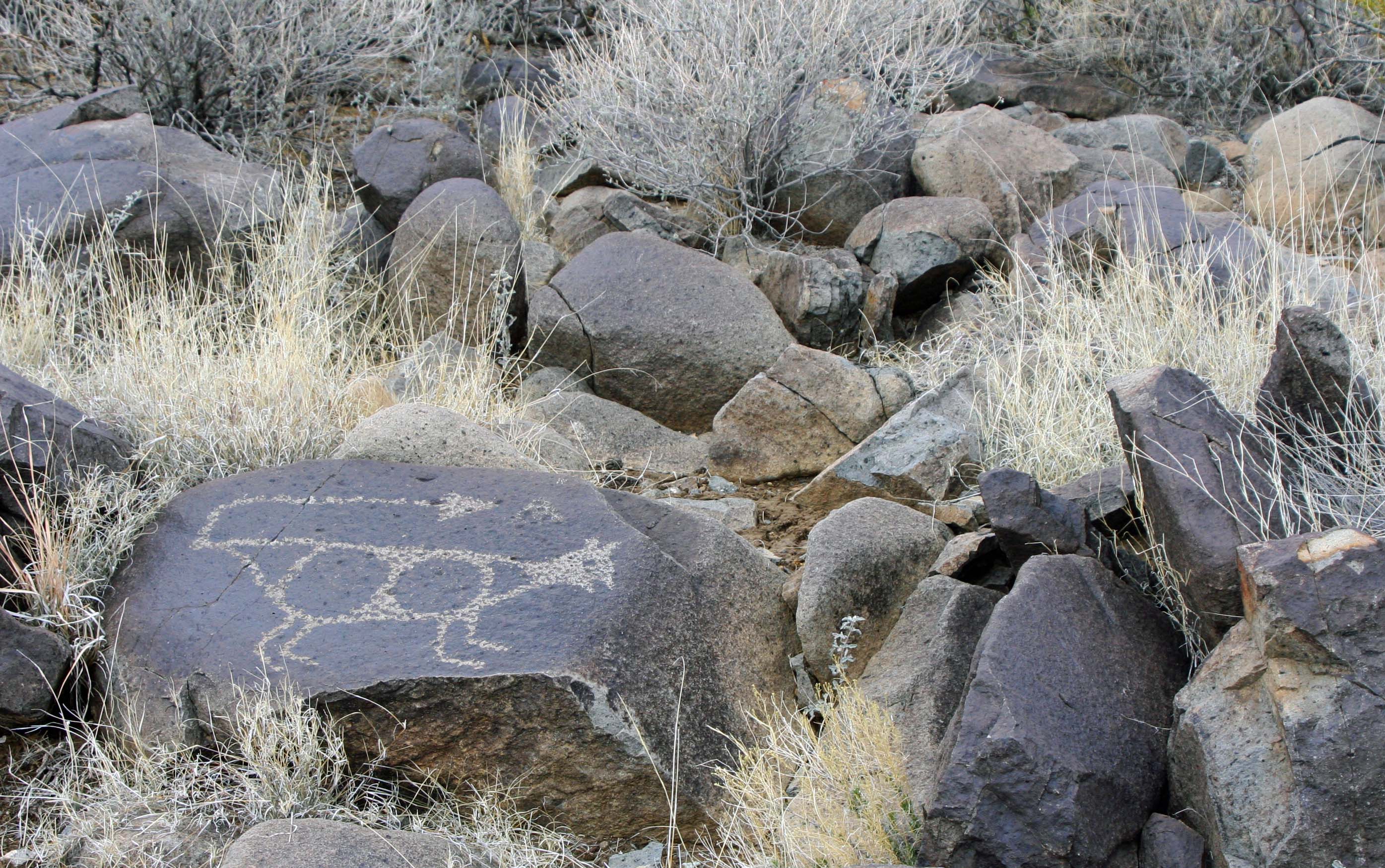
Eagle petroglyph at Three Rivers Petroglyph site in southern New Mexico.

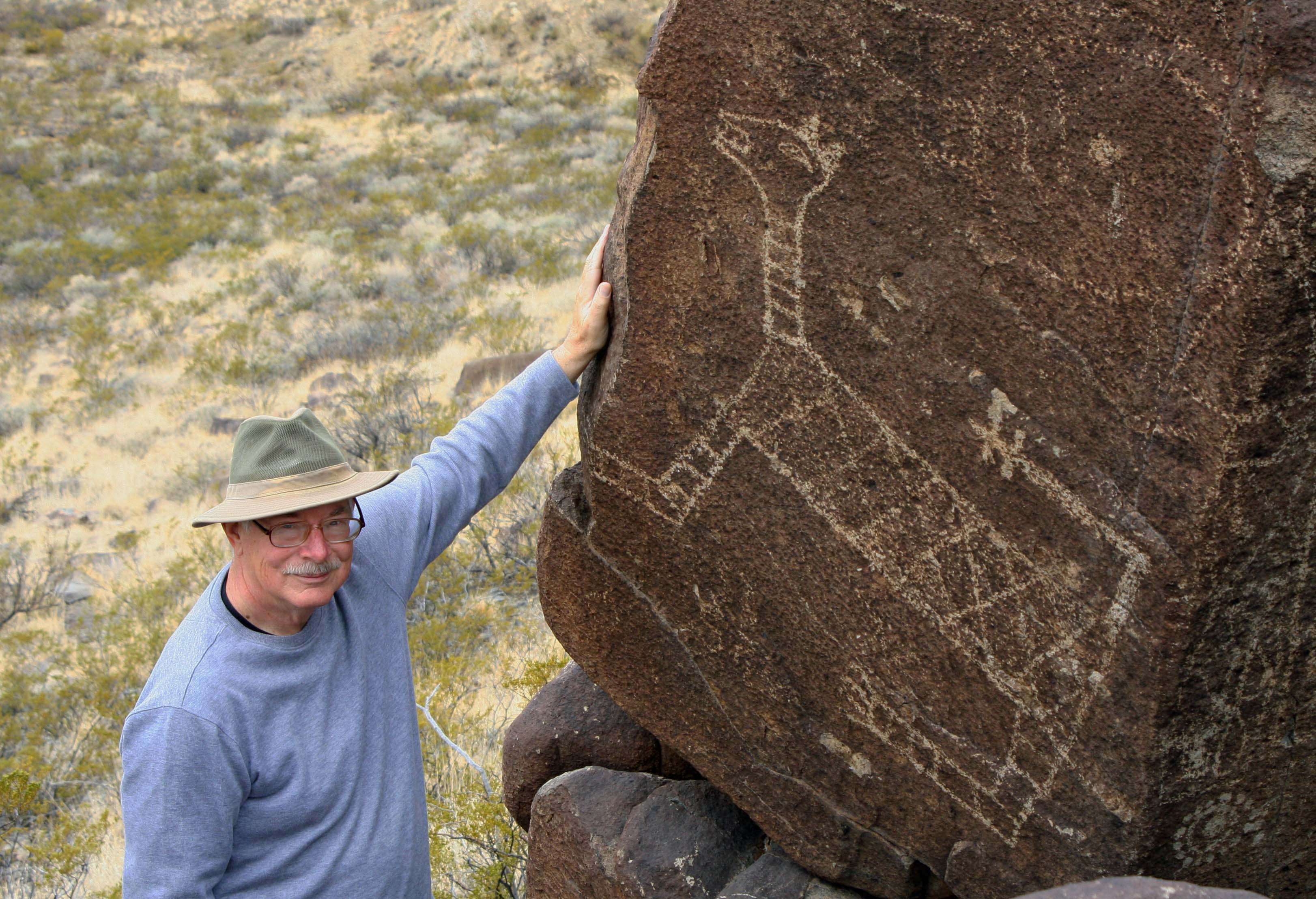
I think that the bird petroglyph on the left that Peggy and I found at Three Rivers is immediately recognizable as an eagle.

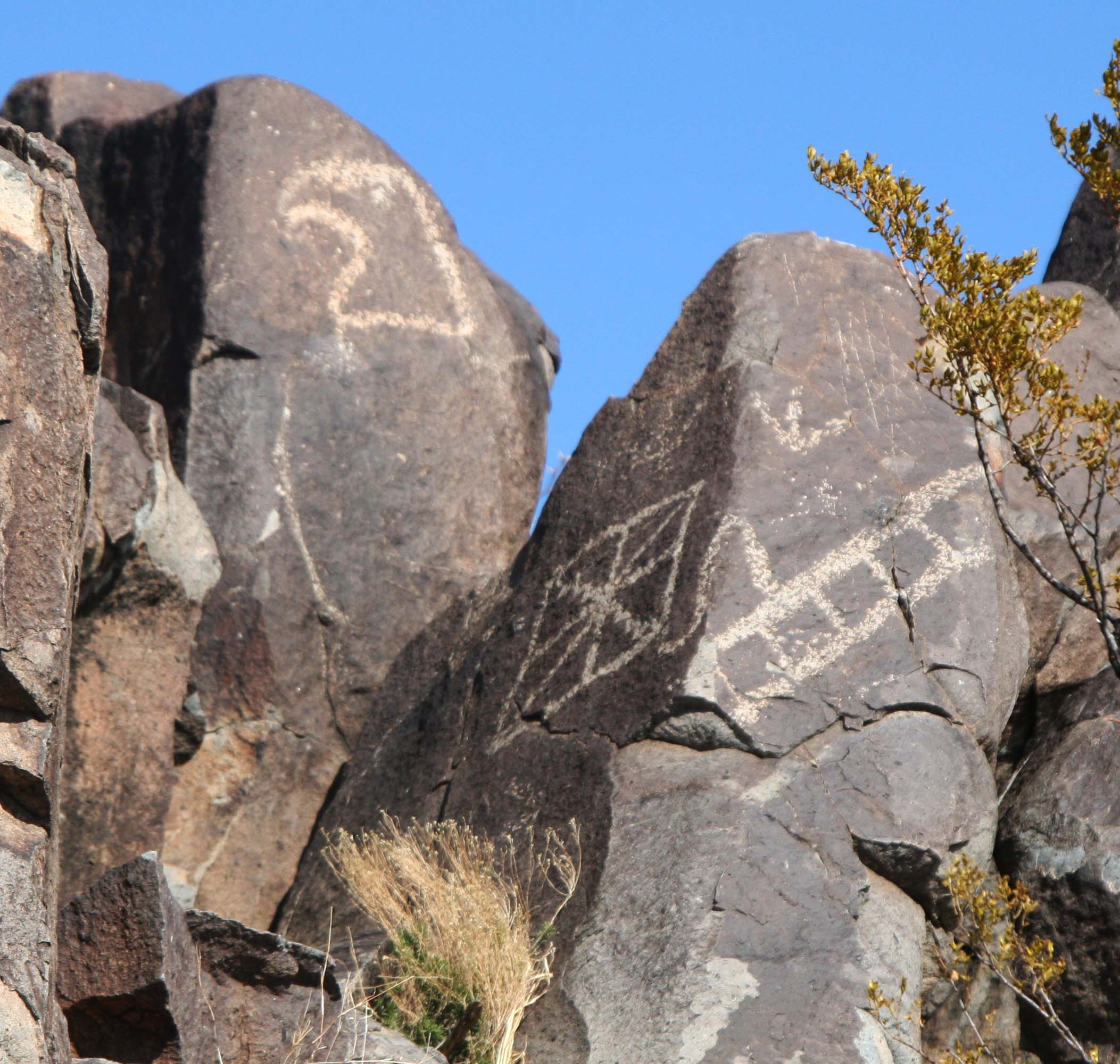
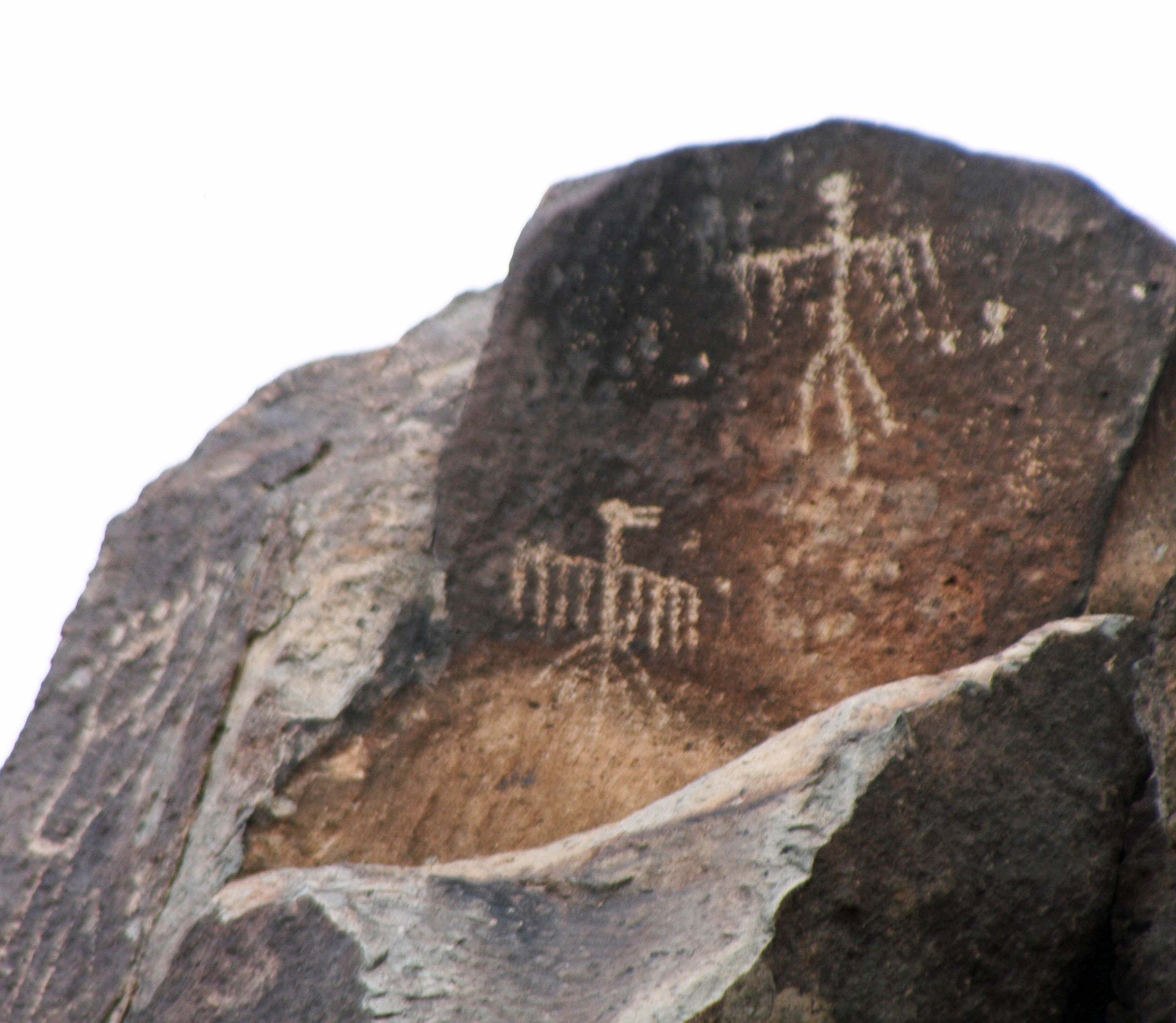
The mighty eagle may have ruled the skies of southern New Mexico but it was the Thunderbird that ruled the heavens. A flap of its wings would gather clouds and send thunder bouncing off the far mountains. Lightning would shoot out of its eyes. The Thunderbird existed in numerous Native American and First Nation cultures.Peggy and I have found images  from New Mexico to Alaska.

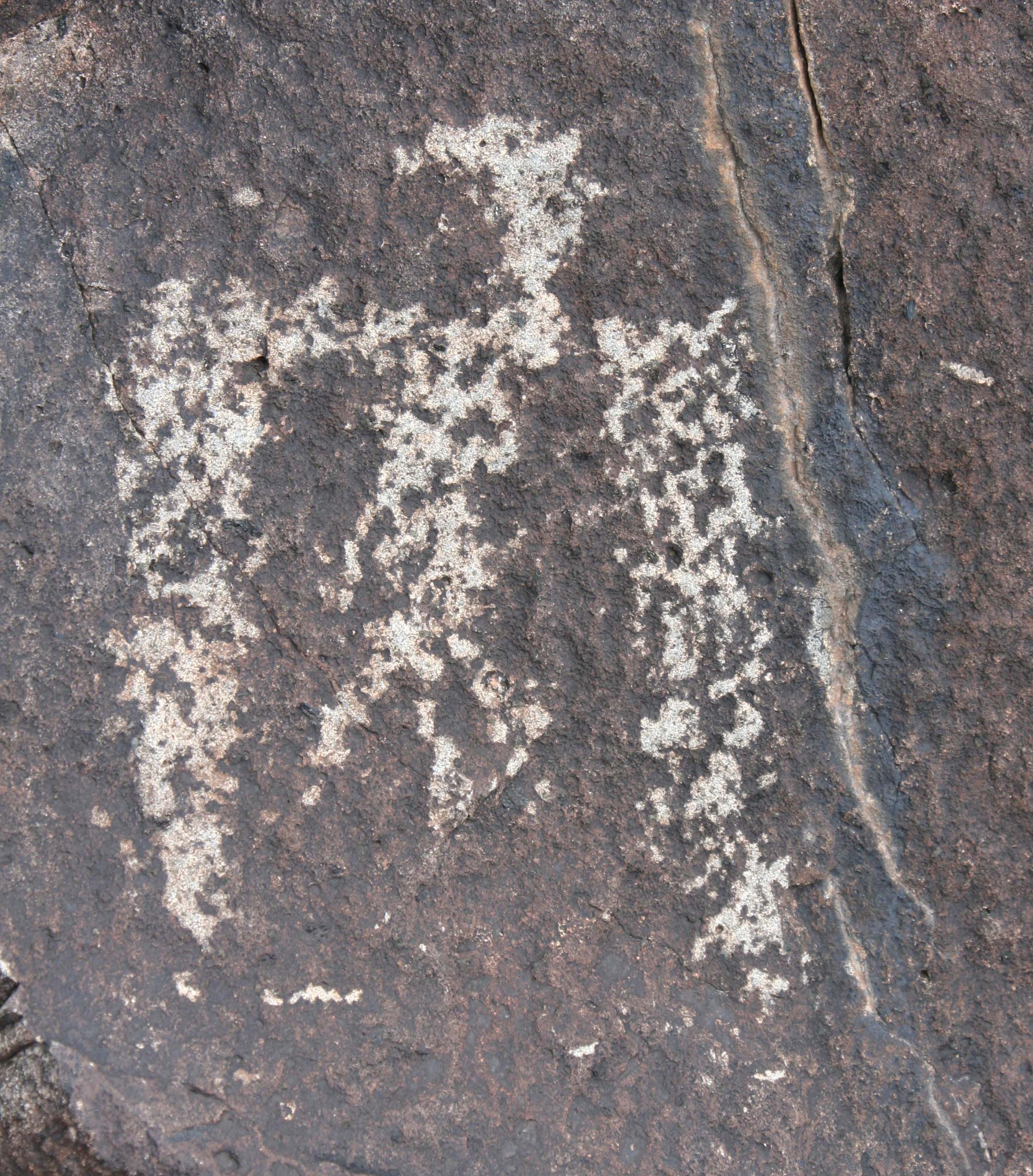
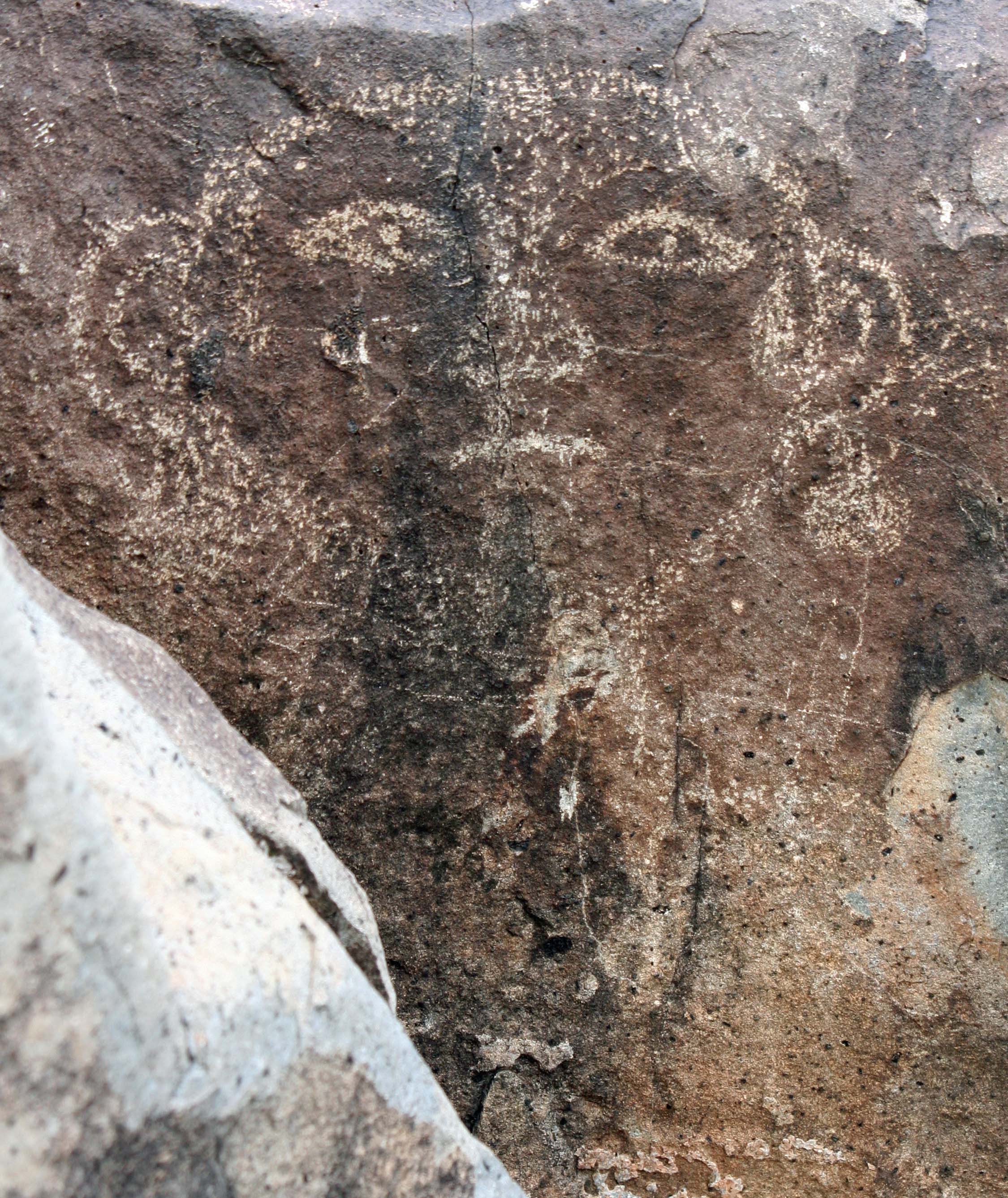
Thunderbird petroglyphs at Three Rivers Petroglyph site in southern New Mexico.

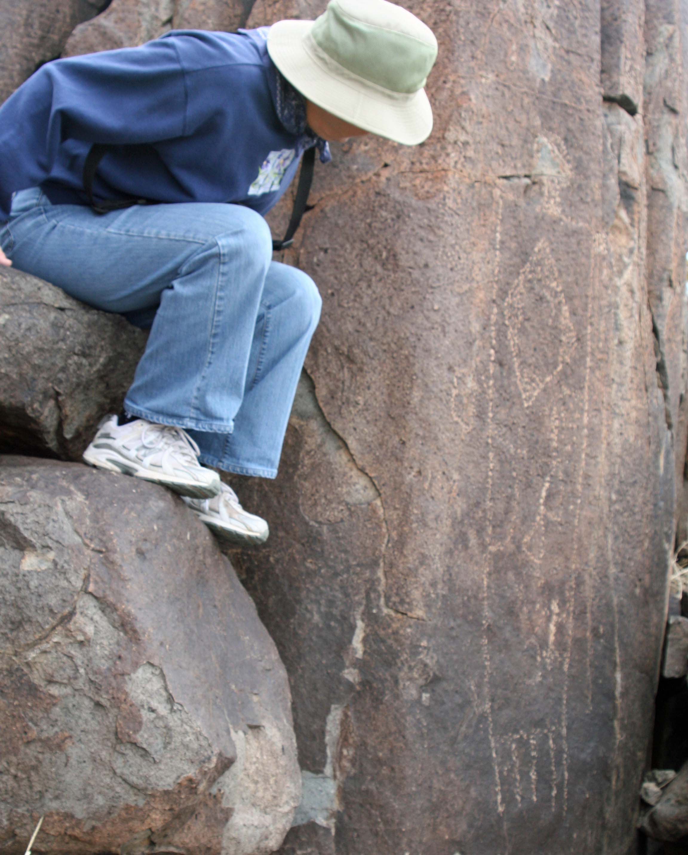
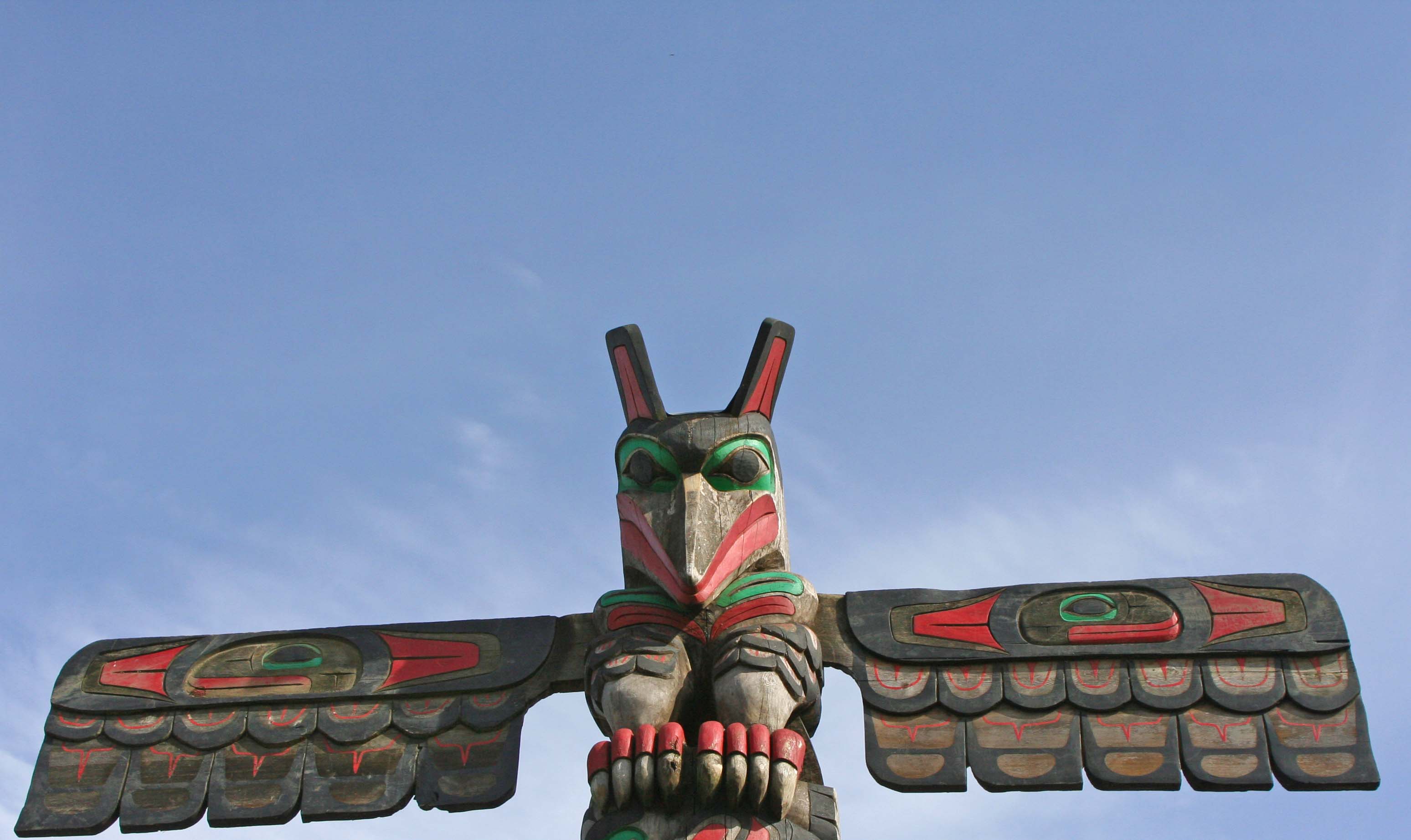
A pair of Thunderbirds decorate a rock at Three Rivers. Compare it with the First Nation totem pole below that Peggy and I photographed on Vancouver Island in Canada.

Totem pole Thunderbird on Vancouver Island

A First Nation totem pole Thunderbird Peggy and I found on Vancouver Island.

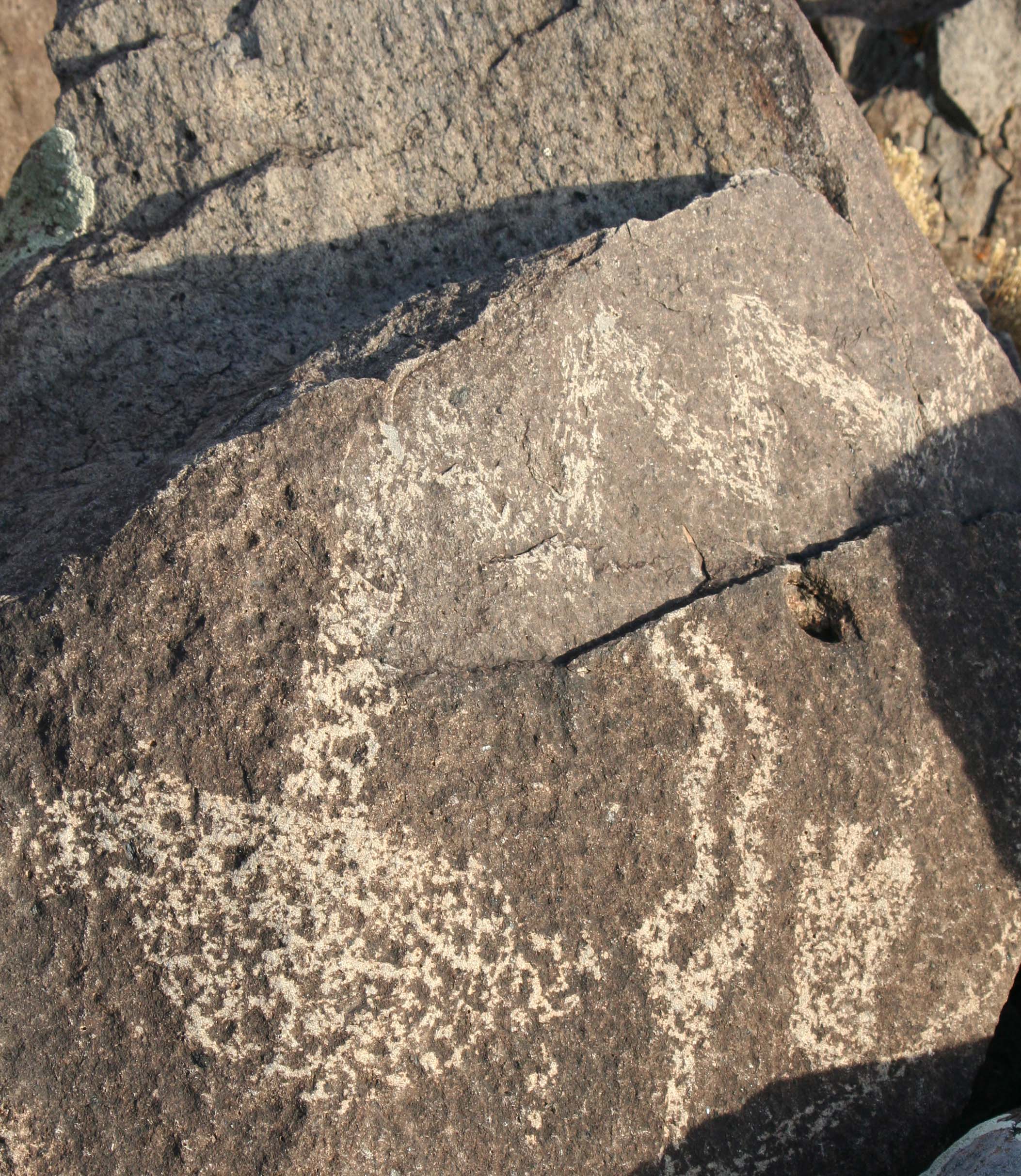
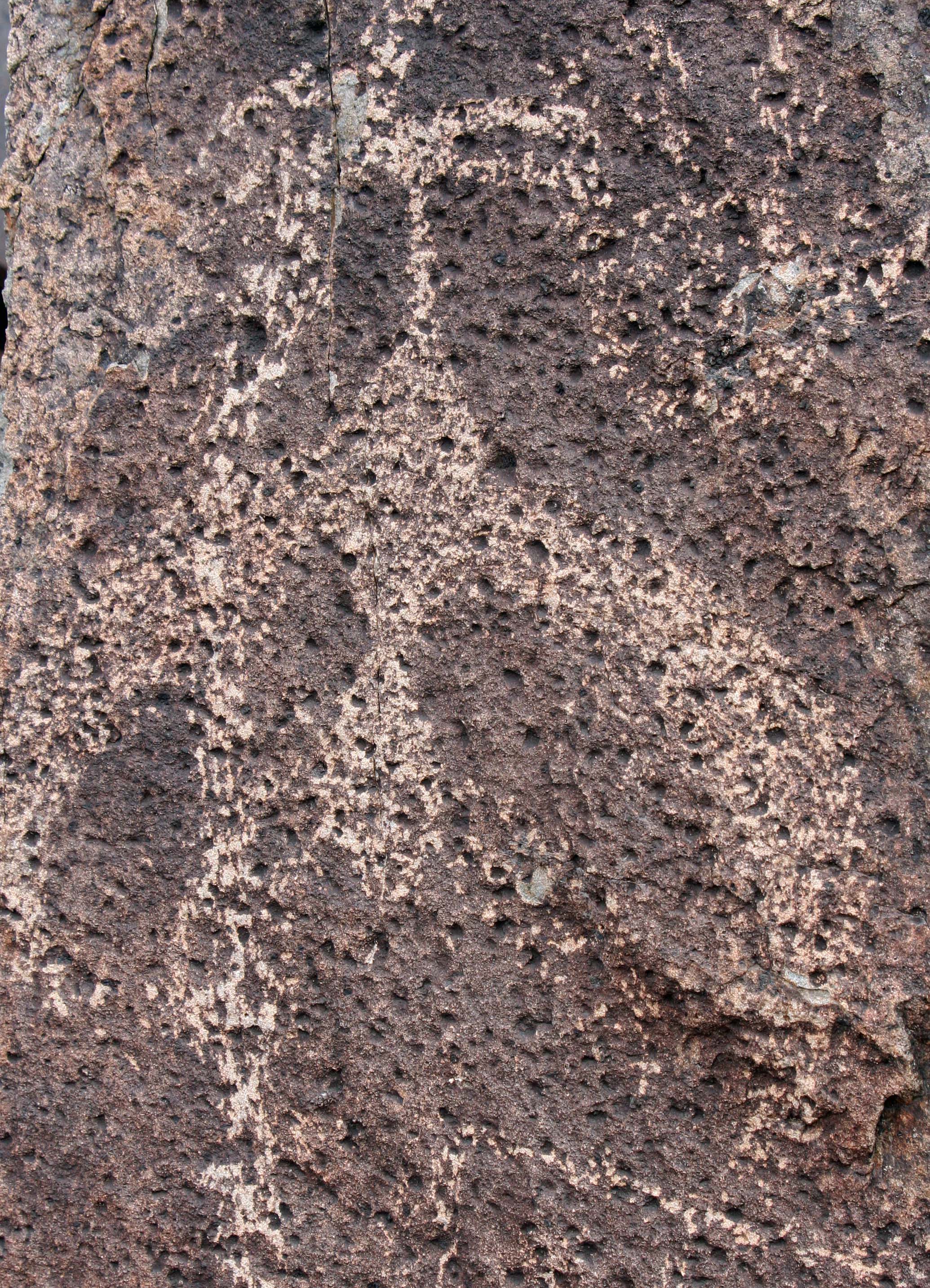
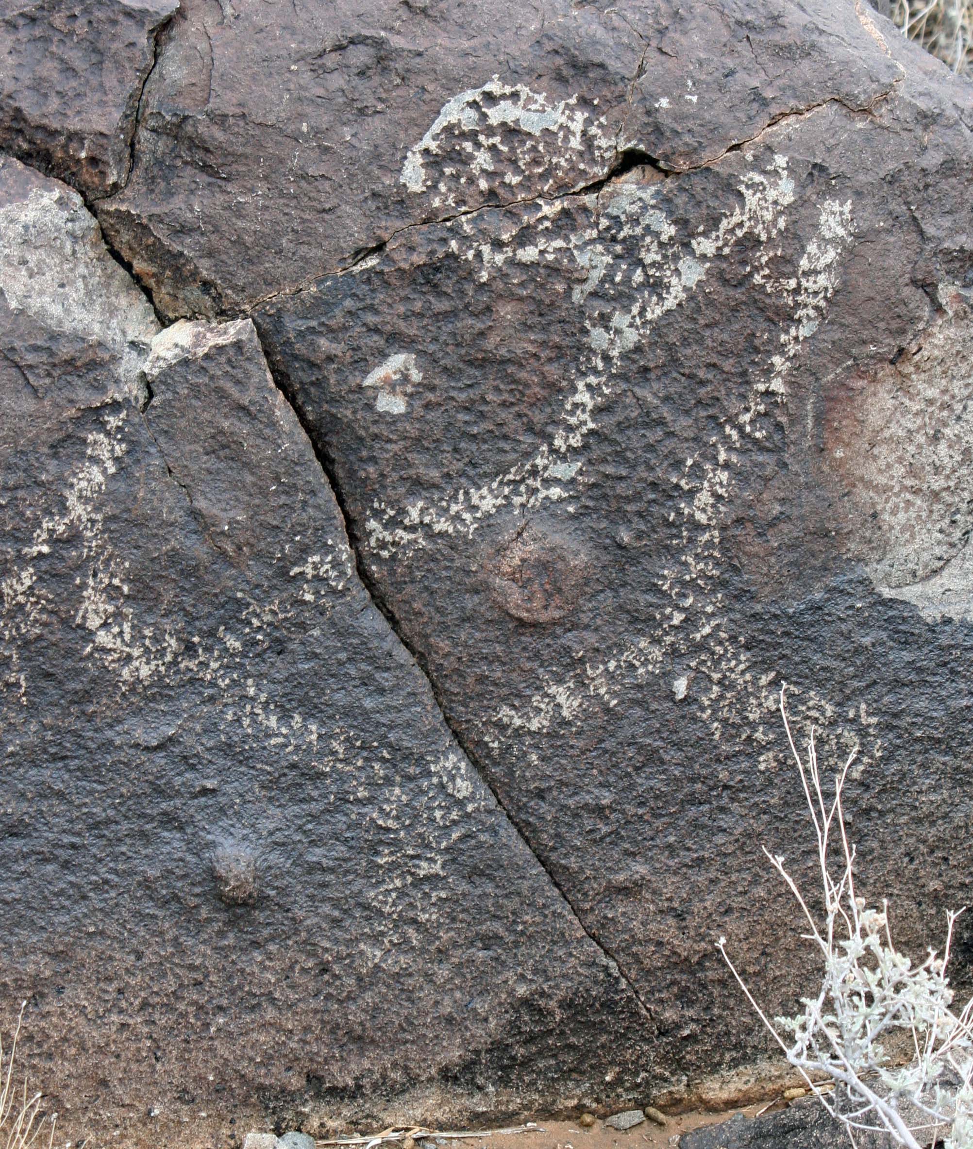
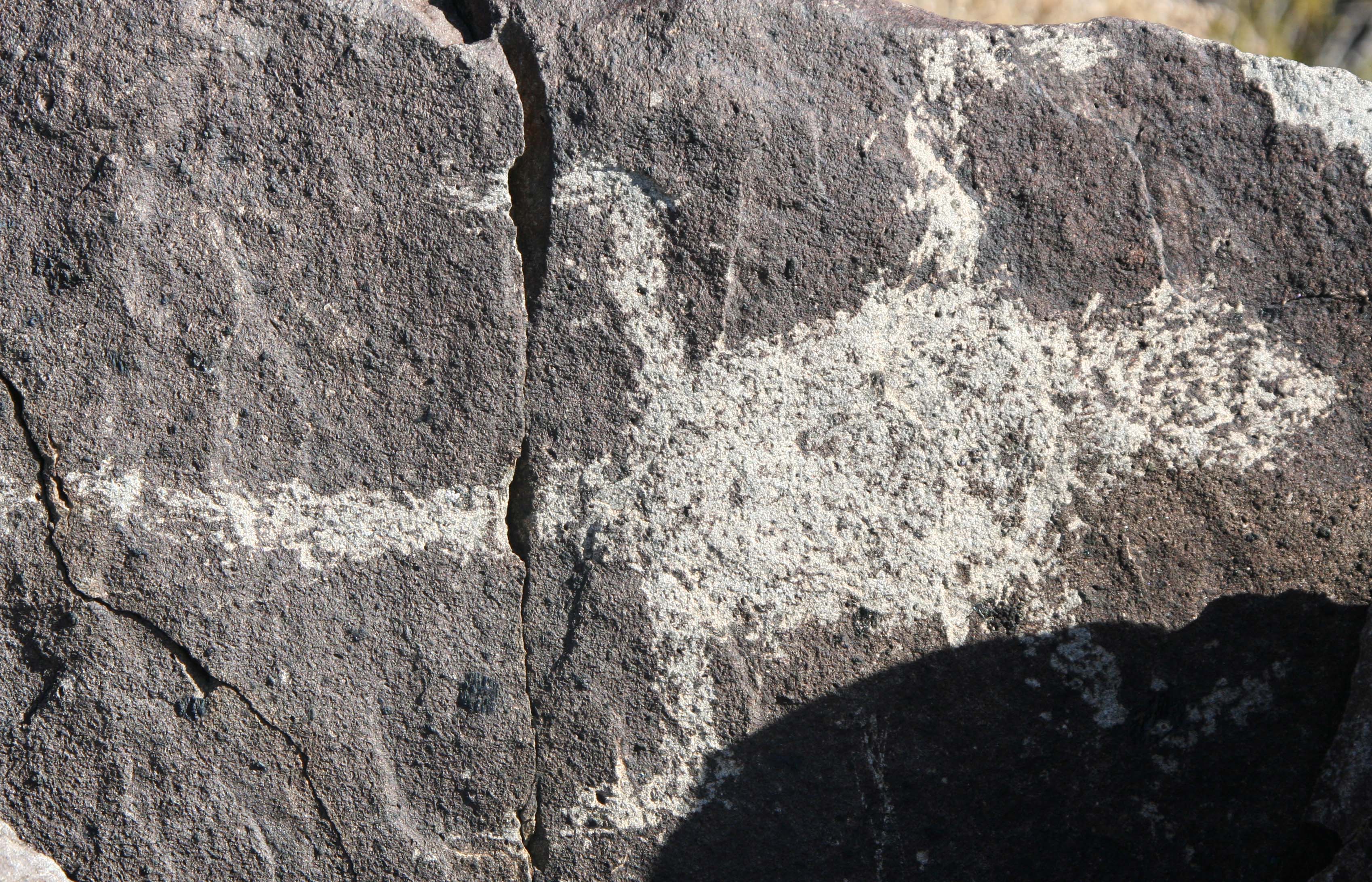
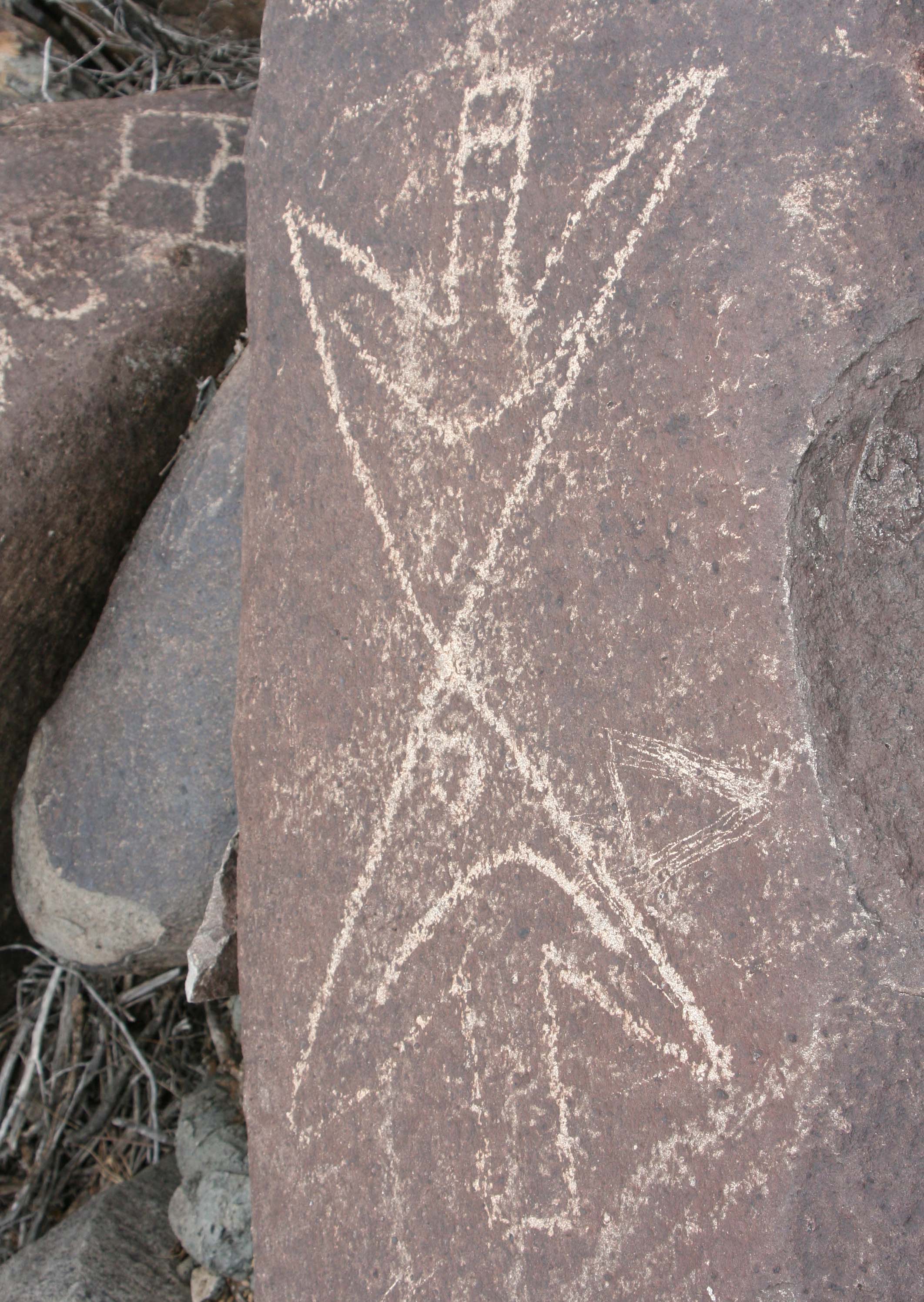
Petroglyph of a Thunderbird at Three Rivers Petroglyph site in southern New Mexico.

I find this petroglyph of what I assume is a Thunderbird both strange and powerful.

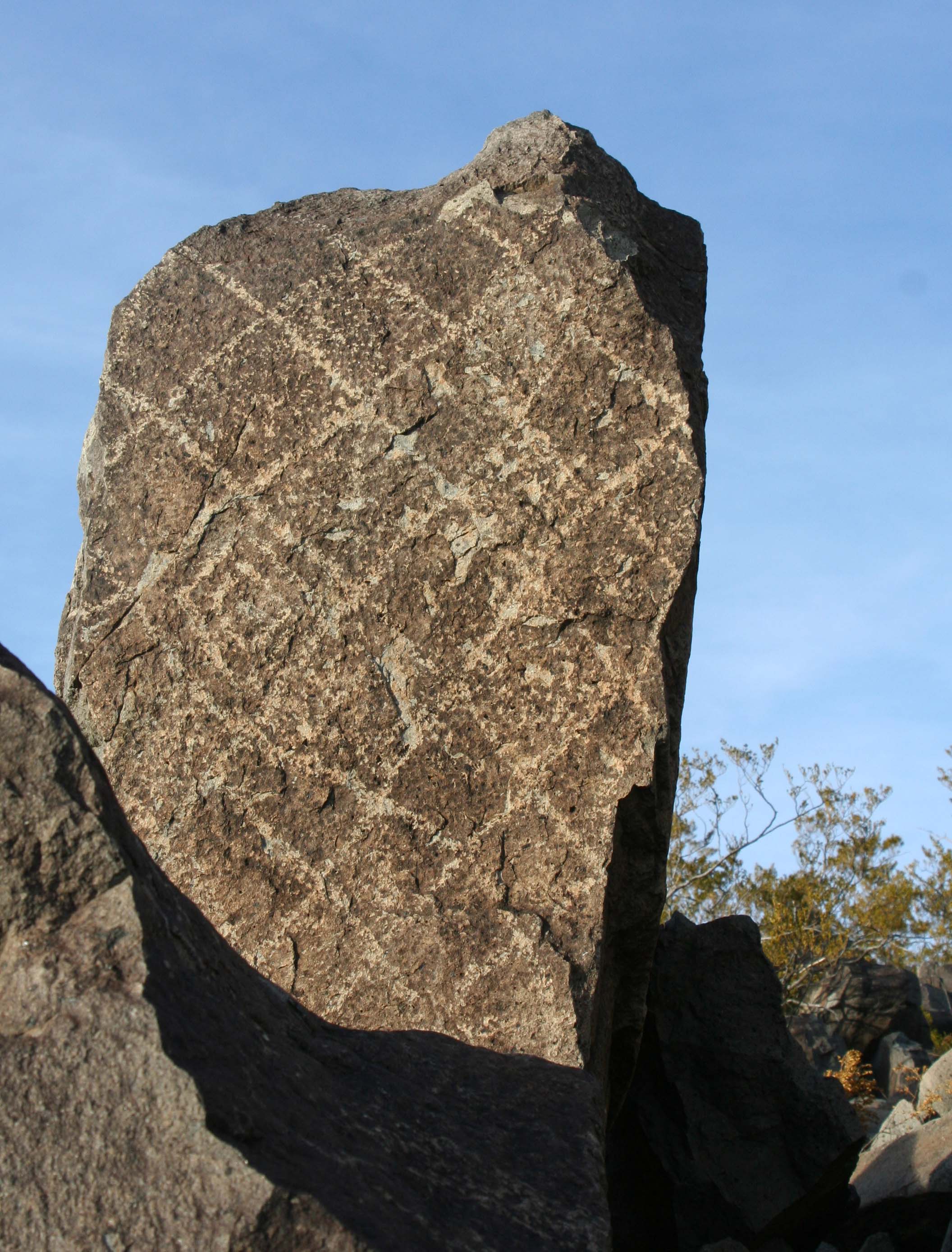
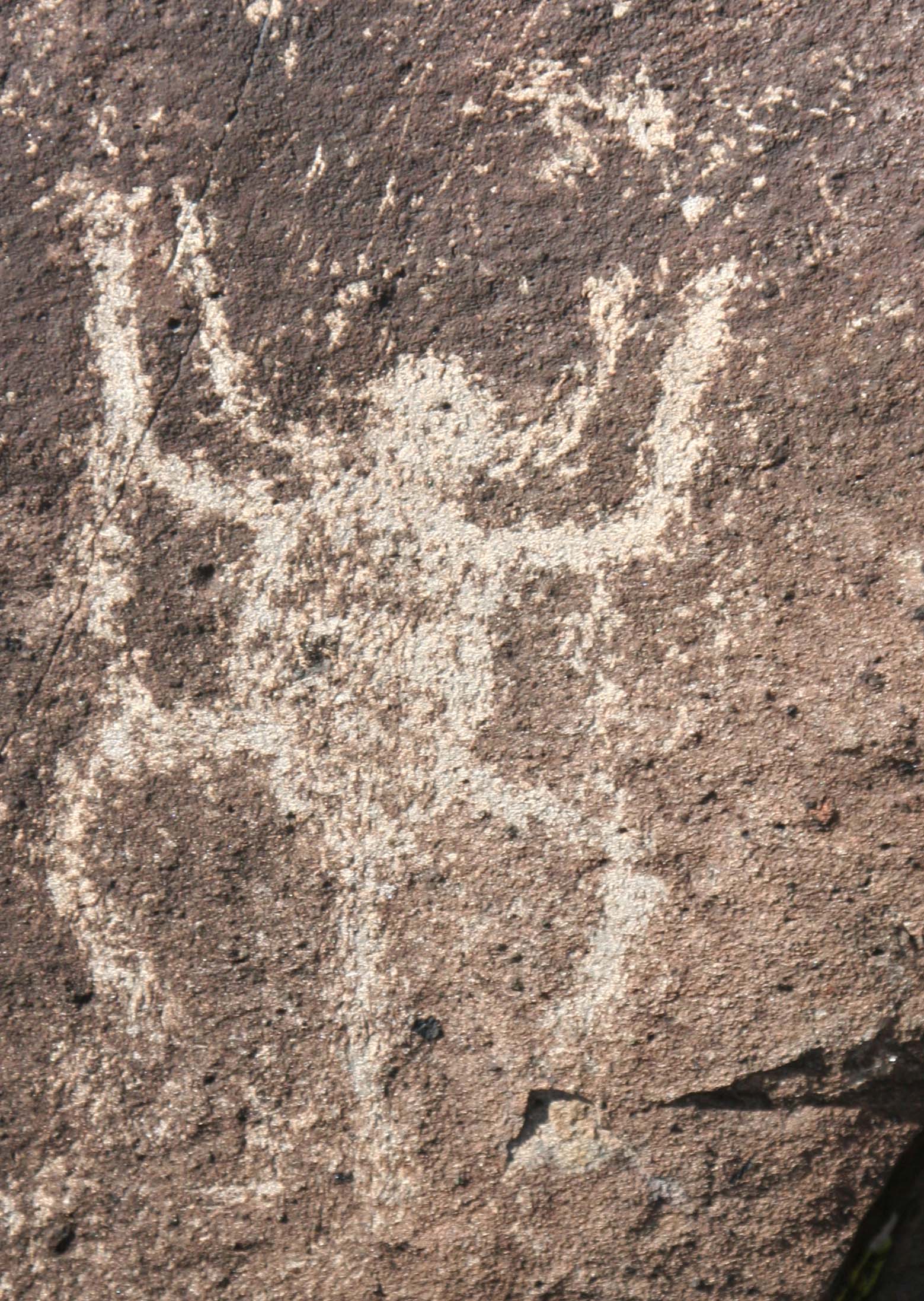
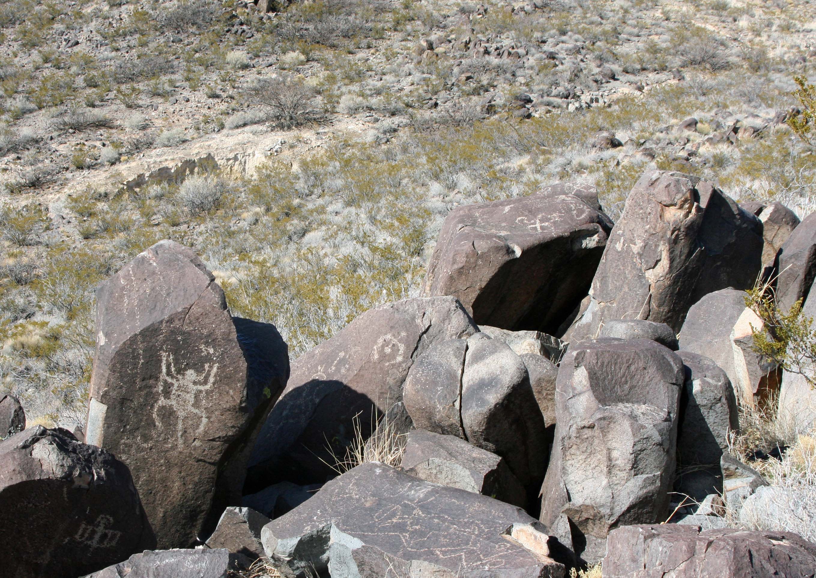
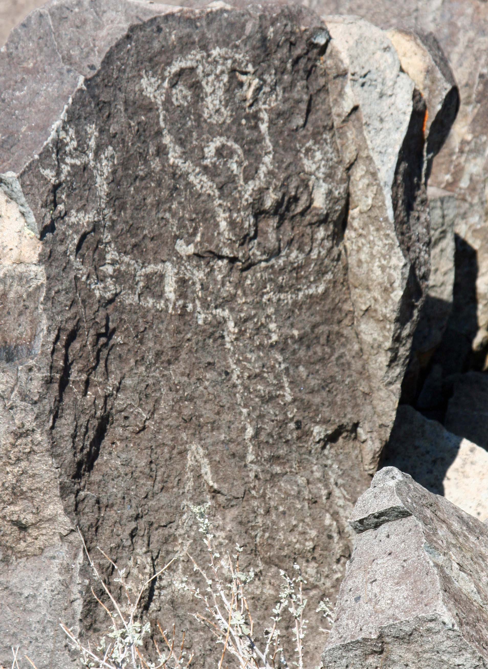
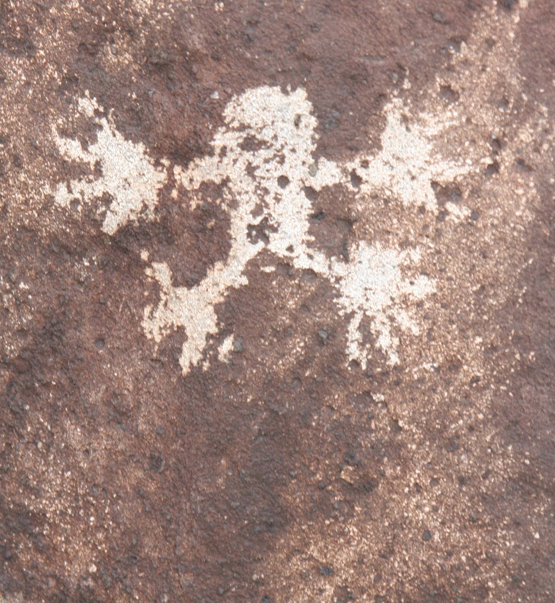
Another version of a Thunderbird found at Three Rivers Petroglyph site.

Another version of a Thunderbird found at Three Rivers Petroglyph site.

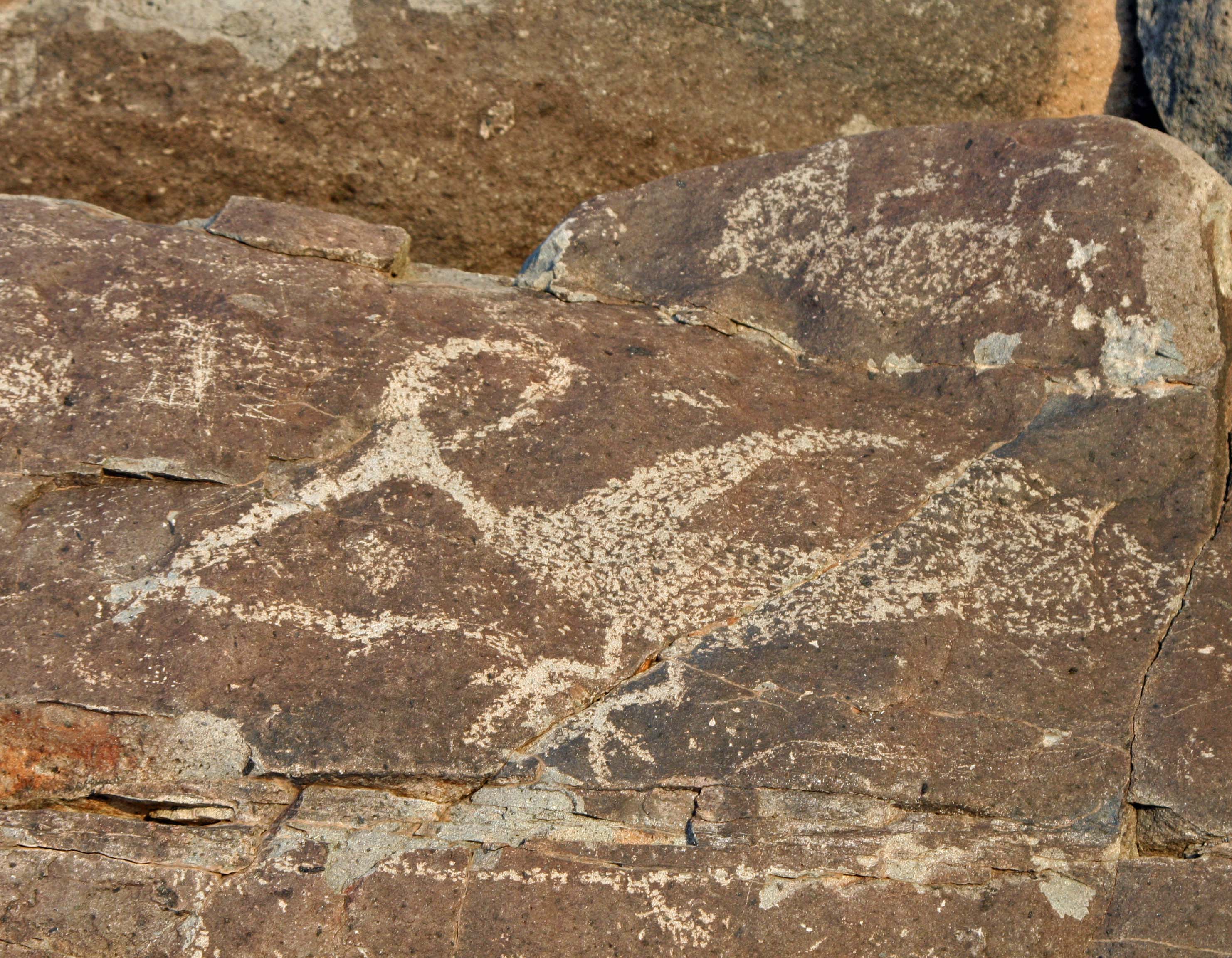
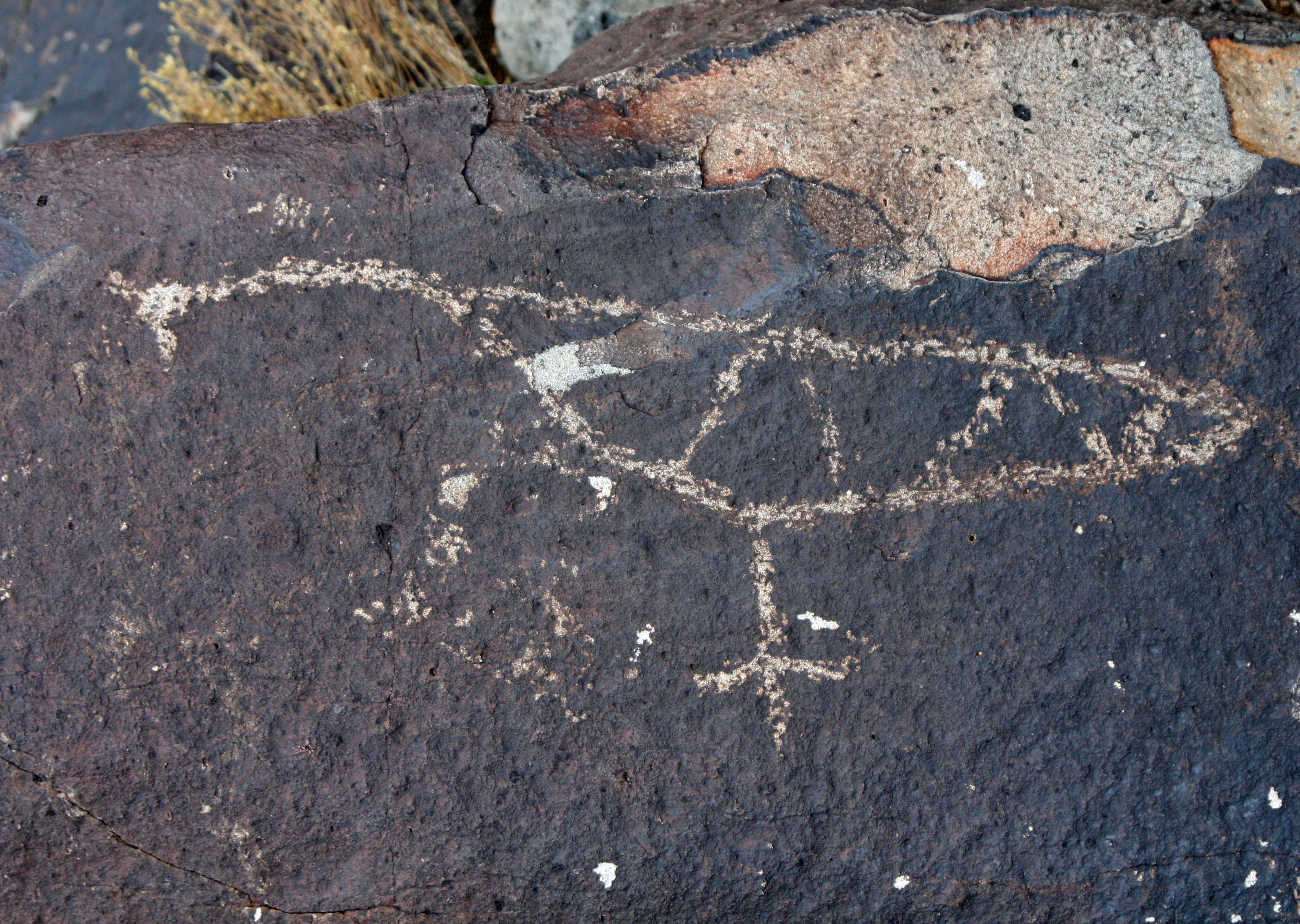
Turkeys, roadrunners, and even ducks can also be found among the petroglyphs of the Three Rivers Petroglyph site.

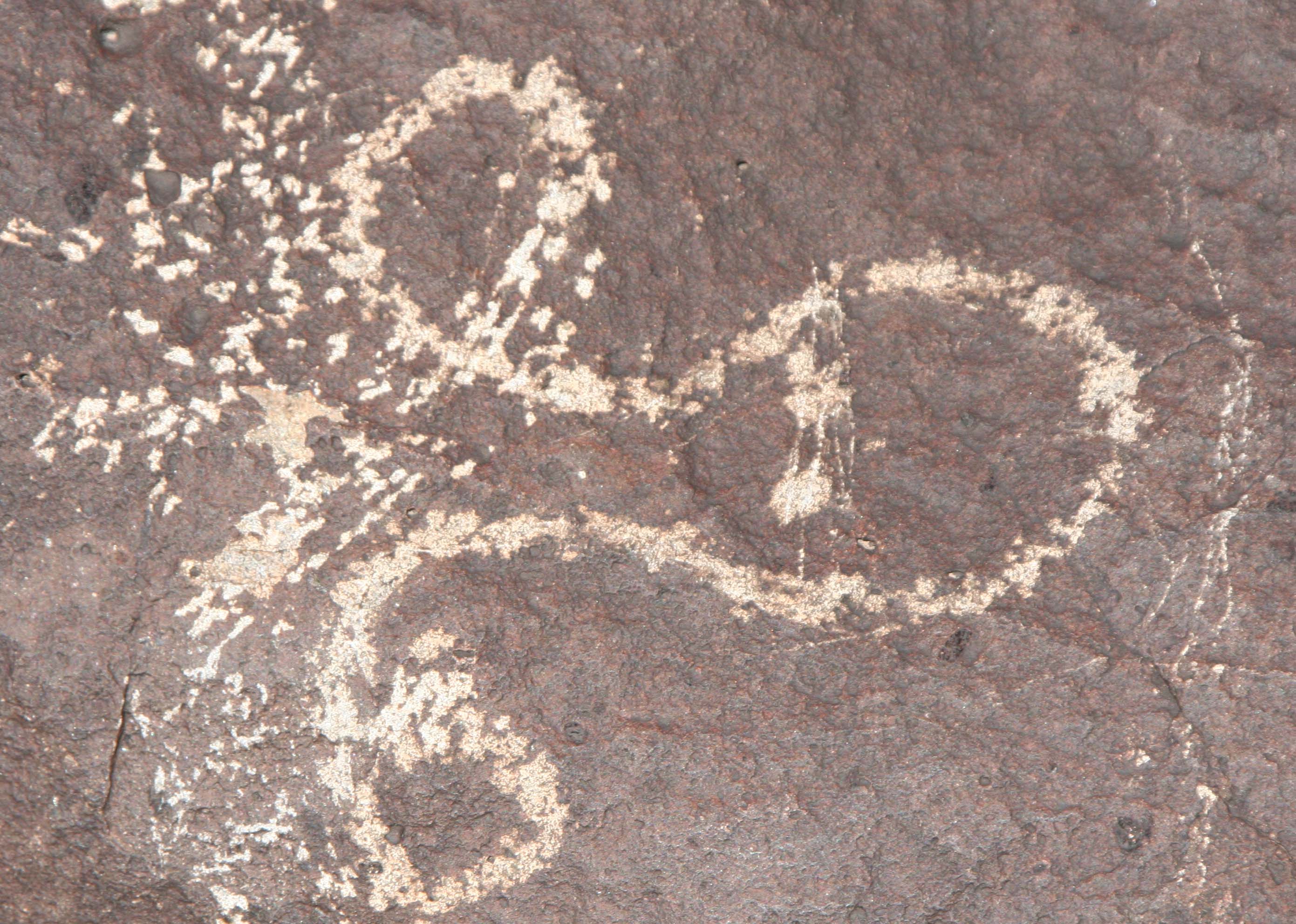
Petroglyph of roadrunner and snake at Three Rivers petroglyph site in southern New Mexico.

A roadrunner and its dinner. This Three Rivers petroglyph shows a roadrunner with one of its favorite meals, a snake.

Possible bird head petroglyph at the Three Rivers Petroglyph site.

Is this a petroglyph of a bird’s head with its beak stretching out to the left? If so, it must be another work of the Rembrandt of the Jornada.

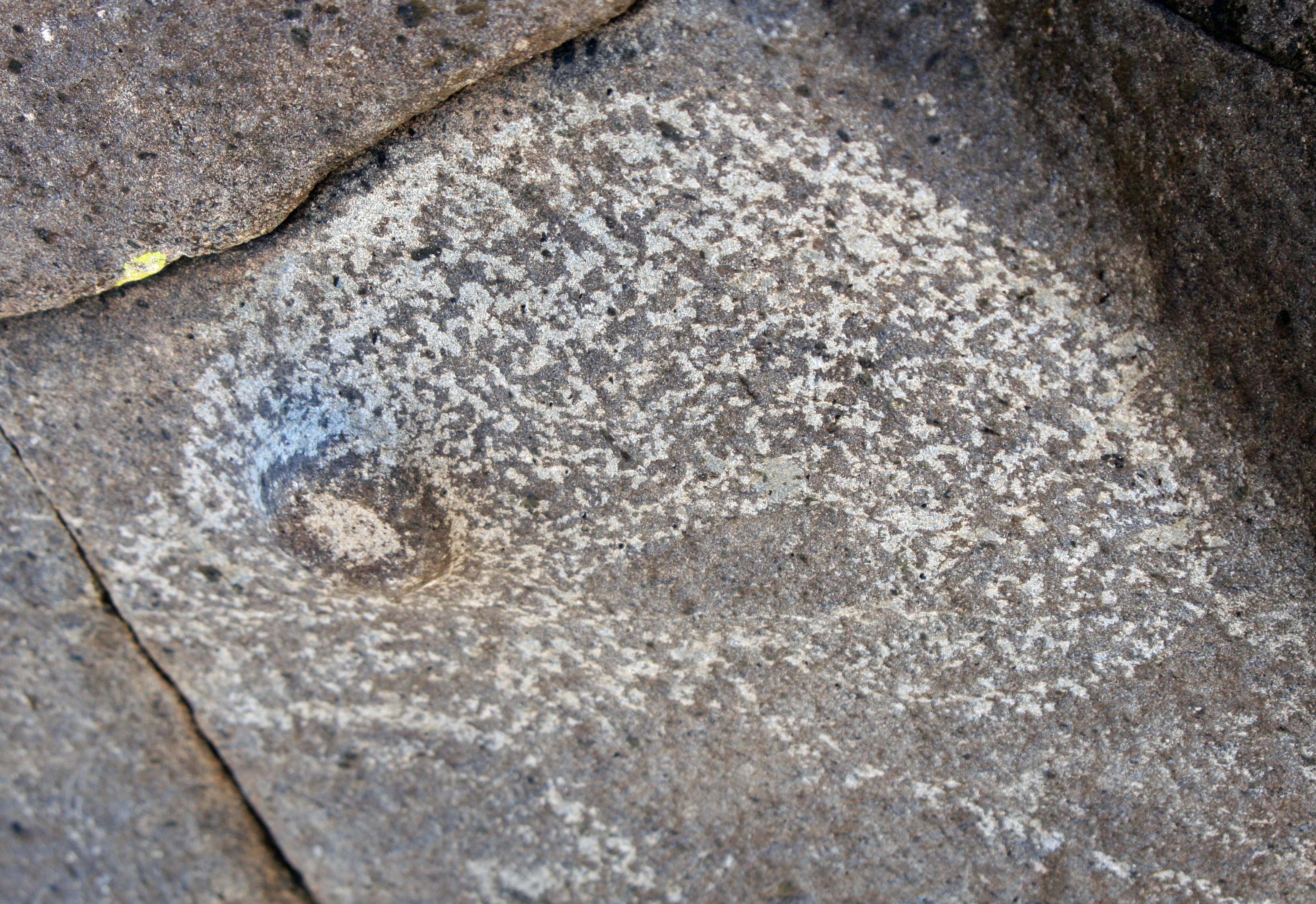
Goose petroglyph at Three Rivers Petroglyph site in southern New Mexico.

This petroglyph strikes me as either a duck or goose. Note how the artist has taken advantage of the contour of the rock.

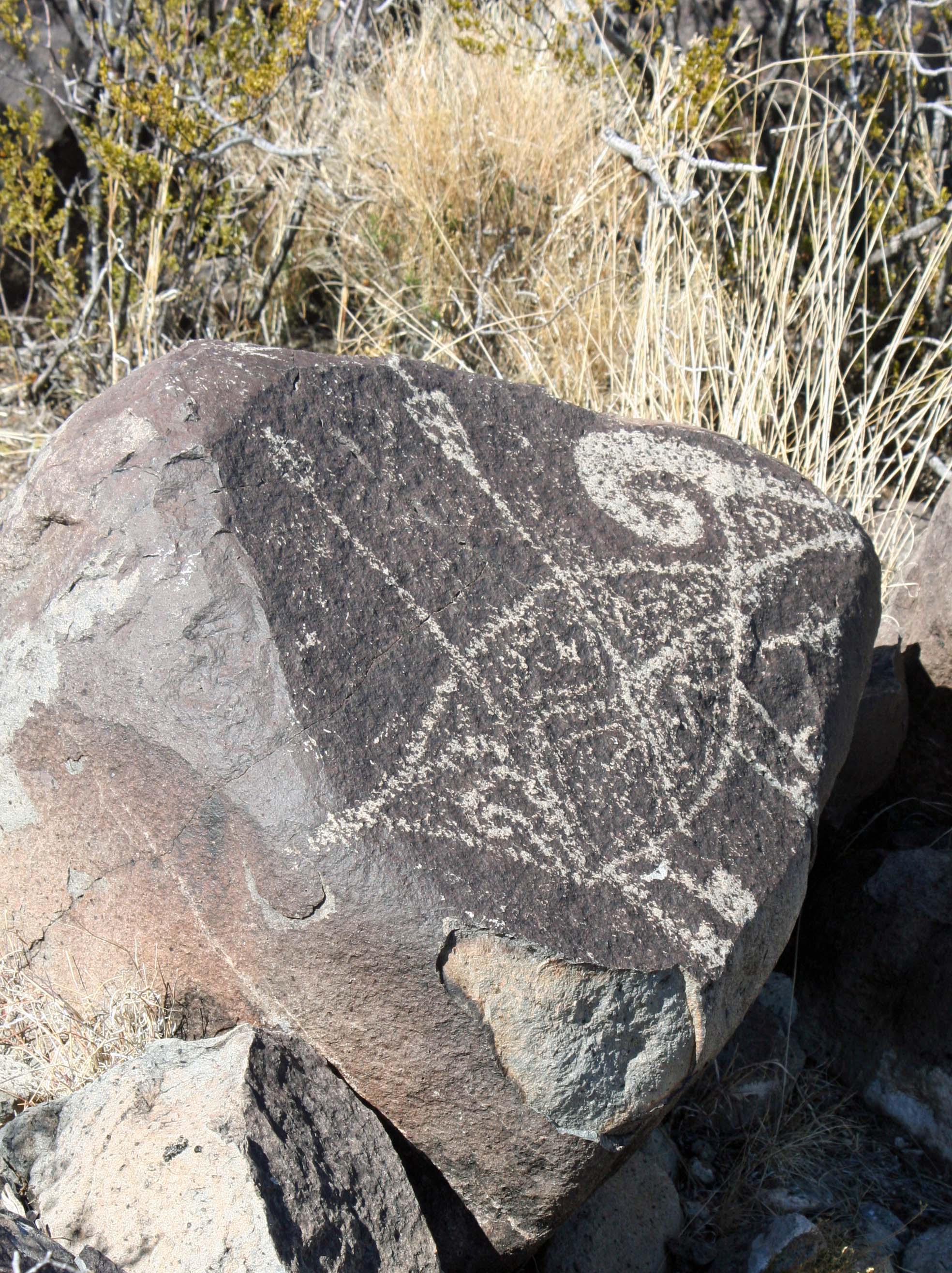
Turkey petroglyph at Three Rivers Petroglyph site.

A quickly pecked turkey?

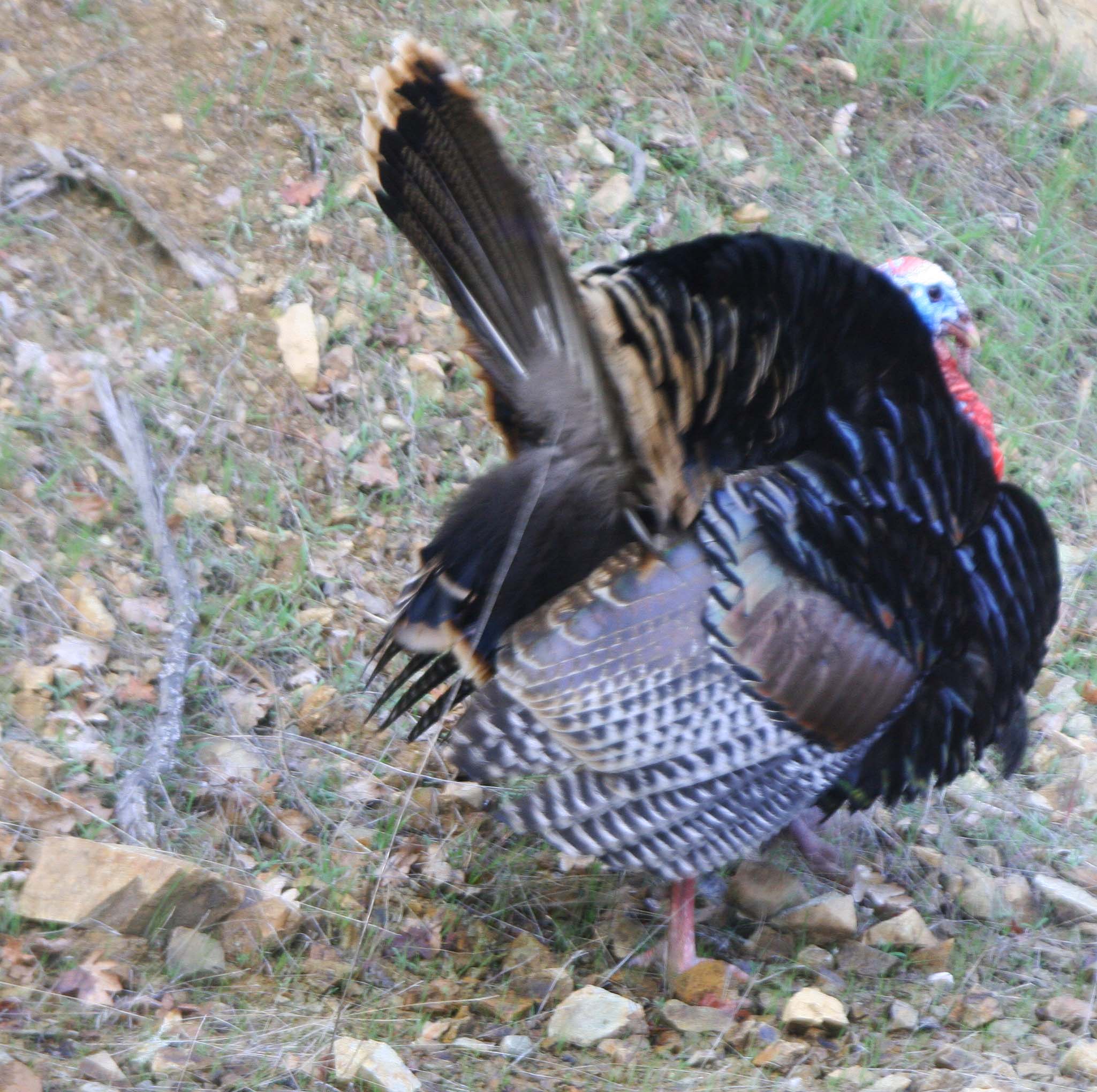
Wild turkey on Upper Applegate River in southern Oregon

A backyard turkey. I caught this guy strutting his stuff to impress several hens who had gathered in our back yard. They ignored him.

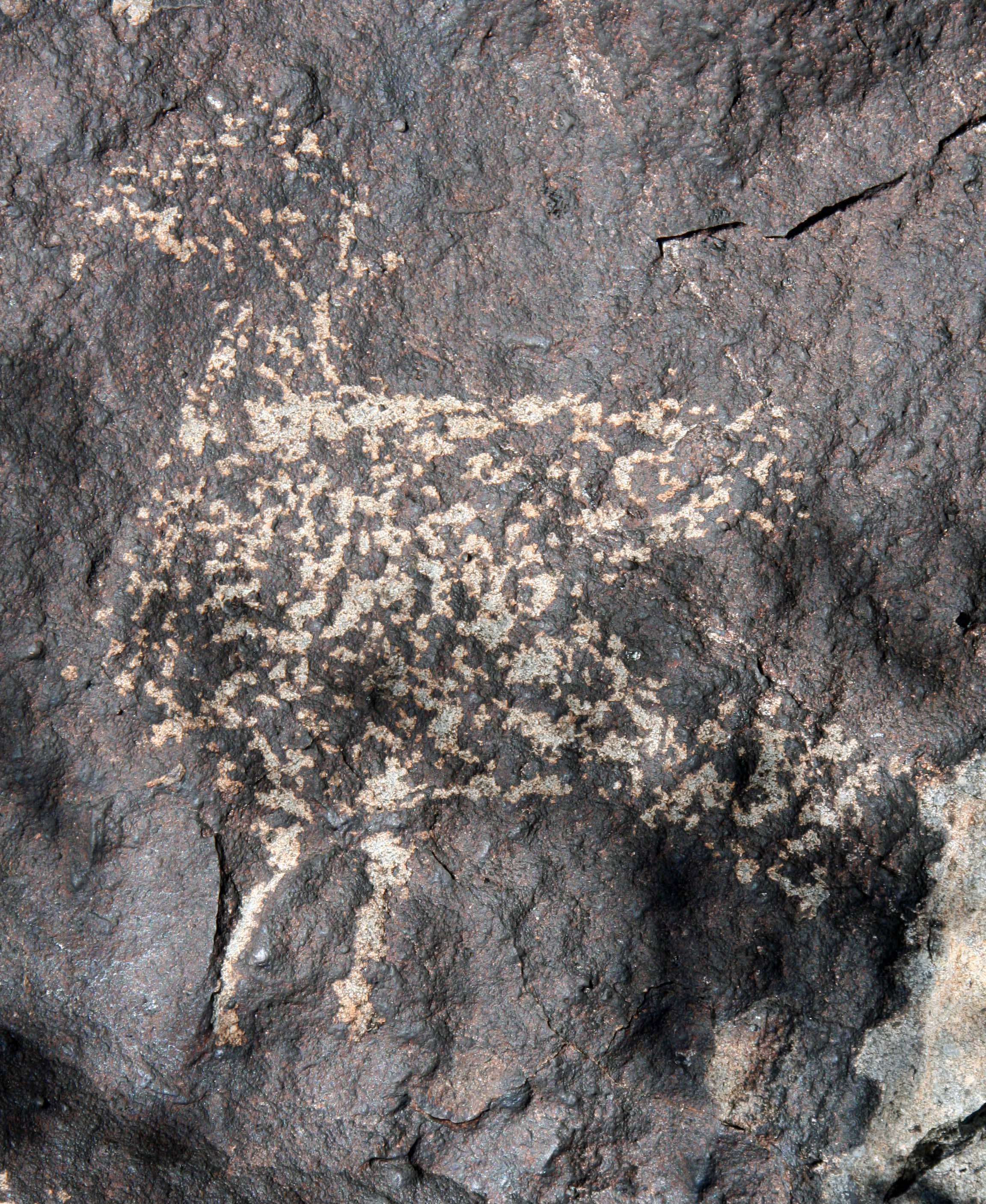
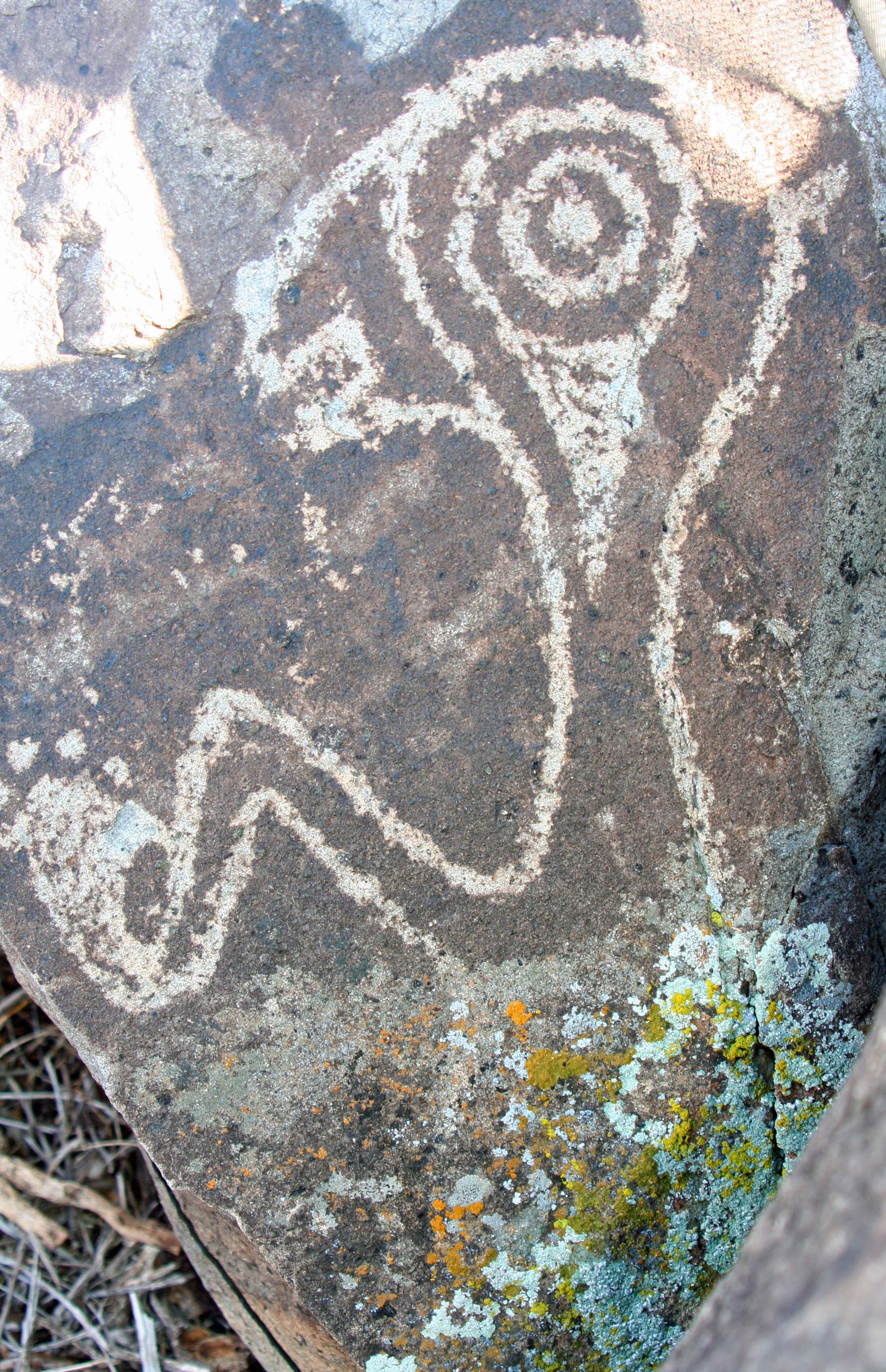
Strange petroglyph from Three Rivers Petroglyph site in Southern New Mexico.

A really weird turkey? The head seems right but the clawed hands are something else. If this is a turkey, he has passed into the realms of the gods. On the other hand, if you have ever had a turkey attack you, as I did when photographing its chicks, this is a close approximation.

NEXT BLOG: What is a whale petroglyph doing in the desert?

Big Horns and Sharp Claws… Animal Petroglyphs at Three Rivers

Bighorn sheep petroglyph with arrows at Three Rivers Petroglyph site in southern New Mexico.

Bighorn sheep were a major source of food for the Jornada Mogollon people of New Mexico and for Native Americans throughout the South West. Animals are often found with arrows sticking out.

Hunting wild animals for meat provided an essential source of food for the majority of mankind’s existence. While the Jornada Mogollon people at the Three Rivers’ Petroglyph site cultivated corn, hunting remained a vital activity.

Success meant learning as much as they could about the animals that inhabited their desert world: where they lived, what they ate, where they drank, and what trails they used were all important.  The Jornada were excellent trackers, able to read in a few scuffed tracks the story of who had wandered down a trail and what they were doing.

Petroglyph bear track at Thrre Rivers Petroglyph site in southern New Mexico.

A number of petroglyph tracks are found at the Three Rivers site. This big fellow is a bear.

Human foot print found at Three Rivers Petroglyph site in Southern New Mexico.

A human footprint for comparison. Human hand and foot print petroglyphs are relatively common.

Possible petroglyph of cougar print with claws extended at Three Rivers Petroglyph site.

I am not sure what these wicked claws belonged to but possibly it was a cougar with its claws extended.

There was a close, almost sacred, relationship between the hunter and the hunted. Clans assumed animal names and young people went on vision quests to discover which animal might serve as personal guides. Shaman put on animal cloaks and assumed animal personalities. The gods and the spirits of animals were both honored. (It helped assure they would be around at dinner time.)

Some animals were more important than others. Bighorn sheep were a primary food source throughout the South West. Cougars and bears were large predators demanding respect.  The arrival of Spaniards in the 1500s meant the arrival of horses.

Not surprisingly, the petroglyphs found at Three Rivers reflect the importance of the various animals in the life of the Jornada. We discovered numerous bighorn sheep and an unexpected number of cougars. There were also horses, rabbits and coyotes. Horses provided a radical new form of transportation; coyotes were known for their trickery; and rabbits provided an easy food supply.

I took this photo of a bighorn sheep near Lake Mead in southern Nevada. He had come down from the mountains to take advantage of the green grass of a small park.

I took this photo of a bighorn sheep near Lake Mead in southern Nevada. He had come down from the mountains to take advantage of the green grass of a small park. His arch rival was his reflection in an aluminum garage door. The owner had a hard time convincing the insurance agent that his door had been smashed in by the enraged animal.

Bighorn sheep petroglyph founf at Three Rivers Petroglyph site in southern New Mexico.

Similar horns are displayed on this Three Rivers Petroglyph. Note: It is not unusual to find geometric designs incorporated into animal petroglyphs.

Bighorn sheep petroglyph at Three Rivers Petroglyph site in southern New Mexico.

I thought this bighorn sheep petroglyph at Three Rivers was a sophisticated work of art. Did the Jornada have their Rembrandts?

Mountain lion photo

Peggy and I took our grandkids to a wildlife sanctuary last week and found this curious mountain lion that sniffed our five-year old. Nice kitty.

Mountain lion petroglyph found at Three Rivers Petroglyph site in southern New Mexico.

Peggy and I found a number of mountain lion petroglyphs at Three Rivers, which suggested that the cougar played an important role in the lives of the Jornada people.

Another mountain lion petroglyph. As to why the big cats have there tail extended over their backs, I don't have a clue. Any ideas?

Another mountain lion petroglyph. As to why the big cats have their tails extended over their backs, I don’t have a clue. Any ideas?

I used this petroglyph in my last blog. This photo provides an interesting view of the whole rock and the other petroglyphs.

I used this petroglyph in my last blog. This photo provides an interesting view of the whole rock.

Photo of Coyote in Death Valley near Scotty's Castle.

Coyote played an important role in Native American mythology as a Trickster. I took this photo in Death Valley.

Petroglyph of coyote howling at the moon found in the Three Rivers Petroglyph site.

While this petroglyph wasn’t as clear as many we found at Three Rivers, I am including it because the coyote is howling at the moon. Every gift shop in the South West will sell at least one item with a coyote howling at the moon.

The Spanish introduced the modern horse into North America six centuries ago, an act which had a major impact on the culture of Native Americans. I've been waiting for six months to reintroduce this Scotland pony into my blog.

The Spanish introduced the modern horse into North America six centuries ago, an act which had a major impact on the culture of Native Americans. I’ve been waiting for six months to reintroduce this Scotland pony into my blog. I snapped its picture two years ago when it ran up to greet me in the Scottish lowlands.

Horse petroglyph from Three Rivers Petroglyph site in southern New Mexico.

We found three horse petroglyphs that seemed to have a blanket with geometric designs draped over their bodies.

Rabbit petroglyph at Three Rivers Petroglyph site in southern New Mexico

I’ll conclude with what I felt was a good representation of a jack rabbit… until I noticed the possible tail arching over its back. (grin)

The next blog is for the birds.

A small, nondescript bird pecks away on a rock.

A small, nondescript bird roosts on a rock at Three Rivers Petroglyph site.

Strange Gods… The Rock Art of Three Rivers Petroglyph Site

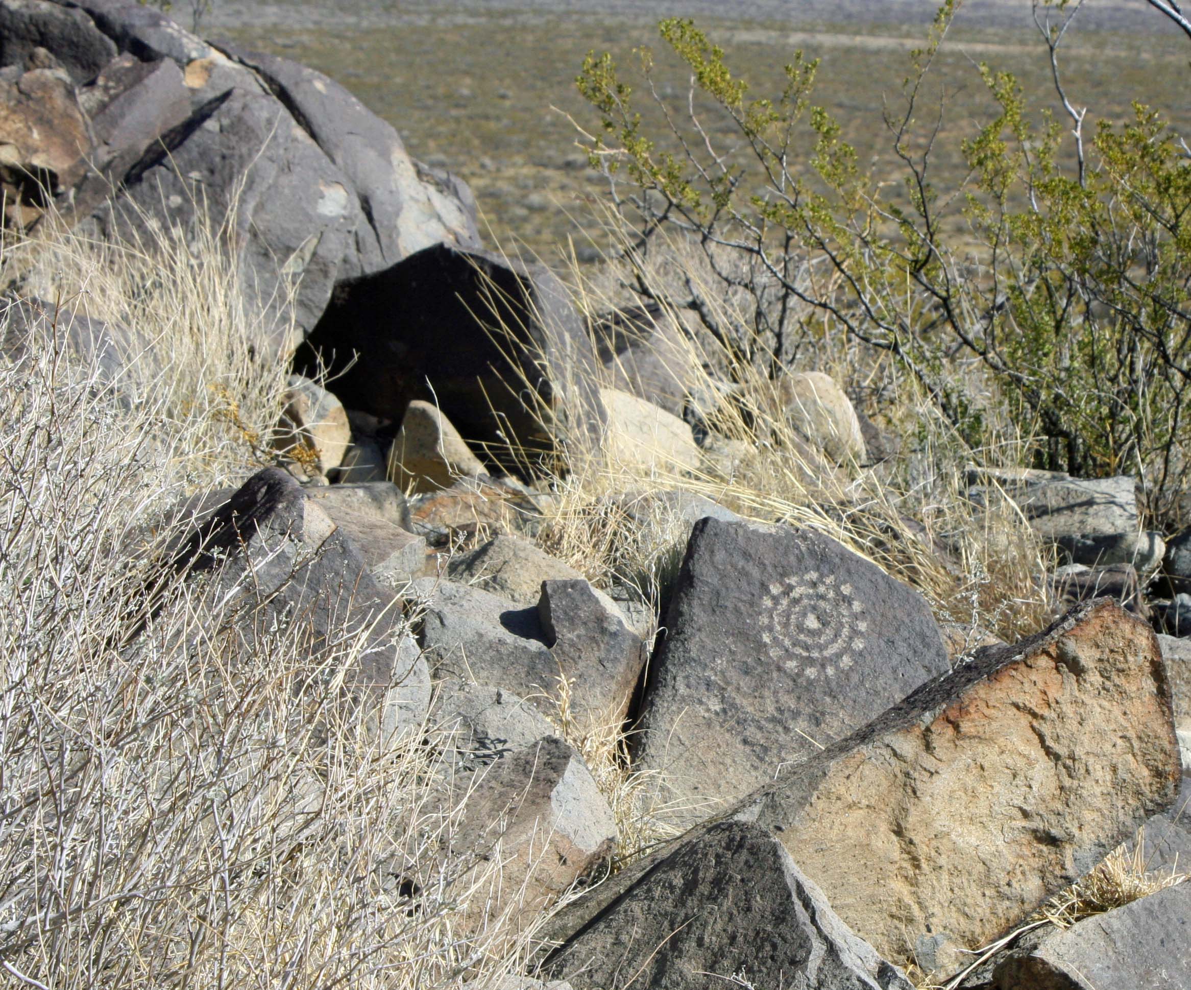
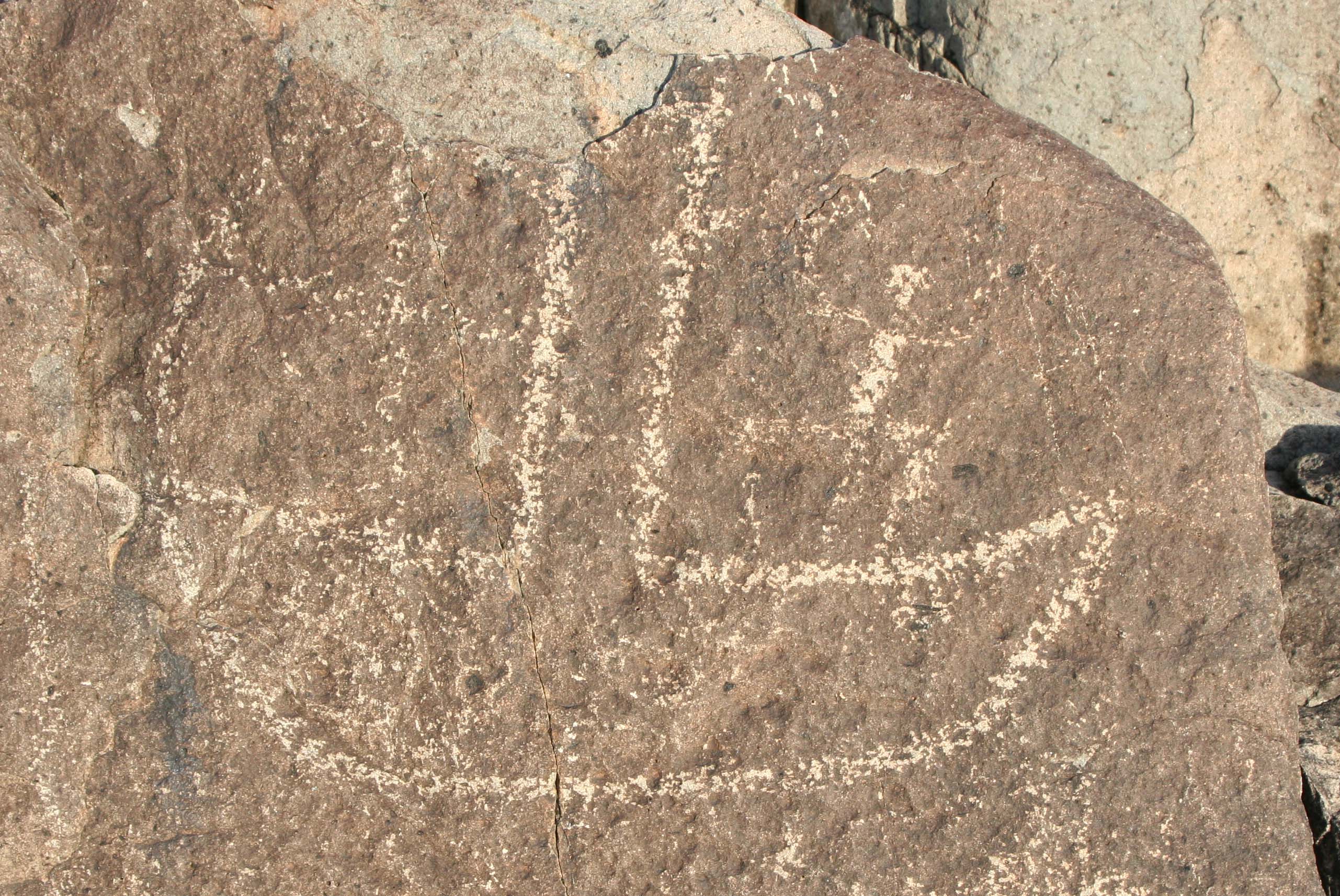
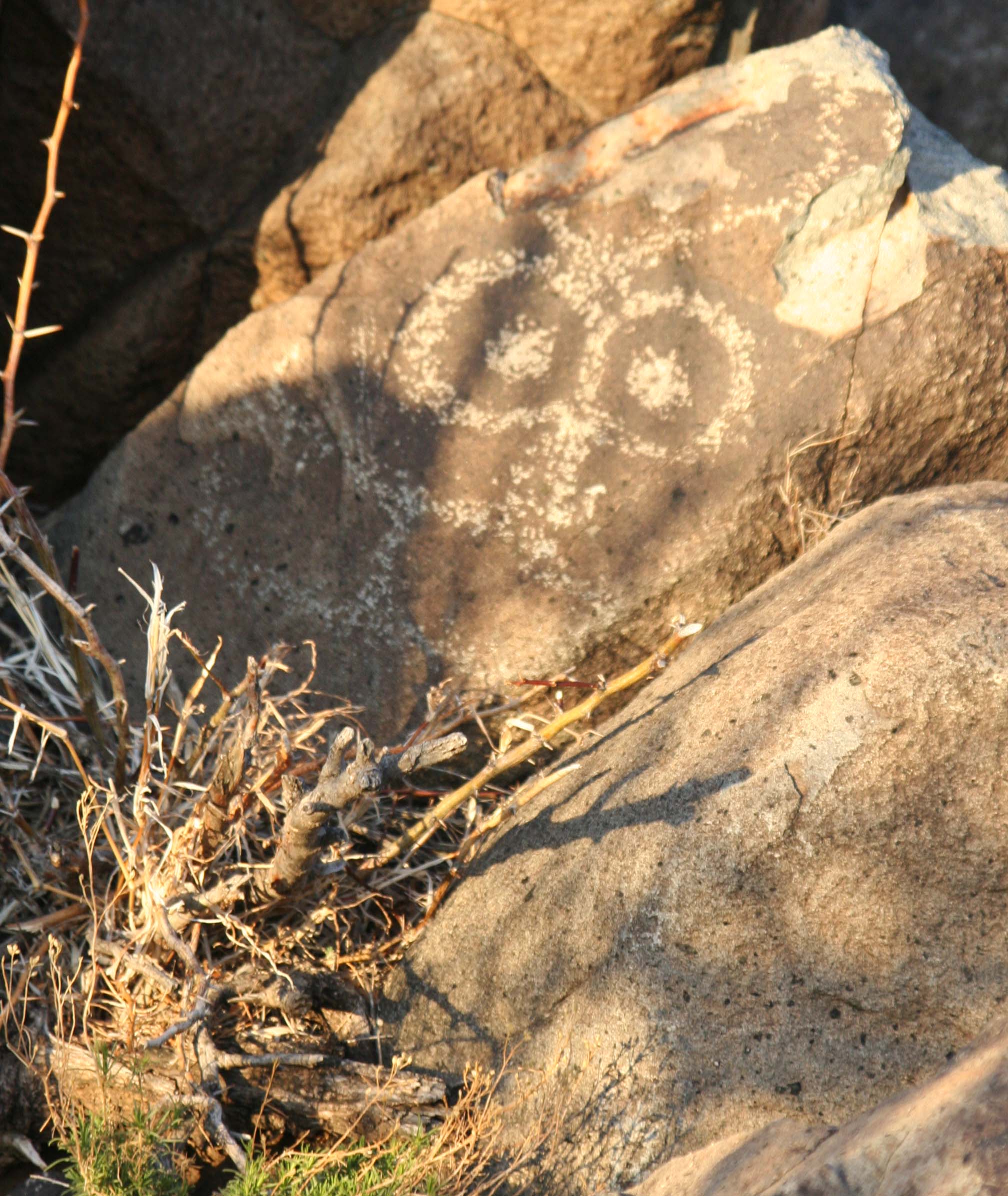
Petroglyph in Three Rivers Petroglyph site of southern New Mexico.

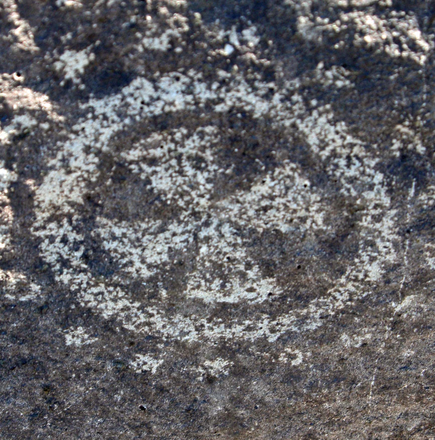
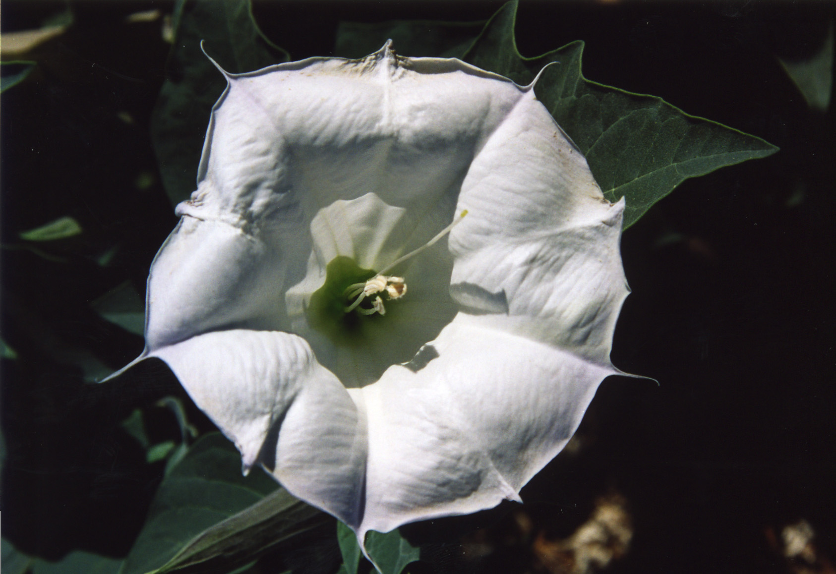
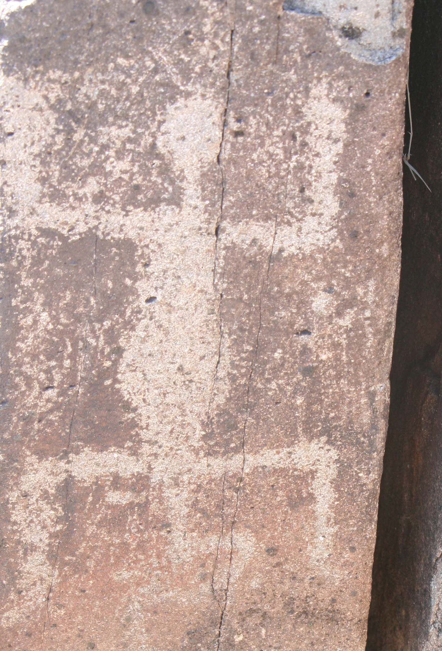
This is one of my favorite glyphs from the Three Rivers Petroglyph site in Southern New Mexico– but what does it mean? I’ll go out on the proverbial limb. My guess is it represents a drug induced shamanistic vision. There is some thought that the circle with dots represents Datura, a powerful hallucinogen (and also a favorite flower subject of Georgia O’Keeffe).

A lot of guessing takes place in determining the meaning of rock art. Present day Native American myths and rituals provide some clues. Others can be deduced from the petroglyph itself. An antelope filled full of arrows relates to hunting, but is it a record of an actual event or a hopeful prediction of the future?

Today I am featuring petroglyphs from the Three Rivers site that represent humans and gods. Some can seem quite strange while the one below seems… quite human.

A realistic portrayal of a human found at the Three Rivers Petroglyph site in southern New Mexico.

This is the most realistic portrayal of a human we found among the Three River Petroglyphs. Note the ear rings.

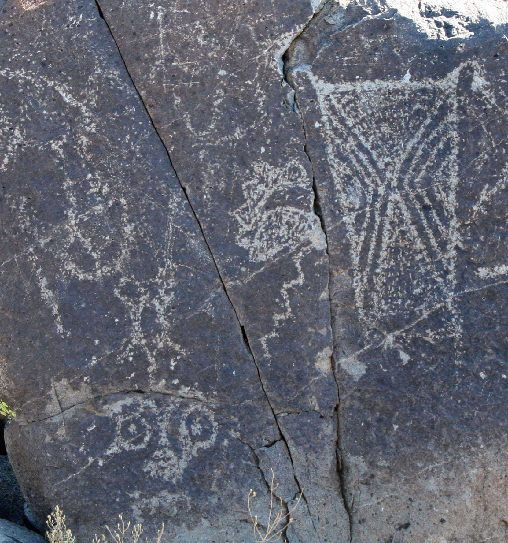
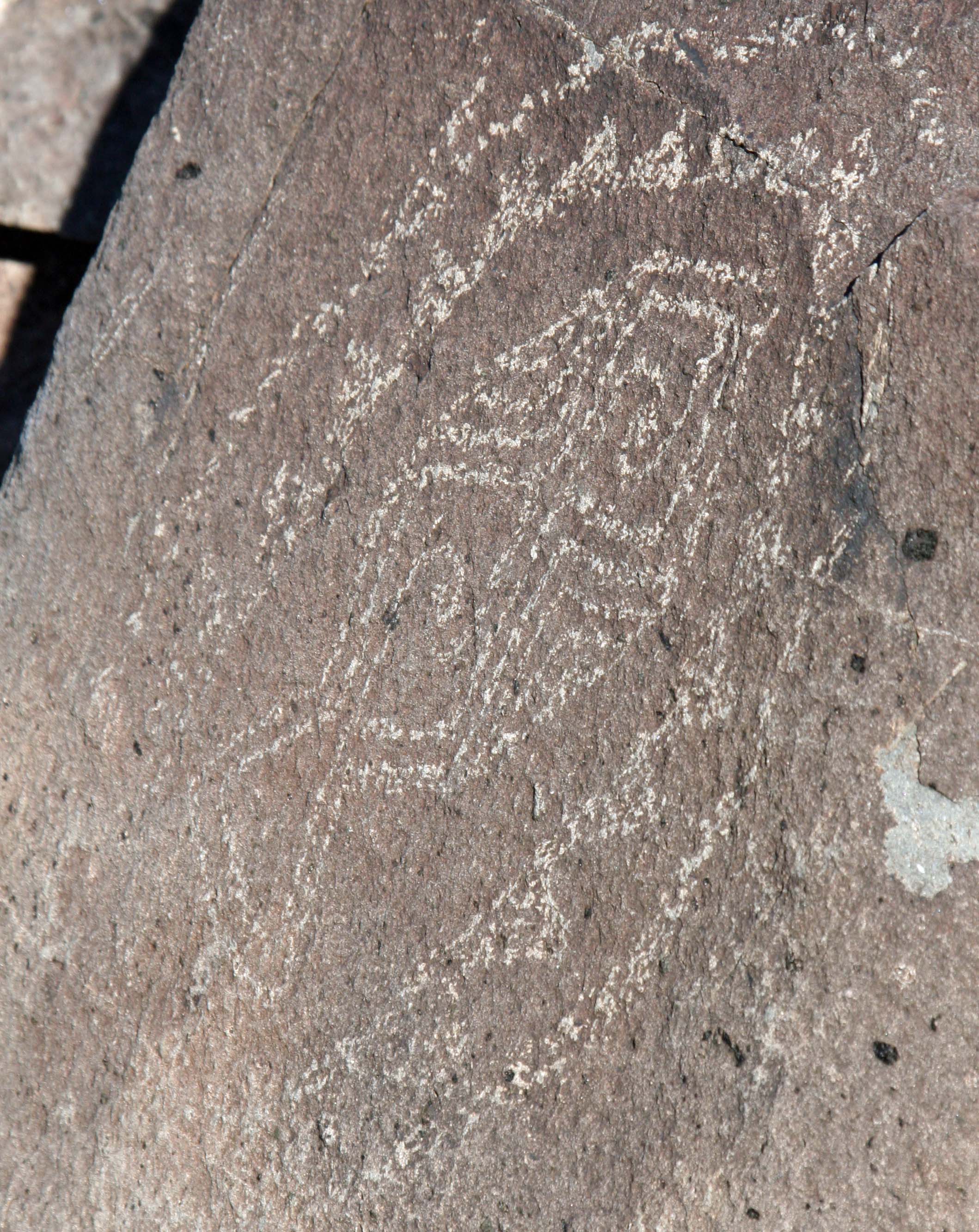
Petroglyph at Three Rivers Petroglyph site in southern New Mexico.

I also found this triangular face fascinating. Many of the petroglyphs at Three Rivers take advantage of the rocks natural features. This one uses the ridge to set off the nose and eyes, and cracks to outline the chin.

Petroglyph at Three Rivers Petroglyph site in Southern New Mexico.

According to Alex Patterson in his book, Rock Art Symbols, this is either the Mother of Animals or a woman waiting for her honey. It could be she is having a baby. Check out her expression. Two different versions are below.

Petroglyph at Three Rivers Petroglyph site in southern New Mexico.

Another possible version of Mother of Animals at Three Rivers Petroglyph site.

Petroglyph at Three Rivers Petroglyph site in southern New Mexico.

And a third.

Three Rivers Petroglyph.

I introduced a close up of this character in my last blog. Here he is located in his rock setting. I am thinking “boo!”

Petroglyph from Three Rivers Petroglyph site in southern New Mexico.

Talk about scary, this guy qualifies. Big eyes and big, sharp teeth

Three Rivers petroglyph.

Petroglyphs can be quite graphic in their portrayals…

Petroglyph from Three Rivers Petroglyph site in southern New Mexico.

…And abstract. Geometric patterns are often included.

You can tell your god or someone's status in society by the headdress he or she wears. The plant on the left may be corn.

You can tell your god by the headdress he or she wears. The plant may be corn.

Petroglyph from Three Rivers Petroglyph site in southern New Mexico.

I’ll conclude this blog with this spiky haired character who appears to be waving bye-bye.

NEXT BLOG: We will enter into the petroglyph animal kingdom of Three Rivers.

Mountain lion petroglyph at Three Rivers Petroglyph site in southern New Mexico.

I check out a mountain lion petroglyph.

New Mexico’s Three Rivers Petroglyph Site… Where Art Rocks

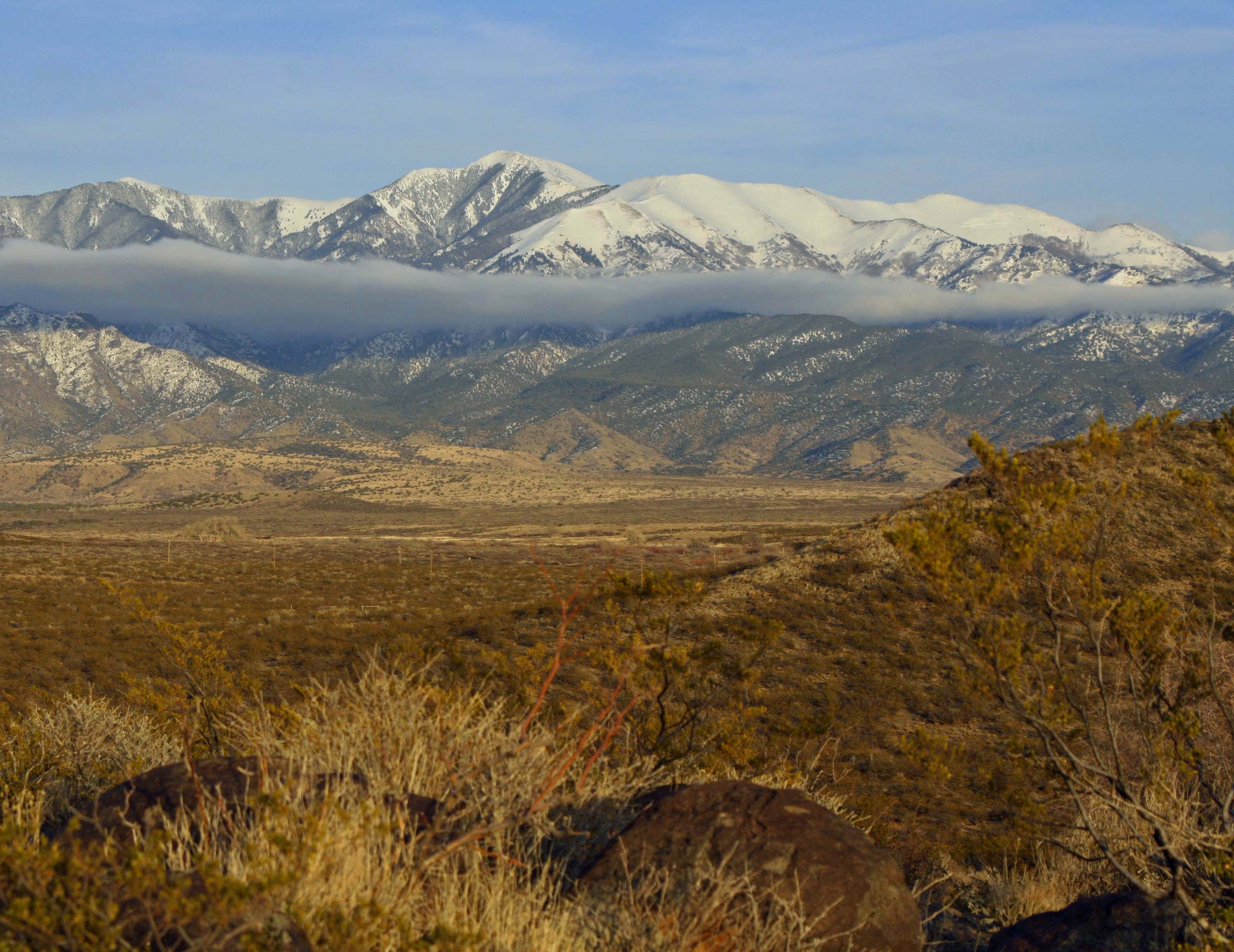
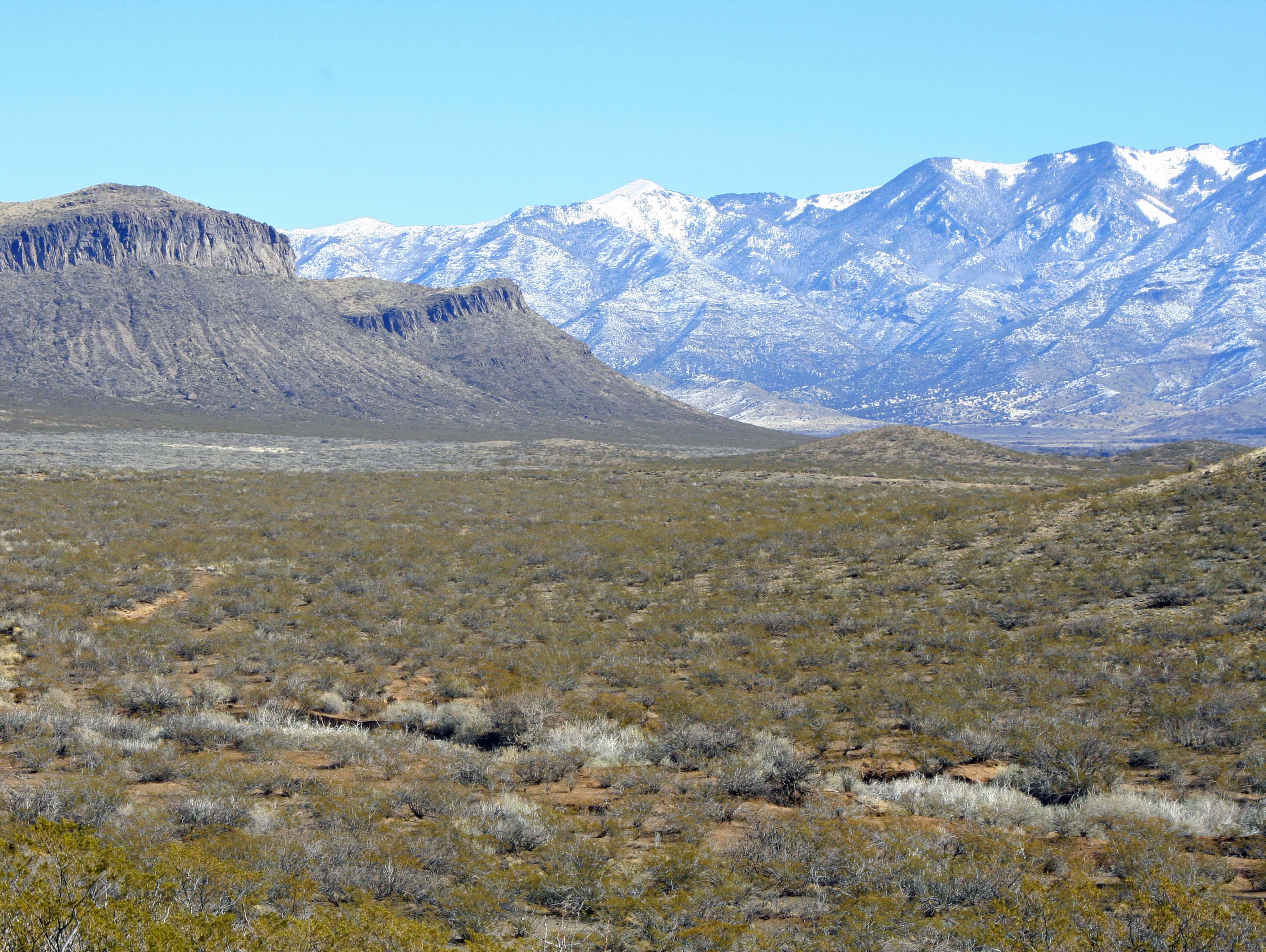
Sacramento Mountains of New Mexico.

A layer of clouds stretching along the Sacramento Mountains adds beauty and mystery to the Three Rivers Petroglyph site. It is easy to understand why Native Americans chose the area for their rock art.

This marks the beginning of a new series where we leave the beautiful but crowded cities of Europe to visit the lonely, wide-open spaces of the American and Canadian west. Our journey will take us from New Mexico’s northern Chihuahuan desert to Alaska’s remote Kodiak Islands.

For the next three weeks we will explore the mystical world of Native American rock art found in the Three Rivers Petroglyph site of southern New Mexico. Afterwards Peggy and I will spend six weeks travelling up the Alaska Highway through British Columbia and the Yukon Territory to Alaska and back.  We will finish off our summer at the celebration known as Burning Man held in Nevada’s Black Rock Desert.

Peggy and I have been visiting rock art sites throughout the Southwestern United States for the past 15 years. The Three Rivers’ site is one of our favorites. Some 21,000 petroglyphs featuring everything from people to bugs are spread out over 50 acres. Created by the Jornada Mogollon people of the Chihuahuan Desert, the glyphs were pecked into rock using stone tools for a period of over 500 years starting in 900 AD.

This is wide-open country set off by dramatic mountains. Within a hundred miles of Three Rivers, Billy the Kid fought in the Lincoln County Wars, Smokey the Bear was found hidden in a tree avoiding a forest fire, bug eyed aliens became synonymous with Roswell, and history was forever changed with the explosion of the world’s first atomic bomb.

I rode through the area on my bicycle as part of my ten thousand mile trek around North America. It’s a long way between pit stops.

Mountains and deserts of Southern new Mexico

What southern New Mexico looks like from a bicycle.

Native Americans often chose special sites for their rock art and it is immediately apparent that the Three Rivers site is special. The words “raw beauty” come to mind. Set on a ridge, the site provides commanding views of the surrounding desert and mountains. Today’s blog will explore the natural beauty of the region. In my next blogs I will feature petroglyphs of people, animals, birds, geometric designs, animal tracks, reptiles, bugs and anything else that caught the fancy of the Jornada people– including a whale and a mysterious ship.

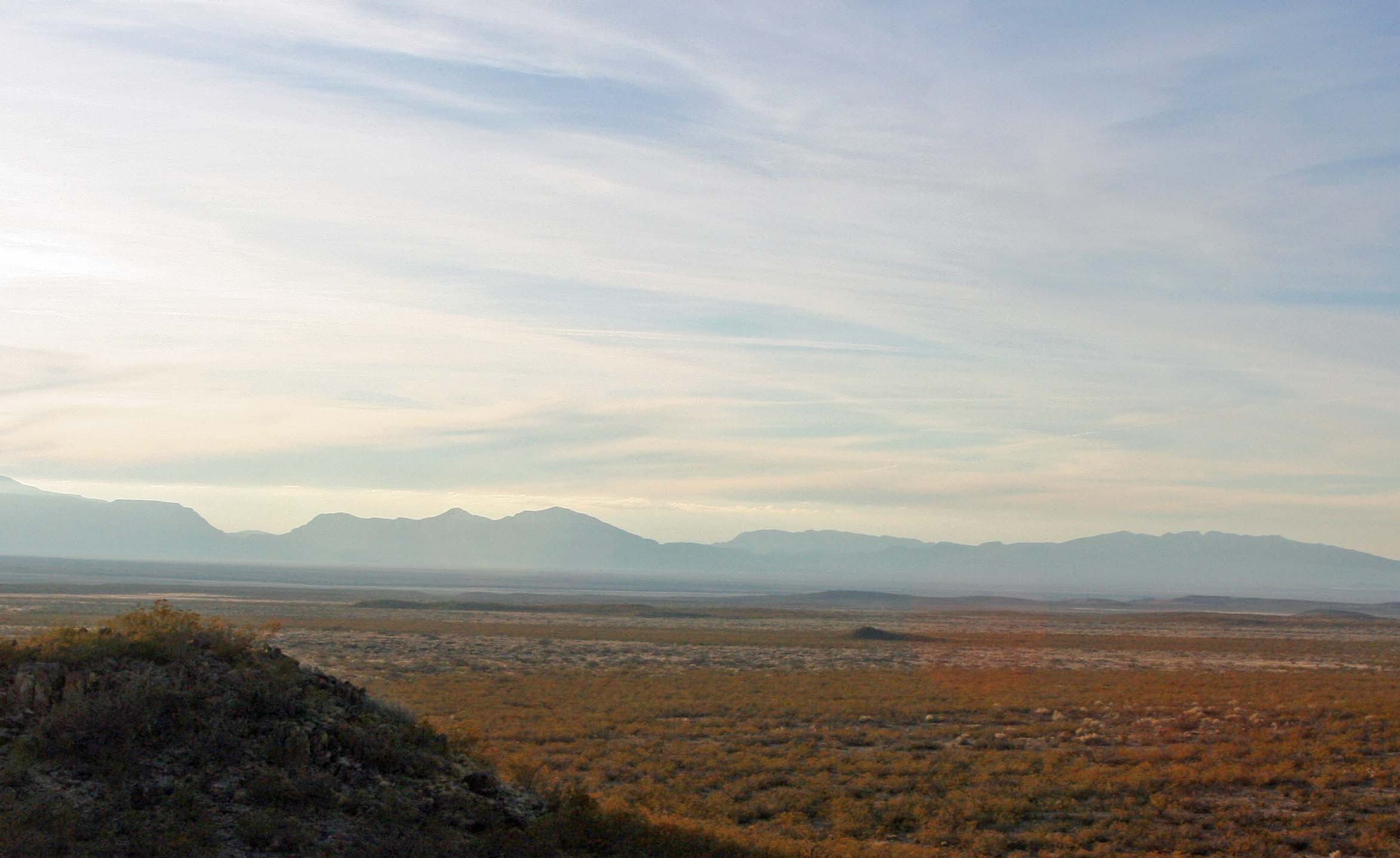
Three Rivers Petroglyph site in southern New Mexico.

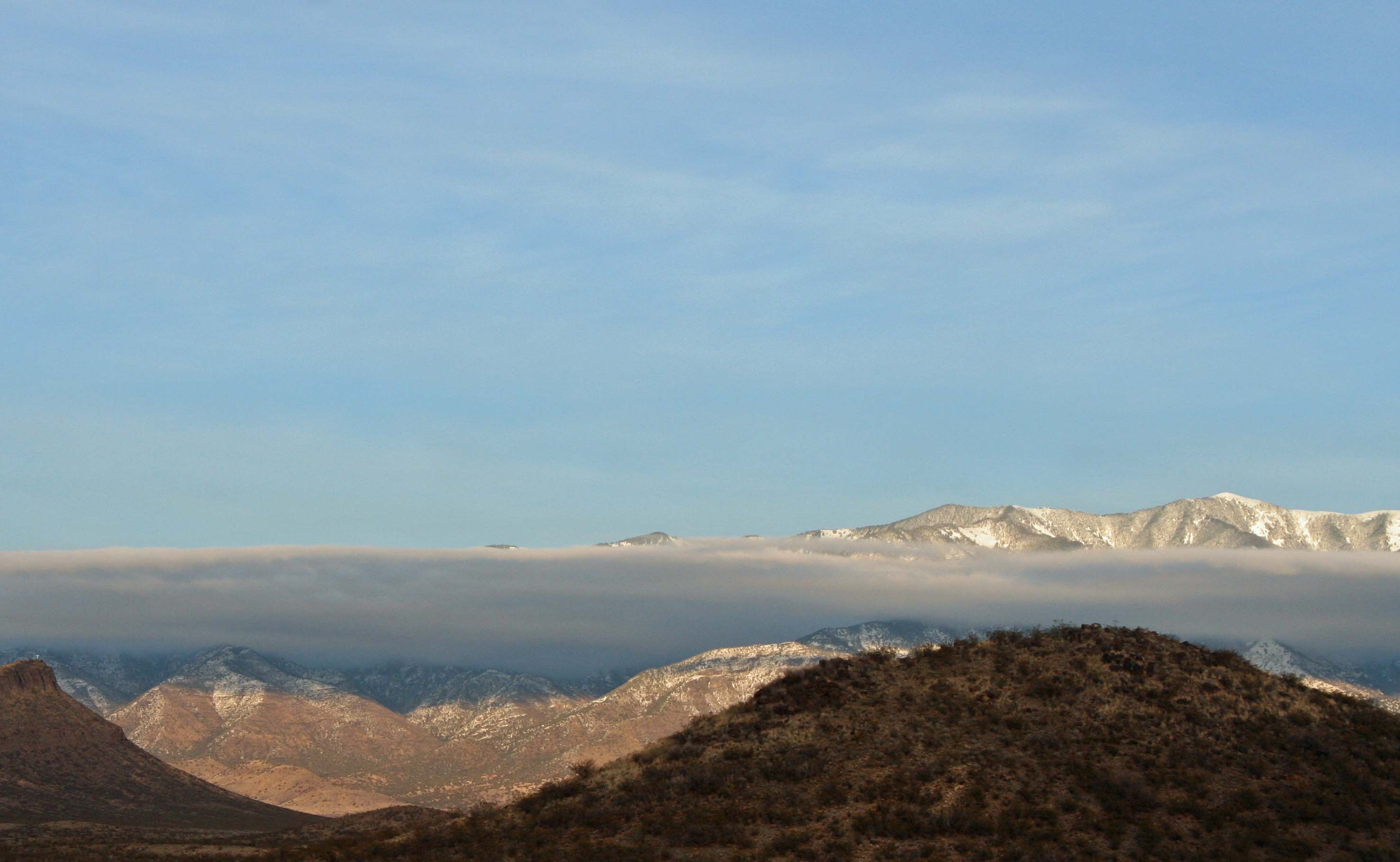
Another photo featuring the Sacramento Mountains and clouds from the perspective of the Three Rivers Petroglyph site.

Three Rivers Petroglyph site in southern New Mexico with Sacramento Mountains providing the backdrop.

Native Americans often chose cliff areas such as those on the left for their rock art.

Three Rivers Petroglyph site in southern New Mexico.

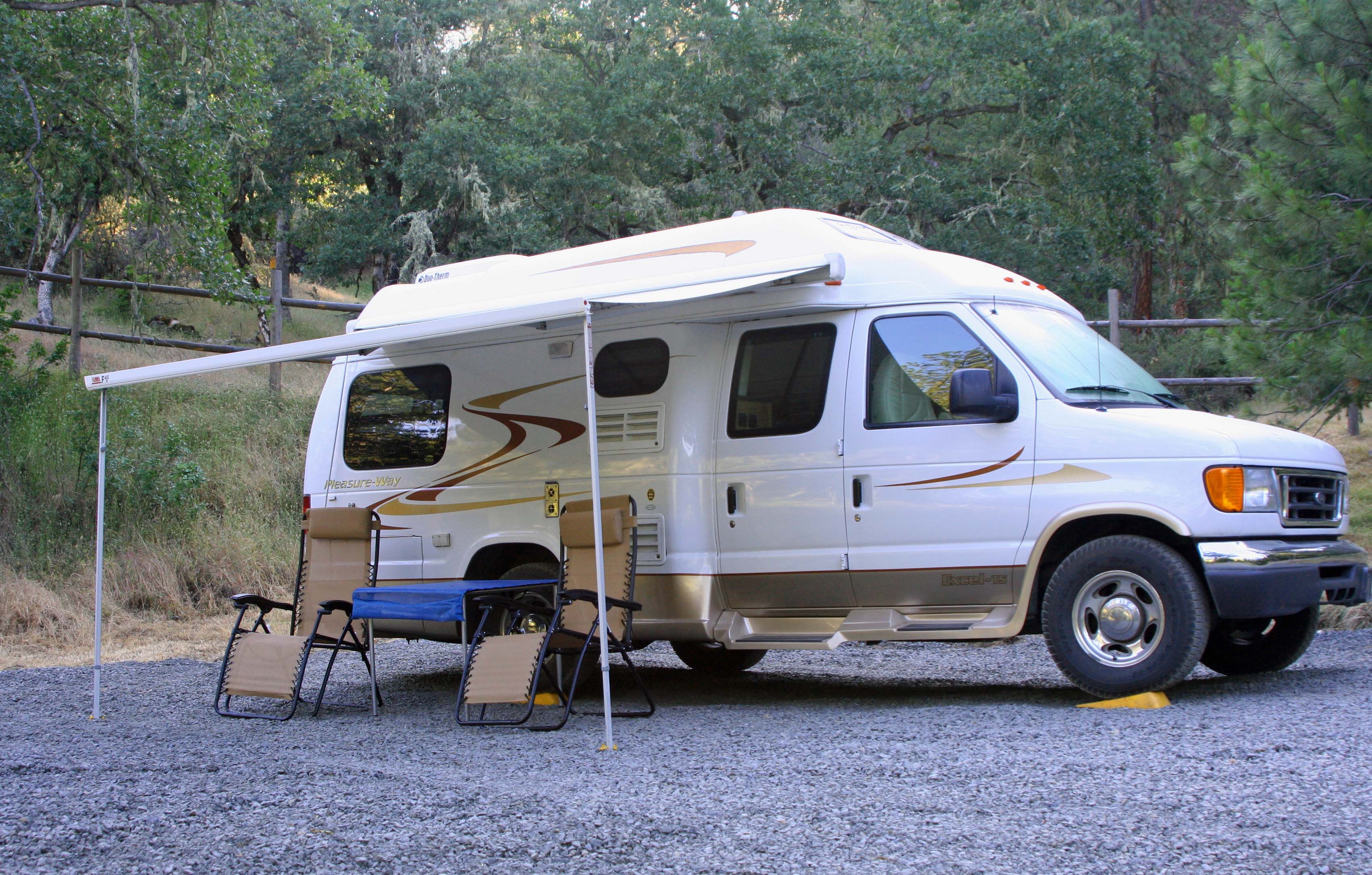
Our van, Quivera, provides a perspective on the region. We took this photo from the ridge where the majority of petroglyphs are located. We pretty much had the site to ourselves during the two days we were there.

Peggy stands on the ridge next to a rock likely to hold petroglyphs. Some glyphs are immediately obvious while others are hidden. Sharp eyes are required.

Peggy stands on the ridge next to a rock likely to hold petroglyphs. Some glyphs are immediately obvious while others are hidden. Sharp eyes are required.

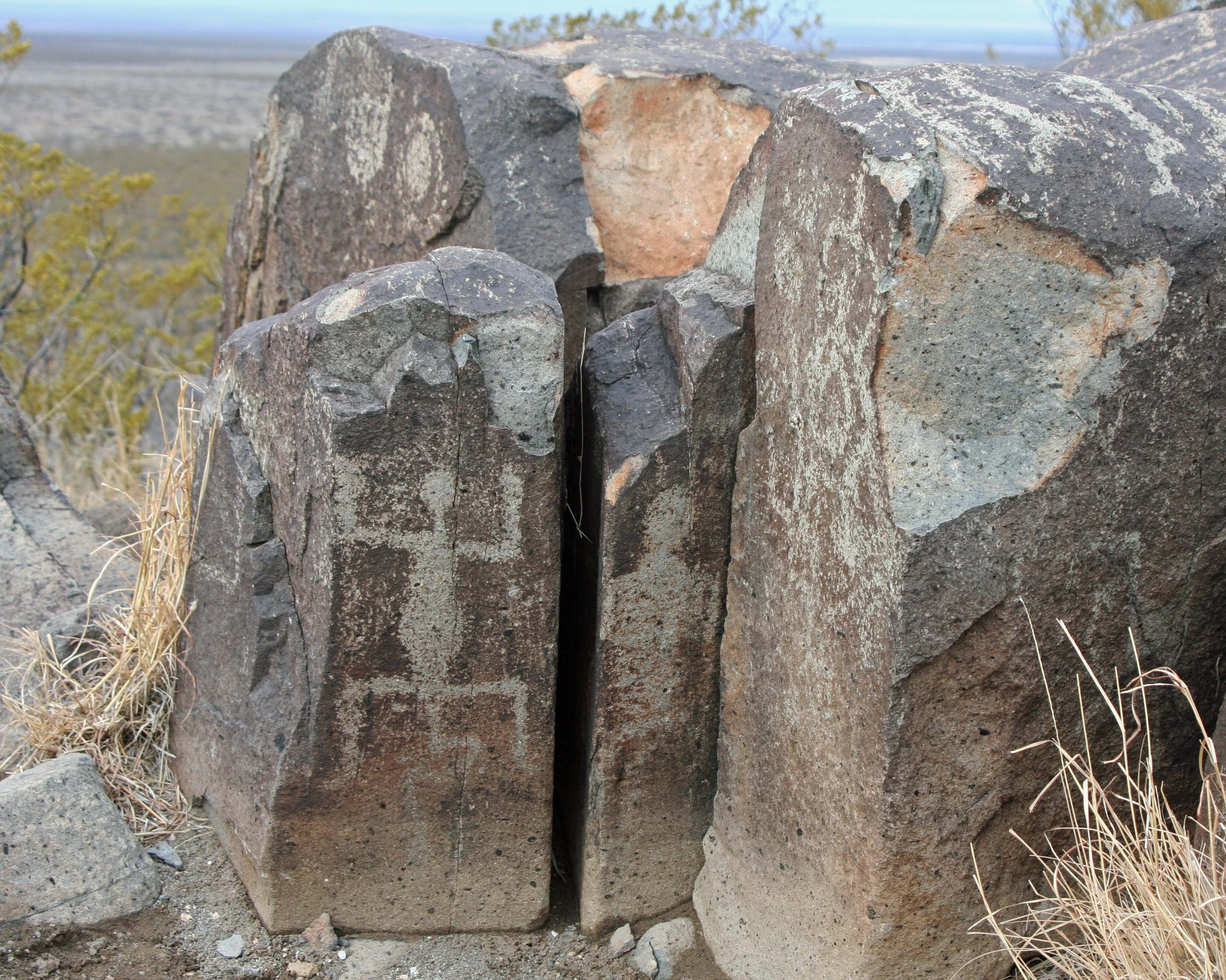
Petroglyphs at Three Rivers Petroglyph site in southern New Mexico.

Faded bear and what may be badger prints are shown on these rocks. Petroglyphs are made by using a stone to peck away the outer layer of rock varnish (a layer of minerals that attaches to the rock over time).

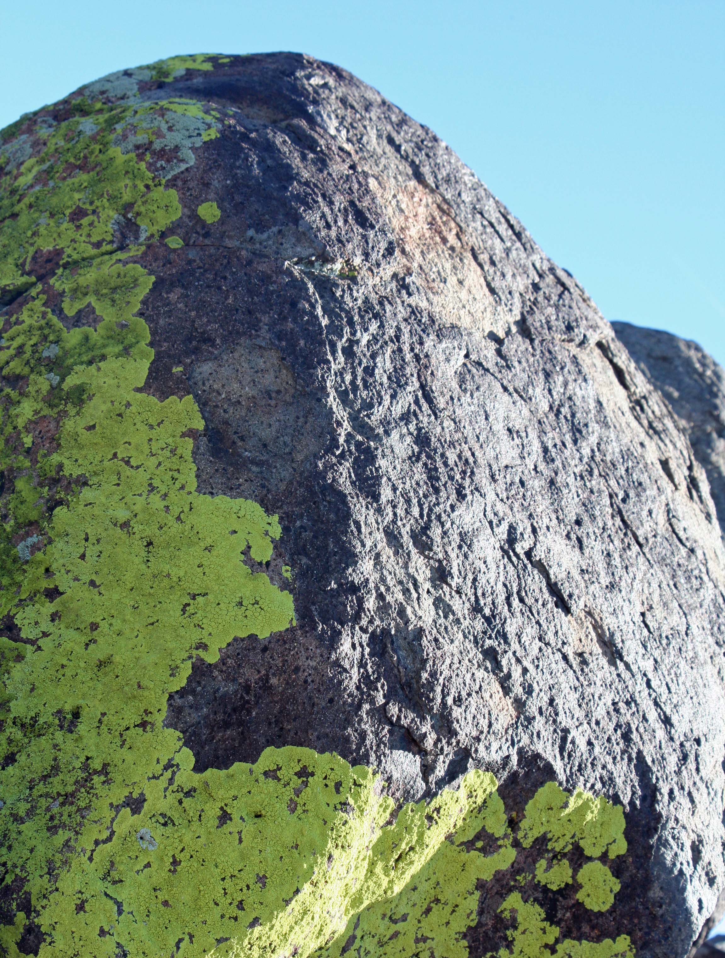
Lichen on rock at Three Rivers Petroglyph site in Southern New Mexico.

We also found the lichens to be quite attractive.

Lizard glyph at Three Rivers Petroglyph site in Southern New Mexico.

Many rocks at Three Rivers are covered with petroglyphs. In addition to the prominent lizard,we found circles, geometric designs, and a possible map on the various faces of this rock.

Evening clouds over the Sacramento Mountains of New Mexico.

Sunset lights up the Sacramento Mountains. I found the contrast created by the cloud layer quite interesting.

NEXT BLOG: I will look at glyphs that feature the Jornada Mogollon people and their gods.

Petroglyph at Three Rivers Petroglyph site in Southern New Mexico

One of the many strange beings we found lurking among the rocks.

It’s National Park Week 2013… April 20-28

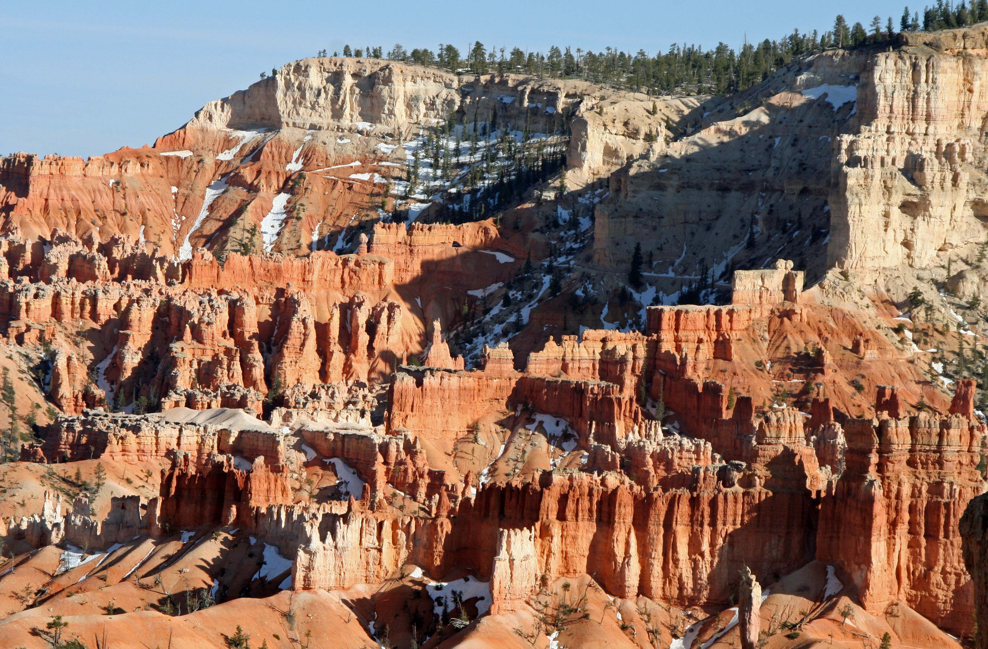
Bryce Canyon

Bryce Canyon National Park, Utah

It’s National Park Week. One of my blogging friends reminded me. Somehow I lost track of time and became so wrapped up in the minutia of life that the week had arrived before I realized it was happening. Shame on me.

The United States and many other nations around the world have done a magnificent job of setting aside national parks. We owe it to ourselves to go out and explore these treasures. And, we owe it to our great, great, great, great-grandchildren to protect these sites of rare natural beauty for future generations.

It won’t be easy. There will always be people who believe financial gain outweighs any other consideration. Why save thousand-year-old redwood trees when they can be turned into highly profitable redwood decks?

Redwood

This 1500 year old redwood is located in Redwoods National Park on the northern coast of California.
Several years ago, Peggy and I set a goal to visit all of America’s National Parks. With the exception of Kobuk Valley and Lake Clark in Alaska, we’ve succeeded. It has been an incredible journey. Our travels have taken us from Denali National Park in Alaska to the Dry Tortugas National Park off the Florida Keys.

In addition to driving through and hiking in these parks, I have also backpacked in 13, biked through five, and kayaked or rafted in three. Once I even organized a winter ski trek into Denali National Park where we slept out in minus 30-degree weather and listened to wolves howl. That was a learning experience…

Since I couldn’t escape to a national park this week, I did the next best thing; I went through photos of parks Peggy and I have taken. All I could think of was wow– what incredible beauty!

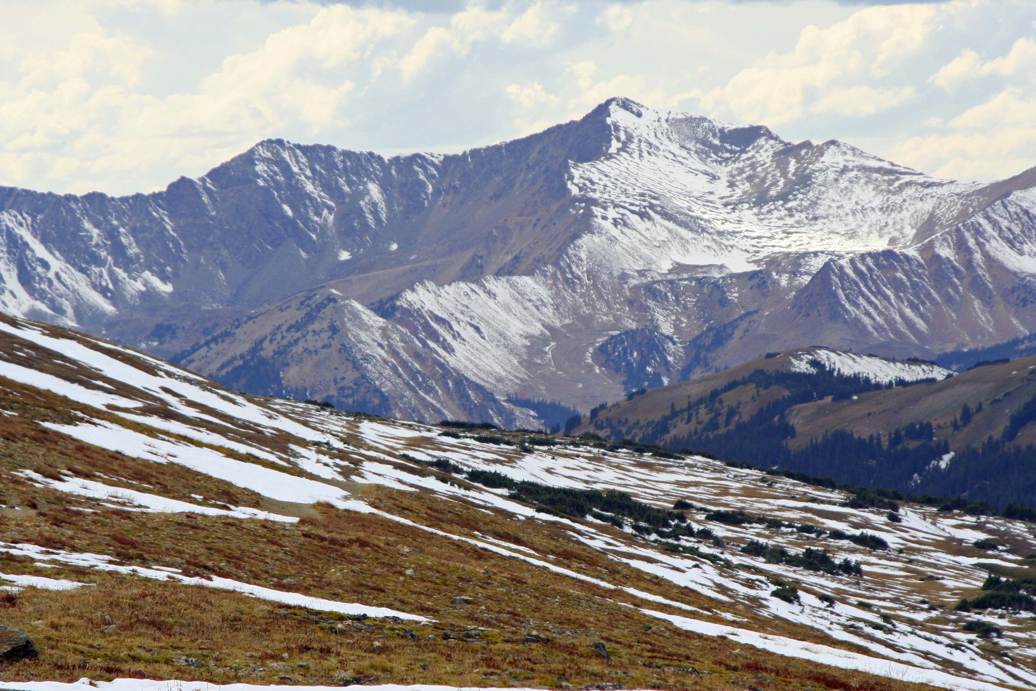
Rocky National Park in Colorado.

Rocky Mountain National Park in Colorado.

Hawaii Volcanos National Park.

An active volcano in Hawaii Volcanos National Park on the Island of Hawaii.

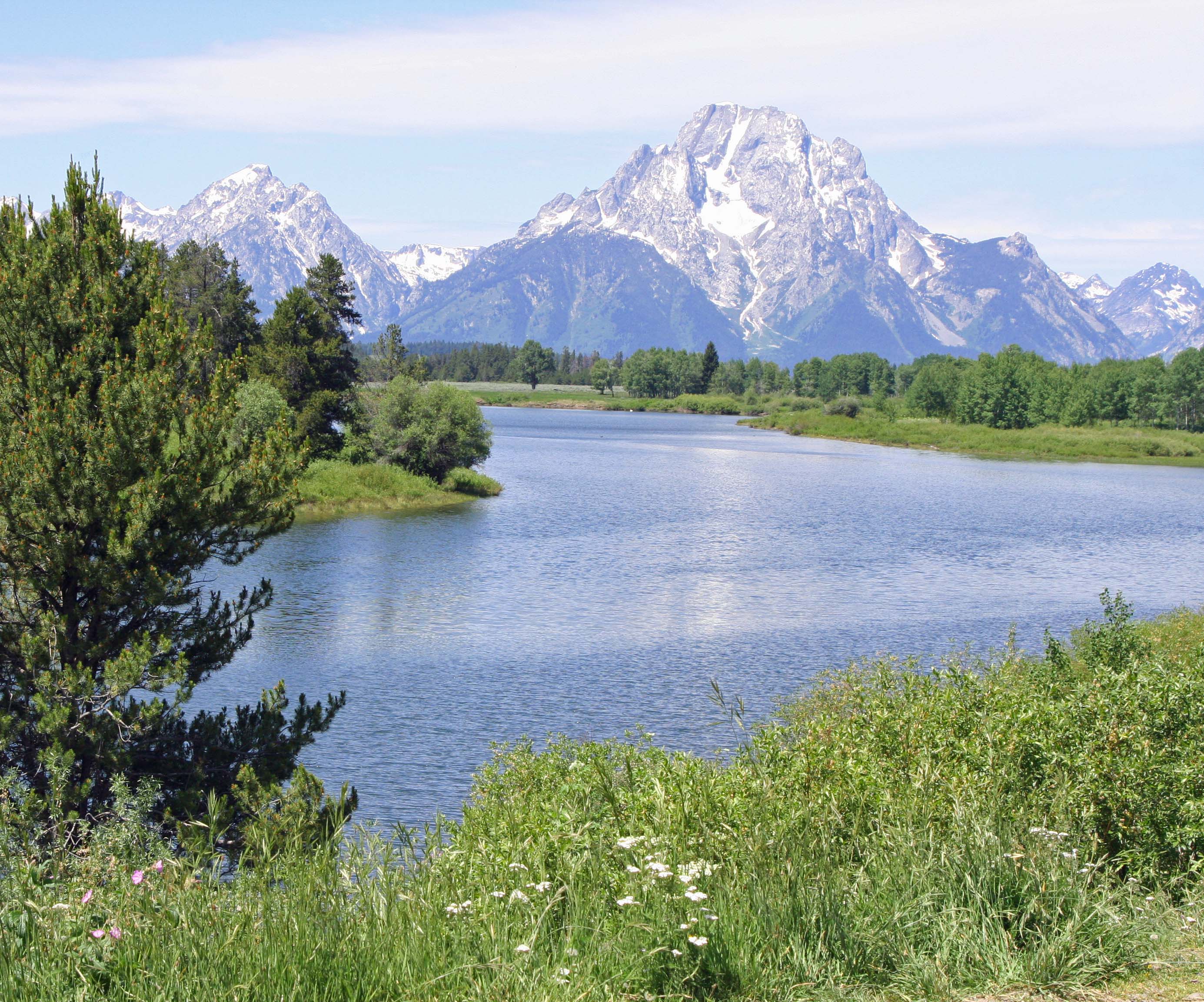
Grand Tetons National Park in Wyoming.

Grand Tetons National Park in Wyoming. A sign warned us to look out for an active grizzly bear.

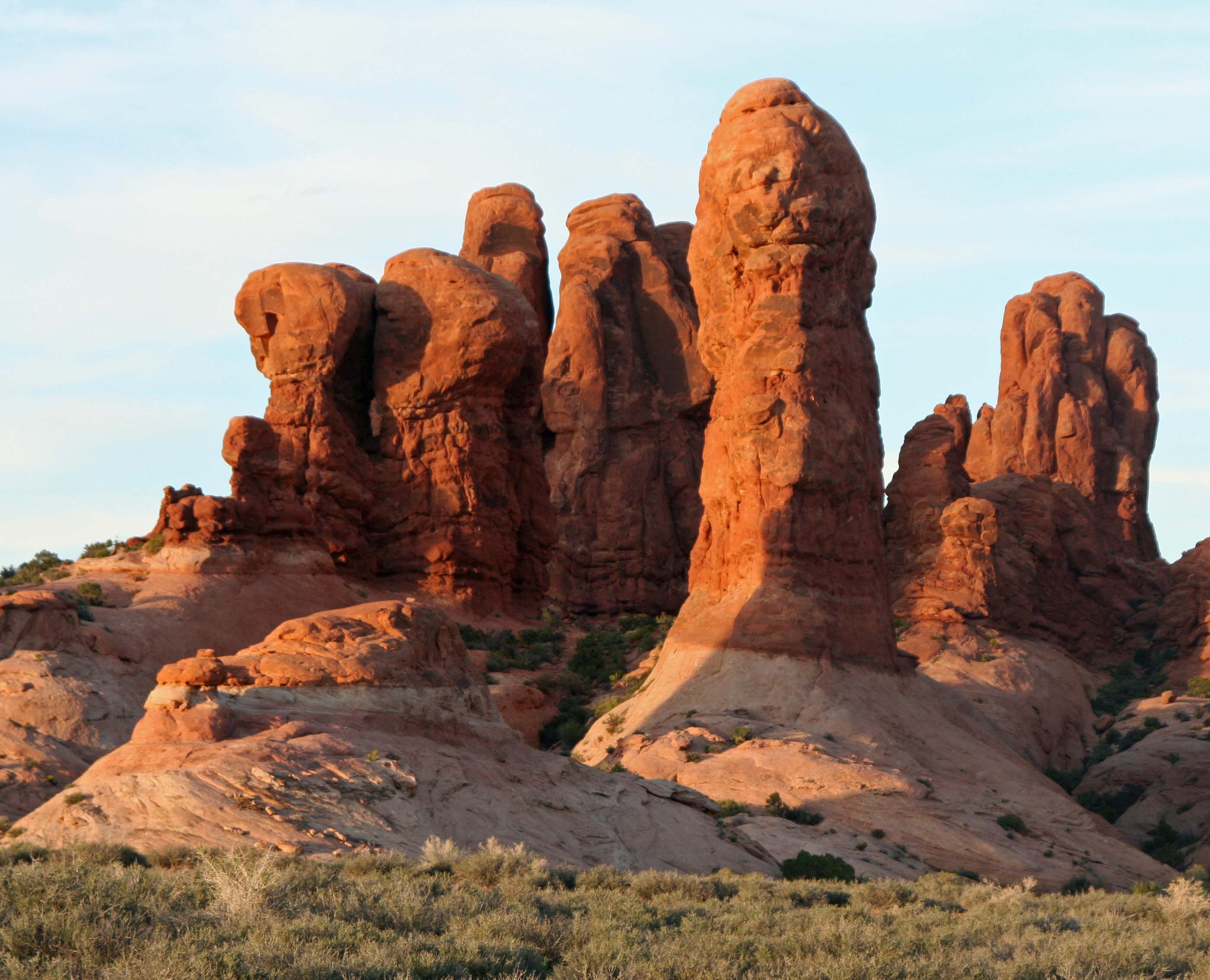
Arches National Park, Utah

Arches National Park, Utah

Tuolumne Meadows, Yosemite National Park, California

Tuolumne Meadows, Yosemite National Park, California. I once woke up near here with a bear standing on top of me.
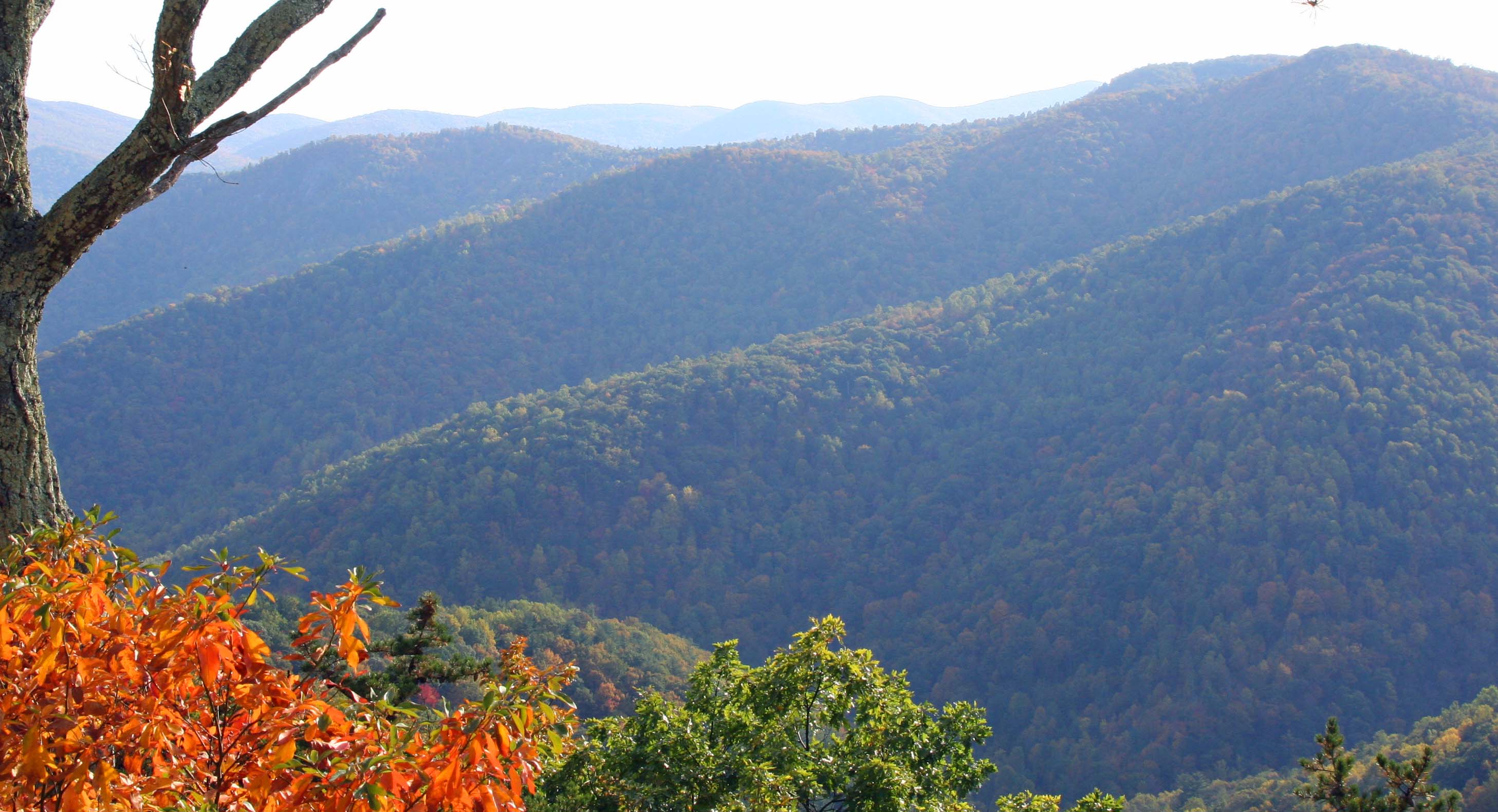
Fall colors of Shenandoah National Park in Virginia

Fall colors of Shenandoah National Park in Virginia.

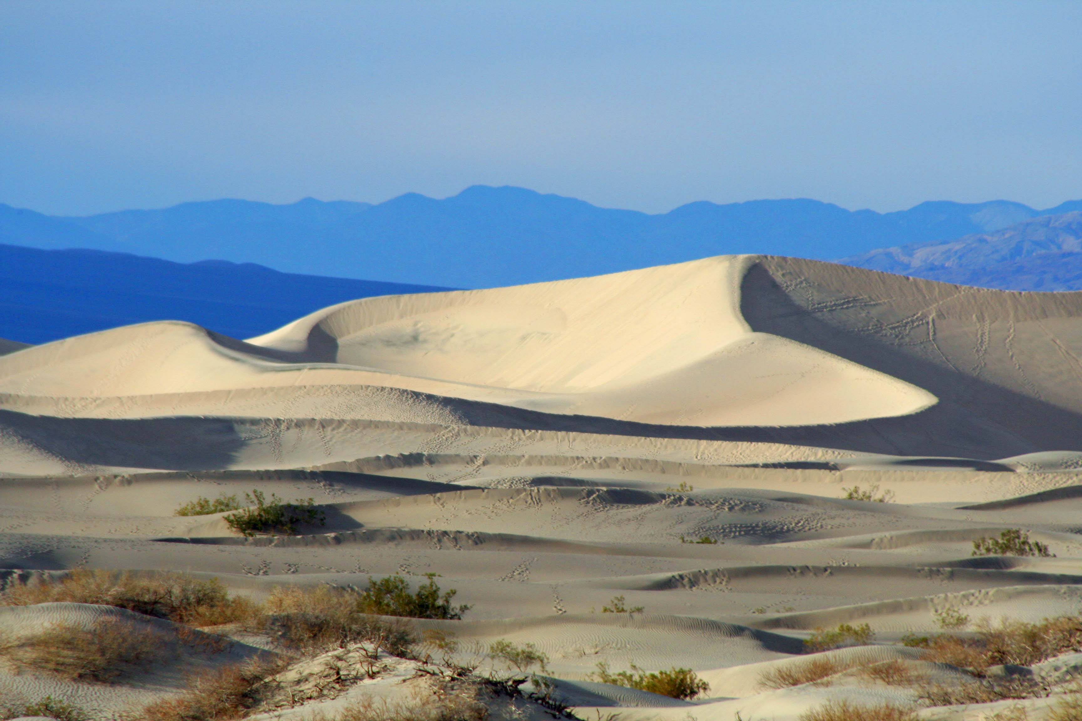
Sand Dunes in Death Valley National Park.

Sand dunes in Death Valley National Park.

The green of Olympic National Park in Washington.

The green of Olympic National Park in Washington.

Lesser known National Parks such as Great Basin in Nevada also hold great charm and beauty. This photo features the van Peggy  and I travelled in for four years as we travelled around North America.

Lesser known national parks such as Great Basin in Nevada also hold great charm and beauty. This photo features the van Peggy and I travelled in for four years as we wandered around North America.

Spectacular scenery is only part of the national park story. Wildlife, birds, insects, reptiles, flowers and history add to the experience.

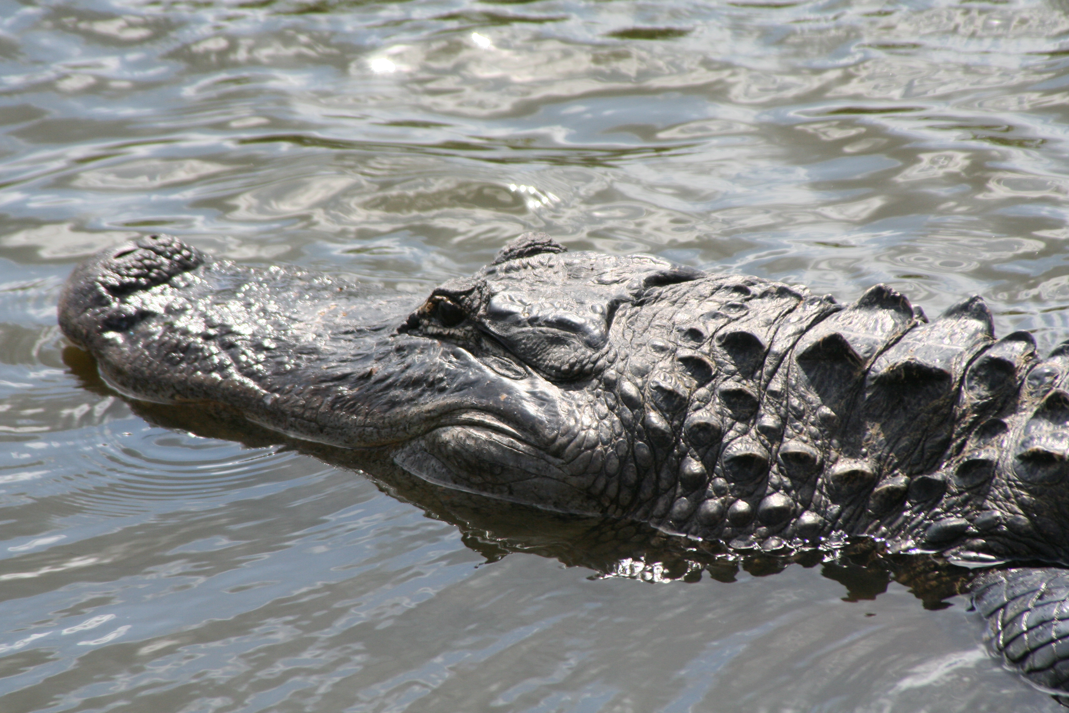
Peggy and I found this beauty swimming through the water at Everglades National Park in Florida.

Peggy and I found this beauty swimming through the water at Everglades National Park in Florida.

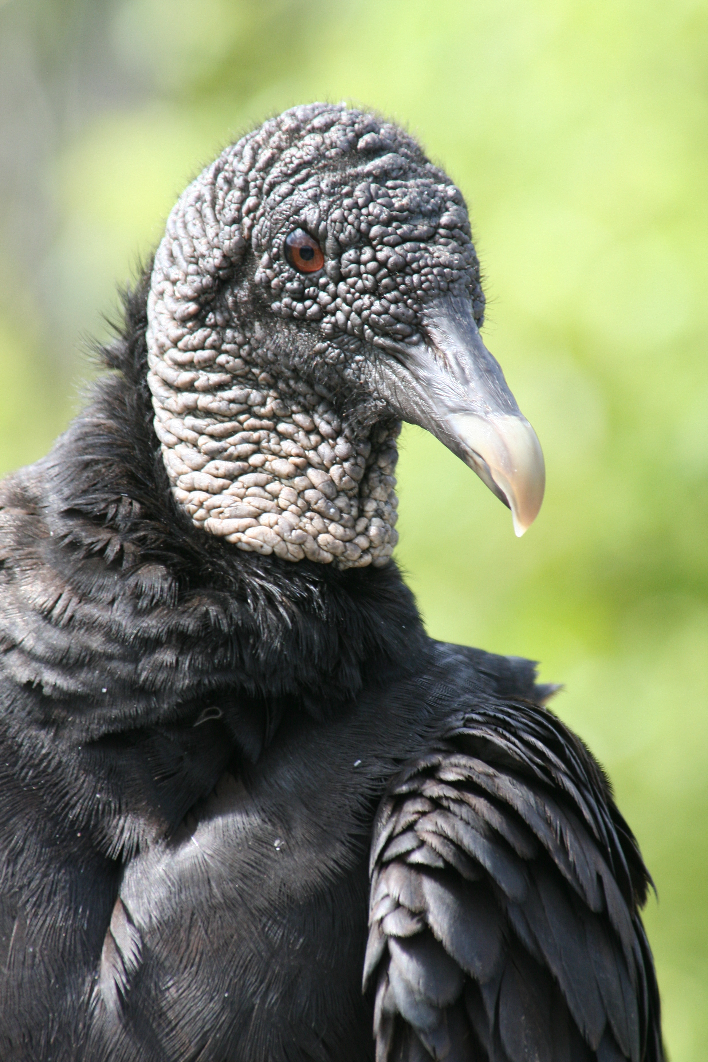
And this striking Black Buzzard was another Everglades resident.

And this striking Black Buzzard was another Everglades resident.

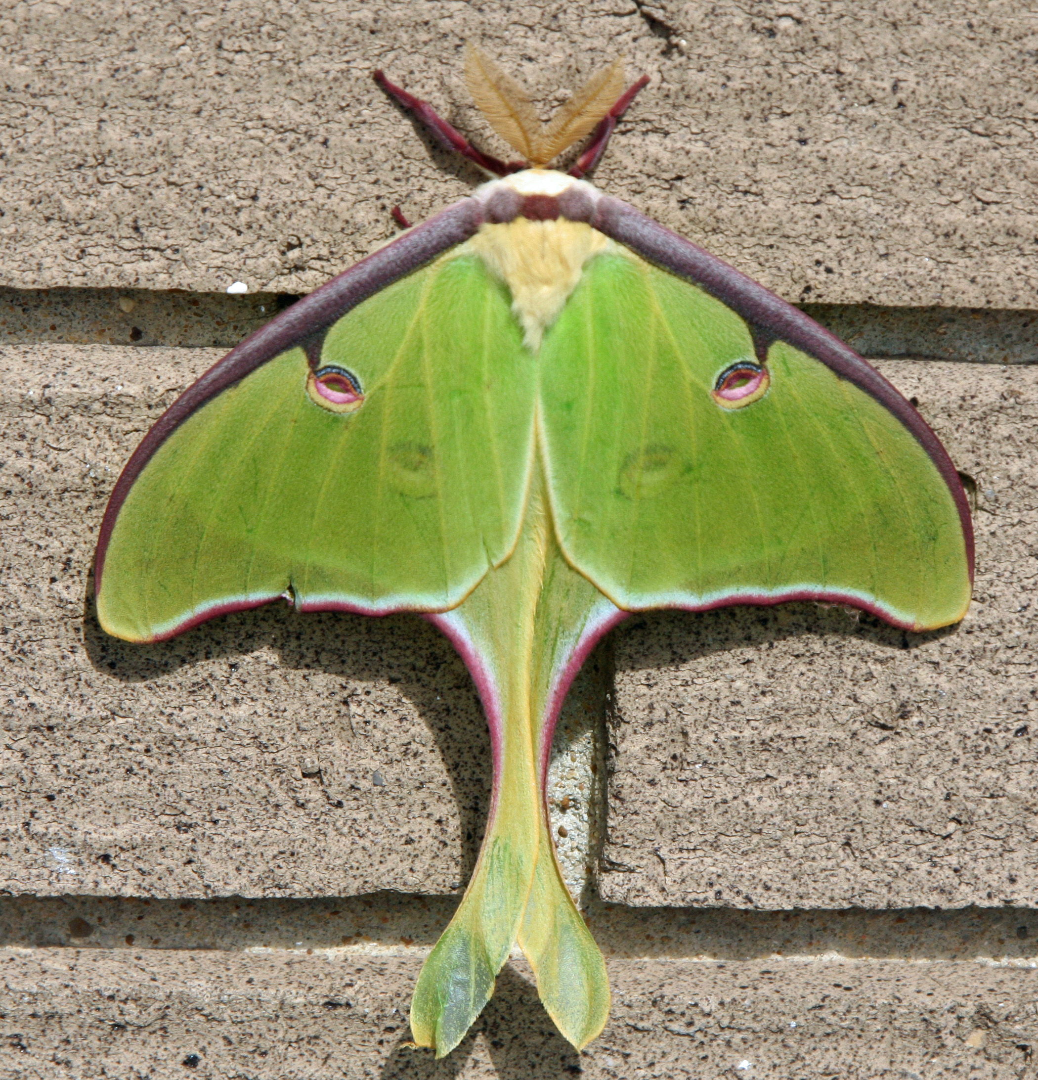
We found this Luna Moth on the Natchez National Parkway.

We found this Luna Moth on the Natchez Trace National Parkway.

Brown Pelicans are a common visitor at Pt. Reyes National Seashore.

Brown Pelicans are common visitors at Pt. Reyes National Seashore.

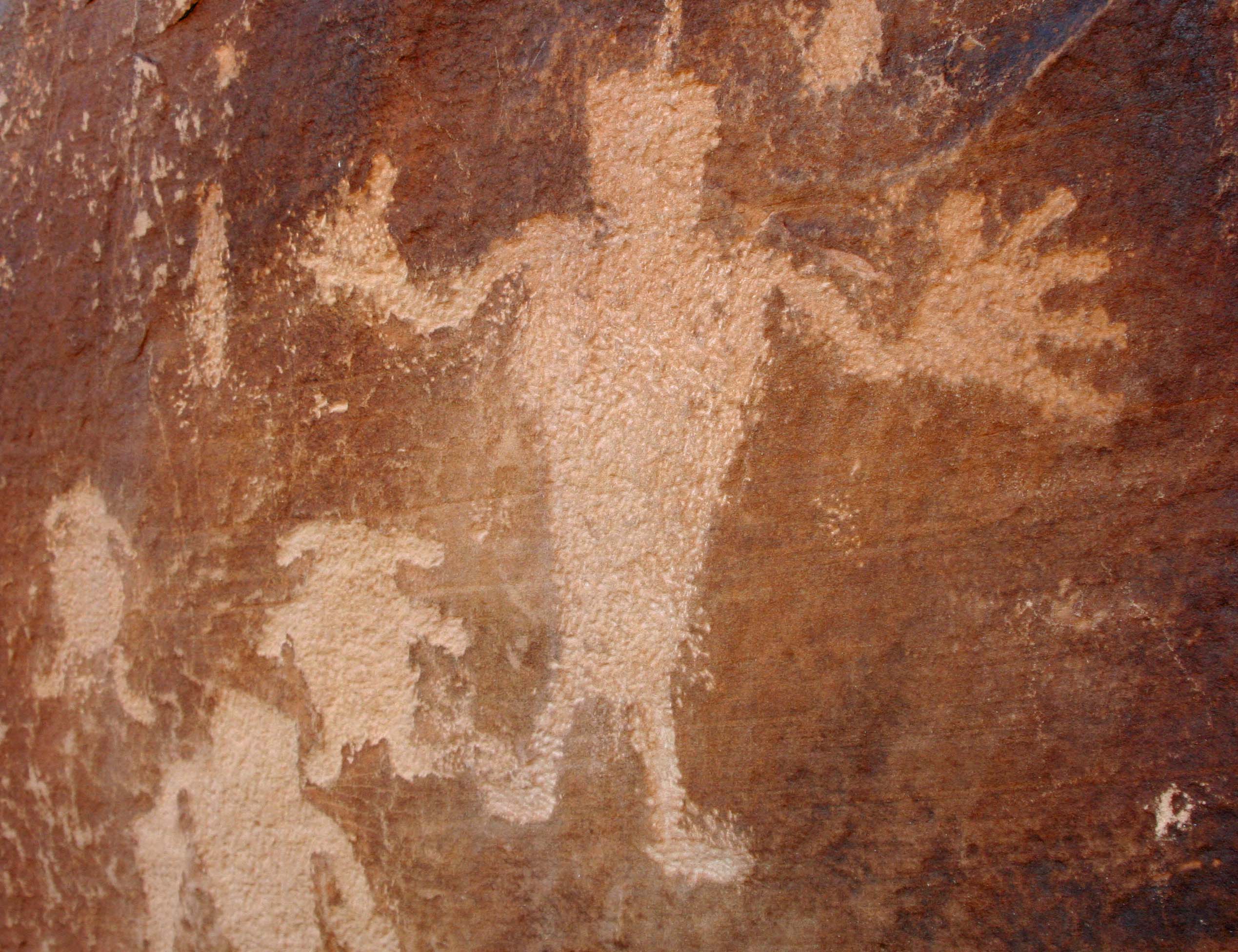
Peggy and I are great fans of Native America rock art, much of which is protected in National Parks and at National Monuments. This man with his big hands and fat little dogs has always been one of my favorites.

Peggy and I are great fans of Native America rock art, much of which is protected in national parks and at national monuments. We have several thousand photos from different sites. This one from Dinosaur National Monument in Colorado/Utah has always been a favorite because of the big hands and fat little dogs.

It never hurts to complete a blog with a pretty flower. We found this Foxglove growing in Olympic National Park.

It never hurts to complete a blog with a pretty flower, even if it goes on and on. (grin) We found this Foxglove growing in Olympic National Park.

NEXT BLOG: I hope you have enjoyed my two diversions over the past week because of Earth Day and National Park Week. On Monday I will return to Europe and Rome’s historic Colosseum.

Wild and Weird Nevada… On the Road

Three of the ghostly figures in Albert Szukalski’s Last Supper at the Goldwell Open Air Museum near the ghost town of Rhyolite Nevada.

Peggy and I are wandering through Nevada celebrating my birthday so I decided to re-blog an earlier story I did.  We had stopped off to check out the ghost town of Rhyolite on our way into Death Valley from the small Nevada town of Beatty.

I was looking around at abandoned mines and contemplating the lonely life of prospectors when I spotted a 30-foot tall naked blond. She caught my attention. Totally by chance, we had stumbled on the Goldwell Open Air Museum.

A 30 foot tall naked blond created by Dr. Hugo Heyrman was my introduction to the Goldwell Open Air Museum on the border of Death Valley National Park.

I couldn’t resist a close up of Blondie. Dr. Heyrman calls his pixellated woman “Lady Desert: The Venus of Nevada.”

Another view of the lady displaying her bubble butt.

Another view of the lady displaying her bubble butt.

The museum had its inception in 1984 when the Belgian artist Albert Szukalski wrapped a number of Beatty residents in wet plaster as models for a ghostly rendition of the Last Supper.

Another view of the Last Supper by Albert Szukalski at the Goldwell Open Air Museum. The dark, cloudy skies add drama.

I once bicycled through Death Valley as part of a 10,000 mile solo bike trip I made around North America. I can empathize with this guy.

I once bicycled through Death Valley as part of a 10,000 mile solo bike trip I made around North America. I can empathize with this guy.

Szukalski’s work inspired other well-known Belgian artists. Dr. Hugo Heyrman added the giant naked blond. Dre Peeter carved a female version of the Greek Icarus who flew too close to the sun with wax wings. Fred Bervoets created a metallic sculpture of a gold miner and threw in a penguin for good measure.

Dre Peeter’s carved wood female Icarus flies through the sky on the edge of Death Valley.

It’s understandable that Belgian artist Fred Verboets would create a sculpture of a prospector but what’s with his penguin companion? Verboets explains that’s what he felt like in the desert.

The Swiss/California artist Sofie Siegmann added a sumptuous ceramic couch and titled it “Sit Here.”

Sofie Siegmann’s brightly colored ceramic couch.

Another view of the couch.

Another view of the couch. Long abandoned miners’ shacks in Rhyolite are in the distance.

The Goldwell Museum is open 24 hours a day, seven days a week. Admittance is free. A large, red barn-like building provides a studio for resident artists.

What’s the wild west without an old cowboy boot. This one was affixed to a telephone pole sculpture that served as a desert lost and found. I flipped it around right side up. You can almost sense it walking.

I even found my own little work of art in an old Rhyolite dump near the Goldwell Open Air Museum. To avoid being sacrilegious I call it the Last Dinner.

Any Old West museum... art or otherwise, has to have a wagon wheel.... and indeed we found one at the Goldwell Open Air Museum.

Any Old West museum… art or otherwise, has to have a wagon wheel…. and indeed we found one at the Goldwell Open Air Museum.

NEXT BLOG: More on Nevada including ferocious bears, UFOs and ladies of the evening.

Floating with My Head Underwater… Rafting Through the Grand Canyon

Beautiful views like this along the Colorado River would have been lost if efforts in the 50s and 60s to dam the Grand Canyon had succeeded.

I will feature two major sites in our journey down the Colorado River on my post today: the Anasazi Granaries at Nankoweap and the Little Colorado River. Then, unfortunately, I will have to put the trip through the Grand Canyon on hold.

Peggy and I leave our home in Southern Oregon on Sunday for a 32-day repositioning cruise on the Mediterranean plus visits with various family members. We won’t be back until January. My already organized wife tells me I have to get ready. That translates into, “You’ve run out of time, Curt.”

On Friday I plan to post photos featuring our property on the Applegate River. (It’s beautiful this time of the year.) On Sunday I will begin a series on another adventure: my two years of serving as a Peace Corps Volunteer in West Africa. The Africa posts are already written and scheduled to go up every other day for the time I am gone. When I return my intention is to publish them as a digital book.

Meanwhile I will be gathering materials for numerous posts on the Mediterranean. But back to the Grand Canyon…

Steve Van Dore and Jamie Wilson serve as our boatmen for the two days we are on the river travelling from our camp at Redbud Alcove (mile 39) to our camp at Upper Rattlesnake (mile 74).

Steve, I’ve already introduced. Like Tom, he is an experienced Colorado River Boatman and loves the Canyon. He is also a specialist. His catamaran is outfitted with groovers: large ammo cans that have been modified to serve as portable potties.  Before toilet seats were added as a convenience, you sat on the rim of the can. It left grooves in your butt… hence the name.

We are all given training in setting up, taking down, and using the groovers. One of the first chores in arriving camp is to find the perfect place for the port-a-pot: a secluded location with a view. One time I found myself sitting on the pot and waving at rafters as they went by. The site received an A for the view and a C for the seclusion.

Steve is very knowledgeable about the Grand Canyon and readily shares his knowledge. Almost immediately he points out a site that was once proposed for a dam that would have covered much of the upper Canyon’s beautiful scenery, geological wonders and archeological treasures with water.

A similar effort was planned for downstream. Fortunately, the Sierra Club was able to stop the dams from being built. Otherwise, one of the World’s greatest natural wonders would have been lost.

A view of the Grand Canyon along the Colorado River between Redbud Alcove and Nankoweap.

When we arrive at Nankoweap (mile 53), Steve points out the granaries used by the Anasazi Indians somewhere between 1000 and 1150 CE (Common Era) or AD, if you prefer. The granaries are located high up on the cliff for protection from animals and insects. I think they are well protected from me as well. Tom has scheduled a hike up, however; I willingly go along.  I am curious about the granaries and think there will be spectacular views.

The granary is interesting and the views great. The climb is definitely worth it.

Our intrepid group hikes up the steep trail to the Granaries at Nankoweap in the Grand Canyon.

The Nankoweap Granaries built by the Anasazi Indians between 1000 and 1150 CE.

A view looking down the Colorado River from the Nankoweap Granaries in Grand Canyon National Park.

Jamie Wilson is our Boatman on the fifth day. He’s a delight. First of all he is funny and positive. Second, whenever a chore needs to be done, he is first in line. Finally, he is incredibly strong, which is a valuable asset when you get in a tight spot on the river. Jamie has his own business as a contractor in the Woodland/Davis area of California.
When we arrive at the Little Colorado River, it is time to play. The Little Colorado has two colors. First is a muddy reddish-brown. The River drains over 25,000 square miles. When it rains upriver, it carries tons of red topsoil.  The second color is a beautiful turquoise blue. When it doesn’t rain, much of the water comes from springs and is loaded with minerals that provide the turquoise color and very interesting deposits.

Looking up the Little Colorado River just above where if flows into the Colorado River. Note the unique water color and mineral deposits.

Another view along the Little Colorado River.

We hike upriver and don our life vests upside down over our legs.  It looks like we have put on huge diapers. We are going to float down the river. At first I carry out my photographer responsibilities but then I too don my diaper and jump in. Just as I go over a small waterfall my life vest slips down to my feet. My feet float fine but my head bobs along under the water.

Peggy models the life vest diaper look.

Hanging on to each other, our group forms a Conga Line Little Colorado River style and makes its way through the rapids.

As my life vest slipped up around my feet, my head dipped under the water.

I will close this post with an appropriate view of the sun setting on the Colorado River as I temporarily leave the Grand Canyon for my trip to Europe. I will return to finish writing about the journey in 2013. (Photo by Don Green)


Rowing House Rock Rapid… with One Oar: Rafting through the Grand Canyon

We started with an icy cold rapid. Peggy and I are in the first boat with Tom Lovering rowing. (Photo by Don Green)

Day two starts as day one did: early.

Even the birds are sound asleep. Tom argues it’s six AM, not the five my watch is showing. “Arizona does not honor Daylight Savings Time,” he primly informs us. He’s right. Adjusting my watch adjusts my attitude… a little.

Adding injury to insult, something akin to Folgers has been sewn up in burlap, thrown in boiling water, and called coffee.  Oh well, it’s a hot, it’s brown, and we have a beautiful day of floating down the Colorado through the Grand Canyon ahead.

For those of you who like facts, here are a few about the river. At its widest point it reaches 750 feet from one bank to the other; at its deepest, it plunges down 90 feet. It flows along at a decent 3-4 mile clip but can speed up to 15 miles per hour in rapids. Since the water comes out of the base of Glen Canyon Dam, it is cold: somewhere around a frigid 46 degrees Fahrenheit during the upper part of our trip. Over the course of our adventure the river will drop 1700 feet in altitude, which is an average 8 feet per mile… 25 times that of the Mississippi River.

Our boatman for the day, Tom Lovering, with his wild, Canyon hairdo.

Tom is our boatman of the day. He checks to make sure our toenails are painted and then lets us board. The wind is still blowing but it has lost its ferocious bite. A mile down the river we pass Ten Mile Rock, a prominent landmark that has fallen from the cliffs above and now juts up out of the river. Made of Toroweap Sandstone, it was laid down in shallow seas that covered the area some 250 million years ago.

Ten Mile Rock on the Colorado River. I thought it should have a more impressive name.

Shortly afterwards we hear our first rapid of the day, Soap Creek. You always hear rapids before you see them; it builds anticipation. Soap Creek roars like a teenage lion. Tom maneuvers through it like the excellent boatman he is but makes sure we get suitably wet. It’s like taking a cold shower outside on a frosty morning with a 15 mile per hour wind blowing.

“I love rowing,” Tom tells us– and it is obvious he does. It is more than the heart-stopping, adrenaline-pumping moments of major rapids where the boatman’s knowledge and skill is matched against the tremendous power of the river with its dangerous rocks and grasping holes. And it is more than the opportunity to enjoy incredible beauty of the Grand Canyon that rowing provides. Tom enjoys the rhythm and the hard work. He even liked the backbreaking challenge of rowing against the wind.

At mile 17 we come on our first, and only, major challenge of the day, House Rock Rapid, where we learn another fact about rafting through the Canyon: water levels depend on electricity needs in the West. Peak demands require large releases of water from Glen Canyon Dam to run its huge generators. Eventually, these releases catch up with rafters. The fluctuations in water levels have significant impacts.

House Rock Rapid demonstrates one of the more serious. The river is at its low point. More rocks are exposed and a massive hole lurks downstream from the largest rock. Even the most skilled boatman will be challenged to avoid it. We all land and climb off our boats to scout the rapid. Tom is eager to move on. Steve is adamant about waiting for more water. After a long discussion between the boatmen, a decision is made to take the more cautious approach.

Our group worriedly scouts House Rock Rapid. Peggy shows more enthusiasm than may be called for.

We have lunch, take naps, go for walks and watch as three large boats of commercial rafters chug through the rapids with their large engines. It is mid afternoon when the boatmen finally decide that enough water is flowing to reduce the hazard to a barely acceptable risk.

Tom’s fist bonks me on the head when we are halfway through. One of his oars has popped out. I look left and all I can see is churning, raft-eating water. We are poised on the edge of the hole… about to be sucked in. Tom becomes a virtuoso of one-armed madness.  Ever so slowly, like about a thousand years, the boat decides to go where he wants. We land, and for one of the few times in his life, my ever-talkative friend is silent.

We looked to the left and saw we were poised on the edge of a massive hole.

The next day, Megan Stalheim, Dave’s niece, is our boat woman. This is Megan’s first time rowing a raft and her first time rowing through the Grand Canyon. It would seem insane except Megan is a world-class kayaker. She is an expert at reading water. The problem is that our large, fully loaded rafts do not move like feather light kayaks… picture driving an 18-wheel Mack Truck with a Ferrari 458 attitude. We have some adventures.

This shot of Jamie’s raft provides a perspective on what our fully loaded rafts looked like.

Megan keeps the messy side up, however, as rafters say. (The non-messy side is the smooth bottom of the raft.) So it’s all good. Megan, like me, has served as a Peace Corps Volunteer in West Africa. When she gets off the river she is heading for Tanzania where she will work with a women’s craft co-op.
Beyond our “kayaking” experience with Megan, the big news on day three is that we began our side-trips. Almost all journeys down the Canyon include stopping off to see the sights. Some are quite beautiful and others provide unique challenges, as if our daily challenges of negotiating rapids aren’t enough.

Our first stop at mile 29 is the Silver Grotto, which includes both beauty and challenge. Wanting a little downtime and solitude, I opt out and take photos. Peggy tells me, “We climbed an 8 foot wall, repelled down a rock face, slogged through a murky, cold pool and slid down a 20 foot rock slide.” The rock slide was more like free-fall.

As the group disappeared into the Silver grotto, I took some much needed Curt-time.

A raven stopped by to visit and checked out the “Captain’s Chair” on Steve Van Dore’s boat. These large birds are one of the primary reasons food needs to be carefully stowed.

I didn’t get a photo of our group members leaping but this is what they leapt off of into the muddy water below. Water was splashed on the rock slide from a pool behind the lip to make the slide more smooth. Or so they said.

Next we stopped off at Paradise, as in Vasey’s Paradise. A beautiful waterfall shoots out of a Redwall cliff and creates a Garden of Eden at it base. It is worthy of the name.

The waterfall shooting out of the Red Wall at Vasey’s Paradise, Mile 32.

Dave Stalheim and his niece Megan perched on a rock at Vasey’s Paradise in the Grand Canyon.

Our final stop of the day is at Red Wall Cavern. Major John Wesley Powell was the first non Native American to admire the Cavern’s unique beauty. Powell was a Civil War Veteran who had lost his right arm at Shiloh. His exploratory expedition through the Grand Canyon took place in 1869. Powell thought Redwall Cavern could accommodate up to 50,000 people. Modern estimates are closer to 5000, but it is still big…

Coming around a bend in the Colorado River, we saw our first view of Redwall Cavern.

This photo provides a perspective on the sheer size and beauty of Redwall Cavern.

A view of the Grand Canyon looking upriver from the Redwall Cavern.

In my next post we visit an ancient Anasazi storage facility high on the cliffs above the river and play in the beautiful Little Colorado River.

Rowing Hard and Going No Where… Rafting Through the Grand Canyon

Peggy captures Dave Stalheim and me before we hit the river. Note my clean and shaved look. It’s the last time you will see it.

With thoughts of facing wind gusts up to 60 MPH, we begin our journey down the Colorado River through Grand Canyon National Park.

Peggy and I perform the ritual of asking a boatman if we can ride with him. It seems like a strange practice to me, designed to remind us who’s in charge. But we have entered the world where each boatman/woman is the captain of his or her ship, even if the ship is a 16-foot raft with two or three passengers.

“May I have permission to come aboard, sir?” Although it’s more like “Can we ride with you today?” It is courteous but I would prefer to be assigned and have the assignment changed each day.

The tradition is so old that it fades into history. Democracy is not an option on a raging sea or, for that matter, in the middle of a roaring rapid. When the captain yells jump, you jump.

Our boatmen are mellow people, however; good folks. There are no Captain Blighs. If they are slightly more than equal, it goes with the territory. We are committed to riding with each boatman. First up is David Stalheim. He makes his living as a city and county planner in Washington.

“I’ve been applying for a permit to go on the Colorado River for 15 years,” he tells us. Our ten-minute effort of obtaining a permit seems grossly unfair.

We push off from shore, excited and nervous. The wind strikes immediately, like it was waiting in ambush. “Are we moving at all?” Dave asks plaintively.

An old rock road makes its way tortuously down from the canyon rim on river left. (Left and right are determined by direction of travel.) They are important for giving directions as in “There is a raft ripping rock on river right!” Since boatmen often row with their backs facing downriver, they appreciate such information.

Up until 1929, this is how travelers made their way to Lees Ferry. It would have been a bumpy ride.

The old road is how people once made their way to Lee’s Ferry, which was one of the few ways to cross the Colorado River between 1858 and 1929. The infamous Mormon, John Doyle Lee, established the Ferry. Brigham Young assigned him the job. Later, Lee was executed by firing squad for his role in the Mountain Meadow Massacre where Mormons and Paiute Indians murdered a wagon train of immigrants near St. George, Utah.

After fighting the wind for what seems like hours, we finally come to the Navajo Bridge, which replaced Lee’s Ferry in 1929. It towers some 467 feet above the river and reminds us that we are already miles behind our planned itinerary.

A view of Navajo Bridge and its newer sister looking downstream. The first bridge was built in 1929 and is now used as a walking bridge. The second bridge was built in 1995 to handle modern road traffic.

A second view of the bridges; this time looking upstream. The newer bridge is in the foreground.

Just beyond the bridge we catch our first glimpse of Coconino Sandstone. It’s geologic history dates back some 250 million years when a huge desert covered the area and the world’s landmasses were all part of the large continent named Pangaea.
During our journey down the river we will travel through over a billion years of the earth’s history.

The wind continues to beat against us as we make our way down the Colorado River. Only Dave’s strenuous effort at the oars keeps us from being blown up-stream. “Go that way,” I suggest and point down the river.

The group pulls in at a tiny beach in hopes our mini-hurricane will die down. It doesn’t. Dave develops blisters and I develop guilt. A manly man would offer to take over at the oars.

An option floats by. Dave’s niece, Megan Stalheim, is also one of our boatmen. Don Green, a retired Probate Judge out of Martinez, California, is sitting opposite her and pushing on the oars while she pulls. It inspires me. I join the push-pull brigade. Peggy also takes a turn.

The push-pull approach to rowing where Don Green was helping Megan. Peggy and I have been friends with Don for over two decades. He belongs to the same book club we do and joins us on our annual journey to Burning Man (as do Tom and Beth). Don is also quite generous in sharing his excellent photos.

Word passes back to us that Tom wants to scout Badger Rapids. In Boatman terminology this means figuring out the best way to get through without flipping. Badger isn’t a particularly big rapid for the Colorado, but it is our first. We are allowed to be nervous.

There is good news included in the message. We will stop for the night at Jackass Camp just below the rapids on the left. We’ve only gone 8 miles but are eager to escape the wind.

Dave is a cautious boatman. He takes his time to study Badger Rapids from shore and then stands up in his raft for a second opinion as the river sucks us in. Time runs out. Icy waves splash over the boat and soak us. Our hands grasp the safety lines with a death grip as we are tossed about like leaves in the wind. Mere seconds become an eternity. And then it is over.

“Quick, Curt, I need your help,” Dave shouts. We have come out of the rapids on the opposite side of the river from the camp. The powerful current is pushing us down stream. If we don’t get across we will be camping by ourselves. Adrenaline pumping, I jump up and push the oars with all my strength while Dave pulls. Ever so slowly the boat makes its way to camp.

Our horrendous day of rowing complete, we have time to enjoy beautiful evening views of the Colorado River and Grand Canyon from camp. (Photo by Don Green)

Painted Toe Nails and Other River Rules… Rafting the Grand Canyon

On a private trip down the Colorado through the Grand Canyon National Park, everyone pitches into help. Here we are rigging the rafts. Straps and more straps! (Photo by Don Green)

It is time to make the leap from life on the road to life on the river. Laptops, cell phones, good clothes and the other accoutrements of modern civilization are stuffed into bags and dumped into the van.

Plus I have to paint my toenails. It’s a virgin experience. Grand Canyon boatmen are a superstitious bunch. Many believe their boats will flip if a person is on board with naked toes. And it’s true; boats have flipped under such circumstances. It makes no difference if the opposite is also true.

We were required to paint our toenails so our rafts wouldn’t flip. We didn’t. Maybe it worked. I don’t think, however, that it made our feet prettier.

Tom lectures me. “I will not let you on my boat unless your toenails are painted.” He’s serious. Peggy dutifully applies blue polish on four of my toes. Does this mean we will only half flip?

Two acres of paved boat ramp greet us when we arrive at Lee’s Fairy. The transport van disgorges us as the gear truck makes a quick turn and backs down the ramp. Another private party is busy rigging boats.

From off to the right a longhaired, 50-something man emerges. I think 60’s hippie or possibly the model for a Harlequin Romance cover. The pirate flag on his boat suggests otherwise. A ‘roll your own’ cigarette dangles from his lips. It’s Steve Van Dore, the last member of our group and a boatman out of Colorado.  No one in our group has met him but he comes highly recommended.

“Please let this be the truck driver,” Steve later admits is his first thought when he meets our green and purple haired trip leader.

He also confides that Tom hadn’t told him we were a smoke-free group. “On the other hand,” Steve confesses, “I didn’t tell him I am on probation.” Somehow this balances out in Steve’s mind. There is no time to become acquainted; we have work to do.

The dreaded pirate Steve threatens our mascot Bone with a knife and demands to know where he has buried his treasure.

There is an unwritten Commandment on private river trips: Thou Shall Do Your Share. No one is paid to pamper us. Not helping will lead to bad things, like banishment from the tribe.

The truck we loaded in Flagstaff demands unloading. Everybody does everything. There are no assignments. Peggy and I become stevedores. Piles of beer and soda and wine and food and personal gear and ammo cans and hefty ice chests quickly accumulate around the truck.

There is no shade and the desert sun beats down ferociously. It is sucked up by the black asphalt and thrown back at us. We slather on sun block and gulp down water.

The rafts are unloaded last. Rigging our five rafts is technical but relatively easy, assuming of course one is mechanically oriented. I make no such claims. Steve’s Cat (catamaran) is already set up and in the water, its pirate flag flapping in the breeze. Our other four boats are self-bailing Sotar Rafts with aluminum frames. Tom owns his own, a blue 14 footer named Peanut. The three we have rented are yellow, 16 feet long and nameless.

Work also requires that we get our feet wet. (Photo by Don Green)

Tom is the last to rig his boat and it is approaching dusk. I hike down the river to find a campsite for our group while the rest boat down. Peggy and I are totally exhausted. We struggle to set up our new tent in 30 MPH winds. A van is coming to pick us up for dinner and we are late.

The walls of the restaurant are covered with photos of rafts and rafters being trashed by rapids.

The windstorm has changed to a dust storm as we crawl into out tents. It covers everything and gets into my eyes, ears, nose and mouth. I pull out a handkerchief to cover my face. I finally fall asleep with the wind ripping at our tent.

We are awakened at five AM the next morning, as we will be every day of our trip. There is personal gear to pack, breakfast to eat, and boats to load. Any thoughts of a leisurely trip down the river are dashed in the cold reality of the early morning’s light.

We also have a lecture on the Grand Canyon’s numerous rules by Ranger Peggy. Somewhere in the middle of rigging boats the previous day she had stopped by to check our equipment. Life vests had been dutifully piled up; stoves and bar-b-que were unpacked. Even the groovers, which I will describe later, stood at attention. You don’t mess with Ranger Peggy.

She knew Tom from other river trips and was amused by his hair-do. He introduced me as the permit holder. “Tom’s in charge,” I noted. The smile dropped from her face. “You are responsible,” she said icily. “I’ll try to keep Tom under control,” I replied meekly. Yeah, fat chance that.

Bells, whistles and alarms started going off in my head. I will face heavy fines if any of our party misbehaves. Dang, why hadn’t I read the fine print?

Our second encounter with Ranger Peggy begins after the boats are packed. Tom starts off with a discussion on river safety. Naturally we are required to wear our safety vests any time we are on the boat.

Tom, with his interesting hairdo, and Ranger Peggy check their lists to see which of the many rules they have forgotten to inform us about.

What’s the first rule if we fall overboard: Hang onto the boat. What’s the second rule? “Hang onto the boat,” we chant in unison. And so it goes. Tom saw his wife, Beth, go flying by him last year as he bounced through a rapid. He caught up with her down river.

If the raft flips, what do you do? Hang onto the boat! “Easier said than done,” I think.

“Your head is the best tool you have in an emergency,” Ranger Peggy lectures. Right. When the river grabs you, sucks you under the water, and beats you against a rock, stay cool.

For all of the concern about safety on the river, the Park Service seems more concerned about our behavior on shore.

Over 20,000 people float down the river annually. And 20,000 people can do a lot of damage to the sensitive desert environment. Campsites are few and far between and major ones may have to accommodate several thousand people over the year.

Picture this… 20,000 people pooping and peeing in your back yard without bathroom facilities. It isn’t pretty. So we pack out the poop. And we pee in the river…

Packing out poop makes sense. But peeing in the river, no way! I’ve led wilderness trips for 36 years and for 36 years I’ve preached a thousand times you never, never pee in the water. Bathroom chores are carried out at least 100 yards away from water and preferably farther.

The first time I line up with the guys I can barely dribble out of dismay.

The rules go on and on. Mainly they have to do with leaving a pristine campsite and washing our hands. Normally, I am not a rules type of guy but most of what Ranger Peggy is preaching makes sense. Sixteen people with diarrhea is, um, shitty.

And I enjoy the fact our campsites are surprisingly clean. The least we can do is leave them in the same condition we find them, if not better. The rules work.

Finally… we are ready to launch. Eighteen days and 279 miles of the Colorado River and Grand Canyon lie ahead. Ranger Peggy has checked our IDs and we are who we claim to be. The boatmen have strapped down the gear… and Tom is anxious.

The same up-canyon winds that whipped sand into our tent last night are threatening to create a Herculean task of rowing. Headwinds of up to 60 MPH are predicted.

Next blog: Our first three days on the river.

The group, ready to launch. Wife Peggy, as opposed to Ranger Peggy, is holding her and my purple life vests.