Burning Man or Burning House… When Forest Fire Threatens


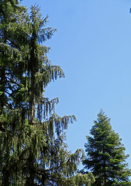
Heavy smoke from local forest fires fills southern Oregon’s Upper Applegate Valley where we live.


I left our home on the way to Burning Man with the heavy smoke of the surrounding forest fires filling the air in Applegate Valley like an evil fog. Once again we had an inversion; there was nowhere for the smoke to go so it was hanging around and hassling our lungs.

The forest service folks said there wasn’t much to worry about. We might have bad smoke, but the fires were good. They were the type that make their way along the ground, clean out the dead wood, and leave the forest feeling healthy. Naturally, there was an if attached. The wind could change; the heat could skyrocket; the fire could cease its peaceful ramble through the woods and become a raging inferno. Conditions were extreme.

Trusting a fire to behave is something like trusting a tropical depression in the Gulf to behave. Sometimes the depression simply goes away; but occasionally, it morphs into a horrendous hurricane with devastating floods. Hello Harvey. Our thoughts are with our friends and all the other people in southeast Texas who are suffering from the torrential downpour.

The forest service people in our area also told us that they didn’t have enough personnel to seriously tackle the fires creeping through our woods, even if they wanted to. The Chetco Fire over near the coast, some 50 miles away, had been declared the worst fire in the nation, at least for now. Even the local firefighters had headed for the coast. The town of Brookings was being threatened, and firefighters go where the threats are the greatest.

I was happy to escape. I drove down through the Rogue Valley. Smoky. I drove up and across the Cascade Mountains. Smoky. I drove down into the Klamath Basin, past Klamath Lake, past Klamath Falls. Smoky. Finally, down around Tule Lake across the border in northern California, down where Japanese-American citizens were once corralled behind barbed wire fences like cattle, the smoke begin to clear. I breathed a sigh of relief. I breathed fresh air.

A sign outside of Tule Lake told me there were no services for the next 70 miles. Not many of California’s 39 million people live in the remote northeastern part of the state. I checked my gas gauge. Not a problem; I made it to Alturas with a quarter tank left. Gas prices had shot up, however— partly because of the towns remote location, partly to make money off of the increased traffic to Burning Man, and partly because of Harvey’s romp through the Gulf and along the Gulf Coast. I am sure that you have noticed that gas prices shoot up within hours when the oil industry has a problem. It takes months for them to creep back down.  Or is this just my imagination?

I bought gas. I also bought apples, oranges and salad mix at the Holiday Market. (California won’t let you bring fresh fruit and vegetables into the state.) My destination for the day was Cedarville, a mere 26 miles away up and over the Warner Mountains from Alturas. I like the small town. It perches on the very edge of California. Off to the east are the vast open spaces of the Nevada’s Black Rock Desert where lonely ranches, windmills, sagebrush, jack rabbits and rattlesnakes rule.  Cedarville likes Burning Man. The majority of the Northwest’s large population of Burners pass through the town. A couple of years ago, a local gas station owner told me he pumps as much gas during the week of Burning Man as he does the whole rest of the year.

My normal routine is to spend the night in the town and then drive the 90 plus miles to Burning Man early the next morning. I checked out the fairgrounds where I was going to camp and then headed for the Country Hearth Restaurant. It’s a small-town kind of eatery that moves at its own slow pace but serves excellent food. I had my traditional last meal before heading into the desert and then went out to the van for a final call to Peggy. Phone service is non-existent to highly unlikely in Black Rock City. A large brindle dog offered me a wag or two, sat on the sidewalk, and watched me make the call.

Peggy greeted me with her usual chirpy welcome and then told me that the sheriff had just been by our house. “We are under a Level 1 fire alert!” Our endless days of smoke were threatening to turn into something much more serious. Level 1 is a warning. Be aware, the fire is threatening to come your way. Level 2 is you should be packed up. Leaving is highly recommended. Level 3 is get out now. You may be too late.

“I’m coming home,” was my immediate response.

“No, Curt,” Peggy replied. “I have everything under control. You need to head on into Burning Man.” She knows how much I look forward to the event. And I had no doubt that Peggy had things under control. She’s cool under pressure and highly organized. Plus, we have great neighbors. But that wasn’t the issue. Having to abandon our home and possibly lose it to fire wasn’t something she should face alone. She was insistent, however.

“Let me think about it,” I concluded. I went back to the fairgrounds and broke out a beer. It didn’t take much thinking. I was not going to leave Peggy home by herself. I called her back.

“No, no, no, Curt,” she made one final plea. But I reaffirmed I wasn’t going to leave her alone. I also said I wanted to say goodbye to our home if it was in danger of burning down. And finally, I told her I would head back to Burning Man if the situation improved. I think it was the latter that convinced her.

………

It’s a strange feeling to walk through your home and figure out what to take and what to leave behind when a forest fire threatens. In ways, it’s a walk down memory lane. There’s so much history. Some things are easy: medical and financial records. Others are more complicated. I love our books, for example, but there is no way we are going to pack up a couple of thousand. Maybe I’ll pull a dozen. A few family albums from our childhood, some art work with meaning, original materials from Berkeley’s Free Speech Movement, my genealogical files, Peggy’s quilts, some clothes— whatever we take has to fit in our pickup.The digital age helps. Much is on-line.

Peggy and I spent time outside yesterday, prepping the house. Most was already done. We live in an area prone to forest fires, so we have ‘defensible space.’ Plants, except for lavender, which is fire resistant, are away from our walls. Lower limbs have been cut away from trees. I’ve weed whacked most of the weeds near our house, but now wish I had done more. Too late. Plus, the fire people have a ban on all gas-powered tools. I did some hoe work and Peggy raked, The heat and the smoke made things much worse. Three hours was our max. We drank lots of water. A cold shower afterwards felt good.

We’ve decided on an action plan. There is really nothing else we can do here. Hanging out and manning a garden hose during a Level 3 situation is not an option for us. We will pack the truck today. There is a community meeting hosted by the forest service that we will attend tonight. Tomorrow Peggy will head for Sacramento to escape the smoke and I will resume my trip to Burning Man. We are pretty sure our property is safe. If not…

Peggy smiles. “Maybe it’s time to buy another small RV and hit the open road again.”

SaveSave

SaveSave

Peggy’s Lake

Peggy’s Lake. The quiet beauty of this small Sierra lake captured me.

Gold prospecting was a lonely occupation for most of the men who came to California as 49ers. Wives and girlfriends had been left behind. Often the only female companionship a miner might have was the type you paid for. Every town of any size had its whorehouse, or possibly several. One way the miners compensated for their loneliness was by naming lakes in the Sierra Foothills and Mountains after their favorite female companions, be it a wife, a girlfriend, or a particularly friendly lady of the evening.

I honored the tradition when I made my solo trip into the Grouse Ridge/Black Buttes/Five Lakes Basin Area. I had hiked out on Saturday from the Basin but Peggy wasn’t coming in to pick me up until Sunday. I didn’t want to hike up the Grouse Ridge Campground and spend the night. It was undoubtedly crawling with people. So, I went looking for a substitute.

A small lake that I had camped on before had been taken over by cattle, lots of them. I hiked on. Another little lake was shallow and also a favorite watering hole for my bovine companions. I hiked on and on, getting father and farther away from the trail. Much to my surprise, I came on a little, unnamed lake that I had never been on before— and I’ve crisscrossed the area extensively. It was shallow, only a few feet deep, and it might very well dry up in another month or two, but it was gorgeous. I decided to name it Peggy’s Lake, after my best friend and wife. It’s nothing official of course. It won’t show up on any maps. But I knew that Peggy would like ‘her’ lake.

Peggy's Lake in the Grouse Ridge Non-Motorized area.

Similar to Five Lakes Basin, Peggy’s Lake is nestled in the granite. Storm clouds hovered over head in this photo. They soon produced rain.

And it rained hard. I hid out under a couple of large pines to stay dry. This Lupine welcomed the rain with open leaves!

Lupine at Peggys Lake near the Black Buttes of the northern Sierra Nevada Mountains.

These pods on the Lupine left no doubt about its connection to the pea family.

After the rain, a convenient rock provided a premier seat for enjoying the lake.

Peggy’s Lake in the evening.

Peggy's Lake in the Grouse Ridge area of the Northern Sierras.

And with the early morning sun.

These two trees, a pine on the right and a juniper on the left, caught my attention.

Here they are early in the morning, backlit by the sun.

The shallowness of the lake encouraged grass to grow. I kept seeing little heads pop up out of this grass and didn’t have a clue what they were. Later I figured out they were baby ducks, catching insects.

Once again, I found a fun monster lurking in the lake’s reflections. I turned it upright for your enjoyment.

This red fir made me think Christmas tree.

As always, I was attracted to the beauty of old wood like this stump.

And these two trees that seemed to continue an embrace that they had shared when they were young and green.

Gnarled wood called to my camera. I liked the patterns here…

And here…

The setting sun lit up the Black Buttes that help define the area.

And I am not going to tell anyone where Peggy’s Lake is! There’s a reason.

The Grouse Ridge Non-Motorized Area is well-loved. Maybe too much so— especially for someone like me who prefers his wilderness rugged, wild and relatively people-free. But I make an exception for this region. It’s an easy place for people to get to and is very backpacking-friendly for families and newcomers to the sport. It serves as a great introduction, as it did for our grandchildren, Ethan and Cody. And as it did for me in the 1970s. There is great value in this— for the people of course— but also for our world. People who experience the wilderness in a positive way are much more likely to appreciate it, and want to protect it. And protecting our wild areas is ever so important, for ourselves, our children, and future generations.

This doesn’t mean that I am beyond selfishly wanting to keep a bit of it to myself, like Peggy’s Lake. So, I’ll share photos, but not location. (grin) If folks who frequent the area are charmed by the photos and go out of their way and find the lake: Welcome.

It was only proper that Peggy, Tasha, Ethan and I ended our backpack trip the following week at Peggy’s Lake.

Tasha points out a white cow that stopped by for a visit, laid down in the grass, and happily chewed her cud while watching us. It was the same cow that had come to visit me up near Glacier Lake the week before. Maybe she was missing her people.

Ethan and Cody explore the shallow lake.

It wasn’t all backpacking. Here Peggy displays her cards in a game with the 9-year-old Cody. This would have been a bad hand for poker. It was even worse for War, which Cody insisted she play with him whenever we camped, including at 6:30 in the morning!

And finally, nestled into the seat of honor, Peggy enjoyed her lake.

I am off to Black Rock City, my friends. And I am excited to return to the desert, the incredible art, and the magic of Burning Man. This year’s theme, Radical Rituals, promises to produce some interesting art. For example, what the heck is the Pagan Bunny Shrine? The creators say it’s all about hoppiness. We’ll see. Anyway, I’ll be away from my blog again for a week. But immediately afterwards, I’ll begin a series of posts on this strange, sometimes wonderful, and occasionally downright weird event. And I’ll respond at that time to any comments you’ve made in the meantime. See you then. –Curt

SaveSave

SaveSave

SaveSaveSaveSave

SaveSave

SaveSave

SaveSave

SaveSave

SaveSave

SaveSave

SaveSave

SaveSave

SaveSave

SaveSave

SaveSave

SaveSave

SaveSave

SaveSave

SaveSave

A Journey into the Five Lakes Basin

Five Lakes Basin in the Grouse Ridge Non-Motorized area north of I-80 in the Sierra Nevada Mountains.

I call this small gem in the Five Lakes Basin, Hidden Lake, because there are no trails to it. It’s my favorite of the five. Our grandson Ethan, had great fun leaping off the cliffs into the fairly deep water with encouragement from his grandmother. Mom looked on nervously.


The Five Lakes Basin called to me this summer. I’ve backpacked in numerous areas over the years— up and down the Sierras and other mountain ranges in California, Colorado, Maine, Alaska, Wyoming, New Mexico, Montana, North Carolina and the Canadian Rocky’s.  But my first trips in the late 60s and early 70s were into the Basin. Maybe these were like getting your first driver’s license, which is something you don’t forget. But it’s more; the Basin is special, it has a beauty of its own that can match any place I have ever been.

Eliminating four-wheel vehicles and motorbikes helped. It happened in the 70s. The jeep trail is still clear on Sand Ridge. If fact I rode over it in a jeep. Another time, a jeeper rescued me when I had a badly sprained ankle, and forever put me in debt to four-wheelers.  Once, however, I was camping next to a meadow below Sand Ridge and I heard the sound of a motorbike going around and around in circles. Out of curiosity, I walked out to the meadow and discovered a guy cutting brodies and tearing up the grass and flowers, leaving scars that would take years to heal. He saw me and took off, obviously aware of the damage he was doing, and not giving a damn. I went home and used my position as Executive Director of the Sacramento Ecology/Environmental Center to join with the Nevada City Chapter of the Sierra Club in its efforts to have the area declared non-motorized.

The trail Peggy, Tasha, Ethan Cody and I followed into the Five Lakes Basin over Sand Ridge. The motorbike guy was tearing up a meadow just below where the Glacier Lake Trail and the Sand Ridge Trail meet.

The old Jeep trail that I once rode over is still obvious on the top of Sand Ridge. The predominant plants are Mule Ears. Sand Ridge was created as the terminal moraine of one of the glaciers that carved through the Sierra Nevada Mountain Range during the last Ice Age.

The hike up Sand Ridge is a doozy. The first time I ever tried it, I thought I might die. I had zero concept of climbing up steep hills with a full pack on and I was in terrible shape. But that was long ago and many mountains in the past. I sailed up with relative ease this time, being in better shape at 74 than I was a 26, and ever so much more experienced. I have to say my companions hiked up it with relative ease. I’m sure it was my fine leadership. (Grin.)  Rudolph was waiting for us on top.

Cody, Tasha and Peggy climbing up Sand Ridge. The steepness and loose rock on the trail made it a challenge. The look on Cody’s face says it all. Interstate 80 can be seen on the upper right in the distance (the light color against the blue backdrop).

Ethan celebrates his climb up Grouse Ridge. Rudolph looks on.

Here’s how he really felt about the climb.

Peggy promptly named this wood sculpture at the top of the ridge with its prominent nose and antlers, Rudolph.

Of course the boys had to go for a ride. I later put a piece of white quartz that Peggy had found on Rudolph’s nose and the boys immediately broke out in a rendition of Rudolph the White Nosed Reindeer.

The Five Lakes Basin sits at the end of Sand Ridge. As the name suggests, you have to hike down to reach the lakes. There’s a trail, but I prefer hiking over the granite. My basset hound, Socrates, used to regard it as a freeway. And relatively speaking, it is. If you pick your way down the rocks, the going is easy up until the last 50 yards or so. My favorite lake sits right at the bottom. I call it Hidden Lake. It isn’t, but the fact that it is away from the main lakes, has no fish in it, and has no trail to it means that it gets less traffic. At least it did until the Boy Scouts discovered it. They’ve turned it into a mecca for building granite chairs and tables.

Looking down at Hidden Lake in the Five Lakes Basin nestled in the granite.

The granite chairs built by the Boy Scouts or someone else. They weren’t there when I first started backpacking into the area.

Tables have been added in more recent times. My bowl is there to provide perspective. It has to take several scouts to lift these granite boulders.

The unique way that granite splits naturally is what enables the chair and table building.

Some of the rocks must weigh several hundred pounds. Peggy, Tasha and the boys were quite impressed and took full advantage, but I couldn’t help but wonder if the scoutmaster might better serve the boys by teaching them minimal impact. Possibly it isn’t scouts. Maybe it’s a church group, or Druids. They were good with stones, right? I could see them sitting around on a full moon night chanting and doing whatever Druids do.

We had the lake to ourselves, however, as I did the week before on my solo journey. No Boy Scouts and no Druids. We were able to enjoy its beauty and the fact that it makes a very nice swimming hole.  This was the lake where I came up with the idea for the Sierra Trek in 1974, the hundred-mile and hundred-kilometer fundraising backpack treks that kept me happily out in the woods for close to 30 summers. It’s also where Socrates and I had the encounter with the underground demon. Go here for that rather funny story if you missed it the first time around.

The lake is always good for reflection shots.

Another example.

Some are a bit strange. I decided that this creature would fit right into 20,000 Leagues Under the Sea.

And this fellow, turned on edge made a great monster insect. The tree provides antennae. And check out the scary slitted eyes just above the snout! It looks like one mean dude, or dudette.

The Black Buttes rise up in the background. Our day hike would take us over to their base on the left. Glacier Lake, which I featured in my last post, is just below the Buttes on the right.

The swimming is great at Hidden Lake. Cody, however, was a bit worried about its mud bottom. “It’s not like a swimming pool,” he groused.

Sunset in the Five Lakes Basin of the Grouse Ridge Non-Motorized Area.

Sunset from our camp on Hidden Lake.

I planned a layover day so Tasha and the boys could explore the rest of the Basin. I had Ethan, who is also a Boy Scout, use his compass and path finding skills to lead. He was quite good. I was really impressed with his ability to lead us back using his trail memory. The following photos provide an overview of our journey.

This map shows our route into Hidden Lake and then our day hike through the Basin to Upper Lake at the base of the Buttes..

Jeffrey Pine in Five Lakes Basin of Grouse Ridge Non-Motorized area.

I explained to Ethan the importance of memorizing prominent landmarks, such as this impressive Jeffrey Pine, to remember his route.

This Juniper wasn’t large like the Jeffrey Pine but it was still distinctive and provided another landmark.

Once your expertise in route finding improves, even something like this small but unique Manzanita sculpture can remind you that you are on the trail.

Gary Snyder’s ‘biggest little lake’ in the Five Lakes Basin from the poem, Old Pond, that I included in my last post.

This is the middle lake above and to the right of Snyder’s lake on the map.

And this is the upper lake that nestles up against the Black Buttes. An old stream bed (the curved line) is in the middle of the lake. Trout hang out in the bed during the warmer summer months. This is the first lake I camped on when I came into the Basin.

My second camp was just above the waterfalls in this stream that feeds the lake.

Tasha reaches out to fill her bottle with the cold water that comes from a snow bank above.

The snowbank. It is unusual for snow to be in left in the Basin during August. it speaks to the very heavy snowfall the Sierras had this last winter. Naturally, such snow led to a snowball fight.

And Ethan sliding down with Peggy waiting to catch him.

Tasha and Ethan hiding out behind the snowbank.

Peggy and Cody found a niche to hang out in the granite rocks above the snowbank.

I like this photo I took next to the upper lake because it shows the contrast between the white granite of the Five Lakes Basin and the dark basalt of the Black Buttes.

The late snow also left an abundance of August flowers including this Sierra Tiger Lily…

Corn lilies galore…

With their white flowers…

Asters…

And many other flowers.

A final family photo with Peggy, Cody, Tasha and Ethan at the waterfall before heading back to Hidden Lake.

Next Post: We conclude out trip into the Grouse Ridge Non-Motorized Area with a stop over at Peggy’s Lake.


SaveSave

SaveSave

SaveSave

SaveSave

SaveSave

SaveSave

SaveSave

SaveSave

SaveSaveSaveSave

SaveSave

SaveSave

SaveSave

SaveSave

SaveSave

SaveSave

SaveSave

SaveSave

SaveSave

In the Beginning… A Reflection on the Grouse Ridge-Black Buttes-Five Lakes Basin Area

A waterfall in the Five Lakes Basin provides water from snowbanks to one of my favorite lakes. The Black Buttes tower above. Hemlocks, pines and firs grow on the hillside.


Old Pond

Blue mountain, white snow gleam
Through pine bulk and slender needle-sprays;
little hemlock half in shade,
ragged rocky skyline,

single clear flat nuthatch call:
down from the treetrunks

up through time.

At Five Lakes Basin’s
Biggest little lake
after all day scrambling on the peaks,
a naked bug with a white body and brown hair

dives in the water,

Splash!

A poem by the Nobel Prize winner and the “poet laureate of Deep Ecology, ” Gary Snyder.

I have just returned from my last backpacking trip of the summer, my fifth— one for each decade I’ve shouldered a pack and disappeared into the wilderness. My last two trips included the Grouse Ridge-Black Buttes-Five Lakes Basin area, the same region Gary Snyder refers to above. He lives outside of nearby Nevada City (just above Grass Valley in the map below), and, like me, has wandered and loved the glacier carved country from top to bottom, from the Buttes to the Basin.

The maps below provide information on the location of the area and where I backpacked on my two trips.


Yellow marks the general location of my two trips this summer into the Grouse Ridge area just north of Interstate 80 between Sacramento, California and Reno, Nevada in the Sierra Nevada Mountains. (I was raised in a small town just outside of Placerville.)

The area circled in yellow was where we backpacked. I-80 can be seen at the bottom of the photo. I helped achieve the non-motorized status for the area in the 1970s when I was serving as Executive Director of the Sacramento Ecology/Environmental Center.

A close-up of the area. Today I am featuring Glacier Lake and the trail there from Grouse Ridge marked in yellow, which was the route I followed on my first trip. I went into the Basin on the Sand Ridge Trail when I backpacked in with my family.

The first trip into the Basin I made by myself this summer; the second was with my wife Peggy, my daughter Natasha, and her two sons, Ethan and Cody. It was our grandkids’ first backpacking trip and I wanted them to explore the area where my own backpacking experiences had begun in 1969— where I had first discovered the joys of backpacking, and the beauty of the Sierra Nevada Mountains.

Our daughter Natasha with her two boys, Ethan on the left and Cody on the right. Sierra granite provides the backdrop.

Ethan and Cody contemplate another climb. Both boys, Ethan at 12 and Cody at 9, carried full backpacks. Ethan was like a deer on the trail, bounding ahead. Cody was like a Sierra badger, digging in and not giving up, mastering the trail one step at a time.

In the beginning: It sounds almost biblical. Dan Iles would like it. I met Dan at Glacier Lake on my first trip into the Grouse Ridge area this summer. He introduced himself as the Dean of Graduate Studies at the Shasta Bible College in Redding, California. He’s a serious Christian, and a heck of a nice fellow. I liked him immediately. He had backpacked into Glacier Lake with his 13-year-old grandson and told me that he had been bringing youth groups into the area since the 70s.

The Reverend Dan Iles at Glacier Lake.

I was getting ready to leave the next morning when he came over for a chat. I had told him the night before that I lived in the Applegate Valley near the small town of Ruch in Southern Oregon and he wanted to know if I attended one of the churches there that he was familiar with. I explained that I was a bit more Eastern in my beliefs, a bit more Zen, and something of an Agnostic. I dug into my pack and found Siddhartha, a 1922 novel by Hermann Hesse that a friend had given me in the 70s. The novel describes Siddhartha’s journey to enlightenment at the time of the Buddha. I read it every few years because it reminds me of the importance of living in the present, of the interconnectivity of all things, and the value of a simple life— of not getting lost in our materialistic world.

Reading Siddhartha after dinner beside a quiet Sierra Lake. (Photo by Peggy Mekemson.)

Dan and I must have talked for 45 minutes or so about our lives. He described himself as a Professor of Practical Theology and told me of his efforts to help children and women in Africa who had been left homeless and destitute by the seemingly endless conflicts. He also told me that he believed in freedom of religion, that people should be free to worship according to their own beliefs, which is a concept that I strongly support. Still, I could tell he was concerned about my soul, that he would have considered a day spent trying to convert me as a day well-spent. It went with the territory of who he was and what he believed.

As I hiked past his camp to say goodbye on my way down into the Five Lakes Basin he urged that I read the Book of John in the New Testament. “It does an excellent job of describing the miracles of Christ,” he assured me. I’d read John before. In my youth, I had been considered a prime candidate for becoming an Episcopal priest. But I read it again on Dan’s recommendation. Miracles are what have been pulling people into Christianity for millennia. Jesus changes water to wine, feeds five-thousand people with two fish and five loaves of bread, walks on water, heals the sick, revives the dead, and ascends to Heaven.

I should have said, “Thanks, I’ll do that,” and moved on. But I couldn’t help myself. “I don’t need miracles, Dan” I responded. “I’ve got this.” And I raised my hands to take in the surrounding countryside. The towering Black Buttes climbed above the blue-green Glacier Lake. Giant red firs and pines stood as silent sentinels over the campground. Brightly colored flowers called to insects with an urgency that predated man’s sojourn on earth. Massive cumulus clouds spoke of lightning and thunder and rain and hail— of the incredible power of nature. If I needed awe, if I needed inspiration, if I needed a reason to believe, it was right there in front of me, behind me, surrounding me. I didn’t have to travel back in time 2000 years to events that required a leap of faith to believe. I waved one last time, turned, and hiked down the trail toward the Five Lakes Basin.

Photos of Glacier Lake and my hike into the lake.

The Black Buttes of the northern Sierra Nevada Mountains tower over Glacier Lake.

A close up of the Black Buttes as the sun sets.

The moon hovers above the Black Buttes in the northern Sierra Nevada Mountain Range.

A small pool fed by melting snow provided this reflection shot at Glacier Lake.

Red fir reached for the sky above my campsite.

Glacier Lake in the Grouse Ridge Area of the Northern Sierra Nevada mountains.

I found these two moss colored elders along the trail to Glacier Lake.

What insect could resist this brightly colored Red Mountain Heather that I took a close up of along the Glacier Lake Trail.

Towering cumulus clouds threatened thunder, lightning and hail at Glacier Lake.

I found a small creek along the trail to Glacier Lake and decided to camp next to it, thinking it might provide a short hike for my grandsons. (They didn’t need it.) I removed bear scat from the campsite so they wouldn’t get too nervous.

This boulder next to the campsite reminded me that the area had been carved by glaciers. The granite rock, known as an erratic, had been left behind by one of the glaciers.

I hid out under my tent’s groundcloth as lightning flashed, thunder rolled, and hail pounded down on my campsite. Later, as the sun set, all that was left of the storm was a few puffy clouds.


NEXT POST: It’s down into the Five Lake Basin.


SaveSave

SaveSave

SaveSave

SaveSave

SaveSave

SaveSave

SaveSave

SaveSave

SaveSave

SaveSave

SaveSave

SaveSave

SaveSave

SaveSave

SaveSave

SaveSave

Out of the Woods… For a Day

Ready for another adventure, I look out toward the Black Buttes of the Sierra Nevada Mountains north of I-80. Peggy dropped me off at the trailhead, wished me well, and took this photo. And then I headed down the trail.

I am out of the woods— for a day— and decided to check in. I have just finished backpacking by myself for a week in the Grouse Ridge Non-Motorized Area of the Sierra Nevada Mountains north of Interstate 80. I’m going back into the same area tomorrow with Peggy, our daughter Tasha, and our grandsons Ethan and Cody. It’s a beautiful area, and I have lots of adventures to share. Like how do you persuade a cow that she really doesn’t want to camp with you overnight?

Anyway, here are a few photos to serve as a teaser. I should be home next Monday, which will give me a chance to catch up with fellow bloggers after a summer of backpacking. Of course I will be madly getting ready for Burning Man 2017… (grin).

I expect to see wild animals out on the trail, but this one didn’t seem particularly wild. In fact, I think she wanted to camp with me. Maybe she had seen the same fresh bear poop I had.

Turns out the weather was much more of a challenge than the bear. Shortly after my discussion with the cow, I was in the middle of a thunder, lightning and hail storm!

This is an area of incredible beauty that I have returned to again and again over the years. There are meadows filled with flowers…

That are always forcing me to stop and take their photo.

Numerous small lakes…

And the Black Buttes, seen here at Glacier Lake— lit up by the setting sun.

A final shot from Glacier Lake as the sun goes down, outlining what I considered to be a very strange tree.

See you all next week. —Curt

SaveSave

A Canyon of Mystery and Magic… Sego Canyon Rock Art

These larger-than-life pictographs at Sego Canyon in Utah are among the strangest I have ever seen. Now add in the fact that they are several thousand years old. And what’s with the pictograph on the right? Also, check out this guy’s spiky hairdo.


Zipping along Interstate 70 in Utah, you might very well decide to take a detour and visit Arches and Canyonlands National Parks. It is a decision you will never regret. The odds are, however, that you will miss the small road that extends north of the Arches turnoff heading toward the town of Thompson Springs. In so doing so, you will miss the opportunity to visit one of the most magical and mysterious rock art sites in the Western United States: Sego Canyon.

Our van sits in Sego Canon as Peggy and I wander around looking for rock art. Most of it is located on the two rock faces below. Peggy watches as I work my way up closer to the petroglyphs.

Most of the rock art at Sego Canyon is found on the two faces of this large rock.

This is another rock face that Peggy and I checked for petroglyphs in Sego Canyon. We didn’t find any rock art but the rock itself was quite unusual. I could see why Native Americans might have considered the area sacred.

Three different historical periods are represented in the rock art here dating back over a period of 6,000 years. The most fascinating to me are the pictographs left behind during the Archaic period by nomads who roamed the area from 8,000 to 2,000 years ago. The large, anthropomorphic forms that are painted on the rock normally lack eyes, arms and legs but may come with antennae, snakes and earrings. Known as the Barrier Canyon Style, it’s hard not to think of these pictographs as alien, or at least imagine a shaman encountering these creatures on a drug induced journey into an alien world.

Dave Kingsbury, one of my followers from England, and I were discussing cults where people run around with rattlesnakes in their hands. We both agreed that such sport wasn’t for us. This horned pictograph from the Archaic period seems to have a thing for snakes. Possibly he belonged to such a cult. Or possibly he was a very powerful shaman.

Or maybe something else. I see this and I want to say, “Take me to your leader.”

And this.

I find these jellyfish-like pictographs even more mysterious than the anthropomorphs. UFO fans might describe it as a space ship taking off, but hey, maybe it is a jellyfish. Or likely something else.

This shot provides a view of how some of the pictographs fit together on the right side of snake man.

And to the left..

And now, all together.

A final shot from the Archaic period. I found these pictographs a bit ghostly.

The Fremont Culture took over from the Archaic period and lasted from  600 CE to 1200 CE. Unlike the nomadic Archaic peoples, the natives of the Fremont period grew corn, lived in permanent stone buildings, and had a complex social structure. Most of the rock art they left behind is in petroglyph form, pecked into rather than painted on the rock.

The Fremont era had its own strange figures, but these were loaded down with jewelry. I found the hand interesting. I wonder if it is holding Datura seeds. It looks a bit like a foot walking in the circle. And there is a Big Horn sheep. It is rare to find petroglyph sites in the west that don’t include them.

A close up of the two figures with another ghostly one to the right. There is also another hand and another sheep, a fat fellow. The tiny figure on the left looks more like a deer to me.

And finally, we have the more modern Ute Culture that populated the area from 1300 to 1880 CE, when the Utes were forced out of their homes and onto Indian Reservations so pioneers could grab their land. One way to distinguish petroglyphs from this period is the presence of horses, which the Spaniards brought to North America in the Sixteenth Century. In fact, horses are a major tool used in  dating rock art.

This Ute rock art featured what is thought to be a shield. I’d say that the horse is about to become horse meat.  But wait, is that a small man on the back of the horse? Maybe he is the enemy.

Ute Indians seem to hunt buffalo in this scene, which will be my last for Sego Canyon. If you ever find yourself in the area, don’t miss the opportunity to explore this fascinating  site.

Next Post: I am still out backpacking but will try to get a post up on petroglyphs Peggy and I have photographed in Arches and Canyonlands National Parks during my next break between trips.

SaveSave

SaveSave

SaveSave

SaveSave

SaveSave

SaveSave

SaveSave

SaveSaveSaveSaveSaveSaveSaveSaveSaveSave

SaveSave

SaveSave

Pass the Datura, Please… I Want to Make a Square.

Geometrical forms are often found in rock art, and the Three Rivers Petroglyph Site is no exception. The body of this horse with its ears back and tail sticking out is filled with squares. I’m wondering if its pose is a result of eating Datura, whose seed are represented by the two circles. Or maybe it just spotted the horse-sized snake off to the right. My ears would be back and tail sticking out too.


Datura, one of Georgia O’Keeffe’s favorite flowers to paint, is a strong hallucinogen, and dangerous. Shamans of the western US often used it to induce visions and travel on their journeys into other worlds. It seems quite likely that many of the stranger petroglyphs found at Three Rivers were inspired by its use. There is also a theory that many of the geometric patterns found in rock art sites throughout the world are hard-wired into the brained and are discovered through the use of hallucinogenic drugs.

Datura, also known as Jimsyn Weed.

Datura, a beautiful but dangerous plant is also known as Jimson Weed. I took this photo along the American River Parkway in Sacramento.

I’ve always been amused by how Datura earned its Jimson (Jamestown) Weed name. Apparently the residents of Jamestown fed the plant to British soldiers in 1676 who had been sent to quell a rebellion by the townsfolk. One of the soldiers spent his time trying to blow a feather up into the air while another sat naked in a corner and made faces at them. The other soldiers were similarly effected.

Following are a few of the petroglyphs we found at Three Rivers that featured geometric forms and were perhaps inspired by the use of Datura.

This particular petroglyph at Three Rivers reminded me of a spiral galaxy. Maybe it was supposed to.

This large petroglyph was laid out like a maze.

Another large rock petroglyph. This one of squares with one of the squares filled with further squares.

Another maze like petroglyph. Following the spiral takes you to the center of this large circle.

Lacking the geometric look of the above petroglyphs, this may be a ladder leading down to a map of personal crop sites. Many Native Americans lived in cliff dwellings and would travel by ladder to farms below. I wonder if the footprint isn’t saying ‘walk this way.’

Here’s a pattern that you might expect to find in a modern-day Navajo blanket.

Okay, I’m thinking Datura here. The wavy lines might actually represent a river, but the eyes? (On the top maps I use backpacking, they would represent two depressions in the land.)

Circles are common at Three Rivers Petroglyph Site. This may represent the sun.

And I conclude my posts on Three Rivers with what might be another candidate for Datura influence.

NEXT POST: Continuing my series on petroglyphs, I’ll travel up to Sego Canyon in Utah. Since I am out backpacking in the Sierra’s,  I’ll respond to comments on my return.


SaveSave

SaveSave

SaveSave

SaveSave

SaveSave

SaveSave

SaveSave

SaveSave

SaveSave

SaveSave

SaveSave

SaveSave

SaveSave

SaveSave

There’s Something Fishy about the Three Rivers Petroglyph Site


What’s an octopus doing at the Three Rivers Petroglyph site in south central New Mexico.


This, and my next post, will take us back to the Three Rivers Petroglyph Site in New Mexico. I am backpacking in the Sierra Nevada Mountains this week and will respond to comments next week. Thanks, as always, for following my blog and reading my posts. 


It’s really dry at the Three Rivers Petroglyph site in New Mexico, like desert dry, like 10 inches of rain a year dry! So what’s with the petroglyph of an octopus? It’s at least 800 miles to the nearest body of large water, the Gulf of Mexico, and a similar distance to the Pacific Ocean. I’d think it was one of strange aliens that rock artists like to portray if it weren’t for the three-masted ship with the guy in the stern also found at the Three Rivers site.

Check out this three-masted sailing ship and what appears to be a guy peering over the railing. Even the experts scratch there heads over this petroglyph.

Obviously, someone from the Jornada Tribe had traveled to distant lands and returned to share his or her experiences as rock art. Maybe several members of the tribe had travelled on such journeys. Peggy and I also found fish, a possible seal, and maybe even a whale among the petroglyphs. The frog is a bonus.

A seal perhaps.

There’s no doubt about this fish. But note the geometric patterns. I’ll return to this theme in my next blog.

This is the whale. At least that’s what I am going with. You can make out its mouth on the left and then eye, fin and fluke. This is another example  of fitting the rock art to the rock.

Slightly off subject but still associated with water, I had to put this frog somewhere! Is this one saying, “I need a hug!” ?


NEXT POST: Geometric forms among the petroglyphs of the Three Rivers Petroglyph National Recreation Site in New Mexico.

SaveSave

SaveSave

SaveSave

SaveSave

SaveSave

SaveSave

SaveSave

SaveSave

SaveSave

SaveSave

No-see-um Camp, a Sacred Grove, and Cougar Poop

No-see-um camp, which we expected to be bug infested, turned out to be nestled among trees that made me think of a sacred grove.

Part II of our hike up Cook and Green Creek to the Pacific Crest Trail through the Rogue River National Forest.

Our goal for the day was No-see-um Camp, which seems like a very poor place to set up your tent. If you have spent much time outdoors, you will recognize no-see-ums as particularly nasty little bugs. I first encountered them when backpacking on the Appalachian Trail in Maine. It had rained for a solid week and every biting bug in existence had considered us fair game. While mosquitoes had treated our bug repellant as an hors d’oeuvre, no-see-ums had come after us with knives and forks. Later, I watched a moose in Alaska dash wildly about and roll in a snow bank to escape the tiny, nefarious fiends. Fortunately, we didn’t find any no-see-ums in No-see-um camp. It was quite the opposite. I decided we had arrived in a sacred grove.

Sacred groves go almost as far back as humanity. Think of the Druids and their oaks. In West Africa, where I served in the Peace Corps, huge cottonwoods were thought to contain living spirits and I often found offerings at their bases. It’s important to keep the forest spirits happy.

No-see-um camp had more species of trees than I have ever found in a single location, many of them were giants. From our camp, I could see Douglas fir, sugar pine, white fir, blue spruce, chinquapin, big leaf maple, and yew. Just up the trail I found a ponderosa pine. Cook and Green Creek with its cool, refreshing water bubbled and burbled and roared its way down the canyon just behind our tent. I figured it was an excellent place to commune with nature spirits and Peggy found a camp guardian up in the trees, which I thought was quite pagan of her.

Another view looking up from our campsite on Cook and Green Creek. This one features big leaf maples.

There is a reason for their name!

We also had chinquapin growing in the grove. This prickly thing covers the trees nuts, which are said to be tasty.

Giant sugar pines with their large cones and giant Douglas firs with their small cones surrounded us.

I found a large ponderosa pine near by. Do you know what made the line of holes? It was a sapsucker, a kind of woodpecker. It will return to eat any insects that have entered the holes.

Cook and Green Creek flowed just behind our tent. It was burbling here.

Small waterfalls added a slight roar.

And I found the way the water flowed over a rock to be intriguing.

The downed tree next to our tent provided a good perspective on the size of the larger trees.

This odd tree growth just above our site served as Peggy’s camp guardian. (Photo by Peggy Mekemson.)

The Guardian’s tree was also impressive.

We used our layover day as an opportunity to do a nine mile hike up to the pass and back. Going up, we entertained ourselves by enjoying flowers and other plant life while looking for signs of wildlife. And yes, I have more animal poop, scat, to share with you. I’ll bet you’re excited.

A shelf fungus.

Any idea what is happening here? Carpenter ants were making their nest. They are a fairly large ant that literally cut off small, sawdust-size chunks of wood and then bring it out to the edge where they dump it on to the sawdust pile at the bottom of the photo.

Peggy poses beside a fallen tree.

Which happened to feature another wood sculpture that Peggy determined was a dragon.

We found these unusual cones that actually grow directly on the limbs of the trunks and limbs of the knob cone pine.

Okay, I put up pretty, or at least I hope interesting photos, and then I put up poop. Why? Half the fun of wilderness travel is knowing what you are seeing around you. Scat (poop) is one way of telling what animals are using the trail you are on. This happens to be cougar, or mountain lion scat. The twisted piece on the end is fairly definitive of the cat family. Size suggests cougar. It was dry, so we were in little danger of an immediate encounter.

Since we are on animal signs, any idea of what made this? Odds are it was a porcupine. They chew off the outer bark to get to the nutritious, inner bark.

This attractive small waterfall, provided cool water to drink with our  lunch. (Photo by Peggy Mekemson.)

After lunch on our way up to the pass, we found this attractive Blue Spruce…

And a flower, which is known as Ranger’s buttons.

On top, we met Rambo, Dogondo, and Double D: three PCT through hikers. Their names are their trail names. They had started at the Mexican border and been backpacking since April, covering close to 1000 miles. They were skinny and ever so eager to reach Oregon, which was just up the trail. One of them told me that Sasquatch (Big Foot) had been rooting around outside his tent the night before.

Rambo, a PCT through hiker from Riverside, California.

Dogondo, a PCT through hiker from Chicago.

Double D, a PCT through hiker from Kansas City.

We raced on our way back down from the pass. I was careful to keep Peggy behind me. She thinks that she is a greyhound when she gets out in front going down a hill. I once sprained my ankle trying to keep up with her coming off of Muir Pass on the John Muir Trail and had to hobble another 80 miles before we finally climbed up and over Mt. Whitney and out. Taught me.

Peggy, all set to go, wearing one of her favorite T-shirts.

The Cook and Green Trail and Some Really Weird Trees… Part I

The way madrone trees shed their bark is strange enough without having a pair of eyes staring out at you. We found this specimen along the lower end of the Cook and Green Trail.


Today’s post will take you along with Peggy and me on our latest backpacking adventure. This time, the trailhead was a mere 30 minutes from our house! The Cook and Green Trail follows Cook and Green Creek up to Cook and Green Pass where it connects into the Pacific Crest Trail, the PCT. (That’s a lot of Cook and Green; they were gold miners who worked the area in the 1870s and 80s.) Starting at the pass, we could have made a right turn and hiked to Mexico or a left turn and hiked to Canada. Another time. (grin)

Peggy points out a PCT marker showing the trail south. Had we followed it, we could have been to Mexico in a thousand miles.

We were greeted by a pair of signs at the Cook and Green trailhead, which I found amusing. Both were products of the US Forest Service. I don’t think the hand on the first poster is that of America’s preeminent spokesperson for fire prevention, Smokey the Bear; I think it belongs to Bigfoot! The second sign warned us about bears. Serious stuff.

Did this sign use Bigfoot to emphasize fire prevention? Or is it a clawless Smokey? It’s puzzling.

It’s smart to be aware of bears when backpacking, but you should not let them keep you out of the woods.

I am a veteran of the backcountry of Yosemite, where the bears actually run a school on how to steal backpacker’s food. (Fake news, but just barely.) So I wasn’t too worried about the bears of the Rogue River and Klamath National Forests. Still, the poster is worth reviewing. Avoid confrontation: That’s always sage advice when you are dealing with a grumpy animal that can outrun you, outweighs you, and comes with long claws and sharp teeth. You don’t want to surprise them and you don’t want to get between a mother and her cubs. That having been said, bears aren’t particularly interested in eating people.  If they were, they would move into towns where there are lots of people to eat. Mainly, they prefer to avoid humans, like most sensible wild animals.

Your food? Well, that’s a horse of a different color, or at least a bear that has hung out around careless people. When I see bear poop that includes bits and pieces of the plastic used to package  freeze-dried backpackers’ food, I know to be on the lookout. BTW, a Yosemite bear would laugh at the advice to hang your food high in a tree. Guess what, bears climb trees. And if mama bear can’t climb a tree in Yosemite to retrieve your chow, she sends her babies up. The advice in Yosemite used to be that your food bag had to be at least nine feet off of the ground and nine feet away from the trunk, with no ropes hanging down! I’ve watched bears play tether ball with food that wasn’t hung high enough. Now the park rangers want you to carry plastic bear-proof barrels. I’ve never worried much about bears when away from Yosemite. Still, care is called for.

It’s good advice about dogs. Way back in history, I was out backpacking with my first father-in-law’s Springer Spaniel, Sparky, and came across a bear. Sparky jumped behind me and then stuck her head out between my legs and started barking vociferously. The bear stopped and growled before ambling on. I told Sparky that if the bear had charged I would have picked her up and tossed her out in front of me.

The Cook Green Trail begins its journey through a burned-out area. In 2012, we watched from our home as huge billows of smoke climbed above the forest and a fleet of helicopters used large buckets to dip water out of Applegate Reservoir, one mile above our home, to fight the Fort Complex fire. It was only a few miles away, and we watched nervously. Today, new growth is returning to the area as nature performs one of her miracles.

This photo captures the area where the Fort Complex Fire stopped burning along the Cook and Green Trail. It’s a good example of burned and non burned forest. On the burned side, the green near the ground shows where the forest is beginning to recover.

While the hike through the burned-out area was interesting, our fun began on the other side. Peggy came across a mile marker that she felt needed to be decorated, a madrone tree featured eyes peering out from its strange, peeling bark, several oak trees were dressed in moss, tree roots created weird sculptures, and the Mother of All Roots stood higher than me.

Someone, probably the forest service, had placed mile markers along the first section of the Cook and Green Trail. Peggy decided to decorate the marker by adding sugar pine cones beside the marker and rocks in front.

I thought these moss-covered live oaks were quite unique.

This is a close up of the tree moss.

We also found this interesting growth. At first I thought it was stag horn moss but it may be a lichen.

Tree roots can create fun sculptures. I’m not sure I would want to meet up with this one on a dark night!

More ordinary, but still interesting, this root had taken a detour around a rock and captured it.

And here we have the Mother of All Roots!

I stood next to it just before the root connected to the trunk to provide perspective. (Photo by Peggy Mekemson.)

NEXT BLOG: We hike on to No-see-um camp, which turns out to be closer to a sacred grove than a bug infested swamp, and hike up to Cook Green Pass where we find PCT through hikers and mountain lion sign.