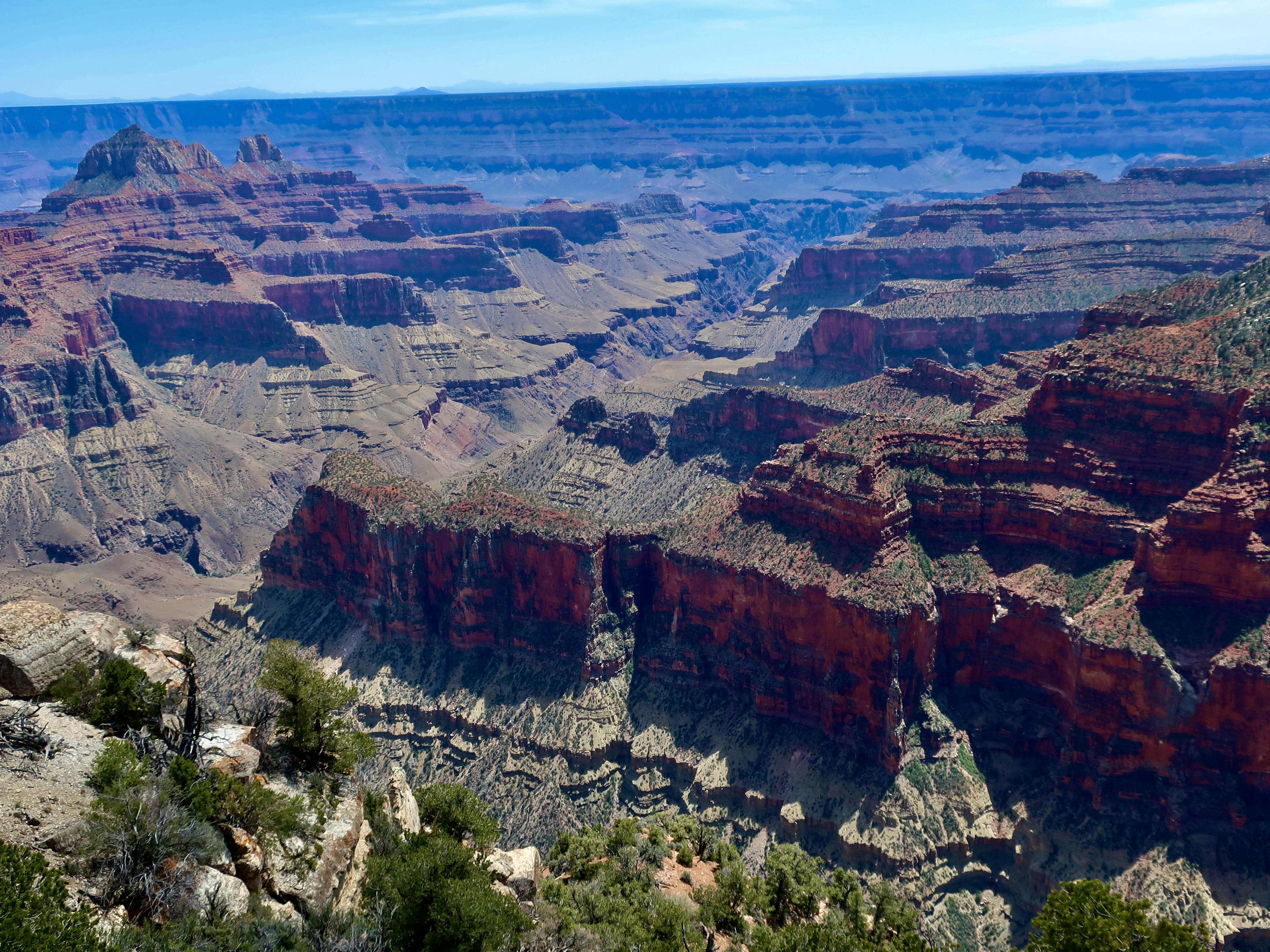
Hundreds of millions of years of the earth’s history is recorded in the walls of the Grand Canyon, much of it in convenient layers. Each layer has a story to tell ranging from sand storms to ancient seas, from raging rivers to quiet mudflats— stories that are told in rocks progressing in age as one goes deeper into the canyon. This photo was taken from Bright Angel Point.
For example, the light rock in the foreground is made up of Coconino sandstone, which was laid down some 275 million years ago when a vast, sand-filled desert covered the area. It’s a hard rock that resists erosion and creates a distinctive layer around the canyon, as seen on the opposite wall.
The two formations below it, Hermit Shale and Supai, represent some 60 million years of geological history and are made up of softer rocks such as mudstone and siltstone formed by clay filtered out of calm water typically found in lakes, lagoons, river deltas and harbors. These rocks erode more easily and create slopes. The Supai formation is interspersed with layers of sandstone that slow the erosion and create small cliffs. It also includes generous amount of hematite, which is rich in iron. Iron oxide (rust) gives the formation its distinctive red color.
The Red Wall, located just beneath the Supai formation, is one of the most prominent features of the Grand Canyon. Created some 340 million plus years ago in a sea that covered the region, it ranges in height from 500-800 feet and is made up of limestone. Its predominant red color doesn’t come from the limestone, however. It comes from the iron oxide that is formed from the hematite in the Supai formation and leached out by water flowing down the wall, painting it red! Like the sandstone, limestone is a hard rock that doesn’t easily erode. Thus, the towering cliffs.
The oldest rocks in the canyon are appropriately found at the bottom, Vishnu Schist, a metamorphic rock of quartz and hornblende that was born in a deep ocean trench some 1.8 billion years ago. Does this mean the Grand Canyon shows 1.8 billion years of earth’s geologic history? Not quite, every so often nature wipes out a few million years through erosion. The most renown is the Great Unconformity where some 1.2 billion years of the the 1.8 billion were razed!
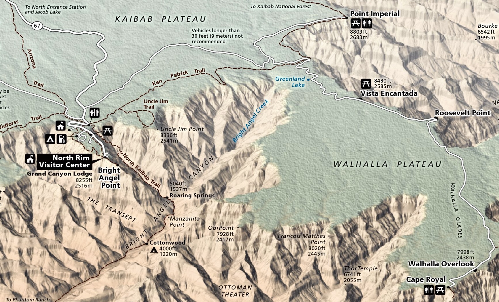
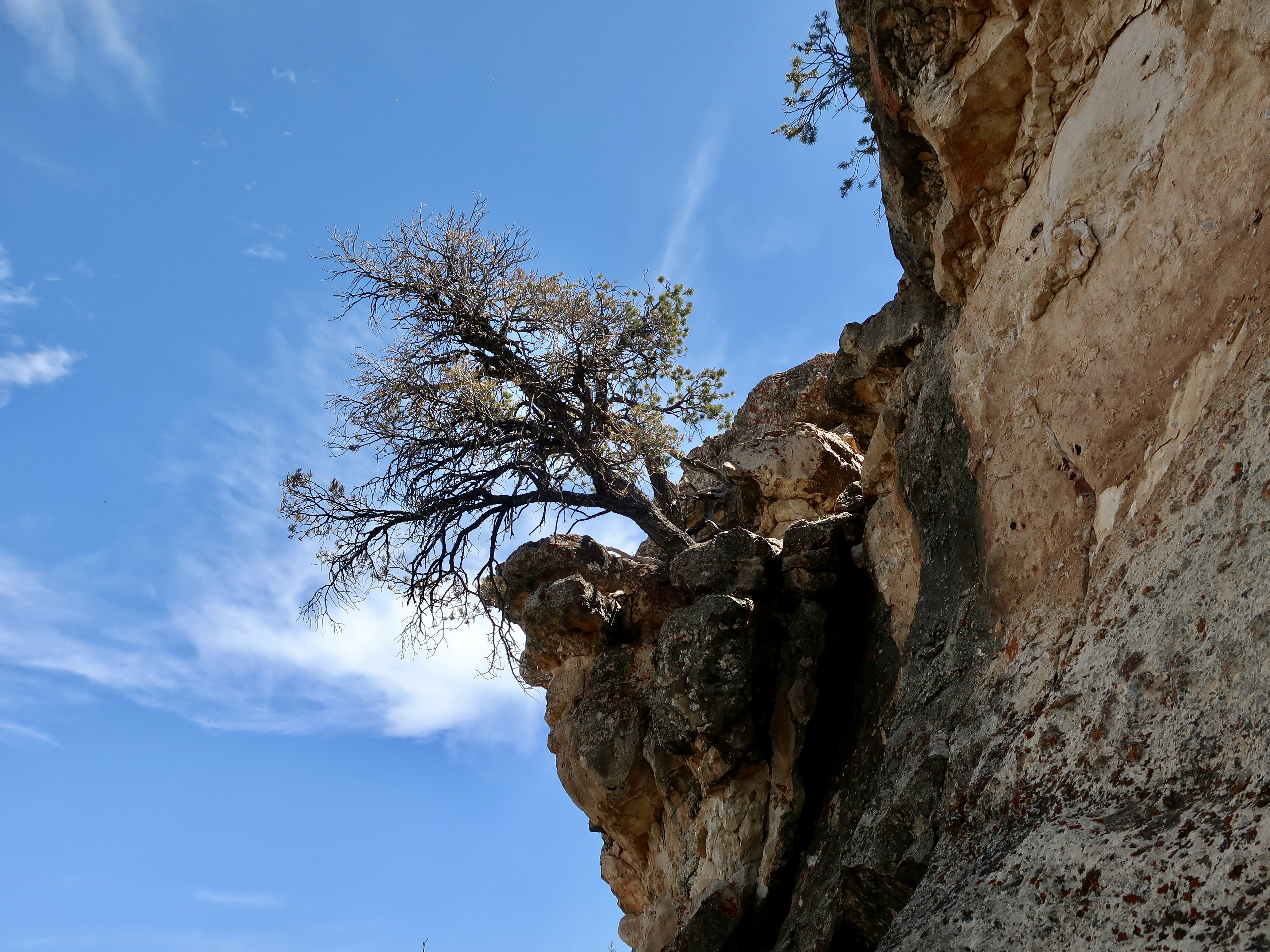
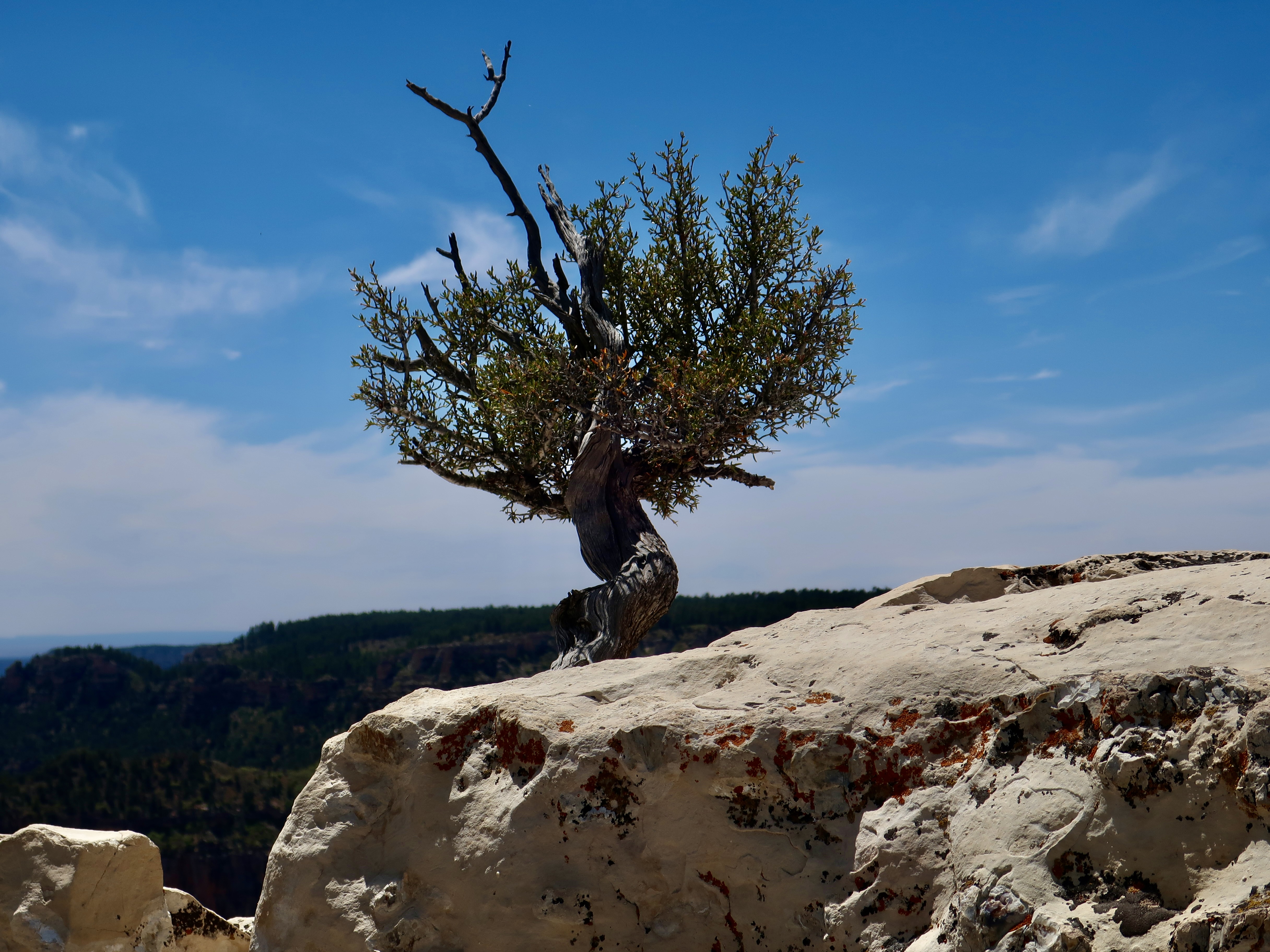
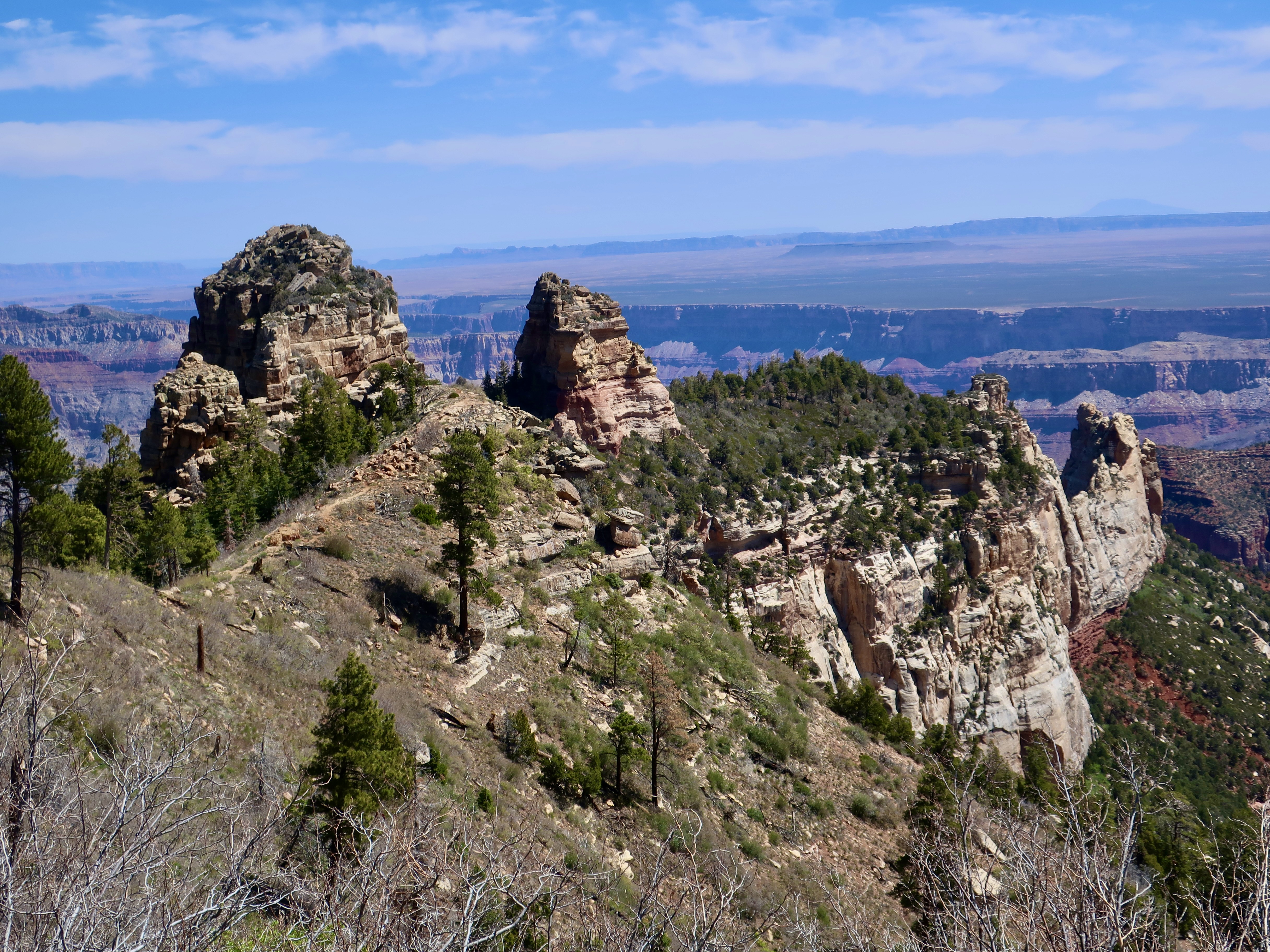
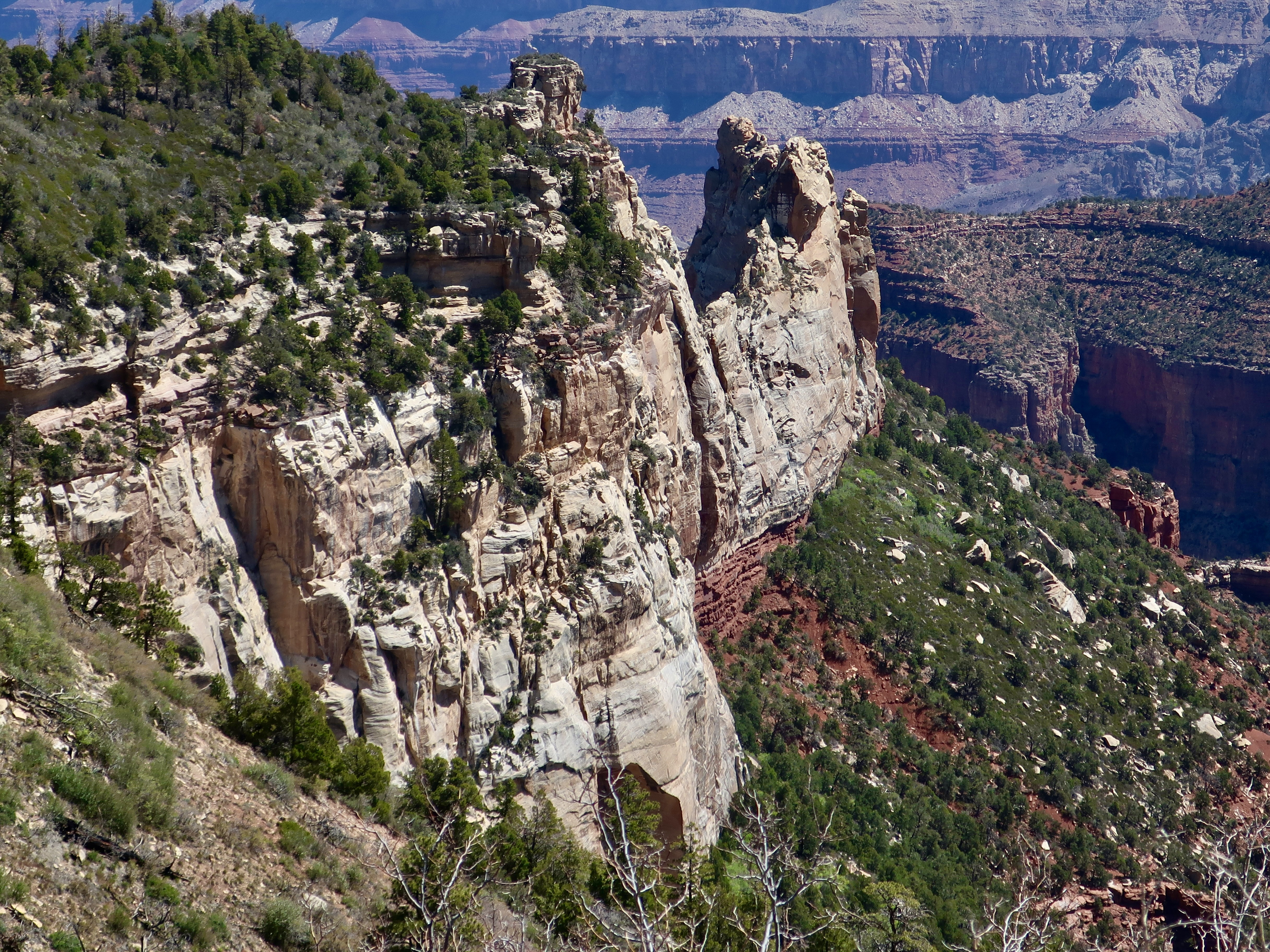
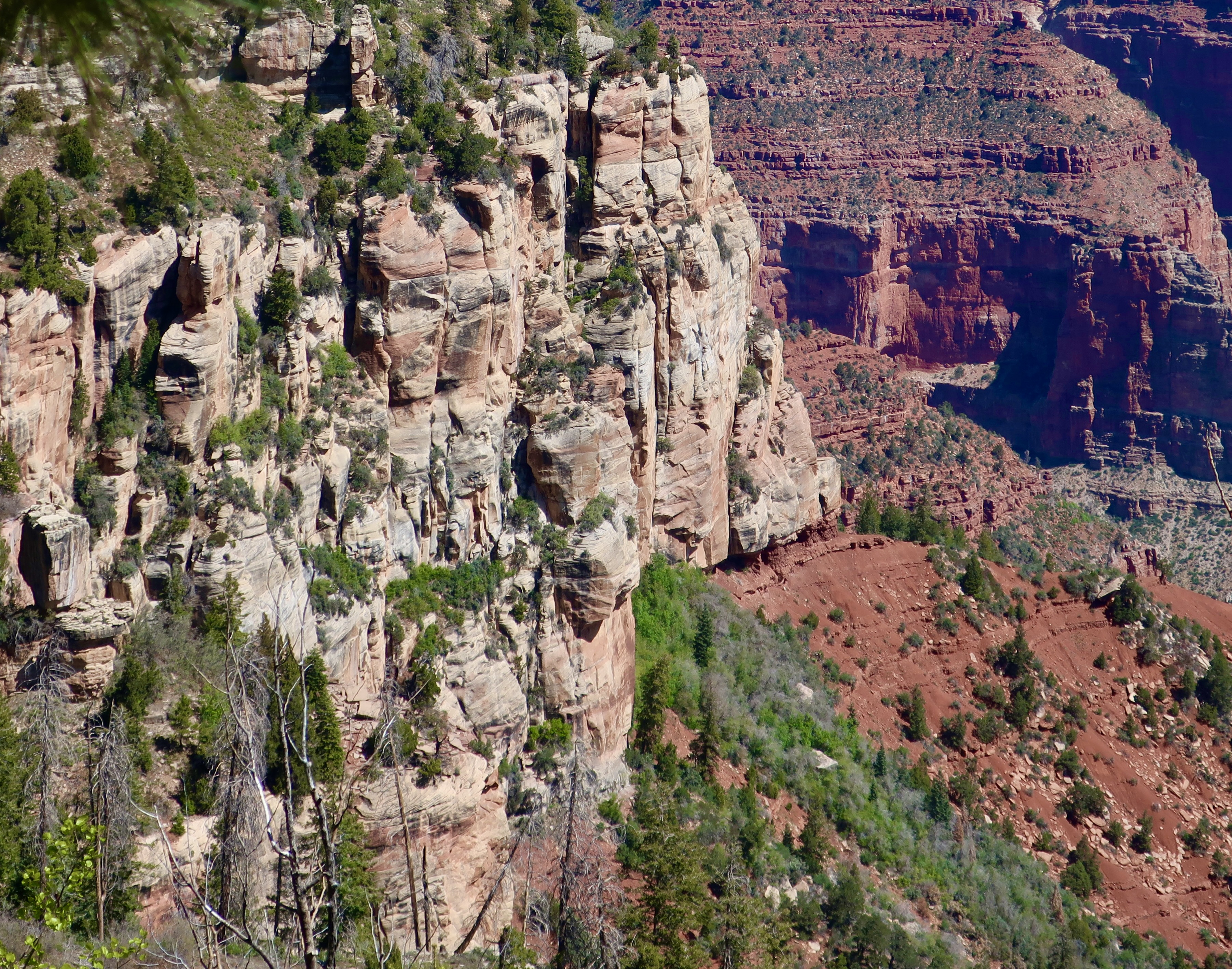
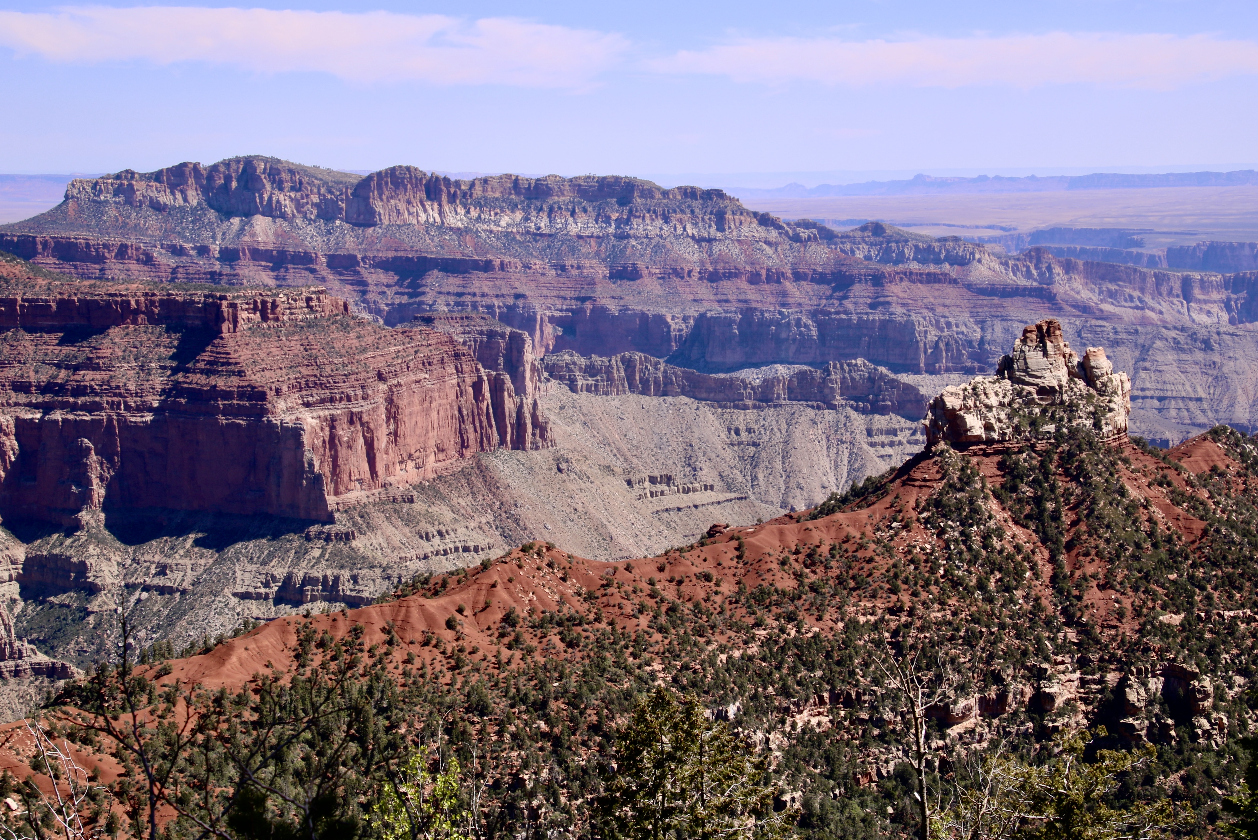
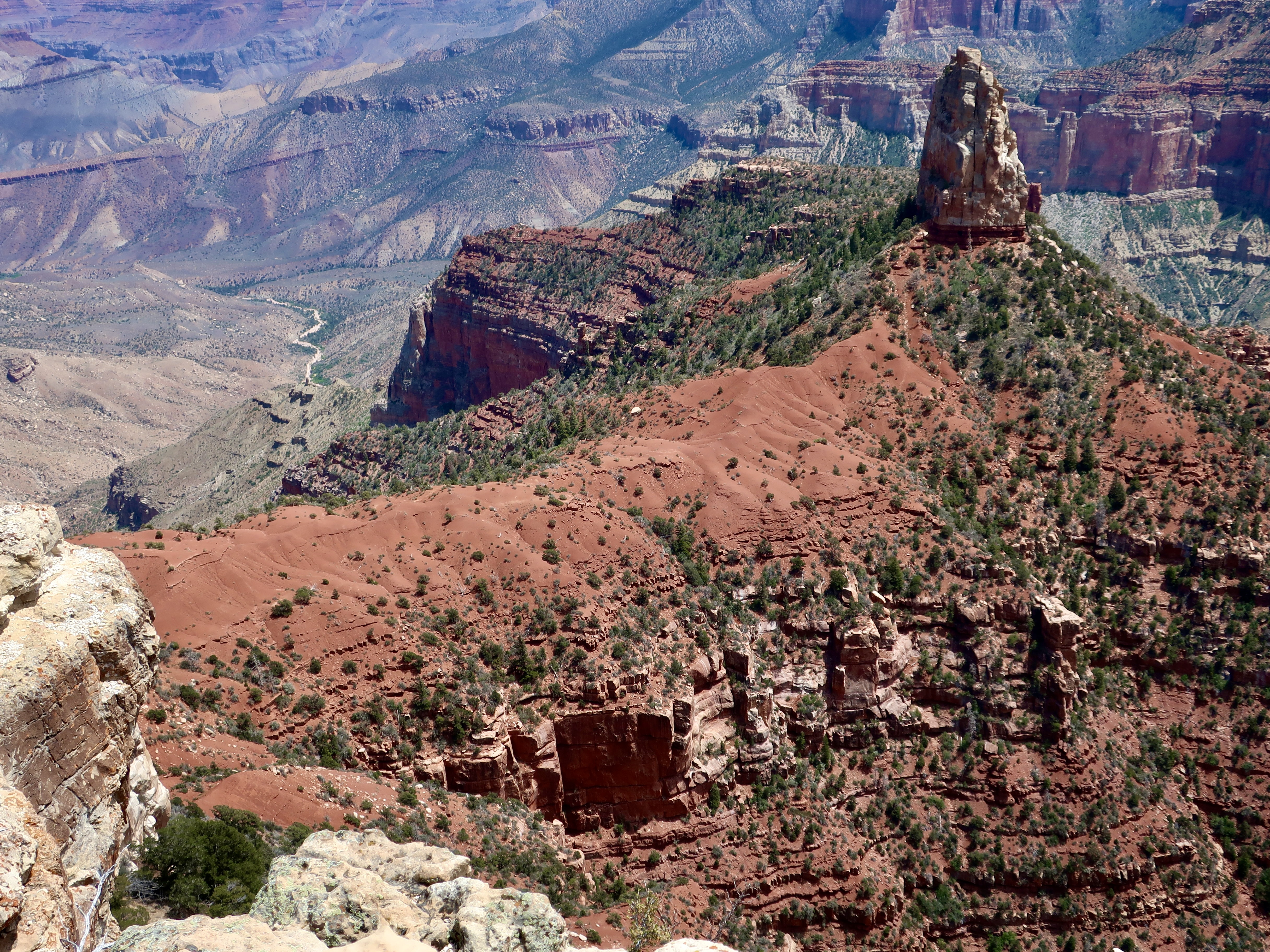
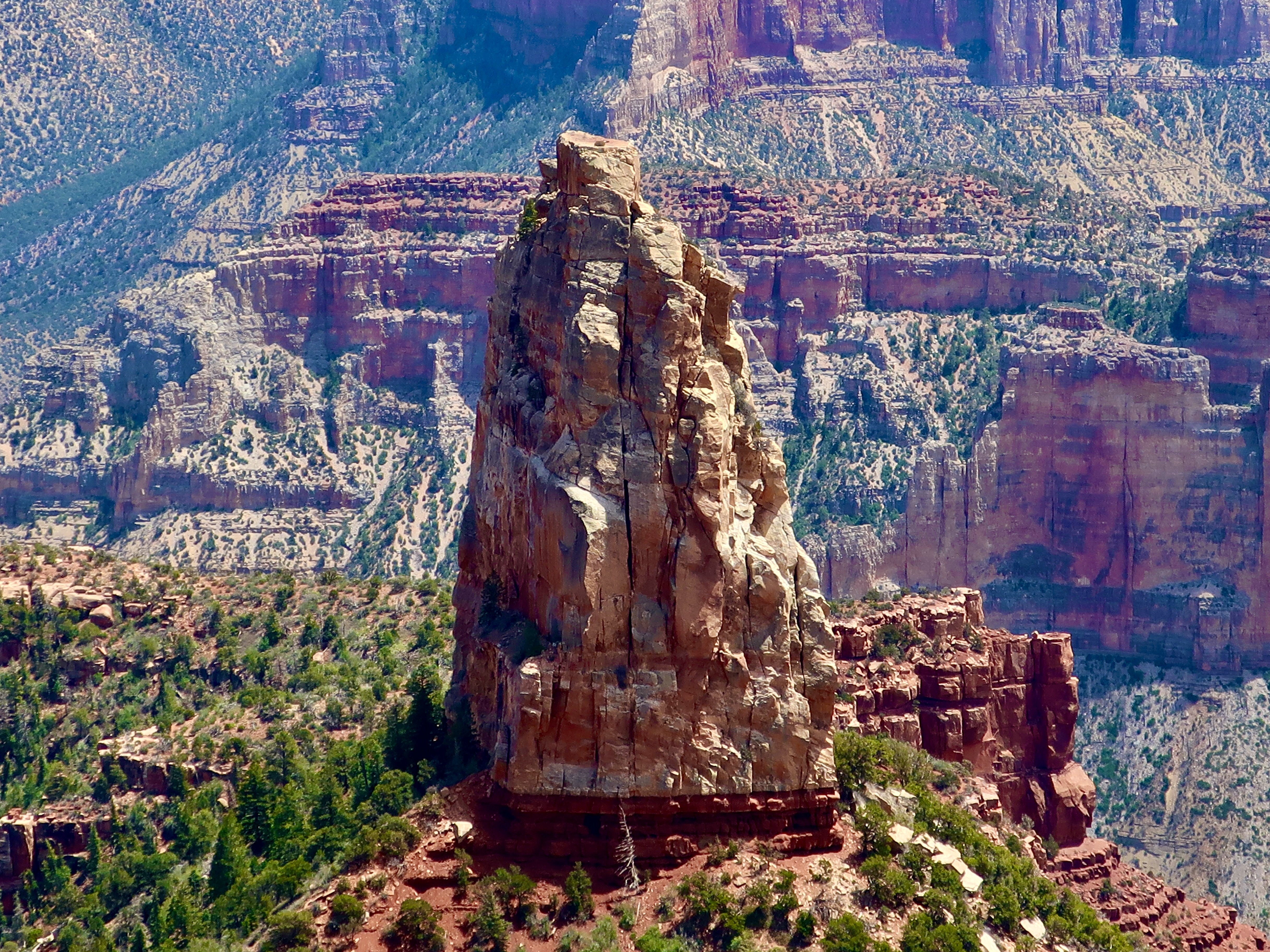
This map from the National Park Service shows the prominent overlooks of the North Rim. In the last post, we featured photos from Cape Royal and the Walhalla Overlook located in the lower right hand corner. This time, I will start with Bright Angel Point located just below the Visitor’s Center and then move on to Roosevelt Point, Vista Encantata, and Point Imperial.National Park map showing location of Grand Canyon in Arizona. A view from Bright Angel Point shows Bright Angel Canyon on the left. Bright Angel Creek makes its way down the canyon to the Colorado River. The popular North Kaibab Trail follows the creek and takes hikers down to Phantom Ranch on the river where they can stay, assuming they’ve landed a tough-to-get reservation. Or, they can continue on the South Kaibab or Bright Angel Trail up to the South Rim— if they don’t mind a 21 mile hike with an elevation change of 11,000 feet. I’ve backpacked it on two different occasions: One from the South Rim to Phantom Ranch and one from the North Rim to the Ranch. Ultra-marathon runners like to run the total path— and return— in one day.This provides a distant view of the South Rim from Bright Angel Point. You can see the village on the rim left center. Bright Angel Trail winds its way down into the canyon starting just to the right of the buildings. Both the Bright Angel Trail and Bright Angel Creek follow an active fault zone. An occasional jolt reminds hikers that even the Grand Canyon is earthquake country.A short trail starts beneath the Visitor’s Center and follows Bright Angel Point out to its end providing dramatic views of the canyon from both sidesPeggy and I also admired the trees that scratched out a living out on the Bright Angel Point.A final tree photo on Bright Angel Point. Now, on to Roosevelt Point.On his first visit to the Grand Canyon in 1903, Theodore Roosevelt exclaimed, “Leave it as it is. You cannot improve upon it. The ages have been at work on it, and man can only mar it.” More than anyone else, he was responsible for protecting the Canyon to be enjoyed by future generations. It’s only appropriate that he would have a point named in his honor. More views from the overlook:Vista Encantata translates as “enchanted view.” It’s easy to see why early visitors gave this overlook the name.When visitors arrive at Point Imperial on the North Rim, they arrive at 8,803 feet, the highest point on the North Rim. You might say it’s breath-taking. The view isn’t half-bad either. The spire, Mt. Hayden, is one of the most photographed views on the North Rim. We will close out this post with three different perspectives of it.And finally, a close up. In addition to being a favorite among photographers, Mt. Hayden is a favorite among rock climbers. This wraps up our brief tour of the North Rim of the Grand Canyon. Next, we will visit Mesa Verde National Park, famous for its ancient cliff dwellings.
We hope to see Utah’s National Parks again in late October and November. The facilities at the North Rim will be closed by then, but your posts make me think it might be nice to drive in and take a look again on our way to or from some of the other parks including the Navajo park, Monument Valley.
Oh I hope so Ray. There is so much beauty tied up in Utah’s National Parks, and often in just driving down the road. As you know. It can also be quite spectacular with snow! Of course driving in it isn’t all that much fun.
Small planes and helicopters provide a totally different experience, Andrew. I’m glad you got to do it. There is a lot of incredible scenery between the two points.
Wonderful pictures! What an amazing place! Kinda makes you feel insignificant doesn’t it? And you have had fabulous weather! I have nothing to report as “grand” as you. We did have an exciting lightening/thunder storm the other evening which is quite an event here. I feel fall coming our way! Take care and watch your step!
“Kinda makes you feel insignificant” Nature has a way of doing that! An exciting lightning storm can do the same thing, Wendy. At least it does me. I think both reflect awe. Thanks on the photos. Peggy and I love to capture what we are seeing as well as experience it. Then we can re-experience… and share. Thanks. –Curt
Stupendous images and the travel guide with the mostest Curt. I particularly love the beautiful layering of the hues in terrain and the sky in your photos. Surreal!! 💗
It’s hard to take a photo there that isn’t jaw-dropping. What great shots, Curt, thank you for sharing them. I especially enjoyed the geology education at the beginning. It added to my appreciation of the views, thank you.
Geology, beauty, natural history— and possibly a challenging physical endeavor, are the elements that make the Canyon such an incredible place to visit, Crystal. Plus sharing. Thanks.
Amazing photos, Curt. The Grand Canyon was on my bucket list and I finally got there a few years ago. The geology is fascinating and the formations stunning. I spent time on both rims and recognize some of those views. Thanks for sharing your experience.
Thanks, D. Glad you made it there! I’ve been there a number of times over the years and would never pass up an opportunity to go again. I’m going to kick off my next series: The Great River Series, with our 20 day trip by raft on the Colorado, most of which was within the boundaries of the Grand Canyon.
The Grand Canyon is one of my favorite places in the world! I hope to do at least R2R some day. Thanks for the inspiration to put it closer to the top of the list. Great pics. 🙂
R2R is a great way to see it, Pam, but challenging, even when you do it in two different trips the way I did. 😳Thanks on the pics. Always fun to photograph the Canyon and try to capture at least some of its beauty.


Great photos! I’ve always wanted to backpack to Phantom Ranch.
Thanks, Diana. Backpacking anywhere in the Canyon is a mind-blowing experience!
BEAUTIFUL IMAGERY,CRAGGY,RUGGED,RAGGED IT DEFIES COMMENTARY BUT CHALLENGES GEOMETRY,CHEMISTRY AND TIME AND HISTORY 5 STARS
Thanks, much. Appreciated. It’s all of the above.
We hope to see Utah’s National Parks again in late October and November. The facilities at the North Rim will be closed by then, but your posts make me think it might be nice to drive in and take a look again on our way to or from some of the other parks including the Navajo park, Monument Valley.
Oh I hope so Ray. There is so much beauty tied up in Utah’s National Parks, and often in just driving down the road. As you know. It can also be quite spectacular with snow! Of course driving in it isn’t all that much fun.
In 1995 I took a light aircraft ride from Monument Valley to Grand Canyon Village. Spectacular views.
Small planes and helicopters provide a totally different experience, Andrew. I’m glad you got to do it. There is a lot of incredible scenery between the two points.
Wonderful pictures! What an amazing place! Kinda makes you feel insignificant doesn’t it? And you have had fabulous weather! I have nothing to report as “grand” as you. We did have an exciting lightening/thunder storm the other evening which is quite an event here. I feel fall coming our way! Take care and watch your step!
Wendy
“Kinda makes you feel insignificant” Nature has a way of doing that! An exciting lightning storm can do the same thing, Wendy. At least it does me. I think both reflect awe. Thanks on the photos. Peggy and I love to capture what we are seeing as well as experience it. Then we can re-experience… and share. Thanks. –Curt
It’s such a magical place!
One of the best ways to describe it, MB.
Truly spectacular!
Thanks for so many wonderful travelogues Curt.
Regards Thom
Appreciated, Thom! Thanks much.
Stupendous images and the travel guide with the mostest Curt. I particularly love the beautiful layering of the hues in terrain and the sky in your photos. Surreal!! 💗
They kept Peggy and I busy with our cameras as well as being awe-struck, Cindy. It happens to us every time we visit the Grand Canyon. Thanks.
It’s hard to take a photo there that isn’t jaw-dropping. What great shots, Curt, thank you for sharing them. I especially enjoyed the geology education at the beginning. It added to my appreciation of the views, thank you.
Geology, beauty, natural history— and possibly a challenging physical endeavor, are the elements that make the Canyon such an incredible place to visit, Crystal. Plus sharing. Thanks.
Beautiful photos! Enjoyed the map – a nice reminder of the many places we have been to on our trip home each year!
You have a lovely route home!
Thanks. I didn’t realise that Bright figured so prominently in the canyon.
Amazing photos, Curt. The Grand Canyon was on my bucket list and I finally got there a few years ago. The geology is fascinating and the formations stunning. I spent time on both rims and recognize some of those views. Thanks for sharing your experience.
Thanks, D. Glad you made it there! I’ve been there a number of times over the years and would never pass up an opportunity to go again. I’m going to kick off my next series: The Great River Series, with our 20 day trip by raft on the Colorado, most of which was within the boundaries of the Grand Canyon.
Can’t wait! You and Peggy keep adding to my bucket list. Lol.
Good!
It’s such an extraordinary landscape. Truly majestic and awe-inspiring.
Alison
Yes it is, Alison. I never get tired of going back!
The Grand Canyon is one of my favorite places in the world! I hope to do at least R2R some day. Thanks for the inspiration to put it closer to the top of the list. Great pics. 🙂
R2R is a great way to see it, Pam, but challenging, even when you do it in two different trips the way I did. 😳Thanks on the pics. Always fun to photograph the Canyon and try to capture at least some of its beauty.