Limantour Beach: A Wild World… Pt. Reyes National Seashore

Shore, sea and sanderlings meet on Limantour Beach at Pt. Reyes National Seashore. (photo by Peggy Mekemson.)

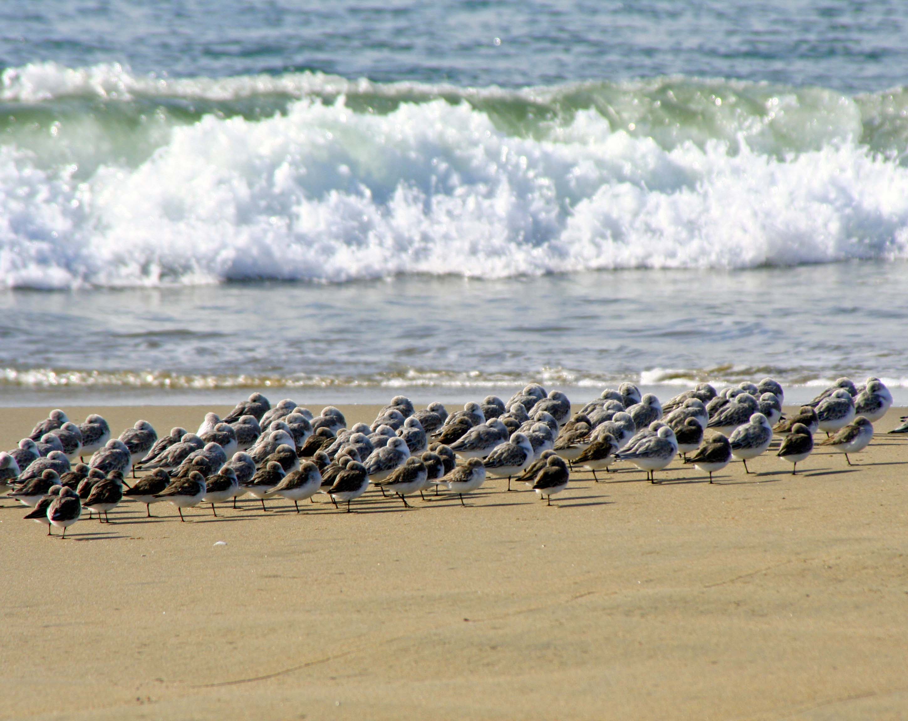
Shore, sea and Sanderlings meet on Limantour Beach at Pt. Reyes National Seashore. (Photo by Peggy Mekemson.)

A steep ridge runs most of the length of Pt. Reyes National Seashore. The road to Limantour Beach is all business as it climbs up and over. Who needs switchbacks? A sign tells trailers to stay off. Our van Quivera has made the journey several times but always complains. Our friend Ken Lake’s truck laughed at the challenge.

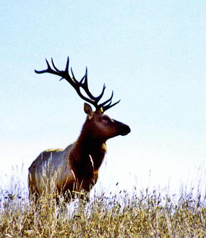
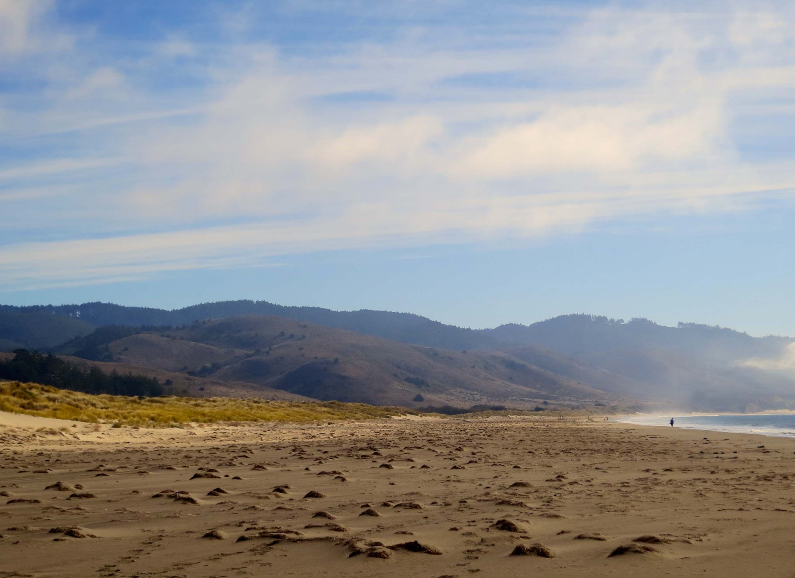
The journey across provides an introduction to most of Pt. Reyes’ ecological zones.  Seeing a Kodak moment, I asked Ken to stop up on top. Fog and sun were battling with each over who would rule the day. Grass, brush, trees and canyons joined the drama. I searched the canyon for wildlife to add to my photo. Tule Elk and Black Tail Deer are commonly seen during the day, as are hawks and omnipresent buzzards. Nothing presented itself. All I found was some aging, hair-filled bobcat scat (poop) with a pile of fresh raccoon scat on top. I figured the raccoon was making a statement. I also figured that the scat didn’t need to be part of my photo. (“Good decision,” Peggy adds.)

Pt. Reyes photo along Limantour Road at Pt. Reyes national Seashore by Curtis Mekemson.

Sun and fog were part of the landscape in this photo I took from Limantour Road.

Pt. Reyes Natioanl Seashore photo by Curtis Mekemson.

Looking south from Limantour Road at where the deer and elk roam.

The road down to Limantour Beach is almost as steep as the road up and one section would scare a roller-coaster. Topping the last hill provides a broad view of Drake’s Bay, Limantour Beach and the Limantour Estero. A long narrow spit separates the Bay from the Estero. I suspect the view isn’t tremendously different from what Sir Francis Drake would have found when he sailed into the Bay in 1579, the first European to visit the area. Miwok Indians, who had called the region home for thousands of years, greeted the British explorer/noble/naval hero/pirate.

We parked the truck, crossed a walking bridge over the Limantour Estero, hiked down to the beach and walked north along the shore. Sea gulls, Sanderlings, crab shells, driftwood, animal tracks, sunning buzzards, gentle waves and distant vistas entertained us.

Bags provided for picking up trash on Limantour Beach at Pt. Reyes National Seashore. Photo by Curtis Mekemson

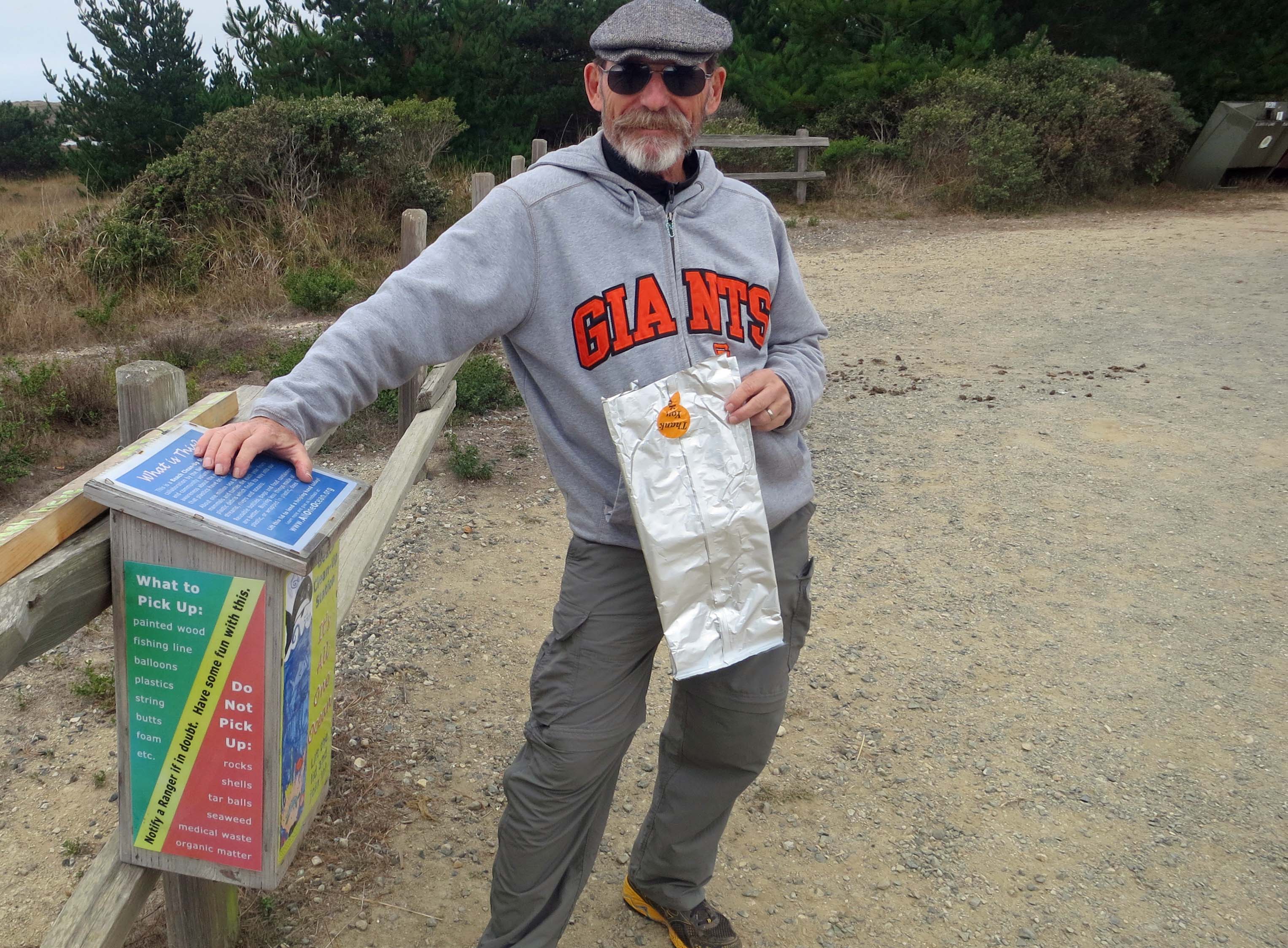
A great idea: The National Park Service provided bags so people could pick up trash as they walked along the beach. Ken immediately grabbed one and we all helped fill it. Note: Ken never lets anyone doubt his team loyalty.

Estero de Limantour at Pt. Reyes National Seashore. Photo by Curtis Mekemson.

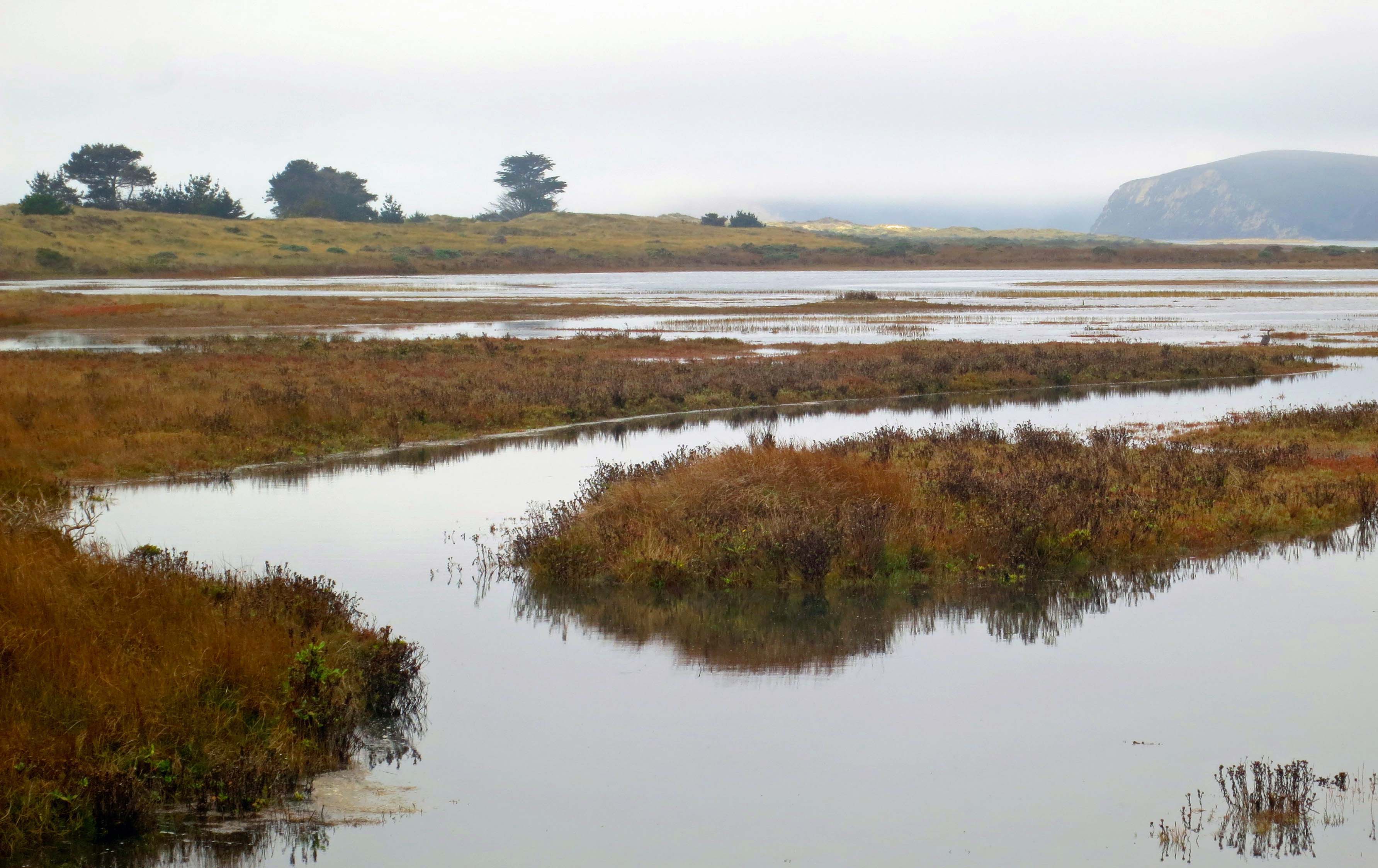
A bridge provided a view up the Limantour Estero or estuary. Estuaries are where fresh and ocean water mix, creating a rich environment for fish and birds. The Pt. Reyes headlands in the distance offers a great vantage point for whale watching. It is also home to Pt. Reyes’ Elephant Seal population.

Elephant seal photo by Curtis Mekemson.

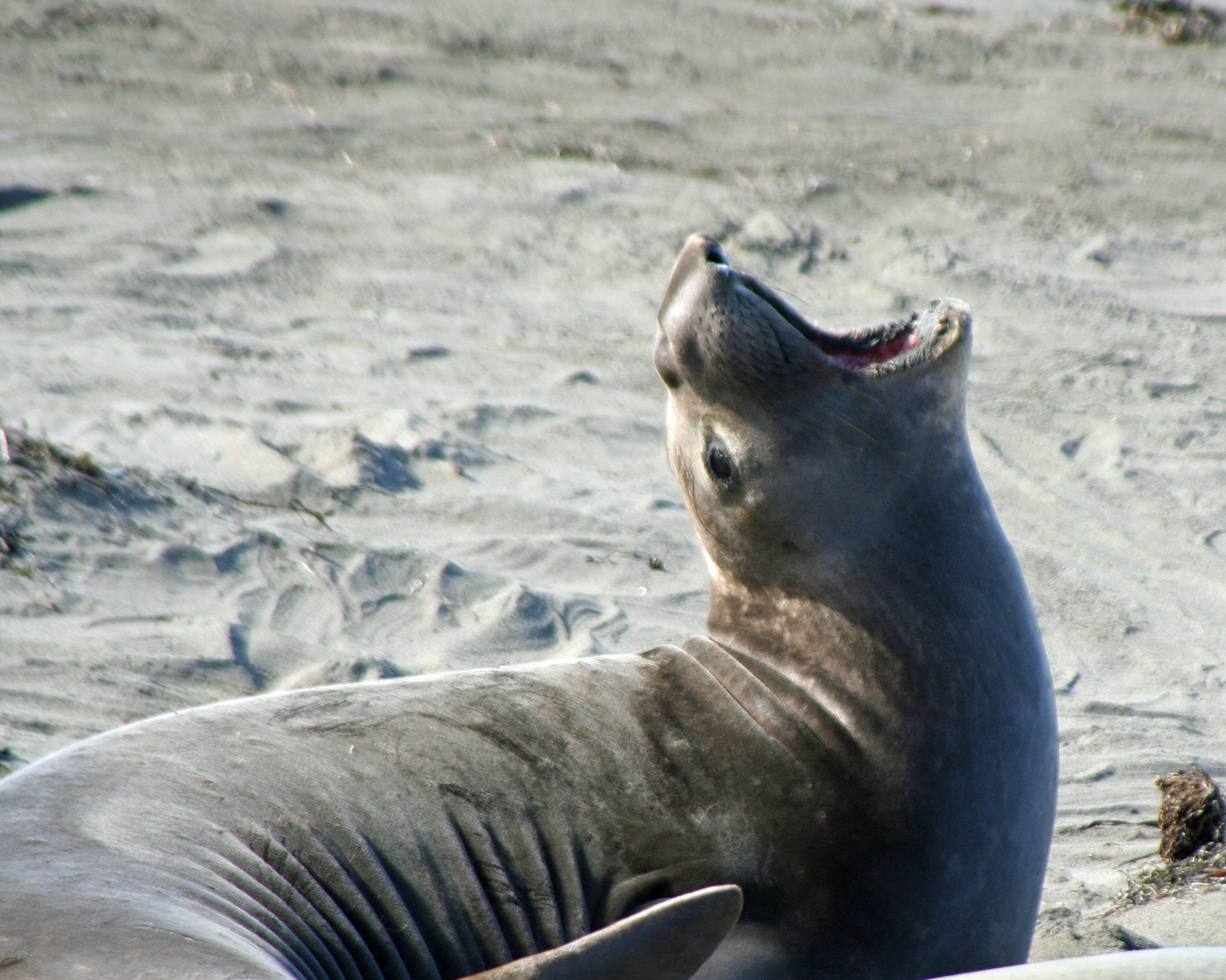
I love elephant seals. These magnificent creatures spend the majority of their lives at sea and 90% of that time under water. They travel thousands of miles annually and can dive up to 2000 feet deep. This photo came from a blog I did about the Elephant Seals of Piedras Blancas.

Photo of the Estero de Limantour at Pt. Reyes taken by Curtis Mekemson.

Another view of the Limantour Estero, this one from the spit that separates the Estero from Drake’s Bay.

Limantour Beach at Pt. Reyes National Seashore.

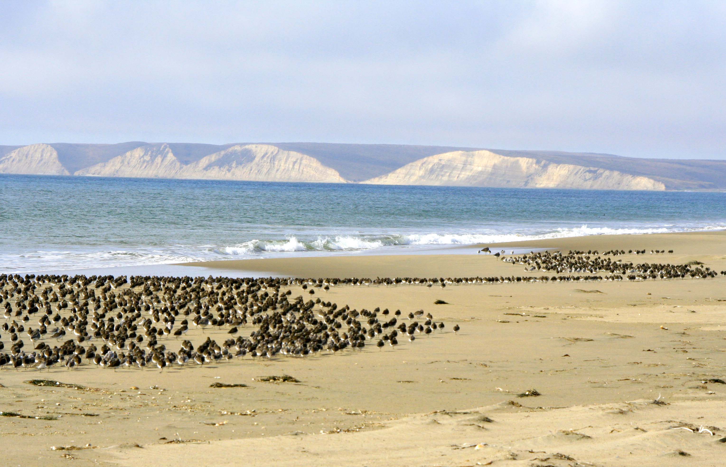
Looking north up Limantour Beach across Drakes Bay. Sir Francis Drake named the area Nova Albion, New England, probably because the sandstone cliffs reminded him of the Cliffs of Dover. (Photo by Peggy Mekemson.) The small mounds or sand dunes are created by plant matter.

Looking south on Limantour Beach at Pt. Reyes National Seashore. Photo by Curtis Mekemson.

A lone person walks south on Limantour Beach.

Sea gulls on Limantour Beach at Pt. Reyes National Seashore. Photo by Curtis Mekemson.

Sea gulls tend to walk away when you get near them. I was encouraging these guys to fly. The one nearest appeared ready to leap into action.

Sea gulls in flight on Limantour Beach at Pt. Reyes National Seashore. Photo by Curtis Mekemson.

I finally succeeded.  I like the way this photo captures the different wing action of gulls in flight.

Sanderlings on Limantour Beach at Pt. Reyes national Seashore.

Meanwhile, Peggy was off checking out the seemingly endless flock of Sanderlings. (Photo by Peggy Mekemson.)

Flock of flying Sanderlings at Limantour Beach, Pt. Reyes National Seashore.

Who also decided to fly. How do they avoid winging each other? (Photo by Peggy Mekemson.)

Buzzards drying out wings on Limantour Beach at Pt. Reyes National Seashore. Photo by Curtis Mekemson.

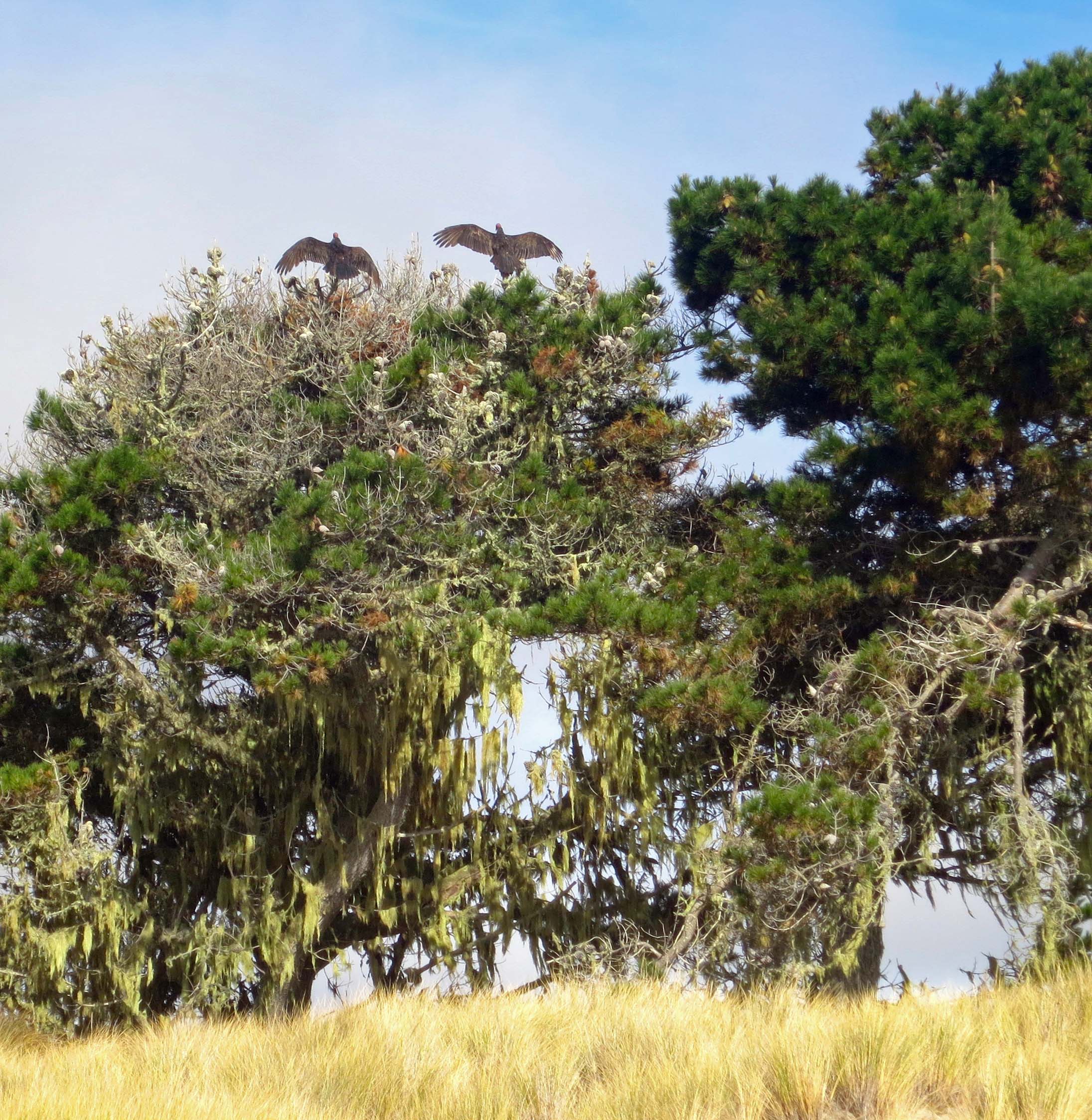
“Check out the buzzards,” Ken urged. A pair were perched on top of a pine tree drying out their wings from the morning’s fog in preparation for flight.

Buzzards dry wings at Pt. Reyes National Seashore.

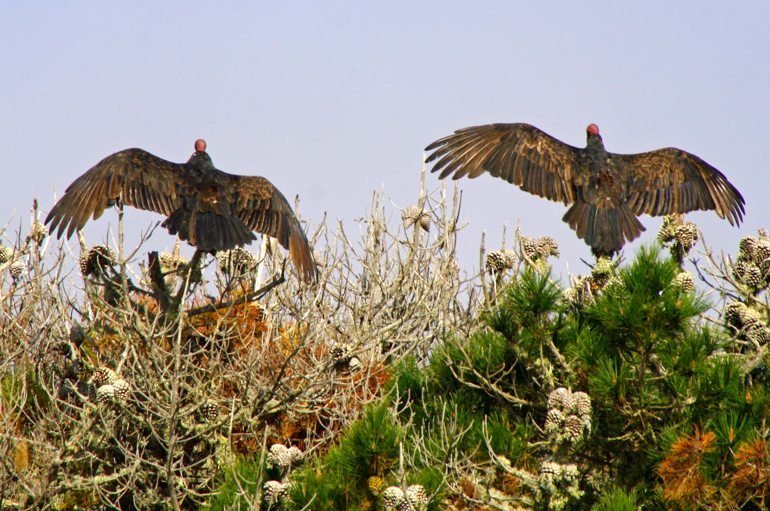
Using her telephoto lens Peggy got up close. Note their heads. They are naked so buzzards can dip into dead treats without getting their feathers involved. Isn’t evolution grand? (Photo by Peggy Mekemson.)

Buzzards feathers gor awry on Limantour Beach.

As we approached one got excitable. I think you might say he was having a bad feather day. (Photo by Peggy Mekemson.)

Raccoons leave tracks on Limantour Beach, Pt. Reyes National Seashore. Photo by Curtis Mekemson.

While animals were hiding out for the day, their tracks were abundant. Here, a family of raccoons made their way back to their home on the spit. Peggy and Leslie followed the tracks to what they decided was their home hidden in the brush.

Crab claw showing teeth on Limantour Beach at Pt. Reyes National Seashore. Photo taken by Curtis Mekemson.

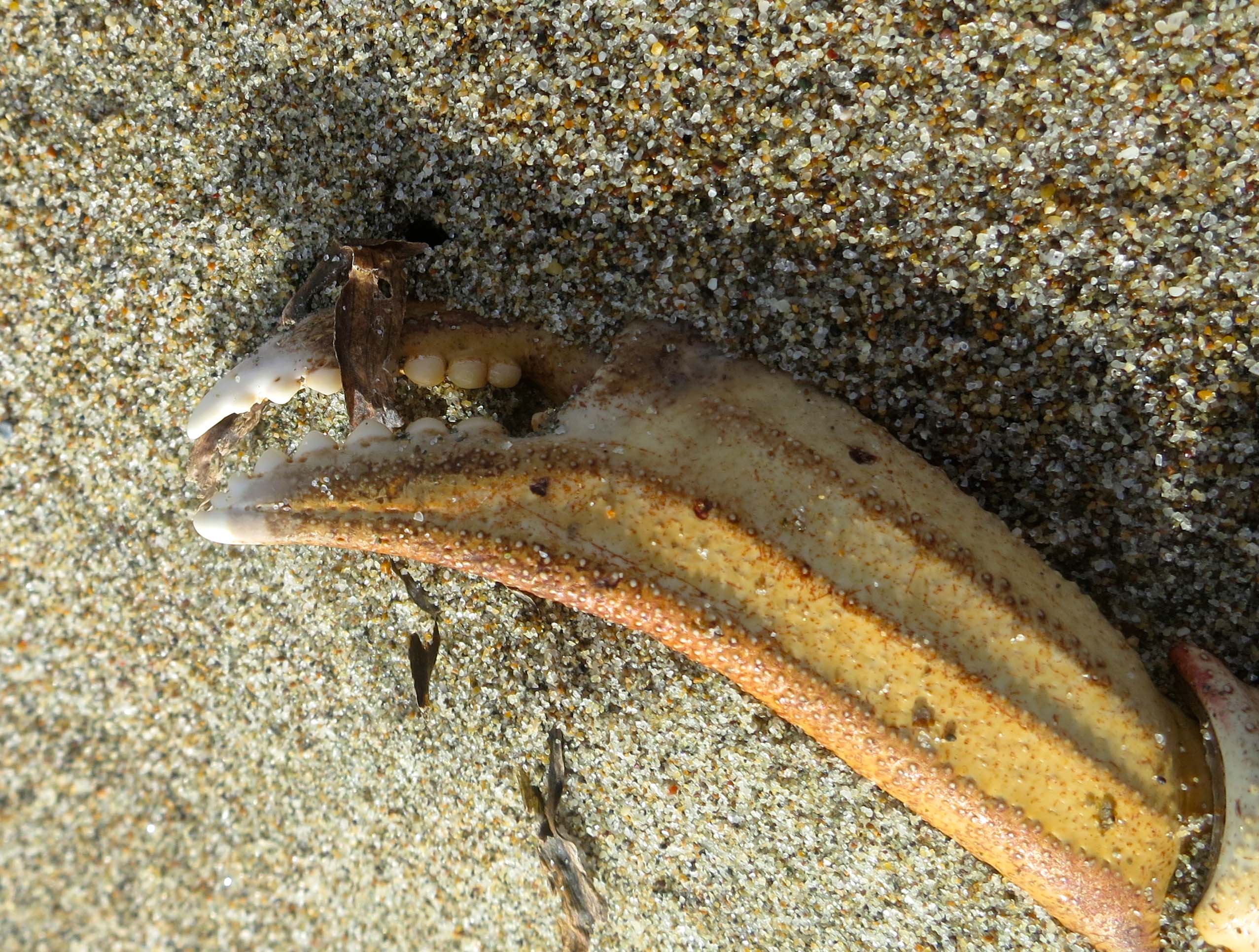
It’s possible that crab was on the menu that night for the raccoons. We found numerous empty shells along the beach. I liked the teeth in this claw.

Empty crab shell found on Limantour Beach at Pt. Reyes National Seashore. Photo taken by Curtis Mekemson.

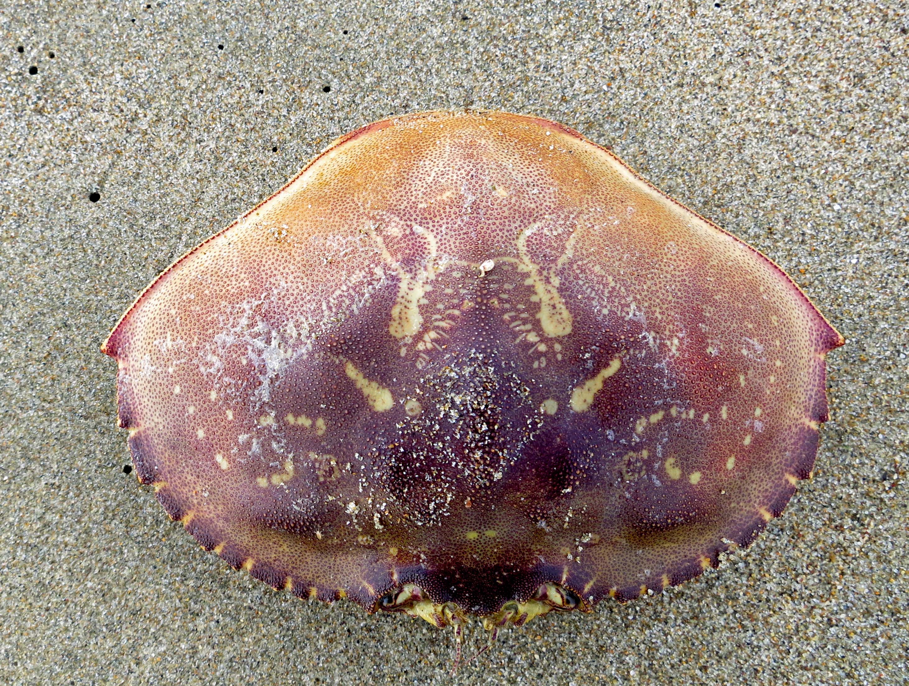
Empty crab shell. Many other birds and animals join raccoons in feasting on the oceans offerings. I also found a set of fox tracks leading down to the beach.

These tracks represent a virtual freeway into the grass on the spit.

These tracks represent a virtual animal freeway between the sand of the shore and the protective grass and brush of the spit.

Photo by Curtis Mekemson of driftwood on Limantour Beach at Pt. Reyes National Seashore

The grain of the wood exposed by the relentless pounding of the ocean is what attracts me to driftwood. We found a prime example on the upper beach at Limantour. A tree had been driven upside-down into the ground and was showing off its roots. I was curious about whether man or nature had been responsible for the upending.

Close up photo of driftwood on Limantour Beach taken by Curtis Mekemson.

A close up of the driftwood with its marvelous twists and turns plus two peek-a-boo holes.

Photo of spit on Limantour Beach by Curtis Mekemson.

We walked back to the parking lot following a trail along the spit.

Photo of grass on Limantour Spit taken by Curtis Mekemson.

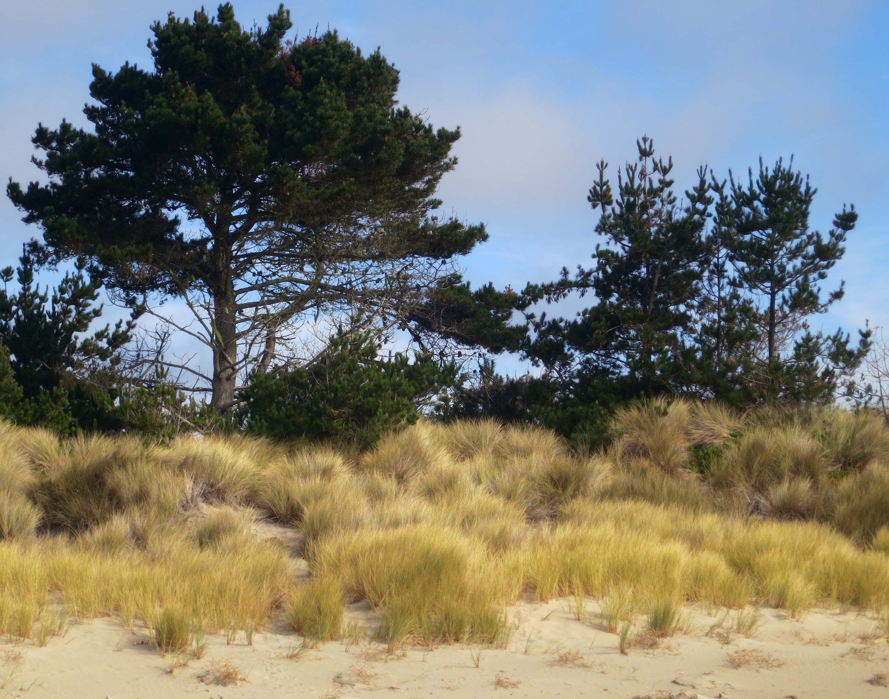
Much of the trail made its way through the thick golden grass that dominates the spit and provides a home for Limantour Beach’s wild world.

NEXT BLOG: It’s off to the historic Pierce Ranch and a search for Pt. Reyes’ magnificent Tule Elk. I’ll conclude today’s blog with a black and white photo of gentle waves lapping up on the Limantour Beach.

Gentle waves visit Limantour Beach at Pt. Reyes National Seashore. Photo by Curtis Mekemson.

Earthquake Swallows Cow… Pt. Reyes National Seashore: Part 1

Sanderlings take flight at Pt. Reyes National Seashore on Limantour Beach. (Photo by Peggy Mekemson.)

Pt. Reyes National Seashore is an American Treasure. In this photo, Sanderlings take flight on Limantour Beach. (Photo by Peggy Mekemson.)

Photo of bull elk at Pt. Reyes National Seashore by Curtis Mekemson.

A bull elk is outlined against the sky at the Pierce Ranch.

My legs were not working and I was laughing. I had just completed one of Pt. Reyes’ easiest walks from the park headquarters out to the beach and back via Bear Valley. At the end of the 10 mile round trip, I had gratefully fallen into my car and driven to Bodega Bay. It was 1969 and the pre-Yuppified Inn-at-the-Tides consisted of motel cabins going for $15 as opposed to rooms starting at $200. My legs had gone on strike when I stepped out of the car to register.

I had just completed a year of recruiting for Peace Corps in the Southern United States where exercise had consisted of traveling between airports, motels and college campuses from Texas to Washington DC.  Adding injury to insult, I had eaten most of my meals at Southern restaurants serving large helpings of Southern food. Curt had become a little chubby. The legs were not happy. Fortunately, a half-pint of whiskey and a full night’s sleep ended their rebellion. The next morning I returned to my exploration of Pt. Reyes and the beginning of a life-long love affair with the North Coast of California.

Peggy and I returned to the area last week for three days and stayed at Olema Campground in the small town of the same name. It’s always been my campground of choice and has changed little over the decades. Even the restrooms have remained the same. I’ve used the campground as my jump off point for exploring Pt. Reyes, as a writing retreat, and as a campsite for the 500 mile-bike treks and 7 day walking tours I led on the North Coast during the 70s, 80s and 90s.

Photo of Olema Campground next to Pt. Reyes National Seashore by Curtis Mekemson.

One of my favorite campsites at Olema Campground backs up to a small stream and looks out on Pt. Reyes National Seashore. Obviously, we were celebrating Halloween.

Pumpkin carving photo by Curtis Mekemson.

Peggy and I join my Sister Nancy and her husband Jim each year for a pumpkin carving contest. We brought ours to Pt. Reyes. This witch was my entry in the contest.

Peggy's pumpkin. (She won the contest. Our grandkids voted without knowing who had carved the pumpkins.)

Peggy’s pumpkin. (She won the contest. Our grandkids voted without knowing who had carved the pumpkins.)

Our friends Ken and Leslie Lake joined us at the campground, arriving just in time to eat lunch in Pt. Reyes Station and to visit the Bovine Bakery and Pt. Reyes Books. The bookstore is a jewel and the bakery has buttermilk scones to die for. They, along with the Station House Café, are required stops on my trips to Pt. Reyes.

 Photo of Point Reyes Books and Bovine Bakery in Point Reyes Station by Curtis Mekemson.

Two of my favorite stops at Pt. Reyes Station. For a small, locally owned bookstore, Point Reyes Books has a great selection. And I’ve never met a pastry at the Bovine Bakery I didn’t like. More often than not, people are lined up out the door.

Afterwards we visited the park’s information center in Bear Valley and did a short walk around the Earthquake Trail. The Olema Campground is located a quarter of mile from the park headquarters and the infamous San Andreas Fault. Sitting in camp we could look across the fault at the peripatetic park. It had begun life some 300 miles to the south and is still working its way north. Normally its progress is measured in inches over decades. In 1906 it jumped 20 feet in the earthquake that was responsible for the destruction of San Francisco. Local legend is the earth cracked open, swallowed an Olema cow, and closed, leaving only the tail showing.

Pt. Reyes National Seashore photo by Curtis Mekemson.

A view along the Earthquake Trail. One of the things I like about Pt. Reyes National Seashore is the diversity of environments…

Photo by Curtis Mekemson of how far the San Andreas Fault slipped near Olema, California in 1906.

Leslie and Peggy stand on the San Andreas Fault and demonstrate how far the fault slipped in 1906.

This old black and white photo included by the park service along the EarthQuake Trail shows the actual slippage created by the 1906 earthquake.

This old black and white photo included by the park service along the Earthquake Trail shows the actual slippage created by the 1906 earthquake. You can see the actual crack in the ground.

And this photo from the Earthquake Trail shows the result of the 1906 earthquake on San Francisco.

And this photo from the Earthquake Trail shows the impact of the 1906 earthquake in San Francisco.

NEXT BLOG: We will visit Limantour Beach and go for a beach walk.