When the Big One Strikes… A Hike Along Earthquake Trail: Pt. Reyes

At 7.9 on the Richter scale, the 1906 San Francisco Earthquake wreaked massive damage both in structures destroyed and lives lost. This photo is from the National Archives.

I was wrapping up my day at the Lung Association in Sacramento when the building started moving shortly after 5 p.m. on October 17th, 1989. Peggy and I were at the very beginning of our relationship. You might say, it was off to a shaky start. “Is this the big one?” leapt into my mind as I ran outside. But buildings weren’t falling or people screaming. “Not this time,” we thought, relieved. 

Had you been one of 62,000 baseball fans crammed into Candlestick Park for the World Series, or worse, commuting home from work in the Bay Area, your perspective would have been substantially different. A major 6.9 earthquake had ripped into the Santa Cruz Mountains along the San Andreas Fault south of the stadium. Nearby freeways collapsed including a section of the Bay Bridge, numerous buildings were destroyed or damaged, 63 people were killed and 3,757 injured by what became known as the Loma Prieta Earthquake.

A number of faults are located under the Bay Area. The next big earthquake is projected to be along the Hayward Fault. The Pt. Reyes National Seashore is the land jutting out to the left of the San Andreas fault at the top of the diagram.

Eighty-three years before the Loma Prieta earthquake, an even greater one shook the Bay Area. Blame plate tectonics. The San Andreas Fault, marks a distinct boundary as the Pacific Plate grinds its way north past the North American Plate, building pressure until an earthquake erupts.  At 7.9 on the Richter Scale, the energy released from the 1906 San Francisco Earthquake equaled blowing up an estimated 6,270,000 tons of TNT! 

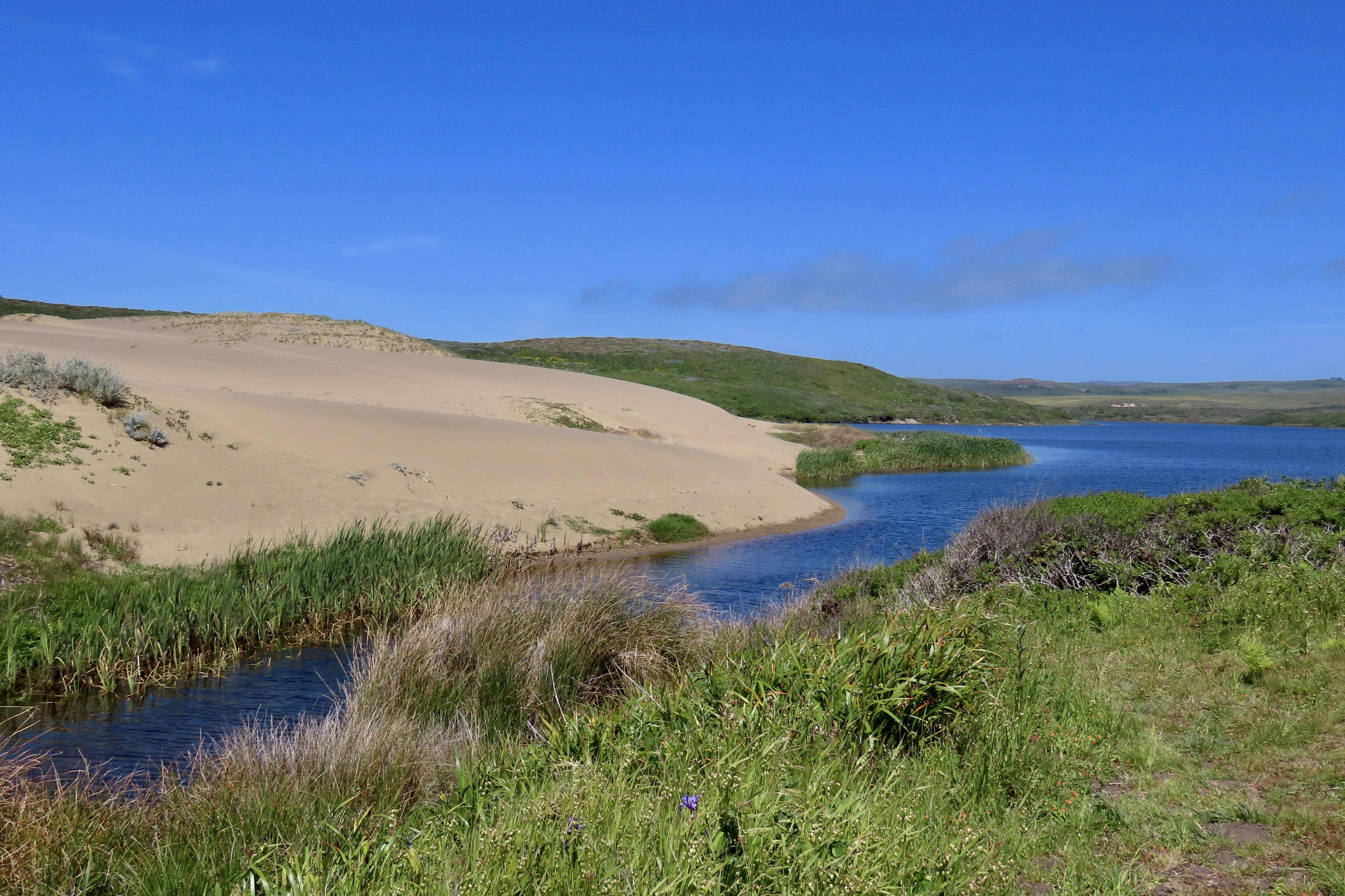
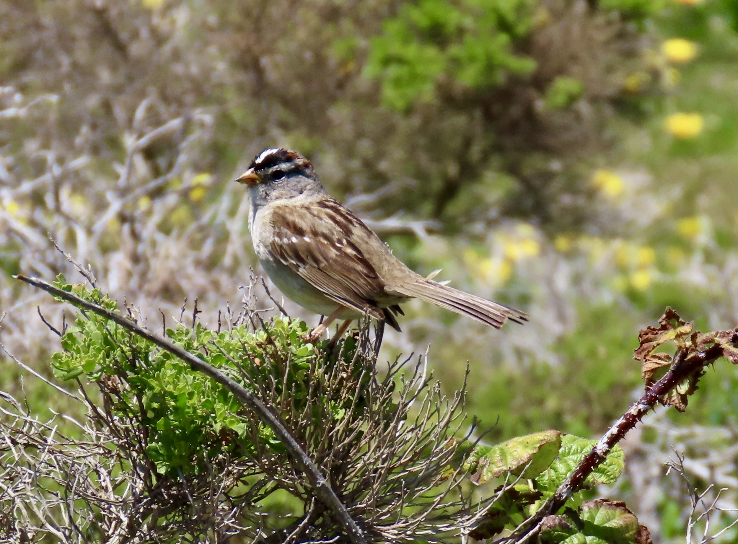
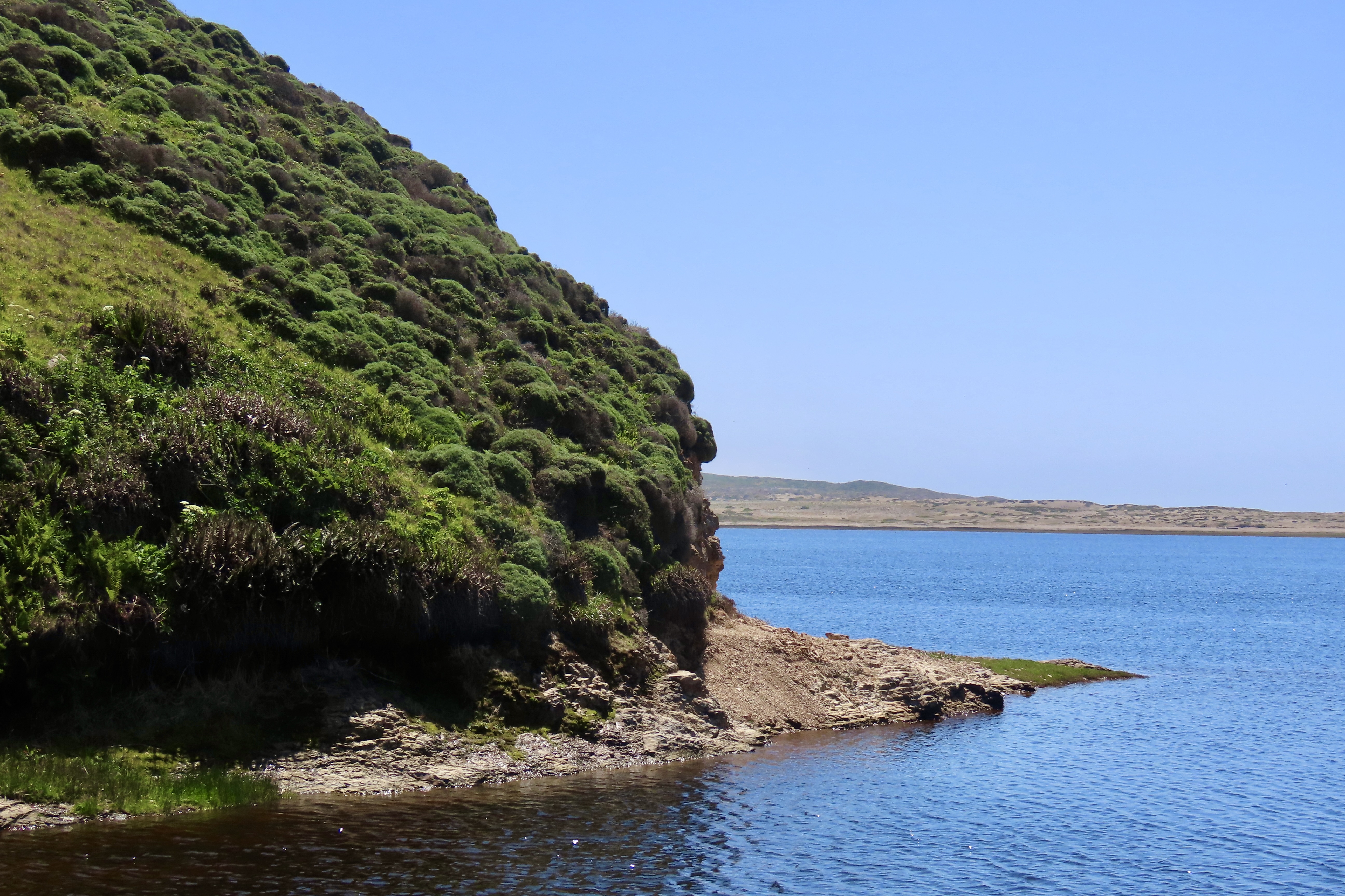
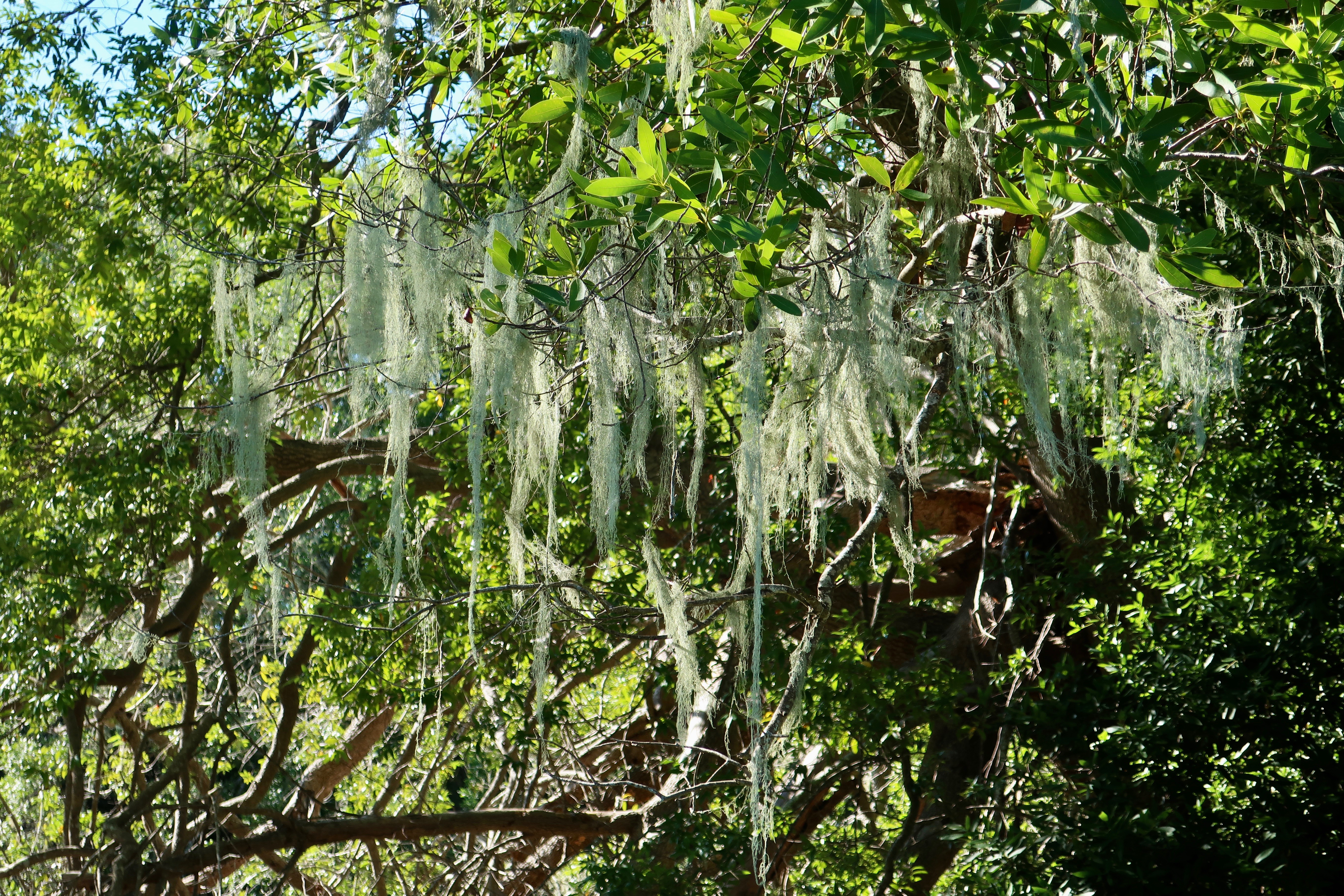
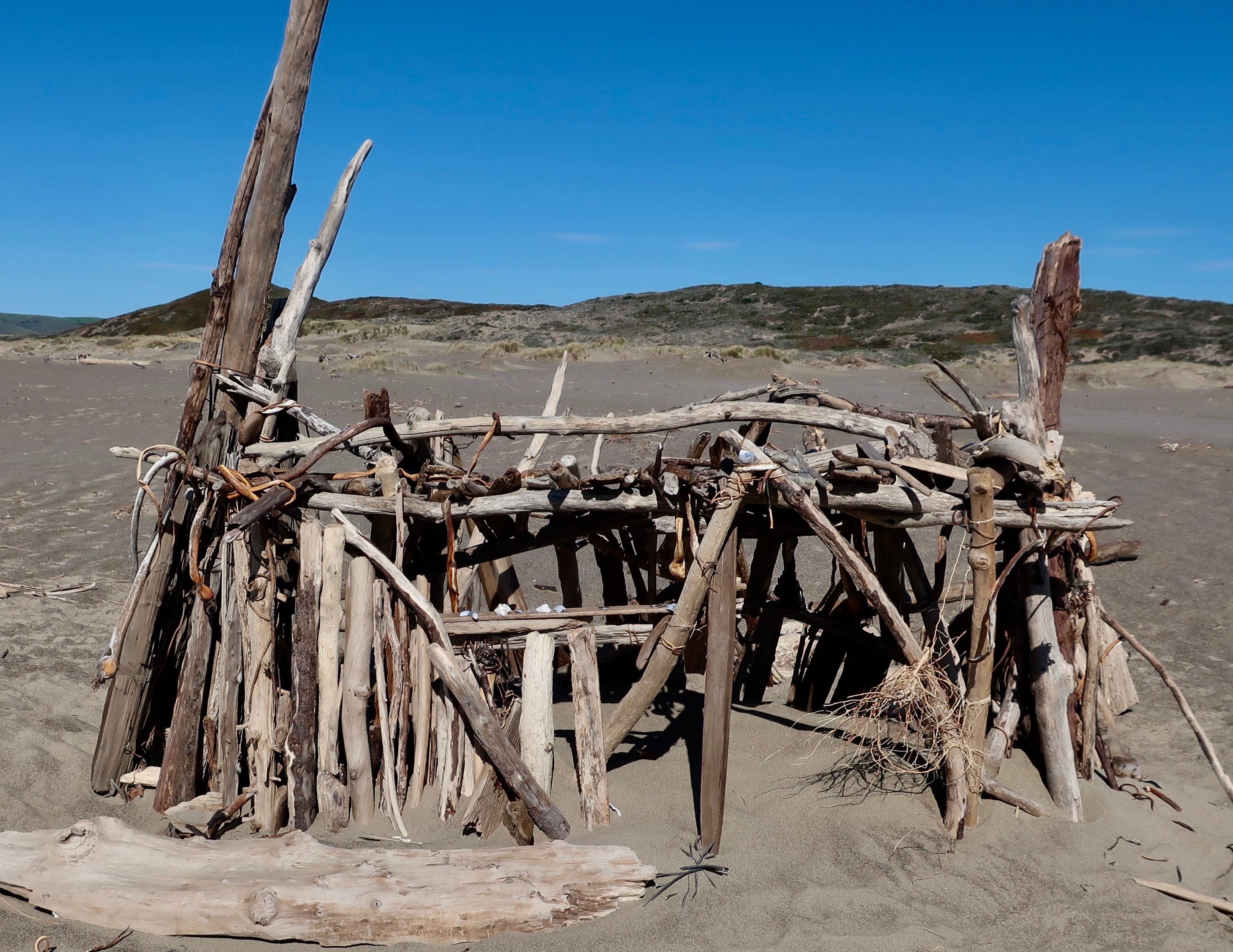
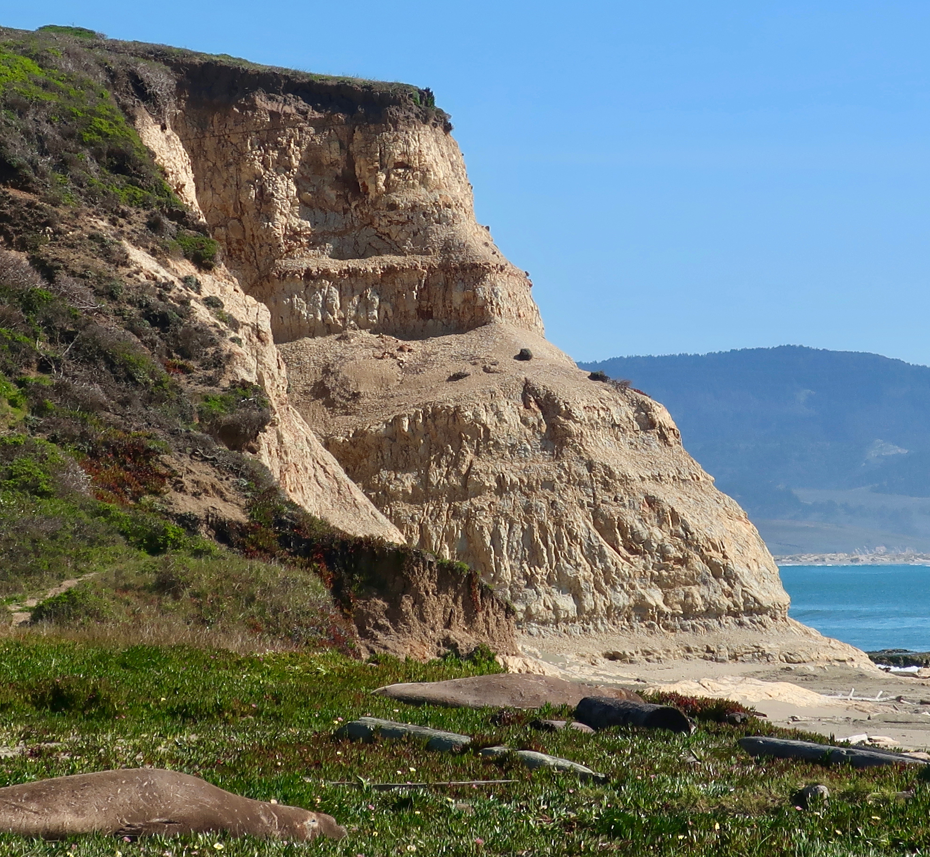
Earthquake Trail, found next to the Visitors’ Center at Pt. Reyes National Seashore, commemorates the event. Peggy and I were there last week and went for a walk along the trail. Like San Francisco, Pt. Reyes felt the full fury of the earthquake as portions of the land moved north as much as 20 feet.

With arms stretched out, Peggy points to two sections of a fence that were separated during the San Francisco Earthquake. They have been rebuilt to demonstrate the power of the earthquake. The lower fence had moved 16 feet north. The San Andreas Fault is located directly under Peggy’s feet.

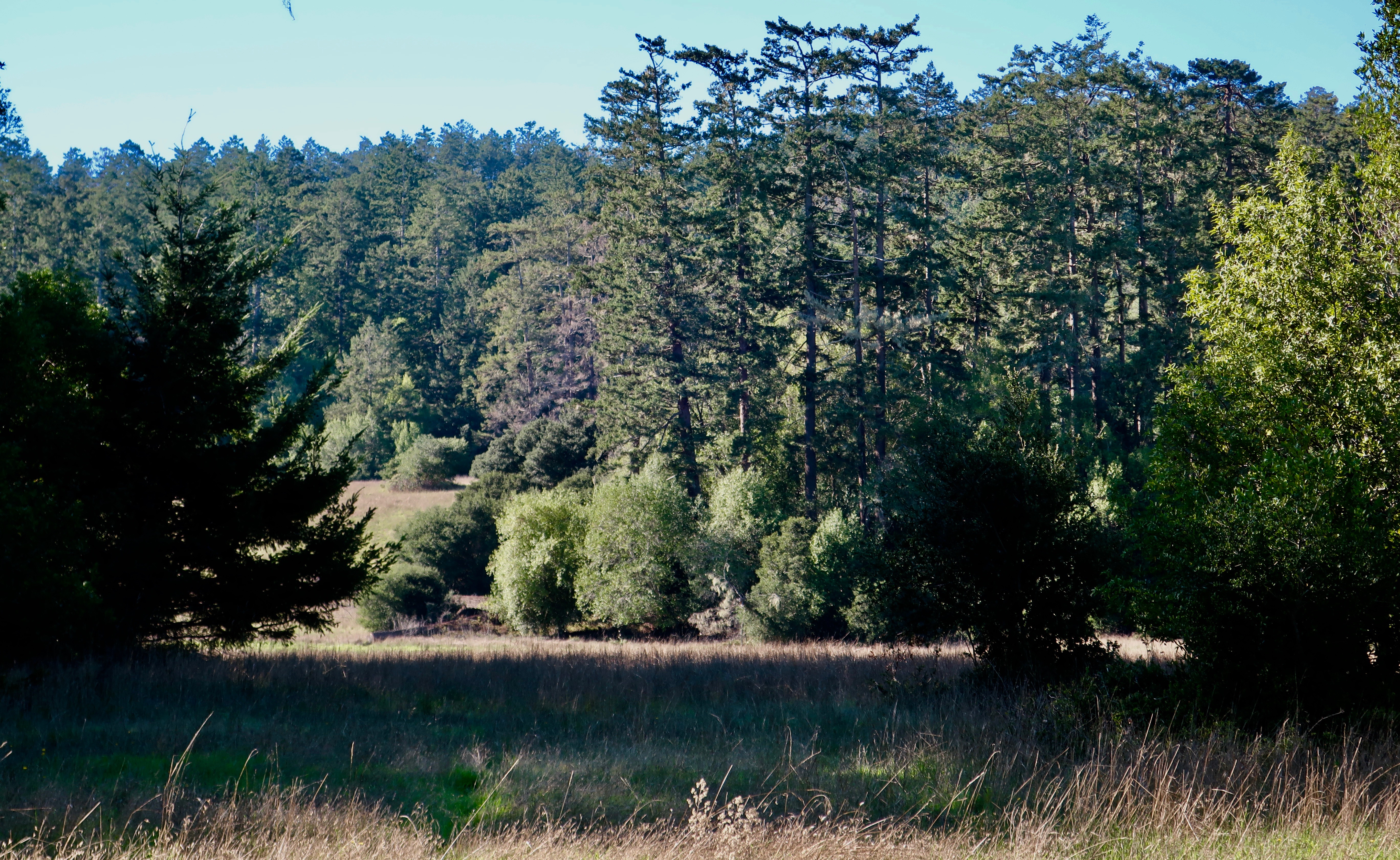
The trail is easy to hike and is well marked with information signs. Its bucolic, serene beauty makes the damage done by the 1906 earthquake hard to imagine, however. 

A bridge along Earthquake Trail at Pt. Reyes National Seashore. Photo by Curt Mekemson.
The peaceful beauty found along the Earthquake Trail at Pt. Reyes belies the potentially destructive force that lies just beneath it. Fall leaves added color.
While the trail is short and easy to hike, it provides a variety of scenery, like this meadow…
Interesting trees are perfect for little people to explore… (Photo by Peggy Mekemson.)
A fun stump found along the trail.
Peggy took an interesting closeup. She saw a dragon, a monster, and more….oh, my.
Birch.
Moss
Various Conifers…
And in conclusion, a bit of sunshine.

NEXT POST: More photos from around Pt. Reyes National Seashore and our maiden three week voyage with Iorek the Truck and Serafina the trailer.

Abbots Lagoon and Pt. Reyes Station… A Trail Hike Plus a Favorite Small Town

Abbot’s Lagoon is a great place for bird watchers. Or people watchers. This great blue heron with its neck stretched out like a rubber band had a wary eye on Peggy. Wisely so. She was stalking it with her camera. (Photo by Peggy Mekemson.)

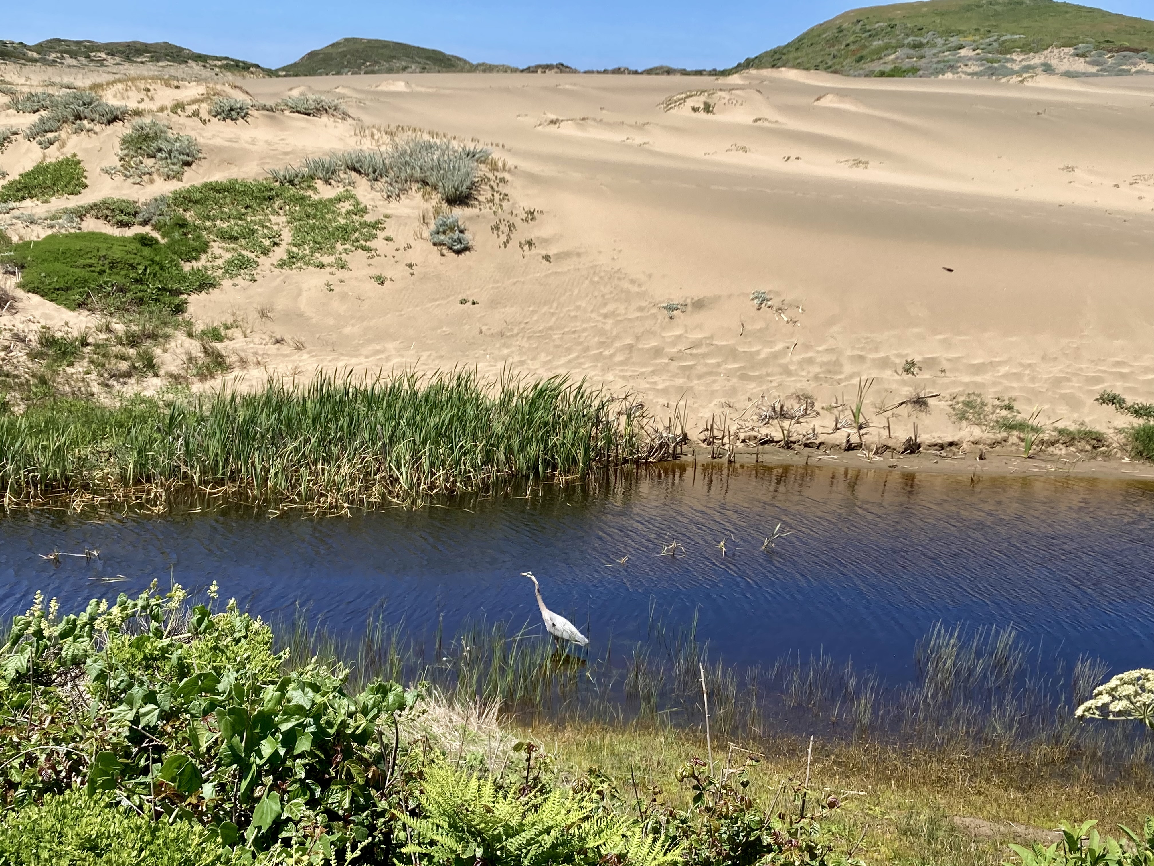
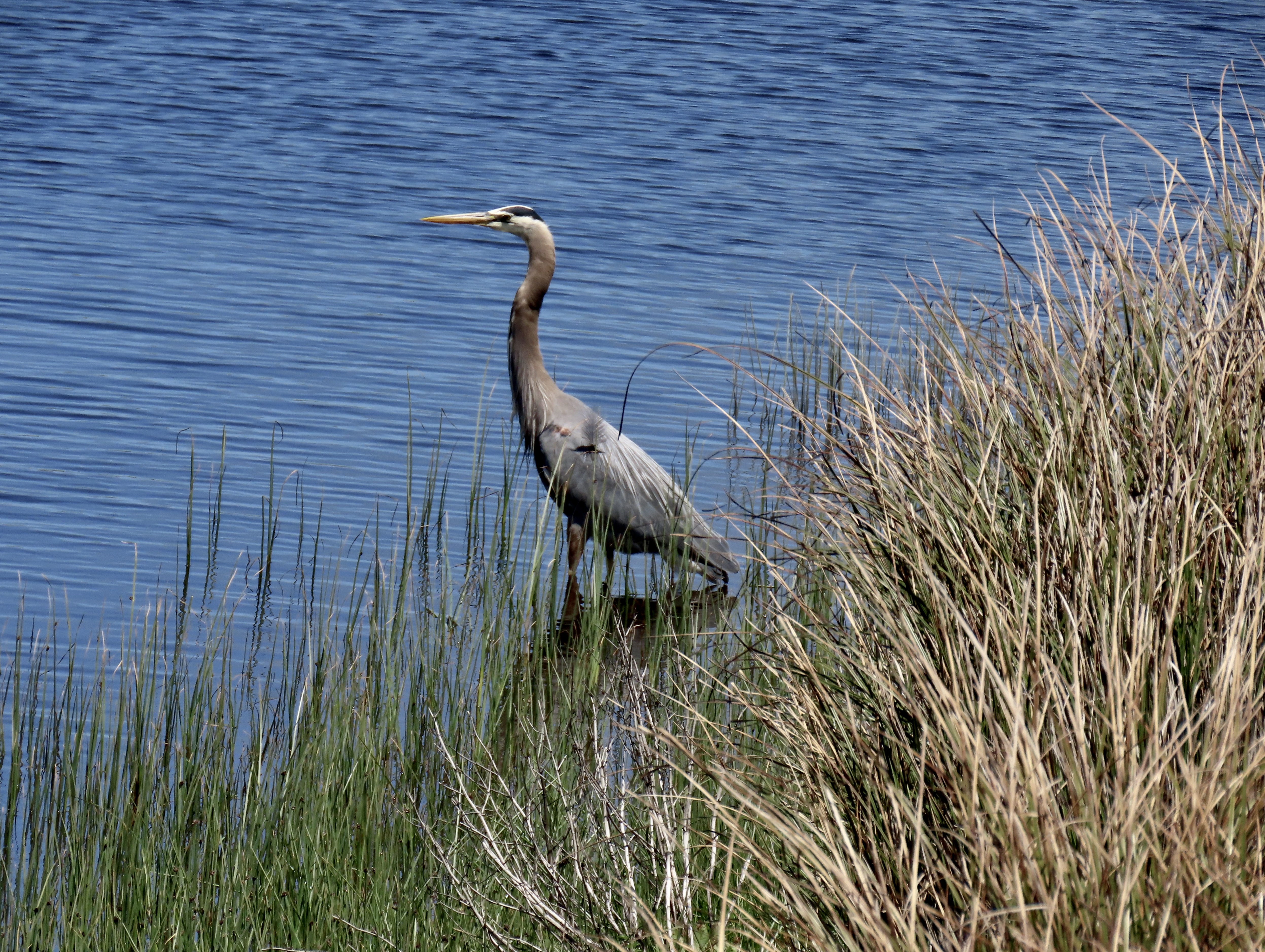
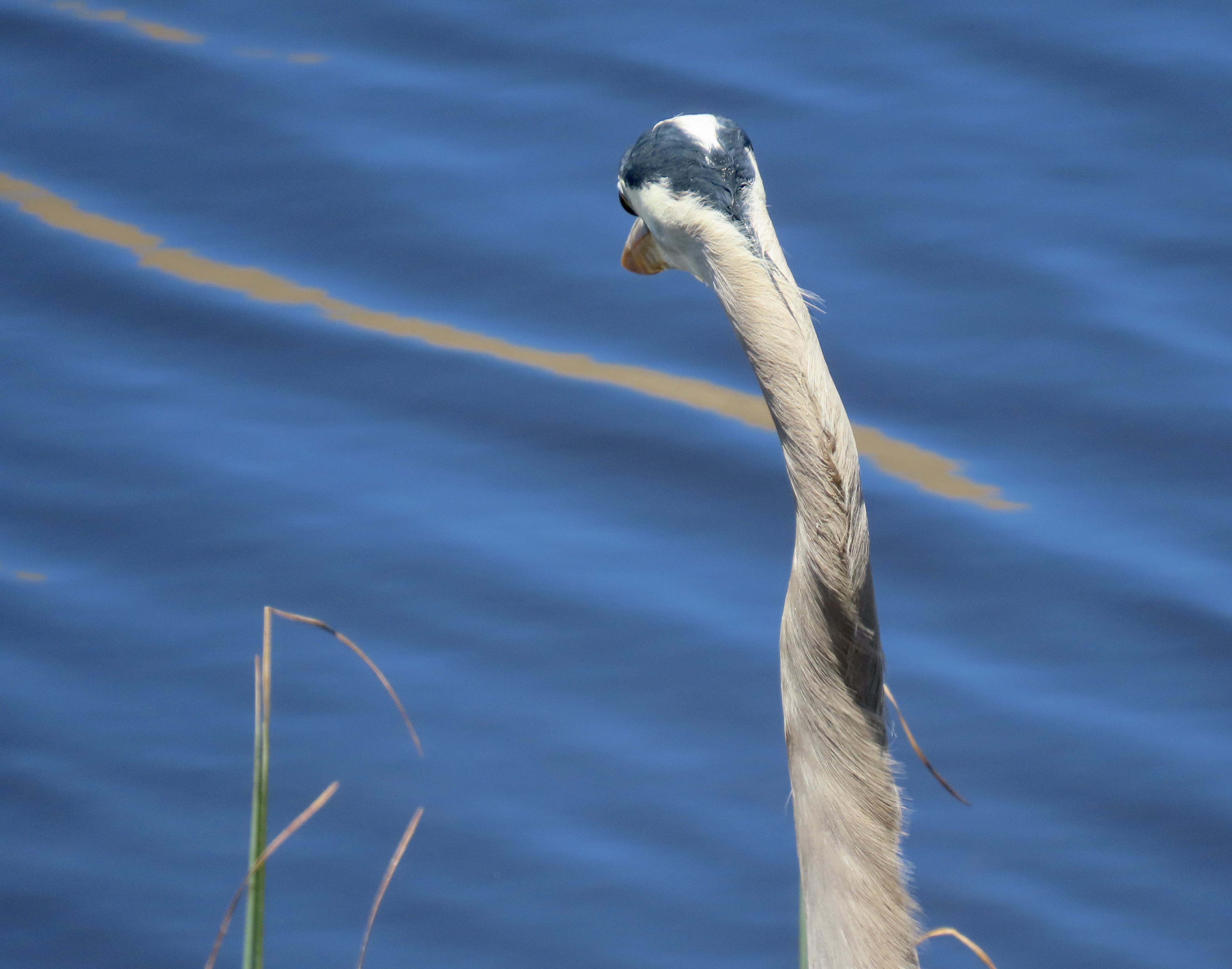
It’s a wrap on my Pt. Reyes series today. Peggy and I will take you for a hike out to Abbot’s Lagoon and a visit to Pt. Reyes Station, a favorite town of mine.

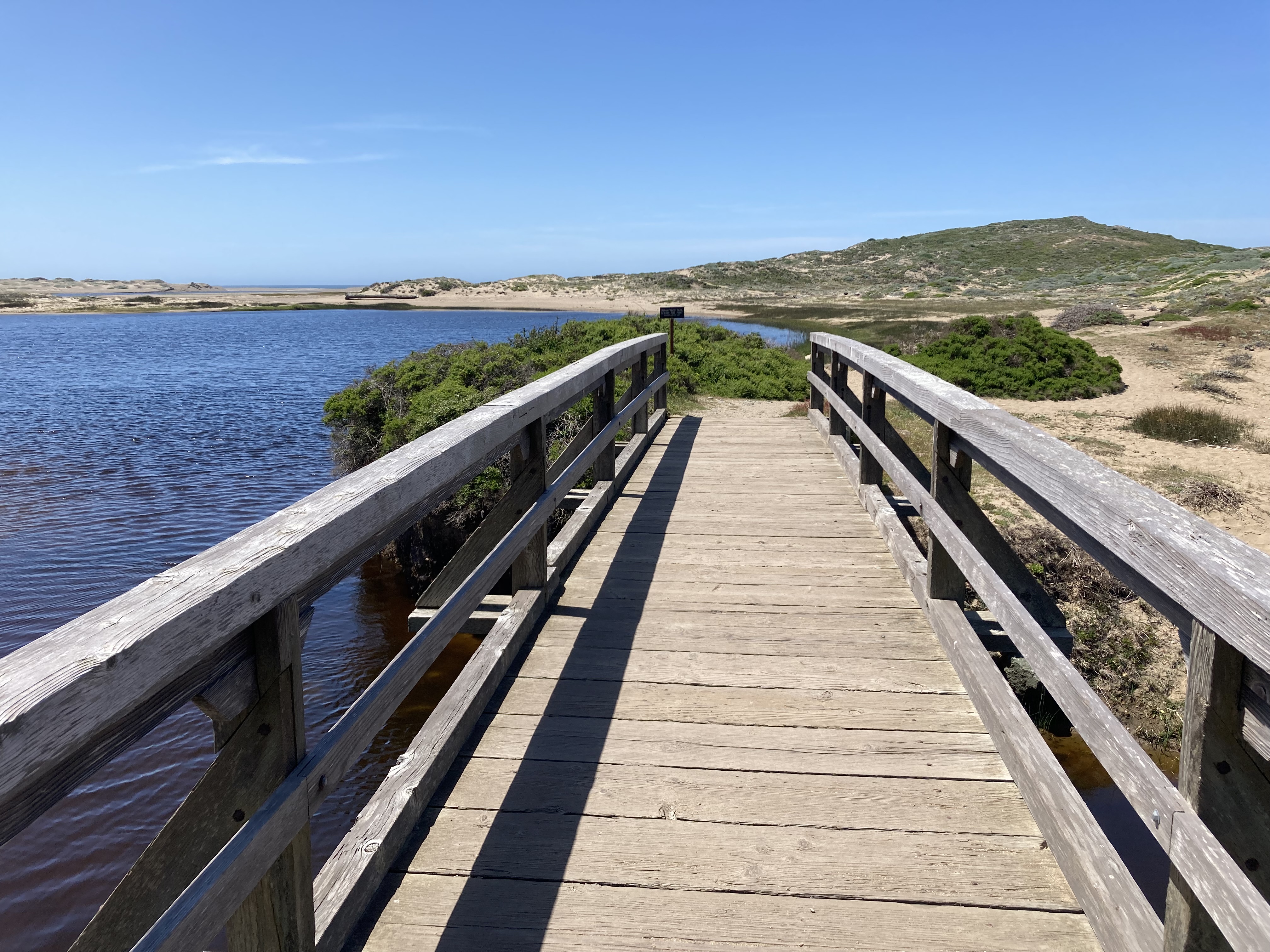
The hike is suitable for almost anyone. We even watched a mom and dad pushing their baby along in a stroller. How much easier can it get? The baby seemed quite happy as did the parents. Visitors can turn around whenever they want, hike out to the Lagoon, or go on a leisurely stroll all the way to the ocean. We chose the latter.

The Abbot’s Lagoon trailhead leading out from the parking lot. The Lagoon can be seen in the distance. The Pacific Ocean is out beyond the Lagoon. The narrow strip you can see on the left is the continuation of the trail.
The red marker shows the location of Abbot’s Lagoon on the Google map. Down to the right you can see Pt. Reyes Station next to the Highway 1 marker. Highway 1, BTW, follows the San Andreas fault through this area. The 1906 San Francisco Earthquake shot what is now the National Seashore over 20 feet northward. San Francisco is 30 miles to the south.
Another photo of Peggy’s great blue heron. This time he was back at work catching fish. I liked the slight hint of a reflection. (Photo by Peggy Mekemson.)
I was impressed with the red eye on this coot. (Photo by Peggy Mekemson.)
We crossed a small bridge and looked back up the Lagoon toward the parking lot.
There was a drift wood structure along the trail on the beach out near the ocean. It had been cleverly woven together with kelp.
Finally we arrived at the Pacific Ocean.

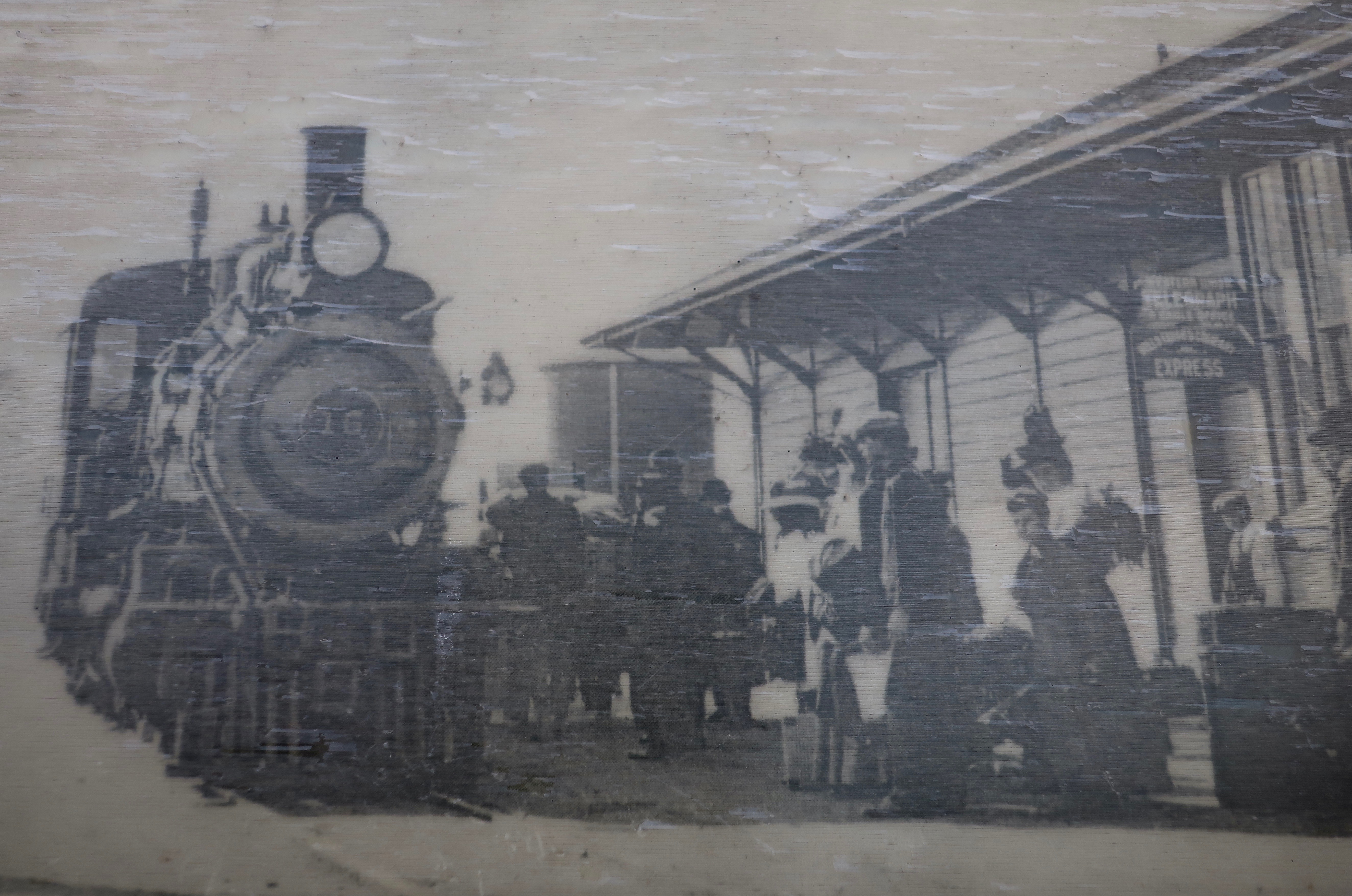
The North Pacific Coast Railroad had arrived in the area 146 years earlier in 1875 and let passengers off in a cow pasture to make their way to nearby Olema and dairy ranches out on the peninsula. The cow pasture soon added a hotel and the town of Pt. Reyes station was born. It’s a story told over and over in the West. The railroad arrives and a community springs up, making land barons/developers happy and rich. This time it was a dentist in San Francisco. The railroad was making its way north to retrieve redwoods that were being cut down to build the city. Many a giant redwood gave its life to the cause.

I first arrived at Pt. Reyes Station in the late 1960s and I’ve returned again and again. The town has become somewhat yuppified and more expensive since then due to its close vicinity to San Francisco, but it still retains much of its charm. The following photos reflect some of what makes it charming.

The Pt. Reyes Book Store is one of the best small, independent bookstores we have ever been in, and we’ve been in a lot. Peggy told me to go in and spend $200 for my birthday. Boy, does she know me…
The Bovine Bakery is on one side of the book store. The buttermilk scones are to die for! I never leave town without one, or two, or three, or four.
Feeling Horsey? A saddlery is on the other side of the bookstore.
If your horse is hungry, Toby’s Feed Barn is across the street.
But what feed barn do you know that also serves gourmet coffee and freshly baked, large chocolate chip cookies. Now, that’s what I call charm!
A walk behind the the bookstore building brought us to the Cowgirl Creamery, famous for its cheeses, and I might add, its grilled cheese sandwiches. I’ve never been a fan of grilled cheese, but one bite of its aged white cheddar on sourdough bread and I was hooked. Peggy and I were back for another one the next day, which we took out and ate at the Abbot’s Lagoon parking lot.
Our view from where we chowed down on our grilled cheese sandwiches in the Abbot’s Lagoon parking lot.
A bit of living history. Cheda’s Garage is the oldest contract Triple A garage in the nation.
This was the view inside Cheda’s Garage. Putting two and two together and thinking roadside pickup of wrecked cars, I couldn’t help but irreverently think “Roadkill.” Just kidding. Old Cheda must have been one heck of a hunter.
A photo of early Pt. Reyes Station…
The building today.
The mural on the front of the building capturing some of the activities and wildlife of the area.
Just around the corner we found a sign that made us smile. A No Parking Sign had been cleverly modified to become a No Barking sign. Several cars were lined up in the no parking zone. Not one had a barking dog. A law-abiding town, for sure.
I’ll conclude my Pt. Reyes series with a historic photo of the train that gave the town its name. Join me next Friday on my travel blog as I take you on a spring walk around our property.

MONDAY’s BLOG-A-BOOK POST from Its 4 AM and a Bear Is Standing on Top of Me: I decide that doing an inventory of the local skunk population is ever so much better than being conked on the head by a Little League hardball. But have you ever faced a skunk standing on its front legs with its tail pointed toward you— ready to spray?

Raging Winds, Fog, and Treacherous Rocks… 3 Reasons for the Pt. Reyes Lighthouse

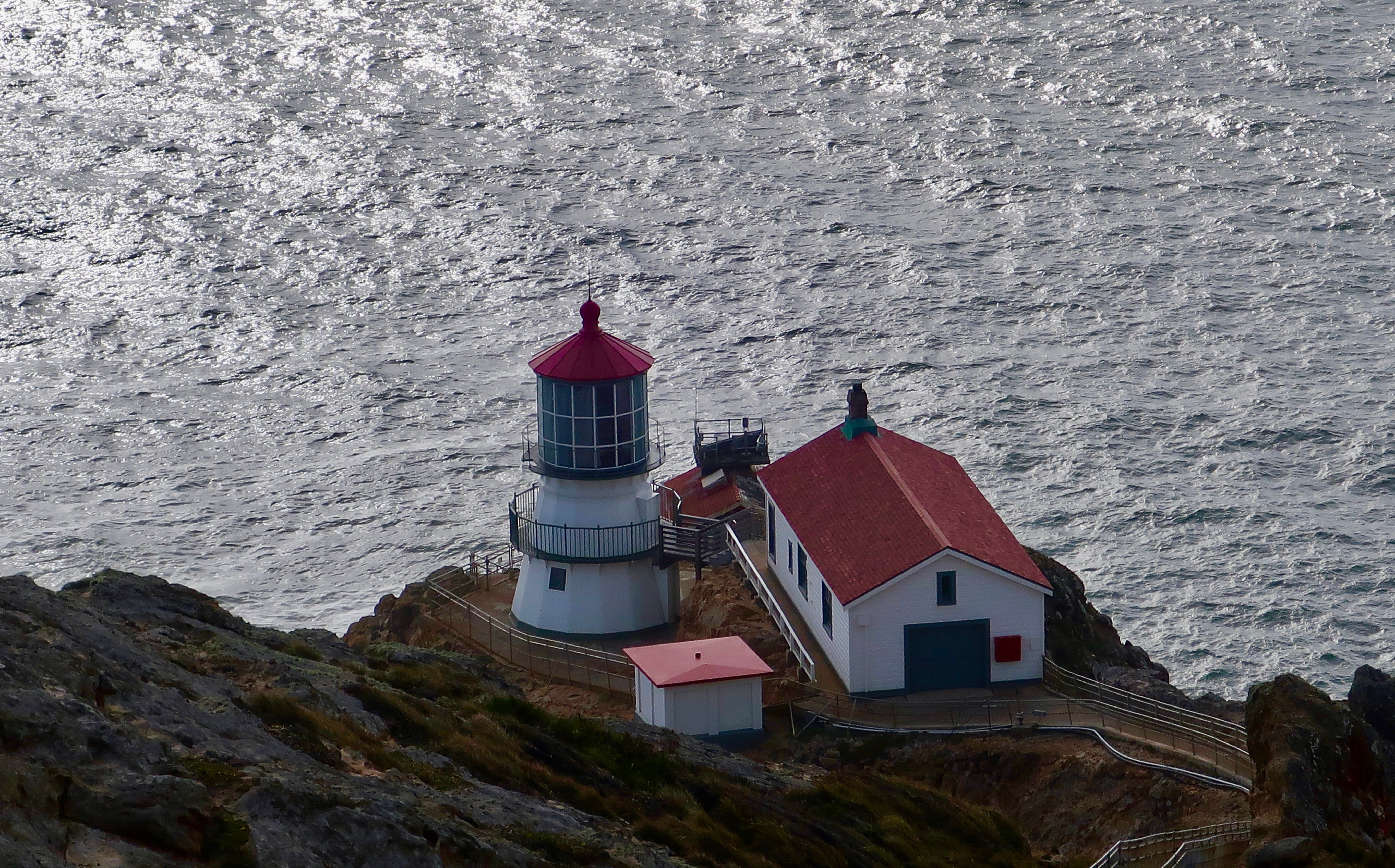
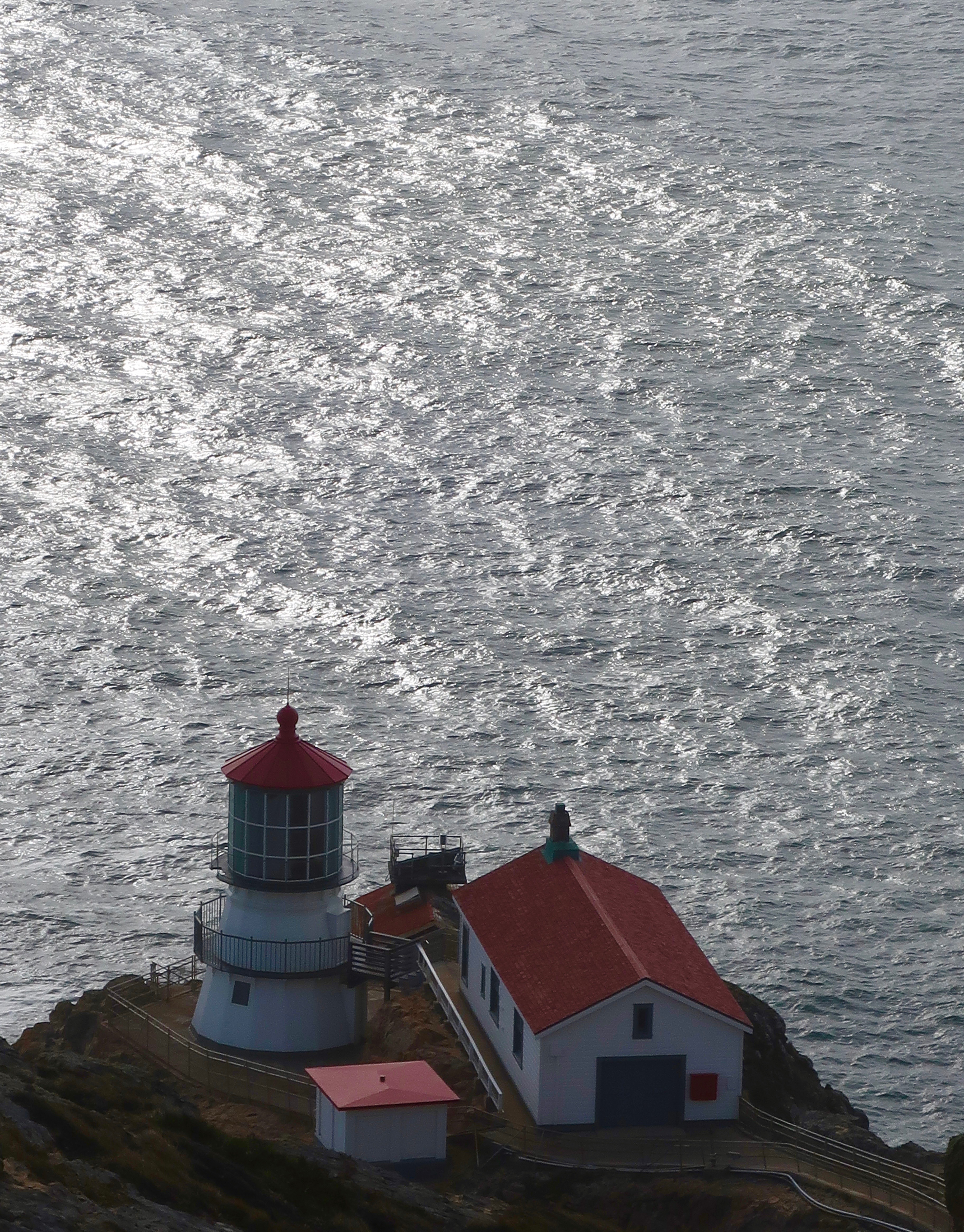
“Point Reyes is the windiest place on the Pacific Coast and the second foggiest place on the North American continent. Weeks of fog, especially during the summer months, frequently reduce visibility to hundreds of feet. The Point Reyes Headlands, which jut 10 miles out to sea, pose a threat to each ship entering or leaving San Francisco Bay. The historic Point Reyes Lighthouse warned mariners of danger for more than a hundred years.” From the Pt. Reyes National Seashore website.

It was hard to imagine frequent winds of 60 MPH that have been clocked as high as 133 MPH and weeks on end of pea-soup fog the day we visited the Pt. Reyes Lighthouse in March.

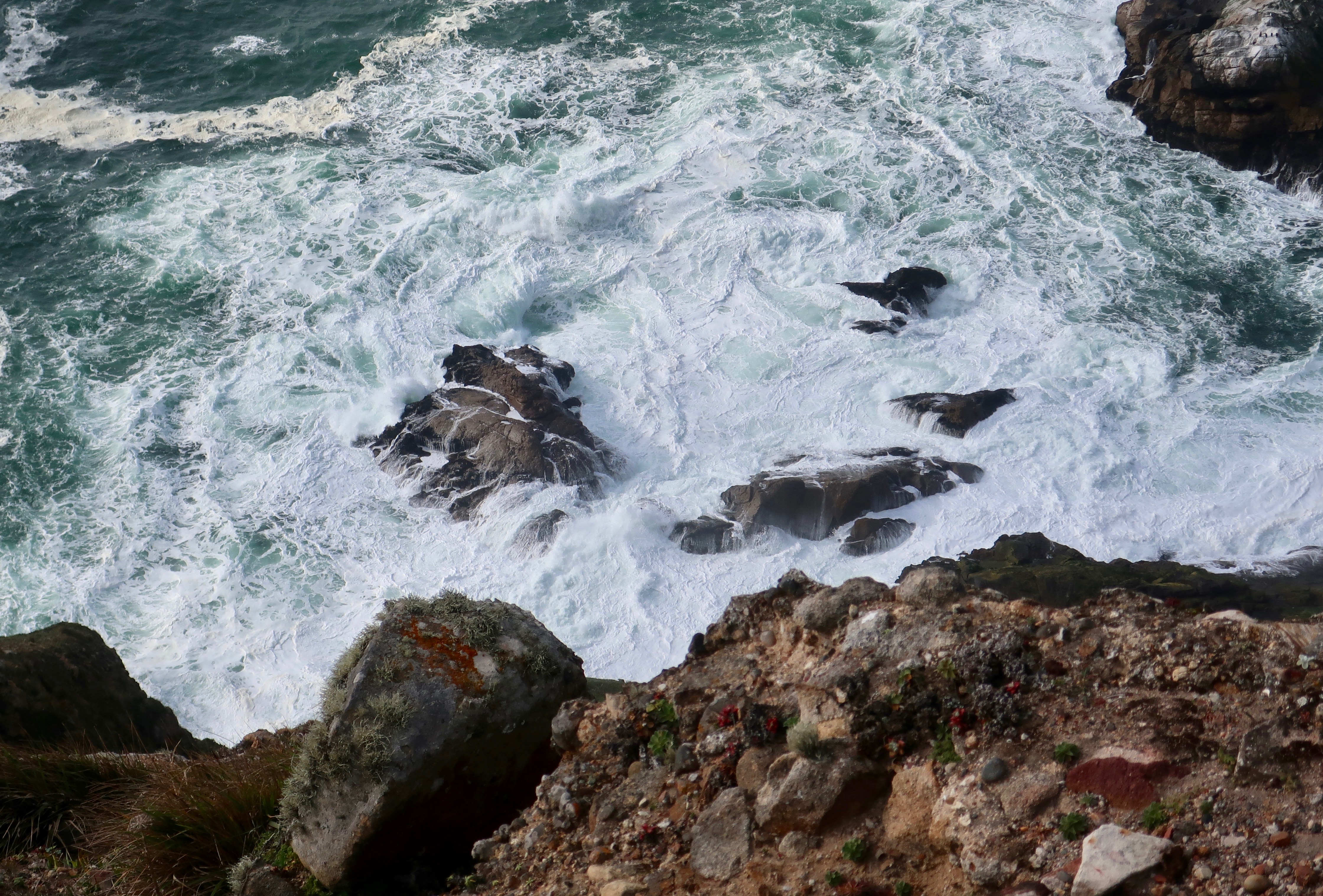
For as much as I enjoy Pt. Reyes National Seashore, I studiously avoid it in the summer. One reason is the fog. That’s true for much of the Pacific Coast. The other is tourists, gazillions of them. Traffic slows to a turtle’s pace along Highway 1, campgrounds are full, and popular sites such as the lighthouse are packed. I have a limited sense of humor about any of the above, especially given that I can visit during the late fall, winter, and early spring when few tourists are out and about and days are often crystal clear. Or, if I am particularly lucky, a raging storm will send huge waves crashing ashore producing spectacular views. I love both.

It was mainly sunshine when Peggy and I visited the National Seashore in early March to celebrate my birthday. The lighthouse was closed due to Covid, but I have visited it before. This time, we admired it from above.

The Lighthouse was built in 1870 to help counter the frequent shipwrecks that took place in the area. A steam driven fog horn was used when the fog was too thick to see the light.

The lighthouse served its purpose for over 100 years, finally shutting down in 1975 when the US Coast Guard replaced it with an automated light found just below the historic lighthouse. Up until then it was tended by a lighthouse keeper whose responsibility was to keep the light burning. In addition to warning mariners off of the treacherous rocks, the lighthouse served as a navigational aid. Each lighthouse along the coast has a different frequency of light that ship pilots recognize. At Pt. Reyes, the light flashed once every five seconds.

Looking out to sea.
A historic view of the Pt. Reyes Lighthouse from the National Archives.

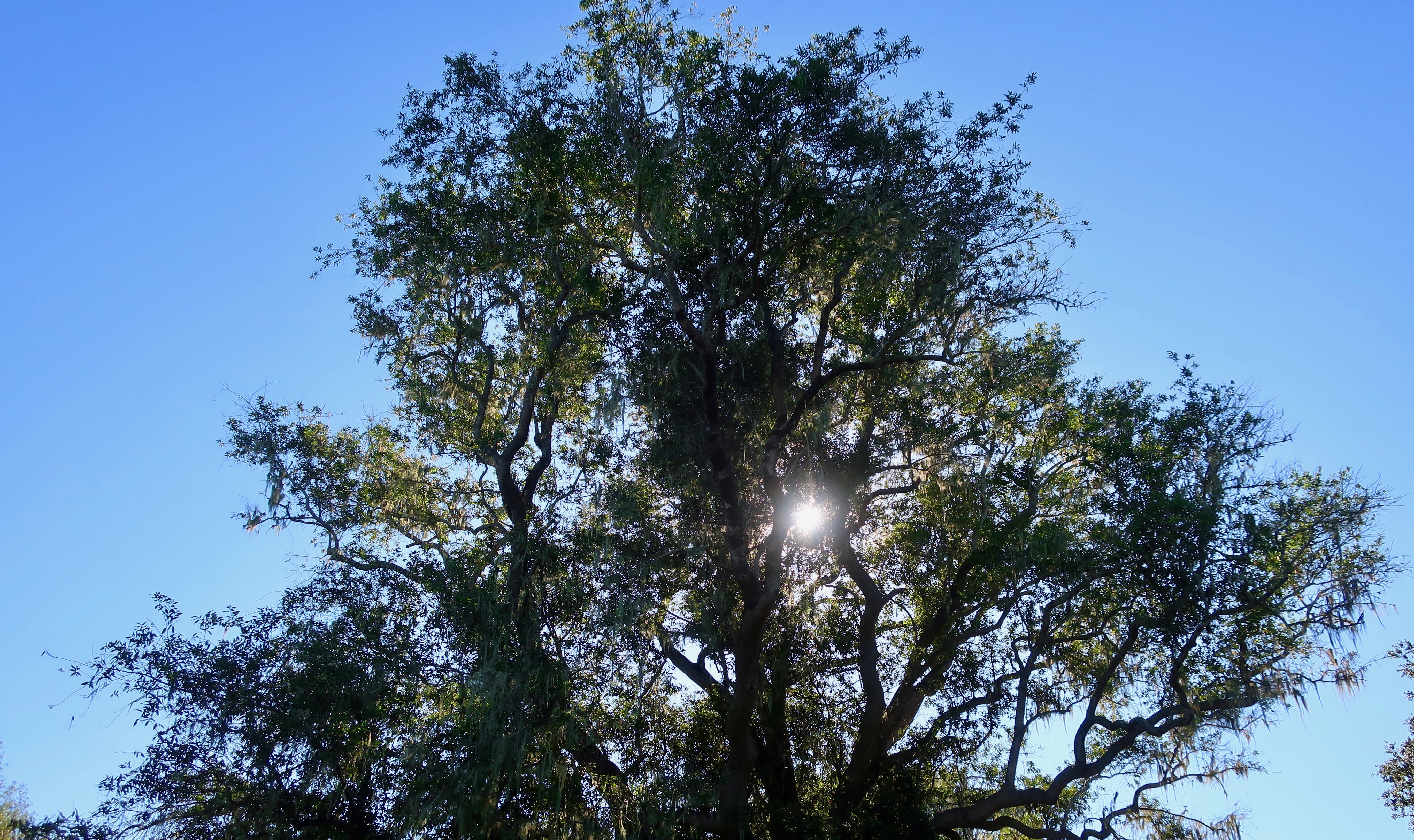
Peggy and I parked Quivera and followed the trail that led out to the lighthouse. Along the way, we found trees that showed the effects of the high winds that frequent the headlands.

Wind sculptured trees
I pictured children having a blast climbing over the gnarled limbs on the trees.
The Pt. Reyes headlands are a great place for whale watching when they are migrating south toward Mexico and then north toward the Arctic. We didn’t see any, but we were greeted by this large mural as we neared the lighthouse.
We found this interesting rock perched above the lighthouse.
And looking down below the lighthouse, we watched these waves crashing ashore among the rocks— which is where I will conclude my post for today.

NEXT FRIDAY’S TRAVEL BLOG: I’ll wrap up my Pt. Reyes series with a pleasant walk out to Abbot’s Lagoon and a visit to the colorful town of Pt. Reyes Station.

An Elk Loses Its Coat, a Coyote Digs Sushi, and a Ranch Is History… The Pt. Reyes Series

This bull elk that came down to see us as we hiked out the Tomales Pt. Trail looked quite elegant until we looked at his back. He was still shedding his winter coat and had yet to grow his summer fur. The deer herd that hangs out on our property goes through the same stage, looking frowzy for a couple of months. (Photo by Peggy Mekemson.)

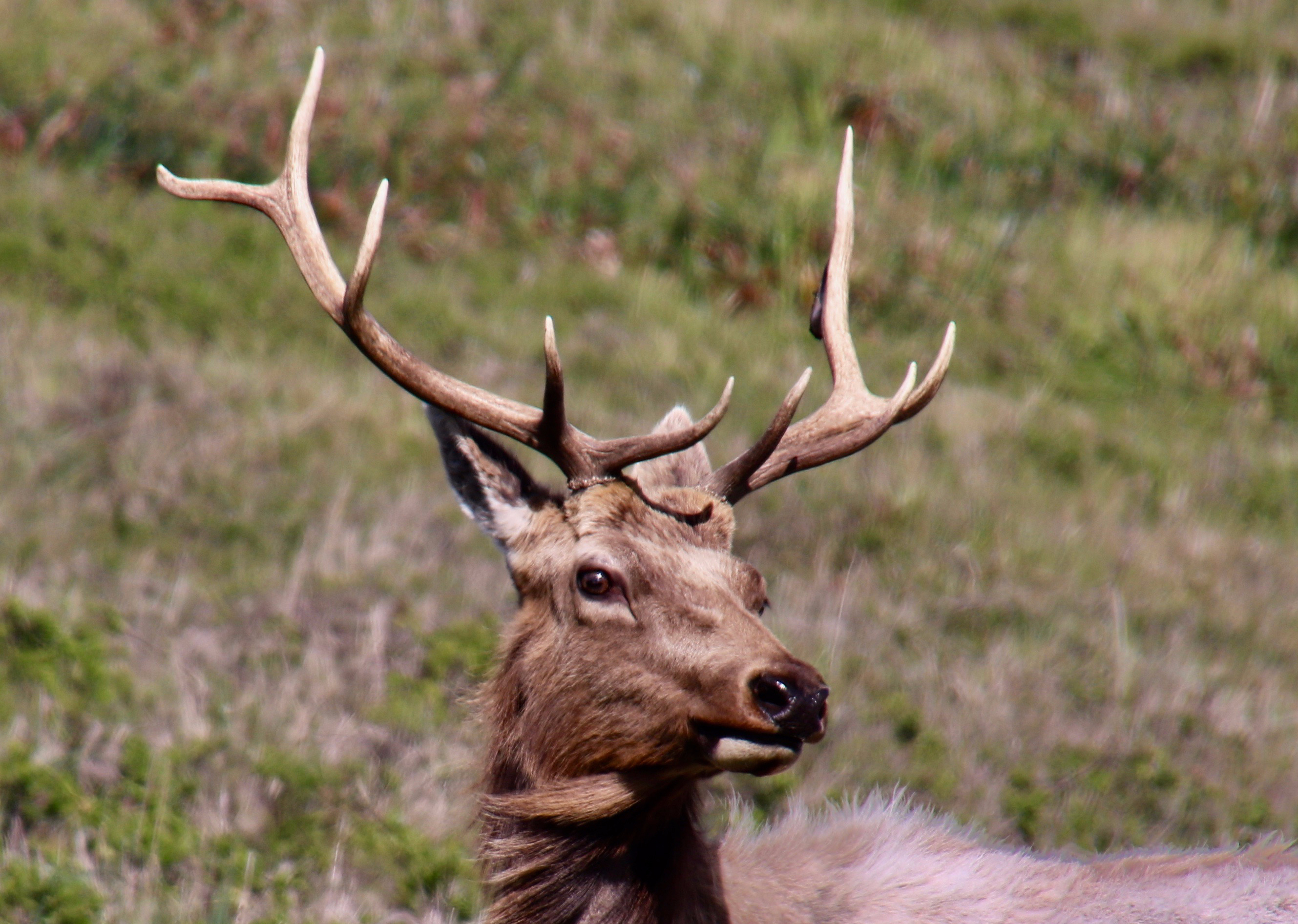
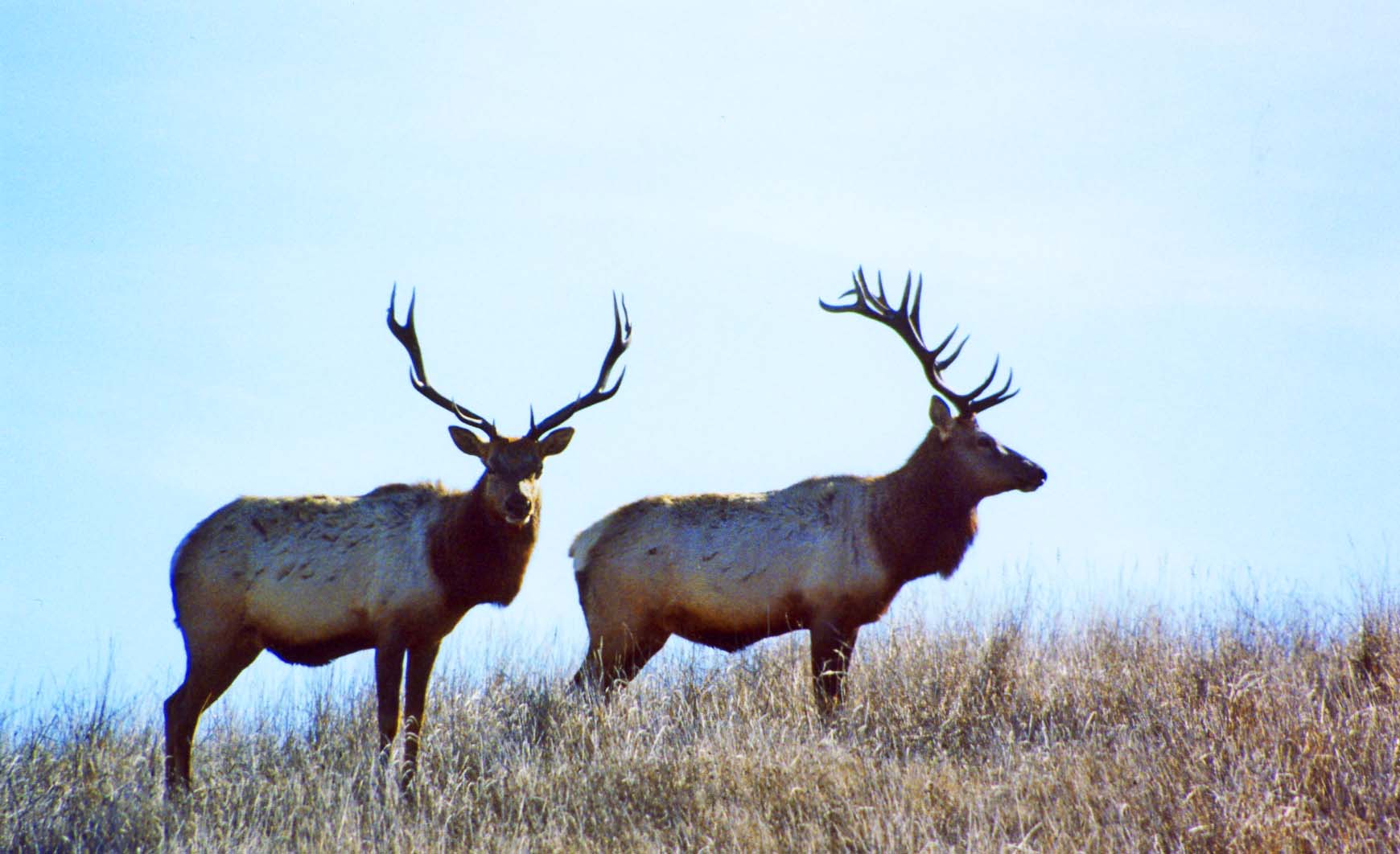
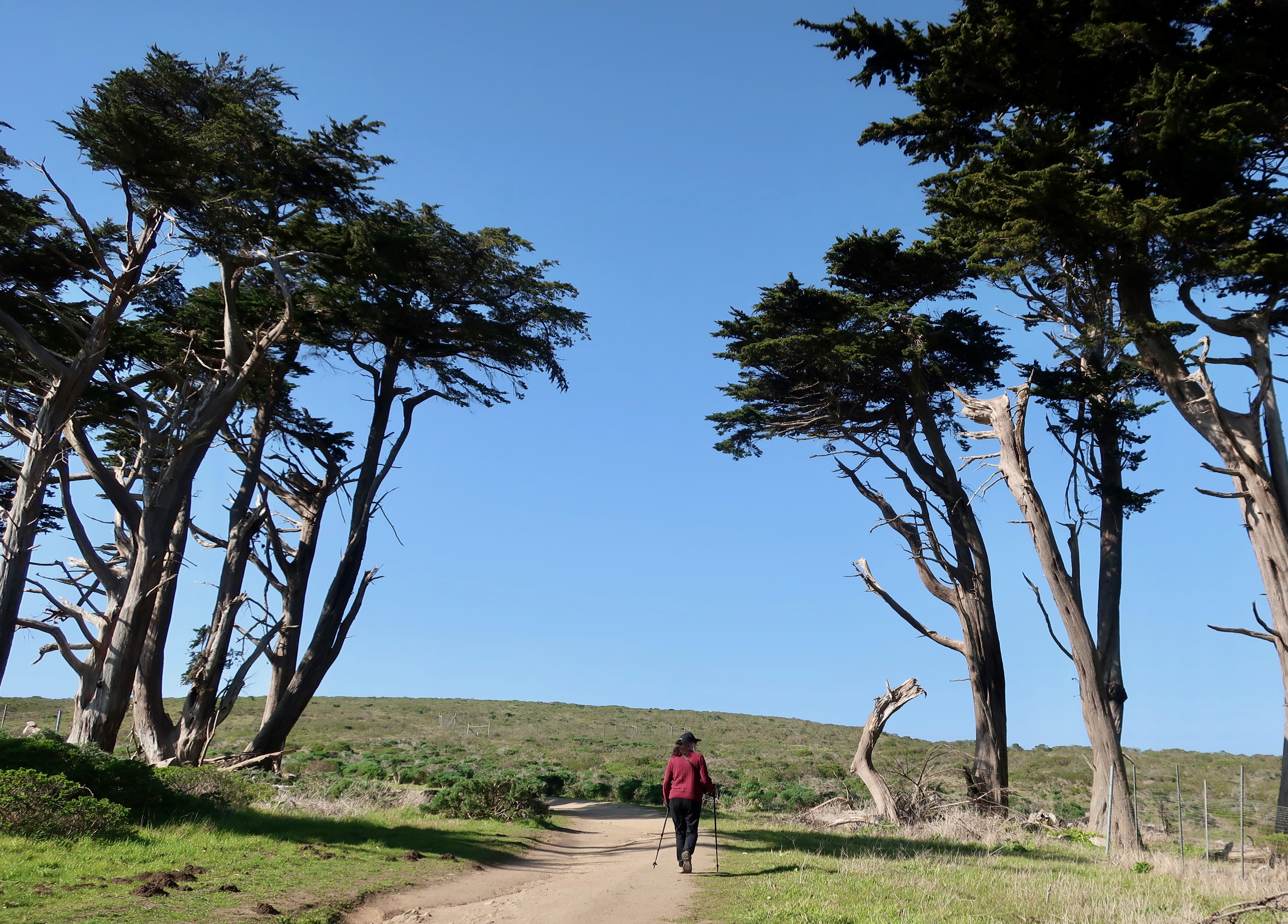
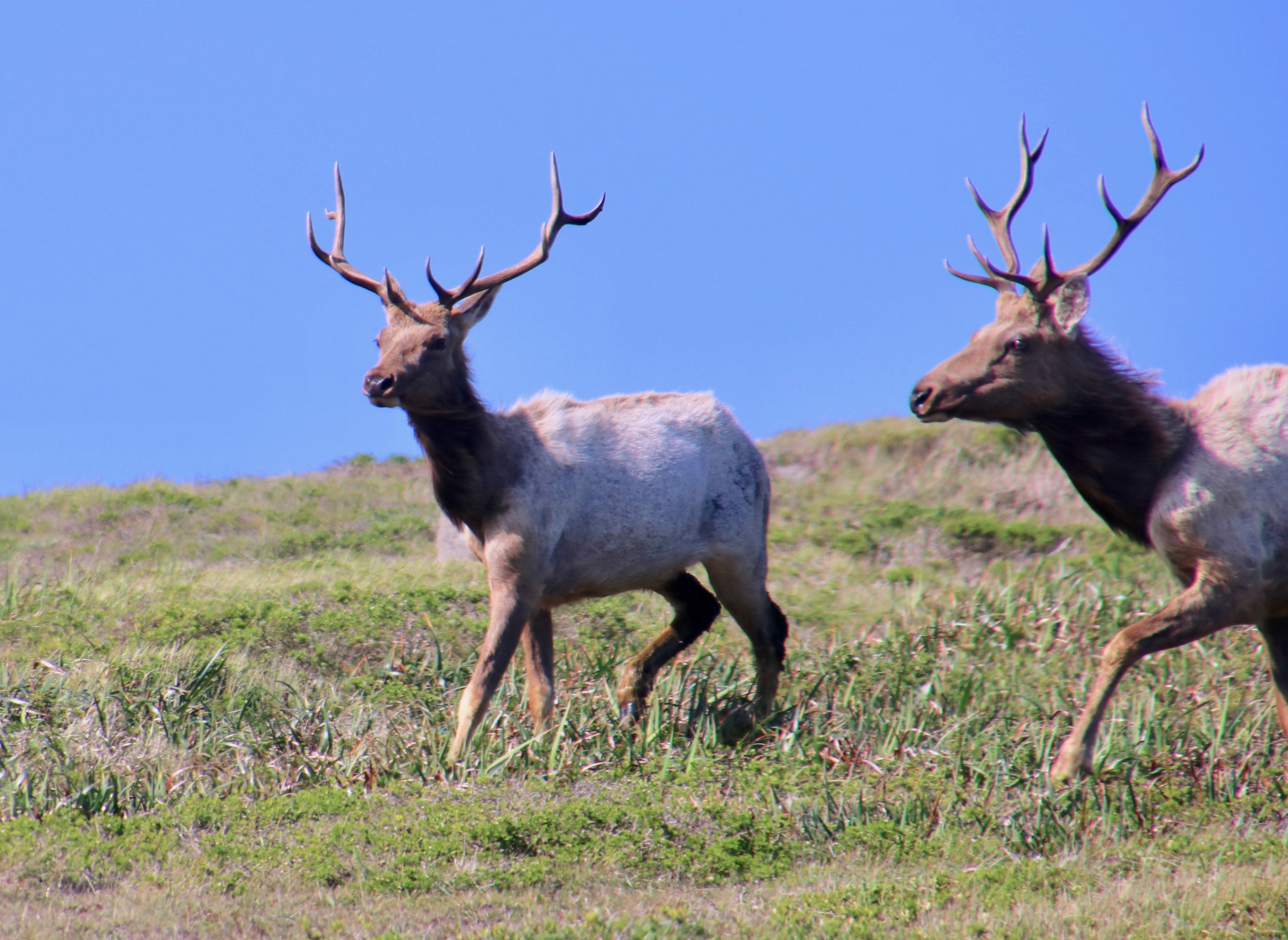
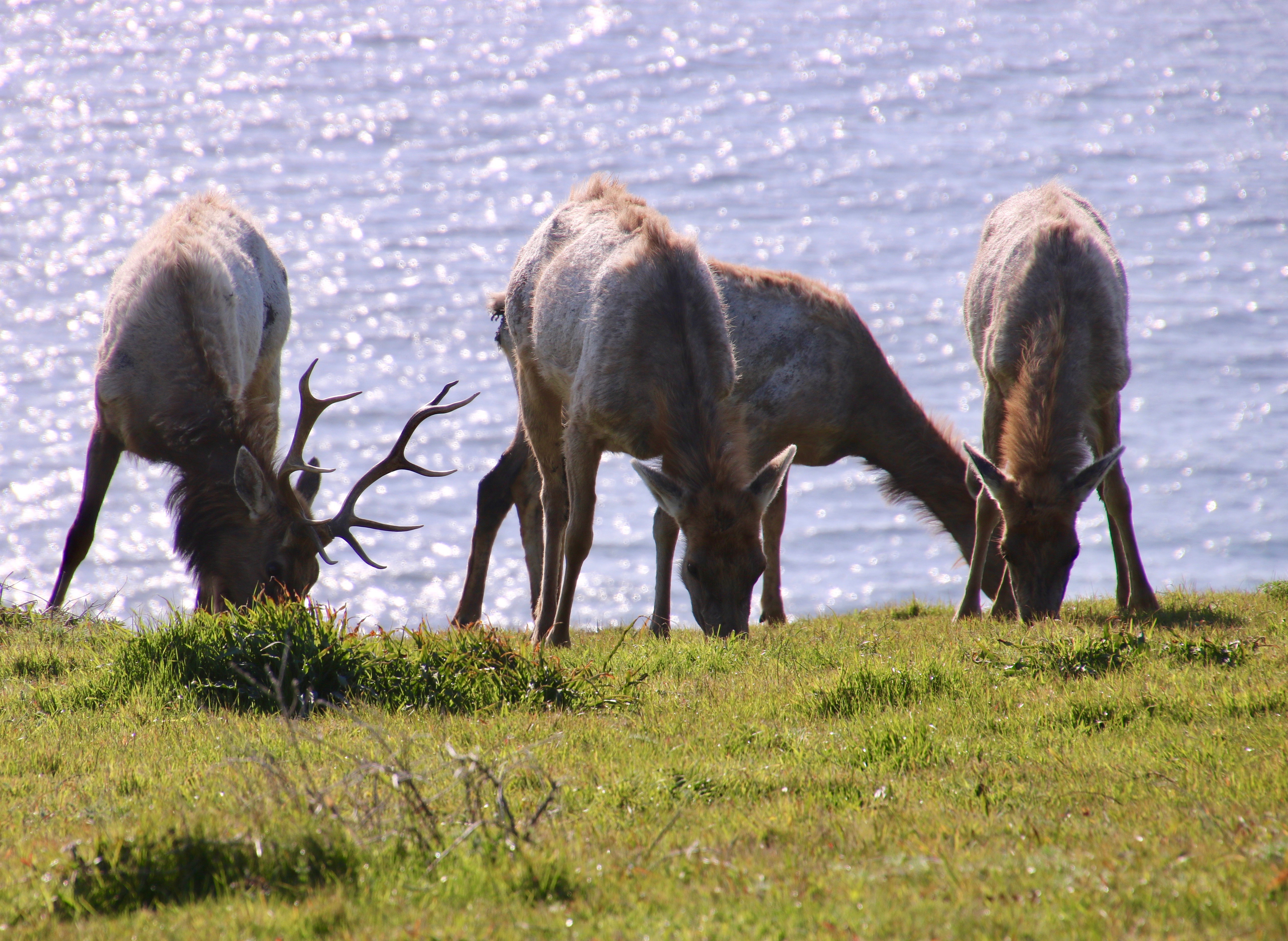
Any trip to Pt. Reyes National Seashore should include a drive out to the historic Pierce Pt. Ranch and Tule Elk Reserve. The ranch will introduce you to an important piece of Pt. Reyes history. A hike out the Tomales Pt. Trail from the ranch will take you through some impressive scenery and likely give you a view of tule elk and other wildlife. Ever since the elk were reintroduced to the area in 1978, the herd has thrived. Our photos today start with our hike and end back at the ranch.

The Tomales Pt. Trail starts at the Pierce Pt. Ranch passing under tall Cypress trees planted originally by the ranchers as a wind break. Peggy provides perspective.
A few hundred yards brought us to a number of Calla lilies. Peggy and I wondered if a rancher’s wife had planted them to remind her of a home the family had left behind. (Photo by Peggy Mekemson.)
Of course, I had to take photos of the lilies as well.
We stopped to admire the scenery looking out toward Tomales Pt. and the Pacific Ocean.
Another view. The Bodega Headlands can be seen in the distance. If you’ve been to Bodega Bay, it’s possible you’ve driven out there. I like to go out on the headlands and look for whales passing by.
Far below us we saw a pair of coyotes working their way along the beach.
Peggy used her telephoto for a closer shot and, much to our surprise, the coyotes were digging in the sand. Whether they were after clams or crabs or some other seafood delicacy, I don’t know. But what was clear was that the coyotes had developed a tase for sushi!
Shortly afterwards we spotted elk on the ridge above us.
And they came down the hill to see us… (Photo by Peggy Mekemson.)
Bringing their cows with them. (Photo by Peggy Mekemson.)
I caught this photo of one of the bulls checking us out. You can see that he is in that ‘awkward’ stage between losing his winter coat and growing his summer one.
This cow elk was also looking a bit bedraggled. (Photo by Peggy Mekemson.)
A final shot of the elk browsing. I liked the backdrop of the Pacific Ocean.
The Pierce Pt. Ranch ceased operation in 1973. Visitors are now invited to walk through the grounds and get a feel for what dairy ranching was like before modern dairy operation took over.
I liked the roofs.
I believe a park ranger lives in the ranch house now. I could live there!
The old dairy barn is humongous.
I took a peek inside. This is only half of the barn.
While Peggy stood at the barn door.
Since I took a photo of Peggy, she insisted on taking one of me. I took advantage of one of the downed Cypress trees. And that’s a wrap for today!

NEXT POST:

Monday’s Blog-A-Book from It’s 4 AM and a Bear Is Standing on Top of Me: I leave the Graveyard behind and journey off to the Pond where bullfrogs and catfish rule and pirates lurk.

Wednesday’s Blog-A-Book from my lead-up to joining the Peace Corps: I help corral a police car at Berkeley and the rallying cry of ‘Never trust anyone over the age of 30‘ is born.

Going on a Cow Walk… The Pt. Reyes Series

Cow conflict resolution

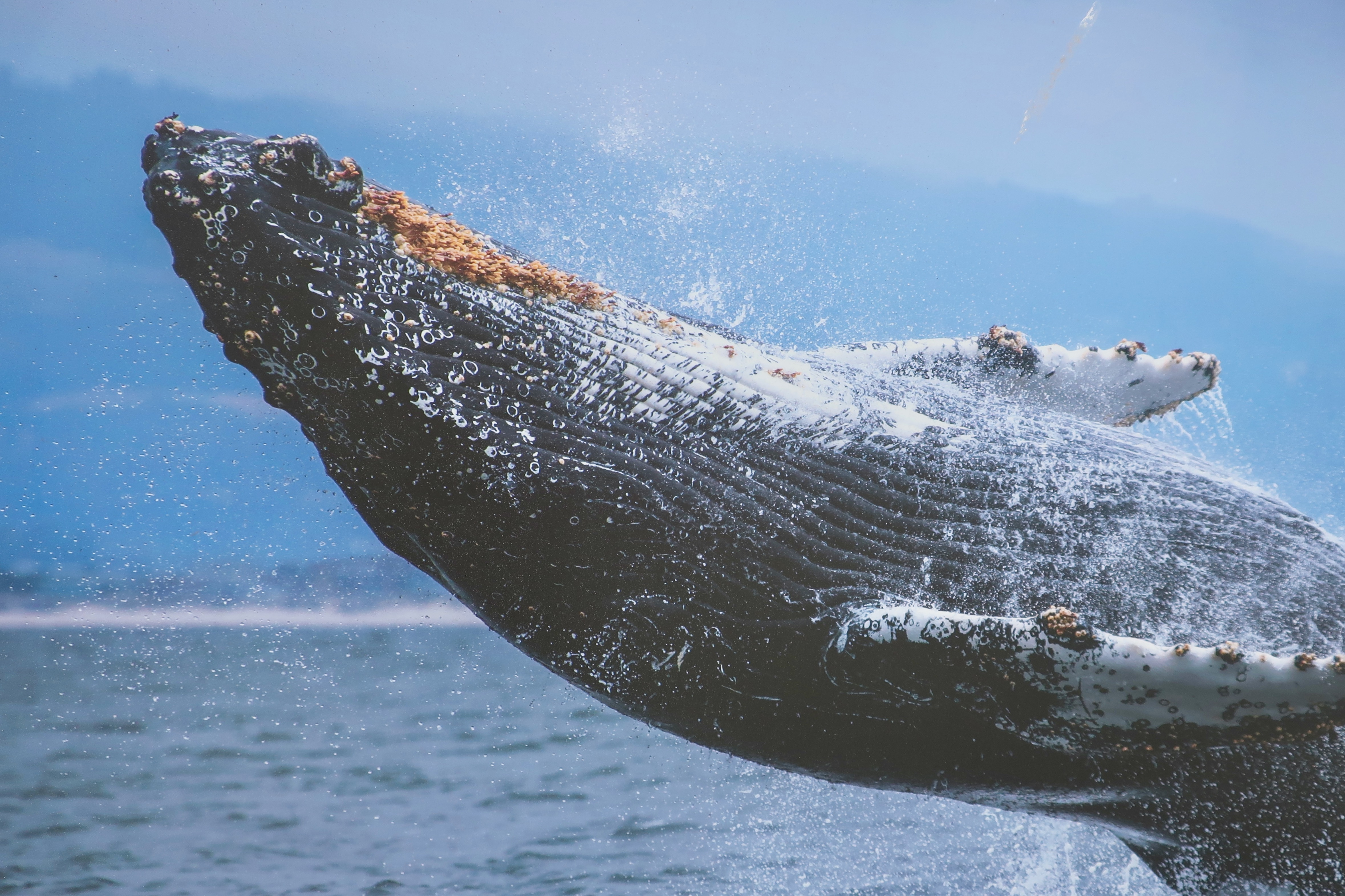
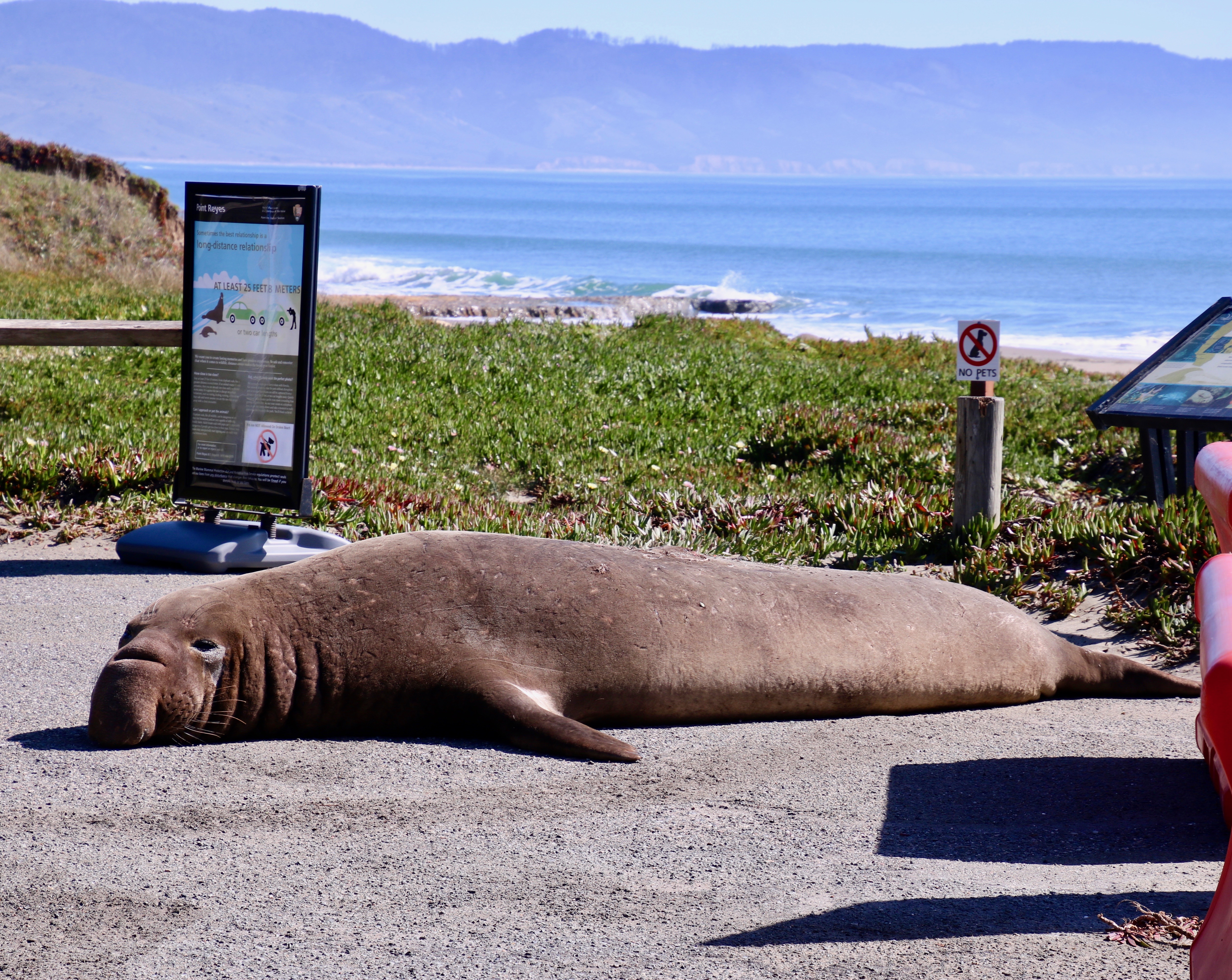
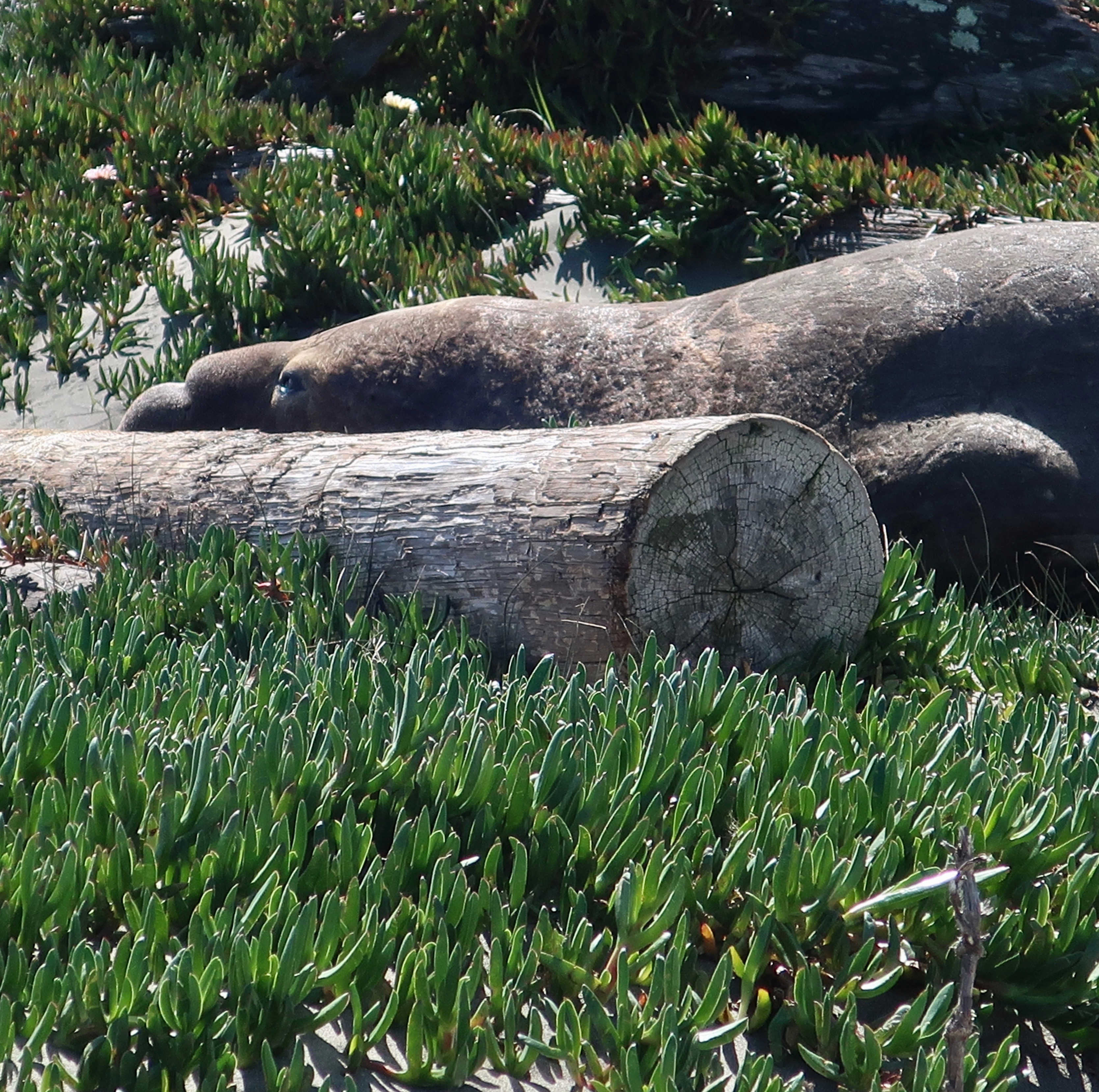
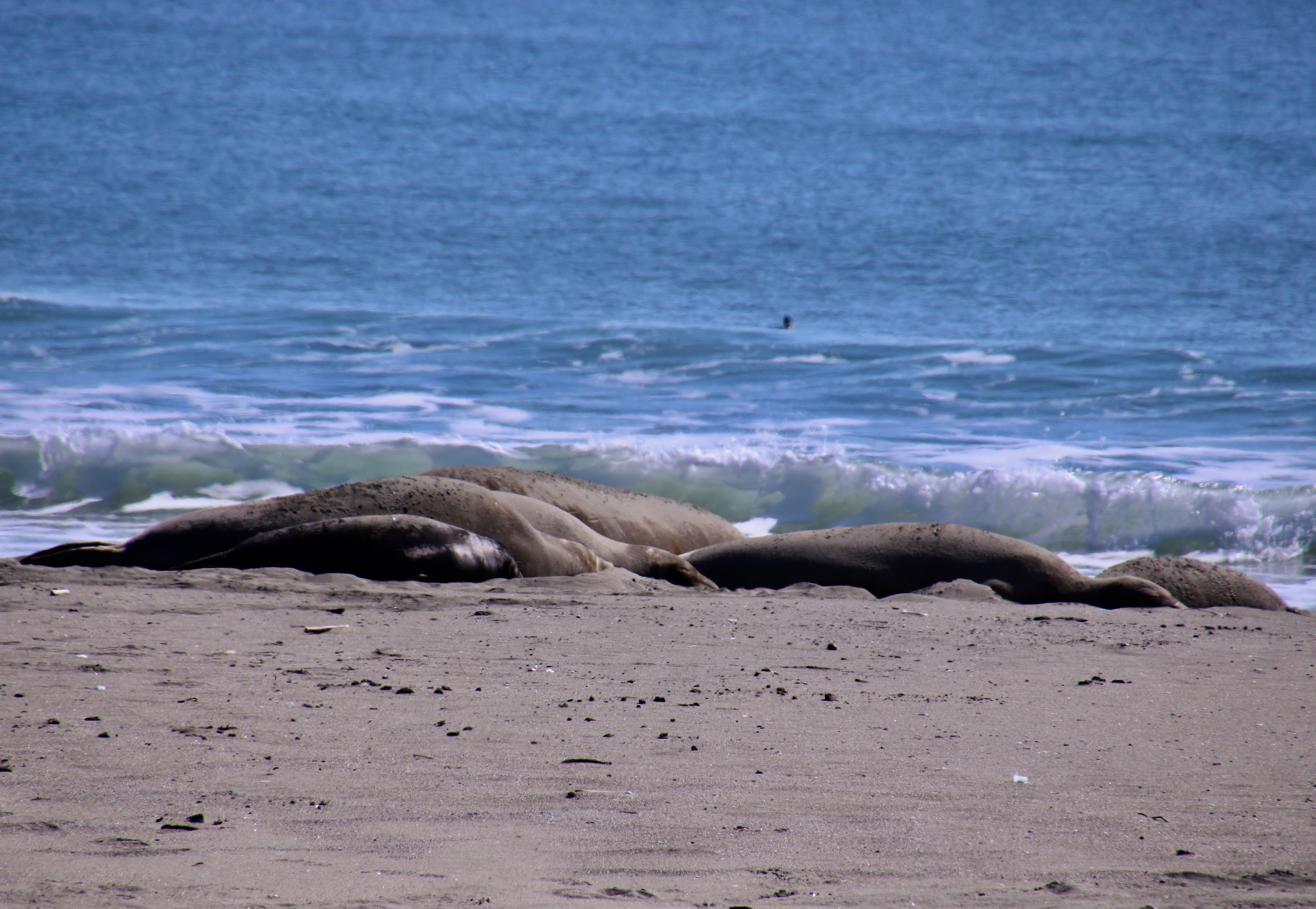
I’m returning to Pt. Reyes National Seashore and the surrounding area today. As you may recall, Peggy and I drove down to this beautiful park north of San Francisco in early March to celebrate my birthday. At the time, I did a post on the big nosed elephant seals that have adopted the park as a great place to breed and have babies as their population increases.

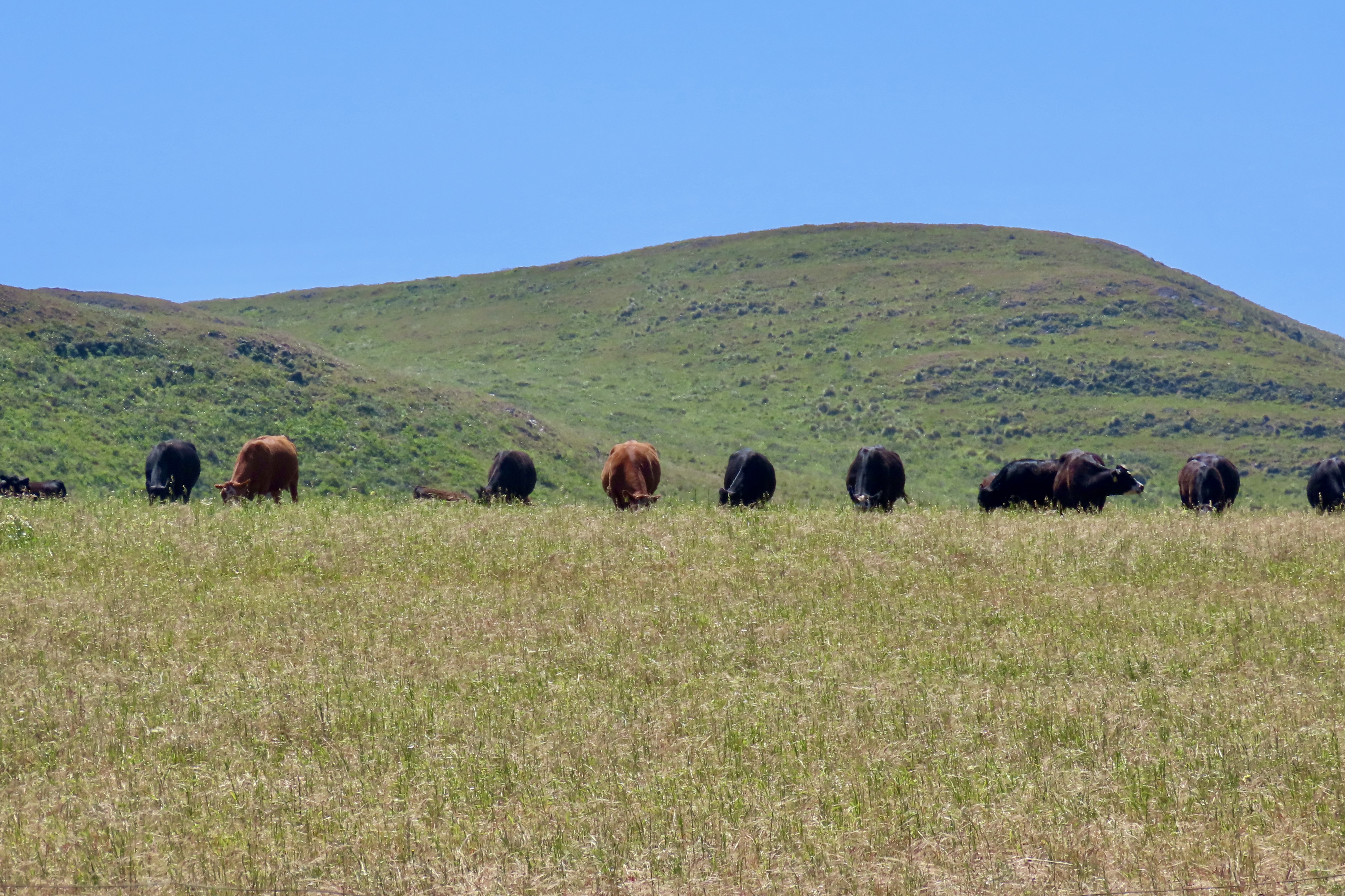
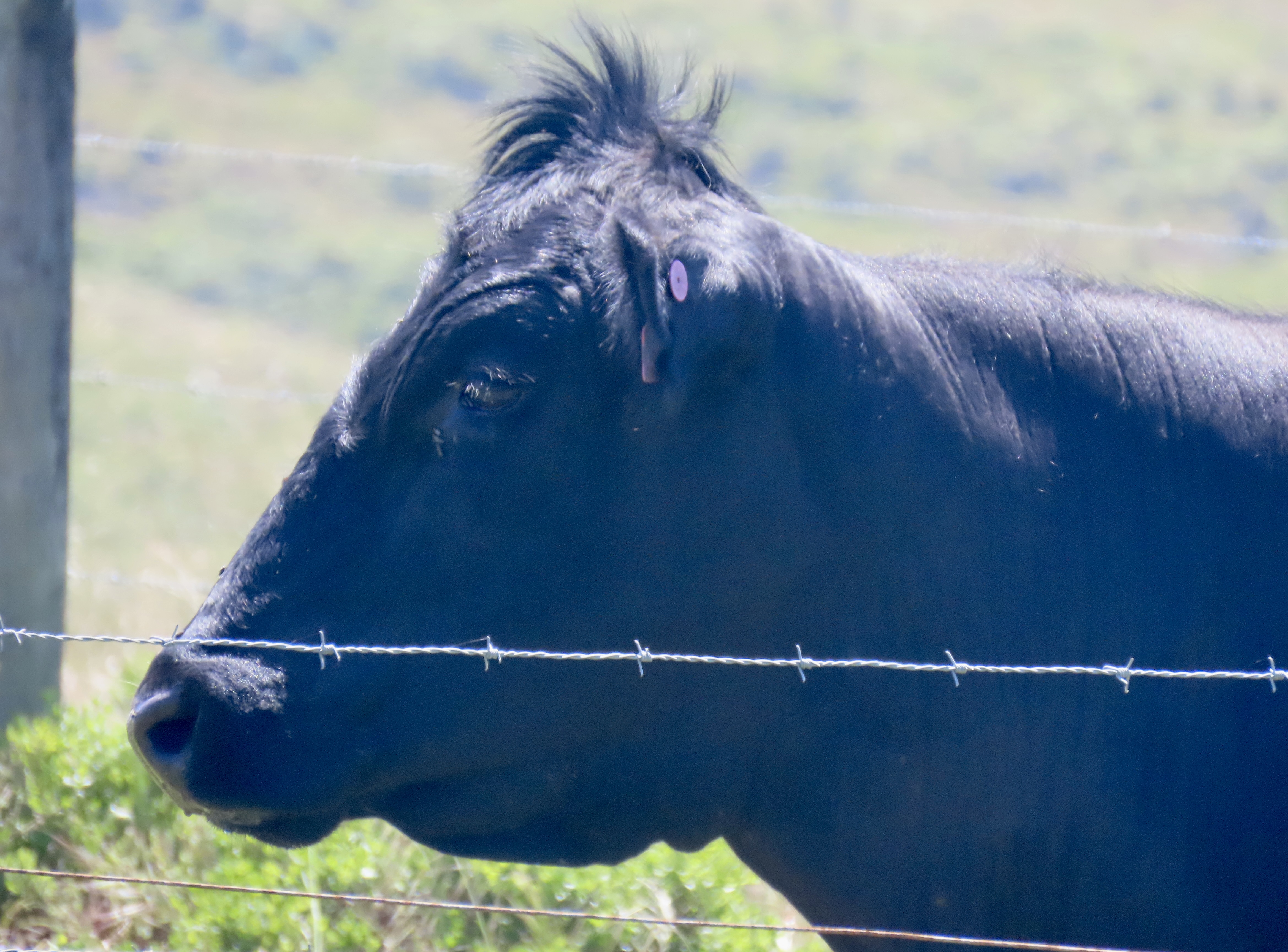
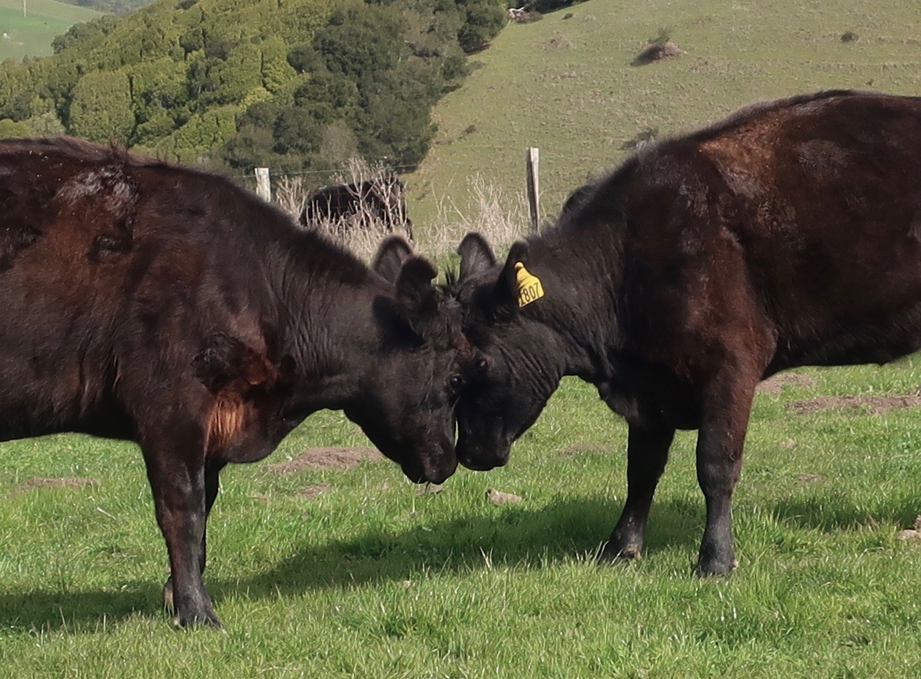
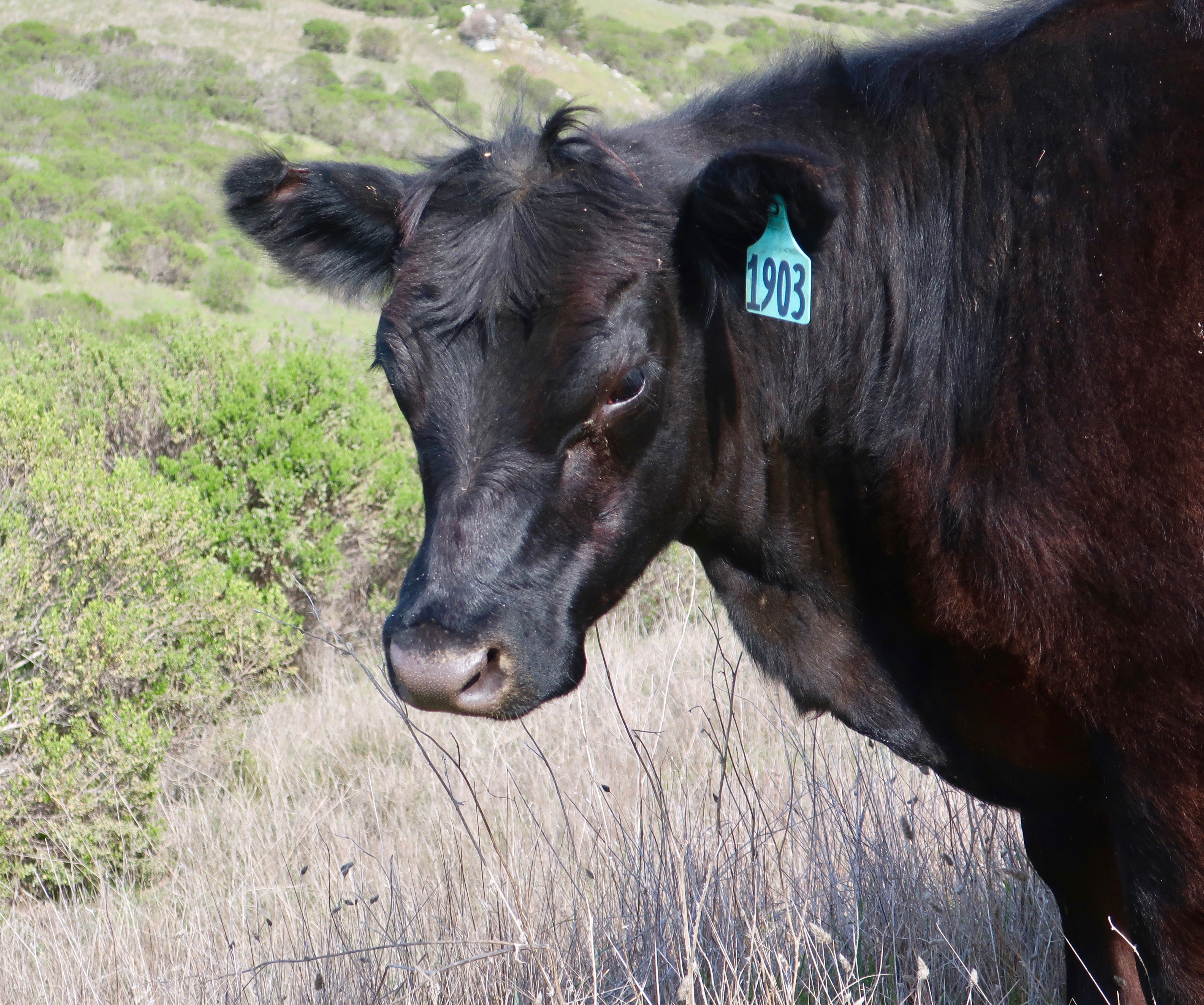
Like whales, they had been hunted close to extinction for the oil their body produces. Fortunately, enough people had become concerned in the early 20th Century to stop the slaughter and save the species. My elephant seal post would have been perfect for yesterday: Earth Day. The message about these unique animals is that If we care enough, we can make a difference. Working together, we can help save the earth and its bio-diversity. Nature has wonderfully recuperative powers— given a chance. The planet will work with us, if we stop working against it. But enough on the that for now. Today’s post is about cows and a short walk in the Golden Gate National Recreation Area.

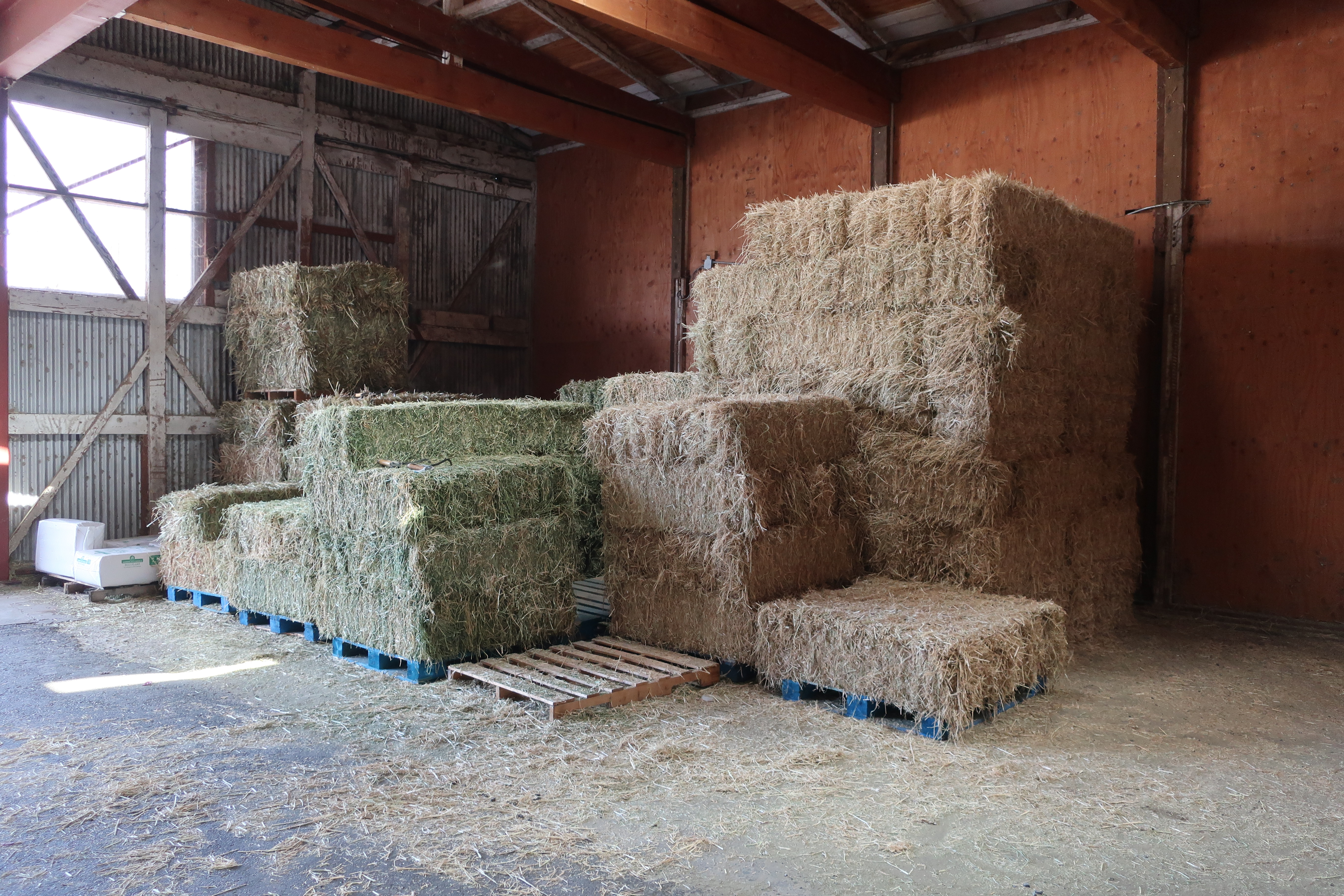
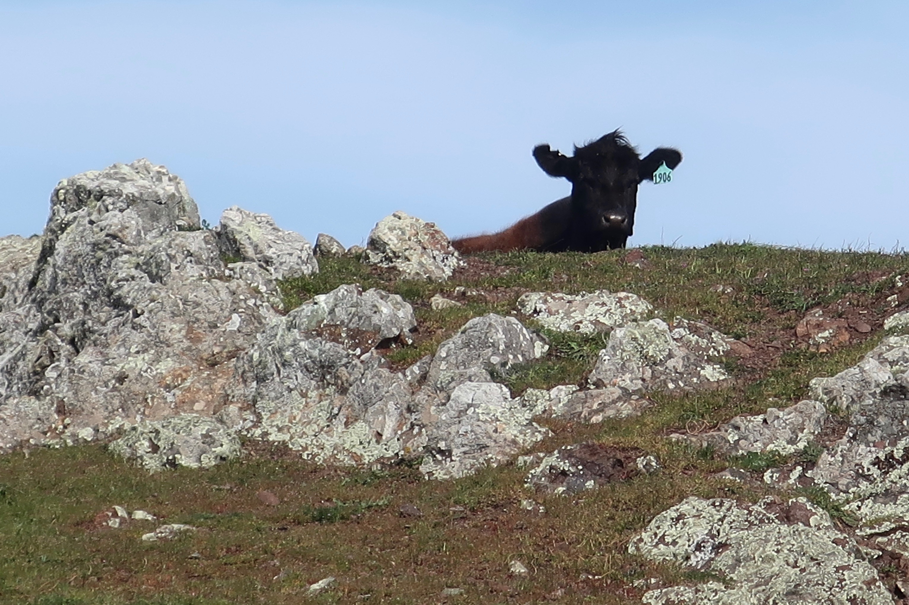
There is no danger of cows going extinct. They have the advantage/disadvantage of being useful to us. As of 2021 there are over a billion on earth. The Pt. Reyes area has its share. It was recognized as ideal for raising dairy cattle in the 1850s as the burgeoning population of San Francisco provided a ready market for dairy products. When the National Seashore was created in the 1970s and 80s, the ranches were grandfathered into the land that was set aside and are an integral part of today’s Pt. Reyes’ experience.

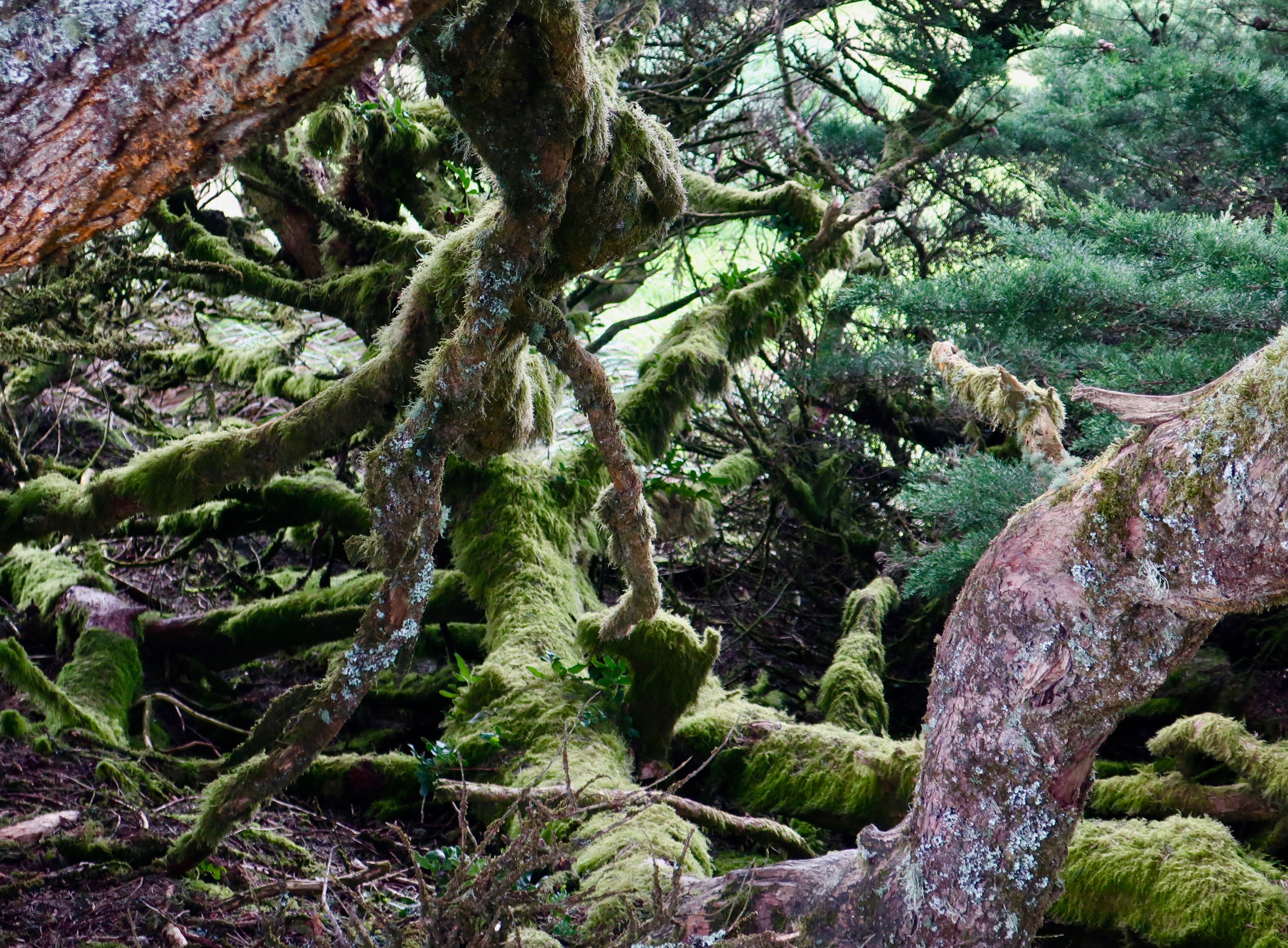
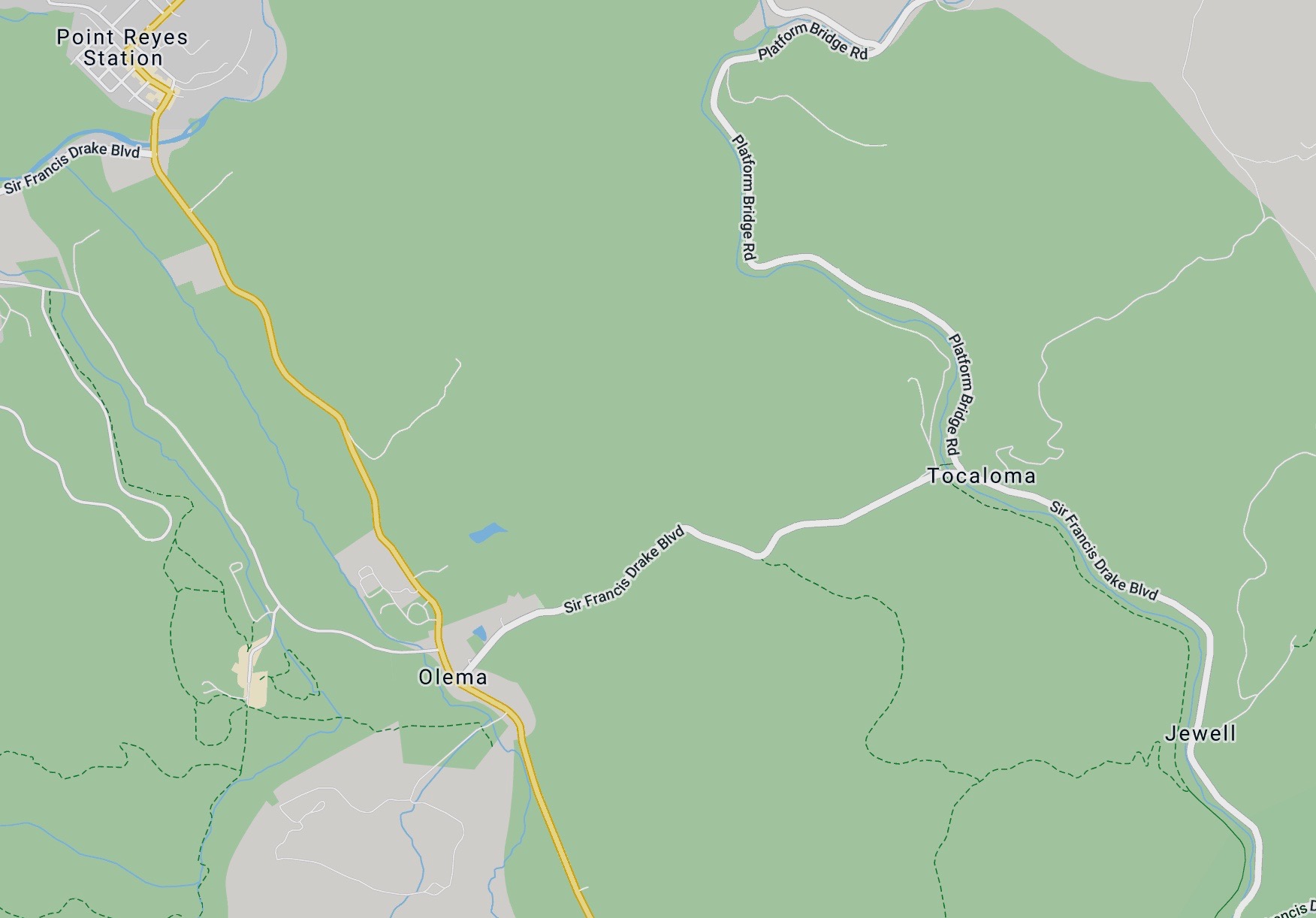
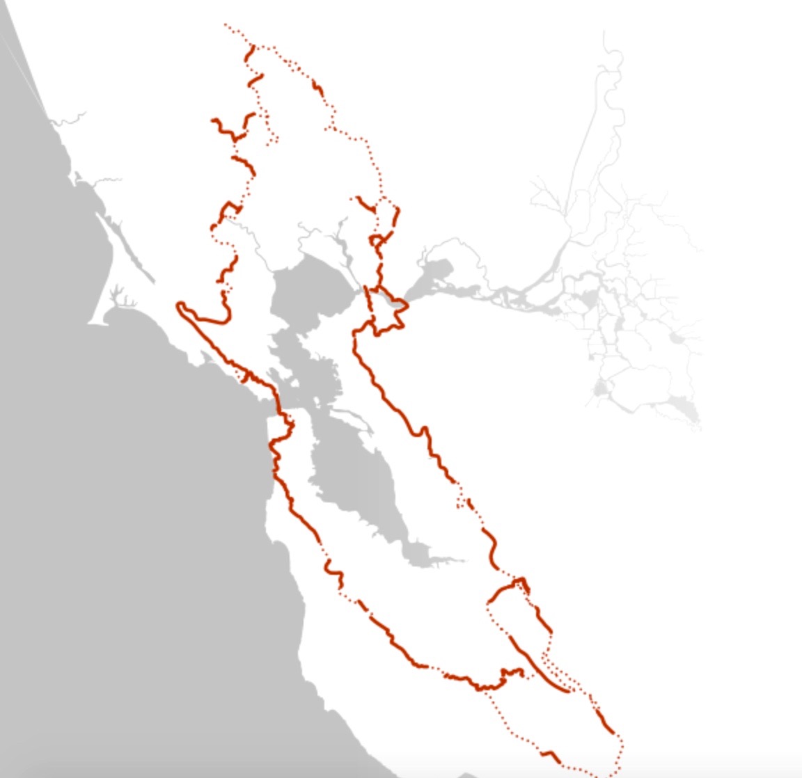
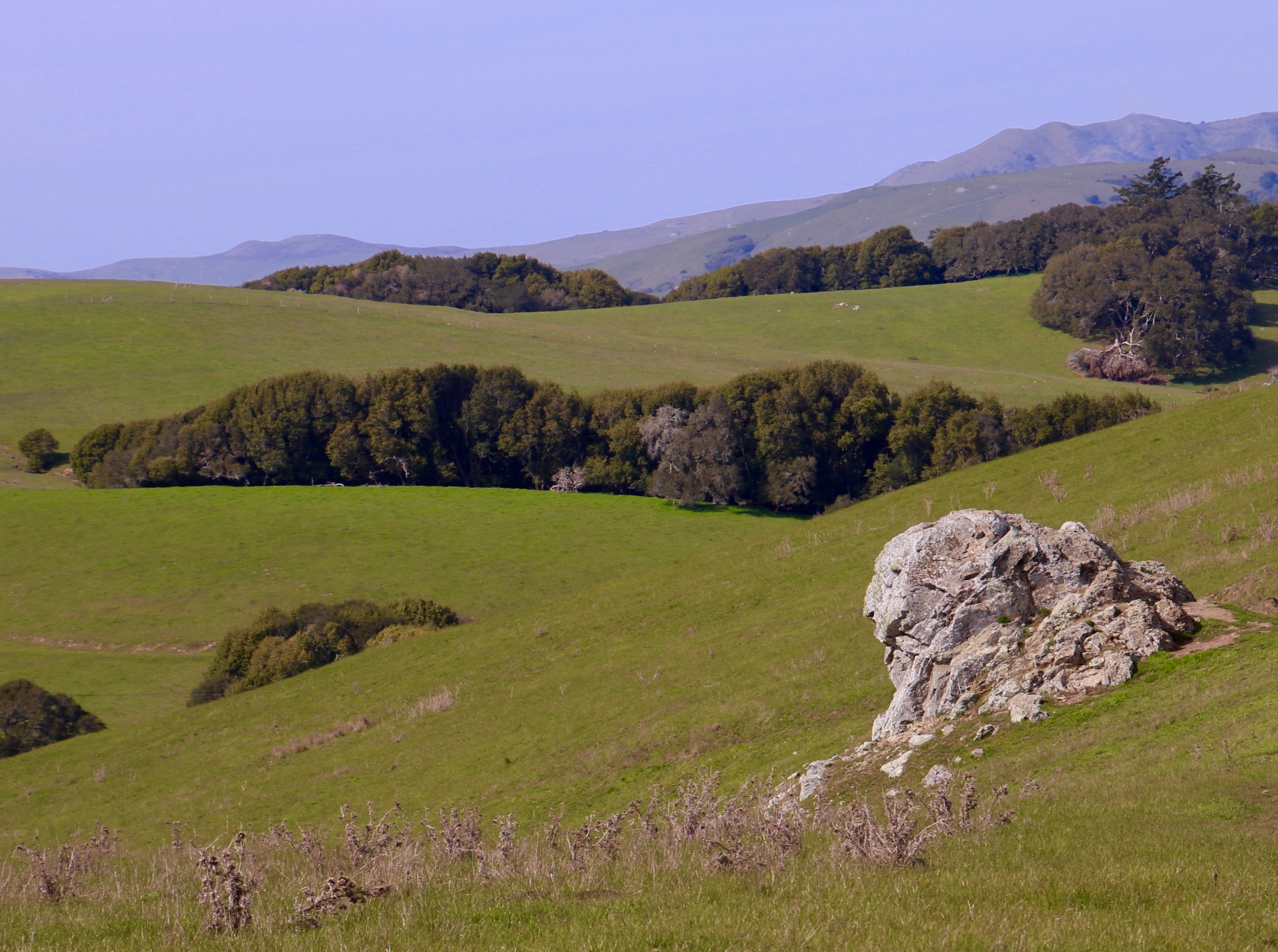
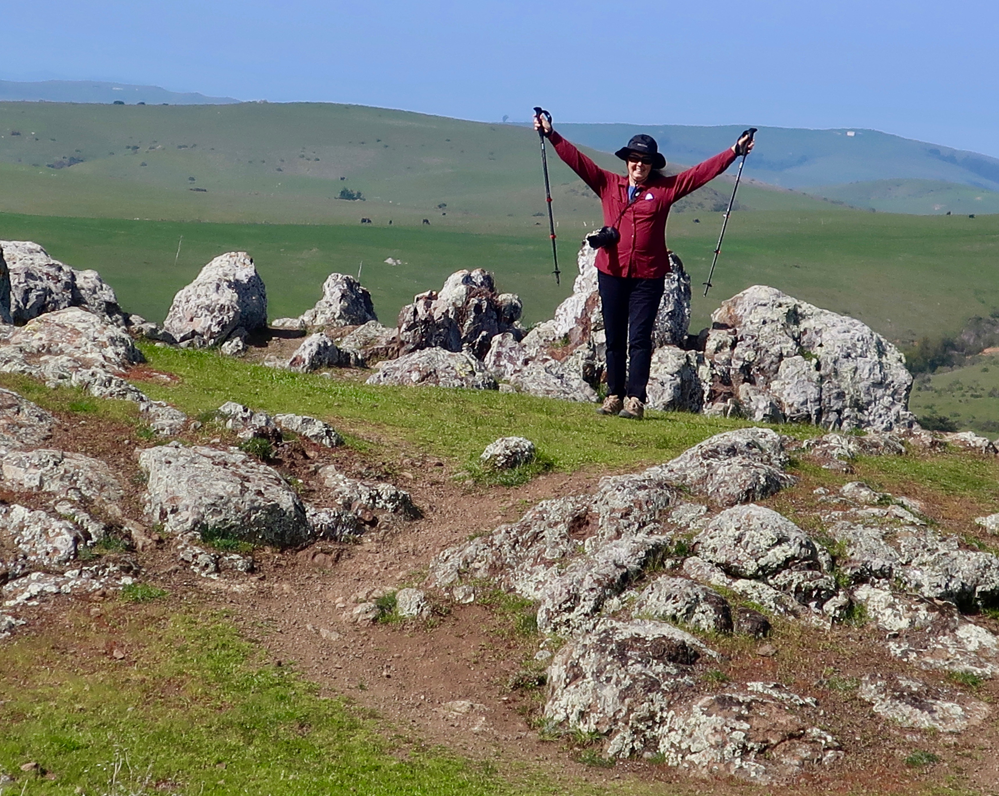
I didn’t set out to do a post on cows when Peggy and I decided to incorporate a short walk along the Bolinas Ridge Trail. It’s actually a part of the Golden Gate National Recreation Area but is administered by Pt. Reyes NS. As you can see by the maps below, it is just east of the small town of Olema which includes the campground I have been staying at forever, or at least back to the 1970s. The trail is part of a system being developed that will eventually allow hikers to do a 500 mile hike around the complete Bay Area. We did four. Two out and two back.

The Bolinas Ridge Trail starts just east of the small town of Olema on the Sir Frances Drake Blvd. It’s the dotted line. Our campground sits in the grey area just above Olema. The National Seashore Visitors’ Center and Headquarters is the light area behind the campground. Our go-to town for eating out and shopping is Pt. Reyes Station to the north.
This map provides perspective on where Bolinas and Pt. Reyes Station are located in relation to San Francisco. The green area next to the coast makes up Pt. Reyes and the Golden Gate Recreation Area stretching from the end of Tomales Bay to the Golden Gate Bridge. Highway 1 is the yellow line running along the coast, more or less separating the two parks. It also follows the infamous San Andreas Earthquake Fault. Pt. Reyes was once located near LA as part of the Sierra Nevada Mountains. It has been on its journey north for some 30 million years.
Just for fun, this map shows the Bay Area Trail system with its completed and uncompleted sections.
Official cow. The cows became part of our walk. This is the official cow portrait taken by Peggy. Number 1913, otherwise known to us as Bossy, didn’t want to interrupt her eating for the photo. The cows chomping grass made a distinctive, loud noise. (Photo by Peggy Mekemson.)

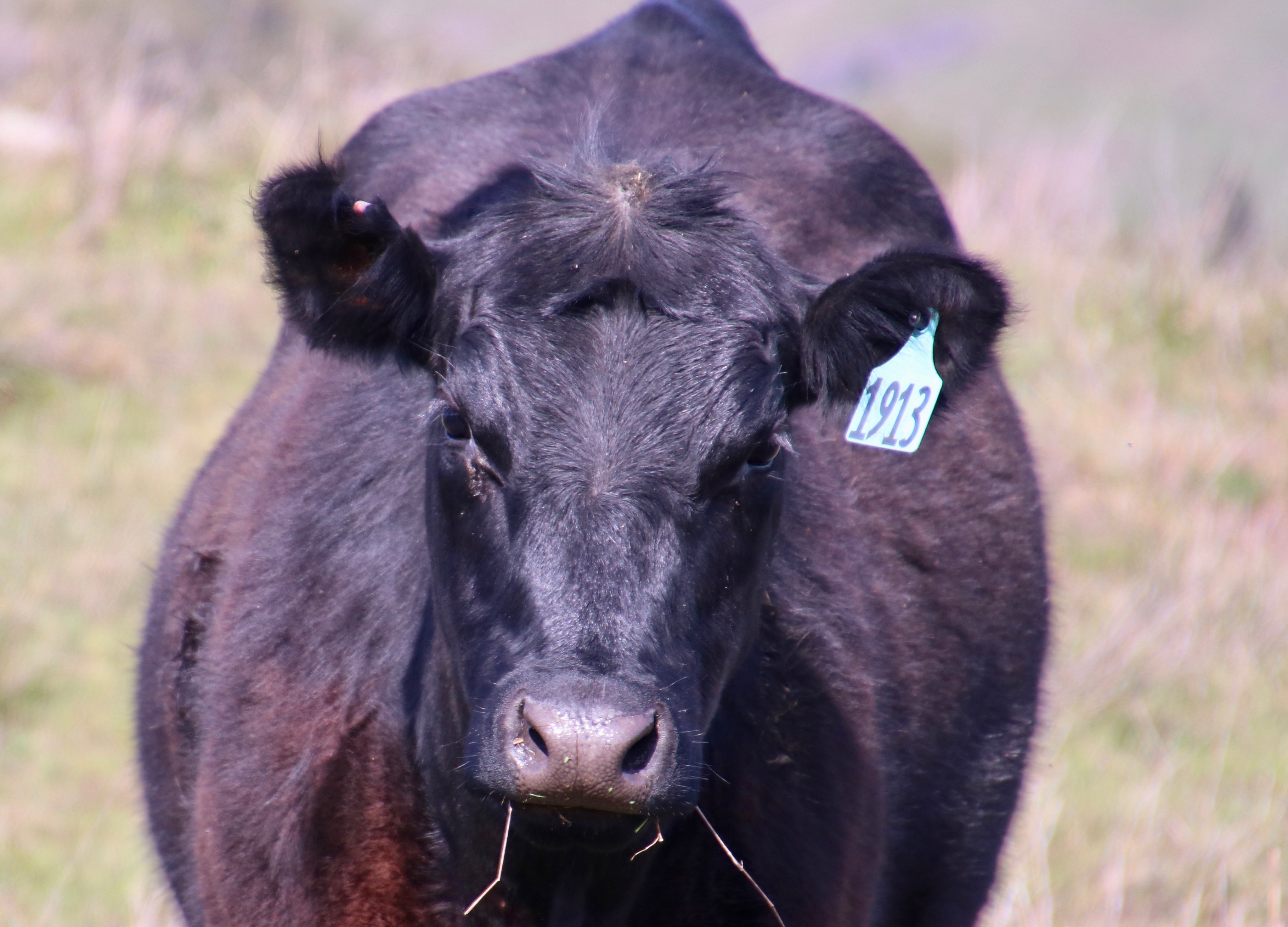
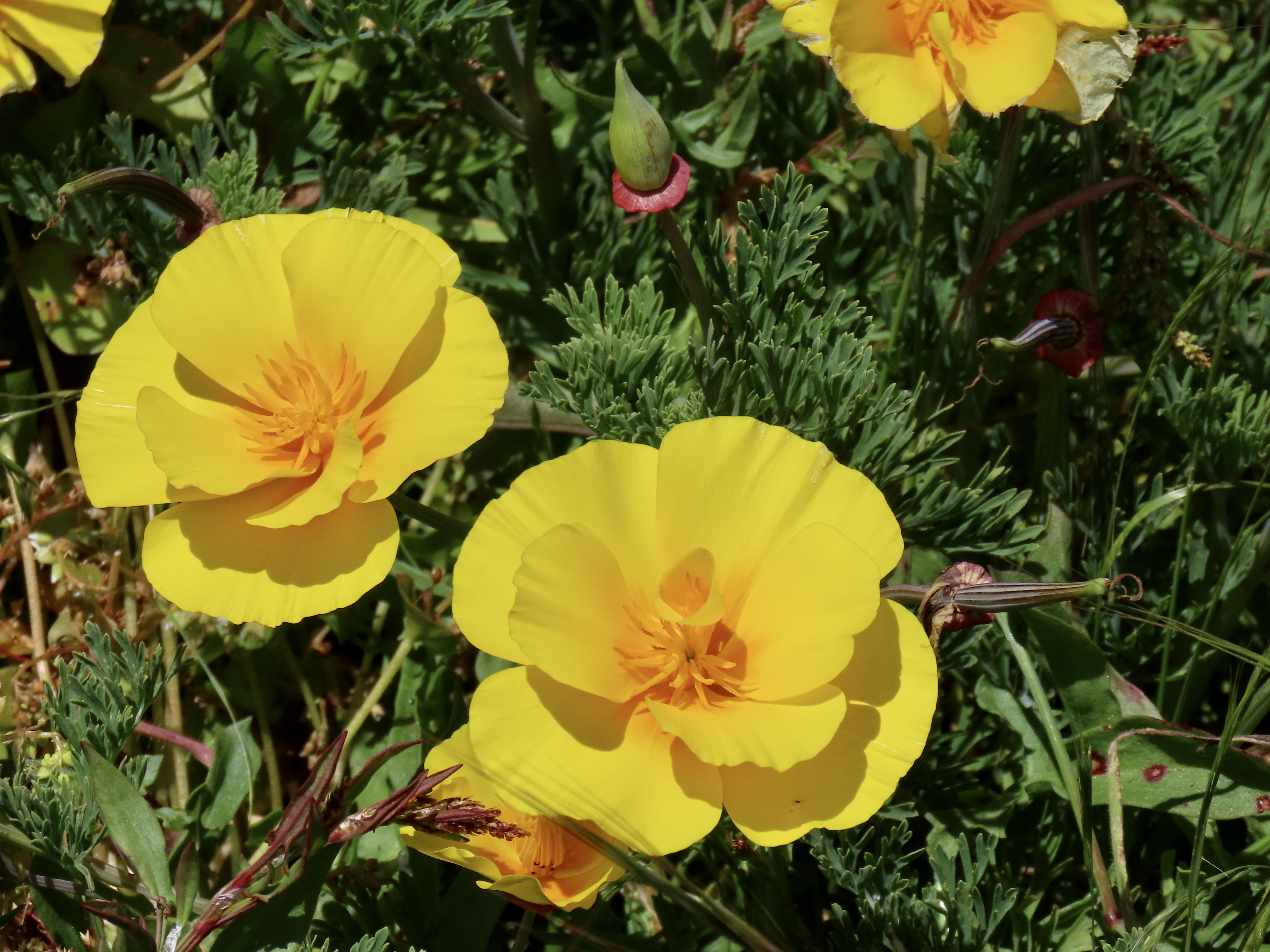
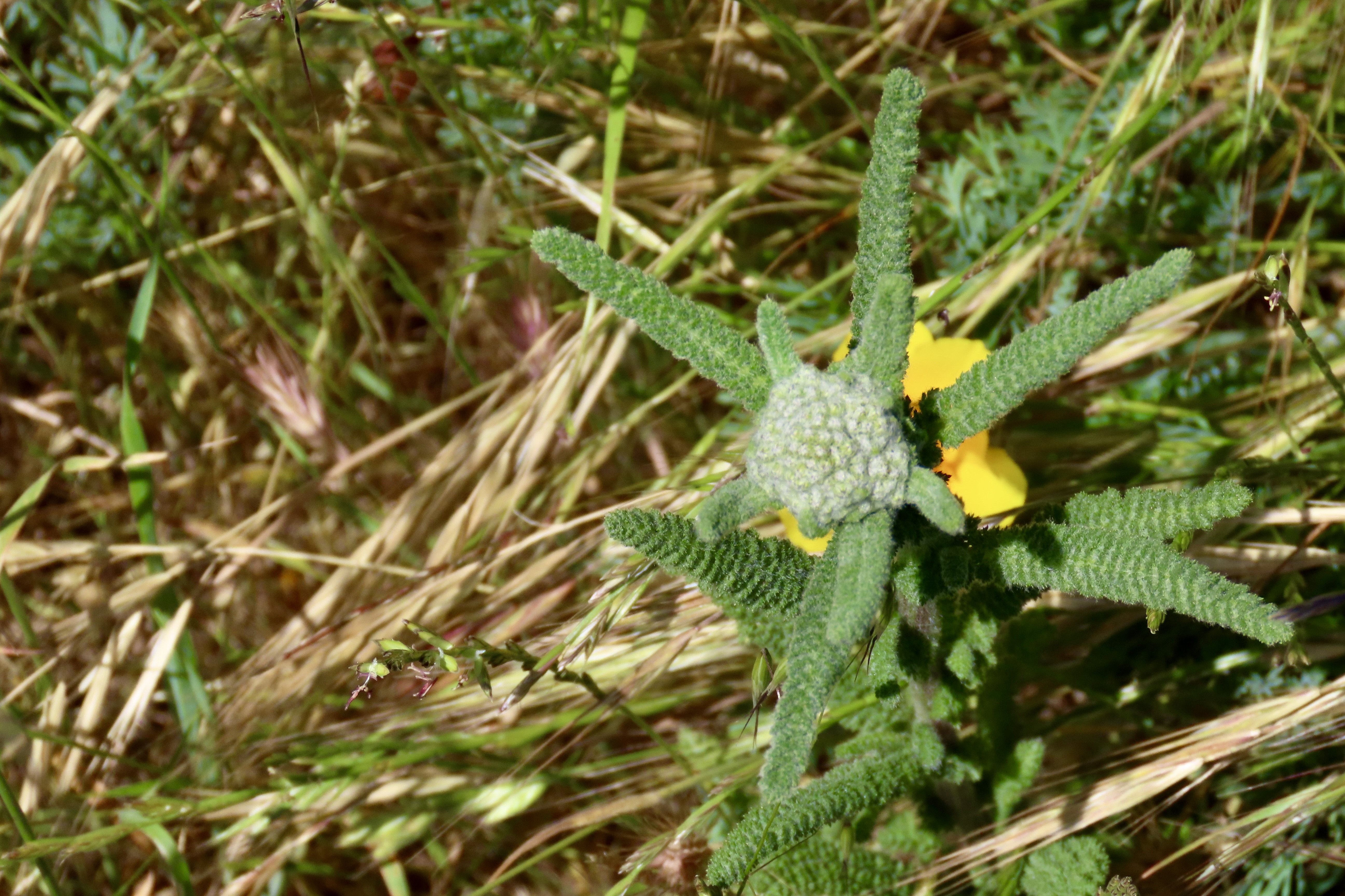
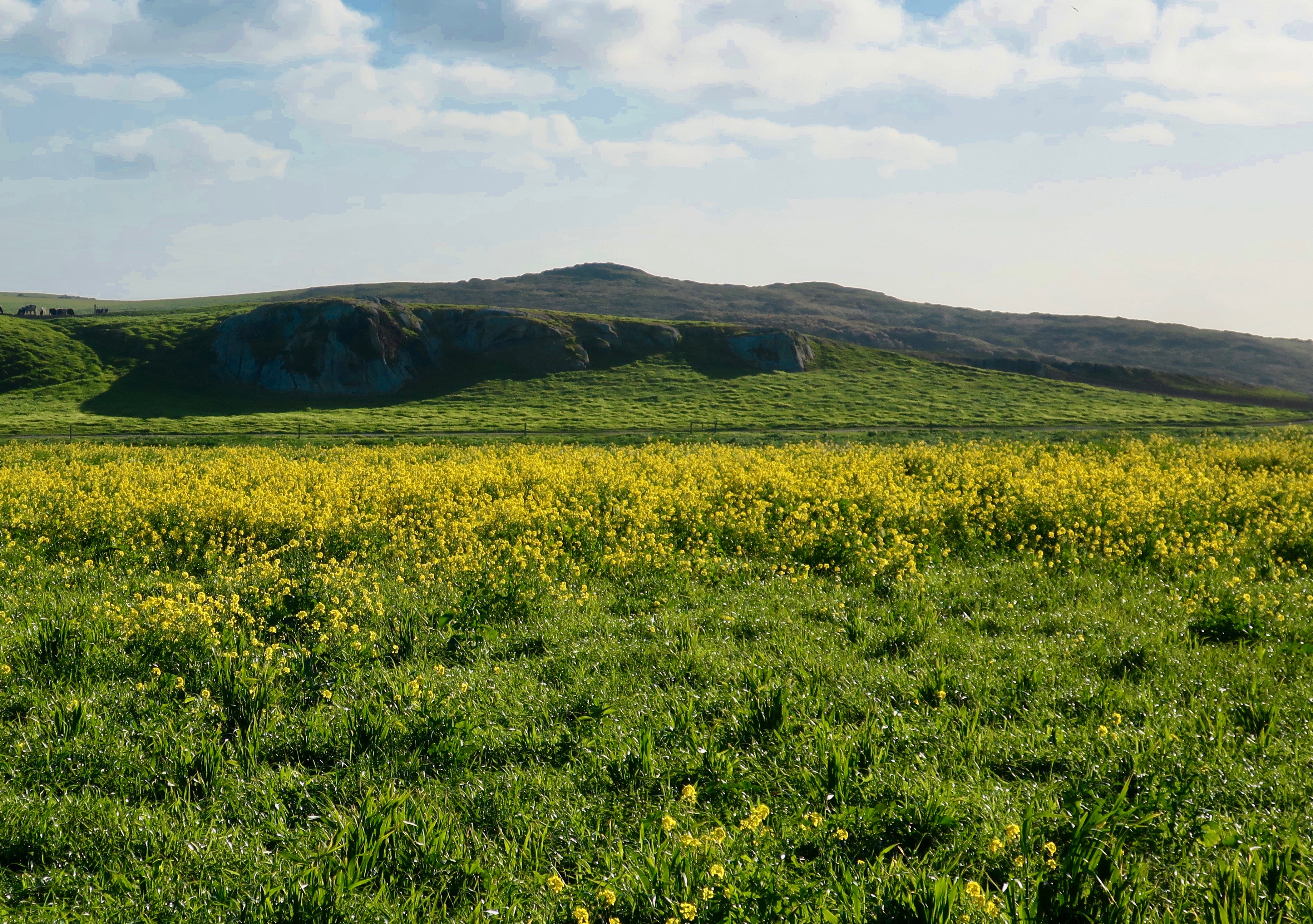
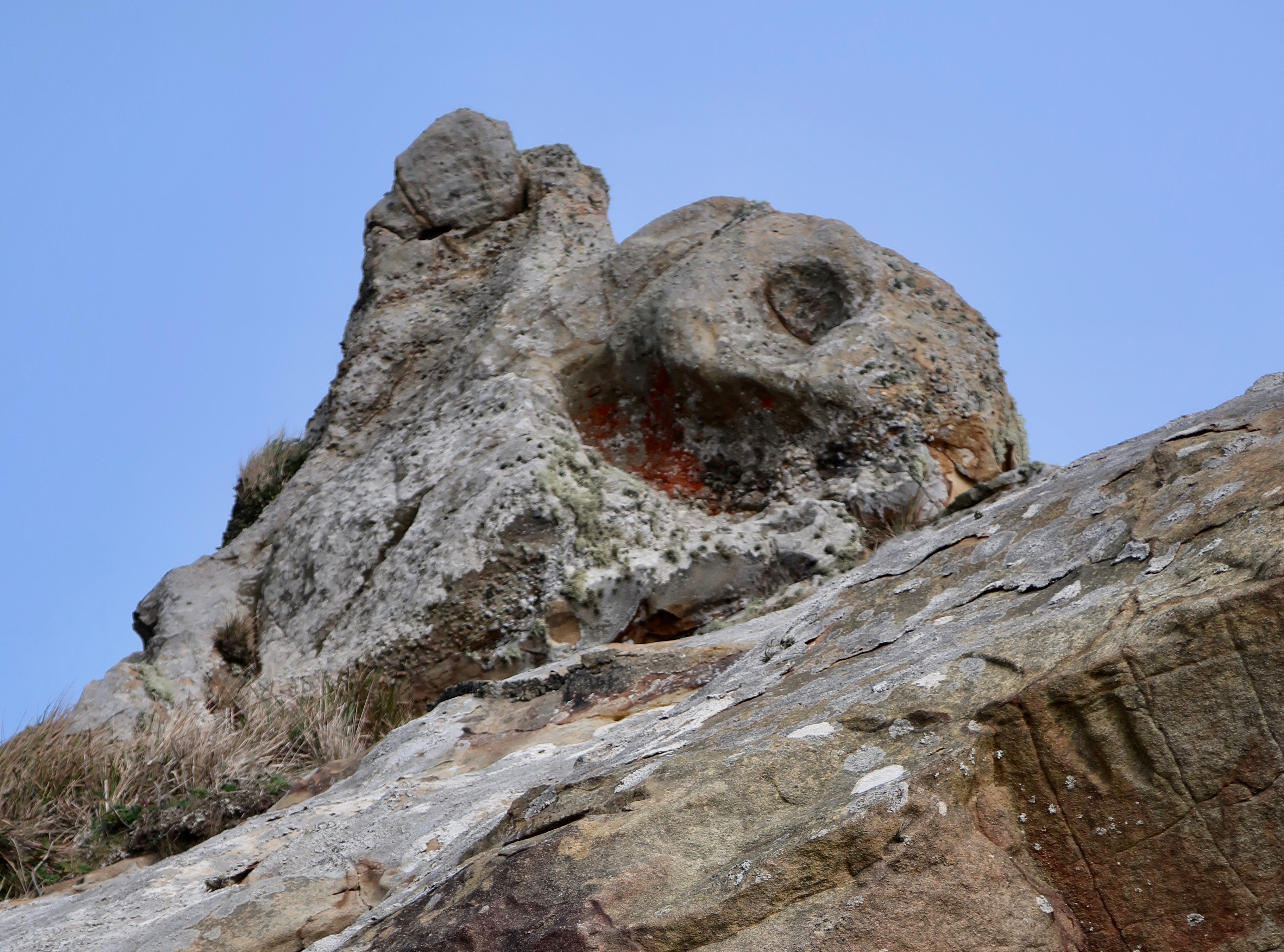
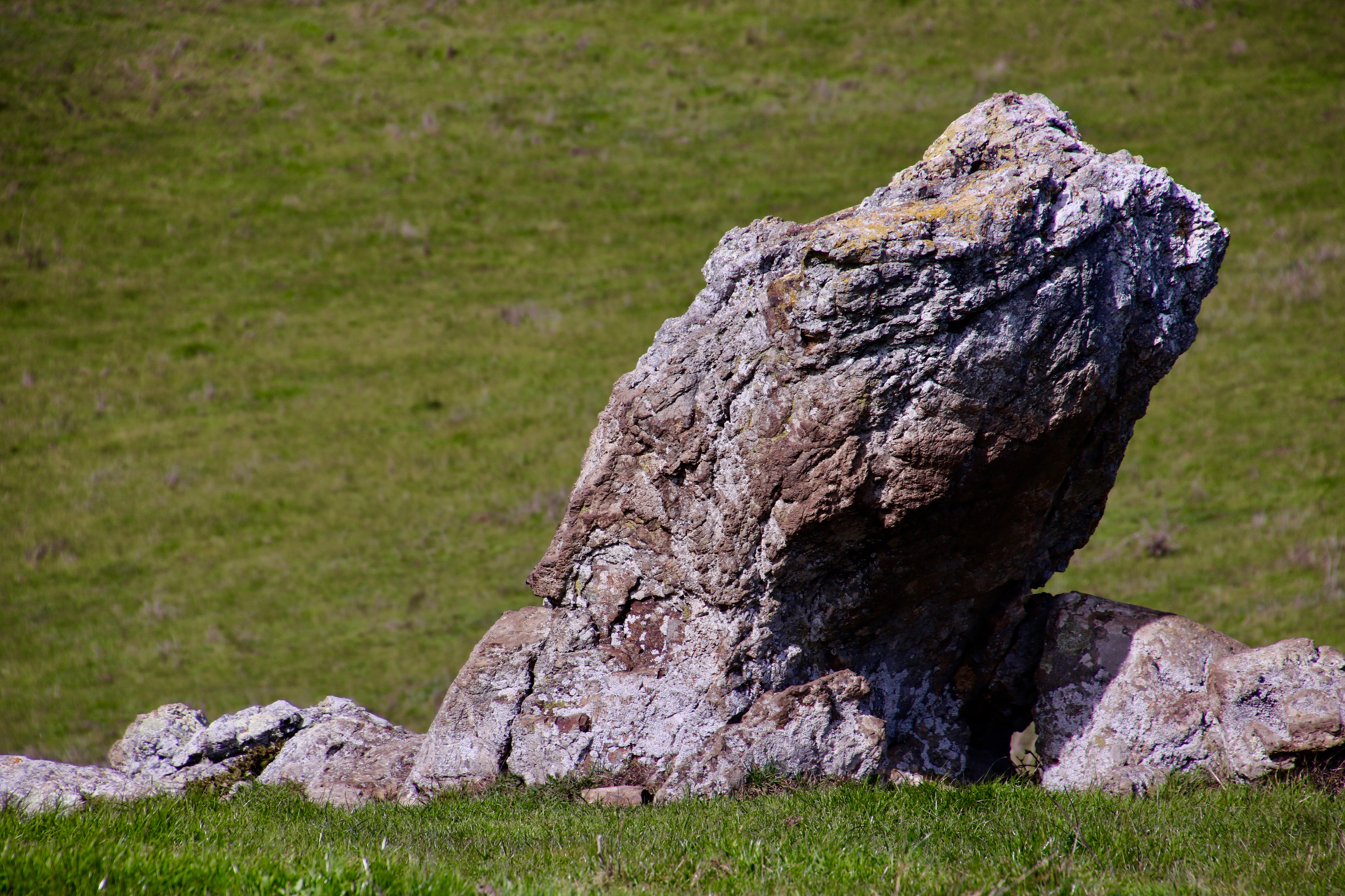
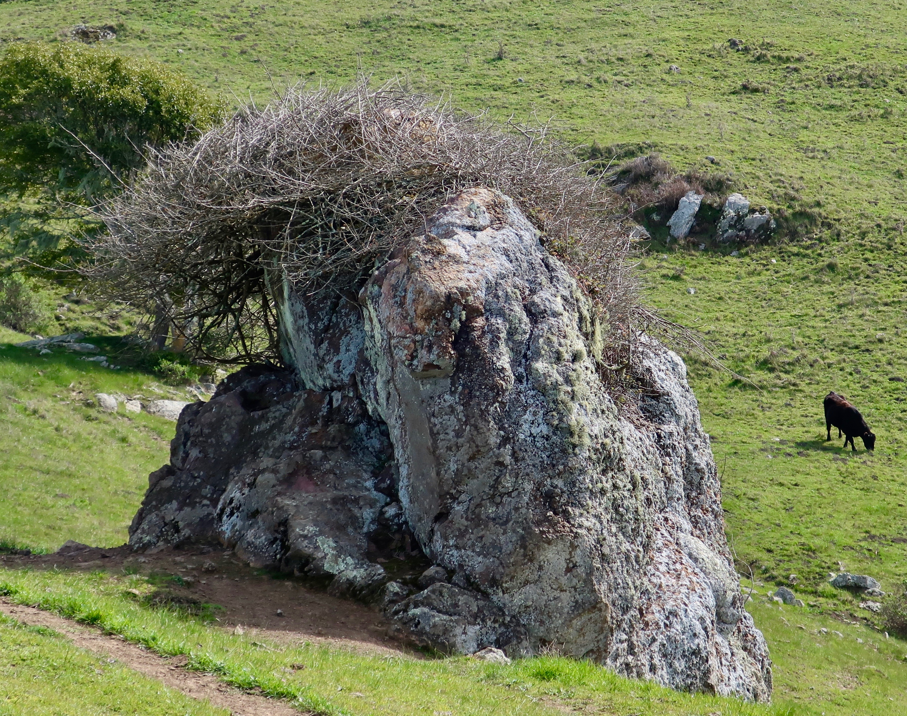
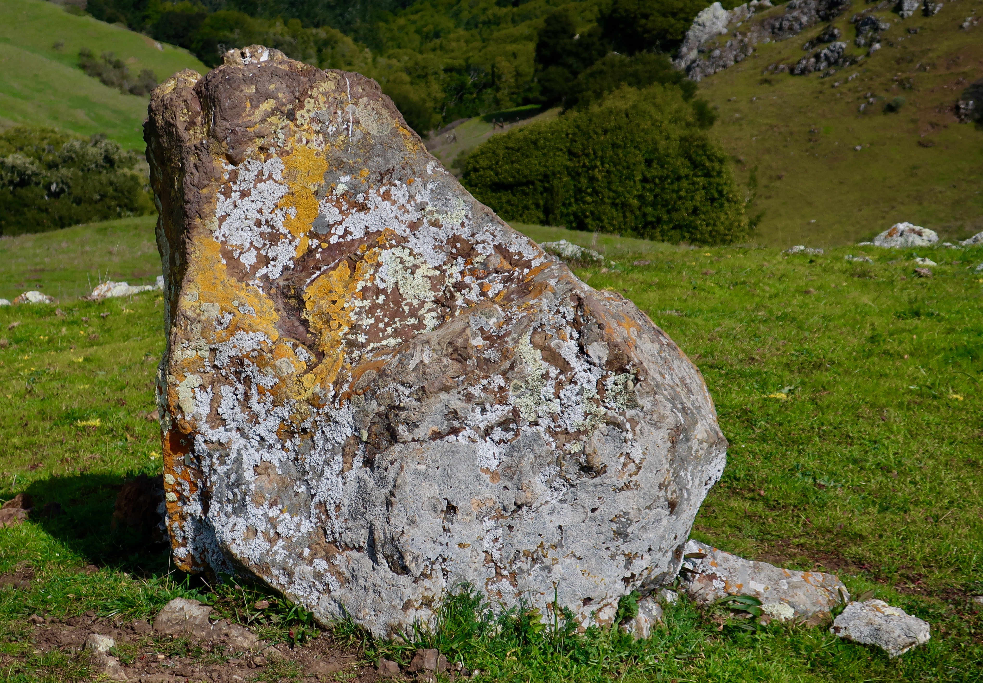
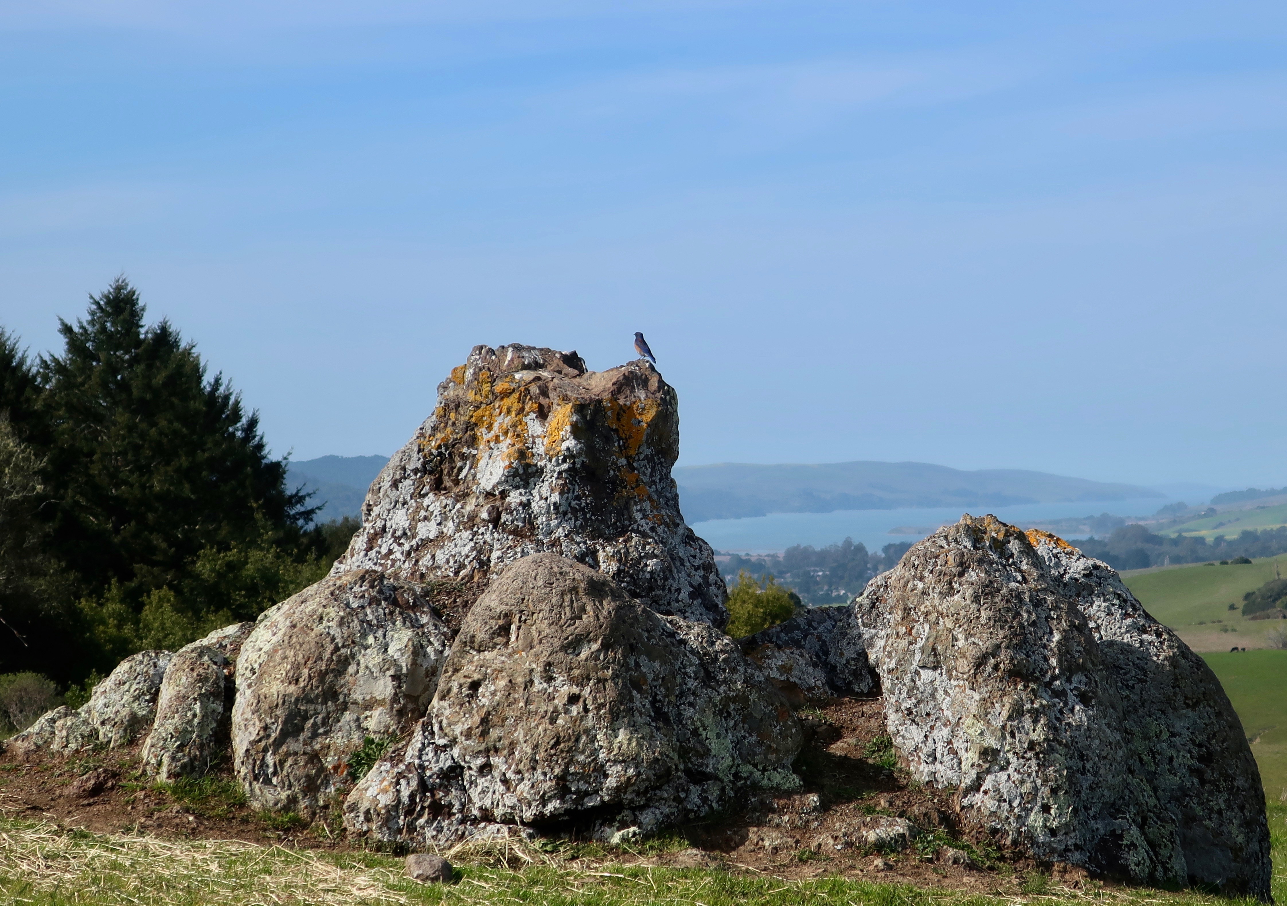
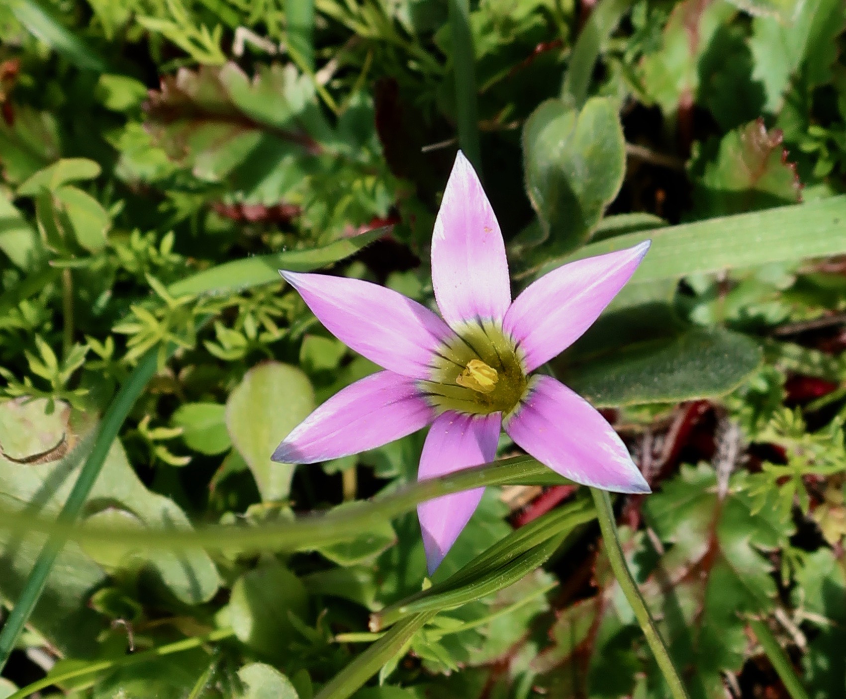
Let it be known, there was much more to the walk than cattle. The beautiful green of the Coastal Range was offset by dark forests. Spring flowers were beginning to pop up. Individual rocks with definite personalities stood proudly along the way and demanded to be photographed.

The striking green grass of the Coast Range was offset by dark groves of trees. Individual rocks added to the scene.
Peggy hoofing it along the trail, which is actually a gravel road at this point. Turn her loose on a flat stretch and away she goes. I can hardly keep up. At 70 she can still whip out four miles an hour. Fortunately, she is easily distracted.
“Do you see the lizard, Curt,” she proclaimed and immediately stopped to photograph a rock that looked like a lizard head to her. You can see the squinty lizard looking eye toward the top center of the rock. (Photo by Peggy Mekemson.)
Cow itch. Cattle had a way of stealing the show.
But back to rocks. This one looked like it was long overdue for a haircut. You might say it had Covid hair.
Lichens added a touch of color to this rock. I decided if Peggy could have her lizard rock, I could have a frog rock. What do they have in common other that a vivid imagination to see them? They both eat flies. That’s a good thing.
No imagination required here. This was a bird’s rock, be it ever so temporary.
Cowlick. Peggy insisted on catching the cowlick seen on the head of Number 1903 (Ferdinand), seen earlier scratching an itch. She said it reminded her of me. Thanks. My hair can be rather untamable at times. A cowlick, BTW, is different than a cow kiss, which is the generous application of one’s tongue on someone’s face, usually followed by an “Eeww!”
I didn’t know the name of this striking early bloomer, but fortunately Peggy and I had just loaded iNaturalist on our iPhone. I took a photo from my screen and voila! it’s Footsteps of Spring (Sanicula arctopoides). I absolutely love the new app.
Another flower I had to lookup on our new app, Suncup Primrose (Taraxia ovata).
This beauty was another one that our new iNaturalist app identified. Unfortunately, it’s an invasive species, Rosy Sand Crocus (Romula rose).
And then we found an old friend, a solitary California poppy growing in the rocks along the trail. (Photo by Peggy Mekemson.)
Cow sentry. If we didn’t have the feeling we were constantly being watched, we should have.
I wanted to capture a photo of Peggy on a flat hilltop that was surrounded by rocks that struck me as a great place for a full moon Wiccan ceremony. I’m not sure how Peggy’s pose fit in, but then I hadn’t told her to look like a witch. The poppy shown above was growing in these rocks. An old fence was nearby…
Tha ancient barbed wire and lichens spoke to a bygone era of ranching in the Pt. Reyes area. We were glad that the cattle were still there.
Another shot of the fence.
The tail-end of a cow tale. “I’m out of here” Ferdinand grumpily stated after one too many photos. Look at his face! I get the same feeling at family photo sessions. On next Friday’s Pt. Reyes travel blog, Peggy and I are off to visit an elk herd that roars down to see us. And, we watch a pair coyotes eating sushi.

NEXT POST:

Monday’s Blog-A-Book Post from It’s 4 AM and a Bear is Standing on Top of Me: Have you ever raced to the top of a 70-foot tree? In the middle of a graveyard? It was an important part of our entertainment when we were growing up. Join me on Monday as I race to the top and my brother tries to build a treehouse 60 feet up…

The Charming Elephant Seals of Pt. Reyes National Seashore

Elephant seals have the look of an animal put together by a committee. It gives them a certain charm. We found this large fellow with his pronounced proboscis at Drake’s Beach. He’d come ashore at Pt. Reyes National Seashore looking for love.

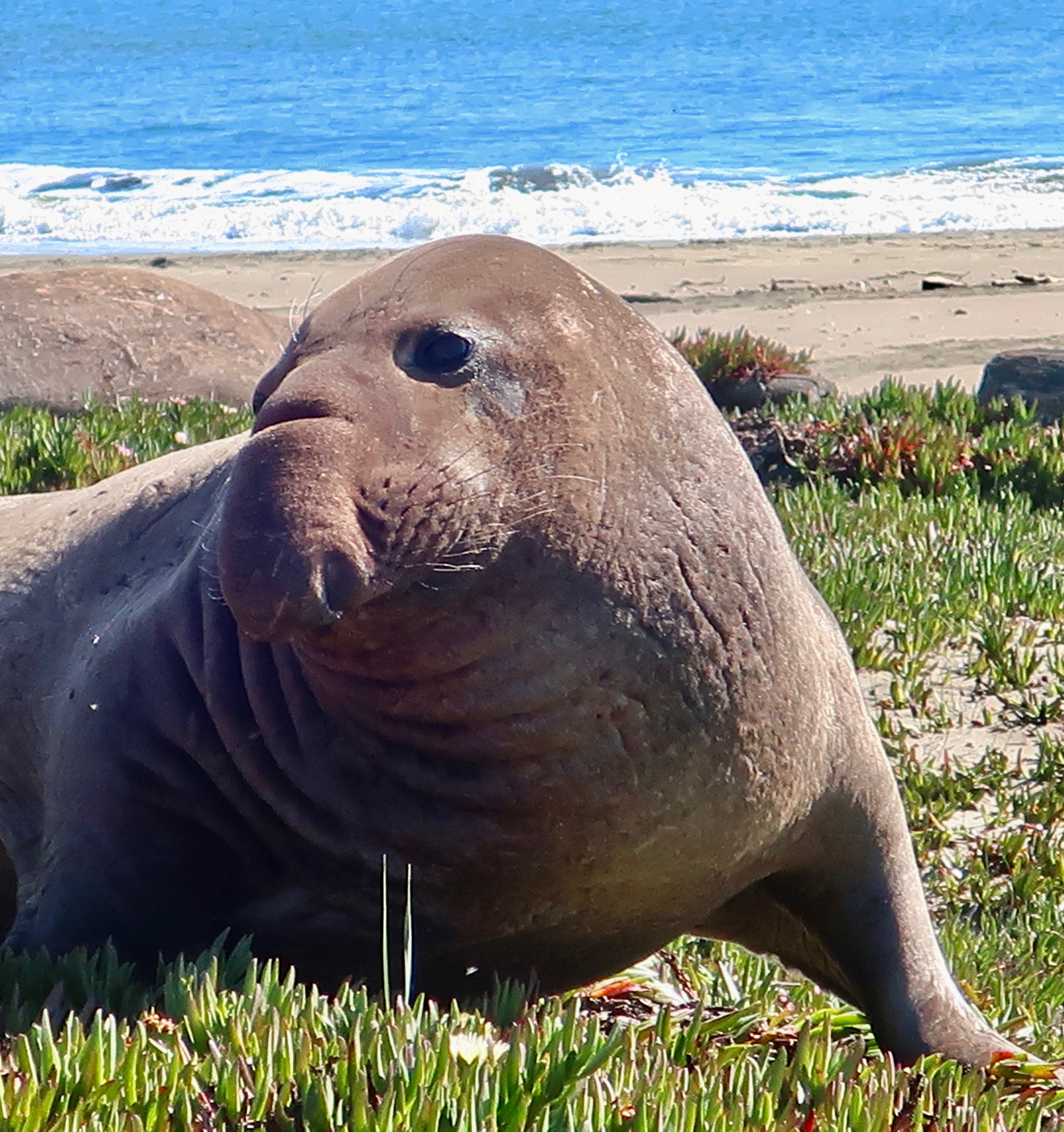
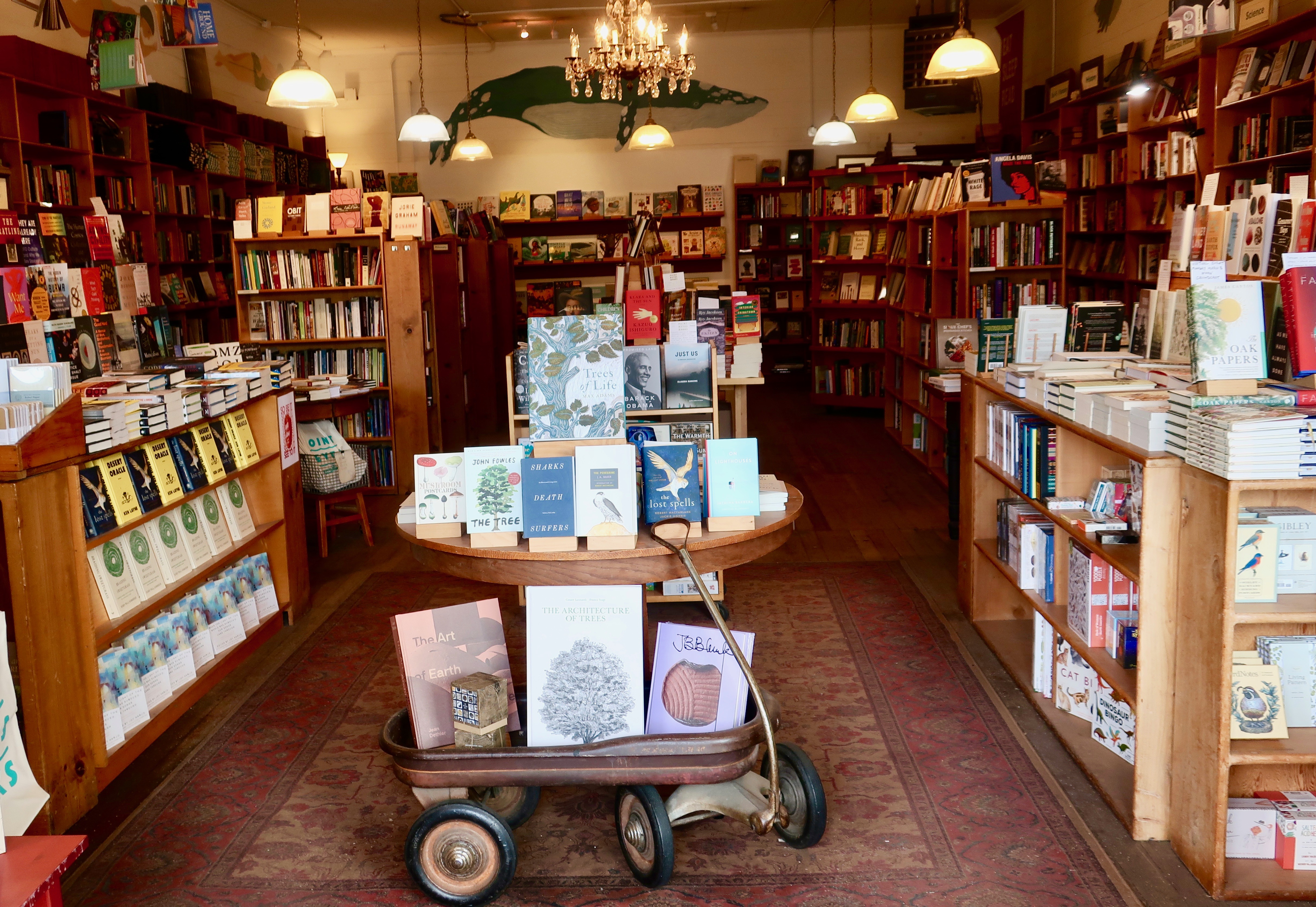
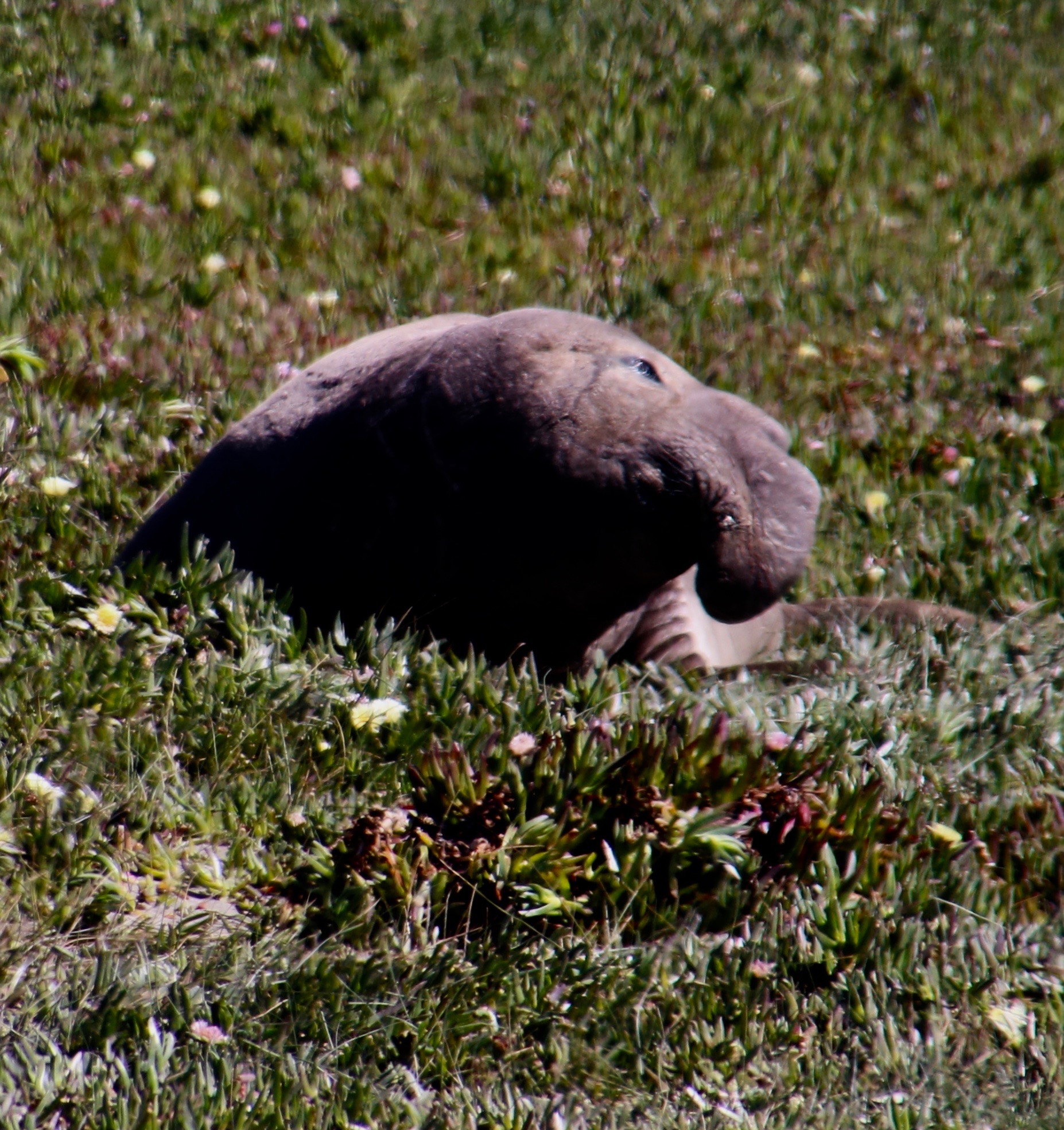
Pt. Reyes National Seashore is located some 30 miles north of San Francisco. Peggy and I went there last week to celebrate my birthday. It’s been a go-to place for me since the 60s. In addition to spectacular scenery, great hikes, yummy food, and one of the best small bookstores I’ve ever been in, we were entertained by the wildlife: tule elk, a pair of sushi eating coyotes, and elephant seals (plus some cows).  Today, I want to do a teaser on our trip by featuring the elephant seals. I’ll get back to the rest after I finish my Harris Beach series. 

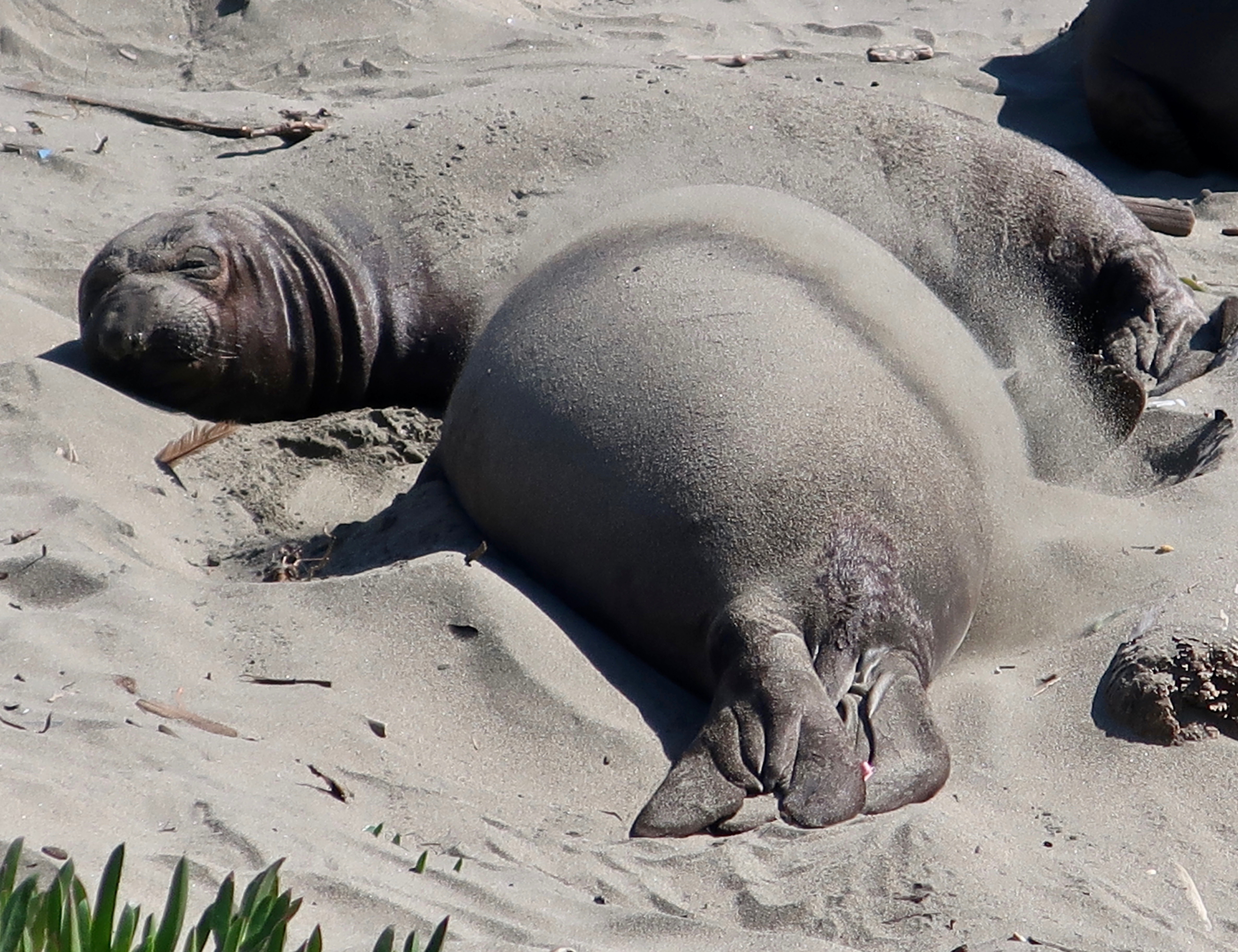
Elephant seals are amazing creatures that spend up to 80% of their lives at sea— 90 % of it underwater!  If that doesn’t seem remarkable enough, consider this: their normal dives for food range between 1000 and 2000 feet deep (305 to 610 meters). They can dive for up to an hour and a half before returning to the surface for three to five minutes of breathing. Semi-annual feeding binges take the males on a 13,000-mile roundtrip journey to the Aleutian Islands and females on a 11,000-mile roundtrip into the North Pacific.

They were absent from Pt. Reyes for 150 years. In fact, they were close to absent forever. Like whales, they came close to being hunted to extinction for their oil. Processing the blubber from one bull can produce up to 25 gallons. They were saved because the Mexico and the US banned hunting them in the 1920s. Gradually, they have returned to their old breeding grounds. When I first started visiting Pt. Reyes in the 60s, they were unheard of in the area. Today there are over 3000 that return annually to breed.

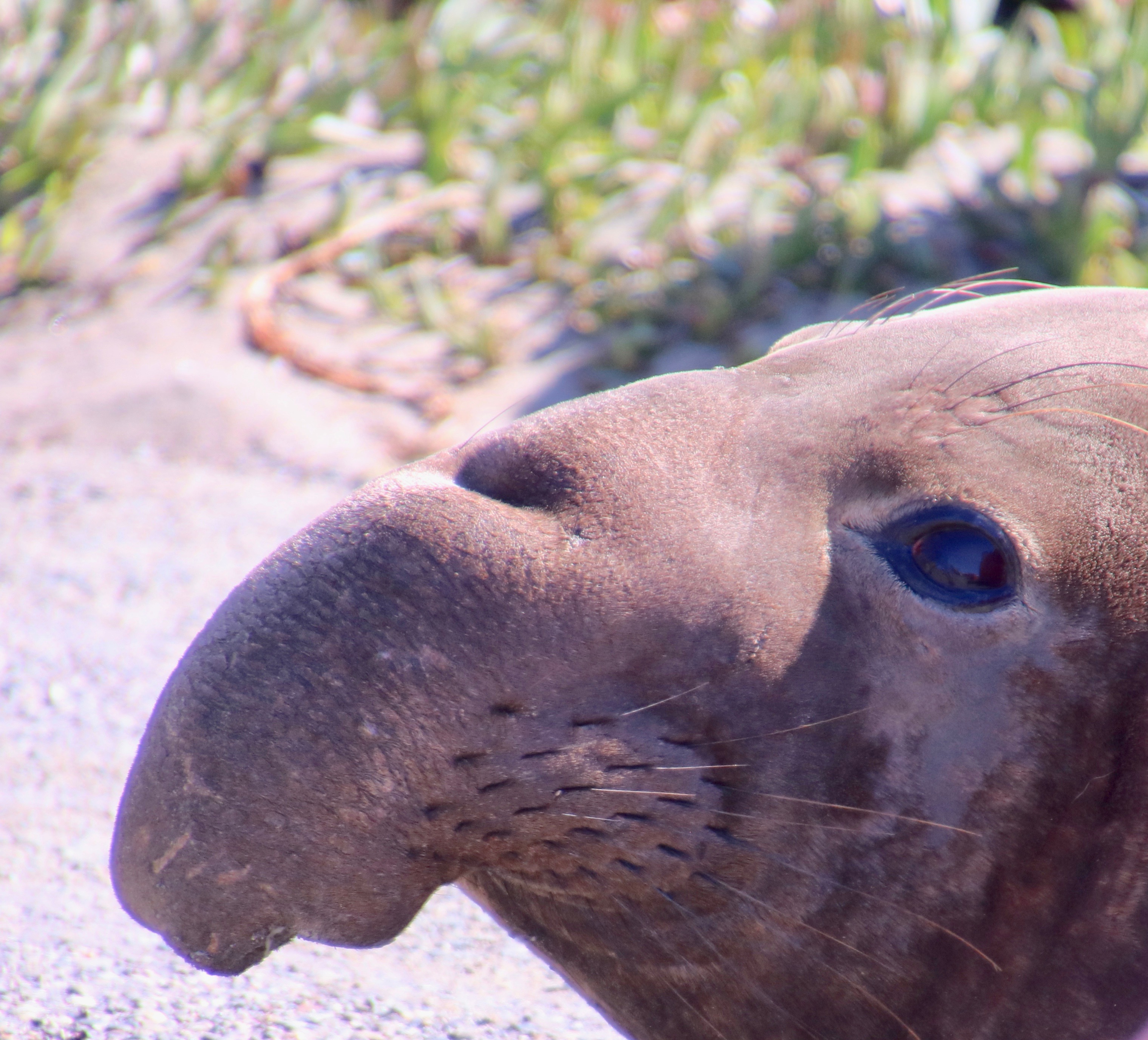
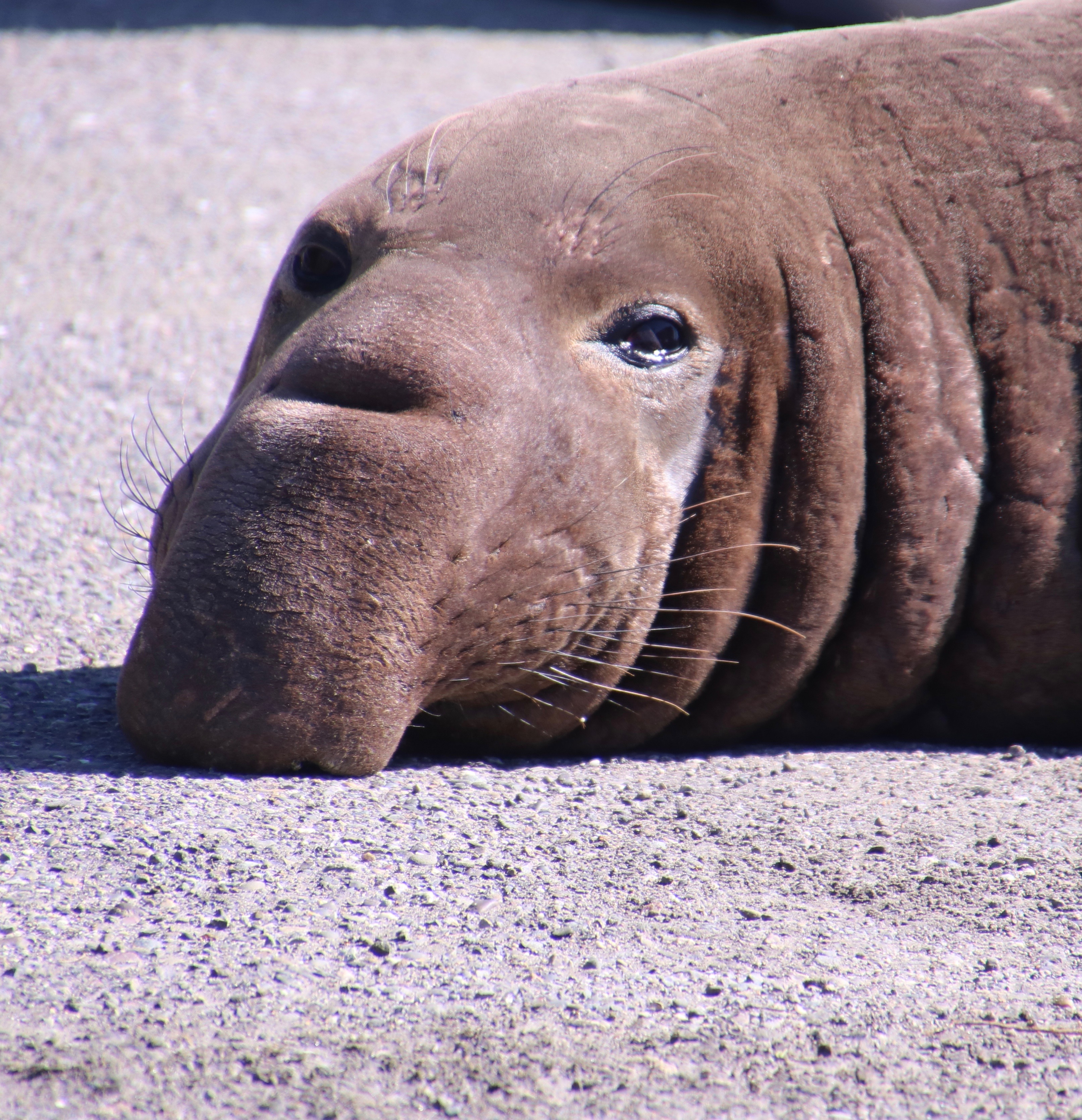
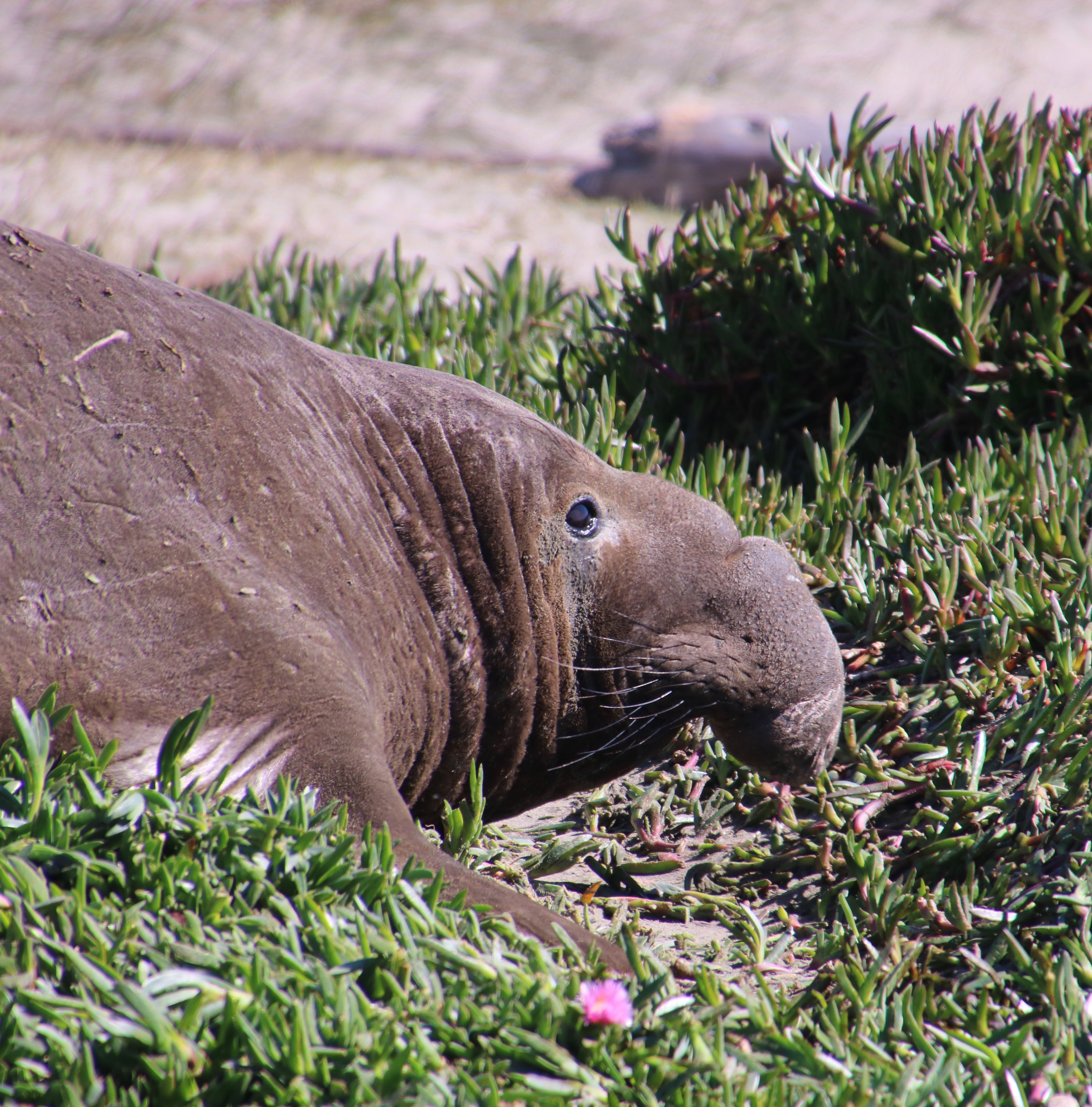
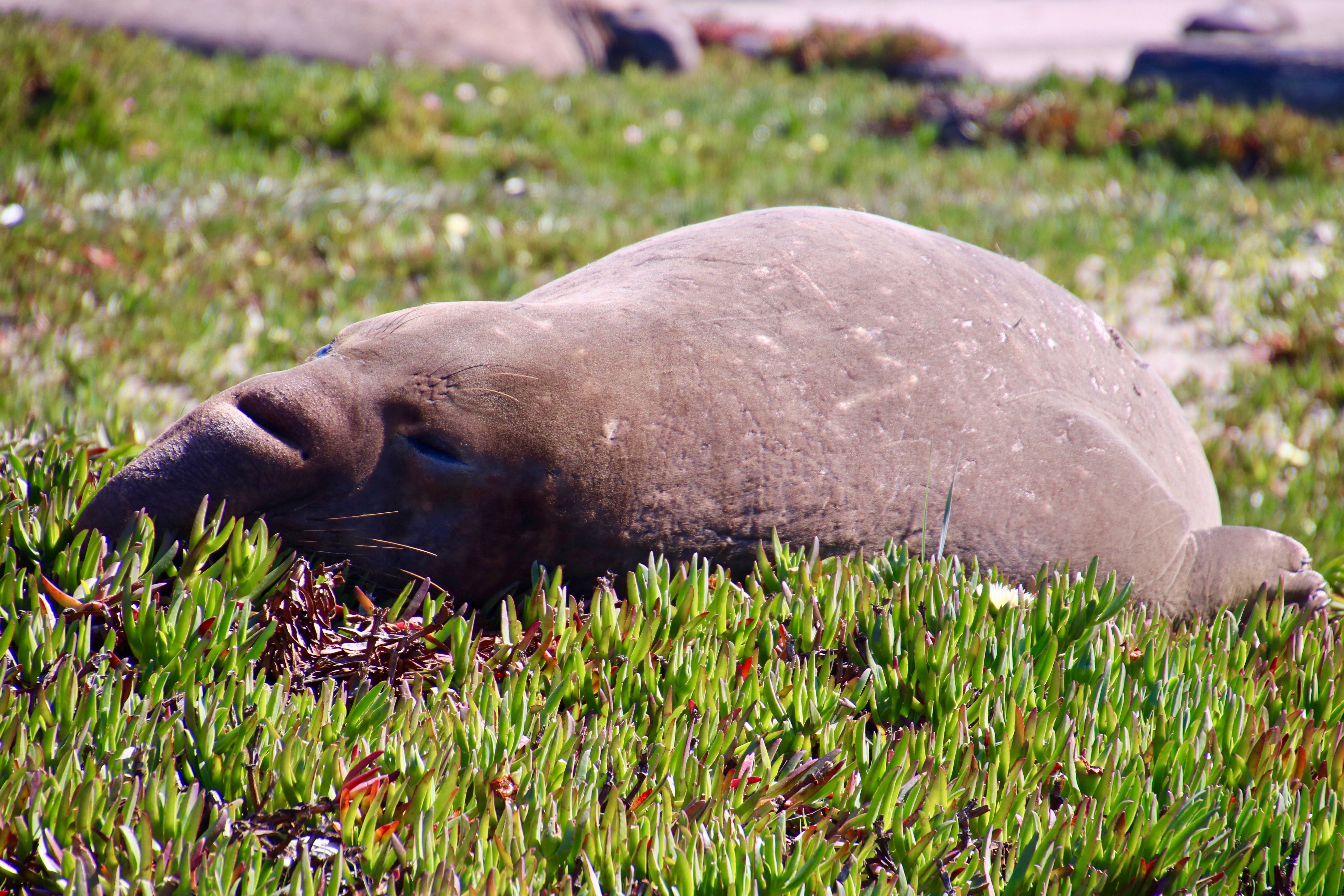
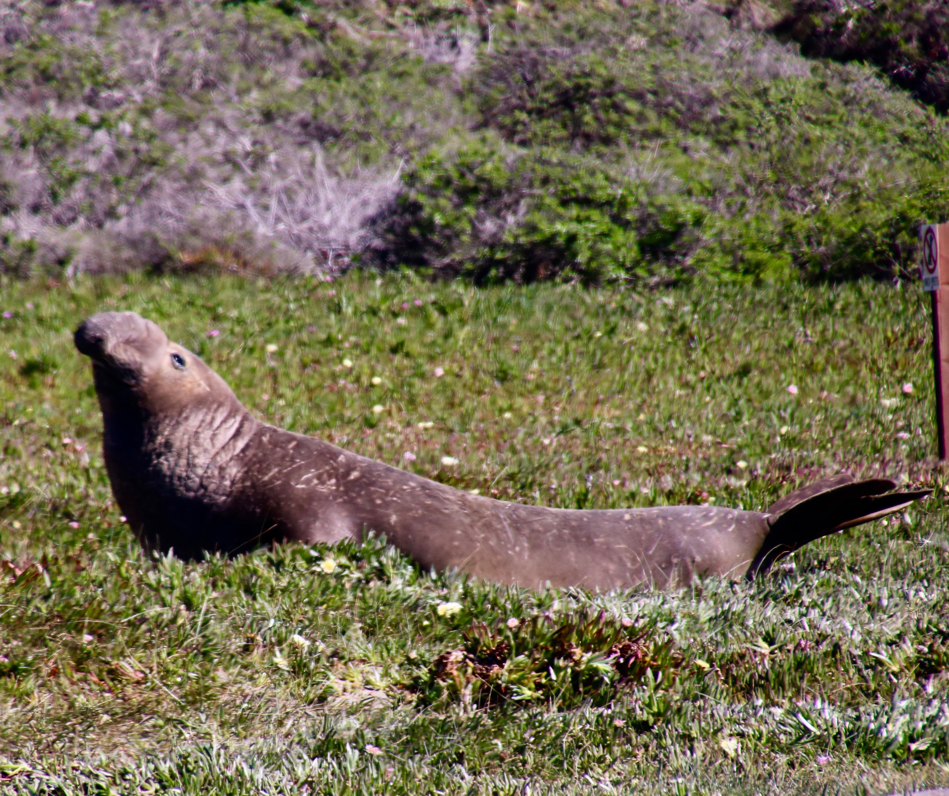
The Park Service had set up a barrier to separate the seals from the people who had come to admire them at Drake’s Beach. Those closest to the barrier were bulls. You can tell by their size and uniquely shaped noses. One had crossed the barrier and was worrying the rangers. “He’s escaping from the other bulls,” a ranger explained. Maybe.

This large bull had crossed through the barriers at Drakes Beach and was pointed toward the snack bar. (Photo by Peggy Mekemson.)

A little girl next to me exclaimed, “I think he is heading to the snack bar to get fish sticks!”

“I’d bet on ice cream,” I responded. “Look at how big he is.” The girl looked at me dubiously. “Fish sticks” she insisted.

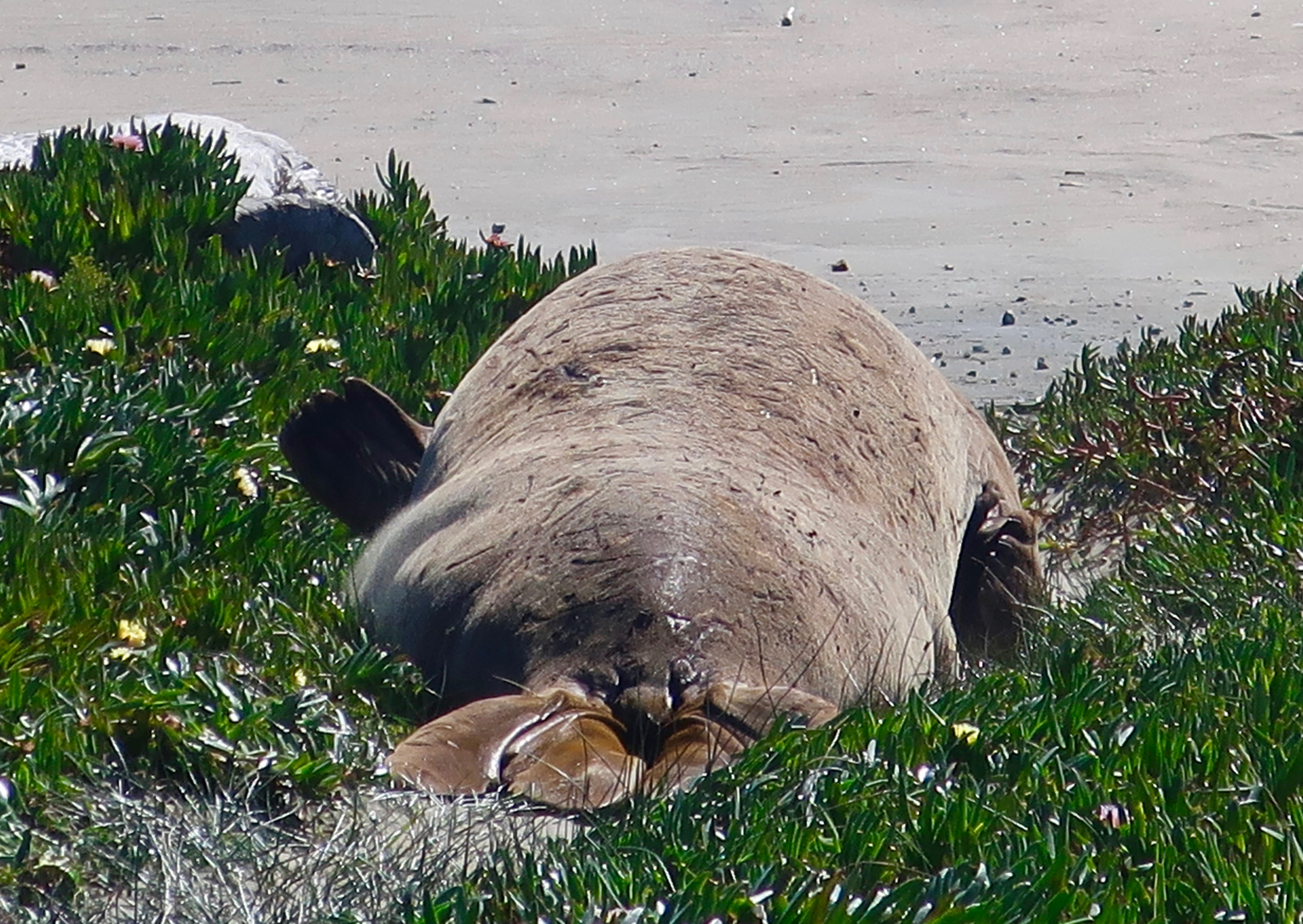
Peggy and I spent an hour watching these wonderful creations of nature who are so competent at sea and ungainly on land. They move like an inchworm, using their dorsal flippers to pull their front half forward and then using their rear flippers to push the rest of their body along like a rolling wave. Imagine moving several tons of fat. The ones we watched would make two or three of these moves and then collapse to rest.

Given their trunk-like noses and appealing eyes, Peggy and I were particularly attracted to the looks on their faces.

Is this fellow being coy?
Check out the big brown eyes! The size of the eyes helps the elephant seal see in the dark depths of the ocean. The whiskers apparently help as well in the search for food. He had lifted his head to check us out. (Photo by Peggy Mekemson.)
And then returned to his resting position. (Photo by Peggy Mekemson.)
A side glance. (Photo by Peggy Mekemson.)
A bit shy, perhaps. Maybe he thought that the log was hiding him.
Size matters. (Photo by Peggy Mekemson.)
This was interesting. The skin of the elephant seals is sensitive to the sun. They cope by throwing sand over their bodies with their flippers, as seen in this photo.
Sometimes a little stretch really feels good! (Photo by Peggy Mekemson.)
Peggy caught some of the girls sunbathing out near the ocean…
Drake’s Bay was named for Sir Francis Drake who reputedly visited the area in 1759. There’s another bull on the left— looking sluggish.
I’ll conclude today with this elephant seal that was making its way back toward the ocean. I decided he was waving goodbye with his flipper. I’ll return to the tide pools of Harris Beach in Oregon next week. Are you aware that groups of sea anemones go to war with each other?

NEXT POSTS:

Monday’s Blog-a-Book… “It’s 4 AM and a Bear Is Standing on Top of Me”: I move outside in the summer to enjoy nature but hire the family’s dogs and cats to protect me from the ghosts.

Wednesday’s Blog-a-Book… “The Bush Devil Ate Sam”: Held at gunpoint, I consider the odds of running over the gunman versus getting shot.

Bolinas: A Recluse Kind of Town… Pt. Reyes National Seashore

Mural of early Bolinas, California. Photo taken by Curtis Mekemson.

A mural depicting how Bolinas would have looked in the 50s. Not much has changed. The artist added a touch of humor with the blue surfboard the man in the brown sports coat is carrying.

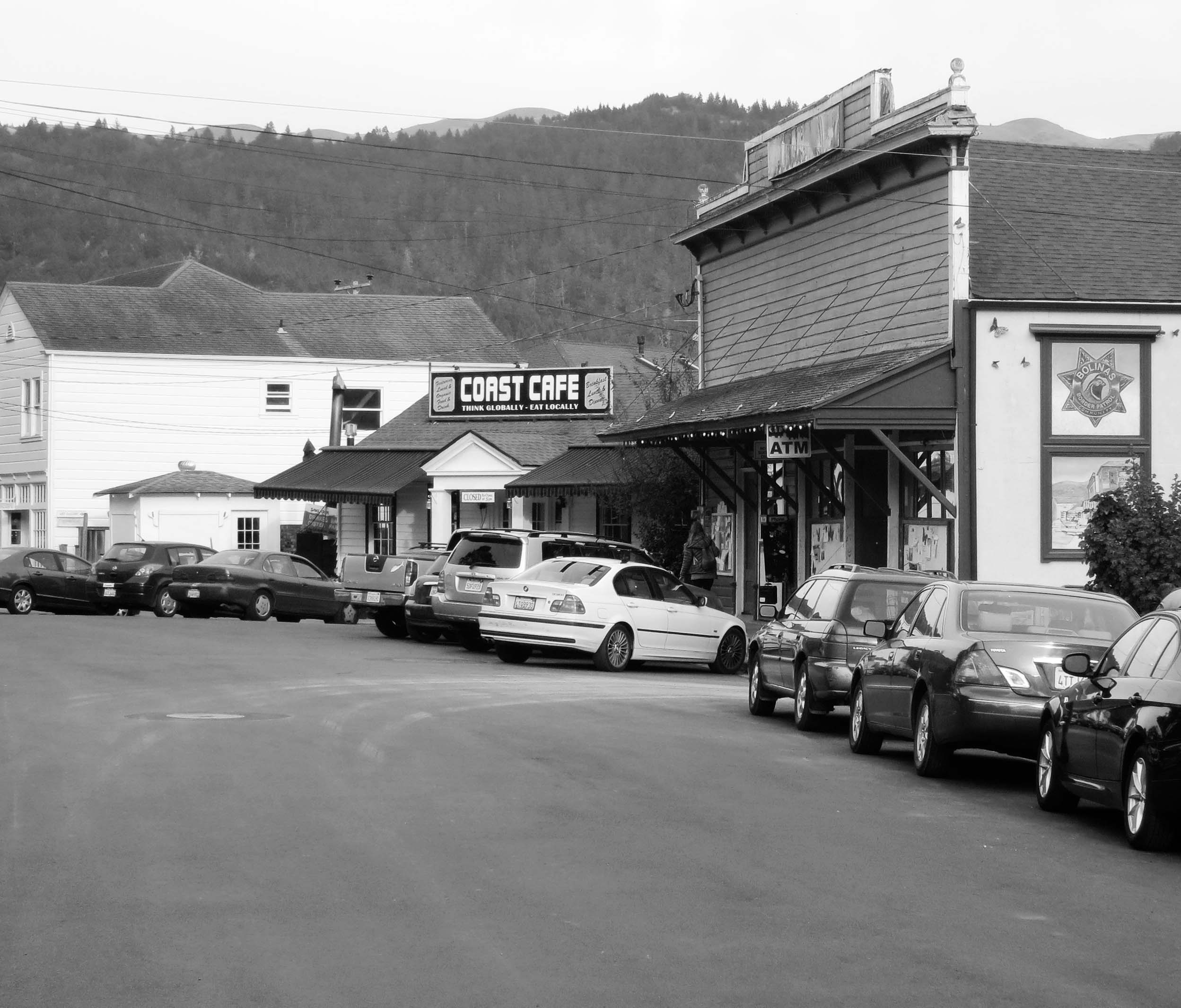
Marin County had a problem. Its highway department would put up a sign on Highway 1 pointing west toward the town of Bolinas and the residents of the small coastal community would tear it down. Again and again. Located 30 miles north of San Francisco and just south of Pt. Reyes National Seashore, the town didn’t want anyone to know where it was; the town was a recluse.

Finally, out of frustration, Marin County held a vote: Did or did not the townspeople want the signs? They voted no. Today, nothing points toward the community. But a map or GPS will get you there.

I first made my way to Bolinas in the early 70s. Surfers, hippies, commune members, artists, writers and other alternative types called it home. I was running an environmental center in Sacramento at the time. Being ex-Berkeley and ex-Peace Corps, I more or less fit in. “I could live here,” I thought to myself.

The town was also known for its nude beach. I won’t incriminate myself other than to note that there are some places on the body it’s best not to get sunburned.

Ken, Leslie, Peggy and I made our way to Bolinas after we left Pierce Ranch. Other than a new park in the middle of town, I was happy to find that the community had changed little. The park, I was proudly informed by a shop owner, had been donated by one of the town’s billionaires. Big money had found its way to this small community, which is pretty much the story of Marin County. Extreme wealth and a laid back lifestyle go hand in hand. In Bolinas, VW Vans and BMW’s seemed to happily co-exist.

We wandered through town poking our heads in various shops and looking for a bookstore. It’s become a tradition whenever we travel. We love books and we like to support local bookstores. We found one on the edge of town next to the post office. It was quite unique; the owner was elsewhere and shoppers were invited to price their own selections. Seven suggested categories ranged from “unbelievably really great” for $20 to “ordinary” for a buck. It was possible (though not likely) that Peggy’s really great might be my ordinary. A small, metal box with a slot on top was set up for payment. A statue of the Virgin Mary fronted the box. I wasn’t sure whether she was there to say thank you or to haunt our conscience if we paid five bucks for a book we believed was worth ten.

Bolinas, California unique book pricing recommendations. Photo by Curtis Mekemson.

A sign with suggested prices for books in Bolinas, California that depended on your assessment of the book.

Bolinas Book Store photo by Curtis Mekemson.

Ken deposits $5 for a “great book” in the Virgin Mary box while Peggy, reflected in a mirror, looks on.

Bolinas, California  book store photo by  Curtis Mekemson.

I assume this was the missing owner’s office. I believe he painted the pictures.

Leslie, Ken and Peggy stand in front of the Bolinas Bookstore named Books.

Leslie, Ken and Peggy stand in front of the Bolinas Bookstore named Books.

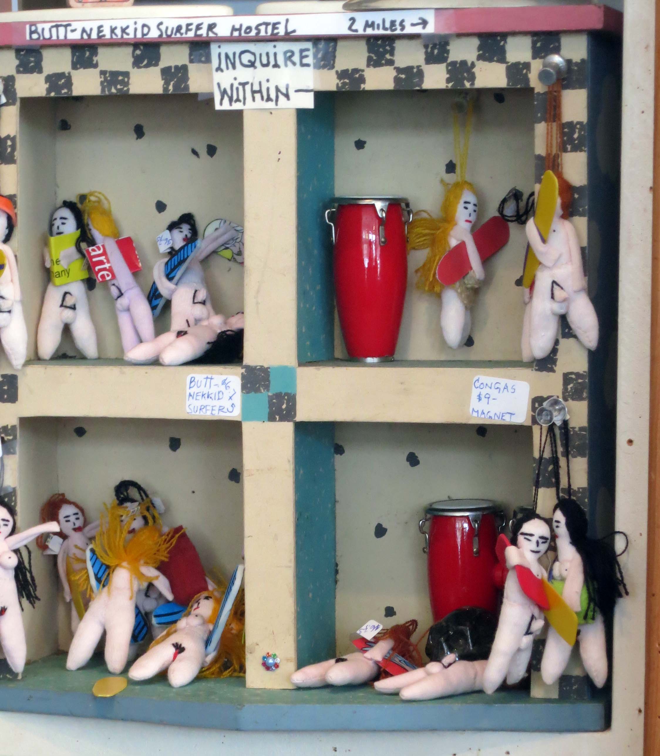
Our visit also included stopping off at a stuffed-to-the-ceiling antique store, admiring quaint houses that had been around since day one, taking photos of murals and visiting a small shop featuring incense, eastern music, and a Humpty-Dumpty Buddha.

Photo of Bolinas California taken by Curtis Mekemson.

Bolinas today, which I did in black and white to give it a 70’s feeling. Take away the cars and the billboard building and you’ll find the Bolinas featured in the mural at the top of the post.

The Grand Hotel Shop and Gallery in Bolinas, California. Photo by Curtis Mekemson.

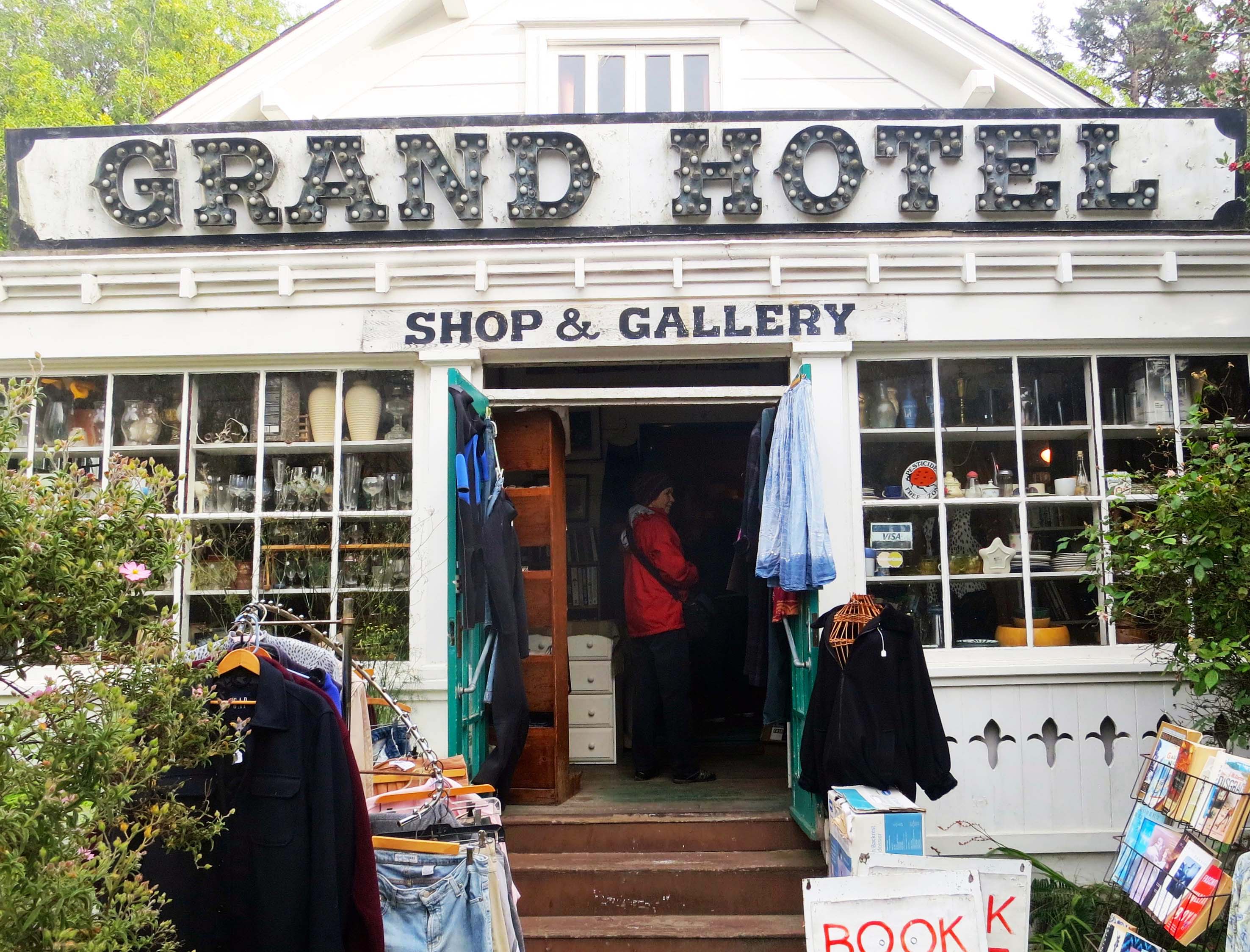
The Grand Hotel Shop and Gallery was stuffed top to bottom with antiques.

Mannequin in Bolinas, California. Photo by Curtis Mekemson.

I was intrigued with this aging mannequin I found looking out the window of the shop.

A home in the town of Bolinas, California. Photo by Curtis Mekemson.

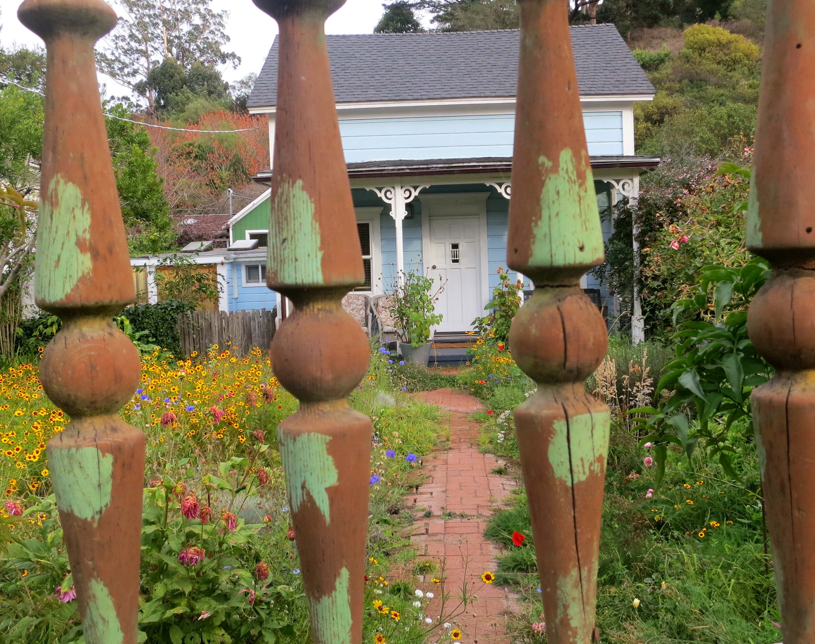
The old homes in town have aged well.

Back in a hot-flash sign in Bolinas, California. Photo by Curtis Mekemson.

Incense, Eastern music, and this sign pulled us into a shop.

Eclectic Bolinas, California shop. Photo be Curtis Mekemson.

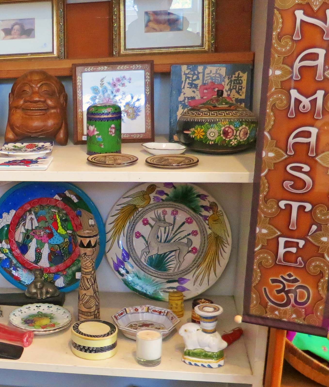
The laughing Buddha face on the upper left shelf made me think of Humpty Dumpty. The items in the shop were, um, eclectic…

Inside of shop in Bolinas California. Photo by Curtis Mekemson.

Very eclectic.

Bolinas Shrine. Photo by Curtis Mekemson.

We found a shrine next door that the community had put up after 9/11.

Surf shop ad in Bolinas, California. Photo by Curtis Mekemson.

A Bolinas surf shop advertised using broken surf boards featuring Native American/First Nation art.

Halloween pumpkin in Bolinas California. Photo by Curtis Mekemson.

This pumpkin reminded me that Halloween had just passed…

2013 gas prices in Bolinas, California. Photo by Curtis Mekemson.

And this sign reminded me that we would be buying our gas elsewhere. This station matched what I was paying in the Yukon territory this summer.

NEXT POST: Peggy and I heading off to Mexico for three weeks. To fill in, I’ve decided to put up photos that Peggy and I have taken in America’s National Parks. We’ve made a point of visiting close to all of them. I’ll close out my Pt. Reyes’ series with a Bolinas mural that I think reflects the area: ocean, wilderness, and a touch of magic.

Mural of mountain lion and mermaid in Bolinas, California. Photo by Curtis Mekemson.

Socrates Digs South Beach… Pt. Reyes National Seashore

Photo of Socrates the Basset Hound by Curtis Mekemson

Socrates the Basset Hound fell in love with digging opportunities at South Beach, Pt. Reyes National Seashore.

Peggy and I didn’t make it out to North and South Beach this time. Three days were not nearly enough to visit all of my favorite Pt. Reyes sites. I have a few photos from my pre-blogging days, however, so I decided to do a quick post.

These two beaches are actually one. If you enjoy crashing waves and long, lonely beach walks, this is the place to go. I still remember my first hike along the shoreline. My companion at the time was a long-eared, short-legged basset hound named Socrates.  It was before leash laws were established so the dog ran free over the sand. Sort of– Basset hounds aren’t noted for their long, graceful gaits.

For example, Soc loved to chase jackrabbits. The only time I ever saw him catch one was when the rabbit was rolling on the ground and laughing so hard he couldn’t escape. (Kidding.)

But there was another reason for our slow progress down the beach. Soc had a passion for digging. He could move more dirt in an hour than a bulldozer could in a day. (Slight exaggeration.) Given what he could do with dirt, you can imagine what he did with the sand. I was hoping for a high tide to hide his destruction.

When I urged the Soc to stop hassling whatever poor creature he was after, he whined and start digging harder. I was in danger of being buried under an avalanche of sand. The dog had Zen-like focus; it didn’t matter that he never caught anything. I’d get him away from one hole and he would start another 50 feet down the beach. Our slow progress made for a long walk but it was totally worth it for the joy the dog found in digging holes and the pleasure I took in watching him and, of course, the beautiful Pacific Ocean.

Waves at South Beach, Pt. Reyes National Seashore. Photo by Curtis Mekemson.

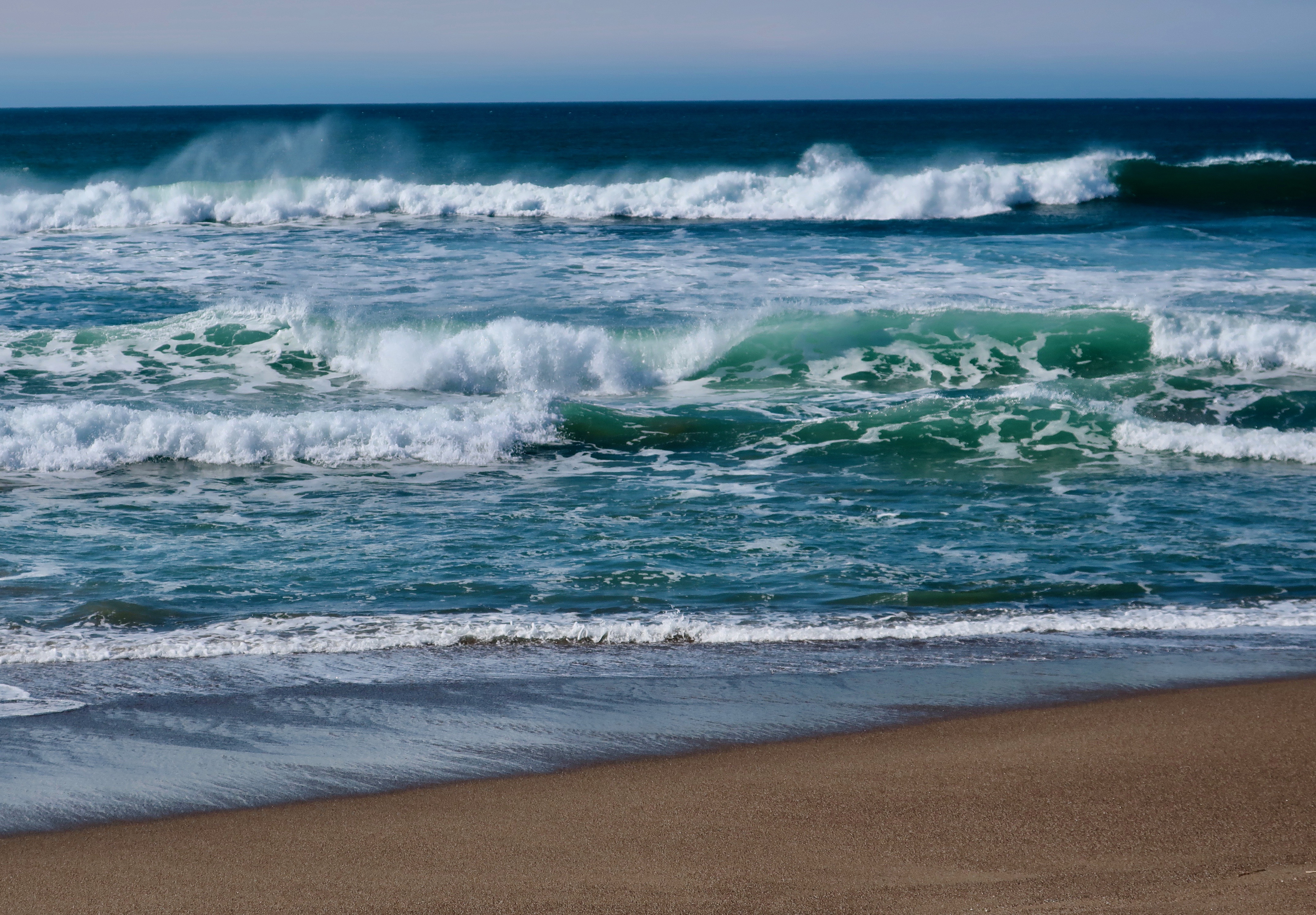
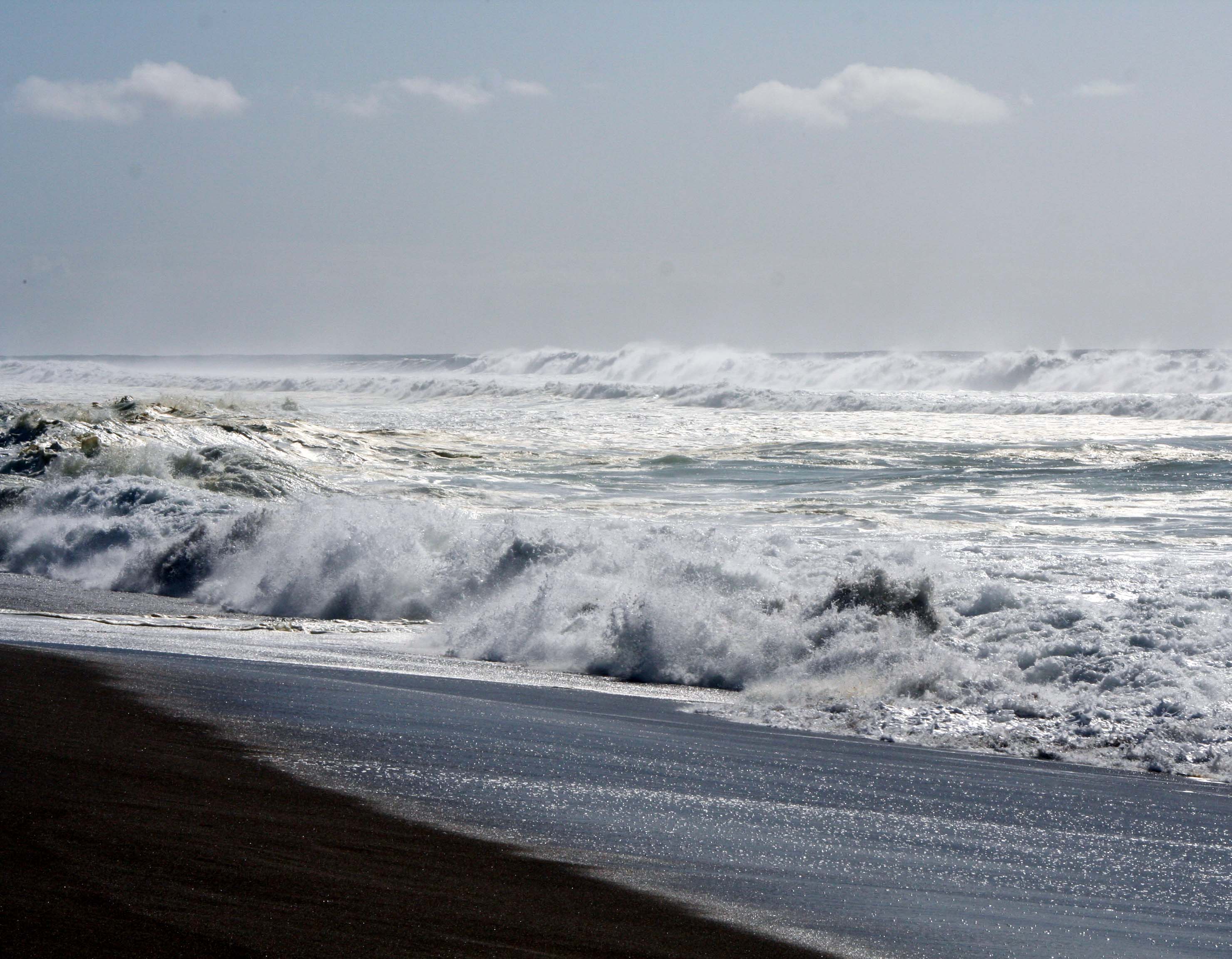
Waves come crashing in at South Beach.

Years later I discovered that North Beach was a great place for writing. I would park facing the ocean, get out my laptop, and start typing. The rolling ocean, an occasional whale, diving pelicans and raucous gulls served as my muses.

Photo of waves at South Beach, Pt. Reyes National Seashore. Photo by Curtis Mekemson.

Another thunderous wave.

Ice plant at South Beach, Pt, Reyes National Seashore. Photo by Curtis Mekemson.

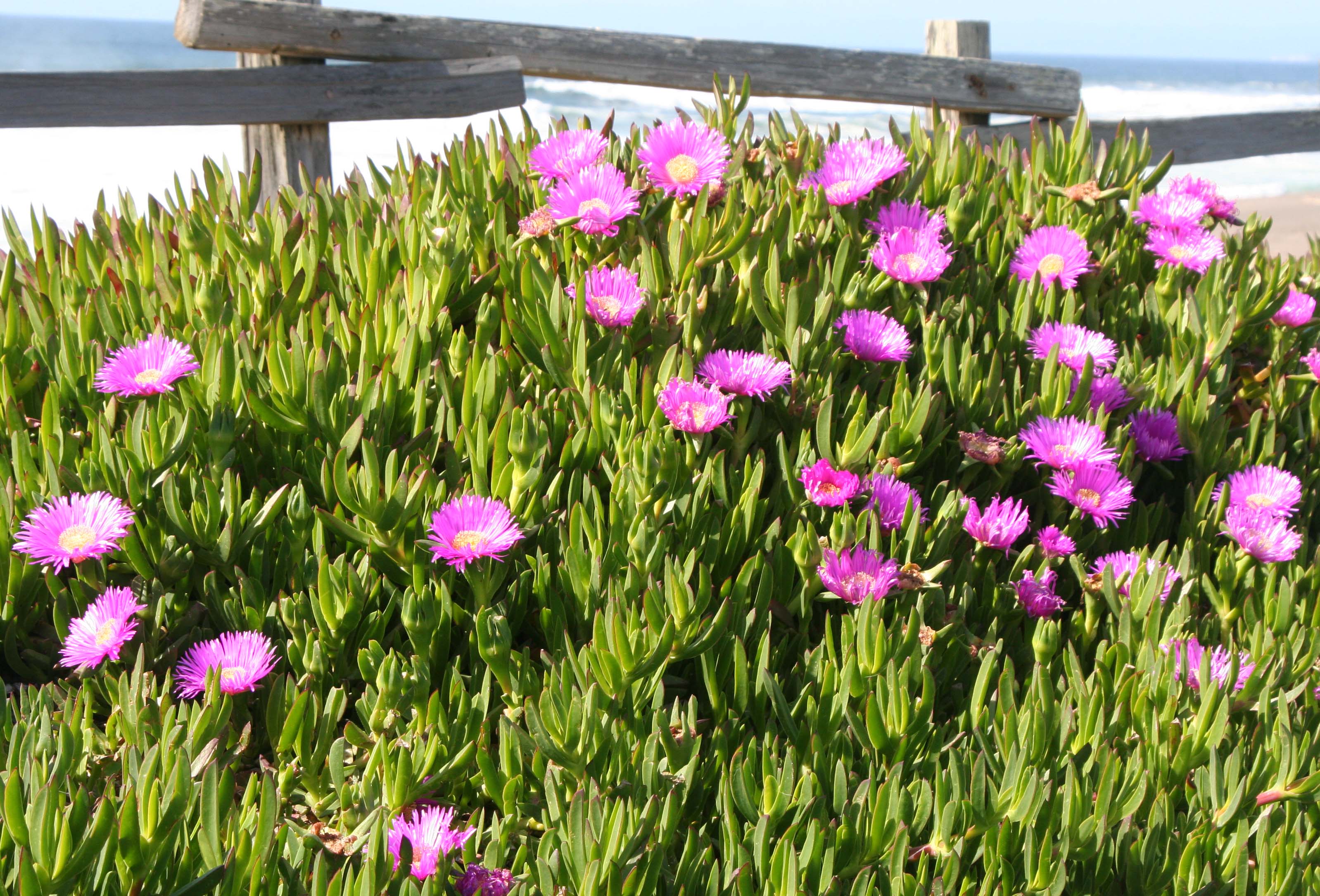
This ice plant formed the border between the parking lot and the beach.

Close up of ice plant at South Beach, Pt. Reyes National Seashore.

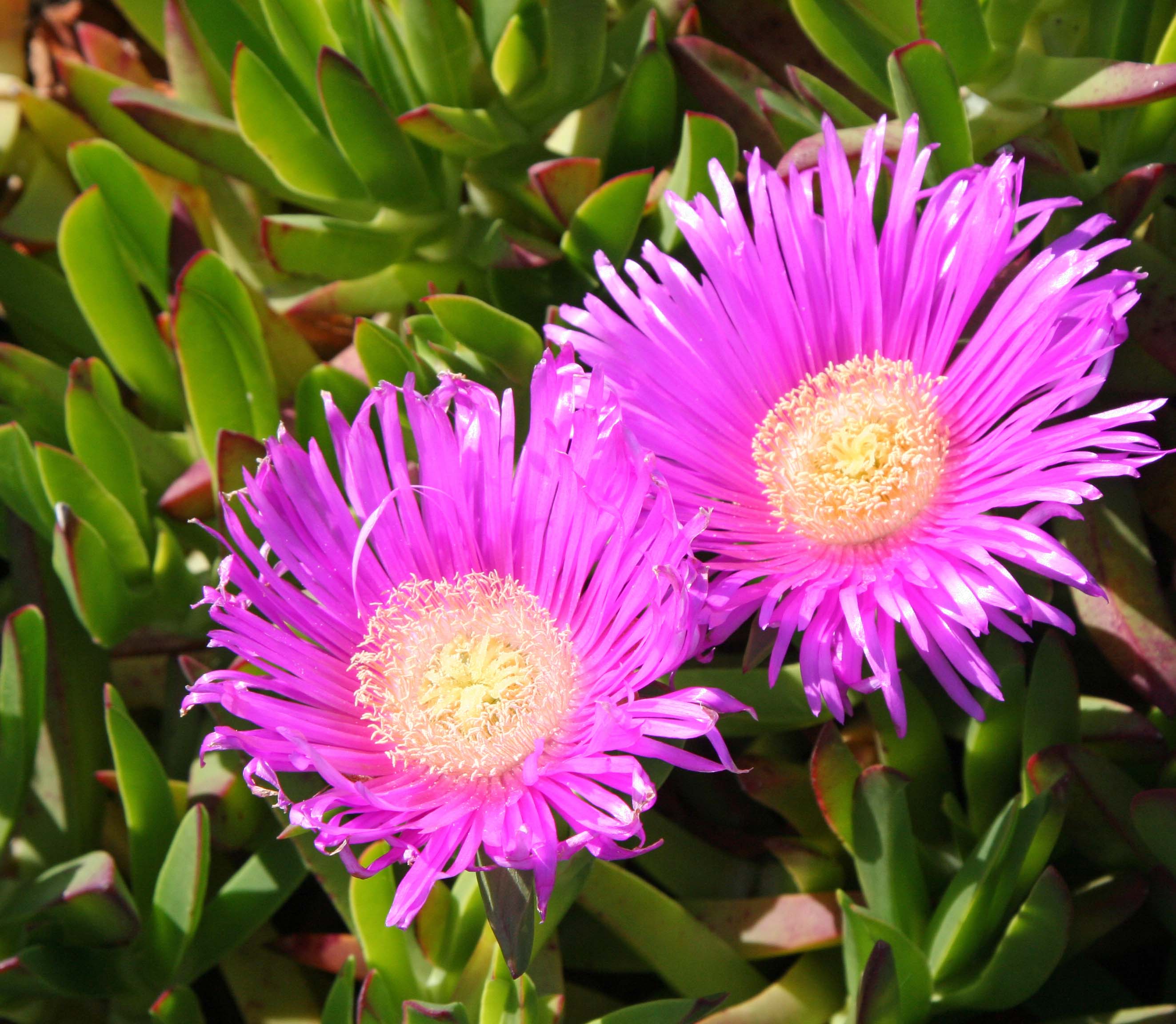
It demanded I take a close up.

Raindrops captured by lupine leaves at South Beach, Pt. Reyes National Seashore. Photo by Curtis Mekemson.

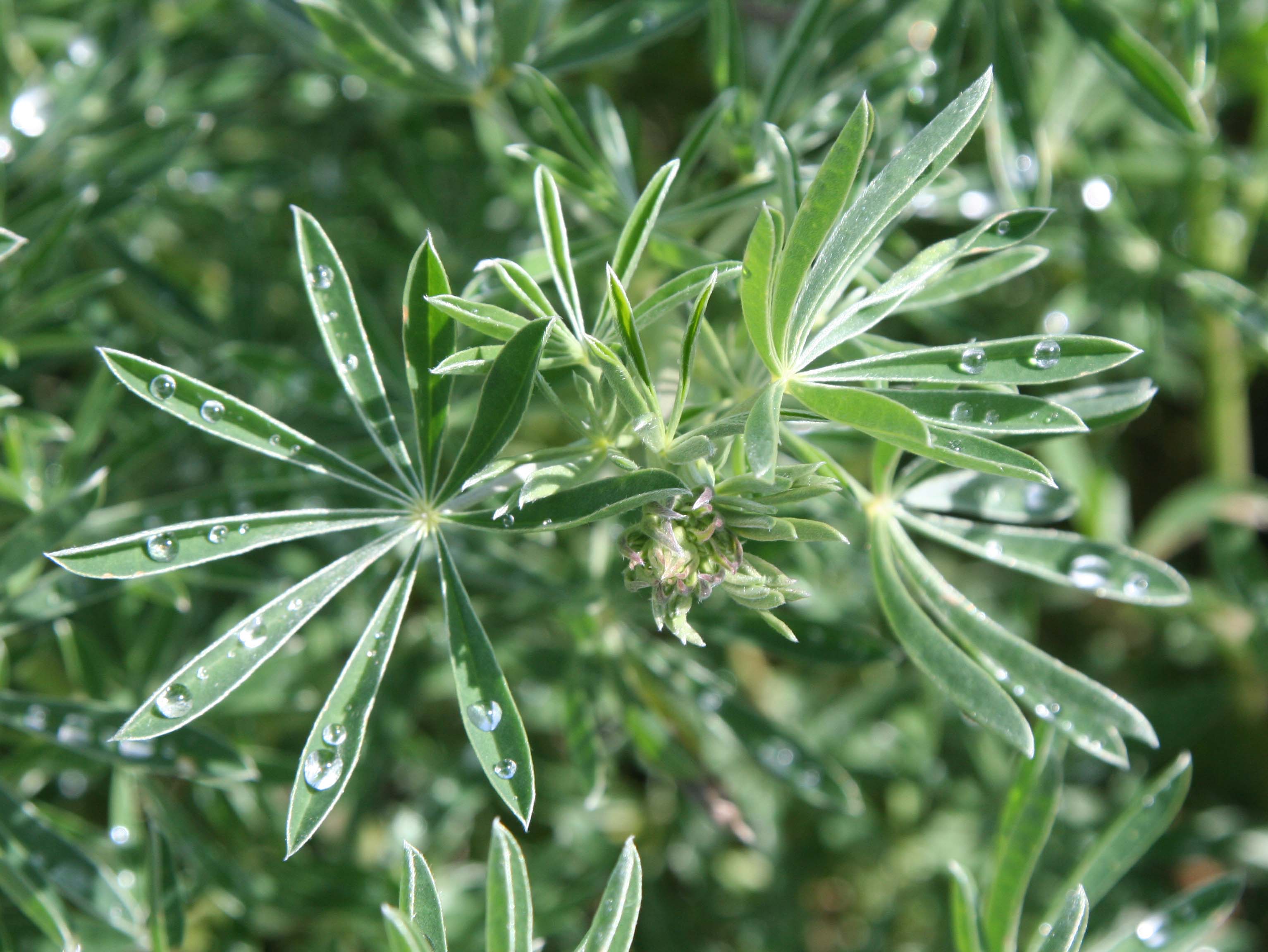
These lupine leaves displayed captured rain drops.

Iris growing near South Beach, Pt. Reyes National Seashore. Photo taken by Curtis Mekemson.

I also found this iris quite attractive.

The winds at North and South beach provide excellent loft for kite flying. I enjoyed the dragon but it distracted me from my writing.

The winds at North and South beach provide excellent wind for kite flying. I enjoyed this dragon but it distracted me from my writing. I wonder what the gulls thought about it?

Tules near North Beach, Pt. Reyes National Seashore.

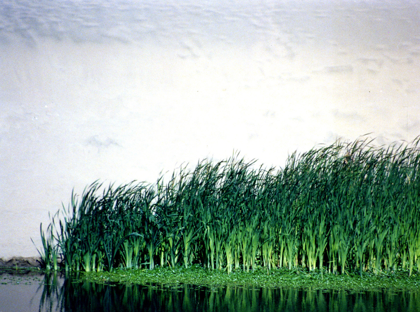
I discovered these tules on Bull Point trail near North Beach. Miwok Indians used these plants in making baskets.

NEXT BLOG: The hippie town that tries to hide: Bolinas. Here’s a final photo of South Beach.

Waves pound the beach at South Beach, Pt. Reyes National Seashore. Photo by Curtis Mekemson.


The Historic Pierce Ranch and a Herd of Tule Elk… Pt. Reyes National Seashore

Lichens found on a fence on Pierce Ranch at Pt. Reyes National Seashore. Photo by Curtis Mekemson.

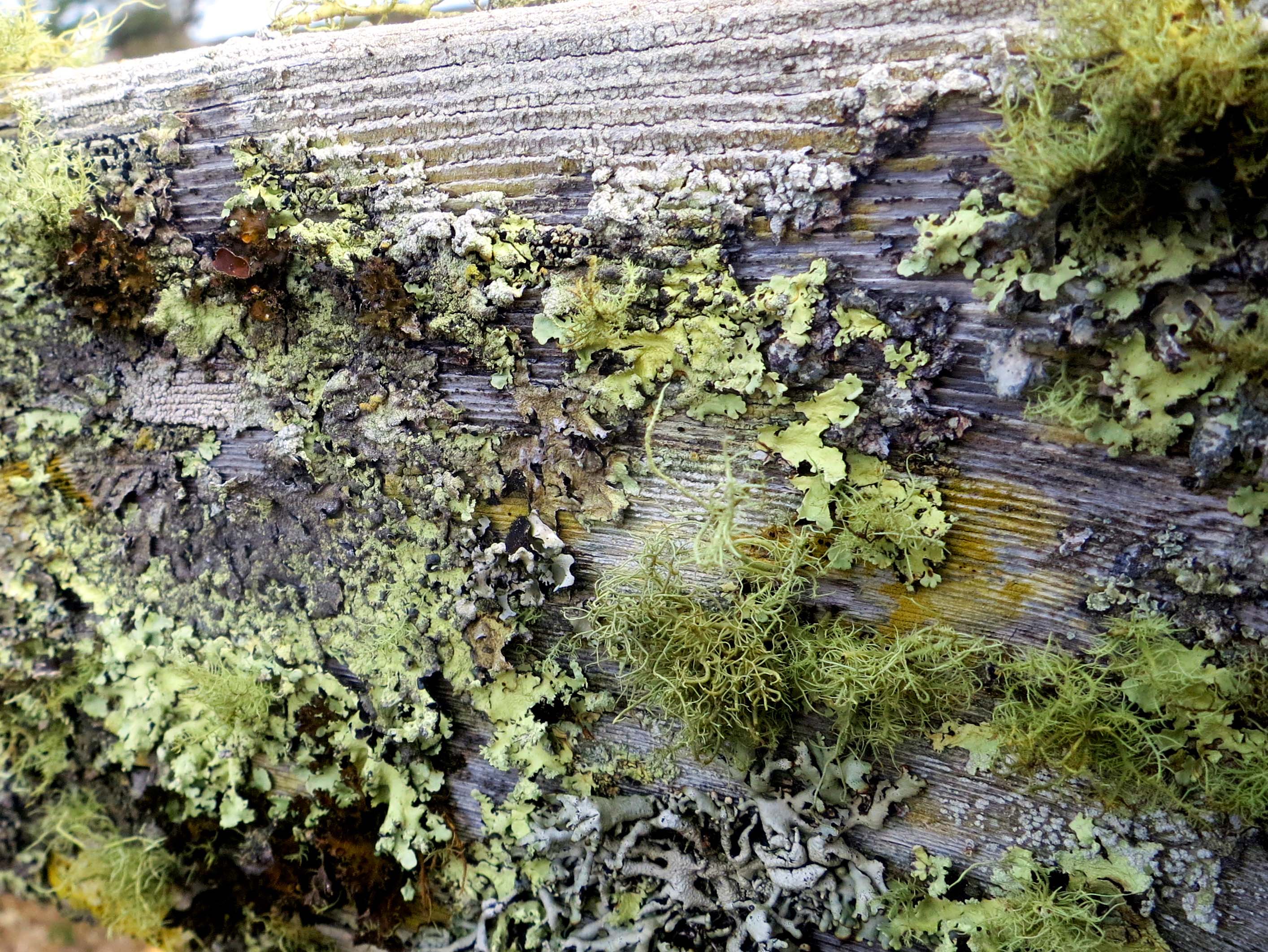
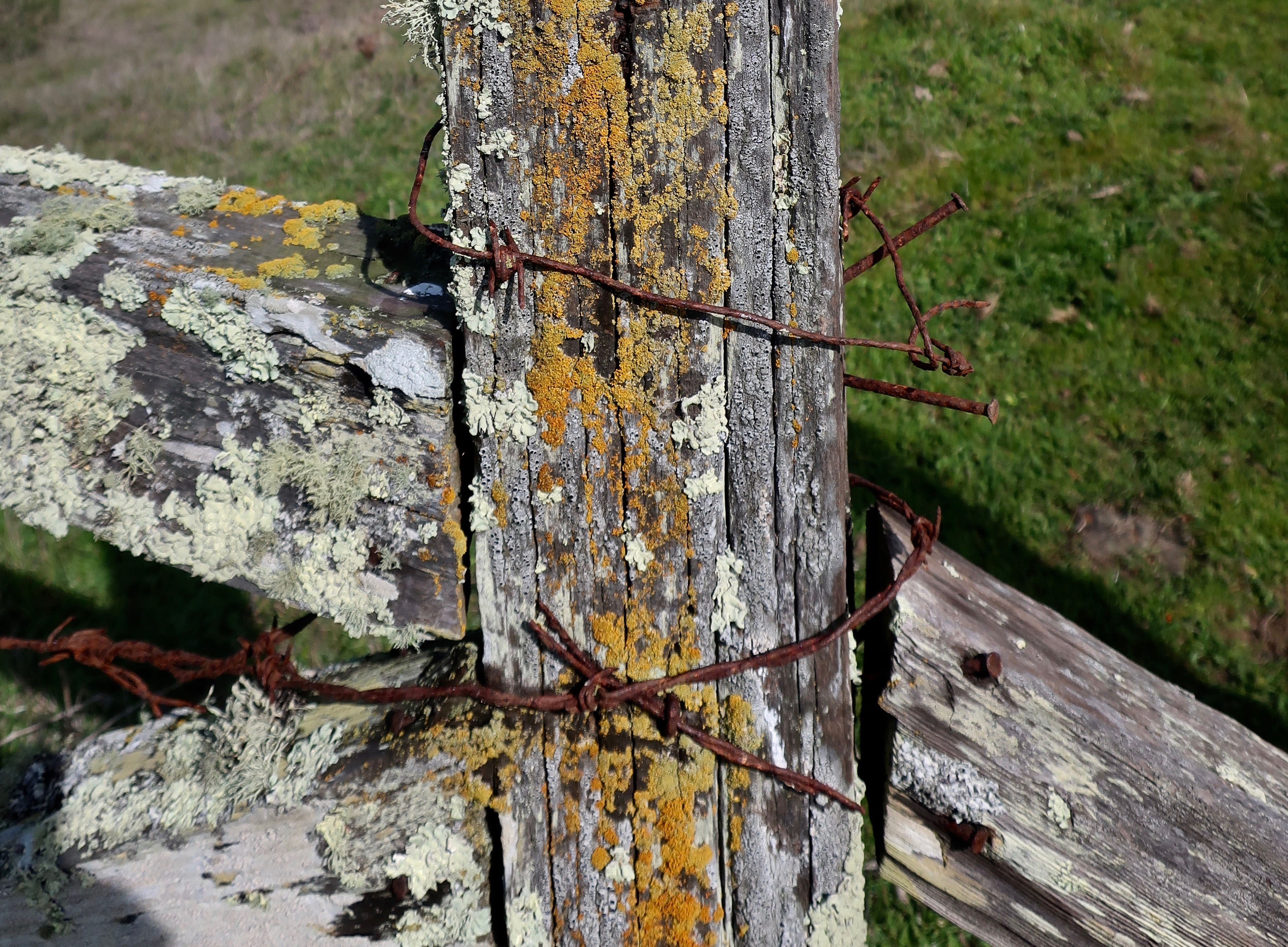
Lichens, adorning a fence on the historic Pierce Ranch at Pt. Reyes National Seashore, remind visitors that it has been 46 years since the last cow mooed.

Marin County land speculators, real estate firms, and local governments had a dream in the 1950’s. They were going to turn Pt. Reyes into one vast housing tract. Mouth-watering profits were to be made. Local tax dollars would increase proportionately. Everyone would gain.

Well, not quite.

Local ranchers saw a life style they had loved for over a century disappearing. The Sierra Club saw one of the world’s richest natural environments falling under the blades of bulldozers. The National Park Service saw it’s dream of opening the beautiful coast and forests of the area to the public being replaced by a forest of no trespassing signs.

An alliance was formed. Environmentalists and ranchers joined together with visionary local and national leaders to devise a plan that would protect the environment, allow ranchers to continue ranching, and give the National Park Service the opportunity to create one of America’s premier parks, a gift to America and the world that would last for generations. In 1962, John Kennedy signed the legislation that would create the Pt. Reyes National Seashore.

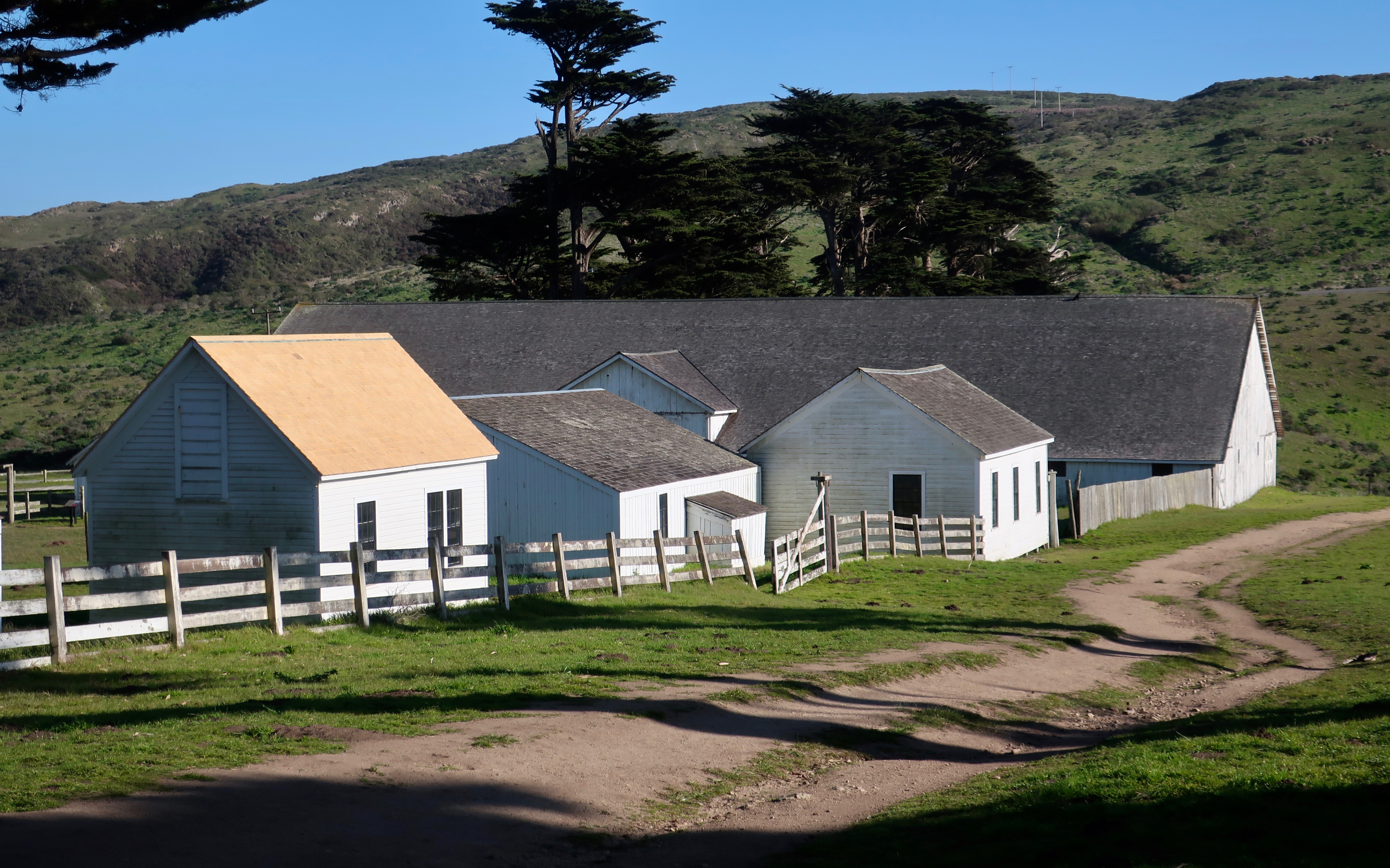
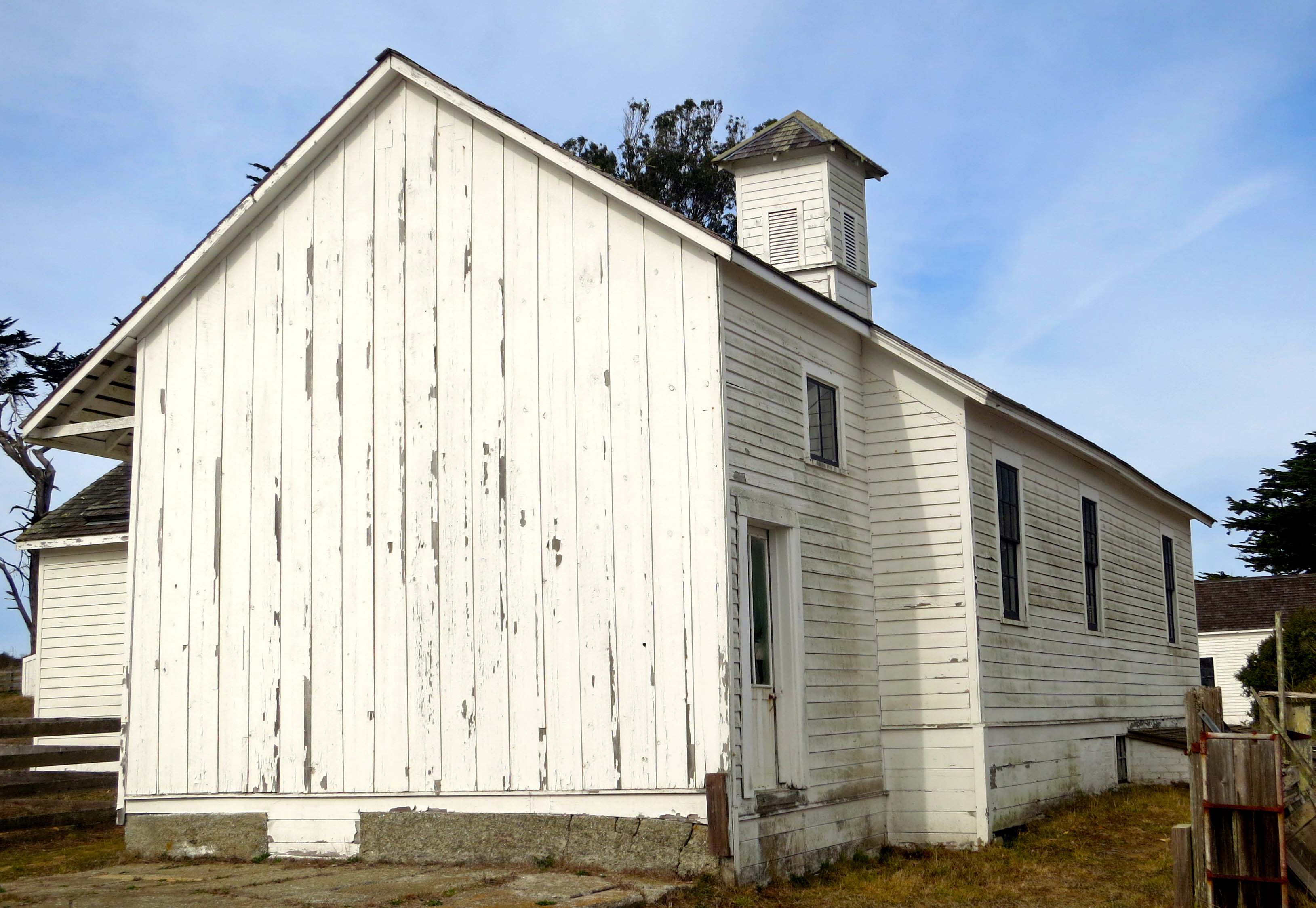
The Pierce Ranch, located out on Tomales Point, ceased operation in 1973. Three years later it became part of the park as a historic representative of the dairy ranches at Pt. Reyes that had been milking cows and shipping butter to the Bay Area since 1866.

In 1978 a herd of Tule Elk was reintroduced to the area as part of the Tomales Point Tule Elk Reserve. Native to California, Tule Elk had once roamed throughout the state in substantial numbers. By 1900 they were close to extinction. Saved by a Bakersfield rancher, over 20 protected herds are now located in California.

Photo of a lichen covered fence at Pt. Reyes National Seashore.

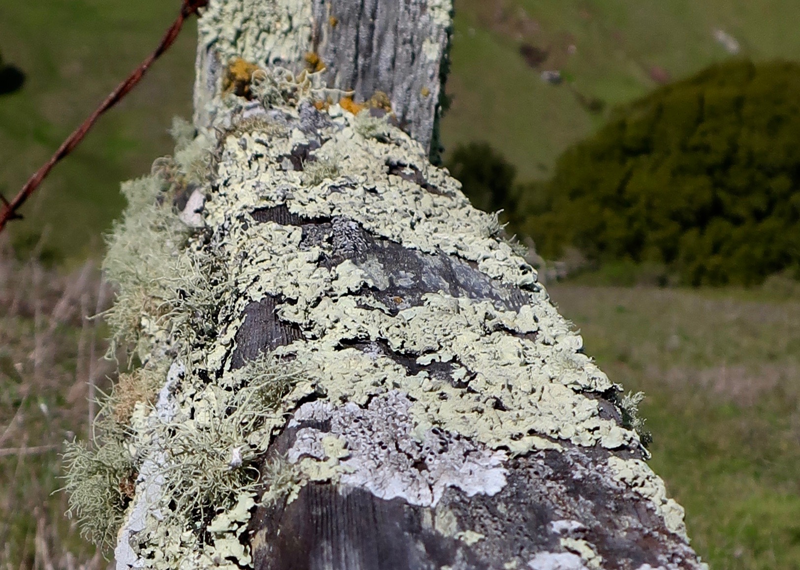
Another photo of the lichen covered fence. It’s like a strange forest.

Photo of cypress tree wind break on Pierce Ranch inPt. Reyes National Seashore. Photo by Curtis Mekemson.

Possibly the mother of all cypress tree windbreaks stands above Pierce Ranch.

Photo of barn at Pierce Ranch, Pt. Reyes National Seashore.  Photo by Curtis Mekemson.

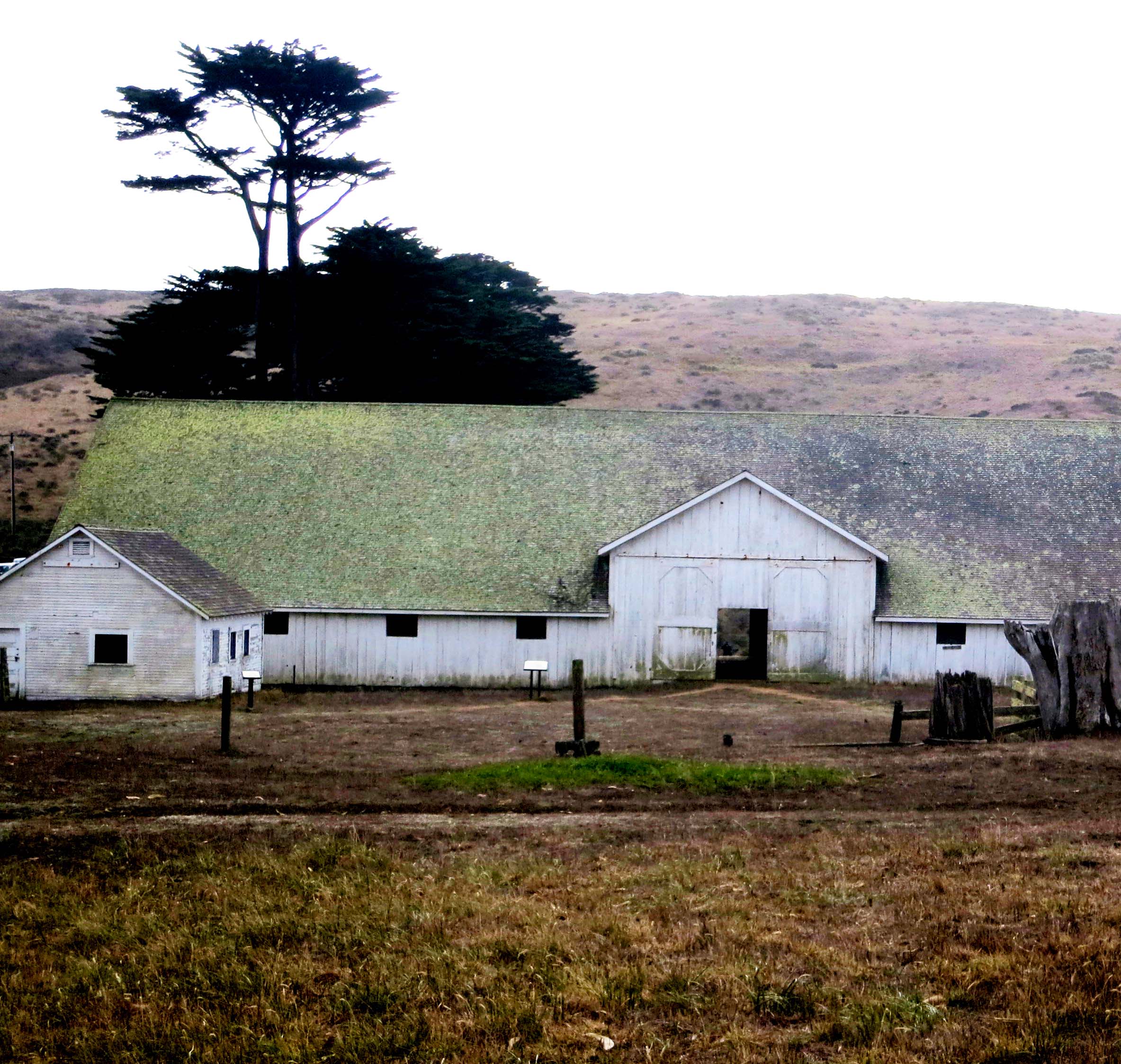
A number of buildings make up the ranch, including this old barn.

Photo of one-room school house at Pierce Ranch, Pt. Reyes National Seashore including Leslie Lake and Peggy Mekemson. Photo by Curtis Mekemson.

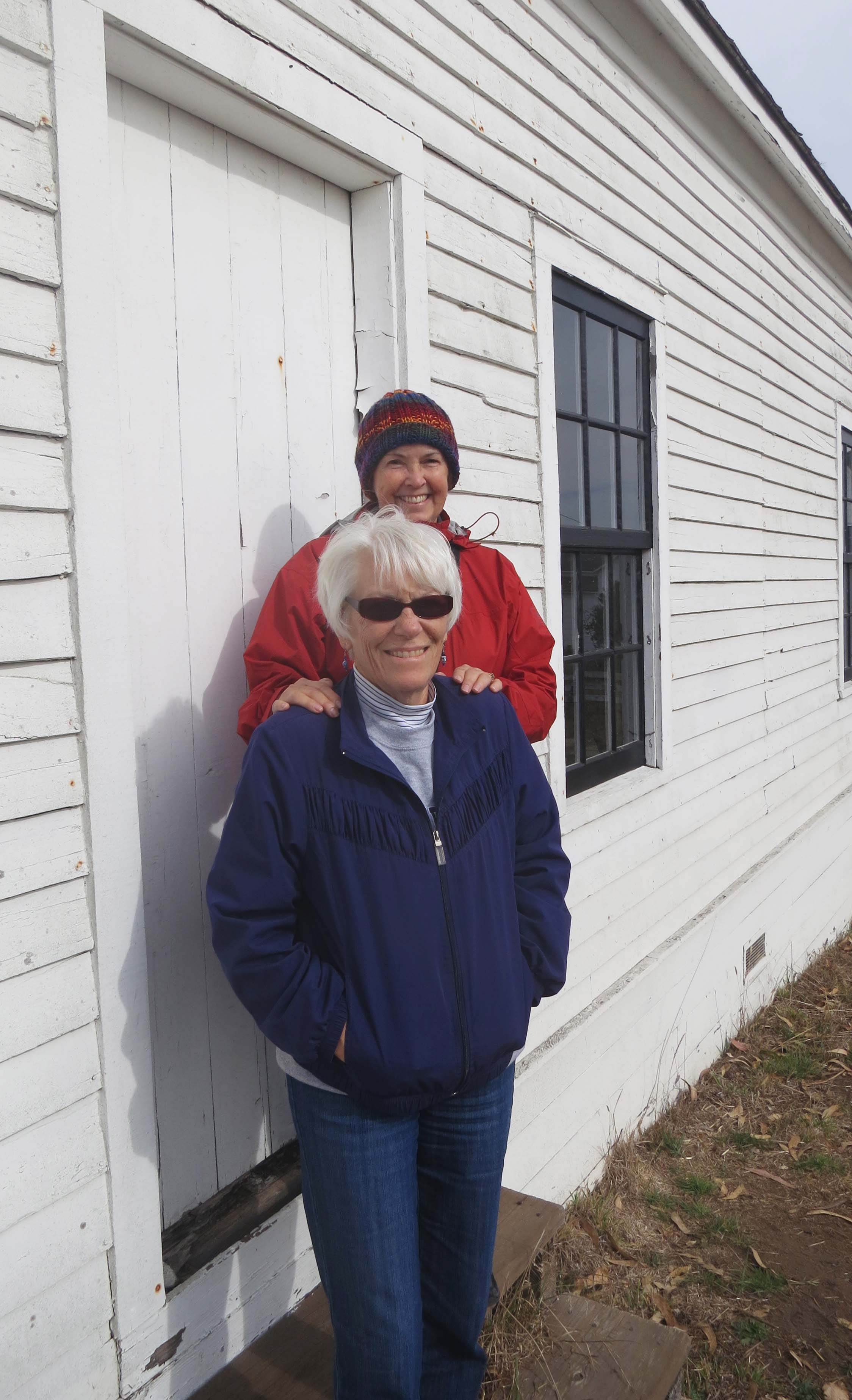
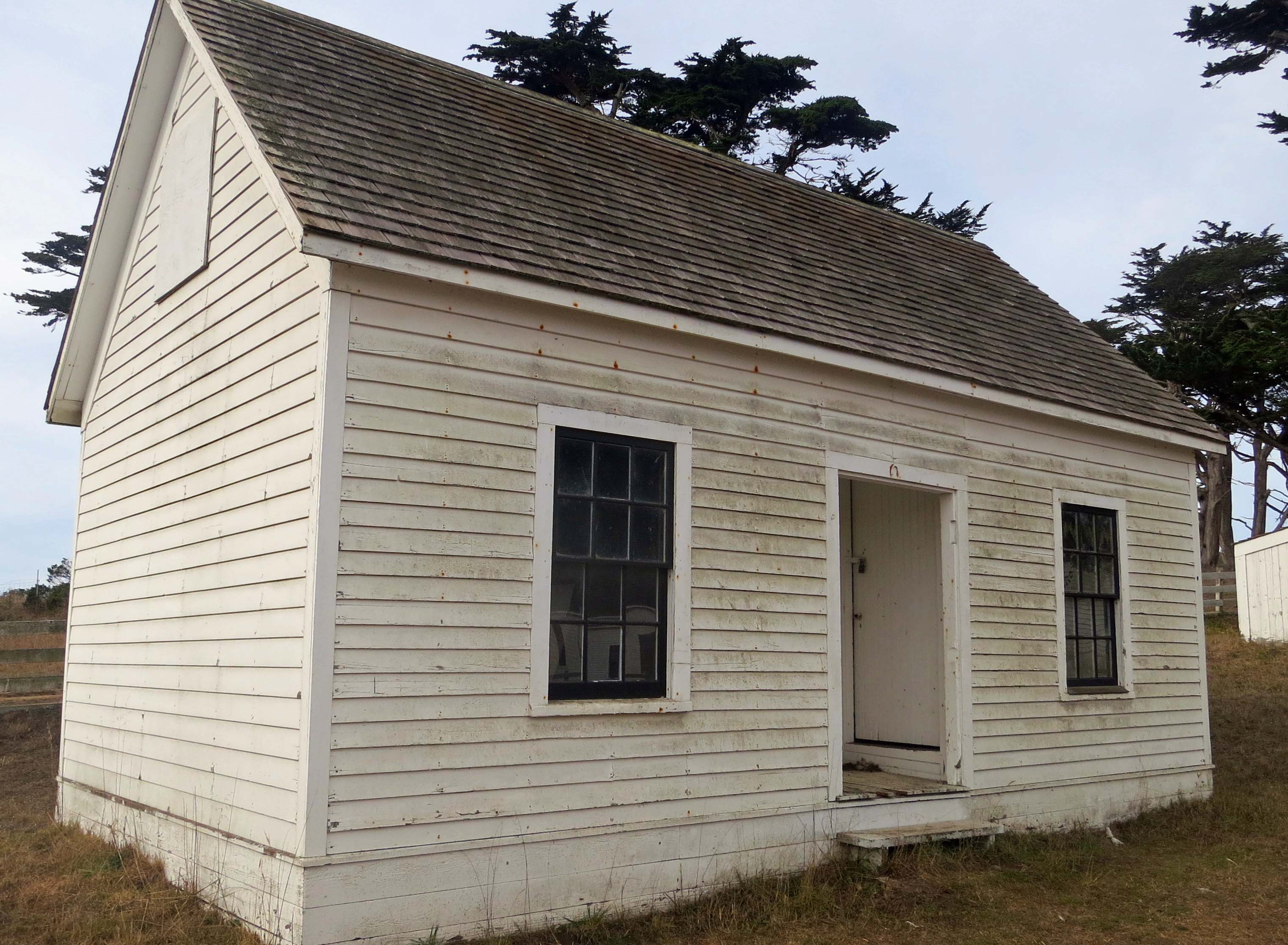
Isolated out on Tomales Point, Pierce Ranch formed a small community that included a store and this school-house. Since our friend Leslie Lake spent many years as a third grade teacher and Peggy worked as an elementary school principal, I’ve included them in the photo.

Looking inside school at Pierce Ranch on Pt. Reyes National Seashore. Photo by Curtis Mekemson.

Once filled with laughing children learning their abc’s, the school is now vacant and the windows are covered with cobwebs– ghostly reminders of the past.

Old cattle pen at Pierce Ranch at Pt. Reyes National Seashore. Photo by Curtis Mekemson.

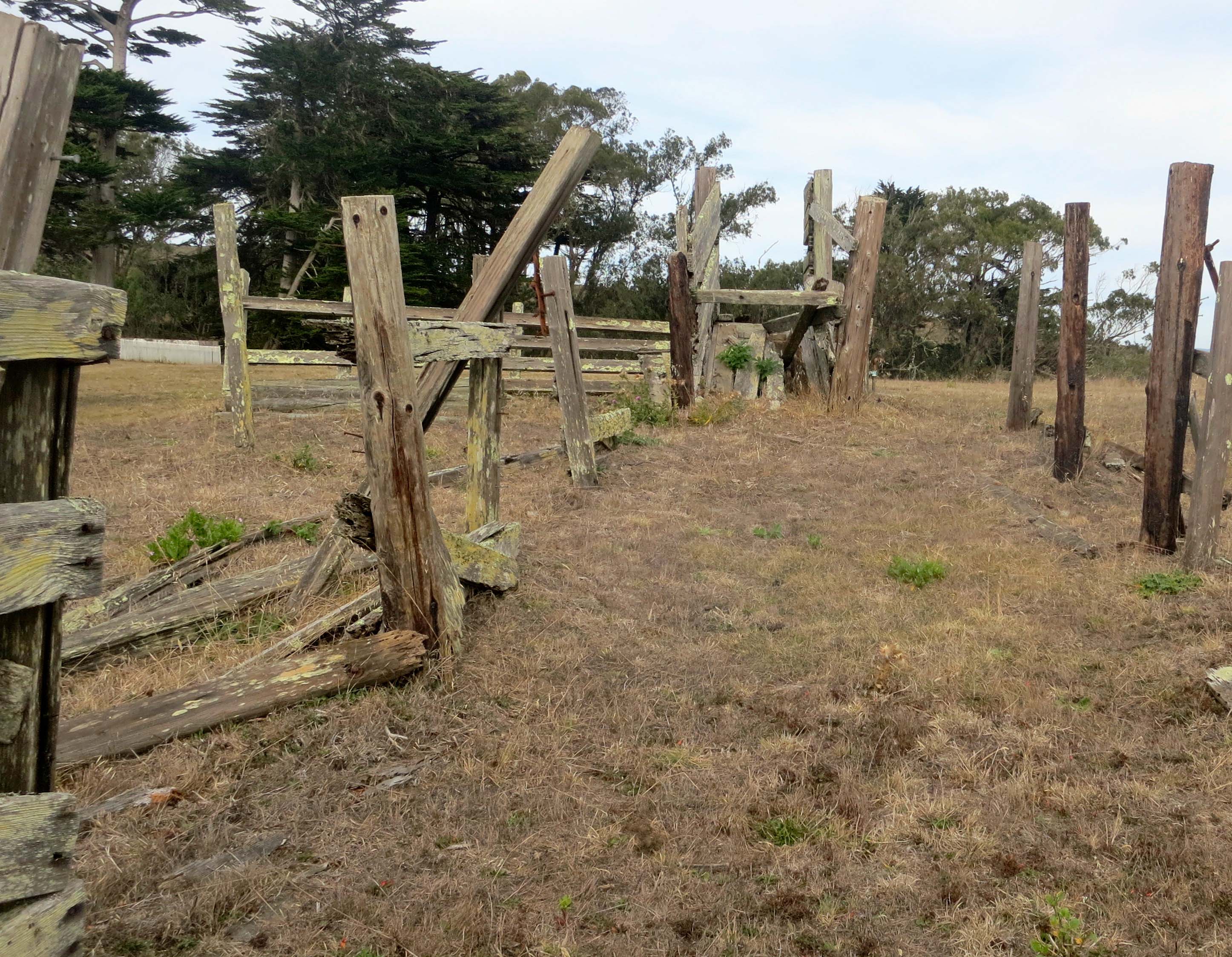
Once upon a time cattle would have been penned up within these fences, ready to be loaded on to trucks using the blocked ramp at the top of the photo.

Aging fence at Pierce Ranch, Pt. Reyes National Seashore. Photo by Curtis Mekemson.

A close up of the fence.

Bunk house at Pierce Ranch on Pt. Reyes National Seashore. Photo by Curtis Mekemson.

This small bunk house would have accommodated ranch hands. Up to 20 were employed at the height of milking season.

Photo of dairy house at Pierce Ranch, Pt. Reyes National Seashore by Curtis Mekemson.

This dairy house was where butter was prepared to be shipped off to San Francisco in large kegs. Butter from Pt. Reyes was considered to be very high quality and was sold in gourmet shops and used in the best restaurants.

Old farming equipment at Pierce Ranch on Pt. Reyes National Seashore. Photo by Curtis Mekemson.

What’s a farm without equipment? This piece had morphed into a planter.

Close up of old farm equipment at Pierce Ranch on Pt. Reyes National Seashore. Photo by Curtis Mekemson.

A close up.

Old soil tiller at Pierce Ranch, Pt. Reyes National Seashore. Photo by Curtis Mekemson.

This tiller also caught my attention.

Rusted gear and chain on soil tiller at Pierce Ranch, Pt. Reyes National Seashore. Photo by Curtis Mekemson.

Rusted gear teeth and chain on tiller.

Tule Elk grazing on a hill at the Tule Elk Preserve at Pt. Reyes National Seashore.

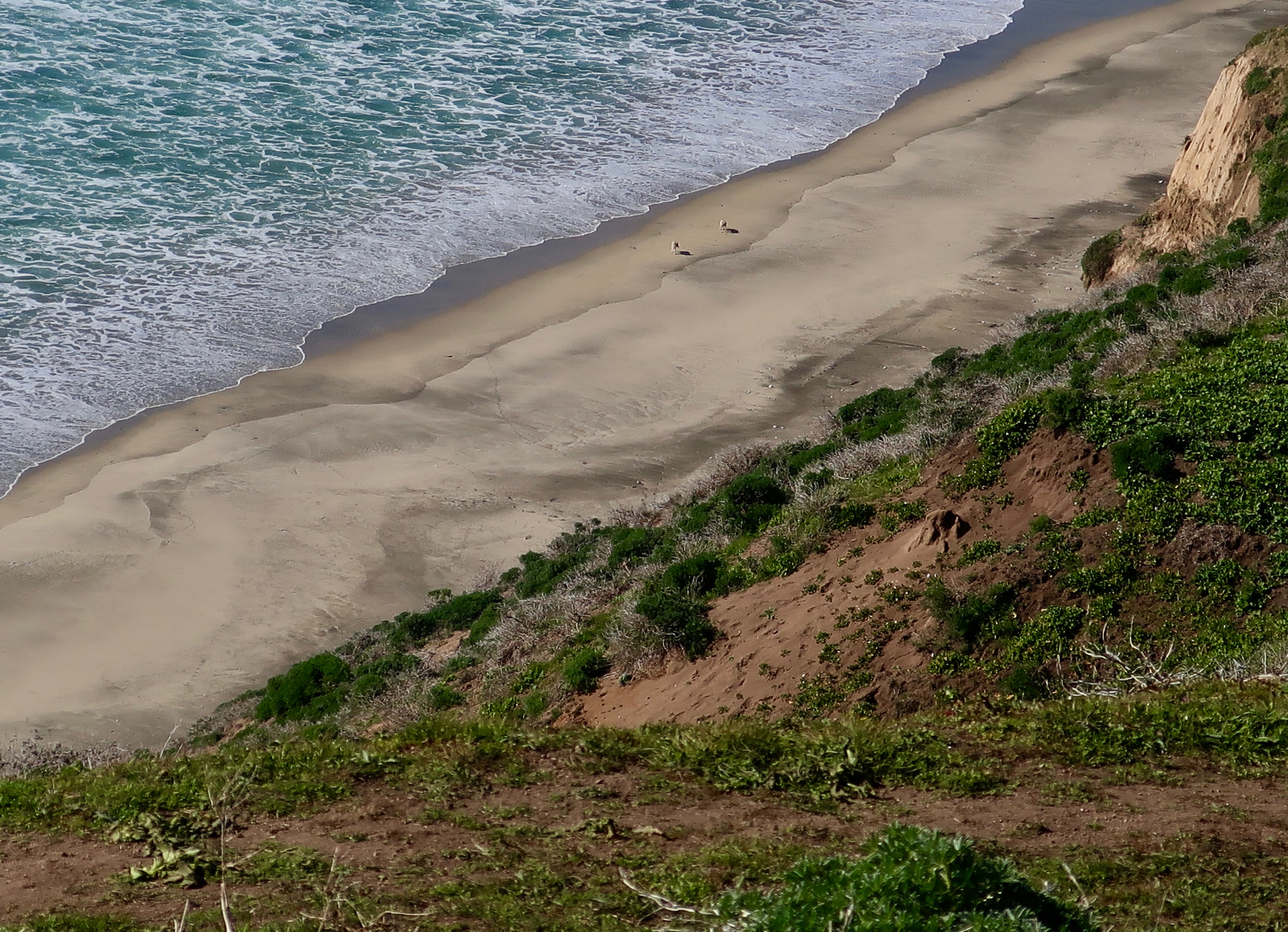
Having toured Pierce Ranch we climbed the hill next to the ranch in search of Tule Elk. We found them a long ways off. (Photo by Peggy Mekemson.)

Photo of bull Tule Elk at Pt. Reyes National Seashore Tule Elk Reserve. Photo by Curtis Mekemson.

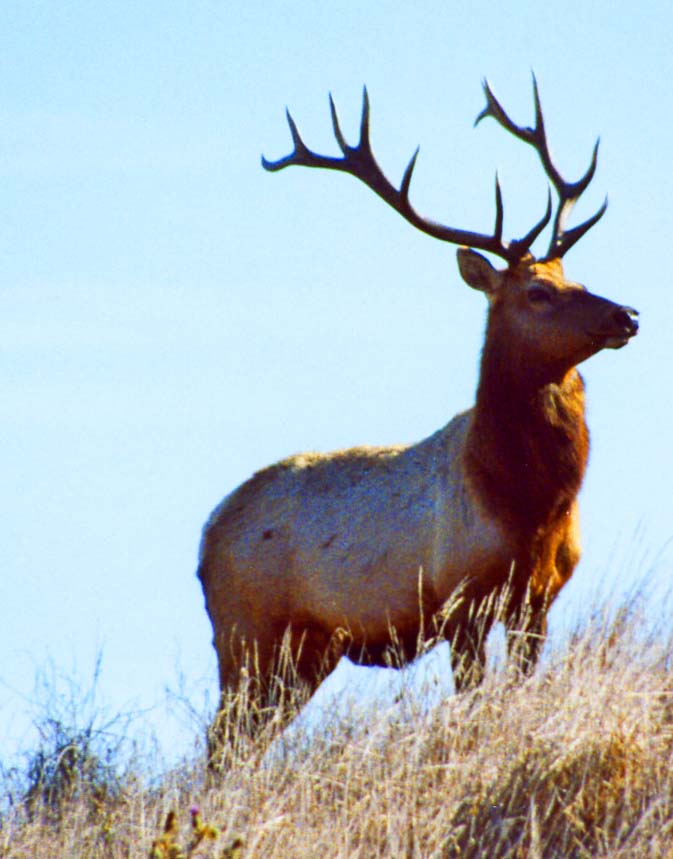
Here’s how one looked a little closer.

NEXT BLOG: North and South Beach where the Pacific Ocean crashes ashore. Here’s a final shot of the Tule Elk. One of the big guys had obviously taken an interest in me. I was hoping it wasn’t personal. –Curt

A pair of Tule Elk at Pt. Reyes National Seashore. Photo by Curtis Mekemson.

Limantour Beach: A Wild World… Pt. Reyes National Seashore

Shore, sea and sanderlings meet on Limantour Beach at Pt. Reyes National Seashore. (photo by Peggy Mekemson.)

Shore, sea and Sanderlings meet on Limantour Beach at Pt. Reyes National Seashore. (Photo by Peggy Mekemson.)

A steep ridge runs most of the length of Pt. Reyes National Seashore. The road to Limantour Beach is all business as it climbs up and over. Who needs switchbacks? A sign tells trailers to stay off. Our van Quivera has made the journey several times but always complains. Our friend Ken Lake’s truck laughed at the challenge.

The journey across provides an introduction to most of Pt. Reyes’ ecological zones.  Seeing a Kodak moment, I asked Ken to stop up on top. Fog and sun were battling with each over who would rule the day. Grass, brush, trees and canyons joined the drama. I searched the canyon for wildlife to add to my photo. Tule Elk and Black Tail Deer are commonly seen during the day, as are hawks and omnipresent buzzards. Nothing presented itself. All I found was some aging, hair-filled bobcat scat (poop) with a pile of fresh raccoon scat on top. I figured the raccoon was making a statement. I also figured that the scat didn’t need to be part of my photo. (“Good decision,” Peggy adds.)

Pt. Reyes photo along Limantour Road at Pt. Reyes national Seashore by Curtis Mekemson.

Sun and fog were part of the landscape in this photo I took from Limantour Road.

Pt. Reyes Natioanl Seashore photo by Curtis Mekemson.

Looking south from Limantour Road at where the deer and elk roam.

The road down to Limantour Beach is almost as steep as the road up and one section would scare a roller-coaster. Topping the last hill provides a broad view of Drake’s Bay, Limantour Beach and the Limantour Estero. A long narrow spit separates the Bay from the Estero. I suspect the view isn’t tremendously different from what Sir Francis Drake would have found when he sailed into the Bay in 1579, the first European to visit the area. Miwok Indians, who had called the region home for thousands of years, greeted the British explorer/noble/naval hero/pirate.

We parked the truck, crossed a walking bridge over the Limantour Estero, hiked down to the beach and walked north along the shore. Sea gulls, Sanderlings, crab shells, driftwood, animal tracks, sunning buzzards, gentle waves and distant vistas entertained us.

Bags provided for picking up trash on Limantour Beach at Pt. Reyes National Seashore. Photo by Curtis Mekemson

A great idea: The National Park Service provided bags so people could pick up trash as they walked along the beach. Ken immediately grabbed one and we all helped fill it. Note: Ken never lets anyone doubt his team loyalty.

Estero de Limantour at Pt. Reyes National Seashore. Photo by Curtis Mekemson.

A bridge provided a view up the Limantour Estero or estuary. Estuaries are where fresh and ocean water mix, creating a rich environment for fish and birds. The Pt. Reyes headlands in the distance offers a great vantage point for whale watching. It is also home to Pt. Reyes’ Elephant Seal population.

Elephant seal photo by Curtis Mekemson.

I love elephant seals. These magnificent creatures spend the majority of their lives at sea and 90% of that time under water. They travel thousands of miles annually and can dive up to 2000 feet deep. This photo came from a blog I did about the Elephant Seals of Piedras Blancas.

Photo of the Estero de Limantour at Pt. Reyes taken by Curtis Mekemson.

Another view of the Limantour Estero, this one from the spit that separates the Estero from Drake’s Bay.

Limantour Beach at Pt. Reyes National Seashore.

Looking north up Limantour Beach across Drakes Bay. Sir Francis Drake named the area Nova Albion, New England, probably because the sandstone cliffs reminded him of the Cliffs of Dover. (Photo by Peggy Mekemson.) The small mounds or sand dunes are created by plant matter.

Looking south on Limantour Beach at Pt. Reyes National Seashore. Photo by Curtis Mekemson.

A lone person walks south on Limantour Beach.

Sea gulls on Limantour Beach at Pt. Reyes National Seashore. Photo by Curtis Mekemson.

Sea gulls tend to walk away when you get near them. I was encouraging these guys to fly. The one nearest appeared ready to leap into action.

Sea gulls in flight on Limantour Beach at Pt. Reyes National Seashore. Photo by Curtis Mekemson.

I finally succeeded.  I like the way this photo captures the different wing action of gulls in flight.

Sanderlings on Limantour Beach at Pt. Reyes national Seashore.

Meanwhile, Peggy was off checking out the seemingly endless flock of Sanderlings. (Photo by Peggy Mekemson.)

Flock of flying Sanderlings at Limantour Beach, Pt. Reyes National Seashore.

Who also decided to fly. How do they avoid winging each other? (Photo by Peggy Mekemson.)

Buzzards drying out wings on Limantour Beach at Pt. Reyes National Seashore. Photo by Curtis Mekemson.

“Check out the buzzards,” Ken urged. A pair were perched on top of a pine tree drying out their wings from the morning’s fog in preparation for flight.

Buzzards dry wings at Pt. Reyes National Seashore.

Using her telephoto lens Peggy got up close. Note their heads. They are naked so buzzards can dip into dead treats without getting their feathers involved. Isn’t evolution grand? (Photo by Peggy Mekemson.)

Buzzards feathers gor awry on Limantour Beach.

As we approached one got excitable. I think you might say he was having a bad feather day. (Photo by Peggy Mekemson.)

Raccoons leave tracks on Limantour Beach, Pt. Reyes National Seashore. Photo by Curtis Mekemson.

While animals were hiding out for the day, their tracks were abundant. Here, a family of raccoons made their way back to their home on the spit. Peggy and Leslie followed the tracks to what they decided was their home hidden in the brush.

Crab claw showing teeth on Limantour Beach at Pt. Reyes National Seashore. Photo taken by Curtis Mekemson.

It’s possible that crab was on the menu that night for the raccoons. We found numerous empty shells along the beach. I liked the teeth in this claw.

Empty crab shell found on Limantour Beach at Pt. Reyes National Seashore. Photo taken by Curtis Mekemson.

Empty crab shell. Many other birds and animals join raccoons in feasting on the oceans offerings. I also found a set of fox tracks leading down to the beach.

These tracks represent a virtual freeway into the grass on the spit.

These tracks represent a virtual animal freeway between the sand of the shore and the protective grass and brush of the spit.

Photo by Curtis Mekemson of driftwood on Limantour Beach at Pt. Reyes National Seashore

The grain of the wood exposed by the relentless pounding of the ocean is what attracts me to driftwood. We found a prime example on the upper beach at Limantour. A tree had been driven upside-down into the ground and was showing off its roots. I was curious about whether man or nature had been responsible for the upending.

Close up photo of driftwood on Limantour Beach taken by Curtis Mekemson.

A close up of the driftwood with its marvelous twists and turns plus two peek-a-boo holes.

Photo of spit on Limantour Beach by Curtis Mekemson.

We walked back to the parking lot following a trail along the spit.

Photo of grass on Limantour Spit taken by Curtis Mekemson.

Much of the trail made its way through the thick golden grass that dominates the spit and provides a home for Limantour Beach’s wild world.

NEXT BLOG: It’s off to the historic Pierce Ranch and a search for Pt. Reyes’ magnificent Tule Elk. I’ll conclude today’s blog with a black and white photo of gentle waves lapping up on the Limantour Beach.

Gentle waves visit Limantour Beach at Pt. Reyes National Seashore. Photo by Curtis Mekemson.