What Do Burning Down a Bank and the Sierra Trek Have in Common? … The Sierra Trek: Part 2

Waterfall and pool on Five Lakes Creek in the Granite Chief Wilderness area behind Squaw Valley, California.

The Granite Chief Wilderness behind Squaw Valley, home of the 1960 Winter Olympics, is an area of rugged terrain and natural beauty. This pool on Five Lakes Creek was an open invitation for a dip on a hot summer day. (Photo by Peggy Mekemson.)


The vision part of being a visionary is always the easy part, as any visionary will tell you. It is the execution of the idea that separates the mouse from the moose. In my first blog on the Sierra Trek, I told how Steve Crowle and I had come up with the crazy idea of raising money for the non-profit I was executive director of by running a 9-day, 100-mile backpack trip in the Sierra Nevada Mountains of California. I had six weeks to plan and run the event. It would have been a major undertaking even if I had six months!

A note on photos: I didn’t take any pictures during the first Sierra Trek. It was before I became interested in photography, plus I had my hands full shepherding 63 people across the mountains— as you will learn. The photos in this blog and in the rest of the series were taken on later Treks and on personal trips in the Sierra’s and other California mountain ranges where we trekked. They will give you an idea of why I fell in love with backpacking and the Sierras. 


My first challenge on the trek was selling it to Board of Directors. Running a backpack trip as a fundraiser was a huge leap from sending out Christmas seals. At 29, I was close to the youngest Lung Association Executive Director in the nation in 1974 and I had already ruffled some feathers. A research doctor from UC Davis was foaming at the mouth because I wanted our organization to focus on prevention programs as opposed to medical research. What would he think of me running off to the woods on a backpack trip?

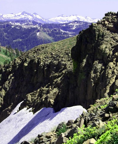
Leading a group of people through rugged terrain for long distances was a bit more scary than sending out Christmas Seals. Here we are looking south from the Granite Chief Wilderness to the Desolation Wilderness, a route we followed several times on the Sierra Trek.

Leading a group of people through rugged terrain for long distances was a bit more scary than sending out Christmas Seals. Here we are looking south from the Granite Chief Wilderness to the Desolation Wilderness, a route we followed several times on the Sierra Trek. Snow would often be a challenge on our adventures.

“You want to do what?” with a decided emphasis on the first and fifth words is the best way I can describe the Board’s reaction to my proposal. It was easy to translate: “Why would a 29-year-old executive director with less than a year of experience under his belt, want to risk his career on such a harebrained idea?”

I echoed wild Steve, “Why not?”

Actually I had a great Board. Once the members were convinced that this was something I really, really wanted to do, their final response was “OK, go for it!” I called Steve immediately. I had a wide range of responsibilities ranging from administration to program to fundraising. I would have a limited amount of time to devote to the project and I didn’t know anyone else who was crazy enough to take on the challenge.

I had originally talked Steve into replacing me as Executive Director of Sacramento’s Ecology Information Center with a sales pitch that included, “Look, I have this great job where you work 60 hour weeks, have a Board that likes to scream at each other, and has a starting salary of $200 per month. Are you interested?” Minus a screaming Board of Directors, organizing the Trek wouldn’t be all that different.

Steve had a bright, curious mind and was knowledgeable on environmental issues. He also seemed to have unlimited energy and was built like a bear. It had served his well as Executive Director of EIC. In addition to overseeing the Center’s ongoing projects, he had immediately set out to develop a community garden downtown. Initially known as the terra firma Garden and later as the Ron Mandela Garden, it would provide inner city residents with a touch of nature for over 30 years— all the way until the State of California decided to grow buildings on the site.

The downside about Steve was that he existed on the edge. I later learned that one of his friends who he recruited to volunteer on the Trek frequently flew to Columbia and returned with his cargo holds filled with pot. Steve was a ‘person of interest’ to the FBI.

A year after the Trek, Steve called me and told me that the FBI had showed up on his doorstep. My immediate thought was that they had tied Steve to the Colombia operation or that some of the terra firma/Mandela gardeners were growing marijuana. Steve’s concern was that his radical youth was catching up with him. He had been a little too close to the fire when the Bank of America had been burned down in Santa Barbara in 1970 as a protest against the Vietnam War. “And what were you doing with those matches?” Mr. Crowle. (Steve told me the Santa Barbara story a few years ago before he passed away.)

Actually, the FBI had bigger fish to fry. Apparently one of his gardeners had gone from farming her plot to plotting an assassination. Young Lynette Fromme grew up in Southern California where she was a star performer in a children’s dance group, performing at such venues as the Lawrence Welk Show and the Whitehouse.

At 19, a strong disagreement with her dad sent her scurrying off to Venice Beach where she found comfort from an older man, Charles Manson. She soon found herself one of Manson’s clan, taking care of an aging George Spahn at his ranch where the ‘family’ hung out. It was Spahn who gave Lynette her nickname “Squeaky,” because, as legend has it, she squeaked each time he tried to grope her.

Squeaky missed out on the murderous rampage the family undertook in 1969 killing Sharon Tate among others, but she remained intensely loyal to Charles, defending him to the press and anyone else who would listen. After Manson’s conviction and sentence to a lifetime in prison, she moved to Stockton where two of the people she was living with, James and Lauren Willett, mysteriously ended up dead.

Abandoning Stockton, Squeaky moved to Sacramento and rented an apartment with another Manson groupie, Sandra Good. The two of them adopted a new life style and persona as ‘nuns’ in Manson’s latest crusade, saving the earth. Manson even gave them new names with Squeaky becoming ‘Red’ and Sandra becoming ‘Blue.’ It was with her new name, persona, and purpose that Squeaky took up gardening at the Mandela Garden. Steve knew her, of course (she liked his intense eyes), but knew nothing about her background.

It was with her new purpose of ‘saving the earth’ that she left her apartment on the fateful morning of September 5, 1975 and strolled over to Capitol Park where she got within a few steps of the visiting President Gerald Ford before pointing her Colt 45 at him, creating immediate pandemonium. She later claimed she was “just trying to get the President’s attention.” She did. Three months later she found herself convicted of an attempted assassination and in prison.

As for Steve, he informed the FBI that he didn’t have a clue as to who Fromme was or what she was up to other than being a gardener. Like Pangloss, he went back to cultivating his garden.

But all of this was in the future. My phone call to Steve went something like the following:

“How would you like to go backpacking and get paid for it?” I asked.

“Give me a hard question,” Steve responded.

“Are you willing to work for two dollars an hour?” I casually threw in as fine print.

“That,” he replied, “is the question.”

I went on to explain that while the Board members had approved of the concept, they weren’t particularly enthusiastic about spending large sums of money to see if it worked. I could just barely squeeze out the minimum wage of the day for two months to see if we could pull it off. Steve, after ample groaning, allowed that it would supplement what he was earning at the Center and took the job.

My next responsibility was to come up with a name. While thinking of backpacking 100 miles in nine days the word trek popped in to my mind. So I looked it up in the dictionary. “A long, arduous journey” was the definition. That seemed appropriate, and since we were doing our long, arduous journey through the Sierra Nevada Mountain range, I decided to call it the Sierra Trek.

Where to go posed a more serious challenge. I came up with three criteria: one, it had to be 100 miles long; two, it needed be in our territory; and three, the trail should be easy to follow. The hundred miles was a given, and ‘being in our territory’ seemed feasible since several of ALASET’s (the American Lung Association of Sacramento-Emigrant Trails) nine counties encompassed a significant portion of the Northern Sierra.

The clinker in our selection process was the ‘easy to follow.’ I had nightmares of having Sierra Trekkers lost all over the mountains with Steve and me scrambling to find them. We’d be lucky if we could avoid becoming lost. Serendipity stepped in and helped out. I was reading the Sacramento Bee when I came across our solution.

The horse people were planning their annual 100-mile horse race across the Sierra Nevada, the Tevis Cup Race. The event started in Squaw Valley and ended in Auburn. Horses had to follow substantial trails, I reasoned. Squaw Valley had been the sight of the 1960 Winter Olympics and would provide an internationally known resort to kick off our event.

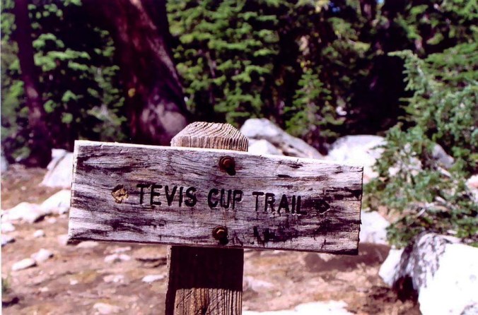
A trail sign for the Tevis Cup Trail behind Squaw Valley, California.

A trail sign marking the Tevis Cup horse race. The same route is now used for a 100-mile ultra marathon run across the mountains.

Auburn was one of the main foothill communities in the Association’s territory and would make an ideal ending place. The trail had the added advantage of being an early trail used by pioneers. We could use the historical angle and tie in with our name. My major concern was following a trail filled with horse poop.

Steve made contact with the woman in Auburn who was organizing the Tevis Cup Race. “Yes, the trail is easy to follow.” They marked it with yellow ribbons and the ribbons would still be up for our Trek. As for my concern about horse manure, “There should be plenty of time between the race and your trek for the manure to dry out.”

“Fine,” I said to Steve when he reported back, “our Trekkers will be shuffling down trails in dry horse shit up to there ankles.” On the other hand, I thought, we can tell them to follow the horse droppings if the ribbons run out. The important thing was we had a route and could begin publicizing the event. Steve and I agreed to preview the route in advance of the Trek to pin down campsites and reduce the possibility of nasty surprises.

So now, we had a route and a name. It was time to recruit participants, obtain food, and preview the route— all of which I will include in my next blog, where I will also learn a very valuable lesson from a 70-year old.

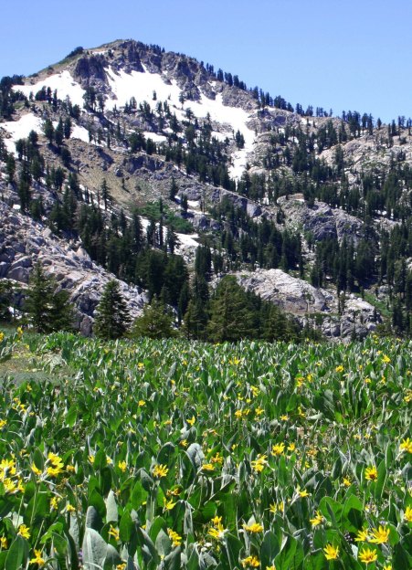
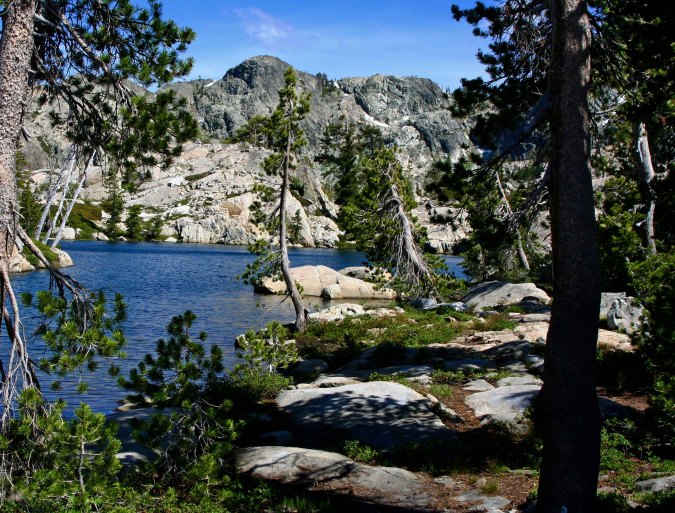
The Granite Chief Wilderness in the Sierra Nevada Mountains north of Lake Tahoe.

One of my favorite Granite Chief Wilderness views. Lake Tahoe, Squaw Valley, and Alpine Meadows are on the other side of the mountain. The flowers are called Mule Ears. (Photo by Peggy Mekemson.)

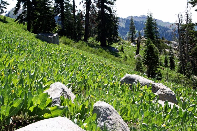
Another field of mule ears in Granite Chief.

Another field of mule ears in Granite Chief. The trail wound its way through here.

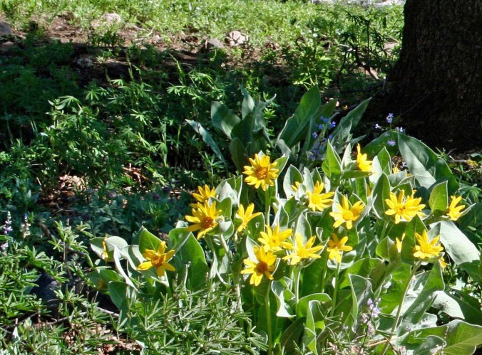
A close up of the Mule Ears blooming. There are few places in the Sierra's that can match the display of flowers in the Granite Chief Wilderness,

A close up of the Mule Ears blooming. There are few places in the Sierra’s that can match the display of flowers in the Granite Chief Wilderness.

Washington Lilies found in the Granite Chief Wilderness area behind Squaw Valley.

These Washington Lilies are found on the trail as it makes its way through the Granite Chief Wilderness down toward Five Lakes Creek.

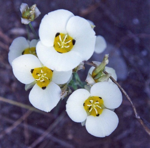
Mariposa Lilies found in dry areas behind Squaw Valley.

As are these Mariposa Lilies…

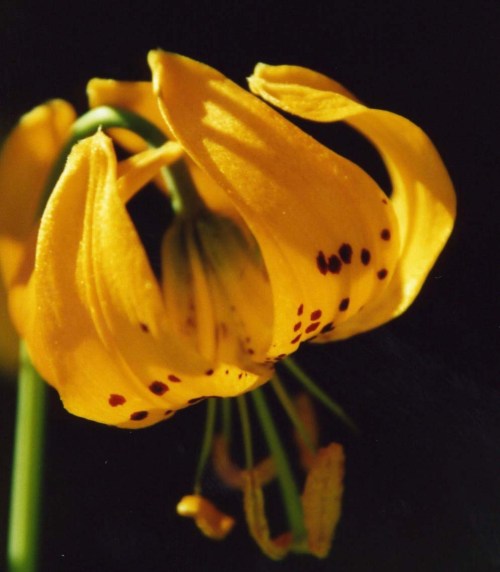
And Tiger Lilies.

Tiger Lilies.

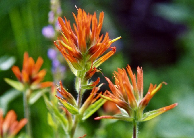
Indian Paint Brush found in Granite Chief Wilderness behind Squaw Valley, California.

And Indian Paint Brush.

Lichens add color along the trail as well.

Lichens add color along the trail as well.

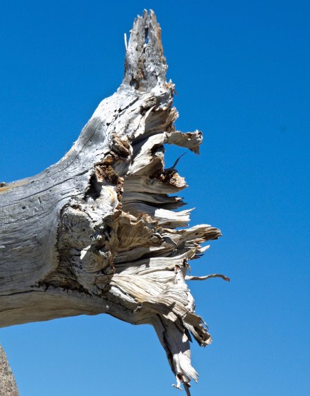
Snag found in the Granite Chief Wilderness north west of Lake Tahoe, California.

This old snag provided a different type of photo-op…

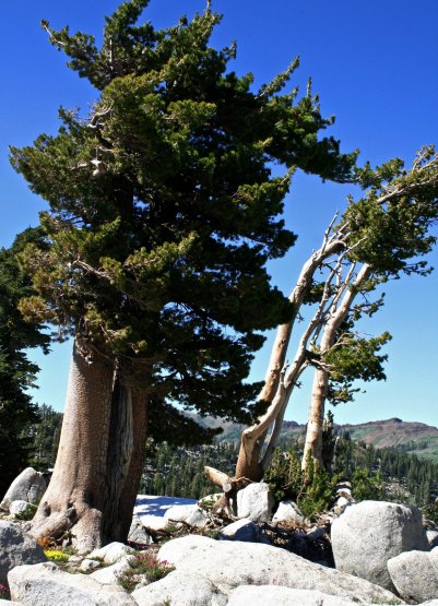
Lodge Pole Pines found in the Granite Chief Wilderness of the Sierra Nevada Mountains.

As did these weathered Lodge Pole Pines.

Little Needle Lake in the Granite Chief Wilderness.

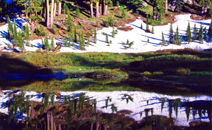
Little Needle Lake is a short three-mile hike from the top of Squaw Valley. I enjoyed the reflection here. At night there is an amazing chorus of frogs. I’ve often camped beside the lake.

Five Lakes Creek in the Granite Chief Wilderness area behind Alpine Meadows ski area.

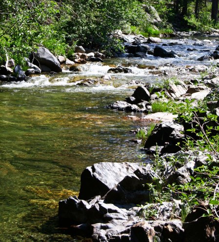
Five Lakes Creek flows along quietly here and provides and invitation to cool off in the middle of summer. Earlier it can be roaring with snow melt and icy water.

Peggy provides an example of how the creek should be enjoyed on a hot August afternoon.

Peggy provides an example of how the creek should be enjoyed on a hot August afternoon.

Canny on Five Lakes Creek near Diamond Crossing in the Granite Chief Wilderness.

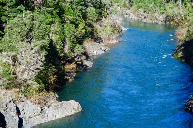
The final photo of the day. Five Lakes Creek drops into a canyon a few miles below where Peggy enjoyed her cooling off. The top photo on this post provide a closeup. I often camped Treks at Diamond Crossing near here. (Photo by Peggy Mekemson.)


Sunset Bay: A Hidden Treasure on the Oregon Coast… The North Coast Series

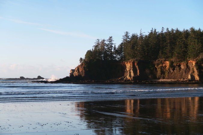
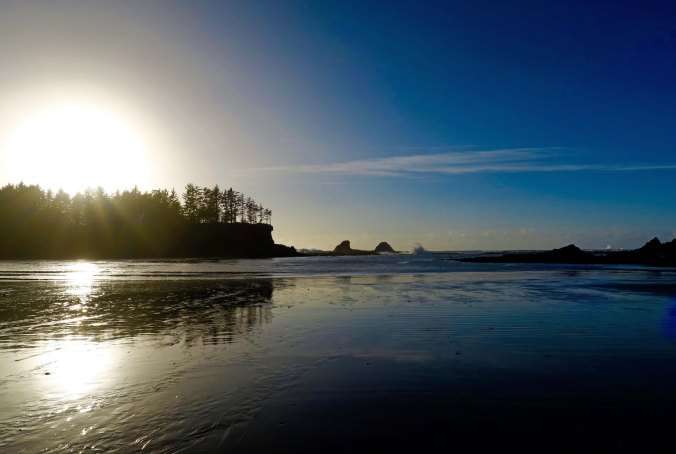
The setting sun illuminates the cliffs surrounding Sunset Bay, giving support to its name.

The setting sun lights up the cliffs surrounding Sunset Bay, providing support for the bay’s name.

The Oregon Coast is world-renowned for its combination of hidden coves, towering cliffs and crashing waves. Peggy and I are fortunate to live only a couple of hours away from this beauty and have resolved to spend much more time exploring the coastline in 2017. It should be one resolution that is easy to keep.

The Oregon Coast is noted for its crashing waves such as these at Sunset Bay near Coos bay, Oregon.

Towering Pacific Ocean waves crash on rocks just outside of Sunset Bay.

I called and made reservations to stay at Sunset Bay State Park on the Oregon Coast in November. Normally I wouldn’t bother with reservations during late fall, but the Christmas light show at nearby Shore Acres Park attracts up to 50,000 people annually. Odds were that a number of them would be staying at the campground.

I needn’t have worried. The park was under two feet of water when I called. A high tide had joined forces with a flooding stream. The park reservation company in California had happily collected its seven-dollar reservation fee and failed to fill us in on the little detail that we might need a boat to get to our campsite.

Peggy and I already had that experience. We had camped in our small RV at a private campground near Mendocino a few years ago and woke up to discover a seagull floating by our window. Water was lapping at our doorstep. We had departed quicker than a jack rabbit on steroids, not even stopping to pay our campground fee. They probably would have charged extra for the seagull. Besides, a warning in the night that the area was flooding would have been appreciated.

Fortunately we lucked out at Sunset Bay. We weren’t even aware of the flood until we arrived and the water had already receded. Apparently we had missed the flood by a day and a gang of prisoners had swept through the campground and cleaned up the debris. Other than the campground host, we pretty much had the area to ourselves.

Sunset Bay is a hidden jewel, snuggled in along the coast near Coos Bay. It is part of a 6000-feet thick geological formation known as the Coaledo Formation after the coal deposits found in the area. For a while, starting in the 1850s, coal mining was a major industry in the area. By 1904 there were some 40 active mines. The coal was used primarily for running steam locomotives. The appearance of diesel engines in the 1920s had reduced the demand for the Coos Bay coal, however, and the last coal mine was shut down in 1940.

Coal fired steam locomotives are mainly a footnote in history now, but Peggy and I ended up on a train being pulled by one just before Christmas. Our son Tony and his wife Cammie had purchased tickets for the family to travel on the Polar Express out of Essex, Connecticut. We arrived just about dark and the locomotive was warming up to leave. Manny Mistletoe entertained us on our way to the ‘North Pole’ where Mr. and Mrs. Clause greeted us and entertained our grandsons who were appropriately decked out in their pajamas. Hot chocolate was served.

Steam train rides are featured throughout the year in Essex, Connecticut.

The ‘Polar Express’ locomotive of Essex, Connecticut prepares to leave the station on its journey to the ‘North Pole.’

The sedimentary rocks of the Coaledo Formation, laid down in layers over millions of years, have been tilted steeply upward by the crashing Pacific and North American tectonic plates. Varying levels of hardness found among the sedimentary rocks have allowed for different levels of erosion and account for the interesting land formations found at Sunset Bay. I am going to do two posts on our visit. Today’s photos are focused on looking out toward the ocean. On Friday I will do a photographic essay on the fun things we found along the shoreline. (Wednesday’s blog returns to the Sierra Trek.)

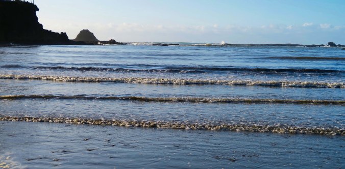
Low tide at Sunset Bay on the Oregon Coast near Coos Bay.

Looking out toward the Pacific Ocean at low tide from the beach at Sunset Bay.

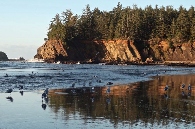
Seagulls and sunset at Sunset Bay near Coos Bay on the Oregon Coast.

Seagulls take advantage of the low tide to search for dinner.

A November sunset at Sunset Bay.

Shooting toward the sun provided this view. The sun is more centered on the bay during the summer months.

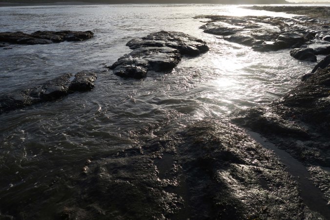
Tide pools at Sunset Bay in Oregon near Coos bay lit up by the sun at sunset.

I also liked the ‘black and white’ feel the sunset provided with these tide pools.

Early morning at Sunset Bay on the Oregon Coast near Coos Bay, Oregon.

Early morning light the next day and high tide provided a totally different scene at Sunset Bay.

Sun lights up small waves at Sunset Bay on the Oregon Coast near Coos Bay.

I liked the way the sun lit up these wavelets.

Backlit wave crashes over rock at Sunset bay near Coos Bay, Oregon.

And how it lit this wave as it crashed over a rock just outside of the Bay.

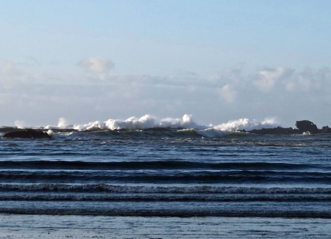
Waves crashing over rocks outside of Sunset Bay near Coos Bay, Oregon.

And a final view of the restless Pacific Ocean outside of Sunset Bay.

WEDNESDAY’S  BLOG: Part 2 of the Sierra Trek, a nine-day hundred mile backpack trip across the Sierra Nevada Mountain Range.

FRIDAY’S BLOG: The wrap up on Sunset Bay… a photographic essay.


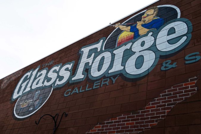
The Glass Forge of Grants Pass… From the Sublime to the Wacky

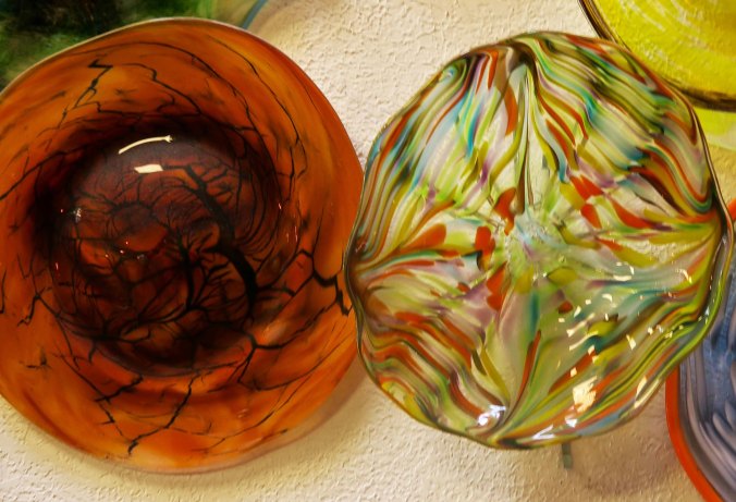
Two bowls from the Glass Forge of Grants Pass Oregon.

The Glass Forge of Grants Pass creates a wide range of glass art ranging from the sublime to the wacky. I loved the tree like pattern in the left bowl.

Red lipped blue fish produced at the Glass Forge in Grants Pass, Oregon.

How can you not fall for a blue fish with red lips. While the artists of the Glass Forge produce much traditional glass art, they also have a wonderful sense of humor.

It’s Friday, so this is my day to produce a photographic essay for my blog. My choice for today is the Glass Forge in Grants Pass, Oregon. Peggy and I visited the studio on one of our Wednesday Date Days in November. (We’ve been having Wednesday Date Days for 27 years!) When we arrived the staff was working on glass art for the Lodge at Yosemite.

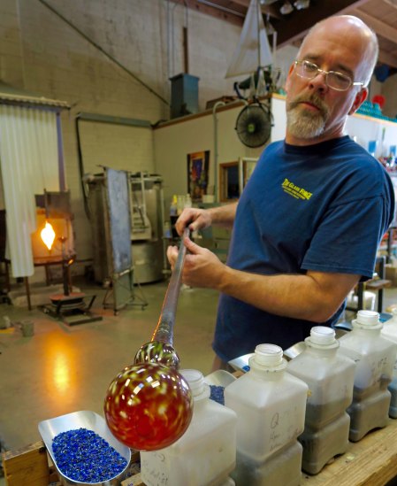
The Glass Forge of Grants Pass, Oregon was founded by Lee Wassink, shown above creating a vase.

One of the neat things about the Glass Forge is that you are encouraged to watch the artists at work. In this photo, Lee Wassink, founder of the Glass Forge, demonstrates the creation of a vase.

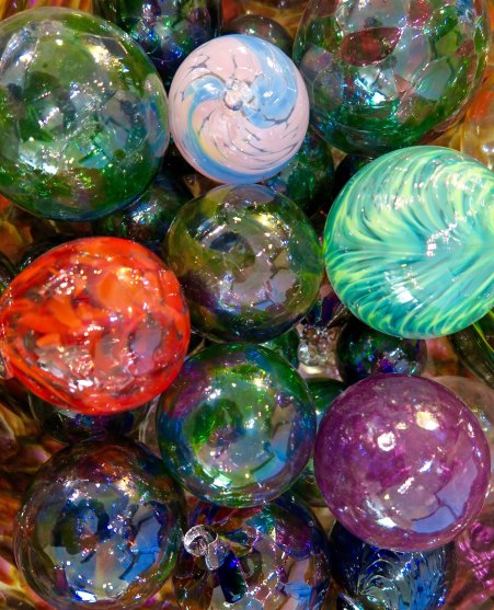
Groups and individuals have an opportunity to attend a workshop and create simple glass work of their own, such as these Christmas ornament.

Groups and individuals have an opportunity to attend a workshop and create simple glass work of their own, such as these Christmas ornaments.

Vase found at the Glass Forge in Grants Pass, Oregon.

The studio provides an opportunity to peruse the wide variety of glass art available, such as this vase. As I posted this photo I notice a slight reflection of myself, a selfie.

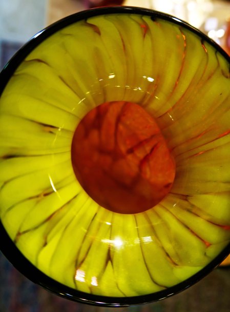
Looking down into a vase at the Glass Forge Studio in Grants Pass Oregon.

I always like looking down into glass art for a different perspective, as in this vase…

Looking at the patterns inside a glass bowl at the Glass Forge in Grants Pass, Oregon.

And this bowl. I am amazed at the patterns, variety and beauty created.

Humorous mugs created by the artists working at the Glass Forge in Grants Pass, Oregon.

I really like weird and wacky. These mugs certainly qualify!

Glass fish with character at Glass Forge in Grants Pass, Oregon.

And here’s another fish.

Variety of bowls displayed at the Glass Forge in Grant's Pass, Oregon.

This collection of bowls demonstrated the variety available.

A tall, graceful vase at the Glass Forge in Grants Pass, Oregon.

One of several tall, graceful vases.

Glass paperweights available for purchase at the Glass Forge in Grants Pass Oregon.

Someday, I am going to return to the Glass Forge to find out how these paper weights are created.

We were able to watch a vase being made. The furnaces used to melting the glass are over 2000 degrees F (1100 degrees C).

We were able to watch a vase being made. The furnaces used to melt the glass are over 2000 degrees F (1100 degrees C).

Furnaces for heating glass at Glass Forge in Grants Pass, Oregon.

A bubble is blown into the glass. Layers are added by returning to the furnace for more glass. The larger the piece, the more returns.

Bins that hold colored glass to add color to glass art created at the Glass Forge in Grants Pass, Oregon.

These bins hold colored glass that will be added to the various pieces.

The following series of photos follow the artists as they work together to finish a vase:

Color has been added to a vase at the Glass Forge in Grants Pass, Oregon.

Check out the gorgeous color!

Top is added to vase at Glass Forge in Grants Pass, Oregon.

A bottom is added.

Shaping a top on a vase at the Glass Forge in Grants Pass, Oregon.

And shaped.

A close to finished vase at the Glass Forge, Grants Pass, Oregon.

The finished product.

If you are driving up or down Interstate 5 in Southern Oregon or live in the area, I highly recommend stopping off at the Glass Forge in Grants Pass.

If you are driving up or down Interstate 5 in Southern Oregon or live in the area, I highly recommend stopping off at the Glass Forge in Grants Pass.

Glass Genie created at the Glass Forge in Grants Pass, Oregon.

I’ll conclude my Friday photographic essay today with this marvelous glass genie.

MONDAY’S BLOG: We will return to the Oregon Coast and visit the scenic Sunset Bay.

WEDNESDAY’S BLOG: Part 2 of my Sierra Trek series. I have to persuade a reluctant Board of Directors (“You want to do what?”), decide on a name, hire Steve, and determine our route.

FRIDAY’s BLOG: California mountain wildflowers.


A Far Out Excuse for Escaping to the Woods… The Sierra Trek Series: Part 1

The Black Buttes of the Sierra Nevada Mountains are lit up by the evening sun.

Inspired by the beauty of the Five Lakes Basin found north of Interstate 80 in the Sierra Nevada Mountains of California, I started a lifetime of backpacking in 1969.


At Five Lakes Basin’s/ Biggest little lake /after all day scrambling on the peaks/ a naked bug /with a white body and brown hair/ dives in the water/ Splash! — Gary Snyder

As I think about backpacking 500 miles this summer, my mind wanders back in time to the first major backpacking trip I ever made: a nine-day, 100 mile trek across the Sierra Nevada Mountain Range. The trip in itself would have been a bit crazy considering my lack of experience. But I ended up leading 60 people aged 11 to 70, most with less experience than I had. It was a new definition of insanity. I was lucky the participants didn’t leave me hanging in a tree somewhere along the trail. It came close.

It’s a good story, one that I’ve been planning to tell for a long time. My Wednesday blog will be devoted to it over the next couple of months. So grab whatever you like to drink, sit back, and join me on the first Sierra Trek.


During the early summer of 1974 my life took a dramatic shift. My first wife Jo Ann, friend Steve Crowle, and I used a long summer weekend to go backpacking into one of my all-time favorite backcountry destinations, the Five Lakes Basin north of Interstate 80 in the Sierra Nevada Mountains. It’s a beautiful area with towering granite cliffs and jewel-like lakes that had been carved out by glaciers some 20,000 years ago. It’s also a favorite area of the Pulitzer Prize winning poet, Gary Snyder, whose haiku poem on the area is featured at the top of this post.

Gary Snyders Haiku poem "Old Pond" was based on the Five Lakes Basin.

The Black Buttes looming above the Five Lakes are where the poet Gary Snyder went ‘scrambling.’

My first backpacking trip ever had taken me into the region in 1969 and I had returned again and again, sometime with Jo, sometimes with friends, and occasionally by myself. On one of the latter trips, I had taken my Basset Hound Socrates and camped out on a small lake that is somewhat hidden from the other lakes. I’ve blogged about the Socrates trip. Here’s what I wrote:

One of the five Lakes in the Five Lakes Basin north of Interstate 80 in the Sierra Nevada Mountains.

This is the lake where Socrates and I camped and where the Sierra Trek was born. This photo also shows how granite dominates the Sierra Nevada Mountains.
Sharing the lake with Soc was close to being totally alone. His concept of a quality wilderness experience was disappearing into the woods and seeing how many holes he could dig. He never seemed to catch anything, so I am not sure of his motivation. I’d get up in the morning and cover his handiwork. I almost felt like I needed to file an environmental impact report. He always limped home on sore feet.

On this particular journey, I packed the Carlos Castaneda book that features things that go bump in the night. Don Juan takes Carlos out into the middle of the Sonoran Desert on a pitch-black night and abandons him. Not long afterwards, the monsters come hunting. It wasn’t the best book for a solo night in the woods. As I read into the evening, I found myself paying more attention than usual to wilderness sounds.

I ingested a little medicinal herb to lighten things up. It was the 70s, after all. Bad idea; instant paranoia set in. Soon I could hear the wind stalking me through the treetops. An old snag turned into a ghoul. Off in the distance something big and ugly was digging and snorting. Socrates, I hoped.

This tree turned into the ghoul as the sun set and night approached.

This Jeffrey Pine turned into the ghoul as the sun set and night approached.

Ghost tree in the Five Lakes Basin of the Sierra Nevada Mountains.

A close up of the dead ghoul tree.

“Here Soc,” I called. “Come here boy.”

The digging continued and grew more desperate.

“Come here!” I yelled. Still no response but now I could hear large claws scratching at granite.

“Does someone want a Milk Bone?” I added in a quiet, conversational voice.

The digging stopped. ‘Someone’ started coming through the brush toward me. Whatever it was, it was apparently interested in Milk Bones. Soc’s head, long body and wagging tail made their way into the firelight. He might love digging, but he loved food more. There was the reason why our low-slung pooch weighed 70 pounds.

“Good boy,” I said while digging out a Milk Bone. I knew I was buying companionship but it seemed like a good idea on this strange, dark night. Meanwhile, Socrates had started to drool in expectation. Soon he was shaking his head and shooting dog slobber off in a dozen directions. I ducked to avoid being slimed.

Unfortunately, my supply of Milk Bones was limited. I tied Soc up to assure his faithfulness. It was time for bed. I put the fire out and was greeted by a moonless, dark night. But hey, who needed the moon when I had my faithful companion and a million stars. I invited Socrates to snuggle up on my sleeping bag and laid my head down on the coat I was using for a pillow.

CRUNCH, CRUNCH, CRUNCH!

“Damn! What’s that?” I sat up straight and grabbed for my flashlight. Socrates joined in by barking at my sleeping bag.

“No, Soc, out there,” I urged and pointed the flashlight off into the woods. Soc glanced up at me with a curious ‘what are you talking about’ look and started barking at my pillow.

“Look Socrates,” I pleaded, “just pretend there is a garbage man out in the woods.”

Soc had never met a garbage man he could resist barking at and I wanted his teeth pointed in the right direction.  What Soc did with my advice was make three dog circles and plop down on my bag. I gave up and reluctantly laid my head back down on my pillow.

CRUNCH, CRUNCH, CRUNCH!

I sat straight up again. Soc growled at me for disturbing his rest and started barking at my sleeping bag again.

“Fine watch dog you are,” I growled right back at him while straining my ears for the smallest of sounds. When Soc shut up, I was rewarded with a faint ‘crunch, crunch, crunch.’ It was coming from under the sleeping bag. I had a proverbial monster under my bed! Gradually it dawned on me that what I was hearing was a gopher tunneling his way through the ground, innocently on his way to some succulent root. I put my head down on my pillow. Sure enough, the ‘crunch’ became a ‘CRUNCH.’

The ground and the mystic weed were magnifying the sound. Soc had been right all along. I was lucky that he only barked at my sleeping bag and hadn’t started digging.

Don Juan would have appreciated how I had been tricked. Reality isn’t always what it seems.

Jo Ann, Steve and I had ended up camping on the same lake. Steve had replaced me as Executive Director of Sacramento’s Ecology Information Center when I had become Assistant Director of the American Lung Association of Sacramento. In addition to his boundless energy and intelligence, he was more than a little on the wild side. He had hobbies like jumping off high bridges into shallow water and experimenting with various mind-altering drugs. But mainly he loved life and had a vast appetite for new experiences.

One such experience was backpacking. We were lazing around our campfire on the last night bemoaning the fact that we had to return to civilization and jobs the next day.

“God, wouldn’t it be great if we could make money doing this,” Steve sighed.

Suddenly my mind took one of its intuitive leaps where the lights come on, the bells go off and four and twenty blackbirds sing the Hallelujah Chorus.

“We can, Steve!” I managed to get out as my thoughts played hopscotch. “Look, as Executive Director one of my main responsibilities is fund-raising.” (That spring, I had become Executive Director of the Lung Association.)

I was painfully aware my money-raising responsibilities. TB/Lung Associations had spent 70 happy years sending out Christmas Seals and waiting for the money to roll in. While the Golden Goose wasn’t dead, it was ailing. We had conquered TB and selling lungs wasn’t nearly as easy. Easter Seals had kids, the Heart Association the most appealing organ in the body, and the Cancer Society the scariest word in the dictionary. We had emphysema, bronchitis, asthma, the remnants of TB and diseases with unpronounceable names such as coccidioidomycosis. Adding injury to insult, dozens of non-profit organizations had added seals to their fund-raising arsenals. Competition for bucks to do-good was tough and the well was running dry.

“What if,” I pondered out loud, “we ran a backpack trip through the mountains as a type of multi-day walk-a-thon with people raising money for each mile they hiked?” I liked walk-a-thons. They involved people in healthy activities as well as raising money. They gave something back to the participants.

Steve’s attention jumped from low watt to high intensity. “When? Where? For how many miles and days? How can I be involved?” The questions tumbled out.

“I don’t know, I don’t know and I don’t know,” I responded, laughing at his enthusiasm although mine was hardly less. “But,” I added, throwing out some crazy figures, “what if we made it for nine days and 100 miles?”

That quieted us down. Neither of us had ever backpacked for nine days straight, much less 100 miles. A long trip for me had been six days and 30 miles. I threw out the nine days because it included a full week with both weekends and the 100 miles because it sounded impressive.

“Why not,” Steve had finally said with more than a little awe in his voice as a new national fund-raising program was born. It was a program that would occupy much of my time over the next 30 years, involve thousands of people, and raise substantial funds for the American Lung Association. But all of that was in the future; Steve and I just wanted an excuse to go backpacking.

Here are a few photos from the Five Lakes Basin:

Beautiful flowers such as this Mariposa Lilly...

In the summer, the Basin is filled with beautiful flowers such as this Mariposa Lilly…

Penstemon...

Penstemon…

And a butter cup.

And Cinquefoil.

Snag in the Five Lakes Basin .

Both live and dead trees decorate the landscape.

It was in the Five Lakes Basin

This impressive stump was located about 50 yards from camp.

In addition to their beauty, the lakes make great swimming holes and provide opportunities to add trout to dinner.

In addition to their beauty, the lakes make great swimming holes and provide opportunities to add trout to dinner. This was a view from my campsite.

Fun lakes and interesting reflections...

They are also good for reflection shots!

And interesting reflections.

This reflection of this tree was so clear it could have been real.

This reflection of this Lodgepole Pine was so clear it could have been real.

The sunset on the Black Buttes and, finally...

Another sunset photo of the Black Buttes and, finally…

A dramatic sunset.

A dramatic sunset.

FRIDAY’S BLOG: A photographic essay on the Glass Forge in Grants Pass, Oregon and its beautiful glass creations.

MONDAY’S BLOG: We will return to the Oregon Coast and visit the scenic Sunset Bay.

WEDNESDAY’S BLOG: Part 2 of my Sierra Trek series. I have to persuade a reluctant Board of Directors (“You want to do what?”), decide on a name, hire Steve, and determine our route.
Redwoods, the Stone Lagoon, and the Smith River along California’s Highway 101

Stone Lagoon on the north coast of California is part of the largest lagoon system in North America.

The Stone Lagoon along Highway 101 on the North Coast of California provides a unique environment that supports a wide diversity of life. The distant barrier beach separates the lagoon from the Pacific Ocean. Winter storms breach the barrier and allow sea water into the lagoon.

Back before Peggy and I flew east to be with our kids and grandkids to celebrate the holidays, we made a brief trip up the North Coast of California. I’ve already posted three blogs on the trip: one on Mendocino, one on the coast, and one on Roosevelt Elk. Today I will wrap up our journey starting at Stone Lagoon State Park on Highway 101 north of Eureka and working our way up to Highway 199 out of Crescent City.

The North Coast of California is one of my very special places. I’ve returned there again and again. From rugged coastlines, to majestic redwoods, to picturesque towns, and interesting history, the region is both beautiful and magical.

Highway 101 traces its history back to 1769 when the Spanish explorer Juan Gaspar de Portola followed what would eventually become El Camino Real (The King’s Highway) and connected some 21 Catholic missions from San Diego to the Bay Area. North of San Francisco, the road becomes known as the Redwood Highway as it travels through grove after grove of redwoods.

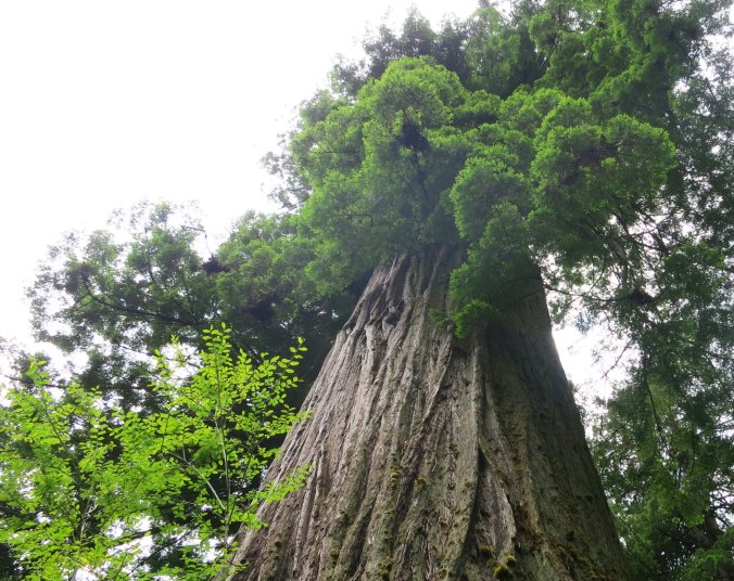
Giant redwood tree at Redwoods National Park. Photo by Curtis Mekemson.

Towering Redwoods give the Redwood Highway its name.

Massive root systems that can extend out 100-feet from the tree provide hundreds of gallons of water per day to a giant redwood.

Massive root systems that can extend out 100-feet from the tree provide hundreds of gallons of water per day to a giant redwood. Root width rather than depth provides the tree with stability.

Redwood roots on display along California's Highway 101.

I find the twisted roots quite beautiful.

Salmon carved from redwood along Highway 101 on California's North Coast.

A number of places along Highway 101 sell carved redwood featuring everything from bears to this salmon.

Highway 101 follows a path inland through various river valleys until it reaches Eureka and then it follows the ocean to the border. Occasional views of the Pacific are provided along the way and several county, state and national parks provide opportunities for camping and exploration.

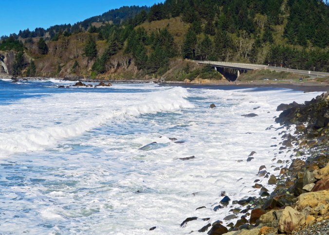
Waves come ashore along California's Highway 101.

Highway 101, seen on the right side of the photo, parallels the Pacific Ocean north of Eureka, California providing occasional views of the Pacific Ocean.

Looking out toward the Pacific from the same location on Highway 101.

Looking out toward the Pacific from the same location on Highway 101. The point has character.

Sea foam created by a storm along the Pacific Coast.

While the skies were blue for our drive up the coast, a storm had chopped up the water the night before, creating sea foam.

Sea foam beat into whip cream type consistency along Highway 101 on the North Coast of California.

The result was this whip cream like sea-foam I included in an earlier blog.

Stone Lagoon, which is part of the largest lagoon system in North America, is one of the views along Highway 101. Separated from the Pacific Ocean by a barrier beach, the waters of the lagoon are neither fresh nor salt. Fed by fresh water for most of the year, winter storms fill the lagoon with water until it breaches the beach barrier, allowing ocean water to flow in and establish a unique environment that supports a great diversity of life. When Peggy and I arrived, Stone Lagoon was the picture of tranquility with calm waters reflecting the surrounding hills and trees.

Stone Lagoon State Park on Highway 101.

The calm water reflected trees and hills surrounding Stone Lagoon.

Reflection shot on Stone Lagoon ion Highway 101 ion the Northern California coast.

A close up.

In Crescent City, Peggy and I picked up Highway 199 and followed the Smith River up and away from the ocean on our way into Southern Oregon.

The Smith River as seen from Highway 199, the Redwood Highway , in Northern California.

The Smith River crosses Highway 101 north of Crescent City and is the largest free-flowing river in California that hasn’t been damned.

Another view of the Smith River flowing along Highway 199 in Northern California.

Another view of the Smith River flowing along Highway 199 in Northern California.

Rapids along the Smith River next to Highway 199, (the Redwood Highway) in Northern California.

A final photo of the Smith River.

NEXT BLOG: A somewhat crazy 100 mile backpacking adventure across the Sierra Nevada Mountains with 60 people aged 11 to 70. Part 1

Wandering through Time and Place in 2017… And Some Thoughts on Planning

Curtis Mekemson hiking along the Pacific Crest Trail behind Squaw Valley.

It’s time to start planning and dreaming about 2017. One of my goals is a seven week, 500-mile backpack trip on the Pacific Crest Trail. Here I am in the Granite Chief Wilderness behind Squaw Valley, California. (Photo by Peggy Mekemson)

It’s the first day of the New Year. It’s the time to make resolutions and plans— a time to dream.

There was a time in my life when I was obsessive about the planning process. I would lay out goals and objectives. And then I would move into YAPs, QUAPs, MAPs, WAPs and DAPs, or, to spell it out: yearly, quarterly, monthly, weekly and daily action plans based on my goals and objectives. I set priorities, created time lines, made to-do lists, checked things off, kept records, and made plan revisions. Things that didn’t work were modified or dropped. New opportunities were taken advantage of. I did it for my personal as well as professional life. It was how I accomplished things I wanted to do, and how I kept some control over my often chaotic life.

Early on I had learned if I didn’t plan out what I wanted to do with my time, someone else was more than willing to do it for me. And I had also learned that there is power in planning, in knowing what you want to do, and in determining what is important, what has the greatest impact.

I am not as obsessive as I once was, but old habits die hard. And, even though I am “retired,” it is still important to have an idea of where I want to go, of what I want to do, and of what is important to me. Of course I don’t exist in a vacuum. Ask Peggy. (grin) Most of what we do is jointly decided.

So given all of this, what are my writing and travel plans for 2017?

Kpelle footbridge near Gbarnga, Liberia circa 1965.

I hope to revise and republish “The Bush Devil Ate Sam,” a memoir about my Peace Corps experience in West Africa. Here, a much younger Curt makes his way across a river on a native bridge in the heart of the African jungle.

Under writing objectives, I plan to finish my next book, tentatively titled Tales of an Incorrigible Wanderer. My 10,000-mile bike trip plus other outdoor adventures will be included. (I am sure you will want to buy a copy. Grin.) I also plan to revise and republish The Bush Devil Ate Sam. I will continue to blog two to three times a week on current travels/adventures as well as past adventures. I am thinking in terms of doing one blog each week on current travels, one blog on past adventures, and one blog as a photographic essay. But we’ll see. I have to reduce the time I spend on blogging so I have more time for other goals, like play, for example.
Our travels this coming year will likely go in three directions. One, Peggy would like us to do a more thorough job of exploring the Pacific Northwest. I might add California down to Big Sur simply to expand my Pacific Coast blogging series. (And I really like Big Sur, Carmel and Monterey.) I expect we will also spend more time exploring the East Coast now that our two kids and their families are living there. Finally, I am hoping we can plan a trip to Ireland and possibly England where I would like to continue my genealogical research.

Photo of Scottish pony taken by Curtis Mekemson.

I photographed this pony in Kirkcolm, Scotland when I was doing research on my Scots-Irish ancestors a few years ago. I promised myself at the time that I would return for more research in Ireland and England.

I am also hoping we can make it back to Burning Man. It is one of my most popular blog topics and I would like to write a book in 2018 on my 14 years of experience with the event. We will know in February if we can get tickets for this year.

The Temple of Promise at Burning Man in 2015 is caught by the morning sun.

Morning sun catches the copper face of the Temple of Promise at Burning Man 2015.

Finally, it is time for another grand adventure. I celebrated my 60s by doing a six-week 360-mile backpack trip down the Sierra Nevada Mountain range from Lake Tahoe to Mt. Whitney. It seems only appropriate that I celebrate my 70s by doing a seven-week, 70-miles per week, 490-mile backpack trip on the Pacific Crest Trail. But I’ll have to see whether my 74-year old body is willing to cooperate. Maybe it will be a one-week 70-mile trip, or a one-day 7-mile hike, or a .7-mile hike to the mailbox. Laughing.

Whatever… I am sure there will be many adventures to share!

Wandering through Time and Place… The 2016 Year in Review: Part II

America and Canada are crammed with beautiful sights that range from mountains to deserts to oceans, to plains, to rivers... and well the list just goes on and on. This is a waterfall from Old Stone Fort State Park in Tennessee.

America and Canada are crammed with beautiful sights that range from mountains to deserts to oceans, to plains, to rivers… and well the list just goes on and on. This is a waterfall from Old Stone Fort State Park in Tennessee.

Continuing on with our 2016 journeys, Peggy and I left Oregon in March to retrace my 1989, 10,000 mile bike journey around North America. We were on the road until mid-June, and I just wrapped up my posts on the trip. It took me longer to write about it than it did to bike it!  The truth of this is that I can’t begin to capture the experience in ten photos. It was a challenge to me to capture it in 54 posts and 1000 photos. None-the-less, here are a few random shots:

I started my journey in the foothills of California in the spring. In a couple of months the green grass here would be brown, or golden as they call it in California.

I started my journey in the foothills of California in the spring. In a couple of months the green grass here would be brown, or golden as they call it in California.

One of the more challenging parts of my ride was through Death Valley. Twenty Mule Canyon was on my way out of the National Park on my way into Nevada.

One of the more challenging parts of my ride was through Death Valley. Twenty Mule Canyon was on my way out of the National Park on my way into Nevada.

I found a touch of outer space when I rode by the Very Large Array of radio telescopes as I rode down the easter side of the rocky Mountains in New Mexico.

I found a touch of outer space when I rode by the Very Large Array of radio telescopes as I rode down the eastern side of the Rocky Mountains in New Mexico.

Literally dozens of roadside sculptures entertained me on my bike trip and then Peggy and me as we re-drove the route. Peggy and I found this 25 foot high Longhorn in West Texas, where you would expect to find it.

Literally dozens of roadside sculptures entertained me on my bike trip and then Peggy and me as we re-drove the route. Peggy and I found this 25 foot high longhorn in West Texas, where you would expect to find it.

Louisiana is bayou country, the place where you expect to see water moccasins slithering through the water, or get good reflection shots.

Louisiana is bayou country, the place where you expect to see water moccasins slithering through the water, or get good reflection shots.

The Natchez Trace and the Blue Ridge Highway are both beautiful. It's the Trace here. An added advantage of both National Park highways is that no commercial traffic is allowed. Translate: I wasn't dodging 18-wheelers.

The Natchez Trace and the Blue Ridge Highway are both beautiful. It’s the Trace here. An added advantage of both National Park highways is that no commercial traffic is allowed. Translate: I wasn’t dodging 18-wheelers.

I found this small waterfall beside the road in the Great Smokey Mountains. Dozens, maybe of hundreds of such falls graced my trip.

I found this small waterfall beside the road in the Great Smokey Mountains. Dozens, maybe of hundreds of such falls graced my trip.

The Atlantic Ocean greeted me along this rocky shoreline of the Cape Breton Highlands in Nova Scotiia. This was my fattest point east. After this it was time to turn around and ride 5,000 miles west.

The Atlantic Ocean greeted me along this rocky shoreline of the Cape Breton Highlands in Nova Scotia. This was my fastest point east. After this it was time to turn around and ride 5,000 miles west.

A stream along the Trans-Canada Highway in Ontario. My rivers ranged from the mighty Mississippi to mere trickles.

A stream along the Trans-Canada Highway in Ontario. My rivers ranged from the mighty Mississippi to mere trickles.

I crossed several mountain ranges including the Sierra Nevada and the Rockies twice. Tis is a photo of the rockies in Montana.

I crossed several mountain ranges including the Sierra Nevada and the Rockies twice. It is a photo of the Rockies in Montana.

One thing I learned over and over is that beauty comes in all shapes and forms, such as this lonely tree in North Dakota.

One thing I learned over and over is that beauty comes in all shapes and forms, such as this lonely tree in North Dakota.

Whoops. I just counted my photos. There are 12. I’ll call it a bakers 10.


A Truly Unique Set of Holiday Lights… The North Coast Series

Grey whale featured in Holiday Lights display at Shore Acres State Park in Coos Bay, Oregon.

Not your parents’ (or mine) display of holiday lights! This grey whale rising out of the ocean had to be at least 30 feet long. Over 10,000 lights provided a back drop.

A giant grey whale rose out of the water to a backdrop of ten thousand lights. It wasn’t quite what I had expected when Peggy and I drove over to Coos Bay, Oregon to check out the Holiday Lights display at the Shore Acres State Park. I thought we’d probably see sheep, cows, donkeys and a baby J or two. There might even be deer. They’ve become a common fixture on people’s lawns at Christmas. But frogs leaping into ponds, pelicans flying across the sky, a parade featuring an earthworm, turtle, grasshopper and snail— no way! And these were just a few of the sky, sea and land creatures on display, all created out of holiday lights.

This green fellow was part of a parade that included a worm, two turtles, and a snail, that was going the wrong way, slowly, I assume.

This green fellow was part of a parade that included a worm, two turtles, and a snail, that was going the wrong way, slowly, I assume.

This had to be one happy lady bug working three flowers at once. Aphids beware!

This had to be one happy lady bug working three flowers at once. Aphids beware!

There was a butterfly...

There was a butterfly…

Dragonfly at Shore Acres Park.

A dragonfly…

Holiday frogs at Oregon's Shore Acres State Park.

And frogs.

Seals dive int the water at Oregon's Shore Acres' State Park Holiday of Lights display.

Seals leaped into the water. They actually moved and made a splash. As did frogs, and whales.

Pelicans at Oregon's Shore Acres' State Park Holiday of Lights display.

Pelicans flew across the sky.

Pelican at Oregon's Shore Acres' State Park Holiday of Lights display.

A close up.

Crab and octopus at Oregon's Shore Acres' State Park Holiday of Lights display.

There was a crab and an octopus…

Flowers at Oregon's Shore Acres' State Park Holiday of Lights display.

And beautiful flowers…

More flowers at Oregon's Shore Acres' State Park Holiday of Lights display.

More.

Animals look over fence at Oregon's Shore Acres' State Park Holiday of Lights display.

A porcupine, raccoon, deer and rabbit peeked over the parks fence to check out the display.

It wasn’t all about the wildlife you normally find on the Oregon coast, however. Some 320,000 thousand lights decorated the hundreds of shrubs that turn Shore Acres into a floral delight during the spring, summer and fall. There were lots of Christmas trees. A choral group sang traditional carols. The historic garden house on the site reminded me of fantasy gingerbread homes. And Santa was there! So what if he happened to be taking a bubble bath with a tiger and a moose. Fortunately, he was wearing his long johns. Old men with round bellies that shake like bowls full of jelly shouldn’t be seen in public with their clothes off.

Holiday lights at Oregon's Shore Acres' State Park Holiday of Lights display.

A small pond at Shore Acres reflected some of the 320,000 lights.

Green lit arbor and Peggy Mekemson at Oregon's Shore Acres' State Park Holiday of Lights display.

Peggy was turned green by an arbor while the dragonfly hovered above her head.

Gingerbread house at Oregon's Shore Acres' State Park Holiday of Lights display.

The historic garden house looked like a gingerbread house.

Another view of the house. A pelican, instead of a stork, hangs out on the chimney.

Another view of the house. A pelican, instead of a stork, hangs out on the chimney.

The Shore Acres Holiday Lights display is a tradition that goes back to 1987 when Friends of Shore Acres decided to ‘string a few lights’ for the holiday season. It’s been growing ever since, both in number of lights and number of people who visit. This year, the visitors should top 50,000. Volunteers do all of the work. Lights are donated.

Shore Acres Botanical Garden

During the spring, summer, and fall, Shore Acres turns into a beautiful botanical garden, reminiscent of English gardens. This is the ‘Gingerbread house.’ All of the plants were covered in lights for the holidays. (Photo by Peggy Mekemson)

Shore Acres Botanical Garden, Coos Bay, Oregon

Rhododendrons at Shore Acres State Park. Two of thousands of beautiful flowers.

Peggy and I discovered Shore Acres two years ago when we were staying at Sunset Bay State Park, which is located a mile down the road. The flower garden reminded us of England. As soon as I saw a newspaper article about its Holiday Light display, I knew we had to return. Peggy lives for holidays. Since we were heading back East for Christmas, she wouldn’t have the opportunity to break out her seven large boxes of decorations and turn our house in to a museum of Christmases past, present and future. I figured the lights provide a substitute. They did.

With Santa, Peggy and I would like to wish each of you a joyous Holiday and a very Happy New Year.

With Santa and friends, we wish each of you and your families a Joyous Holiday and a very Happy New Year. —Curt and Peggy

NEXT BLOGS: I jumped ahead in our recent North Coast travels to include the Shore Acres display for Christmas. My next three posts will serve as a wrap up for 2016 featuring some of our favorite photos from the year. Twelve of them we used in our annual family calendar. In January, I will return to our drive up Highway 101 to be followed by our visit to Sunset Bay State Park in Coos Bay, which, in its own way, is as special as Shore Acres.

There’s an Elk! There are 300! …The North Coast Series

This magnificent fellow was probably the bull of the herd, and proud of it!

This magnificent fellow was probably the bull of the herd, and proud of it! He was surrounded by some of his lady friends.


A blog quickie…

Peggy gets excited when she sees elk. So it’s not surprising that she multiplied the number she saw by 10. I can also get quite excitable. Roosevelt Elk are the largest members of six subspecies of elk in North America. Bulls can weigh up to 1100 pounds! Once, they were close to extinct in California. Today, there are seven herds in and around the Redwoods. The largest herd numbers 250. Most are closer to the size we saw. It was conveniently located in someone’s yard. I drove in so Peggy could take photos.

Elk herd near the Redwoods in Northern California.

There were probably 30 elk altogether.

I was impressed by the antlers shown here...

Peggy was impressed by the antlers shown here…

elk with large racks near the Redwoods in Northern California

So she took a close up. Given the season, I figured that Santa could turn to these fellows if his Reindeer refused to fly.

Rudolph the Red Nosed Reindeer on strike. Xmas card by Curtis Mekemson.

Red-nosed reindeer goes on strike. (card by Curt Mekemson.)

The real deal: Alaskan Caribou. (Photo by Peggy Mekemson.)

The real deal: Alaskan Caribou. (Photo by Peggy Mekemson.)

If this guy were a blacktail deer, we would call him a spike. I don't think I would want him mad at me!

If this guy were a black tail deer, we would call him Spike. I don’t think I would want him mad at me! The marks on his back suggest he has been nibbling at itches.

This doe was quite beautiful...

This cow elk was quite beautiful…

So we will end this short post with a close-up.

We will end this short post with a close-up of her. Lovely eyes!

NEXT BLOG: The Christmas lights of Shore Acres State Park

Long Beaches, Redwoods and Rocky Points on California 101… The North Coast Series

Treasures are often found by those who wander off from well-tred paths. This bit of driftwood I found on Clam Beach north of Eureka, California is an example.

Treasures are often found by those who wander off from well-worn paths. I found this bit of driftwood on Clam Beach north of Eureka, California. I am forever taken by grains and texture in wood. What better way to find them!

Far too often, travel consists of hurrying through a number of must-see stops. I understand this. Some places are rightfully renown for their beauty, history shopping, etc., and time is limited. So you have a check-off list and a timeline. If you are on an organized tour, your travel is even more directed and options for wandering are close to nil, which is one of the reasons that I rarely travel that way.

Sometimes I like to travel without an itinerary and stop willy-nilly when something captures my attention. I realize that I run the risk of missing something worth seeing, but I also open the door for new adventures. When Peggy and I visited California’s North Coast in October, Mendocino was our must see stop. We even had a reservation, which is rare for us.

After Mendocino, it was wander time. We followed Highway 1 as it wound its way up the coast and then cut across the coast range to Highway 101 at Leggett. We zipped up 101 to Eureka so we would have more time on the coast north of the city. Eureka, BTW, was apparently what Archimedes, the Greek mathematician, shouted when he discovered a way of determining the purity of gold. It means, “I found it!” California 49ers shortened the concept to mean, “I found gold!” It became the state motto.

Our first stop above Eureka was at Clam Beach for no other reason than we hadn’t been there before. What we discovered was something of a rarity for the North Coast, a beach that went on and on. A small trail wound its way through brush, eventually leading us out to the beach.

Clam Beach off of Highway 101 north of Eureka, California.

We found golden Dune Grass…

Pampas Grass growing on the California Coast.

And golden Pampas Grass. Its beauty is countered somewhat by the fact that it is an invasive plant from South America, often replacing native plants.

Pampas Grass on Clam Beach in Northern California.

For fun, I shot the same Pampas Grass backlit the sun.

And then had Peggy stand next to it for perspective.

And then had Peggy stand next to it for perspective.

A final shot of Clam Beach.

A final shot of Clam Beach with golden Dune Grass and Pampas Grass in the distance.

Usually when we are in this part of California, we spend some time in the Redwoods. Our views this time, however, were limited to what we saw from the road, except for one ancient giant we found at a rest stop. It had burned years and years ago, leaving nothing but a charcoal remnant of its once magnificent self. Still, it stood as a testament to the miracle of life…

This ancient victim of fire amused me when I noticed that its top was creating a new forest!

This ancient victim of fire amused me when I noticed that its top was creating a new forest!

Patrick’s Point State Park returned us to the rocky shoreline I associate with the North Coast. Peggy and I followed a muddy path down a steep cliff to get to the action!

Patrick's Pt. State Park north of Eureka, California on Highway 101.

Hiking down to the ocean at Patrick’s State Park, we spotted a rock that was lit up by the sun.

Close inspection showed it to a home for California Brown Pelicans.

Closer inspection showed it to be a home for California Brown Pelicans.

Edging my way around a cliff provided another view.

Edging my way around a cliff provided me with another view.

Waves breaking at Patrick State Park north of Eureka and Arcata, California.

Including this…

And this.

And this. I really liked the dark and light contrast, along with the massive rocks.

Inching my way back to where Peggy was, the ocean waved goodby.

When I was inching my way back to where Peggy was, the ocean waved goodby.

NEXT BLOG: “There are elk!” Peggy yelled, almost causing me to crash. “There must be 300!”