I Hire Wild Steve to Help Run the Backpack Trek… Blog-a-Book Tuesday

Today I am continuing to blog my book: “It’s 4 AM and a Bear Is Standing on Top of Me.” I concluded my last post by proposing to the American Lung Association of Sacramento-Emigrant trails’ (ALASET) Board of Directors that I run a hundred-mile backpack trek across the Sierra Nevada Mountains to raise funds to support the Association’s programs. My friend Steve Crowle and I had come up with the idea while out backpacking. The Board’s first reaction had been, “You want to do what?”

Steve and I had no idea of how difficult leading a group on a 100-mile backpacking trek through the Sierra Nevada Mountain Range might be. We were about to find out…

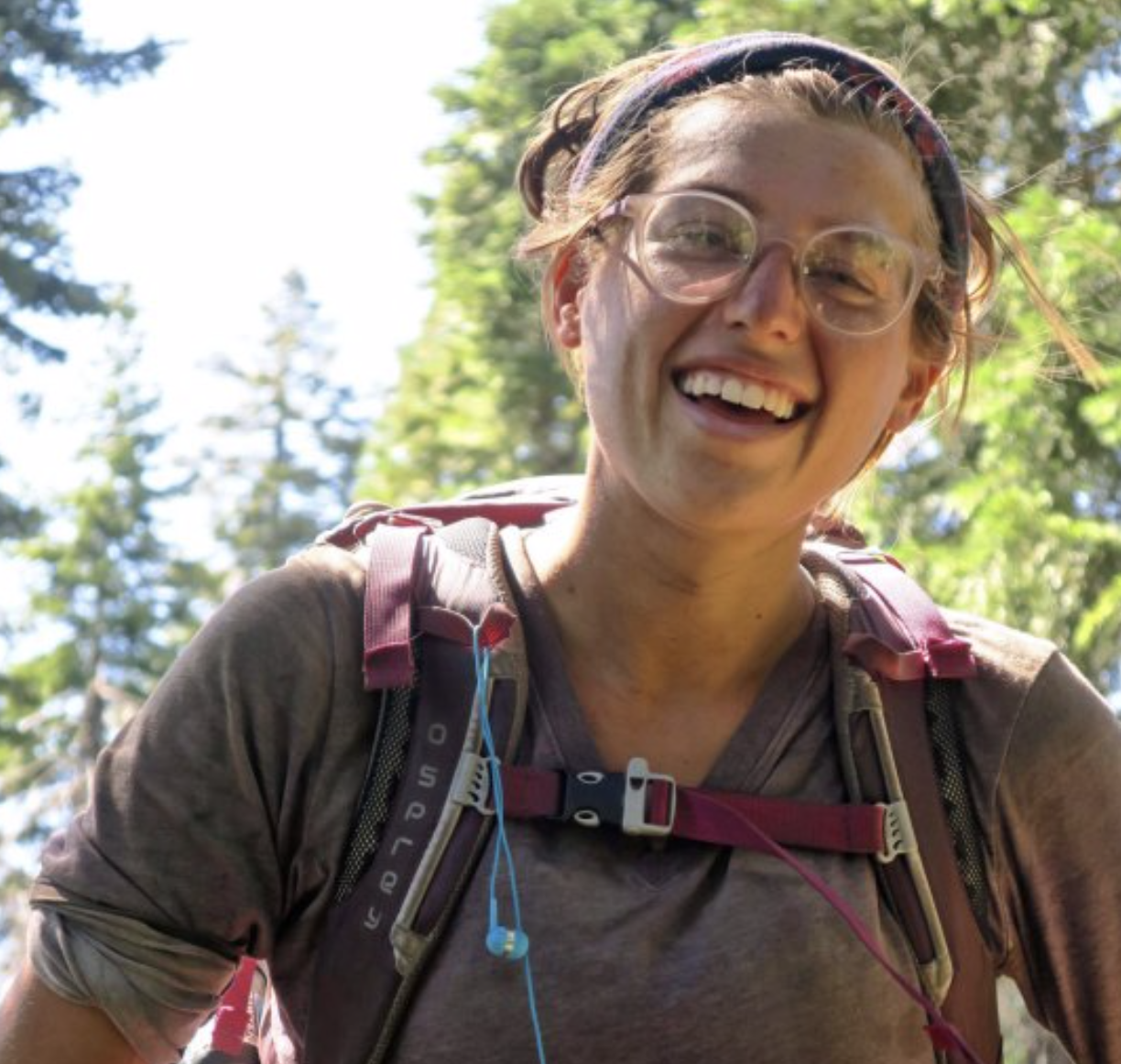
Actually, I had a great Board. Once the members were convinced that this was something I really, really wanted to do, their final response was “OK, go for it!” I called Steve immediately. My job as executive director included a wide range of responsibilities ranging from administration to programs to fundraising. I would have a limited amount of time to devote to the project and I didn’t know anyone else who was crazy enough to take on the challenge. We had two months to pull it off. The clock was ticking.

I had originally talked Steve into replacing me as Executive Director of Sacramento’s Ecology Information Center with a sales pitch that included, “Look, I have this great job where you work 60-hour weeks, have a Board that likes to scream at each other, and has a starting salary of $200 per month. Are you interested?” Minus a screaming Board of Directors, organizing the Trek wouldn’t be all that different.

Steve had a bright, curious mind and was knowledgeable on environmental issues. He also seemed to have unlimited energy and was built like a bear. It had served him well as Executive Director of EIC. In addition to overseeing the Center’s ongoing projects, he had immediately set out to develop a community garden in downtown Sacramento. Initially known as the Terra Firma Garden and later as the Ron Mandela Garden, it would provide inner city residents with a touch of nature for over 30 years— all the way up until the State of California decided to grow buildings on the site.

The downside about Steve was that he existed on the edge. I later learned that one of his friends who he had recruited to volunteer on the Trek frequently flew to Columbia and returned with his cargo hold filled with pot. 

A year after the Trek, Steve called me and told me that the FBI had showed up on his doorstep. My immediate thought was that they had tied Steve to the Colombia drug operation or that some of the Terra Firma gardeners were growing marijuana. Steve’s concern was that his radical youth was catching up with him. He had been a little too close to the fire when the Bank of America had been burned down in Santa Barbara in 1970 as a protest against the Vietnam War. “And what were you doing with those matches, Mr. Crowle?” (Steve told me the Santa Barbara story a few years ago before he passed away.)

Actually, the FBI had bigger fish to fry. Apparently one of his gardeners had gone from farming her plot to plotting an assassination. Young Lynette Fromme grew up in Southern California where she was a star performer in a children’s dance group, performing at such venues as the Lawrence Welk Show and the Whitehouse.

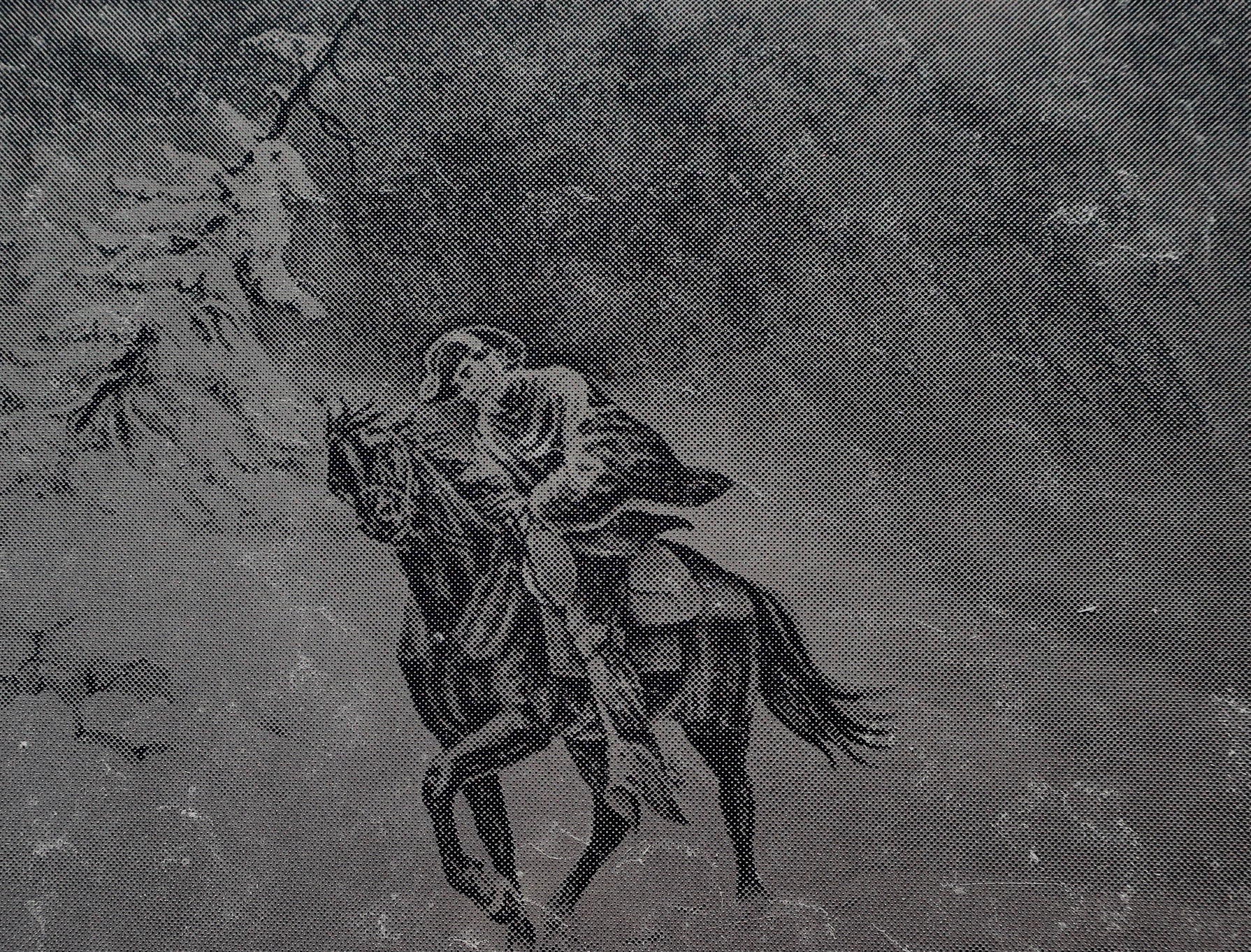
At 19, a strong disagreement with her dad sent her scurrying off to Venice Beach where she found comfort from an older man, Charles Manson. She soon found herself one of Manson’s clan, taking care of an aging George Spahn at his ranch where the ‘family’ hung out. It was Spahn who gave Lynette her nickname “Squeaky,” because, as legend has it, she squeaked each time he pinched her butt.

Squeaky missed out on the murderous rampage the family undertook in 1969 killing Sharon Tate among others, but she remained intensely loyal to Charles, defending him to the press and anyone else who would listen. After Manson’s conviction and sentence to a lifetime in prison, she moved to Stockton where two of the people she was living with ended up dead.

Abandoning Stockton, Squeaky moved to Sacramento and rented an apartment with another Manson groupie, Sandra Good. The two of them adopted a new life style and persona as ‘nuns’ in Manson’s latest crusade, saving the earth. Manson even gave them new names with Squeaky becoming ‘Red’ and Sandra becoming ‘Blue.’ It was with her new name, persona, and purpose that Squeaky took up gardening at the Terra Firma Garden. Steve knew her, of course, but knew nothing about her background. He told me that she found him “attractive” because of his intense eyes. If you’ve seen pictures of Manson, you’ll get this.

It was with her new goal of ‘saving the earth’ that she left her apartment on the fateful morning of September 5, 1975 and strolled over to Capitol Park where she got within a few steps of the visiting President Gerald Ford before pointing her Colt 45 at him, creating immediate pandemonium. She later claimed she was “just trying to get the President’s attention.” She did. Three months later she found herself convicted of an attempted assassination and in prison. As for Steve, he informed the FBI that he didn’t have a clue as to who Fromme was or what she was up to other than being a gardener. Like Pangloss, he went back to cultivating his garden. But all of this was in the future. My phone call to Steve went something like the following:

“How would you like to go backpacking and get paid for it?” I asked.

“Give me a hard question,” Steve responded.

“Are you willing to work for minimum wage?” I casually threw in as fine print.

“That,” he replied, “is the question.”

I went on to explain that while the Board members had approved of the concept, they weren’t particularly enthusiastic about spending large sums of money to see if it worked. I could just barely squeeze out the minimum wage of the day for two months to see if we could pull it off. Steve, after ample groaning, allowed that it would supplement what he was earning at the Center and took the job.

NEXT POSTS:

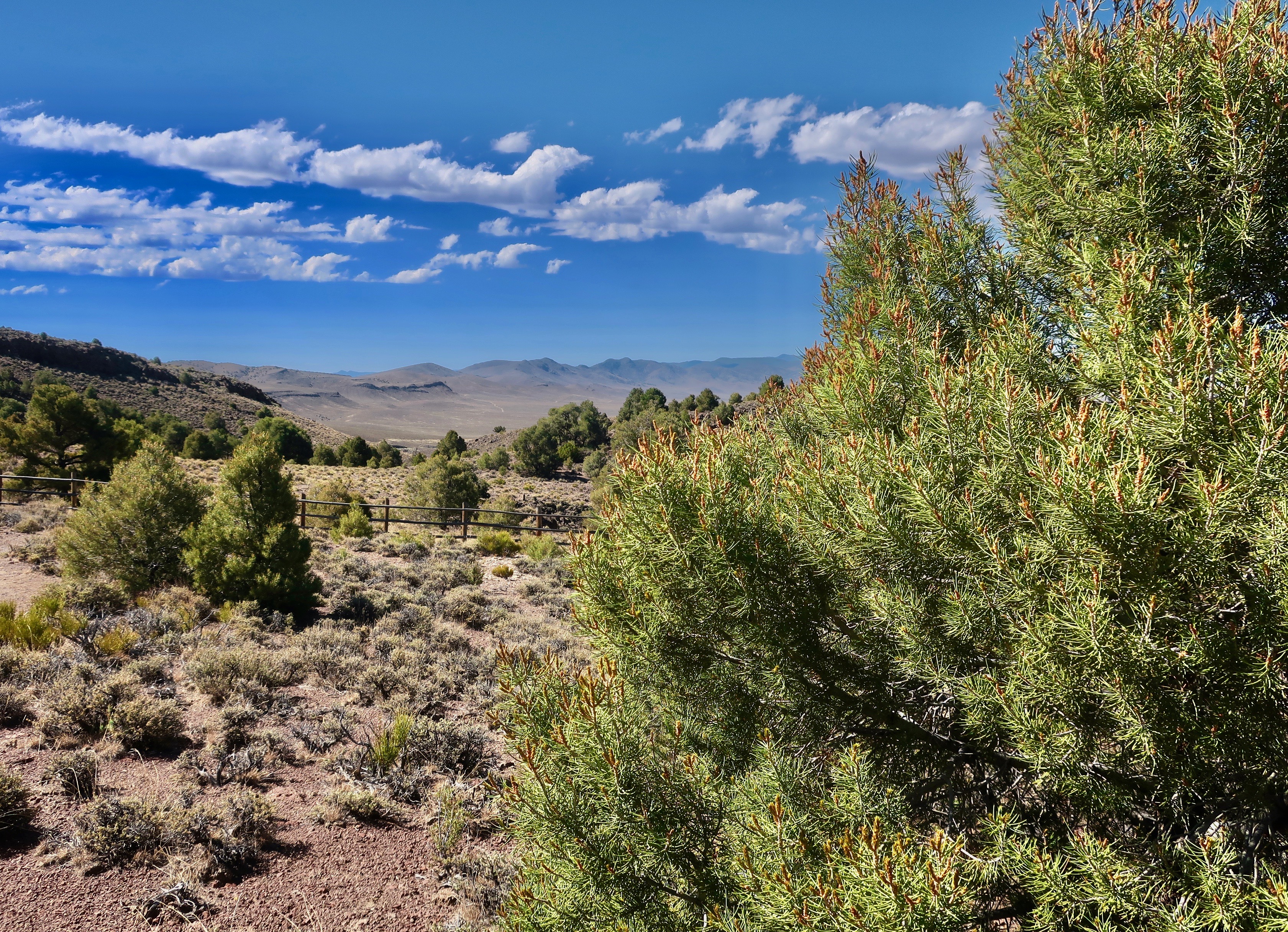
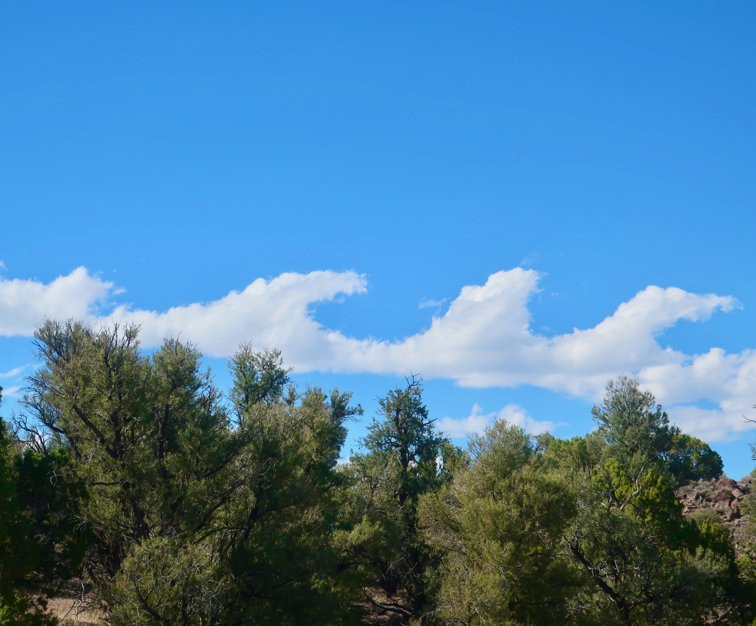
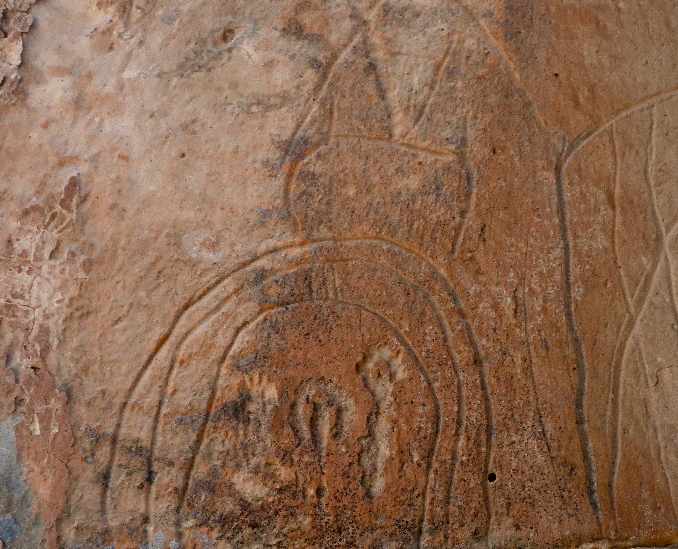
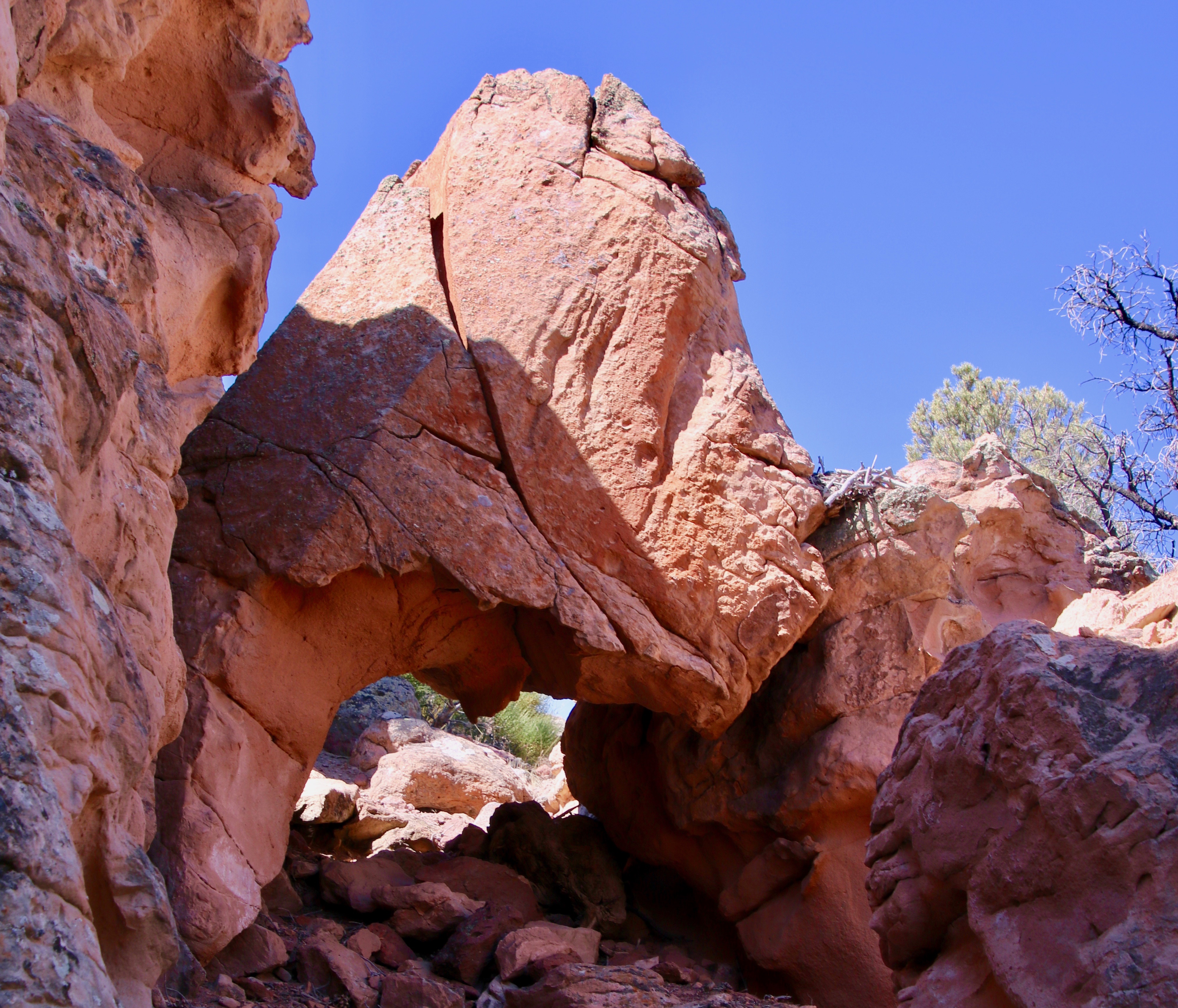
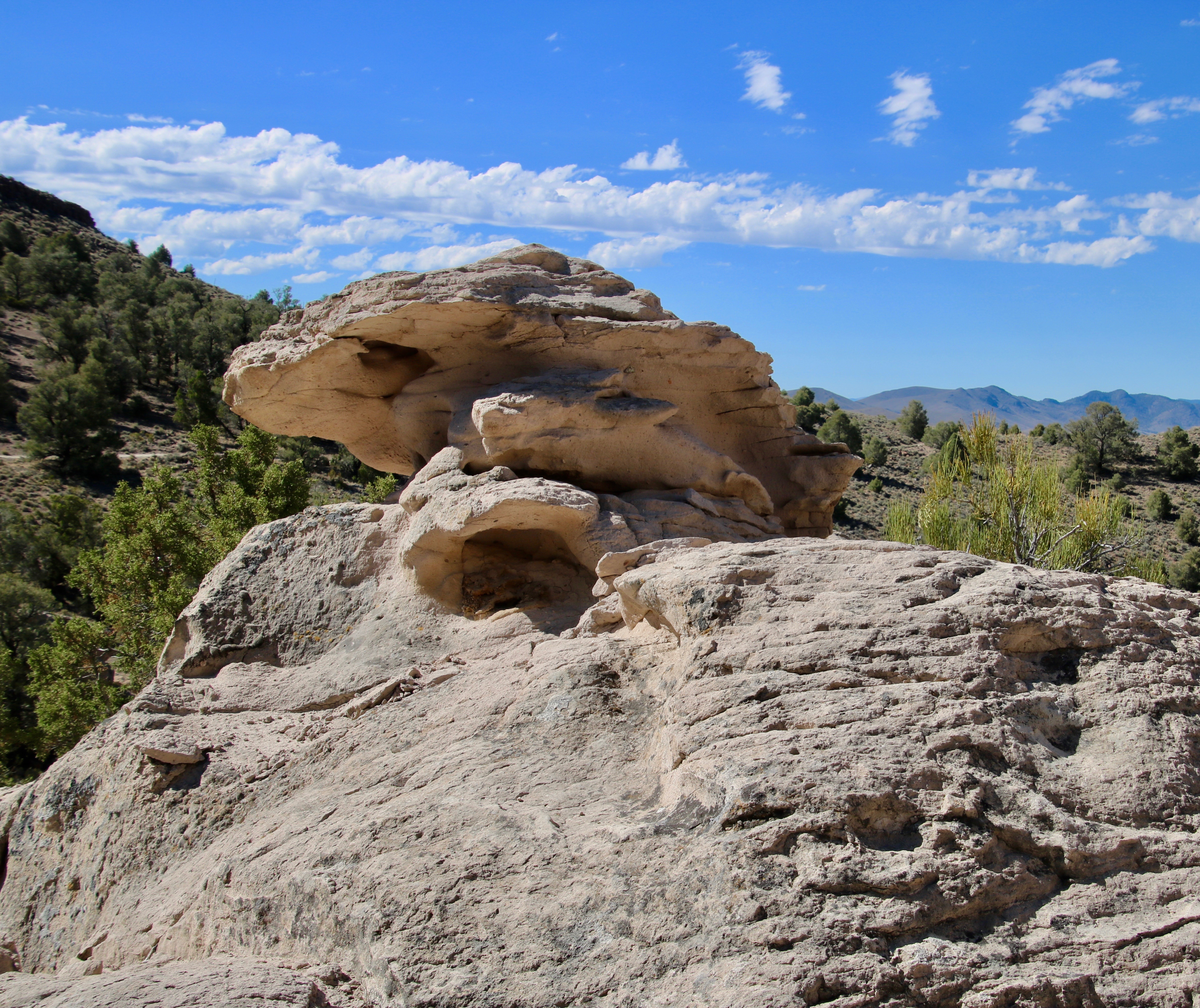
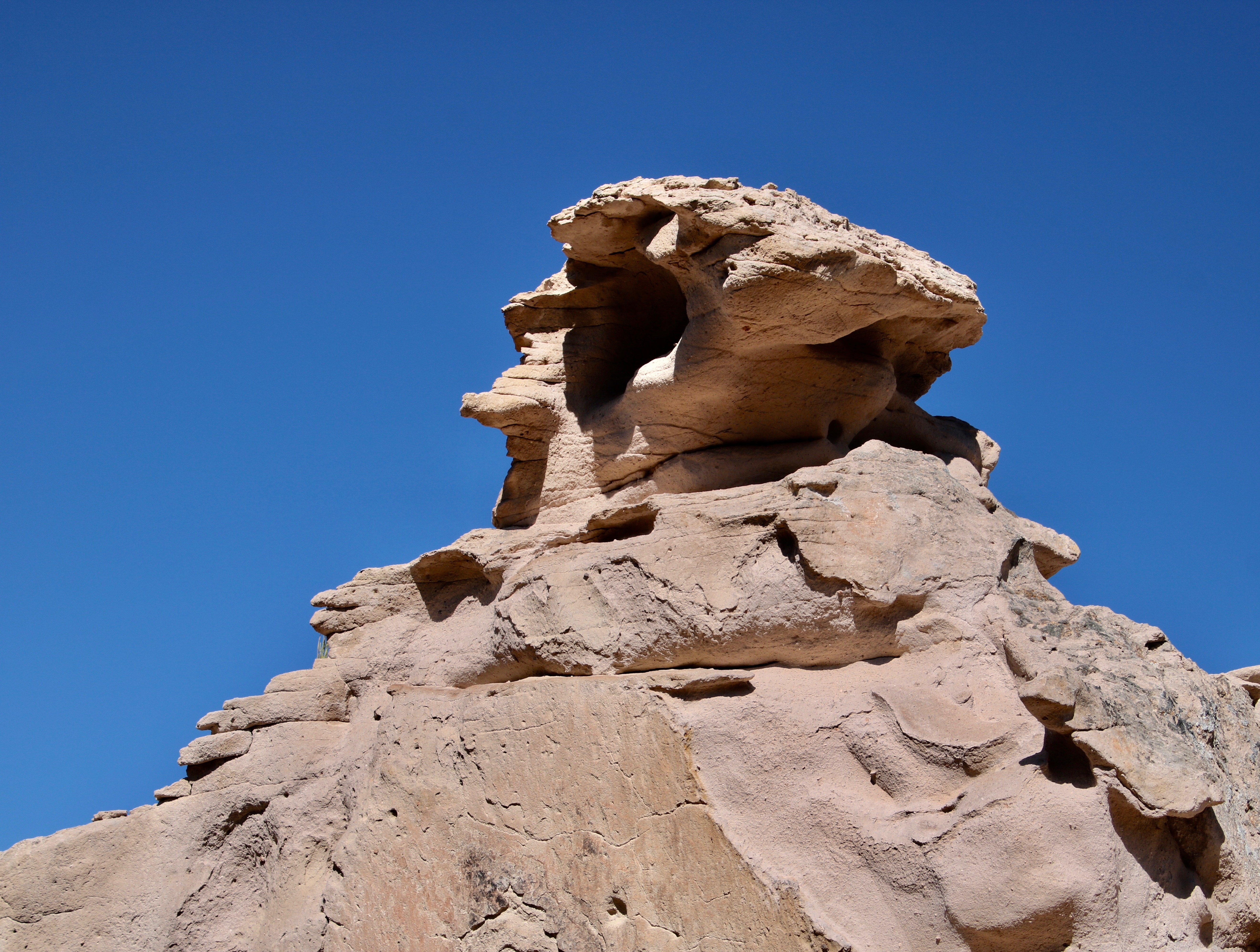
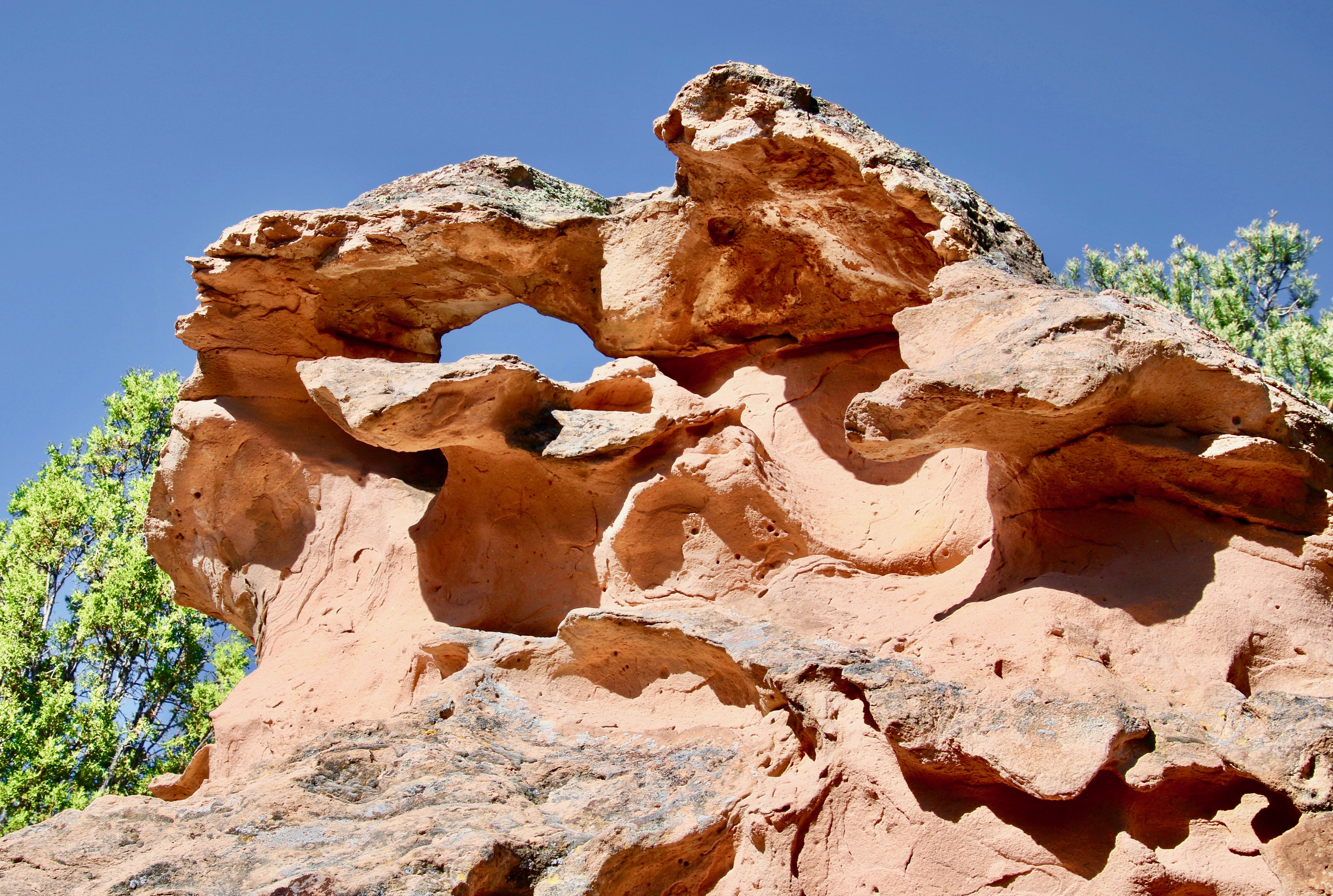
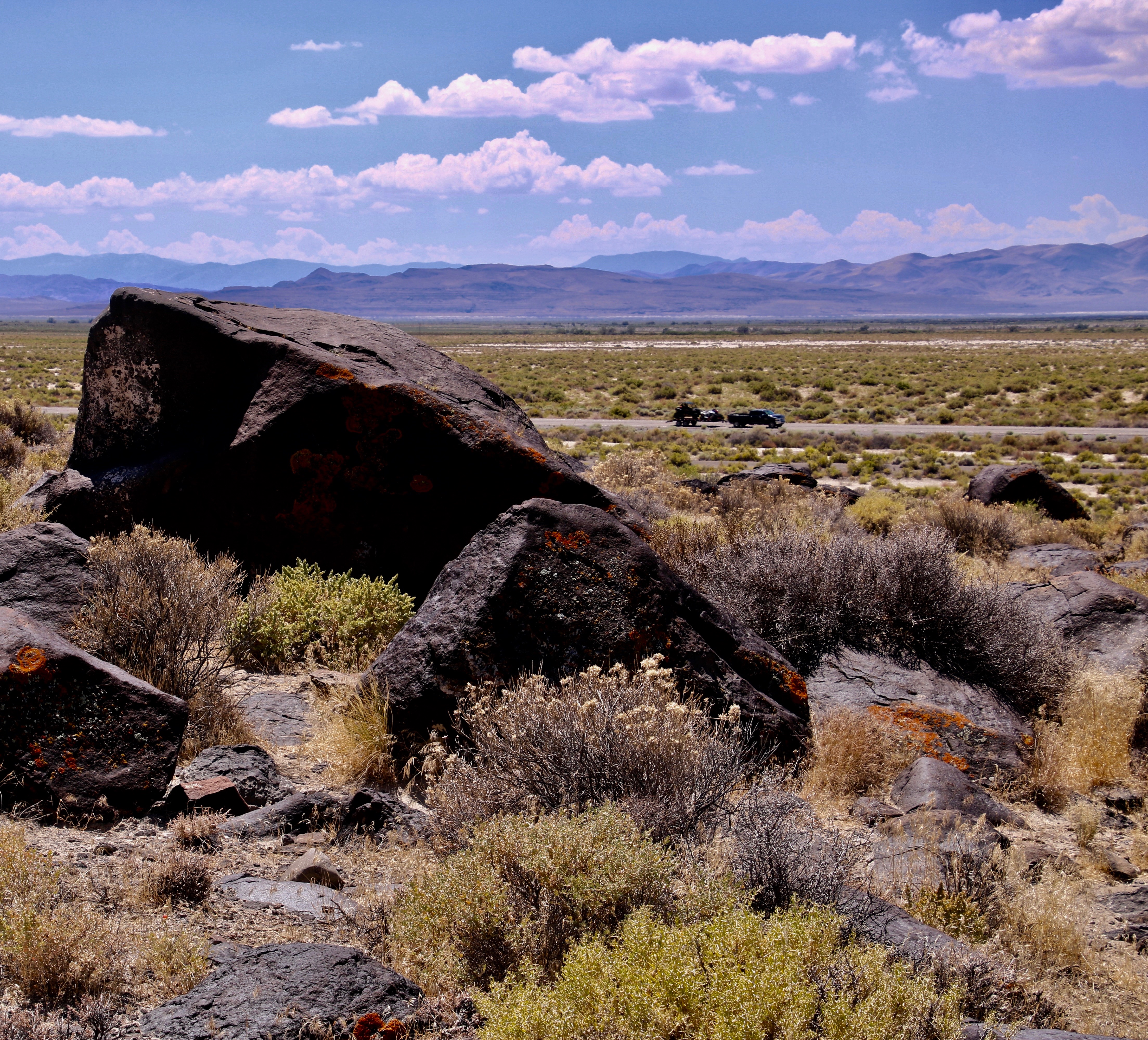
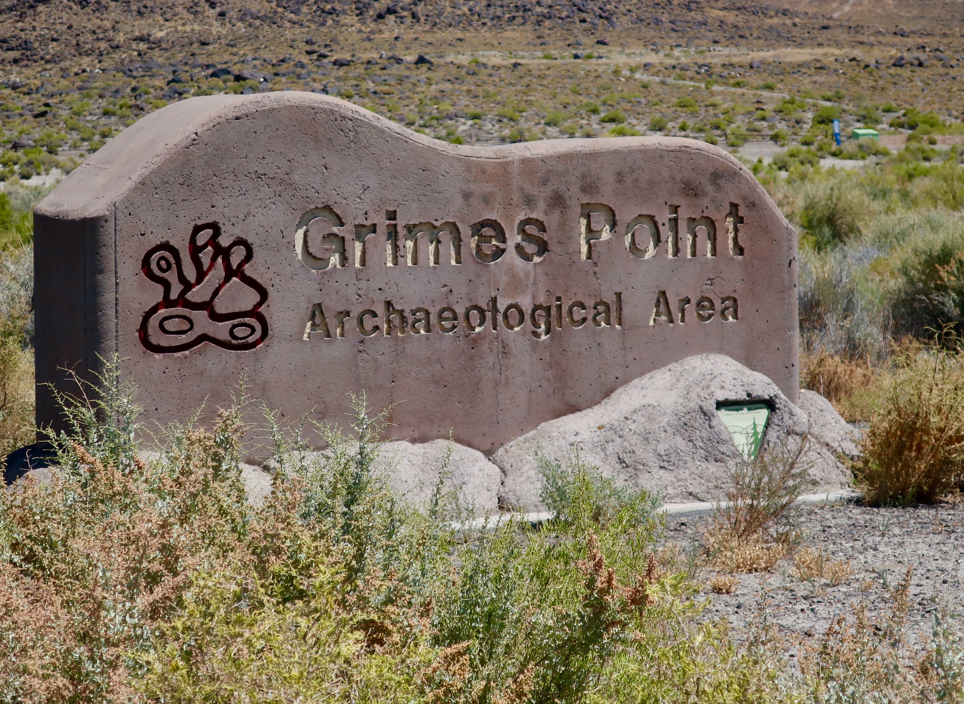
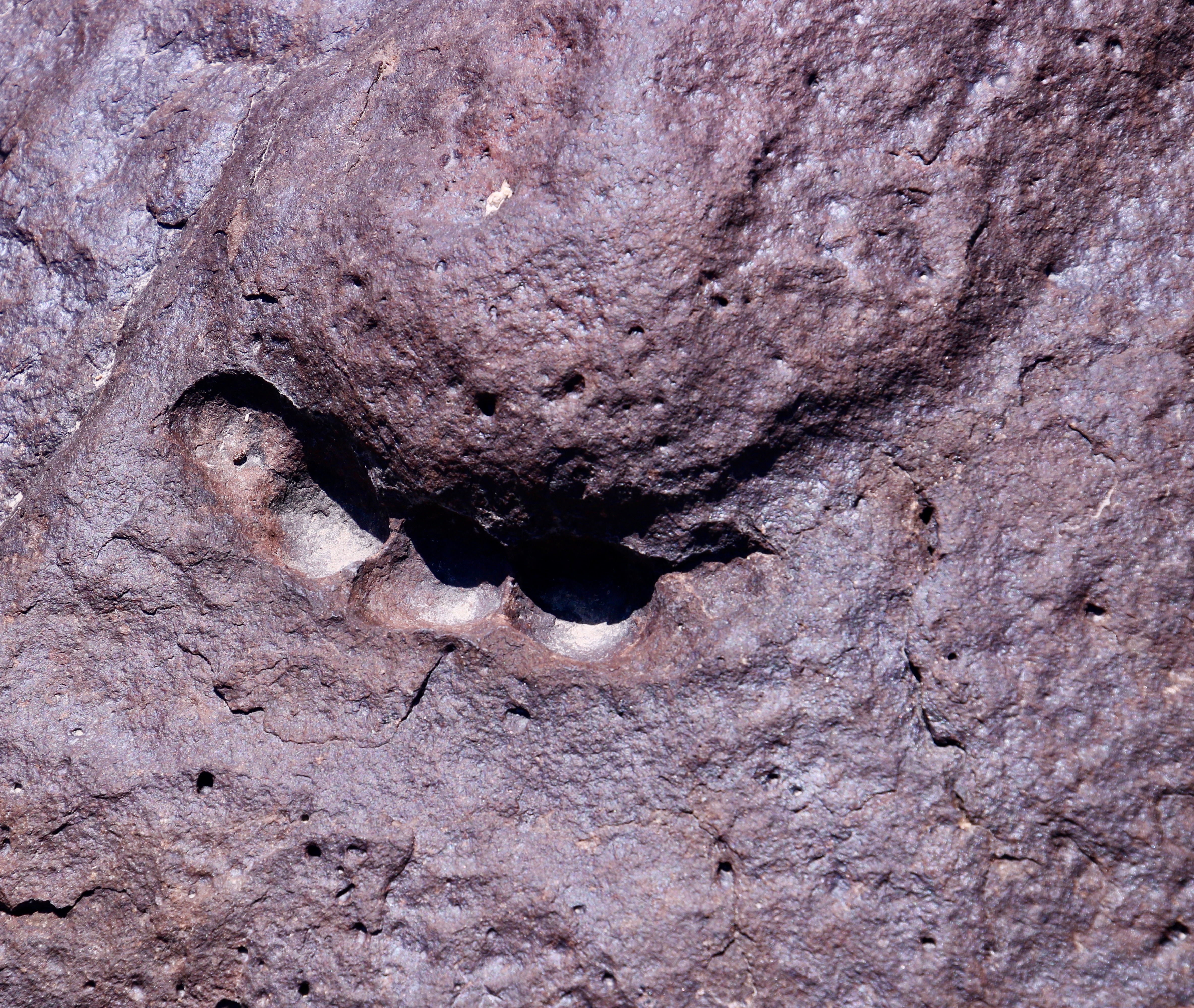
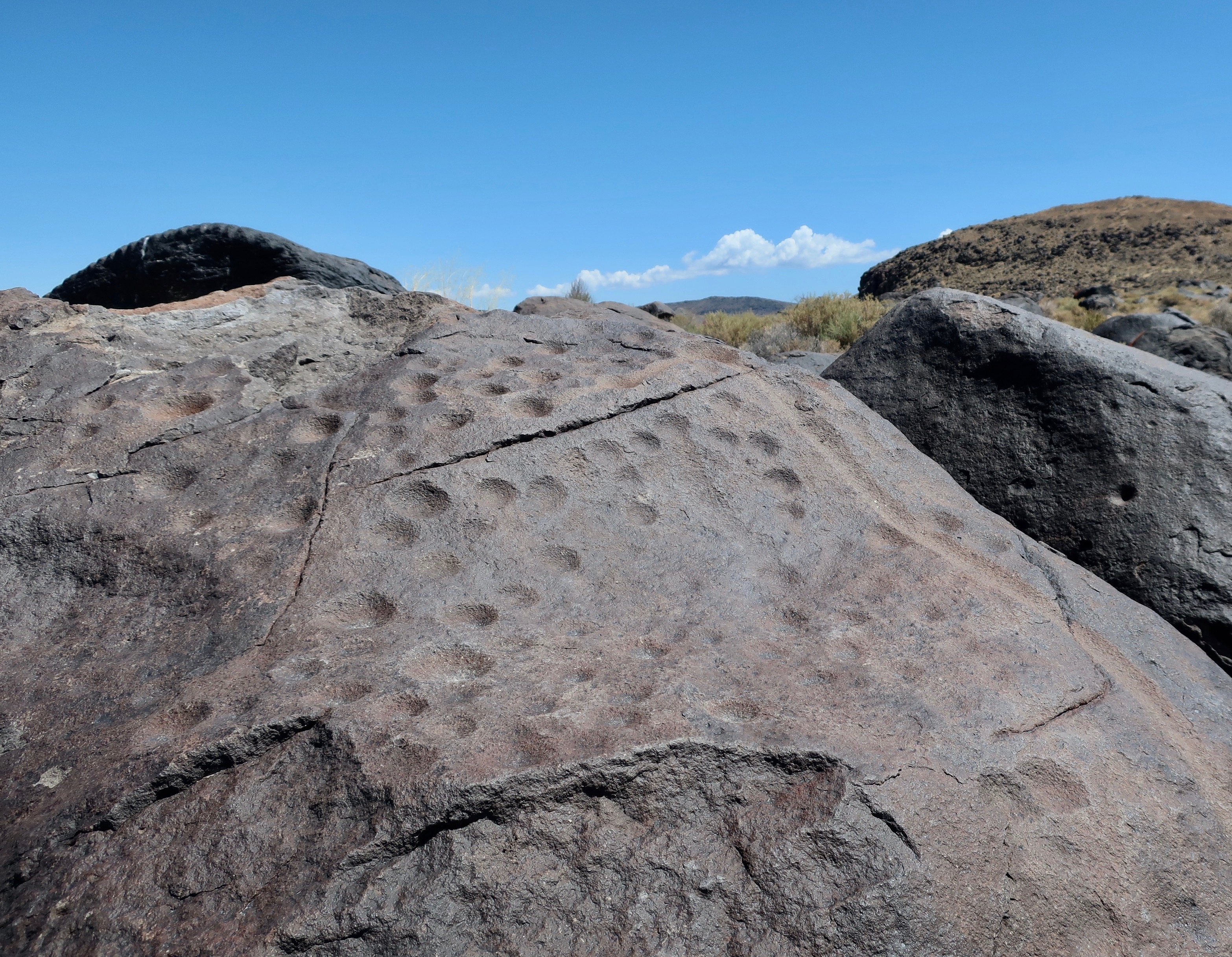
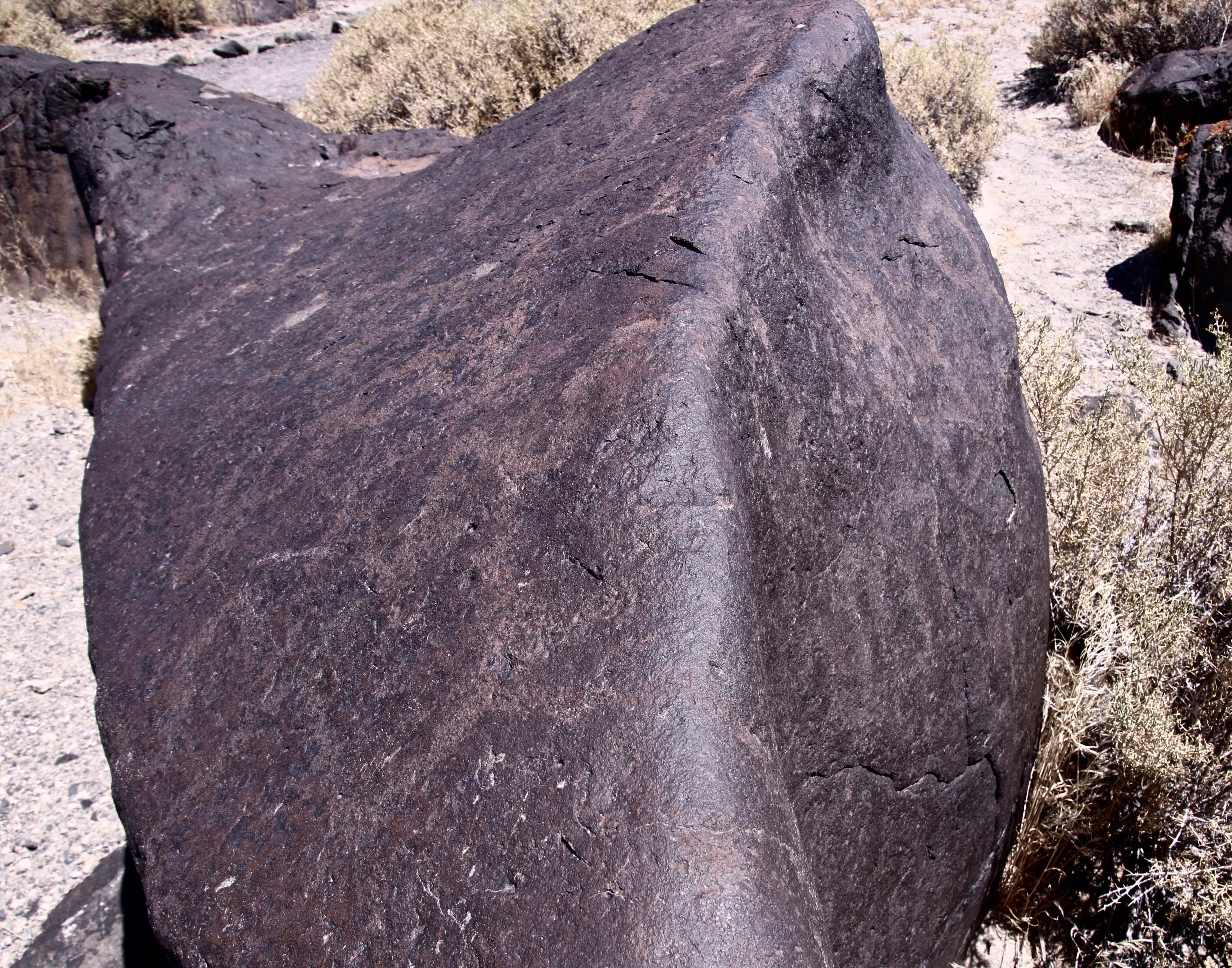
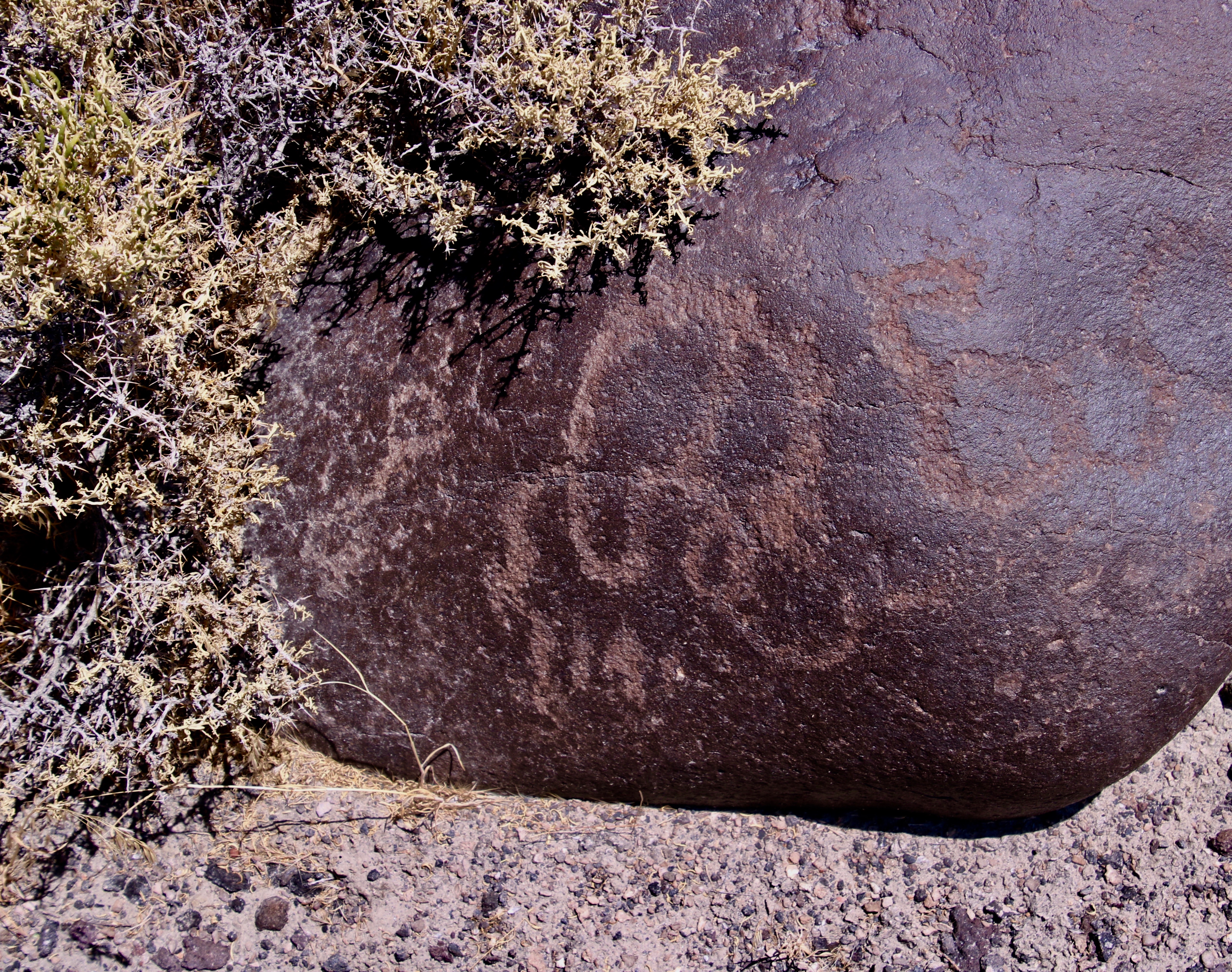
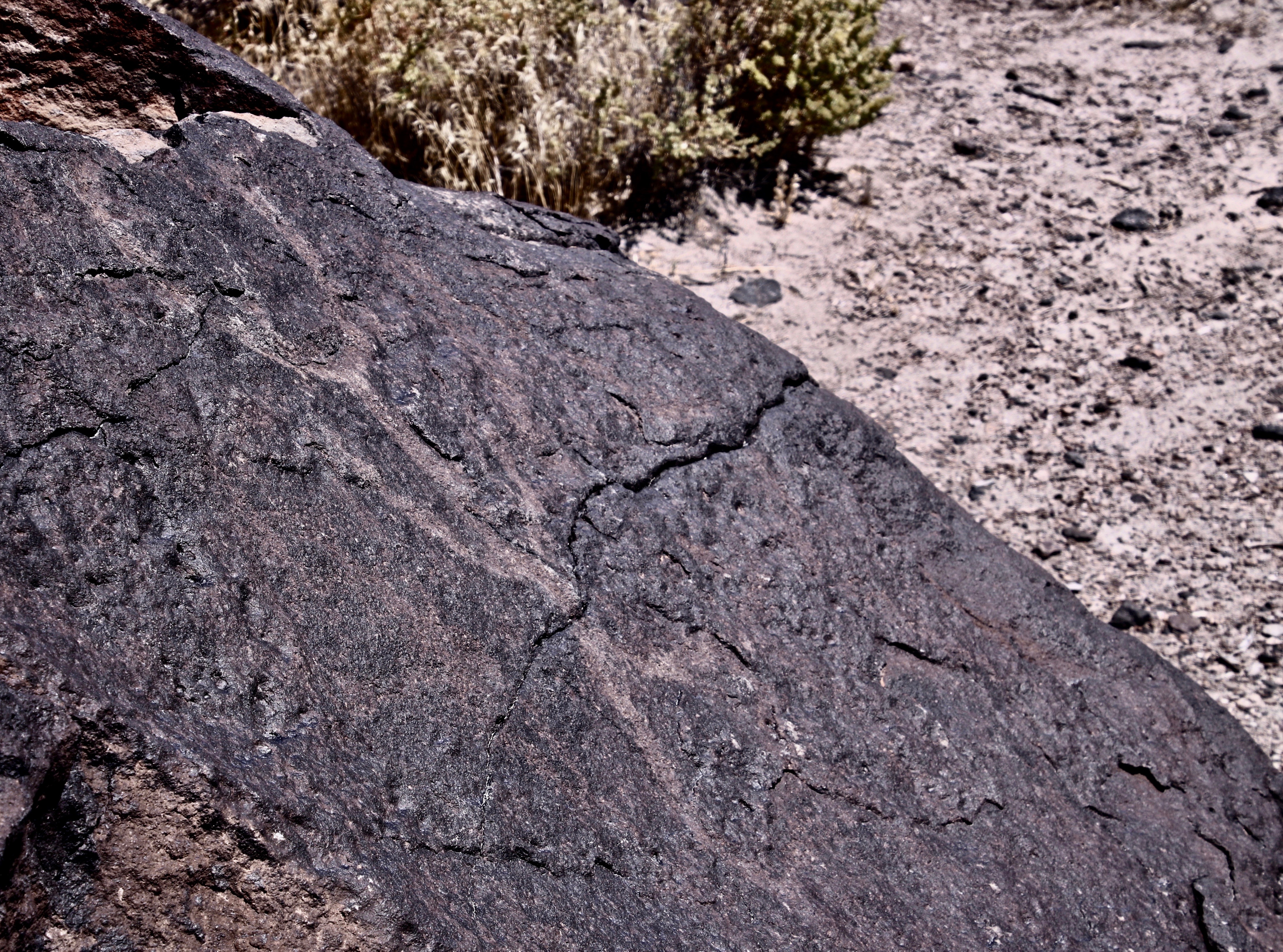
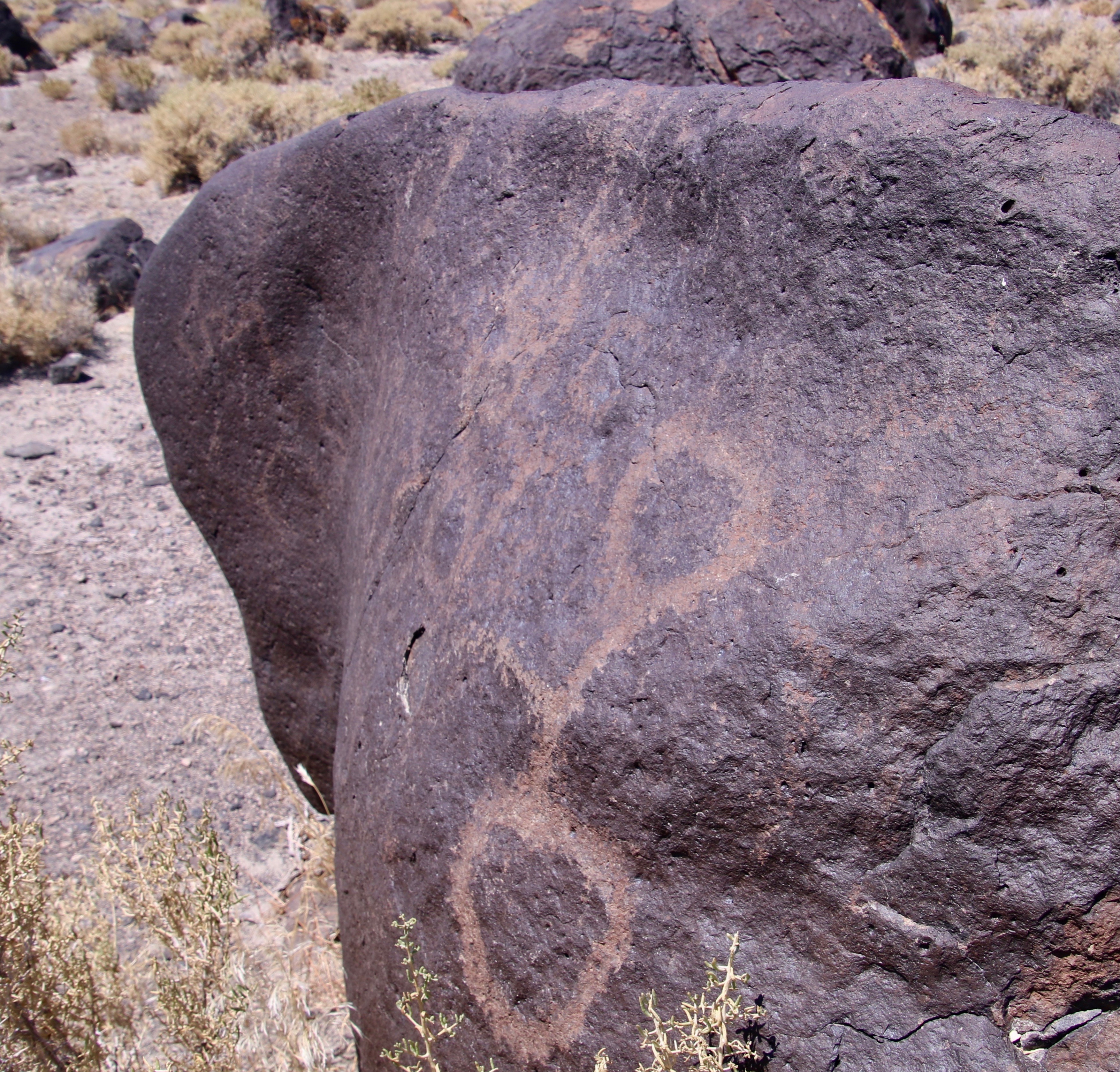
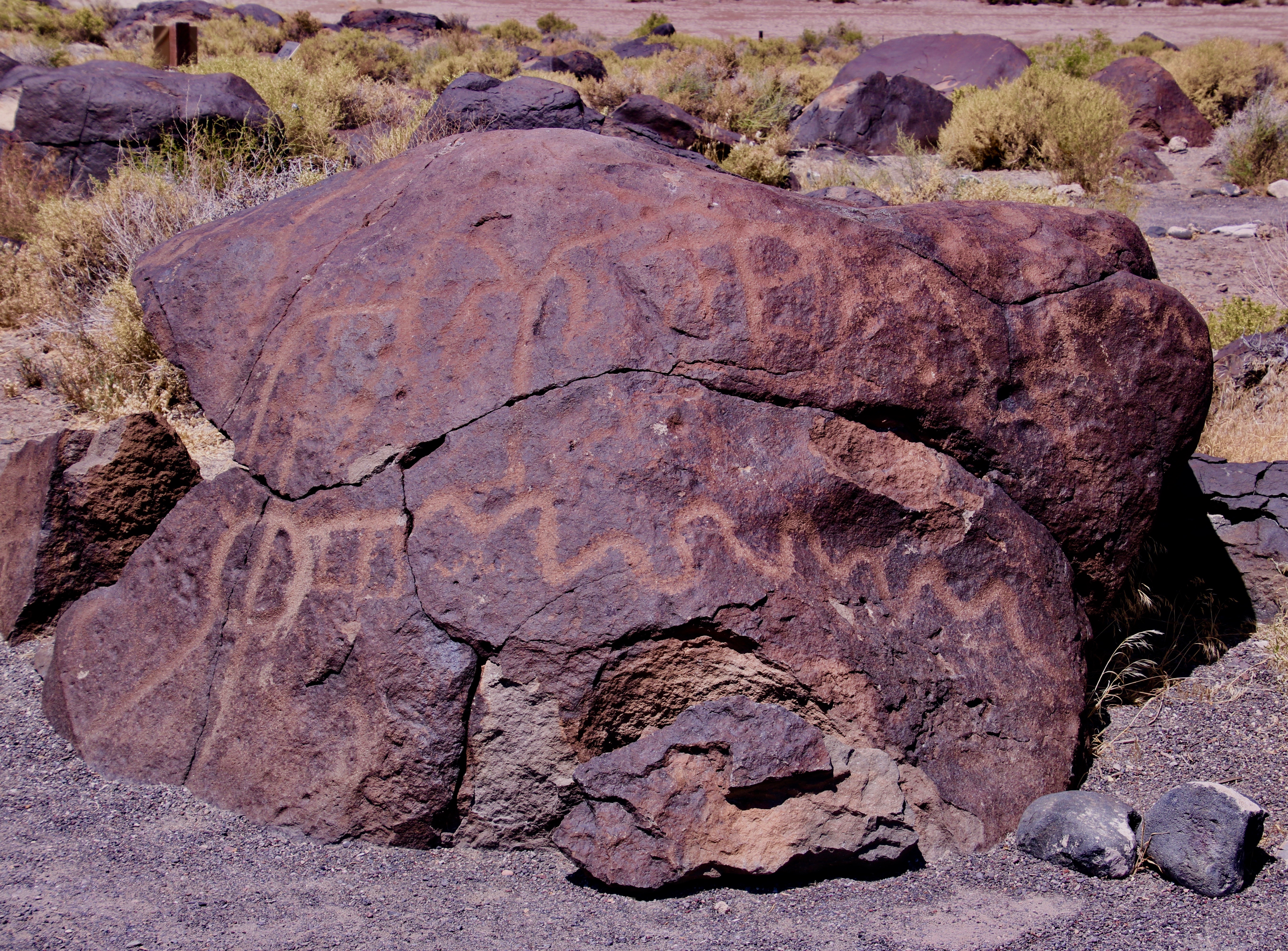
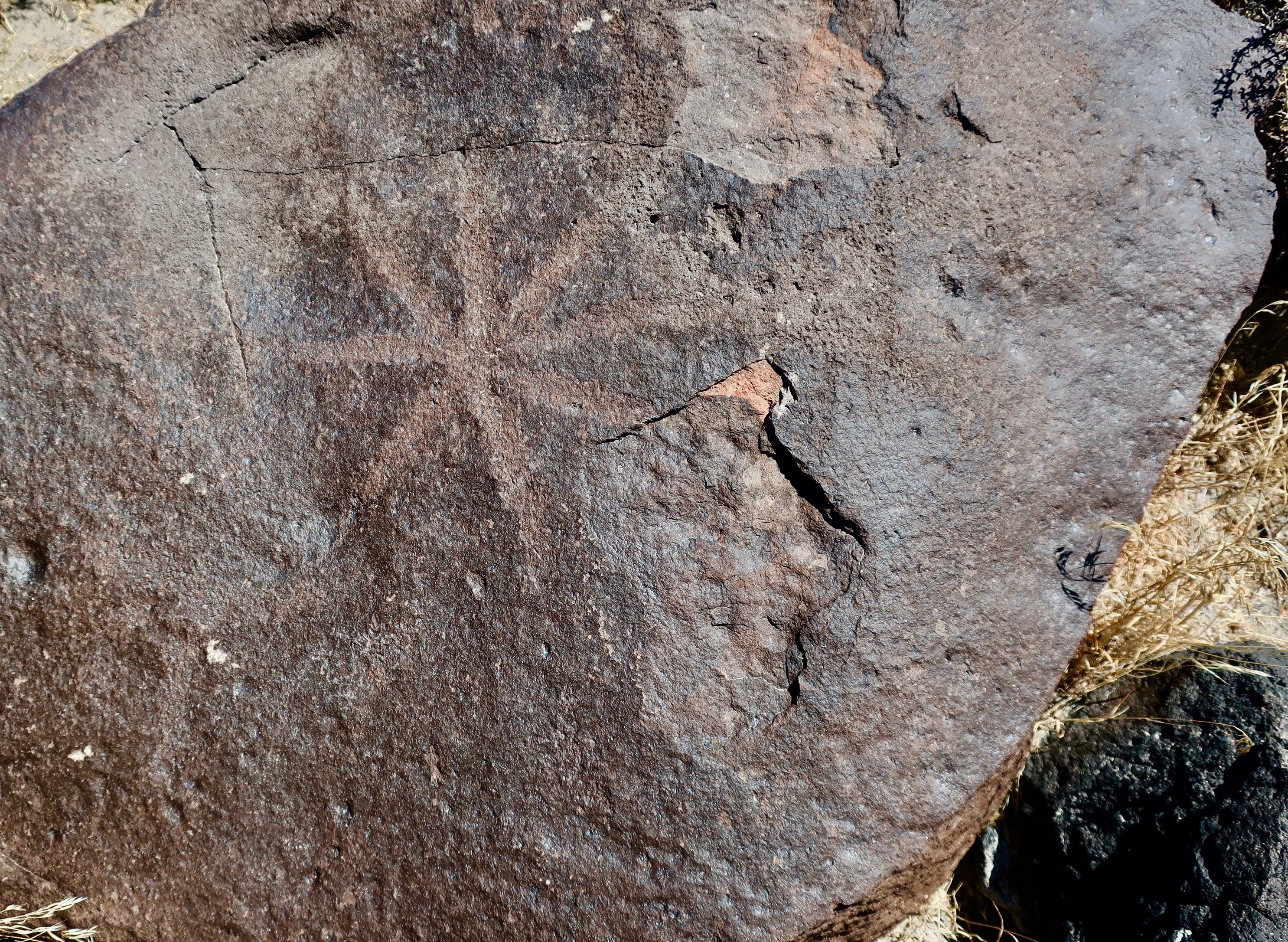
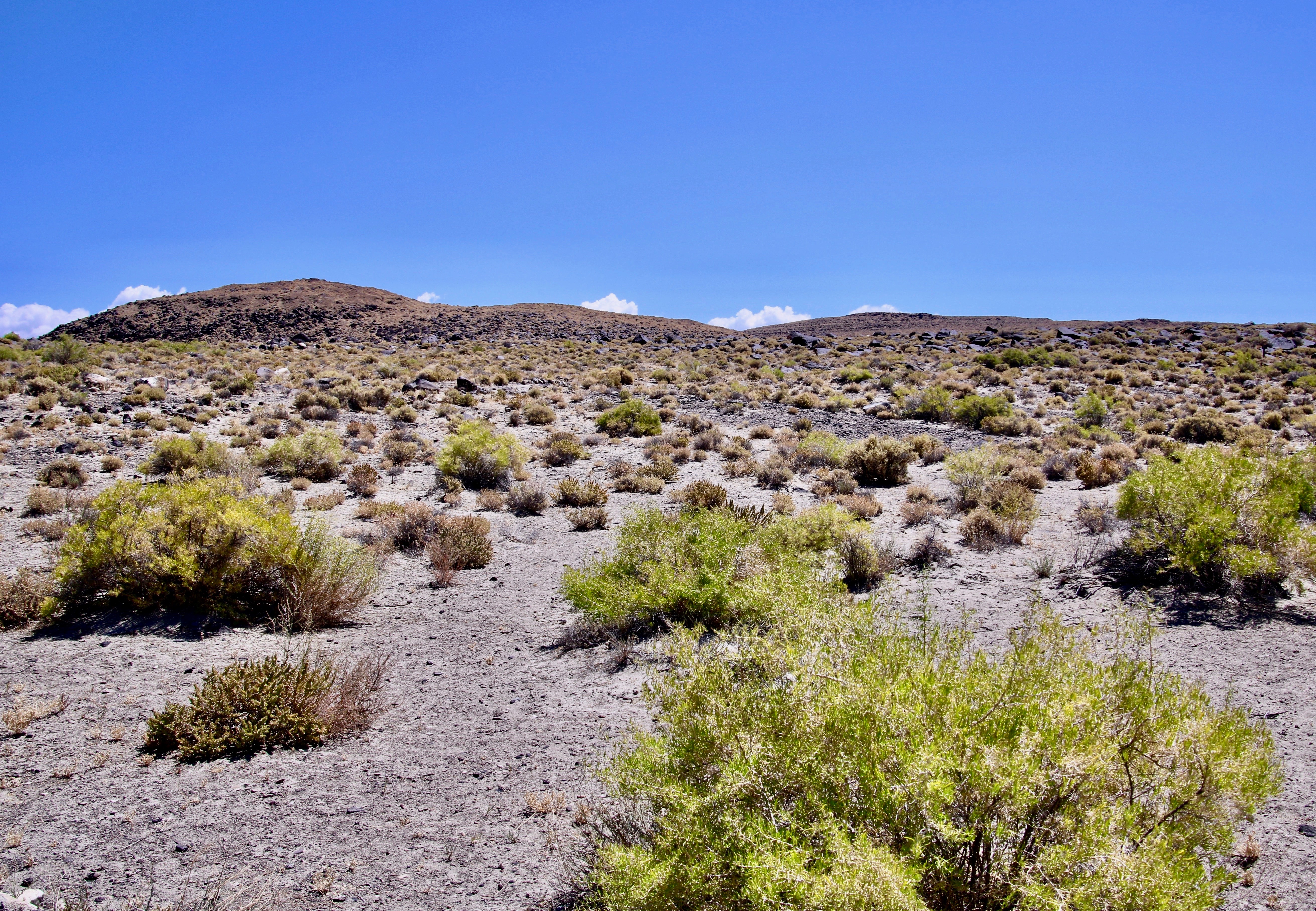
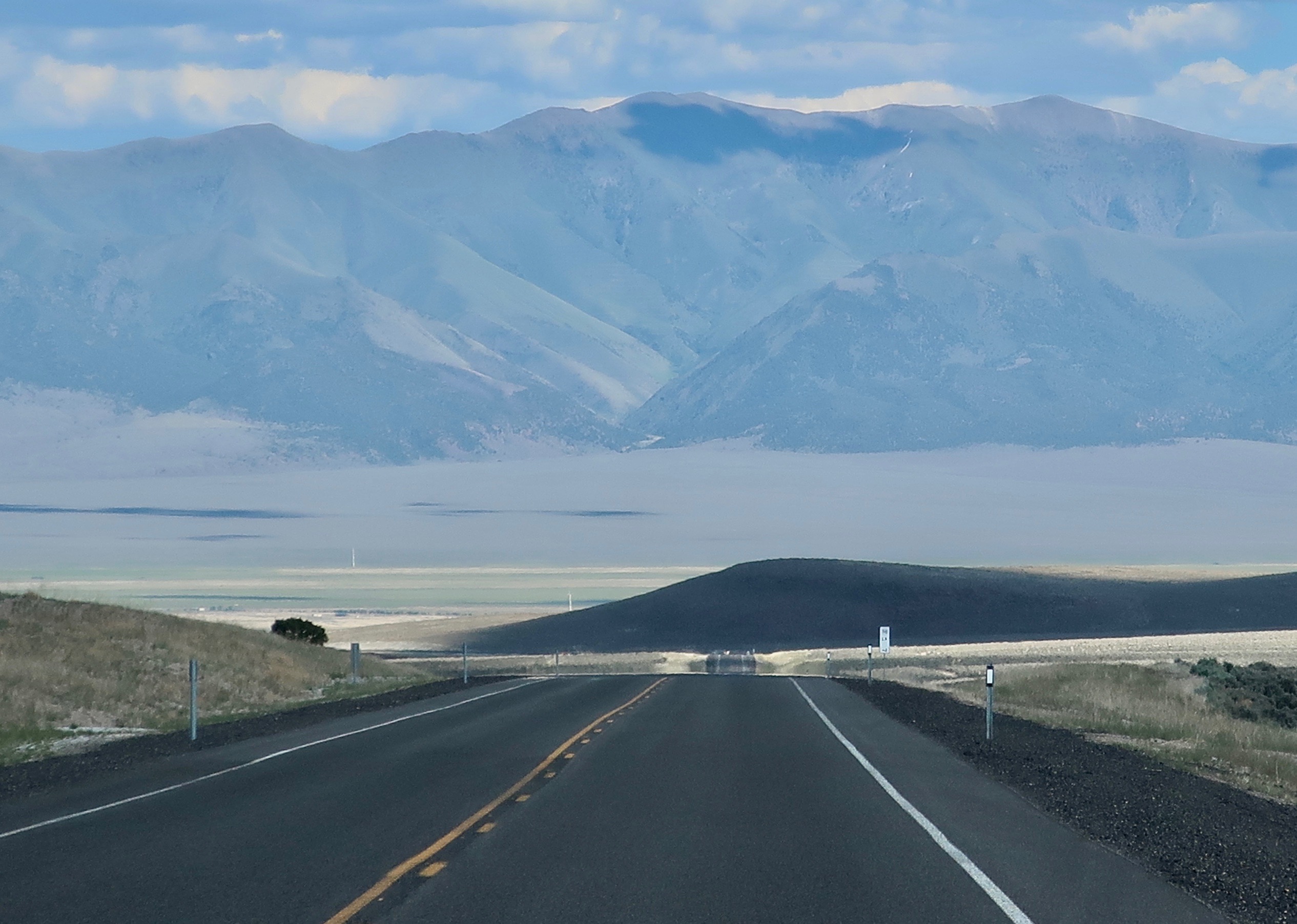
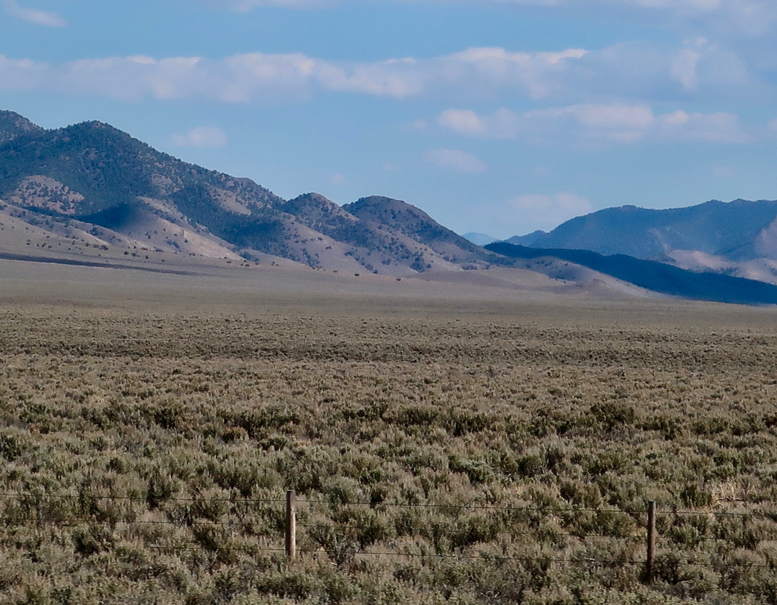
Thursday’s Travel Blog: Peggy and I continue our exploration of America’s back roads by leaving Hickison Petroglyph Recreation Area behind and following America’s Loneliest Road across the rest of Nevada and into Utah where we discover Highway 50 is still lonely. And beautiful.

Tuesday’s Blog-a-Book: The clock is ticking as we find a name, route and reluctant sponsor for our backpacking fund raiser. Then it was time to recruit participants. They came out of the woodwork! Among them: A ballerina, a bomb defuser, a witch, and a 70-year-old wood elf.

Hickison Petroglyphs: Strange Glyphs and Stranger Rocks… America’s Backroads

One thing that Peggy and I have noticed over our years of checking out petroglyph sites is that they are often located in very scenic areas or on unusual rock formations. The rocks found at Hickison Petroglyph State Recreation Area definitely qualify.

As we continued our backroads’ journey along Highway 50 through Nevada on America’s Loneliest Road, we passed over Hickison Pass, dropped down into another valley, and arrived at our campground for the night: Hickison Petroglyph Recreation Area. Peggy and I had stopped off here on another journey and been fascinated by both the rocks and petroglyphs.

The rocks are composed of volcanic tuff, ash that has been ejected from an erupting volcano and then solidified into rock. It erodes easily in comparison to harder rocks, which is what has created the interesting rock forms at Hickison. It is also easily carved into petroglyphs. Like the Grimes petroglyphs that I featured on last Thursday’s travel blog, these are ancient, dating back thousands of years. But, as you will see from the following photos, they represent a different style.

The campground lacks water and electricity but we found it quite scenic. When we arrived, large, colorful bugs that resembled giant grasshoppers or crickets occupied our campsite. They are common in sagebrush country and go by the name of Mormon crickets. Actually they are shield-backed katydids.

One of dozens of shield-backed katydids or Mormon crickets that occupied our campsite.
Quivera, our small RV, cosily tucked away among the junipers and pinyon pines. Pinyon pine nuts were an important source of food for ancient peoples and Native Americans.
A view from the campground looking out on Monitor Valley.
I found the cloud formation interesting.
Clouds from an evening walk.
As I mentioned above, prominent landmarks were frequently chosen by early peoples and Native Americans to create their rock art.
This is the panel featured on the above rock.
I won’t pretend to have a clue here…
Counting isn’t unusual in petroglyphs. For example, they might relate to the length of a journey. A woman blogger who counted the short and long marks here noted that there were 28 short marks and 6 long marks, possibly representing the menstrual cycle. Numerous vulviforms (representations of female genitalia) located at the site would tend to support this. There is some speculation that the area was used for girls’ puberty rites.
Early pioneers thought these might represent horses hooves. Nope.
Another example. BTW, for those of you who are Tom Robbins fans, he writes in his book, “Wild Ducks Flying Backwards” of a visit he made to another site along Highway 50 that is so full of these petroglyphs that it is known as the Canyon of Vaginas.

But back to the rocks.

I’ll conclude with this handsome fellow.

As you read this, Peggy and I are off celebrating Thanksgiving and our Anniversary at a favorite campsite on the Oregon Coast. We will catch up on comments and blogs when we return next week. In the meantime, we hope you are having/had a great Thanksgiving.

NEXT BLOGS: Tuesday is Blog a Book day where I will introduce you to the cast of characters that decided to hike a hundred miles across the Sierras with me. On Thursday’s Travel Blog we will finish up our trip across Nevada on Highway 50 and on into Utah, where it is also lonely.

A Grand but Insane Idea… The First Sierra Trek: Part 1

It’s Blog-a-Book Tuesday. Now that I have provided an introduction to my book, it’s time to start rolling out stories. I’ve chosen my first ever 100-mile backpack trek across the Sierra Nevada Mountain Range for my kick-off. Given that I didn’t have a clue about what I was doing was crazy enough, that I chose to take 61 people aged 11-71 with me as a fund-raiser for the American Lung Association was pure insanity. I was lucky to survive with my career and life intact.

As promised, I am going to blog the book in bite sized pieces with each post ranging between 500 and 1000 words. Some of these stories may be familiar to you since I have written about them before in my ten years of blogging.

The Black Buttes of the Sierra Nevada Mountains are lit up by the evening sun.
Inspired by the beauty of the Five Lakes Basin found north of Interstate 80 in the Sierra Nevada Mountains of California in 1969, I started a lifetime of backpacking. Here, the setting sun lights up the Black Buttes.
I was camping on this little lake when I was inspired by the idea of raising money for the American Lung Association of Sacramento by running a hundred mile backpack trip.

During the early summer of 1974, my life took a dramatic shift. My friend Steve Crowle and I had used a long summer weekend to go backpacking into one of my all-time favorite destinations, the Five Lakes Basin, north of Interstate 80 in the Sierra Nevada Mountains. It’s a beautiful area with towering cliffs and jewel-like lakes that were carved out by glaciers some 20,000 years ago.

We were lazing around our campfire on the last night and bemoaning the fact that we had to return to civilization and jobs the next day. Glowing embers provided warmth and pulled us closer to the fire while a full moon bathed the Black Buttes in silver light and focused our attention outward.

“God, wouldn’t it be great if we could make money doing this,” Steve sighed. He had replaced me as Executive Director of Sacramento’s Ecology Information Center when I had become Executive Director of the American Lung Association of Sacramento. In addition to his boundless energy and intelligence, he was a bit on the wild side. He had hobbies like jumping off high bridges into shallow water and experimenting with various mind-altering drugs. But mainly he loved life and had a vast appetite for new experiences. One such experience was backpacking. 

Suddenly my mind took an intuitive leap. The lights came on, the bells went off, and four and twenty blackbirds sang the Hallelujah Chorus.

“We can, Steve!” I managed to get out as my thoughts played hopscotch. “Look, as Executive Director of Lungland, one of my main responsibilities is fund-raising.” It was a fact I was painfully aware of.

The once Tuberculosis Association and now Lung Association had spent 70 years happily sending out Christmas Seals and waiting for the donations to roll in. While the Golden Goose wasn’t dead, it was ailing. We had conquered the dreaded TB and selling lungs wasn’t nearly as easy. Easter Seals had kids, the Heart Association the most appealing organ in the body, and the Cancer Society the scariest word in the dictionary. We had emphysema, bronchitis, asthma, the remnants of TB, and diseases with unpronounceable names such as coccidioidomycosis. Adding insult to injury, several non-profit organizations had added seals to their fund-raising arsenals. Competition for bucks to do-good was tough and the well was running dry.

“What if,” I pondered out loud, “we ran a backpack trip through the mountains as a type of multi-day walk-a-thon with people raising money for each mile they hiked?” I liked walk-a-thons. They involved people in healthy activities as well as raising money. They gave something back to the participants.

Steve’s attention jumped from low watt to high intensity. “When? Where? For how many miles and days? How can I be involved?” The questions tumbled out.

“I don’t know, I don’t know and I don’t know,” I responded, laughing at his enthusiasm although mine was hardly less. “But,” I added, throwing out some crazy figures, “what if we made it for nine days and 100 miles?”

That quieted us down. Neither of us had ever backpacked for nine days straight, much less 100 miles. A long trip for me had been six days and 30 miles. I threw out the nine days because it included a full week with both weekends and the 100 miles because it sounded impressive and might fire people’s imaginations. It did mine.

“Why not,” Steve had finally said with more than a little awe in his voice as a new fund-raising program was born. It was an event that would keep me happily running around in the woods over the next 30 years and raise substantial funds and friends for the American Lung Association. But all of that was in the future; Steve and I just wanted an excuse to go backpacking. How to get from point a to point b was the question. As folks like to say, the devil is in the details.

My first challenge was selling the event to a reluctant Board of Directors. Running a 100-mile backpack trip as a fundraiser was a huge leap from sending out Christmas seals. At 29, I was the youngest Lung Association Executive Director in the nation and I had already ruffled enough feathers to dress a turkey. For example, a research doctor on my Board was foaming at the mouth because I wanted our organization to focus on reducing the primary causes of lung disease: air pollution and tobacco use. What would he think of me running off to the woods on a backpack trip? Another Board member loved his pipe and was irritated at me because I had persuaded the Board that our meetings should be smoke-free. His irritation was nothing, however, in comparison to a number of California Lung Execs who were livid because I was proposing that Lung Association offices should be smoke-free as well. What a radical idea that was. I heard an older woman exec proclaim at a conference, “I am going to kick that young man in the balls!” She made sure I was within hearing distance. 

“You want to do what?” with a decided emphasis on the first and fifth words is the best way I can describe the Board’s reaction. It was easy to translate: “Why would a 29-year-old executive director with less than a year of experience under his belt want to risk his career on such a harebrained idea?”

I echoed wild Steve, “Why not?”

NEXT POSTS: On Thursday’s travel blog we continue our back roads’ journey along Highway 50 across the Nevada Desert and camp out at the Hickison Petroglyph area with its strange petroglyphs and unique rock structures. Next Tuesday it’s back to blogging a book. The Lung Association Board approves the Trek, I hire Steve, and we begin a recruitment effort. People come out of the woodwork wanting to go…

NOTE: Peggy and I are heading over to the Oregon Coast to celebrate Thanksgiving and our Anniversary, camping out in Quivera the Van at a site that may not have cellphone or Internet connection. If so, I will get back to responding to comments and reading posts next week.

The Loneliest Road in the US was Lonelier in 7,000 BCE… Petroglyphs of Grime’s Point

I took this photo while standing at Grime’s Point Archeological Area just off Highway 50 about five miles east of Fallon, Nevada on an earlier trip. The terraces above the basalt boulders were cut into the side of the ridge by the ancient Pleistocene Lake Lahontan as it rose and fell. Had I been here 10,000 years ago I would have been under 700 feet of water. Traveling over today’s Highway 50 route would have required a submarine.
Turning around from where I was standing was more basalt and a view of Highway 50. A pickup pulling a trailer makes its way over ‘The Loneliest Road in America.” Looking across the valley you can see ranges fading into the distance that are part of the Basin and Range complex of Nevada, which is part of the Great Basin of the Western US.
Had you arrived on the scene much later, say around 5,000 BCE or 7,000 years ago, you would have discovered that Lake Lahontan was much shallower as glaciers receded to the north and warmer temperatures prevailed. The area would have been marshy and filled with abundant wildlife. Ancient peoples had arrived on the scene and were pecking away at the rocks, creating some of the earliest petroglyphs in Nevada and North America. Grime’s Point features these petroglyphs. A copy of one of the petroglyphs is on the left.
The pit and groove petroglyphs here are among the oldest petroglyphs found in Nevada.
As to what they mean is anyone’s guess. One thought is that they were used in hunting rituals by shaman to assure success.
This basalt boulder was covered with pit petroglyphs. Ancient peoples and later Native Americans would use rocks to peck away the desert varnish that covers rocks to show the lighter rocks underneath. One way of measuring the age of petroglyphs is to see how much desert varnish has since re-covered the rock petroglyphs. The color of these pit and groove petroglyphs has returned to the original varnish color. Translate old.
In contrast, this is a much more recent petroglyph, probably carved in the last 500 years. To me, it appears to be a big horn sheep. But then again…
Most of the petroglyphs fall somewhere in age between the ‘sheep’ petroglyph above and the pit and groove style of petroglyphs. I like the almost-polished look of this basalt boulder. If you look carefully, you can see petroglyphs stretching down and out on both sides of the rock. Following are several examples of the petroglyphs I found wandering around among the boulders. It’s like a treasure hunt. Fun.
I’ll conclude with a final view of the landscape at Grime’s Point Archeological Area. Remains of what may have been a rock fence used to drive deer and antelope to the dinner table is found up near the top of the ridge.

BLOG-A-BOOK TUESDAY: Join me on the first 100-mile backpack trek I ever organized. Leading 61 people aged 11-71 across the Sierra Nevada Mountain Range, I was lucky to escape with my life and career in tact.

TRAVEL BLOG THURSDAY: Peggy and I continue our Back Roads of America Series by stopping off at another petroglyph site along The Loneliest Road in America: The Hickison Petroglyph Area. This time we will be featuring some out-of-this-world rocks and, uh, puberty rites.

A 700-Mile Plus Backpack Trek Down the PCT at 75… The Question Is Why?

Why would a happily married 75-year-old decide to spend three months of his life backpacking down the Pacific Crest Trail? It’s complicated…
The sheer beauty of the wilderness plus 50-years of backpacking are important factors! This is Castle Crags in Northern California. They loomed up behind me in the photo above.

“Why?” G, a blogging friend from Florida, asked when I posted my plans to spend the summer backpacking down the PCT. Why would I subject myself to ice cold baths and human-snacking insects? Why would I want to spend 7-9 hours a day hiking over difficult terrain in 100-degree weather while dodging fires, breathing smoke, and carrying a 30 to 35-pound pack? Why would I subject my body to the common ailments of through-hikers: exhaustion, near-starvation, freezing nights, blistered feet, trashed toenails, sprained ankles, shin splints, twisted knees, cranky hips, sore shoulders, bug bites, sun burn and poison oak, not to mention possible encounters with large furry animals sporting big teeth. 

My guess is that G thought 75-year-old men should limit their exercise program to hiking up and down the stairs on a cruise ship or possibly hiking from the TV to the bathroom during a football commercial. Puttering in a garden is also okay; as is fishing off the end of a pier. Going for short hikes is to be encouraged. It helps keep you healthy. But backpacking several hundred miles through rugged wilderness— much of it by yourself? That’s crazy.

Perhaps. But I had been backpacking since 1969, when the PCT was a barely-hatched one-year old, or since 1954 if you counted Boy Scouts. I had started exploring the jungle-like graveyard next to our home at five, and completed my first solo, mile-long hike in the wee hours of the morning when I was seven. While other boys my age had spent their summers playing sports and hoping to dazzle coaches, parents and friends, I had wandered farther and farther afield with nothing but my dogs for company. High school and college had seen a hiatus as studies, work and girls took precedence. But I returned to my wandering ways as a Peace Corps Volunteer, exploring the jungles surrounding my home in West Africa and carrying a compass so I could map them out.  And avoid getting lost.

Cheryl Strayed’s journey on the PCT in Wild and Bill Bryson’s hike along the Appalachian Trail in A Walk in the Woods had inspired me to think about undertaking my own long-distant trek. They were admittedly a tad younger when they started their adventures— at 26 and 45 their combined age was less than mine— but I had tons more of experience. I had celebrated my 60th birthday by backpacking 360-miles from Lake Tahoe to Mt. Whitney. Certainly, I could do twice that to celebrate my 75th.

I’d chuckled when I read Bryson’s chapter on a bear he may or may not have seen in the night, and how he had gone scrambling for his pocket knife.  Scary yes— big creatures that think of you as a menu item usually are, especially on a dark night— but I have had dozens of encounters with bears. Once, I woke up at four in the morning with one standing on top of me, sniffing my breath. Now, that’s scary!  Another time I was stalked by a grizzly in Alaska. And then there was the time I had a discussion with one of the great brown bears of Katmai over why he shouldn’t eat me. A ranger had told me that if I encountered a bear out on the trail, I should “speak to it in a calm voice and back away.” But what do you say to a thousand pounds of bulging muscles with four-inch long claws? Read on. 

Unlike Strayed, I knew that seemingly insignificant ounces add up to bone crushing pounds when carried on your back. I’d led hundred-mile backpack trips for 30 years in California and Alaska. Preparing first-time trekkers to go was one of the most important things I did. Now, picture backpacking over 1,100 miles with zero preparation, which Strayed did. While I had greatly admired her fortitude in hiking on the PCT through California and Oregon, I’d cringed at her lack of readiness. But I readily admit that it made a good story and served as an inspiration for thousands of women, and probably men as well.

By now, I am sure that you realize that I love backpacking. I love it for what it does for my mind and my body. It’s amazing how fast the worries of the world fade away when you are hiking up a mountain. And it’s fun to see what a week of backpacking does for your body. But what I like most is that backpacking gets me out into the woods. Time slows down. There is great beauty, and peace, and healing, and maybe even a touch of salvation. As John Muir noted, “The clearest way into the Universe is through a forest wilderness.” 

This book concludes with my trip down the PCT at 75. I’d started with a goal of backpacking at least 500 miles and possibly as many as a thousand. Between giving my lungs fire-free breaks and providing more time for rest and recovery between trail sections, I split the difference, not bad for seven decades. And I was lucky to have total support from my wife, Peggy. Not only did she join me for three sections of the trip, she was waiting for me at the end of the other sections with a warm smile, a tight hug, and a cold beer. And she had camped out for the week by herself so she would be there to greet me and provide other backup if needed. If that’s not love, I don’t know what is.

The PCT trip is just a small part of my backpacking story, however. One can have a lot of adventures in 50 years of wandering in the wilderness and I plan to incorporate several into this tale, including the bear stories mentioned above. I also want to talk about the beginning, how I fell in love with the woods and outdoors as a young boy. That always gets a bit iffy in terms of memory. But getting kicked out of the first grade at five for a year was an important factor in that it encouraged me to explore the jungle-like graveyard next to our home. Choosing to sleep outside in the summer, even if it meant sleeping on the ground, was another. Such things tend to stick in your head. At least they do mine. 

While my emphasis will focus on the adventures, I also wish to encourage my readers to think of the wilderness as one of our most precious heritages, taking us back to our very beginnings as humans. When we lose our connection with the outdoors, we lose a bit of our humanity. We owe it to ourselves to reconnect or maintain our connection, even if it is simply going for a walk in the town park and listening to the birds sing. And we owe it to our children, grandchildren, and future generations to protect the world’s remaining wilderness areas. 

So, let’s get started as I tackle the insane task of leading a group of 61 people aged 11 to 70 on a 9 day, 100-mile backpack trip across the Sierra Nevada Mountain Range. The event kicked off my part-time career of leading long-distance backpacking treks and guaranteed that backpacking would always be a part of my life.

That I survived the experience and had any kind of a career at all was close to a miracle…

NEXT POST: On Thursday, Peggy and I continue our exploration of America’s backroads as we follow “The Loneliest Road in America,” Highway 50 through Nevada and into Utah.

The Loneliest Road in America: Highway 50 across Nevada… The Backroads’ Series

Today marks the beginning of my Backroad Series where I will feature highways that Peggy and I traveled over this past summer on our 8,000 mile journey around the US in our small RV.

Almost every photo I took while driving across Nevada emphasized Highway 50’s claim to being the loneliest road in America. This is desert country where mountain ranges are inevitably followed by basins. The desert is courtesy of a rain shadow created by the Sierra Nevada Mountains. The basins and ranges are courtesy of plate tectonics.

In 1986, Life Magazine declared that the section of Highway 50 that stretches across the Nevada desert was The Loneliest Road in America. It wasn’t meant as a compliment. It was more like, “Why would anyone in their right mind choose to drive this road?” But Nevadans saw it differently. They knew an opportunity when they saw it. After all, the state got its kick-start when silver and gold were discovered in abundance. And then it built Las Vegas. 

Who wouldn’t want to drive The Loneliest Road in America, the folks in Carson City, Nevada’s capitol, reasoned? Adventuresome souls would immediately add it to their bucket list! Signs were made and publicity was cranked out. Maybe the road wouldn’t be so lonely…

Signs declaring Highway 50 across Nevada to be ‘The Loneliest Road in America’ were created for publicity and photo ops.

It worked for me. I’ve driven the highway three times since. My last time was this past summer when Peggy and I went out in search of backroads across America. Highway 50 definitely qualifies— and it is still one of the loneliest roads in America.  It wasn’t always that way. Once upon a time in the 60’s, that’s the 1860s, it served as the premier route for people making their way West. The Overland Stage Coach Company, the Pony Express, and the country’s first national telegraph all made use of it. In 1913 it became part of the Lincoln Highway, America’s first transcontinental road.

I know a bit about the road. I was raised in the small town of Diamond Springs, which is located in the western foothills of the Sierra Nevada Mountain Range, three miles from Placerville, AKA Hangtown. If you walked out my front door and hiked a block east on Highway 49 past Fitzgerald’s house and the jungle-like graveyard that backed up to our property, you came to Missouri Flat Road. Turning left there took you to Highway 50, a mere mile away. My brother Marshall and I often made that hike in the summer when we were on our way to one of our favorite swimming holes, the 20-foot-deep Tub on Weber Creek. 

I was vaguely aware at the time that if you climbed on the road and drove east for a long time, you could reach the Atlantic Ocean. I also knew about the Pony Express connection. The parents of one of my close friends in Diamond Springs owned a small café in a historic building that had once served as a Pony Express stop. That was about it except for the annual Wagon Train that made its way from Lake Tahoe to Placerville on Highway 50 to celebrate the ‘good old days.’ The town would close Main Street to traffic and everyone would party. As I remember, the men would grow beards for the event, have fast-draw contests, and get drunk. Luckily, their six shooters were filled with blanks. 

Later, when I was in college, I had a laundry route in the summer that ran from Placerville up to South Lake Tahoe over Highway 50. The beautiful 120-mile round trip across the mountains paid for my college education. That section of Highway 50 was far from lonely, however. On Fridays and Saturdays, it could resemble a parking lot as people made their way up from the Bay Area and Sacramento to play at Lake Tahoe and gamble.

To avoid the possibility of the crowded highway this past summer, Peggy and I climbed on Interstate 80 in Sacramento and zoomed over the Sierras through Reno to the small town of Fernley, where we left the freeway behind and drove southeast to pick up 50 as it passed through Fallon, Nevada. That’s where lonely begins. (BTW: Had we gone north from Fernley for 60 miles, we would have ended up in the Black Rock Desert, the site where Burning Man takes place.)

I am going to do three posts on Highway 50 through Nevada. Later, I will do a couple of posts on 50 in West Virginia and Ohio as part of my backroad series. I took the photos in this post between Fallon and the Hickison Petroglyph Recreation Area in the center of the state.

Once you leave Fallon, Highway 50 seems to go on forever. Except for a few towns (three), ranches, and mining operations, the population drops close to zero.
Twenty miles outside of Fallon, first time drivers of Highway 50 are surprised to come on Sand Mountain, a large sand dune that is two miles long and 600 feet high. Locals say it ‘sings’ to you. The sand came from ancient (and very large) Lake Lahonton, a product of the glacial age. It dried up 9,000 years ago as the climate grew warmer and glaciers retreated north.
While many people think of the desert as desolate, I’ve always found it to have its own unique type of beauty. This is sagebrush country!
Mountains climb up to over 10,000 feet along Highway 50 through Nevada. Passes range between 6,000 and 7,500 feet.
I like the contrast here between the blue sky, dark mountains and buff colored desert floor. The geologist Clarence Dutton described the narrow parallel mountain ranges that define the topography of the Basin and Range like an “army of caterpillars marching toward Mexico.”

About half way between Fallon and Austin, Nevada, we came upon a small, historical marker site that featured the Overland Stagecoach, the Pony Express and America’s first cross country telegraph. All three were inspired by the North’s need to maintain communication with the West during the Civil War. Both the Pony Express and the Overland Stage Company had stations here. Three illustrations (early photos?) at the site captured our attention.

The Pony Express ran its historic route from St. Joseph, Missouri to Sacramento, California— a distance of 1966 miles— in ten days. Each rider would normally cover between 75 and 100 miles at top speed. Stations along the way had saddled horses ready to go when the rider arrived. It took approximately two minutes to make the change. While the Pony Express has reached legendary status, its run, so to speak, was a short 18 months from April of 1860 to October of 1861 when the transcontinental telegraph was created.
The Civil War and the need for rapid communication between the East and West inspired Congress to push and pay for the building of the telegraph. The creation of the Pony Express was seen as a stopgap effort while it was being built. My dad worked as a lineman in the 30s. His job was to climb up poles like these as power lines were stretched across Northern California and Oregon.
The Overland Stage Company began its run over the route at about the same time the telegraph was completed. Serving as the primary mode of passenger transport between Missouri and California, it had originally operated a more southern route. The coming of the Civil War forced it to move north to the central Nevada route. A young Samuel Clemens (Mark Twain) would use it to get to Nevada. When the transcontinental railroad across America was completed in 1969, the route was discontinued.

Rumor is that a Pony Express horse kicked over a rock that showed silver and the rush was on. Whether this is true or not, the presence of silver led to a silver rush and suddenly the town of Fallon was born. Soon it boasted a population of over 10,000 and even had a castle! Now it is best described as sleepy and historic.

When we drove through Austin, major work was being done on the road and it wasn’t conducive to stopping, but I did snap a few photos.The barely visible sign on the building says Stage Coach Inn.
Another photo of downtown. I was aiming my camera a bit high to avoid all of the roadwork. One of several churches built in Fallon during the heyday of silver mining looms in the background.
Austin’s best known landmark is Stoke’s Castle. It was built by an eccentric millionaire from the eastern US who only occupied it for a few months during the silver rush. While small in terms of what we think of as castles, it reminds me of the castles built between Scotland and England for protection against raiding (and possibly as a base for raiding) in the 13th and 14th Centuries. Some of my ancestors reportedly came from the region. I suspect that they were outlaws.
We wrapped up our first day of backroad travel by climbing up Highway 50 into the Humbolt-Toiyabe National Forest and over Hickison pass. We were pleased to see green! Next Thursday I will feature the Hickison Petroglyph area as well as the Grime’s petroglyph site that served as bookends for our first day of travel.

NEXT POST: On Tuesday, I will feature the second part of my introduction to the book I am blogging, “It’s 4 AM and a Bear Is Standing on Top of Me.” I answer the question about why I would undertake a 700 mile plus backpacking journey down the PCT at 75. Will a plea of insanity work?

It’s 4 AM and a Bear Is Standing on Top of Me…

This is it. The beginning of my book on backpacking and how I fell in love with the wilderness. I intend to blog it, one story at a time. My hope is that you will join me. There are many, many adventures: most are fun, some scary, and all challenging. If you been following me for a while, you will recognize several of the stories. I have every intention of mining my blog. I’ll keep the stories short, something you can read in a few minutes. So sit back, relax, and enjoy. Here we go...

This is Popcorn!, one of many through-hikers I met on the 700 mile backpack trip down the PCT that I went on to celebrate my 75th Birthday. She offered me some valuable advice…

INTRODUCTION: Part 1

On Bathing in the Woods

Getting naked is as essential to bathing in the woods as it is to bathing at home. The definition of clean, however, changes. Speed becomes critical when your bathwater comes from an ice-cold stream. A hundred mosquitoes viewing your bare body as a large neon sign blinking “Eat Here” hurries the process even more. You can almost hear the clarion call go out: “Major target located in northeast quadrant. Proceed at once to location. No invitation is necessary. BYOB. (Bring Your Own Beaks.)” A few swipes with a wet cloth and you’re done. So what if you still smell. 

“Wipe your clothes with pine needles,” Popcorn! suggested. “Then you will smell like a pine tree.” It was a morsel of through-hiker wisdom. Popcorn! was heading north on the Pacific Crest Trail (PCT) in her quest to hike the 2650 miles from Mexico to Canada while I was heading south from Mt. Ashland, seeing how far I could push my 75-year-old body over the summer. She had caught up with me near the top of Red Mountain between Interstate 5 and Burney Falls in Northern California. I had just huffed up the mountain in hundred-degree heat toward the end of a long day and had to persuade my feet to move. “Okay left foot, it’s your turn.” I was taking a break while eating my late lunch of two fig bars and a handful of nuts while contemplating a nap. Old people do that.

Popcorn! had stopped to chat for a few minutes and introduced her trail-name with an exclamation point. She was a young woman with a wide smile and straight, shiny teeth that looked like they belonged in a dentist’s ad. Earbuds dangled down from her Osprey backpack shoulder strap. Tunes helped her hike the 20-30 miles per day required to finish the trail. I’d asked about swimming possibilities in Peavine Creek, where I planned to camp for the night. I was meeting my wife Peggy at Burney Falls the next day and wanted to be cleaner than trail-normal. Popcorn! had told me that the creek was shallow and covered with brush. Even getting water to drink was a challenge. That’s where the pine needle discussion had come in.

As she had prepared to hike on, I’d asked if I could take her photo for my blog: wandering-through-time-and-place.com. “Of course,” she responded, “as long as you put the exclamation point at the end of my name.” You quickly learn that through-hikers are a cast of characters and trail names are special. I’m Wanderer. After she left, I reached up and plucked a bundle of needles from the young Ponderosa pine I was using as a pillow and applied the sniff test. They had a rich piney smell. Not bad, I thought to myself, but I’d prefer red fir needles. Then I would smell like a Christmas Tree. I idly wondered if Peggy would view me as a present. Maybe, if I wrapped a ribbon around my body. I had some red parachute cord along… 

Given the challenge of bathing in the woods, I was a surprised a few weeks later when Peggy declared, “That was a good bath!” as we made our way back to camp after washing off next to James Creek in the Three Sisters Wilderness of Oregon. I had jumped north in my journey, trying to get away from the endless smoke and fires of California, and found a trail section that Peggy could hike with me. We had carried our small, folding buckets across a meadow to the meandering stream so we could fill them with water and avoid getting soap in the creek. I’d also carried a ground cloth to throw down on the grass.

The good news about the bath was that there were no mosquitoes. It was too late in the season. The bad news, as we expected, was cold water. But there was more. First, we were out in a meadow exposed to the world. Anybody hiking down the trail would see a pair of old folks as naked as the day they were born. Thrilling, I’m sure, but all the more reason to be hasty. Second, there were cute little green frogs hiding in the grass. There was a real danger of squishing one under our bare feet. And who wants to squish a cute green frog between her toes— or even an ugly one? 

Finally, there were the spiders, hundreds of them. I’ve never seen such a concentration. I spotted them scurrying away from under our tarp when I tossed it down on the grass. Apparently the instant eclipse had upset their world view. Harry Potter and Ron Weasley encountering the mass of hungry spiders in the Chamber of Secrets leapt into my mindFortunately, these guys were small and seemed more interested in running away than toward us. Peggy didn’t spot them and I chose not to tell her.  She’s not particularly fond of bugs with eight legs. Any spider that has the audacity to crawl into our home in Southern Oregon is guaranteed a short lifespan. “If they wanted to live, they’d stay outside,” she declares airily. Even though the meadow spiders were obeying her rule, I pictured her stomping across the grass committing arachnicide. 

NEXT POSTS: Thursday— The loneliest road in America. Highway 50 as it makes its way across the desolate Nevada Desert. Next Tuesday— my book introduction continues as I answer the question why I decided to take on the challenge of hiking down the PCT at 75, much of it by myself.

Change Is in the Air… And I Am Changing with It

Upper Applegate near our home this week.

I’m sitting in my writing chair, listening to John Coltrane, and watching a flock of Western tanagers invade our birdbath. It isn’t that they want a bath; they’re thirsty. And the birdbath is the local watering hole. Just about everyone who is anyone in the animal kingdom around here drinks out of it.

The tanagers filled the bird bath. This went on for several minutes as the whole flock stopped by for a drink with 15-20 birds at a time.
Robins too, joined the party at the water cooler. They have been migrating through. Maybe they are discussing the best place to find juicy worms.
Our Stellar jays prefer to drink alone.
As do the flickers, but this little tanager didn’t let it stop him. The flicker appears to be a little miffed about the situation.

Change is in the air. Birds of feather are flocking together. Fall colors are lighting up our property and the surrounding countryside. And the bucks are amorous. Not so much the does. Yet. They leap out of the way whenever a buck sneaks up behind them. The does still remember what happened last year. All those promises about sticking around and helping raise the kids. Right. And even if they don’t remember, they think that the bucks should work for what they want, prove their worthiness, and wait until the mood strikes. “Foreplay, sweetie. Foreplay.”

A doe, in the background, took advantage of the buck’s drinking to quietly slip past.
If you want an example of what lengths does will go to to avoid the bucks, this is it. I looked up at our pump house a couple of days ago and there was a doe on the roof. Squirrels are always up there doing their squirrelly things. And the male flickers consider it an important dating site. They pound on the vent. He who pounds loudest wins fair lady’s love. But this was a first for a deer. The buck wisely chose not to follow and the doe remained on top, happily grazing on acorns.

Politically, who knows what the heck is happening. But things will resolve themselves, for better or for worse— depending on which side of America’s Great Political Divide you find yourself.  The presidential race is being decided as I type this.

All this change going on has inspired me to modify my blog. With over 10 years and 1000 posts behind me, it’s time. I started Wandering through Time and Place as a creative way to promote books. But I got caught up in blogging for its own sake. It’s fun; it’s addictive. And I really like the people I’ve met along the way. It has also provided an opportunity to play with photography and go on adventures. What’s not to love about that? No regrets. 

But it certainly hasn’t helped the book-writing process. In fact, between all the things involved in living from day to day, going on adventures, and knocking out posts, there hasn’t been a lot of time for my original goal. Plus, there’s another thing.

Early on, I defined my blog in the travel/adventure category. It fit with what I wanted to accomplish. Unfortunately, in “being true to my blog,” I cut out an important part of who I am.  Between my experiences at Berkeley in the 60s, serving as a Peace Corps Volunteer in West Africa, and working as an environmental and public health advocate for most of my professional life, I developed clear ideas about the direction of the nation and the world. For the most part, I have kept them out of the blog. It’s been really hard. Sometimes I slip.

So, here’s what I am going to do. 

I am currently working on two books: A revision of The Bush Devil Ate Sam (my Peace Corps memoir) and A Bear Is Standing on Me (a memoir on my 50 years of wilderness adventures). Like I did with my original Peace Corps book, I am going to blog them, one Tuesday at a time, alternating between the Bush Devil and the Bear. This will provide some much-needed focus for me, while hopefully providing you with a bit of entertainment. I’ll keep Thursdays for my travel blog. 

Occasionally, I will do an opinion piece about current affairs and the future. These will always be on Sundays.  This way you will know what to expect and can avoid them if you so desire. Or, join the discussion. No trolls, however. On the recent post I did on the Phoenix/Talent fire and global warming, one person commented more or less, “You don’t know what the S**T you are talking about. So shut the F**k up.” Not nice. I hit the delete button— with pleasure. Intelligent, rational discussion will always be welcome.

And now for some fall colors seen in our ‘neck of the woods’ this week. I’ll start with views around our property. The colors really are glorious. I feel like I am in Vermont.

The white oaks in our front yard have turned a burnished orange.
While our big leaf maples have turned a brilliant yellow.
Another example.
Peggy and I found this white oak while on a hike behind our house in the national forest.
This was the view looking south from the oak tree toward California and the Red Buttes.

Our 30 mile drive into Jacksonville and Medford has also been spectacular. It’s worth the trip for the fall colors alone. Count me in as a leaf-peeper. The photo at the top of this post demonstrates why. Here are some more photos from along the way.

I took this photo at the Ruch Library.
These trees are along the highway as we drive into Medford.
I’ll conclude with this ‘wilderness’ beauty. I took it in the Safeway parking lot in Medford.

NEXT POSTS: On Tuesday… Kick off for blogging “It’s 4 AM and a Bear Is Standing on Top of Me. On Thursday… The Loneliest Road in America: Highway 50 across Nevada.

The Bandon, Oregon Series: Part 3… Face Rock State Scenic Viewpoint

Peggy and I arrived in Bandon on a stormy day and drove over to the Face Rock State Scenic Viewpoint as soon as we had checked into our campground. Face Rock was shrouded in rain and mist. There’s a legend that says you can hear a woman’s voice in the wind if you listen. It all sounds like an appropriate Halloween tale…

According to Native American lore, the beautiful Indian maiden, Ewauna, arrived with her father, Chief Siskiyou, in the Bandon area for a major potlatch. Ewauna had never seen the ocean and immediately fell in love with it. (For those of you who aren’t familiar with the potlatch concept, the object is to give things away to guests, the more you give, the more you are admired.)

What’s not to love about the beautiful ocean beaches near Bandon? This photo is looking south from the Face Rock Scenic Viewpoint. The rock in the distance is Haystack, which I featured in my last Bandon post about the Devil’s Kitchen State Park. The two people among the rocks provide perspective.

“Don’t go near the ocean,” the old men of the tribe warned Ewauna. The evil spirit of the ocean, Seatka, lived in the waters along the coast and apparently had a thing for beautiful young Indian maidens. But what young woman full of life listens to old men? That night there was a great feast as part of the potlatch. After being stuffed with bear and deer and elk and berries, and mussels and clams, everyone drifted off to a deep sleep. That is, everyone except Ewauna.

She quietly got up, careful not to wake anyone, and slipped off to the ocean taking her dog, Komax, her cat, Tenas Puss Puss, and Tenas’s kittens with her. She carried the cat and kittens in a basket. Ewauna ran up and down the beach with joy and jumped into the ocean for a swim, telling Komax to look out for the cat and kittens. Out she swam, farther and farther, as Komax barked louder and louder, warning her of the danger. Suddenly an ugly monster surfaced and grabbed her. It was the evil spirit, Seatka.

Komax stopped barking, grabbed the basket in his mouth and swam madly out to rescue his mistress. Dropping the basket, he sank his sharp teeth into Seatka’s arm. Good boy! The evil spirit screamed in anger and pain, grabbed Komax, and threw him far out into the ocean. For good measure, he also grabbed Teanas Puss Puss and her kittens, tossing them as well. He then increased his grip on Ewauna, squeezing her tight.

“Look into my eyes,” he demanded. He could only possess her if she looked at him.

“Never!” she had replied, staring steadfastly up at the sky and moon. And that is how Chief Siskiyou found her the next morning, still staring up at the sky, refusing to let the evil spirit to possess her. And that is where you can find her today.

Coming back the next day, Peggy and I found Ewauna still staring up at the sky with a smile on her face. Still free. (Photo by Peggy Mekemson.)
Her pets, too, have been turned into rocks (shown on the right) and wait faithfully for her.
Later we returned to the beach to watch the sunset and found Face Rock turned orange by the setting sun. (Photo by Peggy Mekemson.)
Speaking of faces I caught this photo of Peggy as the wind had fun with her hair at the scenic viewpoint.

While Face Rock gives its name to the scenic viewpoint, there are a number of other sea stacks to admire.

Photo by Peggy Mekemson.
Photo taken from inside a cave by Peggy.
Peggy caught this unique shot of the sun sinking into the Pacific Ocean. (Photo by Peggy Mekemson.)
Mine was more traditional.
I’ll conclude my Bandon series with this dramatic evening look of sea stacks at Face Rock. (Photo by Peggy Mekemson.)

NEXT POST: After a thousand posts, it’s time to consider changes in my blog.

VOTE— As If Our Democracy Depends on It… It Does

My first participation in elections is close to ancient history. It started when Adlai Stevenson ran against Dwight Eisenhower for President in 1952. My parents were dedicated Republicans. Family loyalty dated all the way back to Abe Lincoln and the founding of the Party. It’s not surprising that they sent their 9-year-old child off to school proudly wearing an I Like Ike button on election day. Another set of parents, equally devoted to the Democratic Party, sent their fourth grader off to school wearing a Vote for Adlai button. It was inevitable that we would meet up for a debate. 

It took place in the boys’ bathroom, conveniently away from adult supervision. Neither of us knew enough about the issues to carry on a rational discussion, however. After about five words, we reverted to describing the other person’s candidate with as many expletives as we knew. Sound familiar? I was well-practiced in the art form. When I was younger, my brother and I had often held swearing contests where we creatively cussed each other out for fun. My opponent lacked this experience and I easily won the debate. I was still teasing him when we went outside for recess.

Unfortunately, his sense of humor had gone south and he was carrying a baseball bat. He reared back and smashed me across the thigh. (I’ve often suspected he had a slightly higher target in mind.) As it was, I ended up in the hospital with my thigh muscle the size of a softball, or was that a basketball. I was ever so glad that my man Ike won. Revenge can be sweet.

It was a painful lesson, but I learned two things from the encounter.

The first was quite obvious: Never get in a political argument with someone carrying a baseball bat. The second was more complicated. There had to be a better way to resolve political differences. 

The best answer that we have been able to come up with as a nation is democracy.

There is nothing guaranteed about our form of government, however. As astute leaders have noted for the past two hundred years: The price we pay for our liberty is eternal vigilance. There are always people who will rob us of our independence for their own personal gain or ideological beliefs. But there is more, our system of government is based on a few simple concepts. These are some that came to mind.

Our democracy…

  • Reflects the majority view of Americans while, at the same time, protects the basic right of minorities. 
  • Provides stability while adjusting to new challenges and changing needs.
  • Is more pragmatic than ideological when it comes to solving problems.
  • Recognizes that compromise, coalition building, and across-the-aisle cooperation are essential to the decision-making process in determining the nation’s best interest.
  • Provides for a peaceful transition of power. 

More than anything else, people have to believe that democracy works, that their concerns and interests are represented and addressed, and that they receive a fair hearing. When they lose this faith, our democracy loses. We all lose.

The single most important element in protecting American democracy is our right to vote and an uncompromising commitment to a smooth and peaceful transition of power. 

While getting out the vote is a time-honored practice in American democracy, suppressing the vote of those who don’t share a particular perspective is a dark and dangerous path that will inevitably lead to a dark and dangerous future. Numerous examples of suppression exist today in the 2020 election from tampering with the mail system, to making voting difficult, to spreading misinformation, and to threatening voters via the mail, phone and internet. When direct physical intimidation of voters is encouraged, whether it is people carrying AR 15s— or baseball bats— to polling places, the dark times are that much closer.

There are reasons why the Putins of the world, both outside and (sadly) inside our country, wish to reduce our faith in the democratic process. It weakens our nation and points toward an autocratic future— a future that few of us want to see.

Americans are a hardy breed, however. We have been fighting for our rights ever since the founding of the nation with an ever increasing and inclusive definition of citizenship that reflects the changing world we live in. 

And we are not going to stop now. 

Millions of Americans have already voted regardless of how many hurdles have been thrown up. In fact, they are dancing and singing in the multi-hour-long lines that voter suppression has played a role in creating. 

If you haven’t voted yet and are a citizen of voting age— regardless of your sex, ethnicity, color of skin, age, health, economic position, religion, sexual preference, occupation, other differences, or political party— PLEASE VOTE. Our democracy is depending on you.

Curt and Peggy