Today marks the beginning of my Backroad Series where I will feature highways that Peggy and I traveled over this past summer on our 8,000 mile journey around the US in our small RV.
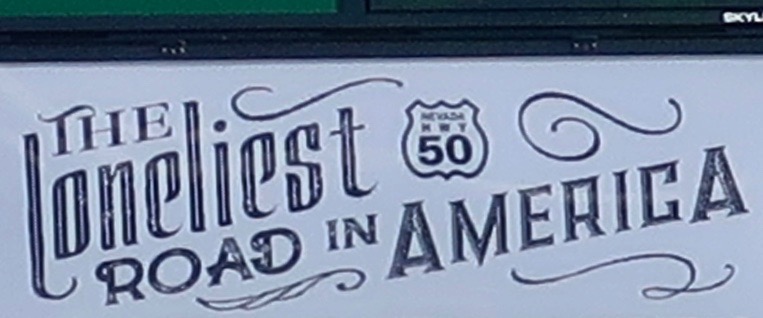
In 1986, Life Magazine declared that the section of Highway 50 that stretches across the Nevada desert was The Loneliest Road in America. It wasn’t meant as a compliment. It was more like, “Why would anyone in their right mind choose to drive this road?” But Nevadans saw it differently. They knew an opportunity when they saw it. After all, the state got its kick-start when silver and gold were discovered in abundance. And then it built Las Vegas.
Who wouldn’t want to drive The Loneliest Road in America, the folks in Carson City, Nevada’s capitol, reasoned? Adventuresome souls would immediately add it to their bucket list! Signs were made and publicity was cranked out. Maybe the road wouldn’t be so lonely…
It worked for me. I’ve driven the highway three times since. My last time was this past summer when Peggy and I went out in search of backroads across America. Highway 50 definitely qualifies— and it is still one of the loneliest roads in America. It wasn’t always that way. Once upon a time in the 60’s, that’s the 1860s, it served as the premier route for people making their way West. The Overland Stage Coach Company, the Pony Express, and the country’s first national telegraph all made use of it. In 1913 it became part of the Lincoln Highway, America’s first transcontinental road.
I know a bit about the road. I was raised in the small town of Diamond Springs, which is located in the western foothills of the Sierra Nevada Mountain Range, three miles from Placerville, AKA Hangtown. If you walked out my front door and hiked a block east on Highway 49 past Fitzgerald’s house and the jungle-like graveyard that backed up to our property, you came to Missouri Flat Road. Turning left there took you to Highway 50, a mere mile away. My brother Marshall and I often made that hike in the summer when we were on our way to one of our favorite swimming holes, the 20-foot-deep Tub on Weber Creek.
I was vaguely aware at the time that if you climbed on the road and drove east for a long time, you could reach the Atlantic Ocean. I also knew about the Pony Express connection. The parents of one of my close friends in Diamond Springs owned a small café in a historic building that had once served as a Pony Express stop. That was about it except for the annual Wagon Train that made its way from Lake Tahoe to Placerville on Highway 50 to celebrate the ‘good old days.’ The town would close Main Street to traffic and everyone would party. As I remember, the men would grow beards for the event, have fast-draw contests, and get drunk. Luckily, their six shooters were filled with blanks.
Later, when I was in college, I had a laundry route in the summer that ran from Placerville up to South Lake Tahoe over Highway 50. The beautiful 120-mile round trip across the mountains paid for my college education. That section of Highway 50 was far from lonely, however. On Fridays and Saturdays, it could resemble a parking lot as people made their way up from the Bay Area and Sacramento to play at Lake Tahoe and gamble.
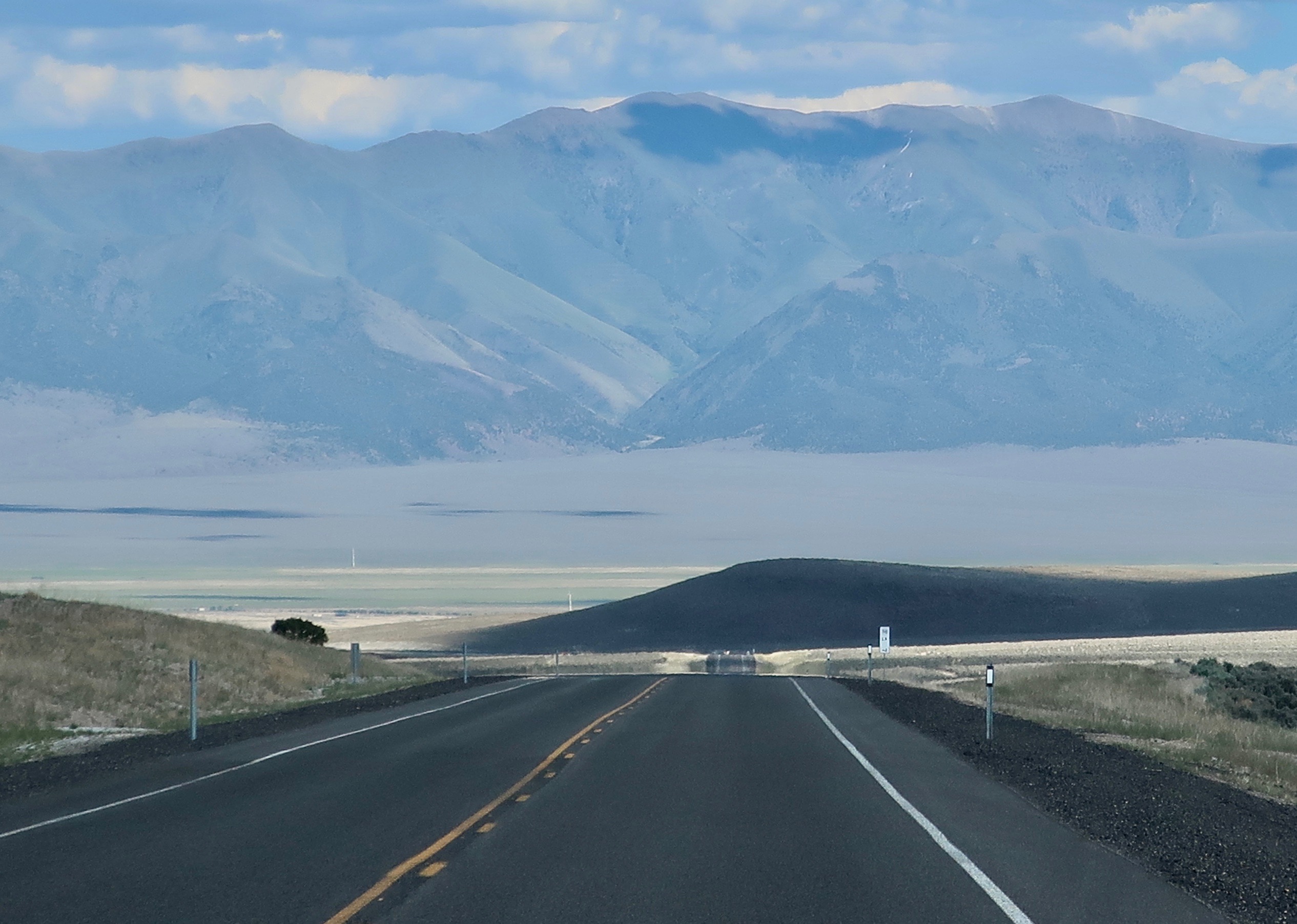
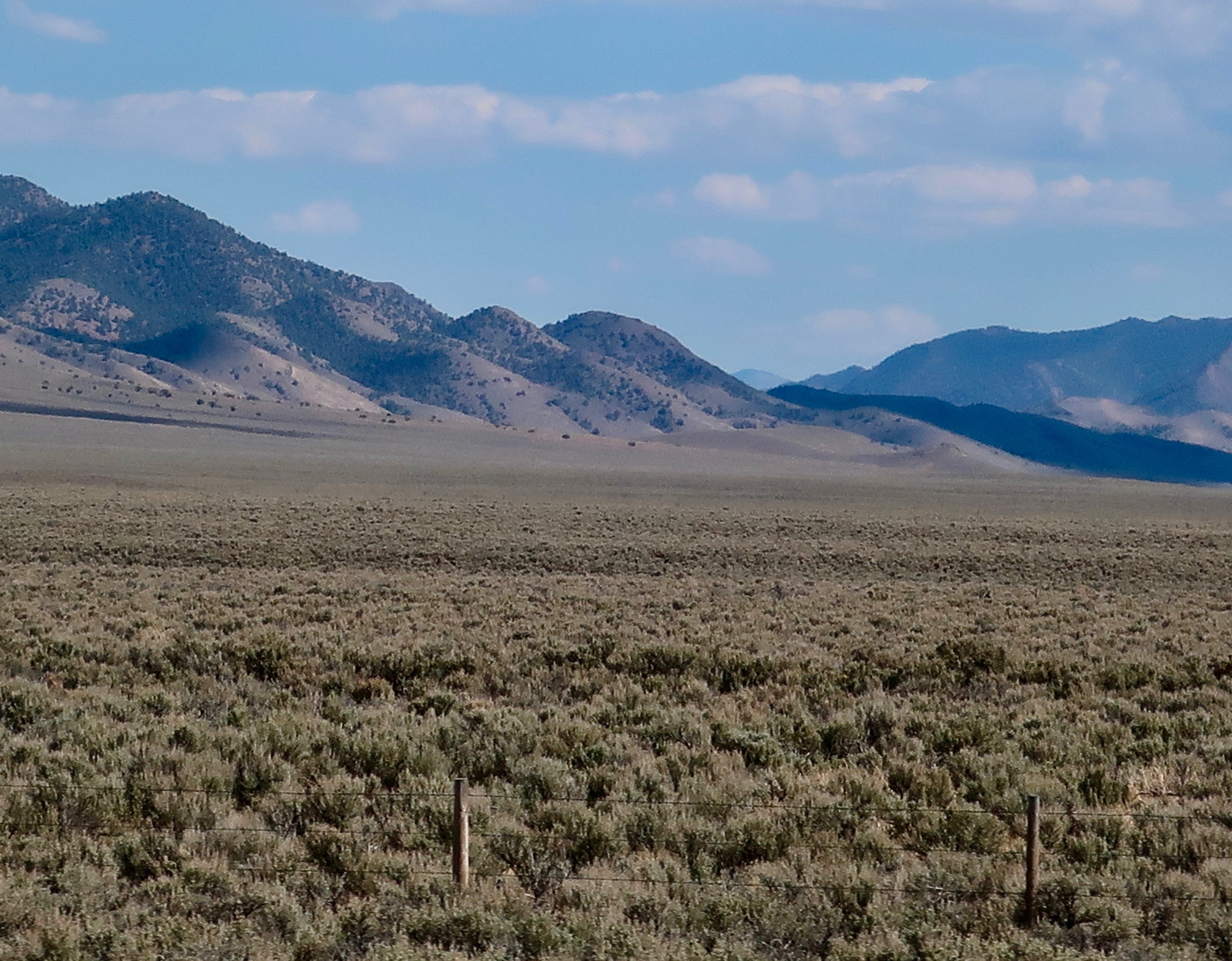
To avoid the possibility of the crowded highway this past summer, Peggy and I climbed on Interstate 80 in Sacramento and zoomed over the Sierras through Reno to the small town of Fernley, where we left the freeway behind and drove southeast to pick up 50 as it passed through Fallon, Nevada. That’s where lonely begins. (BTW: Had we gone north from Fernley for 60 miles, we would have ended up in the Black Rock Desert, the site where Burning Man takes place.)
I am going to do three posts on Highway 50 through Nevada. Later, I will do a couple of posts on 50 in West Virginia and Ohio as part of my backroad series. I took the photos in this post between Fallon and the Hickison Petroglyph Recreation Area in the center of the state.


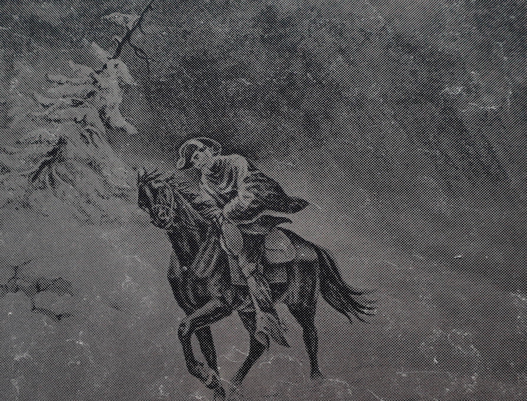
About half way between Fallon and Austin, Nevada, we came upon a small, historical marker site that featured the Overland Stagecoach, the Pony Express and America’s first cross country telegraph. All three were inspired by the North’s need to maintain communication with the West during the Civil War. Both the Pony Express and the Overland Stage Company had stations here. Three illustrations (early photos?) at the site captured our attention.


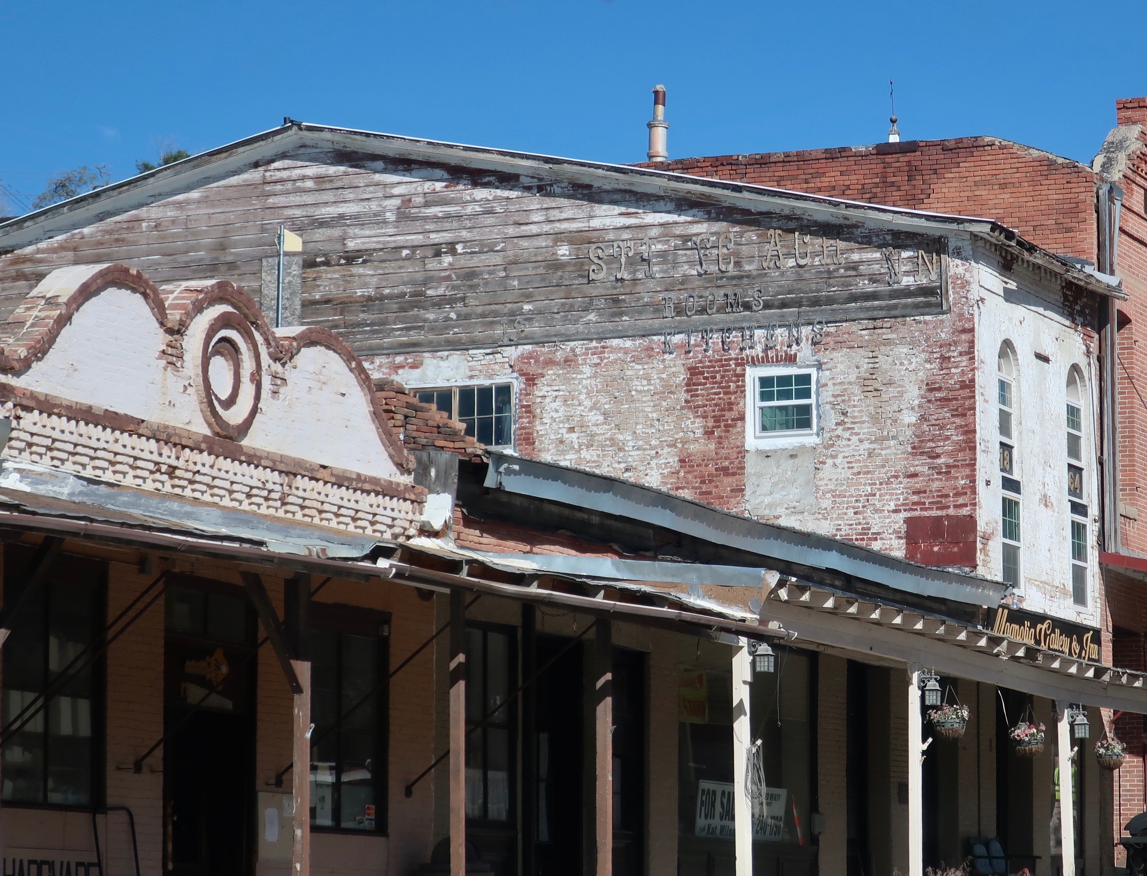
Rumor is that a Pony Express horse kicked over a rock that showed silver and the rush was on. Whether this is true or not, the presence of silver led to a silver rush and suddenly the town of Fallon was born. Soon it boasted a population of over 10,000 and even had a castle! Now it is best described as sleepy and historic.

NEXT POST: On Tuesday, I will feature the second part of my introduction to the book I am blogging, “It’s 4 AM and a Bear Is Standing on Top of Me.” I answer the question about why I would undertake a 700 mile plus backpacking journey down the PCT at 75. Will a plea of insanity work?

Every time I travel out West, I often wonder what it was like for settlers back in the day. Love your memories with Marshall 🙂
Challenging, to say the least, Pam.
Marshall and I were lucky to grow up in country that encouraged wandering at a time before paranoia stopped parents from letting their kids roam at will. On top of that, we had very lax parents. 🙂 –Curt
Same here Curt! Grateful for all of that too 😀
My favorite road, bar none. Years ago I was travelling west, between Middlegate and Fallon, looking up at the arrays of radio antennas on the nearby mountaintops. I had just left the ruins of a Pony Express station, struck by how quickly, in only a little more than a hundred years, the brave young men of the Pony Express were replaced by speed of light communications. I was in an speedy, comfortable, self-propelled vehicle, unconcerned with Indians, lame horses or freezing temperatures. What a difference.
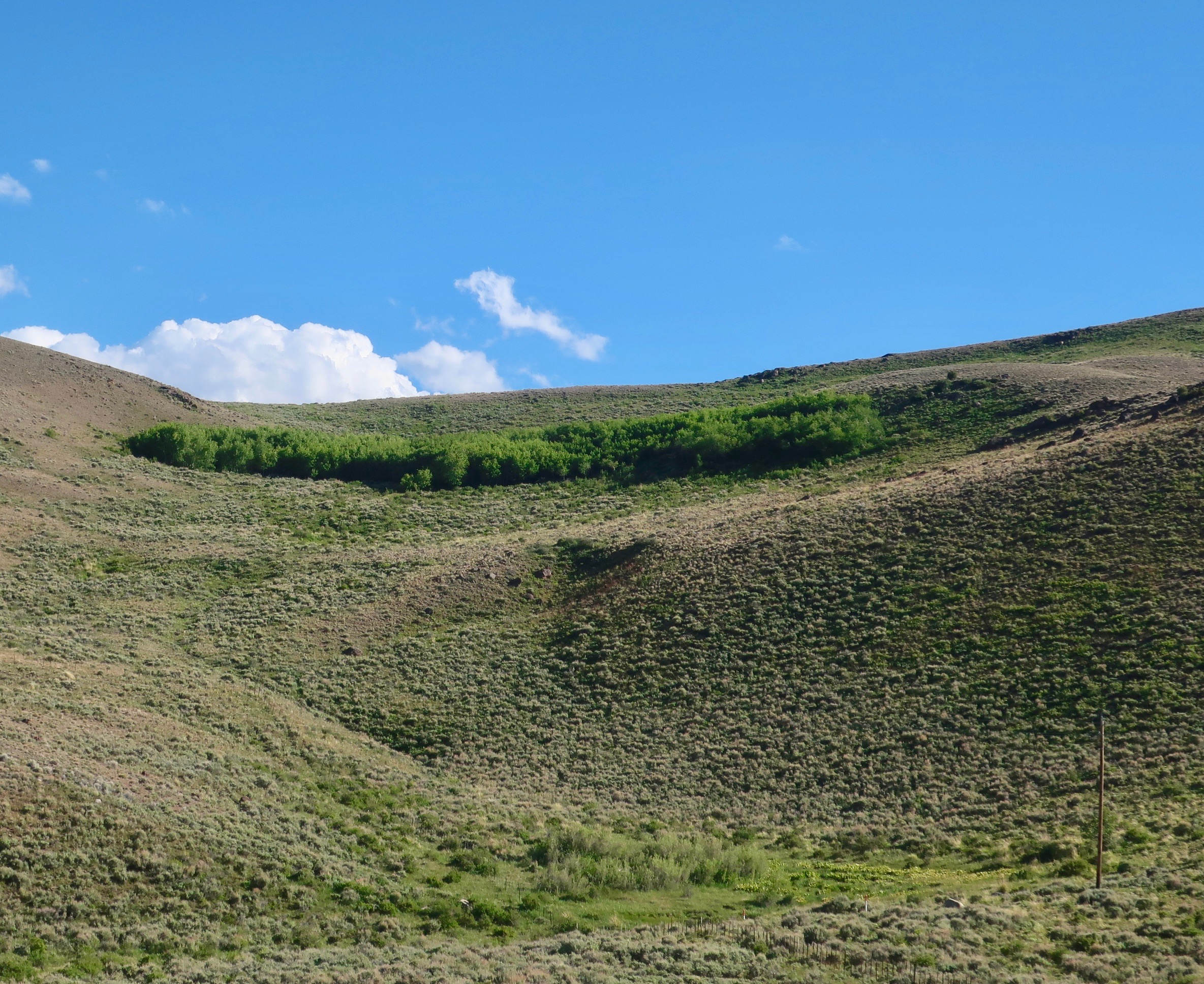
The changes are mind boggling and they just keep happening, only faster. Other than the mountain dominating antennas, however, outback Nevada doesn’t look much different that it did a 150 years ago. Even the rural communities and places like Middlegate maintain a strong element of yesteryear. It’s one of the reasons I love the state! Thanks for adding your thoughts. –Curt
Love your blog. Slight correction though: Stoke’s Castle is in Austin, not Fallon. Not that a hundred miles makes that much difference out there. Keep wandering and writing!
Thanks so much. You are absolutely right. I knew that. My fingers and mind were playing a game with me. 🙂 It happens. The town photos were also of Austin. I have already gone back and made the corrections. Appreciated! –Curt
We traveled pretty much this stretch (one of my favorites) on the way home from our 3+ week jaunt in the SW over a year ago. Can’t clearly remember how we ended up spending the night in Ashland on the last night, but I remember steering clear of Reno. In order to continue on without being molested by ‘civilization’ we headed north out of Fernley, spending a night at Pyramid Lake along the way. Love, love, love them lonely stretches.
Chuckles at some of the memories you bring back… remembering Fallon for the wrecked (not just flat) tire when moving from P’ville to Eureka, UT many years back. We were hauling a trailer full to the gunnels of our worldly goods… Late hubby had us following the PX Trail and the Lincoln Highway many a time…
I also like them “army of caterpillars marching toward Mexico.” 🤩
You were definitely on the road to Burning Man, Gunta. It takes place a few miles from Gerlach. Had you been traveling through around Labor Day, the road wouldn’t have seemed nearly as lonely. We’ve camped out at Pyramids amid Lake as well. I suspect that you came across from Klamath Falls through Keno to get to Ashland.
Better Fallon than 50 miles out in the desert. 🙂 Sounds like you know the road well.
And I have always been charmed by the caterpillar anaolgy. –Curt
Had to look at the map. We missed Gerlach, heading up the west side of the lake, we camped up in the hills that night. We paid for the permit with the Indian Reservation, but the sites down by the lake were buggy, so we did the dispersed thing just outside the reservation boundary. I think breakfast/lunch may have been in Susanville. Details escape me at this point, but I remember the fun parts. Hard to imagine folks who actually live out in that desolate country.
Wish I could remember how we managed to get out of the dead tire episode… seems we ended up spending the night in one of the casinos either in Fernley or Fallon. That was back in the dark ages (’80). Might have been before the military base (I was shocked to see that) or possibly before burning man, too. ☮︎
Ah, you could have followed dirt roads over to Susanville or dropped back into Reno to pick up #95. That’s the way that Peggy and I head back when we aren’t driving up I-5.
It was the early 90s that BM first moved to the Black Rock Desert from the Bay Area. It wasn’t ‘civilized’ until the late 90s, however. 🙂 I made my first trip in 2004. –Curt
Beautiful pictutres.
Thanks, Molly. The country is quite striking. –Curt
Lonely is right. Desolate too.
A bit like Australia’s Outback, Peggy. –Curt
Wow, Highway 50, indeed seems to go on forever.
I enjoyed this post a lot, especially because where I live we don’t have such remote areas.
There are lots of remote areas out West. More in the Great Basin that elsewhere, however. All that desert does not make for an ideal living environment although places like Phoenix, Arizona and Las Vegas have proven to be significant exceptions. Still, there is the problem of water… Glad you enjoyed the post. More remote country coming up next Thursday. –Curt
Hi Curt,
looking forward to next Thursday then. 🙂
Take care
Thanks.
That’s our kind of road!
It grows on you! 🙂 –Curt
You look down that road and nothing! Beautiful scenery in the distance – but nothing!!!
What do you do if you break down? start digging? 😎
Not a lot, that’s for sure, G. 🙂 Actually there is cell phone service all along the highway as I recall. Now waiting for a tow truck might take a while… –Curt
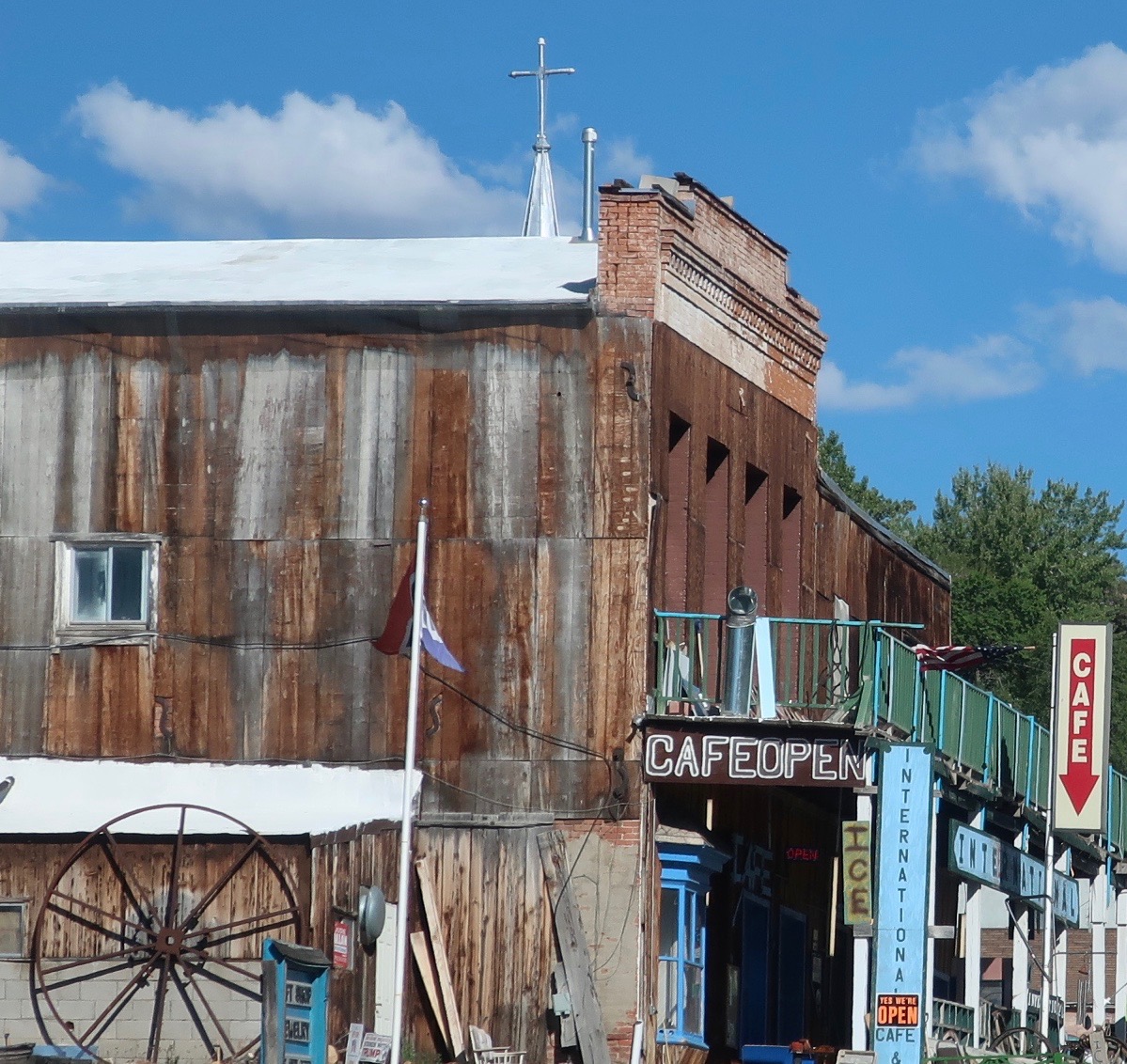
We were fortunate to be able to stop in Austin on two of the times we passed that way. Once we came north from Tonopath, a place I recall you have also visited on a somewhat lonely road too. On both occasions, we stopped in the Toiyabe Café and had a surprisingly good meal for such a remote place.
That sounds like good advice, Ray. I’ll have to remember the restaurant when I pass that way again. And yes, Tonopah is one of our go-to places as we head south or north on Highway 95. Did you take 376 north from Tonopah to get to Austin? That’s a road we haven’t been over. –Curt
Do you suppose advertising the ‘loneliest road in the world’ will end its loneliness? looks like it hasn’t turned into a traffic jam just yet. That sand dune, which appears to come out of nowhere (thanks for the explanation) is remarkable.
They’ve been advertising it for over 30 years with minimal impact, Sue. 🙂 I expect the same will be true for the next 30!
There are other sand dunes lurking around out there! Always a surprise. Always fun. –Curt
I just mentioned to someone yesterday that if I were made to choose just one western state to visit, it would be Nevada. Of course Utah, NM, and etc. are gorgeous, but after I crossed Nevada on 50 — and a few other wannabe roads — I’d fallen in love. It’s good to know that there’s still some of that loneliness out there. Loved the photos!
Thanks, Linda. As I thought about it, I have spent more time in Nevada than any other states except California and Oregon. Part of the appeal to me has always been the ‘loneliness,’ the lack of crowded roads and masses of people (although Reno and Las Vegas have their share). Part is the distant views and stark beauty, and part is the character of the people who have chosen to live in remote areas. As soon as you escape the freeways, you enter another realm. But even I-80, which I used for crossing Nevada on my bicycle has its charm. –Curt
Love that vast openness, but then you threw in that castle! How fascinating is all of this! Natural beauty and an unexpected built environment!
The gold and silver rush history of the west is always fascinating, Rusha, at least to me. The castle is one more example. –Curt
This looks like a fun place to cross on a bike (with the right supplies).
I’ve always thought that. I followed 80 through Nevada on my 10,000-mile bike trek and always regretted that I didn’t follow 50. I was traveling solo but if I had had a support vehicle, there’s no doubt I would have taken 50. There were other roads I followed in my journey that were equally remote. –Curt