Redwoods, the Stone Lagoon, and the Smith River along California’s Highway 101

Stone Lagoon on the north coast of California is part of the largest lagoon system in North America.

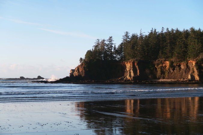
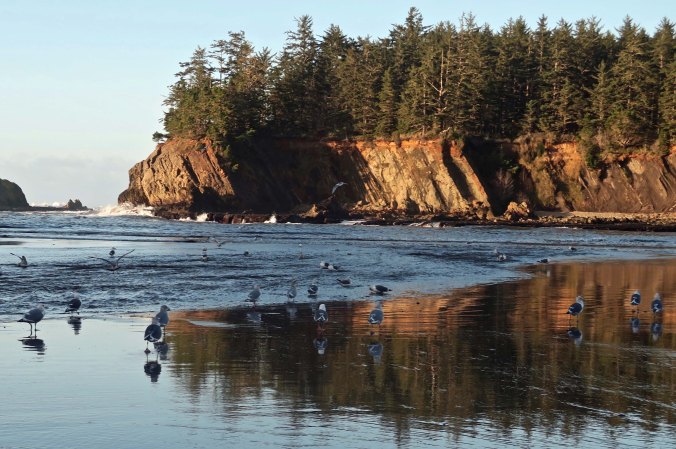
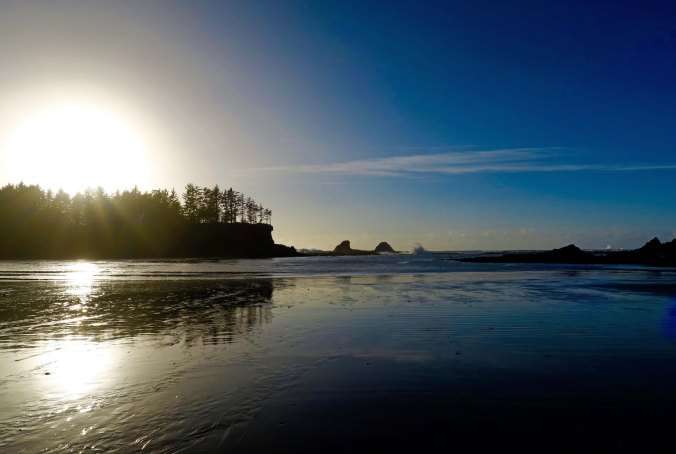
The Stone Lagoon along Highway 101 on the North Coast of California provides a unique environment that supports a wide diversity of life. The distant barrier beach separates the lagoon from the Pacific Ocean. Winter storms breach the barrier and allow sea water into the lagoon.

Back before Peggy and I flew east to be with our kids and grandkids to celebrate the holidays, we made a brief trip up the North Coast of California. I’ve already posted three blogs on the trip: one on Mendocino, one on the coast, and one on Roosevelt Elk. Today I will wrap up our journey starting at Stone Lagoon State Park on Highway 101 north of Eureka and working our way up to Highway 199 out of Crescent City.

The North Coast of California is one of my very special places. I’ve returned there again and again. From rugged coastlines, to majestic redwoods, to picturesque towns, and interesting history, the region is both beautiful and magical.

Highway 101 traces its history back to 1769 when the Spanish explorer Juan Gaspar de Portola followed what would eventually become El Camino Real (The King’s Highway) and connected some 21 Catholic missions from San Diego to the Bay Area. North of San Francisco, the road becomes known as the Redwood Highway as it travels through grove after grove of redwoods.

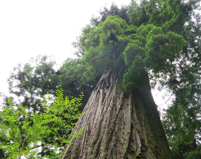
Giant redwood tree at Redwoods National Park. Photo by Curtis Mekemson.

Towering Redwoods give the Redwood Highway its name.

Massive root systems that can extend out 100-feet from the tree provide hundreds of gallons of water per day to a giant redwood.

Massive root systems that can extend out 100-feet from the tree provide hundreds of gallons of water per day to a giant redwood. Root width rather than depth provides the tree with stability.

Redwood roots on display along California's Highway 101.

I find the twisted roots quite beautiful.

Salmon carved from redwood along Highway 101 on California's North Coast.

A number of places along Highway 101 sell carved redwood featuring everything from bears to this salmon.

Highway 101 follows a path inland through various river valleys until it reaches Eureka and then it follows the ocean to the border. Occasional views of the Pacific are provided along the way and several county, state and national parks provide opportunities for camping and exploration.

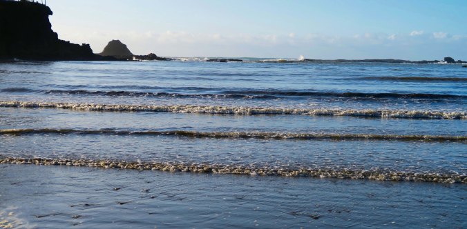
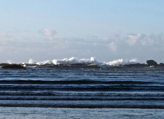
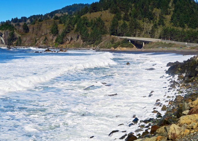
Waves come ashore along California's Highway 101.

Highway 101, seen on the right side of the photo, parallels the Pacific Ocean north of Eureka, California providing occasional views of the Pacific Ocean.

Looking out toward the Pacific from the same location on Highway 101.

Looking out toward the Pacific from the same location on Highway 101. The point has character.

Sea foam created by a storm along the Pacific Coast.

While the skies were blue for our drive up the coast, a storm had chopped up the water the night before, creating sea foam.

Sea foam beat into whip cream type consistency along Highway 101 on the North Coast of California.

The result was this whip cream like sea-foam I included in an earlier blog.

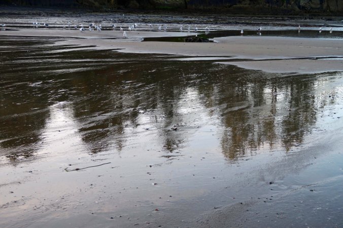
Stone Lagoon, which is part of the largest lagoon system in North America, is one of the views along Highway 101. Separated from the Pacific Ocean by a barrier beach, the waters of the lagoon are neither fresh nor salt. Fed by fresh water for most of the year, winter storms fill the lagoon with water until it breaches the beach barrier, allowing ocean water to flow in and establish a unique environment that supports a great diversity of life. When Peggy and I arrived, Stone Lagoon was the picture of tranquility with calm waters reflecting the surrounding hills and trees.

Stone Lagoon State Park on Highway 101.

The calm water reflected trees and hills surrounding Stone Lagoon.

Reflection shot on Stone Lagoon ion Highway 101 ion the Northern California coast.

A close up.

In Crescent City, Peggy and I picked up Highway 199 and followed the Smith River up and away from the ocean on our way into Southern Oregon.

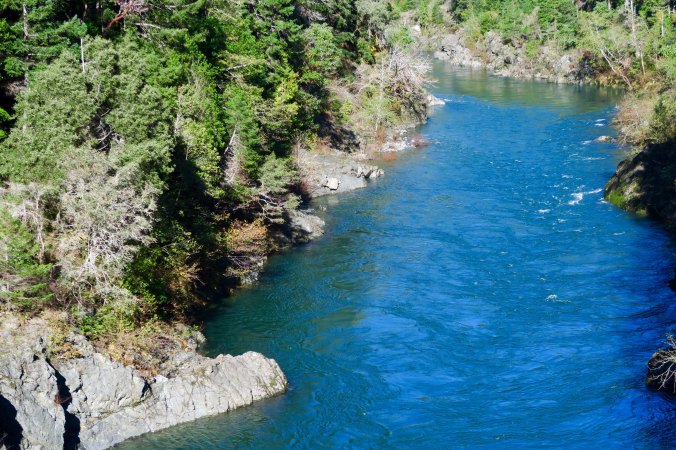
The Smith River as seen from Highway 199, the Redwood Highway , in Northern California.

The Smith River crosses Highway 101 north of Crescent City and is the largest free-flowing river in California that hasn’t been damned.

Another view of the Smith River flowing along Highway 199 in Northern California.

Another view of the Smith River flowing along Highway 199 in Northern California.

Rapids along the Smith River next to Highway 199, (the Redwood Highway) in Northern California.

A final photo of the Smith River.

NEXT BLOG: A somewhat crazy 100 mile backpacking adventure across the Sierra Nevada Mountains with 60 people aged 11 to 70. Part 1

Wandering through Time and Place in 2017… And Some Thoughts on Planning

Curtis Mekemson hiking along the Pacific Crest Trail behind Squaw Valley.

It’s time to start planning and dreaming about 2017. One of my goals is a seven week, 500-mile backpack trip on the Pacific Crest Trail. Here I am in the Granite Chief Wilderness behind Squaw Valley, California. (Photo by Peggy Mekemson)

It’s the first day of the New Year. It’s the time to make resolutions and plans— a time to dream.

There was a time in my life when I was obsessive about the planning process. I would lay out goals and objectives. And then I would move into YAPs, QUAPs, MAPs, WAPs and DAPs, or, to spell it out: yearly, quarterly, monthly, weekly and daily action plans based on my goals and objectives. I set priorities, created time lines, made to-do lists, checked things off, kept records, and made plan revisions. Things that didn’t work were modified or dropped. New opportunities were taken advantage of. I did it for my personal as well as professional life. It was how I accomplished things I wanted to do, and how I kept some control over my often chaotic life.

Early on I had learned if I didn’t plan out what I wanted to do with my time, someone else was more than willing to do it for me. And I had also learned that there is power in planning, in knowing what you want to do, and in determining what is important, what has the greatest impact.

I am not as obsessive as I once was, but old habits die hard. And, even though I am “retired,” it is still important to have an idea of where I want to go, of what I want to do, and of what is important to me. Of course I don’t exist in a vacuum. Ask Peggy. (grin) Most of what we do is jointly decided.

So given all of this, what are my writing and travel plans for 2017?

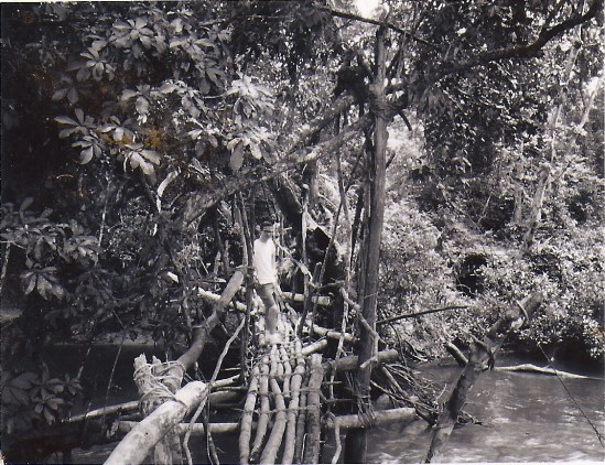
Kpelle footbridge near Gbarnga, Liberia circa 1965.

I hope to revise and republish “The Bush Devil Ate Sam,” a memoir about my Peace Corps experience in West Africa. Here, a much younger Curt makes his way across a river on a native bridge in the heart of the African jungle.

Under writing objectives, I plan to finish my next book, tentatively titled Tales of an Incorrigible Wanderer. My 10,000-mile bike trip plus other outdoor adventures will be included. (I am sure you will want to buy a copy. Grin.) I also plan to revise and republish The Bush Devil Ate Sam. I will continue to blog two to three times a week on current travels/adventures as well as past adventures. I am thinking in terms of doing one blog each week on current travels, one blog on past adventures, and one blog as a photographic essay. But we’ll see. I have to reduce the time I spend on blogging so I have more time for other goals, like play, for example.

Our travels this coming year will likely go in three directions. One, Peggy would like us to do a more thorough job of exploring the Pacific Northwest. I might add California down to Big Sur simply to expand my Pacific Coast blogging series. (And I really like Big Sur, Carmel and Monterey.) I expect we will also spend more time exploring the East Coast now that our two kids and their families are living there. Finally, I am hoping we can plan a trip to Ireland and possibly England where I would like to continue my genealogical research.

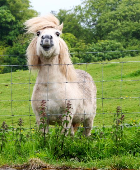
Photo of Scottish pony taken by Curtis Mekemson.

I photographed this pony in Kirkcolm, Scotland when I was doing research on my Scots-Irish ancestors a few years ago. I promised myself at the time that I would return for more research in Ireland and England.

I am also hoping we can make it back to Burning Man. It is one of my most popular blog topics and I would like to write a book in 2018 on my 14 years of experience with the event. We will know in February if we can get tickets for this year.

The Temple of Promise at Burning Man in 2015 is caught by the morning sun.

Morning sun catches the copper face of the Temple of Promise at Burning Man 2015.

Finally, it is time for another grand adventure. I celebrated my 60s by doing a six-week 360-mile backpack trip down the Sierra Nevada Mountain range from Lake Tahoe to Mt. Whitney. It seems only appropriate that I celebrate my 70s by doing a seven-week, 70-miles per week, 490-mile backpack trip on the Pacific Crest Trail. But I’ll have to see whether my 74-year old body is willing to cooperate. Maybe it will be a one-week 70-mile trip, or a one-day 7-mile hike, or a .7-mile hike to the mailbox. Laughing.

Whatever… I am sure there will be many adventures to share!

Wandering through Time and Place… The 2016 Year in Review: Part III

Peggy and I arrived home from our three month to this thunderhead hanging over the Red Butte Mountains. The view is from our patio.

Peggy and I arrived home from our three-month trip around North America to see this thunderhead hanging over the Red Butte Mountains. The view is from our patio.

When Peggy and I returned from re-tracing my bike route, we were more than happy to hang out at our home in the Applegate Valley of Southern Oregon. The wildlife entertained us and the surrounding country provided scenic views. It wasn’t until fall that we returned to our wandering ways with short trips to the coasts of Northern California and Oregon.

We finished off our year with a trip to Connecticut to visit our son Tony and his family, and North Carolina  to visit our daughter Tasha and her family. In between we worked in a trip to Boston. There is a lot of good blog material! Right now I am sitting in Google’s Charlotte, North Carolina office where our son-in-law Clay works. One of my blogs will be on what it means to be a Googler and be Googley. I find the company fascinating!

Another view from our patio. The clouds frequently provide us wit beautiful sunsets.

Another view from our patio. The clouds often provide beautiful sunsets.

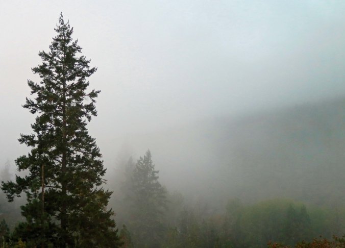
The mood changes dramatically when the mountain mists roll in.

The mood changes dramatically when the mountain mists roll in. The Applegate River runs through the canyon.

The Applegate River showing its fall colors.

The Applegate River showing its fall colors on a sunny day.

And fall colors in the Upper Applegate Valley.

And fall colors in the Upper Applegate Valley.

On the opposite end, a pair of bucks go at it in preparation for mating season. I face my writing chair so I can see all of our back yard action and keep a camera handy!

Fall is when the bucks go at it in preparation for mating season. I face my writing chair so I can see all of our back yard action. I keep a camera handy!

And I am sure that most of you remember Little Buck. "Does anyone have an apple?"

And I am sure that most of you remember this photo of Little Buck. “Does anyone have an apple?” He was December on our Family Calendar.

Whipped cream, anyone. If you've never see sea foam whipped up by a stormy sea, that might be your first thought. I took this photo on our recent trip up the North Coast. It's a preview of blogs to come.

Whipped cream, anyone? If you’ve never seen sea-foam whipped up by a stormy sea, that might be your first thought. I took this photo on our recent trip up the North Coast. It’s a preview of my next blog.

As is this: the Humboldt Lagoon north of Eureka.

As is this: the Humboldt Lagoon north of Eureka.

Peggy and I had a great year wandering and sharing our adventures. I’ve also taken great pleasure in wandering around the world with you on your adventures! I am looking forward to 2017. My New Year’s Day blog will feature my plans for 2017.

Happy New Year!

Curt and Peggy

The two of us on top of a lighthouse on Prince Edward Island, Canada.

The two of us on top of a lighthouse on Prince Edward Island, Canada.

Wandering through Time and Place… The 2016 Year in Review: Part II

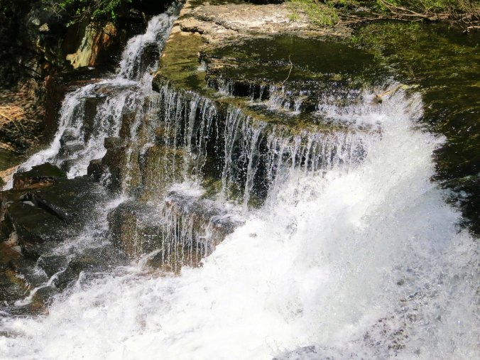
America and Canada are crammed with beautiful sights that range from mountains to deserts to oceans, to plains, to rivers... and well the list just goes on and on. This is a waterfall from Old Stone Fort State Park in Tennessee.

America and Canada are crammed with beautiful sights that range from mountains to deserts to oceans, to plains, to rivers… and well the list just goes on and on. This is a waterfall from Old Stone Fort State Park in Tennessee.

Continuing on with our 2016 journeys, Peggy and I left Oregon in March to retrace my 1989, 10,000 mile bike journey around North America. We were on the road until mid-June, and I just wrapped up my posts on the trip. It took me longer to write about it than it did to bike it!  The truth of this is that I can’t begin to capture the experience in ten photos. It was a challenge to me to capture it in 54 posts and 1000 photos. None-the-less, here are a few random shots:

I started my journey in the foothills of California in the spring. In a couple of months the green grass here would be brown, or golden as they call it in California.

I started my journey in the foothills of California in the spring. In a couple of months the green grass here would be brown, or golden as they call it in California.

One of the more challenging parts of my ride was through Death Valley. Twenty Mule Canyon was on my way out of the National Park on my way into Nevada.

One of the more challenging parts of my ride was through Death Valley. Twenty Mule Canyon was on my way out of the National Park on my way into Nevada.

I found a touch of outer space when I rode by the Very Large Array of radio telescopes as I rode down the easter side of the rocky Mountains in New Mexico.

I found a touch of outer space when I rode by the Very Large Array of radio telescopes as I rode down the eastern side of the Rocky Mountains in New Mexico.

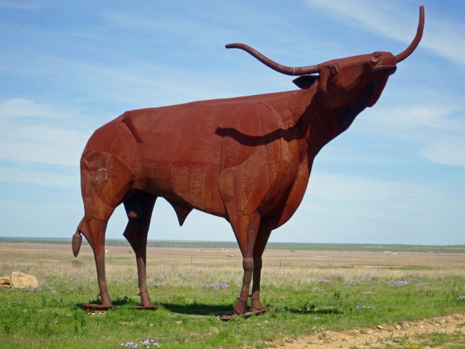
Literally dozens of roadside sculptures entertained me on my bike trip and then Peggy and me as we re-drove the route. Peggy and I found this 25 foot high Longhorn in West Texas, where you would expect to find it.

Literally dozens of roadside sculptures entertained me on my bike trip and then Peggy and me as we re-drove the route. Peggy and I found this 25 foot high longhorn in West Texas, where you would expect to find it.

Louisiana is bayou country, the place where you expect to see water moccasins slithering through the water, or get good reflection shots.

Louisiana is bayou country, the place where you expect to see water moccasins slithering through the water, or get good reflection shots.

The Natchez Trace and the Blue Ridge Highway are both beautiful. It's the Trace here. An added advantage of both National Park highways is that no commercial traffic is allowed. Translate: I wasn't dodging 18-wheelers.

The Natchez Trace and the Blue Ridge Highway are both beautiful. It’s the Trace here. An added advantage of both National Park highways is that no commercial traffic is allowed. Translate: I wasn’t dodging 18-wheelers.

I found this small waterfall beside the road in the Great Smokey Mountains. Dozens, maybe of hundreds of such falls graced my trip.

I found this small waterfall beside the road in the Great Smokey Mountains. Dozens, maybe of hundreds of such falls graced my trip.

The Atlantic Ocean greeted me along this rocky shoreline of the Cape Breton Highlands in Nova Scotiia. This was my fattest point east. After this it was time to turn around and ride 5,000 miles west.

The Atlantic Ocean greeted me along this rocky shoreline of the Cape Breton Highlands in Nova Scotia. This was my fastest point east. After this it was time to turn around and ride 5,000 miles west.

A stream along the Trans-Canada Highway in Ontario. My rivers ranged from the mighty Mississippi to mere trickles.

A stream along the Trans-Canada Highway in Ontario. My rivers ranged from the mighty Mississippi to mere trickles.

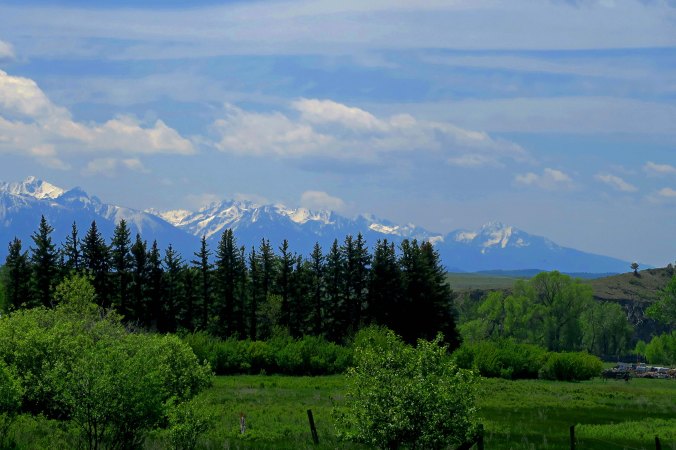
I crossed several mountain ranges including the Sierra Nevada and the Rockies twice. Tis is a photo of the rockies in Montana.

I crossed several mountain ranges including the Sierra Nevada and the Rockies twice. It is a photo of the Rockies in Montana.

One thing I learned over and over is that beauty comes in all shapes and forms, such as this lonely tree in North Dakota.

One thing I learned over and over is that beauty comes in all shapes and forms, such as this lonely tree in North Dakota.

Whoops. I just counted my photos. There are 12. I’ll call it a bakers 10.


A Truly Unique Set of Holiday Lights… The North Coast Series

Grey whale featured in Holiday Lights display at Shore Acres State Park in Coos Bay, Oregon.

Not your parents’ (or mine) display of holiday lights! This grey whale rising out of the ocean had to be at least 30 feet long. Over 10,000 lights provided a back drop.

A giant grey whale rose out of the water to a backdrop of ten thousand lights. It wasn’t quite what I had expected when Peggy and I drove over to Coos Bay, Oregon to check out the Holiday Lights display at the Shore Acres State Park. I thought we’d probably see sheep, cows, donkeys and a baby J or two. There might even be deer. They’ve become a common fixture on people’s lawns at Christmas. But frogs leaping into ponds, pelicans flying across the sky, a parade featuring an earthworm, turtle, grasshopper and snail— no way! And these were just a few of the sky, sea and land creatures on display, all created out of holiday lights.

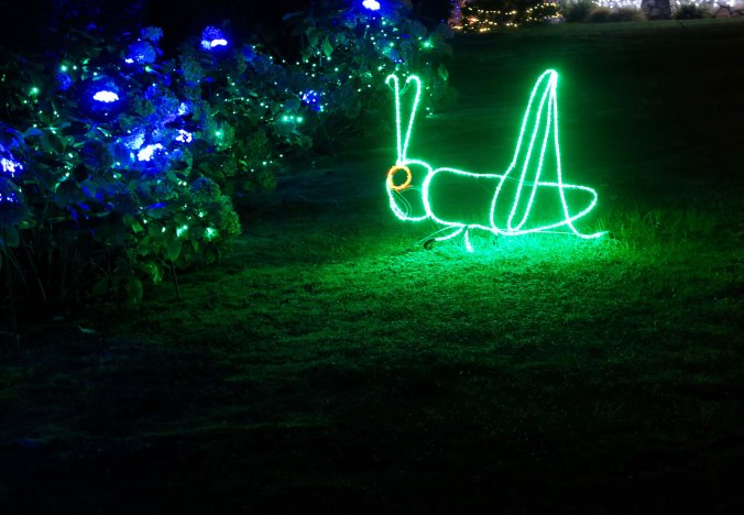
This green fellow was part of a parade that included a worm, two turtles, and a snail, that was going the wrong way, slowly, I assume.

This green fellow was part of a parade that included a worm, two turtles, and a snail, that was going the wrong way, slowly, I assume.

This had to be one happy lady bug working three flowers at once. Aphids beware!

This had to be one happy lady bug working three flowers at once. Aphids beware!

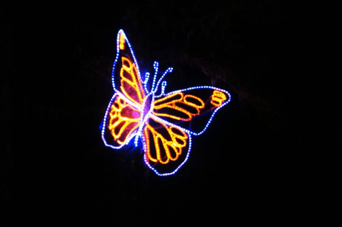
There was a butterfly...

There was a butterfly…

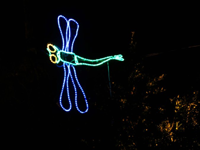
Dragonfly at Shore Acres Park.

A dragonfly…

Holiday frogs at Oregon's Shore Acres State Park.

And frogs.

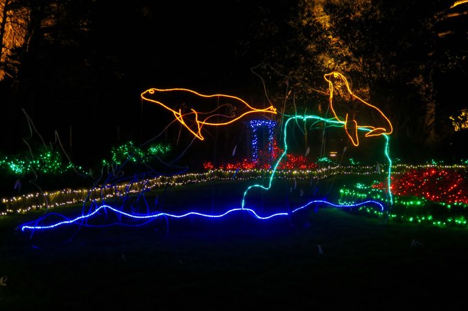
Seals dive int the water at Oregon's Shore Acres' State Park Holiday of Lights display.

Seals leaped into the water. They actually moved and made a splash. As did frogs, and whales.

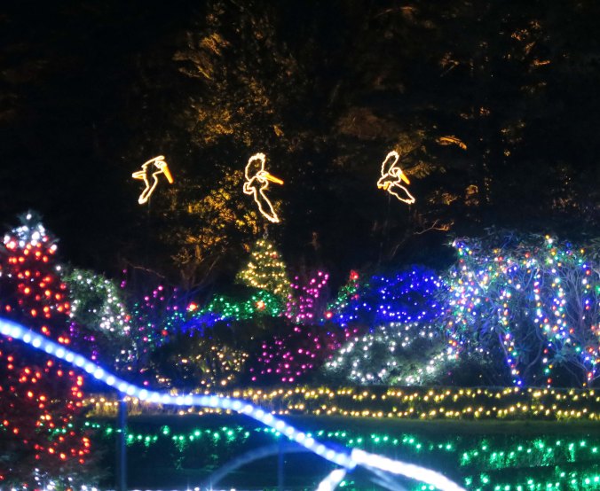
Pelicans at Oregon's Shore Acres' State Park Holiday of Lights display.

Pelicans flew across the sky.

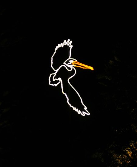
Pelican at Oregon's Shore Acres' State Park Holiday of Lights display.

A close up.

Crab and octopus at Oregon's Shore Acres' State Park Holiday of Lights display.

There was a crab and an octopus…

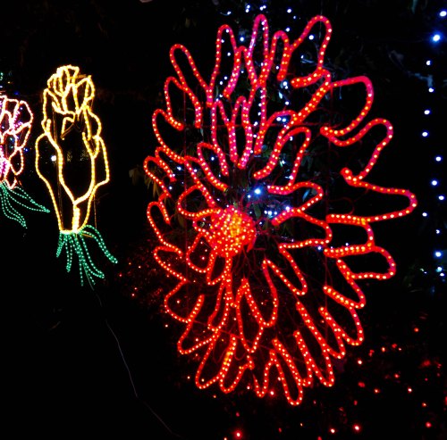
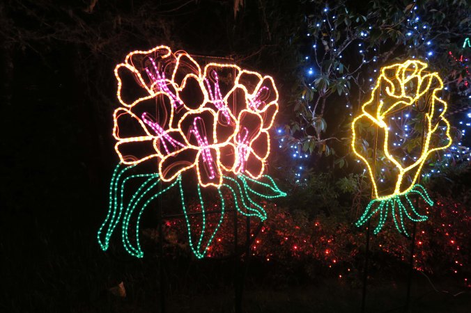
Flowers at Oregon's Shore Acres' State Park Holiday of Lights display.

And beautiful flowers…

More flowers at Oregon's Shore Acres' State Park Holiday of Lights display.

More.

Animals look over fence at Oregon's Shore Acres' State Park Holiday of Lights display.

A porcupine, raccoon, deer and rabbit peeked over the parks fence to check out the display.

It wasn’t all about the wildlife you normally find on the Oregon coast, however. Some 320,000 thousand lights decorated the hundreds of shrubs that turn Shore Acres into a floral delight during the spring, summer and fall. There were lots of Christmas trees. A choral group sang traditional carols. The historic garden house on the site reminded me of fantasy gingerbread homes. And Santa was there! So what if he happened to be taking a bubble bath with a tiger and a moose. Fortunately, he was wearing his long johns. Old men with round bellies that shake like bowls full of jelly shouldn’t be seen in public with their clothes off.

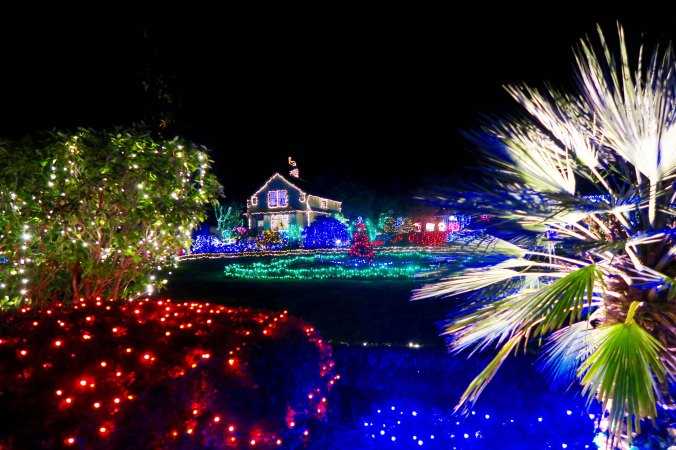
Holiday lights at Oregon's Shore Acres' State Park Holiday of Lights display.

A small pond at Shore Acres reflected some of the 320,000 lights.

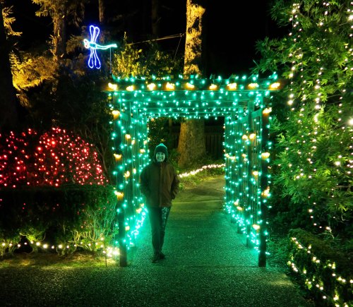
Green lit arbor and Peggy Mekemson at Oregon's Shore Acres' State Park Holiday of Lights display.

Peggy was turned green by an arbor while the dragonfly hovered above her head.

Gingerbread house at Oregon's Shore Acres' State Park Holiday of Lights display.

The historic garden house looked like a gingerbread house.

Another view of the house. A pelican, instead of a stork, hangs out on the chimney.

Another view of the house. A pelican, instead of a stork, hangs out on the chimney.

The Shore Acres Holiday Lights display is a tradition that goes back to 1987 when Friends of Shore Acres decided to ‘string a few lights’ for the holiday season. It’s been growing ever since, both in number of lights and number of people who visit. This year, the visitors should top 50,000. Volunteers do all of the work. Lights are donated.

Shore Acres Botanical Garden

During the spring, summer, and fall, Shore Acres turns into a beautiful botanical garden, reminiscent of English gardens. This is the ‘Gingerbread house.’ All of the plants were covered in lights for the holidays. (Photo by Peggy Mekemson)

Shore Acres Botanical Garden, Coos Bay, Oregon

Rhododendrons at Shore Acres State Park. Two of thousands of beautiful flowers.

Peggy and I discovered Shore Acres two years ago when we were staying at Sunset Bay State Park, which is located a mile down the road. The flower garden reminded us of England. As soon as I saw a newspaper article about its Holiday Light display, I knew we had to return. Peggy lives for holidays. Since we were heading back East for Christmas, she wouldn’t have the opportunity to break out her seven large boxes of decorations and turn our house in to a museum of Christmases past, present and future. I figured the lights provide a substitute. They did.

With Santa, Peggy and I would like to wish each of you a joyous Holiday and a very Happy New Year.

With Santa and friends, we wish each of you and your families a Joyous Holiday and a very Happy New Year. —Curt and Peggy

NEXT BLOGS: I jumped ahead in our recent North Coast travels to include the Shore Acres display for Christmas. My next three posts will serve as a wrap up for 2016 featuring some of our favorite photos from the year. Twelve of them we used in our annual family calendar. In January, I will return to our drive up Highway 101 to be followed by our visit to Sunset Bay State Park in Coos Bay, which, in its own way, is as special as Shore Acres.

There’s an Elk! There are 300! …The North Coast Series

This magnificent fellow was probably the bull of the herd, and proud of it!

This magnificent fellow was probably the bull of the herd, and proud of it! He was surrounded by some of his lady friends.


A blog quickie…

Peggy gets excited when she sees elk. So it’s not surprising that she multiplied the number she saw by 10. I can also get quite excitable. Roosevelt Elk are the largest members of six subspecies of elk in North America. Bulls can weigh up to 1100 pounds! Once, they were close to extinct in California. Today, there are seven herds in and around the Redwoods. The largest herd numbers 250. Most are closer to the size we saw. It was conveniently located in someone’s yard. I drove in so Peggy could take photos.

Elk herd near the Redwoods in Northern California.

There were probably 30 elk altogether.

I was impressed by the antlers shown here...

Peggy was impressed by the antlers shown here…

elk with large racks near the Redwoods in Northern California

So she took a close up. Given the season, I figured that Santa could turn to these fellows if his Reindeer refused to fly.

Rudolph the Red Nosed Reindeer on strike. Xmas card by Curtis Mekemson.

Red-nosed reindeer goes on strike. (card by Curt Mekemson.)

The real deal: Alaskan Caribou. (Photo by Peggy Mekemson.)

The real deal: Alaskan Caribou. (Photo by Peggy Mekemson.)

If this guy were a blacktail deer, we would call him a spike. I don't think I would want him mad at me!

If this guy were a black tail deer, we would call him Spike. I don’t think I would want him mad at me! The marks on his back suggest he has been nibbling at itches.

This doe was quite beautiful...

This cow elk was quite beautiful…

So we will end this short post with a close-up.

We will end this short post with a close-up of her. Lovely eyes!

NEXT BLOG: The Christmas lights of Shore Acres State Park

Long Beaches, Redwoods and Rocky Points on California 101… The North Coast Series

Treasures are often found by those who wander off from well-tred paths. This bit of driftwood I found on Clam Beach north of Eureka, California is an example.

Treasures are often found by those who wander off from well-worn paths. I found this bit of driftwood on Clam Beach north of Eureka, California. I am forever taken by grains and texture in wood. What better way to find them!

Far too often, travel consists of hurrying through a number of must-see stops. I understand this. Some places are rightfully renown for their beauty, history shopping, etc., and time is limited. So you have a check-off list and a timeline. If you are on an organized tour, your travel is even more directed and options for wandering are close to nil, which is one of the reasons that I rarely travel that way.

Sometimes I like to travel without an itinerary and stop willy-nilly when something captures my attention. I realize that I run the risk of missing something worth seeing, but I also open the door for new adventures. When Peggy and I visited California’s North Coast in October, Mendocino was our must see stop. We even had a reservation, which is rare for us.

After Mendocino, it was wander time. We followed Highway 1 as it wound its way up the coast and then cut across the coast range to Highway 101 at Leggett. We zipped up 101 to Eureka so we would have more time on the coast north of the city. Eureka, BTW, was apparently what Archimedes, the Greek mathematician, shouted when he discovered a way of determining the purity of gold. It means, “I found it!” California 49ers shortened the concept to mean, “I found gold!” It became the state motto.

Our first stop above Eureka was at Clam Beach for no other reason than we hadn’t been there before. What we discovered was something of a rarity for the North Coast, a beach that went on and on. A small trail wound its way through brush, eventually leading us out to the beach.

Clam Beach off of Highway 101 north of Eureka, California.

We found golden Dune Grass…

Pampas Grass growing on the California Coast.

And golden Pampas Grass. Its beauty is countered somewhat by the fact that it is an invasive plant from South America, often replacing native plants.

Pampas Grass on Clam Beach in Northern California.

For fun, I shot the same Pampas Grass backlit the sun.

And then had Peggy stand next to it for perspective.

And then had Peggy stand next to it for perspective.

A final shot of Clam Beach.

A final shot of Clam Beach with golden Dune Grass and Pampas Grass in the distance.

Usually when we are in this part of California, we spend some time in the Redwoods. Our views this time, however, were limited to what we saw from the road, except for one ancient giant we found at a rest stop. It had burned years and years ago, leaving nothing but a charcoal remnant of its once magnificent self. Still, it stood as a testament to the miracle of life…

This ancient victim of fire amused me when I noticed that its top was creating a new forest!

This ancient victim of fire amused me when I noticed that its top was creating a new forest!

Patrick’s Point State Park returned us to the rocky shoreline I associate with the North Coast. Peggy and I followed a muddy path down a steep cliff to get to the action!

Patrick's Pt. State Park north of Eureka, California on Highway 101.

Hiking down to the ocean at Patrick’s State Park, we spotted a rock that was lit up by the sun.

Close inspection showed it to a home for California Brown Pelicans.

Closer inspection showed it to be a home for California Brown Pelicans.

Edging my way around a cliff provided another view.

Edging my way around a cliff provided me with another view.

Waves breaking at Patrick State Park north of Eureka and Arcata, California.

Including this…

And this.

And this. I really liked the dark and light contrast, along with the massive rocks.

Inching my way back to where Peggy was, the ocean waved goodby.

When I was inching my way back to where Peggy was, the ocean waved goodby.

NEXT BLOG: “There are elk!” Peggy yelled, almost causing me to crash. “There must be 300!”

Mendocino, California: A Favorite Town… The North Coast Series

A large, carved wooden duck that Peggy and I found gracing a wood-working shop on one of Mendocino's colorful streets.

A large, carved wooden duck that Peggy and I found gracing a wood-working shop on one of Mendocino’s colorful streets.

I’ve always been a fan of rugged, rocky coastlines. I’ve been fortunate in my life to live near the northern coast of California, which I define as starting down in Big Sur country and making its way up to the Oregon Coast. When I lived in Sacramento, summer escapes usually meant the Sierra’s, but winter escapes always meant the coast. Mainly I played along the 300-mile area of coast stretching between Monterrey/Carmel and Mendocino/Fort Brag on California’s beautiful, cliff-hanging Highway 1.

A view of the Mendocino Headlands, which host the town of Mendocino. The steep, rocky cliffs of Northern California, Oregon and Washington make up my favorite coast lines.

A view of the Mendocino Headlands, which host the town of Mendocino. The steep, rocky cliffs of Northern California, Oregon and Washington make up my favorite coast lines.

Now I live in Oregon, I’ve begun to explore the Oregon Coast. Over the years, I’ve also ventured along the Washington coast on occasion and made several trips to Canada’s Vancouver Island.

Last year, I wrote a number of blogs on both the California and Oregon coasts. I did a solo trip along the Oregon Coast while Peggy was off doing grandmother duty in Alaska and then a solo trip north from San Francisco while she was traveling to England with her sister, Jane.

This fall, my side-kick was with me on a couple quick trips: one visiting the town of Mendocino and then traveling north, following Highways 1 and 101 back to Southern Oregon. The second was over to Coos Bay, Oregon and Sunset Bay State Park. My next few blogs will cover these trips. Again, since Peggy and I are off in Connecticut and North Carolina visiting with our kids and grandkids for Christmas— plus making a side trip to Boston— these will be mainly photo blogs.

Mendocino is one of my favorite coastal communities. Founded as a logging town, it was discovered by artists in the 50s and 60s and today supports a thriving tourist industry. Through it all, it has maintained much of its original charm. Quaint buildings, lots of art, a great bookstore, and a magnificent coast all add to its ambience. If you would like to learn more about the town and see more photos, go here for the blog I wrote last year about the town.

Another view of the Mendocino Headlands, this one featuring a Monterey Pine.

Another view of the Mendocino Headlands, this one featuring a cyprus tree.

The Mendocino Headlands of Northern California.

Looking the other direction through the same cyprus.

A cliff from the Mendocino Headlands next to the town of Mendocino in Northern California.

Rocks, cliffs, and a pounding ocean: music to me on a dark stormy day.

We found these berries growing on the Headlands. T'is the season!

We found these berries growing on the Headlands. T’is the season!

The town of Mendocino, California as seen from the headlands on a rainy day.

Walking back toward the town from the Headlands, we caught this view of Mendocino. The town has done a superb job of maintaining its historic buildings.

Mendocino, California home.

I find the homes charming.

Pond reflection shot in the community of Mendocino on California's north coast.

This small, in-town pond provided a convenient reflection shot.

A landscaped walkway in the town of Mendocino, California.

Inviting walkways are found throughout Mendocino.

Woodworking shop in Mendocino, California.

This is the inside of the woodworking shop where we discovered the duck.

Early social media? Any idea what this is? It's an old fence that has seen service as a community message board for decades.

Any idea what this is? It’s an old fence that has seen service as a Mendocino message board for decades. You might say, it is a ‘staple’ of the community.

Veggies always add a little color on a cloudy day. Peggy and I found these in an old church that had converted to being a natural food store.

Speaking of staples, veggies always add a touch of  color on a cloudy day. Peggy and I found these in an old church that had converted to being a natural food store.

Mendocino, California rooster.

This rooster also added color, and character, to our day.

Not so colorful, but there is a story that goes along with this chicken wire Mendocino mouse. In my last blog about Mendocino, I had also included chicken wire sculptures. A person from Japan wrote to me and said he had also visited Mendocino, seen the sculptures in a shop, and wanted to know which shop it was so he could buy some. I was reminded of just how international blogging is...

Not so colorful, but there is a story that goes along with this chicken wire mouse. In my last blog about Mendocino, I had included a chicken wire cat from the same shop. A person from Japan wrote to me and said he had also visited Mendocino, seen the sculptures, and wanted to know which shop it was so he could buy some. I was reminded of just how international our blogging community is…

Tiki god in front of a house in Mendocino, California.

And finally, I’ll include this Tiki-like god sculpture we found protecting a house. Love the toothy grin. Or was I supposed to be frightened?


NEXT BLOG: A North Coast journey along California’s Highway 101.

Home and a Surprise… The Ten Thousand Mile Bike Trek— End of Series

When I arrived at Lake Tahoe, I returned to what I considered my home territory. Half of the beauty of the area is found in the Lake, the other half is in the surrounding backdrop of the Sierra Nevada Mountain Range.

When I arrived at Lake Tahoe, I returned to what I considered my home territory. Half of the beauty of the area is found in the Lake, the other half is in the surrounding backdrop of the Sierra Nevada Mountain Range.

I had planned my six month, solo bike journey around North America as a great circular route, starting and ending in the small, rural town of Diamond Springs, which is nestled in the foothills of the Sierra Nevada Mountain Range east of Sacramento. I grew up there, and the connection was important to me.

I had seen my journey as twofold. My primary purpose was to explore much of the US and Canada in a way few other people had. But I also wanted to use the opportunity to undertake an inward voyage, going back in time to explore my childhood and learn more about myself. Thus the Diamond Springs tie in.

The three-month trip Peggy and I made this spring allowed me to retrace my route and relive my 1989 experience. It also allowed me to share the journey with you, which I have done with 54 posts that included approximately 50,000 words and 1,000 photos: in even more words, that’s a lot! In the end, my North America bike trek had turned out to be everything that I hoped for, and much more. I had seen great beauty, met good people, and had numerous adventures— enough even for me.

Someday, I may share the inward journey. Suffice it to say here, I learned a lot about myself along the way. I achieved a balance and inner peace that have lasted up until today. I haven’t found myself teetering on the edge since 1989. I could run off and play in the woods for reasons other than to put Curt back together again.

But for now, let’s finish up the bike journey and discover the surprise at the end.

I left Carson City, Nevada following Highway 50 up and over Spooner Pass and then dropped into Lake Tahoe, arguably one of the world’s most beautiful lakes. Memories came flooding back. I had spent three college summers driving a laundry truck between Placerville and Lake Tahoe six days a week. The work was easy, the scenery beautiful and the money… well, it was enough to pay for my UC Berkeley education. (I only had to cover my living expenses, books and student fees. Those were the days when tuition at UC was still free, back in the days when government still believed that an investment in public education was one of the best investments it could make, back before it decided that making banks wealthy–er was more important.)

In 1974, I came up with the crazy idea that the organization I was Executive Director of in Sacramento could raise funds off of 9-day hundred mile backpack trips. Actually, I just wanted to go backpacking. The first one I led was from Squaw Valley, just northwest of Tahoe, across the Sierra Nevada Mountains to Auburn. I took 63 people aged 11-70 and learned a lot. (I’ll tell you the story some time.) Fortunately the Trekkers let me live, and the event made money. Later I would add 9-day, 500 mile Bike Treks. Several included Lake Tahoe. I even organized a 7-day winter cross-country ski and camping trek through the Desolation Wilderness west of the lake. That was an experience!

I feel a deep attachment to the Sierra's on the west side of Lake Tahoe, having backpacked up and down and across them many, many times over the years. I feel more at home there than I ever have in any city.

I feel a deep attachment to the Sierra’s on the west side of Lake Tahoe, having backpacked up and down and across them many, many times over the years. I feel more at home in these mountains than I ever have in any city.

This impressive rock greeted me as I biked down to the Lake from Sooner Pass.

This impressive rock greeted me as I biked down to the Lake from Sooner Pass.

The Casinos started a quarter of a mile beyond this lovely meadow!

The Casinos started a quarter of a mile beyond this lovely meadow! Nevada has done a much better job of controlling growth than California.

My bike trip took me along the east shore of the lake to Stateline where I biked past more casinos and entered California and El Dorado County, the county of my youth. Highway 50 wound through South Lake Tahoe and then over to Myers where I climbed my second 7000-foot pass of the day. I felt like I could have done it blind-folded. I was on my laundry route. Every curve, every sight was an old friend. Passing over Echo Summit, I had a wonderfully long downhill ride to Riverton and then climbed up once more to Pollock Pines, where I left Highway 50 and detoured through Camino. I found a small barbershop there and got my first haircut since Nova Scotia. I was a bit on the bushy side. There was a chance that they wouldn’t recognize me in Sacramento, especially if you threw in the fact that I had lost 40 pounds and now had big, bulging muscles.

The Sierra's are world renown for their granite. This view is from the southern portion of the Tahoe basin just before you begin to climb out of it toward Echo Summit.

The Sierras are world renown for their granite. This view is from the southern portion of the Tahoe basin just before you begin to climb out of it toward Echo Summit.

Because of my laundry days, I knew every curve (and straight-stretch) between Lake Tahoe and Placerville!

Because of my laundry days, I knew every curve (and straight-stretch) between Lake Tahoe and Placerville! Just beyond the small hill on the left is a major drop into a deep canyon.

Horse Tail Falls is one of many scenic views I appreciated on my laundry trips and on my bike ride down the mountains. I once crossed the river when it was roaring like this on a narrow log. It was raining and I was by myself. I got down and crawled.

Horsetail Falls is one of many scenic views I appreciated on my laundry trips and on my bike ride down the mountain. I once crossed the river up near the top on a narrow log when it was roaring like this. It was raining, I was by myself, and I was wearing a 50 pound pack. I got down on my knees and crawled.

Sugarloaf Mountain located next to Kyburz Resort on Highway 50 in El Dorado County, CA.

This wonderful chunk of granite is known as Sugarloaf and is another favorite view along Highway 50. It’s quite popular among rock climbers, which is another sport (like jumping off bridges), I see no reason to pursue.

A short five miles brought me to Placerville, where I lingered, not wanting my journey to end. I had gone to high school here and spent my teenage years in the town learning about life, love, sex, and books, not necessarily in that order. Eventually, I climbed back on my bike, picked up Highway 49, and biked 3 miles into Diamond. I jumped off my bike, dropped it, and did a jig with great enthusiasm. People must have thought I was extremely odd. And I was. My 10,000-mile North America Bike Trek was over.
The town of Placerville where I went to high school was once known as Hangtown and is quite proud of it's heritage. A large oak tree in the center of the town was used for hanging bad guys (and probably a few innocents) during the Gold Rush Era.

The town of Placerville where I went to high school was once known as Hangtown and is quite proud of its heritage. A large oak tree in the center of the town was used for hanging bad guys (and probably a few innocents) during the Gold Rush Era.

Hangman's Tree location in Placerville, CA.

The tree was cut down long ago but this rather ghoulish fellow (or his look-alike) has been hanging at the site where the tree was as far back as my memory takes me.

Speaking of evil-doers, you might want to check here to find out why the Placerville Police of Chief was driving me around in his squad car behind the courthouse featured here and wanted to know whether I preferred to go to my graduation from high school that night or go to jail.

Speaking of evil-doers, you might want to check here to find out why the Placerville Police of Chief was driving me around in his squad car behind the courthouse featured above, wanting to know whether I preferred  to spend my night graduating from high school or going to jail.

And finally, after riding my bike for 10,000 miles, I returned to Diamond.

And finally, after riding my bike for 10,000 miles, I returned to Diamond.

But my trip wasn’t quite over; I still had to bike into Sacramento.

I spent the night in Diamond and then rode along Highway 49 through the town, past the cemetery, past my old house, and on to Eldorado, following the same route I had six-months earlier. It felt like decades. In El Dorado, I left my route and followed back roads into Sacramento. I had a Trek-planning meeting that night at the Lung Association. My friend Jane Hagedorn, the Executive Director, had lured me back into town with the promise of Treks. I wheeled my bike into the office at 909 12th street and was greeted royally by Raquel, Jane’s executive secretary, a woman I had hired in 1974.

“Where’s Jane?” I asked, eager to see my friend. “She’s on an important phone conference call,” Raquel answered. The door to her office was closed. I had turned around, a bit disappointed, when a woman I didn’t know came bursting out of one of the offices. Wow, I thought, she’s gorgeous. She gave me a lovely smile that warmed me from my head to my toes, and everywhere in between.

“Hi,” she greeted me, grabbing my hand. “I am Peggy, Jane’s sister. You have to be Curtis! I’ve been hearing stories about you for years.” I swear— I fell in love— then and there.

A new journey had begun.

Last week, Peggy and I celebrated 24 years of marriage and 26 years of happily wandering the world together.

A 1993 photo of Peggy one year after we had married. Always up for an adventure, she had just finished a 150 mile backpack trip down the John Muir Trail I had led. More to the point she had just finished hiking a 16 mile day with a 40 pound pack up and over Mt. Whitney that had included 9000 feet of elevation gain and loss. And she was still smiling!

A 1993 photo of Peggy at 43 one year after we had married. Always up for an adventure, she had just finished a 150 mile backpack trip down the John Muir Trail I had led to celebrate my 50th birthday. More to the point she had just finished hiking a 16 mile day with a 40 pound pack up and over Mt. Whitney that had included 9000 feet of elevation gain and loss. And she was still smiling!

Peggy celebrating the end of re-tracing my bike route at the Diamond Springs hotel. She had driven our RV the whole way so I could take photos and notes. Still smiling!

Peggy celebrating the end of re-tracing my bike route at the Diamond Springs Hotel. She had driven our RV the whole way so I could take photos and notes. Still up for an adventure, still smiling and still gorgeous at 65!

NEXT BLOG: Meet Petros, the world’s most famous pelican. A blog quickie!


On Hearing Voices in the Desert: Nevada… The 10,000-Mile Bike Trek

Early prophets headed into the desert to seek guidance and find their gods. Living in the harsh environment served as a sacrifice. Being totally alone in deep silence of the desert meant they had only themselves to listen to. It was easy to hear the whispers and voices of their inner selves, and possibly something else, ancient voice reverberation down through time.

Early prophets headed into the desert to seek guidance and find their gods. Living in the harsh environment served as a sacrifice. Being totally alone in the deep silence of the desert meant they had only themselves to listen to. It was easy to hear the whispers and voices of their inner-selves, and possibly something else, ancient voices reverberating down through time.


Have you ever heard someone talking to you when no one is around? The mental health folks call this experience an auditory hallucination. If you do it a lot, people start worrying about you. Words like mania or schizophrenia are thrown around. Professional advice is sought, straitjackets purchased. Fortunately, it has only happened to me twice: the first time when I was out backpacking, the second when I was bicycling across the Nevada desert on my 10,000-mile bike trek.

The first occasion I found rather humorous. I was backpacking with my Basset Hound, Socrates. (It should be noted that anyone who backpacks with a Basset Hound is already mildly insane.) Soc was off chasing some imaginary beast in the woods— his deep, hound-bark reverberating through the surrounding mountains. I was meditating using my favorite mantra, ‘goat.’ Don’t ask.
The session was progressing well. I had quieted my ever-noisy mind; colors were taking on intensity, the forest becoming alive, and Soc’s bark sounding like a Beethoven Sonata. That’s when it happened. A clear voice out of nowhere spoke to me.

“Talk to me, damn it!”

Now you can’t make this up. It’s too weird. Apparently, the inner me wanted words to munch on, not silence. It’s used to my constant nattering. So it broke into my conscious mind, took possession of me, and made a demand. I could only laugh. I went back to meditating but it was hopeless. (If you want to hear the rest of my story about backpacking with Socrates, go here. It’s a very 70’s type of tale.)

People who are really serious about hearing voices, however, go off to the desert and hang out for 40 days, or years. Saints and other holy people have been doing this for millennia. Big, booming voices tell them to go off and save the world, or take dictation, or whip themselves. Piddly things like “Talk to me, damn it!” are never heard.

Rocks are one thing that prophets find in abundance when they head off into the desert. They are great for caves; the ideal home for self-sacrificing god-seekers.

Rocks are one thing that prophets find in abundance when they head off into the desert. They are great for caves: an ideal home for those eager to live in misery.

Nevada is totally filled with rocks. I am actually surprised it hasn't produced any prophets.

Nevada is totally filled with rocks. I am actually surprised it hasn’t produced any prophets (that I know of).

More Nevada rocks.

More Nevada rocks. Possibly three wise men, or three aliens?

And more rocks.

And more rocks.

The Nevada desert fully qualifies as a place to get messages. It’s full of vast amounts of nothingness and rattlesnakes and jackrabbits and dust devils and rocks and UFOs and sagebrush and casinos. A common message people receive is, “You’re bank account is empty.” I don’t think that the state has produced any saints. Characters, on the other hand, are a dime a dozen. It’s my kind of place. I’ve crisscrossed it many times.

I've often thought about the people who choose to live their lives isolated from others. What kind of a person does it take to make such a choice? What does living out here do to a person?

I’ve often thought about the people who choose to live their lives isolated from others. What kind of a person does it take to make such a choice? What does living out here do to a person? Something about the choice resonates with me. I did, after all, choose to go on a six month bike ride by myself.

thunder-mountain-monument

Nevada is filled with wonderful characters. One was Frank Van Zant who heard voices that directed him to go off and build this structure along Interstate 80. Known as the Thunder Mountain Monument, Zant built it as a haven for spiritual seekers (hippies) of the 70s, and as a reminder of how we have mistreated Native Americans.

I entered the state on my bicycle following Idaho/Nevada 93. I knew that I had arrived when I spotted the casinos. (There are very few ways that you can enter the state without finding at least one, and often several.) They were a welcome sight, being the only place I could get a snack and refill my water bottles on my hundred-mile ride from Twin Falls to Wells. I even donated five dollars in quarters to improving Nevada’s economy.

It really has to be a remote road that enters Nevada without a casino present. Highway 93 isn't nearly remote enough!

It really has to be a remote road that enters Nevada without a casino present. Highway 93 isn’t nearly remote enough!

Highway 93 connecting Twin Falls, Idaho with Wells, Nevada featured this view. It reminded me of how beautiful Nevada is.

Highway 93 connecting Twin Falls, Idaho with Wells, Nevada featured this view of what I believe is the Humboldt Range or Ruby Mountains. It reminded me of how beautiful Nevada is.

Another view. Nevada is part of the Great Basin and is made up of several ranges with basins between. During the winter and into early summer, these ranges are often covered with snow.

Another view. Nevada is part of the Great Basin and is made up of several ranges with basins between. During the winter and into early summer, these ranges are often covered with snow.

In Wells, I picked up Interstate 80, one of America’s major East-West routes. I had been dreading this part of my journey. For well over 9000 miles I had been travelling on America and Canada’s back roads whenever possible and busier two lane highways when forced to. Now I would be riding on a four-lane freeway packed with a high percentage of the nation’s cross-country 18-wheelers. My only option was to detour to the south and pick up Highway 50, known as America’s “Loneliest Highway” as it crosses Nevada. It sounded great, but I was out of detour time. So I bit the proverbial bullet— and was happily surprised.

A constant line of traffic heading west on I-80.

A constant line of traffic heading west on I-80.

You can see almost anything traveling along I-80. Peggy and I were amused with this pick up load of squished porta-potties. I had my doubts about how they were fastened down.

You can see almost anything traveling along I-80. Peggy and I were amused with this pick up load of squished port-a-potties. I had my doubts about how they were fastened down. I pictured seeing them on my bike trip with the rope breaking. News Flash: Biker killed by flying port-a-potty. What an epitaph that would make!

The surprise was that I-80 has great shoulders. There were also occasional breaks in the traffic.

The surprise was that I-80 has great shoulders. There were also occasional breaks in the traffic.

The freeway has great shoulders. I could ride along and totally ignore the traffic. In time, the freeway noise even faded away. There was nothing but the desert, distant horizons and me. There weren’t even any cows to talk with, at least not many. I was free to meditate— and hear voices.

Cows to talk with were few and far between.

Cows to talk with were few and far between.

When the voice came, it was the booming type, not the silent whisper you hear in the back of your mind on occasion that suggests you really shouldn’t do something you have every intention of doing. It caught me off guard and scared me. I probably should have listened. Maybe I would have learned something, like to go home and build an ark. But I shut it down. I’m not crazy, and I had forgotten to bring my rose-colored glasses. Besides, I had no desire to become the first prophet to arise out of the Nevada desert (a scary thought), or end up in a straitjacket.

A couple of days later I did have a bit of a revelation, though. Maybe it was even related to the booming voice, or not. I’d left Sacramento with a lot of questions that could be traced all the way back to my youth and even DNA. To say I was restless is a massive understatement. While I had worked hard and had my share of success, I considered work an interlude between adventures. And my adventures were as much about running away as they were about my unending desire to explore new areas. My experience with relationships was similar. I’d had several since my divorce in 1976, and they had all been with good women, people who would have made great life-companions. But I had no desire to settle down and get married, much less have a family.

Something clicked in my mind out there in the middle of the Nevada desert, however. Maybe it was the result of sitting on the back of a bicycle by myself for six months. There was a lot of time to think, and a lot of alone time. I had a strong, clear thought that felt right to me. I could wander and explore without ‘running away.’ It was okay to go home and enter a serious relationship. It would be okay to get married again. It would be okay to have a family. I even went as far as thinking about the women I had dated over the past several years. As I said, they were good people, but I doubted that any of them had a sense of humor about my desire to wander. A week, yes, or even a month, but six months or a year? No way. I needed a companion who liked to wander as much as I did.

The rest of my trip across the desert was tame in comparison. I spent a lot of time going up and down. Nevada is basin and range country. I was constantly climbing up ranges and racing into basins. Towns were relatively close together and each one came with a number of casinos featuring inexpensive and plenteous food. My pure life of the open-road quickly deteriorated. I caught a bad casino cold as a result, after not having a touch of anything for six months. Eventually I hit Highway 95, the cutoff to Fallon where I picked up Highway 50 and cycled into Carson City. The Sierra Nevada Mountains loomed before me. The next day I would cross them, and then head home.

Leaving Interstate 80 toward Fallon, Nevada I entered what is known as the 40 mile desert, which was a nightmare for early pioneers crossing in wagon trains.

Leaving Interstate 80 toward Fallon, Nevada I entered what is known as the 40 mile desert, which was a nightmare for early pioneers crossing in wagon trains. An 1850 survey found 1061 dead mules, 5000 dead horses, 3750 dead cattle, and 953 graves along the route.

Highway 50 between Fallon and Carson provided a gentler view of the desert.

Highway 50 between Fallon and Carson City provided a gentler view of the desert.

And signs to watch out for wild horses.

And signs to watch out for wild horses crossing the road.

As I entered the Carson Valley, the Sierra Nevada Mountain Range loomed up before me. I was approaching the end of my journey. I was approaching home.

As I entered the Carson Valley, the Sierra Nevada Mountain Range loomed up before me. I was approaching the end of my journey. I was approaching home.

NEXT BLOG: I finish my 10,000 mile journey and return home. A surprise is waiting that will change my life.