The Cape Meares Lighthouse, an Octopus Tree, and the Three Rock Arches of Oregon

Cape Meares Lighthouse

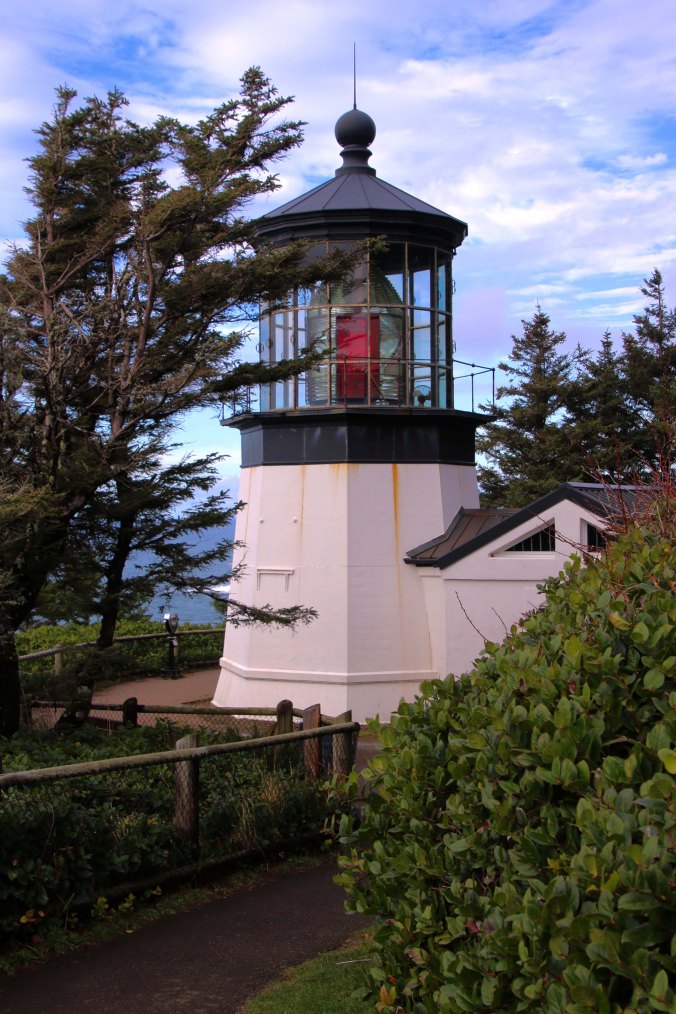
At 38-feet tall, the Cape Meares Lighthouse is the shortest lighthouse in Oregon. (Photo by Peggy Mekemson.)

Towering cliffs, abundant sea life, a lighthouse, massive rocks rising out of the ocean, the Octopus Tree, and an old-growth forest of Sitka Spruce… How could we resist? With the sun tentatively breaking through the clouds, Peggy and I grabbed our cameras, packed our raingear, and headed out to Cape Meares, which is located about 30 minutes away from Tillamook, Oregon.

But first, our stomachs demanded lunch, so we stopped at the Pelican Brewing Company in Tillamook for a hamburger and, of course, a beer. Peggy and I shared a pint of tasteful ale. The Northwest is noted for its great craft beers and Pelican has some dandies. Several have won national and international awards.

Pelican Brewing Company

Good things were brewing at the Pelican Brewing Company in Tillamook, Oregon.

Curt Mekemson enjoying a pint at Pelican Brewing Company in Tillamook, Oregon.

Cheers! (Photo by Peggy Mekemson.)

Having tamed our hunger and thirst, we headed out to the coast and were soon perched on an overlook admiring the Three Arch Rocks, so named because each one contains an arch. Of greater significance, the rocks are known for their large nesting colonies of Common Murres, Cormorants, Western Gulls, storm-petrels, auklets, Black Oystercatchers, Tufted Puffins, and Pigeon Guillemots. In 1907, Teddy Roosevelt declared the area a wildlife sanctuary, the first in the US west of the Mississippi. He did so on the recommendation of a pair of young conservationists, William Finley and Herman Bohlman, who had watched hunters decimate the sea lion population on the rocks, and even worse, observed local ‘sportsmen’ row out to the rocks on Sundays and use the birds for target practice, killing thousands.


Three Rock Arches near Cape Meares

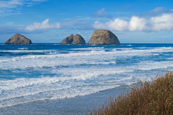
Three Rock Arches as seen from an overlook just before the small town of Oceanside.

Three Rock Arches near Oceanside

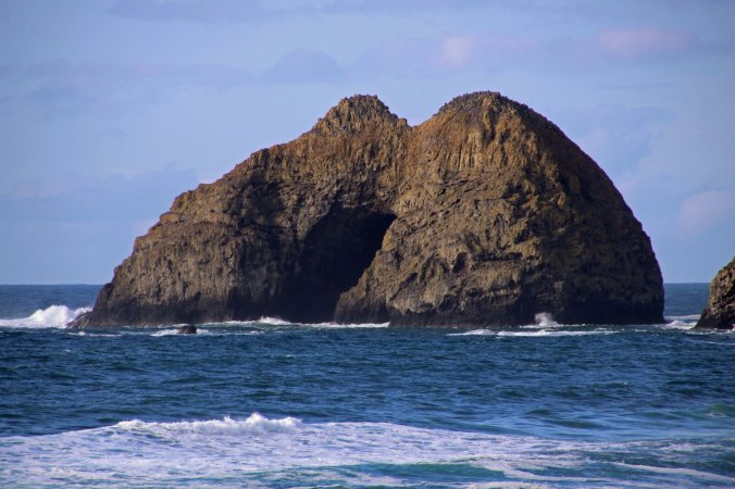
Peggy used her telephoto to pull in the middle of the Three Arch Rocks. While you can’t see through the arch at this angle, you can see how big it is. (Photo by Peggy Mekemson.)

Three Rock Arches 1

A convenient pine provided a different perspective.

We drove on to the Cape Meares Lighthouse where a sign in the parking lot suggested a detour toward the Octopus Tree that sent our imaginations spiraling out of control. Was this a magic tree of fantasy lore? Would we be swept up in its tentacles? Naturally, we had to check it out. The tree turned out to be a Sitka Spruce with eight trunk-like limbs that once made it into Ripley’s Believe It or Not. The story behind its unique shape is that the local Tillamook Indians shaped it to grow that way, created a sacred site where elders could gather to make important decisions and Shamans would travel on their mystical journeys. A few yards away from the tree, a plunging cliff provided more views of the Three Arch Rocks, this time backlit by the sun. Peggy found a man operating a camera drone on the edge of the cliff, capturing pictures of the 200-foot drop off that we weren’t willing to lean out far enough to get.

Sitka Spruce forest at Cape Meares

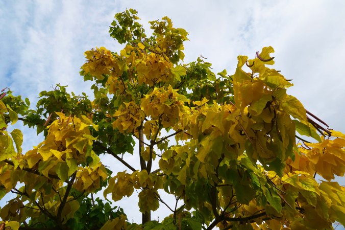
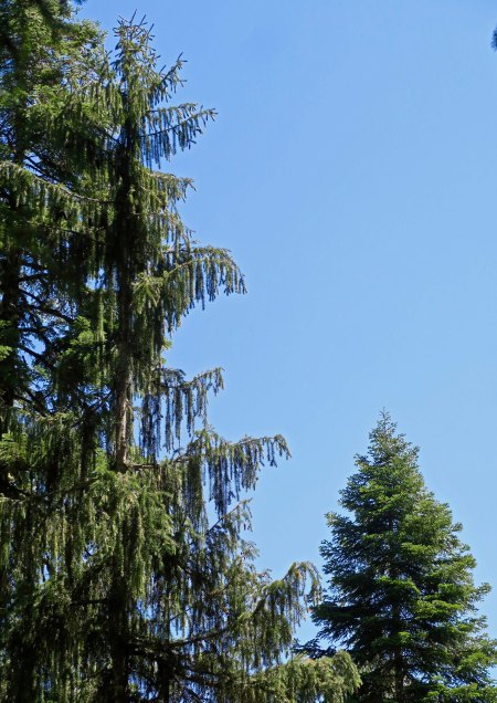
We walked through a Sitka Spruce forest to get to the Octopus Tree.

Octopus Tree

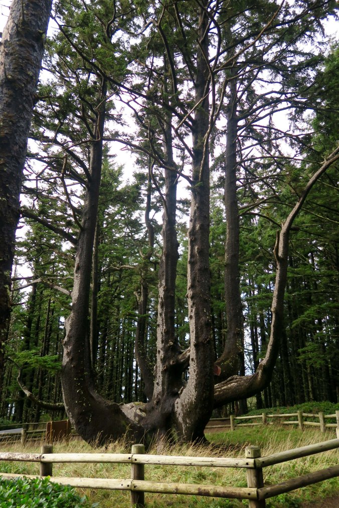
The Octopus Tree is surrounded by a fence to keep it from eating people. Whoops, fake news. It’s surround by a fence to keep young and old kids from climbing on it.

Octopus Tree

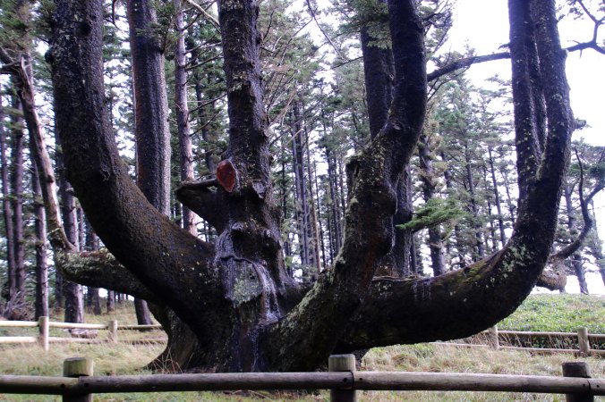
The Tillamook Indians were said to place their canoes on the branches. (Photo by Peggy Mekemson.)

Three Rock Arches backlit

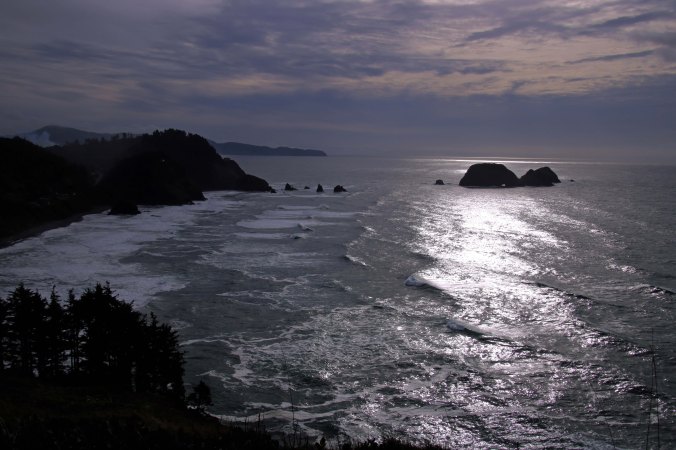
We were south of the cape looking north when we took the first photos of the Three Rock Arches. Here we were looking south with the rocks back lit by the sun. (Photo by Peggy Mekemson.)

Three Rock Arches backlit

This shot of the rocks gave the feeling of a lurking sea monster with the light showing through one of the arches serving as its eye.

Three Rock Arches

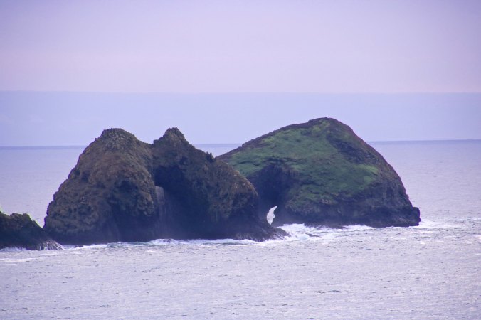
Two of the arches can be seen in this photo by Peggy. The rock on the left is the same one she took a close up of from the other direction.

Man with drone at Cape Meares.

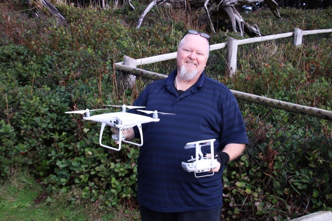
The drone man who was capturing shots of the cliffs.

Walking back toward the lighthouse, we found more cliffs on the other side of the peninsula where the lighthouse sits. These featured a waterfall that tumbled down into the ocean. We also noticed white guano (bird poop) decorating the cliff sides, a sure sign that birds build their nests along the cliffs. Imagine being a young bird looking over the edge of your nest and pondering your fate.

Waterfalls 1

The waterfalls came tumbling down. The white spots on the opposite cliff show the sites of bird nests.

A sign at the site informed us that baby birds are either flyers or jumpers. Murrelet chicks, who are fliers, have been observed pacing back and forth in their nest for a couple of days, flapping their wings frantically, and nervously peering over the edge before they finally take the plunge. It’s worse for Common Murres. Their mom kicks them out of the nest when they are three weeks old… before they can fly! No Mom of the Year there.  They simply stand on the edge and jump, hoping that their stubby wings will guide them to them into the ocean instead of the rocks below. Dad patiently waits in the ocean where he will take over parenting responsibilities for a few weeks until the babies can fend for themselves. Meanwhile, a whole host of hungry predators are waiting below chanting “Crash! Crash! Crash!”

While I am on the subject of birds and food, I learned at Cape Meares that the Tufted Puffins have a barbed tongue that they use to spear fish. They can get three or so minnow-sized fish on their tongue at once. The first one is pushed up the tongue by the second and the second by the third. The barbs hold them in place until, I assume, baby birds wrest them free. I also found out that a pair of Peregrine Falcons were known to nest in the area. These birds are the fastest animals in the world. They fly high above their prey, fold their wings and literally fall, or dive, hitting speeds up to 250 miles per hour (402 KPH) before smacking into their dinner.

At 38-feet tall, The Cape Meares Lighthouse is known for being the shortest lighthouse in Oregon. Given that it stands on a 217-foot tall cliff, however, size probably doesn’t matter. The lighthouse was built on location but the first order Fresnel lens (pronounced ‘fraynel’) was wrestled up the cliff in 1899 using a wood crane built from local timber. The lens had been manufactured in France and shipped around Cape Horn and up the coast to Oregon. It was built with four primary lenses and four bull’s-eye lenses providing light that can be seen 21 miles out at sea.

Cape Meares

This T-Rex perspective of Cape Meares by the Fish and Wildlife Service provides a good view of the cliffs. The lighthouse is the white speck at the end of the lower ‘jaw.’ The Octopus Tree is on the upper end of the lower jaw. The waterfall was inside the lower jaw.

Cape Meares Lighthouse

The Trail down to the Cape Meares Lighthouse. (Photo by Peggy Mekemson.)

Fresnel Lens in Cape Meares Lighthouse

A close up of the Fresnel lens with its red bullseye.

Cape Meares Lighthouse 2

A final view of the Cape Meares Lighthouse.


NEXT POST: Peggy and I make our way through a rainforest to the highest waterfall on the Oregon Coast.


SaveSave

The Last Laugh… Plus Three Final Scary Stories to Wrap up Halloween!

I looked out my window and saw our two pumpkins laughing at me. They were having a last laugh…


I looked out my window and caught Bad Kitty and Fire Face laughing their heads off, so to speak.

“We fooled you,” they roared. “You thought we were scary! We were wearing costumes.”

“I am actually a very friendly kitty,” claimed Bad Kitty. “My real name is Pumpkin Kitty. My teeth were false. It was fake news. He, he.”

“And I’m known as Oak Ball because I am shaped like one,” Fire Face chortled. “My mother was a pumpkin but my father was an oak tree. Linda was right! That’s why my eyes and mouth have an oak leaf look.”

“We are on our way back to the Great Pumpkin Patch in the sky, but we’ll be back again someday,” I heard them exclaim as they rolled off down into our canyon.

And thus the tale of two wandering pumpkins draws to a close. I did promise Christie I would reference other ghostly experiences I have had and blogged about before moving on, however. Here are the links and a brief description.

The Attack of the Graveyard Ghost: My sister, Nancy, is deathly afraid of ghosts, which was a serious problem when we lived next to the Graveyard. It was made worse by the fact that her boyfriend lived next-door but she had to walk past the Graveyard to see him. She was walking home alone one night when it happened. A ghost attacked her… http://wandering-through-time-and-place.me/2013/10/30/

The Ghosts of Fort Mifflin: Fort Mifflin, located next to Philadelphia, is supposed to be one of the most haunted sites in America. Peggy and I went there on one dark Halloween night with thoughts of reconnecting with my dead ancestors who had been killed there during the Revolutionary War. One had been cut in half by a cannon ball! We weren’t really expecting to find any ghosts, but then some weird things happened that had Peggy and I scrambling to find other people…  http://wandering-through-time-and-place.me/2016/10/30

The Disappearing Scottish Woman: Peggy and I were off in Scotland pursuing yet another dead ancestor, this time a Scottish martyr from the 1600s. I had walked over to a woman who was standing on a porch to ask permission to cross her property and she disappeared. Things don’t get much more spooky. Read on… http://wandering-through-time-and-place.me/2016/10/31/

Enjoy!

Next up: The petroglyphs of Lava Beds National Monument

Bad Kitty Snuffs Out Fire Face… The Verdict Is In: Halloween 2017

Bad Kitty and Fire Face

It was a dark and spooky night, indeed! Looking out our window on Halloween, we found the spirits of Bad Kitty and Fire Face staring back at us.


The polls are closed; the ballot box stuffed; the votes counted.  Bad Kitty is the winner! “I think you knew that most of your followers were cat lovers,” Peggy sniffed. “It’s going to be Indian food,” I crowed, already tasting hot lamb curry.

But Fire Face had his fans. And lest you feel too much sympathy for my highly competitive, ever-lovely wife, let me note that she has beaten me far more frequently than I have beaten her over our years of pumpkin carving competition! She’ll be back next year and “Watch out, Curt!”

Pumpkins look in house during day

Bad Kitty and Fire Face outside on our patio table.

Here’s what some of you had to say…

Animal Couriers: “Oh, you know us, it has to be pumpkin number 2! They are both fab.”

Dave Ply: “As for my choice, both are excellent, it’s a tough call, but as I’m a cat guy I have to go with scary kitty. (I always used to have black cats)”

Linda: “Despite the fact that I live with a creature I currently refer to as the Devil Cat, I’m going to have to go with Number 1 — with this caveat. I don’t see the carving as fire, but as autumn leaves.”

Christie: “I would vote with Bad Kitty, and only because this looks like a reminiscence of Demon” 

Andrew: “My favourite pumpkin carving has to be no. 2 – but only by a whisker!”

Dave Kingsbury: “Fire Face made me feel uneasy but I was even more discomforted by Bad Kitty’s expression so the latter gets my vote. But well done both!”

Phil: “Fire Face is very cross-quarter day, but the artistry of Bad Kitty is hard to resist.”

Rebel Girl: “Fire Face all the way!”

Alison: “With trepidation, not wanting to offend either of you, I choose Bad Kitty!”

You can see what Peggy meant by cat lovers. (grin) Take Animal Couriers, for example, they make their living by transporting cats and dogs throughout Europe!

Peggy and I thank you for your participation. We had a lot of fun with the carving and the competition. And, as part of my Halloween series, I was pleased to bring you a glimpse of the incredible Jack-o-Lantern Spectacular of Providence, Rhode Island.

Correction: One of my friends pointed out that it is Linus not Charlie Brown that believes in the Great Pumpkin, which I incorrectly stated in my last post. Thanks!

LATE BREAKING NEWS: Scary Cat Becomes Scaredy Cat; Ground Squirrel De-fangs Bad Kitty

It was inevitable, or make that, highly edible. It was simply a matter of time before the wildlife around our area decided that the scariness of our pumpkins was outweighed by their resemblance to lunch. Deer have stopped by several times to stare at the pumpkins and warily circle them. They are endlessly curious about new things and have a written in stone philosophy:  If it tastes good eat it. The fierce way the pumpkins glared at them, however, made our hoofed friends reluctant to take the first bite.

A ground squirrel had no such trepidation. It had already discovered that pumpkin was good-by meticulously picking out all of the seeds from the mishmash of pumpkin innards that Peggy had left outside for woodland creatures. It only required a leap of the imagination to hop up on our patio table and start chowing down on Bad Kitty’s teeth. I couldn’t catch the culprit in action, but when I questioned her later, she had pumpkin on her breath. There is a photo of the results below the curious deer.

Doe checks out pumpkins

All attention, a black tail doe stares at the pumpkins while trying to decide whether she will brave their stares and try a nibble, or stick with the thorny rose bushes beside her. She stuck with the rose bushes.

Toothless pumpkin

Alas, Bad Kitty, looking a bit worse for wear, has had his teeth pulled by a rapacious ground squirrel.


Where to next: Peggy and I will soon be heading for the north coast of Oregon and the south coast of Washington to celebrate our 25th Anniversary. There will be lots to share ranging from wintry ocean scenes, to colorful coastal towns, to a bridge that a young Kurt Cobain hid out under, to the land where vampires and werewolves wandered in the Twilight series. But that’s a couple of weeks off. In the meantime, I’ll slip in more of my petroglyph series, starting with Lava Beds National Monument in north-eastern California.

SaveSave

Happy Halloween 2017… The Jack-o-Lantern Spectacular: You Are the Judge

The Great Pumpkin arises out of his pumpkin patch and is greeted by his adoring followers at the Jack-o-Lantern Spectacular in Providence , Rhode Island. Could it be that Charlie Brown was right?


Today marks the end of my seven-day tribute to Halloween where I have featured the Jack-o-Lantern Spectacular in Providence, Rhode Island. Peggy and I have returned home to Oregon where we square off against each other in our annual pumpkin carving contest.

The day has arrived. The Great Pumpkin has risen out of his pumpkin patch and is flying across the sky, delivering candy and other goodies to girls and boys around the world. At least Charlie Brown believes he has, even if he can’t persuade his sidekicks and Snoopy that he exists. There are no lack of children out here in the real world who are willing to pay homage to the Great Pumpkin, however, especially if it involves dressing up in costumes and filling bags with candy. I remember my own childhood when my brother and I would pillage far and wide to load our gunny sacks. Then we would come home to admire our booty and stuff ourselves. On the scary side of things, we would hide out in the Graveyard next to our home and jump out to scare other children when they came knocking at doors in our neighborhood. (Little kids can really run fast.) It was all in good fun, one of the greatest days in the year— at least from our perspective.

While it was all about kids back then, adults have adopted the holiday as well today. Millions don costumes as they head off to work and to party.

Pumpkin carving has been an integral part of my Halloween since I first met up with Peggy. For many years we even had a pumpkin carving contest with other members of my family. That finally ended after a quarter of a century, but Peggy and I still look forward to out annual carving activities. And, we are pleased to note, our children and grandchildren have followed suit! Our two pumpkins from this year are displayed below. Using pumpkins from the Jack-o-Lantern Spectacular for inspiration, Peggy and I are having our own contest! And you are the judges. Please note the one you like. I’ll report on the winner  and who carved the pumpkin in my next post. Whoever wins get the dinner out of his or her choice. In other words, there is no loser.

Let the contest begin. Pumpkins have been chosen, tools gathered, and the proper Halloween setting chosen.

The Masked Carver has issued her challenge.

It is important to get in touch with your inner pumpkin before carving.


It takes guts to carve a pumpkin.

The ever so spooky Fire Face: Pumpkin Number 1

And the very scary Bad Kitty: Pumpkin Number 2


Thanks for choosing! And Happy Halloween from Peggy and Curt.


The Fall Colors of Southern Oregon… Who Needs New England?

Having just returned from Connecticut where fall colors were yet to make an appearance in mid-October, I found this Big Leaf Maple all decked out in my back yard on the Applegate River in Southern Oregon.


Peggy and I have been in Connecticut for the past couple of weeks. We went back to visit with our son, daughter-in-law, and grandkids, but I also hoped to get in some serious leaf-peeping. New England is world-famous for its fall colors and we had once spent a month in Maine, Vermont and New Hampshire during the height of the season. We wanted more!

It wasn’t to be. It had been a warm fall in Connecticut and the leaves were being stubborn. Just as we were preparing to leave, a few trees had started to turn, but it was nothing in comparison to what we had experienced. Maybe the states north of Connecticut were having better luck. We packed our bags, took Amtrak to Boston, and flew back home to Oregon.

As we dropped into Medford from Portland, I glanced down at the ground and was greeted with bursts of yellow and red. Apparently, our trees had decided to show us that the grass isn’t always greener on the other side of the fence, that the trees in New England aren’t always more colorful than the trees out West.

The drive home through Jacksonville and up and over into the Applegate Valley was spectacular. I thought to myself, “Who needs New England?” And I vowed that my camera and I would be up early the next morning to capture some of the color. I started with our yard and then took the Upper Applegate River road to Highway 238 and down into Jacksonville, stopping at the McKee Covered Bridge, Valley View Winery, and a favorite hiking trail. I finished off in Jacksonville, which was simply riotous with color.

Fall morning, Applegate Valley, Oregon

I considered this sunrise on Thursday morning a good omen that I would catch lots of fall color in the Applegate River Valley and in Jacksonville, Oregon.

White oak leaf in Applegate Valley, Oregon

This white oak leaf greeted me as I walked up our road. It was past its prime and looking a bit beat up, but I promised it a place in my blog.

Big Leaf Maple in Jacksonville, Oregon

The Big Leaf Maples of Oregon never disappoint when it comes to fall. They consider it a responsibility to decorate our yard.

Big leaf maple in Southern Oregon

And a close up.

McKee Bridge on Applegate River, Southern Oregon

Hopping in our truck, I drove over to the McKee Bridge, about four miles away. Peggy and I attended the bridge’s hundredth anniversary this summer.

Applegate River in fall, Southern Oregon

I took this photo of the Applegate River from the bridge.

Fall tree near McKee Bridge on Applegate River, Oregon

And found another maple on the other side.

Valley View Winery in Applegate Valley, Oregon

Driving on, I stopped at the Valley View Winery to capture some grape leaves that were turning.

Fall colors along Jacksonville Trail in Oregon

This hiking trail is part of a system of trails around the town of Jacksonville.

Light and shadows in fall leaves, Jacksonville, Oregon

Shooting up through the leaves I caught this photo with its contrast of shadows and light.

Jacksonville Oregon Church in fall

You certainly might think this photo was taken in New England with its village church and fall look, but it was in Jacksonville.

Fall trees and Church in Jacksonville, Oregon

Another perspective.

Orange fall leaves in Jacksonville, Oregon

I’d put this tree up against any tree in the country for sheer, glowing color.

Red fall colors in Jacksonville, Oregon

Jacksonville, is filled with riotous colors. I wanted to capture them before the big storms that were coming in did.

Fall leaves on sidewalk in Jacksonville, Oregon

Leaving the beautiful leaves on the ground…

Fall leaves on grass in Jacksonville, Oregon

Or in the grass.

Black walnut tree in fall, Jacksonville, Oregon

A black walnut tree added a dash of yellow…

Fall tree in Jacksonville, Oregon

I didn’t know what this fellow with its long pods was, but I liked its exotic look.

Fall colors in Jacksonville, Oregon

Another stranger to me, but it belonged on my post.

Street lamp and fall cors in Jacksonville, Oregon

Convenient lamps always make fun props.

Halloween Bed and Breakfast in Jacksonville, Oregon

And finally, I’d be remiss not to add this reminder of the season. A Jacksonville Bed and Breakfast was having fun with the rapidly approaching Halloween.


NEXT POST: Our kids took us to the Jack-o-Lantern Spectacular in Providence, Rhode Island while we were visiting and spectacular it was with over 5.000 pumpkins ranging from traditional to art carving. Starting on Wednesday, I will do a daily countdown up until Halloween featuring some or our favorites. You will want to check this out.


Burning Man or Burning House… When Forest Fire Threatens


Heavy smoke from local forest fires fills southern Oregon’s Upper Applegate Valley where we live.


I left our home on the way to Burning Man with the heavy smoke of the surrounding forest fires filling the air in Applegate Valley like an evil fog. Once again we had an inversion; there was nowhere for the smoke to go so it was hanging around and hassling our lungs.

The forest service folks said there wasn’t much to worry about. We might have bad smoke, but the fires were good. They were the type that make their way along the ground, clean out the dead wood, and leave the forest feeling healthy. Naturally, there was an if attached. The wind could change; the heat could skyrocket; the fire could cease its peaceful ramble through the woods and become a raging inferno. Conditions were extreme.

Trusting a fire to behave is something like trusting a tropical depression in the Gulf to behave. Sometimes the depression simply goes away; but occasionally, it morphs into a horrendous hurricane with devastating floods. Hello Harvey. Our thoughts are with our friends and all the other people in southeast Texas who are suffering from the torrential downpour.

The forest service people in our area also told us that they didn’t have enough personnel to seriously tackle the fires creeping through our woods, even if they wanted to. The Chetco Fire over near the coast, some 50 miles away, had been declared the worst fire in the nation, at least for now. Even the local firefighters had headed for the coast. The town of Brookings was being threatened, and firefighters go where the threats are the greatest.

I was happy to escape. I drove down through the Rogue Valley. Smoky. I drove up and across the Cascade Mountains. Smoky. I drove down into the Klamath Basin, past Klamath Lake, past Klamath Falls. Smoky. Finally, down around Tule Lake across the border in northern California, down where Japanese-American citizens were once corralled behind barbed wire fences like cattle, the smoke begin to clear. I breathed a sigh of relief. I breathed fresh air.

A sign outside of Tule Lake told me there were no services for the next 70 miles. Not many of California’s 39 million people live in the remote northeastern part of the state. I checked my gas gauge. Not a problem; I made it to Alturas with a quarter tank left. Gas prices had shot up, however— partly because of the towns remote location, partly to make money off of the increased traffic to Burning Man, and partly because of Harvey’s romp through the Gulf and along the Gulf Coast. I am sure that you have noticed that gas prices shoot up within hours when the oil industry has a problem. It takes months for them to creep back down.  Or is this just my imagination?

I bought gas. I also bought apples, oranges and salad mix at the Holiday Market. (California won’t let you bring fresh fruit and vegetables into the state.) My destination for the day was Cedarville, a mere 26 miles away up and over the Warner Mountains from Alturas. I like the small town. It perches on the very edge of California. Off to the east are the vast open spaces of the Nevada’s Black Rock Desert where lonely ranches, windmills, sagebrush, jack rabbits and rattlesnakes rule.  Cedarville likes Burning Man. The majority of the Northwest’s large population of Burners pass through the town. A couple of years ago, a local gas station owner told me he pumps as much gas during the week of Burning Man as he does the whole rest of the year.

My normal routine is to spend the night in the town and then drive the 90 plus miles to Burning Man early the next morning. I checked out the fairgrounds where I was going to camp and then headed for the Country Hearth Restaurant. It’s a small-town kind of eatery that moves at its own slow pace but serves excellent food. I had my traditional last meal before heading into the desert and then went out to the van for a final call to Peggy. Phone service is non-existent to highly unlikely in Black Rock City. A large brindle dog offered me a wag or two, sat on the sidewalk, and watched me make the call.

Peggy greeted me with her usual chirpy welcome and then told me that the sheriff had just been by our house. “We are under a Level 1 fire alert!” Our endless days of smoke were threatening to turn into something much more serious. Level 1 is a warning. Be aware, the fire is threatening to come your way. Level 2 is you should be packed up. Leaving is highly recommended. Level 3 is get out now. You may be too late.

“I’m coming home,” was my immediate response.

“No, Curt,” Peggy replied. “I have everything under control. You need to head on into Burning Man.” She knows how much I look forward to the event. And I had no doubt that Peggy had things under control. She’s cool under pressure and highly organized. Plus, we have great neighbors. But that wasn’t the issue. Having to abandon our home and possibly lose it to fire wasn’t something she should face alone. She was insistent, however.

“Let me think about it,” I concluded. I went back to the fairgrounds and broke out a beer. It didn’t take much thinking. I was not going to leave Peggy home by herself. I called her back.

“No, no, no, Curt,” she made one final plea. But I reaffirmed I wasn’t going to leave her alone. I also said I wanted to say goodbye to our home if it was in danger of burning down. And finally, I told her I would head back to Burning Man if the situation improved. I think it was the latter that convinced her.

………

It’s a strange feeling to walk through your home and figure out what to take and what to leave behind when a forest fire threatens. In ways, it’s a walk down memory lane. There’s so much history. Some things are easy: medical and financial records. Others are more complicated. I love our books, for example, but there is no way we are going to pack up a couple of thousand. Maybe I’ll pull a dozen. A few family albums from our childhood, some art work with meaning, original materials from Berkeley’s Free Speech Movement, my genealogical files, Peggy’s quilts, some clothes— whatever we take has to fit in our pickup.The digital age helps. Much is on-line.

Peggy and I spent time outside yesterday, prepping the house. Most was already done. We live in an area prone to forest fires, so we have ‘defensible space.’ Plants, except for lavender, which is fire resistant, are away from our walls. Lower limbs have been cut away from trees. I’ve weed whacked most of the weeds near our house, but now wish I had done more. Too late. Plus, the fire people have a ban on all gas-powered tools. I did some hoe work and Peggy raked, The heat and the smoke made things much worse. Three hours was our max. We drank lots of water. A cold shower afterwards felt good.

We’ve decided on an action plan. There is really nothing else we can do here. Hanging out and manning a garden hose during a Level 3 situation is not an option for us. We will pack the truck today. There is a community meeting hosted by the forest service that we will attend tonight. Tomorrow Peggy will head for Sacramento to escape the smoke and I will resume my trip to Burning Man. We are pretty sure our property is safe. If not…

Peggy smiles. “Maybe it’s time to buy another small RV and hit the open road again.”

SaveSave

SaveSave

No-see-um Camp, a Sacred Grove, and Cougar Poop

No-see-um camp, which we expected to be bug infested, turned out to be nestled among trees that made me think of a sacred grove.

Part II of our hike up Cook and Green Creek to the Pacific Crest Trail through the Rogue River National Forest.

Our goal for the day was No-see-um Camp, which seems like a very poor place to set up your tent. If you have spent much time outdoors, you will recognize no-see-ums as particularly nasty little bugs. I first encountered them when backpacking on the Appalachian Trail in Maine. It had rained for a solid week and every biting bug in existence had considered us fair game. While mosquitoes had treated our bug repellant as an hors d’oeuvre, no-see-ums had come after us with knives and forks. Later, I watched a moose in Alaska dash wildly about and roll in a snow bank to escape the tiny, nefarious fiends. Fortunately, we didn’t find any no-see-ums in No-see-um camp. It was quite the opposite. I decided we had arrived in a sacred grove.

Sacred groves go almost as far back as humanity. Think of the Druids and their oaks. In West Africa, where I served in the Peace Corps, huge cottonwoods were thought to contain living spirits and I often found offerings at their bases. It’s important to keep the forest spirits happy.

No-see-um camp had more species of trees than I have ever found in a single location, many of them were giants. From our camp, I could see Douglas fir, sugar pine, white fir, blue spruce, chinquapin, big leaf maple, and yew. Just up the trail I found a ponderosa pine. Cook and Green Creek with its cool, refreshing water bubbled and burbled and roared its way down the canyon just behind our tent. I figured it was an excellent place to commune with nature spirits and Peggy found a camp guardian up in the trees, which I thought was quite pagan of her.

Another view looking up from our campsite on Cook and Green Creek. This one features big leaf maples.

There is a reason for their name!

We also had chinquapin growing in the grove. This prickly thing covers the trees nuts, which are said to be tasty.

Giant sugar pines with their large cones and giant Douglas firs with their small cones surrounded us.

I found a large ponderosa pine near by. Do you know what made the line of holes? It was a sapsucker, a kind of woodpecker. It will return to eat any insects that have entered the holes.

Cook and Green Creek flowed just behind our tent. It was burbling here.

Small waterfalls added a slight roar.

And I found the way the water flowed over a rock to be intriguing.

The downed tree next to our tent provided a good perspective on the size of the larger trees.

This odd tree growth just above our site served as Peggy’s camp guardian. (Photo by Peggy Mekemson.)

The Guardian’s tree was also impressive.

We used our layover day as an opportunity to do a nine mile hike up to the pass and back. Going up, we entertained ourselves by enjoying flowers and other plant life while looking for signs of wildlife. And yes, I have more animal poop, scat, to share with you. I’ll bet you’re excited.

A shelf fungus.

Any idea what is happening here? Carpenter ants were making their nest. They are a fairly large ant that literally cut off small, sawdust-size chunks of wood and then bring it out to the edge where they dump it on to the sawdust pile at the bottom of the photo.

Peggy poses beside a fallen tree.

Which happened to feature another wood sculpture that Peggy determined was a dragon.

We found these unusual cones that actually grow directly on the limbs of the trunks and limbs of the knob cone pine.

Okay, I put up pretty, or at least I hope interesting photos, and then I put up poop. Why? Half the fun of wilderness travel is knowing what you are seeing around you. Scat (poop) is one way of telling what animals are using the trail you are on. This happens to be cougar, or mountain lion scat. The twisted piece on the end is fairly definitive of the cat family. Size suggests cougar. It was dry, so we were in little danger of an immediate encounter.

Since we are on animal signs, any idea of what made this? Odds are it was a porcupine. They chew off the outer bark to get to the nutritious, inner bark.

This attractive small waterfall, provided cool water to drink with our  lunch. (Photo by Peggy Mekemson.)

After lunch on our way up to the pass, we found this attractive Blue Spruce…

And a flower, which is known as Ranger’s buttons.

On top, we met Rambo, Dogondo, and Double D: three PCT through hikers. Their names are their trail names. They had started at the Mexican border and been backpacking since April, covering close to 1000 miles. They were skinny and ever so eager to reach Oregon, which was just up the trail. One of them told me that Sasquatch (Big Foot) had been rooting around outside his tent the night before.

Rambo, a PCT through hiker from Riverside, California.

Dogondo, a PCT through hiker from Chicago.

Double D, a PCT through hiker from Kansas City.

We raced on our way back down from the pass. I was careful to keep Peggy behind me. She thinks that she is a greyhound when she gets out in front going down a hill. I once sprained my ankle trying to keep up with her coming off of Muir Pass on the John Muir Trail and had to hobble another 80 miles before we finally climbed up and over Mt. Whitney and out. Taught me.

Peggy, all set to go, wearing one of her favorite T-shirts.

The Cook and Green Trail and Some Really Weird Trees… Part I

The way madrone trees shed their bark is strange enough without having a pair of eyes staring out at you. We found this specimen along the lower end of the Cook and Green Trail.


Today’s post will take you along with Peggy and me on our latest backpacking adventure. This time, the trailhead was a mere 30 minutes from our house! The Cook and Green Trail follows Cook and Green Creek up to Cook and Green Pass where it connects into the Pacific Crest Trail, the PCT. (That’s a lot of Cook and Green; they were gold miners who worked the area in the 1870s and 80s.) Starting at the pass, we could have made a right turn and hiked to Mexico or a left turn and hiked to Canada. Another time. (grin)

Peggy points out a PCT marker showing the trail south. Had we followed it, we could have been to Mexico in a thousand miles.

We were greeted by a pair of signs at the Cook and Green trailhead, which I found amusing. Both were products of the US Forest Service. I don’t think the hand on the first poster is that of America’s preeminent spokesperson for fire prevention, Smokey the Bear; I think it belongs to Bigfoot! The second sign warned us about bears. Serious stuff.

Did this sign use Bigfoot to emphasize fire prevention? Or is it a clawless Smokey? It’s puzzling.

It’s smart to be aware of bears when backpacking, but you should not let them keep you out of the woods.

I am a veteran of the backcountry of Yosemite, where the bears actually run a school on how to steal backpacker’s food. (Fake news, but just barely.) So I wasn’t too worried about the bears of the Rogue River and Klamath National Forests. Still, the poster is worth reviewing. Avoid confrontation: That’s always sage advice when you are dealing with a grumpy animal that can outrun you, outweighs you, and comes with long claws and sharp teeth. You don’t want to surprise them and you don’t want to get between a mother and her cubs. That having been said, bears aren’t particularly interested in eating people.  If they were, they would move into towns where there are lots of people to eat. Mainly, they prefer to avoid humans, like most sensible wild animals.

Your food? Well, that’s a horse of a different color, or at least a bear that has hung out around careless people. When I see bear poop that includes bits and pieces of the plastic used to package  freeze-dried backpackers’ food, I know to be on the lookout. BTW, a Yosemite bear would laugh at the advice to hang your food high in a tree. Guess what, bears climb trees. And if mama bear can’t climb a tree in Yosemite to retrieve your chow, she sends her babies up. The advice in Yosemite used to be that your food bag had to be at least nine feet off of the ground and nine feet away from the trunk, with no ropes hanging down! I’ve watched bears play tether ball with food that wasn’t hung high enough. Now the park rangers want you to carry plastic bear-proof barrels. I’ve never worried much about bears when away from Yosemite. Still, care is called for.

It’s good advice about dogs. Way back in history, I was out backpacking with my first father-in-law’s Springer Spaniel, Sparky, and came across a bear. Sparky jumped behind me and then stuck her head out between my legs and started barking vociferously. The bear stopped and growled before ambling on. I told Sparky that if the bear had charged I would have picked her up and tossed her out in front of me.

The Cook Green Trail begins its journey through a burned-out area. In 2012, we watched from our home as huge billows of smoke climbed above the forest and a fleet of helicopters used large buckets to dip water out of Applegate Reservoir, one mile above our home, to fight the Fort Complex fire. It was only a few miles away, and we watched nervously. Today, new growth is returning to the area as nature performs one of her miracles.

This photo captures the area where the Fort Complex Fire stopped burning along the Cook and Green Trail. It’s a good example of burned and non burned forest. On the burned side, the green near the ground shows where the forest is beginning to recover.

While the hike through the burned-out area was interesting, our fun began on the other side. Peggy came across a mile marker that she felt needed to be decorated, a madrone tree featured eyes peering out from its strange, peeling bark, several oak trees were dressed in moss, tree roots created weird sculptures, and the Mother of All Roots stood higher than me.

Someone, probably the forest service, had placed mile markers along the first section of the Cook and Green Trail. Peggy decided to decorate the marker by adding sugar pine cones beside the marker and rocks in front.

I thought these moss-covered live oaks were quite unique.

This is a close up of the tree moss.

We also found this interesting growth. At first I thought it was stag horn moss but it may be a lichen.

Tree roots can create fun sculptures. I’m not sure I would want to meet up with this one on a dark night!

More ordinary, but still interesting, this root had taken a detour around a rock and captured it.

And here we have the Mother of All Roots!

I stood next to it just before the root connected to the trunk to provide perspective. (Photo by Peggy Mekemson.)

NEXT BLOG: We hike on to No-see-um camp, which turns out to be closer to a sacred grove than a bug infested swamp, and hike up to Cook Green Pass where we find PCT through hikers and mountain lion sign.


Azalea Lake and Bigfoot’s Big Foot…

We found this carving of Bigfoot (Sasquatch) on a stump at our campsite on Azalea Lake in the Red Butte Wilderness.

The Red Butte Wilderness: Part II

In my last post, Peggy and I backpacked into the Red Buttes Wilderness, which is located about 10 miles from us at the crow flies. Our objective was to reach Azalea Lake but about half way there, our bodies had another idea. Camp. Today’s post starts off  the next morning. 

Our bodies grumped as we made them get out of bed to finish the hike. Loudly.

Not far from our camp, we passed the lonely grave of Sylvan Gosliner, Ruby Gosliner and Alma Pratt. Their airplane had crashed in the canyon in 1945 on a return trip to Portland from San Francisco. Why, has never been determined. The forest service had retrieved the body of the pilot while relatives of the Gosliners and Pratt had chosen to bury their family members beside the trail. It’s a beautiful location. Wreckage of the plane can still be found in the canyon below.

The rock covered grave of Sylvan and Ruby Gosliner and Alma Pratt along Butte Fork Creek with its simple bronze marker.

Red cedars replaced the pines as we continued our climb through the dry forest, while cheerful tiger lilies and other flowers brightened our way whenever we crossed a stream. Eventually we arrived at Red Cedar Basin. Peggy zonked out on a flat rock while I wandered around the meadow, which was filled with corn lilies. Had there been water, it would have become camp. But Azalea Lake beckoned. We dutifully shouldered our packs and completed the trip. We found an attractive campsite and settled in for the afternoon and next day. Numerous insects greeted our arrival and some came by to take blood donations. By seven PM, Peggy had disappeared into the tent. She’s been known to disappear inside at the buzz of the first mosquito— leaving me outside to entertain our flying and crawling visitors.

Red cedars replaced Douglas fir and sugar pine trees as we climbed in elevation.

While the forest was dry with limited vegetation most of the way, it changed whenever we came to streams, turning into a vibrant flower garden with flowers such as this tiger lily…

Wild iris…

And Indian paintbrush.

I caught Peggy napping at Cedar Basin…

And she caught me in our camp at Azalea Lake.

Azalea Lake is a jewel located in a basin surrounded by peaks and ringed by azaleas. Tall, incredibly straight lodgepole pines provided us with shade on our layover day as we hung out, snacked, read, and went for a hike around the lake, where we found a couple backpacking and carrying a tent, literally. Noisy chickarees (small tree squirrels) scolded us for our intrusion. As did the always vociferous Stellar jays. Quieter birds such as robins, Juncos, and fly catchers merely went about their business of scrounging for food as the sun made its way across the sky. A Pileated Woodpecker caught our attention with a more stentorian call.

Azalea Lake nestles between peaks in the Red Butte Wilderness. I took this photo on our first trip into the area. The peak on the left and the draw is featured below in the setting sun photos.

An early morning shot on this trip…

And an evening shot.

Azaleas surround the lake but we arrived when most of the blooms were gone. We did manage to find these however.

And some interesting bear grass.

A close up.

We also found these two backpackers carrying a tent. “You have to let me take your photo,” I insisted. “We are only moving a couple of hundred yards to find a better campsite,” they explained, a bit sheepishly.

Incredibly straight lodgepole pines provided shade for our camp. The dead tree provides a good example of just how straight these trees grow and why they served as center ‘lodge poles’ for roofs on early pioneer cabins.

As the sun prepared to say goodnight, it bathed the surrounding peaks in soft light, an event that always sends me scurrying with my camera. Peggy and I hiked down the trail but couldn’t catch any clear shots through the trees. A surprise was waiting for us back at camp, however: an ingenious carving of Bigfoot. I don’t know how we had missed it; we had walked by it several times. I considered the discovery a sign that I needed to go out again to capture a photo of the alpenglow— and just possibly the illusive giant.

Trees blocked our view of the peaks above Azalea Lake as the sun began to set.

The Bigfoot carving in our camp at Azalea Lake.

While Peggy stayed in camp, I made my way through the trees to a meadow at the base of the peaks. A half dry, meandering stream had created a small marsh. Looking up, I had an unobstructed view of the rocks above. I worked my way around the meadow for different perspectives. A draw made its way up the mountain, providing access for animals crossing over the peaks. Apparently, it was well used. The meadow was full of deer sign; there were tracks galore.

A meadow with a small marsh sat at the base of the peak.

The small meadow gave me a clear view of the sun setting on the peak.

A draw made its way up the side of the mountain and provided access for wildlife to the lake.

Numerous deer tracks suggested that the draw was well used.

A large track caught my attention and I stopped to check it out. Something heavy had landed and launched on the spot, apparently in a hurry. A huge bear was my first thought since the depression was a good two inches deep. The deer tracks were closer to a half-inch and bent grass was all I was leaving. I looked around nervously. But something wasn’t right.

  • A bear would have left another track beside it. There was nothing.
  • The print was oblong, very long. Bear prints tend to be more rounded.
  • The paw prints weren’t showing any claw marks, which you normally see on bears. In fact, they looked more like toes!

I found myself getting excited. Had I discovered a track of Bigfoot’s big foot?! I rested my boot alongside the track. I have big feet myself, size 14 American (49 European). The track was seven inches longer, over 20 inches long (50.8 centimeters)! I did a more thorough search for other tracks. A more expert tracker may have found something, but I didn’t. My thought was the creature who made the track was bipedal and running. It had traveled from the dry ground to the marshy area and back to the dry ground.

Was my imagination working overtime? Was I creating a Big Foot where none existed? Maybe. I took photos using my boot and 5×3 inch camera case for comparison and returned to camp to share my treasure with Peggy.

The depression stretched from the front of the foot on the left to the heel mark on the upper right. My 3×5 inch camera case is for comparison.

The impression on the left looked like a toe print to me.

My own size 14 shoe was dwarfed by the print.

The next morning, we were awakened at five AM by a loud thump outside our tent. It sounded a lot like a deer. The deer that live in our neighborhood are forever thumping across the wooden deck next to our bedroom. We sat up with a start and stared through the mosquito screen of our tent.

“There’s something huge and brown beside our packs!” Peggy declared. They were located maybe 15-feet away.

We scrambled for our glasses. We’re both blind as bats without them. Yes, there was something big and brown. A big brown doe. We laughed. For some reason, the doe kept circling our camp for the next hour. Sleep was not an option. We were up early and had our breakfast of oatmeal, coffee and dried apricots. By 8:30 we were packed and ready to go. The trip back to the truck took us half the time of the hike in. And yes, our bodies continued to whine, but only half as much.

NEXT BLOG: Peggy and I head out on another backpacking adventure near our home in Southern Oregon. There’s no Bigfoot, but we discover some really weird natural wood sculptures, and we camp in a beautiful grove of trees where there were more varieties than I have ever seen in one location. Many of them were giants.  I thought of it as a sacred grove.

An Ancient Forest of Giant Trees—and Bigfoot… The Red Butte Wilderness: Part I

Peggy checks out a large sugar pine along the Butte Fork Creek that runs through the heart of the Red Buttes Wilderness. Eventually the creek empties into the Applegate River that runs by our house.


A friend once asked (with a grin), why I believed in flying saucers. “Because I saw one,” was my tart reply. And I did. A saucer-shaped object flew into a cloud in Sacramento going one direction and then flew out going another. It accelerated rapidly and disappeared in a couple of seconds. It was enough proof for me.

“And what about Bigfoot?” he followed up, his smile widening to Cheshire proportions. My response was different. I smiled back.

“Because the world can use a little magic; and it’s fun.”

I’m not anti-science or scientific proof. Quite the opposite. Of the magazines we subscribe to, Scientific American is the one I read cover to cover. Religiously. Some 70 books on science grace our library shelves. (I just counted them.) They range from Brian Greene’s The Elegant Universe to Richard Feynman’s The Pleasure of Finding Things Out. I’ll confess here, however, that the far-out edge of science looks a lot like magic to me.  Imagine entangled photons mirroring each other’s actions simultaneously over hundreds and even billions of miles. Or how about parallel universes existing side by side on and on to infinity?

Scientifically speaking, however, Bigfoot hardly has a leg to stand on, or a foot, even a big, hairy one. Blurry photos, a few hairs, footprints and little else constitute proof. There’s not even a body or bones. If Bigfoot, or Sasquatch, or Yeti, or any of the other names the species goes by around the world exist, they must have an Einstein-level genius at camouflage, hiding and misdirection.

What exists are numerous sightings, often collaborated by other people. A close relative of mine, who prefers to remain un-named, recently told me that one of the big fellows had run across a logging road in front of him up near Oregon’s McKenzie River in the early 70s. He’d never said anything about the incident. I didn’t get his reticence. Had it been me, I would have been screaming the news from the top of Mt. Hood. But he was working in a conservative industry at the time, and felt they might not appreciate his encounter with the giant. It is such sightings, however, often by responsible, sober-type people, that provide hope for Bigfoot’s existence, the frosting on the magical cake.

The Red Buttes Wilderness, located on the remote, northern edge of California in the Siskiyou Mountains, is prime Bigfoot country. We can see the Buttes from our house in southern Oregon, some 10 miles away as the crow flies. We went backpacking in the area three years ago and decided to go again last week. Giant red cedars, sugar cone pines, white pines and Douglas firs dominate the area. They’re the type of trees that make the logging industry salivate. They would have been cut down decades ago except for the difficulty of getting them out. Now they are protected in one of America’s rare virgin forests. If I were Bigfoot, it’s a place I would certainly want to live.

The Red Butte Mountains of Northern California and Southern Oregon.

The Red Butte Mountains as they appear from our patio.

The world’s only Bigfoot trap is located about five miles from where we live. A miner was once hired to build a cabin beneath the trap and given a tranquilizer gun and a pair of large handcuffs to capture the big guy. Only bears were caught. The doors have long since been welded shut. Otherwise they might have trapped some of the teenagers that insist on spray painting the trap with graffiti. 

Peggy and I drove up a pothole-strewn forest service road to the Shoofly Trailhead to begin our adventure. Just beyond a large parking area, the trail dropped quickly for a half mile or so to the Butte Fork of the Applegate River and then followed the creek uphill for 7-8 miles to Azalea Lake, which was our destination.  We made a leisurely trip of it, letting our time-tested bodies adjust to being on the trail again. At about five miles, they decided they’d done enough adjusting and went searching for a campsite. It was a wimpy thing to do, but our minds gave them leeway for being out on the trail at all. Following are some photos of what we took along the way.

The Butte Fork of the Applegate River is right where the Shoofly Trail meets up with the Butte Forks Trail. It makes for a wonderfully refreshing stop, either going or coming.

Another photo of Butte Fork Creek.

Portions of the Red Butte Wilderness resemble a rainforest. Other areas are quite dry.

Peggy and some of the large trees that live along Butte Fork Creek.

She holds up a sugar pine cone we found beside the trail.

An old cabin built by the Civilian Conservation Corp out of red cedar in the 1930s, still exists along the trail. For a while it was used by the forest service to house a forest fire fighting crew. Given its age, I decided to show it in black and white.

A view of Rattlesnake Mountain and Desolation Peak from the Butte Fork Trail.

There came a point, just under these trees next to a small stream, that our bodies decided it was time to camp. While I ranged far above and below the trail looking for a suitable campsite, Peggy found one nearby!

There was just enough space for our small tent.

It came with a bower…

A small reflecting pool with cool water…

And a pair of shelf fungus that seemed to want to talk.

I soon whipped up a quick dinner and we crawled into the tent as soon as the sun had dropped behind the canyon walls.

NEXT POST: We hike on to the pretty Azalea Lake and I (possibly) find proof of Bigfoot’s existence! (Peggy and I are off on another backpacking trip. I’ll respond to comments and check in on blogs when we return.)