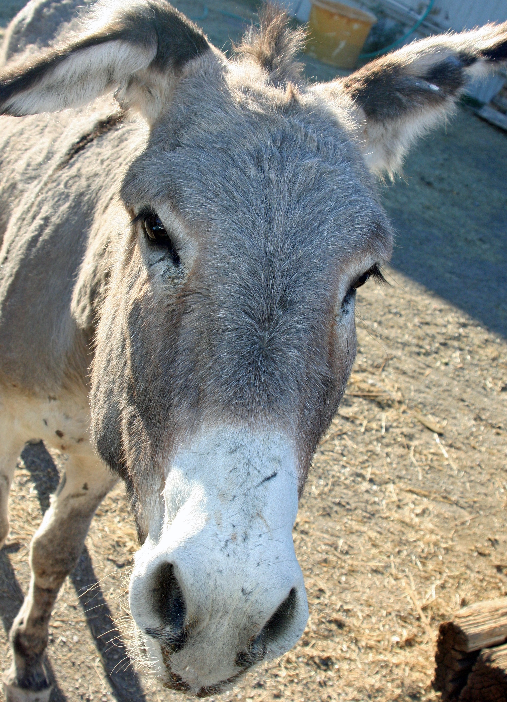
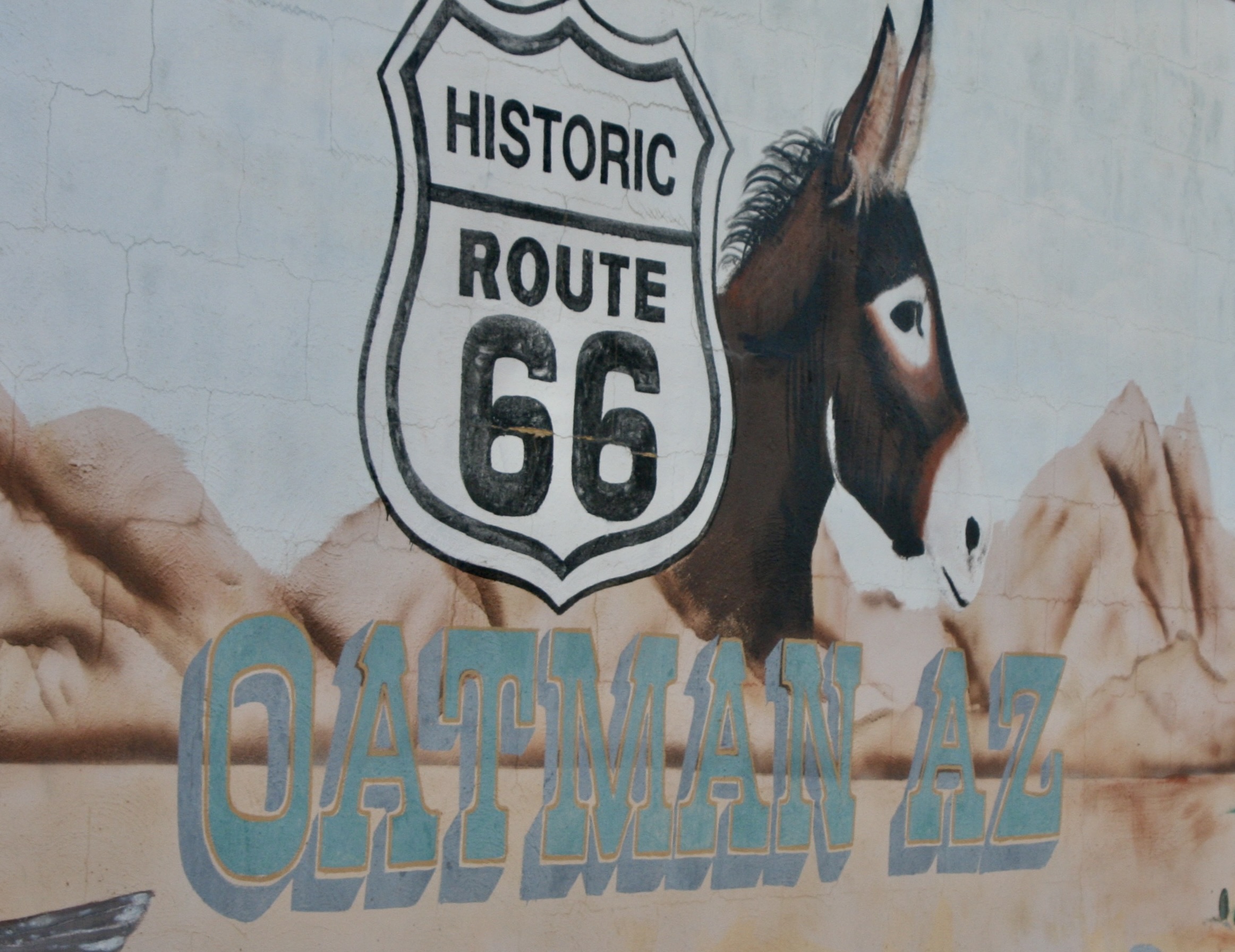
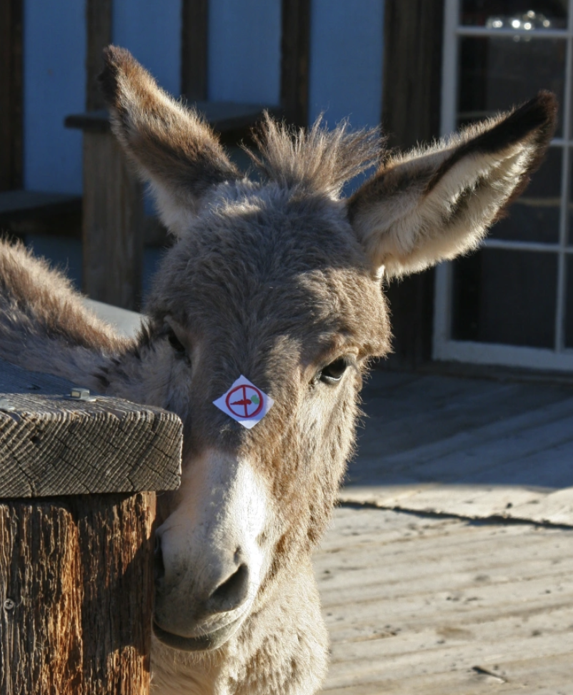
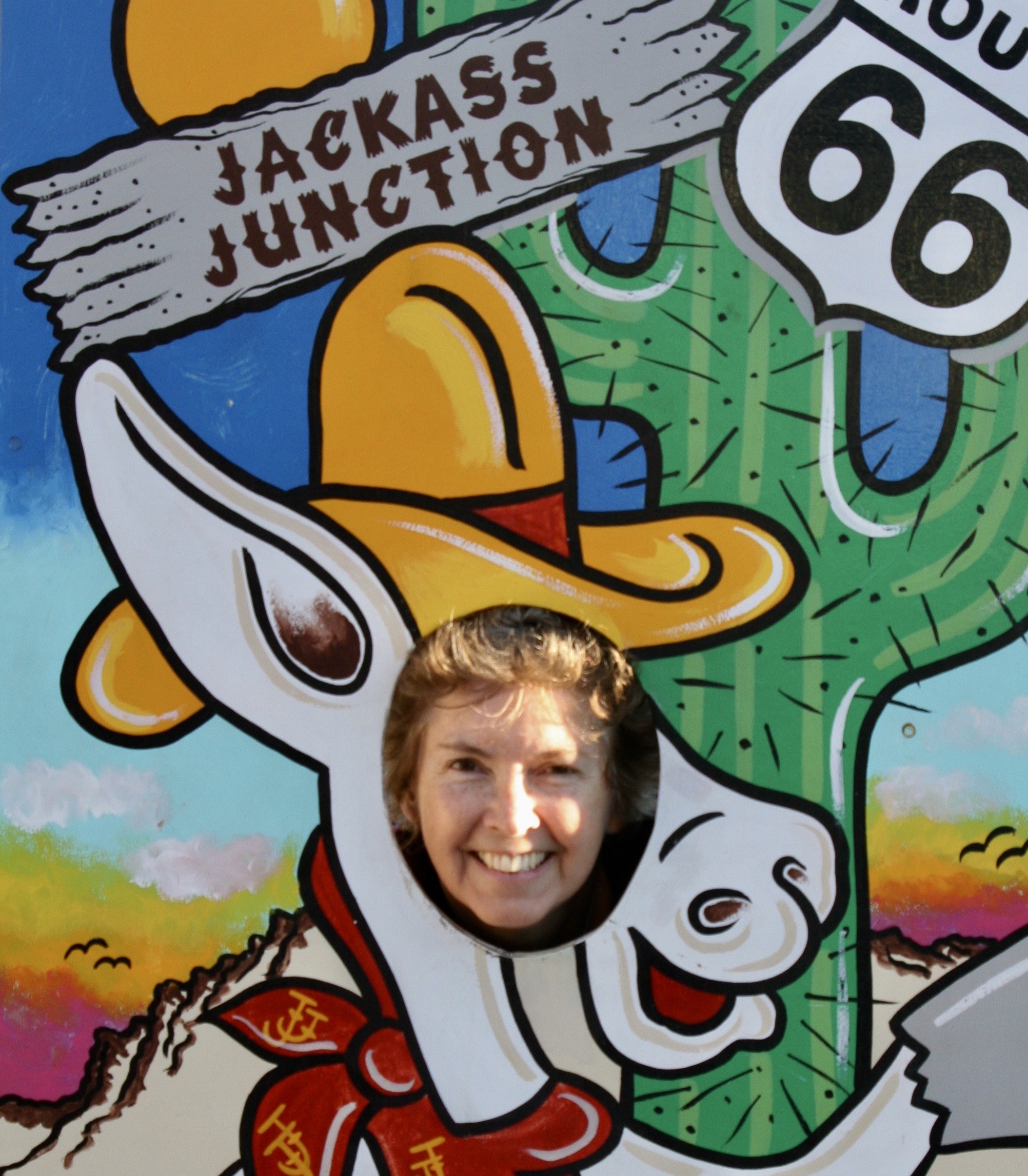
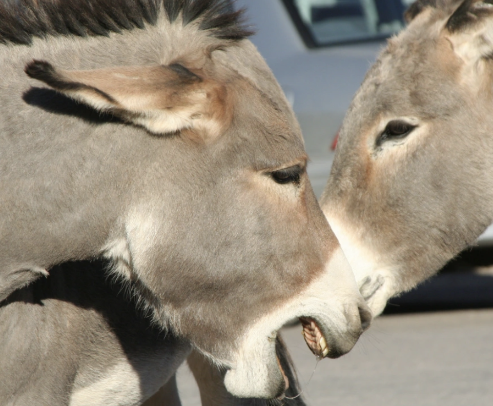
“Get Your Kicks on Route 66” was a song first sung in 1946 by the Nat King Cole Trio. World War II was over, gas rationing a thing of the past, and America was ready to celebrate. And what better way than a scenic road trip from Chicago, Illinois to Santa Monica, California. The song helped to make Route 66 popular in 50s and 60s. There was even a Route 66 television series that ran on CBS from 1960 to 1964. Tourists still flock to “America’s Mother Road” with its close to legendary status, quaint towns and scenic views. Peggy and I met the donkey/burro in Oatman, Arizona, one of the colorful communities along the way. I am featuring it and Seligman, Arizona, in today’s post. The donkey was looking for carrots.
On our recent trip to the Southwest, we camped in six different locations along the historic highway: Kingman, Ash Fork, and Holbrook in Arizona, Grants and Albuquerque in New Mexico, and Adrian in the Panhandle of Texas. I’ll be incorporating some of them in the next two posts plus other visits we have made to the area over the years.
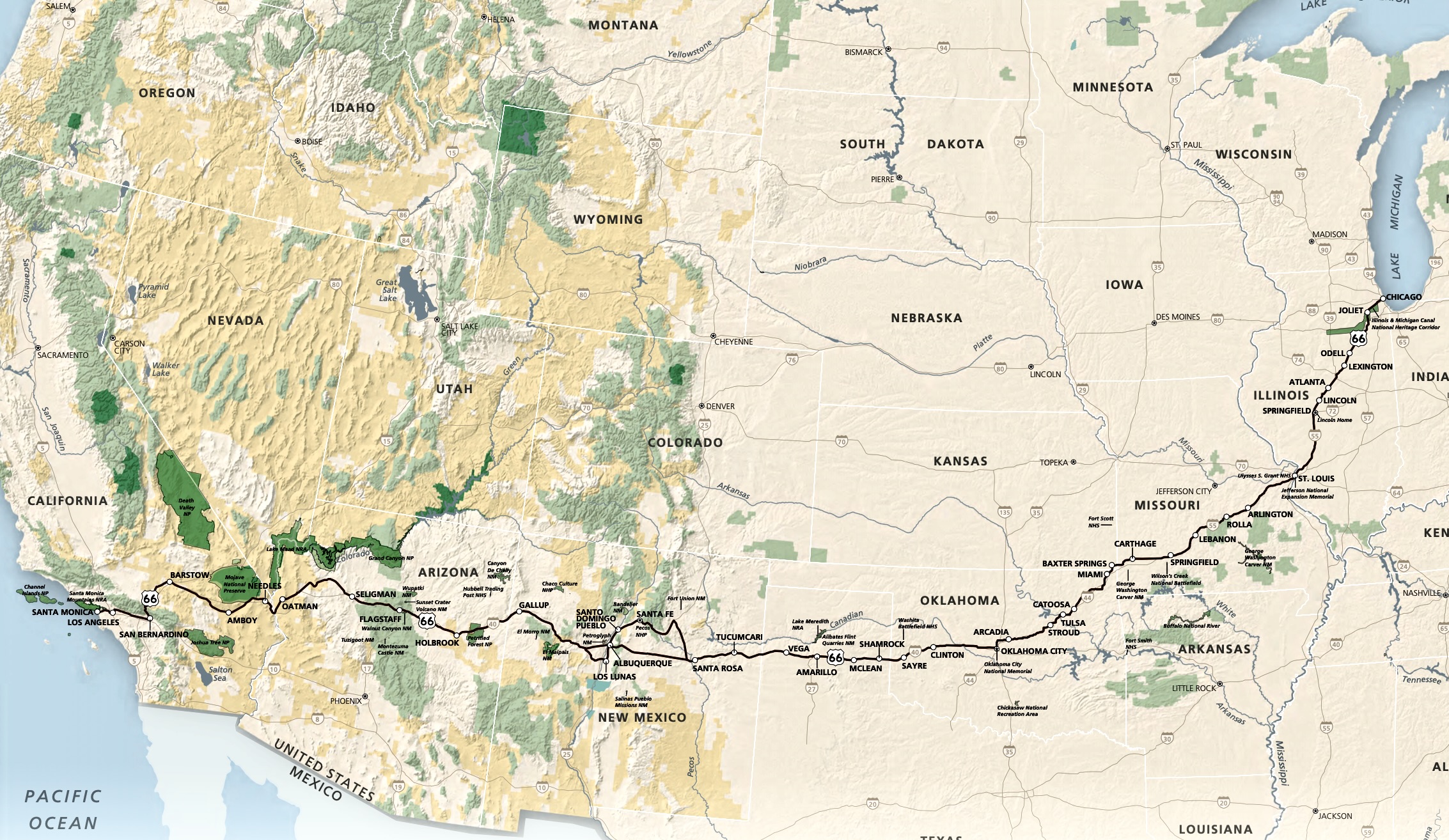
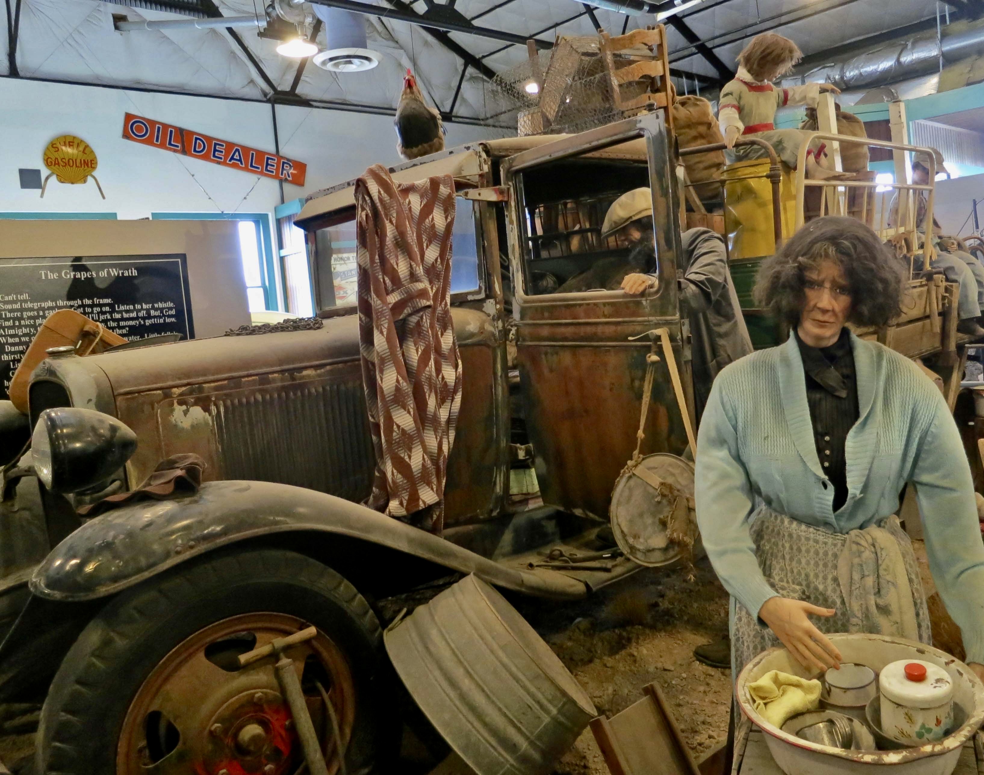
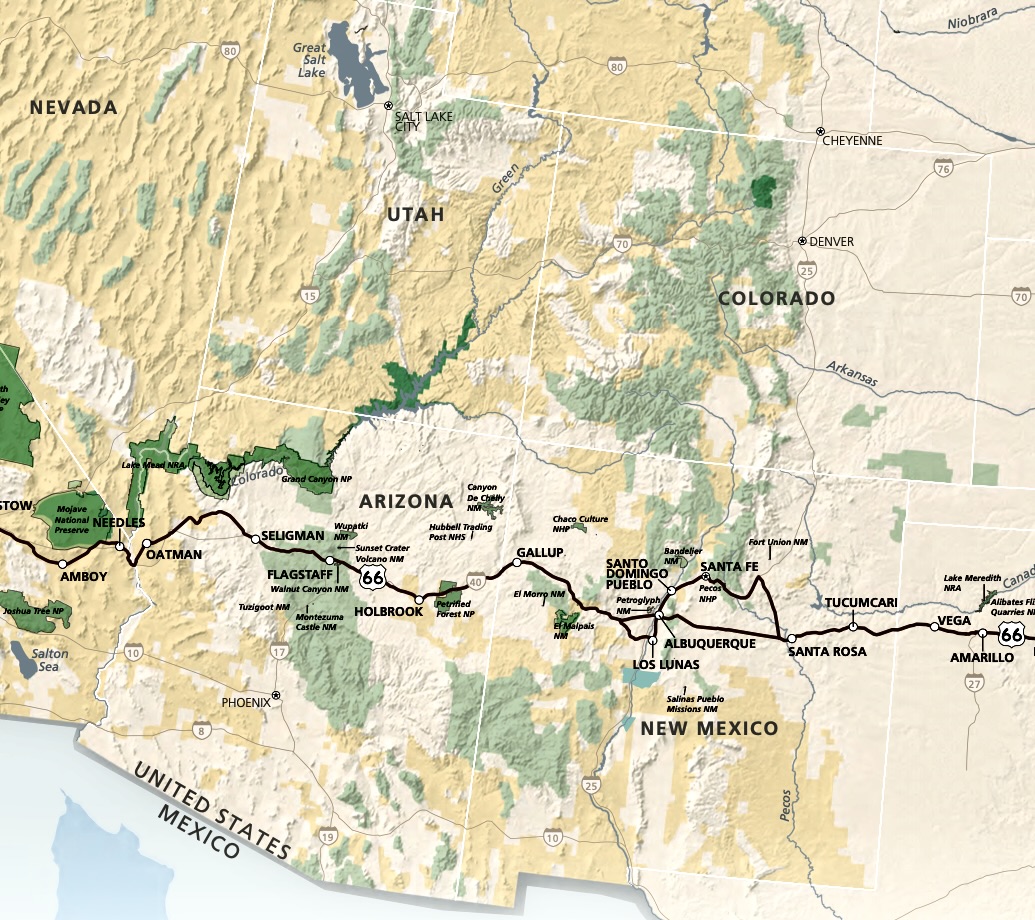
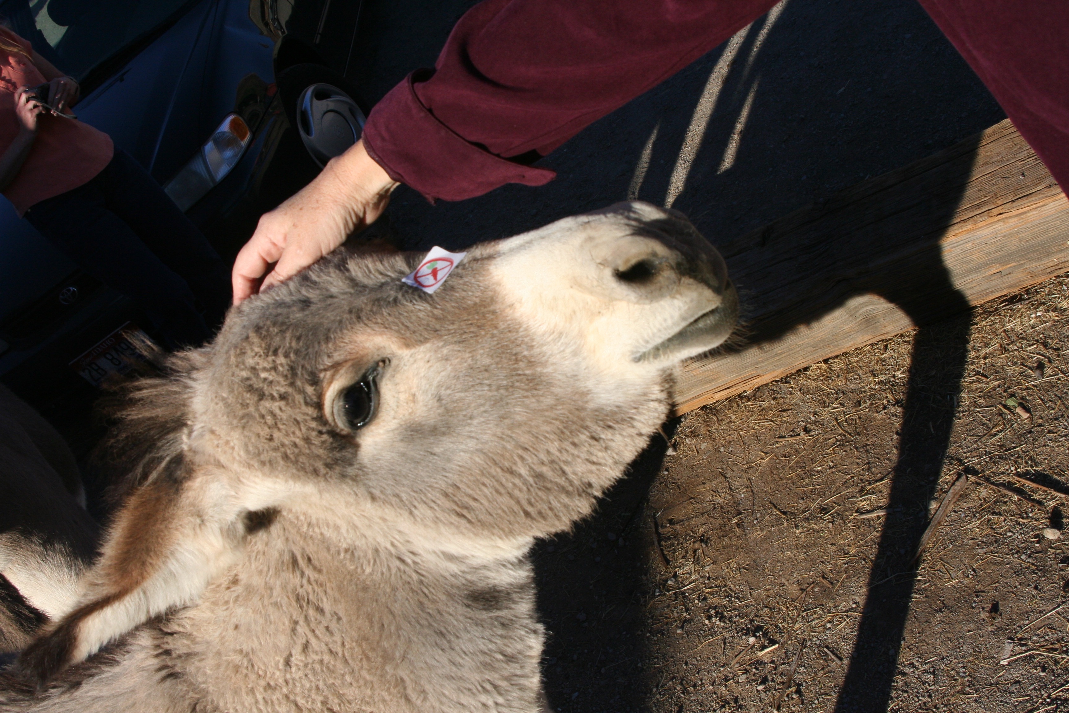
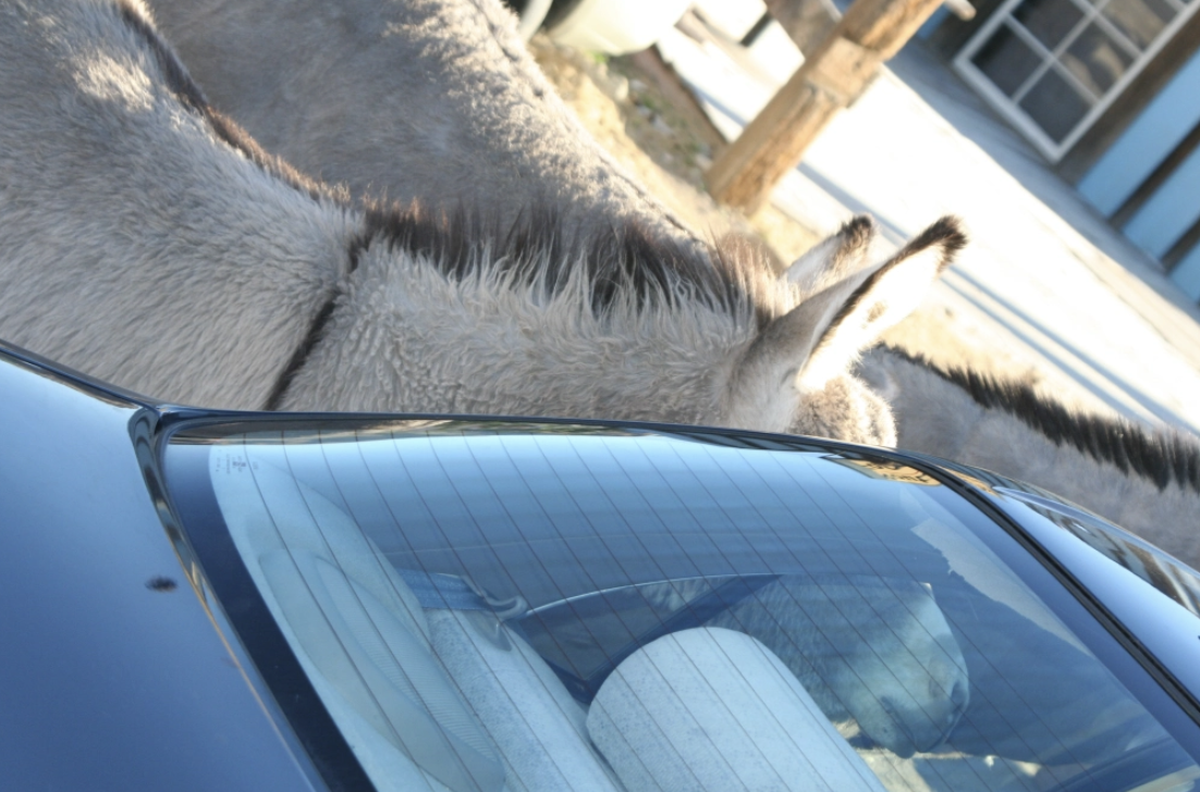
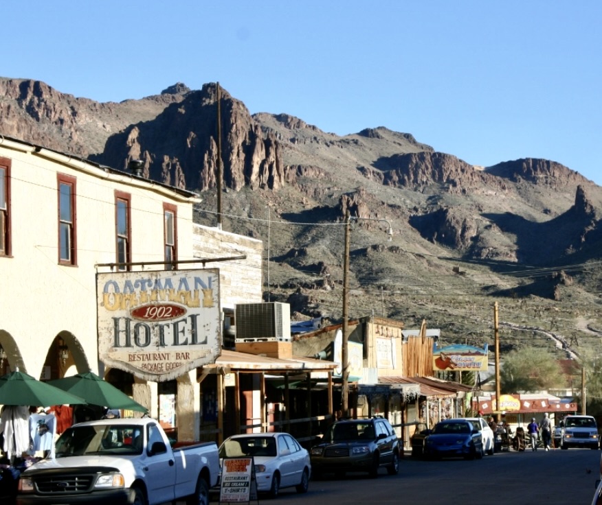
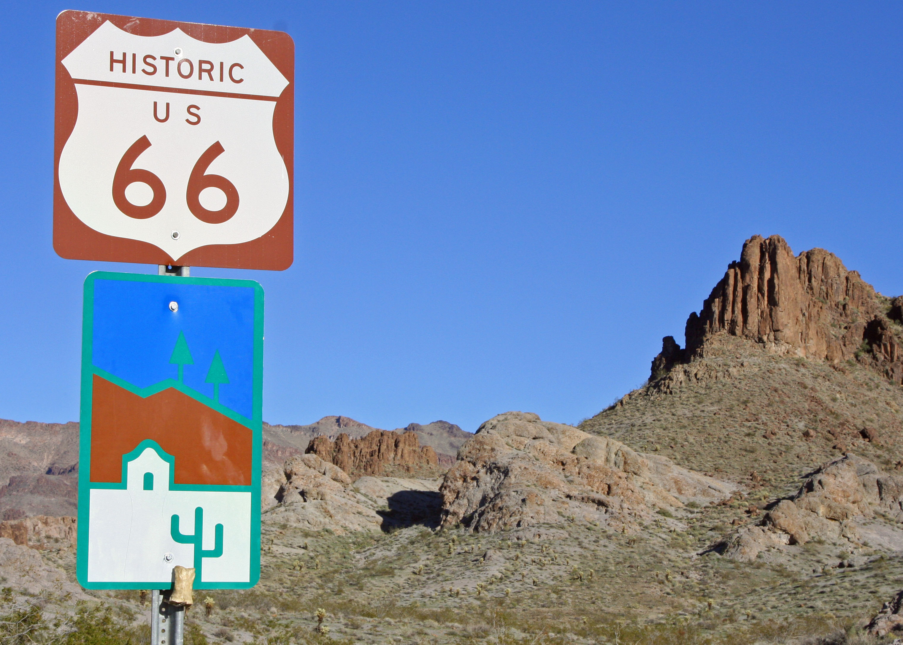
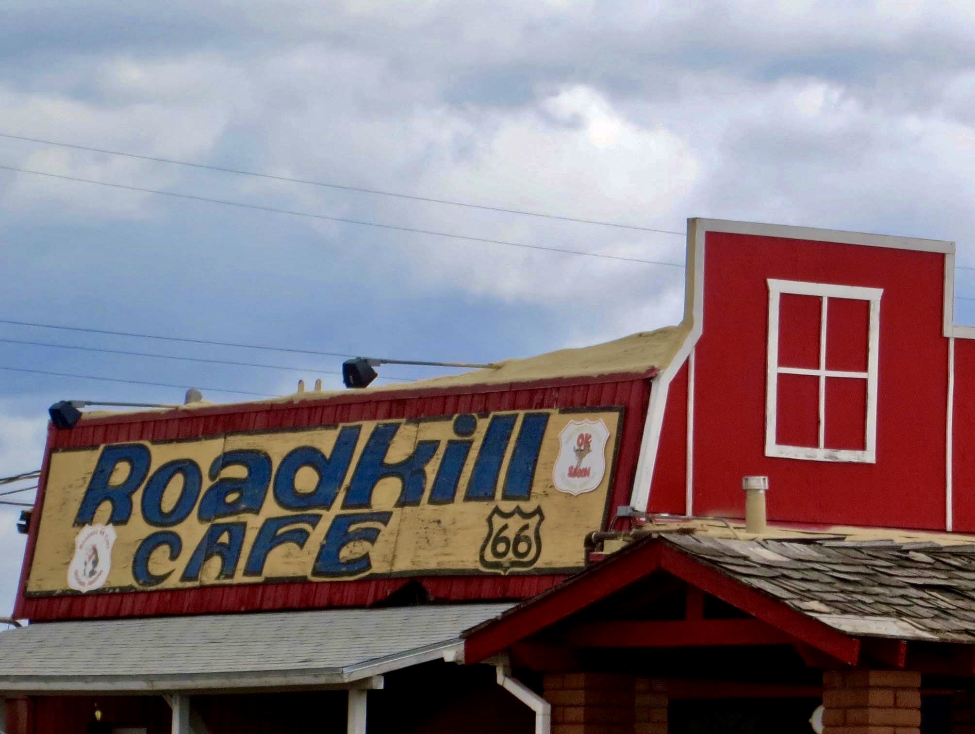
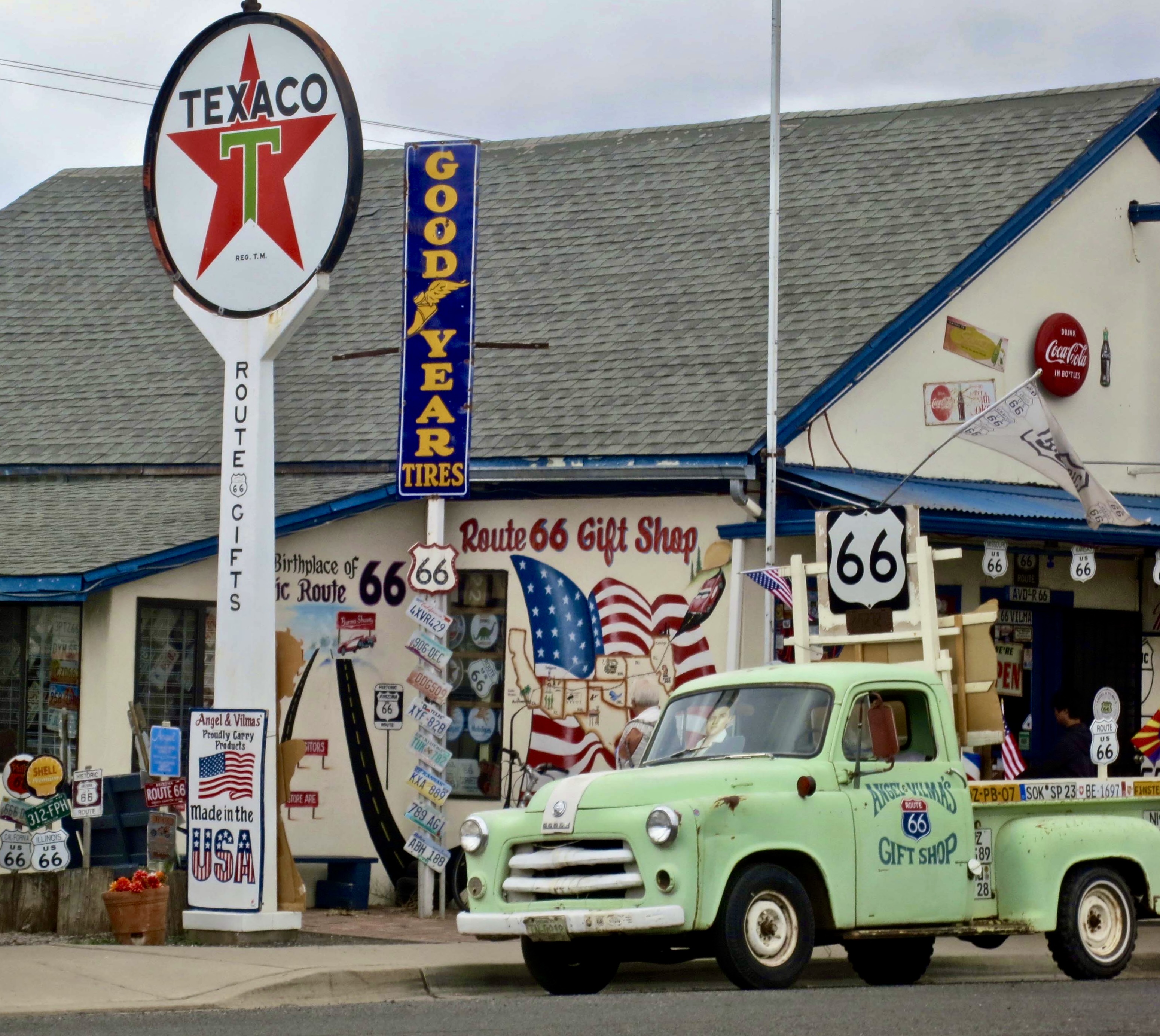
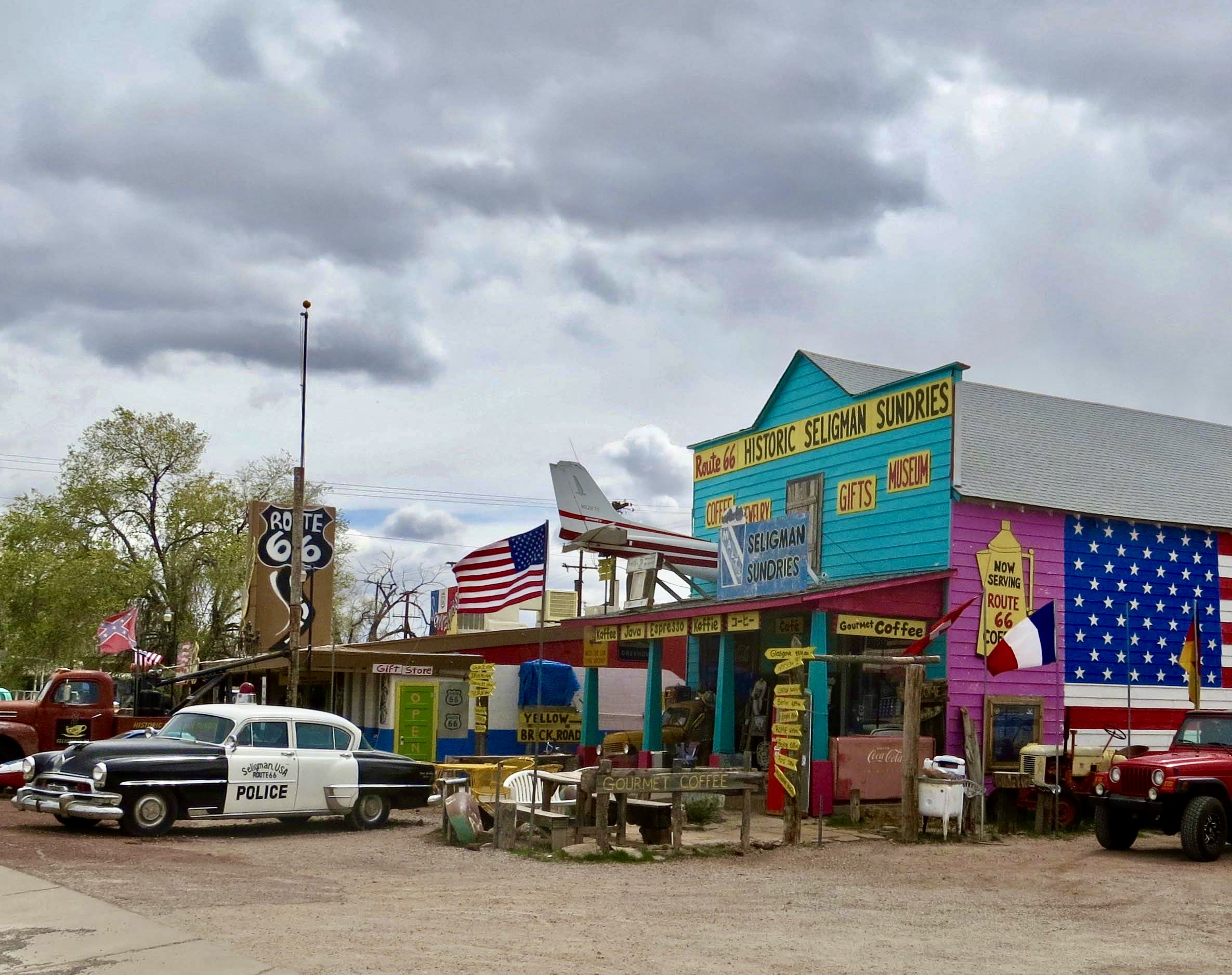
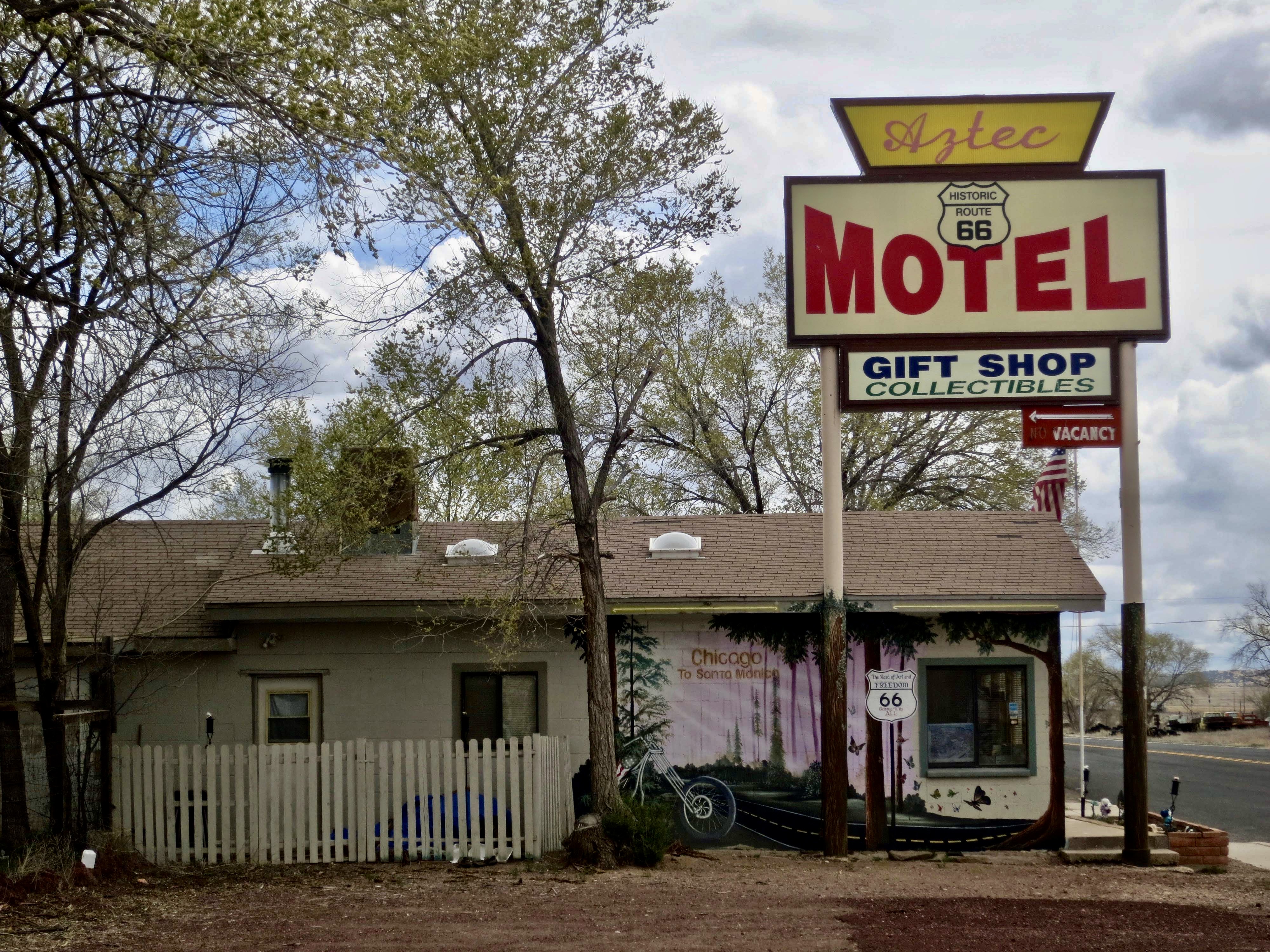
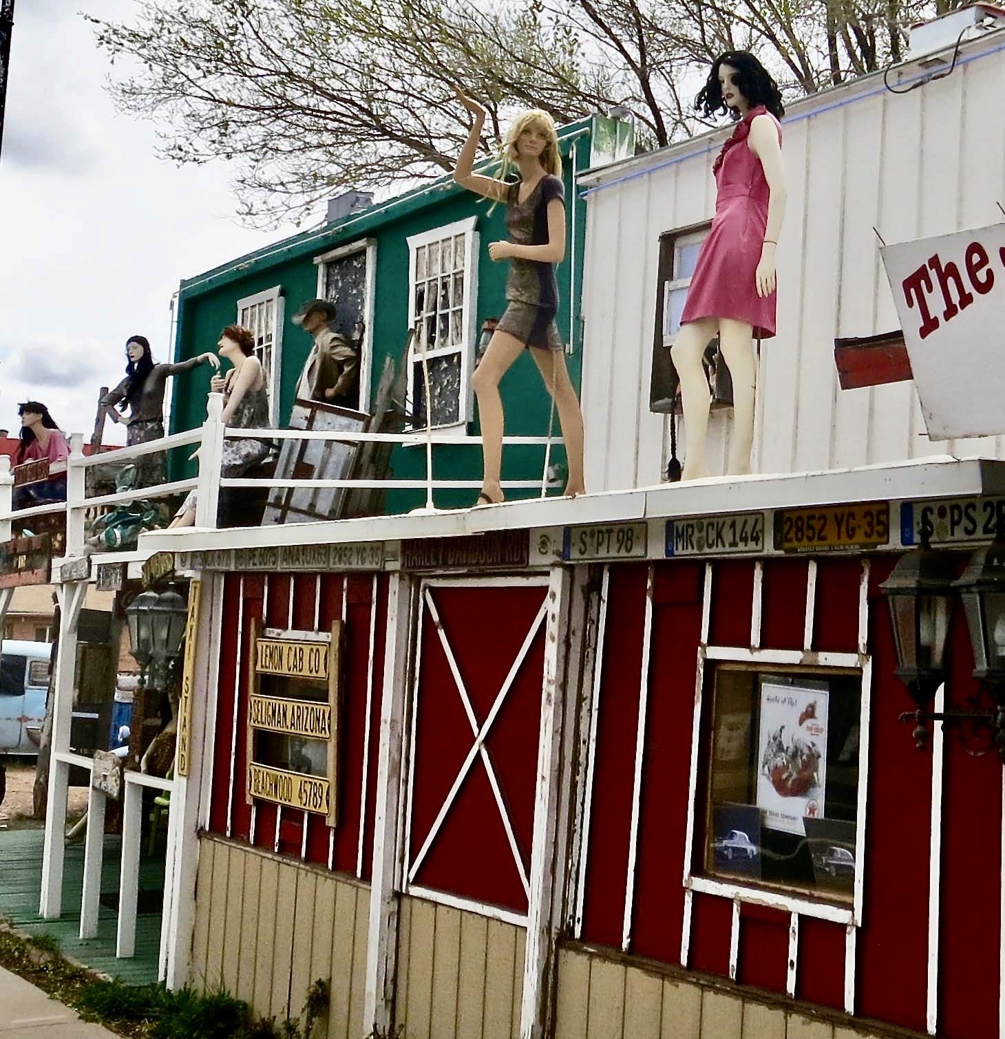
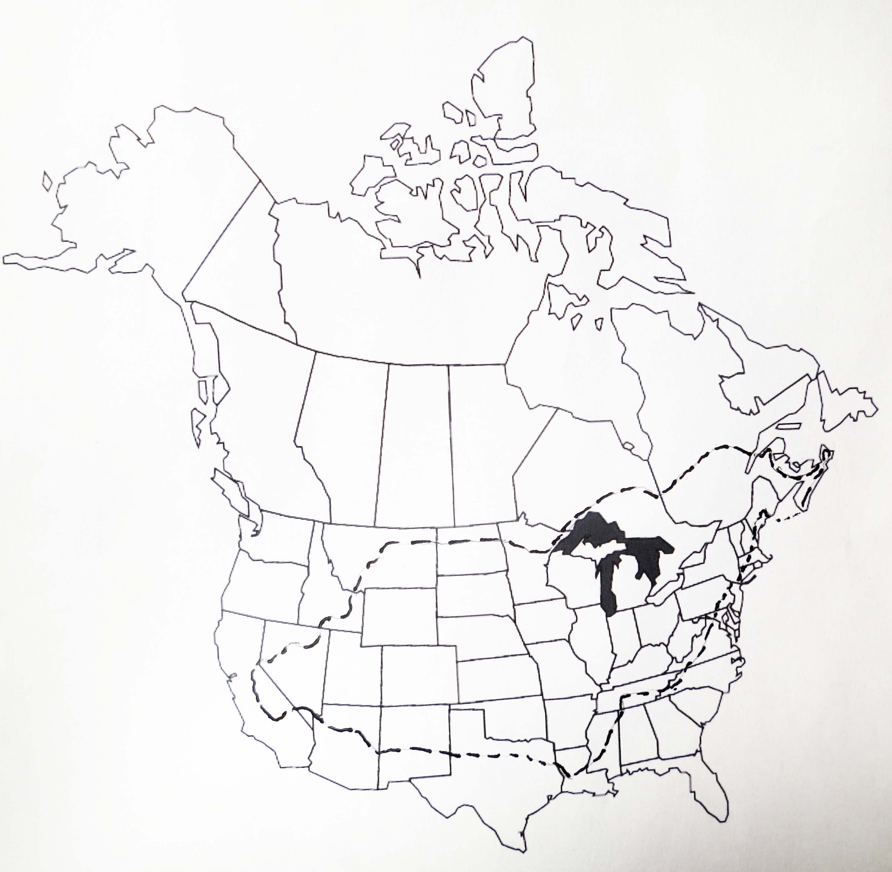
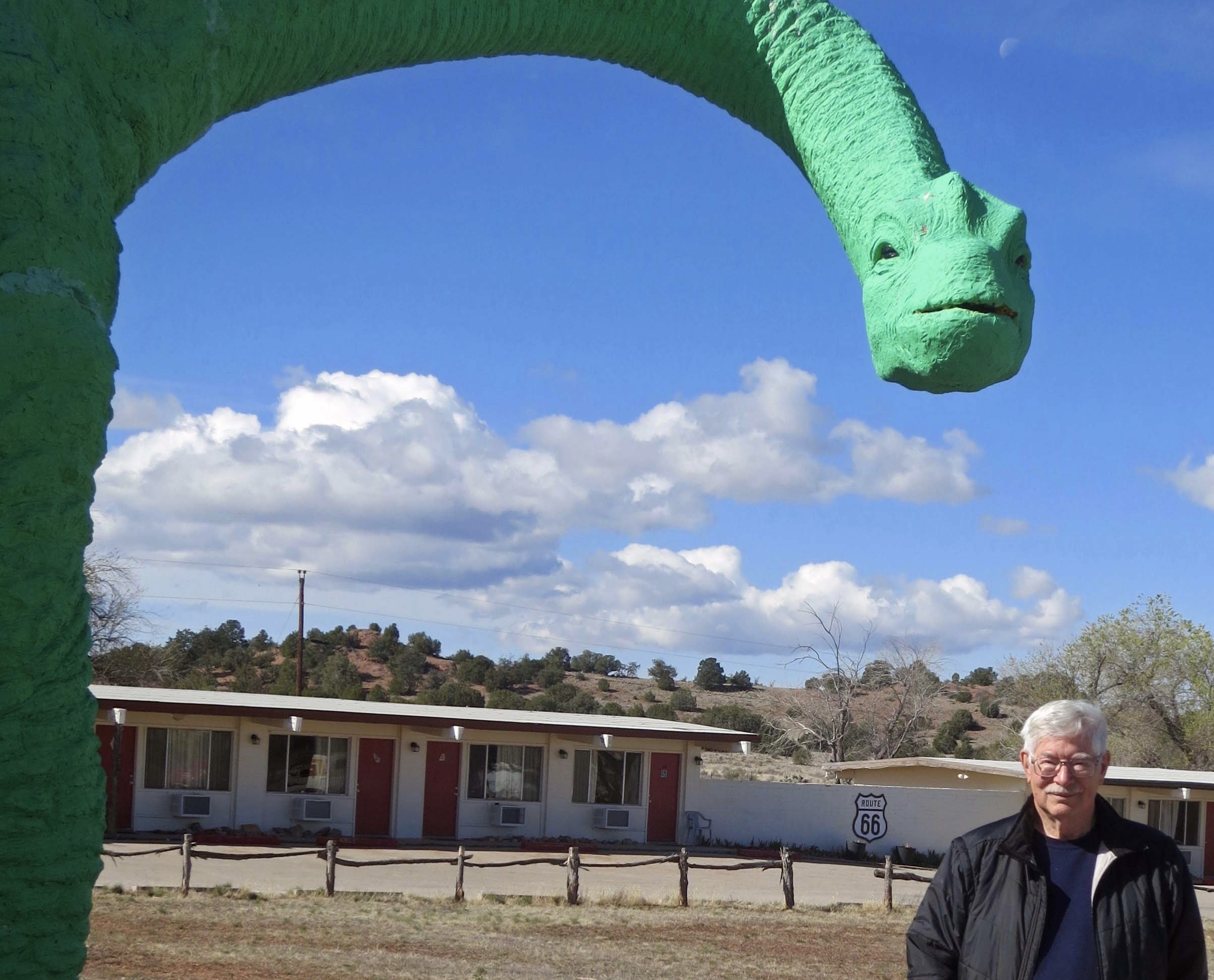
This National Park Service map shows the route that Historic Highway 66 followed between Chicago and Santa Monica, traveling through the states of Illinois, Missouri, Kansas, Oklahoma, Texas, New Mexico, Arizona, and California for a total of 2,448 miles (3,940 km). Established in 1926 the road became the major thoroughfare for migrants escaping the Dust Bowl in the 30s searching for a better life in California. In fact, it was John Steinbeck in his classic novel about the migration, The Grapes of Wrath, who gave Route 66 the name ‘America’s Mother Road.’This diorama in Arizona’s Route 66 Museum in Kingman features migrants from the Dust Bowl traveling on Route 66 in the 30s. During World War II, Route 66 became a major road for military transports from the East heading for the West Coast and the war in the Pacific.Most of our exploration of Historic Route 66 over the years has taken place in the Southwest starting with Oatman and working our way east into Texas. Freeways have replaced Route 66 as the major national transportation corridors for traveling back and forth across the nation, but local town, county and state roads have incorporated parts of Route 66 into their road systems and promote it proudly, from both an historical and economic perspective.Donkeys have become a major attraction in Oatman, as the sign suggests.Like who could resist this cutie. Certainly not Peggy. It’s hard to tell which one was enjoying the head scratch more. The no-carrot sign on its forehead, by the way, is to protect the youngster. The little ones are known to choke on them.Not so with the big ones. In fact you might find yourself with one sticking its head in your window while searching for carrots. As I recall, these folks had left their window open while they explored the town. Their seats were probably covered with donkey drool when they returned.Many of the establishments promote the town’s connection to the donkeys as well as their location along Route 66. Not missing a bet, this sign also featured its location in the desert and local brands from cattle ranches. You knew you were in the ‘Wild West.’ I took Peggy’s photo here several years ago when we were visiting Oatman.While the female featured in the top photo was begging/demanding a carrot from us, a male slipped up behind her for some major sniffing. Ears laid back, she objected strenuously. A photo of Oatman in its desert setting. The 1902 hotel predated Route 66 and was built during Oatman’s days as a mining boomtown. Its remote location today suggests that Oatman would likely be a ghost town now without Route 66 and its donkeys. The donkeys, or burros as they were called at the time, were left behind or escaped to go wild when the boom ended, not only in Oatman but throughout the west. Like wild horses, their descendants can still be seen roaming in areas of the West and Southwest.This sign marks Route 66 just outside of Oatman. Bone considered it a photo op. The Black Mountains are in the background.Historic Route 66, a few miles south of Oatman, still looks like the highway would have been in the 40’s and 50’s. First paved in 1938, the mainly flat road was easy to drive as it made its way through Middle America and the Southwest deserts. A few sections were known as ‘Bloody 66’ because of curves. This was one. Here’s what Wikipedia has to say about it: “One section through the Black Mountains outside Oatman, Arizona was fraught with hairpin turns and was the steepest along the entire route, so much so that some early travelers, too frightened at the prospect of driving such a potentially dangerous road, hired locals to navigate the winding grade.” Obviously they were flatlanders. Grin.Now, on to Seligman. If you go back to the second map where I featured the Southwest, you will find Seligman just above Oatman. Unlike Oatman, however, it is located just off of I-40. I don’t know whether the Roadkill Cafe adopted that name in the glory days of Route 66 or later, but it has to be given credit for its eye catching name.Seligman was one of the first towns along Route 66 to fight back when fast freeways threatened their livelyhood. Old buildings were repurposed to provide a colorful Route 66 experience. Road signs were put along I-40 to encourage people to stop off. Traveler services such as restaurants, bars, motels and RV campgrounds were provided. Almost every town featured old vehicles and license plates, not to mention a ton of Route 66 signs and memorabilia. I counted at least 12 Route 66 signs here.Old police cars also got into the act. And note the washing machine out front. My parents had one like that in the 40s. It has a wringer on top that you would put your clothes through before you hung them out to dry.Have an ancient motel that has long since passed its expiration date? Not a problem. Just point out that people could have a unique Route 66 experience sleeping in it. Maybe there would even be a ghost for entertainment.Speaking of entertainment, I suspect these woman hanging out on the veranda of a Seligman building offered a special type that may have been available in the 40s when soldiers were heading west on their way to war. Their mannequin presence still illicit smiles. I don’t remember if they were up there when I rode my bicycle through in 1989 on my 10,000 solo trip around North America.This is my bike route, starting and returning to Sacramento CA. I followed Route 66 or I-40 from Kingman to Holbrook, Arizona for around 250 mile including detours.I’ll start Part 2 of my Route 66 post next week. You will meet a few dinosaurs along the way. This one was at Grand Canyon Caverns just before Seligman. Peggy took this photo of me when we drove my bicycle route in 2016. Peggy drove so I could take notes and photos.
18 thoughts on ““Get Your Kicks on Route 66″…America’s Mother Road: Part 1”
As your post indicates, it is still fun to explore the parts of 66 that survive, even if they probably don’t look much like the original as entrepreneurs make the best of what they have. Old age is accompanied by declining bodies and often illness, but it also allows us to look back [through rose-tinted lenses 😁] at the way things were. I took 66 most of the way from Oklahoma City to LA in ’64, and Alie and I were on parts of it many times in the last 25 years. We actually saw Oatman evolve from a very tiny dot on the map, to a common tourist spot today. Thanks for the memories.
I never got into these western portions of Route 66, but I’ve driven the portion across the Panhandle to Oklahoma City, Tulsa, and Joplin multiple times. It can be a little touristy, but there’s some good open road, and of course it’s windows down and volume up when the weather’s right!
Have to agree on the touristy bit, Linda. But then again, it’s how they make a living when there isn’t much about to make it otherwise. The song of the open road… Sorry about this late response. I found a bunch of comments I missed. Home again here. Off the open road. And there is some serious catching up to do. That included reading blogs…
What a great post, Curt! We’ve been on Route 66 and also to Oatman when the kids were little. A fun town, and who can resist the donkeys? Roadkill Cafe is definitely a catchy name. Happy October! 🍁
That’s fine, Curt, and no worries! I’ve been away for a few days and just posted today. We all have life outside of WP. Happy November, and I’ll share my review (working on) of your amazing book in Nov. too. Take good care!
Is there life outside WP? Wow. Looking forward to the review.
😁😁
I absolutely love that last photo of you with the dinosaur! Peggy has a great sense of framing. I am delighted by all the kitch of Route 66, and unlike Shoreacres, I prefer the deserty sections of Arizona and New Mexico. It’s part of the appeal of the animated movie Cars – all those great red cliffs in the background, and the outdated stores and hotels and cars in the town. I think the Route 66 propaganda must have worked on me as a young person, because it makes me nostalgic, and the heyday was long gone before most of us were around.
A fun photo for sure, Crystal. Kitsch is a good way to describe how the towns handle Route 66. It’s just plain old-fashioned fun. As for ‘Cars,’ I have to rewatch that movie! “Long before most of us were around.” Hmm. Glad you need ‘most of us.’ While I drove the Arizona and New Mexico portion of the road in the late 60s, my love for the region started in the 40s when, as a little boy, I loved looking through my Grandfather’s copies of Arizona Highways magazine.


As your post indicates, it is still fun to explore the parts of 66 that survive, even if they probably don’t look much like the original as entrepreneurs make the best of what they have. Old age is accompanied by declining bodies and often illness, but it also allows us to look back [through rose-tinted lenses 😁] at the way things were. I took 66 most of the way from Oklahoma City to LA in ’64, and Alie and I were on parts of it many times in the last 25 years. We actually saw Oatman evolve from a very tiny dot on the map, to a common tourist spot today. Thanks for the memories.
You’ve certainly seen more of it than I have, Ray. Nothing wrong with a like nostalgia. As always, glad to have you along.
Curt, What a fun post! It’s so nice to know places like this still exist. Love those mannequins!
As always, thanks for the photos and the explanations of places I have been! You are my real world wayback machine!
Hey, my pleasure, Marge. And my apologies for this late response. I discovered a number of comments that I missed. My bad. Now to tackle blogs.
I never got into these western portions of Route 66, but I’ve driven the portion across the Panhandle to Oklahoma City, Tulsa, and Joplin multiple times. It can be a little touristy, but there’s some good open road, and of course it’s windows down and volume up when the weather’s right!
Have to agree on the touristy bit, Linda. But then again, it’s how they make a living when there isn’t much about to make it otherwise. The song of the open road… Sorry about this late response. I found a bunch of comments I missed. Home again here. Off the open road. And there is some serious catching up to do. That included reading blogs…
I’ve driven some of Route 66. Time to venture out again.
Indeed. Time to catch up on missed comments for me. We’ve been up to a lot of ‘venturing out.’
Love the route and the burros!
It’s been a long time since I’ve been on Route 66. Thank you for sharing.
What a great post, Curt! We’ve been on Route 66 and also to Oatman when the kids were little. A fun town, and who can resist the donkeys? Roadkill Cafe is definitely a catchy name. Happy October! 🍁
Is it okay to say Happy November now, Lauren. Grin. I just went though my comment section and found several I hadn’t responded to. Bad Curt!
That’s fine, Curt, and no worries! I’ve been away for a few days and just posted today. We all have life outside of WP. Happy November, and I’ll share my review (working on) of your amazing book in Nov. too. Take good care!
Is there life outside WP? Wow. Looking forward to the review.
😁😁
I absolutely love that last photo of you with the dinosaur! Peggy has a great sense of framing. I am delighted by all the kitch of Route 66, and unlike Shoreacres, I prefer the deserty sections of Arizona and New Mexico. It’s part of the appeal of the animated movie Cars – all those great red cliffs in the background, and the outdated stores and hotels and cars in the town. I think the Route 66 propaganda must have worked on me as a young person, because it makes me nostalgic, and the heyday was long gone before most of us were around.
A fun photo for sure, Crystal. Kitsch is a good way to describe how the towns handle Route 66. It’s just plain old-fashioned fun. As for ‘Cars,’ I have to rewatch that movie! “Long before most of us were around.” Hmm. Glad you need ‘most of us.’ While I drove the Arizona and New Mexico portion of the road in the late 60s, my love for the region started in the 40s when, as a little boy, I loved looking through my Grandfather’s copies of Arizona Highways magazine.