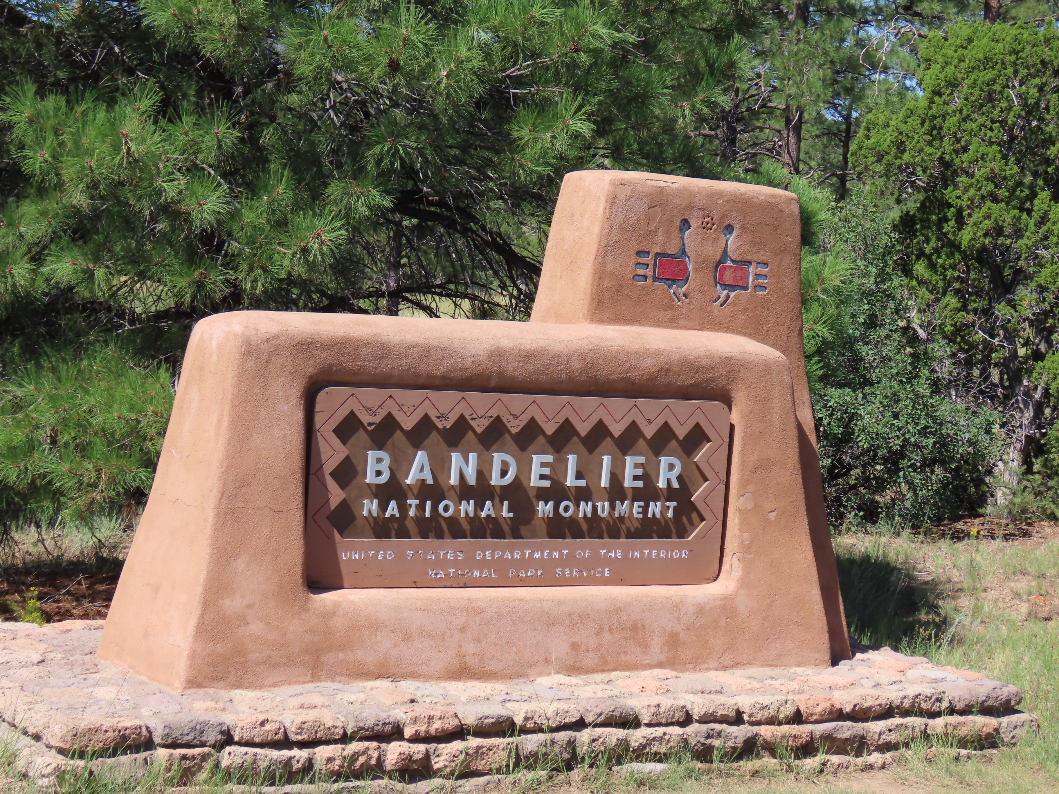
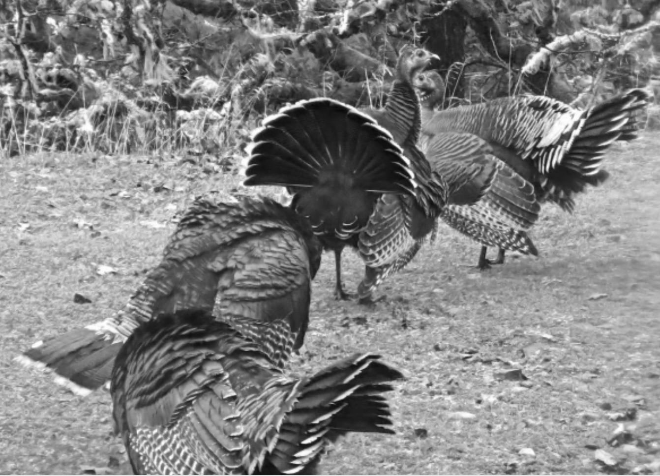
It was a new one for us: A national monument that featured turkeys on its entrance sign. Apparently the Ancestral Puebloans, who lived at Bandelier from 1150 CE to 1550 CE, had domesticated them as livestock and herded them like cattle. The models for the turkeys looked like petroglyphs. We were eager to find them. It wasn’t easy.We had a flock of turkeys that lived on our property in Oregon. They weren’t domesticated and we didn’t eat them, but they were entertaining. Here, a group of toms is doing the turkey trot in our back yard, or maybe it’s a Conga line, or a fan dance.
We had planned on going to Chaco National Historic Park the day we visited Bandelier but weather conditions were iffy and the dirt roads into the park can become impassible during bad weather. When I called the park the day before, the ranger had told me that heavy rain was expected during the night and I should call them back in the morning. He sounded grouchy. Given that the park was three hours away and the park’s information center didn’t open until nine, we wouldn’t get there until noon, assuming we could go at all. We decided on going to Bandelier instead. It was located within two hours from where we were staying in Albuquerque, the roads were paved, and the park was open come rain or shine. Its setting among high cliffs of the easily erodible tuff rock, the incorporation of cavates into the Ancestral Puebloan homes, and our search for turkey petroglyphs combined to make the visit special.
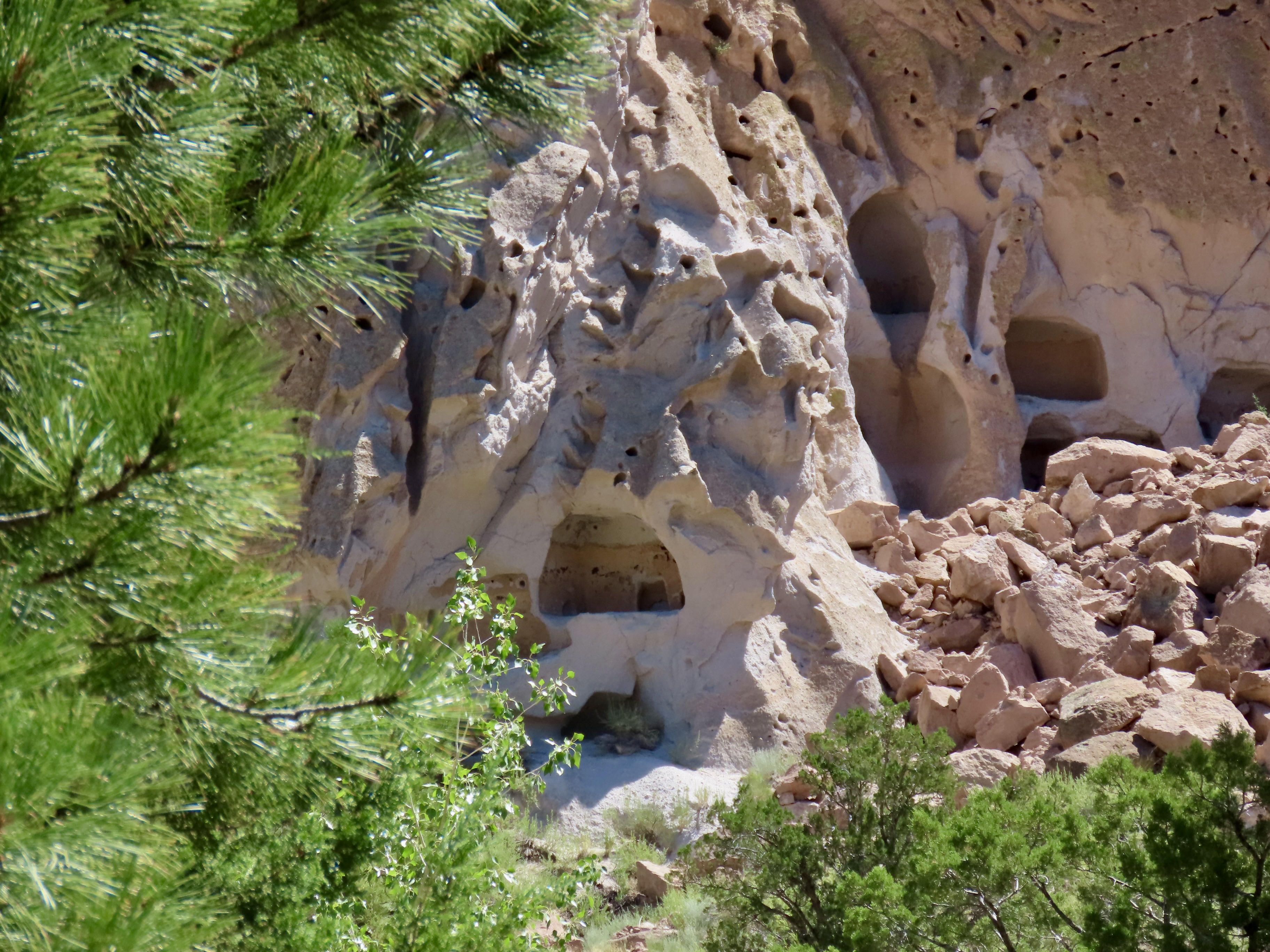
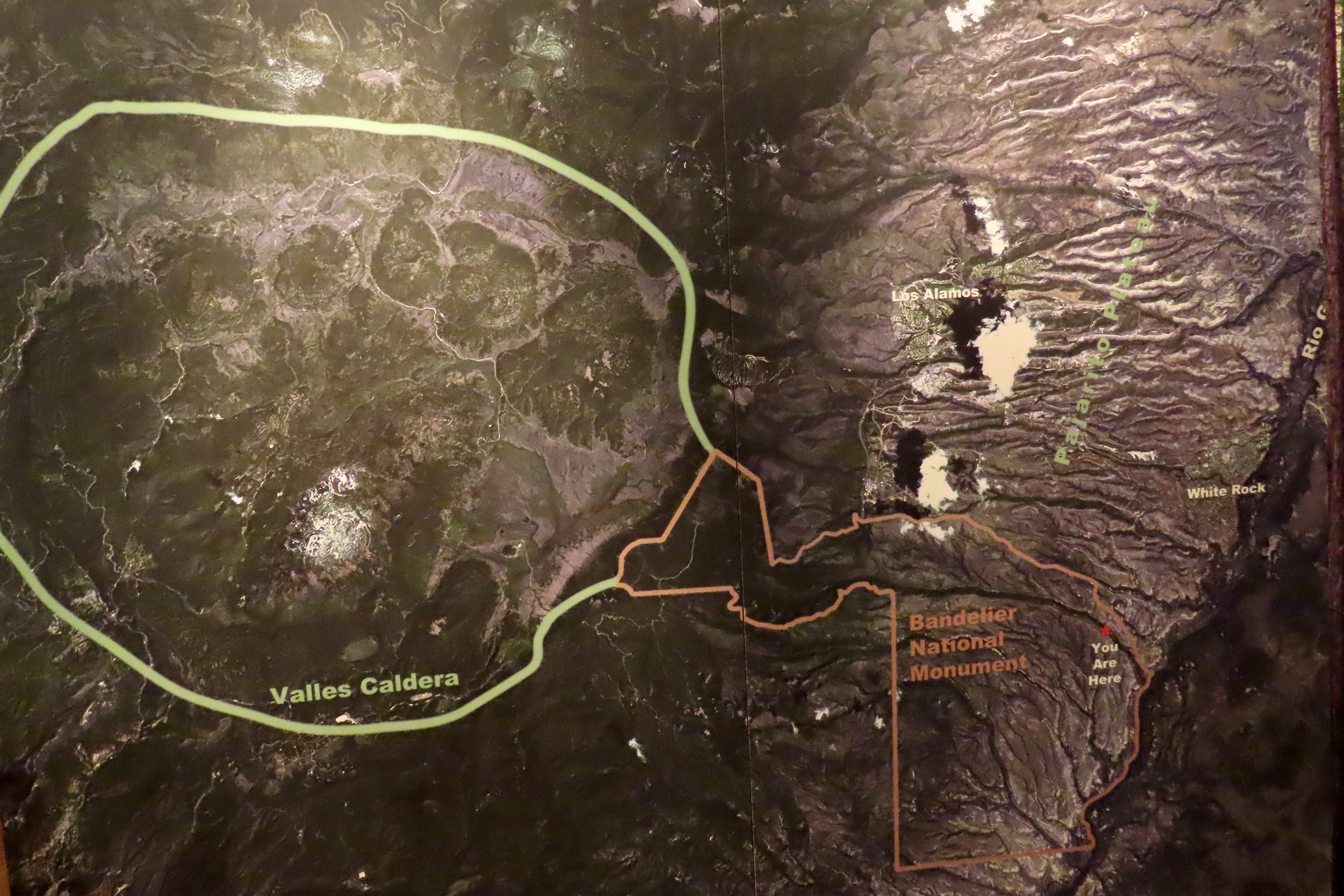
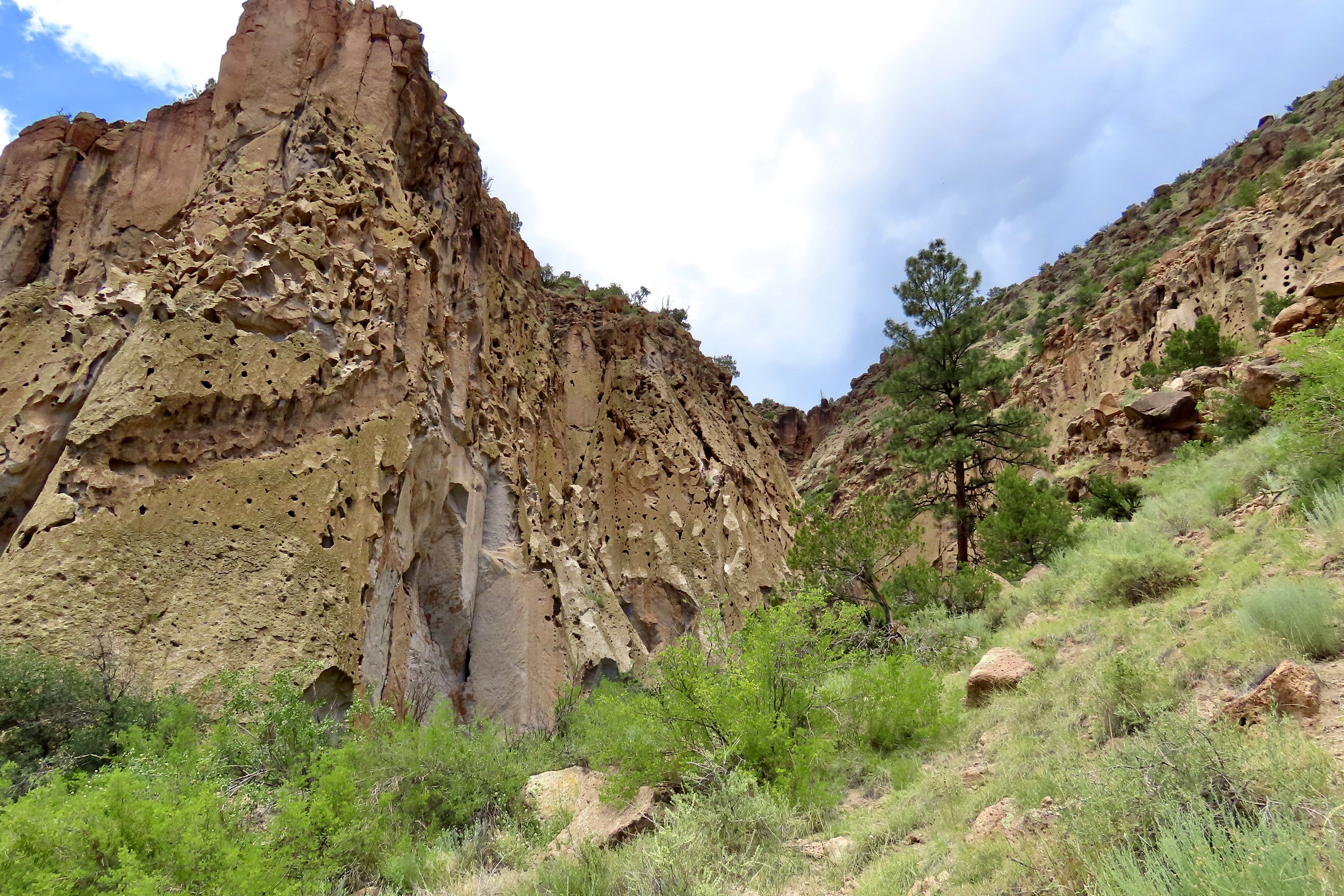
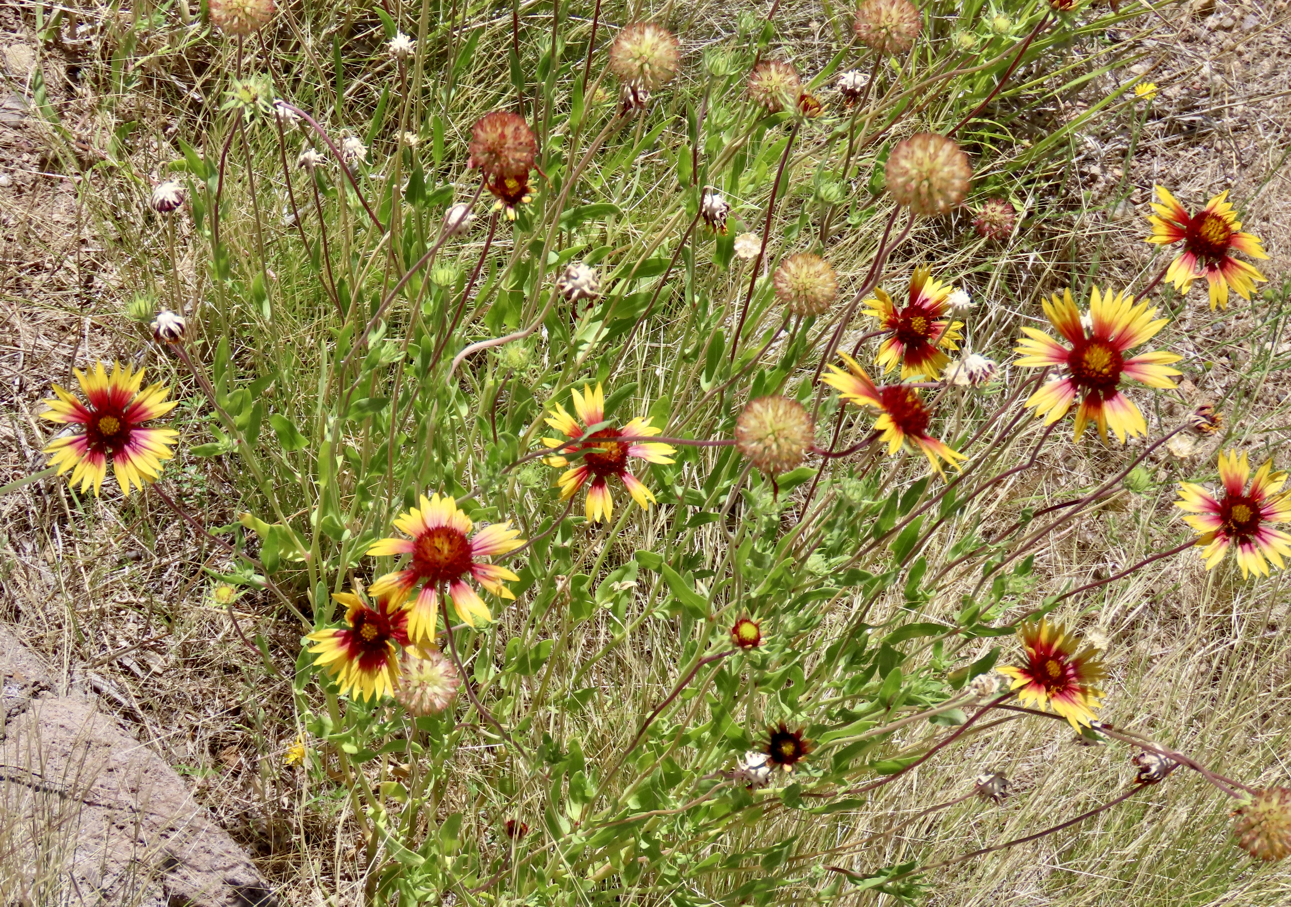
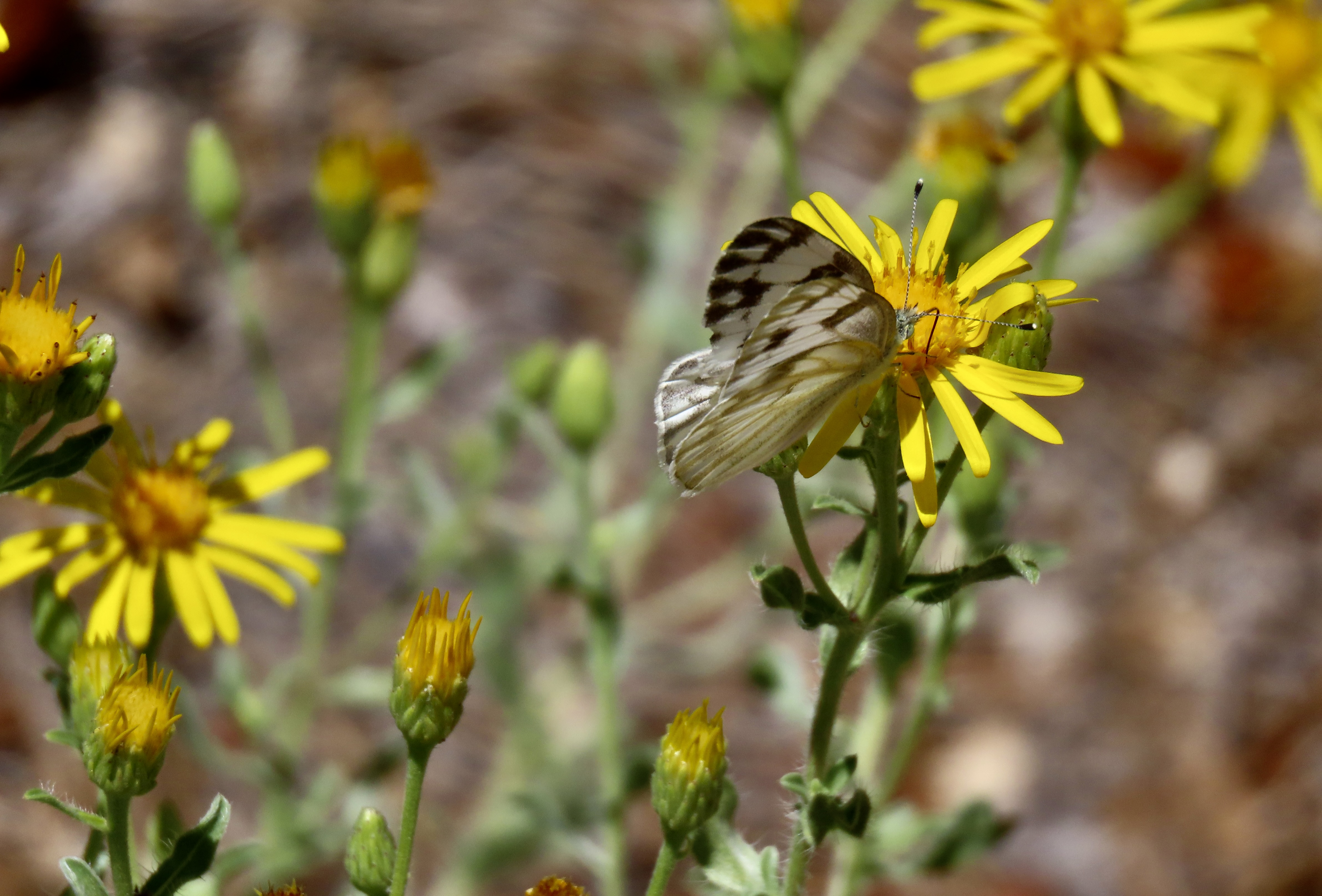
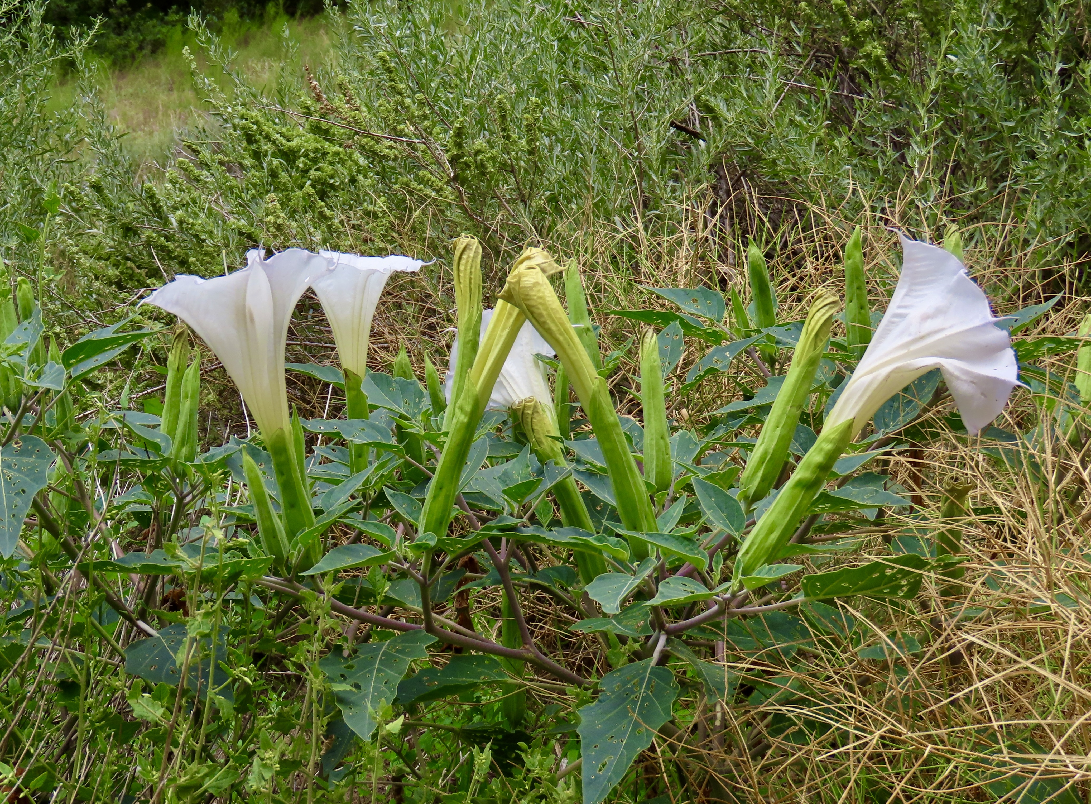
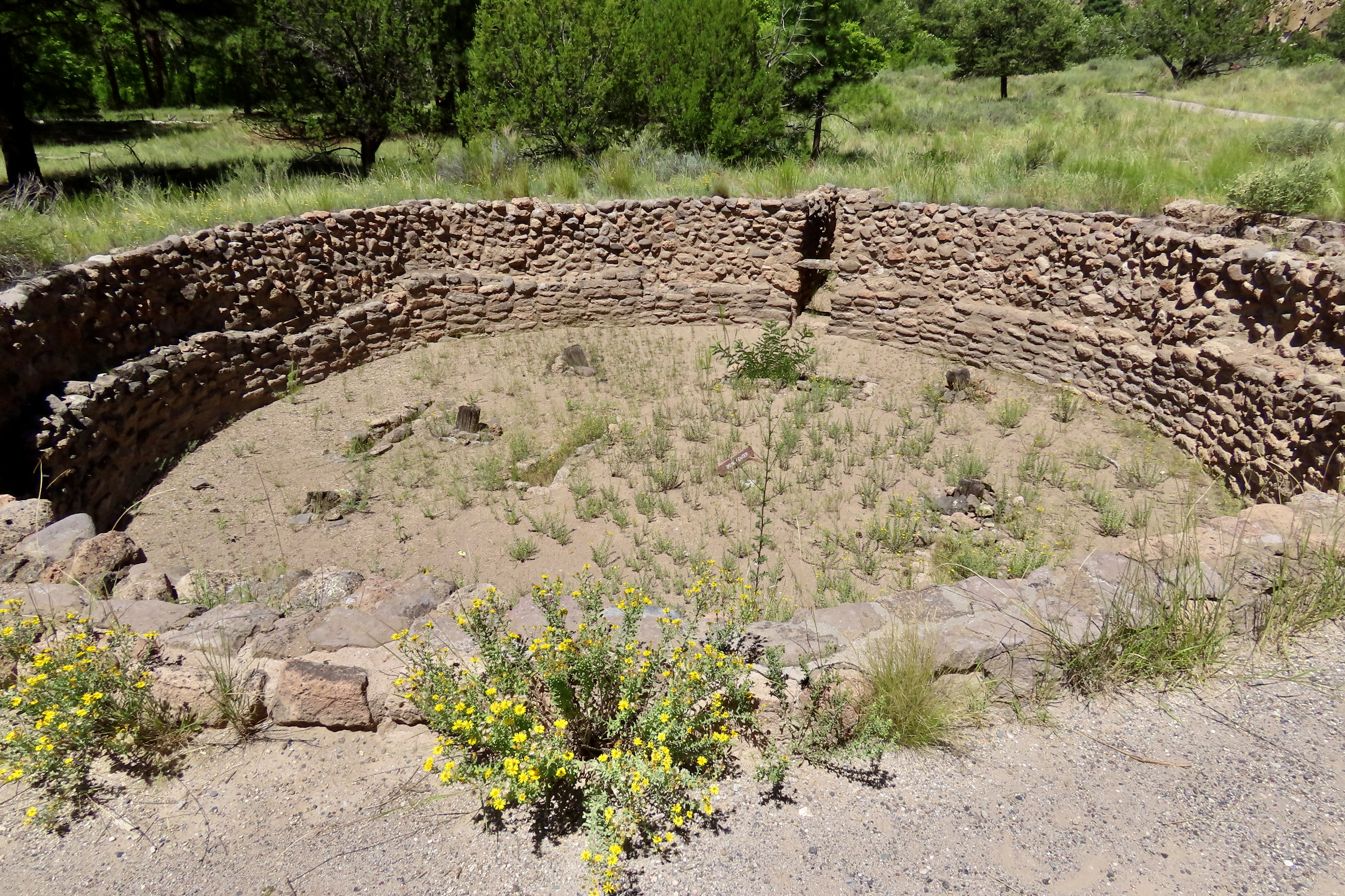
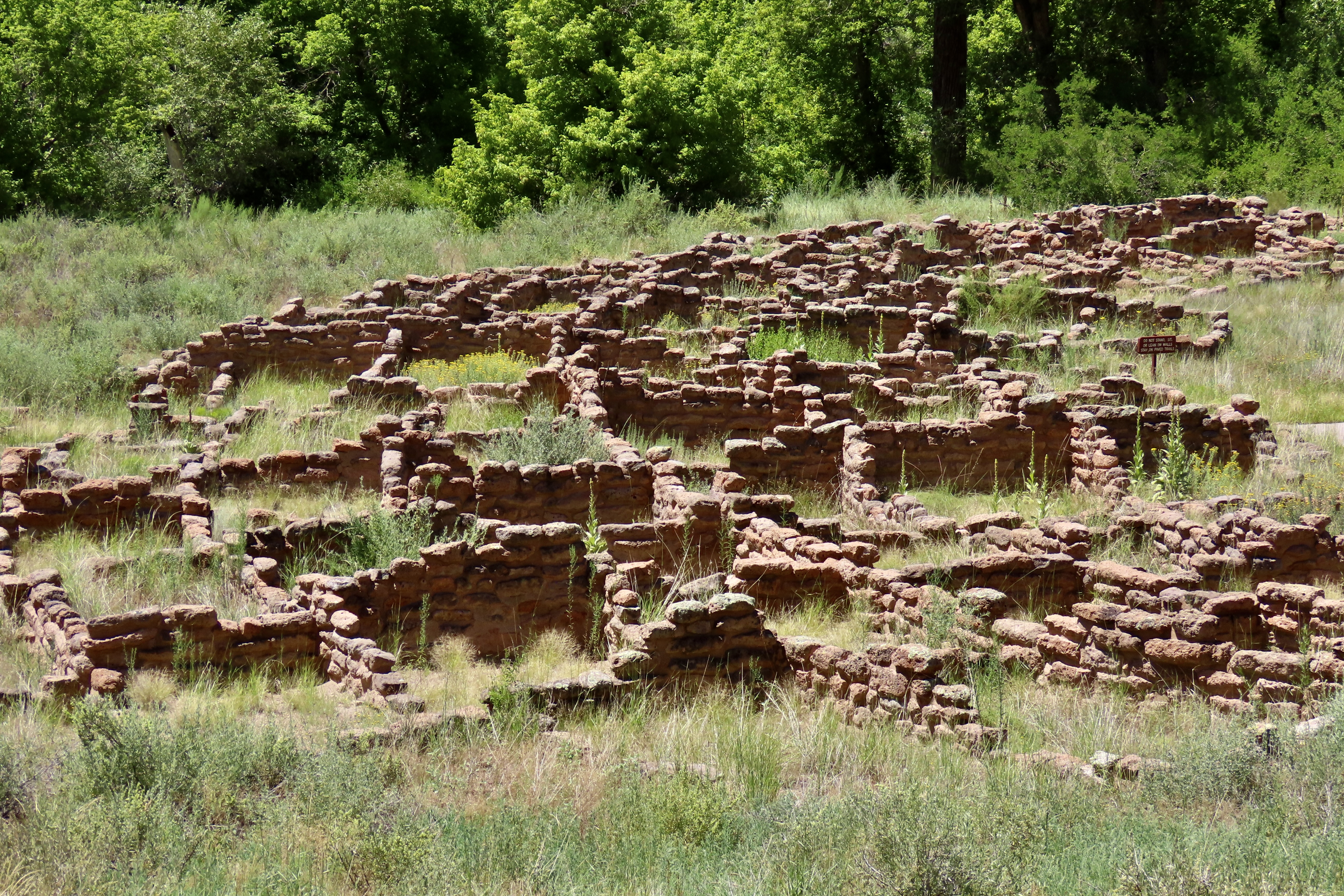
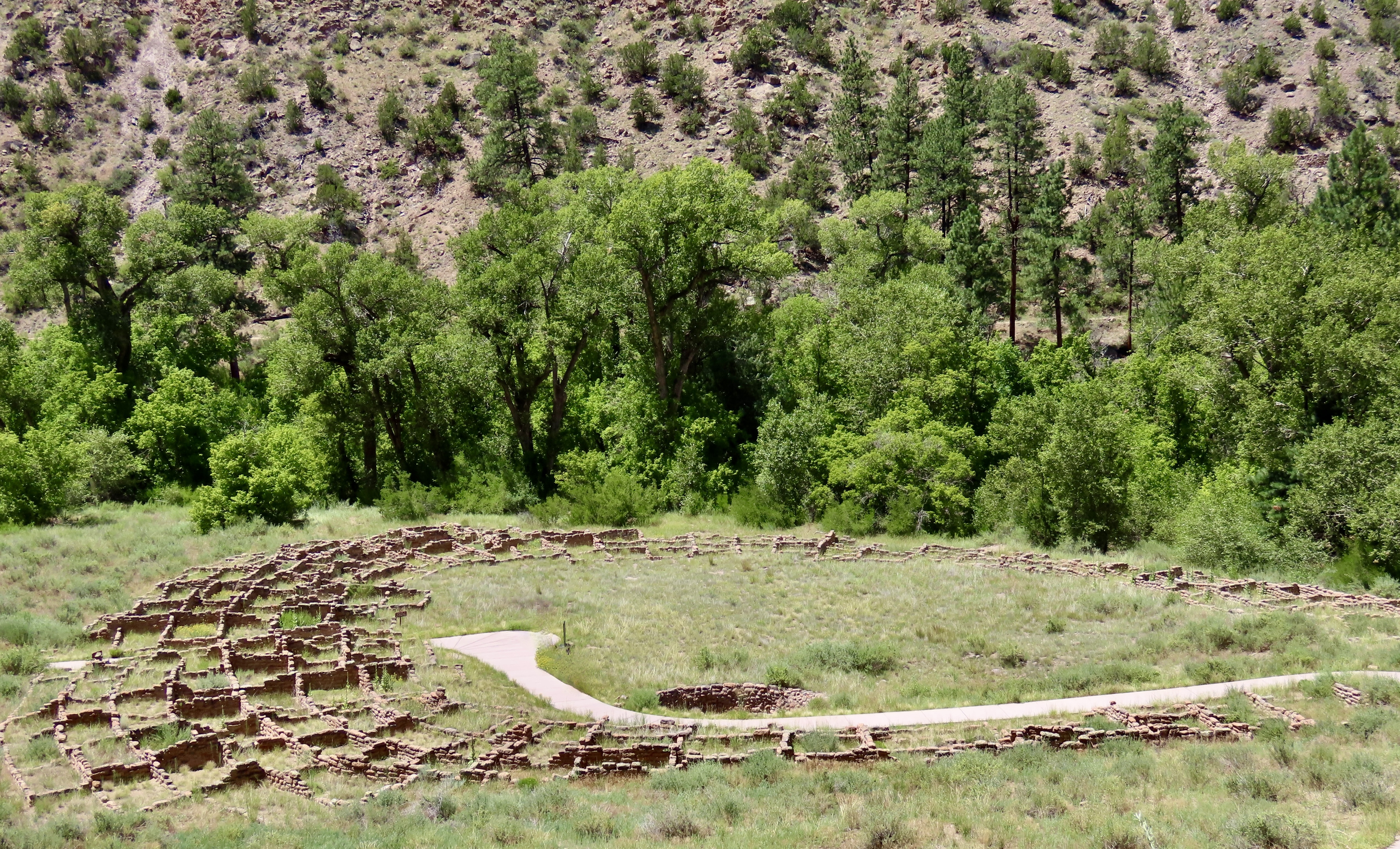
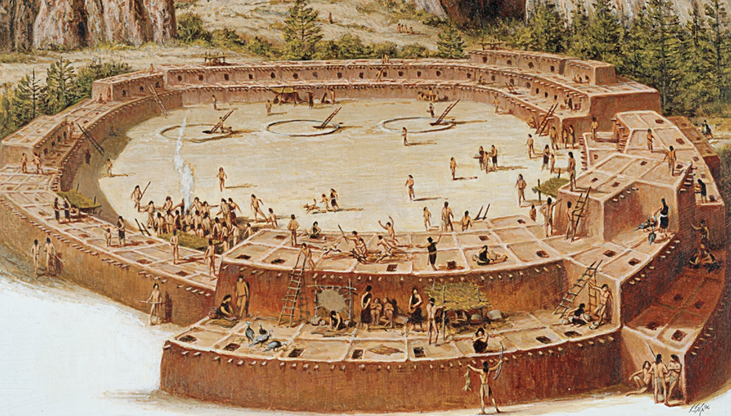
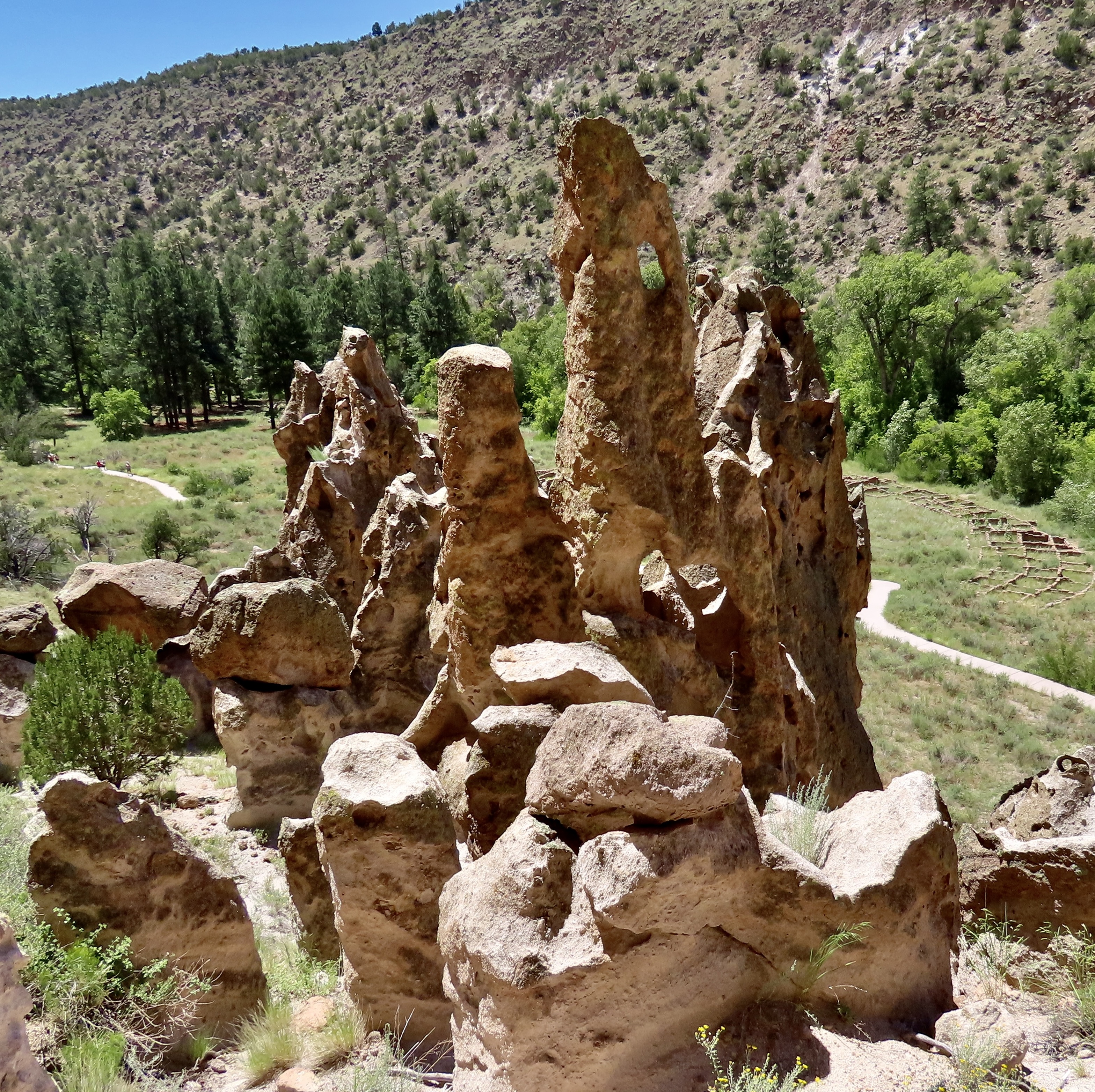
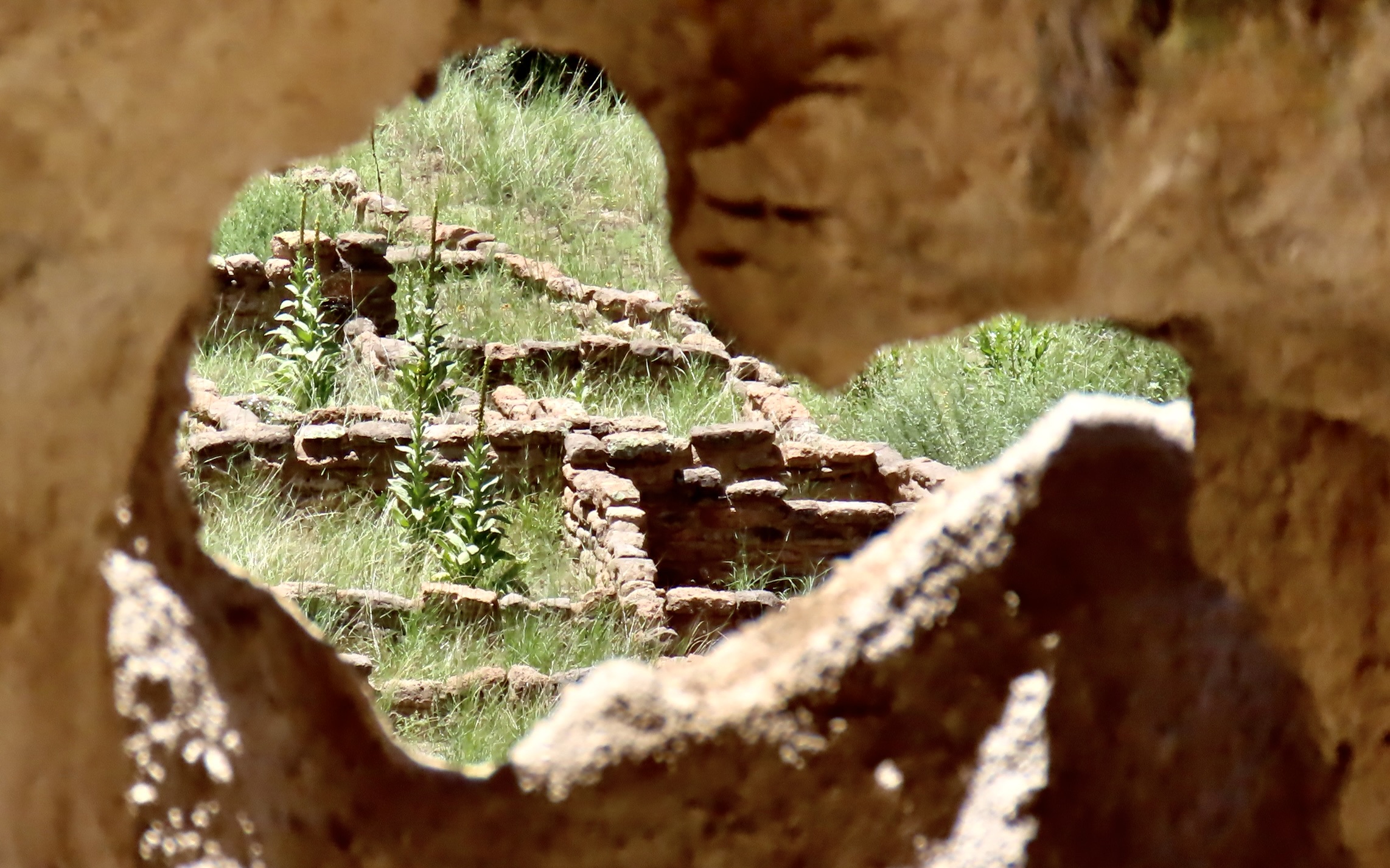
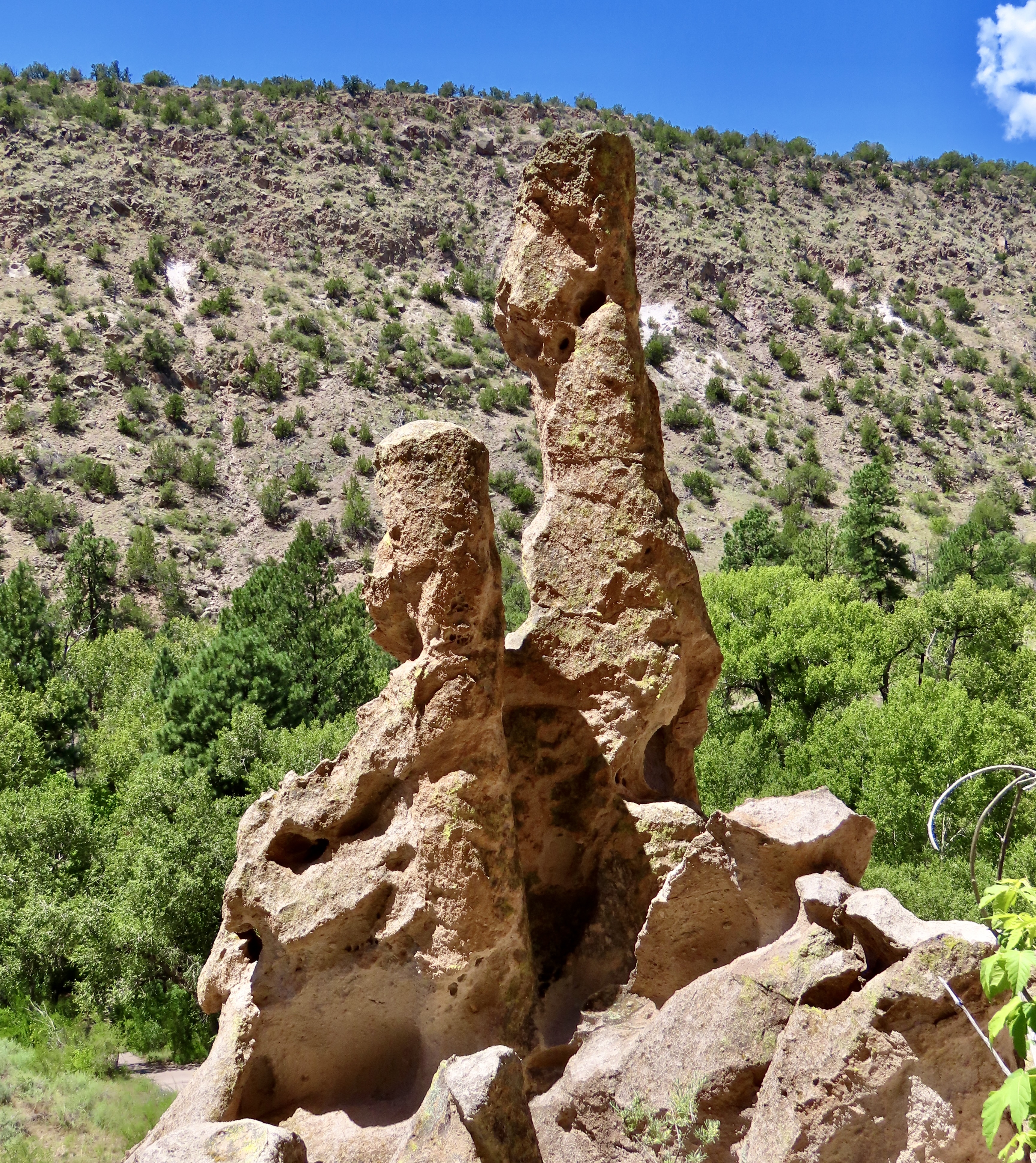
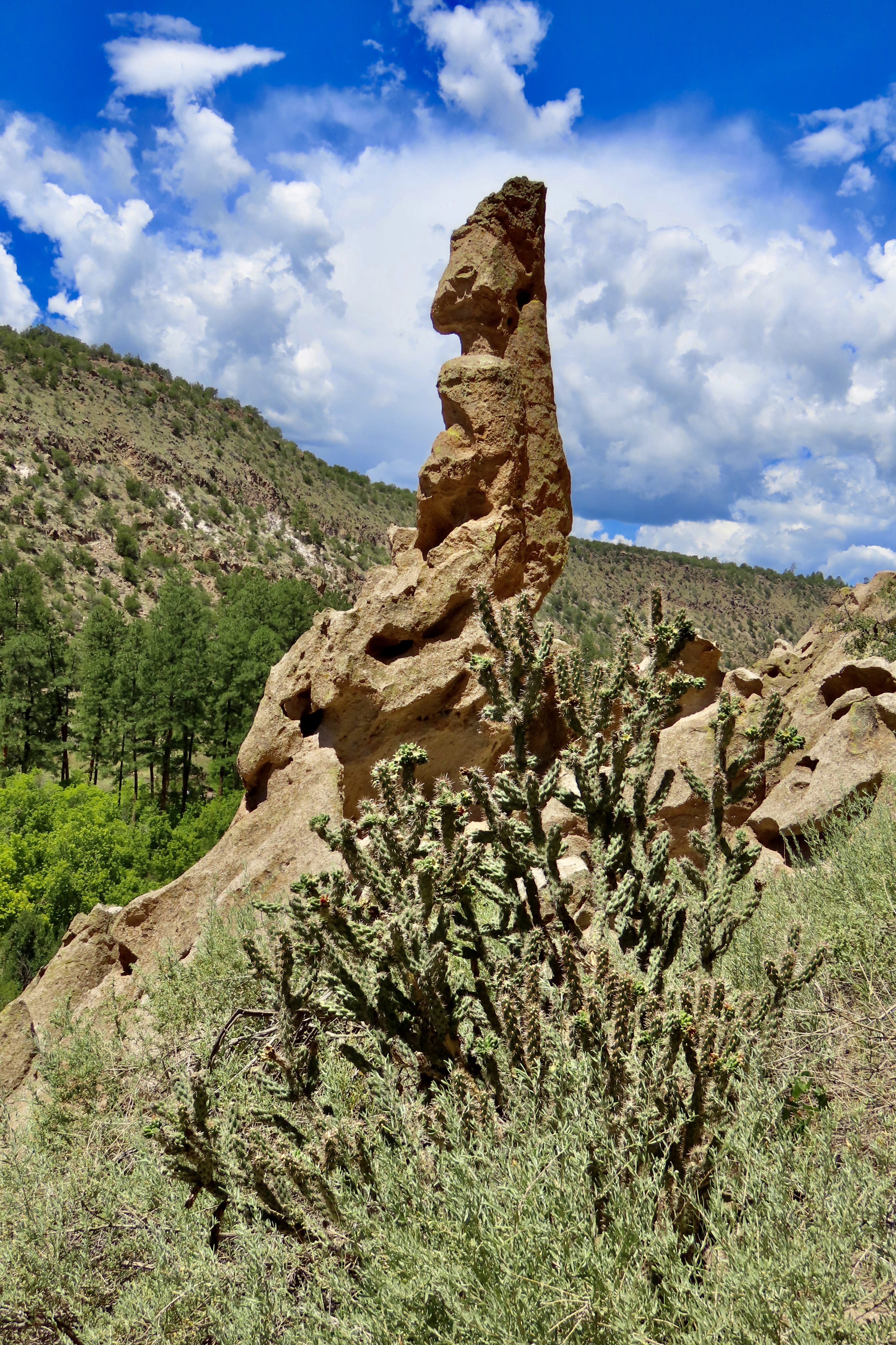
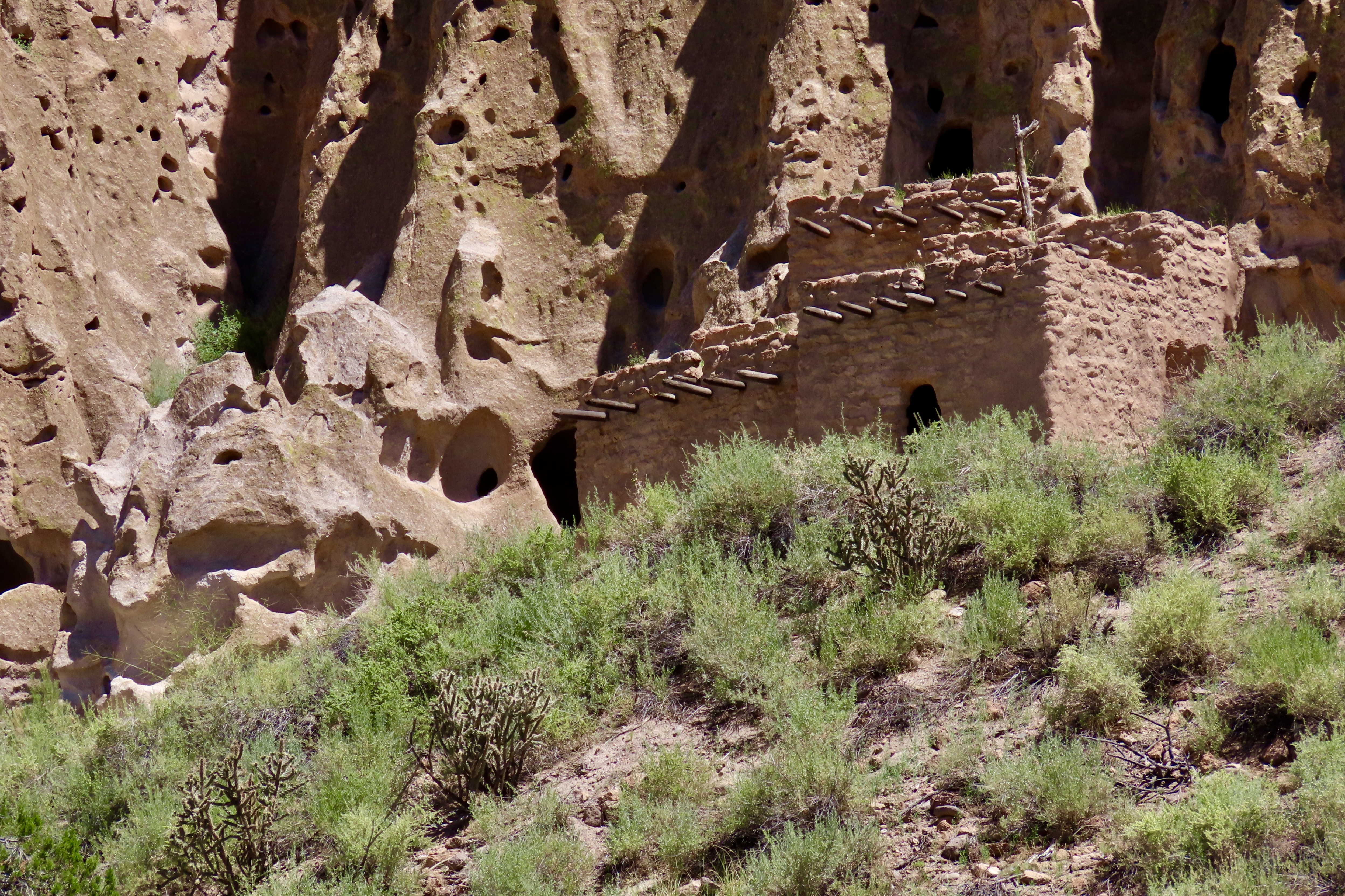
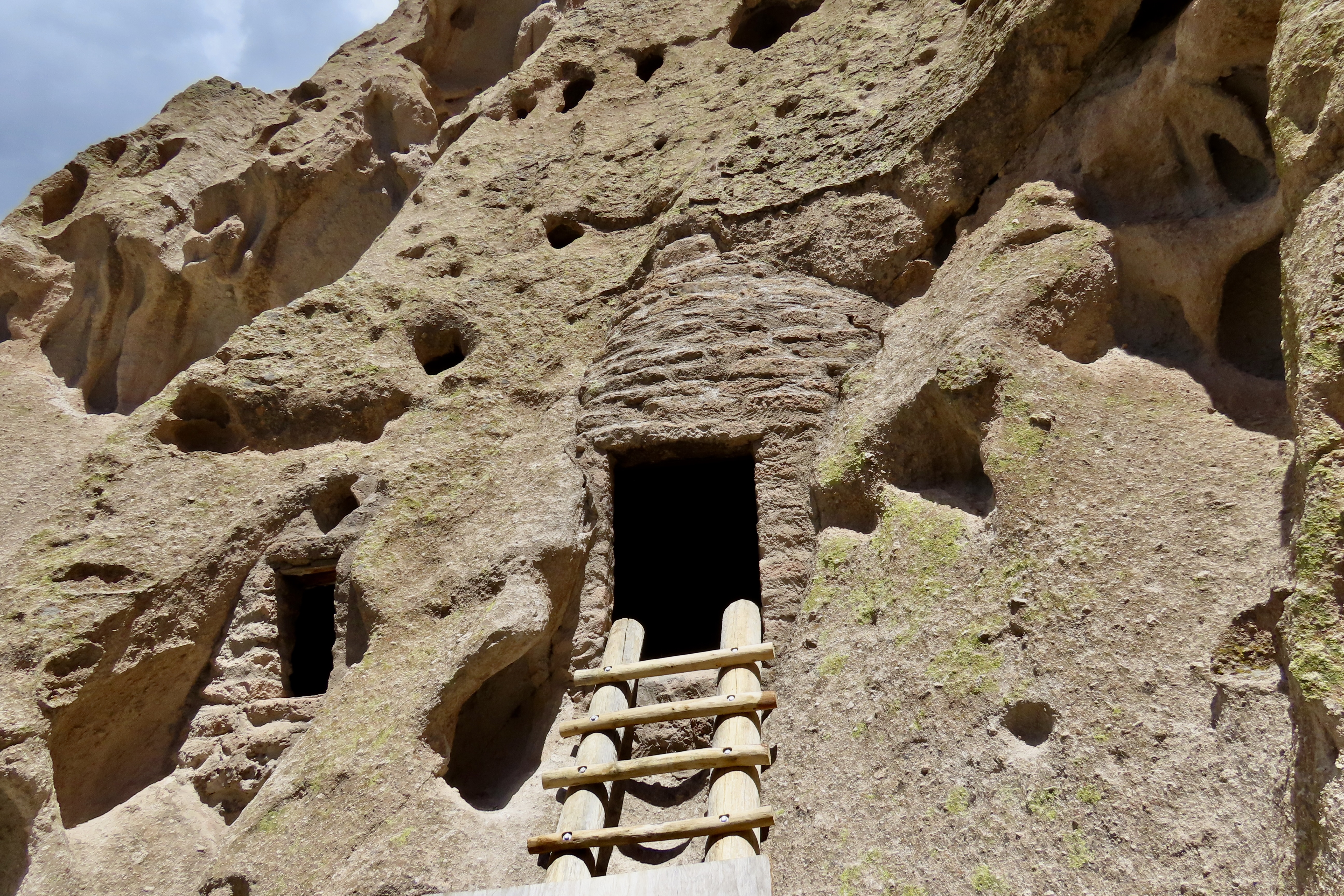
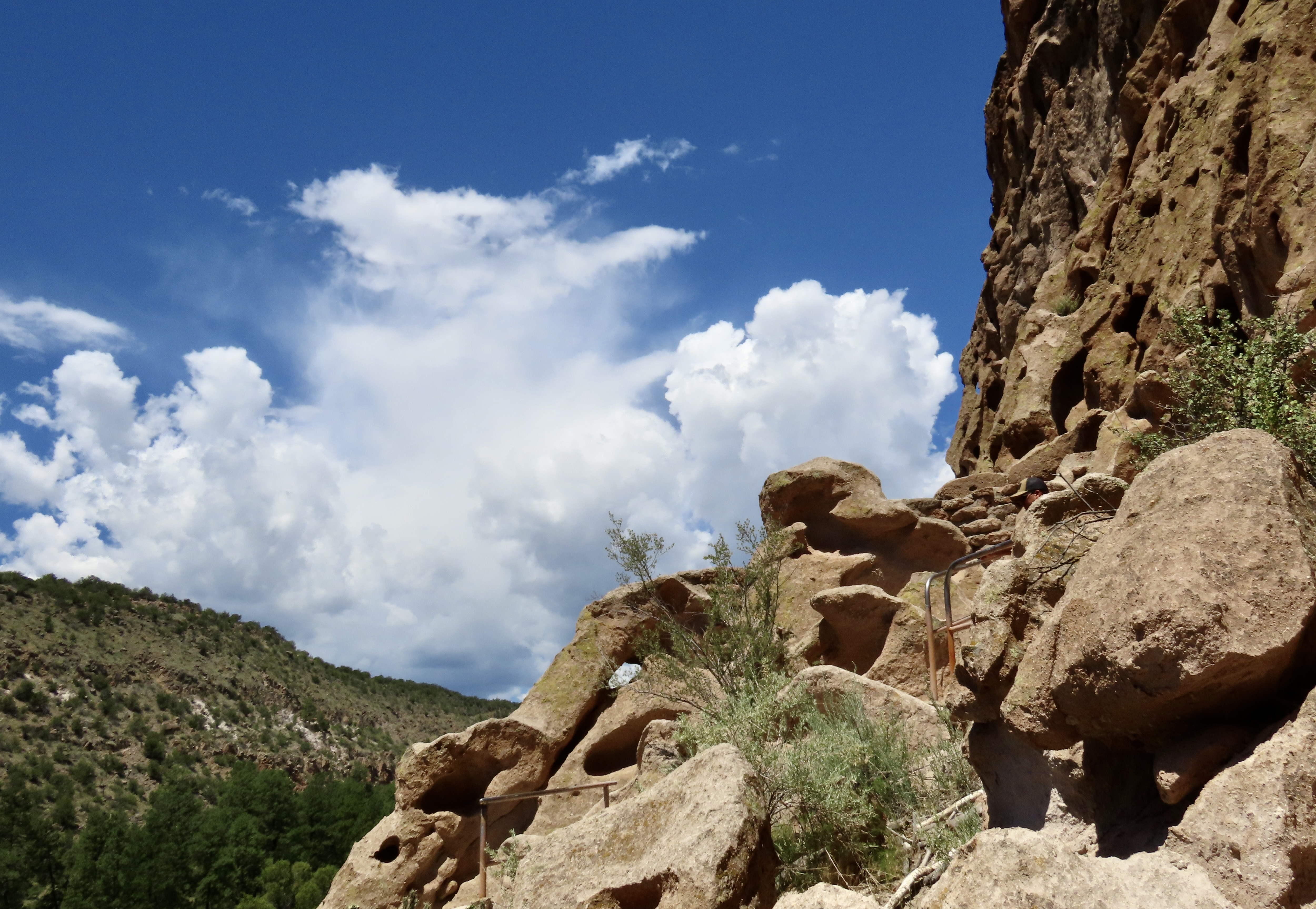
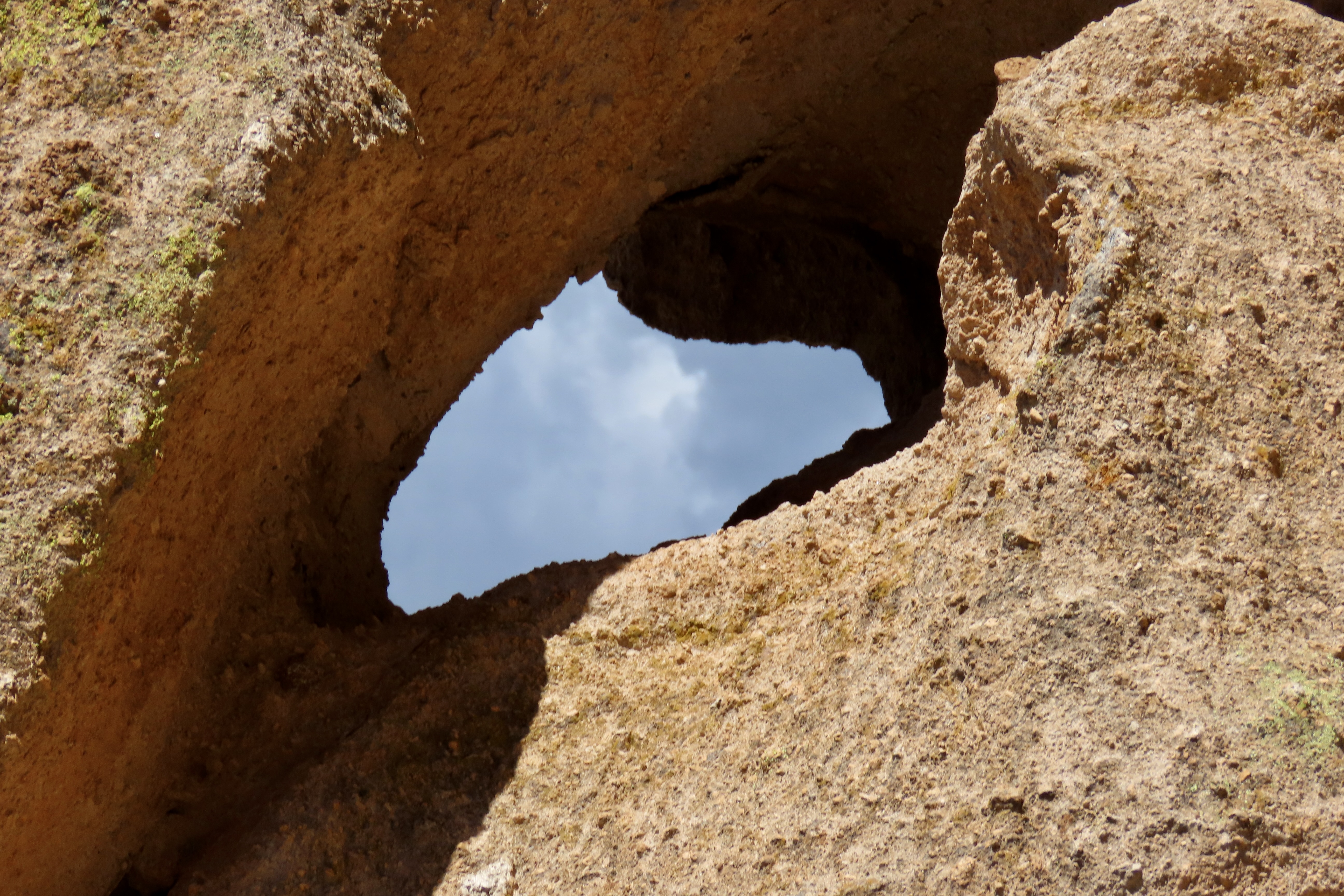
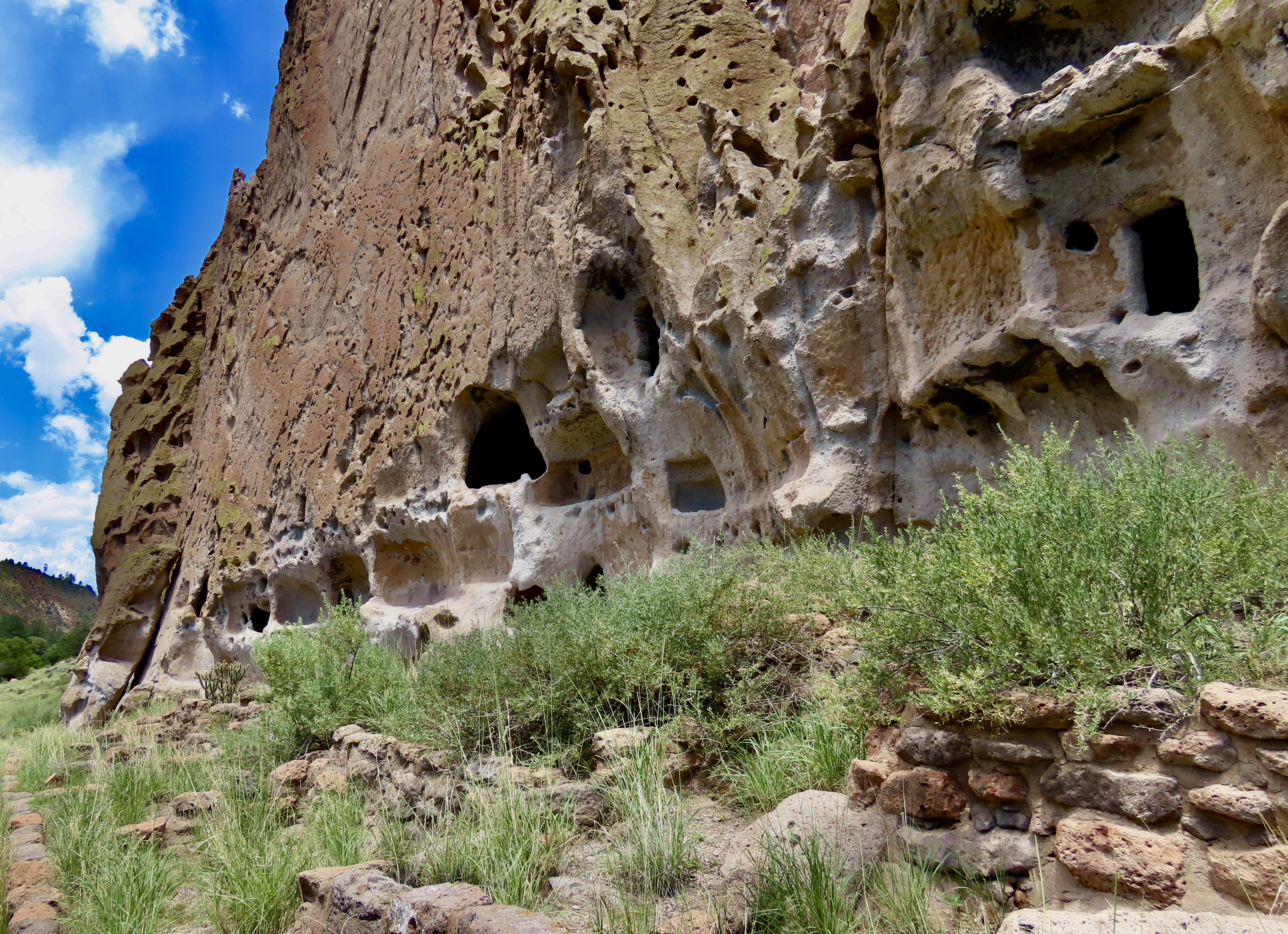
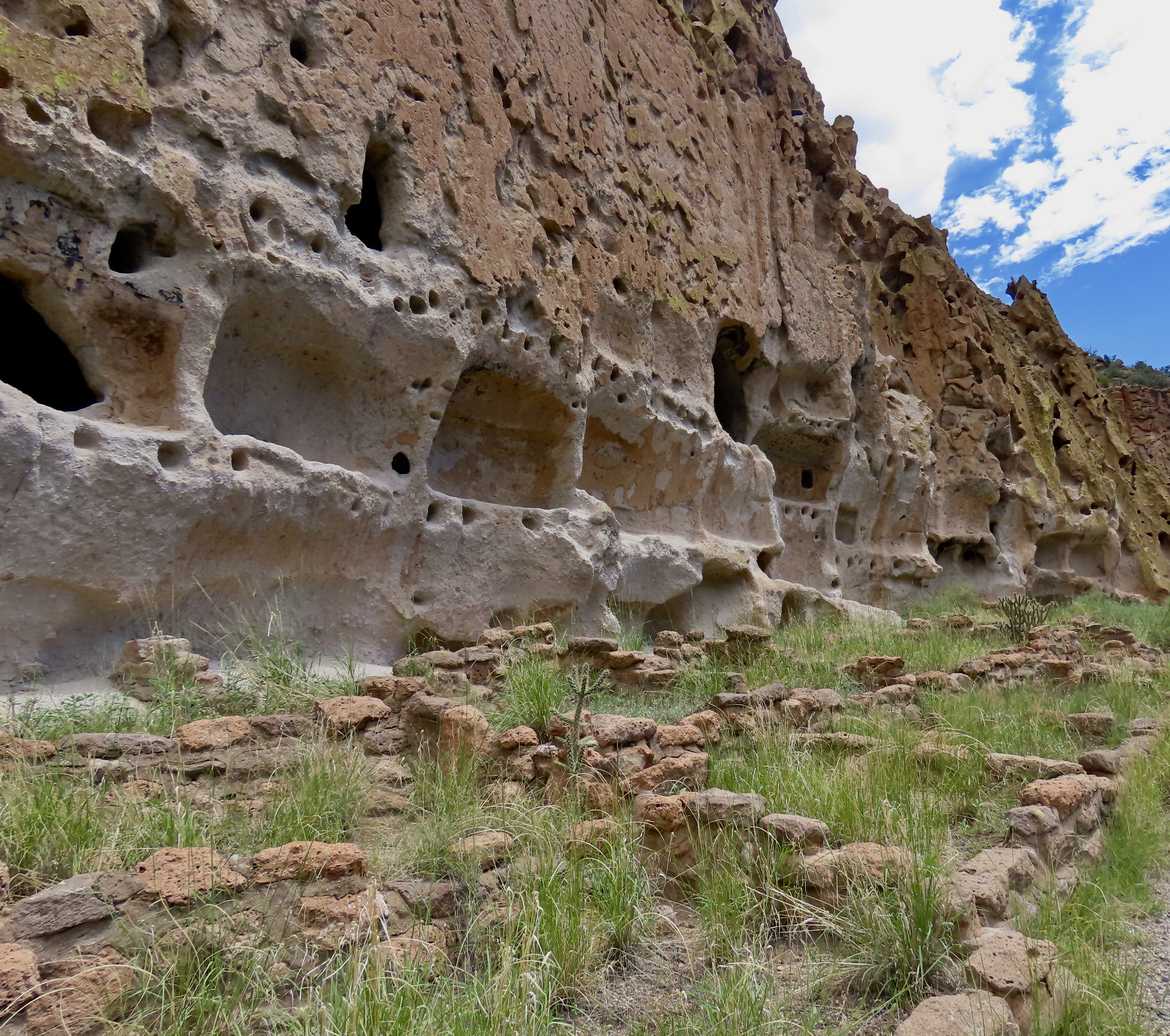
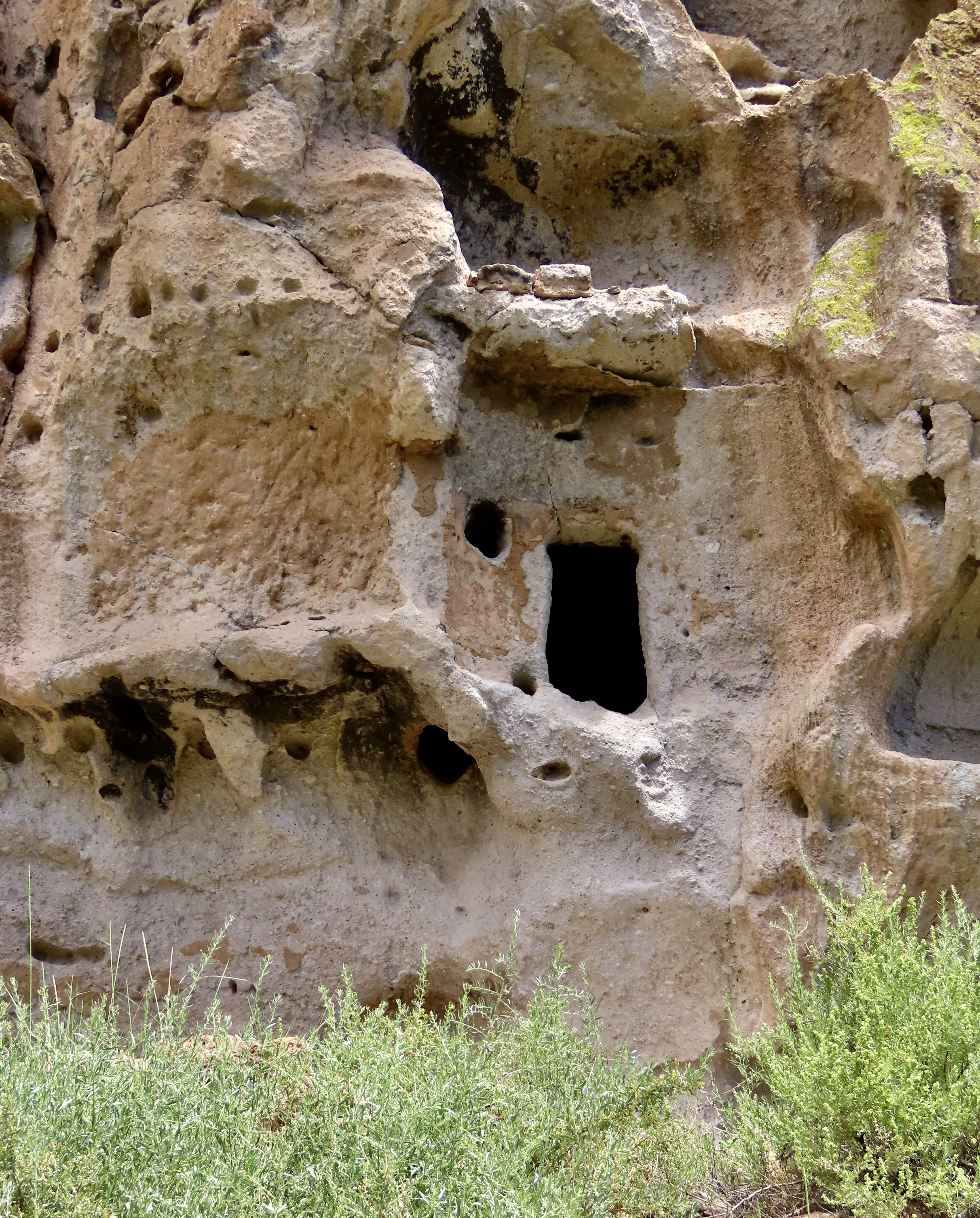
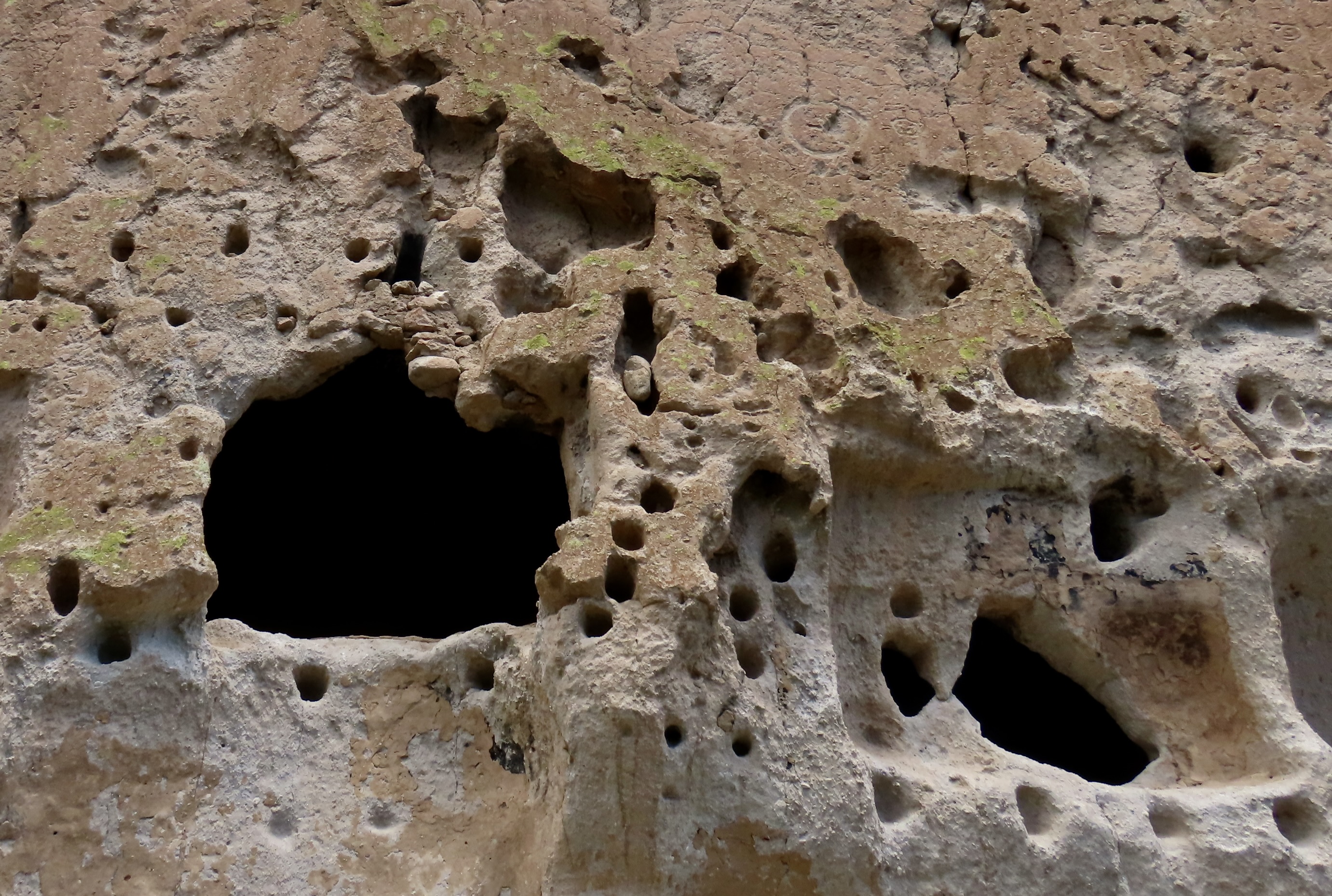
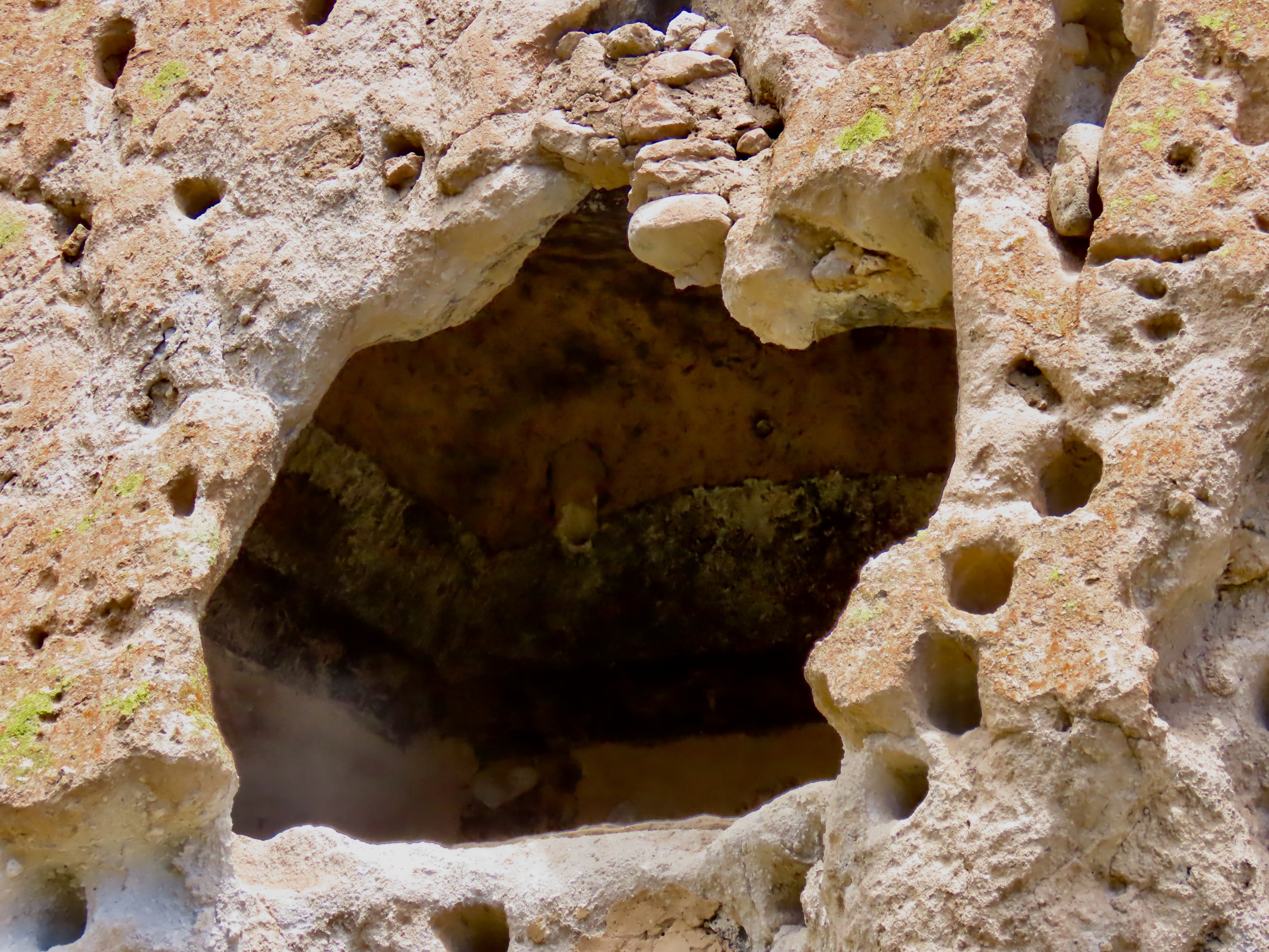
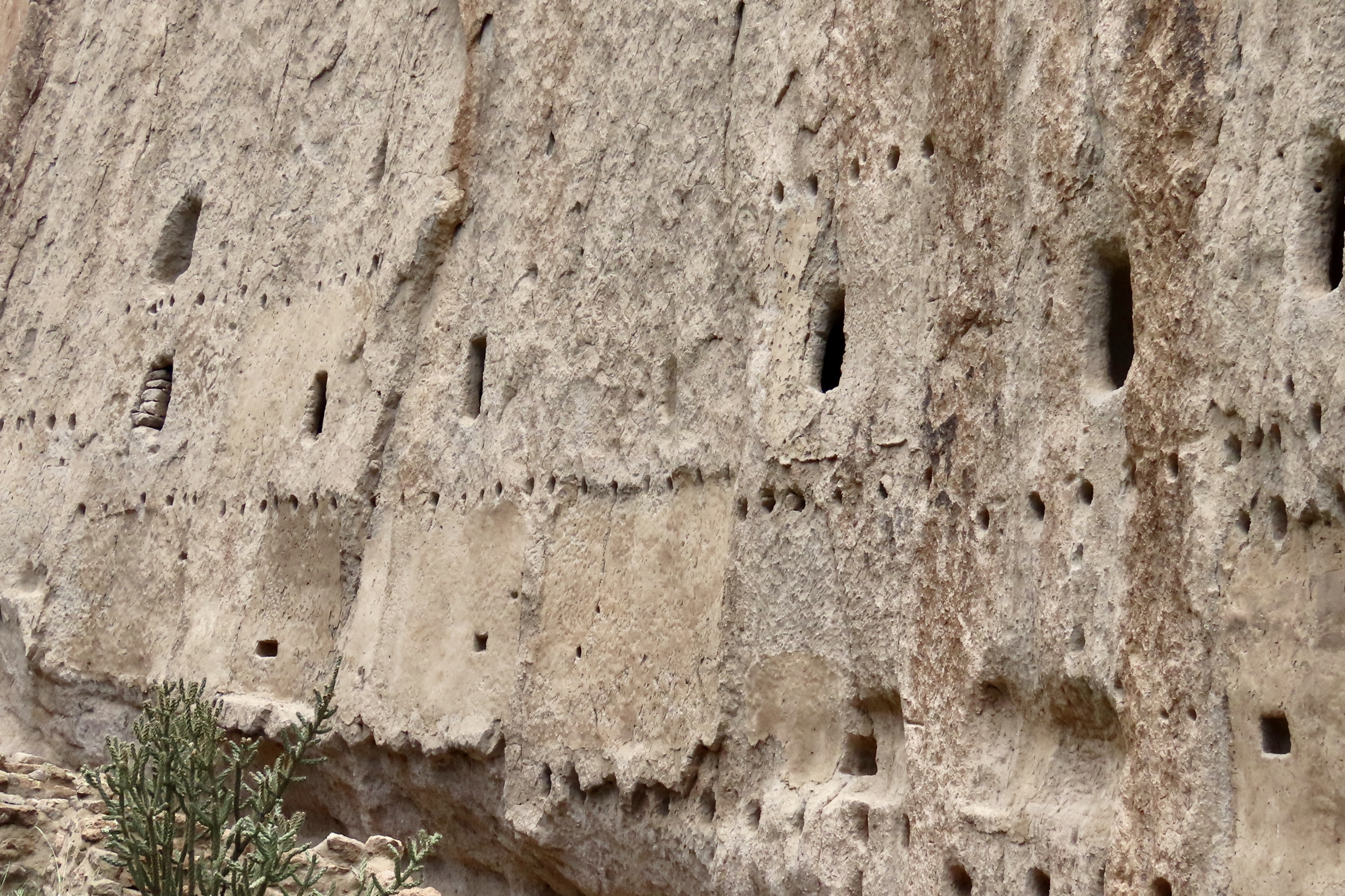
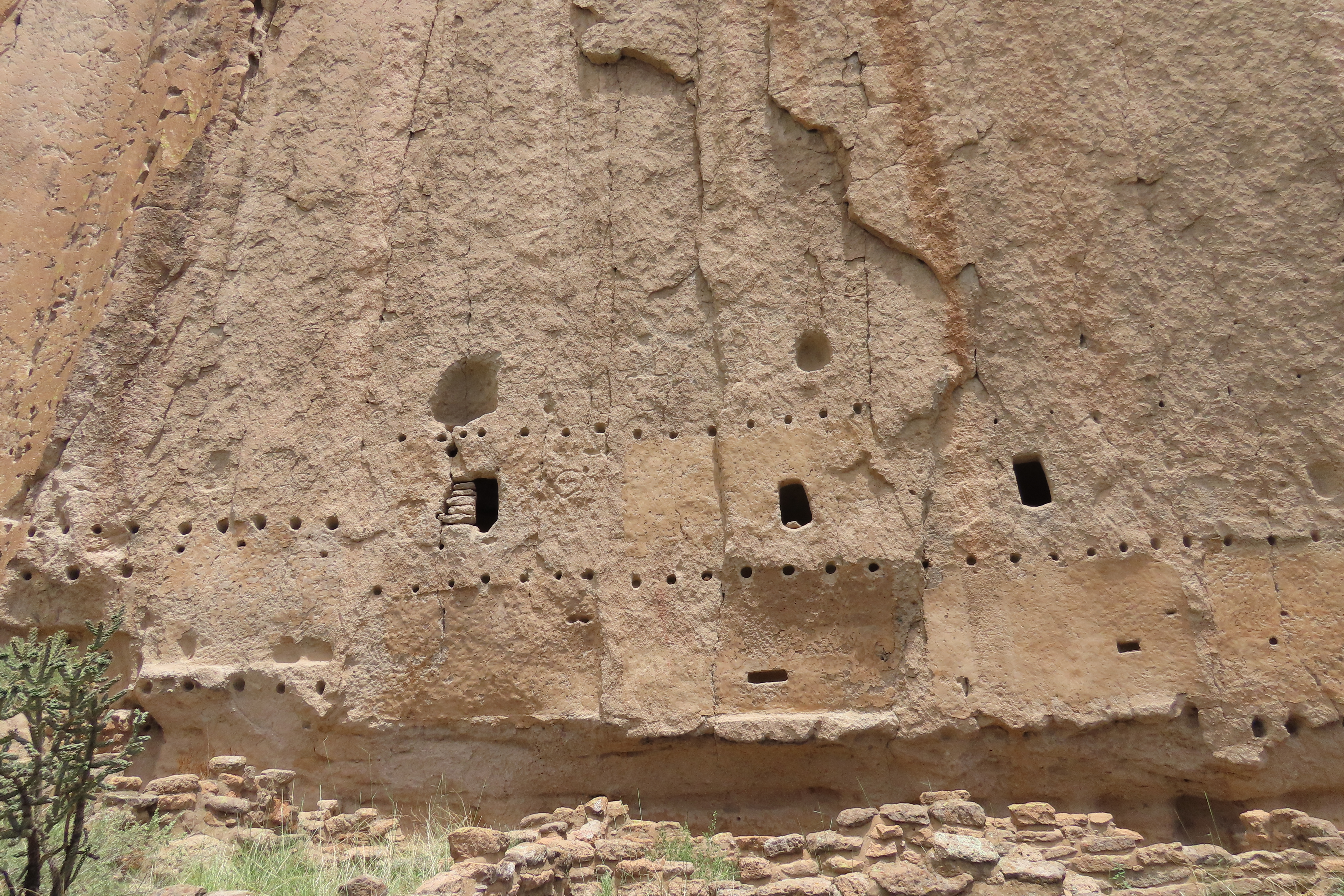
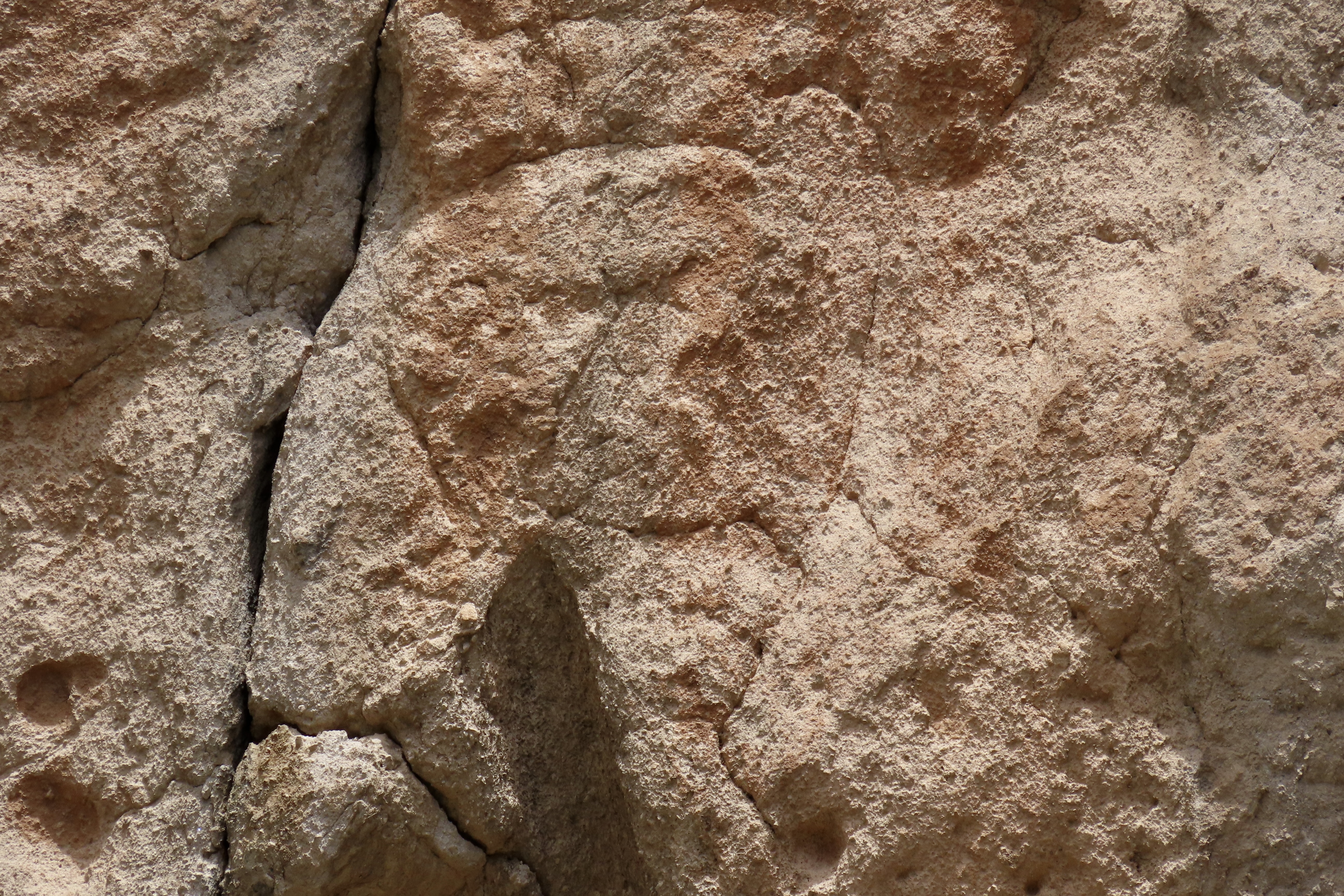
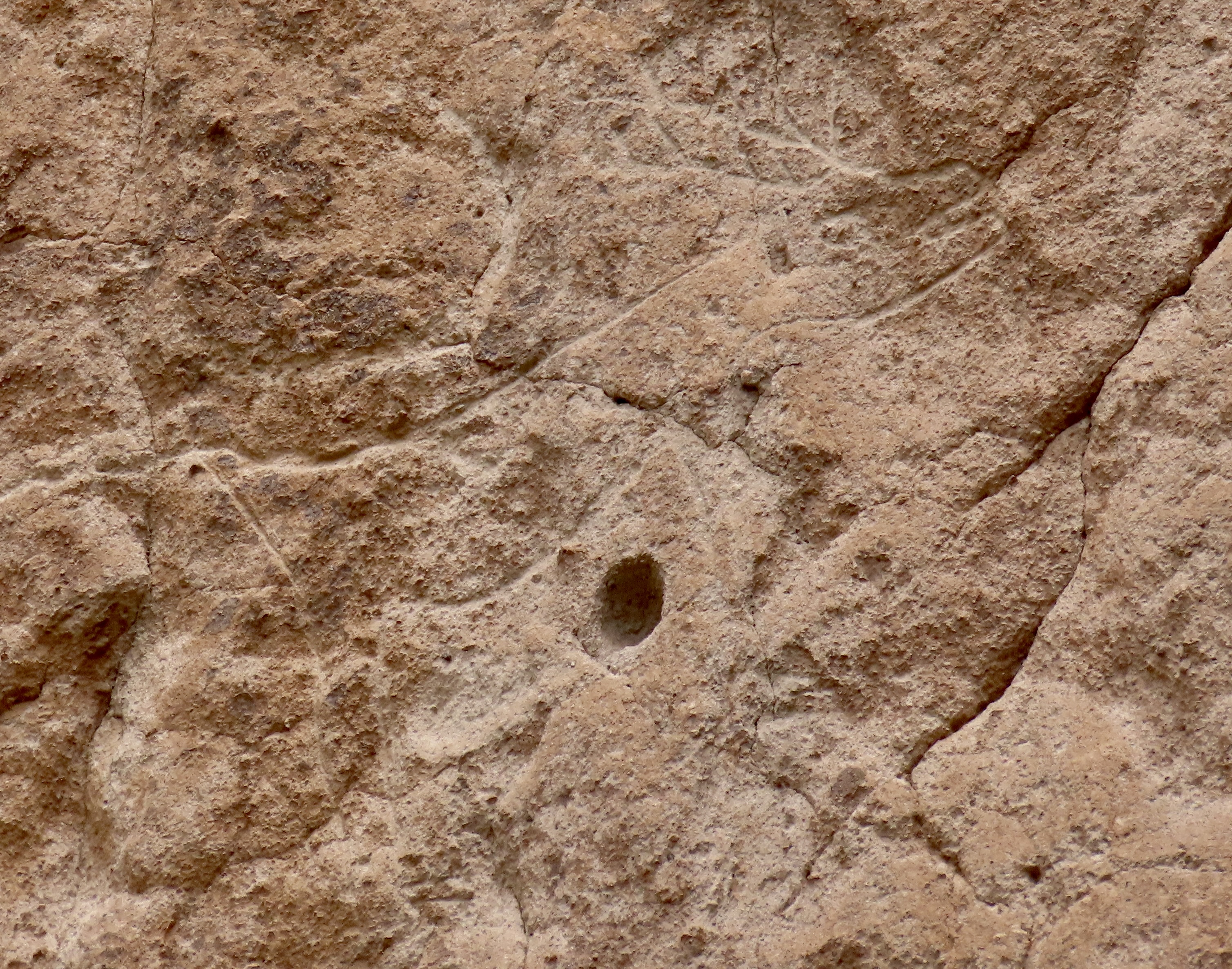
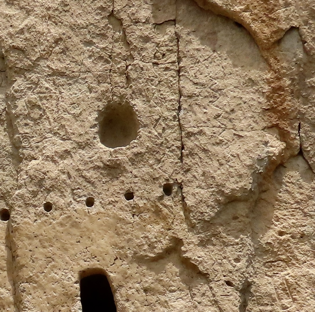
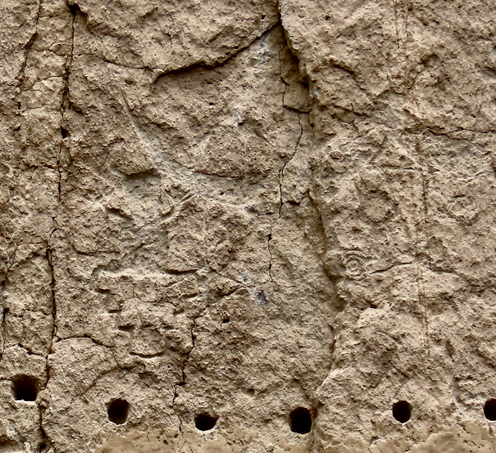
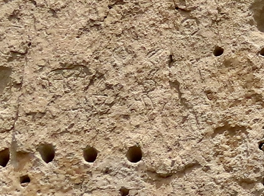
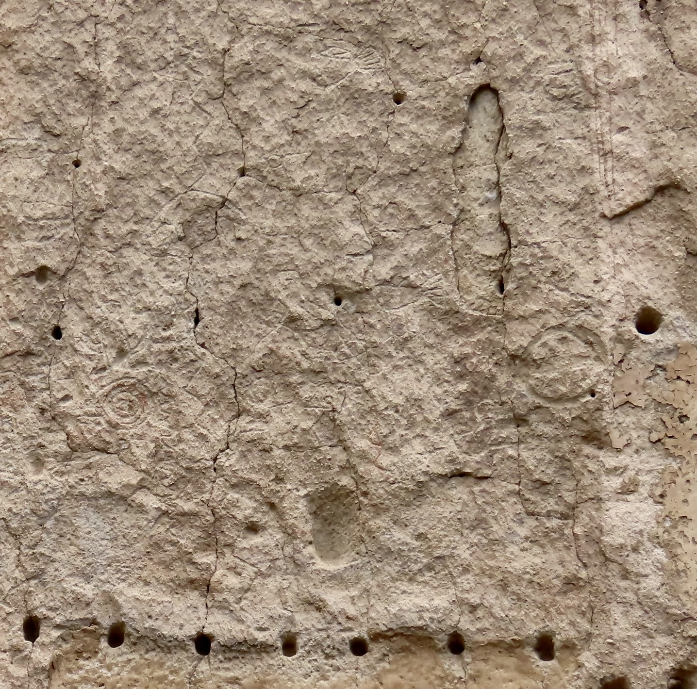
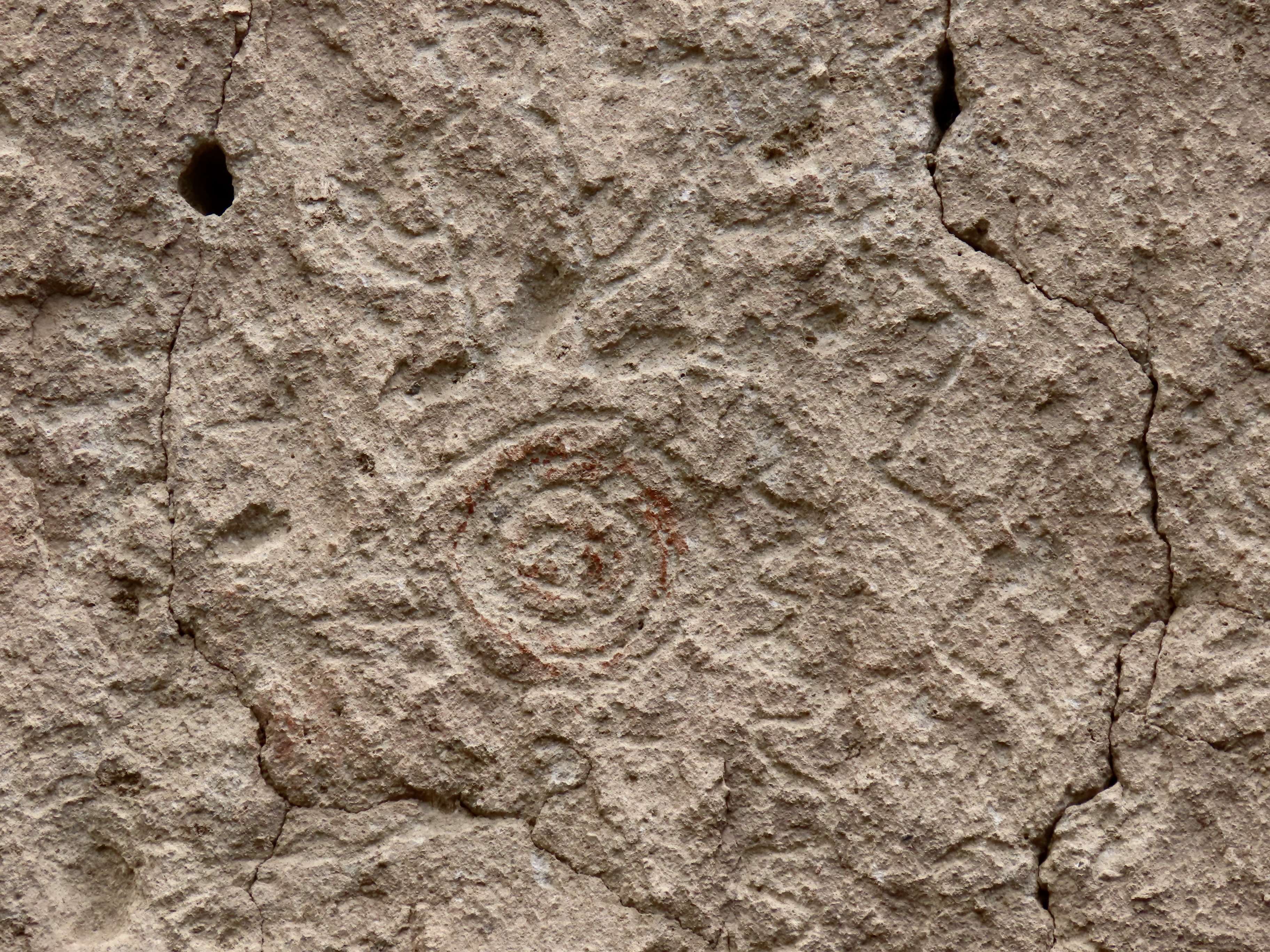
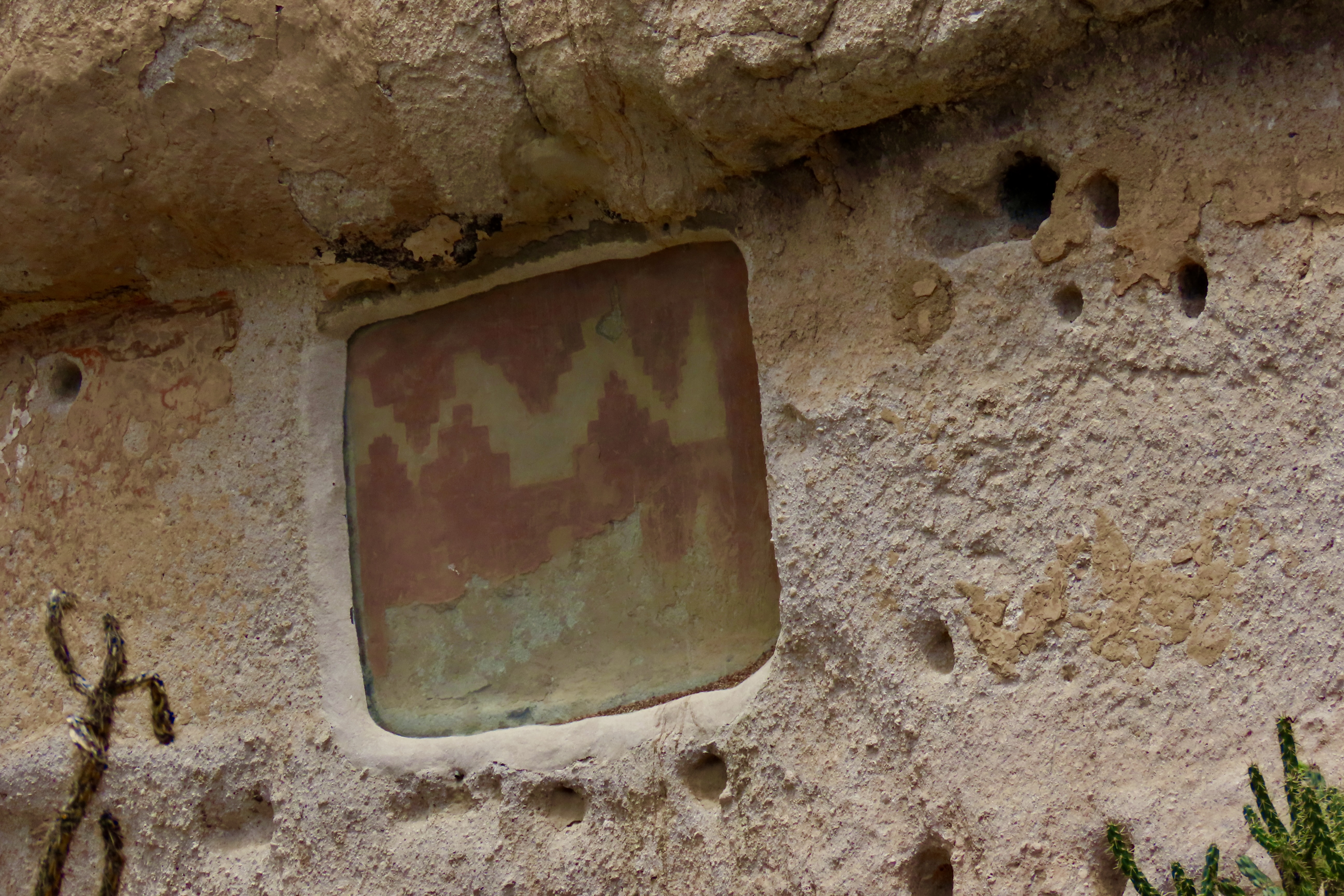
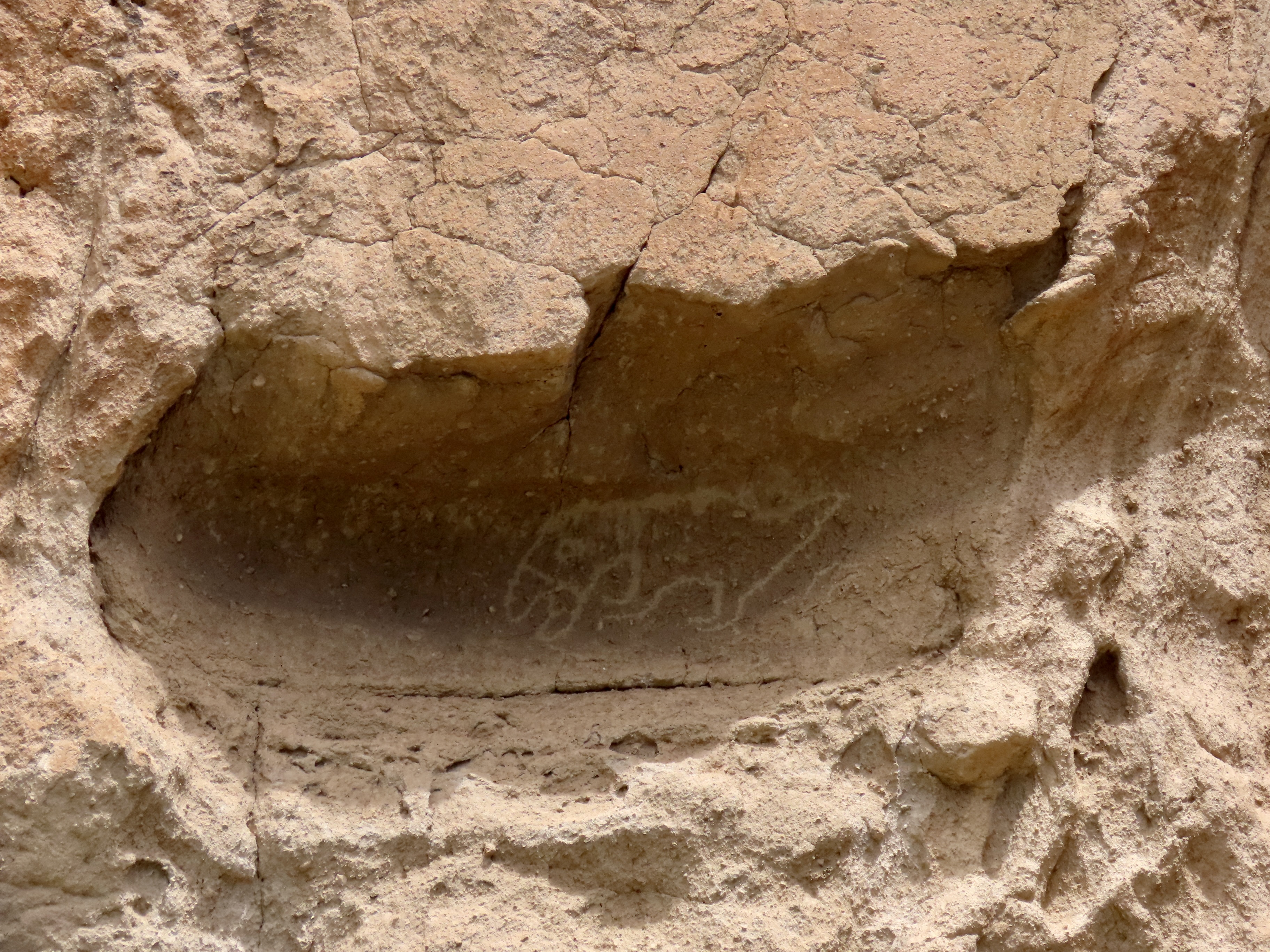
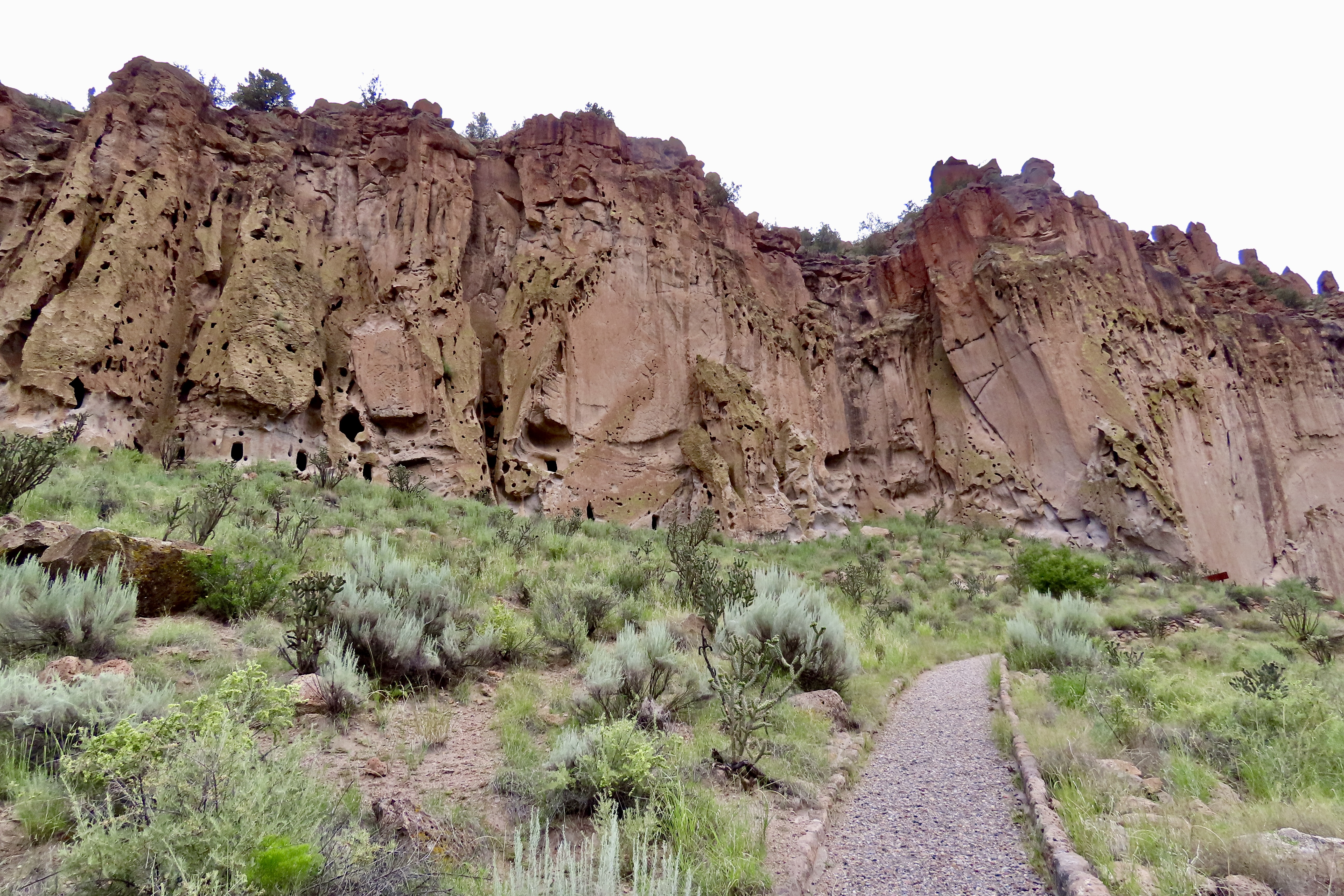
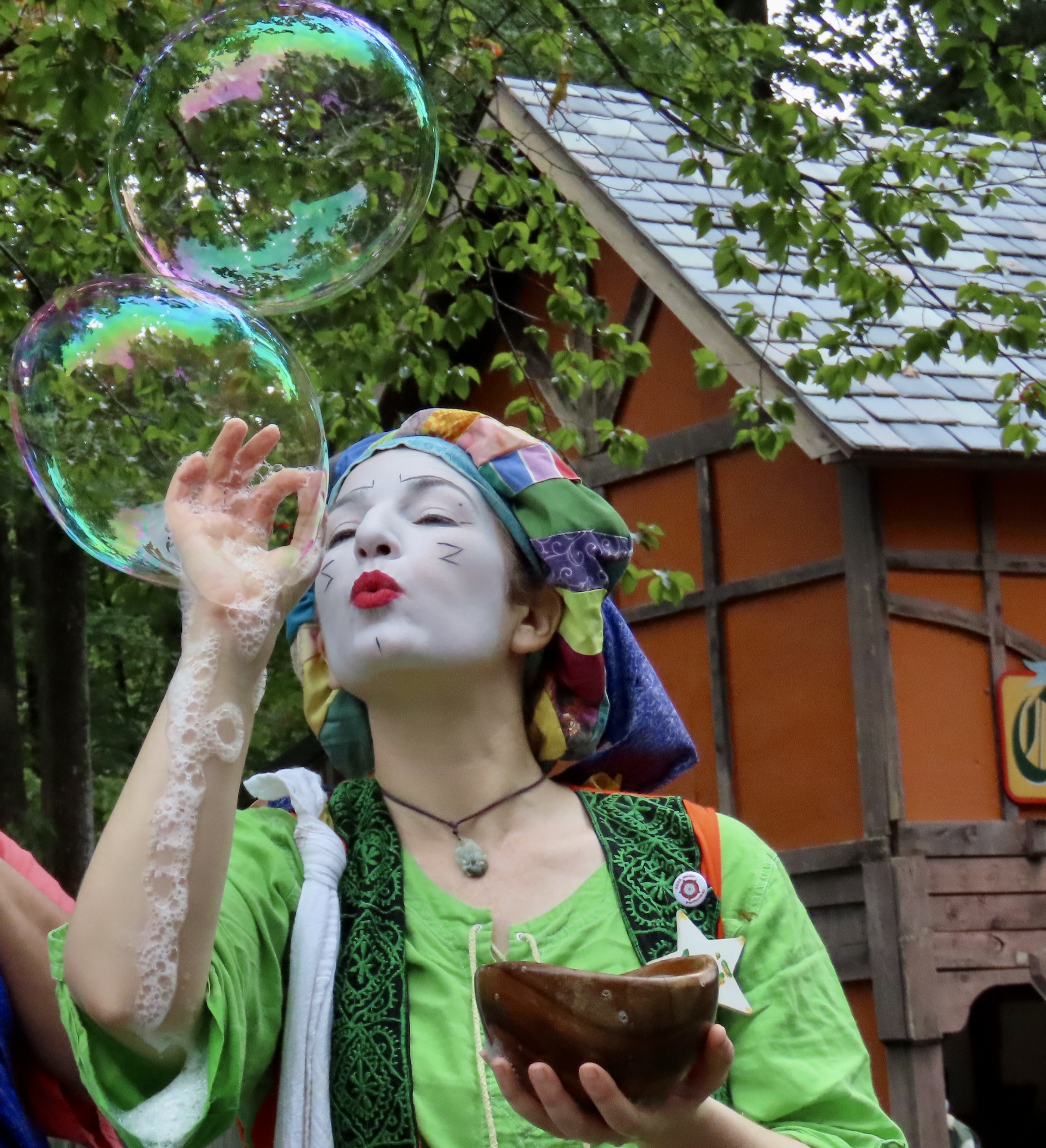
The tuff cliffs and cavates of Bandelier National Monument are what make the area special. Tuff is a relatively soft rock that derives from compressed volcanic ash. The holes on the upper cliff face are from natural erosion. The large holes along the base are cavates, caves chiseled out of the soft rock with harder rocks such as basalt by the Ancestral Puebloans for shelter and storage.This satellite photo that we found at the information center shows two things that caught our attention. First, the Valles Caldera is the location of the Jemez Volcano which erupted twice a million or so years ago and spewed out the ash that created the tuff cliffs. It is estimated that each of the eruptions created more than 600 times the amount of ash than the 1980 eruption of Mt. St. Helens did. The second is Los Alamos, a town located 10 miles north of the park. Its claim to fame is being the birthplace of the atomic bomb during WWII. (It’s not a fame I would want for my home town, but it is historic.) Bandelier was closed at the time and the lodge was used to house employees of the project.A towering cliff of tuff overlooking Frijoles Canyon. During the summer months, the Ancestral Puebloans climbed out of the canyon and farmed on top of the Pajarito Plateau as well as in the canyon.An easily walkable paved trail leads out from the information center to the major sites of the Bandelier. A few flowers, left over from spring and early summer, still decorated the trail. This one is known as fire wheel or blanket flower.A checkered white butterfly sips nectar from a golden Aster.Datura gets high marks for its beauty. Georgia O’Keefe, who lived less than 50 miles away from Bandelier, made the flower famous through her paintings. It had a different meaning to the Ancestral Puebloans living here. Datura contains a powerful hallucinogenic that was used by Native Americans to initiate youth into adulthood and by shamans to enter trances to invoke supernatural powers for a variety of purposes ranging from curing people of illness to warding off evil spirits. It isn’t something one wants to experiment with. Misuse can cause death. Other than the cavates, this large kiva was our first view of a structure built by the Ancestral Puebloans in Bandelier. It would have had the double purpose of serving the spiritual needs of the community and providing a meeting place for decision making. Its large size speaks to its importance. The Ancestral Puebloan village of Tyuonyi came next. The walls are standing in the same place they were when excavated and have been stabilized with a permeable mud mortar.The pueblo was built in a circular fashion several rooms deep. A large open area was in the middle.A climb up the hill above Tyuonyi provided an overview. Frijoles Creek with its rich riparian habitat is behind the pueblo. It would have provided the Ancestral Puebloans with water for farming plus wild plants and animals for food. An information board gave an artist’s view of what the structure would have looked like when occupied. There are even some turkeys hanging out on the roofs. (I suspect they would have been down in the center with clipped wings, but…) The three round structures are kivas. Entry for the kivas and the pueblos is from the roof.Another perspective of Tyuonyi from above. This one is with rocks because Peggy and I like rocks. Note the eye-like holes…Peggy used one of them to bring the pueblo ruins into focus. The tall plant is mullein. A Texas blogging friend of mine told me that during the Great-Covid-Toilet-Paper-Shortage, the large leaves could serve as a substitute. And, no, I didn’t try them.Some of the rocks overlooking the the pueblo seemed almost anthropomorphic and I couldn’t help but wonder if the Ancestral Puebloans gave any significance to them.Or possibly carved them. This one certainly looks like it. Was there a Michelangelo among the Puebloans? I couldn’t find any reference to it, however, which leads me to wonder if modern day Puebloans have objected to them being pointed out for religious reasons or fear of their being damaged. Or, were the rocks carved by erosion and my imagination is simply working overtime here? What do you think? The cactus in front is a member of the Cholla family.We climbed the trail above the ruins of Tyuonyi for a couple of reasons beyond its interesting rocks and views. One was to visit the Talus House. It had been reconstructed in 1920 to demonstrate what the buildings the Ancestral Puebloans built in front of the cavates looked like.Our other reason was to check out one of the cavates that Bandelier had made available for visitors. Hiking down from our trip up to the Talus House and the cavate, we found Cave Kiva that had once been available for visitors but was now closed because graffiti had been repeatedly scribbled on the walls. So sad and wrong. It’s no surprise that modern day Puebloans are concerned about exposing their sacred sites.The steep trail down featured attractive rocks and impressive thunderheads. The metal handrails along the walkway can be seen here.I used a hole in the rocks to photograph the dark clouds that were rapidly approaching and threatening us with rain.The most visually interesting part of the park in terms of the cavates was the Long House, so called because it stretched out for over 100 yards and featured a number of the hand constructed caves. Buildings like Talus House would have fronted each of the cavates. The walls of the houses can still be seen in front.Looking back. Note the round holes surrounding the cavates. These were used for the support beams on the roofs of the houses.Some of the building would have been three stories high.Long House was occupied for 400 years. Imagine what stories each of these cavates would have to tell. We focused our camera on the left one to peer inside…And saw what appeared to be a threatening bird warning us not to enter. It would take a brave (or foolish) soul to disobey.We came to a smoother section of Long House where a sign told us there were hundreds of petroglyphs, including turkeys.Finding them was the challenge. Unlike the petroglyphs carved on rocks with desert varnish that are found throughout the Southwest and have contrasting colors, these were the same color of the light brown tuff they were carved in. With careful perusal on site and even more at home with the photos, they gradually begin to appear.Follow the outline around and an elongated cat-like face with ears emerges. This may have been a Kachina.There is power here.Study this for a moment and a horned serpent seems to appear. If so, it could be Awanyu, an important deity of the Pueblo peoples because of its close association with water, always critical in a desert environment.Looking closely at this, we could begin to understand why the park claimed there are hundreds of petroglyphs on the walls. A snake makes its way up the wall on the right and ends with a rectangular eyed face. Another snake parallels it on the left. Check out the two round circles to the left of the hole and another cat man with a downturned mouth emerges. Not a clue what the petroglyph on the lower right represents. Remember, we can only guess, at best, what the petroglyphs meant to the Ancestral Puebloans.Just to the left of the cat man was a guy standing on what appears to be a pedestal with his hands up in the air screaming. Mind you, this is all my interpretation, but with all of the snakes crawling around that’s what I would have been doing. This may have been another Kachina. Check out the two carved circles on the middle right and the cat man reappears.Tail wagging doggy on the left?And finally, turkeys. There are at least three here. Start with the tail feathers top center. Below and slightly to the right are more tail feathers.The circle was more challenging but a faint head can be seen on the left and faint tail feathers on the right.This pictograph was once covered with plaster. It was discovered during archeological work and is now covered in glass for preservation.The prize among the petroglyphs is this large rendition of a macaw that apparently had its own niche carved out. Imported on foot from Mesoamerica some 1500 miles to the south, macaws became a symbol of prestige among Ancestral Puebloans, especially those at the large Chaco site where the Bandelier Puebloans likely migrated from. (According to oral tradition, the Bandelier Puebloans migrated on to the Cochiti Pueblo on the Rio Grande River in the 1500s, which is where their descendants now live.)As we hiked down the trail heading back toward the information center, we took a final look back at the tuff cliffs and cavates of Bandolier National Monument. It had been a great visit and we highly recommend that you check it out if you are in the area.. Next up, we will take you to the large Renaissance Festival in Maryland where we were this past week. After that, it will be back to the Southwest.
18 thoughts on “Bandelier National Monument… Herding Turkeys”
Wild turkeys were quite rare in PA when I was a boy but now seem abundant everywhere. I never, however, thought of them being in the dry states like NM.
We saw most of the pueblos but missed Bandelier, perhaps in our haste to leave the heat of days in Alamogordo and environs for the cooler climes of Cloudcroft. I’m glad to have seen it through your eyes.
Wild turkeys were rare when I was a boy in Pennsylvania but now seem quite common. I never would have guessed, however, that they were once in New Mexico.
We missed Bandelier when we were in that area. I’m glad to have seen it through your eyes.
We have found turkey petroglyphs throughout the Southwest, Ray. They must have been widely spread in the area.
We certainly had our share in Oregon and Sacramento. We also have them roaming through our yard in Virginia.
Peggy and I drove right by Bandelier once. What a mistake that was.
This is all magnificent from the flowers that Georgia would have painted to the turkeys dancing! I have been traveling with you two for quite some time but these formations really struck me as “living” people who inhabited this land. Really enjoyed this adventure. BTW…turkey trot…my dad was from hills of Kentucky and he described having a little upset stomach as having the green apple quick steps. Some connection there! He had many euphemisms which my brother and I still use! These have been passed on to my children such as “slick as duck butter on a door knob.” My dad was one of a kind. Love to you two!
I’ll bet the hills of Kentucky produced some memorable sayings! Laughing about the green apple quick step. That would make a fun dance. I read that the Turkey trot was a popular dance of the early 1900s when my dad was born. My ancestors arrived in Kentucky in the late 1700s and immediately set up a distillery. Seems appropriate. Grin. But the Mekemsons had moved on to Illinois and Iowa by the time he was born.
We were disappointed that we didn’t make it to the Chaco ruins, but Bandelier made an excellent substitute. Thanks, Wendy.
Thanks, G. Glad that you were able to visit it with Peggy and me. I went running for my camera when I saw the turkeys strutting their stuff together! 😀
Your ability to spot petroglyphs never ceases to amaze me! We definitely did not find any of these on our trip (aside from the ones that were clearly labeled). Thanks for sharing them all here. Sounds like you had a great time in Bandelier!
We are always on the lookout for them, Diana, and have visited numerous sites over the years. Interest alone helps us to spot them but we have also learned that there are certain areas where we are more likely to find them. Unique land forms is one. And yes, we loved Bandelier.
Oh my, I missed this post, Curt. What a great post this is of Bandelier National Monument. Love your photos, the petroglyphs. The turkeys are amazing and all of those flowers and the grass popping through. Love the climb with you at the top entering the cave.. I’ll be back as there’s lots to study here!
💓


Wild turkeys were quite rare in PA when I was a boy but now seem abundant everywhere. I never, however, thought of them being in the dry states like NM.
We saw most of the pueblos but missed Bandelier, perhaps in our haste to leave the heat of days in Alamogordo and environs for the cooler climes of Cloudcroft. I’m glad to have seen it through your eyes.
Wild turkeys were rare when I was a boy in Pennsylvania but now seem quite common. I never would have guessed, however, that they were once in New Mexico.
We missed Bandelier when we were in that area. I’m glad to have seen it through your eyes.
We have found turkey petroglyphs throughout the Southwest, Ray. They must have been widely spread in the area.
We certainly had our share in Oregon and Sacramento. We also have them roaming through our yard in Virginia.
Peggy and I drove right by Bandelier once. What a mistake that was.
This is all magnificent from the flowers that Georgia would have painted to the turkeys dancing! I have been traveling with you two for quite some time but these formations really struck me as “living” people who inhabited this land. Really enjoyed this adventure. BTW…turkey trot…my dad was from hills of Kentucky and he described having a little upset stomach as having the green apple quick steps. Some connection there! He had many euphemisms which my brother and I still use! These have been passed on to my children such as “slick as duck butter on a door knob.” My dad was one of a kind. Love to you two!
I’ll bet the hills of Kentucky produced some memorable sayings! Laughing about the green apple quick step. That would make a fun dance. I read that the Turkey trot was a popular dance of the early 1900s when my dad was born. My ancestors arrived in Kentucky in the late 1700s and immediately set up a distillery. Seems appropriate. Grin. But the Mekemsons had moved on to Illinois and Iowa by the time he was born.
We were disappointed that we didn’t make it to the Chaco ruins, but Bandelier made an excellent substitute. Thanks, Wendy.
An amazing area stockpiled with history. Thank you two for bringing me along. I never would have seen it otherwise.
I kinda liked the Conga line too!
Thanks, G. Glad that you were able to visit it with Peggy and me. I went running for my camera when I saw the turkeys strutting their stuff together! 😀
🦃🦃🦃😮
Love this post Curt, wonderful photos and I loved the descriptions.
Thanks, Sylvia. Good to hear from you!
I have many of the same photos from our trip there, including the pair of anthropomorphic figures.
Thanks again for all the information you put in your posts! Very helpful as I went through my photos again.
Fascinating place for sure. I’d love to more about the anthropomorphic figures. Appreciate your comment!
There is so much to love in this post, Curt. Thanks for the history and fabulous photos. You and Peggy are so inspiring!
It is a very special place, Lauren. Thanks. ❤️
Your ability to spot petroglyphs never ceases to amaze me! We definitely did not find any of these on our trip (aside from the ones that were clearly labeled). Thanks for sharing them all here. Sounds like you had a great time in Bandelier!
We are always on the lookout for them, Diana, and have visited numerous sites over the years. Interest alone helps us to spot them but we have also learned that there are certain areas where we are more likely to find them. Unique land forms is one. And yes, we loved Bandelier.
Oh my, I missed this post, Curt. What a great post this is of Bandelier National Monument. Love your photos, the petroglyphs. The turkeys are amazing and all of those flowers and the grass popping through. Love the climb with you at the top entering the cave.. I’ll be back as there’s lots to study here!
💓
Some of the most interesting pueblos we have seen Cindy. Talk about a match for the surrounding cliffs! We could have spent more time there.