El Morro National Monument is located in western New Mexico about 40 miles south of the Route-66 town of Grants (just off I-40) in a water starved region. It’s hardly surprising that a year round waterhole located at the base of the promontory has been a welcome stop for people passing through and/or living in the area for over a thousand years. Many left their mark.
Ancestral Puebloans— whose descendants include modern day Zuni— came first. They lived on the top of El Morro in a pueblo that the Zuni have named Atsinna, and climbed down to the waterhole where they gathered water and used rocks to pound and carve petroglyphs into the relatively soft Zuni sandstone.
The Puebloans were followed by Spanish treasure hunters driven by an insatiable hunger for fabulous wealth and everlasting glory. They believed they would find it in the legendary, gold-filled Seven Cities of Cibola. (El Morro is in modern day Cibola County.)The treasure hunters were accompanied by Spanish missionaries with a different goal: Winning souls for God and King. Turns out the the cities of gold were a myth and the indigenous population didn’t understand why they couldn’t keep their own deities while accepting God’s help as well. They were even more dubious about a distant king whose motives were questionable at best.
Finally, American pioneers and soldiers passed through in the mid-1800s. The pioneers were seeking a new life from the one they had left behind in the East. They, too, were searching for treasure but theirs was to be found as farmers, ranchers, miners, loggers and merchants. The fact that indigenous populations already lived in the areas they wanted to settle was of little concern, unless, of course, the natives objected. That’s what soldiers were for.
The Spaniards and Americans, like the Puebloans, left their marks on the cliff, but this time they signed with their signatures using chisels and knives. One of the primary reasons people visit El Morro is because of the various signatures and petroglyphs. There are over two thousand. Some, like Peggy and me, also come because of the beauty and culture.
Because of the length of this post, I’ve decided to break it into Part 1 and Part 2. The first part will emphasize the area’s beauty and the early visits by Spaniard treasure hunters and American pioneers between the 15th and 18th centuries. In the second part, Peggy and I will focus on the Ancestral Puebloans from the 11th century.
Today, Peggy and I are continuing our series on national parks, monuments, and wilderness areas with an emphasis on their unique beauty, geology, flora, fauna and history that makes them so important to us today— and to our children, grandchildren and future generations. I can only repeat how vital it is at this point in history to let decision makers know how we feel about protecting and maintaining public lands. It makes a difference.
For example, the Trump Administration’s provisions for selling off public lands and building a mining road through the Gates of Arctic National Park in Alaska were both removed by Republicans from his “Big, Beautiful, Bill” last week for FY 25/26. Once gone, the public lands (that belong to all of us) would be gone forever. As for Gates of the Arctic, it is one of the world’s largest remaining roadless and trail-less wilderness areas. A road through the heart of it would change its pristine nature significantly and open up other National Parks for similar treatment.
As with each of our previous posts in this series, we will present photos that focus on the beauty and unique characteristics of the park, monument, or wilderness we are blogging about. All photos have been taken by either Peggy or me unless otherwise noted.
Now, please join us as we explore El Morro.
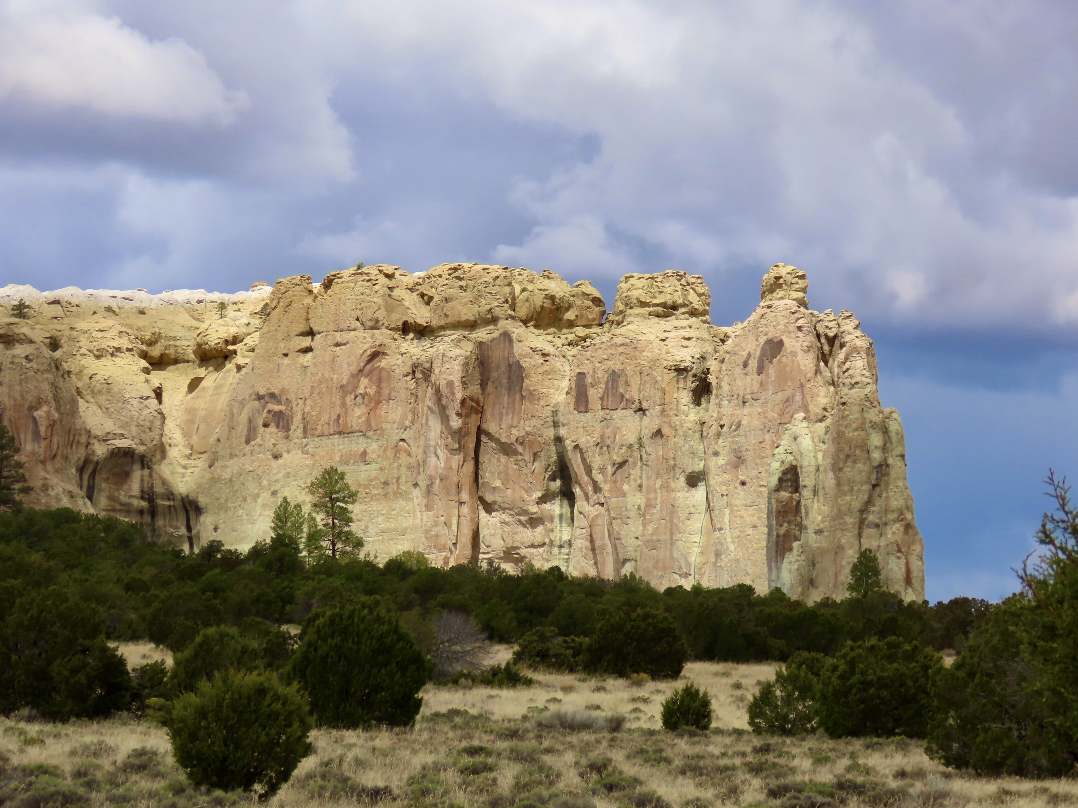
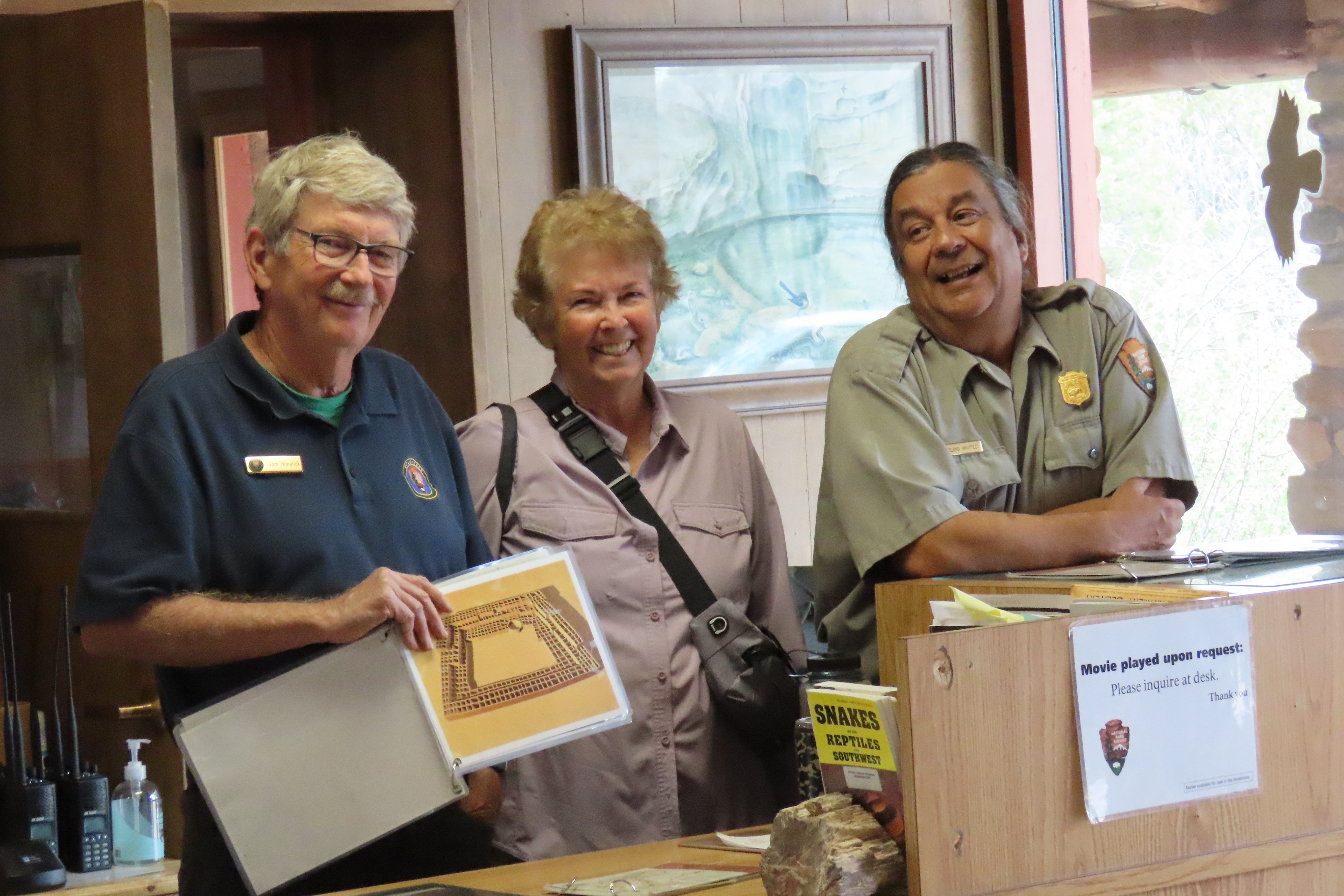
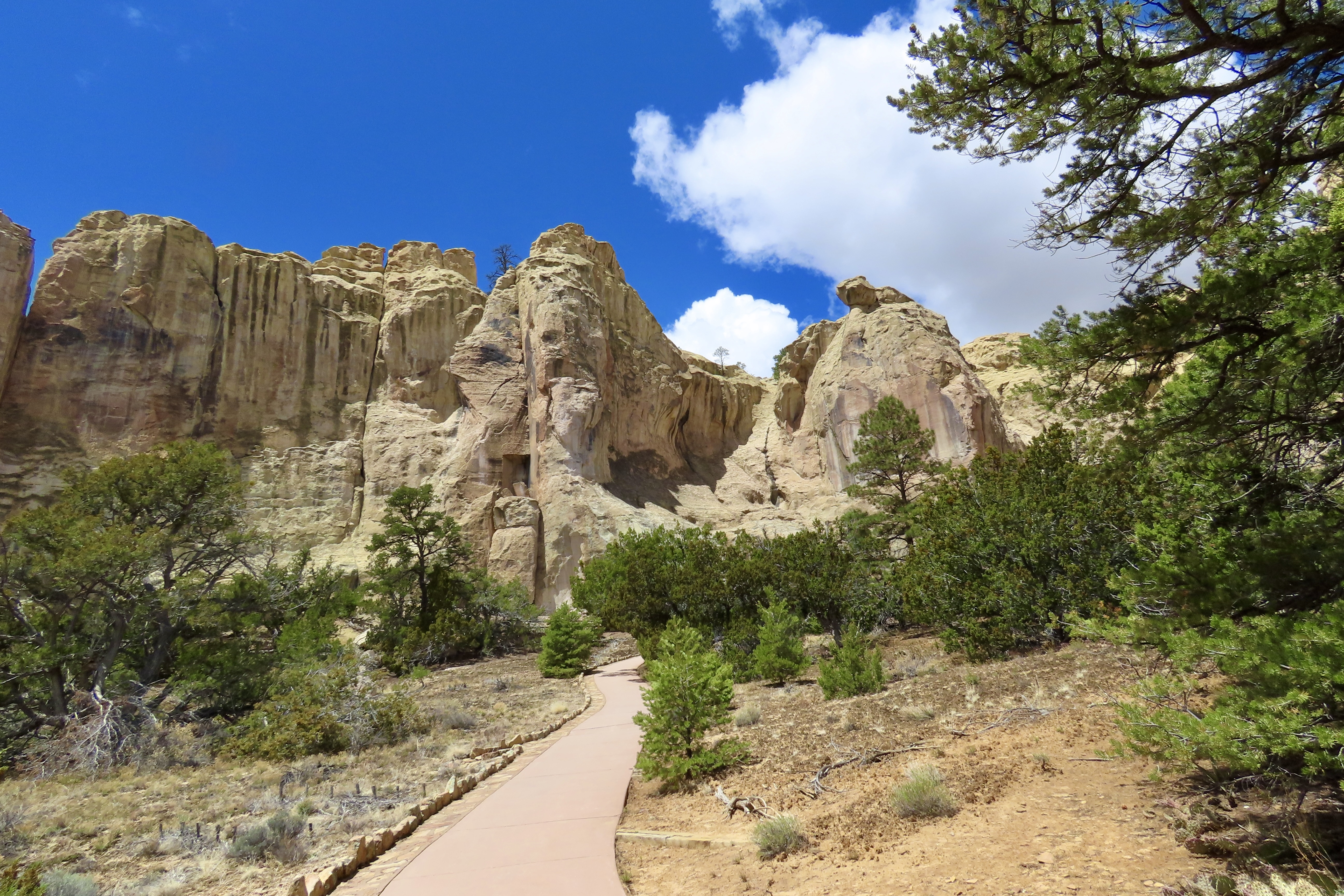
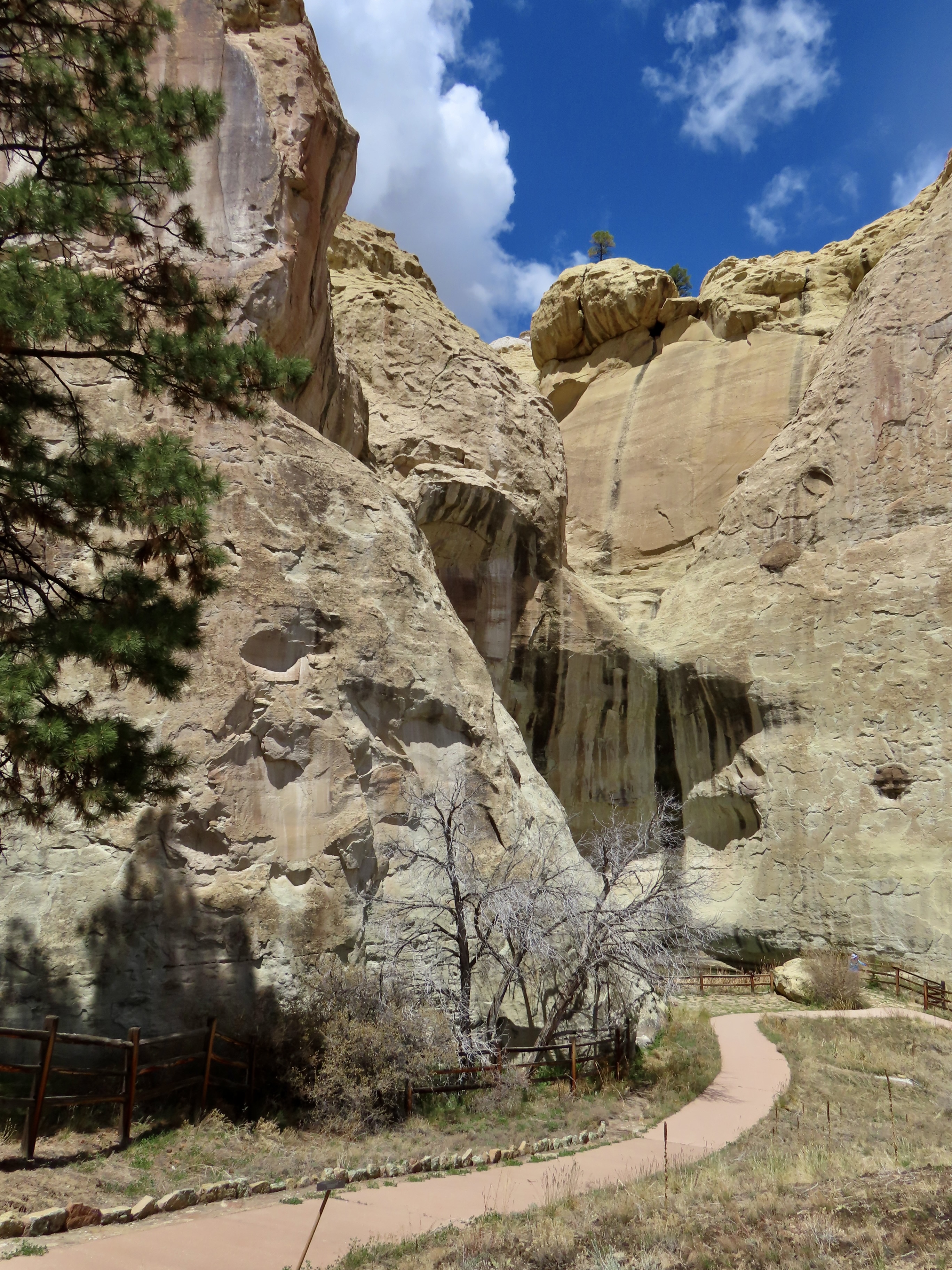
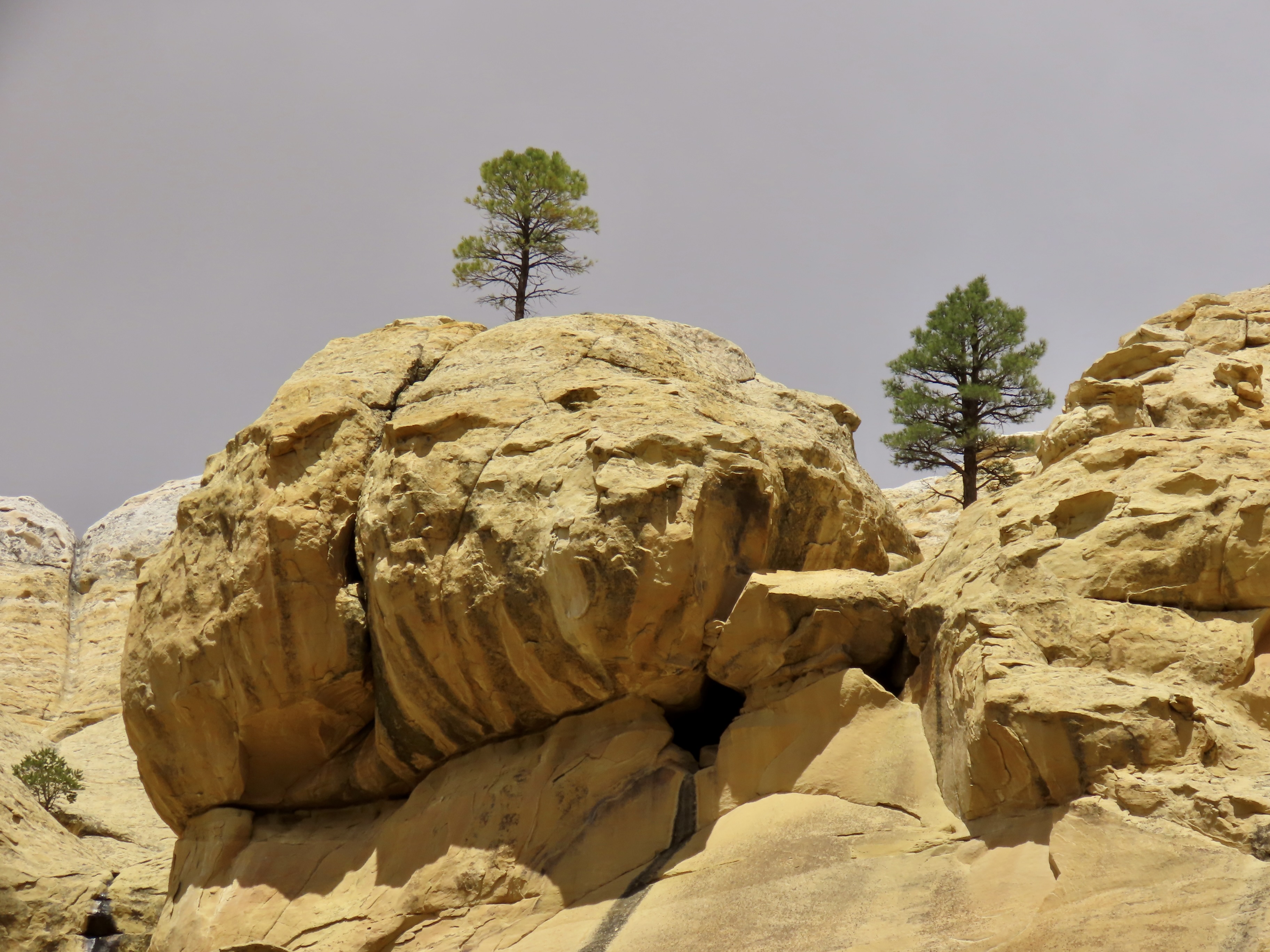
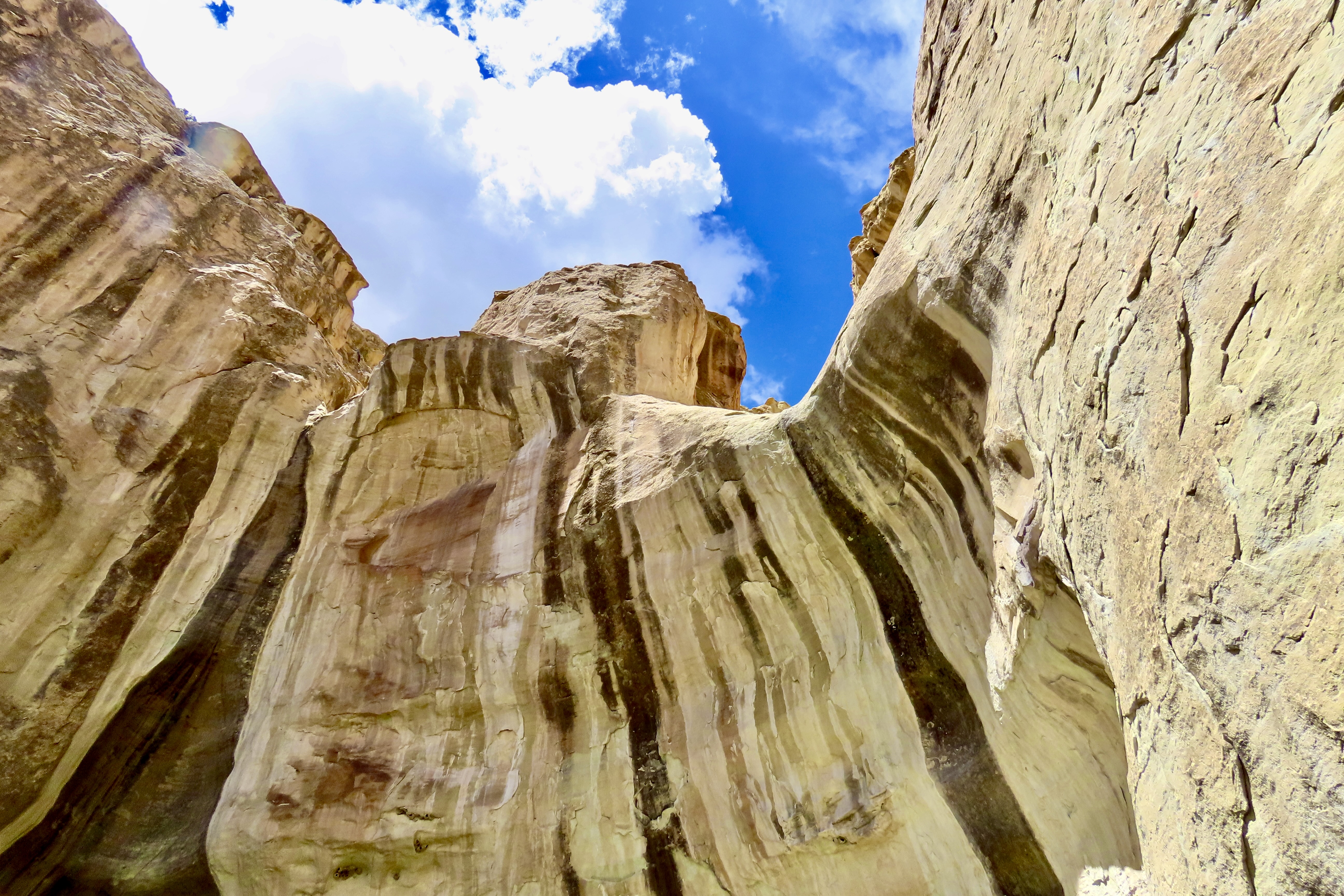
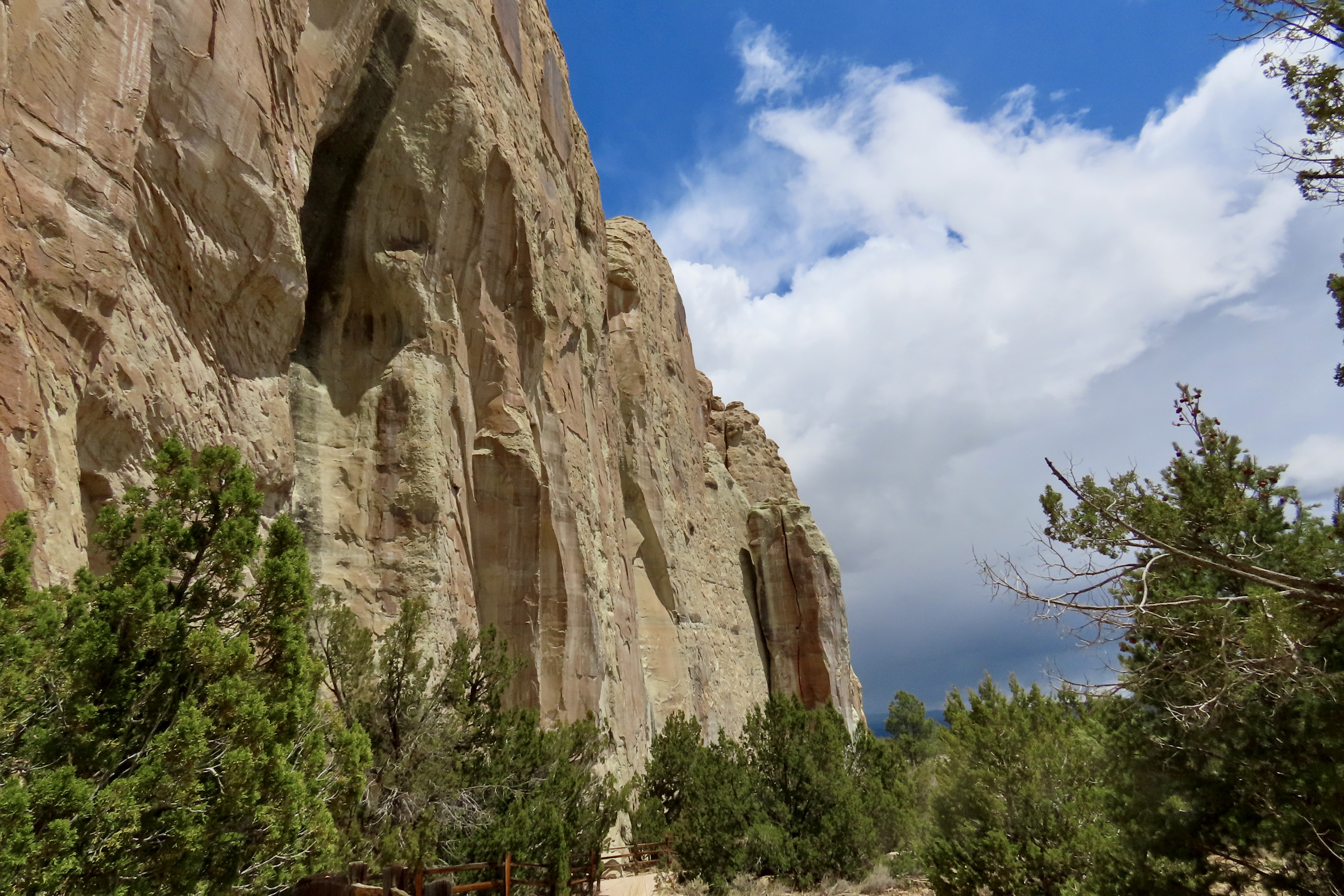
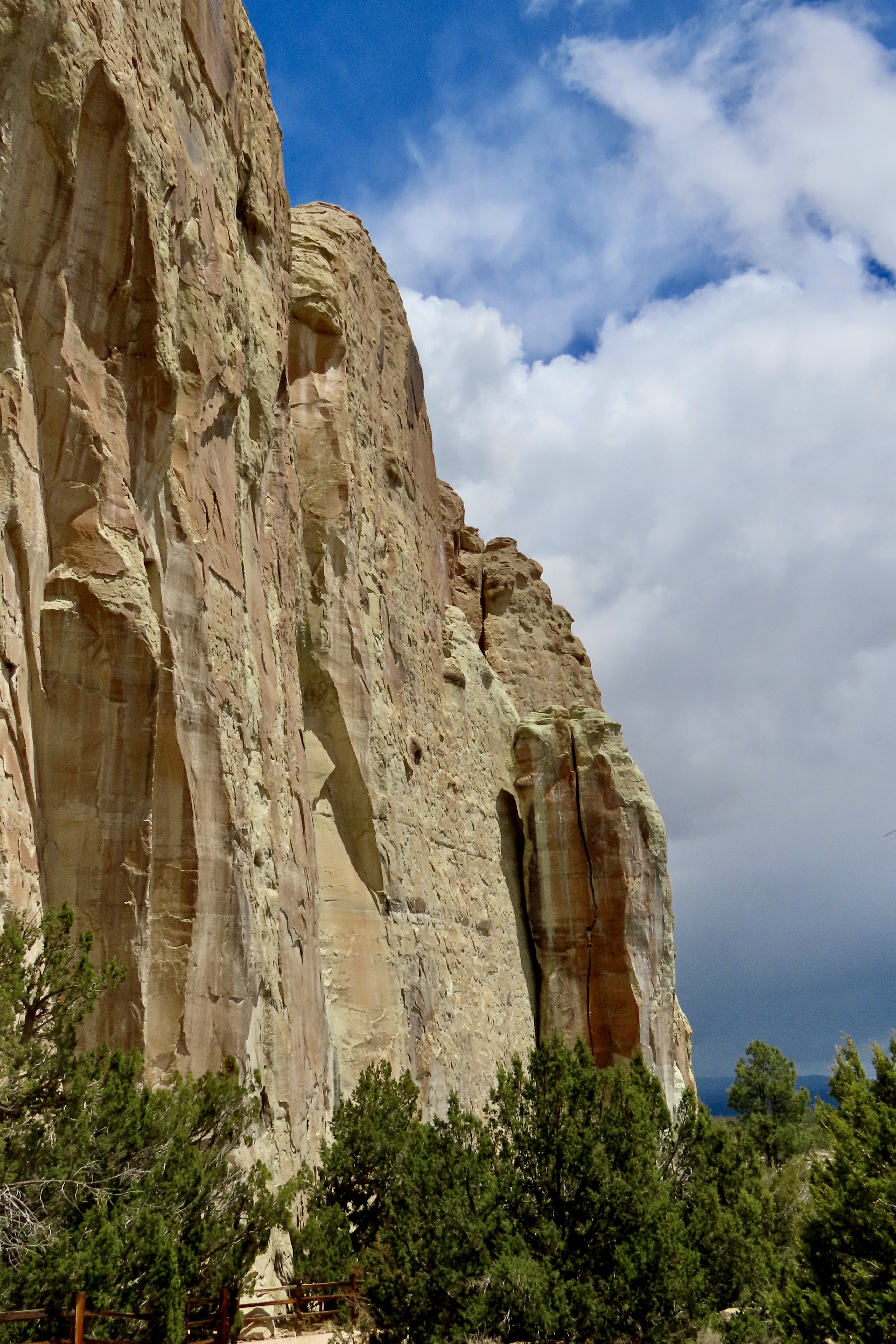
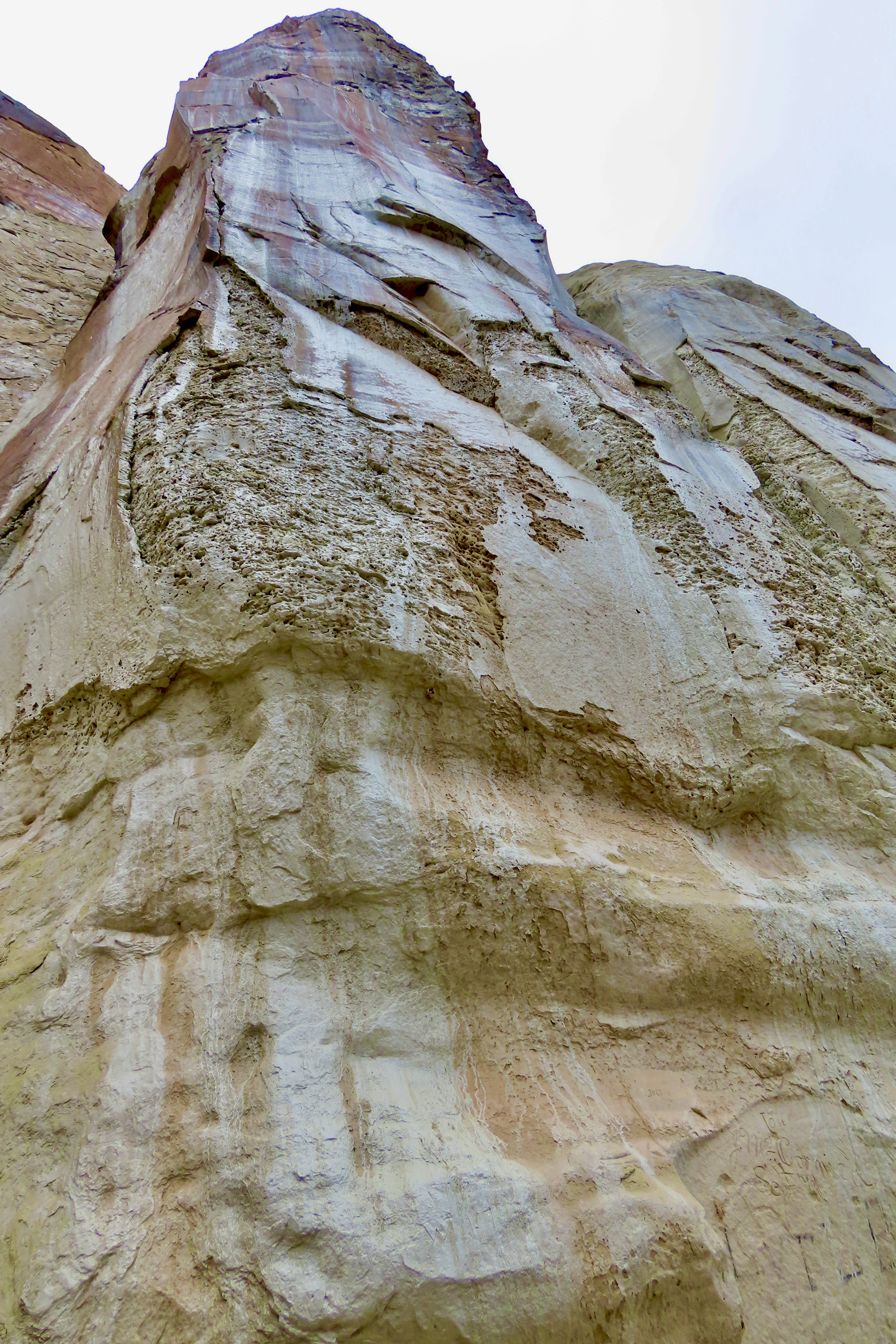
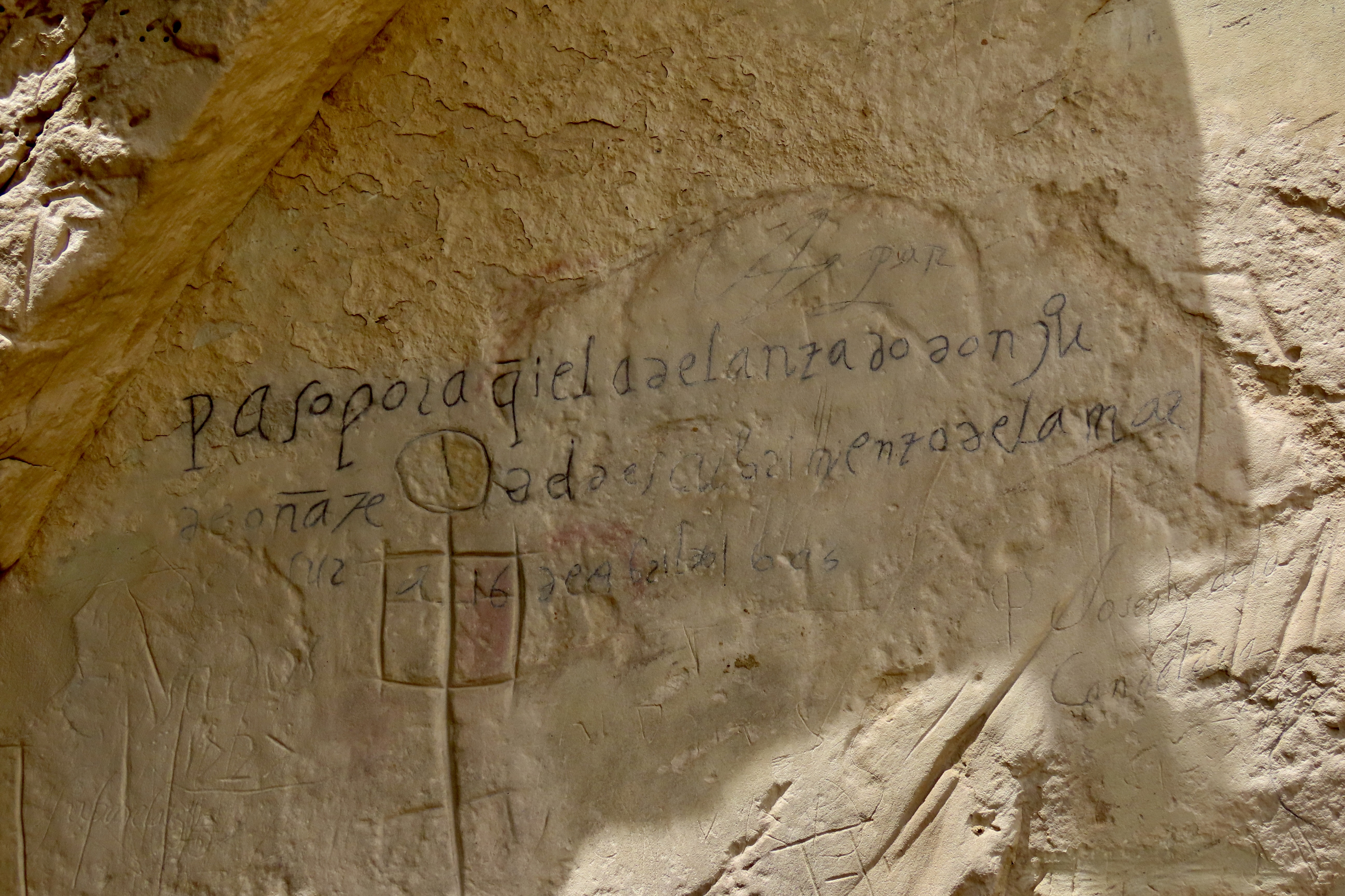
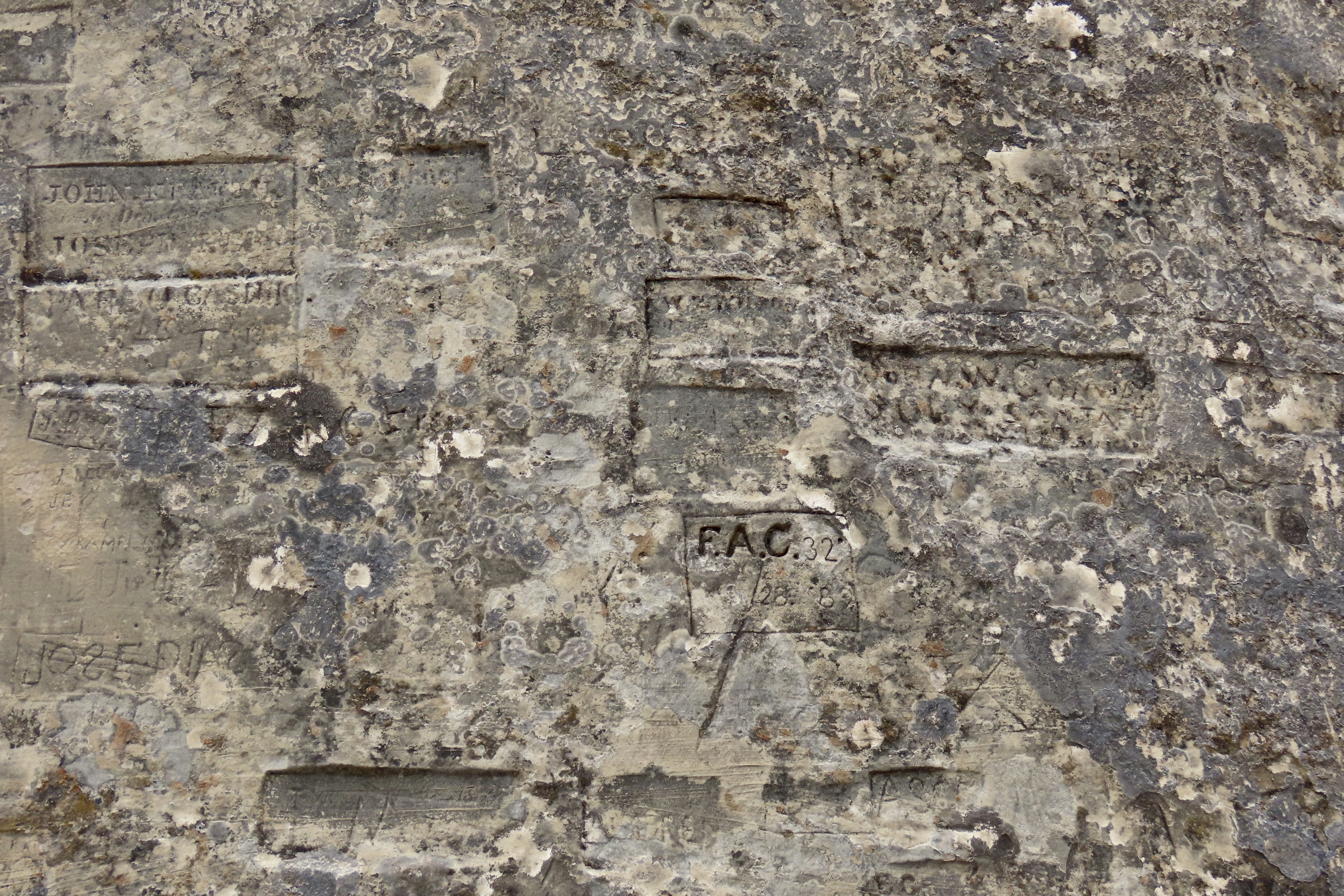
This was our view of El Morro as we approached the National Monument on Highway 53 ( the Trail of the Ancients) from Grants,New Mexico. The Spaniards gave El Morro its name, which translates as a promontory or headland. Geologically speaking, El Morro is a cuesta with a sharp, steep face on one side and a gentler slope on the other. I was interested in the white top you can see on the left (more on that later). The signatures and petroglyphs started to the left of the two Ponderosa pines where the waterhole is and extended along the base of the cliff to around the corner.Like most national park and monument visitor centers, El Morro’ was beautifully designed to fit into its environment. (Note: Peggy and I made two visits to the Monument: One to check out the petroglyphs and signatures, and two, to hike up to the top and explore the Atsinna Pueblo. That’s why our photos include cloudy and relatively clear skies.)The low profile of the building provided excellent views of the main attraction. We were eager to explore, but first we stopped at the Visitor Center…Where we were greeted by staff with welcoming smiles and a ton of information they were eager to share about the monument. Both staff and displays are vital to enhancing the national park/monument experience. The illustration is what Atsinna Pueblo on top of El Morro would like if fully excavated. Note Peggy’s new haircut. El Morro is only open five days a week. That may be because of the Trump Administration’s cuts in staff.An easy, paved trail leads from the Visitor Center over to the water hole, petroglyphs and signatures.The waterhole is at the bottom the bottom of the hill behind the fence. The cliff above the pool is about 200 feet high. A large rock with a ponderosa pine stands on top.This impressive rock monument stood to the left of the pool. We imagined an Ancestral Puebloan looking down at us.It’s hard to believe that this pool of water surrounded by cattails could play the significant role it has. But the fact that it holds up to 200,000 gallons of water and doesn’t run dry made it a treasure for everyone from the Ancestral Puebloans in the 1200s to cattlemen in the 1900s. Up until 1961, it even provided water for the monument headquarters and visitor center. At first it was thought that the water was provided by a spring. Actually it is fed by runoff from the top. The dark stains on the side (desert varnish) are left behind by minerals in the water such as manganese.I’ve always liked cattails. One of my favorite hangouts in my unsupervised youth was a small pond about 1/3 filled with cattails. When the heads reached this stage, I would break them off with a portion of their stem, shake them vigorously, and send their aerial seeds flying off in all directions!We thought looking up at the desert varnish provided an interesting perspective. I believe the section that is missing was a rockfall in 1942 that filled the waterhole and had to be cleaned out.We were quite curious about this boulder embedded in the sandstone above the spring. While the timing was off in terms of when the sandstone was created, it looked like a petrified tree stump. We were at Petrified Forest National Park last week. This was one of many petrified logs we saw.A cliff swallow’s concept of a pueblo! They make their nests above the waterhole. In addition to being a safe location, the insects that live around the waterhole provide a convenient supply of food for feeding squawking, hungry chicks.Leaving the waterhole, we hiked along the path at the base of the cliff checking out signatures along the way. (I’m saving the petroglyphs for my next post.)A close up.Looking up…I’ve selected Don Juan de Oñate to represent the many Spaniards that signed their names on the rock. He was the first. It was in 1605, 15 years before the Pilgrims landed at Plymouth Rock. Oñate was a Spanish conquistador, explorer and first Spanish governor (viceroy) of New Mexico. At some time, the signature had been written over with a black pen to make it more visible. The inscription translates “Passed by here, the adelantado Don Juan de Oñate from the discovery of the sea of the south the 16th of April of 1605.” The sea he discovered was the Gulf of California.I chose Breckinridge’s signature because he represents a fascinating footnote of American history: The US Camel Corps. In the mid 1850s a unique experiment was undertaken by the US Army to tackle problems created by the severe water shortage in crossing the Southwestern deserts. Some men were sent off to Africa to explore the possibility of using camels for transport. They came back with 33 and and 3 Arab handlers. After a period of training in Texas, a test expedition set off across the desert for LA. They passed by El Morro with Breckenridge in charge of the camels. The camels did well— much better than horses or mules. They could carry more weight, travel farther during a day, and get along without water for a significantly longer period of time. Unfortunately, the Civil War came along and the experiment was abandoned.People choose a variety of ways to display their names.Some signatures were scribbled, some quite beautiful, and some encased. Each represented a different life, a different story.The Monument has a brochure that provides information on some of the people who signed their names. RH Orton is one. He was a captain in the Federal forces during the Civil War. He may have been on his way home when he signed this. Later he would become an adjutant-general in the California National Guard. One could easily spend weeks researching the various names. I’m sure people have.
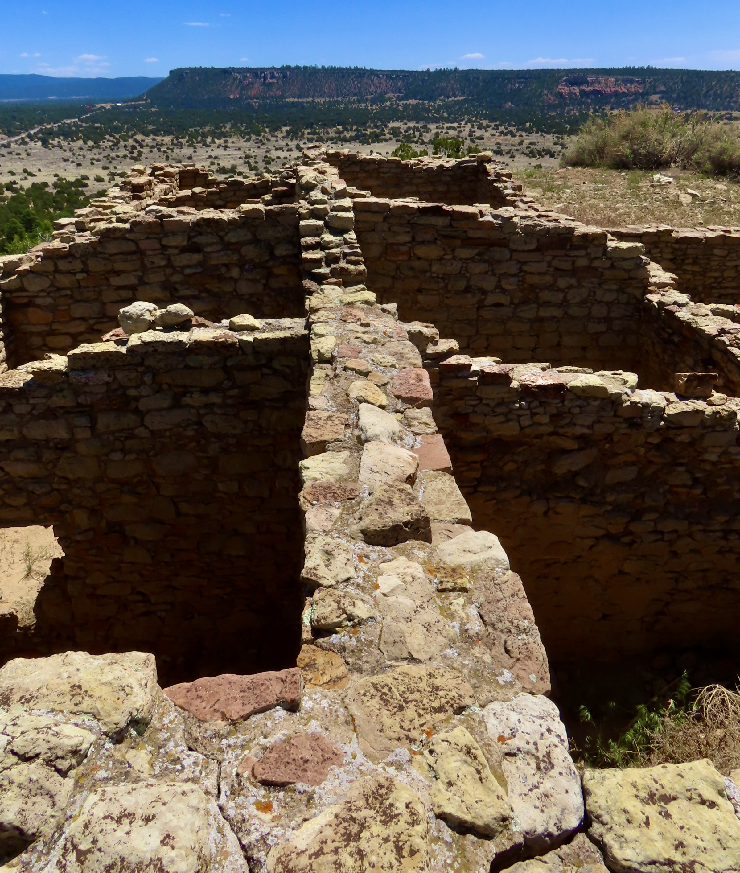
That’s it for today. Next, we will post about our trip up to the the Atsinna Pueblo and also explore the petroglyphs we found scattered among the signatures, predating them by 400 years. We will also include an interesting discussion we had with two Zuni Rangers working on the trail up to the Pueblo, Calvin and Valentino. (“I was born on Valentines Day,” Valentino told us.)Atsinna Pueblo.
17 thoughts on “El Morro National Monument… Towering Cliffs, Pueblo People, Spaniards, and Camels: Part 1”
I was really interested in this, Curt. I visited El Morro in 1964 when it was back a long dirt road from 66. There was no visitor’s center. I knew nothing about the pueblo on top. All I remember was the graffiti left by the soldiers passing by. It is so much more interesting now. I hope the pendulum will swing and Congress will recognize the value of all these places you are highlighting.
Thanks, Ray. 1964, wow! I was still at Berkeley. I didn’t make it on to Route 66 until 68. Peggy and I climb up to the top in my next post plus look at some of the petroglyphs.
I think the pendulum will swing. It always seems to, given time. Hopefully before any irreparable damage is done.
My brother lives in NM, Curt. I’ll have to make a detour on my next trip to visit El Morro. What an interesting place, not only the watering hole, but the engravings on the rocks. I hope they don’t allow modern tourists to do the same. Thanks for the photos and the history, and for the good news about the Gates of the Arctic. Thanks for sharing your travels. And nice haircut, Peggy! 🙂 I noticed it before Curt pointed it out. 🙂
The carving on the rock was stopped when El Morro became a National Monument, D, in 1906. In fact El Morro was the second National Monument in the US. Laughing about Peggy’s hair. Every few years she likes to do “something dramatic with her do.”
By all means, stop and see El Morro. Where does your sister live in New Mexico? It’s a favorite state of ours. We almost retired there instead of Oregon.
My brother lives near Albuquerque, but he loves traveling to cool spots and showing me around. I haven’t seen the bats yet, and haven’t been to White Sands. I missed the Pueblo on the last trip because it was closed to visitors for the equinox. Now I have to add El Morro to the list!
El Mapais National Monument, right next to El Morro, is also worth the drive, D. Utilize Highway 117 instead of 53 for the best views. Both can be done on a day’s drive from Albuquerque.
🙂 🙂
Another gem I knew nothing about. It certainly deserves multiple visits. The waterhole is extraordinary. I wonder if people will ever stop scratching their names into rocks?
Peggy and I are having a lot of fun going out of our way to explore areas we aren’t familiar with, Peggy, as well, of course, visiting old favorites.
I expect people will always do at least an equivalent of scratching on a rock just to say I was here, or I am, or I matter.
‘Cibolo’ caught my eye. That’s the name of a town near San Antonio, and the creek that runs through the area. I did a bit of light digging, and found this on the Texas state historical site: “Cibolo is on Farm Road 78 and Cibolo Creek, sixteen miles west of Seguin in western Guadalupe County. Cíbolo is Spanish for “buffalo.” The banks of Cibolo Creek are quite steep, and along its entire course, which is the boundary between Guadalupe and Bexar counties, there are few places where pioneers could find a safe crossing before the development of bridges. It is said that Indians stampeded buffalo over the banks to disable them so they could be slaughtered.”
And here I thought the so-called buffalo jumps were only in other states (and Canada)! Here’s a bit of even older history about Cibolo, Texas.
Curios, about cibola, Linda, I did some further light research. The legend is what inspired the Spanish king to send Coronado scurrying throughout the Southwest, with Cibola the name given to the various pueblo tribes and their cities. I also read that the Spaniards also gave the name to various tribes that hunted buffalo? One way or the other it appears Cibola and buffalo were tied together.
Interesting on the buffalo jumps. I could also see that buffalo jump might have included drowning since the steep banks would have impeded climb out, leading to panicking and trampling each other.
Wonderful photos and narrative, Curt and Peggy, in this first half of El Morro. I enjoyed the history and anecdotes and this beautiful place on earth. The photos were fantastic, told a good story, and even with their enormous height you were able to capture them.
Thanks, Jet. Appreciated. Peggy and I have been having fun exploring places we’ve never been. Given how much we’ve spent wandering in the Southwest, I’ve been surprised by the jewels we’ve missed.


I was really interested in this, Curt. I visited El Morro in 1964 when it was back a long dirt road from 66. There was no visitor’s center. I knew nothing about the pueblo on top. All I remember was the graffiti left by the soldiers passing by. It is so much more interesting now. I hope the pendulum will swing and Congress will recognize the value of all these places you are highlighting.
Thanks, Ray. 1964, wow! I was still at Berkeley. I didn’t make it on to Route 66 until 68. Peggy and I climb up to the top in my next post plus look at some of the petroglyphs.
I think the pendulum will swing. It always seems to, given time. Hopefully before any irreparable damage is done.
Fascinating. Great pictures, I especially like the trees growing out of the rocks.
Peggy looks like she’s right at home and could be part of the tour guide. Was that you on the left Curt?
Spectacular shots and the colors and angles of these rock foundations are surreal along with the petroglyph’s!
Loved it all! 🙌🏽
“Was that you on the left Curt?” No, Cindy, but we had commented on the similarity.
Thanks. It was both photogenic and interesting!
My brother lives in NM, Curt. I’ll have to make a detour on my next trip to visit El Morro. What an interesting place, not only the watering hole, but the engravings on the rocks. I hope they don’t allow modern tourists to do the same. Thanks for the photos and the history, and for the good news about the Gates of the Arctic. Thanks for sharing your travels. And nice haircut, Peggy! 🙂 I noticed it before Curt pointed it out. 🙂
The carving on the rock was stopped when El Morro became a National Monument, D, in 1906. In fact El Morro was the second National Monument in the US. Laughing about Peggy’s hair. Every few years she likes to do “something dramatic with her do.”
By all means, stop and see El Morro. Where does your sister live in New Mexico? It’s a favorite state of ours. We almost retired there instead of Oregon.
My brother lives near Albuquerque, but he loves traveling to cool spots and showing me around. I haven’t seen the bats yet, and haven’t been to White Sands. I missed the Pueblo on the last trip because it was closed to visitors for the equinox. Now I have to add El Morro to the list!
El Mapais National Monument, right next to El Morro, is also worth the drive, D. Utilize Highway 117 instead of 53 for the best views. Both can be done on a day’s drive from Albuquerque.
🙂 🙂
Another gem I knew nothing about. It certainly deserves multiple visits. The waterhole is extraordinary. I wonder if people will ever stop scratching their names into rocks?
Peggy and I are having a lot of fun going out of our way to explore areas we aren’t familiar with, Peggy, as well, of course, visiting old favorites.
I expect people will always do at least an equivalent of scratching on a rock just to say I was here, or I am, or I matter.
Stunning…..
‘Cibolo’ caught my eye. That’s the name of a town near San Antonio, and the creek that runs through the area. I did a bit of light digging, and found this on the Texas state historical site: “Cibolo is on Farm Road 78 and Cibolo Creek, sixteen miles west of Seguin in western Guadalupe County. Cíbolo is Spanish for “buffalo.” The banks of Cibolo Creek are quite steep, and along its entire course, which is the boundary between Guadalupe and Bexar counties, there are few places where pioneers could find a safe crossing before the development of bridges. It is said that Indians stampeded buffalo over the banks to disable them so they could be slaughtered.”
And here I thought the so-called buffalo jumps were only in other states (and Canada)! Here’s a bit of even older history about Cibolo, Texas.
Curios, about cibola, Linda, I did some further light research. The legend is what inspired the Spanish king to send Coronado scurrying throughout the Southwest, with Cibola the name given to the various pueblo tribes and their cities. I also read that the Spaniards also gave the name to various tribes that hunted buffalo? One way or the other it appears Cibola and buffalo were tied together.
Interesting on the buffalo jumps. I could also see that buffalo jump might have included drowning since the steep banks would have impeded climb out, leading to panicking and trampling each other.
Wonderful photos and narrative, Curt and Peggy, in this first half of El Morro. I enjoyed the history and anecdotes and this beautiful place on earth. The photos were fantastic, told a good story, and even with their enormous height you were able to capture them.
Thanks, Jet. Appreciated. Peggy and I have been having fun exploring places we’ve never been. Given how much we’ve spent wandering in the Southwest, I’ve been surprised by the jewels we’ve missed.