I couldn’t help but think of William Least Heat-Moon’s book, Blue Highways, this morning. If you have read his classic travel adventure, you will remember that he would go out of his way to find small towns with unusual names, like Dime Box, Texas. We are in Accident, Maryland today and I’m pretty sure it meets Heat-Moon’s classification of an unusual name. I was also amused to learn that people from the town are called Accidentals. I feel a connection. My parents always told me that I was an accident.
This is the last stop on the first segment of our full time travels. Tomorrow we will arrive at our daughter Tasha, her husband Clay and our grandsons Ethan and Cody’s home in Waterford, Virginia outside of Washington DC. They have an attached efficiency apartment that they are insisting that we use as our base. It’s Tasha’s way of assuring that we will be around on occasion. It will take a few weeks to set up the apartment, but first we will be dashing off on our Rhine River Cruise.
In the meantime, I will keep the posts from our national park and monument visits in the Southwest rolling out. After Zion there is Bryce, Escalante, the North Rim of the Grand Canyon, and Mesa Verde plus our other adventures along the way. I have enough to produce posts until we are once again on the road. More than enough! On the small chance I run out, there is the Rhine River Cruise. 🙂

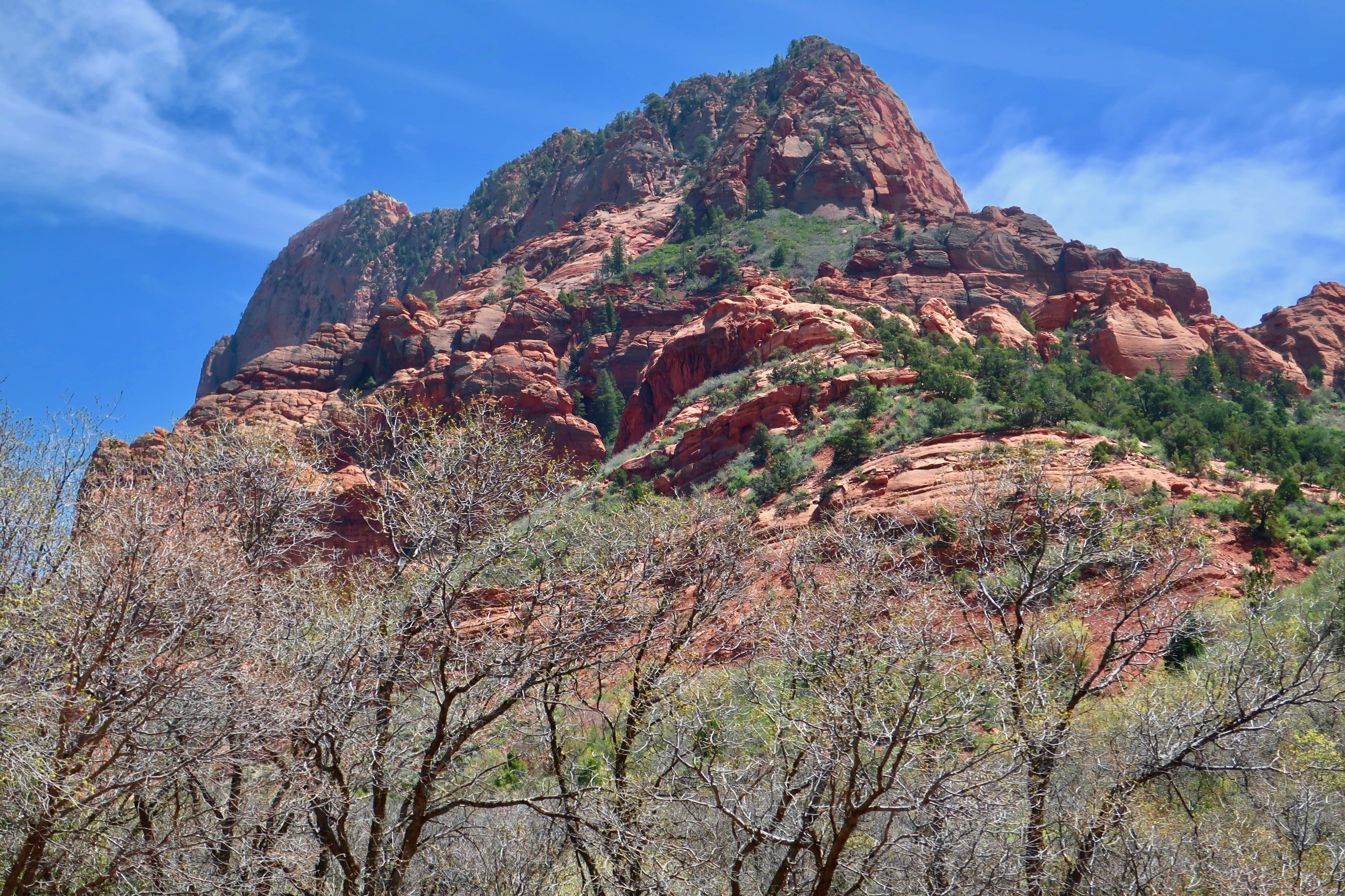
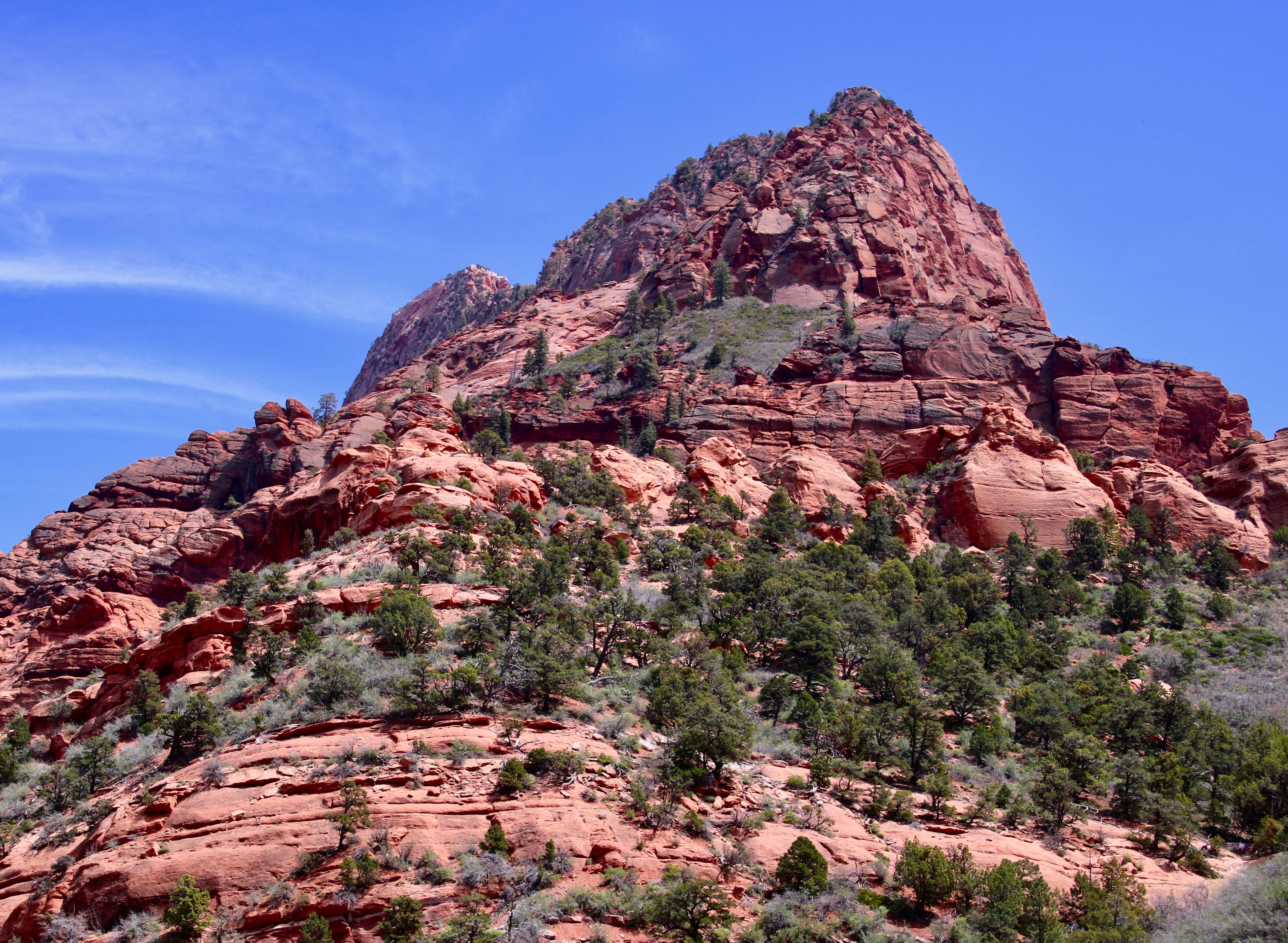
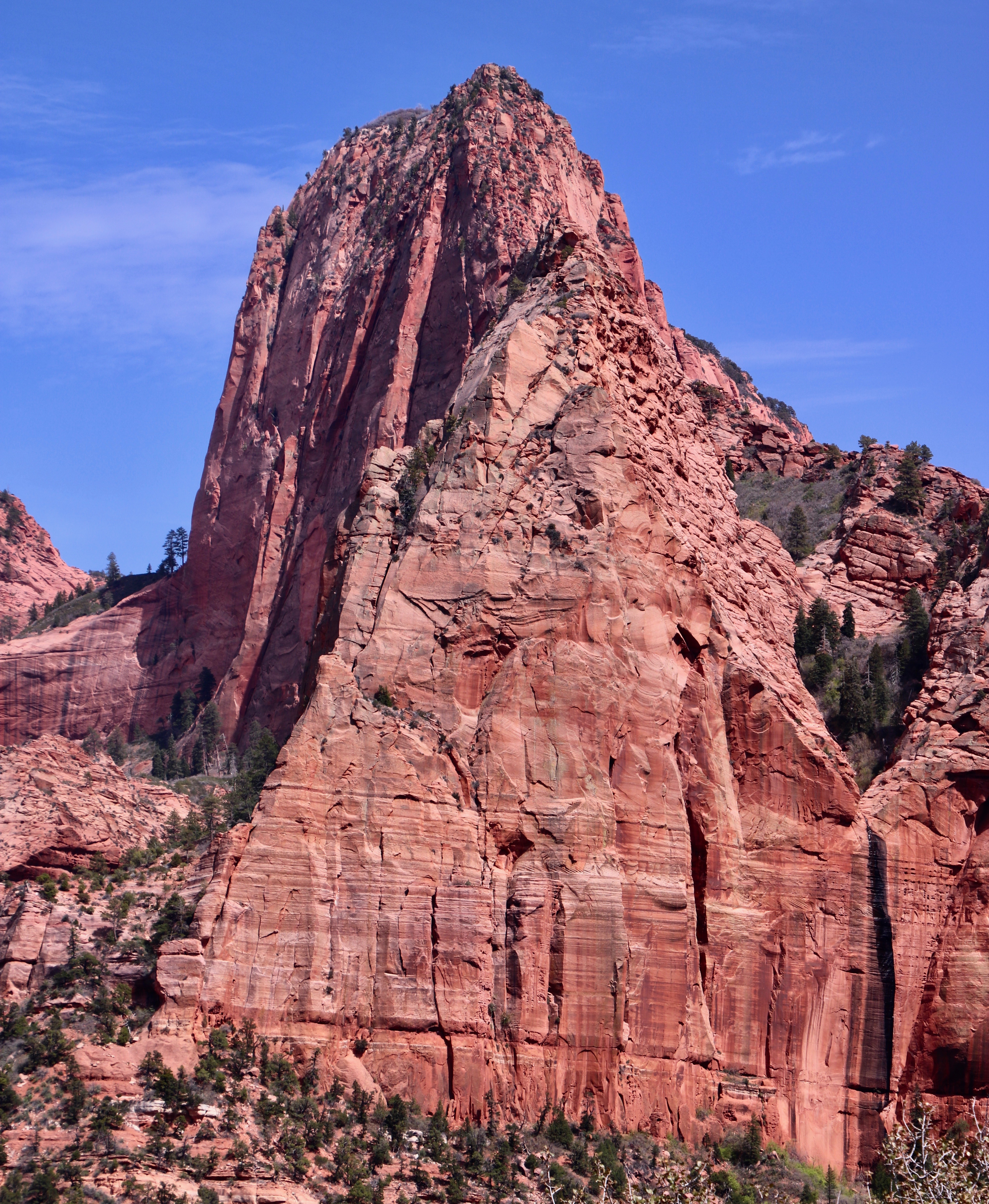
Zion National Park promotes Kolob Canyons as its best kept secret. Other web sites follow a similar theme. It’s not surprising considering that the canyons are located in the remote northwestern section of the Park, 45 miles away from Zion’s main attraction.
Given the distance, many people ask is whether it’s worth taking half a day to visit. (This assumes they are even aware that this section of the Park exists.) Peggy and I would like to answer with a resounding yes! It meets our three criteria: It’s unique, beautiful, and not crowded. There are also a number of hikes visitors can take that we couldn’t squeeze in. A fairly challenging one provides hikers with a view of the world’s second longest arch. Next time.
The curvy five-mile drive climbs a thousand feet. It can be accomplished in a relatively short amount of time, but— if you are like us— you will want to linger and admire the fantastic views of towering Navajo Sandstone cliffs and deep finger canyons created by runoff from the plateau above. There are a number of pullouts along the way. Each one provides a different view or perspective and each is worth a stop. The following photos reflect what Peggy and I saw.

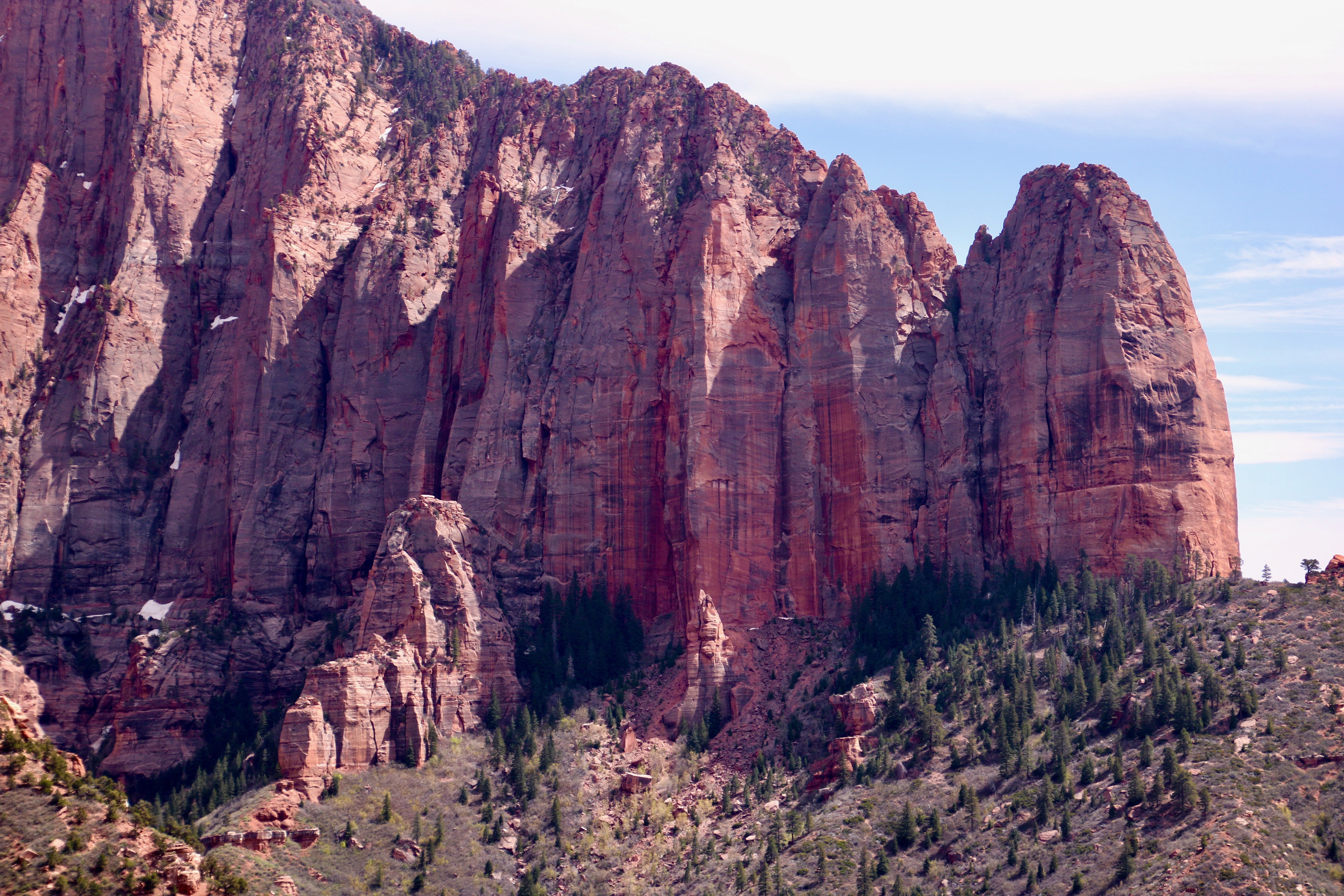


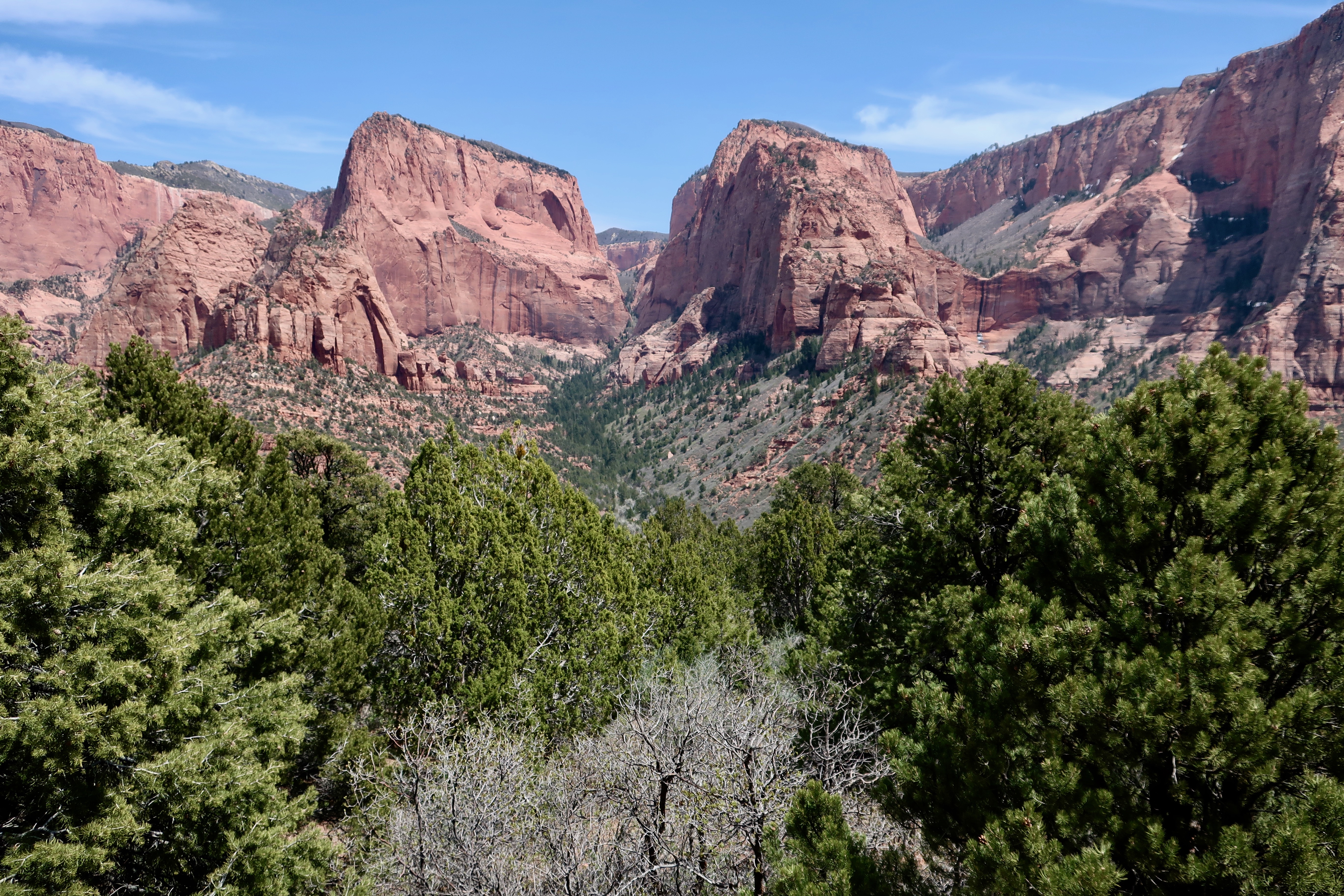
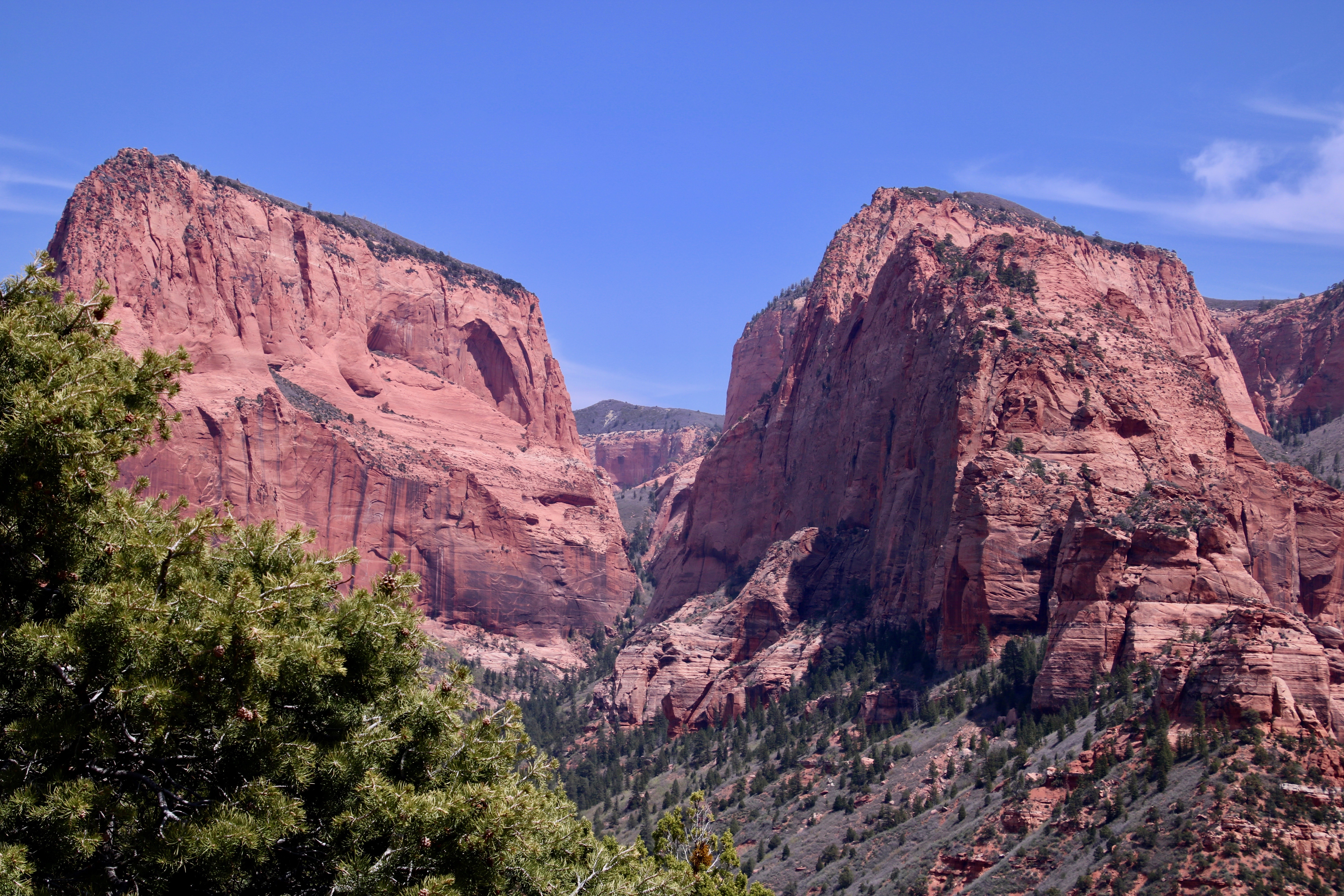

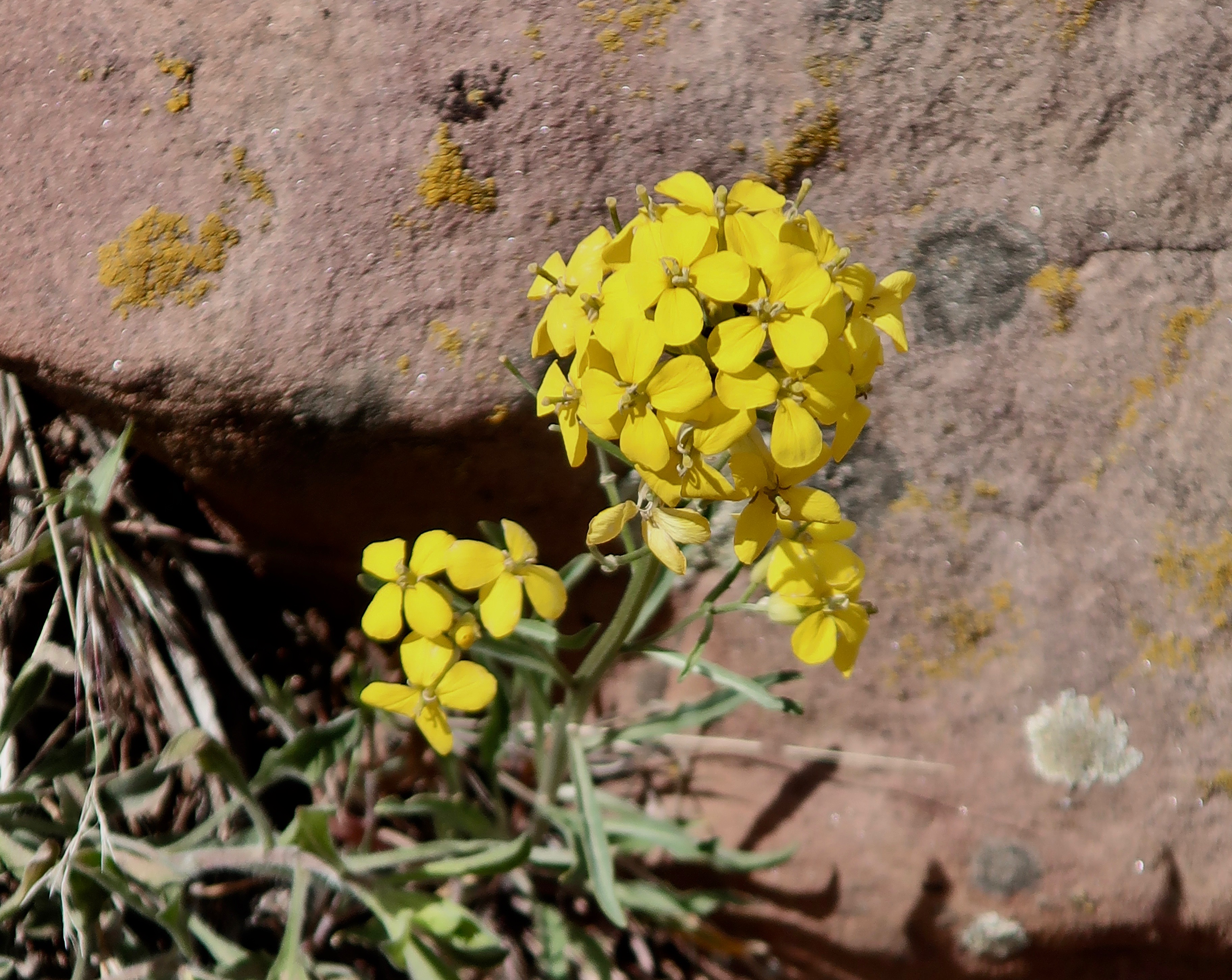
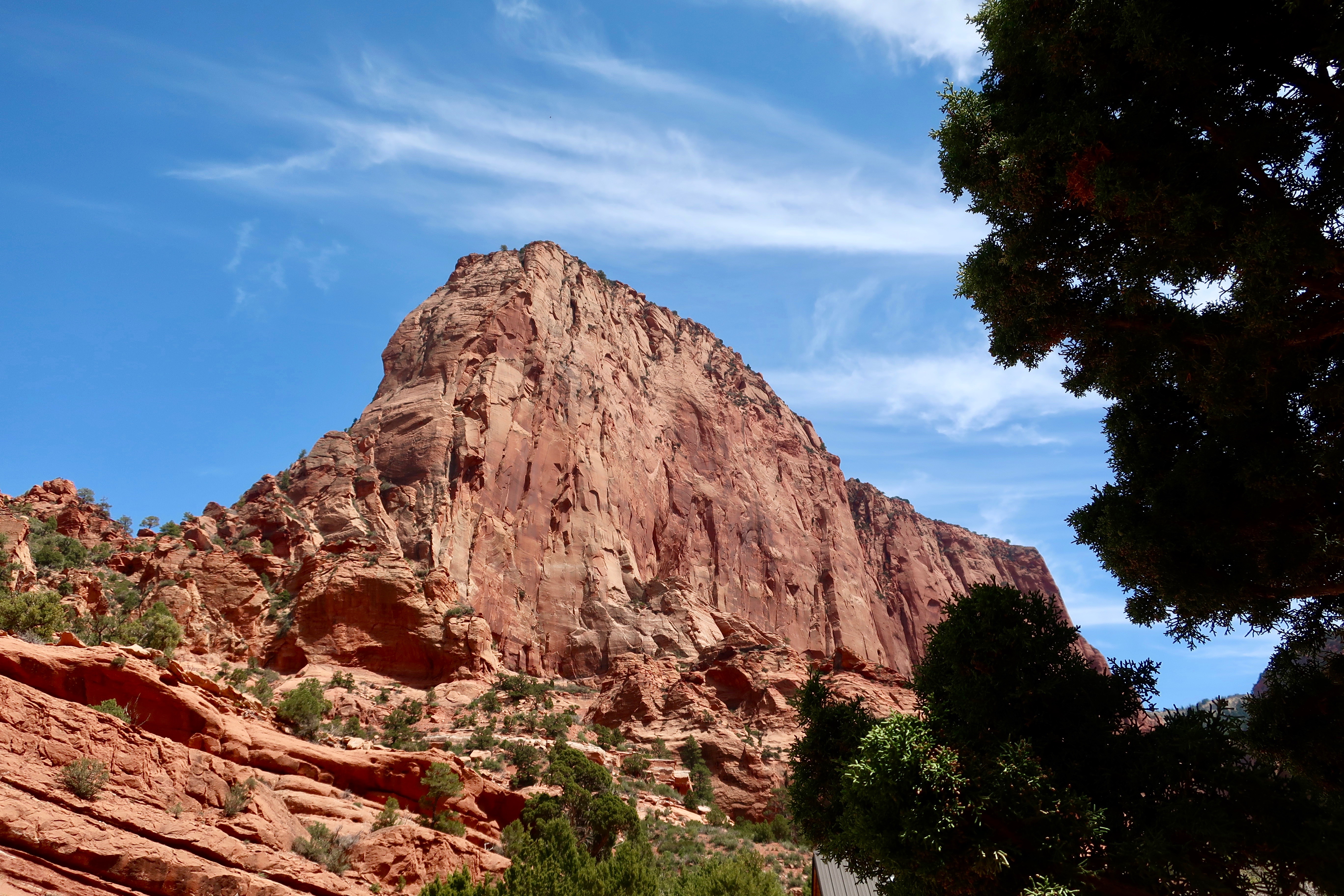
Some other views of the Kolob Canyons from our visit:

All the photos are amazing. To think such places have been undergoing change since long before man!
For a few billion years. Grin!
Ha! I’ve been to Dime Box. As a matter of fact, one of my seminary classmates ended up as the pastor of the Lutheran church there for a time. And, yes: Blue Highways is a treasure. I used it as a reference the year I spent a couple of weeks in and around Chase County, on the hunt for various prairies — and a lot of horizon. Have you read any of his other books? I thought The Roads to Quoz was equally good, and it comes with the delightful tagline of “An American Mosey.”
This area is gorgeous, but I can’t help wondering what the temperatures were when you were there. Right now, all I can think is how beastly hot it could be in summer — but of course you may have missed all that. You were smart to make a dash for the east coast — and think of all those poor people who’d planned a trip to Yellowstone. Whoops!
Fun about Dime Box.As I recall, Heat-Moon got a haircut there. Both books are in our library, Linda. In the past, as we wandered the country, I always enjoyed crossing paths with where ‘Blue Highways’ traveled. Also Steinbeck’s ‘Travels with Charley.’ I should read ‘Quoz’ again.
We were lucky with the weather, mainly avoiding the major storms and the worst of the heat and humidity. We did have a few days of the latter, plenty for us to have empathy for the folks having to suffer through the worst of it. Humidity is something I have to get used to again.
The Southwest and Texas are best avoided in the summer. 🙂 Most of our visits over the years have been in the fall, winter and spring. We were right on the edge of summer this time. We’d planned on dipping into Texas, but when we saw the projected heat wave, quickly changed our plans— one of the nice things about our gypsy style of life.
Great post and glad you took the time to explore all those treasures.
We’ve had a blast, Gerard, going to slightly out of ways places. Thanks.–Curt
Glad you decided to share ZionNP secrets😊 it looks like you had great weather, the shots are fantastic! Safe travels! Christie
Thanks, Christie! One of our goals in travel is to share areas of National Parks and other beautiful areas that people might miss when visiting the ‘prime’ attractions of the area. –Curt
Impressive place. Looks like you had pretty weather for it too, those blue skies and white clouds set off the reds and browns nicely.
Great weather, Dave. Assuming there isn’t smoke from forest fires, the Southwest is famous for its blue skies. –Curt
A rock-lover’s paradise. It’s hard to capture the majesty of these monuments. Beautiful photos.
Thanks, D. Rock lover’s paradise is a good description of the Southwest! Lots more coming… –Curt