As we noted in last week’s post, our 2025 wrap-up is based on three trips we made during the year and blogged about. The first was Hawaii, which I posted last Monday. Today’s post features our Southwest journey where we wandered through the Southwestern US for five months visiting national parks, state parks, and national monuments. Next week’s post will cover our three week leaf-peeping trip through New England in the fall.
The photos used in the three posts are all from ones we selected to include in three calendars we developed for our extended family, each focused on one of out trips. (Not all of the photos here made it into the calendars, but it was a flip-of-the-coin type decision.)
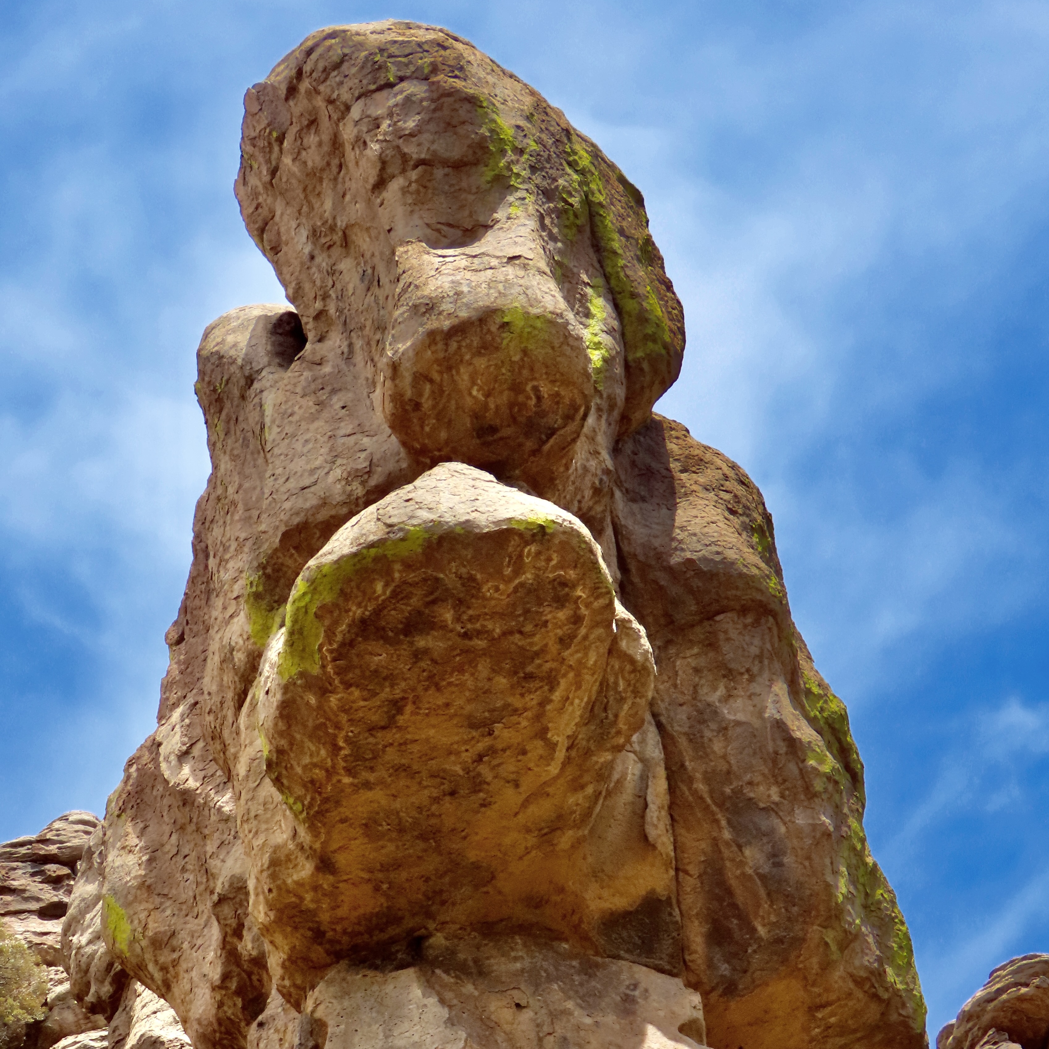
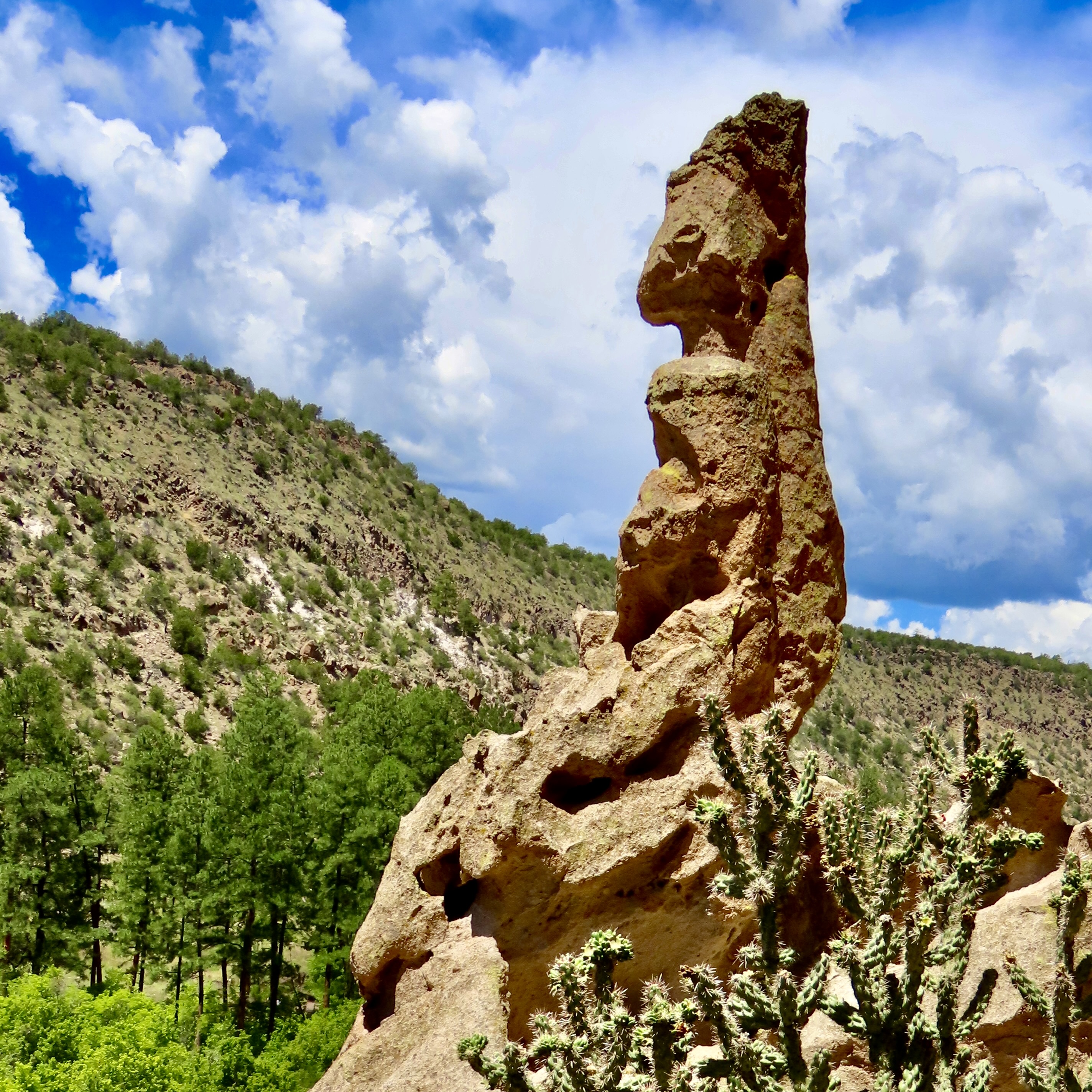
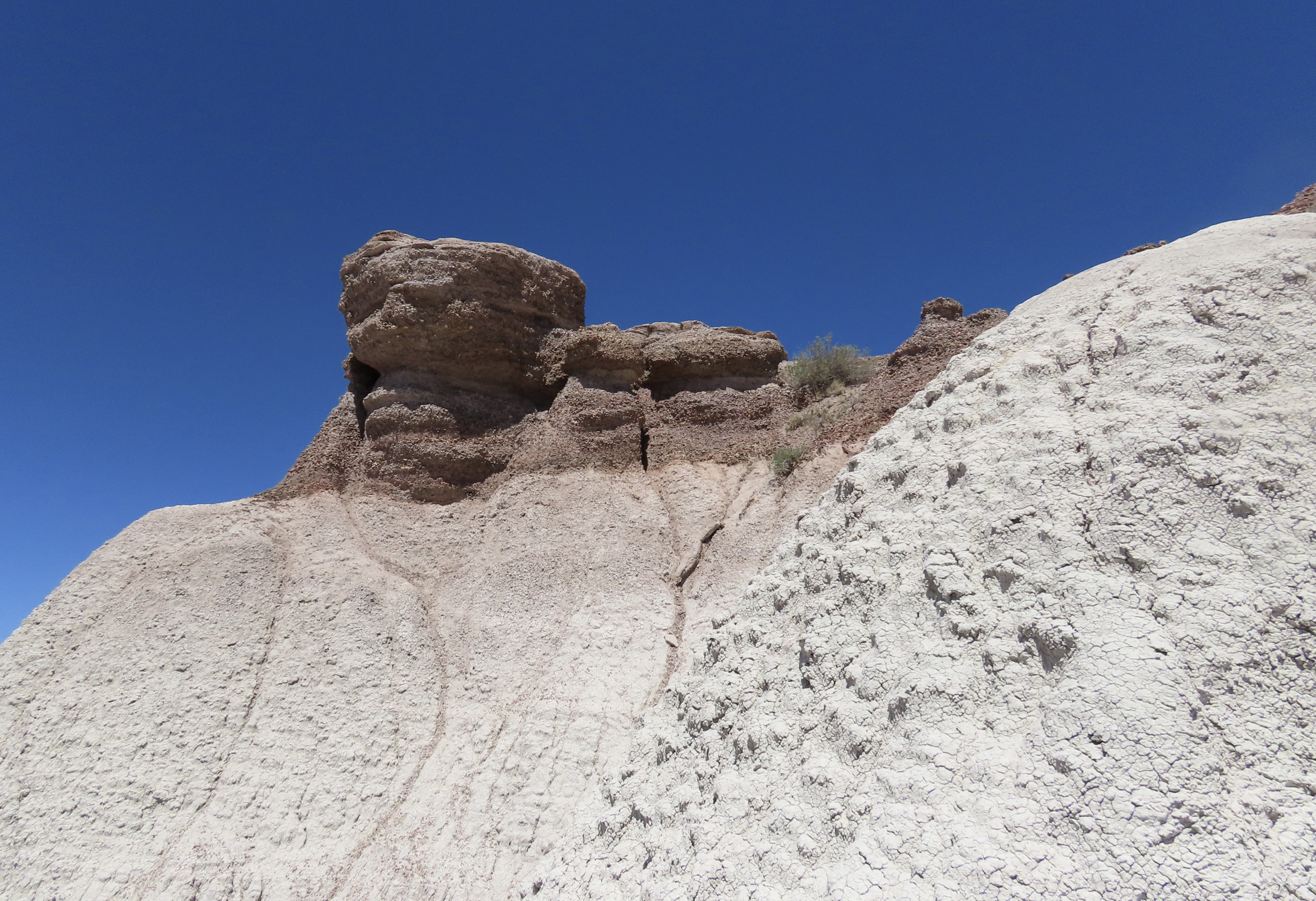
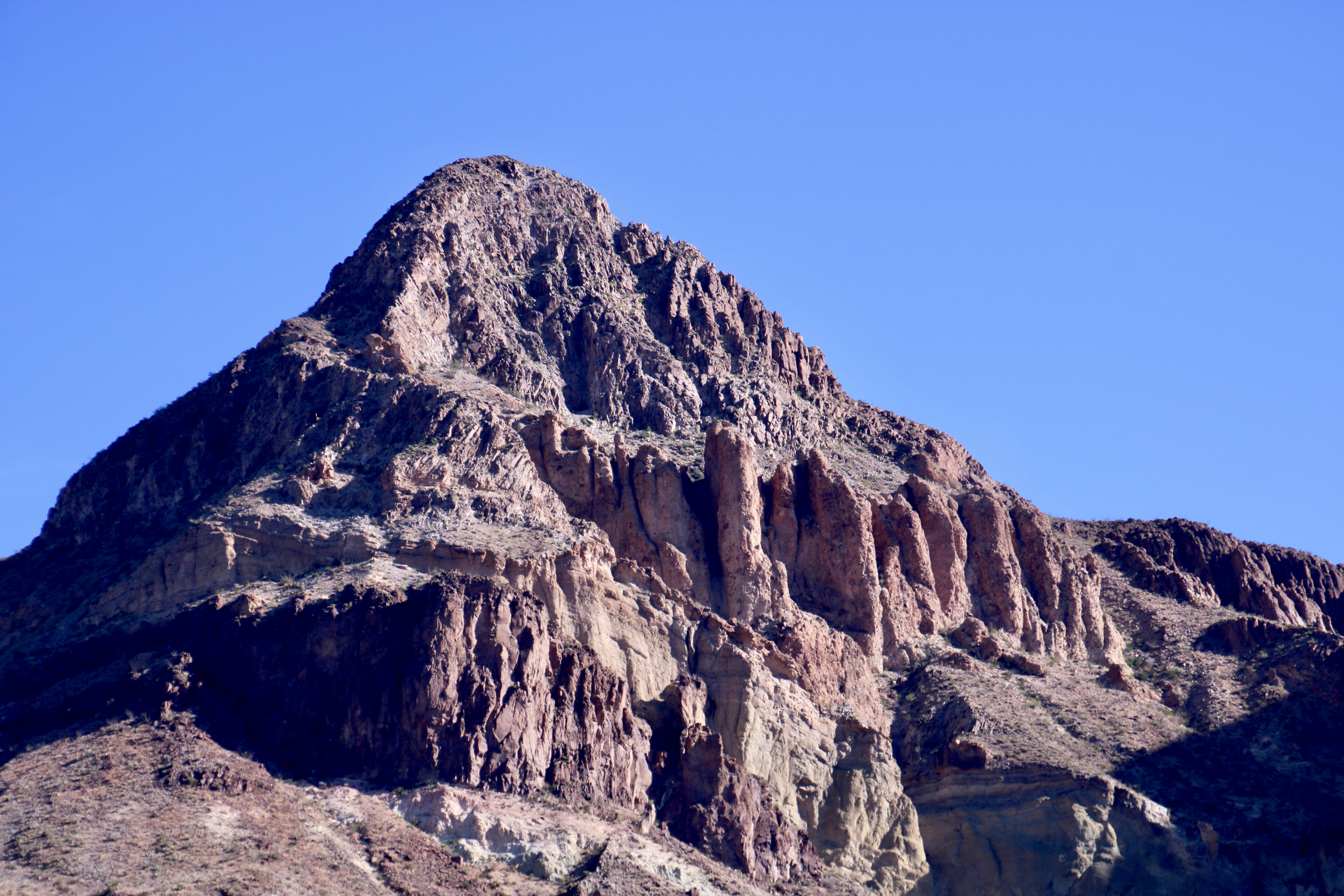
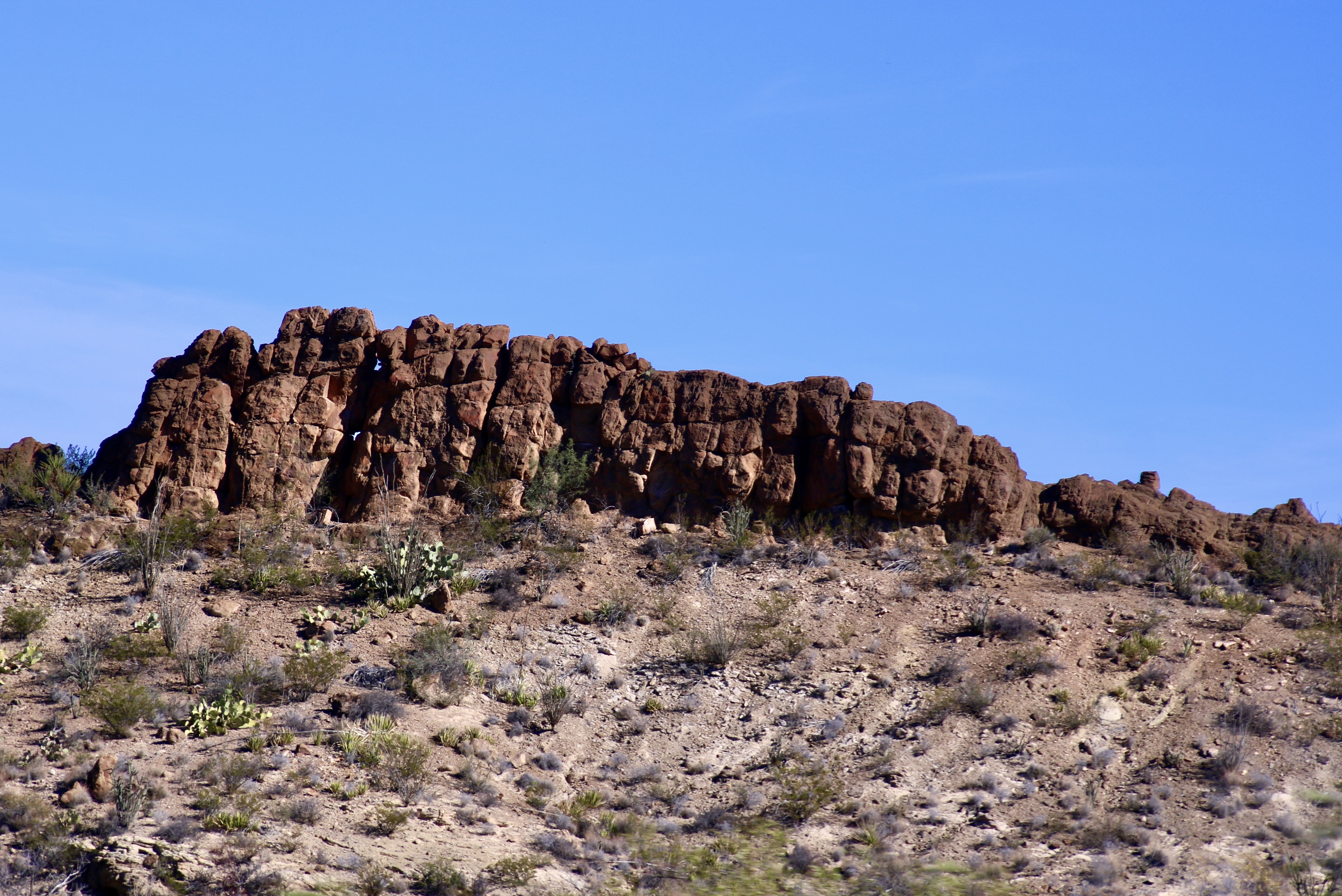
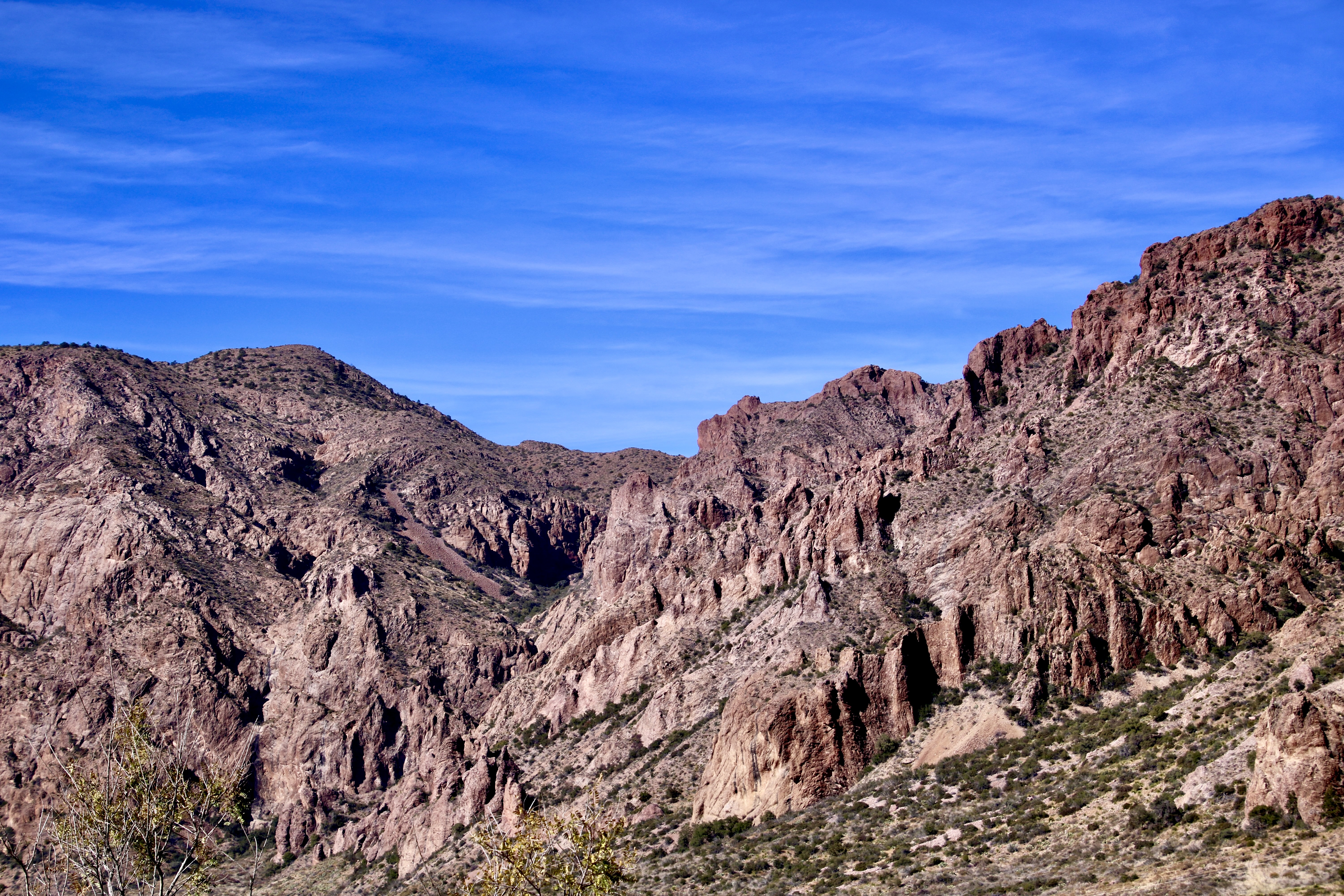
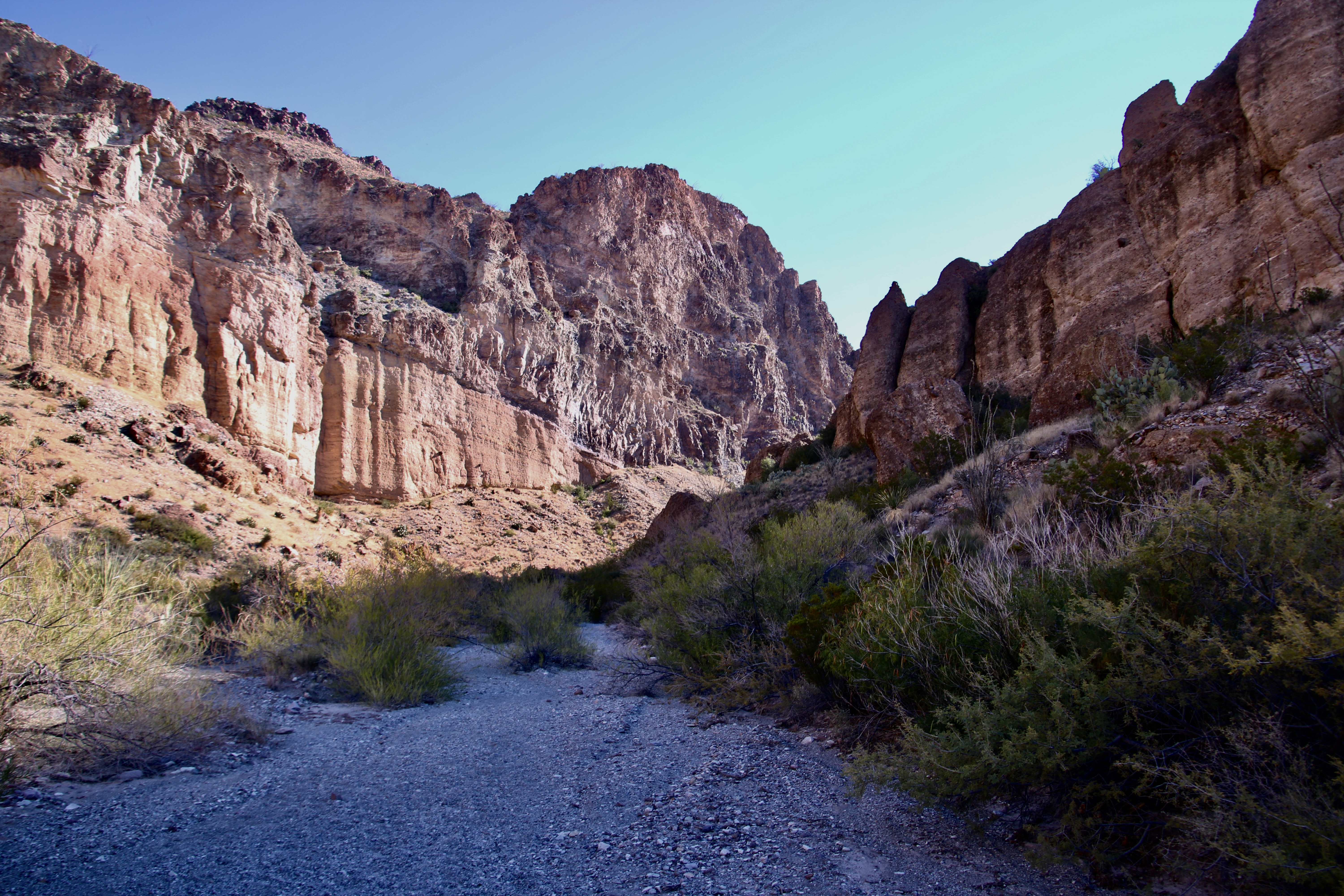
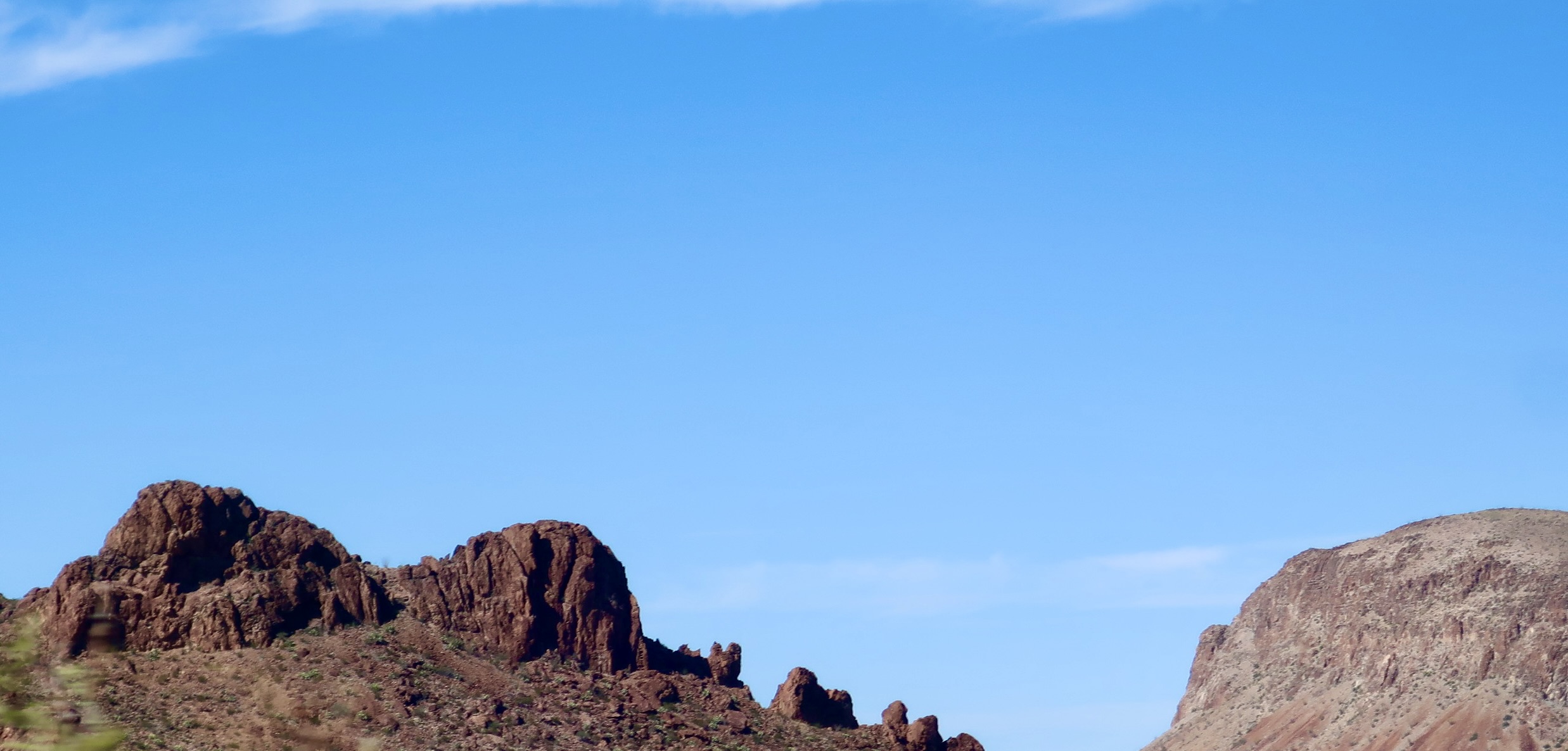
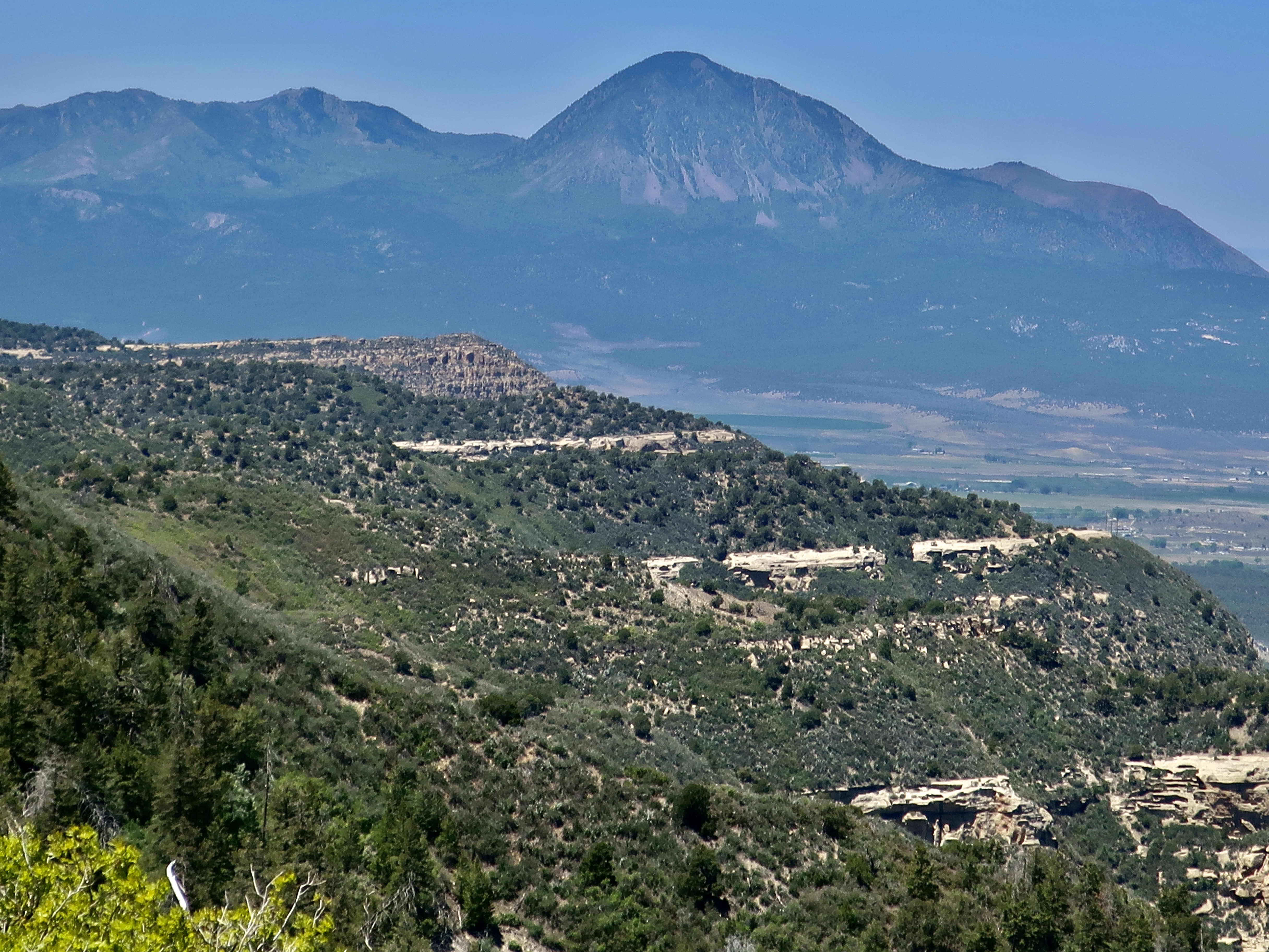
We discovered the towering rock above in Chiricahua National Monument, which is located in southeastern Arizona. The monument is named after the Chiricahua Apaches who roamed the area prior to it being occupied by pioneers from the eastern US. A couple of notes. One, the park is filled with a fascinating variety of rock structures. Two, we have discovered over the years that national monuments often include scenery, geology, history, plants and animals that easily match those found in national parks. They are definitely worth visiting and are usually far less crowded.
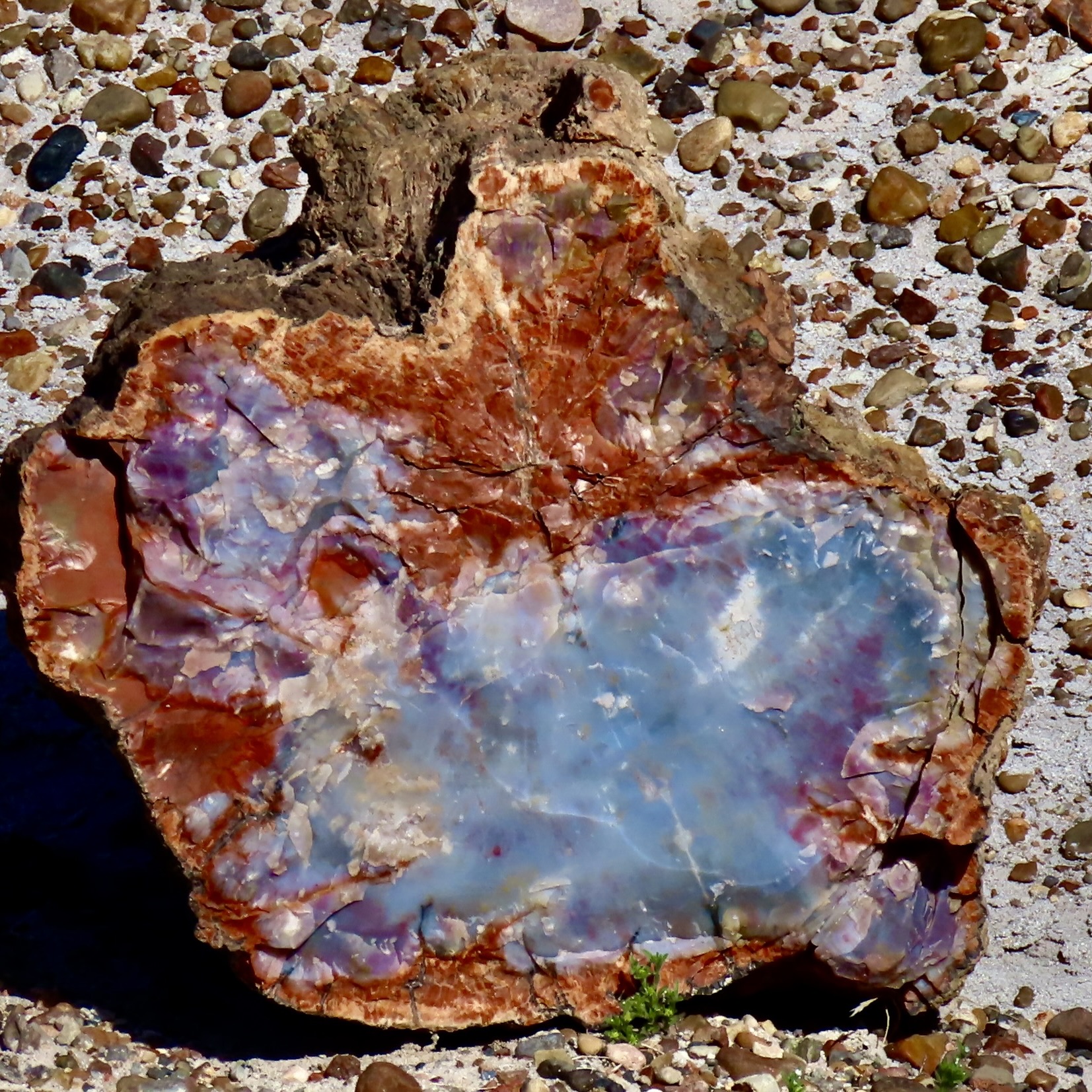
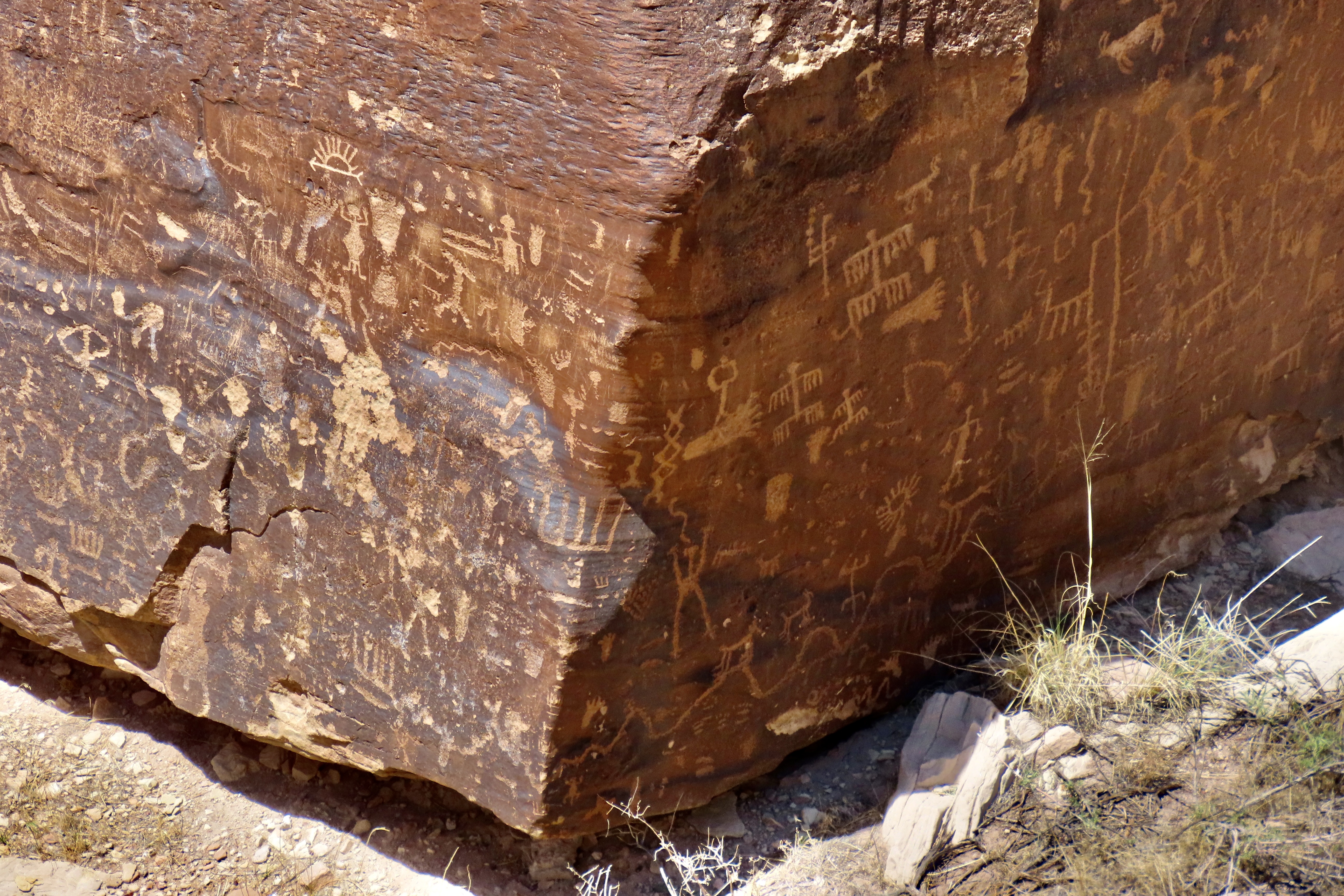
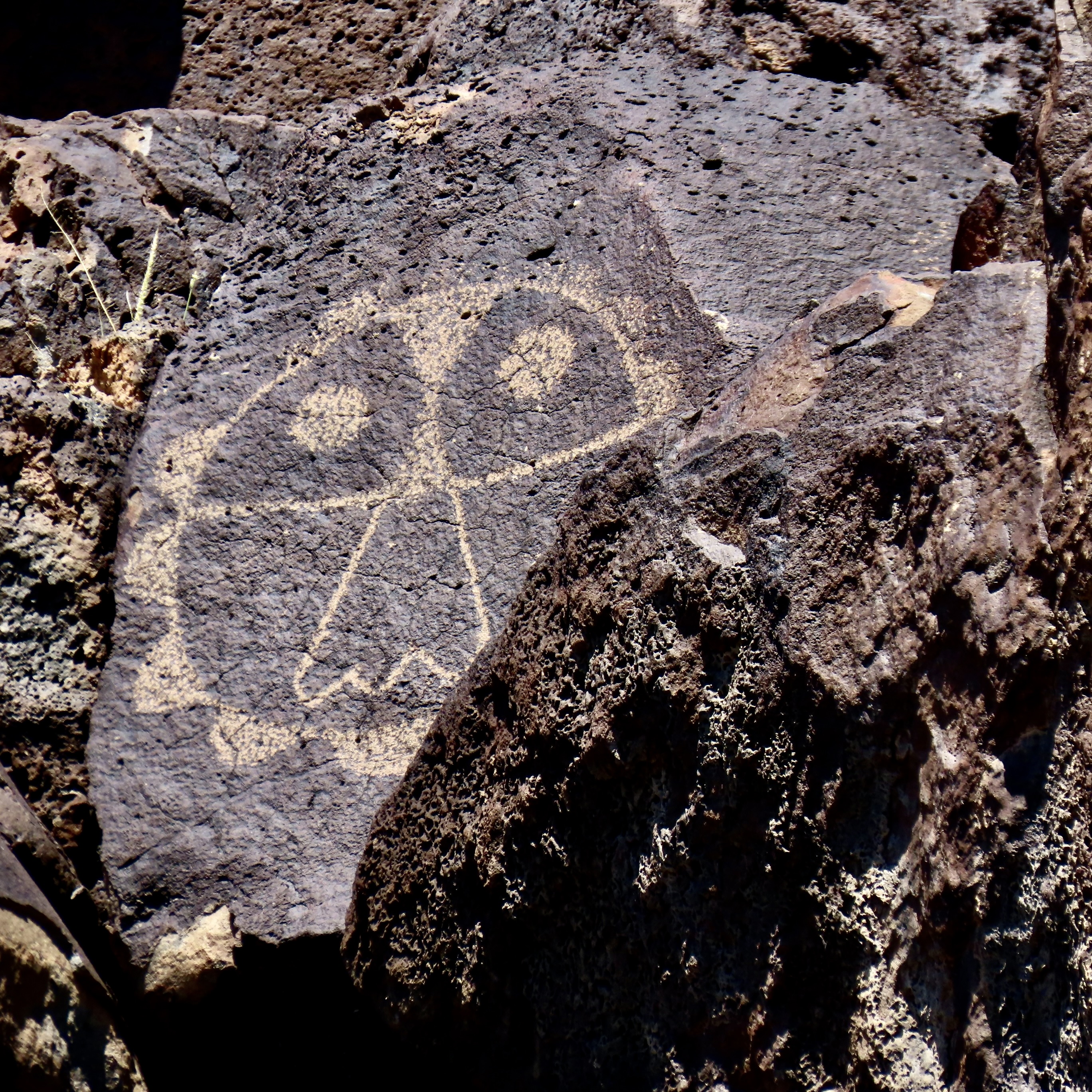
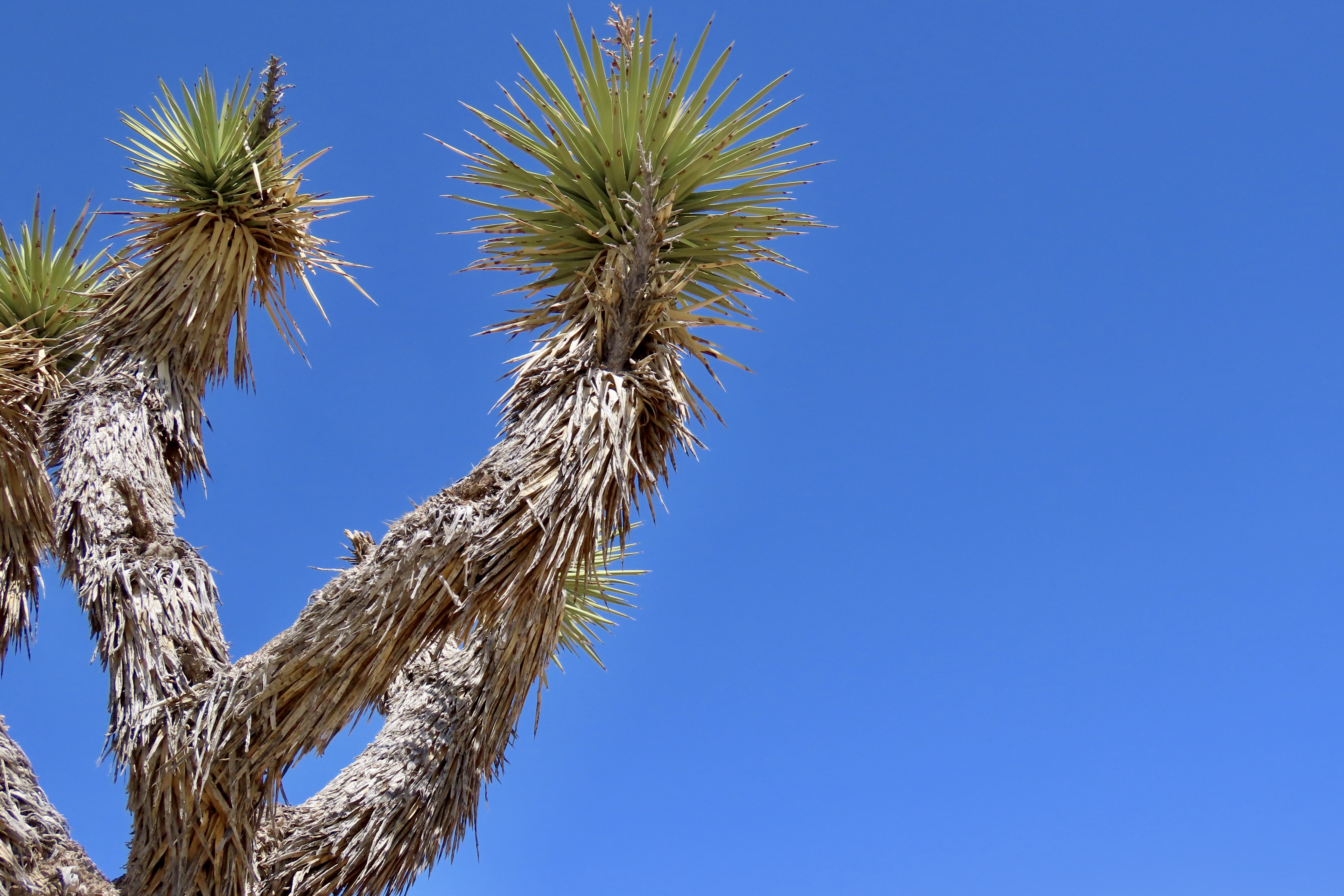
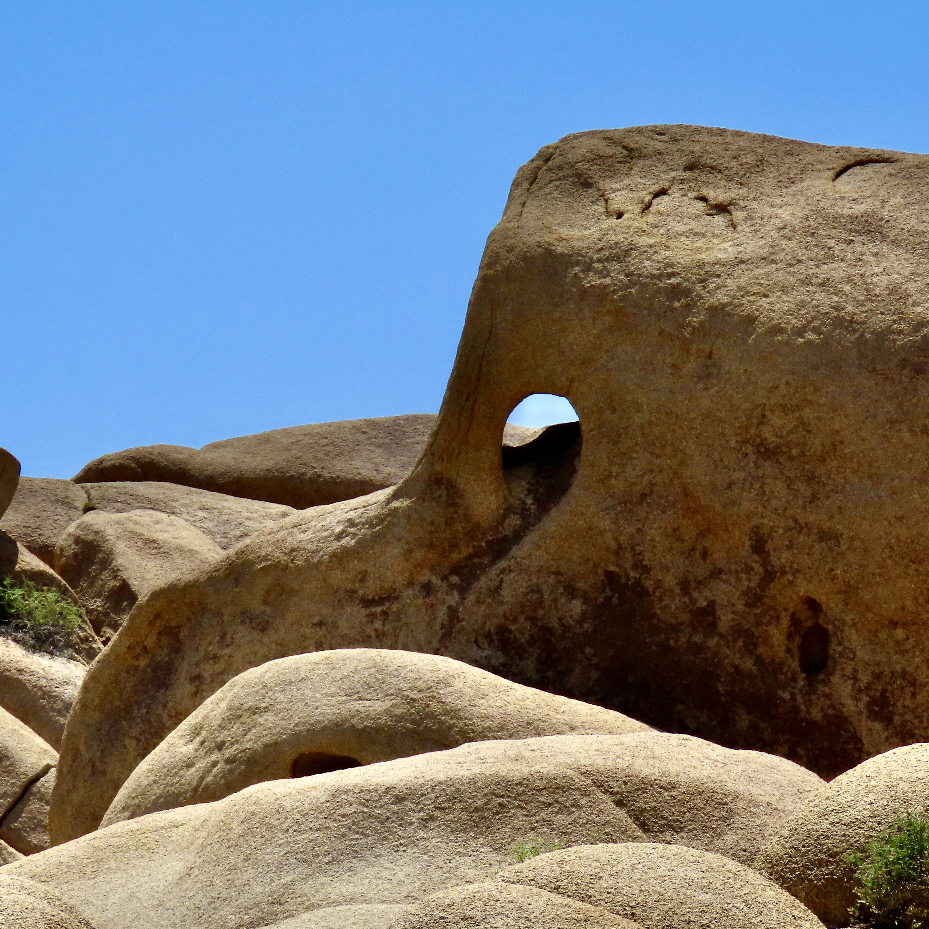
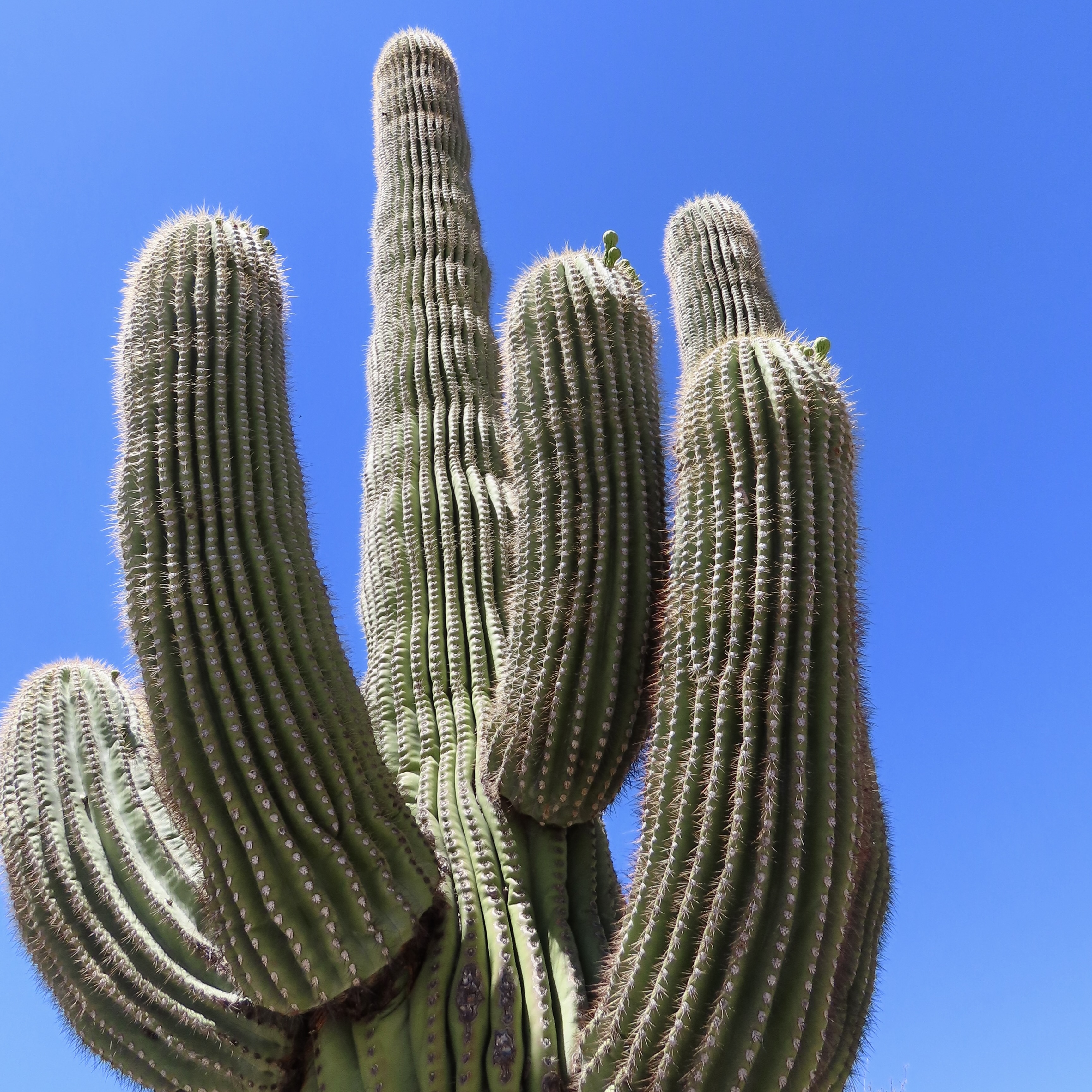
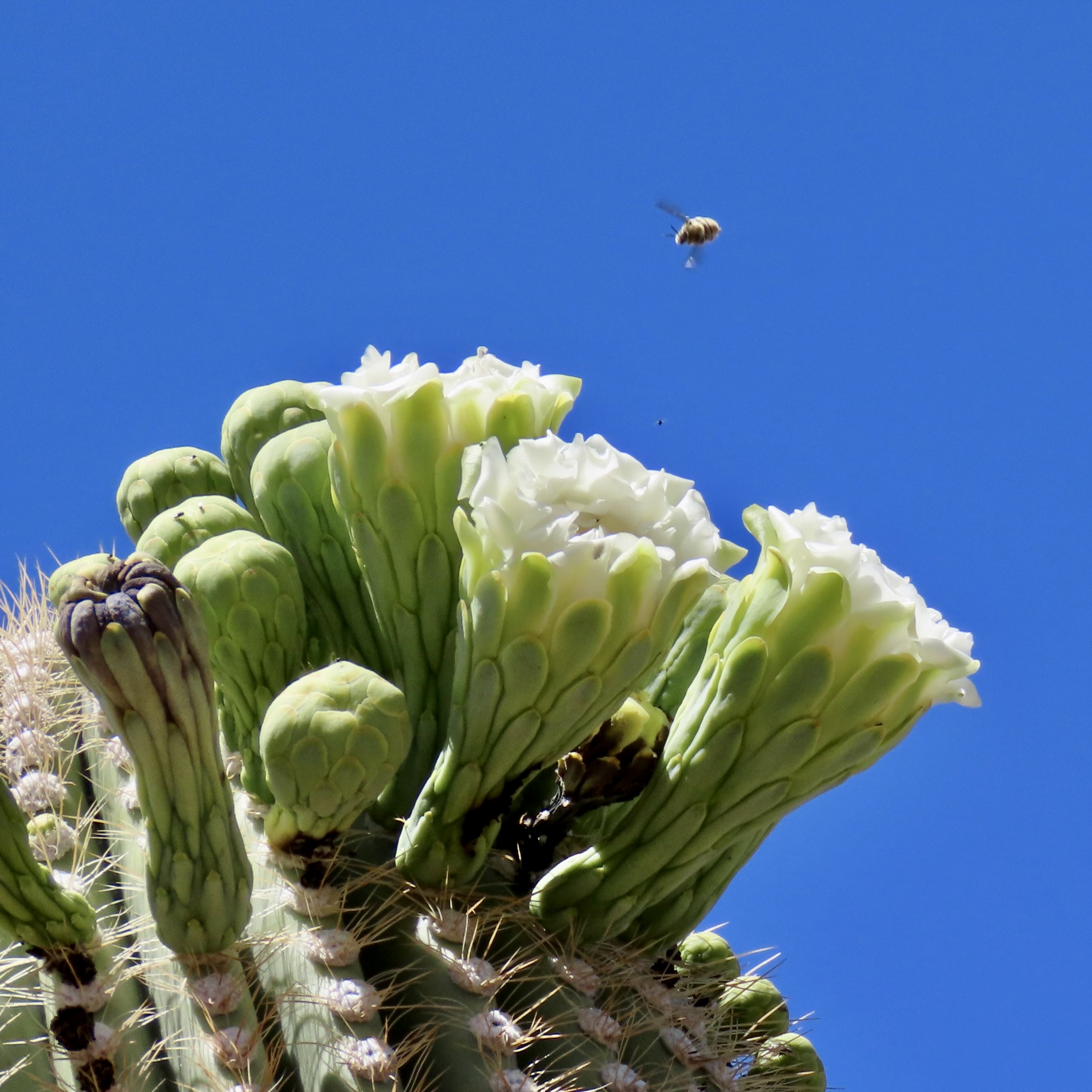
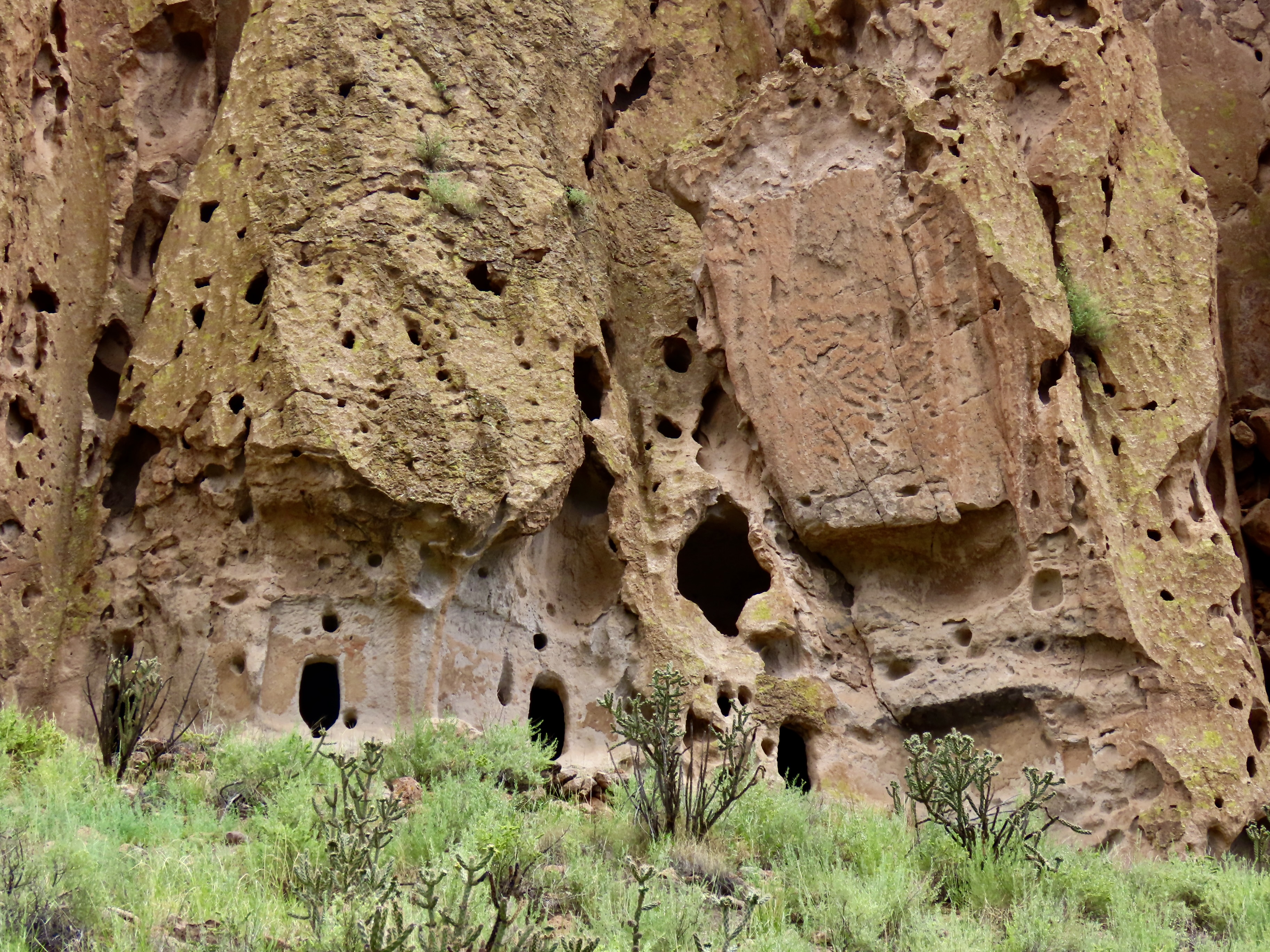
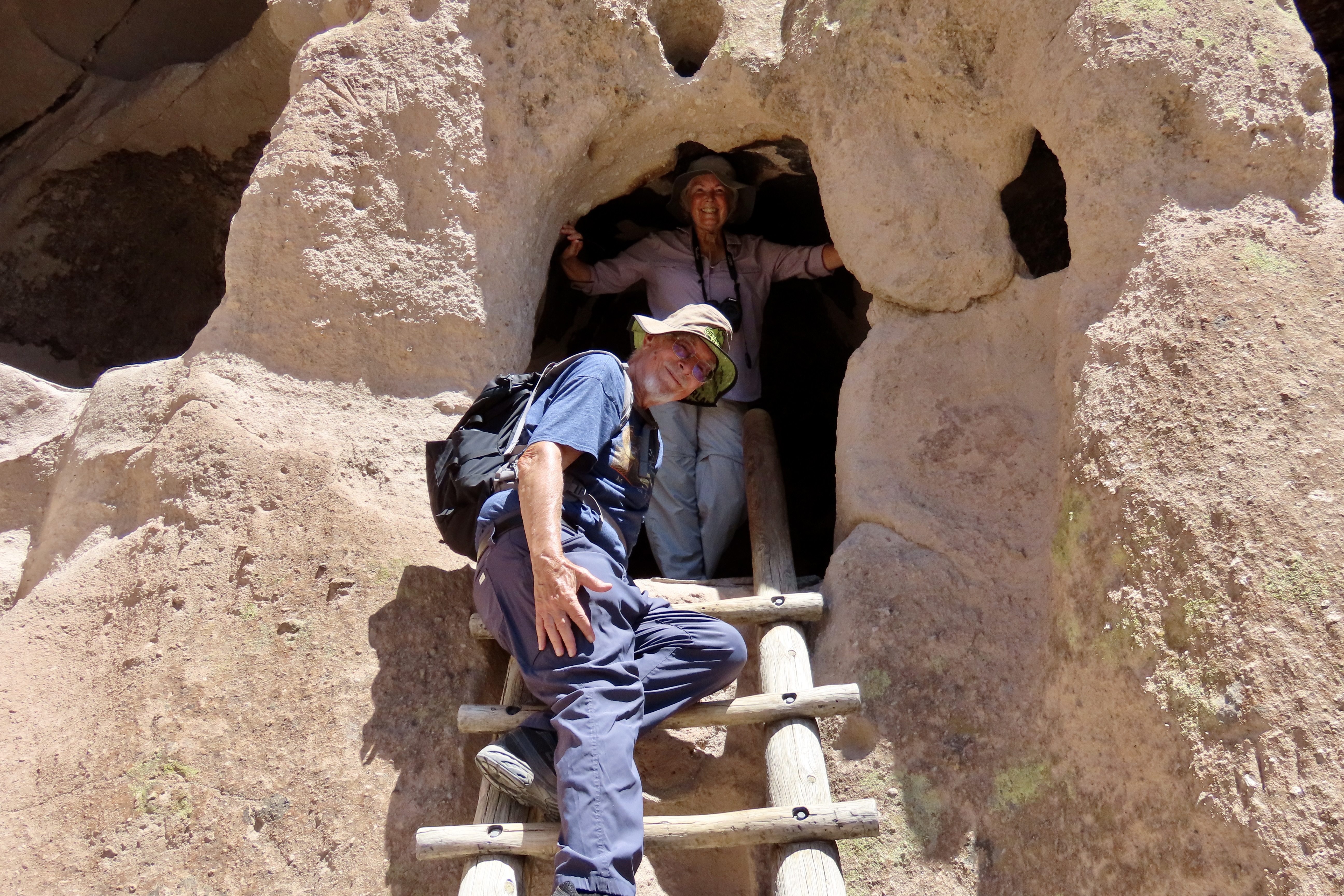
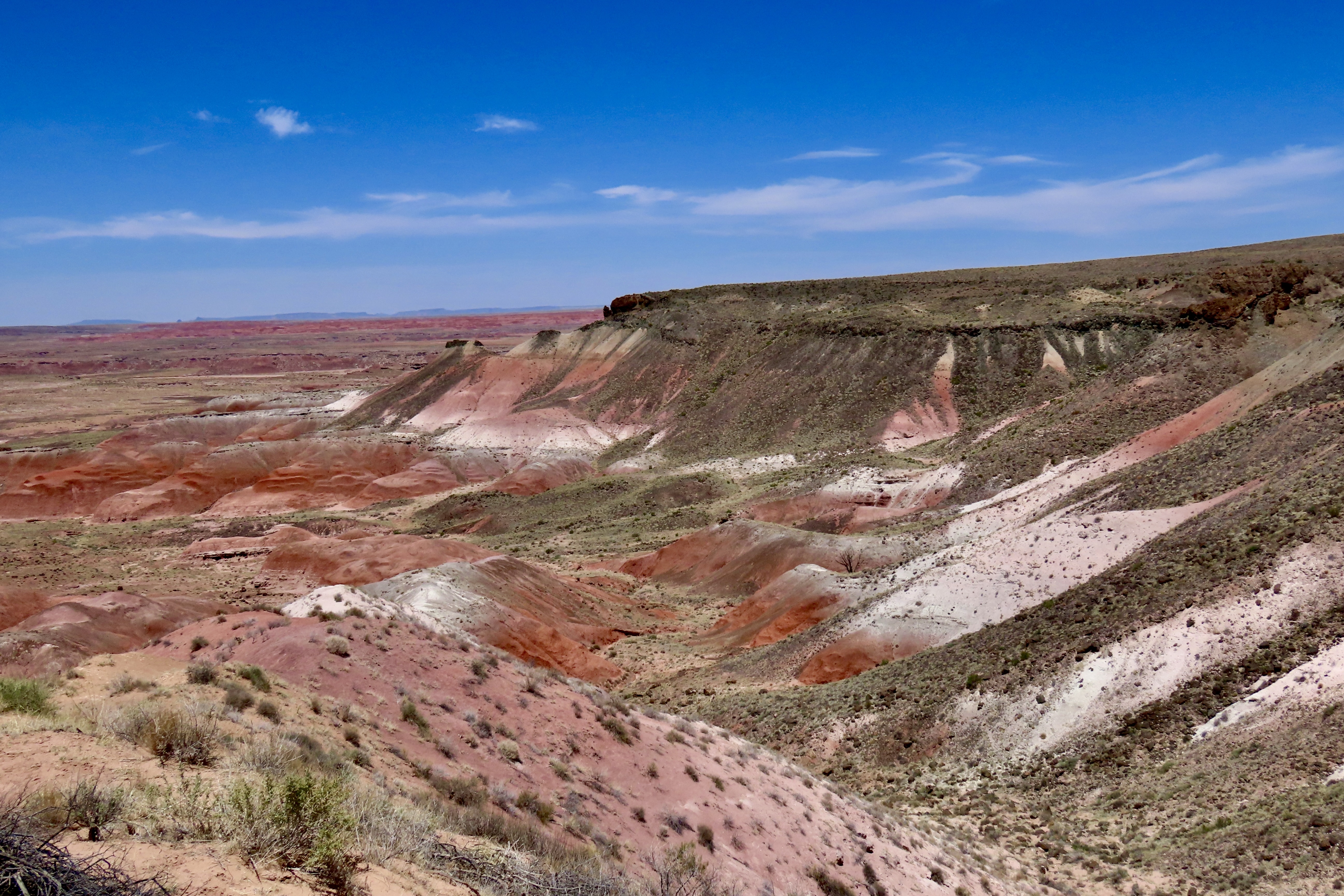
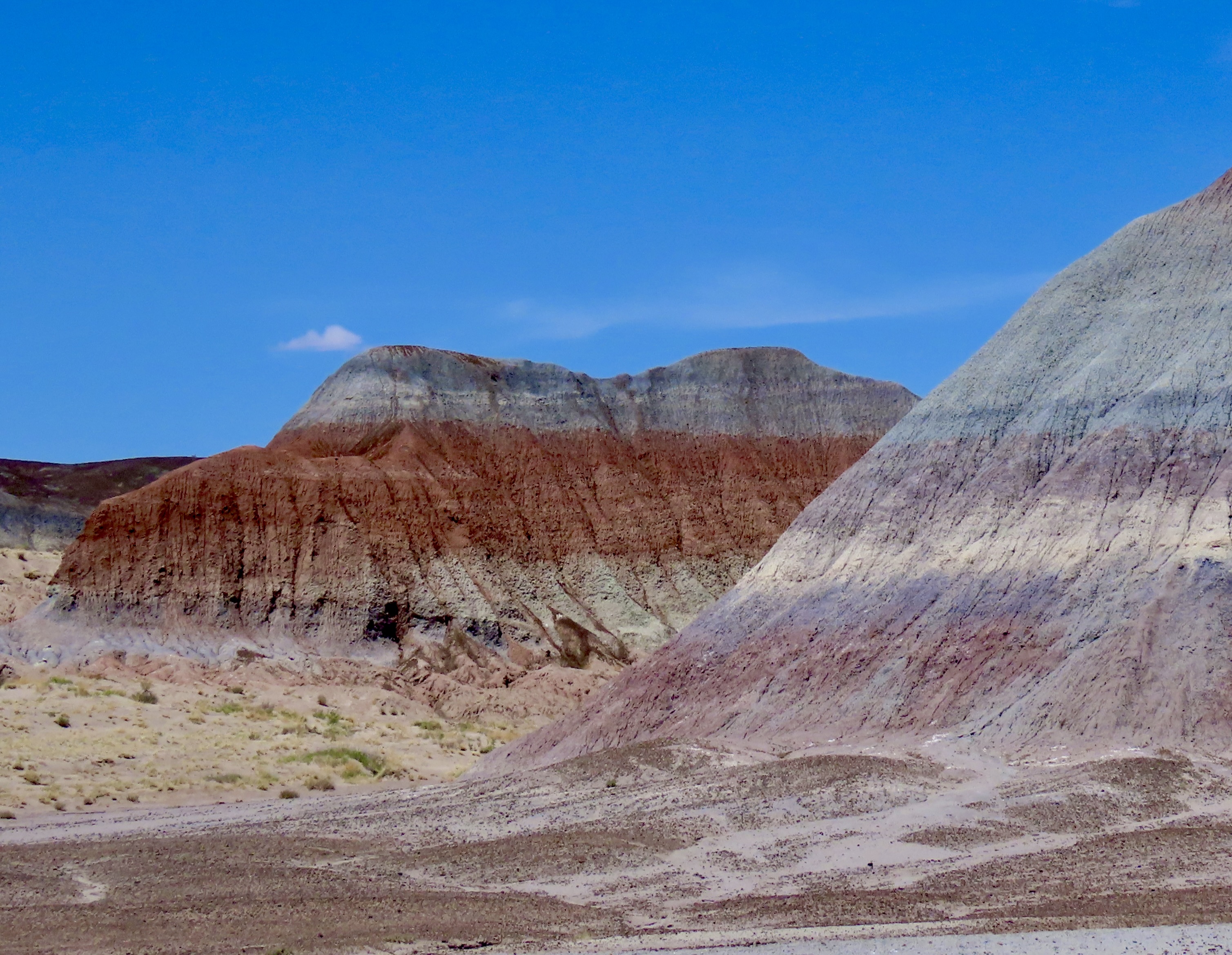
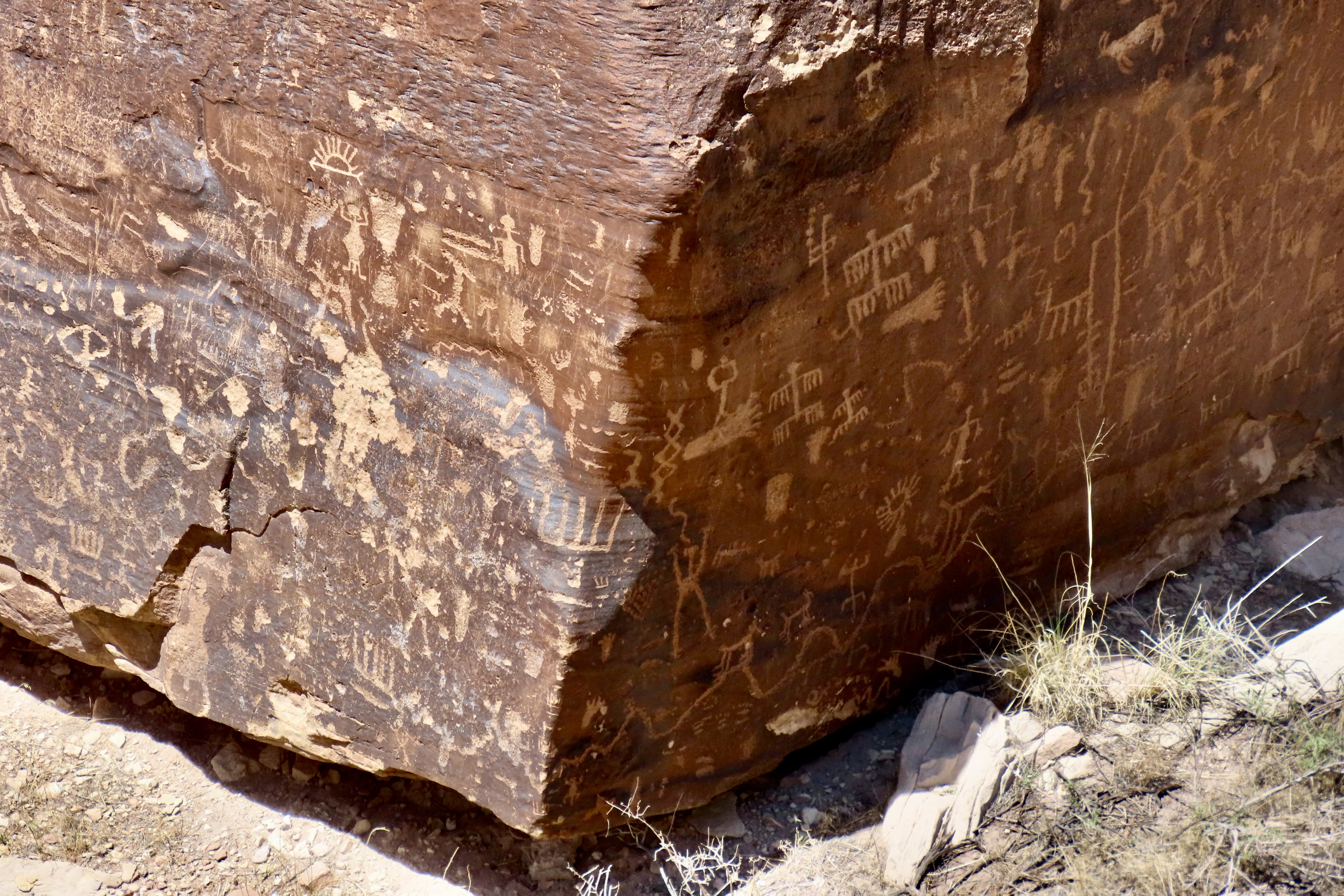
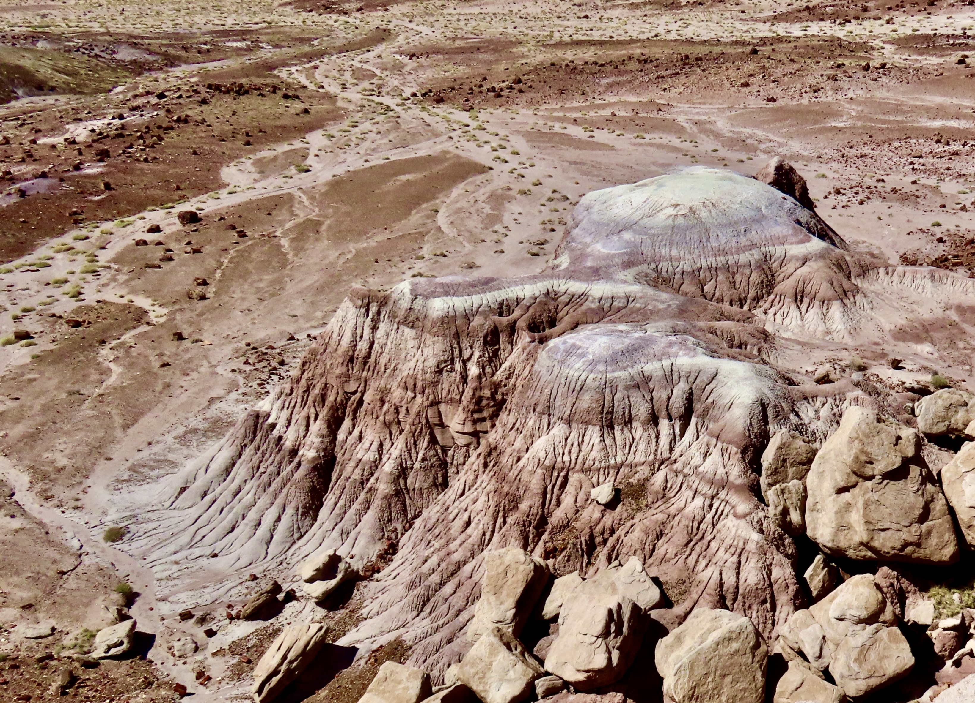
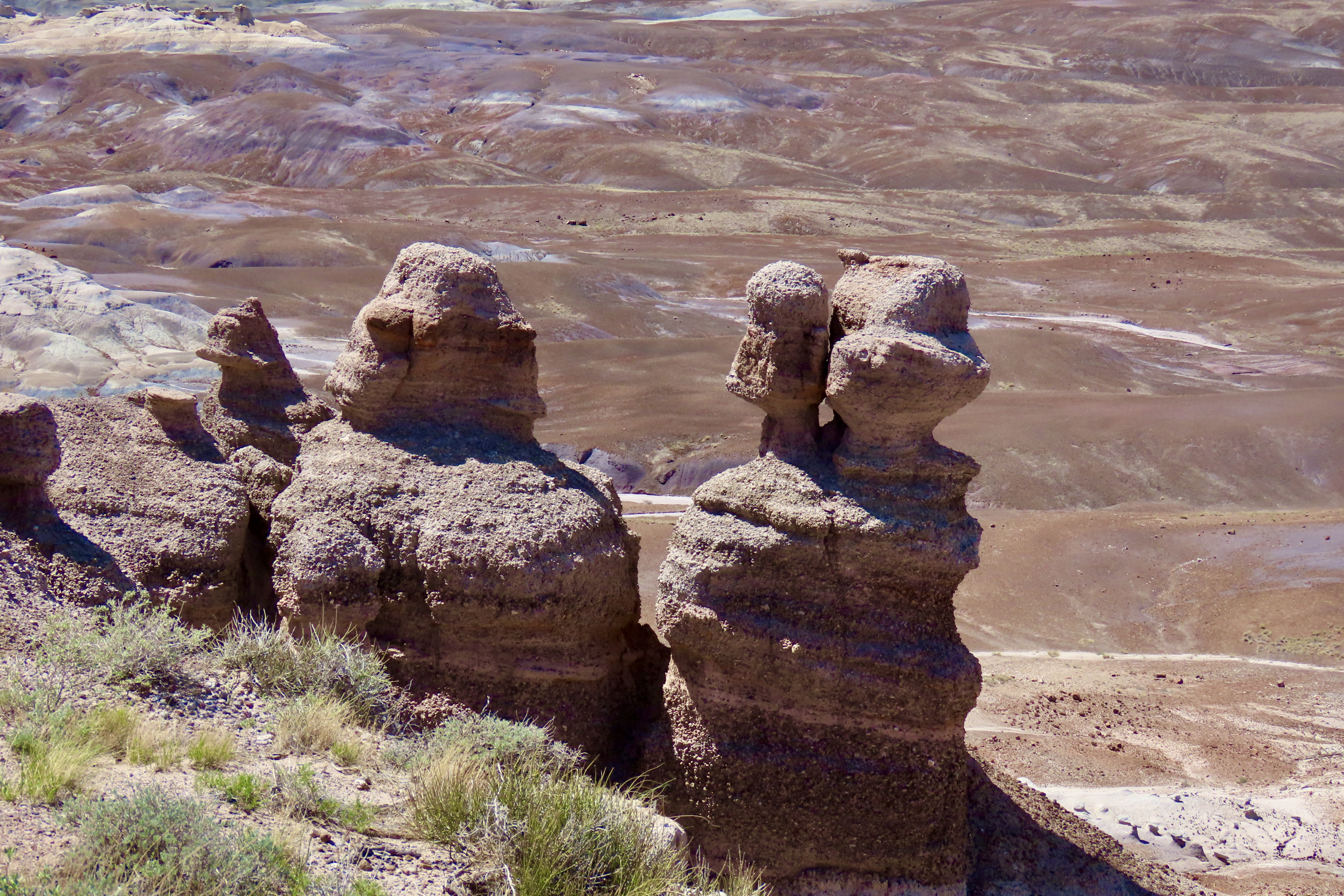
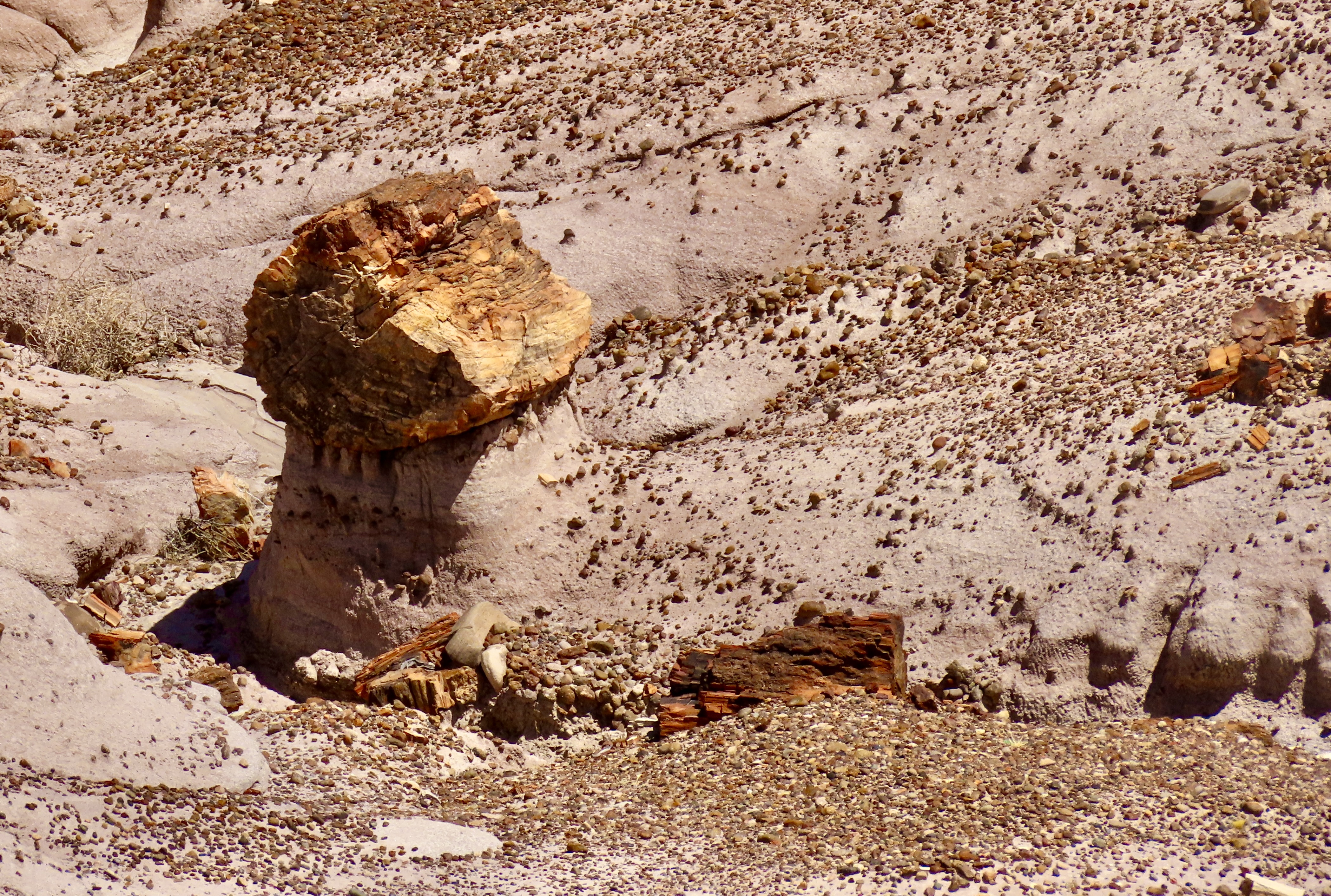
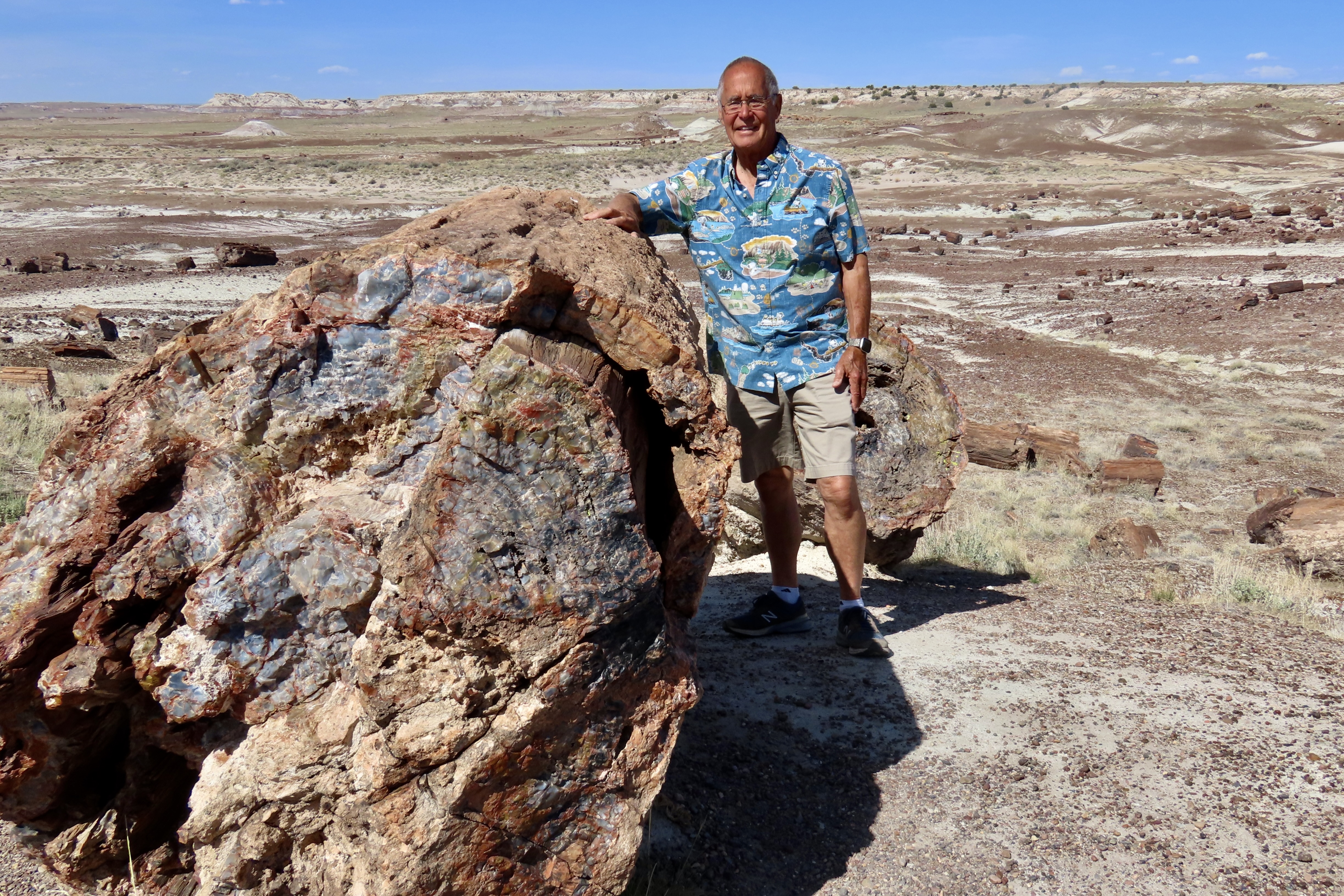
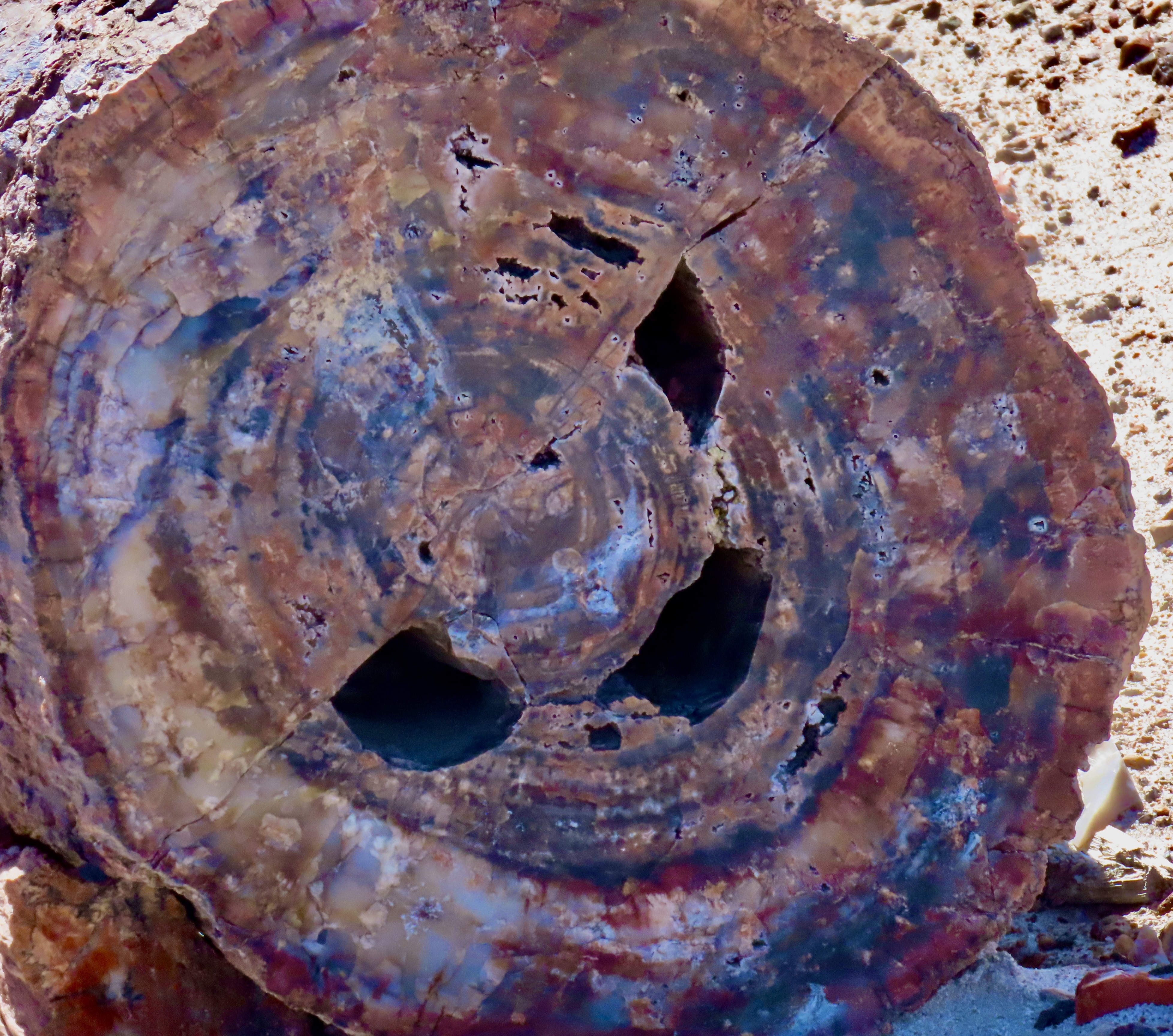
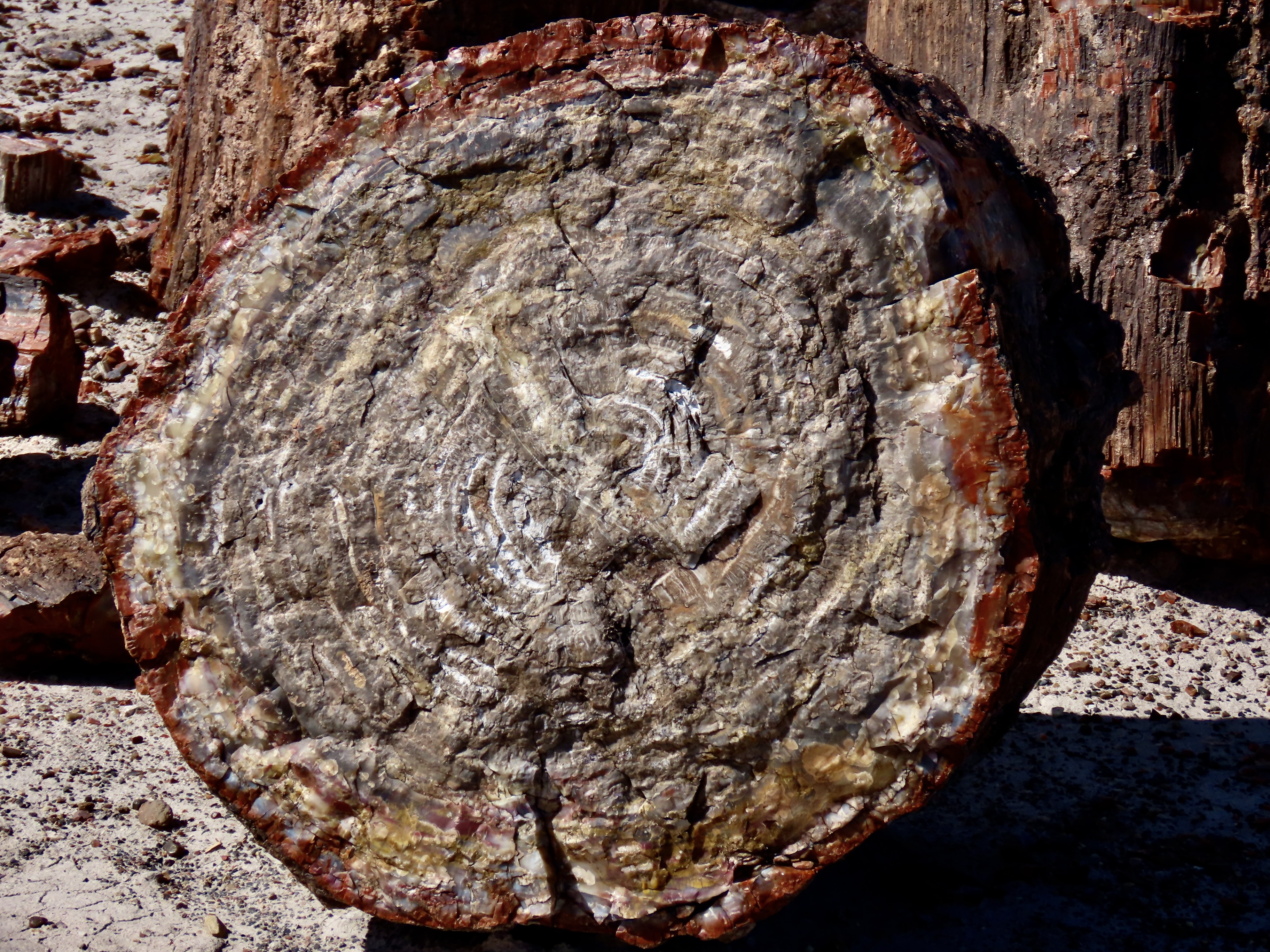
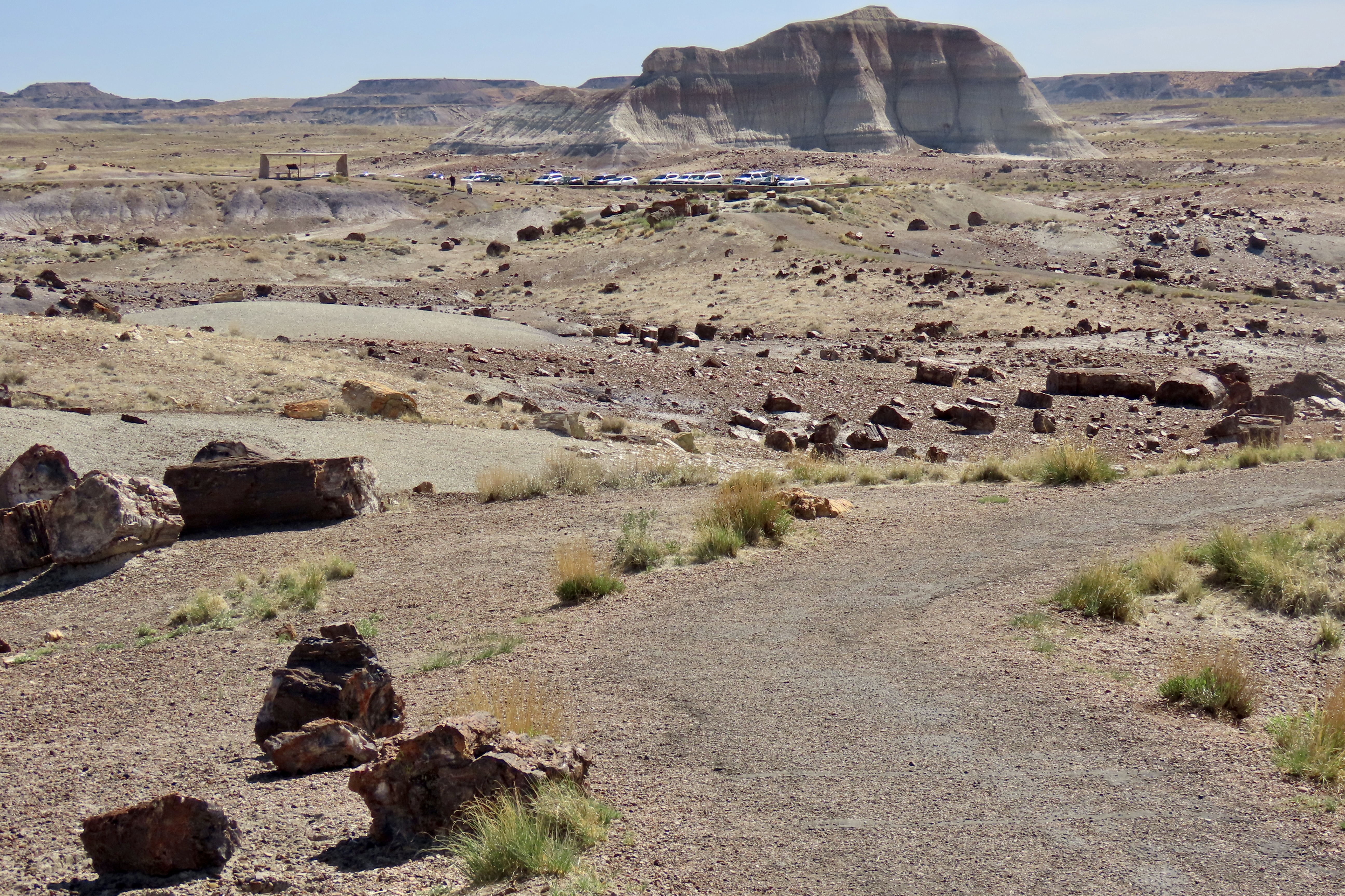
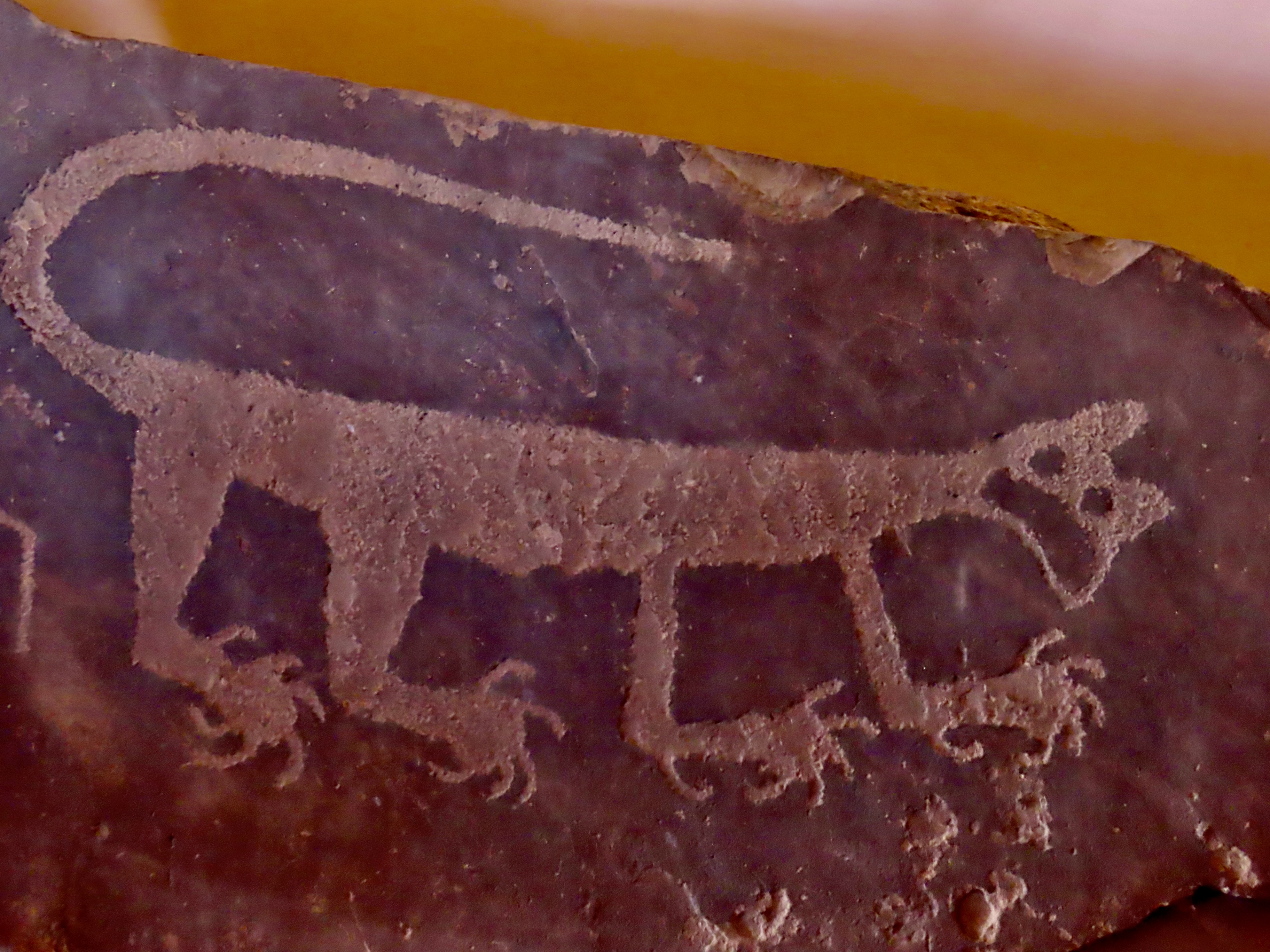
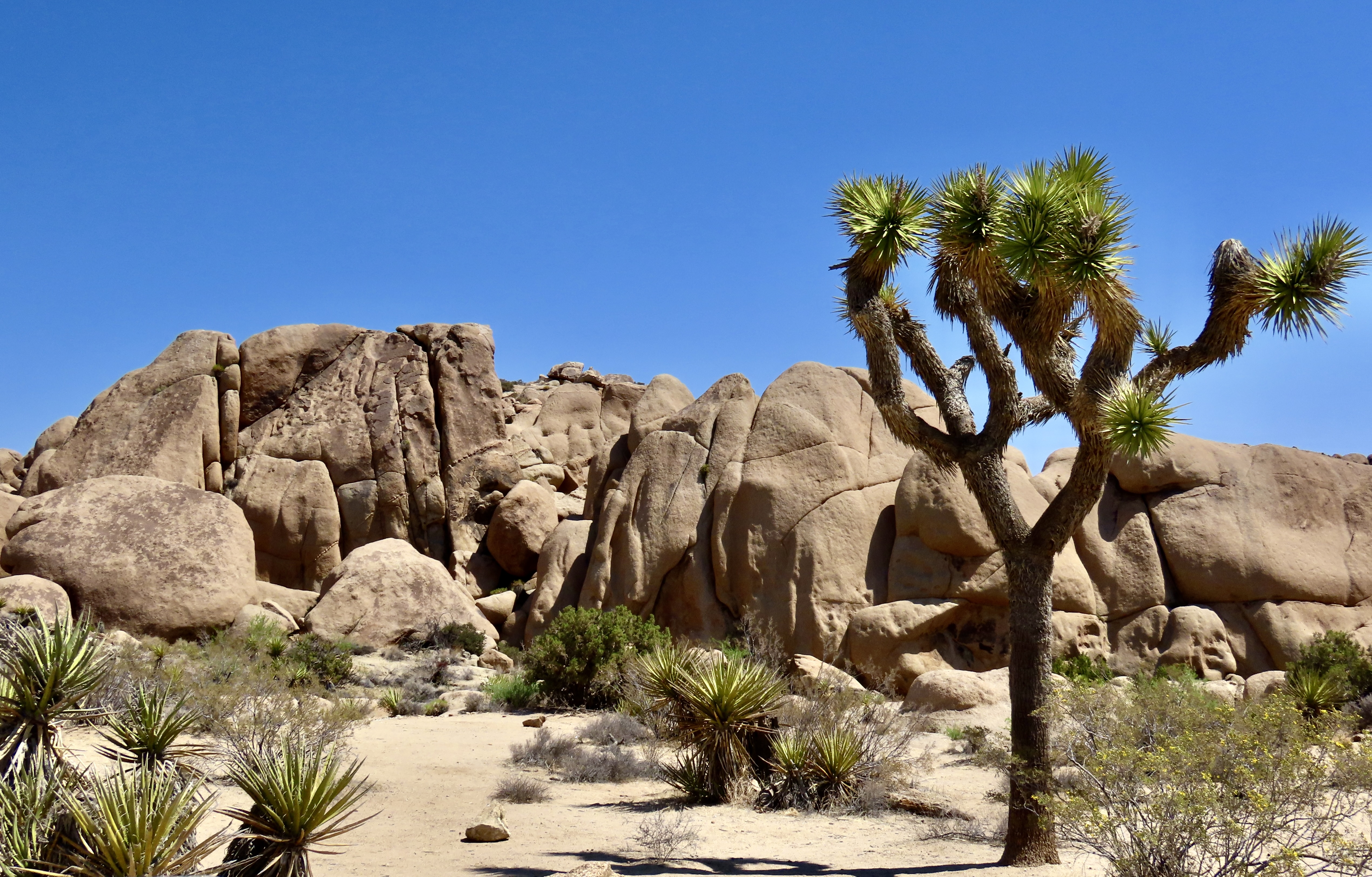
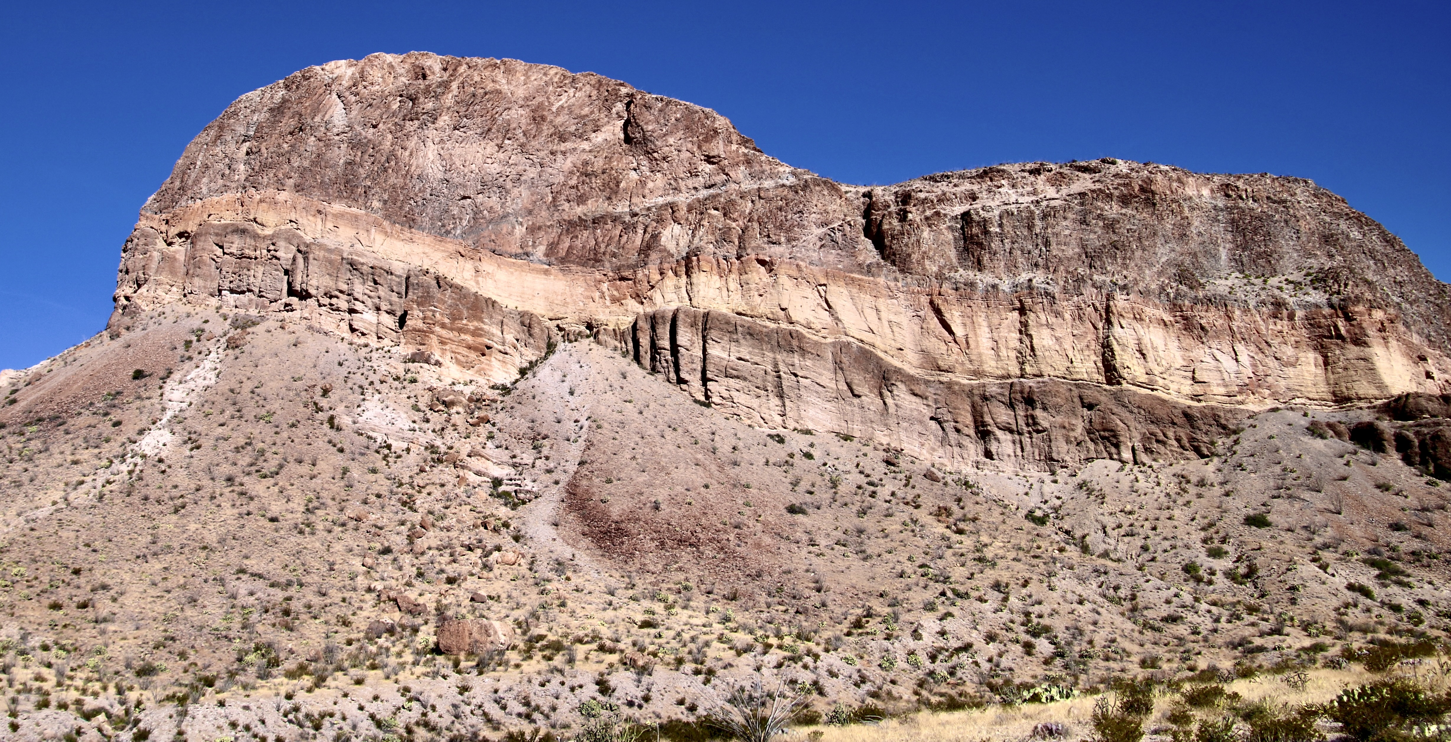
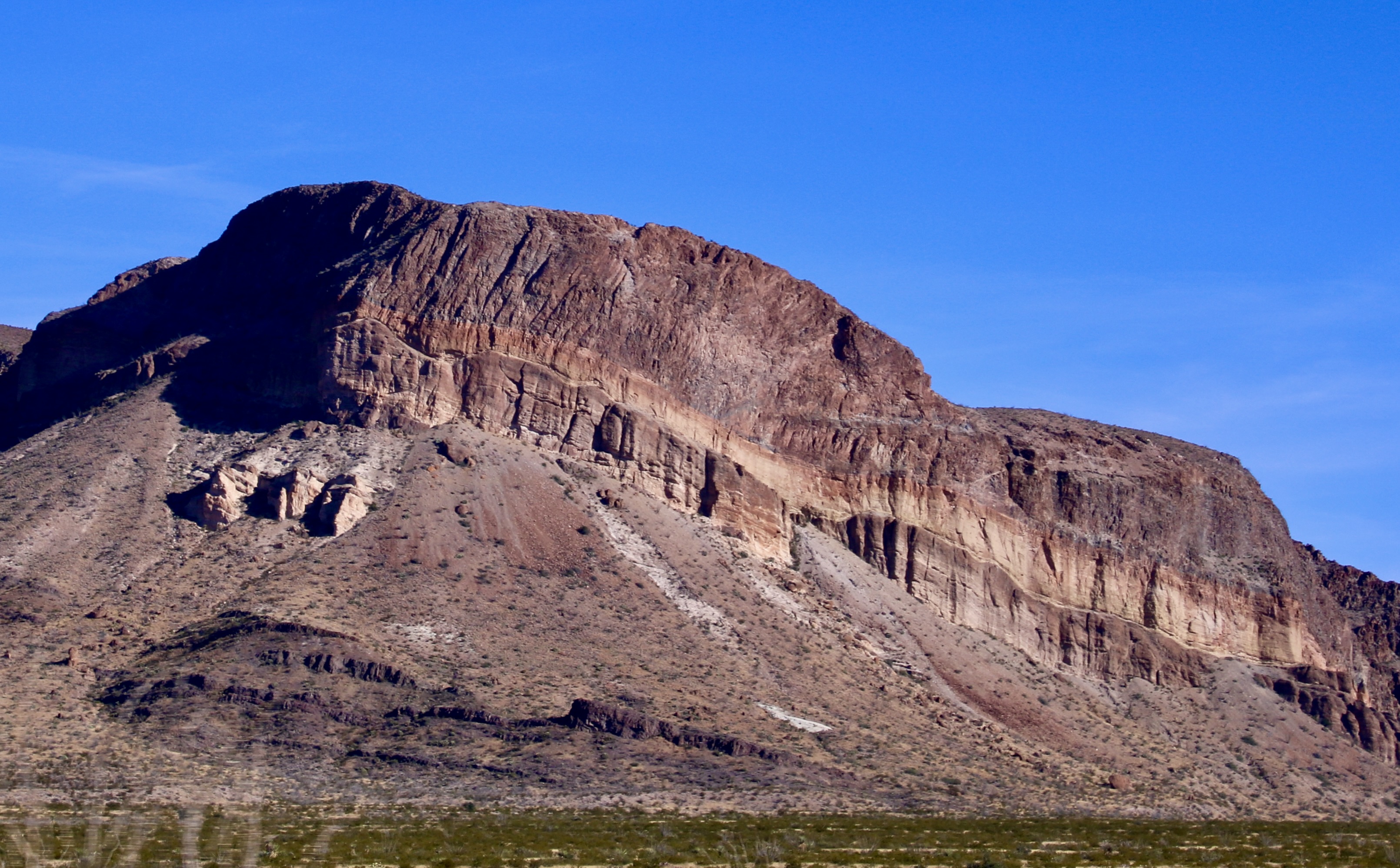
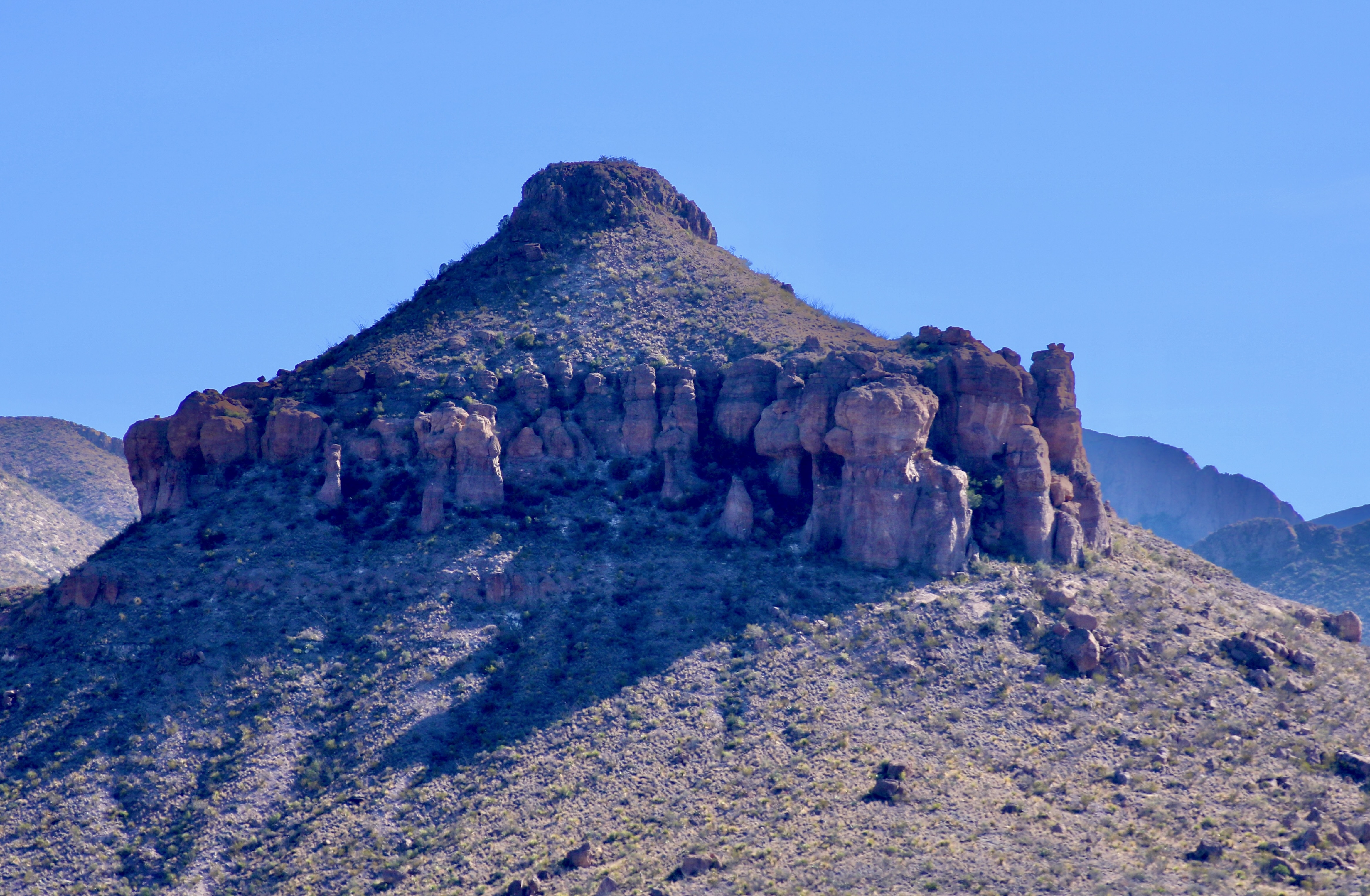
Petrified Forest National Park is found just off of I-40 in eastern Arizona. There are thousands of logs like the one above found in the park. You can still see the bark on this petrified wood that was once a tree that fell 200 million years ago.While most people come to the park to admire the petrified wood, there is also much beauty such as the colorful ‘Teepees’ found on the main road. Each color has a different story to tell representing millions of years in geological history.The Blue Mesa side road includes many other interesting and colorful land forms such as this. If you visit the park, be sure to take the short detour. A walk out in the desert on well maintained trails is definitely in order.Ancestral Puebloans and other indigenous tribes left a view of their ancient world in Petrified Forest NP in petroglyphs on Newspaper Rock. While our understanding of what they were communicating is limited, there is magic in contemplating the possibilities.While we are on the subject of petroglyphs, we found this unique one staring out at us in Petroglyph National Monument in Albuquerque, NM. Over 20,000 petroglyphs have been discovered in the monument. Peggy has plans to include this one in the revision of her word search book: Artistic Word Searches, Unique and Magical: Discovering Petroglyphs from the Southwest.Canyon De Chelly (pronounced shay) is located in northeastern Arizona. Jointly operated by the Navajo Nation that owns the property and the National Park Service, Canyon De Chelly features striking canyon views plus Ancestral Pueblo ruins and petroglyphs left behind by both the Pueblo peoples and Navajos.Our trip this past spring and summer took us into Califonia where we visited family and friends in San Diego, LA, and Sacramento. We also took time to visit Joshua Tree National Park in Southern California, known for its strange trees, after which it is named.We found the rock structures to be of equal, if not greater, interest. Some of which could be said to possess personalities.In addition to being known for its outstanding rock forms (think of the Grand Canyon, Zion, Bryce and Arches— plus what we visited this year), the Southwest is noted for its deserts and cacti, none of which is better known than the Giant Saguaro. We’ve often stopped to admire these huge plants in Saguaro National Park but have never been in Arizona when they are blooming. Things were about to change. Note the buds popping out on top of the arms.This time we were lucky. The blooms are almost other-worldly, in addition to being a source of food for numerous insects such as the bee coming in for a landing.A number of other cactus flowers also lit up the desert.Like plants, animals adjust to the deserts of the Southwest. Several birds choose to nest among the needles of various cacti including the curved bill thrasher Peggy found raising her family in a cholla cactus. The thrasher was not happy when she sneaked up to it and her hatchlings to catch a photo with her iPhone. It’s probably a good thing Peggy couldn’t understand what momma was saying.Bandelier National Monument, located mere miles away from where the first atom bomb was created at Los Alamos, New Mexico, features the ruins of homes built by Ancestral Puebloans that included natural and carved caves (cavates) with pueblo structures once built up against them.Peggy and I climbed up to one of the cavates. It was quite cozy inside. “Honey, I’m home.”Just beneath the cavate, this outcropping of rocks overlooked the large Tyuonyi Pueblo at Bandelier. A corner of the ruins can be seen here. It was built in a circle and contained contained 400 rooms.This tall rock was among the rocks in the outcropping. My first thought was wow! Nowhere in our travels though out the Southwest have we seen a statue like it carved by Ancestral Puebloans or any other indigenous tribes. We had a guide to the trail we were walking on, but there was no information on the statue. Nor was there anything in the information center. The emphasis was all on the scenery, cavates, petroglyphs and pueblos. Human or nature carved, I would think that the park’s literature would at least comment on it. That’s it for today. Next up:We wrapped up our year of travel with out trip to New England so it’s proper that we finish off 2025 with the trip.
Happy New Year to everyone and thanks for joining us on our adventures in 2025. It’s much appreciated. Costa Rica, Bali, and Scotland are coming up in 2026! Curt and Peggy
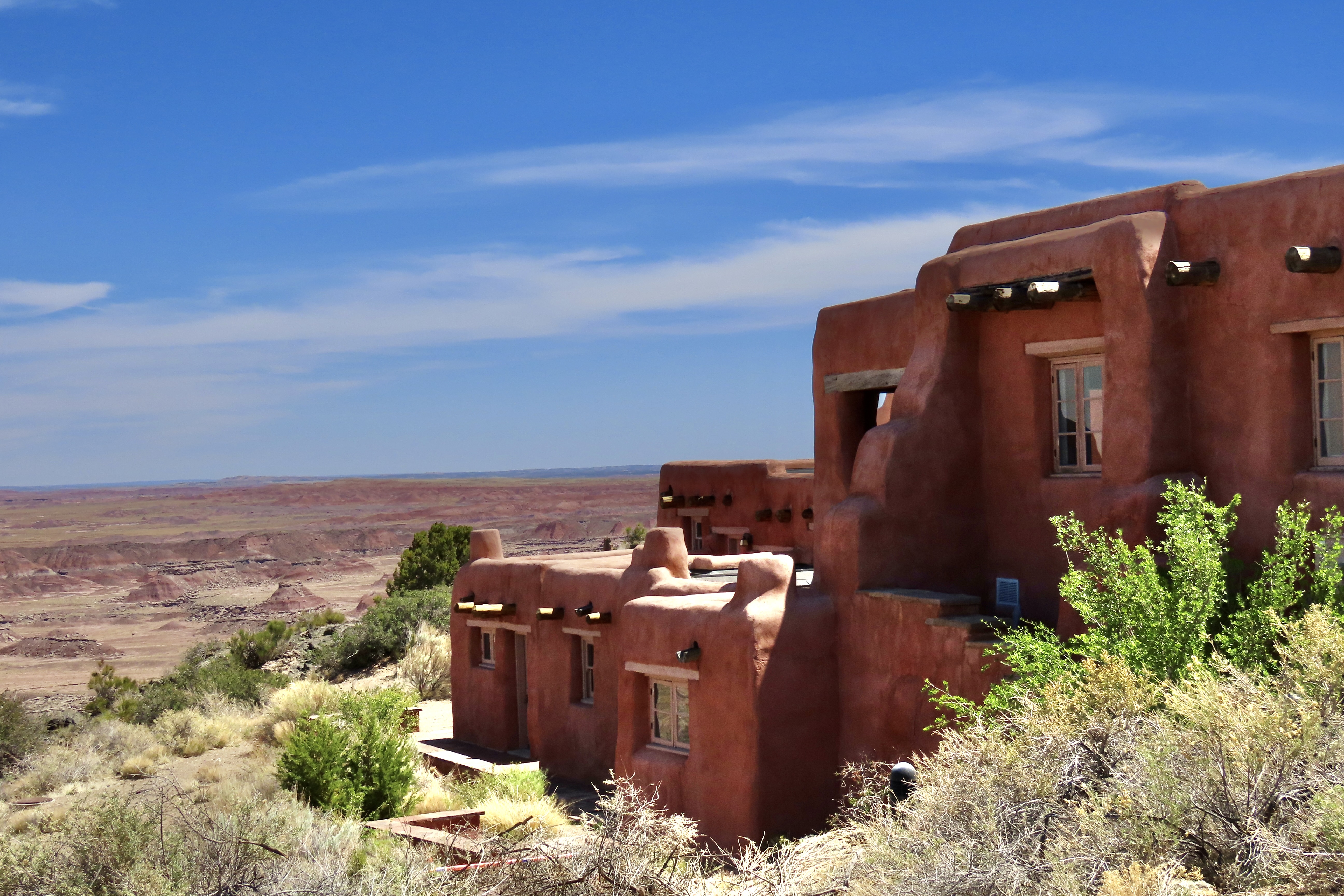
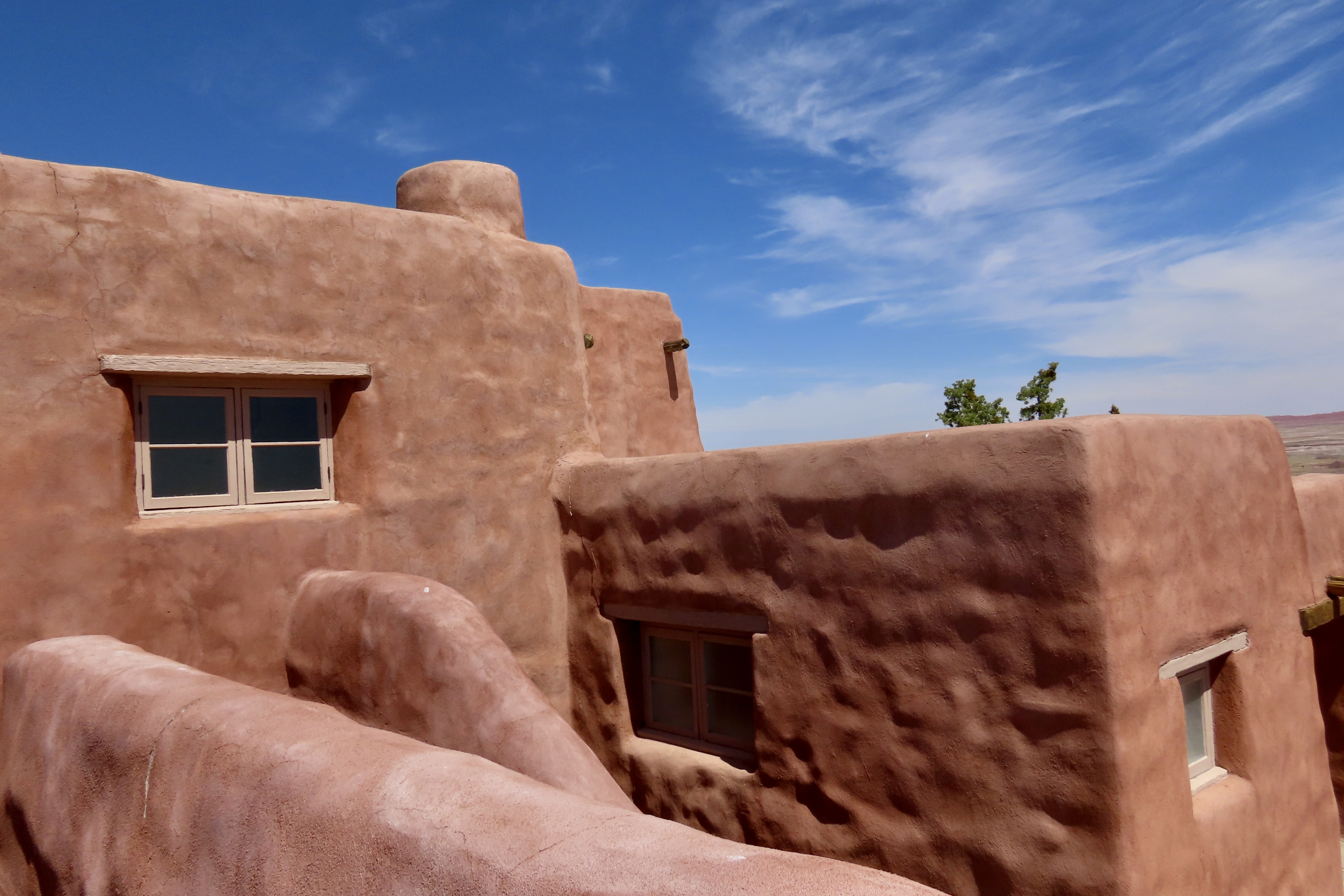
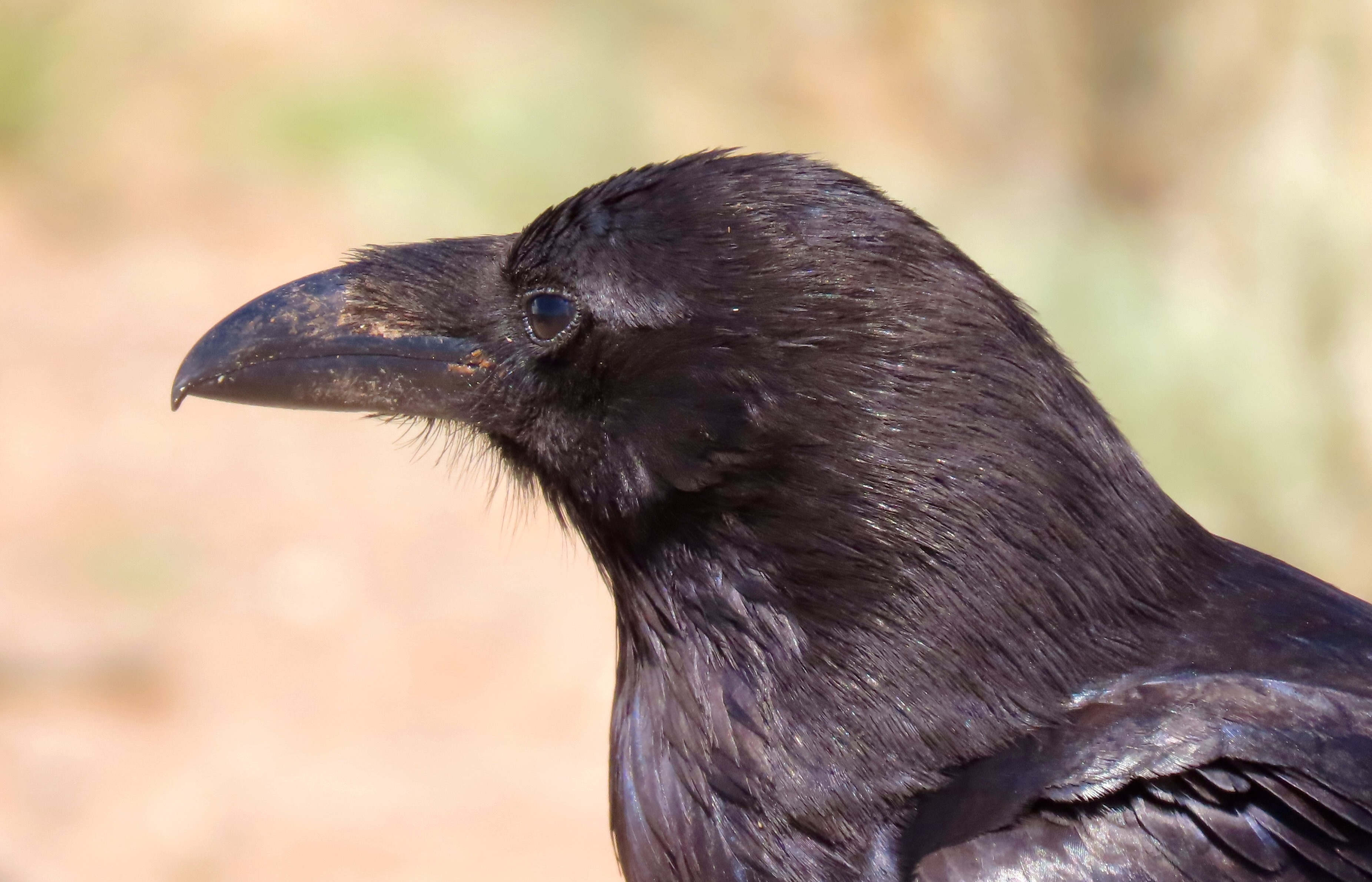
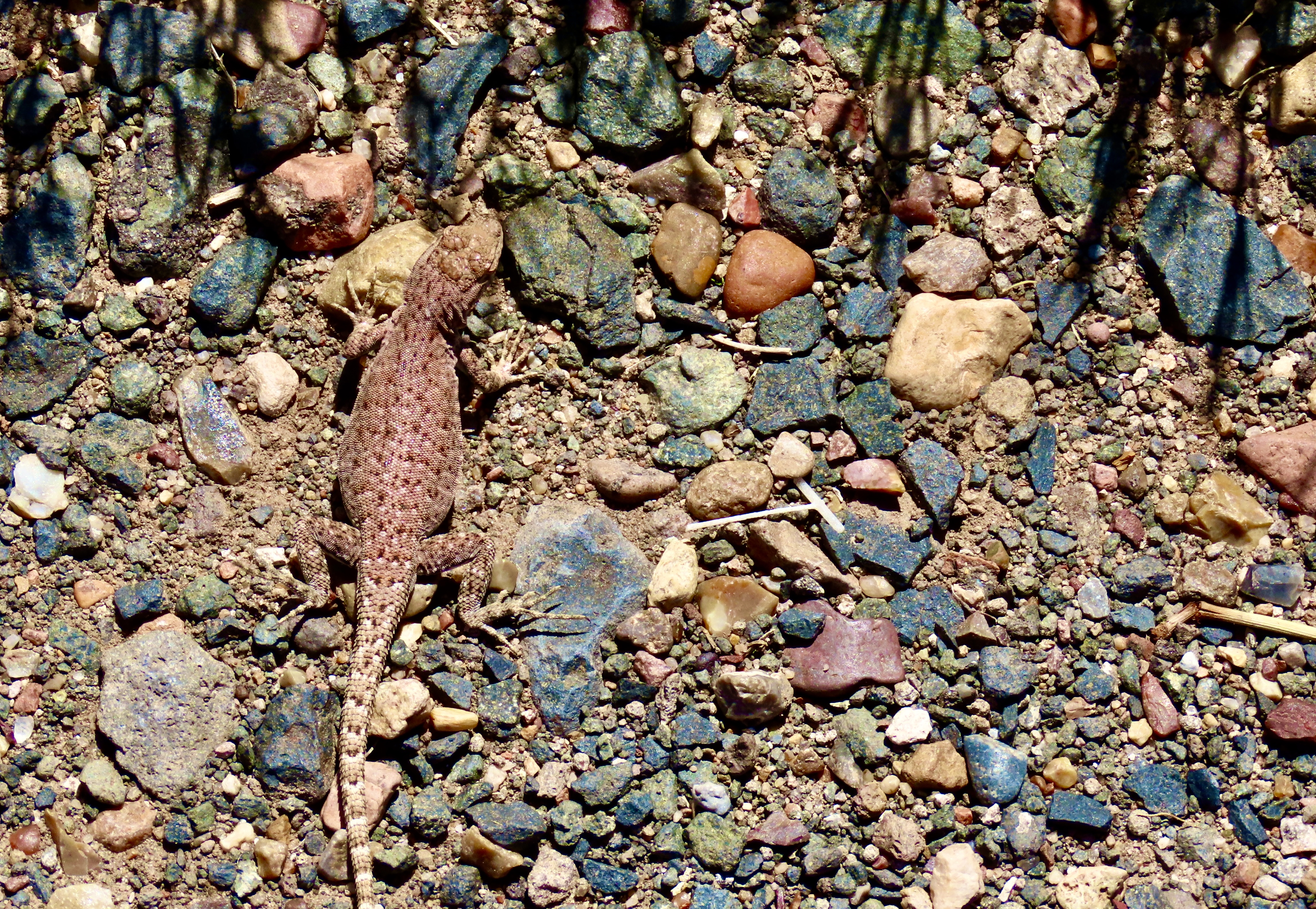
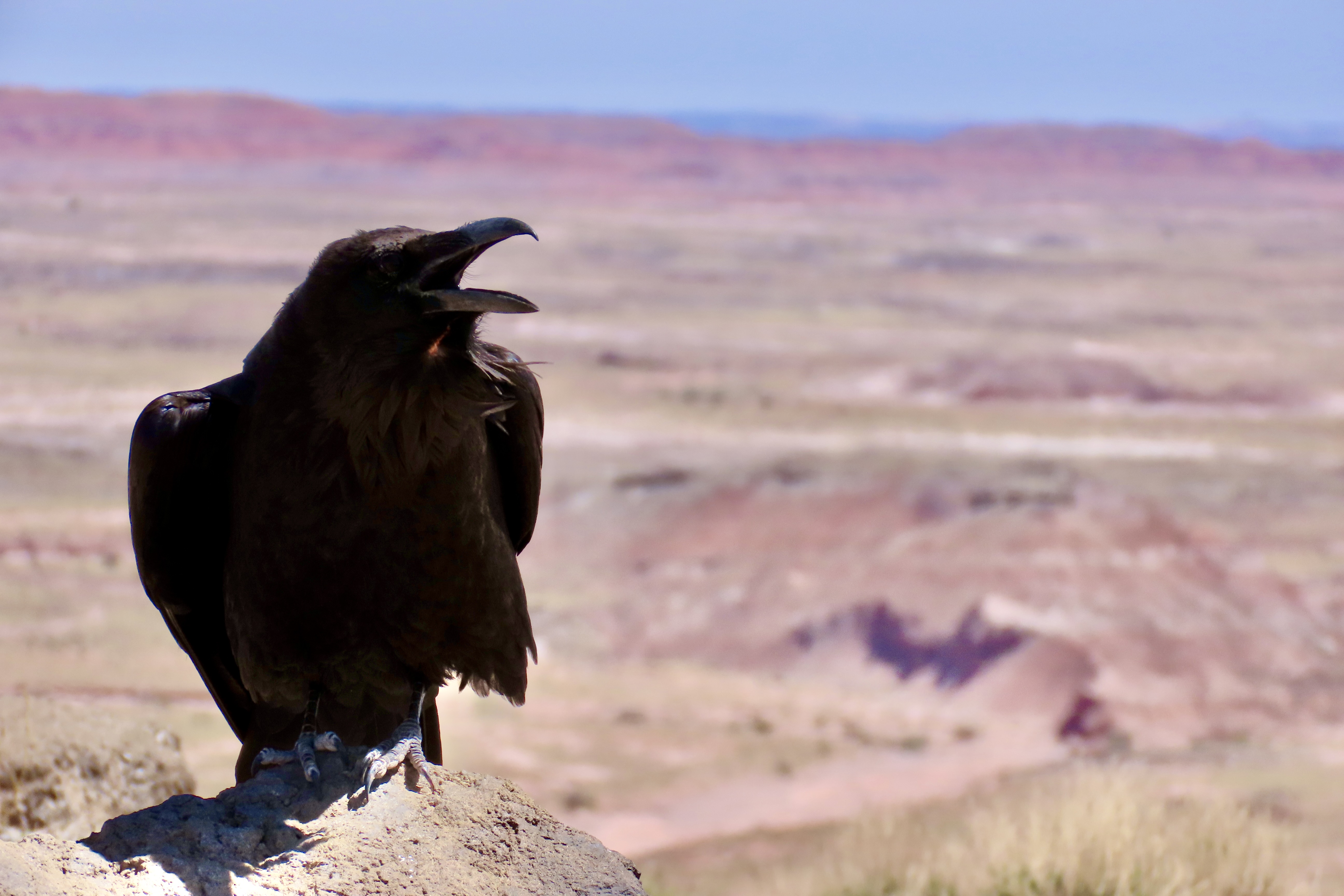
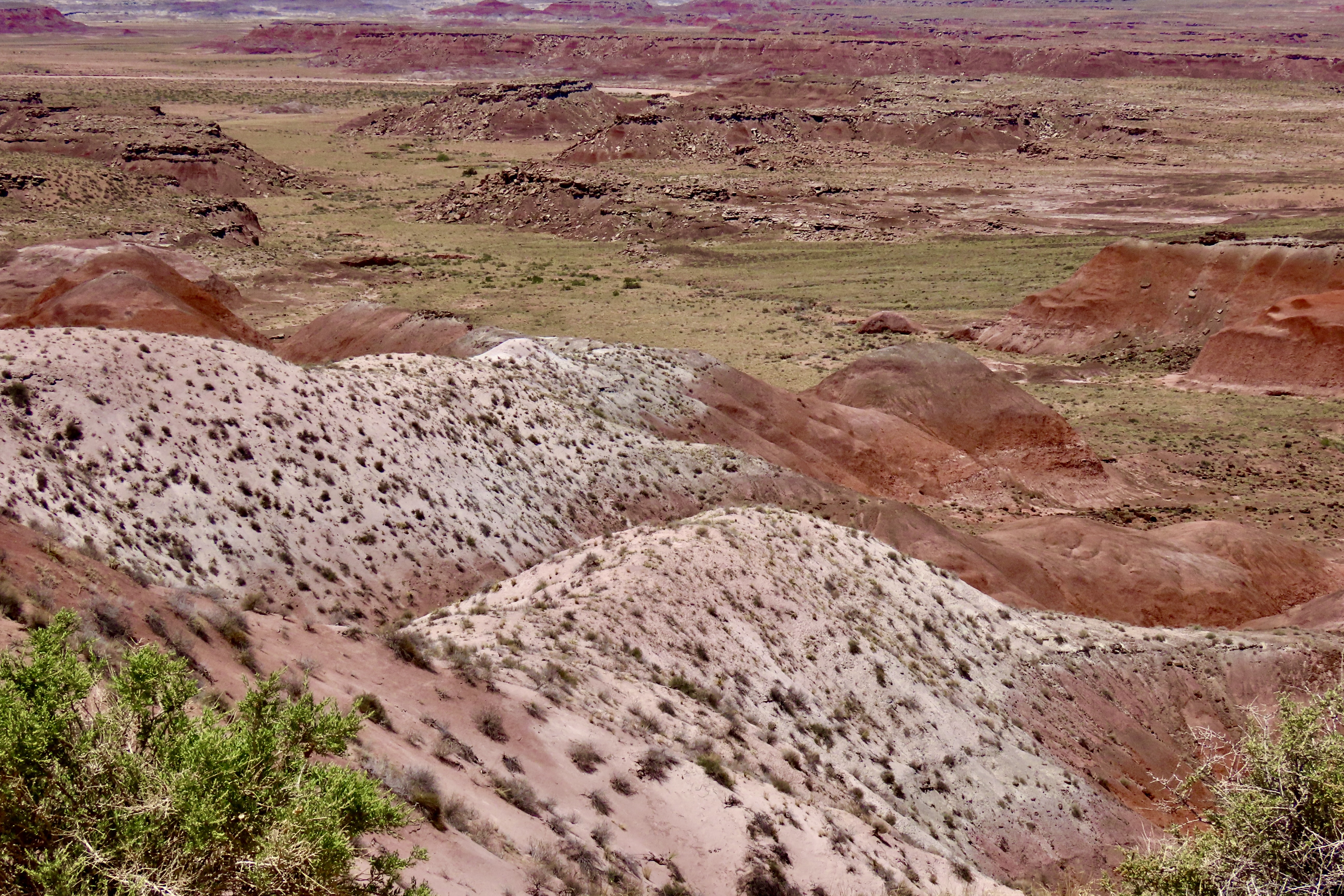
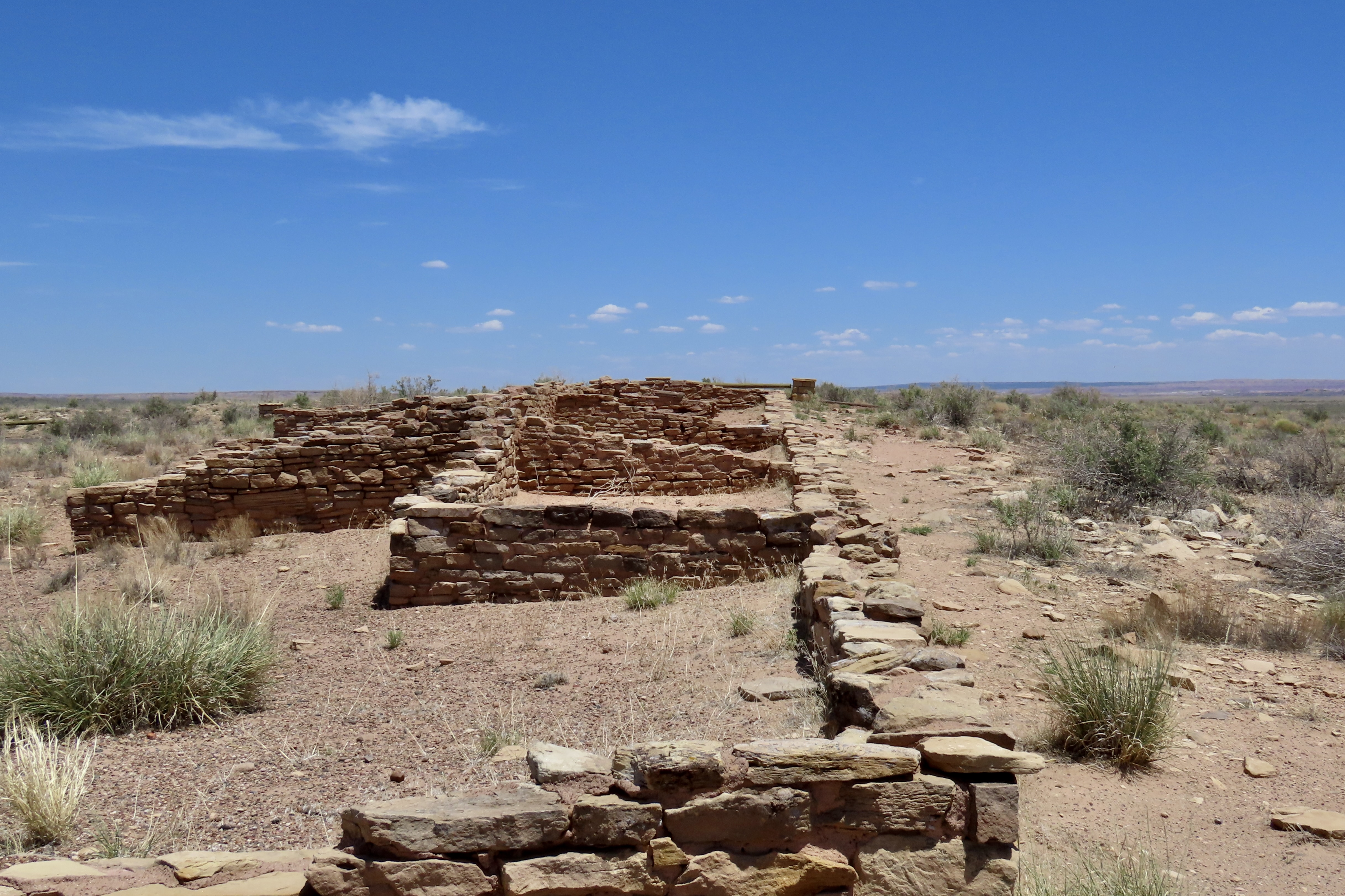
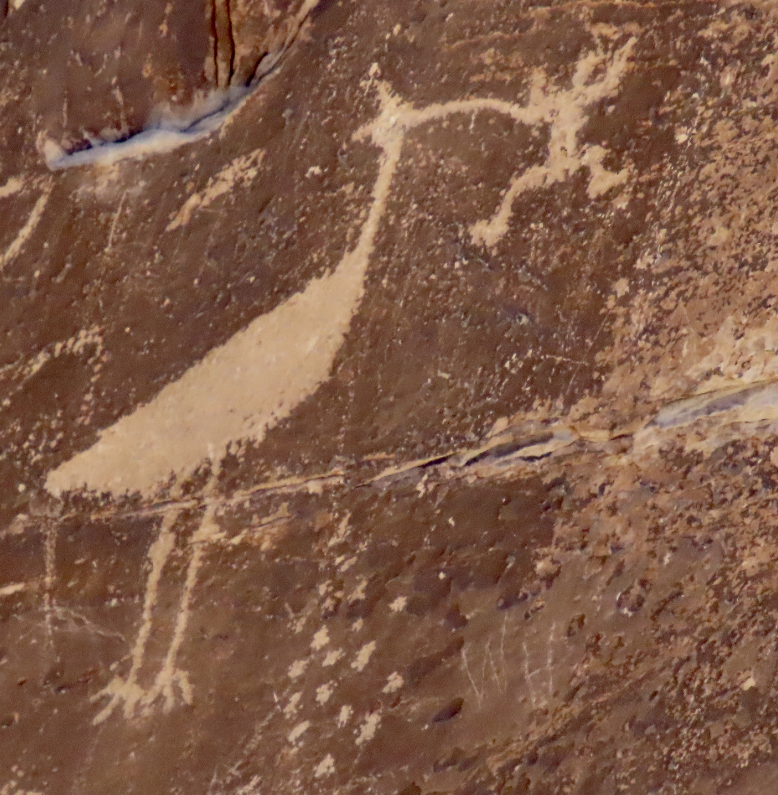
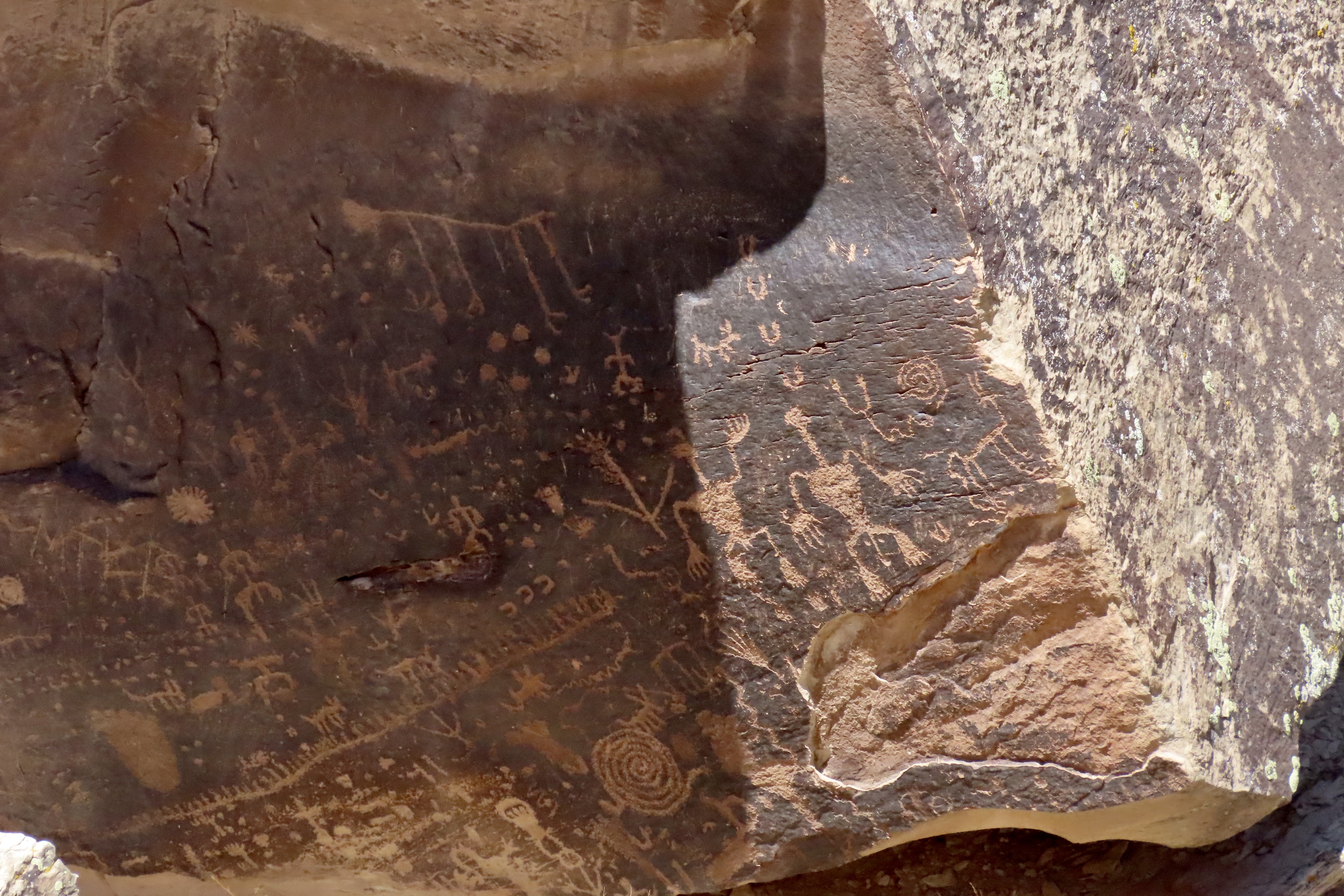
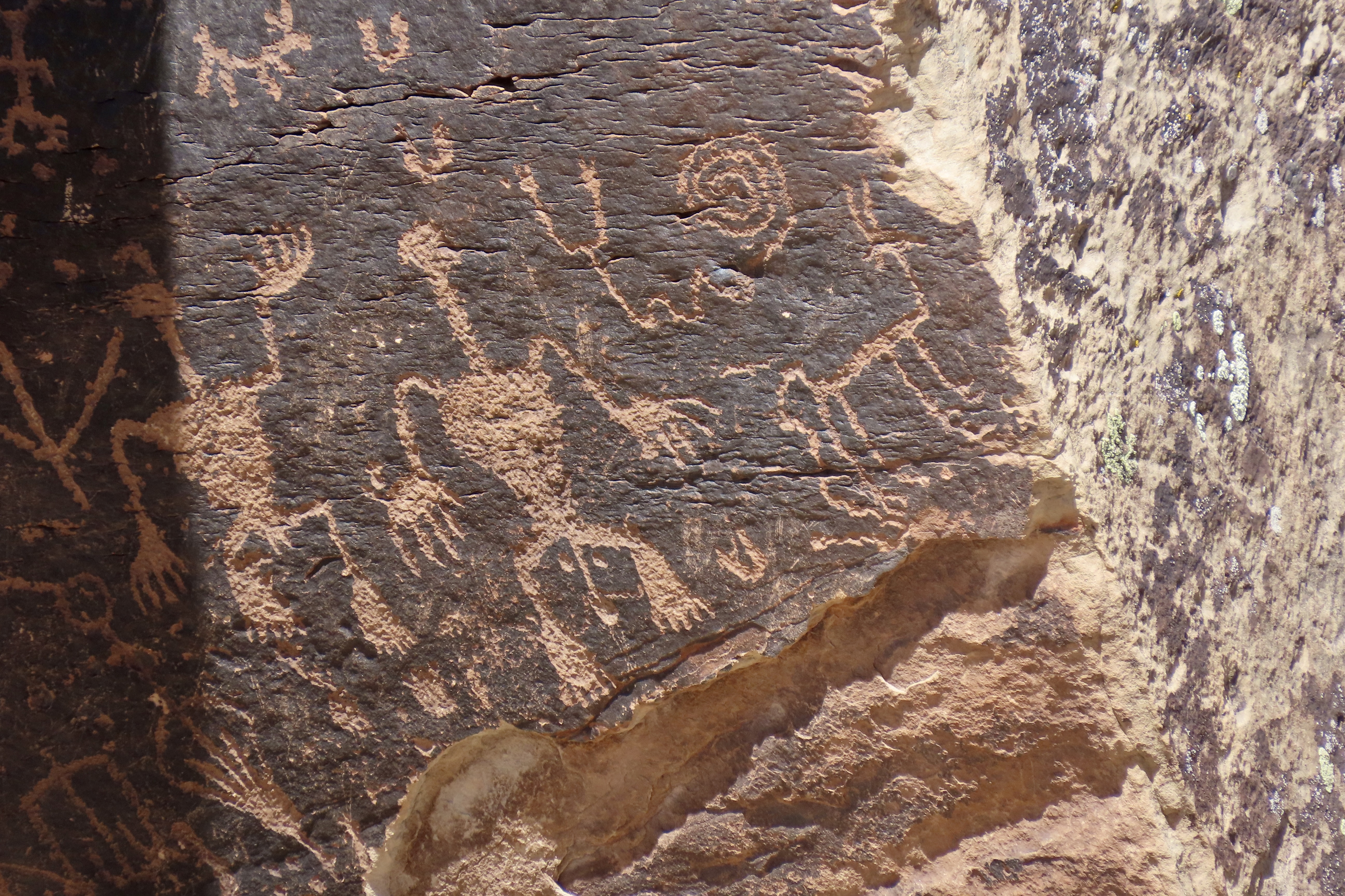
We used to think of Arizona’s Painted Desert and Petrified Forest as two separate units even though they are located next to each other and are part of Petrified National Park: We went to see petrified wood in the Petrified Forest and colorful landscapes in the Painted Desert. In actuality, they are both part of the same geological unit: The Painted Desert. They both display colorful landscapes and they both feature petrified wood. This photo is from one of the overlooks in the Painted Desert section north of I-40. Colorful? Yes. But it also includes chunks and logs of petrified wood. A petrified log can be seen on the lower center left.This is a section of Petrified Forest south of I-40 known as the Teepees. The colors are soft but close to otherworldly. Visitors have the option of entering the National Park from its north or south entrance. Peggy and I chose the north which makes a loop north of I-40 through the Painted Desert following the historic Route 66. One of our first stops was at the Painted Desert Inn. It sits above the Painted Desert providing visitors with a superb view of the surroundings. Originally opened by a private entrepreneur in 1920, the National Park bought it in the mid-30s and rebuilt it in Neo-pueblo style using CCC workers. Fred Harvey took over its management in the 40s utilizing the Harvey Girls to provide service to weary travelers. In 1947, the company’s architect, Mary Jane Colter, was brought on to remodel and renovate the facility. Today, it is a National Historic Site and museum, well worth a visit. The El Tovar Hotel and Desert View Tower of the Grand Canyon are among Colter’s many other notable projects.A local raven was seeking handouts near the Inn.I pointed out a nearby lizard and suggested that if he wanted food, he should hunt for it.He squawked at me. Something about wanting to be paid with in PB&J sandwiches if I was going to use him as a model.One of our favorite views of the Painted Desert.Our good friends from Sacramento, Tom Lovering and Lita Campbell, joined us on our visit to the Petrified Forest National Park. Here, they are perched on a 1932 Studebaker that the Park has placed along the Route 66 segment to symbolize the historic journey travelers followed along the route. The old car now provides a photo op for tourists. BTW, Studebaker got his start in Placerville (aka Hangtown), 3 miles from where I grew up in the Sierra foothills, making wheelbarrows for miners seeking wealth in California’s 1849 Gold Rush.Leaving the north side of I-40, we crossed over to the south side. Our first stop was at the Puerco Pueblo, a village built by Ancestral Puebloans and occupied between 1250 and 1380 CE. The pueblo had over 100 rooms at its peak. Located next to the Rio Puerco (Pig River), it had contacts from throughout the Ancestral Puebloan region and beyond. Artifacts and petroglyphs found at the site and nearby suggest these wide ranging connections.The best known petroglyph next to the pueblo is a water bird, possibly a white faced Ibis, about to chow down on a frog. The round, white petroglyphs may represent water dripping down from the bird.Numerous petroglyphs are found at the Petrified Forest’s Newspaper Rock located about a mile away from Puerco Pueblo.The petroglyphs found at the site Include a wide variety of subjects.The lower right section of the above series featured a naked man and woman. The ancients appear to have had few of the hang ups with nudity our modern society does. I thought of the woman saying, “Hi honey, I’m home.” As for the guy, apparently ‘size matters.’ We really liked the coyote on the right and immediately thought of Wile E Coyote and the Road Runner. The spiral above is thought to represent the journey of Ancestral Puebloans from the underworld in their search of a permanent home.
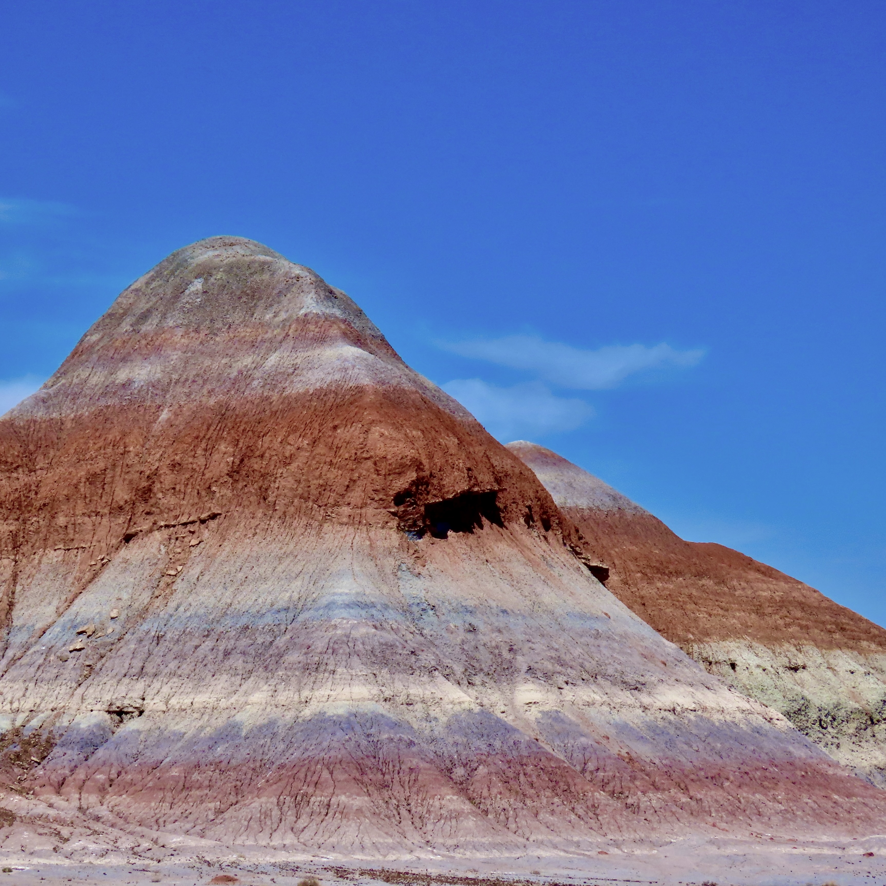
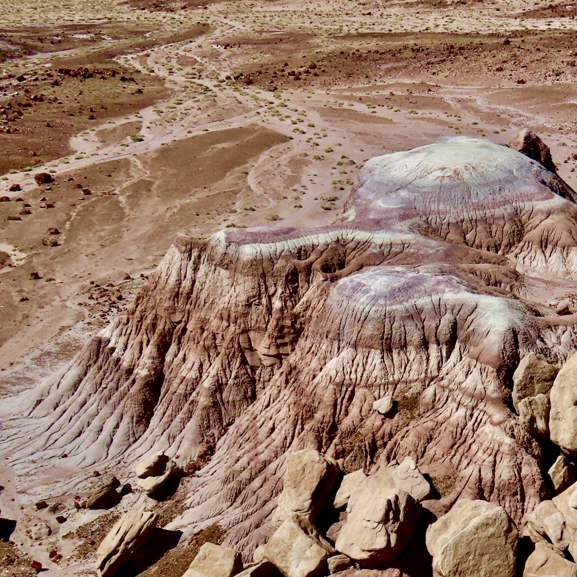
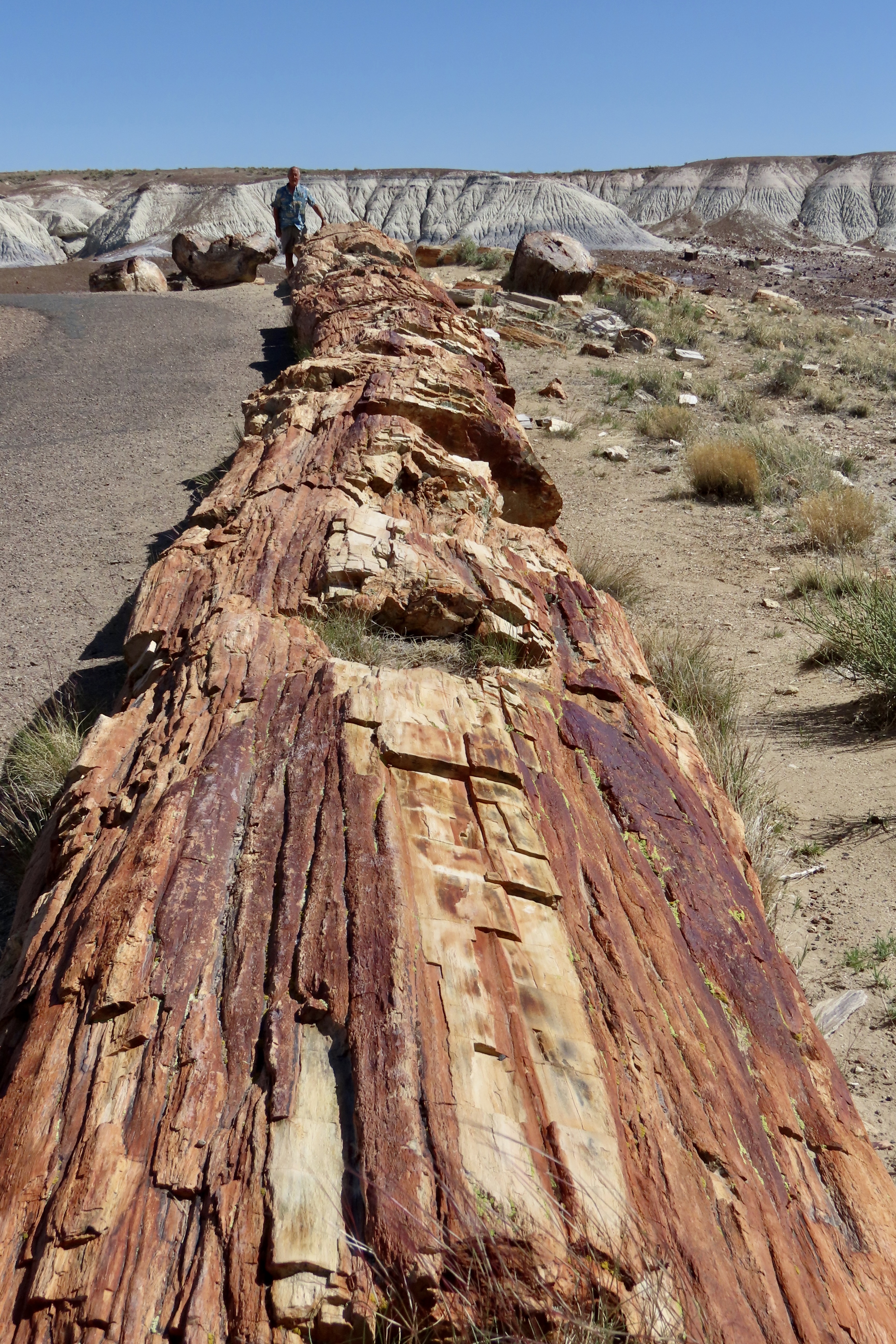
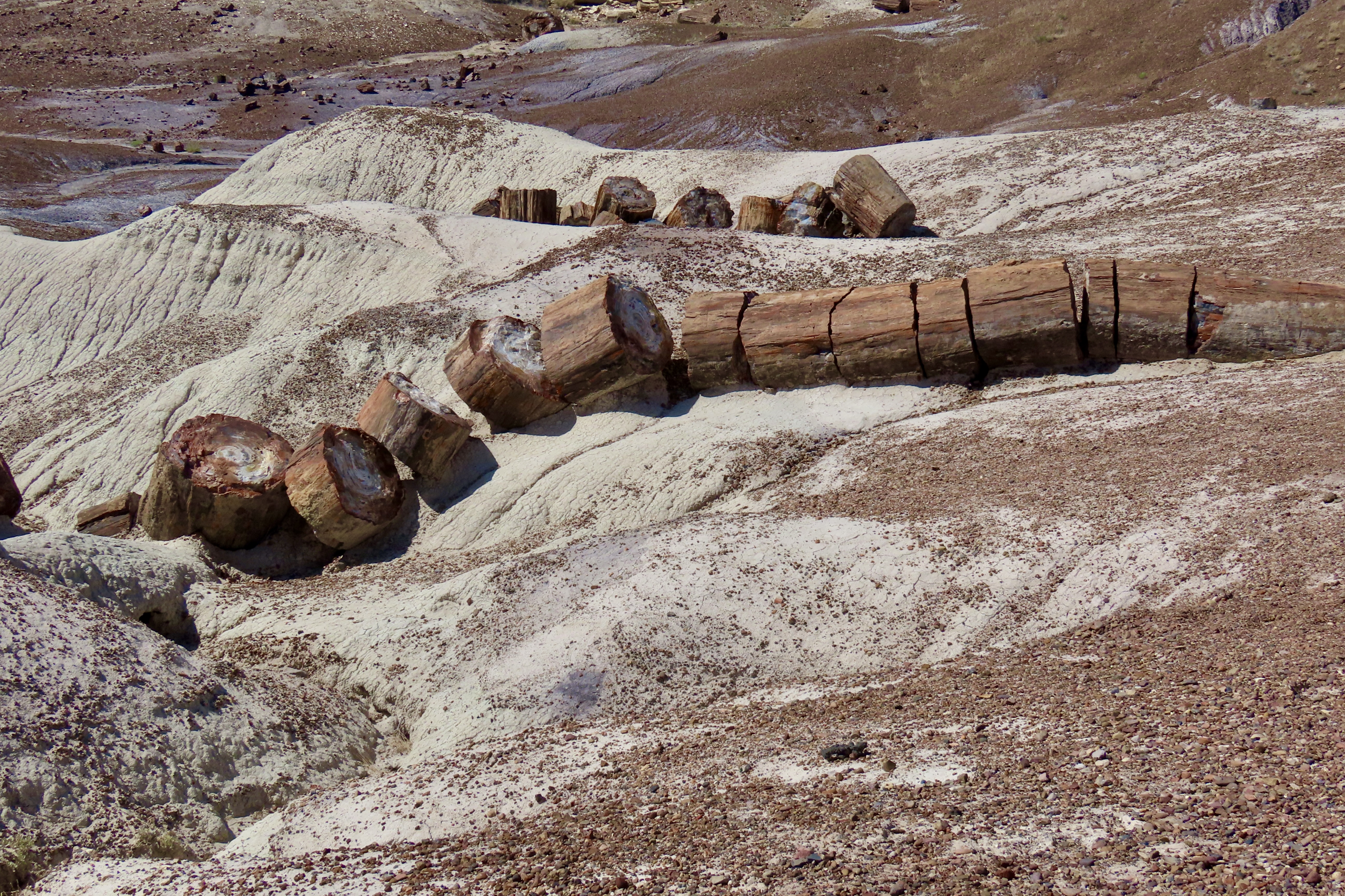
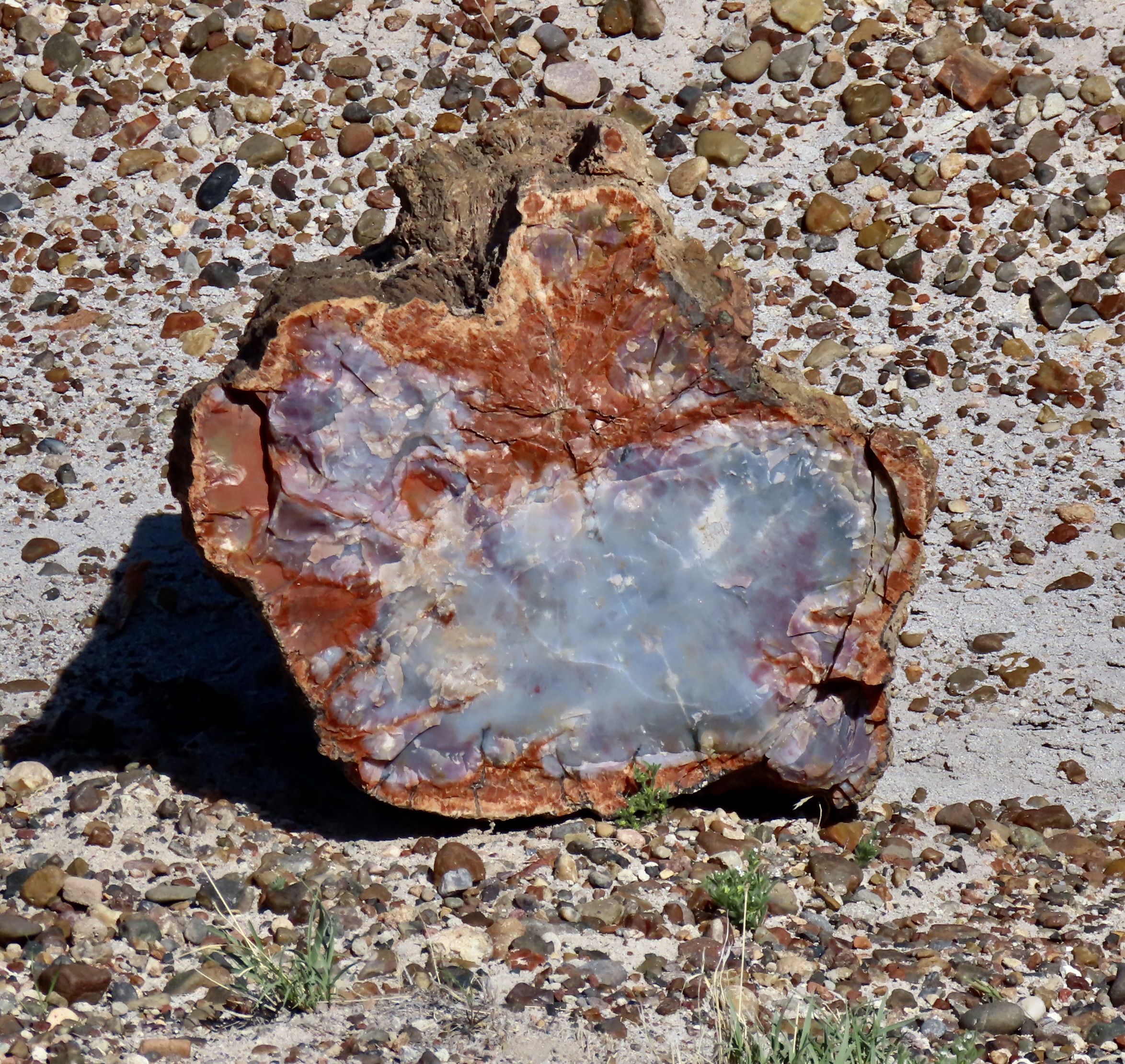
Peggy found several petroglyphs she might include in her next word search book— but don’t expect to find the naked couple.Next we arrived at the Teepee mountains, which I showed in the second photo. The colorful, layered rocks are part of the Chinle Formation deposited during Triassic period between 205-227 million years ago. The colors are determined by minerals in the rocks and the conditions at the time at the time they were deposited. A side road south of the Teepees takes visitors into the Blue Mesa, which provides an up-close perspective on the Chinle Formation. We highly recommend it. The following photos show why.Multiple colors,Including white.And interesting land formations.Another example.And tons of petrified wood. Perspective makes this log on a pedestal seem bigger than it is, but it is big! Broken off pieces surround the pedestal.This brings us to the petrified wood section of our post. I used Tom for perspective in this and my next photo to demonstrate how large some of the logs are.Tom appears tiny down at the end of this long, petrified log. Also, note the petrified bark that is still on the tree.This big fellow was making its way down a hill. Timber!One of the things fascinating about petrified wood is the variety of colors. They are created by different minerals that replace the wood in the petrification process. For example, red, brown and yellow come from iron oxide, white from silicon dioxide, black from carbon, blue and green from cobalt, chrome, and copper, etc.Not sure what made the holes but look how rich the blue is. You can also see the bark here.One can wander around for hours admiring the different logs.There are hundreds of them.A visit to the Rainbow Forest Museum concluded our visit. This large petroglyph of a mountain lion is one of the museum’s prime exhibits and serves as a symbol of the park. I have a T-shirt with it on the back.I persuaded Tom to take his photo with the skeletal remains the museum’s phytosaur, a large crocodile like reptile from 225 million years ago. It’s known as Smiley. That’s a wrap for today. Next up: The crazy trees and fabulous rocks of Joshua Tree National Park.
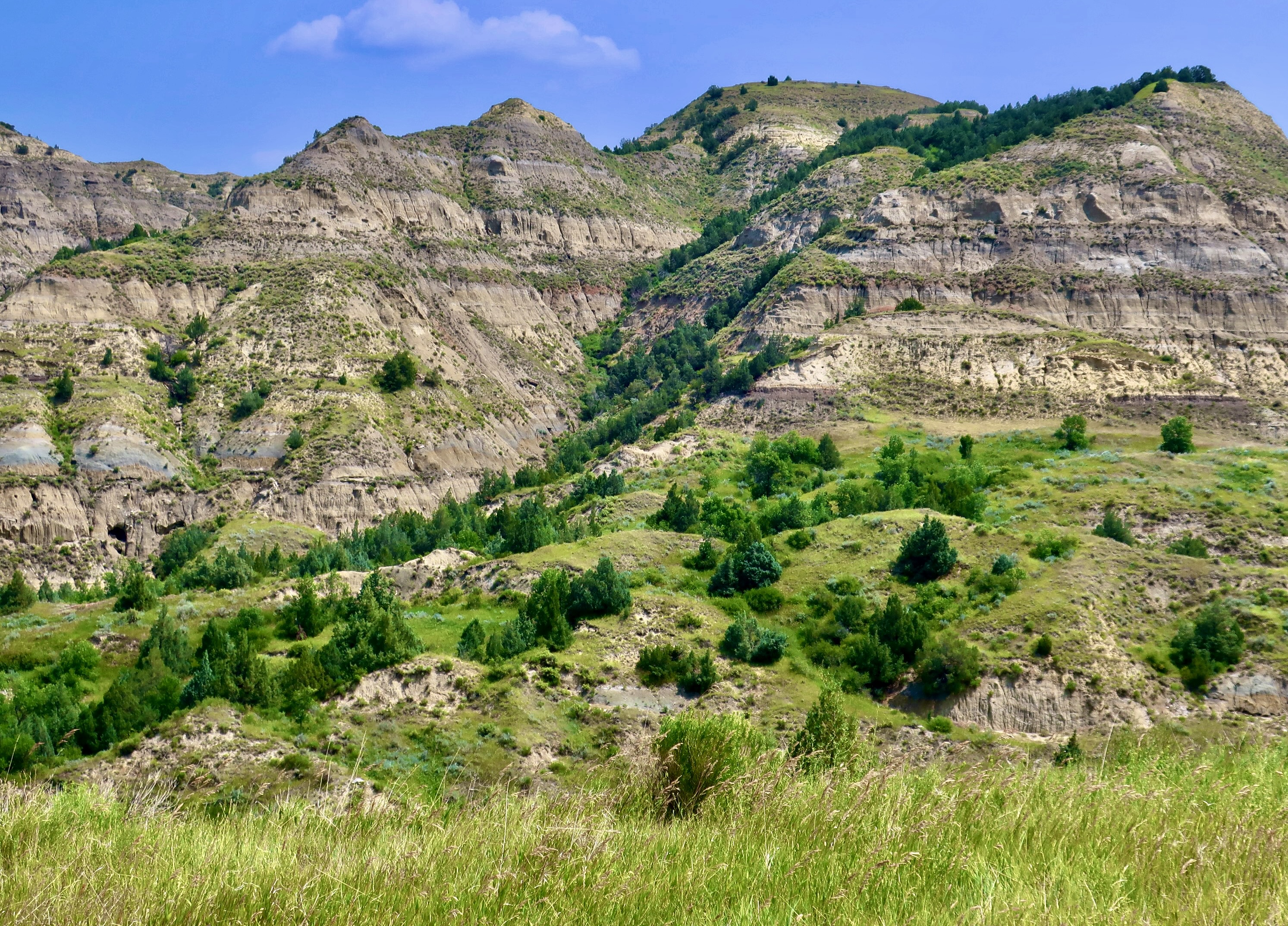
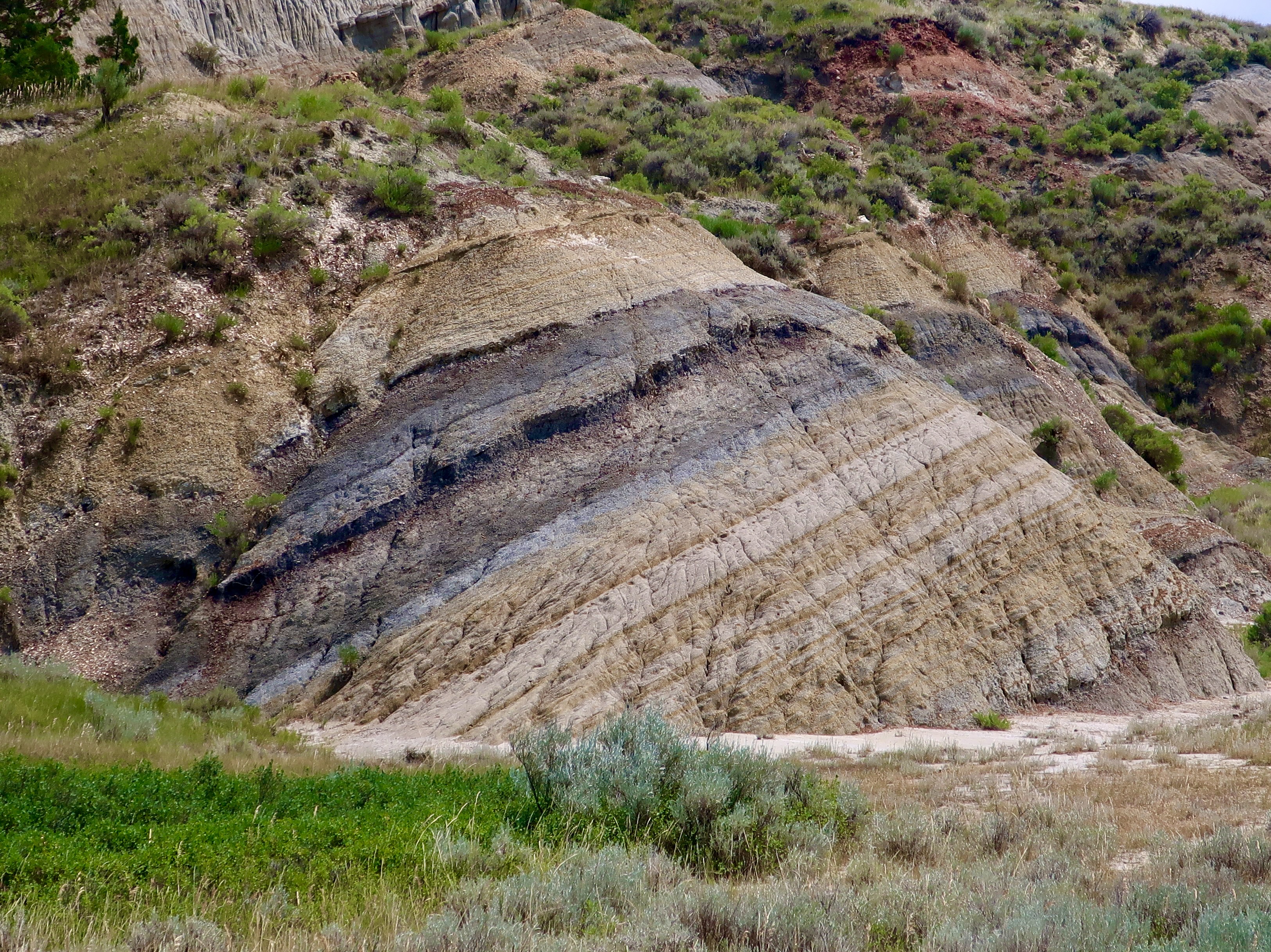
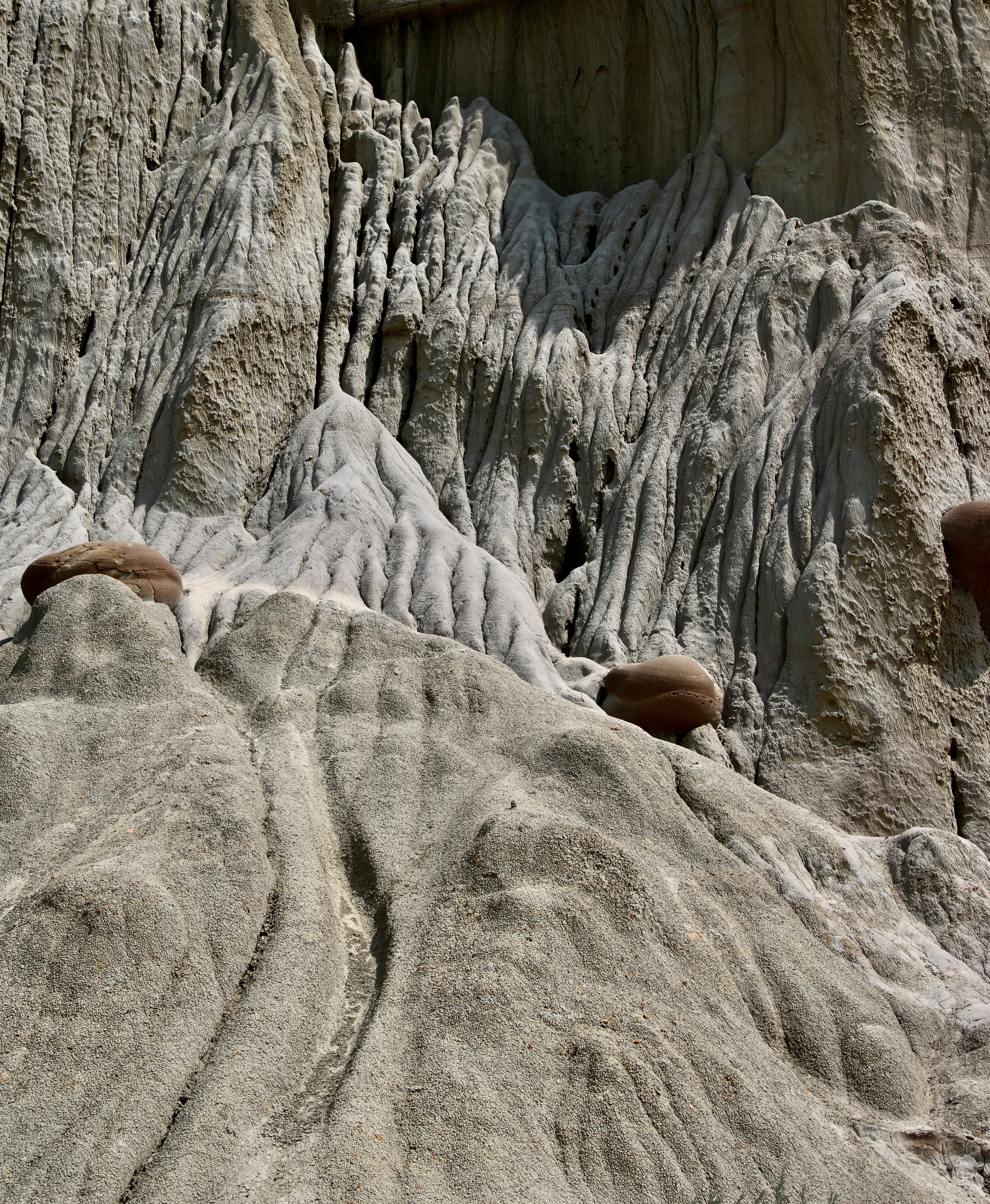
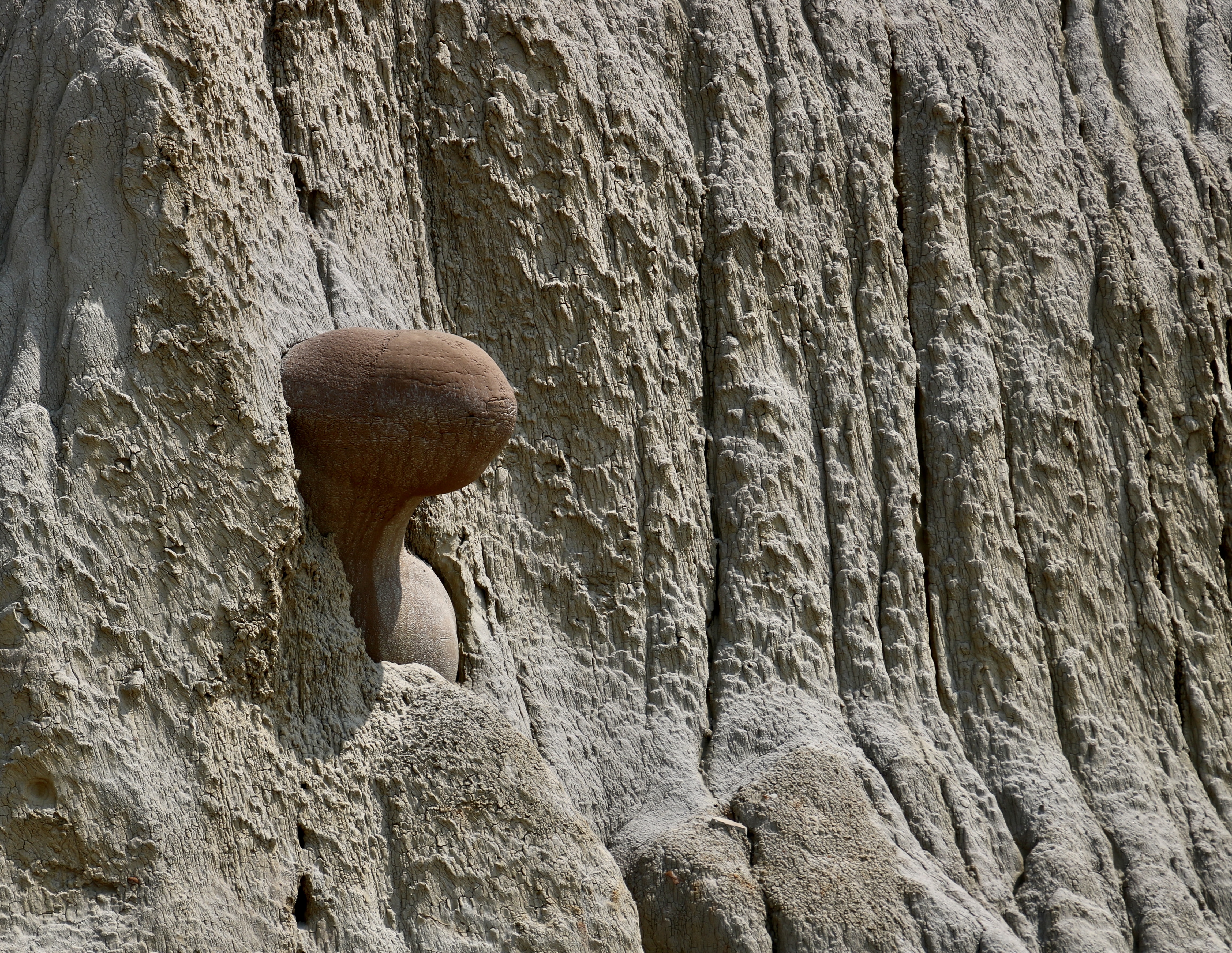
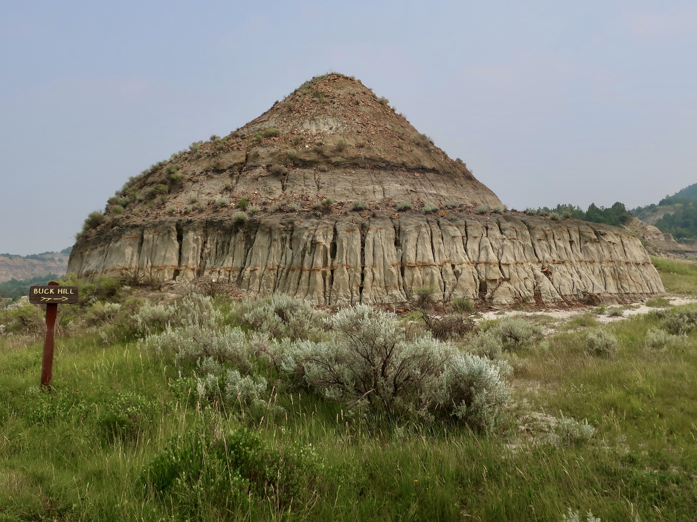
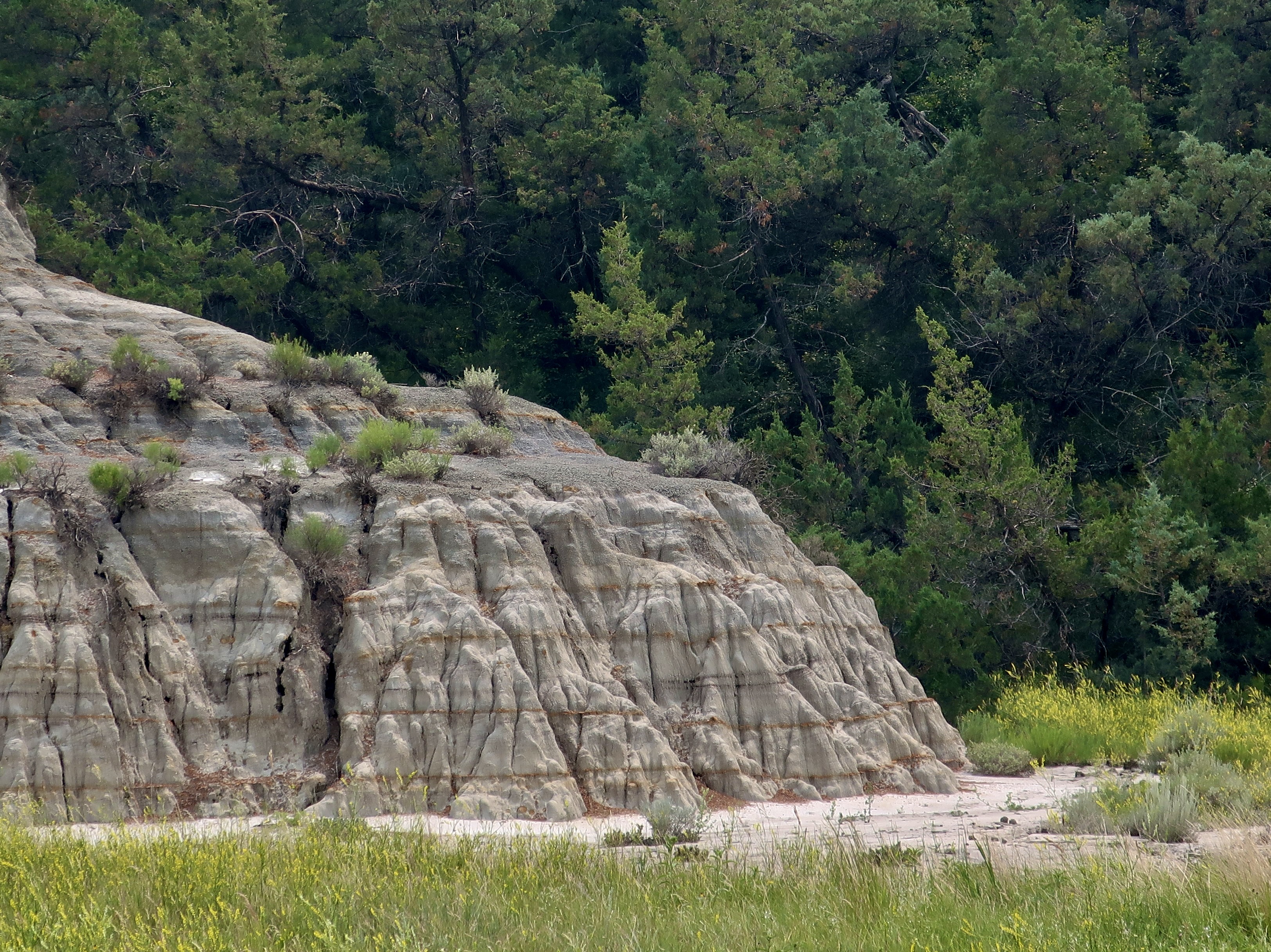
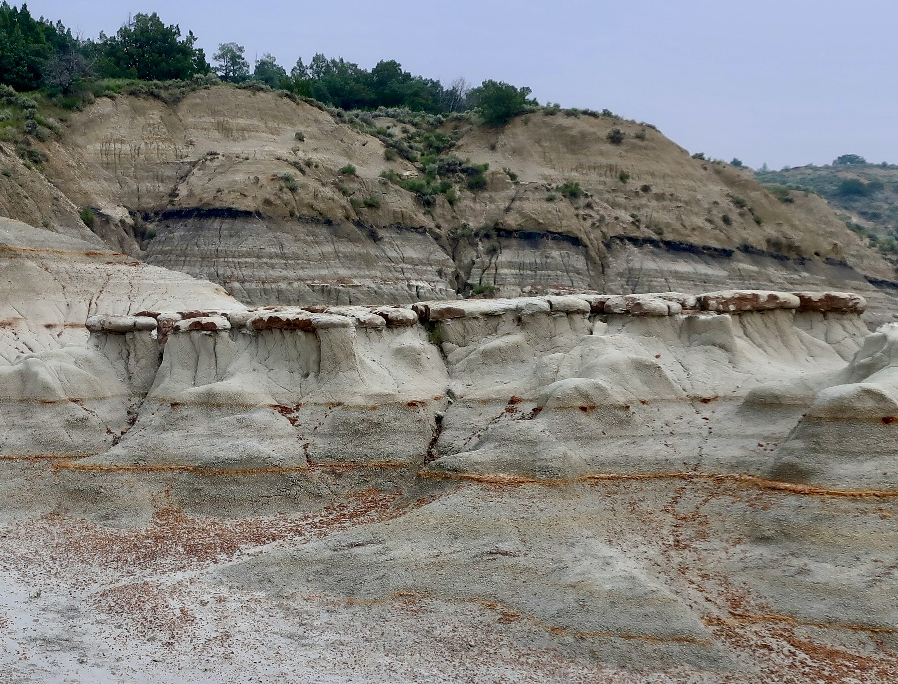
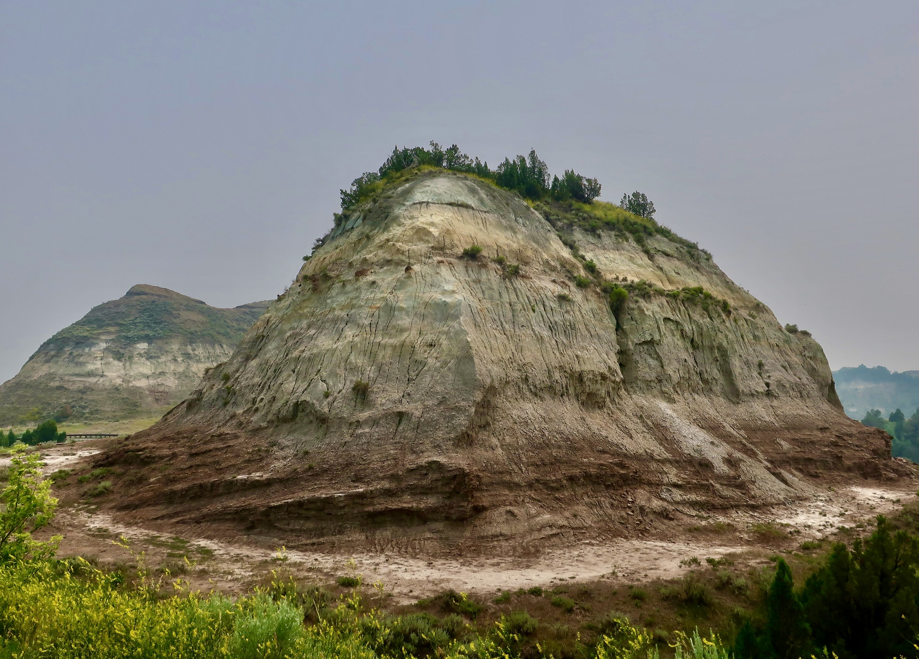
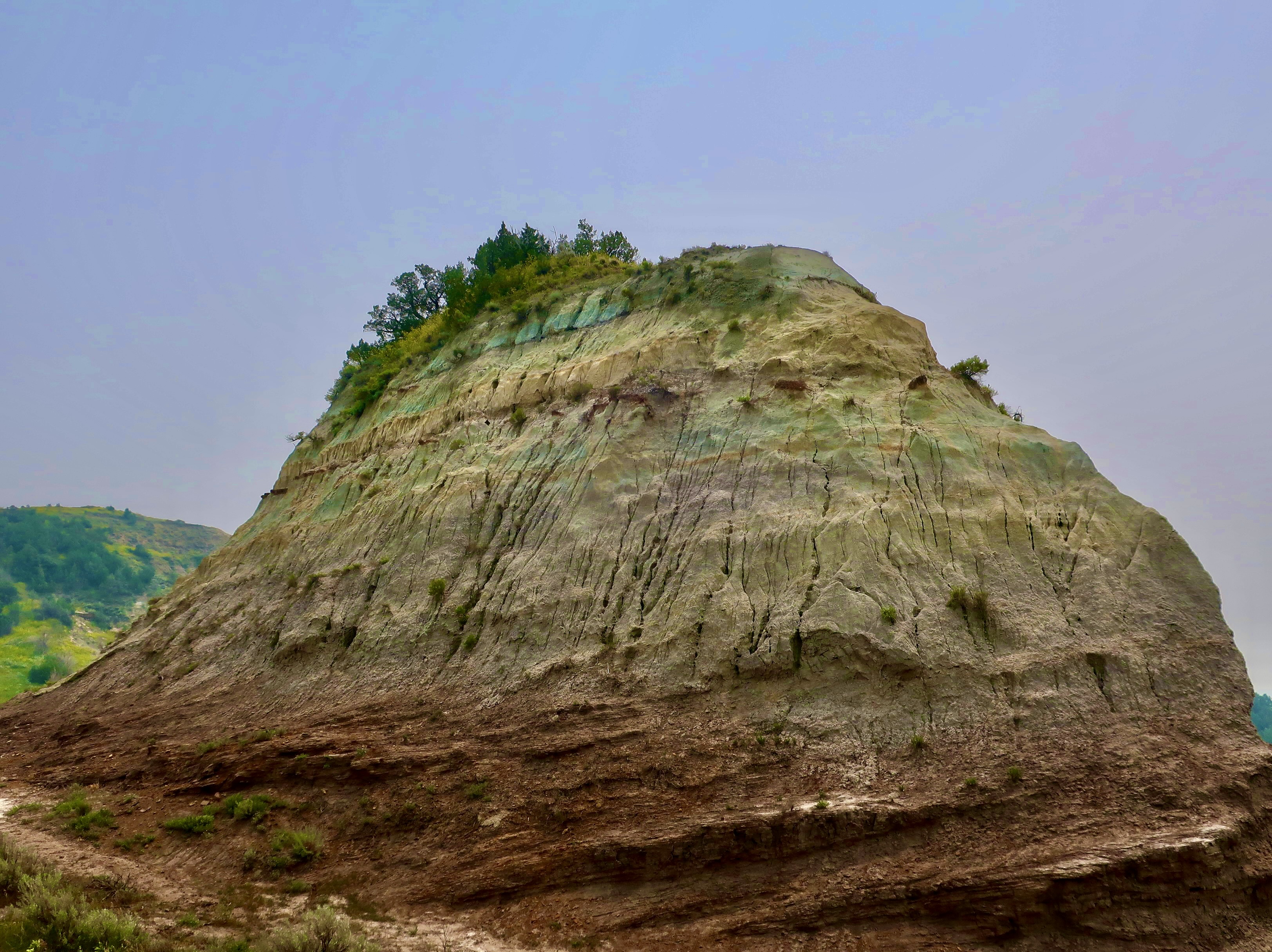
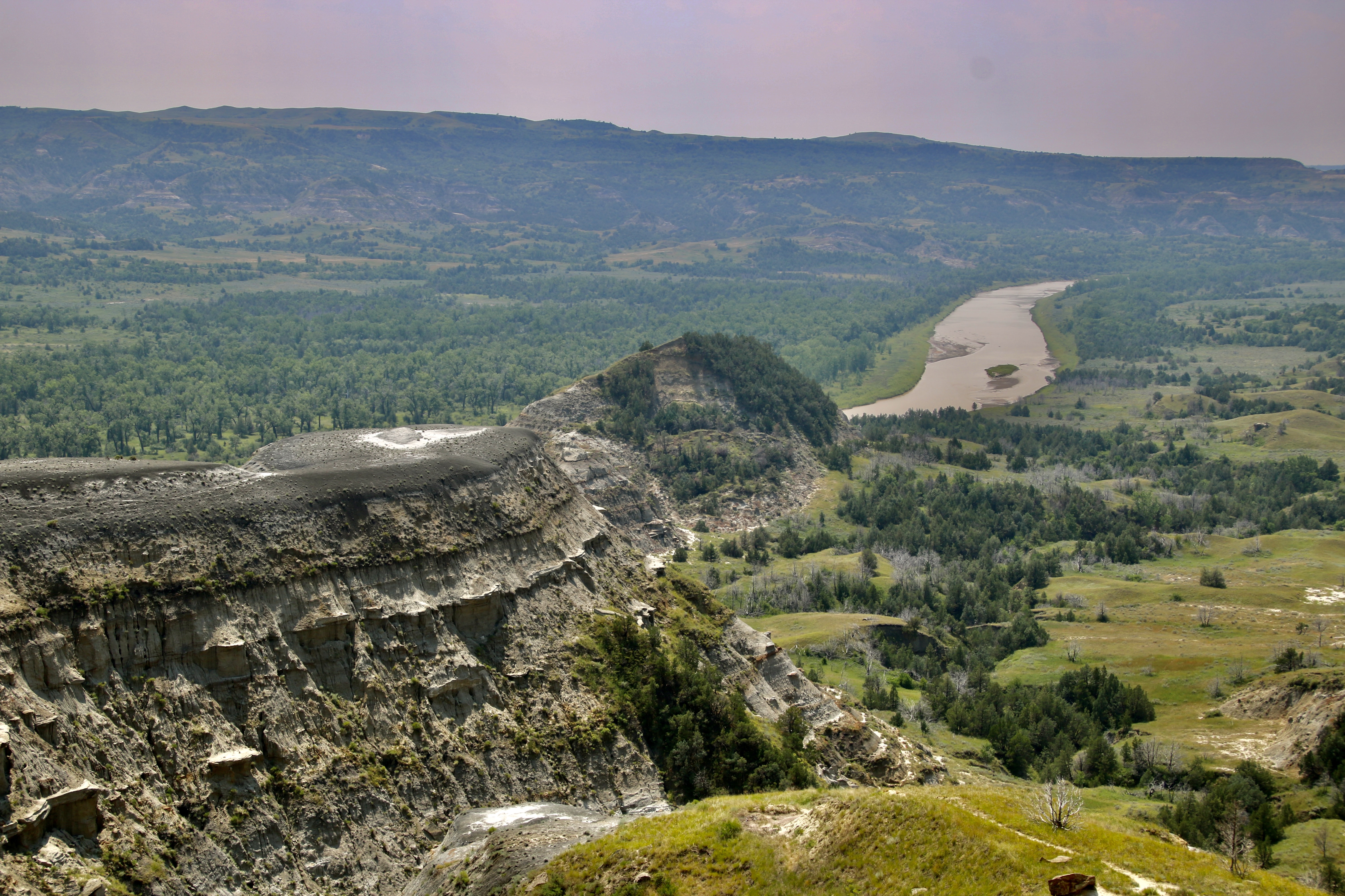
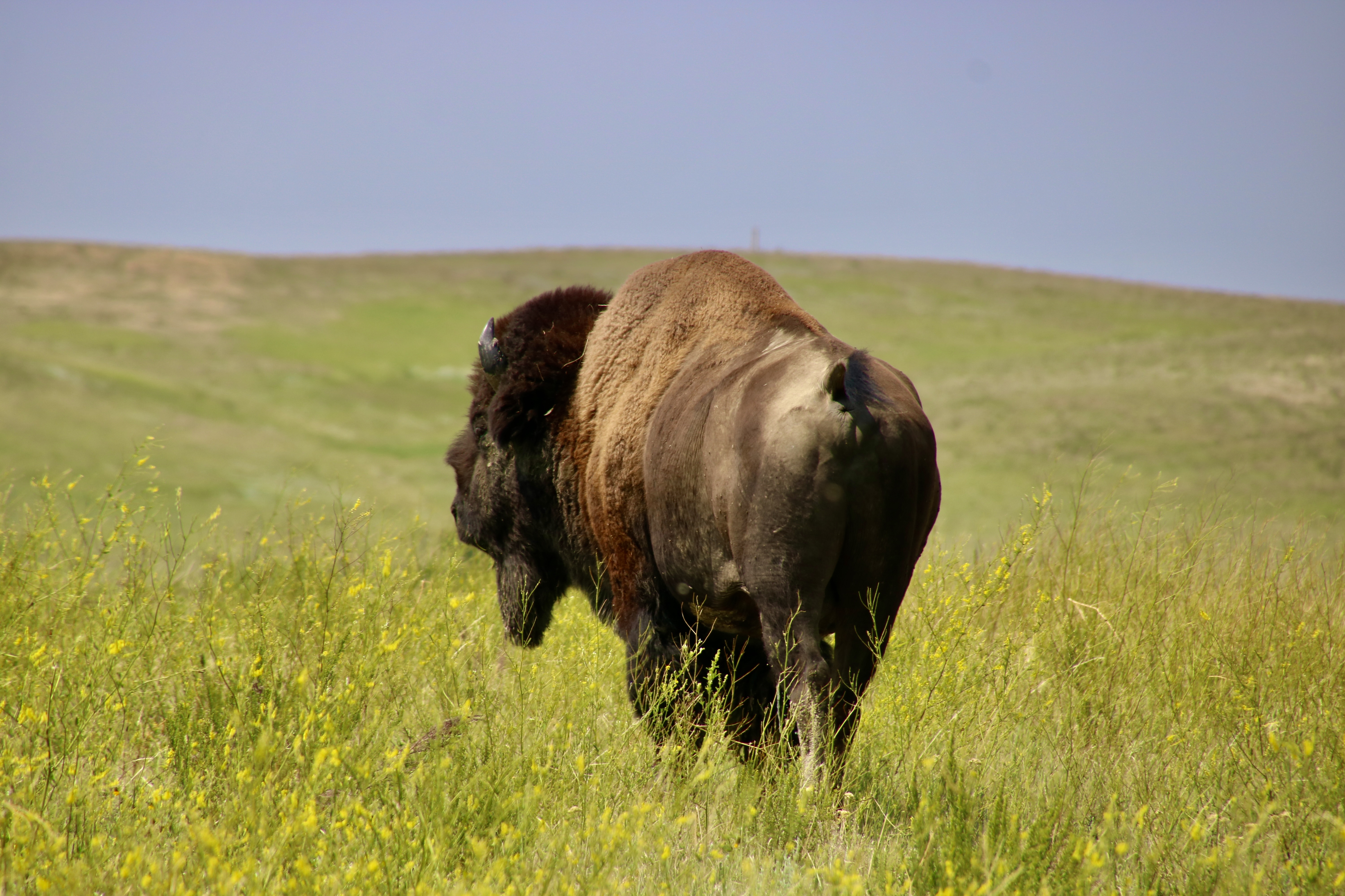
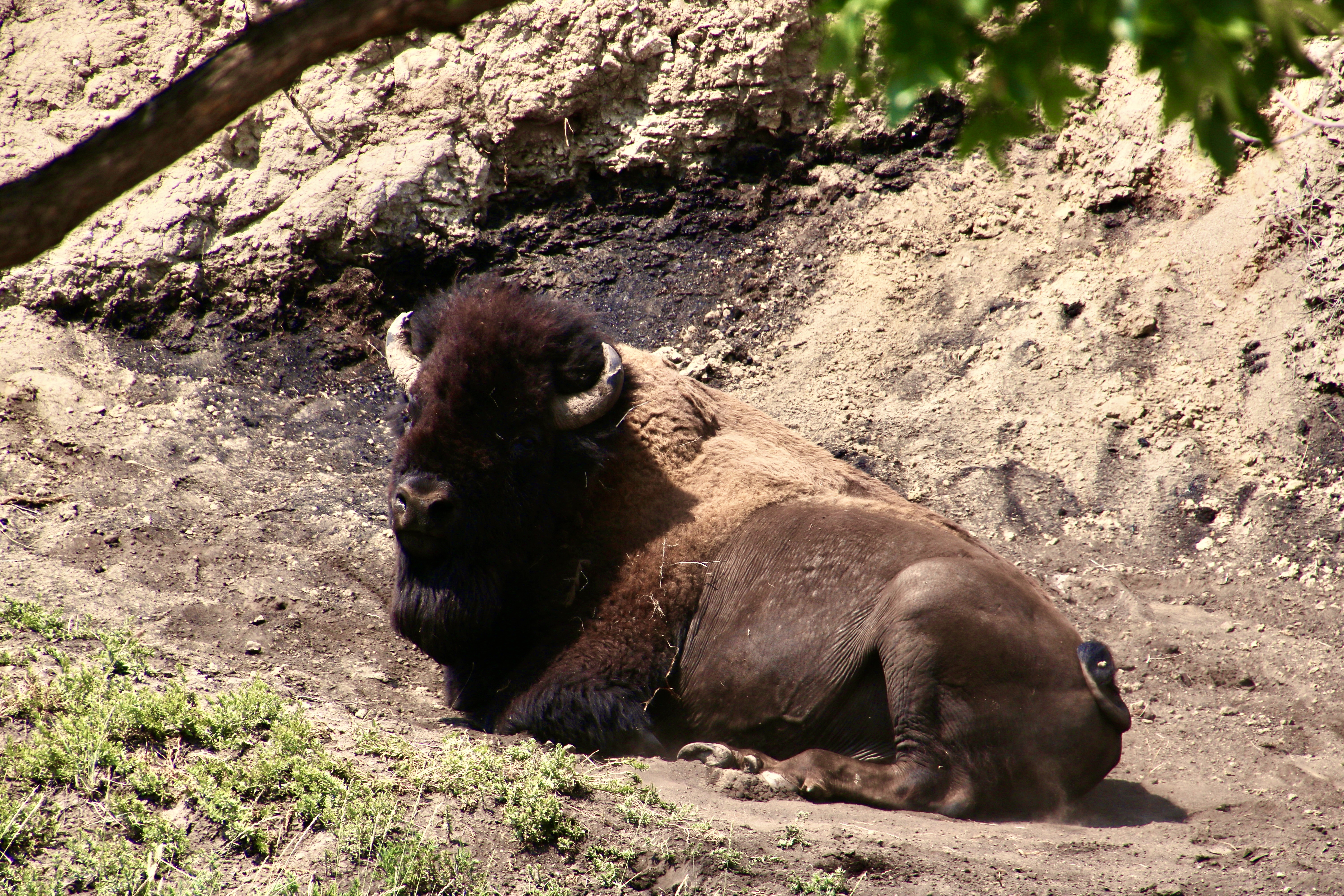
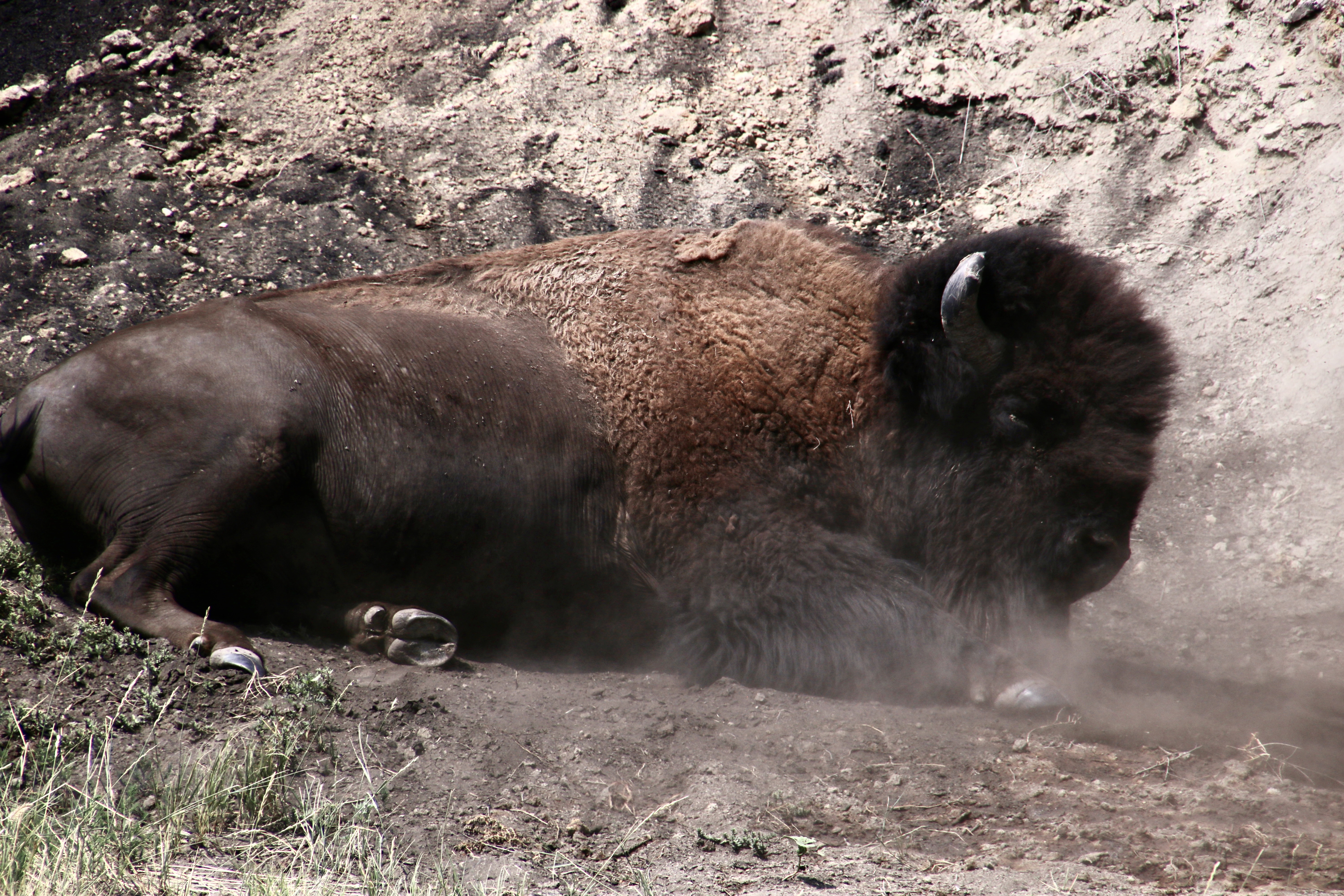
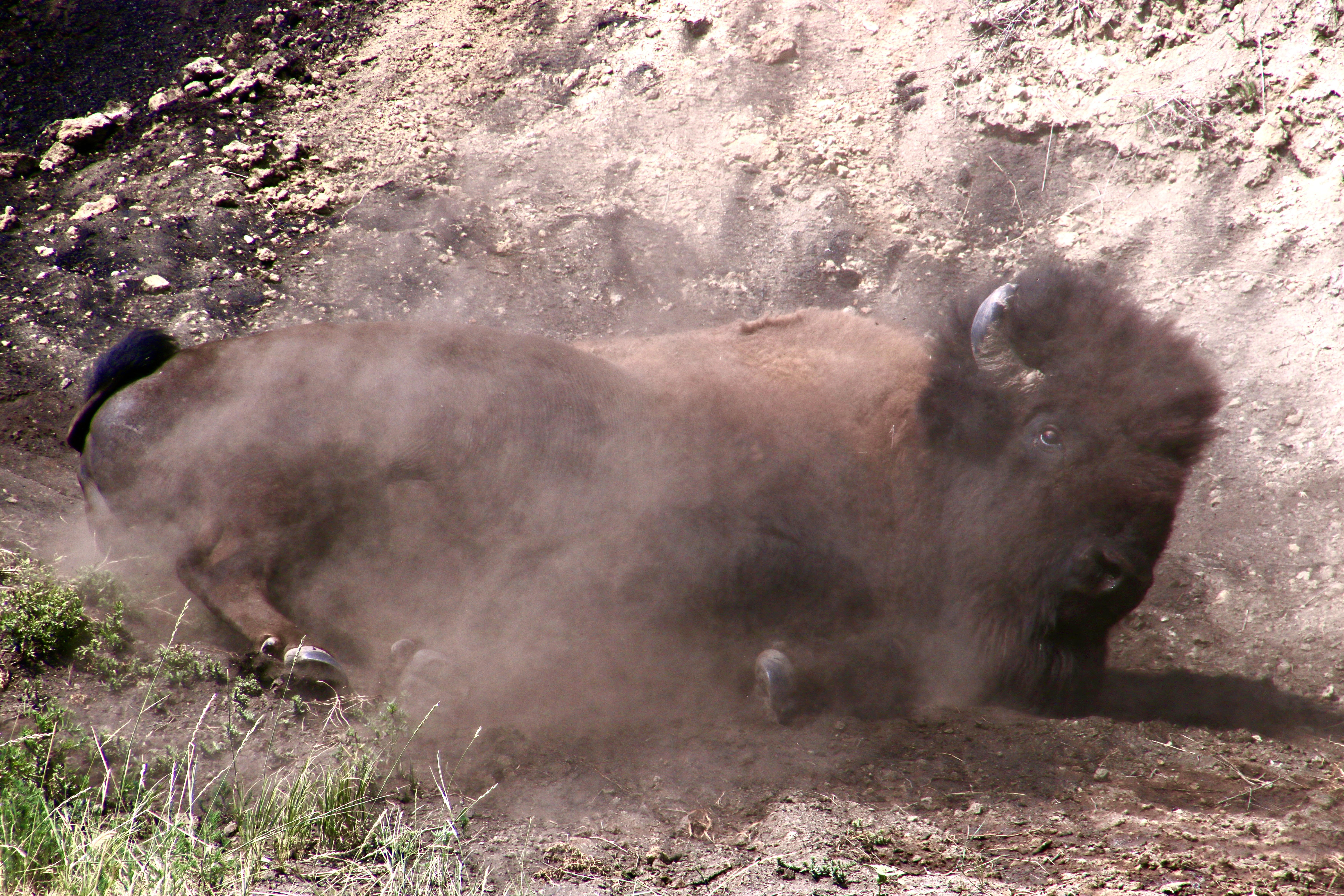
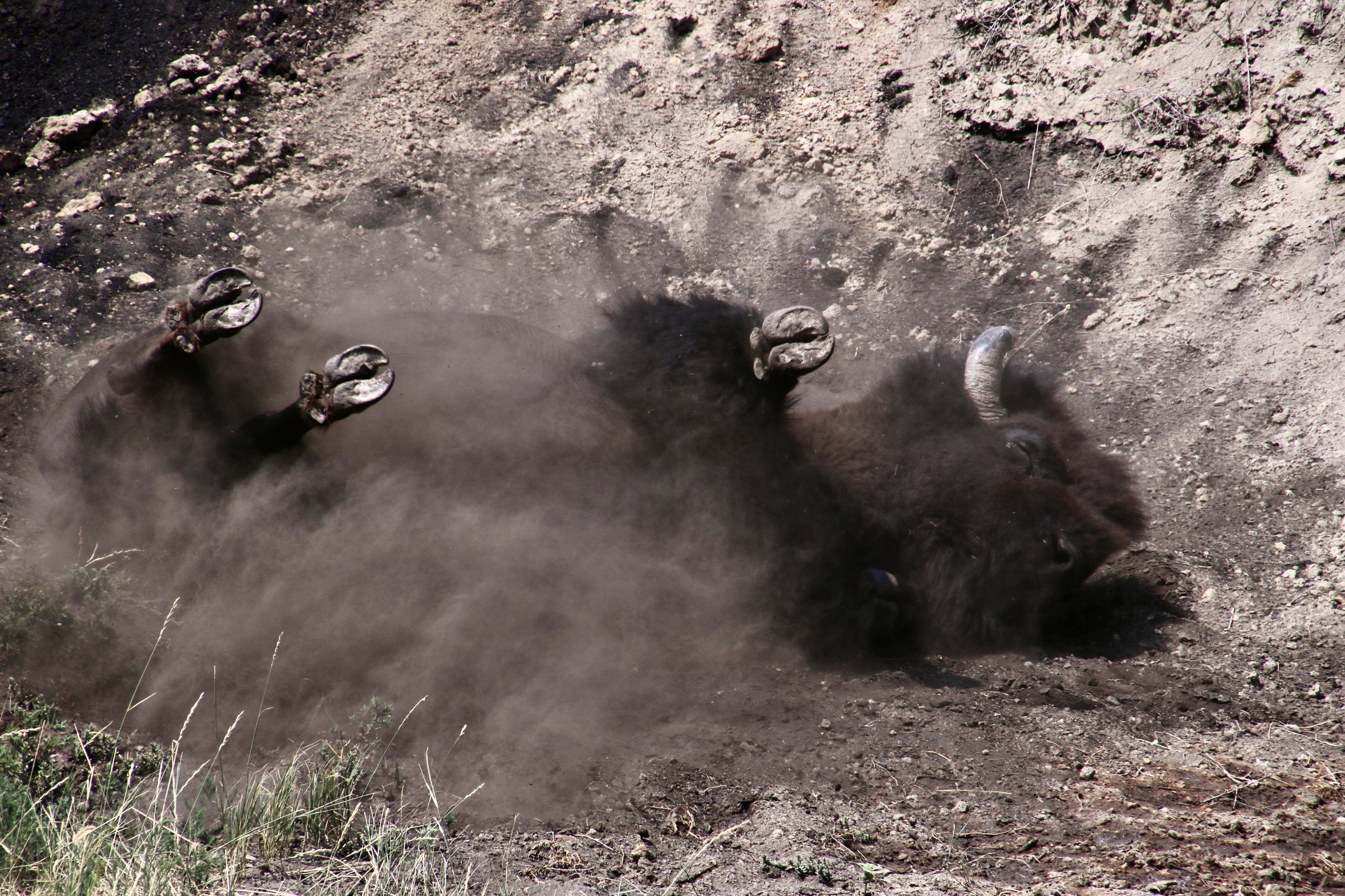
Multi-colored layers of sandstone, clay and shale infused with seams of black coal— all easily eroded rocks— are what give Theodore Roosevelt National Park its unique, otherworldly look. They put the Bad in badlands in the sense of teen slang, like really great, like wow!TRNP is located in North Dakota close to the border of Montana. Canada is to the north.The park is divided into a north and south section. Peggy and I spend the majority of our time in the north section, which has far fewer visitors and, in my opinion, is more scenic. Visitors will find numerous multi-colored hills, like this…And this— an example of earth slump where a whole portion of one of the cliffs came sliding down intact. Note the coal seam. Lightning can actually set these seams on fire. They can burn for years.A close up. Coal was formed some 300 million years in large swamps where dead plant materials settled to the bottom and were eventually compressed into rock. Petrified wood from redwoods, cypress and cedar can also be found in the park.The strangest rocks, however, are these cannon ball shaped concretions that are formed when minerals settle out of water in sandstone and shale, around a pebble or fossil in layers.How much more unworldly can you get than this scene where the mud-like rock seemingly melts.And appears to have flowed out of holes and cracks.In addition to its cannonball look, the concretions also took other forms.Another example of a concretion.There seems to be no end to erosion carved features at TRNP. BTW, I think this is the way to Rock Hill, not the hill. A park information sign informed us that the grass on Rock Hill has never been plowed, making it one of the rare examples of pure native grass found in North America. The eroded hill here had a beautiful setting.Capstones, made up of harder rocks, help create the layered look.I felt that this example had a jumbled mass of erosion that had a dark, post-apocalyptic feel to it…So I added a noir filter.On a brighter note, we loved this massive hill with its trees on top.A side view. Like a massive vessel rising out of the earth.A distant view of the Little Missouri River that flows through TRNP. Note the small blip on top of the ridge.It’s the hill on top. I promised buffalo, right? There are lots of them in TRNP. But I promised more: Buffalo wallowing.That’s what this big fellow is about to do.Wallowing is all about stirring up dust. Buffalo do it to to discourage biting flies and shed fur. The males also do it during mating season to leave behind a scent and demonstrate what big, strong fellas they are. It’s important to get dust all over their bodies.And this involves…Getting down and dirty!
That’s a wrap on Theodore Roosevelt National Park, but even more it’s a wrap on our national park series. Peggy and I hope you’ve enjoyed it. In addition to the six I have featured here, there were the four others I included in our trip up the coast this spring and Everglades National Park we visited in February for a total of 11 in 2022.
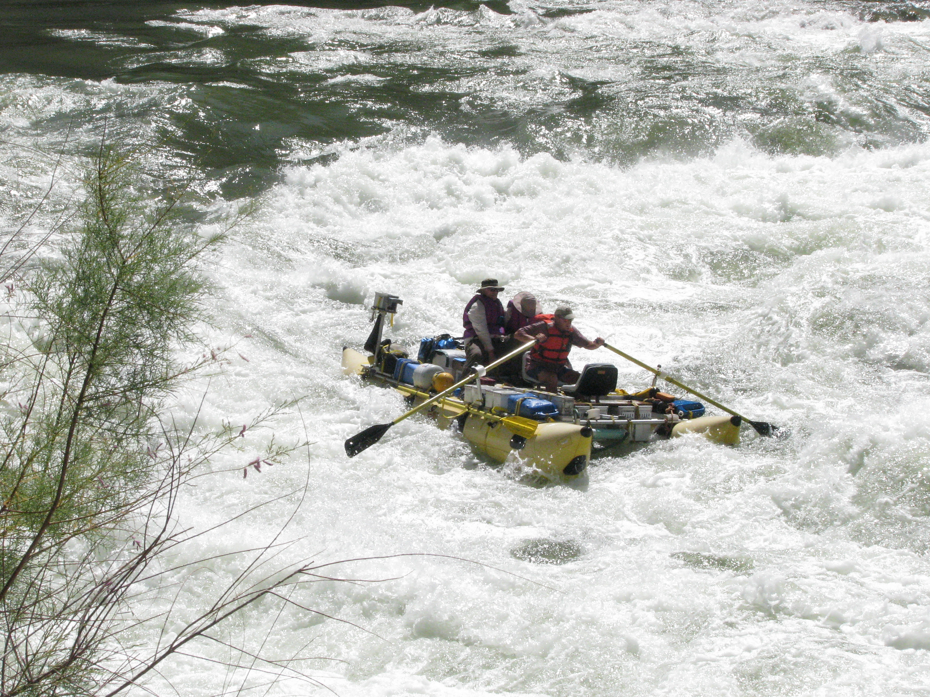
But (isn’t there always a but), Peggy and I are going to bring you one more national park as part of our next series: Great Rivers. We will return to the Grand Canyon with a twist: Instead of looking down, we will be looking up— floating down the Colorado River on a 20 day private trip by raft through the park. I’ve blogged about the trip before, so I know several of you are familiar with it. This will be different, however, a photo essay stretched out over 6 posts with lots of new photos that Peggy and I haven’t included before.
First, however, Peggy and I are taking a vacation. (Do I hear a snort in the background. Isn’t that what you always do?) Actually, it will be a vacation from blogging as we float down the Danube River. Think of it as a vacation from a vocation, to the degree blogging is a vocation/work. I’m sure fellow bloggers will agree, it certainly feels like it at times. 😳We will be missing from the blogosphere for five weeks: This week in preparation for the trip, three weeks in Europe, and one week in recovery. I’ll check in from time to time to respond to comments. Beyond that, we will see you in mid-October!
Peggy and I hold on tight while Steve Van Dore rows us through rapids on the Colorado River. Is Peggy praying? Grin. (Photo by our friend Don Green)
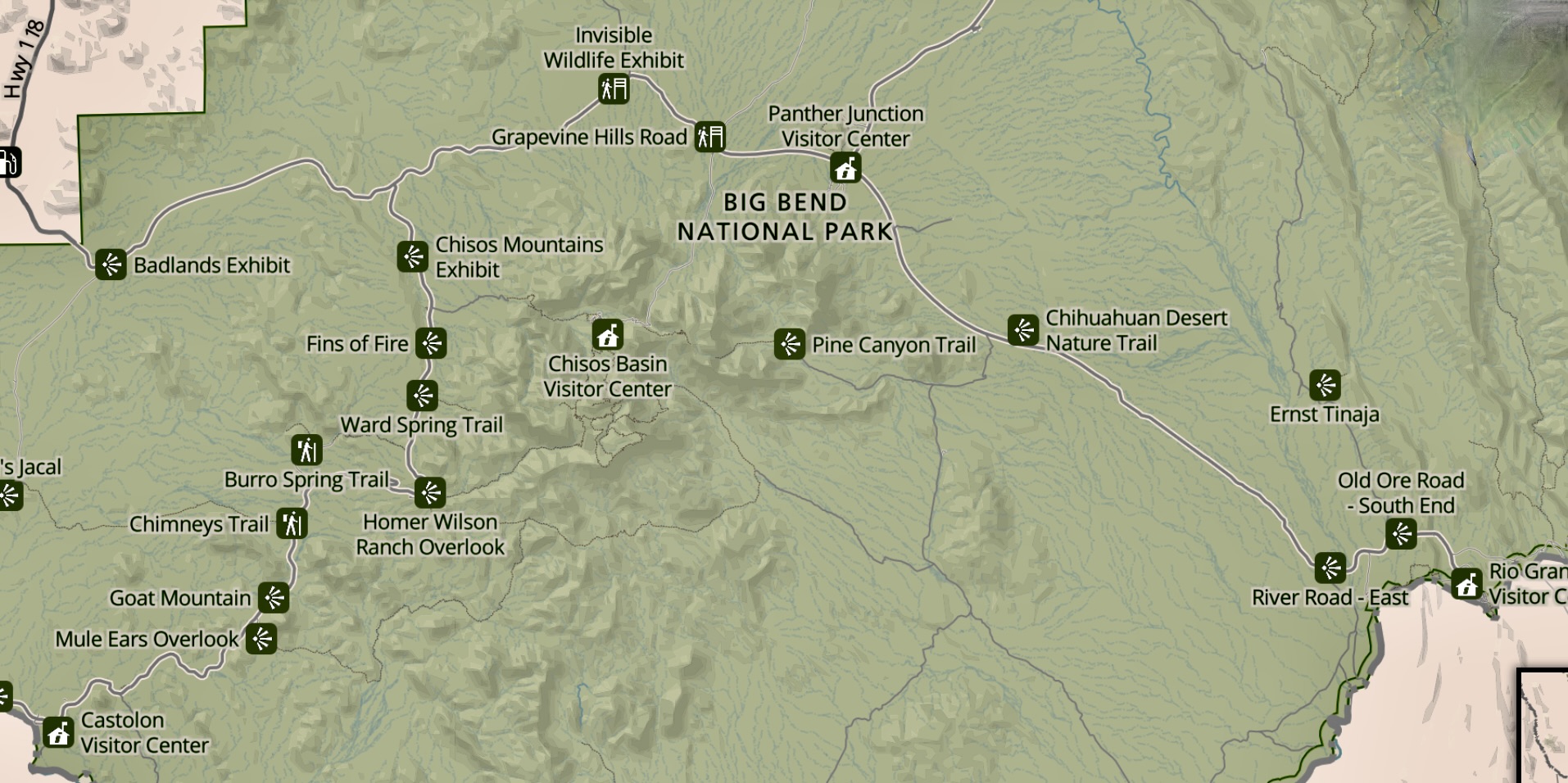
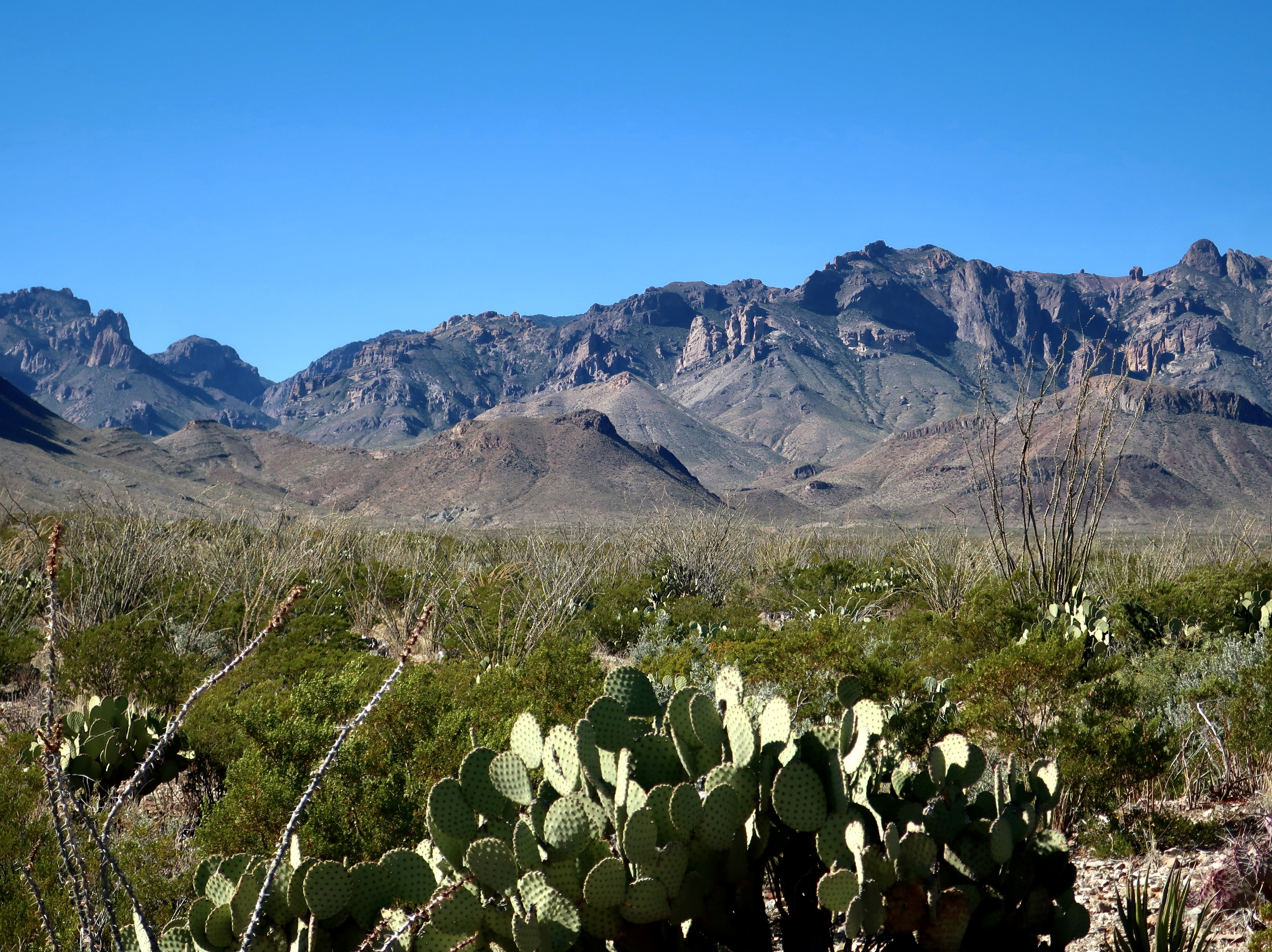
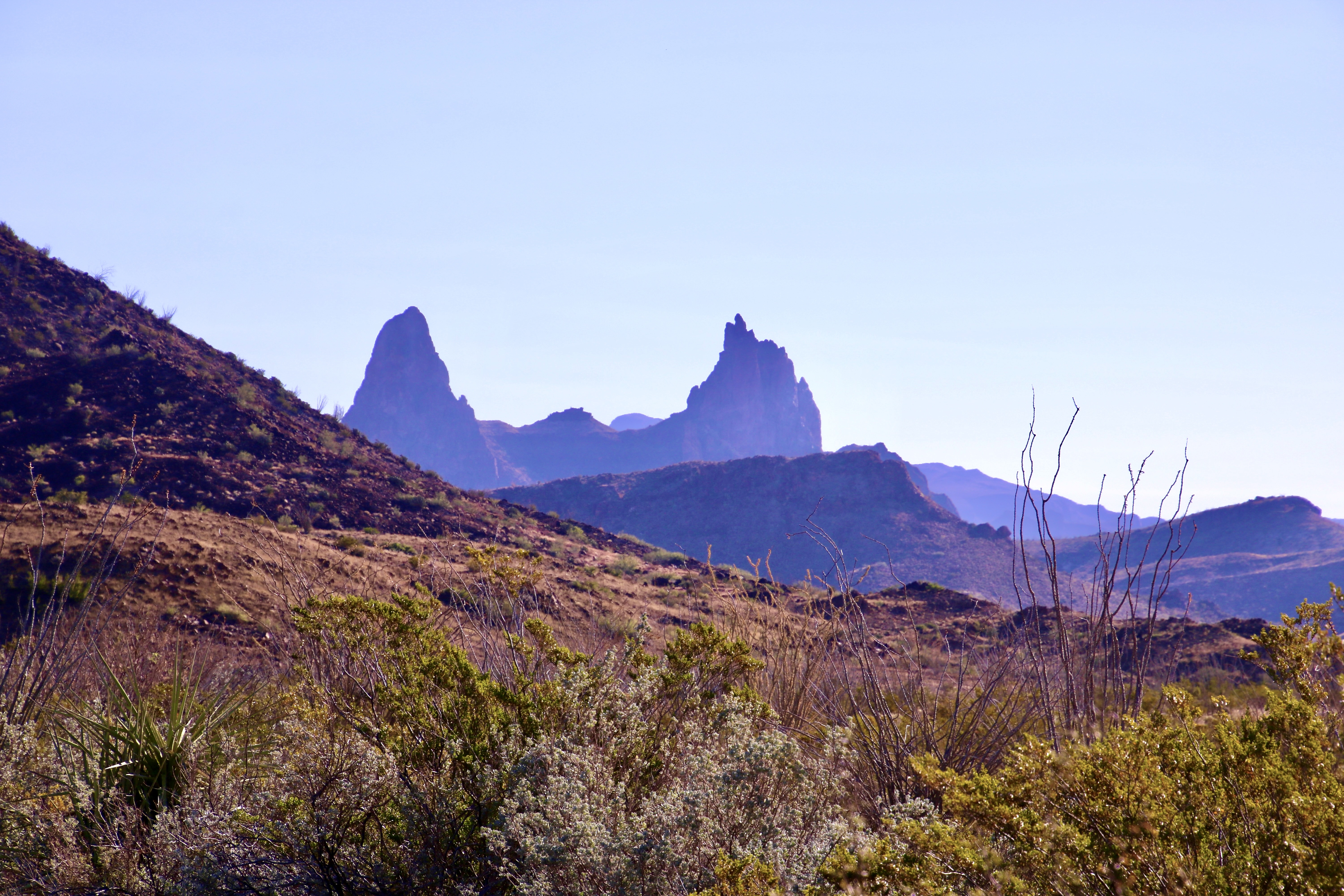
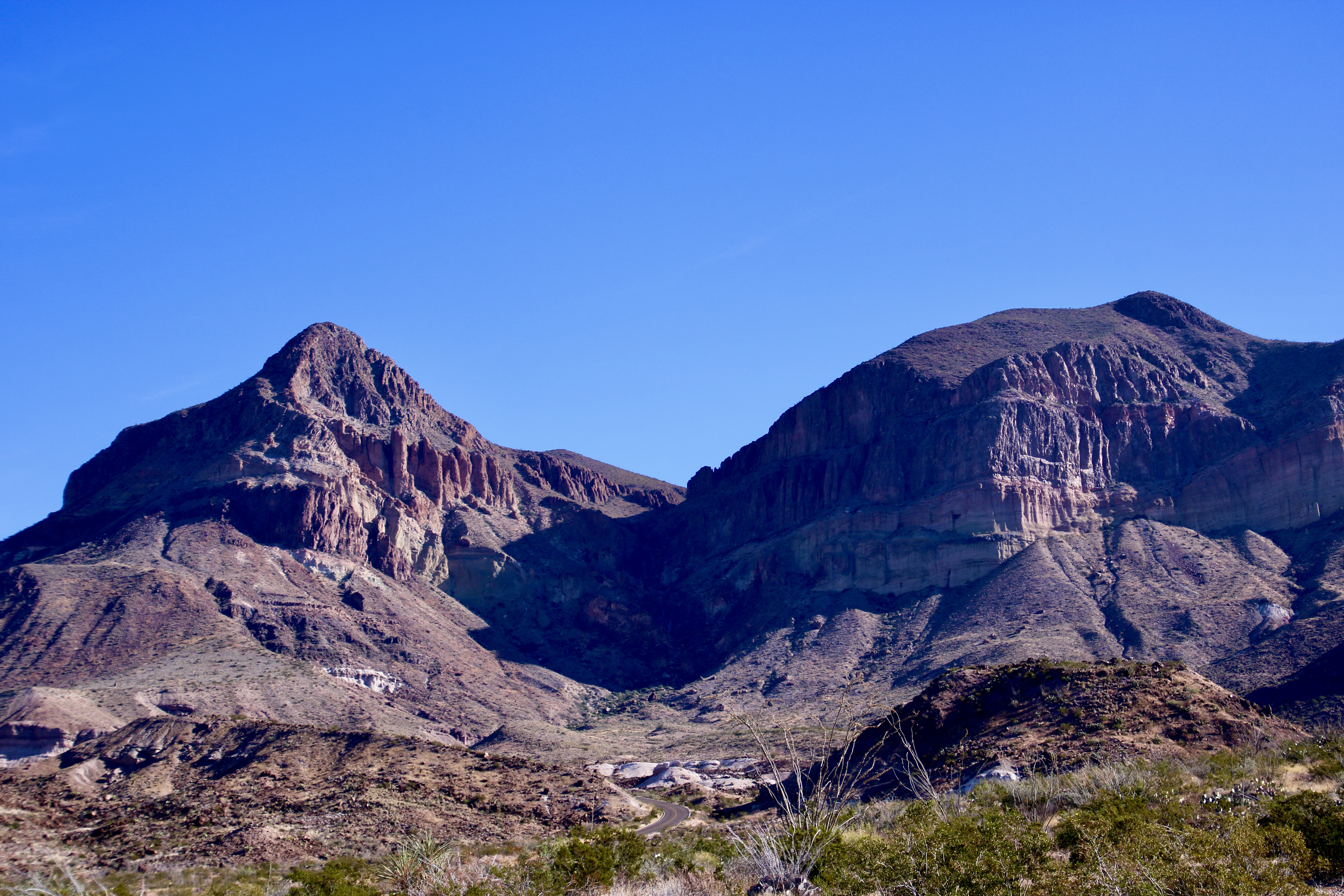
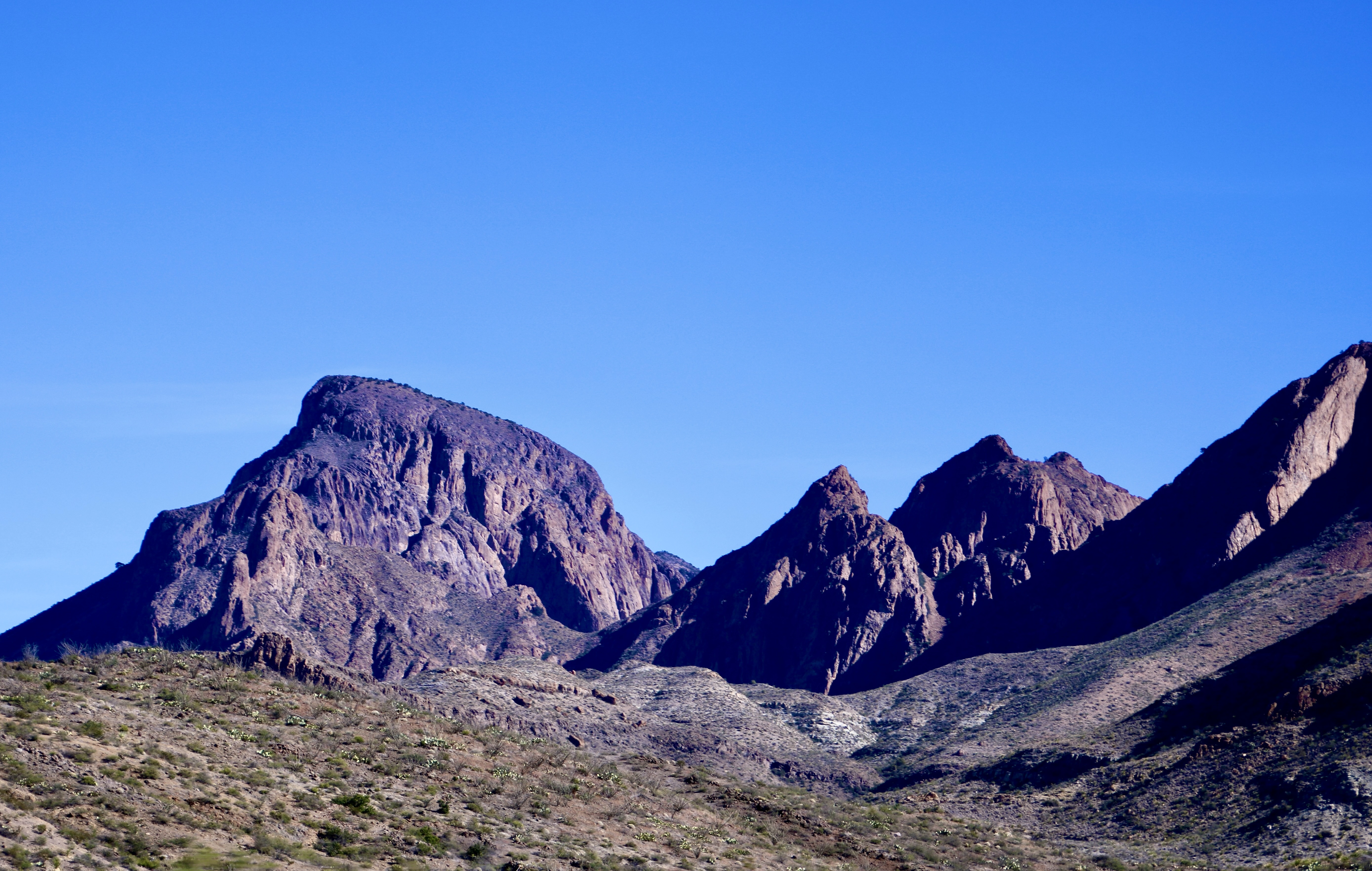
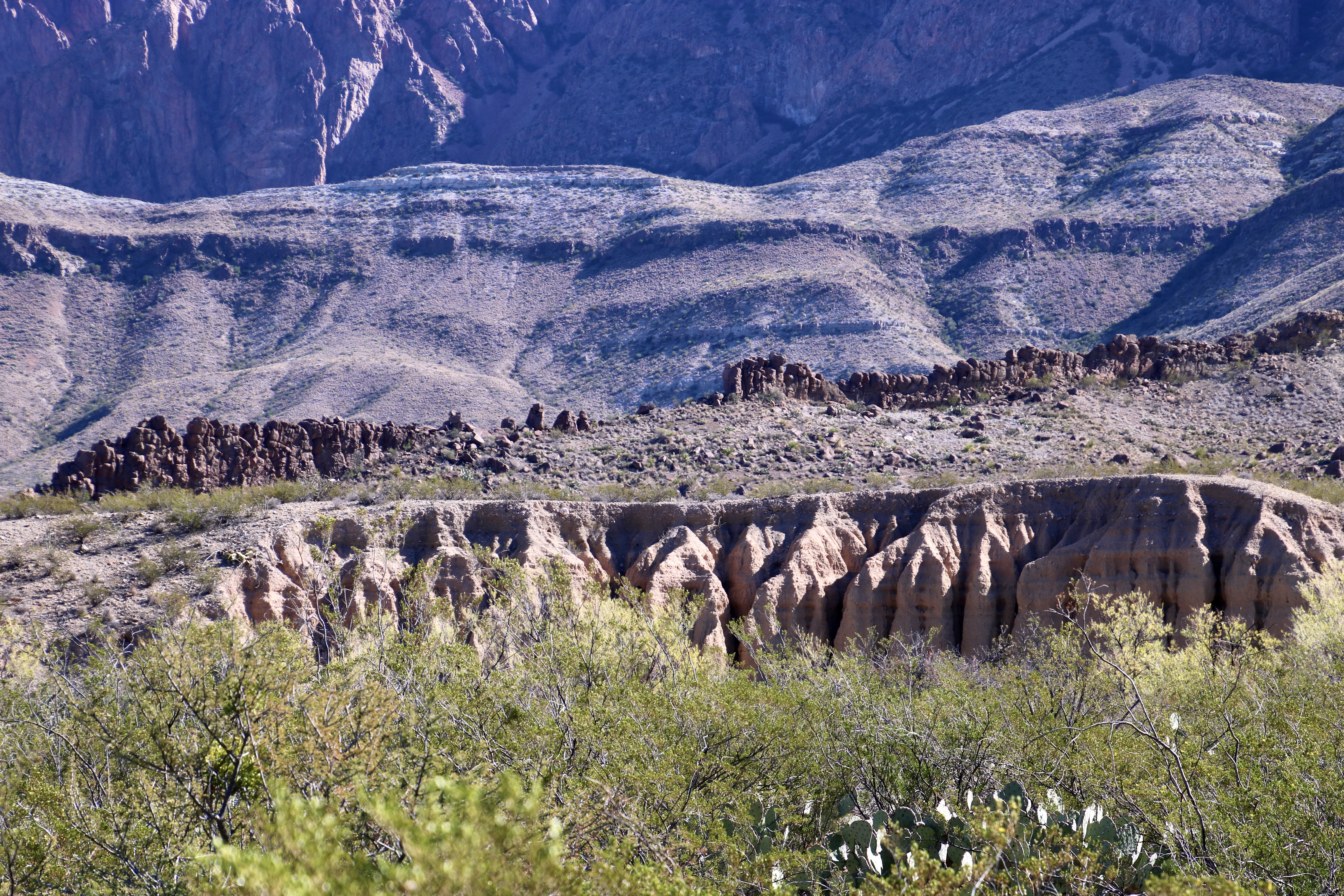
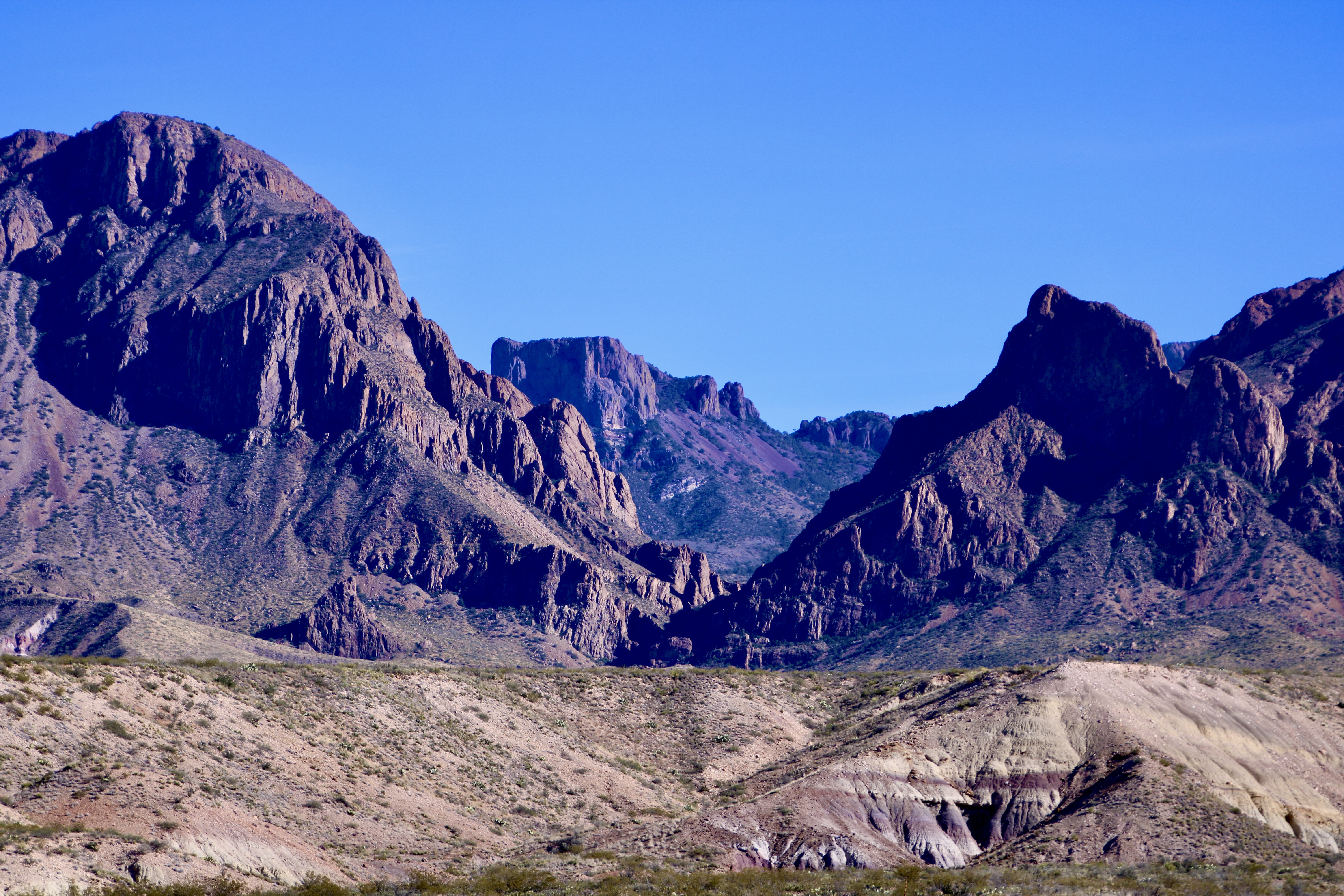
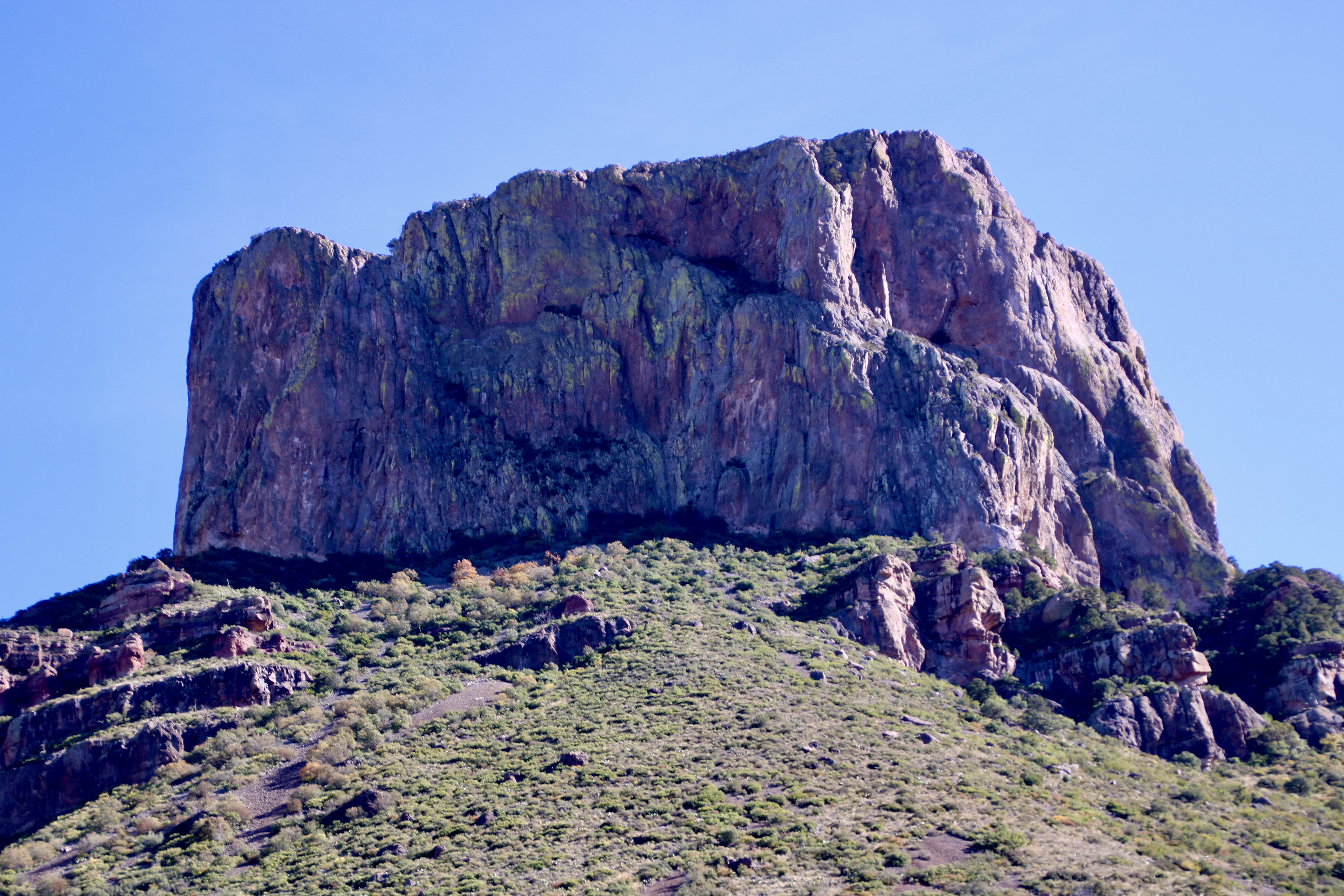
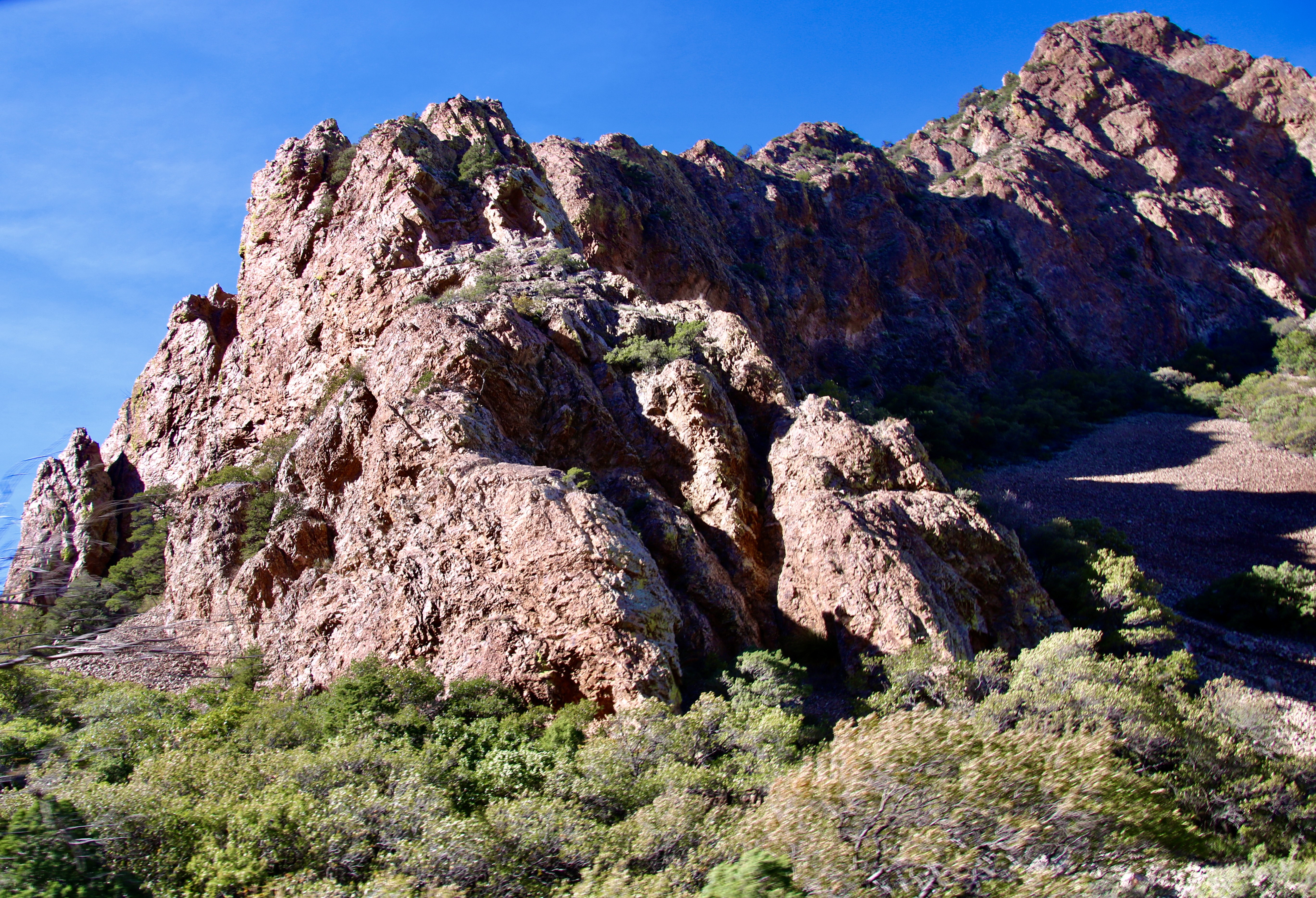
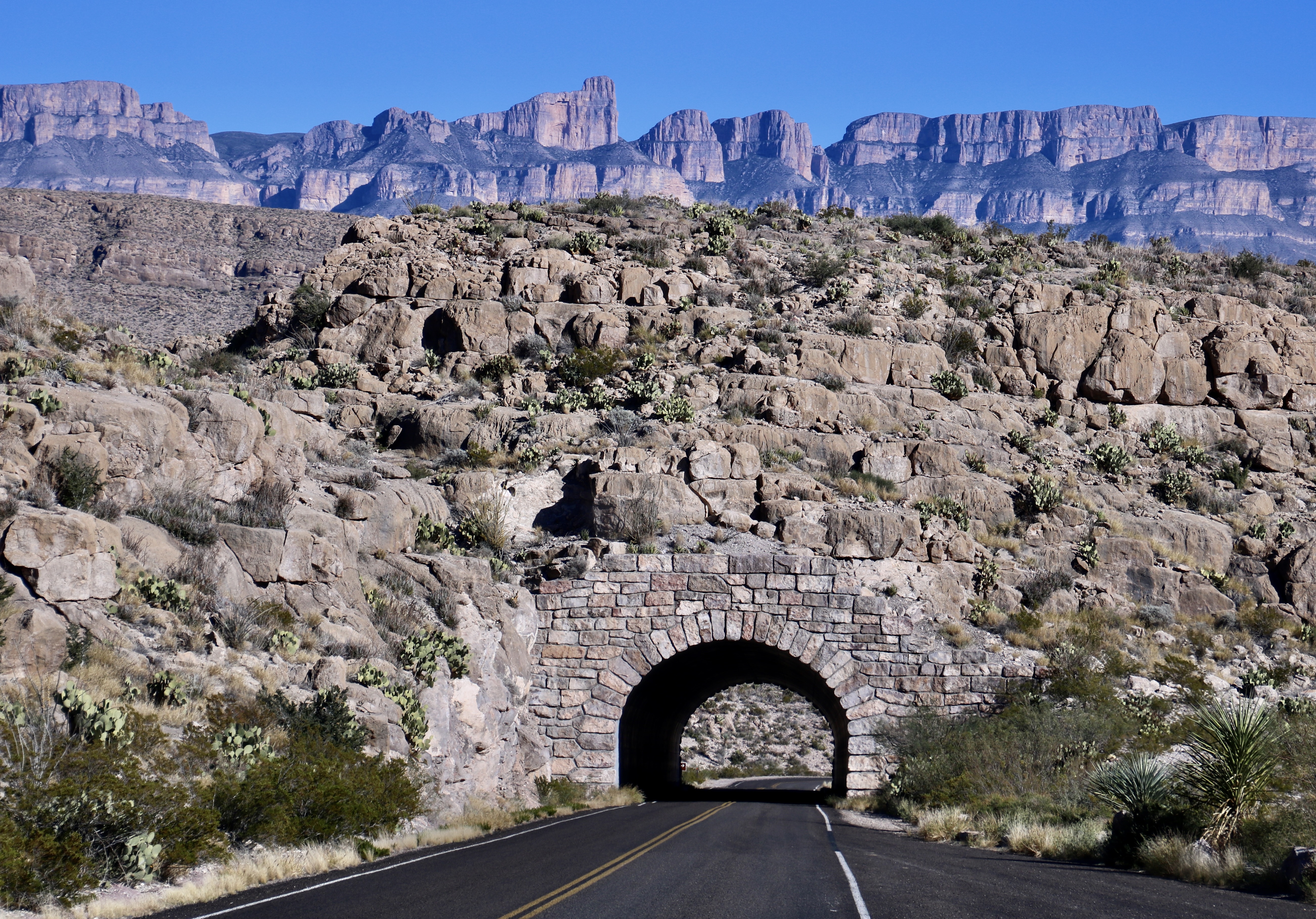
The Chisos Mountains of Big Bend were born 45 to 30 million years ago when the region experienced several episodes of volcanism followed by periods of quiet. We found the mountainous region to be quite beautiful. Our drive from our campsite at Rio Grande Village to our campsite at Castolon took us around much of the mountain range as shown in the National Park map below.Our drive from our campground at Rio Grand Village on the right to our campground in Castolon on the left took us around a significant portion of the Chisos Mountains. Most of our photos of the mountain were taken when we retraced our drive up from Castolon to visit the Chisos Basin. We did, however take photos from the Chihuahuan Desert Nature Trail on our way to Castolon. This is a Big Bend National Park map.The Chihuahuan Desert Nature Trail provided several views of the eastern side of the Chisos Mountains. I believe this is a view into Pine Canyon.Any view of the ‘Old West’ is enhanced by an old-fashioned windmill (not the gigantic modern types). We found this along the nature trail looking out at the mountains.Farther up the road, after we had cut off onto the Ross Maxwell Scenic Drive, the Chisos Mountains Exhibit gave us a northwestern view of the mountains. Emory Peak, the slight knob on the left, is the highest point in the park at 7,825′ (2385 m).Once situated in Castolon, Peggy and I decided to make a more leisurely trip up the Scenic Highway along the Chisos Mountain to the Chisos Basin. Our first view along the way was one of Big Bend’s most photographed sites: The Mule Ears. They look a bit devilish to me.Another perspective. Do they actually look like mule ears? Close…I took this photo at Phantom Ranch in the Grand Canyon.Next up on our list of things to see was Goat Mountain. It’s the peak on the left.Closer…Closest! Actually, Goat Mountain was misnamed. What the early pioneers were actually looking at were big horned sheep.But, hey, an ungulate is an ungulate, right? Can you spot the sheep? Just kidding.Remember the old ditty, ‘the bear went over the mountain to see what he could see,’? I’m like the old bear. Always curious. Goat Mountain is the peak on the end. Getting close to the turn off to the Chisos Basin, this was our view. Note the red ridges in the foreground.The red ridges are the Fins of Fire shown on the map. They are volcanic dikes formed when lava forces its way into crevices in rocks as it works its way to the surface and solidifies. Erosion has exposed the red dikes here.Close up of the dikes.Now it’s time to work our way into the Chisos Basin. A window view of where we are going. The large flat rock is Casa Grande.A grand house indeed! But it’s only one of the many views we found in the basin.They range from rocks with character like these…To rocks I found particularly beautiful. Like this.And this. Note the trees and bushes. We are no longer in the desert!Variety in the basin…Is truly…The spice of life.This is Emory Peak, the highest point in the Chisos Mountains.And this is a view back out into the Chihuahuan Desert, where we will return in our next post. See the slight notch on the horizon…It’s this: The Santa Elena Canyon. Located in the Castolon area, it is one of the places we will be exploring.
At first, we thought it said Burro Mesa Pulloff. That seemed to make sense. Maybe this was an historic location where burros pulled off to rest, drink water, and chew on a desert bush or two. Then we saw it was Pouroff. So what’s a pouroff? A contest between bartenders? We read the National Park info board. Apparently water poured off of Burro Mesa and down into this gravel canyon during thunderstorms, flooding it. Given that the canyon was quite beautiful and that there were no thunderheads looming overhead, Peggy and I decided to go for a walk.
Today’s post was supposed to be about Big Bends Chisos Mountains. I even included a ‘teaser’ photo in my last blog. When I reviewed our photos, however, I quickly decided that a fourth blog was needed. This is it. There may even be a fifth. Most of today’s photos were taken along the Ross Maxwell Scenic Drive shown below.
Ross Maxwell Scenic DriveThe little green hiker might be in a heap of trouble if water came pouring down the two steep canyons off of Burro Mesa.Peggy at the beginning of the trail. The buff colored rock is volcanic tuft.A close up.We were particularly impressed with the colorful tuft formation above the trail.And took several photos of it. And now for a potpourri of other photos we mainly took along the Ross Maxwell Scenic Road and a few thoughts on why we took them.Layer upon layer seeming to tumble down the cliff.Erosion can create wildly wonderful rock sculptures and this is one. We thought it looked like a dog. Too bad it didn’t look a bit more like a chihuahua given its location in the Chihuahuan Desert. Chihuahuas, BTW, got their name from the town of Chihuahua located in the Mexico portion of the Chihuahuan Desert. Geologists love deserts. There is little to hide the rocks. Peggy and I love deserts for the same reason. We are particularly fond of the formations like shown in the previous photos and the color shown in this one.It was worthy of a closer look. Peggy sees a face!Reds also capture our attention. Note the two red outcrops on top of the hill…I had a fleeting thought: Garfield.I liked the balance here, but even more the wisps of cirrus clouds that seemed to be rushing toward the divide.These layers of rock speak of millions of years and conditions from ancient oceans to deserts.Layers of rock resistant to erosion form cliffs that go on and on…Stretching off to the left…And to the right.This peak’s erosion had created a unique look.A different perspective.We’ll conclude today’s post from a distant look back at the Chisos Mountains, where we will go in our next post. Maybe.
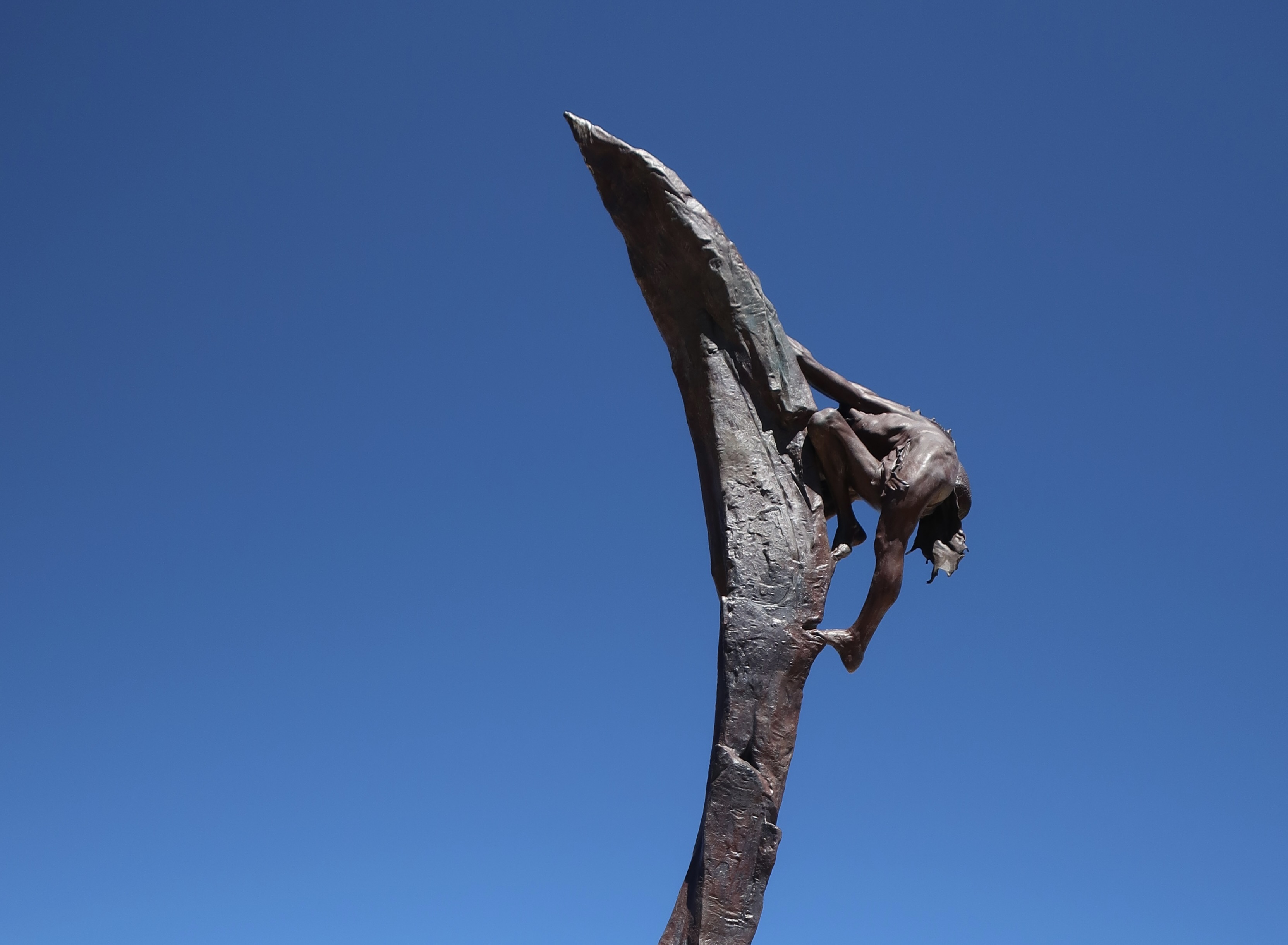
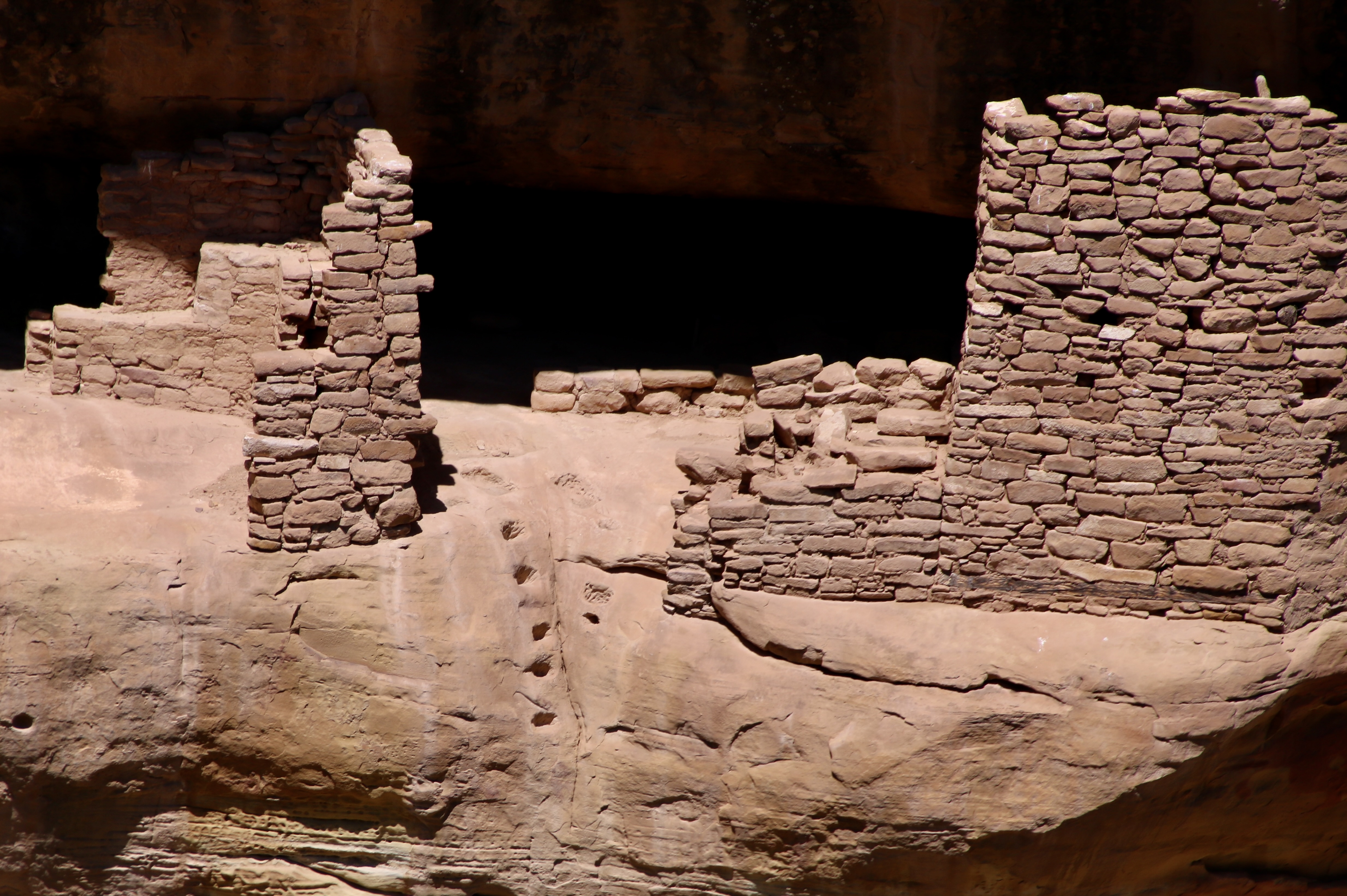
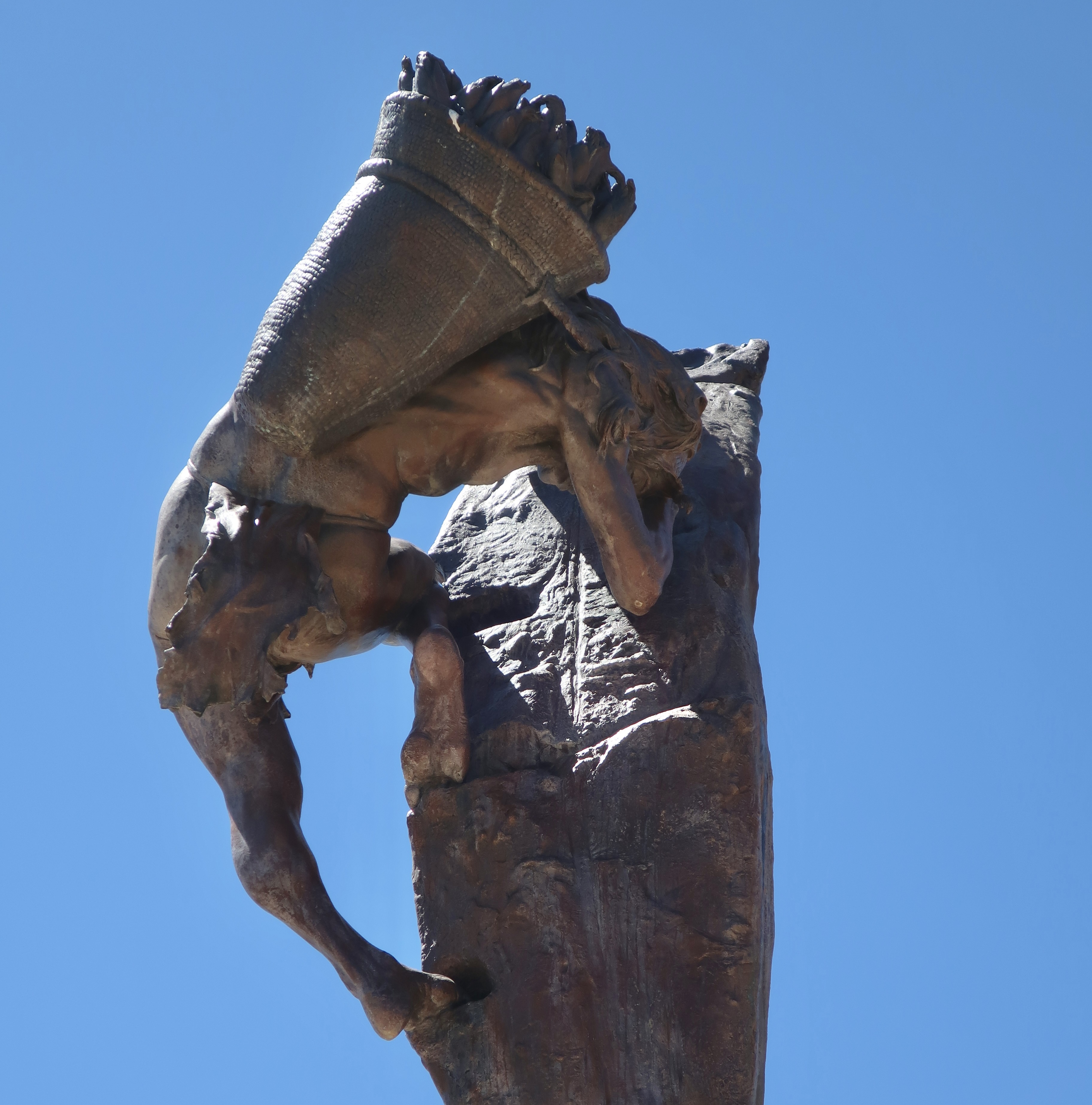
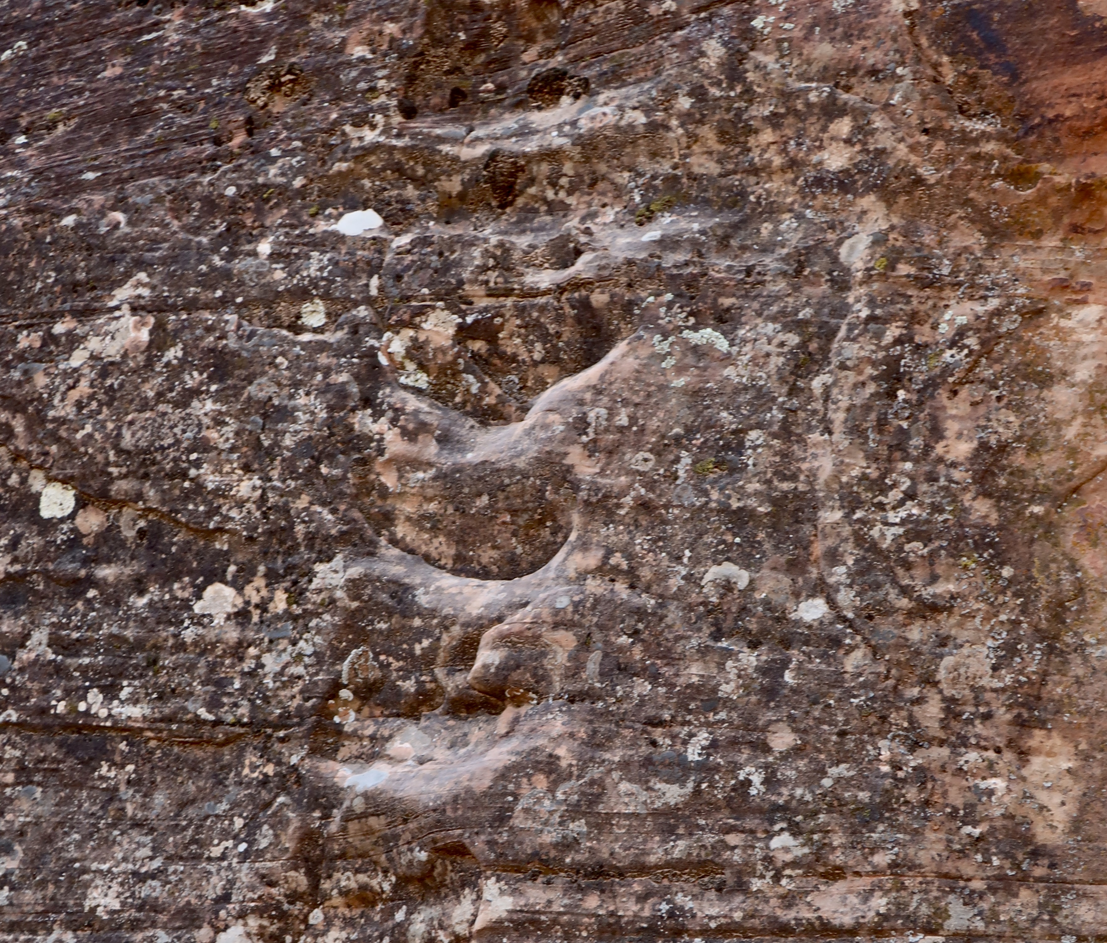
Normally, one would start a post on Mesa Verde featuring cliff dwellings. One of my earliest thoughts as a child about these magnificent structures, however, was how the inhabitants managed to get up to their homes perched high up on cliffs. This 22 foot bronze cast statue by Edward J. Fraughton at Mesa Verde dramatically illustrates the challenge. I couldn’t resist featuring it. Note the footholds, or maybe I should say, toeholds.Split level living at its best? It is thought that the Fire Temple complex at Mesa Verde was used for ceremonial purposes and possibly as living quarters for those who oversaw the ceremonies. It features these structures located on two different levels plus a large open area for ceremonies and meetings off to the left. The toe holds for climbing are clearly visible. Ladders that could have been raised or lowered would have extended below the toeholds: Lowered to get up to the second level under normal circumstances— or raised to frustrate an enemy if under attack.A close up of the toeholds. We wondered if the indentations on the right were used for handholds. Getting up or down would have been complicated by having to carry a load such as shown below when looking at the Ancient One’s statue from a different perspective.“Could you hold that pose while I finish the statue?” It looks like maize/corn in the basket, which was the primary crop of the Ancestral Puebloans. Other things that would have to be carried in addition to food would include water, babies, building materials and items for day to day living. I suspect that children learned to scramble up and down at a relatively young age.Peggy and I found these footholds climbing up a cliff in Zion National Park when we were searching for petroglyphs in a remote area. I thought I’d try climbing them. “Um, maybe not,” my companion suggested rather forcefully. I don’t think my offering to carry her would have made a difference.This is the meeting/ritualistic section of the Fire Temple. A large, raised fire pit is located in the center of the plaza. There is some speculation that the square vaults beside the fire pit may have been covered and used for drumming. I can imagine the people gathered here asking for rain, good crops, health, or protection from a marauding enemy. Or maybe they danced.
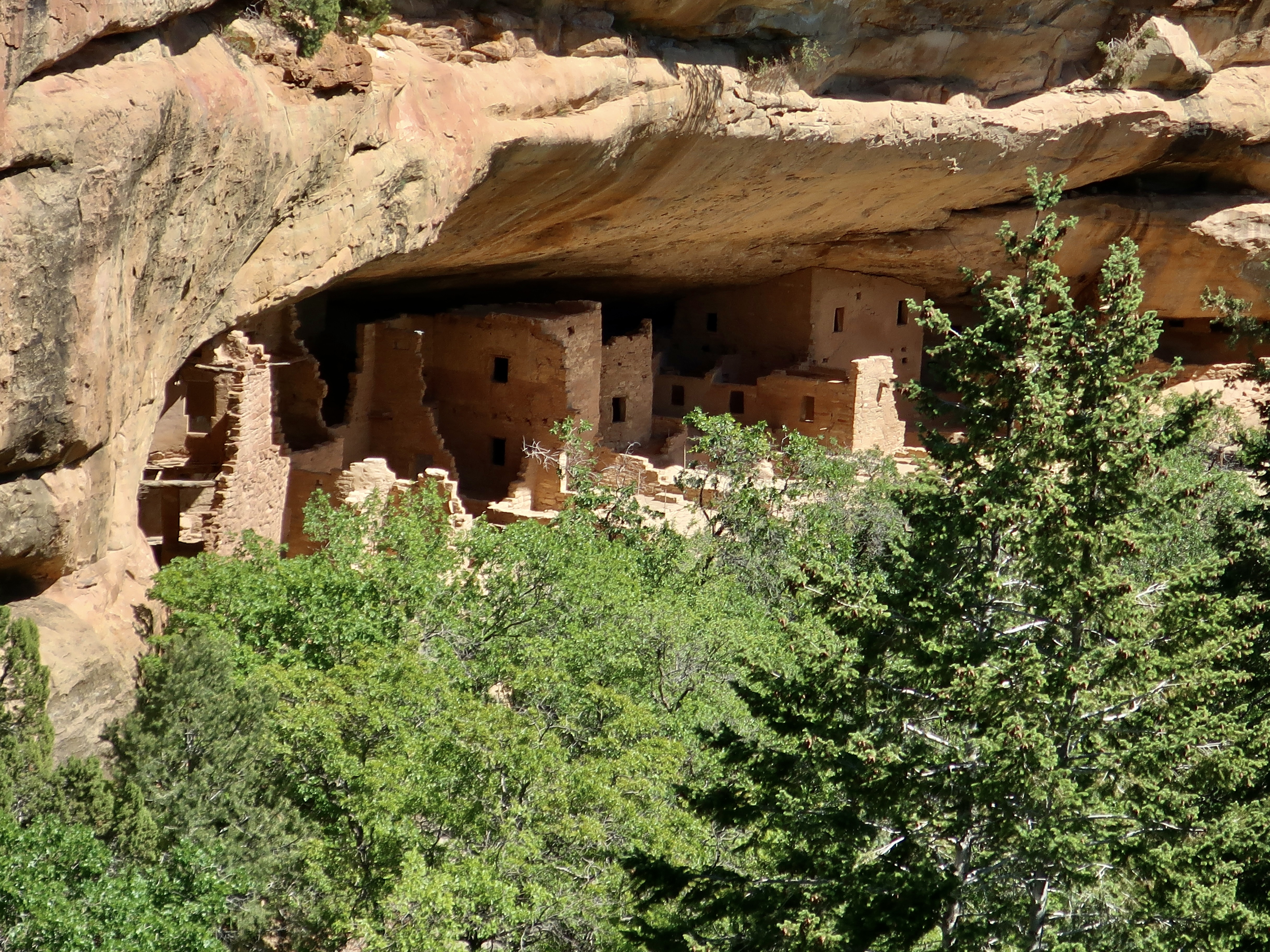
Ancestral Puebloans reached the Mesa Verde (“green table”) area sometime around 600 CE (A.D.). They would remain in the area for 700 years reaching the peak of their civilization between 1100-1300 CE. At first, they focused on building pithouses, pueblos, masonry towers, and farming structures on top of the mesa. The National Park Service features a number of the buildings. While we visited several of them, our focus today will be on the cliff houses for which Mesa Verde is famous. But first, a quick look at the countryside where the Puebloans chose to make their homes.
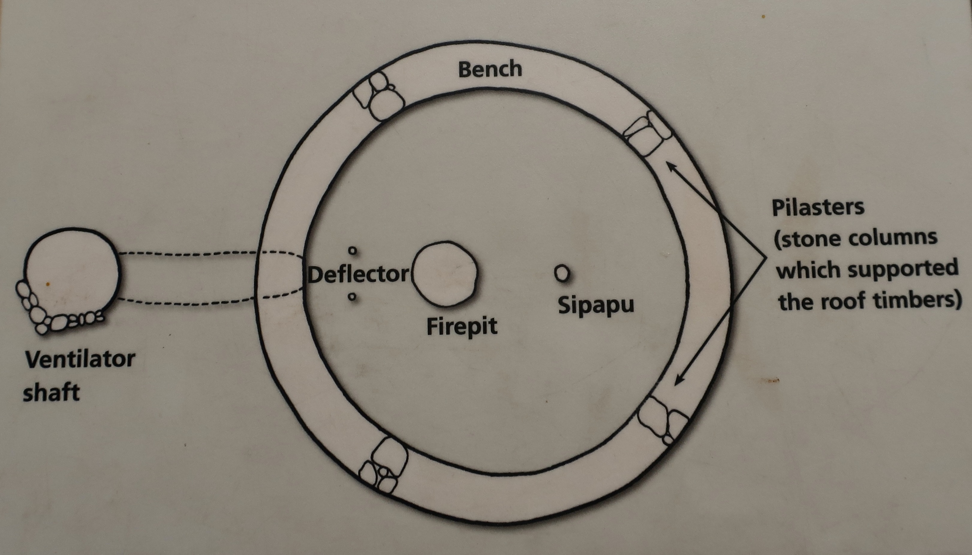
This prominent landmark overlooks visitors as they enter the park. The road works its way up from the lower left. It’s likely that the Ancestral Puebloans would have considered the mesa sacred.Mesa Verde translates as “green table.”A drive up to Park Point, the highest point in Mesa Verde at 8572 feet (2612 m), provides great views of surrounding valleys and distant mountains.Layered sandstone rocks like these provided sites for cliff houses. The distant mountain is known as Sleeping Ute Mountain.And now for three of the major cliff dwellings at Mesa Verde. This one, called Cliff Palace, is the largest cliff dwelling in North America. It has 150 individual rooms and 20 kivas. Kivas are round structures used for ceremonial purposes.This illustration of a kiva was on an information board at Mesa Verde. Most of it is self-explanatory, but you might find yourself asking, “What the heck is a Sipapu?” To the Ancestral Puebloans and their modern day descendants, the sipapu represents the opening through which their ancient ancestors emerged to enter this world as lizards and then changed into their human form.The Hopi believe that the entrance to this world was found on the Little Colorado River a few miles above where this photo was taken. We had stopped here when we were on our 18 day raft trip down the Colorado River through the Grand Canyon. I’ll be reposting blogs from that trip in a few weeks as Peggy and I are boating down the Danube River from Vienna to Budapest.Our friend Don Green, who was with us on the Colorado River adventure, found this fellow watching us from a ledge when we stopped off at the Little Colorado. Hmm.A closer look at the Cliff Palace. The Square Tower House, built in the mid 1200s CE, is the tallest structure in Mesa Verde. Standing at 27 feet (8 m), it is four stories high. Painted murals and petroglyphs are said to be located throughout the structure. Peggy and I have spent many happy hours searching for petroglyphs throughout the West and would have loved to have seen what was in the Square Tower. This might provide a clue. It is a replica of a big horn sheep petroglyph found at Mesa Verde’s Petroglyph Point. Unfortunately, we didn’t have the time for the 2 1/2 mile hike out to the point. This is a National Park Service photo of the petroglyphs found on Petroglyph Point. The sheep is upper center. To the right of it is a turkey and to the right of that, hands. Beneath it are women giving birth. All of these are common themes of petroglyphs throughout the West. I think the cat-looking creature on the far left is a mountain lion. I found it rather humorous. Are its front legs on backwards or is it eating a person? It may be that the animals in the panel represent various clans.Several other structures were located at the Square House cliff dwelling. Was the rock here originally and the Puebloans built around it? Or did Nature add it later?Another large rock was located at the Square House cliff dwelling in the kiva on the right. The same question about how it got there applies.This photo of the Square House cliff dwelling shows how shallow the dwelling was, and how it might be vulnerable to rock fall. Only the Square House seems totally protected.And finally, we come to the Spruce House Dwelling, which is located a short walk away from the Visitors’ Center. It is the third largest cliff dwelling found at Mesa Verde. Built between 1211 and 1278 CE, the dwelling holds 130 rooms and 8 kivas.Another perspective. It was first discovered by pioneers in 1888 when a pair of cowboys found it while they were searching for lost cattle. They climbed down what they thought was a large spruce tree to get in. Thus the name. (It was actually a Douglas fir that is now cut down.) I wonder if they took off their spurs? Below are three photos of the buildings at Spruce House.
Theodore Roosevelt established Mesa Verde National Park in 1906 to “preserve the works of man.” It was the first park of its kind designed to protect and maintain an important historical and cultural treasure. Located in Southwestern Colorado, the park covers an area of 52,485 acres.
Our next post will take you to visit another national park of great natural beauty and relatively few visitors, Big Bend. It is located in southwestern Texas far from any major metropolitan areas.
Join us as we explore its desert beauty, starting Friday.
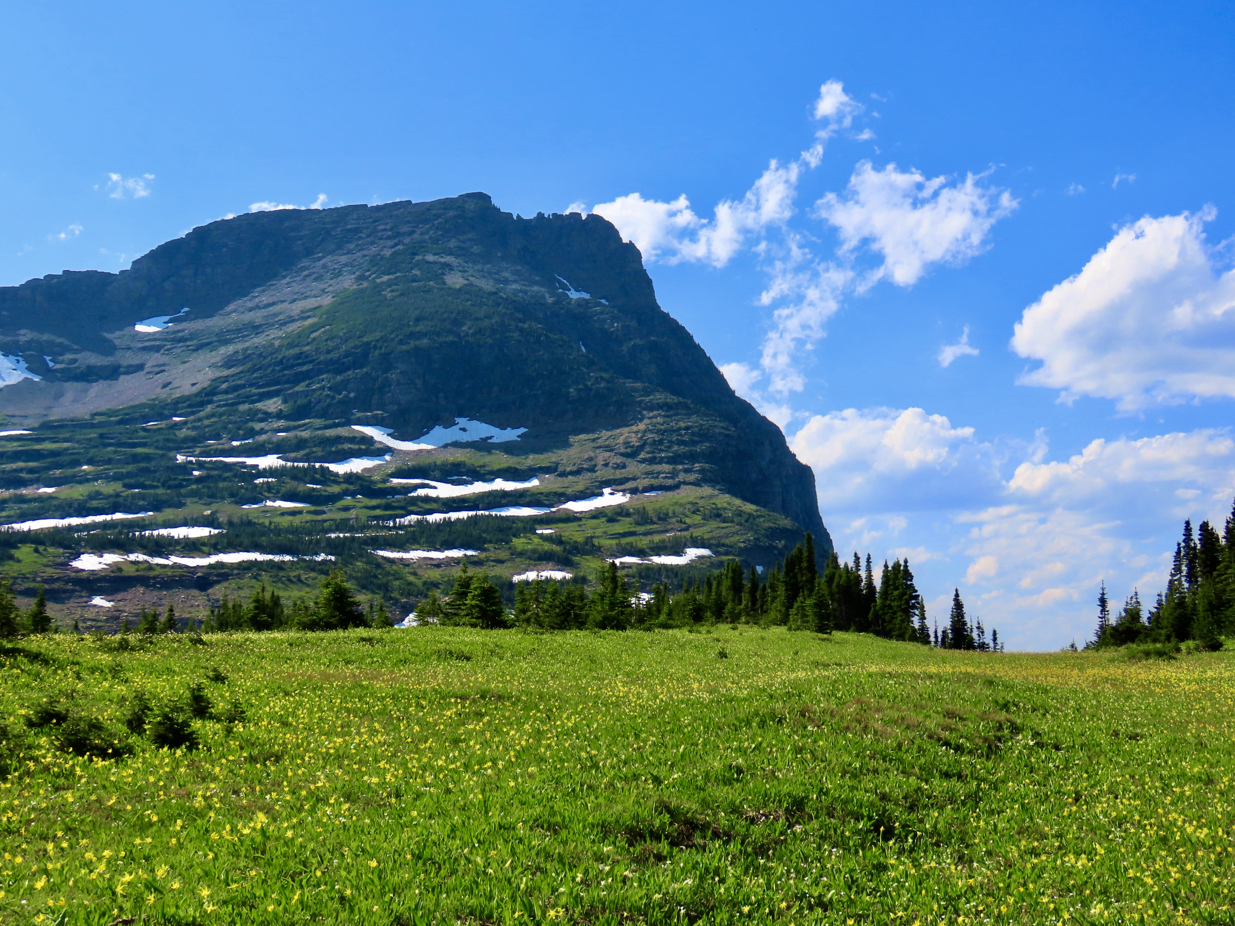
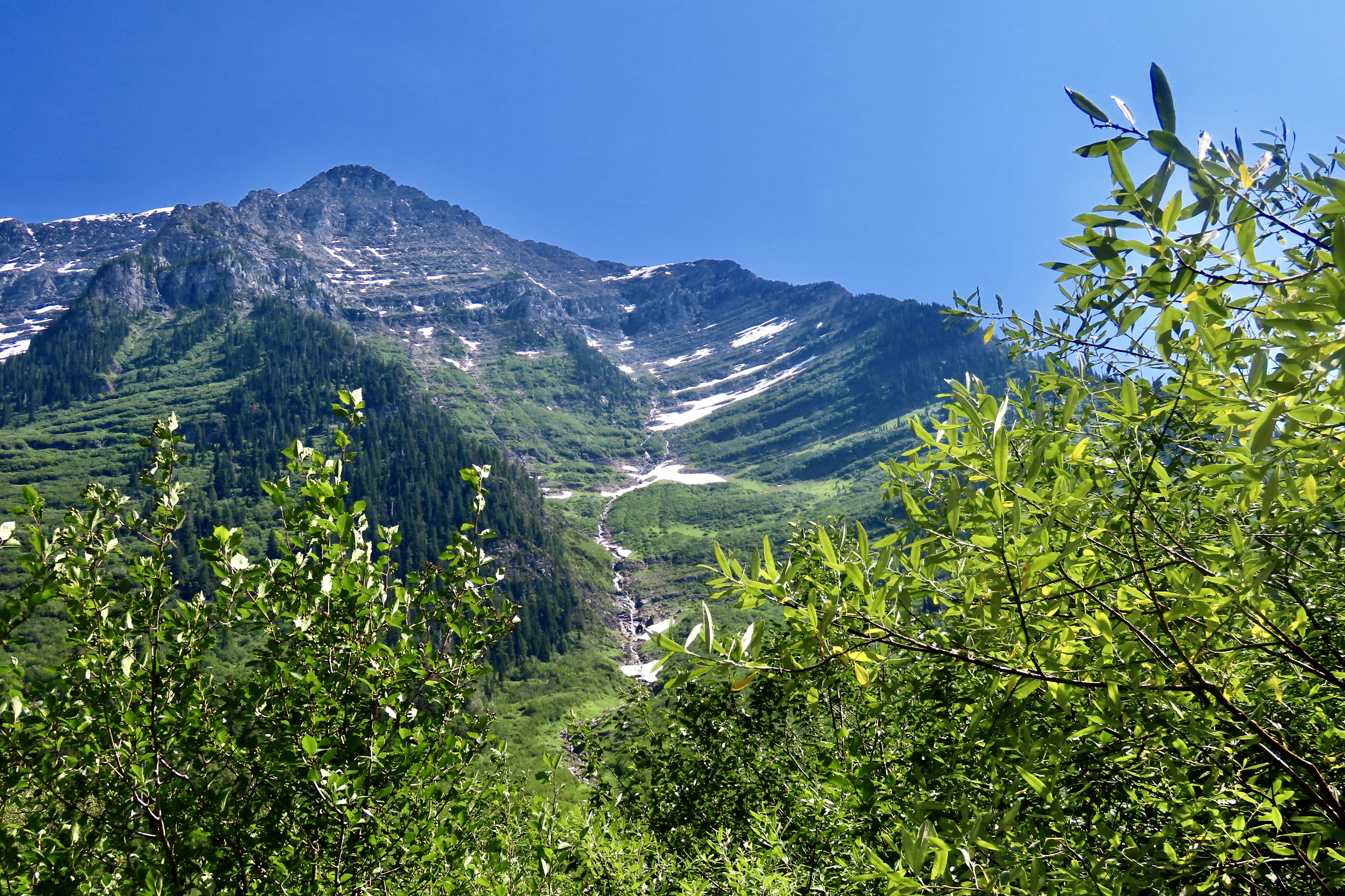
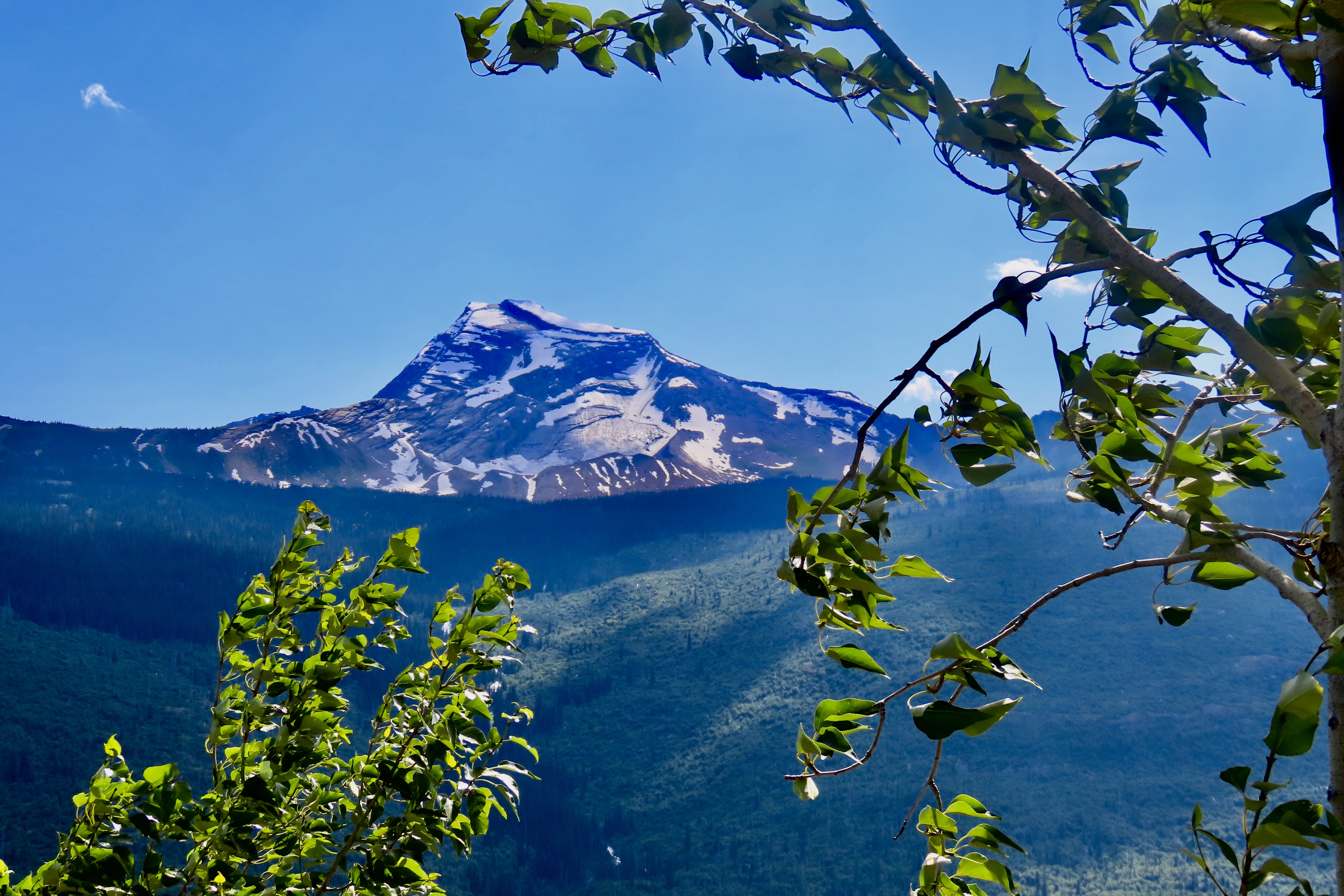
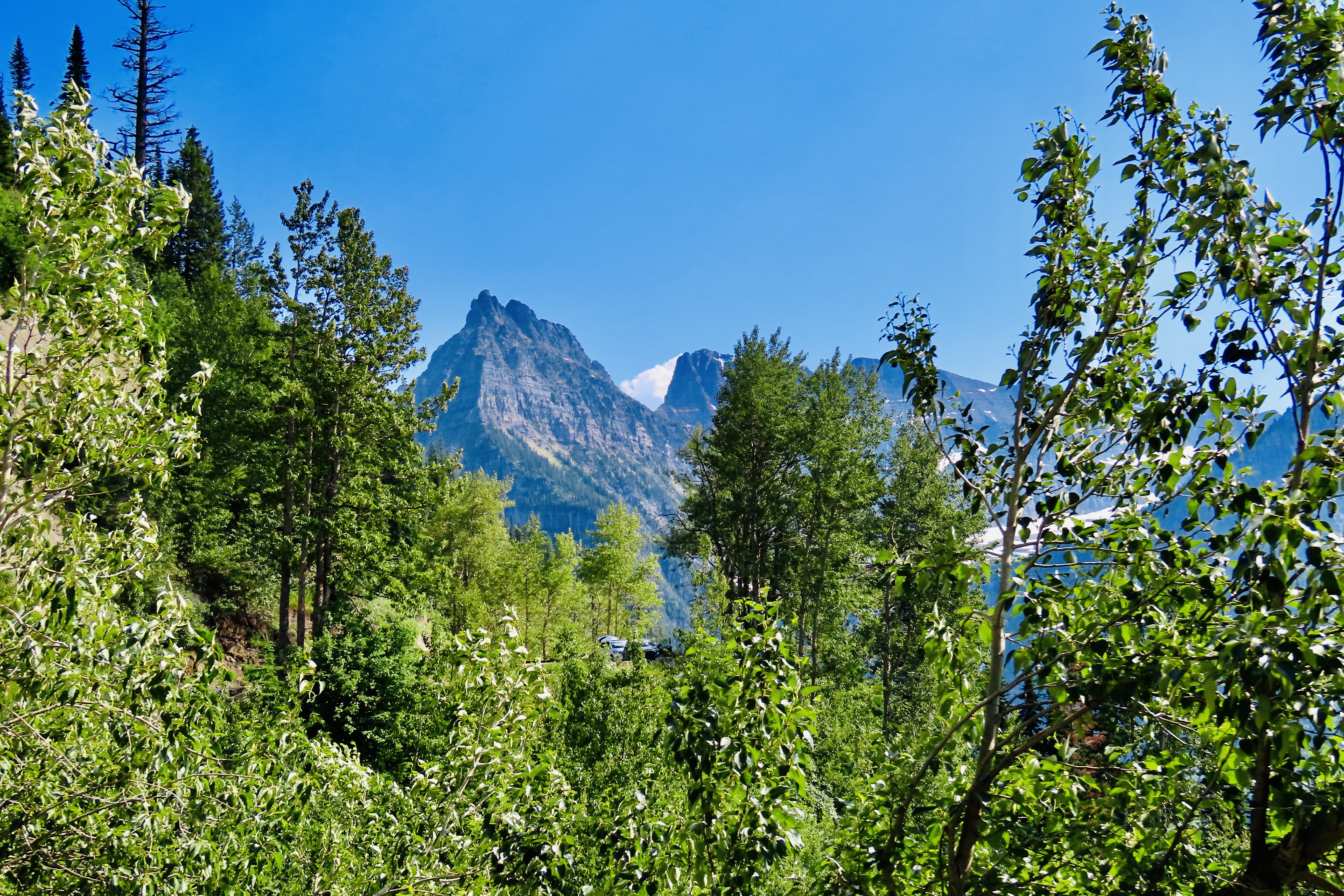
Glacier National Park’s Going to the Sun Road is packed with views like this. Each corner brings a new sight. Whether it is rugged mountains, water cascading down rocks, or high mountain meadows, the road is guaranteed to create a sense of awe.
Peggy and I know a bit about scenic roads. Over past 25 years we have traveled over a quarter of a million miles exploring many of the most beautiful highways America and Canada have to offer. Some, several times. One thing that we have learned is that determining most scenic is incredibly hard. How does one compare driving through the desolate beauty of Death Valley with the rugged wilderness of the Yukon? We both agree, however, that the Going to the Sun Highway in Glacier National Park would be near the top of any list we might compose.
Note: All of the photos in this post were taken by either Peggy or me unless otherwise stated.
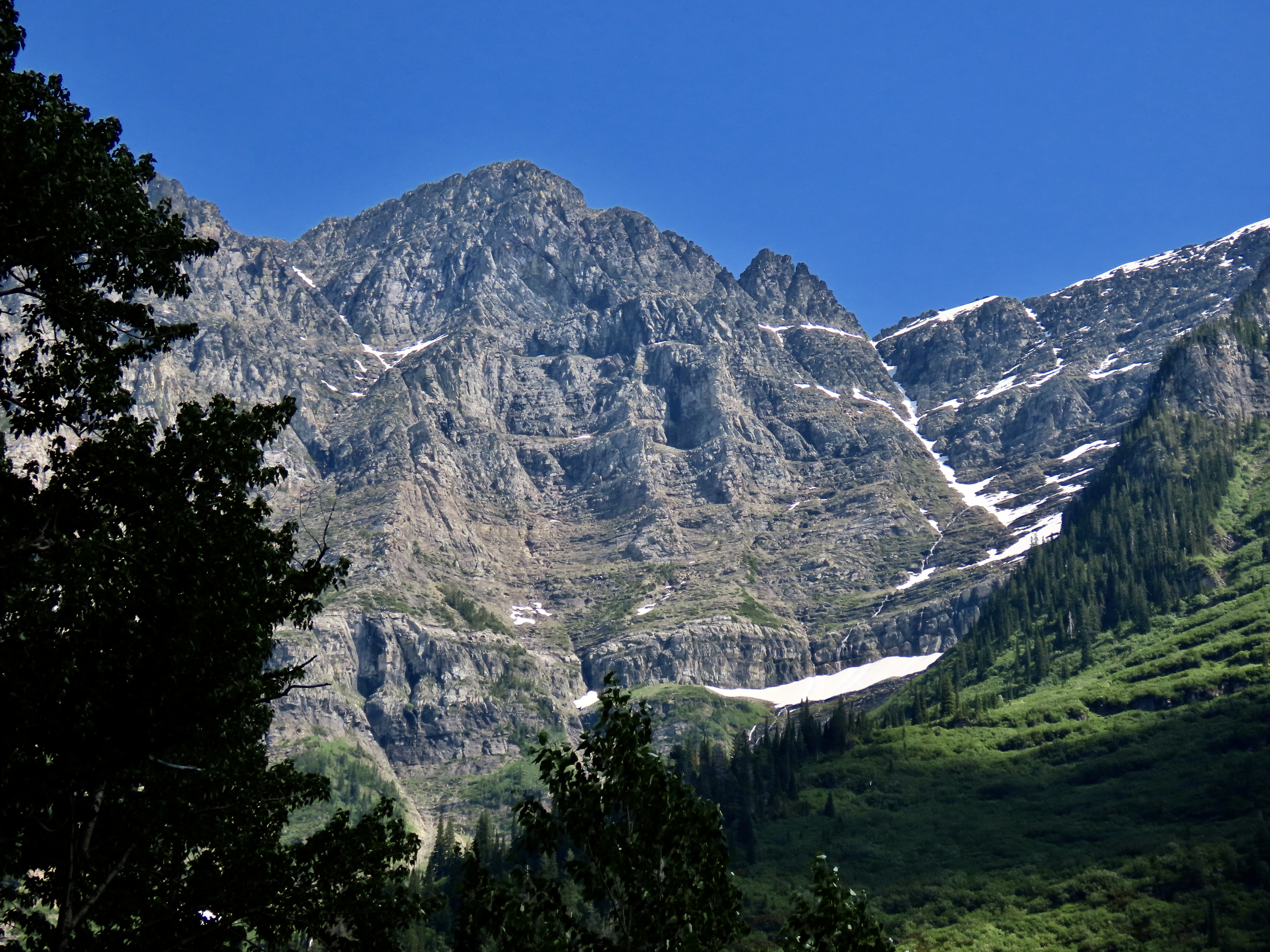
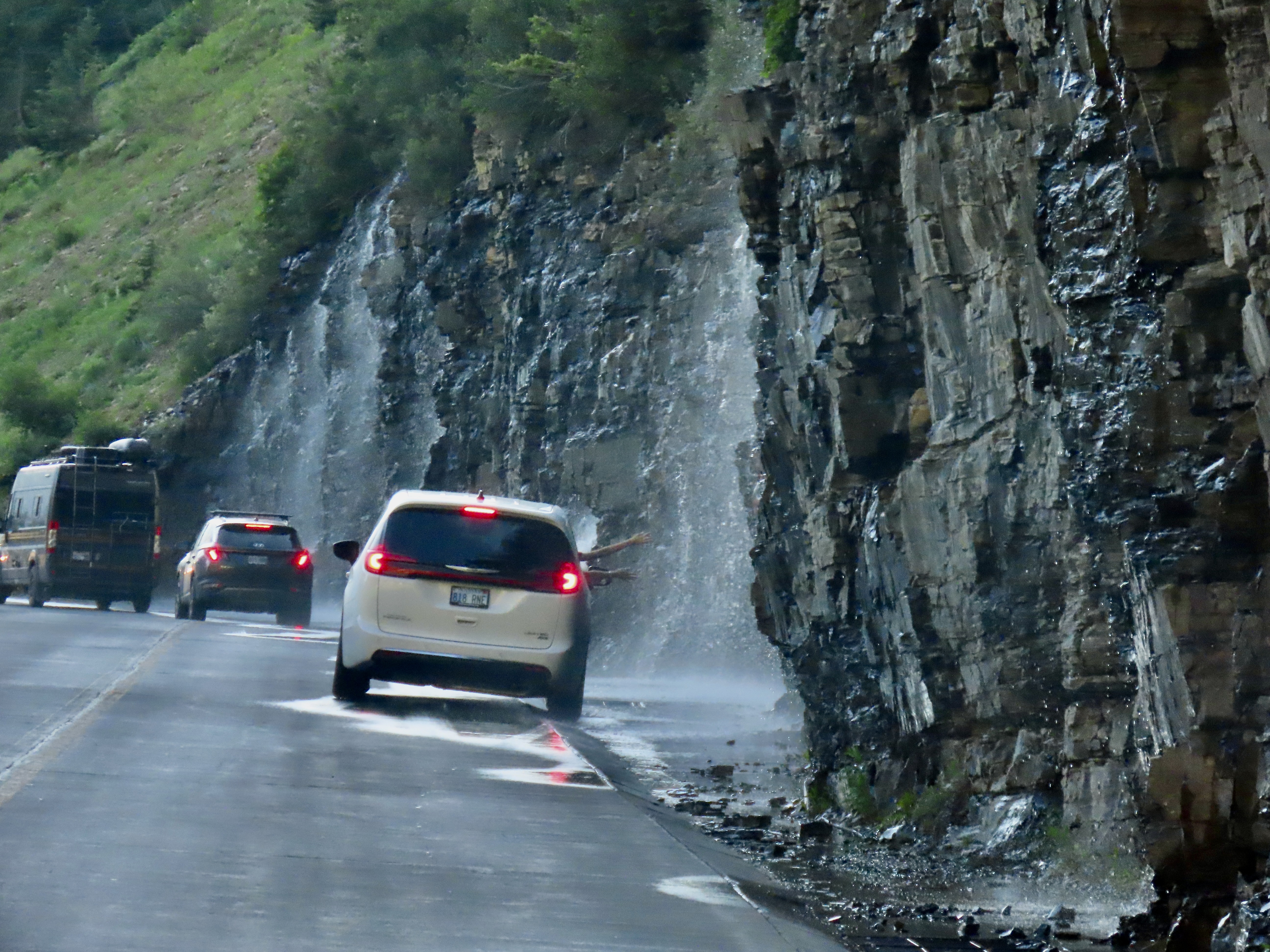
What’s not to love about water cascading over rocks…Or high mountain meadows.The narrow Going to the Sun Highway is a marvel in and of itself, working its way around steep curves and along cliffs with sheer drops, as shown in the photo above. Three Arches is on the right and Haystack Falls is on the left. Driving over it is not for the faint hearted! Neither is it for RVs.
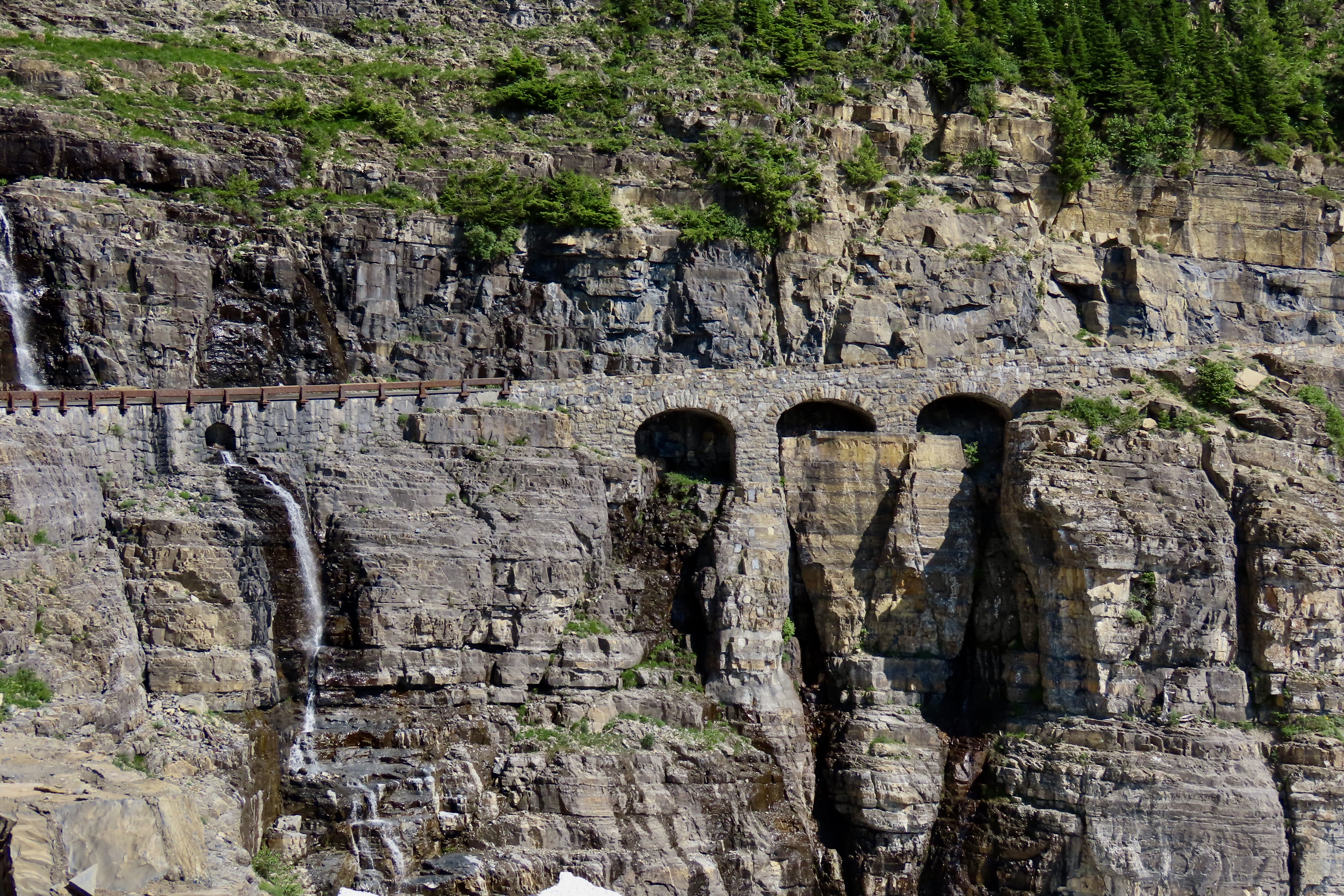
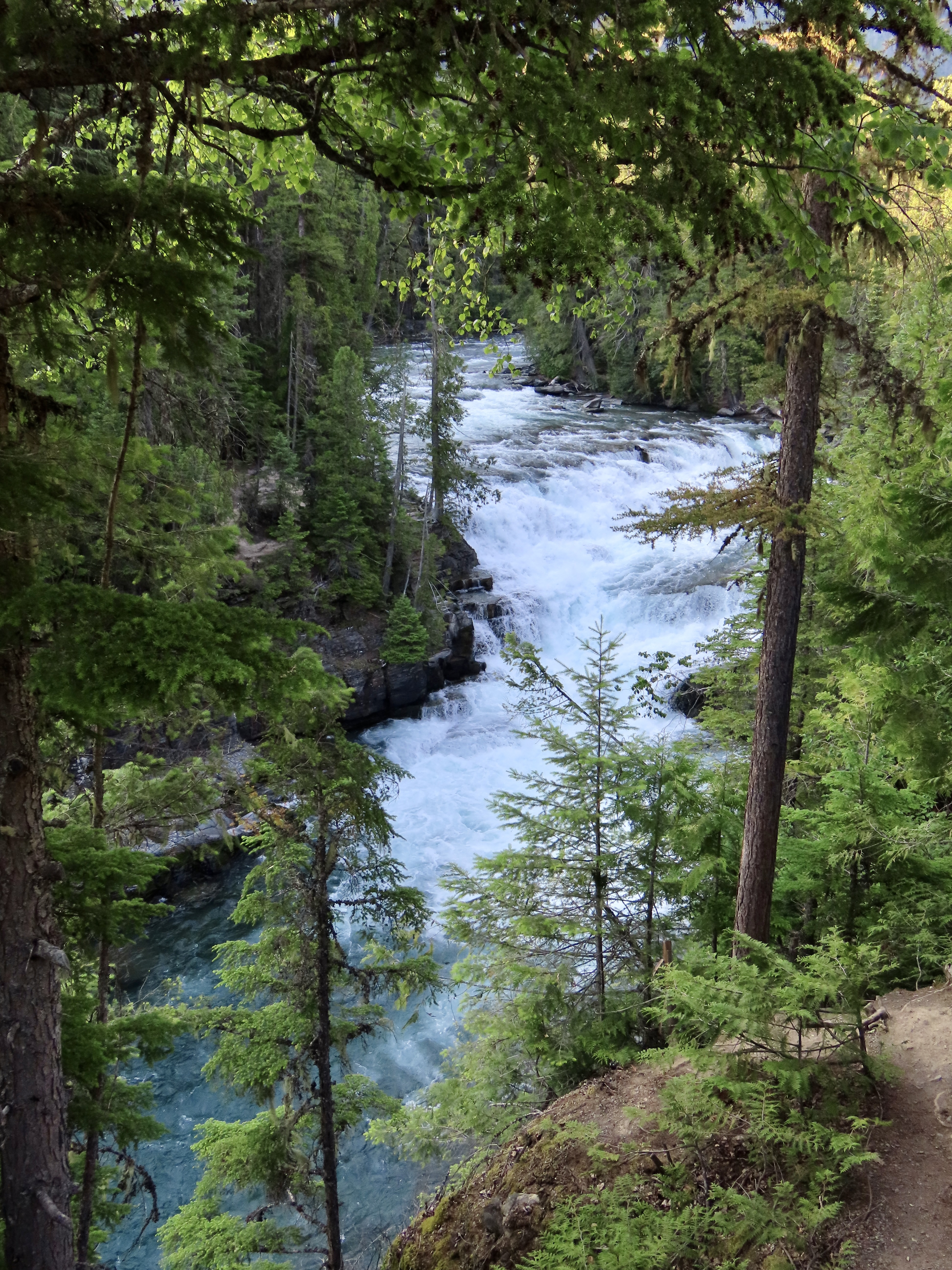
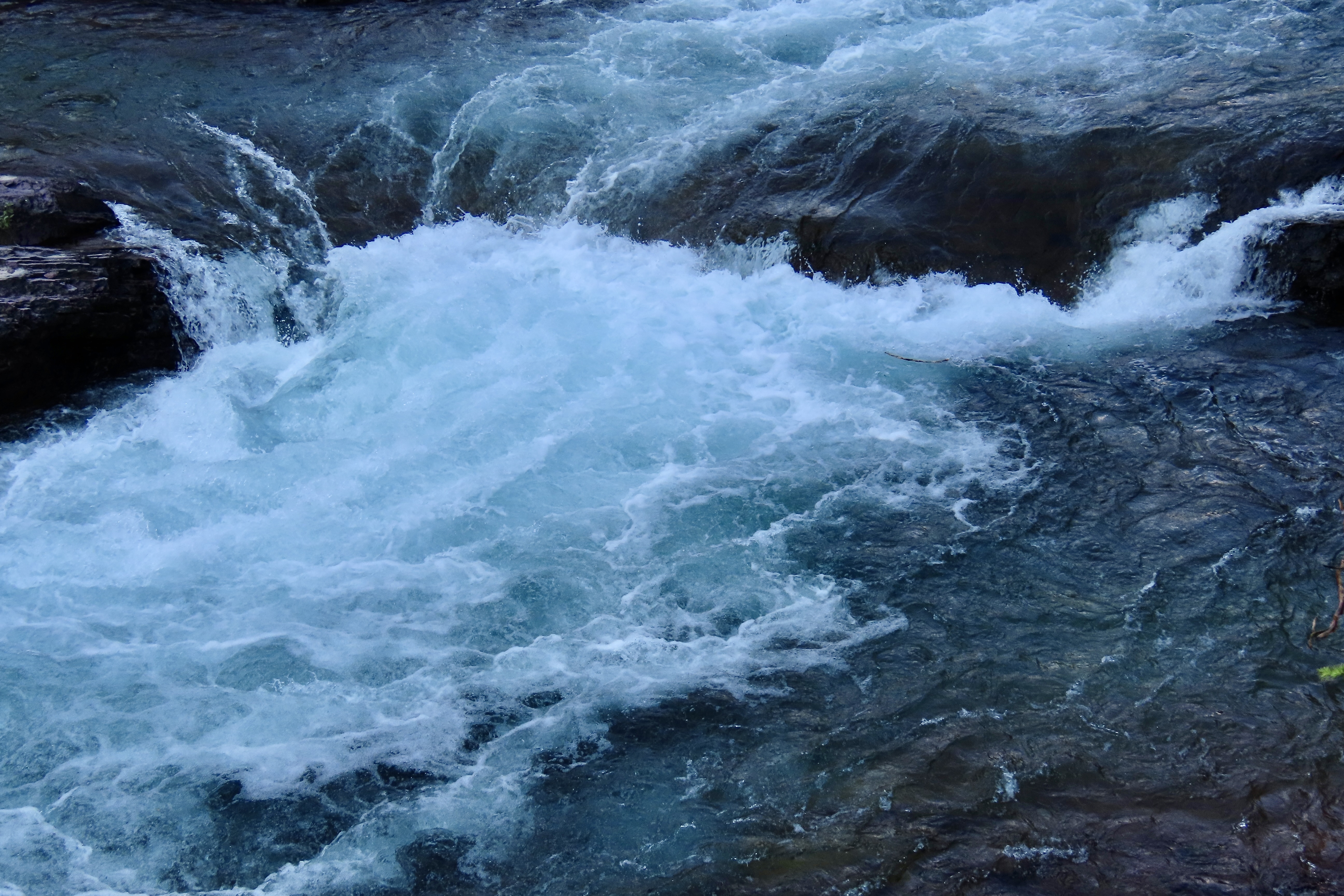
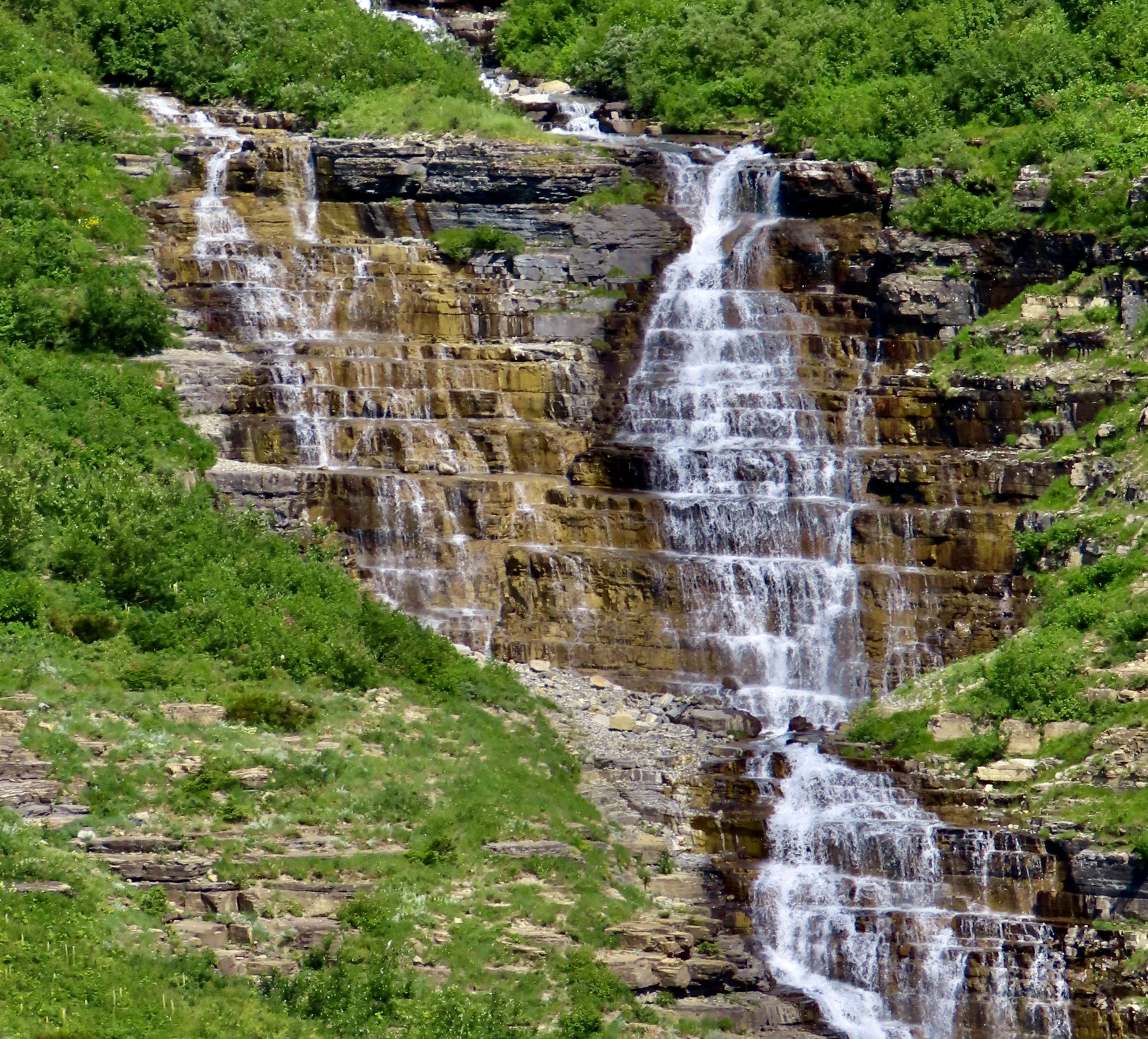
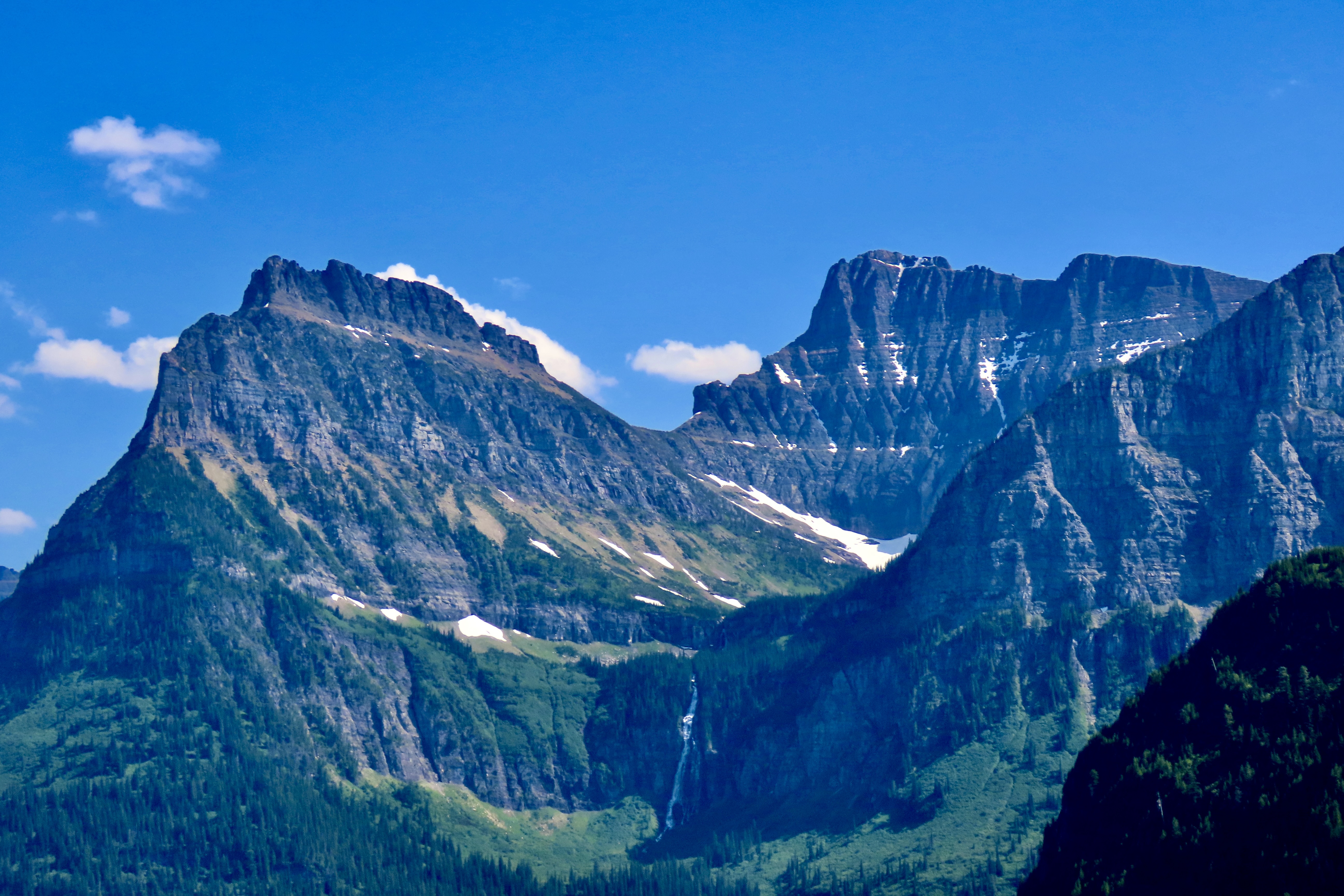
By designing the road to have minimum impact on the surrounding environment, using local materials, and building it to feature some of the park’s most scenic views, the highway became a model for building roads in future national parks.First funded in 1921 by Congress, highway construction took place throughout the 20s. Franklin Roosevelt’s New Deal Program took over in the 30s finishing the road. Here, Civil Conservation Corps members carry a telephone cable over Logan Pass in 1938. Both Peggy’s father and mine worked for the CCC during the 30s, giving them employment options they may not have had otherwise in the Great Depression. (This photo is from the National Archives.)We began our journey up the Going to the Sun Road on the western side of Glacier NP. We were camped about five miles away. The total length of the road is 48 miles. We drove up to Logan Pass, 30 miles from the entrance, and back. Entering from the west requires a permit between 6:00 AM and 3:00 PM in the summer to control numbers. It’s best to get your permits before heading to the park. They are offered 120 days in advance. Day of permits can be purchased the day before starting at 7 PM, but they go fast, often within minutes. Not having a permit, we opted for the after 3 PM entrance.The Going to the Sun Road makes a leisurely trip along the edge of Lake McDonald and McDonald Creek before beginning its climb up toward Logan Pass.We took this and the following photos along the lake and river.In our eagerness to get up the mountain we missed taking photos of McDonald Lake and Creek on our way up, but we did capture some rapids and McDonald Creek Falls on our way back to camp. It was close to sunset.Our first stop going up the road was to admire this mountain.As one might expect, glaciers are a key feature of a National Park named Glacier. Unfortunately, they are melting. Global warming has reduced their numbers from around 86 in 1850 to 26 today. The Loop, a major hairpin turn, and the narrow West Tunnel added more excitement to the already exciting drive up the western portion of Going to the Sun Highway.The Weeping Wall is one the Going to the Sun Road’s most well know features.People drive next to the Weeping Wall on their way down and stick out their hands. Peggy and I thought of driving next to it to give Iorek the pickup a well-needed bath. (But didn’t.)Pull offs above and below the Weeping Wall provided a number of scenic views including Haystack Falls.Haystack Falls above the road.And below the road.A smaller but colorful falls was a short walk away.The 490 feet tall Bird Woman Falls could be seen far across the canyon nestled in among the mountains.The mountains seen from the upper end of the Going to the Sun Road are magnificent.And finally the road (seen on the left) makes its way up to just before Logan Pass, which will be the subject of our next post.And, a final photo. We have been in St. Marys, Ohio the past few days wrapping up our trip by celebrating the 100th Birthday of Peggy’s namesake, Aunt Peggy. She is an incredible lady in the true sense of the word with a smile and a personality that light up a room. She’s shown here with water-color flowers she has painted. We attended the ceremony with Peggy’s brother John, his wife Frances plus 14 other relatives and at least 40 residents of Aunt Peggy’s Senior Living Center. The beautiful event was organized by Aunt Peggy’s daughter, Alice.
Each national park has its own beauty and uniqueness. We visited the Florida Everglades in February just before we started our trip west.
Peggy and I are great fans of national parks. Each has its own beauty and uniqueness. After all, that’s how they become national parks! In 1999 Peggy and I took a year’s sabbatical from our jobs for an extended trip around North America. One of our goals was to see as many national parks as we could. We ended up visiting 50, which was close to all that America had at the time. We also visited Canadian national parks as we drove the Alaska Highway up and back from Alaska.
We’ve continued to visit parks ever since. Several, we have returned to many times. Our journey up the Pacific Coast that we just concluded included four. I’m going to do a quick review of them today and throw in the Everglades since we were there before we headed west. Then I will move on to the two parks we just visited: North Cascades and Glacier. But there is more—as they always used to say on late night tv ads.
Over the past three years, as Peggy and I zigzagged our way across the US six times, we visited several parks including four that I didn’t have time to blog about: The North Rim of the Grand Canyon, Mesa Verde, Big Bend, and Theodore Roosevelt. That will bring the total in this series to 11 counting today’s review. Let’s get started! Note: All photos in this series were taken by either Peggy or me unless otherwise noted.
THE EVERGLADES
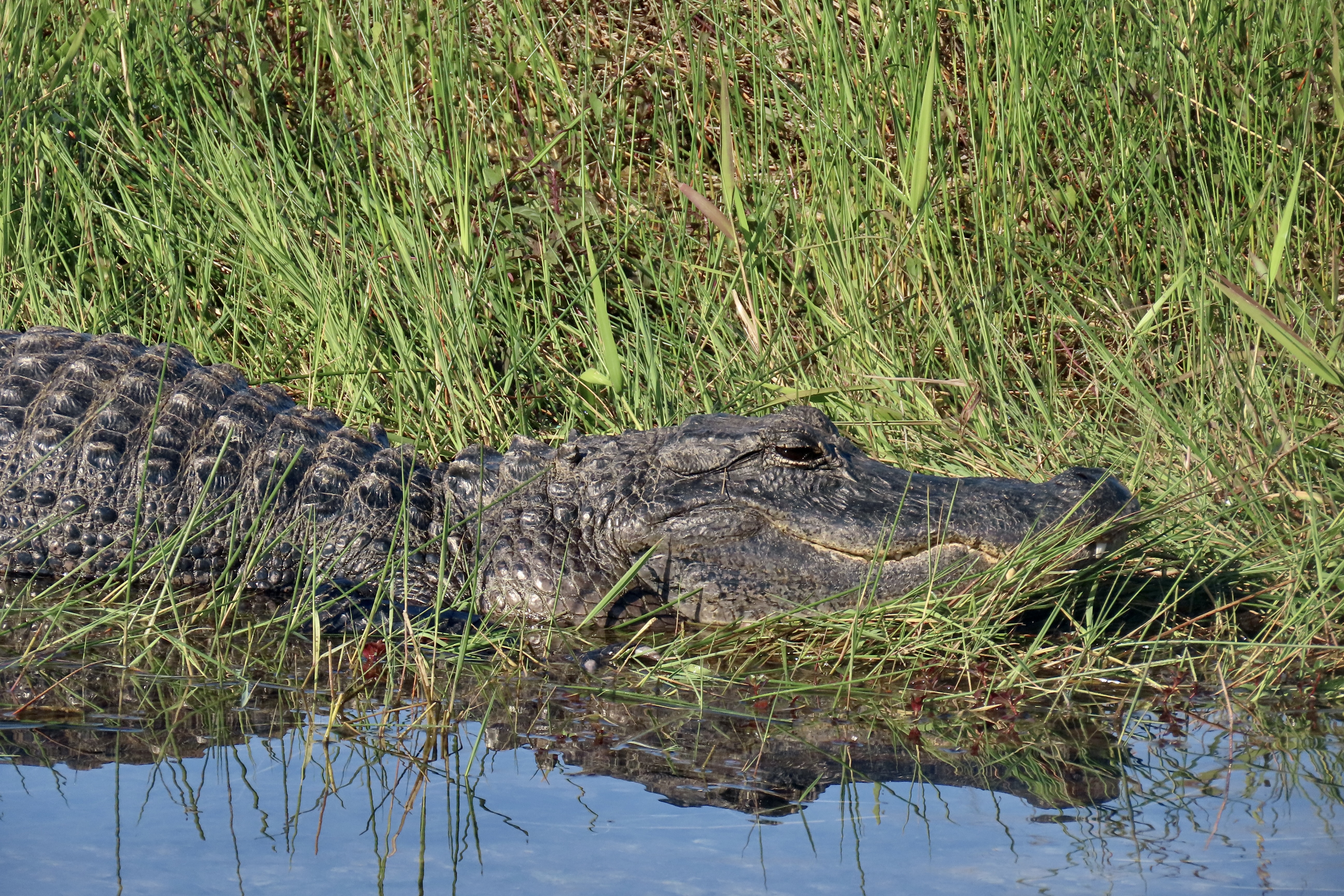
One way to think of the Everglades is as a vast, slow flowing river spread out over 7,000 square miles. According to the National Park Service, the “Everglades are home to frogs, toads, alligators, hundreds of species of birds, 300 different species of fish, Florida panthers (endangered), crocodiles, and snakes, just to name a few!” There are, also, more mangroves than anywhere else in North America.
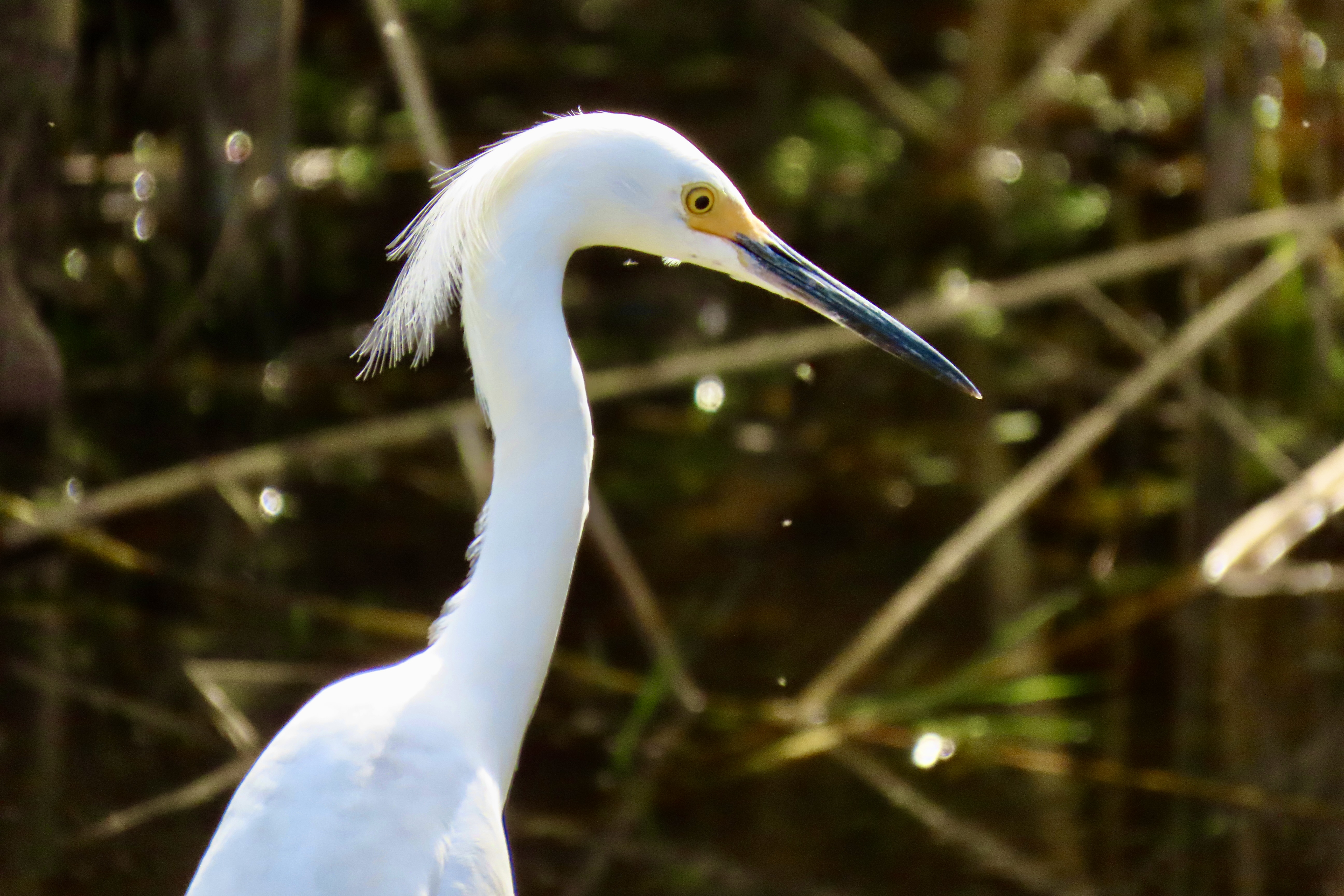
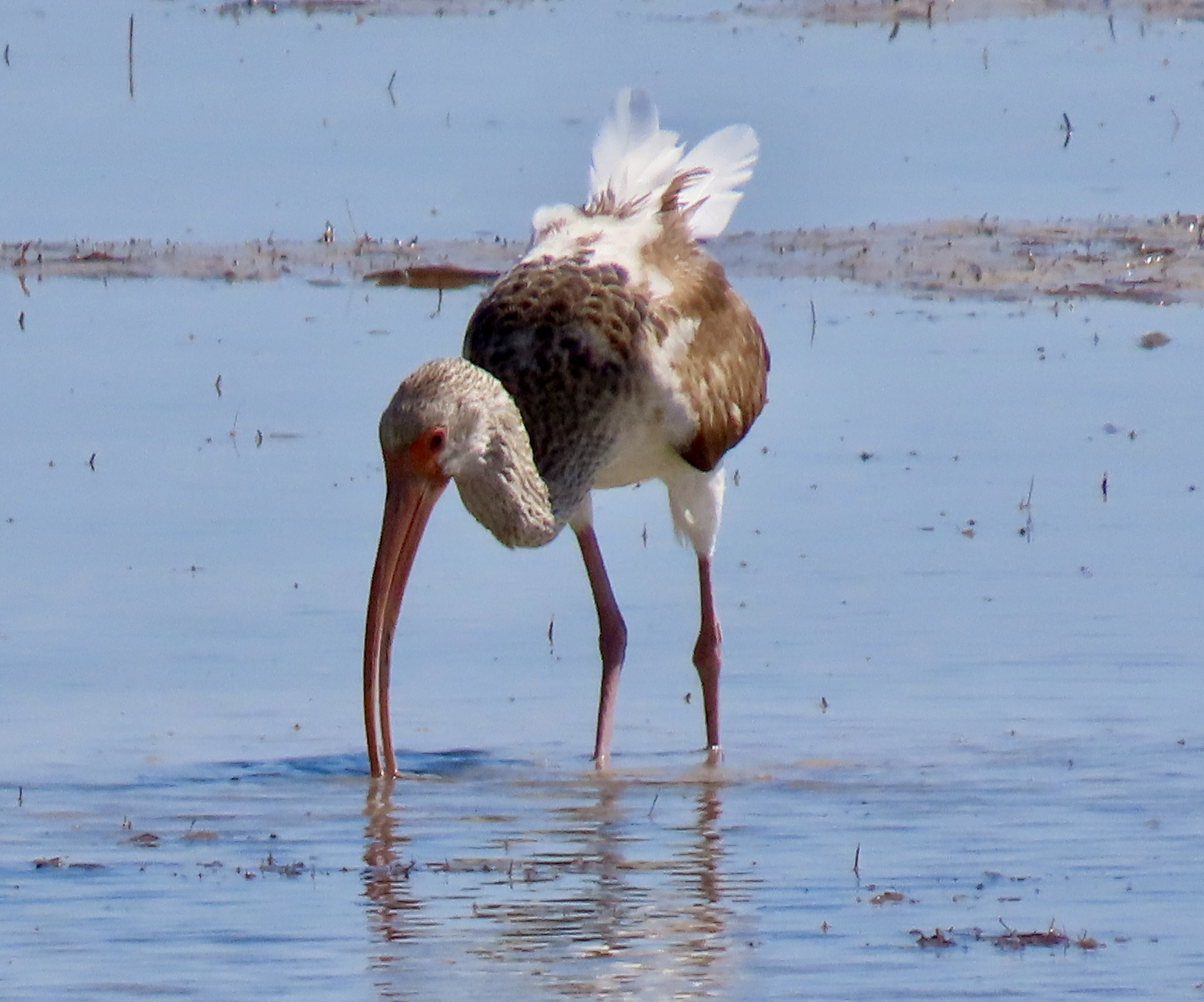
The bird life was incredible! It ranged from Osprey…To anhingas…To snowy egrets…To ibis and many, many other species.We also saw a number of alligators, and several crocodiles. We liked the reflection on this alligator. The look on its face made us wonder what it had been up to!
THE PINNACLES…
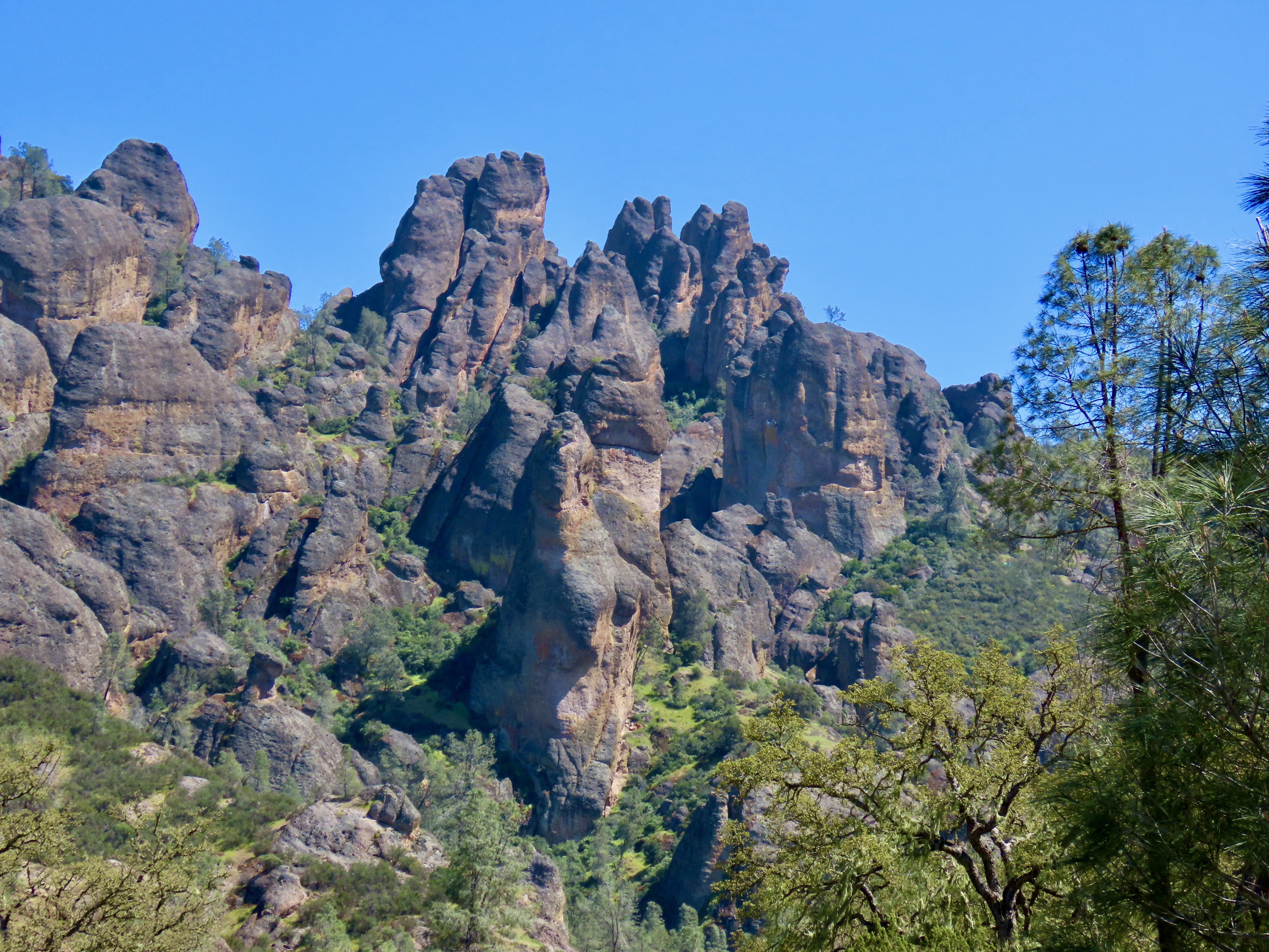
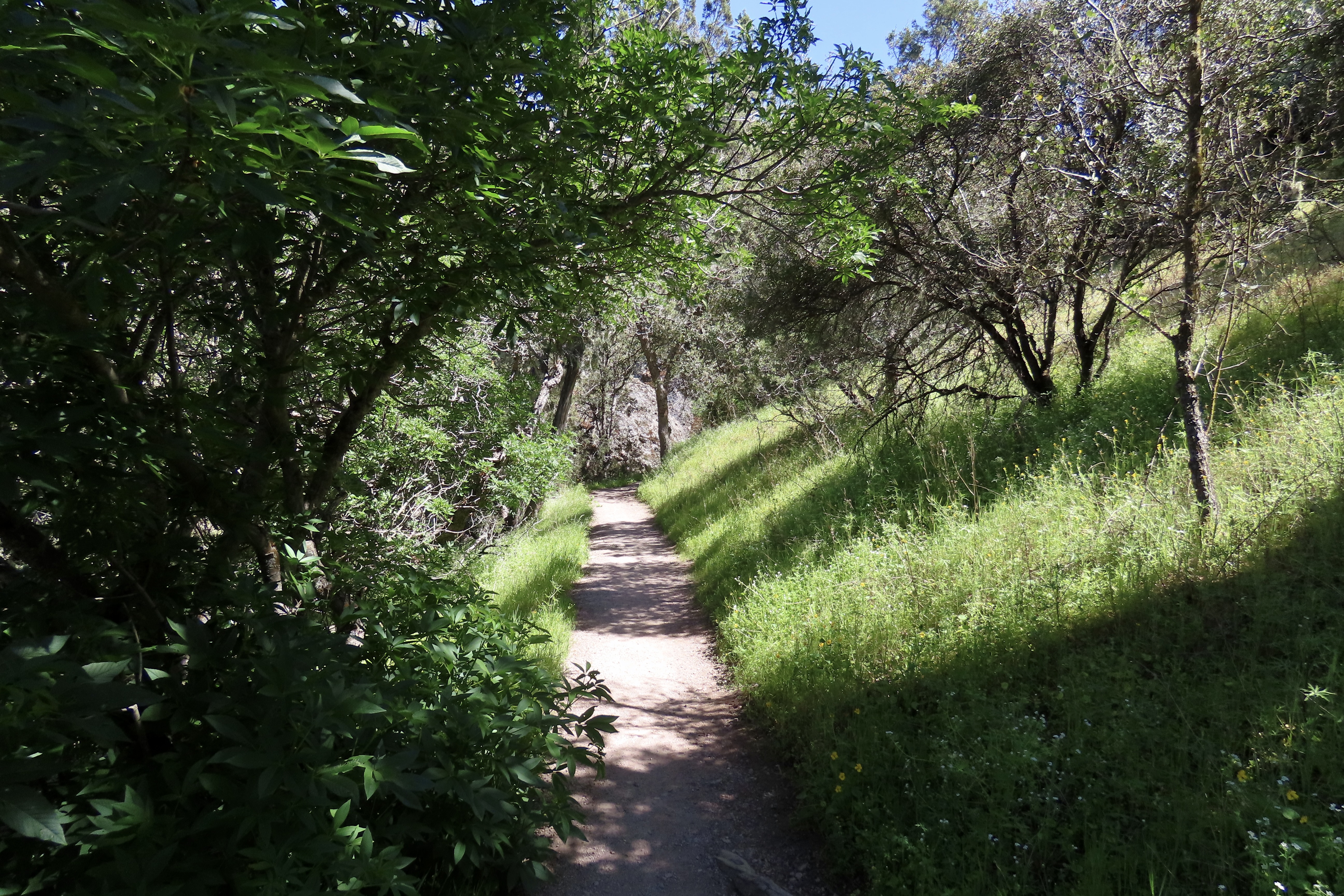
The Pinnacles National Park, located just east of the Salinas Valley in central California, was the first national park we visited on our trip up the coast. Raised to national park status in 2013 by President Obama, it is a recent addition to the system. The park is noted for its monoliths, spires, canyons and the beauty of its spring wildflower display.
Huge monoliths rise up from the ground…As do impressive spires.Massive boulders have tumbled down from the ridges creating talus slopes and ‘caves’ people can actually walk through. This small one contained a creek we followed up a canyon.We were there in April and wildflowers were everywhere. We had never seen a shooting star displaying this many flowers.A lone oak standing on the crest of a hill caught our attention.
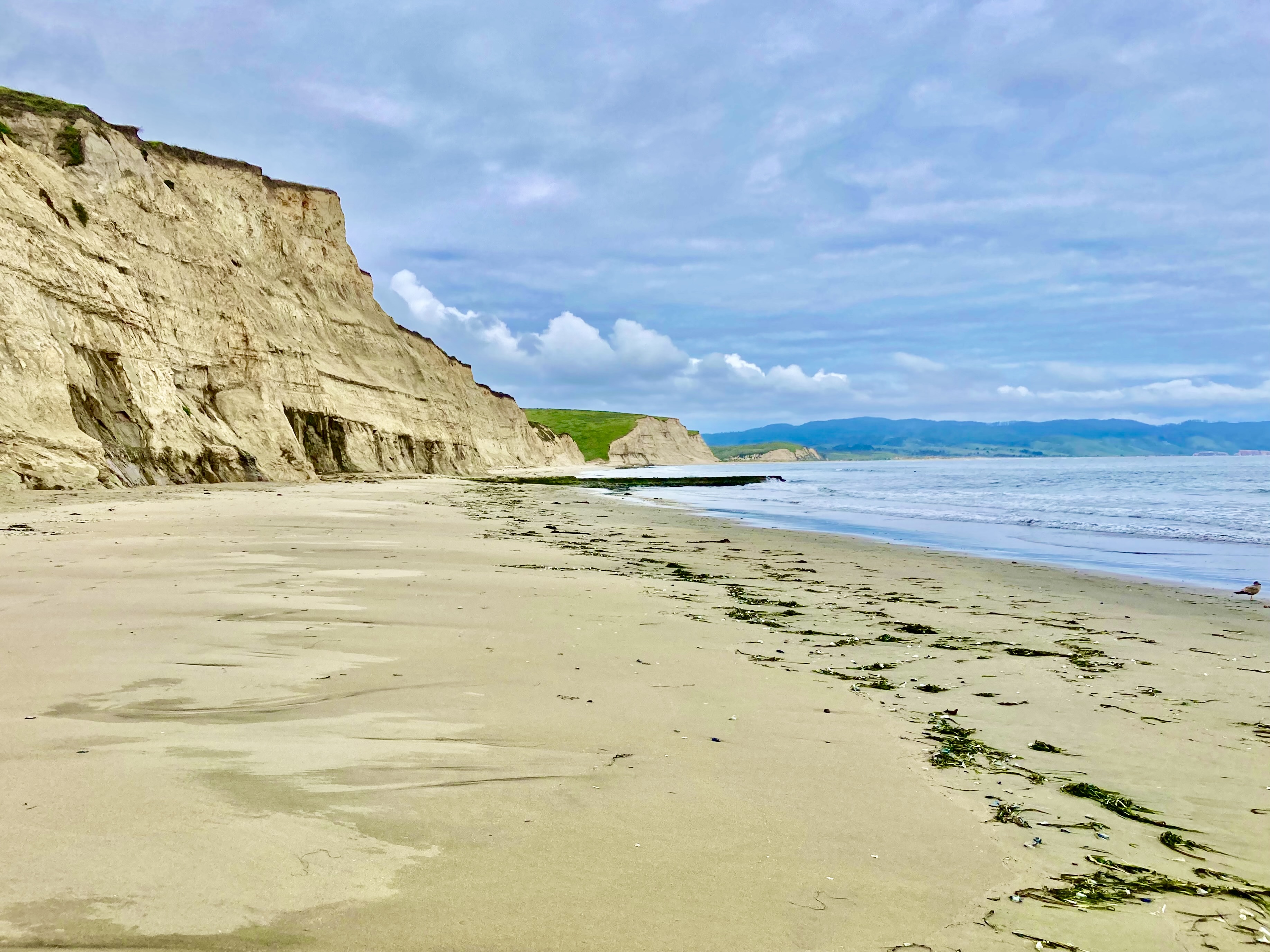
POINT REYES NATIONAL SEASHORE
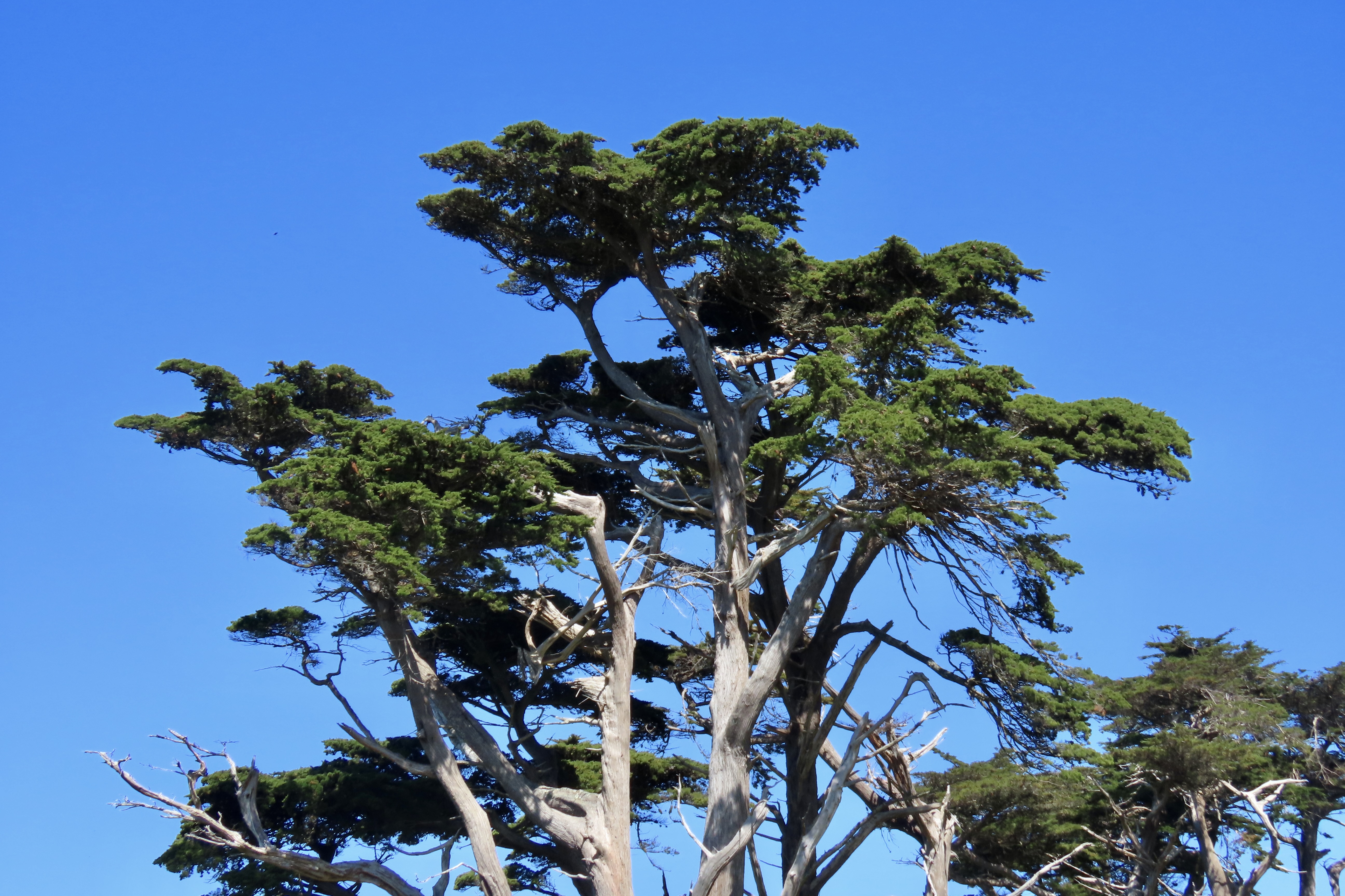
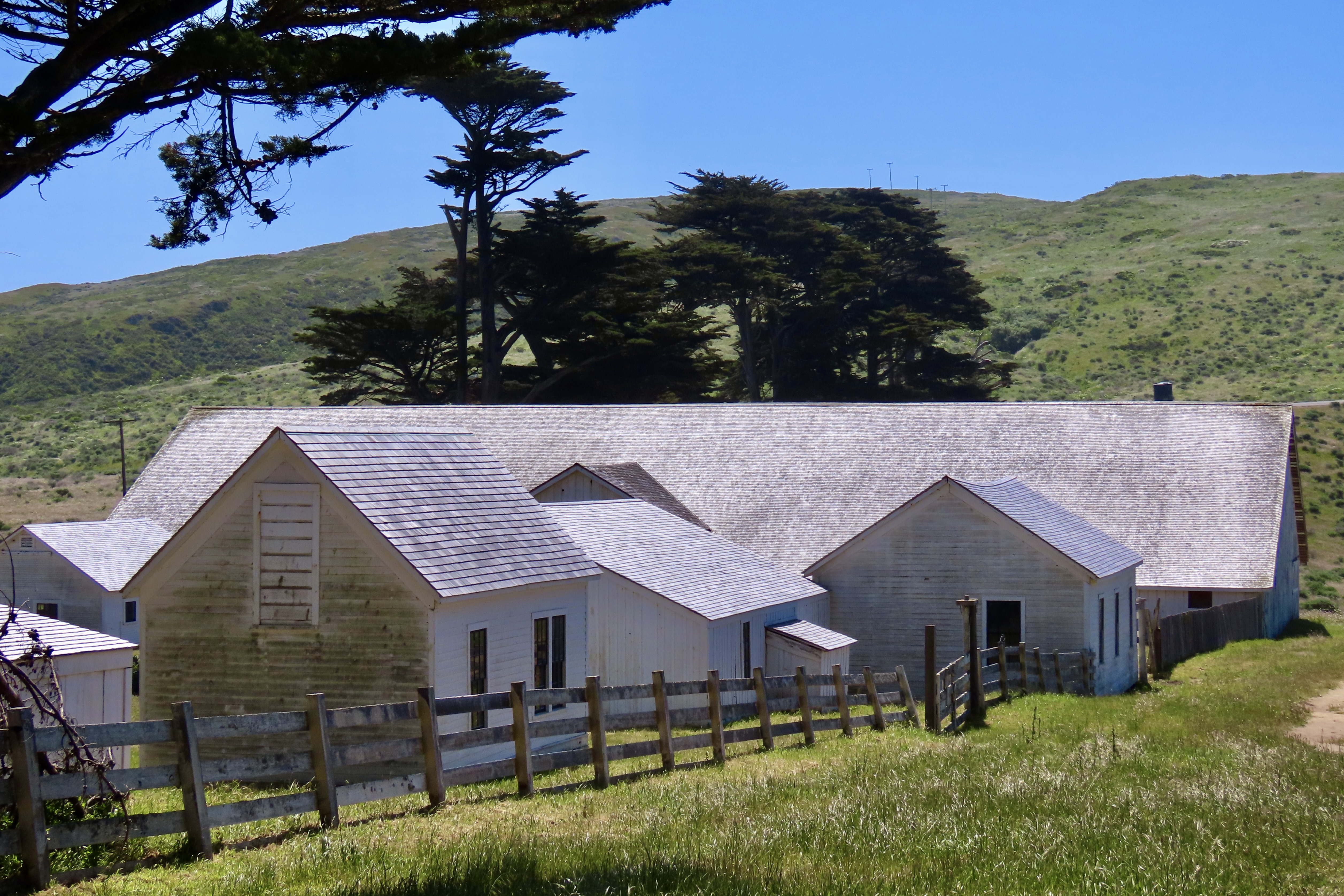
Technically, Point Reyes National Seashore is not a national park. The primary reason is that the land incorporates a number of dairy ranches that were there before the park was created. But it is a unit in the national park system. And, I might add, a well-justified unit. Located just north of San Francisco, it is renowned for its beauty and wildlife. It also has the interesting geological history of having migrated north from Southern California along the San Andreas Fault. (Pinnacles has a similar history.) I was a regular visitor during the years I lived in Sacramento. It served as my winter go-to break. The summers were for the mountains.
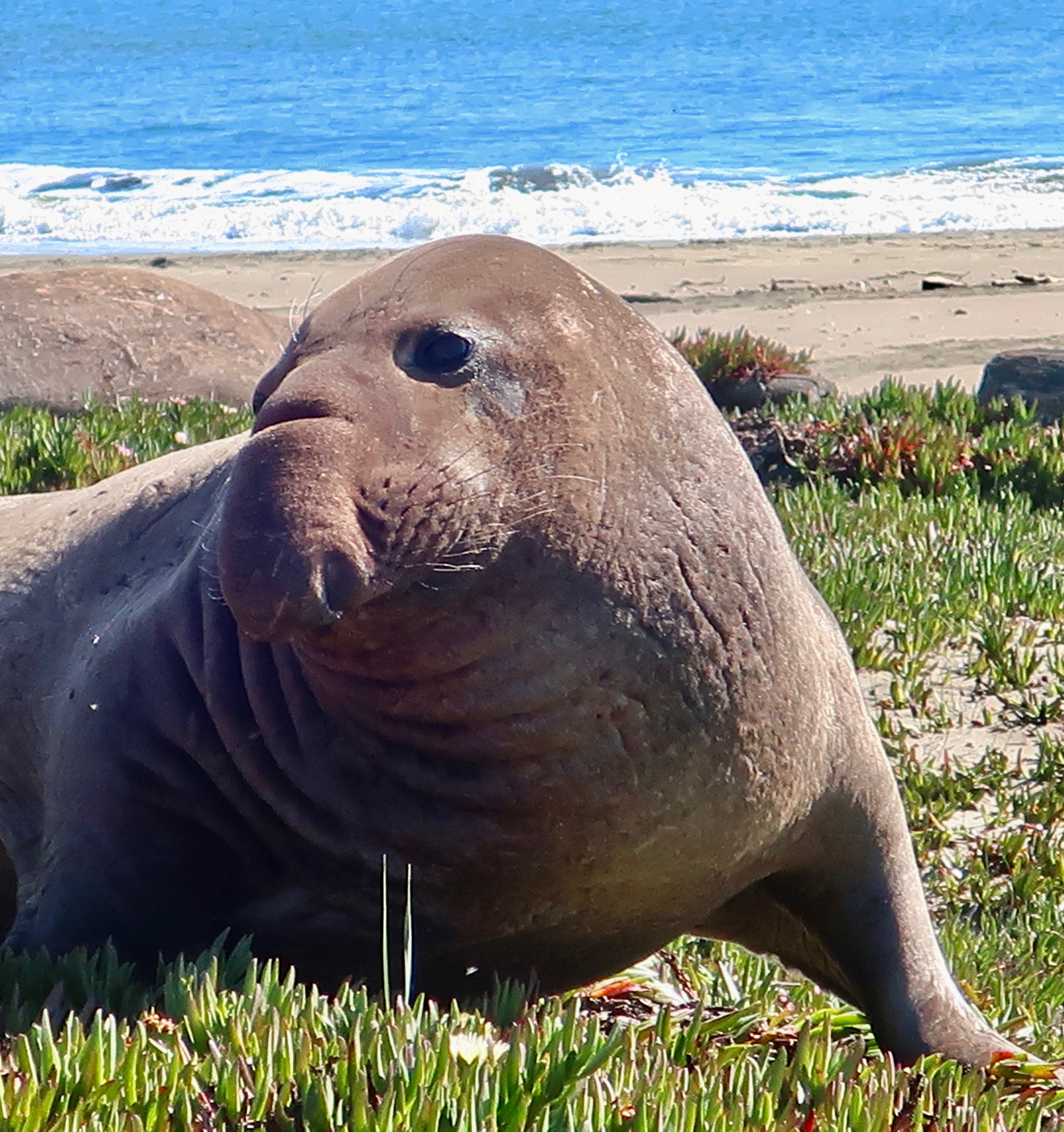
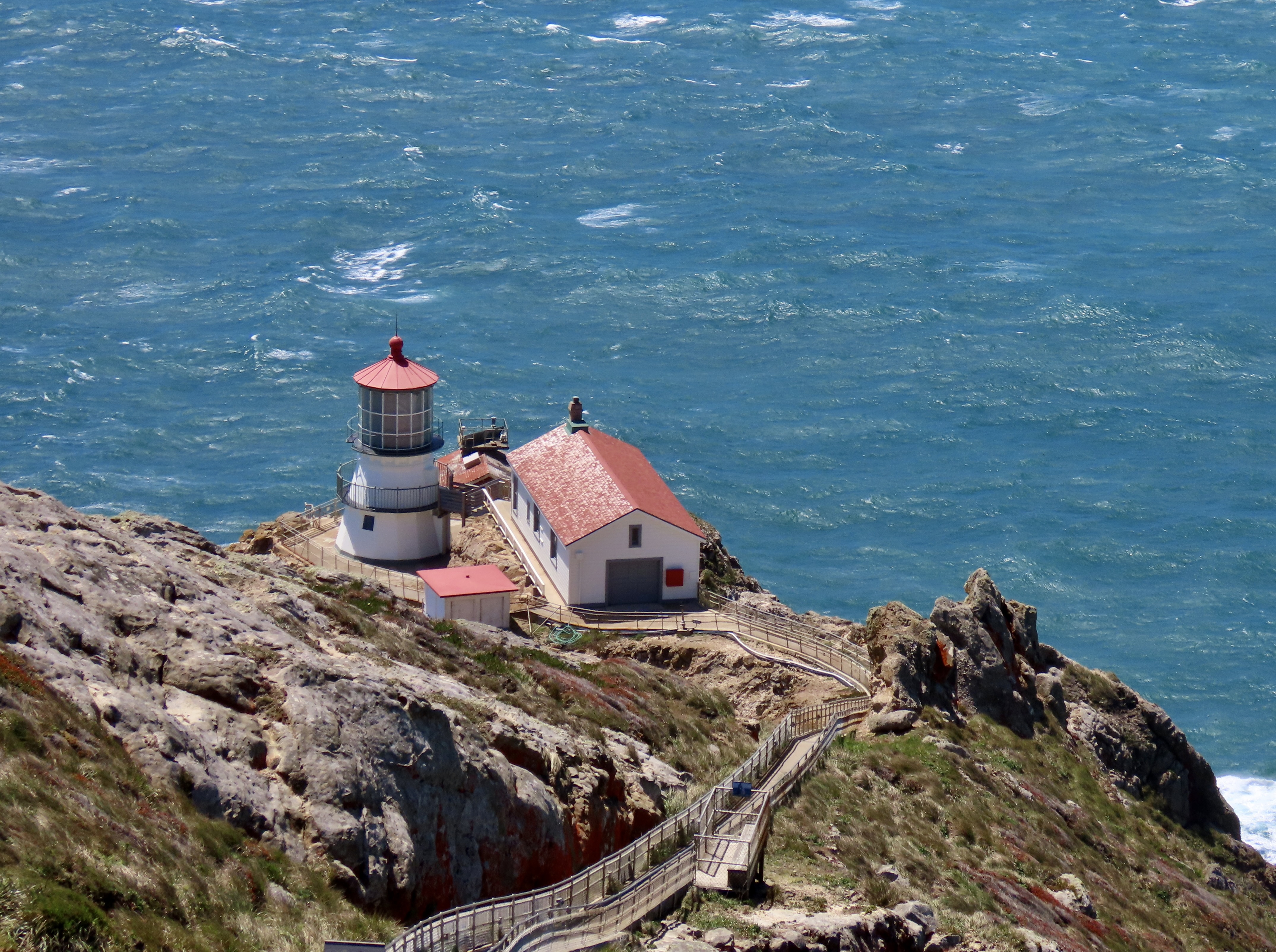
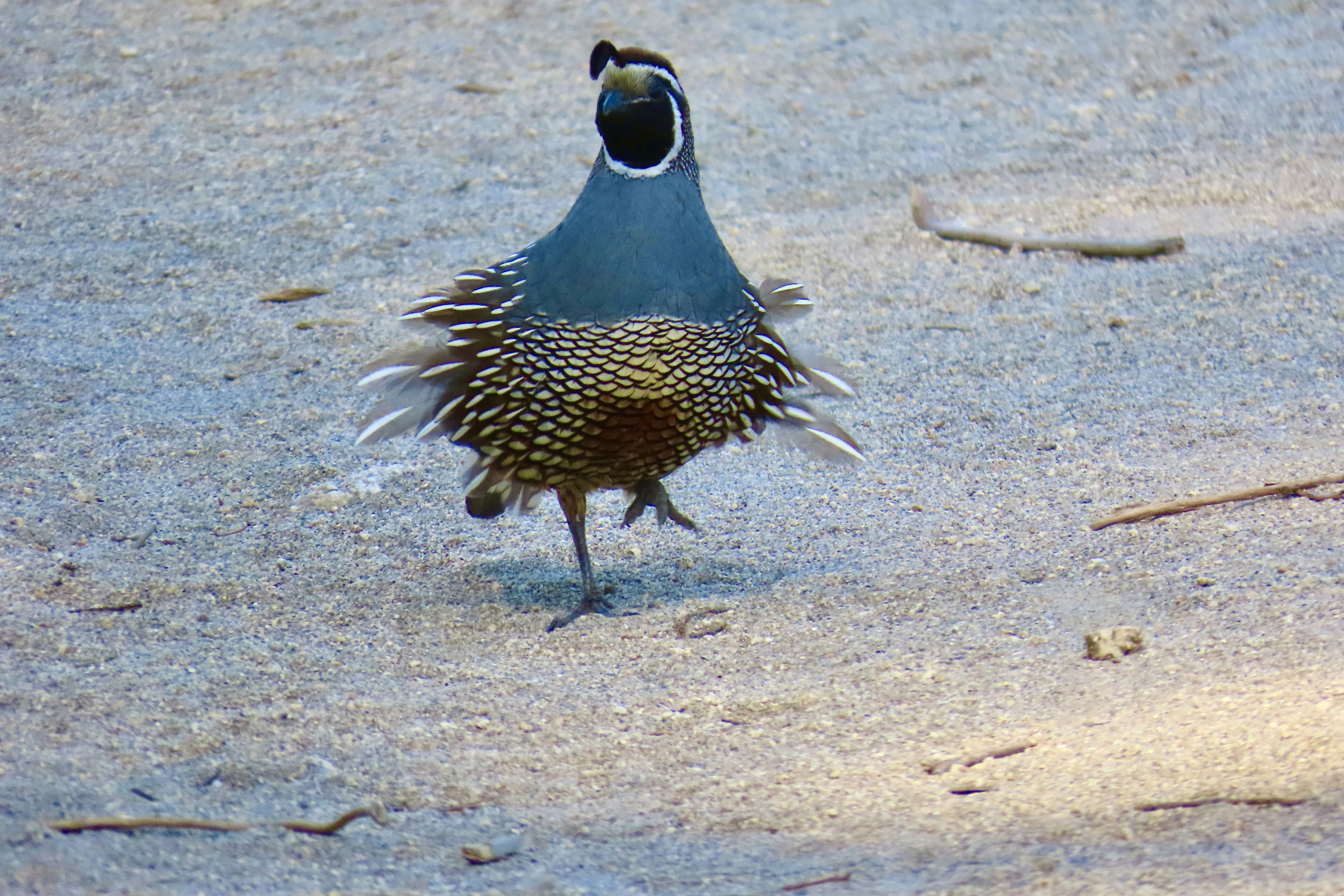
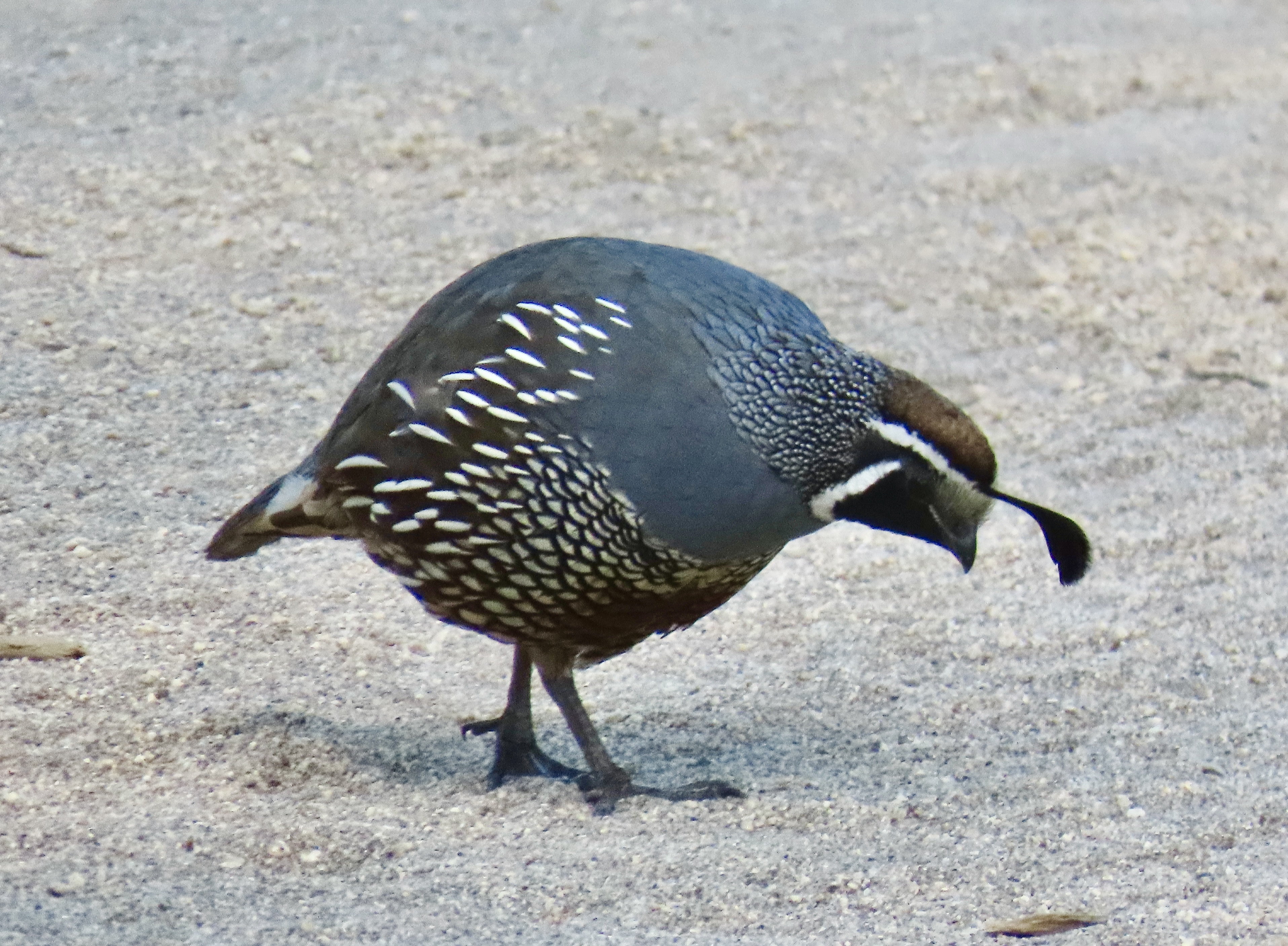
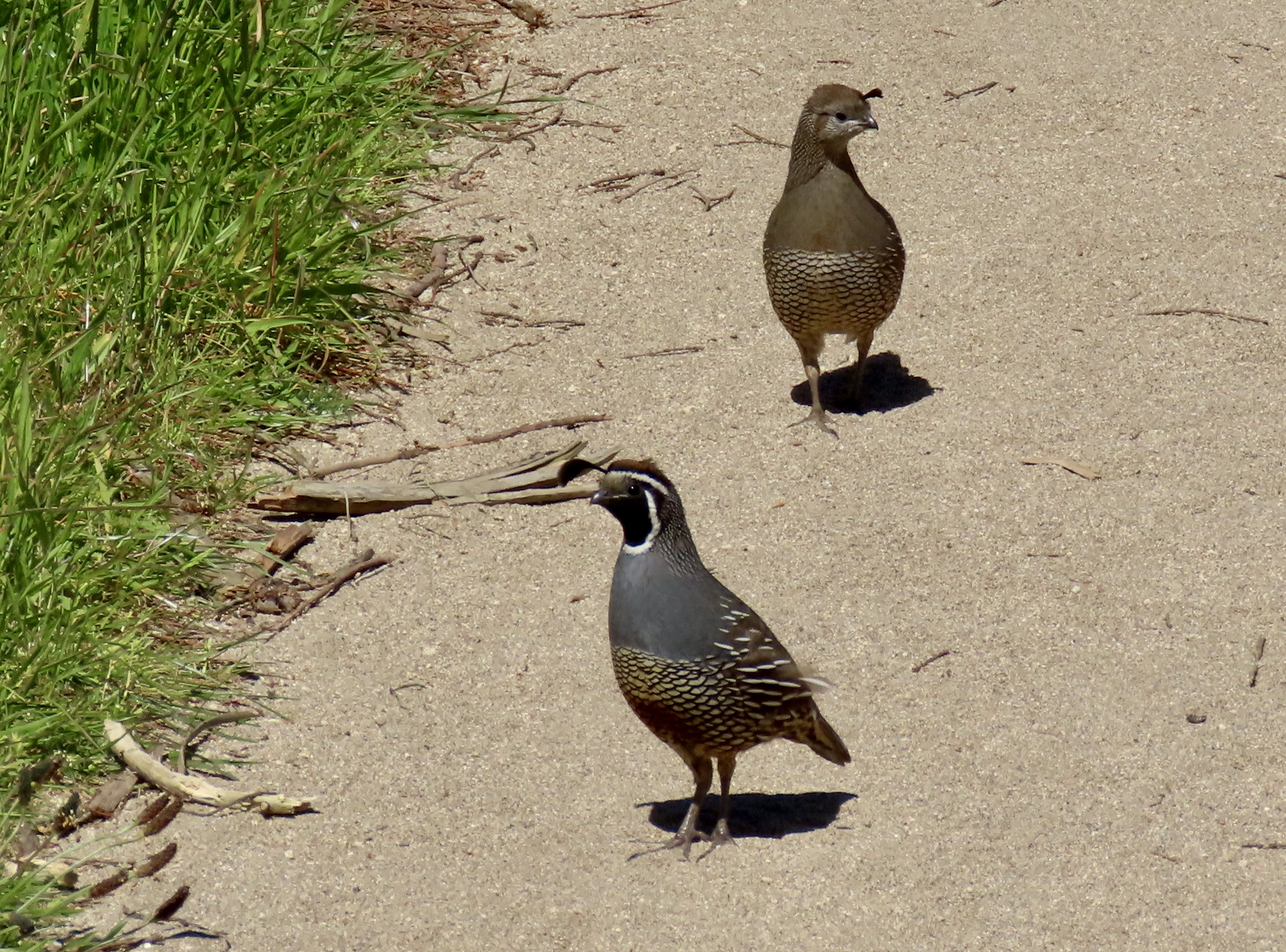
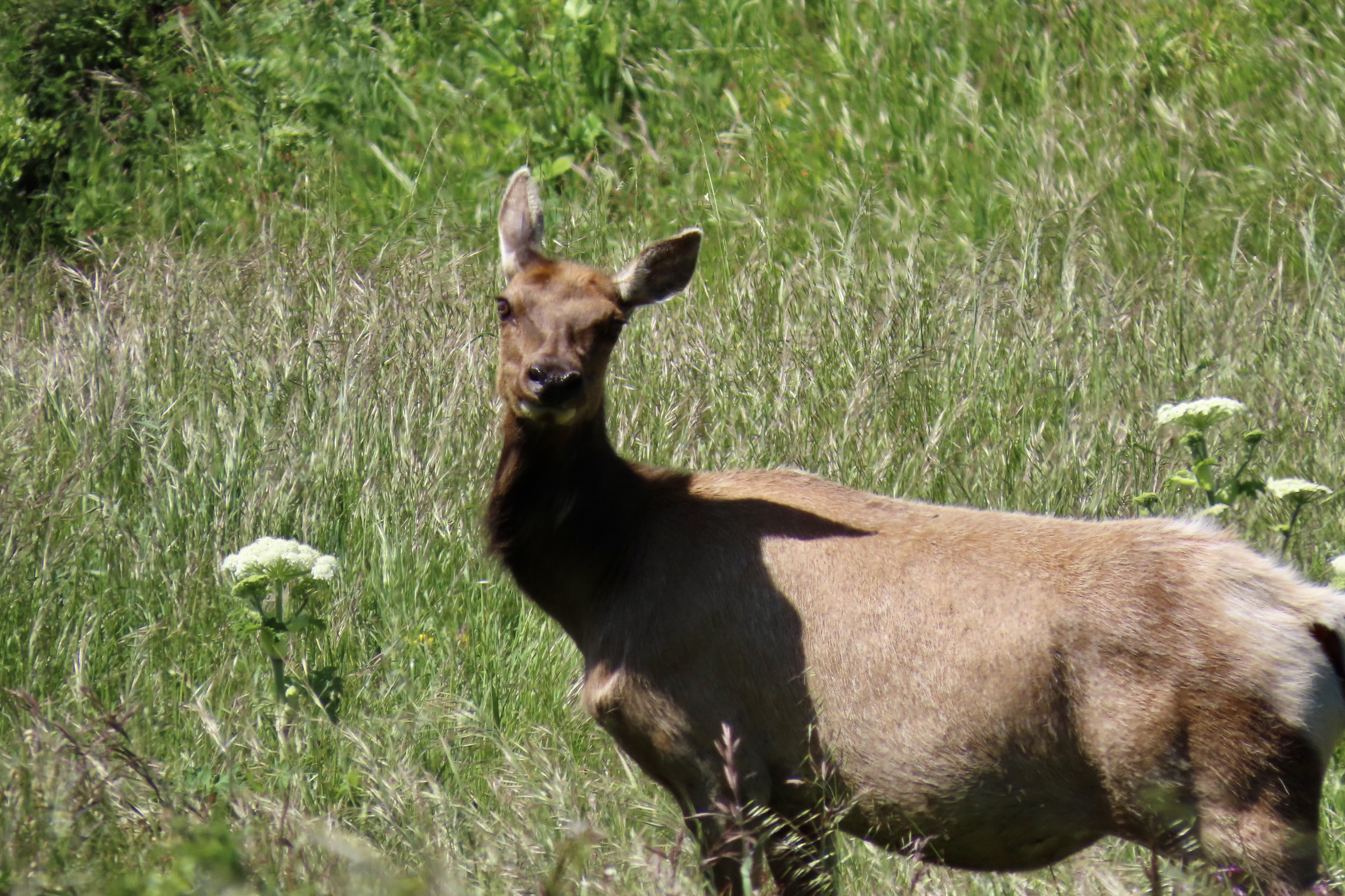
Long Beaches with spectacular cliffs, forested mountains, grass covered hills and valleys, plus abundant wildlife contribute to the appeal of the park. During December through March, this beach will be busy with elephant seals breeding and having pups.We found this charming fellow and other elephant seals at Drake’s Beach on a previous visit. He’s come ashore looking for love.This whimbrel was strolling down the shore at Limantour Beach.A great blue heron made a lightning fast strike to catch a fish at Abbots Lagoon.The Point Reyes Lighthouse, always worth a visit.The Pierce Point Ranch provides an introduction to the historic significance of dairy farming at Point Reyes.California quail were running around the ranch when we visited. The wind was ruffling this guy’s feathers.And a large herd of tule elk is usually found nearby.
REDWOODS NATIONAL PARK
The National Park Service works in close coordination with the California Department of Parks and Recreation to maintain the towering redwoods that grace the coastal area of far northwestern California. It’s all about the trees , some of the oldest and tallest in the world, but its rainforest character, crashing waves and wildlife add to its splendor.
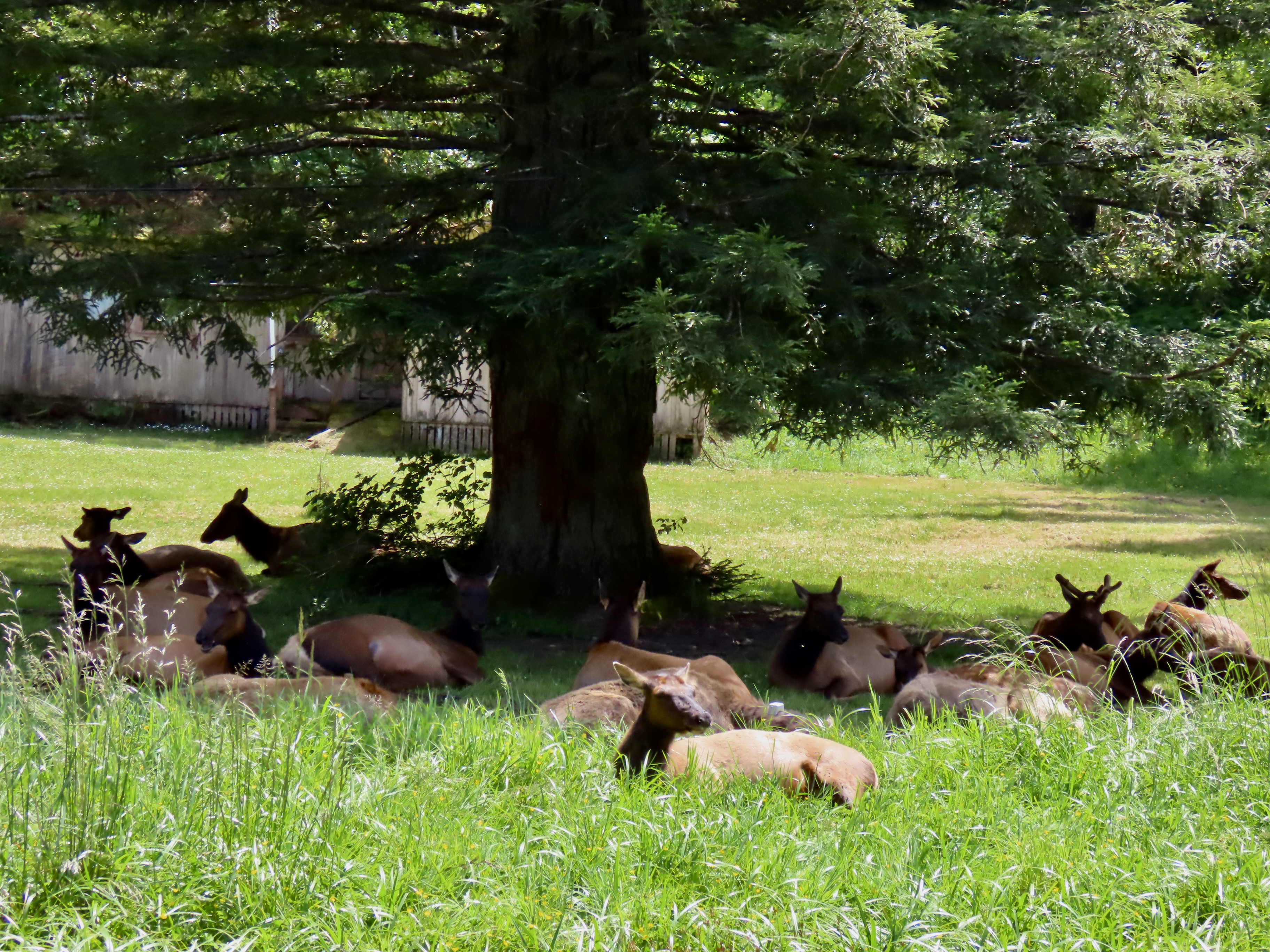
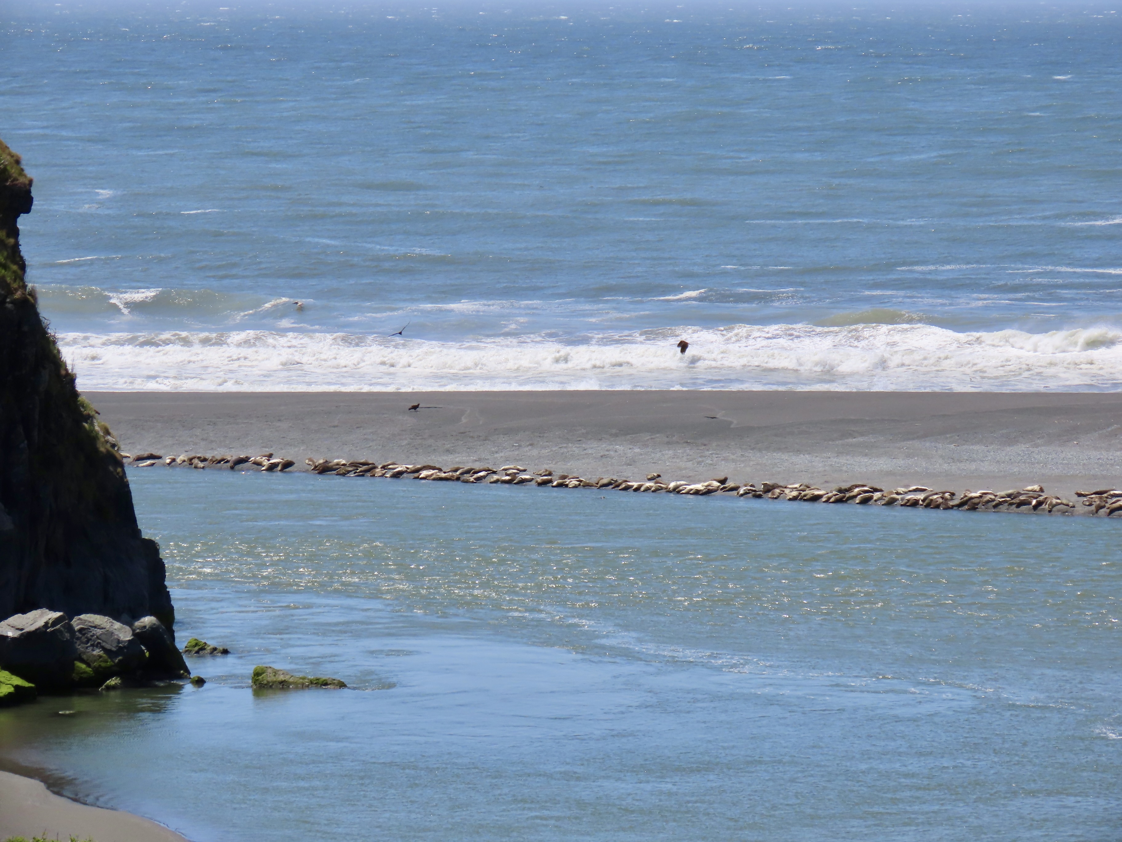
Massive trees reach for the sky…Crashing waves roll ashore…The rainforest harbors ferns whose origins are lost in the mist of time…Herds of Roosevelt elk are as likely to be found bedding down in someone’s front yard as they are wandering through the redwoods…And hundreds of seals pull up on remote shores to rest and bathe in the sun.
OLYMPIC NATIONAL PARK
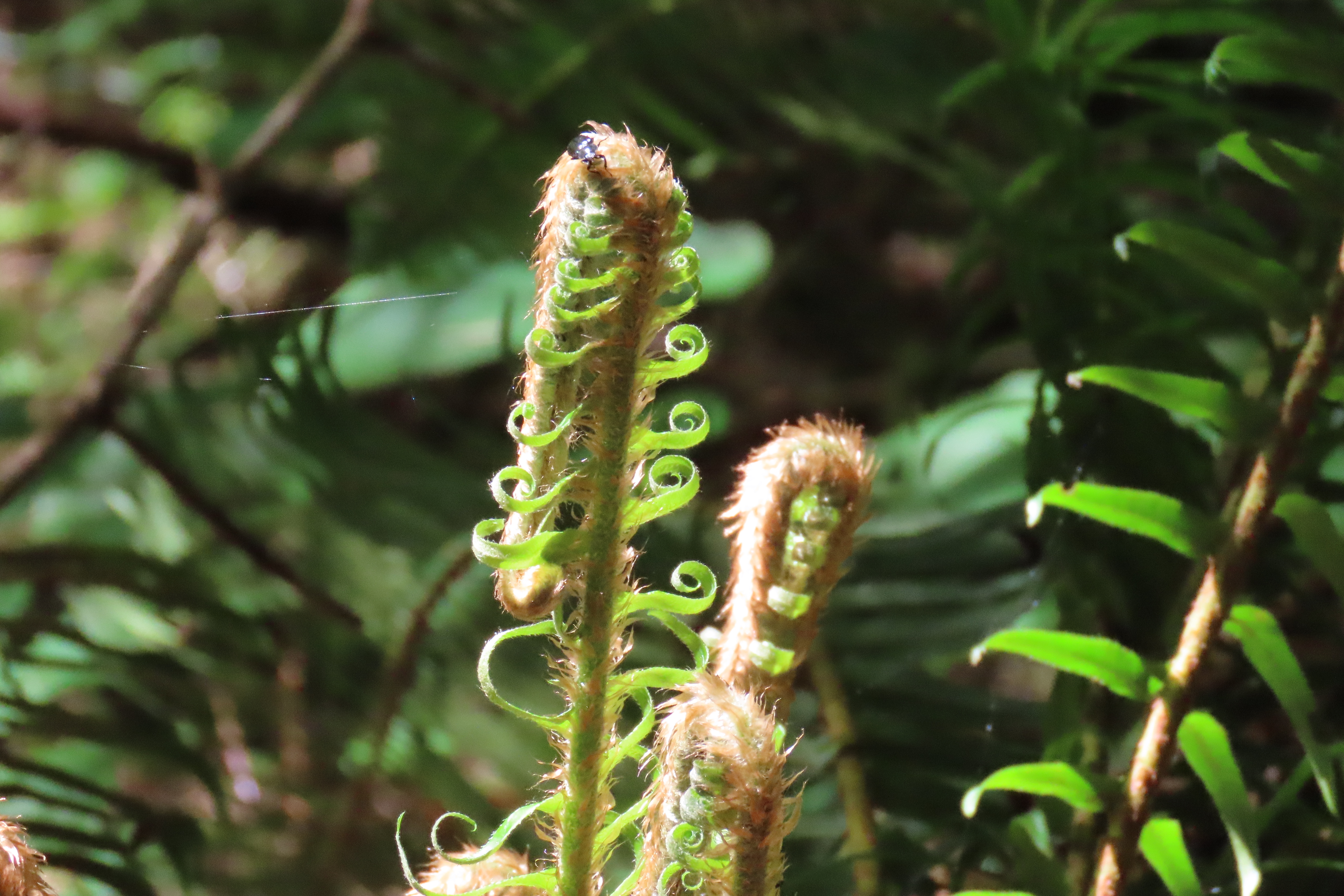
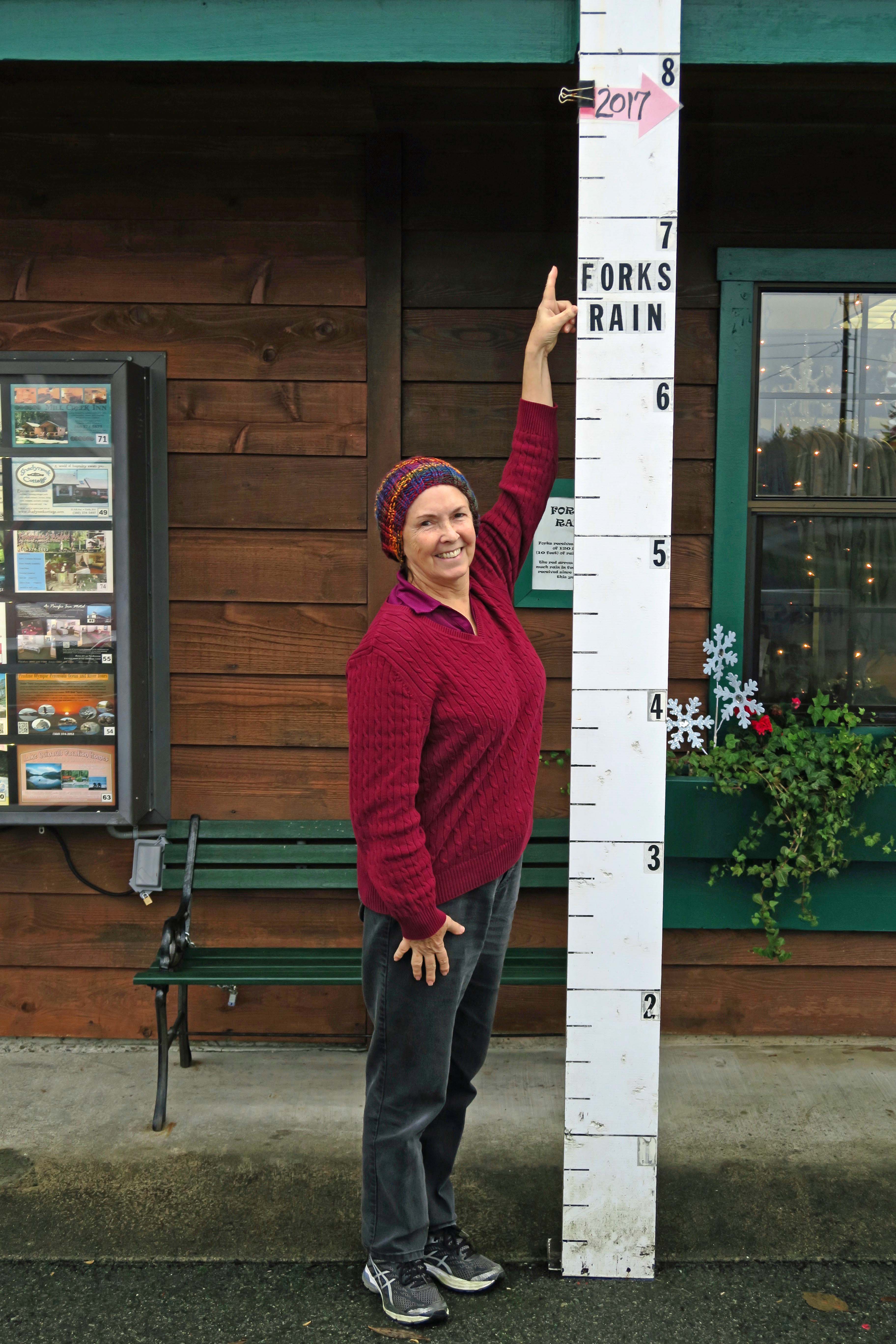
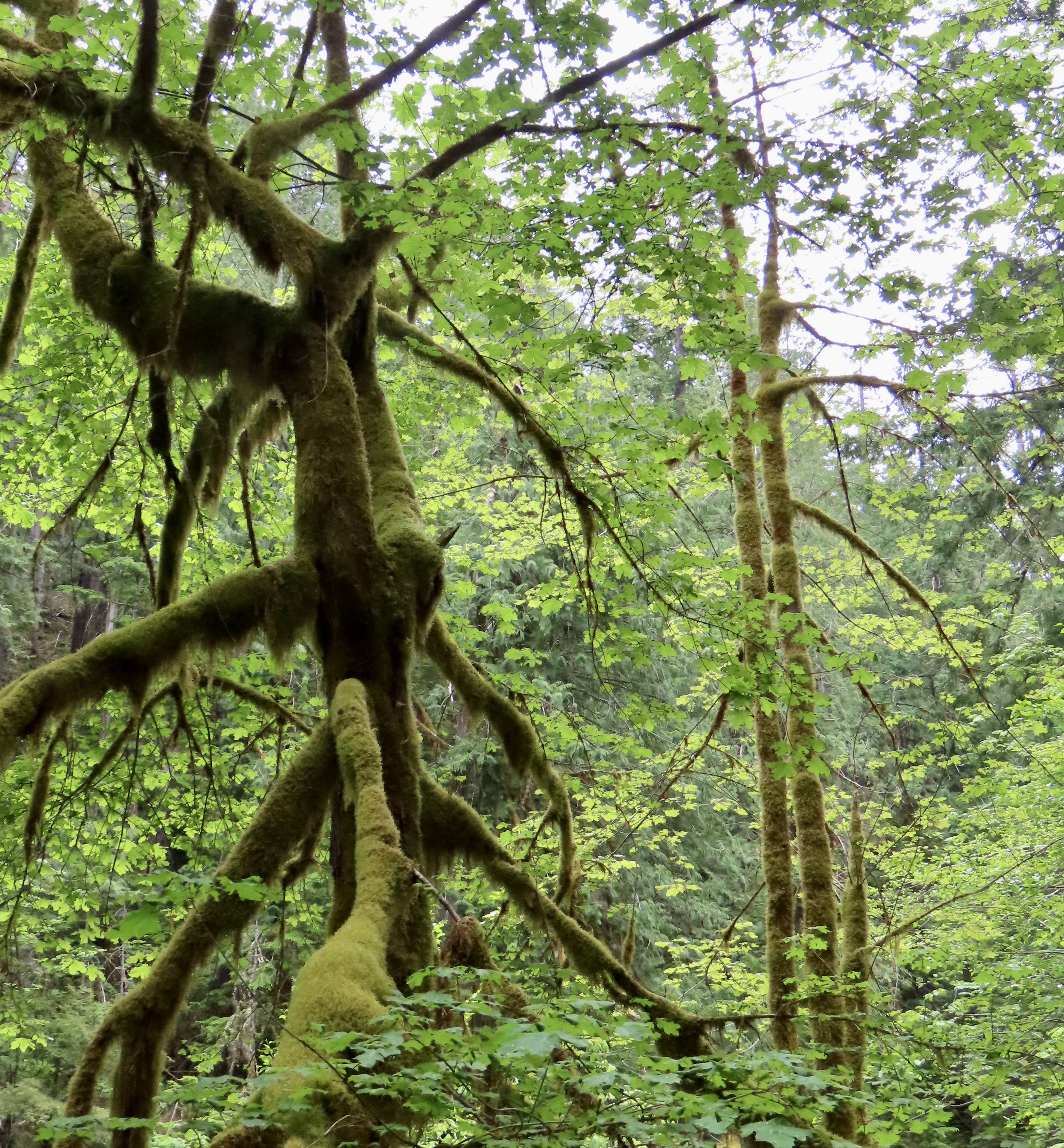
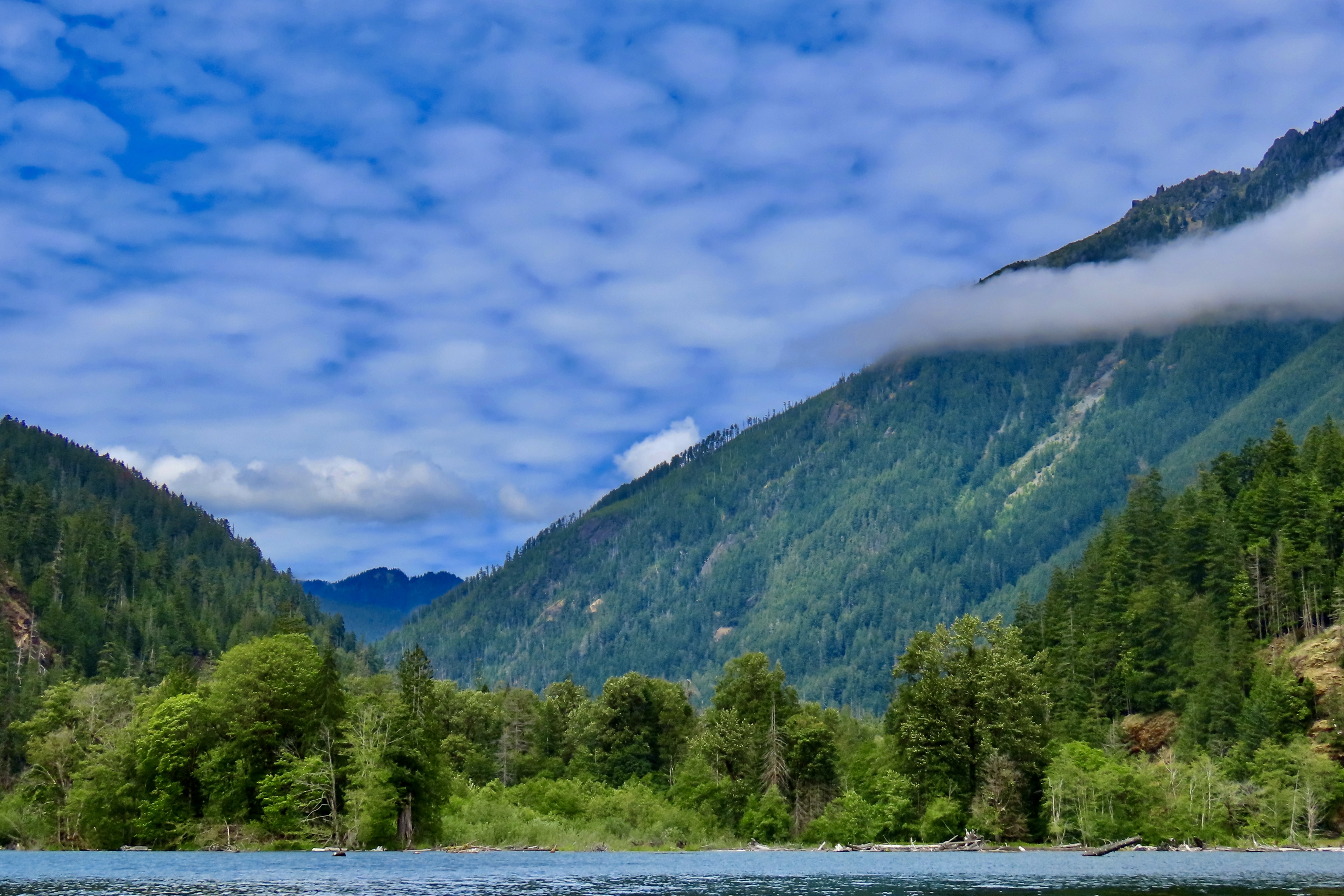
Olympic National Park serves as an iconic example of a temperate rainforest receiving over 150 inches of rain on its west side while harboring old growth forests on its drier east side. Major rivers come tumbling down from its glacier covered peaks. Its 62 miles of wilderness coastline constitutes the longest undeveloped coastline in the contiguous US. As I noted in my post on Olympic National Park, our visit was limited this year, so I have added a couple of photos from previous trips. The other photos you will probably remember from last week!
The Skokomish River is one of several that flow out of the park fed by the extensive rainfall and high glaciers.In 2017 we stopped in the small town of Forks (home to the Twilight books and movies) on the western side of Olympic National Park. Here Peggy points out how much rain the park had received by November.On that same trip, we drove over to the wilderness part of the park that runs along the Pacific Coast. Here Peggy is admiring sea stacks. Huge piles of driftwood brought in by Pacific storms stretch up the coast. Back on the southeastern portion of the park, we admired the moss covered trees that are typical of temperate climate rainforests.Our hike up the Staircase Rapids trail along the Skokomish, led to this view we had when crossing a bridge that had been wiped out twice before by the raging river during spring melt. A final photo that provides a view into the park from our kayak trip on upper Cushman Lake. Next, we will explore the impressive mountains of Cascades National Park as we leave our trip up the Pacific Coast and start our journey back to our basecamp/home in Virginia.Cascades National Park
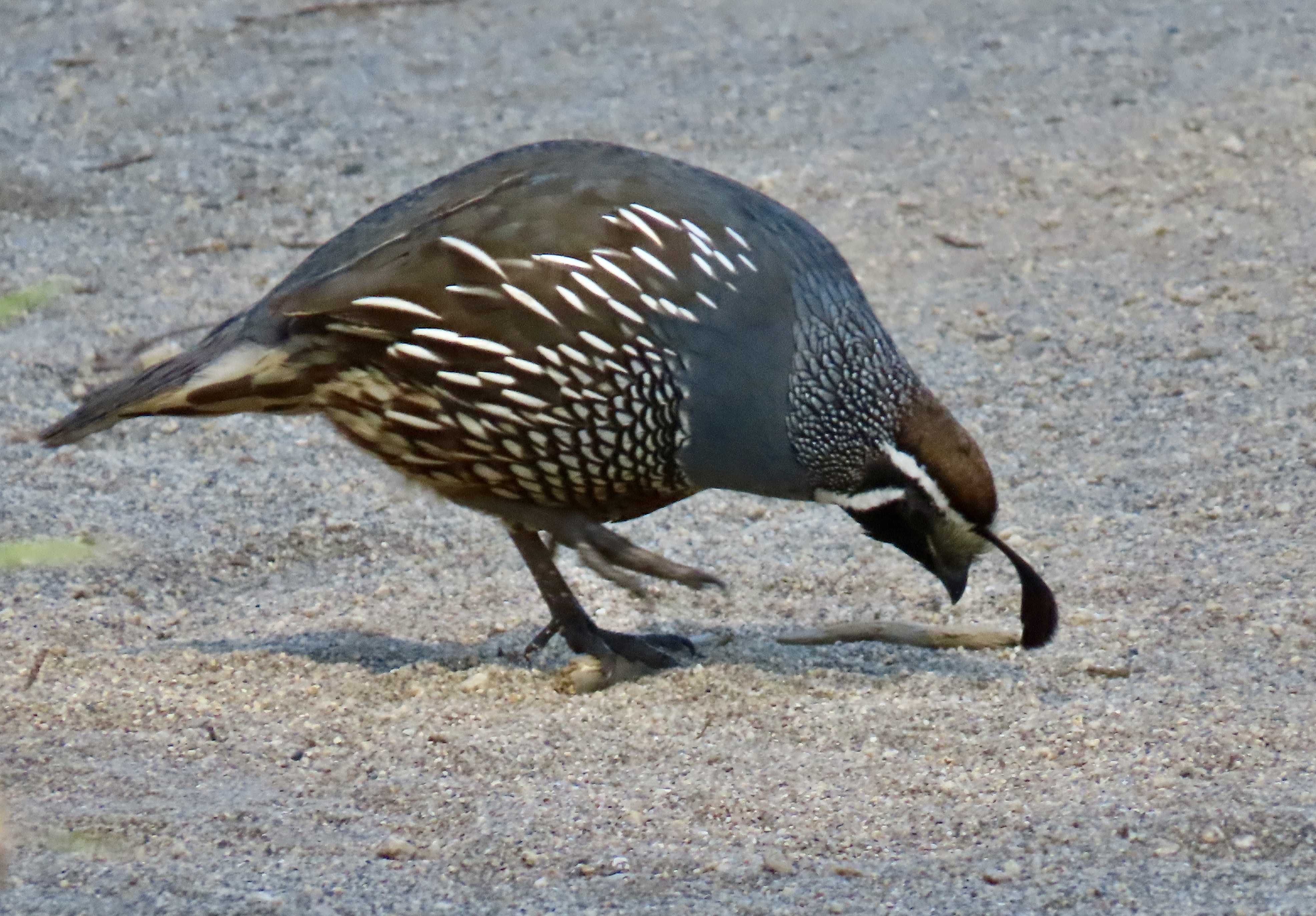
Peggy and I visited the historic Pierce Ranch during our recent two week stay at Point Reyes National Seashore. We didn’t go to see the quail, but there they were, everywhere. This one, wearing his ‘red cap with white trim, white beard, bushy eye brows, and big belly,’ reminded me of someone. A certain Mr. Claus perhaps? But what about the jaunty feather in his cap? Actually, it is six overlapping feathers.
Anyone visiting Pt. Reyes National Seashore should visit the historic Pierce Ranch. It provides an excellent introduction to the dairy industry that started in the mid-1800s and still exists within the National Seashore boundaries today. Local ranchers worked together with the Sierra Club in the 1960s and 70s to preserve their ranches and avoid the onslaught of real estate speculators and developers who envisioned turning the beautiful area into massive profits for themselves and great homes for the few that could afford them— instead of one of the world’s premier national parks for everyone.
There is more to the ranch than history, however. For one, there is a tule elk reserve in the area. Having been eliminated from the region during the 1800s, they were reintroduced in 1978 and now constitute a sizable herd. A trip out to the ranch doesn’t guarantee you will see these magnificent creatures but the odds are you will. A short— or longer— hike out the Tomales Point Trail will increase your chances even more. Gorgeous scenery, wild flowers galore, birds and other wildlife are three more excellent reasons for a visit.
We actually went out twice on our visit: The first time was with our friends Tom Lovering and Lita Campbell, the second by ourselves. We didn’t need any excuse to go a second time, but the fact we had forgotten to bring our cameras except for an iPhone the first time was certainly a factor. We’ve become spoiled. Our photos are from both trips, however. Even Tom jumped in with his iPhone.
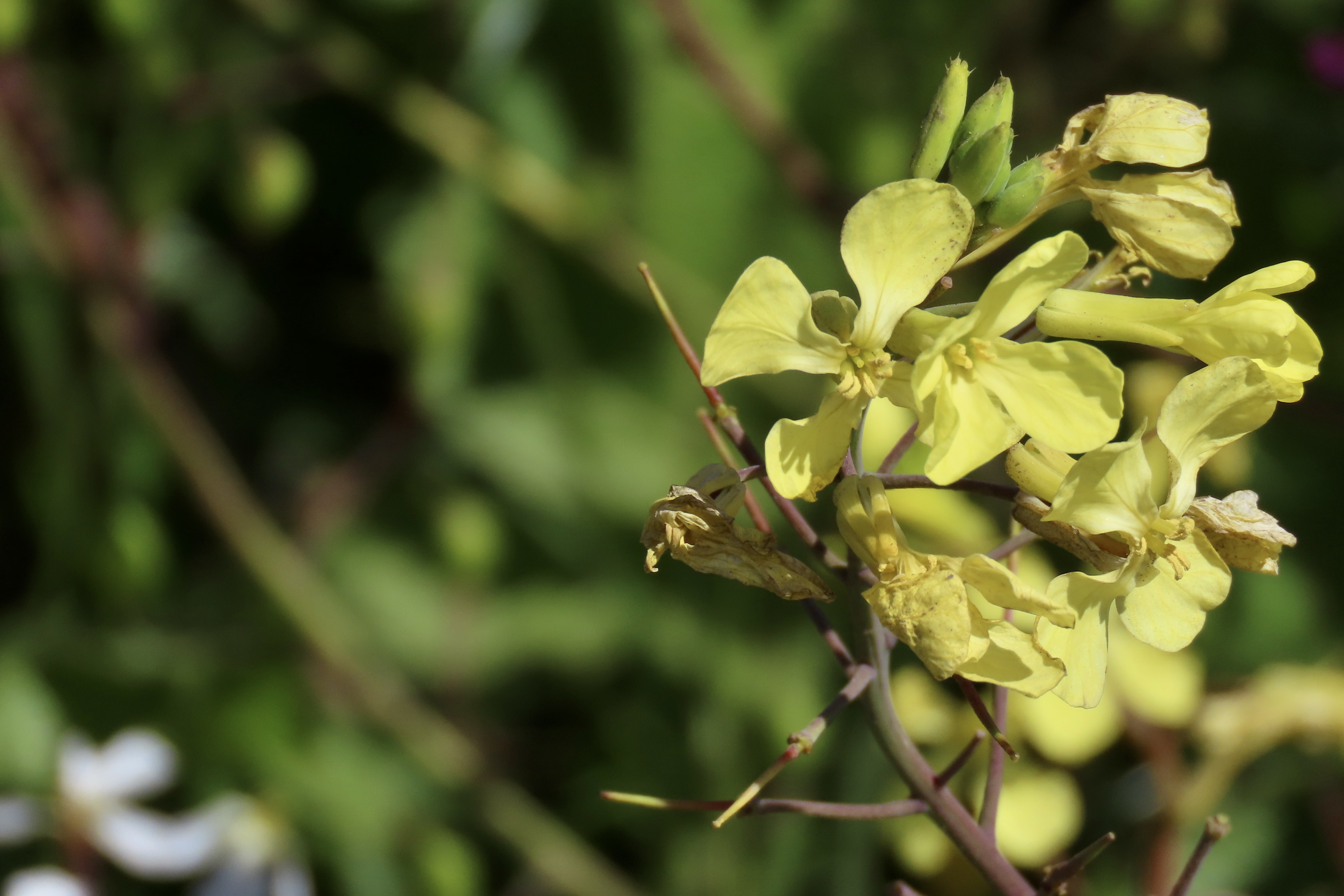
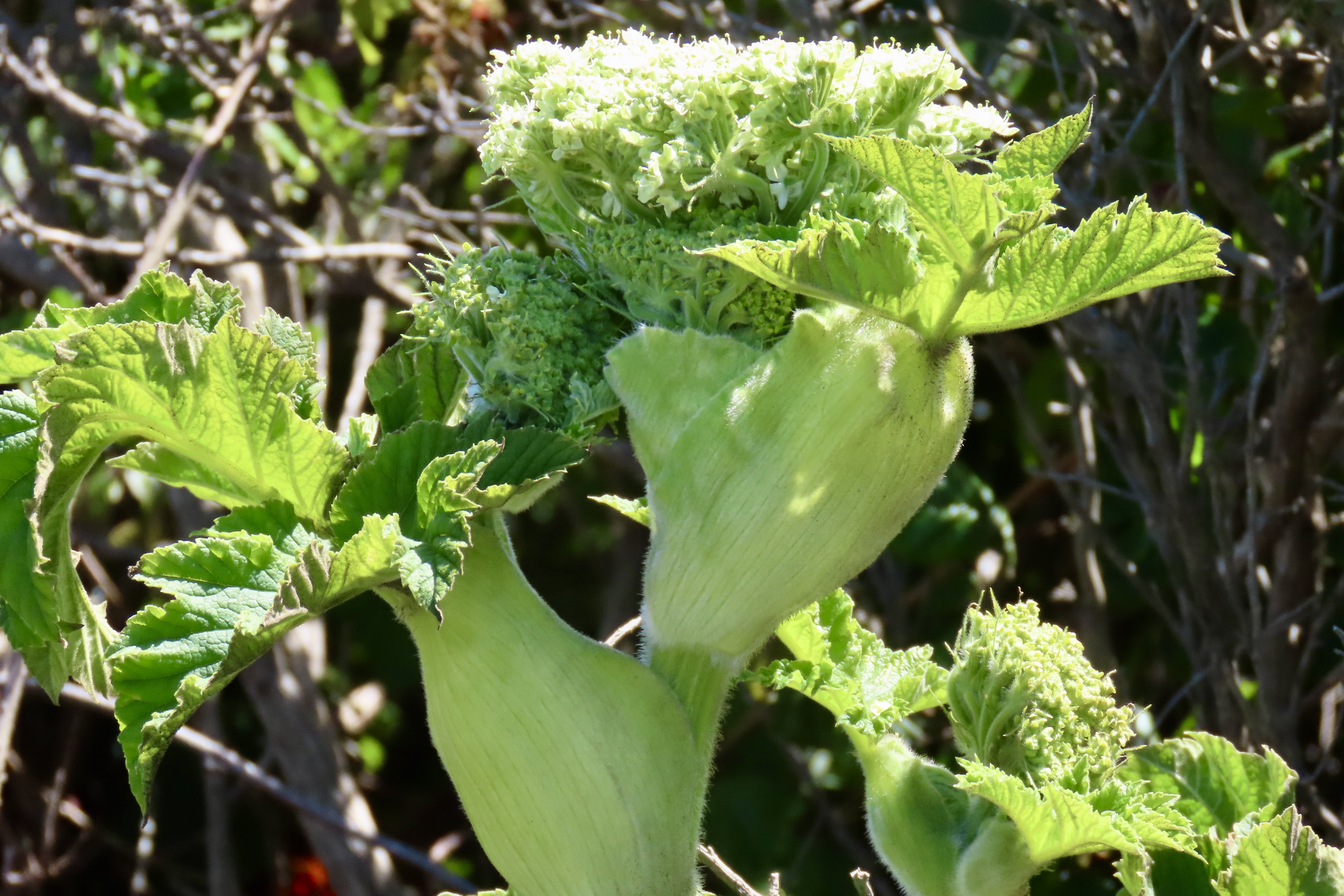
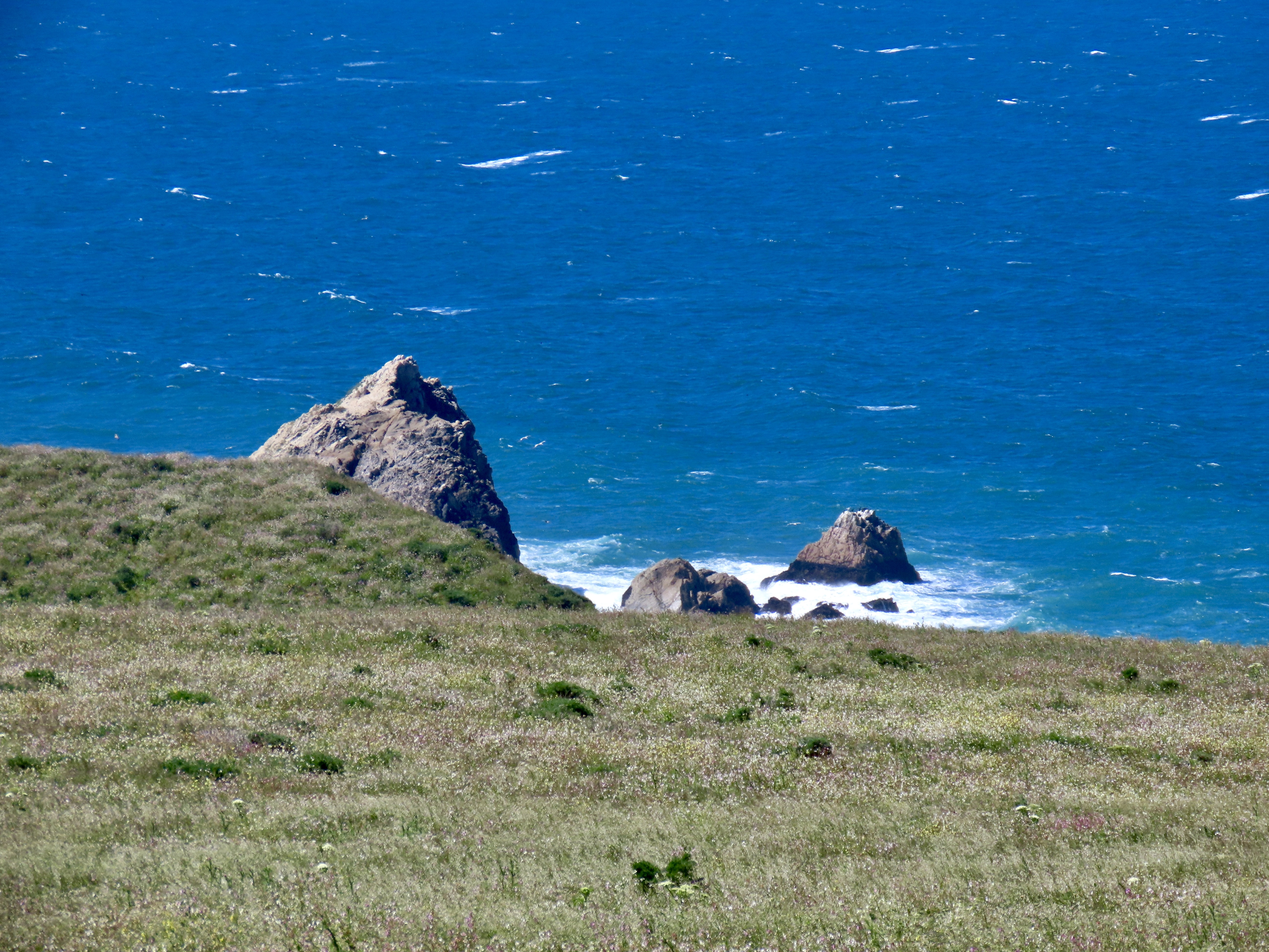
Quail eat a variety of plants and insects but seeds are always high on their list. This California quail is searching for them along the Tomales Point Trail.He stopped to check out a small stick.The wind added an interesting look to the quail as it came down the trail toward us.A feather dancer, perhaps. This is the time of the year when quail pair up. The hen, who had been searching for food in the grass, joined her mate. This shot provides a good view of the contrast between the male and female. Both are attractive. Soon they will have a clutch of eggs that can number up to the high 20s. It will be well hidden in the grass. When the babies hatch, it becomes the male’s job to serve as a guard. I’ve often watched one perched in a location that provides a view of the surrounding area. A quick call sends mom and babies into hiding when a threat appears. The chicks get “Freeze!” I once came on a group in the Marble Mountains of Northern California that had ‘froze’ on the trail in a tight little circle. While I was grabbing my camera, Mom realized her mistake and called “Run!” Boy, did they. In every direction.Meanwhile, back at the ranch (so to speak), a covey of quail had gathered. Except during mating season, this is the preferred lifestyle for quail. When frightened their first reaction is to run. They are fast! The next step is to zoom out. The sound that their wings makes is very distinctive, as is their calls. Once you have heard either, it is easy to remember.We discovered, when we hiked out the Tomales Point Trail, that we had hit the height of flower season. Three of the most common are shown here: Yellow and pink mustard, hairy gum plant (Grindelia hirsutula), and cow parsnip.It’s hard to travel anywhere in the US without encountering mustard. It comes in a variety of colors from white to yellow to blue to purple. While I don’t find the individual flowers particularly attractive compared to many others, a field of mustard can brighten up one’s day. Not so a dairy farmer’s, however. The plant is mildly poisonous to cattle. It can also give a bad taste to milk, cream, butter and, I assume, cheese. On the other hand, its tiny seeds produce mustard.Hairy gum plant hardly seemed the appropriate name for these cheerful yellow daisies.The real surprise to me, however, were the cow parsnips. The cow parsnip is a fairly common plant, a giant member of the carrot family. I’ve always admired them for their size, but I’ve never thought of them as particularly beautiful, until this trip.Nor have I ever noticed how they come wrapped up as young plants.Part of this cow parsnip is in bloom, while other parts are in the budding stage.Budding and blooming are combined here. In full bloom. While quite pretty and presumably edible (if you know what you are doing), I would neither pick this flower for a bouquet nor eat it. Sap from the stems is known to be phototoxic. If you get some on your skin, sunshine can turn it into a severe rash. While I was focusing on flowers, Peggy was capturing some of the impressive scenery. This is looking out toward Tomales Point. The Pacific Ocean is on this side of the peninsula. Tomales Bay is on the other. The Bodega Bay Headlands can be seen in the distance. Sea stacks that tower above McClure Beach. I really like the contrast here between the ocean and the grass with the massive rocks providing separation between the two. Here, Peggy caught the iconic cypress trees at the start of the Tomales Point Trail at Pierce Ranch.Tree tops.I took this photo because I was enamored with the rooftops. The large building once served as the dairy barn. The other buildings served a variety of purposes ranging from bunkhouses to where the butter was made. More cypress provide a backdrop for the barn.Tom and Lita were with us on our first trip out to the Pierce Ranch. The skies were threatening rain. Tom was rather taken with this single cypress tree that was peaking over the dairy barn and set off by stormy skies. I thought his capture of the barn was quite good as well. I amused myself inside by taking a photo out of one of the windows. Modern art?This might seem like a strange thing to throw into the middle of a blog on Point Reyes but Tom wouldn’t stop talking about it. I’ve know Tom in a great number of capacities during the 50 years we have been hanging out together, but somehow, I never imagined him as someone who would create a powerful, battery operated blender that you can take anywhere. Thus the name: All Terrain Blender. He designed it with outdoor activities and tailgaters in mind, but it turns out it will make an excellent addition to our RV or any area with confined space from apartments to small houses. (The top and the bottom can be flipped and fitted together for storage!) The product is now in its final stages of development. Market studies suggest that it will be very successful. It’s hard to say how successful, but one thing I know about Tom is that he will use a substantial part of any profits he makes to support good causes. That’s what he has been doing all of his life.Way off in the distance, you can see a tiny figure. That’s me, searching for elk. When we visited the ranch with Tom and Lita, the elk were hanging out beside the road and our only camera was our iPhone. When we came back with our good cameras, they were off in the far distance. Go figure. Peggy decided to stay in the truck while I went on my search.I actually found one. Its response was, “What in the heck are you doing here?” And then immediately ran off.This horse wasn’t likely to run off anywhere. We found him at a ranch on our way back to camp after visiting Pierce Point Ranch. Tom snapped its photo. Have you ever see such a swayback? That’s it for today. Our next post will wrap up our Point Reyes visit with a trip out to the lighthouse, a walk on the Earthquake Trail, and a hike to Tomales Bay.
Pinnacles National Park is located inland from California’s Central Coast. Peggy and I followed a narrow, curvy, one lane road east of the small town of Soledad to get there, holding our breath each time we met another vehicle— especially if it was as large as our truck. While the location was a slight detour from our coastal focus, we are totally incapable of skipping a National Park.
Pinnacles National Park has a twin near the city of Santa Clarita some 200 miles to the south, the Neenach Volcanic Formation. Born of fiery rhyolite lava flows some 23 million years ago, they were ripped apart in their youth by the notorious San Andreas Fault. Pinnacles has been making its way north ever since: Inch by inch and earthquake by earthquake.
Noted for its personality-plus pinnacles, talus tunnels, and wild flowers, the region was declared a National Monument by Teddy Roosevelt in 1906. Legislation by Congressman Sam Far from the Monterey/Carmel area in 2012 led to its being established as a national park. (Sam, like me, was an early Peace Corps Volunteer. For a brief time, we worked together in the Western United States as Peace Corps Recruiters.)
The Pinnacles are something of a poster-child for Plate Tectonics. While the existence of the plates and their impact on geology and geography is a well-known and accepted theory today, the history of the concept is relatively recent. I remember sitting in a geology class I took at UC Berkeley in 1964 when the professor came in almost glowing. “I have something to share,” he declared, “please understand that it is still a theory. I’m late because I was just in a meeting where substantial evidence was given that the surface of the world is made up of giant plates that separate, crash into each other, move along each other’s edges.”
The close relationship between the rocks and minerals of Pinnacles and the Neenach Volcanic Formation helped to show that the Pacific Plate and North America Plate have been moving past each other via the San Andreas Fault for 20 some million years. Pt. Reyes National Seashore north of San Francisco, where we are now, also sits on the San Andreas Fault and is another example of the movement. In fact, our campground is sitting on top of the fault. Our fervent hope is that it stays in place, at least for another week!
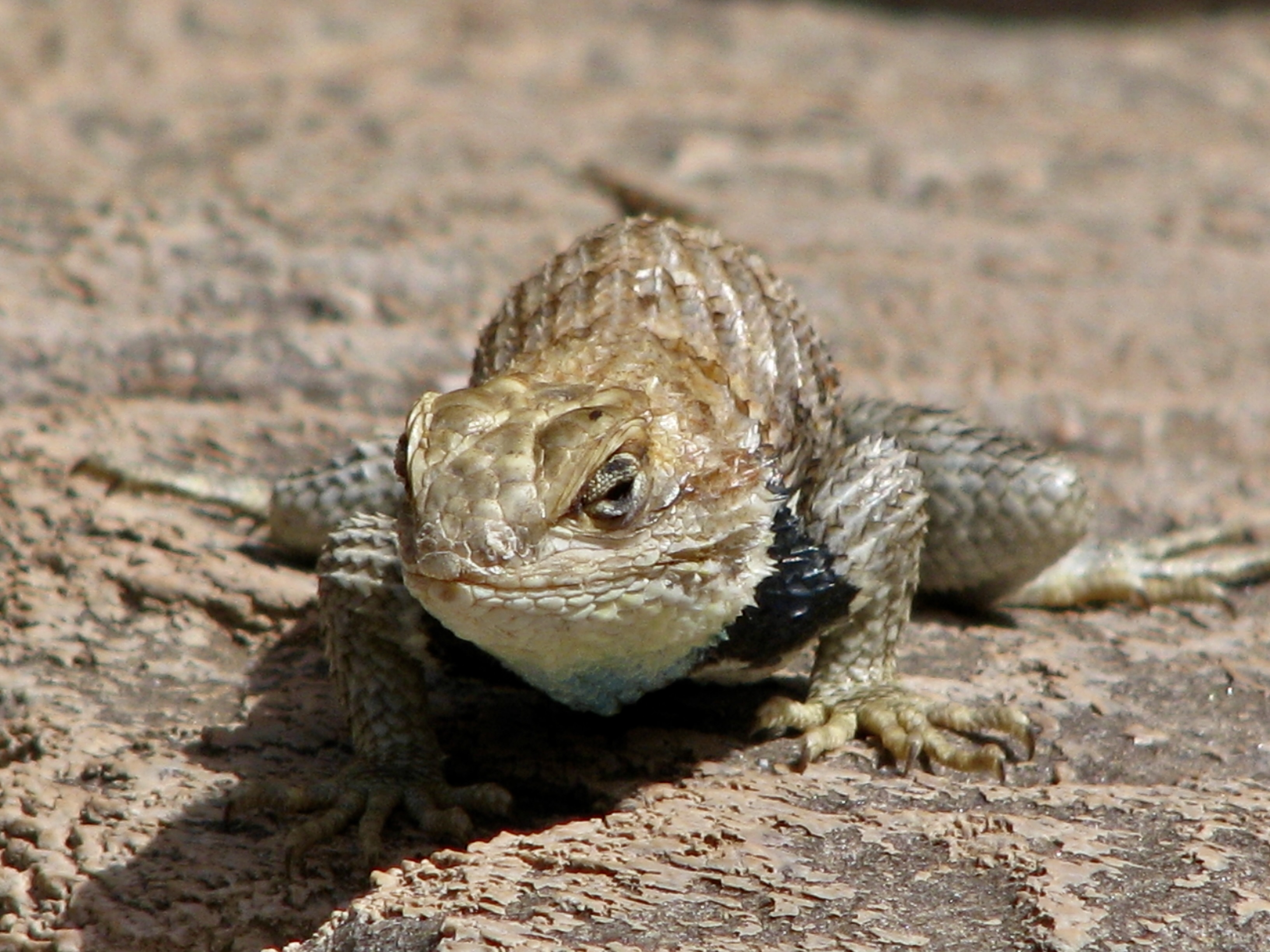
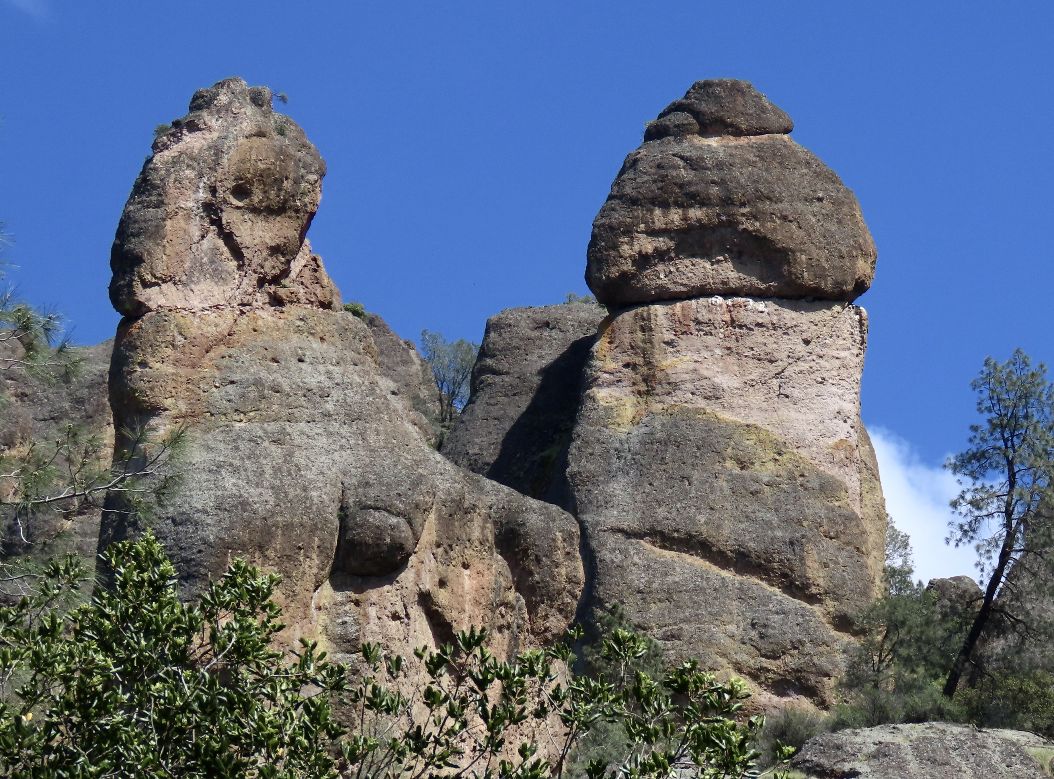
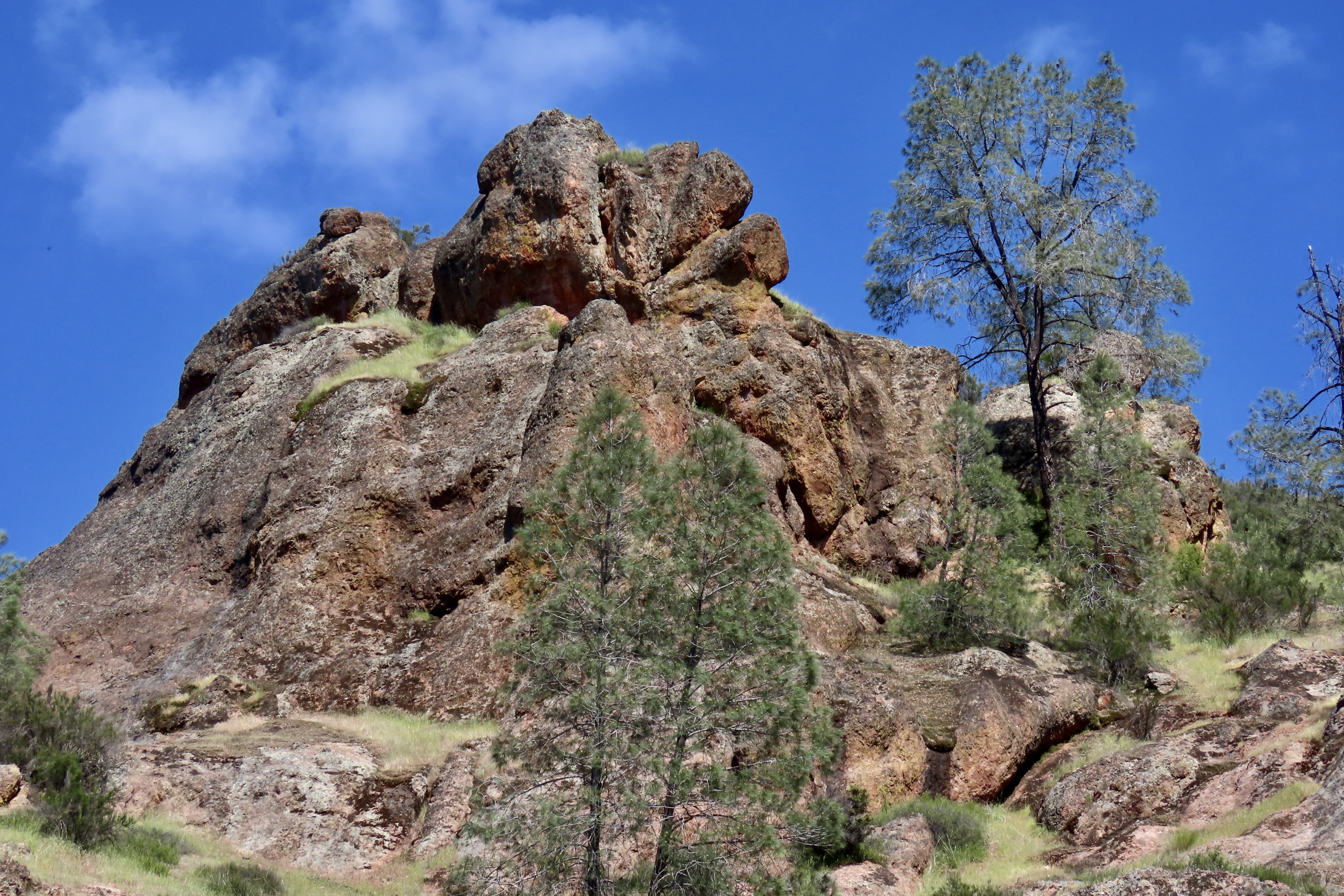
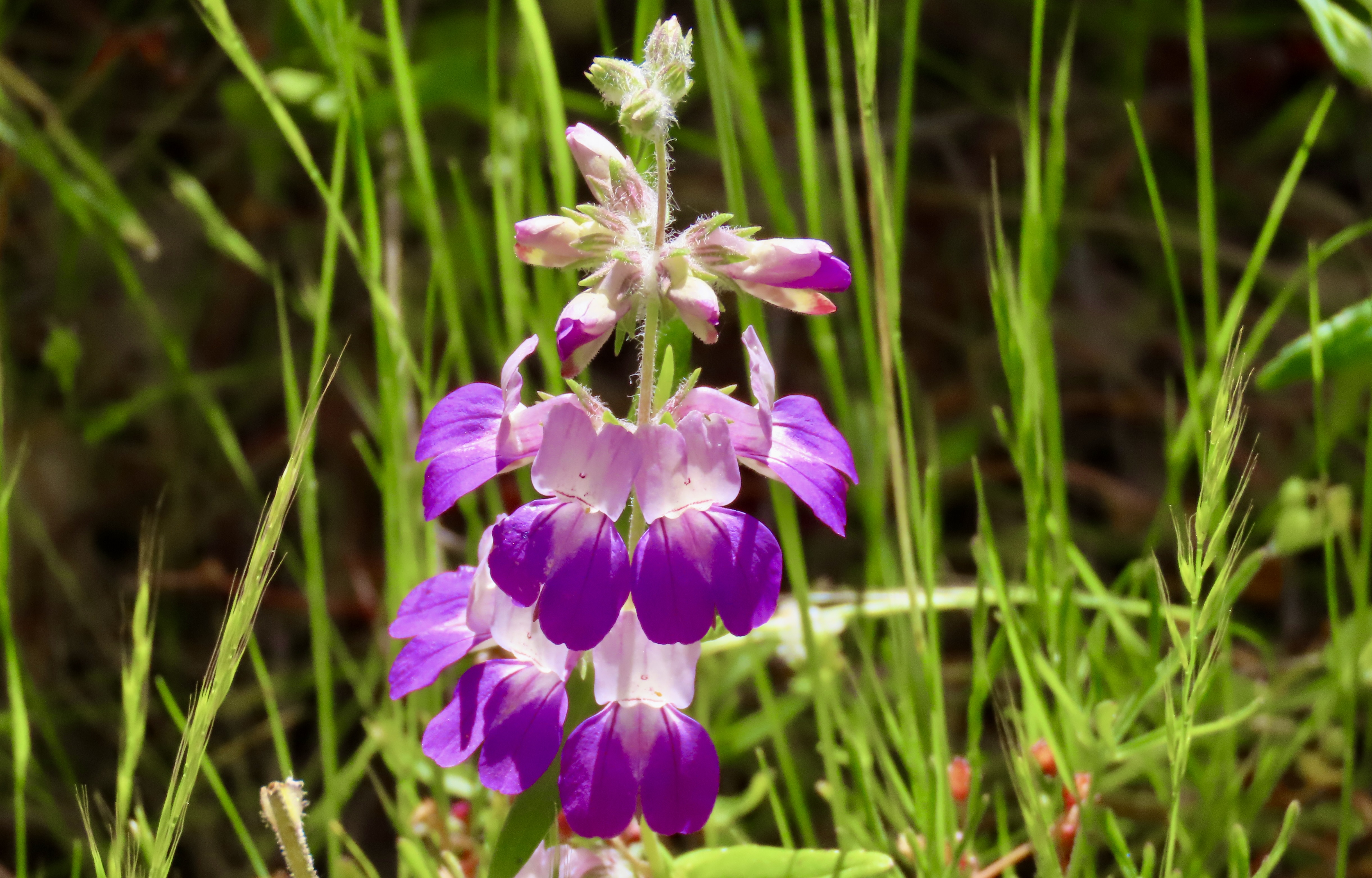
Our hike along Juniper Canyon Trail into the Park provided this view of the pinnacles. Not surprisingly, rock climbers get very excited about the challenges involved in climbing to the tops of the peaks. Here’s our trail. A small creek burbled along beside the trail.In places, the tiny creek was covered with huge boulders that had rolled down the mountain, possibly during earthquakes. They formed small tunnels known as talus caves. In other sections of the park, the talus caves can be miles long and people hike through them. This one was short enough I could stand on one end and photograph Peggy on the other. The embedded rocks in the rhyolite are breccia.Peggy’s perspective showed a colorful pool.What she couldn’t see was this magnificent bunch of shooting stars just beyond the pool. I’ve been admiring shooting stars for decades. I’ve never seen this many on a single stem. Our trip up the canyon provided numerous opportunities for Peggy and me to take close ups of the pinnacles.Each one was differentAnd had its own personality.Peggy called these “the fingers.”Can you spot the duck?Peggy became quite excited about her new camera’s ability to catch close-ups of lizards. This one was quite colorful. I believe it is one of several variations of a western fence lizard. We entered the Park from the West where this photo was taken. There is also an eastern entrance.This oak tree caught my attention.Wildflowers, like the shooting stars I featured above, were everywhere. Here are two more I found particularly charming. This is purple owl’s clover (Castilleja exserta), a species of Indian paint brush…And purple Chinese houses (Collinsia heterophylla), said to resemble fairytale pagodas.We were on the lookout for condors since they have been successfully reintroduced in Pinnacles National Park. Maybe…We hope you’ve enjoyed our introduction to the Pinnacles. If you are looking for a National Park experience without the crowds, this small park is definitely worth a visit. Next up: Pt. Reyes National Seashore, one of our all-time favorite parks.