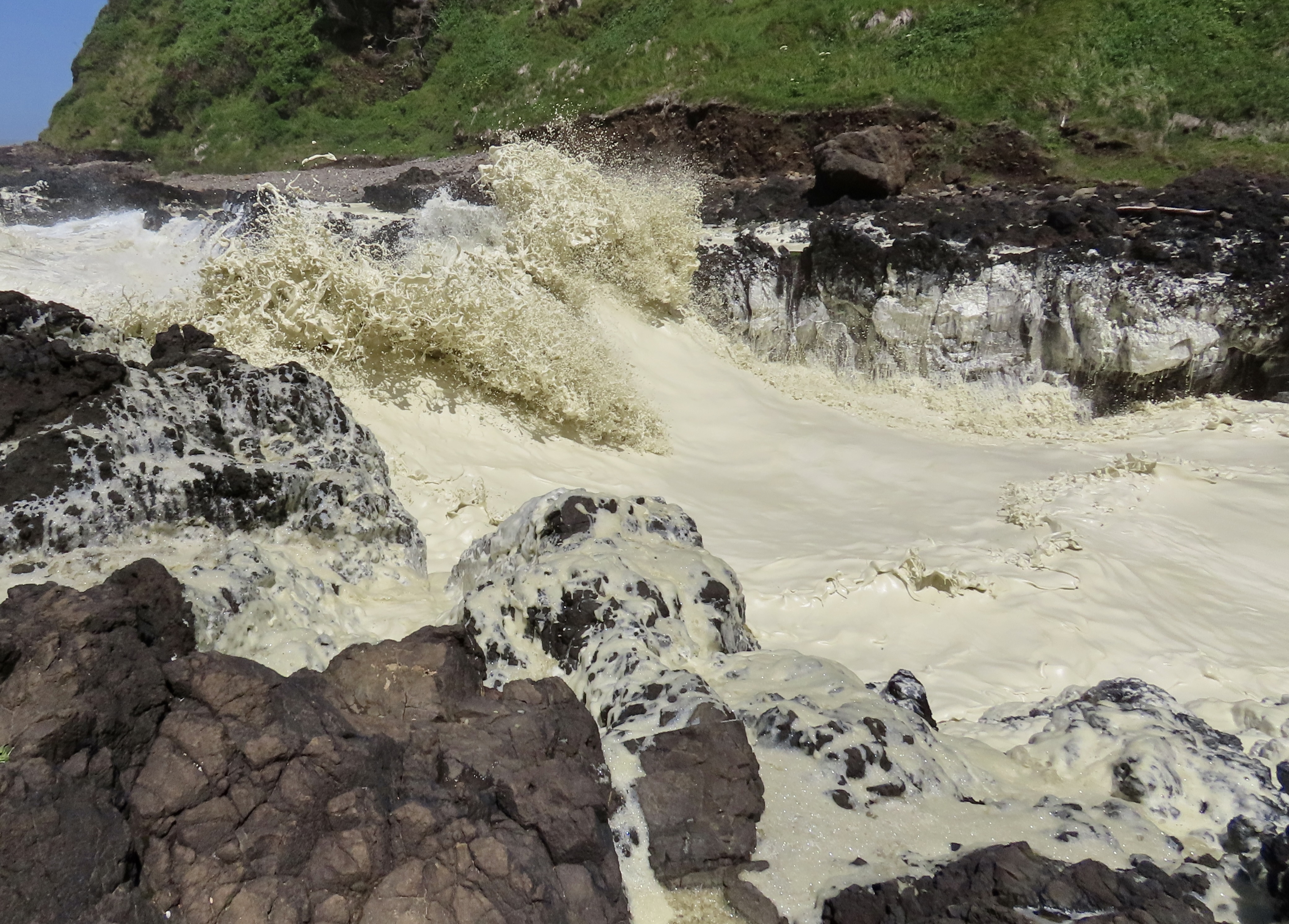
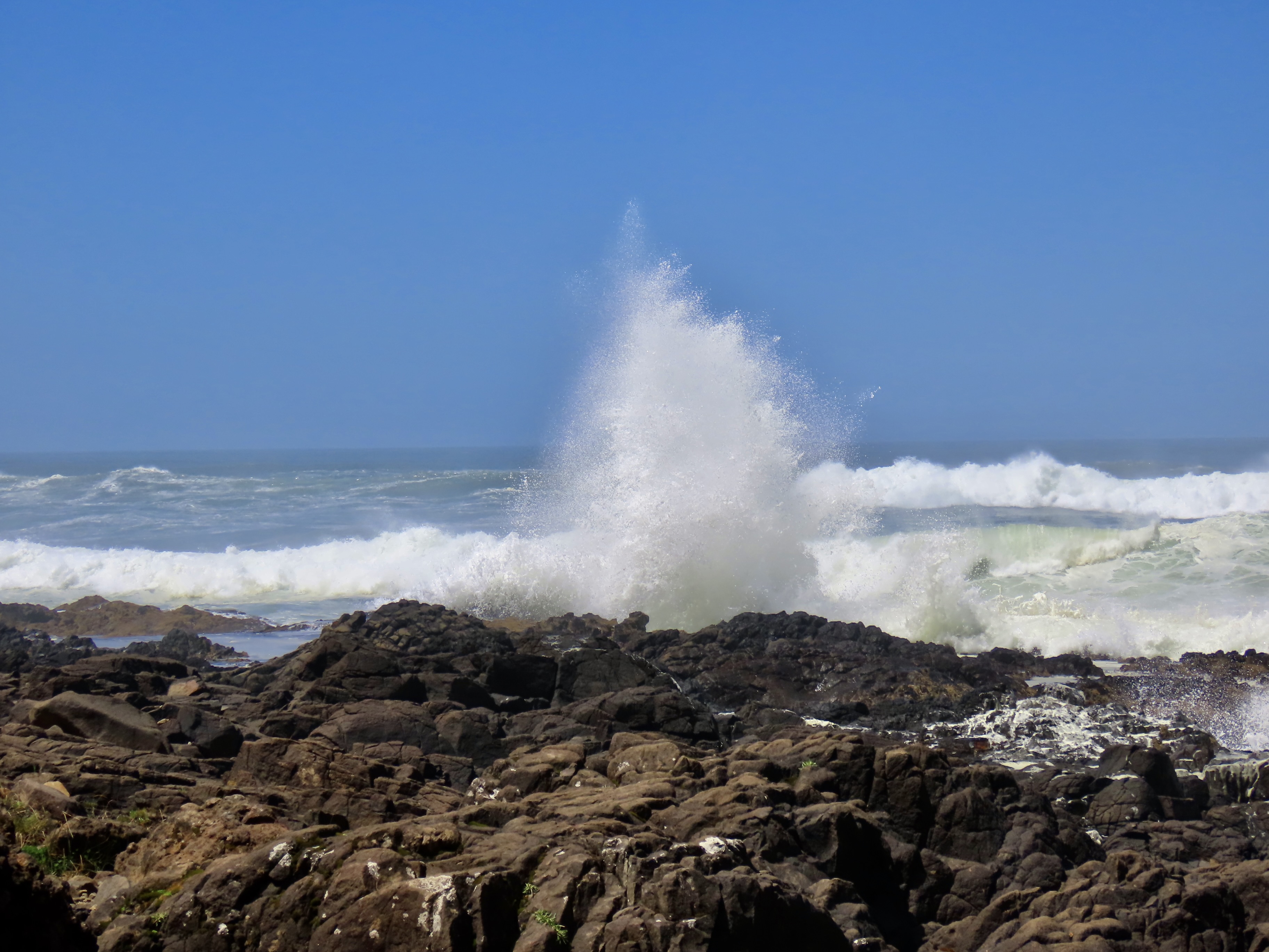
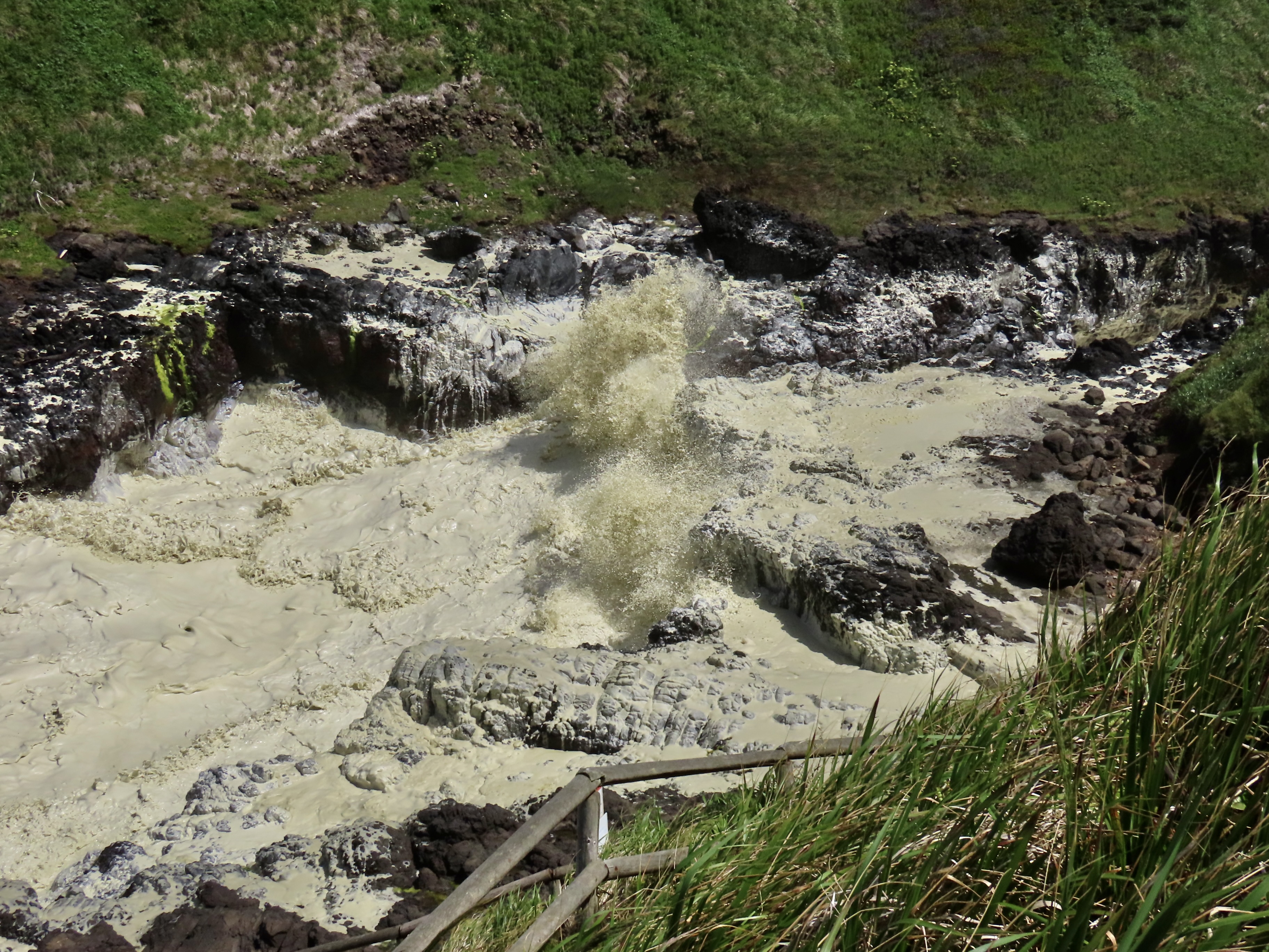
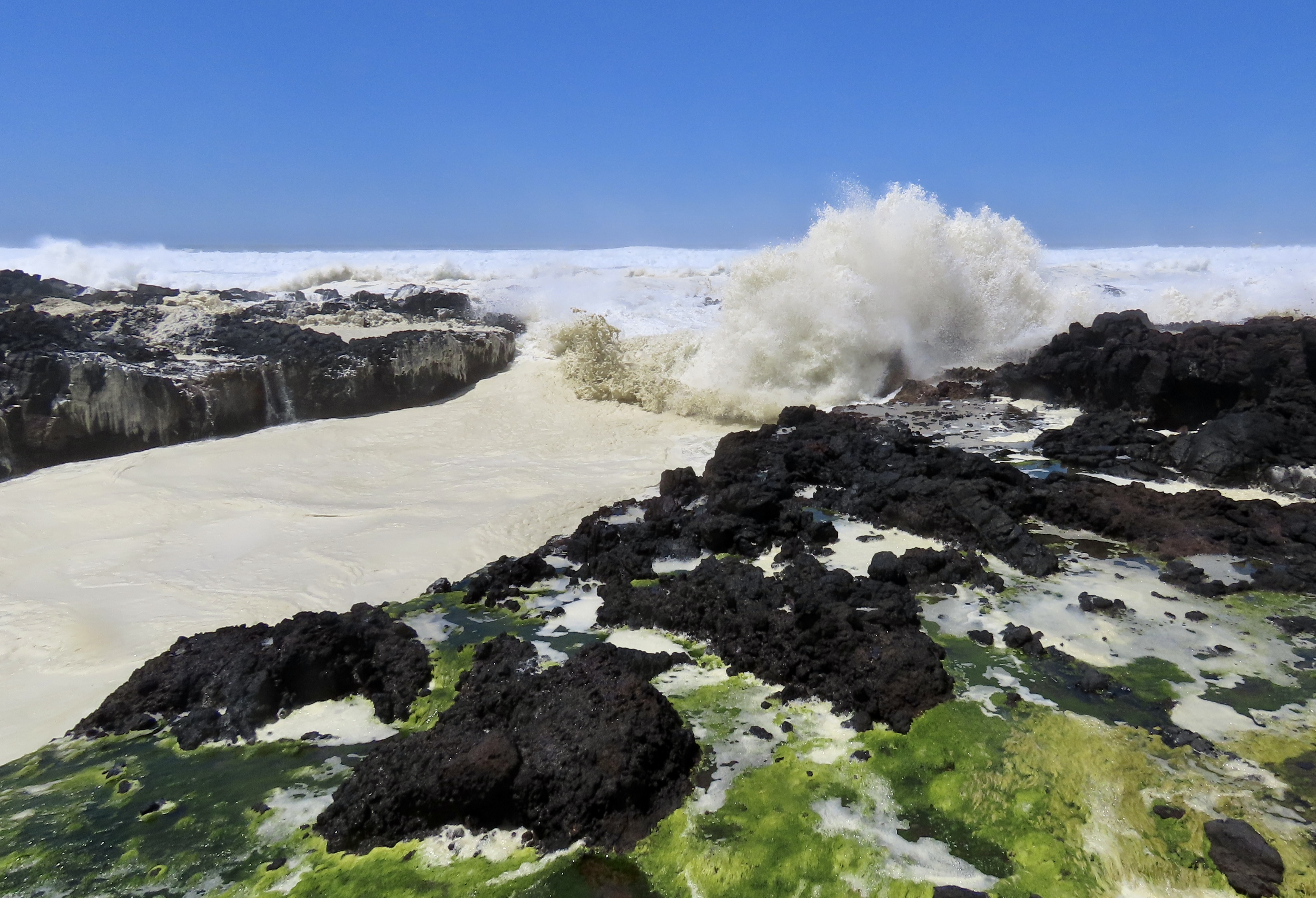
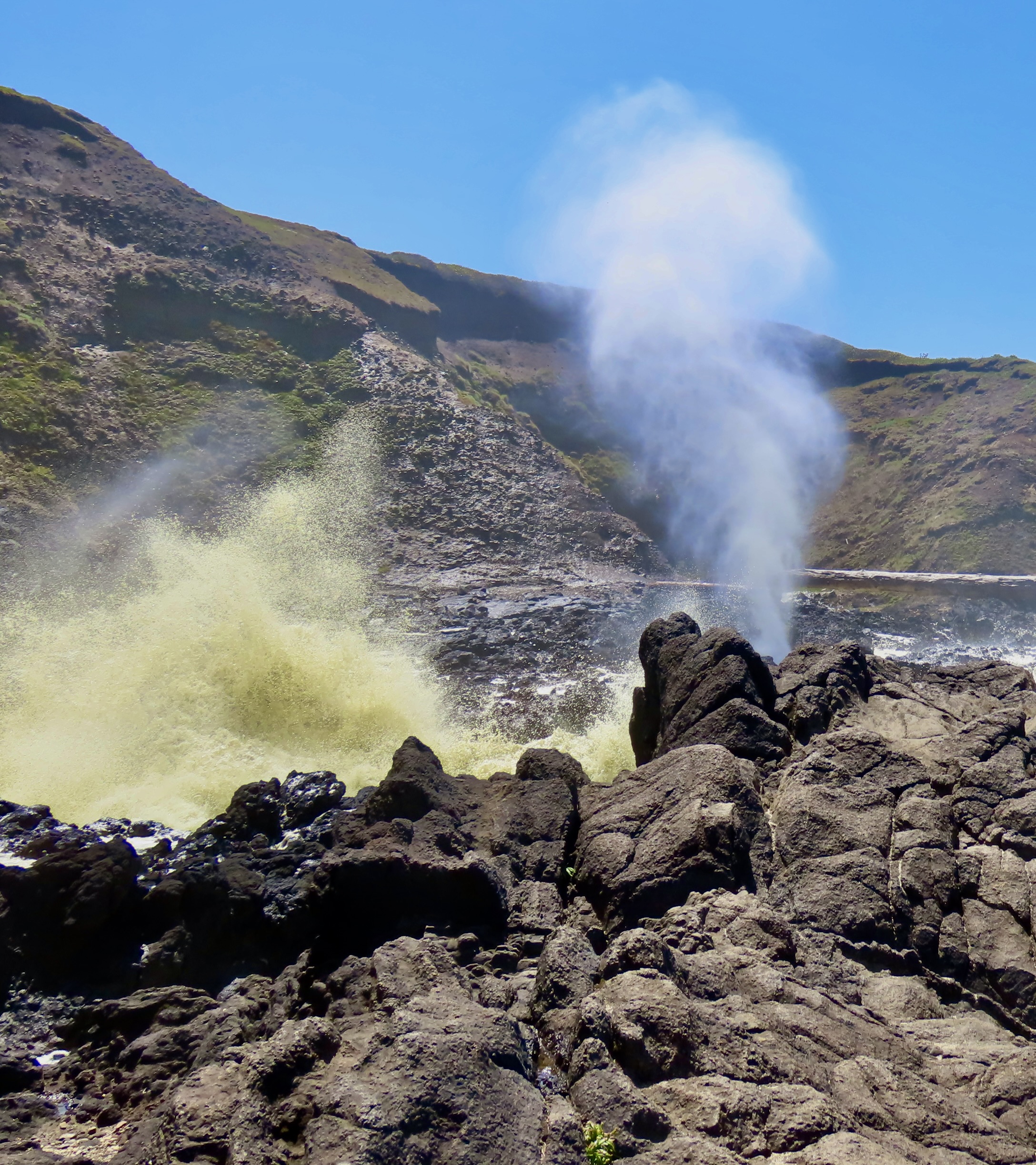
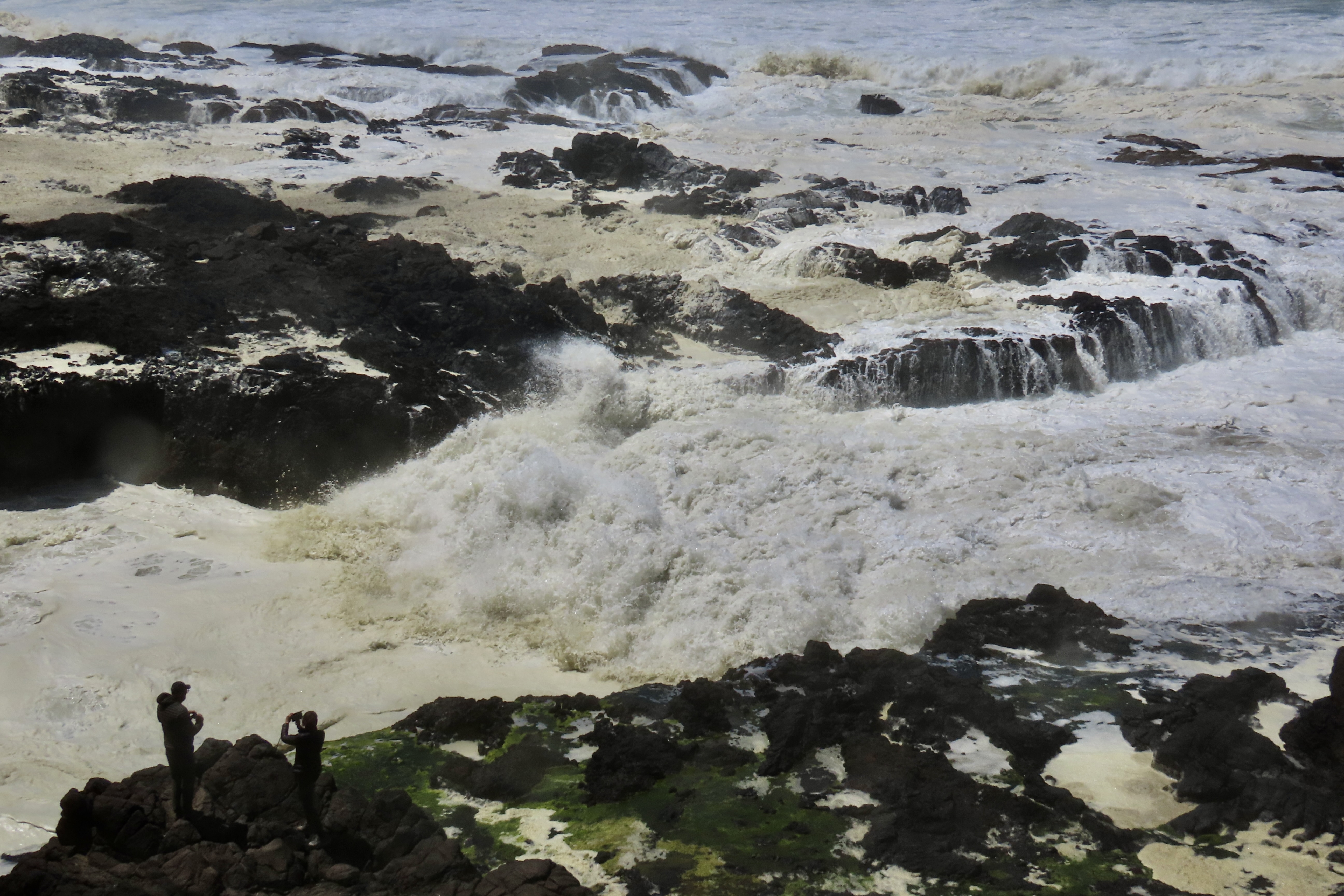
Roaring down a narrow passage between dark volcanic rocks, this wave will soon crash into a rock wall and shoot into the air, creating a breathtaking display of the ocean’s power and danger. Peggy and I were standing on rocks at the edge of this daunting channel, The Devils Churn.
My first visit to the Devils Churn was in the late 70s during a massive Pacific storm. My brother and a partner owned an old hotel on the edge of the ocean a few miles south of the Churn between the towns of Florence and Yachats. Since my dad was managing the hotel, I had driven up to visit him. “Curt,” he had said, “you have to go see the Devils Churn, but stay way back. In a major storm, it can throw huge logs into the air.”
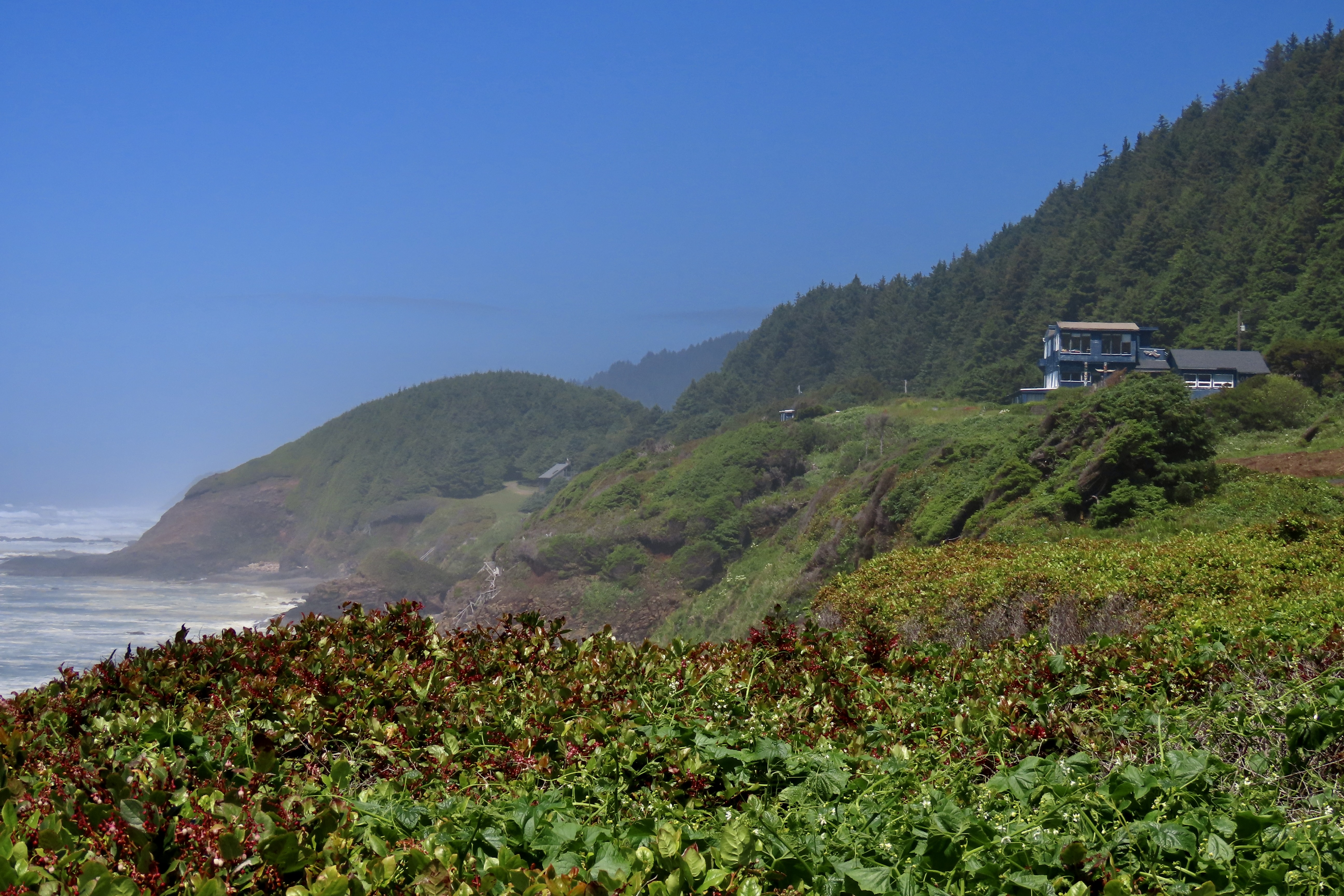
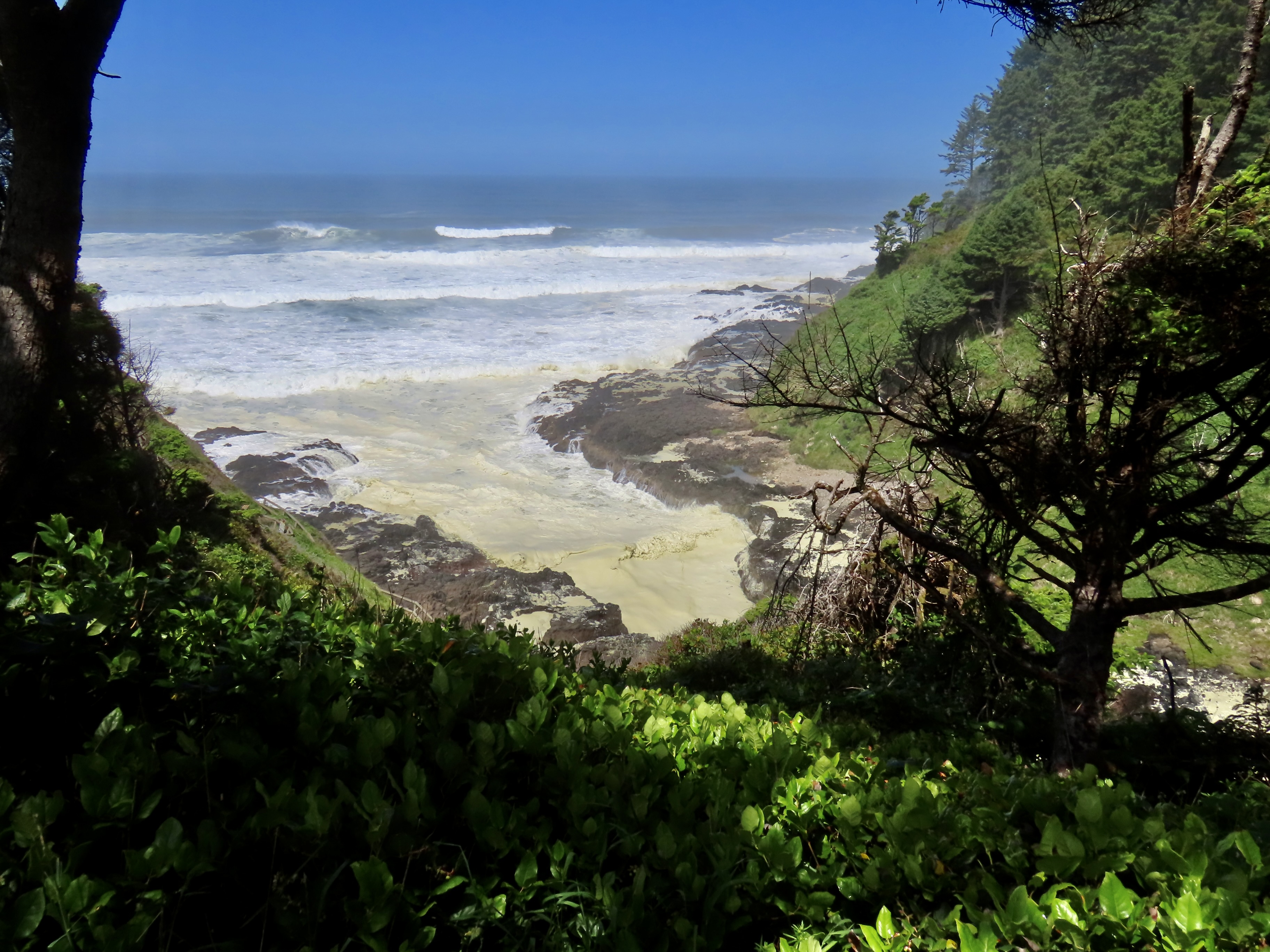
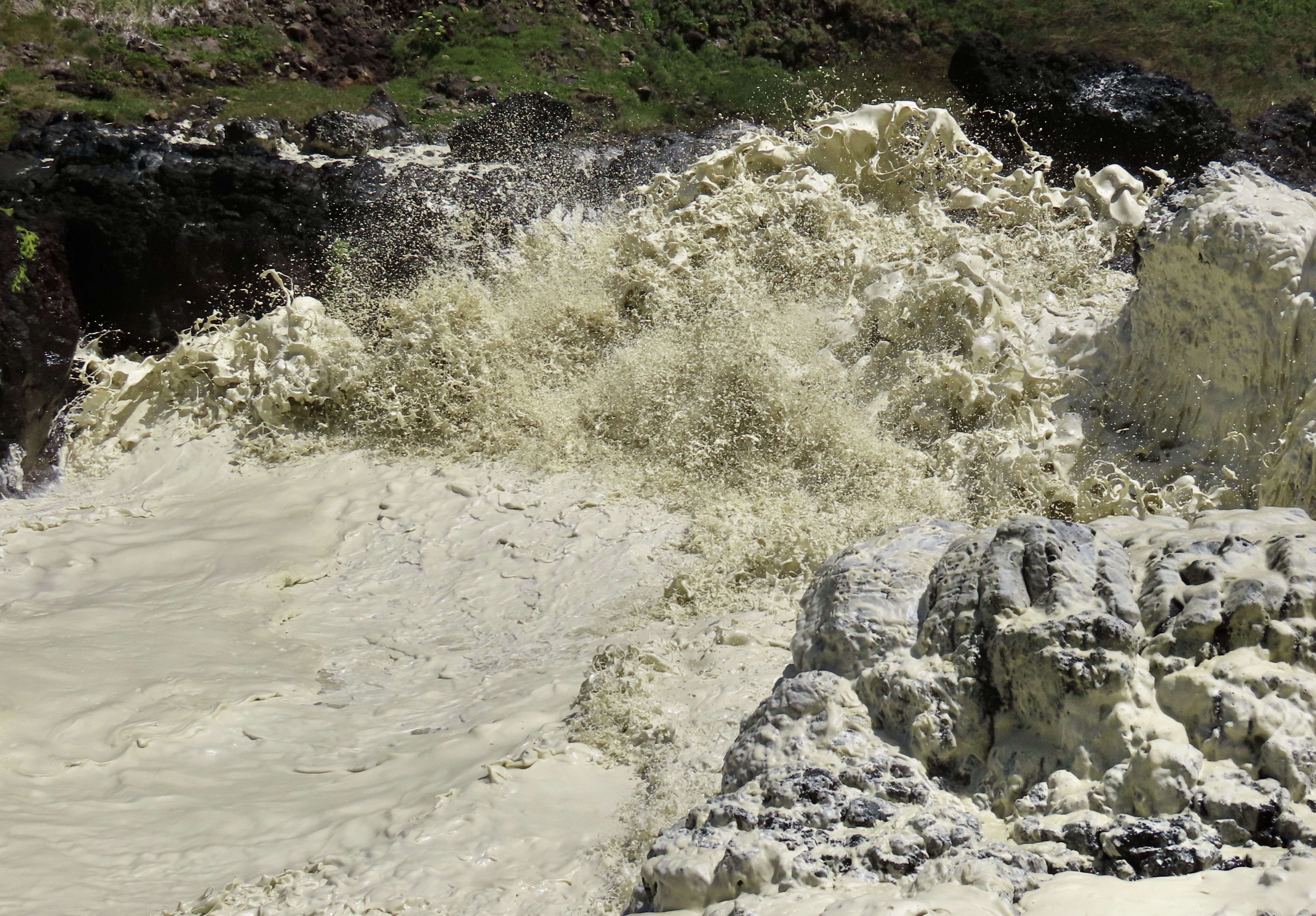
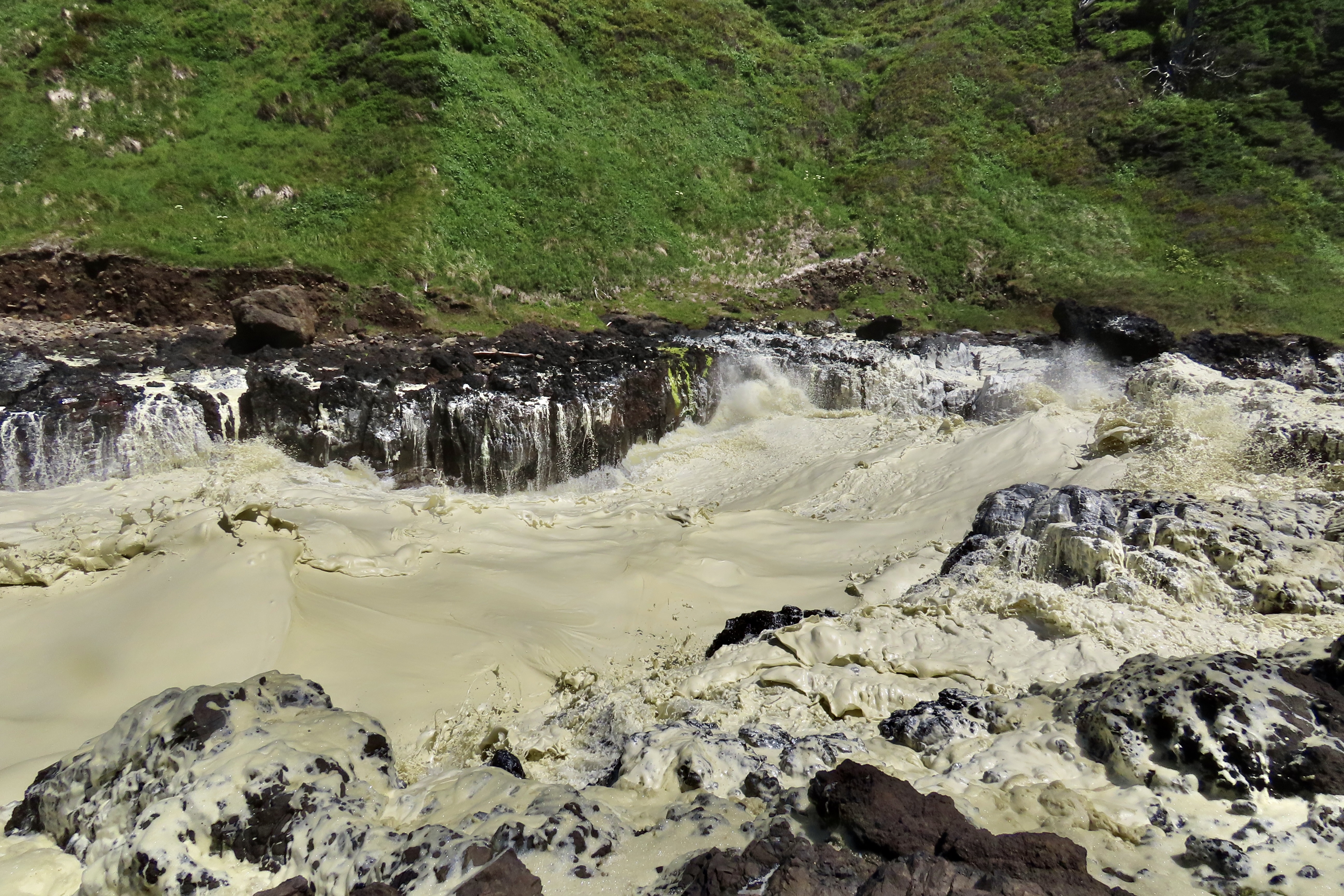
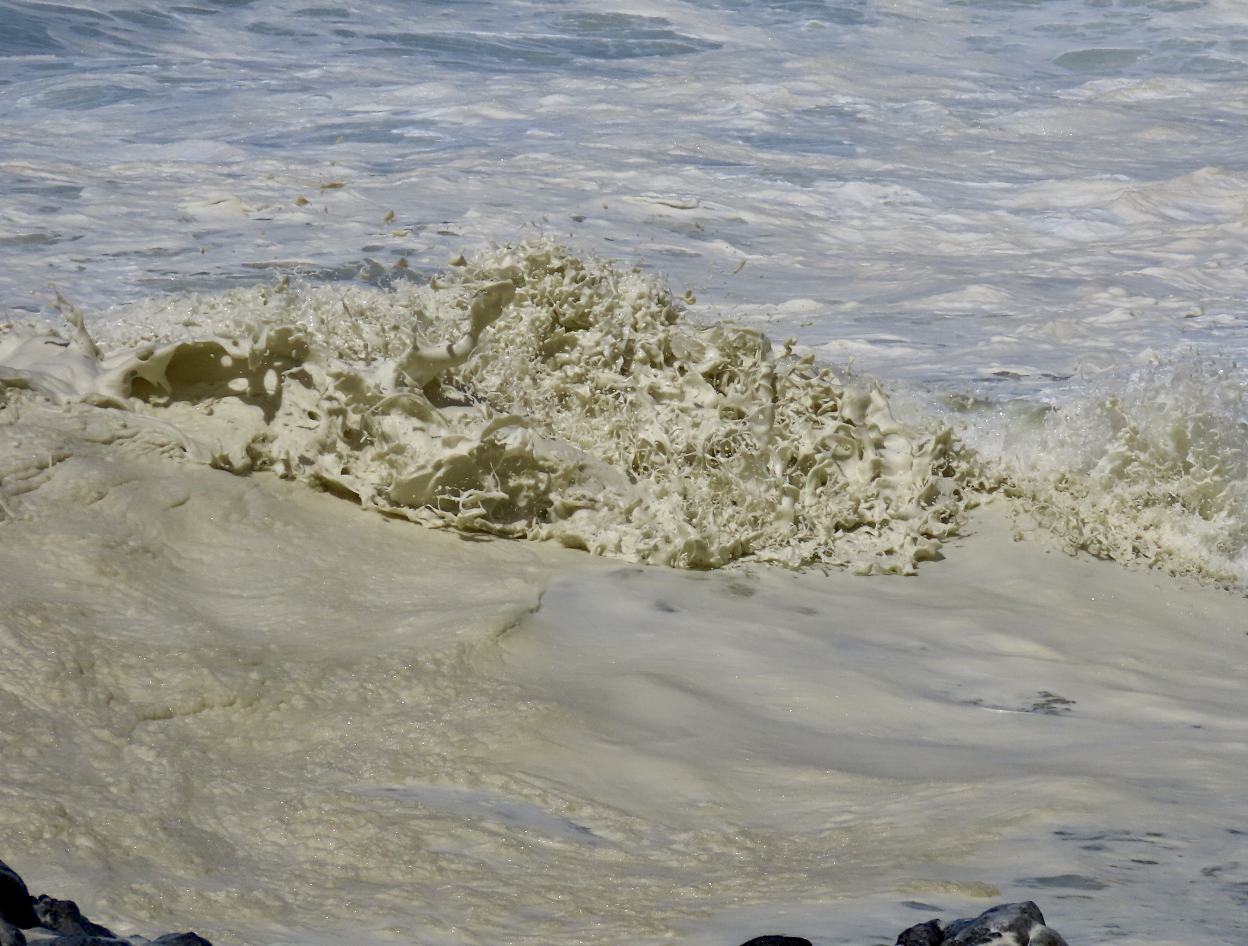
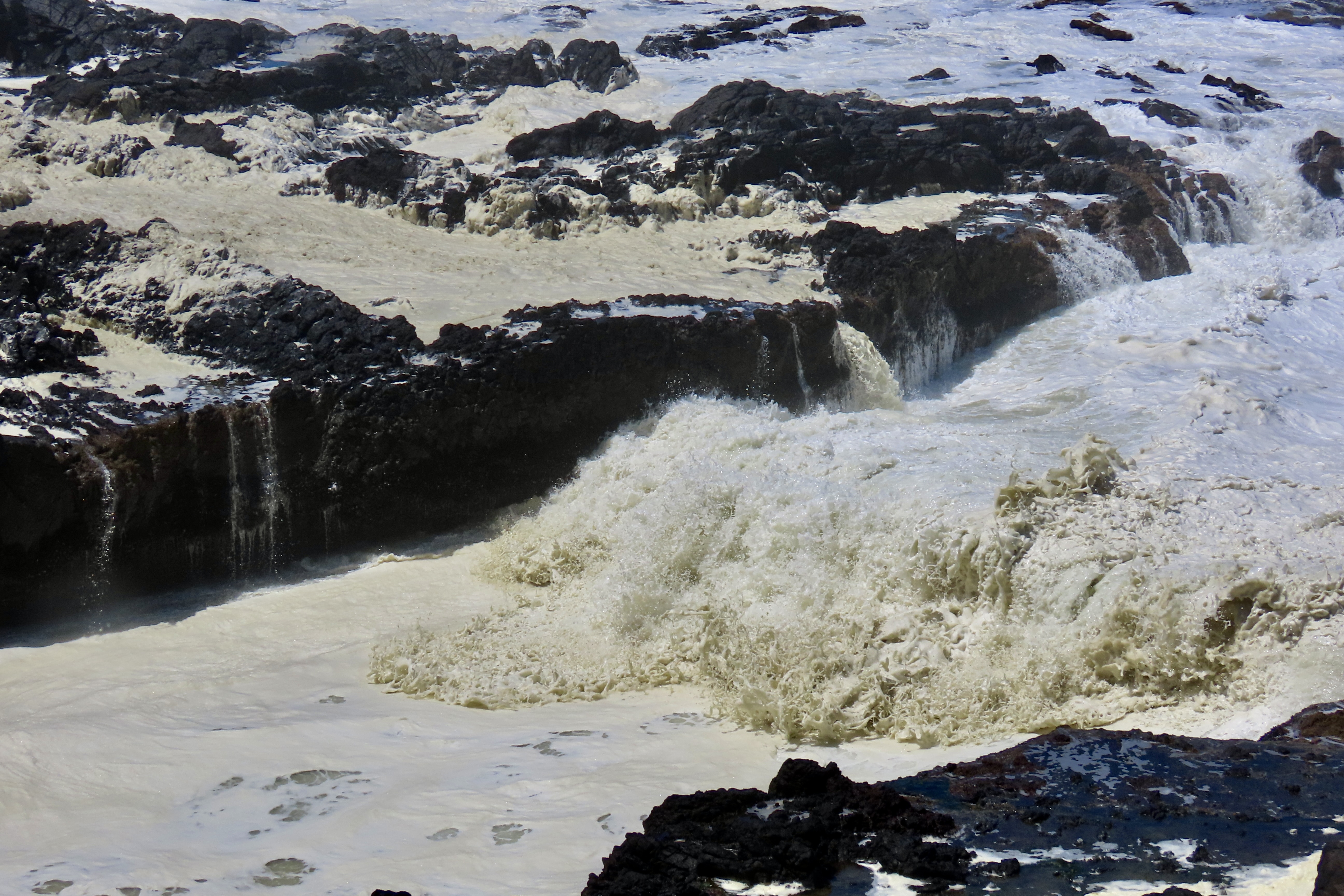
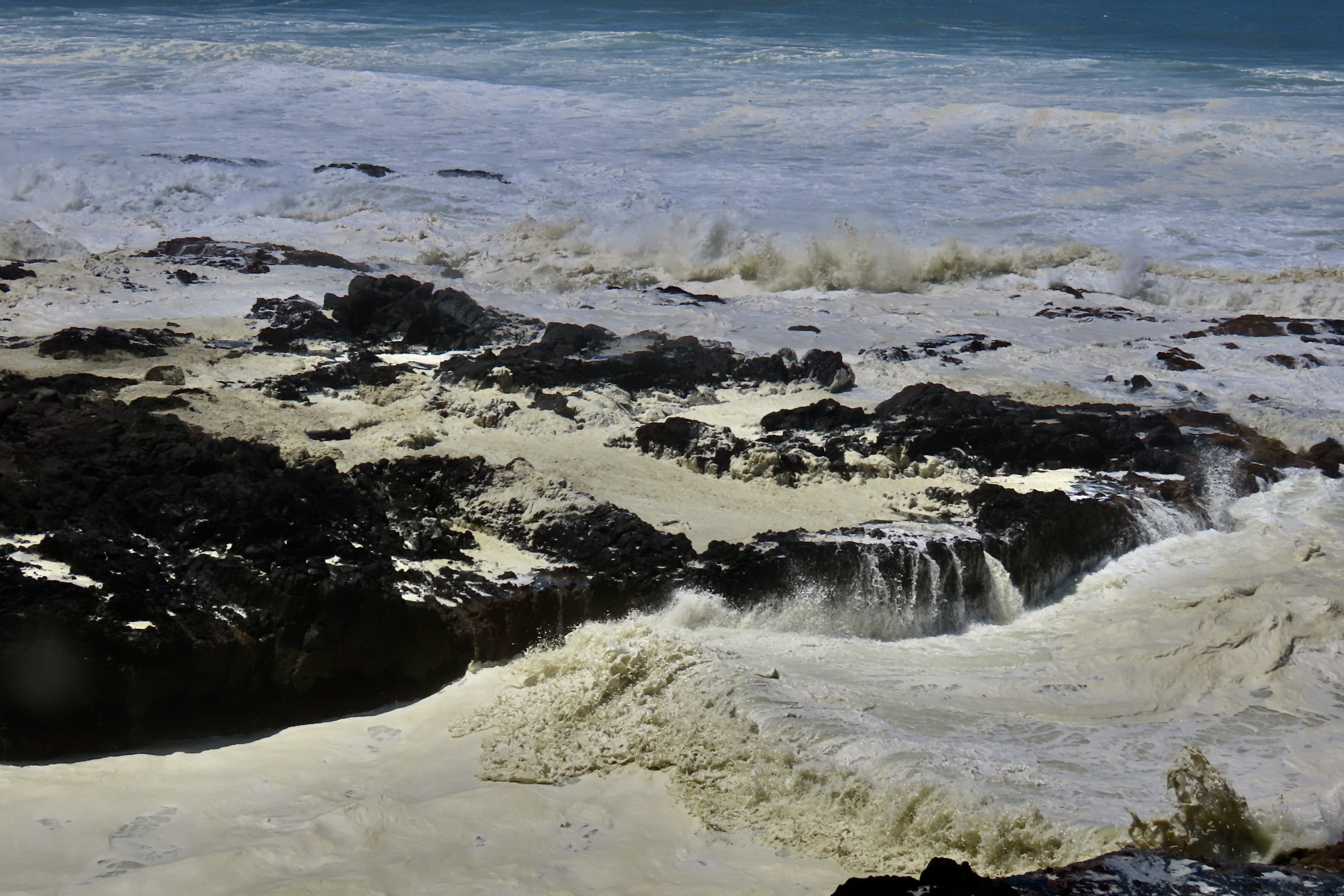
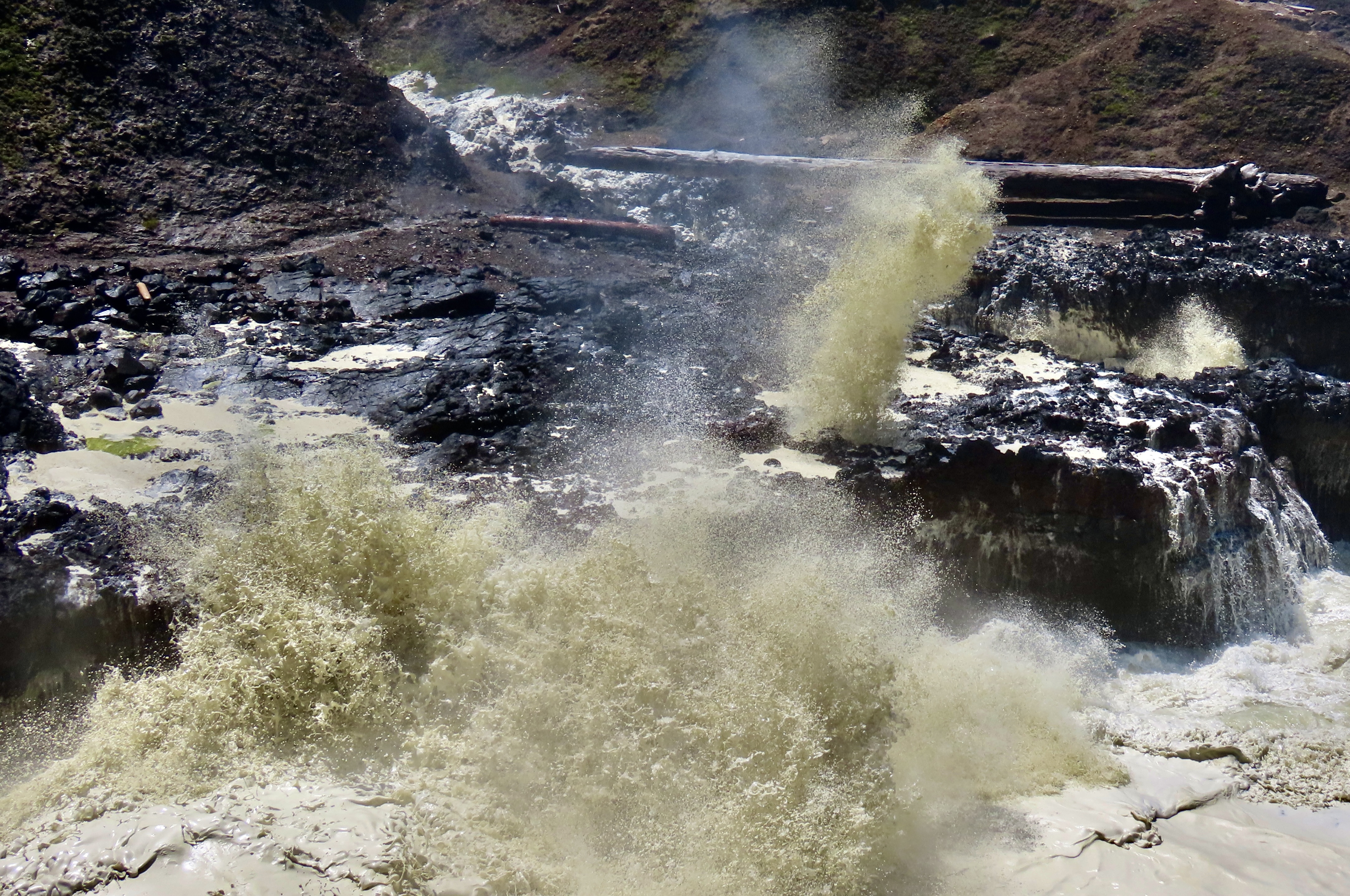
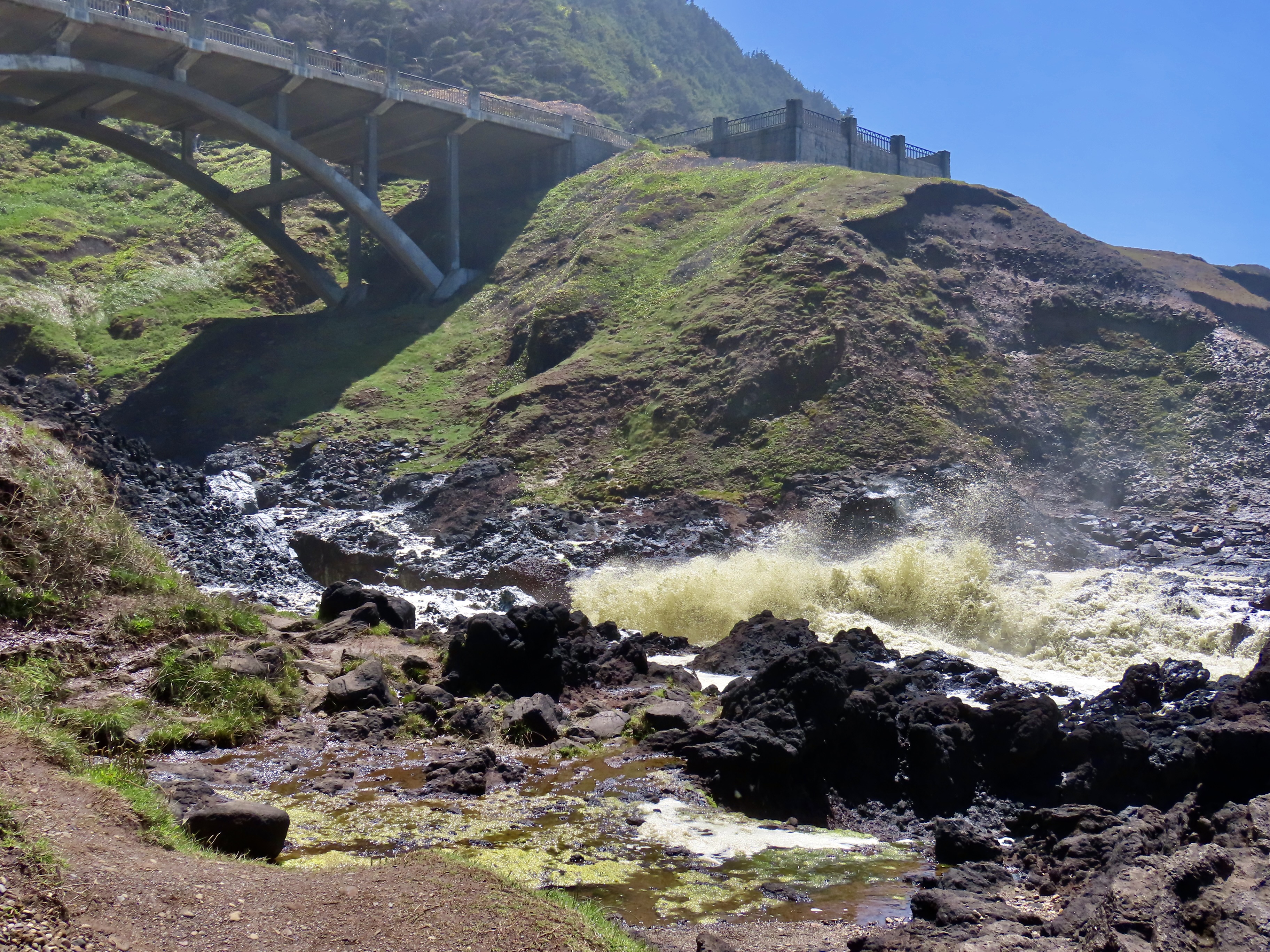
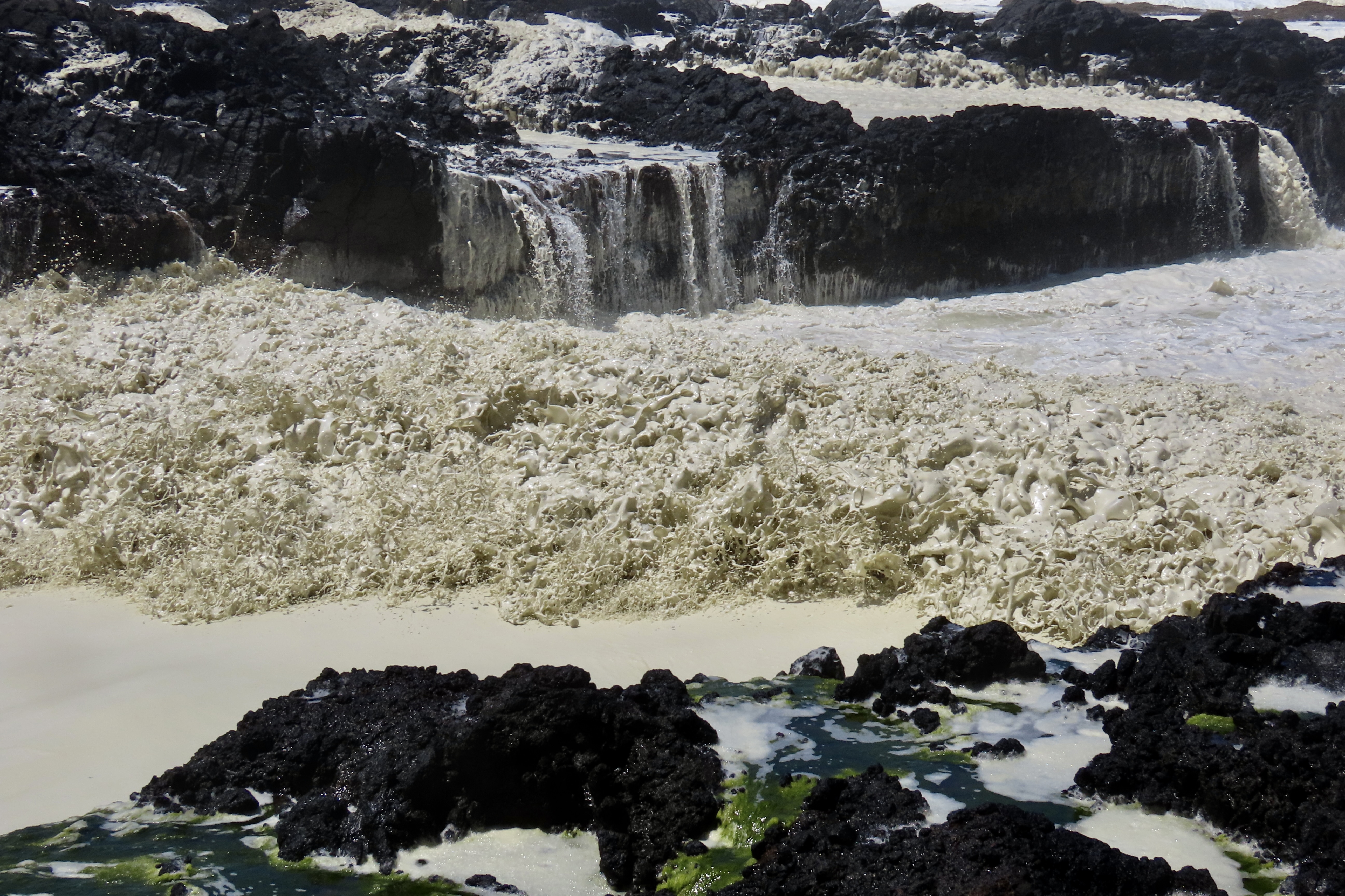
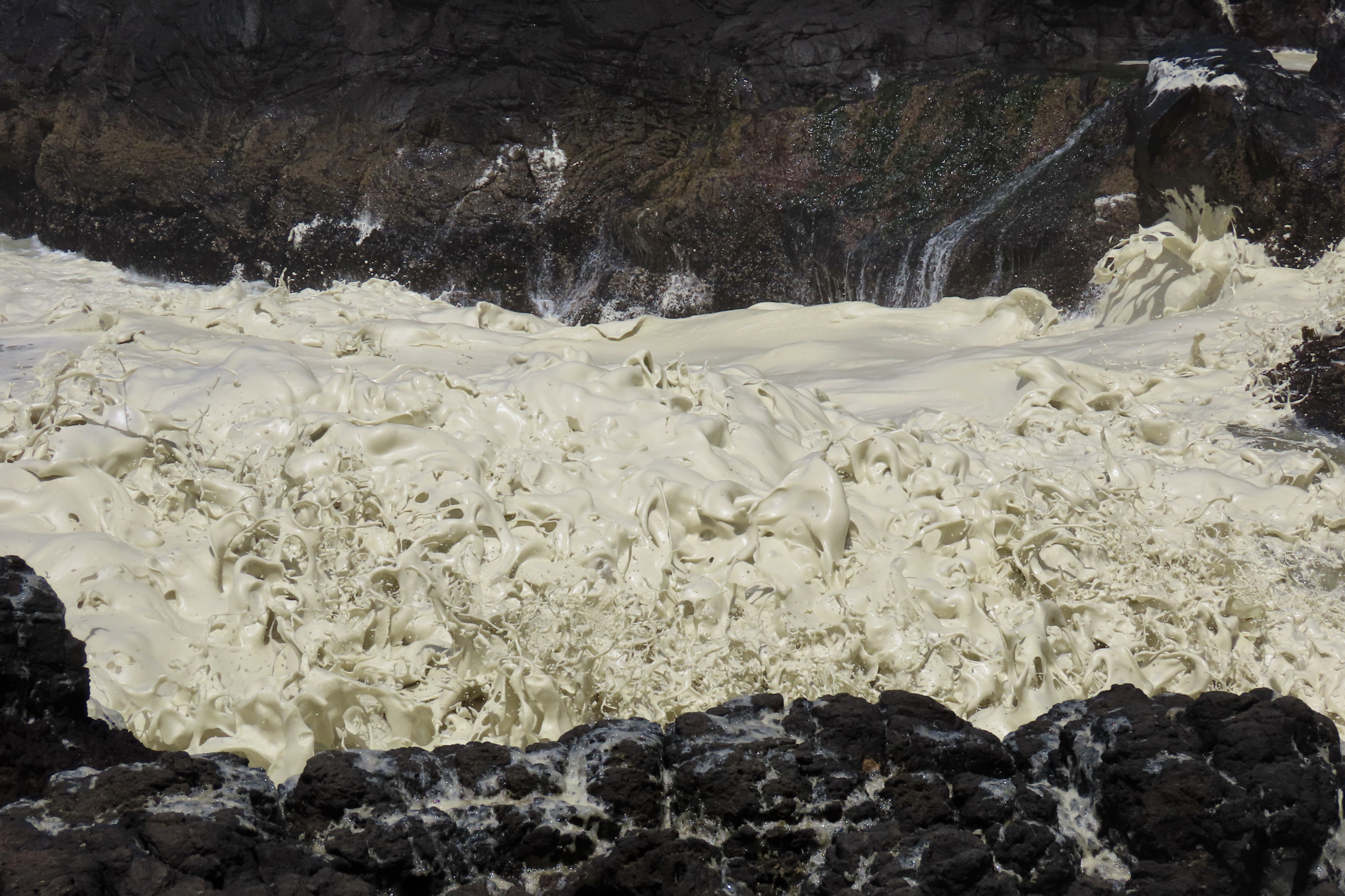
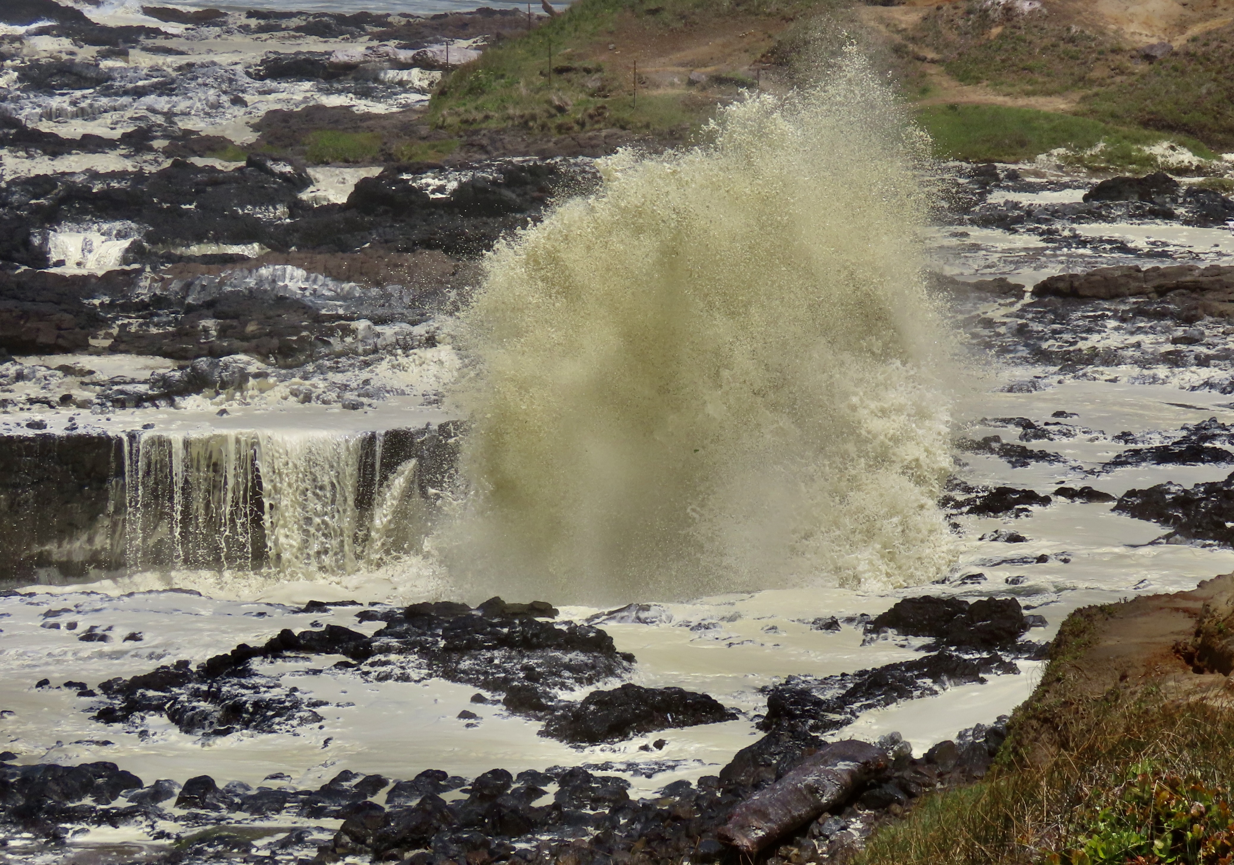
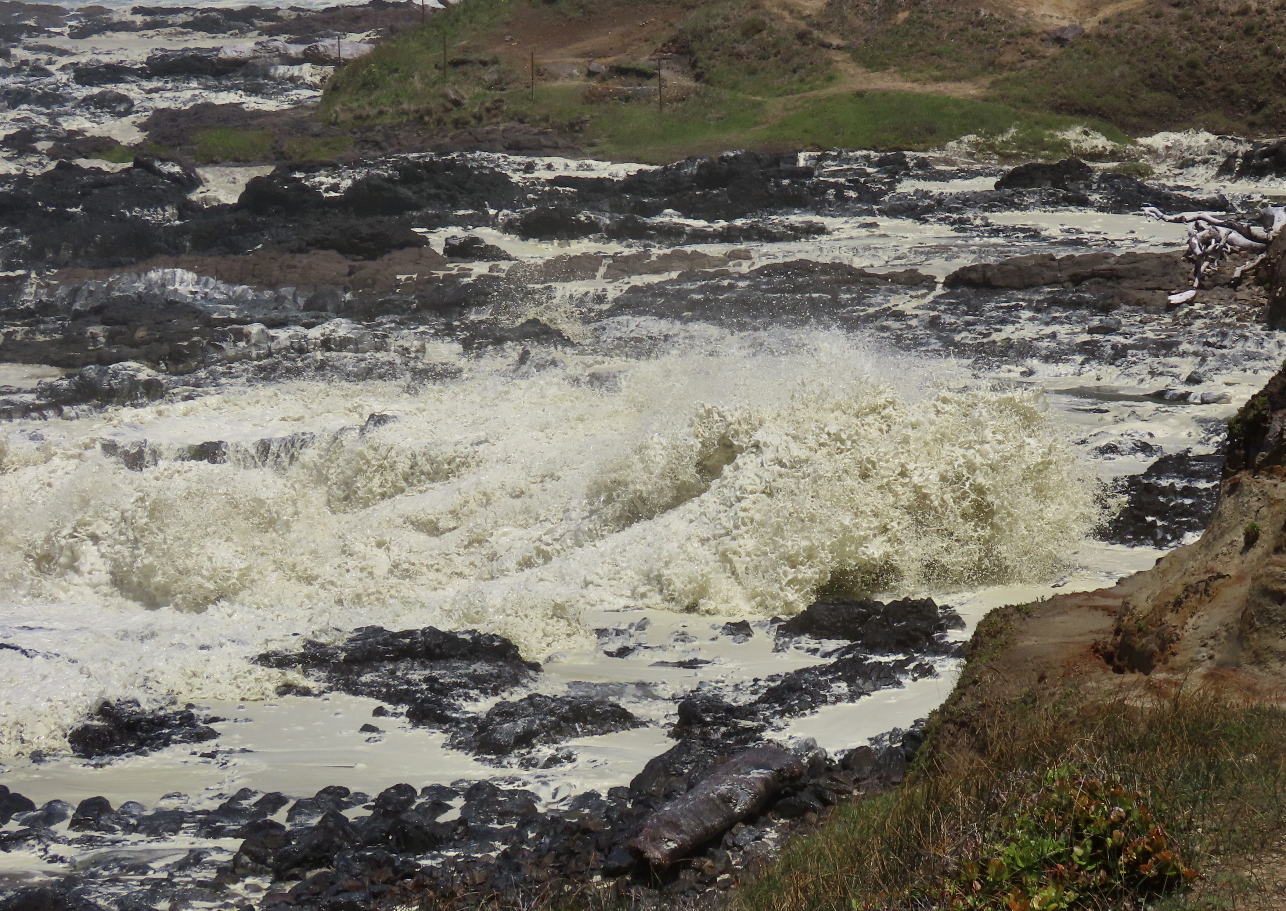
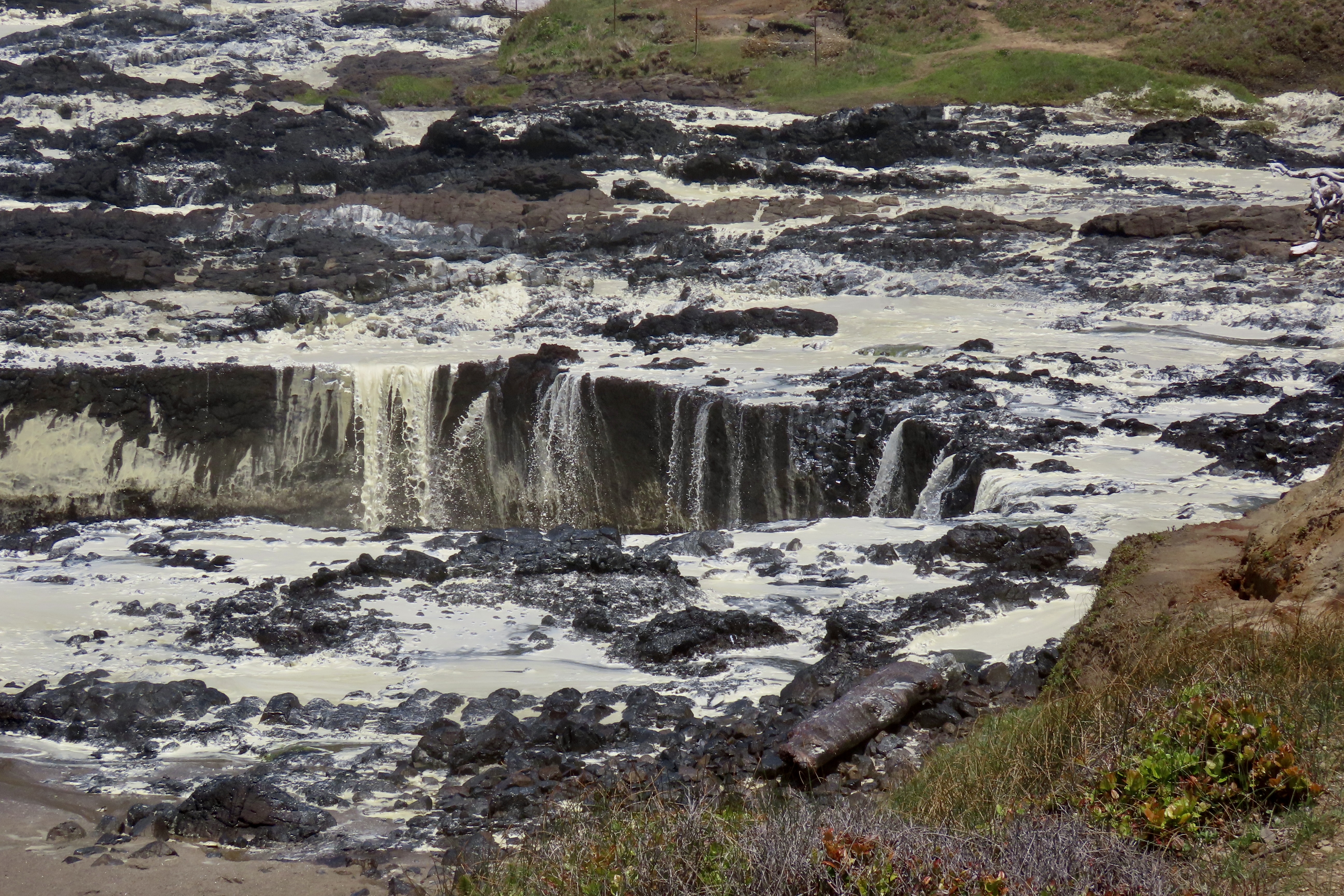
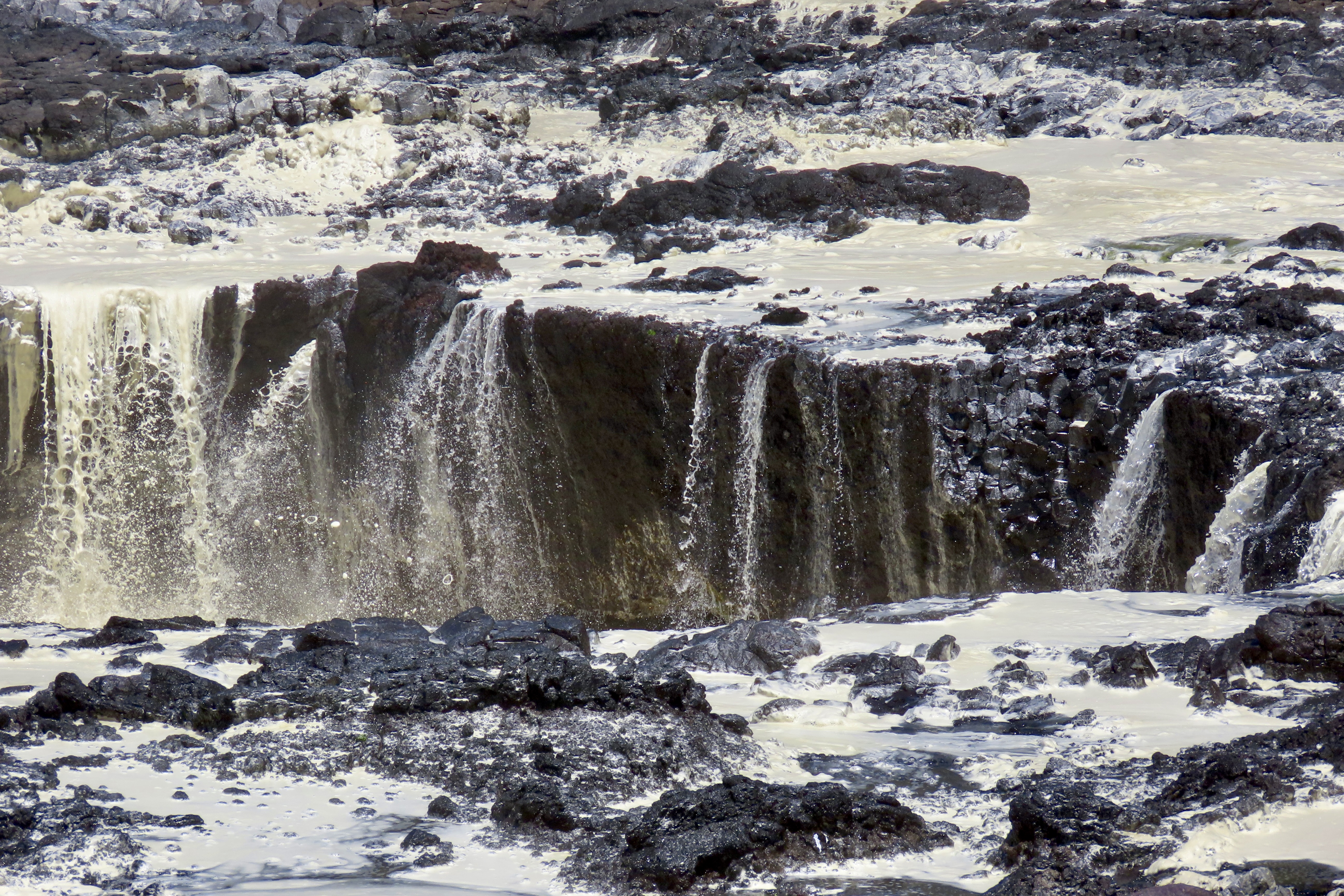
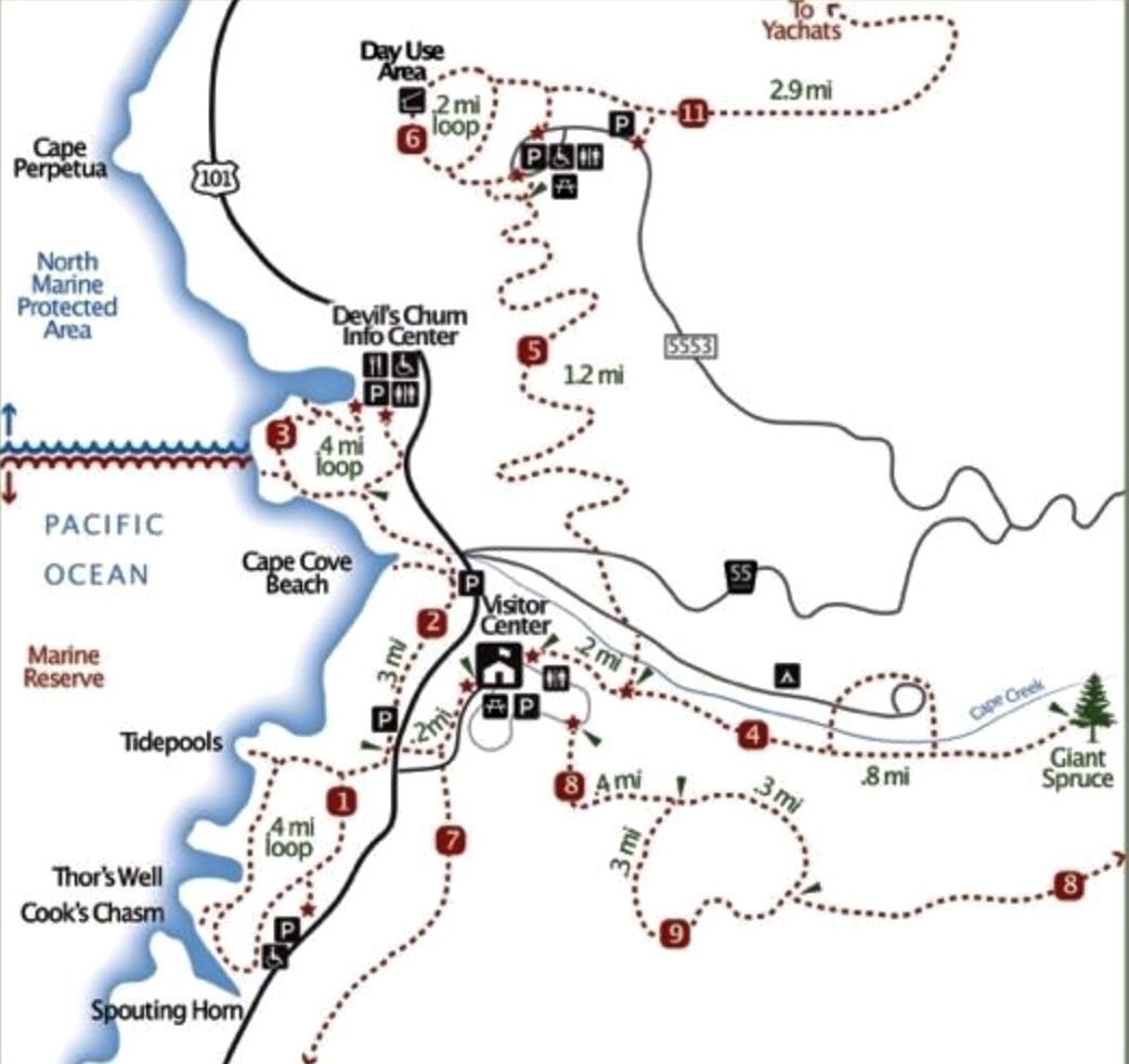
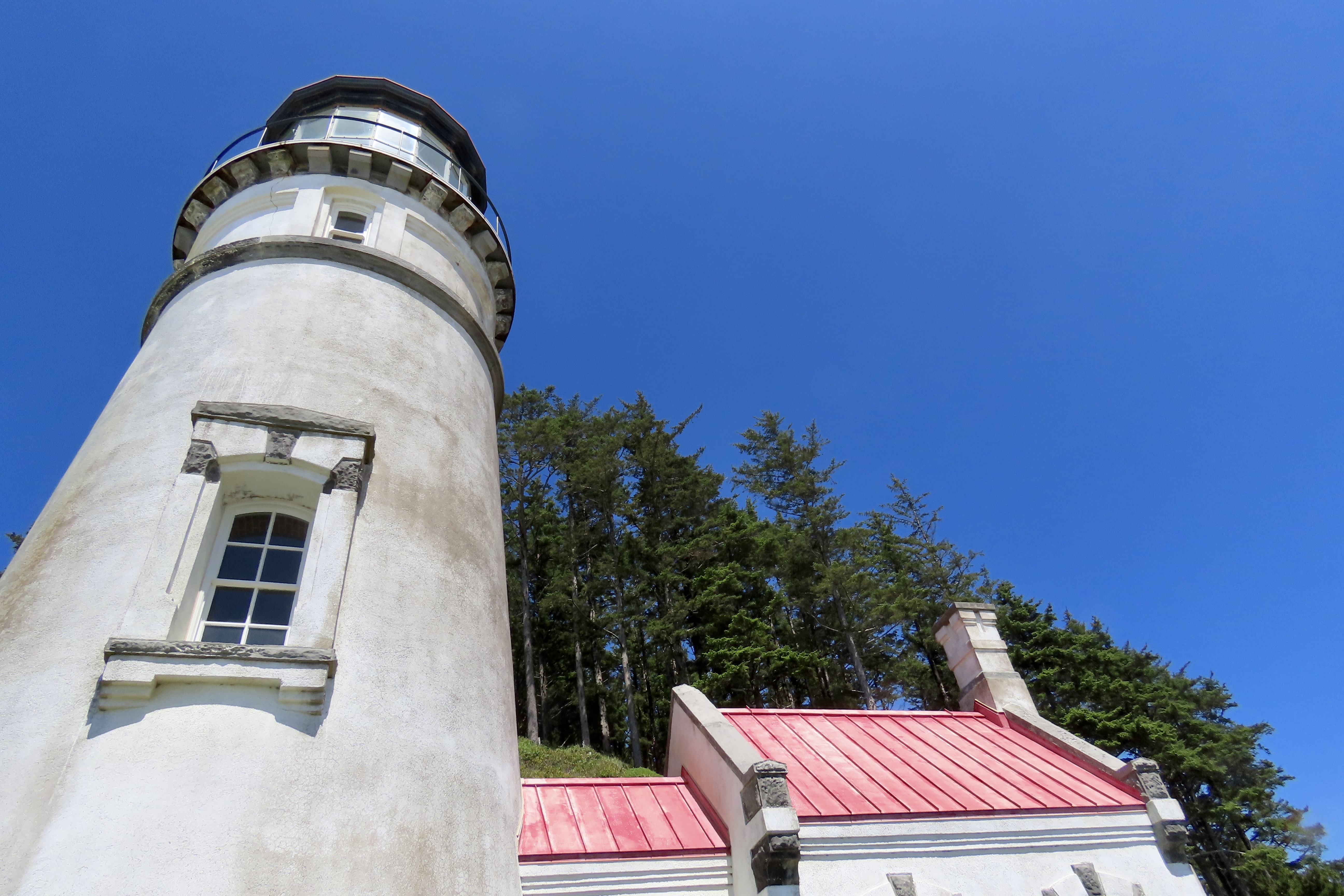
This is the hotel my brother co-owned and my dad managed on Oregon’s scenic coastline in the late 70s and early 80s. A path led down to the ocean. My brother and his partner sold it at an incredible bargain without telling me it was for sale. I never quite forgave him. I would have bought it, even if I had to rob a bank!While it was a beautiful, sunny day when Peggy and I visited the Devils Churn a few weeks ago, there had been a substantial storm the day before and the ocean was still riled up with large waves crashing ashore. This was just off the beginning of the Churn.Close to 80 feet wide at the beginning, the Churn narrows to a few feet at the end. The channel was created over thousands of years from either a collapsed sea cave formed by the waves or possibly a collapsed lava tube. Barely visible on the the left, you can see the trail that leads right down to the bottom.Railings follow the trail down to the Churn where visitors are allowed to walk out on the rocks— with dire warnings.Another view of the waves crashing into the cliff. The rocks on the right have just been coated with the foam created by the Churn, not a place to be standing.A moment of relative calm. The waves roll in continuously. One is about to crash in to the cliff while another follows. Water from the first wave then flows back toward the ocean, hitting the next wave, which adds to churning action. Thick brown foam that resembles whipped cream is the result of all the action.Chaos might be a good description. It’s not a good place to go for a swim— whether you mean to or not.Just south of Devils Churn are three more impressive results of the ocean carving out channels in the basaltic rock: Cooks Chasm, the Spouting Horn, and Thors Well. Here, a giant wave makes its way into Cooks Chasm. Captain Cook made his way past this area on March 7, 1778.The wave continues to roll into Cooks Chasm.Another view.When the wave crashes into the end, it forces water into a cave. The pressure created in the cave blows the water out of a hole in its roof, thus creating the Spouting Horn seen on the upper right.Another view across the twisted basaltic rocks where the Spouting Horn appears almost ghost-like.Cooks Chasm can be seen from Oregon’s Coast Highway 101.The result of the pounding action of the waves in Cooks Chasm is similar to that of Devils Churn.The people here provide a perspective on where Peggy and I were standing.Thors Well is just north of Cooks Chasm. Here a wave arrives…And fills up the Well!As the wave retreats, Thors Well re-emerges.A final view. Below is a map that shows the relationship between the three locations.Yachats is about 2 1/2 miles north of Devils Churn. My brother’s hotel was five miles to the south.In our next post we will take you to Heceta Head Lighthouse shone here, and invite you to join us as we break in our new kayaks!
I suspect it would have to be one heck of a storm, Ray. But given all of the large logs we see banked up on shores, it would certainly be in the realm of possibility!
Best place I’ve kayaked (so far) was Cleawox Lake, but there are any number of great lakes right there in the sand dunes south of Coos Bay. Camping real handy there, too. Can’t wait to see where you guys head for your paddling.
Amazing pics of the force of Mother Nature. Our family also has a story of a hotel/motel being sold without knowing. Who knows how my life might have turned out? No regrets.
Your photos and words here gave us a wonderful look at these wild spots on the Oregonian Pacific coast, Curt. I’ve seen a fair share of coastal rock formations, but I have never seen this level of churning action. I have never seen foam so whipped and thick and off-white. These are really special places. I can imagine it’s exhilarating and a bit frightening, too. You did a good job, too, of capturing the filled and emptied Thors Well.
Thanks Jet. Appreciated. Awe inspiring might be a word I would choose. I read that the brown color is caused by ‘large blooms of the brown diatoms or the usual diatoms that are responsible for sea foam .’ There was a sense of danger which kept Peggy and I a relatively safe distance from the waves, given that relative can always be implied when the ocean is concerned. Grin.
I don’t think I’ve ever seen the Churn or Cooks Chasm so frothy. Must have been a heck of a storm.
Back in the days when I used to run a saltwater aquarium, one of the gadgets for filtration was called a protein skimmer. The gist is, it was an aeration device that caught proteins on the bubbles, which frothed up and spilled over into a catch basin. Maybe those churns are the world’s biggest protein skimmers, looking for a basin to spill into.

I didn’t know about the possibility it might throw a log at us, but we survived anyway.
I suspect it would have to be one heck of a storm, Ray. But given all of the large logs we see banked up on shores, it would certainly be in the realm of possibility!
I’ve been there multiple times, but never saw such green froth. That is marvelous. Thank you for all these great photos!
Despite the Atlantic not being quite as dangerous as the Pacific, I’ve always respected her power.
Best place I’ve kayaked (so far) was Cleawox Lake, but there are any number of great lakes right there in the sand dunes south of Coos Bay. Camping real handy there, too. Can’t wait to see where you guys head for your paddling.
Amazing pics of the force of Mother Nature. Our family also has a story of a hotel/motel being sold without knowing. Who knows how my life might have turned out? No regrets.
WOW!!!
Your photos and words here gave us a wonderful look at these wild spots on the Oregonian Pacific coast, Curt. I’ve seen a fair share of coastal rock formations, but I have never seen this level of churning action. I have never seen foam so whipped and thick and off-white. These are really special places. I can imagine it’s exhilarating and a bit frightening, too. You did a good job, too, of capturing the filled and emptied Thors Well.
Thanks Jet. Appreciated. Awe inspiring might be a word I would choose. I read that the brown color is caused by ‘large blooms of the brown diatoms or the usual diatoms that are responsible for sea foam .’ There was a sense of danger which kept Peggy and I a relatively safe distance from the waves, given that relative can always be implied when the ocean is concerned. Grin.
What a bizarre place. I can’t believe that’s foam! It looks like… well, I’m not sure what it looks like. Yellow cement, maybe? Certainly not foam.
Very bizarre, Diana. And fascinating. The closest I could come was brown whipped cream.
I don’t think I’ve ever seen the Churn or Cooks Chasm so frothy. Must have been a heck of a storm.
Back in the days when I used to run a saltwater aquarium, one of the gadgets for filtration was called a protein skimmer. The gist is, it was an aeration device that caught proteins on the bubbles, which frothed up and spilled over into a catch basin. Maybe those churns are the world’s biggest protein skimmers, looking for a basin to spill into.