From Sea Gulls to Sea Lions to Sea Lights… The Oregon Coast Series

The Heceta Head Lighthouse is one of the most photographed lighthouses in the US.

My older brother, Marshall, is visiting this week and it has taken us back in time, back to our childhood, a time with mixed reviews— and back to when Marshall was living in Oregon. I am going to skip over the early years here, but the Oregon time is relevant. First, however, a little on Marshall: He is a homeless man with a red cargo van and a healthy bank account.

I’ve mentioned our families wandering ways before. I think it is genetic. Both sides arrived in the US before it was the US and immediately started making their way west. Marshall likes to say if it weren’t for the Pacific Ocean, we still would be. For the past several years he has lived in the Southern United States and migrated with the weather, basking in the warmth of southern Florida in the winter and hiding out from the heat in the mountains of North Carolina during the summer. His rule is that he never camps in any one place for more than two weeks.

He takes great pride in his freedom, and in his ability to live inexpensively. For example, he always camps for free. He loves the outdoors and satisfies his love by camping in beautiful locations. He is also an avid reader, consuming a book every two days. I’ve never know him to be happier than he has been since he decided to become homeless in 2002 when he turned 61.

Three years ago, he discovered that he had throat and mouth cancer. He tackled it with a sense of humor his doctor couldn’t believe and continued to camp out while he had his treatments. Marshall has now been declared cancer free. He can continue roaming until he can’t any more. He decided to move west, however. He will now migrate between Arizona and Oregon. We will be one of his regular stop offs.

And this brings us back to Oregon and my post today on the Oregon Sea Lion Cave and the Heceta Head Lighthouse. In the late 1970s, Marshall and a partner bought an old motel on the Oregon coast about six miles north of Heceta Head and eight miles north of the Sea Lion Cave. It was a rambling, funky old place called Gull Haven. Professors from the University of Oregon, writers, and others needing an occasional escape could stay there for $10 per night. Marshall installed our 75-year-old dad there and he happily ran the place while he wandered up and down the coast— taking photos, painting landscapes, collecting rocks, and gathering mussels off the rocks to cook up and eat.

Gull Haven in 1979 when my brother owned it and my father managed it.

Naturally, I went up to visit. I was living in Sacramento at the time. Pop had tried to feed me mussels, no thanks, and showed me around the area. He had photographed the Heceta Lighthouse numerous times, and painted it once. I visited the Sea Lion Cave on my own, descending into the depths to the sounds and smells of a hundred or so sea lions. The sound was substantial and the smell… well, it was odoriferous. It isn’t one you forget, although I’ve since come to the conclusion that the sea-lion cave smells like a petunia patch in comparison to cattle feed lots in California’s Central Valley.

After a year or so Marshall sold the motel— cheap. And didn’t tell me he was going to. I never have totally forgiven him; I would have been sorely tempted to buy it. Today, it is a beautiful B&B known as Ocean Haven. Go here to check it out.
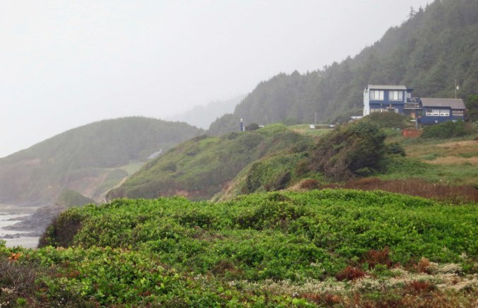
The Ocean Haven B&B north of Florence, Oregon.

Gull Haven today. Or Ocean Haven as it is known now with its magnificent views of the Pacific Ocean.

I visited the area again a few weeks ago when Peggy was back East. Following are some photos I took of the Lighthouse and the Sea Lion Cave.
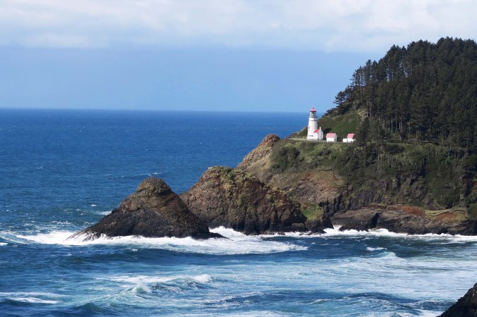
A distant view of the Heceta Lighthouse. It sits 205 feet above the sea.

The first order Fresnel Lens in the tower of 56-foot tall lighthouse shines a beam that is visible for 21 miles out in the ocean, making it the most powerful lighthouse on the Oregon coast.
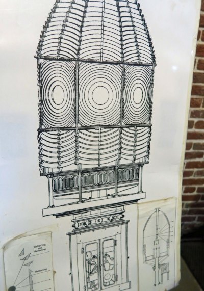
This picture of the Fresnel Lens is found on the ground floor of the lighthouse. Our guide told us that when one of the bottom glass sections broke a few years ago, it cost as much to replace as the whole light cost originally.
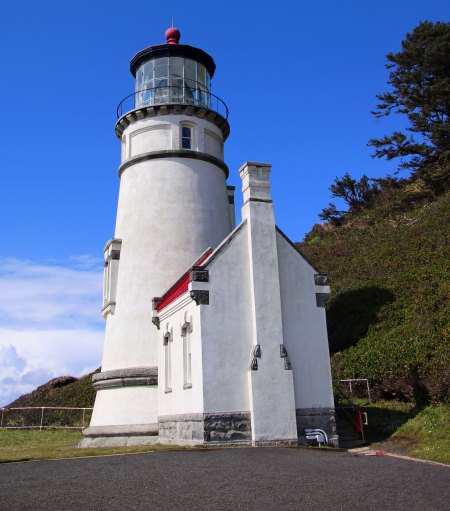
A final view of the lighthouse. Over 1000 barrels of blasting powder were required to create a flat space on Heceta Head to build the lighthouse.

This is a view of the lighthouse keeper’s home seen from the trail leading up to the lighthouse.

When the lighthouse was automated in the 70s, it was turned over to Lane Community College for classes. Not bad, eh? Today it is a B&B. The house also comes with its own ghost named Rue. It is said that she doesn’t like change.
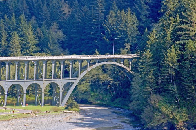
A view of the Cape Creek Bridge from the lighthouse.

And a close up. The Cape Creek Bridge is one of several gorgeous bridges along the Oregon coast.
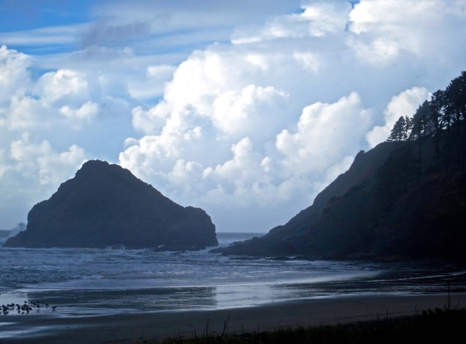
The small bay created by Cape Creek is also quite scenic. The lighthouse sits on the hill to the right.
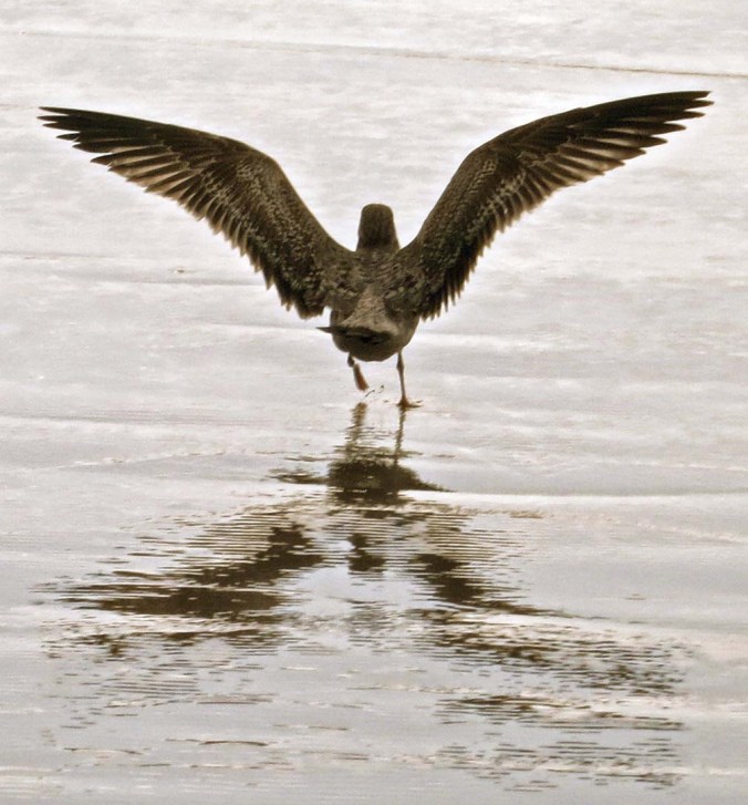
A sea-gull takes off from the beach of the Cape Creek Cove. I took this photo (and the two above) on an earlier trip.

A final view from the lighthouse. If you look closely, you will see the Sea Lion Caves building on the distant headland. Find the cut made for Highway 101 as it snakes its way along the cliffs and follow it to the far right.

Over 100 sea lions (eared seals) were in the cave when I visited. An elevator whisks visitors down into the main cave.

Steller Sea Lions live for about 20 years. They can swim up to 17 miles per hour.
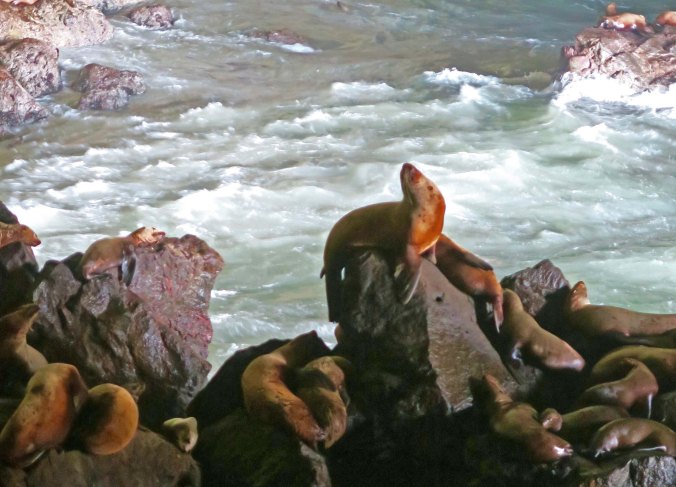
This big fellow had his head back and was barking most of the time I was in the cave.

I found the drama of the waves in the cave to be as interesting as the seals.

The rock in the middle is also prime seal territory. The waves actually washed over it as I watched, leaving only two sea lions on top.
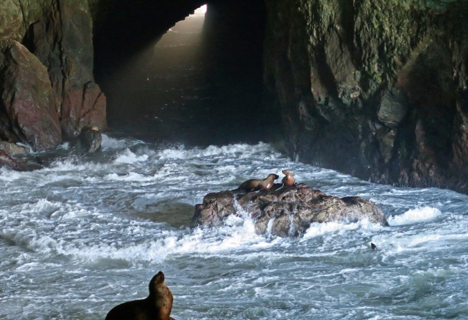
A final view of the rock with its two sea lions and the big guy.

NEXT BLOGS:

Wednesday: Bone is Found!

Friday: The Tribes of Burning Man…

Next week I will be traveling down around Big Sur, Carmel, Monterey and Santa Cruz on the Central Coast of California. It may be blog-break time. 🙂


Raging Rivers, Kamikaze Mosquitoes and Naked Ladies Jumping… How Bone Was Discovered: Part II

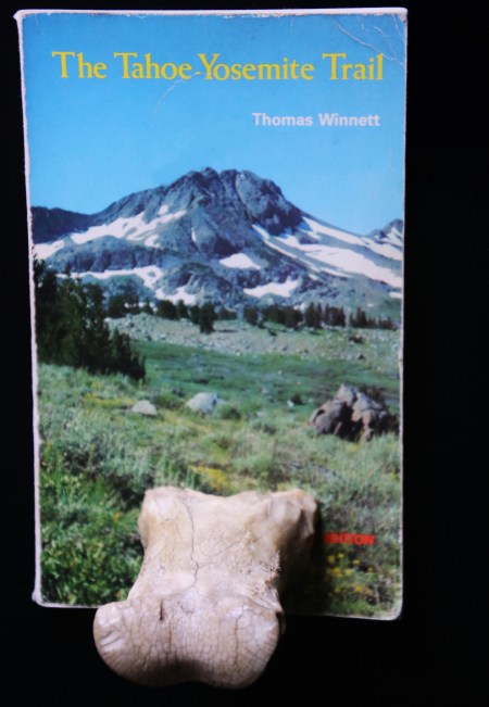
Bone contemplates a book on the Tahoe-Yosemite Trail and the high mountain meadows he loves. I used this book by Thomas Winnett on several early Treks that I led between Lake Tahoe and Yosemite.


This is second in a series of Blogs on how Bone was found in the Sierra Nevada Mountains. Go here for the first one.

I watched regrettably as April and Lynn headed out. I would miss the inspiration. Soon, however, my mind was more than occupied with route finding. The trail had disappeared under the snow.

Velma Lakes where we parted company with April and Lynn. I took this shot in the evening on another trip.

Tom pulled out his map and compass to establish our general direction. We searched for ancient tree blazes left behind by early foresters, cattlemen and sheepherders. We also watched for ducks where the snow had melted. I’m not talking about fowl that quack and taste good in orange sauce. Ducks, in trail finding terminology, are piles of stone set up to show the way. With a little imagination, they can look like their namesake. Caution is advisable. The people creating the ducks may have had a different destination in mind, or perhaps they were lost.

Tree blazes were the primary way of marking routes by the early explorers of the Western mountains. The short rectangle on top and longer one on the bottom mean ‘this is the trail.’ Blazes were normally within sight of each other.

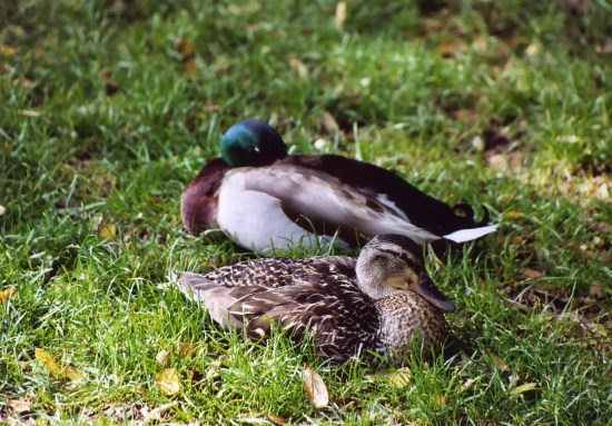
These are duck ducks, Mallards to be specific. They are not trail ducks. Following them might get you lost, or wet. Check out the eye on the male. He was not happy with my waking him up.

This is a trail duck. The three rocks in the middle are what a normal trail duck looks like. I added a rock on each side to create a Sierra Trek duck so Trekkers would know what to follow. I borrowed these rocks from Peggy’s rock garden and put them on our railing. I had strict instructions to return them to where I found them. BTW, three ducks in a row mean danger to Boy Scouts. We rarely had Boy Scouts follow us.

This is an example of a duck in use. A trail splits. The duck tells you to use the left one. I borrowed our backyard and deer trails for this.

An hour later we found ourselves more or less where we were supposed to be, on the edge of the Rubicon River. A student of ancient Roman History undoubtedly named the stream. Like Julius Caesar, we were faced with crossing it. In a month or so it would be a tame creek inviting a refreshing dip but now it was a roaring river, filled with icy water from quickly melting snow fields.

I entered with trepidation and was almost washed off my feet. Facing up-stream, I used a walking stick to give myself a third leg. Water crept up to my knees and beyond. It was cold; I have short legs. The force was incredible. I set each foot carefully and moved crab-like, searching for solid ground between slippery rocks.  I’d undone my pack belt so I could shuck the pack if I were knocked over. Swimming in freezing water with 50 pounds on your back is hazardous to your health. In a few minutes that stretched out forever I was across. Tom and Terry also made it without incident.

We plopped down on a convenient log to catch our breath and munch down on GORP (good old raisins and peanuts). It was a quick meal. A thick swarm of mosquitoes dive-bombed us with kamikaze abandon.  Slap one and five more landed, gleefully licking off our bug repellent before plunging in their proboscises. We were driven to put on our packs and scurry up the trail. Fortunately, Rockbound Valley is relatively flat and we were able to escape. Stopping was not an option as we hoofed it for the next four miles, crossing the Rubicon two more times before we began our labored ascent up aptly named Mosquito Pass.

Life slowed down immediately as we began climbing. The blood sucking hoards caught up. Near the top, we were confronted with a different challenge, more snow. Eight hours of hot sun had turned it to mush. We spent as much time sliding as we did climbing. It was slow, hard, slogging work. And it was dangerous. Running water, partially exposed boulders and tree trunks melt snow from the ground up and create hidden cavities. More than once we plunged through up to our knees.

Ignoring the danger, Tom and I laughed our way down the other side, glissading in our boots. Control was minimal. Camp was in sight. Terri came along at a much more sedate and careful pace.

There was nothing about Lake Aloha that made me think Hawaii. It was a strange Dali-like creation with a convoluted shoreline and innumerable Rorschach type islands. What’s more, mini-icebergs decorated its surface. Bright white on top, they turned an icy blue under the water. All I could think was cold. Plowing through snow on our way around the lake to camp added freezing to my thoughts.

That night, we built a small campfire to fight off the chill. Terry wandered off to bed. Tom was slightly melancholy. He looked off into the distance over my shoulder.

“I was married on that peak,” he announced to the night. I turned around and stared across Lake Aloha at the towering Pyramid Peak, the centerpiece of the Crystal Range. It was bathed in moonlight. Several years earlier, Tom had met and fallen in love with Hilde, a slight, attractive blonde who shared his love of the wilderness. They decided to get married on the mountain. Mom, wedding party and friends were invited to share their 9983 feet “I do.”

The marriage didn’t last long and Tom was reluctant to talk about it. The fire burned down to glowing embers. We shared the silence in memory of lost love.

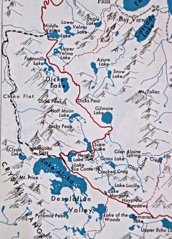
This map from the Tahoe-Yosemite Trail book shows our route from Velma Lakes to Upper Echo Lake. The red trail shows the actual route. The dotted trail shows the route we picked to Lake Aloha because of the deep snow going up past Dicks Lake.

I was up early the next morning and eager to hit the trail. My body was starting to adjust and feel good. More importantly, the resort at Echo Lake was calling. A quick breakfast and we were off. I took the lead with Tom following and Terry trailing. Soon we had climbed out of Lake Aloha, hiked past Lake Margery  and worked our way across Haypress Meadows where cattlemen once harvested grass for winter feed. As we began our descent into Echo Lake, I left my companions behind. The vision of cold beer and a hamburger drove me on. Short shorts may have been a factor as well. Lynn and April were supposed to rejoin us at the Echo Lake Resort.

There was a decision to make when I reached Echo Lake. I could continue to follow the Tahoe-Yosemite Trail around the upper and lower lakes or I could call the Lodge from a phone located at the end of Upper Lake. It would send a boat taxi to pick me up for five bucks. The trail was hot and filled with day hikers. I made the phone call. A half hour later, the throbbing of the motorboat’s engine caught my attention as it worked its way up the lake. Soon it arrived, coughing slightly. The boat slowed and bumped into the pier. My ‘taxi driver’ was a 16-year old plus teenager who had managed to snag a great summer job.

“Hop on,” he told me. An elderly couple was along for the ride. I nodded at them. I was halfway between the boat and the pier when I heard a commotion.

“Over here, Curt,” a familiar voice shouted. I looked up. A few yards away alders had hidden another pier. Two very attractive and very naked women were jumping up and down to get my attention. They succeeded. It was April and Lynn. They had come over on an earlier boat and were working in a little sunbathing while waiting for us. The young boatman and the old man were all eyes. The elderly woman looked thoroughly irritated and glared at all of us, especially her husband.

“Uh, I think I’ll stay here,” I told my driver.

“Can I stay too?” he asked and grinned at me. The elderly man wisely stayed silent.

I joined the girls as the boat coughed its way back toward the resort. Tom showed up soon afterwards. We were waiting for Terry and the women were dressed when the ranger showed up.

“There has been a complaint about naked women jumping up and down over here,” he told us.

“Boy, I wish I would have seen them,” Tom responded. I am not sure the ranger bought our story but he wandered off in search of other criminals.

The same boatman picked us up and told me that the first thing the elderly woman did when she got back was to complain loud and long about the perverted people across the lake. She even cornered a ranger. My new young friend speculated that the ranger came looking for us as an excuse to escape. “Or maybe he wanted to see the naked ladies,” I noted.

I happily downed a hamburger and a beer, or maybe it was two. But we still had a few miles to go before camp, so I didn’t want to eat or drink too much. Backpacking is hard enough as is—alcohol and a stuffed tummy makes it harder.

Be sure to check in next Wednesday and learn how Bone was found!

Three more photos from the journeys that Bone has been on since his discovery.

Riding an elephant in Nepal. Bone is hard to see but he is resting on the elephant’s head. He is being held by Mary Johnson who had taken Bone along for good luck. Many people have travelled with Bone over the years.

Iguanas chat with Bone in the South Pacific, where he was taken on a diving expedition by Jose Kirchner.

Bone sits in the sand at twilight on the edge of the Tasman Sea on the South Island of New Zealand. He was traveling with Peggy and me.

NEXT BLOGS

Friday: It’s back to Burning man with some very Burning Man-like murals and paintings.

Monday: A cave filled with sea lions on the Oregon coast and another beautiful lighthouse.

Wednesday: Bone is found! Hypothermia threatens! A rattlesnake tries to bite me on the butt!


What Makes a Lighthouse So Appealing?

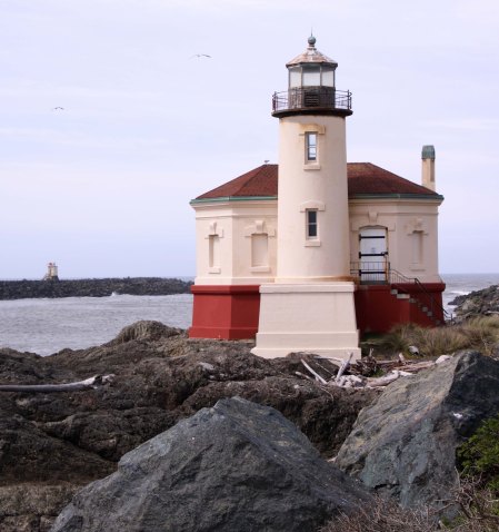
The Coquille Lighthouse sits on a point jutting out into the Coquille River opposite of Bandon, Oregon. Its replacement, an automated beacon, can be seen on the left across the river on the South Jetty. A glimpse of the Pacific Ocean appears on the right. (Photo by Peggy Mekemson.)


I am sure that there are people who drive by lighthouses never noticing their existence. I am not one. There is something romantic about them that pulls me in. Maybe it is their historic role: saving mariners from crashing into rocky shoals and other shoreline hazards. Or maybe it is their isolation and the thought of a lighthouse keeper’s lonely life. Having a bit of hermit in me, I can easily envision such a life-style, assuming, of course, that I have my good buddy and a boatload of books along. Or possibly it’s their setting along dramatic ocean and lake shorelines. Rocky shorelines offer beauty as well as hazards.

The history of the Coquille River Lighthouse was closely tied to the logging industry. Early lumber barons wanted to get at the virgin forests located along the Coquille River. Access was relatively easy, assuming ships could cross the hazardous bar located at the mouth of the river next to Bandon. A jetty was built out into the ocean, which led to the creation of a deep channel. The lighthouse was built to guide ships along this channel. The 1890 funding proposal stated:

“A light of the fourth order with a fog-signal, at this point, would enable vessels bound into the river to hold on close to the bar during the night so that they would be in a position to cross at the next high water. The light would also serve as a coast light and would be of much service to vessels bound up and down the river.”

“A light of the fourth order,” refers to the type of the Fresnel lens used in the lighthouse. Fresnel lens are made up of multiple lens arranged in concentric circles around the light source. If you’ve been in a lighthouse, you will have likely seen one. They range in size from the first to the sixth order. Fourth order Fresnel lights could normally be seen for 15 miles out to sea and were commonly used to guide mariners into harbor mouths.

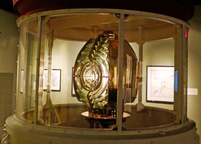
A Fresnel lens of the sixth order on display at the Columbia River Maritime Museum in Astoria, Oregon. This light could be seen for about five miles and would be used in harbors and along rivers.

Funding was approved by Congress and the lighthouse was functioning by the mid-1890s. It was operated up until 1939 when the Coast Guard took it over and determined that a less expensive, automated beacon placed on the end of the Bandon South Jetty would work as well. The abandoned lighthouse was neglected up until 1976 when it was taken over by the state of Oregon as part of Bullard’s Beach State Park. A joint effort by the state and the Army Corps of Engineers restored the lighthouse as an historic attraction. Various efforts since have maintained it, much to the enjoyment of thousands of visitors— including us.

Peggy and I stayed at the state park while we were visiting Bandon and used one of our mornings to go over and check out the Coquille Lighthouse, North Jetty and Bullard’s Beach. The following photos record our visit.

Peggy and I walked around the lighthouse to capture photos from various angles. I took this from the river’s edge. Low tide enabled me to shoot from below the tide line. The North Jetty stretches off to the left.

Peggy caught this close up.

And I took this picture looking over sea grass. Parts of Bandon can be seen across the river. We were on our way to walk out the North Jetty.

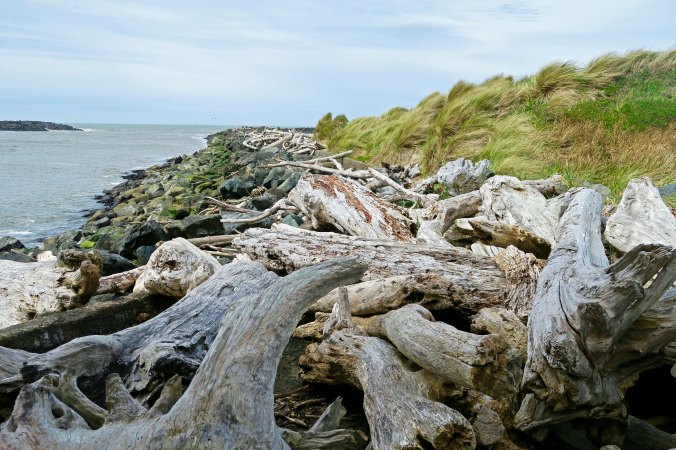
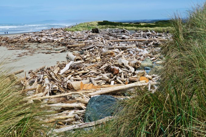
One of the first things that struck me about the jetty was the amount of driftwood piled up along it. This reflects the power of the ocean. It also warns that you wouldn’t want to be anywhere near the jetty in a storm.

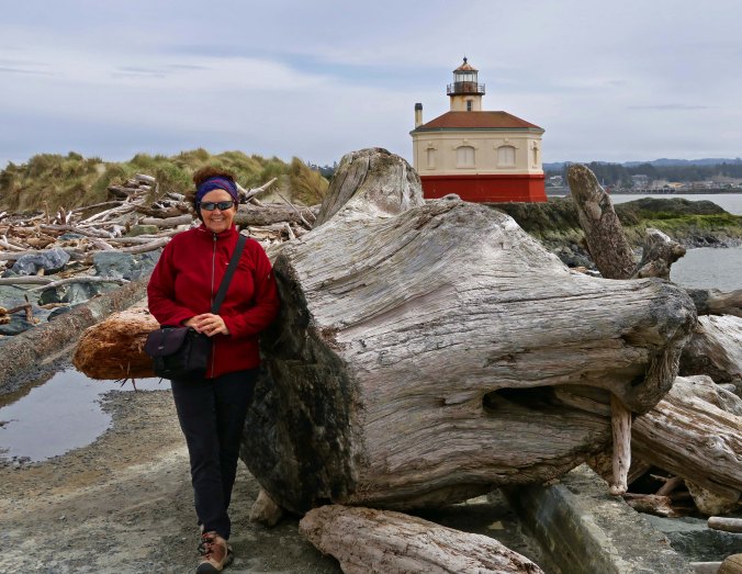
Peggy posed for me in front of this large stump on top of the jetty, a remnant of logging up the river and along the coast.

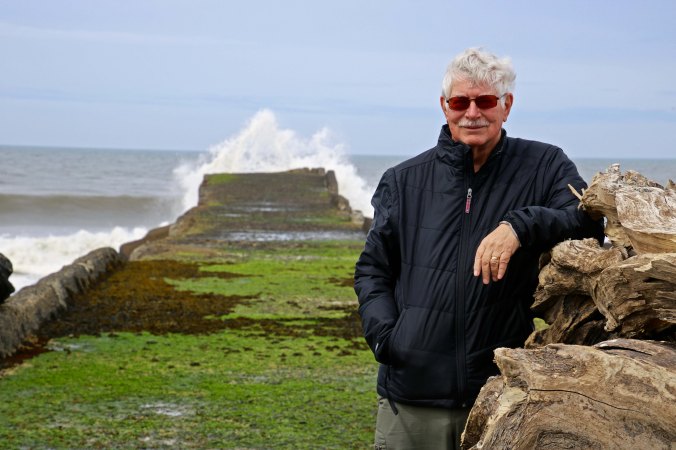
I returned the favor posing for Peggy out toward the end of the jetty. A wave can be seen breaking over the end. And this is at low tide! We stayed far back. I would bet that people have been swept off of here while trying to photograph winter waves. (Photo by Peggy Mekemson.)

I appreciated the sea gulls adding a touch of sea life to my photo. One wave hits the end of the jetty while another rolls in. Watch out for the ninth!

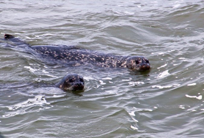
A pair of seals with their big dark eyes swam along the side of the jetty and checked us out. (Photo by Peggy Mekemson.)

A view north from the jetty along Bullard’s Beach shows again how much driftwood (drift logs?) is brought in by winter storms.

Peggy took this shot looking up from Bullard’s Beach toward the lighthouse.

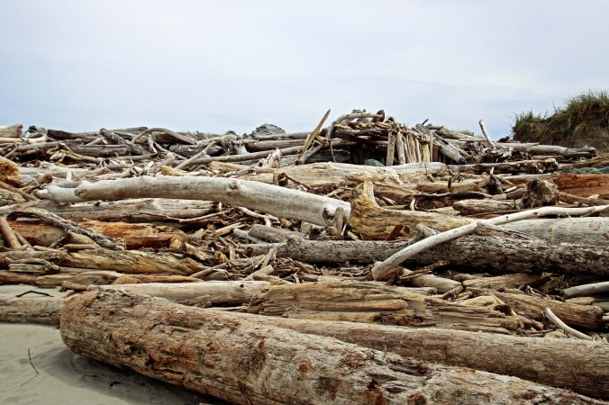
And this photo of a fort someone had built taking advantage of the driftwood. You can imagine the amount of fun kids would have building and playing in such a fort. Adults too. (Photo by Peggy Mekemson.)

I added a close up.

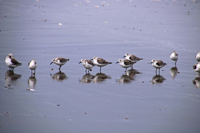
Walking along the beach we found a flock of Sanderlings. These small shorebirds are a delight to watch as they charge in unison along the beach following the tide as it rises and falls in search of delectable bugs. I liked the reflection provided by the receding water. (Photo by Peggy Mekemson.)

Get too close and off they fly, whirling in unison as they head a few yards up the beach to continue their endless search for dinner.

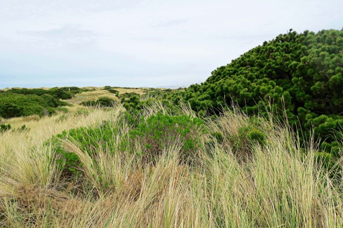
I’ll close today with this final shot of the coastal land that backs up to Bullard’s Beach.

NEXT BLOGS:

Wednesday: While Bone waits to be found, we continue our backpack trip down the Tahoe-Yosemite Trail— finding our way through deep snow, crossing a raging river, and running from kamikaze mosquitoes.

Friday: Murals and other wild/weird art of Burning Man.

Monday: I travel north up Oregon’s coast and explore a cave filled with lions, sea lions that is.


Bandon, Oregon… An Attractive Coastal Town Where Trash Becomes Art

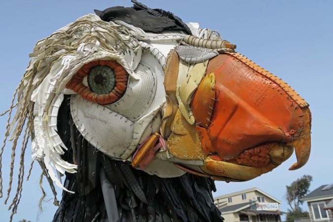
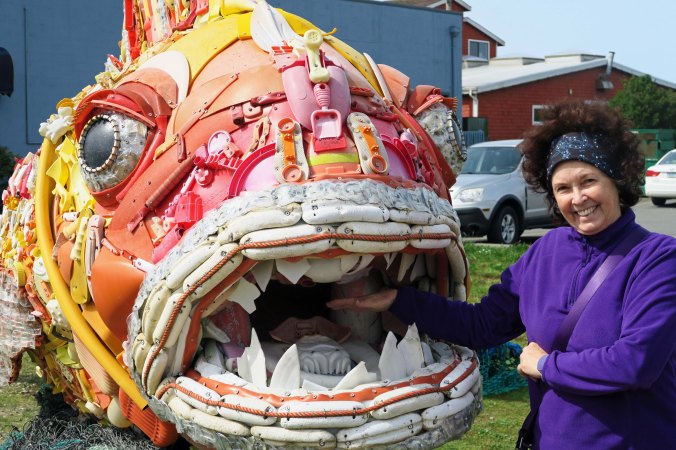
Trash gathered along the coastline near Bandon, Oregon is turned into art by the nonprofit organization, Washed Ashore. In this case, the artists have created a puffin.


Here’s something to think about:

A study carried out by the World Economic Forum and Ellen MacArthur Foundation predicts that the plastic we are dumping into the ocean will weigh more than the fish in a short 30 years. While most of this plastic circles the ocean as sludge following currents known as gyres, a significant amount washes up on our beaches creating hazards for wildlife and visual pollution for the rest of us. Even the most pristine locations fall victim to this onslaught.

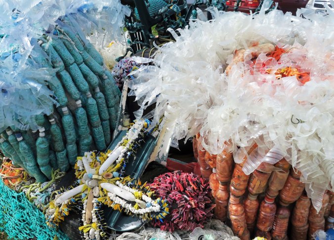
When Peggy and I drove into the small town of Bandon on the coast of Oregon two weeks ago, we spotted several colorful sculptures of marine life that immediately caught out attention. On closer inspection, we found out they were made out of trash collected from the local beaches and turned into sculptures by a local organization named Washed Ashore.

The non-profit is the creation of Bandon artist Angela Haseltine Pozzi who decided to do something about the pollution that was cluttering local beaches in 2010 and begin turning the trash into art.

“First you just want people to stop and look at the art,” Angela noted. “And then you want to have them stop and think about the problem.”

It certainly worked with us.

Today, hundreds of volunteers join with Angela and her staff in creating sculptures that travel the country and even the world creating awareness about our use of the oceans as a garbage dump. Last year, a number of Washed Ashore’s sea creatures even made it to the Smithsonian National Zoo in Washington DC.

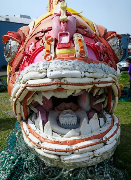
This delightful fish is another example of Washed Ashore’s artistic endeavors. Note the old phone on the fish’s nose right above the child’s sand shovel.

Here is the puffin featured at the beginning of the post…

And this is a view of tide pool life created from trash.

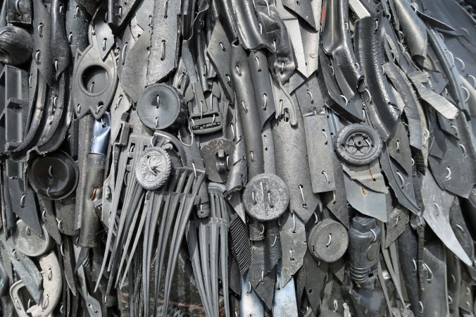
A closeup of the feathers on the puffin’s chest.

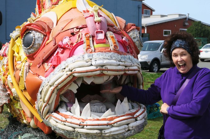
A head on view of the fish with it’s scary teeth and trashy mouth.

Peggy, who always makes sure that her trash is properly disposed of and recycled, can stick her hand in the fish’s mouth without any fear of retribution.

But here’s what it might be like if she dumped her trash in the ocean! (She really is a good sport when serving as a model. “Look like it is biting you,” I had told her.)

Most towns along the Oregon coast spread out along Highway 101 like strip malls and feature the same motels, gas stations and fast food joints you can expect to find anywhere else in the US. Peggy and I have discovered, however, that most of these small communities also had the foresight to save their historic districts. These in turn have become attractions for tourists, a source of important jobs and dollars.

Bandon welcomes visitors and provides activities that range from walking on its beautiful beaches, to shopping and eating in town, to playing golf on some of Oregon’s finest golf courses.

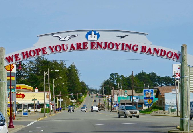
The other side of this sign over Bandon’s main street welcomes you to Old Town. This side looks out on busy Highway 101 from the historic district.

Such is the case with Bandon. Peggy and I wandered around Old Town and did our bit for the local economy. We bought books in a fun little bookstore, nibbled our way through a chocolate store, and quaffed a couple of pints of Guinness at an Irish pub. We even checked out a store that is dedicated to producing and selling candy made with cranberries. It turns out that Bandon grows over 90% of Oregon’s cranberry crop and 5% of the nation’s!

I would describe the Old Town area as fun and funky. The nature of the original town has been preserved without pretensions.

As you might imagine, the town’s access to the ocean guarantees an abundance of fresh seafood. I liked the sense of humor reflected by the fish.

An attractive boardwalk featuring several works of art fronts the Coquille River and forms the northern border to Old Town. We concluded our visit to Bandon by strolling along the walkway, checking out the marina, and admiring the art.

A world globe we found on Brandon’s Boardwalk conveniently located where we were.

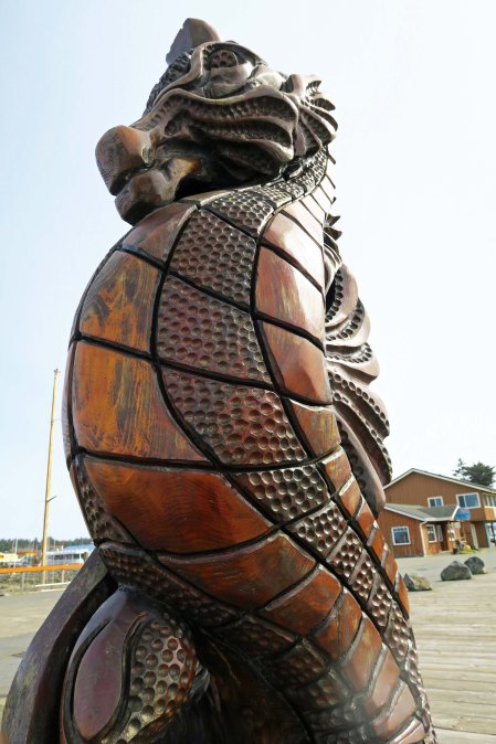
A regal seahorse checked us out…

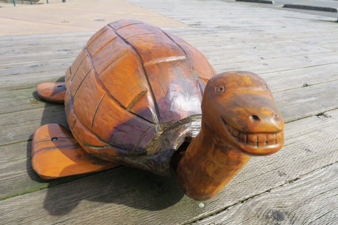
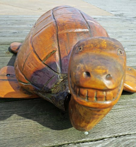
A carved turtle grinned at us…

And led me to focus in on its smile.

A friendly harbor seal…

Gave us a look that seemed to say, “Feed me a fish, please.”

And a crab did what crabs do so well— look crabby.

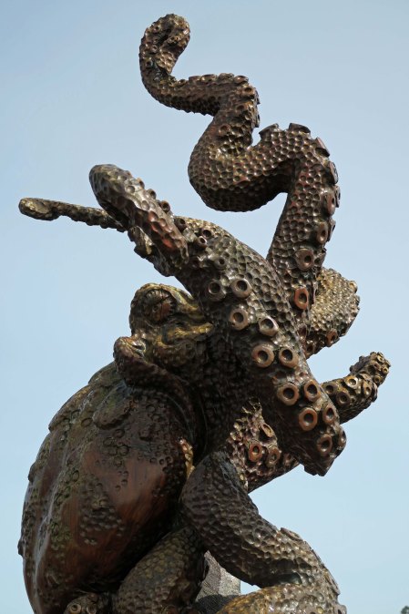
My favorite, however, was this octopus. I took several shots.

Back lit by the sun, he looked a little scary, like something out of 20,000 Leagues Under the Sea.

I decided to use my last photo to introduce my next post on Bandon (next Monday). Peggy and I will cross the Coquille River to check out this lighthouse and the ocean beach next to it. We are looking at the lighthouse from Bandon’s Boardwalk.

NEXT POSTS:


Wednesday: I begin a three-part series that focuses on a backpack trip near Lake Tahoe where we found Bone.

Friday: I will continue my photo essays on the art of Burning Man.

Monday: I’ll wrap up the Bandon, Oregon series with a trip to the Coquille Lighthouse and the surrounding area.


The Ten Questions People Most Frequently Ask Bone… The Interview!

Bone has been in many tough situations in his life; he can handle tough questions. Here he rests on top of a saguaro cactus in Arizona looking for border control agents. His lack of official papers, or even a birth certificate, can cause problems at times.

Q: Do you really talk? We’re speaking ethics here, Bone. Blogging is about transparency. That means honesty.

A. Are you crazy? Have you ever heard a bone talk? Of course I don’t talk. I just think out loud.

Q: Curt sometimes refers to you as he. Does this mean you are a male bone?

A. No. He makes assumptions, lot of them. He was showing me to a biologist at a writers’ conference and she suggested I have my DNA tested. “Just cut a small chip off of it,” she said nonchalantly. “You can determine its sex and breed.”

“Just cut a small chip off of it!” Outrageous! I am not some it to have chips cut out of. Besides, I lead a rich fantasy life and have no desire to know whether I am male or female. Call me she, he, or Bone, but never it.

Um, I think Bone is definitely a male in this photo. –Curt

Q: You have travelled all over the world and met thousands of people. How do they usually react to you?

A. With befuddlement. You should have seen the look on the face of the customs agent in New Zealand who tried to seize me as ‘animal matter.’ But emotions run the gamut. There was a Japanese man who got off a tour bus at Yellowstone National Park and wanted to hold me for good luck. Soon there were 40 other Japanese handing me around, oohing, and taking photos. I was thrilled. On the opposite side, I know a woman who refuses to touch me, like I have cooties. “I don’t know where Bone has been,” she states primly. Not surprisingly, there is also jealousy. “I want to be you and travel the world,” a good friend in Sacramento told me.

Some people act like I have cooties. This woman almost dropped me and then washed her hands! –Bone

Her daughter, on the other hand, so to speak, understands proper bone etiquette and respect. –Bone

Q:  What is your favorite thing to do?

A. Visit graveyards; there are lots of old bones there. My favorite grave is Smokey Bear’s in Capitan, New Mexico. I once stood on his tombstone for ten minutes trying to communicate but all I could get was something about ‘growling and a prowling and a sniffing the air.’ A close second is the grave of Calamity Jane in Deadwood, South Dakota. What a woman! These are difficult choices, though, when you toss in the likes of Hemingway, Daniel Boone and Billy the Kid. On the light side I once visited Ben and Jerry’s graveyard of discarded ice cream flavors in Vermont. My spookiest experience was a visit to the Capela dos Ossos, the Chapel of Bones, in Evora, Portugal. Those folks definitely have a skeleton in their closet, lots of them.

Bone has a special fondness for unusual graves. Here he hangs out with Billy the Kid in New Mexico. Has he been in a shoot out? Is that blood on his vest?

Q: So, what’s your second most favorite?

A. Too hard; I am a dilettante dabbler, but here are a few.

  • Wandering, of course, anywhere and everywhere and by all modes: bikes, kayaks, rafts, skis, backpacks, sailboats, planes, helicopters, trains, cars, RVs, etc.
  • Visiting wild, remote and beautiful natural areas. I started life wandering the Sierra Nevada Mountains, John Muir’s Range of Light.
  • Seeking out the strange such as ghosts and aliens (I’ve been to Roswell four times).
  • Attending unique events like Burning Man but I also have a fondness for any type of fair.
  • Meeting weird people like Tom.

Bone backpacking on the John Muir Trail.

Tom being eaten by a bony desert monster.

Q: Speaking of Tom, he and Curt ‘discovered’ you in 1977 and you have wandered extensively with both. Which do you like best?

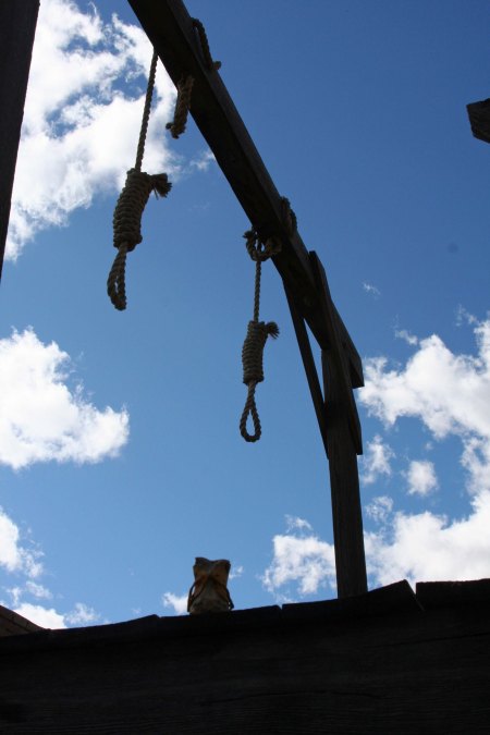
A. Eeyore, the jackass who can’t keep track of his tail. We’re traveling companions and he saved me from being strung up and buried on Boothill in Tombstone Arizona. I’d robbed a bank, cheated at cards and hung out with women of questionable character. (This is what I mean by having a rich fantasy life. It’s also known as evasion.)

“I was in deep trouble in Tombstone. Wyatt Earp had arrested me for robbing a bank and Doc Holiday was checking me for weapons.

My life as Bone was in serious jeopardy.

Odds were I was going to end up on Boothill, along with Billy Clanton.

But then the ever brave Eeyore came to my rescue! I hopped on his back and we went riding off into the sunset while leaping over large rocks.

Q: Which of your journeys has been most memorable?

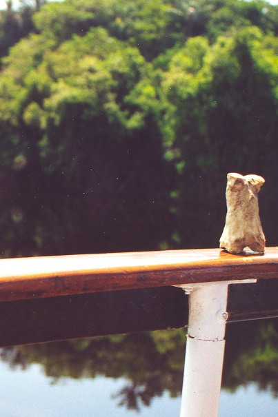
A. I would have to say traveling the length of Africa in the back of a truck from the Sahara Desert in the north to Cape Town in the south. Almost falling off the back of a riverboat into a piranha infested section of the Amazon River would have to be a close second. I was perched on the back railing doing a photo shoot. And then, of course, there was the 10,000-mile bike trip.

Bone on photo shoot barely escapes falling off the edge into the Piranha infested waters of the Amazon. “I was falling off when Curt leapt across the boat and grabbed me.”

“I was much smarter when I rafted down the Colorado. I wore a life jacket!”

“That didn’t protect me from pirates. The dreaded pirate Steve held a knife to my throat and demanded to know where I buried my treasure.”

Q: You are often seen scrambling over rocks in remote sections of the Southwestern United States. What’s that all about?

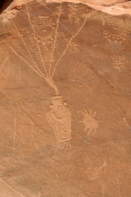
A. I’ve developed a fondness for Native American Rock art. It resonates with my bone-like nature. It’s also another excuse to go wandering around in the outdoors. Plus, some those places might be haunted and it is a great place to look for UFOs. Some of the petroglyphs look amazingly like aliens. Finally, wandering in the desert is known to be good for the soul. Ask the Prophets of yore.

How can this guy and his strange dog not be aliens?

Here I am making tracks across White Sands National Monument in New Mexico. It’s a great place to watch out for UFOs.

Q: Ah, being a born-again bone, do you have any insights into the great unknown?

A. Ommmmmmmmmmmmmmmmmmmmmmmmmmmmmmmmmmmm.

Q: Finally, and this may be a little sensitive, but do you always run around naked?

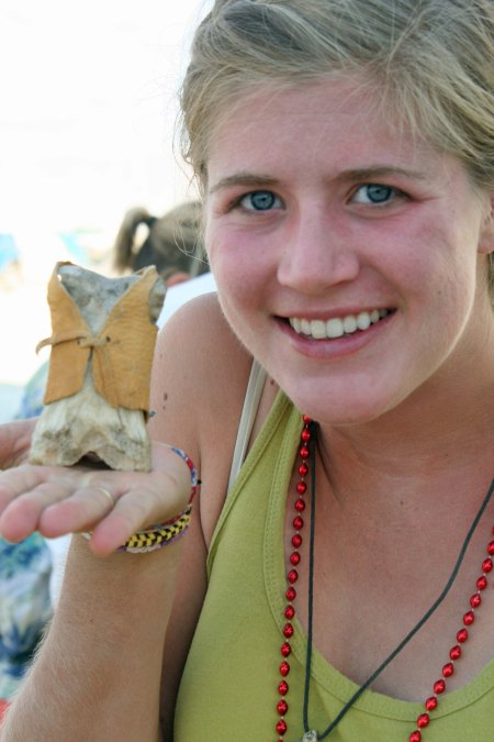
A. What kind of a question is that? Do you think I am uncivilized? For shame. I am the epitome of haute couture! A bow and arrow toting, card-carrying NRA member in Montana has designed and made me two leather vests. What’s more, an 80 plus year old woman in Kansas going on 20 with a crush on Johnny Depp and a room devoted to the Egyptian gods has made me a kilt and several other outfits. Then there is the horse woman actress in Ohio whose husband is an ex-secret service agent who has promised me an outfit and the artist head of a PR firm in the Bahamas who has promised me another. Face it; I am hot stuff, clothed or naked. I may take up a modeling career.

Rod Hilton fashions a new leather vest for bone.

My Bahamian/Canadian friend makes me a new vest in the wilds of Montana. –Bone

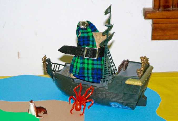
Bone, wearing his newly made kilt, fights off a ferocious sea monster in a scene straight out of ‘Pirates of the Caribbean.’

So… now you have heard from Bone, do you have any questions you would like to ask him? He promises to answer.

NEXT BLOGS:

Friday: The stunning temples of Burning Man.

Monday: Bandon by the Sea. It’s back to the Oregon Coast.

Wednesday: The exciting tale of how Bone was rescued from a life of quiet contemplation. Part I

The Journeys of Bone… Forty Years of Wandering the World

Bone has been wandering the world for 40 years. Given his nature, it is only natural that he would end up at Burning Man. He and a butterfly are perched on “Horse with No Name,” preparing to ride off into the desert.


Have you met Bone? He’s been hanging around here for 7 years and traveling the world for 40. Once upon a time, and it seems like a long time ago, this blog was even titled the Peripatetic Bone. There’s a story here, of course. In January of 2010, I had attended the San Francisco Writers’ Conference. Part of the event had involved ‘speed dating’ with agents.  I had carried Bone with me to San Francisco and introduced him to three of the agents, suggesting that I wanted to write a book titled “Travels with Bone.” They had been a bit surprised to meet Bone, but had been intrigued by the concept. Each had suggested that I go home and write up a proposal.

 I had also learned at the conference that I needed an Internet presence and would be expected to market any book I succeeded in publishing. I dutifully went home and created a blog for Bone on Word Press. Somewhere in the process, I decided that my first book should be on my Peace Corps experience. So, I wrote and published, “The Bush Devil Ate Sam.” I also changed the name of my blog to “Wandering through Time and Place.”

 I decided it would be fun to reintroduce Bone and do a five-part mini-series on his adventures. Today, I am going to summarize his travels. Next week I will do an interview with Bone. Then I will follow up with three posts on how he was found.


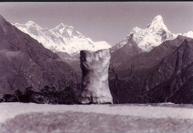
Bone has traveled twice to the base of Mt. Everest.


Part I: The History of Bone

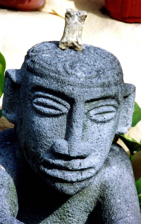
Sometime in 1900s Bone started his life as part of horse wandering through the Sierra Nevada Mountains. The horse was allegedly eaten by a bear. Bone ended up in a high mountain meadow practicing Zen and being nibbled on by a miscreant rodent.

1977: He was ‘discovered’ by two lost backpackers (Curt Mekemson and Tom Lovering) on the Tahoe Yosemite Trail above Lake Tahoe and launched his career of wandering the world.

1980-81: Bone commenced his first World Tour with Tom.  He visited Asia including Japan, Hong Kong, Bombay, Delhi and Katmandu where he trekked to the base of Mt. Everest. He then wandered on to spend spring and summer in Europe stopping off in Greece, Spain, Portugal, France, Italy, Austria, Liechtenstein, Luxembourg, Germany, Belgium, England and Ireland. Getting cold, Bone headed south and hitched ride in back of truck through Algeria, Niger, Chad, Nigeria, Cameroon, Central African Republic, Zaire, Sudan, Kenya (where he crossed Equator), Tanzania, Zambia, Zimbabwe, Botswana and South Africa. He signed on with Tom as crew of sailboat in Cape Town and headed north to Mallorca, stopping off on the islands of St. Helena, Ascension, Cape Verde and Madeira. Back in Europe he explored his possible Viking roots in Sweden, Norway and Finland.

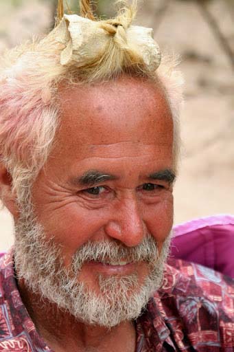
Bone ends up in Tom’s hair (don’t ask) on a 2010 trip down the Colorado River.

1983-86: Bone assumed Cheechako status and moved to Alaska with Curt where he was stalked by a grizzly bear on the Kenai Peninsula, explored Prince William Sound by kayak, learned to winter camp in 30 degree below zero weather while listening to wolves howl, backpacked in the Brooks Range north of the Arctic Circle, and discussed the finer points of eating salmon with Great Brown Bears in Katmai National Park. He escaped briefly to the warmer climate of Hawaii and participated in New Orleans Mardi Gras.

1986: He backpacked the Western US for five months with Curt exploring the Grand Canyon, the Gila Wilderness of New Mexico, the Rockies, and the Wind River Mountains of Wyoming before returning to his beloved Sierras.

1989: Bone went on a six month 10,000-mile solo bike tour with Curt around North America visiting 18 states and 4 Canadian provinces. He ended his journey by meeting Peggy.

1990: The International Society of the BONE was formed at Senior Frogs in Mazatlan, Mexico, where Bone spent the afternoon being pickled in a pitcher of margaritas and being kissed by lovely senoritas.

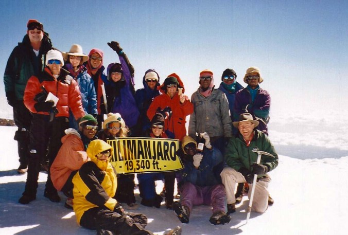
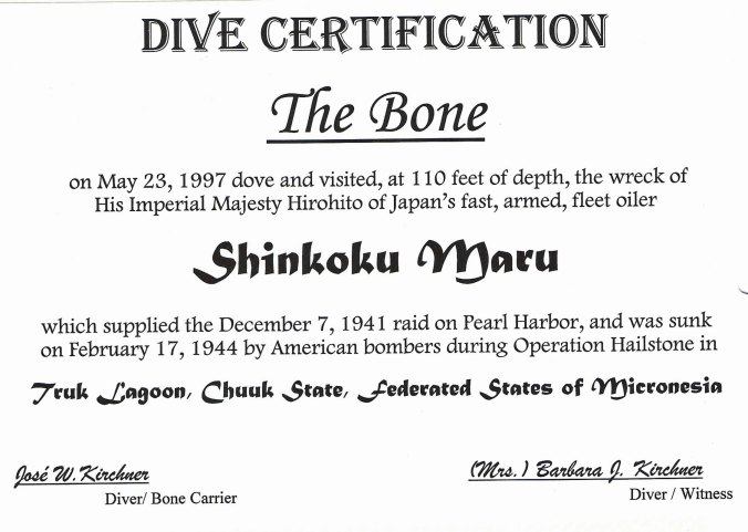
1991-97: Various members of International Society accompanied Bone on numerous adventures. Highlights included a White House Press Conference with Bill Clinton, being blessed by the Pope in St. Peter’s Square, visiting with Michelangelo’s David, going deep-sea diving in South Pacific and Caribbean, doing a Jane Austin tour of England, and exploring the Yucatan Peninsula. A group adopted him as a good luck charm and took him back to visit the base of Mt. Everest one year and to climb Mt. Kilimanjaro another.

Bone loves high places. Here he is on top of Mt. Kilimanjaro in East Africa. (He’s with MJ, fourth from right, standing.)

Bone went diving in the Pacific in 1997 with Jose and Barbara Kirchner, visiting a Japanese ship sunk during World War II and receiving his diving certificate.

1998-99: Bone embarked on 40,000-mile journey in the van, Xanadu, through the US, Canada and Mexico with Peggy and Curt, visiting over 30 National Parks, driving the Alaska and Baja Highways, checking out Smokey the Bear’s and Calamity Jane’s graves, kayaking in the Sea of Cortez, leaf peeping in Vermont, jetting to the Bahamas, pursuing flying saucers in Roswell, New Mexico, and completing his visits to all 50 states, etc. etc. etc.

2000-02: Bone journeys up the Amazon, returns to Europe, cruises to Belize, Cancun and the Cayman’s, and goes to New Zealand where a misguided customs agent tries to arrest and jail him as animal matter.

While in the Amazon, Bone slept in the same room that Jimmy Carter had slept in.

2003: Bone undertakes a 360-mile backpack trip in celebration of his discovery and Curt’s 60th birthday. They begin at Squaw Valley near Lake Tahoe and end by climbing Mt. Whitney. Various friends join them along the way.

2004: Bone visits Hemingway’s grave in Idaho, goes horseback riding with Australians and Bahamians in Montana, and makes his first pilgrimage to Burning Man in Nevada, a very Bone like type of place. He also jets off to Costa Rica.

Bone has a love for anything ancient. Here, he perches on a Mayan sculpture in Costa Rica.

2005-2007: Bone returns to Burning Man twice and revisits Europe twice including special stopovers in Portugal, France, Holland, Germany, and Belgium. He also revisits Mexico.

2008 – 2011: Bone commences another exploration of North America. This time he travels in the van, Quivera, along with Curt, Peggy, and Eeyore the Jackass. His journey takes him over 75,000 miles of American Roads. In May of 2010 he begins his travel blog, The Peripatetic Bone, and rafts 280 miles down the Colorado River through the Grand Canyon.

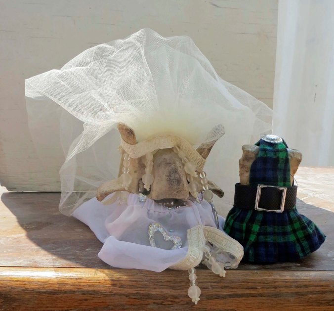
2012-2017: Bone goes into semi-retirement in Southern Oregon. Please note the semi, however. He continues the exploration of the West Coast ranging from Big Sur to Vancouver Island, where he kayaks for a week in search of Killer Whales. He wanders through England and Scotland helping Curt find his roots and spends a week traveling by Canal Boat on the Mercer River. Later, he returns to Europe again, traveling through the Mediterranean visiting Turkey, Santorini and other Greek Islands, Dubrovnik, Venice, Rome, Pompeii, Florence, and Barcelona. He returns to Burning Man several times.  On one trip, he is married to the lovely Bonetta, who he met while exploring a swamp in Florida. Rumor has it that it was a shotgun wedding.

Bone and Big Nose Bonetta are married at Burning Man 2013. Bone’s kilt was made for him by an 80-plus year old woman from Kansas. Bonetta is wearing a designer wedding dress with very expensive plastic jewelry to match.

NEXT Wednesday: Bone grants one of his very rare interviews. You won’t want to miss it! (No, Bone doesn’t talk; he just thinks out loud.)

In the Meantime:

Saturday: A return to Burning Man and the last of the sculptures.

Monday: Peggy and I have just been in Bandon on the Oregon Coast. Are you ready for a visual treat?

Astoria, Oregon… Where the Columbia River and the Pacific Ocean Meet

A rainbow hangs over the mouth of the Colombia River and ships that are waiting their turn to head out into the Pacific. Special pilots are brought on board to navigate the treacherous waters, now looking quite calm.


I visited Astoria a while ago and didn’t get around to writing about it. Since Peggy and I are now off playing on the Oregon coast, I decided today would be a good day for featuring this city that sits on the edge of the Colombia River.


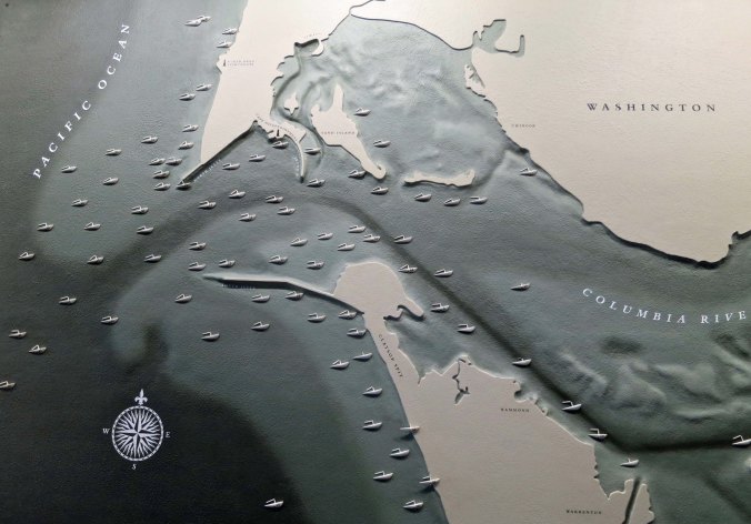
The area off of Astoria, Oregon, where the Columbia River flows into the Pacific Ocean, is called the Graveyard of the Pacific. A combination of high seas with 40-foot waves, shallow, shifting sand bars, and the mighty Columbia River have sent some 2000 boats to their watery demise since 1792. It is considered one of the most dangerous navigation passages in the world.

This map, which is located in the Columbia Maritime Museum, shows where some of the shipwrecks can be found.

It’s no wonder that  you are greeted by a sign that proclaims Astoria is an Official Coast Guard City when you enter the community. The town is grateful that the organization is there when someone needs to be pulled out of the turbulent water. A dramatic, full-sized diorama of a Coast Guard rescue effort is featured at the Maritime Museum.

Astoria wears its Coast Guard connection proudly.

A full size diorama of a Coast Guard rescue effort is on display at the Columbia Maritime Museum.

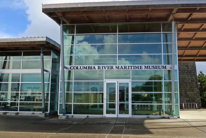
A photo featuring the front of the Columbia Maritime Museum. I liked the way the glass reflected the clouds.

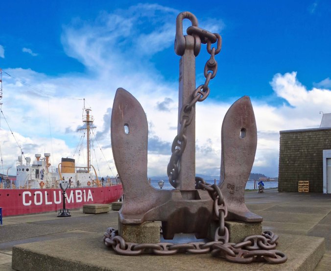
I thought that this anchor that sits out in front of the museum, is an apt symbol for both the museum and the city. The lightship Colombia is seen in the background.

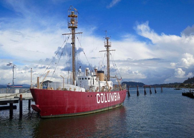
In the days before modern navigation equipment, the lightship Columbia served as an offshore lighthouse, aiding ships entering and leaving the Colombia River. The lightship maintained its position for weeks at a time and stocked in 12 tons of food, 13,000 gallons of fresh water and 47,000 gallons of fuel.

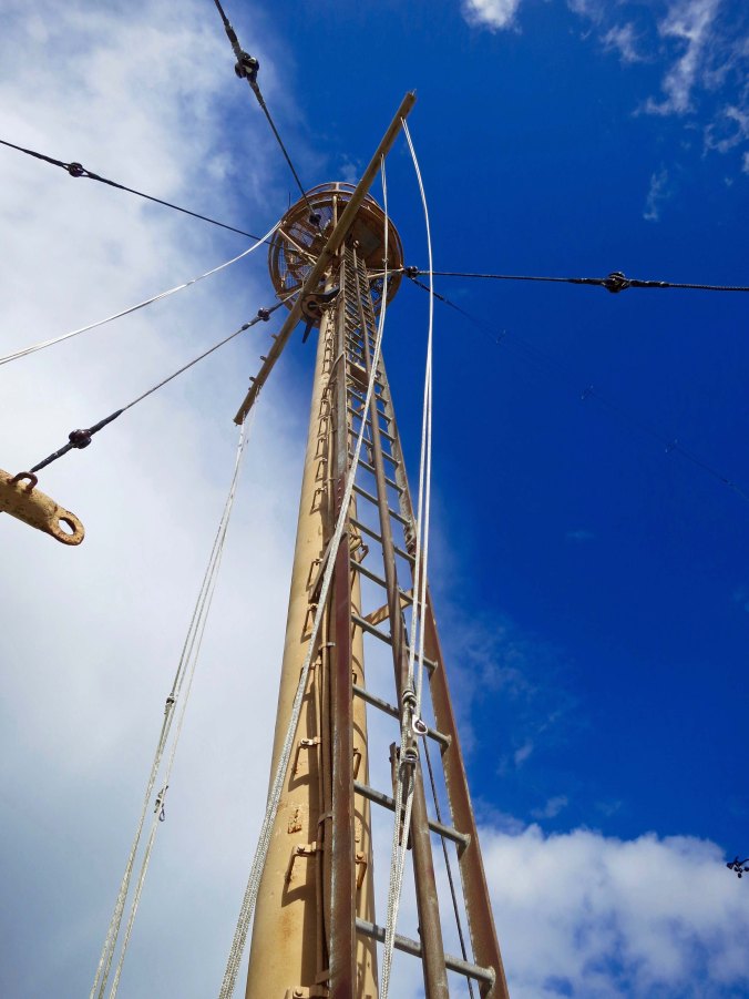
This crows nest mast on the Columbia was used for powerful lights and foghorns as well as observation.

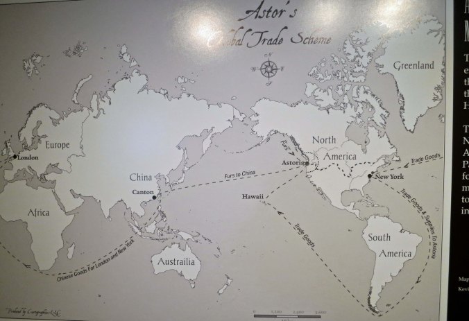
Astoria’s connection with the fledging United States dates all the way back to the Lewis and Clark expedition. The explorers sent out by Thomas Jefferson spent the 1805-6 winter in the area and built Fort Clatsop for shelter and protection. John Jacob Astor, who gave the city its name, followed up by building a fur trading post there in 1811 that became the first permanent settlement the US had on the west coast. Both the Lewis and Clark expedition and Astor’s post helped in the debate with England over who owned the land.

This map from the museum shows Astor’s trading routes.

Traveling by sailboat through the world’s oceans was hazardous. An early fear of sailors was having encounters with sea monsters. I found this illustration of a Kraken in the museum and laughed. If you are familiar with Pirates of the Caribbean, you will recognize it.

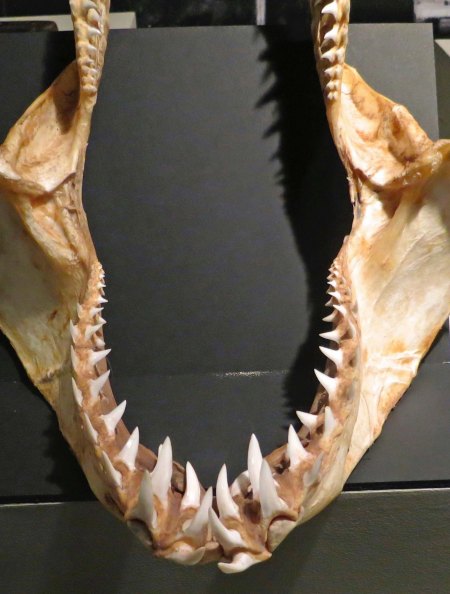
Now here is something more real to worry about! I also found this shark jaw and teeth in the museum.

Logging and fishing followed fur trading as the mainstay of the area’s economy. By the mid-1800s, fisherman from around the world called Astoria home. Only 13 percent were born in the US. The majority came from the North Atlantic countries where over-fishing had caused the fishing industry to collapse, a fate that would eventually befall Astoria. A major canning industry that grew up to process the fish also faded when the fish ran out. The canning industry employees were mainly Chinese immigrants. An educational display in the Maritime Museum notes that the most efficient of the Chinese workers could clean a 45-pound salmon in 45 seconds and up to 1700 fish in a standard 11-hour work day.

An ad photo for the Bumble Bee salmon cannery. The bee has a fishing pole.

I suspect that these pilings once supported several thriving canneries..

Now they support a thriving seagull population.

With the boomtown days of fur hunting, logging, and fishing behind it, Astoria has turned to tourists to help support its economy. Nearby Portland  (100 miles away) helps assure a continuing supply, as does the almost constant flow of tourist traffic up the Oregon coast in the summer. The museum, historic sites, fun shops, and several restaurants help meet the needs of visitors.

Downtown Astoria has preserved several historic buildings that add to its ambience.

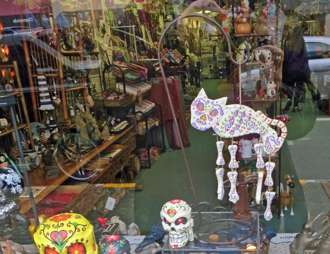
This shop was packed to the gills with tourist merchandise. Nice kitty. I think you are probably a Mexican immigrant, however, and I doubt you have papers. Watch out.

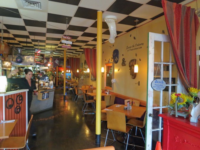
T. Pauls has an eclectic menu and a foot on the ceiling. I ate under the foot.

It seems only appropriate that I wrap up this post with an old piling and the rainbow across the Columbia River.

Wednesday’s Blog: You are going to meet the world-famous Traveling Bone.

On Friday we will return to Burning Man.


Ten Major Art Installations from Burning Man’s History

The Big Rig Jig was made up of two oil tanker trucks, taken apart and put back together.

I’ll be journeying to Burning Man alone this year. I obtained my ticket in February. Peggy joined the long queue for tickets on Wednesday, all to no avail. When she was finally moved to the ticket purchase site, the message was that all 30,000 tickets had been sold out. (The other 40,000 tickets are distributed in other ways.) Neither are other members of the Horse Bone Tribe going this year. So, it’s back to me, like it was in 2004, when I went by myself except for my friend Ken Lake. I’ll miss my friends, especially Peggy, but I am okay with going alone. I can easily spend eight days exploring and photographing the art.

Today I am featuring ten of the major art installations I have enjoyed the most over the years. This doesn’t include buildings like the temples, which will have their own posts. Since I missed four years when I was off wandering or had ended up on the wrong end of the Burning Man ticket circus, there are undoubtedly other pieces I would include.  Also, I already included a post on the 40 to 60-foot-tall sculptures of women that are definitely among my favorites.

Another view of the Big Rig Jig. I felt a bit nervous standing underneath it.

Often the major art installations are tied into Burning Man’s Theme for the year. In 2007 the theme was “The Green Man,” which had an environmental emphasis. The Big Rig Jig tied into the impact of oil.

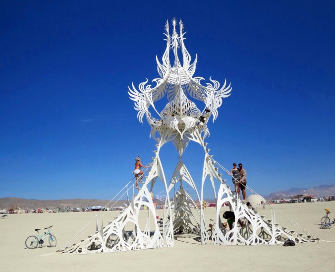
I’ve always considered this intricate white tower beautiful.

A close up of the top.

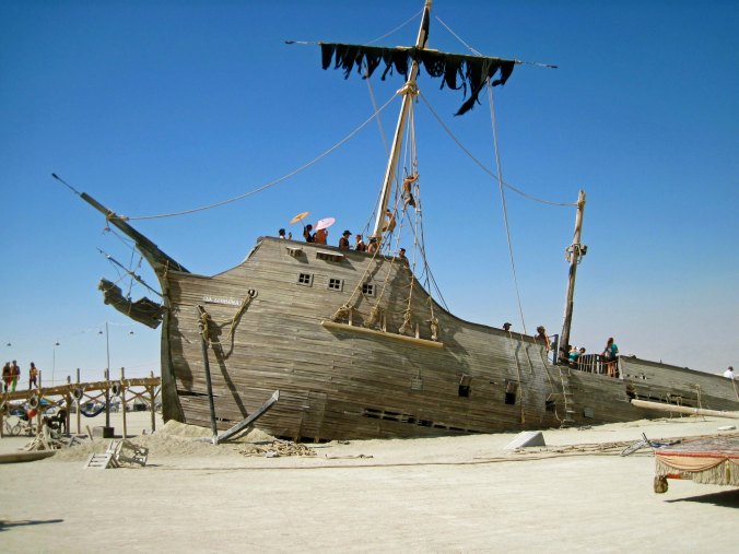
This massive sailing ship appeared to be sinking into the Playa.

A front view of the sailing ship. I thought that the detail was incredible. The ship was built in Reno.

As is often the case at Burning Man, what was inside the art piece was also fun and interesting. I like the stylish hat.

Dragons are common at Burning Man. This one, protecting its egg, is my favorite.

I don’t think I would be tempted to harm its baby.

Especially at night.

Buck Rogers would have been happy with this rocket ship. Peggy provides perspective.

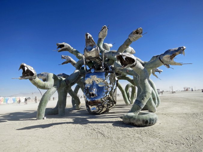
Medusa with her snaky hair was one of the most unusual sculptures at Burning Man.

Her wiggly hairdo from the back.

And at night.

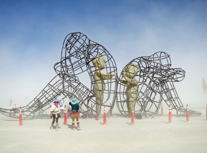
The inner children of these two estranged adults reach out to each other.

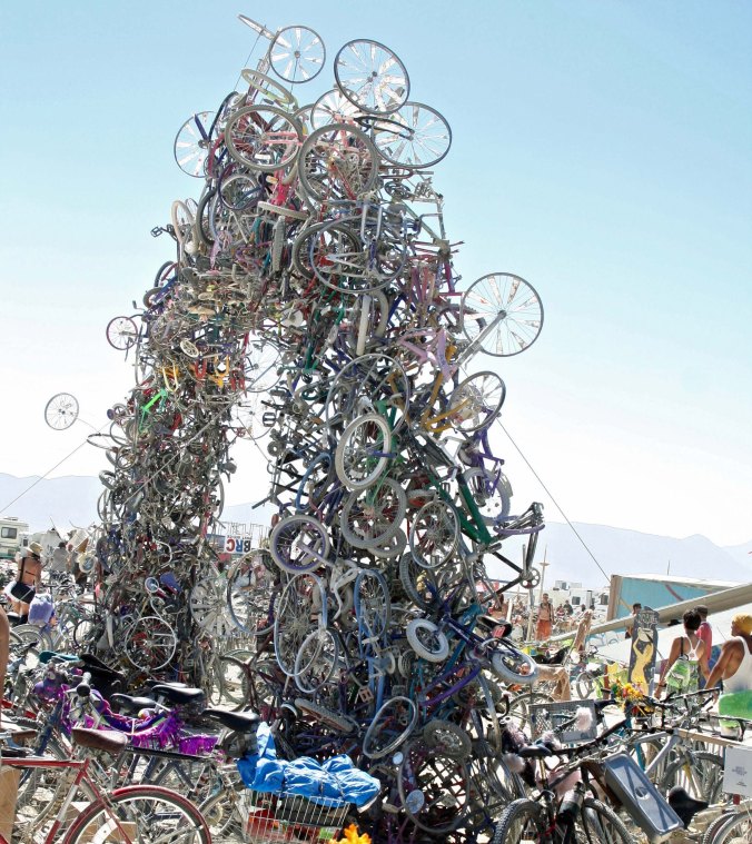
I have always liked this bike sculpture that was located in front of the Center Camp Cafe because of the significance of bikes for transportation at Burning Man.

The top of the heap, so to speak.

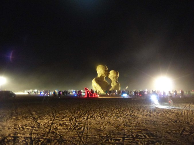
This giant couple embraced. The Man looks on from the left.

A close up.

This art was located in the head of one of the sculptures.

At night.  A red, high-heel mutant vehicle is in the foreground. (Photo by Don Green.)

A coyote raises its head to howl. (Photo by Tome Lovering.)

A tail view of the coyote.

I chose the coyote at night for my last photo today. The two bright lights on his head are from headlamps of people climbing the sculpture.

NEXT BLOGS:

Monday: Back to the Oregon coast with a visit to the town of Astoria on the mouth of the Columbia River.

Wednesday: I’ve often mentioned the Horse Bone Tribe and Camp at Burning Man. This is the story of the horse bone, or Bone, as he prefers to be known.

Friday: A continuation of my Burning Man art series with a final look at sculptures.

All’s Well that Ends (grin)… The Sierra Trek Series

Treks have always been about adventure. In addition to the physical and mental challenge, there is a more important element of experiencing nature on a very personal level, both the beauty and the wonder. Imagine, for example, coming on this Aspen that bears have climbed and used as a marking tree to establish their territory.

This is my last post on the first Sierra Trek series. Last week left us in the American River Canyon, waiting while the US Bureau of Reclamation blasted rocks off the hill sides in preparation for building the Auburn Dam. (The discovery of an earthquake fault zone under the dam would lead to its not being built.) Today I will take us on into Auburn, California where the 100 mile backpack trip ended.

As in the previous posts, I have selected photos from other Treks since I don’t have any from the first. There are several other areas in California I would lead Treks besides the Sierras. These photos are from the Trinity Alps. 

Another photo of a bear tree in the Trinity Alps of California. And yes, those are claw marks.

Early the next morning we had an important decision to make: whether to wade across the American River in water up to our belly buttons and then follow the river or climb up and along the steep canyon following alternative trails. I let the Trekkers vote and they voted to cross the river. One woman was deathly afraid, however, and broke down in hysterics. She was the same person who had, at first, refused to ride the Squaw Valley tram. We offered to carry all of her gear and even carry her, all to no avail. Finally, I decided we would all hike the canyon route. I was not about to split our group again. (It was the only time in my years of leading Treks that I ever allowed participants to vote while on the trail. Treks, I decided, were not a democracy.)

This shot of the Trinity Alps provides a great perspective on why the mountain range was given its name. (Photo by Peggy Mekemson.)

A view from farther away. These are rugged mountains that provide challenging, beautiful backpacking opportunities.

Our last night was fifty-fifty on the plus and minus scale. On the plus side, I knew that we had succeeded. Our Trekkers, except for the two or three who were now riding in the jeep, had made it— survived if you will. We had managed to solve each of the crises we had faced along the trail. I could say goodbye to the Trekkers the next day knowing that I had put everything I had into getting them through the nine days. On the minus side, Steve had taken a few of the ‘cool’ Trekkers to camp away from the main group. I hated seeing this, it was a really bad decision, but it was already a done deal by the time I came into camp as rear guard. I could have hiked up the canyon and insisted the group rejoin us, but I just didn’t have the energy to do it, physically or mentally.

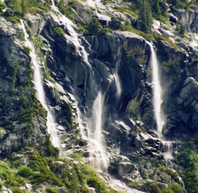
The Trinity Alps includes a number of impressive waterfalls.

Another…

And another.

Sunday, we hiked into Auburn Fairgrounds as a group with the Trekkers in high spirits, singing the Ham Cheddarton song. They had a bar-b-que chicken feast to look forward to and then they were going home— home to hot showers, clean clothes and loved ones. They had enough tales to fill the next week and possibly their lifetime. As we approached the fairgrounds, our Auburn volunteers and several Board members were there to cheer our arrival.

I didn’t know how things would end. At best, I hoped our Trekkers would recognize that even though we had made enough mistakes to fill a book (or at least a long chapter), we had tried as hard as we humanly could to rectify them. And I had learned, boy had I learned. Mainly, I felt relief. I was going back to focus on our mail fundraising campaigns with a vengeance.

What took me by surprise was the response as Trekkers started to leave.

“Thanks, Curt, for the most incredible experience in my life. Where are we going next year?”

“You and Steve were great, Curt. I would like to help with next year’s planning.”

And on and on. People were excited about their experience. It was one of the most difficult things that they had ever done, and they had succeeded. They left feeling better about themselves, and that feeling translated over to us and the Lung Association. Instead of the negative comments I expected, and in some ways deserved, we were getting rave reviews. While not everyone was eager for next year’s adventure, most were asking, even demanding that we repeat it.

I left that day not quite convinced but leaning toward doing another Trek. One thing was for sure, my experience had matched that of the Trekkers. The event had been one of the most difficult things I had done in my life from both a physical and mental perspective. I came out of the Trek with a new confidence in myself and a new understanding of what I was capable of accomplishing— and an increased love of the wilderness.

One final amusing note: that night as I took my first shower in nine days, I reached around behind me to wash my fanny and it wasn’t there. It had disappeared. Between the trail review work, my trauma with Jo, and the Trek, I had lost 20 pounds in two weeks.

This is Sapphire Lake, one of a series of high alpine lakes in the Trinity Alps.

A reflection shot along a trail climbing up into the mountains.

Peggy caught this luscious scene along a small creek where we refilled our water bottles. (Photo by Peggy Mekemson.)

While this rock caught my attention.

I am the fan of the small as well as the large when out in the woods. This is a shelf fungus.

A dandelion. Have you ever picked one of these and blew on it to watch the seeds go flying off?

And a butterfly on a Leopard Lillie.

EPILOGUE

The Sierra Trek turned out to be a success. We hadn’t raised a lot of money on our adventure, but special events rarely do the first time. What we had raised in abundance were new volunteers, the life blood of volunteer organizations. These were people who, because of their Trek experience, would develop a deep commitment to our organization.

I had several ideas on how to increase our returns and reduce our risks. In the future, we would set a pledge minimum and charge a registration fee. I would also set an age limit of 18 unless the minor was accompanied by a responsible adult. There would be no more 11-year-olds wandering in the woods by themselves. This wasn’t a negative comment on the Mouseketeers, they had been great, but the nature of the Trek made it much more of an adult kind of event. I would also limit group size to 20, and eventually 15, making the event much more manageable and reducing its environmental impact. And finally, our veterans would become the backbone of the program, providing advice and help in planning, organizing, and leading Treks.

From a personal perspective, my “far-out excuse for escaping to the woods” succeeded beyond my wildest hopes. I happily spent the next 25 years of my life leading wilderness adventures. When I worked it right, I could spend most of my summers out in the woods, especially when I supplemented official Lung events with personal outings. Treks also became an important annual event for many of the participants. Eighteen years after I had told Orvis he might be too old to Trek, he was still backpacking. He did his last trip with us when he was 88 years old. Altogether, he had raised the organization well over $100,000. That Trek also happened to be Peggy’s first long distance backpack experience. “How can I complain with Orvis out here?” she had told me with a grin, and hiked up another mountain.

I went on to create bike treks, winter treks, and canoe treks. I also pushed the Trek Program nationwide with the American Lung Association, persuading the organization that the events were valid fundraisers, and becoming the national consultant on Treks. For a while, Treks became one of the top special events for ALA. Charlie had been right that night we had laid our sleeping bags out under the stars at our Last Chance campground and he had declared: “What an experience. I can’t believe I am out here. Someday, people will be doing these Treks all over the nation!”

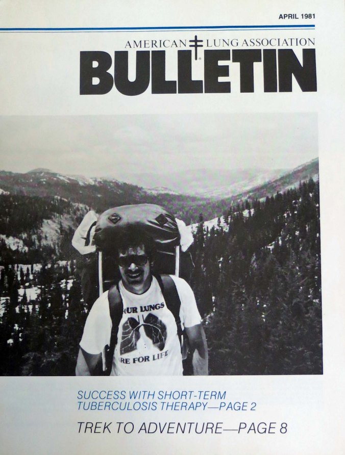
Having created the Sierra Trek in 1974, I had turned trekking into a national fund-raising  event for the American Lung Association by 1981. This is a photo of me on the cover of the American Lung Association’s national magazine.

A Shoplifter, the Sheriff, and Dynamite… The Sierra Trek Series

Tiger and Leopard Lilies are among the most beautiful flowers found in the Sierras and other California mountain ranges.


I’d actually had two good days on the Trek and we had put another 25 miles behind us. I was beginning to feel good, allowing myself an optimistic thought, or two. Foolish fellow. But we had passed the halfway mark. We were on our way home!

Today’s photos reflect some of the colorful  flowers that brighten our way as we hike through the Sierra Nevada Mountains.


Mule Ear flowers can fill dryer slopes.


On day six, we hiked into Foresthill, a small community 20 miles above Auburn. It was a long, hot, dusty, 15-mile hike in and out of steep river canyons with temperatures soaring over 100°F (37.7°C). Along the way we passed through Michigan Bluff, which had once been an important gold rush community. Leland Stanford got his start here, running a grocery store for miners. It was a much surer way of striking it rich than gold panning. For example, eggs cost $3 apiece. Expensive huh? Taking inflation into consideration, the price would shoot up to $80 today.

Stanford continued to prove his smarts. His future included becoming one of the Big Four in building the Transcontinental Railroad, serving as the Governor of California and a US Senator, and giving Stanford University its name.

Monkey Flowers are always a favorite of mine and are usually found near streams. You can enjoy their beauty while refilling your water bottle.

In Foresthill, we had arranged to stay in the little city park that came with a swimming pool. Given the excessive heat of the day, it was something to look forward to. I certainly did. But my plunge into the refreshing water was not to be.

First I had to make sure we could find our way out of town and back onto the trail the next morning. We were now into the territory that Steve and I hadn’t reviewed— me because I was off on Vancouver Island deciding on my future with Jo Ann, and Steve because who knows why. I hiked out of town for a mile or so down the road until I found the trail and then followed it for another half mile. It seemed well-marked, so I said a little prayer to the trail gods and headed back toward camp. It would be Steve’s job to lead the next day. He would have to deal with any surprises.

Shooting Stars are one of the early flowers, coming up soon after snow has melted. They are all over our property now.

Back in camp, the situation quickly made me wish I had just kept hiking. Charlie made a beeline for me. My always dependable backup, ex ice hockey player, ex-bomb de-fuser and IRS dodger looked like he was about to break down and cry.

“Someone stole my Grandfather’s watch,” he blurted out.

It was a valuable family heirloom, precious to him. I did what I could to console Charlie and headed over to the pool to ask around. None of my Trekkers had seen anything suspicious or had even seen Charlie’s watch. I had a hard time imagining any of them stealing it. He had done everything possible to help them down the trail. There were other folks at the pool, however. Fortunately, as I recall, Charlie found the watch at his campsite, where he had left it.

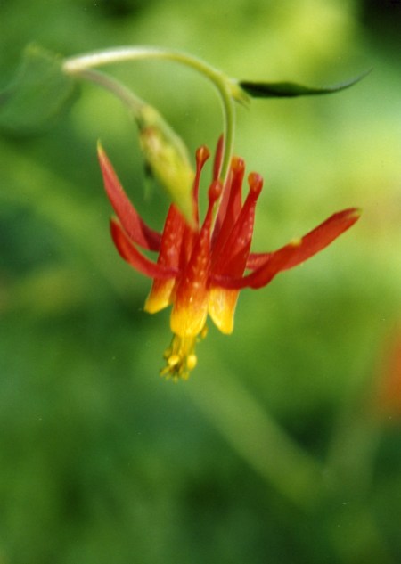
Columbine with its unique shape.

My next challenge was Lose Yourself Dick, the forty something school teacher who had wandered off on his own. He had tackled his ample supply of snake bite medicine and was feeling no pain. In fact, he was challenging all of the teenage boys to wrestle him or at least jump on his stomach. I was sorely tempted to join the latter activity. He had also discovered a flagpole he insisted on climbing. I reasoned with him as best I could, but even when he was sober persuading Dick not to do something was close to impossible. I had just completed my highly ineffective effort when a Sheriff’s car came cruising in to camp. I walked over. One of our Trekkers was sitting in the back seat.

The Mariposa Lily is another member of the lily family. Its bulb was eaten by Native Americans and early pioneers.

“Can I help you?” I asked politely.

“Yes,” the Deputy Sheriff had responded, “I need to talk with the person in charge.”

I had another of those gut-wrenching feelings. Just three more days, I thought. Just get me through three more days. I desperately wanted to tell the deputy that the man in charge had checked out and gone home or was still on the trail.

“You’ve found him,” I said, putting on a brave smile.

“We just caught this young woman shoplifting,” the deputy reported in his official lawman voice.

“Shit!” I thought. But I said, “Okay, what do I need to do about it?” My unhappiness and resignation must have shown.

“Nothing this time,” he replied. “Because she is raising money for the American Lung Association, we are going to let her off with a warning.”

And me as well, I read into his statement. “I am sorry, Curt,” she had apologized and I had just sighed.

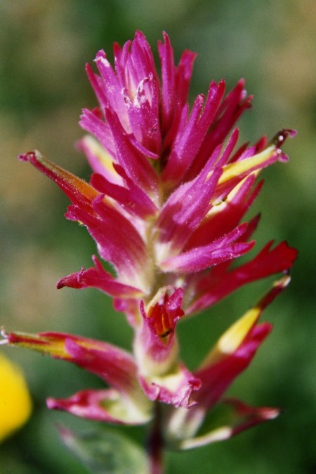
Indian Paintbrush is a colorful and common flower of the West.

Could anything else go wrong? Of course it could and likely would. I escaped by leaving camp when Steve came in and wandered off to a restaurant in town where I wasn’t likely to find any Trekkers. I drowned my sorrows in a large steak and a couple of well-earned beers. I seriously considered drinking more but I let my commitment to getting the Trekkers back to Sacramento in one piece over-rule my temporary insanity, which was demanding a six-pack.

Fleabane is the unusual name for this many petaled flower.

We rolled our Trekkers out of Foresthill early the next morning. I breathed a sigh of relief as I followed the last one past the city limits. Once again, Steve was leading and I was playing rear guard.

Fortunately, we had a short day. I had quickly discovered that being trail leader was a lot more fun than being rear guard. For one thing, you tended to get into camp a couple of hours earlier. For another, you weren’t constantly being bombarded by the question, “How much farther?” I had begun to respond with a stock answer, “Oh, it’s about twenty miles,” and had found that Trekkers stopped asking. If they persisted, my next response was, “It’s all up hill.”

Steve told me he had been moving some of the slowest Trekkers down the trail by telling them rattlesnake and bear stories and then walking on ahead. He said people made a real effort to keep up. Years later I would use the same technique in Alaska  with grizzlies. I suspect that neither of us would have qualified for the Boy Scout Leader Seal of Approval. Or even the Sierra Club’s.

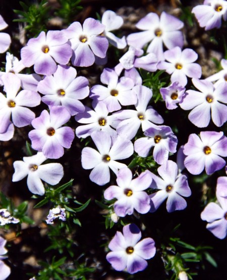
Phlox hug the ground and add a real splash of color.

Around three, I came on Steve and our Trekkers milling about a closed gate. A vehicle was parked behind the gate and two official looking people were leaning against the vehicle. I was about to learn that we were paying the price for not reviewing the final section of the trail.

“What’s up Steve?” I asked, wondering if we had managed to do something else to bring officialdom down on our heads.

“No problem,” Steve said, “they are just blasting with dynamite in the canyon.”

His words were punctuated by a rumbling sound. The guards were blocking the road so big rocks wouldn’t come rolling down on people using the canyon trails. It sounded like a good idea. In 1974, plans were underway for building the Auburn Dam and flooding another section of the beautiful American River. Land speculators were greedily selling property along the future edge of the lake. Later, building or not building the dam became one of the most contentious environmental issues in Northern California. The dam still isn’t built, and will likely never be.

“Um, how long do they plan on continuing to blast?” I asked. I pictured our Trek coming to an abrupt end. It wasn’t a totally unpleasant thought.

“We are in luck,” Steve reported. “They are just closing down their operations and won’t resume until Monday.”

Since it was Friday afternoon and we would be out of the canyon by Sunday, I had to agree. It was refreshing to see luck lean our way, although it made me nervous. That night we celebrated the winding down of our adventure by feeding our Trekkers steak and fresh salad. The feast went off without a hitch except it was amusing to see the Trekkers eat steaks out of bowls with spoons. (Forks, knives and plates normally get left behind when backpacking.) Fingers became the primary eating utensil. It wasn’t pretty, but no one seemed to mind. Civilization had definitely taken several steps backward. Everyone went to bed happy, including me.

The Sierra Thistle can be a little prickly.

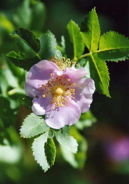
I’ll close today with a wild rose.

NEXT BLOGS:

Friday: You are in for a treat. Lots and lots of fun and unique Burning Man sculptures.

Monday: Still thinking about it.

Wednesday: The final Sierra Trek blog.