Note: As you read this, Peggy and I are in Amsterdam at the beginning of a Rhine River cruise between Amsterdam and Basel. I’ve been scheduling posts ahead of time so I can maintain a more regular presence on WordPress than I have been able to for the past several months. My goal for now is once a week on Fridays. At this rate, I already have enough material on the Southwest national parks we visited in April and May to keep going for three months. LOL. I may never catch up.
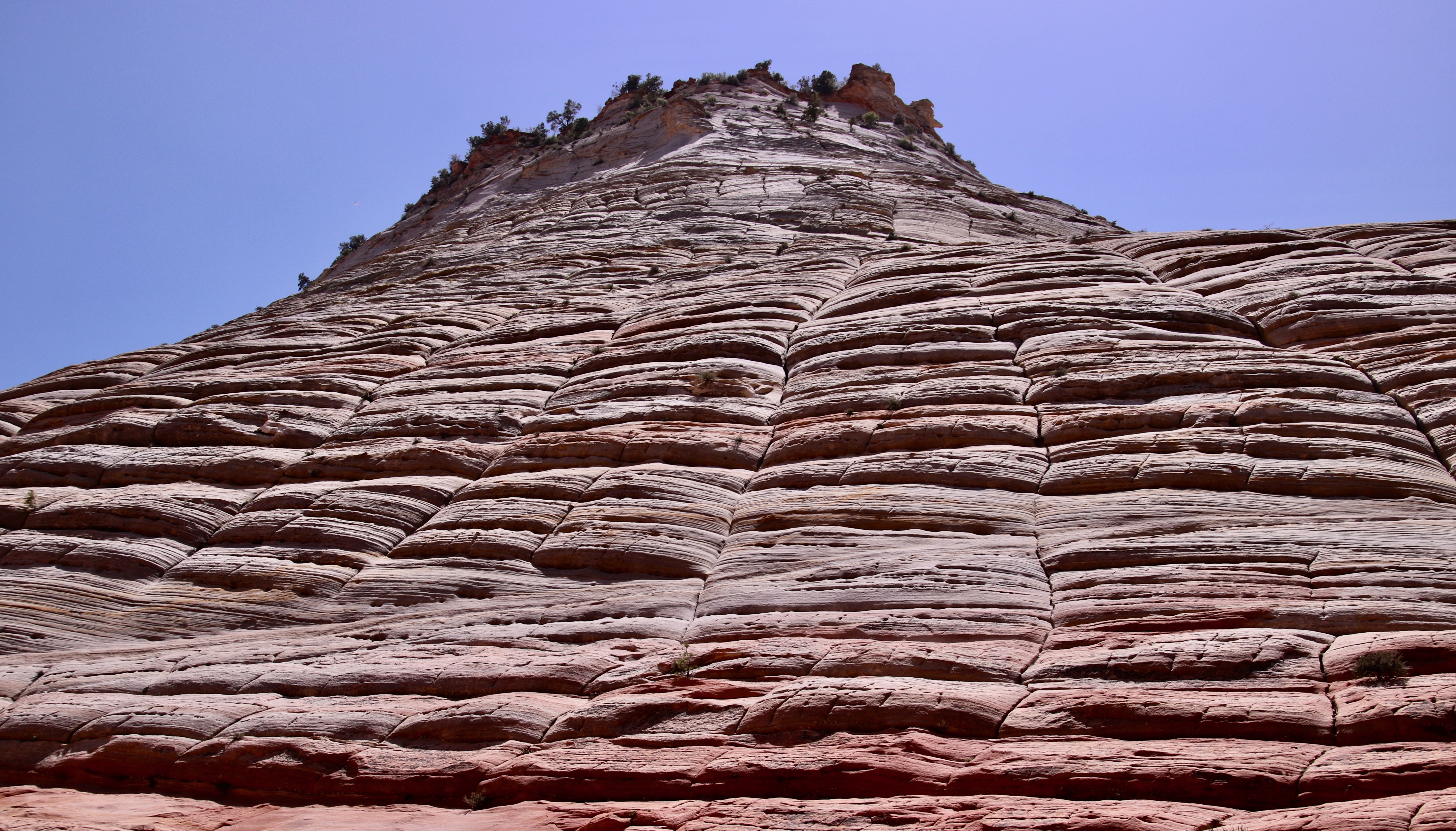
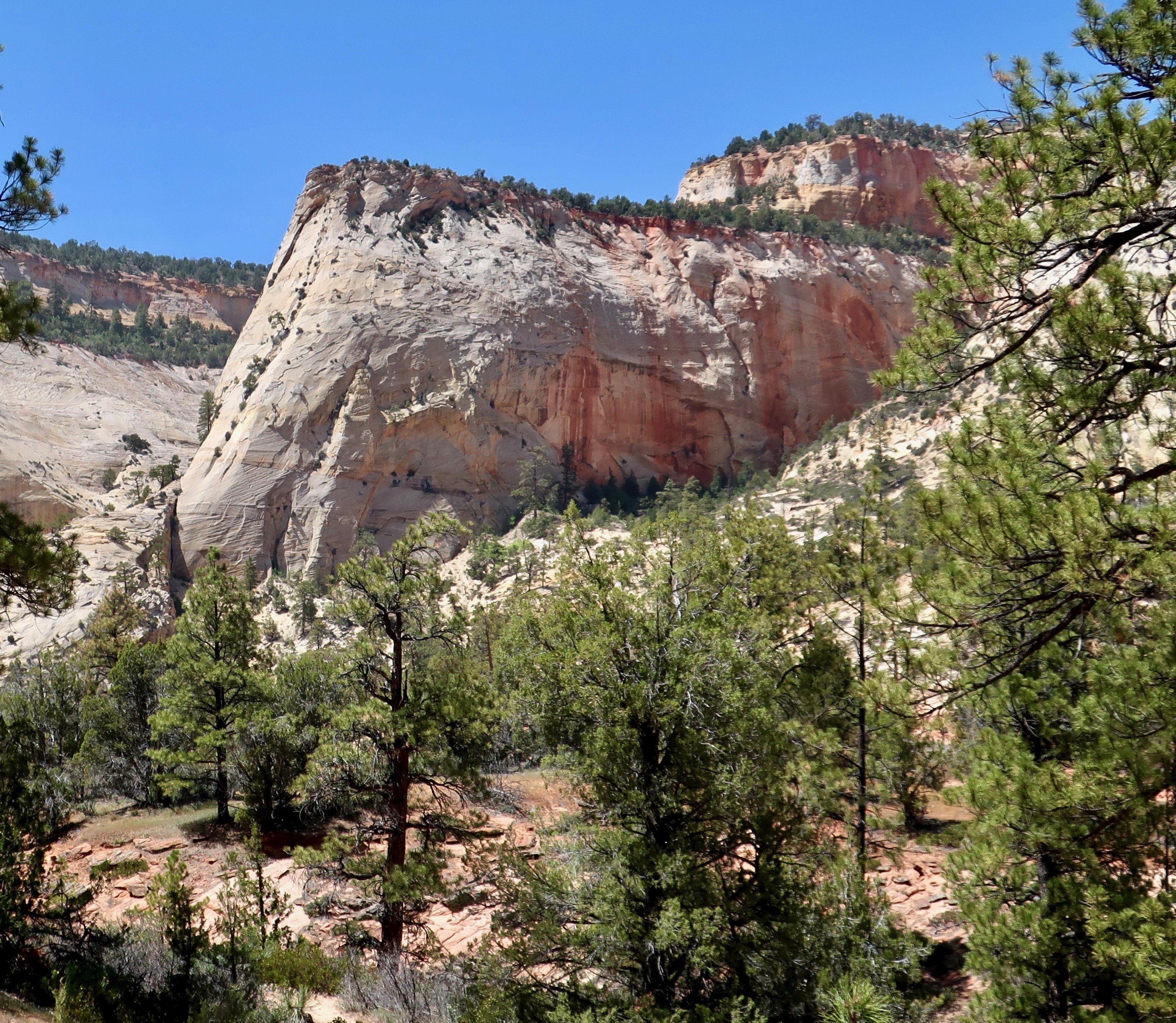
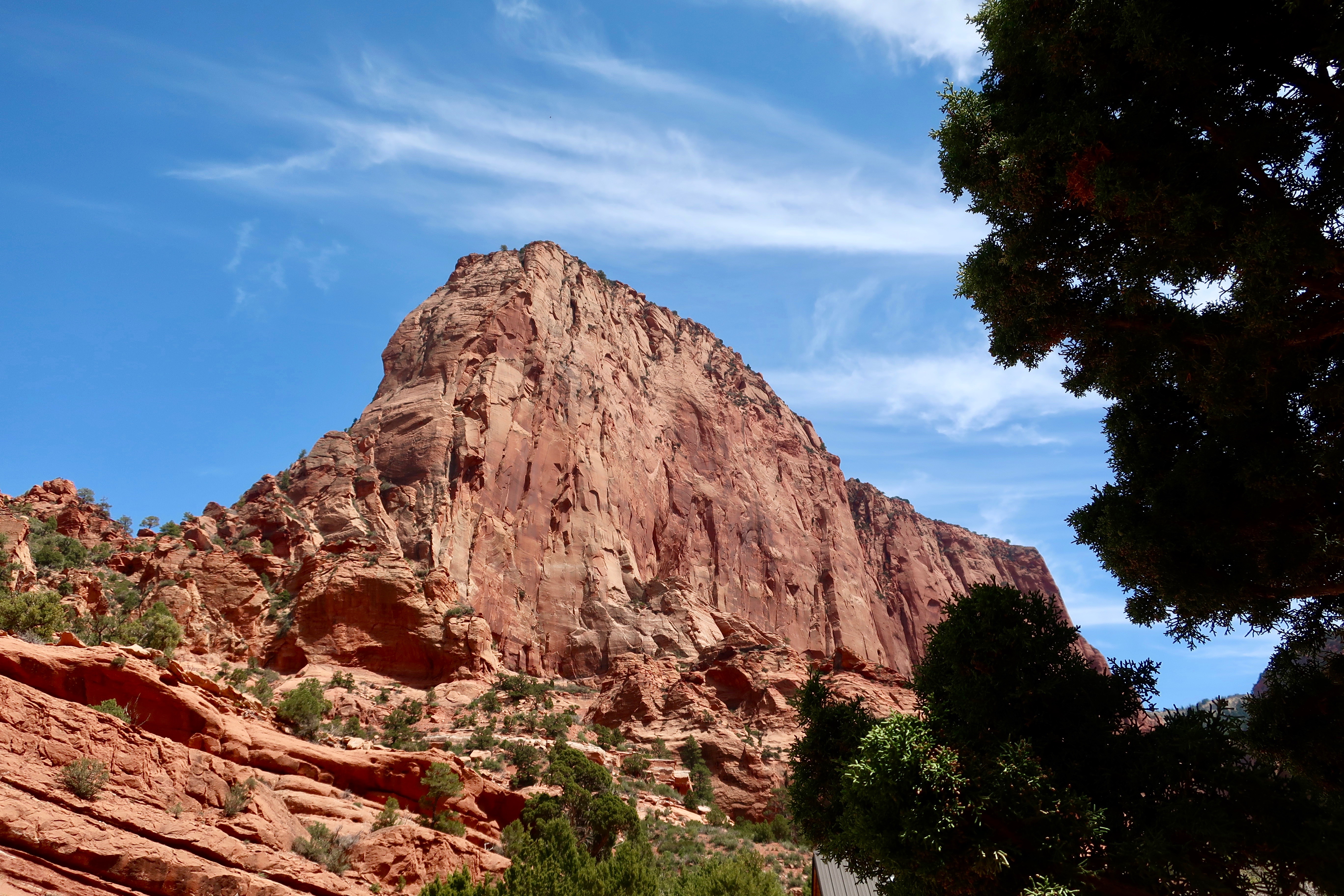
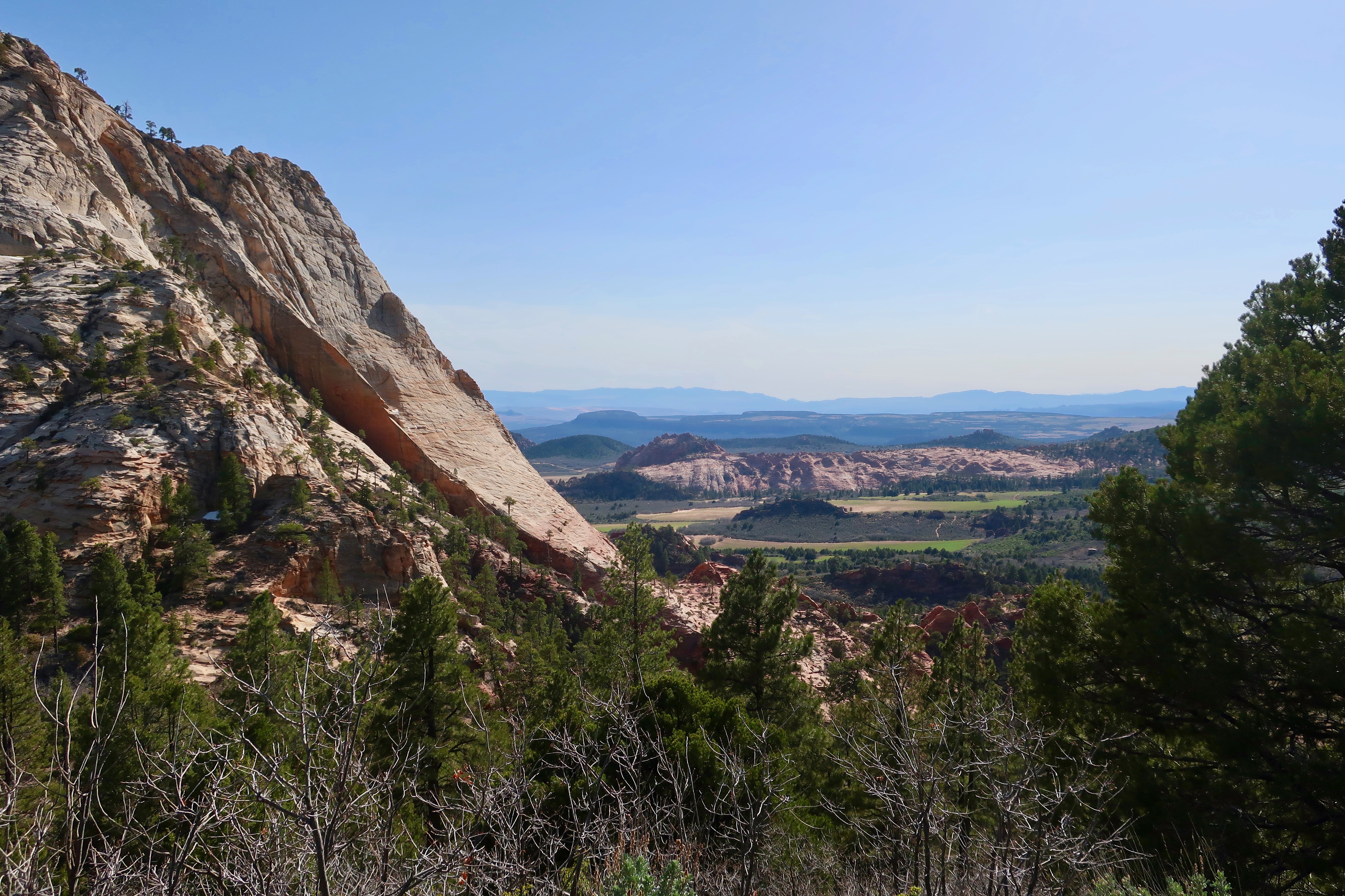
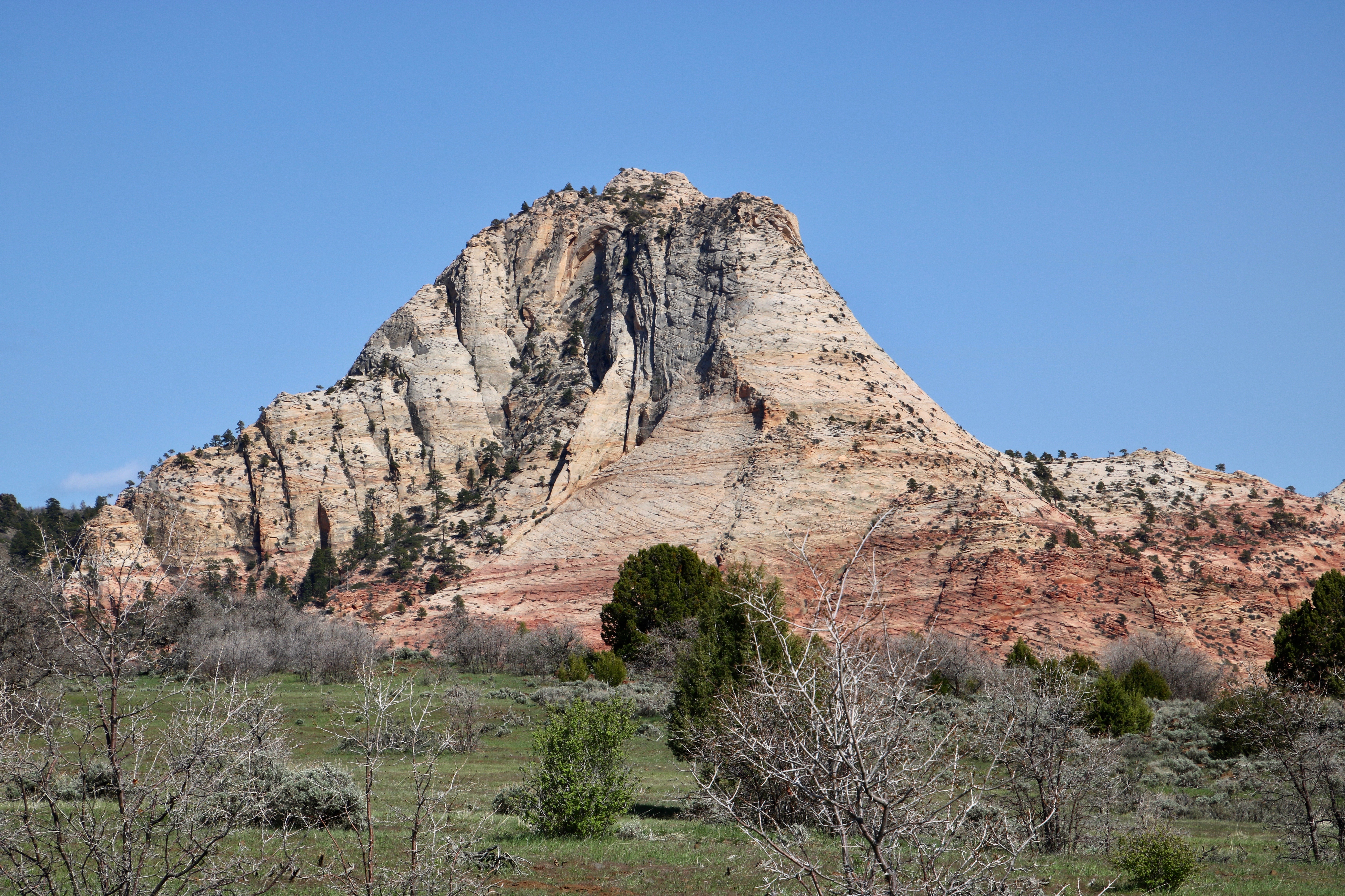
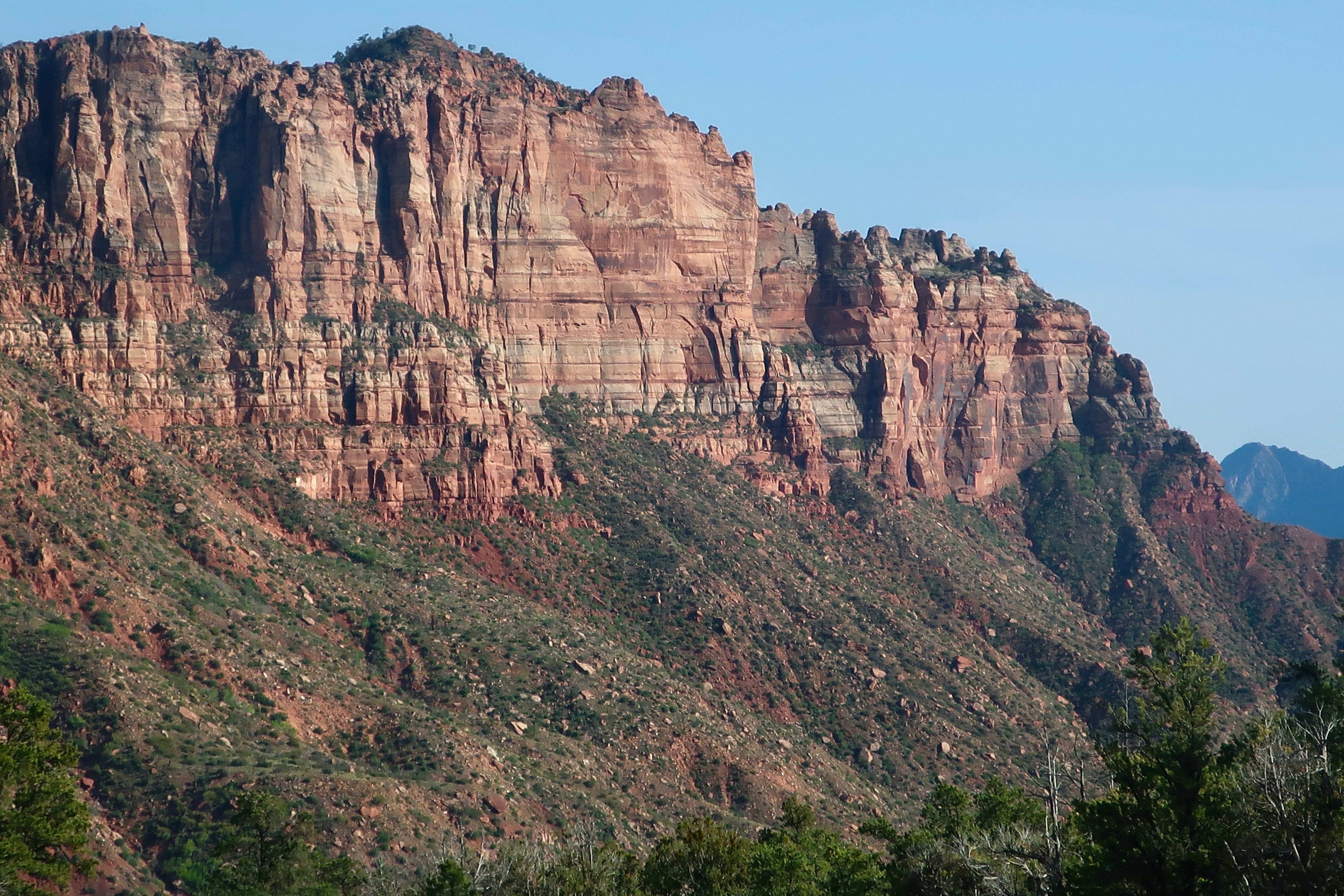
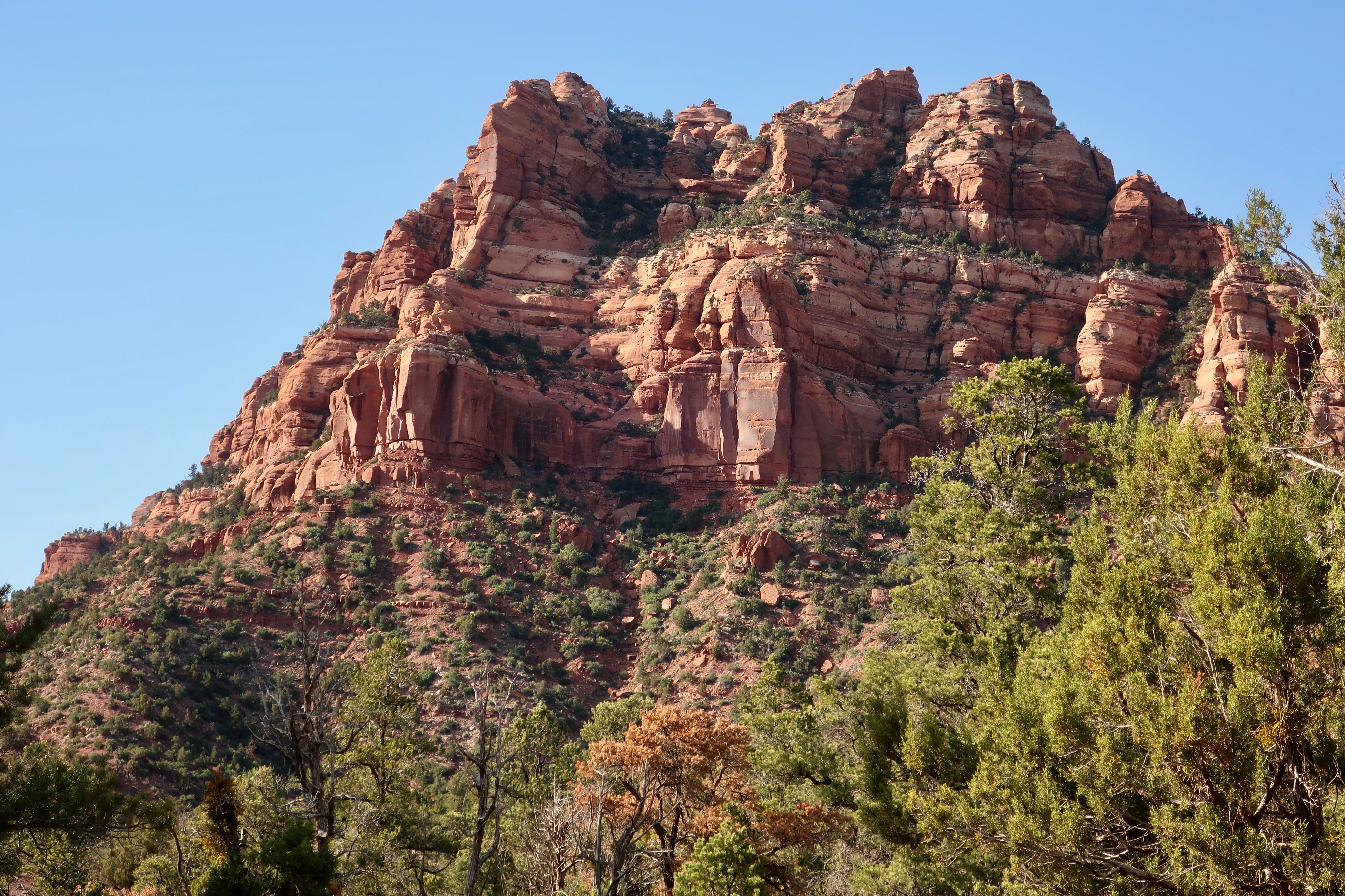
Checkerboard Mesa is the dominant geological feature of the eastern section of Zion National Park. (Photo by Peggy Mekemson.)
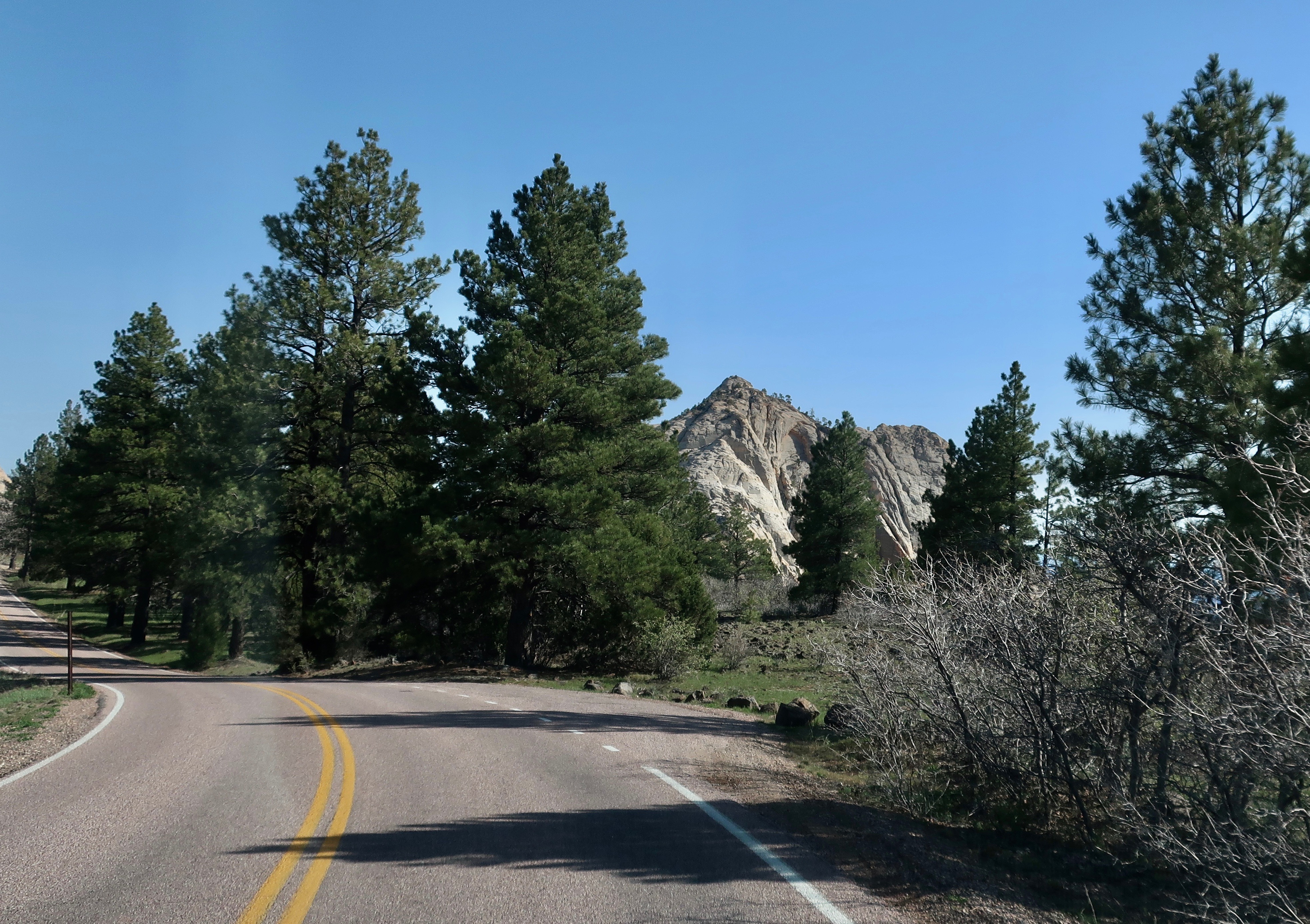
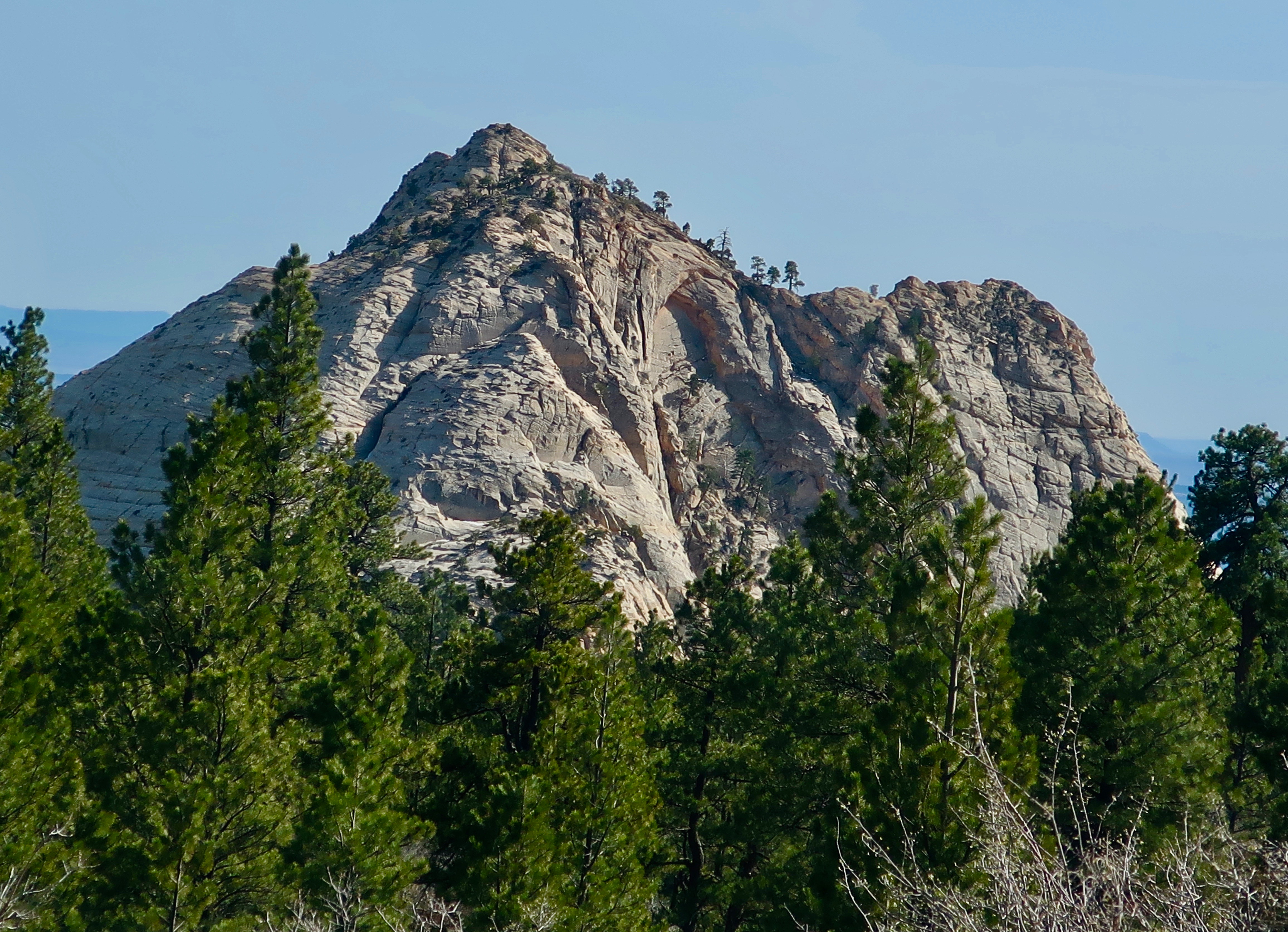
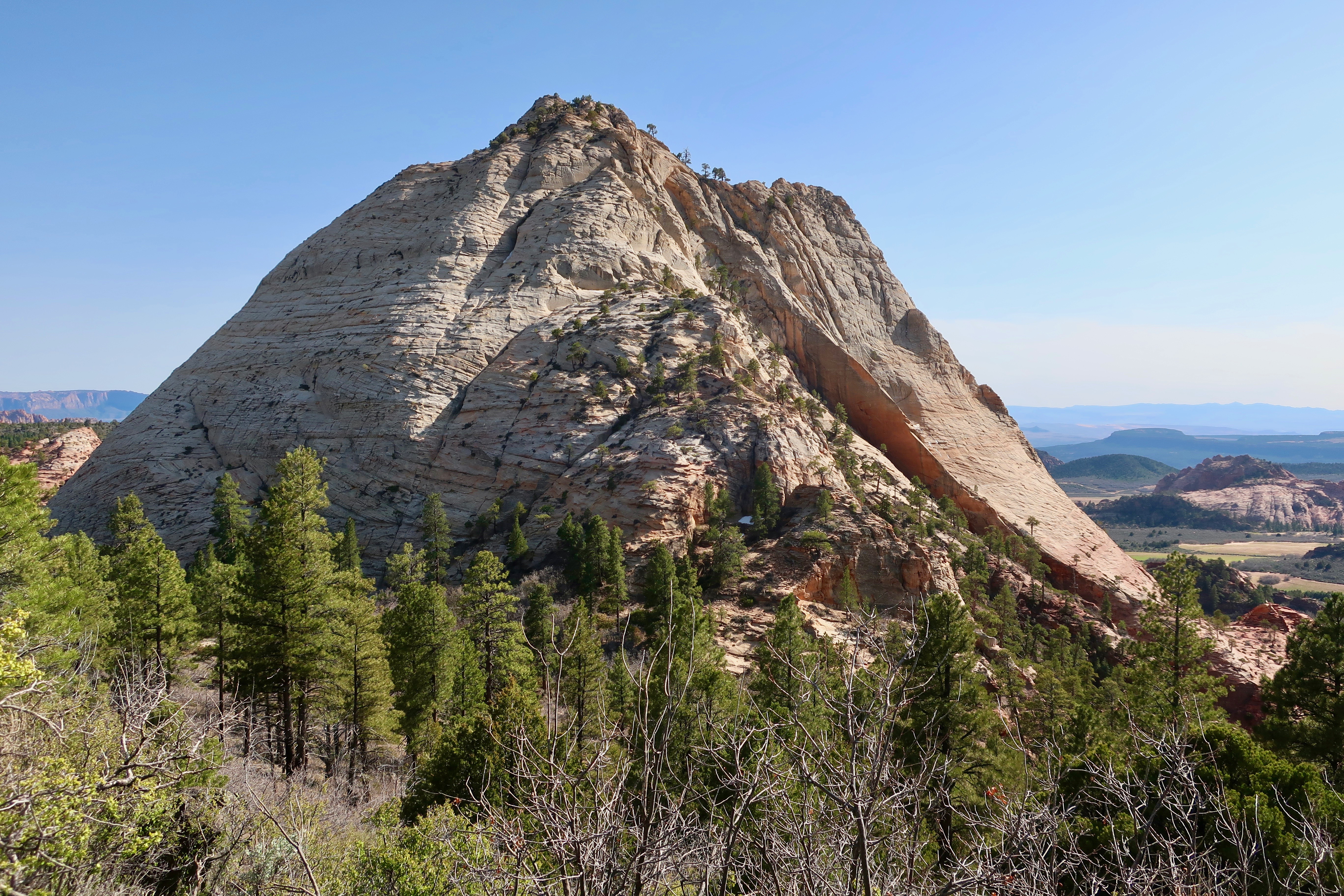
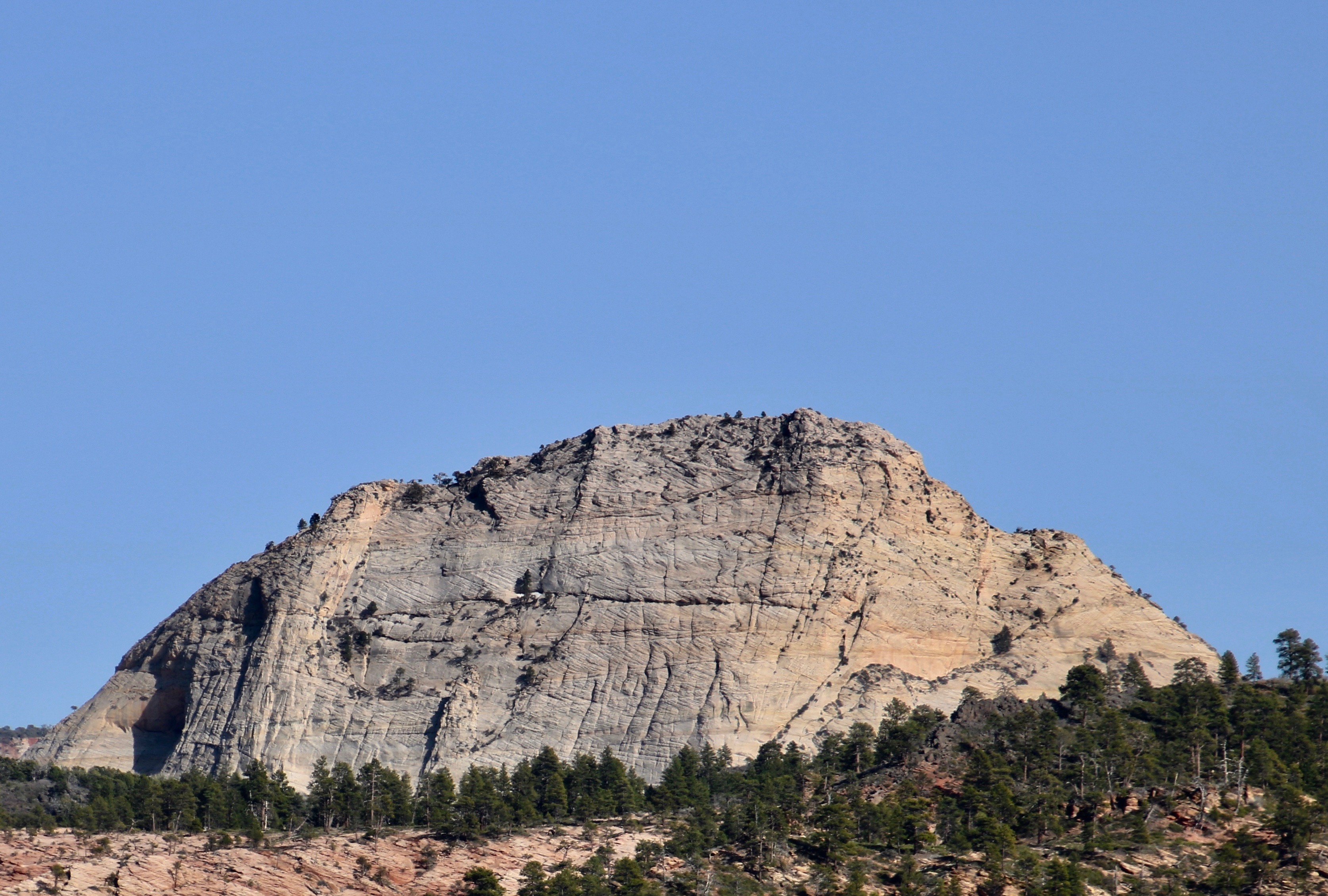
Rudyard Kipling said it:” East is East and West Is West, and never the twain shall meet.” That’s not true of Zion National Park, of course, but the eastern section of the Park will provide you with a significantly different experience than you have down in the Canyon or the western sections of Zion. Checkerboard Mesa shown above is the primary example. We can thank ancient sand dunes laid down in an early-Jurassic-era, Sahara-size desert that covered significant portions of what is now Nevada, Arizona, Utah, and Colorado 190 million years ago. The horizontal lines are caused by what is known as cross-bedding of the dunes. The vertical lines are caused by breaks in the cross bedding caused by freezing and thawing. It was thought that the results resembled a checker board, thus the name. Peggy and I found the mesa a fun subject for photography.
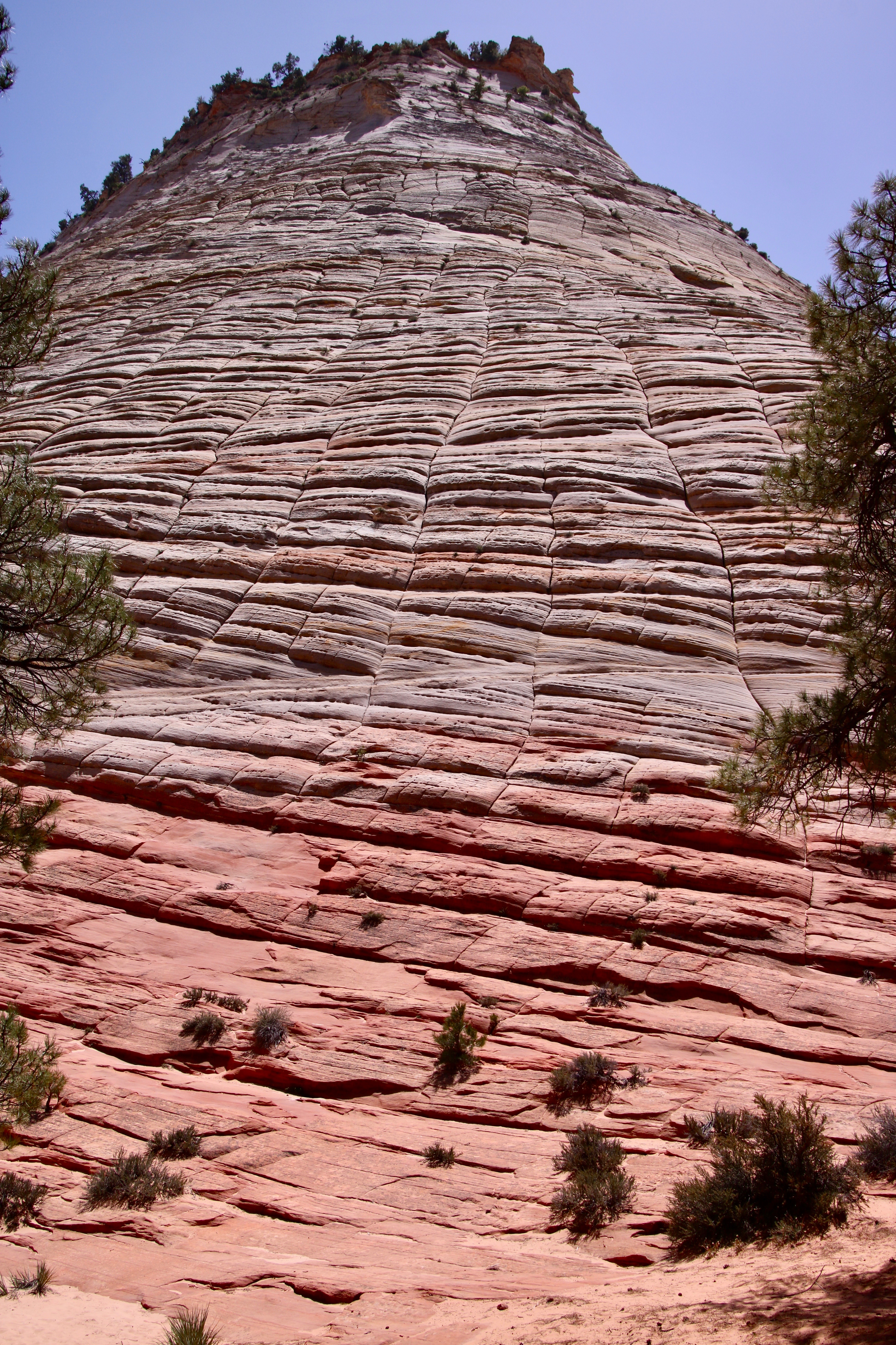
I moved back to provide a broader perspective on the Mesa using pine trees for framing.Peggy added a photo of the massive chunk of Navajo Sandstone reaching toward the sky. It’s quite a scroll down. Grin. (Photo by Peggy Mekemson.)If you are driving up from Zion Canyon, this will be your first view of Checkerboard Mesa.We were both interested in the cross-bedding. Peggy took this interesting side view.(Photo by Peggy Mekemson.)This was the view looking a bit farther north of Peggy’s photo.This was the view looking south.
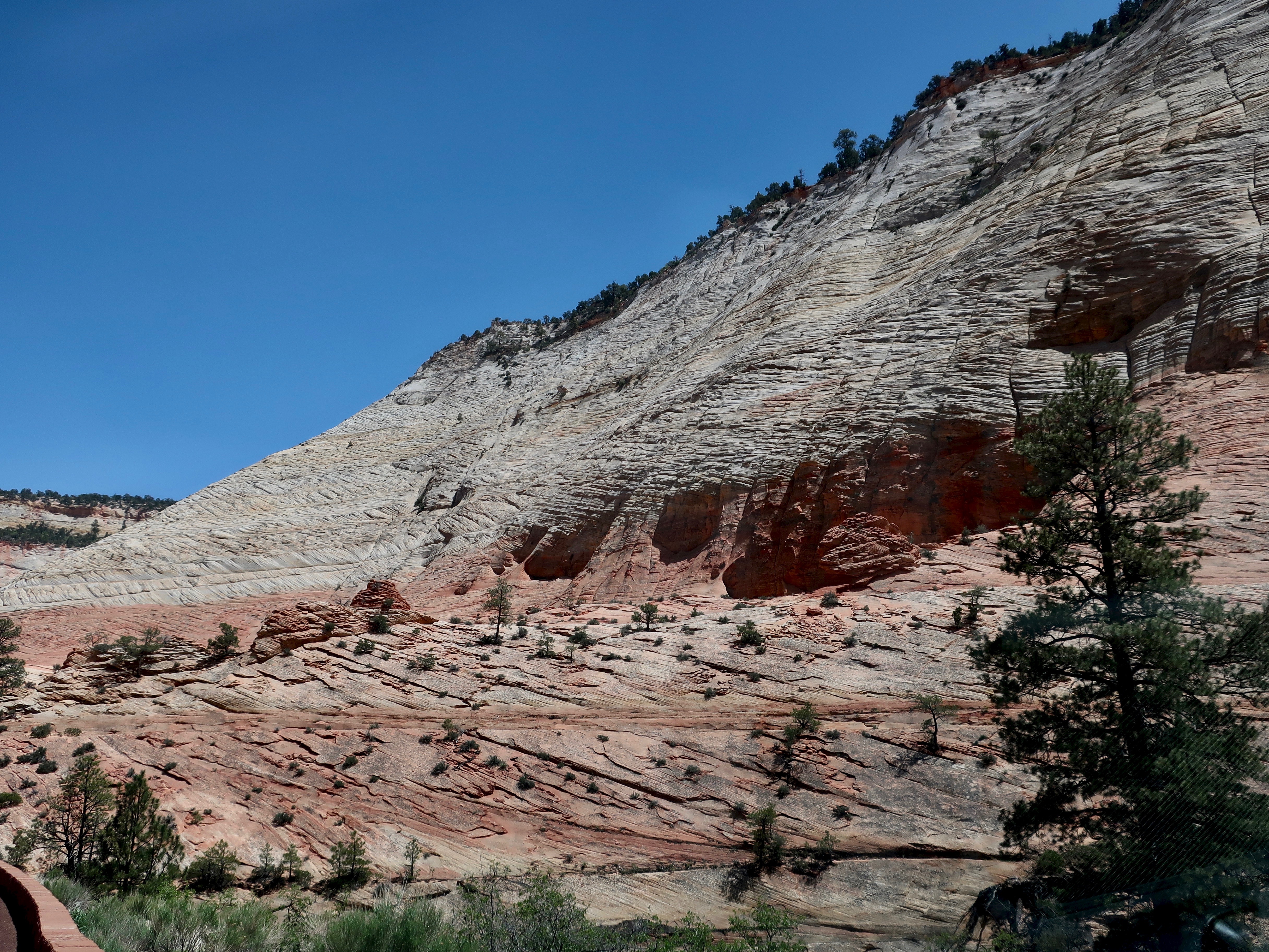
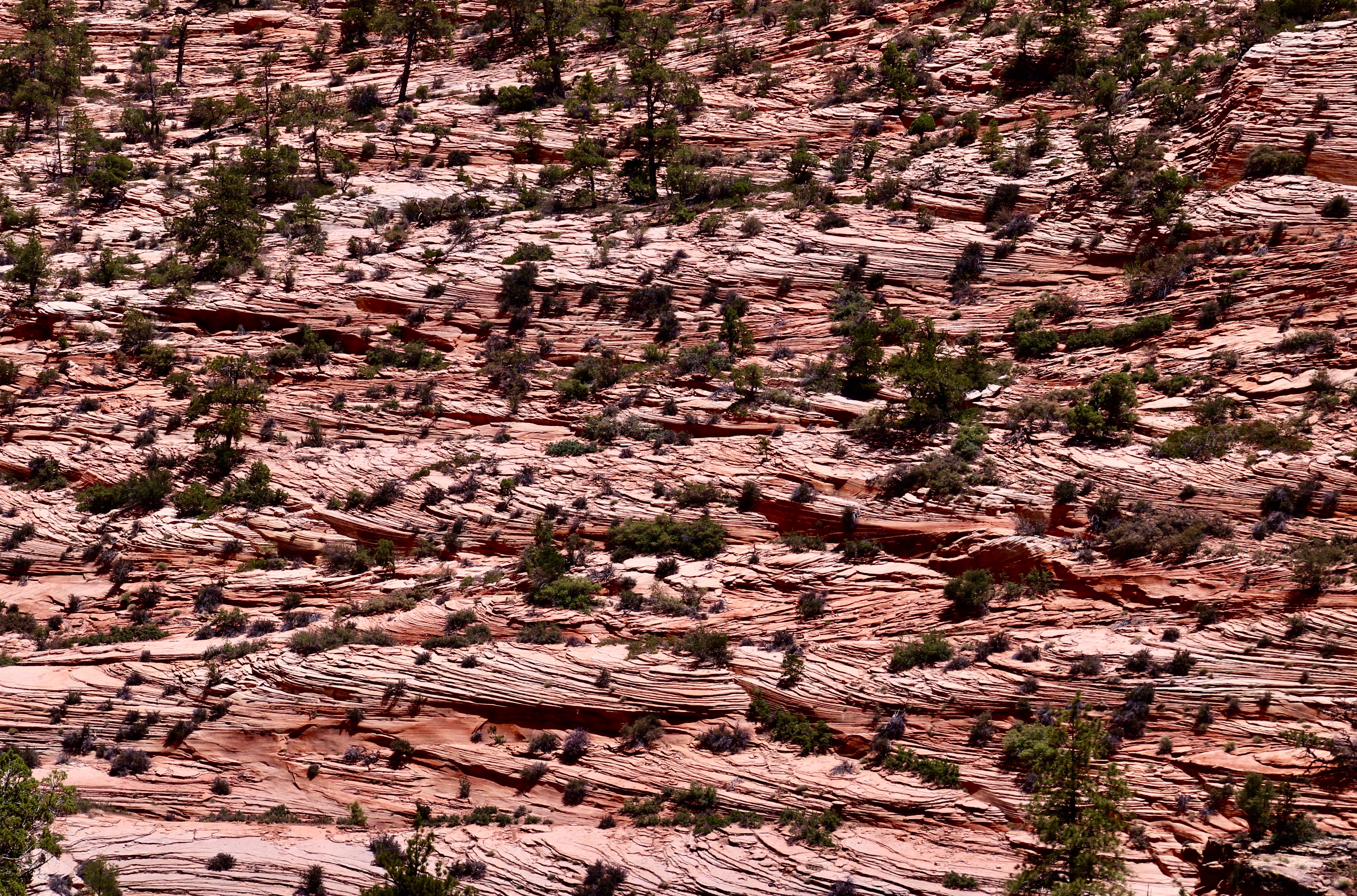
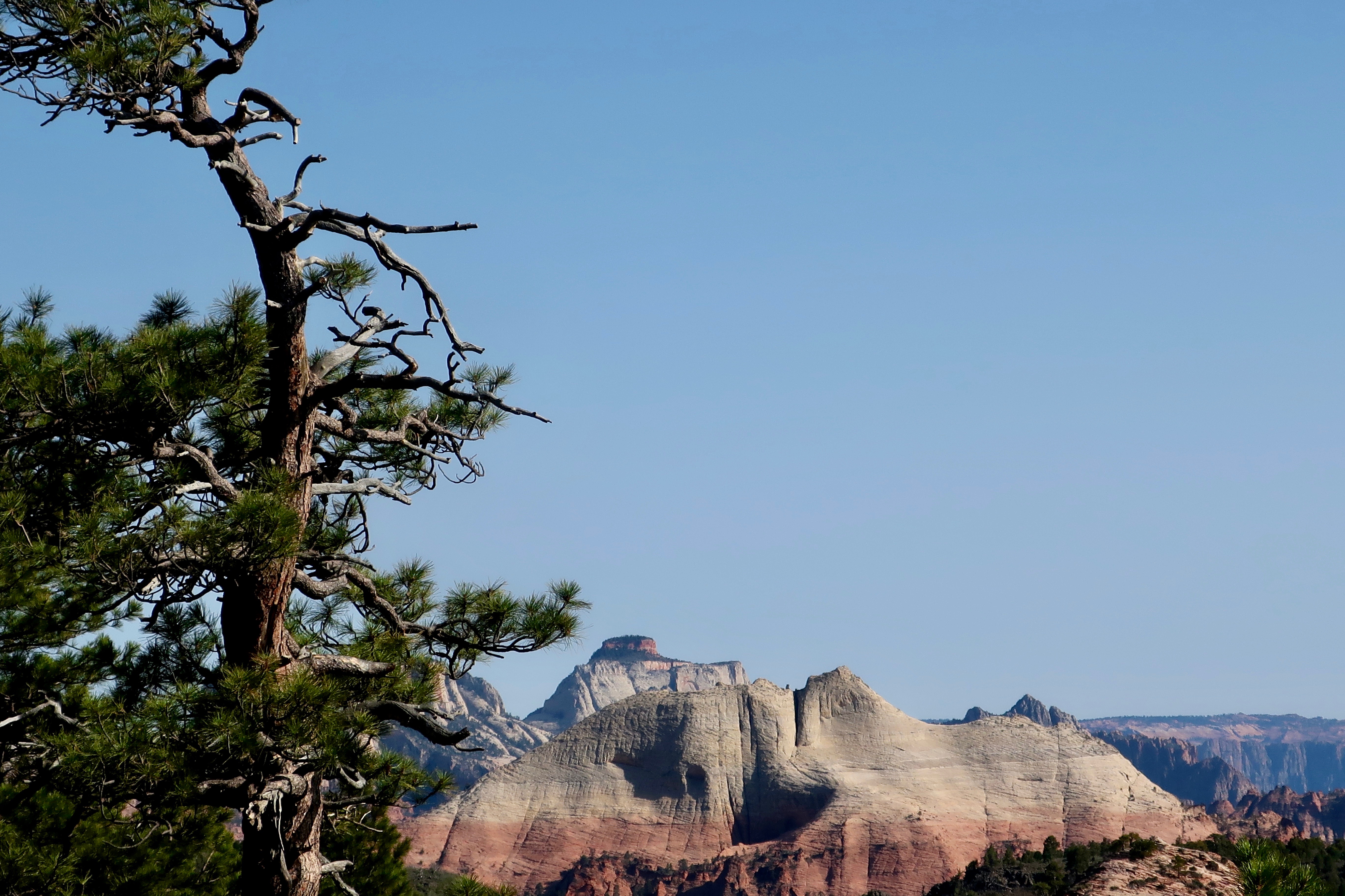
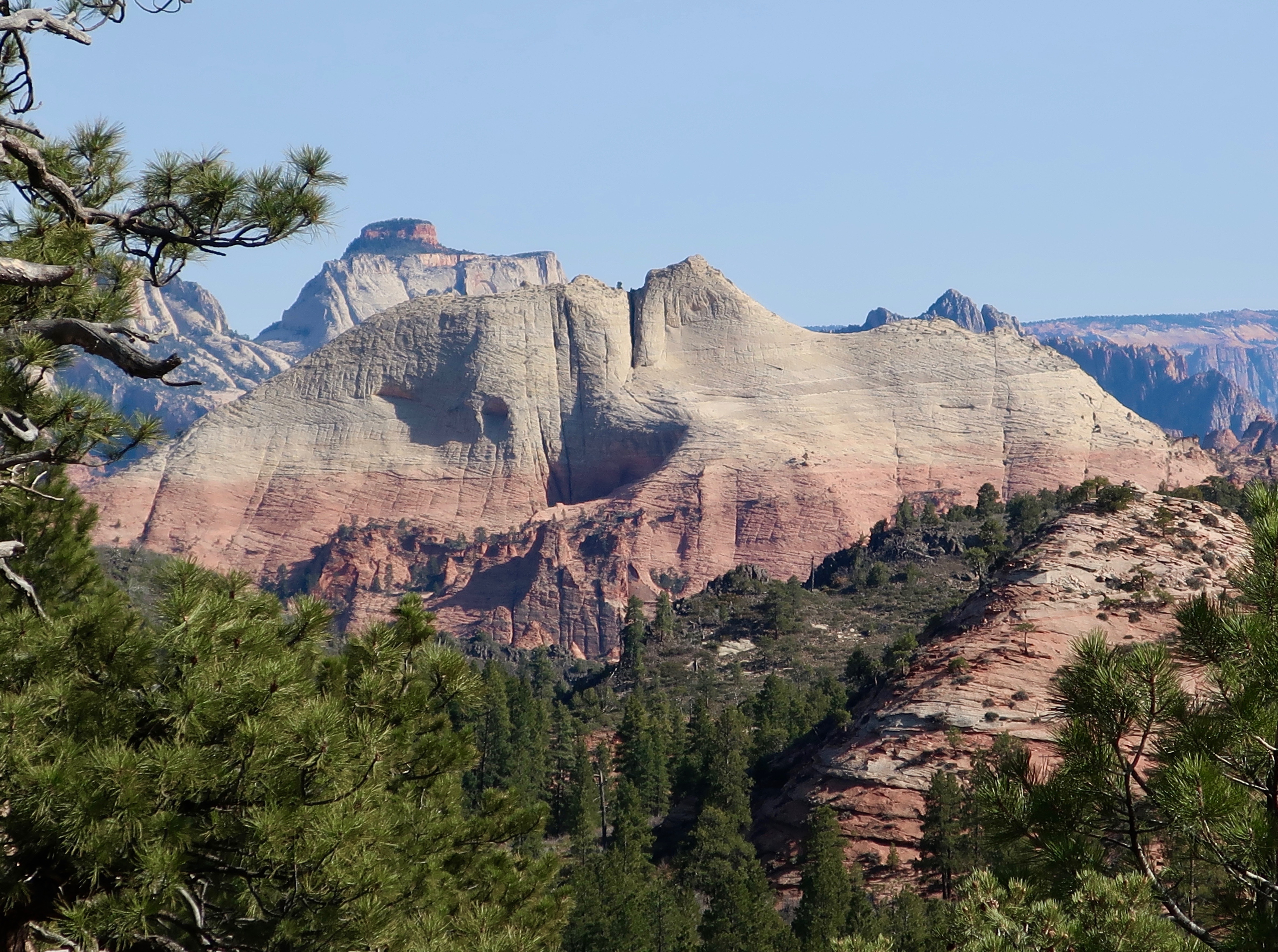
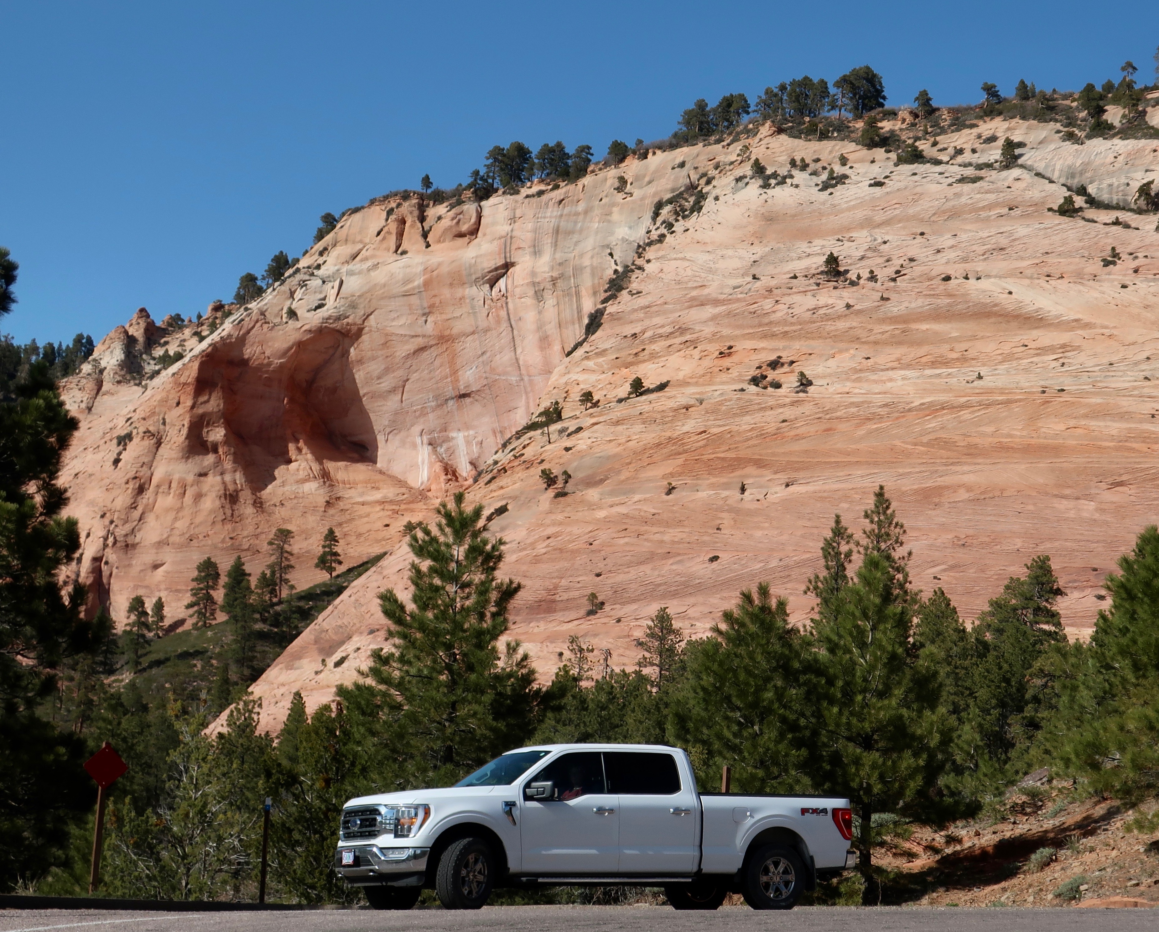
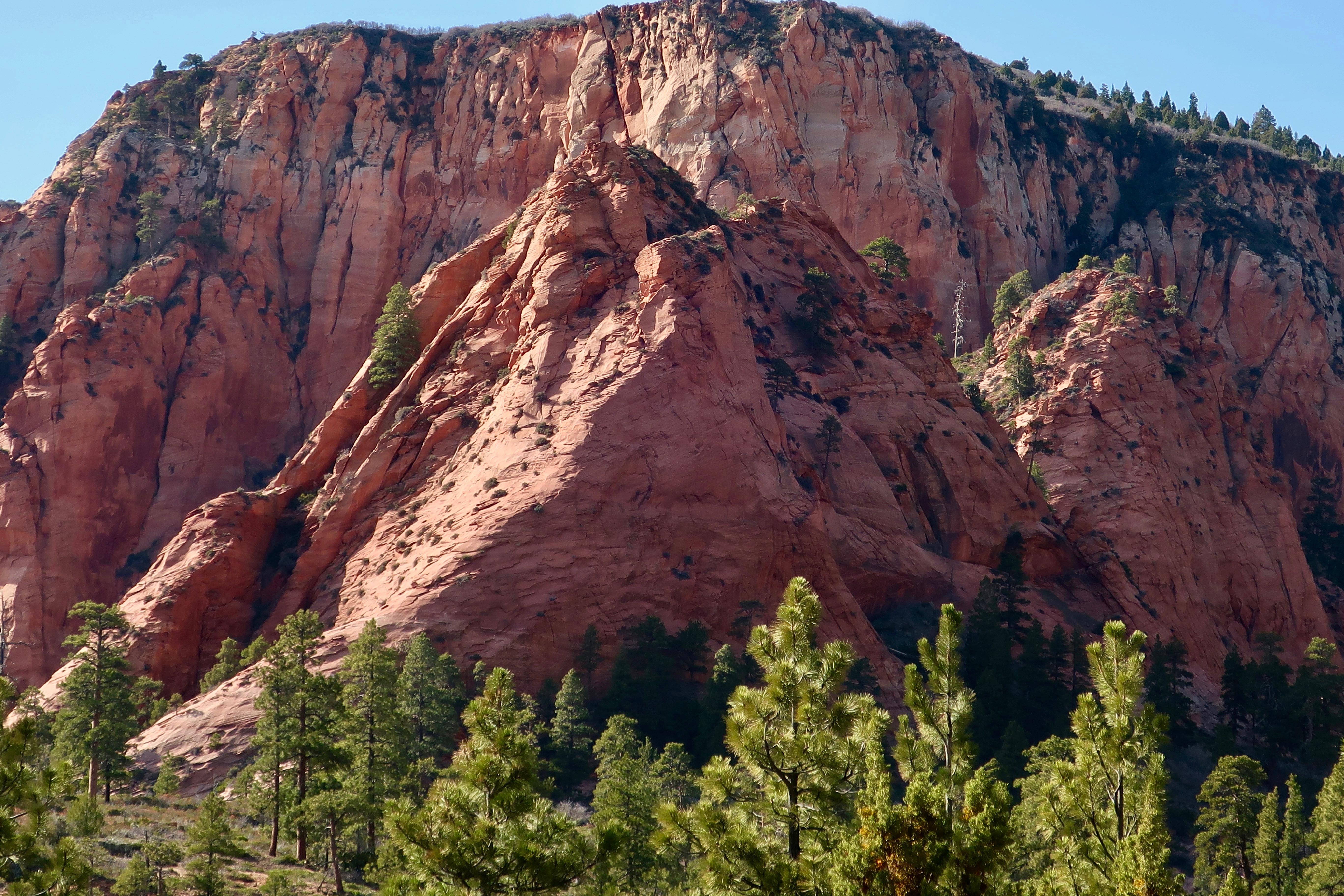
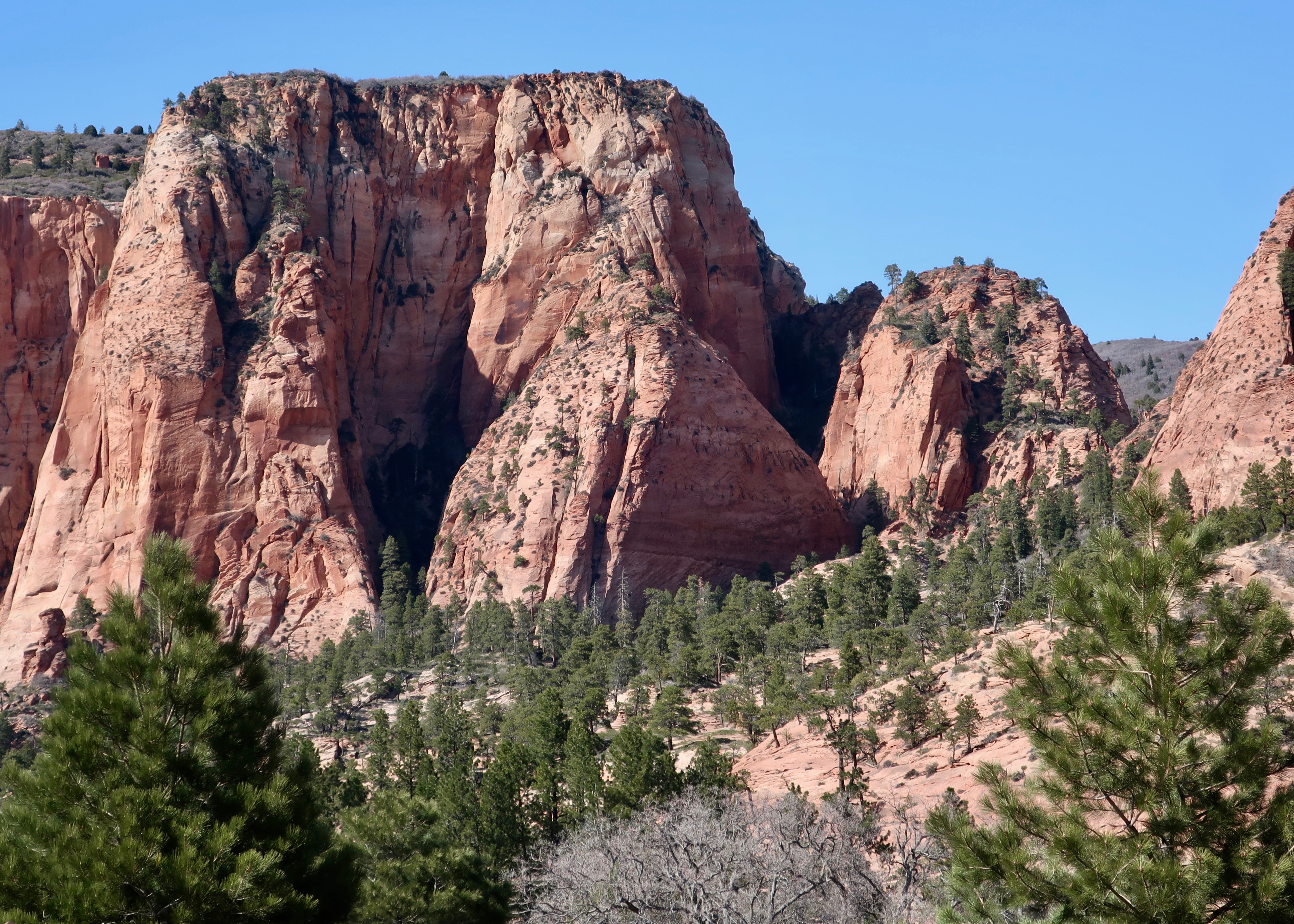
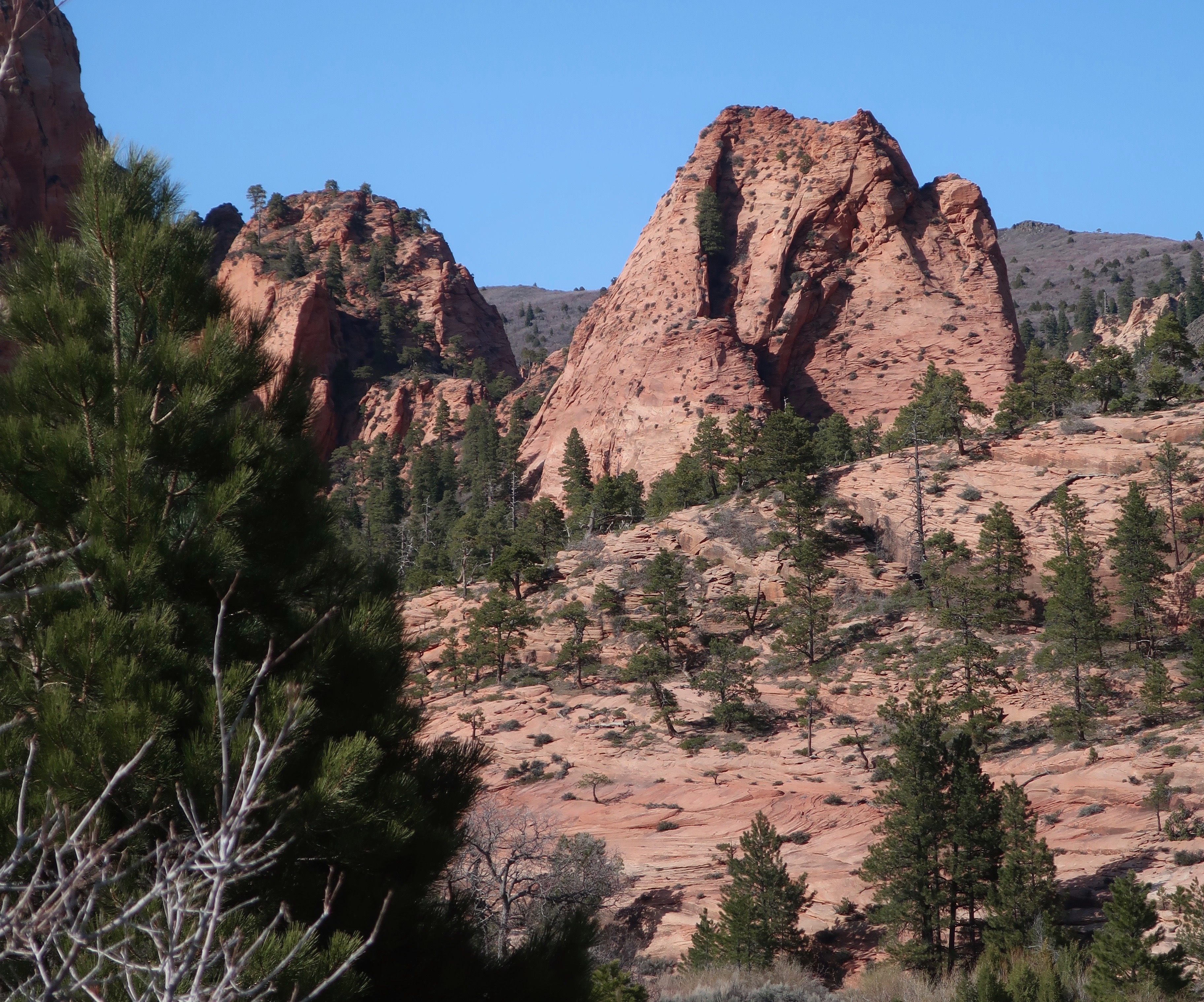
If you have been in Zion and either entered or left by the east entrance/exit, you know there is much more to East Zion National Park than Checkerboard Mesa. One thing that fascinated Peggy was the alcoves that may eventually lead to towering arches such as those found in Arches National Park.
Looking toward the top of a Navajo sandstone mountain, you can see how the ridge coming down the front is eroding from both sides. This may eventually lead to an arch. (Photo by Peggy Mekemson.)This provides a straight on view of the alcove on the right of the ridge. Note how deep the alcove is. (Photo by Peggy Mekemson.)Another alcove. Alcoves and arches are created when a harder capstone is on top of a softer stone that erodes more rapidly. (Photo by Peggy Mekemson.)And another alcove photographed by Peggy. Had there been more, I am sure that she would have photographed them as well! (Photograph by Peggy Mekemson.)
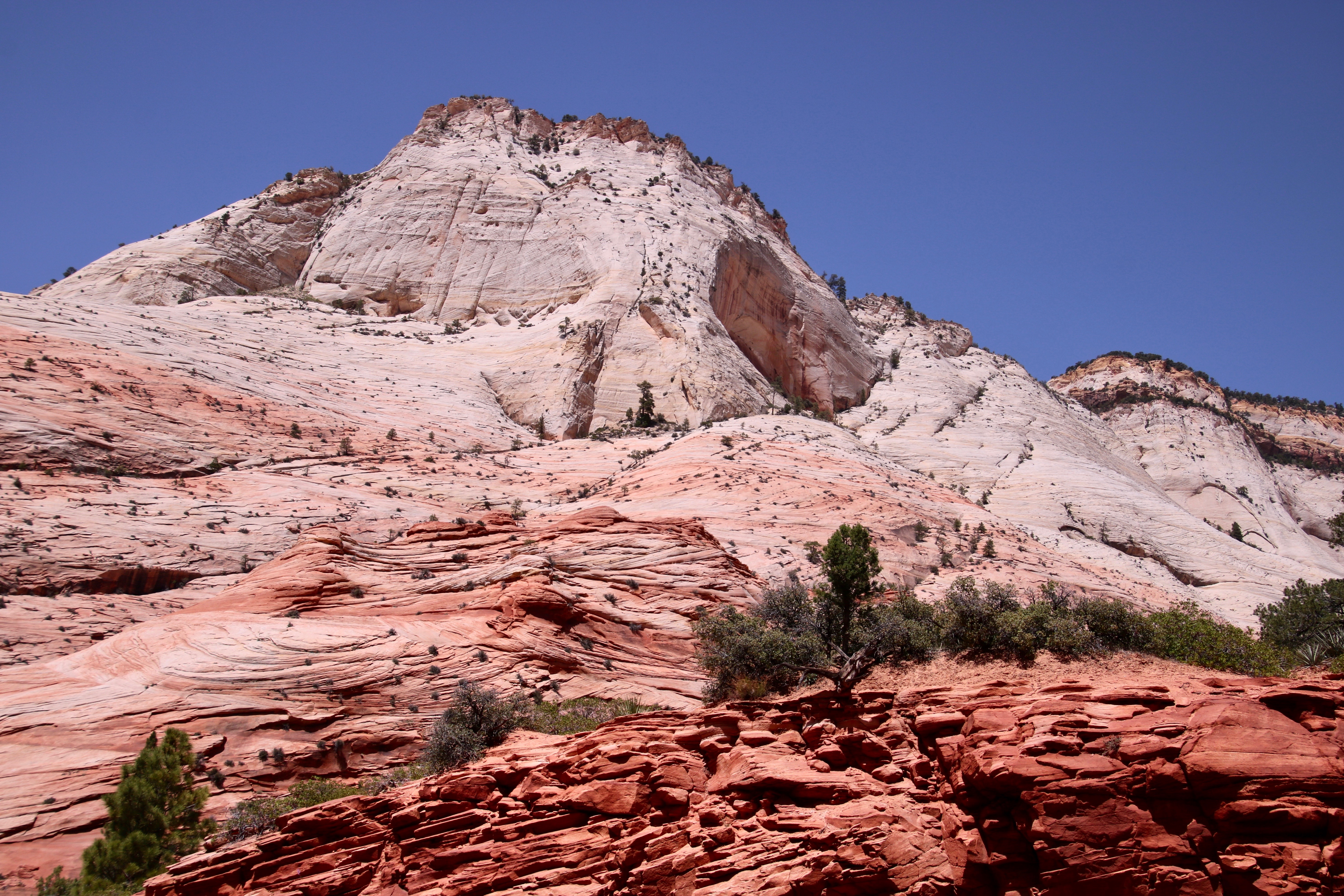
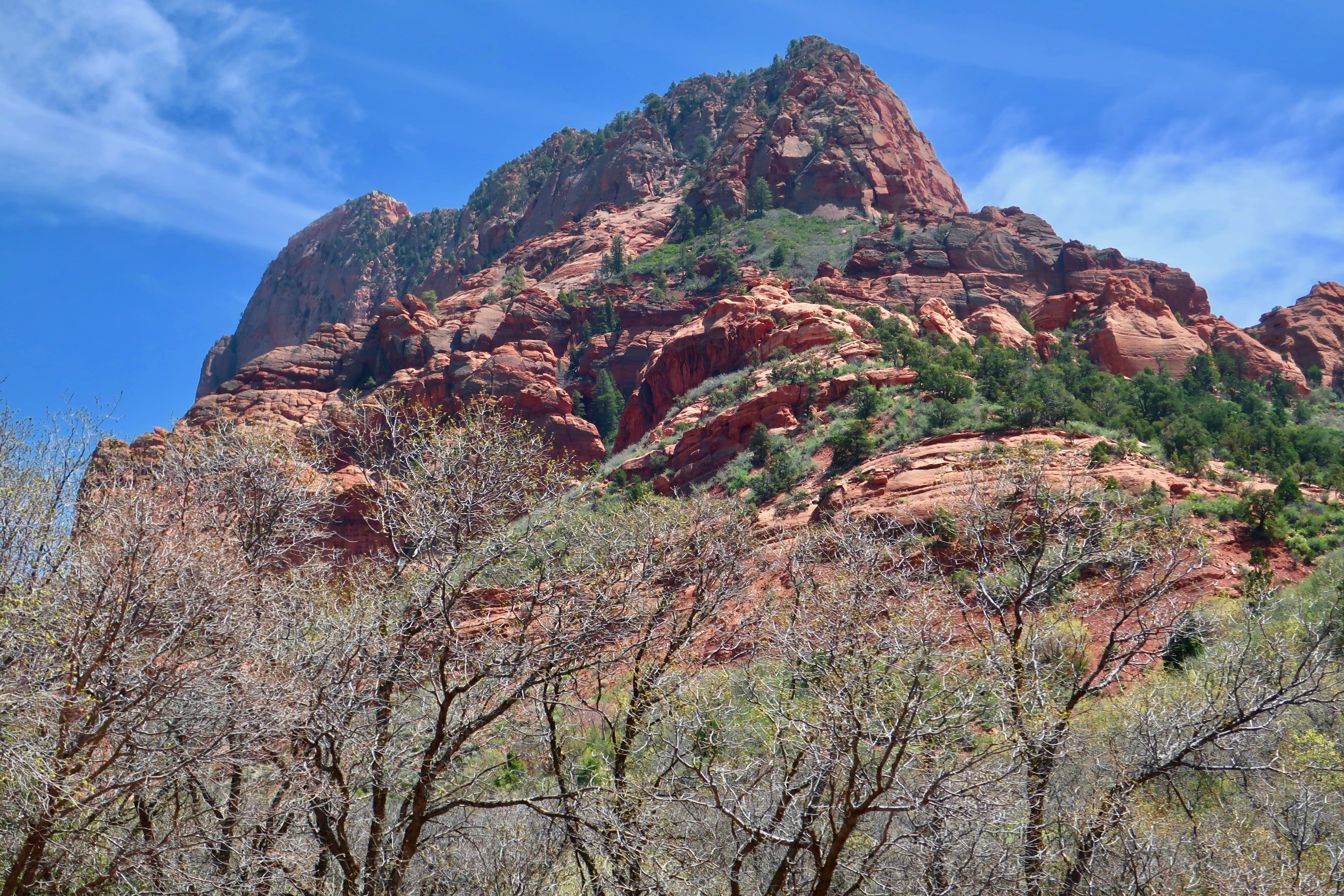
While Peggy was busy photographing wannabe arches, I was concentrating on other landmarks of East Zion National Park.
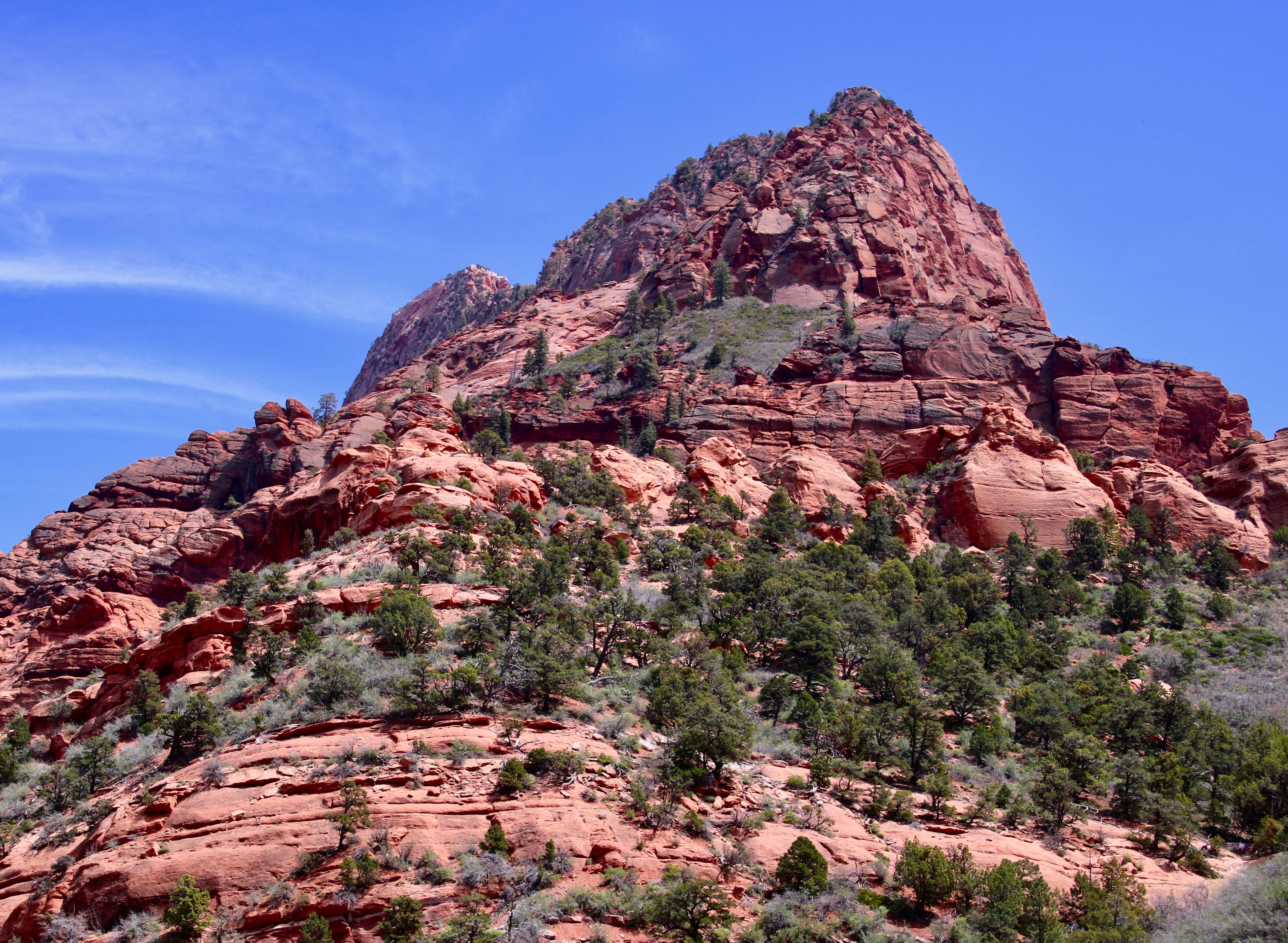
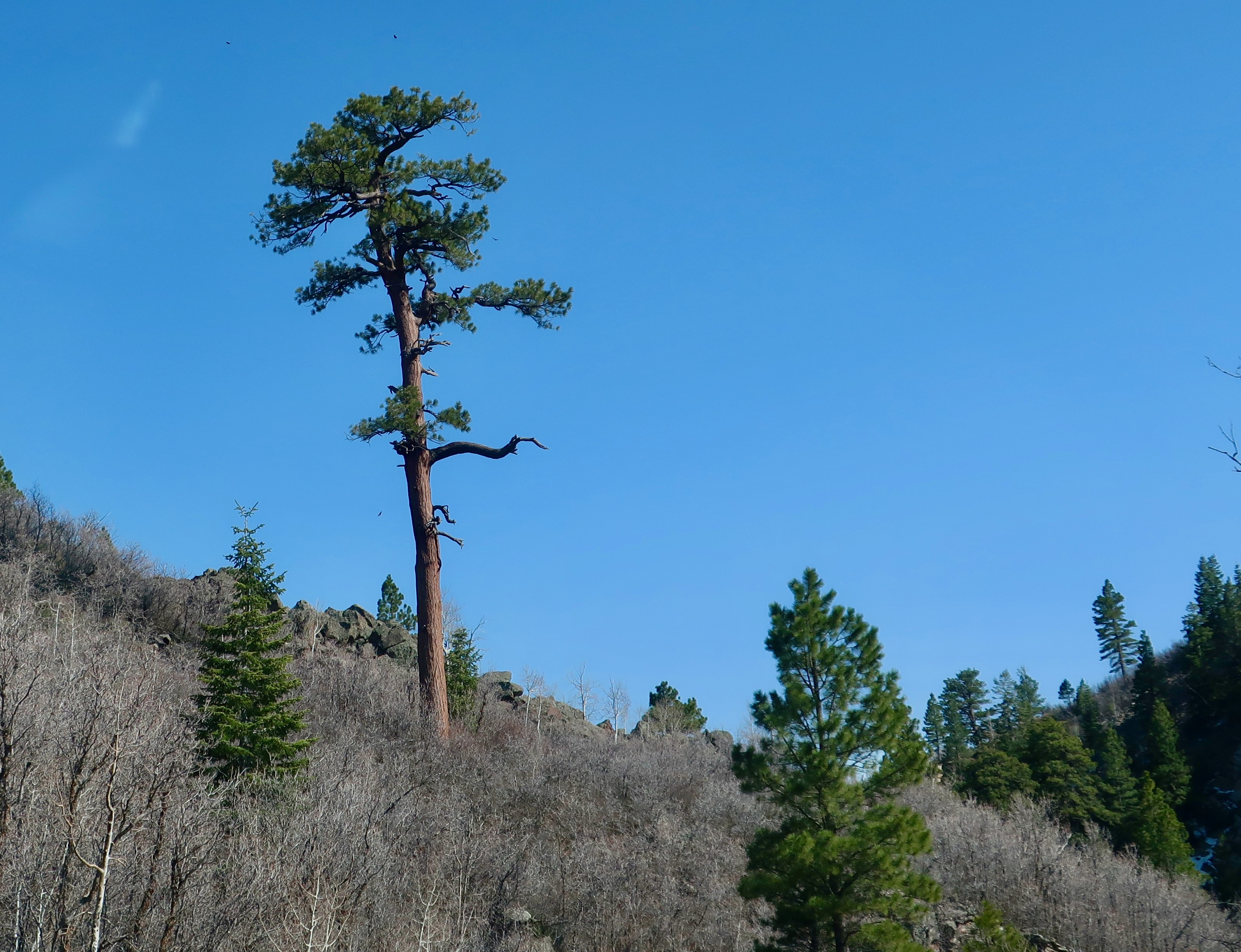
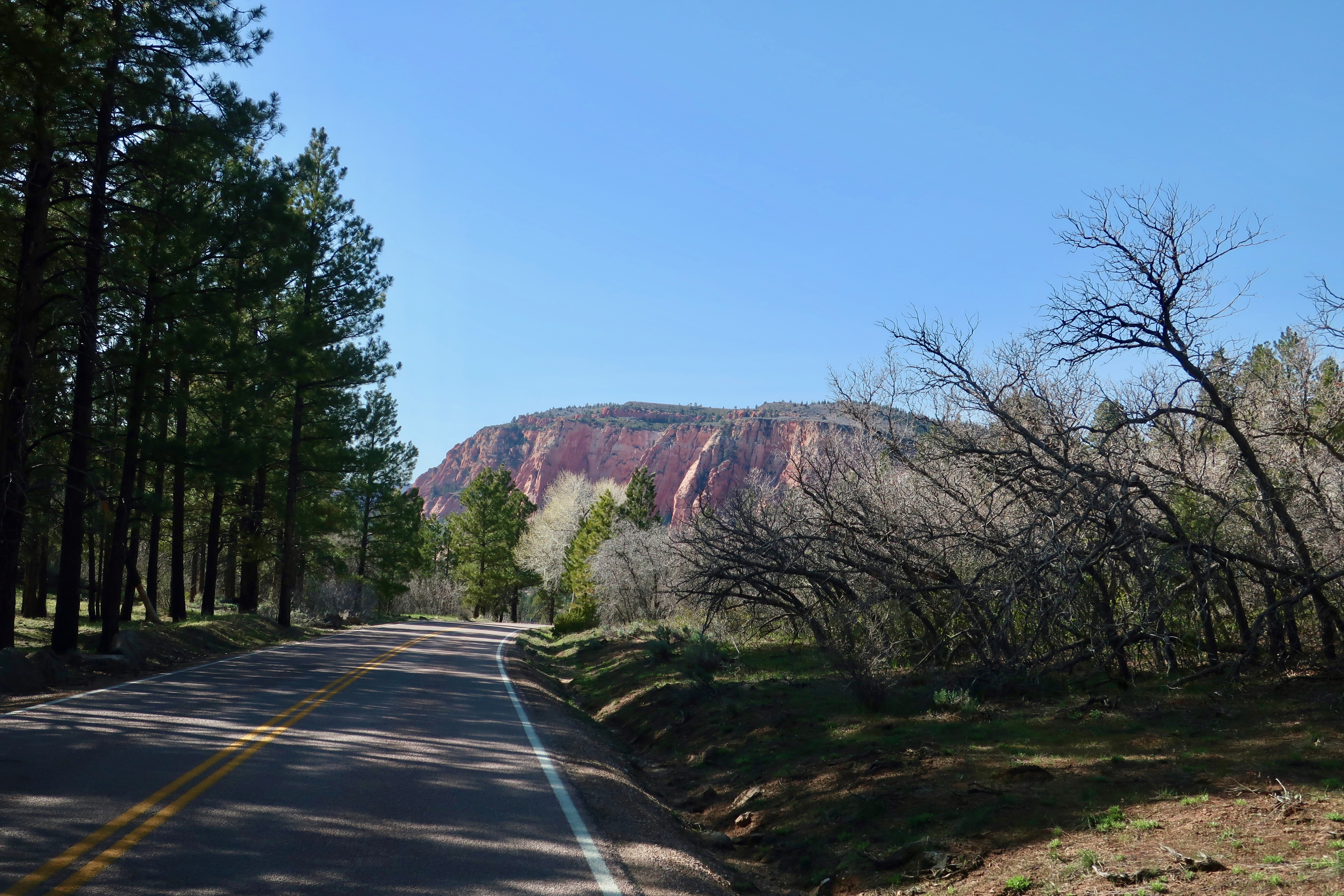
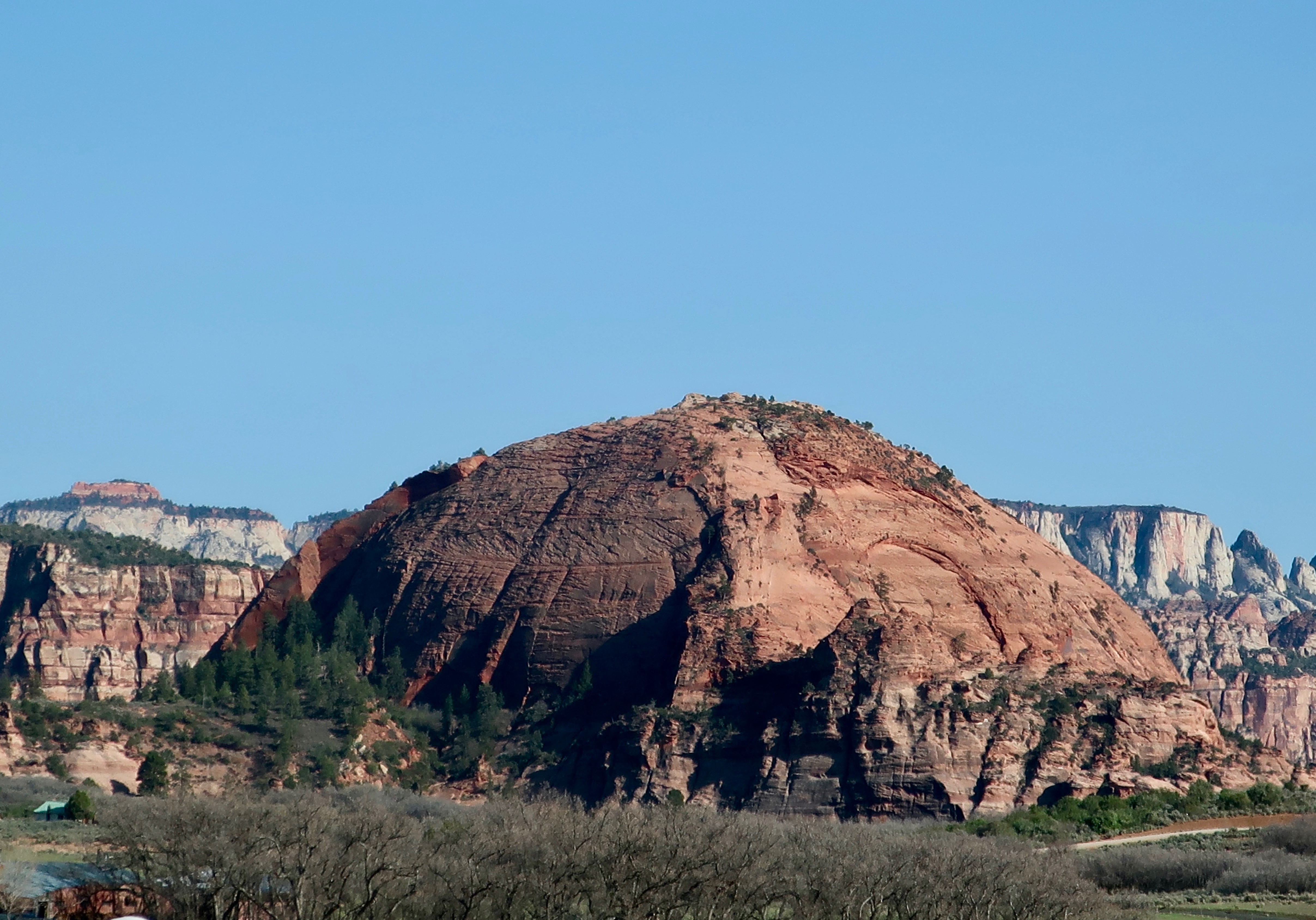
I found this landmark rather impressive.I wondered about the huge chunk of rock that left behind a bright red scar in this landmark. The other side is one of the alcoves that Peggy photographed. Another prominent Mesa standing out like the prow of an ocean liner.A mesa on a mesa. Peggy was impressed with its color. (Photo by Peggy Mekemson.)I’ll close today with this interesting photo that Peggy took of shrubs and small trees growing on cross-bedded sandstone. I thought, ‘Wow, this would make one heck of a challenging puzzle!’ (Photo by Peggy Mekemson.)
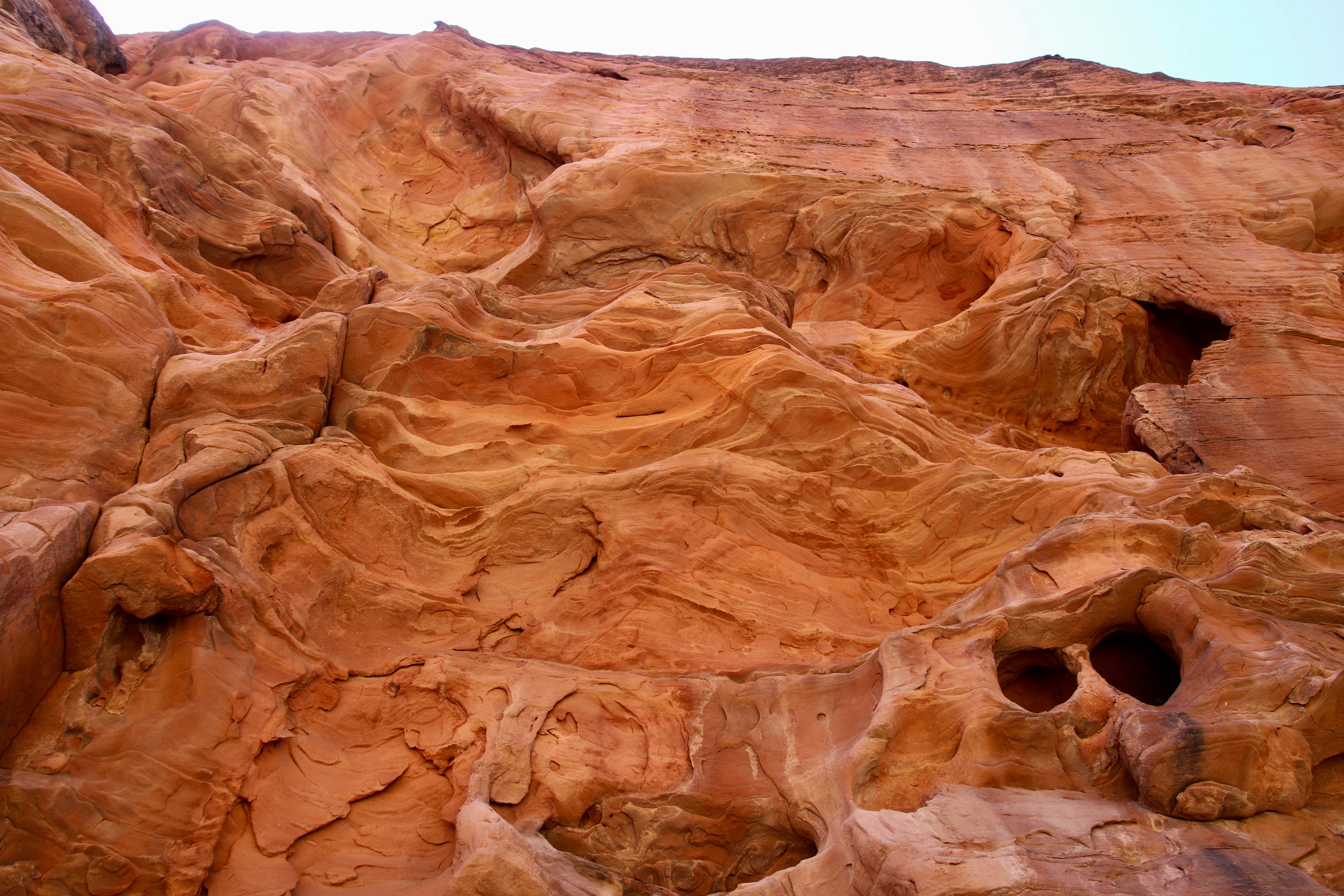
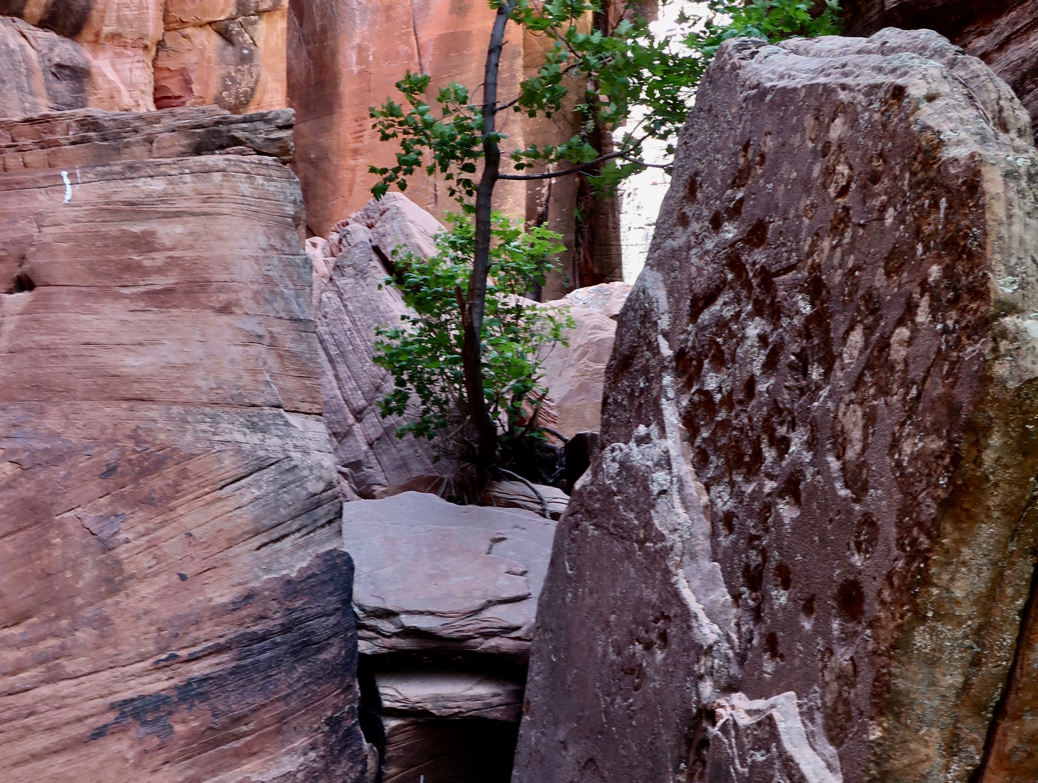
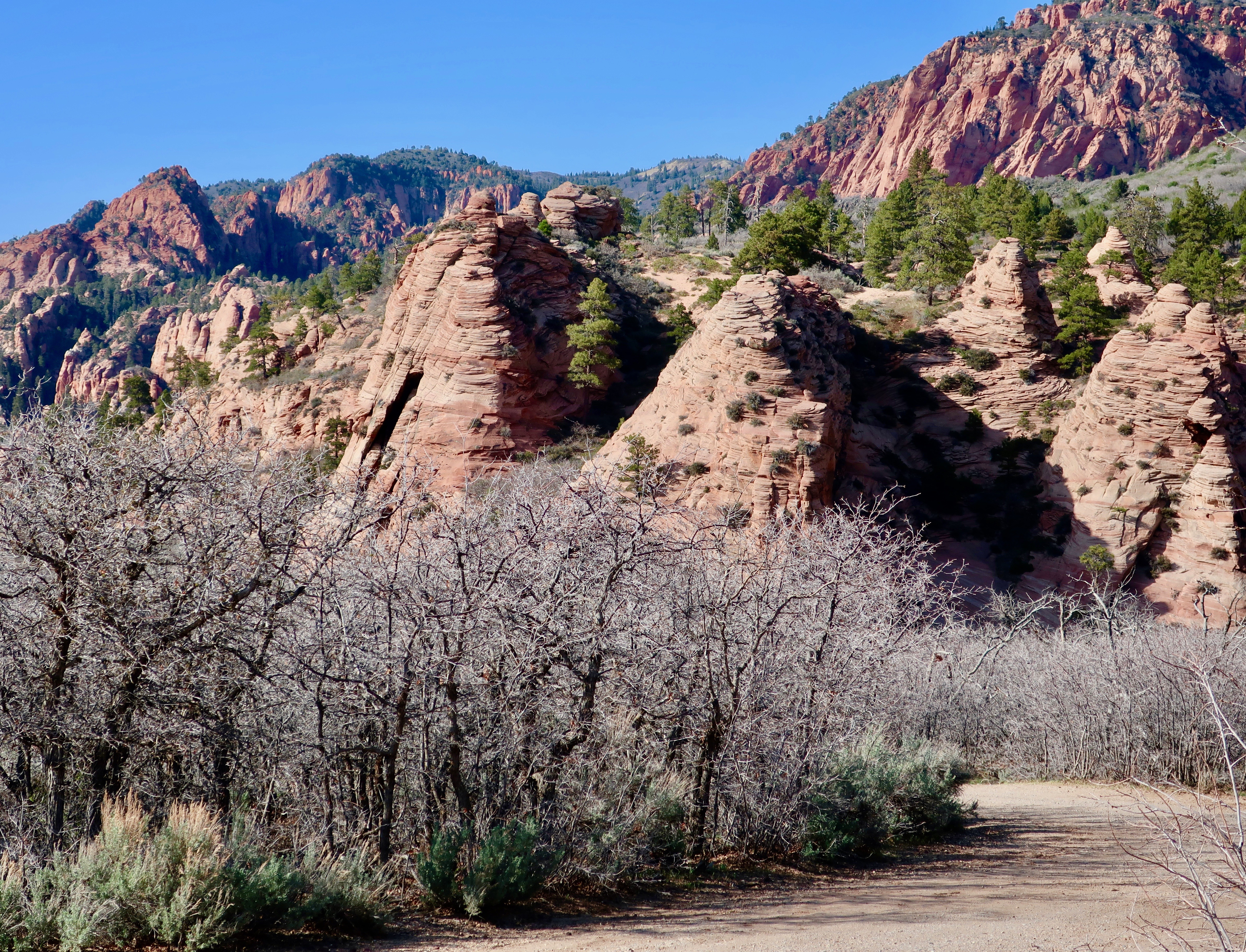
Peggy and I found this interesting rock formation looming above the petroglyphs that we located in the eastern section of Zion National Park. It was only the beginning of unusual rock structures that defined the area.
I quickly learned when I was a Peace Corps Volunteer in West Africa that my reality was substantially different from that of the tribal students I was teaching. It was a lesson that has served me all of my life. The human mind is incredibly flexible and our reality, to a large extent, depends upon what we are taught. Given my 1965-67 experience in Liberia, I can’t even start to imagine what people believed 7,000 years ago.
That’s when humans first started wandering the area now known as Zion National Park. They started with Archaic peoples, moved on to the Anasazi and Fremont cultural groups, and, in turn, were followed by the ancestors of modern day Native American Paiutes. Any or all of these groups may have left petroglyphs in the slot canyon Peggy and I explored in the eastern section of the Park. And all of them reflect thinking that we can only guess at.
Peggy and I are fascinated by petroglyphs, both from the connection it gives us to people from hundreds or even thousands of years ago, and from the unique look of rock art. We have visited sites throughout the Southwest. There is a certain commonality to the rock art depending on the culture represented. We have also found a similarity to sites selected by the ancients to leave their messages. Not surprisingly, they tend to be near water, which is where the people lived. But there was also an inclination to select locations that stood out from the surroundings. Possibly it gave a sense of sacredness to the area.
The site we visited was an excellent example of this, as our photos show. The strangeness, however, started with the directions to find the site. As I remember them: “Go down into the canyon and find a sand wash. Follow the wash up the canyon until it comes to the tunnel under the road. Go through the tunnel and follow the wash until you come to a trail to your left.” There was as much room for interpretation in following the directions as there was for interpreting what the petroglyphs meant!
Our photos start with the tunnel.
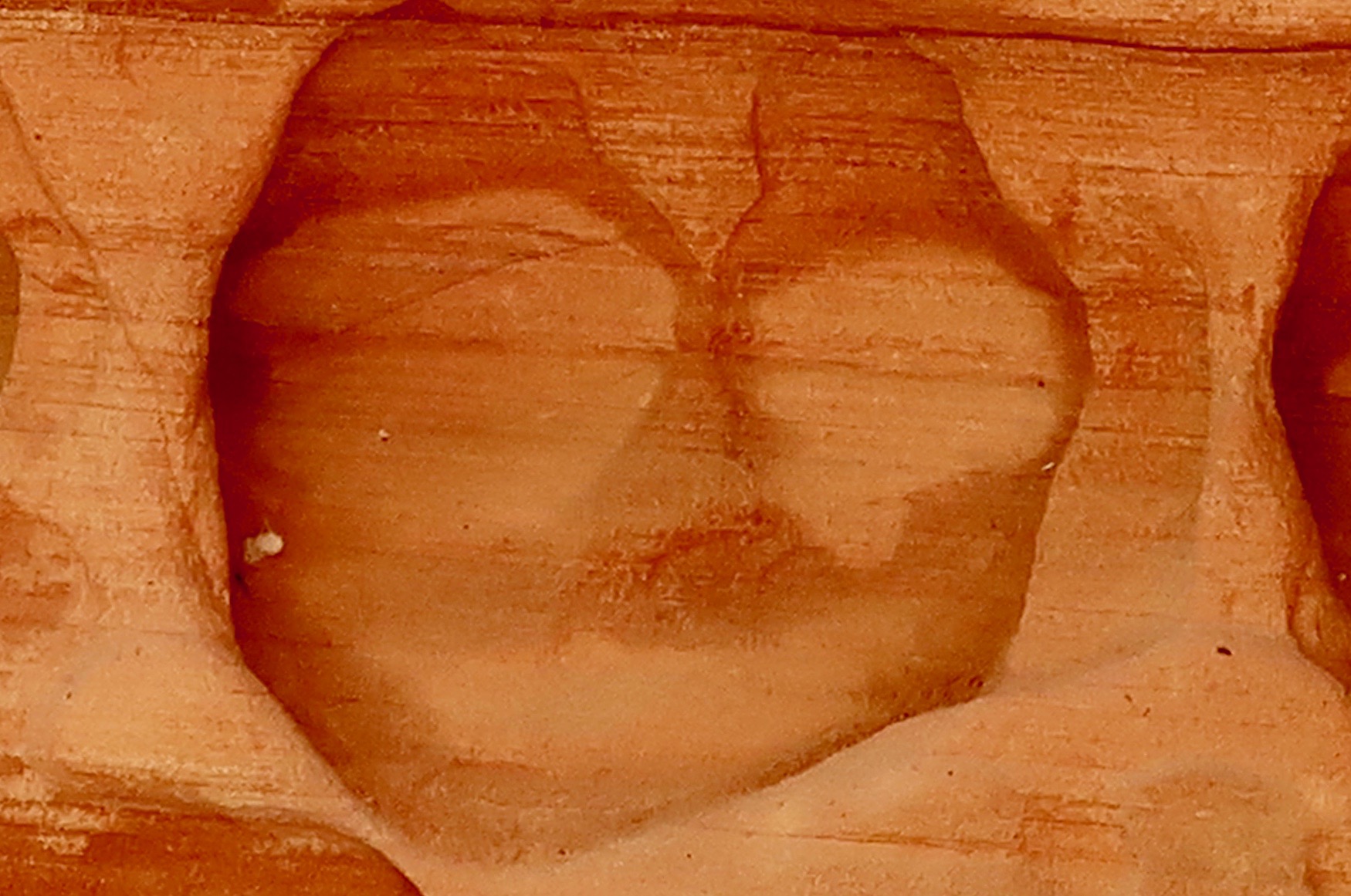
It was appropriately hidden by trees and bushes.The sandy wash led right to it, however. The light we could see on the right suggested that the tunnel was a few feet long. (Photo by Peggy Mekemson.)Reality was different. It was much longer than it appeared to be. Fortunately, there was a light at the end of the tunnel.Peggy walked toward the light and disappeared. She boldly went forth where numerous others had obviously travelled, judging from the foot prints in the sand. But did they ever return? Maybe a little Sci-Fi/Horror movie music is called for here.She was waiting for me in the sandy wash that led onward, supposedly toward a trail that would lead off to the left and petroglyphs. We quickly learned that there were several trails leading off to the left where people had gone in futile searches! Fortunately, Peggy and I had an advantage…We were looking for an area that suggested the presence of petroglyphs. This rock structure seemed a likely candidate. We started looking for a trail to the left, and found even more interesting rocks.Peggy caught this photo and the following one.Photo by Peggy Mekemson.How’s this for unusual? If I were a shaman, I’d think this would be a great location for petroglyphs.This fellow was not a petroglyph but part of the rock face, so to speak. I’ve learned a new word, BTW: pareidolia, the tendency to read into patterns and interpret visual stimuli, even when there is no intentional meaning present. A lot of that happens in my blogs. (Photo by Peggy Mekemson.)There was something surreal about the beauty of the area. (Photo by Peggy Mekemson.)I looked up and caught this colorful view.And then we reached the site. It was just beyond the green shrubs if my memory serves me correctly. It’s hard to imagine a more stunning location. We were prepared to enter the alternate reality suggested by petroglyphs.The petroglyphs were waiting. This is obviously a human like figure, probably a woman, but what’s with the strange diagram underneath? Does it represent power lines reaching out to the universe from the individual. I stared at it for a while and wondered if it didn’t represent a reflection in water. Or a moon shadow. Remember the song by Cat Stevens? (Photo by Peggy Mekemson.)Another reflection shot? A selfie? Or possibly a mating couple. Such images are not uncommon in petroglyphs.This is frequently thought of as being an origin petroglyph, representing the entry into this world from another world. This panel clearly represents petroglyphs created in different times with the figures in the upper right being of more recent origin. Are they hiking with packs? Or are they paddling a boat? The wavy line may represent a lake and a stream. Or a snake? The lower guy on the right seems to be asking the question while the guy on the left seems to be running like crazy to escape. (Photo by Peggy Mekemson.)I labeled this guy as a moose. Why not— even though there is no record of moose in the Park area except in 2013 when one showed up. 🙂 Tourists were told to keep their distance. We’ve found women portrayed like this throughout the Southwest. The circular figure may be the sun. I wondered if the wiggly lines represented counting, or a snake, or a river. Or…My imagination placed this woman on the warpath! 🙂 (Photo by Peggy Mekemson.)
There were many other petroglyphs. At the end of the panels, Peggy and I found steps carved into the canyon wall leading up to a ledge.
I thought it might be interesting to climb up them and explore the ledge. Peggy felt it best that her 79 year old husband be grounded. Grin.
Wandering up the trail in search of more petroglyphs, we found a dead big horn sheep that may have slipped while climbing the walls. Or been taken out by a cougar.
It did not look very happy. Peggy wondered why I wanted to photograph it and decided it was a sign that we should turn around. Admittedly, it did look a bit Satanic…
Shortly afterward we came to what was obviously the end of the trail unless we wanted to scramble over rocks. We turned around leaving the sheep, the petroglyphs, the beautiful canyon and the tunnel behind. It had been quite an adventure. In my next post we will explore more of the unique beauty of East Zion National Park.
I couldn’t help but think of William Least Heat-Moon’s book, Blue Highways, this morning. If you have read his classic travel adventure, you will remember that he would go out of his way to find small towns with unusual names, like Dime Box, Texas. We are in Accident, Maryland today and I’m pretty sure it meets Heat-Moon’s classification of an unusual name. I was also amused to learn that people from the town are called Accidentals. I feel a connection. My parents always told me that I was an accident.
This is the last stop on the first segment of our full time travels. Tomorrow we will arrive at our daughter Tasha, her husband Clay and our grandsons Ethan and Cody’s home in Waterford, Virginia outside of Washington DC. They have an attached efficiency apartment that they are insisting that we use as our base. It’s Tasha’s way of assuring that we will be around on occasion. It will take a few weeks to set up the apartment, but first we will be dashing off on our Rhine River Cruise.
In the meantime, I will keep the posts from our national park and monument visits in the Southwest rolling out. After Zion there is Bryce, Escalante, the North Rim of the Grand Canyon, and Mesa Verde plus our other adventures along the way. I have enough to produce posts until we are once again on the road. More than enough! On the small chance I run out, there is the Rhine River Cruise. 🙂
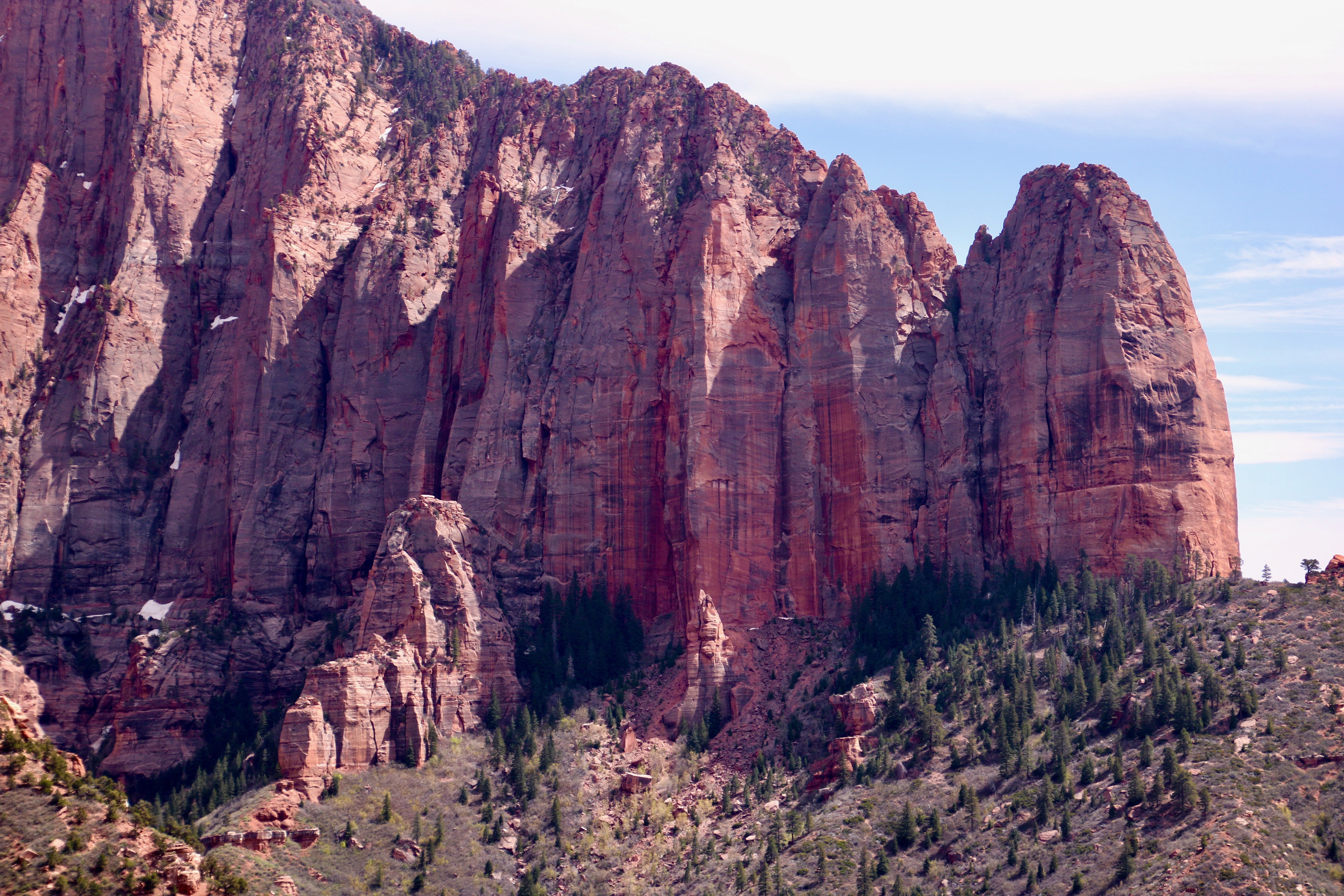
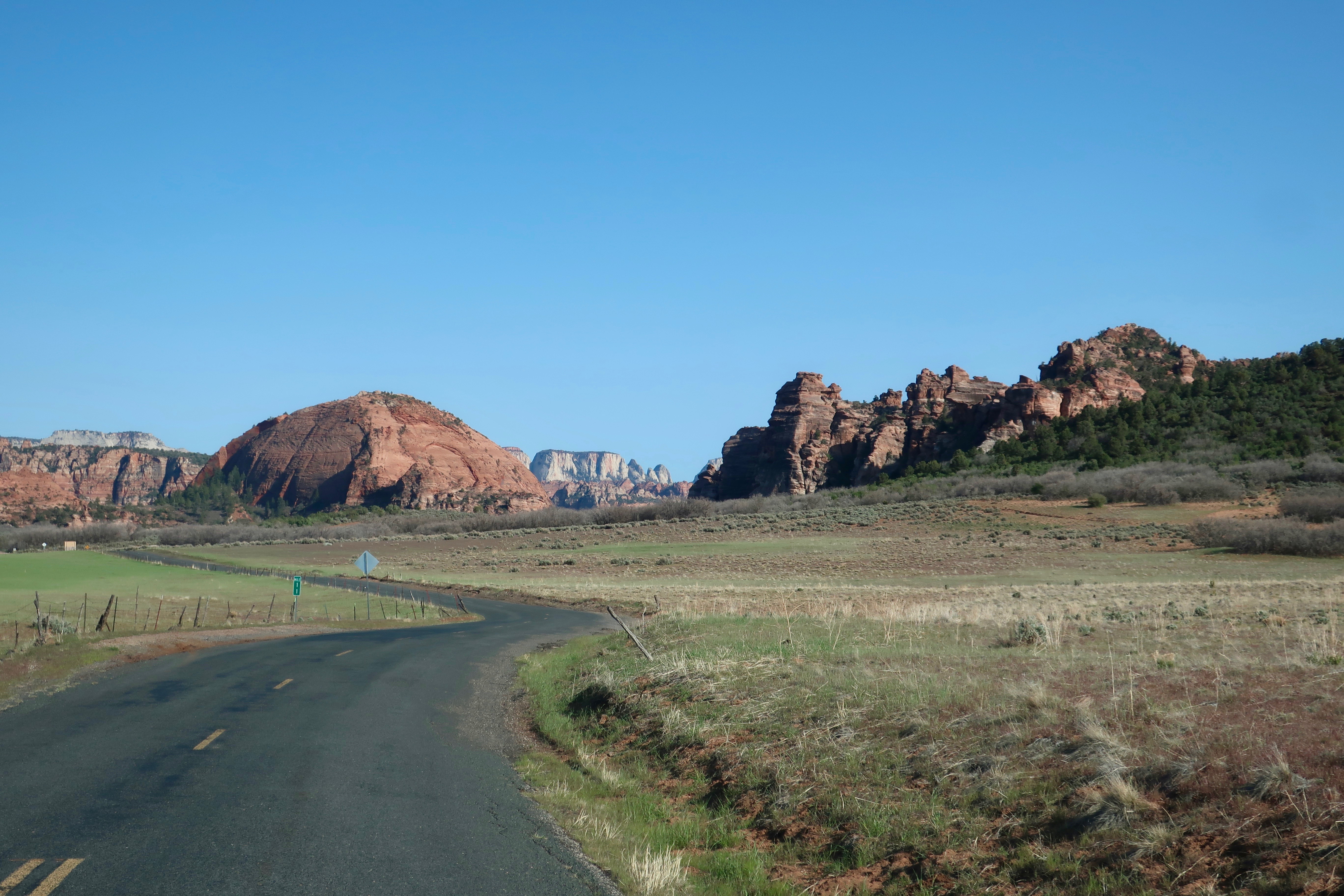
We were driving into the Kolob Canyons when Peggy snapped this photo. We knew we were in for a treat. (Photo by Peggy Mekemson.)
Zion National Park promotes Kolob Canyons as its best kept secret. Other web sites follow a similar theme. It’s not surprising considering that the canyons are located in the remote northwestern section of the Park, 45 miles away from Zion’s main attraction.
Given the distance, many people ask is whether it’s worth taking half a day to visit. (This assumes they are even aware that this section of the Park exists.) Peggy and I would like to answer with a resounding yes! It meets our three criteria: It’s unique, beautiful, and not crowded. There are also a number of hikes visitors can take that we couldn’t squeeze in. A fairly challenging one provides hikers with a view of the world’s second longest arch. Next time.
The curvy five-mile drive climbs a thousand feet. It can be accomplished in a relatively short amount of time, but— if you are like us— you will want to linger and admire the fantastic views of towering Navajo Sandstone cliffs and deep finger canyons created by runoff from the plateau above. There are a number of pullouts along the way. Each one provides a different view or perspective and each is worth a stop. The following photos reflect what Peggy and I saw.
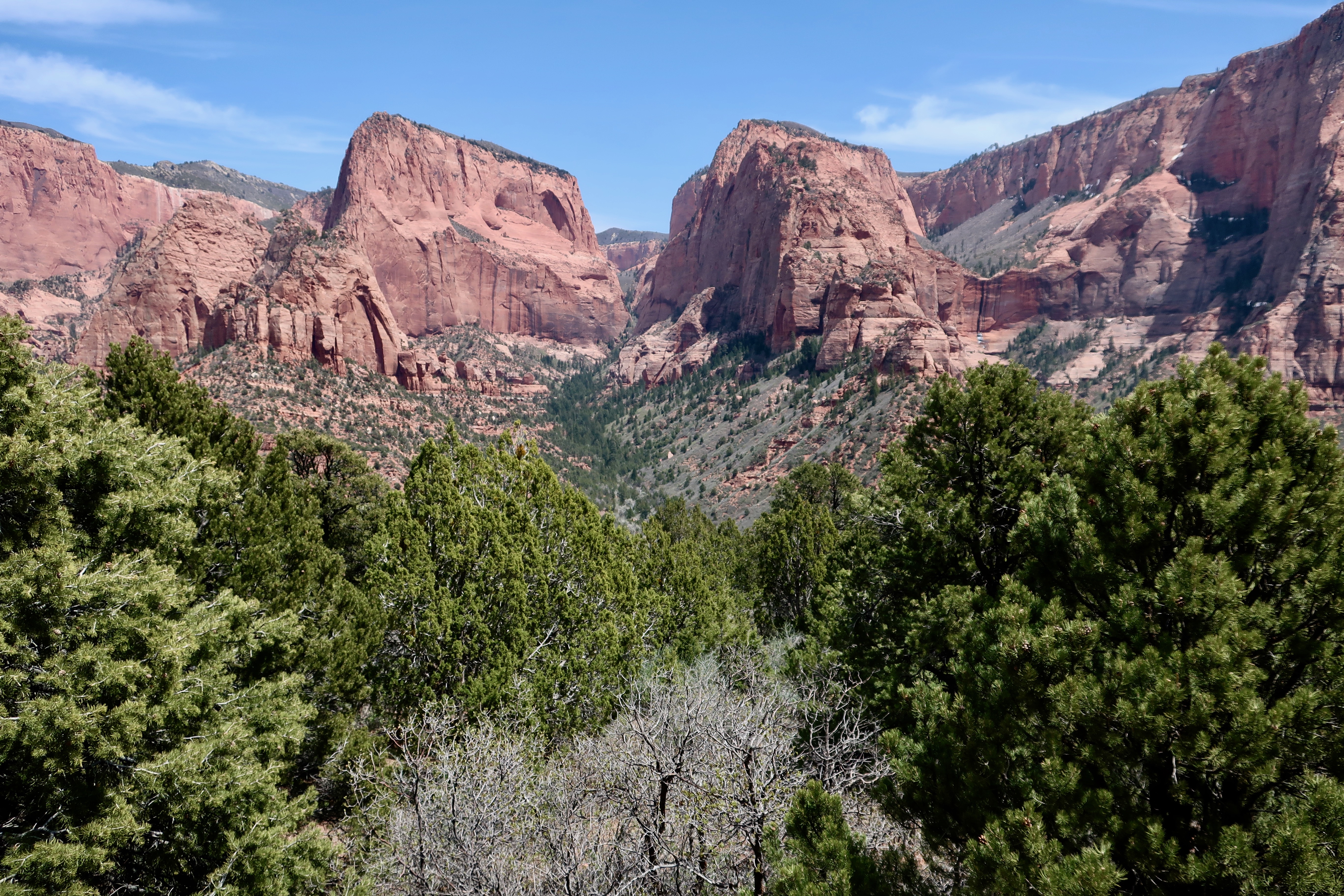
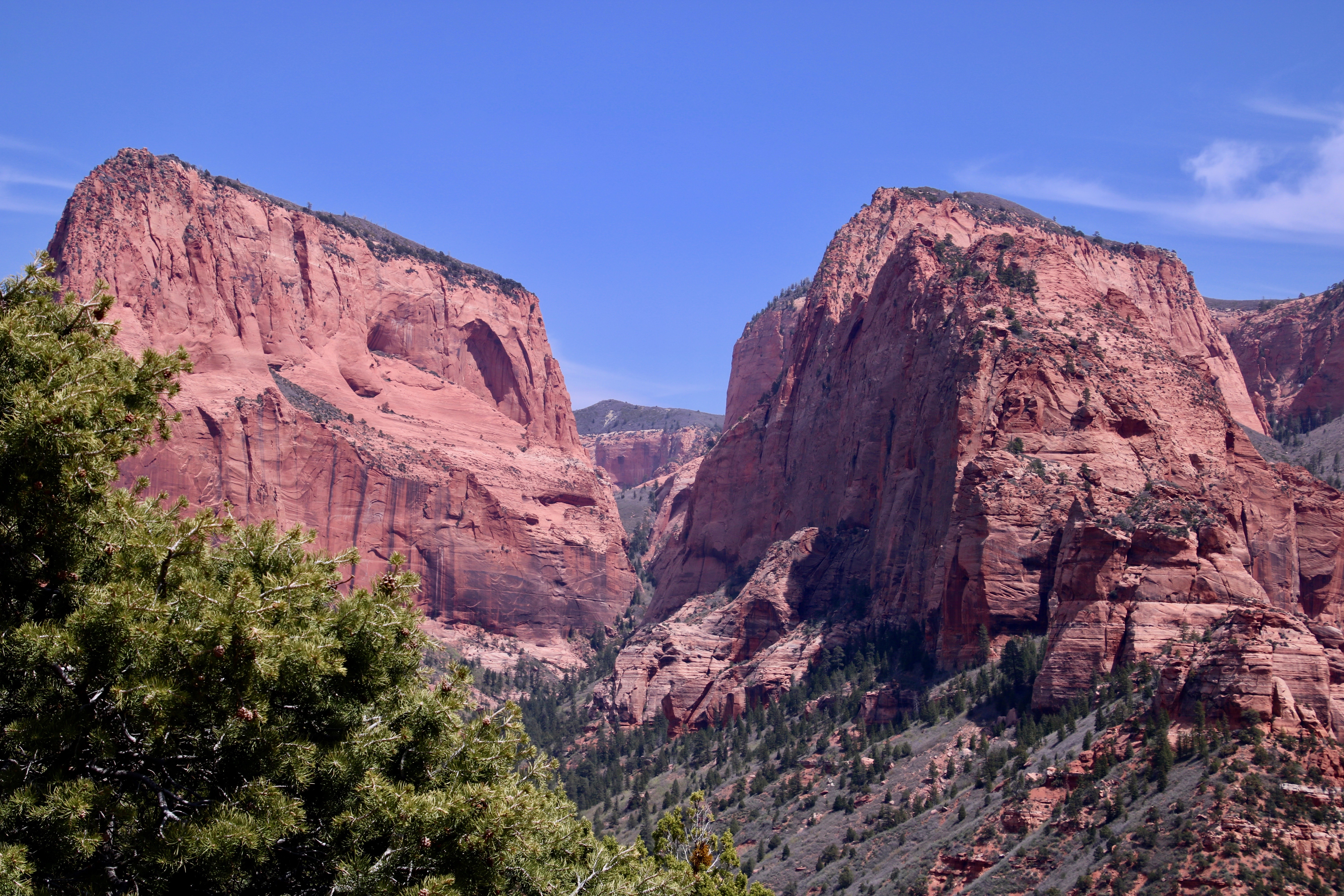
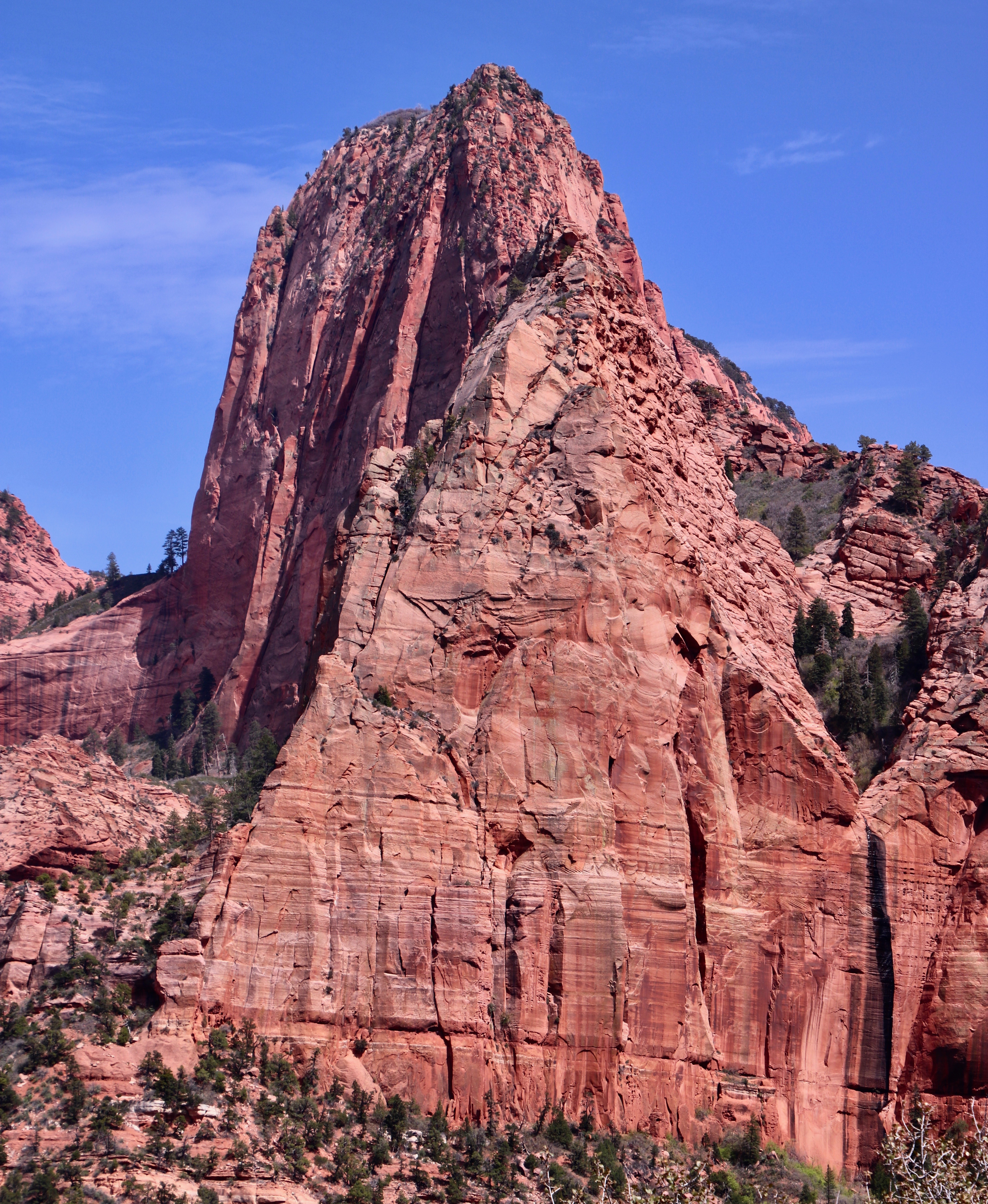
Timber Top Mountain cuts off to the left in this photo and wraps around a hanging valley that has been created by runoff. The Shuntavi Butte stretches out from Timber Top on the right. The area was a favorite of ours.Remember what I said about different perspectives. Peggy took this side shot of Shuntavi Butte. Is that baby Shuntavi on the left? (Photo by Peggy Mekemson.) I opted for for a close up which gave the Shuntavi Butte a massive, toothed look.This seasonal stream that runs between the two arms of Timber Top Mountain was close to dry when we saw it. But the minerals it carried had left a black stain where it tumbled off of the hanging canyon. Eventually it will finish carving the canyon down to the lower level. (Give or take a few million years.) The erosive power of water is amazing. (Photo by Peggy Mekemson.)Nagunt Mesa is located next to the western arm of Timber Top Mountain.Here’s a closer view. Note the beginning of a possible arch on Nagunt Mesa. (Photo by Peggy Mekemson.)I added an even closer view of the would-be arch. Note that Nagunt Mesa is also covered with timber. That led me to wonder what type of wildlife lived there. Had Native Americans found a way to make it their home?
Some other views of the Kolob Canyons from our visit:
Another Mesa (I think). I like the foreground effect of the trees on the photo. We were high enough and it was early enough that the trees were just beginning to leaf out. A more frontal shot, i.e. different perspective, gave the mesa an almost pyramid look. (Photo by Peggy Mekemson.)
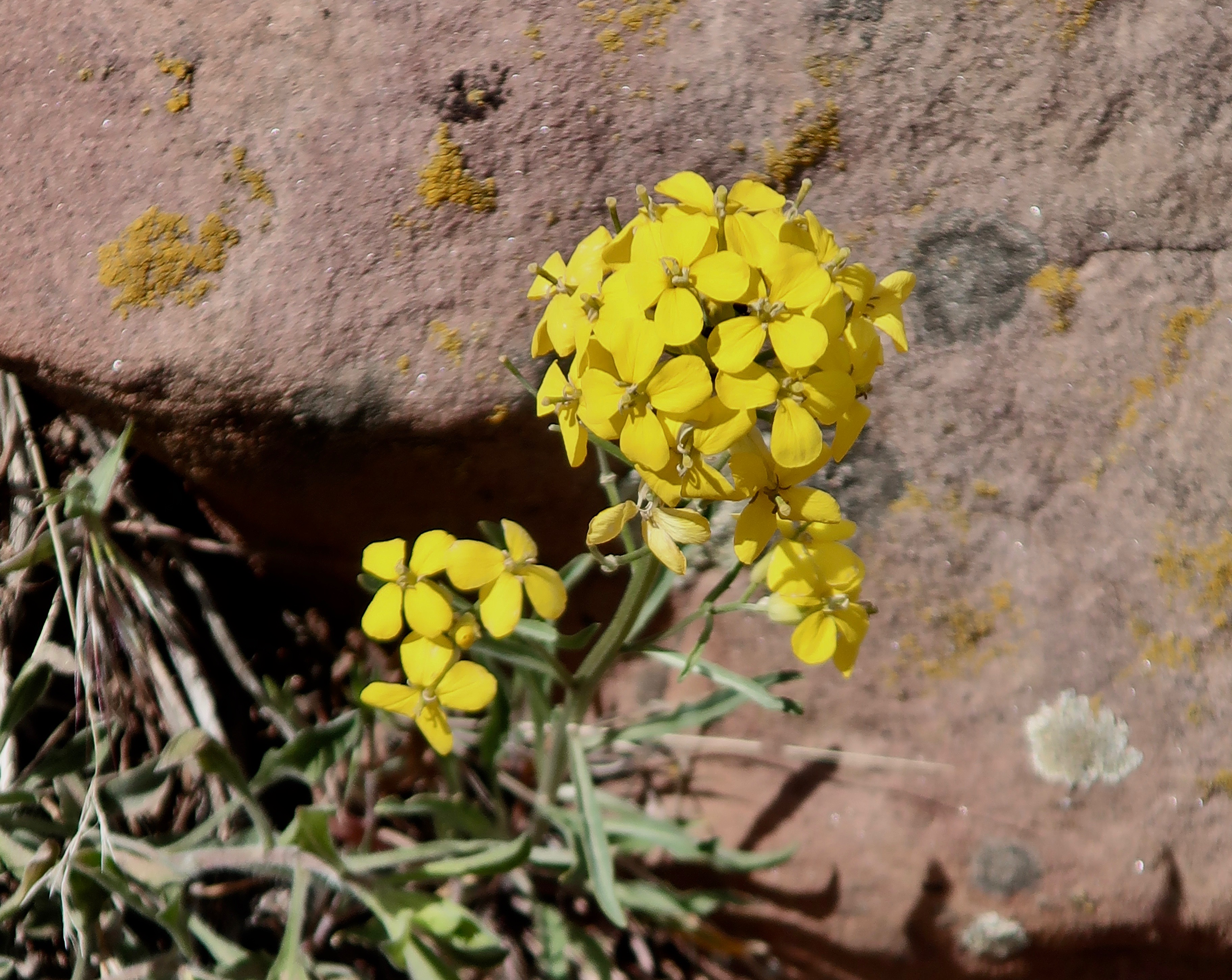
I found an old friend from the Sierra Nevada Mountains growing at a high point along the road: a wall flower (Erysimum capitatum). It’s always reminded me of a brief phase I went through in high school where girls scared the heck out of me.
This peak was even more impressive than the pyramid. (Photo by Peggy Mekemson.)
I’ll conclude today with this side view of Nagunt Mesa. I liked the way the tree framed the photo. Our next post will take readers over the east side of Zion Canyon. Once again, I will feature unique rocks. This post will also include petroglyphs located in a magical canyon.
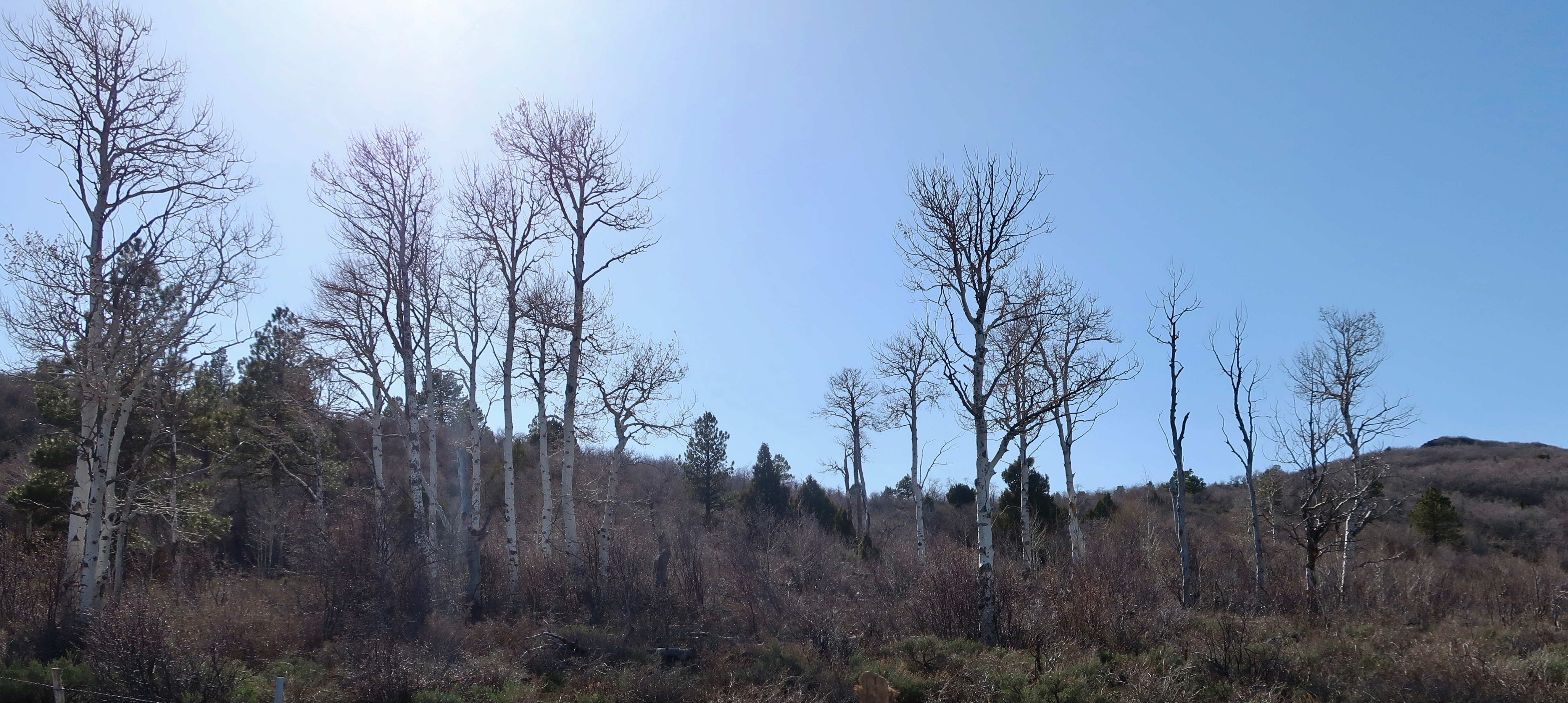
At 8,100 feet, the aspens on Kolob Terrace in Zion National Park were convinced it was still early spring. Or maybe late winter. We had climbed 4,500 feet since leaving our campground on the Virgin River of Utah.
The thunder rolled in with an unending rumble and the wind shook our trailer until I thought it might tip us over. We are in Kansas and I couldn’t help but think of Dorothy and her faithful dog, Toto. I half expected to hear the tornado sirens go off or see a wicked witch fly by on her broom. It was not conducive to sleep. Instead, I watched the lightning dance across our skylight while Peggy slept soundly. Maybe she thought I could worry enough for both of us. “Oh, was the wind blowing last night?” she asked me the next morning.
We’ve now left the backroads, mountains and mesas of the Southwest behind. It will be mainly freeway from here on out as we dash across the country to catch our Icelandic Air trip to Amsterdam— except it isn’t that much of a dash. We’ve simply eliminated our 5-7 day layovers between travel days. We still only plan to travel around 200 miles a day with every other day a layover. I’ve never had a sense of humor about driving 4-5 hundred miles straight. And it certainly hasn’t improved with age.
I may change my mind if this weather continues, however. We are under severe thunderstorm watch again tonight. We could be at our daughter’s in Virginia in four days instead of the two weeks I am planning. I have even less tolerance for tornados and golfball size hail than I do driving long distances. Tempting…
Meanwhile, my blog is still in Zion. I have at least three more posts on it, maybe more! 🙂 And then there is Bryce and the North Rim of the Grand Canyon, and Mesa Verde, and the Rockies, and dinosaur tracks, desert wildflowers and petroglyphs. Will it ever end? 🙂 Peggy and I have taken at least a thousand photos. I’m afraid to count them. But don’t worry, we won’t subject you to all of them.
Today, my focus continues to be on the Kolob Terrace section of Zion National Park. After some very winding roads we made it to the top of the Terrace. The views continued to be spectacular.
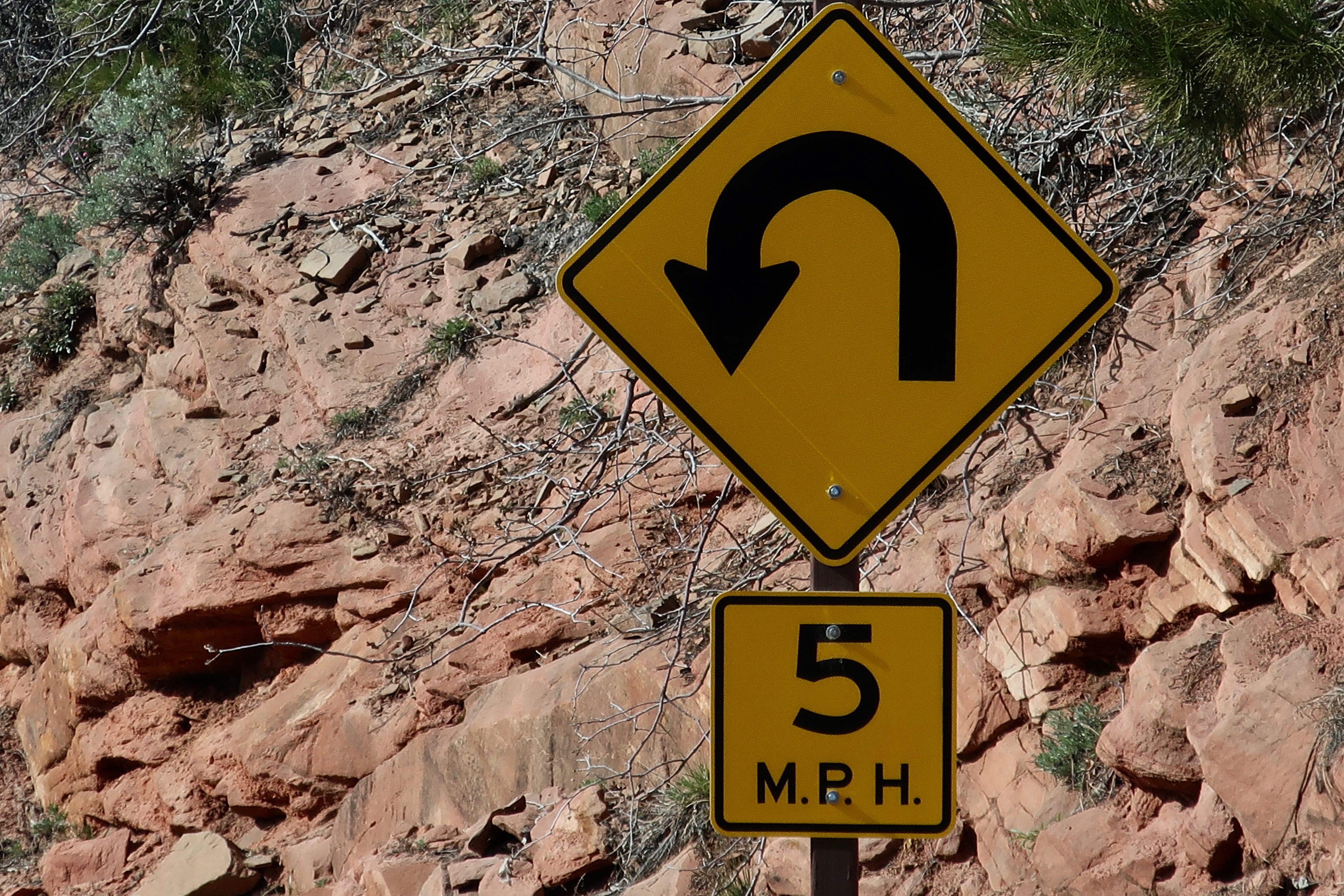
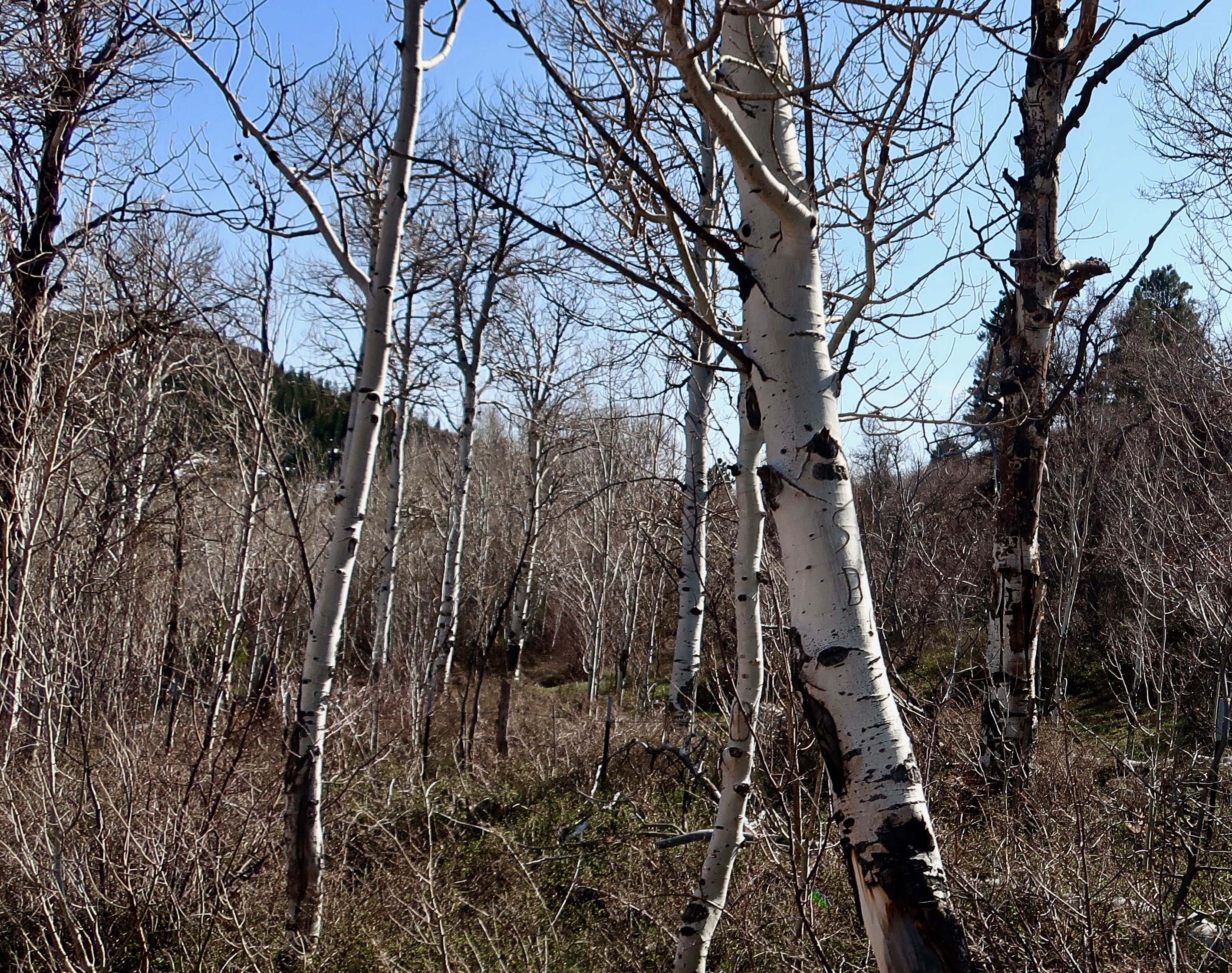
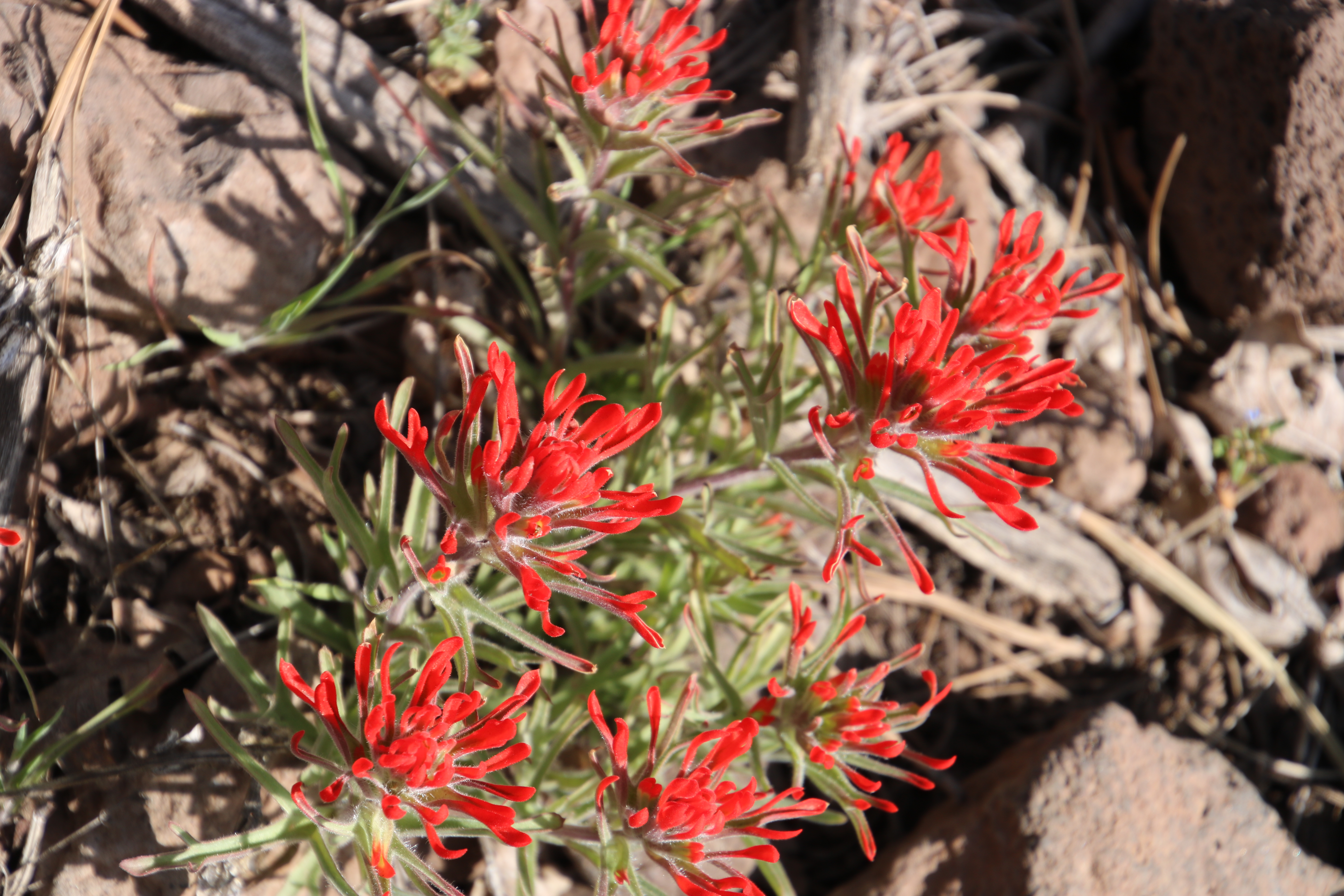
It’s important to know that the road up to Kolob Terrace is steep and curvy. If you decide to drive up to it, and we highly recommend you do, I wouldn’t take a large RV on the road.Another view of the aspen grove on Kolob Terrace in Zion National Park. There were no leaves to quake in the wind!This was a road view of what we might see once we reached the top of the terrace. As always, the conifers didn’t worry about the snow and cold.I was impressed with this lone pine tree.As Peggy and I were with this peak. We stopped to admire it.And were rewarded with this view.And a view of the valley 4000 feet below.We also spotted this attractive rock monument.And felt it was worth a closer look.While I was staring off into the distance, Peggy looked down and spotted this colorful Indian paintbrush. (Photo by Peggy Mekemson.)
Following are several more photos of the scenery that Peggy and I saw up on Kolob Terrace and on our drive back down.
Another road shot.Peggy caught this photo. (Photo by Peggy Mekemson.)“Pull over, Curt,” Peggy insisted, “I have to take a photo of this.” It was the most streamlined kite we had ever seen.And, of course, she had to photograph the colorful background behind the kite. I’ll conclude today’s post here. In my next post, we will be moving on to Kolob Canyon. (Photo by Peggy Mekemson.)
The road had been gradually climbing since we started our exploration of Kolob Terrace in Zion National Park. It was about to get serious as it made its way up to the terrace above the cliffs. (Photo by Peggy Mekemson.)
We are continuing our exploration of the Kolob Terrace section of Zion National Park as part of our full-time experience of living on the road.
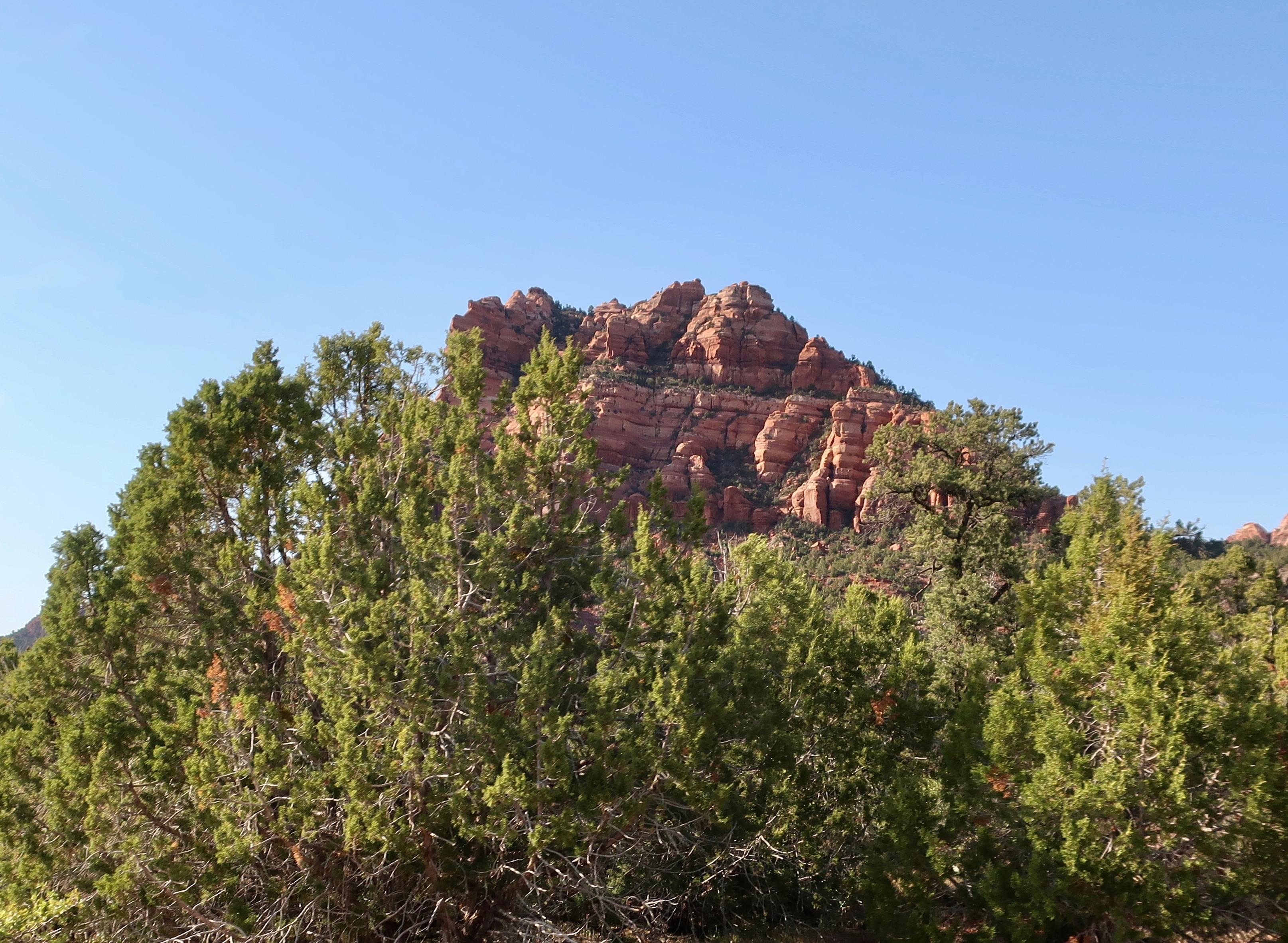
I am always curious about how things get their names. I wasn’t familiar with Kolob. Was it a Native American name? Was it the name of an early explorer or pioneer? Turns out it comes directly out of the Book of Abraham, a sacred text of the Mormons that Joseph Smith supposedly translated from an Egyptian papyrus scroll. I wonder if he used his rose colored glasses. I should have guessed the Mormon connection. Utah is Mormon country and has been ever since Brigham Young brought his band of followers into the state in 1847 to escape religious persecution in the east. Kolob is either a star or a large planet in the center of the Milky Way Galaxy close to the throne of God. Some Mormons believe that is where they go when they die. It shows up in the Musical, The Book of Mormon where the lyrics proclaim “I believe that plan involves me getting my own planet.” The modern church has challenged the assumption.
Imagining Kolob to be a rather pleasant place from a Mormon perspective, I can understand why the early pioneers gave its name to the terrace. Peggy and I also found it pleasant. Actually, I’d much prefer to go there when I die rather than the biblical Heaven where the ‘streets are paved with gold.’
We pulled off the road frequently to take photos on our way up and down.
Peggy uses the cab of our truck to photograph the cliffs below the terrace.Where our F-150 was parked when Peggy took the photo…Peggy’s photo. If you have ever wondered how the impressive rock bridges of the Southwest are formed, this is potentially one in progress.
More photos that I took on our way up to the terrace…
I’ll conclude with this photo of a private road winding its way below the cliffs. I was intrigued as to where it went and could easily imagine Peggy and me living there. My next post will feature photos we took up on the terrace.
Today, our full time RV adventure of exploring North America takes us to Zion National Parkin Utah.
This was one of many delightful monuments Peggy and I found when we explored Kolob Terrace in Zion National Park. Note the lack of traffic!
Peggy was reading an article in the Washington Post a few days ago on Zion National Park. Bring your patience, the article urged. Over 5 million people are projected to visit in 2022. The majority will be from April through September. Expect massive crowds if it is on your vacation itinerary. Parking spots will be difficult to find. Shuttles will be full. There will be long lines to get in, long lines at the restrooms, long lines to visit major sites, and long lines to get food. Finding a place to stay in or near the park will be close to impossible unless you already have a reservation— or get lucky.
It’s my idea of a nightmare.
Peggy and I were fortunate to arrive in late April for our visit. But even then, the crowds in the canyon exceeded my ideal by a factor of 10, or is that 100. Grin. I’ll tell that story at the end of my series on Zion. (Spoiler alert: it was still worth it.) But, for now, I am going to let you in on a little secret, there is more to Zion National Park than Zion Canyon. A lot more. And much of it matches and may even surpass the canyon in beauty. Peggy and I are going to take you on three short road trips to various sections in the park outside of the canyon to prove our point: Kolob Terrace, Kolob Canyon, and the east side of the park. Plus a ghost town.
I am going to start with the Kolob Terrace. Peggy and I were staying at an RV campground on the Virgin River in the small town of the same name 14 miles from the canyon. The road into the terrace was less than a mile from where we were camped. We drove up it for 15 miles before turning around, stopping frequently on both our way up and back. We met a dozen cars along the way. There may have been 30 parked at the various trailheads and overlooks. Compare that with the 14,000 or more people who were exploring the canyon on that day! Following are the photos Peggy and I took. I am going to divide them into three posts since there are too many for one. (Note: I take five times as many photos as Peggy. :))
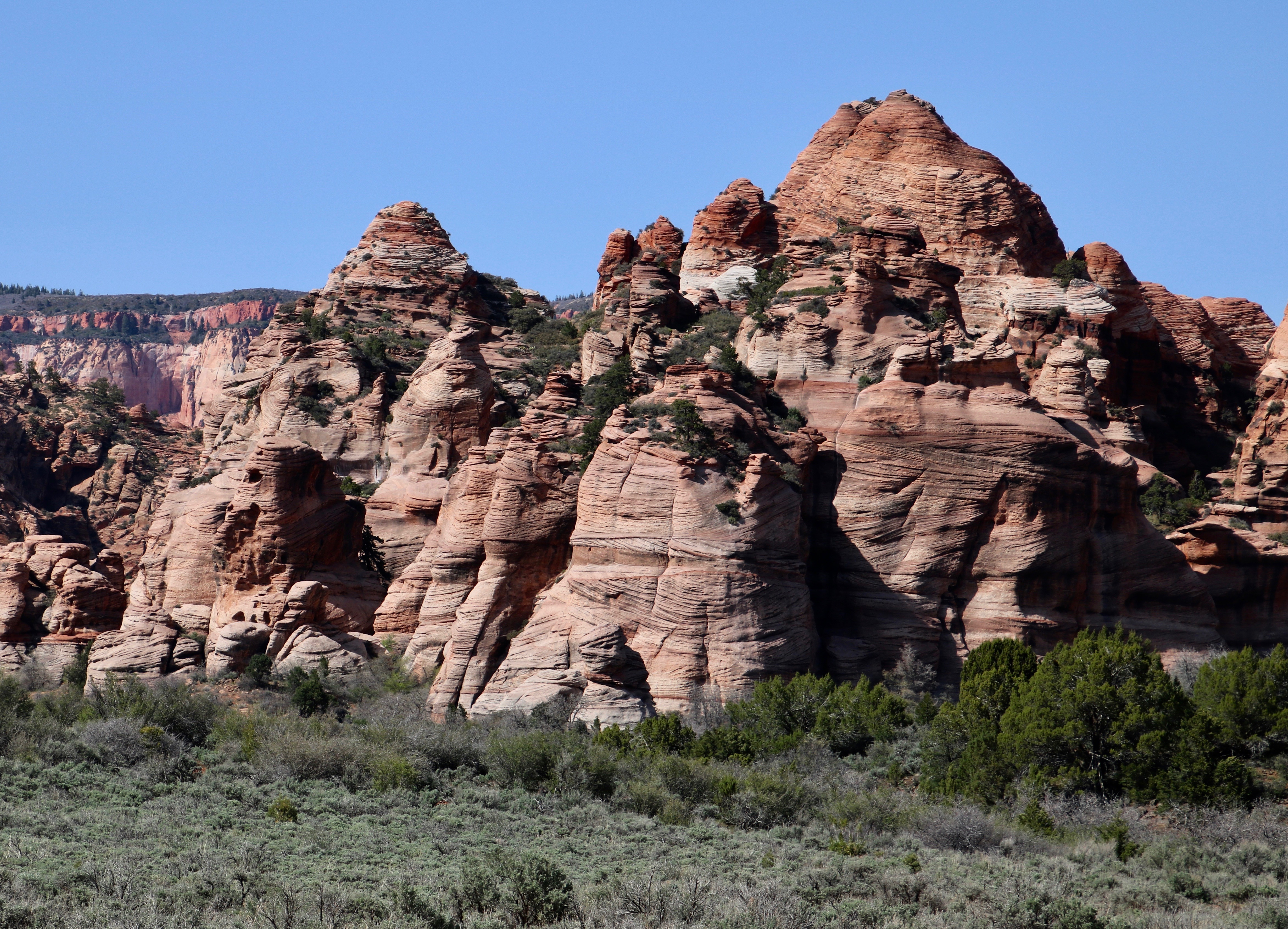
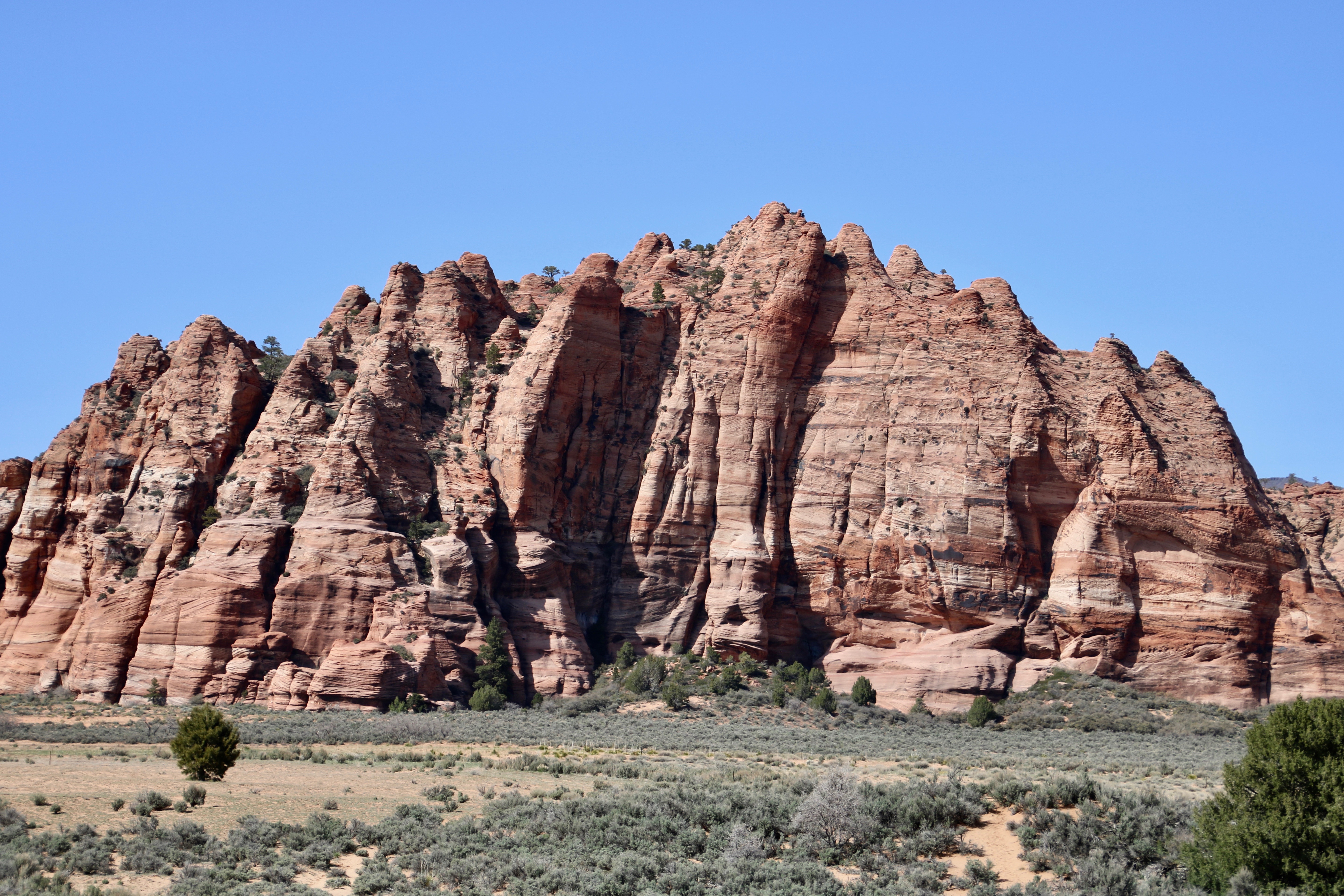
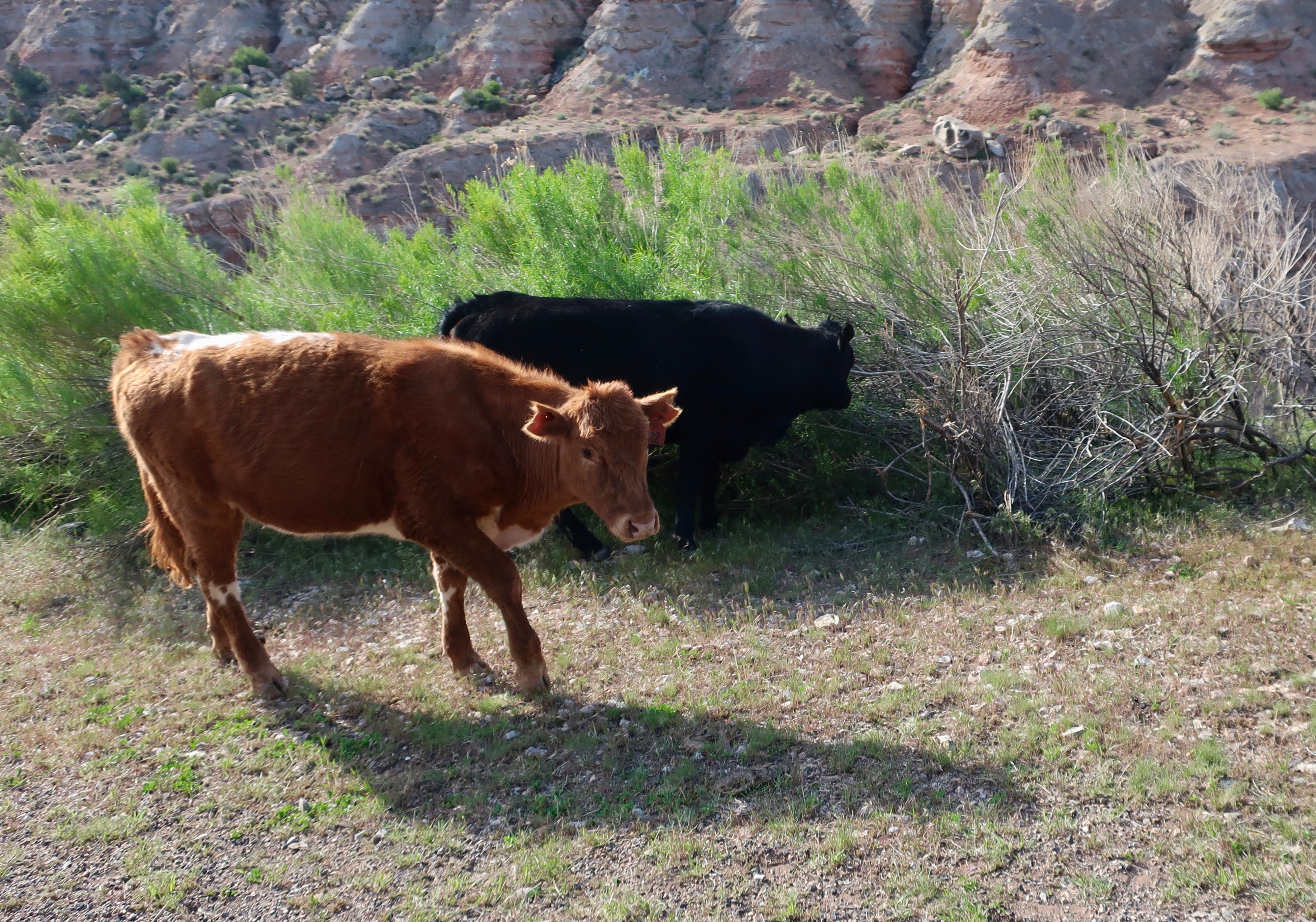
The beginning of our journey up to Kolob Terrace. It was obvious from our initial view that we were going to enjoy the ‘detour’ from Zion Canyon.I think this striking monument was Peggy’s favorite. (Photo by Peggy Mekemson.)She even took more than one photo! I always think that things like the trees in the left foreground add interest and help draw viewer’s eyes into the picture. (Photo by Peggy Mekemson.)I took at least six of this monument on Kolob Terrace featured at the top of the post! Most of the rock structures in Zion are made from sandstone, which, on its own, tends to be white. Like I mentioned in my Death Valley posts, it is oxidized iron that leads to the reds, oranges and pinks.This distant road shot gives an idea of the numerous shapes and colors of the various monuments on Kolob Terrace.Here’s an example of the variety of shapes. I always think of these rock formations as a fairy community, or maybe a troll town. (Photo by Peggy Mekemson.)Sheer cliffs like these found in Kolob Terrace will eventually be eroded by the forces of water, ice, wind and gravity. Different types of rocks erode at different speeds leading to the wonderful shapes found throughout Utah and the Southwest. Note the extensive talus slopes seen beneath the cliff.This distant formation provides an example of the erosive forces at work.A closer view of the same formation. the layer of rock on top is eroding faster than the layer beneath it. like the triangular face of the rock.This massive formation in Kolob Terrace shows a rounded character to the erosion. (Photo by Peggy Mekemson.)The Kolob Terrace road runs through national park and private land. Signs warn that you might find cattle along the way. We did. They had the grace or good sense to stay on the side of the road. I’ll conclude today’s post with a shy rock formation that is hiding among the trees….Caught it. On Friday, Peggy and I will continue to explore the beauty of the Kolob Terrace section of Zion National Park.
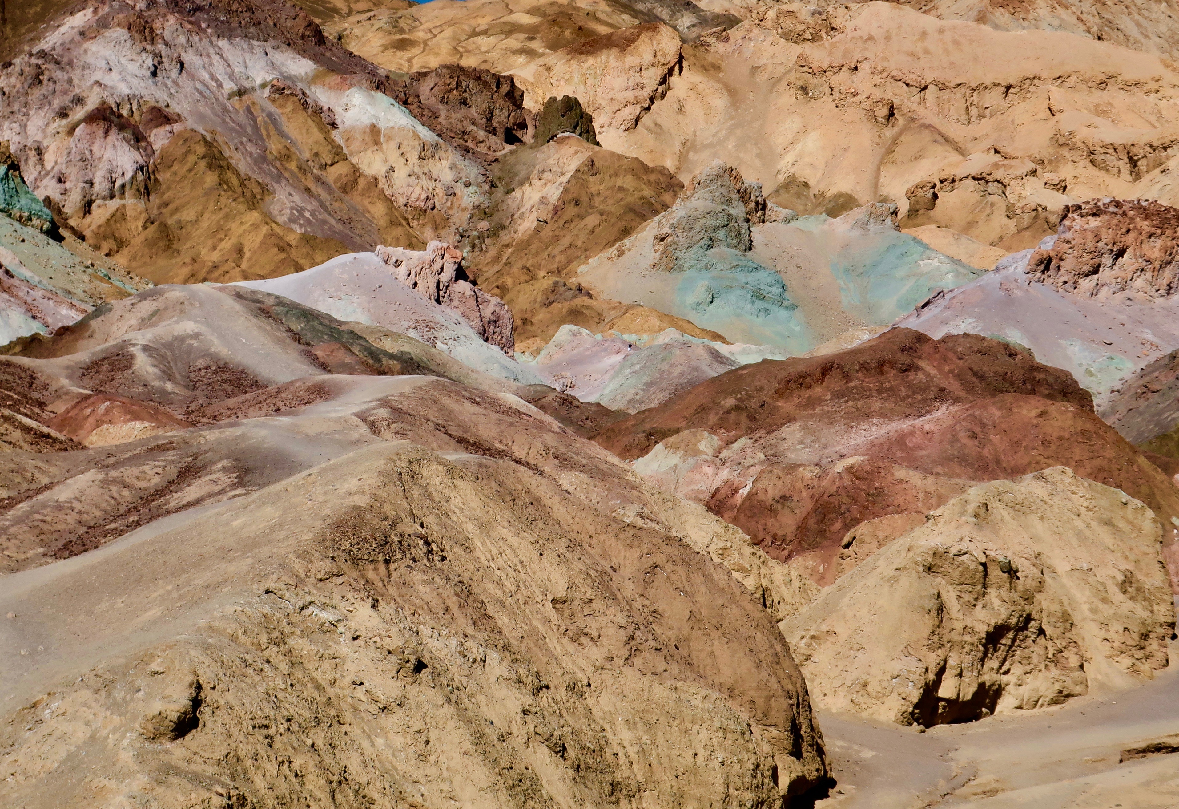
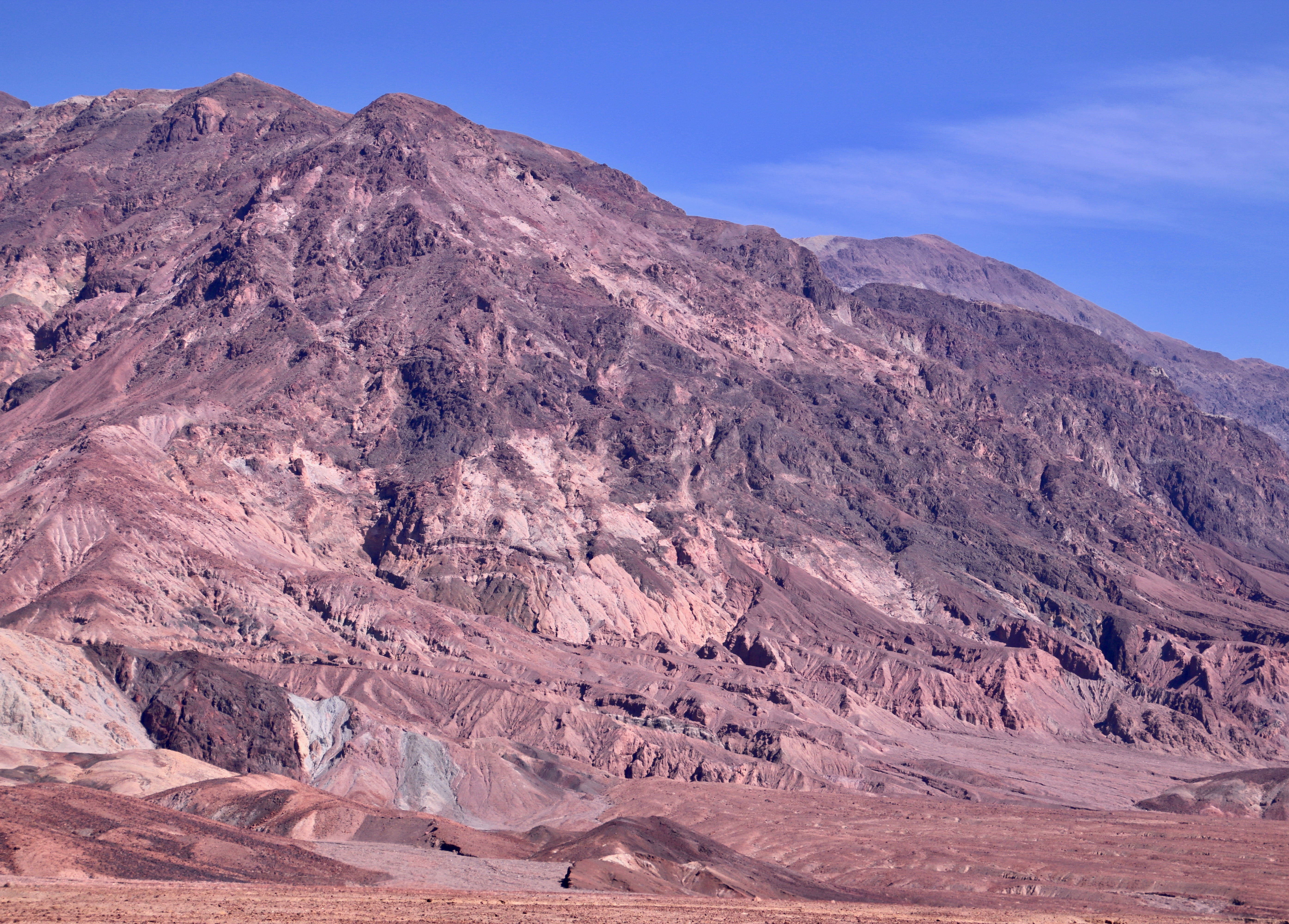
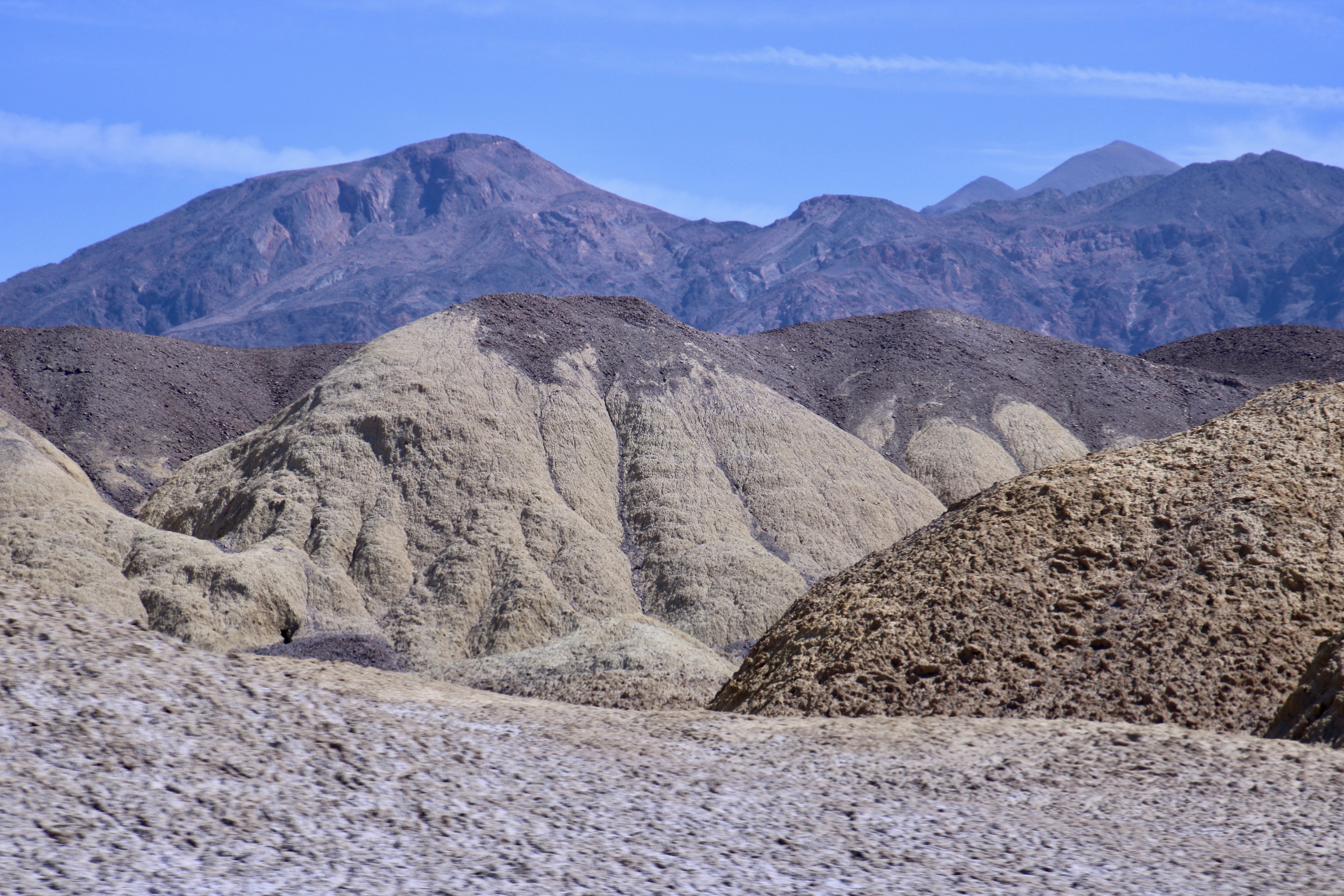
The rocks at Death Valley’s Artist’s Palette are world famous for their color.
Geology is up close and personal at Death Valley. The Valley floor and sides, stripped free of most vegetation, can’t help but show their true colors. The most colorful place to check out these colors is along the paved one-way Artist’s Palette’s drive, which is near the Devil’s Golf Course, Gold Canyon, and Bad Water basin, other treasures of the Valley.
The colors you see are the result of oxidation of various metals. One example of oxidation that everyone is familiar with is the formation of rust on iron. Along Artist’s Drive, iron compounds create the red, pink and yellow you see. Mica derived from tuff, produces the green. Manganese produces the purple. (Tuff is a light, porous rock created from volcanic ash.)
A close up of the rocks at Artist’s Palette.
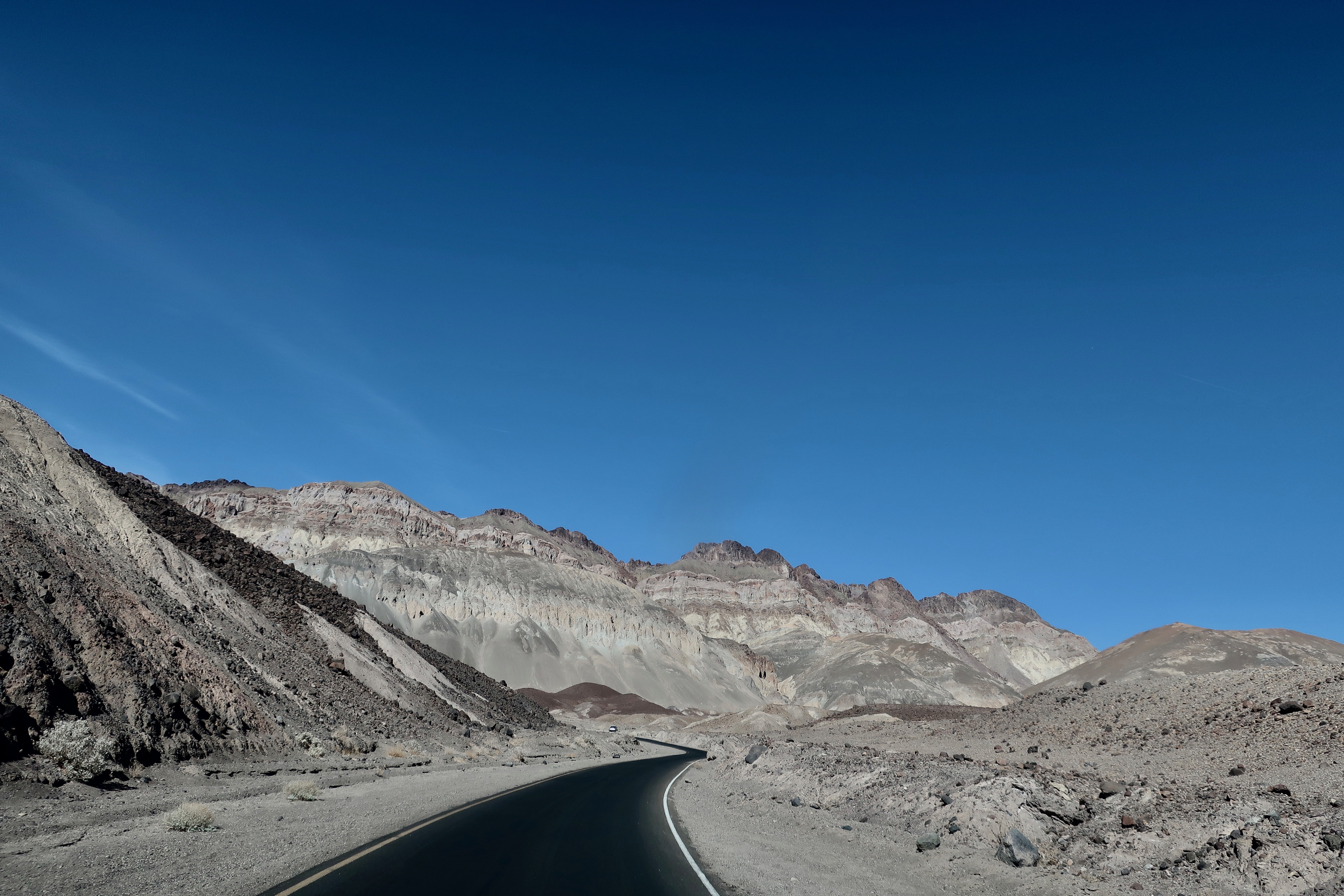
While visiting the Artist’s Palette overlook is the objective, the drive itself is worth the trip. I took the following photos while Peggy was driving. (It was her turn.) In addition to the scenery, there were fun curves and roller coaster ups and downs!
Road shot one.Road shot two.Road shot number three featuring the nose of Iorek the truck.
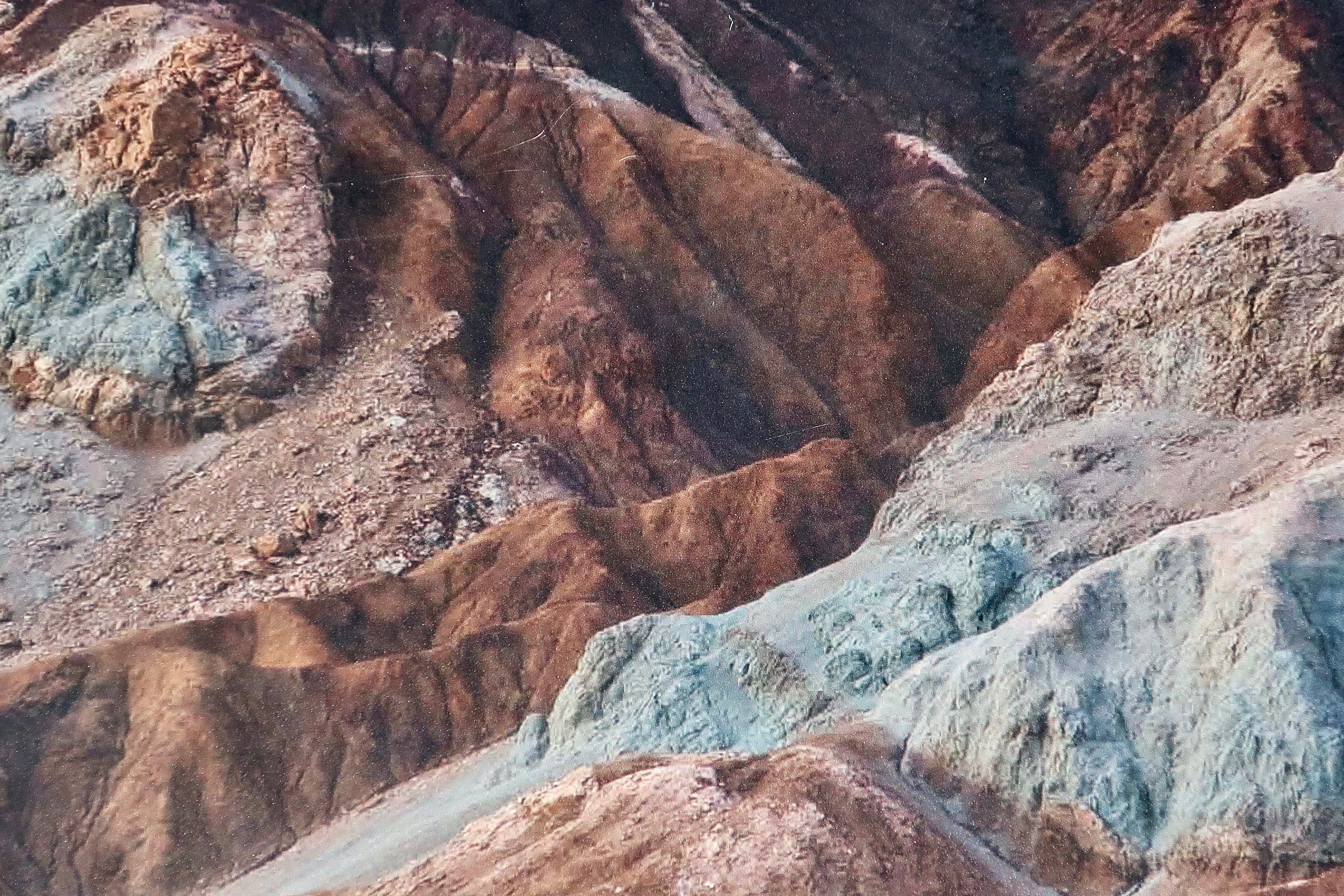
Of course the fun road also has beautiful scenery along it. Artist’s Palate has hardly cornered the market on color, as Peggy’s photos demonstrate.
Photo by Peggy Mekemson.Photo by Peggy Mekemson.Photo by Peggy Mekemson.
Now, let’s get back to the question raised in the Headline: Assuming an artist is in Death Valley has a full palette of colors, which one would he choose to paint a pupfish in love? Enquiring minds want to know.
But first, some background. You’ve probably heard of pupfish. There are several species scattered in locations around the National Park. Once upon a time they were happy residents of a huge lake that filled Death Valley. Lake Manly was a result of the Glacial Age. When the glaciers retreated to the far north and mountain tops 10,000 years ago, the lake was left to dry up and the pupfish were left scrambling for any remaining bits of water left, like individual springs. Lack of any contact created a number of subspecies.
The ones I will feature today live in Salt Creek. Their much more famous cousins live outside of the the Valley proper in what is known as Devil’s Hole, a 430 foot deep hole in the ground filled with water. What makes them so famous is that they are a critically endangered species. Today, there are less than 100 left. There were more in the 1960s but even then they were rare enough to be declared an endangered species, one of the first species to be so, seven years before the bipartisan passage of the Endangered Species Act of 1973.
Environmentalists the world over were ecstatic. The business people not so much. Nearby ranchers were limited in how much water they could pump out of the ground and developers in what land they could sell. Profits would be reduced. All that to save a tiny fish from extinction. A “Kill the Pupfish,” “Save the Pupfish” bumper sticker war ensued. National headlines were created and people across the country became aware of the pupfish. It is still a symbol of the ongoing battle between those who see objects primarily in terms of money and those who see them primarily in terms of inherent value. Being a lifelong environmentalist, I come down on the side of the pupfish, but I feel empathy for those whose livelihood was impacted.
Now join Peggy and me as we go in search of the ‘illusive’ pupfish of salt creek, whose males turn bright blue when they are in love, or is that lust. Either way, I’m glad that isn’t an infliction of human males.
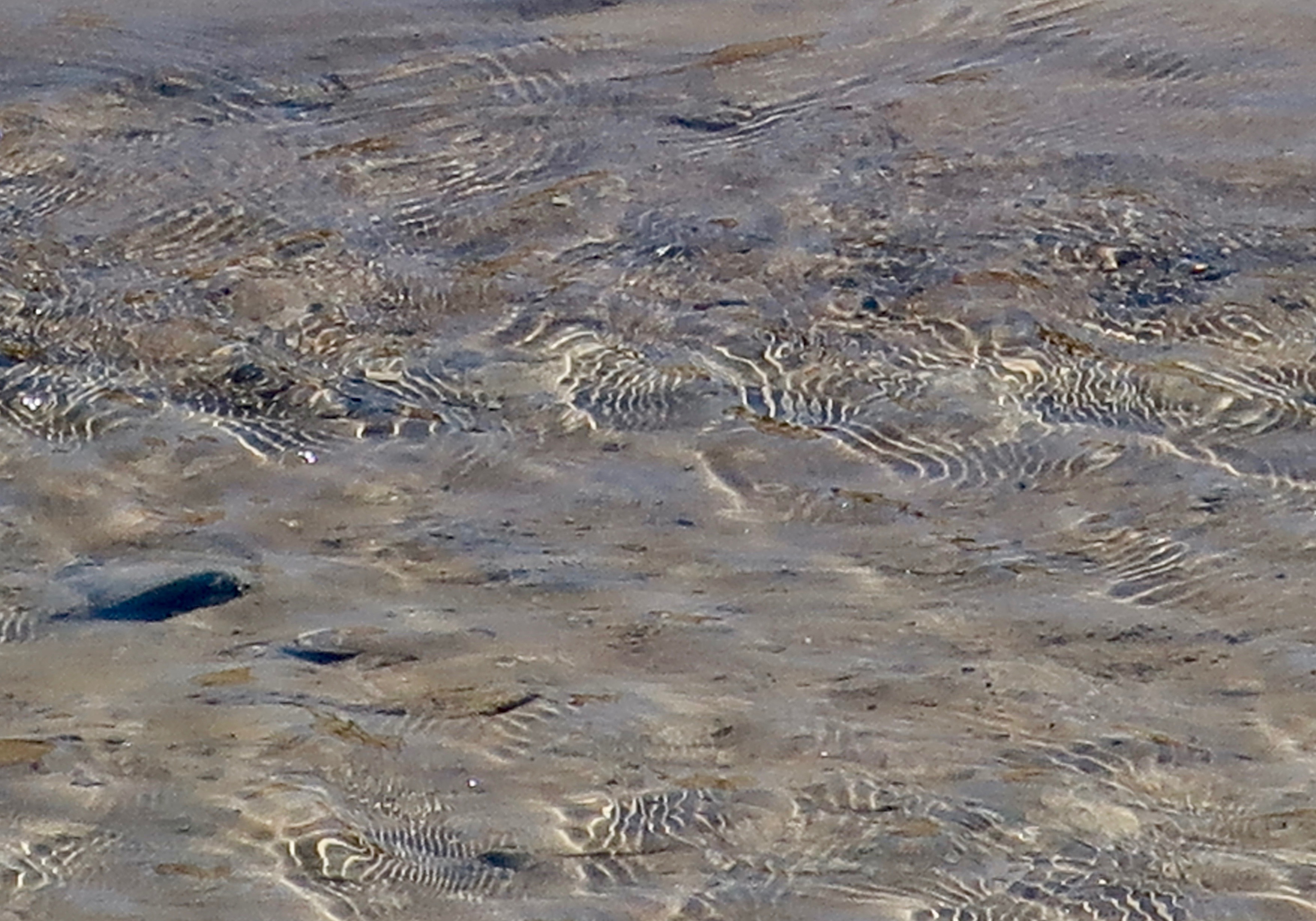
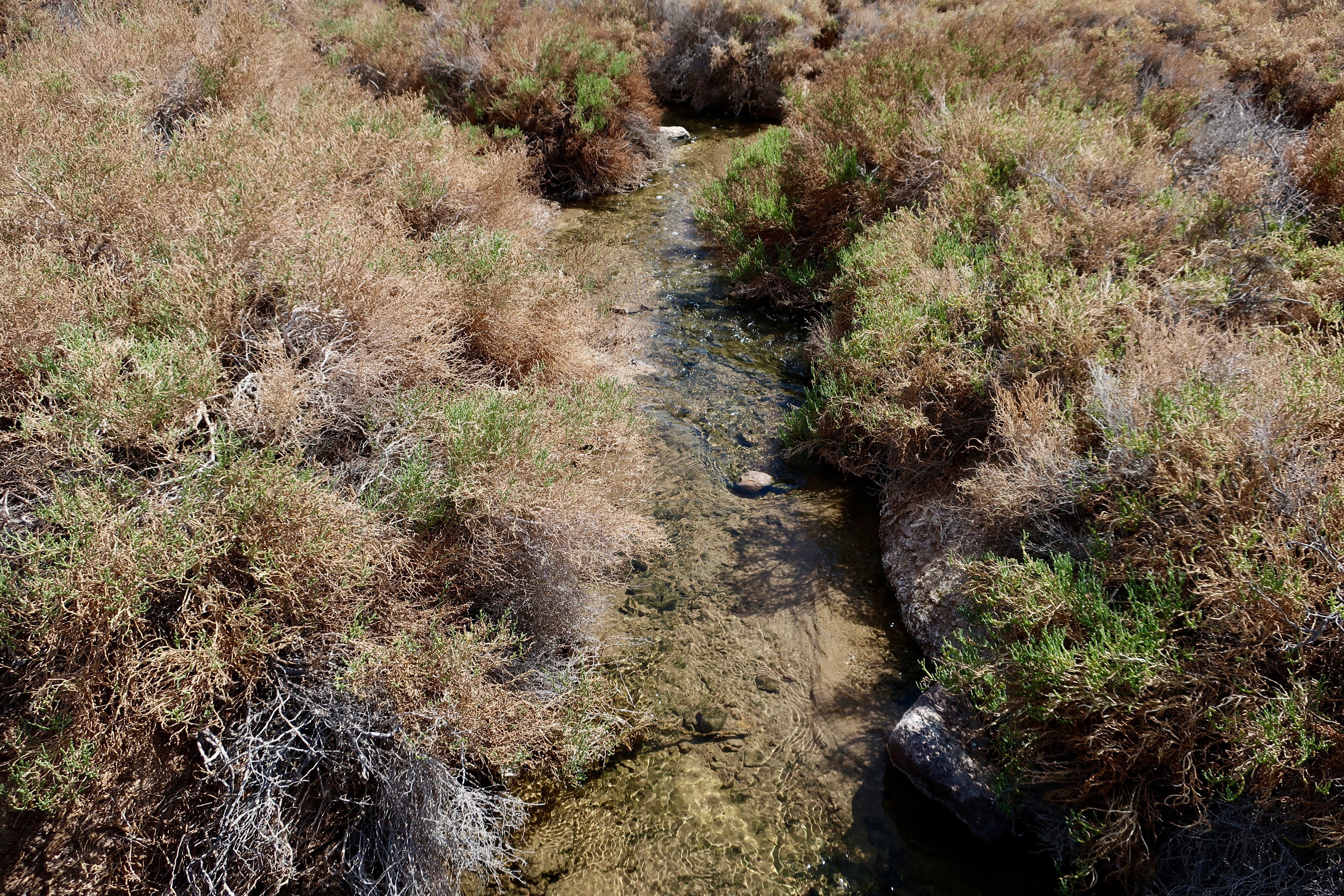
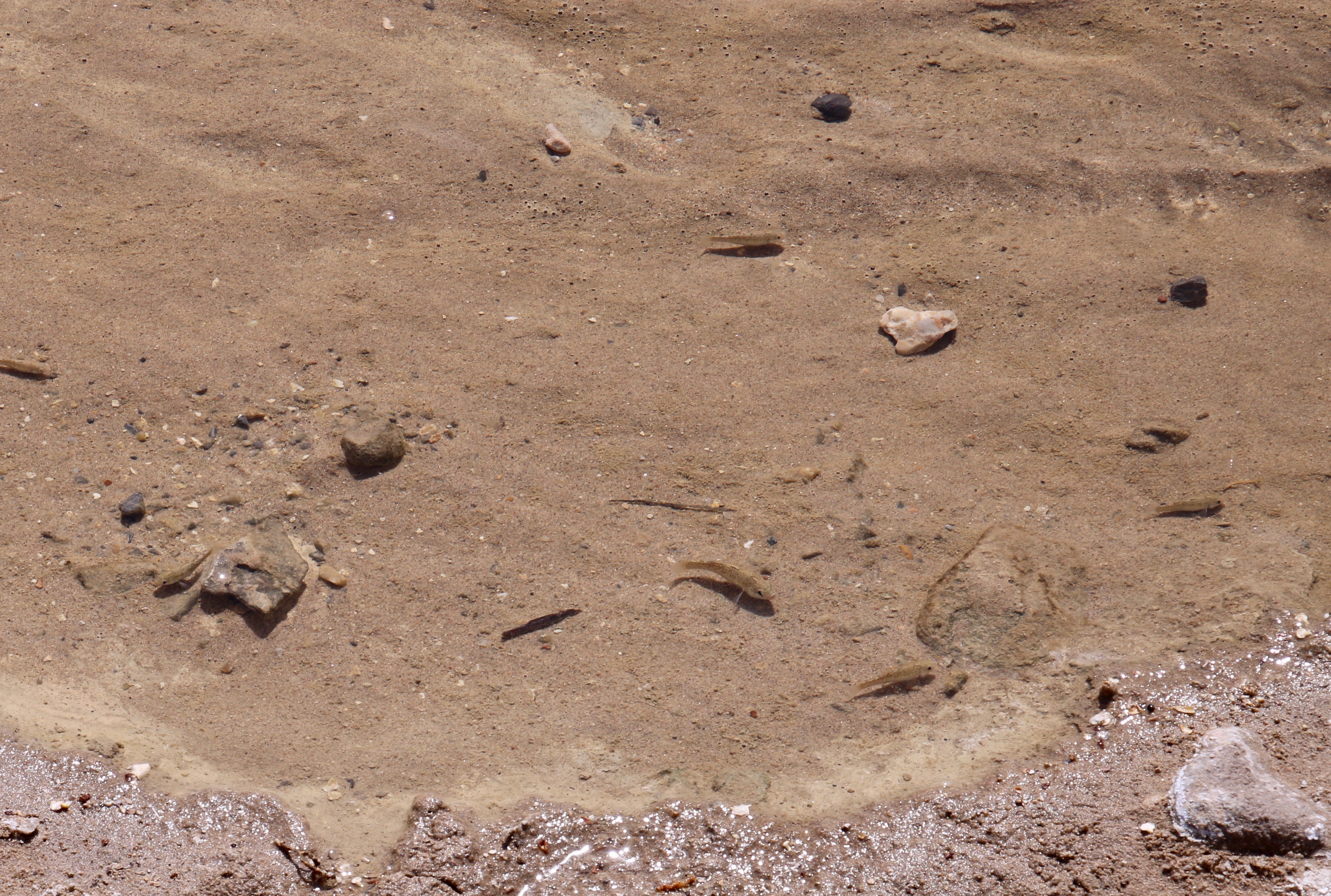
A road sign some 15 minutes west of the Furnace Creek Visitor’s Center points you down a short, but bumpy dirt road to Salt Creek. The first thing you notice is that there is indeed a creek, which is a rare site in Death Valley. We were lucky to be there in April when it was still flowing. The second thing we noticed was that a well-built board walk followed along the creek.We eagerly set out with our eyes pealed on the water, searching. (Photo by Peggy Mekemson.)No fish here. But I enjoyed the dapples of bright sunlight…Again, no fish. I was stuck with admiring the ripple patterns caught by the sun. But where were the pupfish?Again, nice riparian habitat, but for what. And then…There they were. Busy male pupfish protecting their territory and looking for love! They didn’t appear blue to us, however. Maybe they weren’t ready for prime time. (Photo by Peggy Mekemson.)Right next to it was a pool absolutely teeming with the little fellows. Apparently they hadn’t received the message about being endangered. We learned that the word prolific hardly fit when describing the baby producing capacity of the females. And the males were more than willing to do their share. The literature used the word ‘millions’ when describing a season’s production. Unfortunately, when the creek dries up most of these offspring are lost. Only those that live near the spring in year around water survive— and wait for the next year so they can one again start their frenzy of propagating. (Photo buy Peggy Mekemson.)An information panel gave an artist’s rendition of a happy couple. “But where’s the blue?” went dashing through my head. Remember the old “Where’s the beef?” commercials. Okay, I admit that there is some blue, and it is on the male. The panel described the mating process. And it isn’t even R-rated. A female arrives in the males territory, swims over to him, and snuggles up to his side. They start shivering in anticipation, and zoom, she’s pregnant. Just like that. I’d say something about being premature but apparently, that’s how it’s done. “Was it good for you, honey?”
When you watch pupfish for a while they appear to be playful, dashing around, chasing each other, and plowing up the dirt with their noses. That’s where they get the name pupfish. We wished this year’s crop good luck and I took a final photo of the creek as we headed off for out next adventure: exploring Mosaic Canyon, which will be our next post.
Water is precious in the desert and the pupfish is only one of a number of animals and birds that take advantage of Salt Creek as is makes its way out into the desert to disappear into the sand.
Who’s smarter? This girl with her wild eyes and gorgeous eyelids…Or this fellow with a large nose and impressive nose hairs?
Or, the question going through your mind might be, “Why in the heck is Curt asking this question when his post is on Death Valley?”
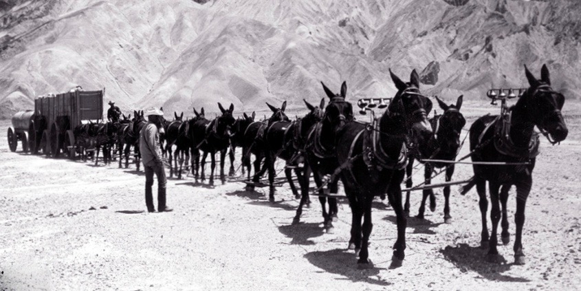
Well, it started when I was doing research on Death Valley’s well-know, historic 20 Mule Team. Given that I am featuring the 20 Mule Canyon on my post today, I wanted to provide some background information, which I will. But the first thing I learned (or relearned) was that it wasn’t a 20 mule team that was used to haul borax out of Death Valley from 1893-96. It actually consisted of 18 mules and 2 horses. All of the animals had very specific tasks. Some required more intelligence than others.
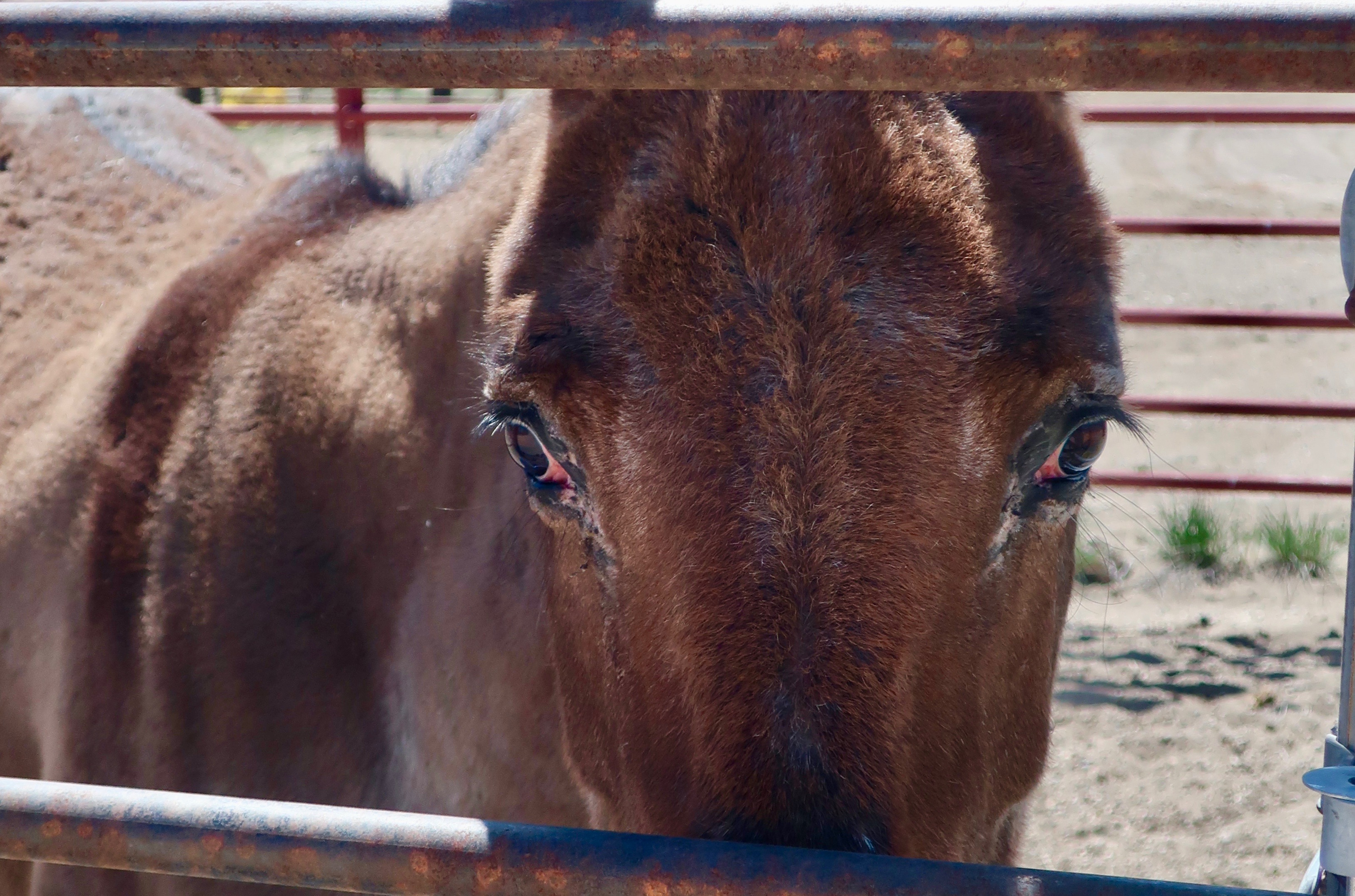
Luckily for me, the town just up the road from where we camped near Bryce Canyon (Tropic) had a Mules Days event going on and there was a horse corral just across the road from us in Cannonville. I was able to persuade a mule and a horse to pose for me.
There is a ton of information on the twenty mule teams. This may seem like a lot until you take into consideration that the 18 mules and 2 horses were actually hauling close to 9 tons of Borax at a time out of Death Valley in temperatures that sometimes exceeded a 100 degrees F. (Operations were halted over the hot summer months.) They started their epic journey from the Harmony Borax Works near Furnace Creek and traveled for 165 miles over primitive roads to the railhead near Mohave. As you might imagine, it was quite the challenge. It required close to a heroic effort on the part of the mules, the horses and the muleskinners. Millions of dollars could be made if the venture was successful, however, and it was. Borax has lots of uses.
Still, all of this would be a mere note in the history books except for a couple of factors. One, Borax Soap featured the mules in a very extensive advertising campaign. The second was the radio and TV program, Death Valley Days. For those of you who are old enough to remember the 50s and 60s TV show, you may also remember that Ronald Reagan hosted the show in the mid 60s just before he jumped into his campaign for California Governor.
I think this 20 mule team traveling through 20 Mule Canyon is a team that Borax Soap used to promote its product. The photo is from the US Borax’s Visitor Center in Boron, which is well worth a stop. The two large wagons were for hauling the borax. The last wagon contained water for the mules since water holes were few and far between on the long, dry 10-day journey— and it was very thirsty work. The man at the back of the line is riding one of the two horses. The two lead mules, both female, have bells. This historic photo provides a good perspective on just how big the wagons were. The large wheel is seven feet tall. The man on the left is the muleskinner who was in charge. On his right was his swamper who carried out a number of supportive jobs including handling a back up brake to be used if the wagon decided to run away going down hill.The muleskinner earned $4 per day, his swamper, $2, and the Chinese laborers who did the hardest work of digging out the borax, $1.25
I found a rather amusing, imaginary discussion with a muleskinner on the Death Valley National Park site. The greatest challenge he noted was in getting around corners. He used a diagram to describe the operation. An 80 foot chain connects the lead mules to the wagon.
Here’s what he had to say about the process: “Now I’ll tell you just how smart my mules is: it’s one thing drivin’ along a straight road; it’s a whole nother thing turnin’ corners on a mountain pass. My 2 lead mules, both mares, are about 80 feet ahead of me–so far away I can’t even begin to use my 9-foot long whip on ‘em. I’ve been known to throw pebbles at ‘em to get their attention. Aim’s good too. Back to gettin’ around corners. The next 5 pairs of mules are my “swing teams”, they ain’t real smart, they just know their names and what ‘pull’ and ‘stop’ means. Now the next 3 sets of mules behind the swings are my “pointers”. These mules are trained special to jump over that 80-foot chain and side-step away from the curve to keep that chain tight and my wagons goin’ ‘round that corner right. Next comes the 2 big horses. They’re strong enough to start my wagons rollin’, but that’s all they’re good for. A dumb mule (and I ain’t seen one yet) is a whole lot smarter than a smart horse.”
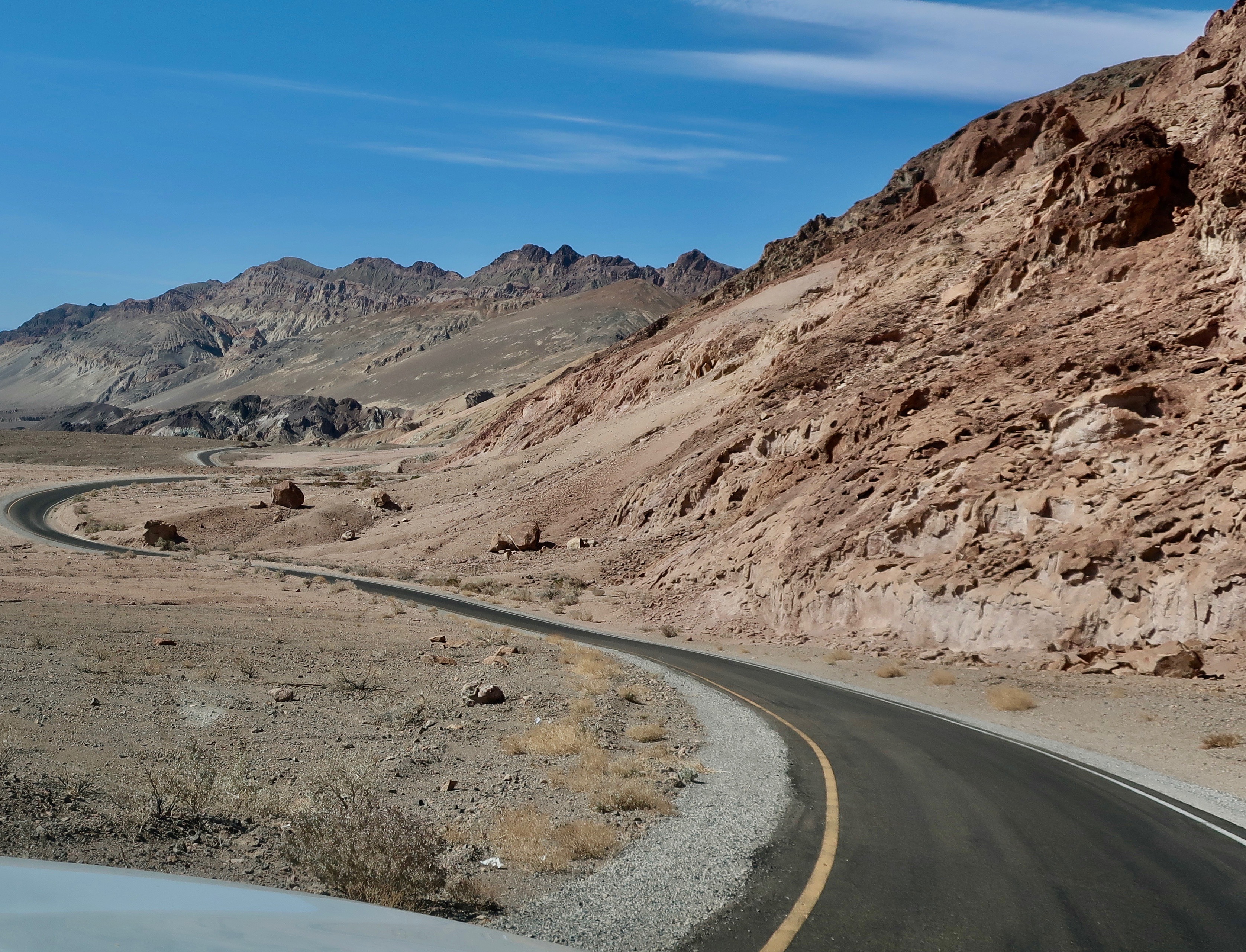
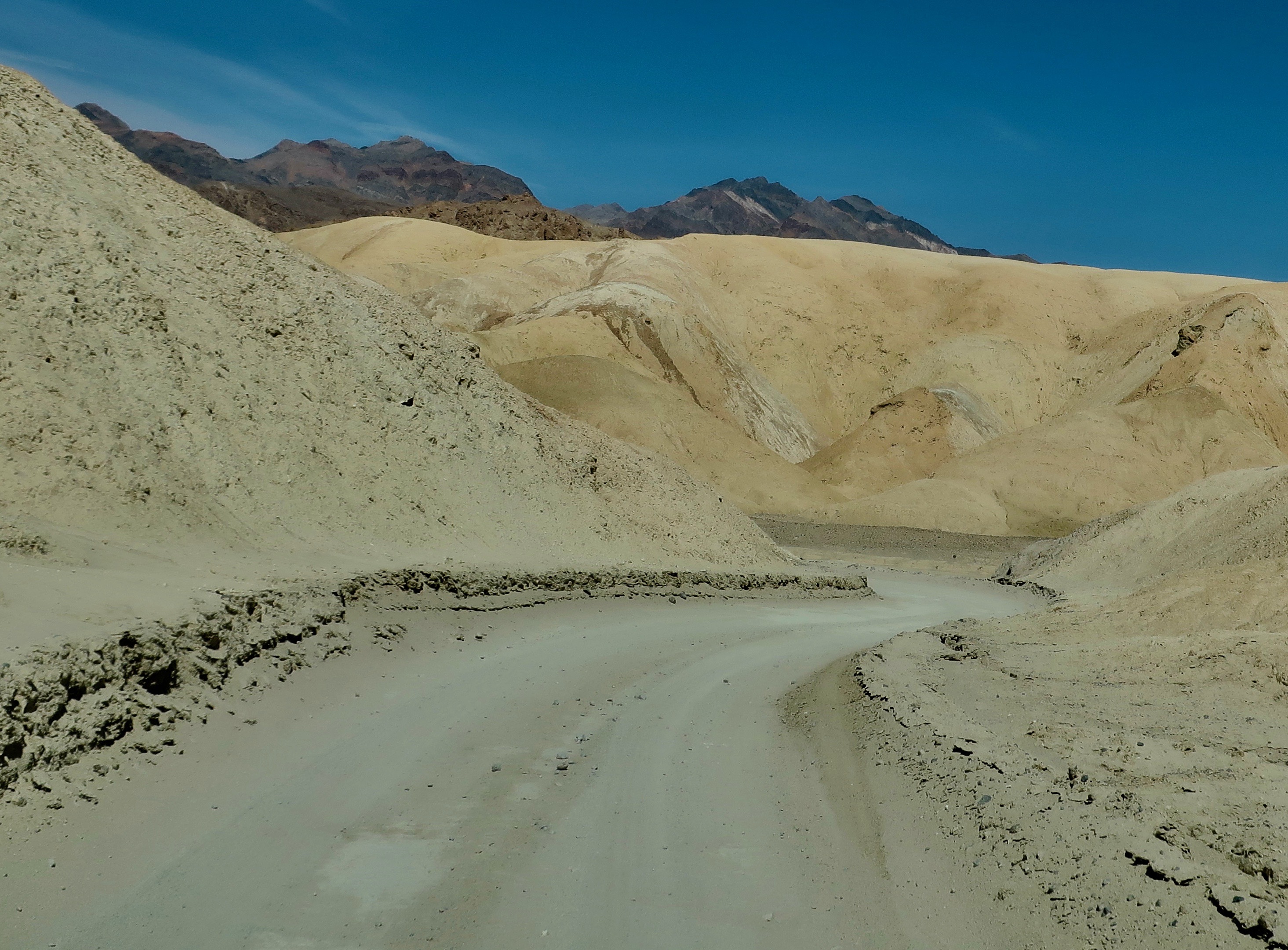
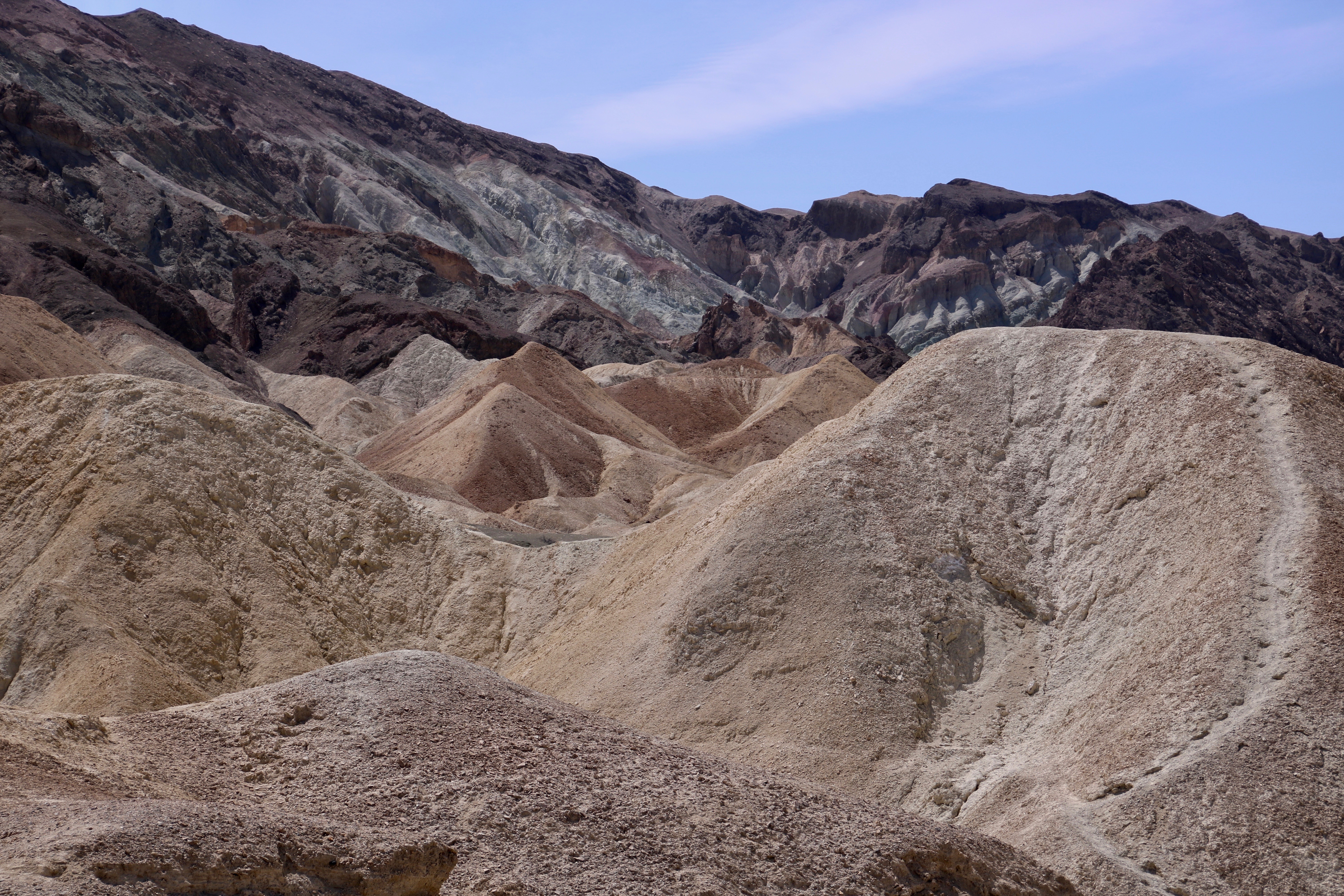
So, there you have it— which animal is smarter. At least from the perspective of a muleskinner. I’ll allow that a horse lover might have a different point of view. Grin. And now, it’s time to get away from all of the words and take you through 20 Mule Canyon in photos. The canyon starts no more than a mile above Zabriskie Point. And even though the road is dirt, cars with two wheel drive seem to handle it easily.
The dirt road.Photo by Peggy Mekemson.Photo by Peggy Mekemson.Photo by Peggy Mekemson.Peggy caught a photo of me hiking up a trail. There are a number of stops along the road where you can get out, stretch your legs and take photos, if you want. I captured this photo of Peggy Woohoo! And the next two photos.I’ll conclude today with this photo of a very colorful place along the road. The colors are created by the oxidation of minerals/metals. I cover which metals cause which colors in my next post. It will be on the even more colorful drive to the Artists Palette. I am going to feature pup fish as well. (Photo by Peggy Mekemson.)
To bring you up to date, Peggy and I have now spent a week in Zion Canyon National Park and a week in Bryce. We are now in the small, but fun community of Kanab, perched on the border between Utah and Arizona. Here’s a photo we took last week to give you a view of things to come.
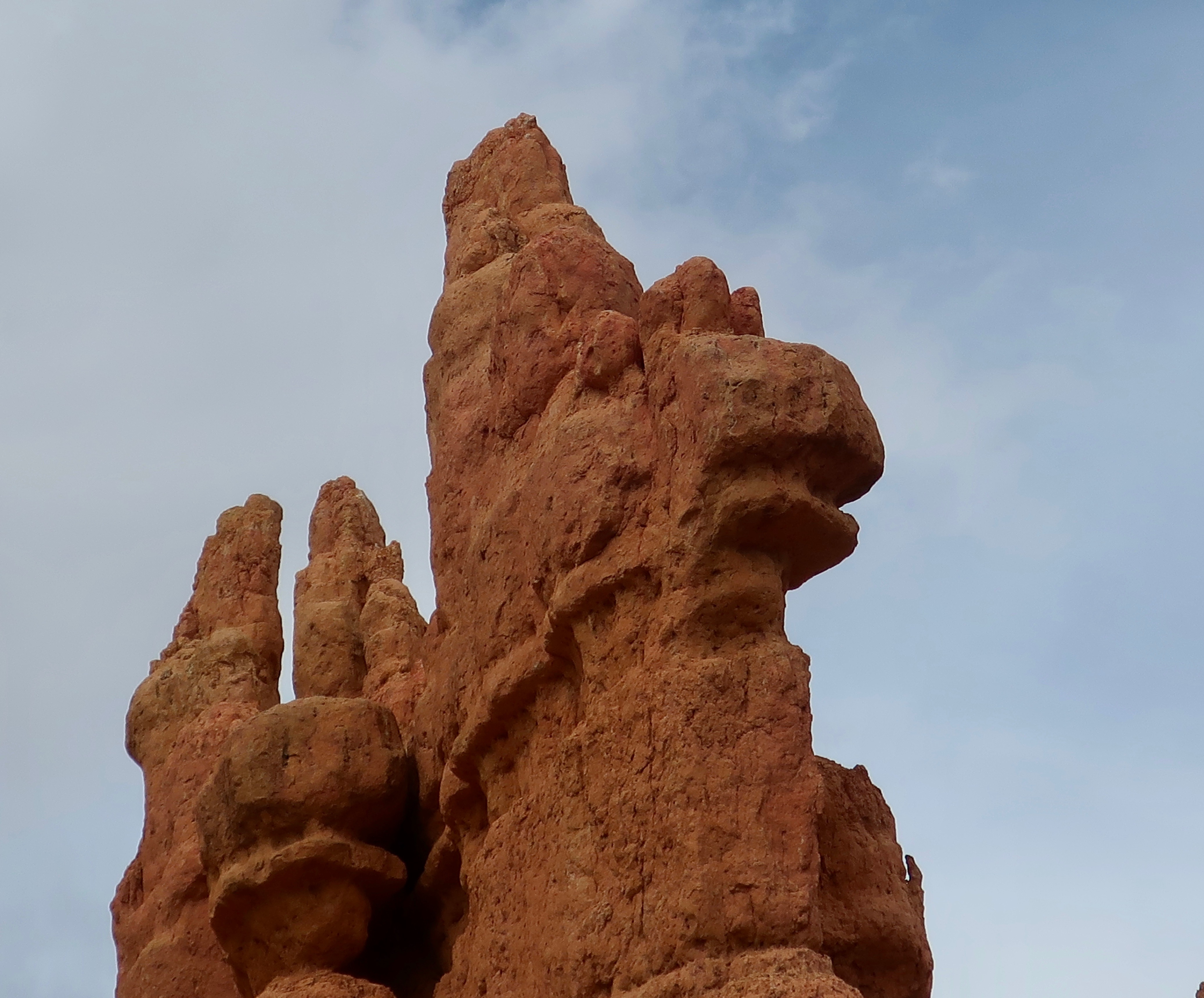
A pair of hoodoos we found near Bryce Canyon. The name hoodoo is derived from a Paiute Indian name meaning scary. I think I can see why.
The book cases are gone, as are the books, and almost everything else. Packed up and shipped east or given away. The house feels lonely now, but soon it will be occupied by someone who is excited to have a home in the woods. The sale is pending!
My blogging friends Linda and Karen from Texas called yesterday and wanted to know where in the world were we. It was special for them to check up on us. They caught us between Death Valley and Las Vegas.
Peggy and I hadn’t dropped into a black hole and simply disappeared from WordPress as people sometimes do. We had forgotten how much work goes into moving and selling a house. It’s number three on the top-five list of stress producers— right after the death of a loved one or divorce, and before having a major illness or losing a job! There was no time for blogging during the day, and by night, I had reached zombie status. Sitting and vegging were about all I could muster. I had gone beyond couch potato; I was a couch turnip.
Anyway, long story short, two weeks ago, Peggy and I made a final walk around our house, hooked up Serafina, the trailer, to Iorek, the truck, and drove up our road, honking as we had promised our neighbors we would in a final farewell. Beep, Beep, Beep-Beep, BEEP—BEEP.
Peggy and I took a final walk around our house and said goodbye to the Red Buttes, the Oregon pioneer rose, Peggy’s garden, the deer and so many other things that we had taken joy in.
Saying goodbye wasn’t easy. We had lived in our little home in the woods for 11 years— longer than either of us had ever lived anywhere since heading off to college. We had come to love the five acres we were responsible for with its irrepressible wildlife and even gotten used to the deer pressing their noses up against our windows to see what we were doing inside. Or leaving their babies sleeping on our porch as the moms went off to browse. That speaks to how much the deer trusted us. It gave a whole new meaning to baby-sitting. Then there were the squirrels and foxes and bob cats and cougars and bears. Oh my! Bald eagles flew up and down the canyon and soared into the air where they were joined by osprey and hawks. Numerous other birds lived on our property or stopped by on their way elsewhere. Watching them gather at our bird feeder and determine who was boss provided endless entertainment. Having a national forest in our backyard and a river in the front yard wasn’t half-bad either. Nor were the views of the Siskiyou mountains, a scant ten miles away with their snow-covered peaks and incredible sunsets.
Last, but certainly not least, Peggy and I had great neighbors. They were a diverse group that came from widely different backgrounds but genuinely liked each other, almost a miracle in this age of irreconcilable differences. On Friday we had them all over for a going away potlatch party, which, in case you don’t know, was a tradition of the Northwestern American natives where the chief would call everyone together and give away most of what he owned at an opulent feast.
Our potlatch didn’t quite qualify. For one, we weren’t chiefs; for two, our opulent feast was a beer, wine, booze and pizza party. Papa Murphy’s did the honors on pizza and we cleaned out our liquor cabinet for the beer, wine, and more serious alcohol, like 98 proof rum and Tom’s Blackberry Surprise. The surprise was the amount of vodka he added to juice from the five-gallons of blackberrys we had picked last summer. Drink a little and it tastes good; drink enough and it is the best concoction you had ever downed. There was plenty of alcohol to make everyone happy. An opulent feast wasn’t necessary and the pizza was scarfed down.
And finally, we didn’t give everything away. Hardly. We’d already sent a 16’ x 8’ packed moving pod off to our daughter’s home in Virginia with our treasures— mainly books, book cases, a buffet, art, a couple of comfy chairs and some heirlooms. We had also made numerous trips to Goodwill and the dump. And, while we had shipped 30 boxes of books to Virginia, we had also given 15 to Friends of the Ruch Library to sell to benefit the library. Peggy had been the president of FORL for six years. To top it off, Serafina and Iorek were loaded to the gills with everything we might need for the road— Plus. Peggy kept stuffing things into Serafina or showing up with bins for me to find room for in Iorek. Even with all of that, none of our neighbors went home empty handed. There were still couches and beds and chairs, and kitchen supplies, and lamps, and food, and sporting equipment and left over alcohol. There was even a 24 roll pack of TP from Costco. That would have brought a fortune at the beginning of the pandemic. People would have killed for it. We could hardly give it away.
As tough as saying goodbye was, Peggy and I were more than ready for our new life of full-timing. After all, the name of this blog is Wandering Through Time and Place!
With two weeks on the road behind us, we are almost human again. What we did, actually, was drive down to Reno where we camped out for a week while we relaxed and reacquainted ourselves with life on the road and our new trailer. And then we drove on to Death Valley, getting there four days before they closed the campgrounds for the season. A blog is coming.
A teaser from my next blog. This was taken along the 20 Mule Canyon Road. (Photo by Peggy Mekemson.)
We’ve now moved on to Las Vegas and are getting ready for our next National Park, Zion Canyon. We have four travelling companions along: Bone and Eeyore of course. They’ve travelled with us for over a quarter of a million miles. This time, however, they have been joined by Goofy and Iorek’s avatar. Goofy has been hanging out with me since the 70’s when a friend learned that one of my in-law relatives had been responsible for the creation of Goofy and, I might add, Bozo the Clown. I identified more closely with Goofy. Yuk, yuk. Iorek’s avatar was sent to us by Chrystal Trulove, one of our close blogging friends, as a Christmas Tree ornament. He told us that he would much prefer to be on the road with us than be packed away in a moving pod.
Goofy is patting Bone on the head. Bone is dressed to travel in his quilt. Usually, he runs around naked. Iorek, who is new to our menagerie, peaks out from under Eeyore’s ear.And finally, me, happily settled into Serafina, the trailer, and back at blogging. Our Murphy bed morphs into a comfy couch, only a part of our Africa quilt is showing! (Photo by Peggy.)
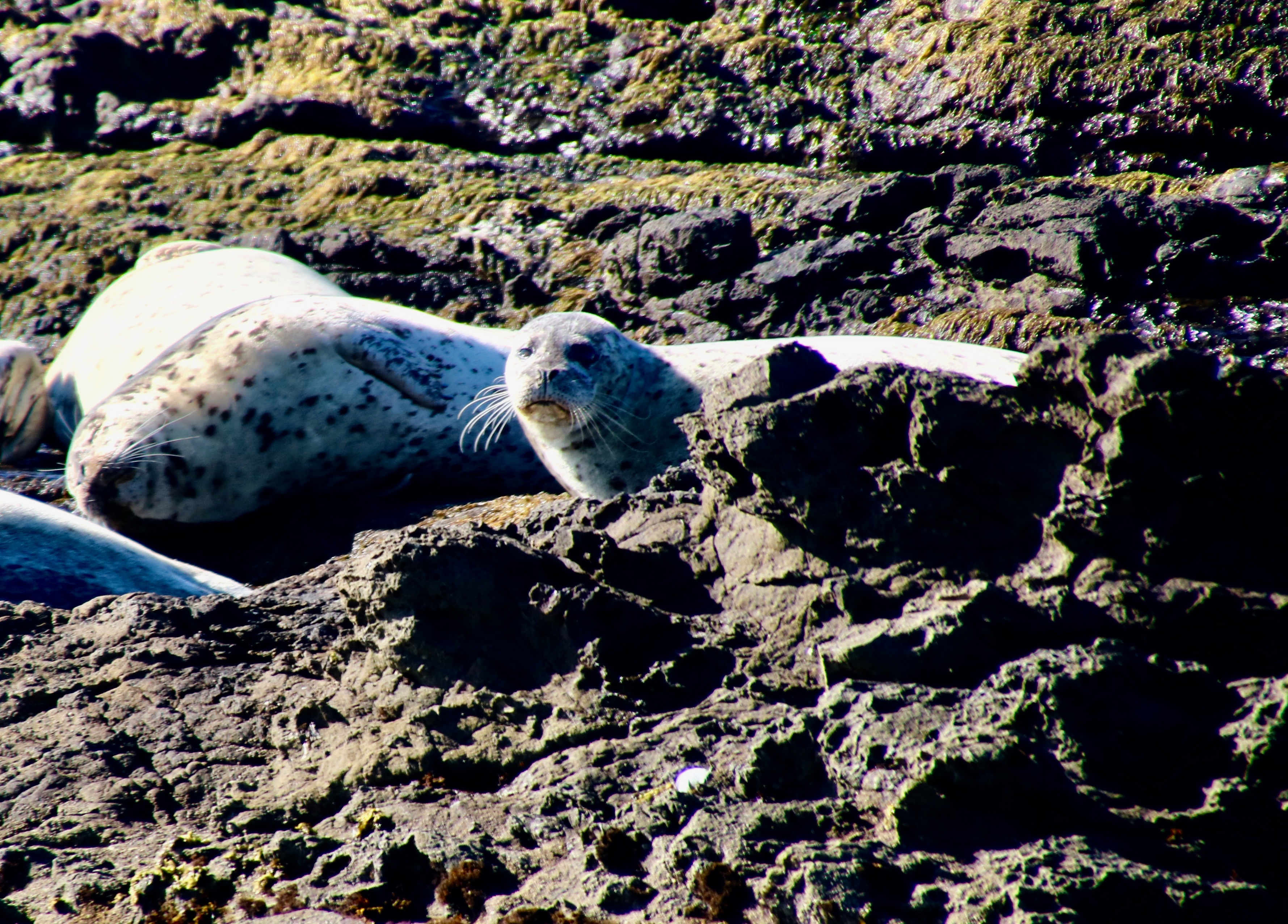
Peggy and I were ‘getting the look’ when she snapped this photo at MacKerricher State Park just north of Fort Brag, California. The concern the seal had was whether we would come closer and disturb his snooze in the warm sun, i.e. would he have to get up and jump in the icy ocean? The answer was ‘of course not.’ I’m not happy when someone disturbs my afternoon siesta. So why should I disturb his. You know, “do unto others…”
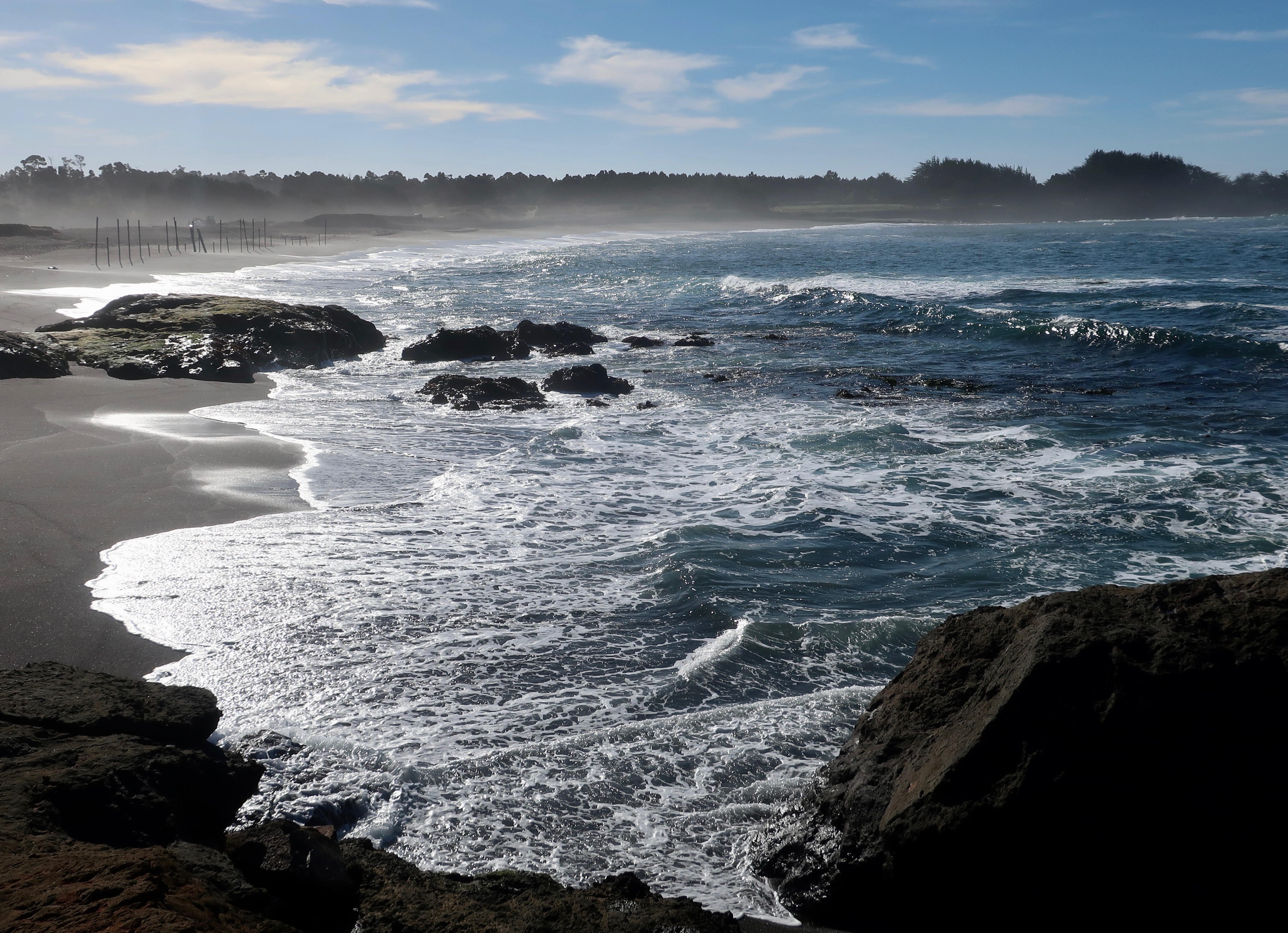
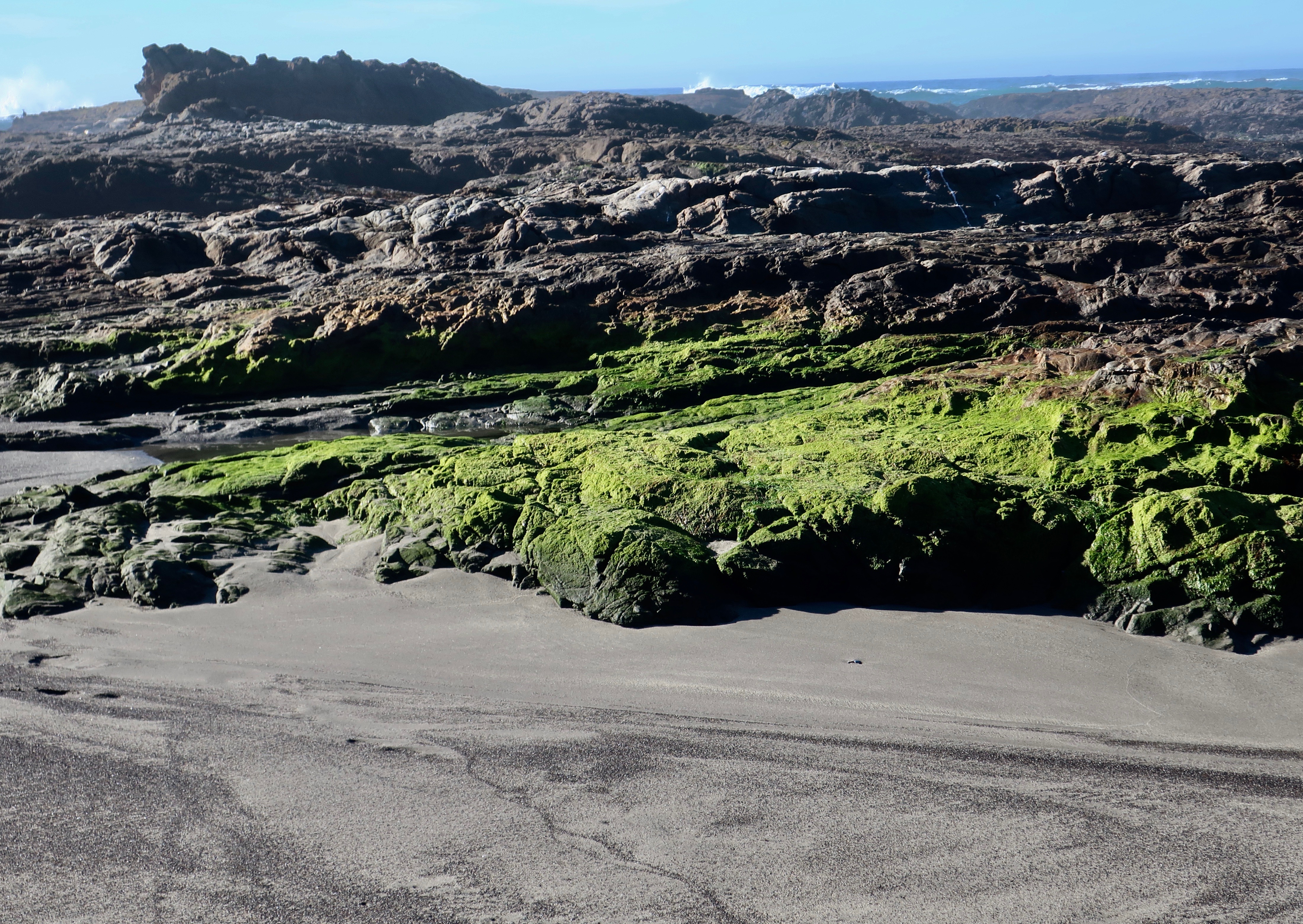
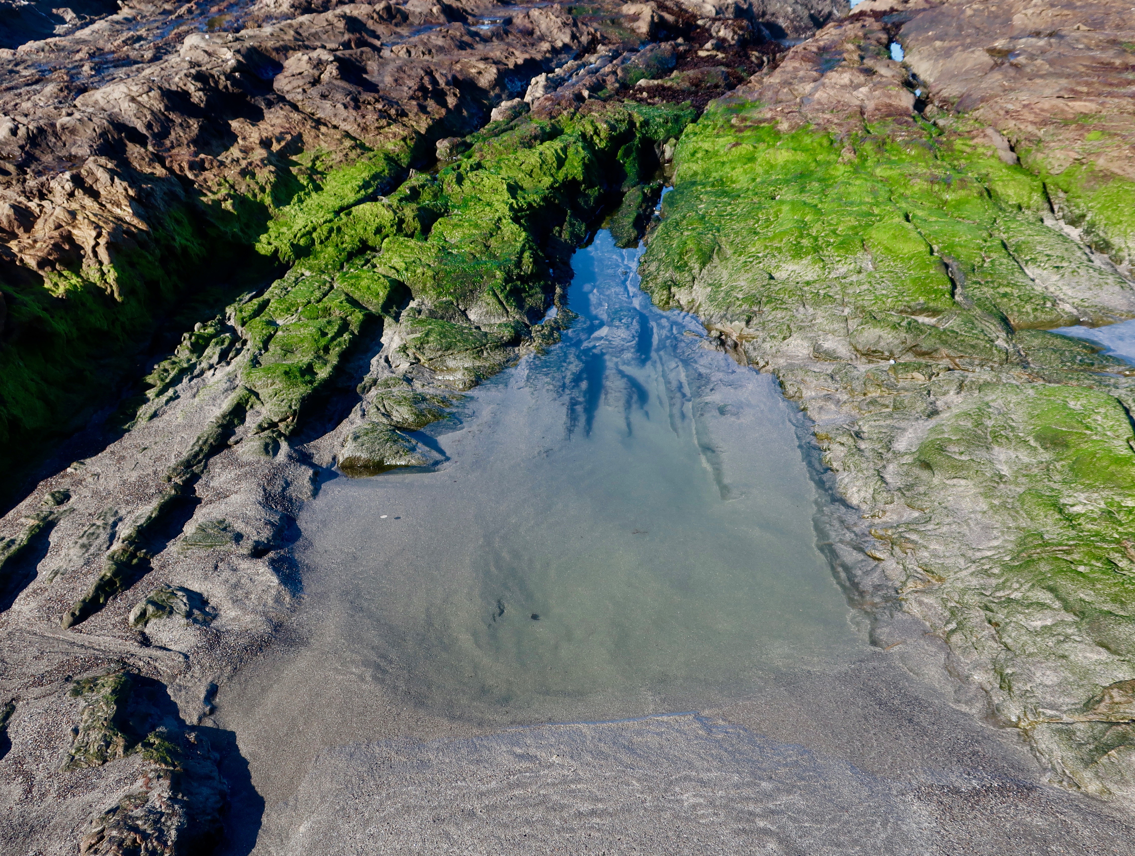
This is the last post from our not-so-recent trip to the North Coast of California last November. Tempus Fugit. Indeed. My posts have been so rare lately they are close to being put on the endangered species list. But more on that later. MacKerricher State Park begins 3 miles north of Fort Bragg, California and continues for 9 miles up the coast. It features a wide variety of habitats ranging from sandy beaches to rocky headlands. There are tide pools, wetlands, a fresh water lake, and even a sea-glass beach. The ocean took an ugly dump and ground the glass up into attractive baubles that people like to collect. Our daughter-in-law Cammie used to turn sea glass she gathered in Alaska into beautiful jewelry.
We were at the park for a couple of hours and only walked a mile or two along the 9 mile beach. We were impressed, however. The area deserves much more of our time. I’ll let the photos that Peggy and I took speak for it. I included some of the these in an earlier post.
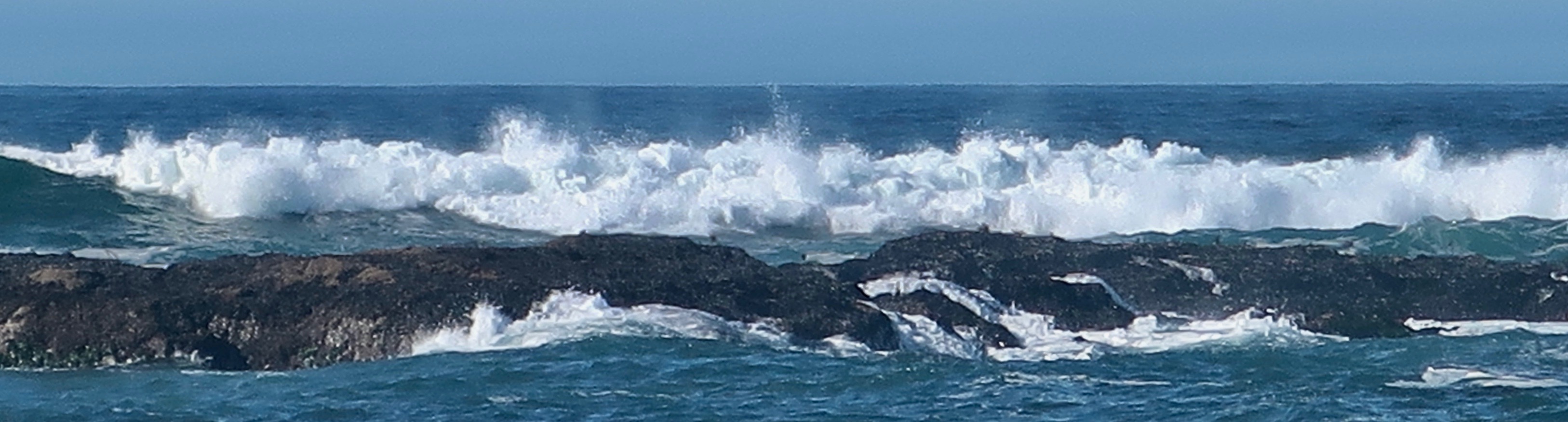
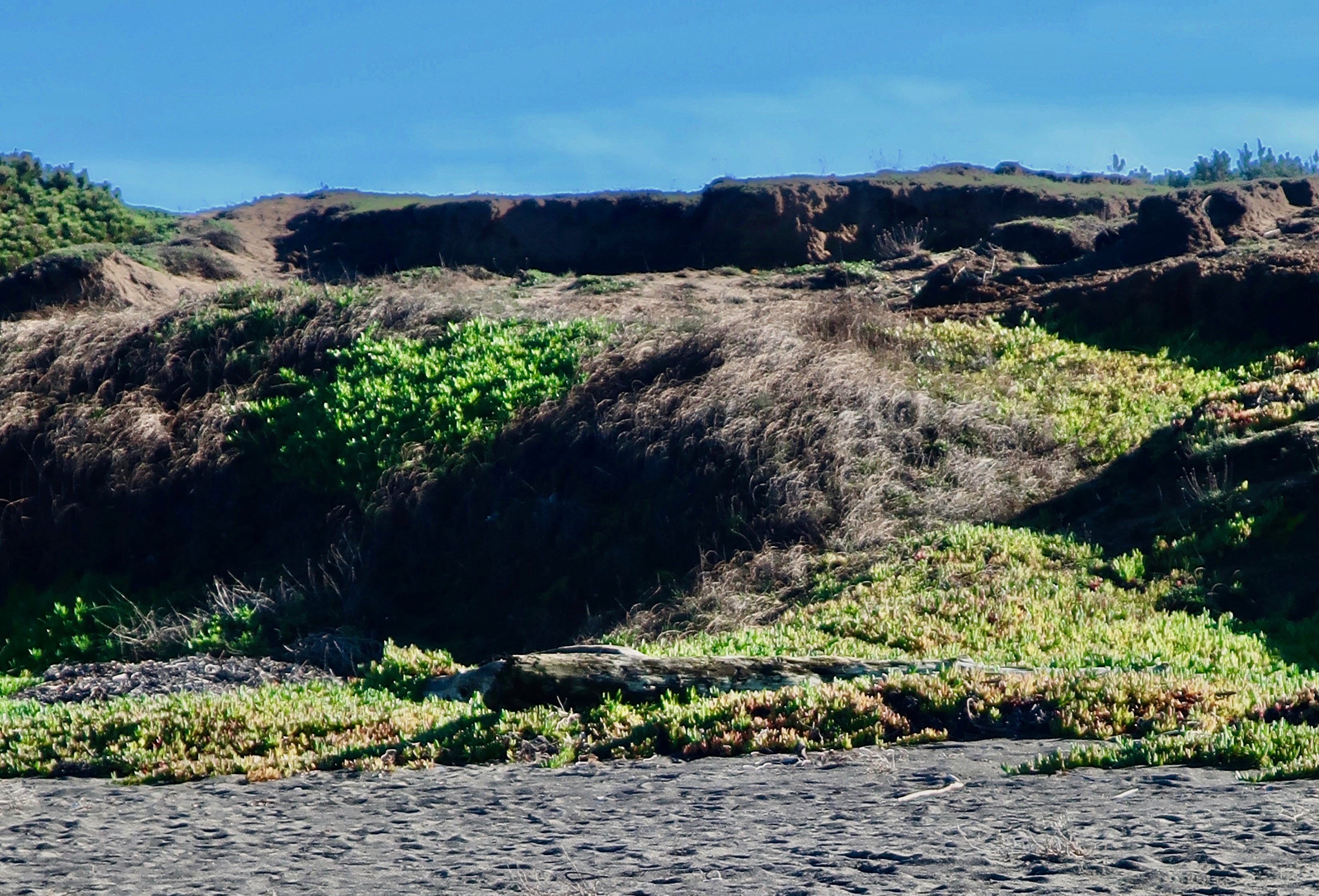
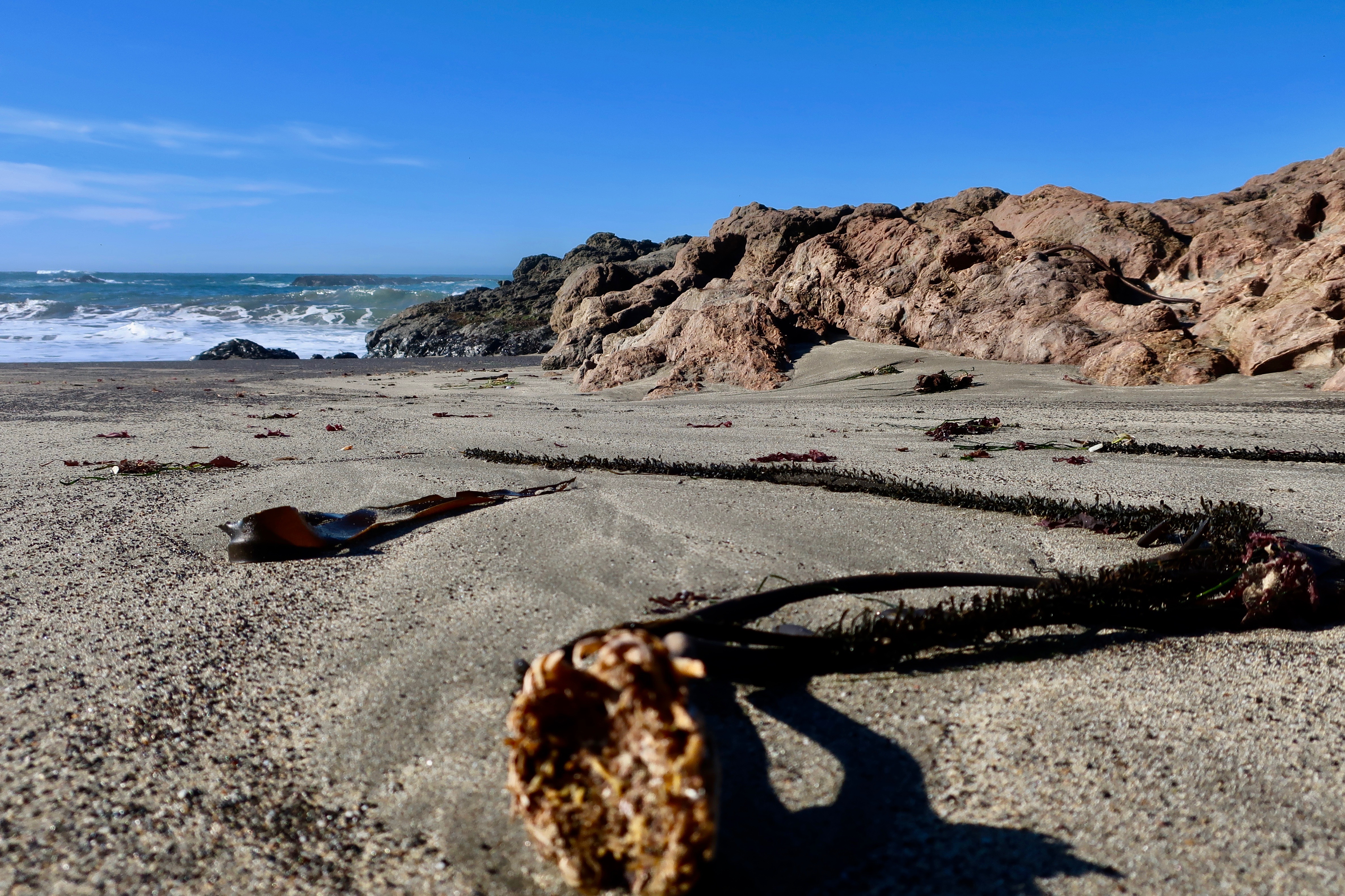
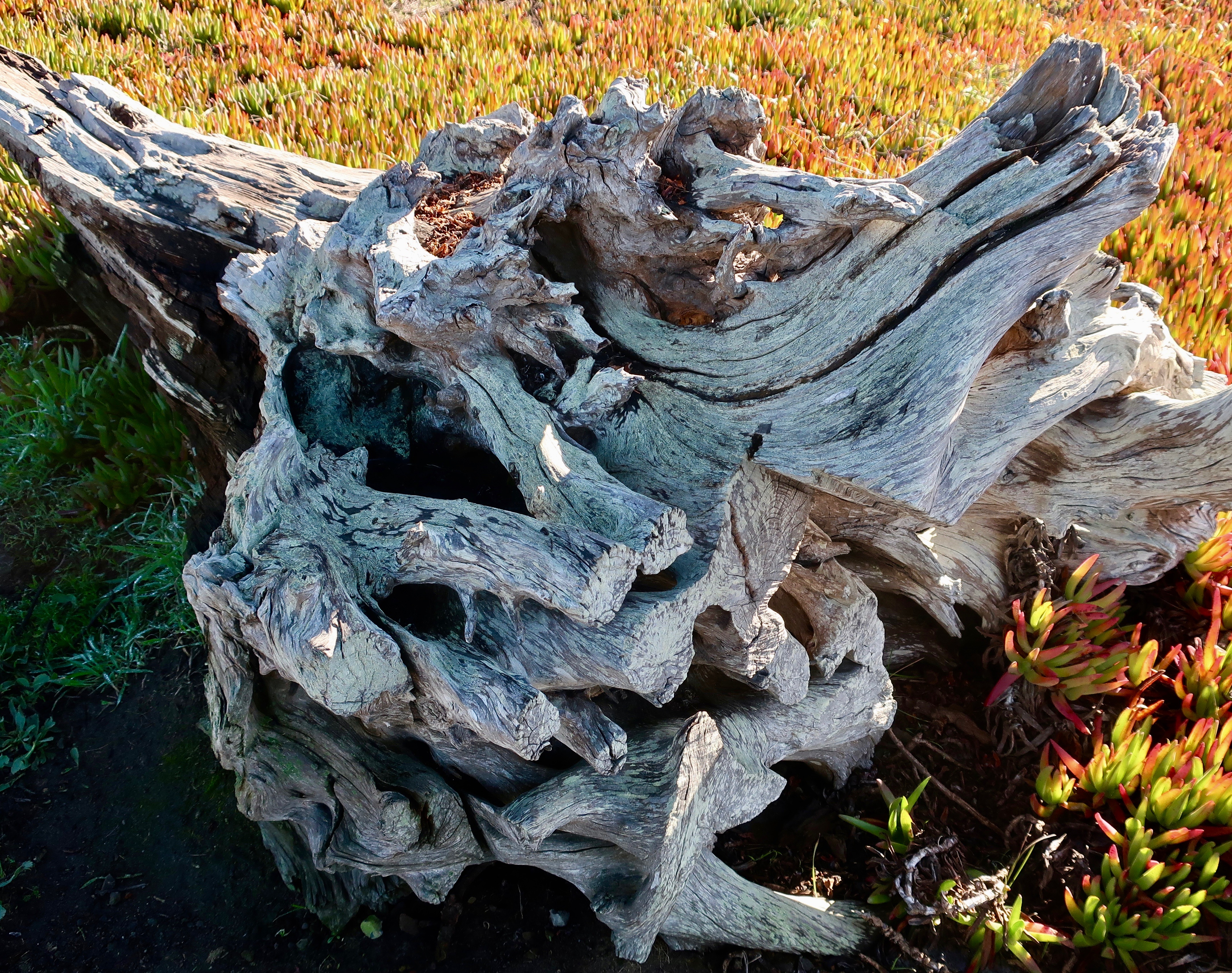
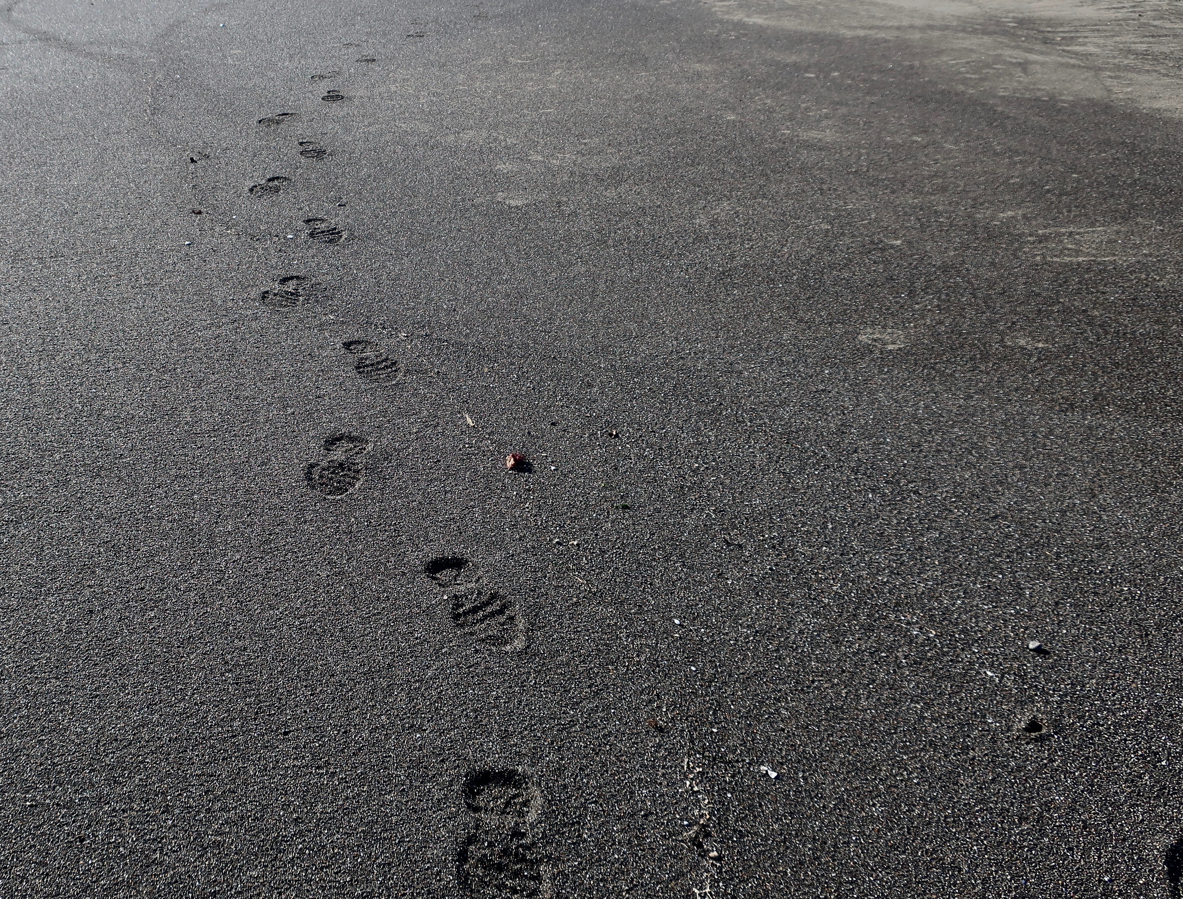
Looking south and capturing the sun reflecting off of the incoming tide.There was plenty of action as the waves rolled in.The bright green moss captured our attention…As did this tide pool outlined in greenThe ever-present ice plants continued the green-theme as they climbed up the ancient sand dunes in their unceasing effort to replace native plants. And be pretty.Plus there was seaweed to admire and wonder about. I’m thinking that this would make a great whip for the Devil.I wondered why someone had trimmed the roots off of this gorgeous driftwood.All too soon, it was time for us to leave. For a brief moment, my footprints were captured by the sand before the next wave rolled in. I was amused to see how they wandered, never traveling in a straight line, always willing to detour toward anything that was of interest, always ready for a new adventure— wherever it might lead. Like Peggy and I are. And that’s my next subject.
MOVING ON
As you may recall, Peggy and I are preparing to hit the road full-time in mid to late March. That’s one reason why my posts have been so few and far between. But there is more. We are also selling our house and moving East. Our daughter has an empty apartment in Virginia that we will be using for our base as we travel North America. She and her husband Clay have been lobbying for years that we should move closer to them. The apartment is small, however. We are using it as a reason to seriously downsize. It’s called donate, give away and toss. If we haven’t touched something in a couple of years, it goes. (Books and heirlooms are the exception— and even they are subject to scrutiny.) A moving pod sits outside our backdoor to collect what remains. In a few weeks it will arrive on our kid’s doorstep. We’ll take three months to get there.
We will miss our cozy home with its great views and entertaining wildlife. No doubt about it. Living out in the woods had always been a dream of mine. But it is time to move on. I turn 79 in a couple of weeks. While not necessarily old (from my perspective), it is definitely not young. My sense of humor on doing all of the work involved in maintaining five acres isn’t what it once was. And, there are more serious reminders of our age: the passing of family members and friends.
My sister died a couple of weeks ago, leaving me with a thousand happy memories and a large blank spot. She was my first baby sitter and forever friend. While we didn’t see each other often, we were always close. You may recall the posts I did on our annual pumpkin carving contests. They started in the late 90s and went on for 15 years. And you may also remember my blog on Nancy Jo and the Attack of the Graveyard Ghost, a prank my brother Marshall and I played on her when we were kids. Marsh passed away couple of years ago while staying in his RV at our house. I was with him when he died. I am now the last living member of our family. It’s a strange feeling.
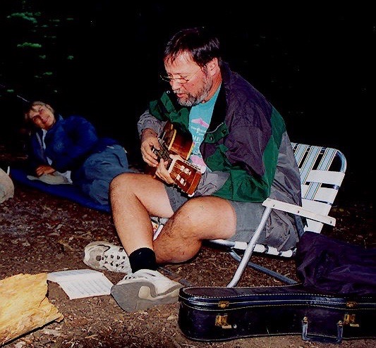
A number of friends have passed on as well over the past few years. I attended a memorial/life celebration in Sacramento last weekend for one of my early backpacking Trekkers, Don Augustine. I first met Don in 1981 when he went on a hundred mile trek I was leading through the Sierras. It was a tough year with lots of snow still on the ground. I was kicking footsteps in it over a steep pass leading into the Granite Chief Wilderness when he hustled up to where I was working and offered to help. He would continue to offer a hand whenever needed for the next 40 years as both a trekker and as a volunteer. His generosity was close to legendary. His specialty was encouraging newbies as they struggled to meet the challenges of long distance backpacking and bicycling. I told a story about it to the some 200 people who had gathered to wish Don goodbye.
At the time, I had gone to Alaska as the Executive Director of the Alaska Lung Association. Don and a couple of other good friends had come up to join me on a backpacking trek I was leading across the Alaska Range. We had a particularly difficult young woman along who was always last getting into camp and whined a lot. It was the unpleasant job of our trail sweep/rear guard to walk with her and bring her in. I took my turn and by the end of the day my patience was running thin. That’s when she threw her pack on the ground and declared, “I am not going another step. I am camping right here!” I responded, “Do you see that hill crest? “Yes,” she pouted. It was maybe a quarter of a mile away. “The Trekkers are setting up camp on the other side. We can be there in 15 minutes.” “I don’t care,” she answered. “Okay,” I said, “pull out your whistle.” (We required that all of our trekkers carry one.) “I have to hike over the hill and check on the group. I saw a grizzly bear about a mile back. If you see him heading your way, blow loudly on your whistle three times and I’ll come back.” She was up in a flash, had thrown her pack on, and was leading me over the hill at a hefty pace.
I took Don aside in camp and asked if he couldn’t use a bit of his magic on the young woman. “I’ve got you covered, Curt,” he said. “I’ve got candy.” He reached into his pack and pulled out a gallon ziplock filled to the brim. (There were reasons why Don always had the heaviest pack in the group.) And Don was right. On being introduced to Don’s ziplock and his charm, the girl’s attitude improved immensely and she started hiking faster to keep up with him and his candy. It was a much better solution than my making up grizzly bear stories.
Don playing his guitar on one of our Sierra Treks. He often carried his guitar and the camp chair he is seated in. And Pop Tarts. Nancy Pape, lying down and listening, was also at the memorial.
It’s always hard to lose a family member or friend, and even more so when he or she has been close. It is like closing a chapter in your life— the laughter and good times, the tears, the adventures and so much more. But it is also an important reminder that life is short, whether you are 79 or 29. Life should be lived to the fullest whatever your age. Peggy and I believe this totally. That’s why we moved to Oregon and that’s why we are now moving on now, doing what we love to do, wandering to our hearts content. Until it is time to do something else.
We will be sharing our adventures on this blog. As always, you are invited to join us. We hope you do.
My next post on Friday will be different: It will serve as a detailed description of our house, property and the surrounding region for those who may be interested in having their own ‘home in the woods.’ –Curt and Peggy