The 1908 Great Race from NYC to Paris: Part 3… Way Out West

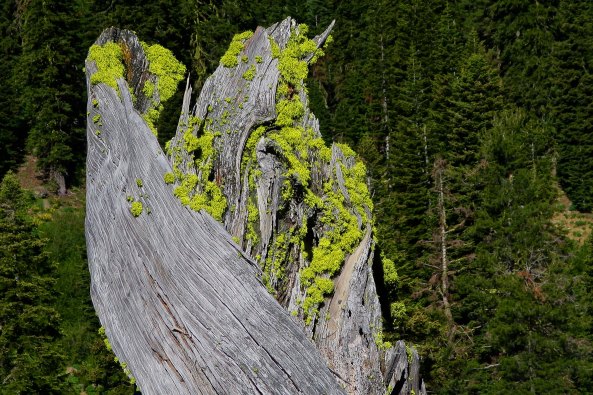
My posts are few and far between. Part of the reason is the times. There is just too much happening now between the pandemic, the fires, and the election. As noted before, these are scary times, more scary than any other time in my 77 years. The other is that I love research and the Great Race has me fascinated. Just when I think I have exhausted my resources I find another article or more photos. This time it was 350 photos of the race stored in the Henry Ford Museum, a virtual treasure trove. Most of the photos in today’s post are from the museum.

Leaving Nebraska, the flat terrain and rolling hills of the Great Plains gave way to the mountain, deserts and distant vistas of the West while the roads became little more than dirt paths.

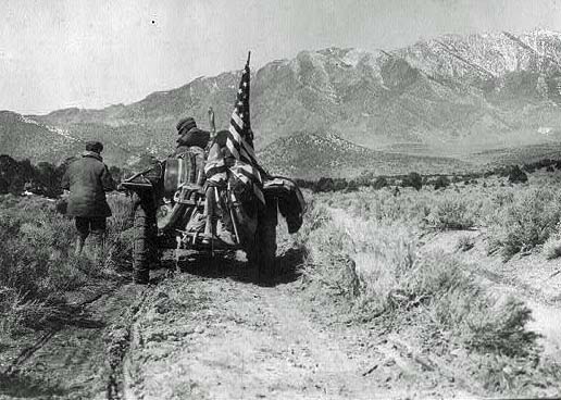
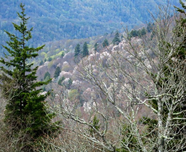
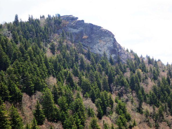
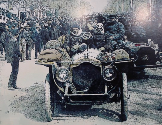
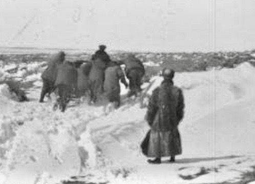
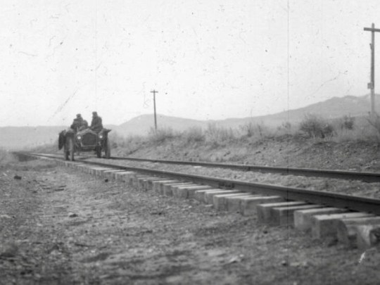
As the participants rolled out of Nebraska, they experienced their first real taste of the ‘Wild West.’ The unending farmlands of the Midwest gave way to the drier, open lands and vast vistas of Wyoming, Utah, and Nevada. The terrain also changed. The flat and rolling plains the automobilists had been driving through across the Great Plains turned to towering mountains and deserts. The Rockies, the Great Basin and Death Valley lay ahead. Towns and cities became farther apart. People fewer. The already poor roads the racers had been following became little more than tracks in the dirt.

When there weren’t any roads or railroad tracks to follow, participants in the Great Race were left with following emigrant trails.

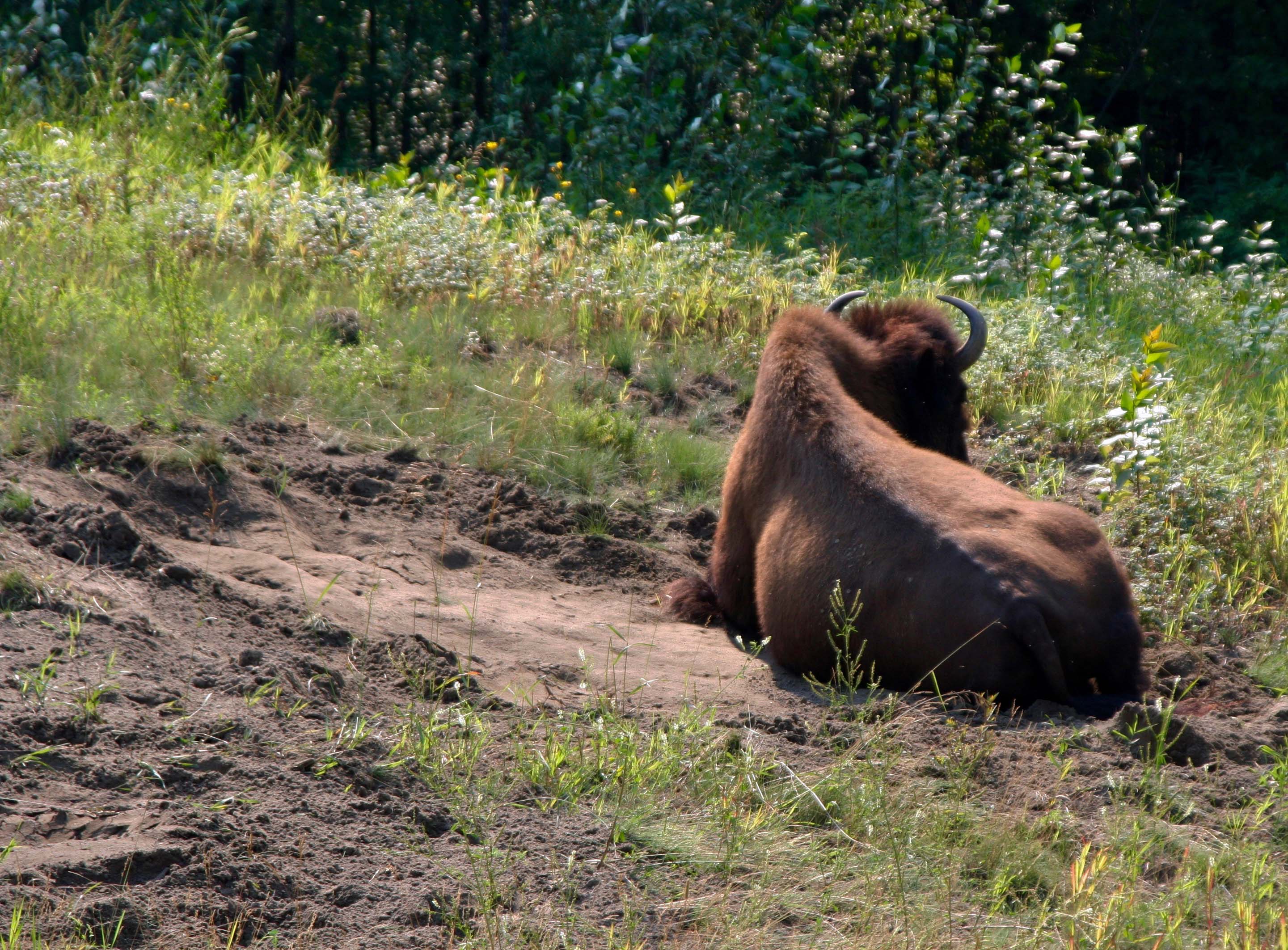
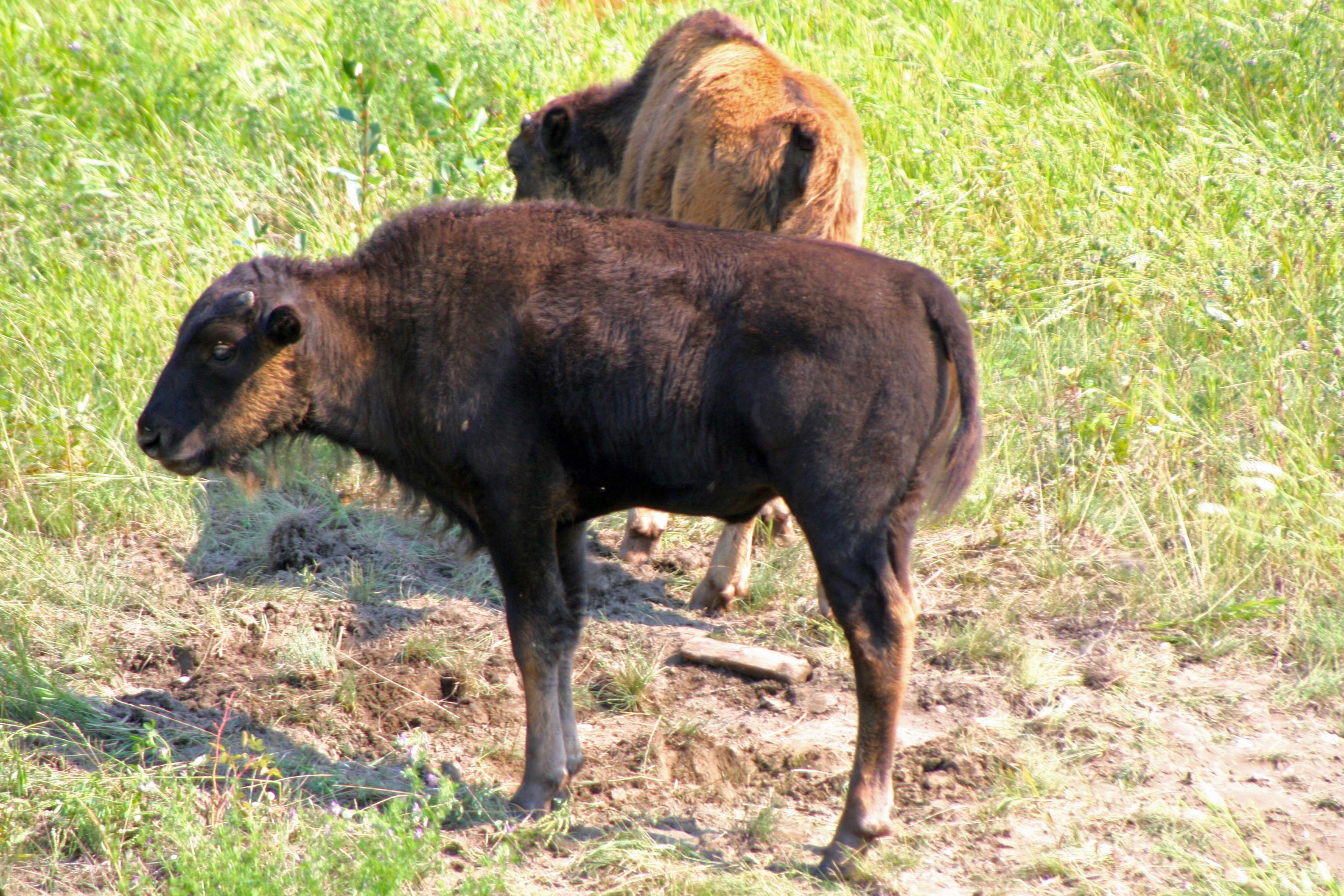
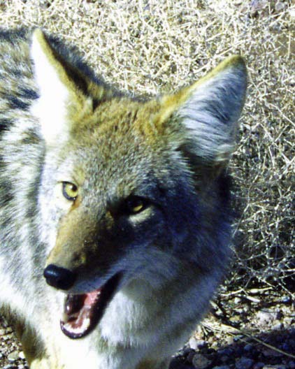
The animals also got wilder and bigger. The Zust team claimed they were surrounded by a pack of 50 or so wolves that circled their car yipping with anticipation on a dark and stormy night in Wyoming. Blowing the horn and using the spotlight didn’t discourage the hungry predators. They kept circling closer. It was only when the team broke out their rifles and shot several that the wolves decided that they hadn’t been invited to dinner. Local townspeople gathered up the hides the next day and sold them for the bounty paid by the government. The wolves’ taste for an occasional cow would lead to their eventual eradication in the West.

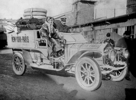
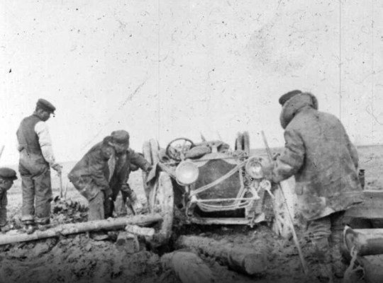
Not everyone made it to the Rockies. Baron Godard, who had driven another car from Peking to Paris in 1907, met his match in Iowa. Between being bogged down in mud and snow, getting lost, and having serious car problems, he decided to ease his journey west by loading his Moto-Bloc onto a train and shipping it to the coast. “San Francisco, here I come!” It broke the rules.

Baron Godard, in the Moto-Bloc in Paris before leaving for the US and the Great Race, shakes hands with well-wishers. Since the Baron had come in second the year before in a race between Peking and Paris, he had high hopes for his NYC to Paris race. They ended in Iowa. An early movie is being filmed here.

A photographer caught the Baron loading the Moto-Bloc onto the rail car. “Quit the race, sell the car, and return home,” the manufacturer telegraphed him. The French, who had started with three entries, were down to one. The greater glory of France now depended on G. Bourcier de St. Chaffray driving the French De Dion-Bouton— which is quite a mouthful to say.

The De Dion-Bouton leaves the Puteaux, France factory outfitted for the Great Race. I believe G. Bourcier de St. Chaffray is driving and Hans Hansen is his passenger. Hans would join the Thomas Flyer team after a hot argument with G. Bourcier that almost came to a Western shootout! Their fast draw was thwarted, however, by the fact the pistols were buried deep under all of the gear.
Monty Roberts, the driver of the Flyer, and Hans Hansen share a laugh.

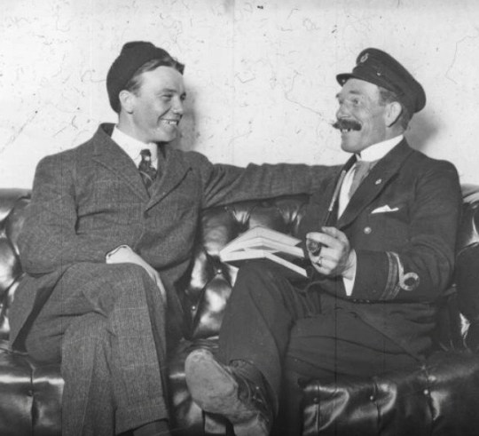
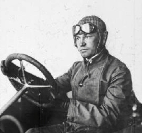
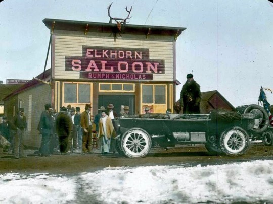
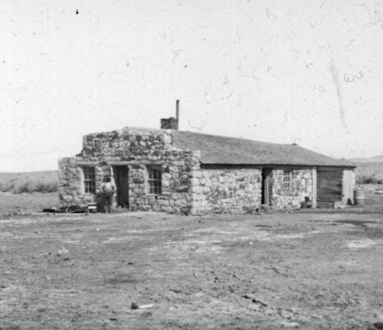
The Thomas Flyer team had other ideas about who would win the glory. When they reached Cheyenne, Wyoming, the Flyer was a week ahead of its nearest competitor, the Zust. The De Dion was in third. And the Protos fourth. Given the quality of the vehicle, Monty Robert’s driving ability, and George Schuster’s mechanical talent— not to mention sheer determination— the team had been ahead for most of the race. It was a position they had every intention of keeping. The car was about to lose its driver, however. Monty had other race commitments back east and in Europe. He hoped to rejoin the team when it entered Europe to drive over better roads and, I imagine, harvest the fame of crossing the finish line first. E. Linn Mathewson, a Thomson Flyer car dealer, took over the driving from Cheyenne to Ogden, Utah. Harold Brinker, an auto racer out of Denver, drove the car into San Francisco. Schuster would take over then. 

The Thompson Flyer receives a grand welcome in Cheyenne.
E. Linn Mathewson steering the Thomas Flyer. I think that’s a “What have I gotten myself into?” look.
Linn Mathewson shaking hands with his replacement, Harold Brinker, in Ogden, Utah.

Getting into the spirit of the West, George bought a Colt six-shooter pistol before leaving Cheyenne. Who knew what lurked out in the wilds of Wyoming? Wolves or outlaws, perhaps? Best to be prepared.

There would be snow drifts to push the Flyer through…
Brush and mud to conquer…
Ice covered rivers to cross with hopes of not ending up on the bottom…
And high passes to climb over.
It’s no surprise that the teams would need a drink when they reached a town!

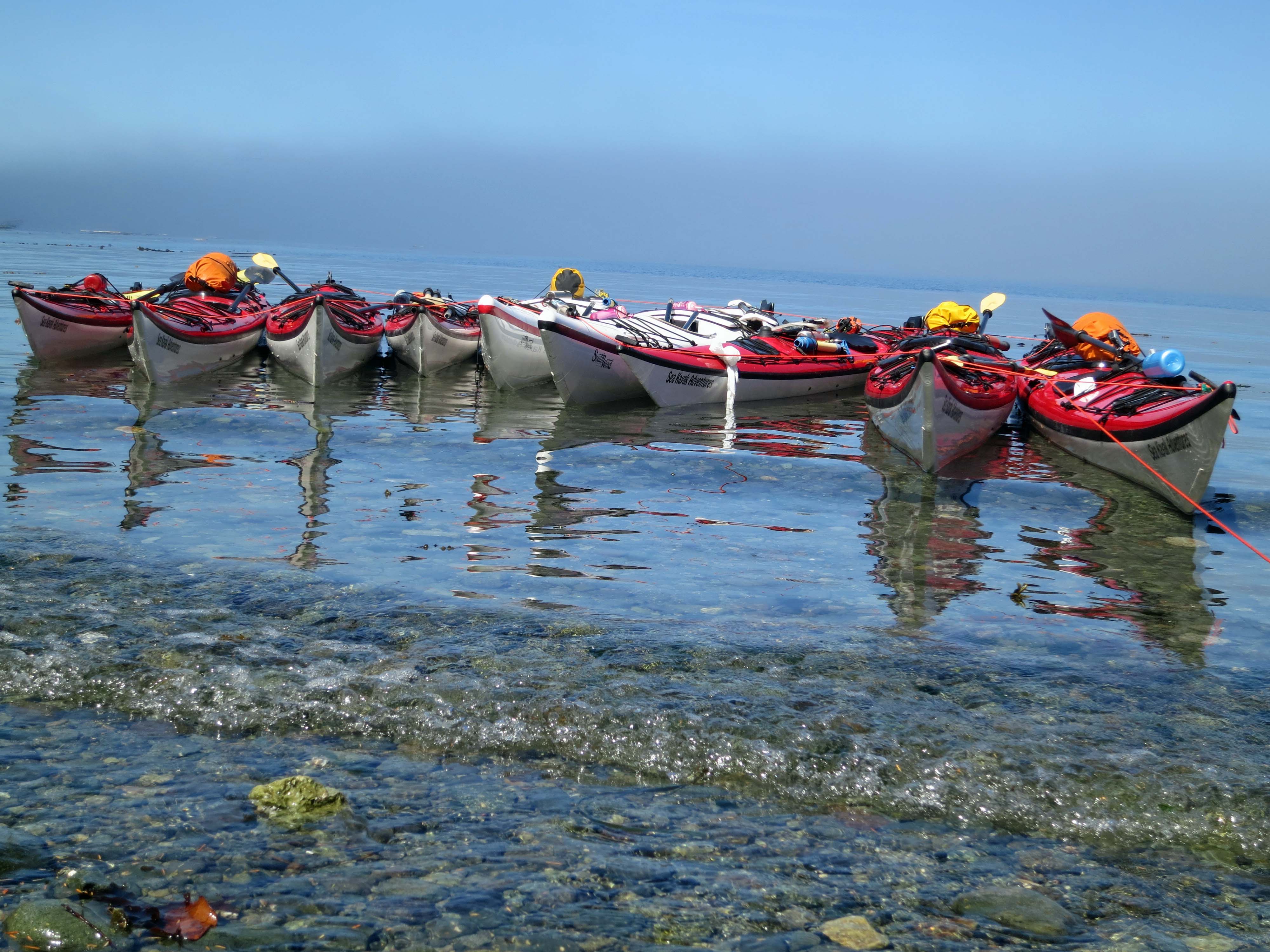
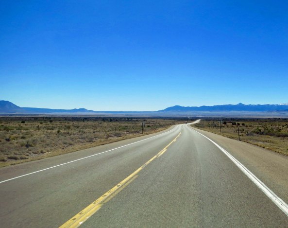
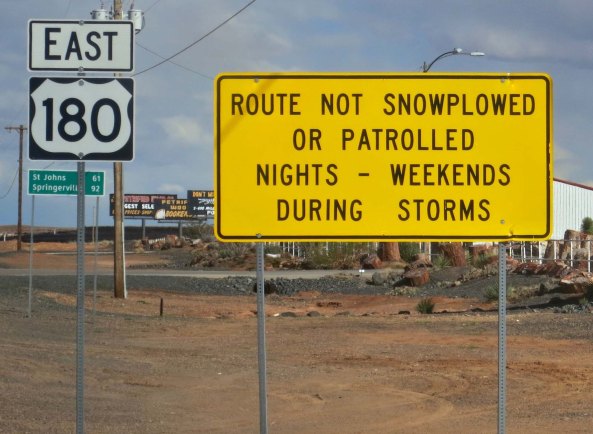
Peggy and I had followed the route of the race in Nebraska from Grand Island to North Platte where we spent the night at Buffalo Bill’s ranch as the Flyer had in 1908. We then continued to follow the route to Ogallala where we detoured to follow the Oregon Trail, which early pioneers had used in the 1840s, 50s and 60s. (Posts coming.) I was eager to check out the route that ancestors on both sides of my family had travelled looking for a better life— either by farming in the Northwest or striking it rich in California. So, we missed Cheyenne. We rejoined the race route for a brief time, however, between Rock Springs and Fort Bridger, Wyoming, when the Oregon Trail dipped south.

The Thomas Flyer parked in front of Buffalo Bill’s home on the North Platte River.
Crowds were out to greet the Thomas Flyer’s arrival in Green River, Wyoming. People were still hurrying over to welcome the team. Note the prominent rock in the background…
Peggy and I took its photo when we briefly rejoined the route between Rock Springs and Fort Bridger.
Driving over the railroad ties in Utah, the Flyer was in for a bumpy ride. Another problem was that the railroad spikes tore up the tires.

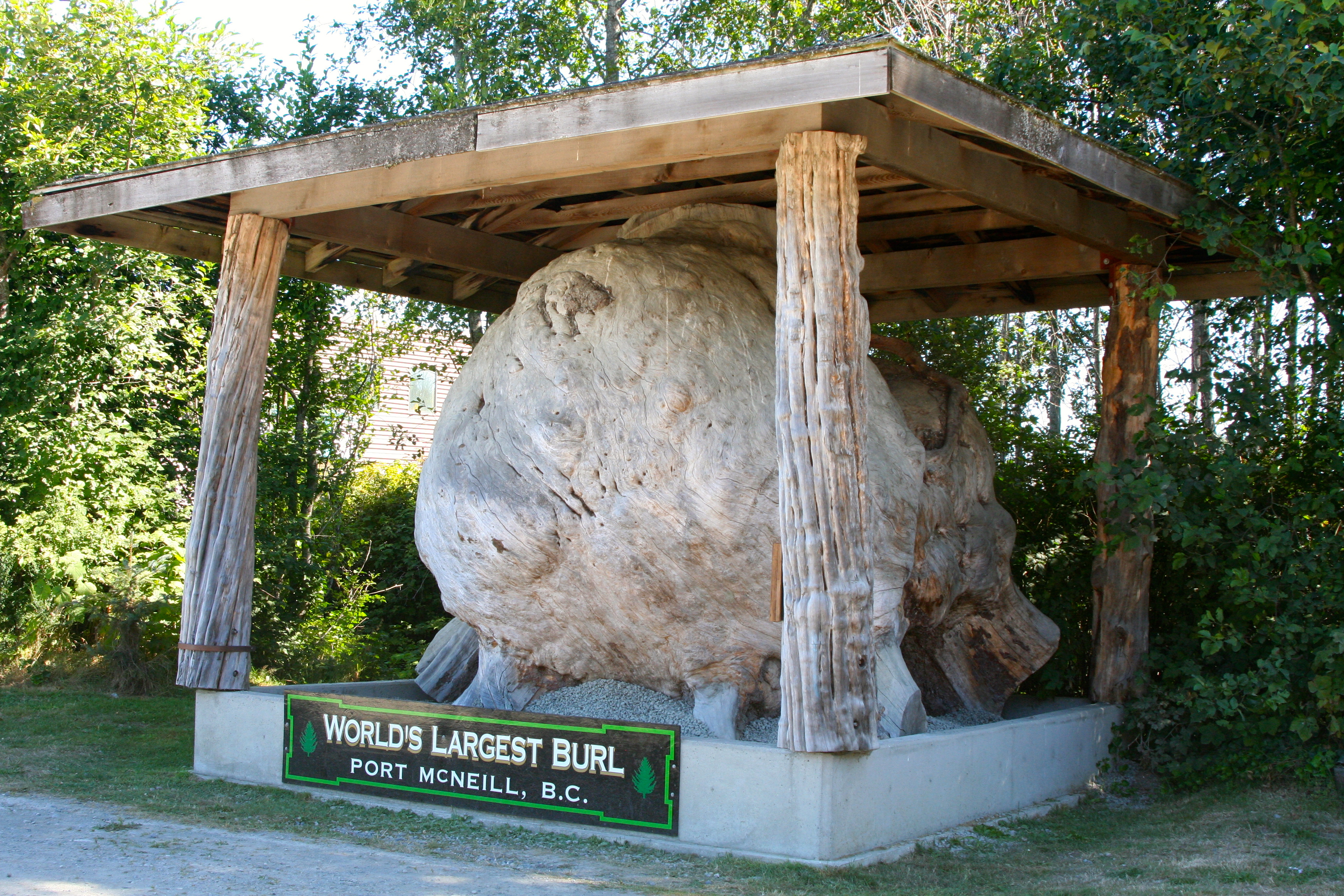
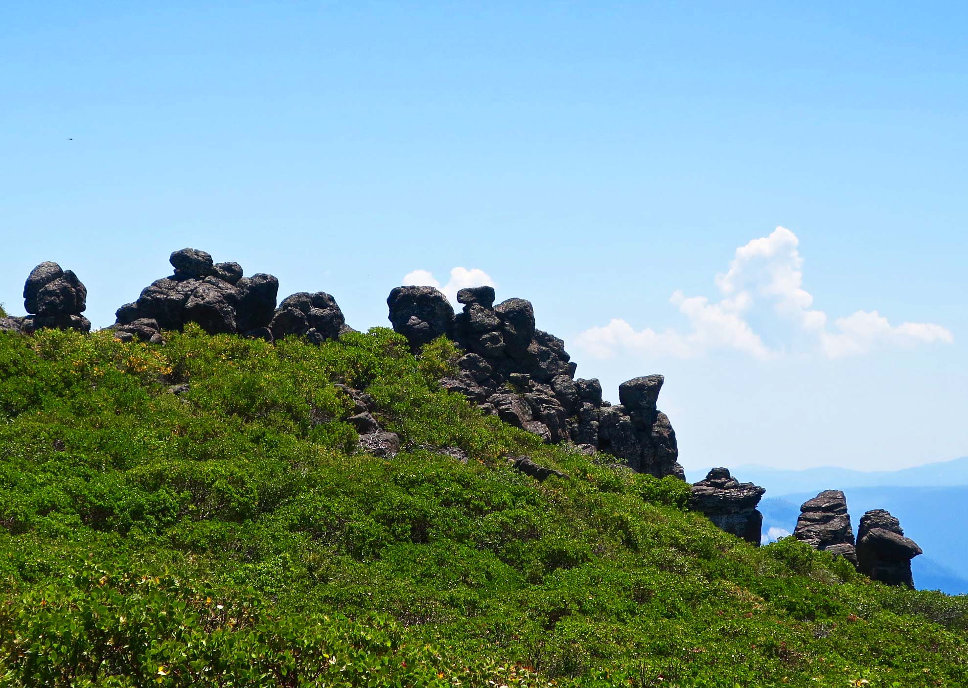
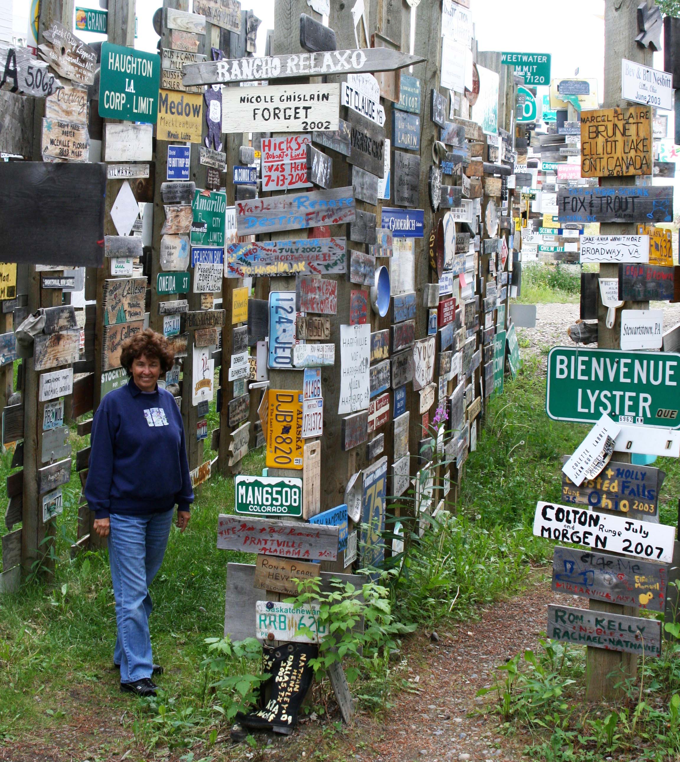
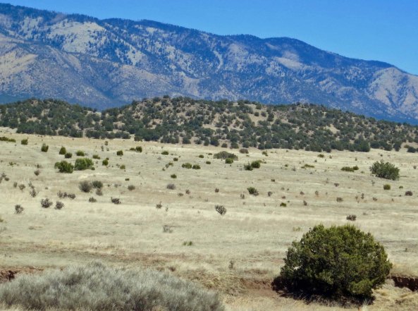
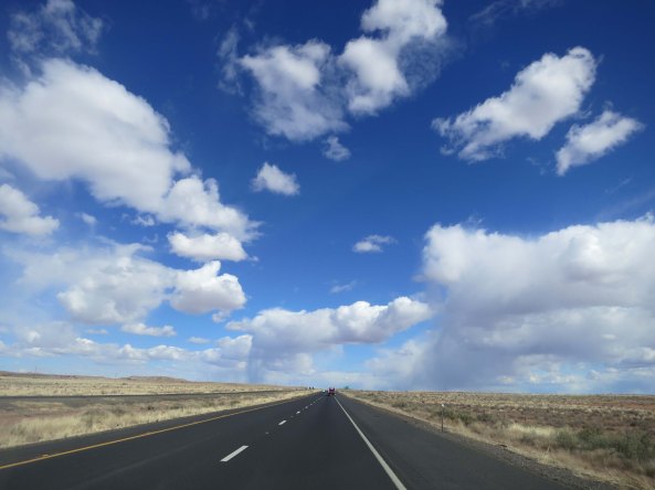
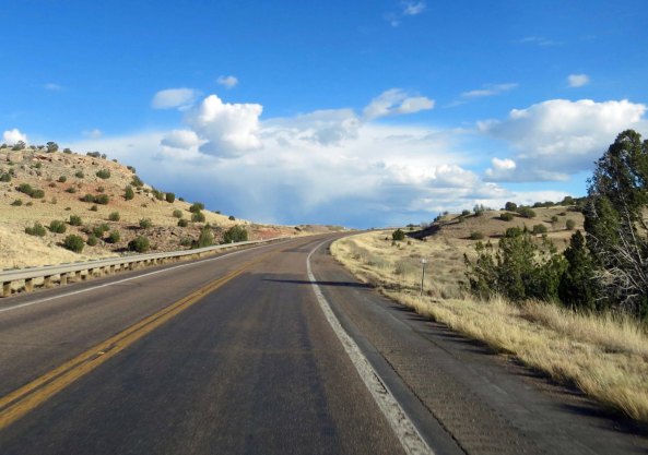
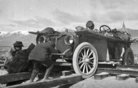
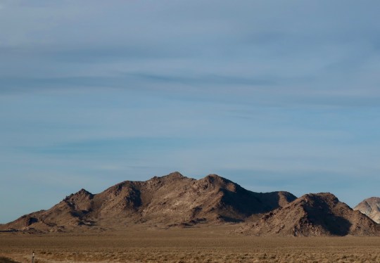
Ely, Nevada was the next point where our summer road trip crossed paths with the race route. We passed through the town on our way east when we were following Highway 50, the “Loneliest Road in America.” (Another post.) Ely feels like it is in the middle of nowhere. And it is. It would have felt much more so in 1908. The Flyer had made its way south from Wendover, Utah following what is now Highway 93 (more or less) to Ely and then continued southwest across the Nevada desert following today’s Highway 6 (more or less) to Tonopah.

The Flyer team used railroad ties and brute force to get across the Western Pacific railroad in Nevada. They appear to be lifting the Flyer to get it onto the borrowed ties.
And here, they use logs to get the car out of Nevada mud. Peggy and I know from our years of attending Burning Man in the Nevada’s Black Rock Desert that there isn’t a heck of a lot of rain in Nevada, but when it does rain, the mud is no joke. The 24/7 event comes to a grinding halt.
And, as always, the car attracted attention wherever it was. This photo is taken in Cerry Creek, a small town north of Ely.

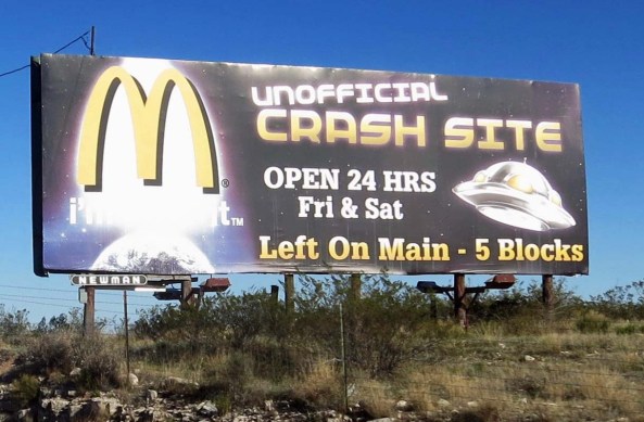
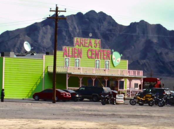
Along the way, it passed by what would become Nevada’s Extraterrestrial Highway. Think UFOs.  I’ve been interested in flying saucers ever since I saw one in 1969.  The participants in the Great Race didn’t report seeing any, however. Darn. (As an aside, I found it interesting that both the Pentagon and Japan’s military have set up task forces in the past couple of months to track UFOs. A little Twilight Zone music might be appropriate here.) But back to the race. 

Gate to top secret Area 51 in southern Nevada.
Peggy and I drove down the Extraterrestrial Highway and visited Area 51. We weren’t invited in. But then we weren’t arrested for taking photos either. (Post here on our visit.)

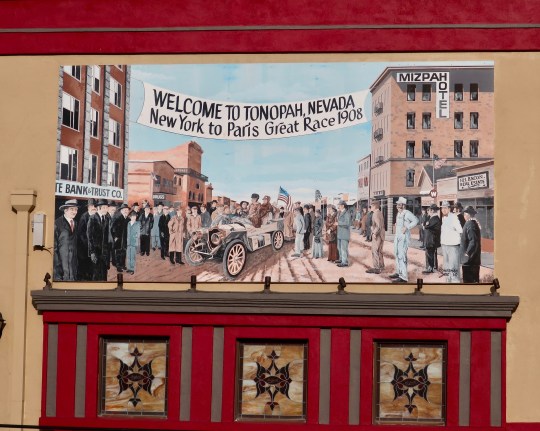
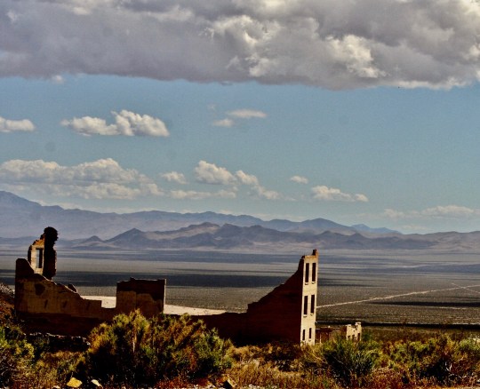
It was in Tonopah and the town of Goldfield 27 miles to the south that we first learned of the Great Race. In fact, we’ve driven the route followed by the Flyer from Tonopah south through Goldfield, the now ghost town of Rhyolite, and across Death Valley many times. I’ve actually ridden my bicycle over most of the route the race followed through Death Valley and on to Bakersfield, California.

I kicked this series off with a photograph of a mural depicting the arrival of the Flyer in Tonopah. The scene was looking south. Note the Mizpah Hotel.
It still stands.

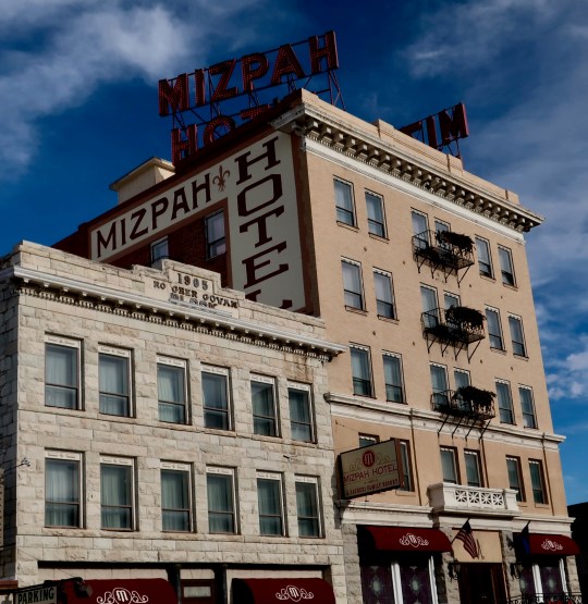
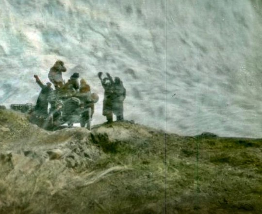
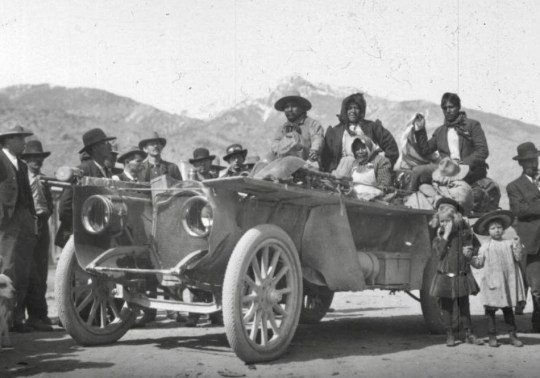
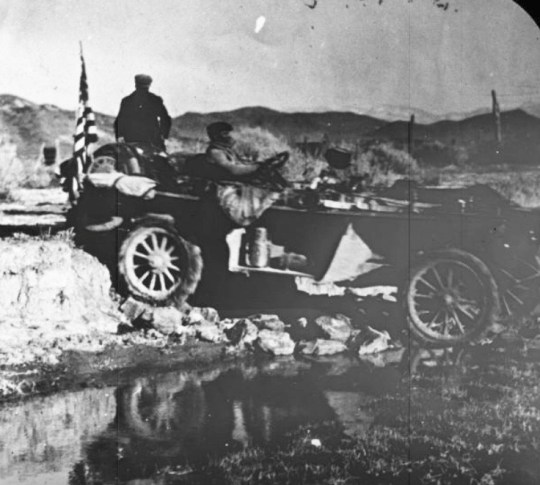
When the Flyer was late in arriving in Tonopah, several residents drove out the road to see if there was a problem. They found the Flyer broken down and Schuster sleeping in a bunkhouse. (Another version of the story has him walking toward Tonopah.) He was roused out, given a ride to town, borrowed parts from a Thomas Flyer owned by a local doctor, fixed the car, and arrived to a jubilant welcome. Pretty much the whole town greeted the team.

The Flyer was attempting to cross this quicksand filled creek on the Warms Springs Ranch when it got into trouble outside of Tonopah.
This building still stands on the Ranch.

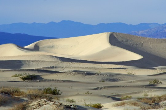
Cowboys and miners shooting their pistols into the air welcomed them to Goldfield. It was a cast of characters. There is still a cast of characters living there! (And a speed trap.) Crossing Death Valley, the Flyer had to put on balloon tires to get through the deep sand. Stovepipe Wells offered its only water. 

This would have been a view the team had as they left Tonopah for Goldfield.
The Flyer was almost buried by the crowd that gathered in Goldfield.
The Thomas Flyer passed through the Town of Ryolite just before entering Death Valley. Today it is a ghost town.
We took this photo of sand dunes in Death Valley from Stovepipe Wells. There was no lack of sand for the Flyer to negotiate through. I was glad for the paved highways when I rode my bike across the Valley.

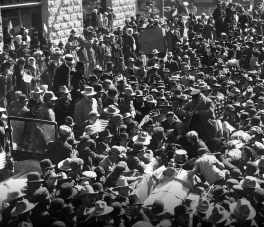
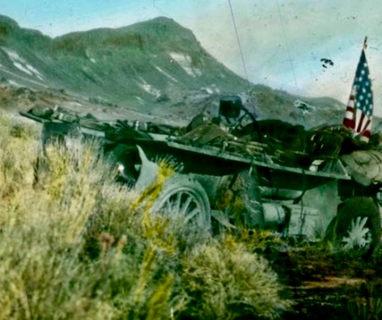
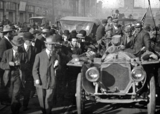
The Thompson Flyer rolled into San Francisco on March 24th, the first car to travel across America in the winter. The team was given a hero’s welcome. Factories blew their whistles and cars honked their horns.  Its nearest competitor, the Zust, was still 700 miles away. The first phase of the race was over for the Flyer. Schuster was now to become the driver. He was eager to get to Alaska for the next phase of the race.

Market Street in San Francisco was packed for the arrival of the Thomas Flyer.

NEXT POST: Schuster travels to Valdez, Alaska to check out the next section of the race and the route is once again changed. Cars will be shipped to Japan and then on to Vladivostok, Russia where their next challenge will be crossing Mongolia and Siberia.

Kayaking among the Orcas/Killer Whales of British Columbia…

Kayaks belonging to the Sea Kayak Adventure group in the waters of Johnstone Strait, northeastern Vancouver Island.

Our sea kayaks wait patiently for us as we have lunch in a cove off of Johnstone Strait.

This is the first of my series of ‘oldies’ I am reposting from my archives to give new followers a taste of what they can expect to find on my blog. Peggy  and I made a trip to Vancouver Island, British Columbia in 2014 to go kayaking among the orca whales. The next post in the series can be found here:  https://wandering-through-time-and-place.com/2014/10/30/

I was nervous as we drove into the town of Port McNeill on the northeast shore of Vancouver Island in August. Peggy and I had signed up for a six-day sea kayak tour out of Telegraph Cove with Sea Kayak Adventures.We would be searching for orcas, which are also known as killer whales—as our son Tony, the Alaska Coast Guard pilot, reminded us. A little Jaws music, perhaps?

This orca was on display at the Whale Museum in Grove. I named him Smiley and addressed him as sir.

This orca skeleton was on display at the Whale Interpretive Center in Telegraph Grove. I named him Smiley and addressed him as sir.

“Okay, Curt, what have you gotten yourself into this time?” was bouncing around in my skull like a kangaroo on steroids. It’s a question I ask myself often.

I wasn’t nervous about the whales, however. I’ve spent my life communing with nature. Besides, these particular giants are gentle, relatively speaking; they get fat off the salmon in Johnstone Strait. They don’t need to eat people. But sea kayaking would be a first for me. The old dog had to learn new tricks, and that is always a reason to get excitable. Fortunately, Peggy and I had played around a fair amount with inflatable kayaks. We had even ventured out on challenging multi-day lake trips into remote areas such as Prince Albert National Park in Saskatchewan and Voyageurs National Park in Minnesota. So how hard could it be?

Aren't I pretty? There was no way I was going to make this skirt look good. (Photo by Peggy Mekemson.)

Aren’t I pretty? No? Maybe I wasn’t meant to wear a skirt. This skirt is designed to fit snugly over the cockpit of the kayak and keep out the water.  It’s so snug that you really have to stretch it to fit, which isn’t easy— particularly around the back. My skirt and I had several discussions while I was learning how to make it behave. It learned new words. Ask Peggy. (Photo by Peggy Mekemson.)

I confess I was more nervous about the idea of being on a tour. I am not much of a tour group person. This is a strange statement coming from someone who spent over a quarter of a century leading backpacking and bicycle fundraising treks for the American Lung Association. But the truth is— I am an independent cuss. I like to go where I want to go and stop when I want to stop. On an organized tour, I would be expected, even required, to adhere to the group schedule and itinerary. This isn’t a complaint. It has to be that way on group outings. Common sense and liability demand it.

And then there were the people. We’d be living closely with these folks for six days under potentially trying conditions. What would our guides be like? How about our fellow tour group members? Would we get along well? Would they be strange— even stranger than I am?

"Could I interest you in a cracker?" The tour promo promised good food, but it failed to mention the presentation. This is Nick, one of our three group leaders.

“Could I interest you in a cracker?” The tour promo promised good food, but it failed to mention the presentation. This is Nick from New Brunswick, one of our three group leaders. Note the sprig artfully shoved into the cheese.

Quy, another of our guides, is a gentle soul who in his other life works as a computer geek in Vancouver. So what is he doing with this knife?

Quy, another of our guides, is a gentle soul who in his other life works as a computer geek in Vancouver. So what is he doing with this knife?

Julia, our third guide and assigned trip leader, may use Quy's knife on me for this photo of her toes, but I couldn't help myself. And no, I don't have a foot fetish. My fascination was that these bare toes could run over sharp rocks. The last time I had feet that tough I was ten years old.

Julia, our third guide and assigned trip leader, hails from Germany and is quite charming. She may use Quy’s knife on me for this photo of her toes, but I couldn’t help myself. And no, I don’t have a foot fetish. My fascination with her toes was that they could run over anything, including  rocks. The last time I had feet that tough, I was ten years old.

And how about our fellow travelers? David is a psychologist out of LA. How much more strange can you get?

And how about our fellow travelers? David is a psychologist out of LA. How much stranger can you get than creating this mustache? Well maybe someone who kisses fish…

Well, maybe someone who kisses fish??? "But he was so beautiful," Lindy told me. He was dinner, Lindy,. Dinner.

“But he was so beautiful,” Lindy told me. He was dinner, Lindy. Dinner.

Regardless of how nervous I felt, the trip was simply too much of an opportunity to pass up. Like how could I not go on a sea kayaking adventure out among the orcas in beautiful British Columbia? As for Peggy, she is always up for adventure. When our friends Edie and David from Anchorage, Alaska called and asked if we would be interested in going, we gave a resounding yes. It turned out to be great decision. The guides, our fellow tour group members, and the incredible views were delightful. Even the orcas cooperated.

Today marks the beginning of my series on the trip. I’ll start by exploring the quaint town of Port McNeill. In my next post, we will climb in our kayaks and push-off from Telegraph Cove. The orcas are waiting. Let the adventure begin.

Harbor in Port McNeill on northeastern Vancouver Island. Photo by Curtis Mekemson.

While the main source of employment for the people of Port McNeill is the timber industry, the town also has a charming harbor. Note the yacht in the background. It had its own helicopter.

I loved this guys sense of humor.

In case anyone was wondering. I loved this guy’s sense of humor.

Dolphin statue at Port McNeil on Vancouver Island, British Columbia.

Peggy, David and Edie pose in front of a dolphin statue that faces the harbor. Edie went to high school with Peggy in Ohio and runs a tax accounting firm in Anchorage. David is an Alaskan bush pilot who works on the North Slope, and is a published poet.

You are looking at Port McNeill's pride and joy: the worlds largest burl. Can you imagine this thing growing on a tree? (Photo by Peggy Mekemson.)

You are looking at Port McNeill’s pride and joy: the worlds largest burl. Can you imagine this thing growing on a tree? (Photo by Peggy Mekemson.)

Wicked Campers is now providing inexpensive travel vans and raucous humor in a number of countries.

Tourism is also an important industry for Port McNeill. Wicked Campers caught my attention. The company provides inexpensive travel vans and its raucous brand of  advertising in a number of countries.

We were also amused by Port McNeill's unique way of fund raising where bras are decorated and then auctioned off. Which of the following three would you vote for?

We were also amused by Port McNeill’s unique way of fund-raising where bras are decorated and then auctioned off. Which of the following three would you choose?

Given the ears, I am thinking Mickey Mouse was the inspiration.

Given the ears, I am thinking Minnie Mouse was the inspiration.

Bat woman?

Bat woman? Great eyes.

Dream catcher. Ouch.

Dream catcher? Ouch. This one would leave an impression.

Flowers at Port McNeill on Vancouver Island. photo by Curtis Mekemson.

The flower shop that featured the bras was closed so I couldn’t get inside to photo more of the entries. I did capture this petunia on the outside, however.

Mist in trees on Vancouver Island sea kayak trip. Photo by Curtis Mekemson.

Mist in the trees. A final photo to whet your appetite. Let the adventure begin.

Backpacking up Mountains in 100 Degree Plus Weather from Castle Crags to Burney Falls on the PCT

I thought a lot about the cool water of Burney Falls as I backpacked the second half of my trip from Castle Crags to the falls. Temperatures were in the 90s and then surpassed 100! (Photo by Peggy Mekemson.)

The Pacific Crest Trail from Castle Crags to Burney Falls is known for being hot in the summer. I was hoping to avoid such weather. No such luck. At least it waited until my last three days to break 100 F (37.7 C). Then it became a scorcher. Many through-hikers chose to hike early in the morning and late in the evening, hiding out during the hot part of the day. But I trudged on. I needed full days to make it out when I told Peggy I would. Following are a few photos from the trail. 

Having climbed 10-12 miles to get out of the McCloud River Canyon, I was treated to views of Grizzly Peak. Billowing cumulous clouds spoke of the coming heat.
Similar clouds were hanging over Mt. Shasta. This would be one of my last views of the spectacular mountain. I had been enjoying it and photographing it since I had began my trek at Mt. Ashland.
Appropriately, I found some Shasta Daisies beside the trail.
Much of my time over the next three days would be spent hiking ridges with great views into the canyons. This is Devil’s Canyon. My guess is that the person who named it tried to hike out on a 110 degree F day. Don’t let the pretty trees fool you; it’s Dante’s Inferno! (grin)
I was now hiking through the volcanic Cascade Mountain Range that runs from Northern California to the Canadian Border. I would be treated to numerous views of volcanic landscapes, such as this eroded lava.
I was intrigued by these volcanic rocks that were outlined on the ridge.
And these. They looked like a small village.
A fir tree helped set this rock off.
Flowers, such as this Indian Paint Brush, helped take my mind off the heat and long days.
As did  this striking fellow.
I also found some strange manzanita roots to entertain myself with. (There will be a lot more in my next post on Lassen National Park.)
As always, there were interesting through-hikers to stop and chat with. This couple, Smile and Hamster, had found a phone signal and were signing up for fall college courses in Germany.
I’ve already introduced Popcorn! with an exclamation point the end of her trail name. She’s the one who suggested to me that rubbing pine needles all over your clothes made a great deodorant. 
Patch was carrying a message from Peggy, letting me know that she had changed the location where she would meet me. Peggy had bribed him with food. (grin) 12 more through hikers would give me the same message. Peggy was making sure I wouldn’t miss her!
On the third day, I concluded my 15 miles by 2 PM. Peggy was waiting and had as many tales to tell as I did. That evening she shared the photos that she had taken, including this one of Burney Falls. I’ll conclude here. My next post will take us into Lassen National Park.

What’s in a Name? … Hiking from Etna Summit to Castle Crags: Section P on the PCT Part 1

My nephew, Jay, and I couldn’t resist the beautiful wood sculptures along the PCT between Etna Summit and Castle Crags. I liked the drama created by rendering this one in black and white.


It’s official: I am The Wanderer, or more simply, Wanderer, which will come as no surprise to followers of this blog. Trail names are important out here on the PCT. You are supposed to earn one by your actions, looks or quirks. For example, a young woman came in to get water at Deer Creek Springs above the McCloud River where I was camping for the night and introduced herself as Pez. Apparently, she likes the candy, was using it for encouragement along the trail, and was glad to share.

“I’m running low,” she told me, somewhat concerned. I understood. It would be like my eating the last of my nightly Oreos before reaching Peggy and my resupply. It’s like seeing your gas needle hit empty on a lonely road. I pictured Pez raiding the stores in the Castle Crag area, buying enough to get her over the next mountain range.

Pez allowed that she might not keep the name. Through-trekkers are allowed to accept or reject the trail names they are given, and choose another— if a better one comes along. Does that make us a fickle bunch? She chatted for a while, maybe a little lonely. Her boyfriend was hiking the Appalachian Trail while she was hiking the PCT. She seemed so young. “I felt it was important for my independence.” I admired her.

There is great equality out on the trail. We are all hiking up the same mountains, facing the same issues of weather, biting insects, and miles and miles to travel. The lack of water in the last section I just hiked through, added the serious problem of having adequate water to drink. Forget having enough to bathe or wash clothes! My nightly sniff-test suggested I was deteriorating rapidly.

Beat up feet are one of the things that PCT hikers share, although problems like blisters are more likely in the beginning before feet toughen up. Paper tape has always been my go-to solution. I earned the black and blue toenail on the Rogue River. In six months there should be a new one.

“Grab a handful of fir needles and rub them over your shirt,”Pop Corn! suggested. “Then you will smell like a fir-tree.” I was bemoaning the fact that there was no swimming hole in Peavine Creek to jump in before I met up with Peggy. None of us ‘smell like a daisy’ out on the trail, which isn’t a problem until we approach civilization. I thought Pop Corn’s! suggestion was the ultimate in PCT wisdom. (grin)

Temperatures climbing above 100-degrees F (37.7 C) on the sizzling hot afternoons didn’t help. There was also a major lightning storm. It missed me; Peggy was worried. Another through-trekker was struck. Luckily he wasn’t killed and is recovering. Several forest fires were started as well, which are always a worry for those of us who live and travel through Western forests in this era of global warming. I can smell smoke now. One is out there lurking, waiting to pounce.

As a general rule, the through-hikers are a cheerful bunch. I rarely hear a negative word, regardless of how tough the day. A ready smile and “How are you doing?” is the normal greeting. “Great” or “Good” is the normal answer. And there is always, “Have a great hike!” or something similar. Occasionally we stop and chat. But the need to get on down the trail always drives us on.

As usual in my life, I am going against the flow. While the vast majority of trekkers are going south to north, I am going north to south, hiking to my own drummer, so to speak. In fact, I have only met one other couple going the same direction I am. It makes it more difficult in the name game. One minute, or even five-minute encounters along the trail, are hardly enough time to observe a quirk or trait that might suggest one. “Grey Beard” Peggy urged. And that fit. At 75, I am certainly of the age that a name implying elder seems appropriate. And it made me think of Gandalf the Grey! But I have seen several youngsters along the trail in their 60s with magnificent grey and white beards that put my puny efforts at growing whiskers to shame.  (My students in Africa where I was a Peace Corps Volunteer teaching high school in the 1960s called me Ho Chi Minh because I sported a see-through beard like his.)

It’s pretty hard to claim the name Grey Beard when the competition is this tough. Jay and I ran into Bill Whittaker as he was climbing out of Castle Crags.

I was hiking up Grider Creek out of Seiad when I came on Adam and Eve. They wanted to know my trail name. “Happy Wanderer,” I replied spontaneously. I had just been singing the song to help me up the trail. Immediate recognition filled their eyes as they sang a few bars of the tune that was once popular in my (and their) youth. It fit even better than Grey Beard.

The title of my blog is “Wandering through Time and Place.” My business card for this trip announces ‘celebrating 75-years of wandering in the wilderness.” I have a lifetime of wandering behind me. But it goes further. Ancestors on both sides of my family were wanderers. My father’s side, the Mekemsons, arrived in Pennsylvania in 1755 and had soon moved on the Maryland. (All six sons fought in the Revolutionary War.) They were living in Kentucky by the late 1700s and had then moved on to Illinois, Iowa and then west coast by the early 1900s. My mother’s side, the Marshalls, followed a similar route, arriving even earlier in Boston in 1630. They had moved on to Connecticut, New York, Illinois, and then west. Wandering is in my blood.

The name fit well but I had given it to myself, which certainly happens… but isn’t supposed to. I was reluctant to use it.  The next time someone asked, I replied “still searching,” meaning I was still searching for my name. They assumed it was my name and liked it! It certainly isn’t a bad one. I am ‘still searching’ at 75 and would love to be at 95. But now I had three active names, and that can get a bit confusing.

I was hiking along the ridge above Moosehead Springs a few days ago between Castle Crags and Burney Falls when a fellow with a large red beard, named Red of course, stopped me and asked “Are you Curt, or Grey Beard, or Wanderer?” Naturally I was delighted. The question meant he had run into Peggy and was carrying a message. But you can see the difficulty.

It came to a head when I was hiking out to Burney Falls. Peggy was a bit confused about when I would arrive and had found a much better location to pick me up. The confusion wasn’t surprising. My first four days on the section had been tough (I’ll cover them in a later post.) I’d given myself a semi-layover day on the McCloud River and fallen behind. Three days out from the falls, I’d found myself with over 45 miles to travel— a walk in the park for the hardened PCTers with 1500 miles under their belts, but tough for my 75 year-old-body that was already complaining.  None-the-less, I buckled down and vowed to do it. I dutifully arrived at Peavine Creek, 15 miles from the Falls at the end of the second day. The next morning found me shooting down the trail at 3-4 miles per hour. I can still move when inspired and It was mainly downhill. Peggy, cold beer, a shower, a good meal, and clean clothes were waiting!

I’d made it 10 miles when Patch stopped me. He had pointed to his belt pouch and pulled out my card. “You must be Grey Beard or Wanderer, or something else,” he had announced laughing. ‘Peggy is waiting for you at the Dam and she is a really neat woman.” Peggy had given him and his buddies apples and PCTers respond amazingly well to fresh fruit. Thus, it started. A dozen people must have told me that Peggy was waiting and raved about her. “A lovely young woman is waiting for you at the Dam and she said you should hurry,” was one comment. I hurried. Peggy was now distributing cold beer and I wanted to make sure I got there before she ran out. (Kidding, sort of.) A couple greeted me at Rock Creek and the man asked if I was Graveyard— at least that’s what my ears heard. “Um, not yet,” I had responded. He assured me he had said Greybeard. His companion asked, “Wanderer?”

Patch pulled out my business card and told me Peggy was waiting for me at the Pit River Bridge/Lake Britten Dam.

That did it. When I reached my lovely wife, and had been properly greeted and handed a cold beer, she announced, “We have to do something about this name thing. You are Wanderer!” Peggy had spoken— and I couldn’t have agreed more.

*******

Now it’s time to drop back to my 100-mile trip between Etna Summit and Castle Crags of a week ago. There is a lot to cover, having hiked through the Russian Wilderness, the Trinity Alps, and the magnificent Castle Crags Wilderness. I was lucky to have my nephew Jay along. He had joined when he was a somewhat shy 16-year-old as I wrapped up a 360-mile backpack trip from Lake Tahoe to Mt. Whitney 15-years ago. Now he was 31 years old and a talented photographer, cameraman, and director in the early stages of a Hollywood career. He was also in love; no longer shy. I heard a lot about the young woman. (grin) More to the point of this trip was his incredible enthusiasm for the country we were hiking through. I’d often hear him exclaim “Wow!” as he found something of interest or beauty. It seemed that half of our hiking time was taken up with photography as we found something new to photograph.

Jay on our Etna Summit to Castle Crags trip.

At age 16 on top of Mt. Whitney when he joined me on part of a 360 mile backpack trip I did from Lake Tahoe to Mt. Whitney.

I could tell that Jay was a serious photographer by the various poses he assumed while taking photographs— all with a pack on his back!

Here’s my photo of what I believe Jay was trying to capture.

I am going to do several posts on this section. One, because there is so much to cover, and two because I would like to do a separate post featuring Jay’s photography and another featuring Peggy’s photos of Etna. The small towns along the PCT are very important to the through hikers. They are where they pick up their resupplies but they also provide a break from the trail. Again: think cold beer, good meal, shower, and clean clothes.

I’ll do these as photographic essays on a thematic basis. Where to start is the question? Logically, I would show photos of the general terrain we were hiking through. But for fun, I am going to start with the natural wood sculptures Jay and I found along the trail. These almost guaranteed a frenzy of photography. Also, there were the strange faces peering out at us from the wood. The forests are alive. A little theme music please…

I am a bit of an Animist when it comes to nature. I believe that awareness flows through all living things, be they animal or plant. Finding faces staring out at you is totally for amusement, however. This fellow with his bulbous nose and laughing eyes resembled an ancient Greek comedy mask.

While this guy hidden in the crack seemed a bit more ominous!

And this one was just ducky. Check out his bill. Is he grinning or grimacing?

It was the ‘wind-blown’ hair that captured my attention here.

This was our first view of the wood sculpture I featured at the beginning of the post. It guaranteed that Jay and I would be off on another detour. Completing the PCT would probably take the two of us years because of all the time we spend being sidetracked.

This was another impressive wood sculpture that caught our attention. It looks like it was climbing the cliff.

A close up.

Less dramatic wood sculptures created by dead trees also demanded stops. I thought of these two as ‘family.’

This large dead tree provided…

… this interesting limb.

Roots grow around rocks and continue to hold onto them after the tree dies, providing for interesting contrast of wood and stone.

And one of the downed trees that give Deadfall Lake its name provided Jay with a convenient place for a nap.

I imagined a discussion going on here. The bird with the large beak is giving the snooty creature on the left an earful, and he doesn’t want to hear it!

I’ll conclude today’s post as I started, with another black and white.

I am back into the woods today, but this time for a short 50 miles. I’ll get up more posts on the PCT between Etna Summit and Castle Crags when I come out, including photograph collections by both Jay and Peggy.


The Striking Mucho Lake, Big Bison, and a Sign Forest… The Alaska Highway Series

Muncho Lake 6

Striking hardly describes Muncho Lake in British Columbia with its striking topaz waters and reflections of the surrounding mountains. The lake reaches a depth of  732 feet (223 m).


My Wednesday photographic essay will continue to take us up the fabled Alaska Highway. Last Wednesday we travelled from Dawson Creek to Toad River. I featured views along the way, the building of the highway during World War II, Stone Mountain Sheep, and some very busy beavers. Today we will travel from Toad River to Watson Lake in the Yukon Territory, a distance of 201 miles (324 K). Along the way we will visit the striking Mucho Lake, check out the large woodland bison that hang out beside the road, and view a few of the 70,000 town and city signs that have made their way to Watson Lake’s huge sign forest.

Toad River

After leaving Toad River Lodge and our visit with the busy beavers, we were treated to a view of the Toad River that parallels the road.

View along Alaska Highway in BC

And this view.

Muncho Lake north

We would stop to admire Muncho Lake both on our journey north to Alaska and on our trip back south. We were heading north when we caught this photo. (Note: all photographs in this series are taken by Peggy and me.)

Muncho Lake in British Columbia

We captured this view on our return trip down the Alaska Highway.

Muncho Lake on the Alaska Highway

As well as this photo.

Road construction, Alaska Highway, BC

Here’s a common sight along the highway: road construction. Tough winters and permafrost pretty much guarantee employment for road workers.

Road Construction along Alaska Highway

And here we go again, making our way through yet another construction project. Chipped windshields and damaged tires are common. We experienced both. We saw a bear somewhere in here. It may be the black spot on the left (or not).

Dall sheep ram on Alaska Highway

We also found this handsome fellow, another Stone Mountain sheep. What really got us excited, however…

Bison warning sign on Alaska Highway

Was this sign. We had entered the territory of the wood bison, also know as wood or mountain buffalo— as opposed to their cousins, the plains buffalo.

Woodland Bison and wallow in BC

And they begin to appear shortly afterwards. This one has made himself a convenient wallow, that he will wallow around in to get rid of bugs.

Woodland bison bull

These guys are big, with massive shoulders. They can weigh up to 2000 pounds (900 kilos), which make them the biggest land mammals in North America.

Herd of wood bison along Alaska Highway

We saw them both alone and in herds. They seem to like the edge of the highway for both its grazing opportunity and ease of travel.

Woodland bison calves

A pair of youngsters…

Welcome to the Yukon sign

Here’s a sign to thrill the heart of the most jaded of travelers. Canada’s Yukon Territory is almost synonymous with remote and wild. I grew up listening to daring tales of Sargent Preston of the Yukon and his faithful dog King. “On King! On you huskies, on!”

Watson Lake sign forest 5

Not far up the road from the Yukon border we came to Watson Lake with its Sign Forest of 77,000 signs from all over the world. If you wander around long enough, you might very well find a sign that was liberated from your hometown and placed here by someone traveling up the Alaska Highway.

Watson Lake sign forest

The tradition was started during the building of the Alaska Highway in 1942 when a soldier, Carl K. Lindley was asked by his commanding officer to erect directional signposts. While at the job, he added a sign for his own town of Danville, Illinois. The rest is history!

Watson Lake sign forest 4

The signs go on and on…

Peggy Mekemson at Watson Lake Sign Forest

I’ll close today’s post with a photo of Peggy to provide perspective on the height of the Sign Forest.

FRIDAY’S POST: A chapter from The Bush Devil Ate Sam, my book about my Peace Corps experience in the jungles of West Africa.

MONDAY’S POST: We continue our journey down the Colorado River through the Grand Canyon.

SaveSave

48,722 Feet of Climbing on the Blue Ridge Parkway… The 10,000-Mile Bike Trek

Every turn in the road on the Blue Ridge Parkway brings gorgeous views. Some are in distant vistas but many are up close and personal, like these two trees.

Every turn in the road on the Blue Ridge Parkway brings gorgeous views into sight. Some are in distant vistas but many are up close and personal, like these two trees.

There are two primary directions on the Blue Ridge Parkway: up and down. It’s a good thing I had gotten used to this idea while crossing the Cumberland Plateau and the Smokies because as soon as I passed the entrance sign to the Parkway, I started climbing. I quickly got used to the idea that I would be granny-gear-crawling my way up a mountain for 3-4 hours followed by a glorious 30-minute downhill run, followed by another 3-4 hours of climbing. If it wasn’t always like that, it certainly felt like it.

I took this graphic from the book by Elizabeth and Charlie Skinner featured below.

I took this graph from the book by Elizabeth and Charlie Skinner featured below. It represents about half of my first day of cycling the Parkway, starting at the Southern Terminus on the right. I thought it did a good job of summarizing my perspective on the climb.

The elevation change reflected by these ups and downs is impressive. In one week I would climb 48,722 feet and drop a similar amount, having an elevation gain and loss of over 97,000 feet! (I was amused by the Parkway’s specific claim of elevation gain right down to 22 feet. It definitely represents a biker or hiker’s perspective. Those 22 feet are important.)

It could have been worse.  Remember, in my last post, I mentioned that the Appalachians were much higher in their youth. Think 40,000 feet tall (12,192 Meters), 10,000 feet higher than Mt. Everest. The air would have been a bit thin up on top for cycling but can you imagine the downhill run! Wheeeeeeeeeeeee!

Other than the ups and downs, or maybe because of them (grin), the Blue Ridge Parkway is one of the premier destinations for bicyclists in the US. Like the Natchez Trace, there is great beauty and no commercial traffic. An added plus for the Blue Ridge is that the speed limit for vehicles is even lower than the Trace, 45 MPH (72.4 K) as compared to 55 MPH (88.5 K).

The number of T-shirts, scarves, patches, bumper strips and other memorabilia you can buy that feature bicycling on the Parkway speaks to its popularity today. There are also detailed brochures, maps and books to help you plan your trip, not to mention the Internet. It wasn’t always so. In 1989, the National Park Service gave me a mimeographed sheet. I didn’t see another bicycle tourist until I was close to the end of my 469-mile trip in Virginia.

The mimeographed sheet on bicycling the Blue Ridge Highway that the National Park Service handed out to me in 1989

The mimeographed sheet on bicycling the Blue Ridge Highway that the National Park Service handed out to me in 1989.

This information packed book by Elizabeth and Charlie Skinner is the type of information you can find today on cycling the Parkway.

This information packed book by Elizabeth and Charlie Skinner is the type of information you can find today on cycling the Parkway.

The final segment of the Parkway was finished in 1987, only two years earlier than my trip. Its inception dates back to the 1930s, however, when a number of people including Franklin Roosevelt and Senator Harry F. Byrd of Virginia decided that a parkway connecting Shenandoah National Park in Virginia with the Great Smoky Mountain National Park in North Carolina was a good idea. (Byrd, BTW, served in the US Senate from 1933 to 1965. His son succeeded him in his seat and held the position until 1982, giving the Byrds 50 continuous years in the Senate.)

My next four posts will cover my journey over the Blue Ridge Highway and be more in the nature of photographic essays. Photos will be from the trip Peggy and I took this spring. Today, I am covering the section between Cherokee and Ashville, North Carolina. Next Blog: A creature comes to visit me in the night.

When biking the Blue Ridge Parkway, you can start in the north, in the south, or at several points along the way. Wherever, you will be greeted by this sign.

When biking the Blue Ridge Parkway, you can start in the north, in the south, or at several points along the way. Wherever, you will be greeted by this sign.

The Blue Ridge Mountains provide numerous opportunities to pull off the road and admire the scenery. Plot was an early pioneer who became famous for breeding bear hunting dogs. Once, according to legend, his dogs cornered a bear in a small cave. Lott went in after the bear with his knife. He won the encounter but the bear clawed him extensively. It was the last time Lott went after a bear with his knife.

The Blue Ridge Mountains provide numerous opportunities to pull off the road and admire the scenery. Plott was an early pioneer who became famous for breeding bear hunting dogs. Once, according to legend, his dogs cornered a bear in a small cave. Lott went in after the bear with his knife. He won the encounter but learned that chasing after bears with a knife is not a good idea.

On the higer parts of the Parkway, flowers were just starting to come out.

On the higher parts of the Parkway, flowers were just starting to bloom.

This photo reflects how the Blue Ridge Mountains obtained their name.

I like this photo because it reflects for me how blue ridge after blue ridge after blue ridge gave the Blue Ridge Mountains their name.

A tunnel of trees along the Blue Ridge Parkway leafing out in early spring green.

A tunnel of trees along the Blue Ridge Parkway leafing out in early spring green. Dogwood is blooming along the left side.

Some of the canyons along the Parkway were filled with blooming dogwood.

Some of the canyons along the Parkway were filled with blooming dogwood.

And highway tunnels. There are 26 along the Blue Ridge Parkway ranging in length from 150 feet to 1434 feet.

Twin highway tunnels. There are 26 tunnels along the Blue Ridge Parkway ranging in length from 150 feet to 1434 feet. Bicycling through them can be a bit scary, especially the longer tunnels. Going through the 1434 feet Pine Mountain Tunnel, my light chose to die, leaving me in the pitch dark. I immediately climbed off my bike, blindly found the right side of the tunnel, and walked the bike until I could see again. As you can see, there is no shoulder. Fortunately no cars came along.

The lights from our van lit up the tunnel. Imagine your perspective from a bicycle. This was one time when I was ever so glad to see the light at the end of the tunnel.

The lights from our van lit up the tunnel. Imagine your perspective from a bicycle. Pushing my bike with no lights at all, I was ever so glad to see the light at the end of the tunnel.

I climbed to the highest elevation along the Parkway on my first day out. I celebrated by thinking 'well, that's behind me.'

I climbed to the highest elevation along the Parkway on my first day out. I celebrated by thinking ‘well, that’s behind me.’

More fun going down than up!

More fun going down than up!

They call this outcrop the Devils Courthouse but I was hardput to see much that was devilish about it. Maybe on a foggy day...

They call this outcrop the Devils Courthouse but I was hard put to see much that was devilish about it. Maybe on a foggy day…

Looking Glass Rock was once a giant pluton of molten volcano rock located far under the surface. Early morning light reflects off of the rock, giving it the name.

Looking Glass Rock on the right was once a giant pluton of molten volcano rock located far under the surface. Light reflects off of the rock, giving it the name. This time, the sun chose to light up the trees in the foreground instead.

I'll conclude today's section of the Blue Ridge Parkway with this impressive road cut.

I’ll conclude today’s section of the Blue Ridge Parkway with this impressive road cut.


Roswell, UFOs, and Billy the Kid… The 10,000 Mile Bike Trek

Are aliens for real? What about UFOs? I found this charming character in a diorama at the Roswell UFO Museum.

Are aliens for real? What about UFOs? I found this charming character in a diorama at the Roswell UFO Museum.


“While working with a camera crew supervising flight testing of advanced aircraft at Edward’s Air Force Base, California, the camera crew filmed the landing of a strange disc object that flew in over their heads and landed on a dry lake nearby. A camera crewman approached the saucer, it rose up above the area and flew off at a speed faster than any known aircraft.”

—NASA astronaut, L. Gordon Cooper.


I was getting tough, no doubt about it. In four days I had biked from Springerville, Arizona to Roswell, New Mexico. The first three days, I had crossed the Rockies and half of New Mexico, checking out Pie Town, the VLA, and the location of the world’s first atomic bomb blast. On day four, I had cycled up into the Capitan Mountains and found the gravesite of Smokey Bear. But my day wasn’t over. Twelve miles down the road was the community of Lincoln that had been the center of New Mexico’s infamous Lincoln County War in 1878.

My intention was to call it a day in Lincoln and go in search of Billy the Kid, or at least his ghost. He’s said to haunt the area. But I really couldn’t find any place I wanted to camp so I just kept pedaling— another 57 miles. For much of the afternoon, I travelled along the Rio Hondo River with its small ranches, pine trees and cottonwoods, a welcome break from the dry deserts I’d been crossing. Dusk found me flying down a hill into Roswell. I was bushed, it had been a 90-mile day across another mountain range, but I couldn’t help scanning the skies for UFOs. The area is known for being the crash of a flying saucer in 1947, an incident that is still debated today. I had seen one once. I wanted to see another.

The UFO/or weather balloon crash site was on the other side of this mountain.

The UFO/or weather balloon crash site is on the other side of this mountain.

So today’s post is about desperadoes and little green men. There’s a lot to cover. I’d best get to it. I’ve blogged about Billy the Kid before. Here’s what I had to say:

Henry McCarty, aka Kid Antrim, aka William Henry Bonney, aka Billy the Kid initiated his life of crime in Silver City during the 1870s stealing butter from the local ranchers. And then he got serious; he was caught with a bag of stolen Chinese laundry. His buddy Sombrero Jack had given it to him to hide.  The local sheriff decided to lock Billy up for a couple of days as a lesson that crime doesn’t pay but the Kid escaped through the chimney.

Two years later, at 16, he killed his first man. Five years and some 11-21 murders after that (depending on press reports), he would be shot down by Sheriff Pat Garret. Billy liked to twirl his guns and enjoyed the polka— a fun guy.

There wasn’t much fun involved in the Lincoln County War; lots of people got killed. It’s the age-old story about the new guys riding into town and trying to dethrone the old guys. The ‘old’ guys in this case were Lawrence Murphy and James Dolan. Arriving in the early 1870s, Murphy and Dolan had built large ranches and Lincoln’s only dry goods store and bank. They controlled the law and were able to set prices to maximize profits. Corrupt friends higher up in New Mexico politics had enabled them to gain lucrative contracts selling beef to the US Army. They made lots of money; they didn’t want to share.

Enter from stage left, John Turnstall, a wealthy Englishman, and Alexander McSween, a lawyer. Backed by John Chisum, one of the largest cattle barons of the Old West (he had a herd of 100,000 cattle), they set out to obtain what Murphy and Dolan had. So they established cattle herds and built a dry goods store and bank in Lincoln. Soon they were taking business away from Murphy and Dolan, an intolerable situation. Dolan challenged Turnstall to a gunfight which Turnstall avoided. Instead, he hired Billy the Kid, someone eminently qualified to fight his gun battles for him.

This is a copy of the only known photo of Billy the Kid. It's found in what was once Murphy and Dolan's dry goods store and headquarters in Lincoln, NM. Later it would become Sheriff Pat Garret's Office. Billy would escape from here by killing two deputy sheriffs.

This is a copy of the only known photo of Billy the Kid. It’s found in what was once Murphy and Dolan’s dry goods store and headquarters in Lincoln, NM. Later it would become Sheriff Pat Garret’s Office. Billy would escape from here by killing two of Garret’s deputies.

Being thwarted, Murphy turned to the local law, his law, Sheriff William Brady. Faster than you can say trumped-up charges, three deputies were out on the trail of Turnbull. Naturally they had to shoot and kill him. This irritated Billy no small amount and the war was on. Then things really got complicated with competing bands of outlaws and lawmen, local cattlemen, the US Army, two New Mexico governors, and the President of the Unite States involved. Ultimately the Kid and McSween were killed along with 16 or so other folks including Sheriff Brady. Murphy and Dolan ended up bankrupt. McSween’s widow seemed to end up owning much of the stuff. There must be a moral of some kind here.

Murphy's sharpshooters used this tower in the Lincoln County War. It was originally used for protection against marauding Apaches.

Murphy’s sharpshooters used this tower in the Lincoln County War. It was originally used for protection against marauding Apaches.

A letter of appeal that Billy wrote to Governor Lew Wallace who had been appointed to clean up the mess in Lincoln County and the corruption in New Mexico's government. What interested me was how neat, and how well written the letter was.

A letter of appeal that Billy wrote to Governor Lew Wallace who had been appointed to clean up the mess in Lincoln County and the corruption in New Mexico’s government. What interested me was how neat, and how well written the letter was.I doubt you will find penmanship like that in our schools today.

Peggy and I found these red peppers in Lincoln. They made it onto my blog because I thing there is an unwritten law in New Mexico that anyone who blogs about the state has to include a shot of red peppers.

Peggy and I found these red peppers in Lincoln. They made it onto my blog because there is an unwritten law in New Mexico that anyone who blogs about the state has to include a shot of red peppers.

This rock is here because I found it near Lincoln along Highway 380. I think Billy would have liked it.

This rock is here because I found it along NM Highway 380 near Lincoln. I think Billy would have liked it, or shot it.

My road shot for the day. I really enjoyed the trees and green grass I found riding along the Rio Hondo River. This may look dry and barren to you. Believe me, it wasn't.

My road photo for the day. I really enjoyed the trees and green grass I found riding along the Rio Hondo River. This may look dry and barren to you. I thought I was in Eden.

Now, on to little green men.

A little green man contemplates what to do about earth while standing on the streets of Roswell.

A little green man contemplates what to do about earth while standing on the streets of Roswell. Don’t worry; the sign on the right says he’s under 24 hour video surveillance.

It was 1968. I was standing outside on my small porch in Sacramento, California, innocently minding my own business and sipping scotch when aliens entered my life. A round, disk-like object flew into a cloud going in one direction, and then flew out going another, accelerating at an unbelievable speed. It was only seconds of my life, but ever since, I have been interested in UFOs.

My flying saucer looked a lot like this, except it was clearer.

My flying saucer looked a lot like this, except it was clearer. (From a photo in the UFO museum.)

You might imagine my excitement as I approached Roswell. The story of the 1947 crash of an unidentified flying object near Roswell has been the subject of numerous news stories over the years. A local rancher had found mysterious debris on his property and turned it over to the military. At first the military reported that a UFO had crashed. As a media storm gathered, the military quickly changed its story and said it was a weather balloon. Meanwhile, tales of dead alien bodies being found begin to circulate.  A nurse reputedly said she had seen the aliens and drew a picture. Everything, it was claimed, had been shipped off to Area 51 in Nevada.

It was the grist for dozens of sci-fi movies, books and TV shows— and one of the greatest conspiracy theories of all times. It continues to rage, refusing to die. And probably never will as long as people continue to see disk-like objects zipping across the sky.

Roswell loves its aliens and the UFO story. It’s cash in the bank; it draws thousands of tourists annually. When Peggy and I went through there retracing my bike route in April, we wandered around town taking photos of businesses that displayed alien-related themes. We also spent a couple of hours at the UFO Museum, which is dedicated to uncovering the truth about the crash, and continuing to propagate the UFO story. It’s all fun. BTW, if you want a silly but fun R-rated movie that ties aliens, Roswell, and Area 51 together, Peggy and I recommend “Paul.” You might also want to check out my blog: Area 51— Where Alien Conspiracy Theories Continue to Breed Like Rabbits.

I've always wondered about the food served at McDs.

I’ve always wondered about the food served at McDs.

It isn't required, but Peggy and I found numerous businesses in Roswell with alien themes. This was a print shop.

It isn’t required, but Peggy and I found numerous businesses in Roswell with alien themes. This was a print shop.

As expected, you could find cute T-shirts...

As expected, you can find cute T-shirts…

Fun signs...

Fun signs…

And other alien stuff.

And other alien stuff.

The UFO Museum is filled with interesting facts and speculation about the UFO crash.

The UFO Museum is filled with interesting facts and speculation about the UFO crash.

This news story was based on the original release from the US Army, before it begin claiming a weather balloon had crashed.

This news story was based on the original release from the US Army, before it claimed a weather balloon had crashed.

I'll conclude today's post with this cartoon I found in the museum (grin).

This cartoon was the last thing I found in the museum. I left smiling.

NEXT BLOG: On to Texas. I am surprised I am not still bicycling across it.

Dun Gon, an Atom Bomb, and Smokey Bear… The 10,000 Mile Bike Trek

A Smokey the Bear poster

A Smokey the Bear poster with Smokey not looking nearly as cutesy as usual.


Smokey the Bear, Smokey the Bear— Prowlin’ and growlin’ and sniffin’ the air— He can find a fire before it starts to flame— That is why they call him Smokey— That is how he got his name. —Smokey the Bear song I learned in 4th grade


I said goodbye to the Plains of Saint Augustin with its Very Large Array and began my descent toward the Rio Grande, a river steeped in history. At first the road behaved. I continued to pedal across high desert plains which led me to breakfast in the sleepy town of Magdalena.

Once, it had been roaring. In the late 1800s, a railroad had snaked its way up the canyon from Socorro and the cowboys had come whooping into town, driving large herds of cattle to be loaded on rail cars and shipped off to distant markets. When the railroad left, much of the town’s livelihood left with it. Today, Magdalena still bills itself as a trailhead town… that and a gateway to the stars.

Somewhere on the other side of town, the highway dropped out from under me. It was a yee-haw! moment. Or maybe I should call it a Dun Gon! moment. Back in its heyday, Magdalena had been a famous rodeo town hosting some of the top bronco and bull riders of the time. Dun Gon was a priceless commodity to the rodeo world, a horse that was almost impossible to ride. He would start with a series of bone jarring jumps and then shoot for the sky, twisting as he went. Riders who dared to climb on were ‘dun gon.’ They took flying lessons that always ended in crashes.

I understood the feeling as my bike shot down the mountain with me desperately pulling on the reins. “Whoa, boy!” Fortunately, I kept in my saddle and shortly afterwards found myself in Socorro. I would have hung out in the town but the Rio Grande was calling.  My destination was the town of San Antonio (New Mexico), about 11 miles down Interstate 25.

I joined a small road that paralleled the freeway and wondered if it had once been part of the historic El Camino Real de Tierra Adentro (The Royal Road of the Interior Land), that followed the Rio Grande near Socorro. The Spaniards had used the El Camino Real as a major trade route between Mexico City and Santa Fe, New Mexico starting in 1598, some 22 years before the Pilgrims landed at Plymouth Rock, and some 32 years before my ancestors first set foot on North America.

At one point, the road shot off to the west, a direction I didn’t want to go. I was left with the options of following it, pedaling back toward Socorro or climbing over the freeway fence. I reluctantly went for the fence, concerned that a highway patrolman might catch me high-centered on the barbed wire, an ouchy position to be in. I worry about things like that.  I made it over fine except for the 3, 872 stickers that lodged in my socks. That could be a slight exaggeration, by one or two.

The road I was following jogged off to the right and I decided to climb over the fence and continue down I-25, not thinking about how many stickers were waiting for me.

The road I was following jogged off to the right and I decided to climb over the fence and continue down I-25, not thinking about how many stickers were waiting for me.

I was soon chomping down on a hamburger in San Antonio. It tasted so good, I went for a second— the advantage of burning 6000 calories a day. Since it was a balmy spring afternoon, I went for a walk that took me through town and over to the Rio Grande River. Its water was brown and sluggish. I had seen it dashing and clear when backpacking up near its headwaters in the San Juan Mountains of Colorado, but dams and farming had taken their toll. Not too far away in Texas, I thought to myself, people from Mexico were swimming through its muddy water, dreaming of a better life for themselves and their children. Now, we’ve built walls to prevent that.

The Rio Grand looking north from the Highway 380 bridge near San Antonio, NM

The Rio Grande looking north from the Highway 380 bridge near San Antonio, NM. A sand/mud bar occupies the middle of the river.

The Rio Grande looking south from the bridge.

The Rio Grande looking south from the bridge.

Mosquitos, who don’t care about such things, drove me back toward my tent.

The next day I climbed on Highway 380 out of San Antonio, the road that would take me across New Mexico and much of Texas. There was a brief ascent out of the Rio Grand Valley and then the country opened up again to forever vistas. Far off to the southeast, the low Oscura Mountains could be seen hanging on the horizon.

In between was the Jornada del Muerto (journey of death) Valley. Early Spaniards had named the valley when they chose a shortcut across it for the El Camino Real. Intense heat, lack of water and irritated Apaches had been responsible for the designation. I was making something of a habit out of bicycling across such places. I quickly found the heat and lack of water, but fortunately, no irritated Apaches.

Crossing the desert toward Carrizozo heading east.

Crossing the desert toward Carrizozo heading east. The first thoughts of a bicyclist would probably be ‘Wow, that looks like a long ways.” His second thoughts, “But there is a good shoulder to ride on.”

I do not believe that civilization will be wiped out in a war fought with the atomic bomb. Perhaps two-thirds of the people of the earth will be killed. –Albert Einstein

On Monday, July 16, 1945 at 5:29:45 in the morning Mountain Time, a fourth reason was added for naming the desert valley, Jornada del Muerto— the world’s first atomic bomb was set off on the edge of it. A bad genie was let out of a bag that to this day still haunts our existence.

The circumstances surrounding the test seem strange, even primitive considering the results. Four days before, scientists were still assembling the plutonium core of what they called the gadget in the bedroom of a nearby ranch house the military had confiscated (not that the rancher would have wanted to be anywhere near). On the day of the test, a surplus forest service fire tower was recruited for holding the bomb. As they raised ‘the gadget’ into position, mattresses were stacked under the tower in case it fell.

Nobody knew for sure what the results would be. The Los Alamos scientists, who had been responsible for creating the bomb, took bets on how powerful it would be. The Nobel Prize winning scientist Enrico Fermi, known as the father of the nuclear age, was willing to bet anyone that the bomb would wipe out all life on earth, or at least take out New Mexico. And yet, on the day of the test, the scientists were hunkered down in bunkers a few miles away to see what they had wrought. Robert Oppenheimer named the site Trinity. He could have chosen Armageddon.

I paused on my bike trip at a wayside to commemorate the site. I looked out across the valley to where the bomb had lit up the early morning sky, contemplated the death and destruction it led to, and shared a few moments of silence with the desert.

Looking out across the desert toward the Trinity bomb site.

Looking out across the desert toward the Trinity bomb site.

I spent the night in Carrizozo before cycling up into the Capitan Mountains the next day. I was sweating my way up into the high country when I came across a sign that proclaimed Smokey the Bear had been found nearby as a cub in 1950. His mom had sent him up a tree to protect him from a rampaging forest fire. Someone had shot a hole in the sign, a common occurrence out west. An irreverent thought about the right to arm bears passed through my mind.

It was near here where Smokey the Bear was found as a cub and I found the sign with a bullet hole.

It was near here where Smokey the Bear was found as a cub and I found the sign with a bullet hole.

Smokey had been shipped off to the National Zoo in Washington DC and gone on to become a national, even international symbol, for the prevention of forest fires. It is said that he developed quite a taste for peanut butter sandwiches and received so much mail that the US Postal Service gave him his own zip code. I visited him once in Washington. When he passed on to bear heaven in 1976, his remains were shipped back to the small town of Capitan. I ate breakfast at a restaurant near his grave site and paid my respects. You can visit the grave today. Bring a peanut butter sandwich.

This small statue of a bear cub climbing a tree is at Smokey's grave site.

This small statue of a bear cub climbing a tree is at Smokey’s grave site.

Dozens of posters were created of Smokey for fire prevention campaigns. This one emphasizes the burns Smokey had received from the fire.

Dozens of posters were created of Smokey for fire prevention campaigns. This one emphasizes the burns Smokey had received from the fire.

Smokey as an adult. This sign is located at his memorial.

Smokey as an adult. This sign is located at his memorial.

Smokey the Bear Restaurant is located next to the memorial site and is full to the brim with Smokey the Bear memorabilia.

Smokey the Bear Restaurant is located next to the memorial site and is full to the brim with Smokey the Bear memorabilia.

NEXT BLOG: We visit Lincoln, NM, where Billy the Kid and his six-shooter once ruled and then head on down to Roswell, site of the 1947 UFO crash. It is hard to find a more alien-oriented town.

Note: To those of you just joining this blog, I am writing a series of posts about a 10,000 mile solo bicycle trip I took around North America in 1989. The majority of photos were recently taken when my wife, Peggy, and I retraced the route, a trip we have just completed.

On to the Edge of the Rocky Mountains… The 10,000 Mile Bike Trek

Desert lands can have great beauty.

Golden fields provide contrast to dark blue mountains, towering cumulus clouds and turquoise colored skies in eastern Arizona.

“…all of the golden lands ahead of you and all kinds of unforeseen events wait lurking to surprise you and make you glad you are alive to see.” – from Jack Kerouac “On the Road”

I was on my bike and out of Winslow by 7:00 the next morning. Not to demean the good folks of the community and their historic Route 66 town, but I was eager to leave my motel experience of the night behind. The broad shoulder of Interstate 40 provided a wide berth between the constant stream of large trucks and me. A slight headwind hassled me, slowing down my progress, but it was less than many I had experienced— or would experience. Mainly, I was free to gawk at the vast expanse of desert and fluffy clouds.

The normal view of an 18 wheeler from the perspective of a bicyclist.

The normal view of an 18 wheeler from the perspective of a bicyclist.

Wide open country, fluffy clouds, a broad shoulder— and for the moment, no vehicles.

Wide open country, fluffy clouds, a broad shoulder— and for the moment, no vehicles.

One non-natural thing I gawked at was the huge Cholla coal-fired power plant belching out black smoke into the clear desert skies. My years of serving as the Executive Director of American Lung Association affiliates in California and Alaska had educated me on the tremendous health and environmental costs associated with coal-fired power plants. The long list of pollutants spewed out are related to both heart and lung diseases. Exposure can also damage the brain, eyes, skin, and breathing passages. It can affect the kidneys, nervous, and respiratory systems. As if this isn’t enough, pollutants from coal-fired plants are also a major factor in global warming and the mercury poisoning of fish. (The plant is now being decommissioned.)

The Cholla coal fired energy plant located between Winslow and Holbrook Arizona just off Interstate 40.

The Cholla coal-fired power plant located between Winslow and Holbrook, Arizona just off Interstate 40.

At Holbrook, I cut off of I-40 and picked up Arizona 180 with a goal of reaching Springerville, a town perched on the edge of the Rocky Mountains. I waved goodbye to I-40 and Route 66 as they set off for Albuquerque. And I said hello to petrified wood. Holbrook identifies itself as the gateway to the Petrified Forest National Park, which was set aside to preserve a 225-million-year old forest made up of stone trees. Petrified wood that exists in surrounding private lands can still be harvested, however. Another whole forest’s worth was for sale in Holbrook.  The town also emphasizes its connection with dinosaurs. (Peggy and I found a bunch as we drove through.)

One of several places in Holbrook Arizona that sells petrified wood.

One of several places in Holbrook, Arizona that sells petrified wood. This photo provides an idea of how large the pieces are. You are looking at lots and lots of potential book ends and table tops!

Fossils are found throughout the area. Wild Bill serves as an attraction to get people into the shop.

Fossils are found throughout the area. Wild Bill serves as an attraction to get people into the shop.

This dinosaur greeted Peggy and I as we drove out of town.

This dinosaur greeted Peggy and me as we drove out of town.

I think this sign was suggesting something about the route I had chosen.

I think this sign was suggesting something about the route I had chosen.

I followed AZ 180 east on bike for around 20 miles and reached the south entrance to the National Park. Since I had been through it before, I didn’t go in, but I did take advantage of the visitor’s center to refill my water bottles— always a good idea in the desert. I also checked out the petrified wood samples.

Arizona Highway 180.

Arizona Highway 180.

They did have petrified wood samples at the south entrance to Petrified Forest National Park. I have always been fascinated by the rocks.

They did have petrified wood samples at the south entrance to Petrified Forest National Park. I have always been fascinated by the rocks. Look closely and you can see the tree rings.

Immediately after the park, the road turned into a jumbled nightmare that had my bike crying ‘uncle’ in five minutes sharp. I told it to man-up and peddled on. The remoteness of the desert became more remote. I noted in my journal that I saw around four vehicles per hour.

I commented on the remoteness in a letter home to my father.

The isolation has an interesting impact on folks— they either love it or desperately want to escape. I spent the night in the small town of St. John. I’d planned on biking through, but a flat tire plus 60 miles persuaded me that the bicycling gods were suggesting I stop. The next morning, I was having breakfast in a small café when a woman and her teenage daughter came in. The woman made a beeline for me in a very predator-like fashion, like a hawk sweeping in on a mouse. She had blonde hair and two of the most intense blue eyes I have ever seen. I swear, Pop, she would have had me for breakfast had I been on the menu. She quickly slipped in that she was divorced. My guess was that there were slim pickings in St. John and an available man was an available man, even when his set of wheels was a bicycle.

But I wasn’t on the menu and I was soon bicycling the easy 25 miles into Springerville. I should have biked on for another 50, but the Rockies were looming and the next 50 miles involved climbing to the top. I holed up in a local campground and found it so pleasant I stayed the next day as well.

Storm clouds on the road into Springerville, Arizona.

Storm clouds on the road into Springerville, Arizona.(Note: The roads were in much better condition when Peggy and I drove over them.)

Just for fun, I rendered the same scene into a black and white photo.Which do you like? Which feels more threatening.

Just for fun, I rendered the same scene into a black and white photo.Which do you like? Which feels more threatening?

Speaking of threatening, I had little trouble transforming this cloud into a demon.

Speaking of threatening, I had little trouble transforming this cloud into a demon.

The region around Springerville is one of the major volcanic areas in the US, as the mounds of lava suggest.

The region around Springerville is one of the major volcanic areas in the US, as the mounds of lava suggest.

One expects to find barbed wire fences in the west. What made this one fun was that it was capturing tumble weed as it rolled across the plains.

One expects to find barbed wire fences in the west. What made this one fun was that it was capturing tumble weed as it rolled across the plains.

Peggy and I decided to visit the local museum in Springerville and check out its featured display on Casa Malpas, a prehistoric ceremonial site of the Mogollon Culture that was occupied between 1240 and 1350 CE. What we found was much more, including Rambo, the desert Big Horn.

Peggy and I decided to visit the local museum in Springerville and check out its featured display on Casa Malpais, a prehistoric ceremonial site of the Mogollon Culture that was occupied between 1240 and 1350 CE. What we found was much more, including Rambo, a desert Big Horn Sheep. I thought Rambo would fit right in at Burning Man. (Photo by Peggy Mekemson.)

As expected we, did find an excellent display of artifacts from Casa Malpais.

As expected, we did find an excellent display of artifacts from Casa Malpais.

What was totally unexpected was a Rembrandt sketch.

What was totally unexpected was a Rembrandt sketch.

This photo provides an example of how full the museum was.

This photo provides an example of how full the museum was.

As Peggy and I retraced my bike route over the past couple of months and visited local museums along the way, we were struck by how friendly, knowledgeable and helpful local staff were. Sam Stack at the Springerville Museum is an excellent example.

As Peggy and I retraced my bike route over the past couple of months and visited local museums along the way, we were struck by how friendly, knowledgeable and helpful local staff were. Sam Stack at the Springerville Museum is an excellent example.

NEXT BLOG: It is up and over the Rocky Mountains where I bicycle 90 plus miles, stop off at Pie Town, and am impressed by a Very Large Array of radio telescopes that search for ET and are unlocking the early history of the Universe.


From Death Valley to Las Vegas… The 10,000 Mile Bike Trek

A coyote ran along beside me for a short while as I rode out of Death Valley. Here's a shot of a Death Valley coyote saying , "Feed me!"

A coyote ran along beside me for a short while as I rode out of Death Valley. Here’s a shot of a Death Valley coyote saying , “Feed me!” (Photo by Peggy Mekemson.)

I struggled with what to title this blog; Death Valley to Las Vegas seemed so ordinary.  I played with titles like ‘from wild to whacky’ and “from the sublime to the stupendous” but gave up. How do you compare Death Valley with Las Vegas? Is it even possible?

I wasn’t thinking about Las Vegas when I cycled out of Furnace Creek. There was another hill to climb. Not bad, just long— maybe 20 miles, and low gear the whole way. I cycled past Zabriskie Point and Twenty Mule Canyon, slowly. There was plenty of time to appreciate the scenery.

A view of Twenty Mule Canyon as seen from Highway 190.

A view of Twenty Mule Canyon as seen from Highway 190.

Another view of the Canyon.

Another view of the Canyon.

At one point, a curious coyote trotted along beside me in the bushes. A few minutes persuaded him I wasn’t going to slip him a snack. Coyotes are animals of opportunity when it comes to meals. The National Park has a strict rule on not feeding them. One time, Peggy and I were coming into Death Valley from Beatty, Nevada and a coyote was sitting beside the road just outside of the boundary, looking hungry. We laughed and stopped to snap its photo. Did the wily fellow (remember Wile E. Coyote and the Road Runner) know that tourists were fair game before entering the park?

Eventually I crested the hill I had been climbing and cycled down to Death Valley Junction. Twenty or so people live in the area. The town population sign announces less. Beside it’s minimal population, the Junction’s claim to fame is an opera house. I didn’t hear any arias, not even ghostly ones, but I was able to refill my water bottles.  I made my own music by blowing into the bottles. Leaving town, out where no one but the jackrabbits could hear me, I belted out O sole meo.

From Death Valley Junction, it was a straight, very flat 20-mile ride into Amargosa Valley and Highway 95. Along the way, I passed into Nevada. My adventure had truly begun. No one was around to help me celebrate except a far-distant free range cow. Or maybe it was a burro. Whatever, I mooed at it.

Highway 373 leading into Amargosa Valley was straight and flat. See any cattle or burros?

Highway 373 leading into Amargosa Valley was straight and flat. See any cattle or burros?

Peggy and I found this large one along the highway as we retraced my bike route. It wasn't there when I biked through the area. I think I would have spotted it.

Peggy and I found this large cow along the highway as we retraced my bike route. It wasn’t there when I biked through the area. I think I would have spotted it.

Highway 95 is Nevada’s main (only) road connecting Reno, Carson City, and Las Vegas. I stopped at the junction and decided to call it a day. A small restaurant/casino promised food and entertainment. A rest stop provided bathroom facilities. A bar across the road pointed out I was in ET country. Area 51 was near by. What more could a lone cyclist ask for? I biked over to the restaurant, downed a chiliburger, and was entertained by a seasoned waitress. “Where you headed, Honey?” Afterwards, a friendly video poker machine paid for my dinner. As dusk approached, I found a hidden area behind the rest stop and took out my ground cloth, sleeping pad and sleeping bag. I went to sleep looking for flying saucers zipping across the sky.

ETs and Area 51 have become tourist attractions. This establishment is in Amigos Valley on Nevada Highway 95.

ETs and Area 51 have become tourist attractions in Southern Nevada. This establishment is in Amargosa Valley on Nevada Highway 95. The more you drink, the more aliens you see.

Area 51 in the Nevada Desert.

The actual Area 51 is a hundred or so miles across the desert. Peggy and I visited the area on one of our trips. I don’t think the government wants you on the site.

I was up early the next morning and on my way to the neon jungle— sin city. There really wasn’t much reason to hang out in the bushes behind the bathrooms, as I am sure you will agree. I did stop for a quick breakfast and chat with my favorite 70-plus waitress. “I see you are on your way dear. Can I ride along on the back?” “Only if you pedal, honey.” “Oh, I have something to peddle, alright. Is that what you have in mind?” I laughed and left a generous tip.

My video poker machine beckoned as I went out the door. It wanted its money back. “Not today,” I told it and patted it fondly.

Twenty-five miles or so down the road, I came on a bizarre sight for the middle of the desert: protesters. I thought maybe my lonely hours on the road were beginning to take their toll and I was seeing a mirage. But the protesters were real and they had a serious mission; they carried “Ban the Bomb” signs. Nevada’s nuclear test site was just off to the east and protests over America’s nuclear bomb testing program had been going on in the area for years. Seventy-five people had been arrested there the week before on Palm Sunday. Government records later revealed that over 37,000 people had participated in the test site protests with some 15,740 arrests made, including the likes of Carl Sagan, Kris Kristofferson, Martin Sheen, and Robert Blake.

As a child growing up in the 50s, I remember witnessing one of the first atom bomb tests in Nevada— from our home in the Sierra foothills! My brother, sister and I got up with our parents at some time in the wee hours in the morning and held a countdown. The whole southeastern sky lit up. Guests staying at hotels in Las Vegas actually got to see the tale-tale mushroom clouds from this and later tests. Strange entertainment indeed. I am sure the casinos protested; it took time away from gambling.

Peggy and I revisited the site a year ago. We took the exit off the road toward Mercury. Nothing was marked on the exit sign except “No Services.” A couple of hundred yards in, not visible from the freeway, a large sign demanded that we stop. Military property existed on the other side and all sorts of bad things would happen to us if we trespassed. No photographs were allowed. Suddenly a black SUV was parked next to us. We had no idea where it came from. A man in dark glasses and a suit, looking suspiciously like a character out of Men in Black, was demanding to know what we were doing and insisting that we turn around and get out of there. “We’re on our way,” I announced. As he drove off, I got out and took a photo of the sign, an admittedly small contribution to the protests of yore.

The sign at the Nevada Nuclear Bomb Test Sight.

The sign at the Nevada Nuclear Bomb Test Sight.

I didn’t make it to Las Vegas that night on my bike trip. It was well over 100 miles. My conditioning was coming along fine, but not that fine. The next day I cycled in, dodged insane traffic, found a KOA that wasn’t afraid of someone carrying a tent, and settled in for a layover day. My bike wanted a tune up and I wanted a day on the Strip.

While Las Vegas has changed extensively over they years, it has retained its purpose of separating you from your money. Early casinos, like the nugget, suggested you would be taking gold home.

While Las Vegas has changed extensively over they years, it has retained its purpose of separating you from your money. Early casinos, like the Nugget, suggested you would be taking gold home.

Another example. What's more symbolic of obtaining untold, unearned wealth than the Golden Goose.

Another example. What’s more symbolic of obtaining untold, unearned wealth than the Golden Goose?

Today's emphasis is more on Las Vegas being a resort destination, somewhere you might take the family. Like to Paris for example...

Today’s emphasis is more on Las Vegas being a resort destination, somewhere you might take the family. The strip now features such places as Paris…

Or Venice...

Venice…

And fantasy land.

And fantasy land.

Show girls have always been popular. (Photo by Peggy Mekemson.)

Show girls have always been popular. (Photo by Peggy Mekemson.)

The city has always had a whacky side...

The city has always had a whacky side…

As demonstrated by this and the last photo.

As demonstrated by this and the last photo.

Note: All of the above photos were all taken during our present trip or on previous trips through the region. You may recognize some photos from earlier blogs I have posted.

NEXT BLOG: Join me as I make my way into Arizona and onto Historic Route 66.