It was once a dump, now it is one of the world’s most famous glass beaches. Located next to Fort Bragg, it was like a gold mine to those who collected these fragments from past bottles and other types of glass.
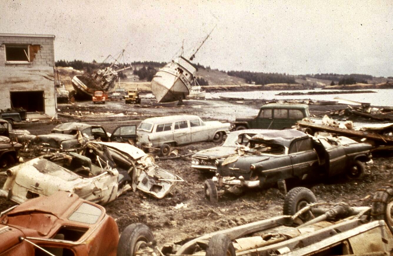
I first learned about people’s passion for collecting sea glass from our daughter-in-law, Cammie. Our son Tony was stationed on Kodiak Island as a helicopter pilot for the Coast Guard and Cammie had taken up producing sea glass jewelry to sell. Peggy and I were invited to join a family outing to collect sea glass on a local beach when we were visiting. It was like going on a treasure hunt. The glass had once hosted a variety of alcoholic drinks in a local bar that overlooked the Pacific Ocean. Then the 1964 Great Alaskan Earthquake struck. It was over six times as powerful as the 1906 San Francisco earthquake. The devastation caused by the shockwaves and tsunami was massive— and it included the Kodiak bar, washing it into the ocean. Ever since, the Pacific Ocean has been turning the liquor, wine, and beer bottles into sea glass.
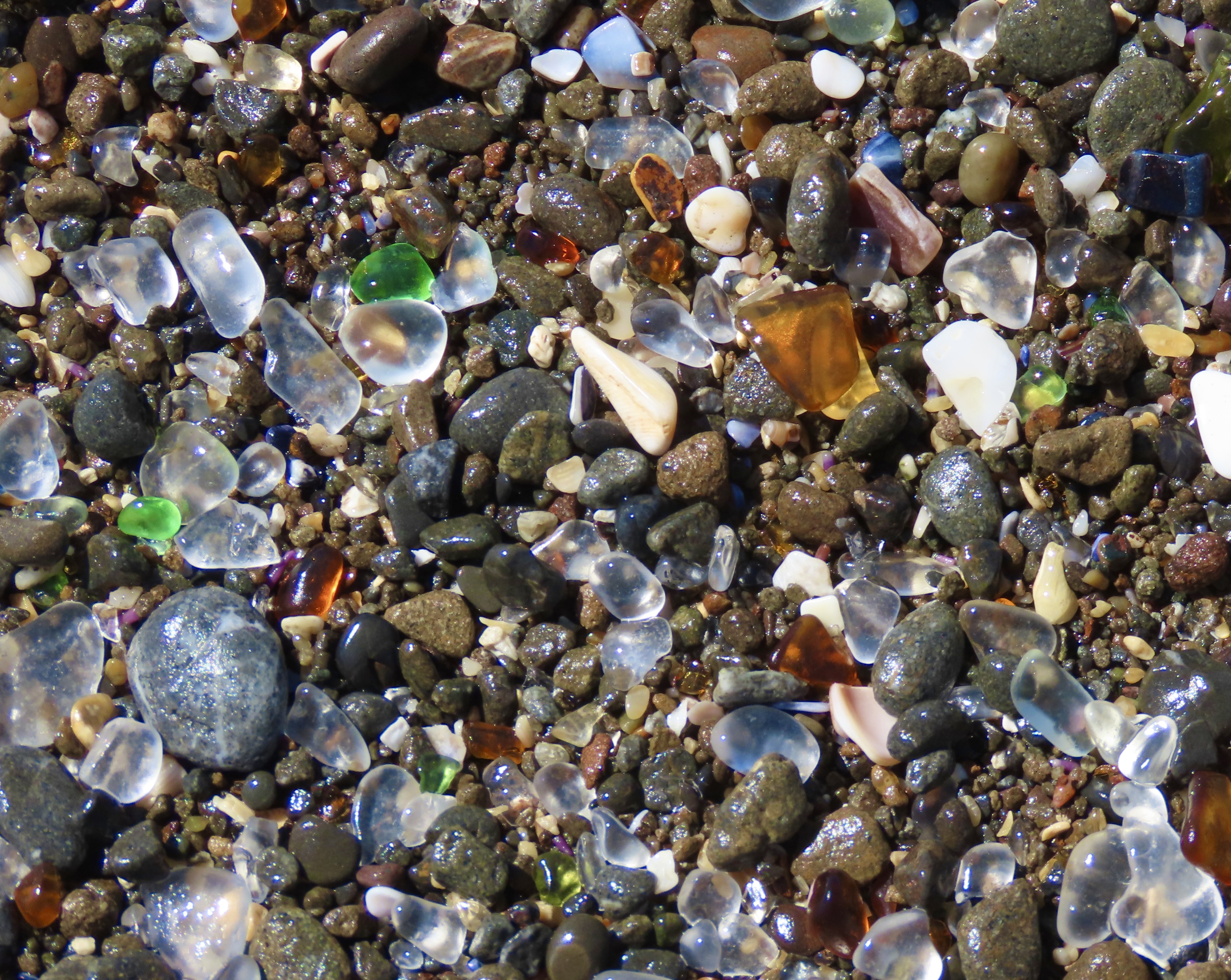
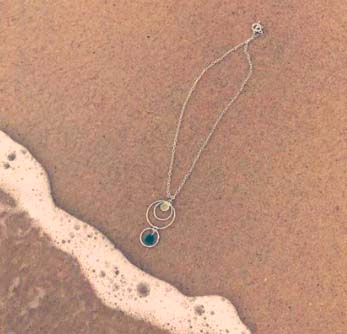
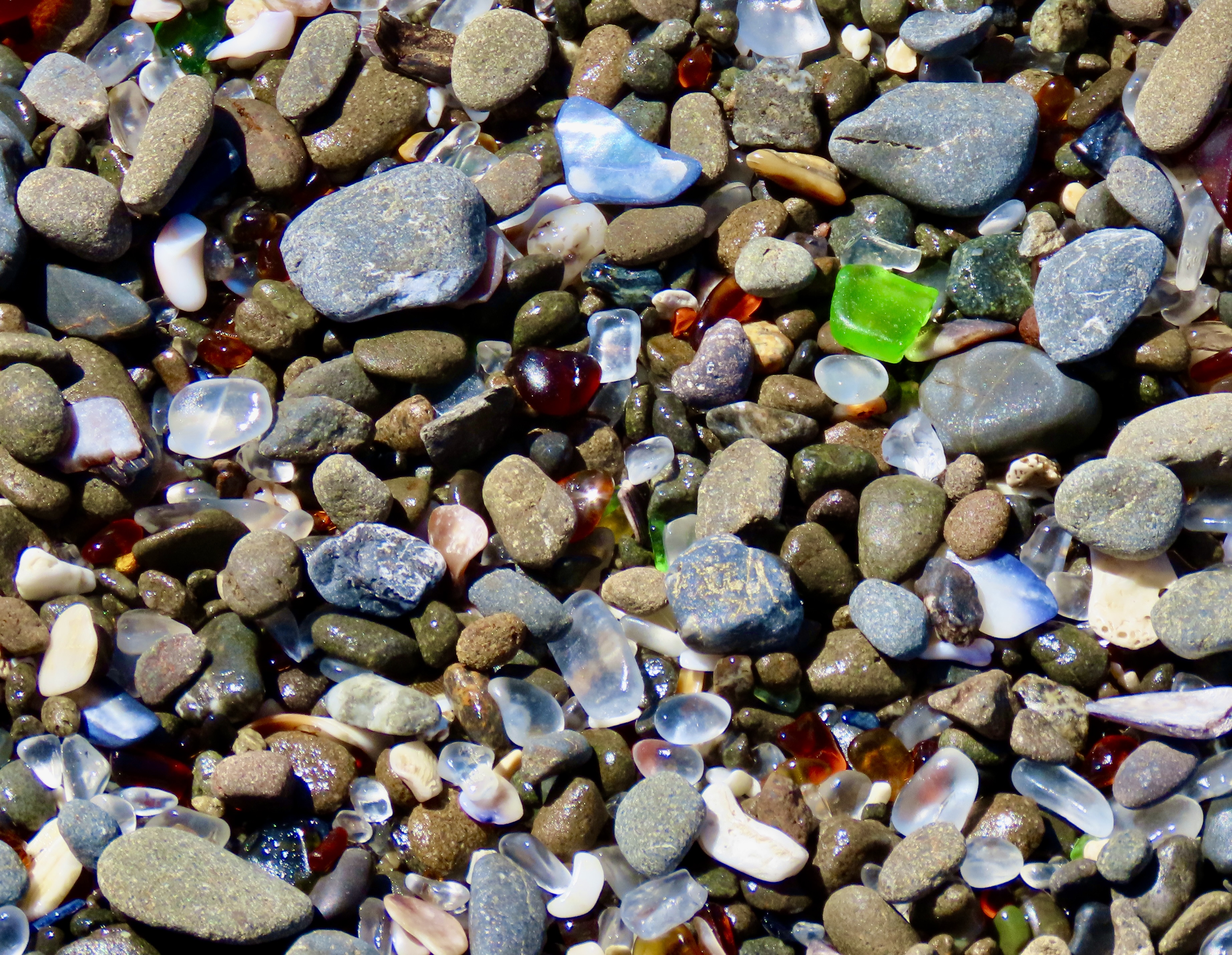
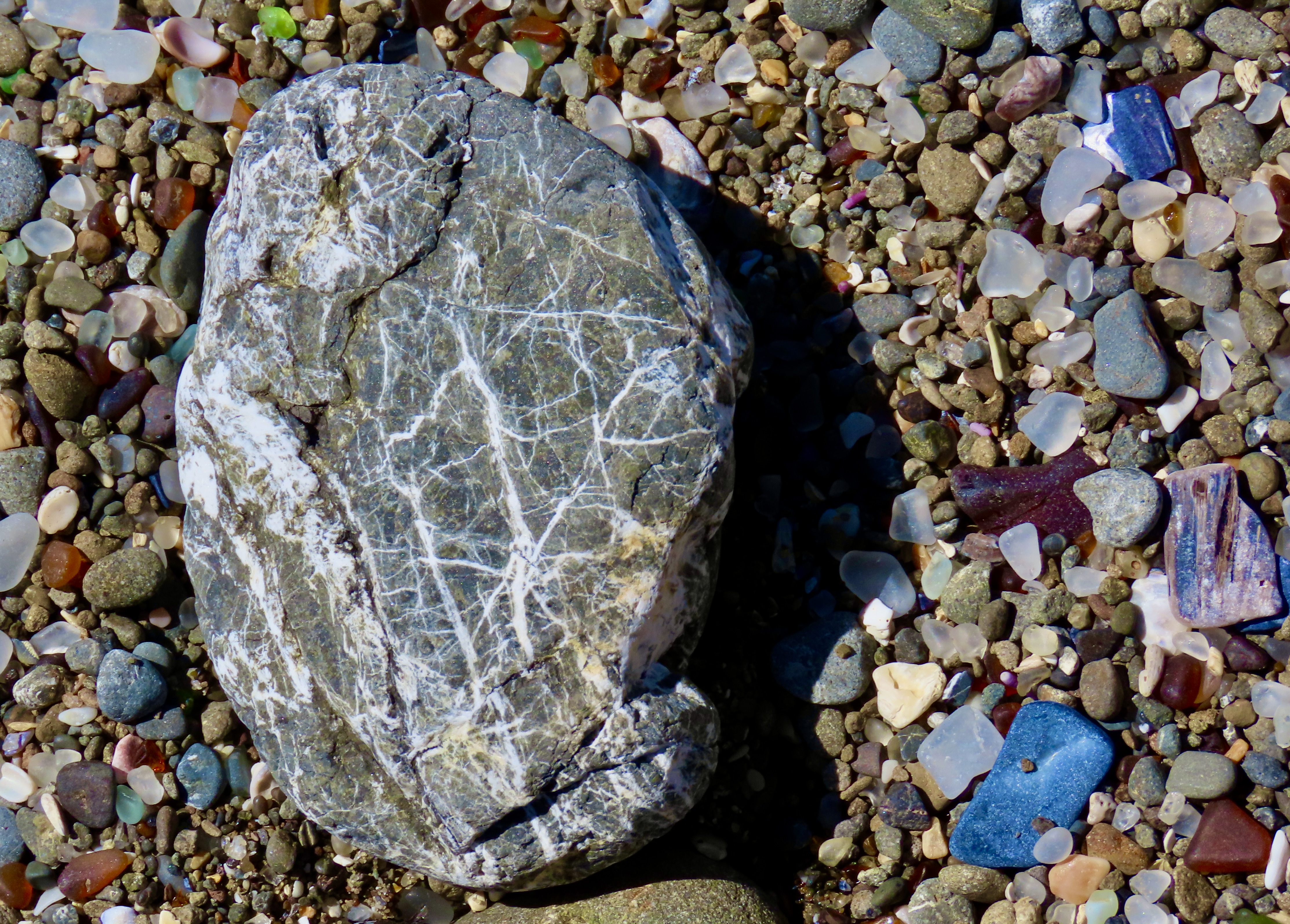
A USGS photo of the waterfront of Kodiak after the 1964 Alaska earthquake.Cammie turned the sea glass into attractive jewelry that she marketed on Facebook and in local shops.The combination of rocks, shells and glass reworked by the ocean and wet down by the retreating tide was quite photogenic. Cammie told us that the colored glass was less common and worth more than the clear glass— the more rare, the more valuable.This rock, with what I think are quartz intrusions, also demanded a photo. It was taken above the tide line and illustrates how important the water was in bringing out the color of the glass rocks and shells.
The story behind the glass beach at Fort Bragg isn’t nearly as dramatic as the beach in Kodiak. The beach was the site of the community’s official dump until 1967. The attitude up until then in Fort Bragg and numerous other coastal towns had been why worry about burying your garbage when the ocean will wash it out to sea. Growing awareness about the potential harm from the practice by the community plus pressure from the California Water Resources Board led to closing the dump in 1967. Degradable garbage degraded, non-degradable garbage such as automobiles and refrigerators was hauled away, and the glass, already on its way to becoming sea glass, was left to become more sea-glassy.
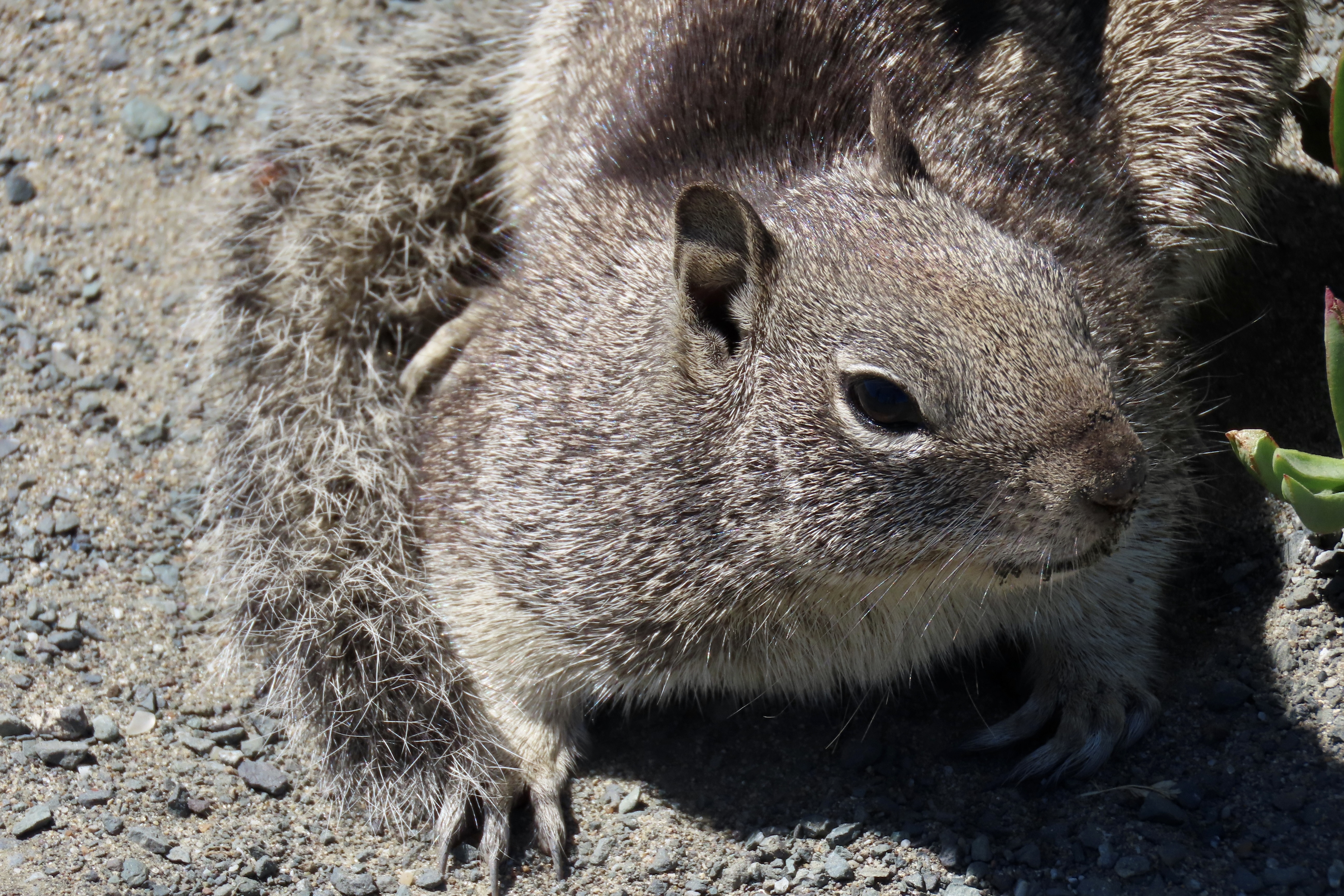
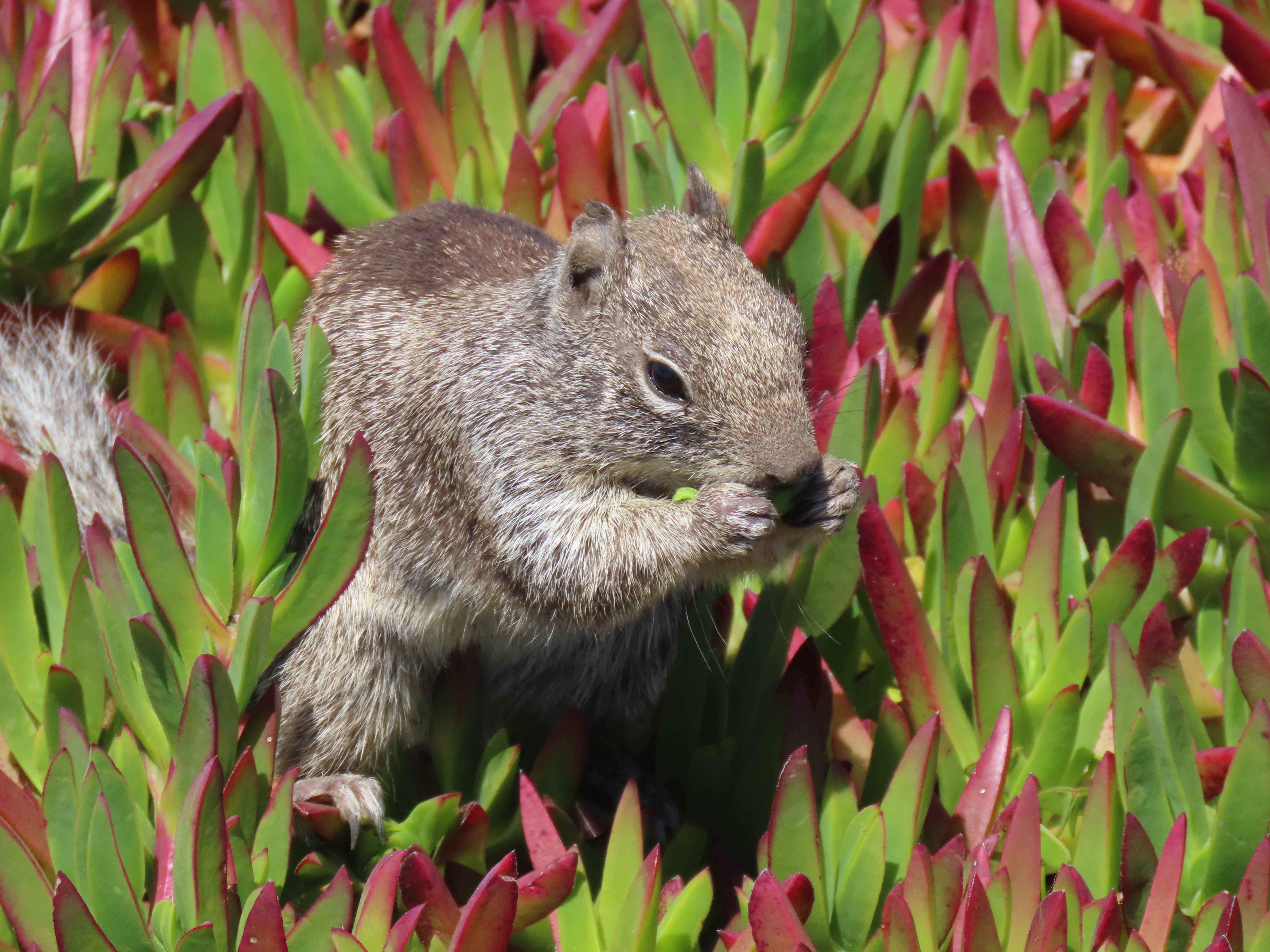
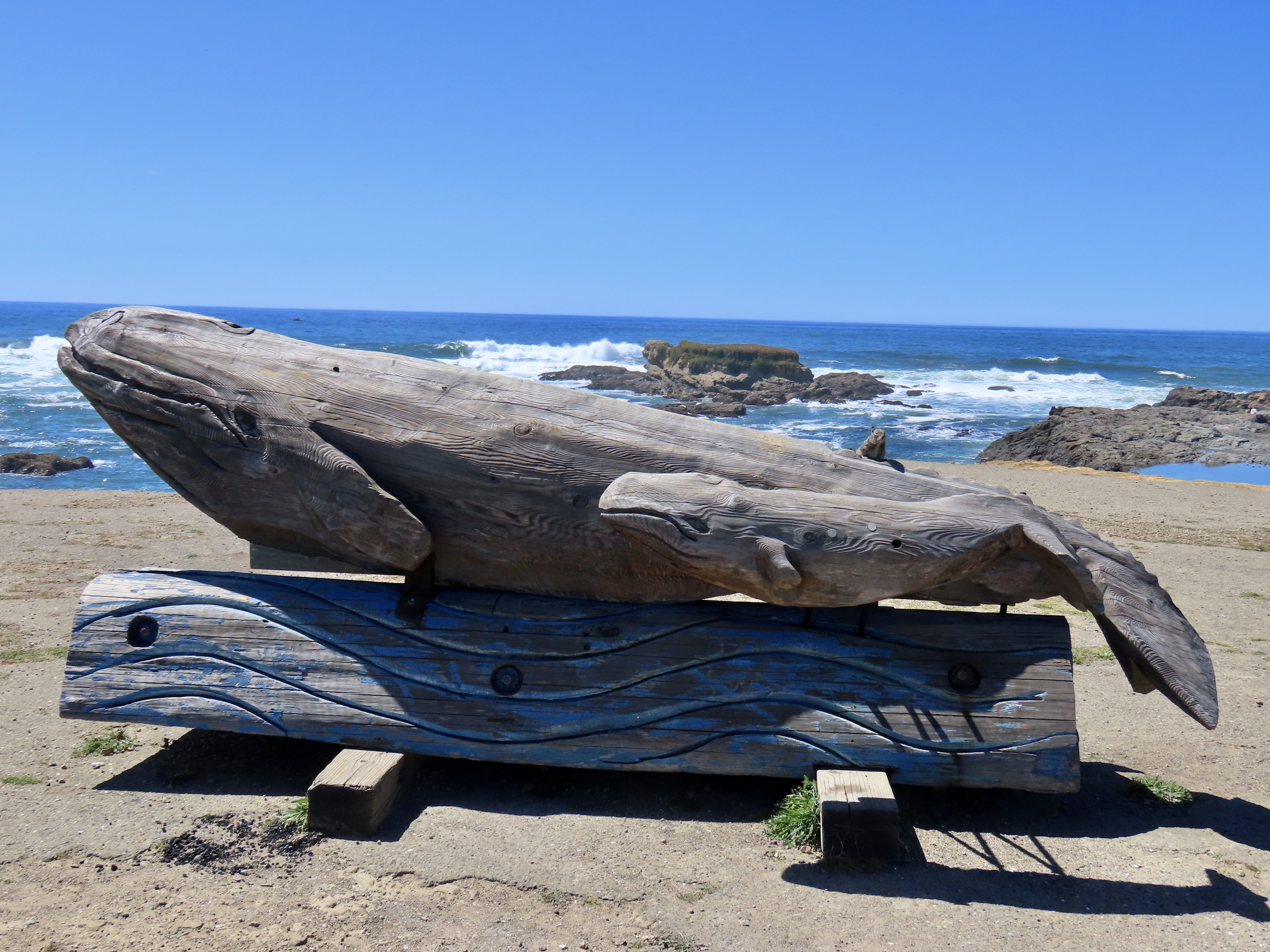
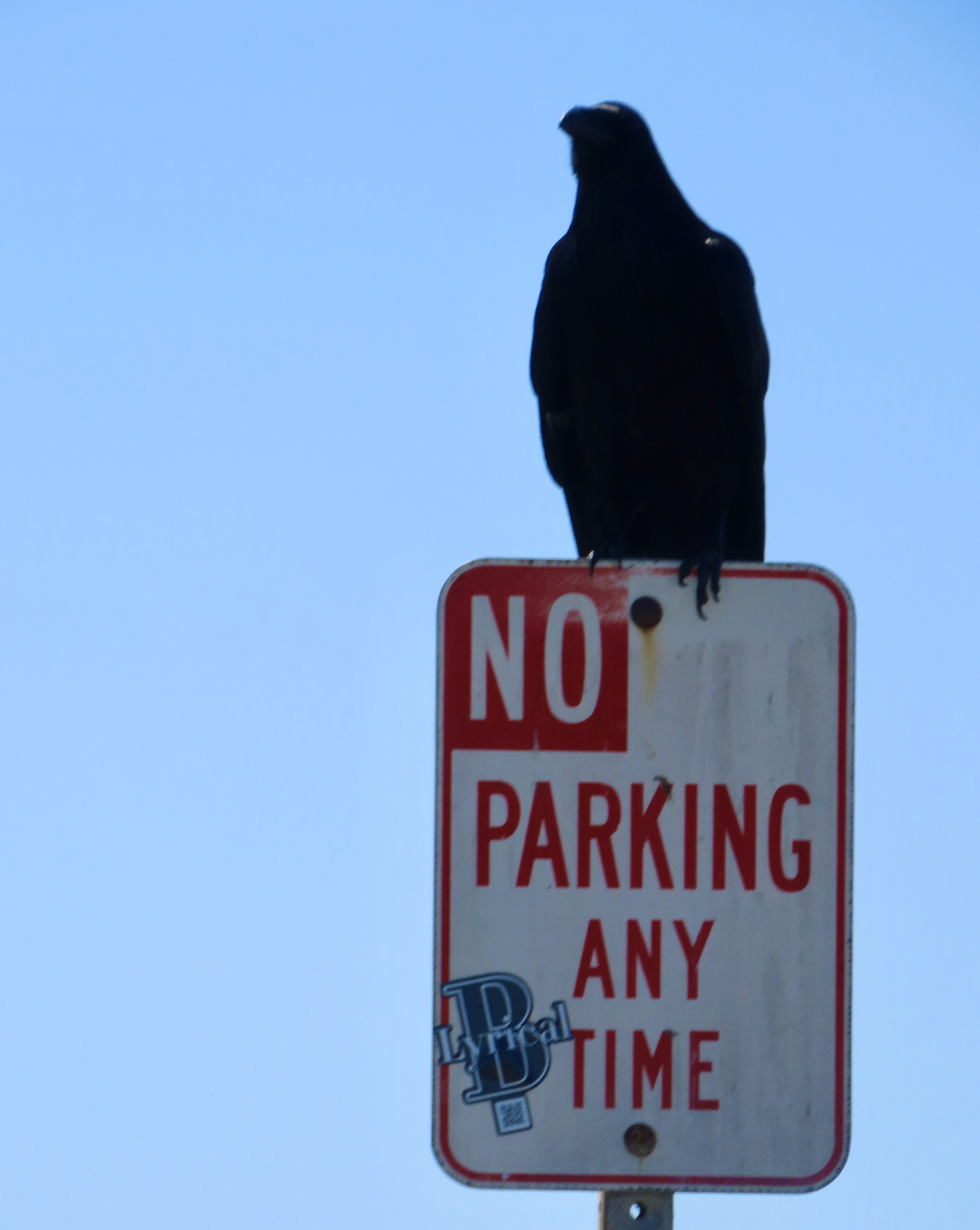
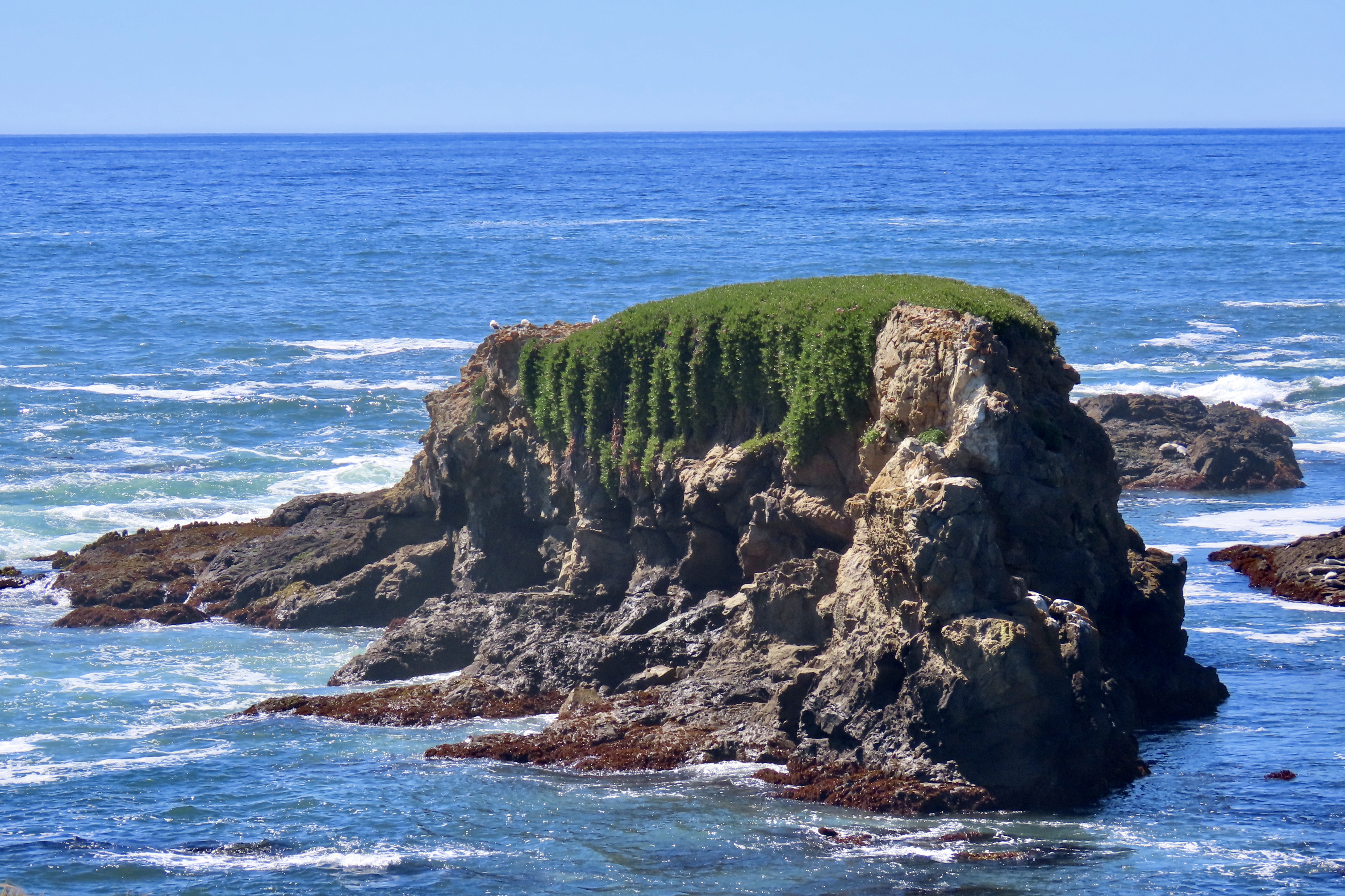
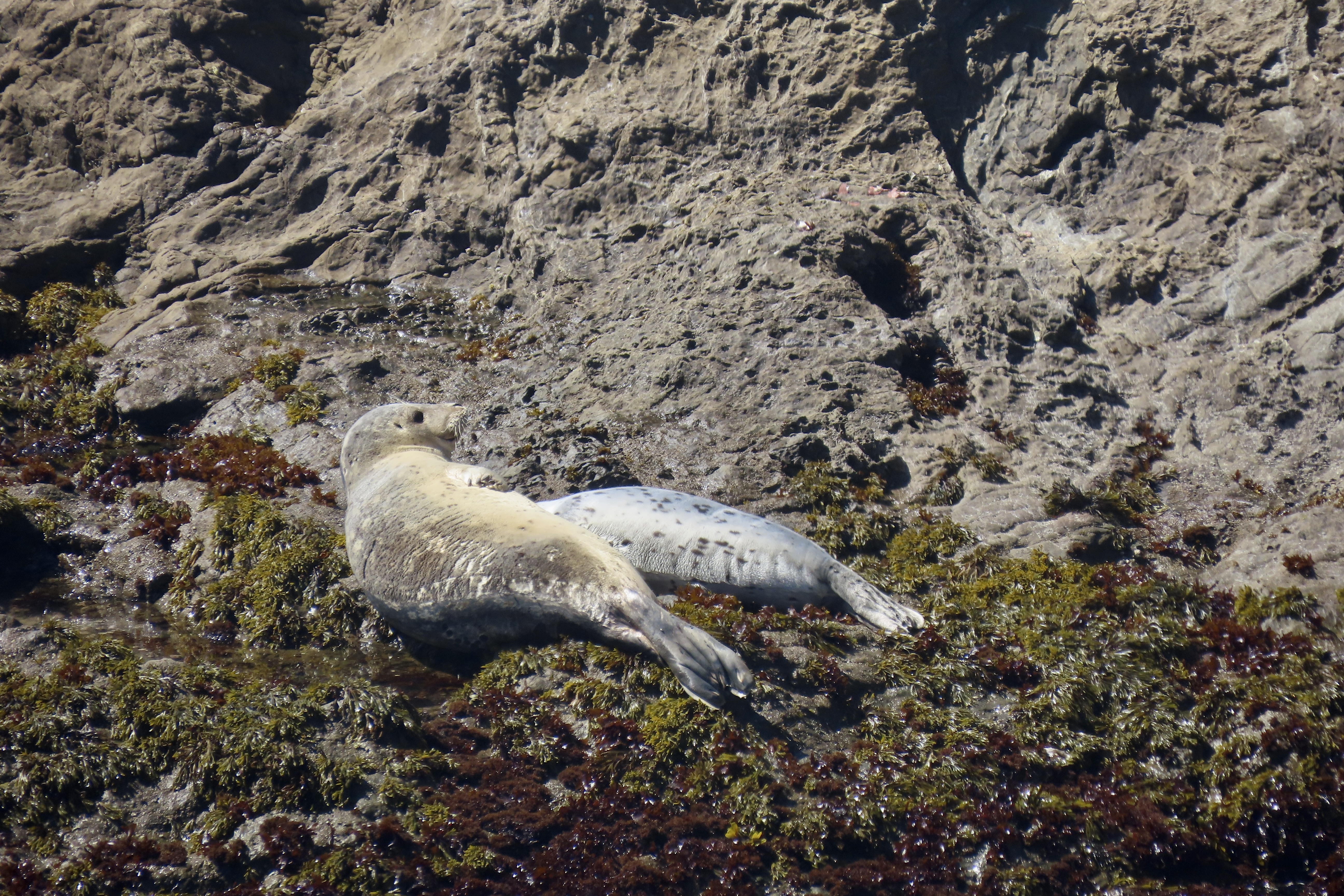
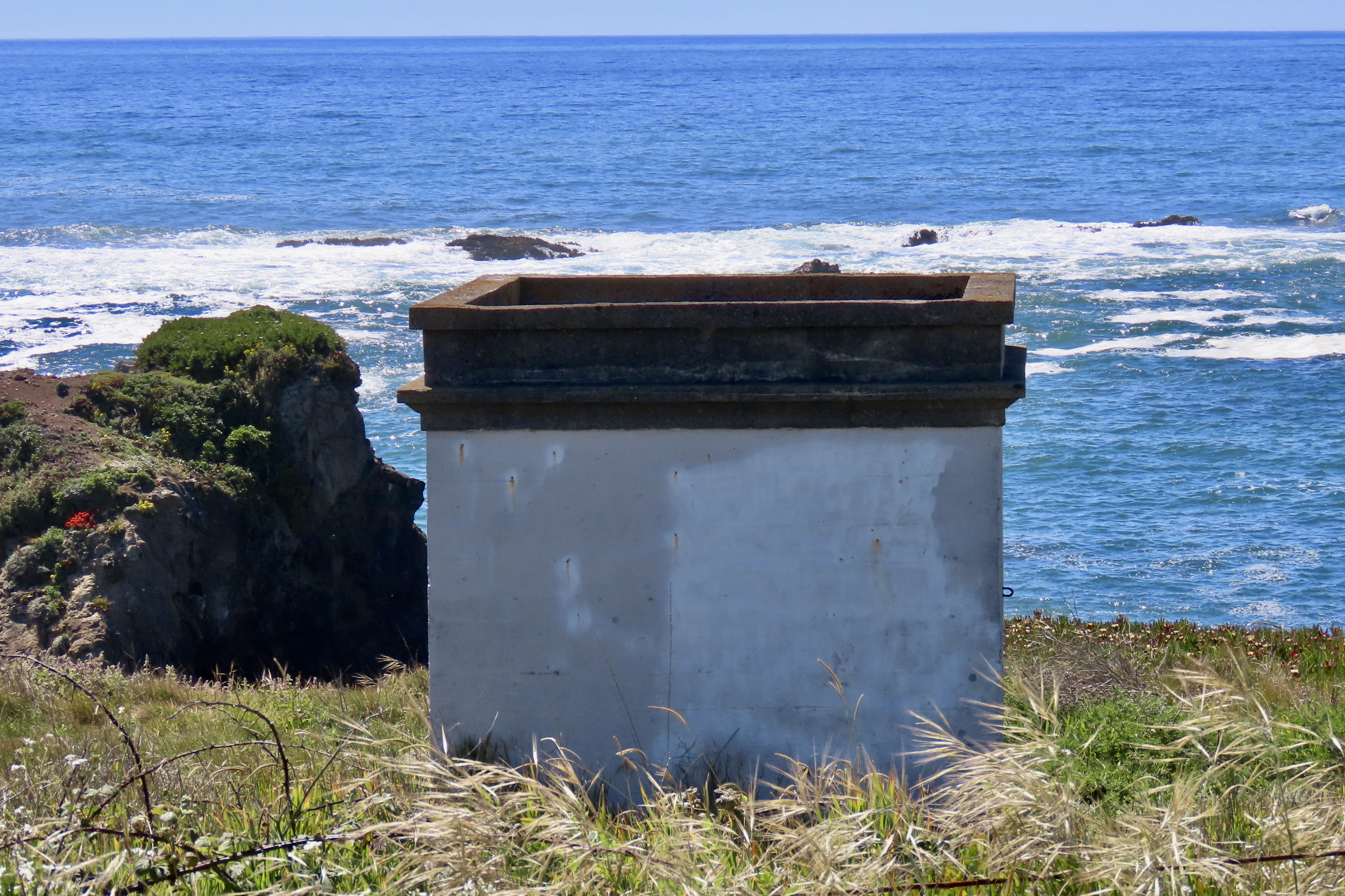
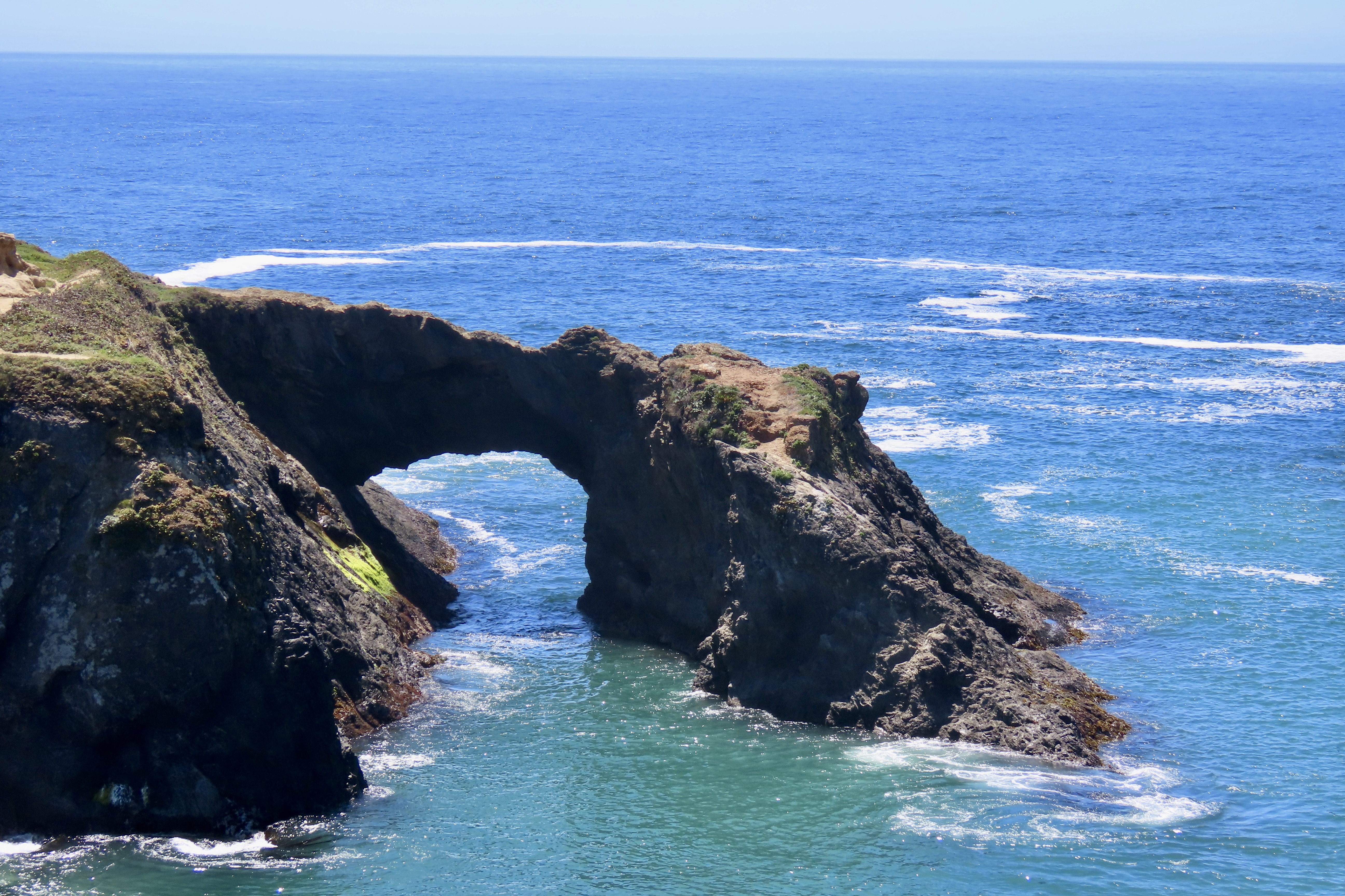
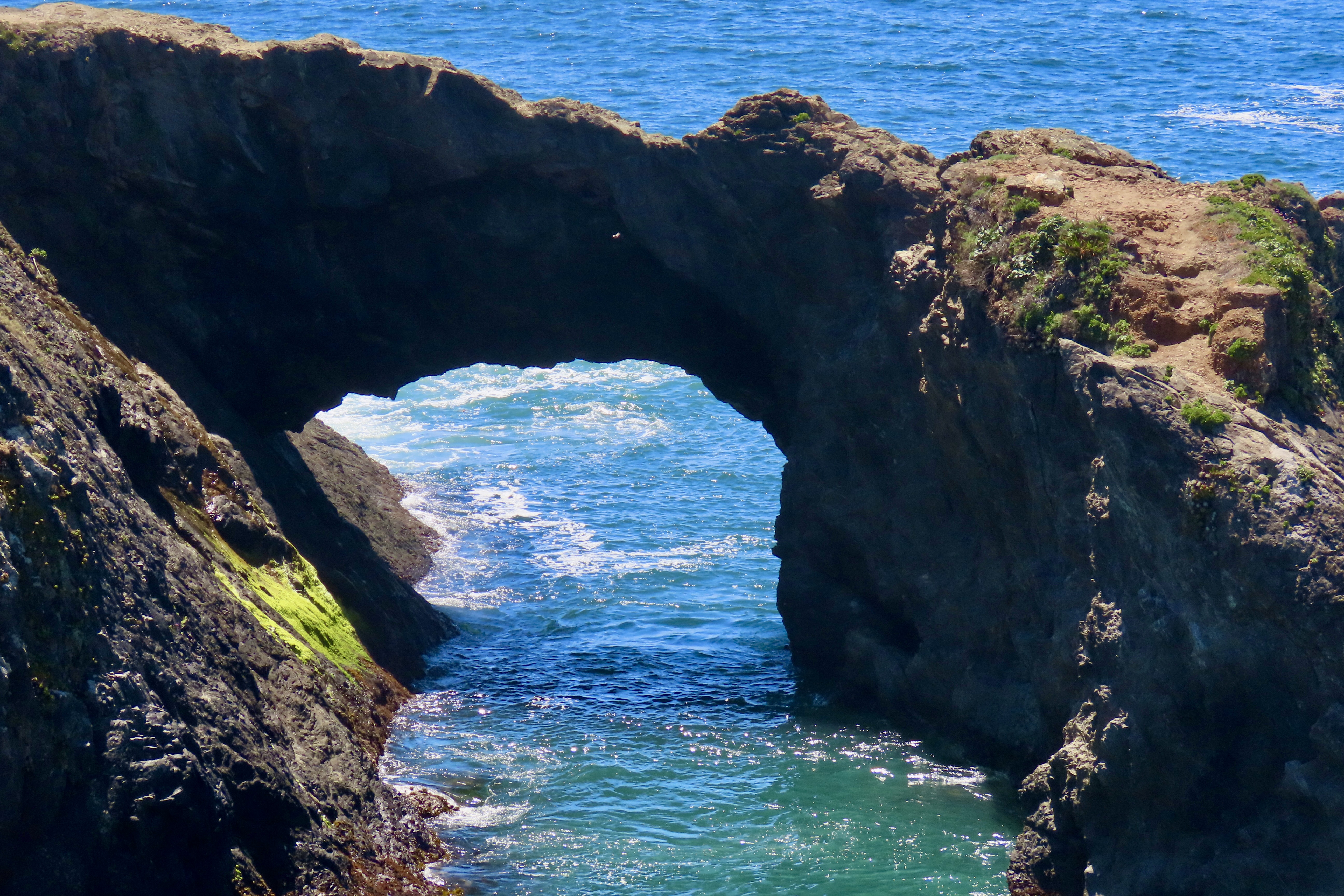
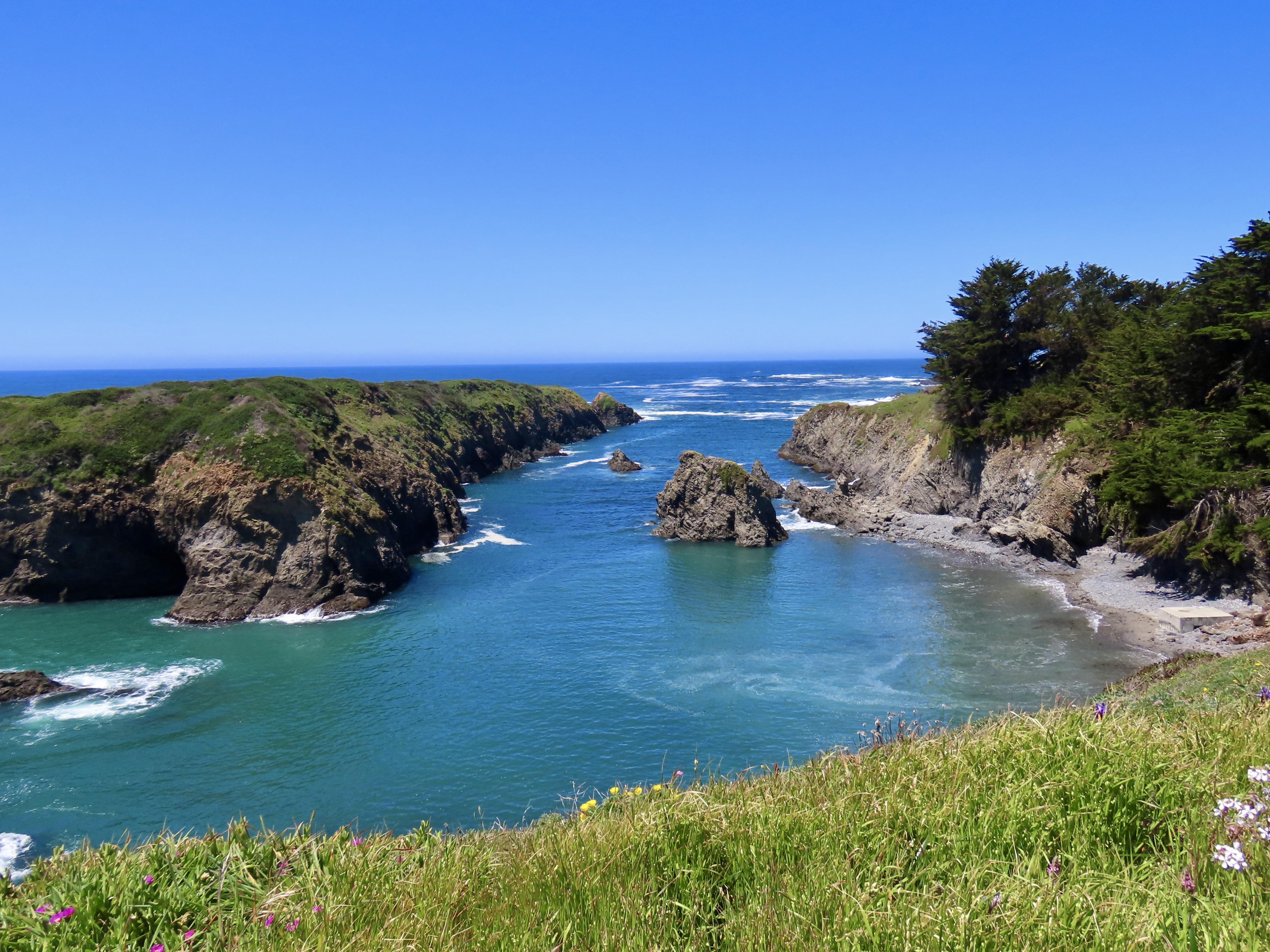
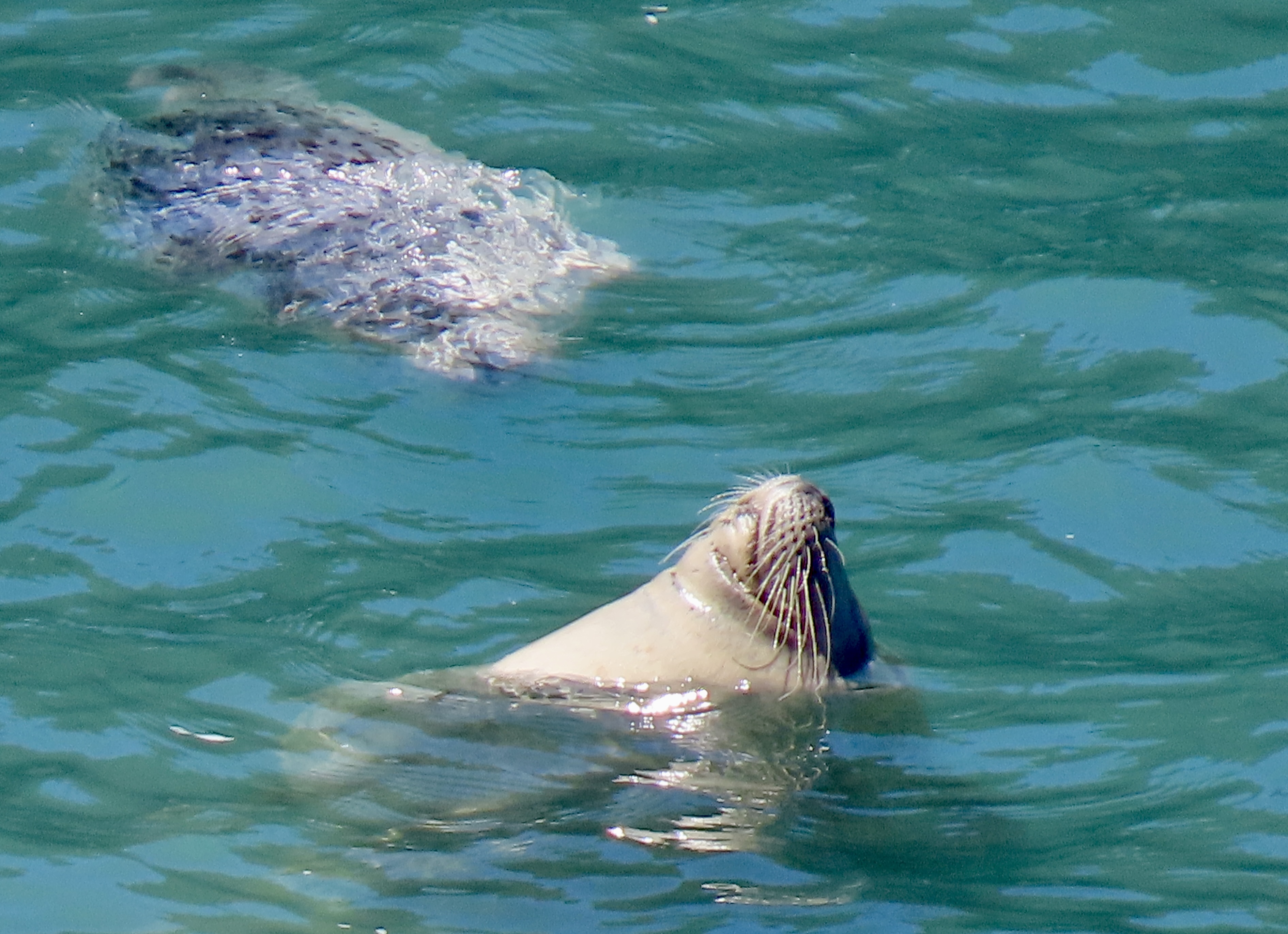
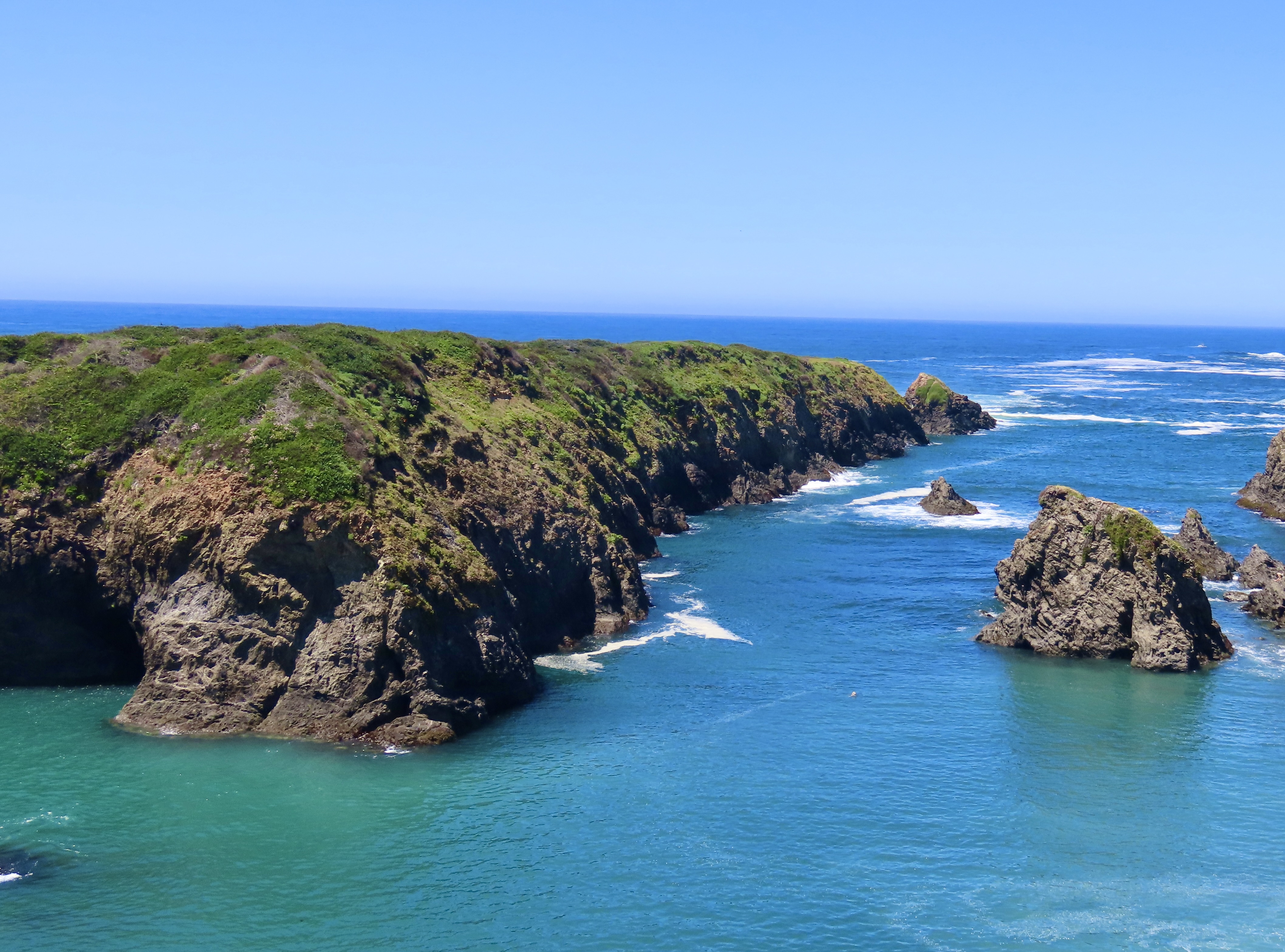
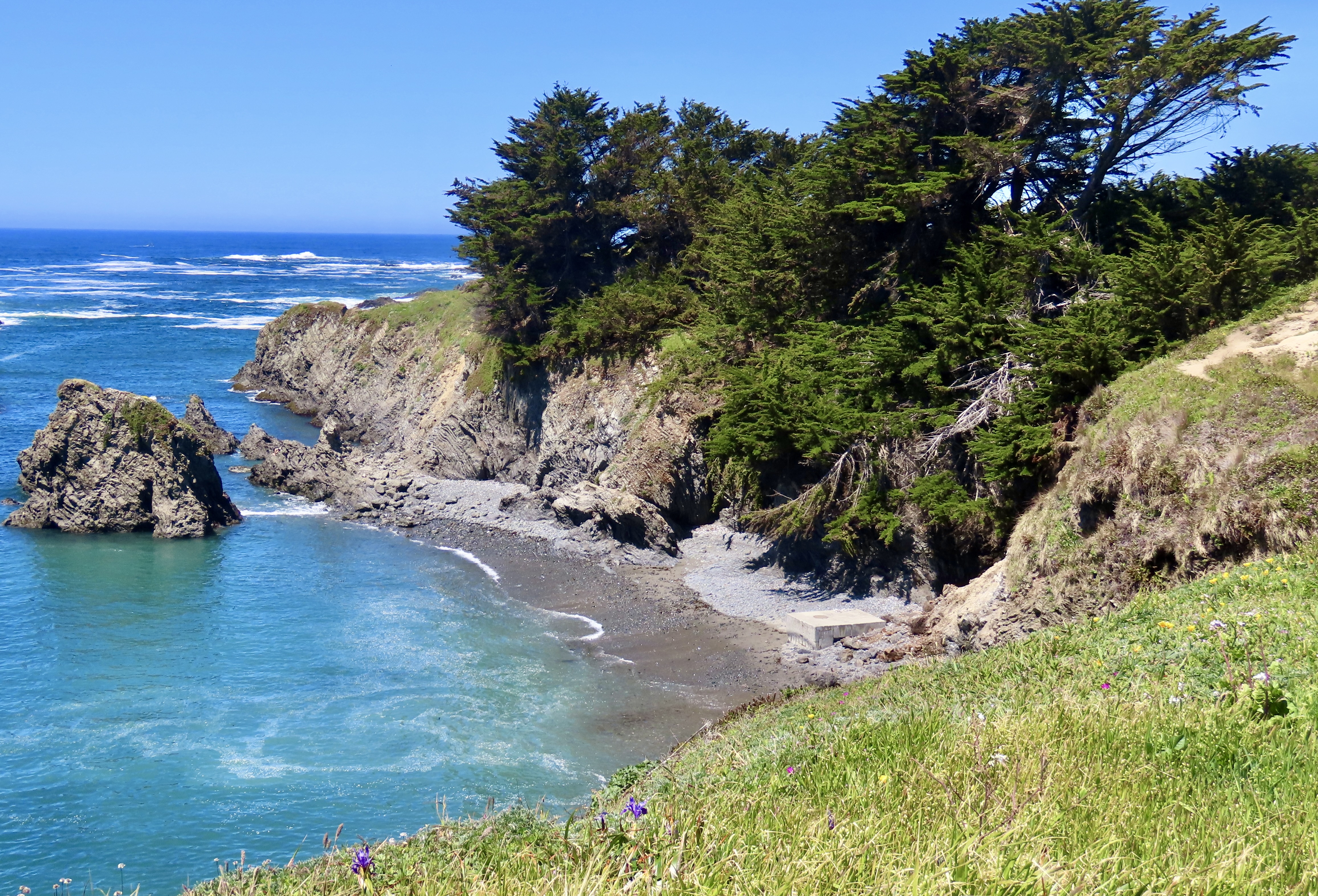
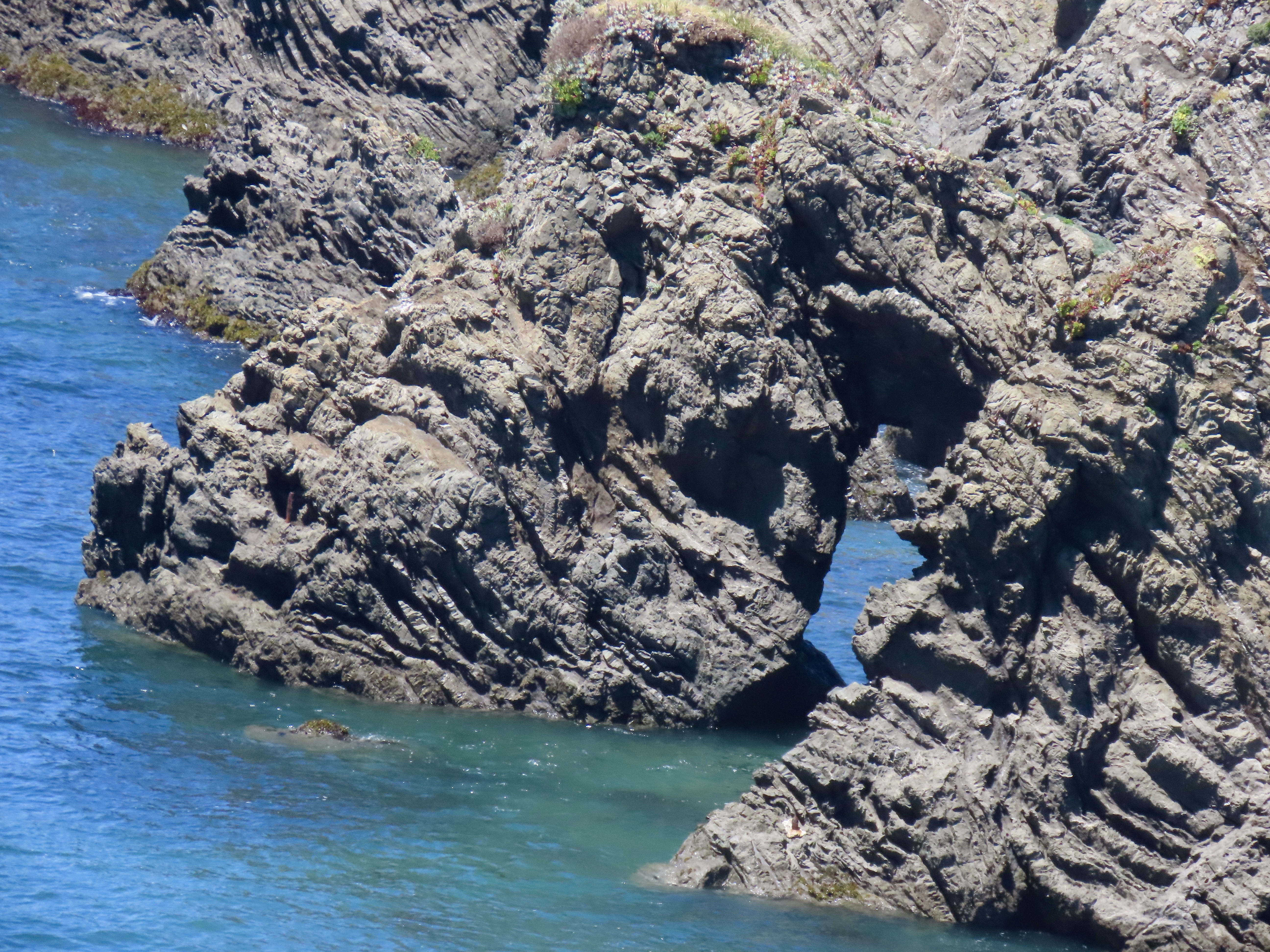
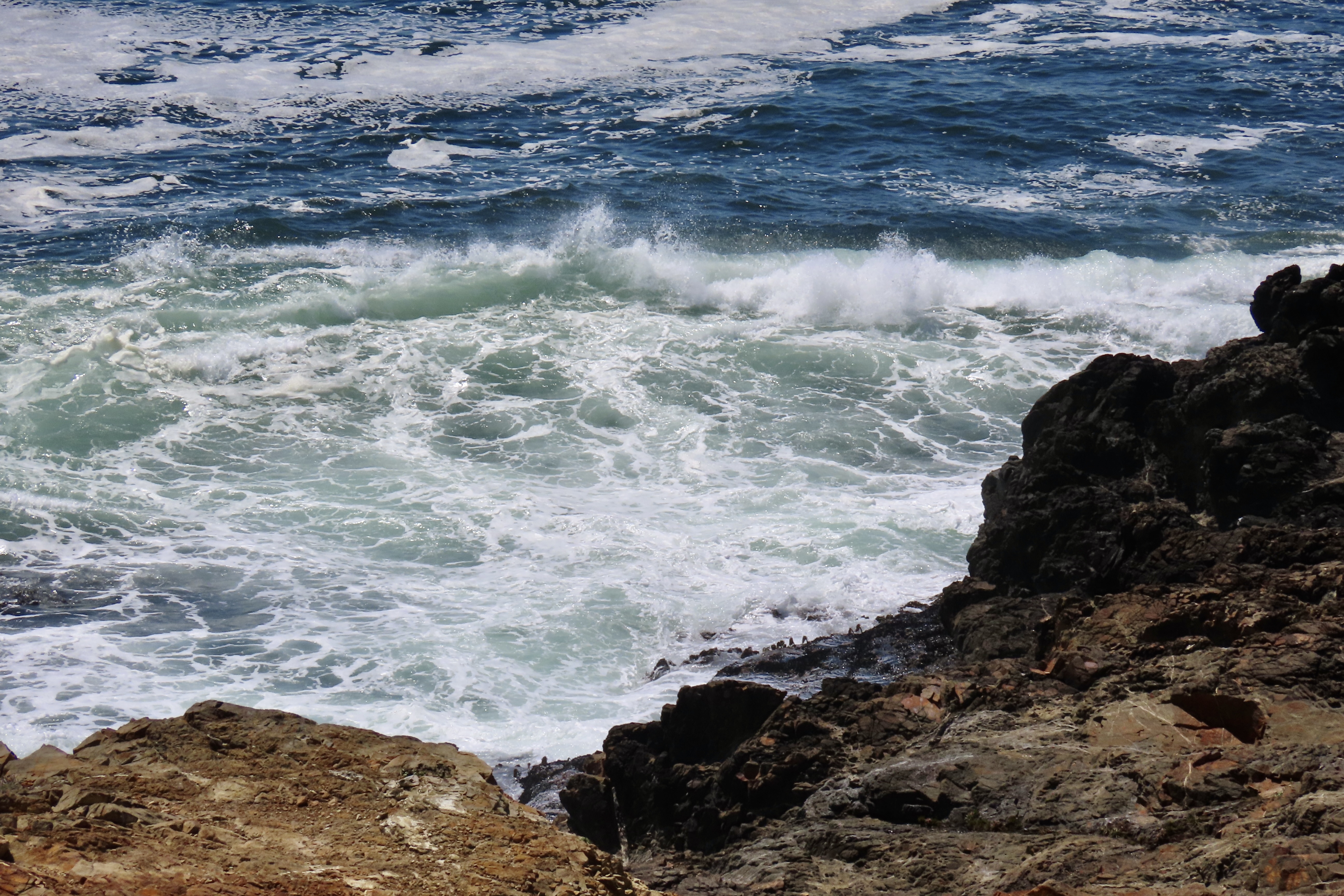
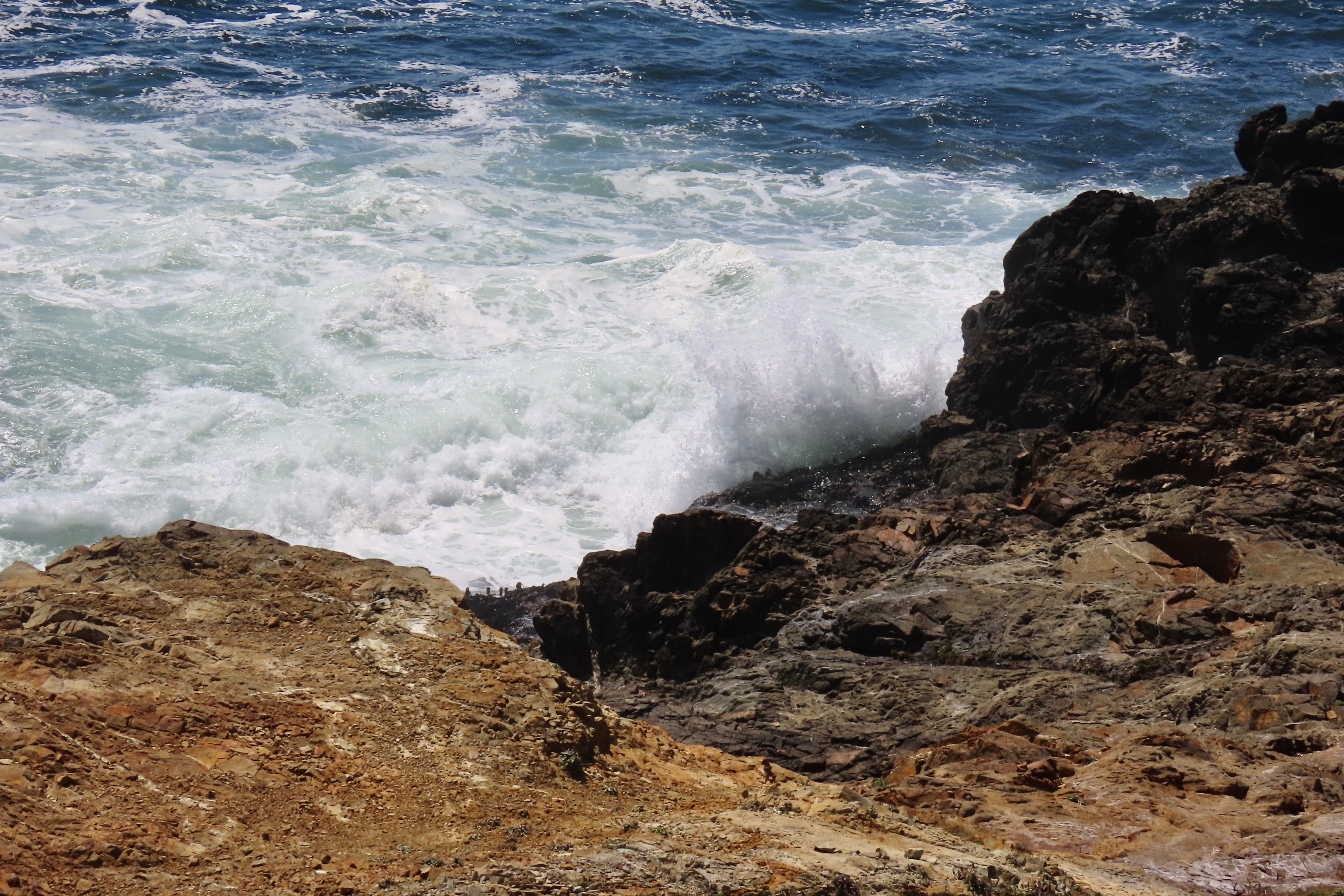
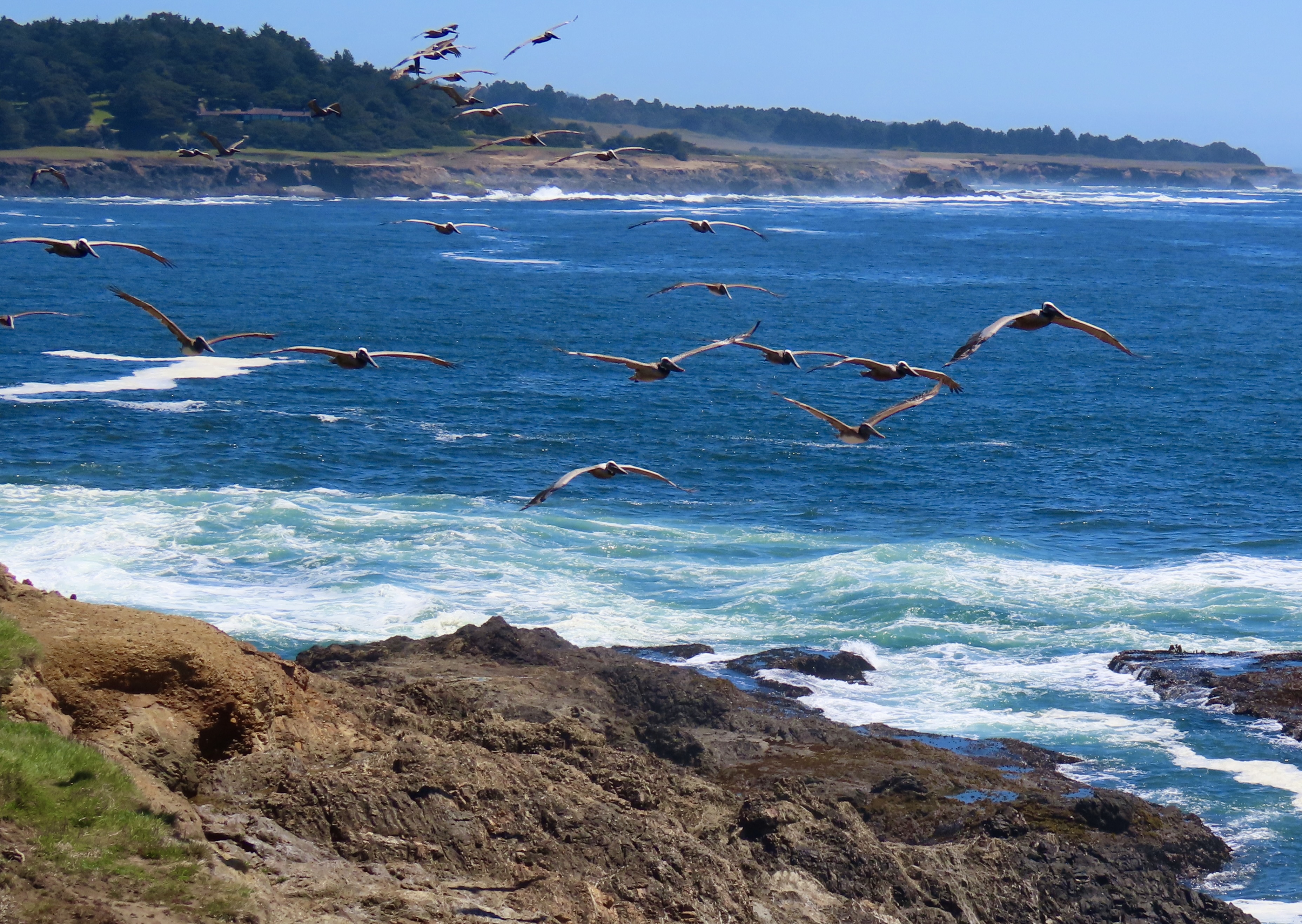
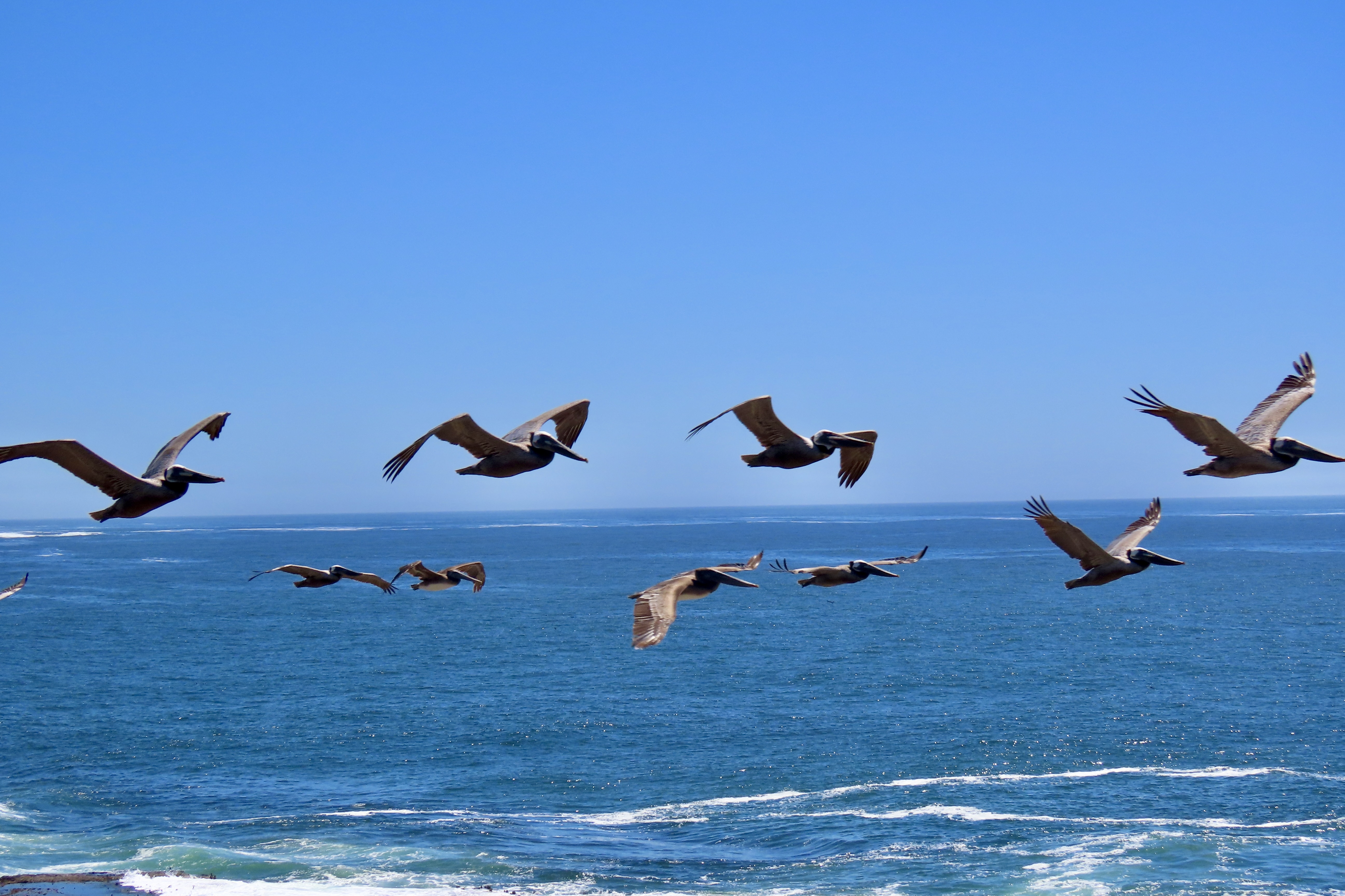
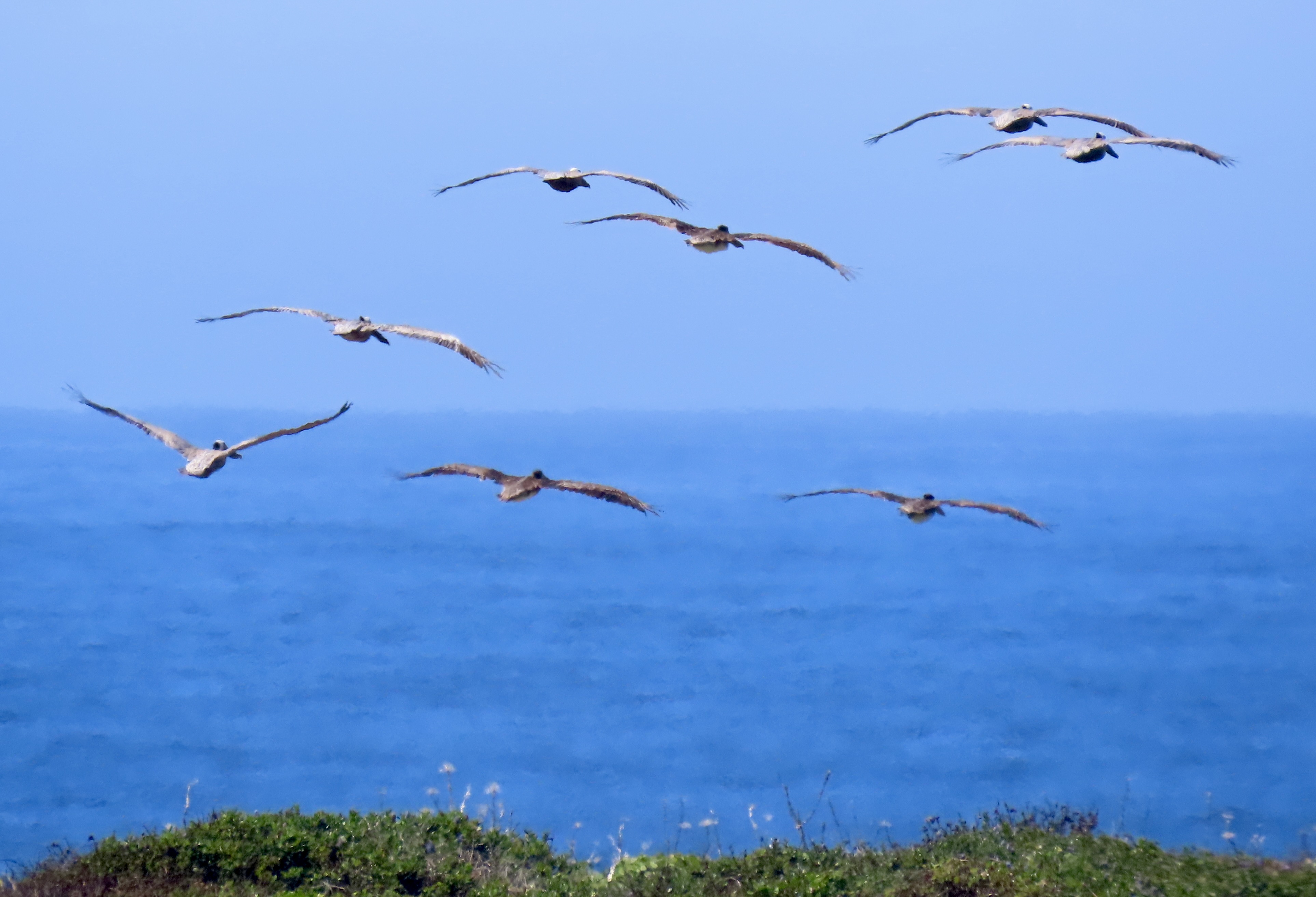
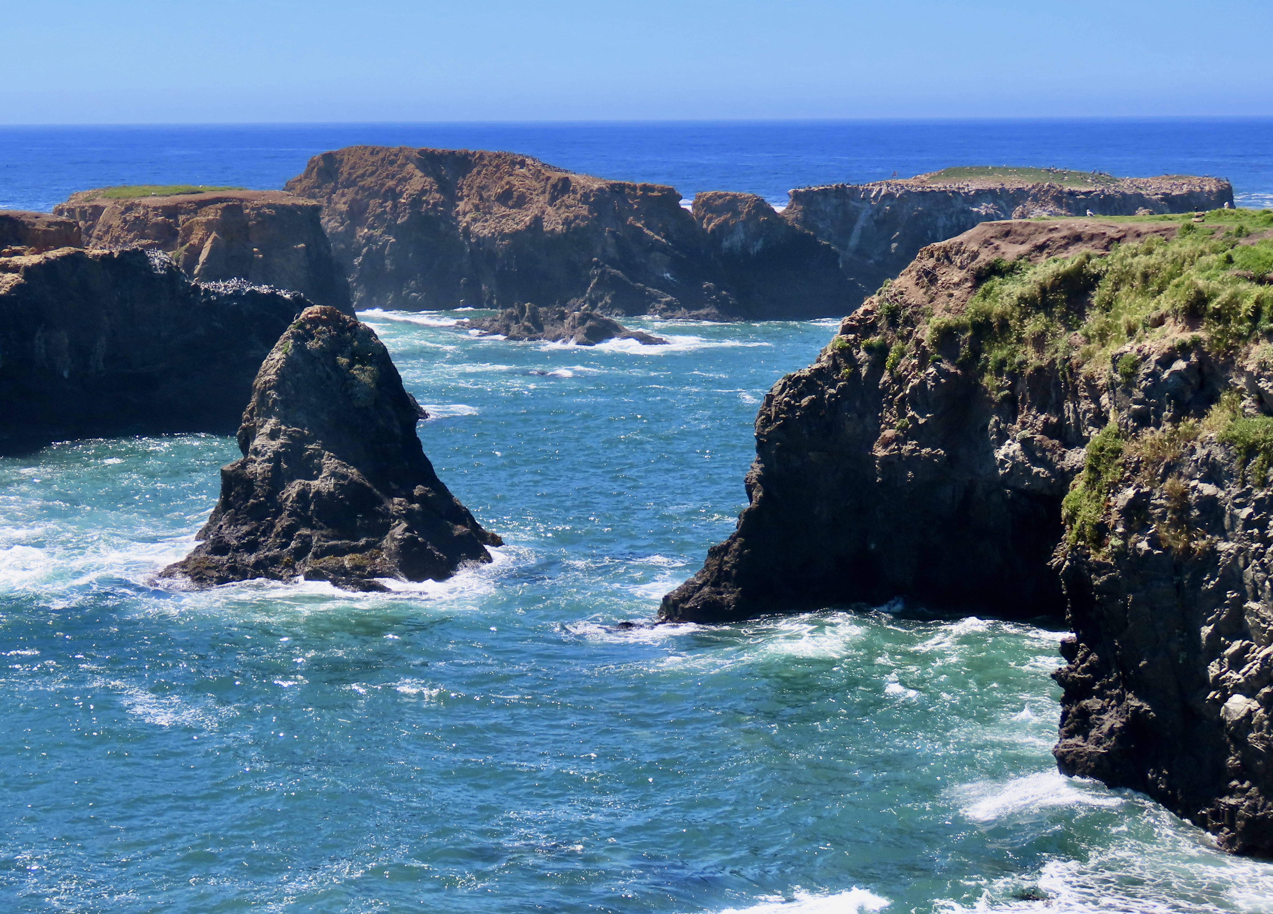
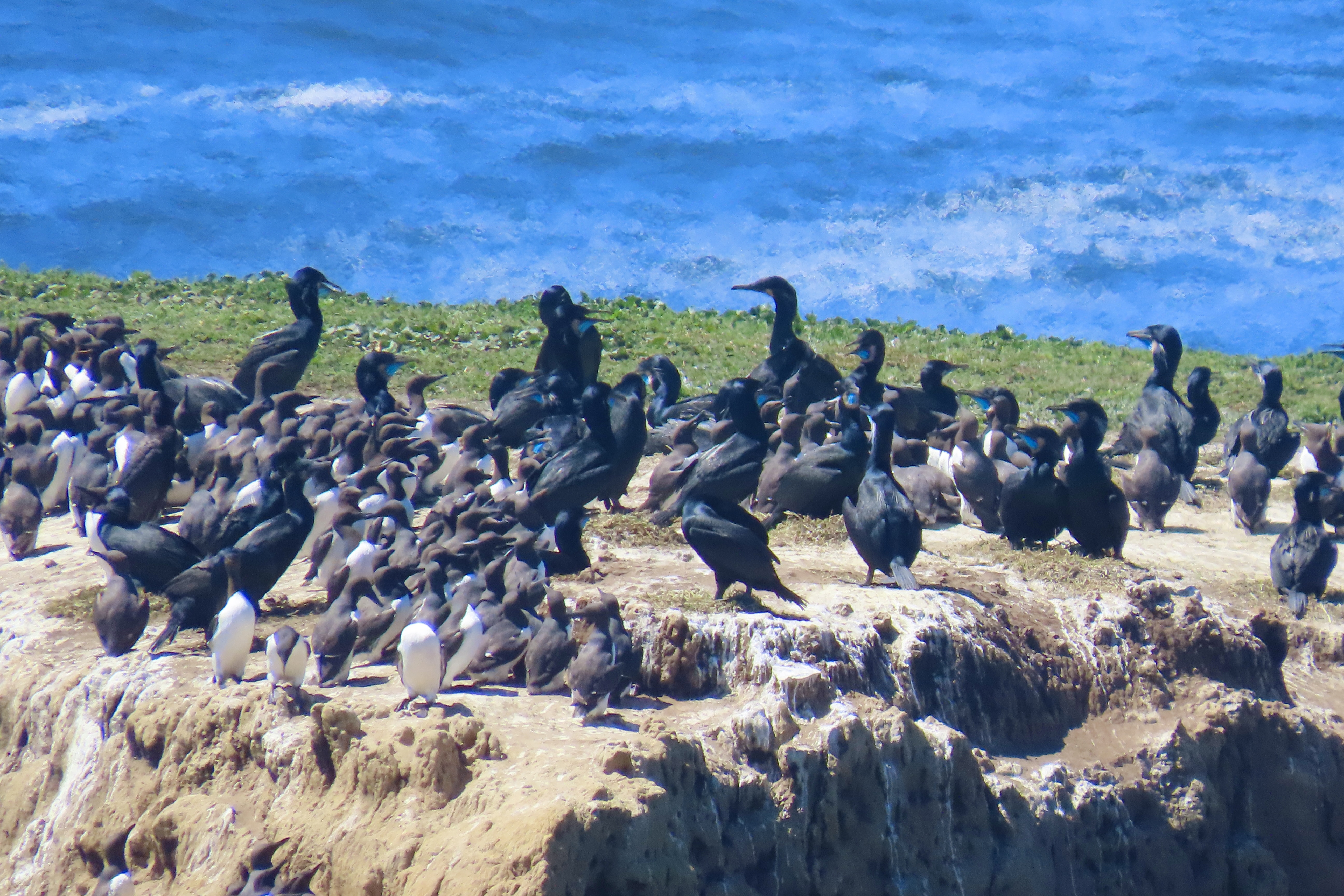
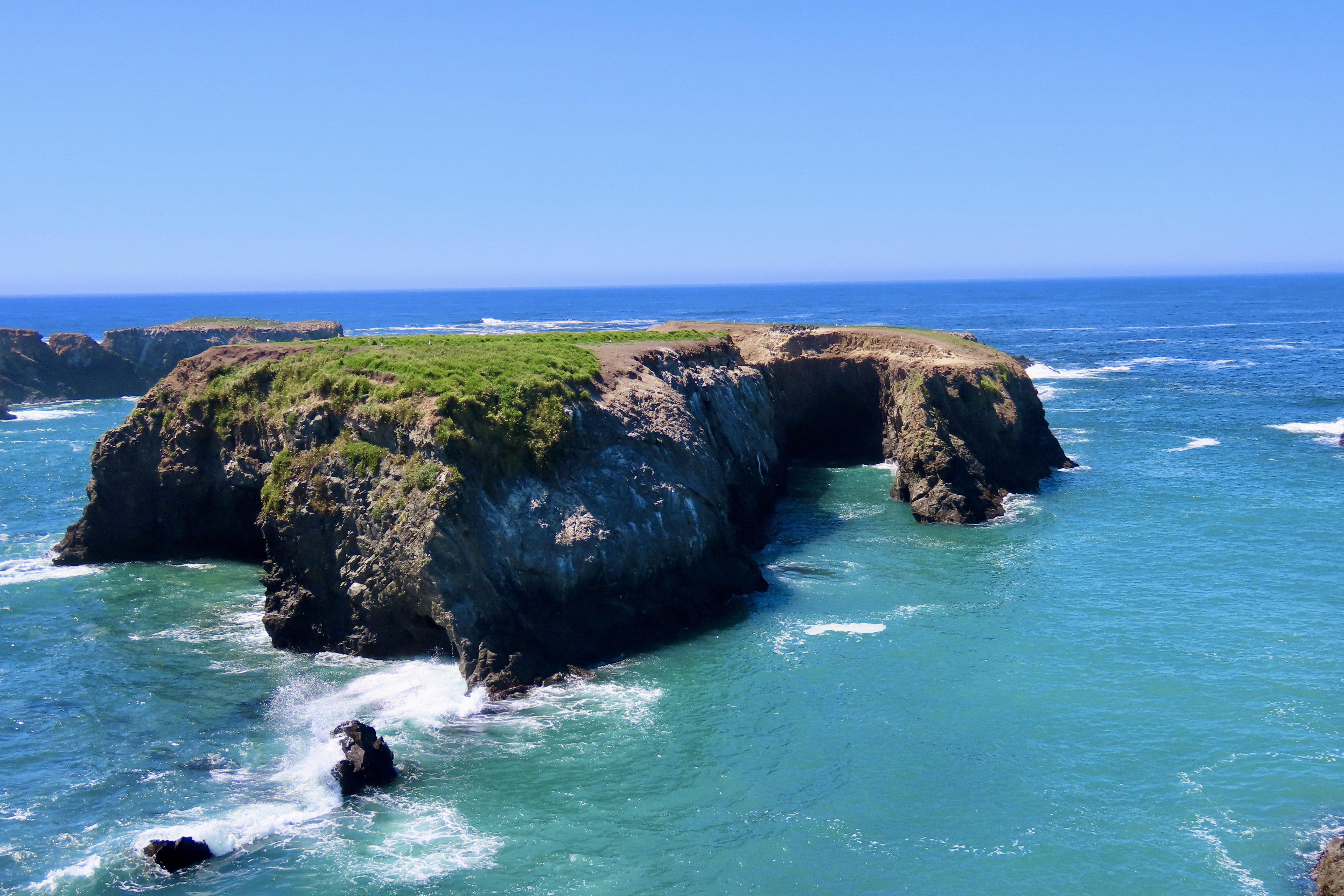
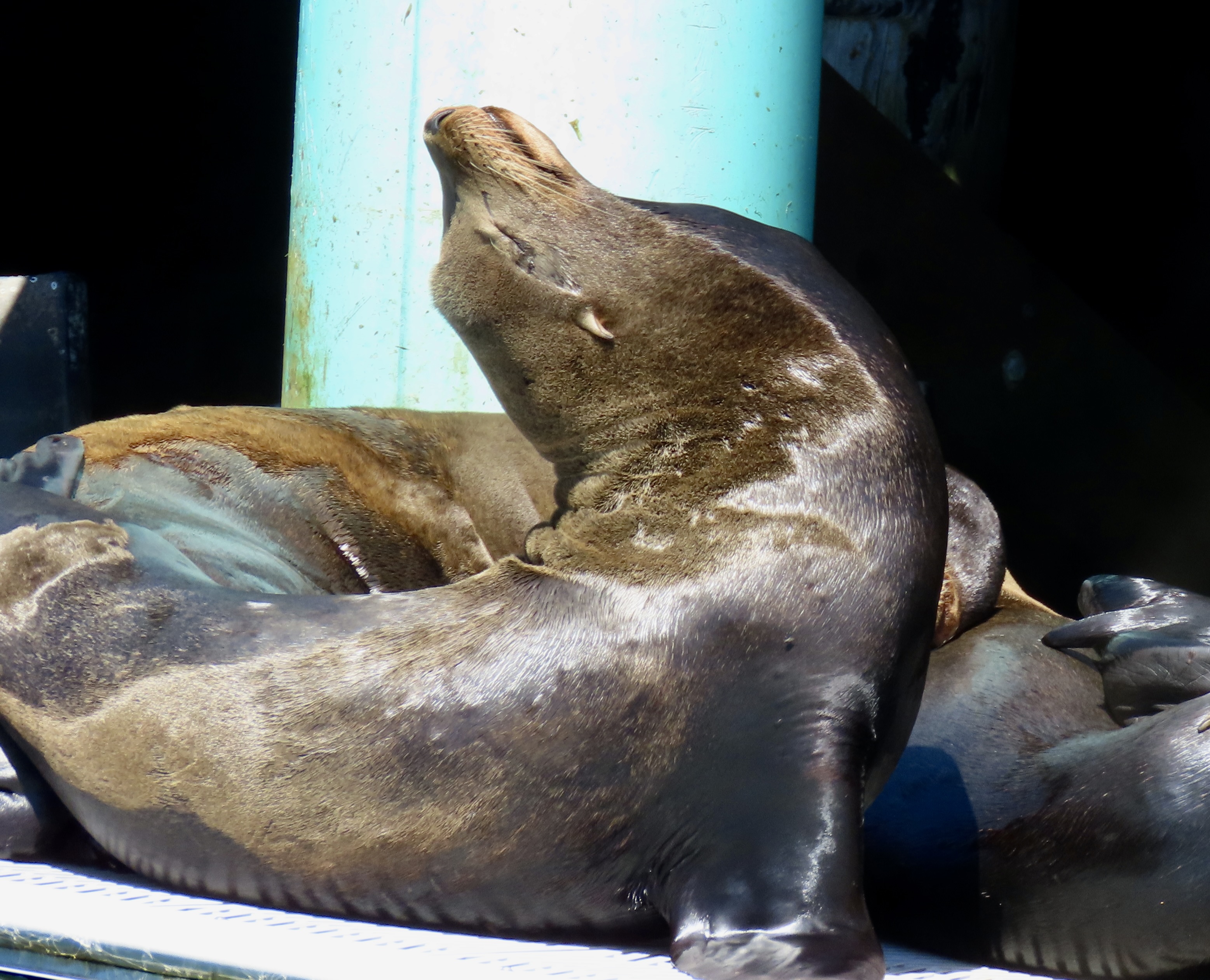
There were more things to see at Glass Beach in addition to the sea glass. For one, there was an army of ground squirrels.Mainly, they were busy chowing down on the buds of ice plant flowers.Peggy found one sunbathing on a whale sculpture, however. I think it said something about providing perspective. I think the local hawks had a different perspective. Lunch.We didn’t see any hawks, but we did see this raven parked on a “no parking” sign.This island was located off of Glass Beach. it is a part of the 20,000 offshore rocks and islands that make up the California Coastal Monument that stretches out over the 1100 mile California coast and provides valuable protection to birds and mammals.This harbor seal was nursing its baby on one of the rocks.This nondescript little building caught our attention. We stopped at an information sign to find out what it was. Turns out it was a dynamite bunker dating back to the early 1900s when the dynamite was used to blast a railroad tunnel. It was located far away from anything, just in case. The info sign also informed us that the men who used the dynamite to blow up things were known as powder monkeys. Apparently the nitroglycerin in the dynamite led the powder monkeys to become a bit deranged— not a desirable quality for someone handling explosives, I’d think.The town of Mendocino is one of my all-time favorite coastal communities, for a number of reasons. For one, it has an incredible bookstore that comes complete with a bookstore cat. Another is its gorgeous headlands of which this arch is part.A close up.A scenic inlet lays off to the right of the arch.A female seal was lying on her back in the foreground, apparently enjoying herself while her baby hovered near by.The inlet on the left featuring the island. And a rock.And on the right, the mainland. Same rock.Peggy noted that the rock came with its own sea cave/budding arch.We followed the trail to the right of the arch where the waves were pounding in.And crashing ashore.While we were admiring the wave action, a flock of over 20 or so California brown pelicans flew in from the left.Passed by us.And flew on up the coast.As we continued northward along the Headlands, we were greeted by more islands.One island was packed with nesting birds, cormorants and what looked like small penguins!A closer look, and TheSibley Guide to Birds told me they were Murres. Murres lay their eggs directly on the rocks. The fact that they are more rounded on one end and more pointed on the other means they will roll in circles if nudged instead of falling off of the rock! Isn’t nature grand.A final look at the island the cormorants and murres had chosen for their nests and we were on our way back to Fort Bragg and our campsite along the Noyo River. The Noyo will be our next and final post on the Fort Bragg/Medocino area.A short tour of the Noyo River by Captain Dan took us down to the Fort Bragg Marina where we found this, and many other sea lions.