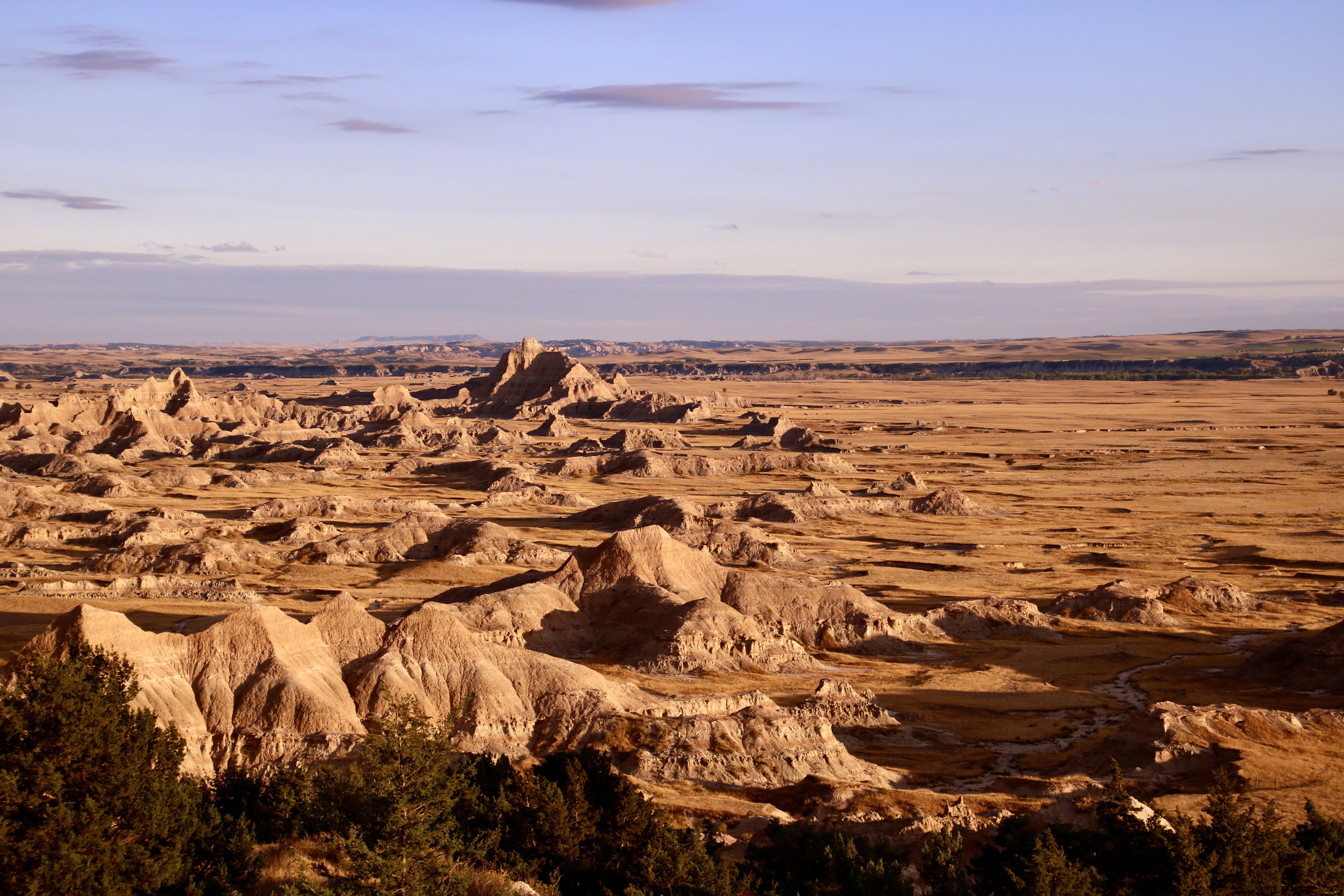
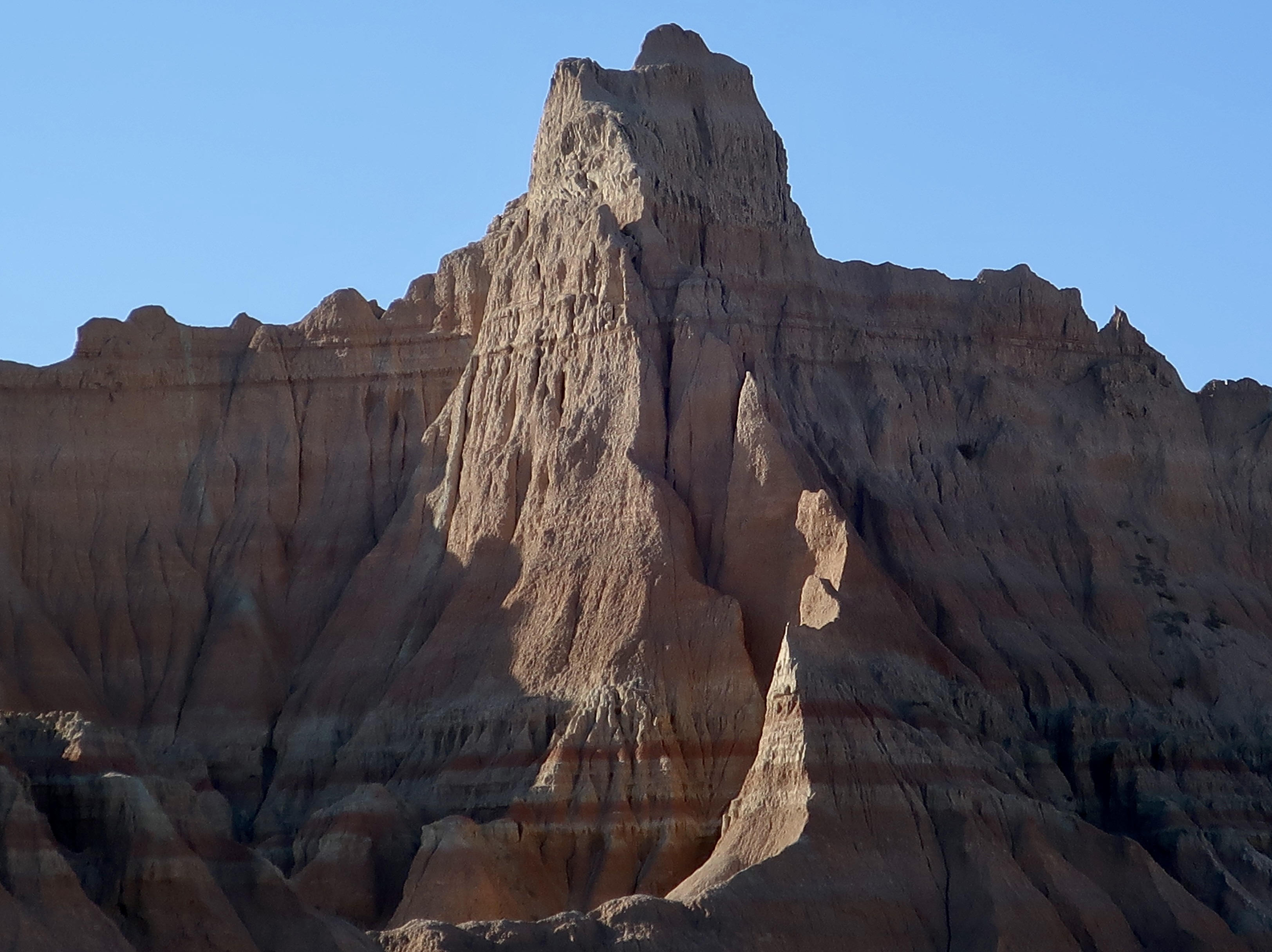
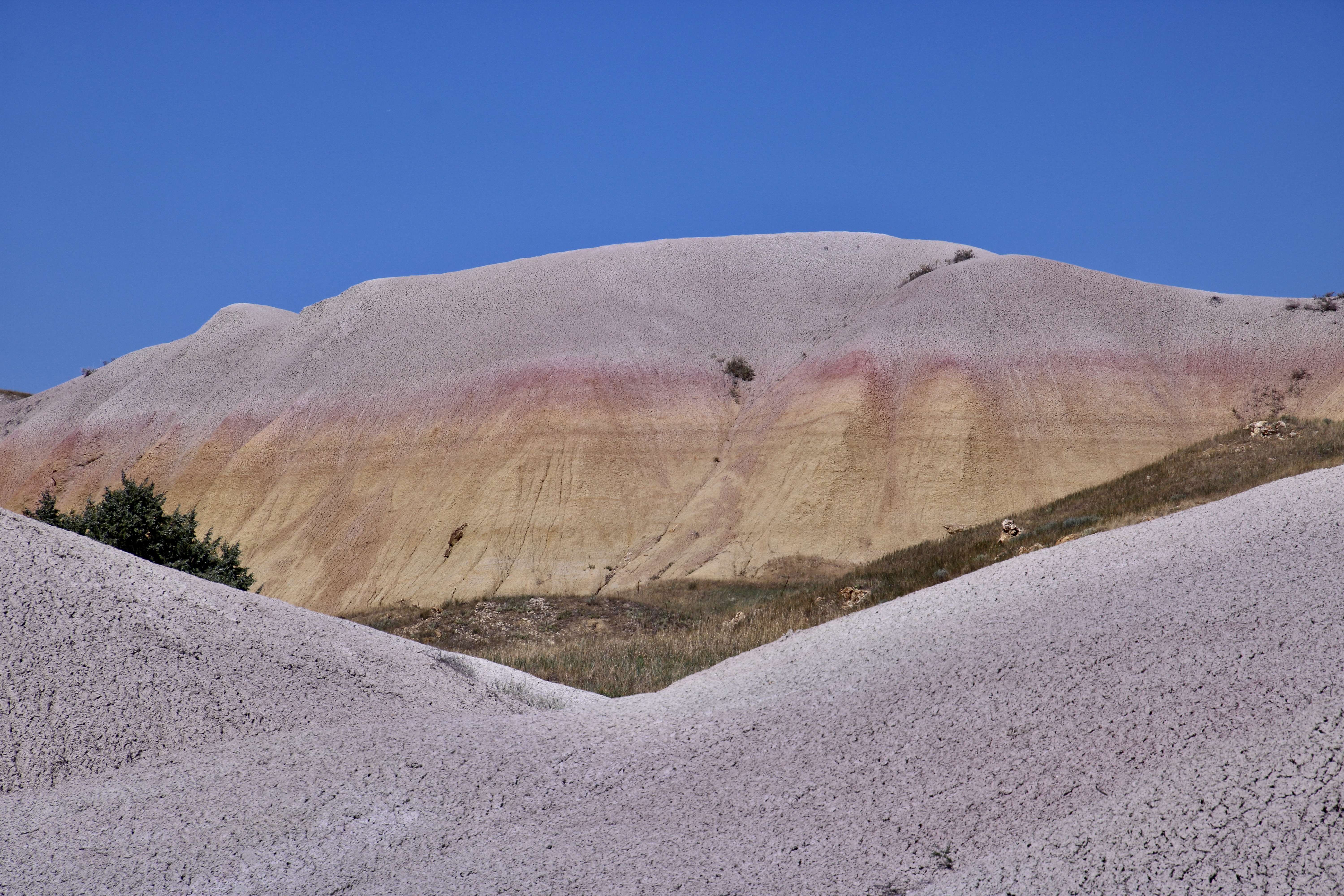
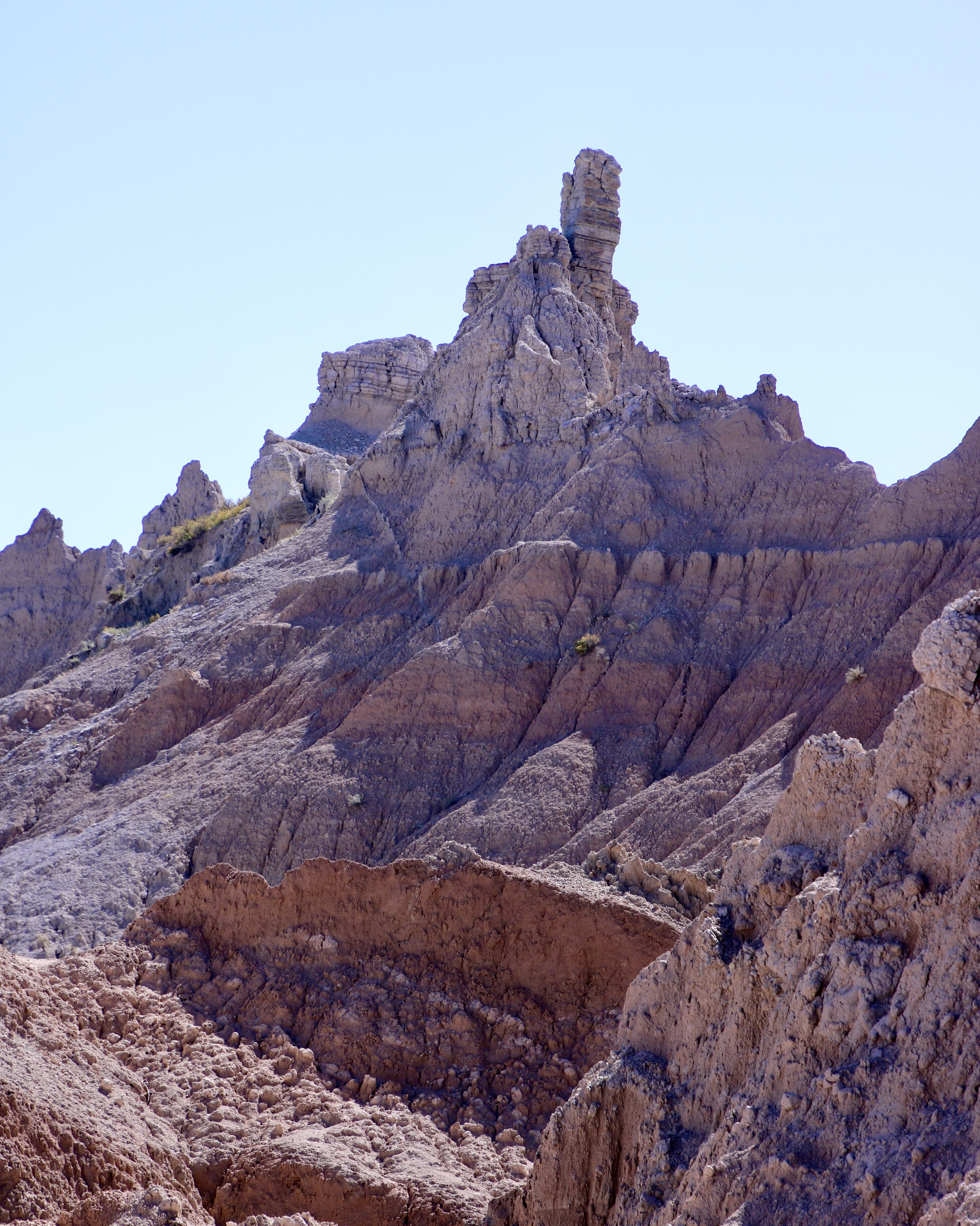
I was cooking beef pot-roast in our insta-pot and time was running out. I had miscalculate the time it would take and we were going to miss the Badlands at sunset. “Go ahead,” Peggy told me. She knew how much I wanted to catch the colors. “I’ll finish up here. We can eat when you get back.” My sweetie didn’t have to offer twice. I was out the door and into the truck. The sunset was quite impressive and the food tasted delicious when I returned. Following are some of the photos I took. Enjoy.
Next week we will be returning to our summer trip up the Rhine River. Please join Peggy and me along with our kids and grandkids as we explore the Rhine, castles, colorful towns, the Black Forest and a couple of impressive cities.
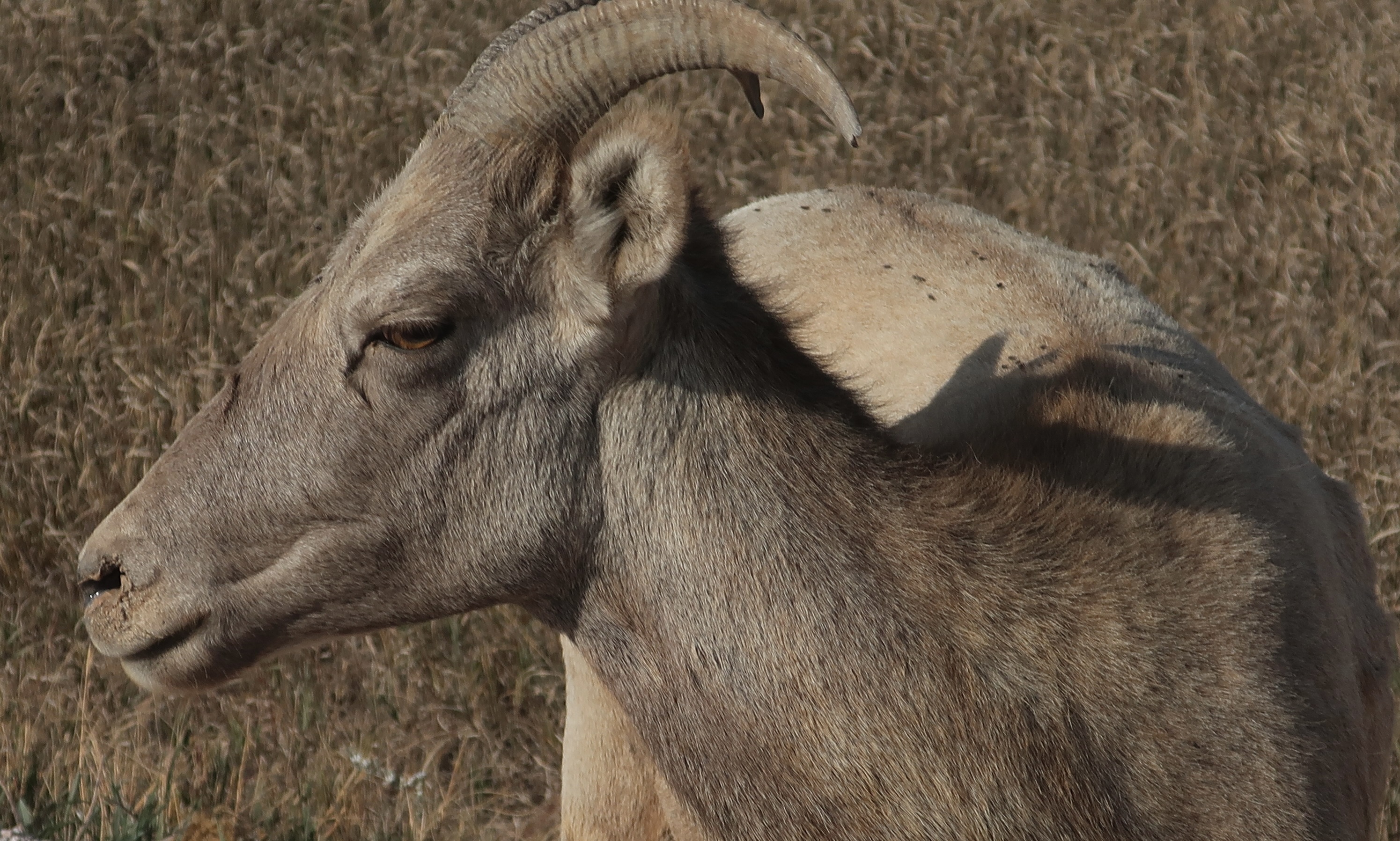
I was getting the ‘look’ when I snapped this photo of a bighorn sheep on Sage Road.
Sage Road in Badlands National Park is known for its easily accessible wildlife population. We drove out it during our recent stay near the Badlands to see what we could find. This fellow, along with a few other bighorn sheep, was hanging out along side the gravel road. Its look seemed to say, “Don’t mess with me.” Big horn sheep were first re-introduced to the Park 1922 with more being added later. The park’s herd now numbers near 250.
This youngster is busy chewing on weeds. Bighorn stuff themselves with tough-to-eat grass like this and then retreat to somewhere high and safe where they can regurgitate it and chew it more thoroughly. (Remember your mom urging you to chew your food!) What we don’t have that the sheep do, however, is four stomachs to help in the digesting process. (Photo by Peggy Mekemson.)Bighorn sheep checking us out.
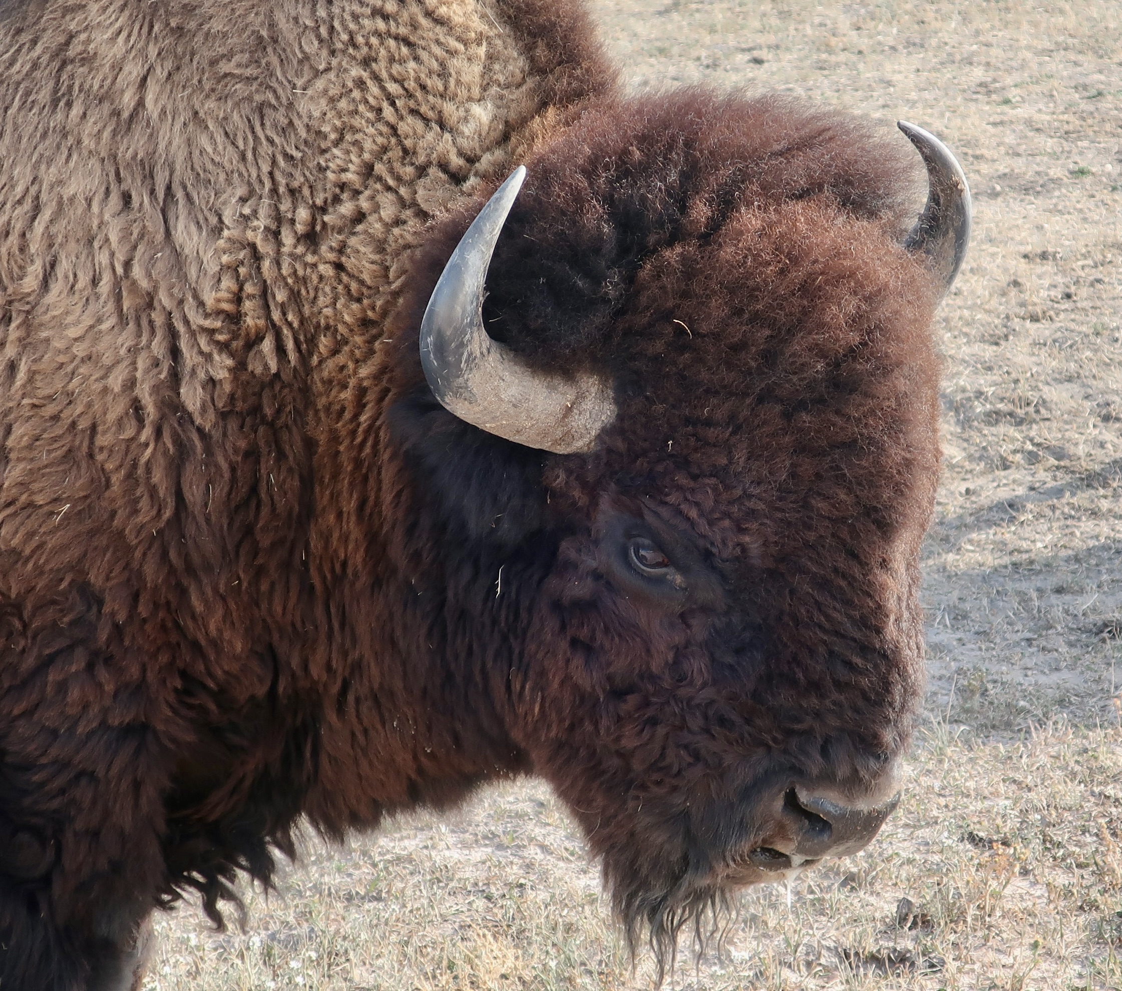
We also found a few buffalo along the way. The National Park website, which is where I found the details on the wildlife included in today’s post, gives the buffalo’s scientific name as Bison, bison, bison, i.e. they are of the genus Bison, of the species bison, and the subspecies bison. Buffalo was derived from the French “bœuf,” meaning buffalo, and given to the large creatures by early French fur trappers. The Lakota name for bison is tatanka. Bison were incredibly important to the Lakota and other Native Americans of the Great Plains who carefully used every part of the buffalo they killed. An estimated 30 million roamed the area prior to the arrival of Euro-Americans who hunted the buffalo almost to extinction for their hides and tongues. An even darker reason is given for the slaughter: The US government wanted to disrupt the Indigenous people’s way of life to make way for the Euro-Americans. One way of doing this was killing off the vast herds of buffalo that the natives depended on to live.
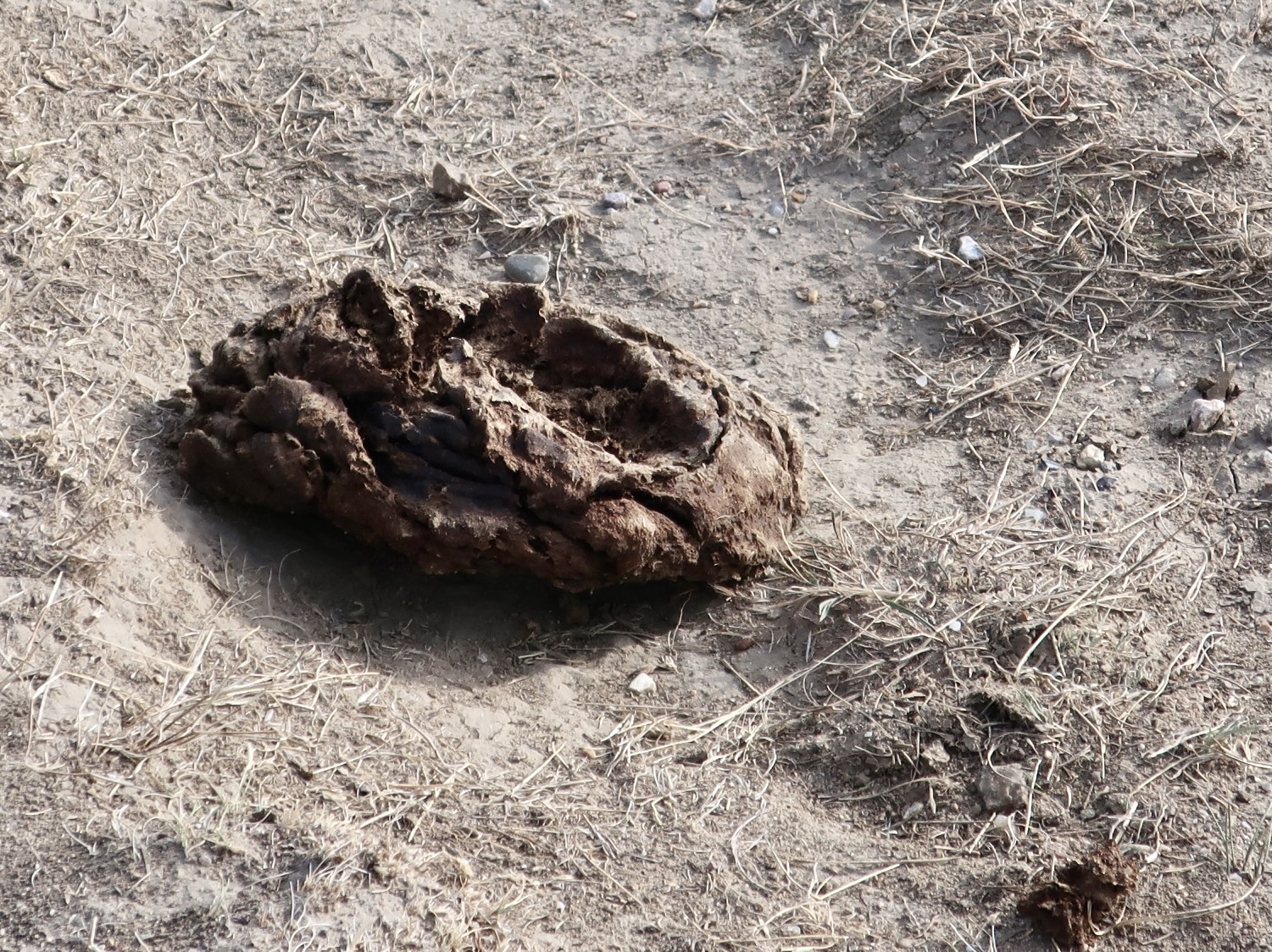
These large furry creatures paid zero attention to us as they grazed beside Sage road, which is what we wanted! They do look like something that would be fun to pet, however. (Photo by Peggy Mekemson.)Don’t. The fur says pet me; the eyes say don’t even think about it. One does not want to irritate a creature that can weigh up to 2000 pounds and run fast, really fast. Sign after sign in national and state parks where the buffalo roam, warn people to keep their distance. Despite the warnings, some people insist on a closer view, which can result in a bad ending. I watched a video of a guy standing five feet away from a buffalo waving his arms and shouting. A few seconds later, he was taking flying lessons. (Photo by Peggy Mekemson.)Peggy did not take this picture. Unlike her husband, Peggy does not take photos of poop to put in the blog. I tend to go along with the philosophy of the bison: Let the chips fall where they may.
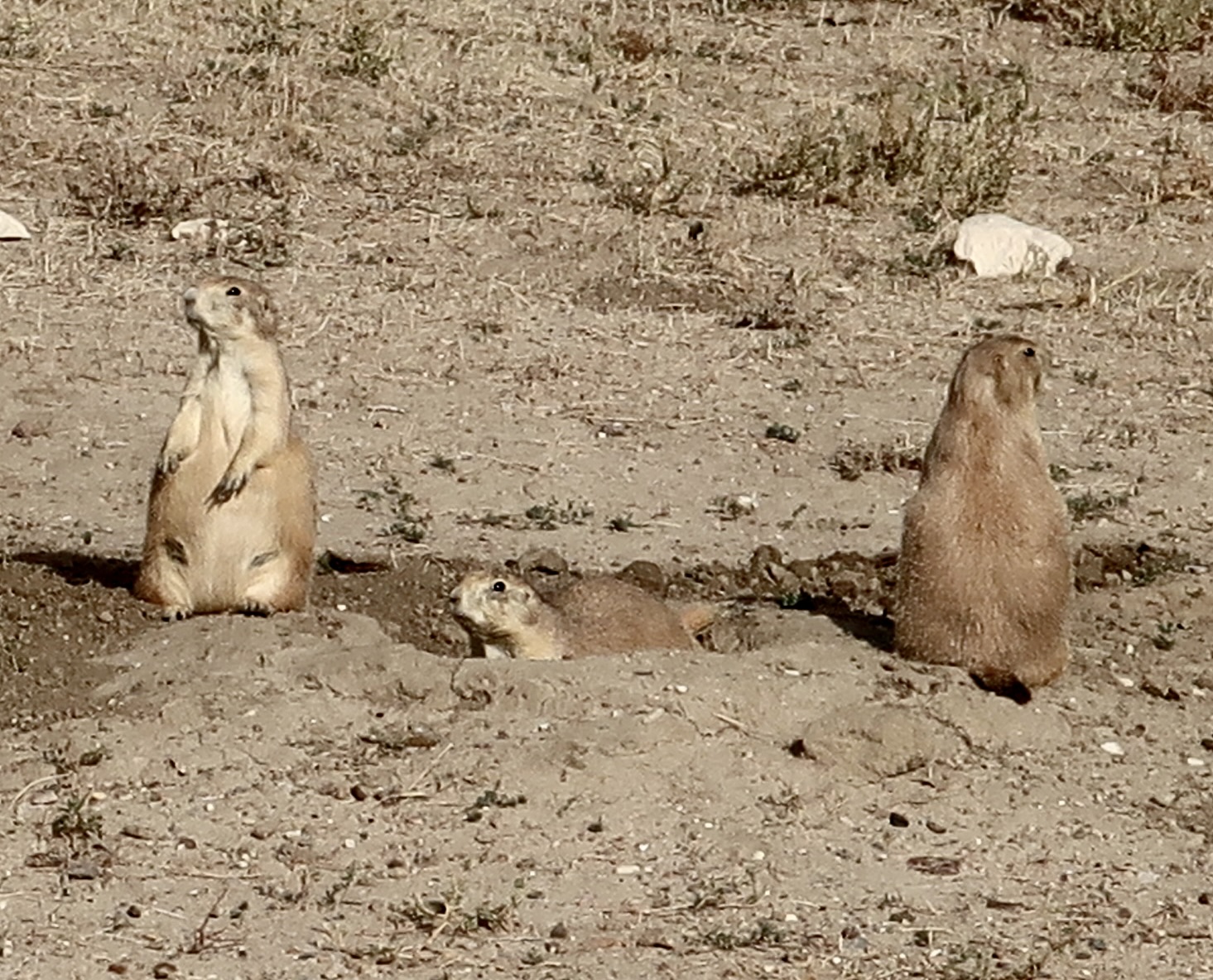
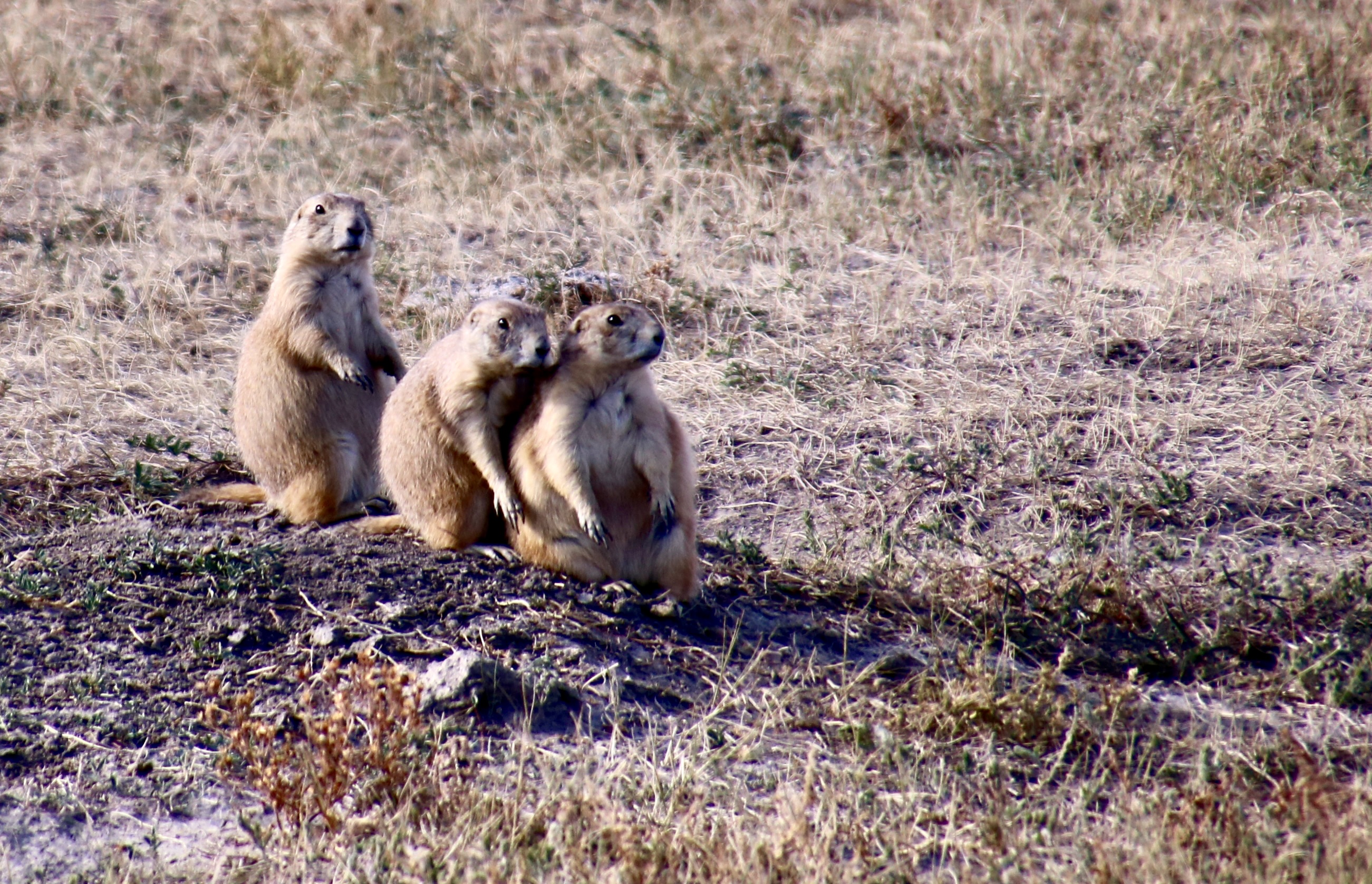
It’s Fat Bear Week, as anybody who hangs out in social media is probably aware. The prairie dogs of the Badlands want you to know that they consider it discrimination that there is no Fat Prairie Dog Week. When their size is taken into consideration, they are willing to take on any bear when it comes to putting on the pounds/ounces!
“Bring it on bears!” this fat prairie dog seems to say as he prepares to stuff more food down his gullet in preparation for winter. (Photo by Peggy Mekemson.)When it seems like just about everyone wants to eat you (the fatter the better), it is wise to look both ways. Prairie dogs have a distinctive set of whistles that warns their fellow dogs of what danger exists. Is it a hawk, or a snake, or a coyote, or a black footed ferret, etc. that considers you part of their menu? There is a whistle for each. Or is it a camera carrying human who only wants a photo?The black footed ferret, btw, was close to extinction. It is now being reintroduced to areas where their main source of food, prairie dogs, live. This suits the ferret just fine. It can eat up to a hundred a year. I doubt that anyone asked the prairie dogs if they wanted to participate in the “Save the Ferret” campaign.
There is a Prairie Dog Town located along Sage Road. Park publicity and a pull-off guarantees that tourists will arrive in significant numbers to capture photos of the fat, furry squirrels. Sharp whistles warn of the two legged visitors. Here’s a fascinating fact that I read on the Badlands NP website: An estimated 5 billion prairie dogs once lived on the Great Plains in their underground boroughs. The largest of their historic towns has been estimated to cover over 25,000 square miles (64,749 kilometers)! For perspective, that’s larger than West Virginia and 9 other smaller states in the US or Croatia and 23 other smaller countries in Europe.
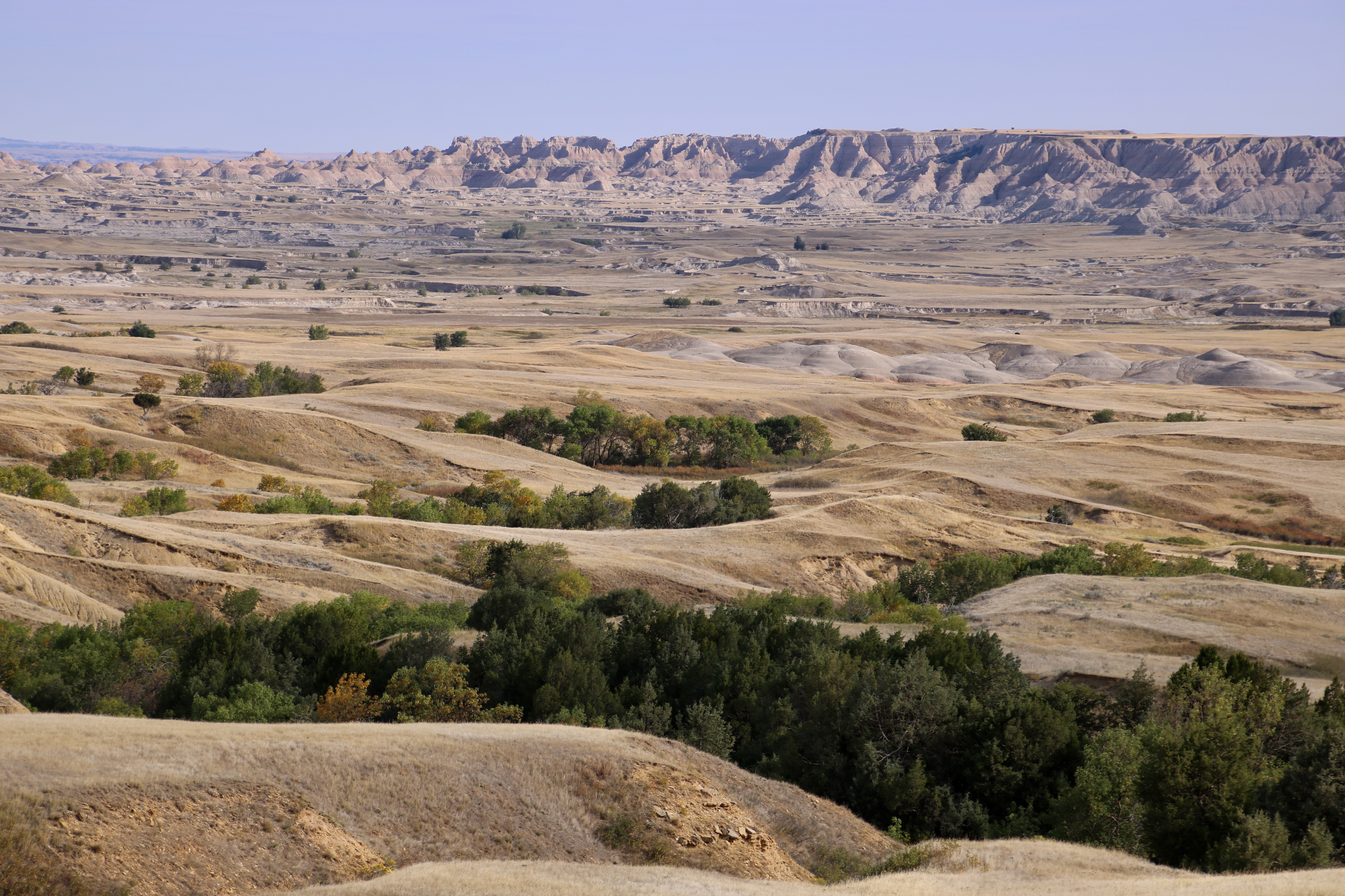
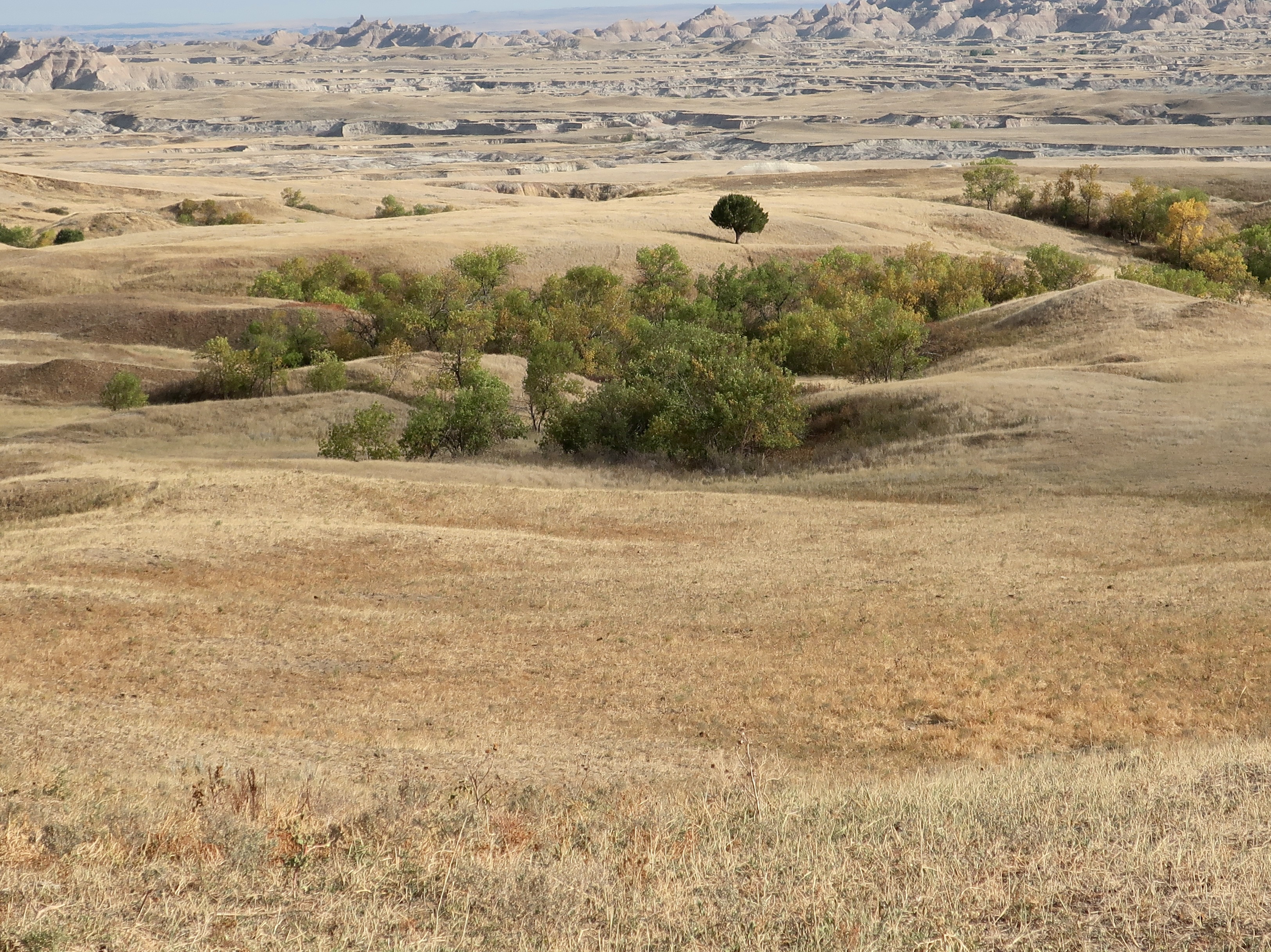
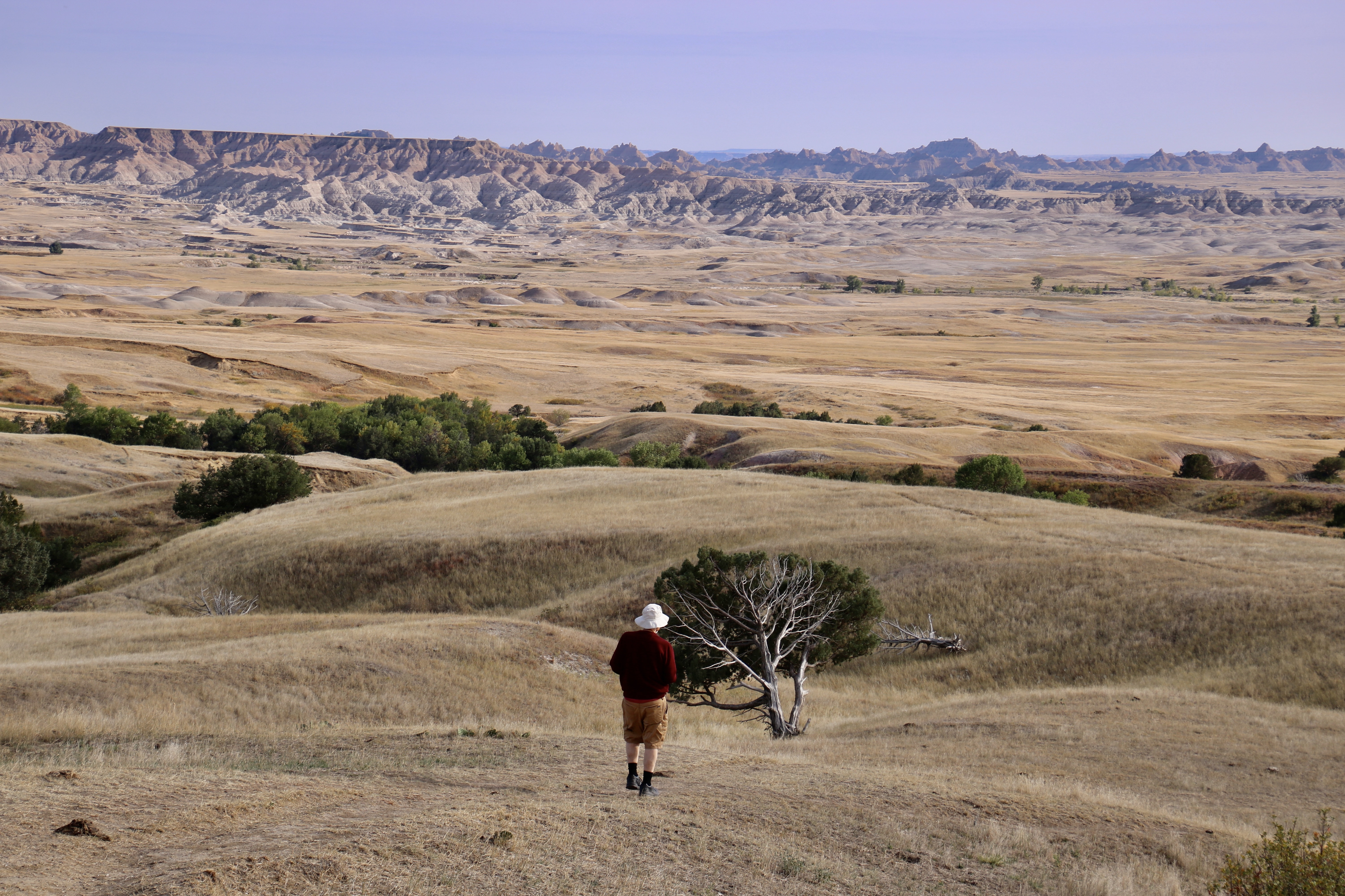
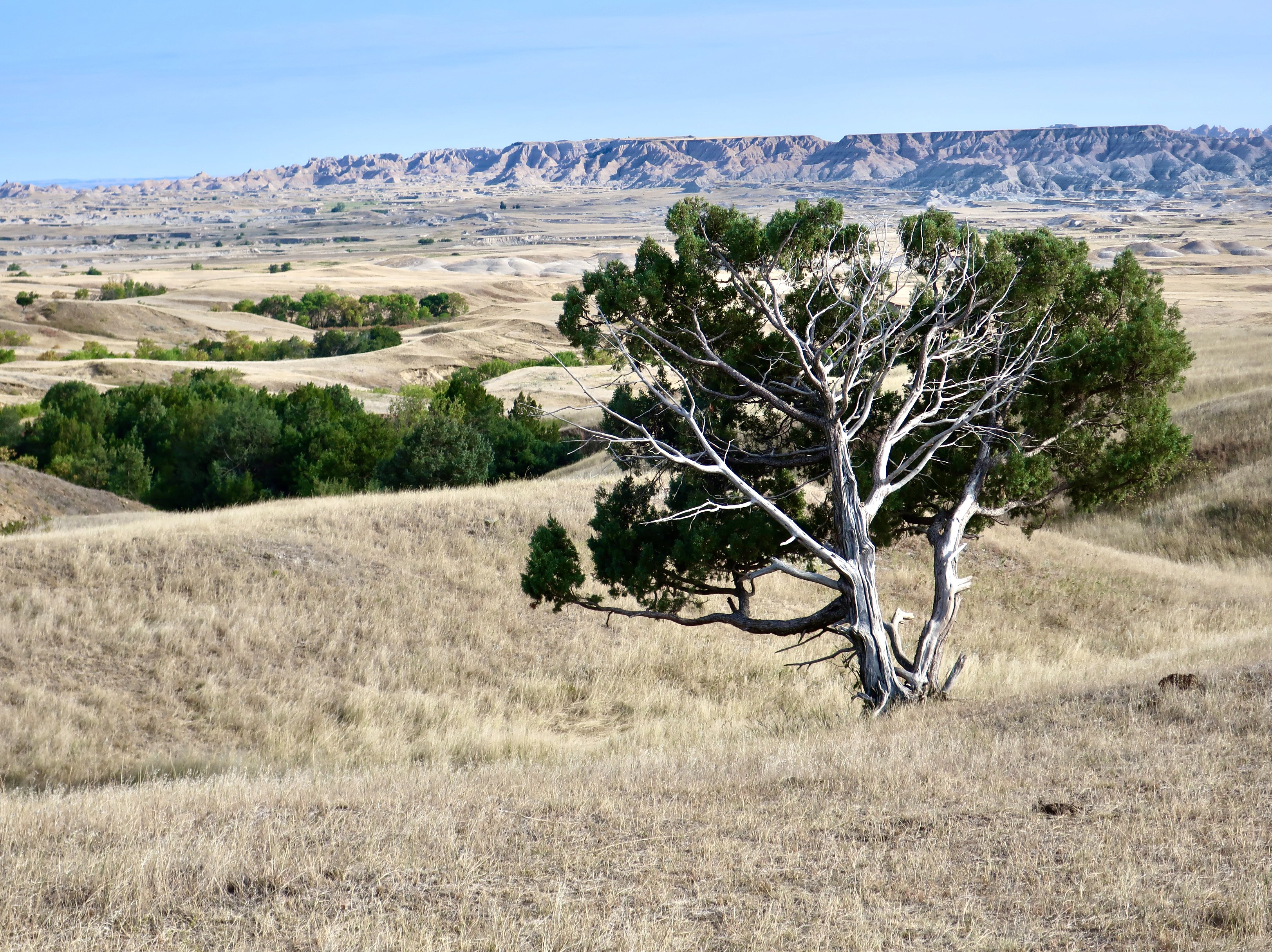
Beyond wildlife, Sage Road shows a different type of beauty than that found along the Loop Road, which runs along the Wall and through the badlands seen in the distance.
We loved the contrast between the golden grass on the gentle hills and green stands of trees found down in the gullies. (Photo by Peggy Mekemson.)The lone tree caught my attention in this photo. Peggy captured me heading for another tree I found interesting. Given my wandering ways, she wondered if I would stop there.I did stop, even though the stand of trees up ahead was calling to me. This is one of a number of photos I took of the tree.Meanwhile, Peggy had found a flock of turkeys that caught her attention. This was just a few of the flock. The others had disappeared down into the gully. (Photo by Peggy Mekemson.)As we drove back up Sage Road, returning to our camp, we stopped for a final photo that had more of a Badlands feel to it. Late afternoon colors were beginning to seep in. I’ll feature sunset photos in my next post. I was impressed. I imagine you will be as well.A preview of next week’s post.
Badlands National Park has great beauty. it also has interesting— and amusing— wildlife, such as three curious prairie dogs that posed for Peggy. With winter and hibernation coming, these guys have obviously been putting on the pounds— or at least ounces! (Photo by Peggy Mekemson.)
The Lakota people, who have occupied the area for hundreds of years, called it mako sica. To early French fur trappers, it was known as les mauvaises terres. Both names mean the same thing: Badlands. If you can’t hunt it, fish it, farm it, or mine it— what good is it? Fortunately, our tastes have changed. We have come to appreciate areas for their natural beauty and Badlands National Park has an abundance. BTW, where there is a will there is a way. People have finally found a way to make money off of beautiful places. It’s called tourism.
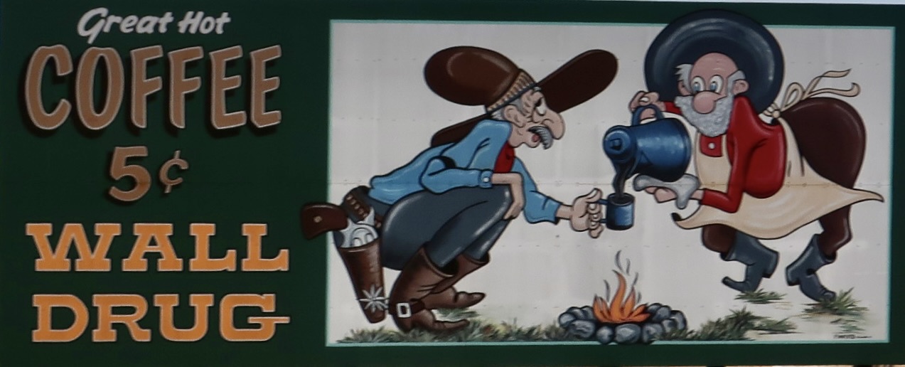
Speaking of tourism, we stayed in a small campground near Wall Drug, a tourist attraction that has mastered the art of pulling people off of the road. It started with offering them free ice water in the 60s and 70s by advertising on 3,000 small wooden road signs throughout South Dakota and neighboring states. I first came across the signs in the 60s. It was impossible not to be curious. This time, Peggy and I found the small wooden signs had been morphed into numerous billboards as we crossed South Dakota on I-90.
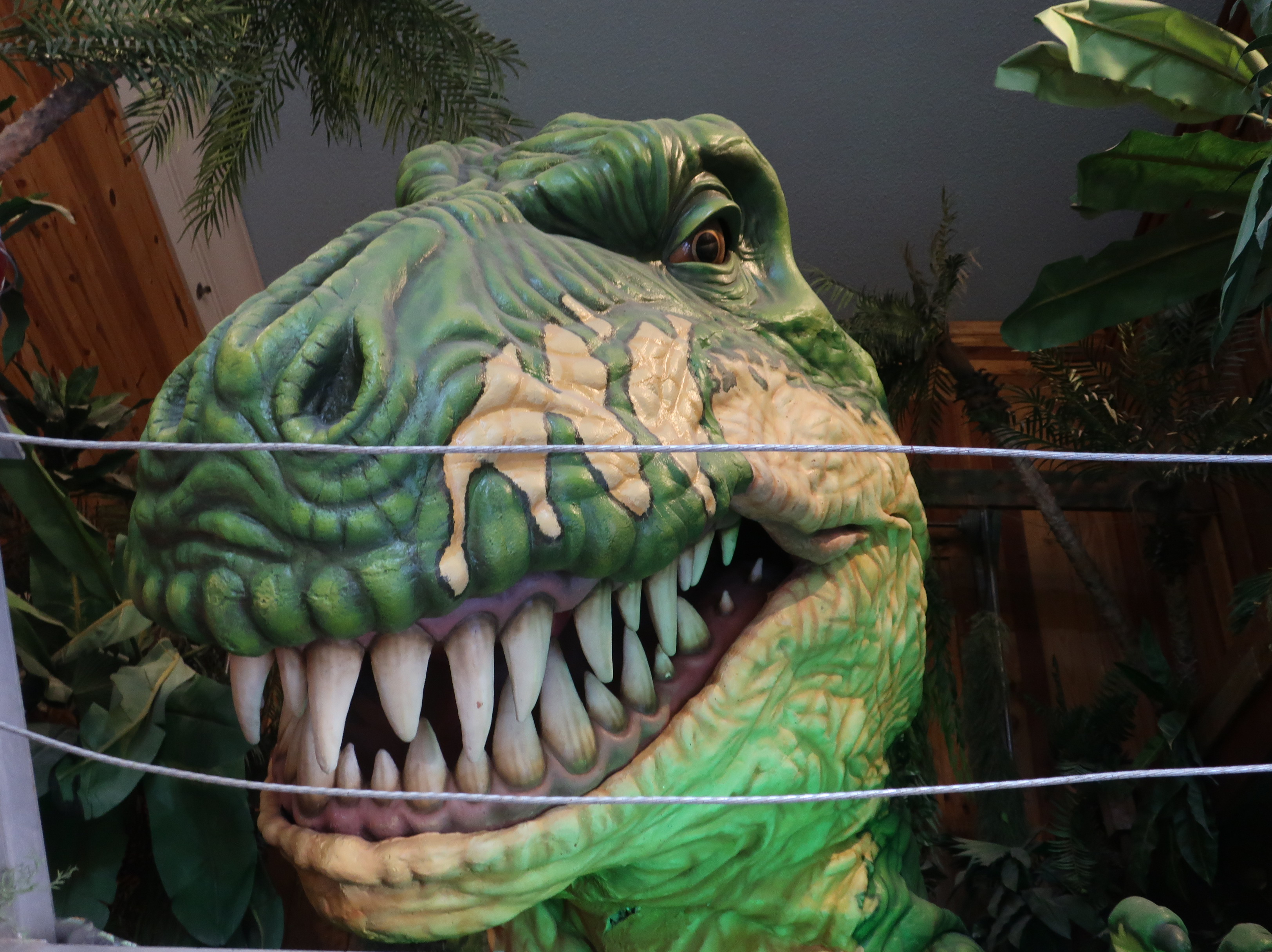
Wall Drug still uses come-ons to lure travelers off the road with large billboards along I-90. The small, original drug store has turned into a massive tourist attraction with the drug store occupying maybe 1,000 square feet out of the 76,000 square feet the attraction now claims. Wall Drug advertises that its store has something for everyone. Including Jackalopes.Peggy found one to ride.One of the billboards along I-90 advertised “Come to lunch— or be lunch at Wall Drug.” This smiling T Rex was apparently offering the latter. As an aside, numerous fossils have been found in Badlands National Park, but not dinosaurs. The area was part of an ocean at the time dinosaurs roamed the earth.
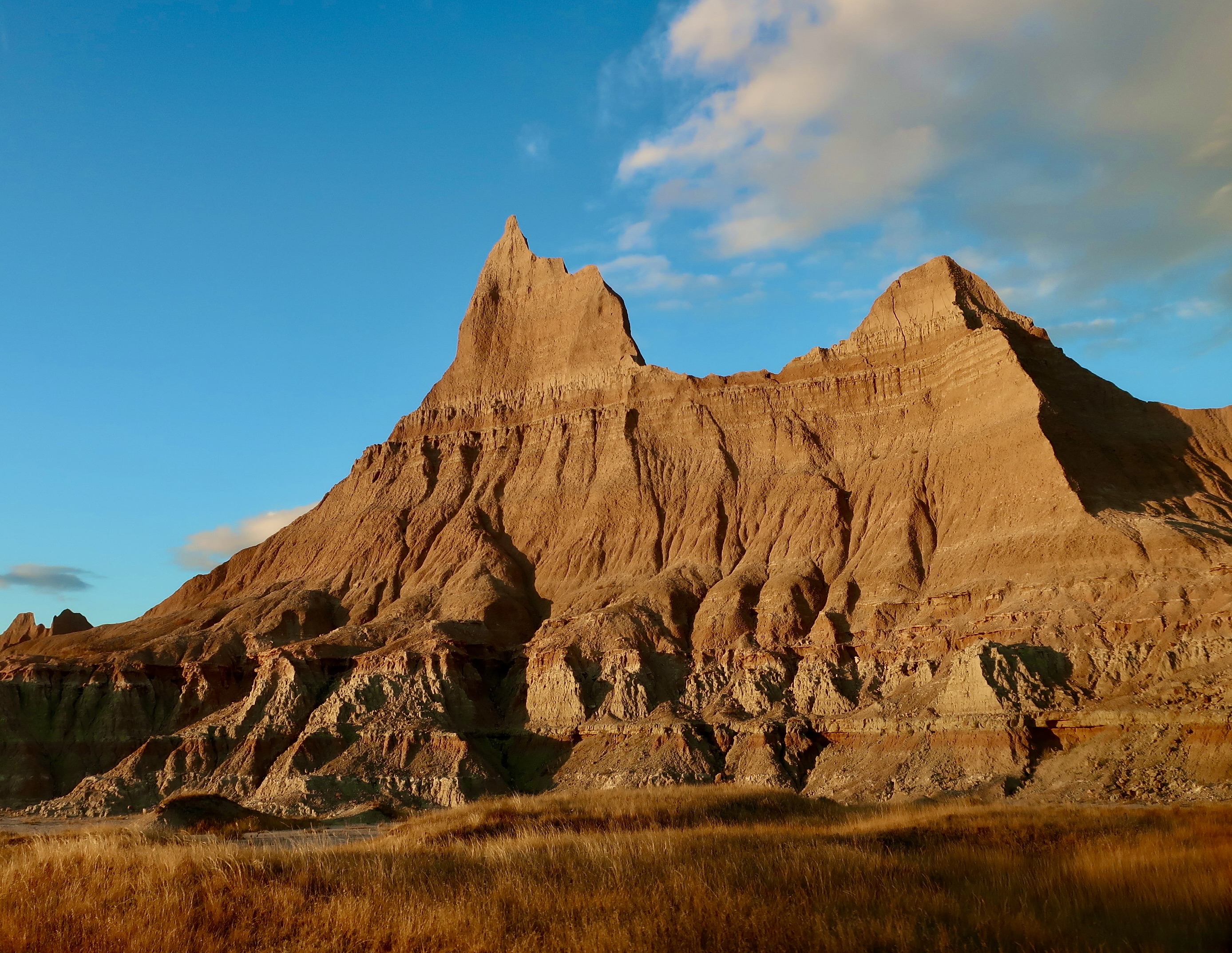
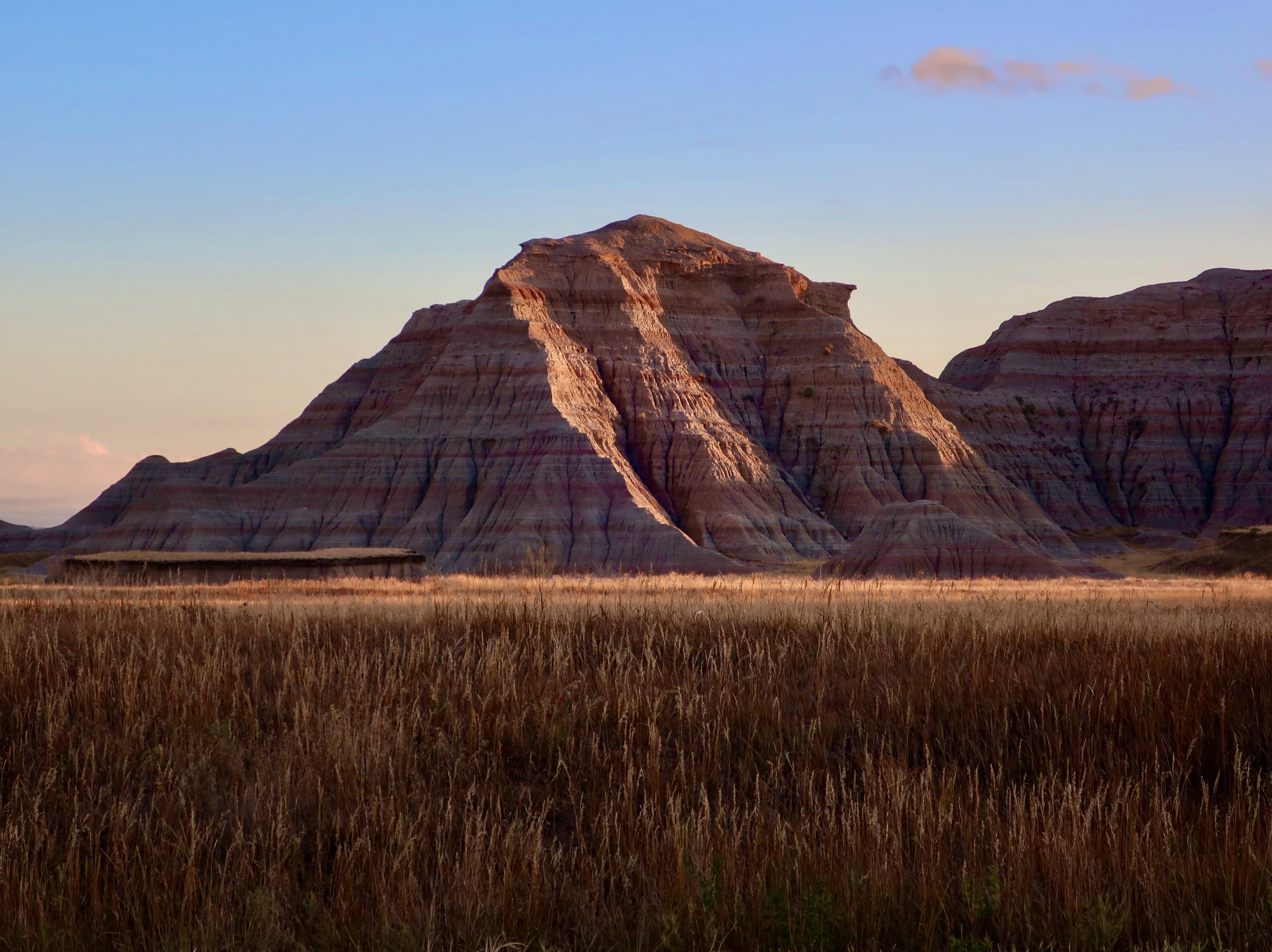
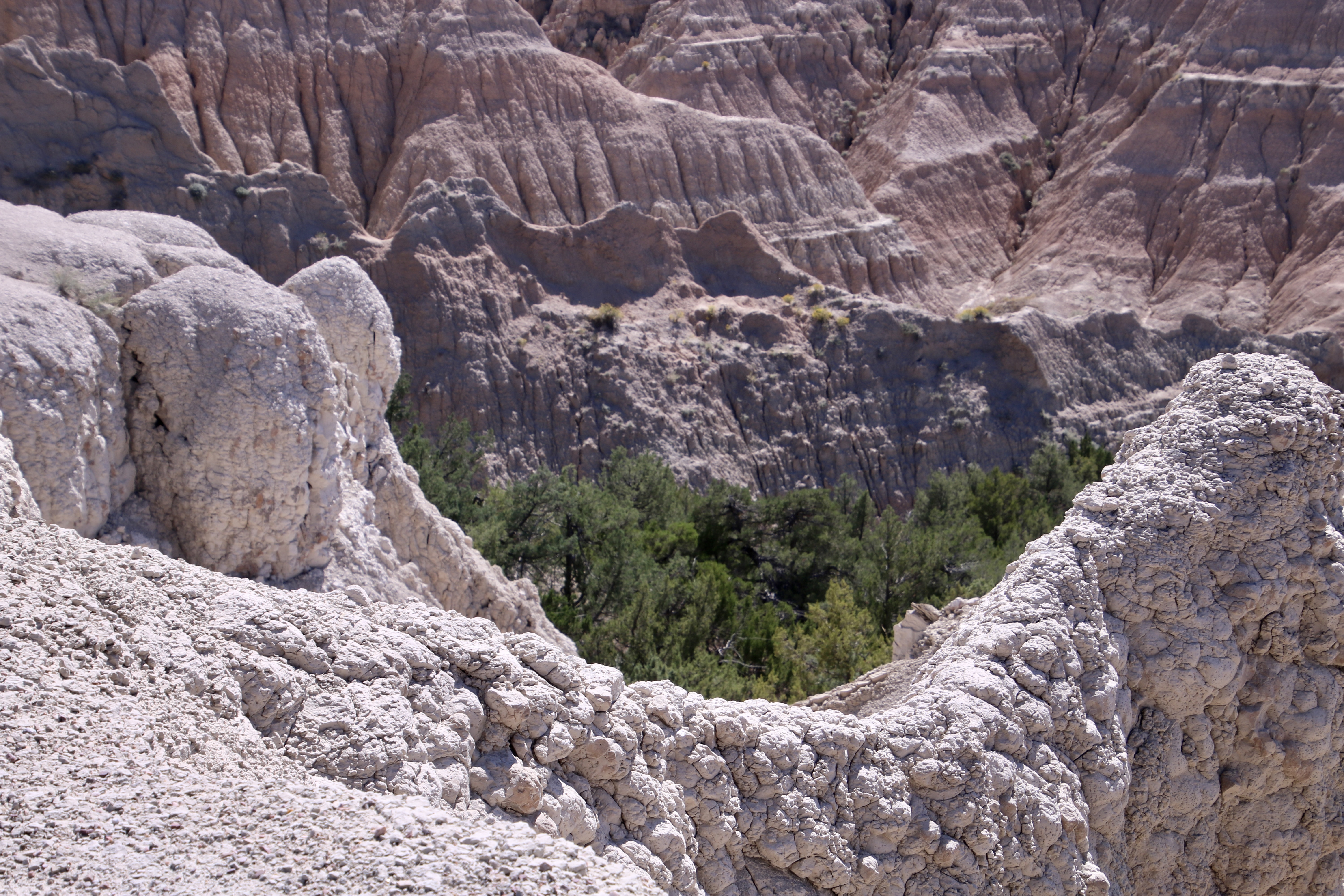
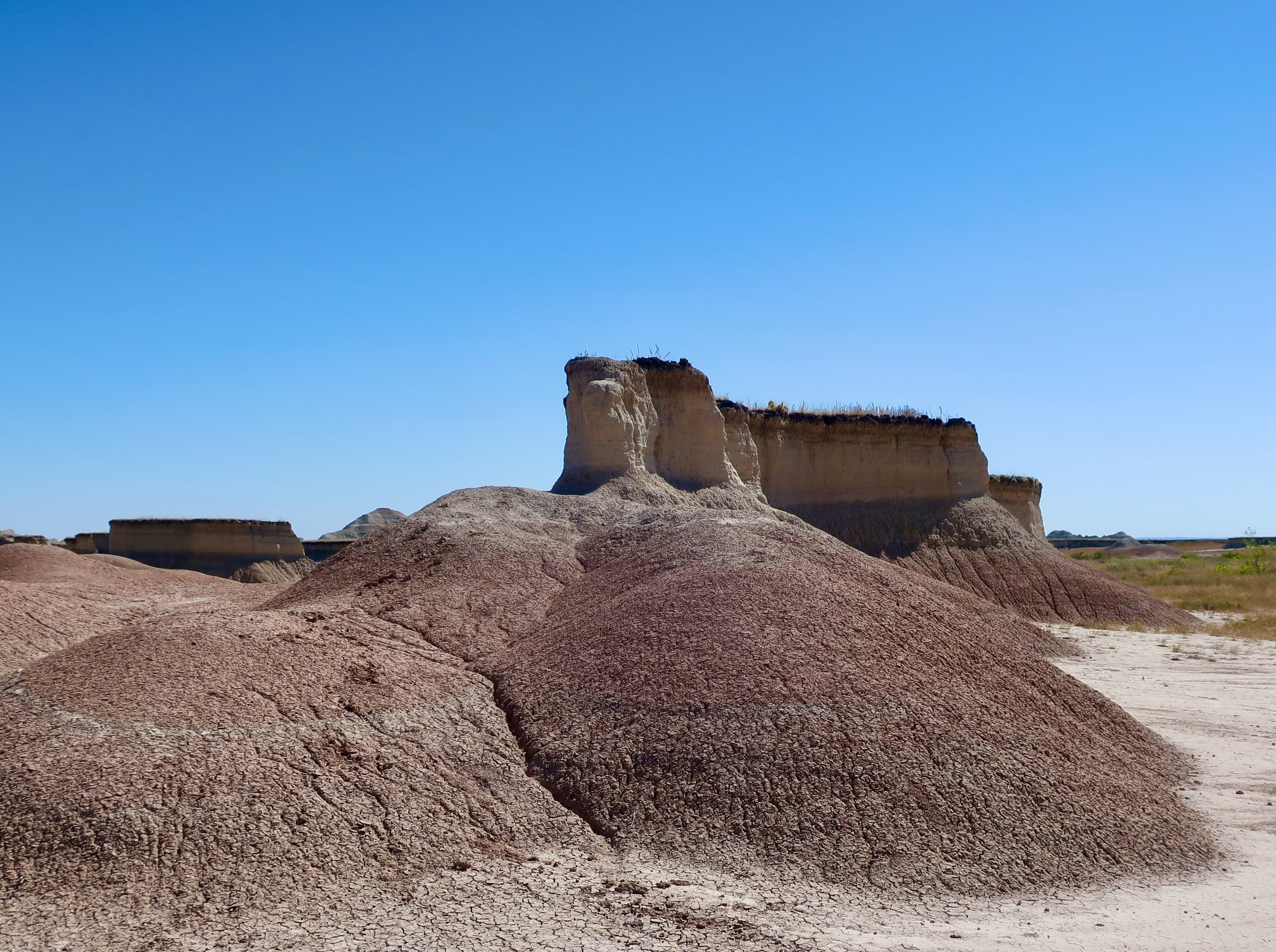
The term wall, in Wall Drug, comes from the primary feature of the Badlands, a hundred mile wall from which the Badlands have been eroding at an inch per year for the past 500,000 years or so creating mesas, ridges, and gullies with unique structures of considerable beauty. The 31 mile Loop Road the National Park features takes visitors along the wall and down into the Badlands, providing a great introduction. We will feature views from along the Loop Road today.
Erosion, cutting through some 45 million years of geological history between 75 and 30 million year ago, has left behind unique structures of great beauty. The upper right corner shows the wall from which the Badlands have eroded. Look carefully and you will see vehicles parked at one of the many pull-offs along the 31 mile Loop Road that winds its way through the park.One thing that is guaranteed along the Loop Road: Great variety. Compare this picture with the one above. (Photo by Peggy Mekemson.)What caught our attention here, was the contrast between the green trees and the white ridge. (Photo by Peggy Mekemson.)The erosion here had created a mesa left standing alone above the smooth mounds below.Rabbit bush added a touch of yellow here to complement golden hills above. (Photo by Peggy Mekemson.)Jagged peaks are also found along the 31 mile drive.A close up of one of the peaks along the way.Pink and mauve top off yellow hills. (Photo by Peggy Mekemson.)Another example. (Photo by Peggy Mekemson.)I liked the tiered look here and the way erosion had cut through over 40 million years of geologic history.We wondered how long it would be before the finger rock on top of this peak fell. (Photo by Peggy Mekemson.)One of the pull-offs along the road is dedicated to Chief Bigfoot of the Lakota tribe. He was ill when he reached this site on the wall. His followers helped him down. Not long after that, he and some 150 member of his tribe, including women and children, were massacred at Wounded Knee. it was one of the darker moments in US History.I conclude today with this photo of the Badlands taken near the Visitor Center. Peggy and I will take you for a drive along Sage Road in our next post. It’s noted for its wildlife. Get ready for buffalo, turkeys, big horn sheep, and a raucous town of prairie dogs!
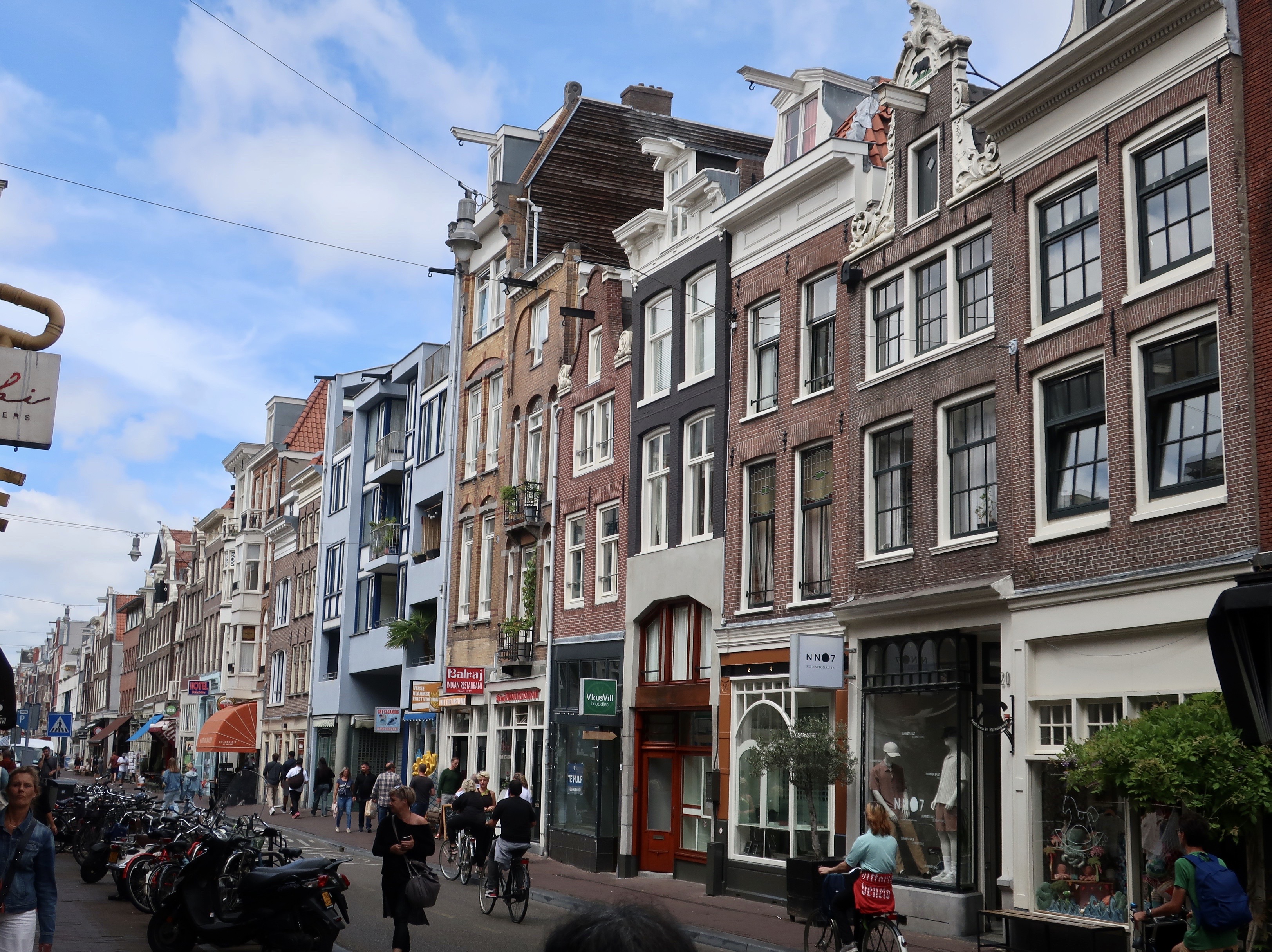
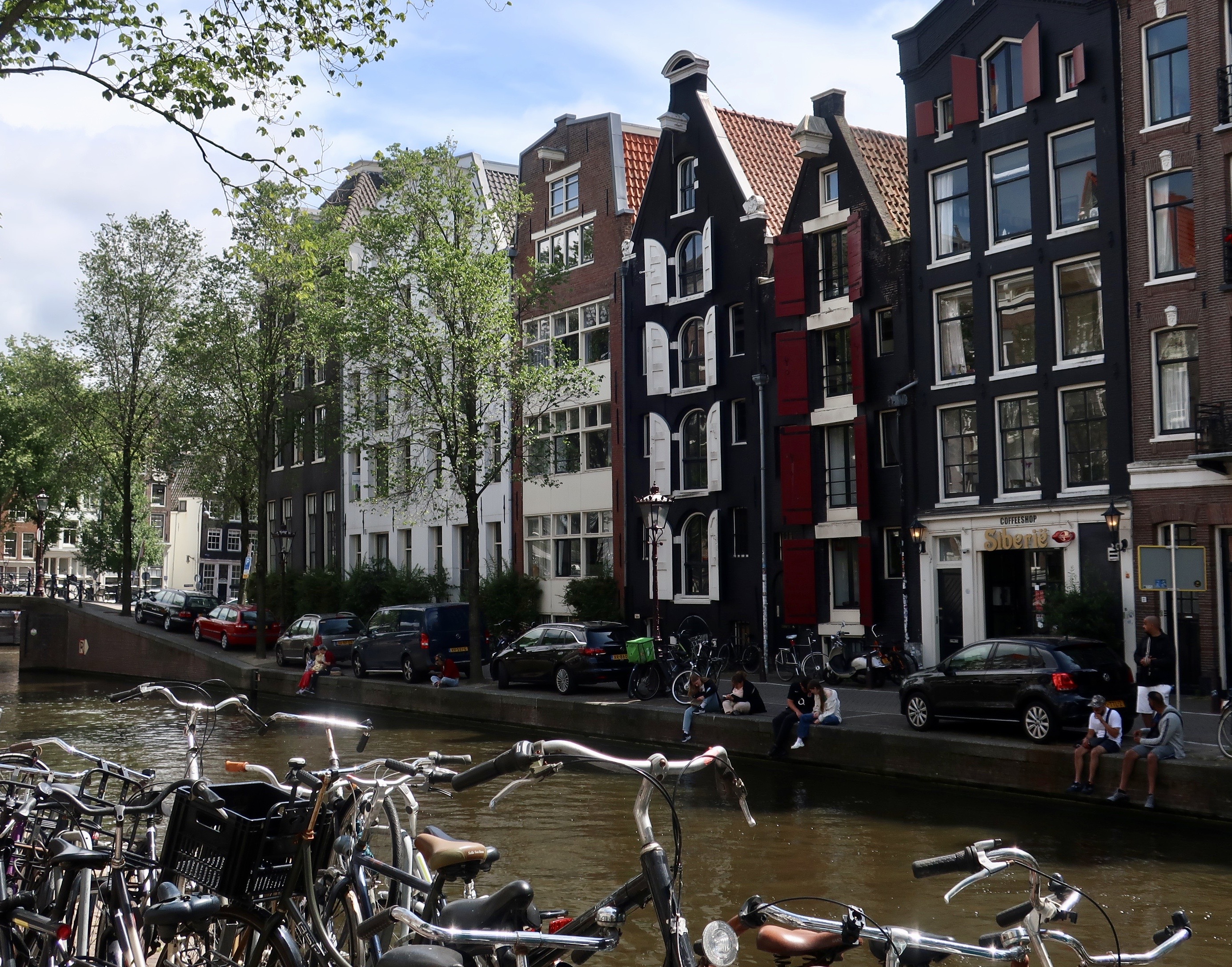
We are never bored when we wander. There are always things that capture our attention. It may be something we find beautiful, or educational, or interesting, or simply amusing, like the whacky-quacky characters above. The store caught us by surprise with its large duck and all of its ducklings that represent a multitude of professions and occupations from kings to rabbits. We had a traditional rubber ducky for awhile. It lived beside our bathtub and was occasionally known to go for a dip. I suspect we still have it, packed away for the time being. Do you have a rubber ducky? Are you willing to confess to it? Note the bike reflected in the window. As I said in my last post, it’s hard to take a photo in Amsterdam that doesn’t include one.
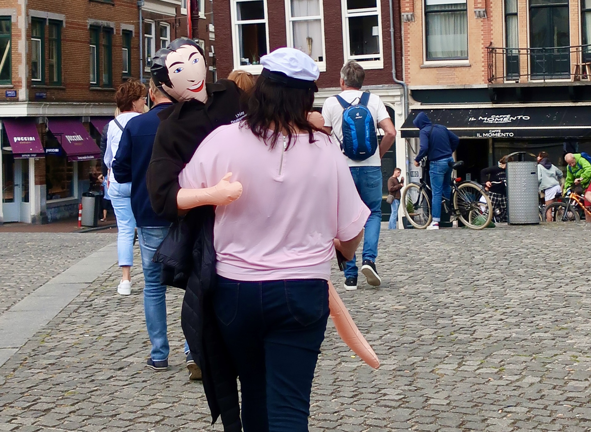
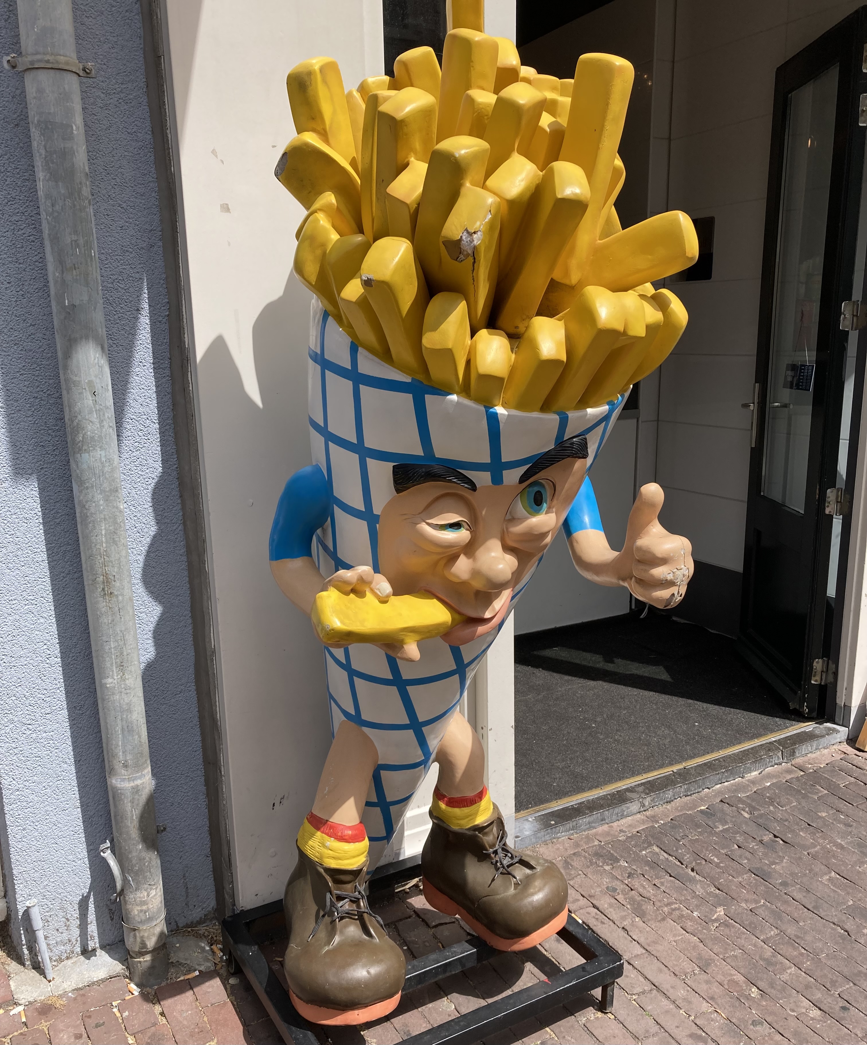
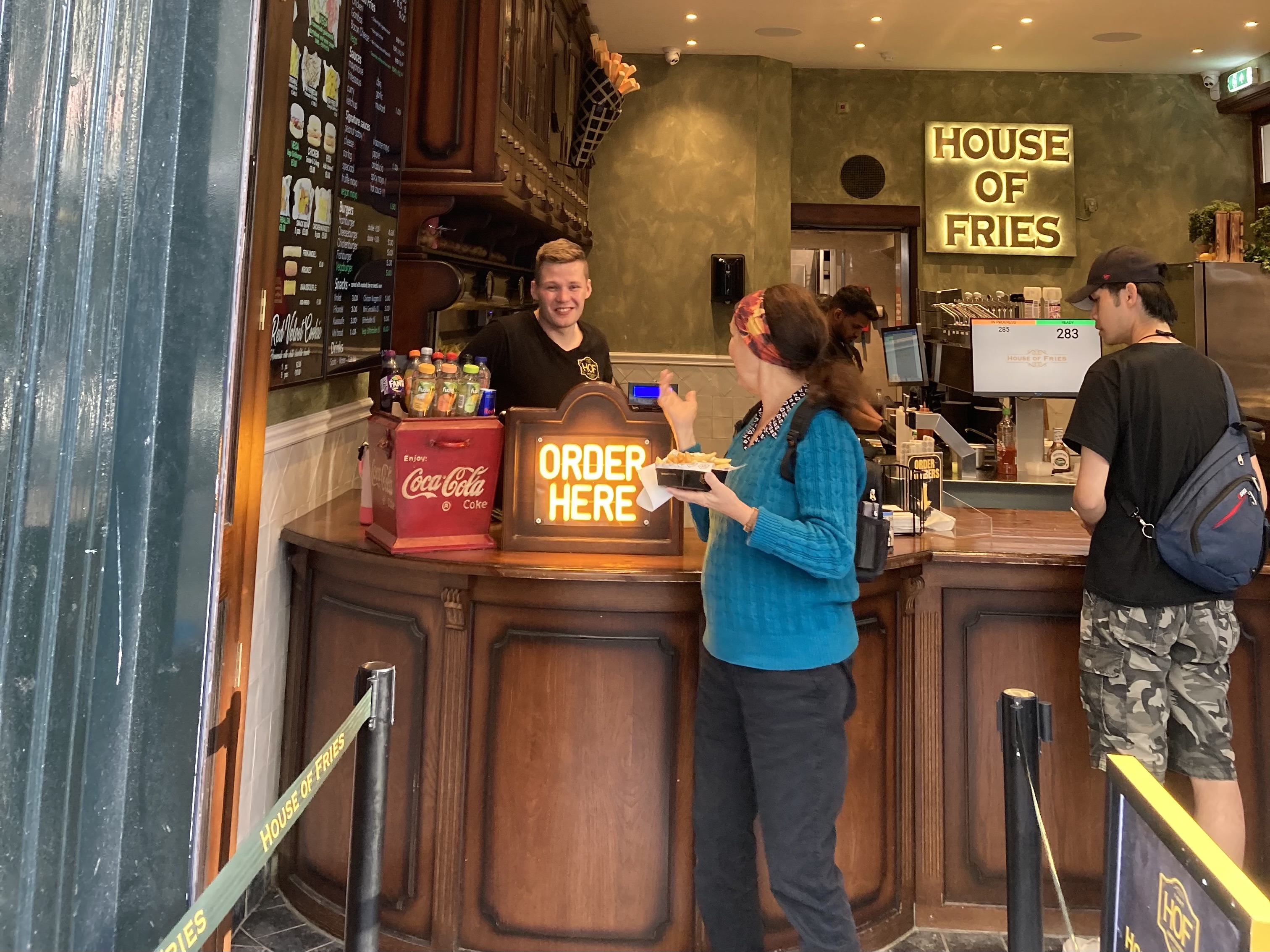
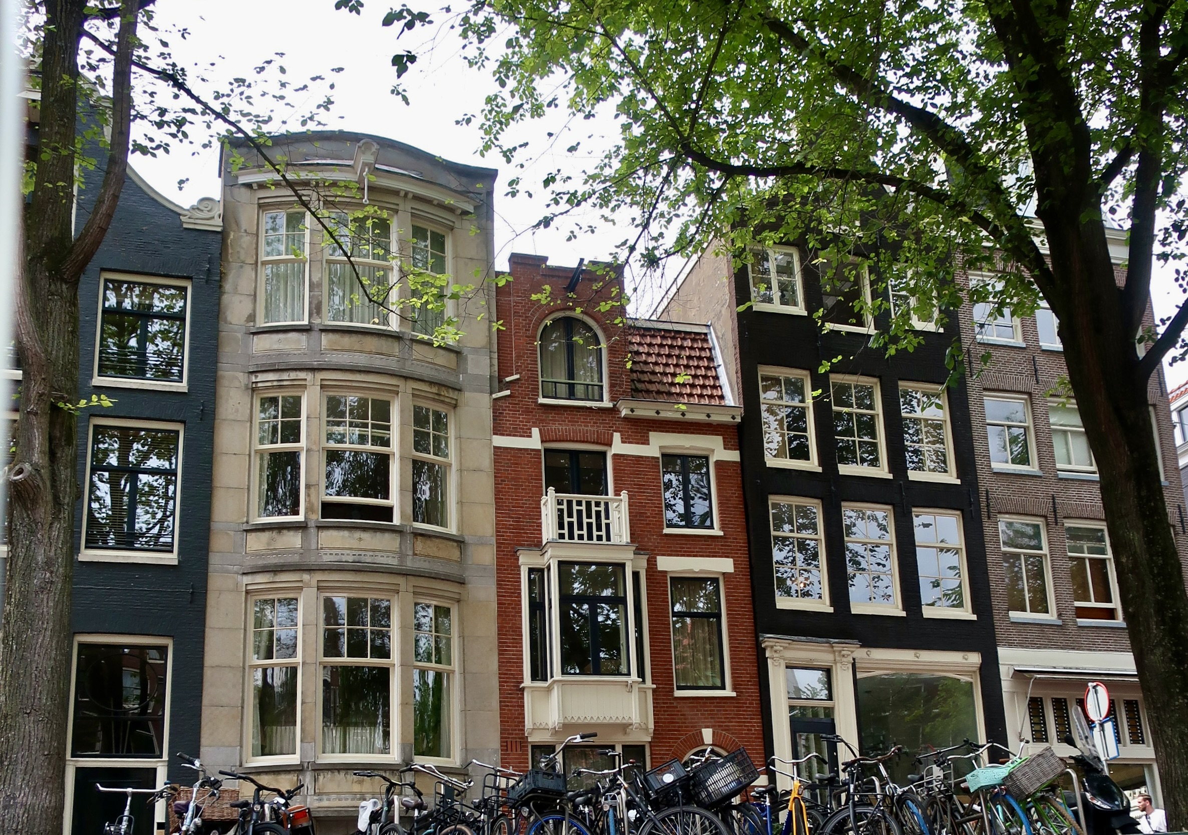
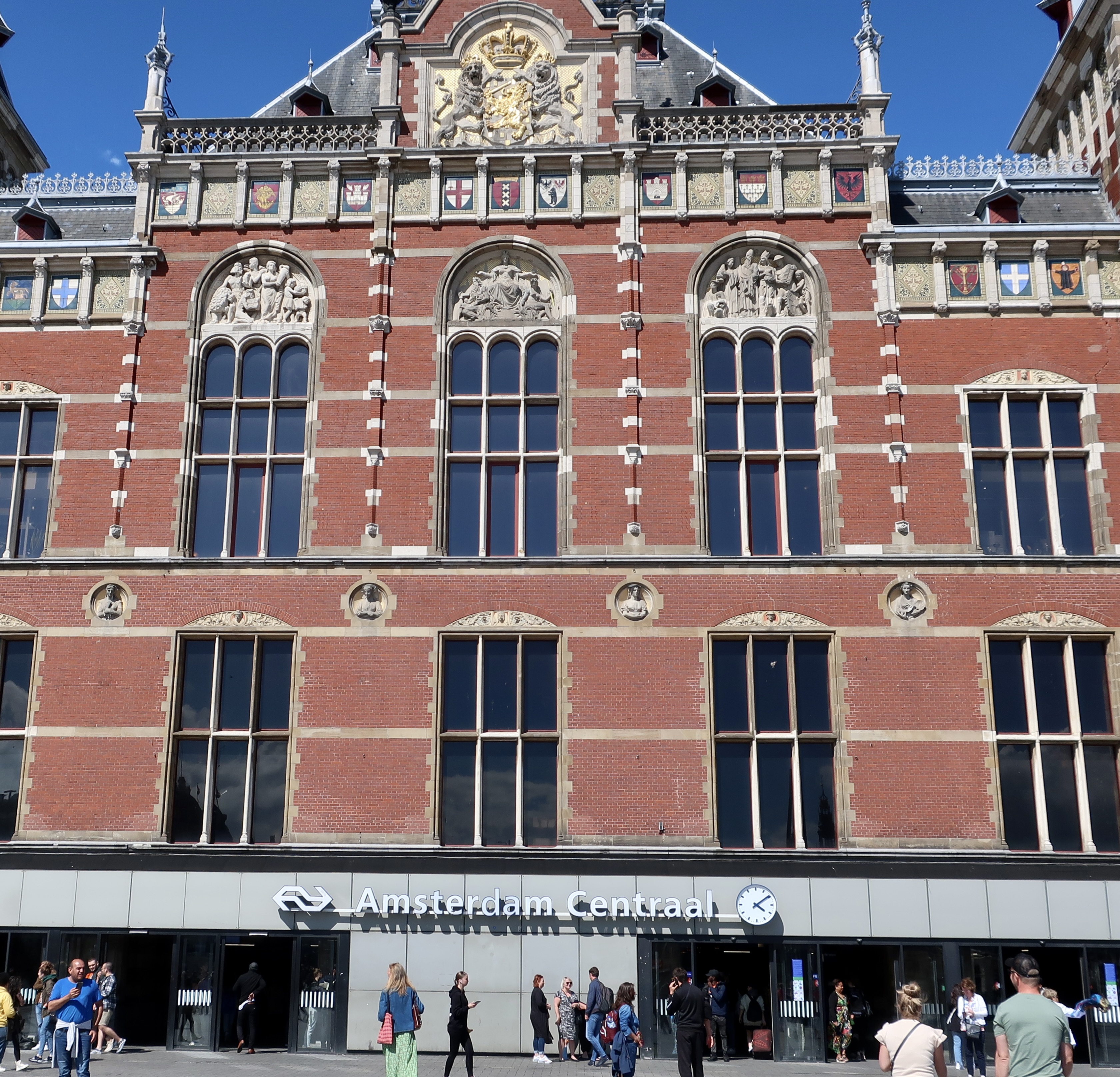
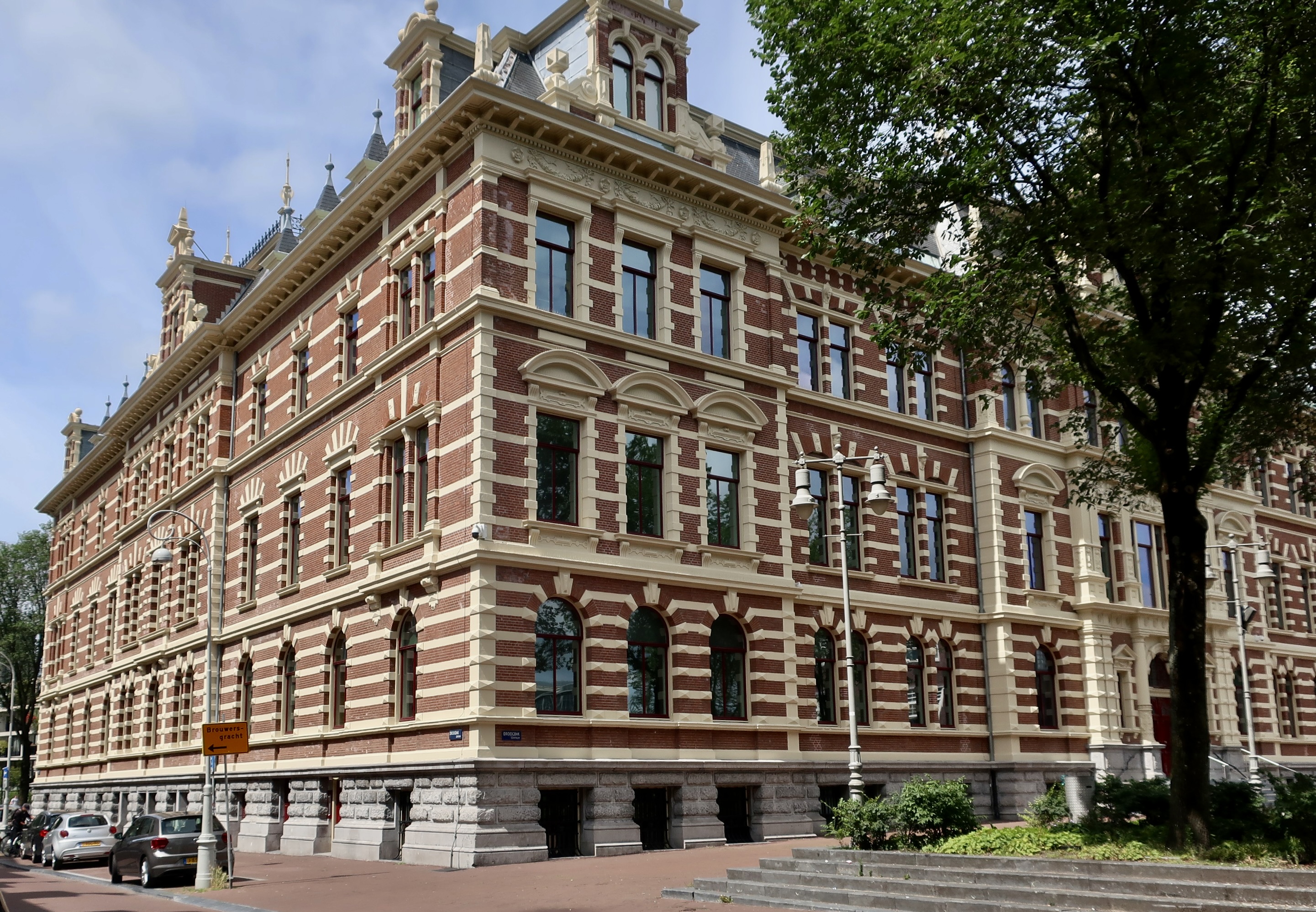
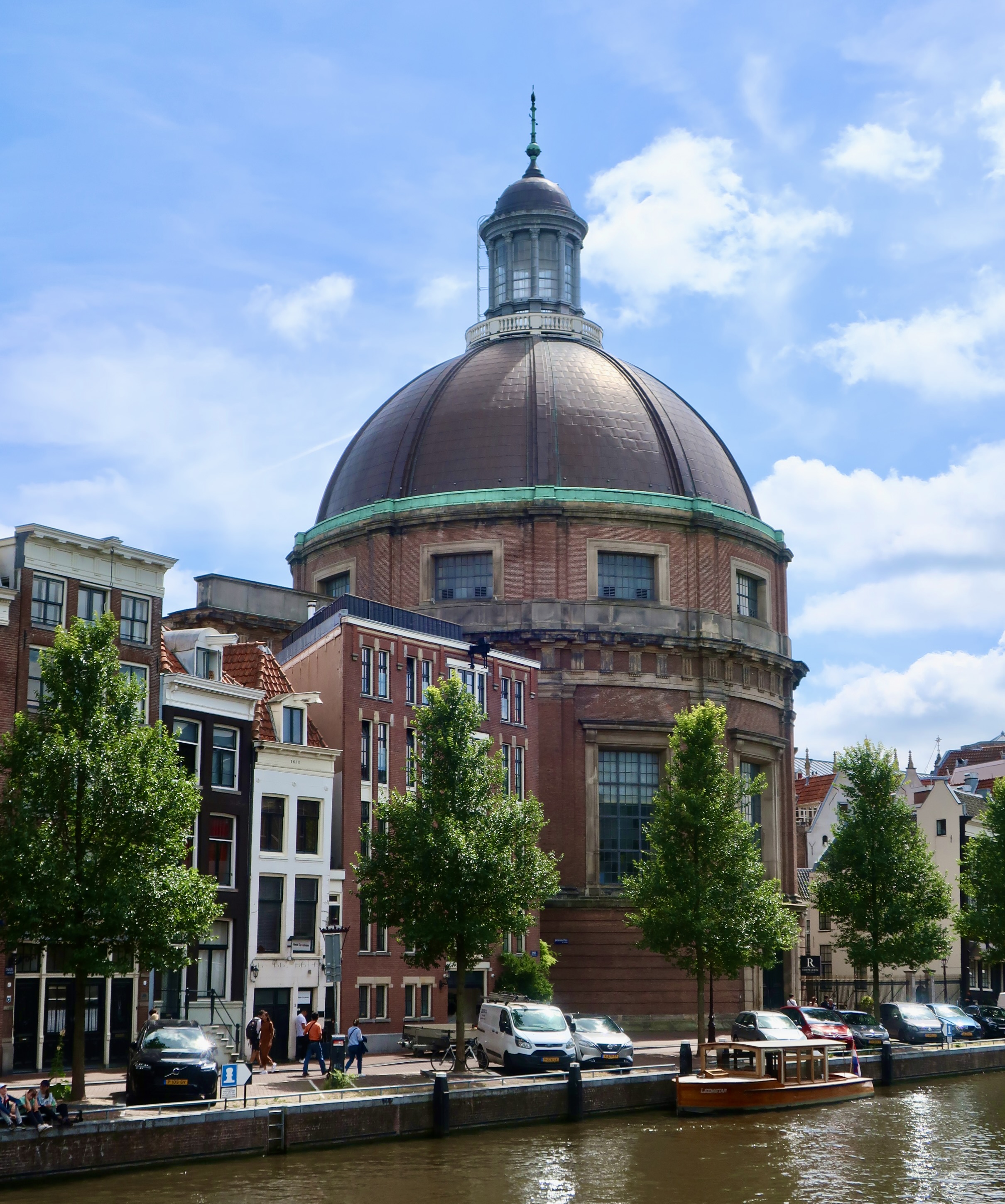
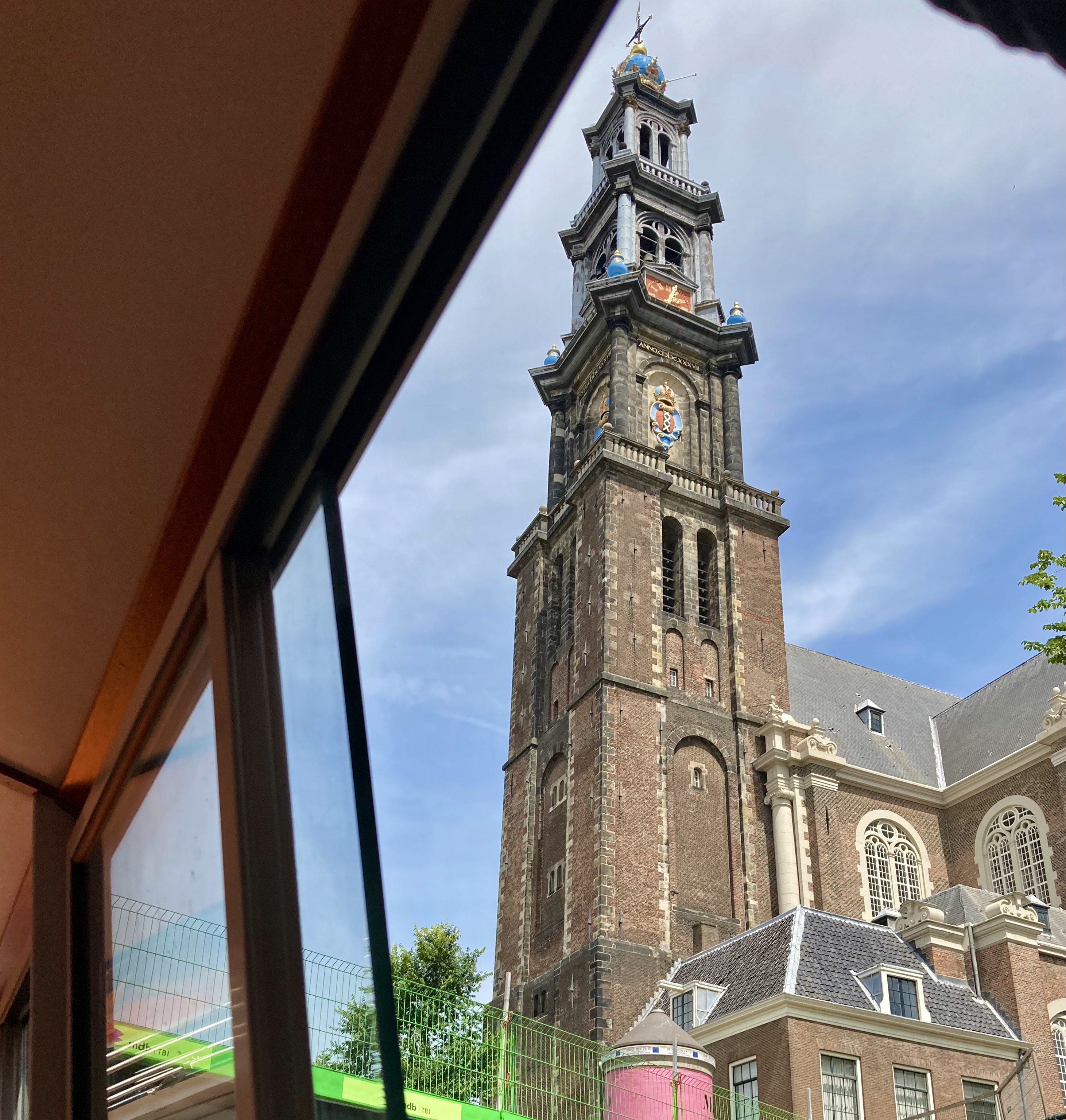
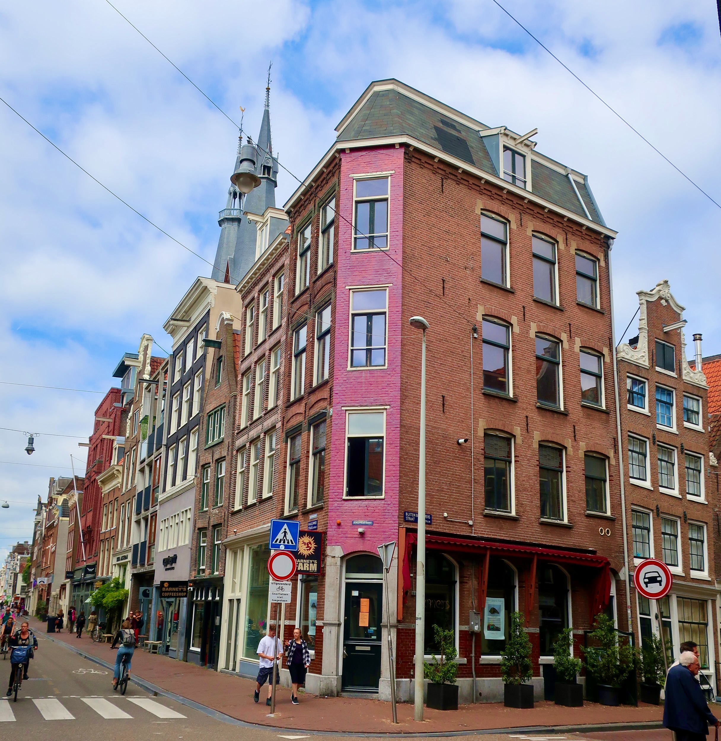
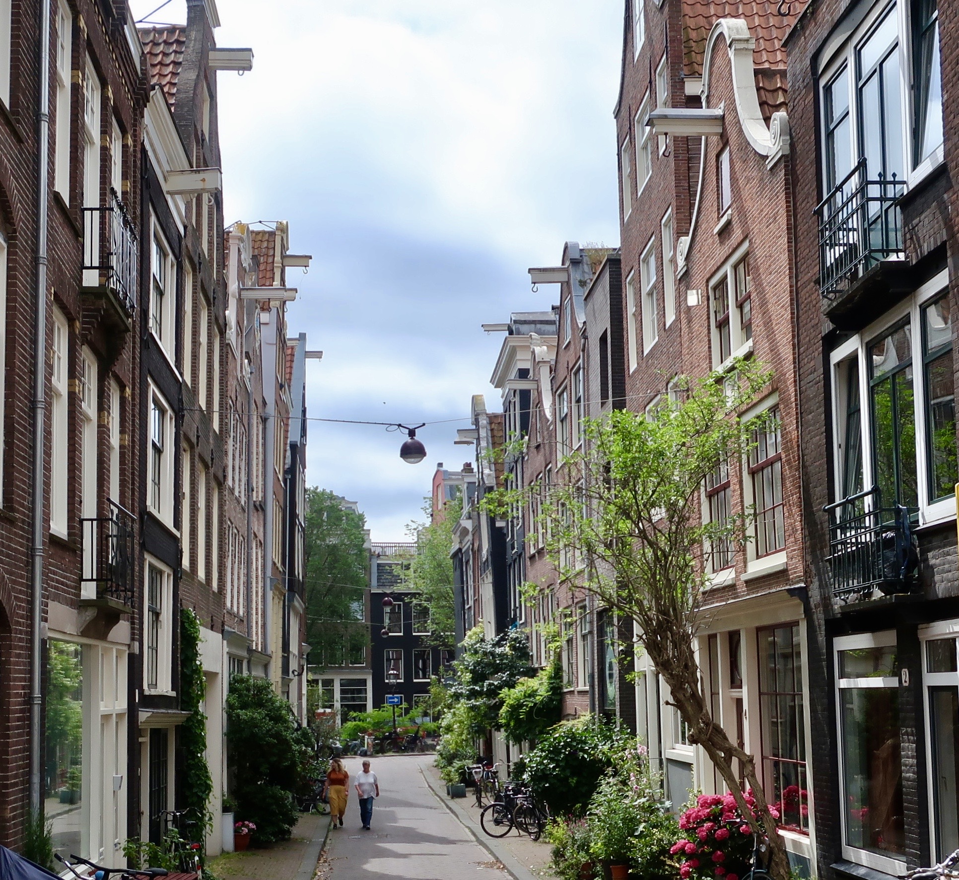
I found drinking this large beer amusing. And it became more so as I worked my way through it. Peggy stuck with the smaller one. I’m used to drinking pints. There are a multitude of brew pubs found in the US and it’s always fun to sample their wares. The locals in Amsterdam seemed to love their beer even more. I noted many of them were sipping out of mugs that we would call pitchers. My elder bladder would have little sense of humor about that! I’d be up peeing all night.A walk down any of the streets is heaven for cheese lovers like Peggy and me. Alas, we had no way to pack it up and carry it home. (Photo by Peggy Mekemson.)Just one of these large blocks would have fed us for months. You’d certainly want to sample it first. Imagine getting it home and discovering you didn’t like it!This woman, carrying her large blow-up doll certainly caught our attention. We could only wonder about the large pink appendage. 🙂We had never found a take out place that featured only French fries. Peggy loves them. She almost divorced me once before we were married because I stole one of hers. This store featured the fries cooked in a multitude of ways. Peggy went in and ordered their smallest container. The fries were soaked in garlic, and, at Peggy’s request, smothered in ranch dressing. It became dinner for both of us. Heartburn! I like fries. I certainly ate my half of Peggy’s score. But this tasty grilled lamb rib is more to my taste. Finger food, right? My hair was looking wild because we had dodged into the restaurant during a downpour. (Photo by Peggy Mekemson.)We had failed to notice the name when we dashed in. El Pimpi: The Pimp.Maybe it was the reason I found the poster of this cool cat in the men’s room.This cat was the major attraction of another restaurant we ate at. Just across from the restaurant, someone had found a unique way to keep his window propped open.At first I thought this dog in the window was part of the show at the Orphaned Art Gallery. Then it wagged its tail. The description of the gallery on its website noted: “We are definitely not a typical gallery. OODE brings the work of young Dutch designers together with orphaned art – art from closed museums and art institutions. For this we work together with the Foundation of Disinherited Goods (Onterfd Goed).Not all coffee shops are alike. Our Uber driver was taking us into our B&B when Peggy noted a nearby Coffeeshop. “Oh good,” she exclaimed, “We can go there for lattes in the morning.” “Uh, Peggy,” I noted, “they might serve lattes but the primary purpose of most Amsterdam coffee shops is serving marijuana. Your morning pastry would probably be laced with cannibis.” “Oh,” she smiled, not the least bit daunted.Unique art is something else that always catches our attention. Birds had added their decorative touches.It’s impossible to walk up and down the canals of Amsterdam without admiring the unique look of buildings. And the unique method of getting furniture in and out of the apartments… (Photo by Peggy Mekemson.)Let me note in advance, how narrow the stairways are. And steep. This led up to our room. Imagine trying to maneuver a couch up this stairway. Or refrigerator!The buildings compensate by having a pulley system using the upper arm that can haul furniture up to rooms and then in through windows. Note the decorative sculpture.The imagination that has gone into the narrow homes of Amsterdam seems almost endless.Another example. (Photo by Peggy Mekemson.)Larger buildings also had both beauty and personality. This is the main train station. Numerous restaurants and shops are inside.This was once the Post Office.Now it has been repurposed as an attractive indoor mall.The Droogbak office building is another repurposed building of beauty. It was originally designed in 1884 as headquarters for the Dutch Iron Railway Company. (Photo by Peggy Mekemson.)Several large churches dominate the Amsterdam skyline. I took several photos of this one.A view from across the canal. (Photo by Peggy Mekemson.)And from the street.We caught this impressive spire from a canal boat we were riding in.A close up.And finally, a Catholic Church reaching toward the sky.
Our next major series will be on our Rhine River trip where we will take you along the river, introduce several castles, visit cities like Heidleburg, and make a journey into the Black Forest. But first, I thought it would be fun to take a quick break and catch you up to date on our present journey where Peggy and I will take you into Badlands National Park in South Dakota. Get ready for seeing rock spires instead of church spires and communing with prairie dogs, big horn sheep and buffalo, up close and personal from the safety of our truck.
Such as……This big guy was right beside the road 10 feet away. Peggy took the photo out her window. One does not want to get in an argument with something that can weigh up to a ton and run 35 miles per hour.
I’ve always found Amsterdam fascinating. Its unique history, romantic canals, and picturesque buildings are only a few of the reasons why.
I first stopped off in Amsterdam in 1967 on my way home from a two year stint of teaching World and African History to high school students in West Africa as a Peace Corps Volunteer. Peggy was a high school exchange student in the Netherlands at the time. She made several trips to the city. Imagine if we had bumped into each other!
I’d already visited Athens, Rome, Geneva, and Madrid when I arrived in the city. Only London was left on my whirlwind tour of Europe. In three weeks I was supposed to be in Philadelphia, teaching at a black, inner-city school. But first, I had to fly to California, visit with family, buy a car, and drive back across the country. I also had to check in with my draft board in Placerville. A war was raging in Southeast Asia and it had quotas to meet. It wanted my body.
One might think with all of this that my memories of Amsterdam would be vague, at best. But there was something about the city that captured my imagination. The canals were part of it, but there was also a rich history, buildings with personality, and great food connected to its Dutch/East Asia history. On later trips, I would add its passion for bicycles and liberal policies regarding prostitution and marijuana. The latter two because I felt that their prohibition created a lot more problems than their legalization.
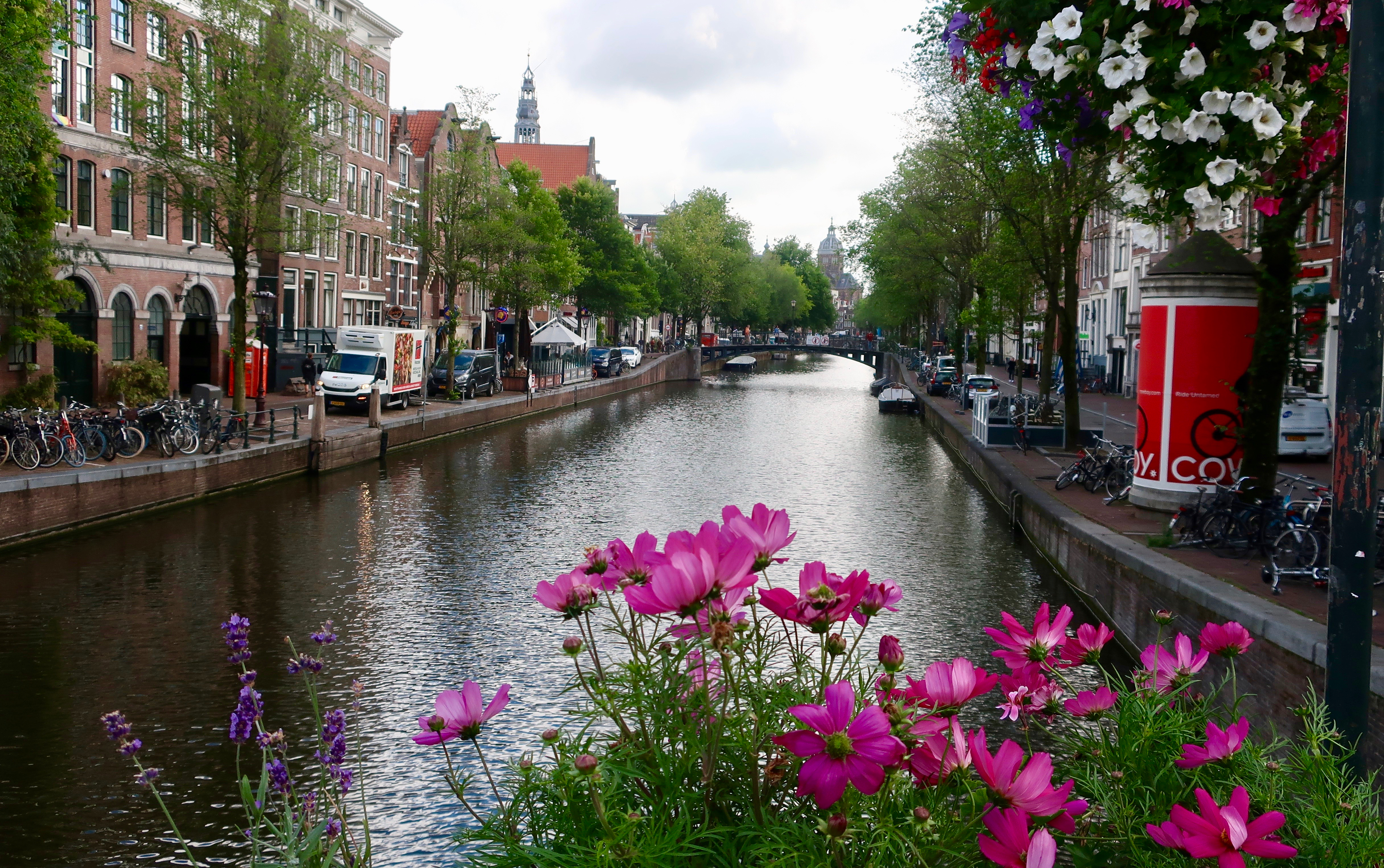
Peggy and I were in Amsterdam this past summer in preparation for our boat trip up the Rhine River. Actually, we had planned the trip two years earlier to celebrate Peggy’s 70th birthday. Our kids and grandkids were joining us. And then covid had hit. We were fortunately able to reschedule it. The fact that our boat left from Amsterdam was a plus. We planned to spend a few days in the city before and after the trip to take advantage of our luck. The photos for today’s post and next Friday’s will focus on our time in the city. Today, I will feature canals, street scenes and bikes. Next Friday will be devoted to the city’s unique buildings and other things we found interesting and fun. Note: Peggy didn’t carry her Canon camera while we were in Amsterdam. She had decided to experiment with her iPhone, examples will be in the next post. 🙂
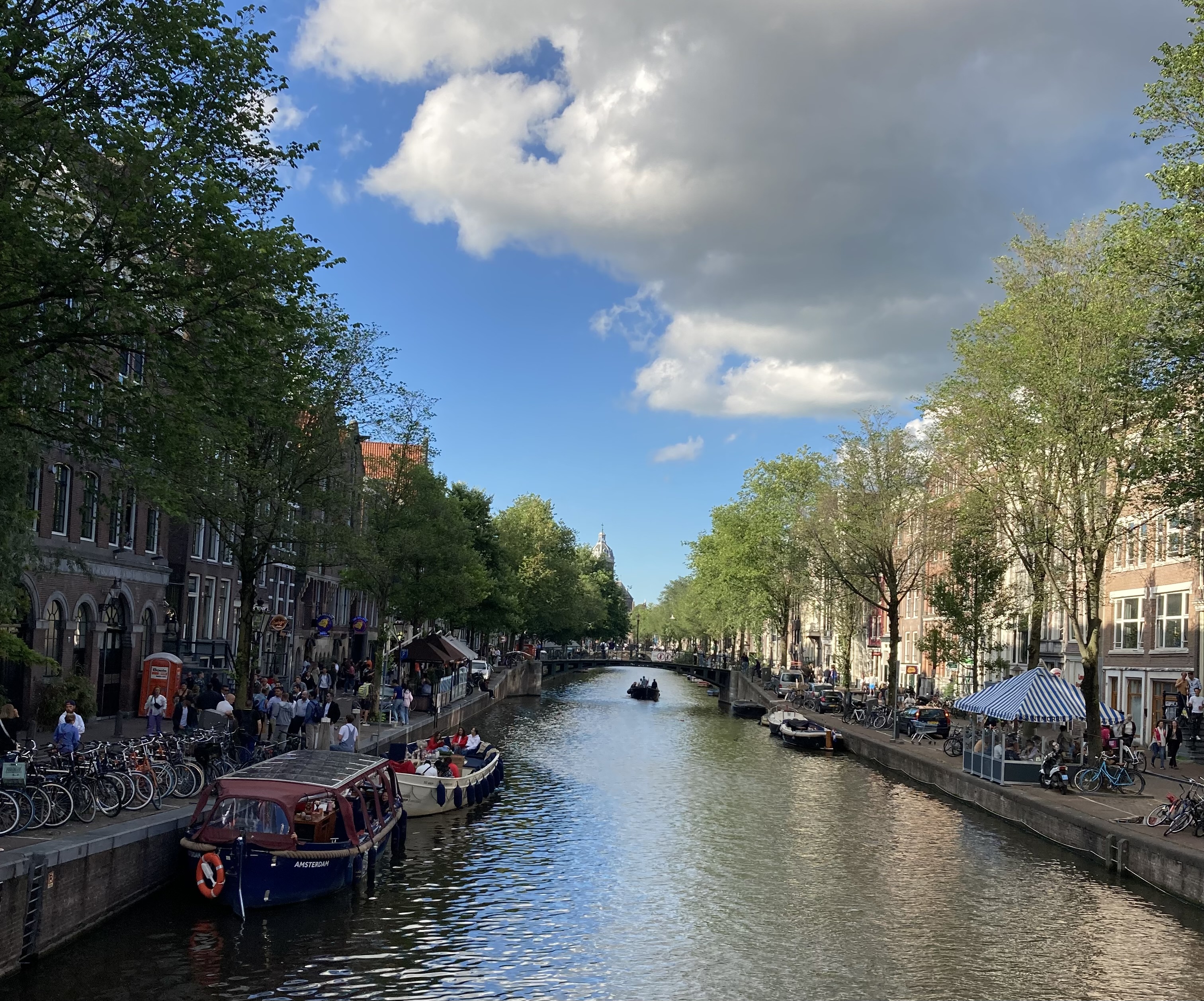
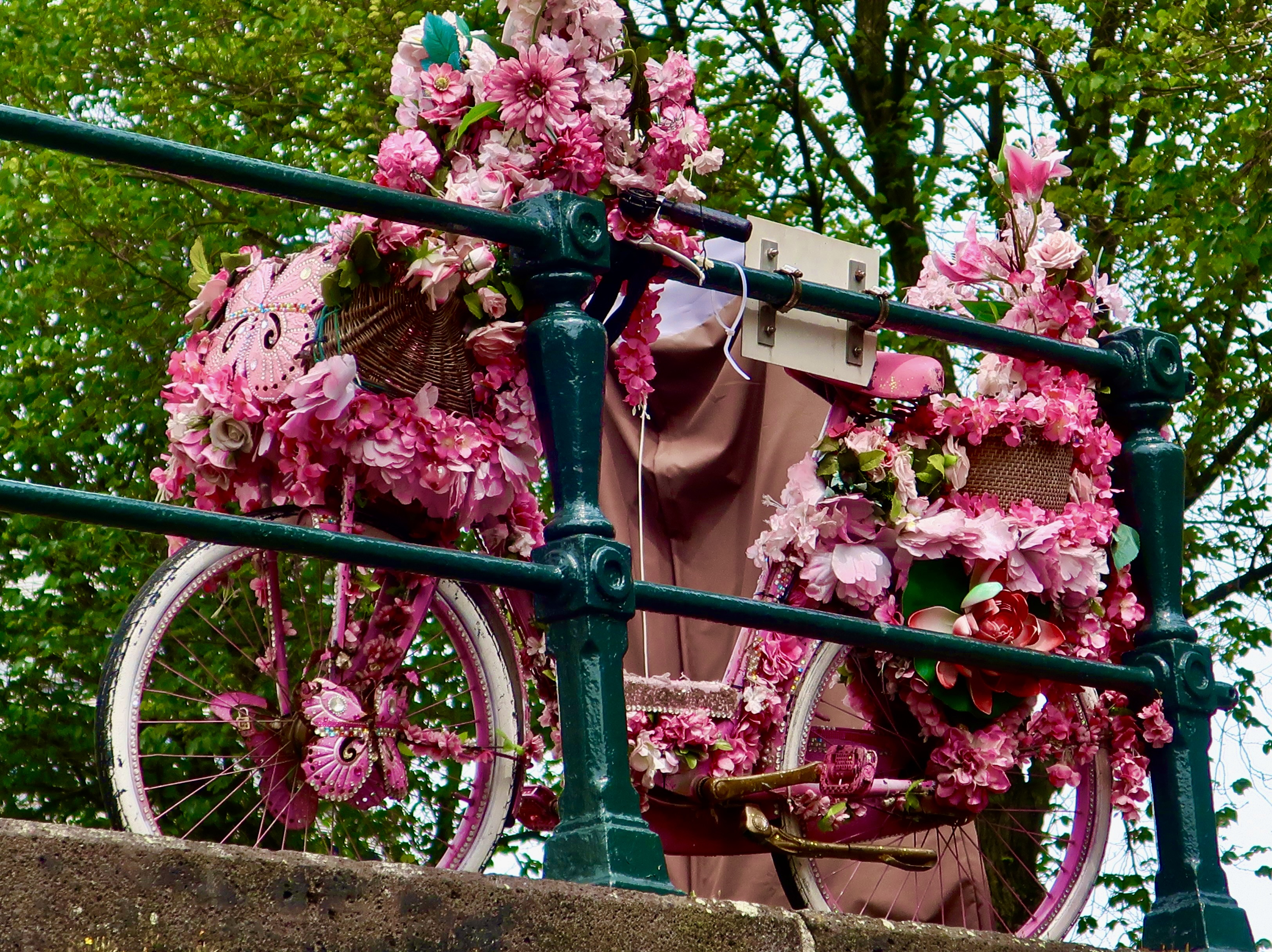
We stayed in a small hotel just off one of the canals when we arrived and spent a part of our evening sitting outside next to the canal drinking beer, watching the boat traffic, and enjoying a perfect evening along with several hundred other folks, mainly locals.Houseboats are one of the reasons visitors find the canals so charming. Peggy and I admired a similar scene when we rented a 60′ narrowboat and explored one of England’s canals.Flowers, trees, and Amsterdam’s unique buildings all add to the ambience.As might be expected, bikes are a part of most canal shots. You can’t escape from them!Someone had even added flowers to a bike for photo ops overlooking the canal. I suspect a fee would be involved.
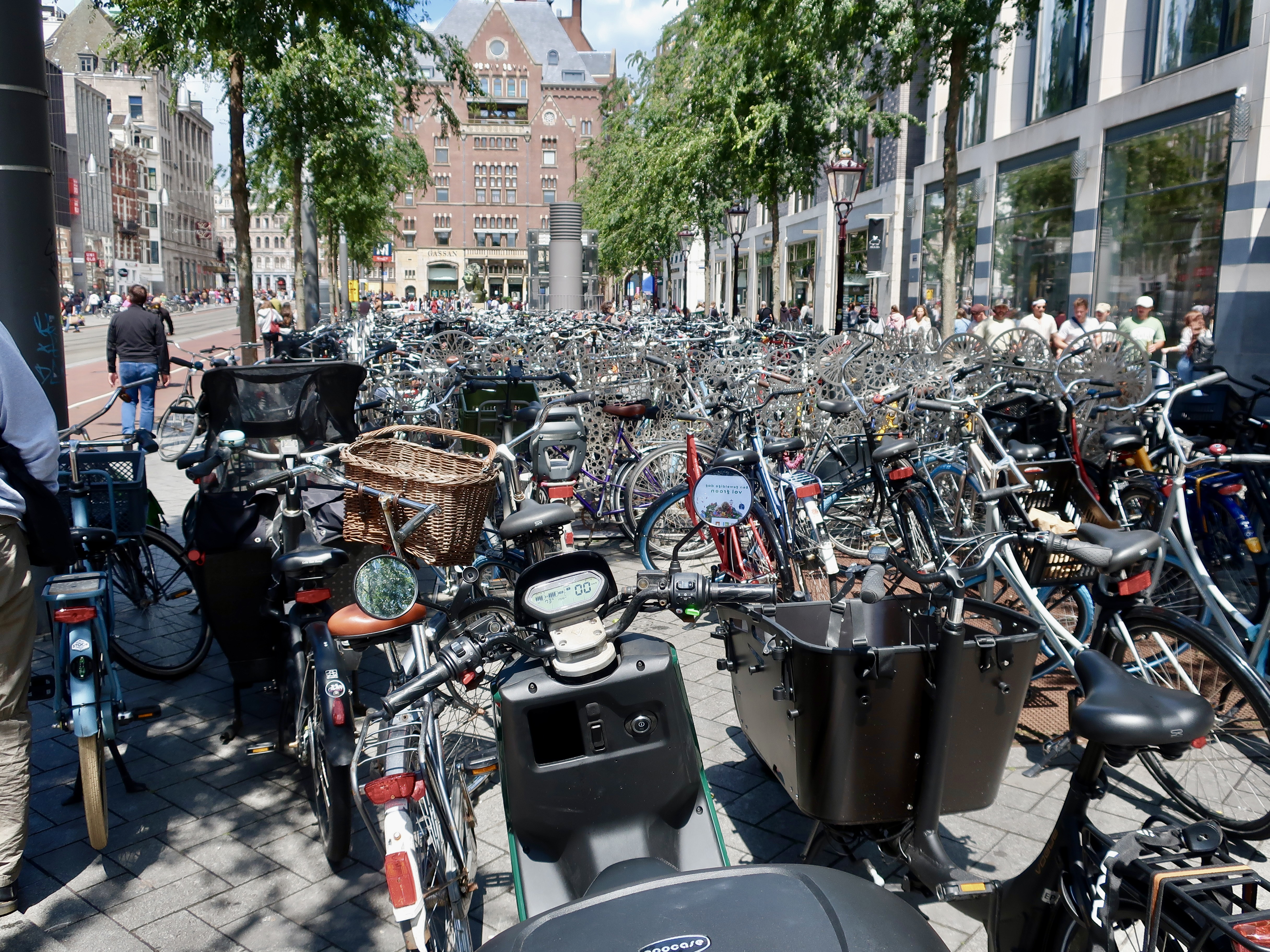
Amsterdam claims the title of Bicycle Capital of the World. Five minutes in the city is enough to agree. They are everywhere. It wasn’t the case in 1967 when I first visited. Like most other cities in the developed world, automobiles were in ascendance. Communities were being plowed over to make way for freeways. Bikes, people, houses and historic structures were considered impediments to the flow of traffic. Bicycle advocates in Amsterdam fought back in the 70s and government officials listened. It was a battle I also fought in Sacramento City and County where I organized the first county-wide conference of bike advocates to push for bicycle friendly policies on a city and county-wide basis. Bikes had served as my primary form of transportation at UC Berkeley and in Africa. I continued to commute in Sacramento. (My advocacy for bikes and other forms of alternative transportation would eventually lead to the City Traffic Engineer walking out of meetings when I walked in. When I was nominated for the board of the mass transit district, the mayor said ‘over his dead body.’ I probably shouldn’t have been proud of these reactions, but I was. Grin. BTW, I got the nomination.)
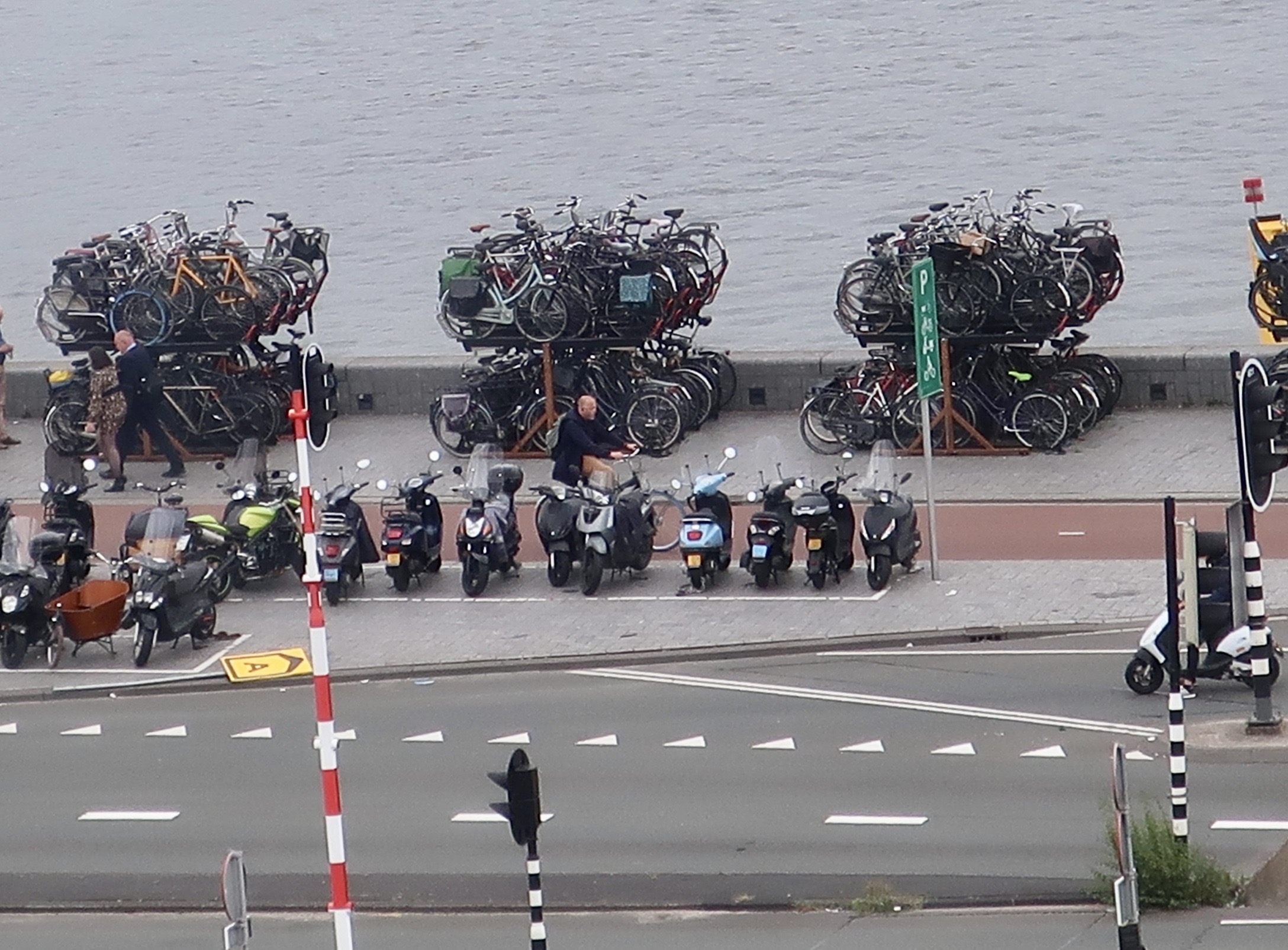
This photo of Amsterdam’s bike parking lot next to the train station gives a sense of just how impressive Amsterdam’s devotion to bicycles is. In addition to the ground parking there is a large two story parking garage. You certainly wouldn’t want to lose track of where you parked your bike. Peggy and I had that problem at Burning Man with its 70,000 bikes. There are close to 900,000 bikes in Amsterdam!This was a bike parking lot in central Amsterdam near the hotel we were staying.When we returned from our Rhine River cruise, we stayed at the Ibis Hotel. I shot this scene from our window. In addition to Europe’s sleek and super-fast passenger trains, bikes can be seen stacked up alongside Amsterdam’s port. The docks for Rhine riverboats are on the left.A closer look at the stacked bikes.I was also impressed by the maze of tracks leading into the central train station. This was another photo from our hotel. I rendered it in black and white for fun. The emphasis on mass transit, bicycles and walking in Amsterdam is definitely a commitment to the future in the fight against global warming. Walking the streets gave a sense of the domination of bikes. But it also it also provided a view of the beauty of the city, its unique buildings and fun shops. Another street scene.Quieter walkways with carefully tended landscaping were also fun to explore.And, of course, you can spend hours walking along the canals. I’ll finish today’s post with this photo. Next week I will take a closer look at buildings and some of the fun ways we entertained ourselves in the city.
For those of you who are keeping track of Peggy’s and my journey, we are now in Sioux Falls, South Dakota. Tomorrow we will be in Badlands National Park.
Basecamp Definition: A main encampment providing supplies, shelter, and communications for persons engaged in wide-ranging activities, such as exploring, reconnaissance, or mountain climbing.
That about does it, except for the mountain climbing. We don’t mind hiking up mountains, in fact we like mountains, really high ones. But dangling in the air while hanging on with our fingers on a sheer rock face a thousand (or fifty) feet above the ground really isn’t our thing.
Our basecamp in Loudoun County, Virginia is actually the result of a 16-year campaign by our daughter, Tasha, her husband, Clay, and our grandkids Ethan and Cody to persuade us to move closer to them. (Our son Tony and his wife Cammie also had their hat in the ring but the highest mountain in Florida is 345 feet— and yes, we’ve hiked up it— plus they don’t have space for Serafina or a handy dandy efficient apartment to hang out in when we aren’t traveling. Sorry kids.)
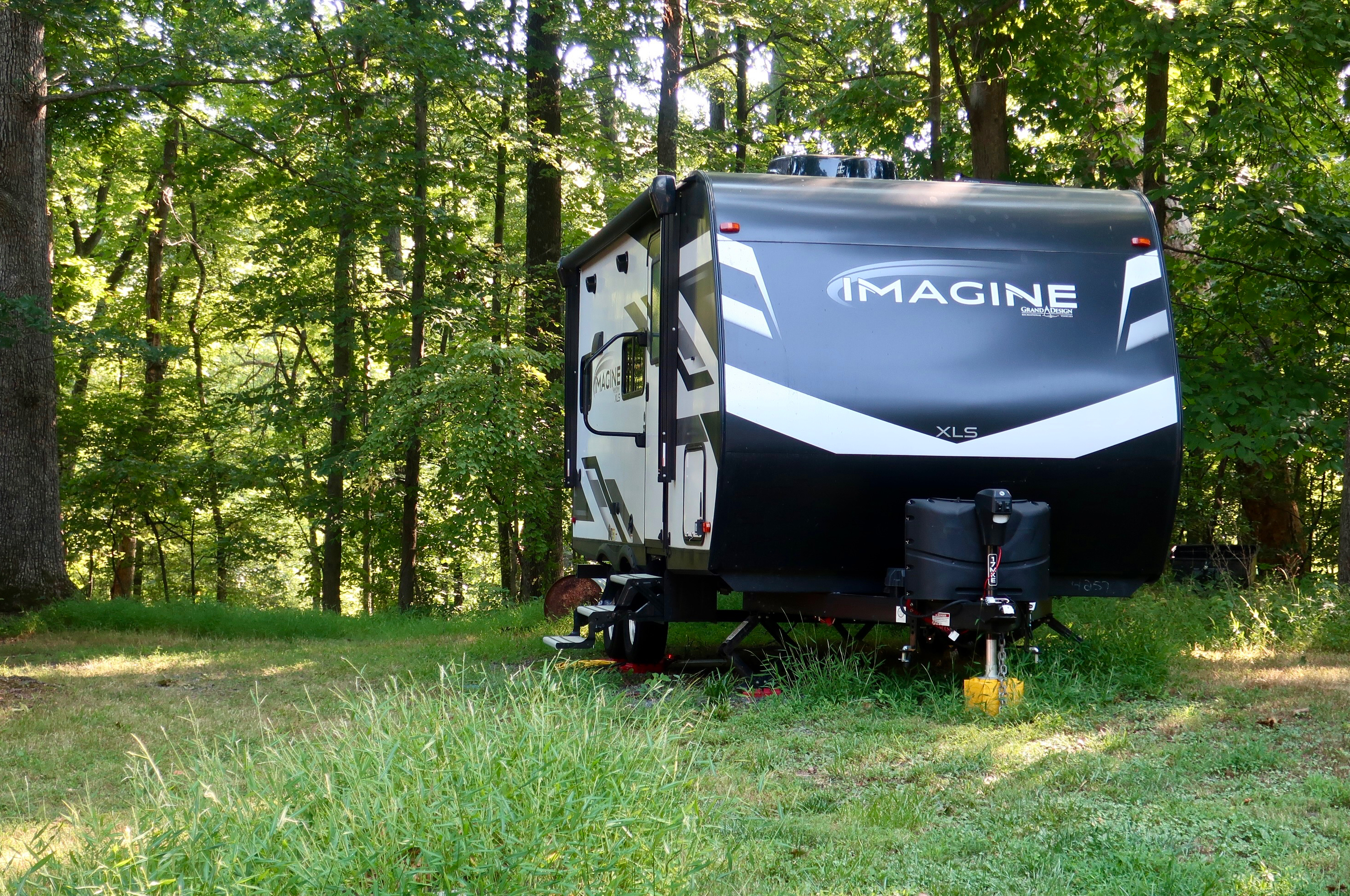
We are back on the road now, dashing across the country on freeways to Sioux Falls, South Dakota where Serafina has an appointment for a checkup while still under warranty. As to why Sioux Falls instead of somewhere closer to Virginia, It has to do with my desire to explore more of the northern part of the Western US before the snow flies. Setting the appointment in South Dakota makes sure we get out there ASAP. Then we will slow down and return to moseying on back roads.
BTW, my apologies for being so negligent on keeping up on blogs and comments lately. Between moving, going to Europe, unpacking, and getting ready for another four months on the road, life has been a bit hectic.
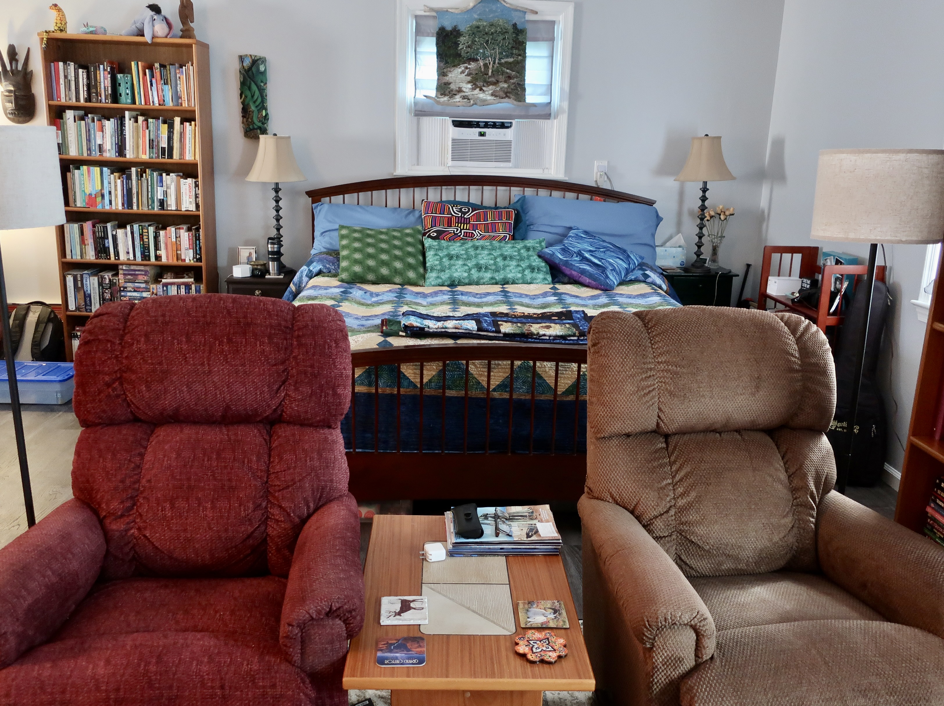
As we return to the road, Peggy and I decided it would be fun to share what our ‘not so rough’ basecamp looks like.
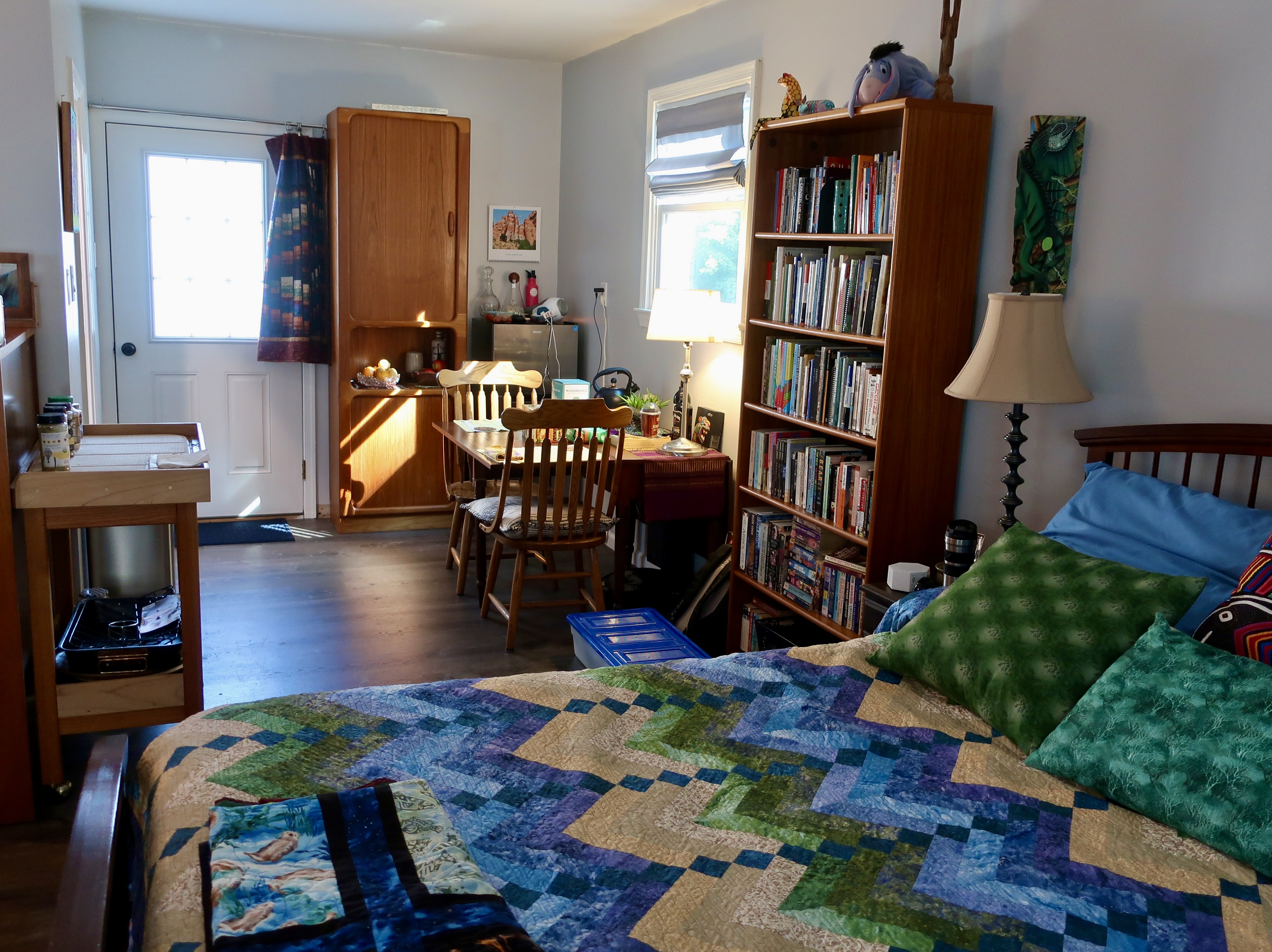
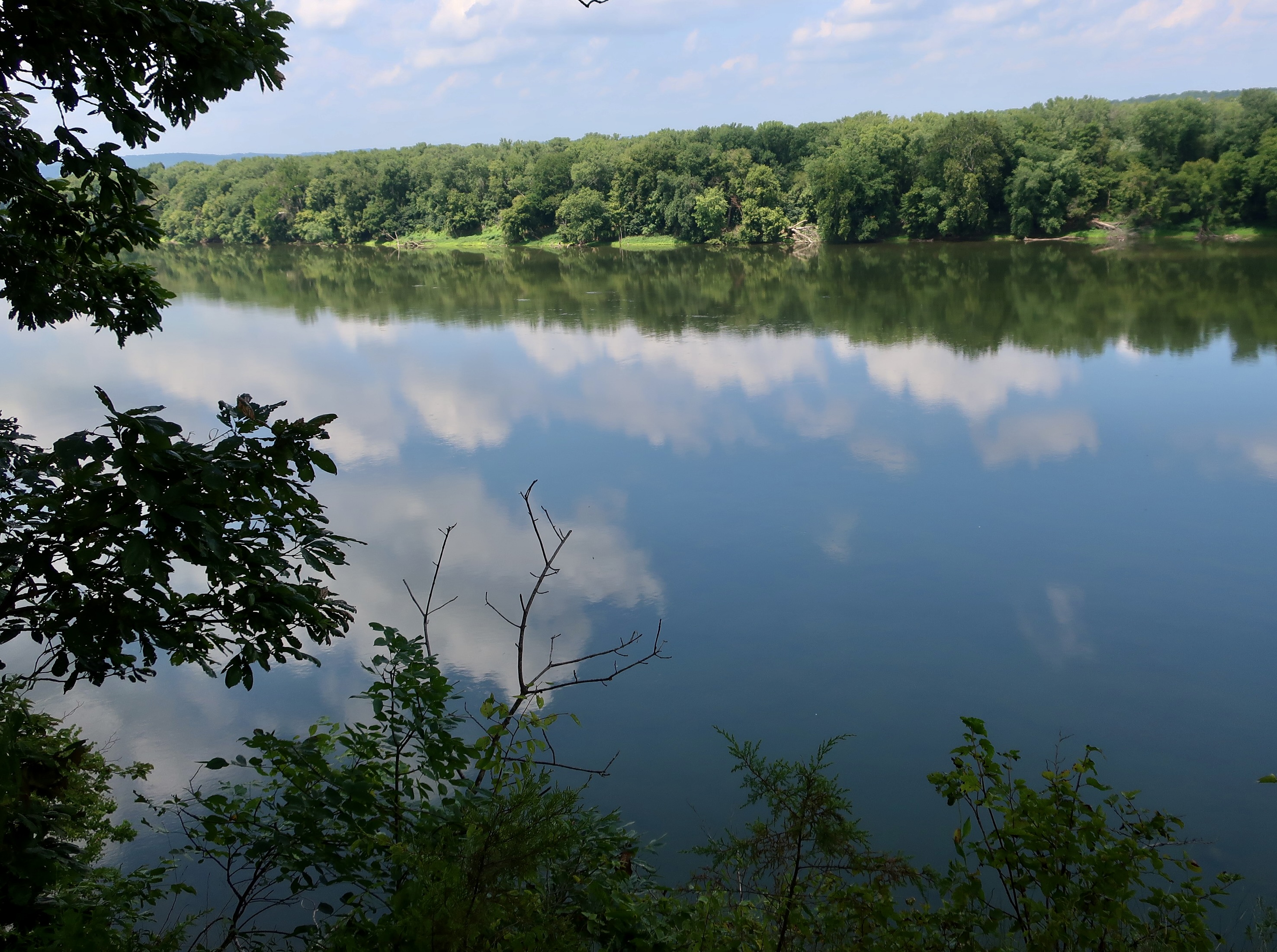
As the first photo suggested, Serafina is happily parked in a woodsy area under a beautiful canopy of trees. The kids’ six acres is half wild and half domesticated. The woods harbor foxes, deer, raccoons, squirrels, eagles, and hawks, which is a bit like our Oregon home minus the bears, mountain lions and bobcats. Our house in Oregon wasn’t large, only 1500 square feet. But still, it had two bedrooms, an office, a library, a large living room, a dining room and a kitchen, not to mention a sunroom and three outbuildings. Moving into an efficiency apartment took some adjustment: translate, serious downsizing. This is our living room and library.Turning around, you can see our bedroom.The dining room and one third of the kitchen is off to the side. Our mini-fridge, induction burner, air fryer, toaster and Insta-pot reside there. Another third of the kitchen can be found by turning left at the dining table. That’s where our sink and microwave live. Passing on through the kitchen is our bathroom. Note Eeyore peering down from on top of the bookcase.The final third of the kitchen lives outside. The 2022 Genesis Weber is amazing in what it can do, including bake. It even comes with a pizza stone where I cooked a pizza the other day. I put the stove together. There were 52 steps. Peggy stayed far away!The driveway leading to the kids’ house and our basecamp is off of Charles Town Pike. It’s a sure sign you are in the east when road names include pike. A pike is short for turnpike. In the old days, i.e. 1700s, most of the roads were toll roads built by private individuals. A large pole (pike) was stretched across the road. When you paid your toll, the pole would be turned so you could continue your journey, thus the name turnpike. You can see the house in the distance.Our tool-oriented rooster (thank you to Jeremy Criswell, the artist and our neighbor) that greeted people when they drove into our Oregon home, made the trip east with us. Tasha and Peggy were quick to plant a flower garden in front of one of our windows. We had just returned from our European trip and they were inspired by all of the window gardens.An Amazon truck driver was responsible for planting a gorgeous pumpkin patch which is also in front of our basecamp. Nice of him, huh. He was turning around and drove over some pumpkins the kids had out for Halloween last year. The seeds from the squished squash responded by digging in and growing.Peg’s sister Jane (and my friend of 50 years) made a quick trip out to see us and Tasha and Clay’s family before we escaped. Her daughter Jennifer (Tasha’s cousin) came along. Here we are sitting out on the deck eating a meal of delicious corn chowder Peggy cooked in our Insta-pot. Seated from left to right are Tasha, Jennifer, Jane, our grandson Cody, Peggy, and the Insta-pot. Clay and Ethan were off in Brazil at a jujitsu camp. Peg’s brother John and his wife came out from Texas the next weekend. I’ll write more about our basecamp and the surrounding area when we return in January. I’ll close today with this photo of the Potomac River which is about 20 minutes away. Washington DC is a short 40 miles. Next Friday, I will start a series on our trip up the Rhine River this summer. First up: Amsterdam.
I tend to think of surreal as real, but mind-blowing— striking and maybe strange, but possible. Last Friday’s photos of miles 4-18 of Bryce Canyon fit into that description. Unreal is more like, “No way. How can that even be possible?” That’s how I feel about sections of the Canyon in the first 4 miles, like the one in the photo above. It looks like it belongs in a fantasy movie.
Peggy and I are in serious countdown time here. On Tuesday, the day after Labor Day, we will be hitting the road— come hell or high water, as the old saying goes. Given global warming, there may be a bit of both. We plan to zip across the nation to the Bad Lands of South Dakota and then slow things down, way down— to a snail’s pace. It’s been an insanely busy month and a half since we got back from our European trip up the Rhine River. First up, we had to unpack from our Oregon move and set up our Base Camp/efficiency apartment in Virginia. Some fun. Try downsizing from a library, living room, dining room, two bedrooms, an office, two bathrooms and a moderate-sized kitchen to one room plus a tiny kitchen and bathroom. Fortunately we do small well.
Then there were the usual medical challenges: changing our medical insurance, finding new health care providers, and making appointments. I had six dental appointments. I’ve never met a dentist who doesn’t immediately start planning a vacation when he or she looks in my mouth—a luxury cruise around the world perhaps. I finished my last appointment yesterday. I sat in the dentist chair, was shot full of painkiller (ouch), and then tried to ignore the various drilling and scraping sounds as he removed an ancient crown that belongs in the Smithsonian. I’ve been there done that a lot. But yesterday was a first. I sat and read afterwards while he made a new crown for me in his office. In the past all sorts of measurements have taken place, a temporary crown attached, and the measurements sent out to a specialist who made crowns. It’s a one or two-week process. Yesterday, it was an hour. The tooth came out purple, was adjusted, went into the oven and came out white. My tongue is still checking it out.
I didn’t wear my new hearing aids to the appointment. Yep, you heard me right. Peggy and I have reached the point where we got tired of saying “What?” to each other. Now we can both hear birds we thought were extinct. I didn’t need to enhance the sound of the dentist drill, however.
On top of all that we’ve had the multiple chores that go along with planning for four months on the road. Peggy is handling inside Serafina, our trailer. One was rebuilding the flimsy drawers. My job is maintenance. I spent all day Wednesday going through my annual check list for Serafina. There were 33 items, but who is counting. We will be up to our new ears over the weekend with packing.
Then there was all the family stuff, fun but time consuming. Let it be suffice to say we’ve spent more time doing family things over the past two months than we normally do in two years. It’s a miracle I got any blogging done at all.
Today’s post features the first four miles of the 18-mile Bryce Canyon National Park road. It’s where most of the tourists go. Next Friday, I’ll do a post on our base camp. Then, as I mentioned in my last post, Peggy and I will be featuring Amsterdam and our river cruise before returning to the ‘Wild’ West with our focus on National Parks.
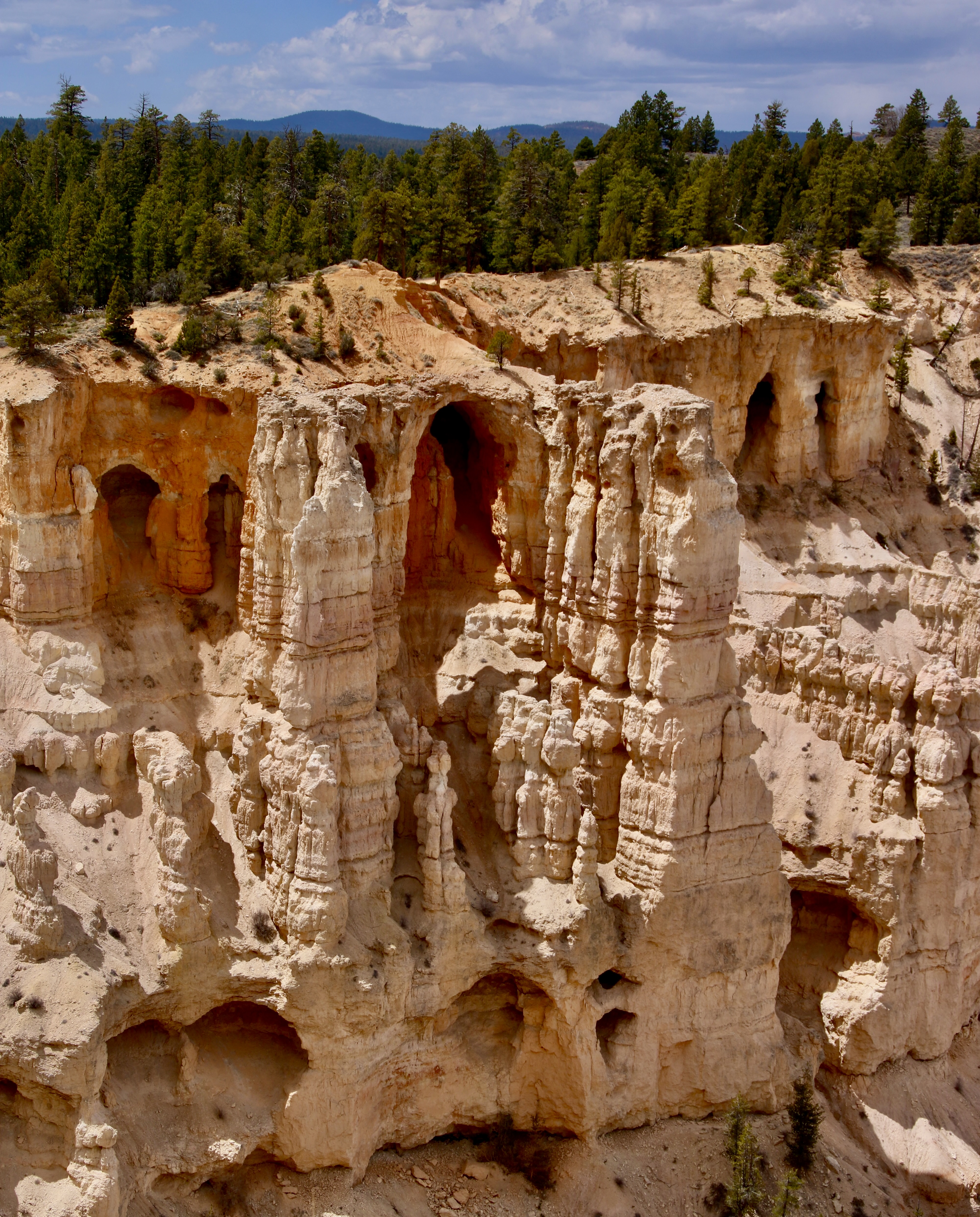
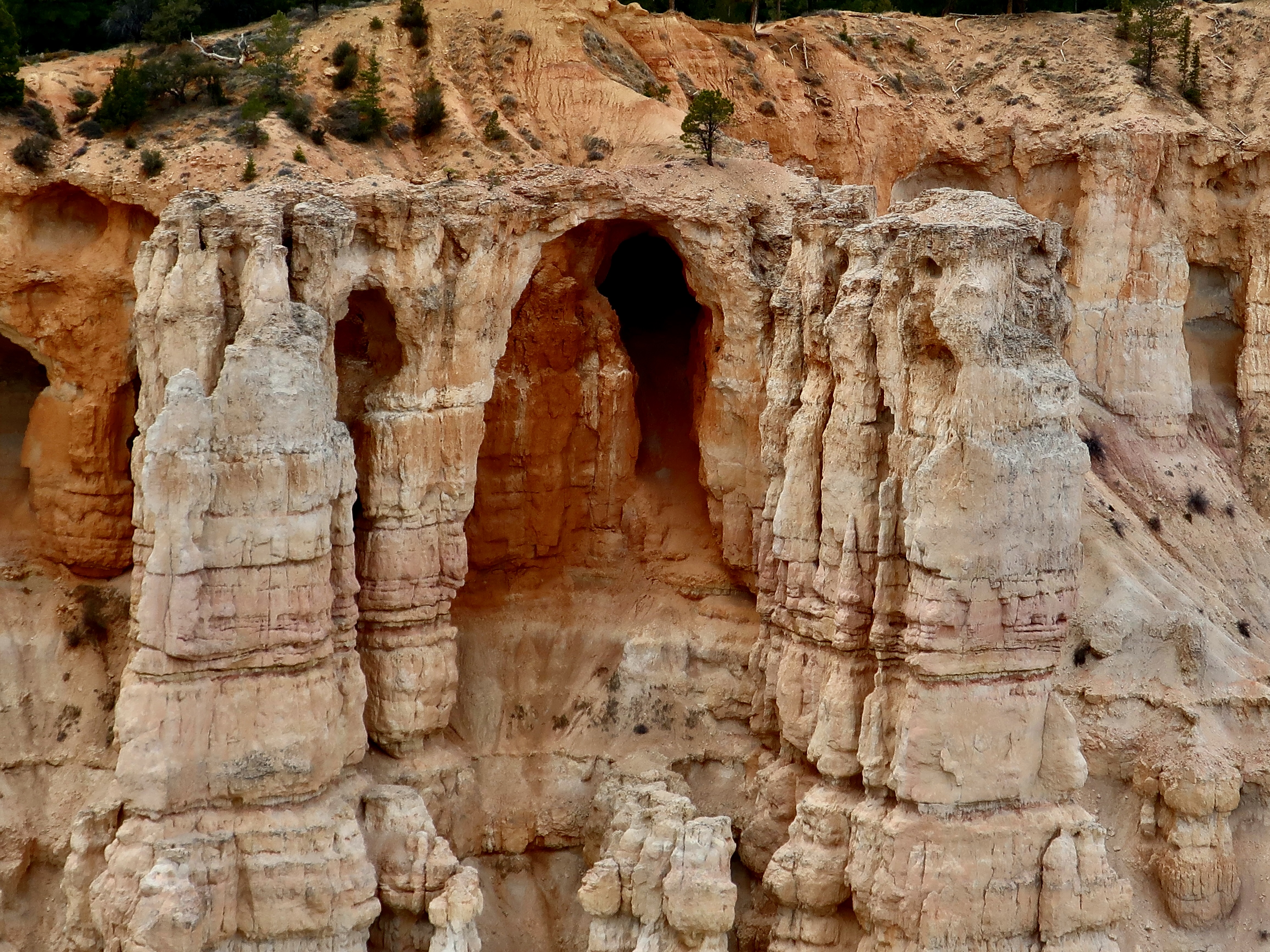
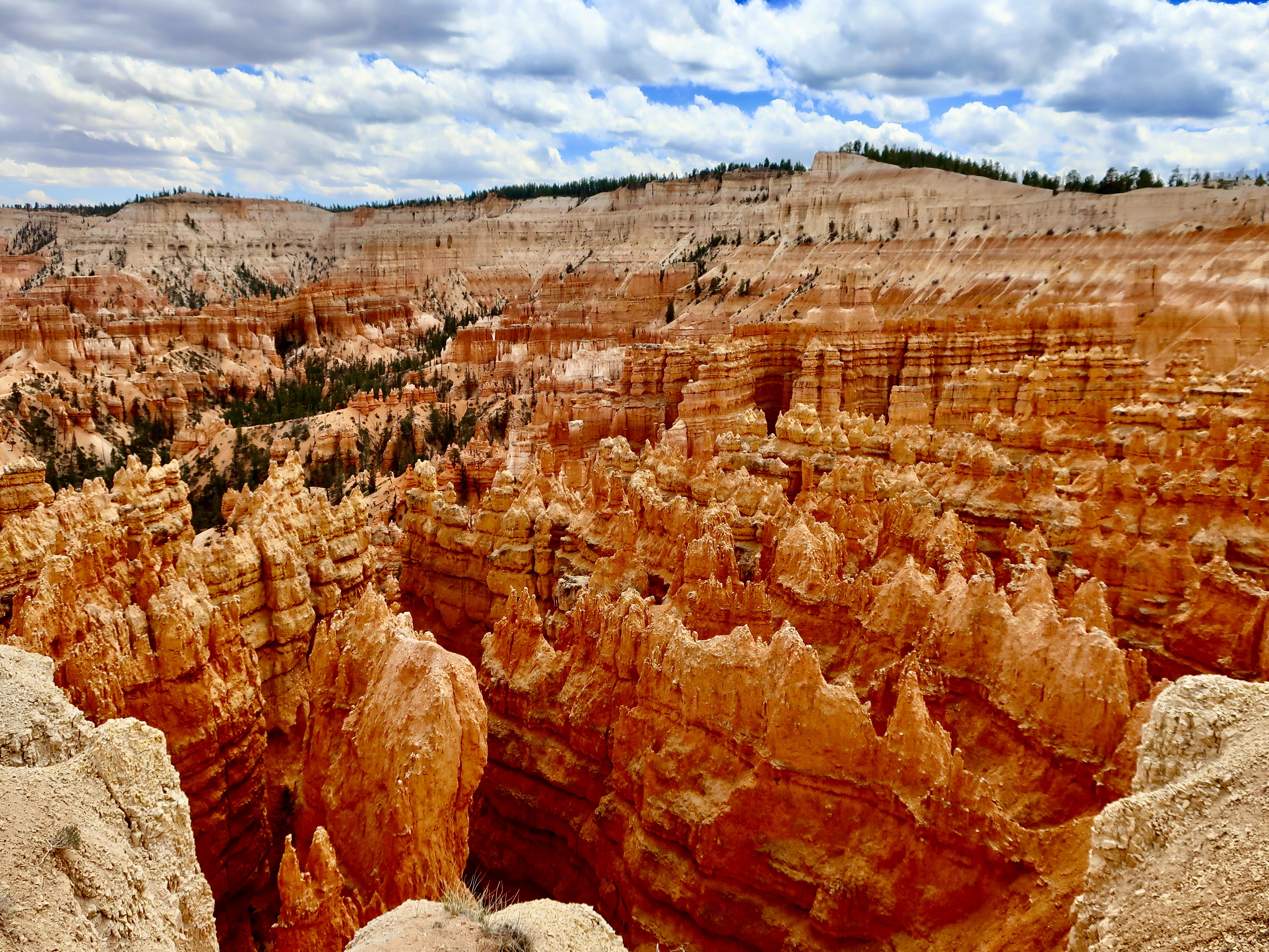
Just like millions of other tourists, we checked out the main overlooks in Bryce Canyon. These photos are mainly from Bryce Point, Sunrise Point, Inspiration Point and Sunset Point. (Photo by Peggy Mekemson.)Again, this photo emphasizes the unreal look of Bryce Canyon. But check out the hoodoo in the front.It’s like a large grasping hand is reaching out to grab something. Unwary tourists, perhaps?Peggy focused in on an interesting wall from our Bryce Point overlook. Note the peek-a-boo holes in it.Her telephoto lens brought in what was lurking behind one of the holes. (Photo by Peggy Mekemson.)Even more fascinating were the caves/eroded structures lining the side of the Canyon. (Photo by Peggy Mekemson.)These eroded rocks seemed to serve as a magnificent hallway into an arched cave. (Photo by Peggy Mekemson.)I took a close up.
Our cameras were busy the whole time we were at Bryce Canyon. We took well over one a thousand pictures. Here are a few more from the first four miles of the Canyon.
Note the trail winding its way through the Canyon.Photo by Peggy Mekemson.Photo by Peggy Mekemson.Photo by Peggy Mekemson.The Canyon has its share of sharp edges. (Photo by Peggy Mekemson.)Another perspective.I’ll conclude with this final view of the Canyon from Sunset Point by Peggy. Next Friday I’ll give you a look at our Base Camp in Waterford, Virginia along the Charles Town Pike.
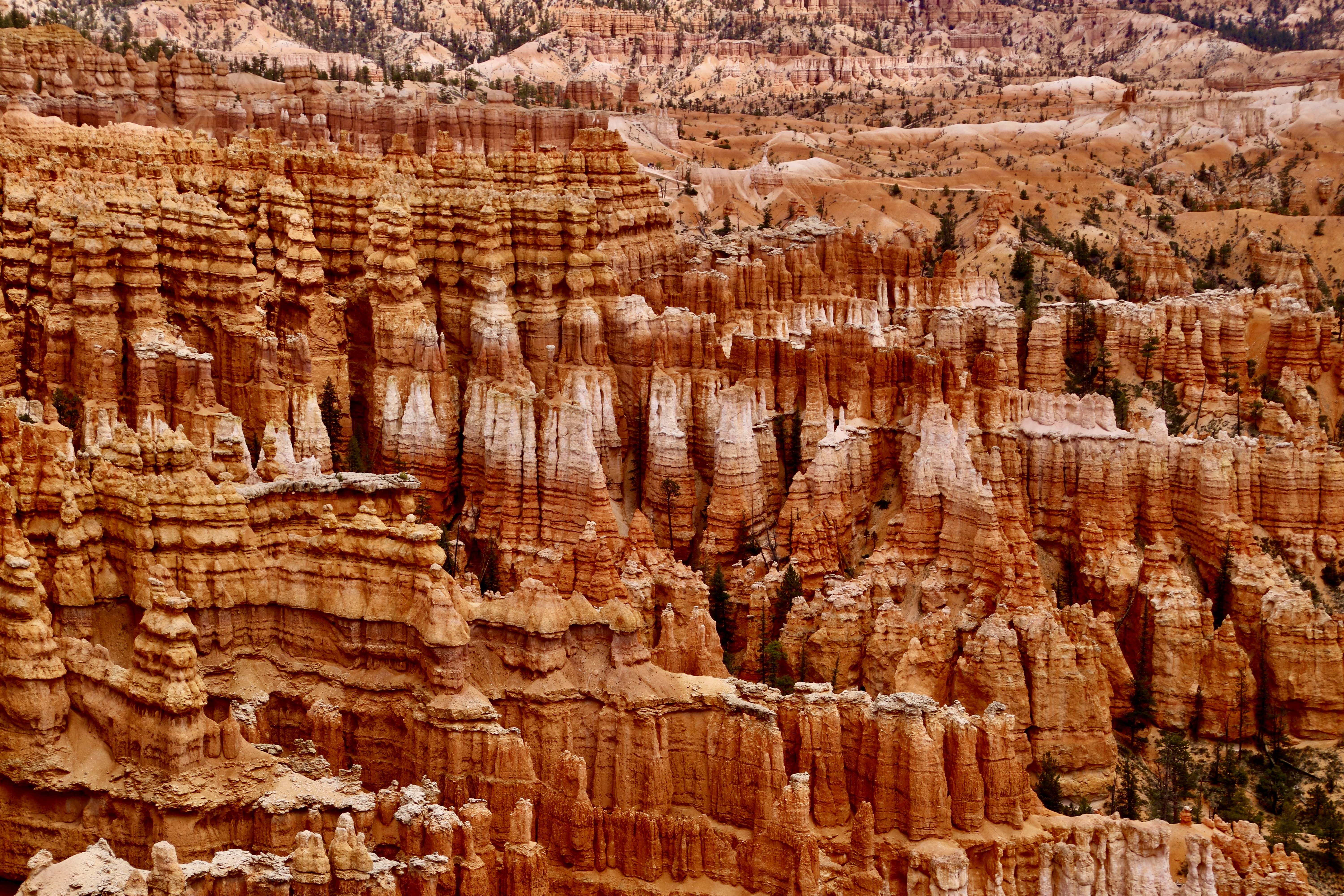
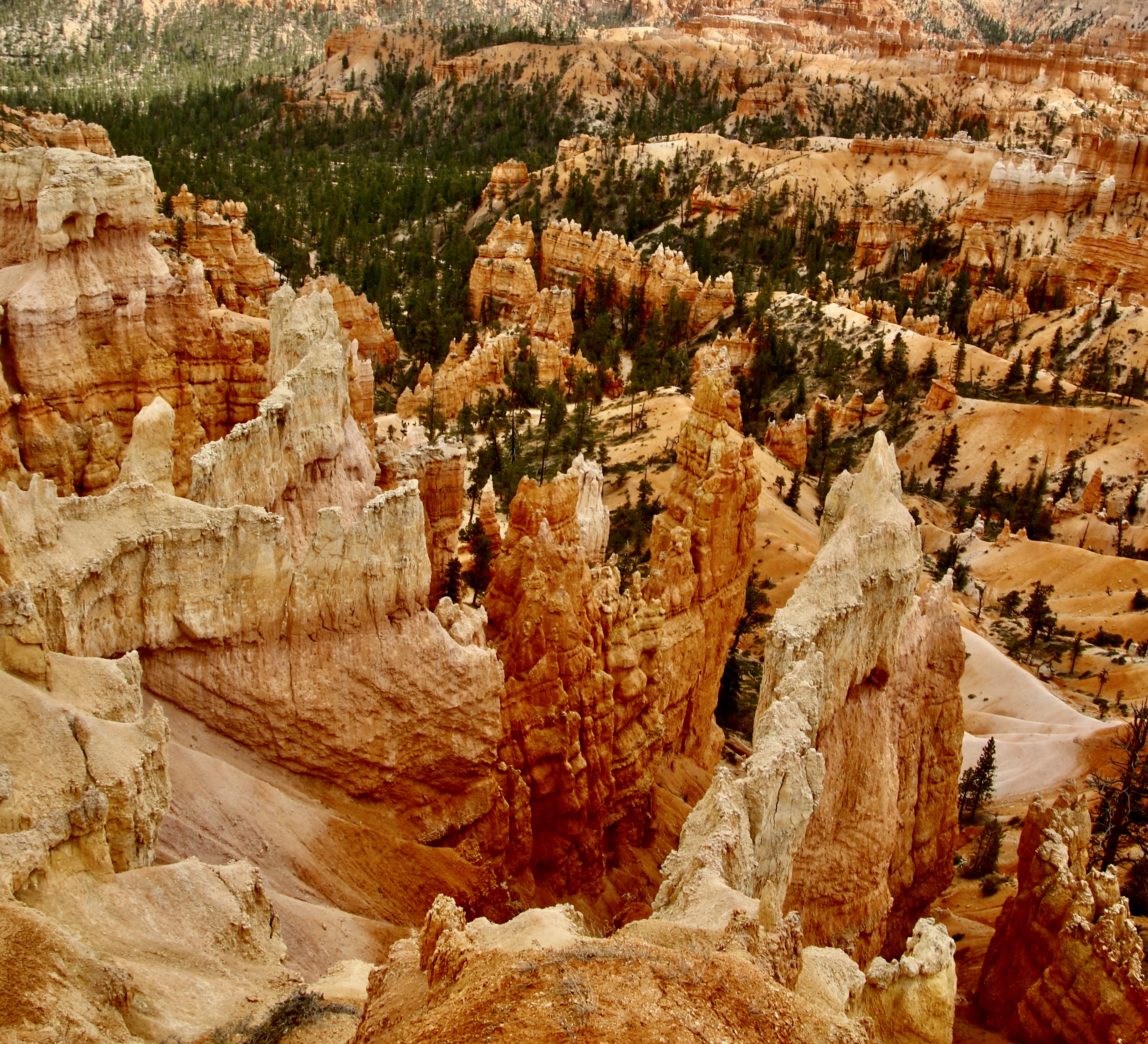
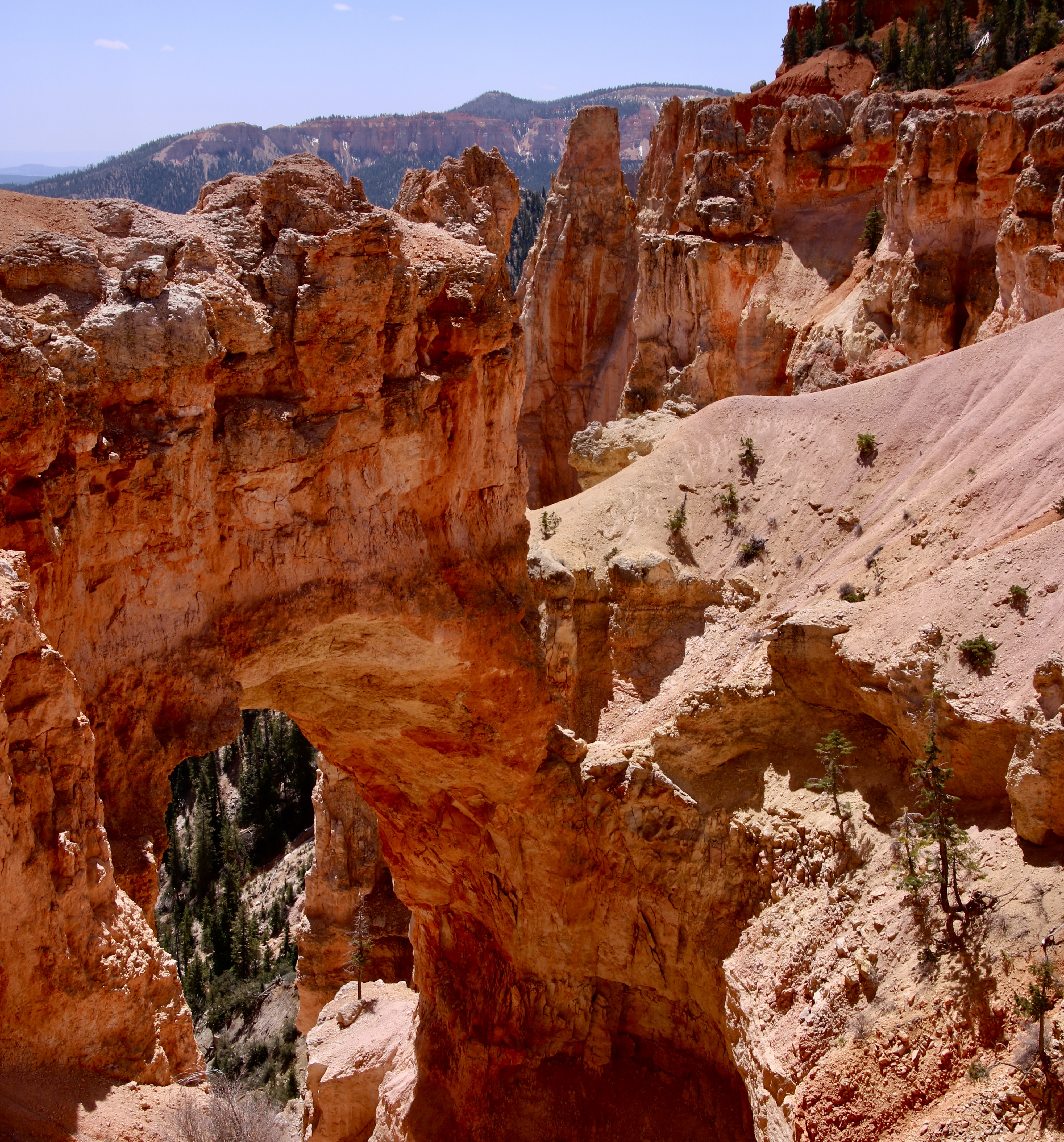
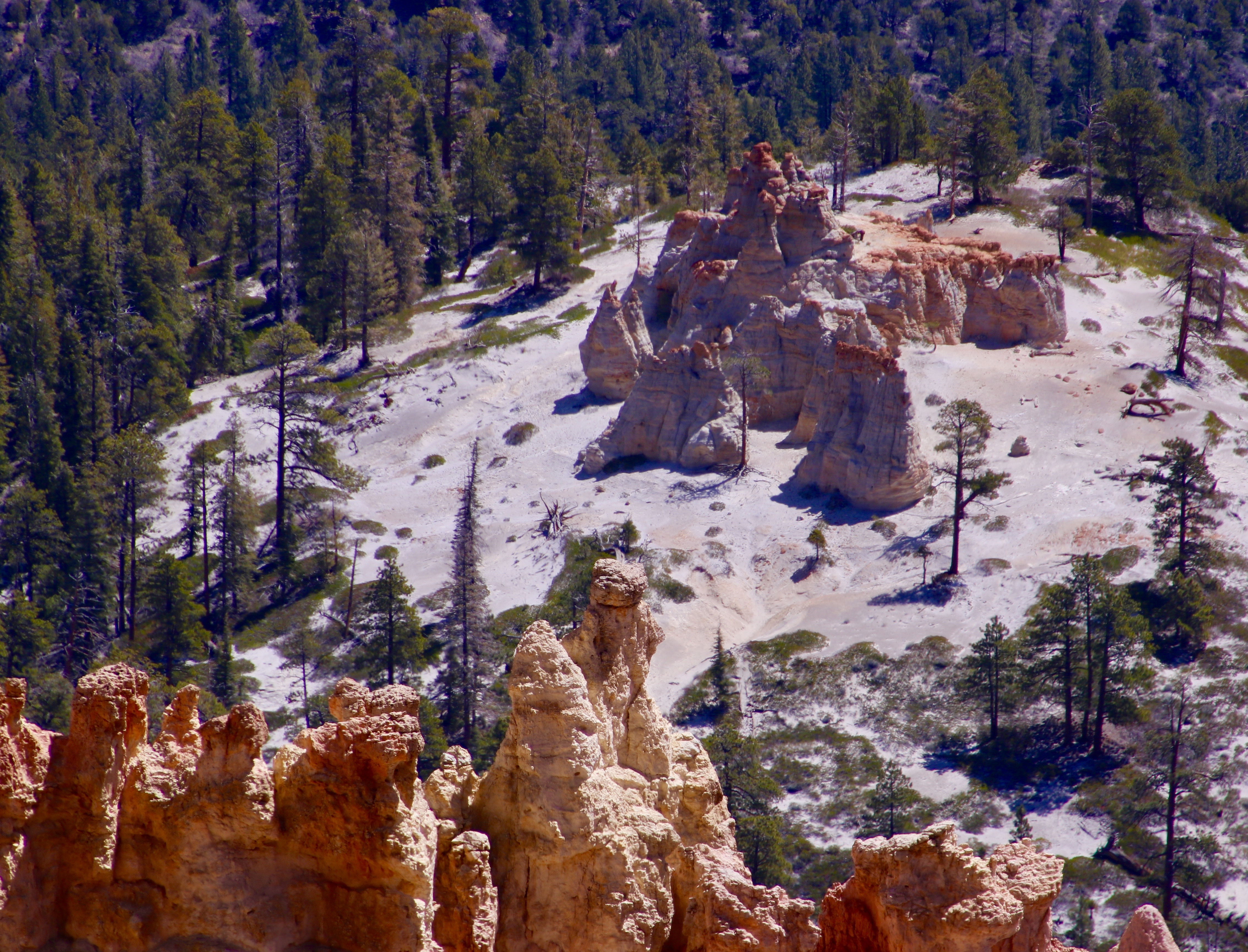
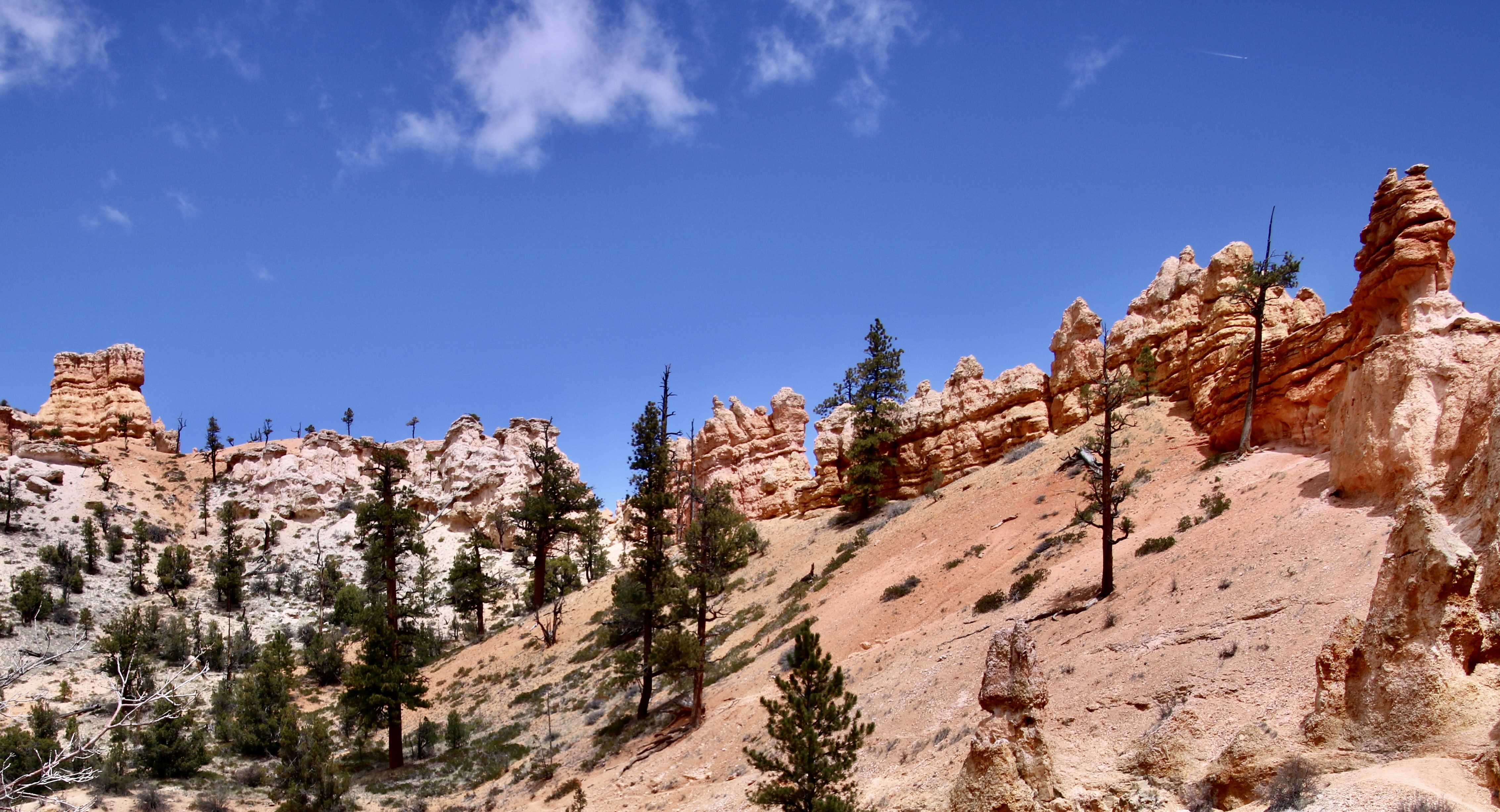
Most people, especially if they are on a tight schedule, focus on the first 4 miles of Bryce Canyon’s 18 mile drive. It’s where all the services are. It is where the tourist buses go. It is where the Park busses run. And those four miles are spectacular— no doubt about it. There are reasons for the all of the hype. But today, Peggy and I are going to take you out the road from mile 4 to mile 18 and provide a perspective on why visitors should include it as part of their itinerary.
What’s not to love about the National Parks of America’s Southwest? Well, maybe not the extreme heat of summer and the flash floods of the monsoonal season. Beyond that, there is incredible beauty, geology, and interesting history. Peggy and I have worked to give you a sense of this beauty over the past several Friday posts if you have never visited the region, and some special memories if you have. Today, we are covering miles 4-18 of Bryce Canyon’s 18 mile road. Next Friday we will wrap up our visit to the Bryce area by covering the first four miles. Both were a treat for us, and hopefully, will be for you as well.
Then, we are going to take a break from the Southwest for a few weeks. First, I want to give you a look at our basecamp in Virginia where we will be hanging our hat, so to speak, between journeys. Second, we want to share our trip to Amsterdam and up the Rhine River this past summer, a trip that was postponed for two years because of covid. After that, we will finish off our Southwest exploration with the North Rim of the Grand Canyon and Mesa Verde, plus.
In the meantime, Peggy and I will be starting our next four month adventure in two weeks, working our way across the northern tier of states with more visits to National Parks and a possible jaunt into Canada until the weather drives us south into the Northwest and California, followed by a drive across the southern tier of states. This coming spring, we have booked a tour down the Nile River, after which we will spend a couple of months in Europe, starting with a month in the Greek Isles. At least, those are the plans…
And now: Miles 4-18.
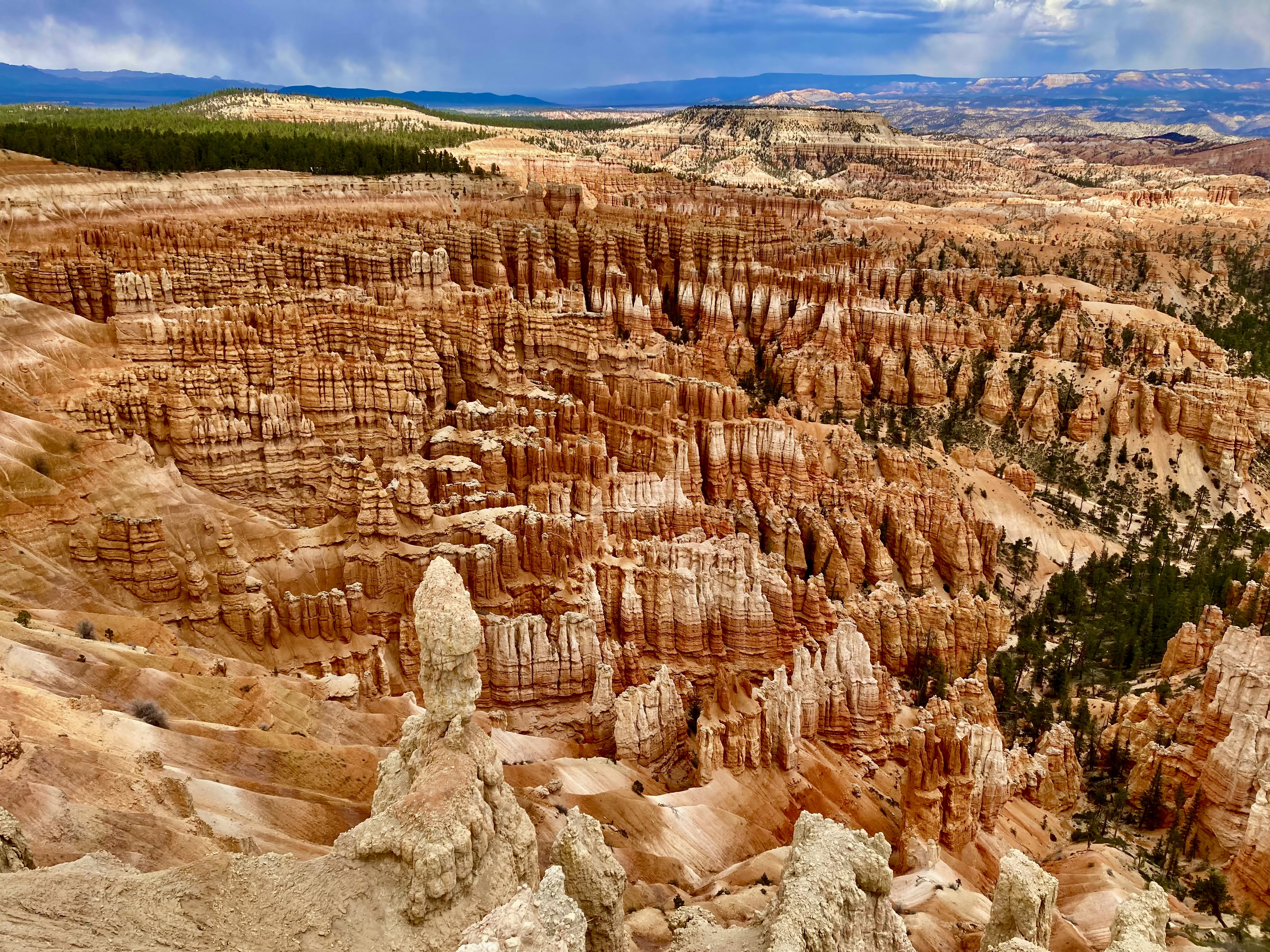
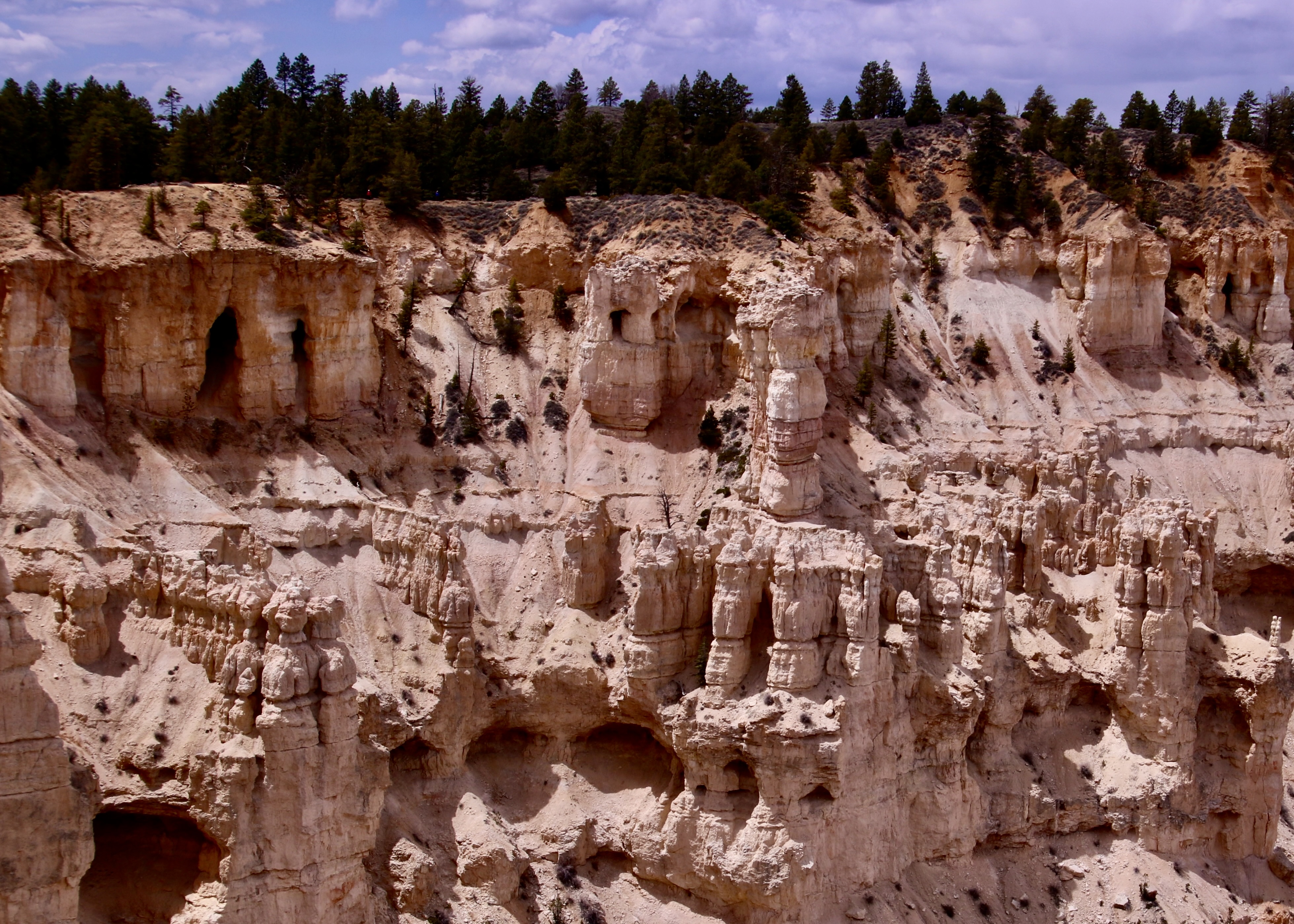
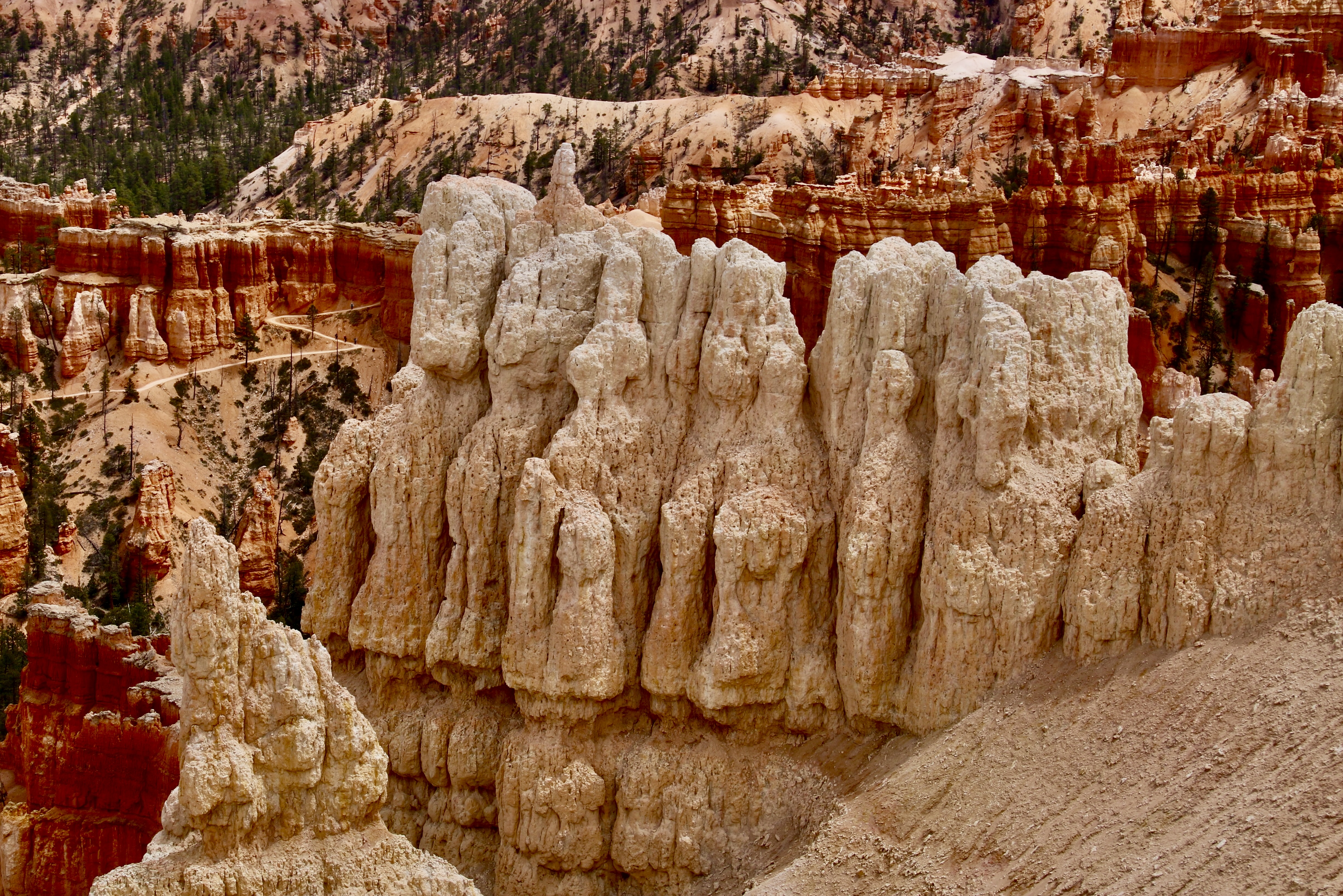
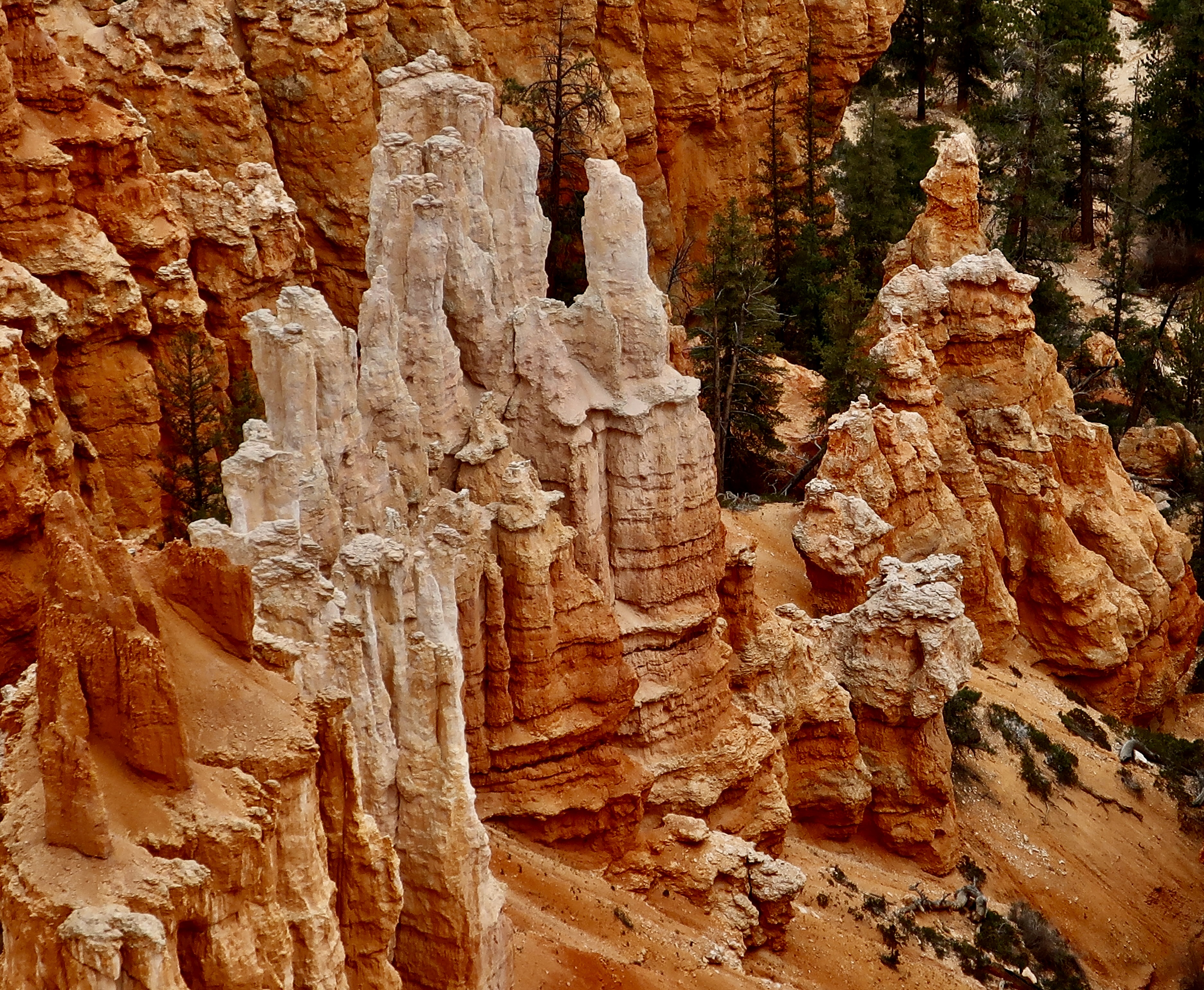
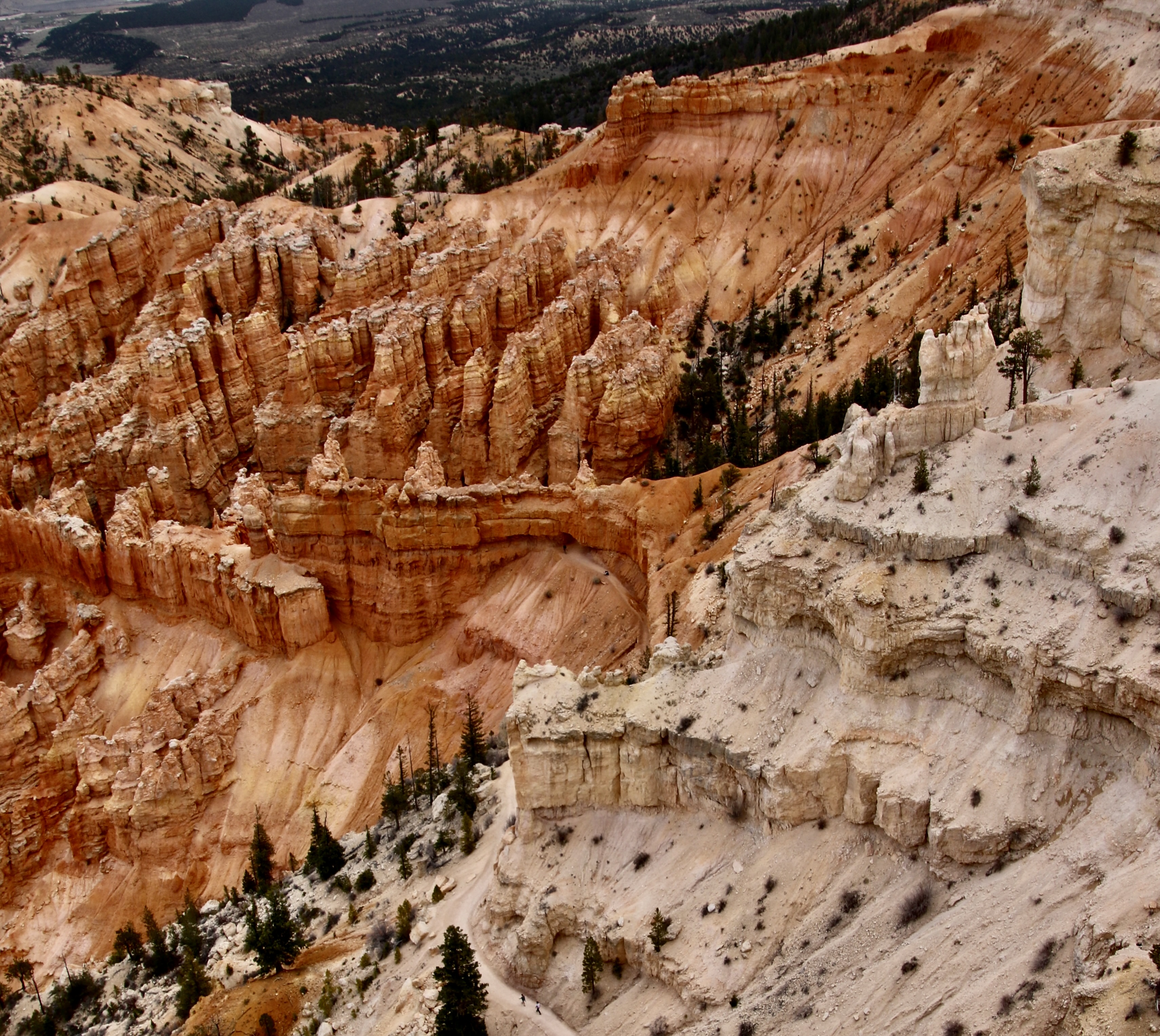
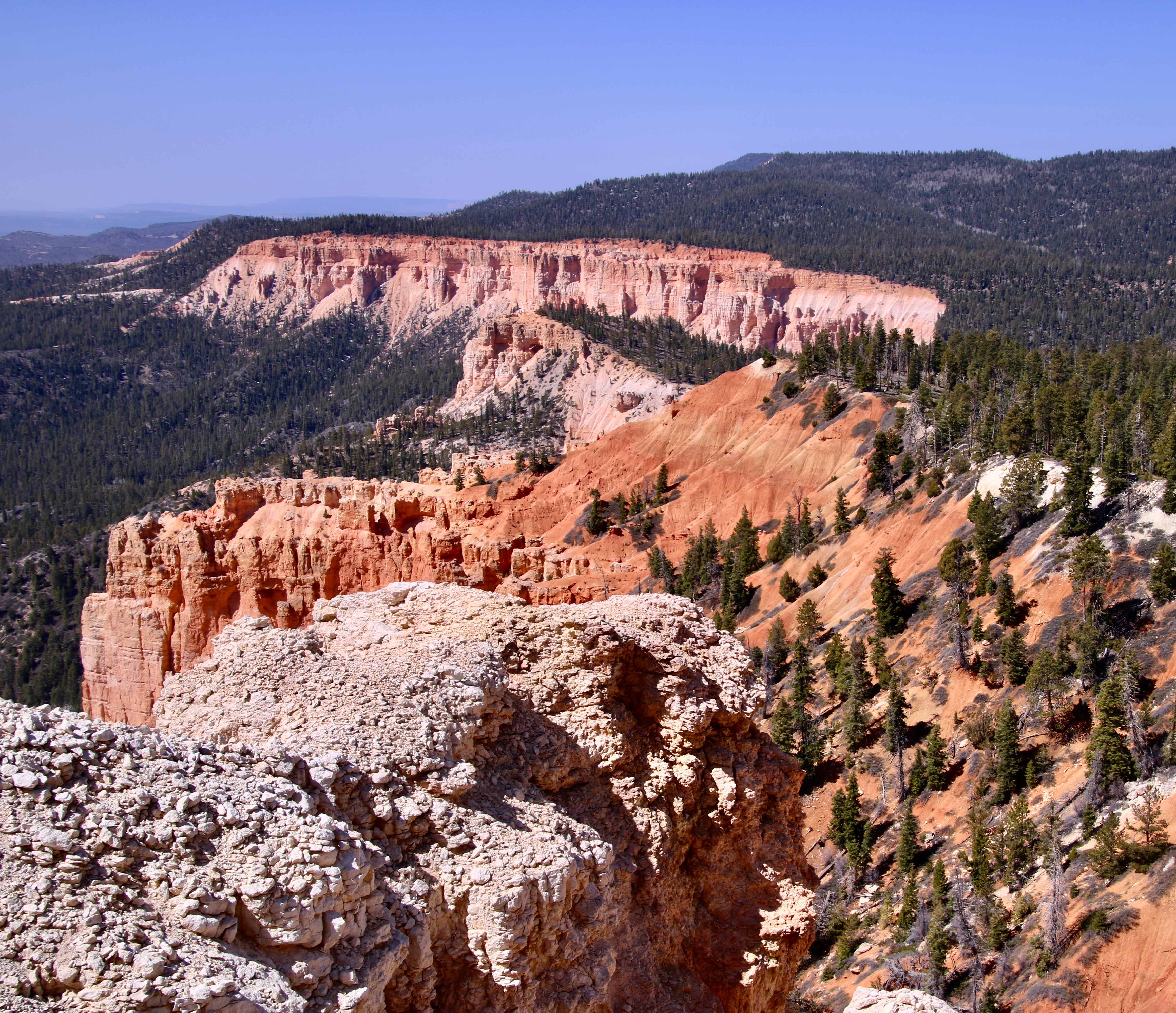
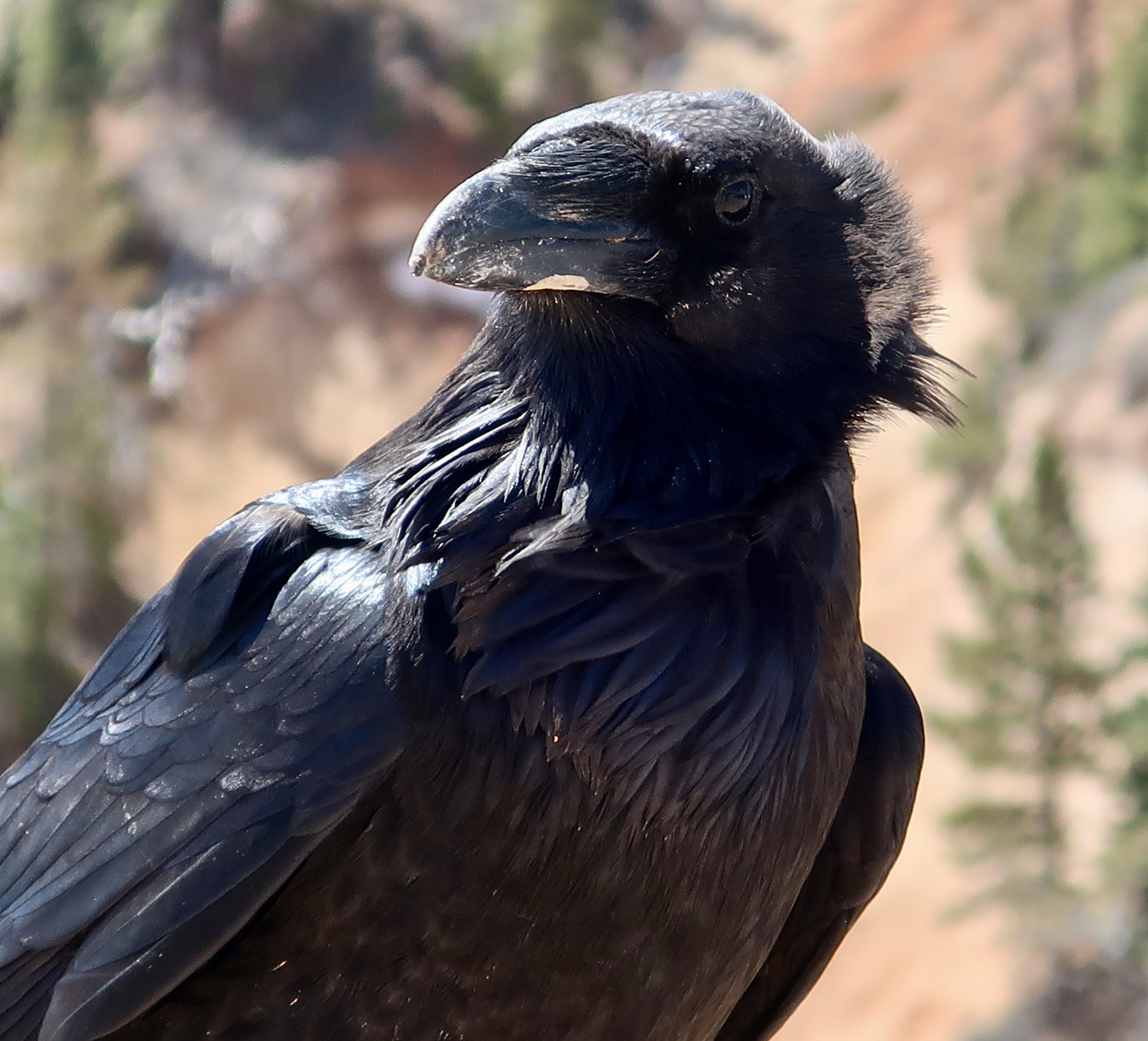
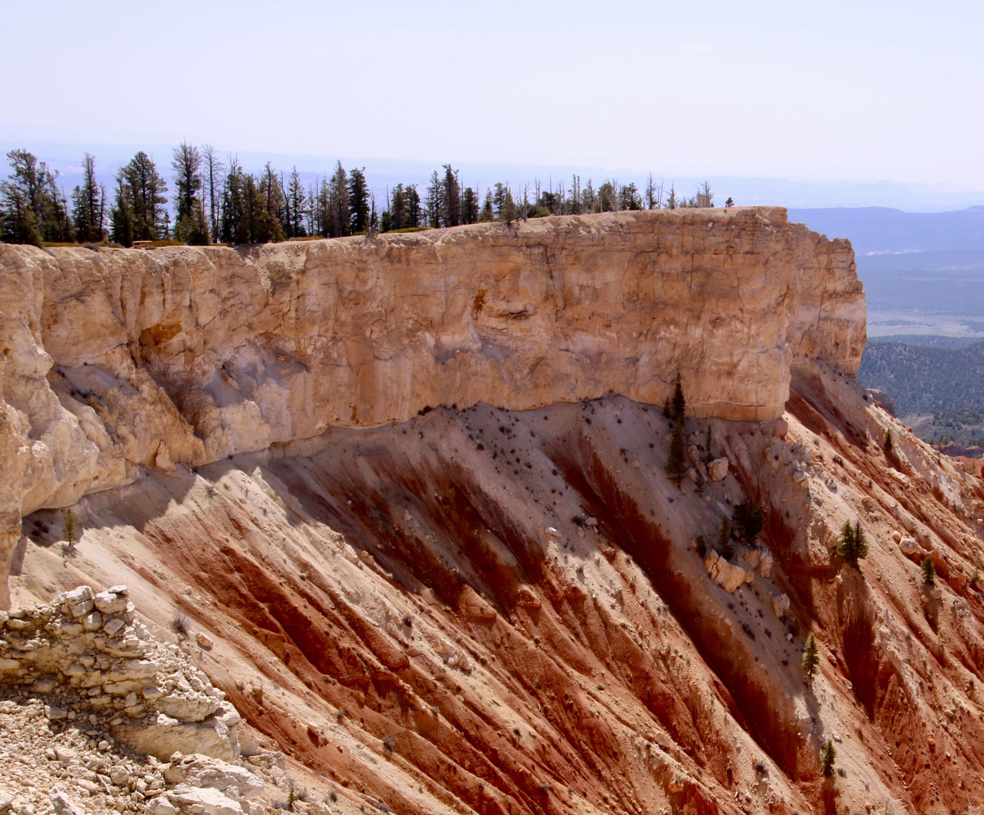
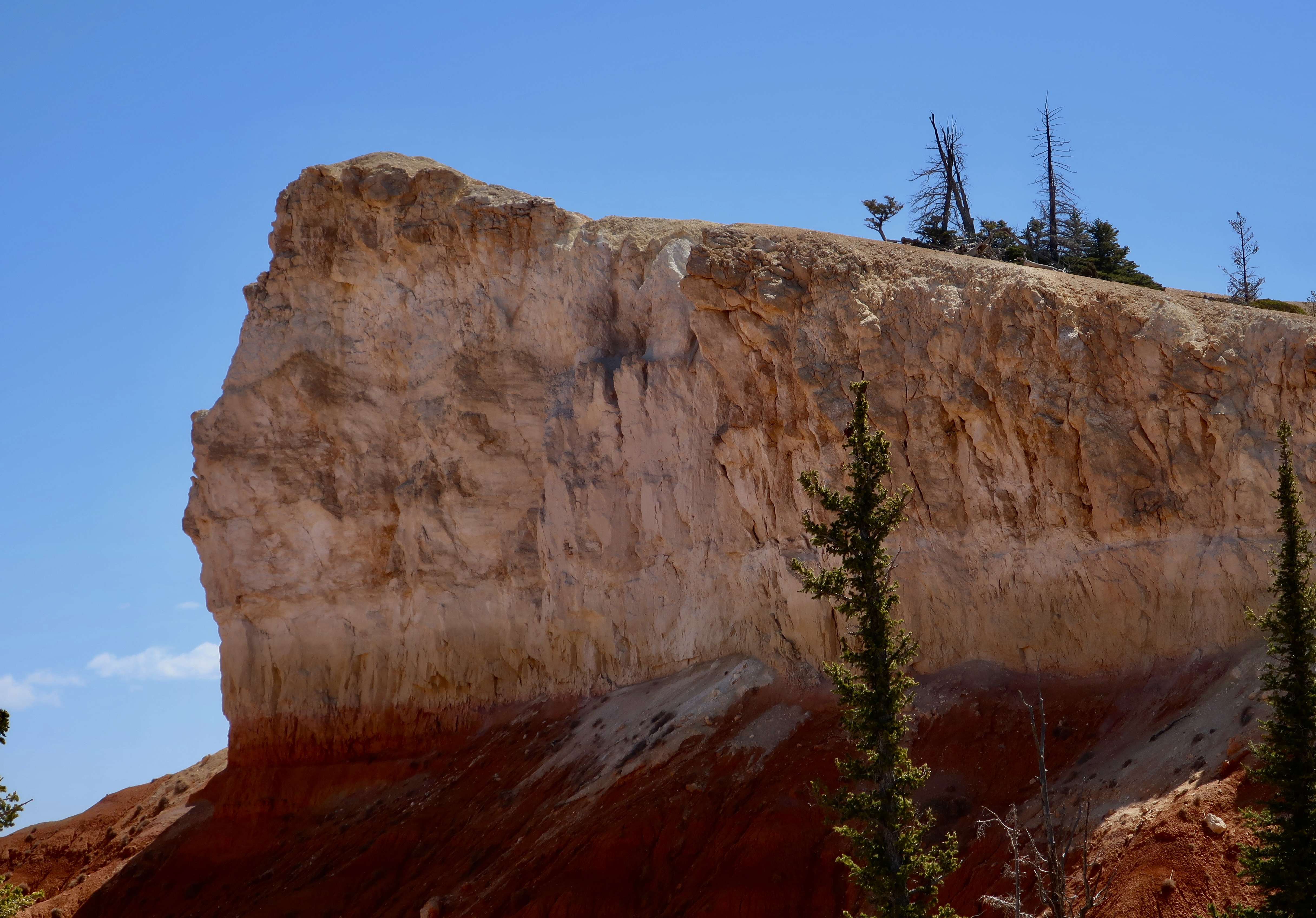
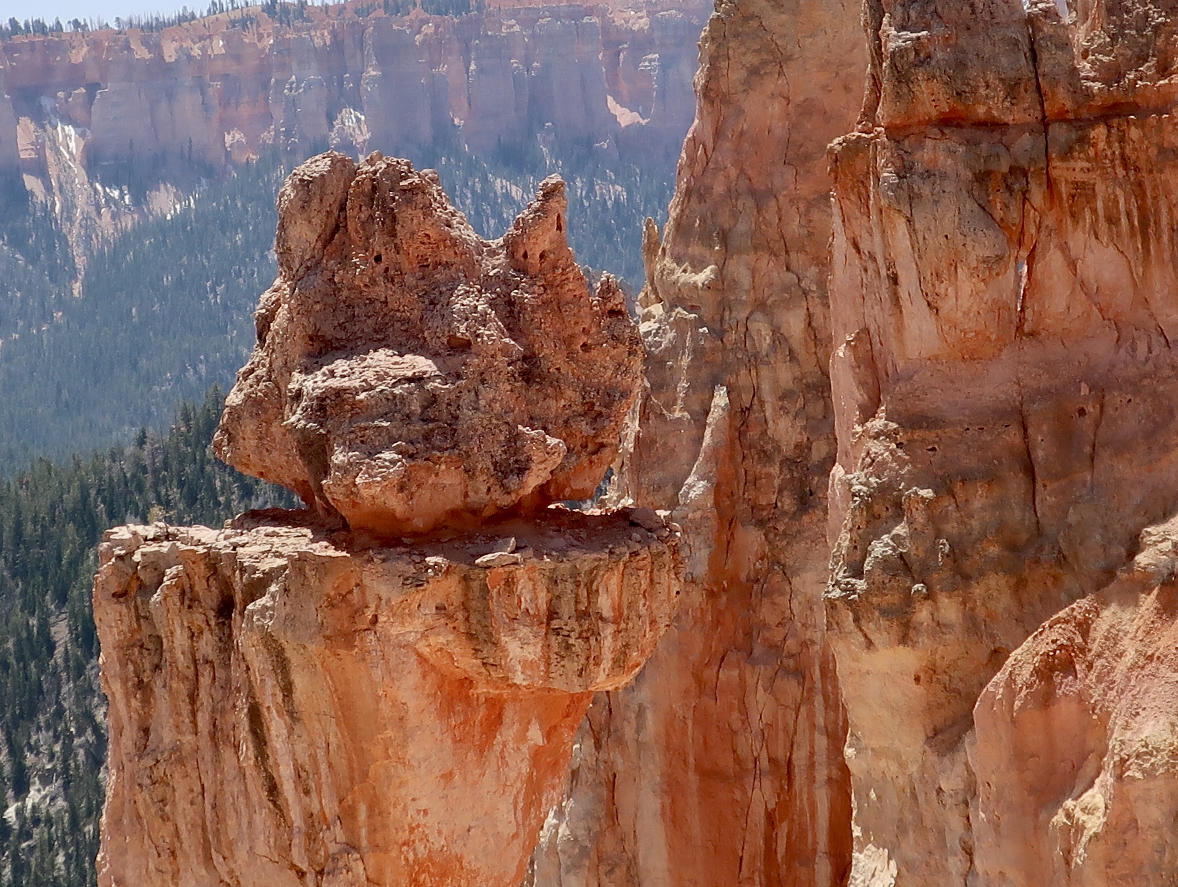
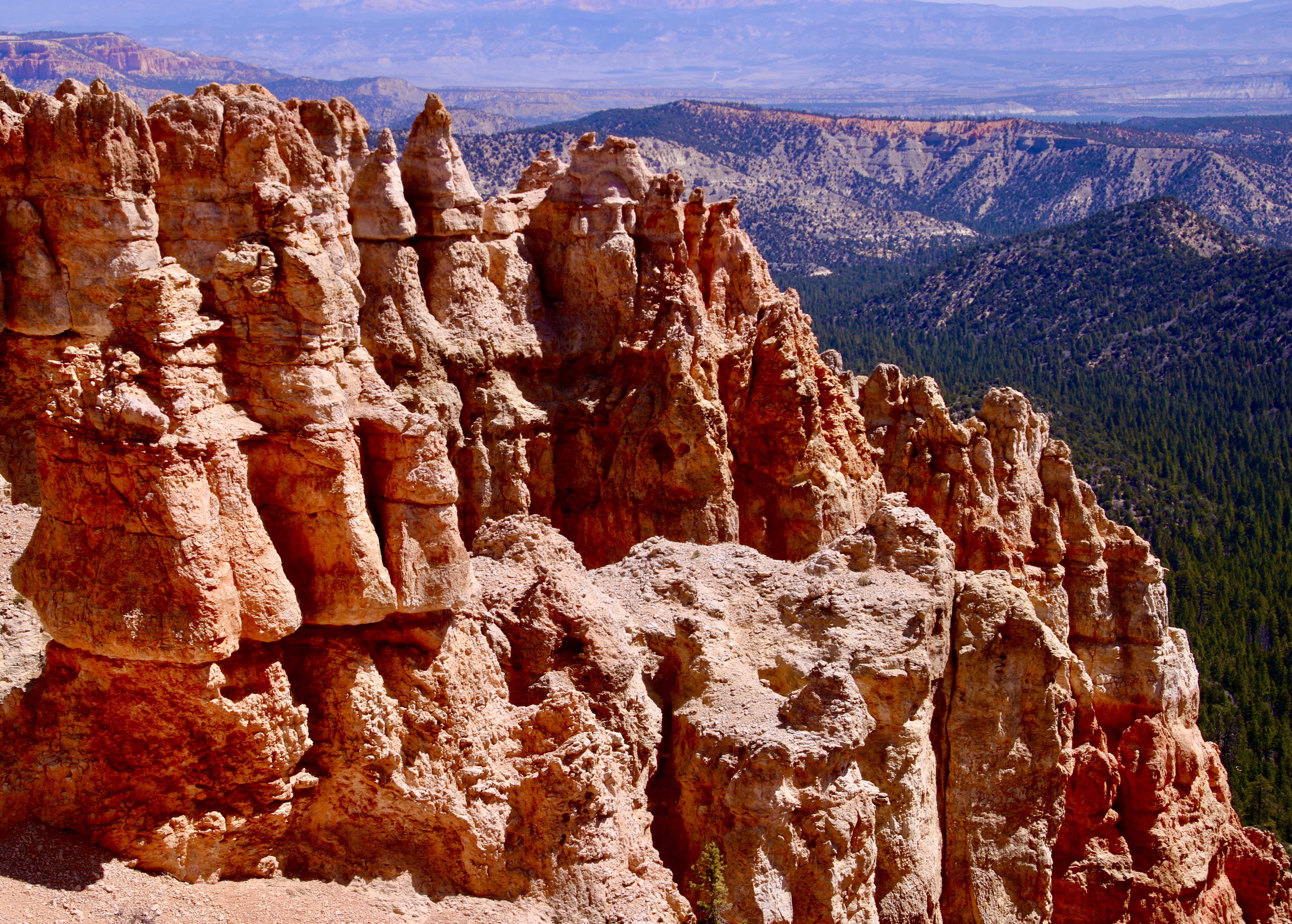
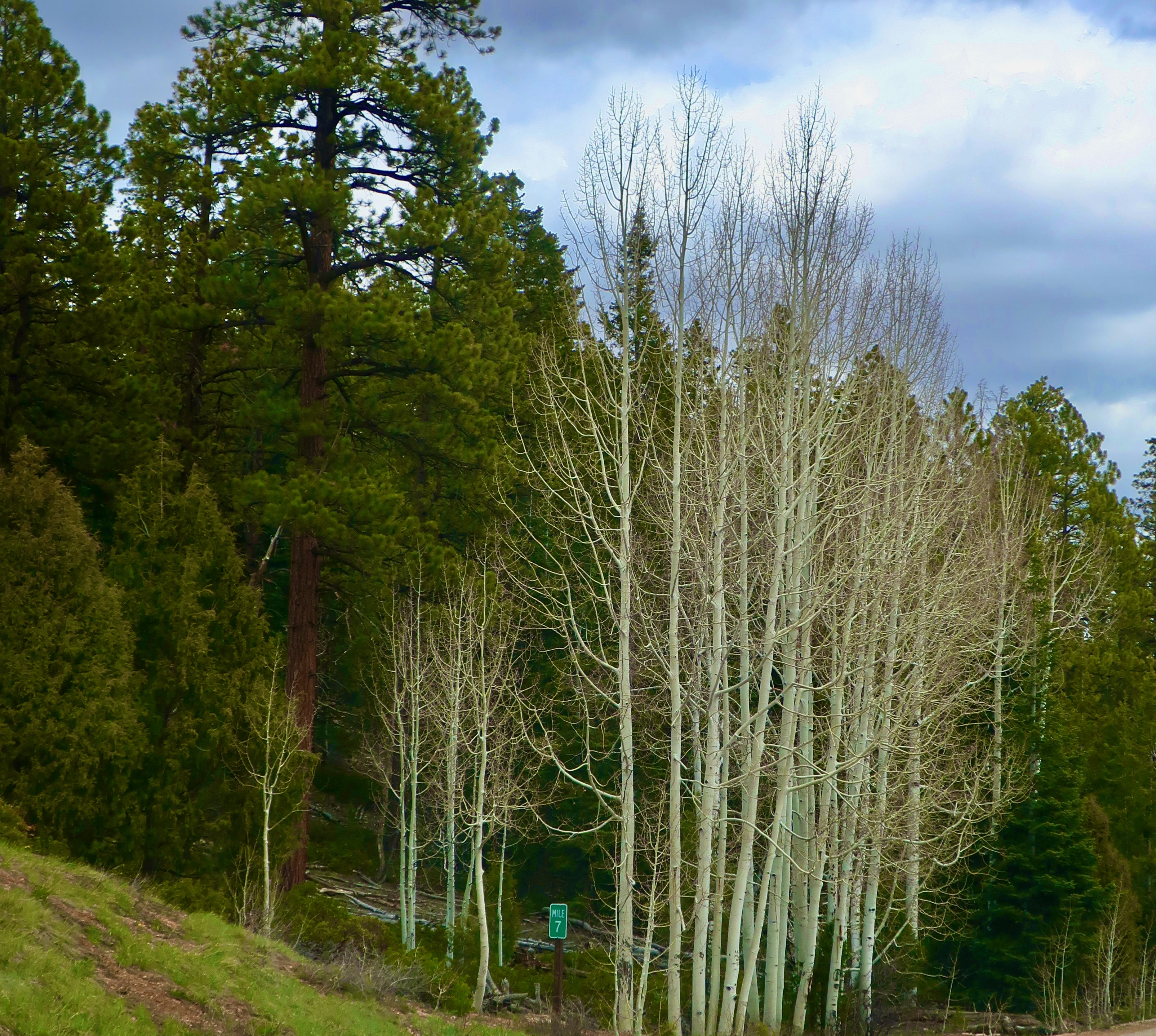
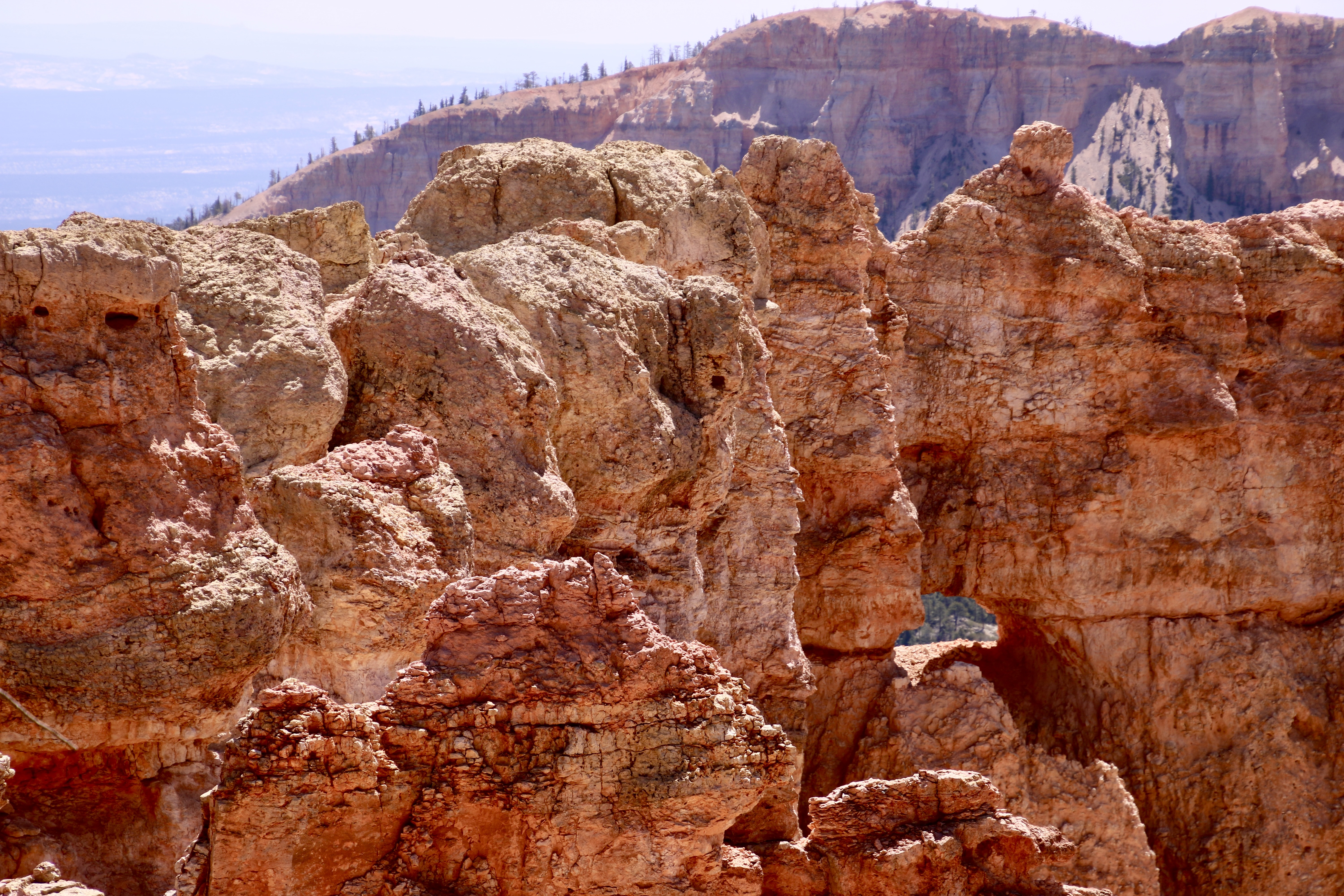
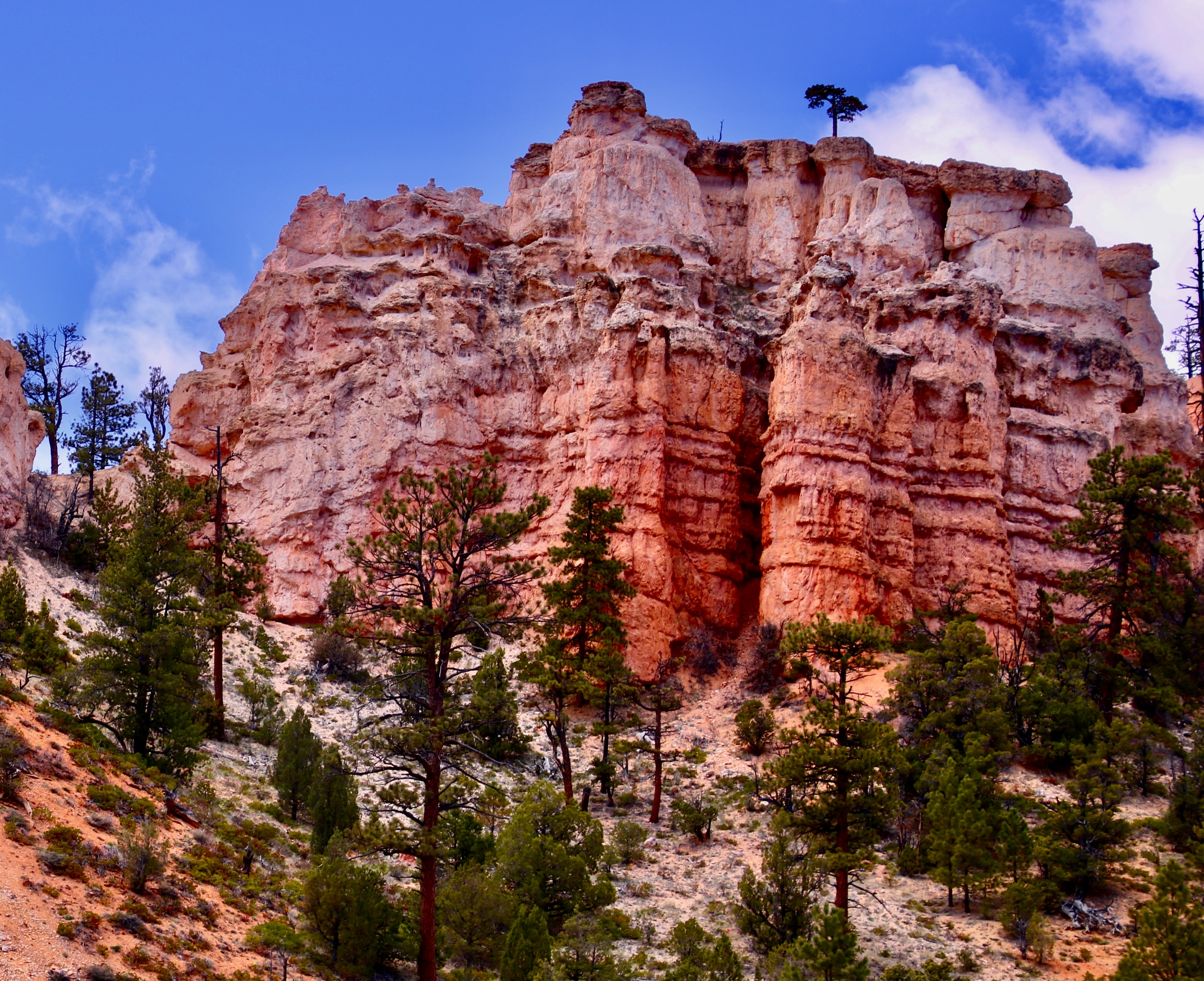
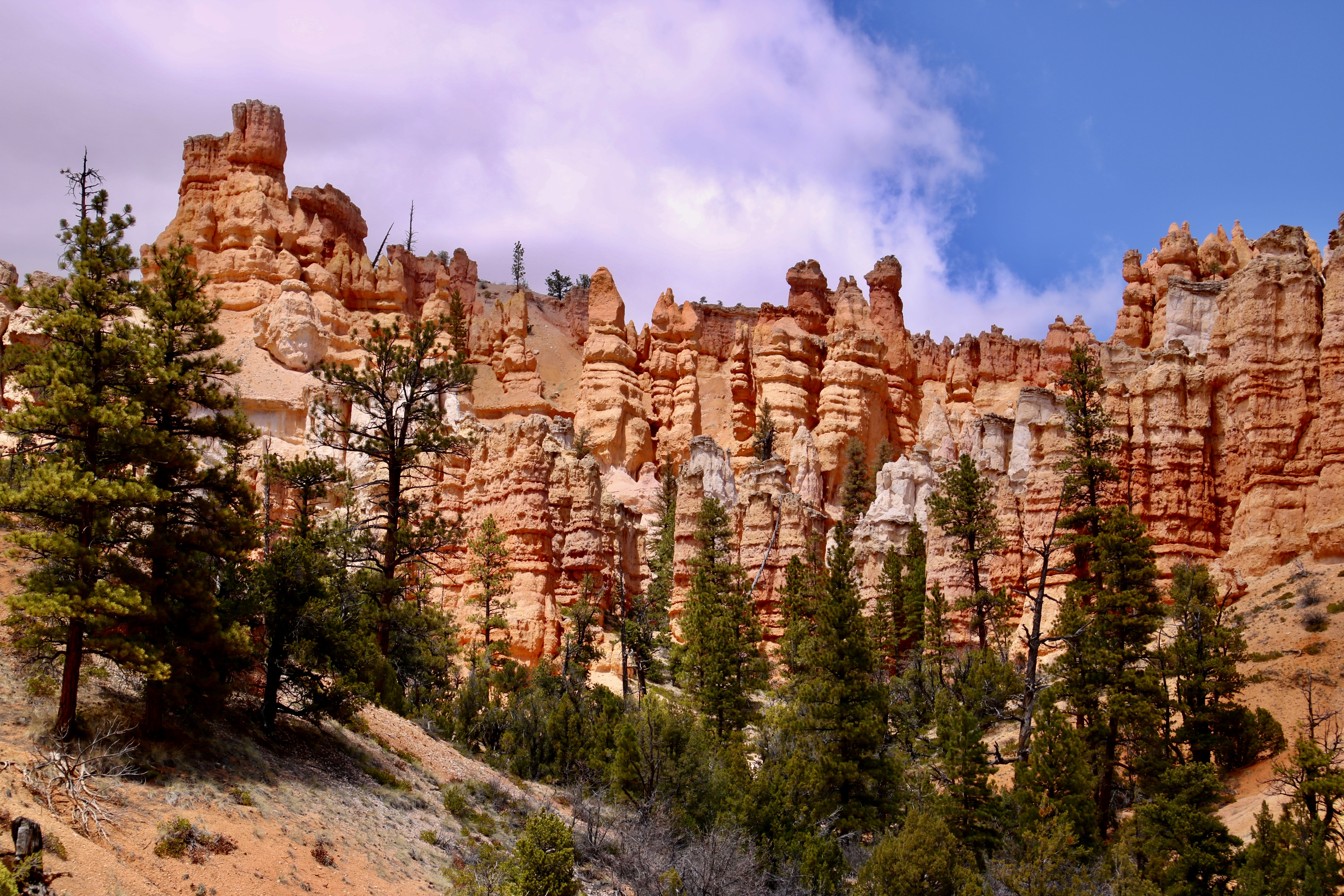
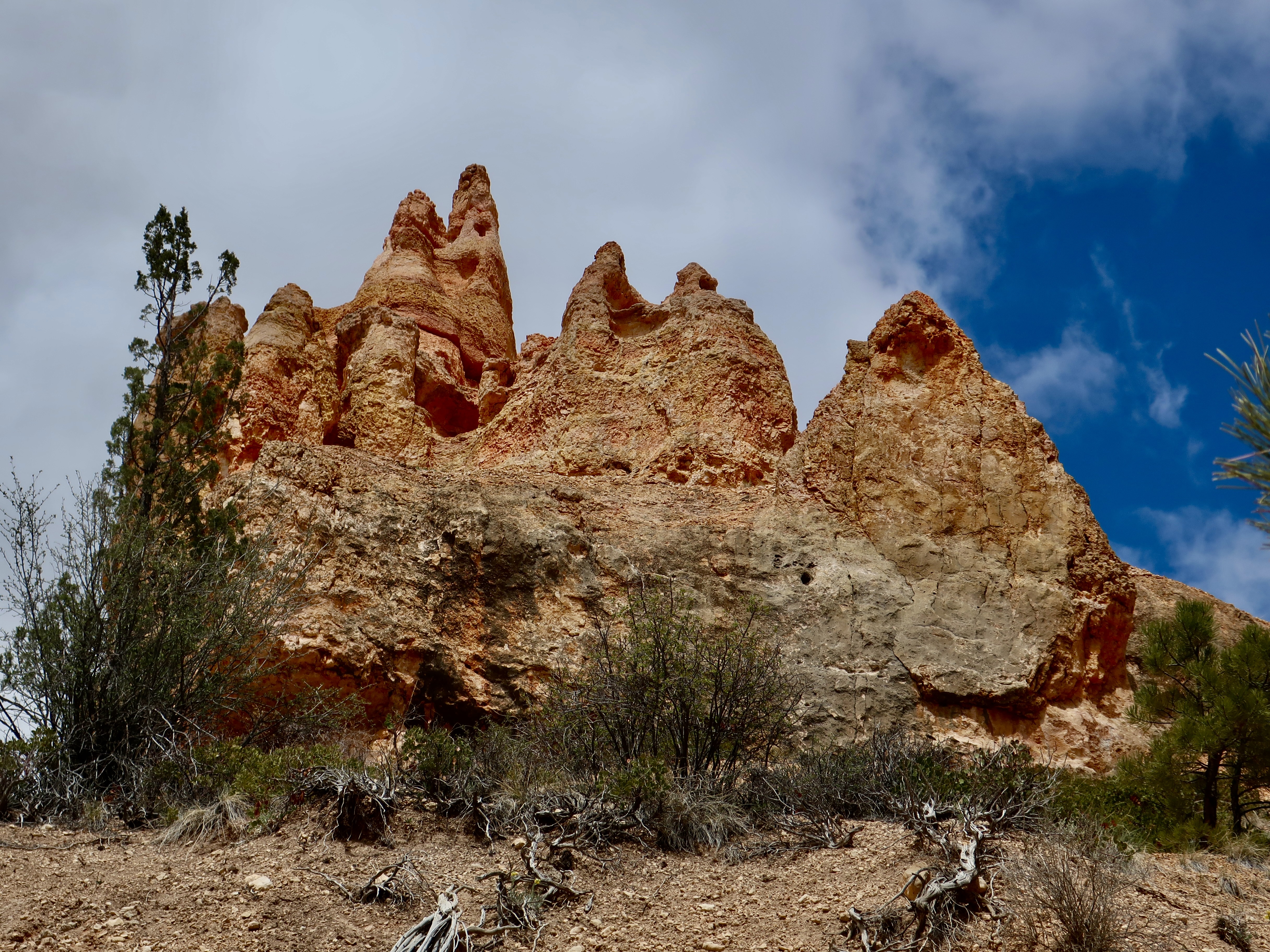
This is where the road stops at mile 18 and 9,115 feet. We will be working our way back toward mile 4, more or less, visiting overlooks along the way. There were two stops here, Rainbow Point and Yovimpa Point. Gee, I wonder where they came up with the name, Rainbow Point? (Photo by Peggy Mekemson.)We were not alone. A raven envisioned us feeding him. I told him it was against the rules.He gave me the look. A stiff breeze was ruffling the feathers on his head.Another ‘rainbow-type’ shot by Peggy.It really doesn’t matter where you are along the road, there is beauty.All of the views can be captured from different perspectives. This is a closeup of the photo I took above. (Photo by Peggy Mekemson on our iPhone.)Bryce Canyon has its own renditions of arches. This is where I met up with the raven.A different perspective of the Bryce Canyon Arch by Peggy.I felt like I was looking at the prow of an ocean liner cresting a stormy wave. (Yes, as you know, I have a vivid imagination.) This is one of those sights, like the Arch, that one doesn’t expect to find in Bryce Canyon.This, on the other hand, is expected: A hoodoo.There are hundreds, if not thousands. (Photo by Peggy Mekemson.)I caught a squat one poised on a pedestal. And Peggy caught a bunch. Lots and lots of hoodoos standing at attention and staring off into space.I love the ridges that head off into the Canyon. There will be knife-edged ones in my post next Friday.Peggy caught this magical view looking down into Bryce Canyon. It’s my favorite of the several hundred photos we took in the Park.The aspen along the road had yet to leaf out at 9000 feet when we were at Bryce Canyon in late May. Their stark white trunks and limbs made a dramatic contrast to the dark green conifers. Peggy took this photo at one of the pull-offs.A hole in the rock played peek-a-boo with us. (Photo by Peggy Mekemson.)A final view along the Bryce Canyon road between miles 4 and 18 shows the layering effect caused by different types of rock. Next Friday we’ll be featuring the most popular section of the Park between miles 1 and 4.
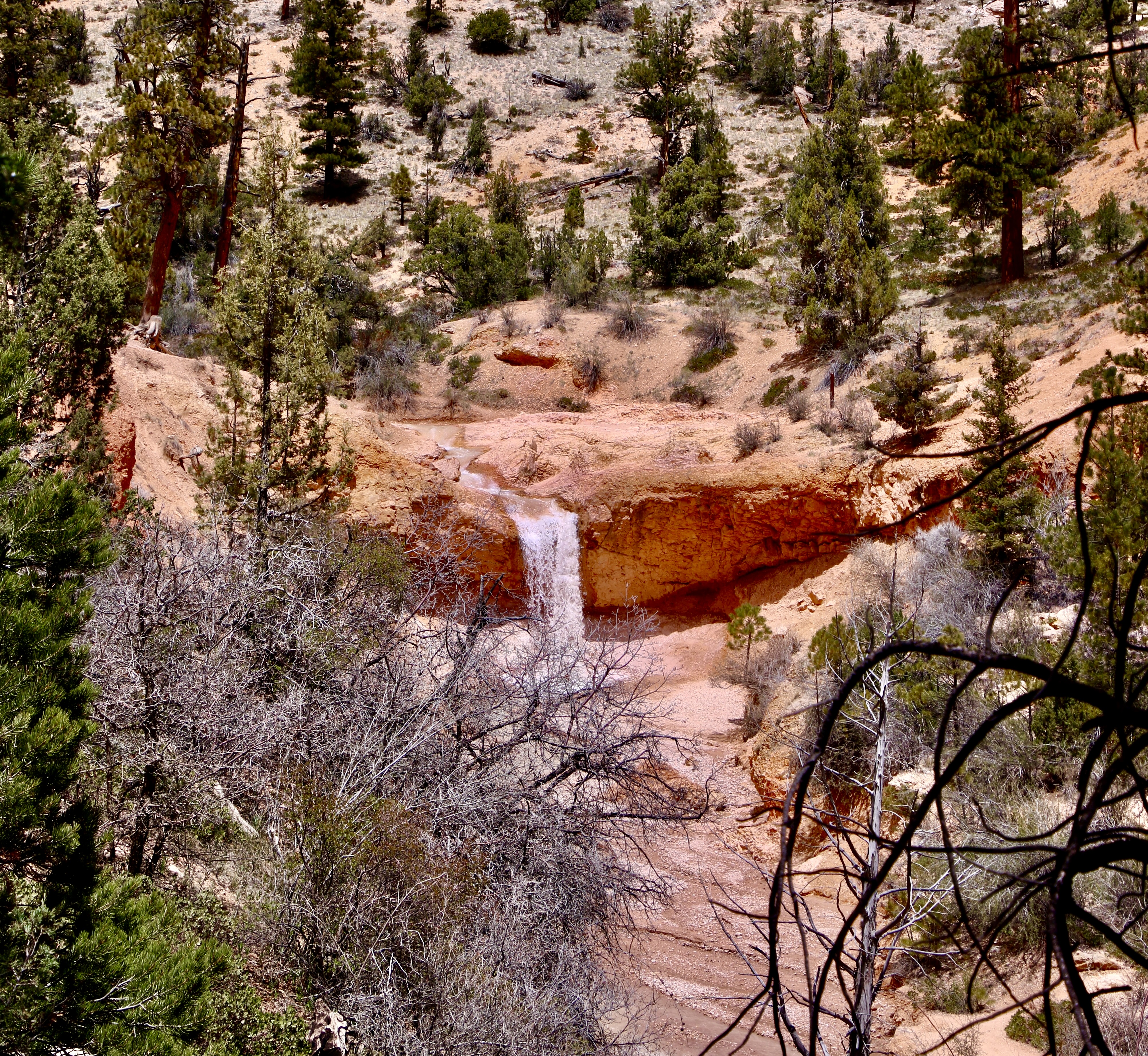
Here’s a secret. Don’t do Mossy Cave Trail to see the cave. Do it to check the scenery along the way. It’s like hiking the trails down inside of Bryce Canyon without the challenging climb in and out. (Photo by Peggy Mekemson.)
Finally, we have made it to Bryce Canyon, but we still aren’t in the park proper. The trail to Mossy Cave is located on the northern edge of the Park off of Highway 12. Information on the trail said its growing popularity meant that there was limited parking space. We had noted the problem when we drove by earlier. Fortunately, when we arrived, there were only a couple of cars and we shared the trail with only a handful of people. Mossy Cave was nothing to write home about, or do a post on. Possibly in the winter when it is filled with ice cycles would be different.
Looking into Mossy Cave with its last remaining chunks of ice from the previous winter. I did find the contrast with the roof interesting.
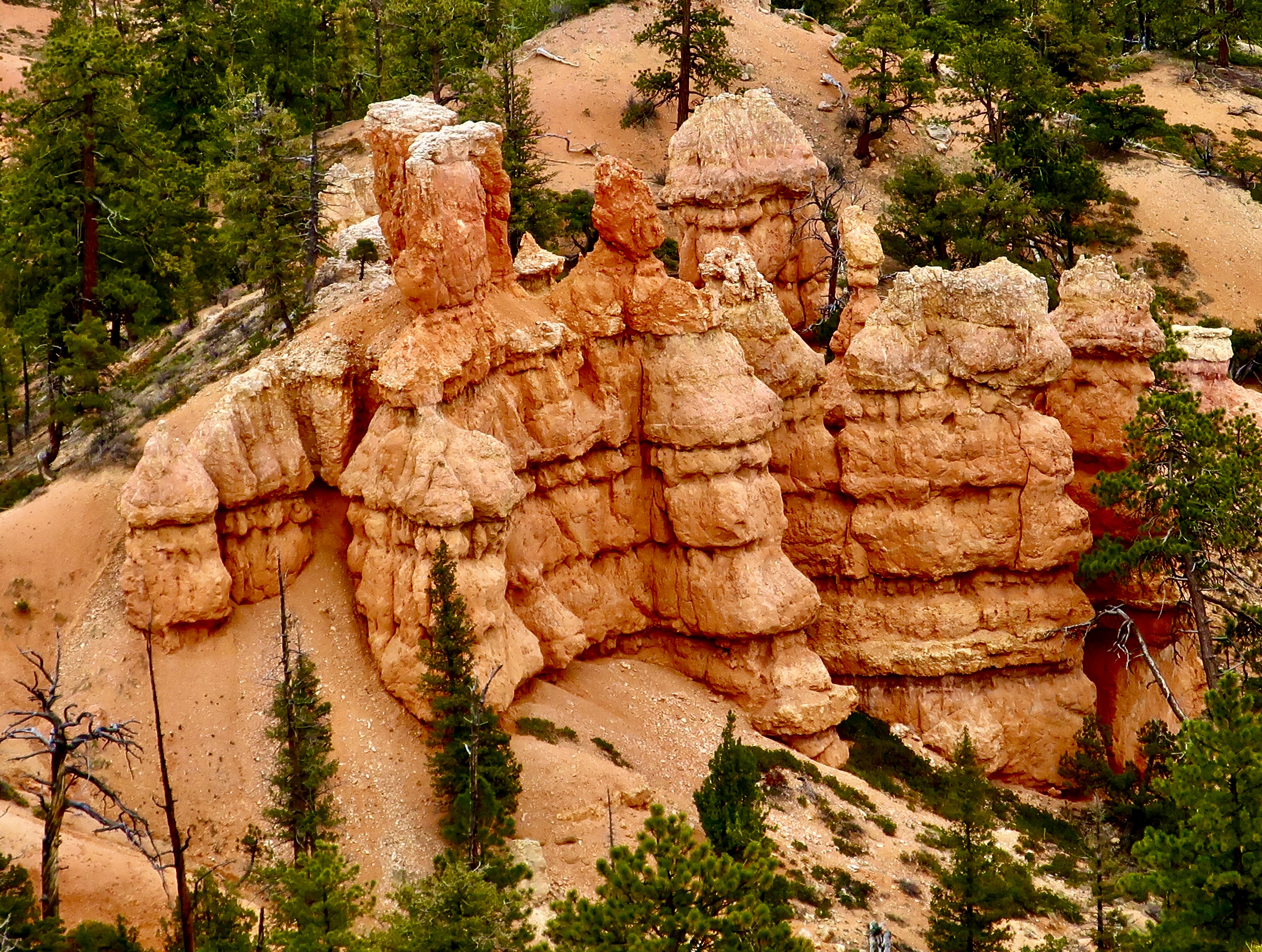
The easy to follow trail into Mossy Cave is well worth the trip however, as the following photos will show. A small creek runs along the bottom of the canyon has its own story. It was dug by Mormon farmers with picks and shovels in the late 1800s to provide water to the small town of Tropic and its surrounding farms and ranches.
The trail to Mossy Cave cuts up the hill to the left just before this pretty little waterfall and makes a brief but steep climb. Peggy loves waterfalls and took several photos of it.A close up. (Photo by Peggy Mekemson.)The falls and the creek. (Photo by Peggy Mekemson.)Its when you look up from the creek that you begin to get the feel that you are in Bryce Canyon National Park.Rock sculptures, small arches and hoodoos abound.Photo by Peggy Mekemson.I was thinking blue eyes when I took this photo.There were a number of impressive rock formations. (Photo by Peggy Mekemson.)This rock formation was quite colorful. And I liked the lone tree up on top. (Photo by Peggy Mekemson.)I felt that this hoodoo with its background made a dramatic combination.The rocks lined up for Peggy. They were good at holding their pose. (Photo by Peggy Mekemson.)Mine were a bit more unruly. That’s hardly news.I also liked this sheer rock wall with its many-limbed dead tree.I conclude today’s post on Mossy Cave Trail in Bryce with a photo I thought would go well in black and white. (You will find the mouthy guy about half way up on the right in Peggy’s photo at the beginning of the blog. ) Next Friday’s post will focus on miles 4-18 along the road into Bryce Canyon National Park.
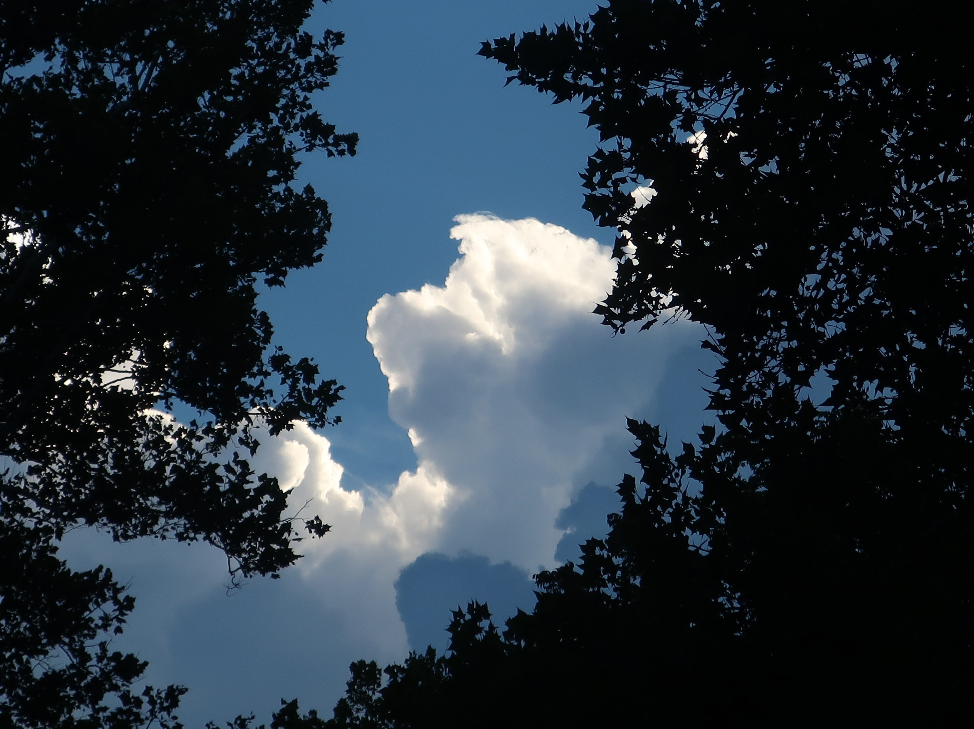
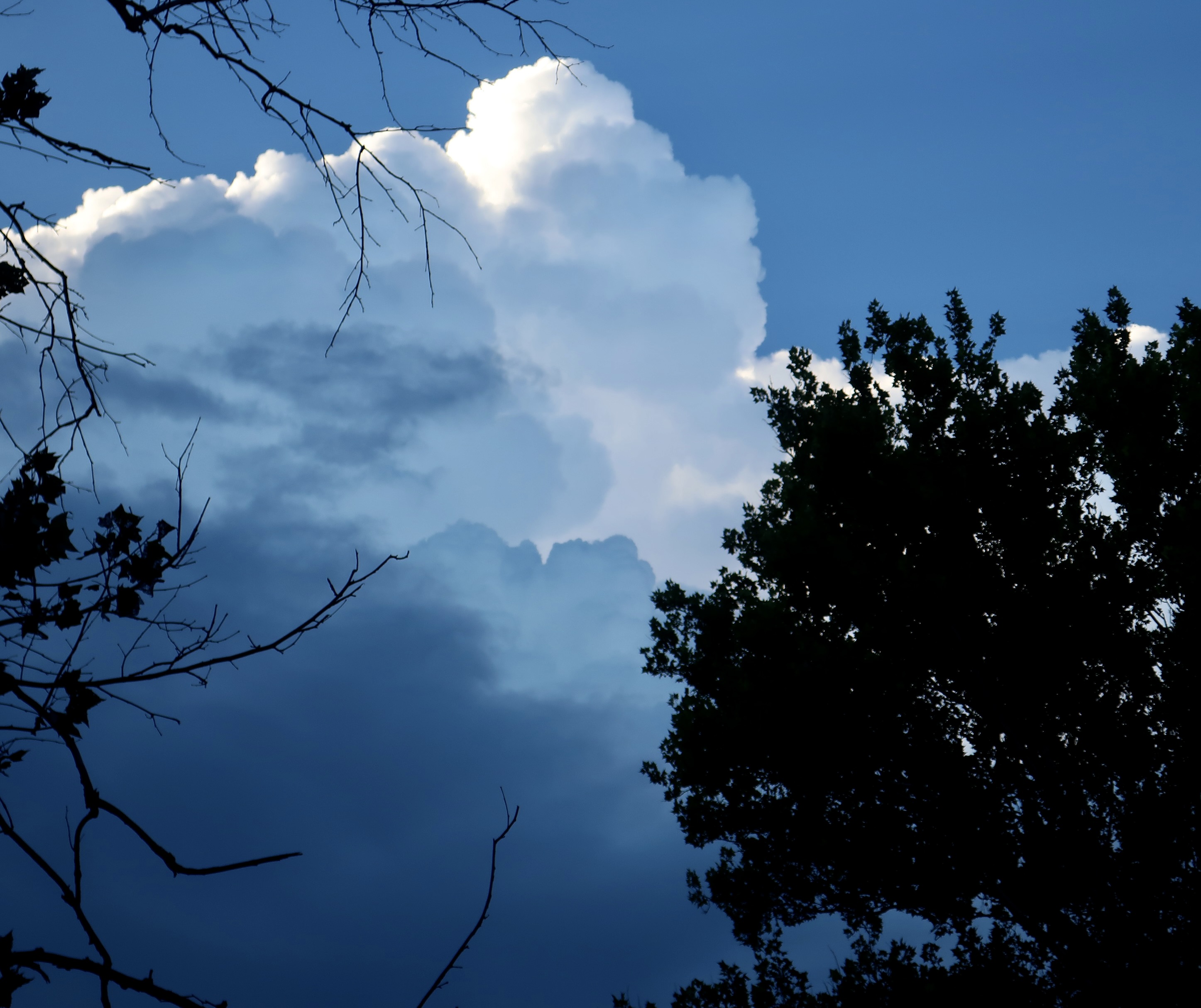
“Quick, Curt. Grab your camera; the clouds are amazing!” our daughter Tasha urged. I did. This one featured a halo, but it was hiding its true nature: Flashing lightning, rolling thunder, roaring winds and pounding rain.
Nature is capable of putting on fantastic shows that can both awe and frighten. A thunder and lighting storm with its accompanying wind and rain is a prime example. Our grandson, Ethan, had spotted the towering clouds. They were looming over her and Clay’s home in northern Virginia. It’s also what I call our basecamp, a small attached apartment that we are using during breaks from wandering.
One look and I decided that the clouds were worthy of a post. (I admit my decision was aided by the fact that my Bryce Canyon post wasn’t ready.) Anyway, here is what we saw. Enjoy.
This cloud bares a striking resemblance to a friendly pooch, but what is that strange, round cloud peeking out behind? Apparently it also included rainbow colors. Peggy saw them but I didn’t. Another person did and sent a photo to a local TV station. Known as “iridescent clouds with a silver lining,” they are rare and sometimes include rainbow colors. And, in conclusion, a black and white rendering. Next Friday, we will be back to the the Bryce series.