Surreal or Unreal… Bryce Canyon: Part 2

Photo capturing the awe-inspiring weirdness of Bryce Canyon by Curt Mekemson..
I tend to think of surreal as real, but mind-blowing— striking and maybe strange, but possible. Last Friday’s photos of miles 4-18 of Bryce Canyon fit into that description. Unreal is more like, “No way. How can that even be possible?” That’s how I feel about sections of the Canyon in the first 4 miles, like the one in the photo above. It looks like it belongs in a fantasy movie.

Peggy and I are in serious countdown time here. On Tuesday, the day after Labor Day, we will be hitting the road— come hell or high water, as the old saying goes. Given global warming, there may be a bit of both. We plan to zip across the nation to the Bad Lands of South Dakota and then slow things down, way down— to a snail’s pace. It’s been an insanely busy month and a half since we got back from our European trip up the Rhine River. First up, we had to unpack from our Oregon move and set up our Base Camp/efficiency apartment in Virginia. Some fun. Try downsizing from a library, living room, dining room, two bedrooms, an office, two bathrooms and a moderate-sized kitchen to one room plus a tiny kitchen and bathroom. Fortunately we do small well.

Then there were the usual medical challenges: changing our medical insurance, finding new health care providers, and making appointments. I had six dental appointments. I’ve never met a dentist who doesn’t immediately start planning a vacation when he or she looks in my mouth—a luxury cruise around the world perhaps. I finished my last appointment yesterday. I sat in the dentist chair, was shot full of painkiller (ouch), and then tried to ignore the various drilling and scraping sounds as he removed an ancient crown that belongs in the Smithsonian. I’ve been there done that a lot. But yesterday was a first. I sat and read afterwards while he made a new crown for me in his office. In the past all sorts of measurements have taken place, a temporary crown attached, and the measurements sent out to a specialist who made crowns. It’s a one or two-week process. Yesterday, it was an hour. The tooth came out purple, was adjusted, went into the oven and came out white. My tongue is still checking it out.

I didn’t wear my new hearing aids to the appointment. Yep, you heard me right. Peggy and I have reached the point where we got tired of saying “What?” to each other. Now we can both hear birds we thought were extinct. I didn’t need to enhance the sound of the dentist drill, however.

On top of all that we’ve had the multiple chores that go along with planning for four months on the road. Peggy is handling inside Serafina, our trailer. One was rebuilding the flimsy drawers. My job is maintenance. I spent all day Wednesday going through my annual check list for Serafina. There were 33 items, but who is counting. We will be up to our new ears over the weekend with packing.

Then there was all the family stuff, fun but time consuming. Let it be suffice to say we’ve spent more time doing family things over the past two months than we normally do in two years. It’s a miracle I got any blogging done at all.

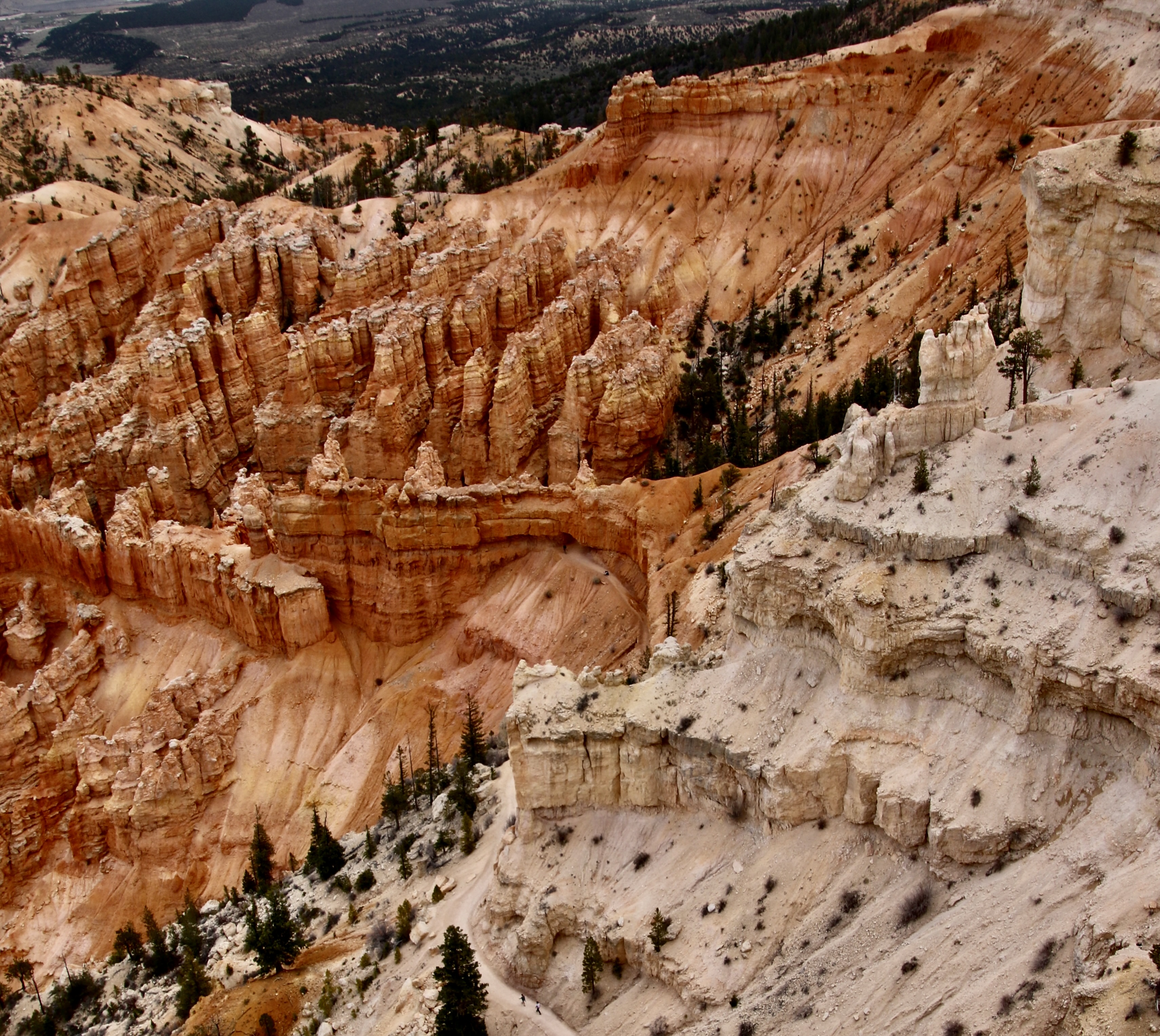
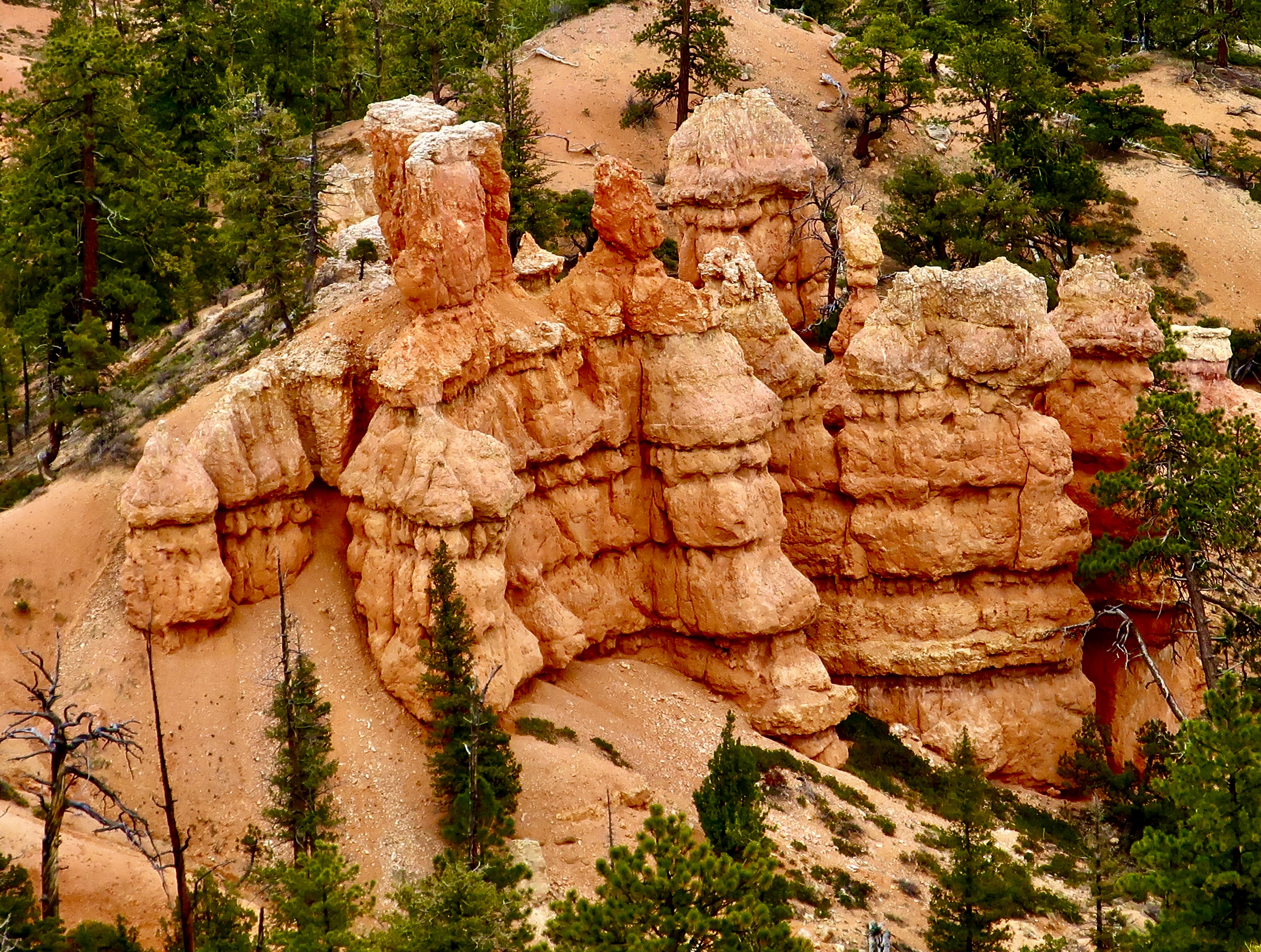
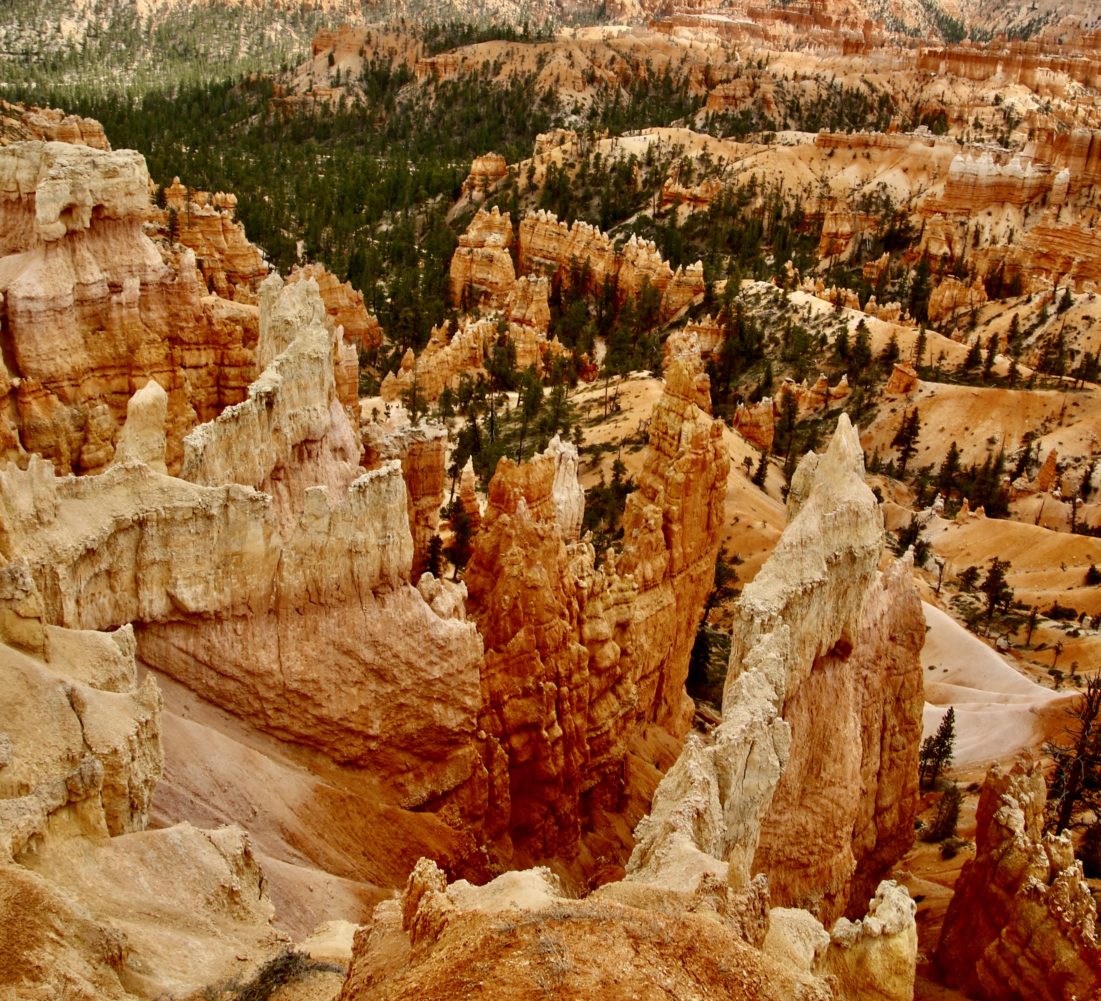
Today’s post features the first four miles of the 18-mile Bryce Canyon National Park road. It’s where most of the tourists go. Next Friday, I’ll do a post on our base camp. Then, as I mentioned in my last post, Peggy and I will be featuring Amsterdam and our river cruise before returning to the ‘Wild’ West with our focus on National Parks.

Photo of Curt Mekemson in Bryce Canyon by Peggy Mekemson.
Just like millions of other tourists, we checked out the main overlooks in Bryce Canyon. These photos are mainly from Bryce Point, Sunrise Point, Inspiration Point and Sunset Point. (Photo by Peggy Mekemson.)
Photo of crashing hand hoodoo at Bryce Canyon by Curt Mekemson.
Again, this photo emphasizes the unreal look of Bryce Canyon. But check out the hoodoo in the front.
Photo of grasping hand hoodoo off of Bryce Point in Bryce Canyon by Curt Mekemson.
It’s like a large grasping hand is reaching out to grab something. Unwary tourists, perhaps?
Photo of wall in Bryce Canyon by Peggy Mekemson.
Peggy focused in on an interesting wall from our Bryce Point overlook. Note the peek-a-boo holes in it.
Photo of hoodoo seen through hole in rock at Bryce Canyon National Park bt Peggy Mekemson.
Her telephoto lens brought in what was lurking behind one of the holes. (Photo by Peggy Mekemson.)
Eroded structures on the sides of Bryce Canyon National Park. Photo by Peggy Mekemson.
Even more fascinating were the caves/eroded structures lining the side of the Canyon. (Photo by Peggy Mekemson.)
Magnificent entry way of rocks leading into an arched cave at Bryce Canyon National Park. Photo by Peggy Mekemson.
These eroded rocks seemed to serve as a magnificent hallway into an arched cave. (Photo by Peggy Mekemson.)
Photo of 'rock hallway' at Bryce Canyon National Park by Curt Mekemson.
I took a close up.

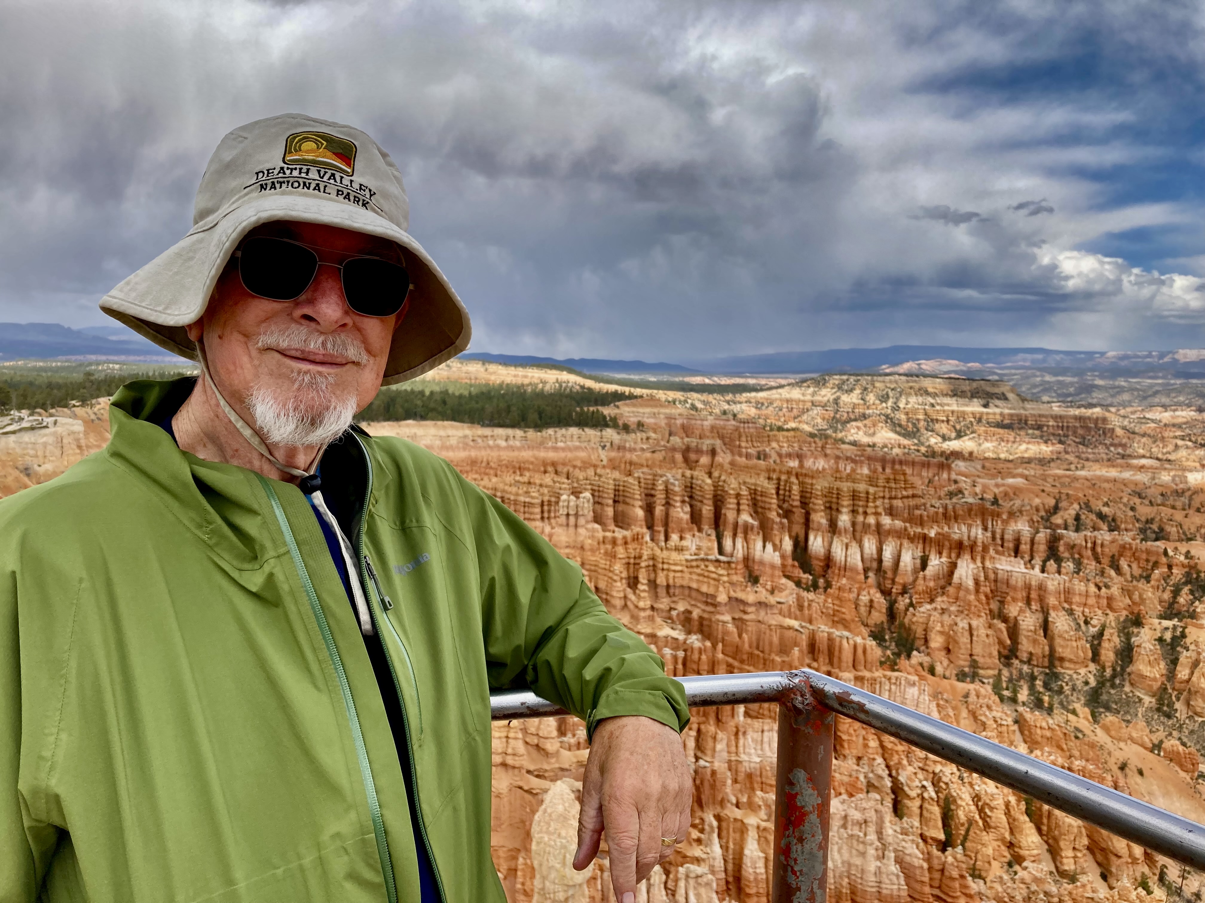
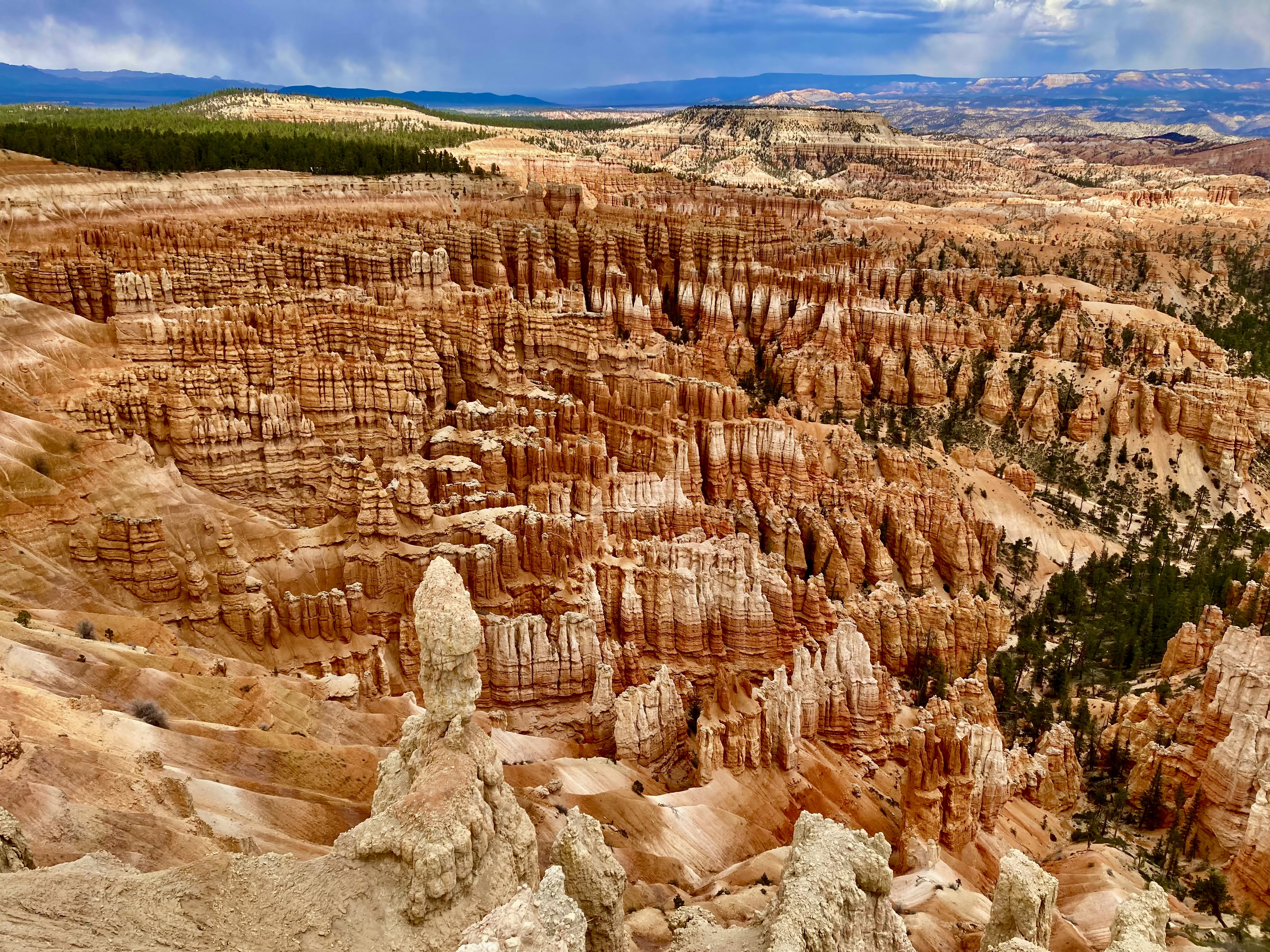
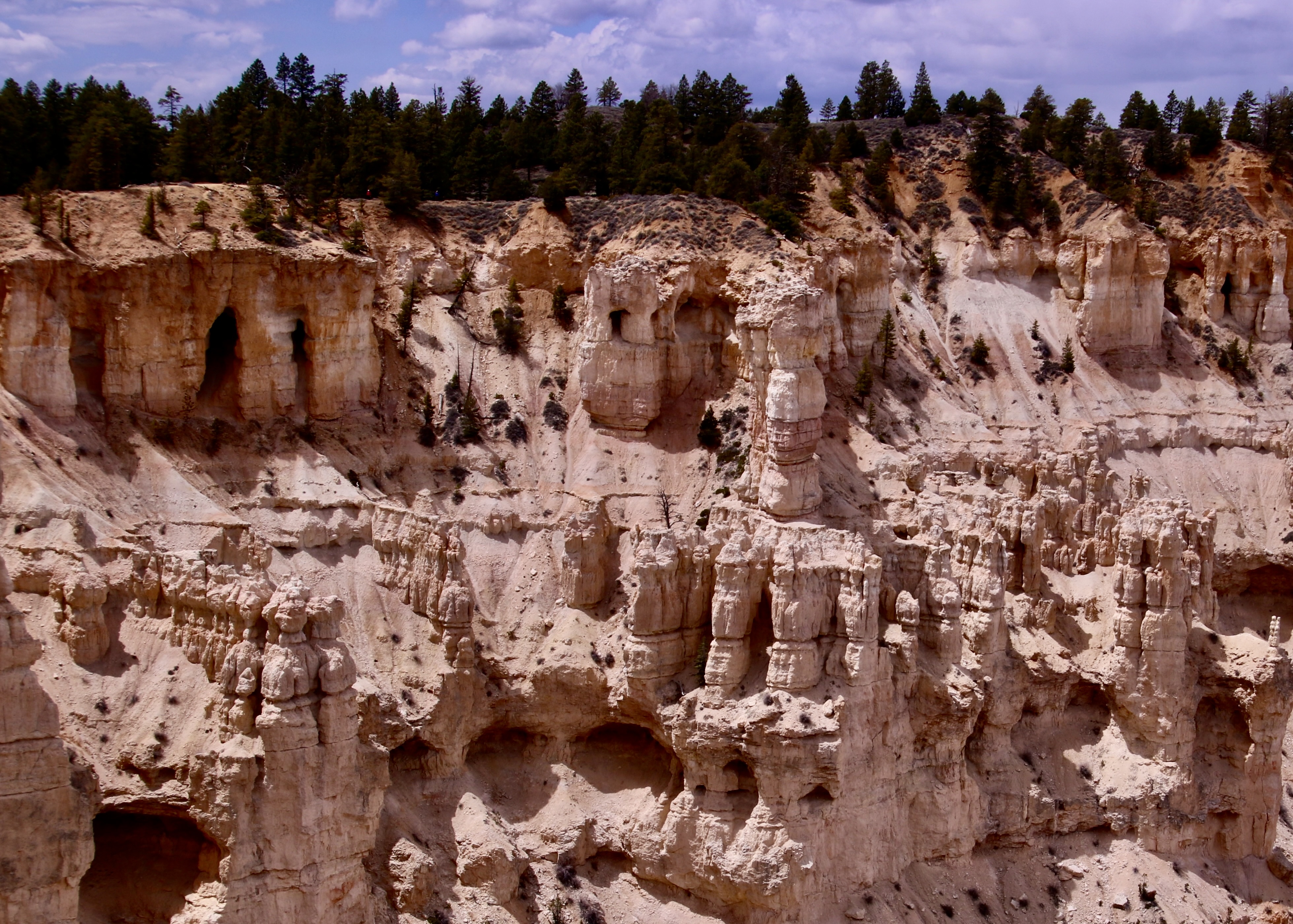
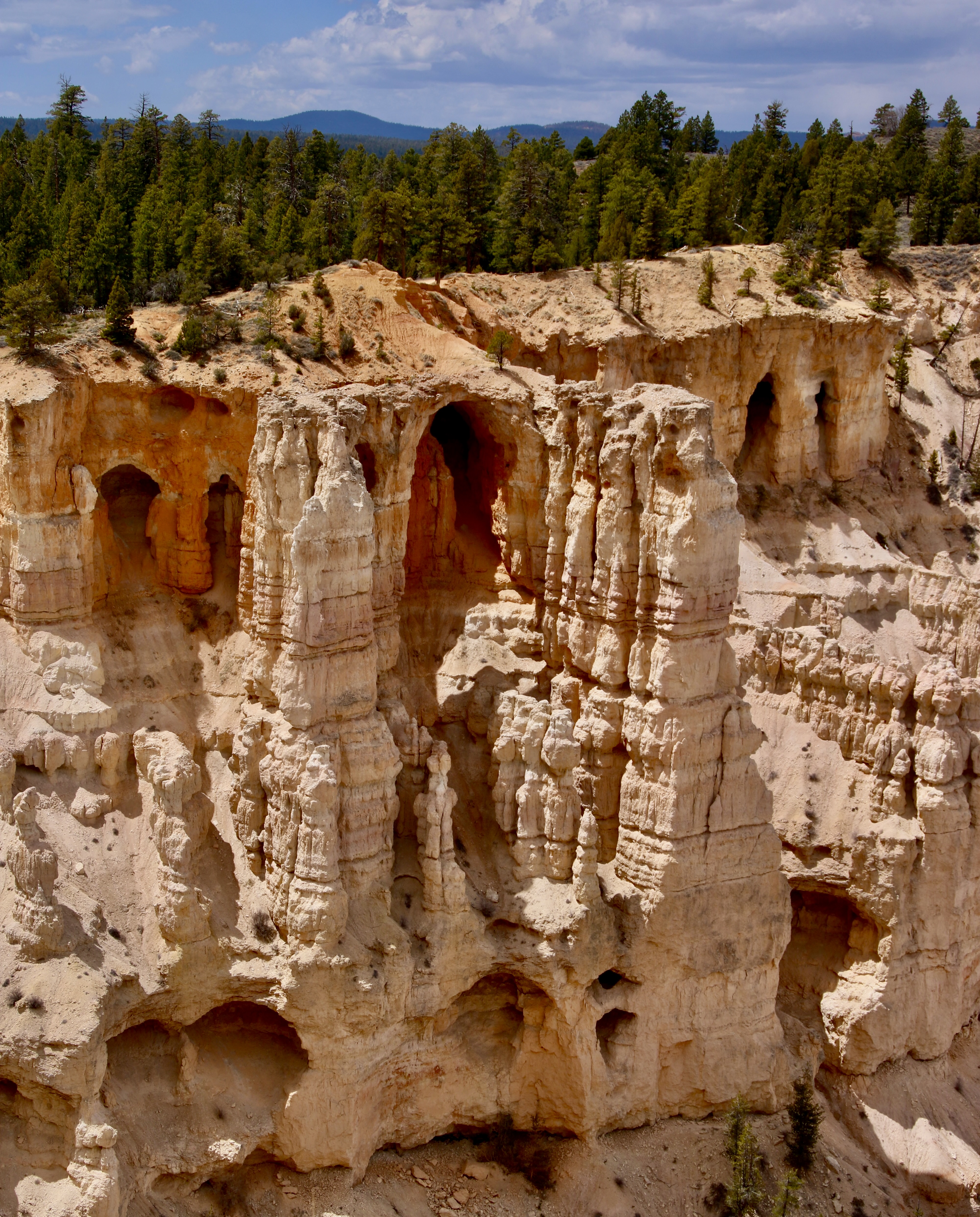
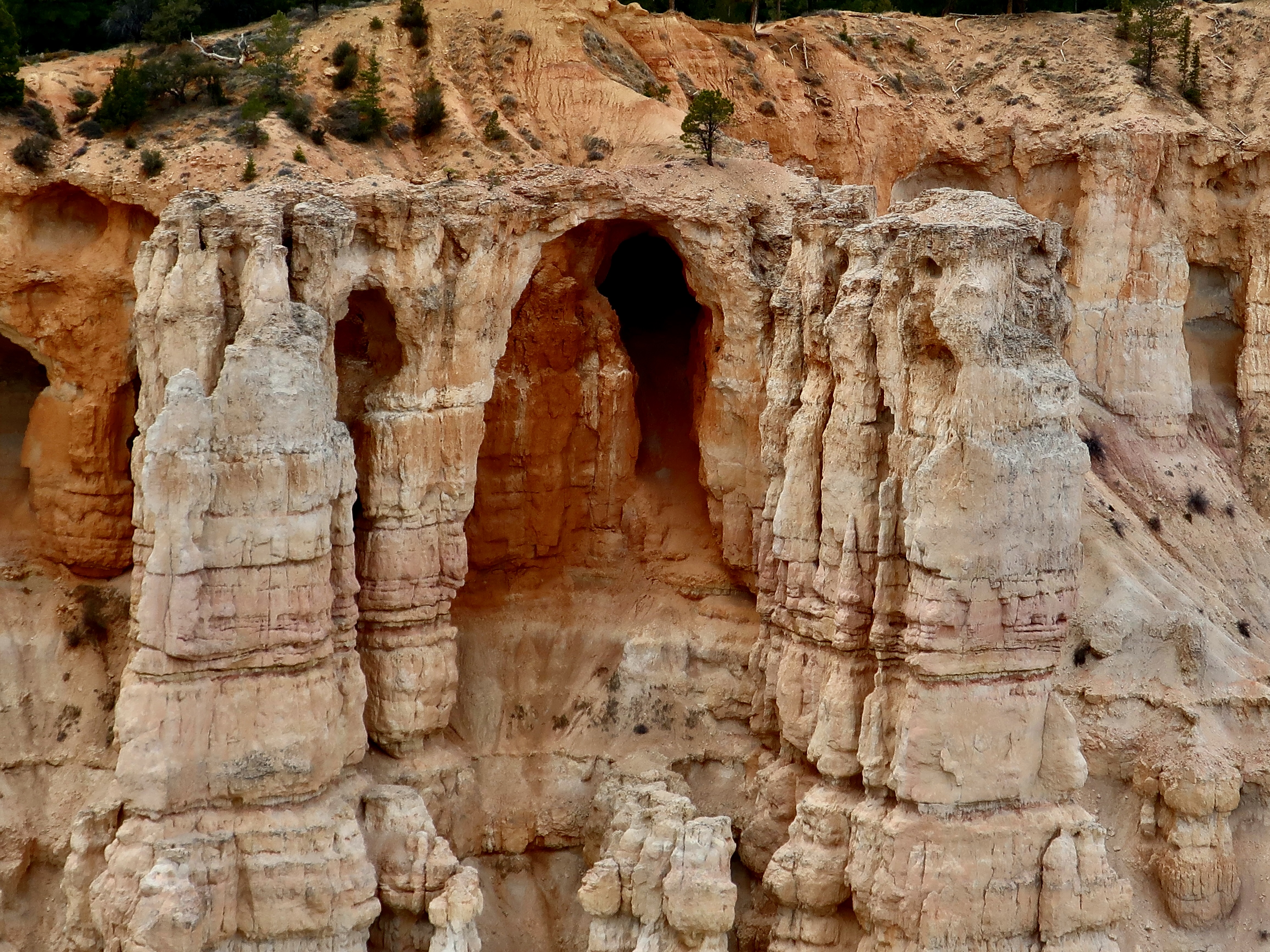
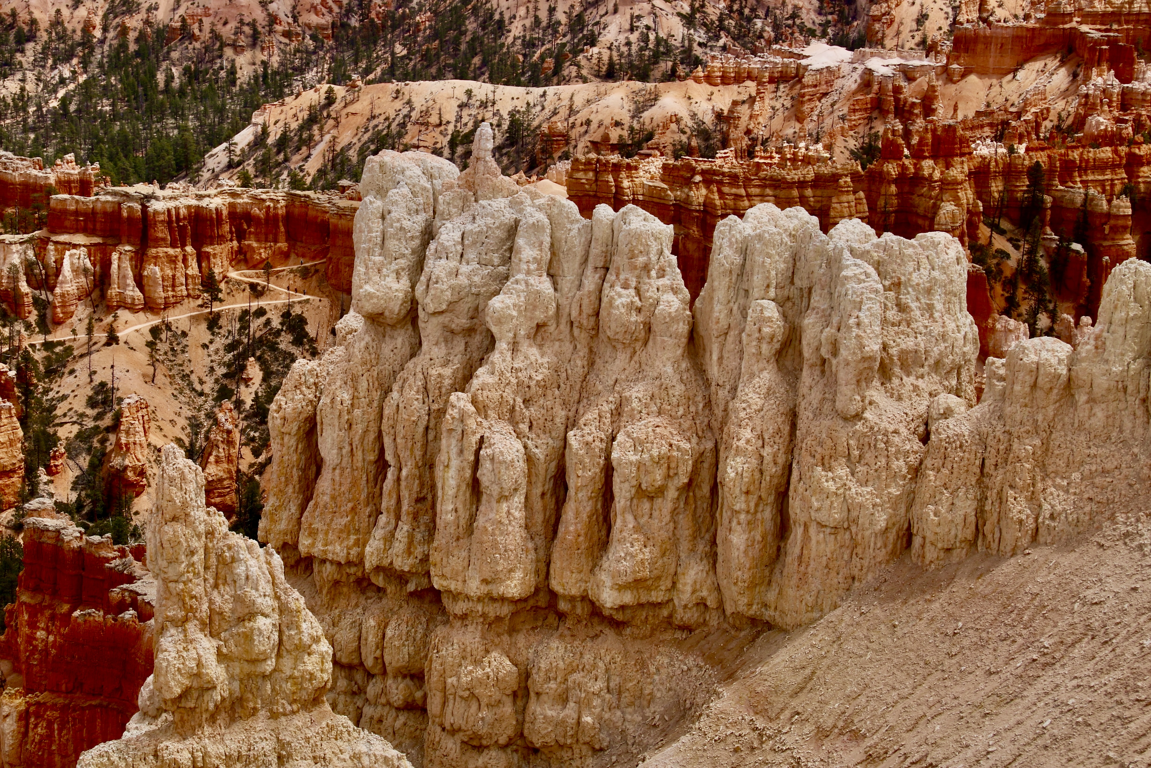
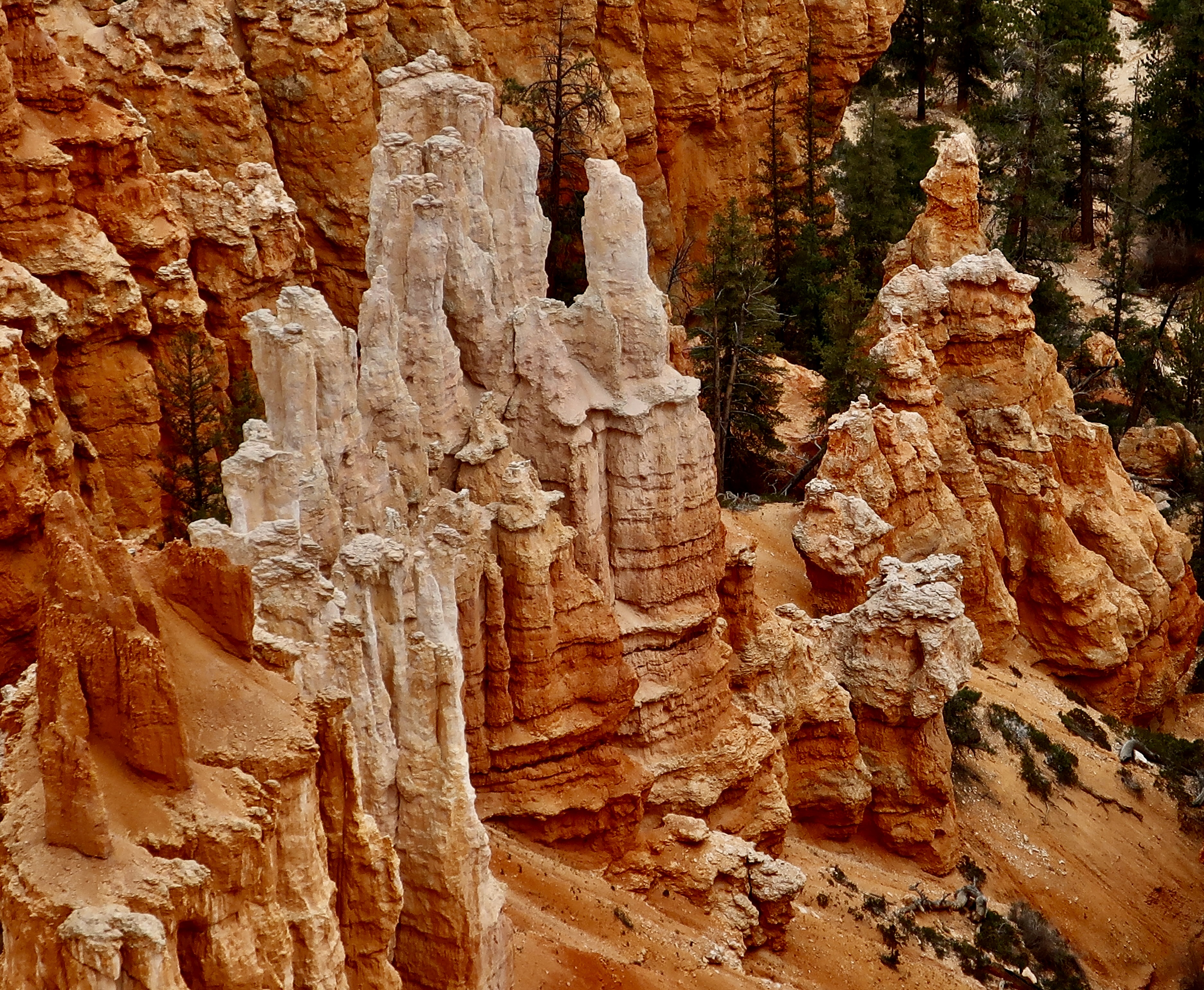
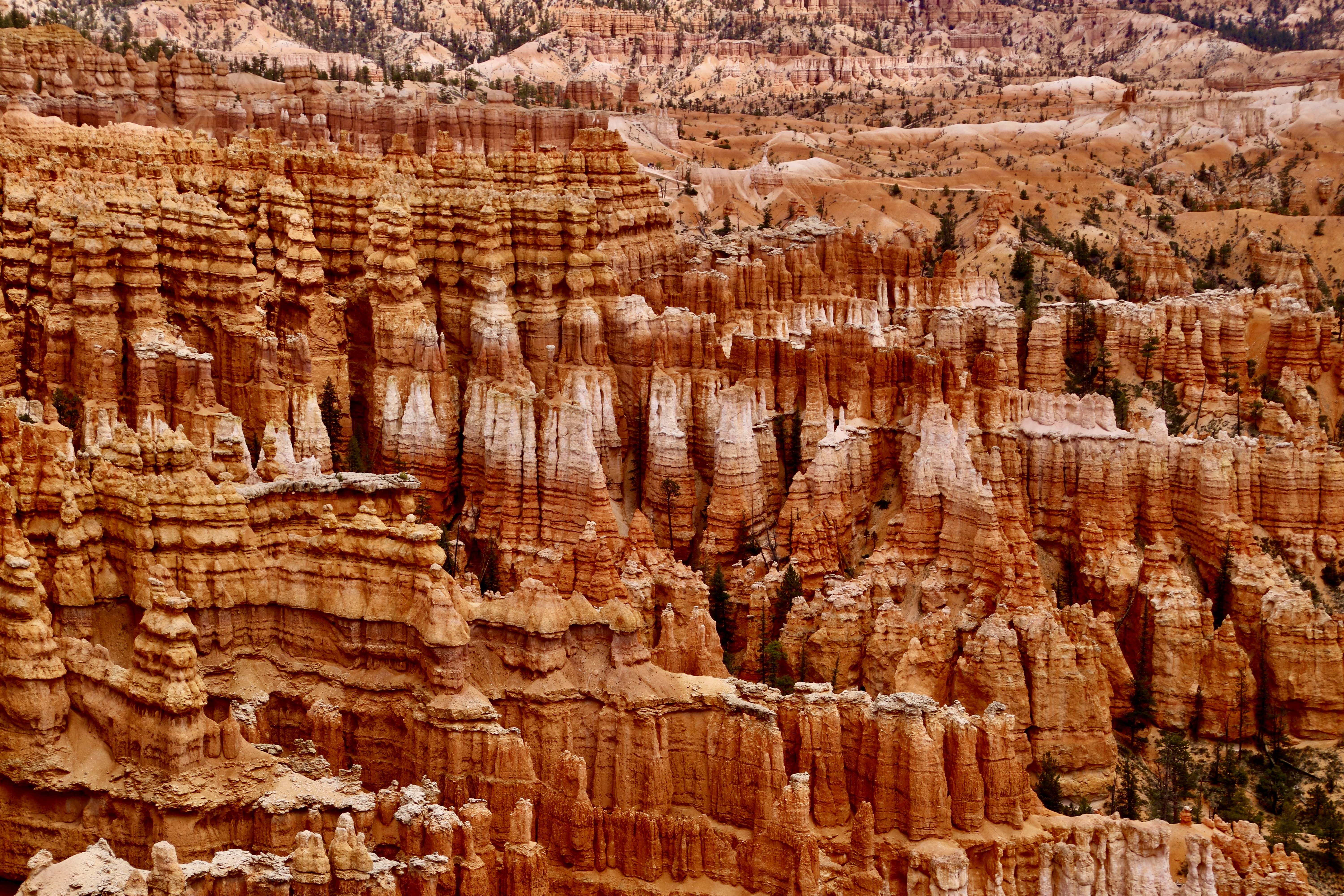
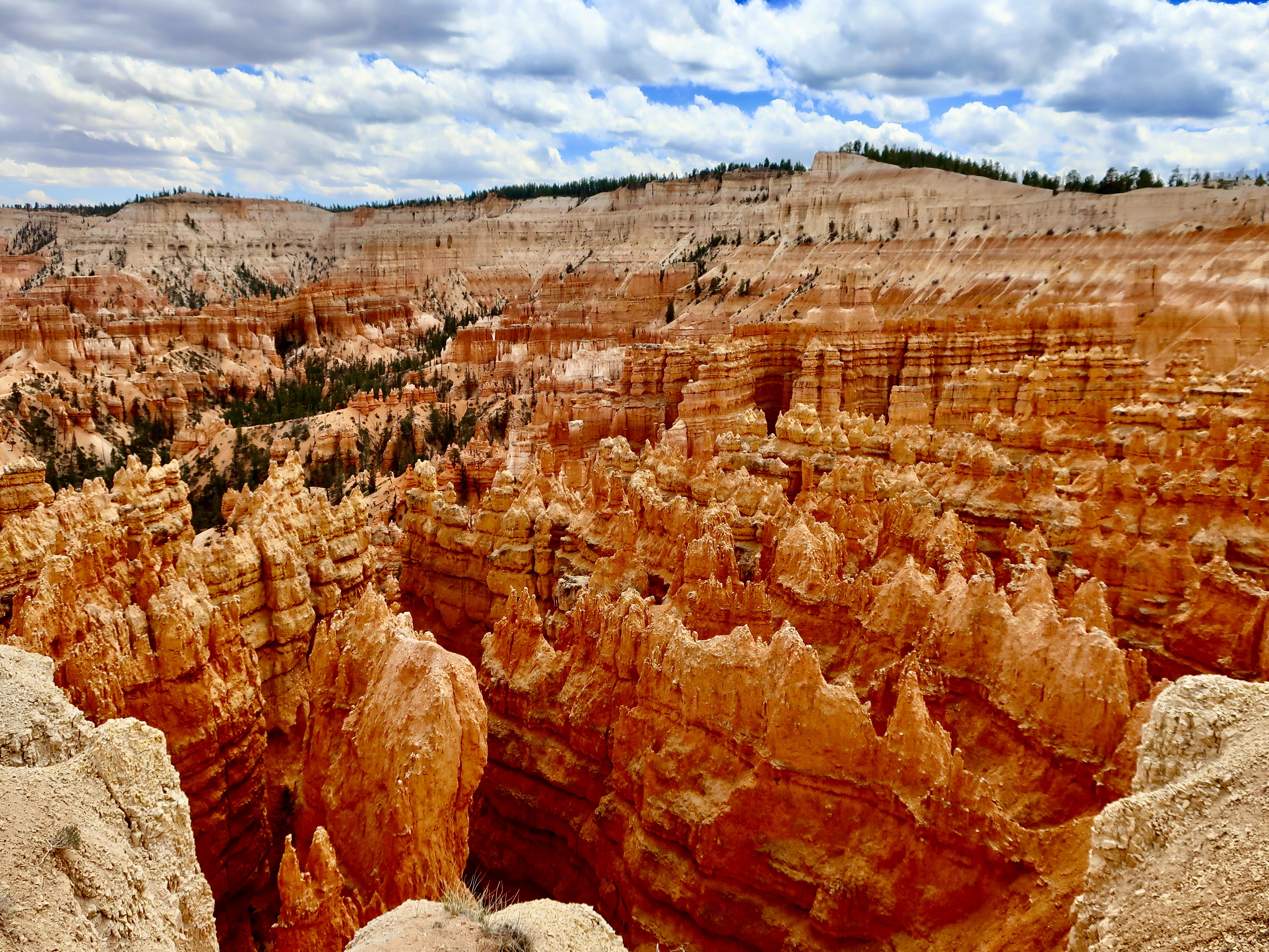
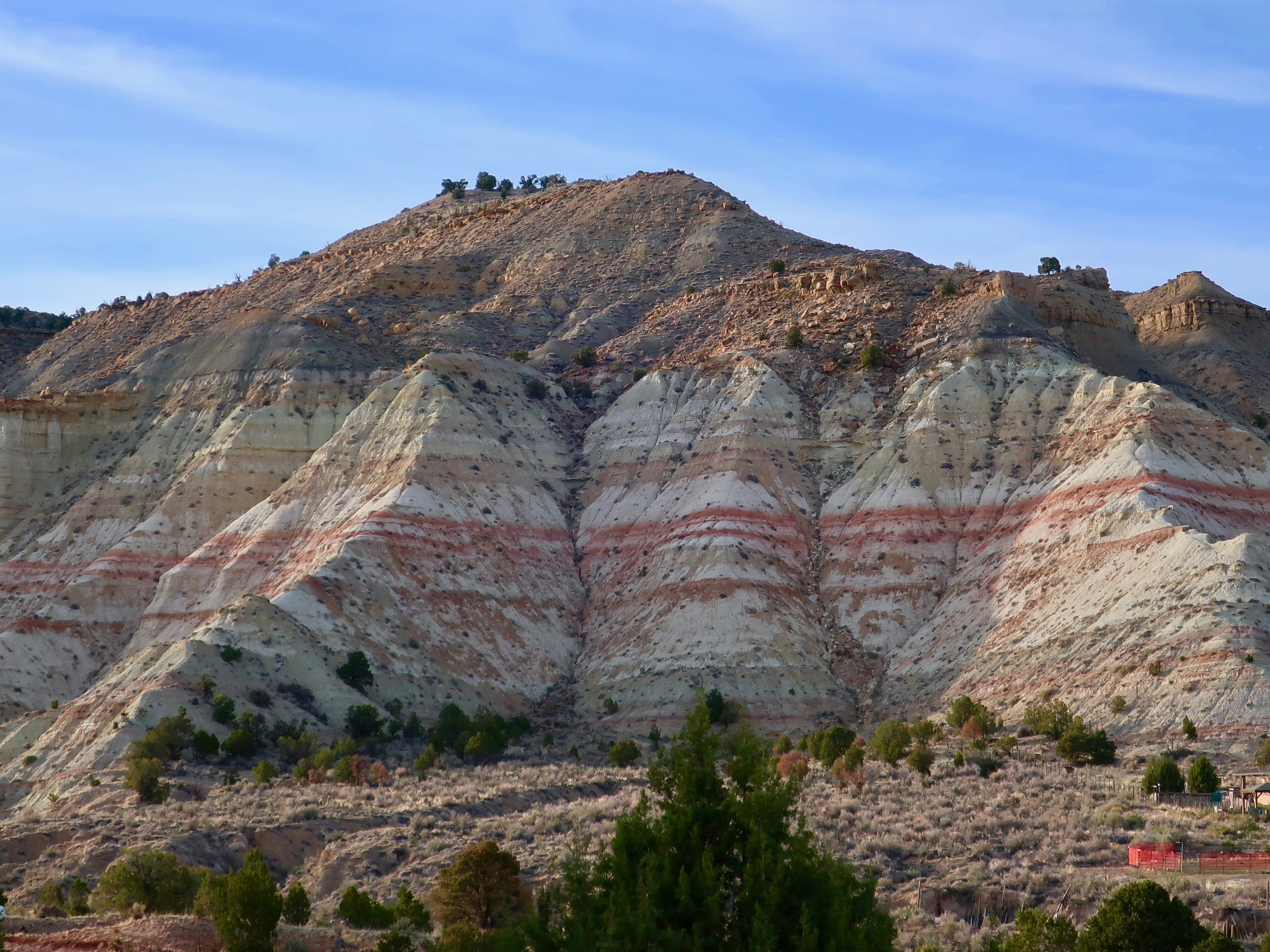
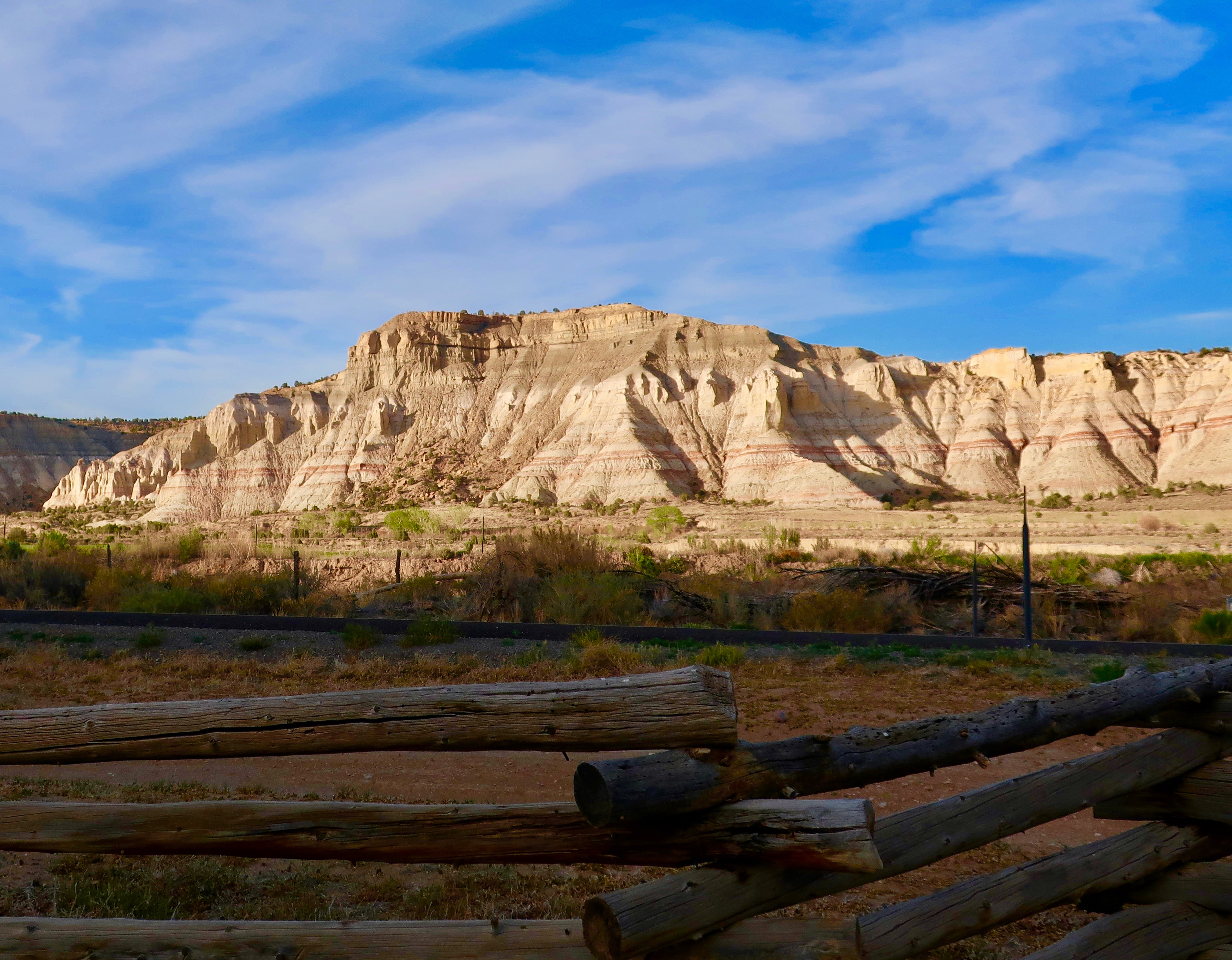
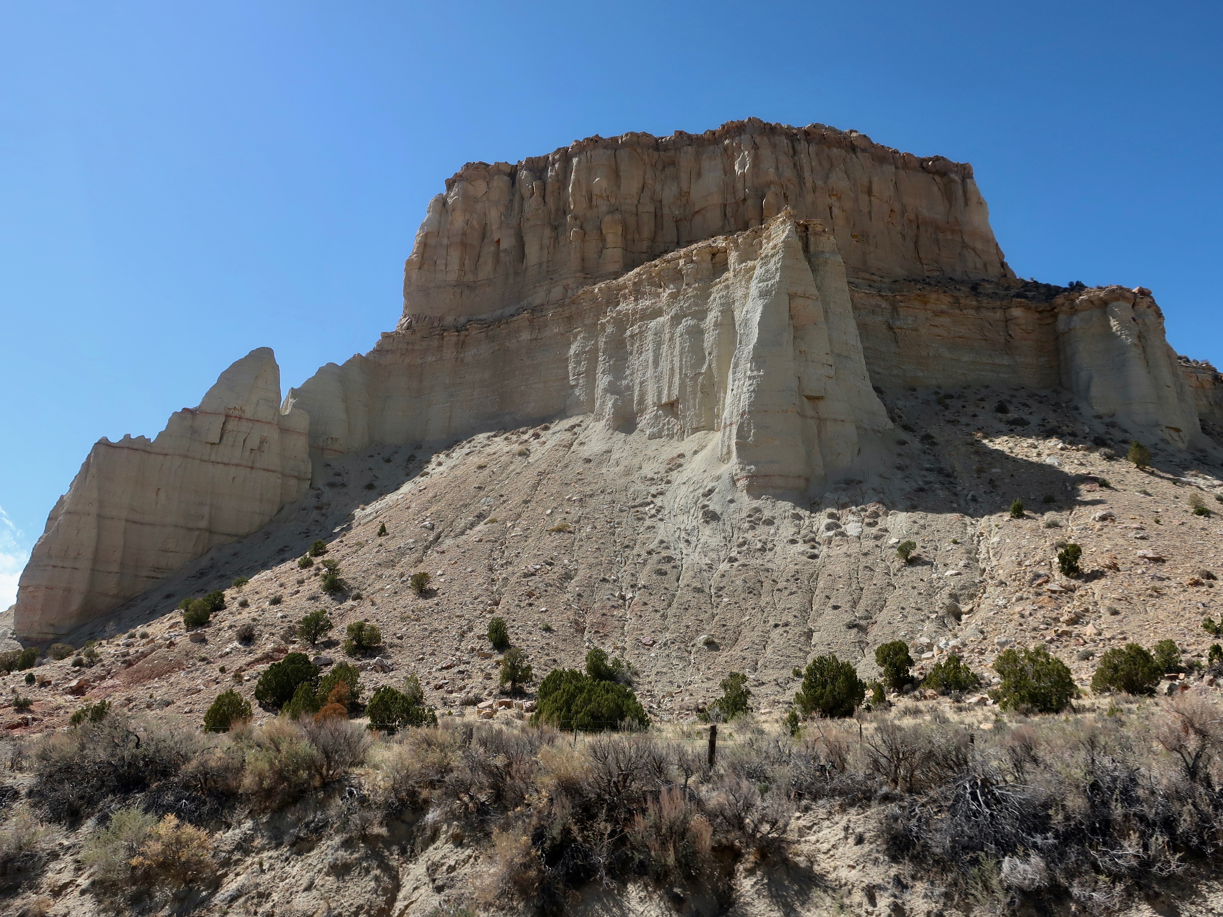
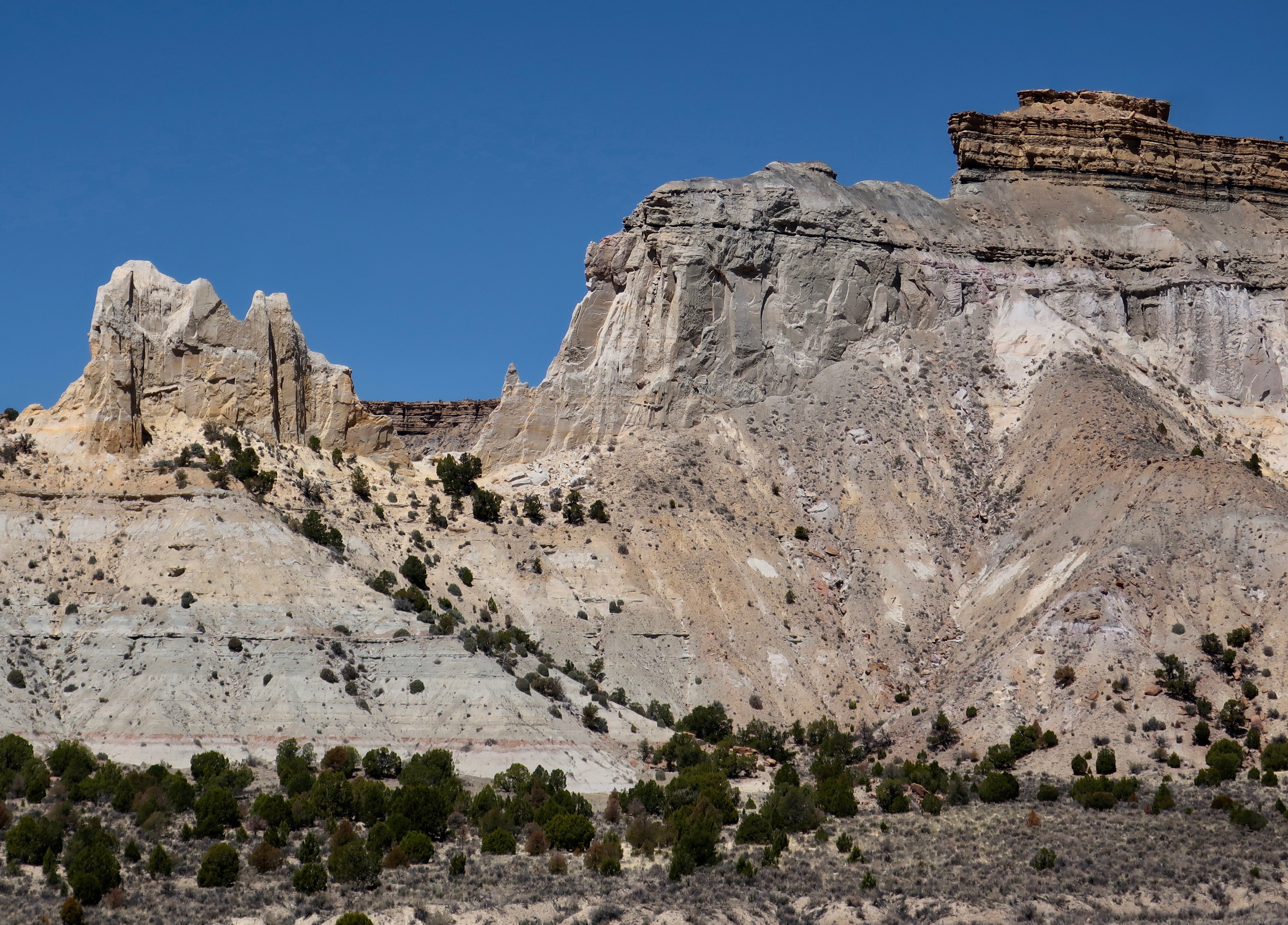
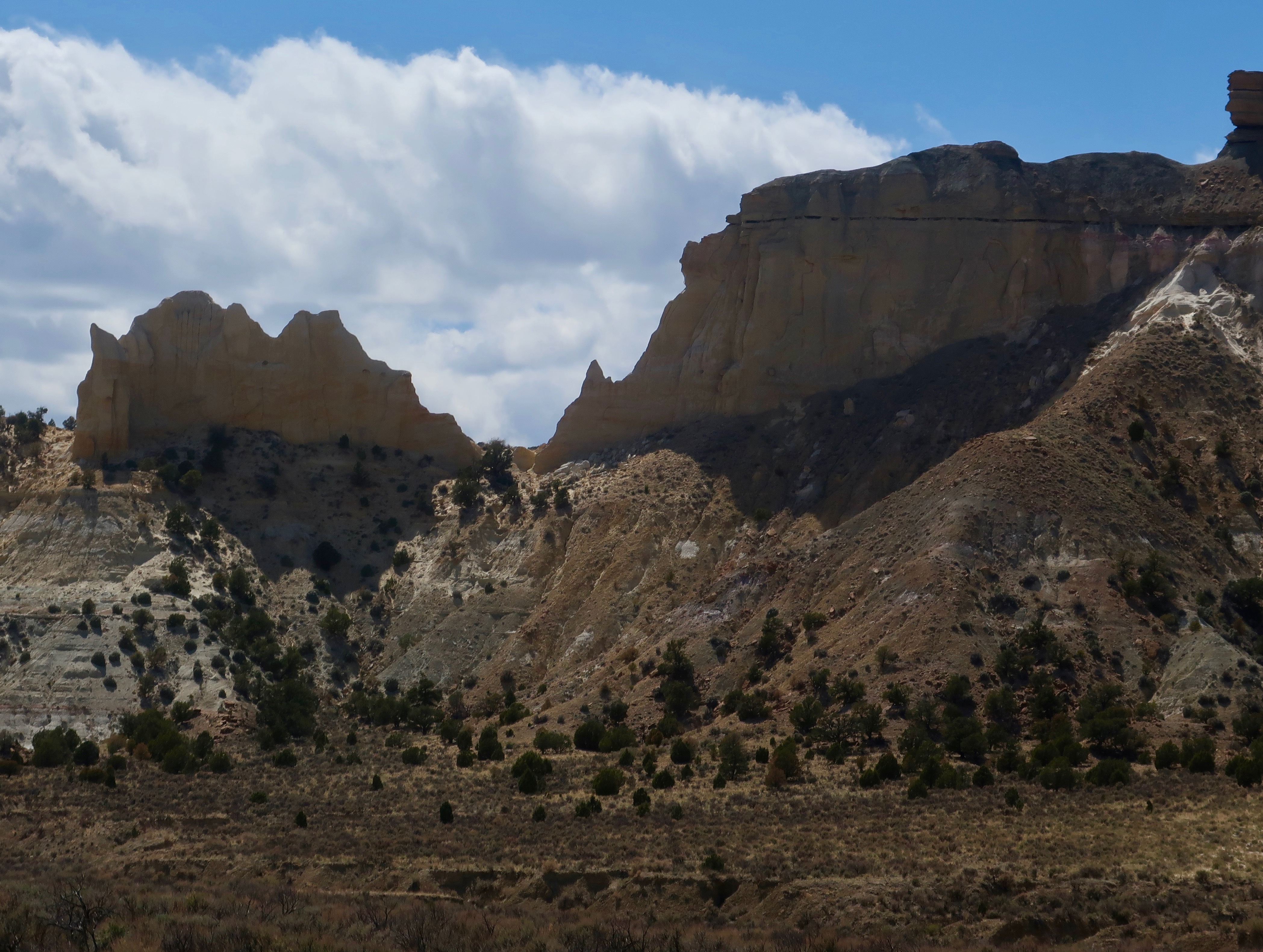
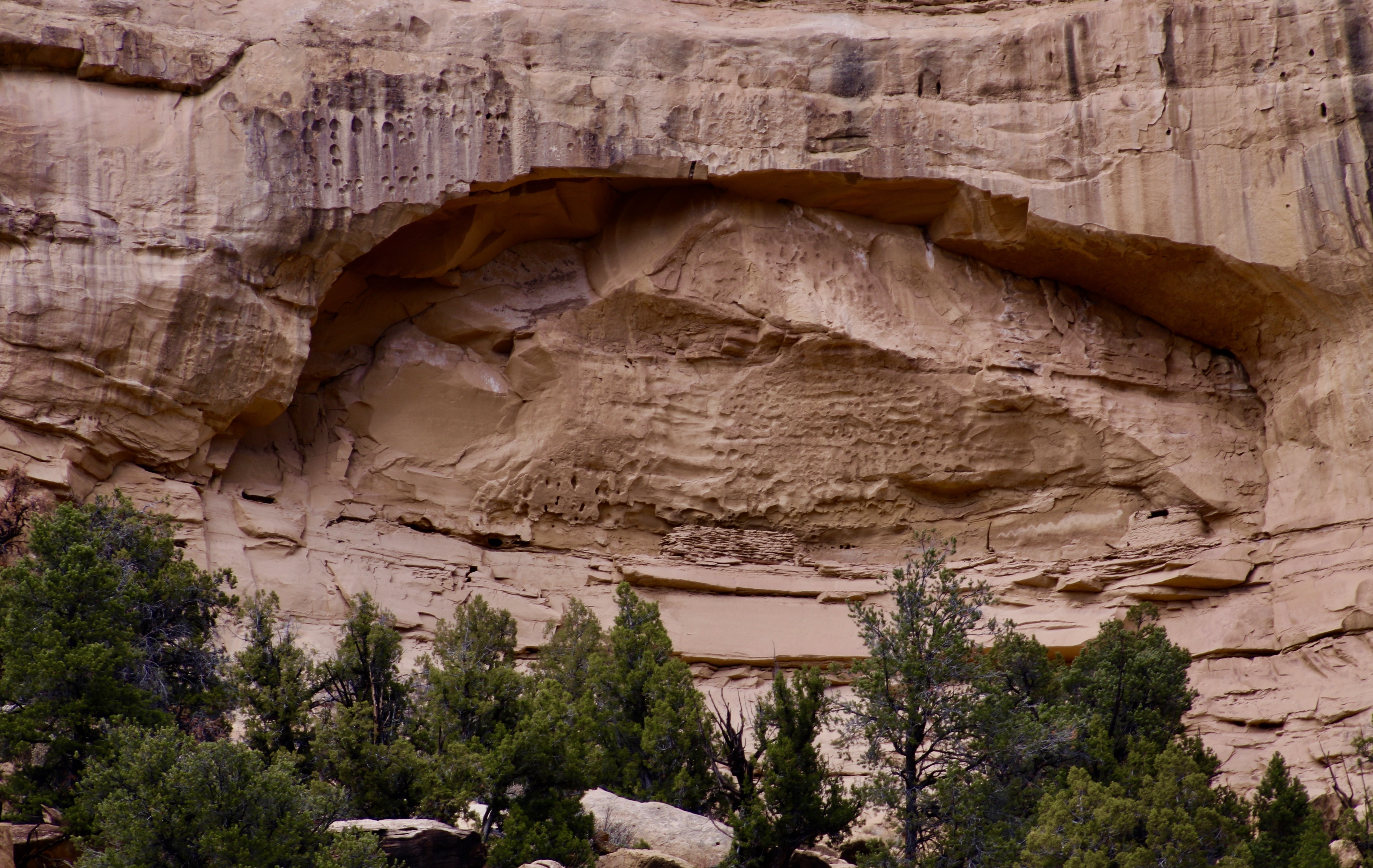
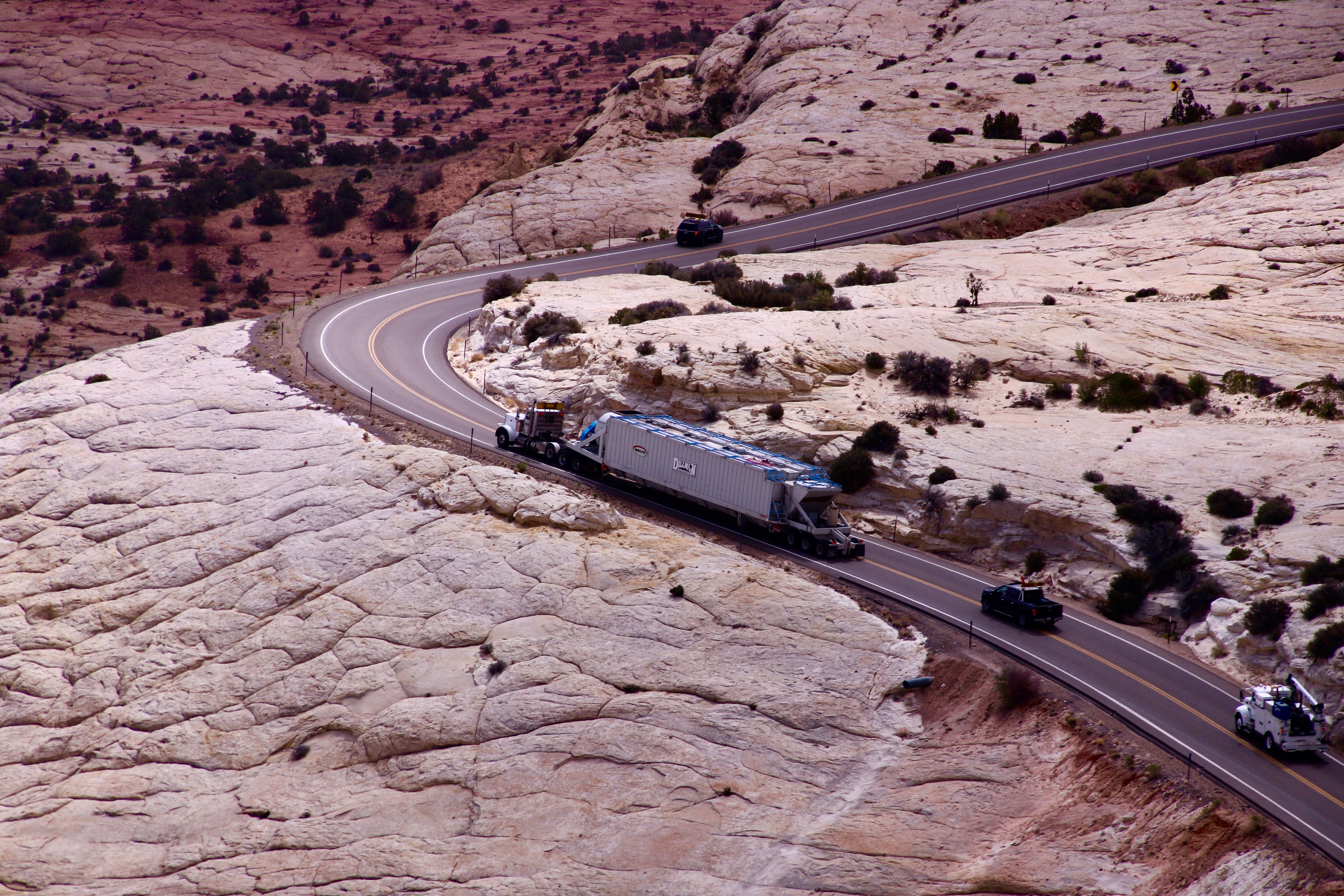
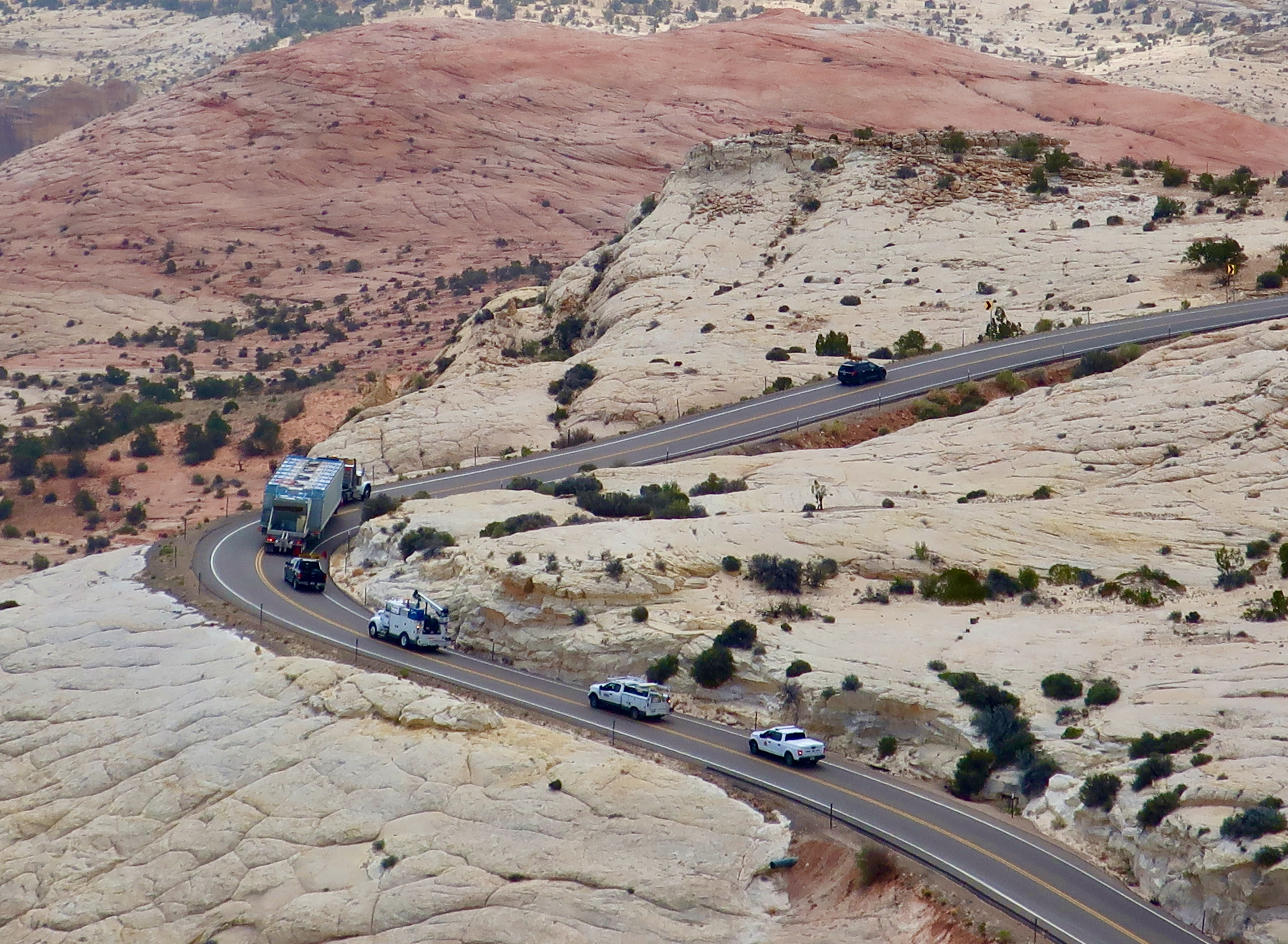
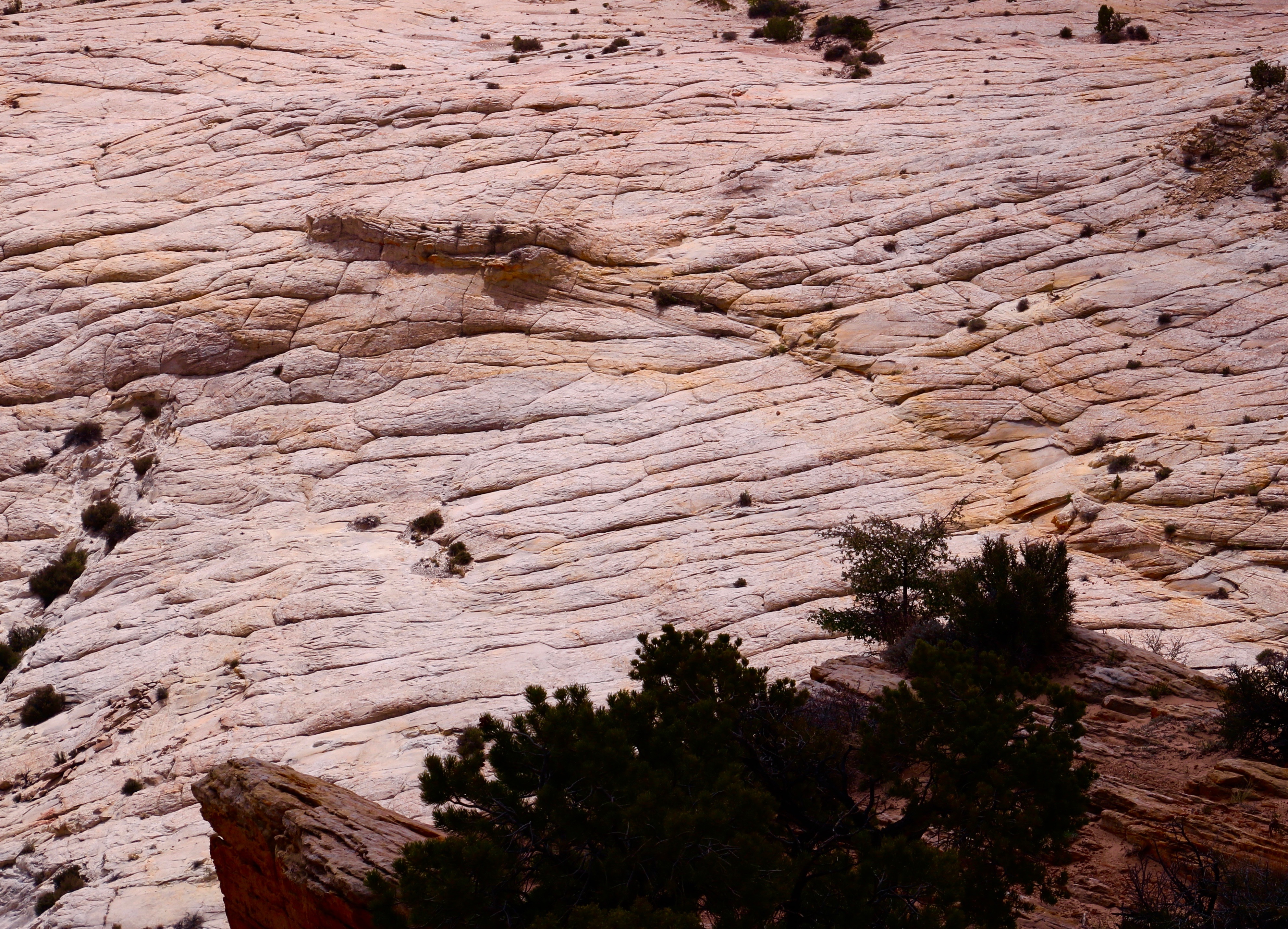
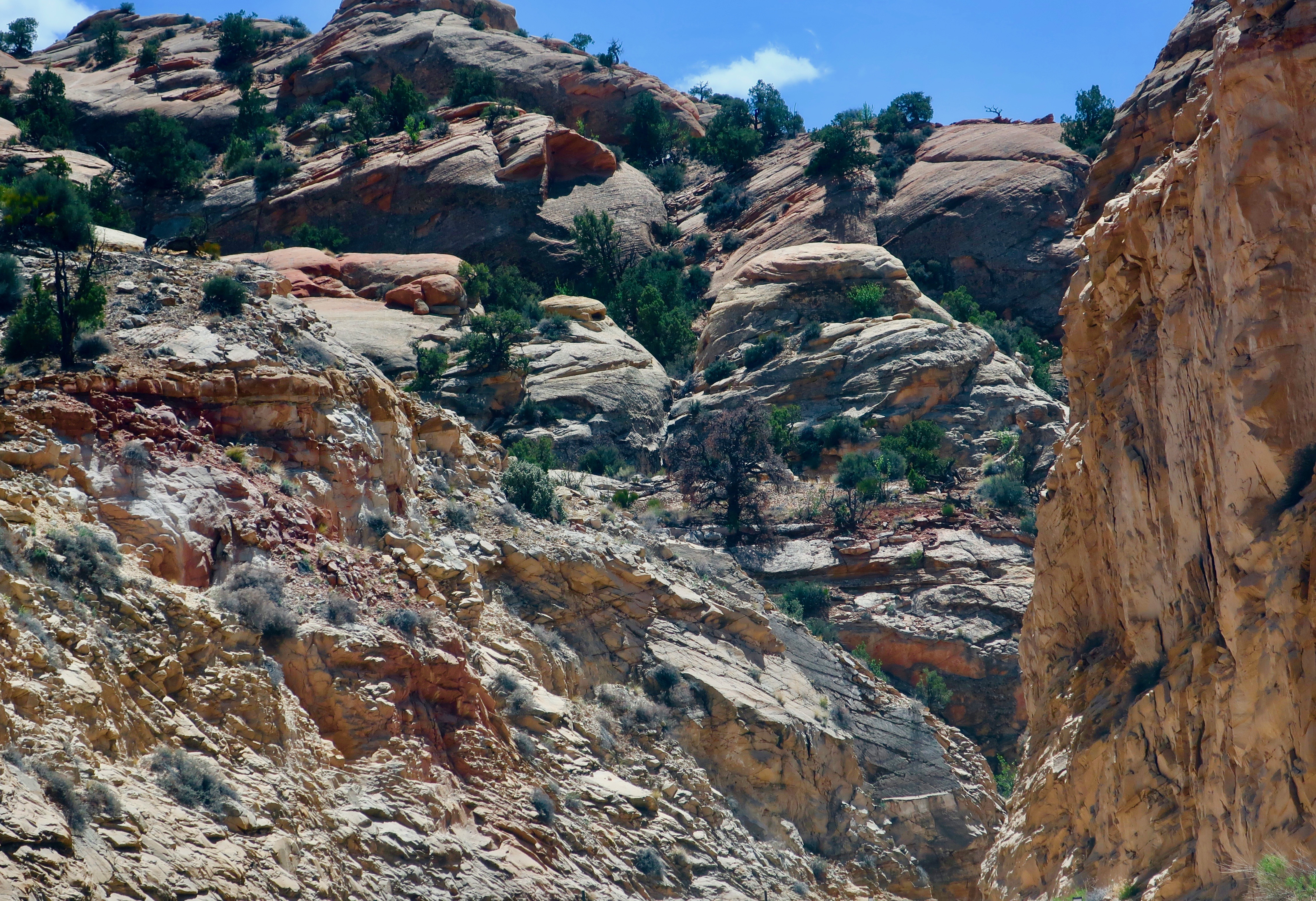
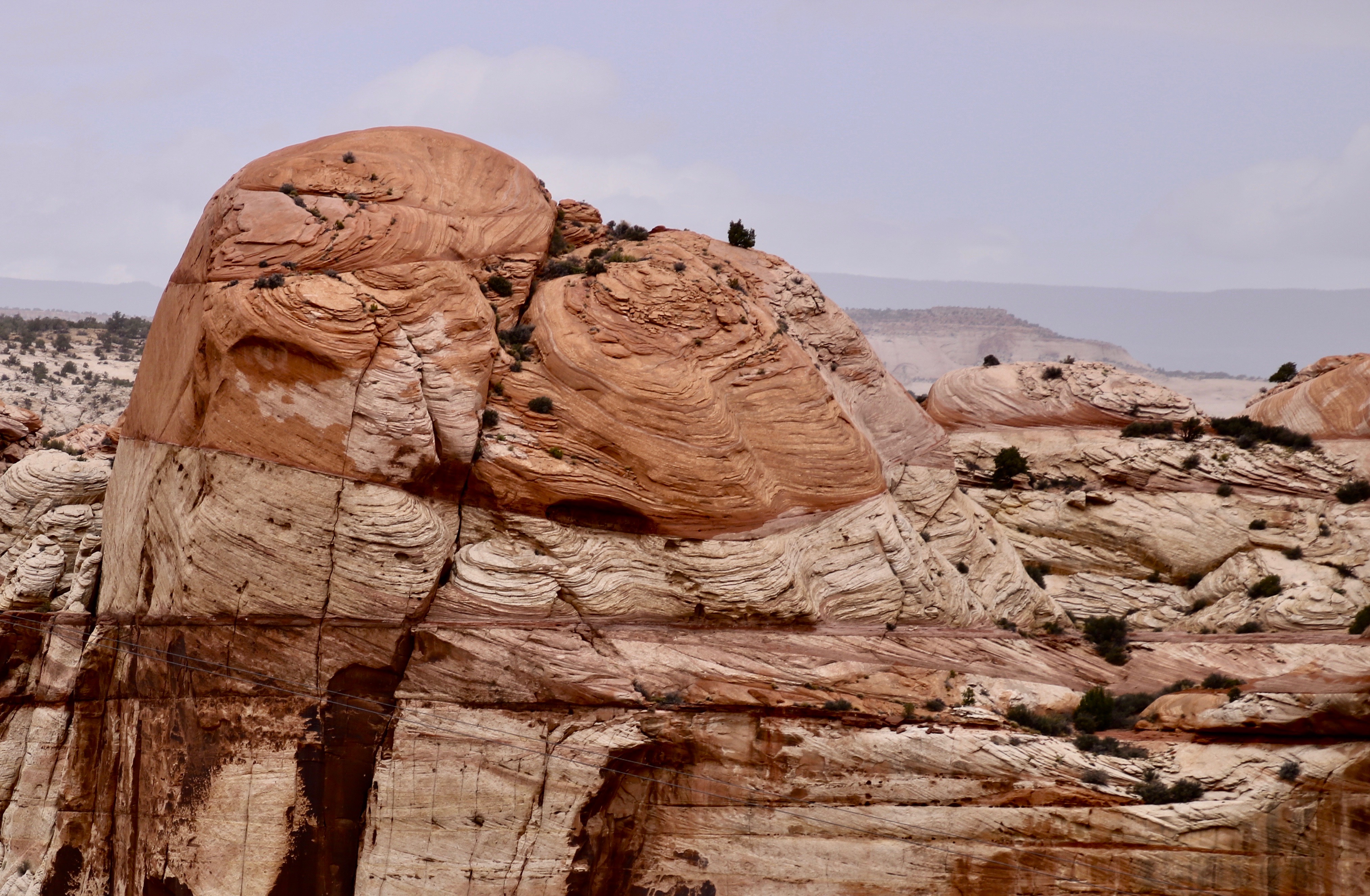
Our cameras were busy the whole time we were at Bryce Canyon. We took well over one a thousand pictures. Here are a few more from the first four miles of the Canyon.

Note the trail winding its way through the Canyon.
Photo by Peggy Mekemson.
Photo of Bryce Canyon by Curt Mekemson.
Photo by Peggy Mekemson.
Photo of Bryce Canyon by Curt Mekemson.
Photo by Peggy Mekemson.
Photo of Bryce Canyon National Park by Curt Mekemson.
Sharp edges of Bryce Canyon by Peggy Mekemson.
The Canyon has its share of sharp edges. (Photo by Peggy Mekemson.)
Another perspective.
Photo from Sunset Point of Bryce Canyon by Peggy Mekemson.
I’ll conclude with this final view of the Canyon from Sunset Point by Peggy. Next Friday I’ll give you a look at our Base Camp in Waterford, Virginia along the Charles Town Pike.

One of America’s Most Scenic Backroads: Utah’s Highway 12

It is a lovely and terrible wilderness… harshly and beautifully colored, broken and worn until its bones are exposed… and in its corners and pockets under its cliffs, the sudden poetry of springs. –Wallace Stegner 1960

I am continuing our Southwest series today. Peggy and I are now back at our basecamp in Virginia and will continue to be through August. There are chores to do: Unpacking, making doctor and dentist appointments, getting our Virginia driver’s licenses, etc. We are even having our hearing tested. There’s a lot of “What did you say, Peggy?” And vice-versa. It’s part of the joy of being in our 70s.

Assuming all goes well, we should be back on the road come September for another multi-month trip, this time traveling through the northern tier of states, and into the Canadian Rockies— assuming that the weather cooperates.

Views like this are what you can expect along Utah’s Highway 12. (Photo by Peggy Mekemson.)

Peggy and I have spent a lot of time on America and Canada’s backroads, plus Mexico’s Baja Peninsula— some quarter of a million miles worth. So we know a bit about byways and we know a bit about scenic. Twelve years ago, when we first travelled over Utah’s Highway 12, our initial thought was Wow! It hasn’t changed. What else would one expect of a road anchored on one end by Capitol Reef National Park and on the other by Bryce Canyon? The short, 123 mile drive can be done in three hours. Or three days if you want to linger and explore the incredible scenery, state parks and historical areas along the way.

In 2010, we started at the small town of Torrey just outside of Capitol Reef, and worked our way south. The winding route took us up and over the 9,000 foot Boulder Mountain Pass where we were impressed with the aspen groves. They are always a treat, moving from the bright green quaking leaves of summer, to the gloriously yellow leaves in the fall, to the stark white trunks and limbs of winter. From the pass, our road dropped into the Escalante National Monument with its staircase look and then ended with the bright red, orange, and yellow rock formations of Bryce.

In May of 2010 when we made our first journey over Highway 12, the aspens at 9,000 feet were still dressed for winter.

This time we travelled in the opposite direction, beginning at Bryce and working our way northeast along Highway 12, stopping at the small town of Boulder some 90 miles into the journey. We wanted to explore the Burr Trail that begins there. The road is something of a scenic wonder itself and will get its own post.

Our recent journey along Highway 12 started with the red, orange, and yellow rocks of the Bryce Canyon area.
Ranch in Tropic, Utah along scenic Highway 12. Photo by Curt Mekemson.
We camped on Highway 12 in the town of Tropic, so named by an early land developer who wanted to encourage growth. This and the next three photos were taken from our campground.
Photo by Curt Mekemson.
Tropic, Utah photo along Highway 12 by Curt Mekemson.
Across the road from our campsite in Tropic.

Our journey to Boulder can easily be divided into two parts: the section between Tropic and Escalante where we were mainly looking up, and the section between Escalante and Boulder, where we were mainly looking down. I’ve combined our morning and afternoon photos for each section, which is why you will see the varying light. We will start by looking up. 🙂

Photo by Peggy Mekemson.
Part of the Grand Staircase. (Photo by Peggy Mekemson.)
I liked the contrast here.
Photo by Peggy Mekemson.
I caught this on our way out…
And Peggy caught it on the way back.
A quick look at the photo by Peggy here shows another example of erosion, possibly a future arch. But if you look more closely, you will see more: an ancient Puebloan granary. There are two structures here. People lived in this area for thousands of years before Europeans first made their way to North America.
Dark skies with sun breaking through always make for dramatic photos. I’m not sure which was more impressive: The orange butte in the foreground, or the white one looming in the background.
Peggy stopped to pet a large lizard in front of the Grand Staircase Escalante National Monument Visitor Center in the town of Escalante. A few miles later we were looking down into a vast canyon.
An overlook provided our first view down into the Canyon. A huge truck was making its way out of the canyon on the curvy road that was originally built by the Civilian Conservation Corps in the 30s. Both Peggy’s dad and mine had worked for the CCC. How do you think the truck made it around the hairpin curve? (Photo by Peggy Mekemson.)
Carefully. The highway patrol had required folks coming down into the canyon (us, for example) to park off the road until the truck was past. Coming up, you waited behind the truck. No one passed that puppy!
The vast canyon we were facing was carved by the Escalante River that flows into Glen Canyon and the Colorado River. One of the two things that caught our attention about the canyon was the unique geology. (Photo by Peggy Mekemson.)
It is a lovely and terrible wilderness… harshly and beautifully colored, broken and worn until its bones are exposed. Photo by Peggy Mekemson.
And the fact that the Escalante River was still working away, continuing to carve its canyon. (Photo by Peggy Mekemson.)
Photo by Curt Mekemson.
Where there is water, there is life… the sudden poetry of springs.

I hope we have persuaded you to explore Highway 12 if you are in the area. Our next post will take you along the Burr Trail with its long, colorful canyon— including a slot canyon.