“The clearest way into the Universe is through a forest wilderness.” John Muir
A small unnamed lake reflects the beauty and peace of the Mokelumne Wilderness. There’s a chance that John Muir stopped to admire it, given all of the time he spent exploring California’s Sierra Nevada Mountains. I’ve spent a bit of time wandering there as well— starting in 1957.
The Wilderness Act of 1964
“A wilderness, in contrast with those areas where man and his own works dominate the landscape, is hereby recognized as an area where the earth and its community of life are untrammeled by man, where man himself is a visitor who does not remain.” –Howard Zahniser, Author of the Wilderness Act
What does this mean? Transportation is by foot or horse. No bicycles or motor vehicles are allowed. Even chainsaws are banned for use on trail maintenance. No one can build permanent structures of any type. It’s just you and nature.
As of 2023, there were 806 wilderness areas located in 44 states and Puerto Rico. These areas are overseen by the National Park Service, the US Forest Service, the US Fish and Wildlife Service, and the US Bureau of Land Management. All in all, some 5% of land in the US is set aside as wilderness area, the majority in Alaska.
Over the past three months, I’ve been blogging (with Peggy’s help) about our national parks and monuments with an emphasis on their unique beauty, geology, flora, fauna and history that makes them so important to us— and about the threats that they are presently facing from the Trump Administration. Today we are switching to wilderness areas with the same emphasis. I’m going to cover three that I backpacked through on my 750 mile trip down the PCT in 2018 to celebrate my 75th birthday: The Mokelumne, Granite Chief/Desolation, and Marble Mountains Wilderness areas. If you’ve been with this blog for a while, some of the photos may be familiar to you.
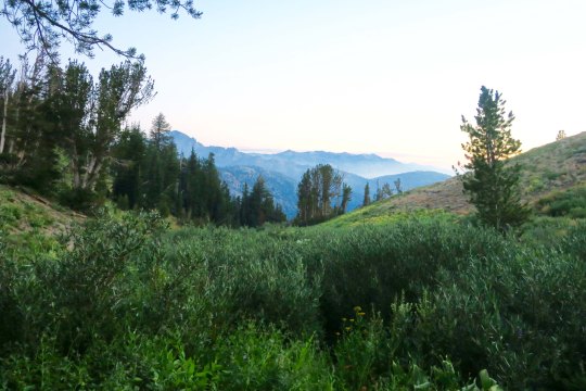
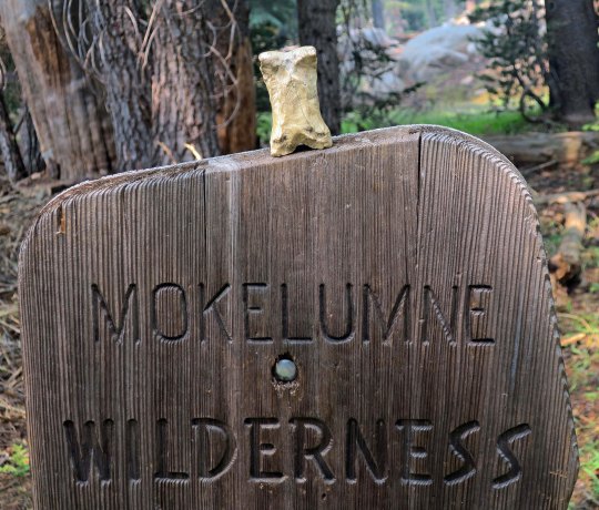
The Mokelumne Wilderness is conveniently located between two of California’s highways that cross the Sierras. Since I was hiking north to south, I started at Carson Pass (elevation 8573’) on Highway 88 and ended at Ebbet’s Pass (elevation 8732’) on Highway 4. The distance on the PCT is approximately 30 miles, which is relatively short— but there are plenty of ups and downs! And, as you will see, great diversity and beauty.
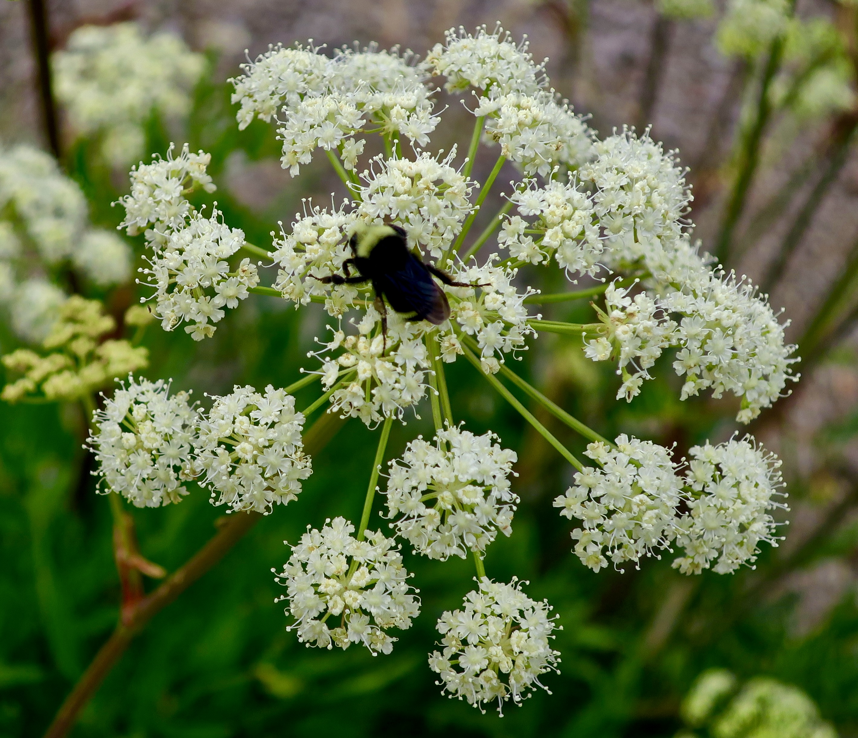
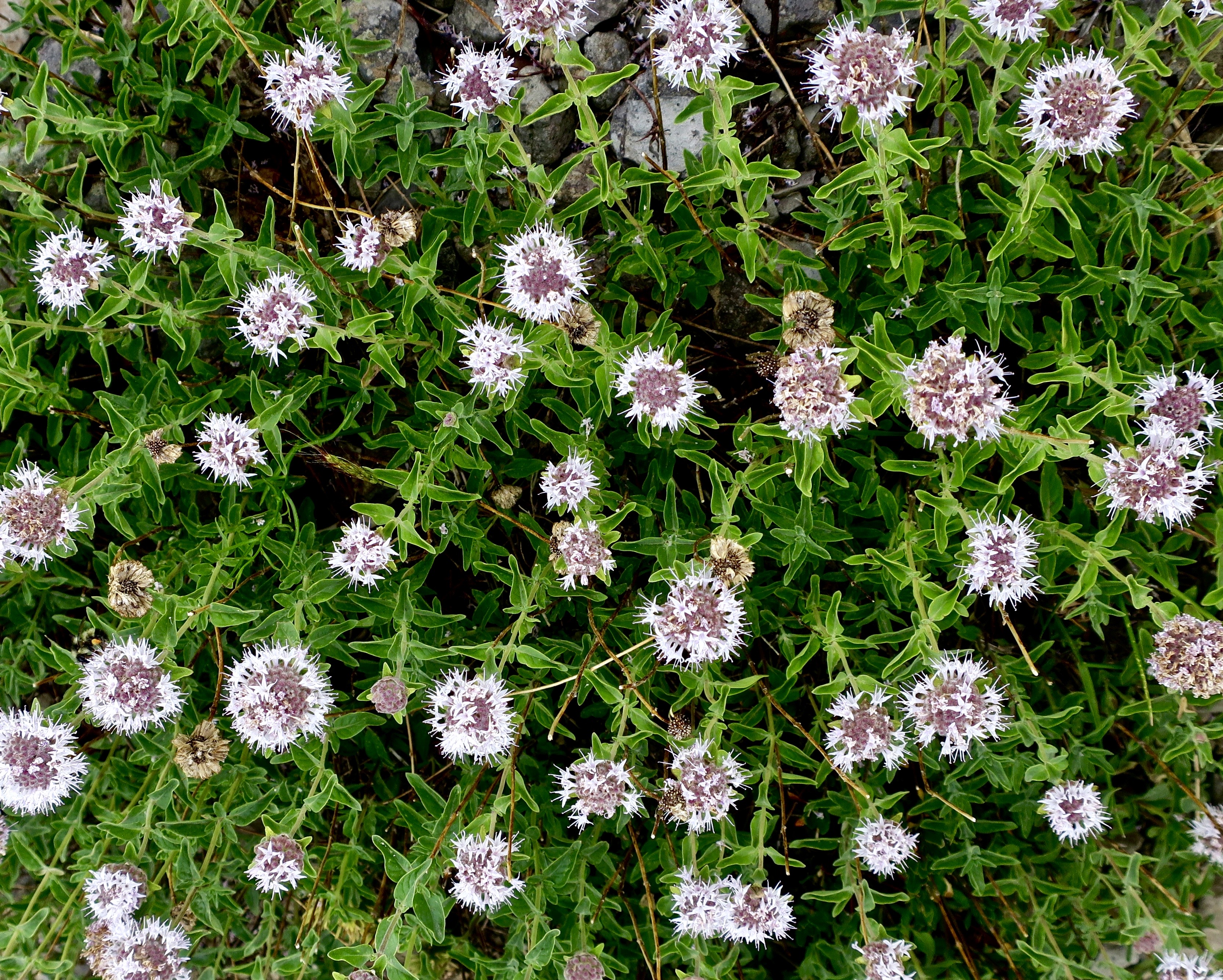
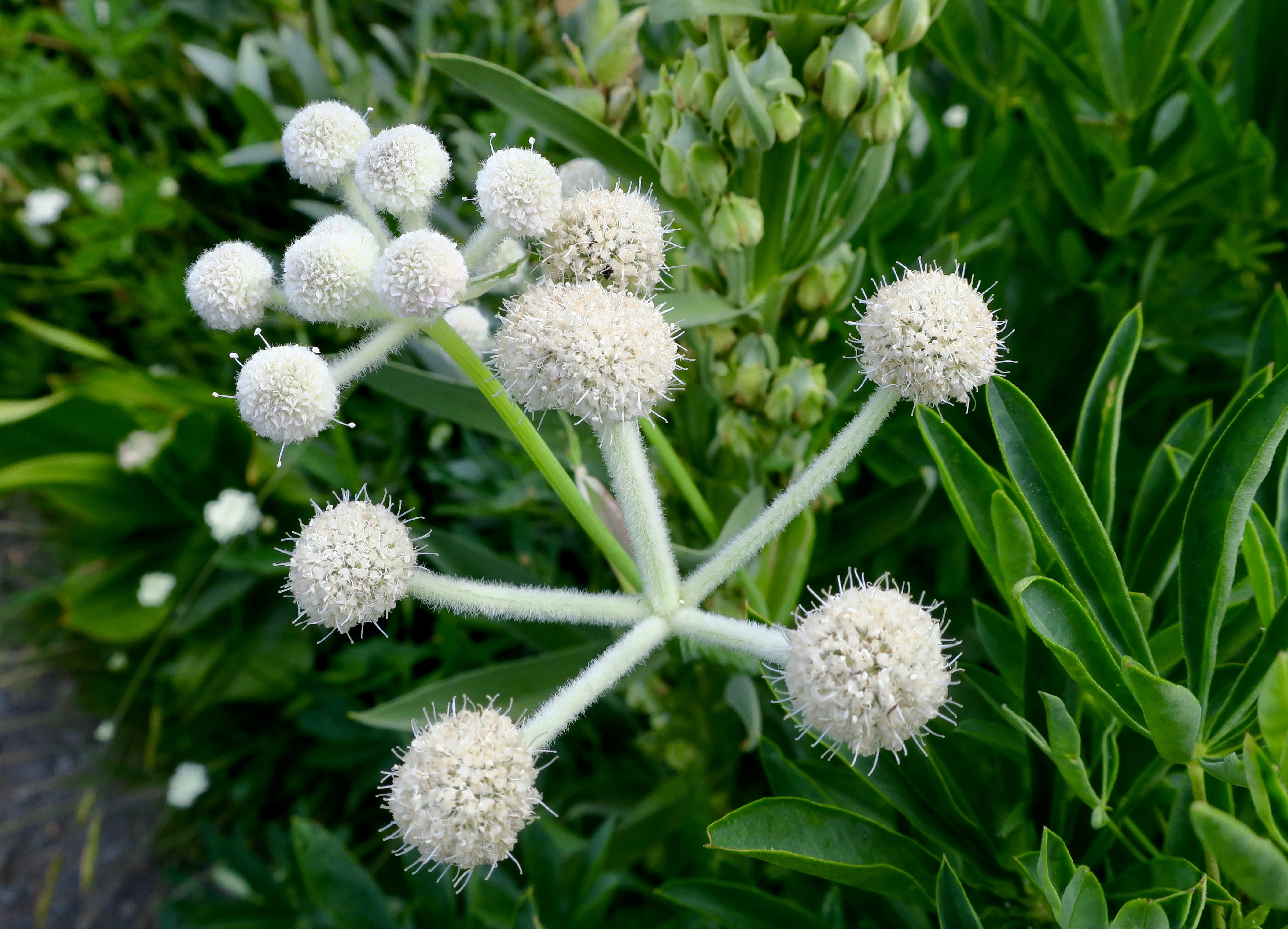
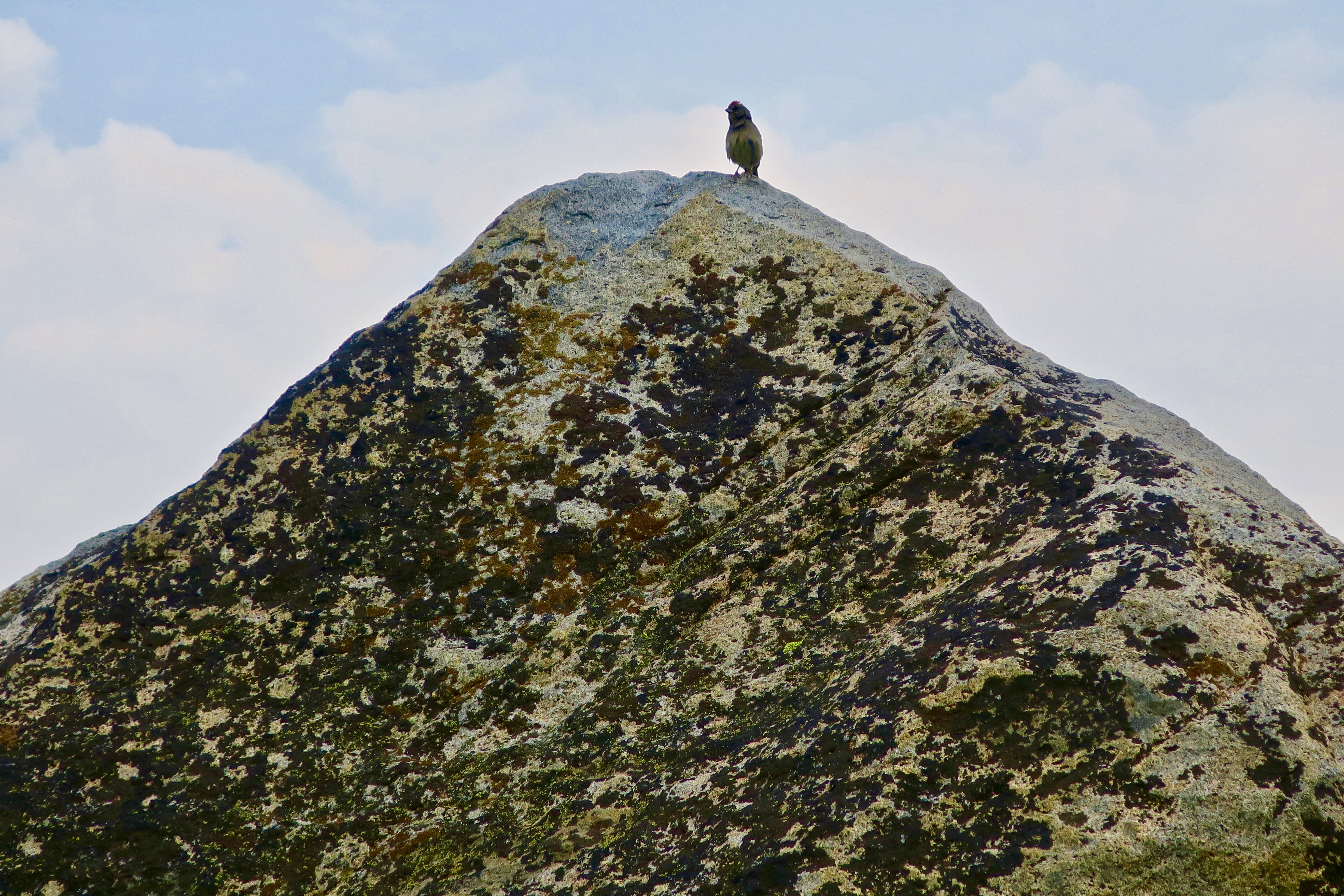
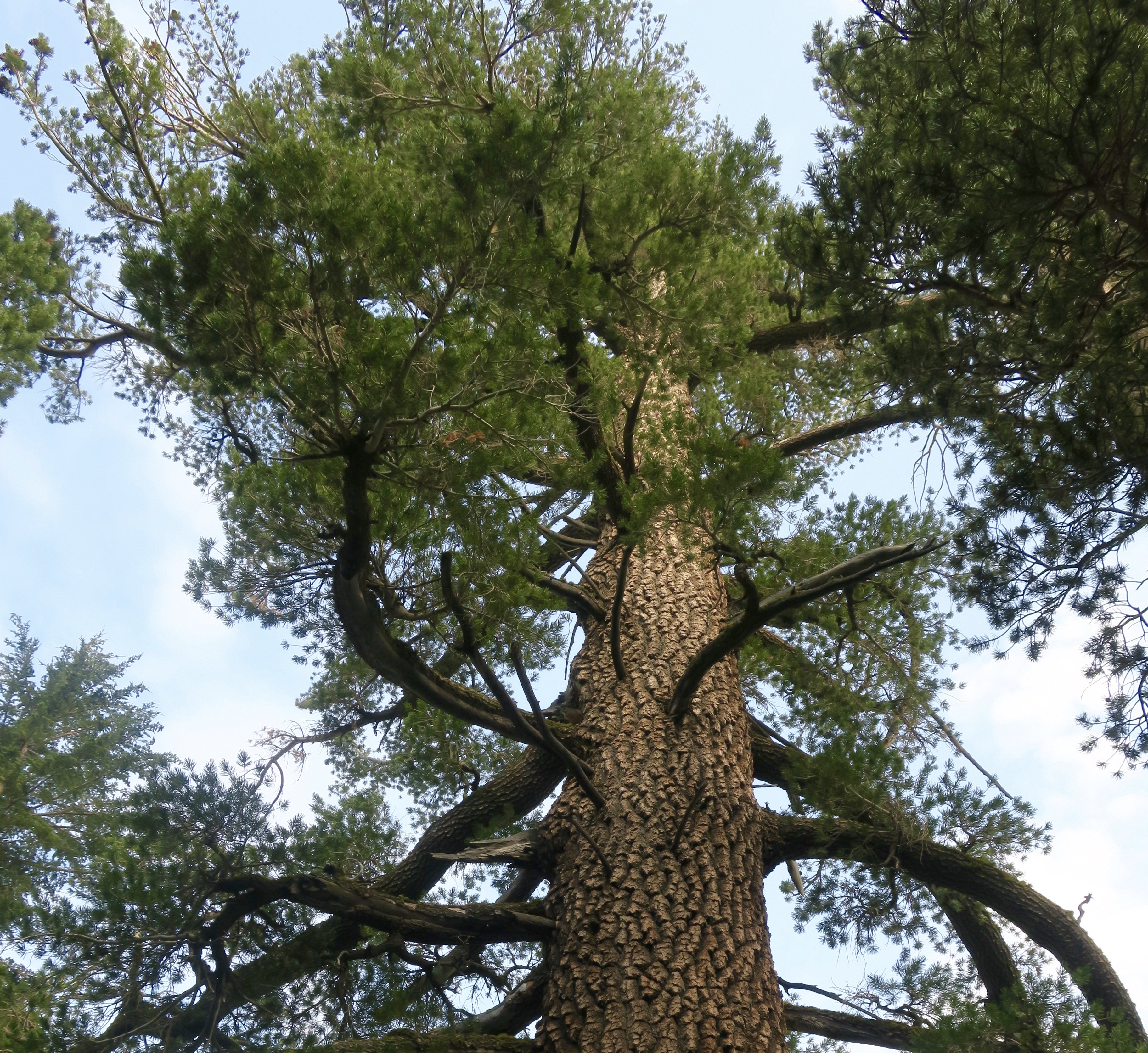
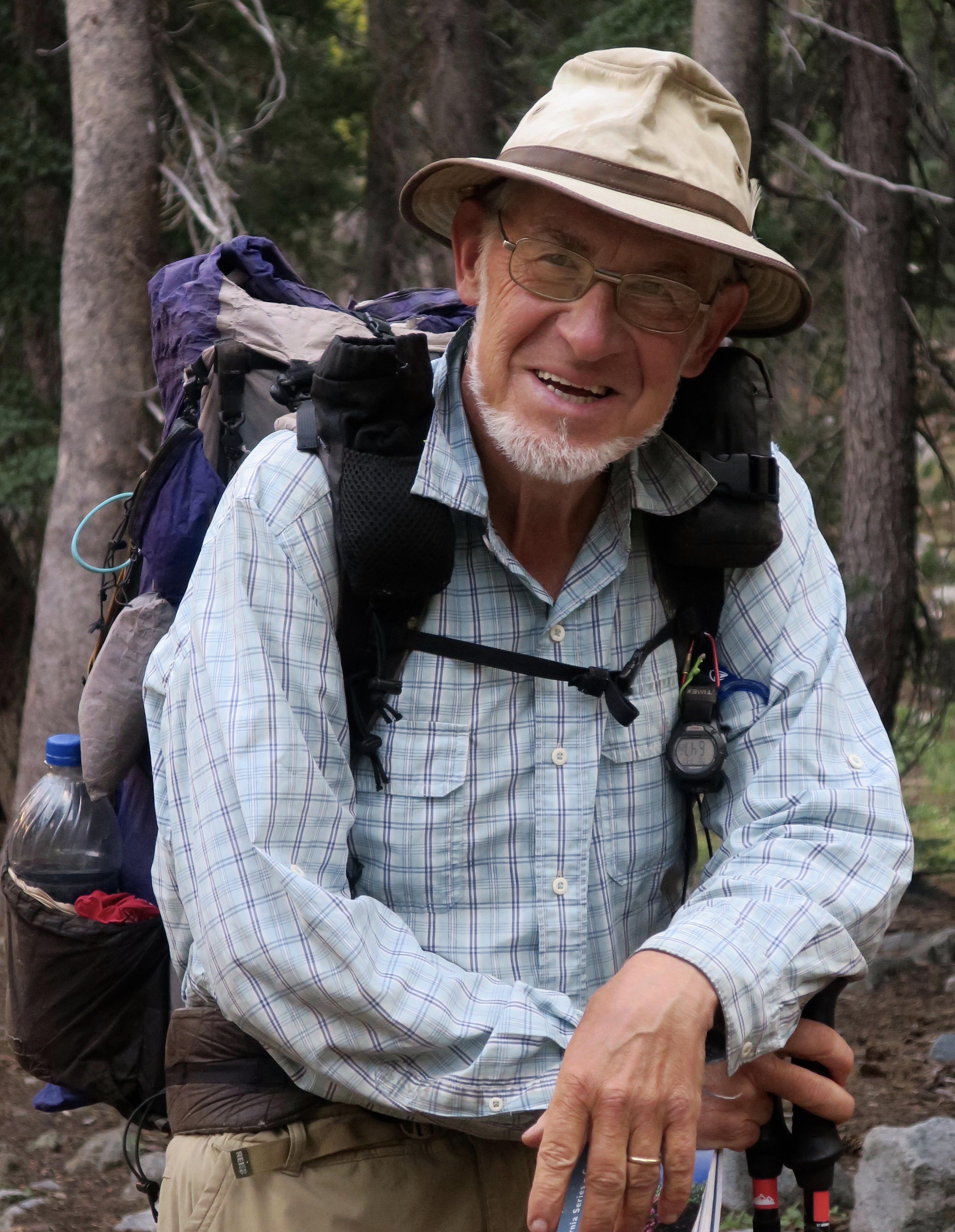
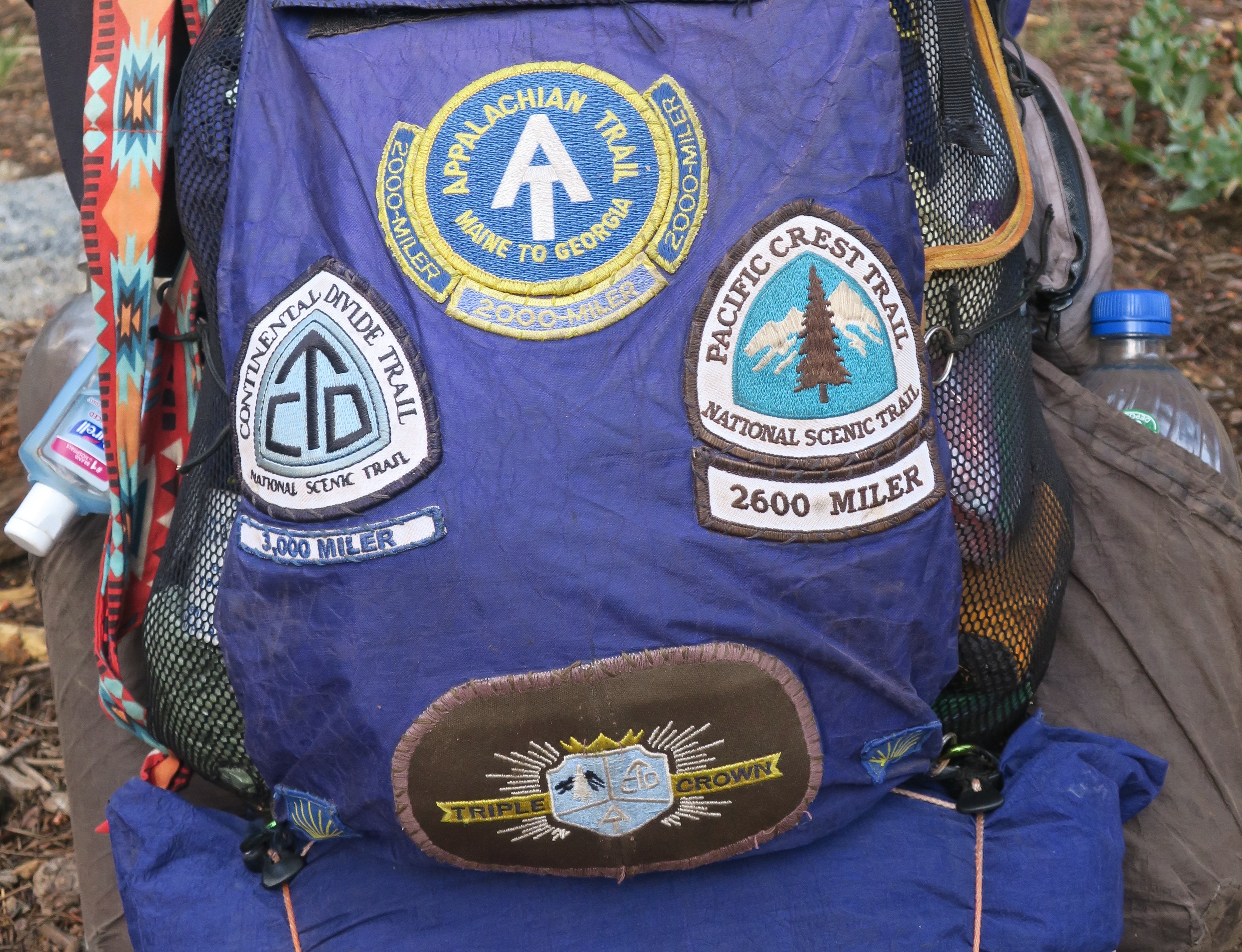
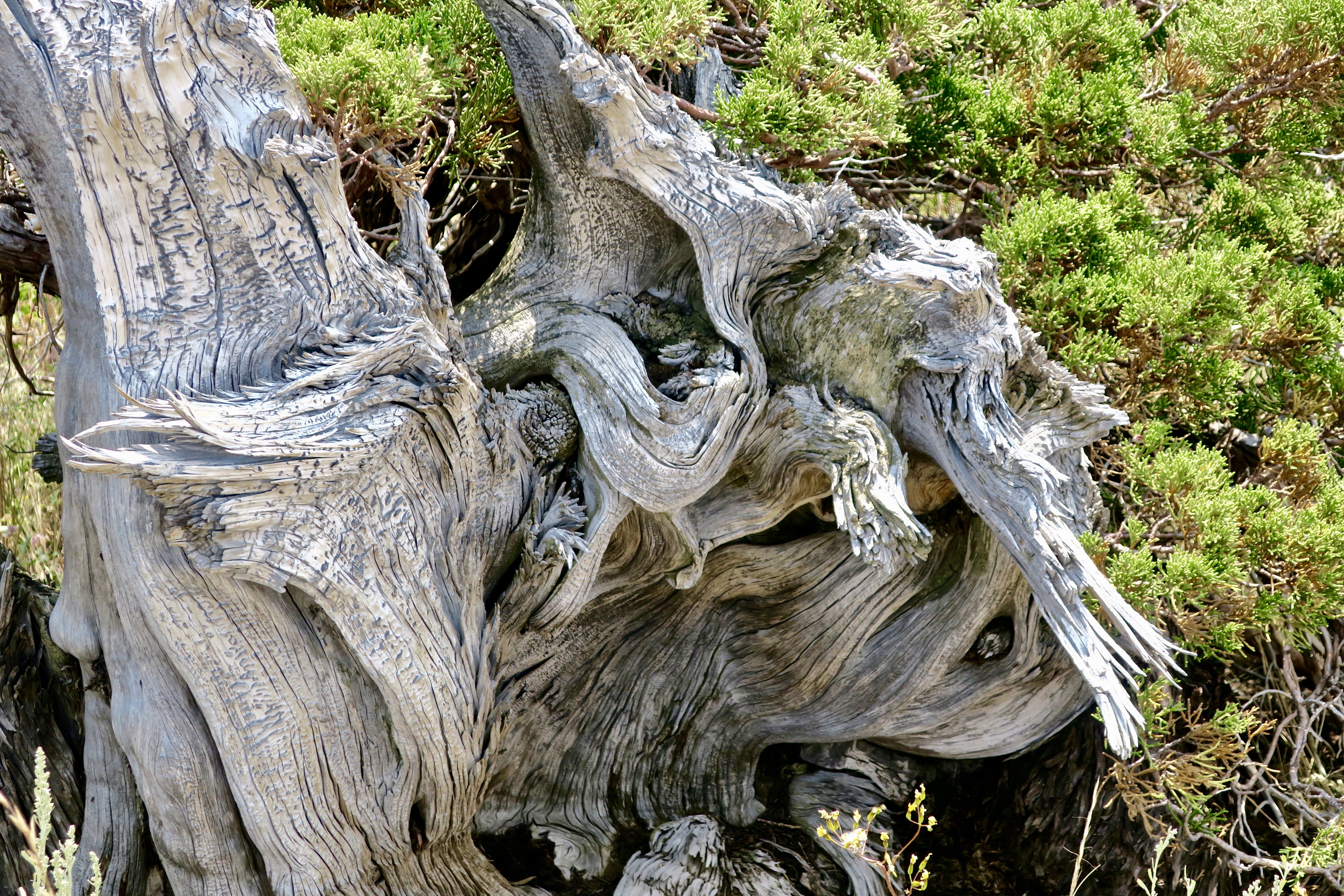
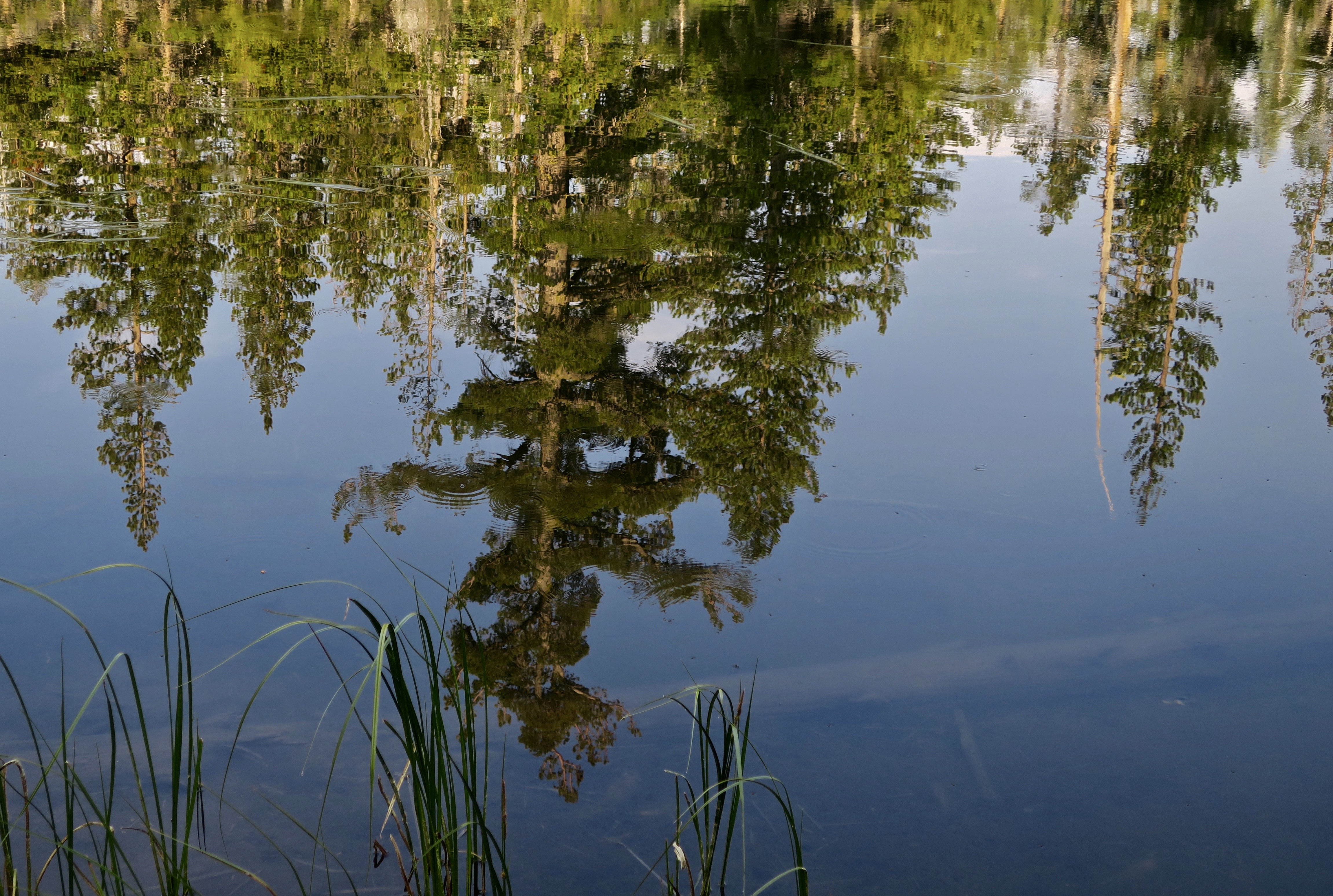
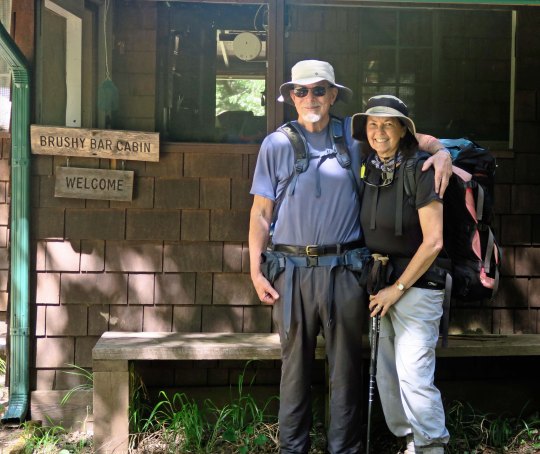
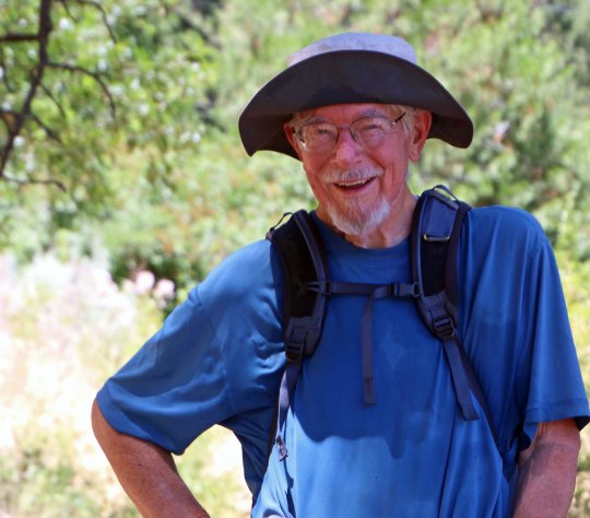
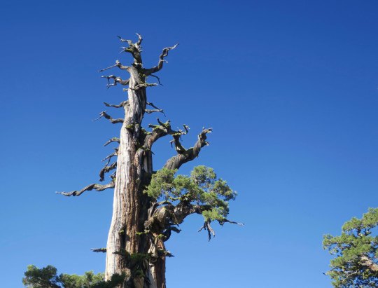
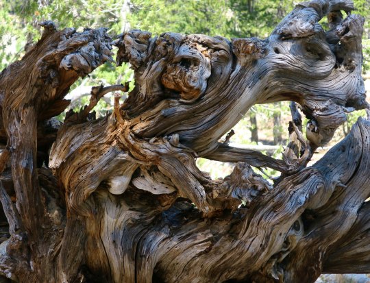
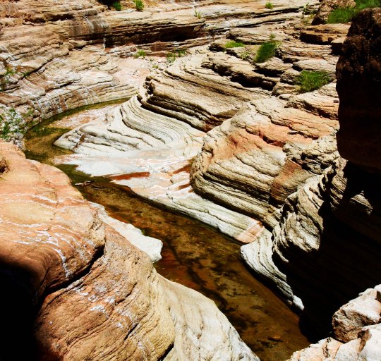
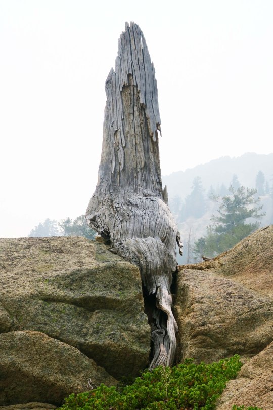
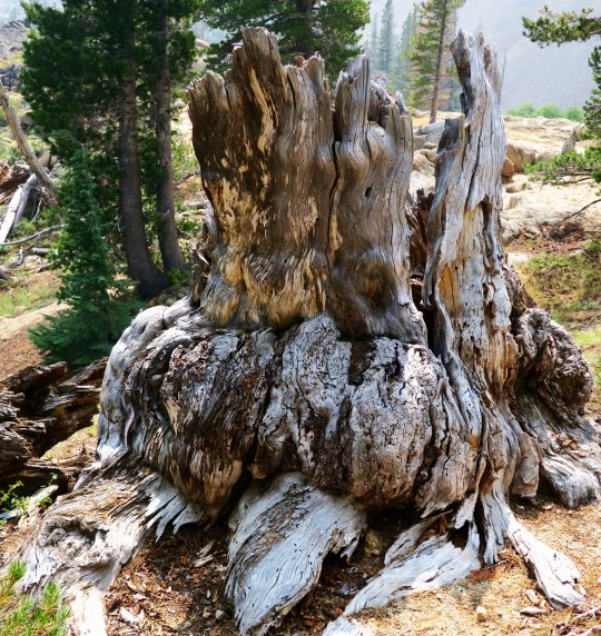
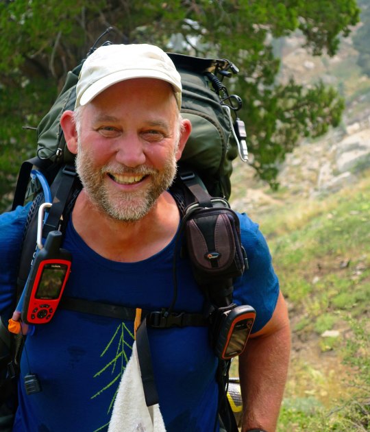
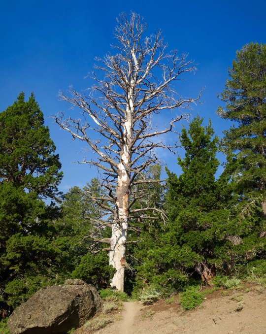
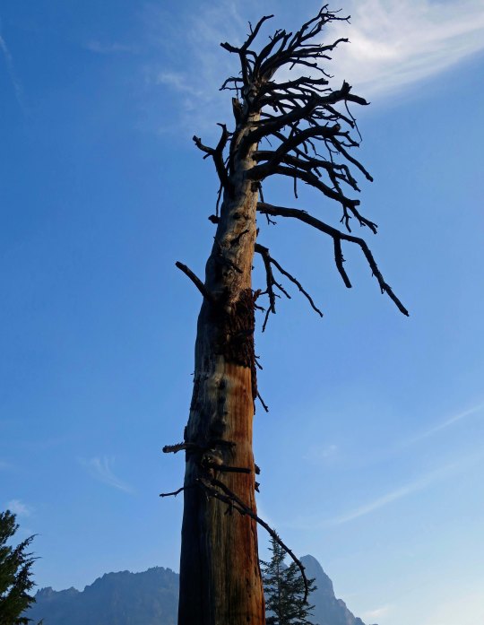
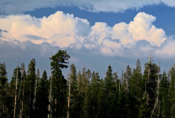
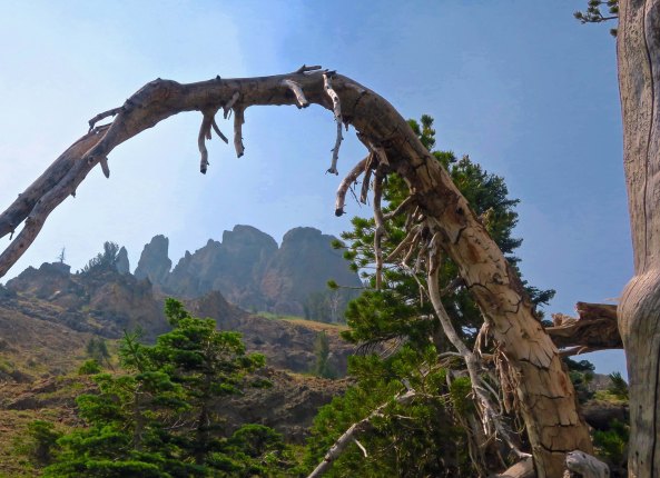
By the time I got to the Mokelumne Wilderness section of the PCT, I was looking a little scruffy, not to mention skinny.Peggy, who is never scruffy, sent me off with a smile. She hiked three sections with me and provided support on all of the others, for both me and through-hikers. By this point, she was almost over being nervous about sending me off on my own.Almost immediately, I came on this old snag. I always enjoy their personality and beauty. You will see several on my two Mokelumne Wilderness posts. This one is all about roots.And how about this lodgepole pine that was insisting on doubling back on itself. It must have had a warped childhood.This is Frog Pond, maybe a mile along the trail from Carson Pass and a tenth of a mile off the PCT. I’d hiked by it several times over the years and not stopped. My loss. If it looks like the end of the world on the opposite end, close. There is a steep drop off just beyond the rocks.This well known landmark is known as Elephant Back. My first challenge of the day would be hiking around it on the left.Fortunately, it was all downhill. But there’s a truism about hiking in the Sierras, what goes down inevitably goes up!The Mokelumne Wilderness features flowers galore. There were whole gardens of them, planted and tended by nature. This one was also tended by a bumble bee,Pennyroyal, a member of the mint family. I picked a leaf and munched on it as I hiked down the trail.Ranger’s buttons. People who name flowers have great imaginations. As noted in the beginning, there are lots of them along the trail.Birdie on a granite rock. It sang me a song so I took its photo.I camped under this magnificent Jeffrey pine my first night…And met this young fellow in his 60s. He had quite a story to tell.He had hiked all three of America’s National Scenic Trails including three times on the Appalachian. He was now doing the PCT a second time.Did I mention the trail went up?I figured an alien from a UFO planted this so I avoided touching it… just in case.This, on the other hand, was an old friend of mine from growing up in the Sierra foothills: California Holly.Looking down on Upper Blue Lake from the trail. Note the smoke. It was a summer of fires along the PCT and I ended up breathing lots of smoke and avoiding fires. The distant knob was a prominent landmark for pioneers. Any guess for what they named it? The Nipple.Another snag.The trail worked its way through granite boulders and junipers.Which are one of my favorite trees.Heading off the trail, I found an attractive small lake to camp on. The clouds were threatening a thunderstorm.But the lake remained calm, reflecting the surrounding trees from impressionistic…To realistic.The next morning found me back on the PCT by 7 am, which will be the subject of my next Mokelumne Wilderness post…With a very different terrain.
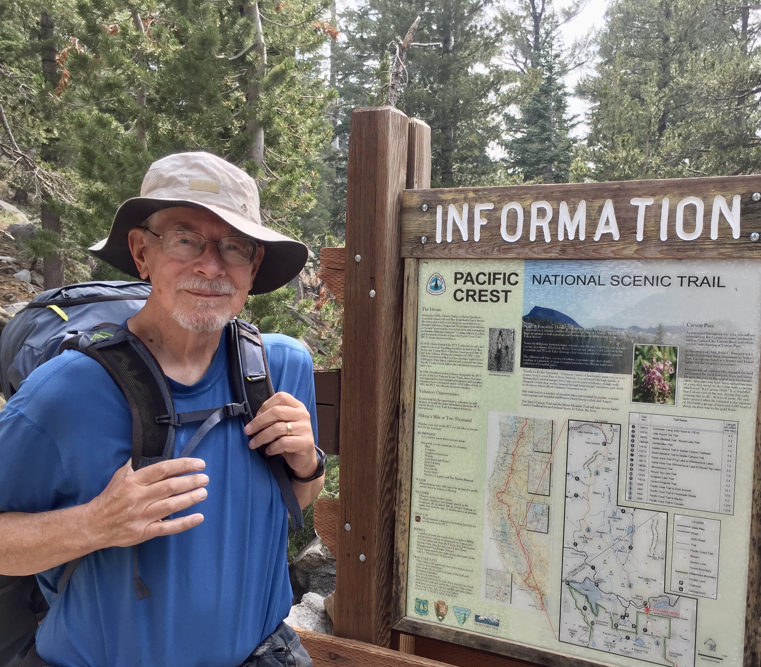
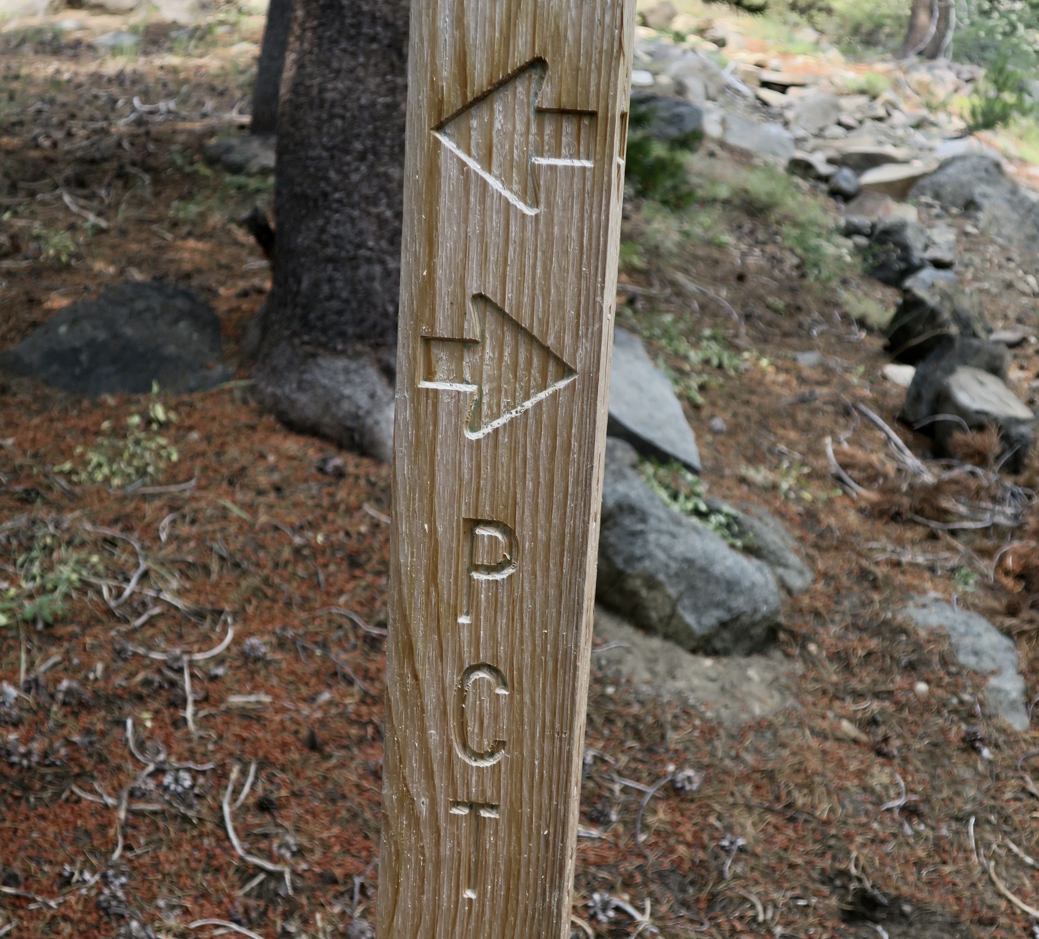
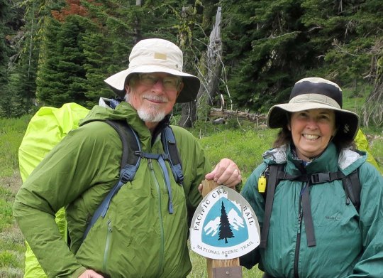
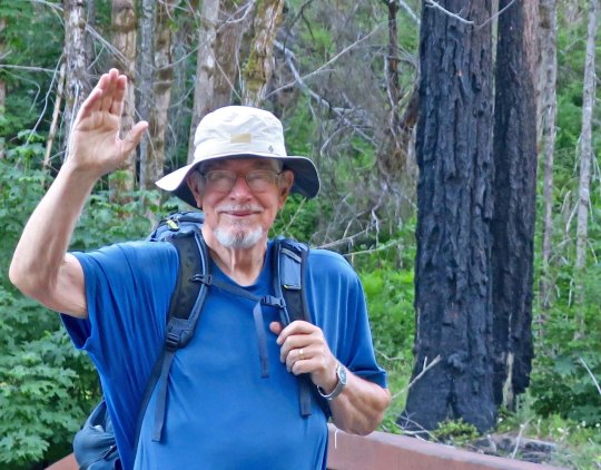
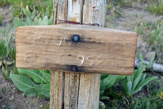
Curt and I had just started down the PCT when we came across this sign near Mt. Ashland
In the beginning: lots of questions!
When Curt first shared that he wanted to celebrate his 75thbirthday hiking on the Pacific Crest Trail, I was not surprised. He has 50 years of backpacking experience and loves wandering in the woods. Then he added the 1000-mile goal. That surprised me! There were so many questions. Reading about the challenges faced by Bill Bryson in A Walk in the Woodsand Cheryl Strayed in Wildadded more. Their combined ages when they started their adventures was less than Curt’s. The conversations and planning began.
The first question was, can we (yes, we) physically do this? I had every intention of joining Curt on the trail whenever possible. He had introduced me to backpacking in 1980 and I, too, had fallen in love with the sport. But there was this age thing— for both of us. I’m 68, a child bride perhaps from Curt’s perspective, but not in the reality of miles traveled in life. Off we went for a week’s backpacking trial run on the 40-mile Rogue River Trail. Other than Curt falling down a cliff (well, only 20 feet head first) after his trekking pole collapsed, suffering minimal damage to his arm, and bouncing back on the trail, it was a beautiful adventure and a confirmation that we could still backpack longer distances with a bit of practice and preparation.
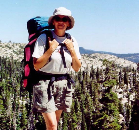
Here I am in the late 90s above Lake Tahoe. When Curt introduced me to backpacking by hiking through the Desolation Wilderness, he brought his 87 year old friend Orvis Agee along for inspiration. Plus, how could I complain?We trained for our trip by backpacking along the Rogue River Trail in southern Oregon. Not 30 minutes after this Curt’s trekking pole collapsed and he went off the cliff. I thought he had a heart attack and charged over the edge myself. Ten minutes later we had washed the blood off his arm, slapped on antibiotic cream and were back on the trail.Usually, our backpacking adventures have us wading across fast flowing streams or balancing precariously on logs. The Rogue River Trail provided beautiful bridges. My kind of river crossing!Hiking down a steep, narrow trail covered with loose rock to reach camp at the end of a long day was not my idea of a picnic, however! (“You, want me to hike down there!?”)A ranger cabin along the way provided a photo op for us.
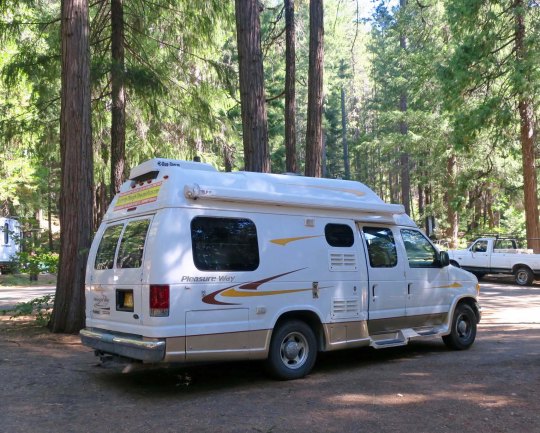
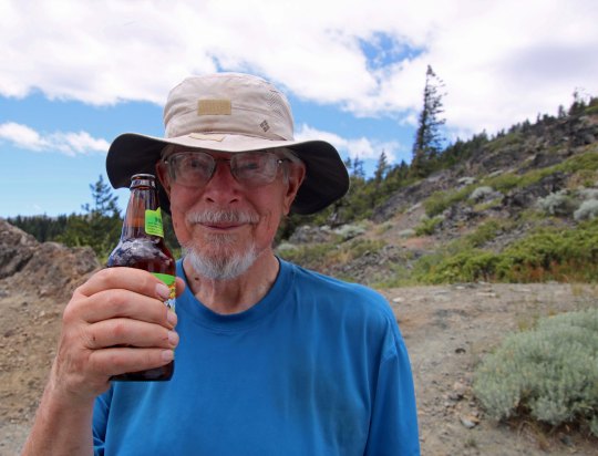
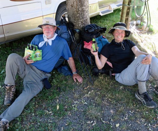
The next question was how much could I backpack with Curt and still provide support along the way? I was to be his ‘trail angel’ in PCT lingo. I’d be driving our 22’ Pleasure Way RV/van as the support vehicle. We had been traveling in it for years sharing driving responsibilities, so I was confident I could manage. It was to be my first solo trip, however! My job included carrying three months of food and other backpacking necessities and resupplying Curt between trail segments. There was the fine print of course— and other duties as required (grin).One was that I’d greet Curt with a big smile, a hug, and a cold beer when he came off each segment. Given that my young/old husband had survived another 70 to 100 miles of backpacking through the wilderness over challenging terrain, the smiles and hugs were really easy! My presence would also offer a comfortable break from the trail and provide the flexibility of changing mileage, timelines, and length of breaks if needed. It was an advantage that few PCT hikers have. Curt is spoiled rotten, what can I say.
We used our 22-foot RV Quivera for back up. (Quivera was a mysterious Native American city that was supposedly full of treasure but was always moving around so no one could find it.) I’ve had plenty of experience driving it. We always take turns, but there is more. When Curt and I retraced his 1989, 10,000 mile solo bike trip around North America a couple of years ago, I drove the whole way so he could take notes and photos.A #10 can of Mountain House freeze dried food. The back of our van was packed to the brim with food when we began the trip. Each time Curt finished a segment of the trail, I would help him put his next resupply together. This will give you an idea of what Curt looked liked when he came off the trail: Skinny, disheveled and sweaty! (Here, he had just covered 16 miles in a little over four hours.) And I was supposed to hug this guy and give him a cold beer? Yep.Ah, the things that love will do to you.In my role as ‘Trail Angel’ I provided many a through hiker with a cold beer, which Curt fully supported… as long as I saved one for him!
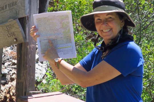
Realistically, I would not be able to backpack much of the way without someone moving the van from Point A to Point B. However, we could backpack the first segment together from Mt. Ashland to Seiad Valley which would be a great confidence builder for both of us. The rest we would figure out on the run! Once we hiked into Seiad Valley, 6 days and 60 miles later, I was assured Curt could do anything he put his mind to! (So could I.) Still, waving goodbye to him as he left Seiad Valley on his first solo segment up through the Marble Mountains was hard. “If you don’t come out, Curt, I am coming in after you,” I told him and meant it. He had looked nervous and said, “Call Tony first.” I am geographically challenged when it comes to finding my way around in the woods. Tony is our Coast Guard pilot son who has participated in numerous rescue operations.
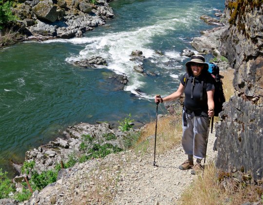
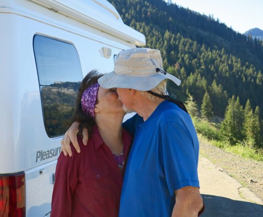
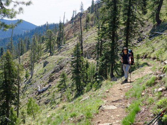
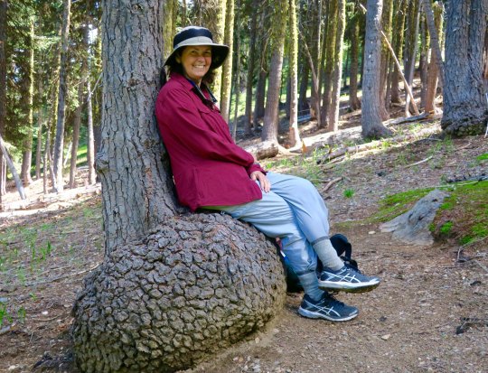
Our journey along the PCT from Mt. Ashland to the Seiad Valley brought us to the Oregon-California border. It is a major objective for the majority of through hikers who travel north. For Curt, it was just the beginning of his journey.While we were only hiking 60 miles, there were plenty of challenges. Here, I am hiking up the back of the Red Buttes. We can see the other side of these mountains from our home.A picture of the now snow-covered Red Buttes taken from our patio this morning.Of course there were occasional breaks. I couldn’t resist this convenient chair.Here we are celebrating at the small campground where we had left our RV in Seiad Valley. It appears that I was to get one beer and Curt five. Not.My emotions were mixed as Curt turned to wave goodbye before heading up into the Marble Mountains. For one, I was proud of him, proud of both of us, for undertaking this fantastic adventure. On the other hand, this was the first section of the trail he was hiking by himself. So many things could go wrong out there. He was no longer the 20, 30, 40, 50, or even 60-year old of his earlier backpacking days. Would he come out of the mountains at the place and time he had planned? I smiled bravely and waved goodbye.
NEXT POST: When the unexpected happens along the PCT. Peggy’s perspective: Part 2.
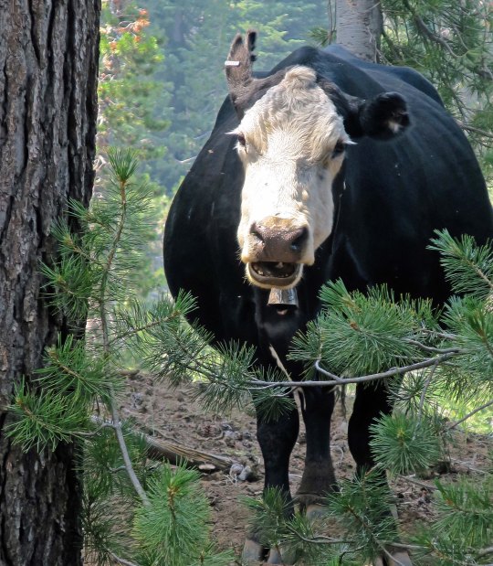
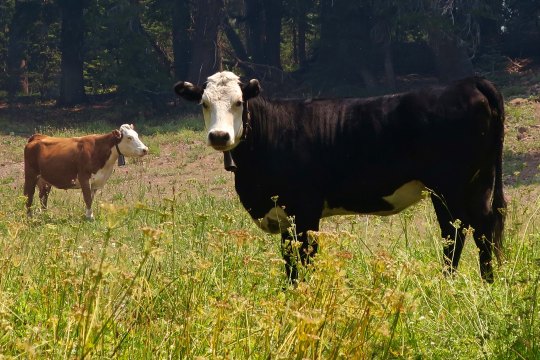
I stopped for a discussion with a cow about trail conditions in the Carson-Iceberg Wilderness.
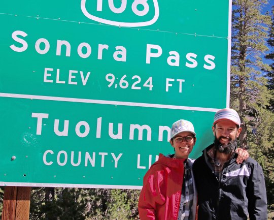
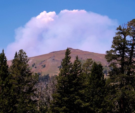
I was late, like the white rabbit, for a very important date. Peggy was waiting for me at Sonora Pass and I had miscalculated the distance and difficulty of the trail. The night before I had found this lovely little campsite on the edge of a creek that I couldn’t resist. Later, as large ashes began falling on my tent, I began to question the wisdom of my decision. The 97,000 acre Ferguson fire near Yosemite and the 229,000 acre Carr fire near Redding that had been filling the skies with lung-choking smoke for the past month were now contained. Another fire was lurking out there— close by somewhere — and it was suggesting that I get on down the trail.
My goal, I decided, would to be get up at four and on the trail by five. But sleep had been as elusive as my knowledge about the fire. My eyes had popped open around 6:30. There would be no early start. The good news was that the smoke had partially cleared. All that remained of my previous night’s threat was a thin layer of ash. By 8:00 I was fed, watered, packed and raring to go. I figured the 1000-foot, three-mile drop into the East Fork of the Carson River would fly by. I figured wrong. The last part of the trail was steep and narrow over loose rock. It was not the type of trail that one flies over, at least not at 75 . I was ever so glad that I hadn’t tackled it the evening before when I was tired.
It was with relief that I began hoofing up the Carson River. While I had a 2500 foot climb ahead of me up to 10,000 feet, the first part of the trail was relatively gentle. I was making good time when a small root hiding out in the shade caught the toe of my boot and I went crashing down. This wasn’t one of those stumbles where you catch yourself, or at least slow your fall. It was a nose crunching, glass breaking fall. Thankfully, I bounce well. Lying there face down in the dirt, I reached up and touched my nose. It was solid and not spurting blood, although my finger came away bloody. Even my glasses had survived without a scratch. I picked myself up, shook the shock out of my head, and babied the scratch on my nose.
Right about then a through-hiker came hurrying by, going in my direction, moving out. We said hi as he disappeared down the trail. A thought passed my mind. “Can I ask a favor,” I called out to his disappearing back. He stopped immediately and walked back.
“My wife Peggy is waiting for me at Sonora Pass, I explained, “and I am running a couple of hours behind time. I know she will be worried. Could you carry a message for me?” I figured he would be there by mid-afternoon.
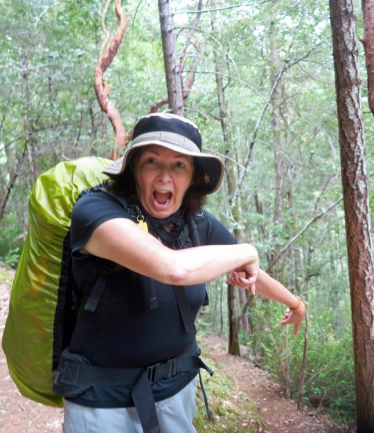
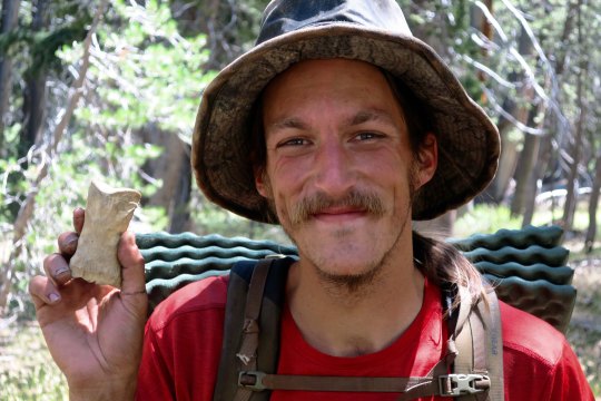
“Sure,” had been his response. I provided the details and we introduced ourselves using our trail names. “I’m Bone from Portland,” he told me. I imagined a small squeak in my pack and yanked Sierra Bone out. I made the introductions. “Bone meet Bone,” I said. Naturally there had to be a photo of Bone with Bone.
Bone and Bone.
Relieved that Peggy would get the word that I was alive and well, I continued my journey and started the slow, steep climb out of the river canyon. I spotted a couple near the top who were off the trail eating a snack. One called out, “You must be Wanderer,” she said. “Your wife is worried about you.” Of course. Turns out Camilla and Bastien were from Leon, France and Peggy had met them while they were waiting for resupply at Sonora Pass. She had fed them scones loaded down with peanut butter. Peggy, Camilla explained, was concerned because the parking lot closed at five and she would have to move. Bastien chipped in that he didn’t think I would get there in time.
Photo of a happy Camilla and Bastien after eating peanut butter with a scone attached. (Photo by Peggy Mekemson.)
I wasn’t concerned. I had two hours and it was only four miles. Still, I moved out and made it in a little over an hour. Bone was waiting with Peggy when I arrived. She had offered our van to charge his phone. He was enjoying a beer. While Peggy got me one, Bone and I discussed the wind we had encountered up on the mountainside. He had put his pack down and barely caught it as the wind had pushed it down the narrow trail toward the edge. My pack was fine but the wind had almost sent me tumbling off the cliff. We estimated that there were gusts between 50 and 60 miles per hour. I’d had to lean in toward the mountain to keep my balance.
The wind was having another impact as well, pushing a fire up the mountain. As we watched, a small plume of smoke had grown to cover half of the sky. It was the Donnell fire that had dropped ashes on my camp the night before. It was frightening to think of being out on the trail facing a fire pushed by 60-mile an hour winds. An hour after we left, the Sonora Pass road was closed. The next day, the PCT was closed between Ebbetts Pass and Sonora Pass, the trail I had just hiked.
The following photos are taken along the Pacific Crest Trail between Ebbetts Pass and Sonora Pass traveling south.
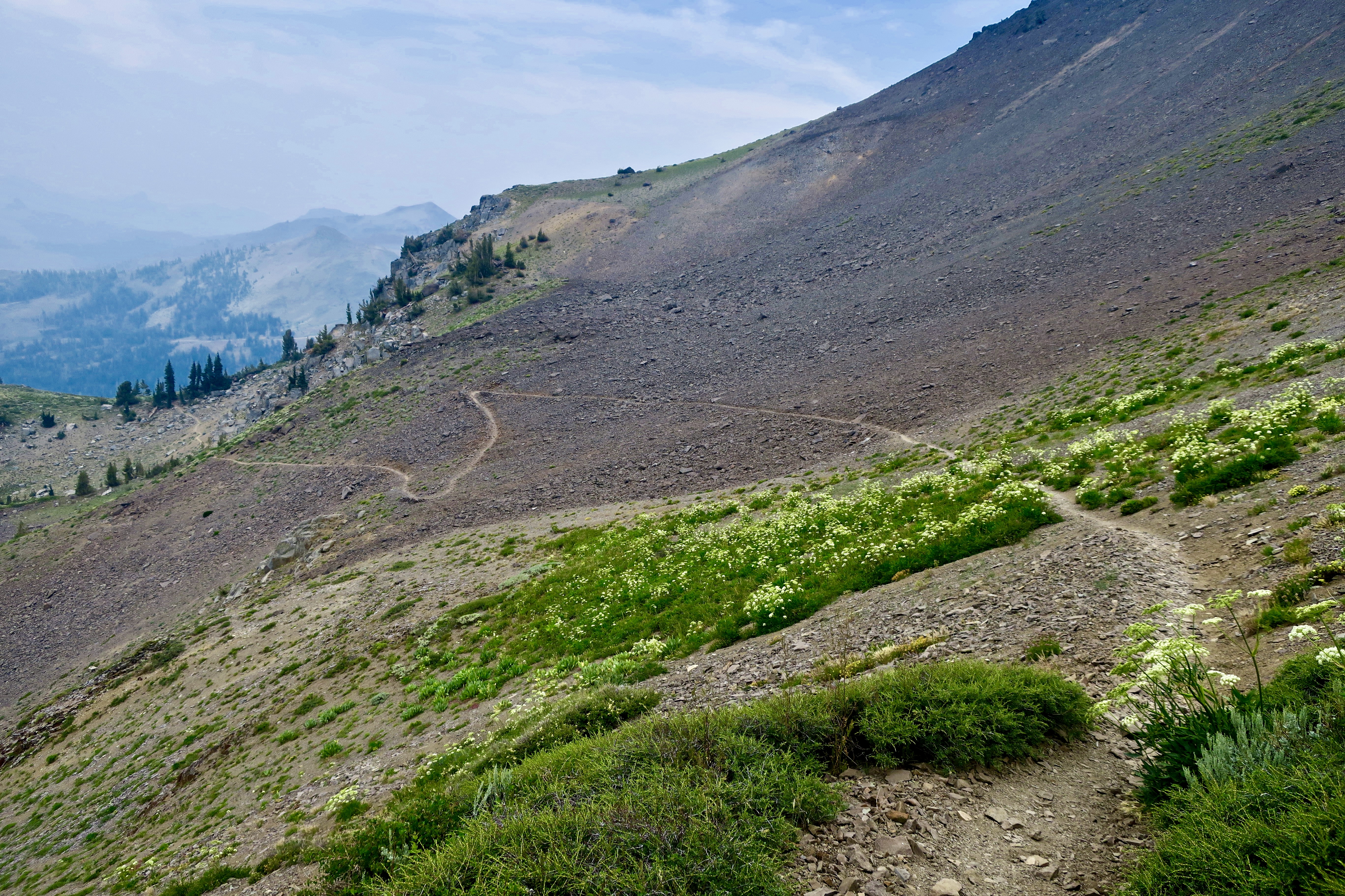
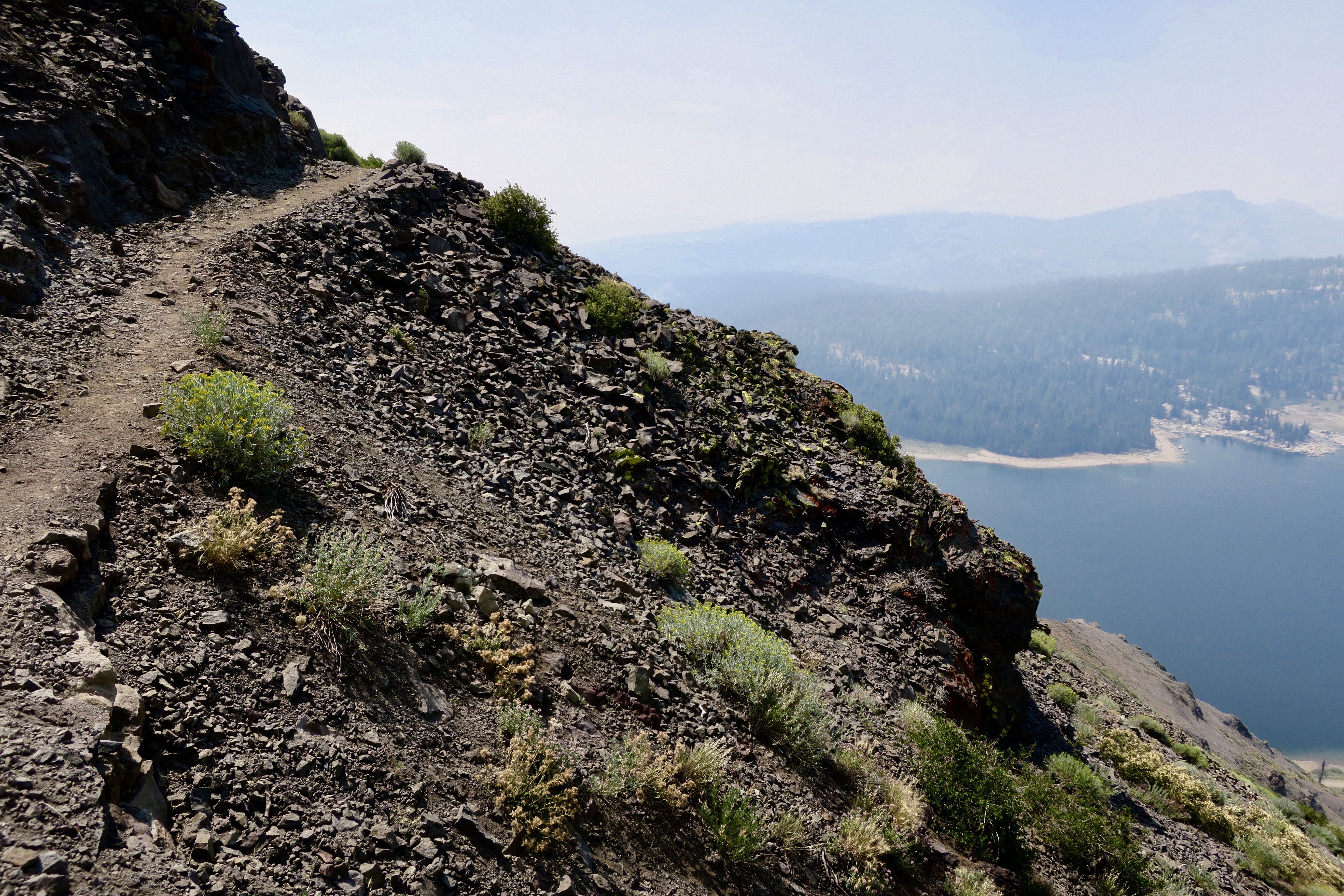
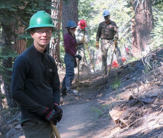
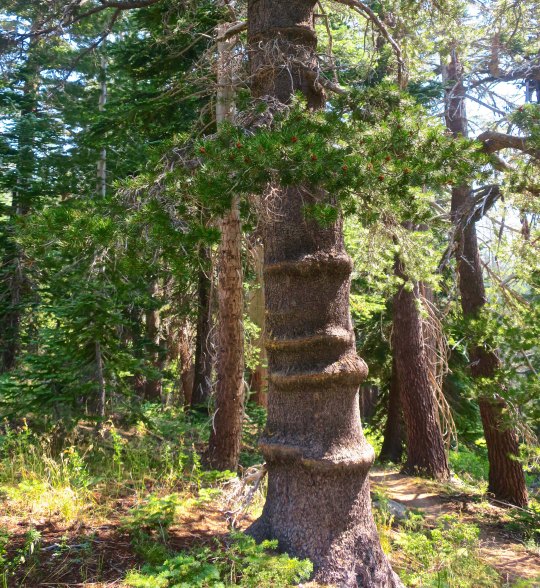
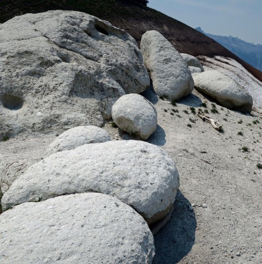
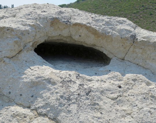
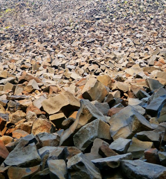
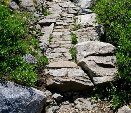
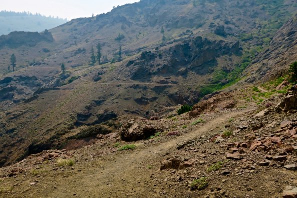
A smokey day along the PCT in the Carson Iceberg wilderness.A trail crew of volunteers from the Pacific Crest Trail Association. Much of the PCT trail work is carried out by volunteers.This was an interesting tree trunk. The ridges were caused when the tree grew over attached barbed wire. We have a few like it on out property.Cattle are not uncommon along the PCT. I always stop to chat with them.I was surprised to find rhyolite boulders along the trail. The boulder had an interesting little cave. I wondered what lived there.Guess who volunteered?A patch of asters was growing nearby.Here’s the reason why Boulder Mountain is called Boulder Mountain. It was one heck of a scree slope.A tree perched on a granite rock caught my attention…And I took several photos.Hiking down into the East Fork of the Carson River provided this view.I filled my water bottles here at a small creek crossing the trail.This is a photo of the Eastern Fork of the Carson River. The water falls were indicative of the fact that the trail had started to climb.When I stopped to photograph the river, I also caught these roots.And this knot with a personality.Climbing higher I came across some extensive trail work. I have nothing but admiration for the crews that placed these heavy rocks.A view of the trail after I left Camilla and Bastien.Looking down toward the Sonora Pass where Peggy was waiting.. This is where Portland Bone and I had encountered the high winds.Another view.I’ll conclude today with this shot of smoke boiling up from the Donnell Fire. Had it been like this an hour earlier, I might have made that last 4 miles in 30 minutes instead of an hour! (grin)
NEXT POST: You met the large mutant vehicle animals of Burning Man in my last post, now it is time to meet the small mutant vehicle animals.
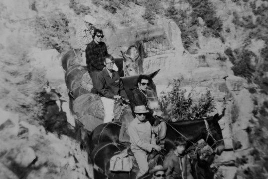
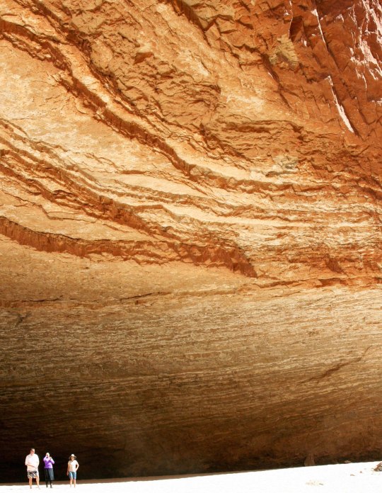
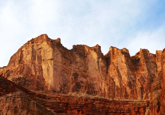
I have journeyed into the Grand Canyon several times over the years: on foot, by raft, and by helicopter. The first was by mule in the late 60s. That’s me, second from the top on Charlie. I was sore for a week afterwards. I was a pound over the weight limit, so Charlie kept trying to bite me, plus walk as close to the edge as he could!
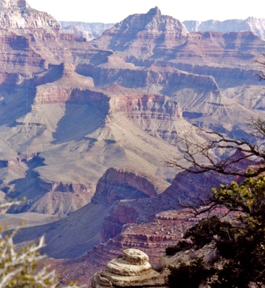
The Grand Canyon is truly one of the world’s great natural wonders. It’s celebrating its 100th Anniversary this year and I am quite pleased— and a little proud— that I have been returning there on a regular basis for 50 of those years. I’ve posted on my trips into the Canyon by foot and boat many times. Today, since I am still working on Burning Man photos and don’t have another Pacific Crest Trail post ready yet, I decided to reach back into my WordPress archives and put up some Grand Canyon photos. Happy 100th Grand Canyon!
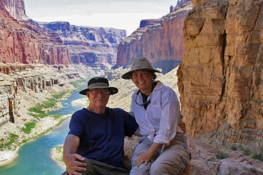
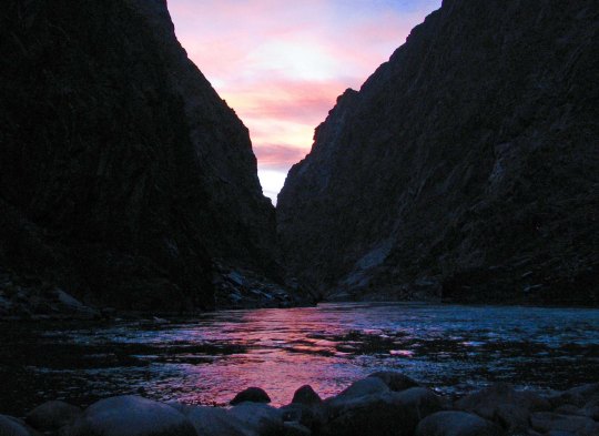
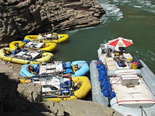
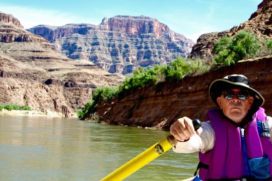
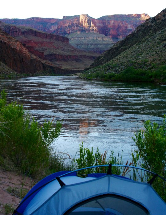
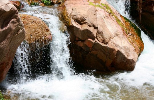
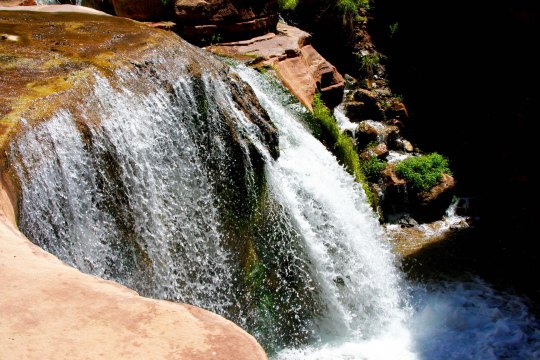
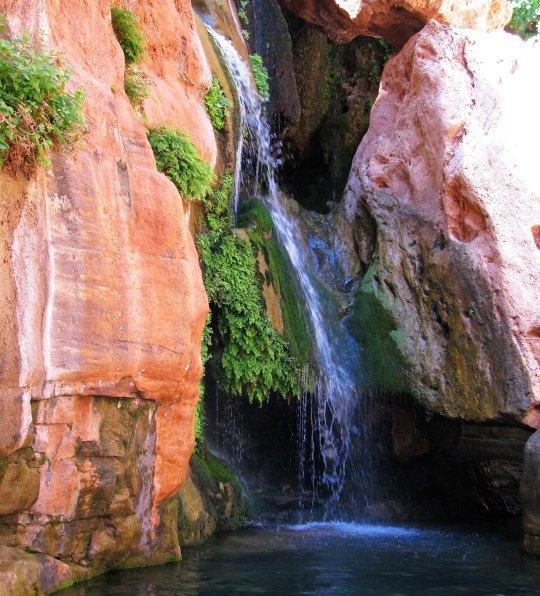
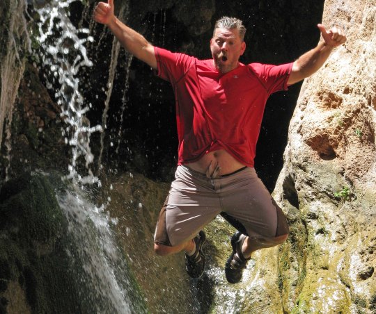
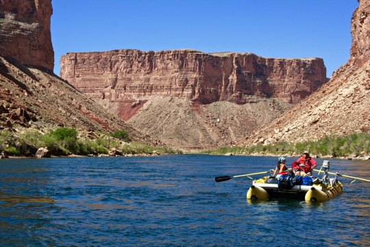
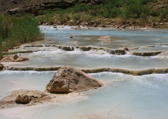
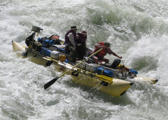
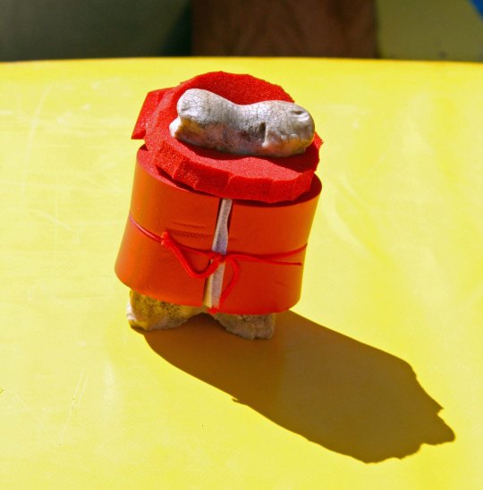
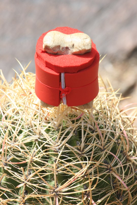
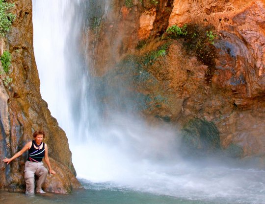
Sunsets in the Canyon are always spectacular, whether you are on the outside looking in or the inside looking out. This was from an 18 day rafting trip Peggy and I took down the Colorado River with a group of friends.Peggy and I are sitting above the Colorado River near an ancient Native American site.Sunset at Zoroaster Campsite on the Colorado River in the Grand Canyon. (Photo by Don Green.)You don’t have to hike or backpack, or raft, or fly, or ride grouchy mules to enjoy the beauty of the Canyon. You can drive up, and enjoy numerous pull-offs that give you incredible views.The mouth of Havasu Creek is a common stop for rafters in the Grand Canyon. Our rafts look small beside the large tour boat. Our trip was based on a lottery that I won for an 18-day private trip on the Colorado River through the Grand Canyon. Fortunately, I have friends with the expertise necessary to raft the Canyon.While a veteran crew of boatmen handled the more dangerous parts of our 18 day journey through the Grand Canyon, I was allowed near oars on some of the tamer sections.A morning view from out tent.. One of the fascinating things about the Grand Canyon is how it changes in the light. Numerous side trips away from the river provided opportunities to explore other parts of the Canyon.We were treated to views like this.Waterfalls along Deer Creek.This was a delightful waterfall, but I didn’t realize we were expected to jump off!Jamie Wilson demonstrates.This huge cavern is found along the river and is known as Redwall Cavern.Another river view.Looking up the Little Colorado River just above where it flows into the Colorado River. Note the water color and the mineral deposits. With Steve at the oars, Peggy and I enter the infamous Lava Falls on the Colorado River, a perfect ten… that’s 10 as in rapids don’t get any more serious. There was a point where we disappeared under the water. (Photo by Don Green)Bone, of course, went along on the raft trip and had his own life vest. Here, he decided that it was time for a photo op on the edge of a Sotar Raft.Here he enjoys a perch on top of a barrel cactus. Don’t try this at home, kids. Or anywhere else.Peggy stands next to Deer Creek Falls, a short walk from the Colorado River in the Grand Canyon.I’ll conclude with a final sunset view from one of our campsites.
NEXT POST: Either on Burning Man or the Pacific Crest Trail. Depends on what I get done. (grin)
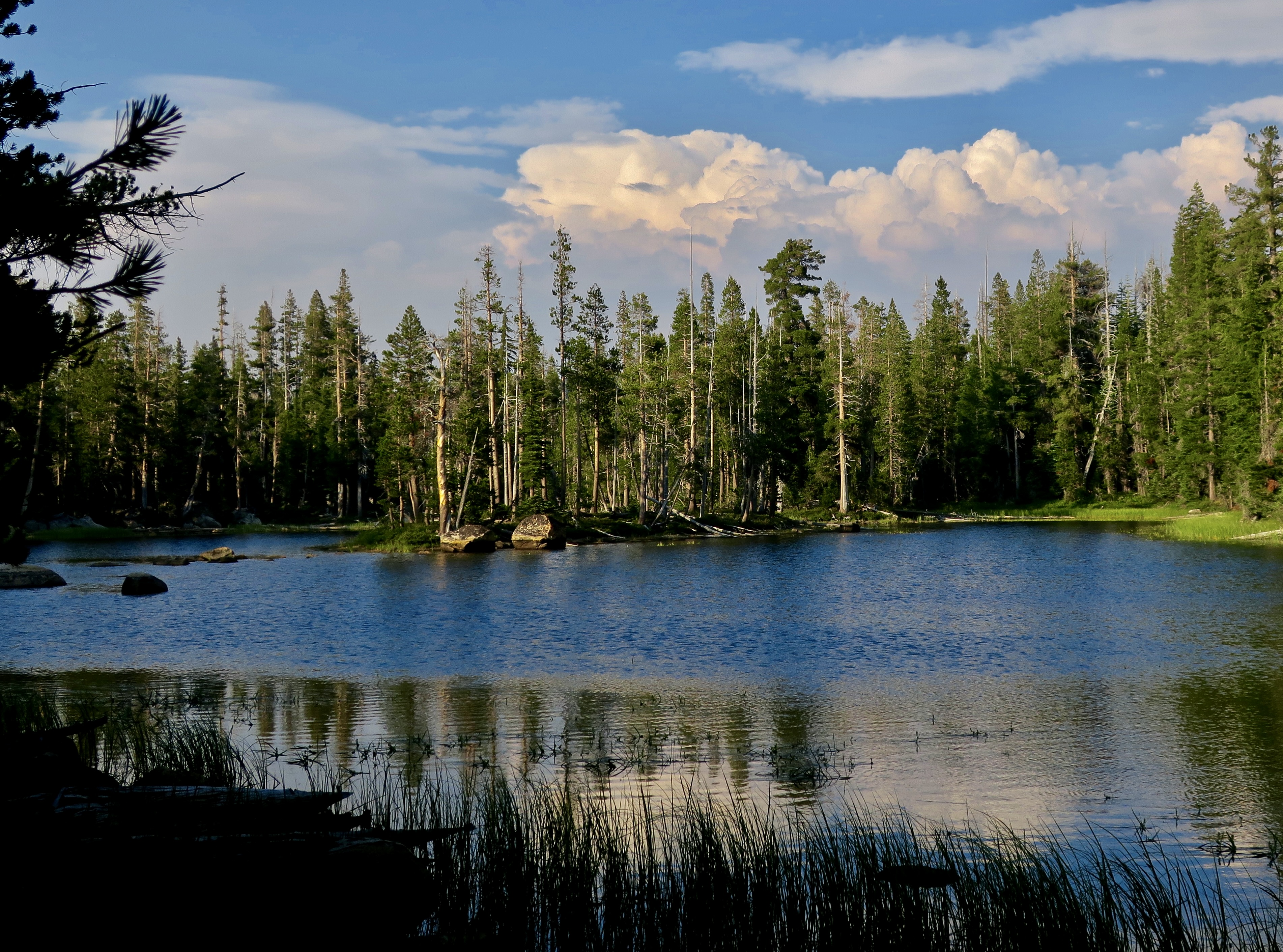
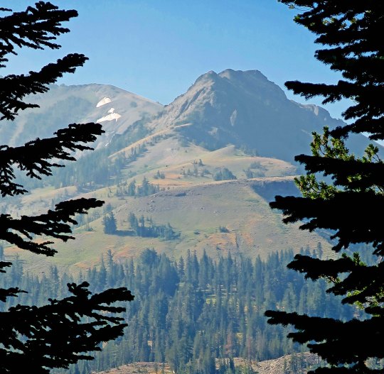
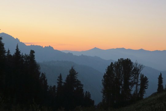
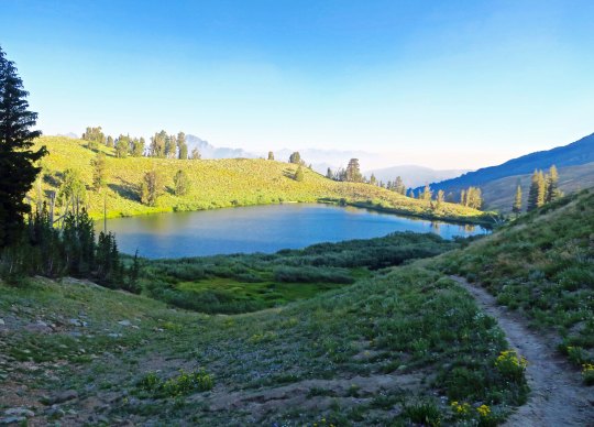
An evening view of the Mokelumne Wilderness from Noble Lake on the PCT.
I remembered Noble Lake from my 2003 trek when I backpacked 360 miles from Lake Tahoe to Mt. Whitney to celebrate my 60th birthday. For some reason, it didn’t seem as ‘noble’ this time. Maybe that’s because of all the other lakes I had passed on my hike down the PCT. But the views looking back toward the Mokelumne Wilderness were spectacular.
An afternoon view of Noble Lake. The lake is located south of Ebbetts Pass.
Another evening view of the Mokelumne Wilderness from Noble Lake. This is a situation where the smoke from the fires may have enhanced the photo.
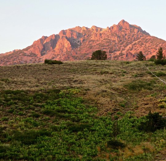
Looking up from the lake, I caught this mountain glowing in the evening sun.
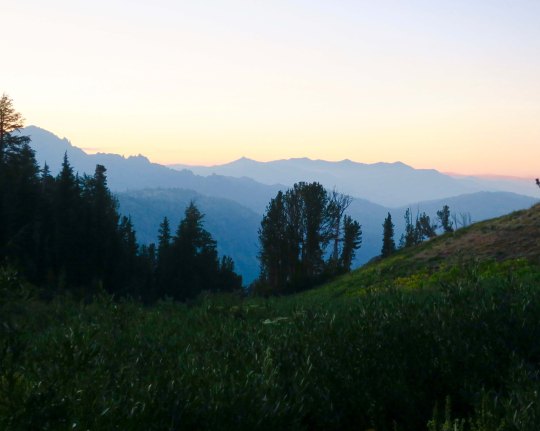
I was treated to more views of the Mokelumne Wilderness the next morning. It’s fun to think that I had been hiking through the area the previous day.
As I watched, the sun continued to rise, bathing the peaks in a soft glow.
I would have lingered, but Peggy expected me to be at Sonora Pass the next day, and I had miles to go. As I hiked up the early morning trail, I said goodbye to Noble Lake. Would I be back for my 80th birthday? (grin)
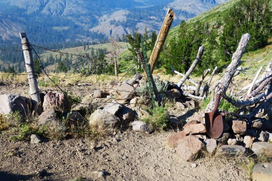
Up toward the pass, I was greeted by an old elevation sign. I think it told me I was at 9,980 something feet.
You know you are out West when you come to barbed wire fences. This provided a passage (sort of) that through-hikers could get through, but not cattle. The old shovel head spoke of earlier times.
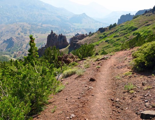
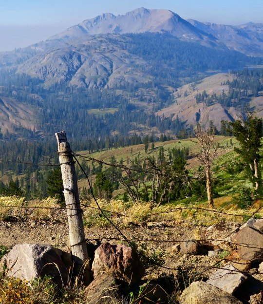
Looking through the wire, I could see my next destination, the Carson Iceberg Wilderness.
I’ll conclude today’s post with this view. It suggested another smoky day. Within 48 hours, the trail would be closed due to fire.
NEXT POSTS: Time’s limited since I am preparing for the San Francisco Writers’ Conference. I have one more post on this section of the PCT and then Peggy has two posts on her experiences as ‘trail angel.’ I think I will hold on these three posts until after the conference. In the meantime, I will put up some Burning Man eye candy since Peggy and I are hoping to go this year, assuming we can get tickets.
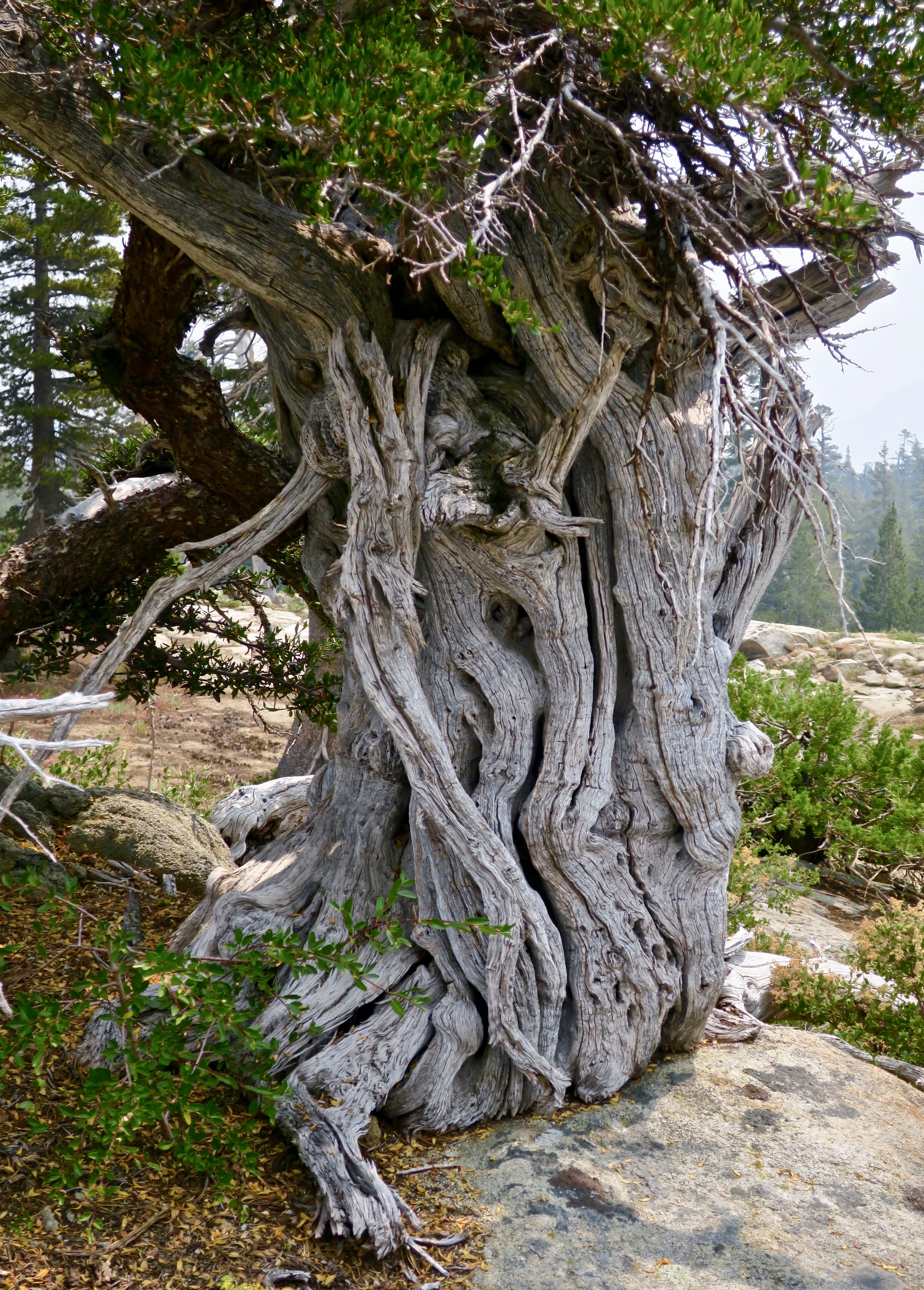
Another beautiful juniper along the PCT, this one just south of Ebbetts Pass. I was climbing up a very steep trail to Noble Lake. Check out the smoke. Excuse me while I go cough.
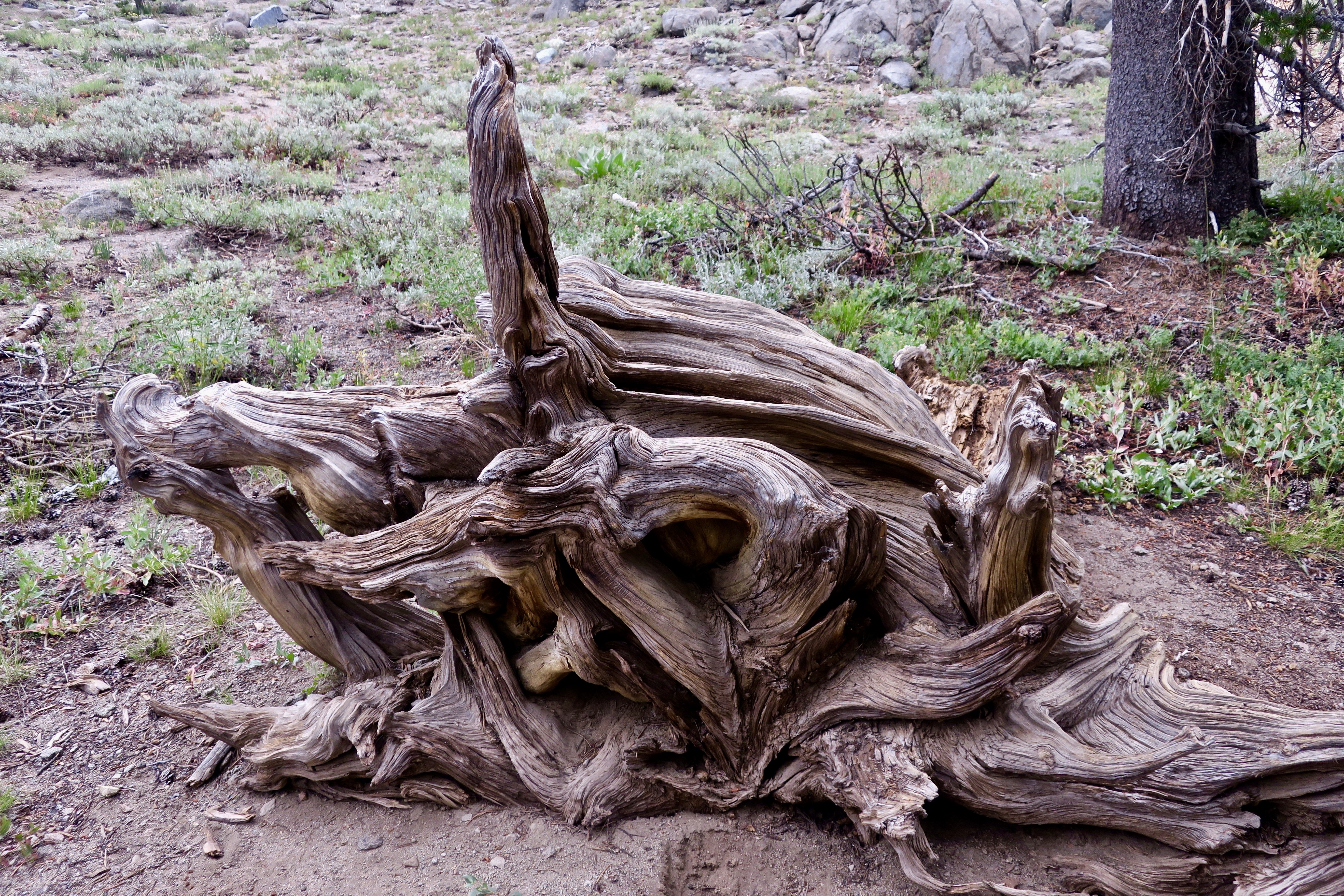
I left you in the last post about my hike down the PCT with photos of spectacular rocks and impressive trees. I say goodbye to the Mokelumne Wilderness in this post, hike across Highway 4 at Ebbetts Pass, and continue my journey southward. Of course there will be more pretty trees, but roots, snags, flowers, a family from Taiwan and through-hikers are the main subject for photos today.
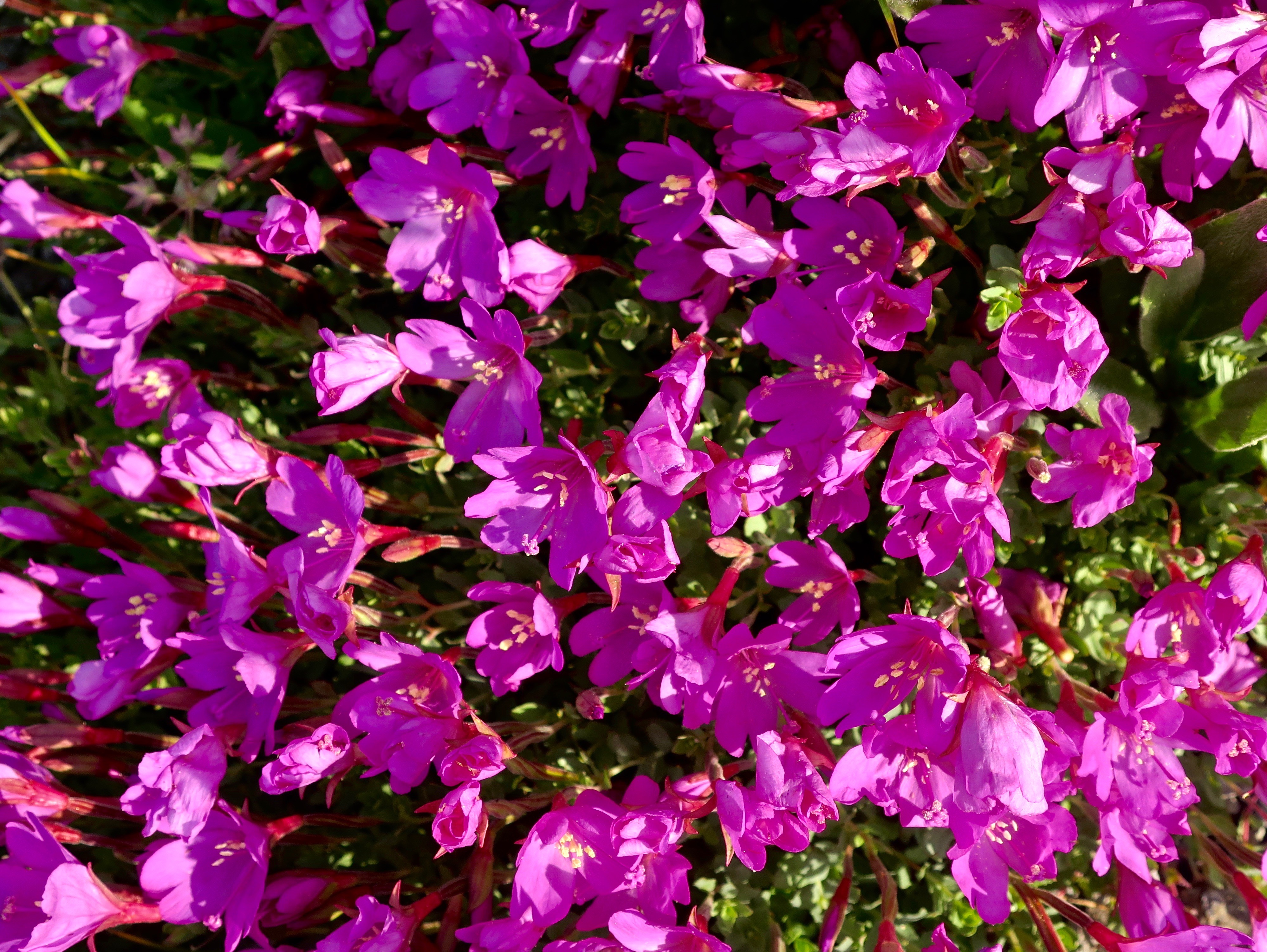
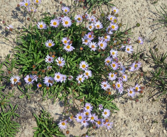
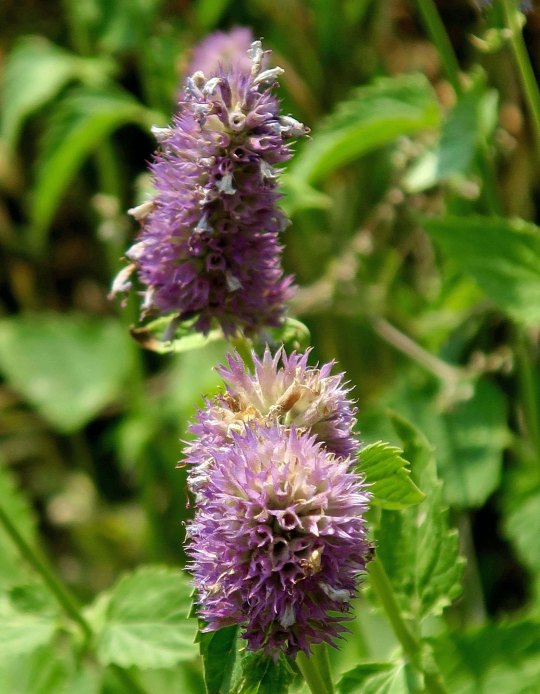
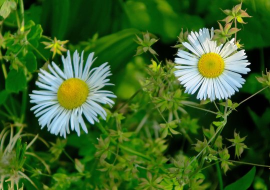
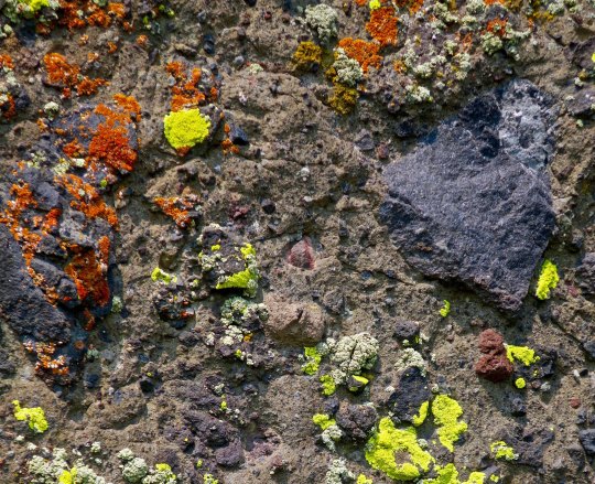
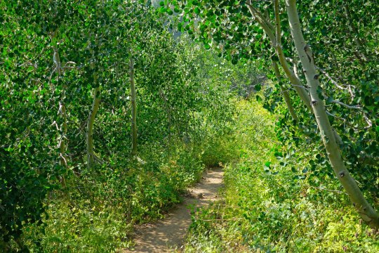
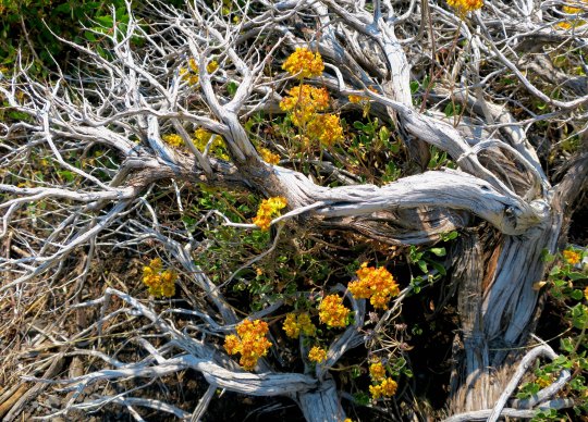
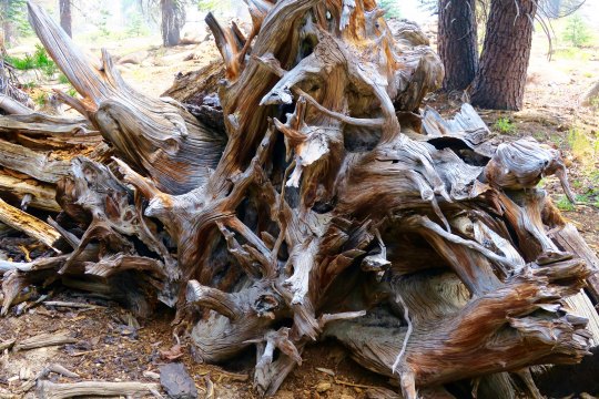
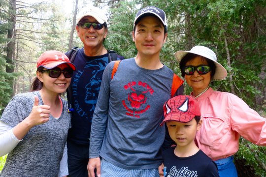
Have any aches and pains? Some people swear by this plant, self-heal, as being good for what ails you. I came across a list claiming it is good for ulcers, wounds, sore throats, hemorrhoids, high blood pressure, burns, insect bites, herpes and cancer. Woohoo. You might want to check with your doctor first. (grin)You’ve already met this fellow, flea bane, with its obvious name. Orange and yellow lichen— where algae and fungi co-habitate in a symbiotic relationship. An inviting green trail through aspen.A snag and dead flowers combine in a floral arrangement.This fellow was fun. I’ve never seen a snag sitting down with its tail hanging out behind. I was worried it might follow me home. How would I explain that to Peggy?Twisted roots!Stump with personality.Bone decided to get into the act when I left the Mokelumne Wilderness.These two sisters, Denise and Deborah were only doing part of the trail. Since we were hiking in the same direction, we kept crossing paths, so to speak. They were both carrying tents and explained to me, “We grew up having to share a room. That was enough.” They wrote me later saying that their hike was interrupted by the Sonora Pass fire. Mine too. I caught up with Wayne Chiang and his family along with their friend, Bass Chong, at Ebbetts Pass. They were out for a day hike. Wayne is a legislator with the Republic of Taiwan and has long term hopes of becoming Mayor of Taipei. Bass works at Ebay. This smiling fellow was from Germany and, I am sorry to say, I’ve misplaced his trail name. He wanted to take a photo of me to show friends and family back home that people of all ages hike the PCT. I was just glad that he didn’t say something like, “Really old people hike the PCT!” A final juniper photo for today.
NEXT POST: Adios, Puerto Vallarta… with a few spectacular sunsets.
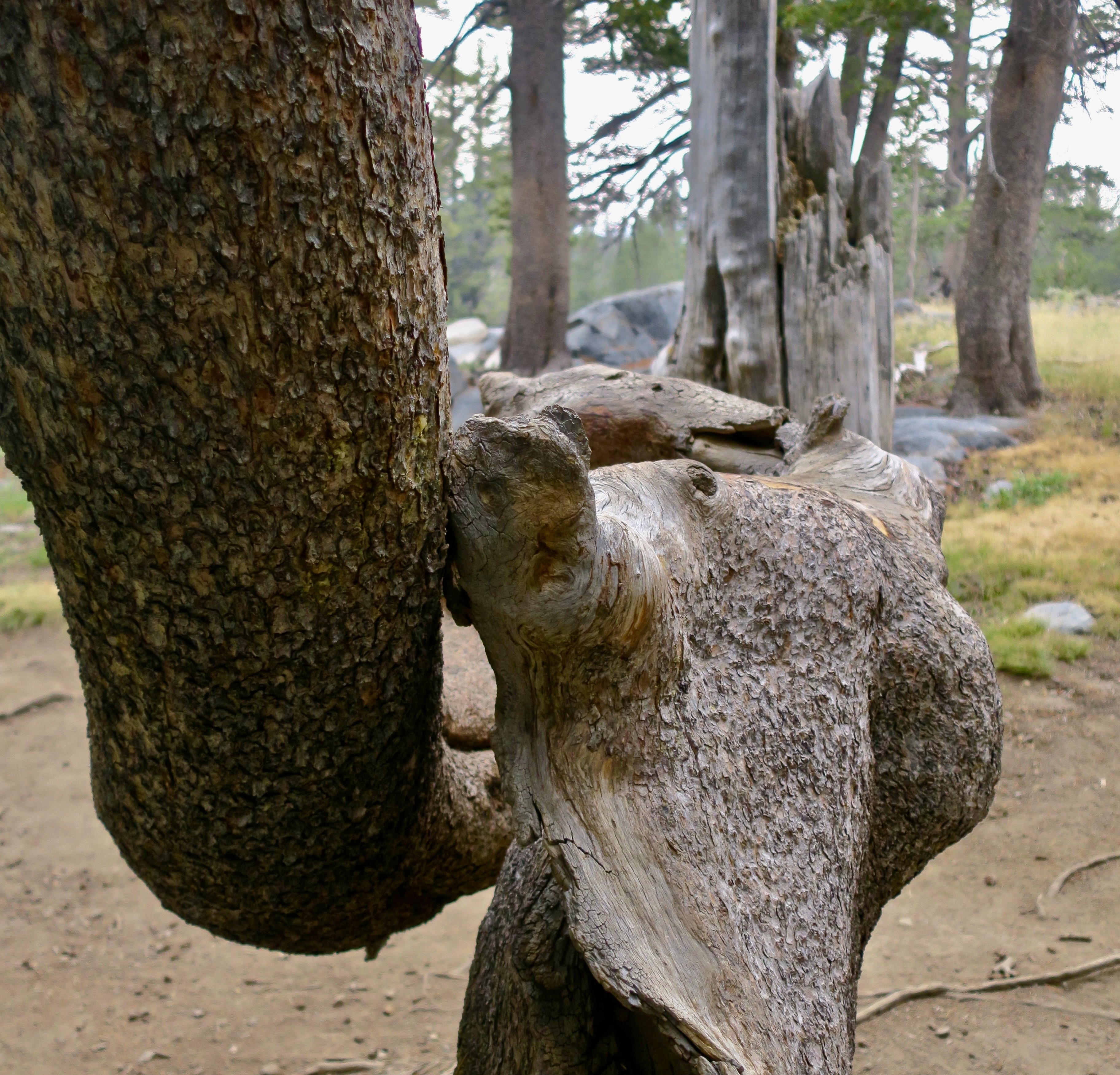
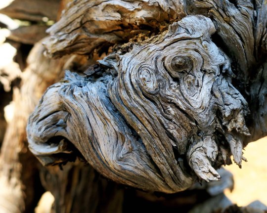
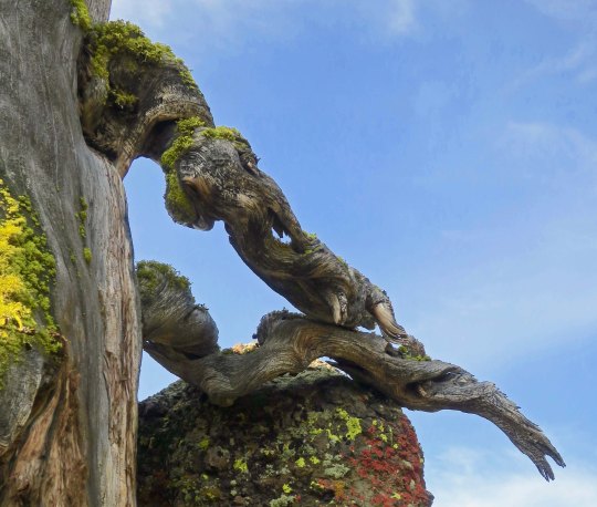
I didn’t spot the tusks on this tree limb until I checked out my photos. There’s no doubt which is the dominant creature here! Or maybe they are just snuggling.
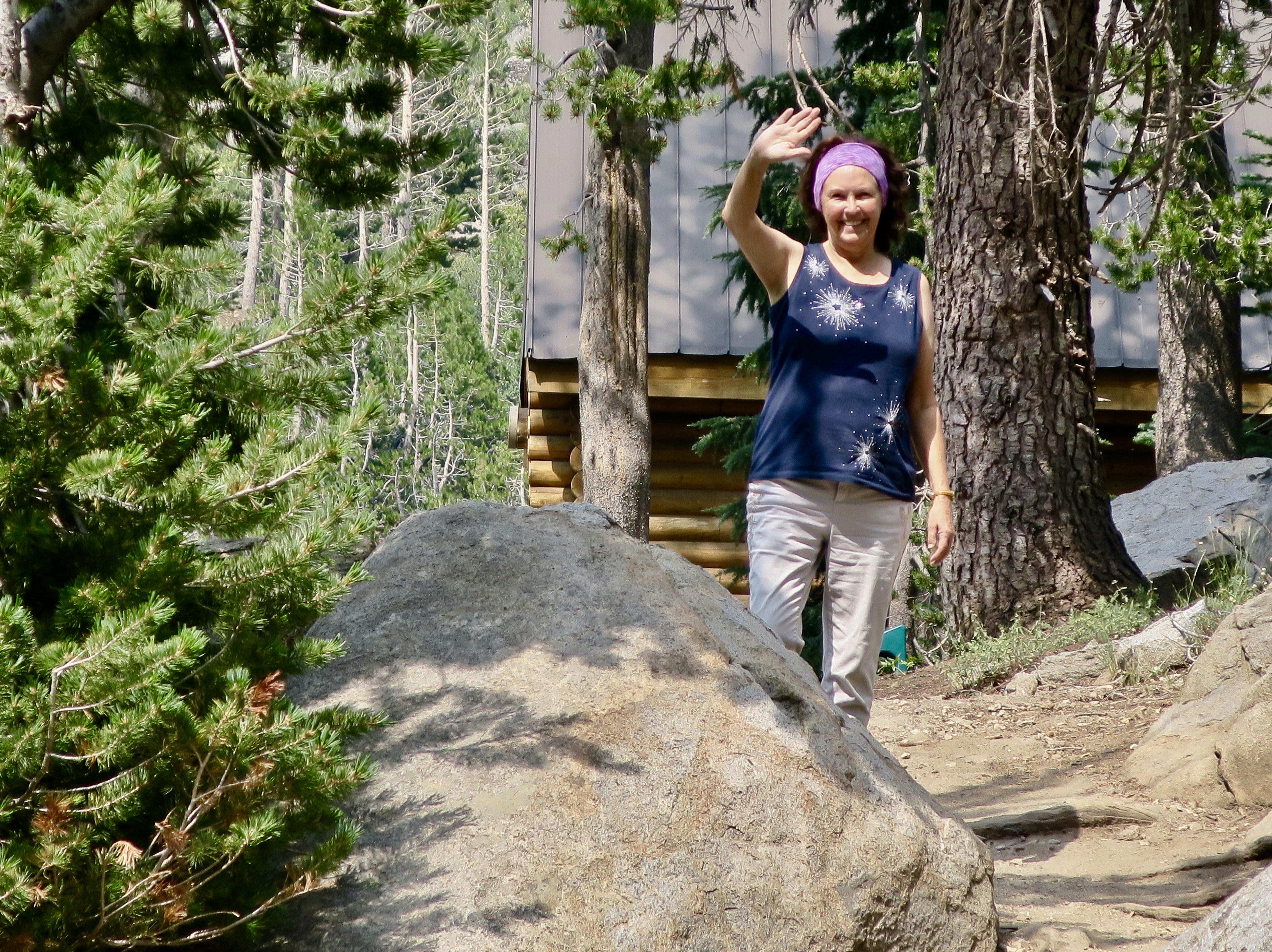
Peggy and I had lunch yesterday with Barbara and Carl, the couple that dropped us off at Mt. Ashland for the beginning of our trek south down the PCT. It was the first time I had seen them since the beginning of the adventure. There was a lot to tell.
Naturally, I talked about both the challenges and the rewards of backpacking for 700 miles over difficult terrain at 75. I also discussed how 50 years of backpacking had prepared me for the trip, and threw in a few of my more humorous adventures from those years. They will be in my book.
“Knowing what you know now, would you do the PCT hike again?” Carl asked.
“Absolutely,” I replied. This doesn’t mean I will forget just how hard it was. It’s an important part of the story. But the beauty and the nature of the adventure are what will stick in my mind. I once had a woman who had been on one of my hundred mile treks tell me it was one of the most difficult tasks she had ever undertaken. But in the end, she said, it was an incredible, life-changing experience. The pain faded; the experience remained. “The only thing I can equate it with, Curt,” she had related, “was having my first baby.” Ouch, and then ‘Oh my!’
For the first 25 years or so of my backpacking, I hadn’t carried a camera. Those were the days before you could expect to obtain quality photos from a small camera, and I didn’t want to add the extra weight to the 60 pounds I was already carrying. I was also reluctant to spend the time that good photography required. And often I was leading groups that demanded my full attention.
I am sorry now. “I can’t believe you go to all of these beautiful places and don’t carry a camera,” my father had told me time and time again. He was right. I wish I had those photos now to remind me of where I had been and what I had seen. But there is more. Photography helps you see the world in different ways. It encourages you to focus in on details you might miss, it helps you notice the differences that light and varying perspectives make, and it forces you to stop and look around.
Today’s photos pick up where my last post left off, hiking down the PCT from Carson Pass on Highway 88 to Ebbetts Pass on Highway 4. The first four illustrate the value of stopping and looking around. They are all of the same scene from different perspectives.
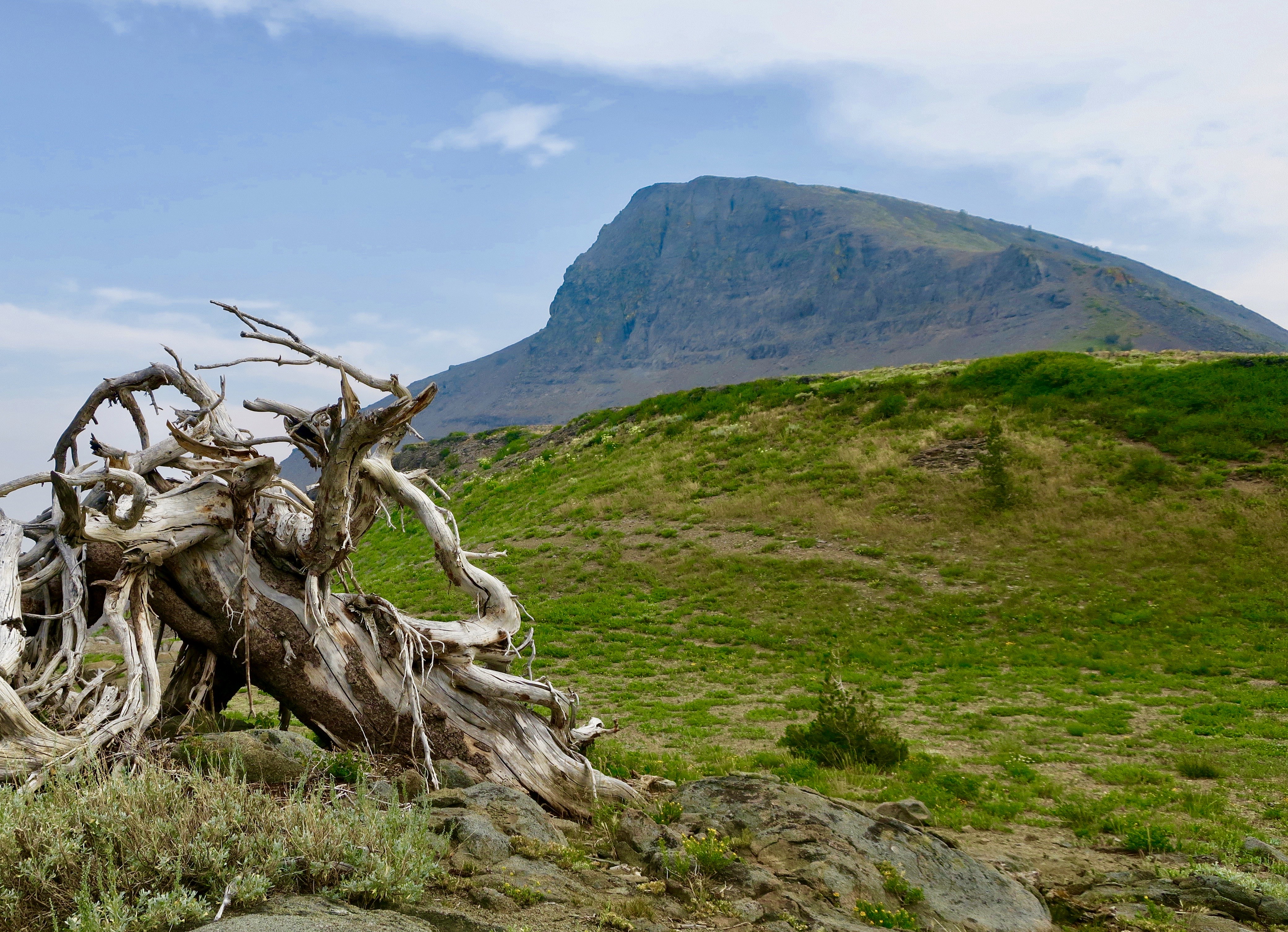
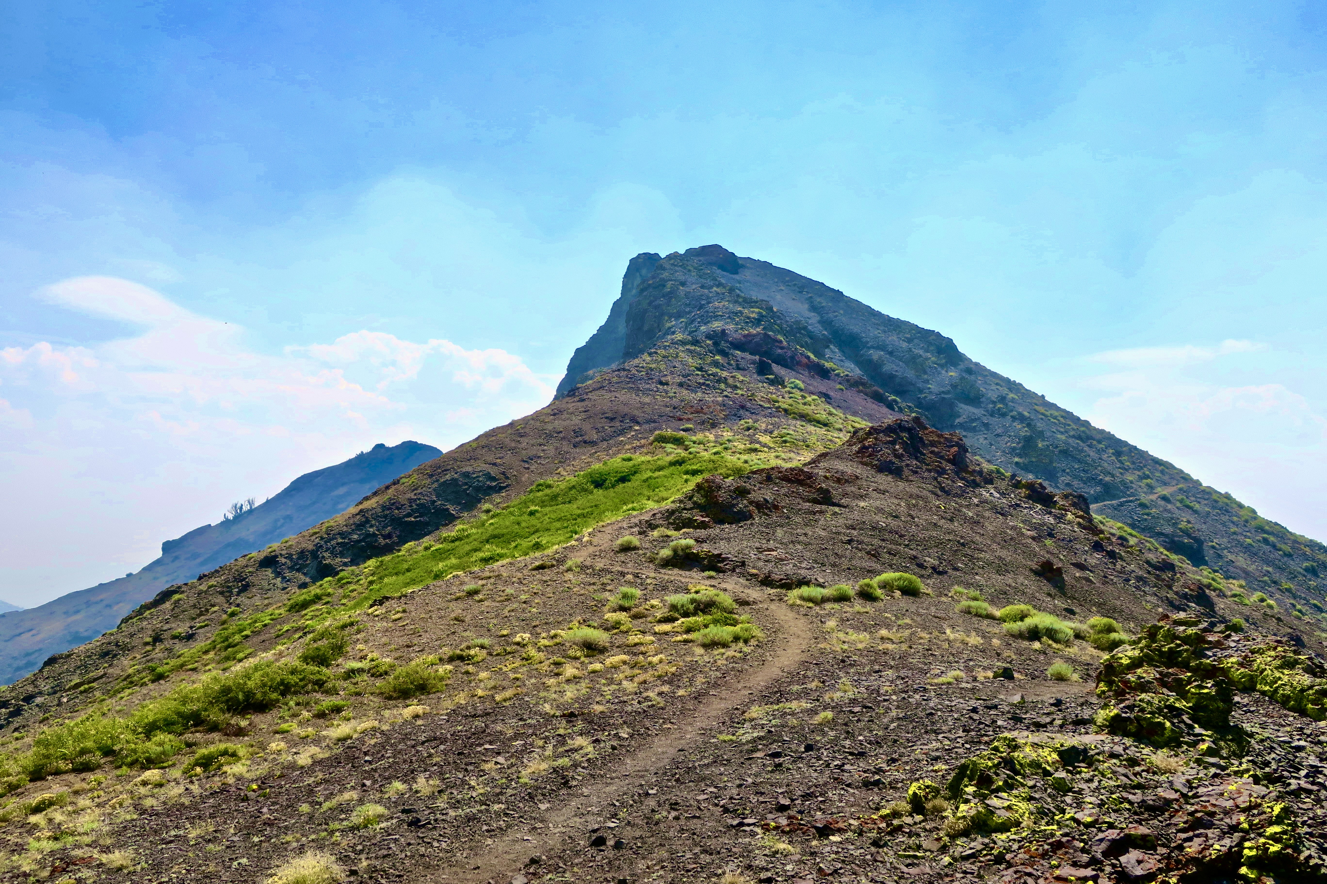
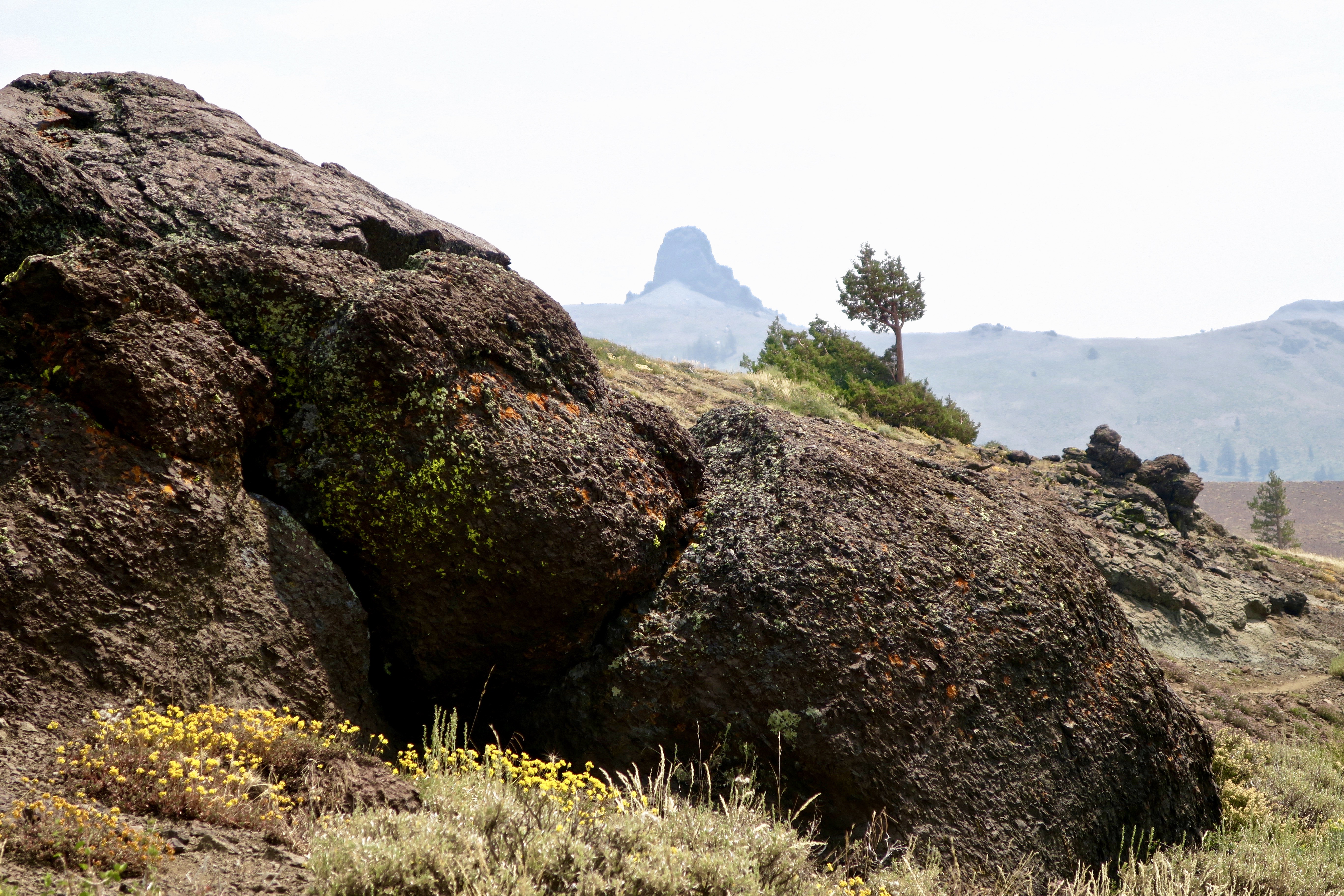
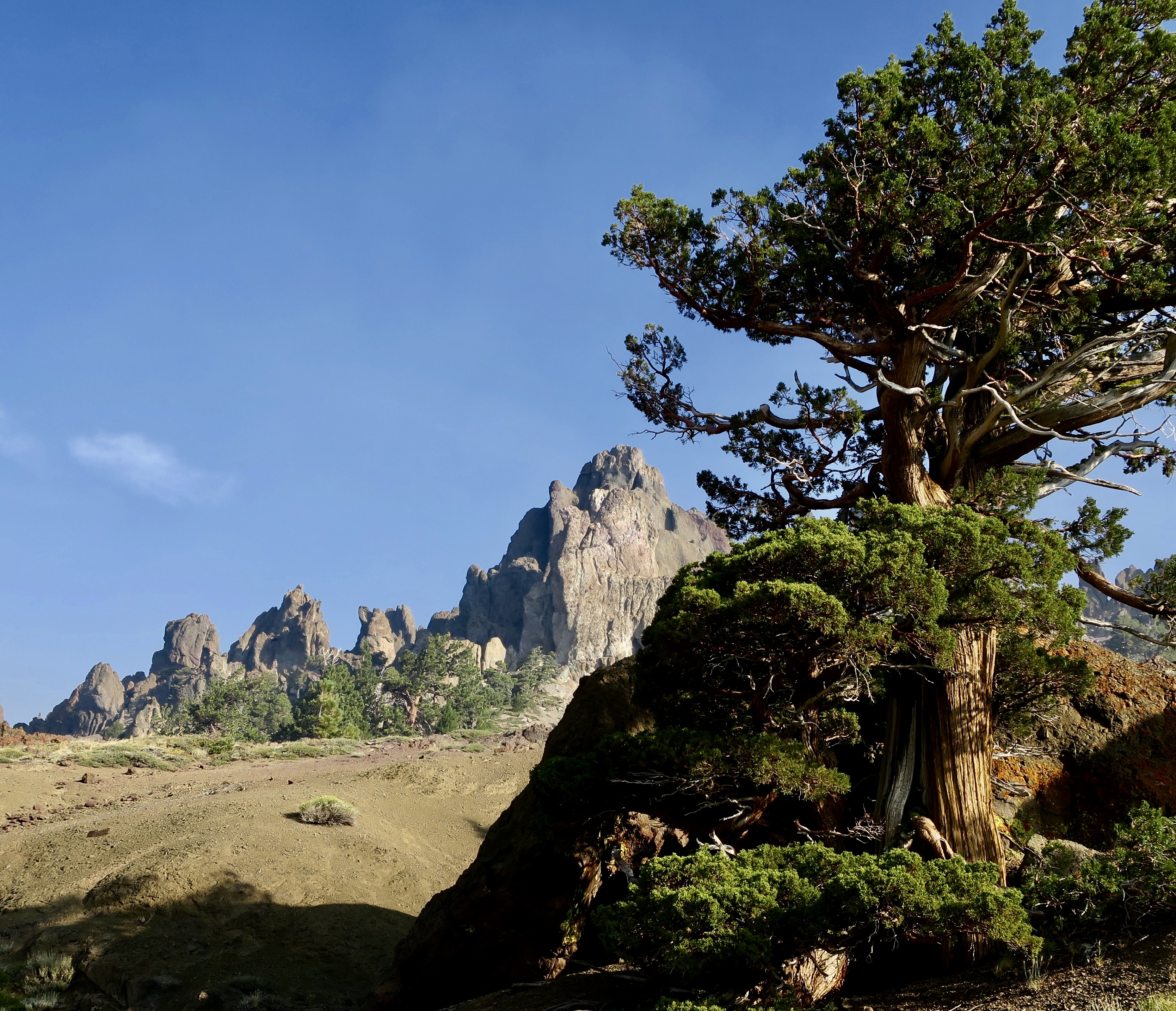
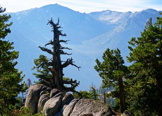
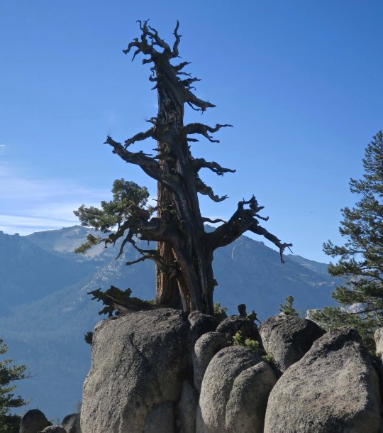
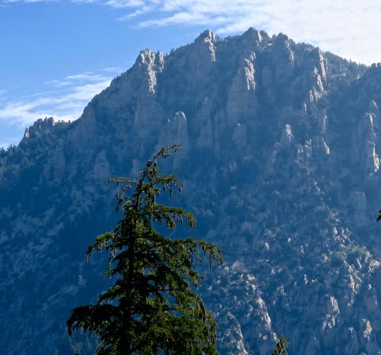
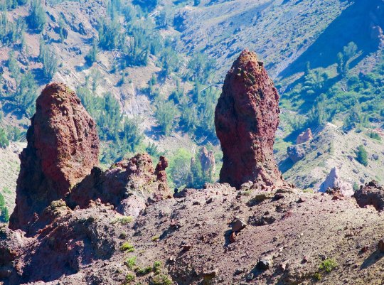
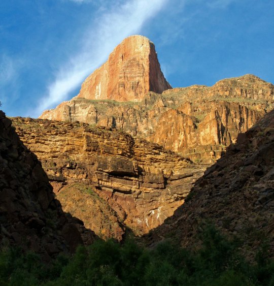
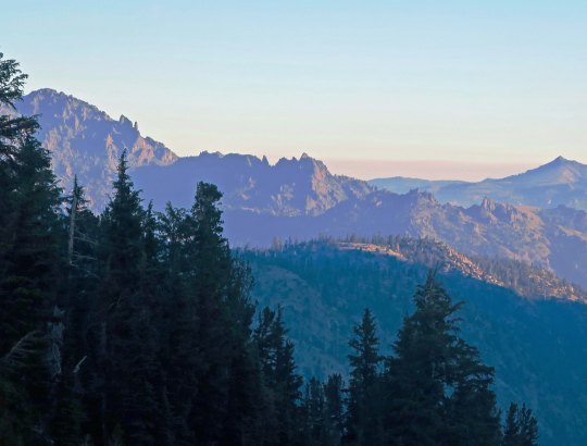
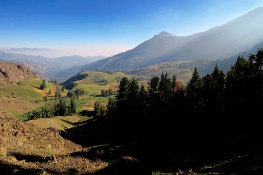
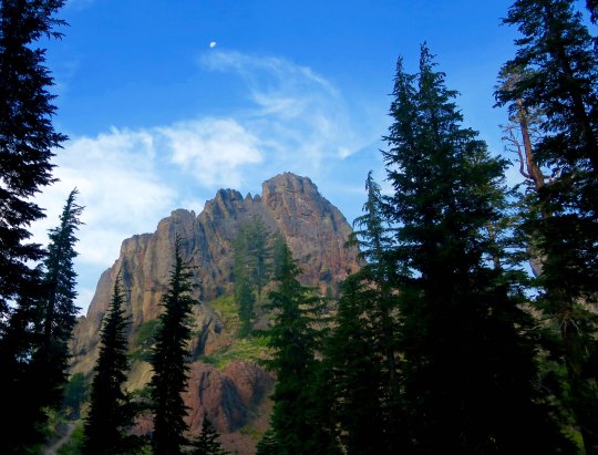
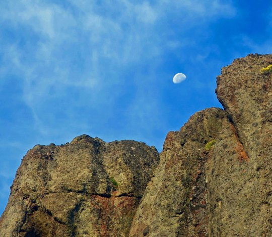
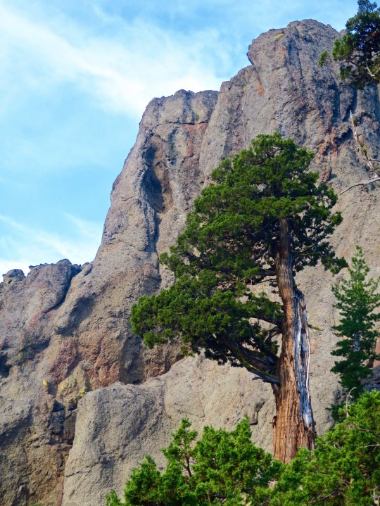
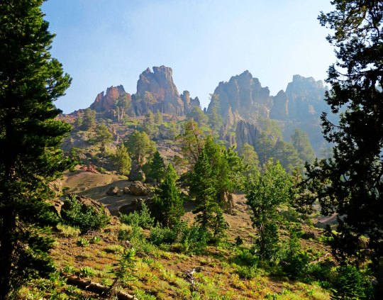
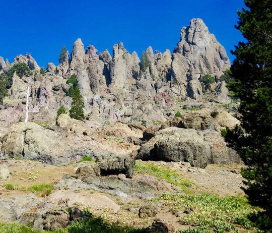
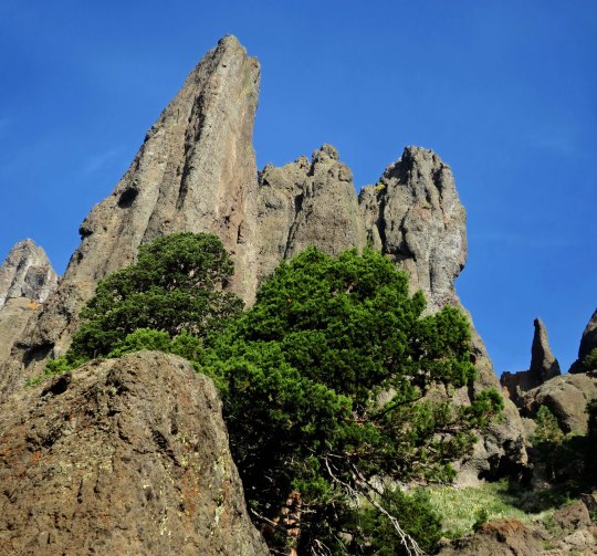
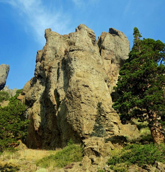
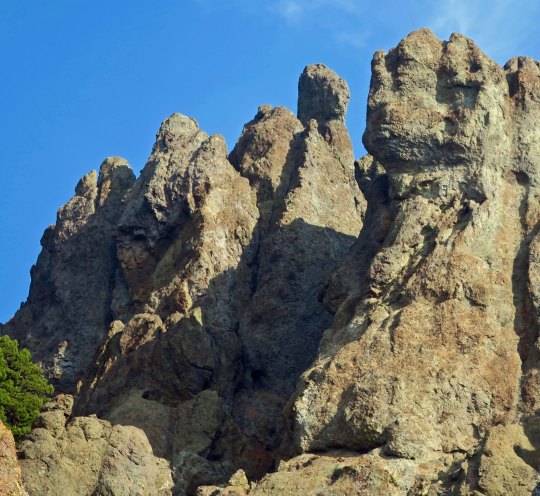
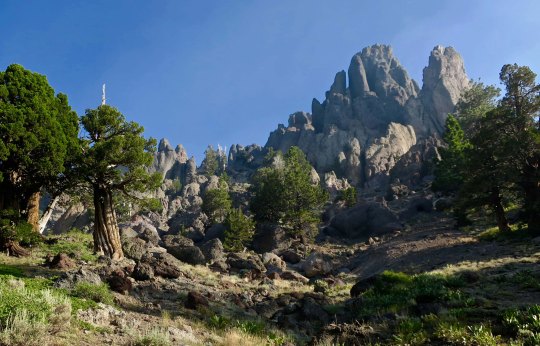
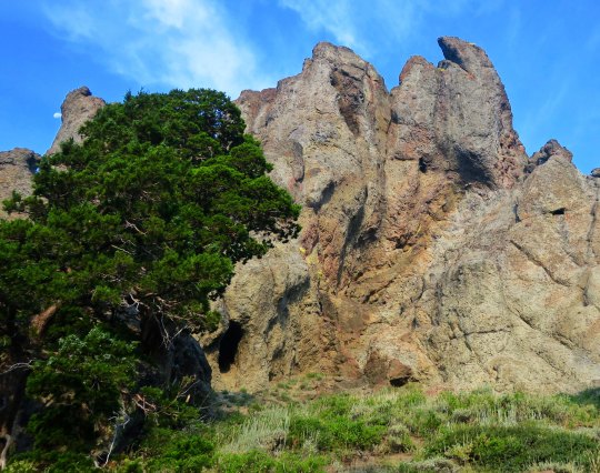
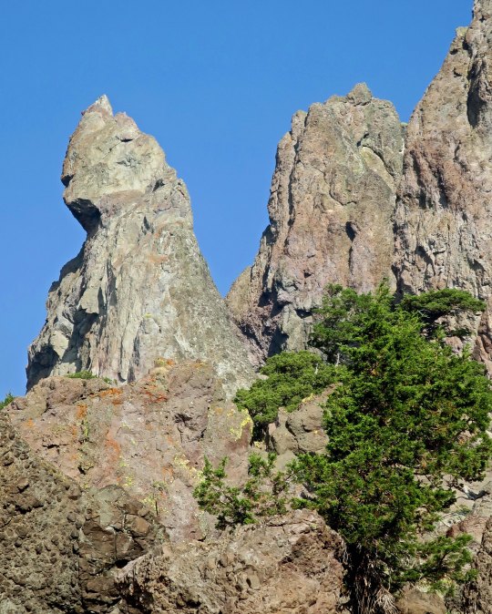
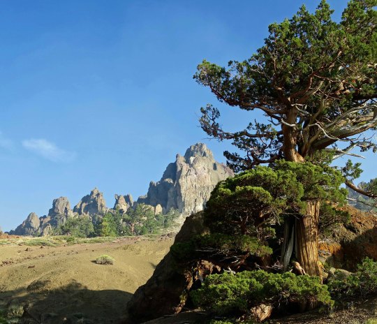
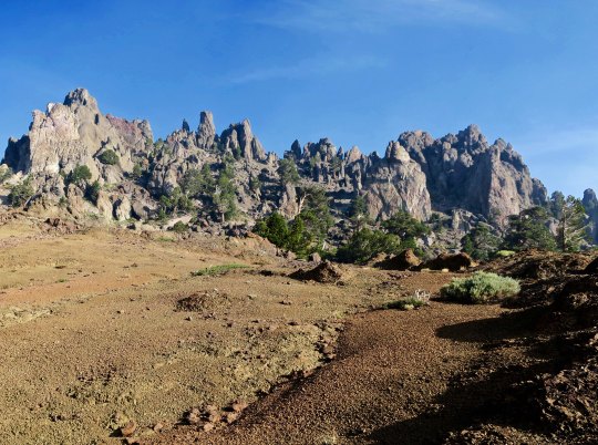
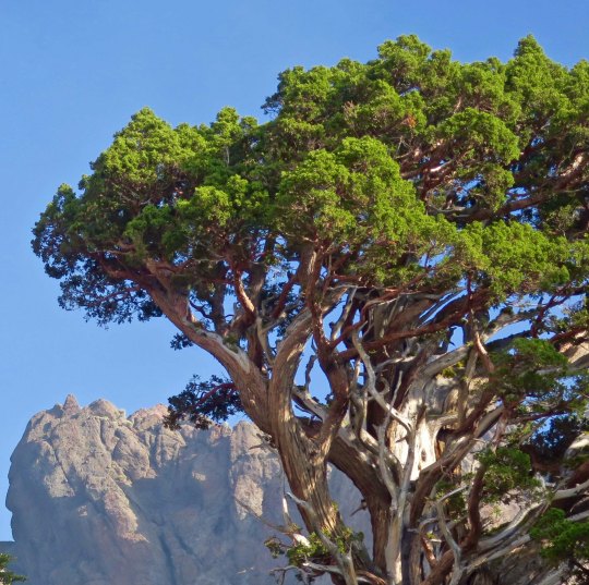
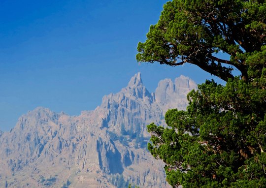
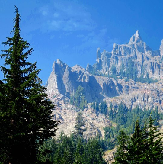
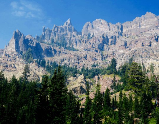
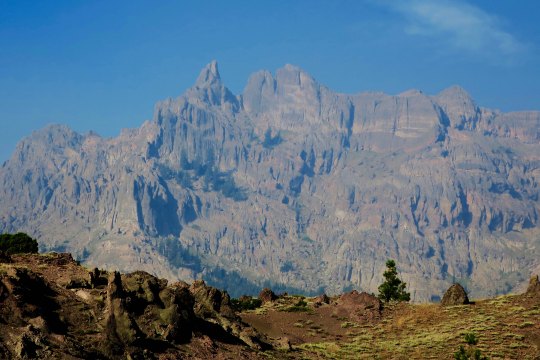
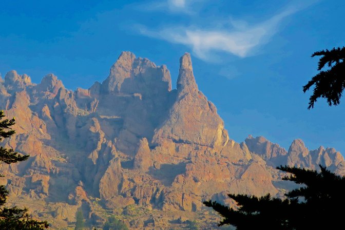
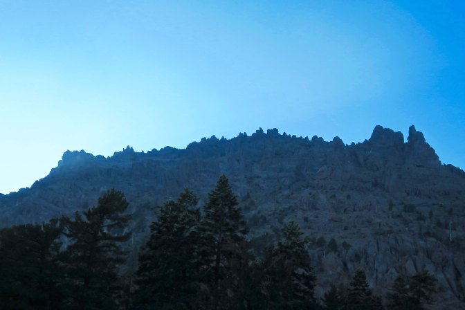
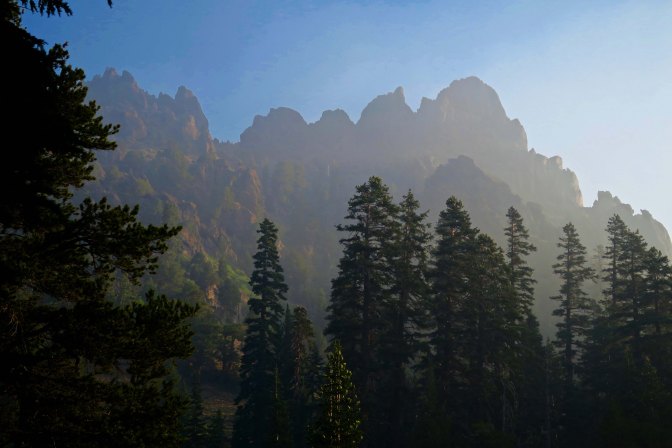
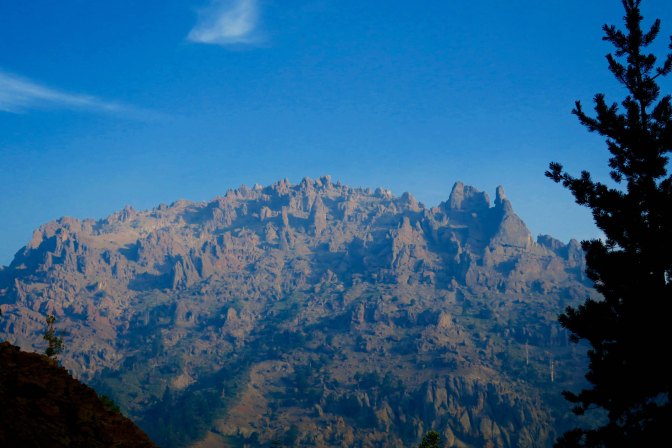
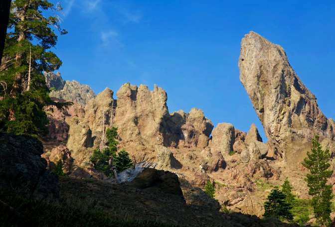
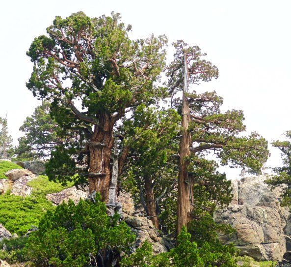
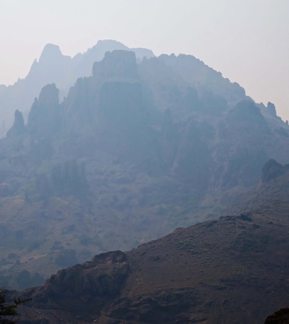
Once again, there were towering cliffs to admire. These were framed by hemlocks.A closer look showed junipers growing beneath the cliffs. A tiny moon appears in the upper left. And my telephoto brought the moon into perspective with the cliffs.While another photo featured one of the junipers standing tall against the cliff.One of the magical things about following a trail is that you never know what you will see next. It’s a thought that forever pulls me on. The PCT made its way around a large snag here and disappeared into the woods. I was assured that the views would just keep coming. The smoke did more than hassle my lungs; it also provided some interesting photos as it filtered the sun. This juniper is an example.And another smoke filtered scene.As might be expected from my last post on the PCT through the Mokelumne Wilderness, there was no end to magnificent rocks.Rounding a bend I came on a new view with a juniper, rock and open area leading to a distant peak.This perspective had the intensity of surrealism. I could see Dali carefully painting the rocks in the foreground and adding a melting clock.The contrast between a juniper and rock guaranteed that my camera came out.And then I was treated to my first view of Mt. Reynolds.Wow!I’ll conclude today with this view. I loved the contrast.
NEXT POST: Variety, being the spice of life, it’s back to Mexico.
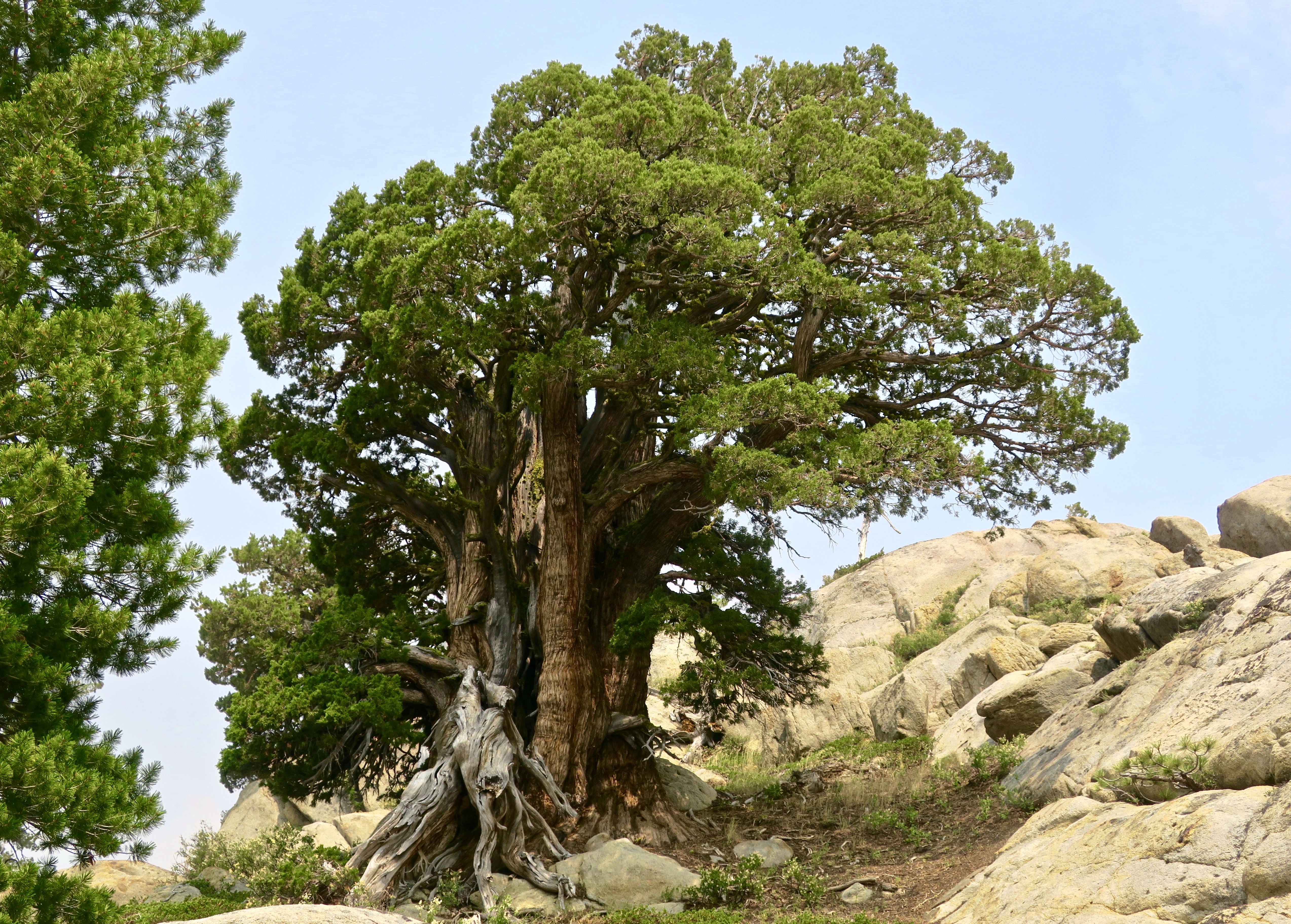
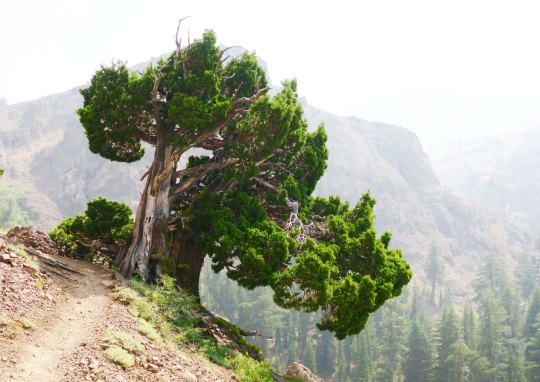
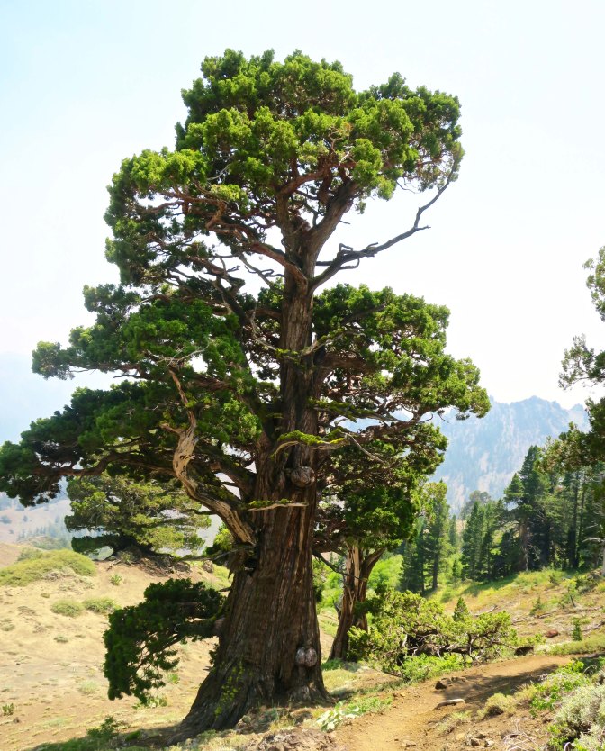
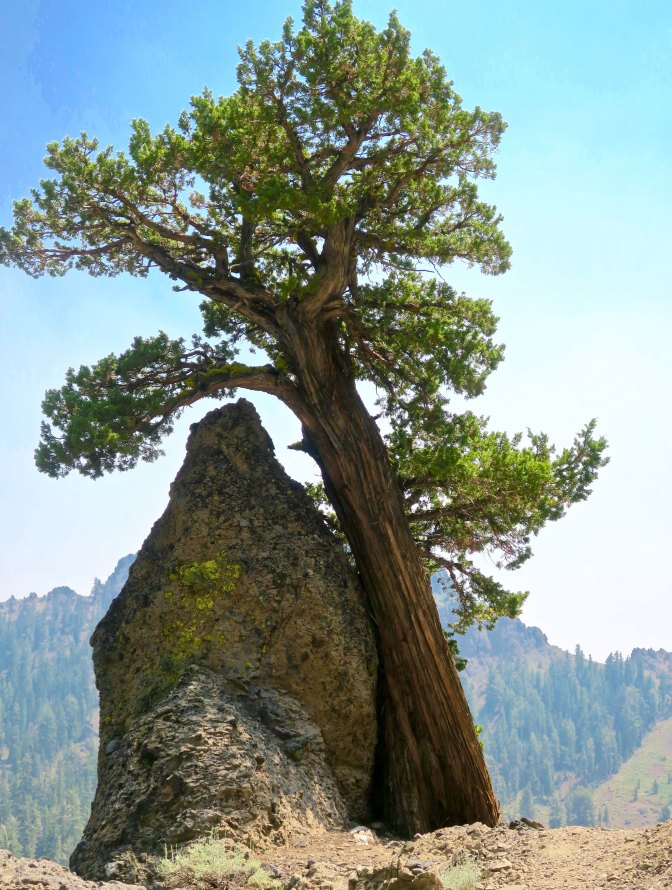
There is no hurrying through land like this. The combination of junipers and rock sculptures called to both me and my camera.
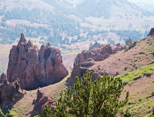
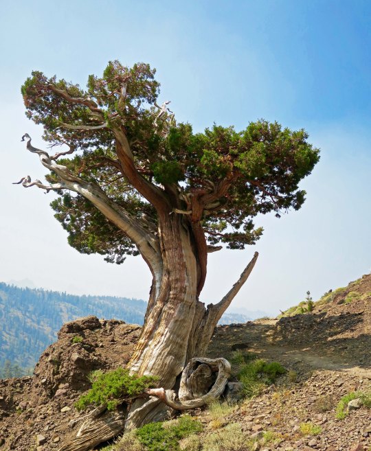
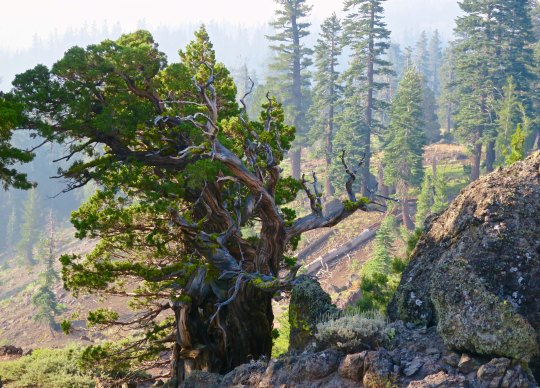
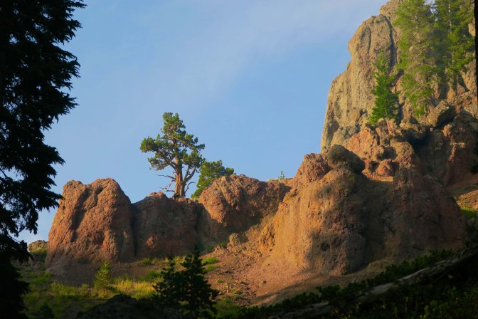
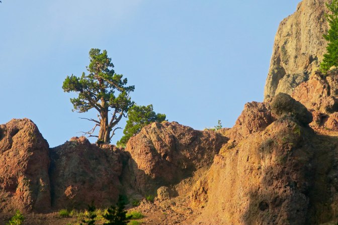
I was surprised by the sheer beauty along the PCT south of Carson Pass. I had hiked through the region several times over the years, but my trail had always been slightly to the west. Somehow I had missed the incredible rock sculptures. That, and the junipers. If you have ever wandered the West, you are familiar with this gnarly, photogenic tree. Most of todays photos were taken near Pennsylvania Creek in the Mokelumne Wilderness, maybe 15 miles north of State Highway 4 and Ebbetts Pass. I’ll let the photos speak for the area.
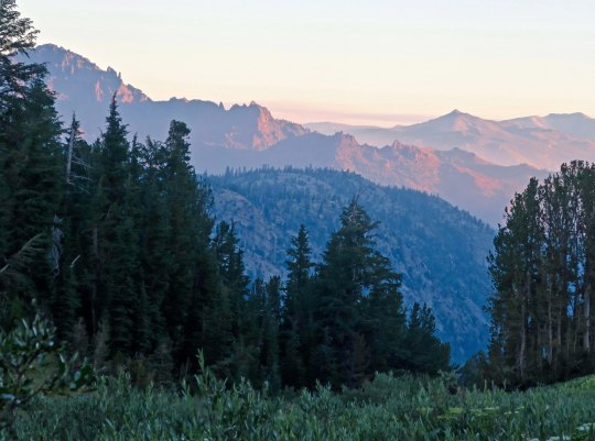
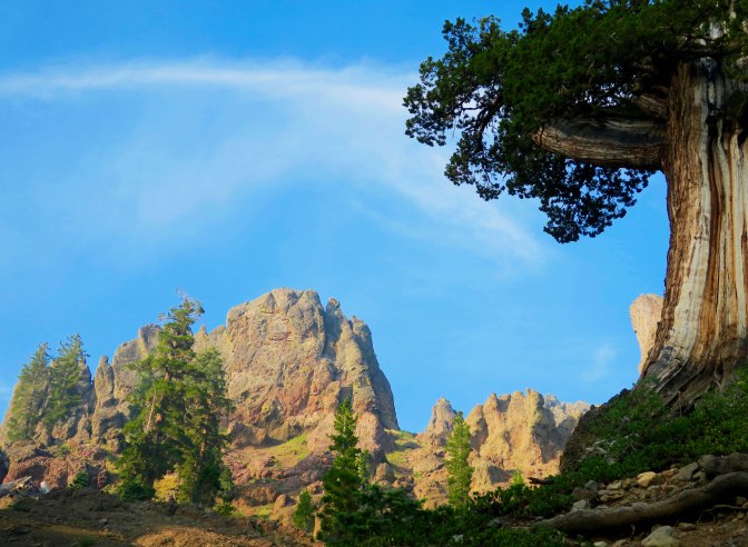
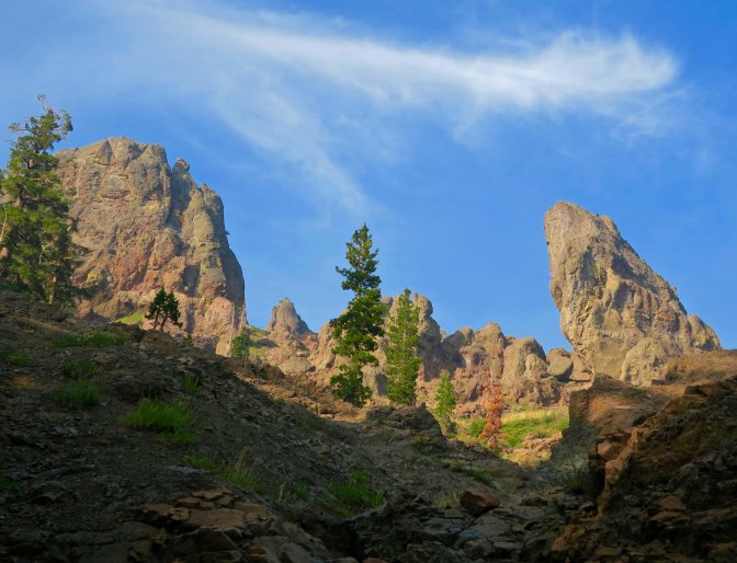
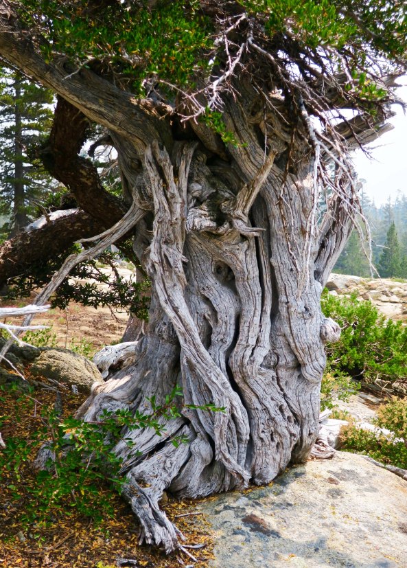
Hiking down into Pennsylvania Creek, I found this juniper.And then this one, wedded to a rock.That night, I camped on the south side of Pennsylvania Creek. This was the view !Later, at sunset, the whole ridge.The next morning, smoky skies and the sun provided a red cast to the view.Farther along, I was treated to this view.Near the crest of the canyon, I found the juniper tree and rocks I featured at the top pf the post.The view included this leaning rock, which could be seen just behind the juniper.Another perspective.I considered this a real treat. And photographed it several times. This is it for today. But I’ll have several more views of the rock sculptures on my next PCT post.
NEXT POST: Back to Puerto Vallarta. P.S. I will be playing with various themes over the next few weeks, so don’t be surprised by the changing looks of my blog. ALSO: For those of you who haven’t read “The Bush Devil Ate Sam,” I will be posting a chapter once a month on the top ‘pages’ to give you a feel for the book and encourage you to buy it. Many thanks! This chapter reflects our first night in our Gbarnga home, appropriately titled: Armies of the Night!
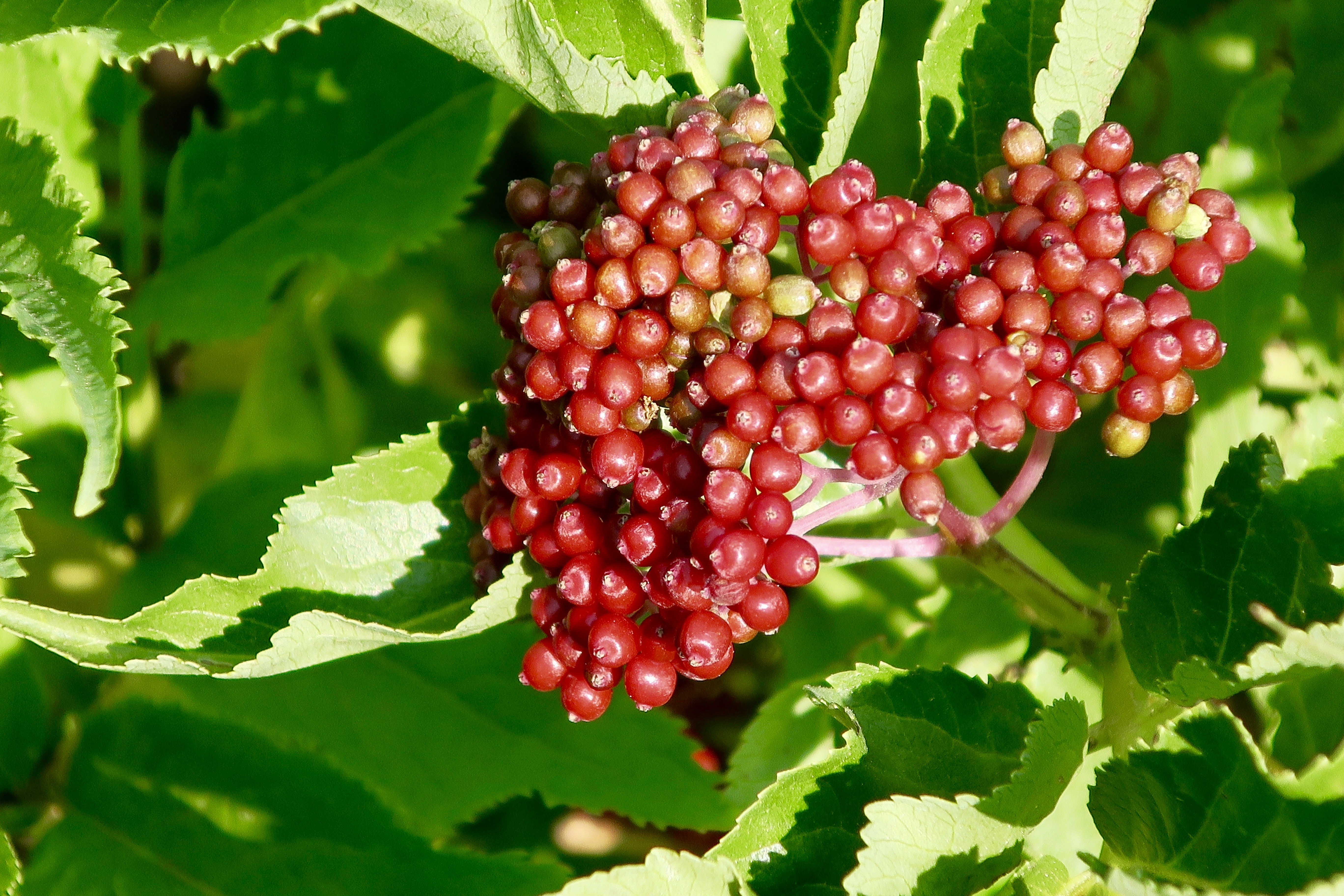
There are lots of wild roses growing along the PCT, but it is rare that you find one so perfect.
Today, I just want to wish each and everyone of you who follow this blog a very happy and healthy New Year. And I want to thank you for joining Peggy and me on our journey as we wander through time and place. We are privileged to have you along.
What better way is there than to say it than with flowers. It works for Valentine’s Day, it works for Mother’s Day, and it works for numerous other special occasions, so why not New Years! I’m sure the floral industry would love this, but I am not talking about the flowers you buy from a florist. I am talking about the beautiful, wild, and free flowers you find growing along the trail, or the roadside, or on a vacant city lot, or in a park— the list goes on. Here, I am talking specifically about the flowers I found along the Pacific Crest Trail on my 700 mile backpack trek this last summer. You’ve already seen some of these. I have bunches. I suspect you will see more on Valentine’s Day. Enjoy!
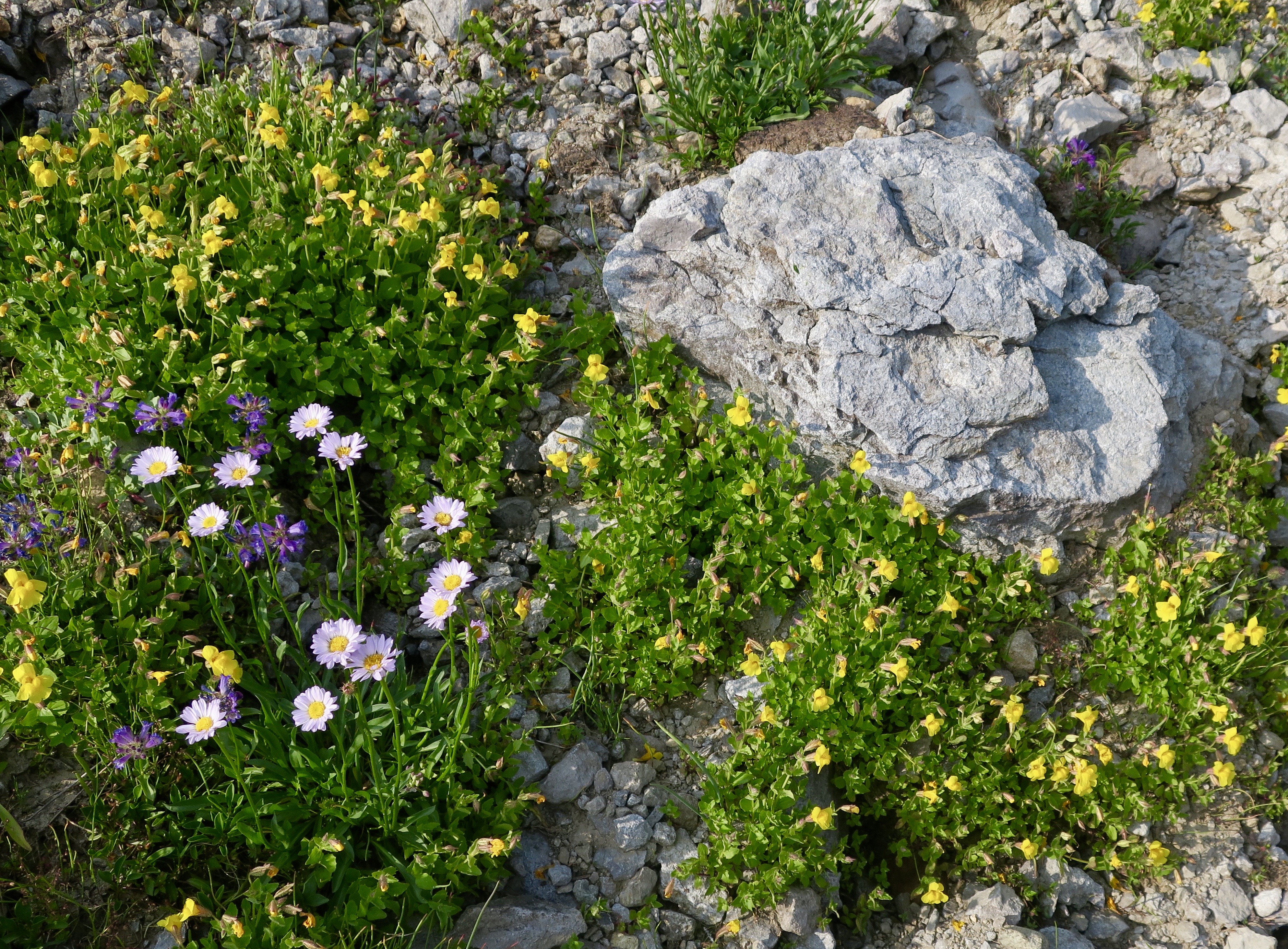
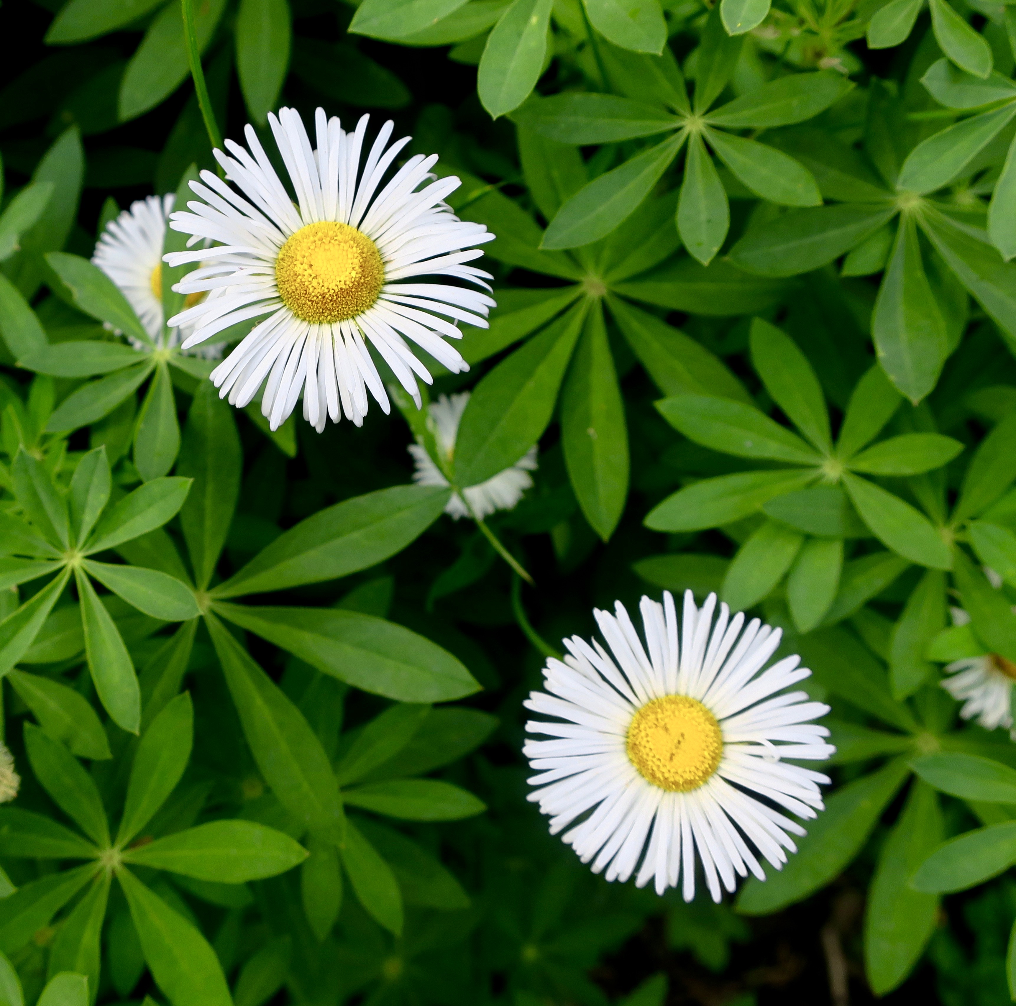
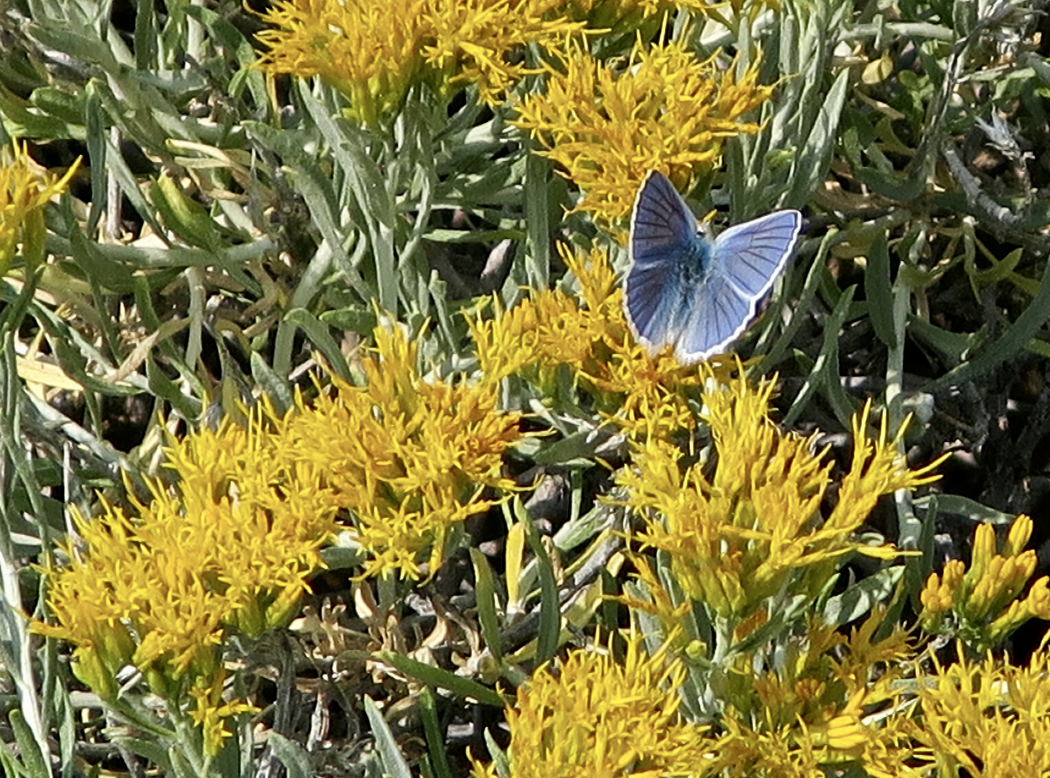
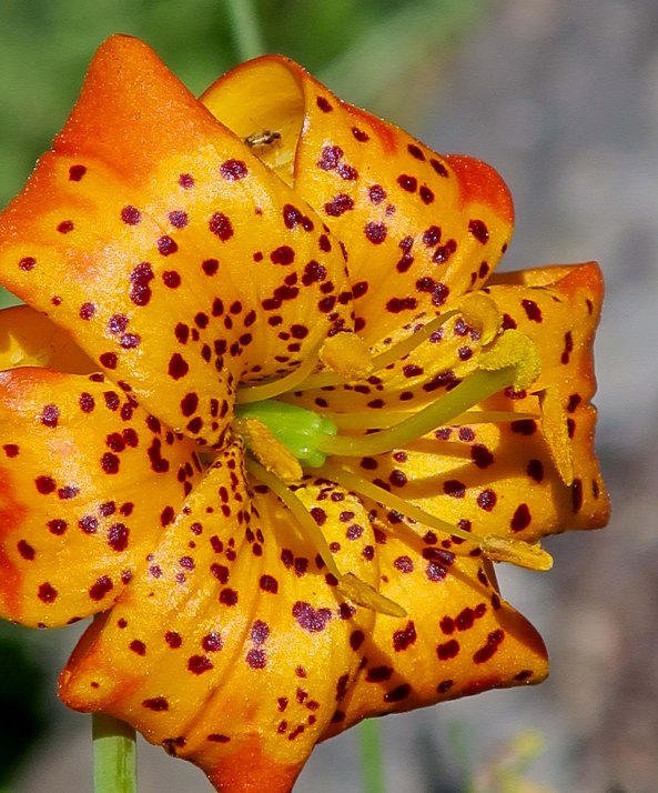
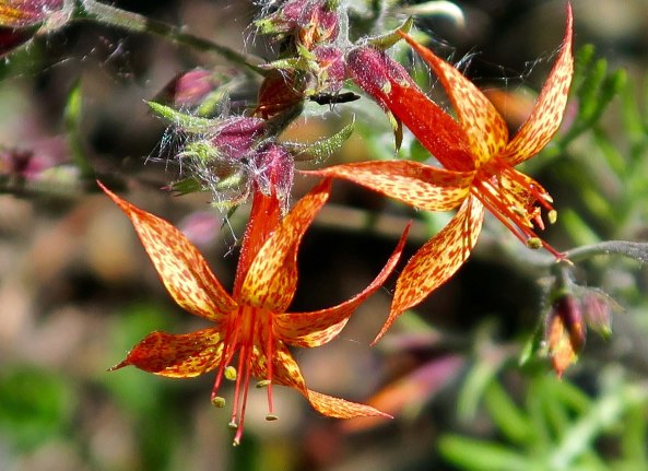
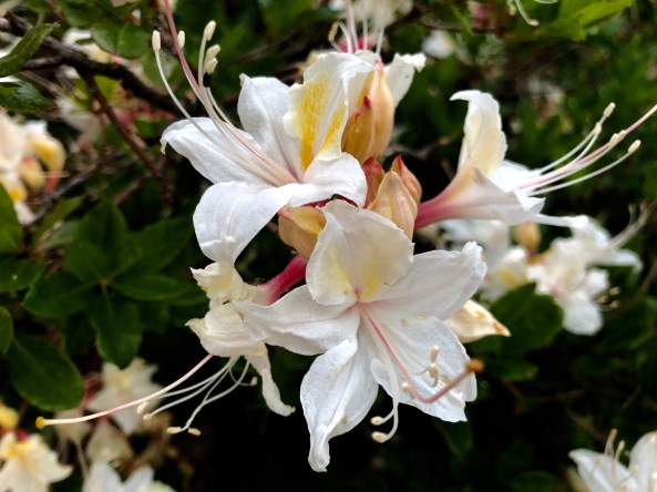
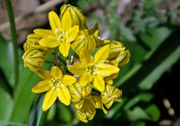
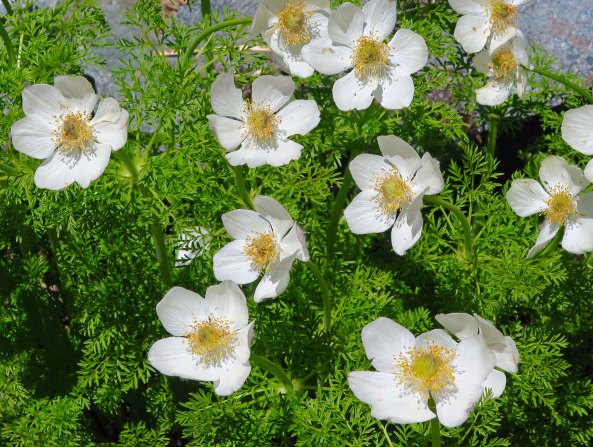
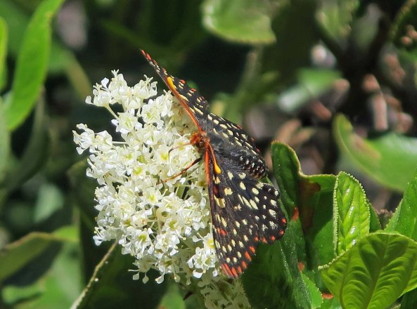
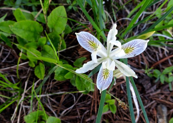
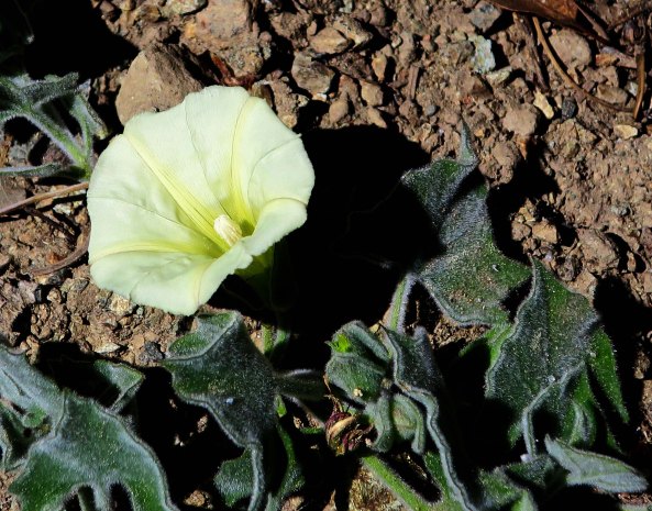
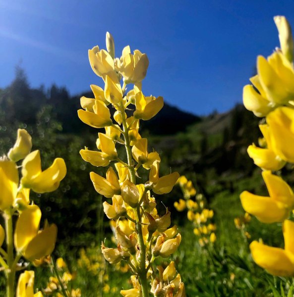
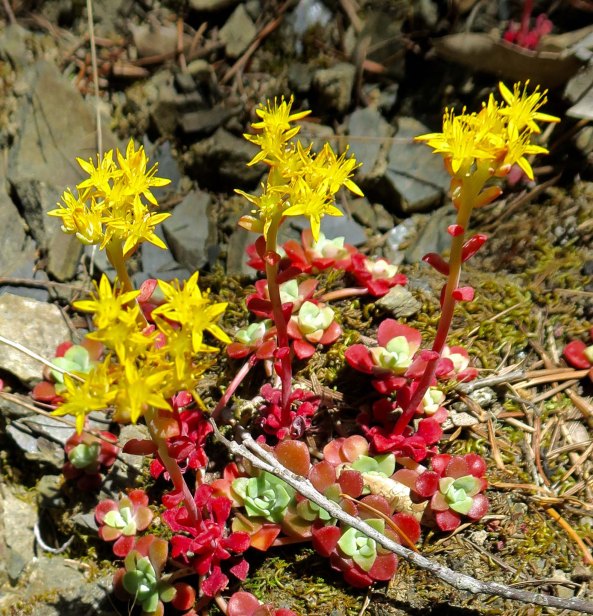
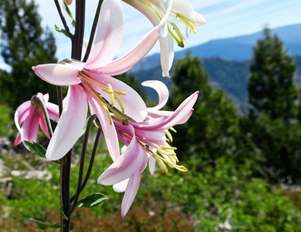
A cheerful tiger lily!Dramatic scarlet gilia.Azalea.Pretty face is an appropriate name for this flower.Prickly poppies, I think.Not sure what this flower is, but the butterfly obviously liked it. There were several types of irises, a flower noted for variety. I believe this is a Siskiyou iris.A wild morning glory.Stunning yellow lupine.Stonecrop.And concluding with a Washington lily.
AGAIN— WISHING YOU THE BEST. We look forward to seeing you in 2019. Curtis and Peggy
As a year filled with seemingly insurmountable national and international problems draws to a close, my mind turns to the beauty and the peace of my 700 mile journey down the PCT this past year. The issues of the everyday world fade as you are hiking up a mountain, providing a different perspective on what is important. As the renowned naturalist John Muir noted, “The clearest way into the Universe is through a forest wilderness.”
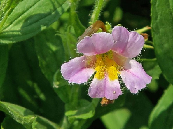
There were tough days out there— as tough as any I have ever faced— but even the most difficult were countered by the beauty of the areas I hiked through. It was a beauty that ranged from towering mountains down to the cheerful monkey flower above. Today, I will continue to share that beauty in my third post about the Pacific Crest Trail between Carson Pass and Sonora Pass in the central section of California’s Sierra Nevada Mountain Range.
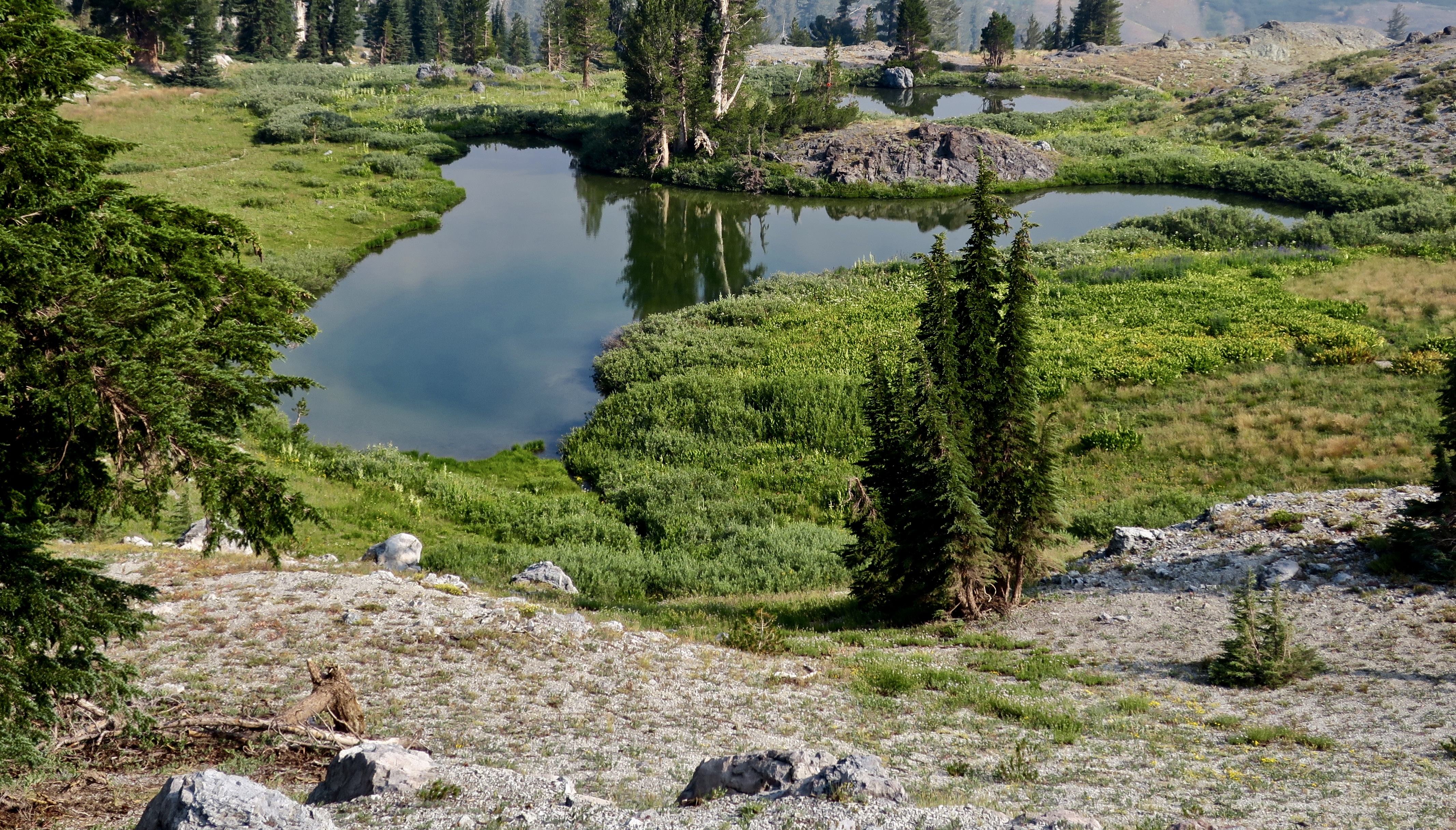
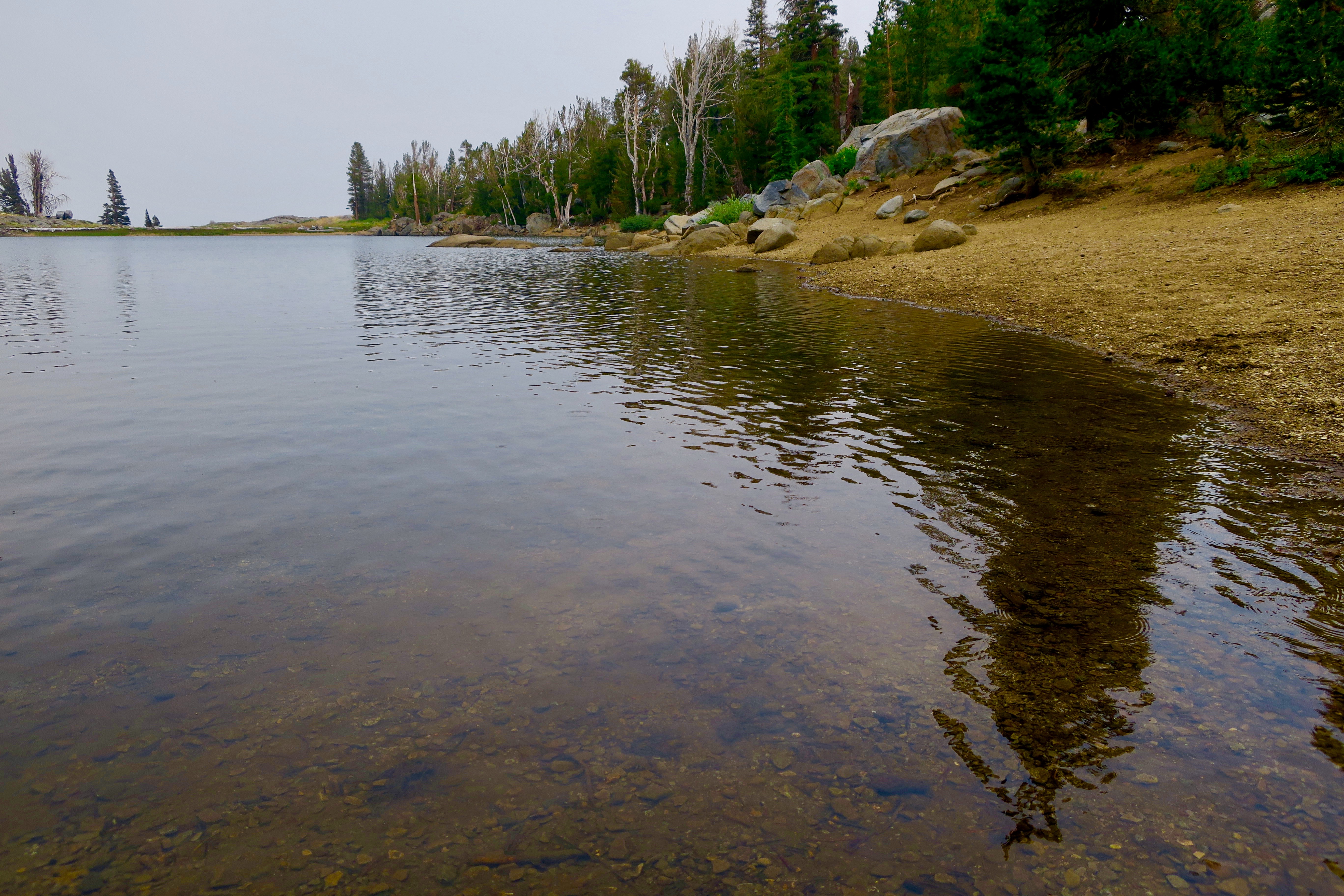
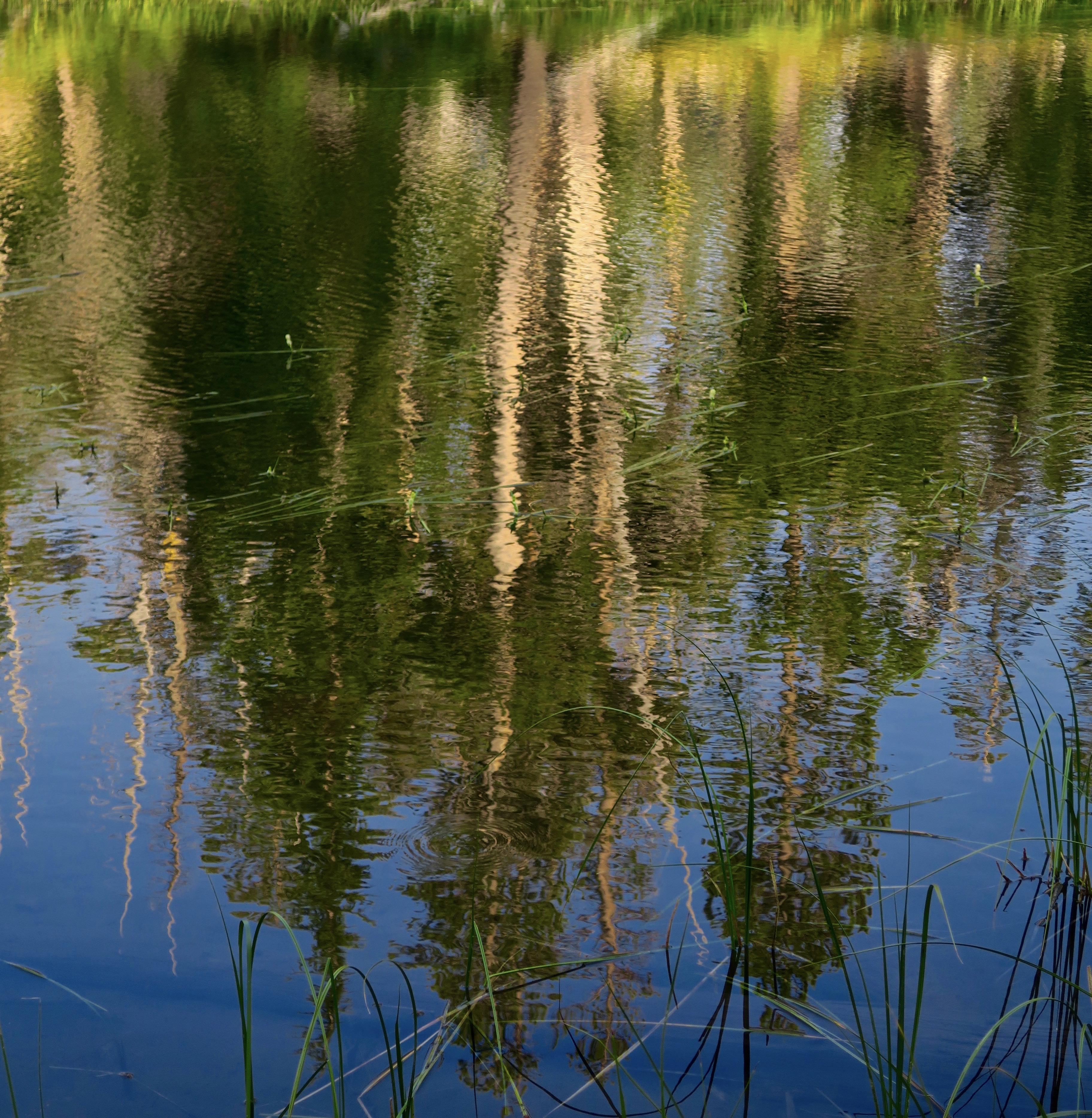
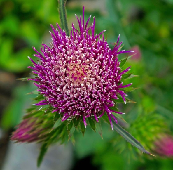
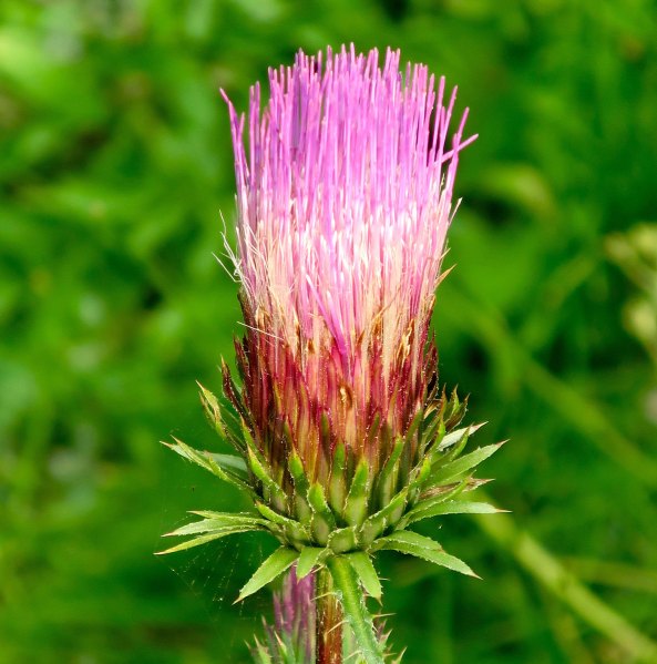
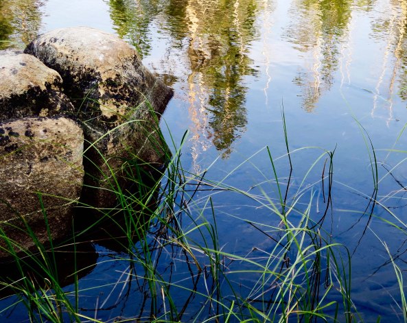
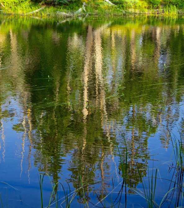
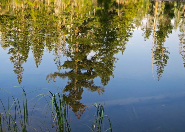
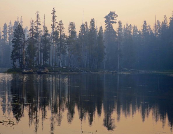
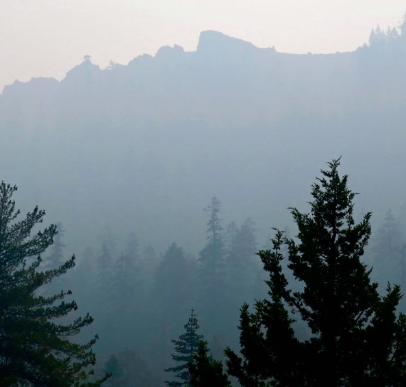
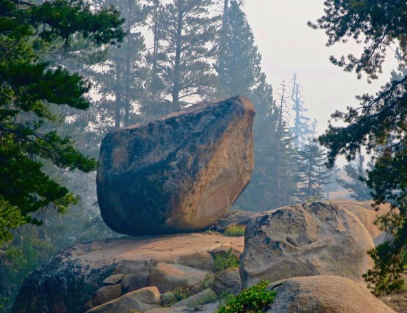
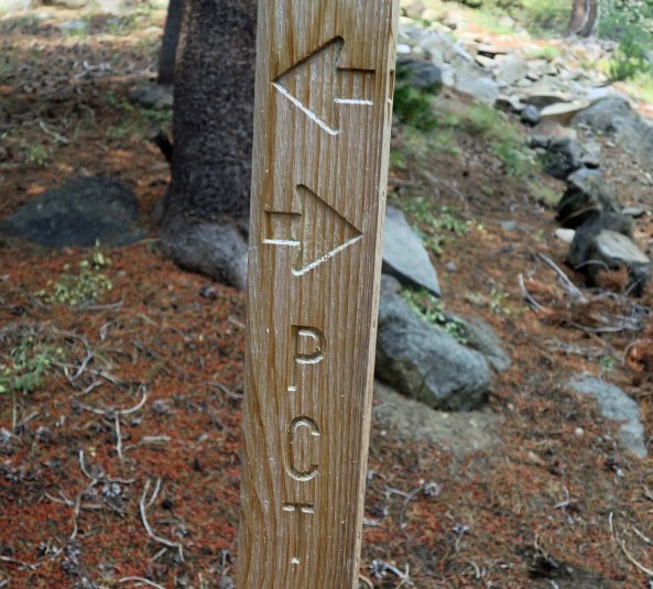
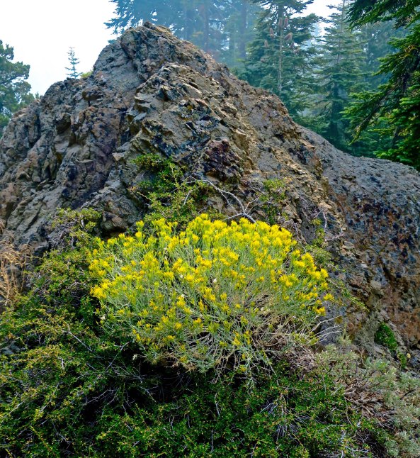
Thistles are often thought of as invasive weeds, something to be chopped down or poisoned out. It is hard to think of this fellow as anything other than a beautiful wild flower.I caught this Sierra thistle in full bloom.When I backpack by myself, as I was on this section of the trail, I try to find secluded campsites. To me, it is much more of a wilderness experience. I lucked out with this little no-name lake. I had it to myself and there was no sign of people recently camping in the area. It was a bit of a challenge to climb out on these rocks and dip up my water, however. (grin)The lake provided some great reflection shots, capturing the surrounding forest. They ranged from this impressionistic view…To clearer views.As evening approached, thunderheads suggested I might be in for a rip-roaring thunder and lightning storm. I put on my rainfly. I would have much preferred that to what I got. I woke up in the middle of the night to the strong smell of smoke creeping into my tent. I climbed out to make sure that there were no flames about! As it turned out, smoke from the Redding fire to the north and the Yosemite fire to the south had caught up with me. Above is how my little lake looked in the morning.And as I hiked down the trail through the Mokelumne Wilderness. Whenever smoke blocked views of the surrounding mountains during my hike down the PCT, I focused on closer views, like this massive granite boulder that was likely left behind by a glacier.This sign made me smile. It was a good thing that I knew which direction I was traveling.A gnarled tree caught my attention. I can’t help but think of hobbits and elves when I find such trunks.Junipers can almost always be depended on to have unique personalities. Rabbit brush provided a burst of color.As I made my way south, some impressive mountains came into view. Checking my map, I found I would soon be climbing them, naturally.And up I went, through the still smokey air. My 75 year-old lungs were not happy.As through-hikers say, it is what it is, however, so I hiked on—and on— into some fascinating rock country, that I will feature on my next PCT post.