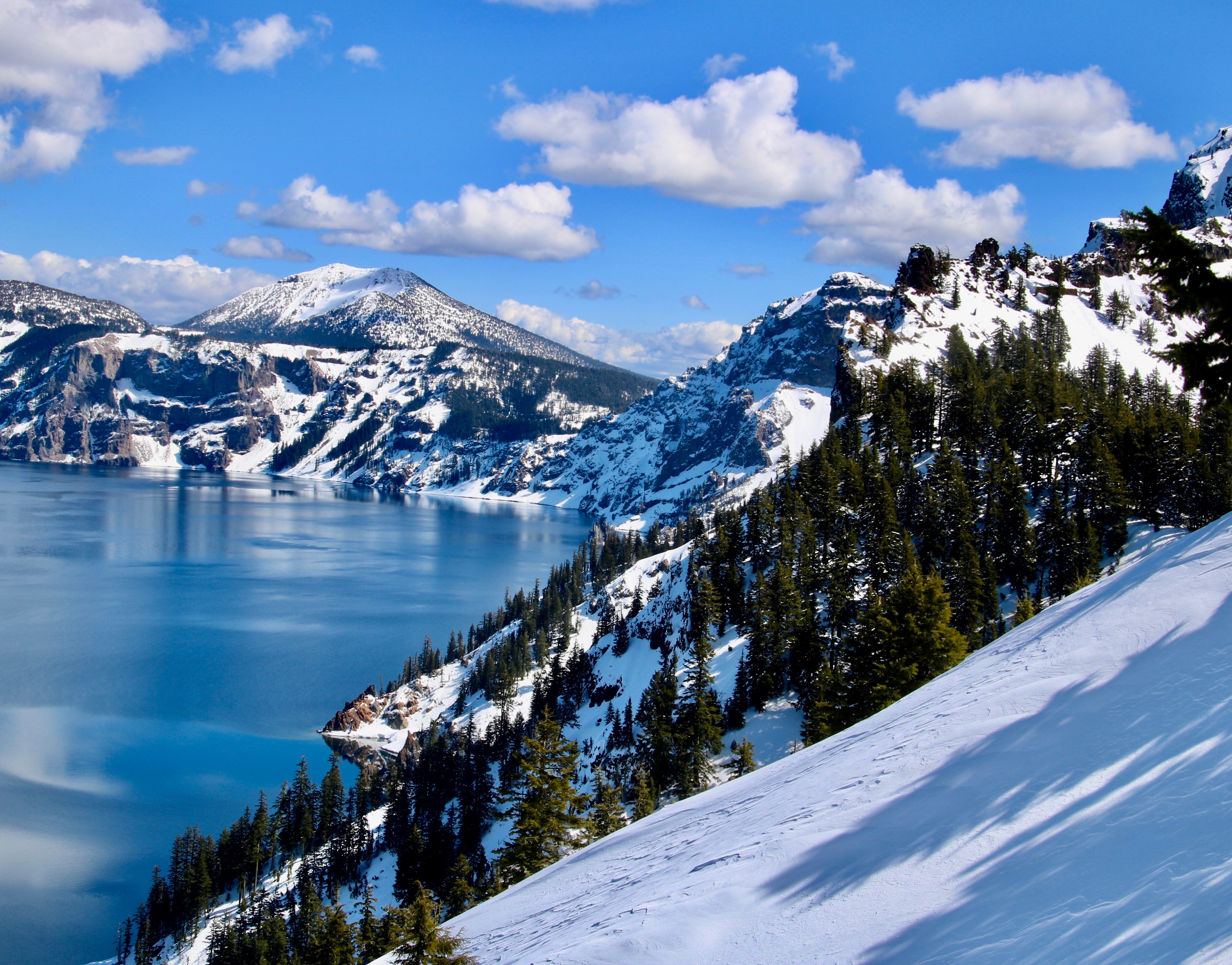
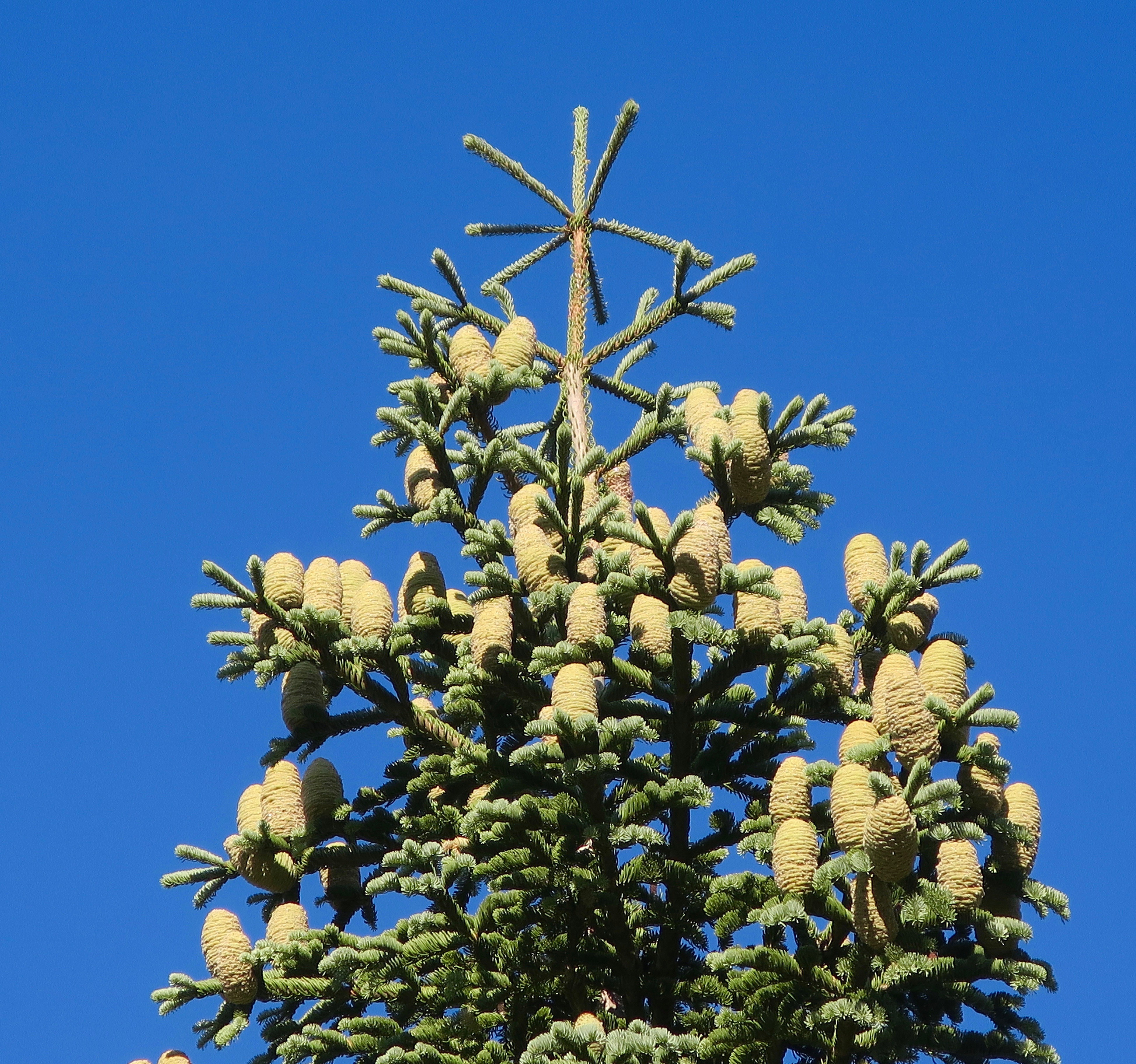
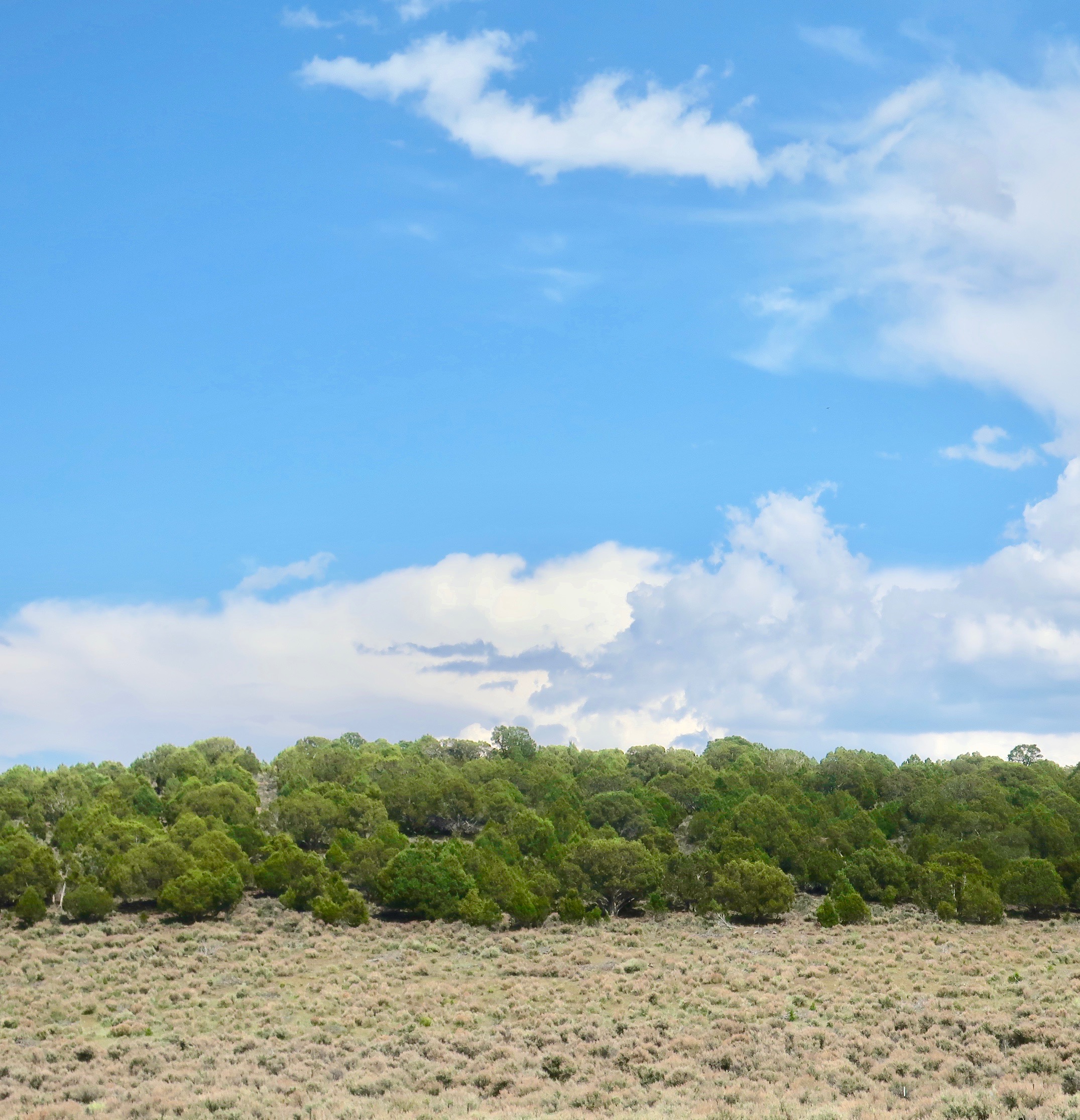
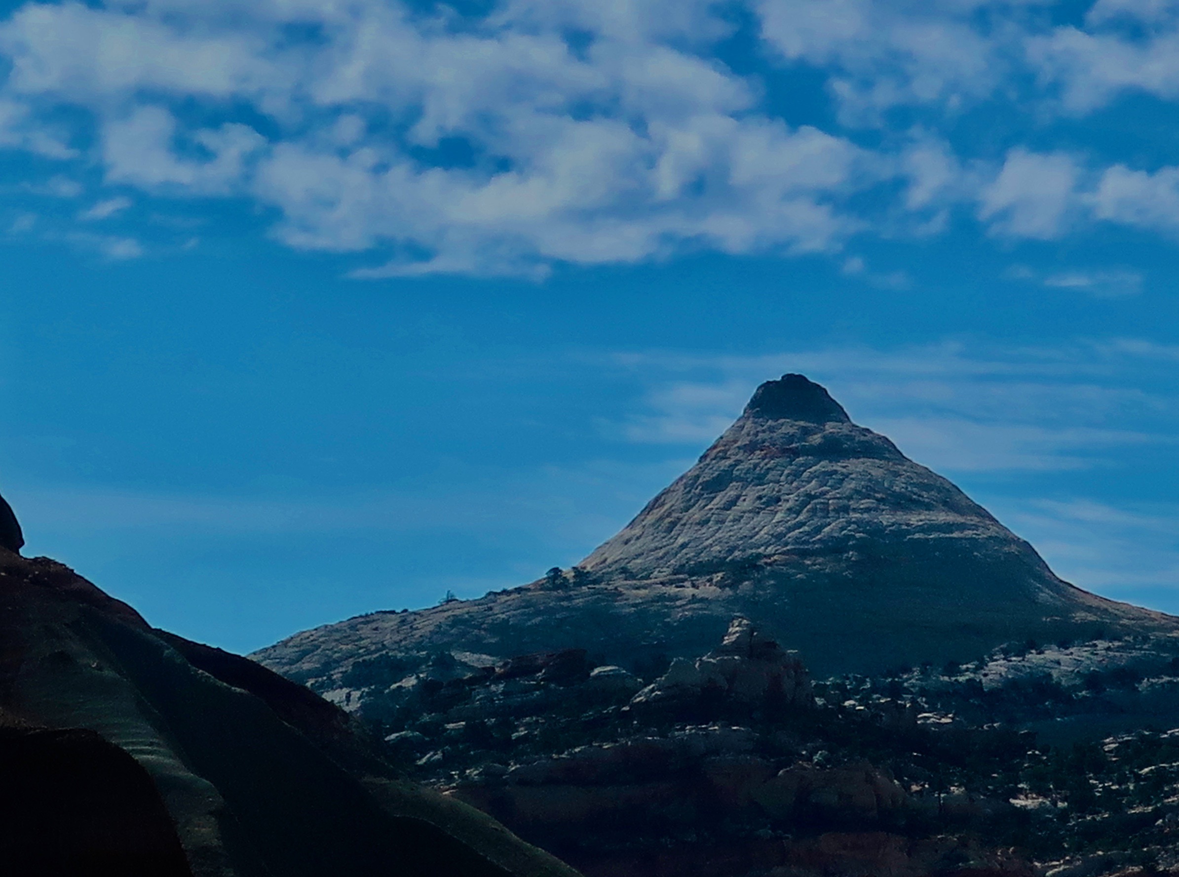
Crater Lake NP in Oregon decked out for the Holiday Season.
Not knowing exactly where or when we will be this holiday season— it’s the Age of Covid— I decided to simplify my blogging life over the next two weeks by posting National Park and Monument photos Peggy and I used in two family calendars we designed for this year. (And likely used in blogs. Grin.) The pictures come from trips we took in 2019-20. Plus, I’ll slip in the slightly PG rated Christmas Card we sent out this week featuring the Corral, Chorale, Choir. I designed and drew the card several years ago but decided we needed a sense of humor more than anything else at this point in time, so I reproduced it. I will continue with my Blog-a-Book Tuesdays with stories I’m putting together for It’s 4 AM and a Bear Is Standing on Top of Me.
With out further ado: Calendar photos, starting with Crater Lake featured above. I’ll be posting six or seven photos with each blog.
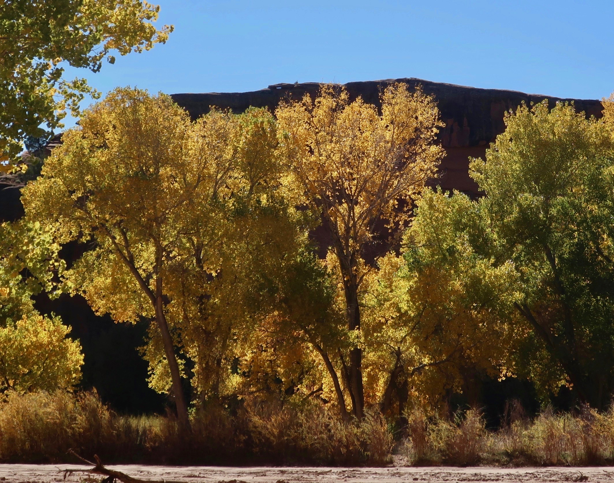
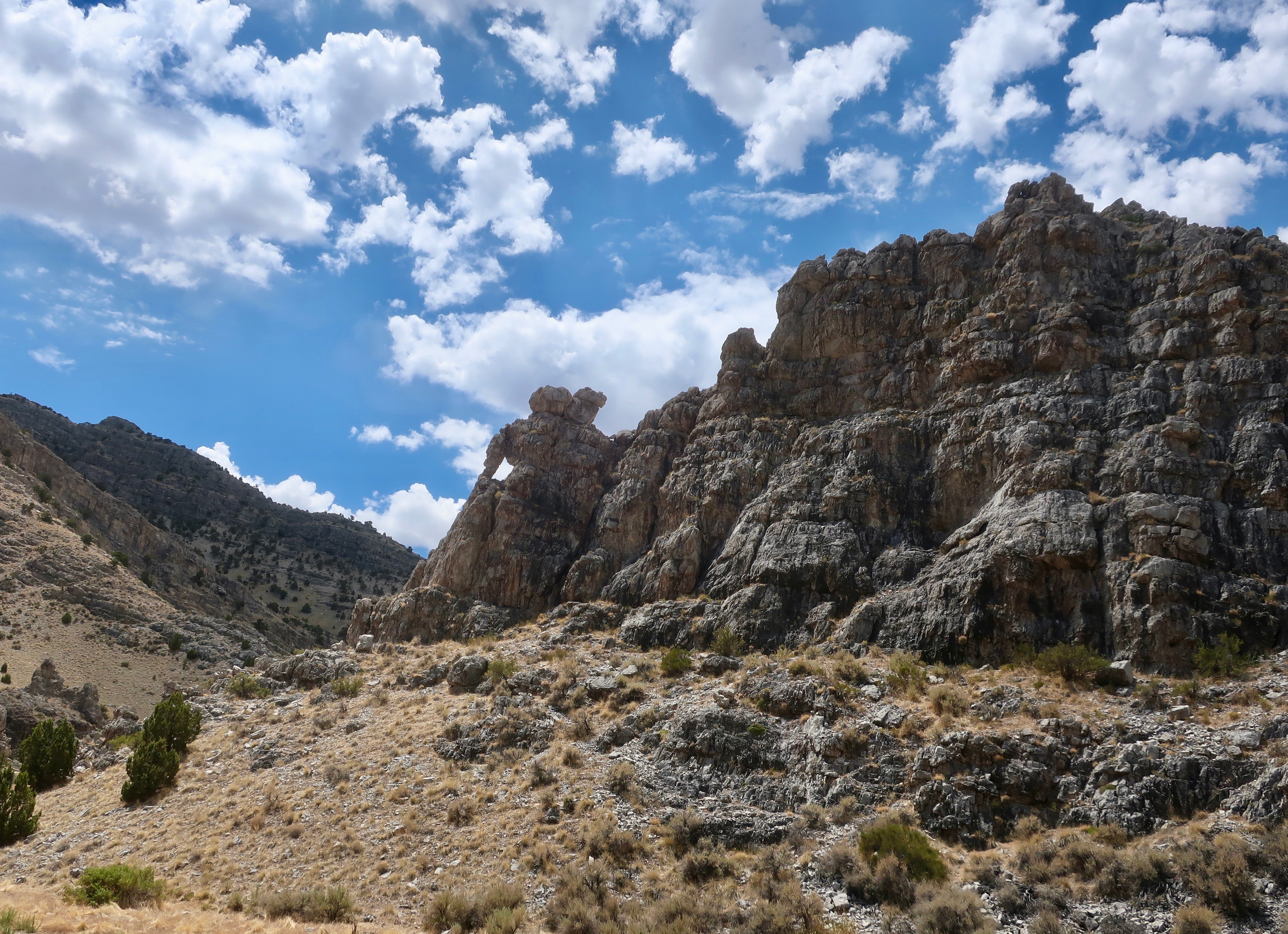
Canyon de Chelly National Monument
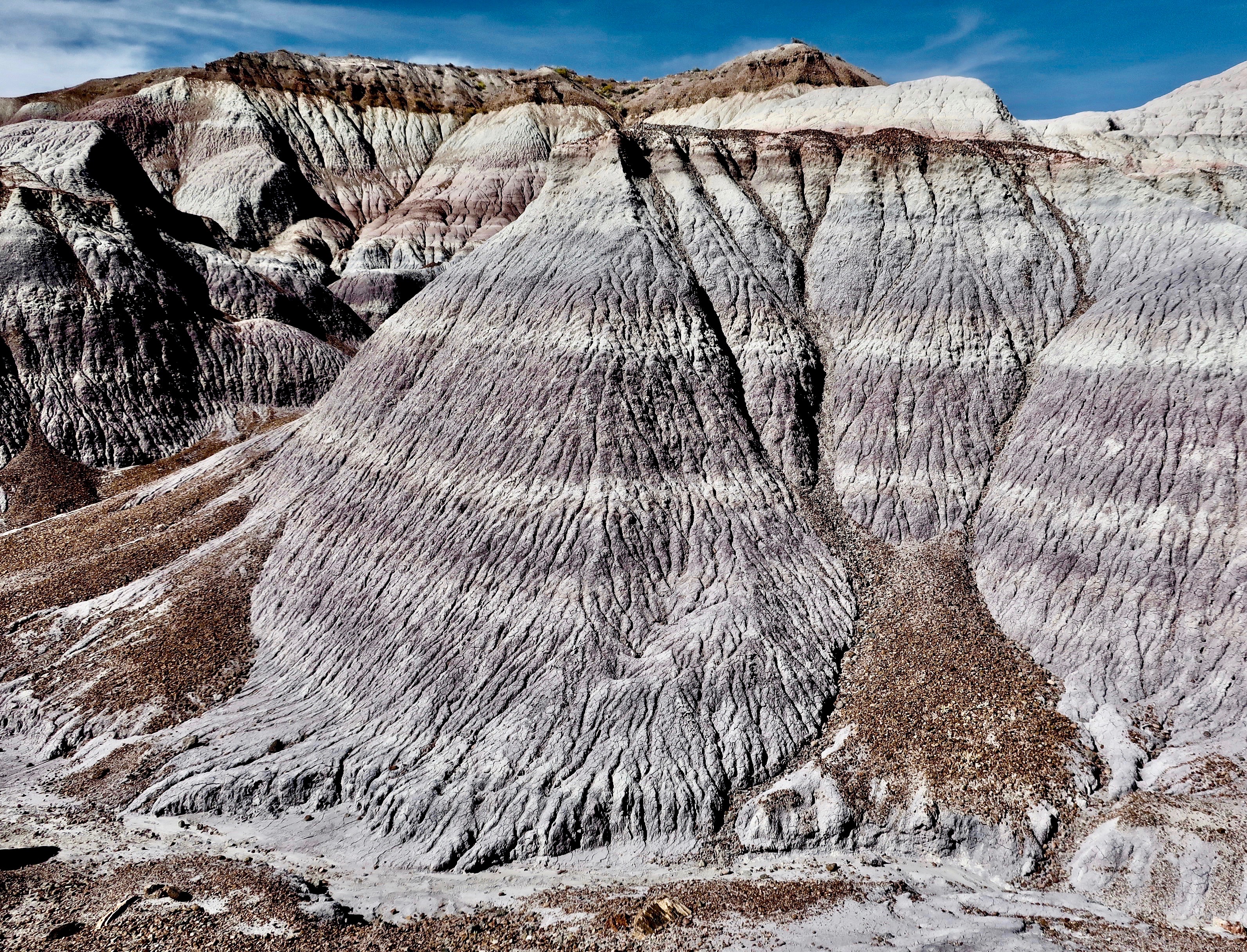
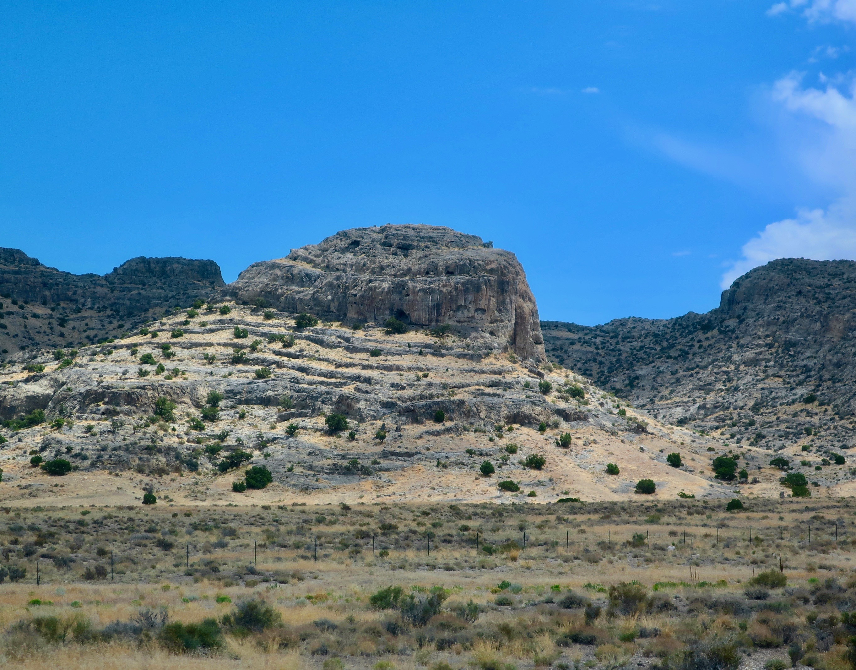
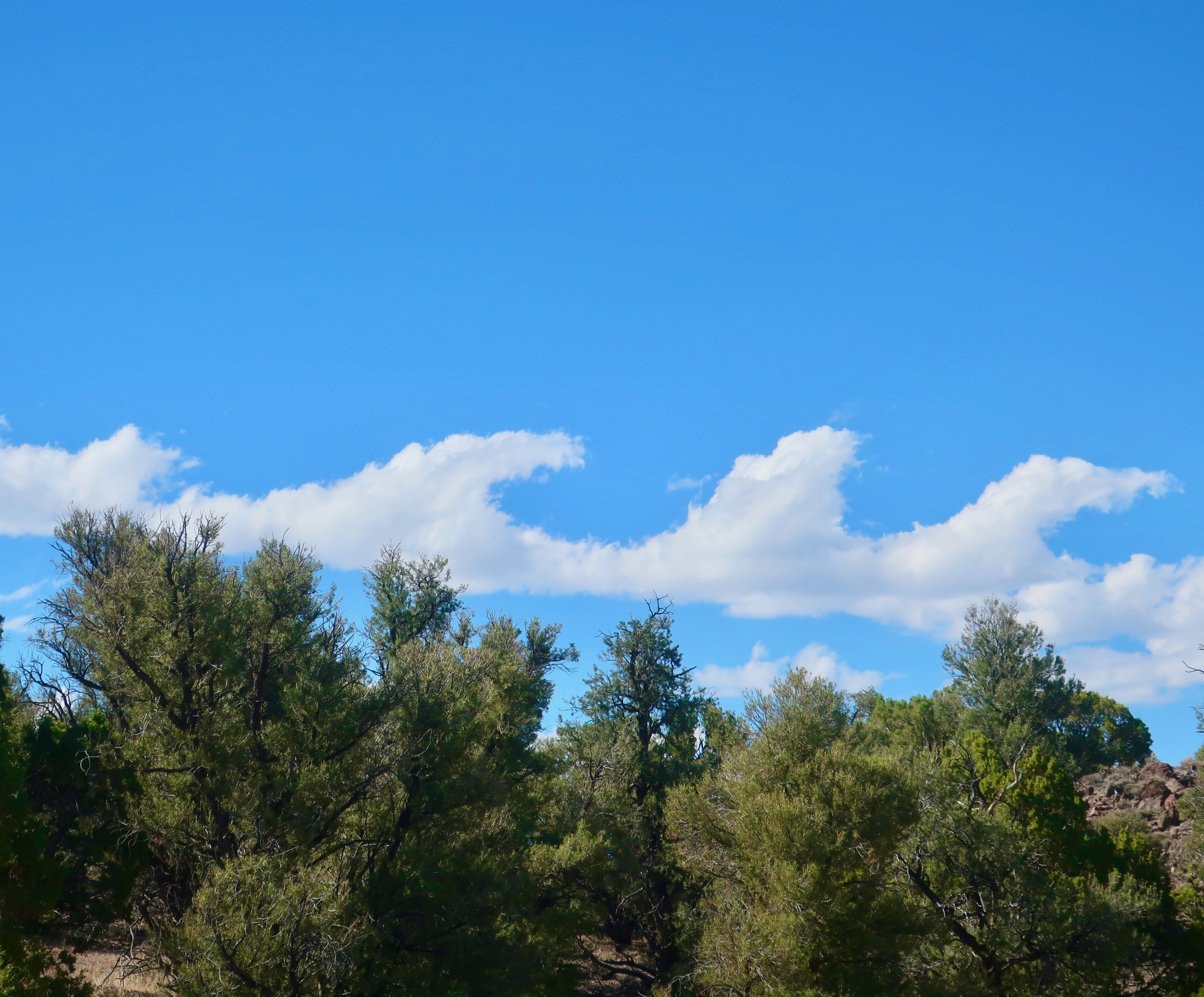
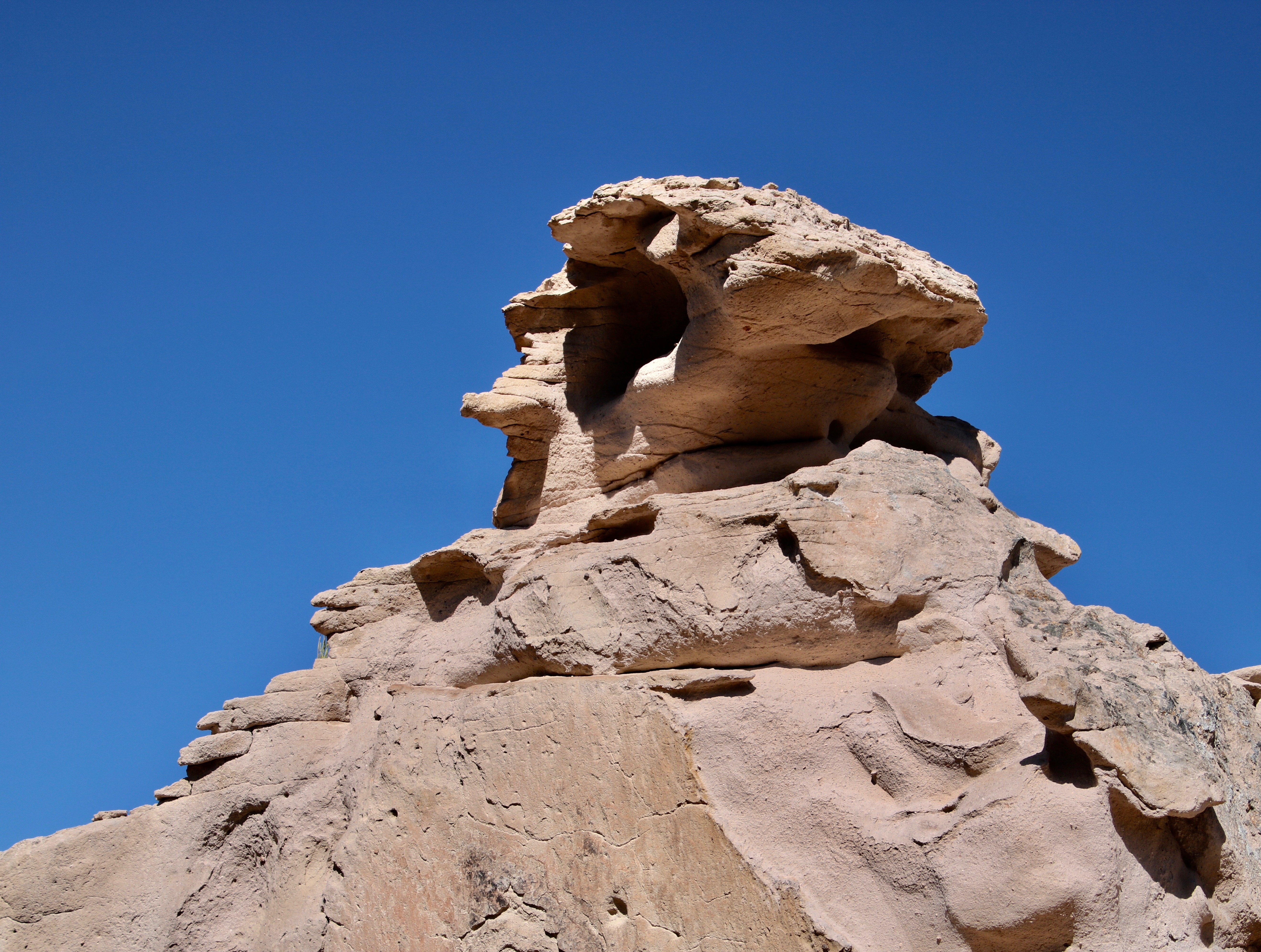
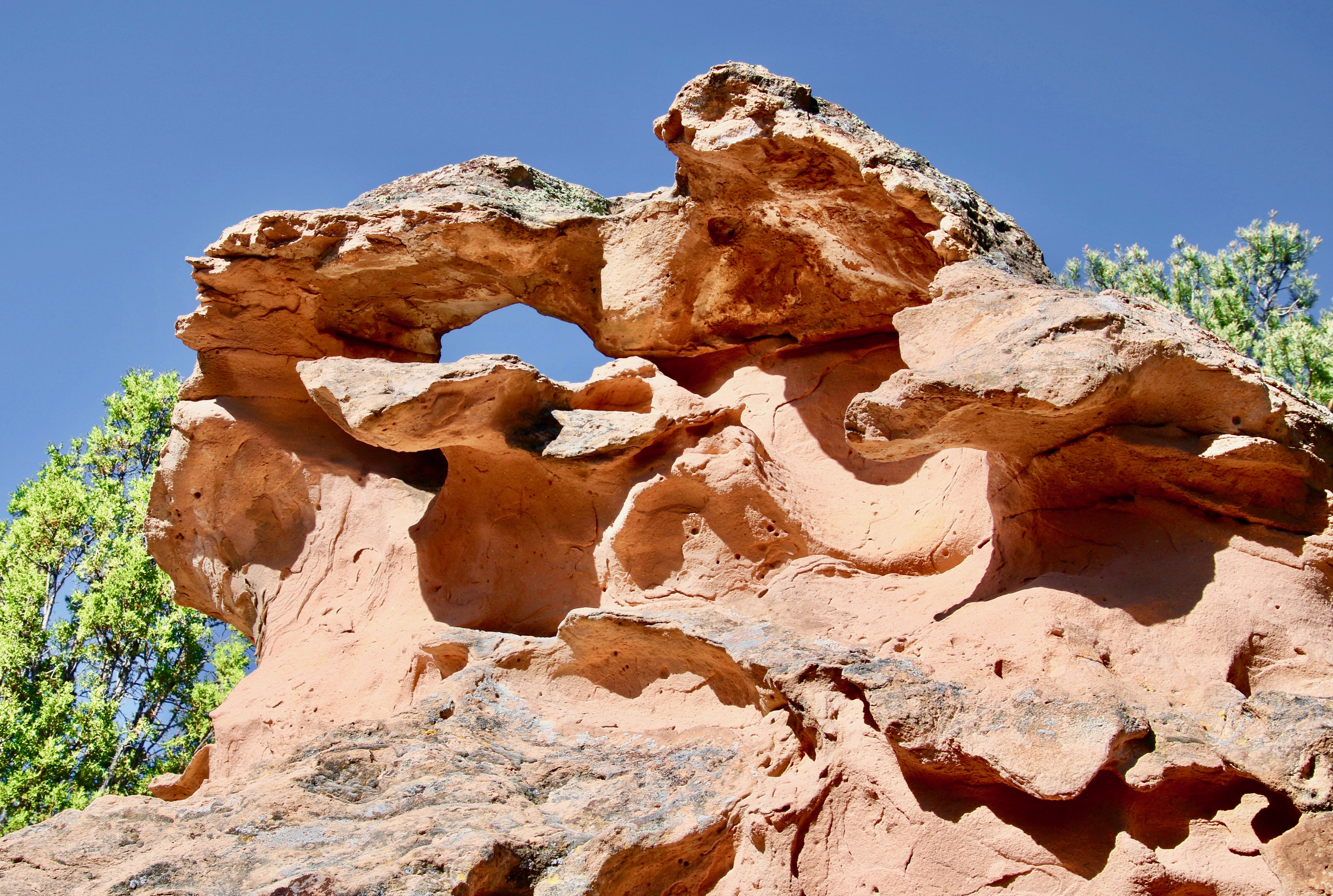
Petrified Forest National Park
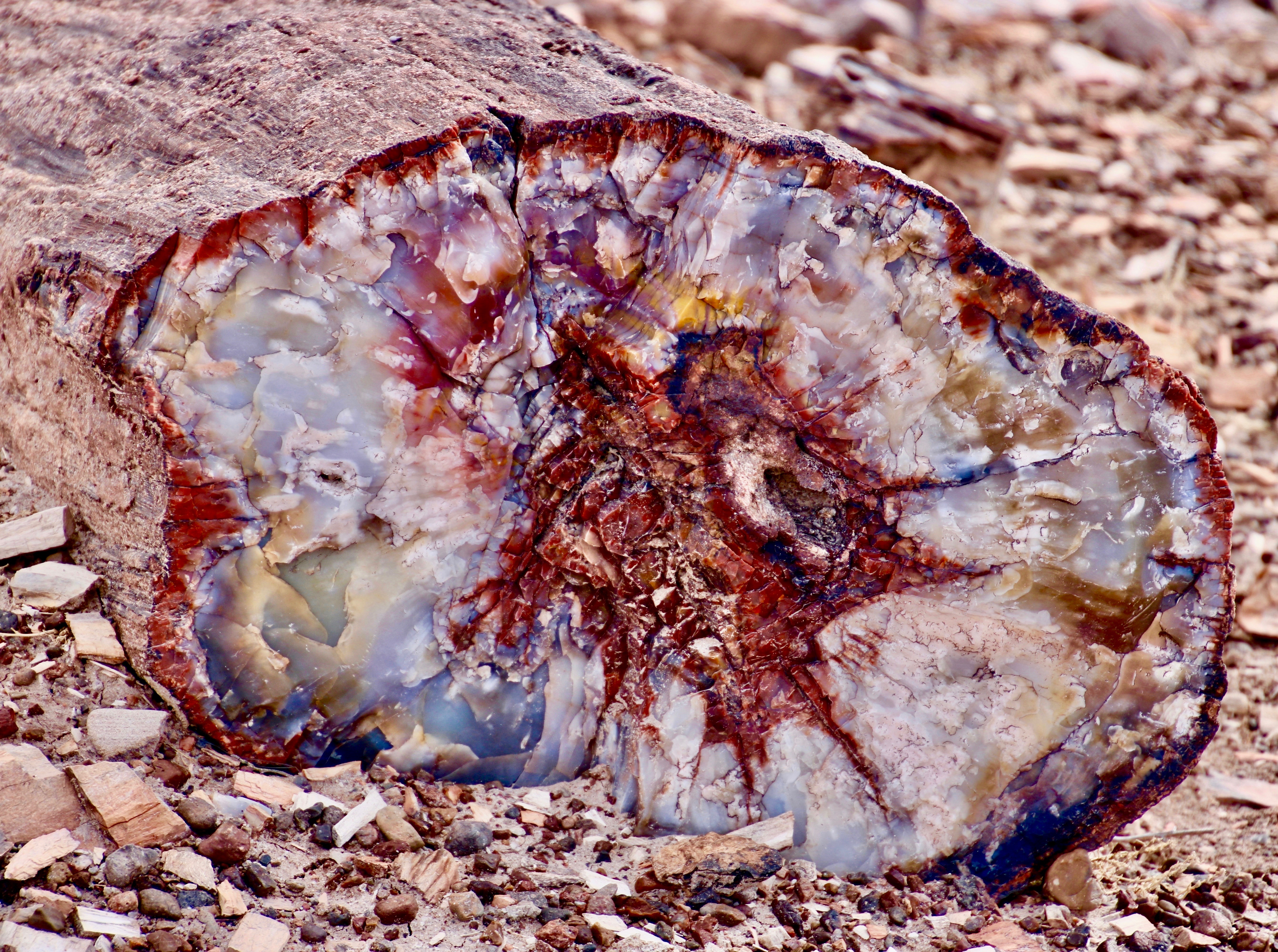
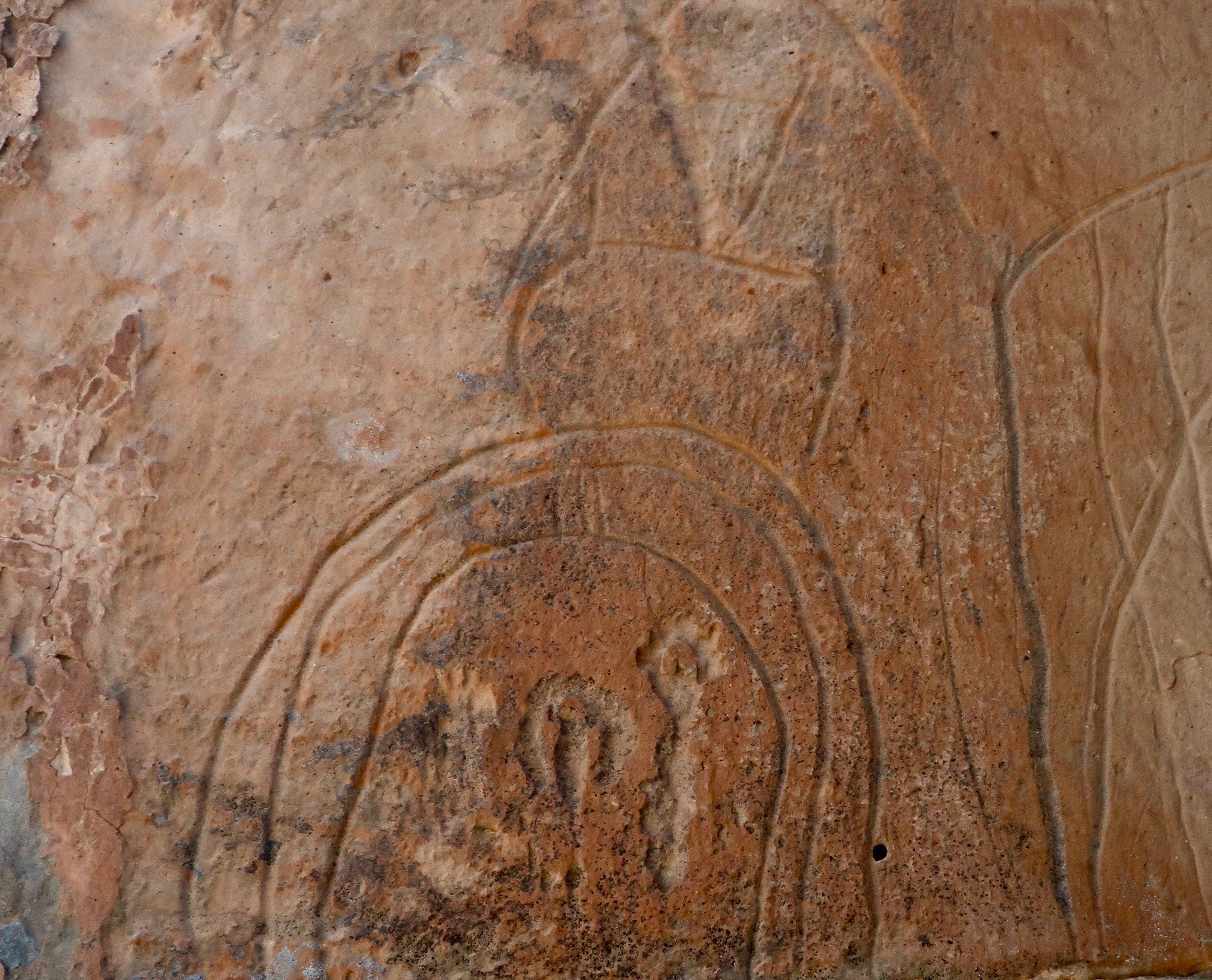
Petrified Forest National Park log.
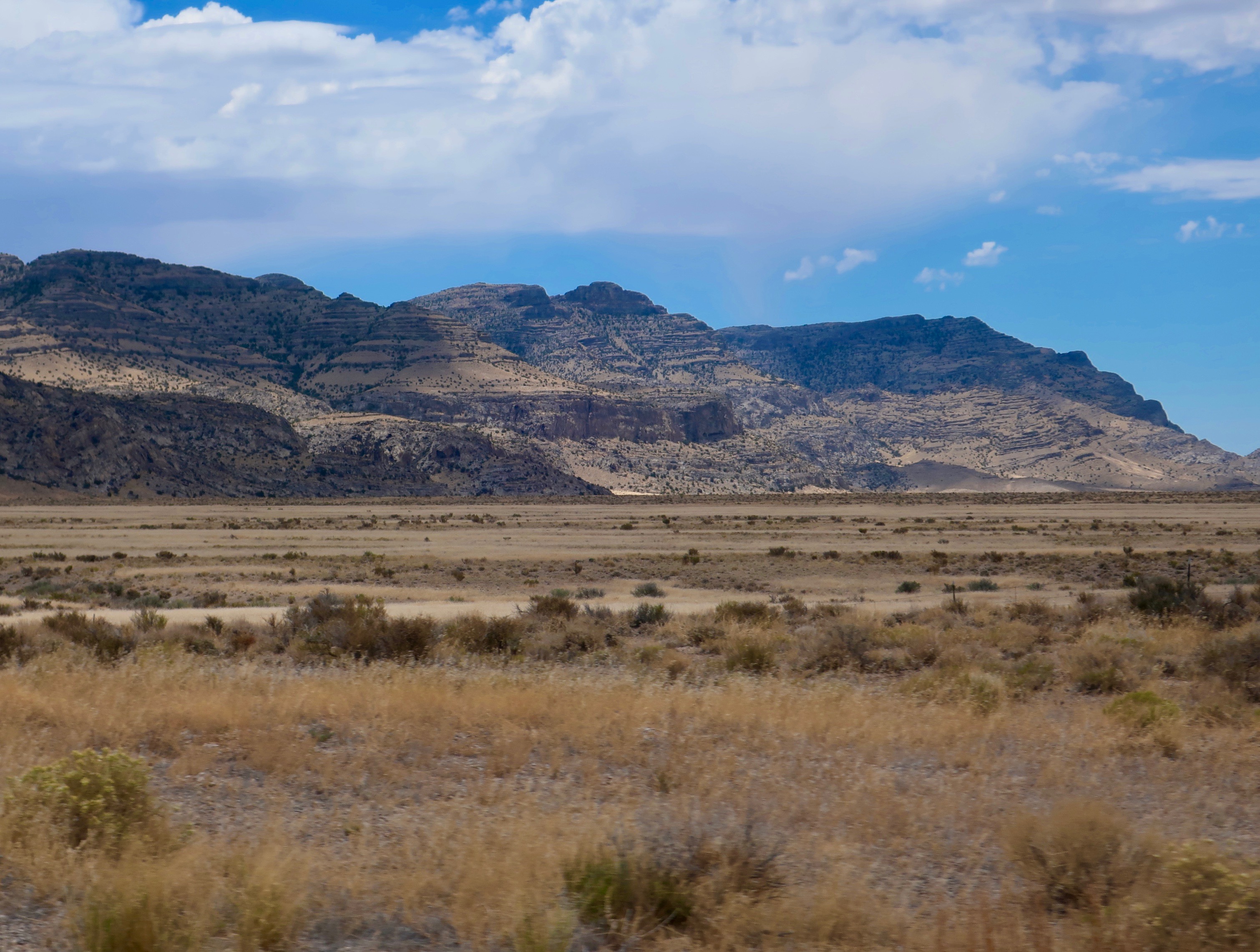
Monument Valley
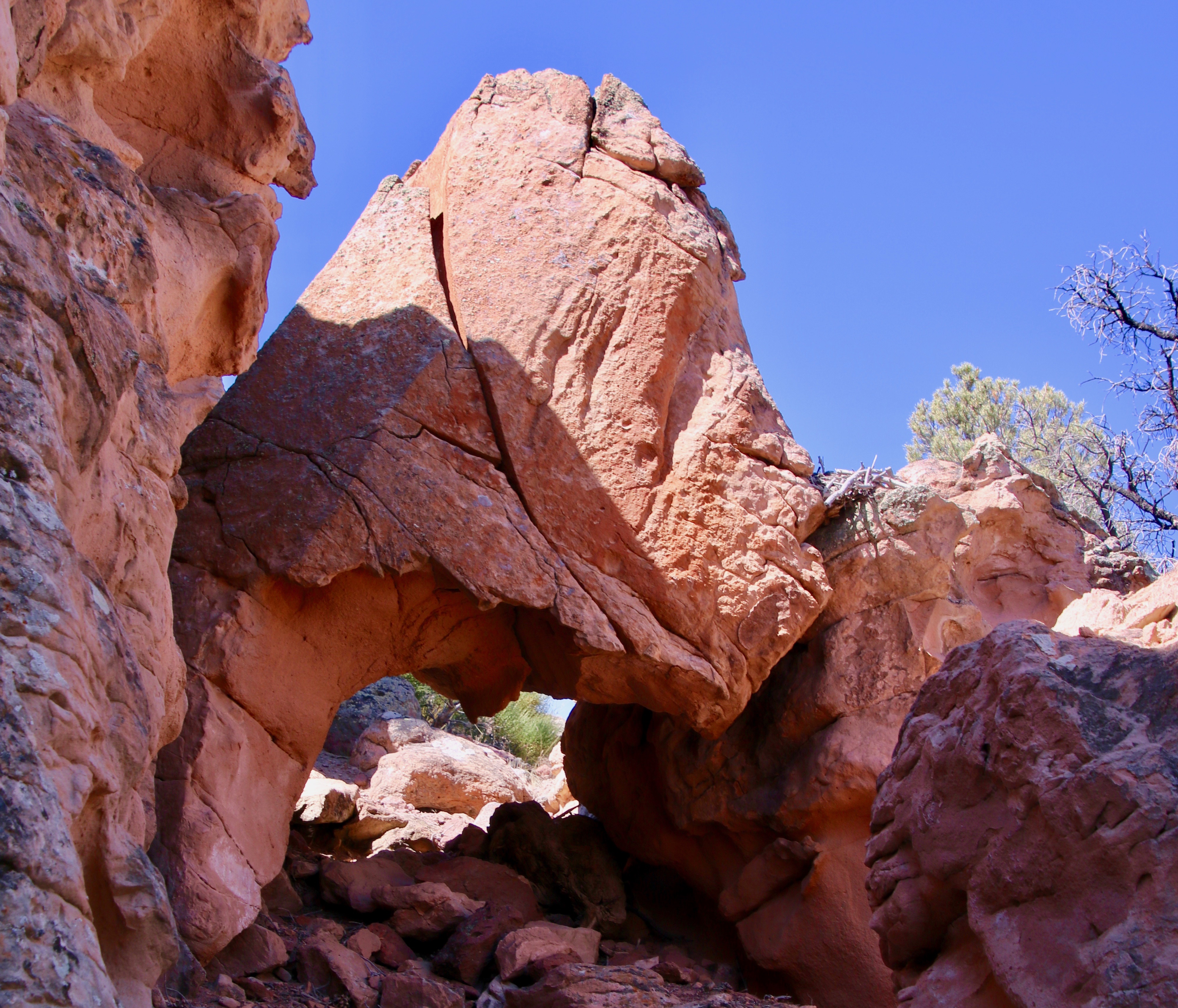
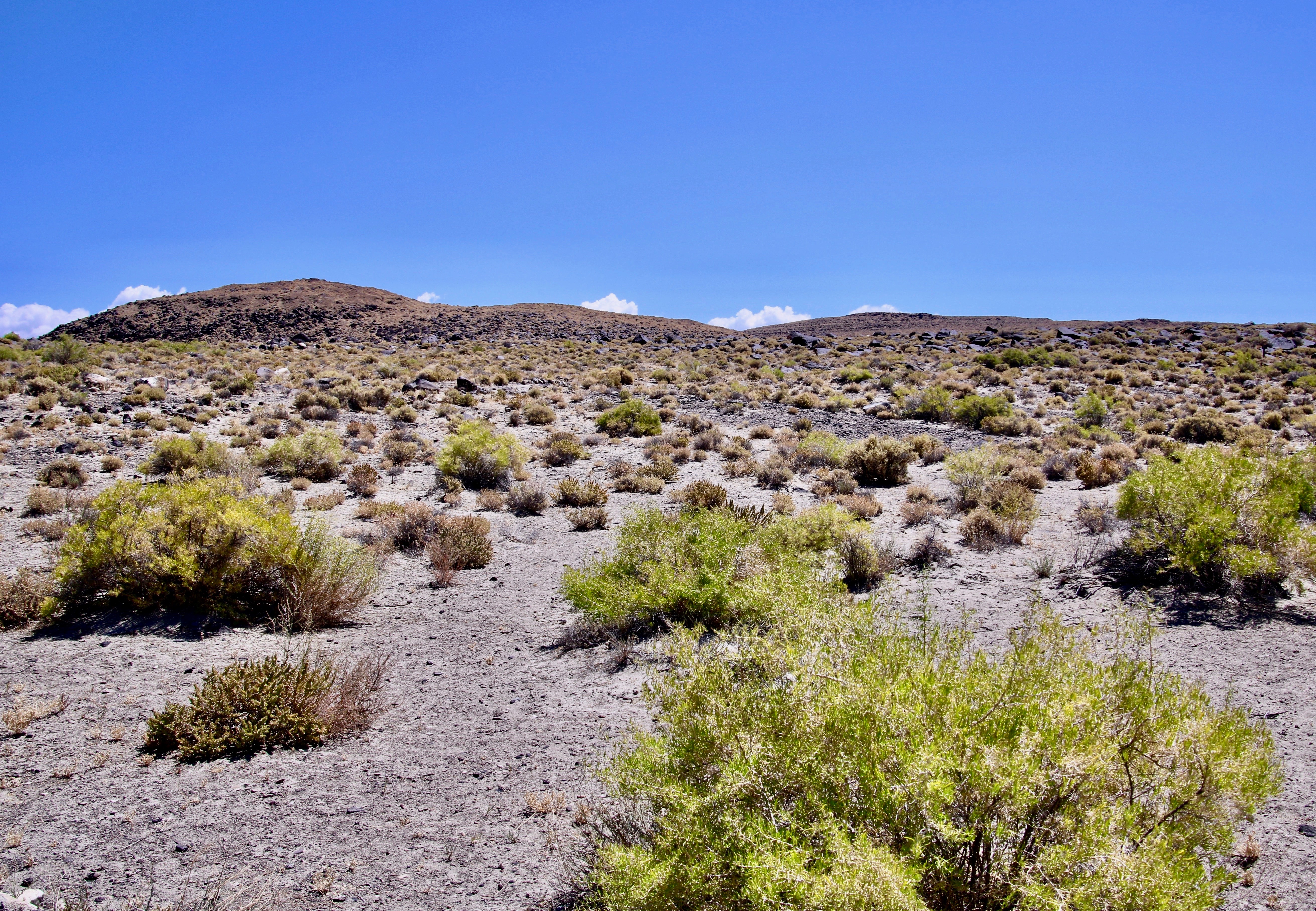
Grand Canyon National Park
That’s it for today. Next Tuesday it’s back to blogging my book. On Wednesday, it’s time for the Christmas Card featuring Cow Girls. Christmas Eve, I’ll be posting more National Park calendar photos.
It’s Blog-a-Book Tuesday, again, and I am continuing to blog “It’s 4 AM and a Bear Is Standing on Top of Me”— one story at a time. In my last post Steve and I began our recruitment efforts for the Sierra Trek, our hundred mile backpack trip across the Sierra Nevada Mountains. Sixty one people signed up, a true cast of characters. In this post, we recruit sponsors, figure out what we will feed our army, and preview 80 miles of the trail.
We would start our journey hiking up and over granite mountains.
As the Trekkers rolled in, Steve and I focused our energies on the next task. What were we going to feed the army that we would be leading through the mountains? Breakfast and lunch could be pulled off the shelves in local grocery stores. Dinner was the problem. Freeze dried food was in its early stages of development and somewhat expensive for my budget.
There was another possibility. Lipton had a lightweight, off-the-shelf dinner, which was inexpensive and sold through grocery stores. The meals came in four flavors and featured tiny amounts of turkey, chicken, beef and ham with gourmet names attached. I bought all four and Jo Ann (my first wife) and I did a taste test. Except for the Ham Cheddarton, they were actually decent. The Cheddarton, while edible, was in serious need of improvement. What the heck, I thought, three out of four isn’t bad.
Steve suggested that he call Lipton’s headquarters back east and see if we could get the food donated. We would offer to ‘test market’ and publicize their food for the growing backpacking market. Lipton bought it. We had our dinners, and Steve had earned his minimum wage for the day.
We also wanted a backpacking store as a sponsor. An outdoor store would provide some much-needed credibility and be a valuable source of advice and recruits. I did a scientific search by looking in the Yellow Pages and picking out the first store I came to, Alpine West. It was only a few blocks away at 10th and R Street so I walked over. A bushy bearded, hippie-like character in his mid-twenties was behind the cash register.
“Excuse me,” I asked, “is the owner or manager in?”
“I am the owner,” was the somewhat terse reply. “What can I do for you?”
I did a quick regrouping, “Hi, my name is Curt Mekemson and I am the Executive Director of the local Lung Association,” I said as I offered my hand. He gave me a ‘what donation are you about to ask for look’ but took my hand and introduced himself as Tom Lovering. I explained what we were going to do.
“That’s insane,” Tom had replied with an assuredness that would have intimidated Attila the Hun. It certainly intimidated me. What do you say when the expert you are seeking advice from tells you flat-out that the idea you are already implementing is crazy?
“Um, it’s been nice chatting with you.” Or, “I’d really appreciate it if you don’t tell anyone.”
I opted for the “Why do you say that?” wanting to know how far out on the limb I had crawled. I quickly learned that the event we were planning was the equivalent of the Bataan Death March. People might do it but they were going to be miserable and say nasty things about the Lung Association and me for the rest of their lives.
After having said all of that, Tom agreed to sponsor and promote the Trek through his store. I left feeling a little confused. Did he want people to say nasty things about Alpine West and him?
Back at Lungland, the clock continued to tick and tock. The Trek was three weeks away and then two. It was time to go out and preview the route. Given Tom’s pessimistic assessment of our adventure, Steve and I felt the preview was all the more critical. We agreed to a long weekend where each of us would hike three days of the route. The final three days were saved for the following weekend just before the Trek. Could we plan things any tighter? There was no room for error.
Steve had never backpacked alone and I had only been out by myself three times. It promised to be an adventure. In addition to reducing the odds that we would lose 61 people in the woods, we also needed to check out potential camps, water availability, and the difficulty of the trail. I wanted to develop a feel for what we would be putting our participants through.
Nervous is the best word to describe my mood as I packed up. Jo Ann was heading off for a clothes-buying spree in San Francisco. I told her to enjoy herself, threw my backpack in the back of my Datsun truck, picked up Steve, and drove to Squaw Valley. We made a brief stop in Auburn to recruit my father-in-law’s Springer Spaniel, Sparky. I felt the trip might be a little rough on my basset hound, Socrates, but wanted some doggy companionship. I left Steve weaseling a free ride up the Squaw Valley tram and headed for Robinson Flat, a camping area on the western side of the Sierras. I left the pickup there for him.
Some experiences burn themselves into your soul. This was one. The beauty and the variety of the wilderness captured me. I was starting at around 7000 feet in the heart of red fir and Jeffrey pine country and dropping 6000 feet into the Sierra Foothills where incense cedars, ponderosa pines and white oaks provided shade.
Red fir trees grow on the upper slopes of the Sierra Nevada Mountains beneath the alpine zone.
Along the way I would descend into river canyons filled with inviting pools and scramble out to follow hot, dry ridges. Besides Sparky, a coyote, two skunks, several deer, a porcupine, and numerous birds provided entertainment. I also met my first ever bear, a big brown fellow that came ambling out of the brush and increased my heart rate twofold. Even the ever-curious Sparky took one sniff and made a quick retreat behind me, looked out from between my legs, and started barking. Great. The bear growled his displeasure and ambled back into the brush. Slowly.
Being alone enhanced and intensified the experience. The days were exciting but the nights bordered on scary. After the bear, I imagined all types of creatures sneaking up on us as we slept. Sparky was even more nervous. I loaned her my new Pendleton shirt to sleep on. She had chewed it to rags when I woke up in the morning. I didn’t have the heart to scold her. Had I known what she was up to, I might have joined her.
It was the physical challenge that made the deepest impression. I was strong but out of shape. Even had I been better prepared, I wasn’t psychologically ready for the experience of hiking 10-15 mile days with a 55-pound pack on my back. Nor was the territory gentle. I was hiking in and out of 1000 foot plus deep canyons following steep, winding trails that had challenged the 49ers in their endless search for gold. Once I found myself lost on a brush choked mountain and had to fight my way free.
As I approached Forest Hill, temperatures climbed to a scorching 105 degrees. To top it off, I was breaking in a new pair of German-made Lowa boots. All of the backpacking literature of the day emphasized sturdy foot-ware and it didn’t get much sturdier than Lowas. Given that my feet blister at the mere sight of a boot, they were not happy campers. By the third day I had blisters on top of blisters and my feet resembled a hyperactive moleskin factory.
But I made it. I proved to myself I could do it and that the Trek was possible. With the proof came an incredible high. I hiked into Forest Hill singing.
Steve showed up about an hour later in the Datsun. He was beaming and grabbed me in a breath-robbing bear hug while Sparky did much wagging of tail. The three of us did a little dance and Steve and I both tried to talk at once as we told our stories. Steve had seen ‘migrating’ rattlesnakes and lots of bear scat. He peed around his camping area to mark his territory and warn the bears to stay out. They did. The second day a hawk had ‘chased’ him down the trail for miles. I wondered what Steve he been smoking. But now, Steve was on the same natural high I was. We were ready to Trek.
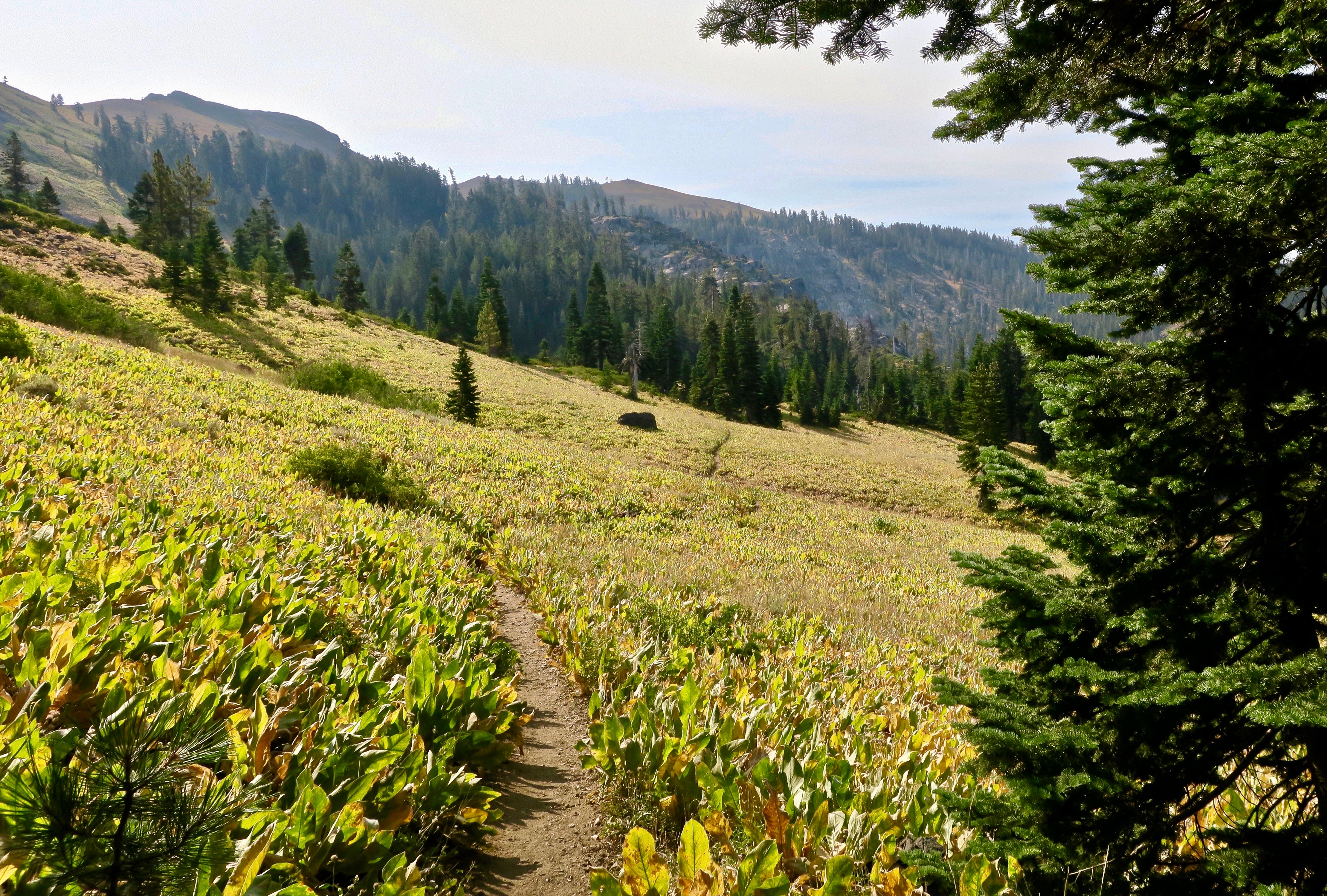
In hiking a hundred miles, we quickly discovered that the trails have a way of going on and on— as this one does across a field of mule ear flowers.
NEXT POSTS:
I’ll be featuring photos from our various adventures this year between now and the New Year on my Travel Blog but I will keep Tuesdays for blogging my book. Next Tuesday we discover that Lipton has only sent us Ham Cheddarton, Jo Ann takes a detour to LA, and I take a detour to Canada. All in the week before the Trek.
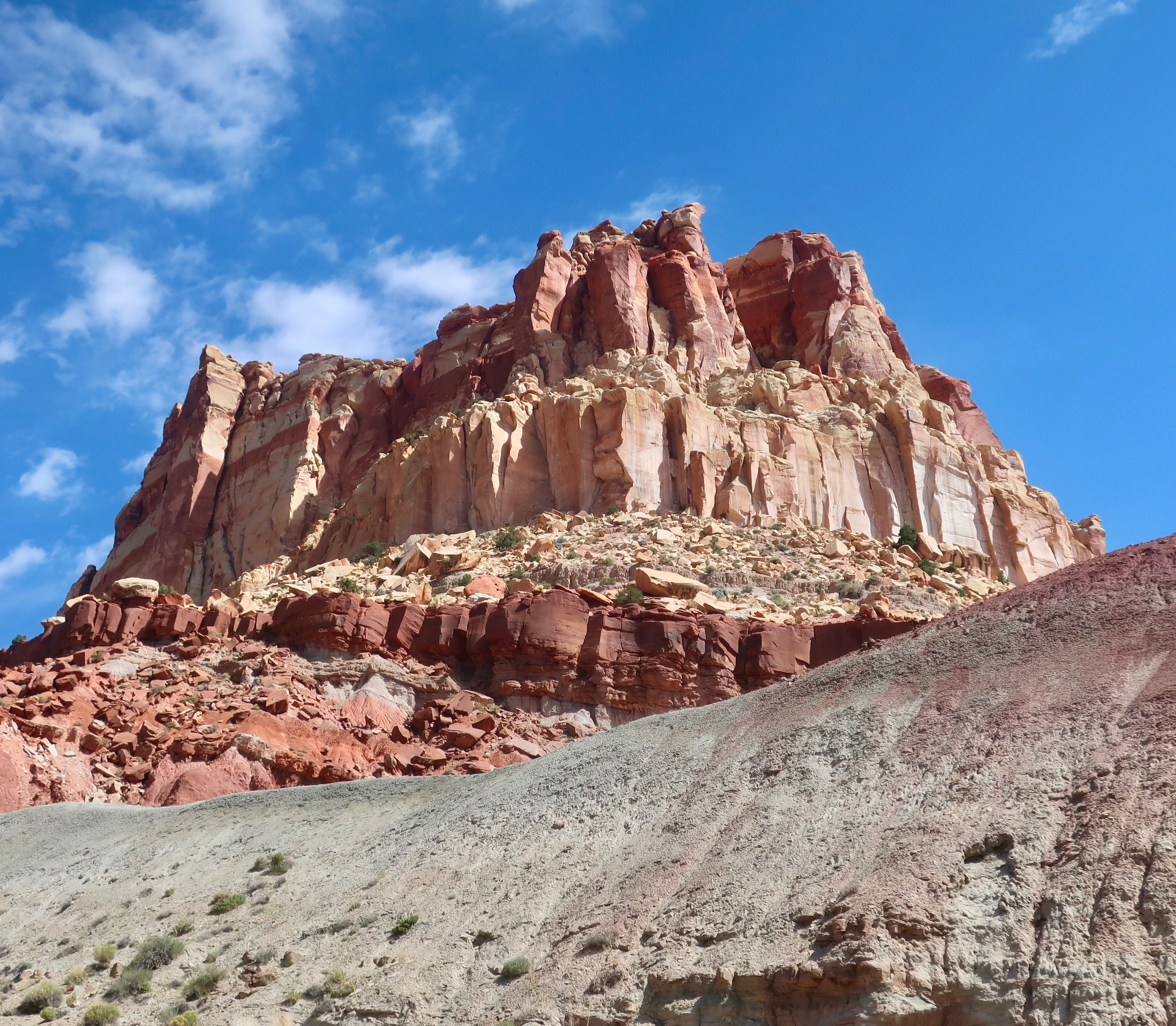
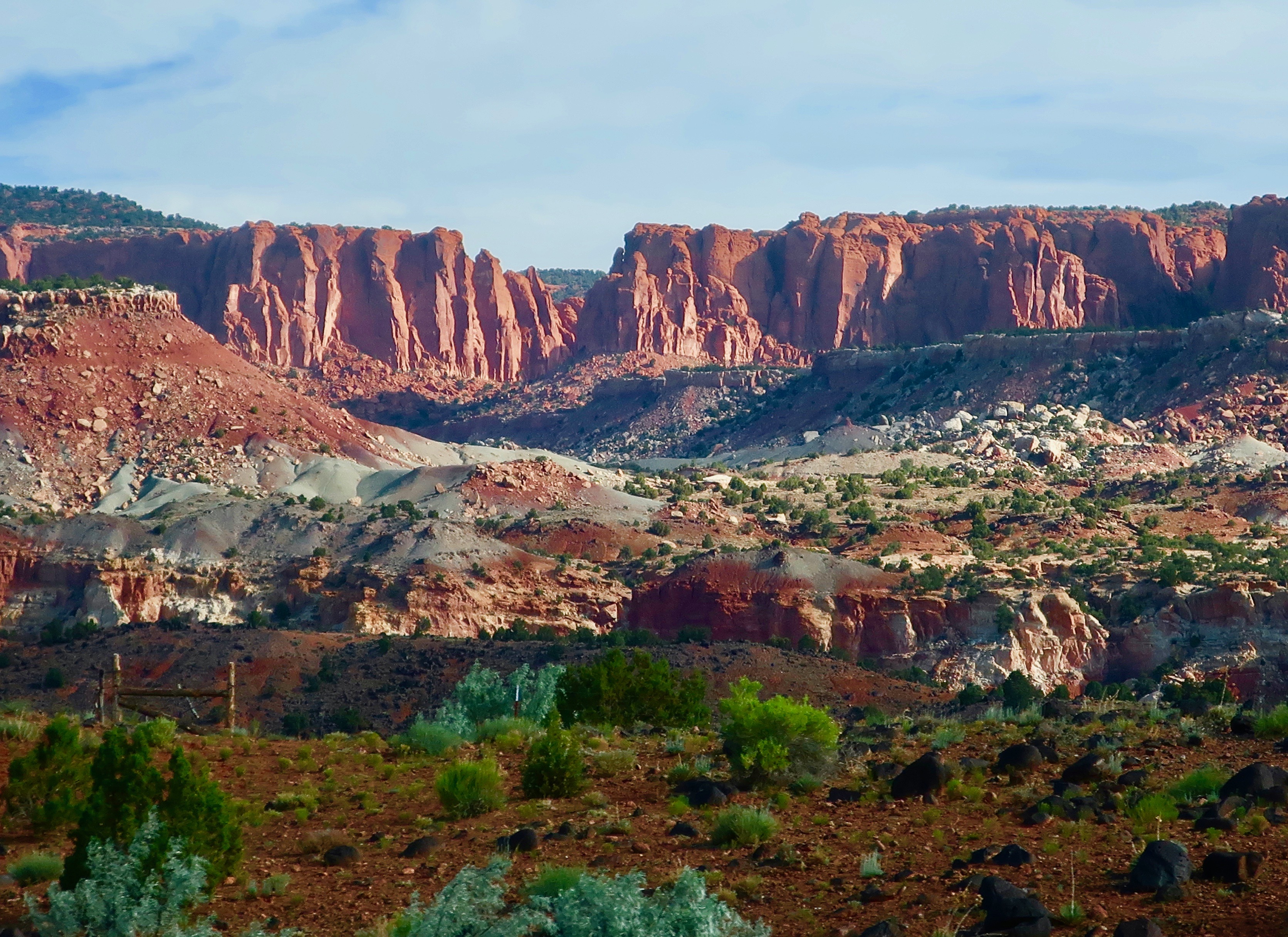
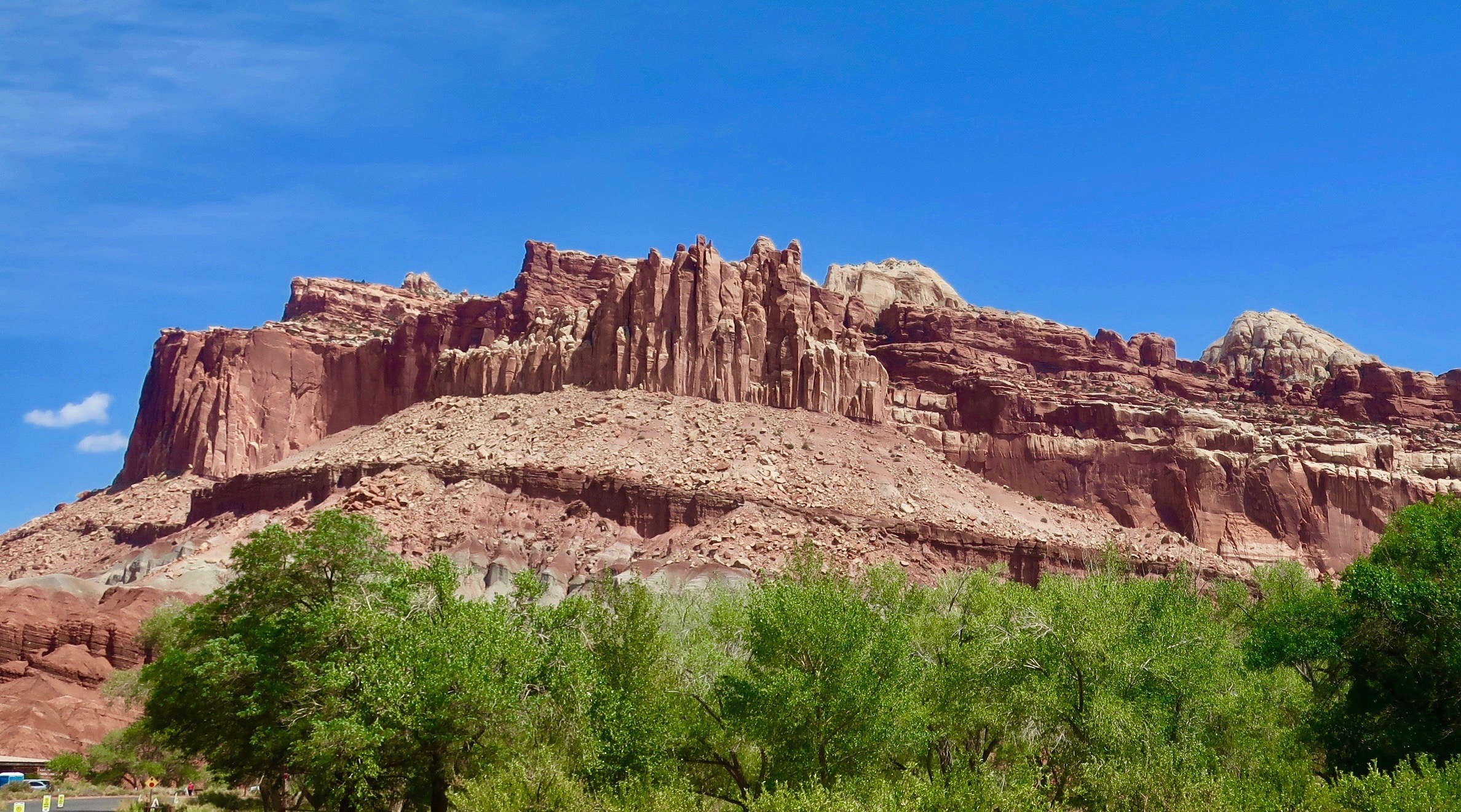
Utah’s scenic Highway 24 is worth traveling over on its own, but Capitol Reef National Park makes it special.
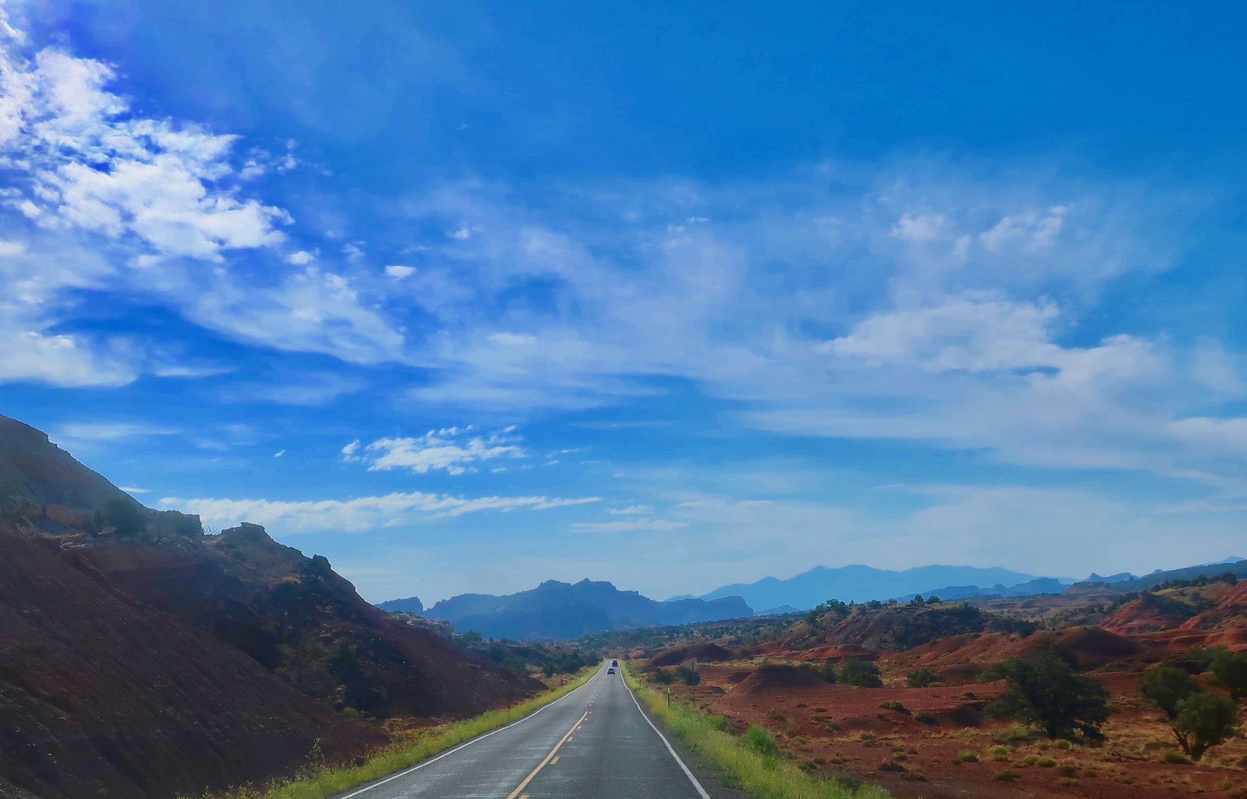
Peggy and I said goodbye to Highway 50 in the small Utah town of Sigurd with Capitol Reef National Park as our destination. We had been to the Park before and were eager to return. Our previous trip covered only a small section of Highway 24, however. This time we were determined to drive the whole road as part of our backroads adventure and were pleased to discover it, too, was quite scenic. I’ll start with photos we took before and after Capitol Reef NP and then focus in on the Park. These photos were taken by both Peggy and me.
Three photos from along Highway 24 west of Capitol Reef National Park:
Three photos from along Highway 24 east of Capitol Reef National Park:
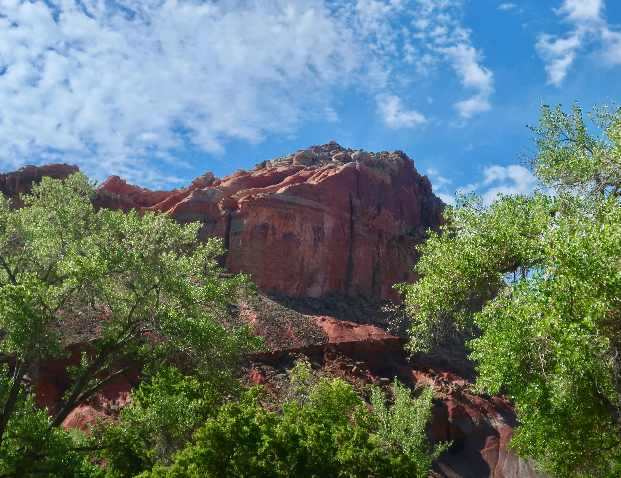
Most people familiar with the national parks of the Southwest will quickly recognize the Grand Canyon, Arches and Bryce. Maybe not so much Capitol Reef. That’s too bad; it’s quite stunning. Like the other parks of the Southwest, it is made up primarily of sedimentary rocks that were laid down over a period of 200 million years in ancient rivers, swamps, Sahara-size deserts and shallow oceans. Unlike the rocks in the other parks, which have a layered cake look— like the rocks east of the park shone above— Capitol Reef resembles a 100-mile warp in the earth. It’s a monocline known as the Waterpocket Fold. Sixty to seventy million years ago, an ancient fault in the area was re-activated and the layers of rock on the west side of the fold were lifted some 7000 feet higher than the layers on the east side. Erosion has since created the fantastic rock forms found in the Park today. Following are a few of the photos that Peggy and I took in the park:
And a final view. If you find yourself in Utah, Peggy and I highly recommend a visit to Capitol Reef National Park.
NEXT POSTS
Blog a Book Tuesday: Steve and I split up the Sierra Trek route for a review, each covering 40 miles in 3 days. Steve claims he is chased by a hawk, comes across migrating rattlesnakes, and has to pee around his camp to scare off the bears. I wonder what he has been smoking. As for me, I begin to comprehend how crazy the idea is but come off the trip on an absolute high. My plan is to finish the final 20 miles the following weekend…
It’s blog-a-book, Tuesday. On my last post I hired wild Steve to work with me. In this post we pick a name, discover a route, and recruit our participants.
A view of the Northern Sierras near where we would start our Trek.
We were now six weeks out from our 100-mile backpacking event. The clock wasn’t ticking; it was running. We didn’t have a name, we didn’t have a route, and we didn’t have any participants.
The name part was easy. While thinking of backpacking 100 miles in nine days the word trek popped in to my mind. So, I looked it up in the dictionary. “A long, arduous journey” was the definition. That seemed appropriate, and since we were doing our long, arduous journey through the Sierra Nevada Mountain Range, I decided to call it the Sierra Trek.
Where to go posed a more serious challenge. There were three criteria: one, it had to be 100 miles long; two, it needed be in our territory; and three, the trail should be easy to follow. The hundred miles was a given. ‘Being in our territory’ seemed feasible since several of ALASET’s (the American Lung Association of Sacramento-Emigrant Trails) nine counties encompassed a significant portion of the Northern Sierras.
The clinker was ‘easy to follow.’ I had nightmares of participants lost all over the mountains while Steve and I scrambled to find them. We’d be lucky if we avoided becoming lost ourselves. Serendipity came to the rescue. I was reading the Sacramento Bee when I found a possible solution. The horse people were planning their annual 100-mile horse marathon across the Sierra Nevada, the Tevis Cup Race. The event kicked off in Squaw Valley and ended in Auburn. Horses had to follow substantial trails, I reasoned. Squaw Valley had been the sight of the 1960 Winter Olympics and would provide an internationally renowned resort to kick off our event. Auburn was one of the main foothill communities in the Association’s territory and would make an excellent ending place. The trail had the added advantage of being an early trail used by pioneers. We could use the historical angle and tie it in with our name. It seemed ideal.
The only fly in the soup from my perspective was that the trail might be filled with horse poop. I’m not a fan.
Steve made contact with the woman in Auburn who was organizing the Tevis Cup Race. “Yes, the trail is easy to follow,” she told him. They marked it with yellow ribbons and the ribbons would still be up for our Trek. As for my concern about horse manure, “There should be plenty of time between the race and your trek for the manure to dry out.”
“Fine,” I said to Steve when he reported back, “our Trekkers will be shuffling down trails in dry horse shit.” On the other hand, I thought, look for the silver lining. We could tell them to follow the horse droppings if the ribbons ran out. The important thing was we had a route and could begin publicizing the event. Steve and I agreed to preview the route in advance of the Trek to pin down campsites and reduce the possibility of nasty surprises. Nor would it hurt for the two of us to get some backpacking in before we played Moses in the wilderness.
So now we had a route and a name, it was time to recruit participants, obtain food, and preview the route. Our first challenge was whether we could recruit participants. Were there people in the Sacramento area crazy enough to go on a nine-day, 100-mile backpack trip up and over mountains?
The answer was a resounding yes. Steve got an article published in the Bee. All participants had to do was raise funds for the Lung Association. Naively, we failed to suggest experience would be valuable, set an age limit, or ask for a minimum number of pledges. People came out of the proverbial woodwork! We held an orientation session at the Sacramento Municipal Utility District auditorium with close to 100 people in attendance. Sixty-one signed up.
Among them were a 16-year-old ballerina with legs of steel and a 250-pound, fifty-four-year-old ex-ice hockey player who had also had a career defusing bombs in South America. At the time, he was dodging the IRS.
“Send any mail to my hardware store,” Charlie told me. “I don’t want the Feds to know where I live.” Or us either, apparently.
Four small 11-year-old boys came as inseparable buddies and I wondered what kind of baby-sitting service their parents assumed we were providing. There was busty Sunshine who had a skinny partner named Bilbo. (Decades before the movies, people were already entranced with Lord of the Rings and The Hobbit. I was.) Lovely L could be defined as a perfect 10 in the language of the time. Even the 11-year olds noticed.
Another woman, who claimed to be a witch, informed me, “I’ll be over to bite you around midnight on the Trek.” And no, she never came over to bite me; but had I encouraged it, I am sure it could have been arranged. We had a 40-year-old teacher from Auburn who would never sit down during the day because she claimed she would never get up, and a 45-year-old teacher from Davis who claimed he could carry his weight in booze, and probably did. There was also a young man named Dan with flaming red hair who wore moccasins, juggled and played a harmonica as he walked down the trail.
And then there was Orvis.
Three weeks before the Trek, an elderly, white-haired gent with a long flowing beard and twinkling eyes walked into my office and announced he wanted to go. My first thought was that he was a wood elf. His name was Orvis Agee. He was 70 years old and a carpenter. He couldn’t have weighed over 100 pounds fully dressed and soaking wet. I made a snap decision.
“Uh,” I said searching for a gentle way of telling him I thought he might be too old for the Trek, “this is going to be a very difficult trip. Do you have any backpacking experience?”
“Well,” he announced proudly, “I went on a 50-mile trip with the Boy Scouts last year.” That was 20 miles farther than I had ever backpacked. “And,” he added as he warmed to the subject, “I’ve climbed Mt. Shasta several times since I turned 60.” I had never climbed Mt. Shasta or any other mountain of note.Mainly, over the past five years, I had been sitting around becoming chubby.
Mt. Shasta
“Welcome to the Sierra Trek,” I eked out. What else could I say? (Seventeen years later at age 87, Orvis would do his last Trek with me. He had personally raised the Lung Association over $140,000.)
NEXT POSTS
Thursday’s Travel Blog: We continue our exploration of America’s backroads on Utah’s Highway 24 with a stop off at the stunning Capitol Reef National Park.
Next Tuesday’s Blog-a-Book: We find an unusual food source, recruit a reluctant sponsor, and preview the route— where I get blisters on blisters and my dog companion, worried about a bear encounter we had, chews up my new Pendleton shirt.
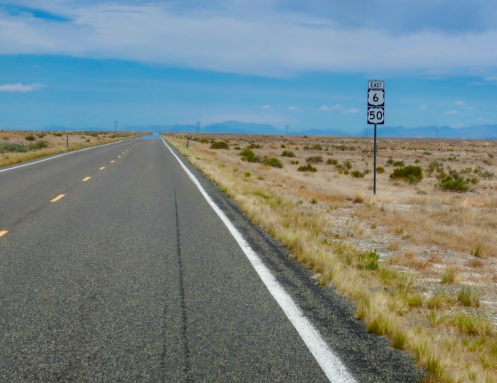
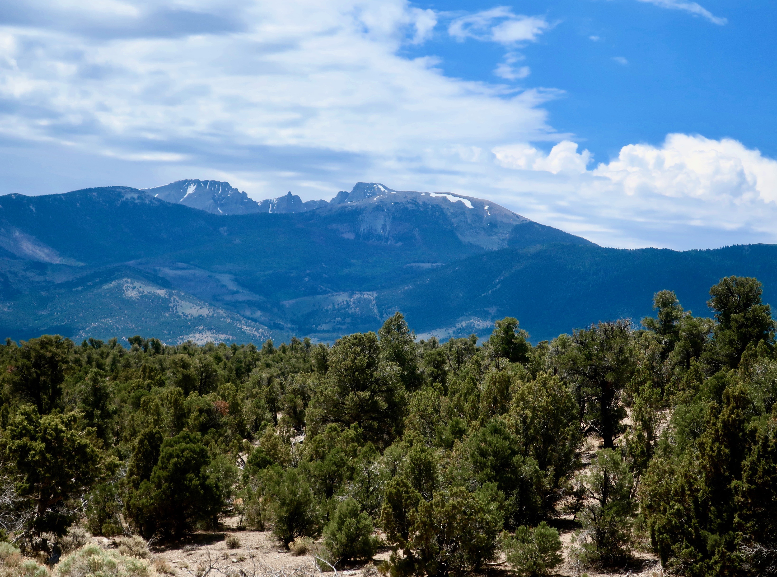
Highway 50 continued to be a lonely road with distant horizons through eastern Nevada and western Utah. The terrain did change somewhat, moving from sagebrush to grass in the valleys.
On leaving the Hickison Petroglyph Recreation Area, Peggy and I continued our exploration of America’s backroads following Highway 50 across Nevada and into Utah. Towns and fences were few and far between.
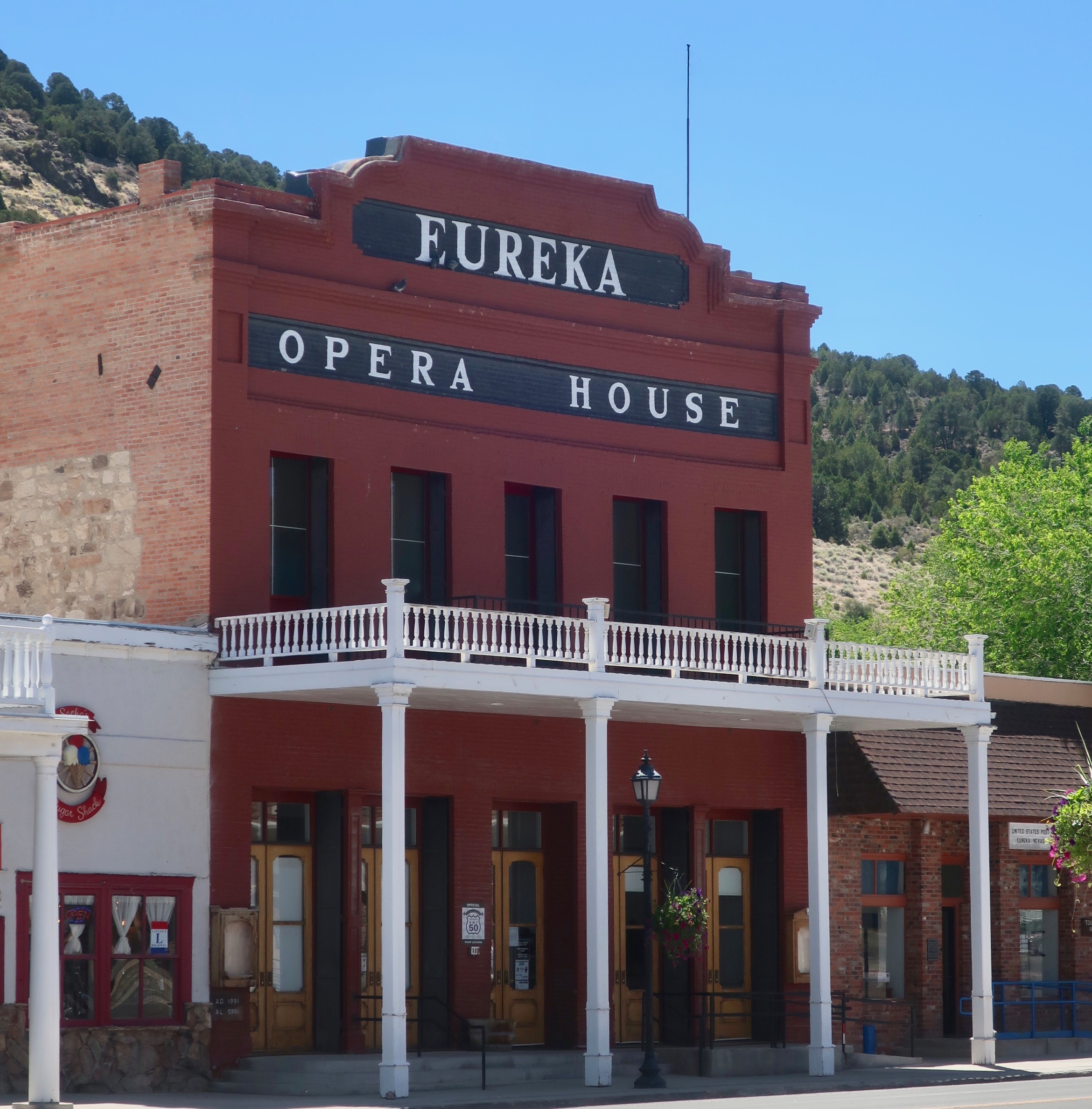
We did, however, discover an opera house in the small town of Eureka, Nevada. (Eureka, BTW, means “I found it!” and is often used in relation to gold and silver mining.) While it may seem strange that a rough and tumble mining town would have an opera house, it wasn’t all that unusual. A number of the wealthier boomtowns built them to demonstrate that there was more to their communities than bars, gambling halls and brothels. Fine examples can be found in Nevada City, California, Silver City, Nevada, and even in Death Valley!
The Eureka Opera House had recently been renovated. Originally built in the 1880s it served as the town’s social center, hosting operas, dances, concerts and other social events. Silent movies were introduced in 1915 followed by ‘talkies.’ The last movie was shown there in the late 1950s.
The Eureka, Nevada Opera House as it looks today.
Several other buildings in town have also been renovated. This one seems to be waiting for its turn.
Today’s post will mainly be photos of our continuing journey along Highway 50. We invite you to sit back and enjoy the scenery.
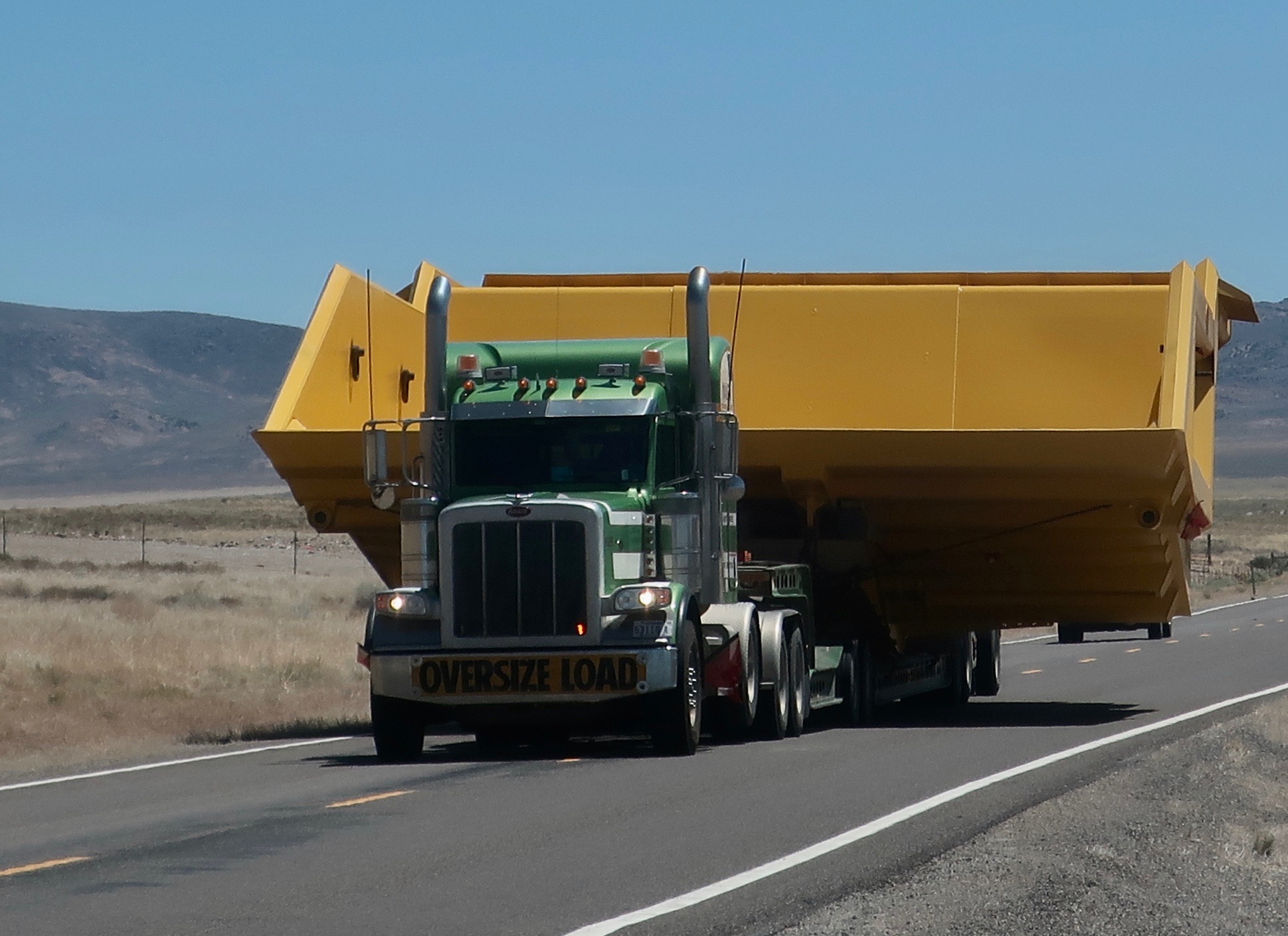
And what do you do when you meet a truck like this along the highway? Peggy and I decided that get out of the way was the correct answer. Actually, Nevada State Troopers had already provided the answer.
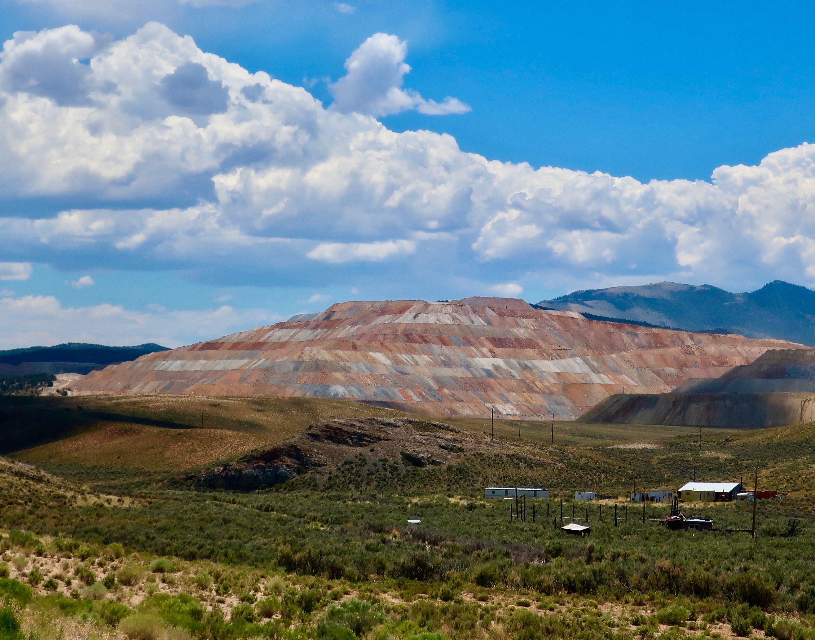
Any idea what this is all about? The huge mound of colorful dirt had Peggy and me wondering. The buildings provide perspective on size. Turns out it is one of the world’s largest pit mining operations, the Robinson Mine. The copper ore dug up here is shipped off to China.
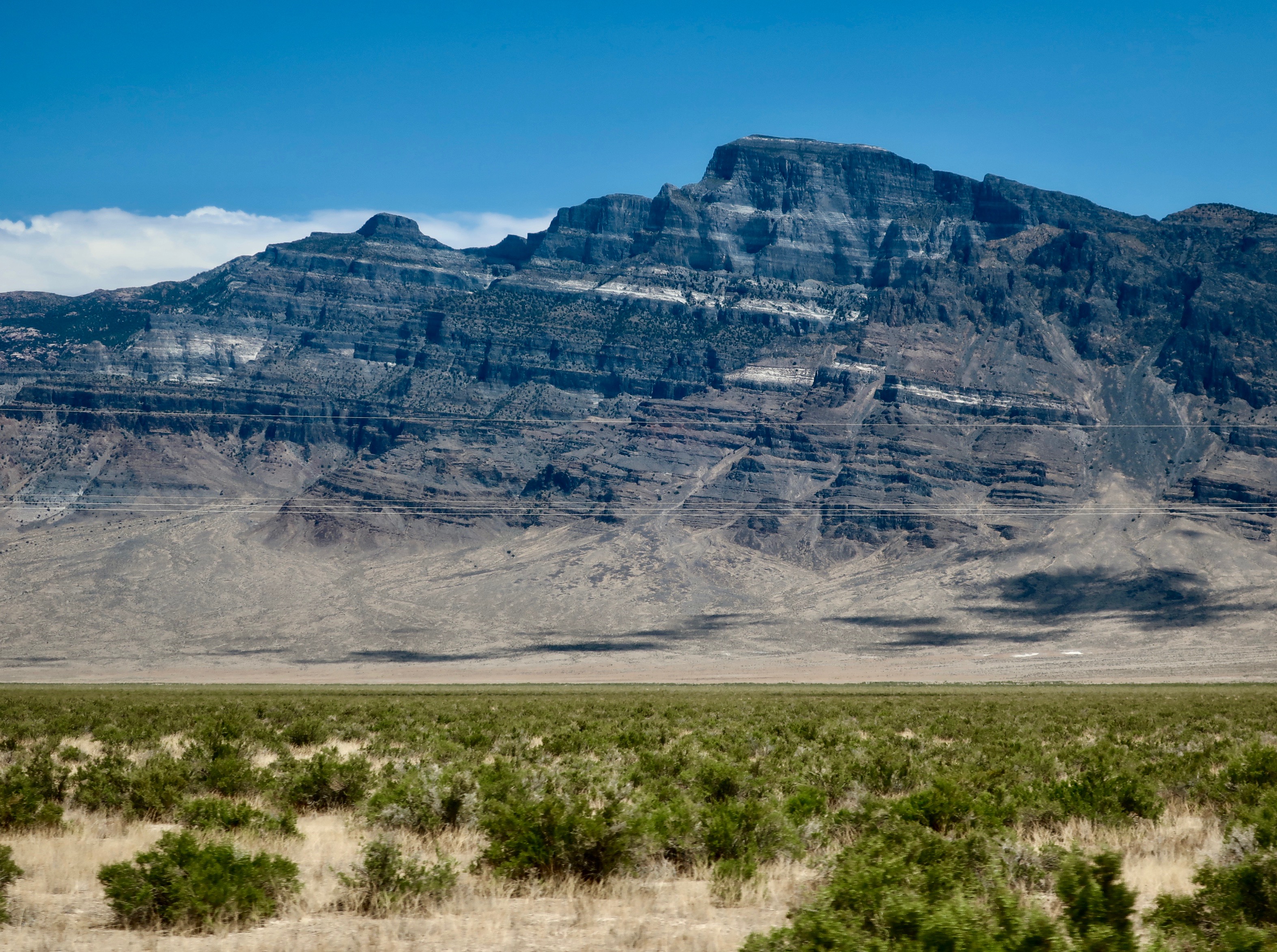
Looking up toward the Great Basin National Park from highway 50. We had been there twice before and didn’t stop on this trip.
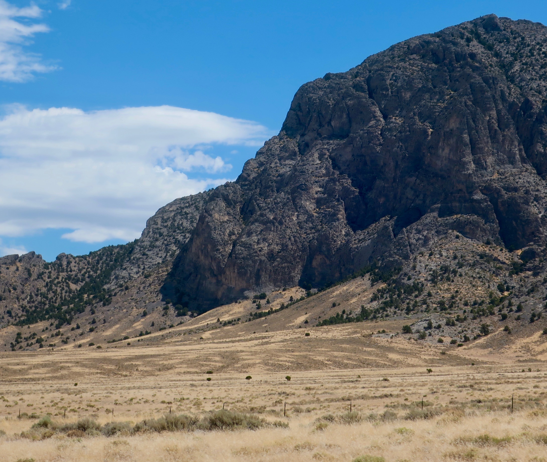
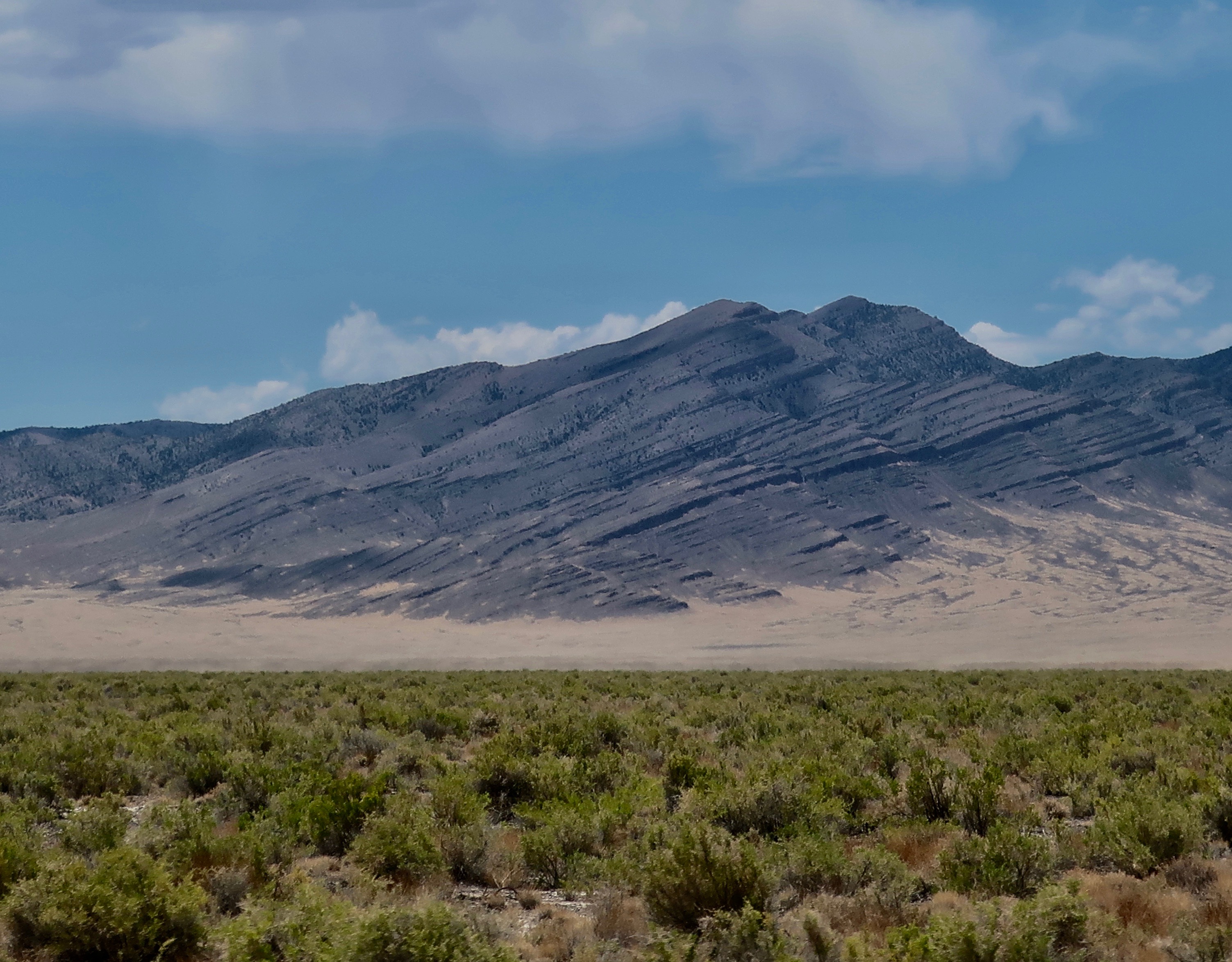
Impressive mountains continued to represent the range part of the Basin and Range complex.
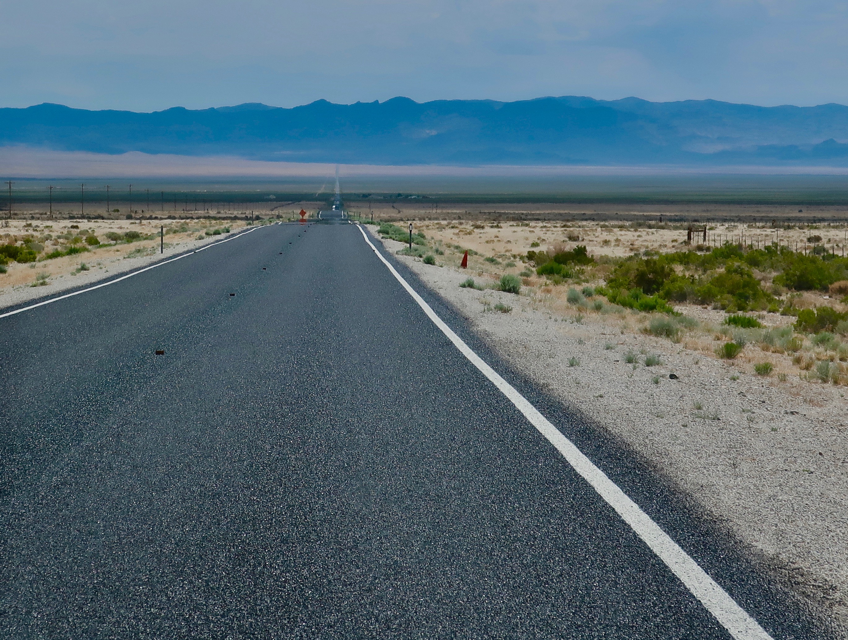
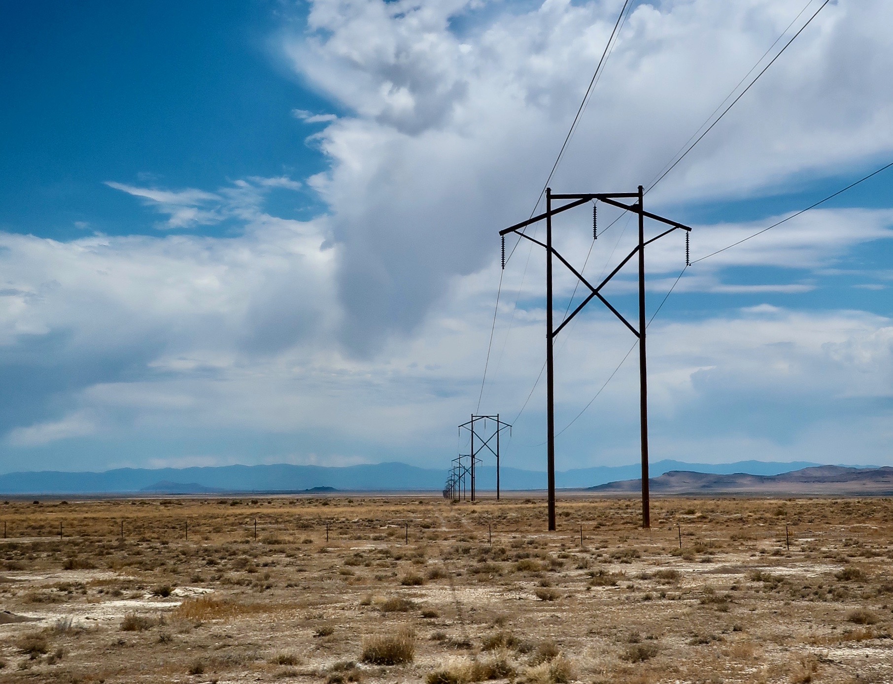
Between ranges, America’s Loneliest Highway carried us into basins.
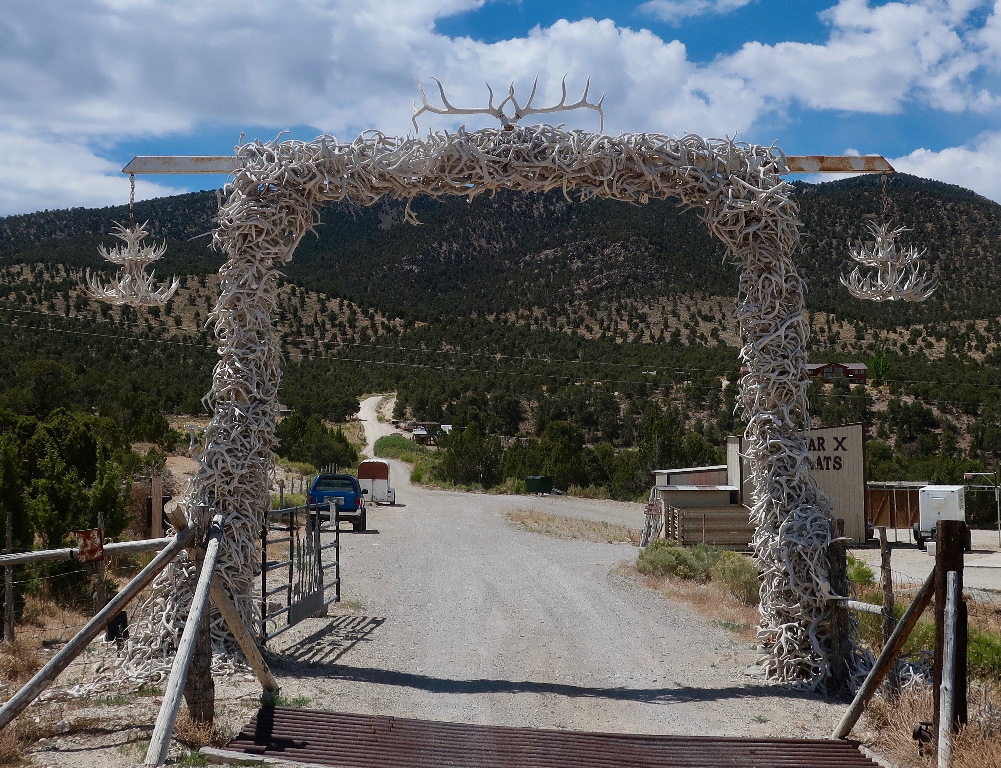
If you need any antlers to decorate your house or yard, Horns-a-Plenty is the place to go.
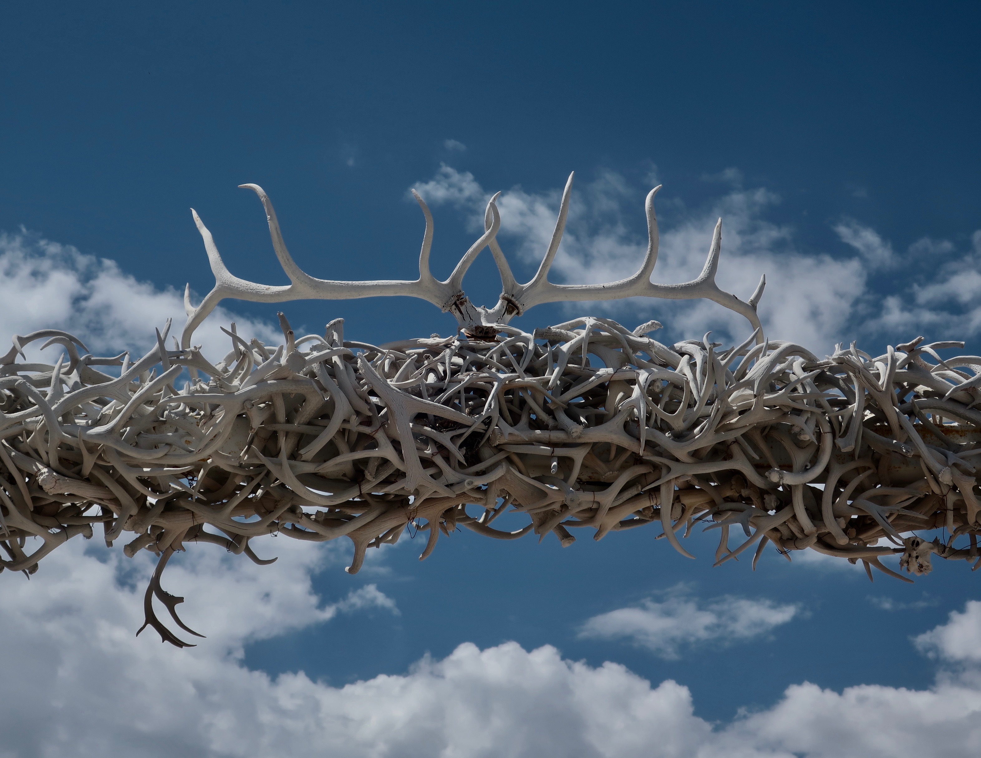
A close up with elk antlers on top.
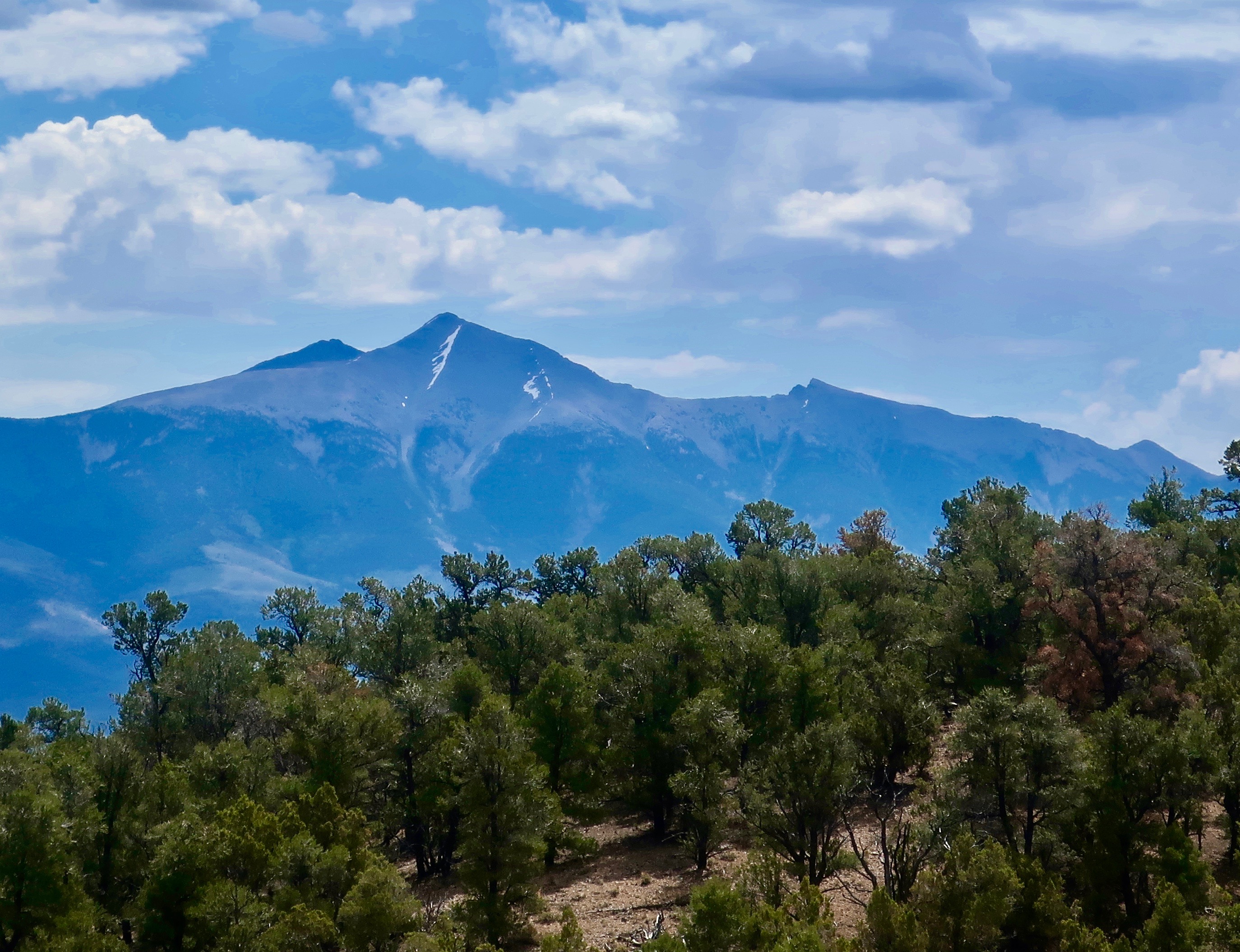
Another view looking up toward Great Basin National Park, which sits close to the Utah border.
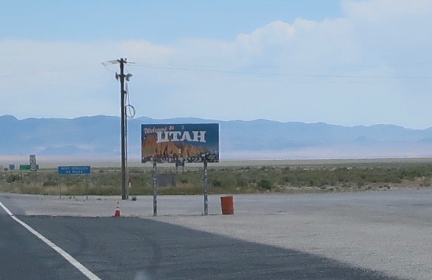
Highway 50 took us directly into Utah…..
Where we were greeted by a Utah sign featuring Red Rock country. The following photos show some of the scenery we saw along Highway 50 in the state.
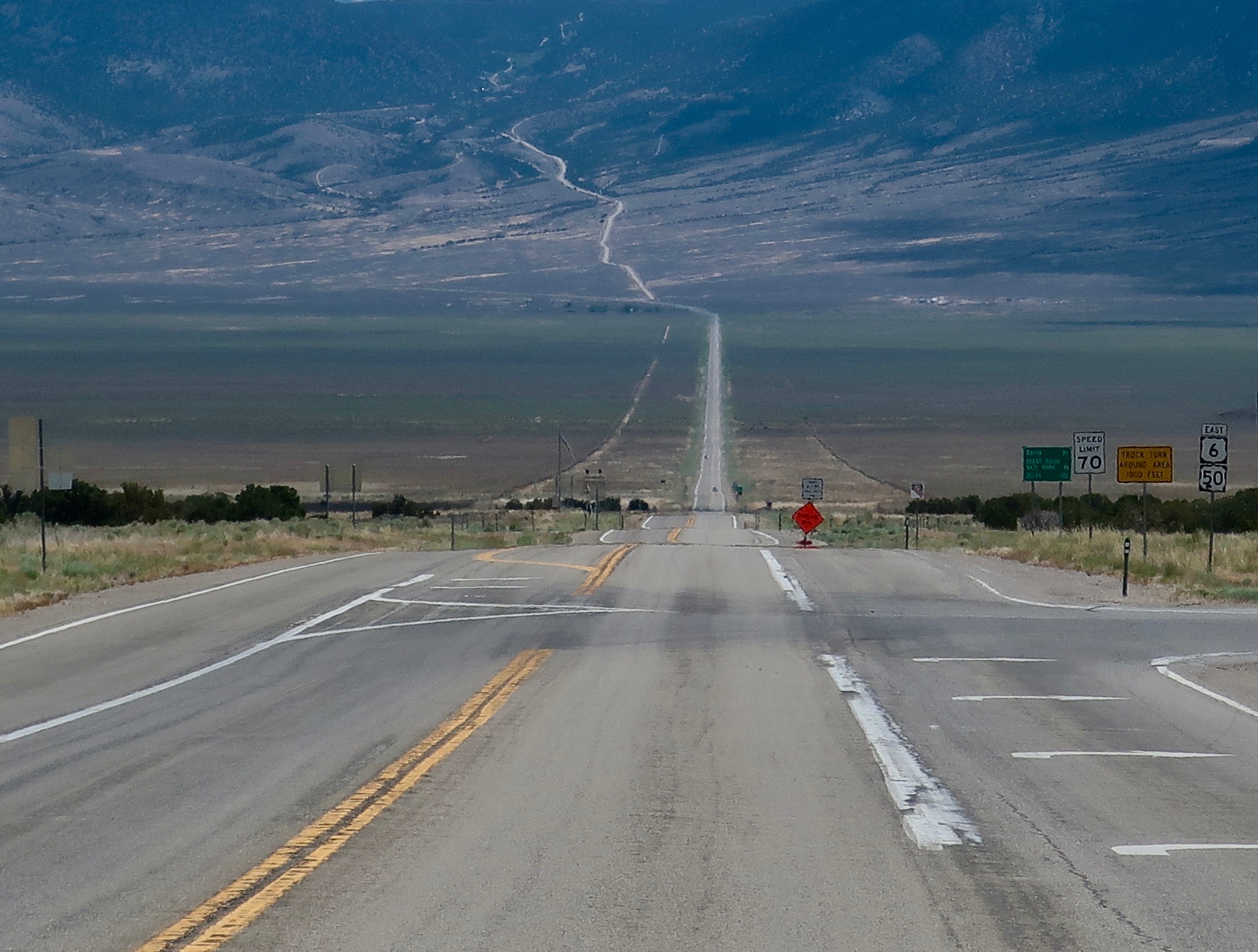
My final view of Highway 50. Lonely, as it should be. We left 50 for another backroad, Utah’s Highway 24.
NEXT POSTS
Tuesday’s Blog-a-Book Day: It’s recruitment time for our 100-mile backpack trek. What do you do with a 250 pound, ex-ice hockey player who once defused bombs in South American was dodging the IRS when he signed up.
Thursday’s Travel Blog Day: Peggy and I pick up Utah’s Highway 24 for a visit to Capitol Reef National Park.
Today I am continuing to blog my book: “It’s 4 AM and a Bear Is Standing on Top of Me.” I concluded my last post by proposing to the American Lung Association of Sacramento-Emigrant trails’ (ALASET) Board of Directors that I run a hundred-mile backpack trek across the Sierra Nevada Mountains to raise funds to support the Association’s programs. My friend Steve Crowle and I had come up with the idea while out backpacking. The Board’s first reaction had been, “You want to do what?”
Steve and I had no idea of how difficult leading a group on a 100-mile backpacking trek through the Sierra Nevada Mountain Range might be. We were about to find out…
Actually, I had a great Board. Once the members were convinced that this was something I really, really wanted to do, their final response was “OK, go for it!” I called Steve immediately. My job as executive director included a wide range of responsibilities ranging from administration to programs to fundraising. I would have a limited amount of time to devote to the project and I didn’t know anyone else who was crazy enough to take on the challenge. We had two months to pull it off. The clock was ticking.
I had originally talked Steve into replacing me as Executive Director of Sacramento’s Ecology Information Center with a sales pitch that included, “Look, I have this great job where you work 60-hour weeks, have a Board that likes to scream at each other, and has a starting salary of $200 per month. Are you interested?” Minus a screaming Board of Directors, organizing the Trek wouldn’t be all that different.
Steve had a bright, curious mind and was knowledgeable on environmental issues. He also seemed to have unlimited energy and was built like a bear. It had served him well as Executive Director of EIC. In addition to overseeing the Center’s ongoing projects, he had immediately set out to develop a community garden in downtown Sacramento. Initially known as the Terra Firma Garden and later as the Ron Mandela Garden, it would provide inner city residents with a touch of nature for over 30 years— all the way up until the State of California decided to grow buildings on the site.
The downside about Steve was that he existed on the edge. I later learned that one of his friends who he had recruited to volunteer on the Trek frequently flew to Columbia and returned with his cargo hold filled with pot.
A year after the Trek, Steve called me and told me that the FBI had showed up on his doorstep. My immediate thought was that they had tied Steve to the Colombia drug operation or that some of the Terra Firma gardeners were growing marijuana. Steve’s concern was that his radical youth was catching up with him. He had been a little too close to the fire when the Bank of America had been burned down in Santa Barbara in 1970 as a protest against the Vietnam War. “And what were you doing with those matches, Mr. Crowle?” (Steve told me the Santa Barbara story a few years ago before he passed away.)
Actually, the FBI had bigger fish to fry. Apparently one of his gardeners had gone from farming her plot to plotting an assassination. Young Lynette Fromme grew up in Southern California where she was a star performer in a children’s dance group, performing at such venues as the Lawrence Welk Show and the Whitehouse.
At 19, a strong disagreement with her dad sent her scurrying off to Venice Beach where she found comfort from an older man, Charles Manson. She soon found herself one of Manson’s clan, taking care of an aging George Spahn at his ranch where the ‘family’ hung out. It was Spahn who gave Lynette her nickname “Squeaky,” because, as legend has it, she squeaked each time he pinched her butt.
Squeaky missed out on the murderous rampage the family undertook in 1969 killing Sharon Tate among others, but she remained intensely loyal to Charles, defending him to the press and anyone else who would listen. After Manson’s conviction and sentence to a lifetime in prison, she moved to Stockton where two of the people she was living with ended up dead.
Abandoning Stockton, Squeaky moved to Sacramento and rented an apartment with another Manson groupie, Sandra Good. The two of them adopted a new life style and persona as ‘nuns’ in Manson’s latest crusade, saving the earth. Manson even gave them new names with Squeaky becoming ‘Red’ and Sandra becoming ‘Blue.’ It was with her new name, persona, and purpose that Squeaky took up gardening at the Terra Firma Garden. Steve knew her, of course, but knew nothing about her background. He told me that she found him “attractive” because of his intense eyes. If you’ve seen pictures of Manson, you’ll get this.
It was with her new goal of ‘saving the earth’ that she left her apartment on the fateful morning of September 5, 1975 and strolled over to Capitol Park where she got within a few steps of the visiting President Gerald Ford before pointing her Colt 45 at him, creating immediate pandemonium. She later claimed she was “just trying to get the President’s attention.” She did. Three months later she found herself convicted of an attempted assassination and in prison. As for Steve, he informed the FBI that he didn’t have a clue as to who Fromme was or what she was up to other than being a gardener. Like Pangloss, he went back to cultivating his garden. But all of this was in the future. My phone call to Steve went something like the following:
“How would you like to go backpacking and get paid for it?” I asked.
“Give me a hard question,” Steve responded.
“Are you willing to work for minimum wage?” I casually threw in as fine print.
“That,” he replied, “is the question.”
I went on to explain that while the Board members had approved of the concept, they weren’t particularly enthusiastic about spending large sums of money to see if it worked. I could just barely squeeze out the minimum wage of the day for two months to see if we could pull it off. Steve, after ample groaning, allowed that it would supplement what he was earning at the Center and took the job.
NEXT POSTS:
Thursday’s Travel Blog: Peggy and I continue our exploration of America’s back roads by leaving Hickison Petroglyph Recreation Area behind and following America’s Loneliest Road across the rest of Nevada and into Utah where we discover Highway 50 is still lonely. And beautiful.
Tuesday’s Blog-a-Book: The clock is ticking as we find a name, route and reluctant sponsor for our backpacking fund raiser. Then it was time to recruit participants. They came out of the woodwork! Among them: A ballerina, a bomb defuser, a witch, and a 70-year-old wood elf.
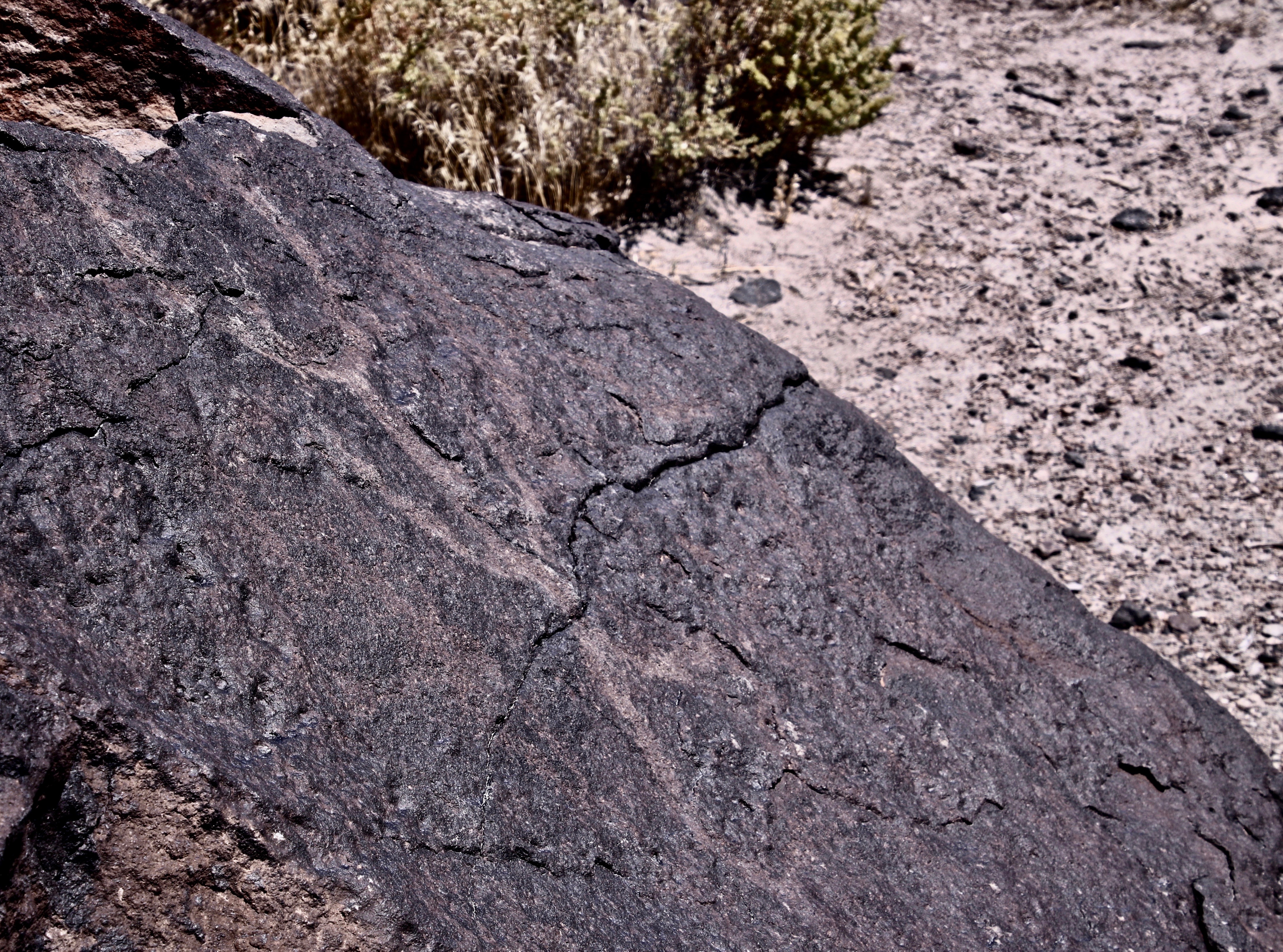
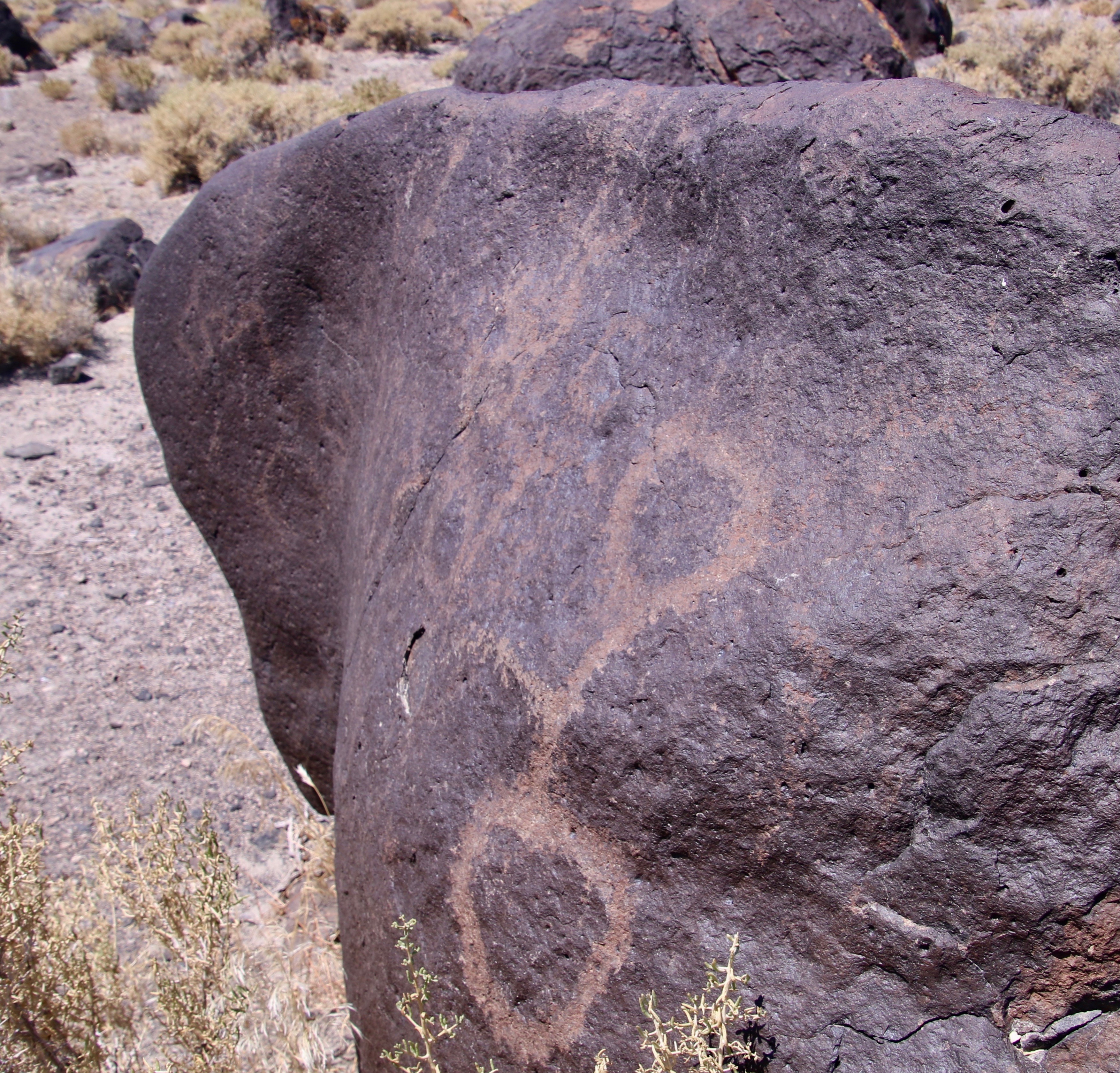
One thing that Peggy and I have noticed over our years of checking out petroglyph sites is that they are often located in very scenic areas or on unusual rock formations. The rocks found at Hickison Petroglyph State Recreation Area definitely qualify.
As we continued our backroads’ journey along Highway 50 through Nevada on America’s Loneliest Road, we passed over Hickison Pass, dropped down into another valley, and arrived at our campground for the night: Hickison Petroglyph Recreation Area. Peggy and I had stopped off here on another journey and been fascinated by both the rocks and petroglyphs.
The rocks are composed of volcanic tuff, ash that has been ejected from an erupting volcano and then solidified into rock. It erodes easily in comparison to harder rocks, which is what has created the interesting rock forms at Hickison. It is also easily carved into petroglyphs. Like the Grimes petroglyphs that I featured on last Thursday’s travel blog, these are ancient, dating back thousands of years. But, as you will see from the following photos, they represent a different style.
The campground lacks water and electricity but we found it quite scenic. When we arrived, large, colorful bugs that resembled giant grasshoppers or crickets occupied our campsite. They are common in sagebrush country and go by the name of Mormon crickets. Actually they are shield-backed katydids.
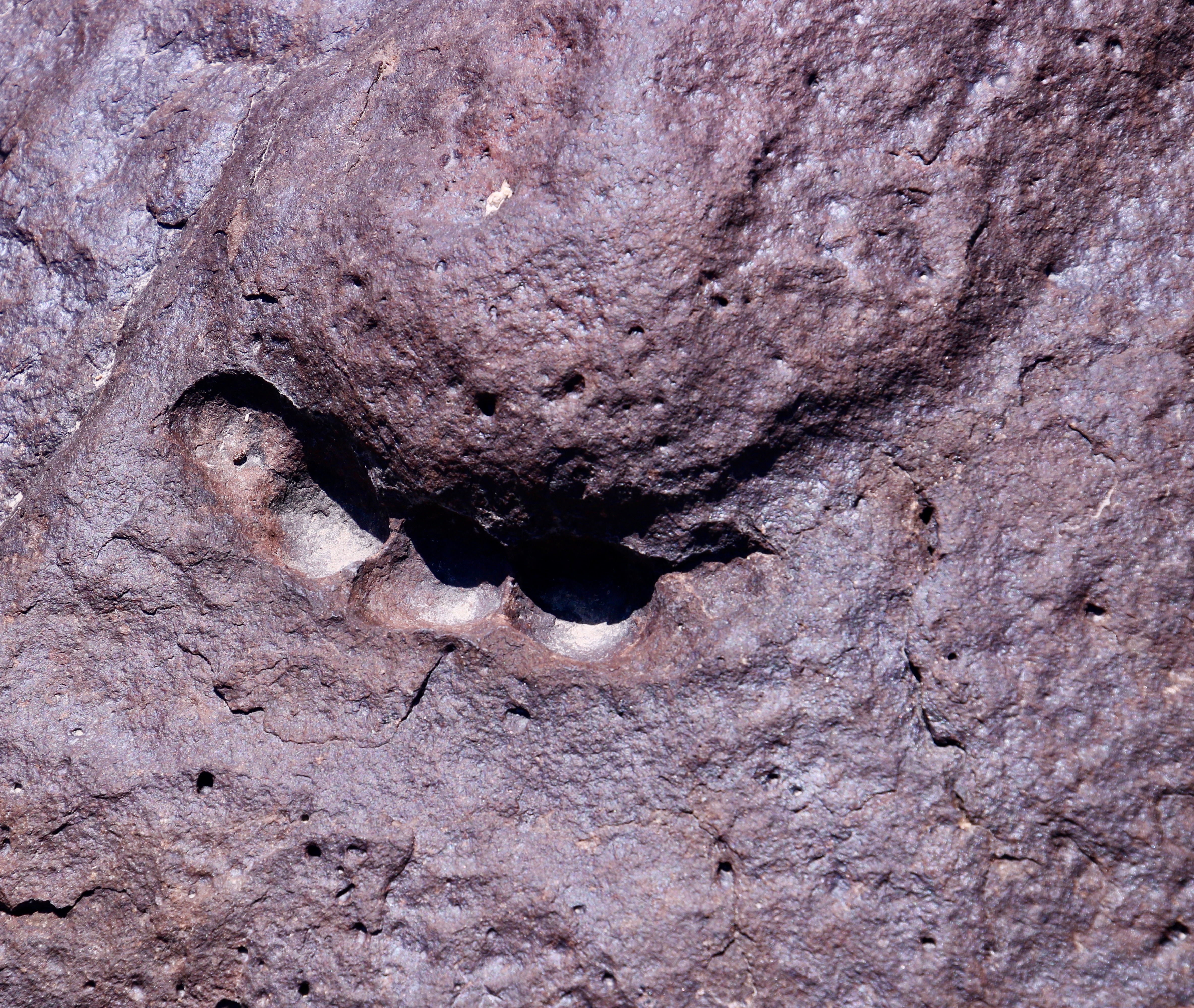
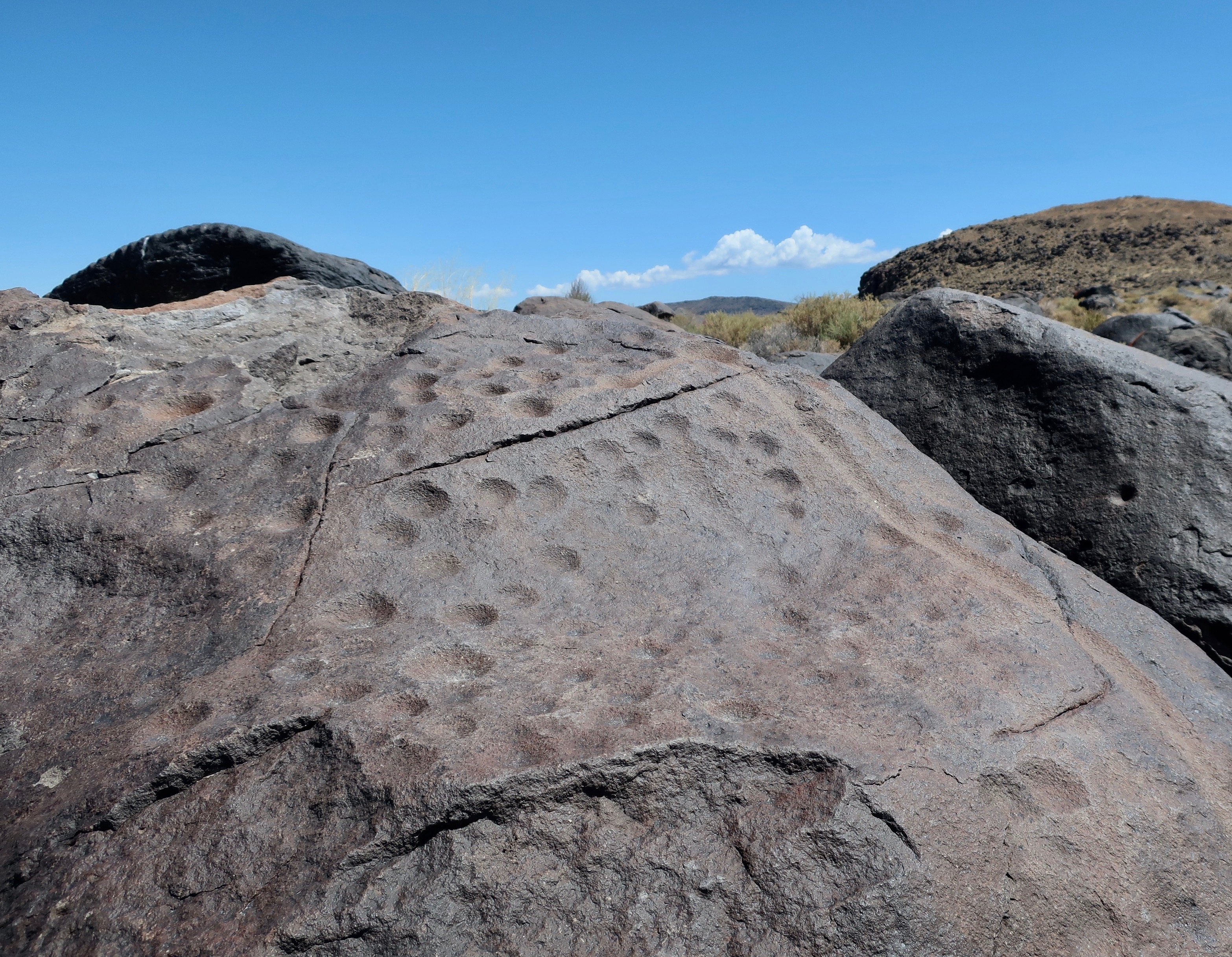
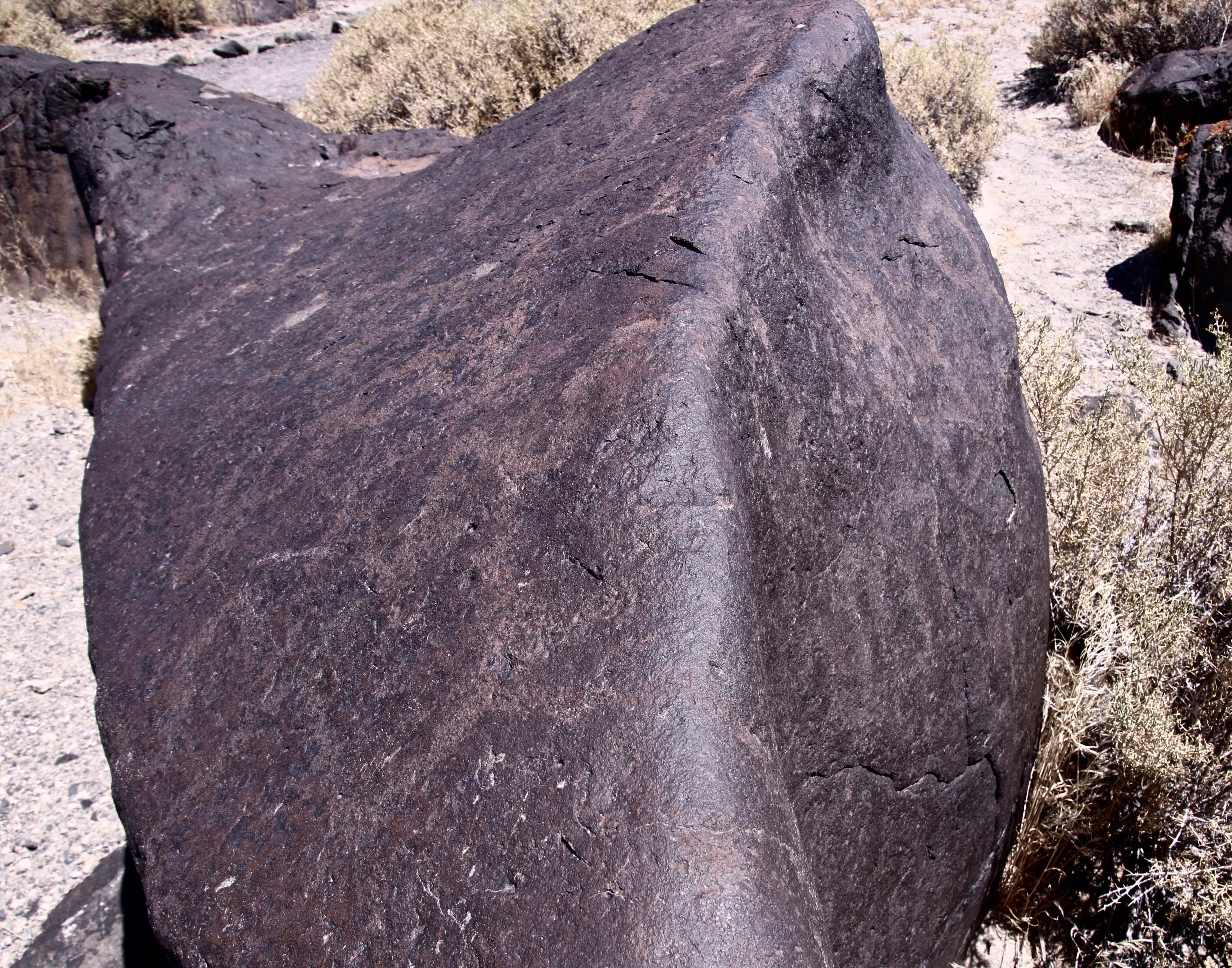
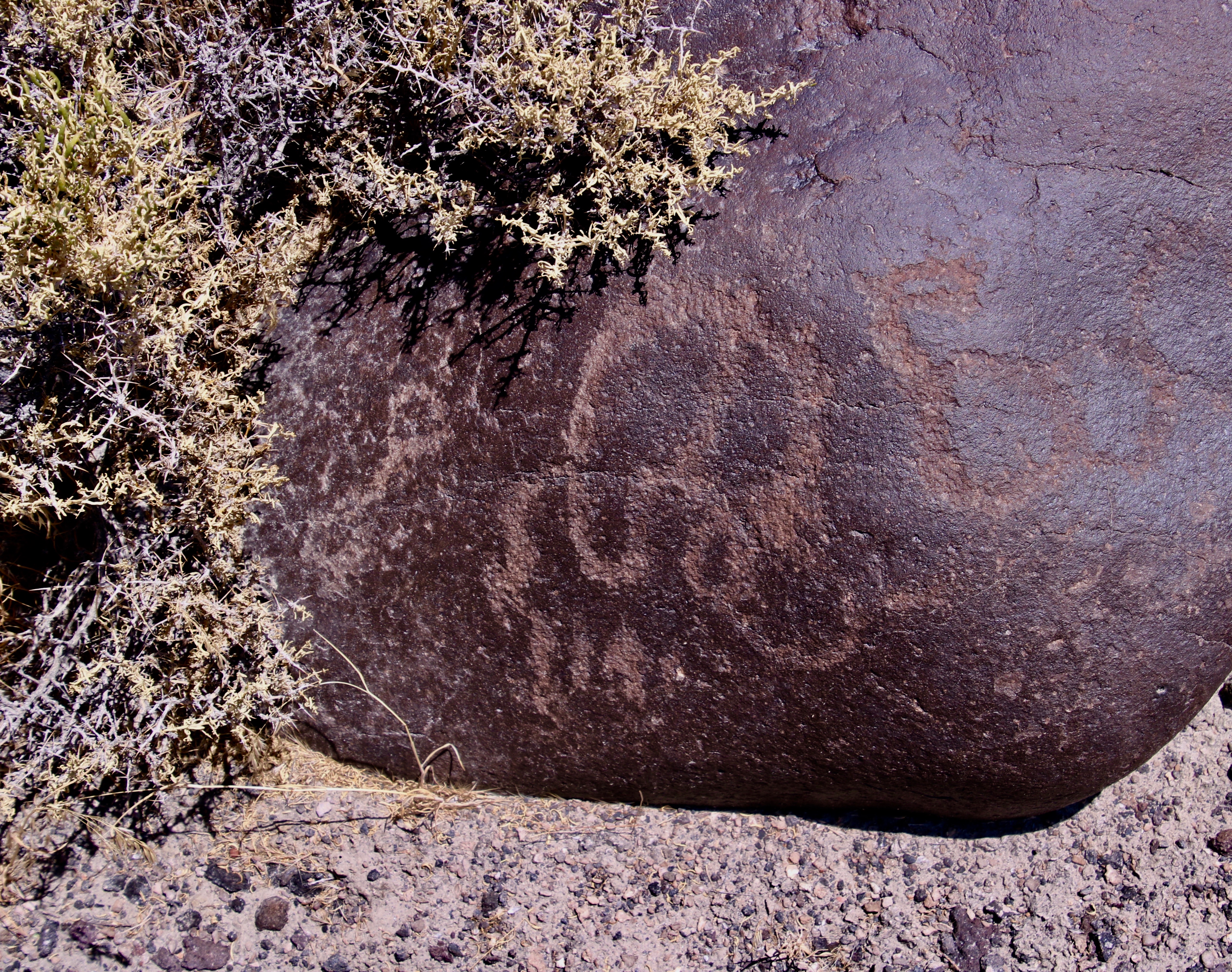
One of dozens of shield-backed katydids or Mormon crickets that occupied our campsite.Quivera, our small RV, cosily tucked away among the junipers and pinyon pines. Pinyon pine nuts were an important source of food for ancient peoples and Native Americans.A view from the campground looking out on Monitor Valley.I found the cloud formation interesting.Clouds from an evening walk. As I mentioned above, prominent landmarks were frequently chosen by early peoples and Native Americans to create their rock art. This is the panel featured on the above rock.I won’t pretend to have a clue here…Counting isn’t unusual in petroglyphs. For example, they might relate to the length of a journey. A woman blogger who counted the short and long marks here noted that there were 28 short marks and 6 long marks, possibly representing the menstrual cycle. Numerous vulviforms (representations of female genitalia) located at the site would tend to support this. There is some speculation that the area was used for girls’ puberty rites. Early pioneers thought these might represent horses hooves. Nope.Another example. BTW, for those of you who are Tom Robbins fans, he writes in his book, “Wild Ducks Flying Backwards” of a visit he made to another site along Highway 50 that is so full of these petroglyphs that it is known as the Canyon of Vaginas.
But back to the rocks.
I’ll conclude with this handsome fellow.
As you read this, Peggy and I are off celebrating Thanksgiving and our Anniversary at a favorite campsite on the Oregon Coast. We will catch up on comments and blogs when we return next week. In the meantime, we hope you are having/had a great Thanksgiving.
NEXT BLOGS: Tuesday is Blog a Book day where I will introduce you to the cast of characters that decided to hike a hundred miles across the Sierras with me. On Thursday’s Travel Blog we will finish up our trip across Nevada on Highway 50 and on into Utah, where it is also lonely.
It’s Blog-a-Book Tuesday. Now that I have provided an introduction to my book, it’s time to start rolling out stories. I’ve chosen my first ever 100-mile backpack trek across the Sierra Nevada Mountain Range for my kick-off. Given that I didn’t have a clue about what I was doing was crazy enough, that I chose to take 61 people aged 11-71 with me as a fund-raiser for the American Lung Association was pure insanity. I was lucky to survive with my career and life intact.
As promised, I am going to blog the book in bite sized pieces with each post ranging between 500 and 1000 words. Some of these stories may be familiar to you since I have written about them before in my ten years of blogging.
Inspired by the beauty of the Five Lakes Basin found north of Interstate 80 in the Sierra Nevada Mountains of California in 1969, I started a lifetime of backpacking. Here, the setting sun lights up the Black Buttes.I was camping on this little lake when I was inspired by the idea of raising money for the American Lung Association of Sacramento by running a hundred mile backpack trip.
During the early summer of 1974, my life took a dramatic shift. My friend Steve Crowle and I had used a long summer weekend to go backpacking into one of my all-time favorite destinations, the Five Lakes Basin, north of Interstate 80 in the Sierra Nevada Mountains. It’s a beautiful area with towering cliffs and jewel-like lakes that were carved out by glaciers some 20,000 years ago.
We were lazing around our campfire on the last night and bemoaning the fact that we had to return to civilization and jobs the next day. Glowing embers provided warmth and pulled us closer to the fire while a full moon bathed the Black Buttes in silver light and focused our attention outward.
“God, wouldn’t it be great if we could make money doing this,” Steve sighed. He had replaced me as Executive Director of Sacramento’s Ecology Information Center when I had become Executive Director of the American Lung Association of Sacramento. In addition to his boundless energy and intelligence, he was a bit on the wild side. He had hobbies like jumping off high bridges into shallow water and experimenting with various mind-altering drugs. But mainly he loved life and had a vast appetite for new experiences. One such experience was backpacking.
Suddenly my mind took an intuitive leap. The lights came on, the bells went off, and four and twenty blackbirds sang the Hallelujah Chorus.
“We can, Steve!” I managed to get out as my thoughts played hopscotch. “Look, as Executive Director of Lungland, one of my main responsibilities is fund-raising.” It was a fact I was painfully aware of.
The once Tuberculosis Association and now Lung Association had spent 70 years happily sending out Christmas Seals and waiting for the donations to roll in. While the Golden Goose wasn’t dead, it was ailing. We had conquered the dreaded TB and selling lungs wasn’t nearly as easy. Easter Seals had kids, the Heart Association the most appealing organ in the body, and the Cancer Society the scariest word in the dictionary. We had emphysema, bronchitis, asthma, the remnants of TB, and diseases with unpronounceable names such as coccidioidomycosis. Adding insult to injury, several non-profit organizations had added seals to their fund-raising arsenals. Competition for bucks to do-good was tough and the well was running dry.
“What if,” I pondered out loud, “we ran a backpack trip through the mountains as a type of multi-day walk-a-thon with people raising money for each mile they hiked?” I liked walk-a-thons. They involved people in healthy activities as well as raising money. They gave something back to the participants.
Steve’s attention jumped from low watt to high intensity. “When? Where? For how many miles and days? How can I be involved?” The questions tumbled out.
“I don’t know, I don’t know and I don’t know,” I responded, laughing at his enthusiasm although mine was hardly less. “But,” I added, throwing out some crazy figures, “what if we made it for nine days and 100 miles?”
That quieted us down. Neither of us had ever backpacked for nine days straight, much less 100 miles. A long trip for me had been six days and 30 miles. I threw out the nine days because it included a full week with both weekends and the 100 miles because it sounded impressive and might fire people’s imaginations. It did mine.
“Why not,” Steve had finally said with more than a little awe in his voice as a new fund-raising program was born. It was an event that would keep me happily running around in the woods over the next 30 years and raise substantial funds and friends for the American Lung Association. But all of that was in the future; Steve and I just wanted an excuse to go backpacking. How to get from point a to point b was the question. As folks like to say, the devil is in the details.
My first challenge was selling the event to a reluctant Board of Directors. Running a 100-mile backpack trip as a fundraiser was a huge leap from sending out Christmas seals. At 29, I was the youngest Lung Association Executive Director in the nation and I had already ruffled enough feathers to dress a turkey. For example, a research doctor on my Board was foaming at the mouth because I wanted our organization to focus on reducing the primary causes of lung disease: air pollution and tobacco use. What would he think of me running off to the woods on a backpack trip? Another Board member loved his pipe and was irritated at me because I had persuaded the Board that our meetings should be smoke-free. His irritation was nothing, however, in comparison to a number of California Lung Execs who were livid because I was proposing that Lung Association offices should be smoke-free as well. What a radical idea that was. I heard an older woman exec proclaim at a conference, “I am going to kick that young man in the balls!” She made sure I was within hearing distance.
“You want to do what?” with a decided emphasis on the first and fifth words is the best way I can describe the Board’s reaction. It was easy to translate: “Why would a 29-year-old executive director with less than a year of experience under his belt want to risk his career on such a harebrained idea?”
I echoed wild Steve, “Why not?”
NEXT POSTS: On Thursday’s travel blog we continue our back roads’ journey along Highway 50 across the Nevada Desert and camp out at the Hickison Petroglyph area with its strange petroglyphs and unique rock structures. Next Tuesday it’s back to blogging a book. The Lung Association Board approves the Trek, I hire Steve, and we begin a recruitment effort. People come out of the woodwork wanting to go…
NOTE: Peggy and I are heading over to the Oregon Coast to celebrate Thanksgiving and our Anniversary, camping out in Quivera the Van at a site that may not have cellphone or Internet connection. If so, I will get back to responding to comments and reading posts next week.
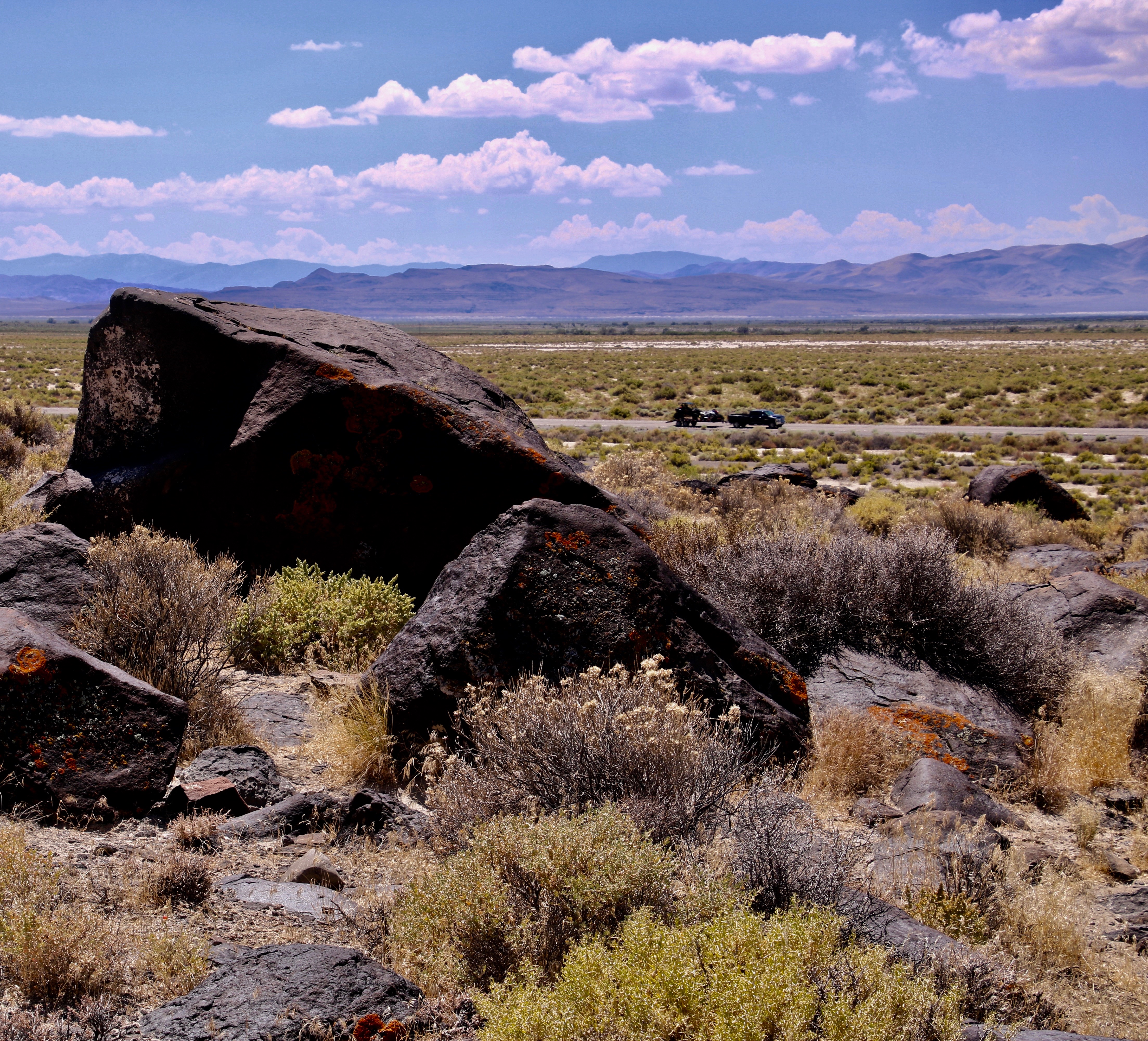
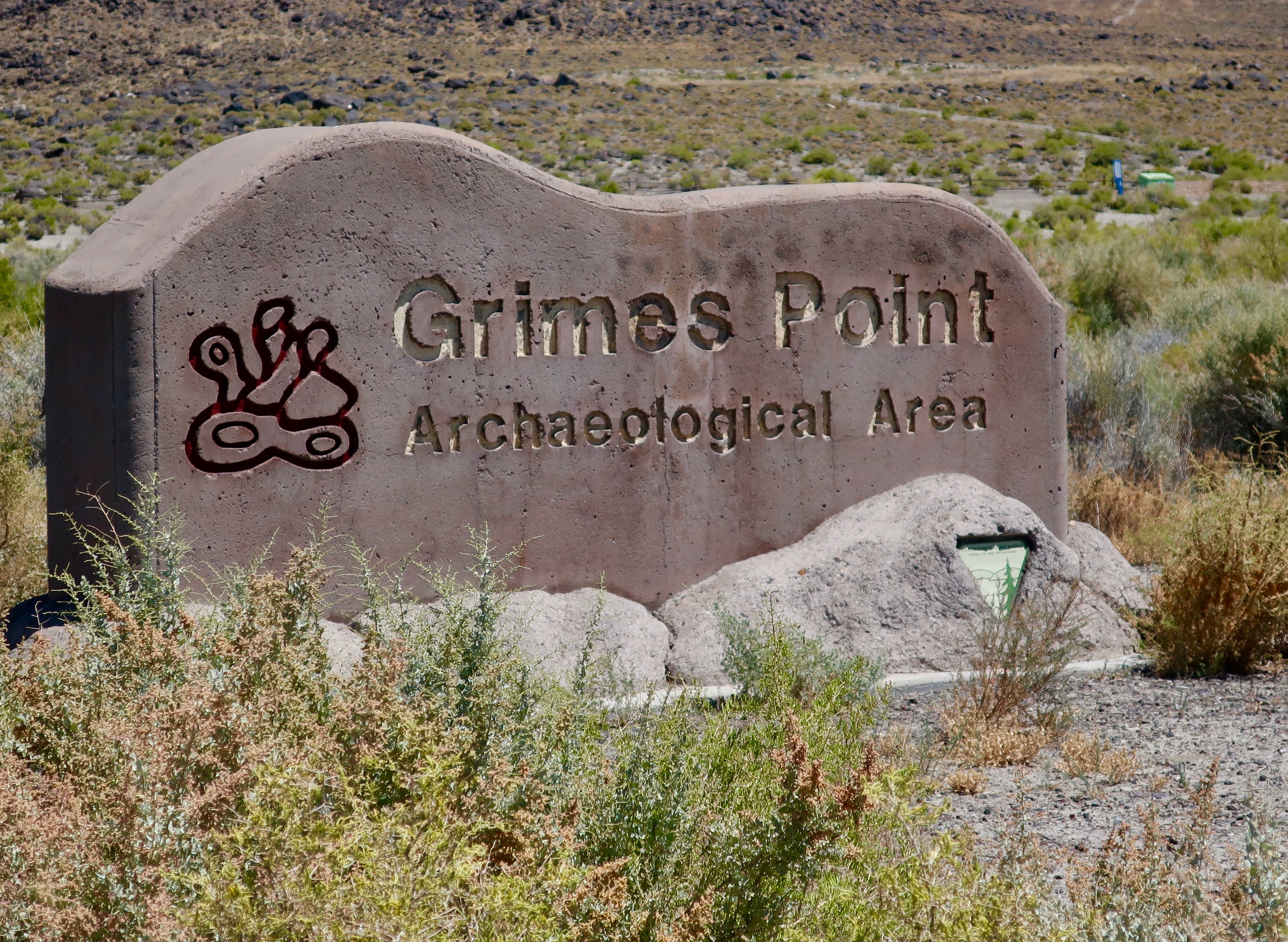
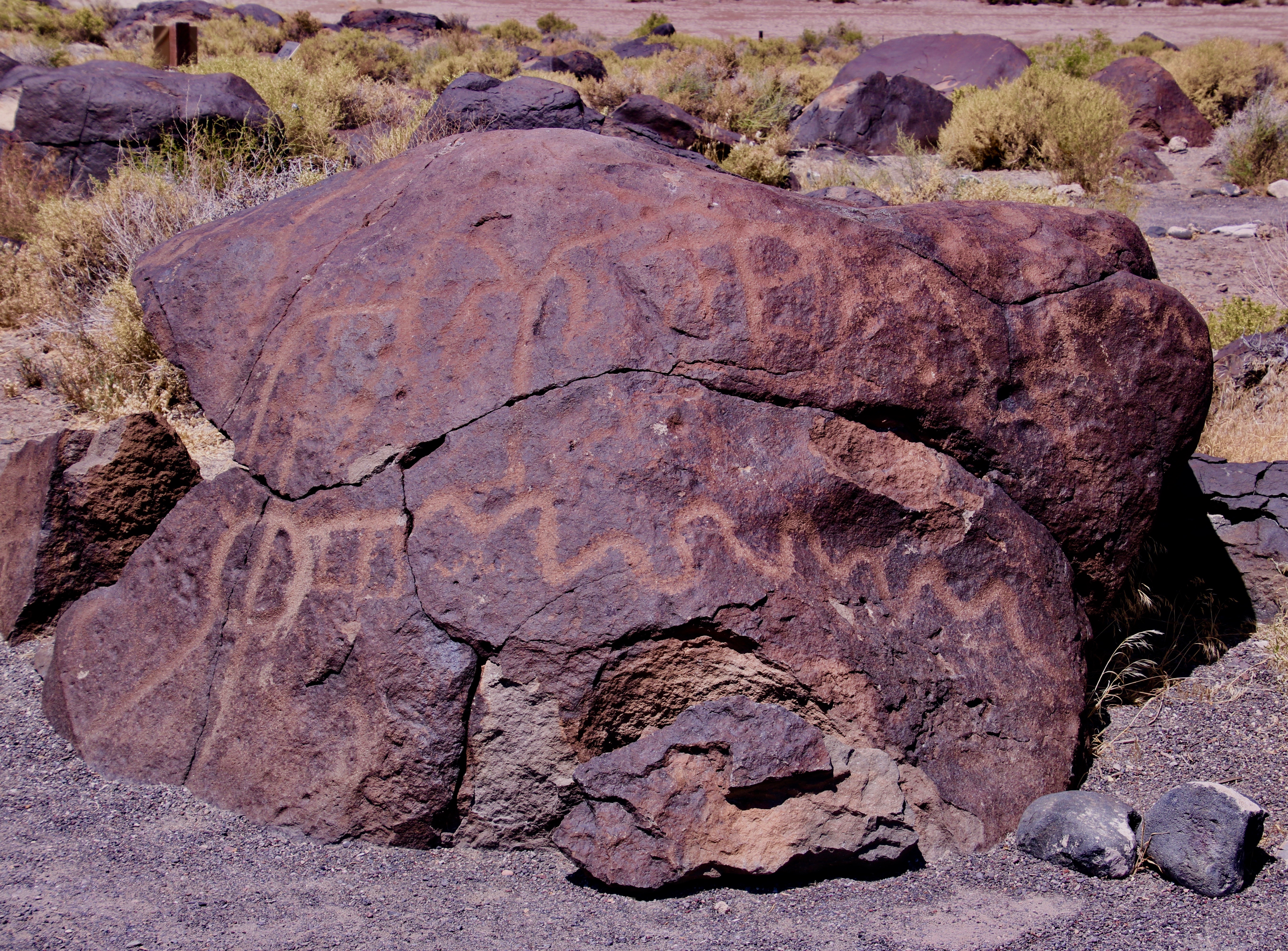
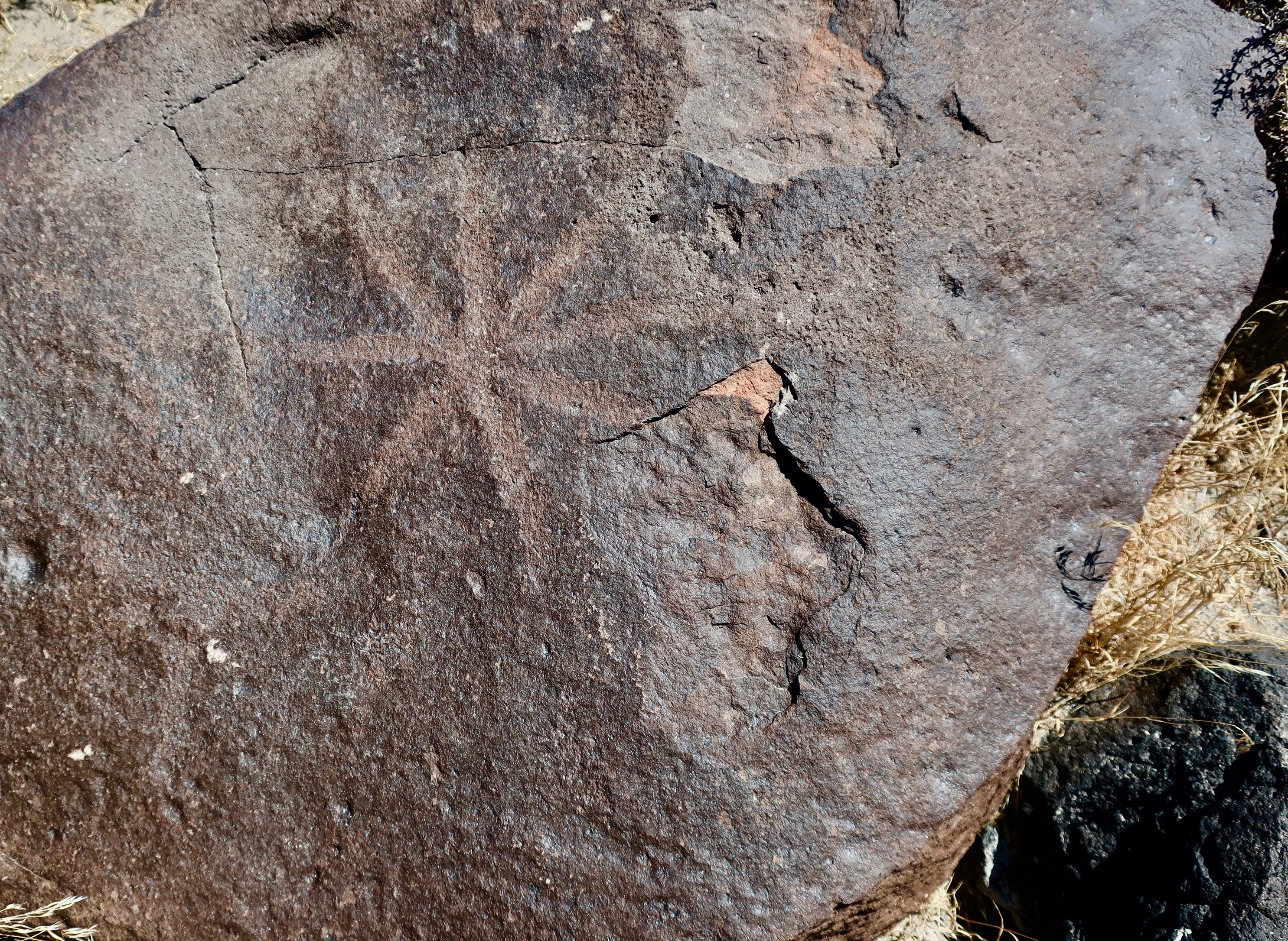
I took this photo while standing at Grime’s Point Archeological Area just off Highway 50 about five miles east of Fallon, Nevada on an earlier trip. The terraces above the basalt boulders were cut into the side of the ridge by the ancient Pleistocene Lake Lahontan as it rose and fell. Had I been here 10,000 years ago I would have been under 700 feet of water. Traveling over today’s Highway 50 route would have required a submarine.Turning around from where I was standing was more basalt and a view of Highway 50. A pickup pulling a trailer makes its way over ‘The Loneliest Road in America.” Looking across the valley you can see ranges fading into the distance that are part of the Basin and Range complex of Nevada, which is part of the Great Basin of the Western US.Had you arrived on the scene much later, say around 5,000 BCE or 7,000 years ago, you would have discovered that Lake Lahontan was much shallower as glaciers receded to the north and warmer temperatures prevailed. The area would have been marshy and filled with abundant wildlife. Ancient peoples had arrived on the scene and were pecking away at the rocks, creating some of the earliest petroglyphs in Nevada and North America. Grime’s Point features these petroglyphs. A copy of one of the petroglyphs is on the left.The pit and groove petroglyphs here are among the oldest petroglyphs found in Nevada.As to what they mean is anyone’s guess. One thought is that they were used in hunting rituals by shaman to assure success. This basalt boulder was covered with pit petroglyphs. Ancient peoples and later Native Americans would use rocks to peck away the desert varnish that covers rocks to show the lighter rocks underneath. One way of measuring the age of petroglyphs is to see how much desert varnish has since re-covered the rock petroglyphs. The color of these pit and groove petroglyphs has returned to the original varnish color. Translate old.In contrast, this is a much more recent petroglyph, probably carved in the last 500 years. To me, it appears to be a big horn sheep. But then again…Most of the petroglyphs fall somewhere in age between the ‘sheep’ petroglyph above and the pit and groove style of petroglyphs. I like the almost-polished look of this basalt boulder. If you look carefully, you can see petroglyphs stretching down and out on both sides of the rock. Following are several examples of the petroglyphs I found wandering around among the boulders. It’s like a treasure hunt. Fun.I’ll conclude with a final view of the landscape at Grime’s Point Archeological Area. Remains of what may have been a rock fence used to drive deer and antelope to the dinner table is found up near the top of the ridge.
BLOG-A-BOOK TUESDAY: Join me on the first 100-mile backpack trek I ever organized. Leading 61 people aged 11-71 across the Sierra Nevada Mountain Range, I was lucky to escape with my life and career in tact.
TRAVEL BLOG THURSDAY: Peggy and I continue our Back Roads of America Series by stopping off at another petroglyph site along The Loneliest Road in America: The Hickison Petroglyph Area. This time we will be featuring some out-of-this-world rocks and, uh, puberty rites.
Why would a happily married 75-year-old decide to spend three months of his life backpacking down the Pacific Crest Trail? It’s complicated…The sheer beauty of the wilderness plus 50-years of backpacking are important factors! This is Castle Crags in Northern California. They loomed up behind me in the photo above.
“Why?” G, a blogging friend from Florida, asked when I posted my plans to spend the summer backpacking down the PCT. Why would I subject myself to ice cold baths and human-snacking insects? Why would I want to spend 7-9 hours a day hiking over difficult terrain in 100-degree weather while dodging fires, breathing smoke, and carrying a 30 to 35-pound pack? Why would I subject my body to the common ailments of through-hikers: exhaustion, near-starvation, freezing nights, blistered feet, trashed toenails, sprained ankles, shin splints, twisted knees, cranky hips, sore shoulders, bug bites, sun burn and poison oak, not to mention possible encounters with large furry animals sporting big teeth.
My guess is that G thought 75-year-old men should limit their exercise program to hiking up and down the stairs on a cruise ship or possibly hiking from the TV to the bathroom during a football commercial. Puttering in a garden is also okay; as is fishing off the end of a pier. Going for short hikes is to be encouraged. It helps keep you healthy. But backpacking several hundred miles through rugged wilderness— much of it by yourself? That’s crazy.
Perhaps. But I had been backpacking since 1969, when the PCT was a barely-hatched one-year old, or since 1954 if you counted Boy Scouts. I had started exploring the jungle-like graveyard next to our home at five, and completed my first solo, mile-long hike in the wee hours of the morning when I was seven. While other boys my age had spent their summers playing sports and hoping to dazzle coaches, parents and friends, I had wandered farther and farther afield with nothing but my dogs for company. High school and college had seen a hiatus as studies, work and girls took precedence. But I returned to my wandering ways as a Peace Corps Volunteer, exploring the jungles surrounding my home in West Africa and carrying a compass so I could map them out. And avoid getting lost.
Cheryl Strayed’s journey on the PCT in Wild and Bill Bryson’s hike along the Appalachian Trail in A Walk in the Woods had inspired me to think about undertaking my own long-distant trek. They were admittedly a tad younger when they started their adventures— at 26 and 45 their combined age was less than mine— but I had tons more of experience. I had celebrated my 60th birthday by backpacking 360-miles from Lake Tahoe to Mt. Whitney. Certainly, I could do twice that to celebrate my 75th.
I’d chuckled when I read Bryson’s chapter on a bear he may or may not have seen in the night, and how he had gone scrambling for his pocket knife. Scary yes— big creatures that think of you as a menu item usually are, especially on a dark night— but I have had dozens of encounters with bears. Once, I woke up at four in the morning with one standing on top of me, sniffing my breath. Now, that’s scary! Another time I was stalked by a grizzly in Alaska. And then there was the time I had a discussion with one of the great brown bears of Katmai over why he shouldn’t eat me. A ranger had told me that if I encountered a bear out on the trail, I should “speak to it in a calm voice and back away.” But what do you say to a thousand pounds of bulging muscles with four-inch long claws? Read on.
Unlike Strayed, I knew that seemingly insignificant ounces add up to bone crushing pounds when carried on your back. I’d led hundred-mile backpack trips for 30 years in California and Alaska. Preparing first-time trekkers to go was one of the most important things I did. Now, picture backpacking over 1,100 miles with zero preparation, which Strayed did. While I had greatly admired her fortitude in hiking on the PCT through California and Oregon, I’d cringed at her lack of readiness. But I readily admit that it made a good story and served as an inspiration for thousands of women, and probably men as well.
By now, I am sure that you realize that I love backpacking. I love it for what it does for my mind and my body. It’s amazing how fast the worries of the world fade away when you are hiking up a mountain. And it’s fun to see what a week of backpacking does for your body. But what I like most is that backpacking gets me out into the woods. Time slows down. There is great beauty, and peace, and healing, and maybe even a touch of salvation. As John Muir noted, “The clearest way into the Universe is through a forest wilderness.”
This book concludes with my trip down the PCT at 75. I’d started with a goal of backpacking at least 500 miles and possibly as many as a thousand. Between giving my lungs fire-free breaks and providing more time for rest and recovery between trail sections, I split the difference, not bad for seven decades. And I was lucky to have total support from my wife, Peggy. Not only did she join me for three sections of the trip, she was waiting for me at the end of the other sections with a warm smile, a tight hug, and a cold beer. And she had camped out for the week by herself so she would be there to greet me and provide other backup if needed. If that’s not love, I don’t know what is.
The PCT trip is just a small part of my backpacking story, however. One can have a lot of adventures in 50 years of wandering in the wilderness and I plan to incorporate several into this tale, including the bear stories mentioned above. I also want to talk about the beginning, how I fell in love with the woods and outdoors as a young boy. That always gets a bit iffy in terms of memory. But getting kicked out of the first grade at five for a year was an important factor in that it encouraged me to explore the jungle-like graveyard next to our home. Choosing to sleep outside in the summer, even if it meant sleeping on the ground, was another. Such things tend to stick in your head. At least they do mine.
While my emphasis will focus on the adventures, I also wish to encourage my readers to think of the wilderness as one of our most precious heritages, taking us back to our very beginnings as humans. When we lose our connection with the outdoors, we lose a bit of our humanity. We owe it to ourselves to reconnect or maintain our connection, even if it is simply going for a walk in the town park and listening to the birds sing. And we owe it to our children, grandchildren, and future generations to protect the world’s remaining wilderness areas.
So, let’s get started as I tackle the insane task of leading a group of 61 people aged 11 to 70 on a 9 day, 100-mile backpack trip across the Sierra Nevada Mountain Range. The event kicked off my part-time career of leading long-distance backpacking treks and guaranteed that backpacking would always be a part of my life.
That I survived the experience and had any kind of a career at all was close to a miracle…
NEXT POST: On Thursday, Peggy and I continue our exploration of America’s backroads as we follow “The Loneliest Road in America,” Highway 50 through Nevada and into Utah.