Flagstaff, Arizona: Countdown to Exploring the Grand Canyon by Raft

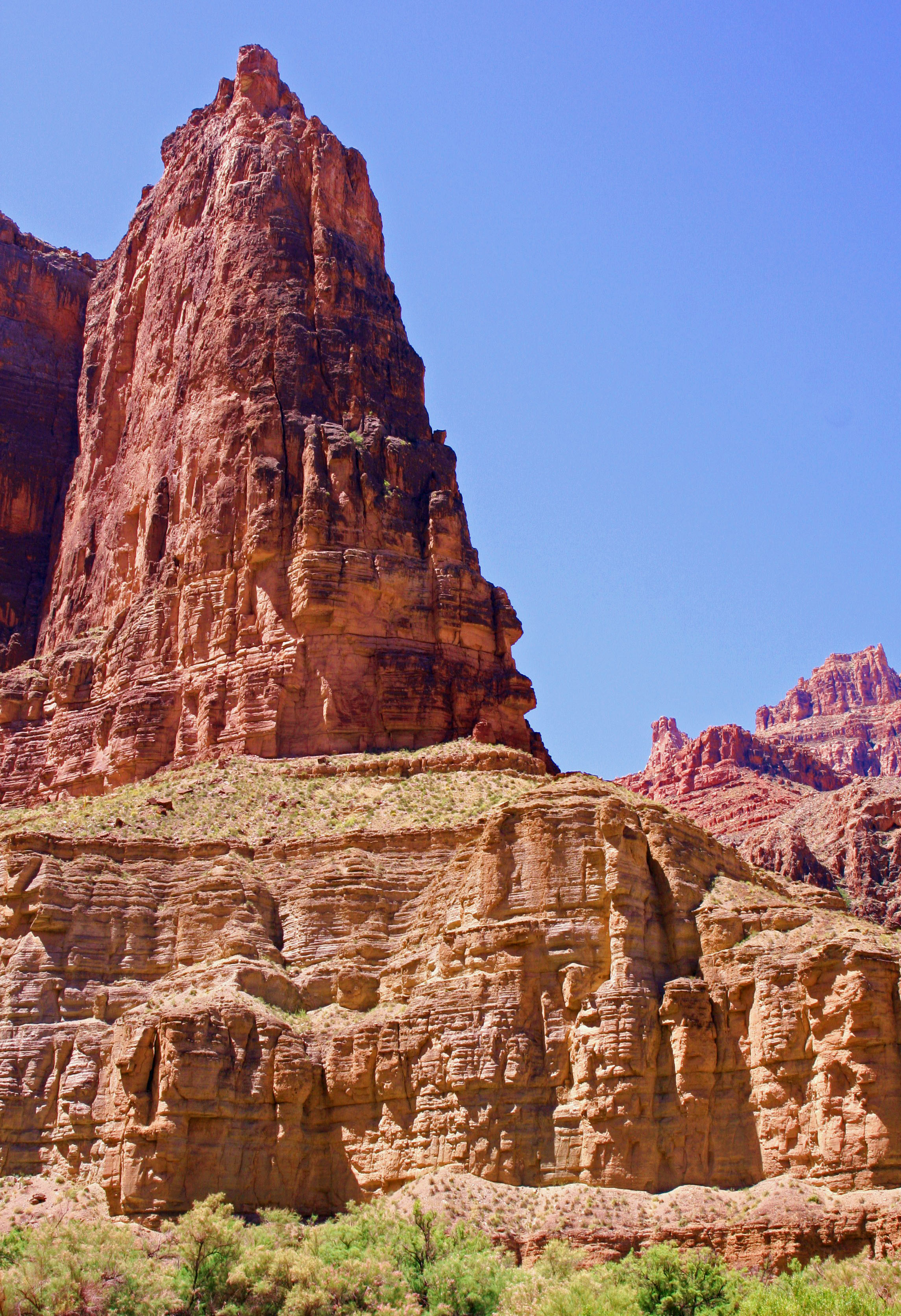
I have often wondered what part, if any, the strange rock formations in the Grand Canyon played in the development of the Hopi belief about Kachina deities.

Five squirrels with long tufted ears just went charging past our van… in a row. I think it must be love and Peggy agrees. We speculate a female is leading the boys on a glorious romp. “Catch me if you can!” she giggles. The Albert Squirrels are excited to make babies and perpetuate the race, or species, if you want to be biologically correct. Lust is in their hearts. Or maybe it’s just the guys working out territorial differences.

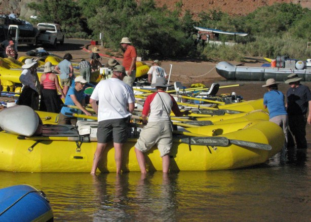
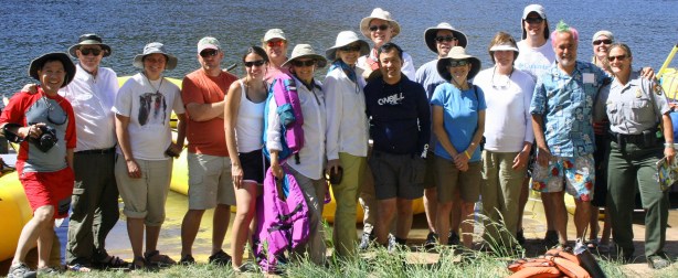
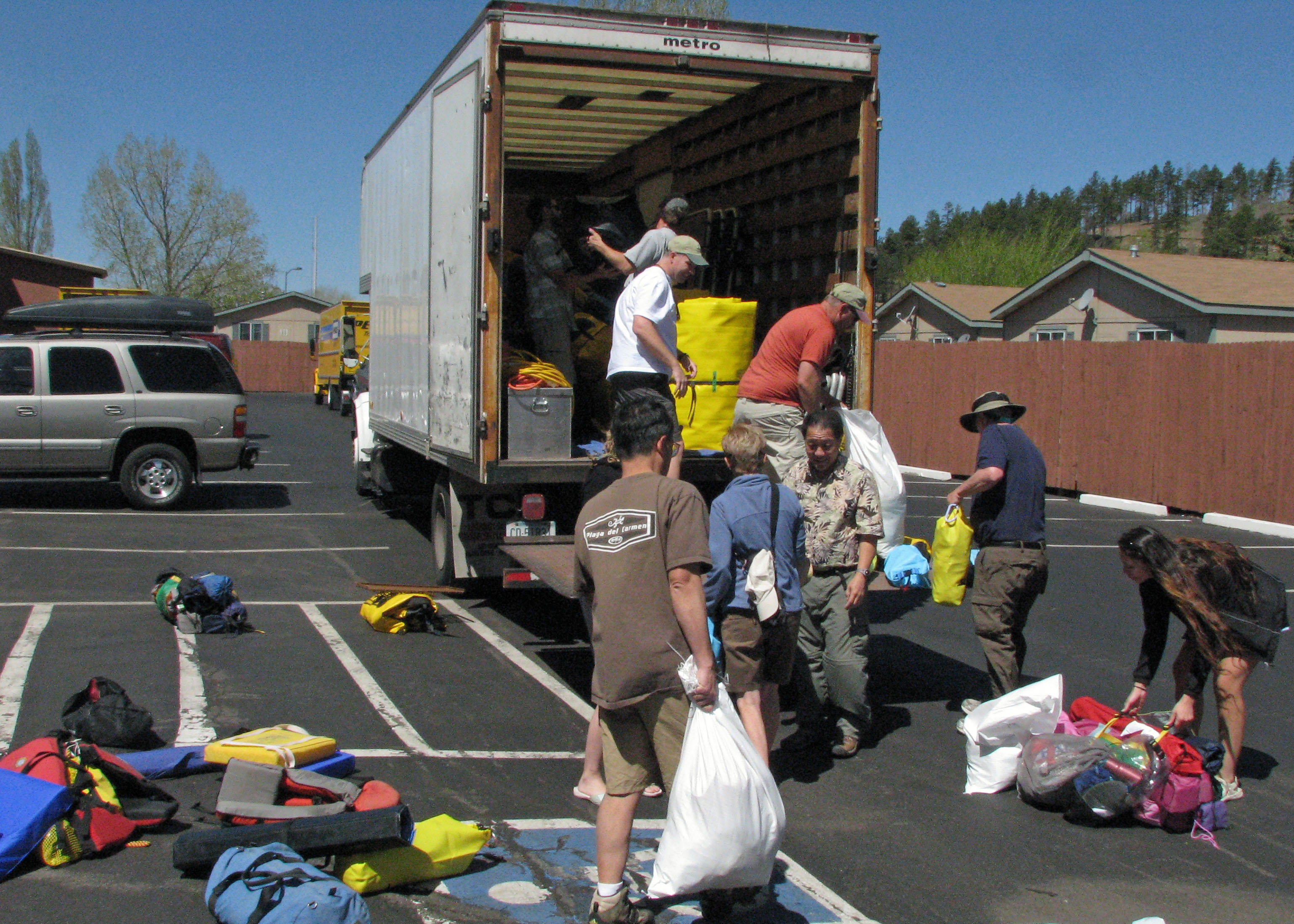
We are located at a KOA in Flagstaff, Arizona as we prepare for our raft trip down the Colorado River. It’s a big campground. Everywhere we look men and women wearing yellow shirts are busily preparing for the onslaught of summer tourists. It feels like a beehive, or squirrel’s nest. The camp cook tells us 28 people work here. Jobs are highly specialized. The man who straightens out misplaced rocks stopped by to chat with us this morning.

Yesterday we watched two employees struggle for an hour on laying out the base of Teepee. It had all the flavor of an old Laurel and Hardy film. They kept measuring and remeasuring the angles, first one way and then the other. I expected one to leap up and start chasing the other around camp with a 2×4.

We wonder what the Kachina deities who live in the San Francisco Mountains overlooking our campground think about the squirrelly activity taking place beneath them. There are bunches of them up there, over 300 according to Hopi lore, and each one has a lesson to teach, wisdom to disperse. They come down from their perch in the winter to share their knowledge. I suspect they would have made quick work of the Teepee project.

Peggy and I hike up the mountain following Fat Man’s trail. Of course there is no irony here as we desperately try to beat our bodies into shape for the Canyon trip. The trail’s name suggests this is a gentle start. Instead it takes us straight up into a snowstorm. The Kachinas are rumored to mislead people under such circumstances.

Once they had the mountain to themselves but now they have competition. Technology has arrived. Tower after tower bristling with arrays of tracking, listening and sending devices look out over the sacred lands of the Hopi, Navaho and other Native Americans.

It’s hard not to think Big Brother is watching. Or not be disturbed by the towers’ visual intrusion. But their presence means we can get cell phone coverage and climb on the Internet. We are addicted to these modern forms of communication so it is hypocritical to whine, at least too much.

But back to the squirrel theme, Peggy and I are a little squirrely ourselves as we go through our gear and get ready for our grand adventure. I am nervous. This is my first multi-day river trip. What have we gotten ourselves into? Do we have the equipment we need? Will we survive the rapids? What will the people who are joining us be like? What challenges will we face that we are ill prepared for? There are many questions and few answers.

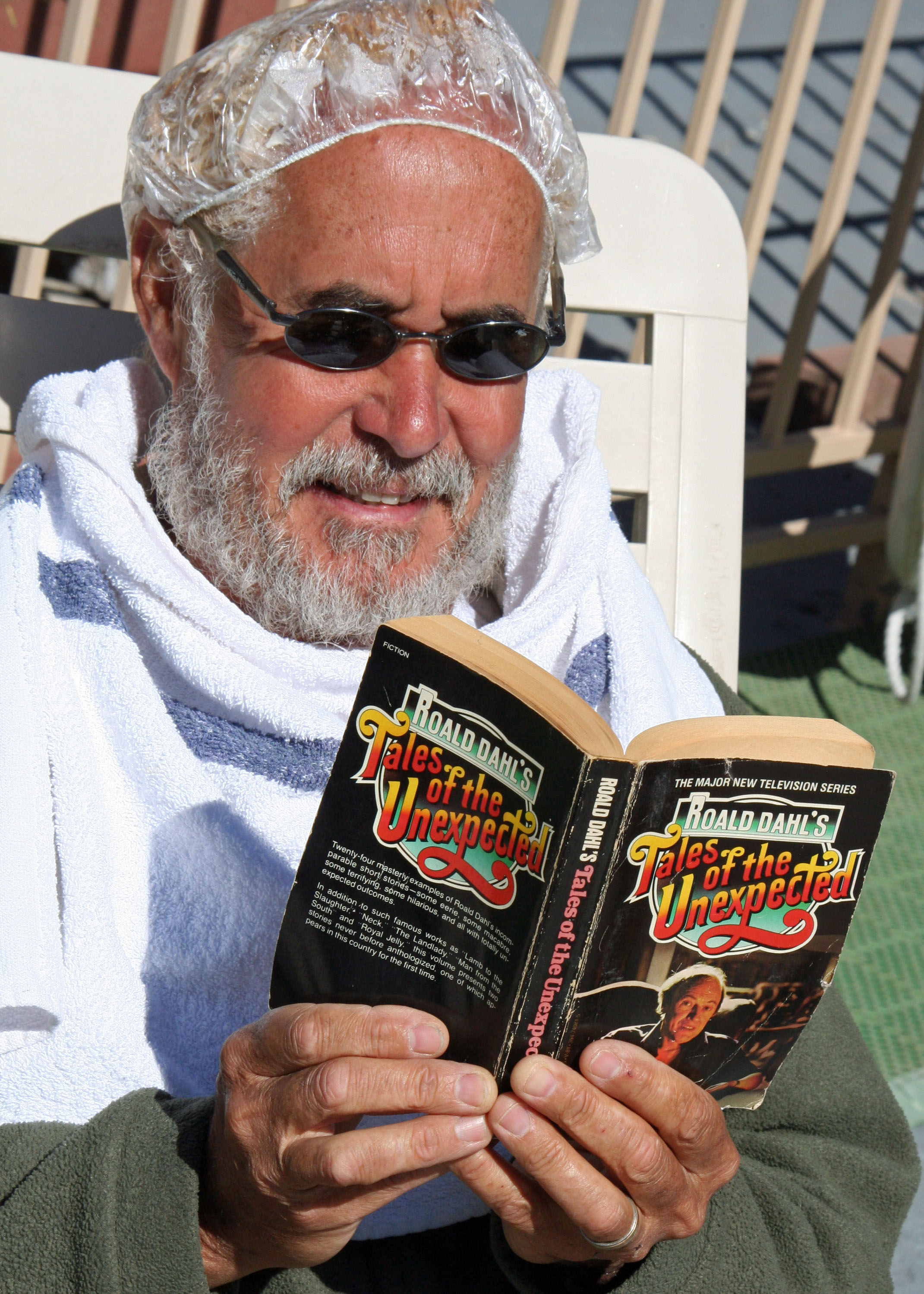
Would pirates and bones wearing life vests be part of our trip? Would my every move be recorded on camera?

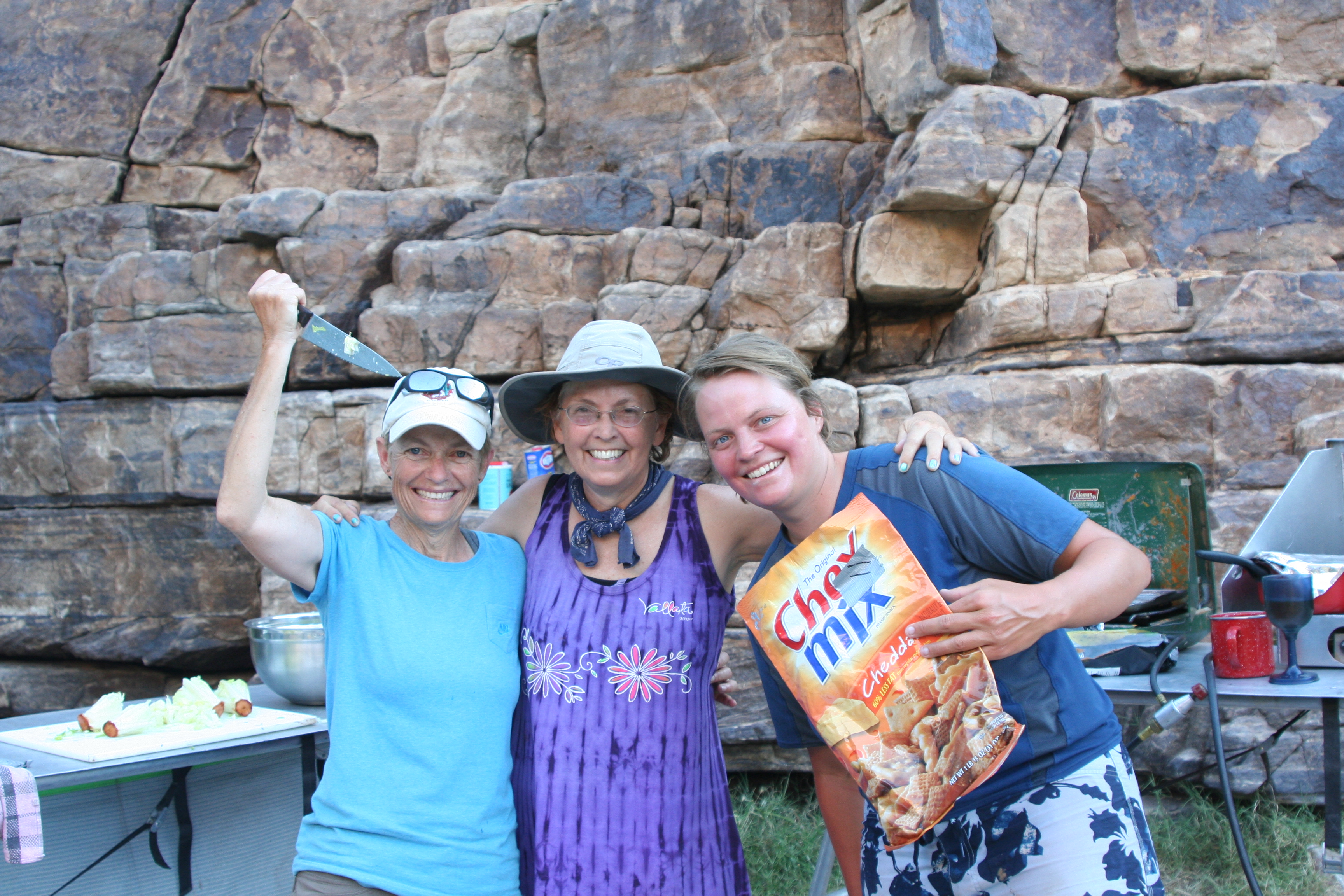
Would people who should not be let near knives suddenly be wielding them?

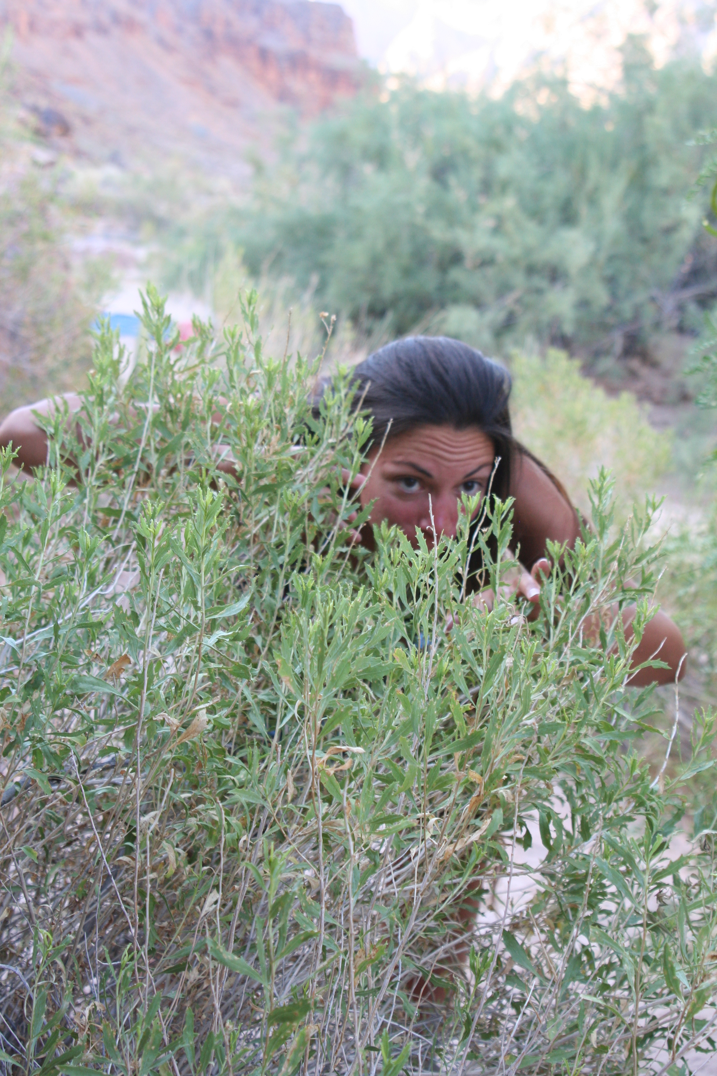
Would we be stalked by threatening spirits of the Canyon?

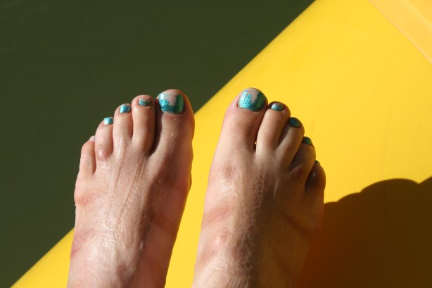
And, horror of horrors, would I be required to paint my toenails to keep rafts from flipping in the canyon? The answer to one of these four questions will be revealed in my next post.

Surreal Bats and Pink Rattlers… Backpacking the Grand Canyon

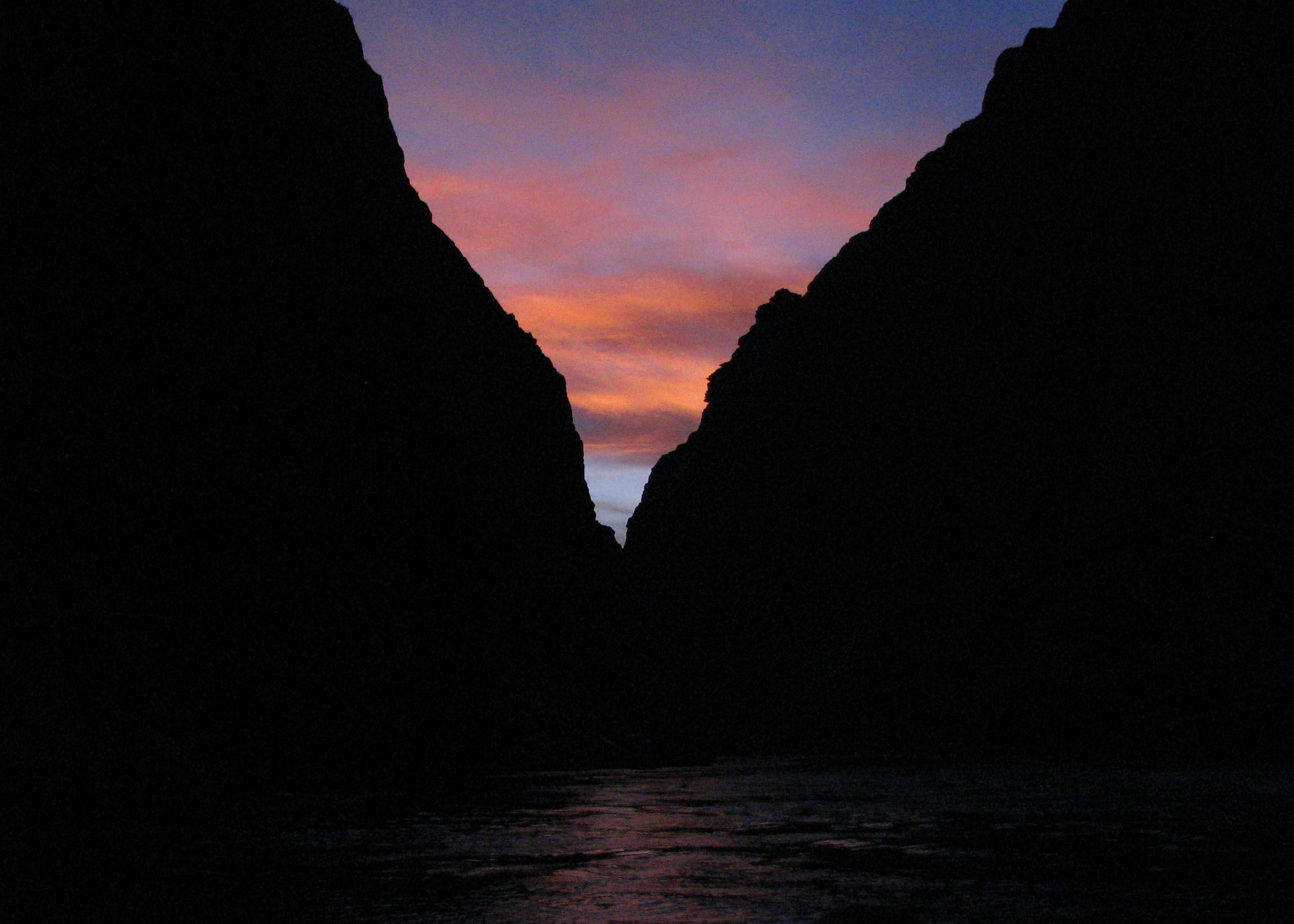
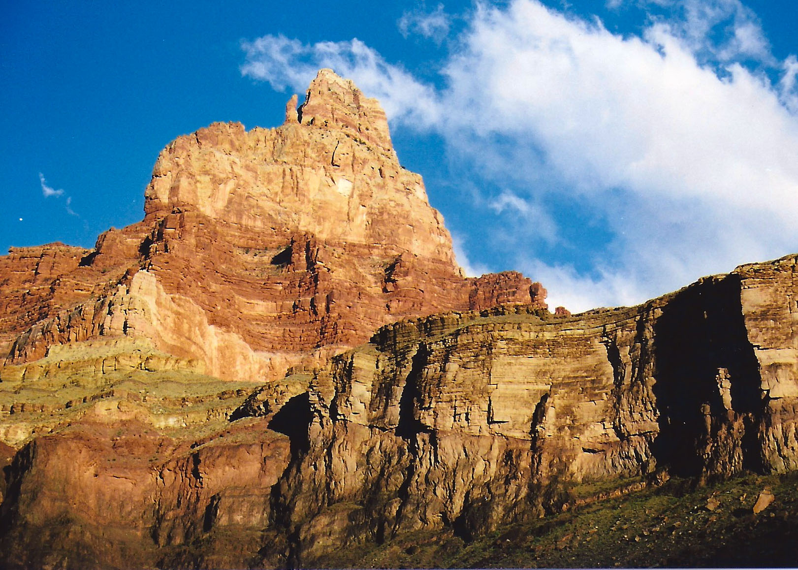
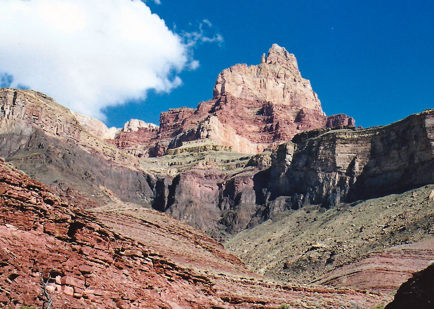
I finished my last blog with a picture of this view across the Colorado River from my camp near Tanner Rapids. This and the photo below demonstrate how much color depends on the time of day.

Close to the same shot midday, and the reason why you want to visit the Grand Canyon early in the morning and late in the afternoon.

After my close encounter with the Mouse’s tail, I was ready for breakfast. (See my last post below.)

I visited a bush, fired up my MSR white gas stove and soon had a cup of coffee in my hand and hot morning gruel (oatmeal) in my tummy. I dutifully downed my daily ration of five dried apricots. With breakfast out of the way and a second cup of coffee to enjoy, it was time to get out my topographic map and contemplate the adventure of the day.

My intention was to work my way up the Colorado River following the Beamer Trail to where it was joined by the Little Colorado. It was one of the least traveled trails in the Canyon and chances were I would have it to myself.

The trail was named after a prospector who had searched the area for gold in the 1800s, but it also incorporated ancient sections of trail the Hopi Indians had used to reach their sacred salt mines. Hopi legend claims their ancestors emerged into this world from a cave in the bottom of the Little Colorado River Canyon.

I found the combination of history, mythology, isolation and scenery quite attractive and was eager to get underway. Unfortunately, my body had other plans. It was going on strike.

On the edge of my campsite was a 20-foot section of small boulders I needed to negotiate to rejoin the trail. Normally I would sail through such an obstacle, stepping on and between rocks as the situation called for. My first step on top of a rock sent me crashing down.

I had absolutely zero balance. My muscles were refusing to function. While I didn’t reach the insane cackle level of the day before, I did find myself giggling. Dorothy’s Scarecrow was a paragon of grace in comparison to me. I made it a whole hundred yards before declaring that the day was over.

An overhanging rock provided shade, protection from the elements, and a view of the Tanner Canyon Rapids. I spent the day napping, snacking and watching rafters maneuver through the rapids. I also read a book on the Grand Canyon by Joseph Wood Krutch. The most energy I expended was to go to the river and retrieve a bucket of water. There was plenty of time to let the mud settle.

I made it as far as an overhanging rock a hundred yards from my campsite. Thirteen years later I pointed out my hideaway to Peggy. It may hold the record for the shortest backpacking trip in history.

I could watch and hear the Tanner Rapids from my hideaway. It was not a bad way to spend the day.

That evening I sipped a cup tea laced with 151-proof rum and watched bats fly through my ‘cave’ picking off mosquitoes. They were close enough I could have touched them. It was like I was invisible, as I had apparently been to the mouse and the night stalker. Strange, unsettling thoughts of nonexistence went zipping through my mind. Being alone in the wilderness is conducive to such thinking. The Canyon adds another layer.

Peggy tried out my seat where I sat and read all day and watched bats come though in the evening.

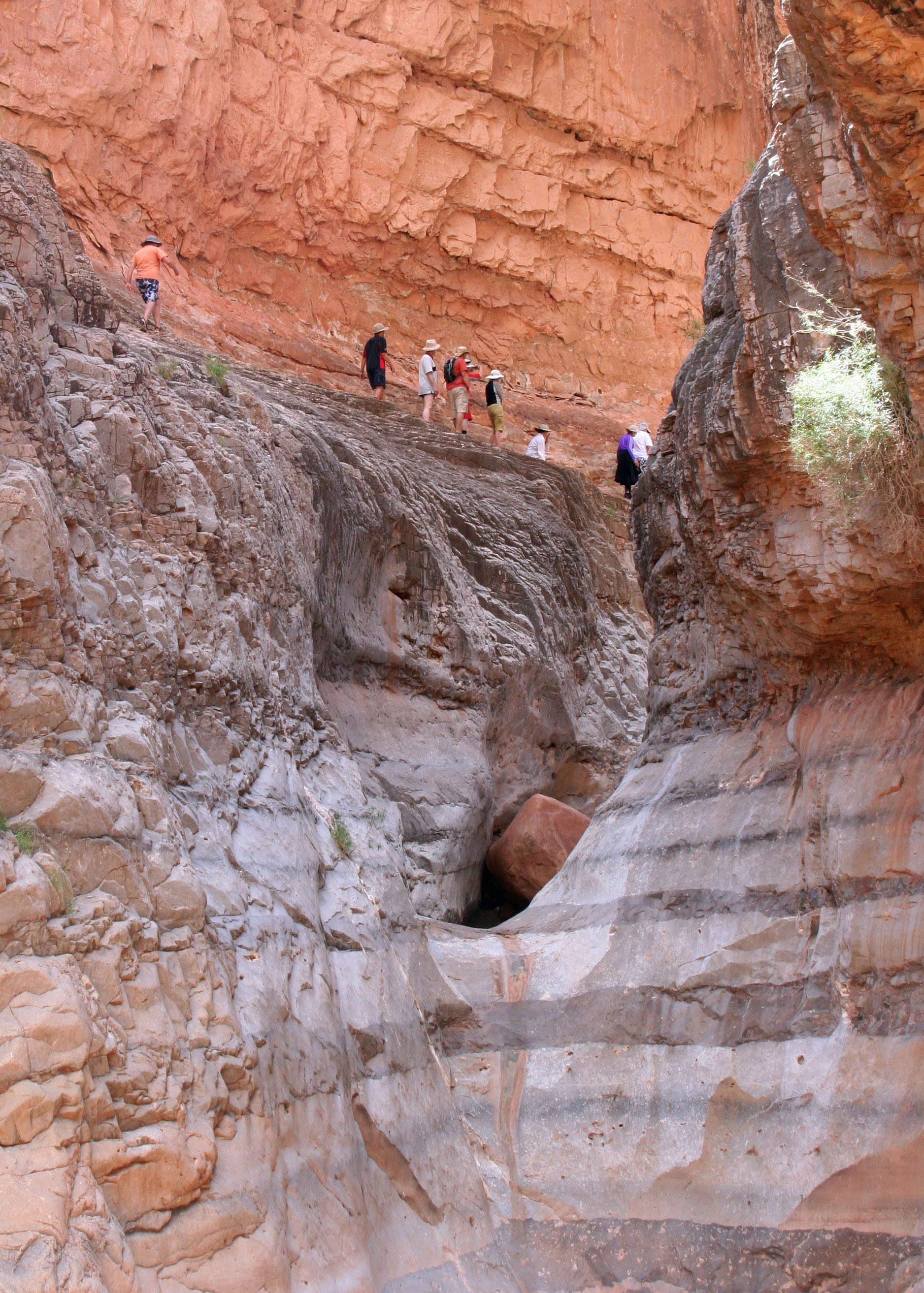
Day three arrived and it was time to explore my surroundings and whip my protesting muscles into shape. I still wasn’t ready for backpacking so I took a day hike back up Tanner Creek Canyon. Whatever creek had existed was waiting for future rain but the erosive power of water was plainly evident. This was flash flood country where a dry wash can turn into a raging torrent in minutes. Dark clouds demand a hasty retreat to higher ground.

I had nothing but blue skies, however, so I hiked up as far as I could go. The canyon narrowed down to a few feet and traveling any further called for rock climbing skills I didn’t possess. I sat for a while enjoying the silence and soaring walls. The isolation seemed so complete it was palpable. I was alone but not lonely. Nature was my companion. Reluctantly, I turned back toward my camp.

I spent the next two days hiking along the River. I backpacked up toward Lava Canyon the first day and then worked my way back down past Tanner Creek to Unkar Creek the second. My general rule was that if the trail appeared ready to make a major climb up the canyon walls, it was going without me.

Here I am hiking up river toward the Little Colorado following a route that ancient Hopi Indians may have used.

At one point when Peggy and I were backpacking up the Beamer Trail, we came to a fork in the trail and went left. (Yes, we did find the fork.)

This was the result. (grin)

The only real excitement came toward the end of the second day when I discovered my left foot poised five inches above a Grand Canyon Rattle Snake that lay stretched across the trail, hidden in the shadows. He was a granddaddy of a fellow, both long and thick. And pink. My right leg performed an unbidden hop that placed me several feet down the trail. There is a part of the brain that screams snake. No thinking is required.

As soon as I could get my heart under control, I picked up a long stick and gently urged Mr. Pink off the trail. He wasn’t into urging. Instead, he coiled up, rattled his multitude of rattles and stuck out his long, forked tongue at me. He really did want to sink his fangs into my leg. I prodded more enthusiastically and he crawled off, albeit reluctantly. I memorized the location so he wouldn’t surprise me on the return journey.

My leg’s miraculous leap did suggest that my body was beginning to tune up. There would be no more malingering and feeling sorry for itself. The next day I camped at Tanner Creek again and the following day out I hiked out. The trip took me three hours less than it had taken to hike in.  I was tempted to go find the Sierra Club fellow but opted out for a well-earned hamburger and cold beer instead. My post-pudgy body demanded compensation.

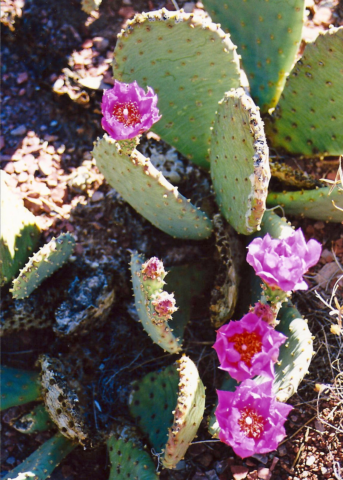
I smiled at the Prickly Pear Flowers on my way out of the Canyon that I had growled at coming in.

A final view of where I had backpacked. You can see the Tanner Trail winds down the ridge on the left.

A Tale of a Tail… Backpacking into the Grand Canyon

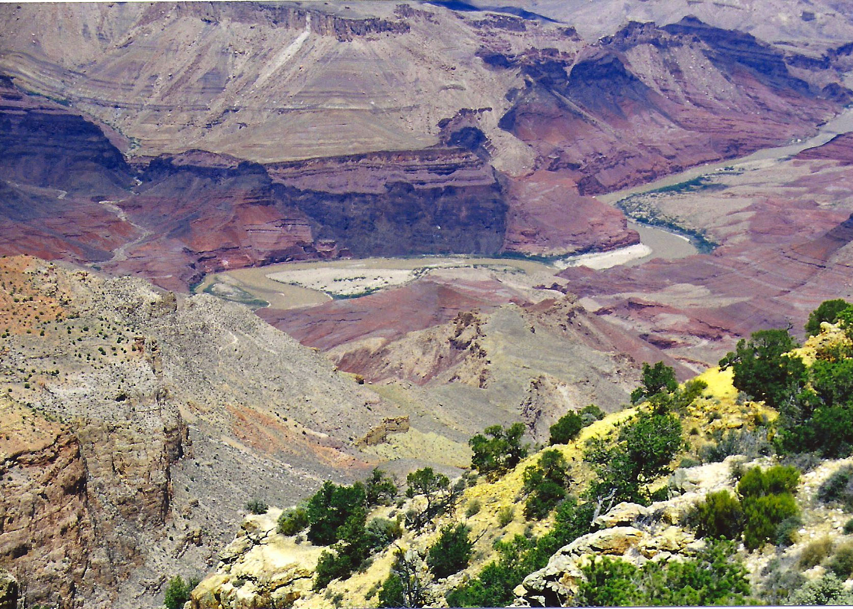
Looking down from Lipan Point at the start of the Tanner Trail. The sharp bend in the Colorado River… far away, is where I am heading. (The photos of the trail down I actually took several years later when I backpacked in with Peggy.)

The steep trail seemed to disappear under my feet as I began my journey and descended through millions of years of earth history. About a half of mile down it disappeared for real, having been washed away by winter rains. “I told you so,” my body whispered loudly as I mentally hugged the side of the canyon and tentatively made my way around the washout.

Steep drop offs are a common factor in all trails leading into the Grand Canyon. The first trails were created by Native Americans. Later miners, rustlers, and entrepreneurs interested in promoting tourism would enhance the original trails and create new ones.

I am not sure when my legs started shaking. Given the stair-step nature of the trail and the extra weight of the pack, my downhill muscles weren’t having a lot of fun. Fortunately, Mother Nature provided a reprieve.

The erosive forces of wind and water that have sculpted the mesas and canyon lands of the Southwest are more challenged by some types of rocks than others.  Somewhere between two and three miles down I came upon the gentle lower slopes of the Escalante and Cardenas Buttes, which allowed me to lollygag along and enjoy the scenery.

I escaped from the sun beneath the shadow of a large rock to drink some of my precious water, nibble on trail food and take a brief nap. It would have made a good place to camp, others had obviously taken advantage of shade and flat surface, but the Colorado River was calling.

In this photo, on my later trip, Peggy takes advantage of the shade on the Cardenas Butte.

Ignoring the ever-increasing screams of my disgruntled body parts, I headed on. At mile five or so my idyllic stroll came to a dramatic halt as the trail dropped out of sight down what is known as the Red Wall. (It received this imaginative name because it is red and looks like a wall. The red comes from iron dissolved in water that runs down from the rocks above. Think rust.) Some fifty million years, or 625,000 Curtis life spans, of shallow seas had patiently worked to deposit the lime that makes up its 500-foot sheer cliff.  It is one of the most distinctive features of the Grand Canyon.

The Red Wall, seen here snaking off to the right, is one of the most distinctive features of Grand Canyon National Park.

My trail guide recommended I store water before heading down so I could retrieve it when I was dying of thirst on the way out. I could see where people had scratched out exposed campsites as a place to stop for the night. The accommodations weren’t much but the view was spectacular.

The rest of the five-mile/five month journey was something of a blur. (It was closer to five hours but time was moving very slowly.) I do remember a blooming prickly pear cactus. I grumbled at it for looking so cheerful.

I was too tired to fully appreciate the beauty of the inner Canyon.
My lack of appreciation included a cheerful cactus flower.
Looking back up the trail provided a perspective on how far I had come. The small, needle-like structure on the rim is Desert View Tower.

I also remember a long, gravelly slope toward the bottom. My downhill muscles had totally given out and the only way I could get down was to sidestep. I cackled insanely when I finally reached the bottom. I was ever so glad the Sierra Club guy wasn’t around to see me.

Setting up camp that night was simple. I threw out my ground cloth, Thermarest mattress, and sleeping bag on a sandy beach. Then I stumbled down to the river’s edge and retrieved a bucket of reddish-brown Colorado River water, which appeared to be two parts liquid and one part mud. I should have waited for the mud to settle. Instead I used up a year of my water filter’s life to provide a quart of potable water.

Sitting beside the muddy Colorado River.
My old yellow bucket, a veteran of dozens of backpacking adventures.

All I had left to do was take care of my food. Since people camped here frequently, the local critters would see me as a huge neon billboard that blinked ‘Eat at Curt’s.’ Not seeing a convenient limb within three feet, I buried my food bag in the sand next to me. Theoretically, anything digging it up would wake me. Just the top was peeking out so I could find it in the morning.

As the sun went down, so did I. Faster than I could fall asleep, I heard myself snoring. I was brought back to full consciousness by the pitter-patter of tiny feet crossing over the top of me. A mouse was worrying the top of my food bag and going for the peanuts I had placed there to cover my more serious food.

“Hey Mousy,” I yelled, “Get away from my food!”  My small companion of the night dashed back over me as if I were no more than a noisy obstacle between dinner and home. I was drifting off again when I once more felt the little feet. “The heck with it,” I thought in my semi-comatose state. How many peanuts could the mouse eat anyway?

The river water I had consumed the night before pulled me from my sleep. Predawn light bathed the Canyon in a gentle glow. I lay in my sleeping bag for several minutes and admired the vastness and beauty of my temporary home.  The Canyon rim, my truck and the hordes of tourists were far away, existing in another world.

My thoughts turned to my visitor of the previous evening. Out of curiosity, I reached over for my food and extracted the bag of peanuts. A neat little hole had been chewed through the plastic but it appeared that most of my peanuts were present and accounted for. The small contribution had been well worth my solid sleep.

I then looked over to the right to see if I could spot where the mouse had carried its treasure. Something on the edge of my ground cloth caught my eye. It was three inches long, grey, round and fuzzy.

It was Mousy’s tail!

Something had sat on the edge of my sleeping bag during the night and dined on peanut stuffed mouse. Thoughts of a coyote, or worse, using my ground cloth as a dinner table jolted the primitive parts of my brain. Had I had hackles, they would have been standing at attention ready for action.

I ate a peanut in honor of Mousy’s memory and tossed a few over near his house in case he had left behind a family to feed. I also figured that the peanuts would serve as an offering to whatever Canyon spirits had sent the night predator on its way.

Next blog: I recover and then explore the Canyon. A large, pink rattlesnake and I tangle.

The view from camp looking across the Colorado River and up.

A Trifle Overweight? Backpacking into the Grand Canyon Part I

Early morning and late evening sun add an interesting contrast between light and shadow… not to mention color. When I arrived late at the Grand Canyon for my backpacking trip, I hurried over to the Rim to enjoy the sun’s last rays.

This is the second part of my series on a celebration of the Grand Canyon National Park, which will eventually focus on Peggy and my 18-day raft trip down the Colorado River. Over the next three blogs I will describe a backpack trip into the Canyon where I was… let’s say, a trifle overweight.

In 1986 when I left Alaska I decided to take six-months and backpack into some of the more remote corners of the West. I stopped by for a brief visit with friends and family in California and then headed out for my first stop: the Grand Canyon.

I followed Highway 50 east out of Sacramento, cut off at Pollock Pines and picked up the Mormon Emigrant Trail. Soon I was on Highway 88 climbing up and over Carson Pass. Newly dressed aspens, snow-covered mountains and frothy creeks reminded me that summer was still two months away.

Frothy creeks reminded me that summer was still two months away.

By evening I had driven down the east side of the Sierras and made my way into Death Valley. I was setting up my tent under a convenient Mesquite tree when the sun sank behind the Panamint Range. Coyotes howling in the distance lulled me to sleep.

Every trip I made to the Grand Canyon from California included a visit to Death Valley National Park.

By ten thirty the next morning I was in another world, investing quarters in a video poker machine at Circus Circus on the Las Vegas Strip. Luck was with me. Two hours later found me crossing over Hoover Dam with an extra hundred dollars in my wallet. It represented two weeks of backpacking food. I zipped across the desert, picked up Interstate 40 at Kingman and cut off toward the Grand Canyon at Williams.

I wasted little time checking in at Mather Campground. The Canyon was waiting. An unoccupied rock off the trail near Yavapai Point provided a convenient spot for dangling my legs over the edge. Nothing but vacant space existed beneath my hiking shoes.

My musings were interrupted when a fat Golden-Mantled Ground Squirrel poked his furry head up next to me and demanded payment for my front row seat. I recited the Park’s rule on feeding animals and told him to go eat grass. He flipped his tail at me and squeaked an obscenity as he scrambled off in search of more gullible victims.

Twilight was painting the Canyon with a purplish tinge but I could still make out the distinctive colors and shapes of the rocks. While my right-brain admired the beauty, my left-brain was busy considering eons upon eons of earth history. The dark, tortured walls of the inner canyon, now obscured by evening shadows, reached back over a billion years to the very beginnings of life on earth when our ancient ancestors had frolicked in even more ancient seas.

Erosion had given these Precambrian rocks a flat top, shaving off some 500 million years of earth’s history and creating what is known as the Great Unconformity.  Since then vast seas, Saharan size deserts, lakes and rivers had patiently supplanted one another as they marched through Paleozoic time depositing layer upon layer of the canyons walls.

My present perch was made of Kaibab limestone created by an inland sea some 250 million years ago. Dusk slipped into dark and my thoughts turned to my impending backpack trip.

I had backpacked into the Canyon several times. My objective this time was to explore the Tanner Trail on the eastern end of the South Rim road.

The next day was devoted to careful preparation. Seventeen years of backpacking in all kinds of terrain and climate had taught me that there was no such thing as being too careful. I approach compulsive when it comes to backpacking alone. Had I resupplied my first aid kit? Was my stove still working? Did I have adequate fuel? Did I have my flashlight, signaling mirror, whistle, compass and maps? Did I have enough but not too much food, water, reading material, etc. etc. etc?

Safety, comfort and even entertainment are important but weight is always an issue.

Having satisfied myself that I could survive seven to nine days in the Canyon, I headed off to the backcountry permit office. The more environmentally inclined within the Park Service are seriously into minimizing impact and promoting safety. Requiring wilderness use permits is their primary tool in achieving these goals.

I patiently waited behind six other would-be canyon explorers and had memorized the minimum impact lecture by the time my turn was up. The ranger frowned when I mentioned the Tanner Trail.

“The trail is poorly maintained, rarely used, 10-12 miles long and arduous,” she cautioned strongly.

“And that,” I replied, “is exactly what I want.”  I was especially enamored with the ‘rarely used’ part.  I had no desire to share my experience with dozens of other people, much less armies of cantankerous mules that leave lakes of fowl smelling pee on the trail. If I had to face a particularly tough physical challenge and be extra careful to avoid a tumble into the Canyon, it was a price I was happily willing to pay.

I was leaving the office when a skinny guy wearing a short-sleeved khaki shirt, blue shorts and hiking boots stopped me.

“Excuse me,” he announced, “I am with the Sierra Club and I couldn’t help but hear you are headed down the Tanner Trail. Given your condition, I would strongly advise against it. You should hike down the Bright Angel Trail. It’s a lot easier and there are lots of other people hiking it in case you get in trouble.”

Now I confess that having just emerged from nine months of hibernating in Alaska I was pasty white and pudgy. I will also allow that the guy was operating under good intentions.

But his arrogance, especially in announcing his Sierra Club membership as somehow making him a wilderness expert, irritated me. Over the years I had known and worked with lots of Sierra Club folks. I am a strong supporter of their efforts to protect the wilderness. I have even run into some who have had more wilderness experience than I. John Muir, the Sierra Club founder, is one of my all time heroes.

Had my unofficial advisor started off with something like, “I have been up and down the Tanner Trail several times, would you like some suggestions?” I would have been quite willing, even eager, to hear what he had to say. But his uneducated assumptions about my lack of knowledge absolutely turned me off. It was everything I could do to maintain a civil tone of voice as I thanked him for his advice and politely told him to screw off.

At 8:30 the next morning my pasty white pudgy body was having an animated discussion with my mind over why I hadn’t listened more carefully to the Sierra Club ‘expert’ the day before. I had started my day by splurging for breakfast at the elegant El Tovar Hotel and then driven out to Lipan Point.

I was now poised to begin my descent into the Canyon. It looked like a long way down. I gritted my teeth and banned any insidious second thoughts.

They came rushing back as I struggled to hoist my 60 plus pound pack. It was filled with seven days of food, extra water and all of my equipment. I had cursed the day before as I struggled to find room for everything. Now I was cursing I hadn’t left half of it behind.

Next up: The journey down.

The prominent landmark at the eastern end of the South Rim road at the Grand Canyon is the Desert View Watch Tower. It is near where I started my hike down into the Canyon and provided a view of where I would be traveling. It also provided a  landmark as I descended into the depths.

Visiting Grand Canyon National Park by Car, Mule and Helicopter

Grand Canyon National Park is one of the world’s greatest natural wonders.

“Golly, what a gully,” President William Howard Taft was heard to mutter when he first saw the Grand Canyon.

Teddy Roosevelt was more profound: “Leave it as it is. You cannot improve on it. The ages have been at work on it, and man can only mar it.”

Both of these thoughts are rumbling through my brain as I think about the 18 days Peggy and I are about to spend rafting 280 miles down the Colorado River.

Few people come away from the Grand Canyon untouched and we are no exception. Its vastness, beauty, and geology have pulled us back time and again, as have its natural and cultural history.

There are many ways to explore the Canyon. For the vast majority of people, some five million a year, this involves a drive up to the South Rim and a quick tour of the most popular overlooks. If that is all the time you have, it’s worth the journey, believe me.

Numerous overlooks along the South Rim provide breathtaking views into the Canyon. This a view up Bright Angel Canyon. North Rim, also worth a journey, is at the top. You can hike from South Rim to North Rim, which I have.

Sitting on the edge for an hour or two enhances the experience several times over. Hanging out on the rim for a few days while roughing it at a campground or luxuriating in one of the lodges, is even better.

I once spent a pleasant night in the El Tovar Lodge courtesy of Nancy Reagan. Snow forced her and her large entourage to cancel a visit there in November 2001. Peggy, the kids, and I were camping out in a large tent at the Park’s Mather Campground. The foot of snow on our tent and 18 degrees F temperature had provided us with more than enough “roughing it.” We gladly took advantage of Nancy’s misfortune and the discounted vacant rooms.

For those wanting for a bird’s eye view, a helicopter trip is a tempting option. After three tours of duty in Iraq flying helicopters for the Marines and being shot at, our son Tony decided to try his hand at flying tourists over the Grand Canyon. He took Peggy and me on a thrilling ride into Havasupai Canyon… to the music from Star Wars, if I recall correctly. (Tony now flies helicopters for the Coast Guard out of Kodiak, Alaska.)

Beyond these sedentary approaches to the Canyon lie more challenging adventures. Even a half hour hike down one of the more popular trails provides a trip through millions of years of history, incredible views and the heart-pounding thought that only a few feet separate you from a thousand foot tumble.

There are several trails down into the Canyon with Bright Angel and Kaibab being the most popular and the ones recommended by the Park Service. I prefer less travelled, mule free trails. But it also means the trails are less maintained.

Longer hikes and especially backpacking trips provide a perspective that only a small percentage of Canyon visitors ever have.

If you want to visit the inner canyon but fear you’re lifetime warranty will expire hiking out, check out the sure-footed mules that carry tourists in and out of the Canyon. It’s an experience your rear will remember for years. Mine did.

Don’t you dare climb on my back.

Charlie, that was the mule’s name, did not like me. There was a 200-pound weight limit and I was at 195. I wore light tennis shoes and clothes to the weigh-in and hit 199. I wore my backpacking shoes on the trip; it pushed me over the limit.

Charlie knew I was cheating. He immediately whipped his head around and tried to bite me. Failing that, he walked as close to the edge as he could and provided me with a front-row seat of my ultimate demise. Only my knowledge that mules don’t commit suicide kept me in the saddle.

My most challenging journeys have been six backpack trips into the Canyon, including a week alone. I will feature that particular misadventure in my next blog. But, in the mean time, here are more photos from the Rim.

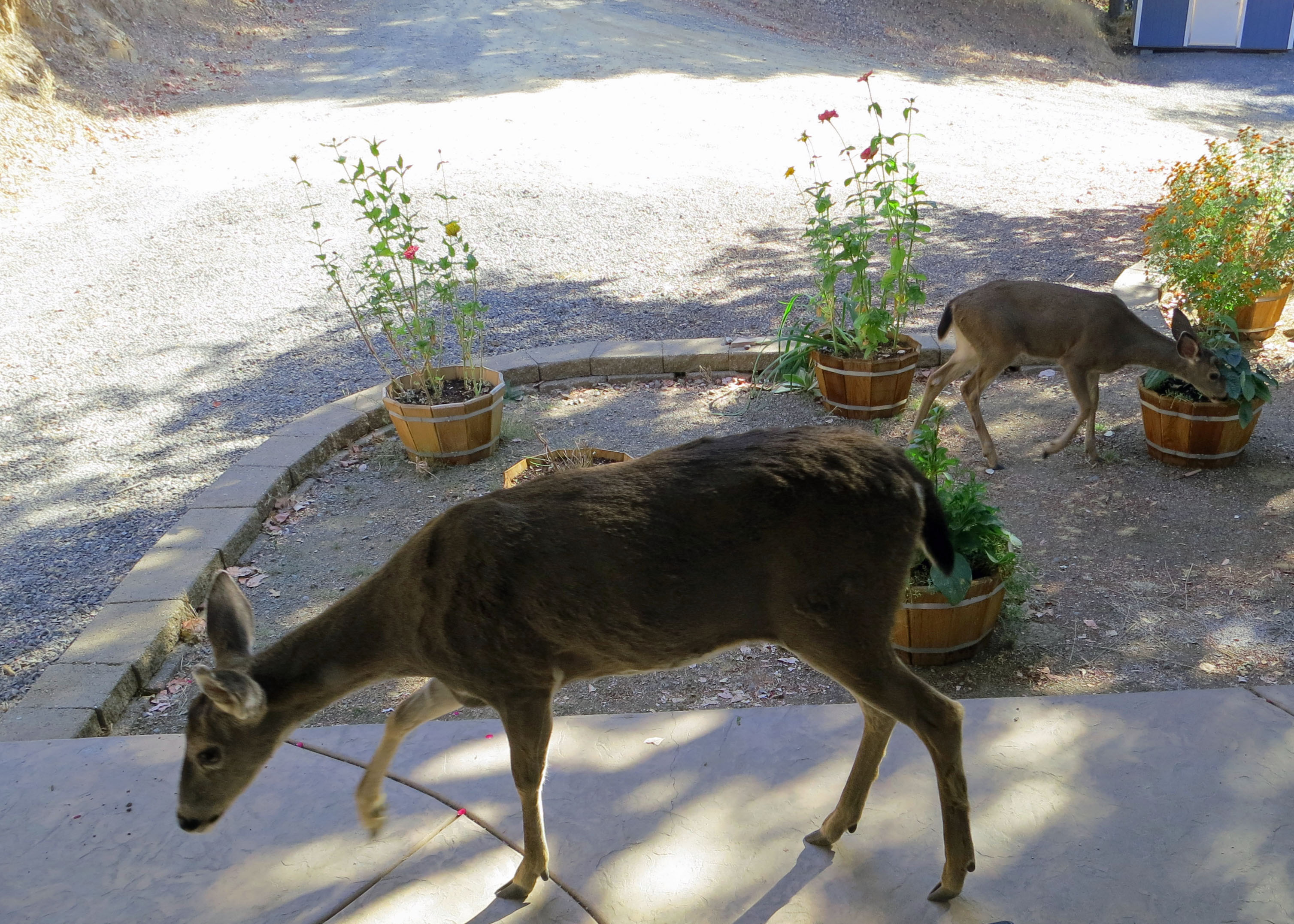
I rolled my window down to photo this Mule Deer and she tried to stick her nose in my window. There are reasons for all of the signs that urge “Don’t Feed the Wildlife.”

This elk was a magnificent fellow but he wouldn’t come out in the open for me.

More views to encourage a visit to the Grand Canyon.

Early morning and late afternoon sun provide the best colors. Time your visit to include both if you can.

Another view looking down that demonstrates the rich colors.

I’ll be backpacking into the heart of the Grand Canyon down the Tanner Trail in my next blog. A  Sierra Club member insisted I hike an easier, well maintained trail.

A Grand Adventure… Exploring the Grand Canyon by Raft

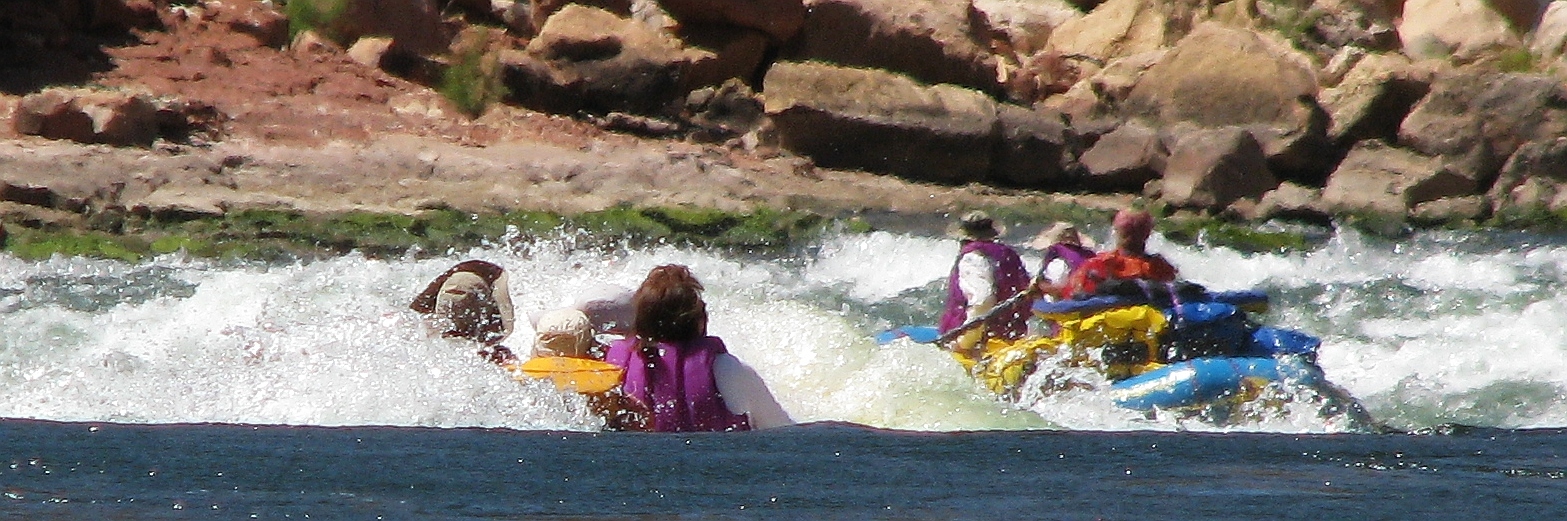
With Steve at the oars, Peggy and I enter the infamous Lava Rapids on the Colorado River, a perfect ten… that’s 10 as in rapids don’t get any more serious. A few seconds later we disappear under the water. (Photo by Don Green)

Today I begin my series on rafting the Colorado River through the Grand Canyon. Since it happened a couple of years ago, I am traveling back in time. In fact I kicked off this blog with the trip, some 181 posts ago.

I never finished the series. Other things happened: like having grandbabies born, going to Burning Man, looking for long dead people (otherwise known as ancestors), etc. So I will start with reposting my early stories so everyone can begin, so to speak, on the same page. (Grin)

This series will encompass more than my trip down the river, however. It is meant to be a celebration of the Grand Canyon, possibly the greatest natural wonder in the world. I have been back to the Canyon repeatedly in a time span that dates back over forty years.

Peggy takes a photo looking down into the Grand Canyon. Three feet forward and she will have a thousand feet to learn to fly.

I have wandered the South and North Rim, camped in all of the Rim campgrounds, and stayed at the magnificent El Tovar Hotel. Once I spent Christmas week at Bright Angel Lodge with a view overlooking the Canyon. I’ve been into the Canyon by mule, on foot and helicopter… as well as raft.

Several times I have explored the inner Canyon on weeklong backpack trips. I will feature one in this series.

Our Grand Canyon river adventure started with a phone call. Tom Lovering left an urgent message. I had to immediately stop whatever I was doing (Peggy and my three-year road trip around North America) and climb on-line to sign up for the Grand Canyon Colorado River permit lottery.

Apparently the permits are hard to obtain, somewhat harder than walking out of a casino with a million dollars.

I am immune to Tom’s last minute schemes but the charming Peggy who loves water, loves rivers, and loves sunshine immediately jumped on-line and did the necessary clicking. Early the next morning we received an Email from the National Park Service saying we had won. It took me a lot longer to persuade Tom than it did for the NPS people to inform us.

I am not, by nature, a white water man. I put running rapids right up there with dangling on rock cliffs, playing Kamikaze on ski slopes, and riding the latest death-defying roller coaster at Four Flags.  My approach to outdoor adventure is more in the nature of planned risk taking than thrill seeking. Consequently, I had only been on two real white water rafting trips.

The first was with Tom on the Mokelumne River in California in the 70s. Within five minutes he had dumped us into something known as Dead Man’s Hole. “Paddle!” he screamed. River rats love to give their favorite rapids scary names such as Satan’s Pool and Suicide Bend. They can wax eloquently for hours over the qualities of these death-dealing anomalies. Our detour “was a learning experience,” Tom explained as we emptied the water out of the raft and lungs. “Next time you’ll paddle harder.” Yeah, yeah.

My second white water trip was on the Middle Fork of the American River. This time I was travelling with Mark Dubois, his wife Sharon Negri and a friend, Bonnie Holmes.

Mark, sometimes known as the Gentle Giant, once chained himself to a rock in the bottom of the Stanislaus River to stop the Army Corps of Engineers from flooding the canyon with water. He also co-founded Friends of the River, an organization dedicated to saving the wild rivers of the west.

Our trip was rather mellow up until we came to a large rapid. Mark was having us do such things as close our eyes and lean backwards out of the raft with our hair touching the water so we could ‘listen’ to the river. He’s a spiritual type guy, one with nature. Apparently Nature had rejected me.

“Now, Curt,” he directed as we approached the rapid known as Guaranteed to Drown or some other similar name, “I want you to climb out of the raft and float down it.”

“I know, I know,” I groused as I rolled out of the raft into the icy waters. “It’s a learning experience.”

And that’s how I classify our trip down the Colorado, a learning experience. But I know it will be more. Every time I have visited the Grand Canyon over the years, I have come away with a feeling of awe and reverence. How could a trip through the Canyon’s inner core be any different?

So please join my friends and me over the next few weeks. I think you’ll enjoy the ride.

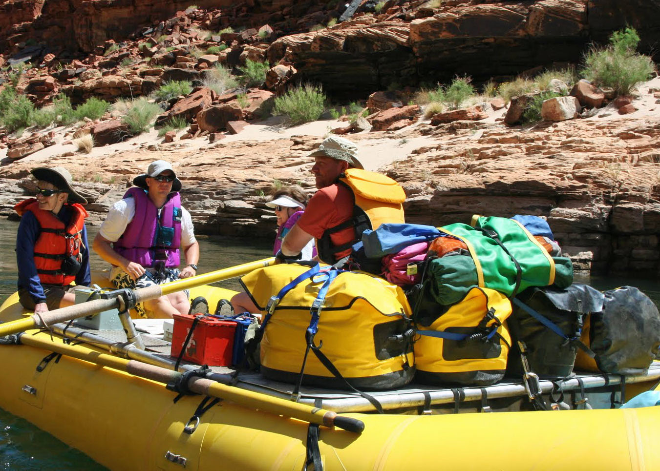
Here I am. They actually let me row. It had something to do with the lack of any nearby rapids.

This is how Jamie, one of our experienced boatmen, handled that section of the river.

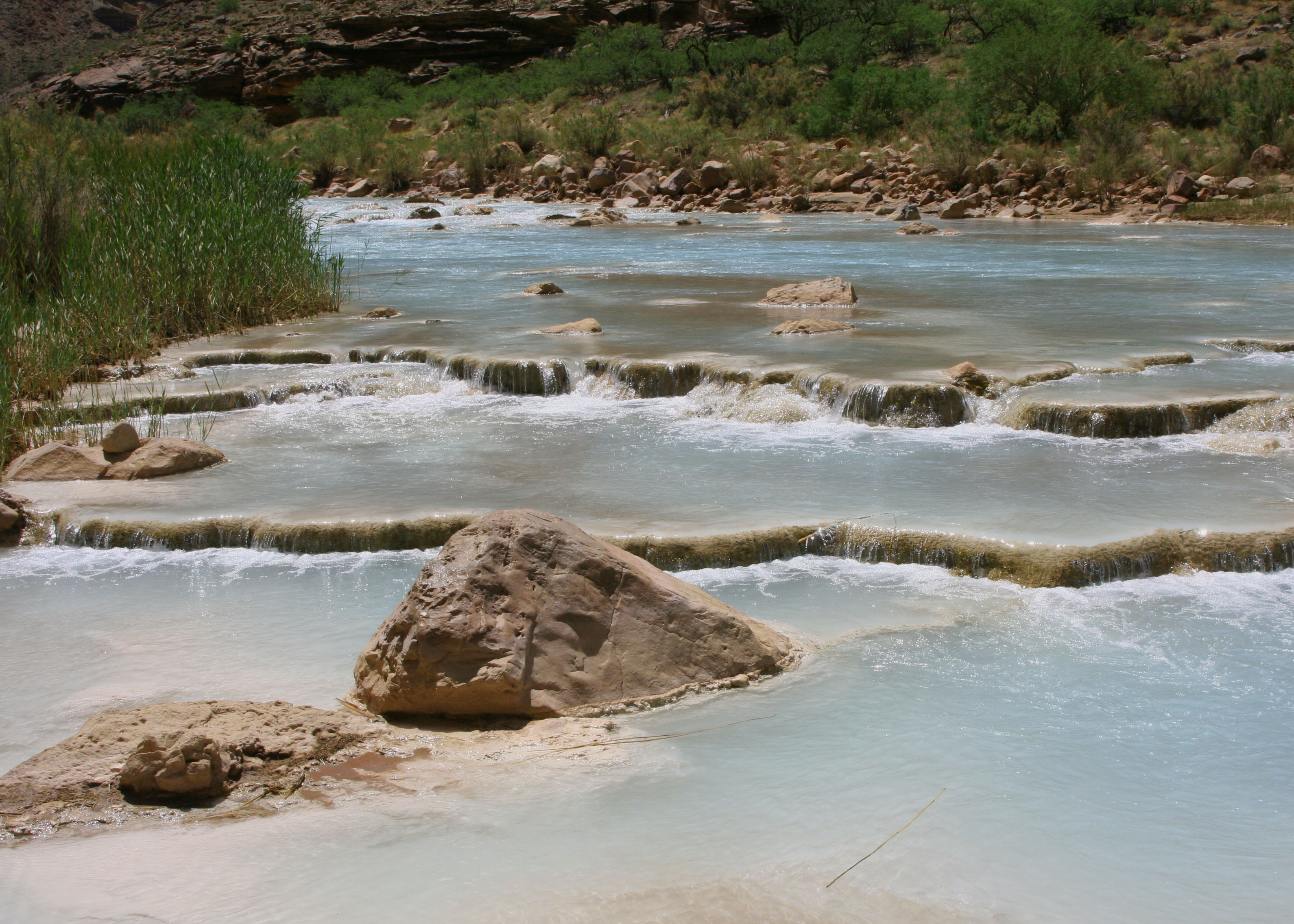
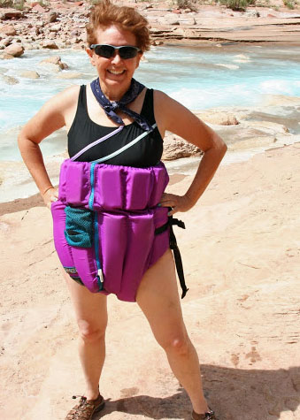
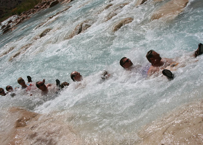
Here are some of the folks that travelled with us on our 18 day trip down the Canyon. In this photo they have reversed their life preservers to look like giant diapers and are floating down the beautiful little Colorado River, one of many scenic stops along the way. They are about ten feet away from going over a waterfall.

You will meet some interesting characters on the trip, such as Steve…

And our fearless leader Tom Lovering. Are you brave enough to spend 21 days on the river with this man?

Even this Grand Canyon fish was amazed by our choice of leader.

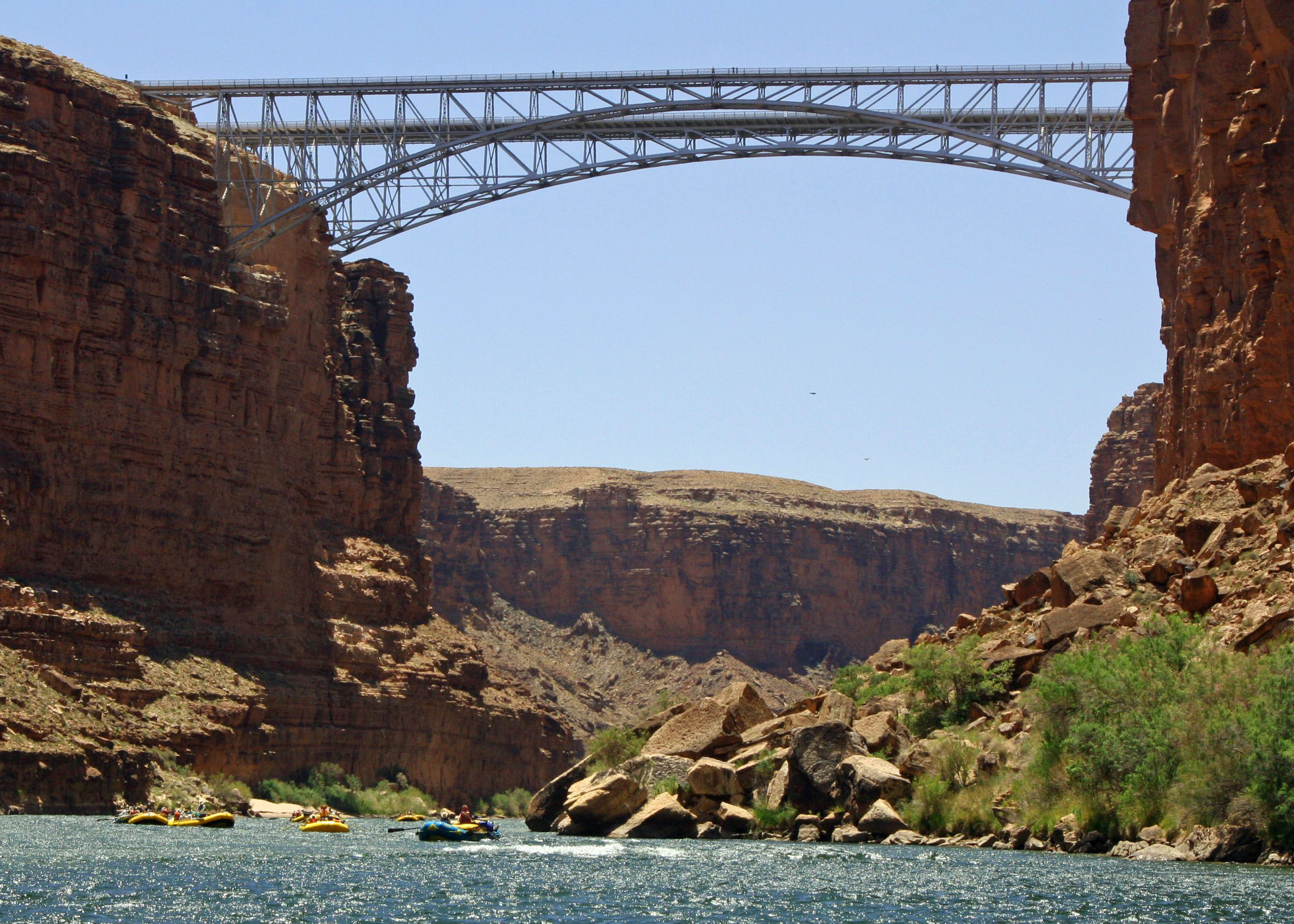
We had 21 days on the Colorado River and 21 days of incredible scenery. Views such as…

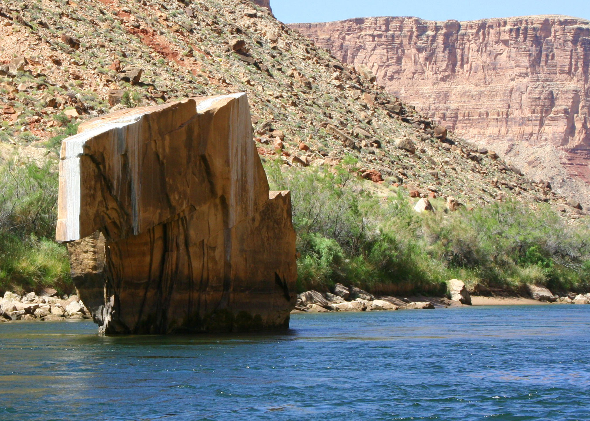
Scenes along the River…

Magnificent cliffs…

Plunging waterfalls…

And beautiful wild flowers.

You will learn how to poop in the woods…

Dance in a line with too much wine…

Take refreshing baths…

And leap from high places.

Join us.

An Alaskan Poet and a Saguaro… Organ Pipe Cactus National Monument

An “armless” saguaro at Organ Pipe National Monument is outlined by the sun’s setting rays.

David McElroy and his wife Edith Barrowclough came down from Alaska recently to visit Peggy and me at our home in Southern Oregon. Edith went to high school with Peggy in Port Clinton, Ohio. David is an Alaskan Bush Pilot and a published poet, which makes for an interesting combination.

In addition to the high school connection, our son Tony now flies helicopters for the Coast Guard out of Kodiak, Alaska and I once lived in Alaska. We also share a love of wandering. We told stories, visited a local winery, and ate Thai food in Jacksonville. Edith and Dave are good folks; we enjoyed the visit.

David left us a special present. He downloaded several unpublished poems from his computer to my MacBook. One, about a desert walk, reminded me of similar walks that Peggy and I have taken at Organ Pipe Cactus National Monument and other locations throughout the Southwest.

I decided to post David’s poem today (with his permission) and illustrate it with our photos from Organ Pipe. The National Monument is located in Southern Arizona on the border with Mexico. (My pardon for the skipped lines… I fought for two hours trying to turn off Microsoft’s paragraph function. Grrrr. Maybe one of  my readers can give me the solution. I am sure somebody will say, “It’s simple Curt…”

Desert Walk

Armless saguaro too young to wave

much less salute but old enough

for sex open their white flowers

to night and pollinating bats

that might, that must, come by.


Except for grasses, Mesquite

and most plants here hang seedpods,

a rich feed ripening for two kinds of doves,

these little rats along the trail,

cottontails, and ducks in the creek.


And so the need for hanging hawks,

owls that burrow, coyotes wafting

like dust through creosote brush,

and in the heat among cactus thorns

snakes sewing the needles of themselves.


Lush rock in low sun, green cattails,

the beat up tin of water over gravel,

hopeful saguaro ruler straight–

over a hill, around a bend,

the land composes a scene of itself.


And the woman on whom nothing is lost

aims her camera with one hand,

and with the other in complete confidence

passes the cup she’s been holding

over her shoulder to the hand


in the desert behind her which is mine.

A saguaro “ruler straight.” Note the thorny protection. Peggy and I, and I am sure David and Edith, are quite careful when walking among cacti.

I prefer my saguaros with arms. It gives them more personality.

Check out the wild ‘gesture’ of the saguaro to the right and behind. The power lines are running to the headquarters of Organ Pipe National Monument.

A coyote went “wafting like dust through creosote brush.” I took this photo at Death Valley National Park.

The desert Bighorn Sheep is another inhabitant of Organ Pipe National Monument, although rarely seen. I caught this big fellow hanging out near Lake Mead.

An organ pipe cactus is on the left in this scene from Organ Pipe National Monument. The cactus in front is a cholla. The cactus behind it is a barrel cactus.

A view across Organ Pipe National Monument showing the desert and rugged mountains. Peggy and I were out on an early morning walk.

One concern from anyone traveling to the National Monument is its location on the Mexican Border and the drug issue. I pulled this photo of the border fence at Organ Pipe off of the web. There has to be a better solution than building fences between nations. It reminds me of the Berlin Wall.

On a happier note, I’ll conclude with another photo from our early morning desert walk featuring saguaro and organ pipe cacti. The cactus on the left with the skinny (and spiked) limbs is an ocotillo.

The Beautiful and Rugged Northwest Coast… Brookings, Oregon

Beautiful weather and early morning sunlight combined for this reflection photo of a rock jutting out toward the Pacific Ocean at Harris Beach State Park just north of Brookings, Oregon where I was camping this week.

Nobuo Fujita had a job to do: bomb the United States. It was September 9, 1942 and his plane was loaded with incendiary bombs. He launched his floatplane from the Japanese submarine that had delivered him to the coastal waters off Southern Oregon, climbed over the ocean, and flew toward the mountains behind Brookings. His bombs were supposed to ignite a massive forest fire.

The forest didn’t cooperate but Fujita returned to Brookings in 1962 and presented the city with a 400-year-old Samurai sword that belonged to his family. In 1967 Brookings made him an honorary citizen.

On March 11, 2011 another intruder from the East came roaring into Brookings. This time it was the remnants of the devastating tsunami that had struck Japan and caused such horrendous loss of life and property. Brookings got off easy but considerable damage was done to the town’s harbor. It was a solemn reminder of what might happen when the next big earthquake hits the West Coast.

It’s hard to imagine this peaceful harbor scene at Brookings, Oregon being disrupted by the remains of the tsunami that struck Japan a year and a half ago.

I was in Brookings this week to camp out at Harris Beach State Park and enjoy the beautiful and rugged coastline. I divided my days between working on a book about my African Peace Corps experience and hiking on the beach. The weather was close to perfect. Naturally, I had a camera along.

The view from Harris Beach State Park looking south toward Brookings, which was about a mile away.

A sandbar created a small lagoon that was excellent for capturing reflections. Note the seagull on the right.

OK, I admit I can’t resist reflections. This shot at Harris Beach State Park, Oregon was taken late afternoon.

This view, similar to the photo at the beginning, was taken early morning.

Another early morning photo at Harris Beach State Park. This one is looking south. The sun has gently touched the rock on the right while those on the left remain in shadows.

The sandbar that separated the lagoon from the ocean.

I liked the combination of dark rock, sandy beach, sky and water.

Looking north up the Pacific Coast from Harris State Beach.

Low tide uncovers an abundance of sea life. When my dad lived on the Oregon Coast, he would gather the mussels for cooking.

And what’s an ocean without a seagull… This guy was hoping I would break out lunch.

The restless ocean and its waves were calm for my visit to Brookings, Oregon.

This large log, bleached white by the sun and sea, is a reminder of stormy oceans. In fact watching storms hit the coast has become a major spectator sport during the winter on the Oregon coast.

I’ll finish off my post on Harris Beach State Park and Brookings, Oregon with a final reflection picture. Next up: A visit to Organ Pipe Cactus National Park in Southern Arizona.

A Homeless Man with a Pickup Truck and a Bank Account

My brother Marshall describes himself as An Itinerant Idler and spends his time migrating between the mountains of North Carolina and the swamps of Southern Florida.

My brother Marshall turns 72 this week so I decided to repost an earlier blog I wrote about him and his wandering ways. His life has changed since I first wrote this story. He sold his truck that had 195,000 miles on it and bought a red Chevy van with 115,000 miles. This is more significant than it seems. Now, instead of living in a tent, he’ll be living in his van. “I am no longer sleeping on the ground,” he reported proudly to me.

A grin lights up my brother’s face as we drive into his remote campsite near Lake Okeechobee, Florida. It’s time for our annual visit. At least once a year, I track him down.

“Think of me as a homeless man with a pickup truck and a bank account,” Marshall likes to note when describing his lifestyle.  Once upon a time he made his living as a professional photographer. Another time he ran his own business as a real estate appraiser. He had a six-figure income, owned a nice home and drove a fancy car. He was a man of means.

But he wasn’t a happy man.

Nine years ago he stopped trying to live a ‘normal’ life and became a modern-day gypsy.  Like the wild geese, he chose to migrate with the seasons, moving between the mountains of North Carolina to the swamplands of southern Florida. He calls himself the Itinerant Idler.

Marshall travels with a tent, a Coleman stove, a five-gallon propane tank, two folding camp chairs and a folding table. Large plastic bins serve as cupboards and closets. Paper plates make up his dish collection. If something doesn’t fit in the back of his pickup, he doesn’t need it. He has become a minimalist.

Once he took pride in what he owned; now he takes pride in what he doesn’t.

His kitchen, dining room and living room are whatever nature provides. Instead of watching TV, he watches squirrels playing in the oaks and Osprey diving for fish. Last year when I was visiting him in Big Cypress National Preserve, two bobcats came trotting into our camp.

During inclement weather, the cab of his pickup truck provides shelter. When it gets too cold he moves south. When it gets too warm or buggy, he moves north. On rare occasions he will take a motel room.

NPR keeps him in touch with the world and he speaks knowledgeably about current events.  He is particularly interested in what is happening on the economic front. We listen closely when he provides advice on what to do with our condo in Sacramento. Age and distance have not dulled his knowledge of the real estate market.

Marshall takes delight in living inexpensively. “I’ve paid $14 in campground fees over the past six months,” he brags to Peggy. Careful records are kept. There is food and gas and cigarettes and beer. “If it weren’t for the cigarettes and beer, I could live for a month on what it costs you to get through a day.” And he is right, even though we are rarely accused of squandering money.

Books and reading are his passion. He visits libraries regularly and picks through their $.25 and $.50 paperback retirees. His goal is to read 80,000 pages a year. So far he is on target for 2010. Finished books are given away to fellow wanderers. We qualify.

“The Bookmobile has arrived,” Marsh announces and goes rooting around in the back of his truck. He comes up with 93 books stored in plastic grocery bags for us to peruse. He has been saving them up. Some 22 are transferred to our RV even though I don’t have a clue where to put them. We, too, travel with a full library.

I fix teriyaki chicken and Peggy cooks up an omelet chock full of goodies as a thank you.  Both are favorites of Marshall’s. He obviously enjoys the spoiling, companionship and three days of conversation. Our visits are important to him. “It always takes me two or three weeks to recover when you leave,” he admits. It can be lonely.

And yet, there is a brotherhood of wanderers out here, people who share Marshall’s love of the open road and the freedom it offers (not to mention the inexpensive life style). They often end up camping in the same places at the same time and form into transitory communities. They become friends, help each other out and share their most precious commodity: carefully guarded secrets about other free campsites.

Marshall took me around to visit his neighbors in Big Cypress last year. John and Phyllis were from Ontario, Canada. Tom had made his living as an engineer at a television station.  Bob, possibly in his 80s, created interesting art pieces from pinecones. Dave was soap opera handsome and spent most of his day riding his bicycle.

“You have to meet Dumpster Diver Steve,” several of them urged with a touch of amusement. “Be prepared to stay awhile.” Dave and Marshall walked me over to Steve’s site and quickly disappeared.

Steve lives out of his car and finds most of what he needs to survive in dumpsters, thus the name. “I am 50% child, 45% crazy and 5% rational adult,” he immediately informed me. “I save the 5% rational adult for when the cops stop me,” he allowed with a wink and then waxed enthusiastically on life as a dumpster diver.

“You won’t believe what people throw away.” A few weeks earlier he had been visiting dumpsters behind a grocery store in Naples and discovered dozens of flowers the store had tossed. “I brought them back to camp, divided them up, and gave each woman a bouquet.

I found the act romantic.

“Hey, would you like to see my oven? I am cooking up a batch of spaghetti.” How could I resist? We walked over to Steve’s car. It was old, beat up and packed to the brim with treasures. His ‘oven’ was a quart jar filled with spaghetti resting on the back windowsill. Sunlight streamed through the window and provided the heat.

He had found the spaghetti that morning in the camp dumpster. Someone had left it in a Ziploc. “I only take food that is packaged,” he announced with pride. Steve is a first class dumpster diver.

Marshall, at 71, is reaching the stage where life on the road is becoming more difficult, especially living in a tent. He lusts after our van. Still, considering he smokes heavily and weighs all of 113 pounds, he is amazingly healthy. “I haven’t had a cold in five years and have only been in a hospital once during my nine years on the road.” And he is happier than I have ever known him to be.

Before leaving Okeechobee, I mention there is an inexpensive trailer court backed up to the beautiful Applegate River about five miles from our new home in Oregon. Maybe he will come out and settle down. Maybe he won’t.

The Burning of the Man… Burning Man 2012

The single event that pulls all of the Burning Man community together is the burning of the Man that takes place on Saturday night.

Burning Man is about the many things I have described in this series of posts over the past few weeks… and much more. But ultimately, as the name suggests, it is about the burning of the Man. It is the single event that pulls the whole community together and provides closure for the Burning Man experience.

Black Rock City becomes a ghost town on Saturday evening as 50,000 Burners walk, climb on bikes and cram onto mutant vehicles (standing room only) in a mass exodus to the Playa.  Best costumes are donned. Lights are applied. Two-way streets become clogged one-way thoroughfares.

The sun has set by the time members of the Horse-Bone Tribe have wrapped up dinner and used up several containers of light sticks decorating our steeds and selves. It is critically important to be seen as we wend our way though thousands of people over dark, dusty roads on our way out to the Man. We also need to see each other. Getting lost from the group is ever so easy.

Bikes and people are decorated with lights in preparation for our journey out to the Playa.

Scout and Adios, two tribe members, have determined the best place to be. It isn’t about seeing; there isn’t a bad location. It’s about which way the wind blows. Downwind means dust and smoke, lots of it.

Preparations go on at the Man all day Saturday. Early in the morning the area is blocked off.  If you haven’t already made your obligatory visit, it’s too late. All week people have been gathering at the Man during the day and using him as a beacon at night. Now he is being stuffed with fireworks and prepared to burn.

From Monday through Friday, the Man on his base dominates the Playa and Black Rock City serving both as a land mark and as a gathering place. While the Man remains the same every year, his base changes. Bikes and people at the base provide a perspective on size.

As the outside structure changes each year, the internal structure does as well. What is common among the various internal structures is that Burners can climb up and view Black Rock City and the Playa. The 2012 structure was built without the use of nails or screws. (Photo by Tom Lovering)

At night, the Man serves as a welcome beacon helping Burners find their way… or get un-lost.

When we finally break out onto the Playa and approach the Man, we enter a surreal world of large concentric circles dominated by gloriously lit mutant vehicles, pounding music, fire, and swirling masses of dancing, gyrating, strolling costumed Burners.

Burning Man staff members have set up a rope barrier at a safe distance from the Man. Sitting next to it is considered a prime location and people show up hours early to get seats, i.e. to sit in the dirt. Behind the rope are several rows of seated people and then even more rows of standing people. Next is a broad walkway, a boulevard if you will, where Burners dance, show off costumes and make their way around the huge circle. Hundreds of mutant vehicles form the outer rim.

We arrive at our hopefully dust free site, secure our bikes, and split. While most of our group heads for the inner circle, Peggy and I stick to the boulevard. My rear has little tolerance for sitting in the dirt for two hours and I prefer the action of the boulevard. What we miss in watching fire dancers we will make up for in admiring the colorful mutant vehicles.

I am a huge fan of mutant vehicles. On the night of the burn they form a huge circle around the Man. The larger vehicles provide a great platform for viewing the burn… and dancing. Many are outfitted with mega-music systems.

This vehicle at the 2012 burning of the Man provided a great place to hang out. (grin)

This vehicle at Burning Man 2012 featured a flower garden. The rooster? to the right shoots out flames, another common characteristic of mutant vehicles.

Here, a bug eyed dragonfly rests next to a tropical jungle. The opportunity to walk around and see mutant vehicles is my primary reason for not sitting down to see the show on the night of the burn.

We can still see the fire dancers. Hundreds form groups inside of the rope barrier and each group has a drum-dominated band. Shortly after we arrive, the show begins as dozens of choreographed companies twirl poi balls, staffs and fans of flame. Participants have practiced all week, some all year and some for years. Peggy and I move in closer to watch the show and then return to the boulevard.

Hundreds of fire dancers accompanied by bands and organized in groups or companies provide entertainment before the Man is burned. By wandering around on the boulevard, we missed a close up of the show. New Burners should come early and claim front row seats in the dirt.

A brief silence descends as the fire dances end and the lighting ceremony commences. Flames leap upward in the structure surrounding the Man and fireworks shoot toward the sky. Suddenly the man bursts into flame accompanied by a great shout from the crowd. Huge tornado like dust storms go whirling off.

The burning of the Man is accompanied by an incredible fireworks display worthy of a major city’s Fourth of July celebration. In this year’s burn, the Man caught on fire earlier than usual.

Fireworks continues for 30 minutes, or at least it seems to. There are always some rockets that go off late in the burn. The Man raises his arms when they catch fire.

I like this shot of the Burning Man 2012 because it captures the intensity of the fire. Note: Both arms are now raised.

Another shot of the Burning Man 2012 that shows his legs and the underlying structure.

The intensity of the flames created by the burning of the Man spin off towering tornadoes of dust… a good reason for not being downwind.

Faces lit up by the fire, Burners and El Pulpo Mechanico (the octopus mutant vehicle) watch the Man’s last minutes at 2012 Burning Man.

Sitting and standing Burners watch with rapt attention, waiting for the Man to fall, willing him to fall. Other Burners dance ecstatically in the boulevard and on top of mutant vehicles to music blasted out by the vehicles over ear shattering speakers.

And then suddenly quiet… an arm falls off. The end approaches. Dancers cease to gyrate. The ever-present music stops. The final moments are filled with respectful silence as the Man gives up his lofty perch and tumbles into the fire below bringing to a climatic end his annual trek to the Black Rock Desert.

Arms raised in a final salute to the Man, Burners shout their goodbyes as the 2012 Man tumbles into his fiery grave.

All that was left was the burning structure that provided the Man’s base. I took this photo shortly before it too fell.

Thus ends the 2012 Man and my coverage of the 2012 Burning Man. The Man will be back in 2013. As will I.

Next I honor a homeless man with a Chevy van and a bank account, visit the Oregon Coast, drop by Organ Pipe Cactus National Park, and take an 18 day raft trip through the beautiful Grand Canyon.I will finish off 2012 with a month-long exploration of the Mediterranean Sea with stop offs in Turkey, Greece, Croatia, Italy, France, Spain and Portugal.