Today’s post on deer is part of our focus series where I make use of our extensive photo library to feature a single subject. From 2011 to 2021 we lived in Southern Oregon up in the mountains about 30 miles west of Ashland on five acres that backed up to a million acres of national forest. There were many things that we loved about the property. The deer herd that insisted on calling it home was a big one!
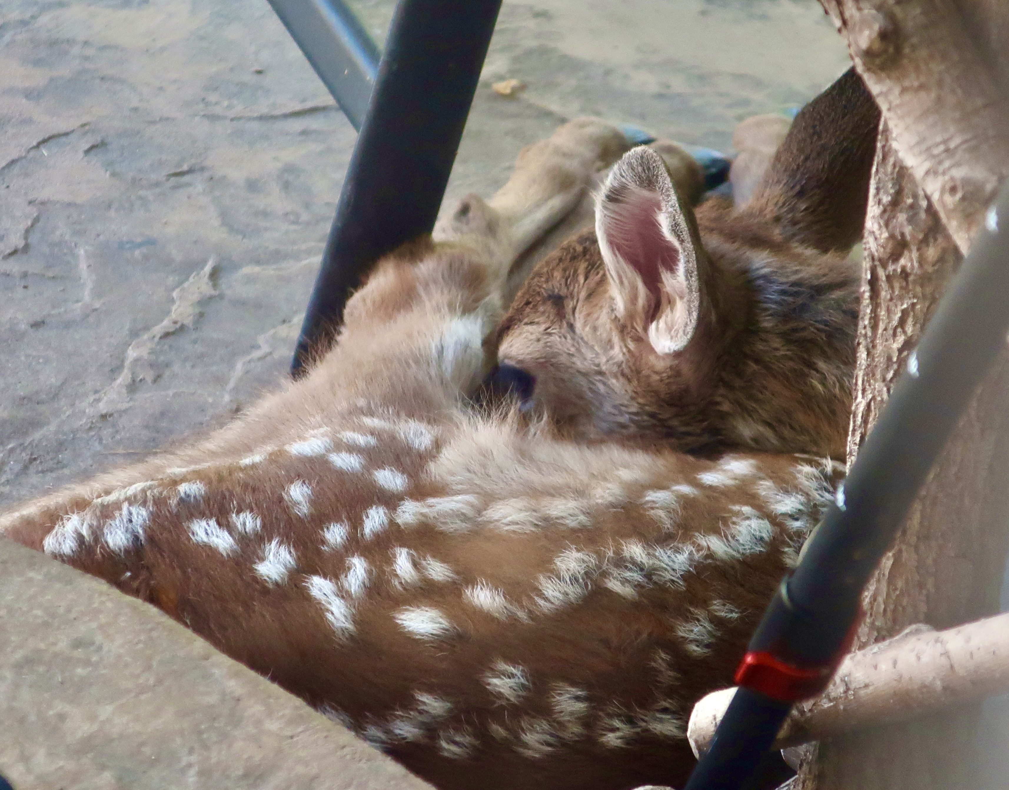
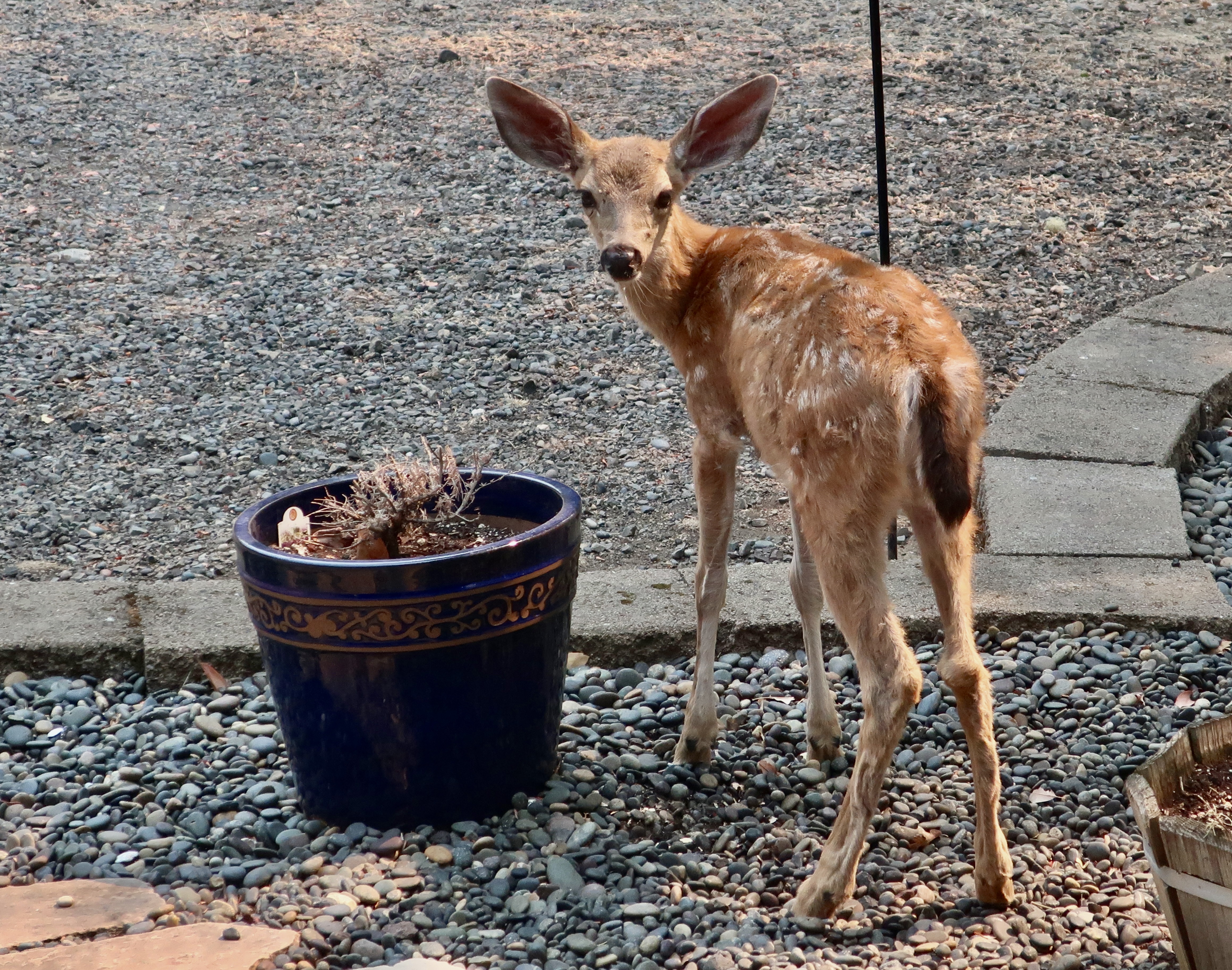
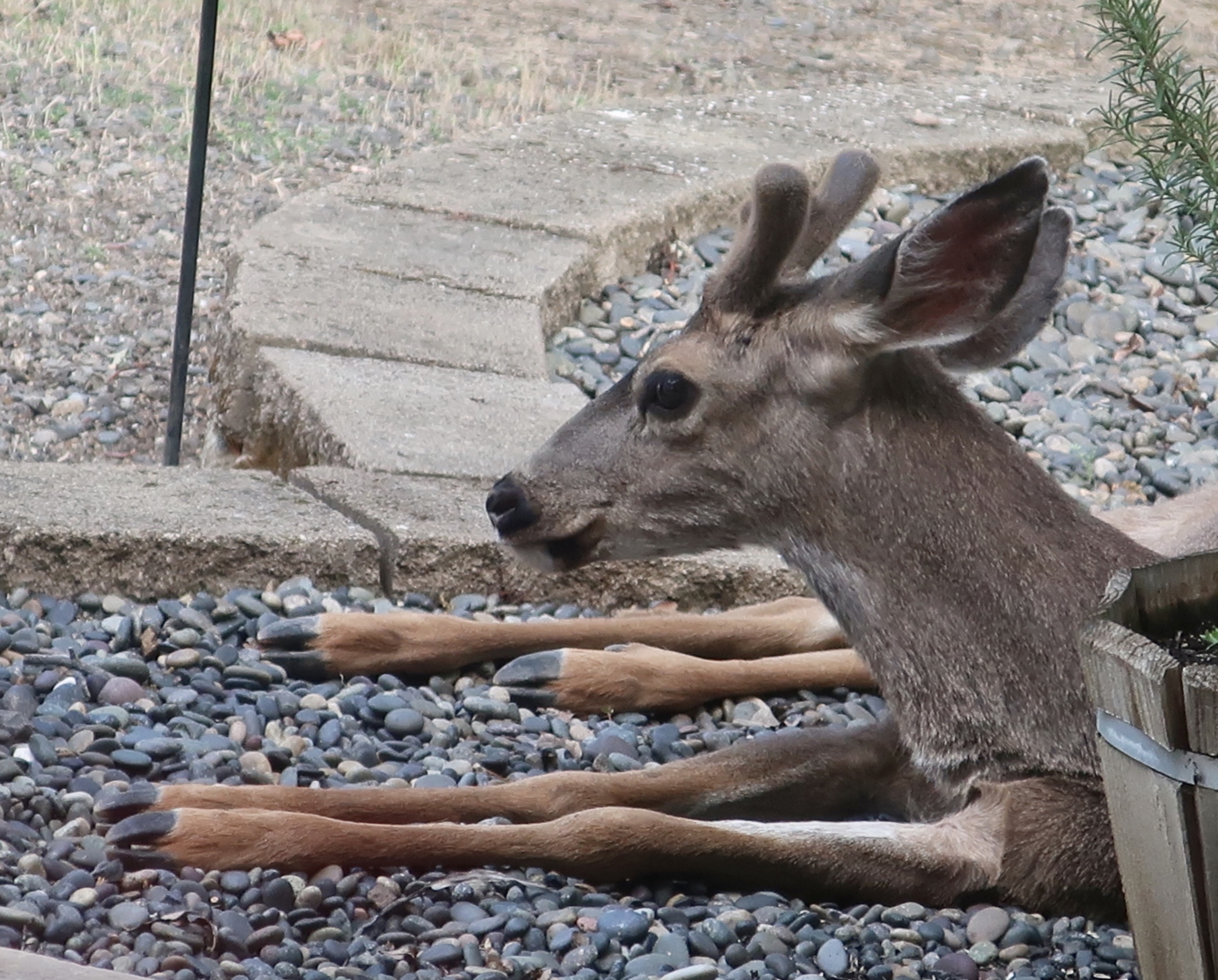
I walked out my door one June day and found this fawn napping next to our doorstep. It was wedged in between the step, a chair, my walking stick, and a natural wood shelf we used for our shoes. One eye was checking me out but it obviously wasn’t worried about my presence. In its short life, it had determined that I was harmless and might indeed be helpful. Mom wasn’t worrying either. She was out browsing (eating) while her baby was sleeping. Our house and yard served as a safety zone for the herd and the cement porch was apparently the safest place in the yard, considering how often it was used as a day bed. Hunters weren’t allowed on our property and natural predators of the deer such as bears and cougars tended to avoid it— for the most part.This was the first time we saw this youngster. Mom was performing some hygiene with her tongue while the baby ate. Grooming is common among deer and is one way they maintain close ties. We’ve watched adult deer simultaneously groom each other.
Fawns on our property were normally born in April or May, hidden away by the doe, and sternly instructed to stay put and not move when she was away eating for the first 2-3 weeks. The spots they are born with serve as natural camouflage making the fawns extremely difficult to see. They are also scentless when born, making them impossible to smell.
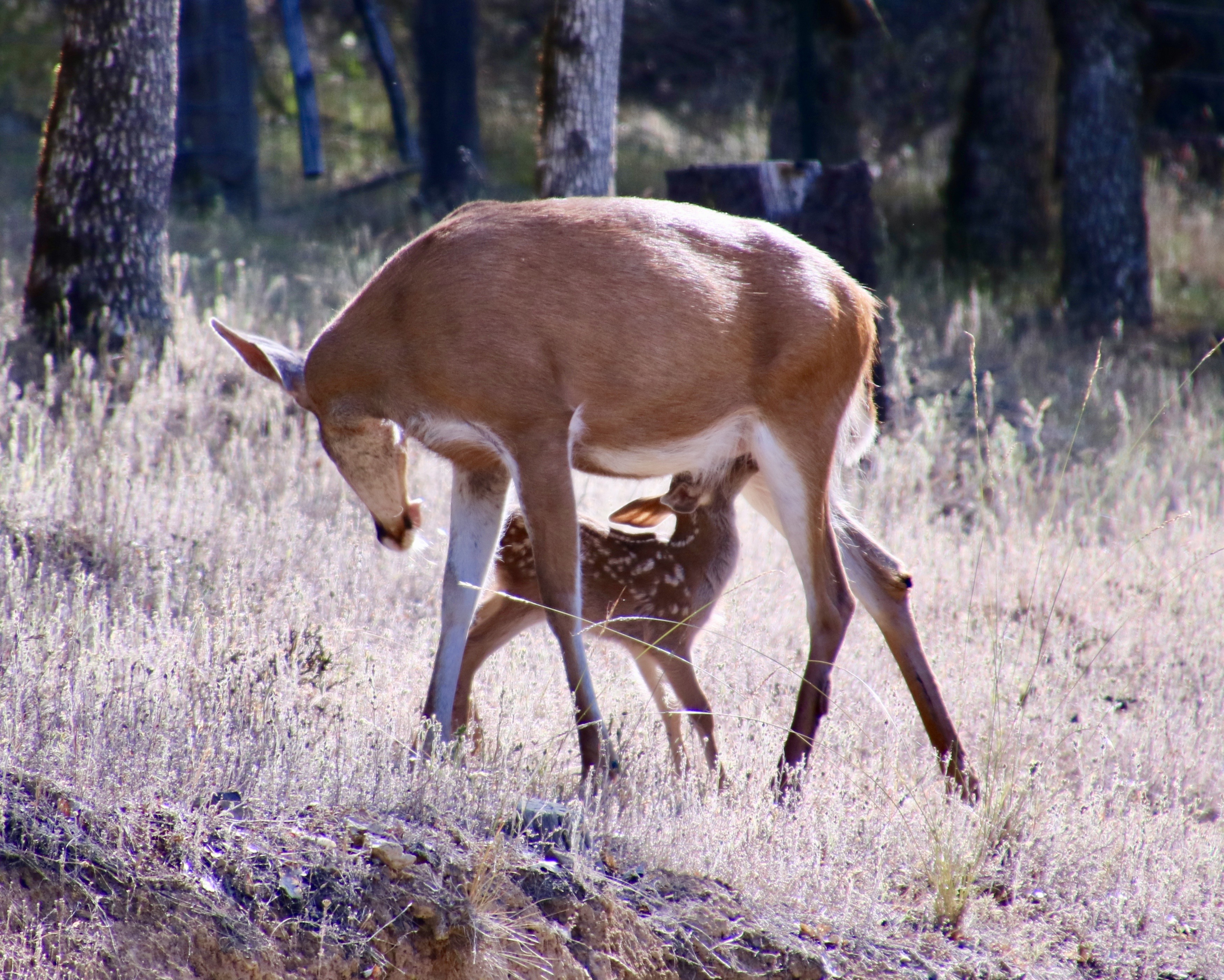
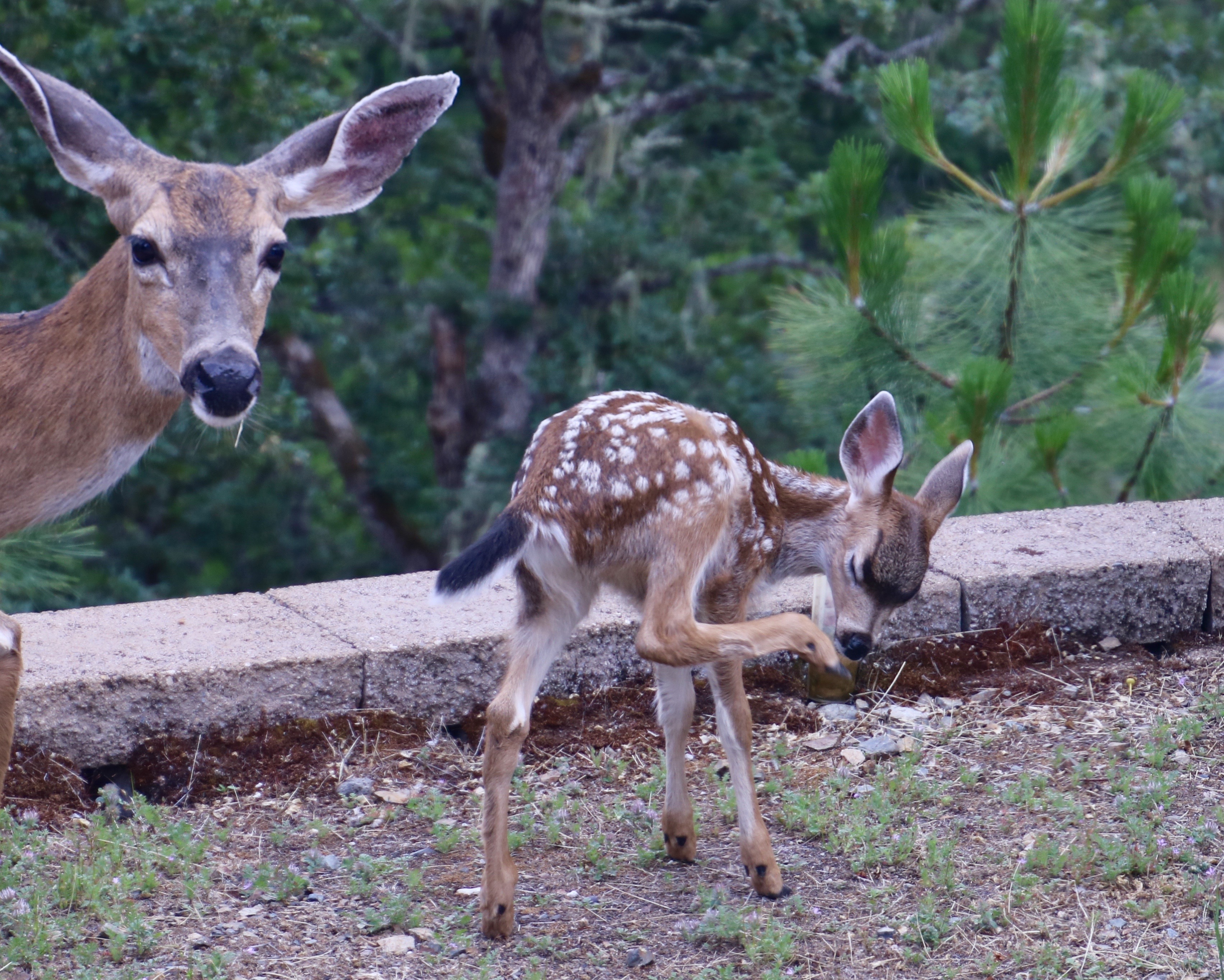
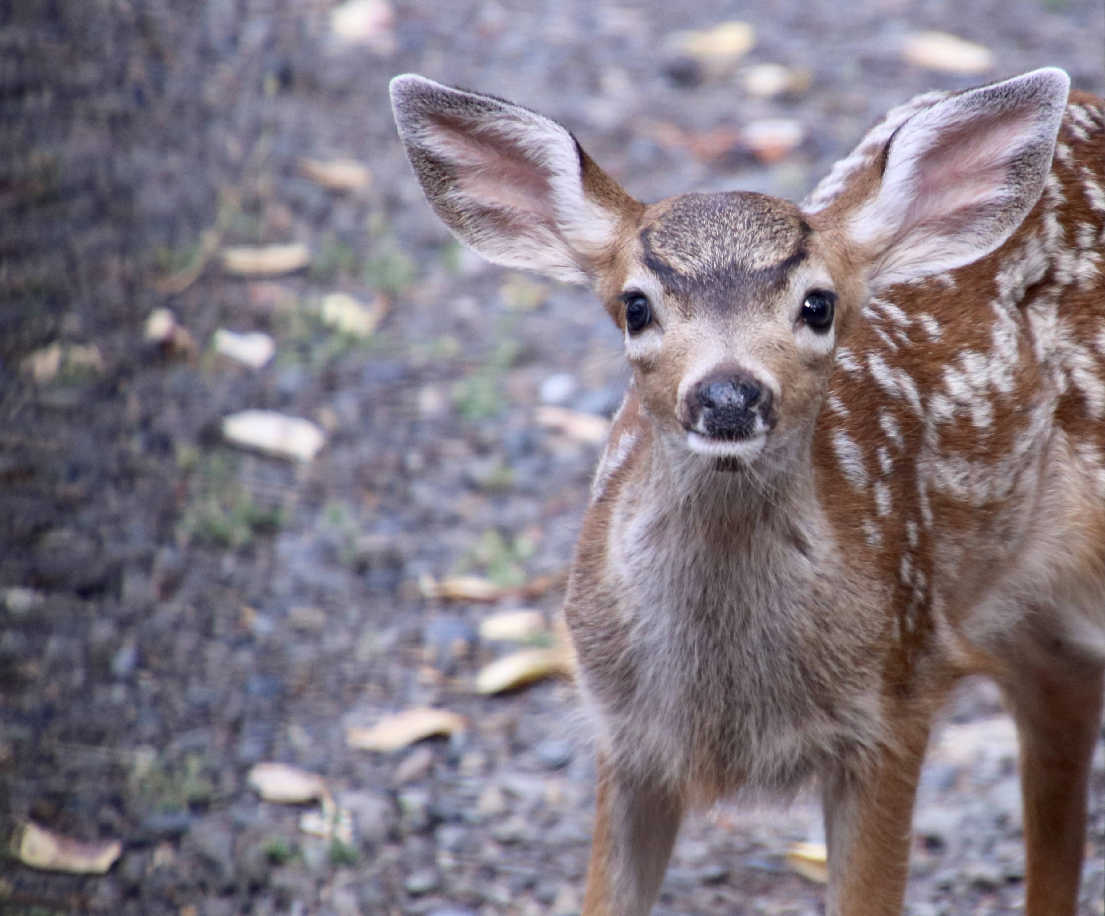
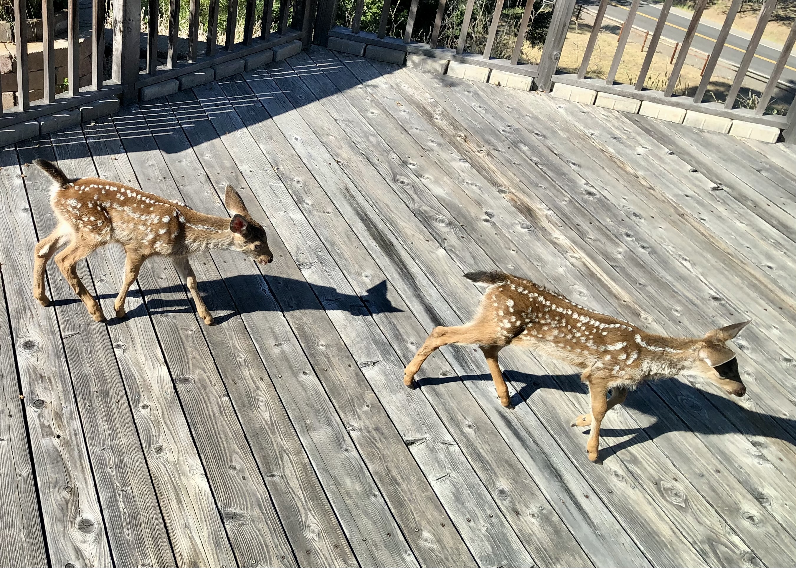
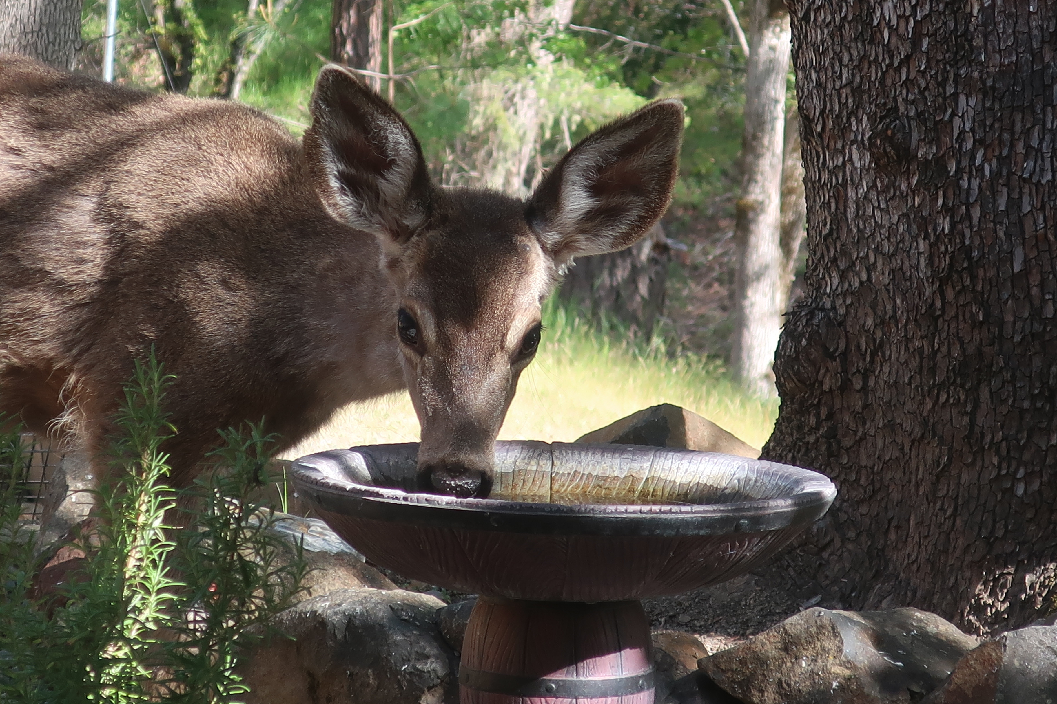
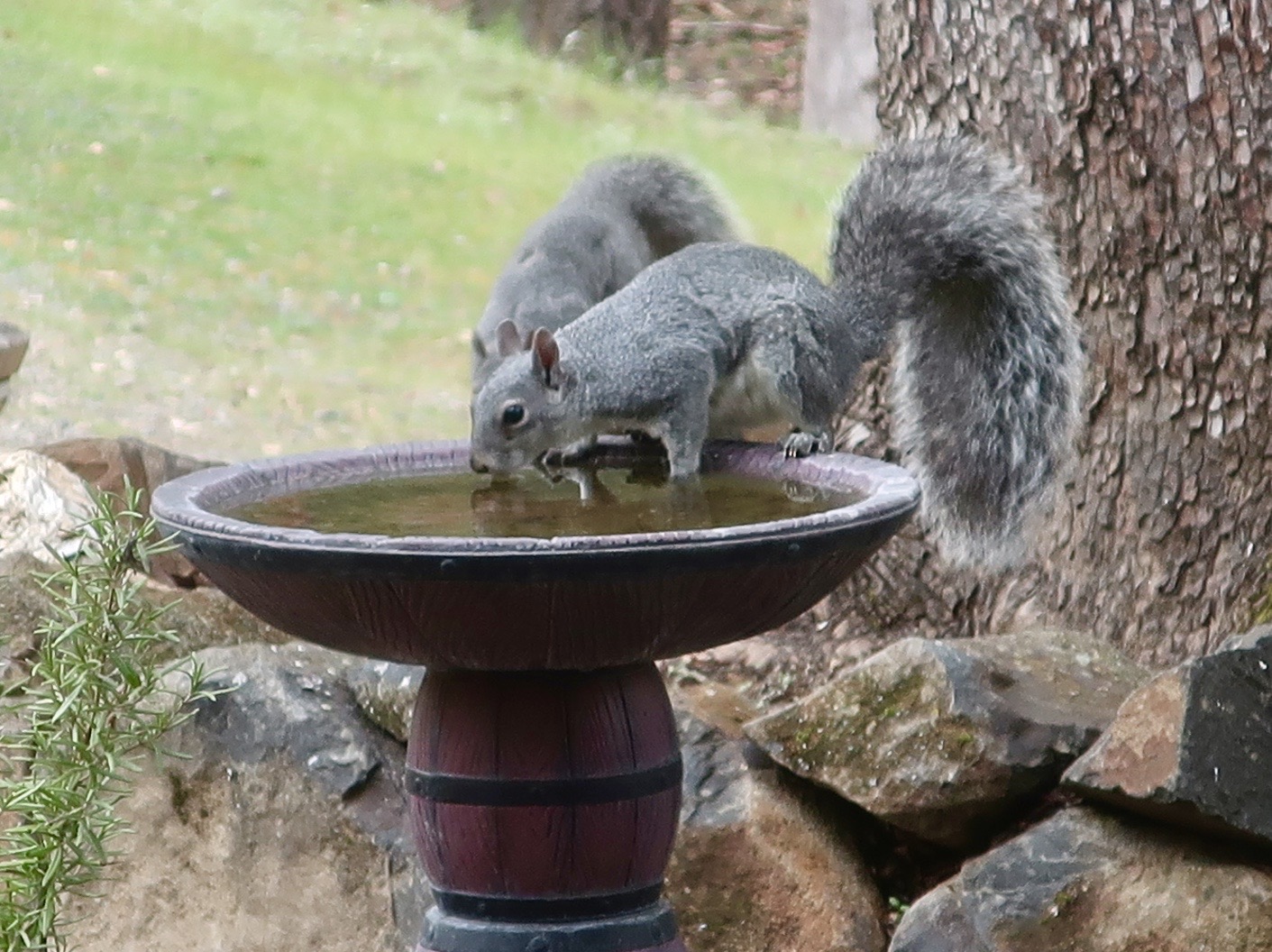
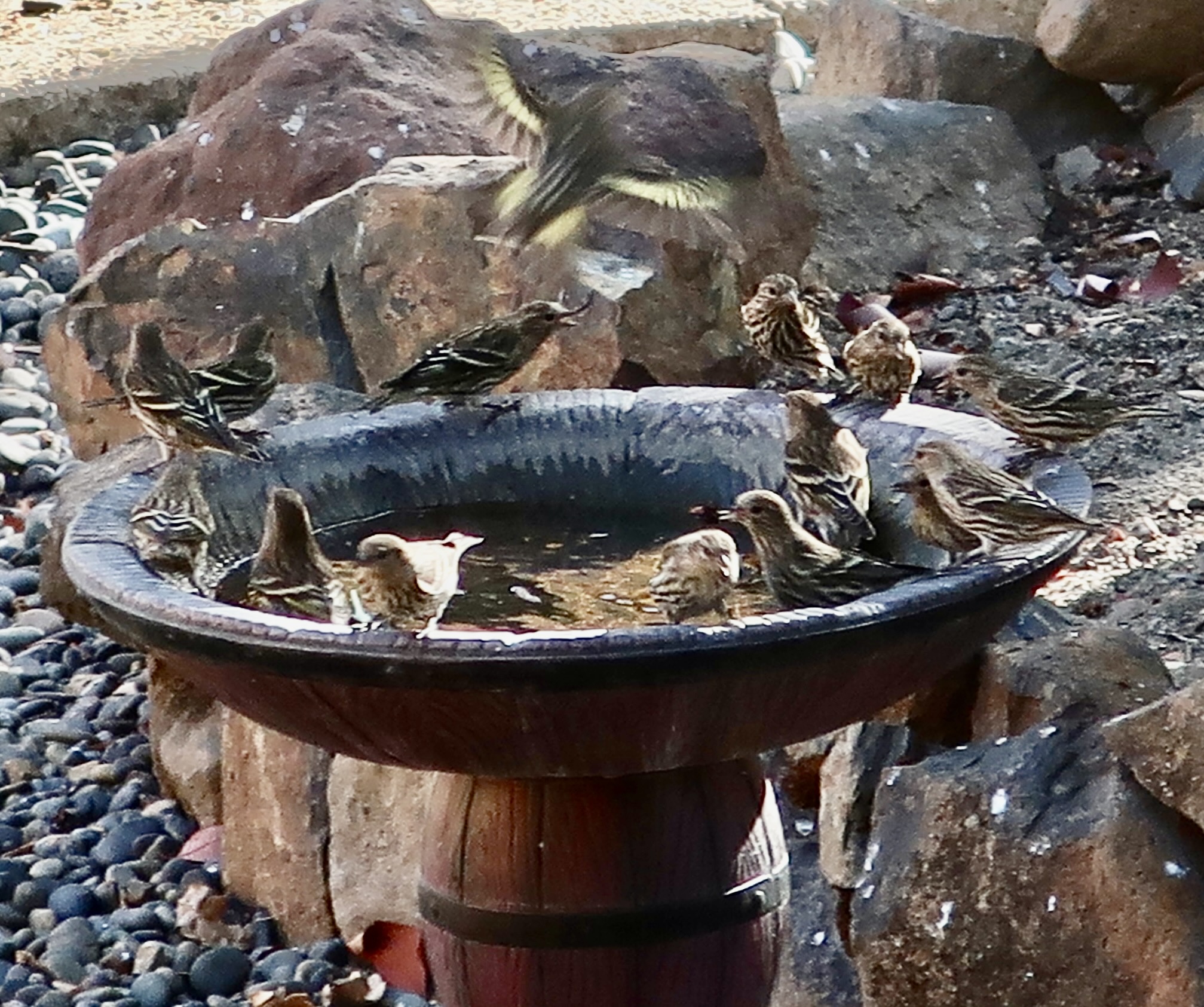
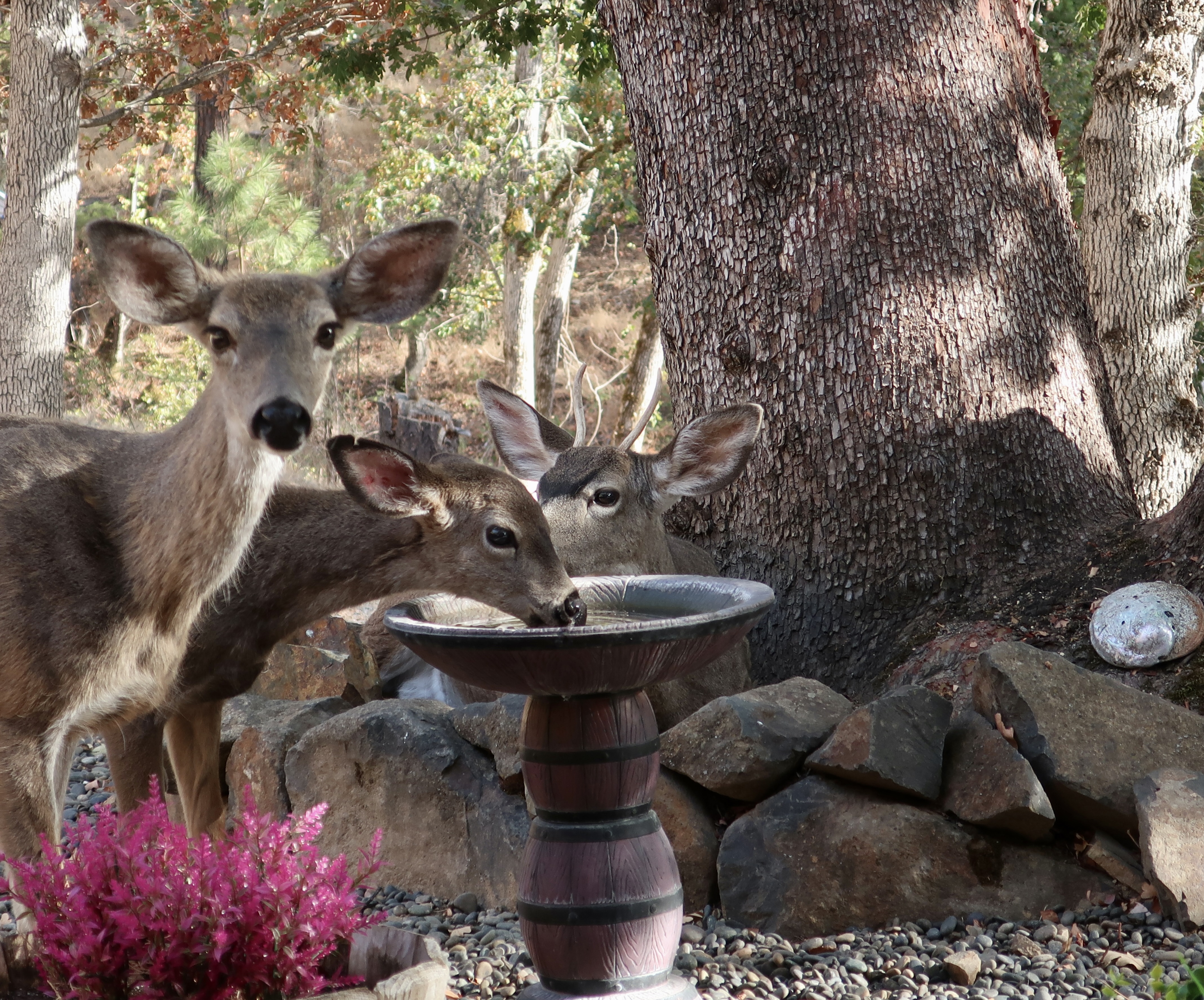
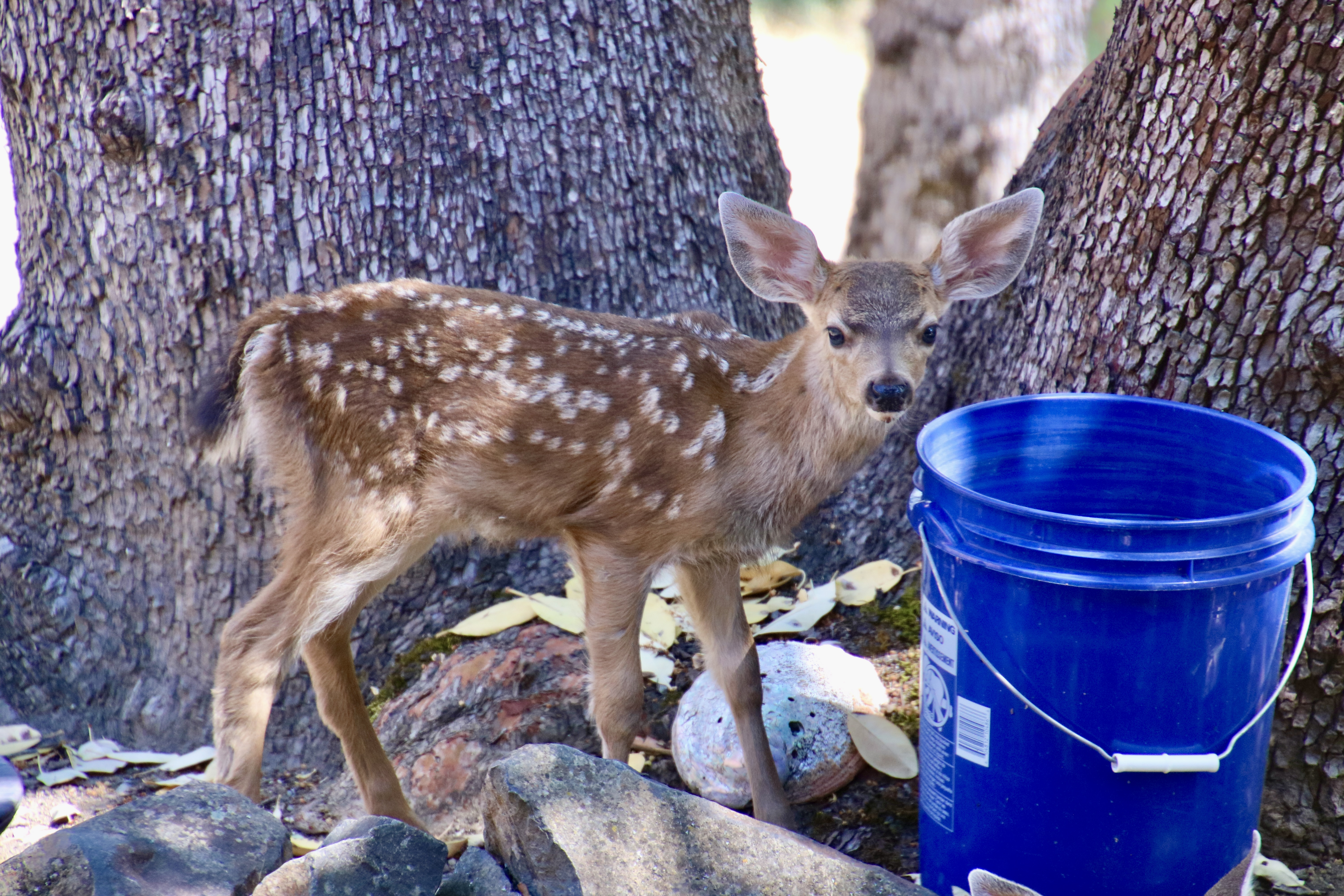
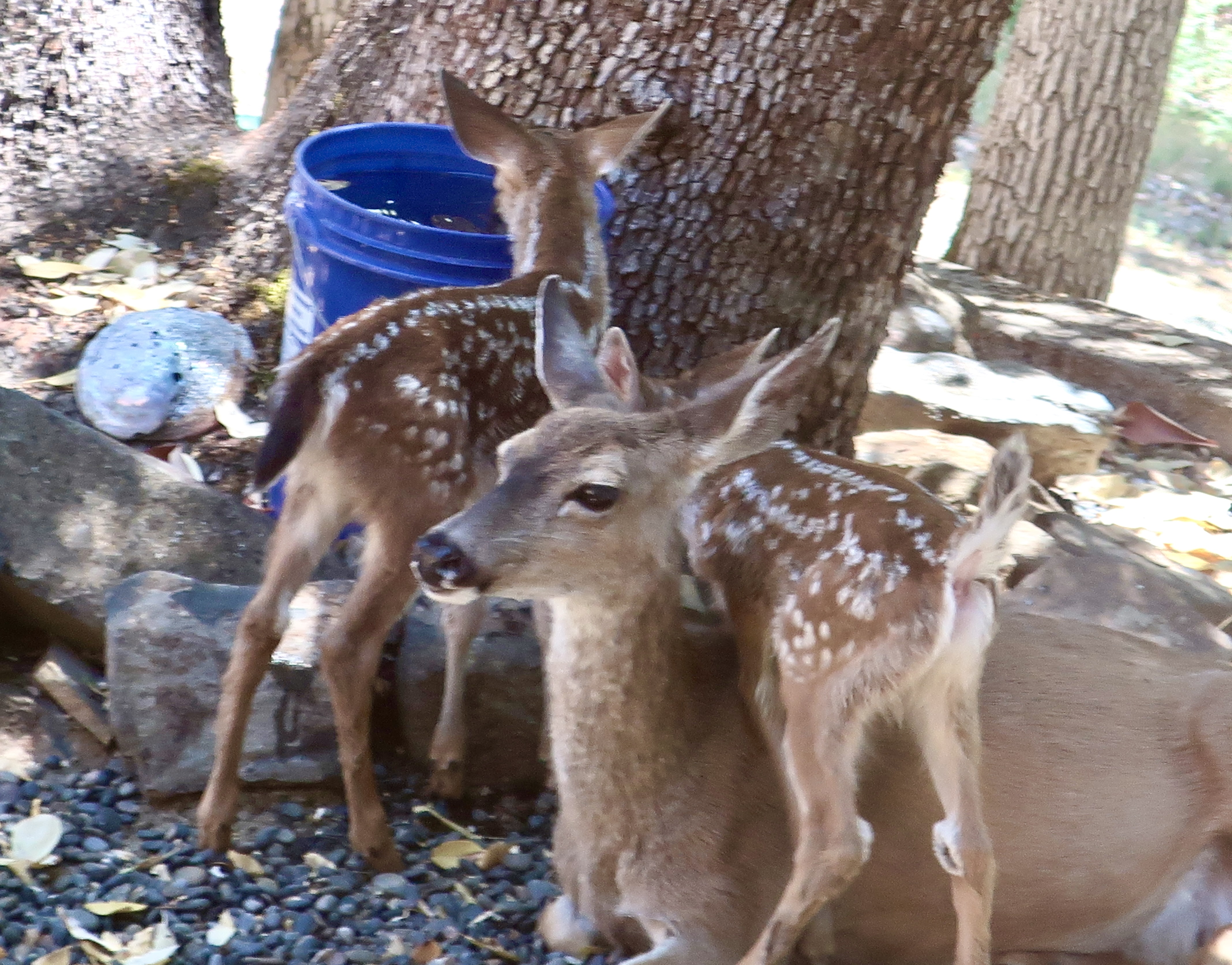
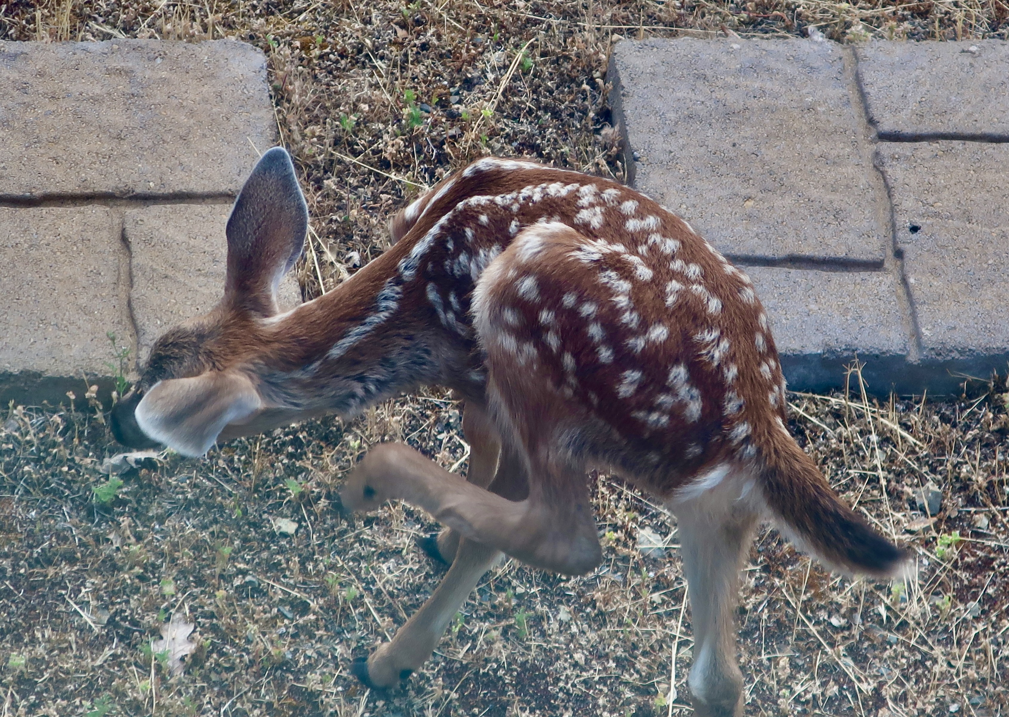
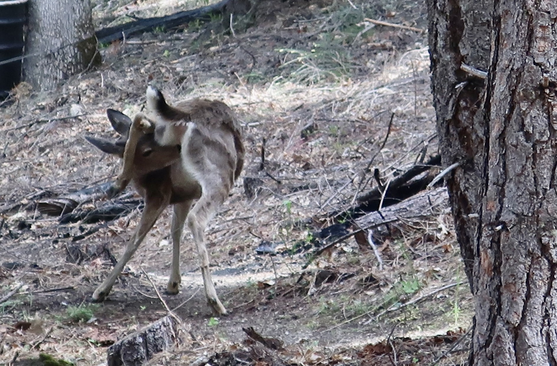
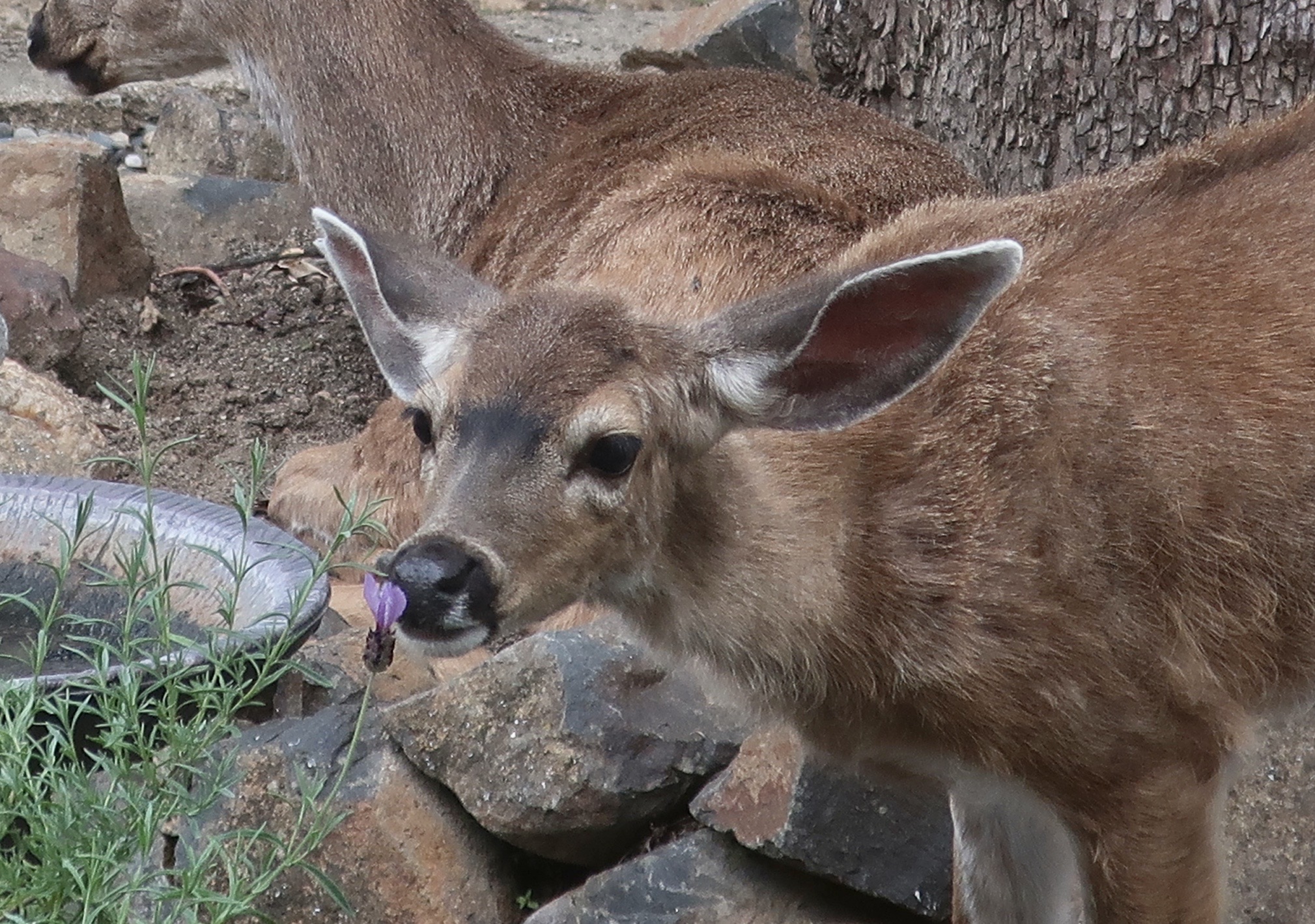
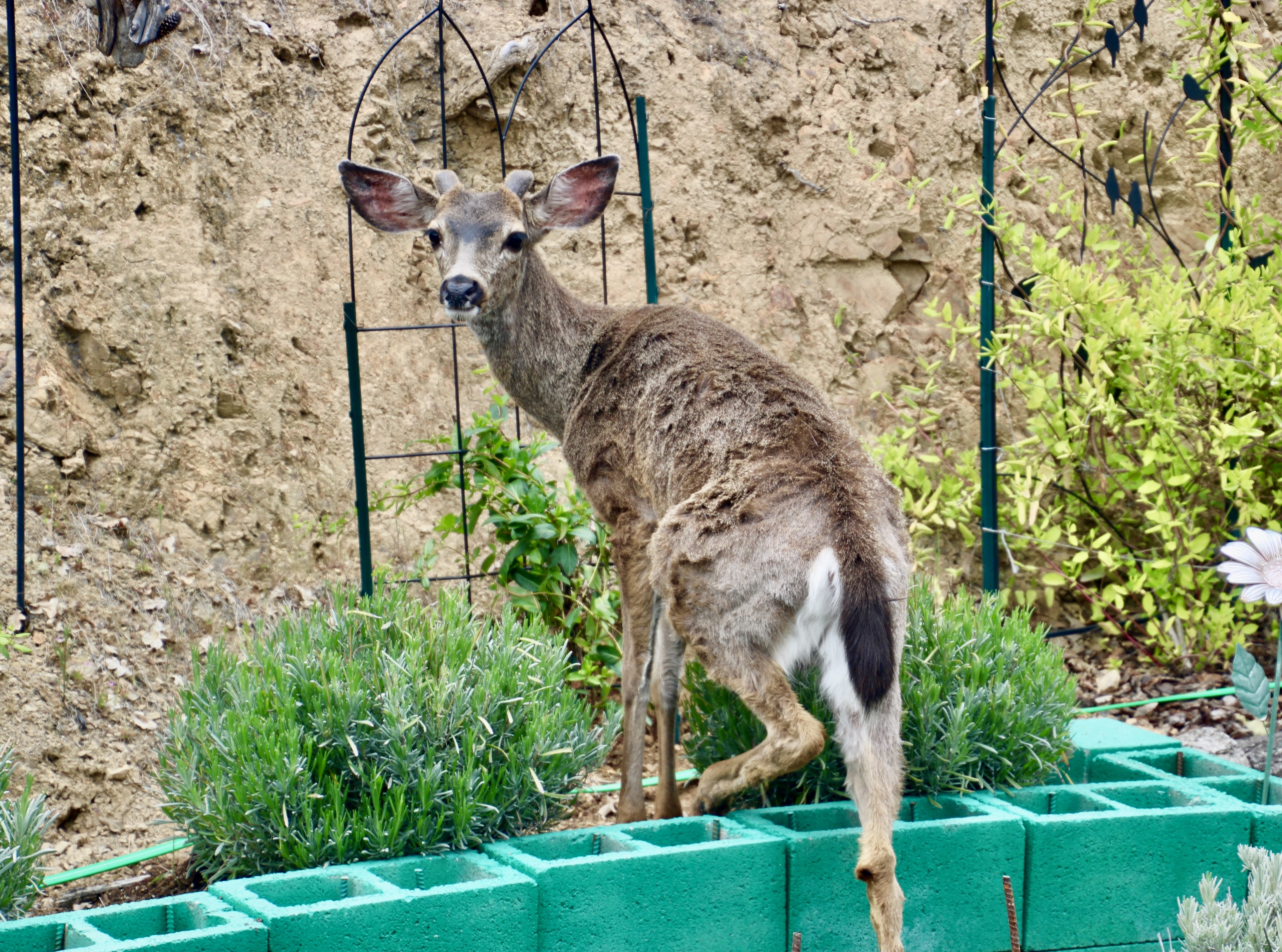
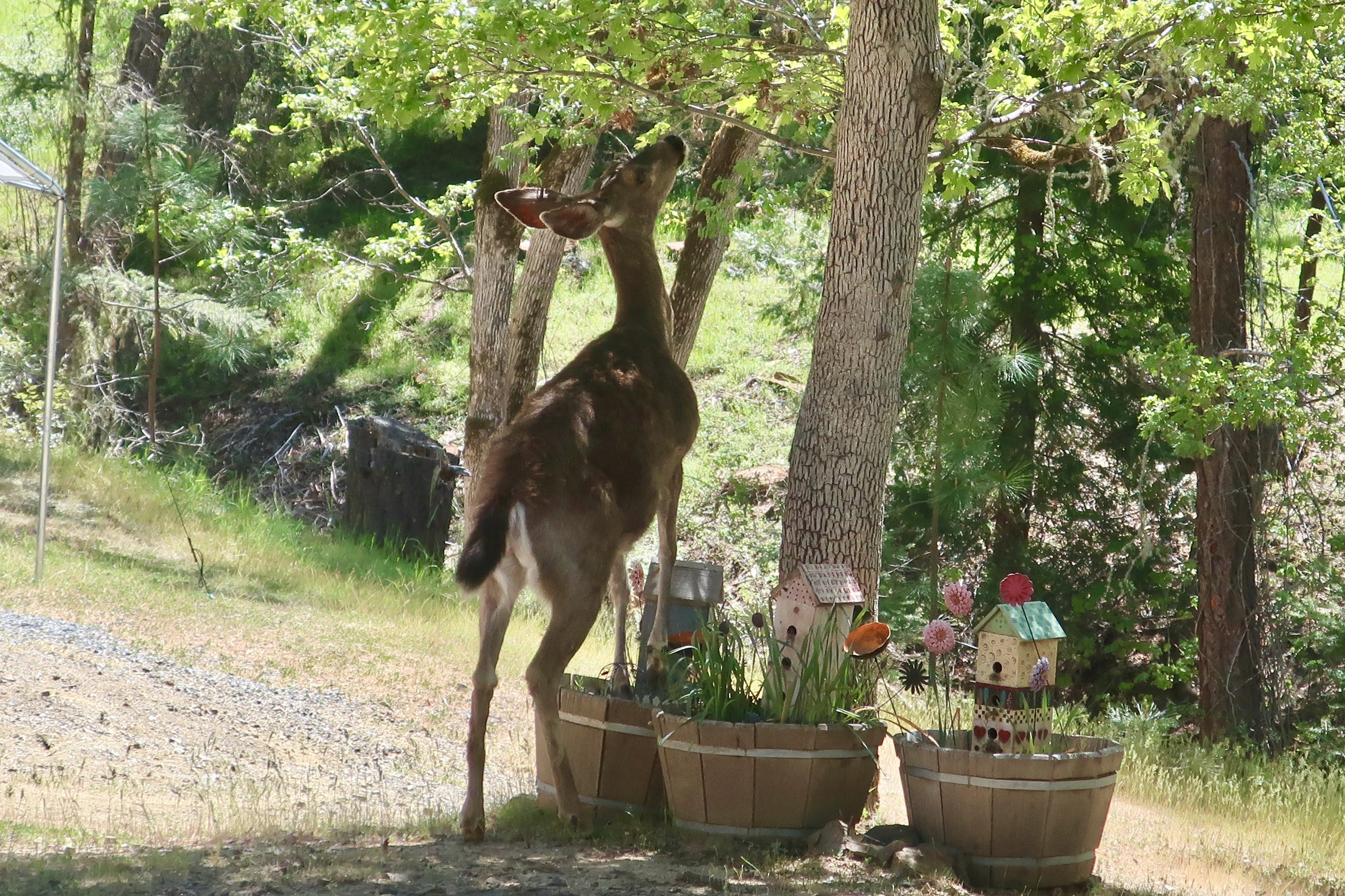
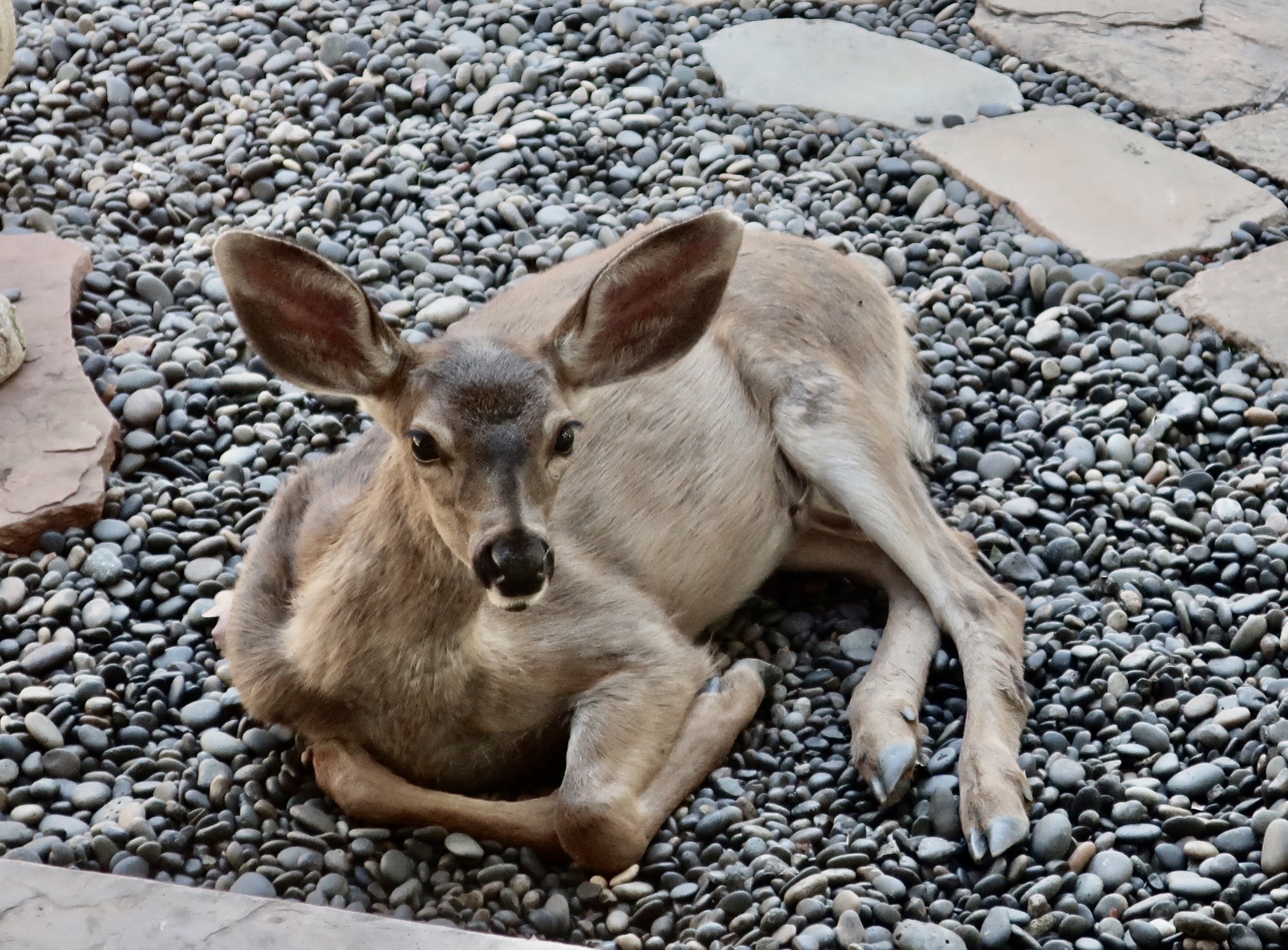
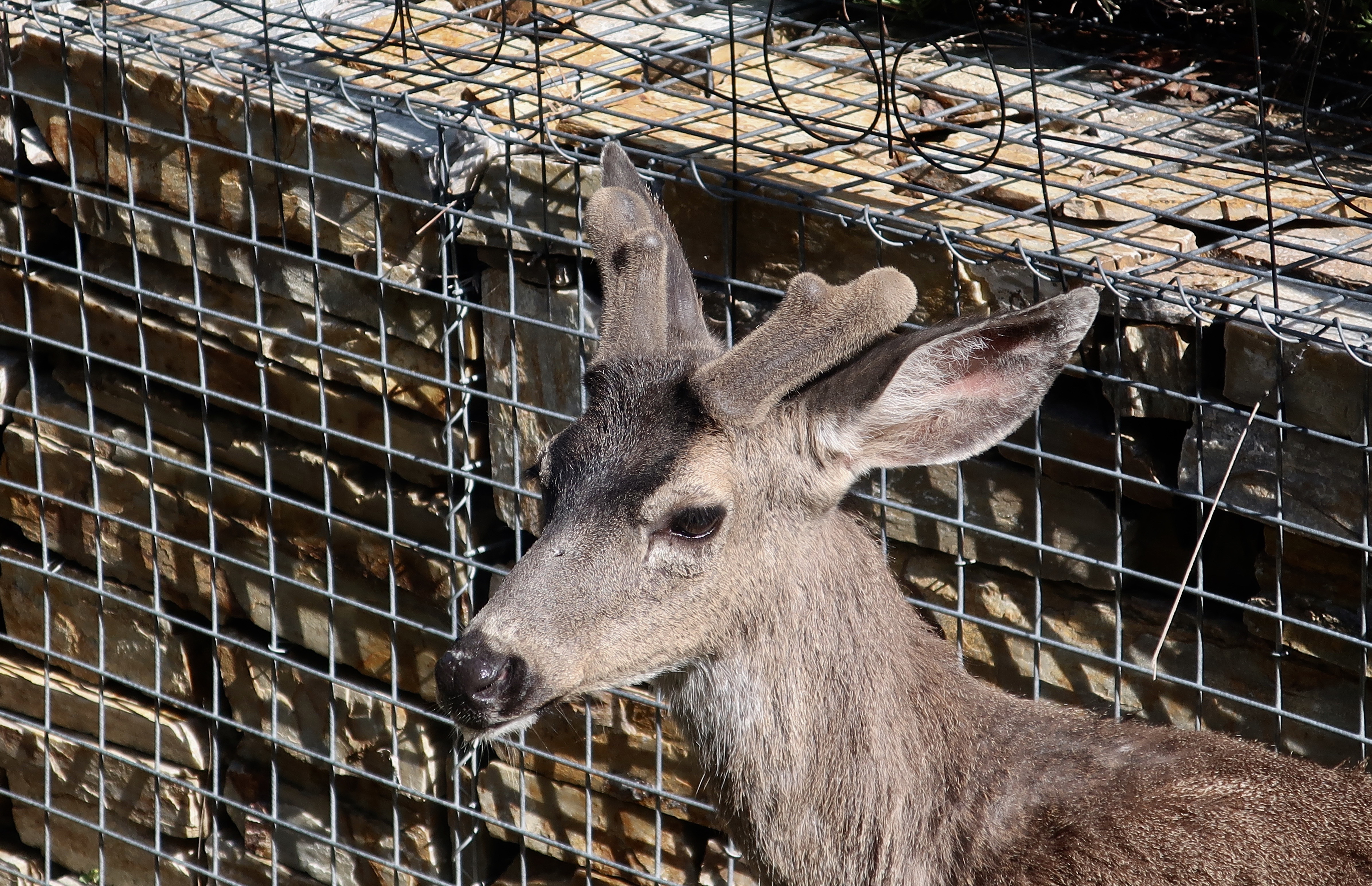
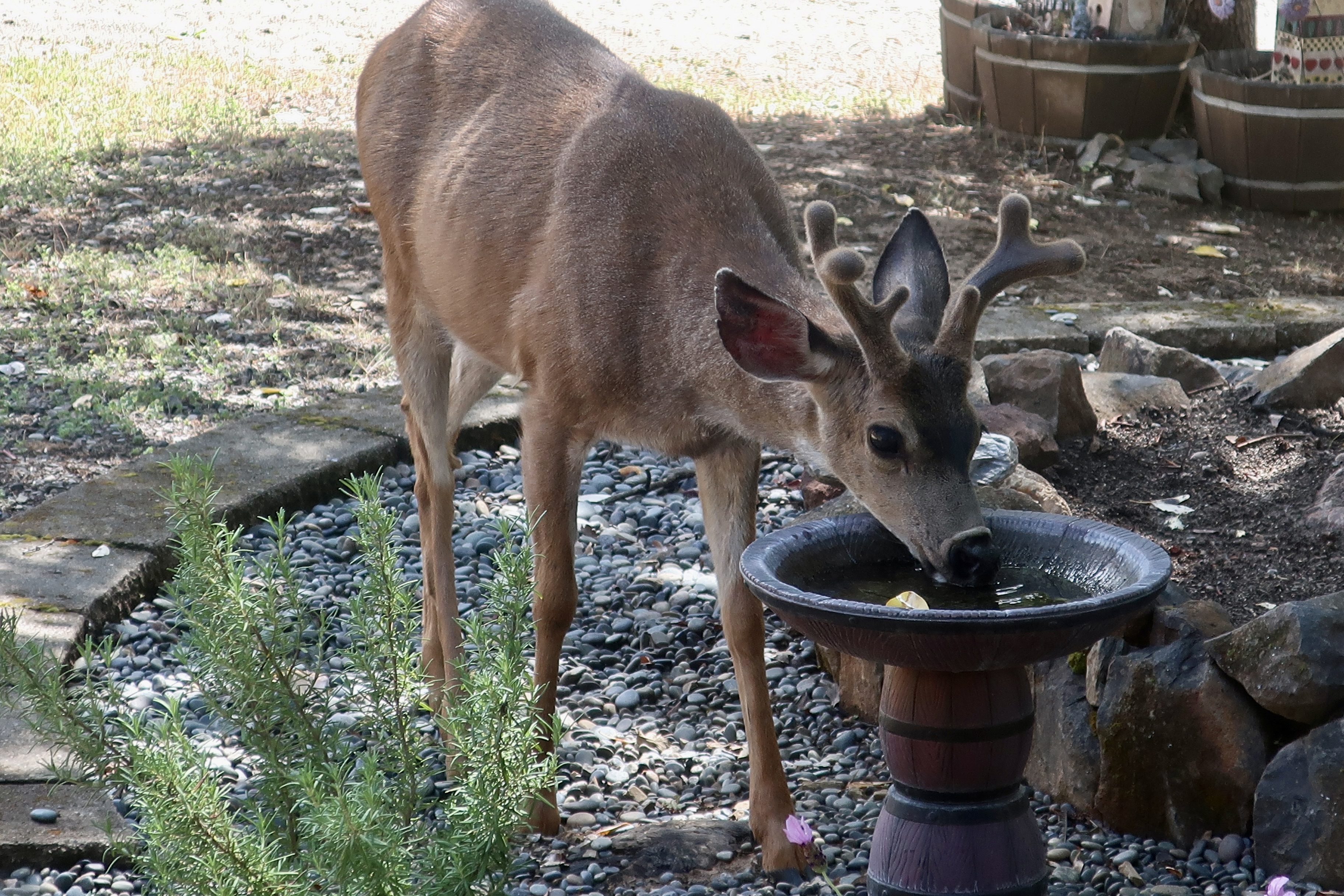
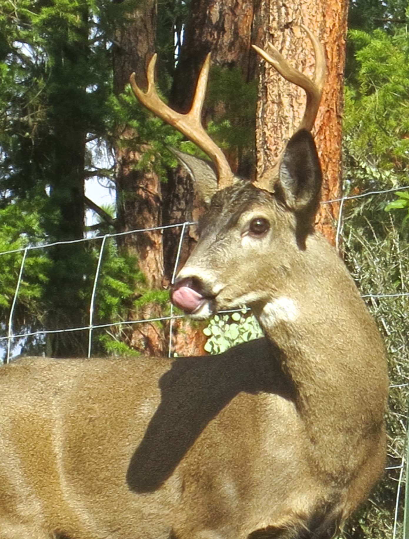
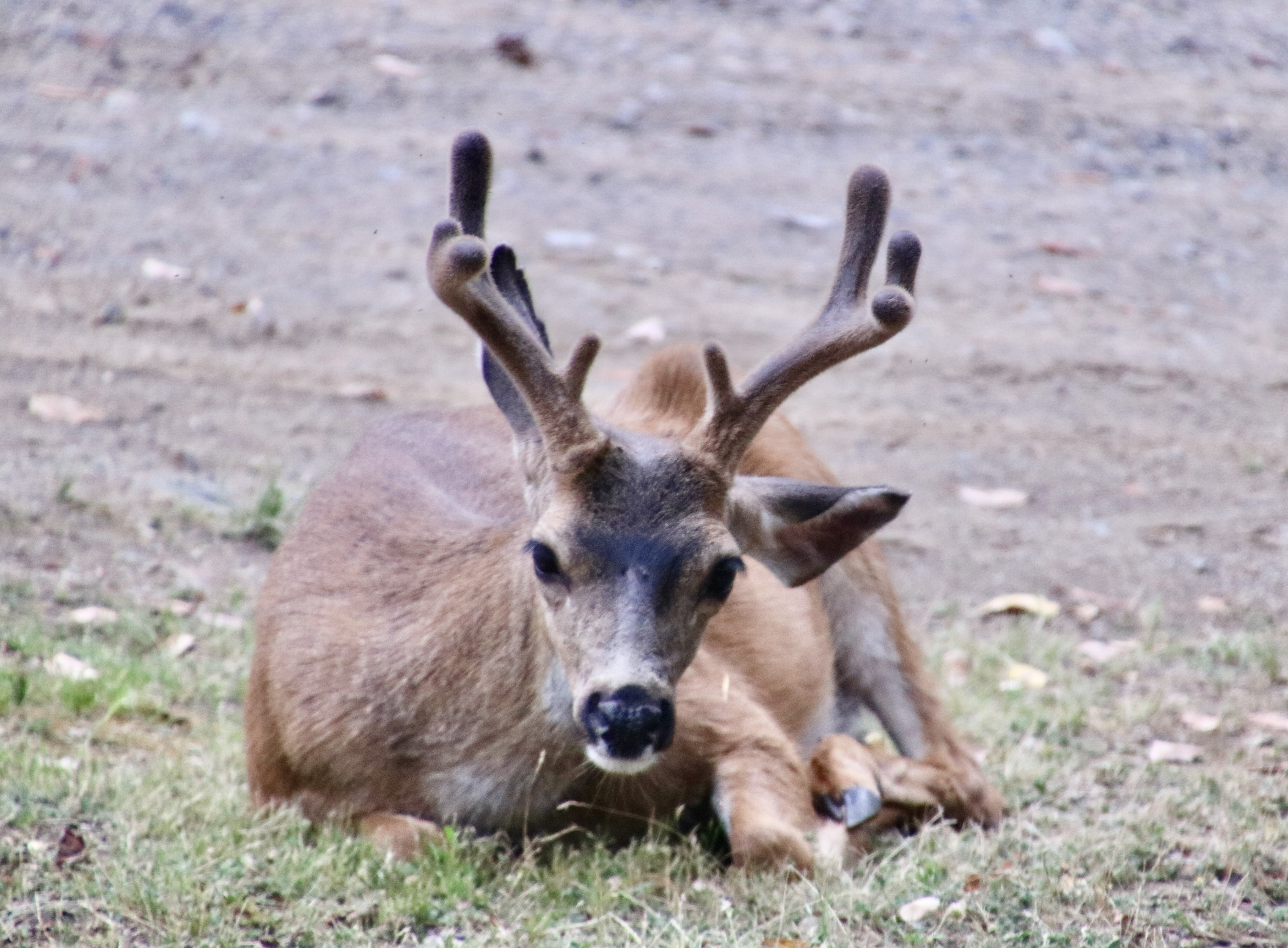
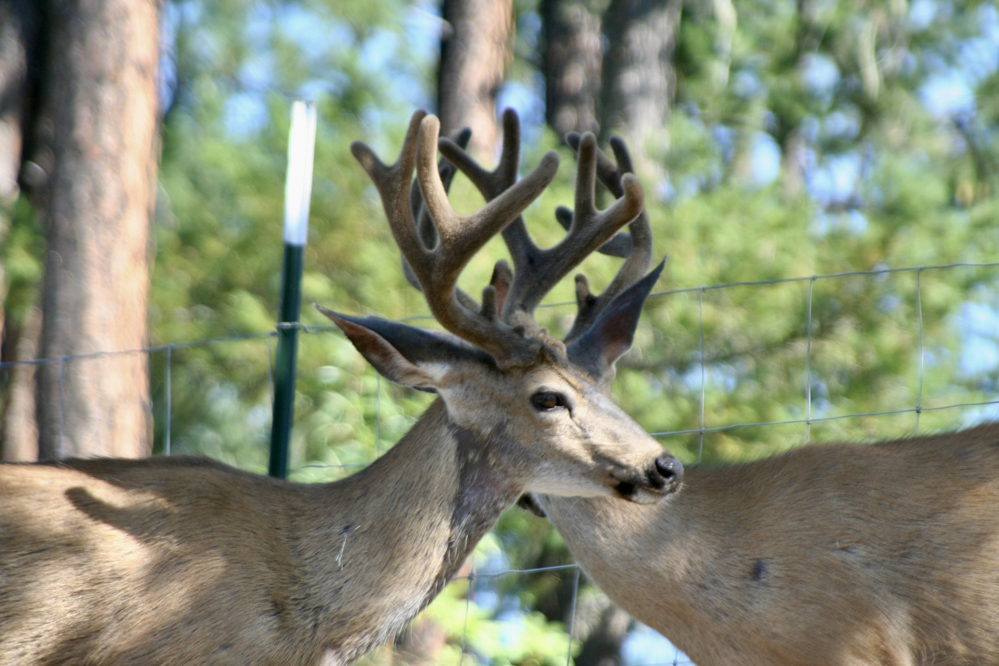
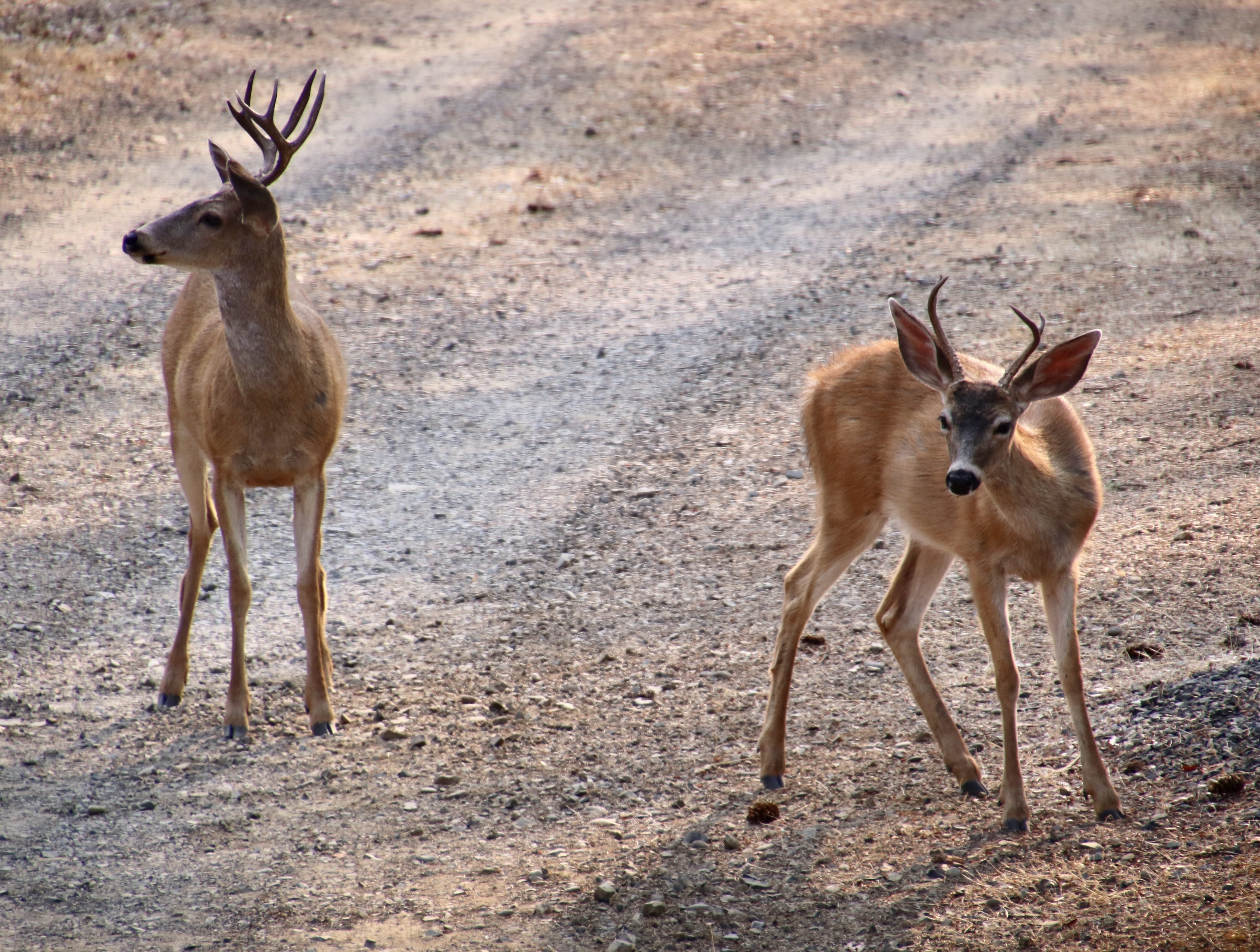
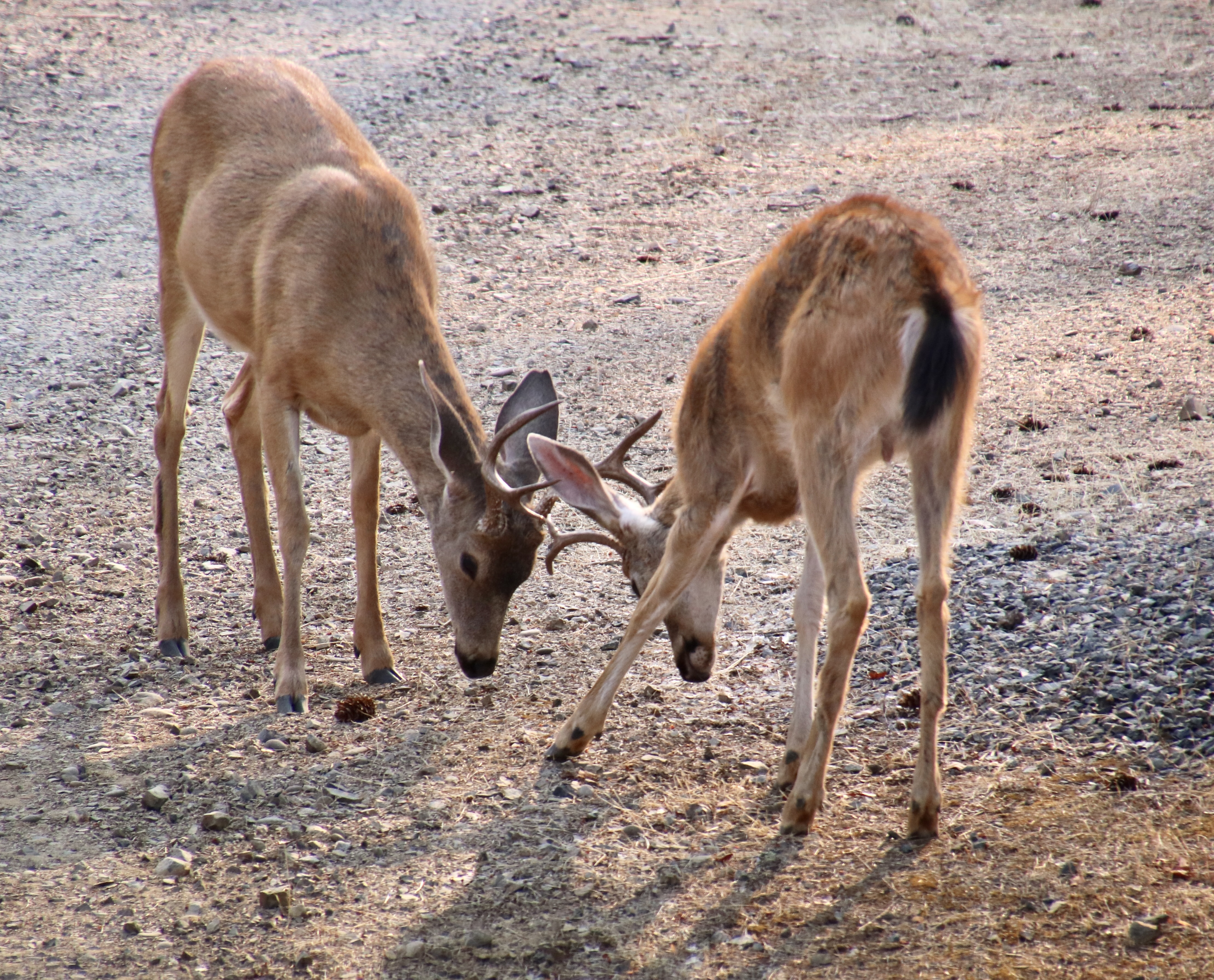
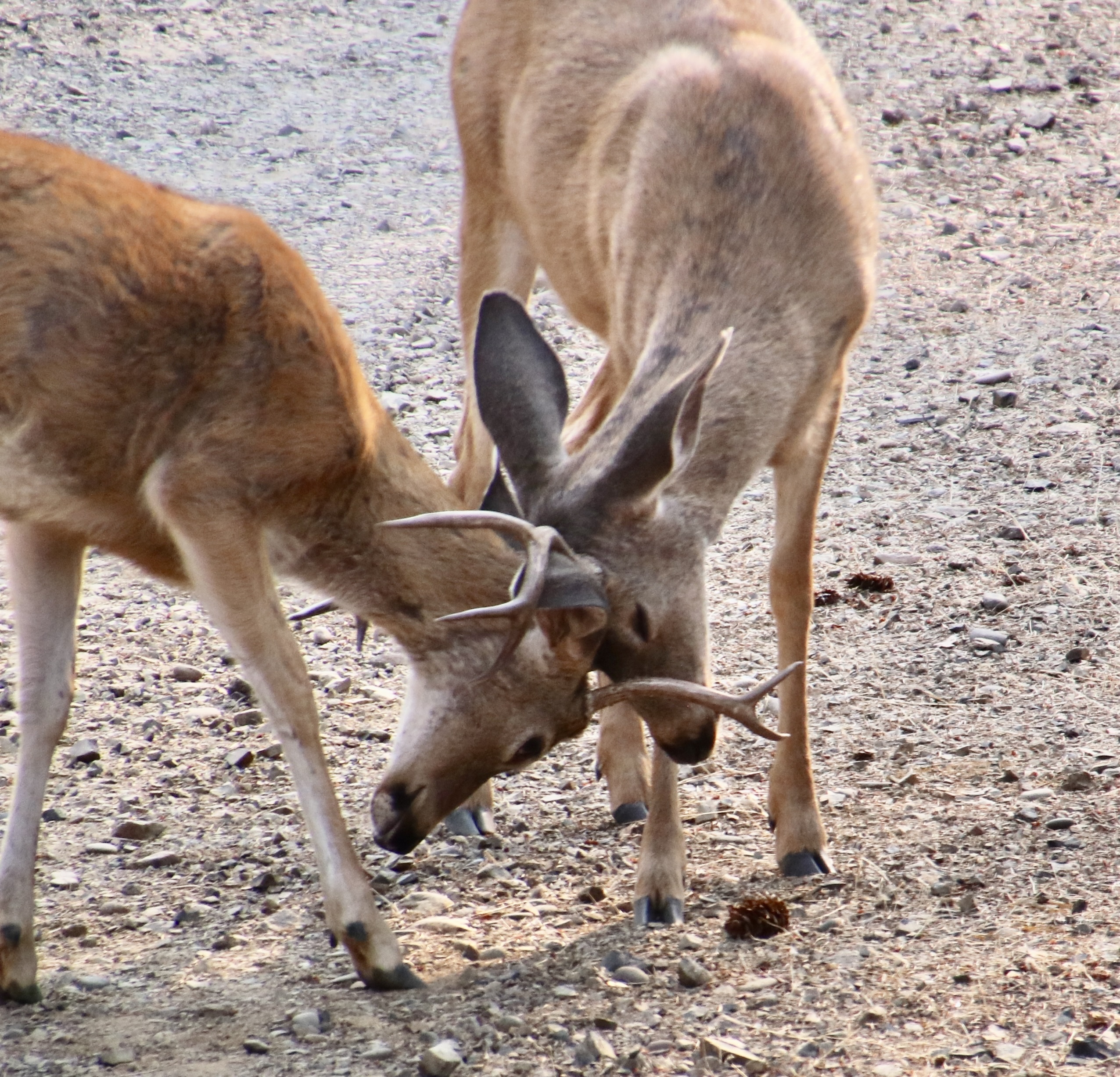
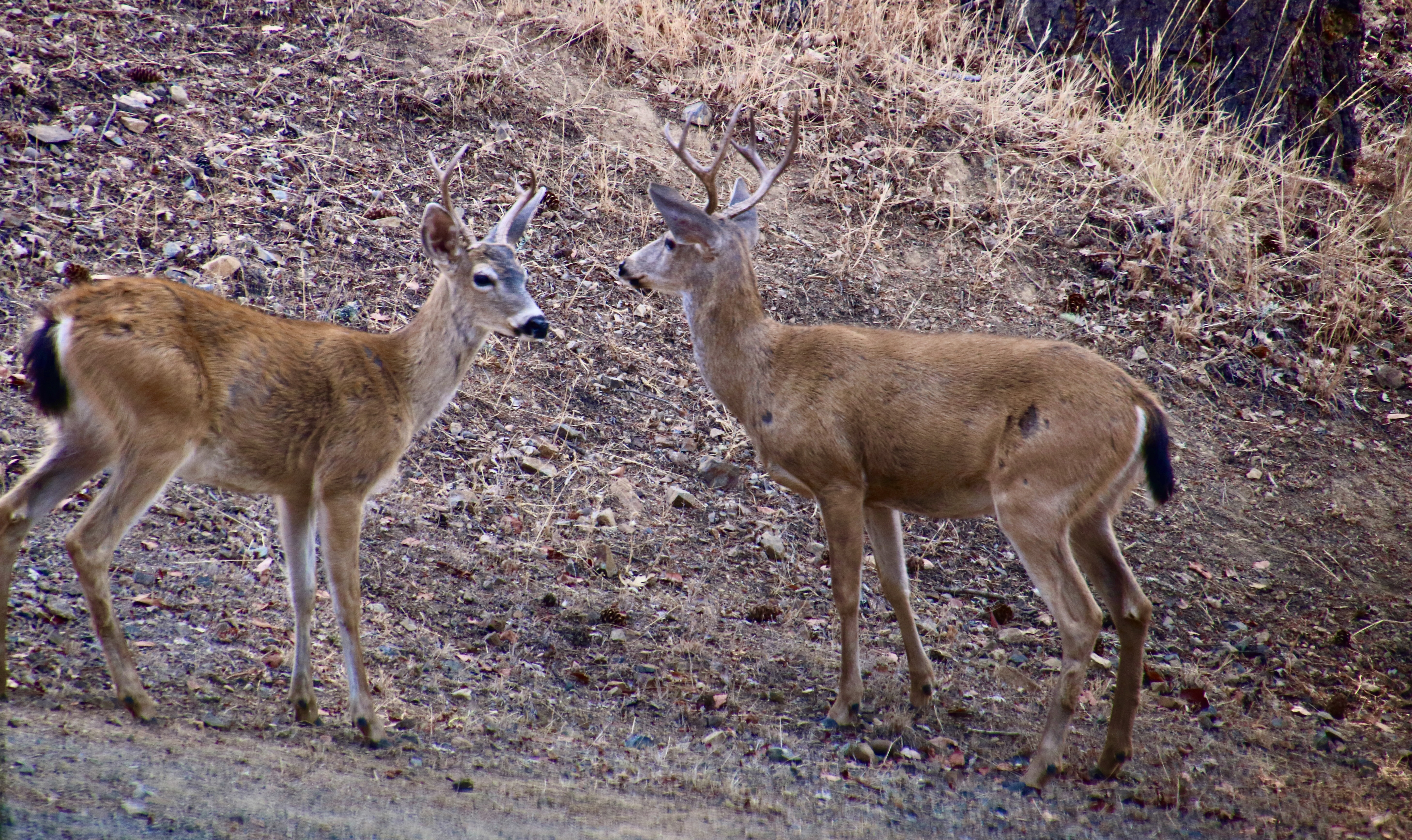
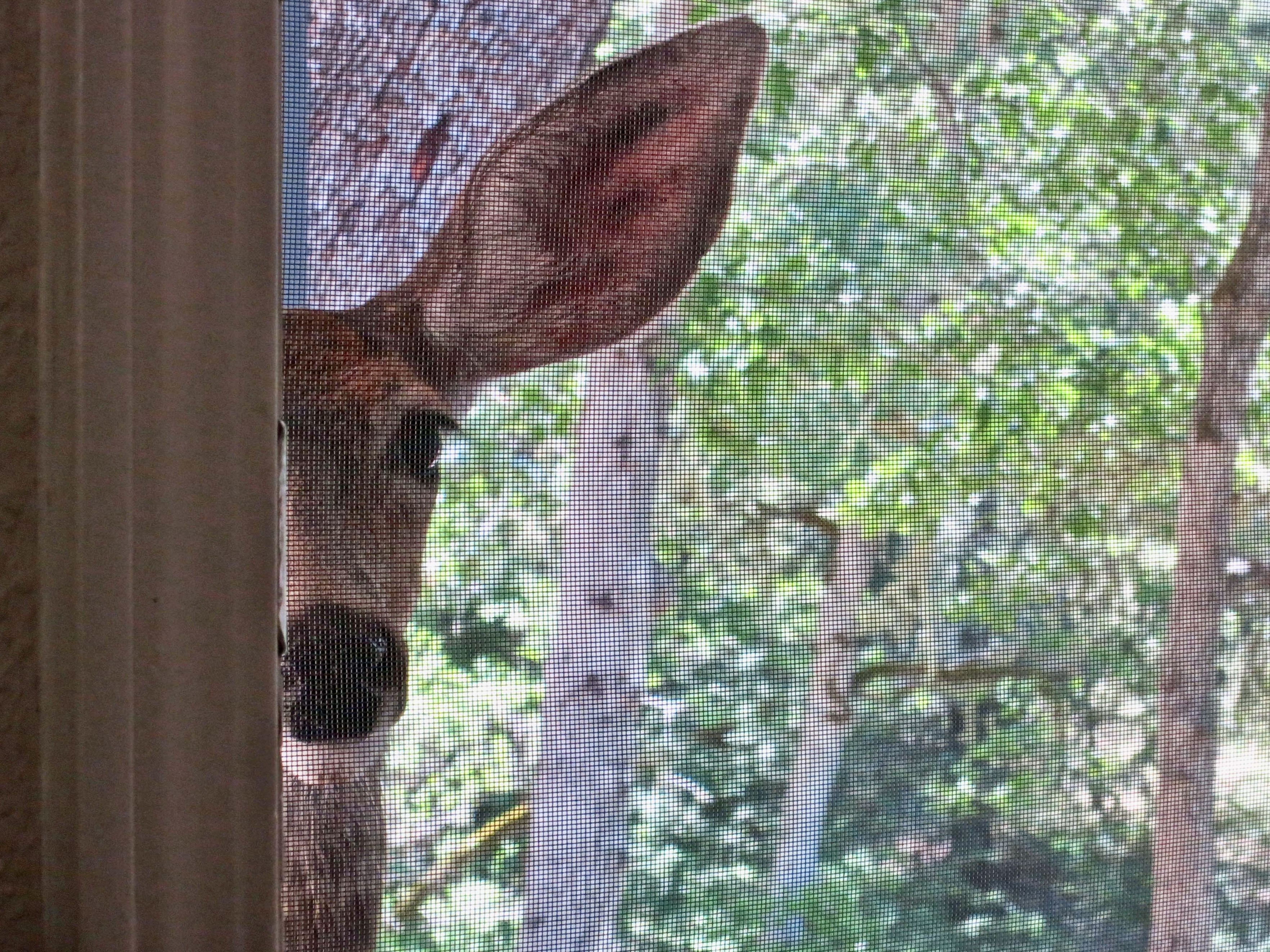
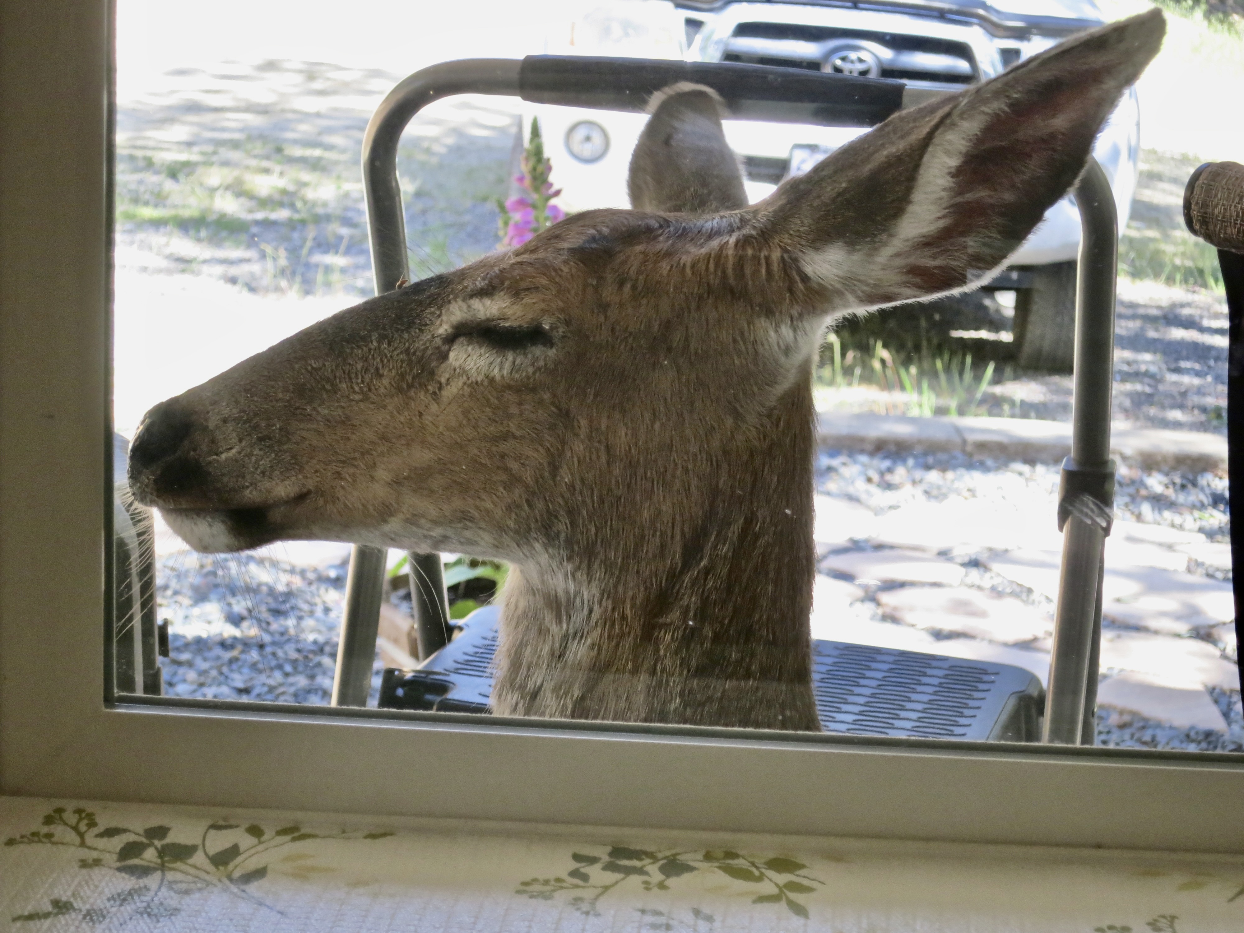
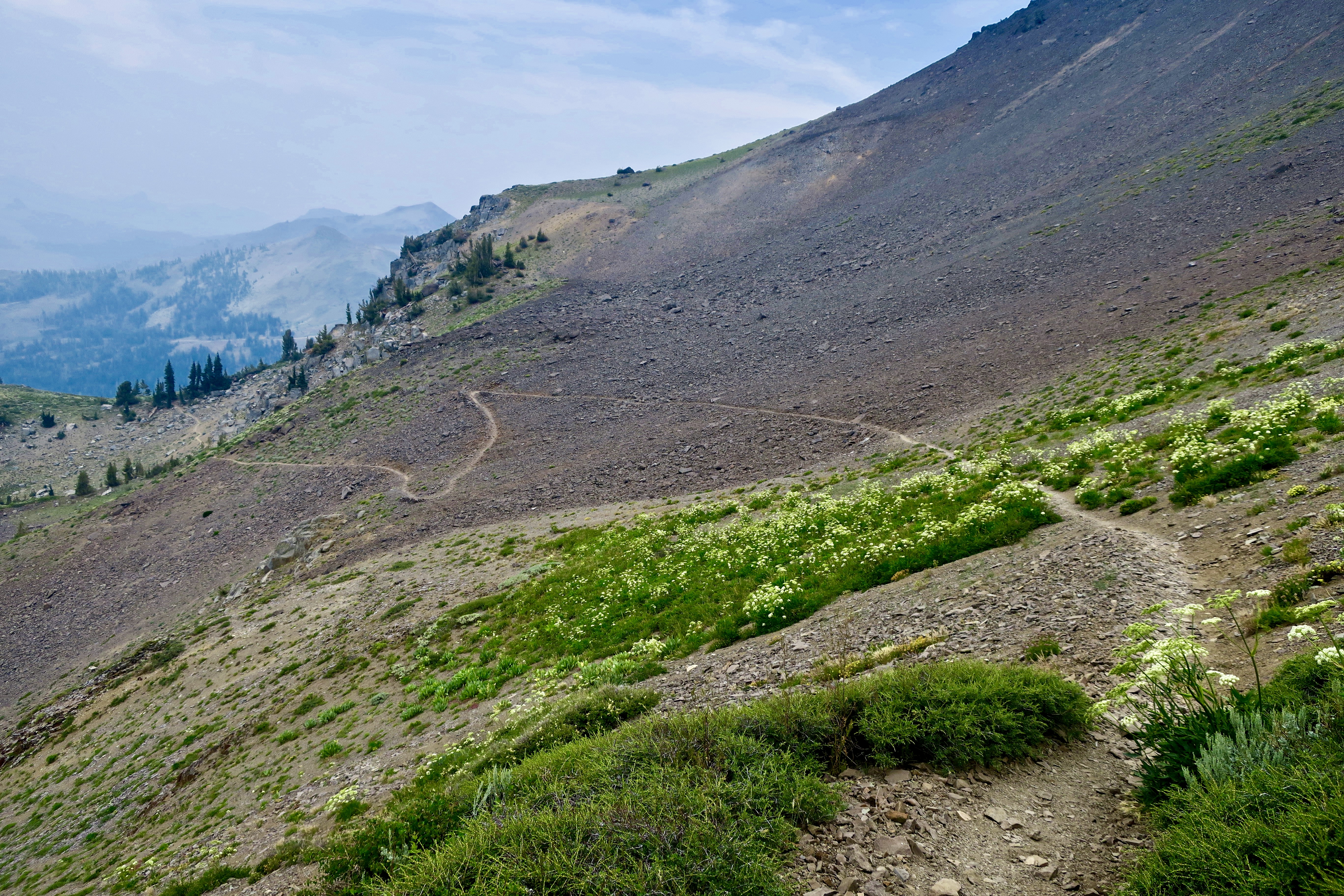
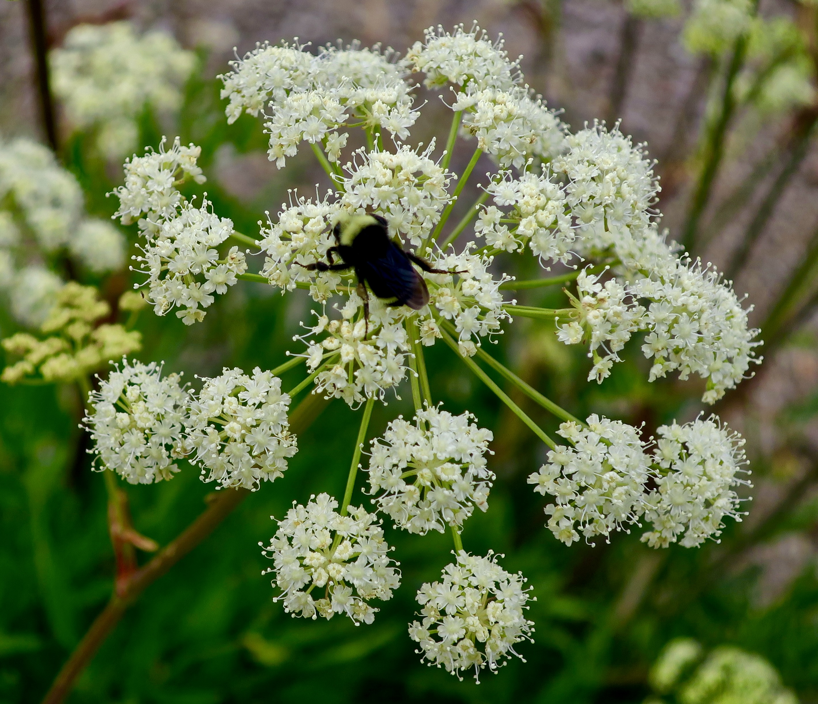
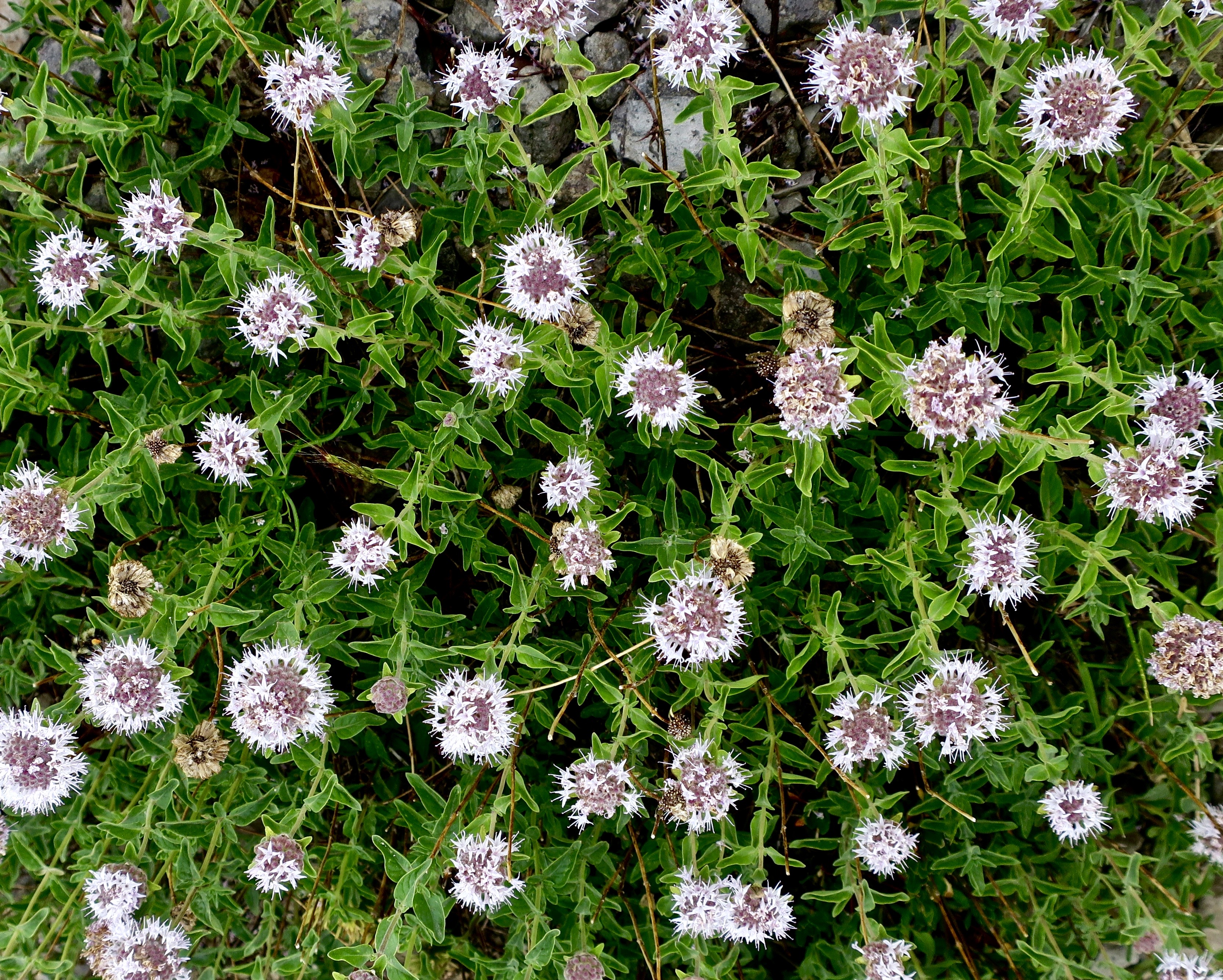
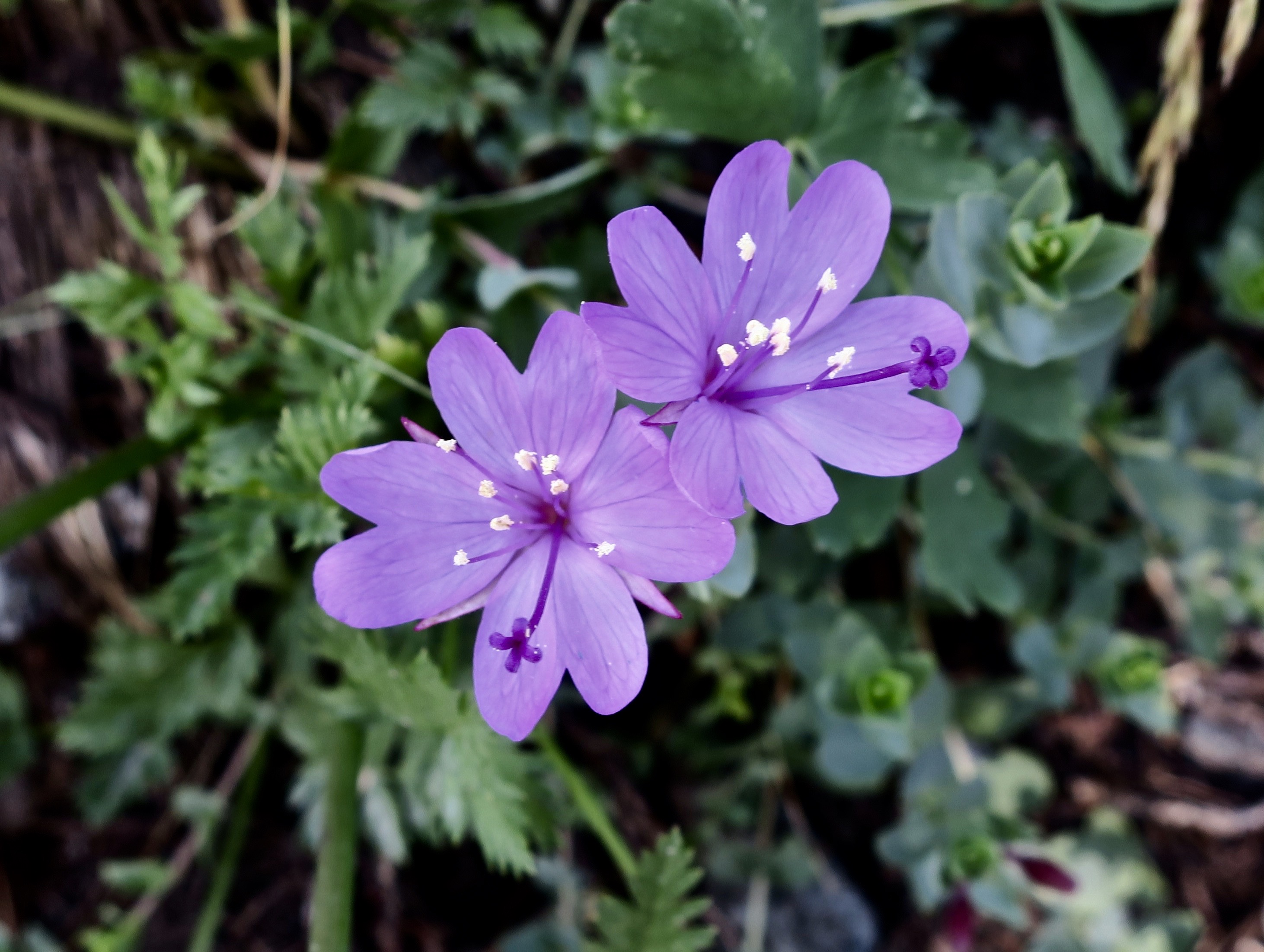
We did come upon a newborn fawn once. The mother had blown it and given birth right in the middle of our driveway. We were returning from town and sat for 30 minutes as the doe urged the baby to get up. Its twin was already off to the side. Finally the youngster stood on wobbling legs and managed to totter off to the side. I kicked myself very hard for not having my camera.If this buck appears nervous, it’s for good cause. A few minutes earlier we had watched junior walk under him, see danglies, and assume they were udders. Reaching up, it had chomped down. Deer are noted for their prodigious ability to leap, jumping over fences as high as 5-6 feet. I swear this guy cleared 10! Apparently, the baby was coming back for more. The buck ran away. The small size of the fawn signifies how young it is. They grow fast. The buck’s antlers are still growing and are in velvet. More on that shortly.Does brought their fawns by to meet us shortly after they had grown out of the ‘hide the baby’ stage. Or at least it seemed that way. Anyway, they trailed along with mom. At 3-4 weeks, they could easily keep up with her and even run fast enough to get away from many predators. They would dash madly around in our yard playing. Not sure whether baby is smelling its feet or scratching an itch. The ears on the doe are almost as big as its head! Deer have extremely sharp hearing and constantly move their ears to detect sounds that might suggest danger. I actually watched one with its ears pointed in two different directions.Hello. The deer in the west are black tail deer as opposed to the white tail deer found in the east and the south. One sign of a black tail deer is its dark forehead.The fawn from above and its twin walking across our deck. Speaking of the deck, it was right next to our bedroom and we could hear deer (and bears) when they crossed it at night. Once we heard a loud thump followed by two quieter thumps immediately afterward. I went out and checked the tracks in our yard the next morning. It was a deer that had made the loud bump as it landed on and cleared the deck in one leap. It was a cougar right behind in hot pursuit.One of the reasons the deer were frequent visitors was that they considered our bird bath their watering hole, especially in the summer. The section of Southern Oregon we lived in has a Mediterranean Climate and is very dry in the summer. The nearest water was down the hill, across the road, and down to the Applegate River. I’m sure that the deer thought ‘why bother.’ The challenge was that two thirsty adult deer would come close to emptying the bird bath. Other deer, birds, squirrels, foxes, etc that used the watering hole were out of luck until I refilled it.Hey, save us some water. We don’t drink much.What is it that you guys don’t get about bird bath!Who? Us? Note the antlers on the buck in the background. There’s a reason why yearlings are know as spikes.My solution to the water hole problem was to add a five gallon paint bucket filled with water. It was a welcome addition. How welcome?Well, baby climbing over Mom to get to it is an example. The laid back ears suggest that Mom wasn’t particularly happy with being used as an obstacle course.No smelling this time. The fawn is scratching an itch. Flies, fleas and ticks all hassle the deer. Again, I enjoyed the three leg acrobatics. Now note the next photo…Don’t ask.One of the fawn’s responsibilities is to learn what is and isn’t edible. It watches what Mom eats and also smells her breath. Lavender isn’t on the deer menu. We grew lots. It took us a few years to figure out what plants the deer wouldn’t eat and plant accordingly. In the meantime, Peggy would rush out and lecture the deer. It was quite humorous, for me and the deer.This young buck, who had leapt over our Gabion cage wall, climbed over the cement blocks, and worked its way past the lavender, stopped to listen to Peggy’s lecture before leaping up the cliff to gobble down the plants and flowers it loved to eat.The real treat was acorns. Squirrels, turkeys, woodpeckers, Stellar jays, and bears seemed to agree.Remember how I said the fawns grow up quickly. Check out the legs. Also note that the fawn’s spots are disappearing.By fall the spots have totally disappeared. The young deer will hang out with their mom through the winter until she gives birth to her new fawn in the spring. Mom then chases them away. They aren’t happy about it and often continue to stay nearby for a while longer—at a safe distance. The young doe will become part of the herd that Mom, Grandma, and possibly Great Grandma oversee. The herd of does browsing in our back yard…And taking an afternoon snooze.The young buck, Spike, here growing his first set of antlers, will slip off to join the boys.And now to the bucks. They lose their antlers in January and February and begin to grow new ones in March and April. A soft, hairy skin known as velvet covers the new antlers providing them with the blood and nerves necessary for bone growth. Aren’t the legs impressive?The antlers will continue to grow until they have reached the size of the previous year and then grow larger, dividing into more points.Bucks are judged by the size of their racks and the number of points on one side. A deer with two points is a forked horn, with three, a three pointer, and so on. The first year the deer grows spikes. Second year is normally a forked horn. Third year 3 and 4 pointers. Five pointers plus grow in the fourth year and beyond.A three point buck without velvet. “Did somebody say apple?”This big boy in velvet is a five-pointer. The back antlers are split but can’t be seen in this picture.Two bucks displaying a forest of antlers! We thought this was a fun photo. Come August-September the antlers have completed their growth and the bucks scrape off their velvet on anything available, normally a tree or bush. It’s time to get in fighting form. One year we arrived home and found a buck using our hammock to scrape off his velvet. I chased him off but it was too late. The hammock was torn to sheds. By November and December it’s time to decide who gets the girls.This is a contest that the bigger buck normally wins. Size is often enough to decide the outcome without a contest.These two three pointers have been checking each other out. The one on the left is larger and has a bigger rack, but…They go at it, head to head and antler to antler. The biggest buck shoved the smaller buck around. I worried about their eyes.And then they separated without either being harmed. The big fellow seems to be saying, “You want more of me?” The smaller guy had had enough, however. He vacated the scene. For a day or so, the three pointer chased does around our yard, happily making the rounds and rutting away— until a bigger buck came off the mountain. After the rutting season is completed is when the bucks lose their antlers and a new year begins.A very pregnant doe.As you have probably figured out, this doe and her twins were the stars of our blog. She was usually somewhere nearby and was the first to bring her fawns by. Always curious about what we were doing, she often stared in our window. Here she is looking though our screen door.Our house was surrounded by windows providing excellent views of everything happening outside. I had the best seat, however. I turned my writing chair around in our library and could watch all of the action in our backyard. We considered it a great privilege that the deer herd allowed us to share in its daily and yearly life. Here, Mom taking a snooze on our back porch, was about four feet away. That’s it for the day. Next up:
On Friday I will do the intro to the my memoir: UT-OH. I am blogging one chapter at a time. I am quite excited about the book and have already written 22 chapters. Please join me.
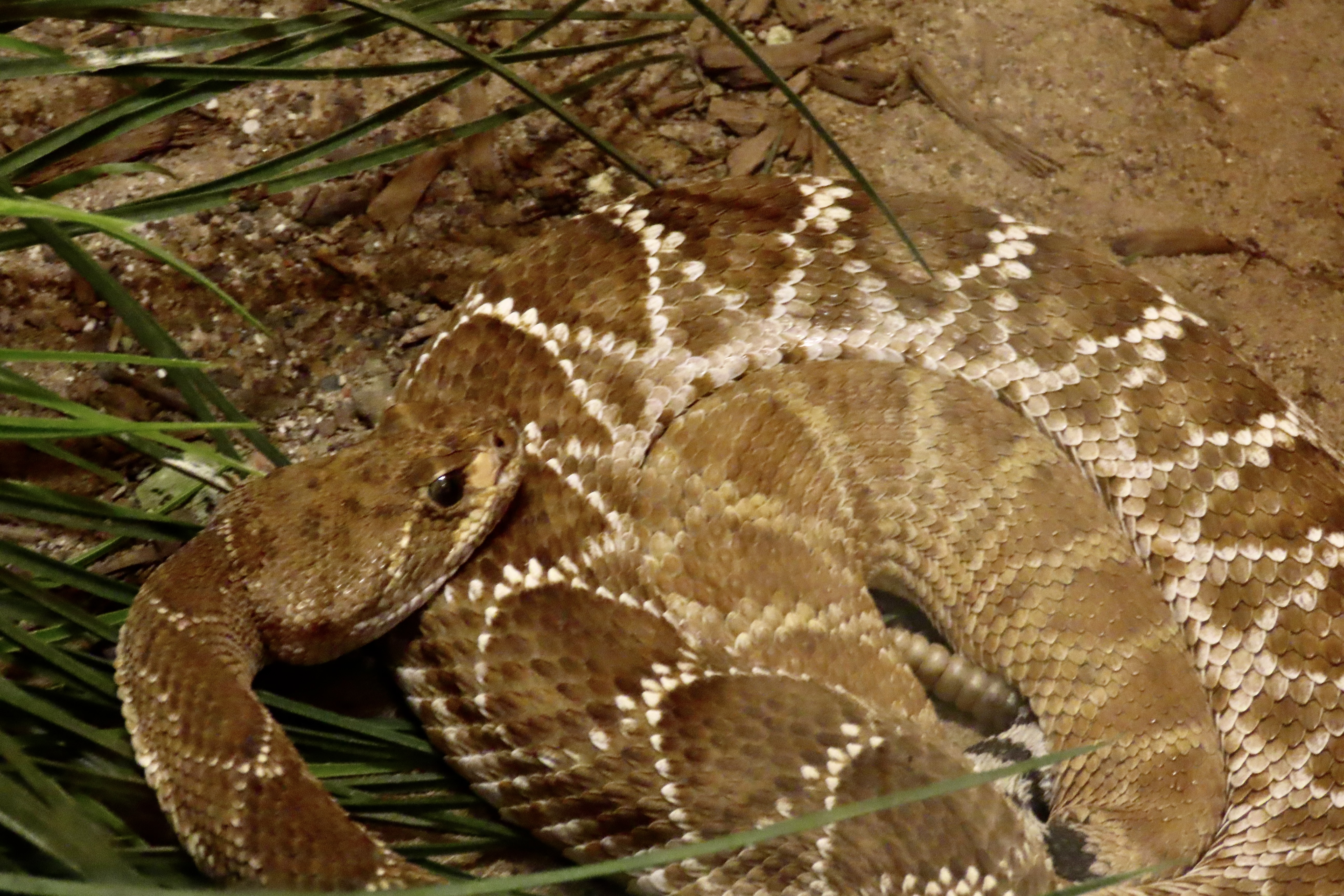
The eastern diamondback rattlesnake has been known to grow almost eight feet long.
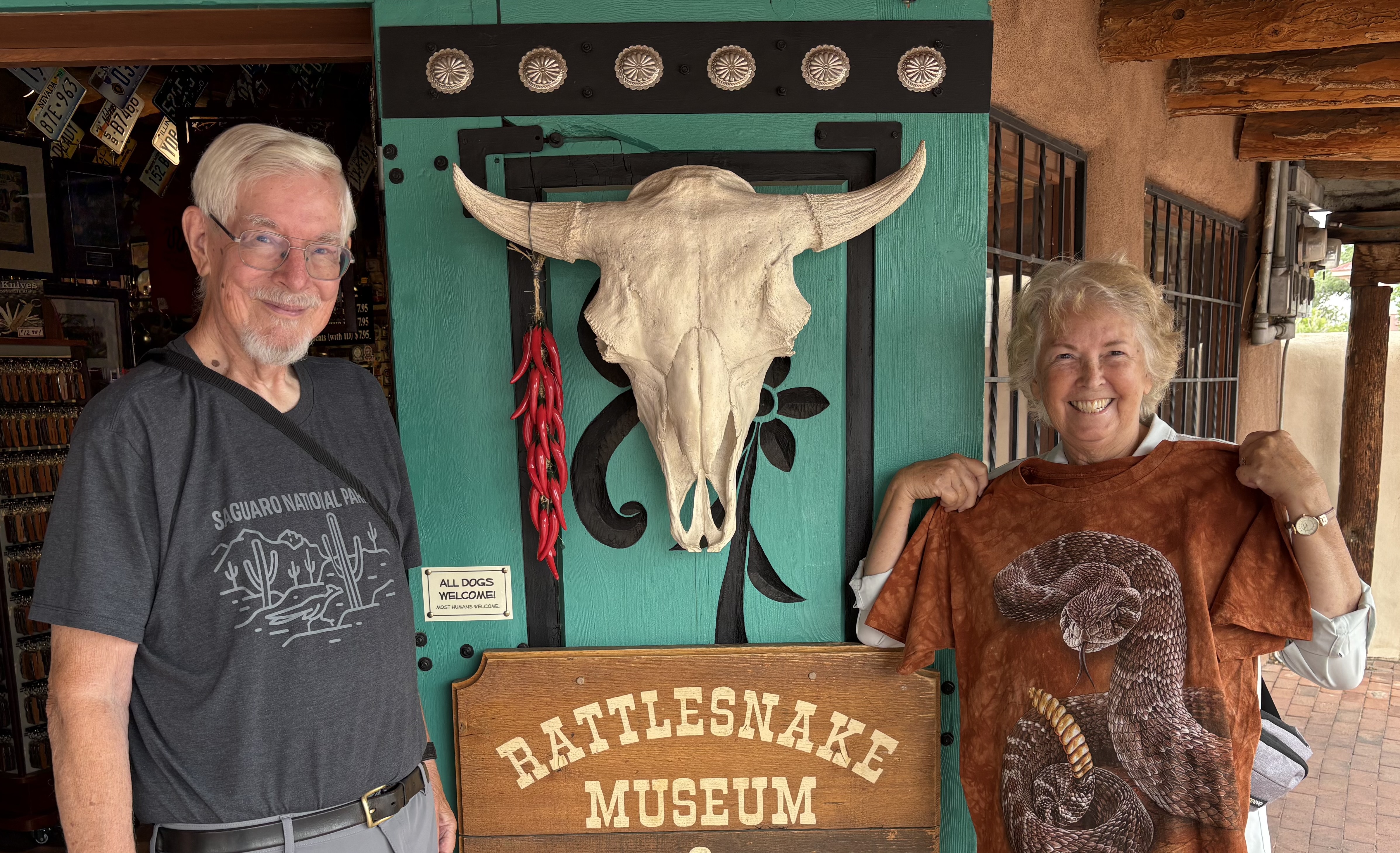
I’ve have been to Albuquerque, New Mexico several times over the years. One place that I always wanted to go but never managed to was the American International Rattlesnake Museum. They have one of the largest collections of live rattlesnakes in the world. Could it be that whoever I was traveling with didn’t share my enthusiasm?
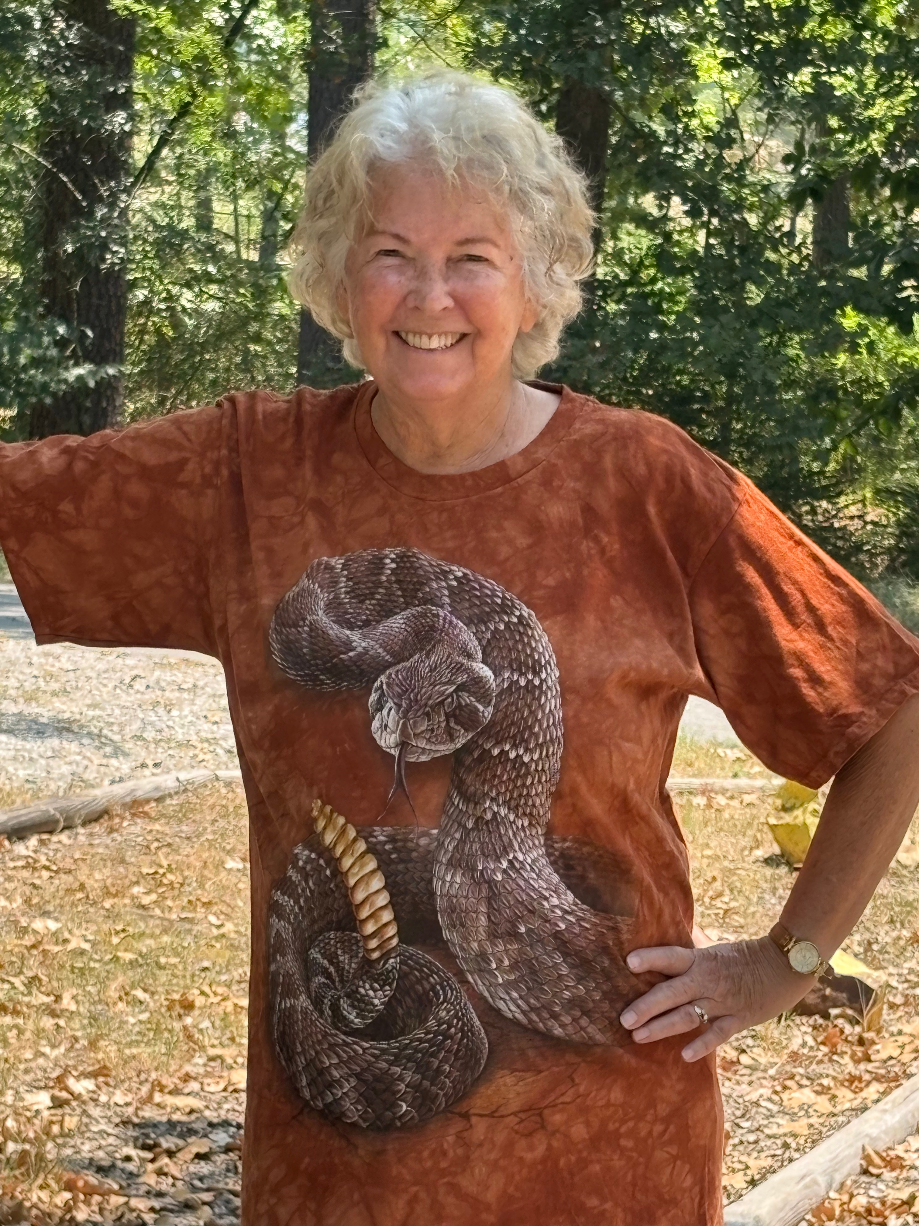
Peggy, however, is game for almost anything and snake images almost always show up among the petroglyphs that fascinate her so much. So off we went to the museum two weeks ago.
Peggy even bought a rattlesnake T-shirt from the museum. Is there a message here?
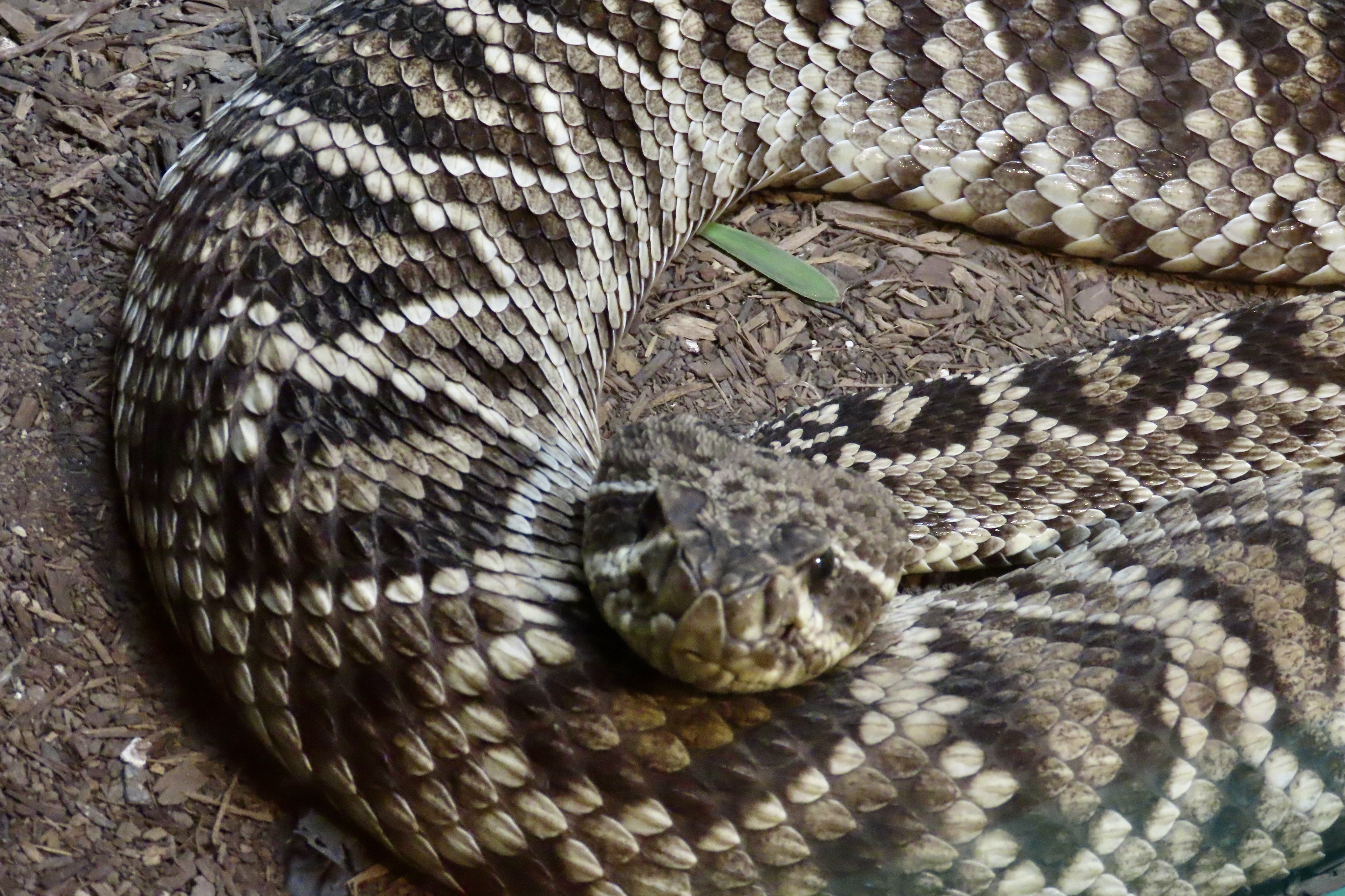
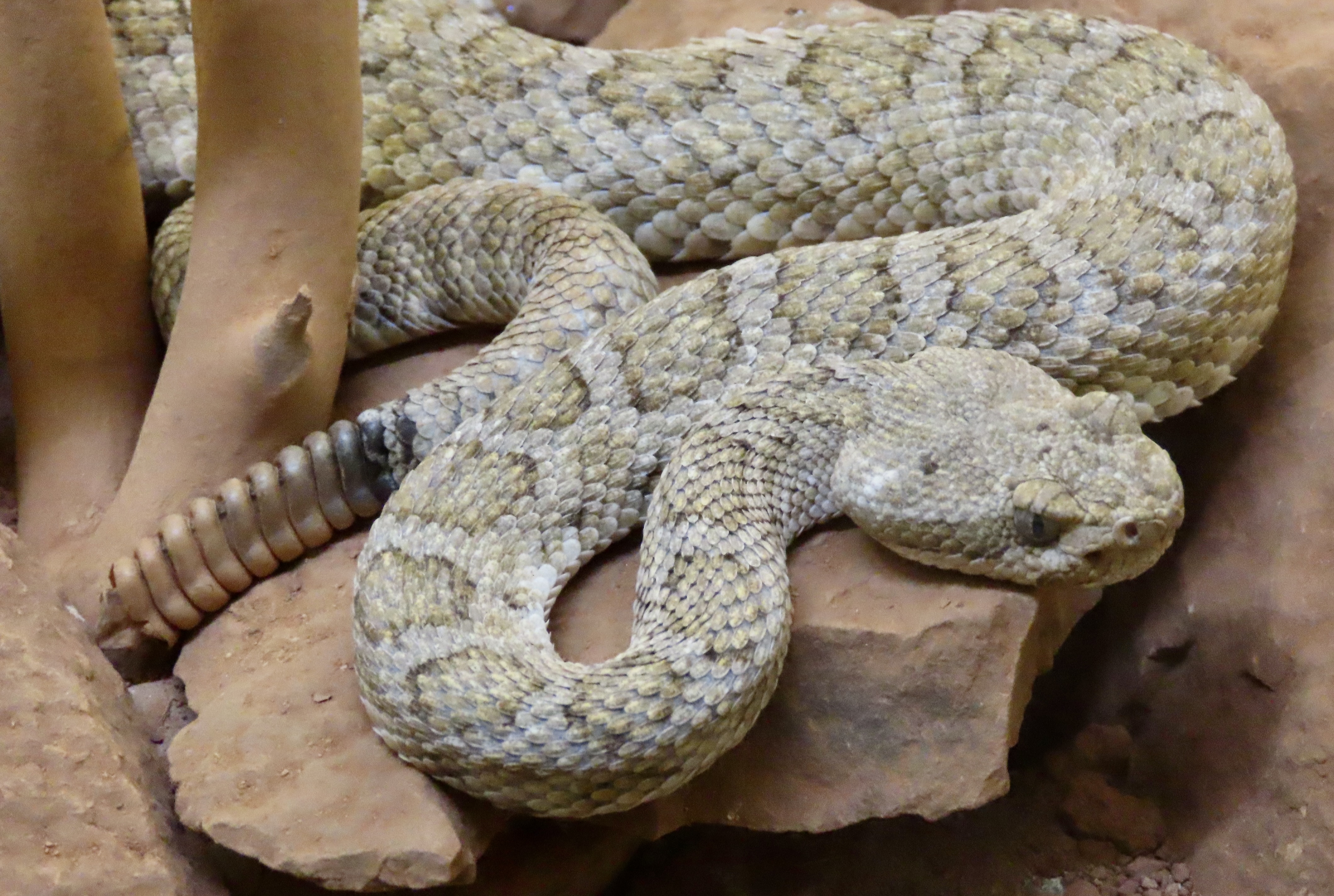
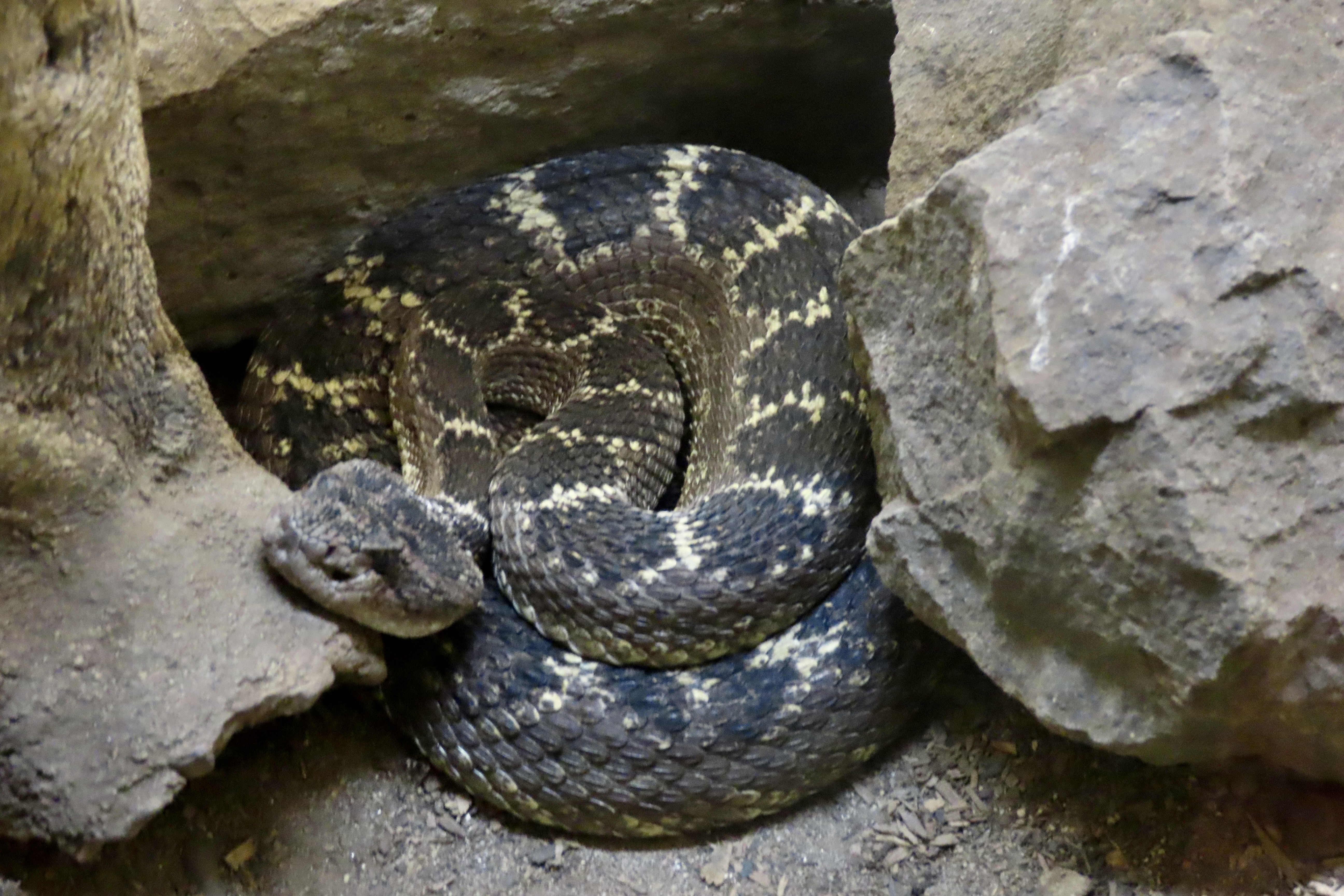
That I have a certain ‘fondness’ for rattlesnakes isn’t news to my blog followers. I’ve had numerous encounters with them over the years and have written about several. I’ve even been known to get down on my stomach when they are crawling toward me so I can get better head shots. (Peggy gets a little ouchy about that.) I suspect my attitude would be considerably different if I’d ever been bitten by one. Rattlesnake bites can be deadly, or at a minimum, extremely painful. It’s not something one wants to test.
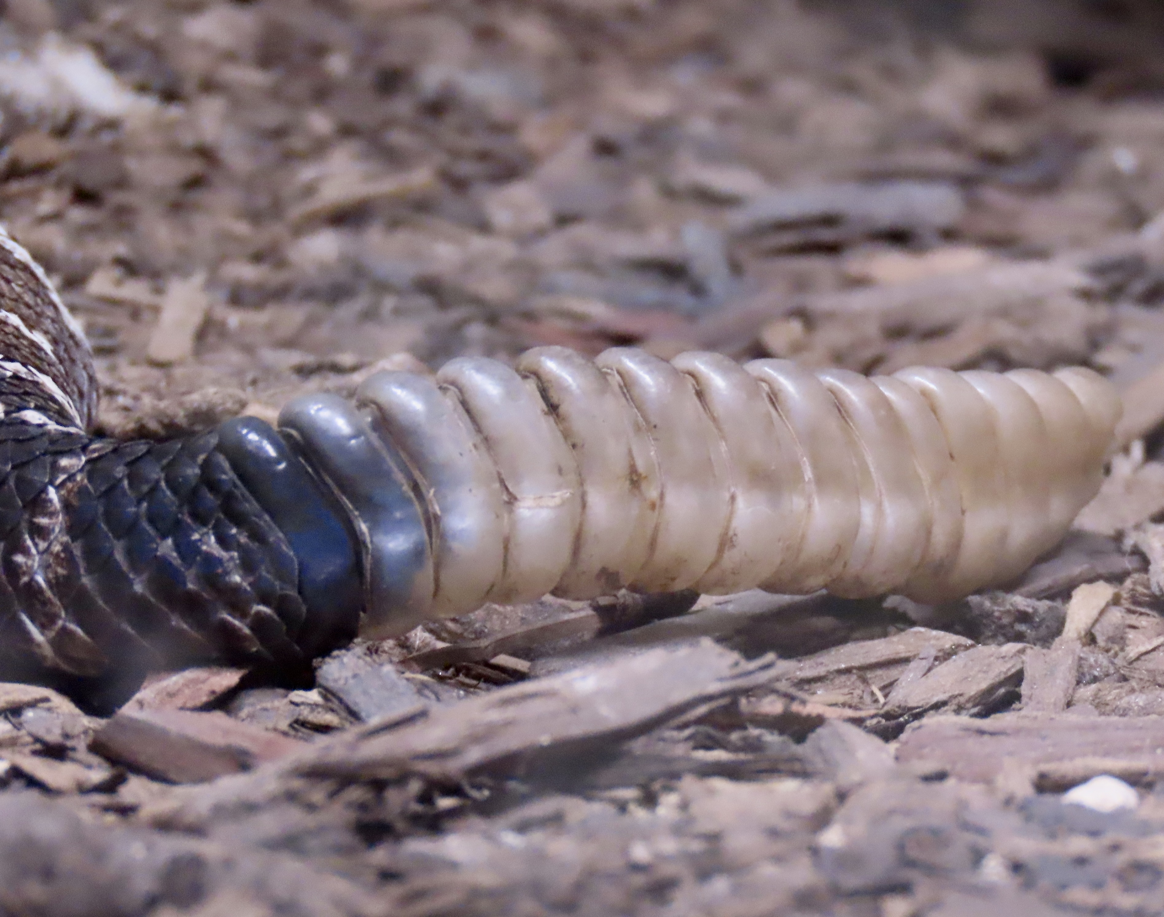
Fortunately, rattlesnakes come with an early warning system. They rattle. The rattles are made up of keratin, that’s the same thing your fingernails are made of. When irritated, the snake vibrates its tail, knocking its rattles together. It makes a very distinctive sound, one you never forget, one guaranteed to shoot your heart rate up faster that a skyrocket on the 4th of July.
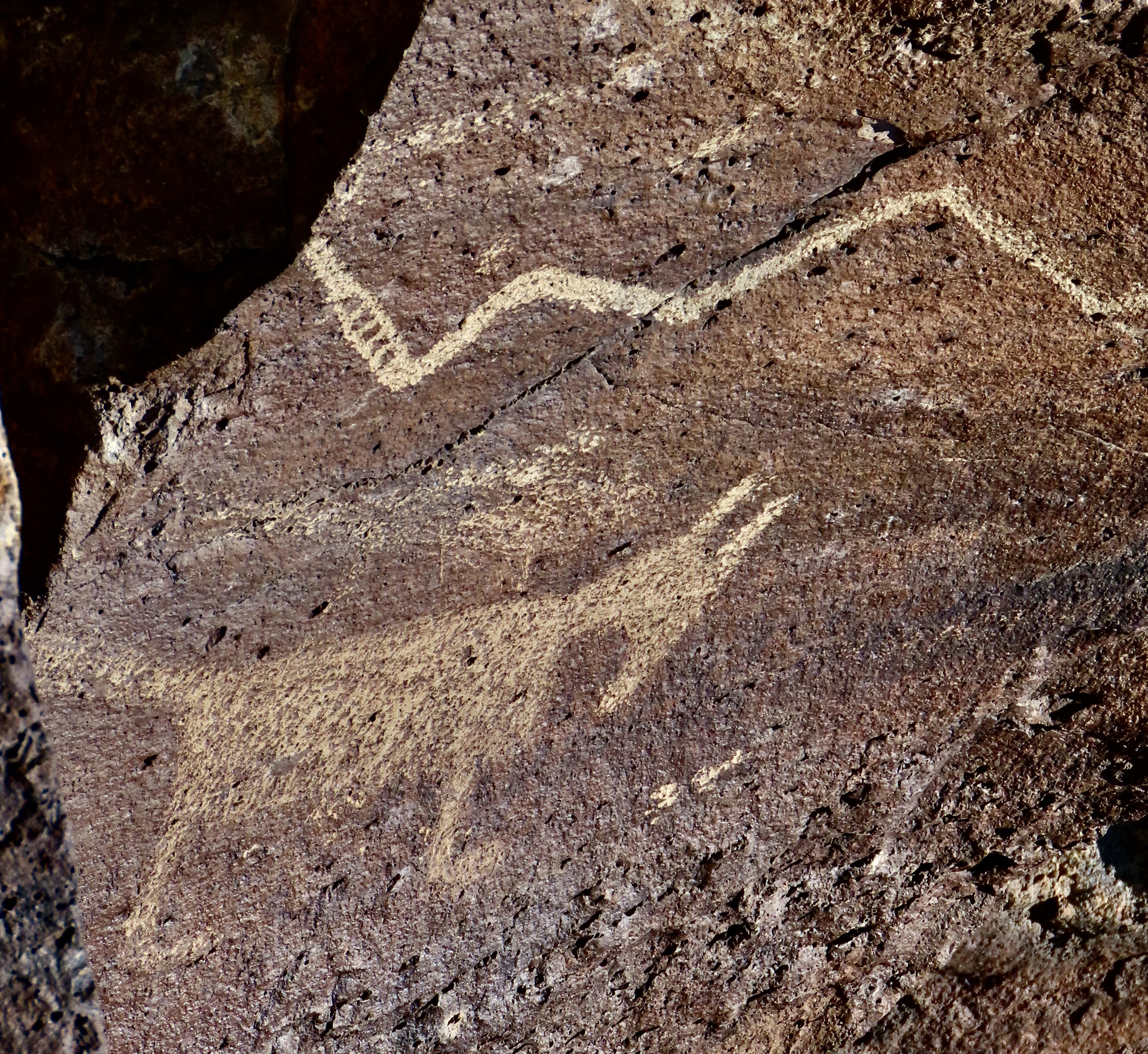
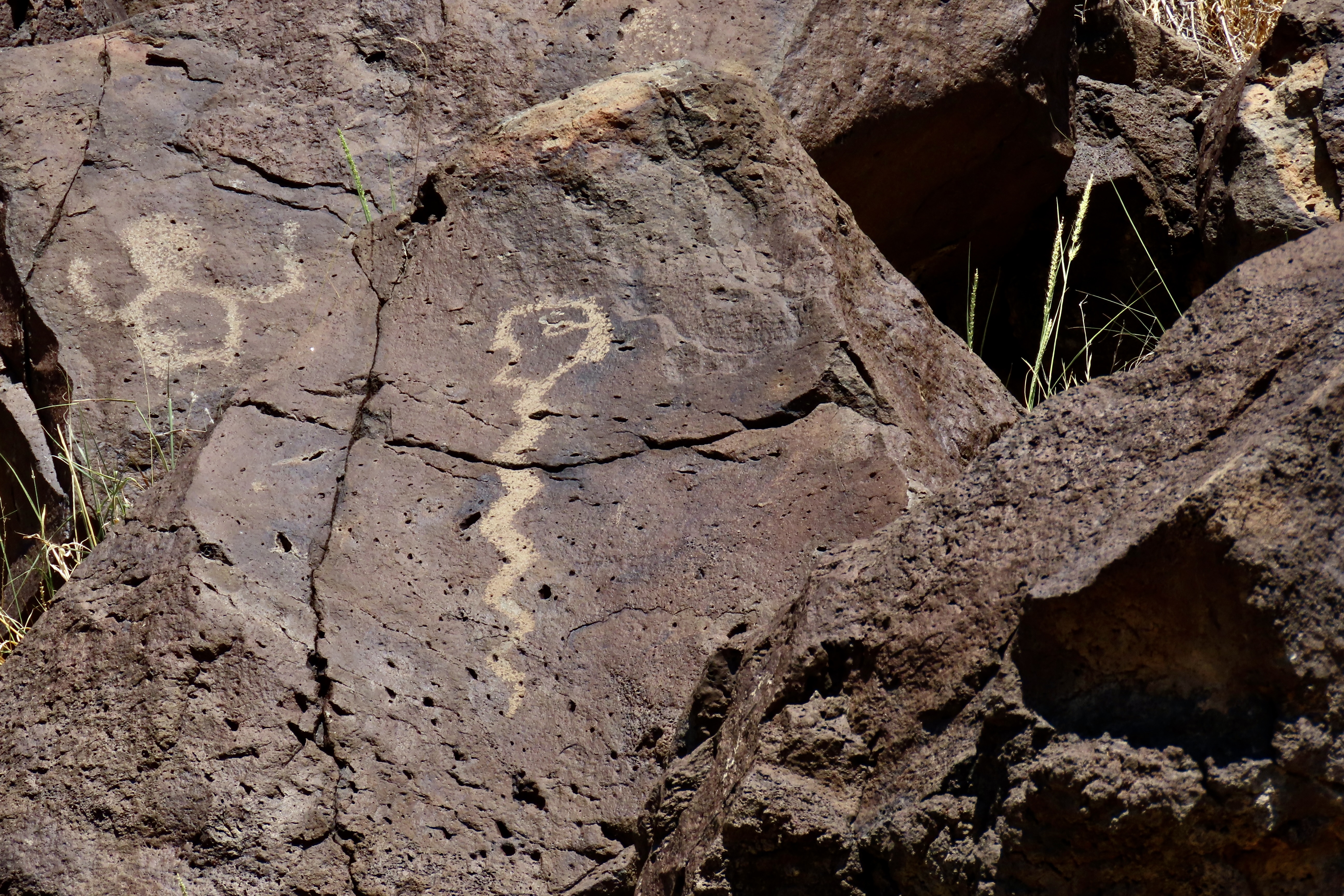
Each time a rattlesnake sheds its skin in grows a new rattle. This makes up for ones it has lost. The bigger the snake the bigger the rattle. The Ancestral Puebloans included a rattle on this petroglyph of a rattlesnake in Petroglyph National Monument, Albuquerque. It’s probably a coyote or a dog beneath the rattler, obviously not worried.
A rattlesnake you see coiled up, rattling its tail, and ready to strike is worrisome, to put it mildly. It’s not a problem, however— as long as you stay clear of its strike zone, which can range from half to two thirds of its body length. For a six foot snake (which is a very big snake), that would be from 3 to 4 feet. If you want to check this out, use a long stick. I have. (Don’t try this at home, kids.)
One you can hear but can’t see is a quantum leap scarier. I stepped on a dead log once ‘that started to rattle’ and found myself an olympic winning 15 feet down the trail before my mind registered snake. There is some evidence that our fear of snakes is instinctive. For example, have you ever come close to stepping on one you didn’t see in advance. Did you find yourself thinking, “snake, maybe I should be concerned.”
Odds are your reaction was more like this guy from another petroglyph at Petroglyph National Monument. Eek!
When I was a Peace Corps Volunteer in West Africa, I had a cat named Rasputin that proved the hypothesis about fear of snakes. I discovered if I took the old fashioned spring off my back door and rolled it toward him, he would leap 6 feet into the air and land on our couch or other piece of furniture well out of reach from the deadly ’snake.’ Being scientifically oriented, I did it 3 or 4 times just to make sure.
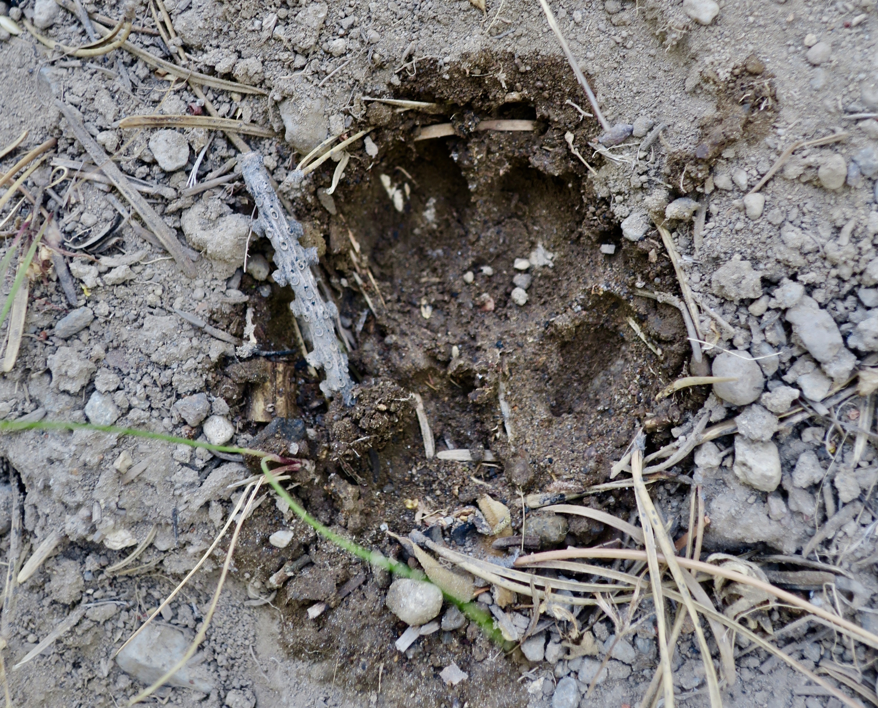
On the other hand, back in California I had a basset hound named Socrates that seemed to counter the theory. I was hiking with him one day at Folsom Lake near Sacramento when I noticed him walk out on to a granite ledge and start sniffing down into the cracks. Suddenly he began barking like the baying hound he was: Loud. Simultaneously, the rock became alive with rattles. Socrates had discovered a rattlesnake den. They can get big, big like in a hundred snakes. Some have even been found with a thousand. Talk about an Indiana Jones’ nightmare…
It was for me, as well. “Socrates, come here!” I demanded. And then again. And again. Each time louder and more desperate. All, to no avail. He just kept barking louder. Damn, that dog could be stubborn. Finally, there was nothing I could do but walk out on the buzzing rock, grab him by the collar, and bodily drag him off. I was lucky I didn’t pee my pants. Had I not immediately put his leash on and pulled him away, he would have gone right back to barking up a storm at the irritated, poisonous serpents.
Here are a few facts on rattlers:
There are between 32 and 45 species of rattlesnakes, many of which live in the Southwest where Peggy and I just spent five months wandering around outside. They can range in size from 15-24 inches like the pigmy rattlesnake of the South up to close to 8 feet like the eastern diamond back. Peggy’s brother John and his wife Frances found one of these monsters in their backyard in Texas.
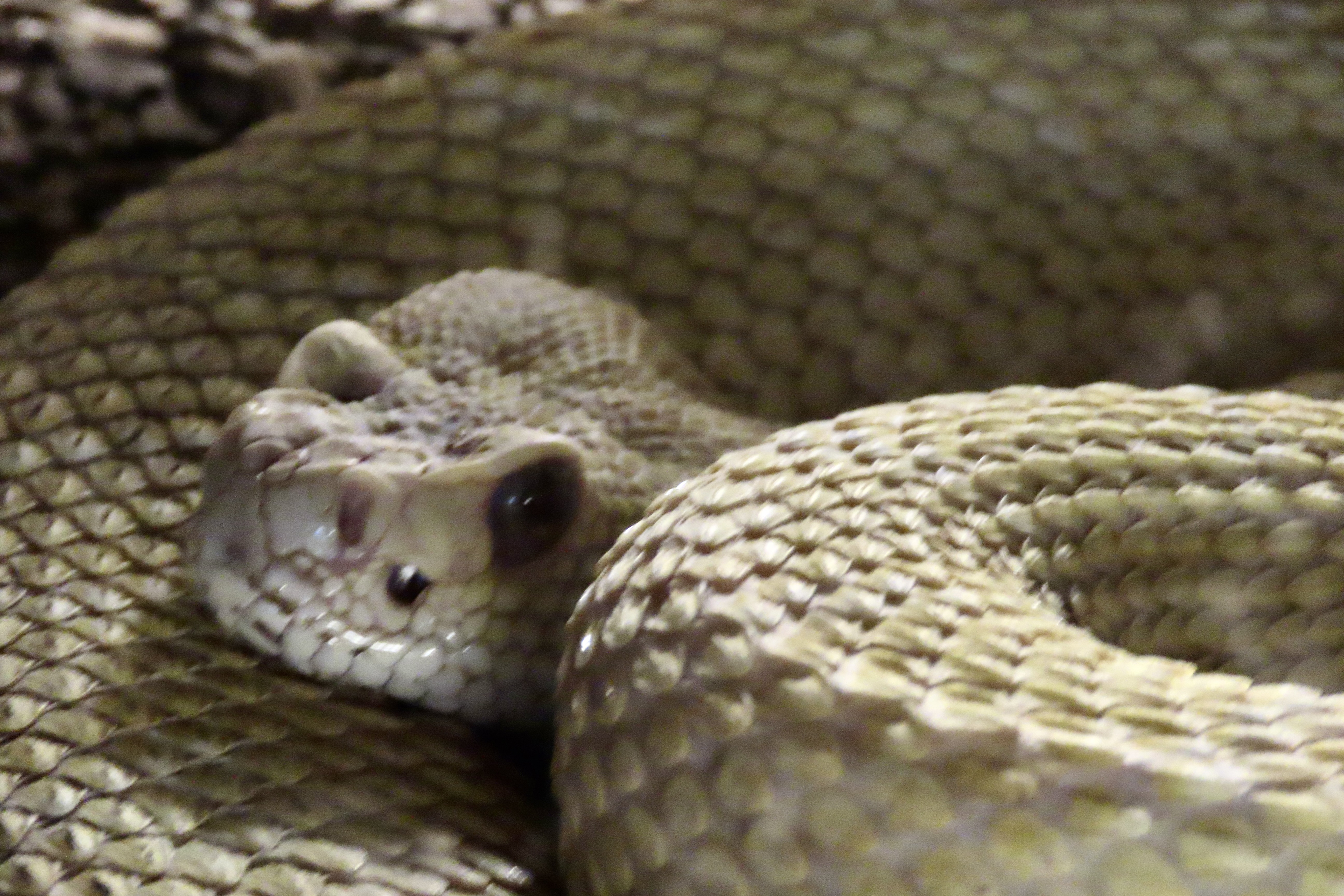
They are superb predators. While lacking an outer ear that would allow them to hear their prey, they have an inner ear that allows them to sense the vibrations of a prey’s movements. Vertical pupils aid in depth perception for strikes and pits on the side of their faces serve as heat detectors which allow rattlers to see their prey in pitch dark situations. Being members of the pit viper family they have large, sharp, hollow fangs that are designed to deliver venom. The fangs fold back against the rattlesnake’s mouth when not in use.
And finally, here’s a long word for you to impress your friends with: ovoviviparous. It means the rattlesnake mommy hatches her eggs inside of her body and her babies are born alive, ready for action as soon as they can bite their way out of the protective sack they are born in.
And now for a few of the photos we took at the museum.
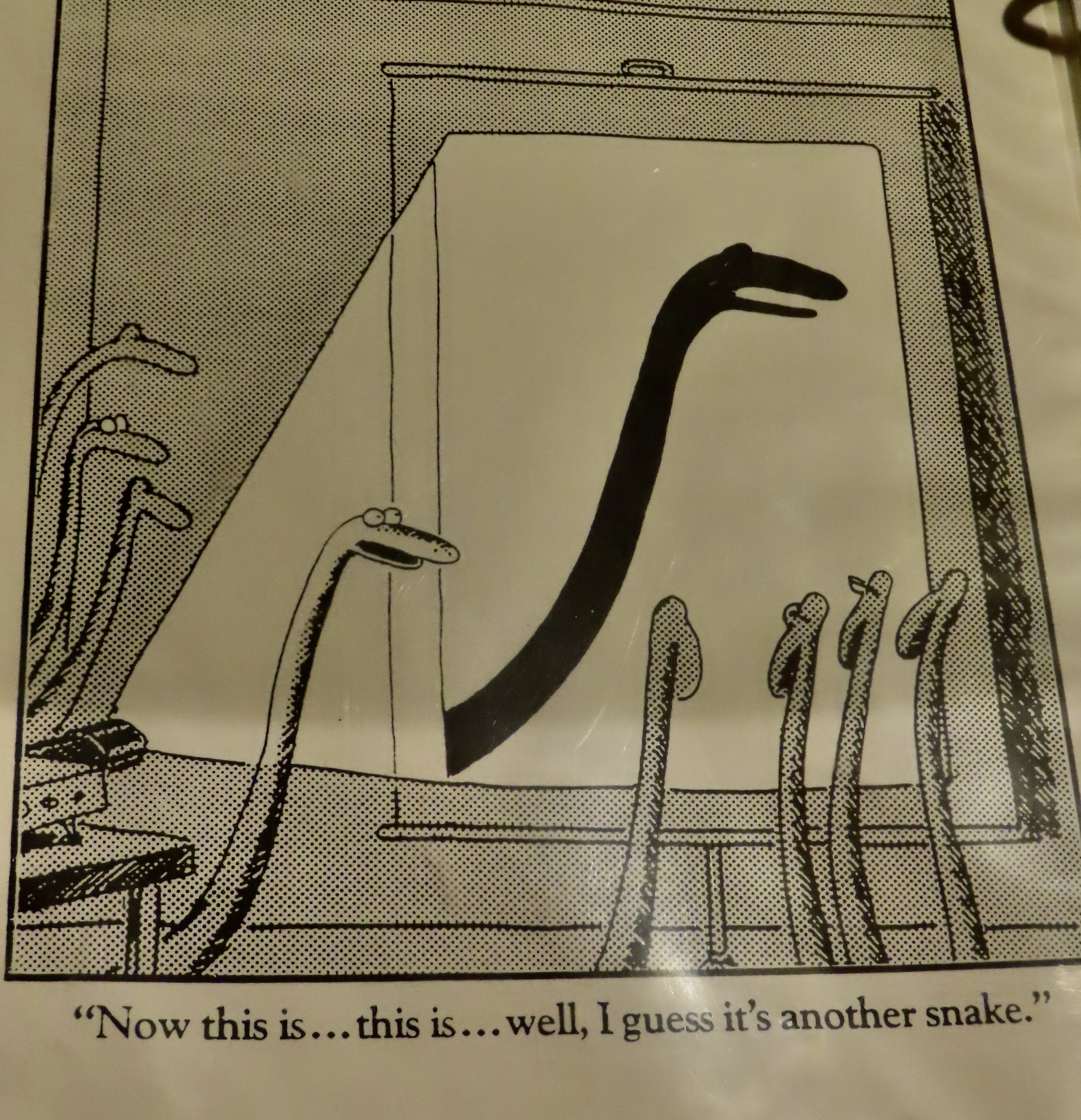
The museum had a book of Gahan Wilson cartoons on snakes.One way to recognize a rattlesnake, beside the obvious rattles, is by the distinctive shape of its head, which it shares with other pit vipers.Okay, a bit scary.Beautiful brown.Coiled and ready.Note the vertical pupils.Moving along.
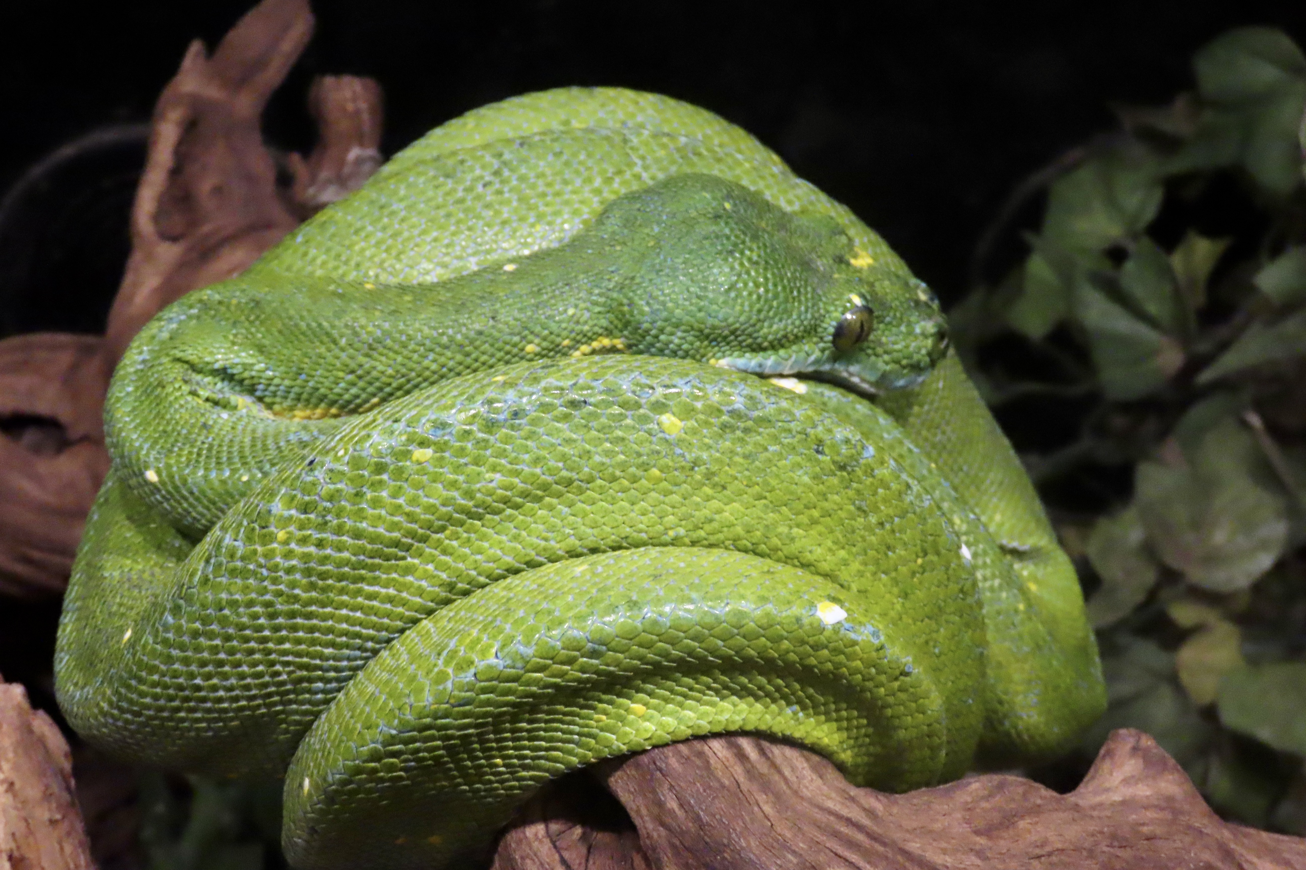
Plus a couple of snakes that weren’t rattlers, but we were fascinated by their colors.
An albino milk snake.And this striking green snake which, as I remember, was a python. (Don’t quote me.)And finally, Peggy and I in front of the museum, which is located in the historic section of Albuquerque. Not sure why they chose the skull and string of peppers instead of a rattlesnake but they are symbols of New Mexico. Next up, we will conclude our posts on Canyon de Chelly National Monument.
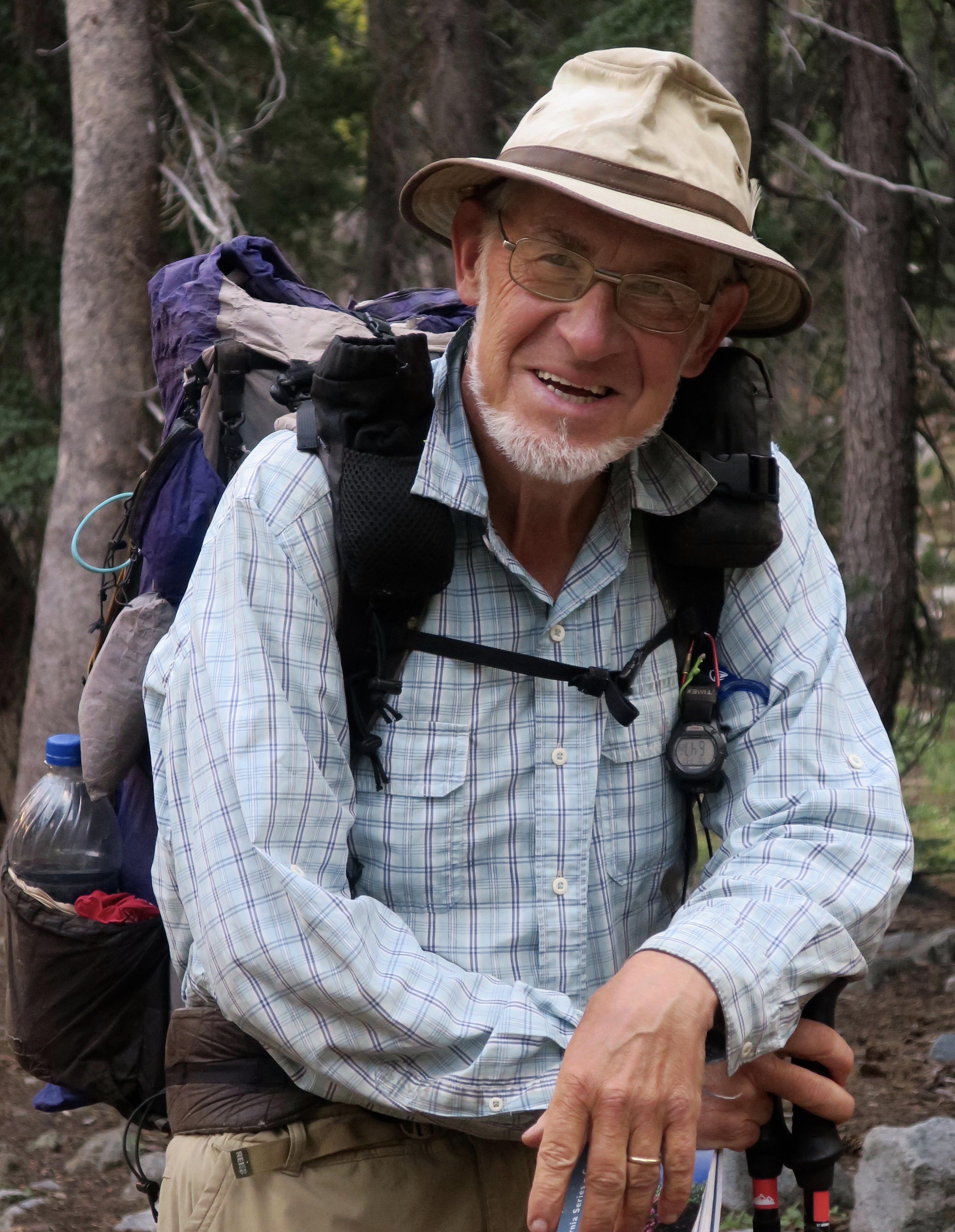
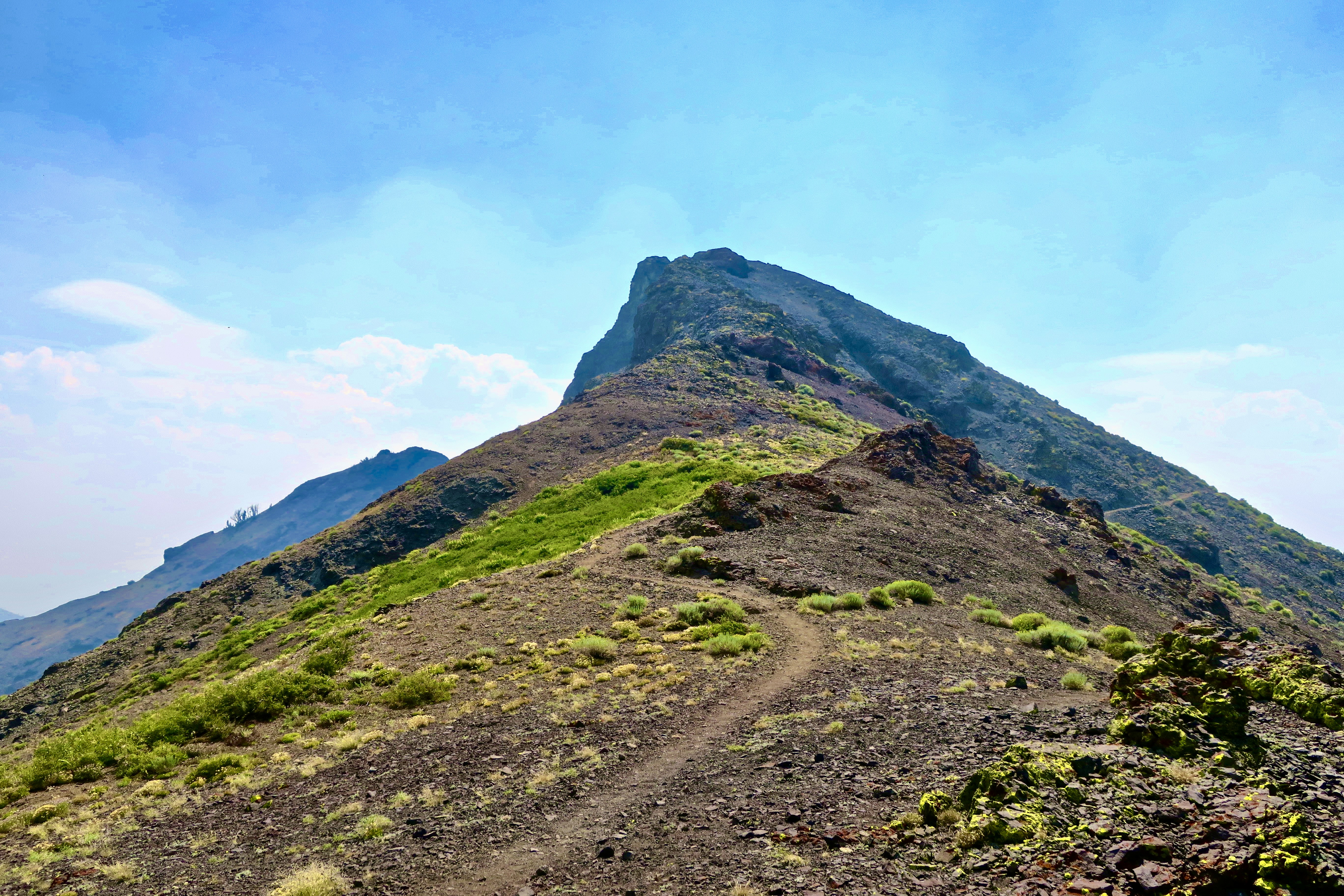
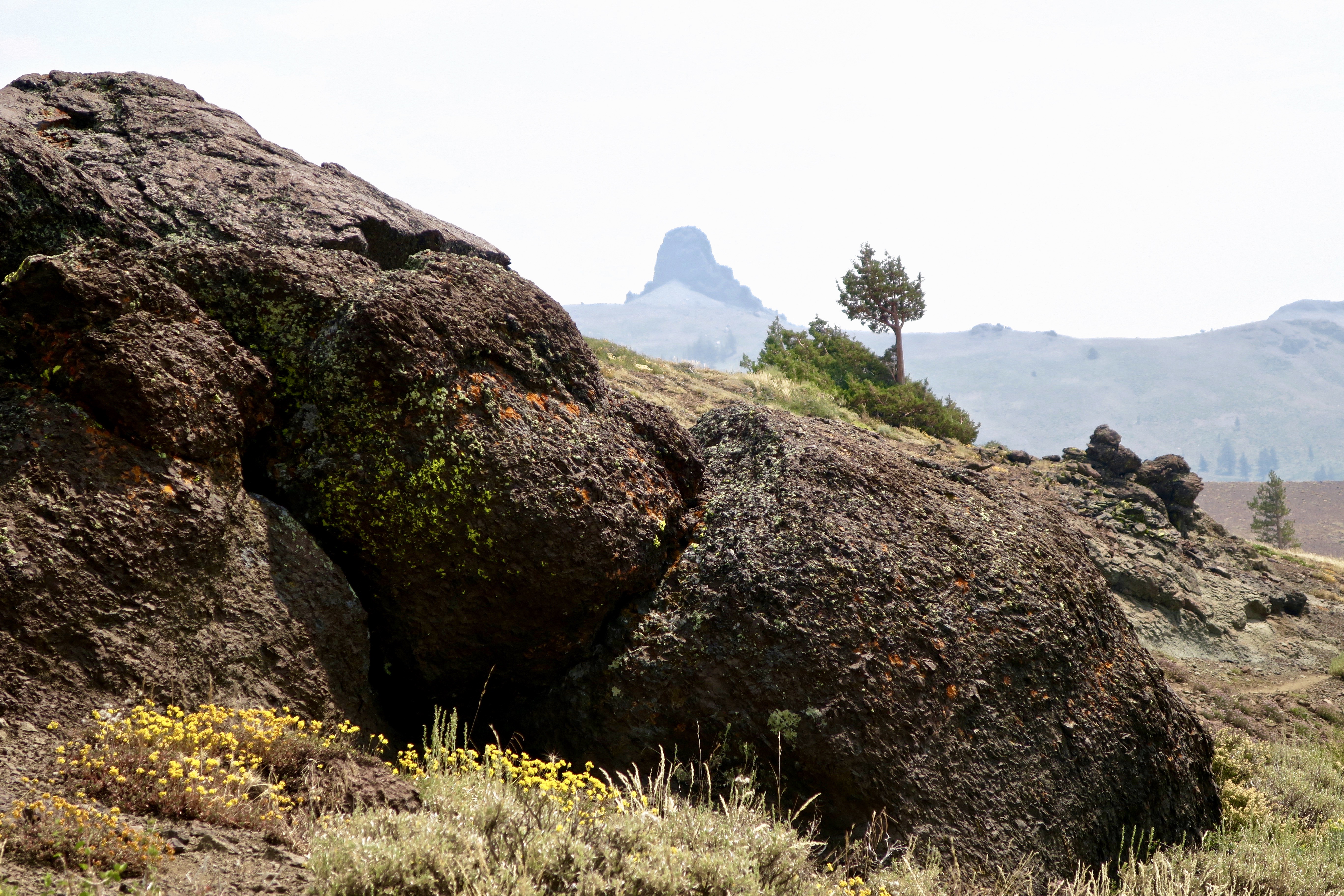
This is view of Mt. Shasta from the Marble Mountains Wilderness. My 750 mile trek down the PCT gave me northern views of the mountain, western views and and southern views. This was one of the best. Given its mystical/magical look, it’s hardly surprising that tales of beings like Bigfoot, Lemurians, and Lizard people are associated with it. The local Native American Modoc Tribe, whose legends include Bigfoot sightings around the mountain, refer to him as Matah Kagmi, meaning keepers of the woods.I like it. The Lemurians are a New Age creation connected to highly advanced lost continent of beings that live under the mountain. As for Lizard People, think aliens and UFOs.
As part of our series about protecting national parks, monuments and other public lands, I’ve been reading news releases from the directors appointed by President Trump who oversee these areas. It’s not a task I would wish on anyone. It isn’t surprising that the directors all support the president’s objective of significantly reducing many public lands in size and opening up others for profit making operations. That’s why they were appointed.
The news releases are full of statements designed to hide their real purpose. Here’s an example:
“President Trump promised to break the permitting logjam, and he is delivering,” said Energy Secretary Chris Wright.“America can and will build big things again, but we must cut the red tape that has brought American energy innovation to a standstill and end this era of permitting paralysis. These reforms replace outdated rules with clear deadlines, restore agency authority, and put us back on the path to energy dominance, job creation, and commonsense action. Build, baby, build!”
Let’s did a little deeper. By ‘permitting logjam’ and ‘red tape’ and ‘outdated rules,’ he means rules that have been developed to protect our air and water quality, save rare and endangered species from extinction, and maintain areas of great beauty and/or cultural significance that the majority of Americans support protecting. The Administration’s perspective is that these rules get in the way of progress. Who needs clean air or water. “Build, baby, build!”
And how about American energy innovation and dominance? Obviously, he’s not talking about solar, wind and water power. We’ve been moving ahead quickly in the development of clean energy. The Trump Administration is actively discouraging this progress. Incentives designed to encourage their use have been cut. His passion is for coal, gas and oil, all three of which are nonrenewable resources and have been prime factors in the development of global warming that has been having such devastating impacts on the US and the world. The Texas floods of this past week are but one of a multitude of examples.
Several countries in the world have now reached the point where 80-100% of their energy needs are supplied by renewable clean energy. I’d argue that they are the ones achieving energy dominance, one that will last long beyond our nonrenewable resources and is vital to our battle against global warming.
On another subject, it’s interesting that right-wing Republicans played an important role in blocking the administration’s plans to sell off millions of acres of public lands in the West. Here’s what Christopher Rufo, a culture warrior and leading supporter of Trump in in the state of Washington had to say:
“Pre-2016, you’d have the small government argument against a kind of federal domination over the land, but Trump and MAGA is a nationalist movement,” he said. “I think many conservatives are now reassessing these questions, and many of us in the West understand that part of a great nation is the preservation of its natural beauty.” There is hope.
The Marble Mountain Wilderness, the subject of this post, is an example of this beauty.
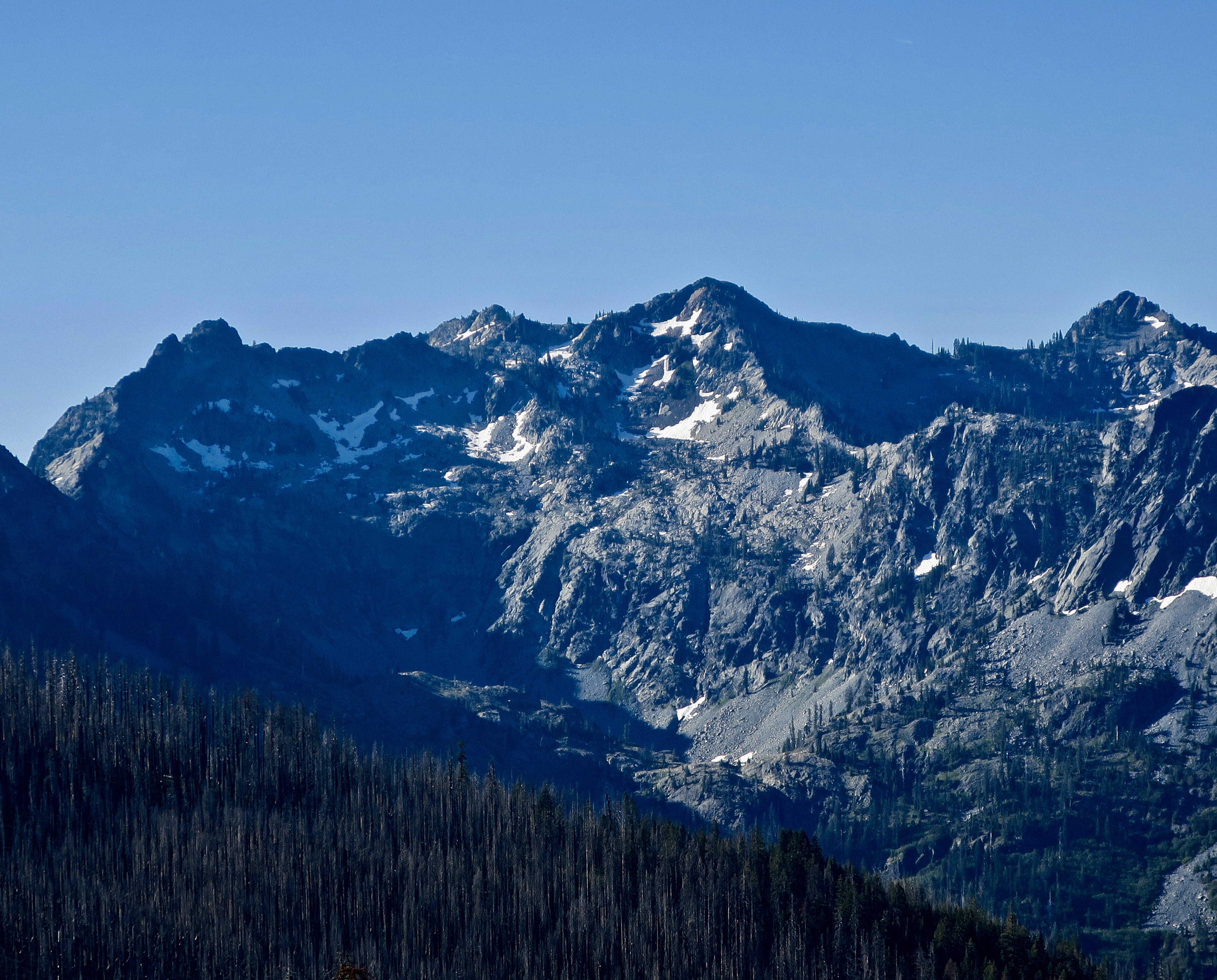
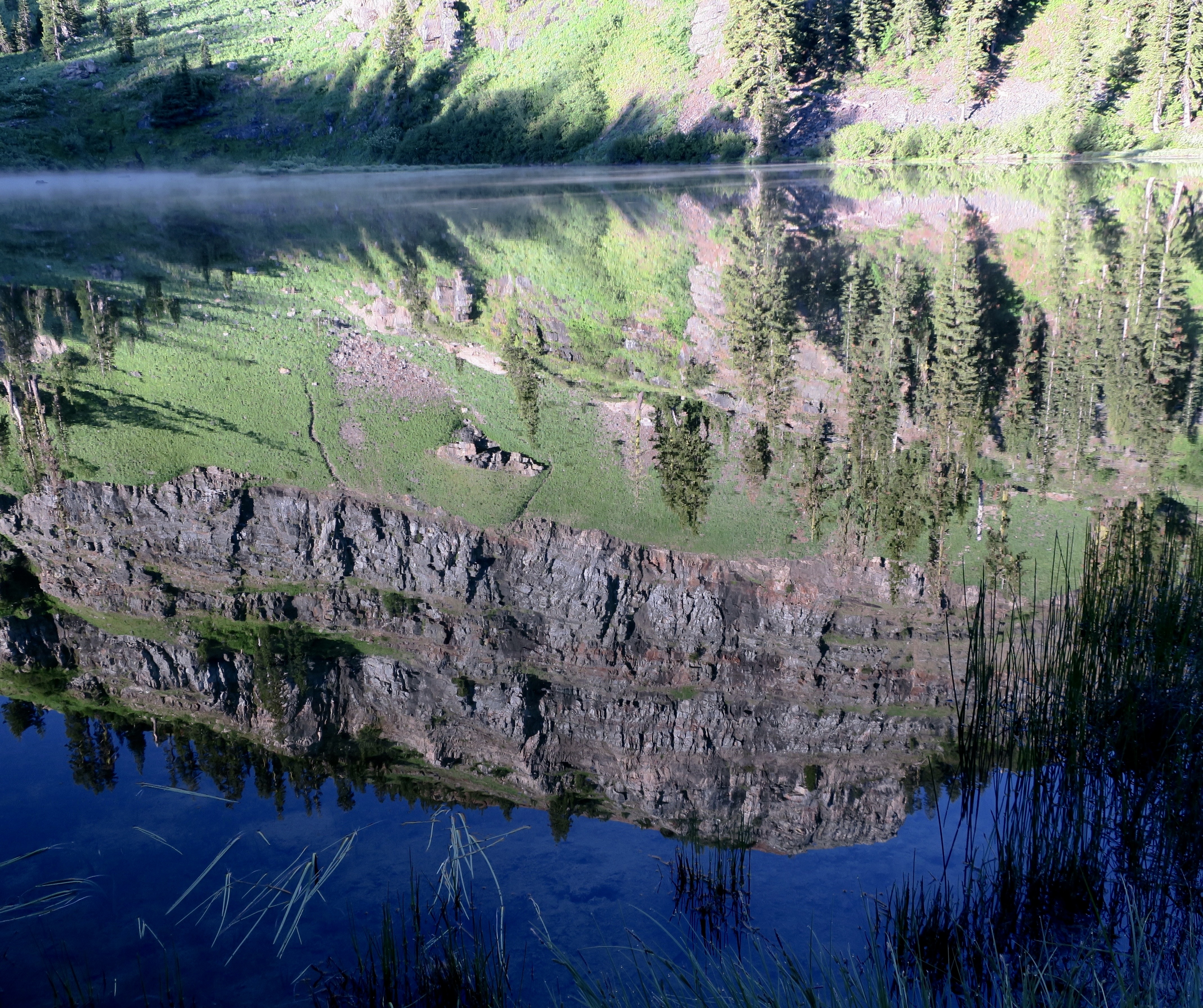
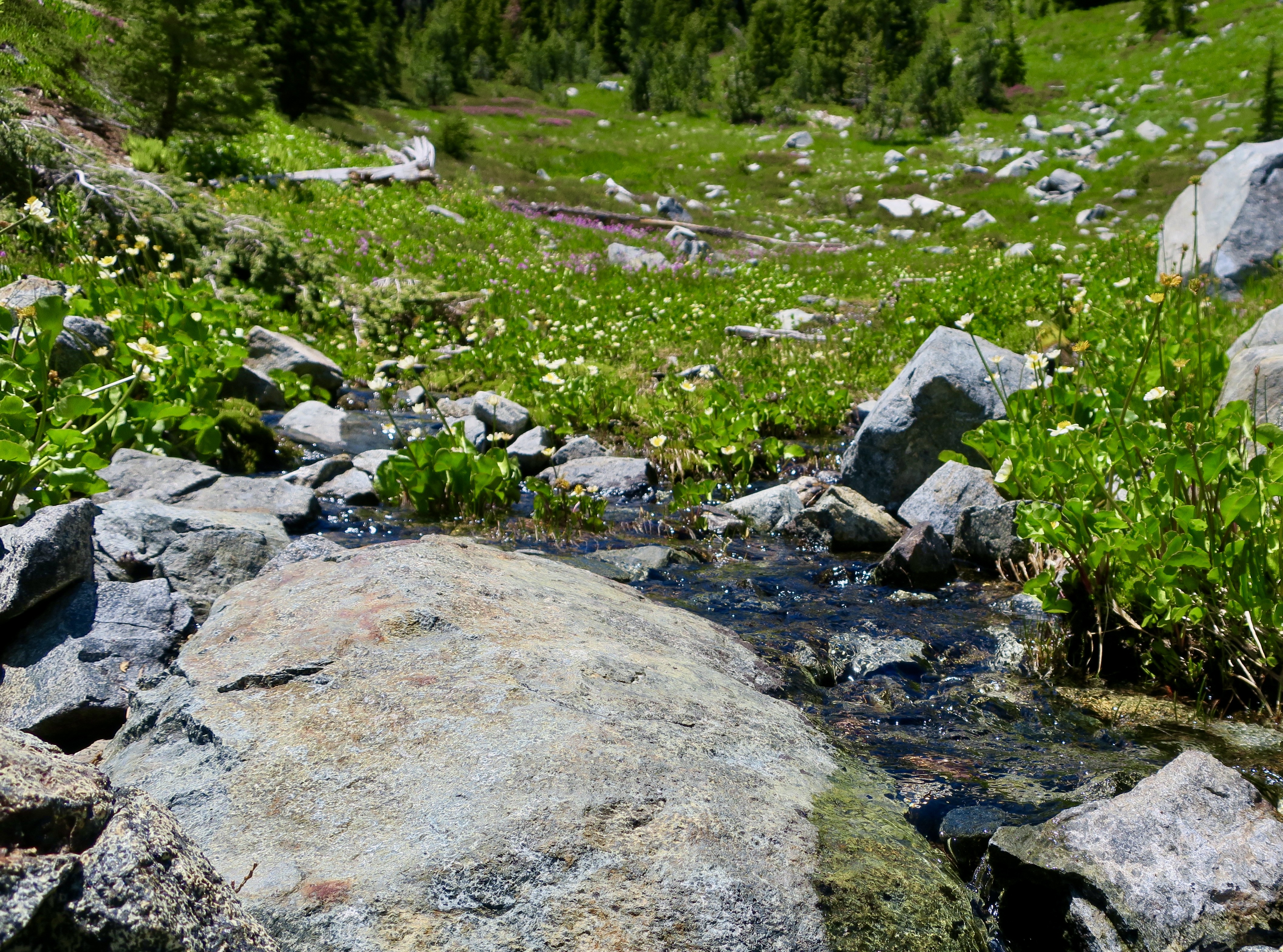
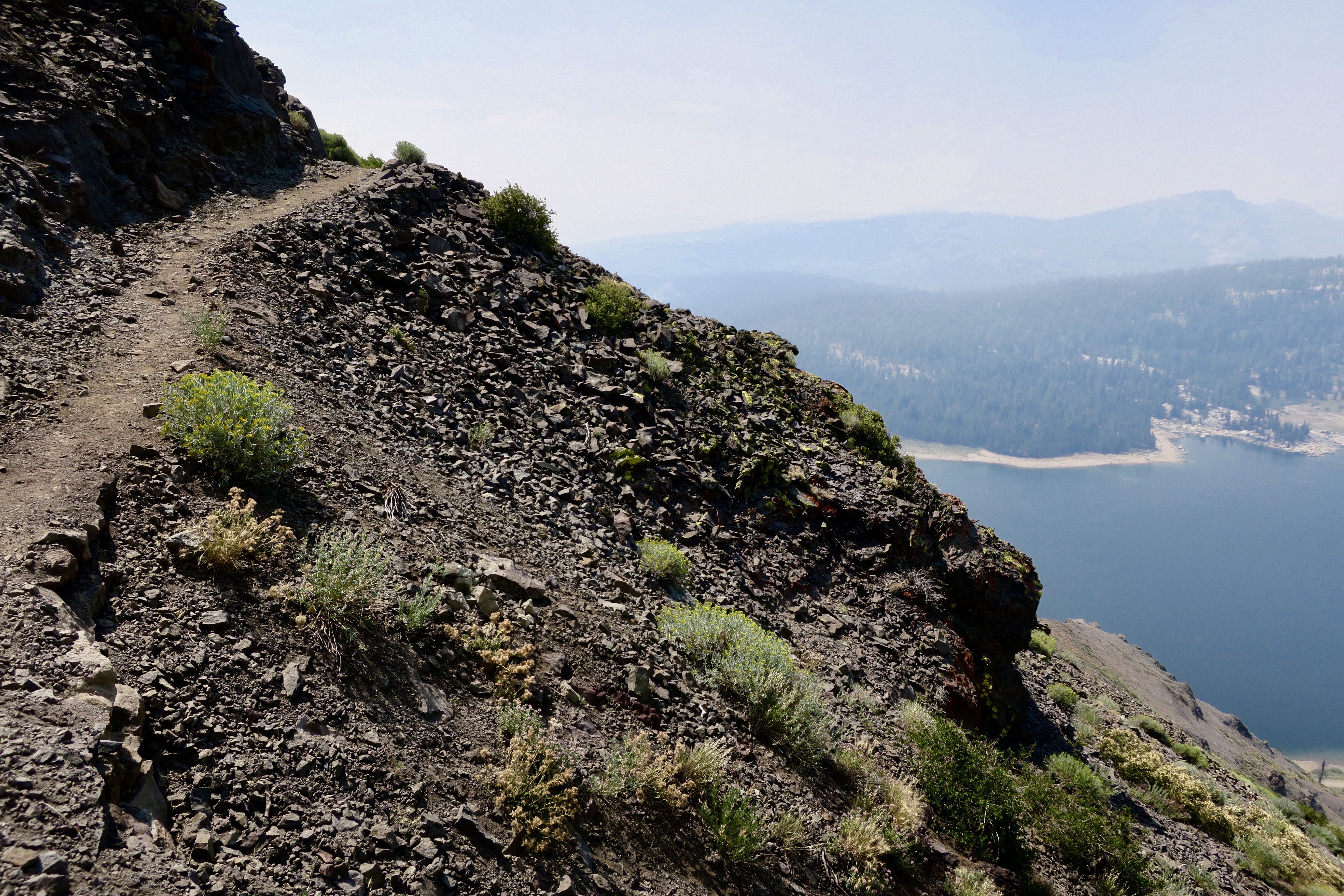
On the subject of ‘far away views’ seen from the PCT in the Marble Mountain Wilderness, here are two more. These are the Trinity Alps.Beautifully green.When I left off in my last post, I was just coming up to Paradise Lake. I was captured by the reflections, in the lake and……this outcrop of lime above the lake.The sign told me that I had left Paradise Lake and was on my way to Marble Valley. It seemed like an easy walk, but don’t quote me. Some photos from along the way.One of the names of this Mariposa Lily is cat’s ear. It’s easy to see why.Always a favorite: Penstemon.The value of this tree isn’t in its board feet, which is how the Trump administration sees it. It is in its beauty. Old growth forests deserve our protection.I’m glad I wasn’t around when this gorgeous chunk of limestone came rolling down the mountain.I came on this patch of snow shortly afterward. I planned my trip to allow time for most of the snow along the trail to melt. Hiking in snow is hard and requires extra caution in the summer when it often melts beneath the surface. The trail then took me past this limestone outcrop up close.Looking up, a view of Marble Mountain was one of the treats I found in Marble Valley.As was looking down. Dozens of butterflies in the mud next to a stream provided a photo op.Close up!My hike through the rest of the Marble Mountain Wilderness featured hiking across scree/talus covered slopes…Past serene mountain lakes…Through a high mountain meadow with an rock filled stream…And covered in flowers. Including rosy spiraea.Red mountain heather.Siskiyou lewisia.And Western Pasqueflower also known as Dr. Seuss mop heads.Past more old growth giants,More mountains,And forests.Until I came to this rock. “We’re all mad here. Be you!” Bone, who’s never been anything but, insisted on having his photo taken with the rock. I found several of these rocks along the way, usually near a trailhead. I was getting excited.Peggy would be somewhere near with her welcoming smile and cold beer.She caught a photo of me hoofing it up the mountain!I got an extra long and tight hug for having finished/survived my first solo section of my 750 mile Trek down the PCT. And a cold beer. Cheers.As you read this post, Peggy and I are on a backpack trip into the Five Lakes Basin north of I-80 in the Sierra Nevada Mountains. It’s where I made my first ever backpack trip in 1969, a while ago. It’s also the first place I ever took Peggy on a backpacking trip. That was in 1990 just after we met. She requested that we hike in to the basin as part of her 75th Birthday Celebration. This is a photo of the Black Buttes that overlook the basin at sunset. The trip will be our next post. Can a 75 year old and an 82 year old still pull it off? Grin. Wish us luck!Our post after the Five Lakes Basin will take you into the Canyon de Shelly with its towering cliffs and marvelous pictoglyphs and petroglyphs, which brings me to a reminder: If you enjoy word searches or know someone who does, Peggy’s new book on the unique and magical petroglyphs of the Southwest makes an excellent gift, either for yourself or a friend. It’s available on Amazon.
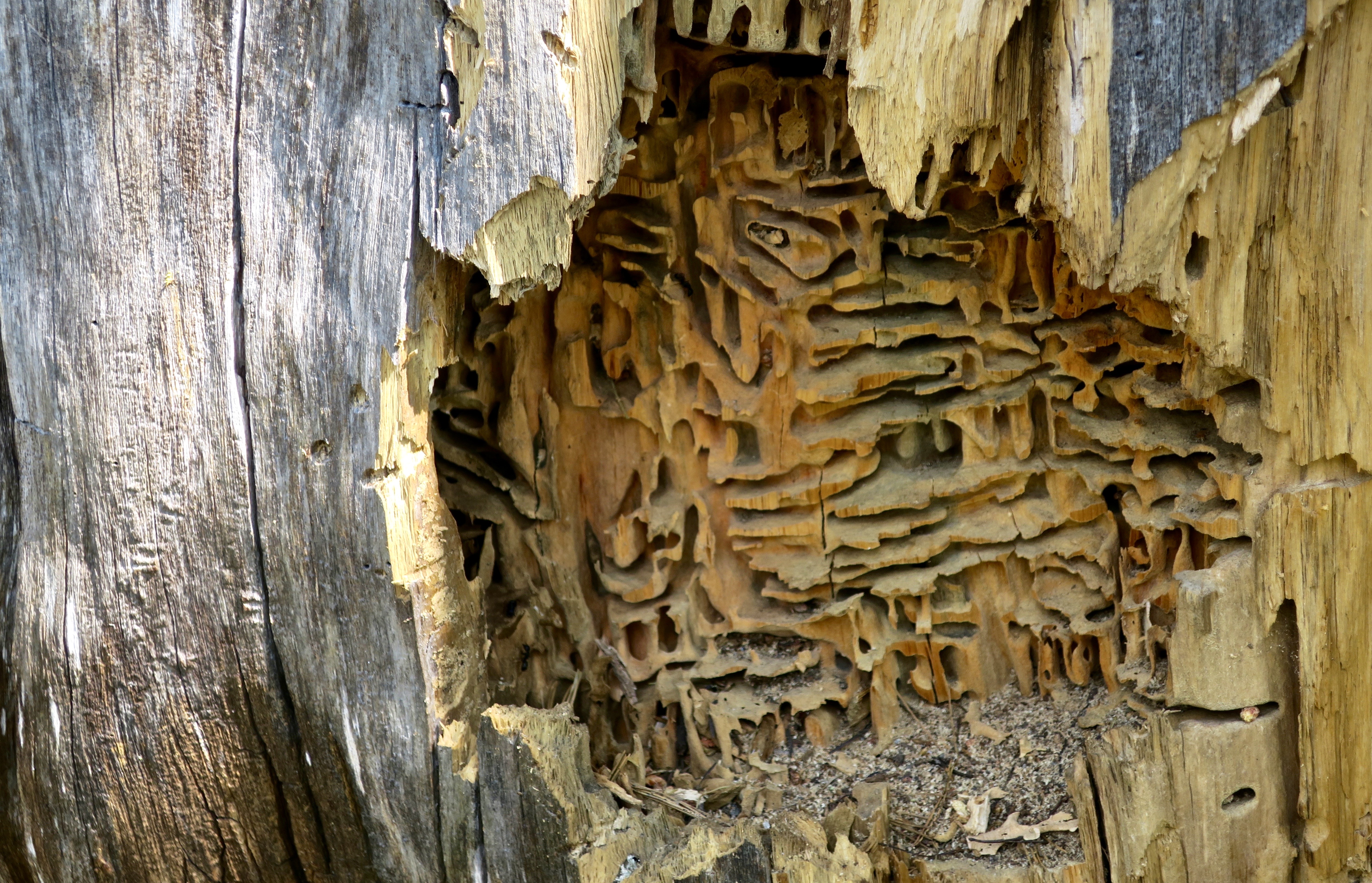
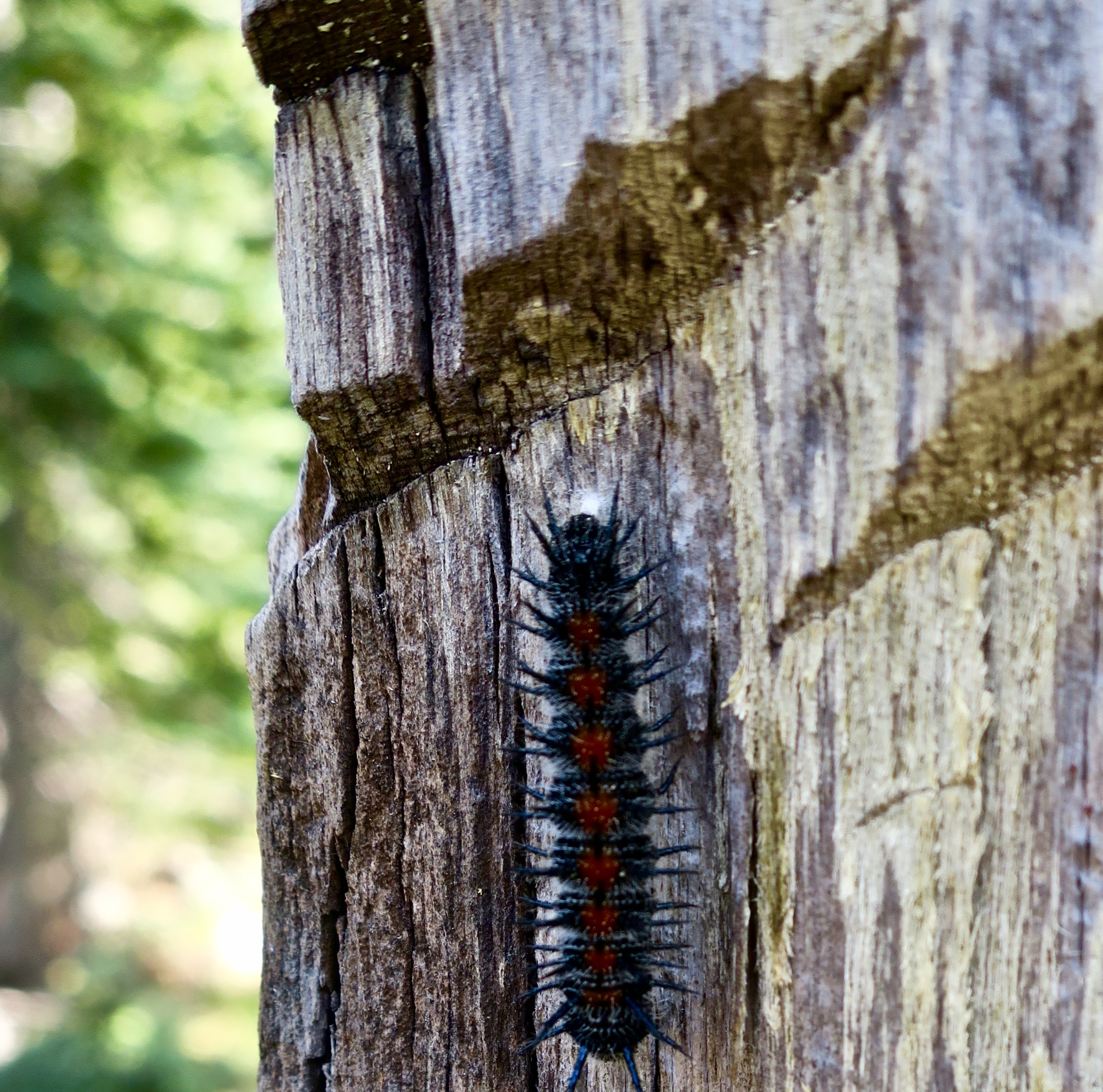
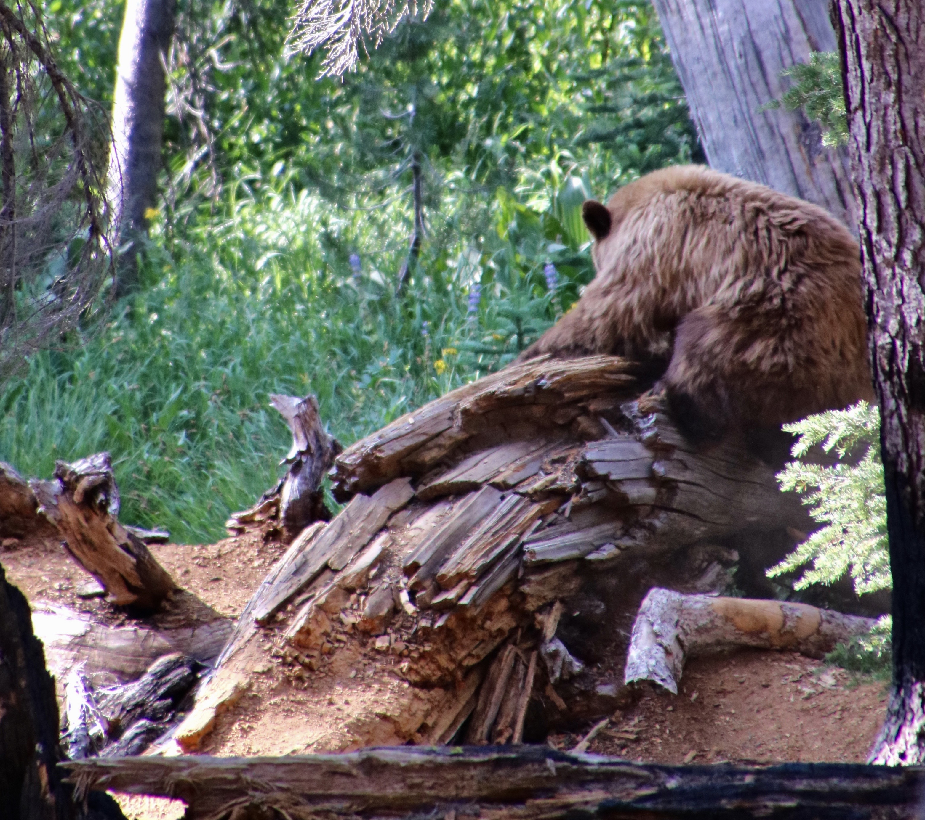
There is a fascinating world to be discovered on America’s pubic lands. For example, you will occasionally find a pile of sawdust next to a dead tree. Odds are that carpenter ants have been at work building an apartment complex. This ‘cut-away’ view in Granite Chief Wilderness provides an inside view of their home. If you are lucky, you will see the ants plying their carpenter trade. They appear out of a crack or hole in the wood with mandibles filled with sawdust, which they drop on their pile and then return to chew/break out another load. Unlike termites, they don’t actually eat the wood. The ants provide a valuable service in the forest breaking down dead wood (not so valuable when it’s the lumber in your house).So, who or what opened up the tree? Clue, it wasn’t me. Nor was it the caterpillar, obviously. I photographed it just above the ant apartment complex for perspective on the size of the slashes just above it. They tell the tale. They are bear claw marks. A bear had torn open the log for breakfast. Or was it lunch?While I was backpacking through Lassen National Park on my 750 mile/75th birthday trek in 2018, Peggy caught this photo of a bear and her cubs opening up a log on a trail near the park’s road. “Dust and wood were flying everywhere!” she told me. Peggy quickly vacated the premises. You do not want to get close to a mama bear with cubs!
Today, Peggy and I are continuing our series on national parks, monuments, wilderness areas and other public lands with an emphasis on their unique beauty, geology, flora, fauna and history that makes them so important to us today— and to our children, grandchildren and future generations. I can only repeat how vital it is at this point in history to let decision makers know how we feel about protecting and maintaining public lands.
In my last post, I discussed a bill by Republican Senator Mike Lee of Utah to be included in President Trump’s “Big Beautiful Bill” that would require the government to sell of 50-75% of BLM and National Forest Lands in America over the next five years. Here’s what the Southern Utah Wilderness Association has to say about the bill:
It bypasses public process, allowing public land to be sold with minimal transparency, and depriving the public of input on the future of their public lands. It also bypasses any environmental, cultural resources or endangered species reviews.
While Senator Lee attempts to make his bill more palatable by claiming that it will create opportunities for affordable housing, it does no such thing. There is no requirement that any housing developed on sold public lands would be affordable or meet any affordable housing requirements.
There is no provision to prevent lands sold under Lee’s bill from being developed into high-end vacation homes, Airbnbs, or luxury housing projects, which would be especially desirable near scenic or high-demand areas.
The bill will primarily benefit real estate developers and speculators rather than addressing real housing needs.
The Pacific Crest Trail Association also noted this week that the bill would have serious implications for the PCT by blocking access to the public lands that the trail now crosses over. The 750 mile trip I did for my 75th birthday would not be possible. But that’s nothing compared to the millions upon millions of people who would forever lose future access to these lands that now belong to all of us. Please, let your Senator know Lee’s bill will do irreparable damage.
But, now on to my post about hiking through the Granite Chief Wilderness on the Pacific Crest Trail.
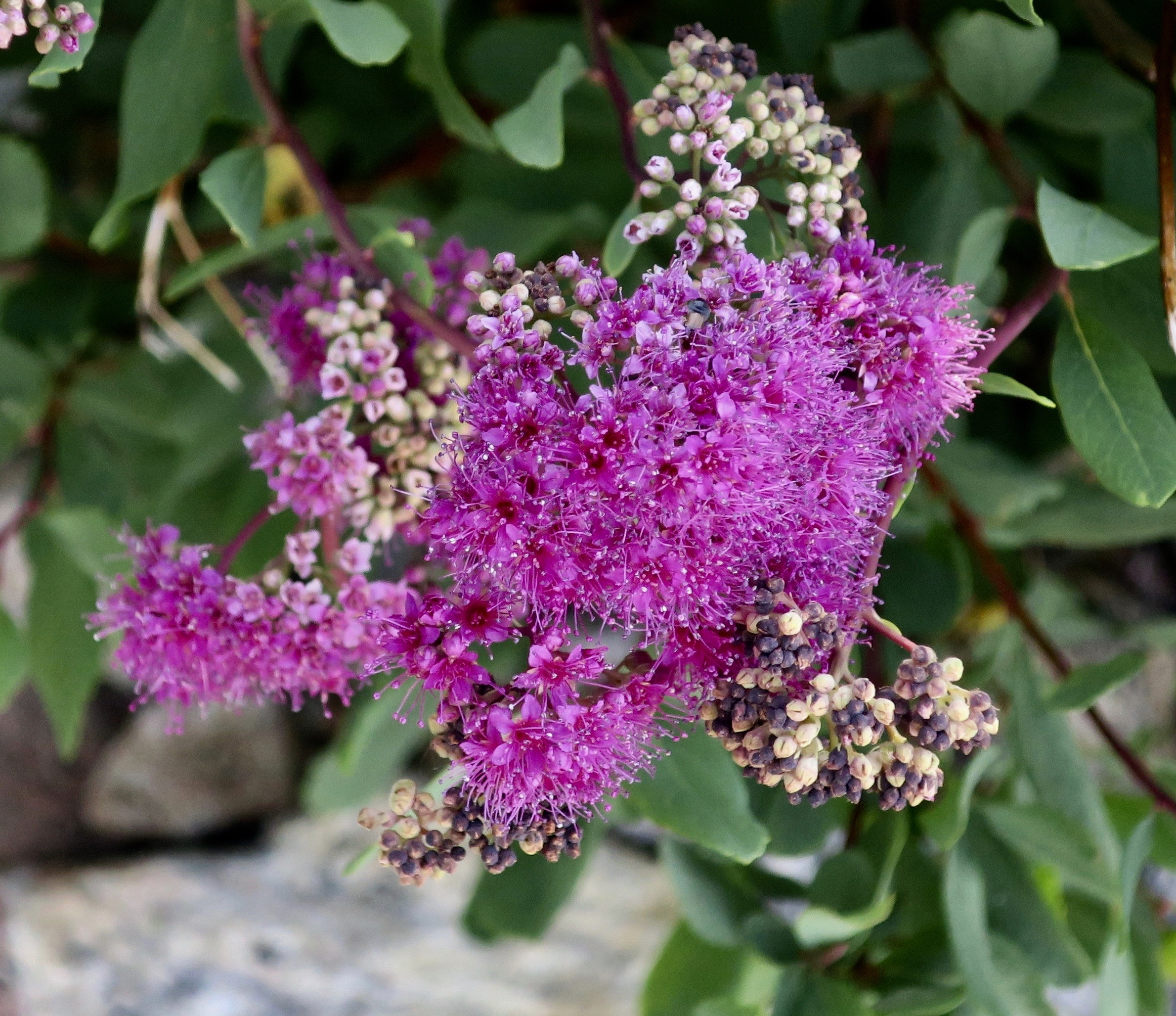
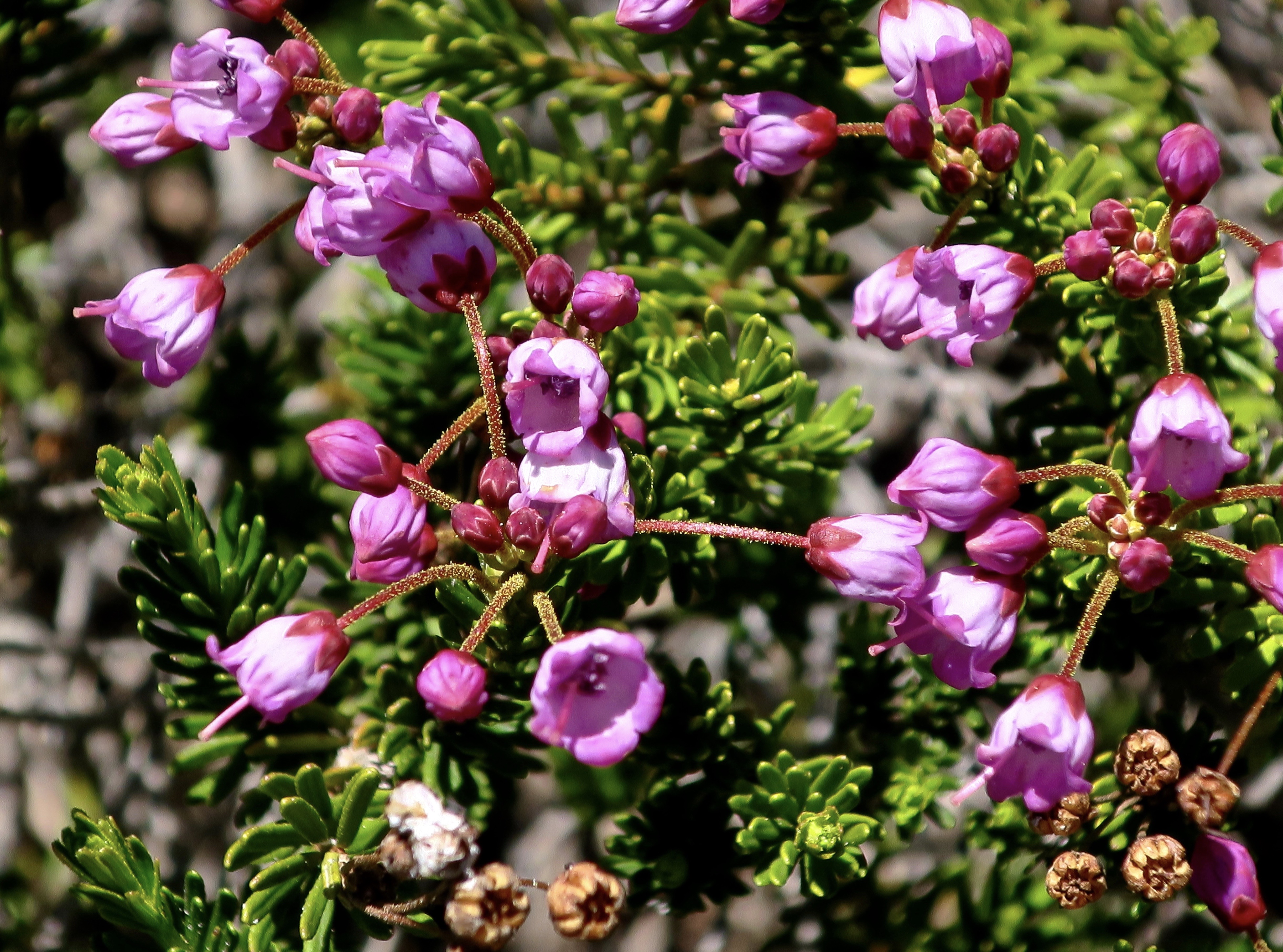
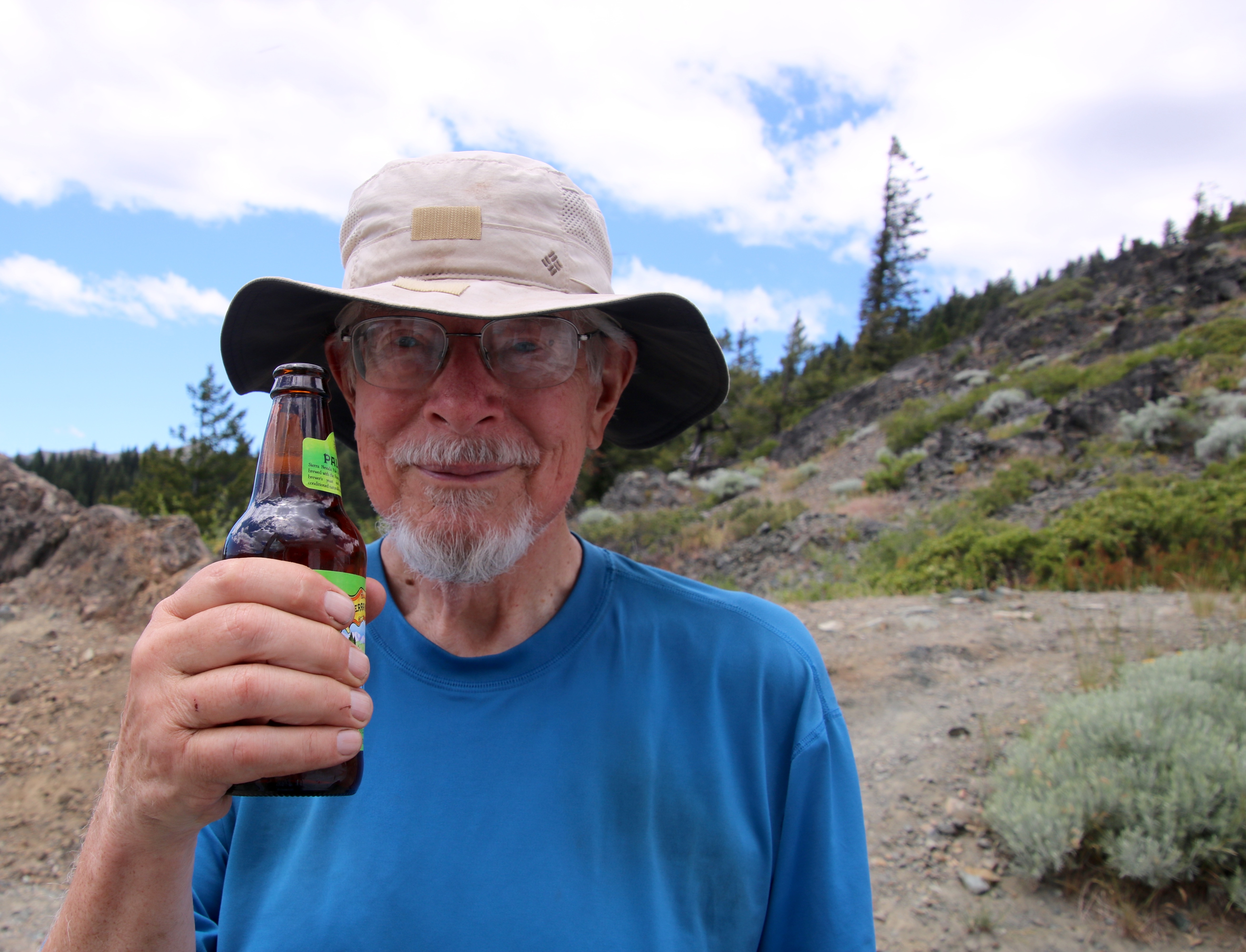
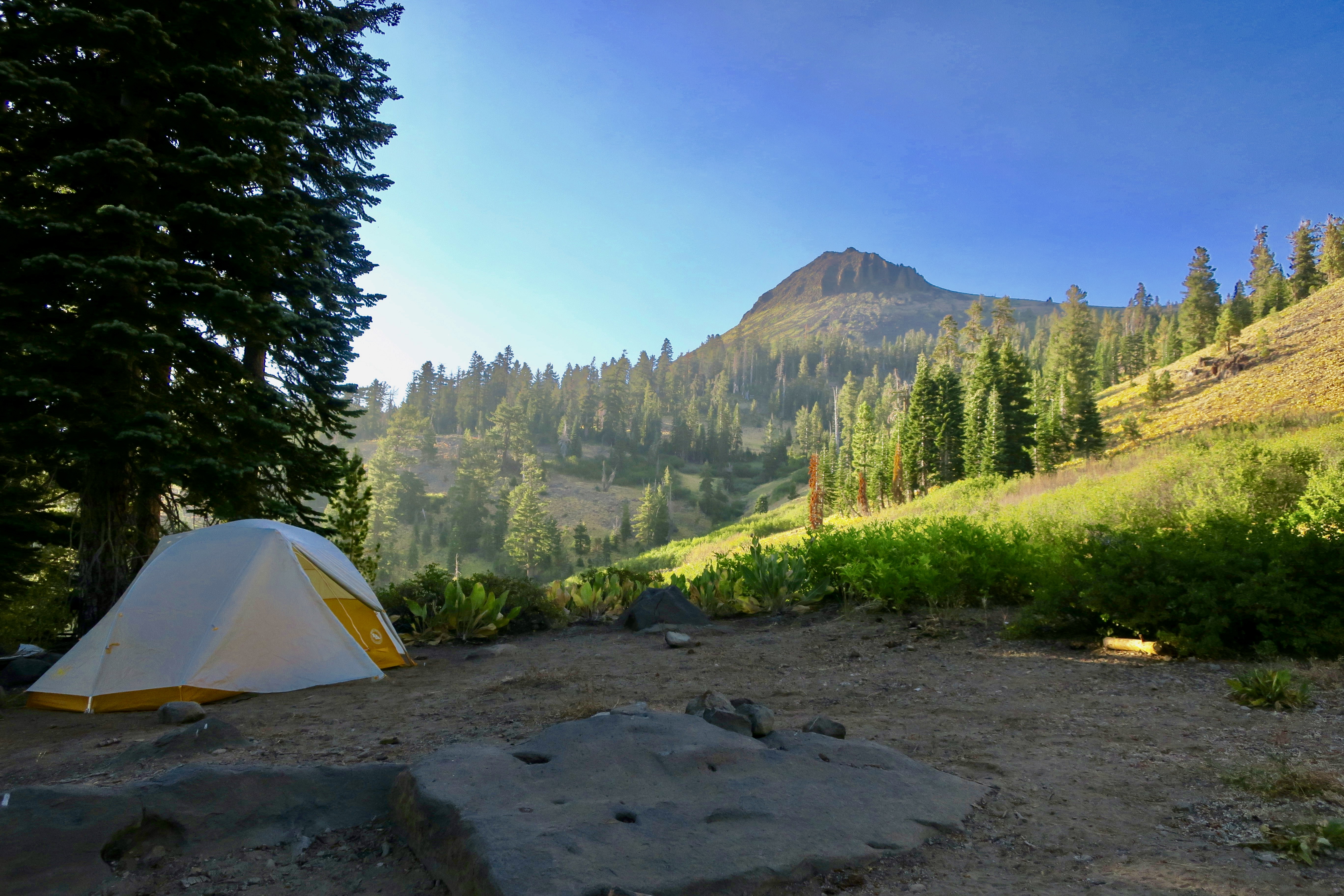
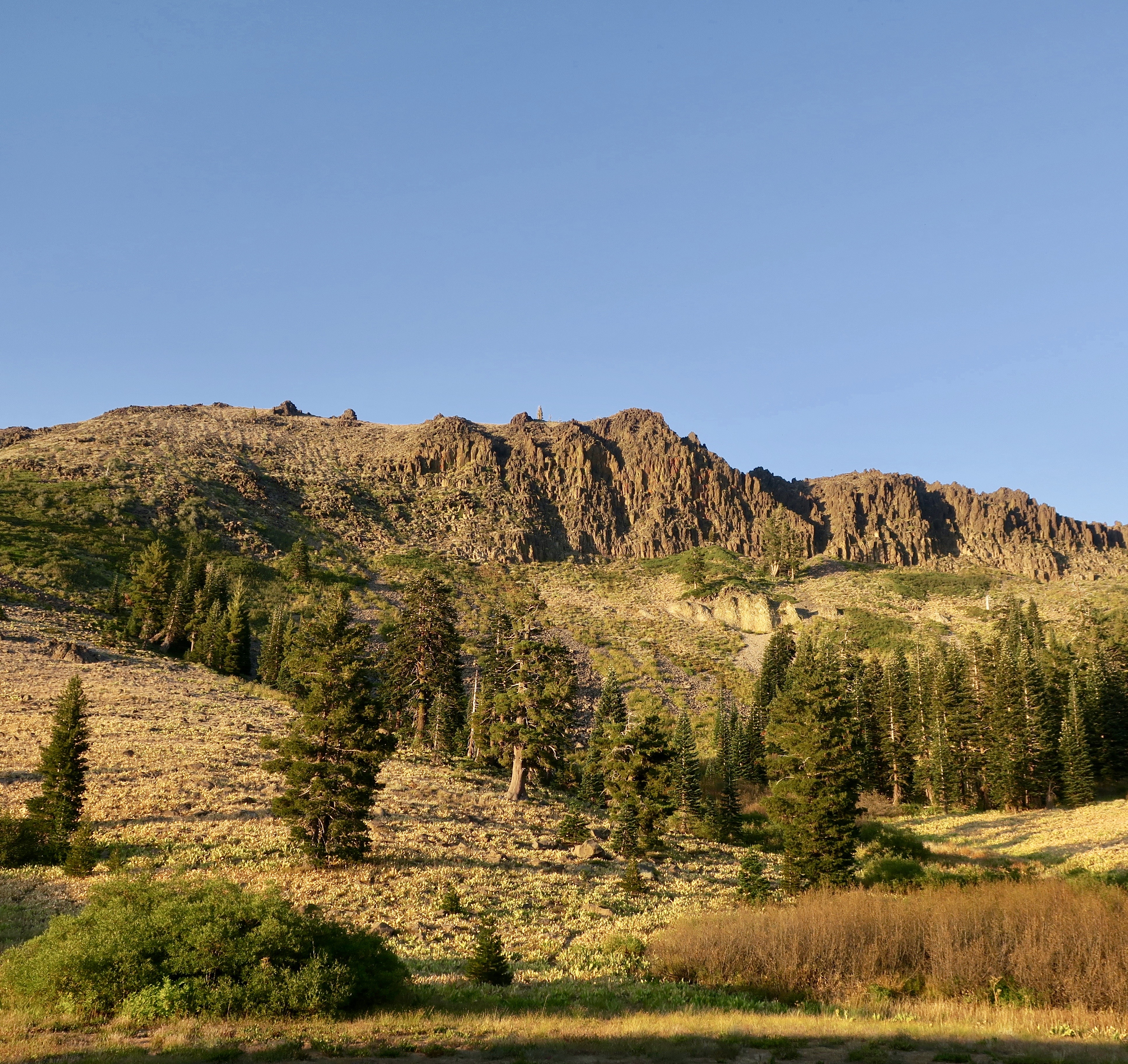
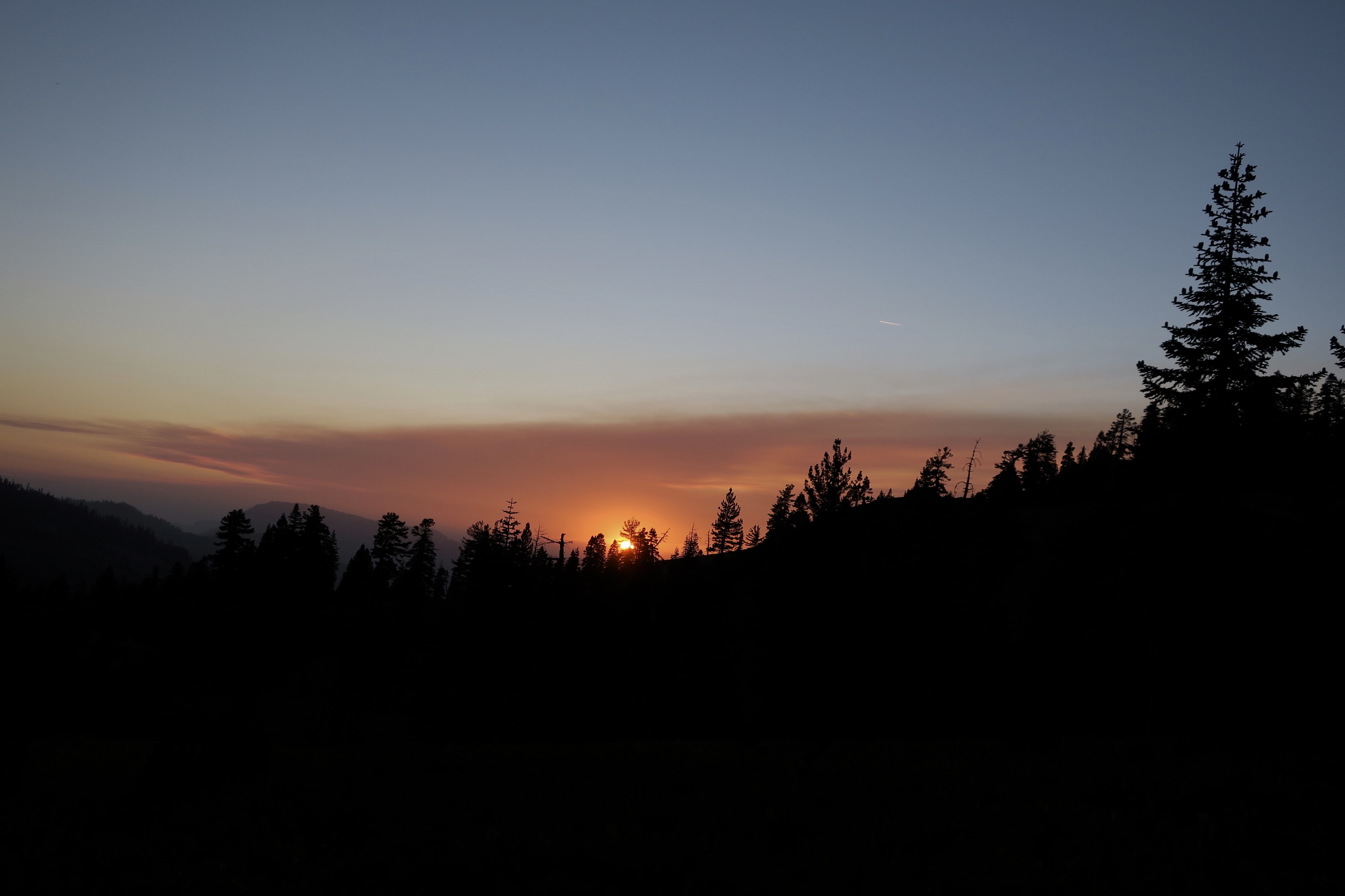
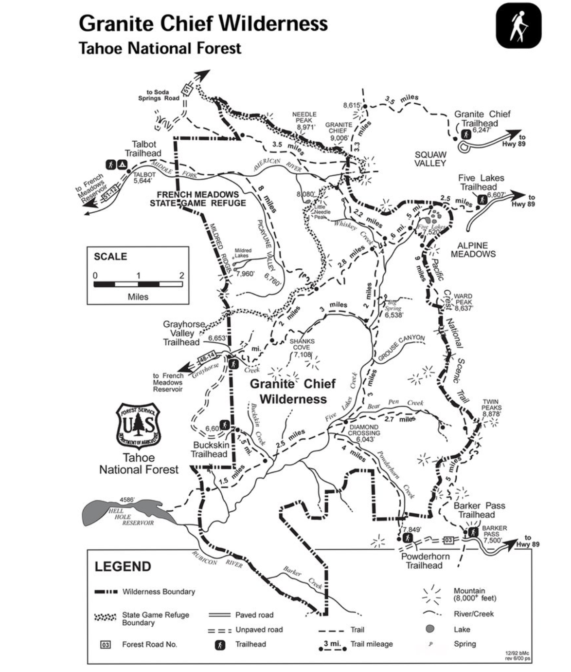
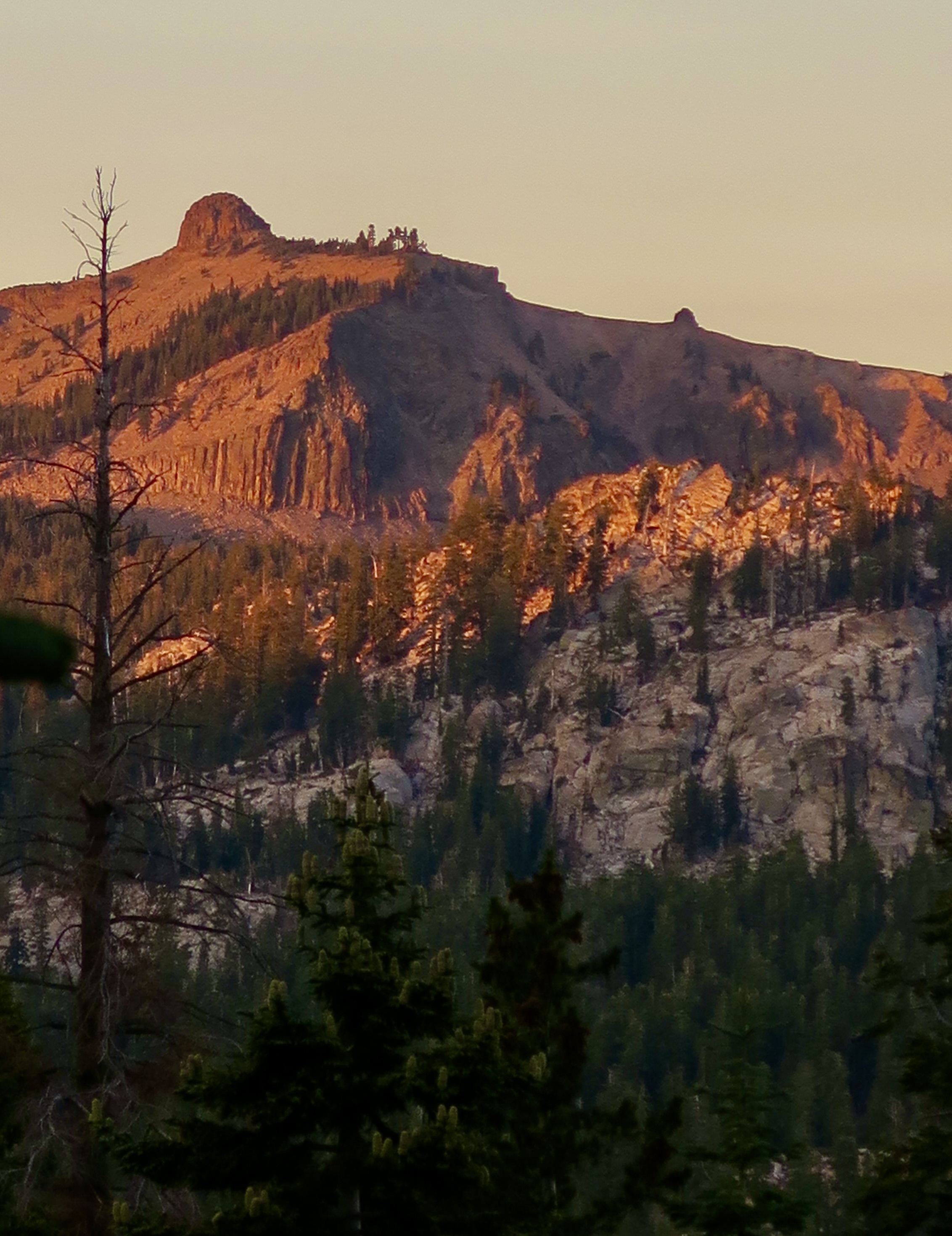
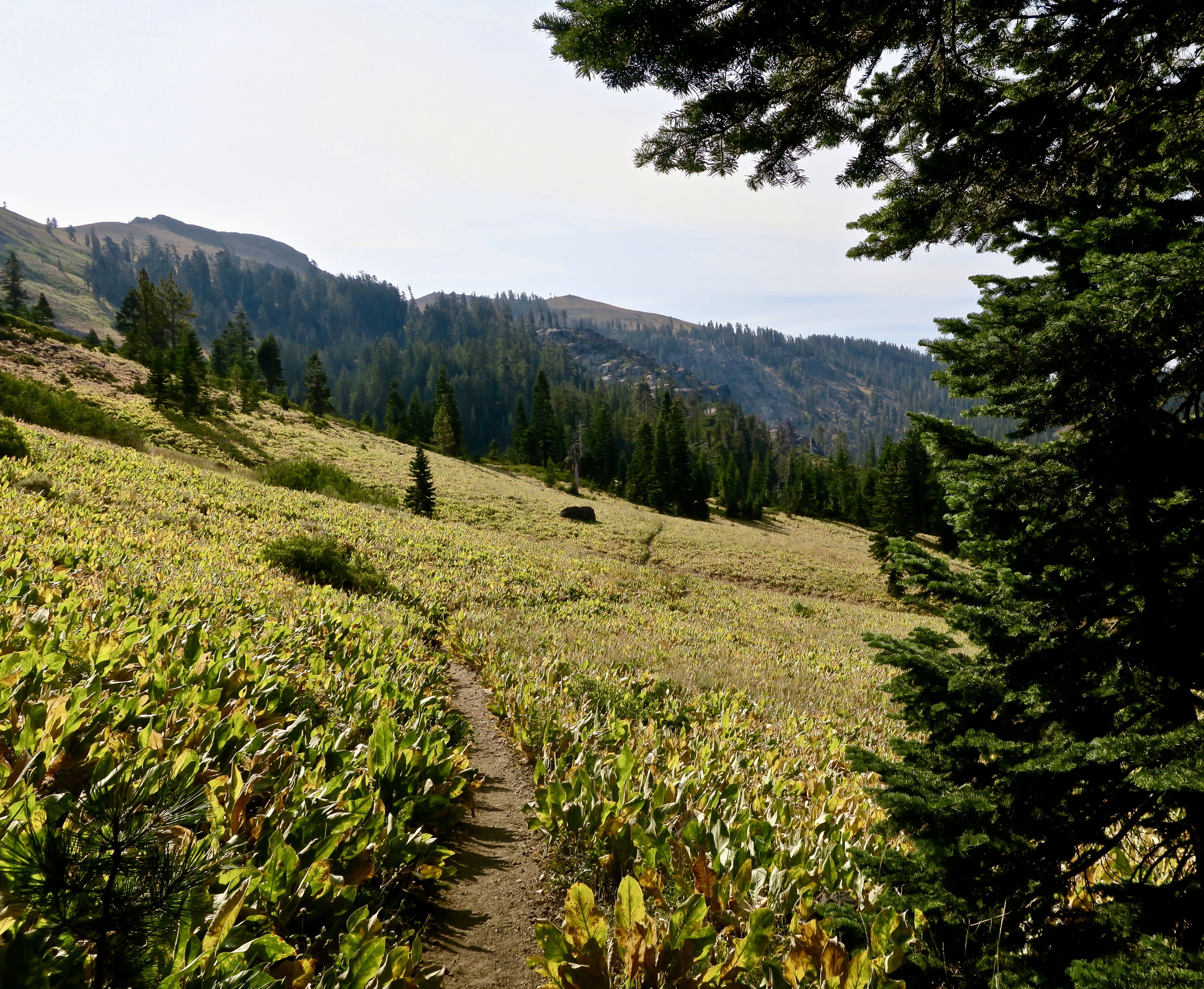
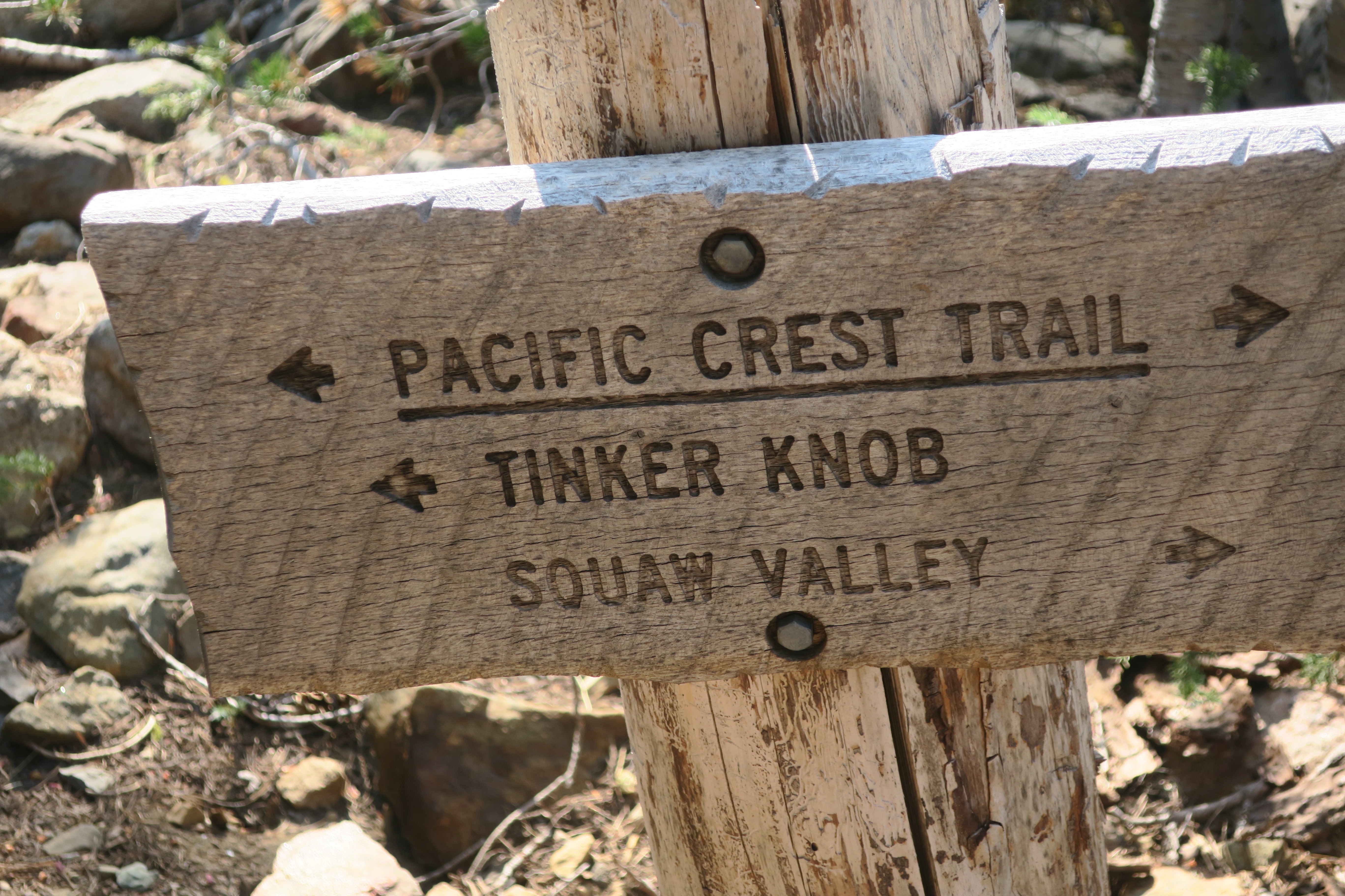
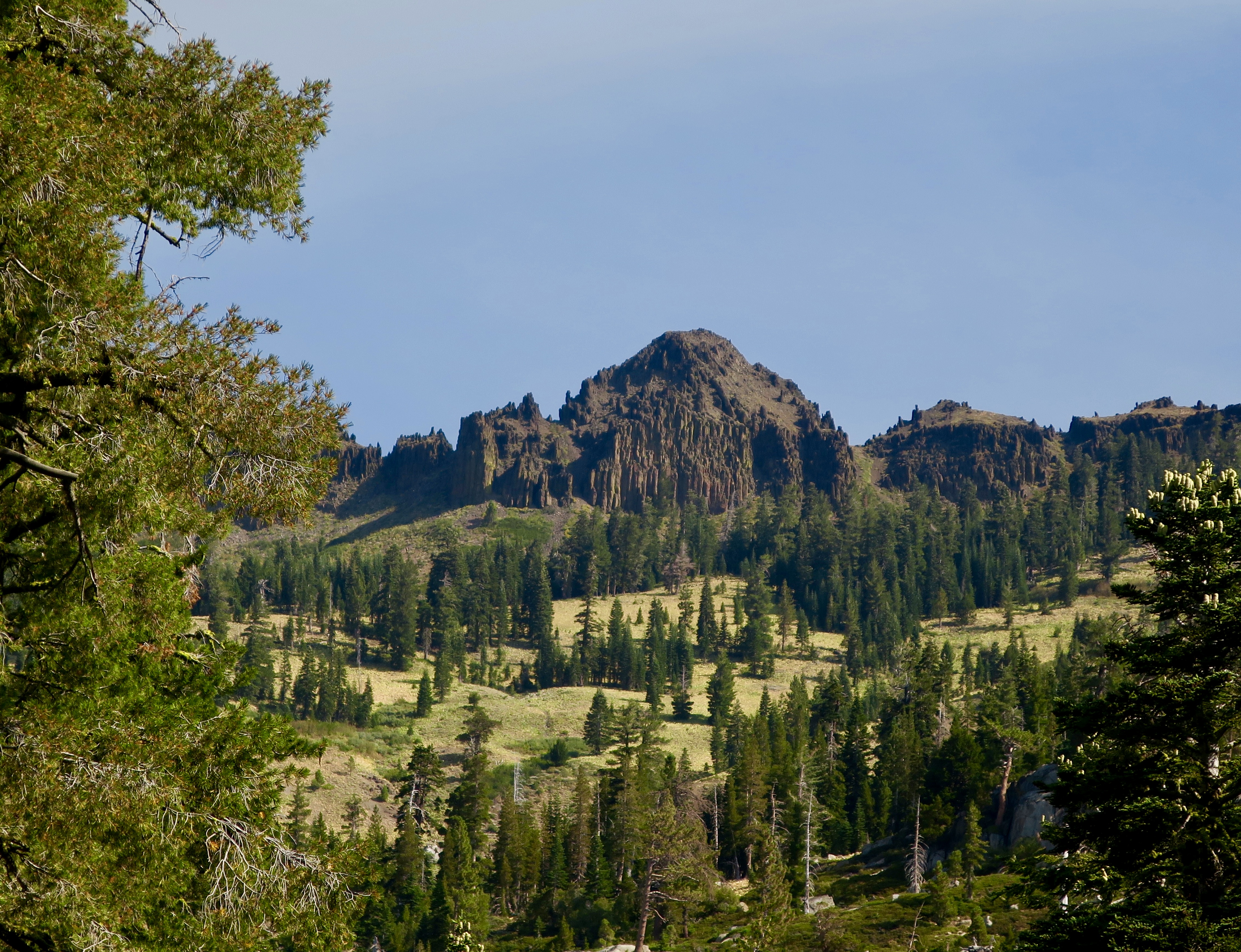
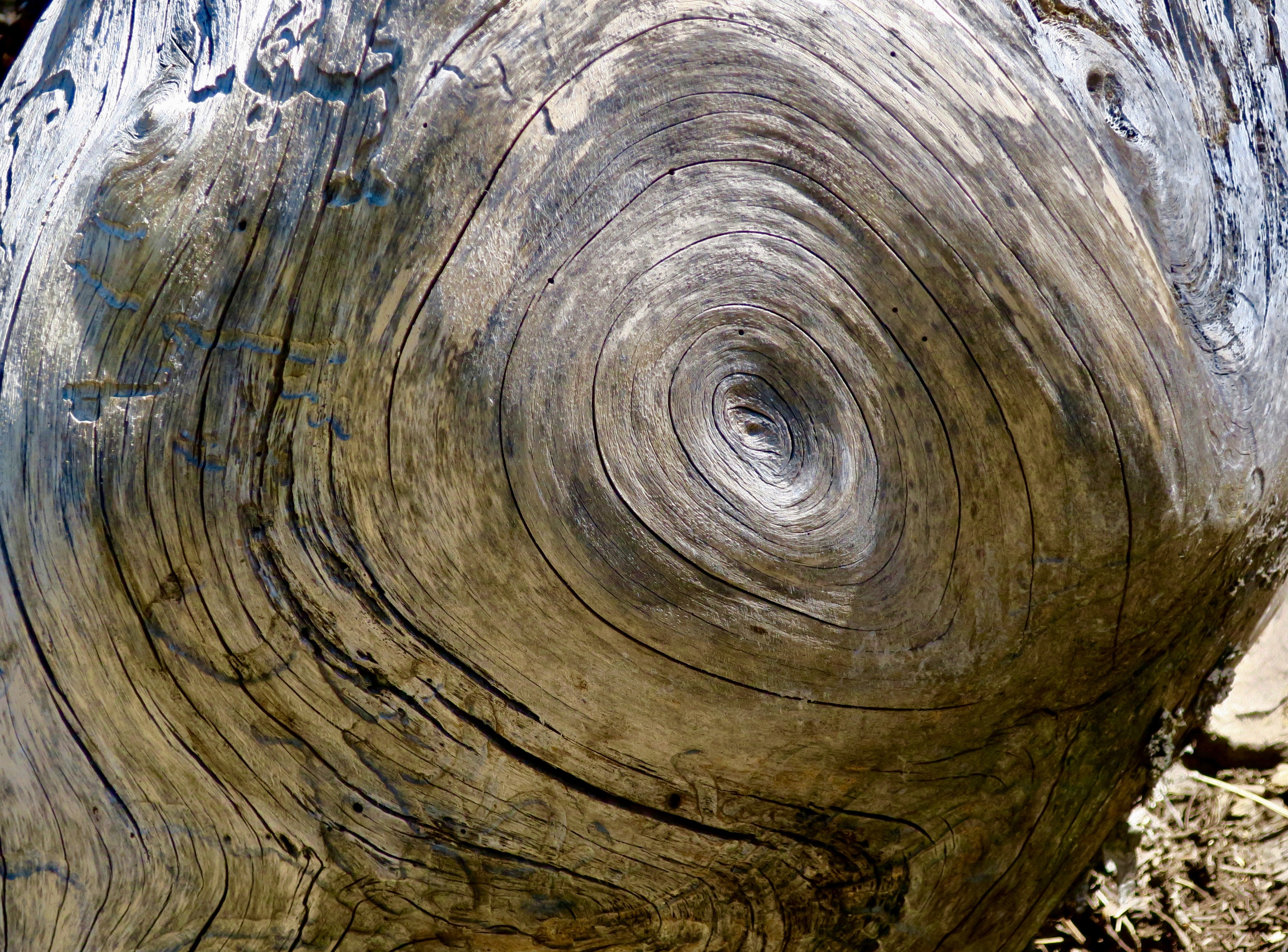
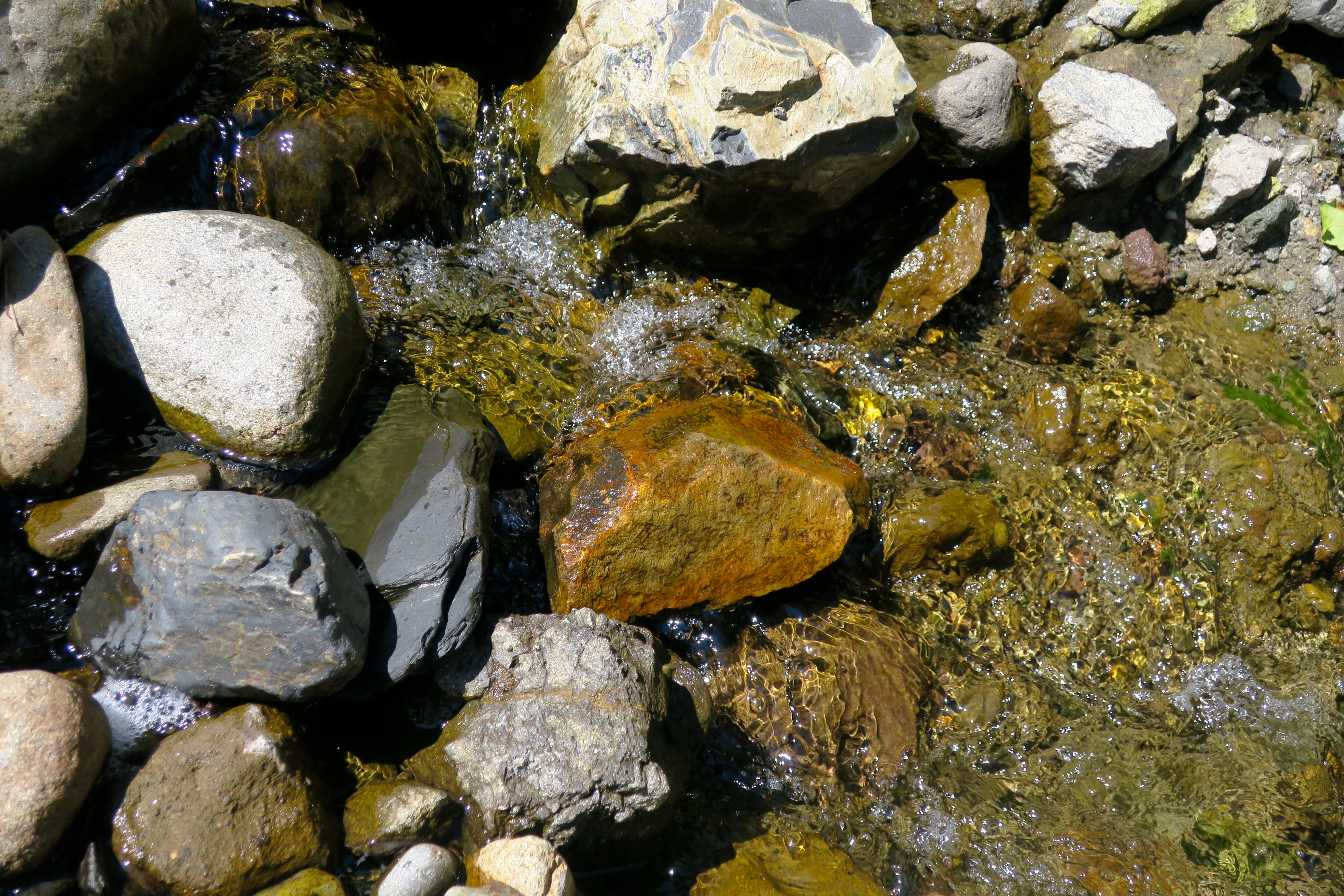
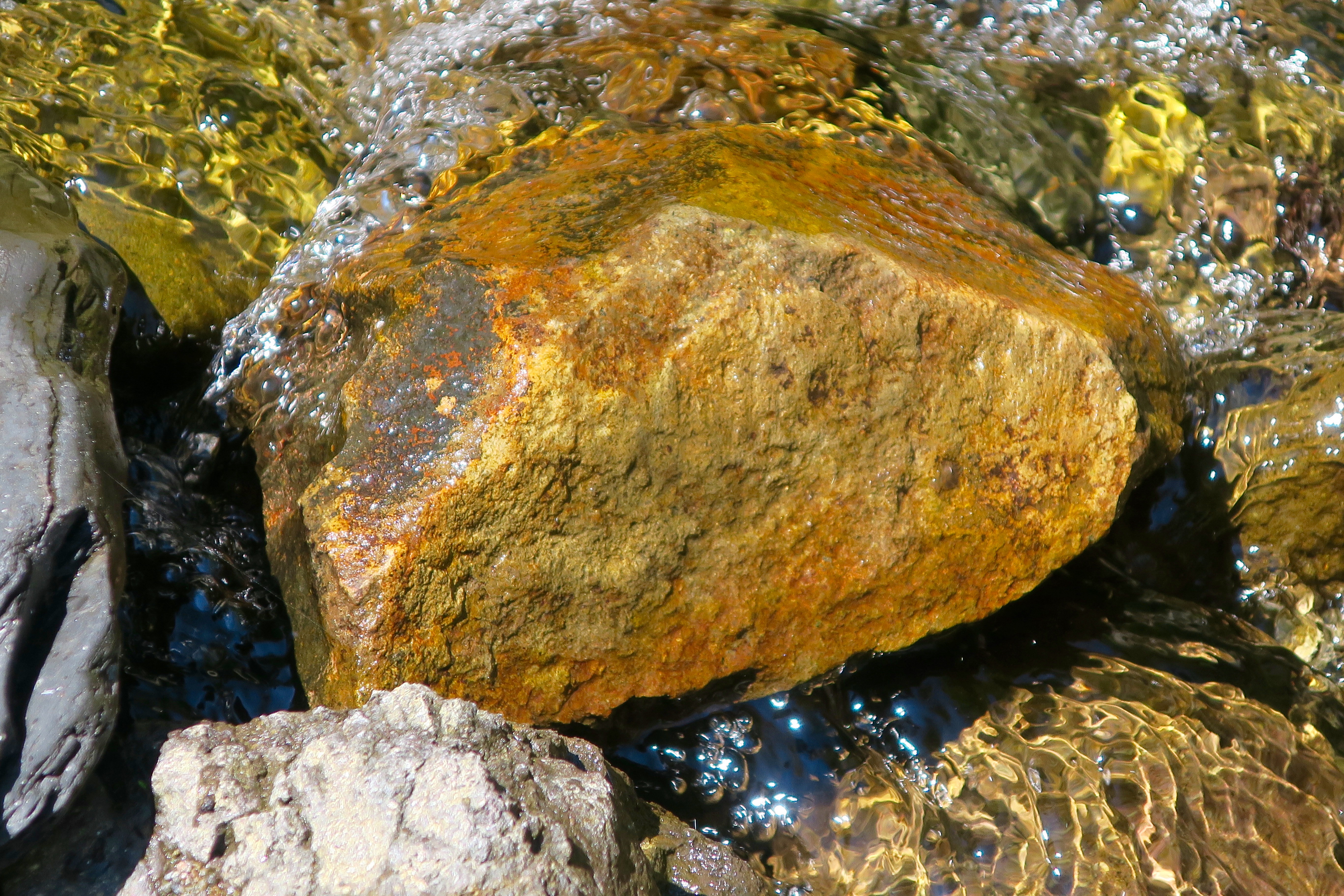
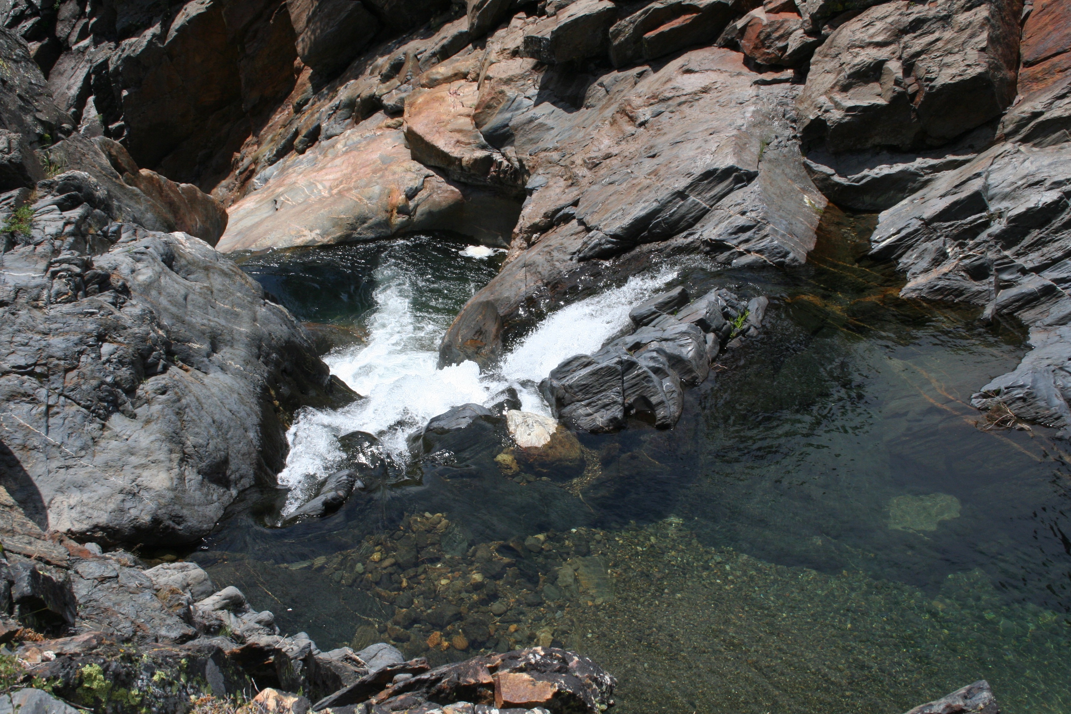
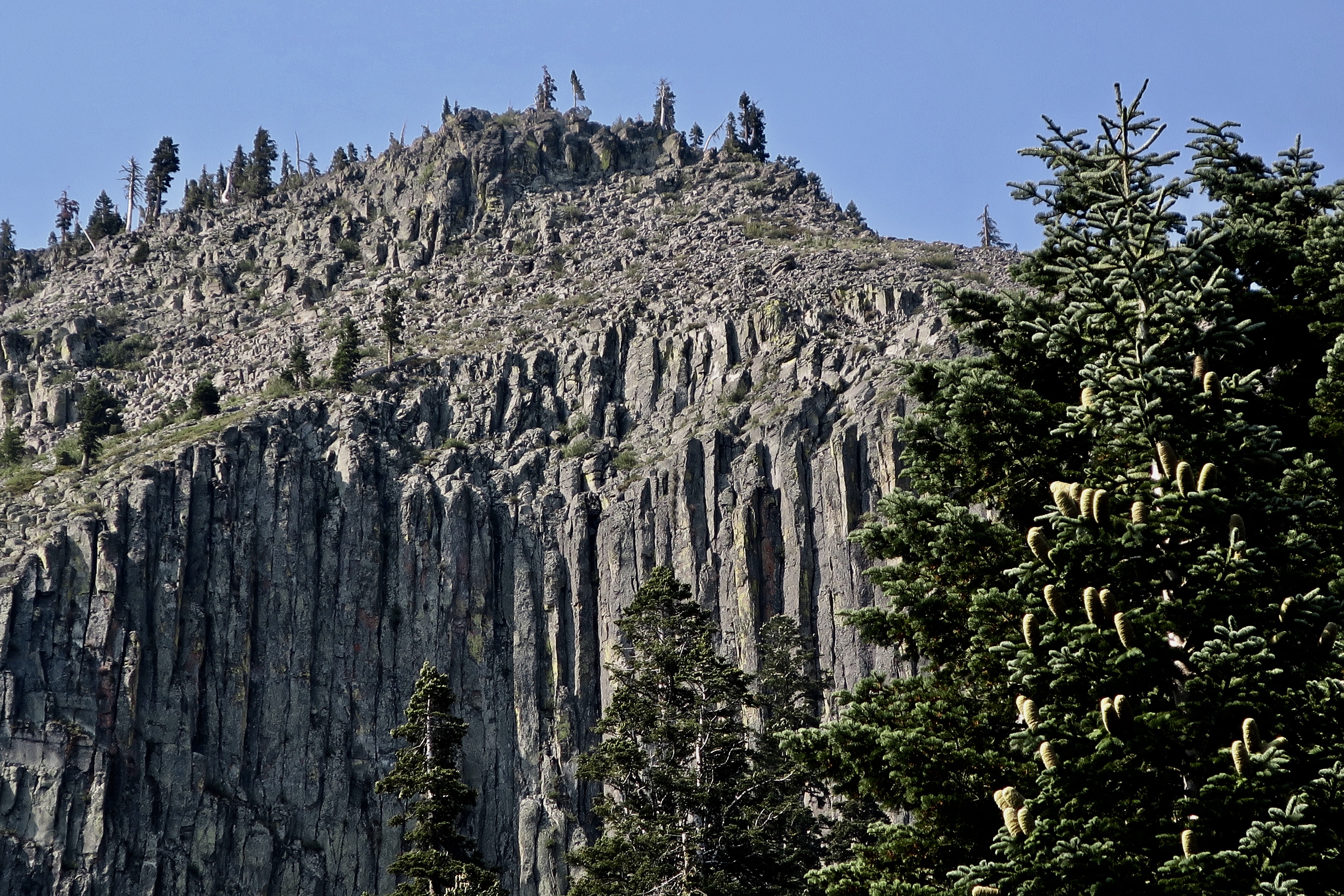
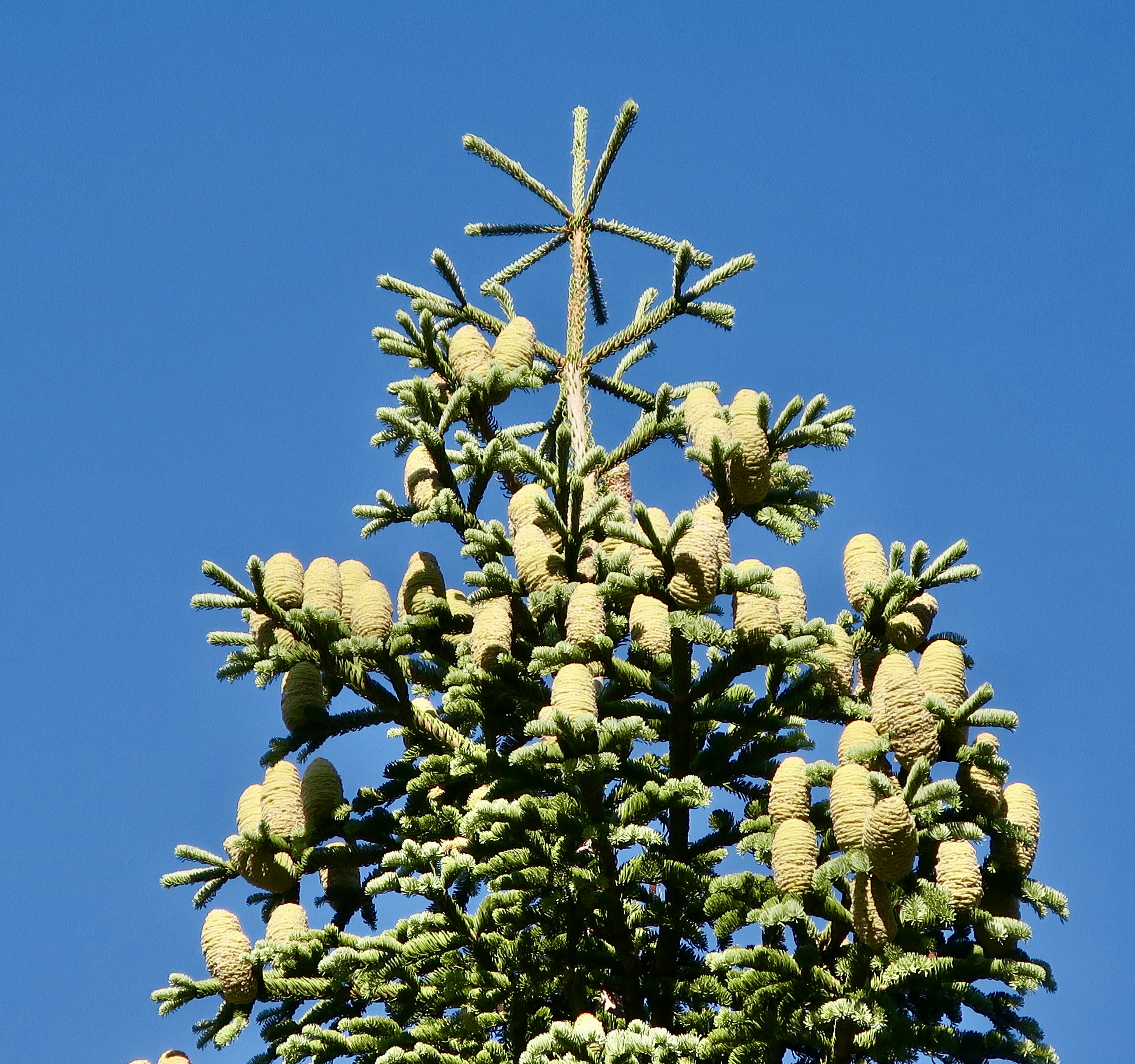
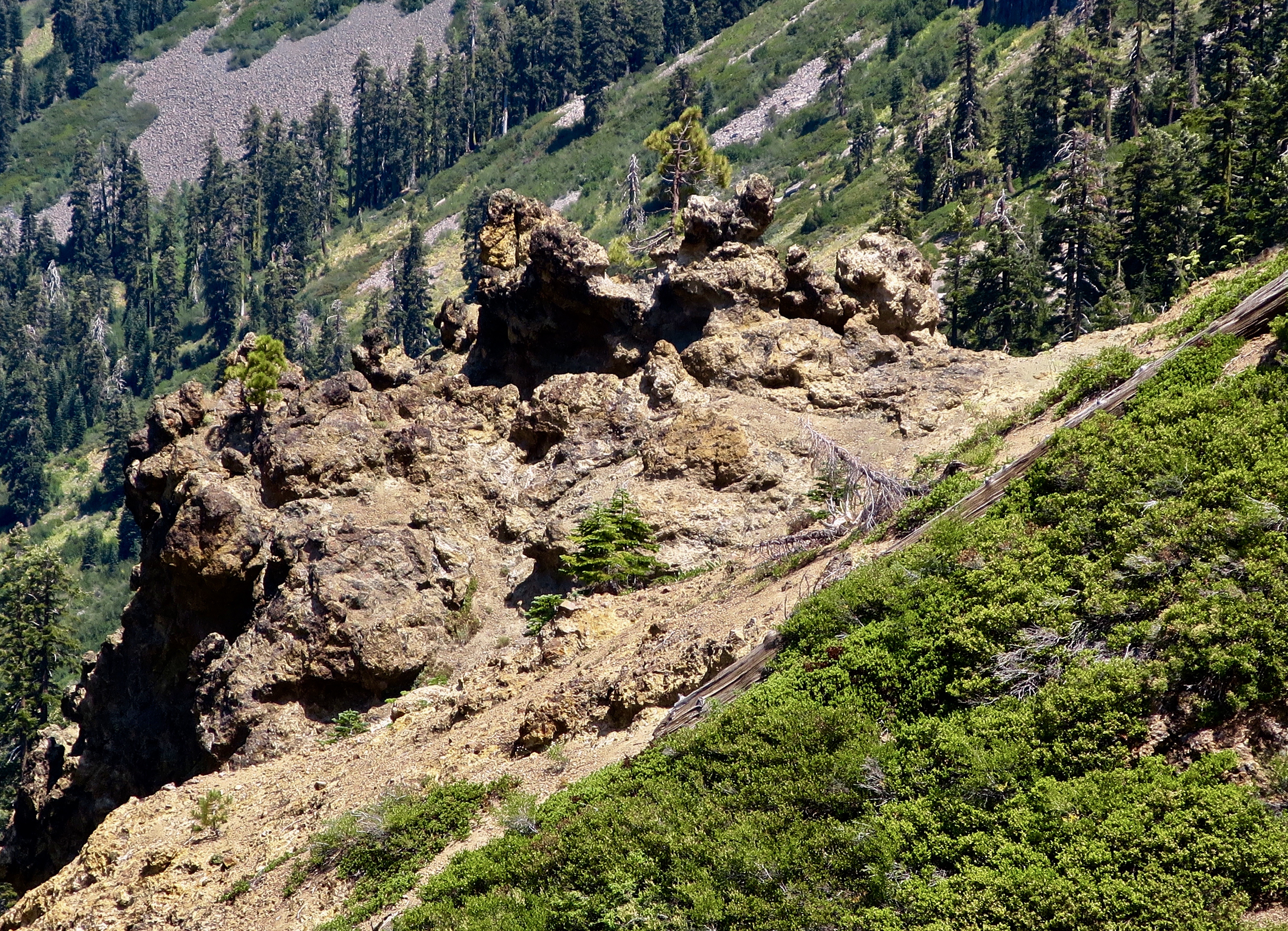
I began this section of the PCT where I hiked through the Granite Chief and Desolation Wilderness areas on historic Highway 40 near the Sugar Bowl and Donner Summit. Before it was replaced by I-80, it was part the Lincoln Highway, America’s first cross country road. Like most of the Sierra Trails I know, the PCT here begins with a climb. The peak you see up ahead is Tinker’s Knob. The Knob, BTW, was named after James A. Tinker, a freight-hauling teamster in the area. Legend has it that it was named after his nose, which was said to resemble the knob.Having got a late start after Peggy dropped me off, I camped that night with a view of Tinker’s Knob. As far as I know, not one other person was camped in the valley. That’s one of the beauties of backpacking.The views from my campsite were gorgeous.I watched as the sun set on Tinker’s Knob, outlining it in golden, warm colors.And then went for a short walk and watched the sun set in the west. A note here: Tinkers Knob is just outside of the Granite Chief Wilderness in the Tahoe National Forest. It’s part of the land that Lee’s bill might open for sale. I can see a land speculator grabbing this and making it available to developers for huge profits who would then sell it to multi-millionaires for homes at even greater profits. No trespassing signs would quickly follow.This map of the Granite Chief Wilderness provides a fairly accurate view of the trail system. Tinker’s Knob is on the top, just outside of the wilderness to the north of the 9005 Granite Chief Pass.I caught this photo the next morning. There are two Needle Peaks in the Granite Chief Wilderness. Needle Peak and Little Needle Peak. This is the former. Both are made up of volcano cores.Leaving my camp, the PCT took me through an extensive field of corn lilies.I came across this old PCT Trail sign placed before the name of Squaw Valley was changed. The name squaw had become controversial. Since the 1960 Winter Olympics were held at the Squaw Valley Ski Resort, the name was changed to Olympic Valley.The Granite Chief Wilderness is just behind the mountains. All I had to do was hike over them.I actually made two trips though the Granite Chief Wilderness on my 750 mile PCT Trek. The first was with my grandson Ethan. We took the tram up from the Olympic Valley floor to reach the wilderness area and then hiked through Granite Chief Wilderness and part of the Desolation Wilderness when Ethan sprained an ankle. I decided on a do-over starting at historic Highway 40. I needed the miles given the areas I had to skip because of forest fires. The following photos are from both trips.Ethan and I spent our first night at Little Needle Lake beneath Little Needle Peak. It’s a relatively short hike from where we got off the tram and an old favorite of mine going all the way back to the 1974 when I first started leading hundred mile backpack trips through the Sierras.Instead of following the PCT through the Granite Chief Wilderness, we dropped down off the ridge to Five Lakes Creek. Once, this trail marker, known as a blaze, would have marked the trail along the creek. It’s likely that carpenter ants carved the holes.Another old blaze on a tree that still lives. I’ve followed blazes many times over the years. Especially when the trail disappeared under the snow.A limb came out of this snag when the tree was young. The rings take you back in time to its youth. I thought it made a neat photo.A small amount of water was still flowing in Five Lakes Creek.The trail follows the creek for five miles and reaches what is known as Diamond Crossing where I have often camped.Earlier in the season there is a small, but photo-worthy waterfall just up Five Lakes Creek from Diamond Crossing.With a great swimming hole to cool off in.The trail leaves the canyon at Diamond Crossing and heads up a long steep climb following Powderhorn Creek. I heard something splashing in Powderhorn on my second trip when I was by myself. I snuck up and discovered two bobcats frolicking in the water. They took off before I could get my camera out but I was able to pick up one very wet track left behind.I continued to follow their trail out of the canyon. Here kitty, kitty, kitty.By late August most of the flowers were finished, but I did find abundant goldenrod…And Queen Anne’s Lace.There is ample evidence of volcanic activity throughout the Sierras. This view is of a basalt lava flow that cooled and contracted into vertical hexagonal columns can be seen from the upper section of the Powderhorn Creek trail. The tree on the right is a red fir. Unlike pine cones, red fir cones disintegrate. Another view of ancient volcanic activity: A volcanic mudflow. I believe the talus slope in the background is from the basaltic lava flow.The climb up from Diamond Crossing is no joke. Ethan had every reason to celebrate! The Granite Chief Wilderness stretches out to the farthest peaks in the background where Ethan and I started and I had hiked twice in a row. You can barely see Big Needle Peak below Ethan’s right arm. The Barker Pass road provides and easy exit or entry point for both the Powderhorn Creek Trail and the PCT.
Peggy and I will be taking a break from our blog over the next three weeks. We are in Sacramento this week visiting with friends and relatives. Next week we are flying to Florida where we celebrate Peggy’s 75th Birthday with our son and his family. The following week we fly back here and will continue to celebrate. This time with a backpack trip retracing the route of the first backpack trip I ever took— in 1969! Then we will continue our exploration of the southwest and blog series.
“The clearest way into the Universe is through a forest wilderness.” John Muir
A small unnamed lake reflects the beauty and peace of the Mokelumne Wilderness. There’s a chance that John Muir stopped to admire it, given all of the time he spent exploring California’s Sierra Nevada Mountains. I’ve spent a bit of time wandering there as well— starting in 1957.
The Wilderness Act of 1964
“A wilderness, in contrast with those areas where man and his own works dominate the landscape, is hereby recognized as an area where the earth and its community of life are untrammeled by man, where man himself is a visitor who does not remain.” –Howard Zahniser, Author of the Wilderness Act
What does this mean? Transportation is by foot or horse. No bicycles or motor vehicles are allowed. Even chainsaws are banned for use on trail maintenance. No one can build permanent structures of any type. It’s just you and nature.
As of 2023, there were 806 wilderness areas located in 44 states and Puerto Rico. These areas are overseen by the National Park Service, the US Forest Service, the US Fish and Wildlife Service, and the US Bureau of Land Management. All in all, some 5% of land in the US is set aside as wilderness area, the majority in Alaska.
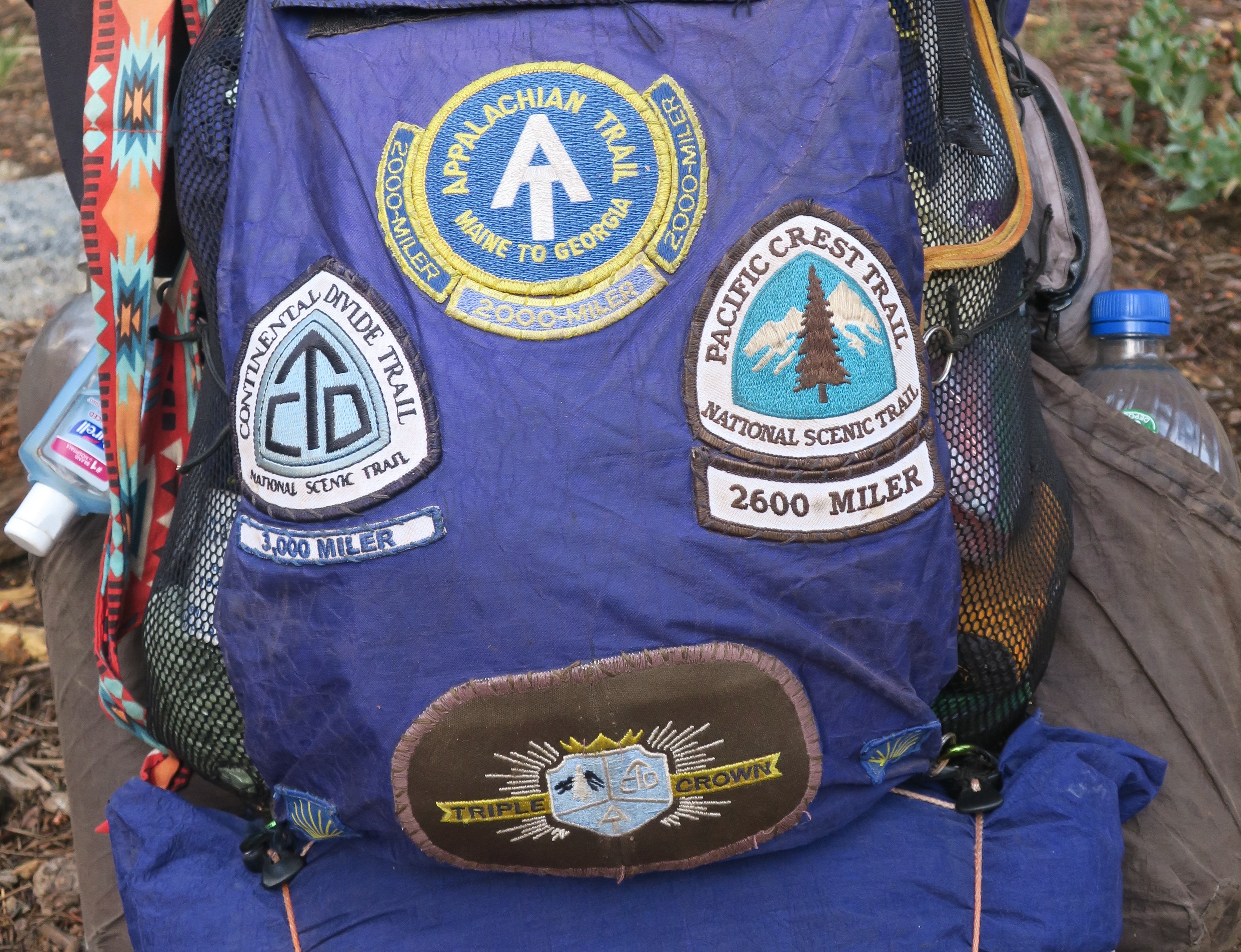
Over the past three months, I’ve been blogging (with Peggy’s help) about our national parks and monuments with an emphasis on their unique beauty, geology, flora, fauna and history that makes them so important to us— and about the threats that they are presently facing from the Trump Administration. Today we are switching to wilderness areas with the same emphasis. I’m going to cover three that I backpacked through on my 750 mile trip down the PCT in 2018 to celebrate my 75th birthday: The Mokelumne, Granite Chief/Desolation, and Marble Mountains Wilderness areas. If you’ve been with this blog for a while, some of the photos may be familiar to you.
The Mokelumne Wilderness is conveniently located between two of California’s highways that cross the Sierras. Since I was hiking north to south, I started at Carson Pass (elevation 8573’) on Highway 88 and ended at Ebbet’s Pass (elevation 8732’) on Highway 4. The distance on the PCT is approximately 30 miles, which is relatively short— but there are plenty of ups and downs! And, as you will see, great diversity and beauty.
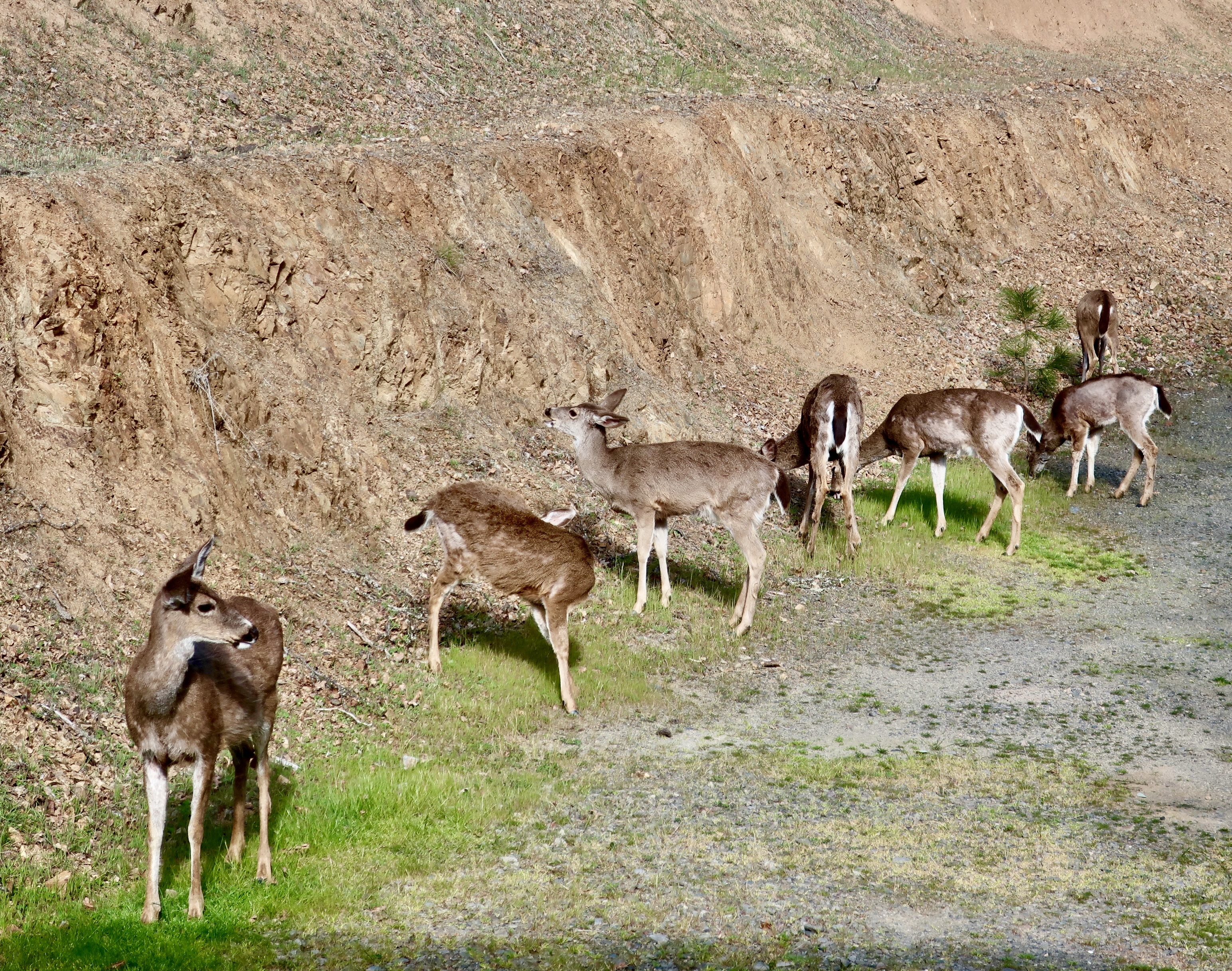
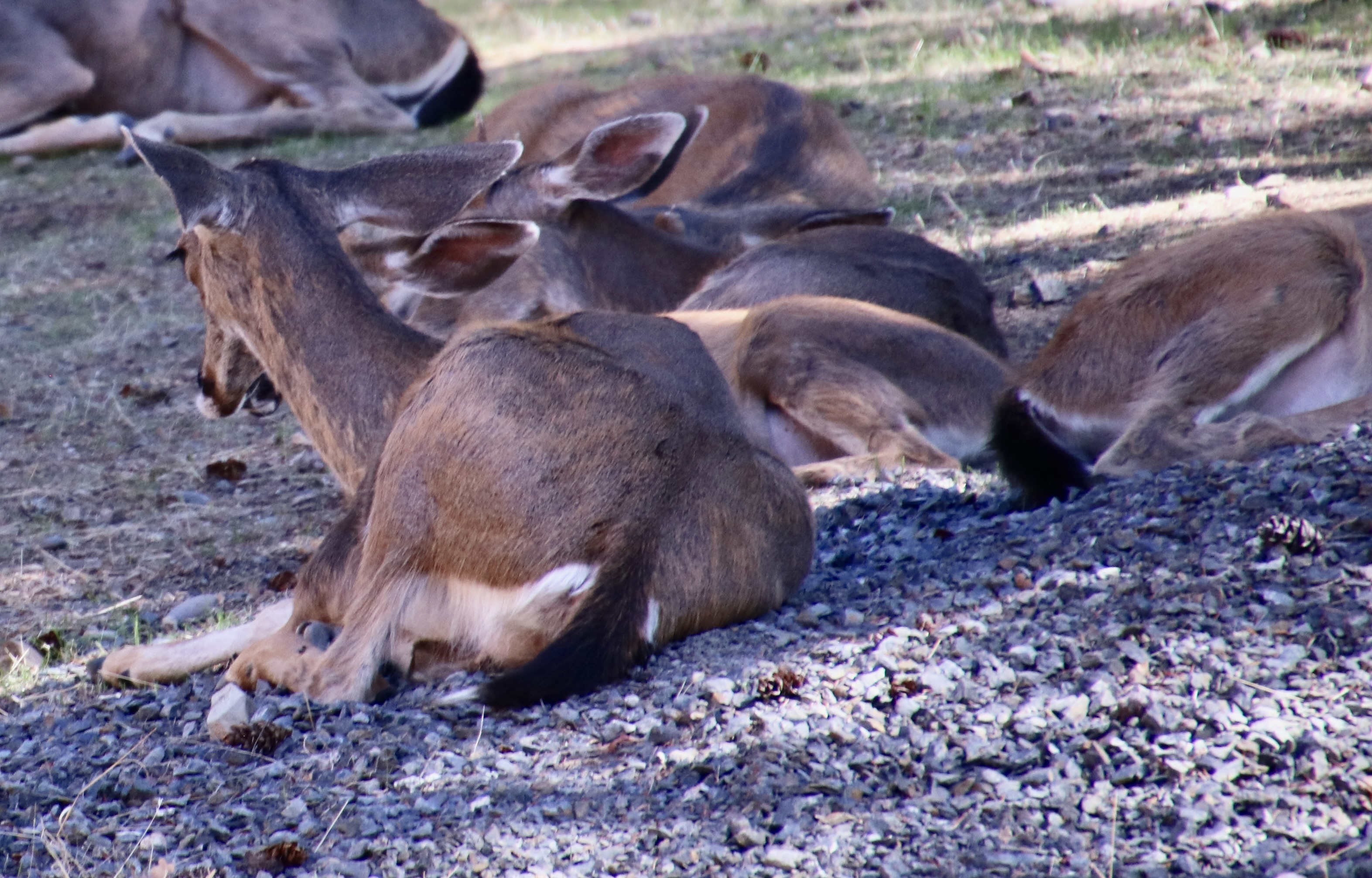
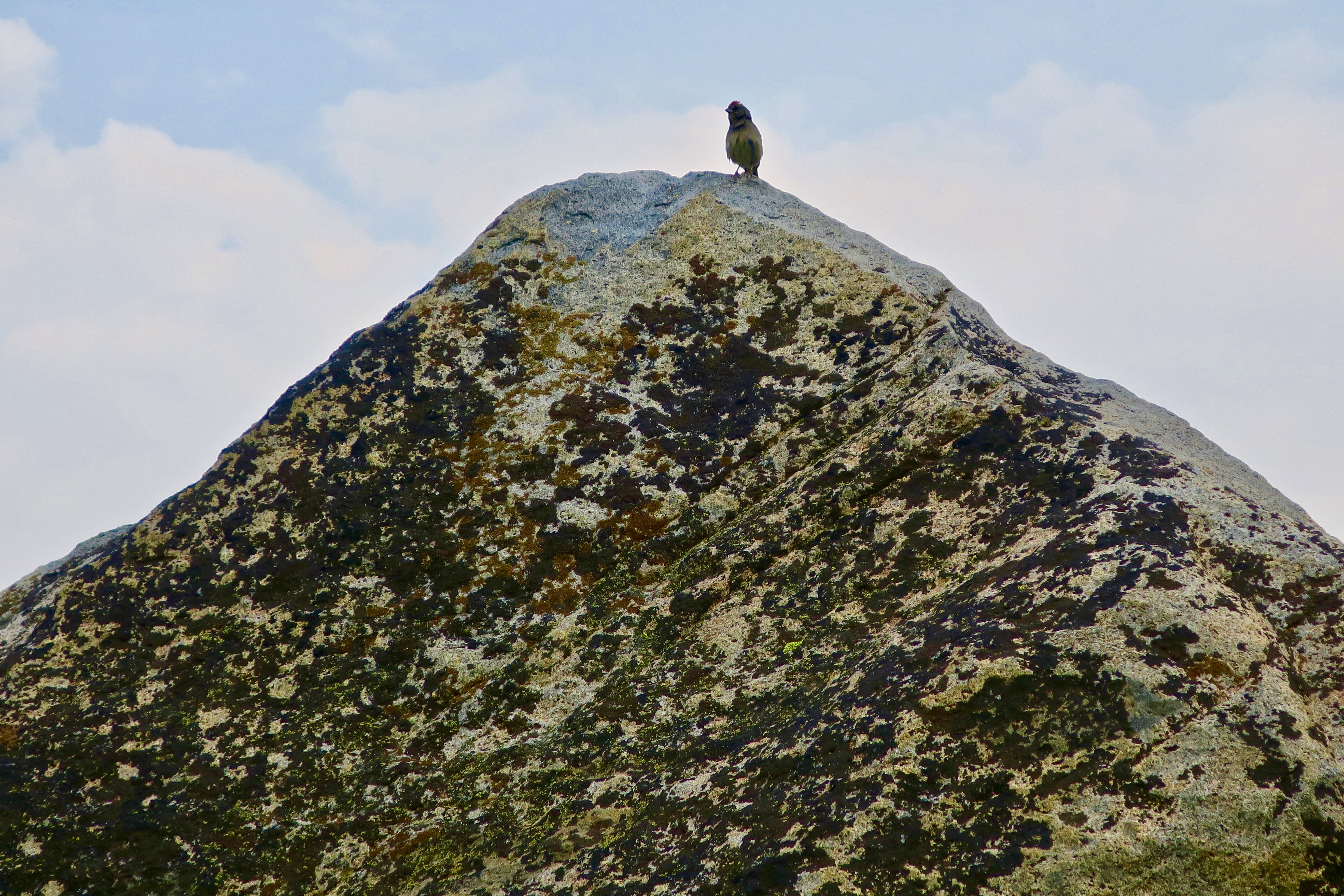
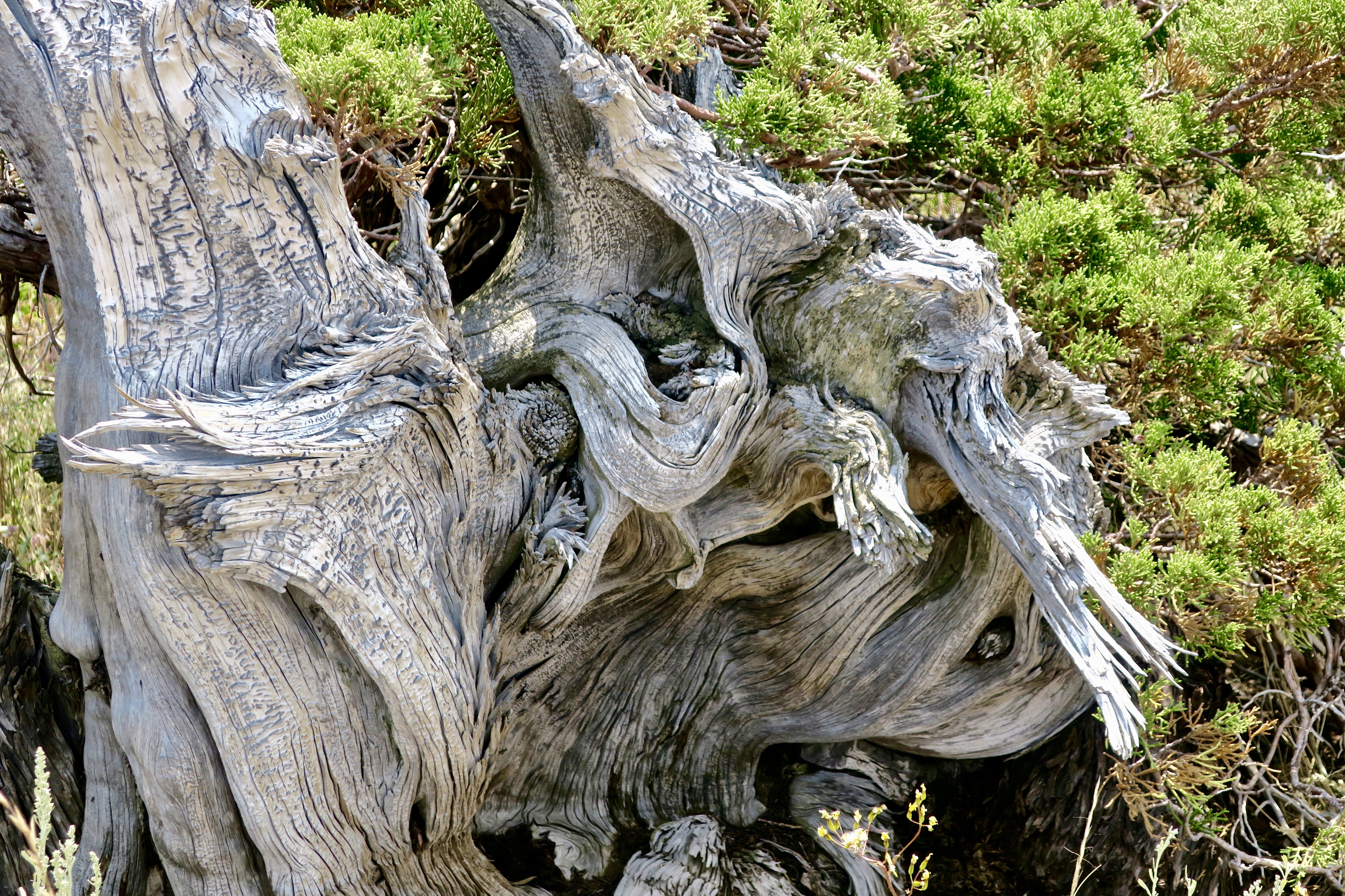
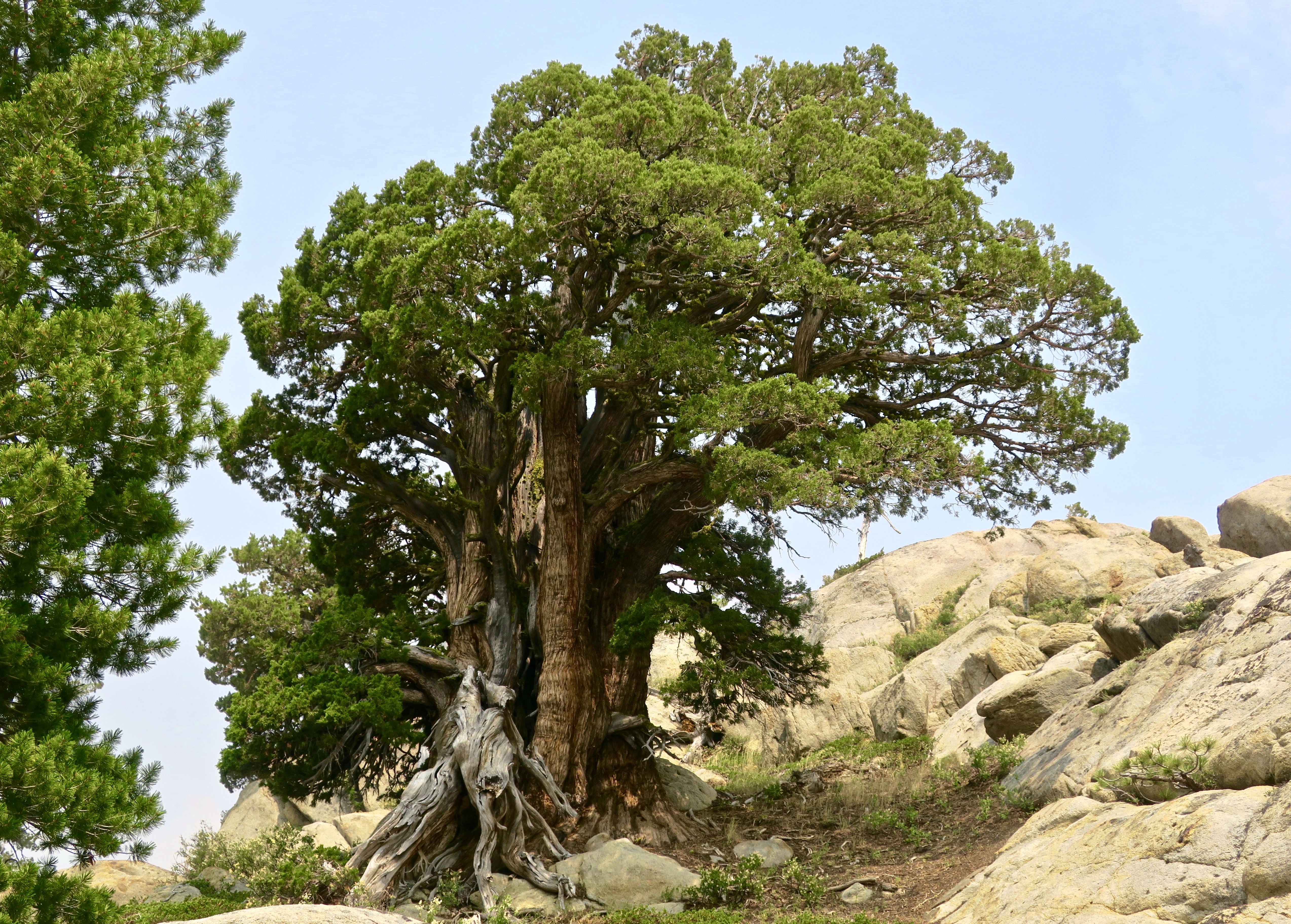
By the time I got to the Mokelumne Wilderness section of the PCT, I was looking a little scruffy, not to mention skinny.Peggy, who is never scruffy, sent me off with a smile. She hiked three sections with me and provided support on all of the others, for both me and through-hikers. By this point, she was almost over being nervous about sending me off on my own.Almost immediately, I came on this old snag. I always enjoy their personality and beauty. You will see several on my two Mokelumne Wilderness posts. This one is all about roots.And how about this lodgepole pine that was insisting on doubling back on itself. It must have had a warped childhood.This is Frog Pond, maybe a mile along the trail from Carson Pass and a tenth of a mile off the PCT. I’d hiked by it several times over the years and not stopped. My loss. If it looks like the end of the world on the opposite end, close. There is a steep drop off just beyond the rocks.This well known landmark is known as Elephant Back. My first challenge of the day would be hiking around it on the left.Fortunately, it was all downhill. But there’s a truism about hiking in the Sierras, what goes down inevitably goes up!The Mokelumne Wilderness features flowers galore. There were whole gardens of them, planted and tended by nature. This one was also tended by a bumble bee,Pennyroyal, a member of the mint family. I picked a leaf and munched on it as I hiked down the trail.Ranger’s buttons. People who name flowers have great imaginations. As noted in the beginning, there are lots of them along the trail.Birdie on a granite rock. It sang me a song so I took its photo.I camped under this magnificent Jeffrey pine my first night…And met this young fellow in his 60s. He had quite a story to tell.He had hiked all three of America’s National Scenic Trails including three times on the Appalachian. He was now doing the PCT a second time.Did I mention the trail went up?I figured an alien from a UFO planted this so I avoided touching it… just in case.This, on the other hand, was an old friend of mine from growing up in the Sierra foothills: California Holly.Looking down on Upper Blue Lake from the trail. Note the smoke. It was a summer of fires along the PCT and I ended up breathing lots of smoke and avoiding fires. The distant knob was a prominent landmark for pioneers. Any guess for what they named it? The Nipple.Another snag.The trail worked its way through granite boulders and junipers.Which are one of my favorite trees.Heading off the trail, I found an attractive small lake to camp on. The clouds were threatening a thunderstorm.But the lake remained calm, reflecting the surrounding trees from impressionistic…To realistic.The next morning found me back on the PCT by 7 am, which will be the subject of my next Mokelumne Wilderness post…With a very different terrain.
The iconic Mesquite Flat Sand Dunes of Death Valley provide a unique hiking opportunity for the adventuresome as well as a world class photo op. They also provide a great backdrop for movies. C-3PO and R2-D2 were lost here on ‘Tatooine’ in Star Wars Episode IV.
Death Valley is known as a land of extremes. At its lowest point, it drops to 282 feet below sea level. Summer temperatures can soar up to 120° F and have been recorded as high as 134° F. Rainfall averages are around 2 inches per year but can drop to zero. It’s hard to get more extreme. You don’t want to visit in the summer.
I would add, however, that Death Valley is also a land of superlatives. My title above about ‘breath-taking beauty’ is no exaggeration. We have 25 photos below to make the point. As I have stated before, all photos are taken by either Peggy or me unless otherwise noted.
Peggy and I have visited Death Valley several times over the years. It’s one of our all-time favorite go-to places. One of our visits was during the government shutdown in 2019 that President Trump had instigated during his first term. Death Valley was without staff. We had entered the Park from the south and stopped at a rest stop along the way. The restroom was closed and people were using the desert as a bathroom. Instead of carrying their trash out, many were simply dumping it next to the already overflowing trash cans. What was worse, a few miles up the road someone had decided that no supervision meant he could take his ATV for a spin on the desert floor and drive brodies (sharp circles). Large gashes in the floor had been created— gashes that would take at least 20 years, if not longer, to heal given the desert’s environment.
I’m relating this incident here because I want to make a point that National Parks need staff to function effectively. While the impacts of reduced staff aren’t as dramatic as no staff, the recent efforts by the Trump Administration to cut employees along with a number of other Trump/Musk driven initiatives related to the parks pose a serious threat. Here’s a quote that the National Parks Conservation Association —a bipartisan organization that has been promoting and protecting our parks since 1919— made after the first six weeks of the Trump Administration:
National parks as we know and love them are changing — dismantled before our very eyes under the new Trump administration in just six weeks. Fired staff, cancelled building leases, erased history. We see the writing on the wall, and it’s dark.
Dark indeed. Among the latest pronouncements from the Administration is one that suggests there is no reason to protect endangered species. Let them die. Another opens 59% of all national forests to be logged with minimal, if any, environmental protection. Old growth trees that have taken hundreds of years to develop will be cut down in minutes.
Today, Peggy and I are continuing our series showing the beauty, geology, flora and fauna of these areas to emphasize the value of protecting them. The parks belong to all of us, and, I might add, the plants and animals that call them home. We cannot afford to let them be lost to the whims of one man and his cohorts who apparently see their value primarily in terms of the money that can be made from their exploitation. Our children, grandchildren and future generations are depending on us.
And now: Death Valley.
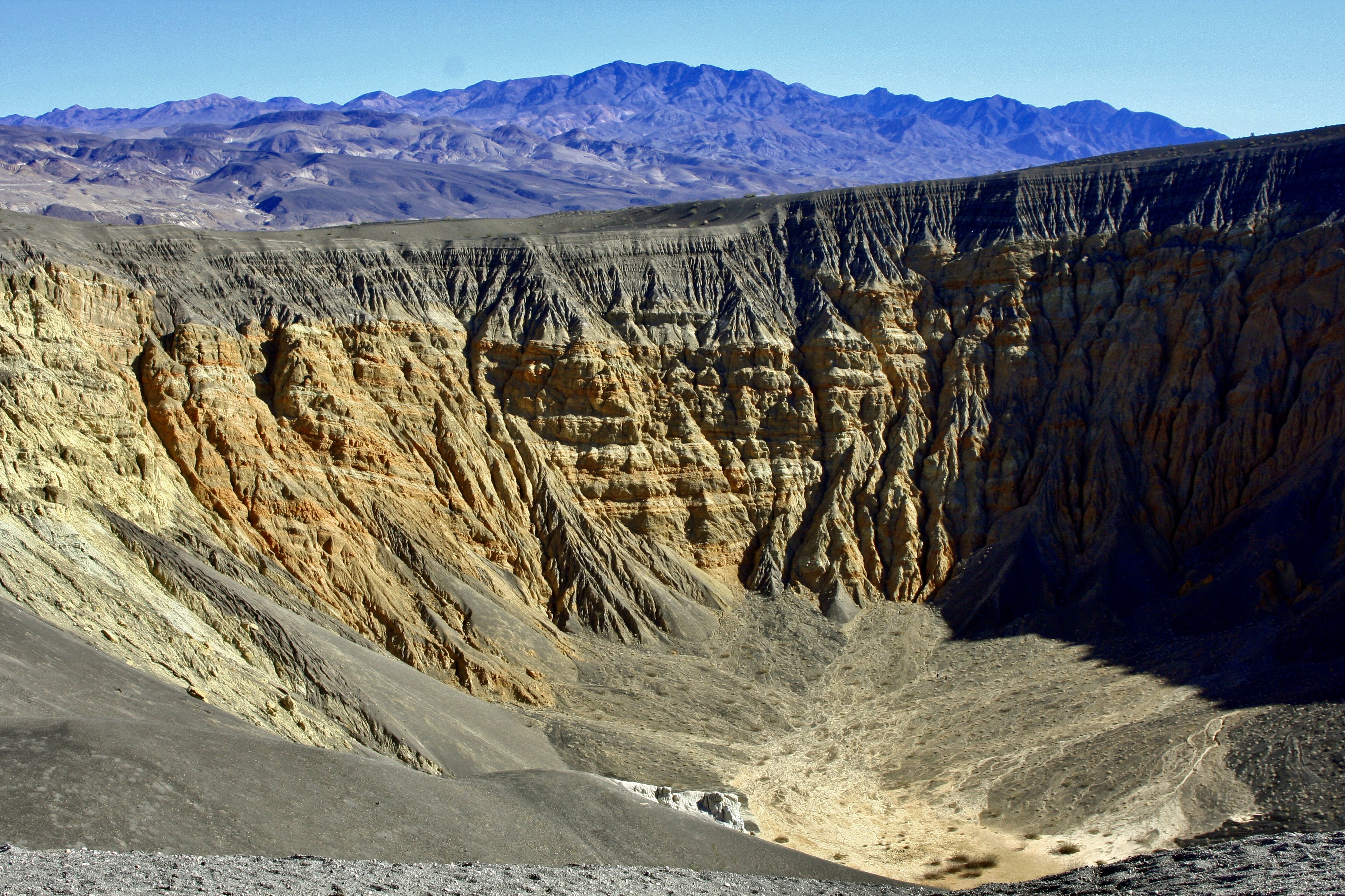
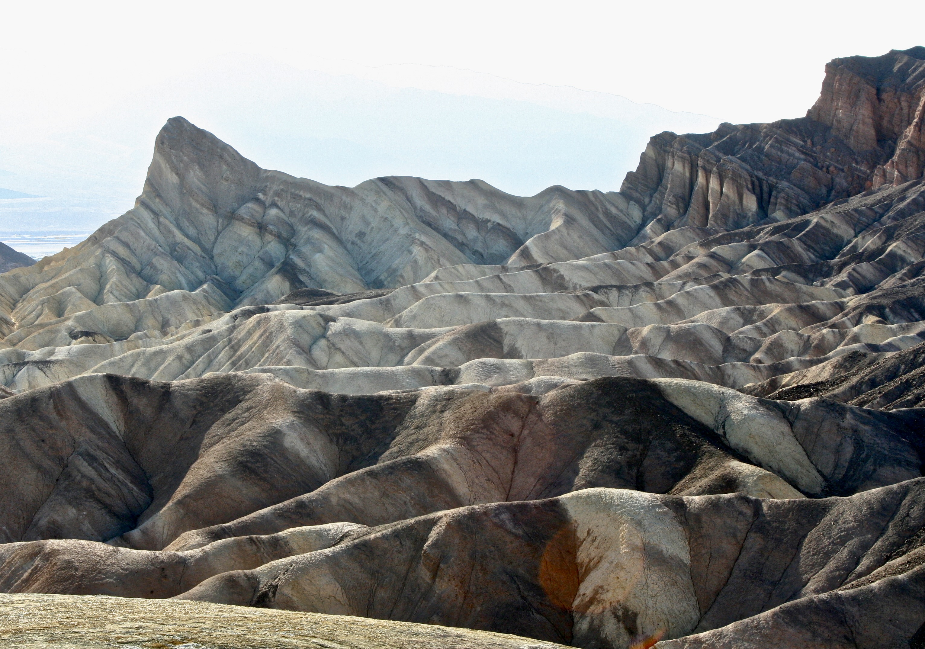
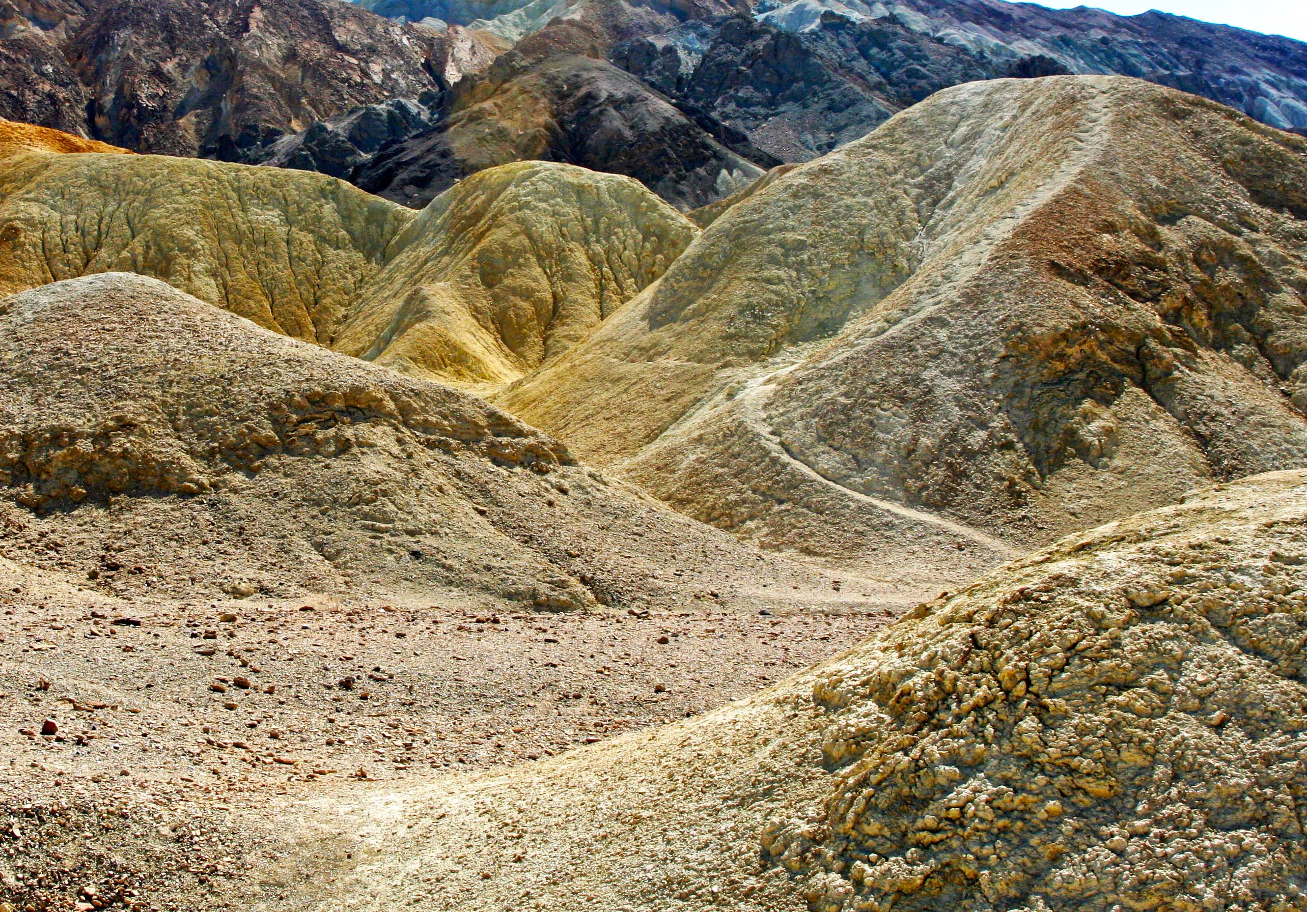
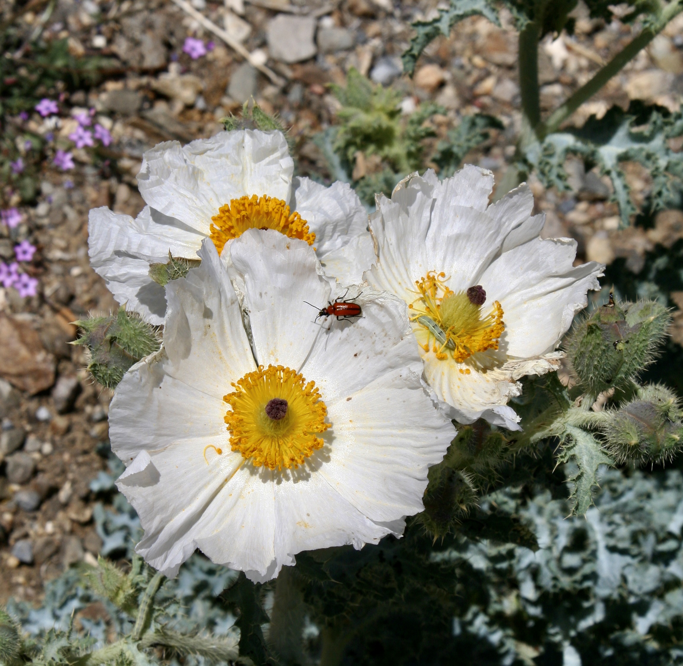
Beauty is everywhere in Death Valley. The extreme dryness of Death Valley allows visitors a rare opportunity to see geological forces at work. This is the Ubehebe volcanic crater in the northern part of the park. The crater, 600 feet deep and half a mile across, was created by a powerful eruption of volcanic steam. Trails lead down into the crater that visitors can hike.We took this photo near Ubehebe Crater. It shows the work of erosion over time creating an almost surrealistic scene.A coyote stood near the road into Ubehebe. Camping in the Valley, you can go to sleep listening to their wild calls in the distance. A moonlit night often produces a chorus.The majority of the sites visited in Death Valley are located within a short drive of the Visitors Center at Furnace Creek. Nearby, Zabriskie Point provides a number of different views that vary over the day as the sun shifts.In the sunlight.Another view we found interesting at Zabriskie Point. The dark ridge at the top represents a different geological era. Over 1.7 billion years of earth’s history can be seen in the Valley according to the National Park. 20 Mule Canyon, a short drive up the road from Zabriskie Point, provides a moderately challenging but gorgeous adventure over a 2.7 mile unpaved road. It’s a section of the route that was used by the 18 mules plus two horse teams that carried borax out of Death Valley. Pull offs along the way provide for further adventures, such as following paths that lead into a world that borders on fantasy.Another example.The road also followed this off-white, high ridge. We saw a couple of people hiking along the top.A final photo along the 20 Mule Canyon Road.Another favorite of ours for its sheer beauty and impressive land forms is Golden Canyon.A quick drive down highway 178 from Furnace Creek will take you to the parking area. From there, visitors can choose a relative easy walk that takes them into the heart of the canyon or select much more challenging hikes with lots of ups and downs! One route takes hikers up to Zabriskie Point.Looking out from Golden Canyon toward the Valley.Want even more color? Continue down Highway 128 to a one-way side road that takes you in to the well-named Artist’s Palate. Different minerals in the rock are responsible for the colors you see here, at Zabriskie Point and along the Twenty Mule Canyon Road.A closer look at the palate.Continuing on down Highway 128 will bring you to the Devil’s Golf Course, which is definitely worth the side trip to see it. If the park is ever privatized, I wonder (he said tongue in cheek) whether the president would add this to the 15 plus golf courses he owns around the world. First, however, he would have to bulldoze the salt flats that formed over thousands of years as ancient lakes evaporated. Given the million dollar membership fee he charges at Mar-A-Largo, I suspect he would charge even more here. Two side roads, one on the east and one on the west of the Park, take visitors up into the mountains above the Valley. Dante’s Peak, on the east side, provides a dramatic view into the valley.And flowers. We took lots of photos.The road on the west side of the valley taking visitors up to historic charcoal kilns had even more flowers.Including these white prickly poppies. A red beetle and a green caterpillar were visiting. The caterpillar was busy chomping down on the poppy’s stamens.An old road leading off the main road to the kilns featured yellow rabbitbush flowers. It demanded exploration. Maybe this year…We also found this rattlesnake along the road. Long time followers of my blog will recognize it. He was about 6 feet long and about as round as my arm. Peggy refused to let me out of our truck to take more photos, zooming off just as I was about to open the door!The historic charcoal kilns of Death Valley were at the end of the road. They were built in 1877 to supply charcoal for the Modock Mines, located 25 miles away, and likely closed after two years of use. We’ll conclude this post with a photo of the sun setting over the sand dunes of Death Valley. Next up we will feature the Chiricahua National Monument in Southeastern Arizona. We were there last week. A photo from next week’s post.
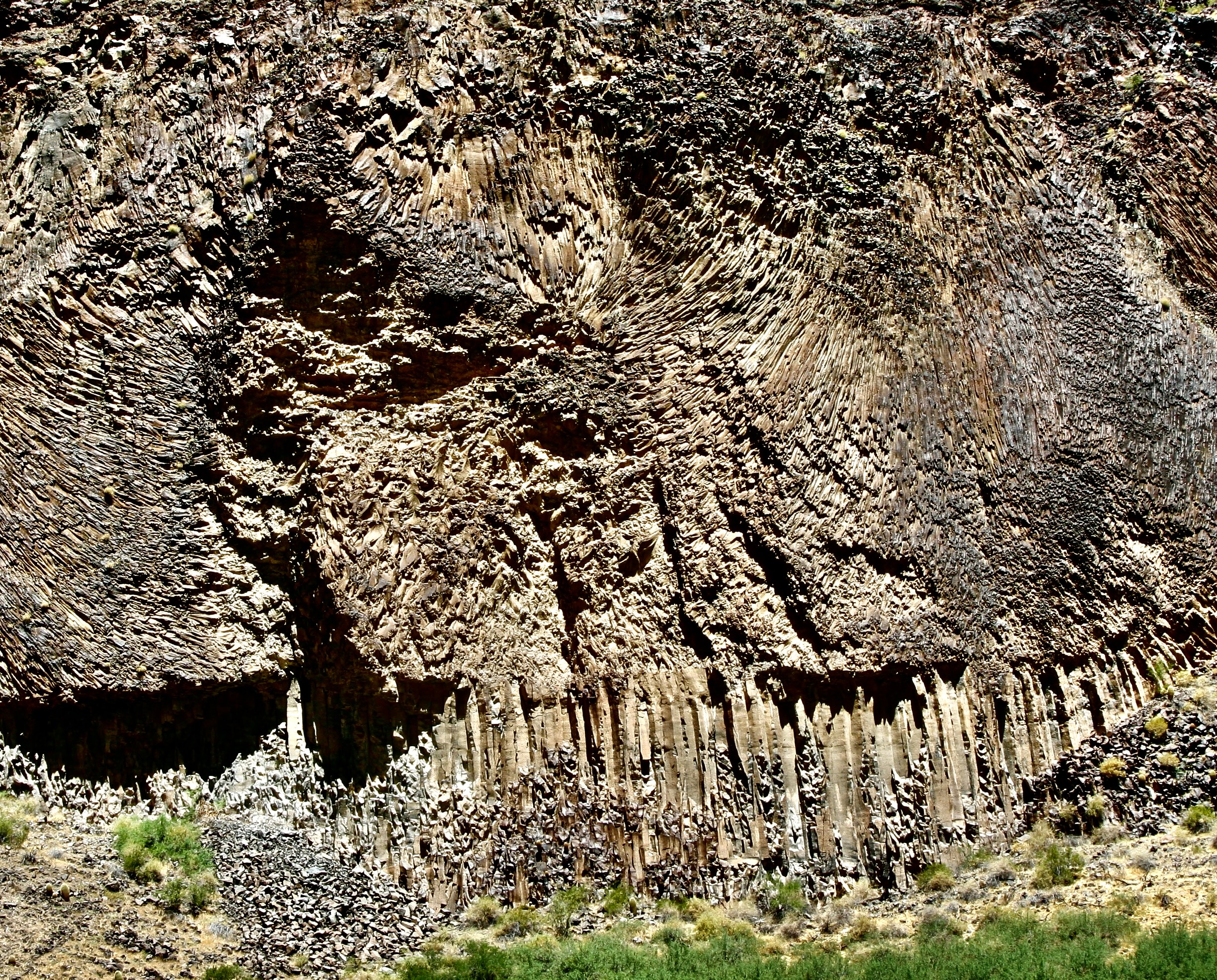
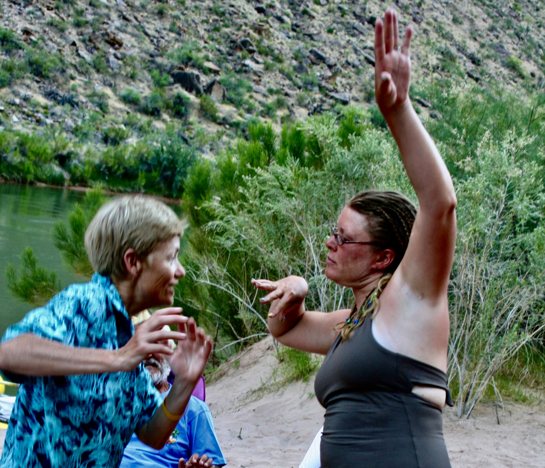
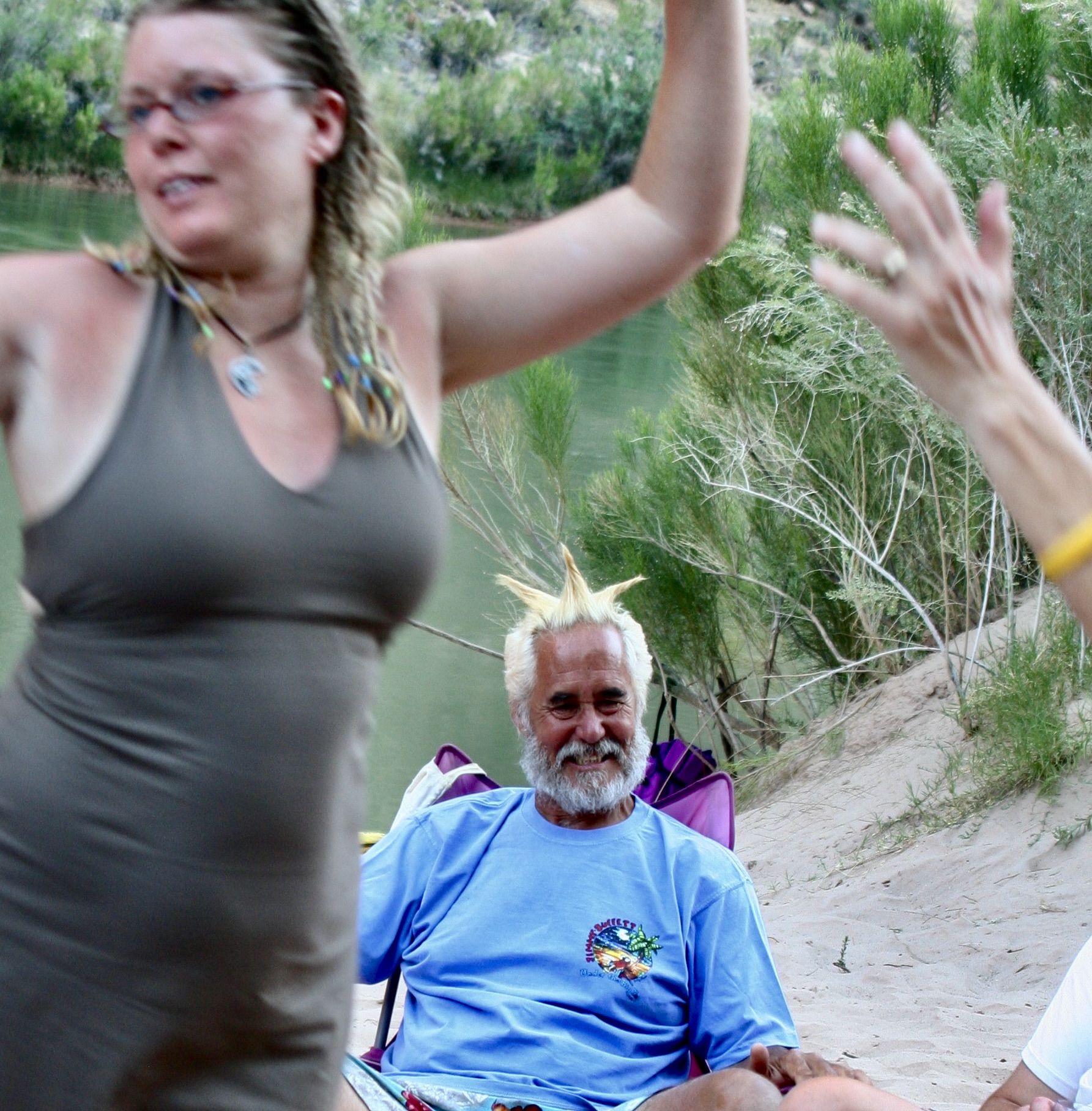
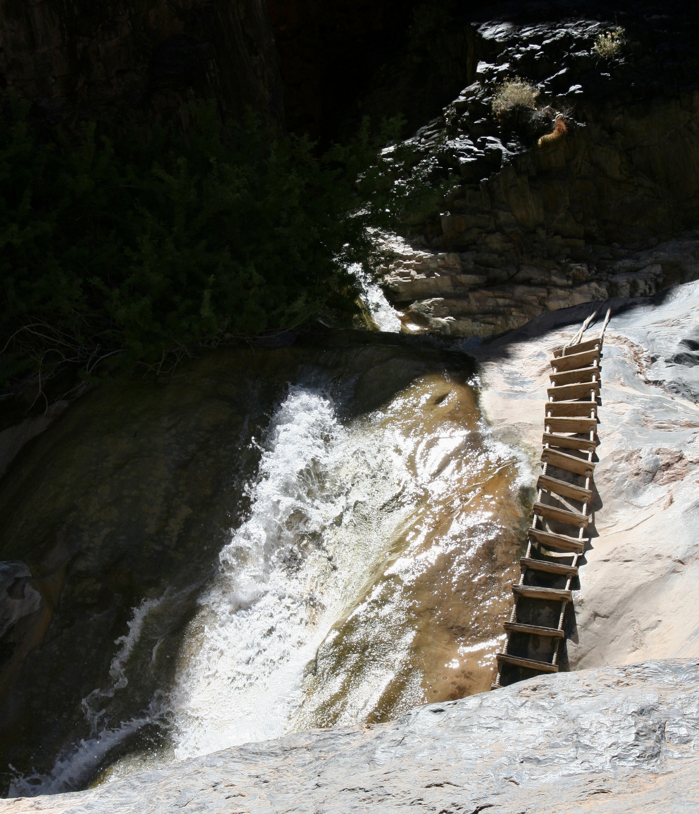
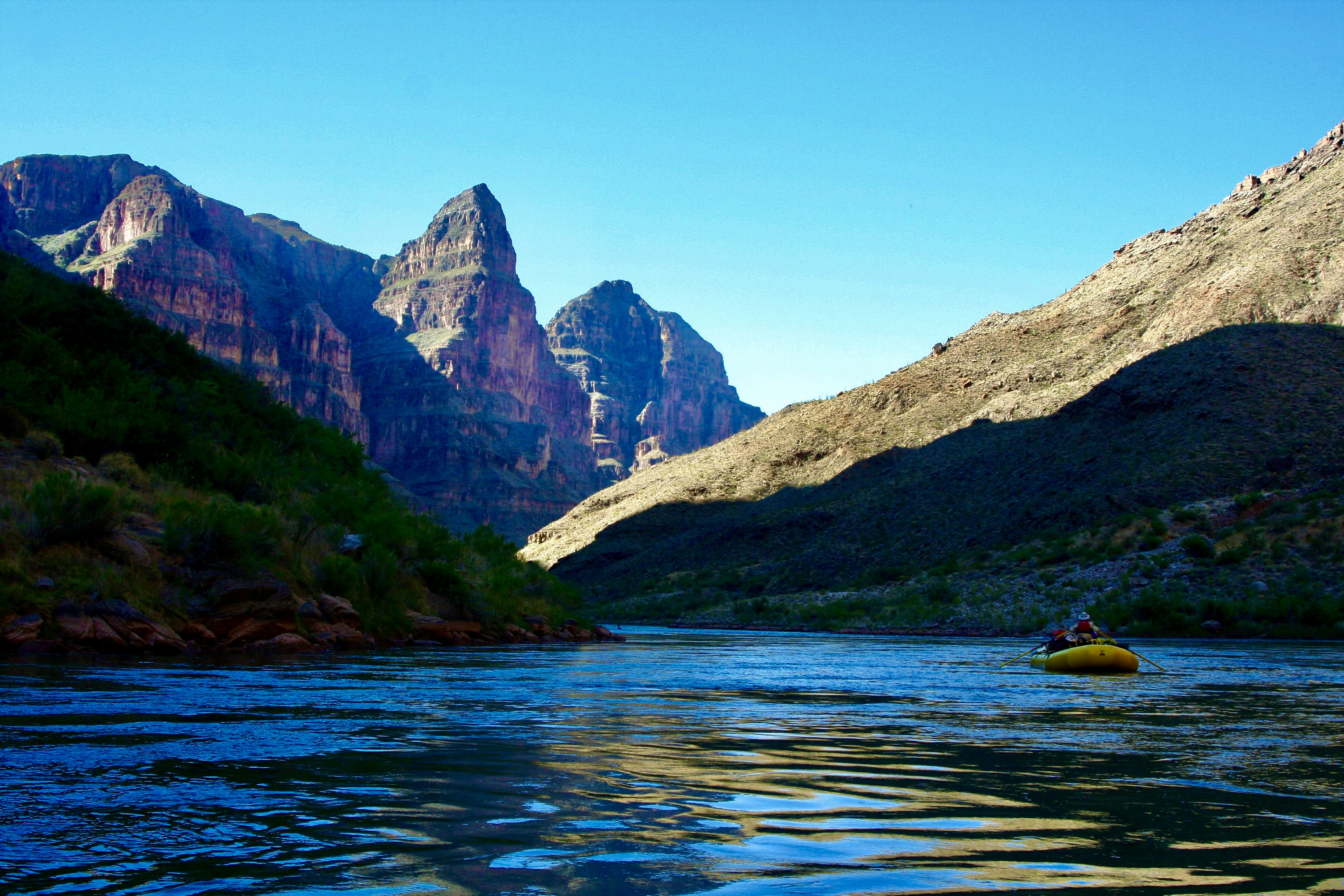
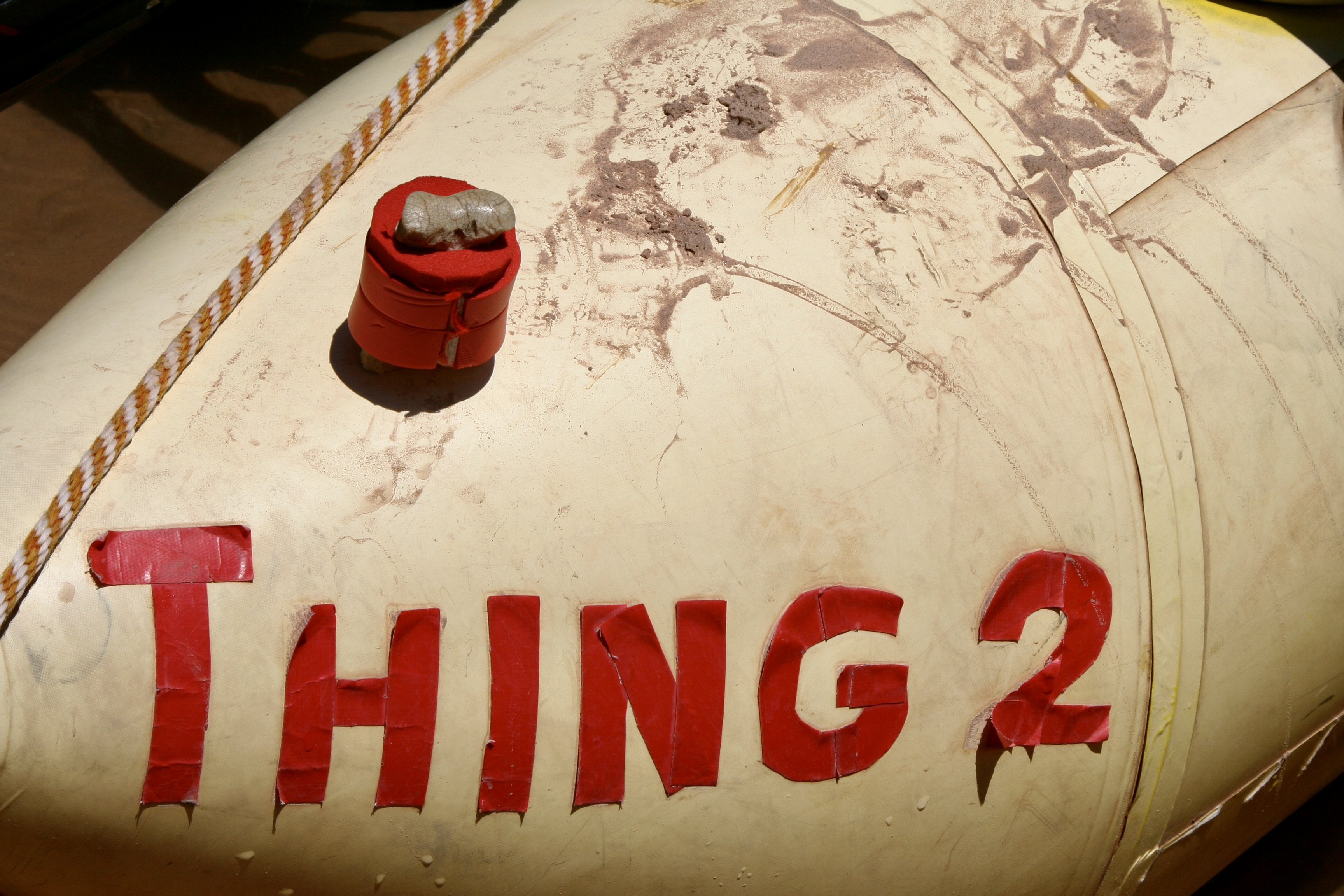
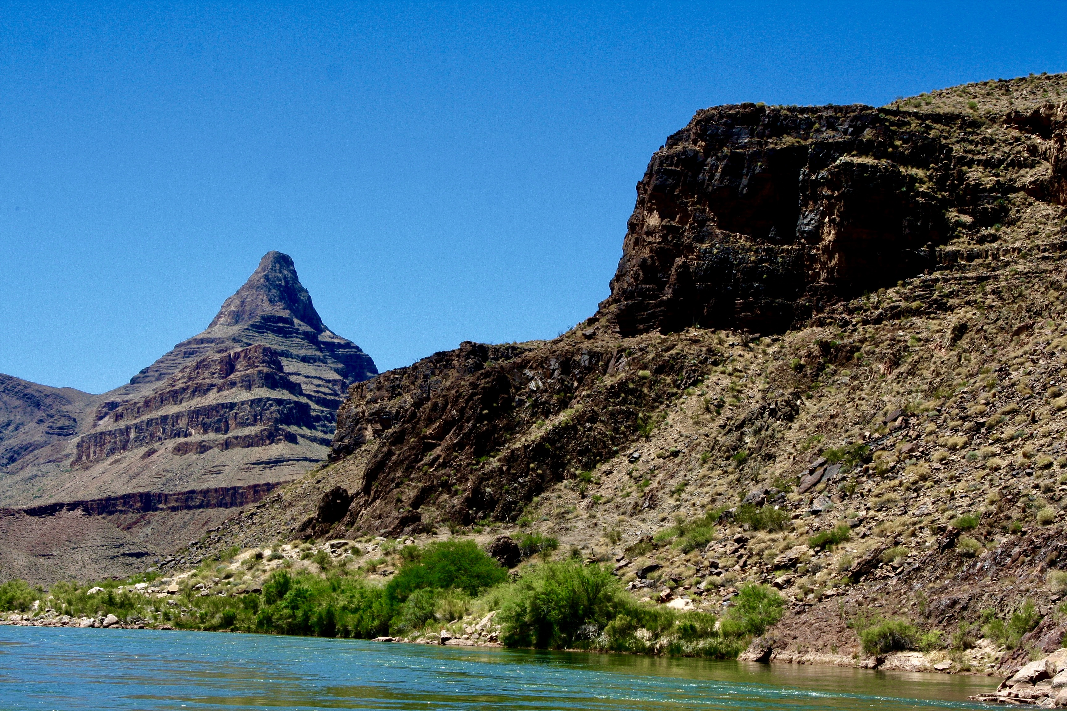
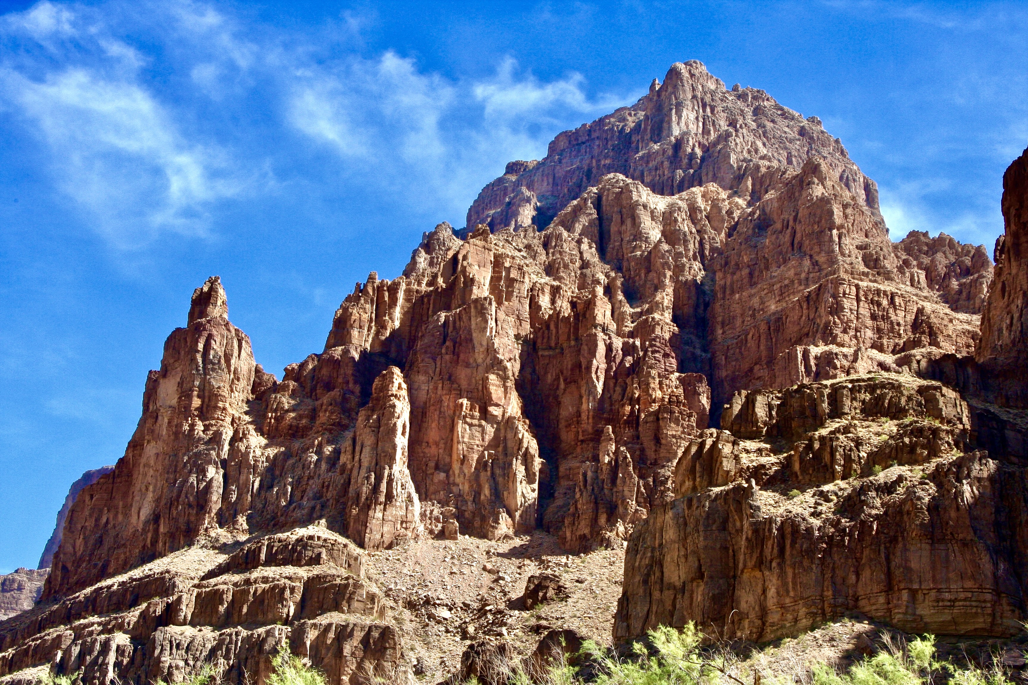
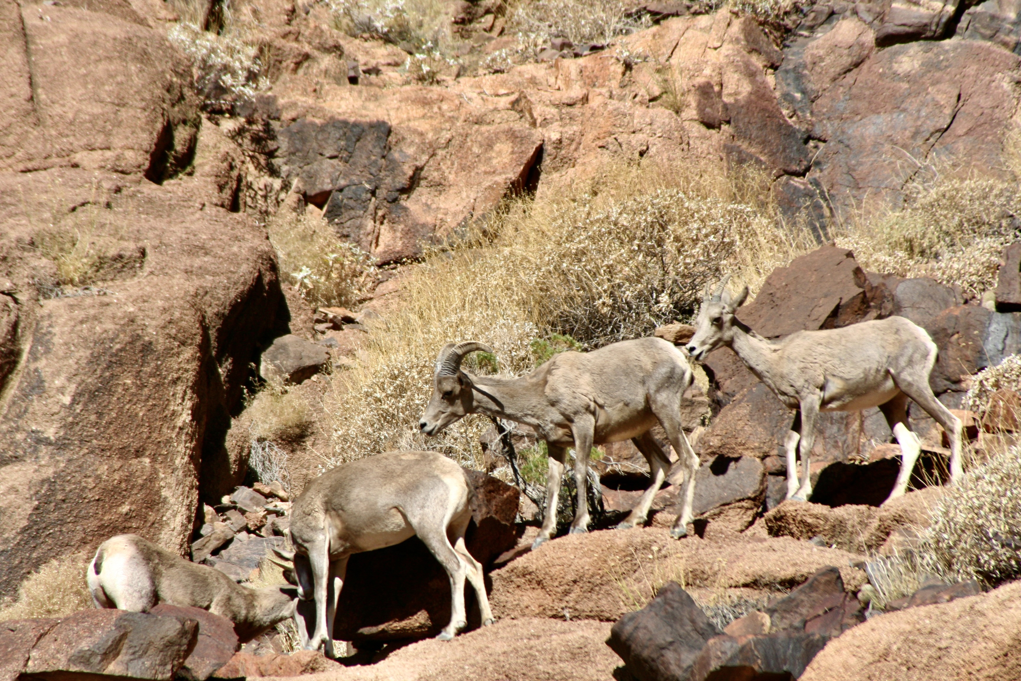
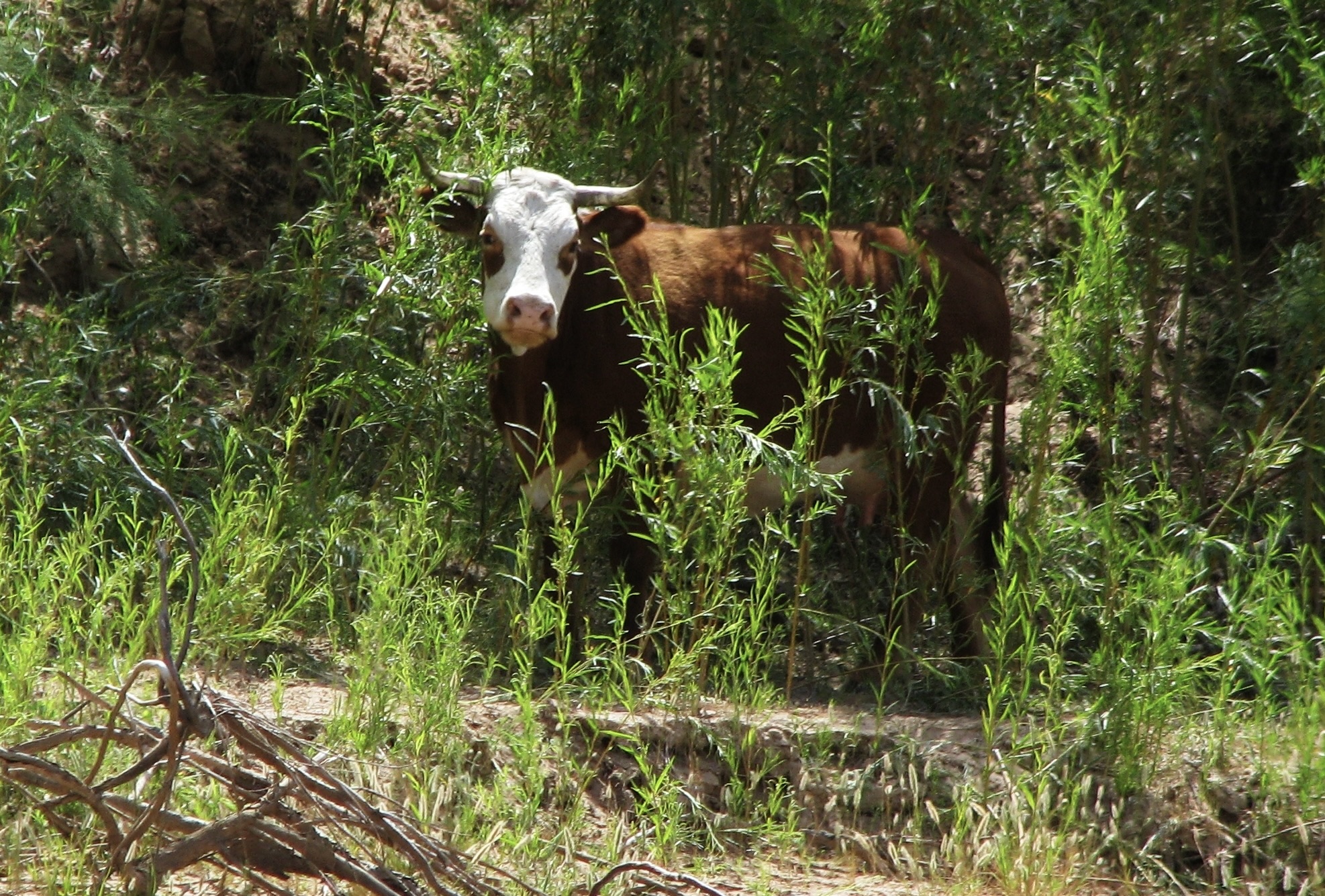
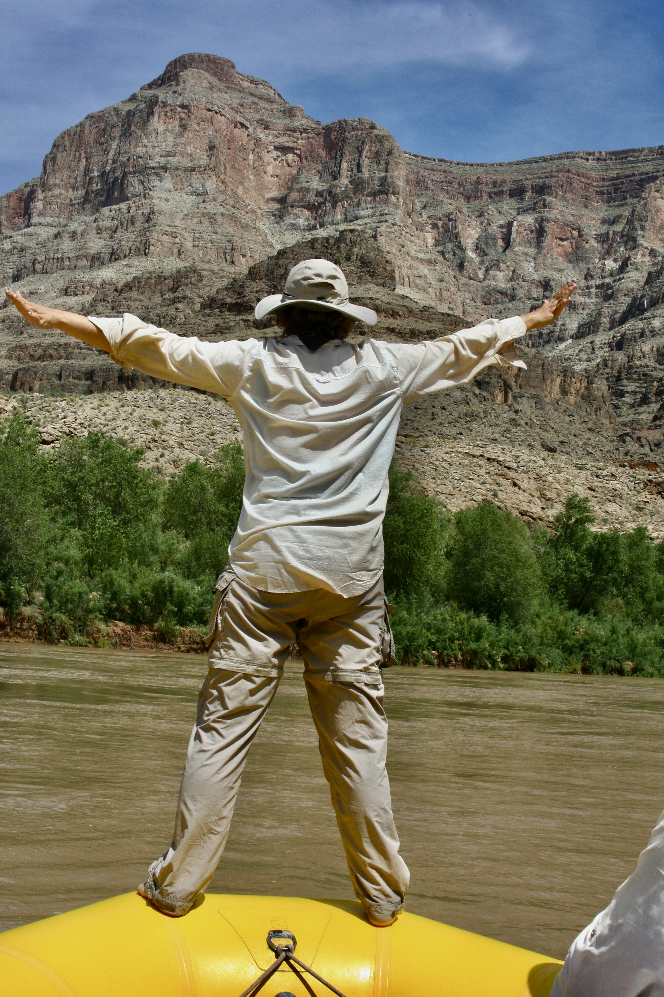
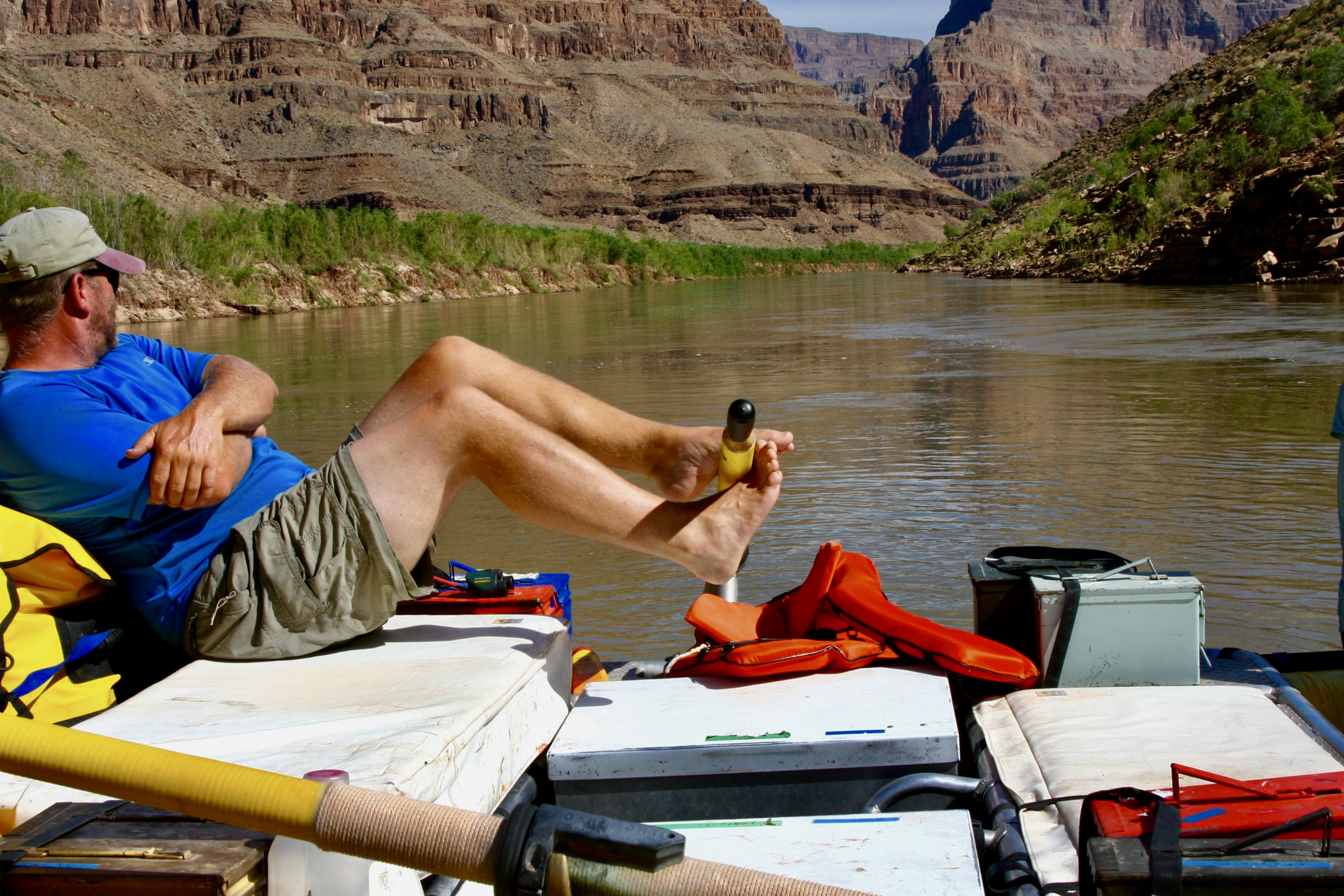
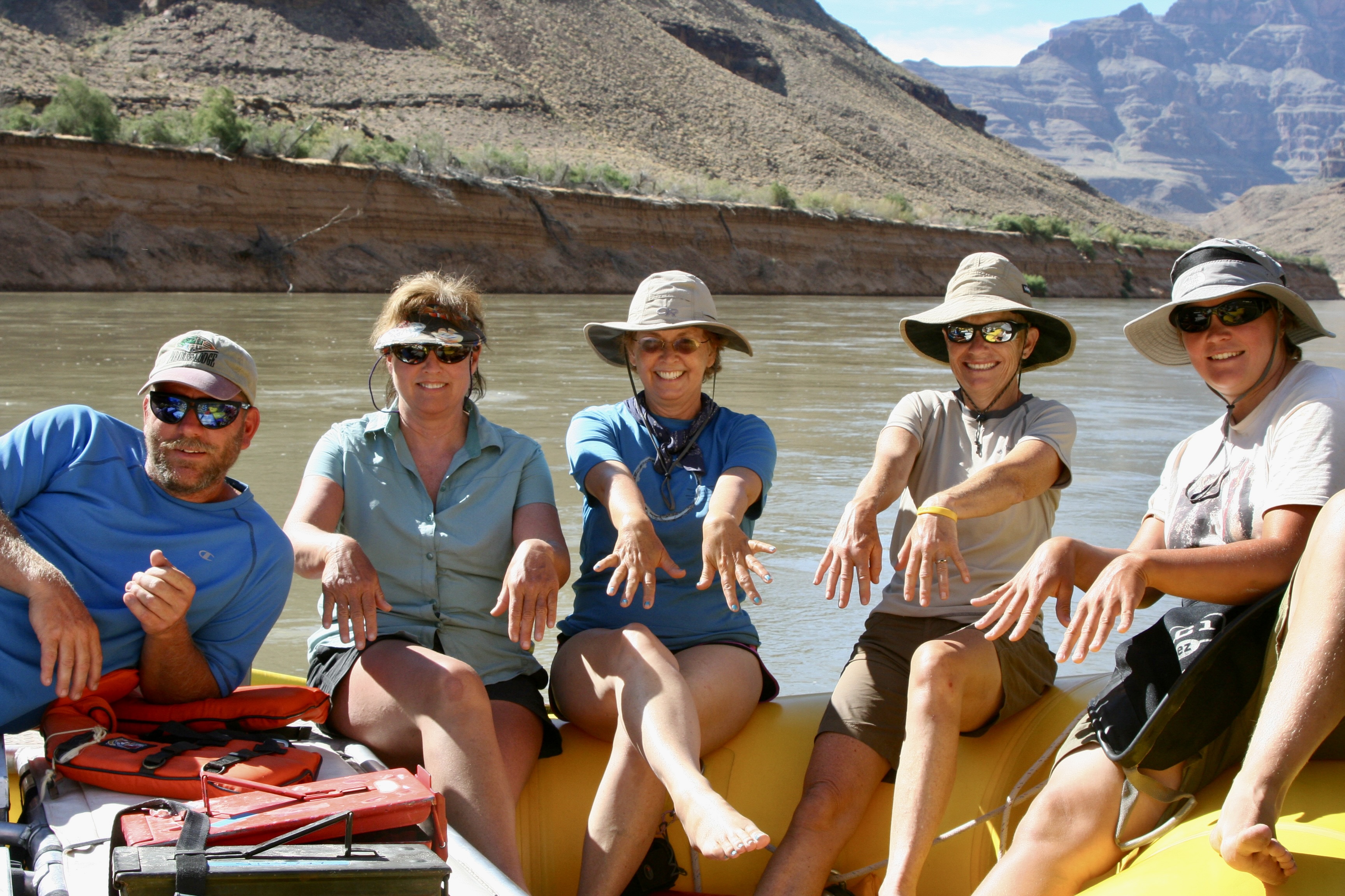
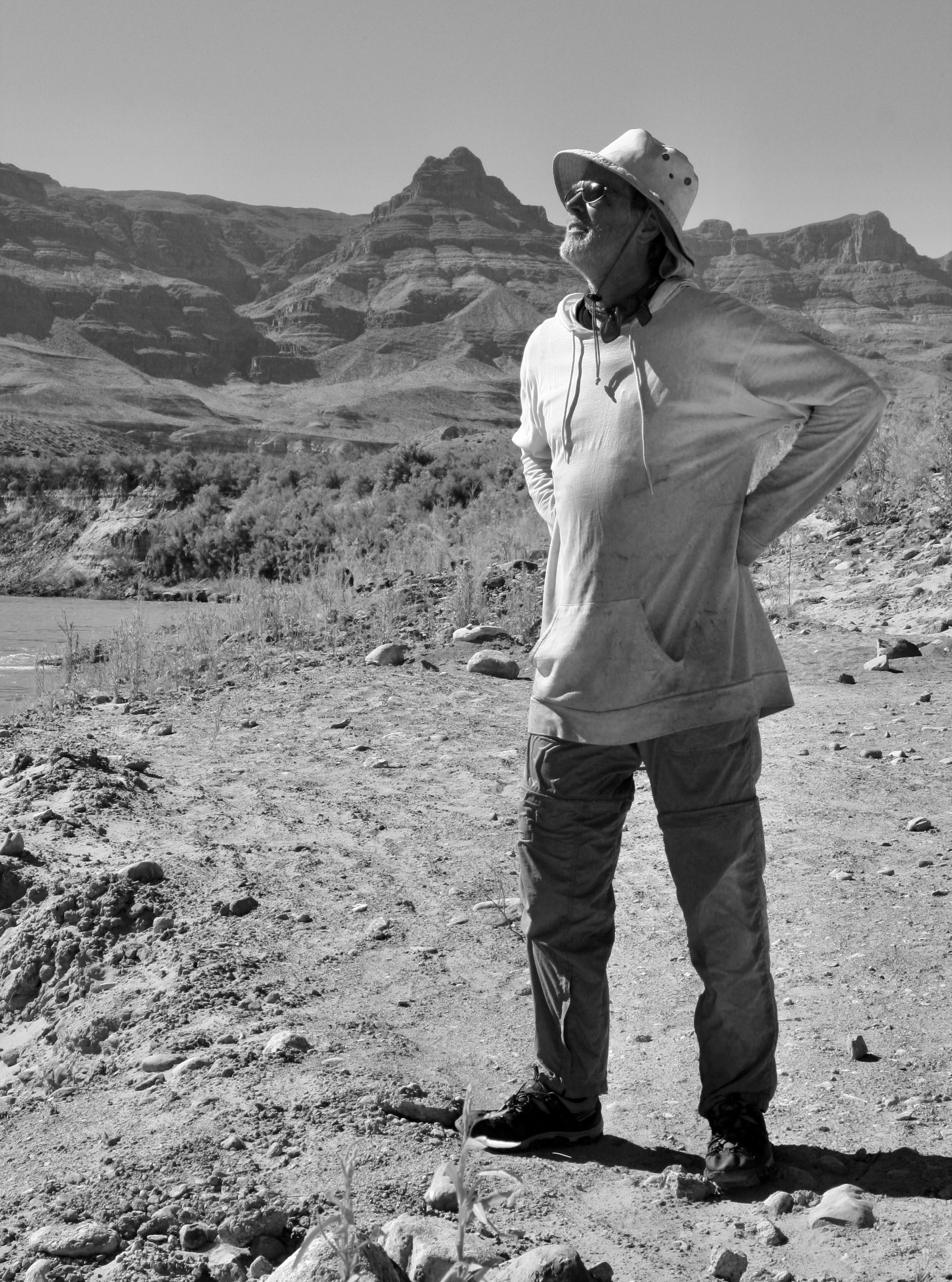
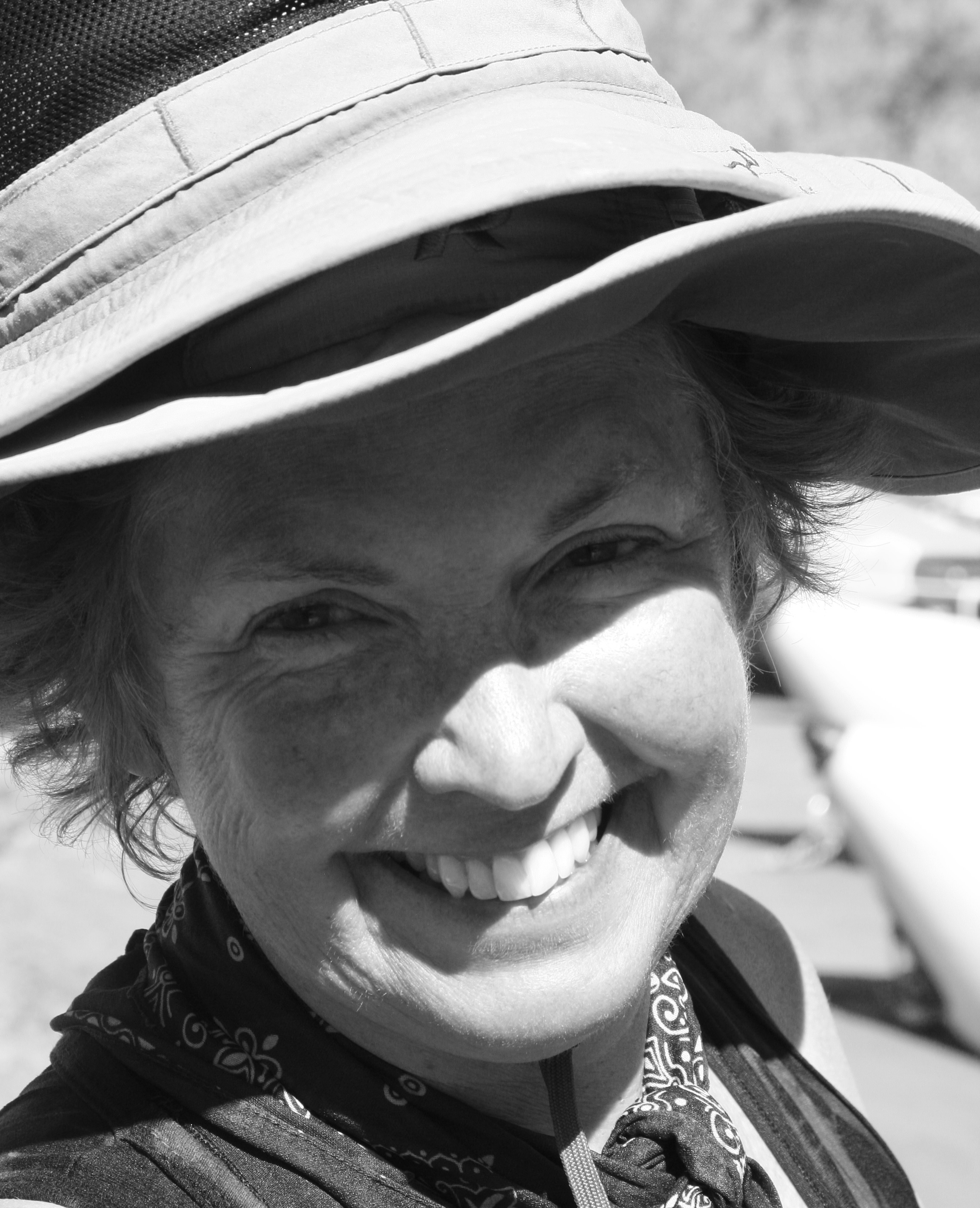
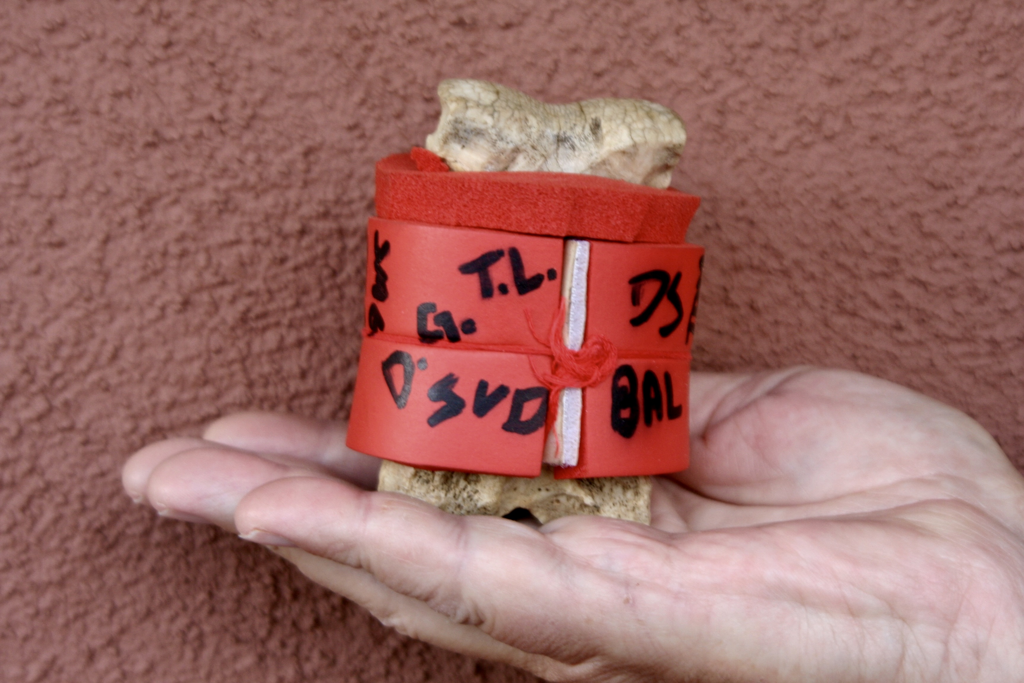
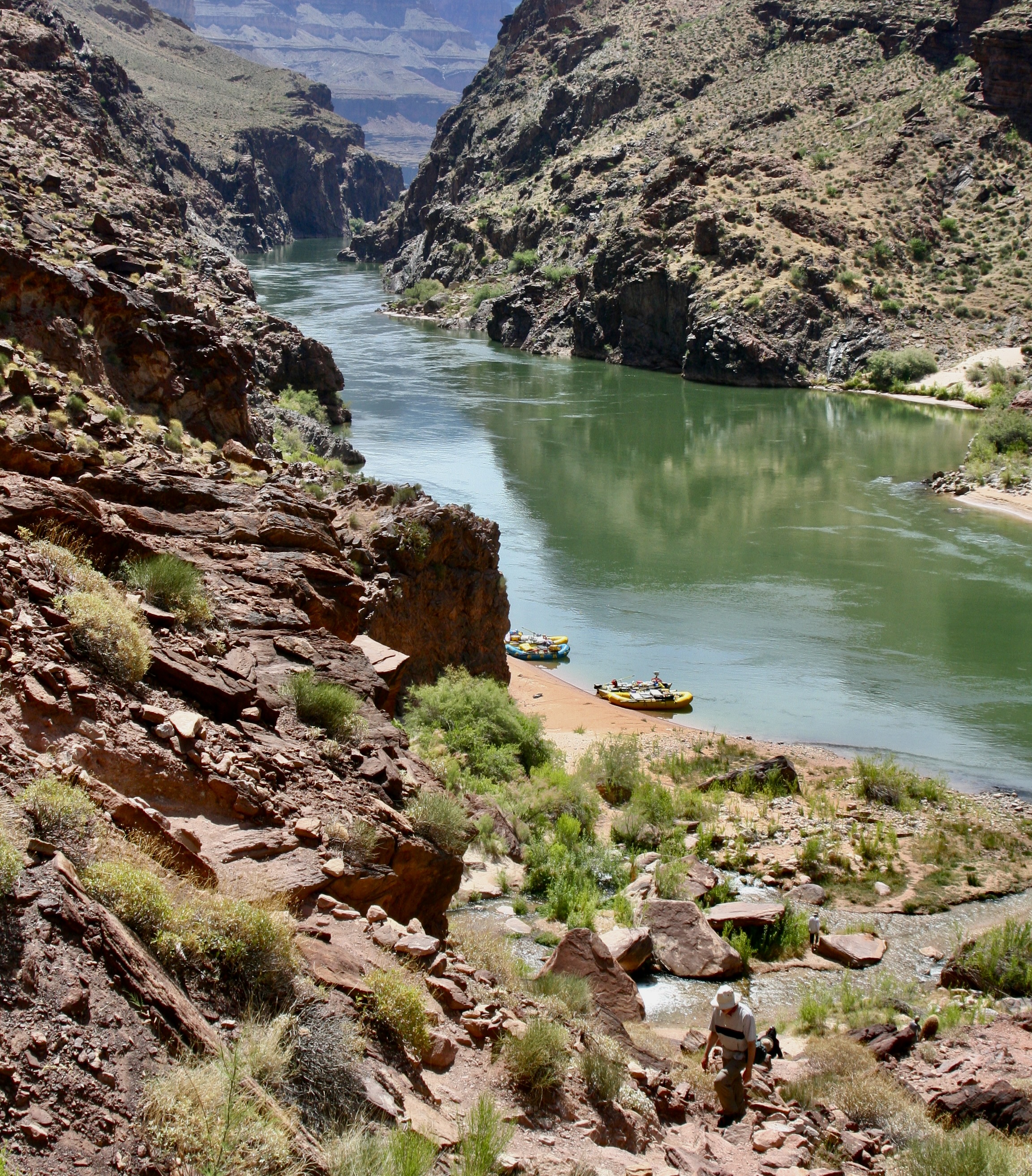
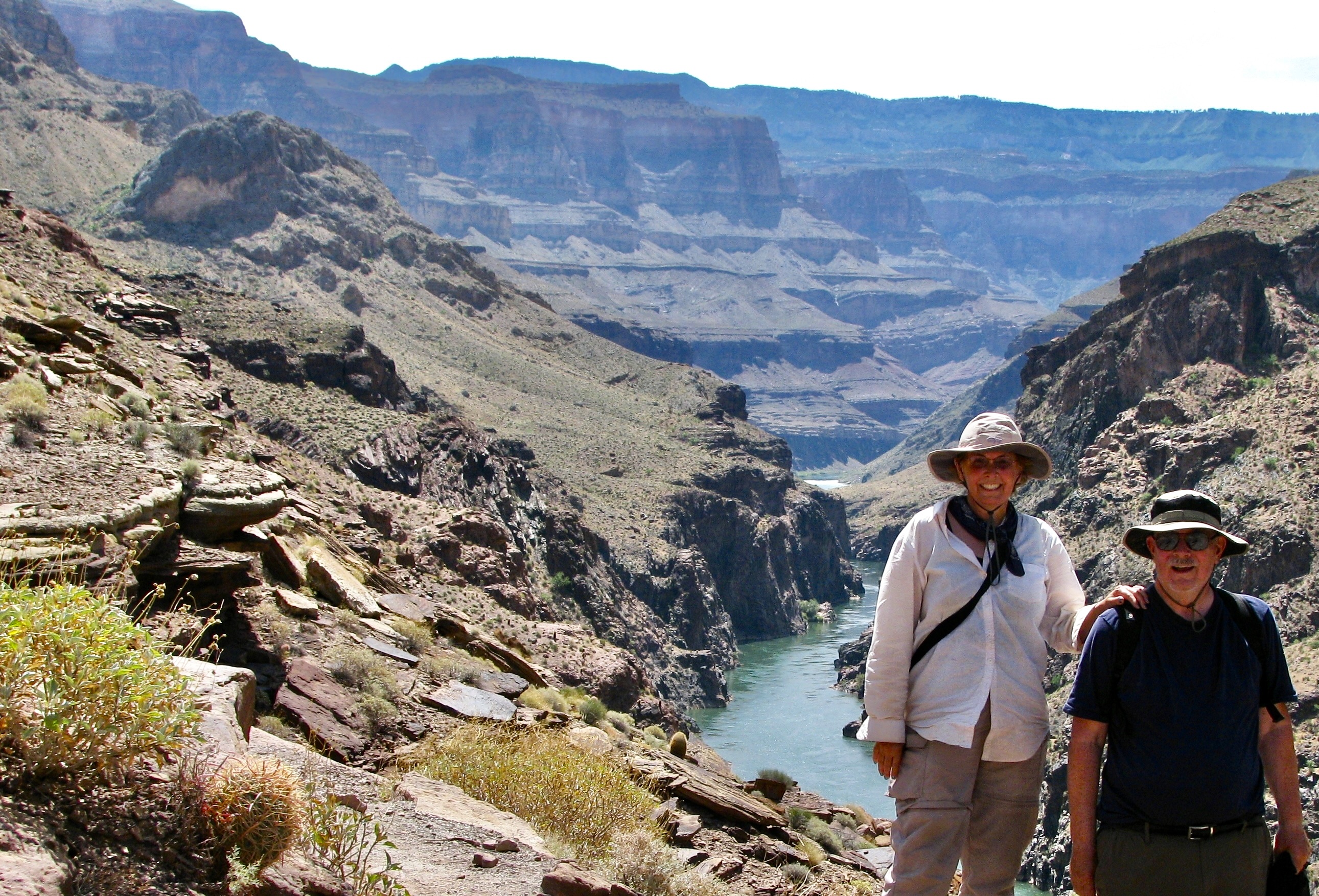
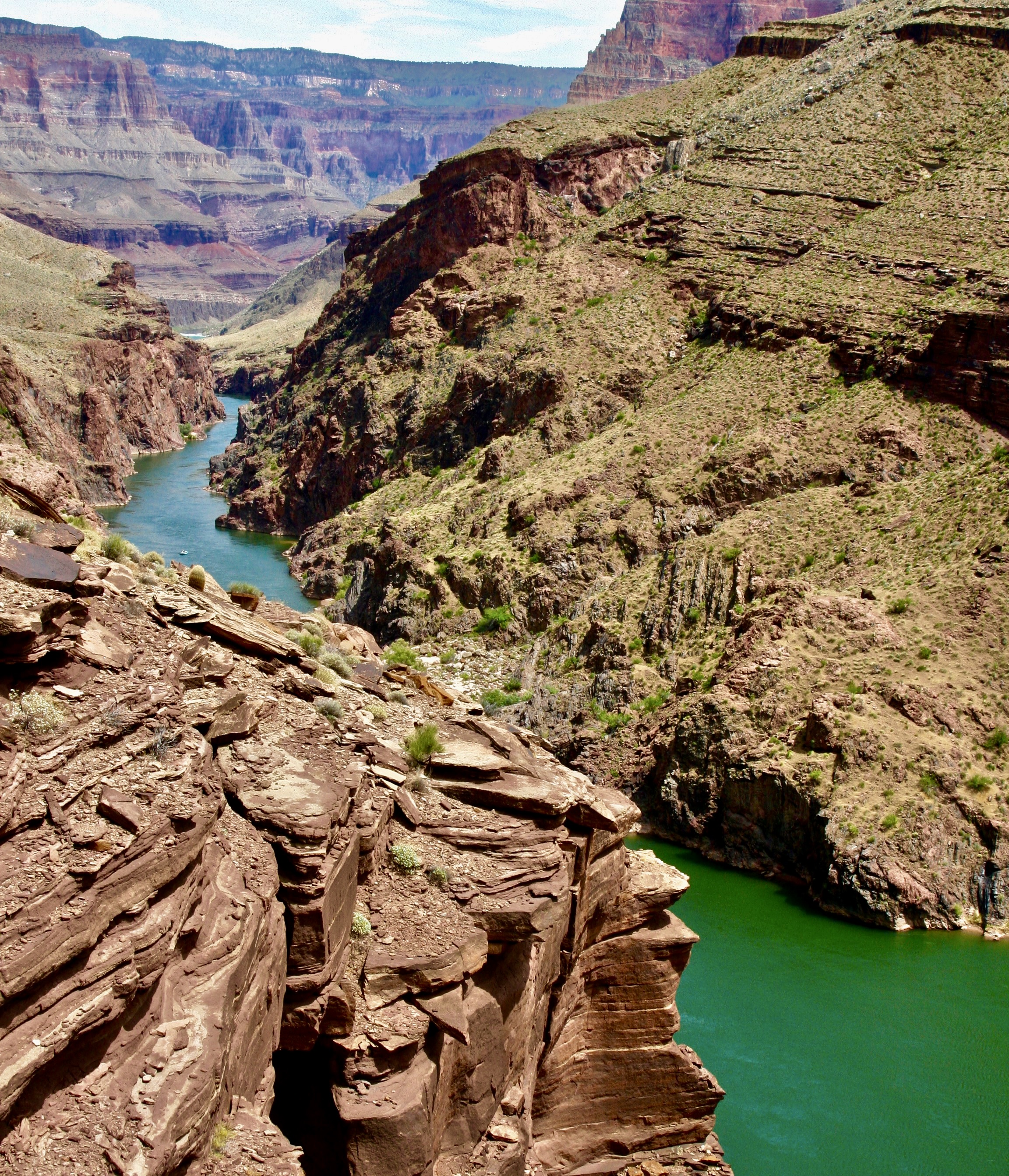
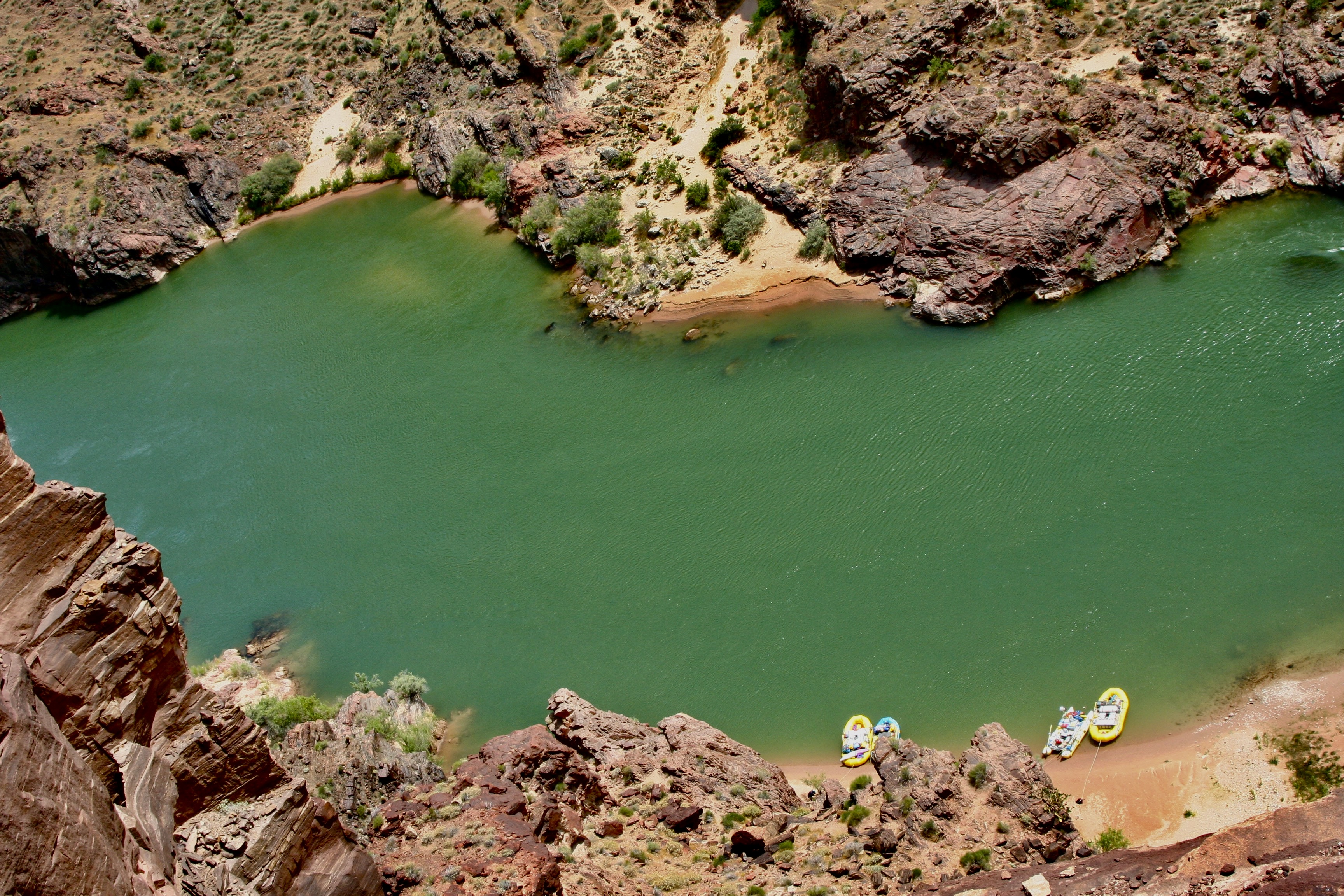
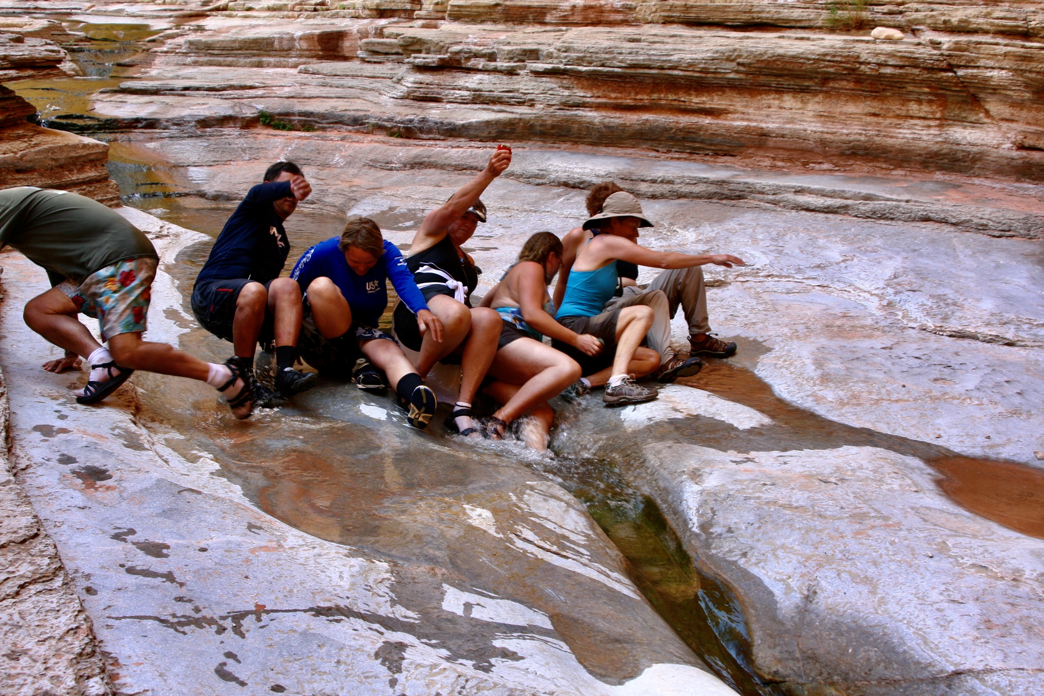
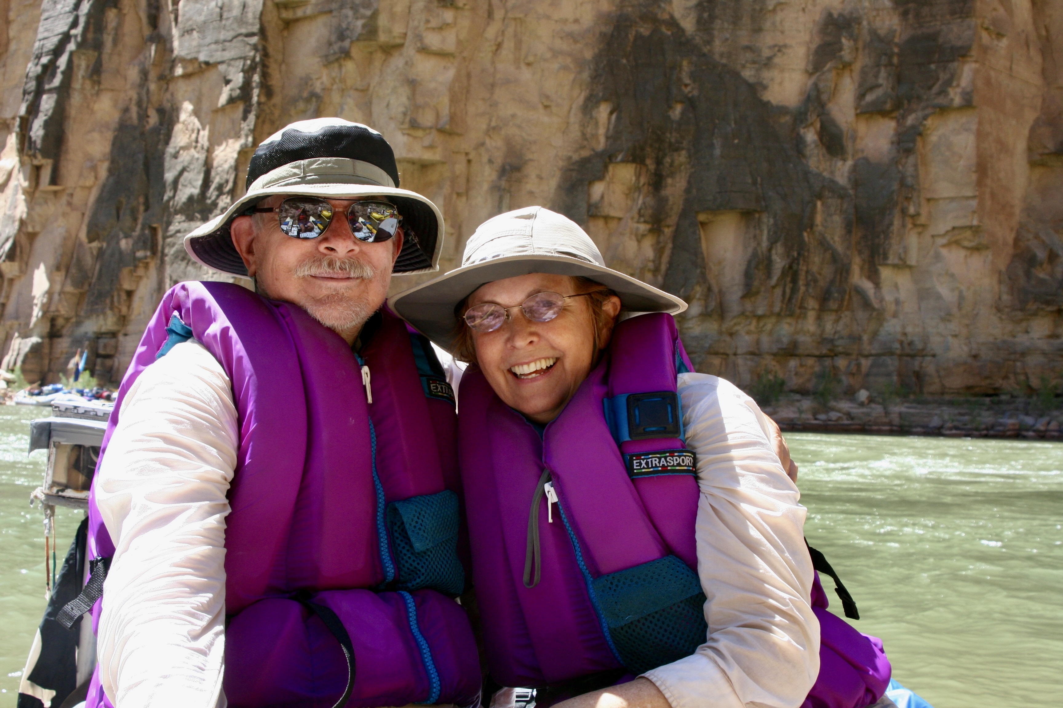
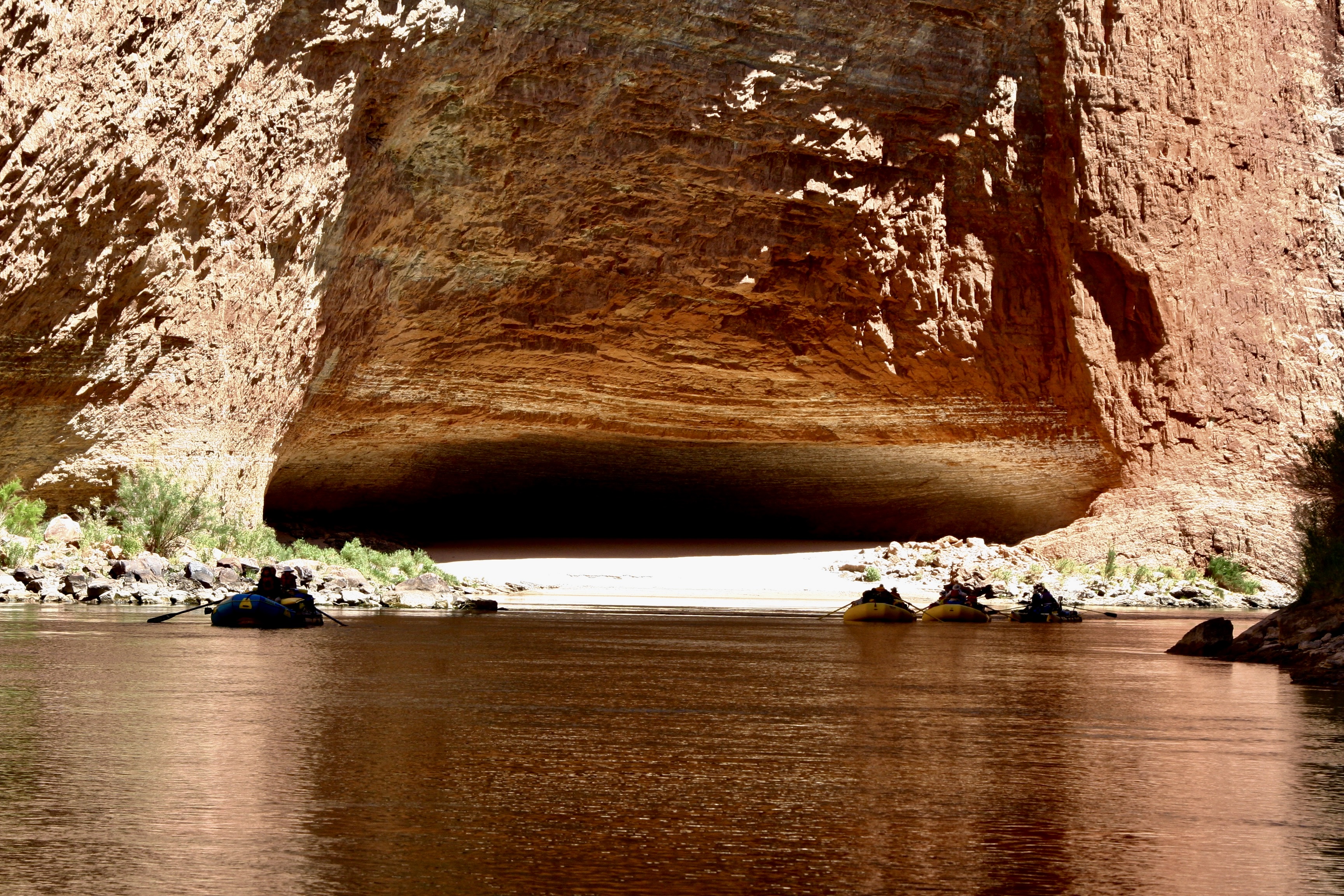
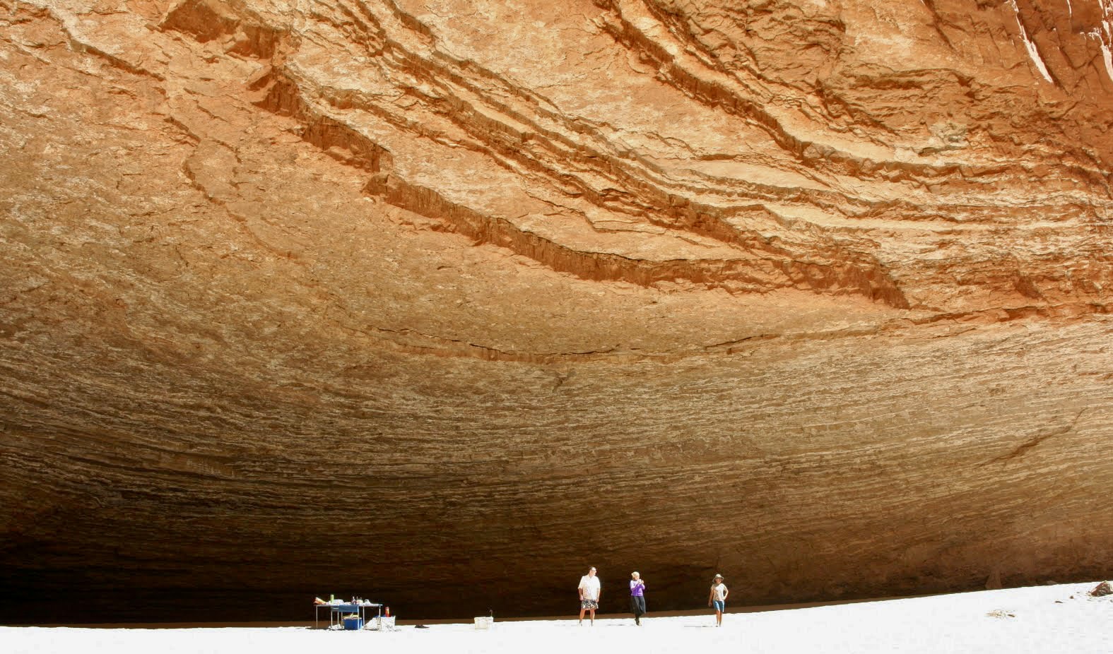
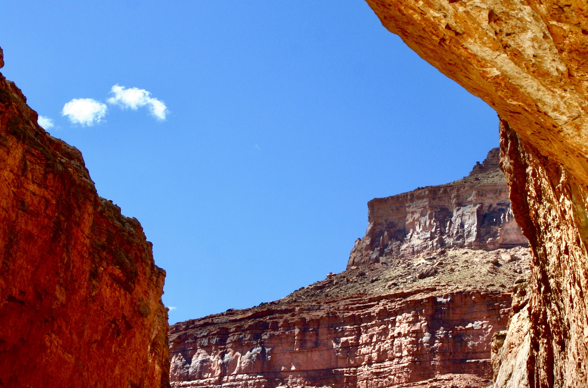
I’m going to wrap up our Colorado River posts on the Great River Series today. We will start just below Lava Falls Rapid where we ended our last post and journey to the beginning of Lake Mead where we finish our trip. I chose this photo from near the end to make a point: There never was anywhere in our trip down the Colorado that lacked in beauty.Much of this post will focus on the scenic views as we made our way from the Grand Canyon to Lake Mead. (Photo by Don Green.)I’ll also feature interesting rock formations such as this lava flow. This one was appropriately near Lava Falls Rapids. The columns are formed when a lava flow has turned solid but is still hot. And of course we will continue to feature the fun folks we had along on our trip and their interesting antics. Spontaneous dancing took place at camp after we had successfully made it through Lava Falls. Tom is in the background…Admiring the performance and supporting a new ‘do.’Further adventures awaited us as well…As expected, Bone would continue to find ways to get into mischief and amuse us.Now this would be a great place to row a boat!With most of the rapids behind us, I finally took a turn.Dave saw it as an opportunity to nap until we reached a minor rapid and I insisted he wake up to guide me through it.Peggy also was willing to take an oar. With Jame’s help…You can probably guess the name of this rock. It’s called Pumpkin Springs. The color is caused by minerals flowing out of the hot springs above it that include high levels of arsenic , as well as zinc, lead, and copper. Bathing in the hot springs is discouraged. Drinking the water is not an option!The cooking crew was getting a little rowdy in Camp.But Peggy was seeking balance.A convenient ledge gave those not working at the moment front row seats.Bone decided he had something in common with Steve Van Dore’s boat, Thing 2.A ‘cool’ way to read a good book?This pyramid-like structure in the background, Diamond Peak, reminded me of our trip up the Nile River. We will be returning there as part of our Great River Series. The dark rocks are volcanic.Tom had a final adventure planned for us that I mentioned above. it involved climbing this step/rope ladder near Diamond Creek. The Hualapai Tribe built series of ladders to help people access a ‘bathhouse’ on the creek.Beth climbing the ladder. (Photo by Don Green.)A cold shower was one of the options of the bathhouse. I decided Bone, me and my clothes would all benefit.A more civilized approach was a few feet away.I was attracted to a colorful set of rocks found in the area.Our ‘bathhouse’ provided creative frames.Another example.One of the most unusual sites we saw along the Colorado was this hundred foot waterfall made out of Travertine Rock.Another perspective.I caught this close-up of travertine framed by the sky at a stop nearby.And Don caught these maidenhair ferns.While Bone found a barrel cactus to perch on. Tough butt.And the scenery kept being spectacular as the miles rolled (rowed) by.Cliffs.Distant vistas.A combination of the river’s edge and far away.And a final view of the beauty that had awed us on our 280 mile journey through the Grand Canyon to Lake Mead.We were privileged to see several big horn sheep in our last hundred miles. I think these may have been lined up for their turn at a natural salt lick. It came as a big surprise when we spotted a different type of animal with horns…That convinced us that our journey was nearing its end! (Photo by Don Green.)Peggy struck her Titanic pose. I saw her do the same thing once over the piranha infested water of the Amazon River. At least, if she fell off here, the only thing that would happen to her is she’d get wet.Jame introduced us to a new way of rowing…And the women, for a reason I couldn’t quite fathom, decided to do a fingernail check. It’s possible that Jame felt as perplexed as I did. Or is that a semi-thumbs up?We woke up on our last morning with our campsite flooded. Go figure. Everyone good-naturedly went about his or her business of doing morning chores.A few miles down river we reached the take-out point. Our journey was over. It was time to pack up one last time. It may look like everyone was ‘laying down on the job’ here. Actually we were squishing the air out of one of the rafts. A final photo of Tom. He looked tired— but it was well earned tired. We all owed him a great debt of gratitude for the incredible adventure he had taken us on: For all of the planning and organizing, and for doing everything in his power to assure that we experienced everything the Colorado River and the Grand Canyon had to offer, and doing so in a safe manner— while having loads of fun along the way. While thanking Tom, I also want to thank the boatmen (plus Megan) whose hard work and skills meant so much to our successful journey.Don, I think, represented us all, while looking a bit scruffy, looked off into the distance one last time, contemplating the wonder of what we had just been through.Looking equally scruffy, I had added another whole layer of appreciation for the Canyon I had loved and explored over the years on foot, by mule, by car and by helicopter. And now by raft.And Peggy, who had loved every minute of the adventure, looked just about like she always does. How in the heck does she do it? (Photo by Don Green.)And finally: Bone. No-one had more fun than he did. Virtually everyone spent time with him. As a final gesture, he made sure that everybody initialed his PFD.
Next post: It’s on to the Danube River and Vienna!
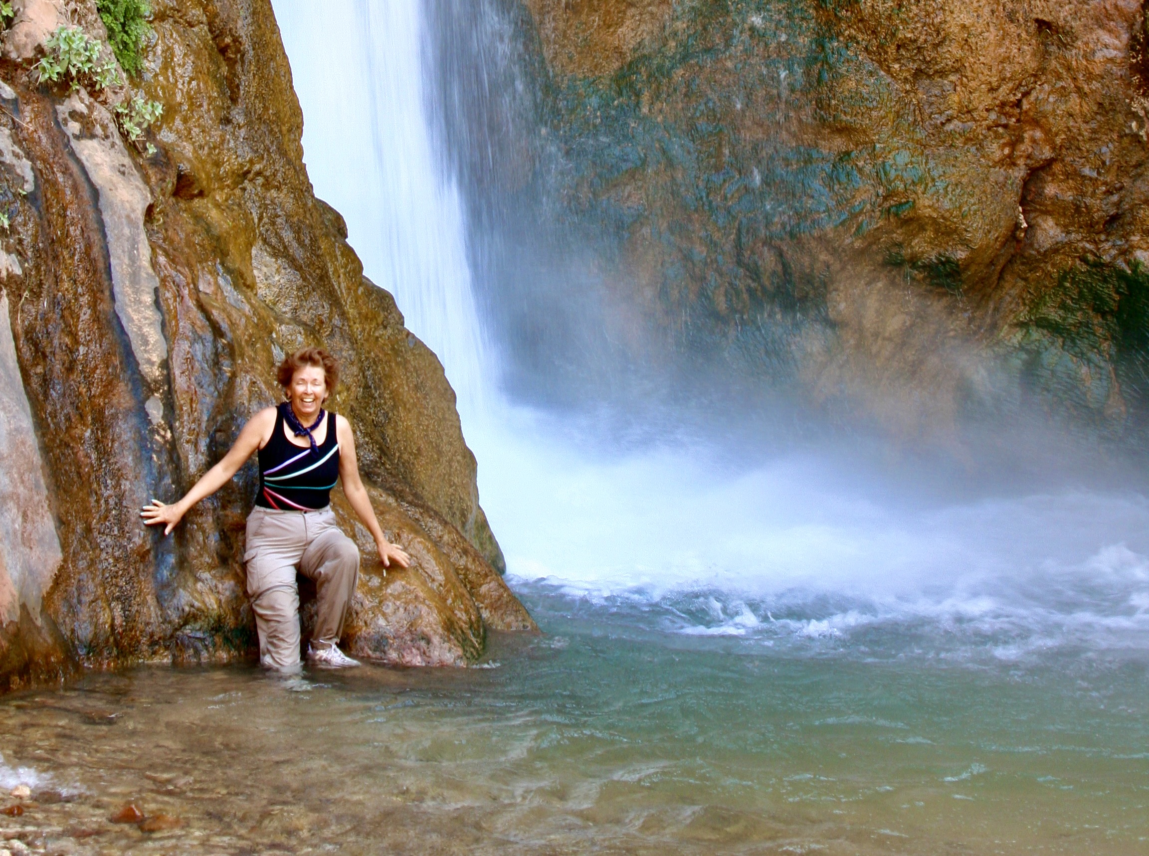
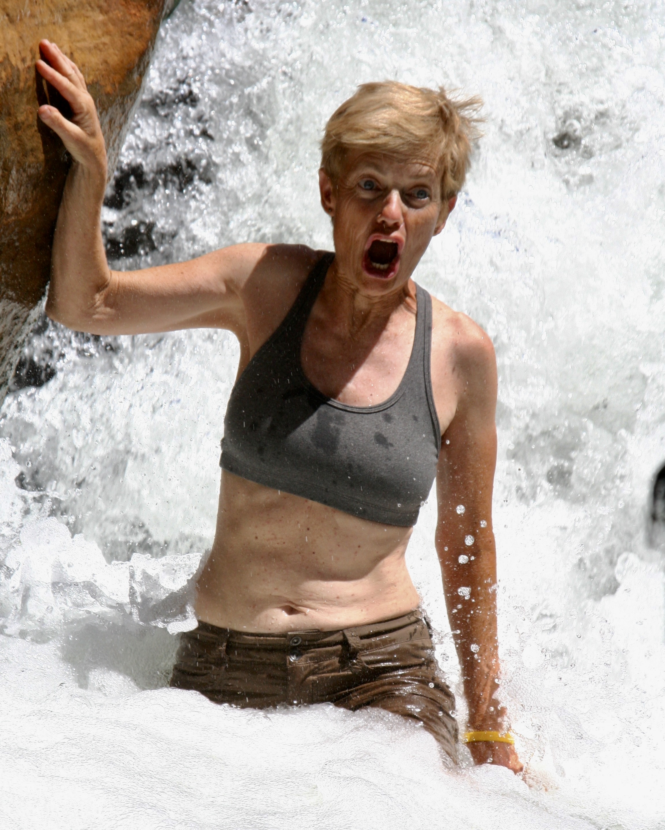
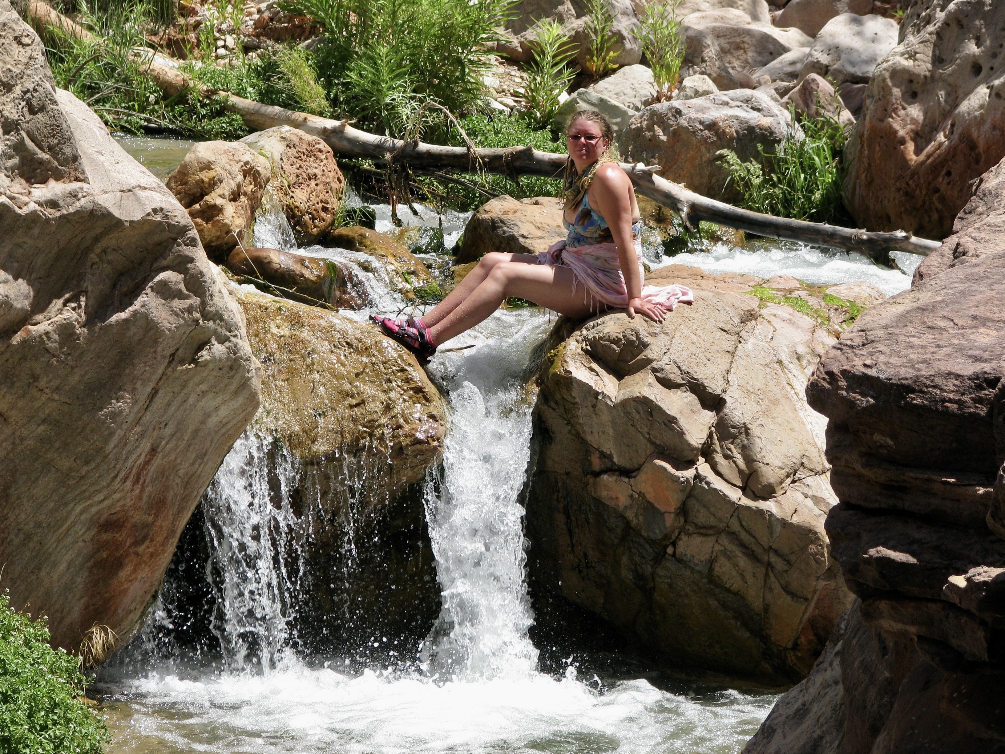
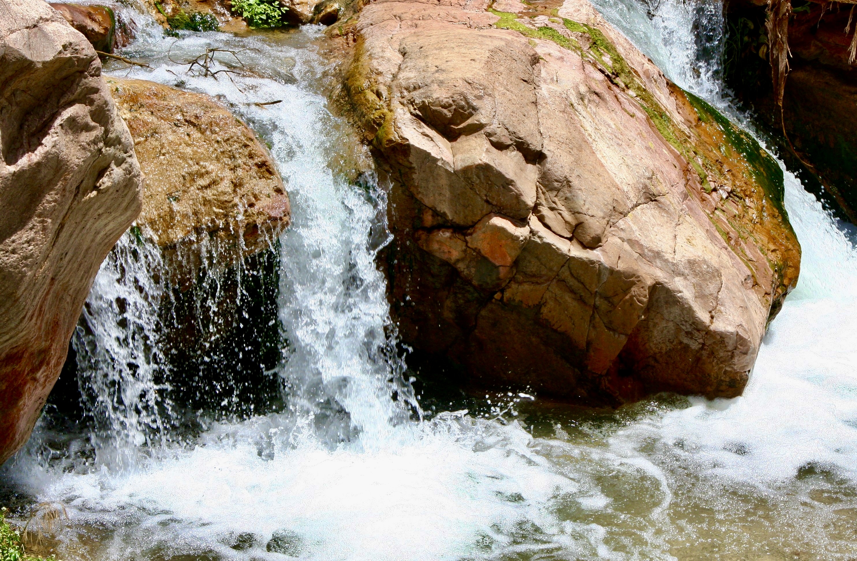
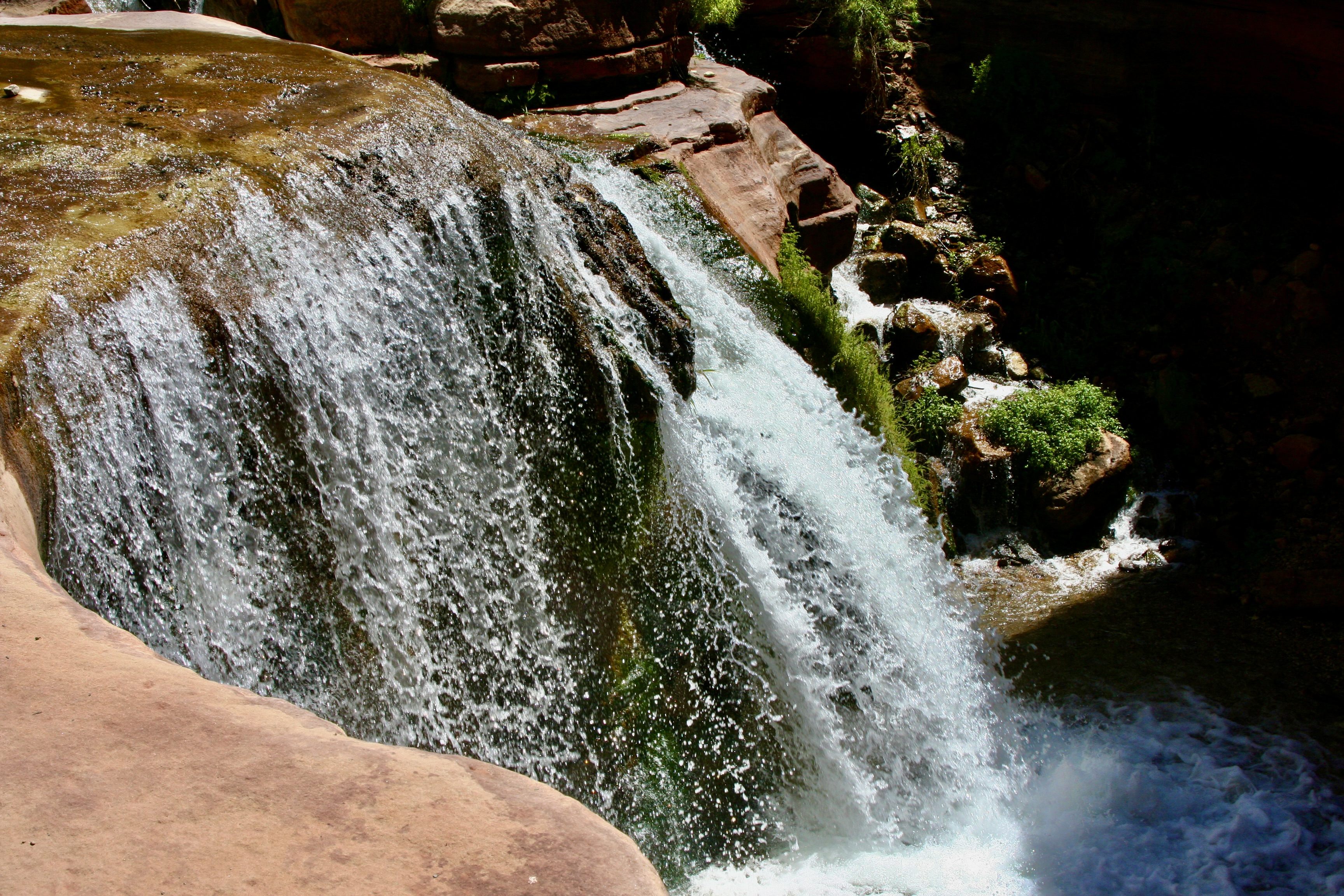
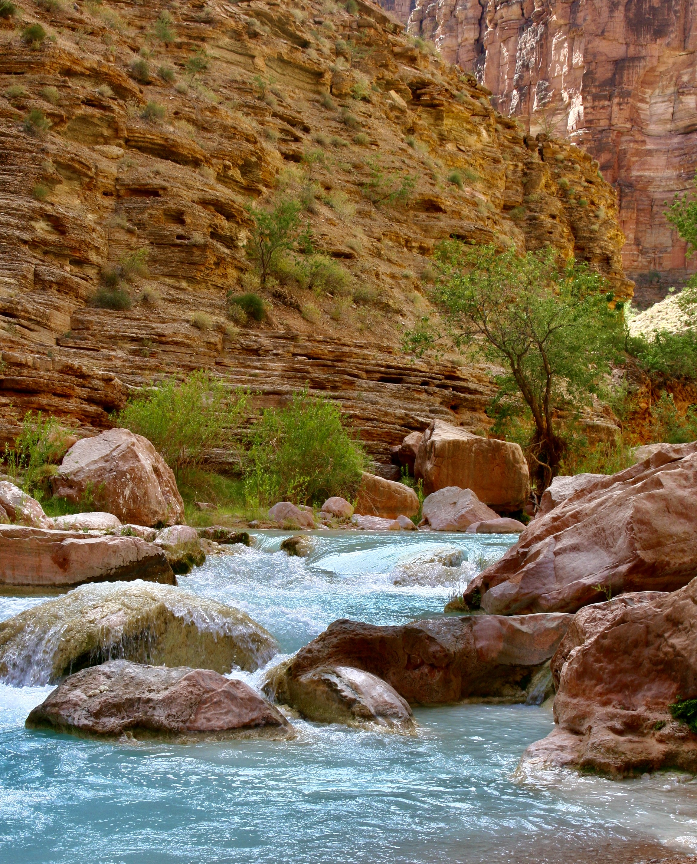
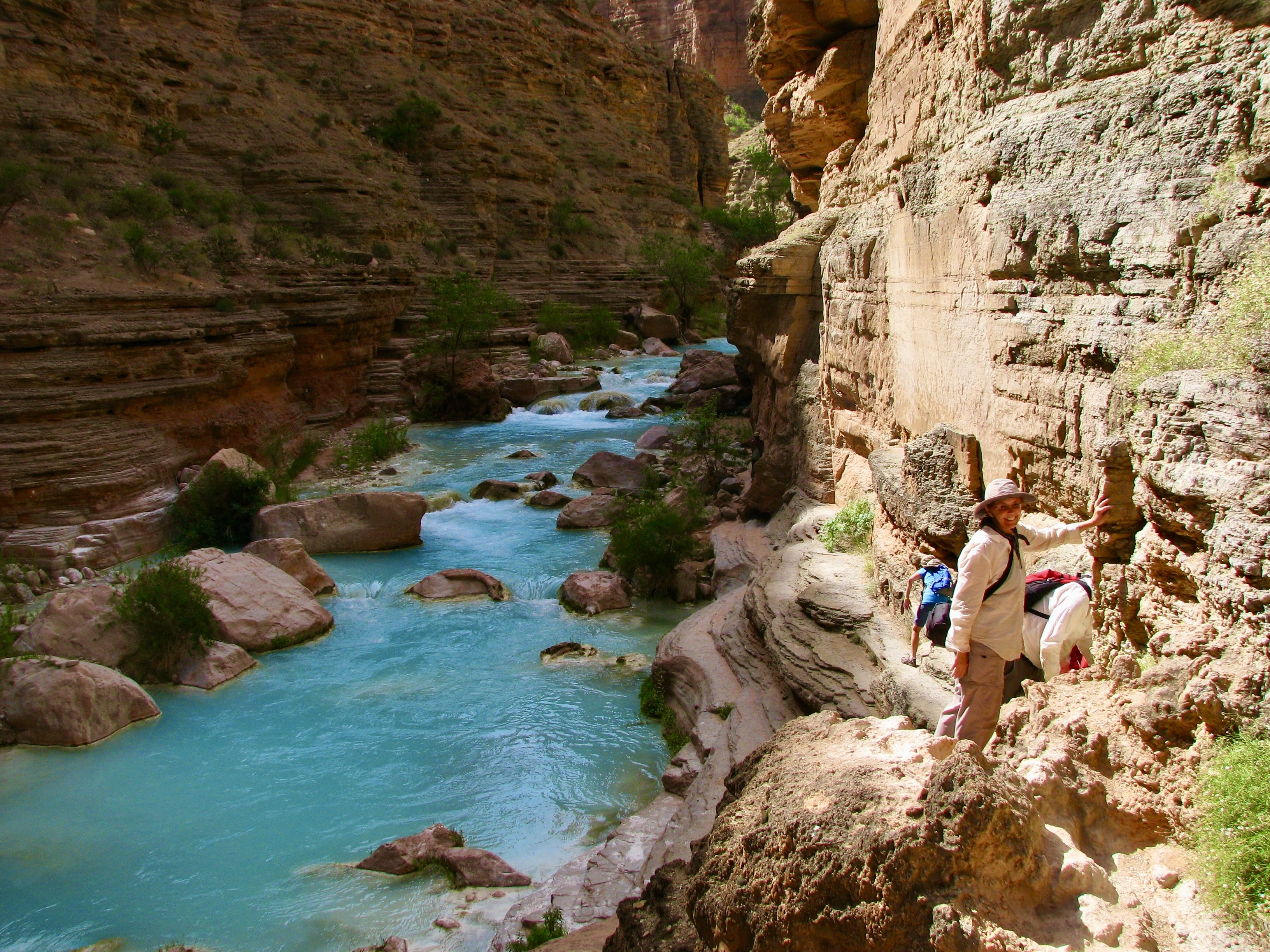
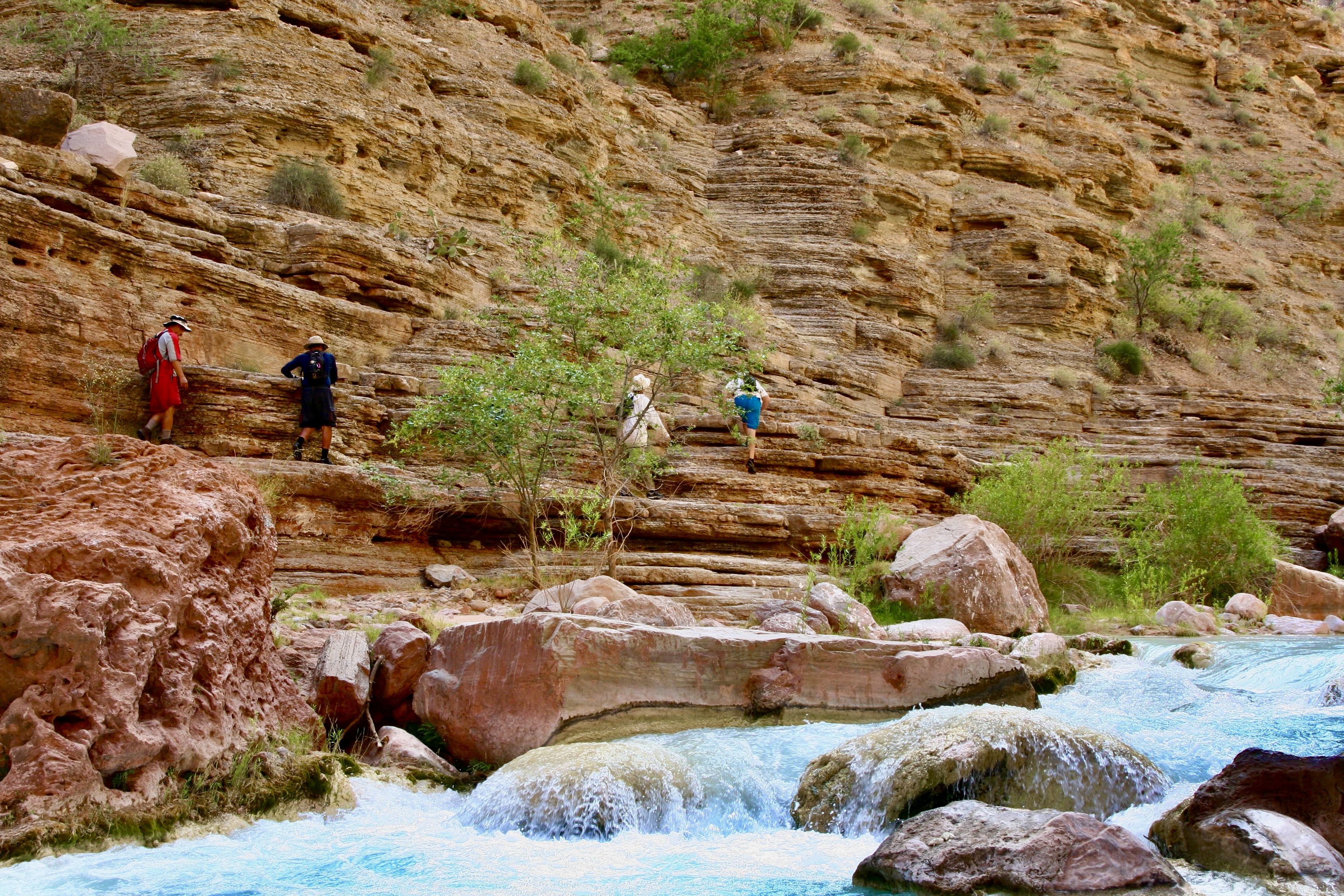
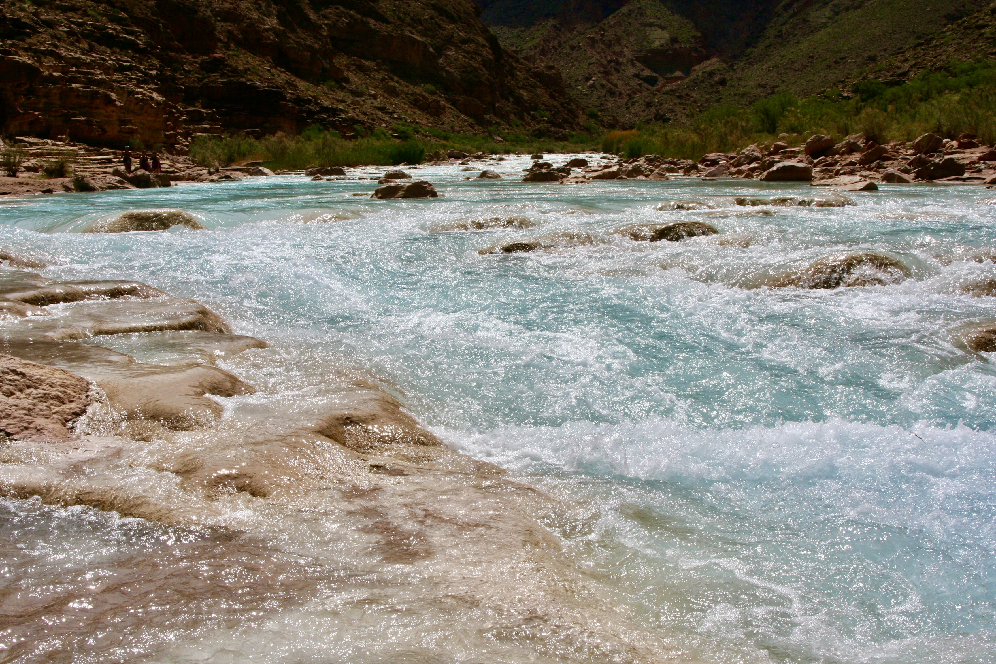
Deer Creek Falls was at mile 136, less than a mile below Christmas Tree Cave where I finished our last post. Here, Peggy enjoys the roar and the mist.
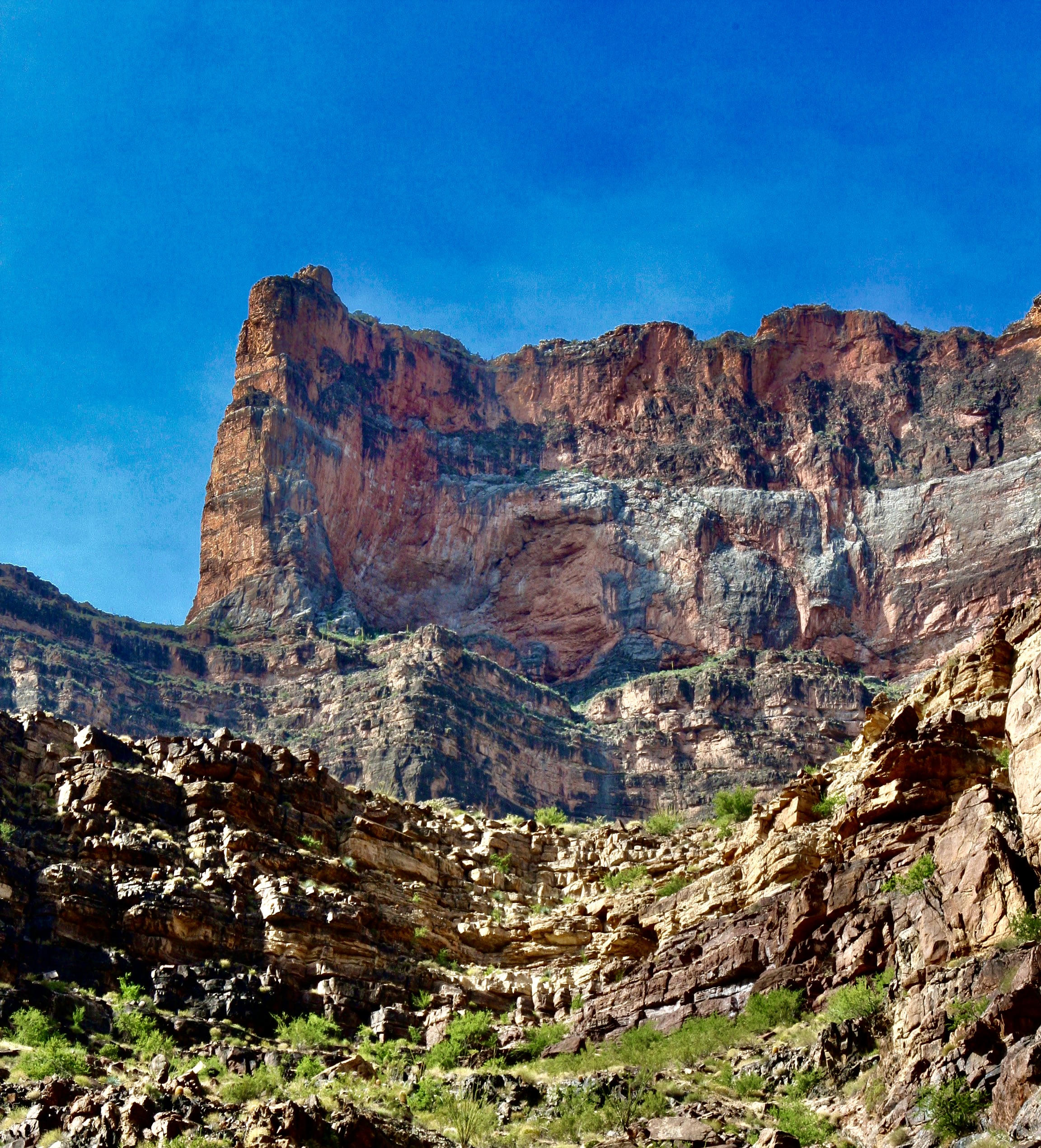
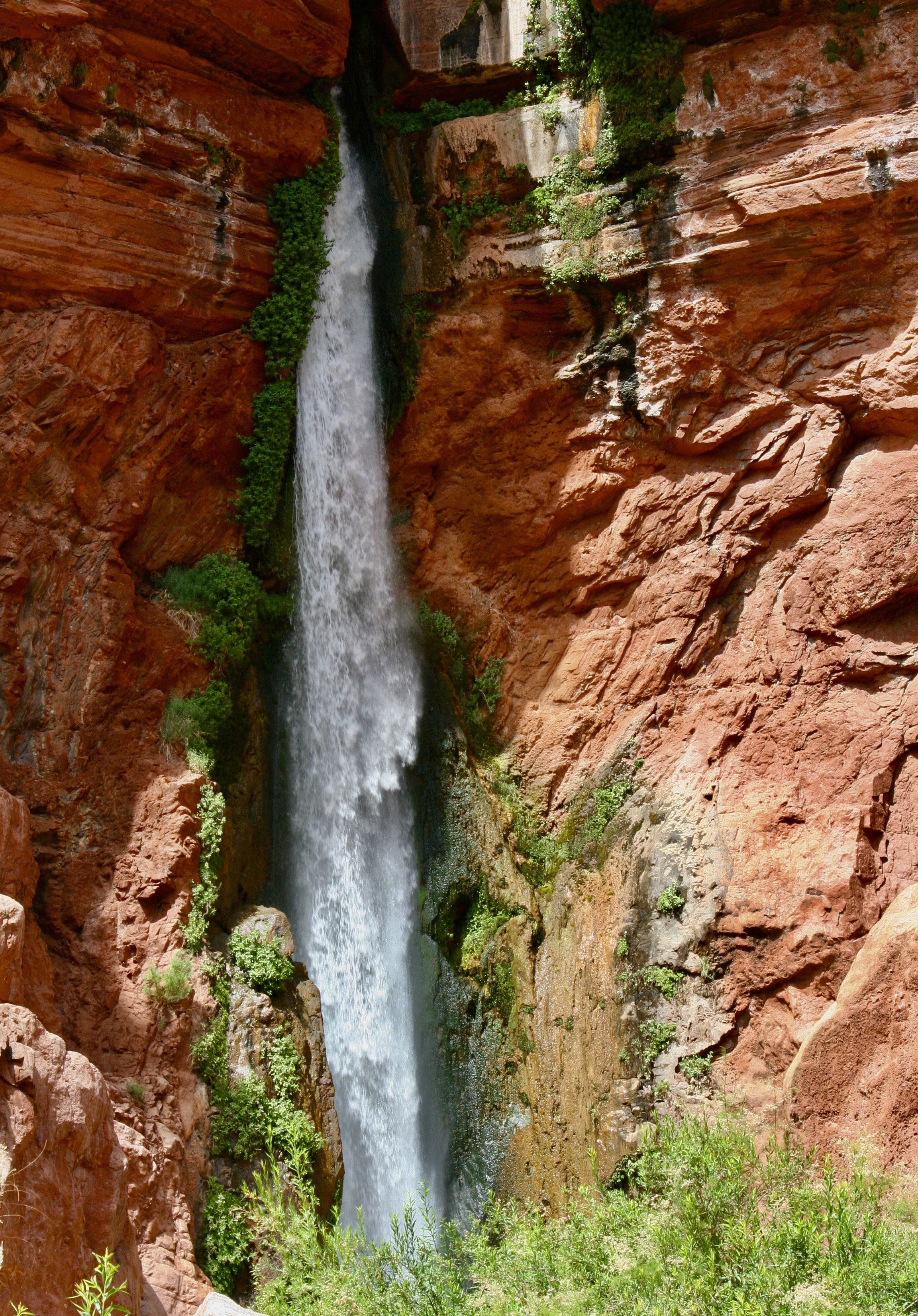
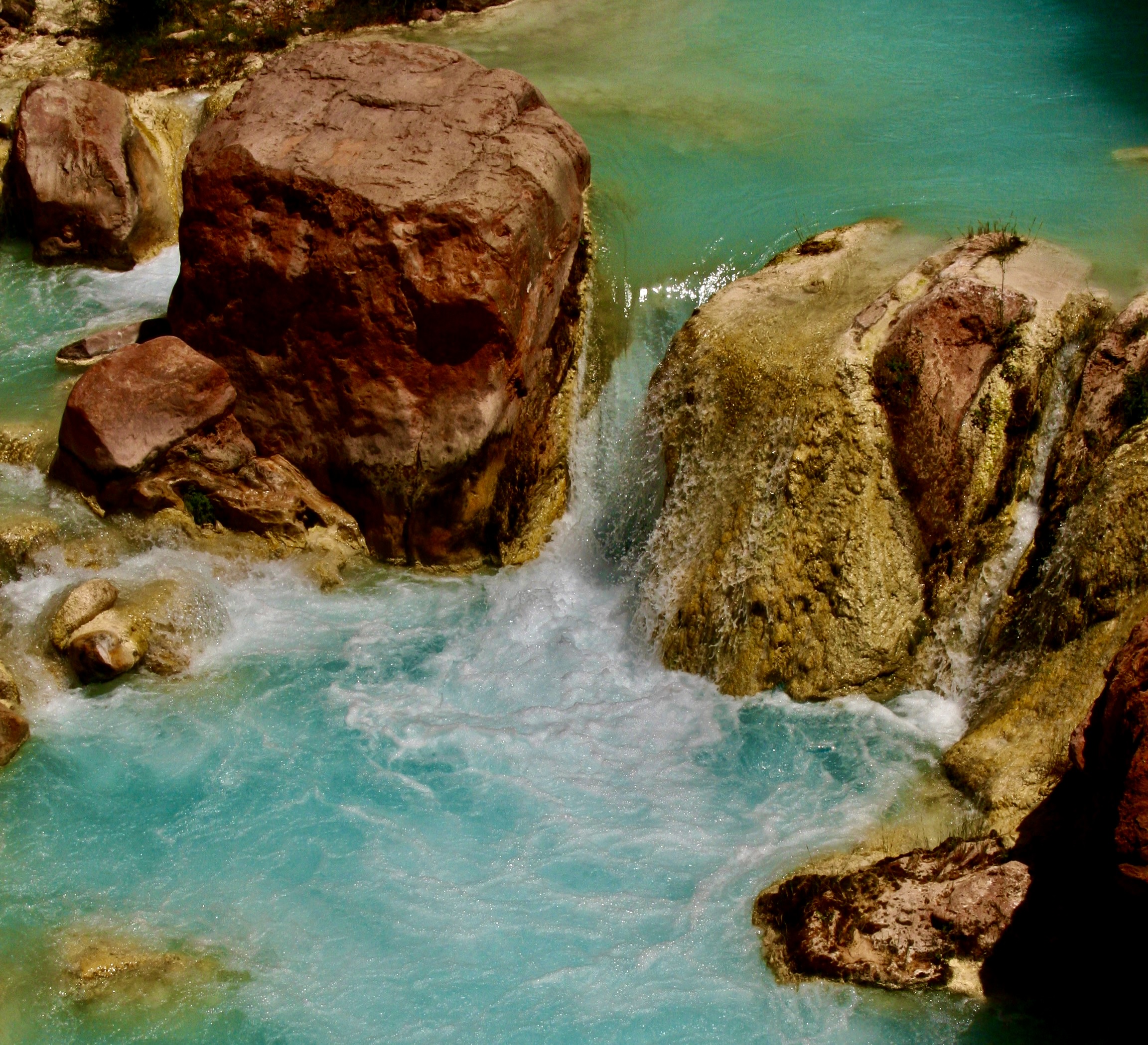
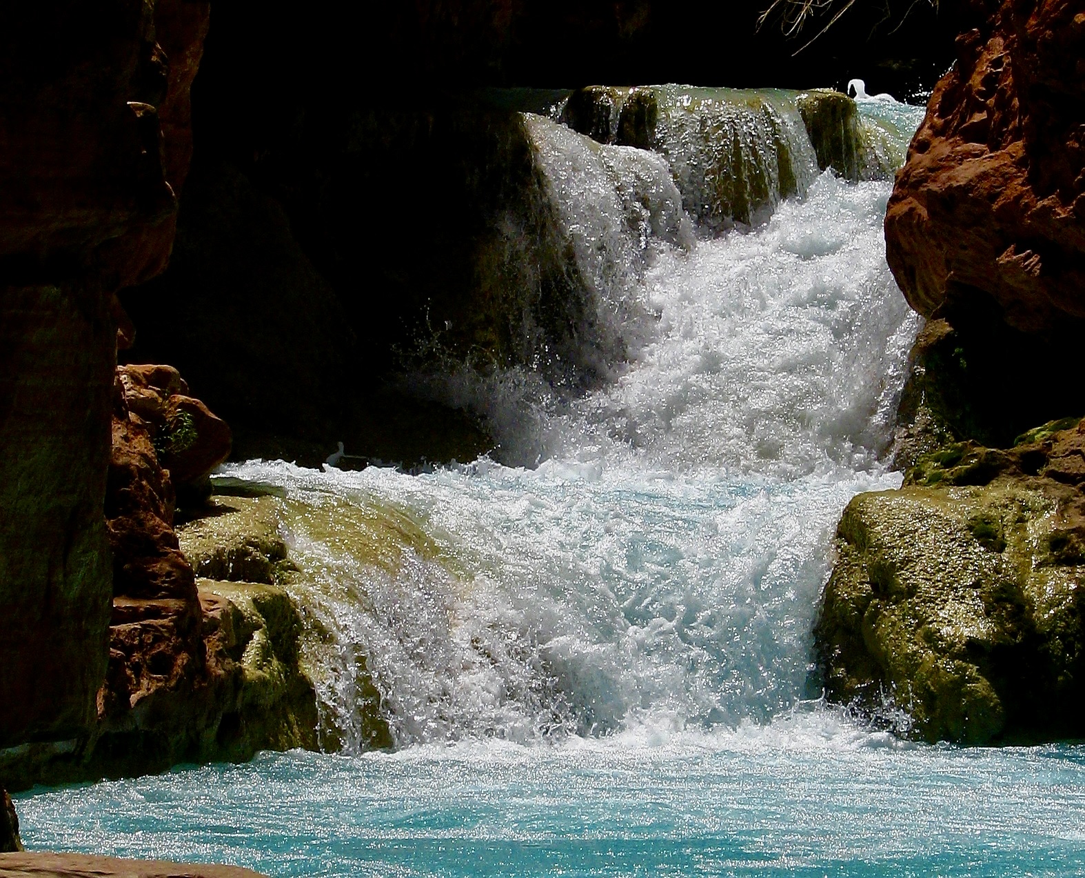
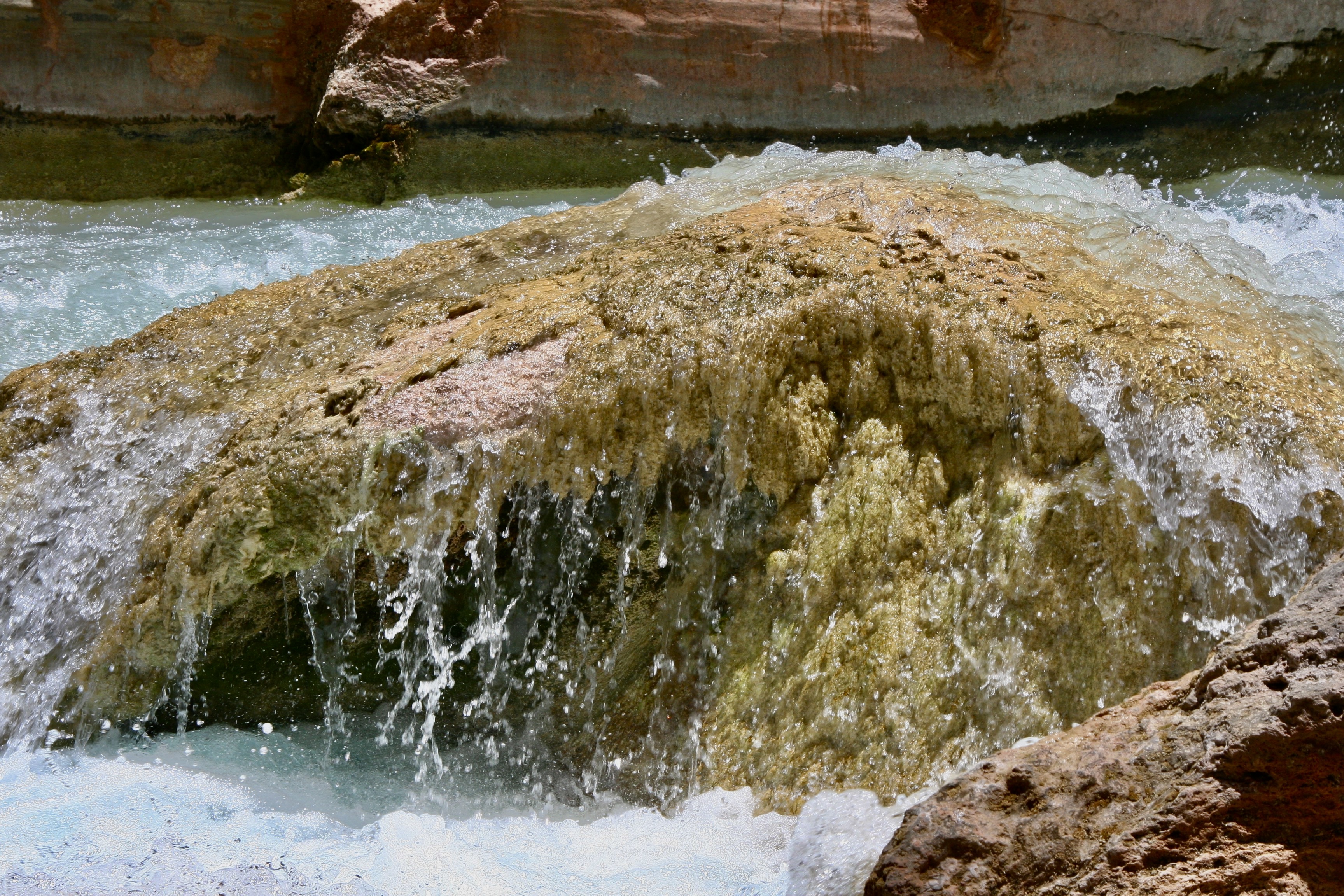
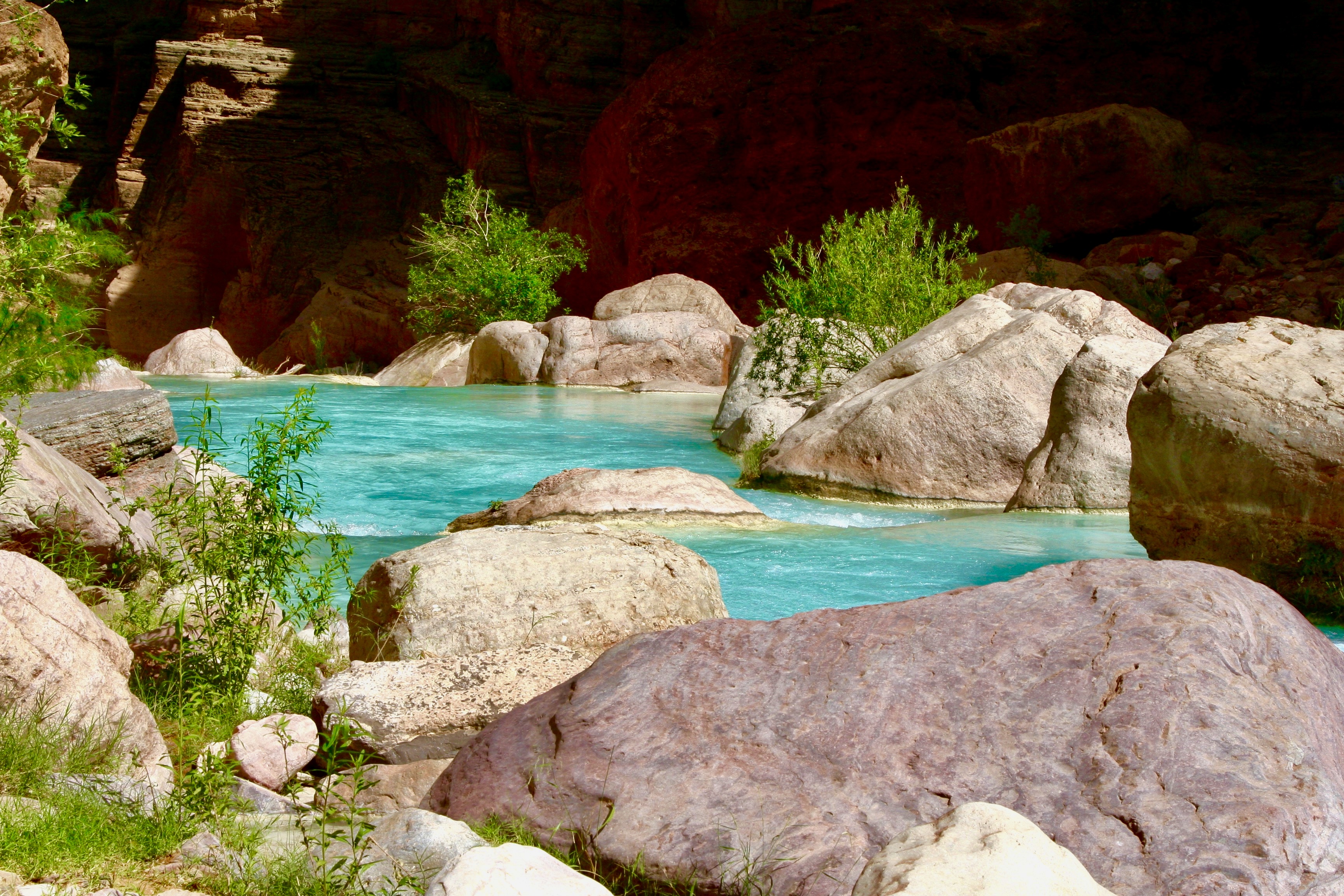
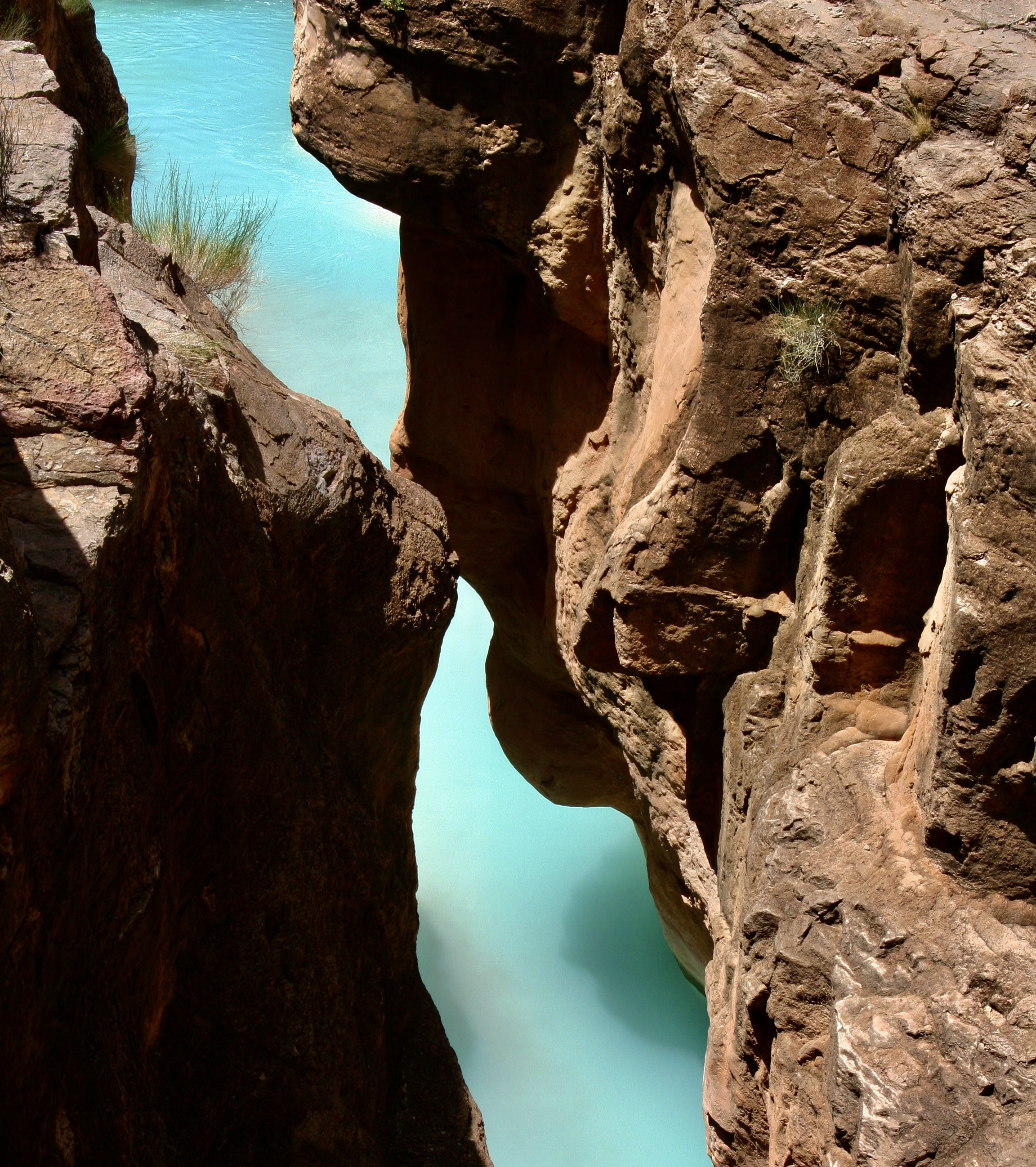
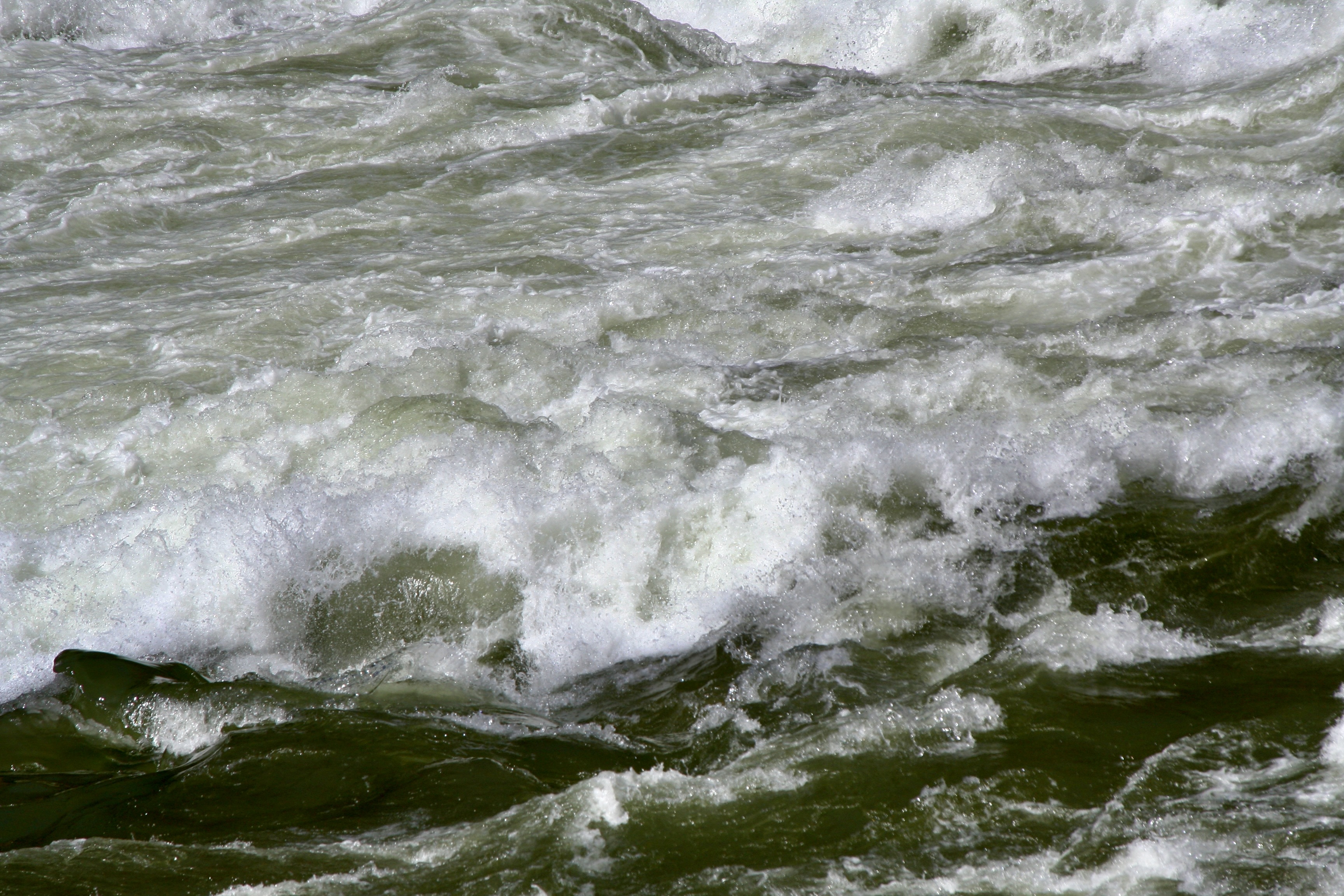
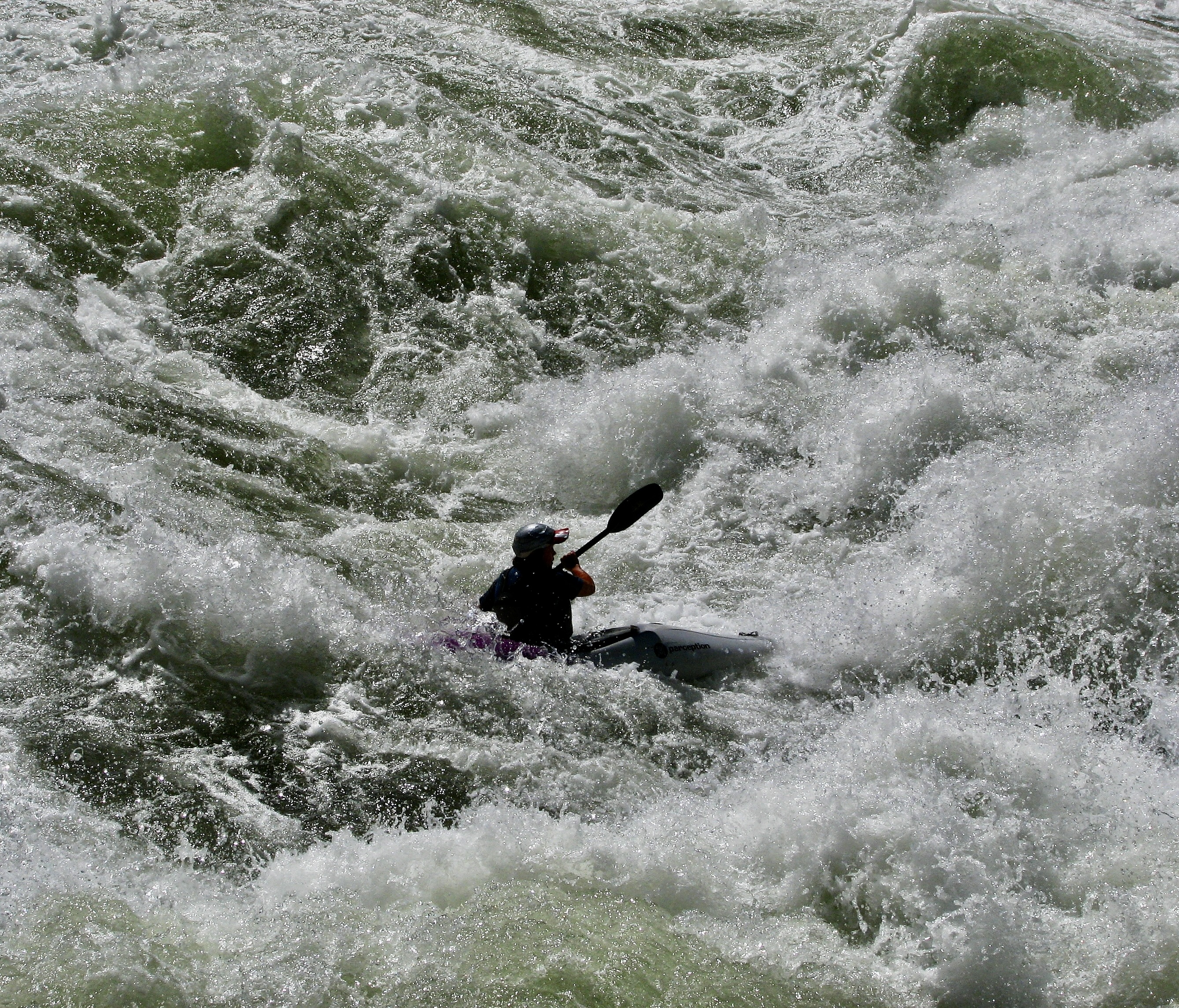
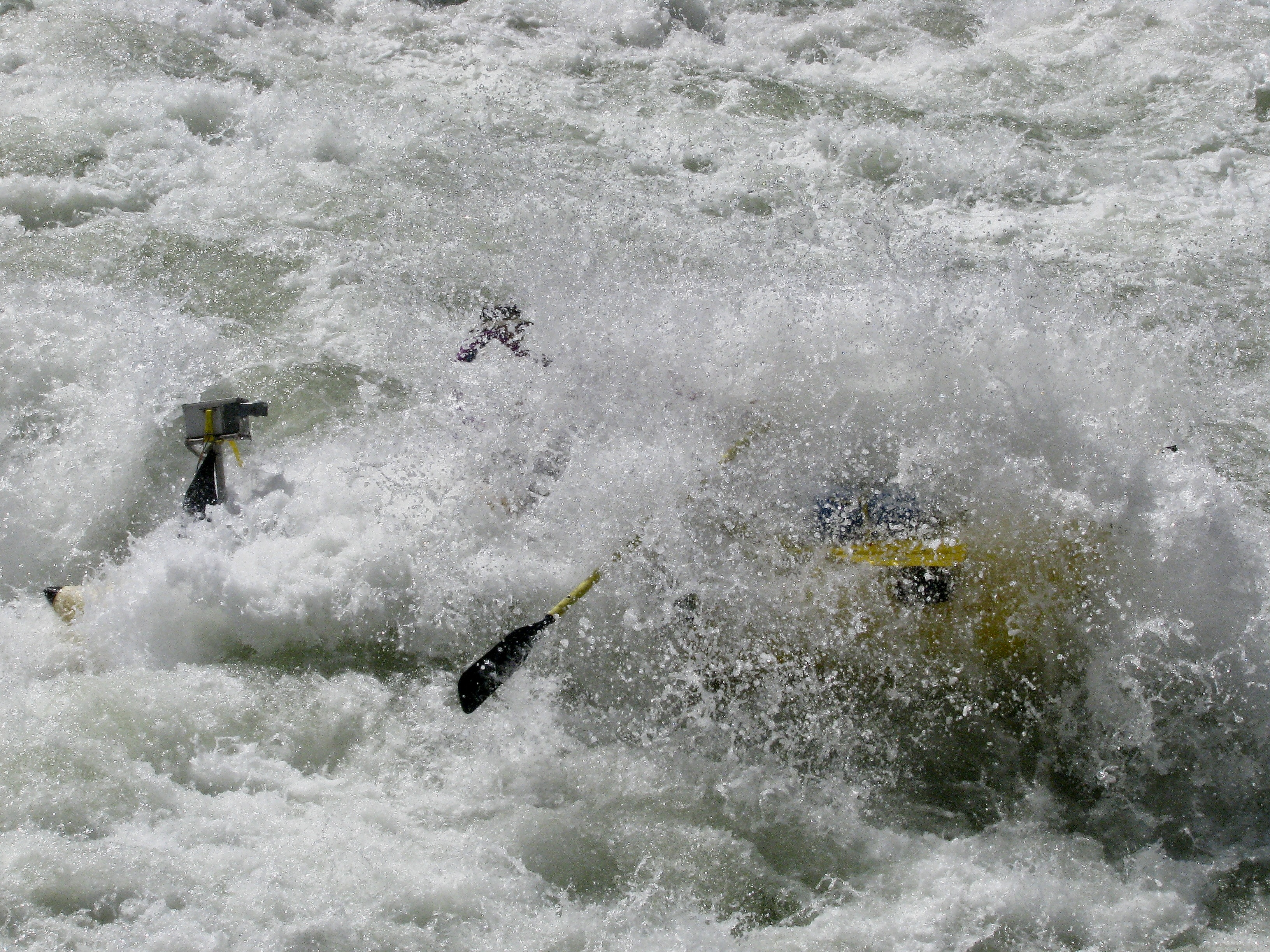
Today will take us another 44 miles down the river, which is short on miles but filled with both beauty and adventure. The beauty will be provided by Deer Creek Falls combined with a hike that takes us high above the river, and Havasu Creek that feature sparkling aqua blue water. Lava Falls Rapid will provide much of the adventure. Its #10 rating in difficulty recognizes it as one of the most challenging rapids in the world. We looked forward to it with excitement, and I might add, more than a little trepidation.
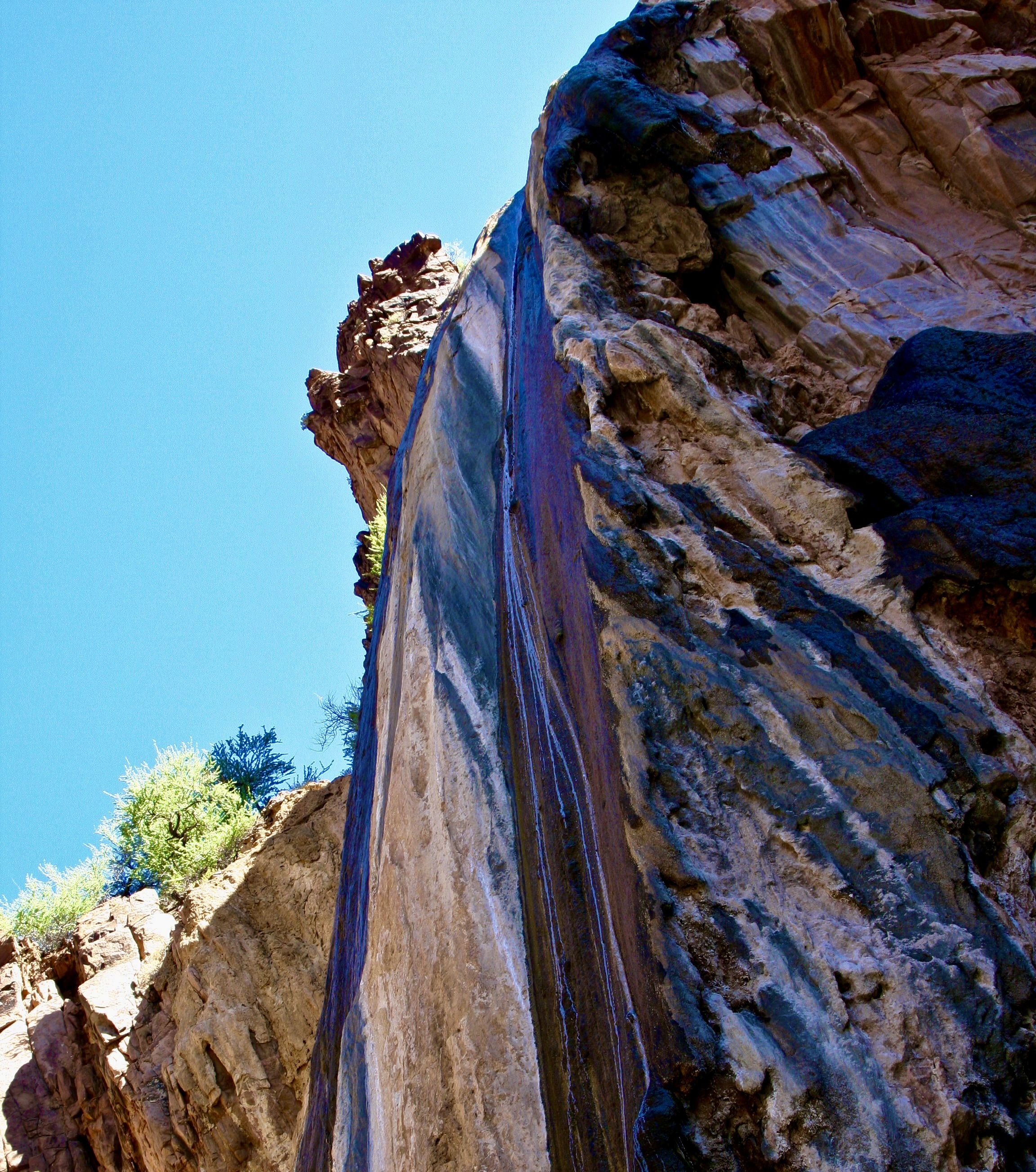
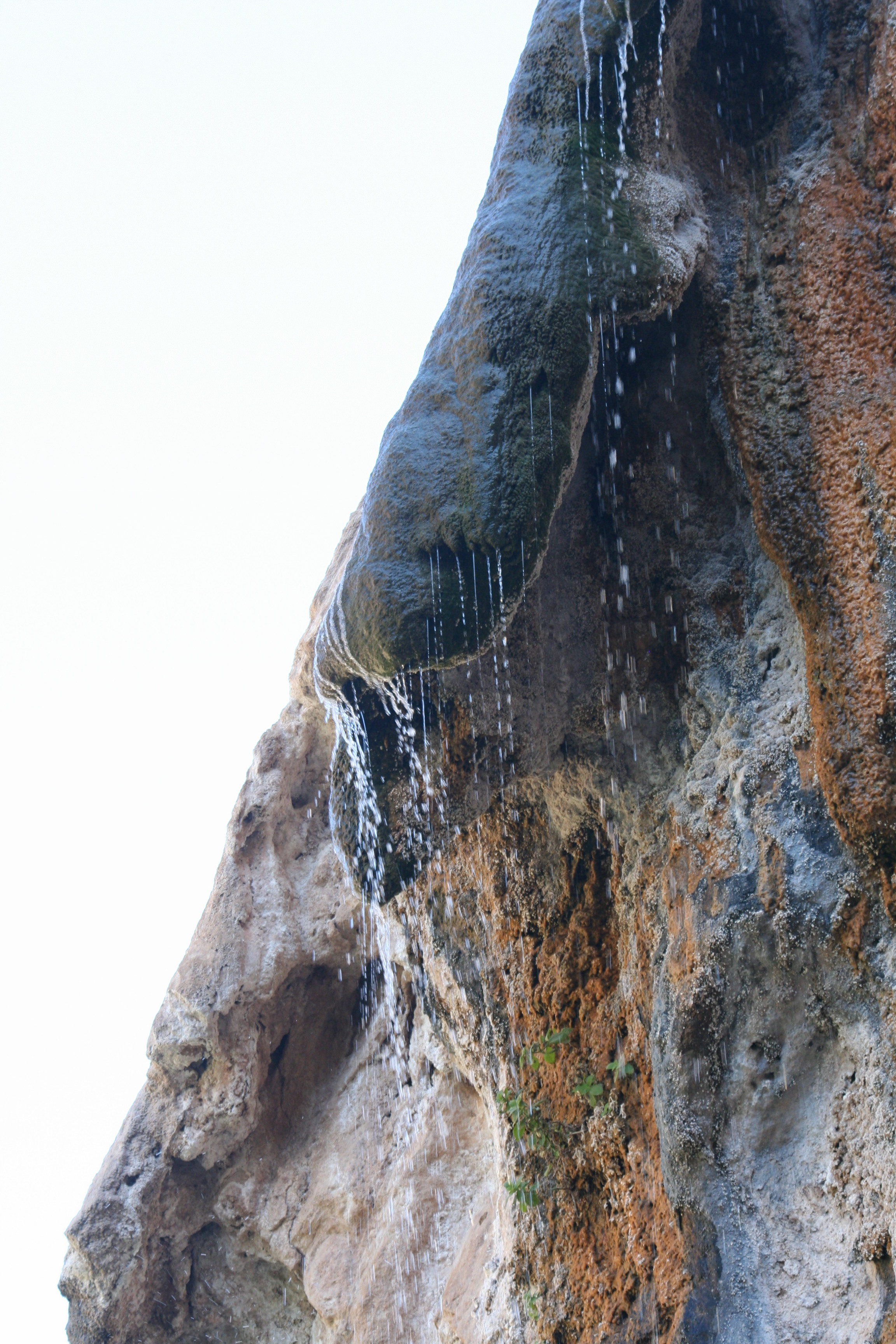
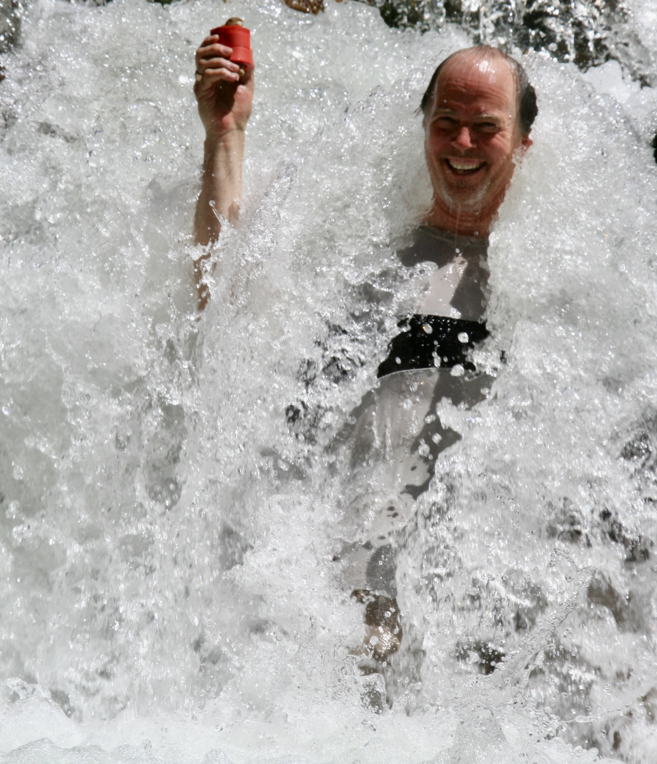
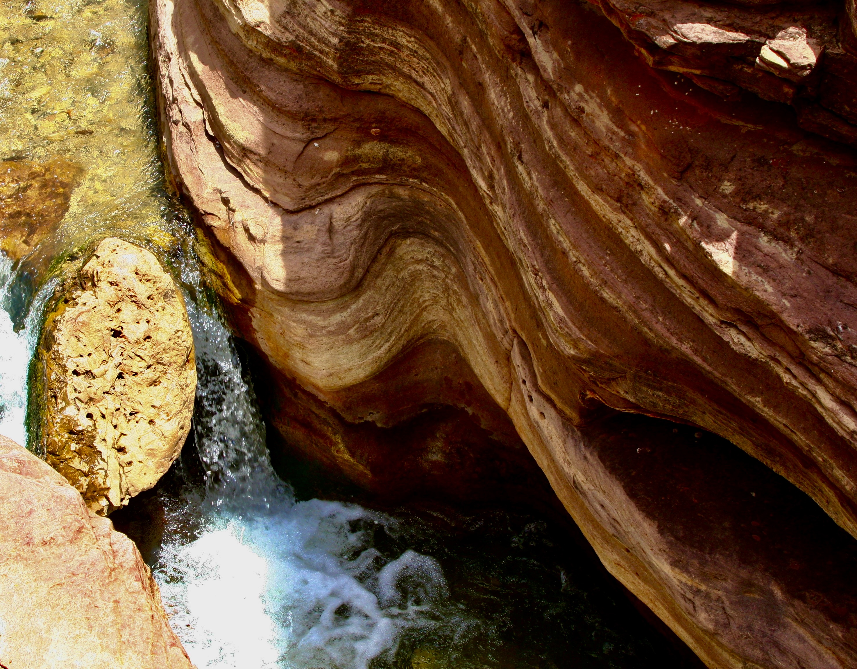
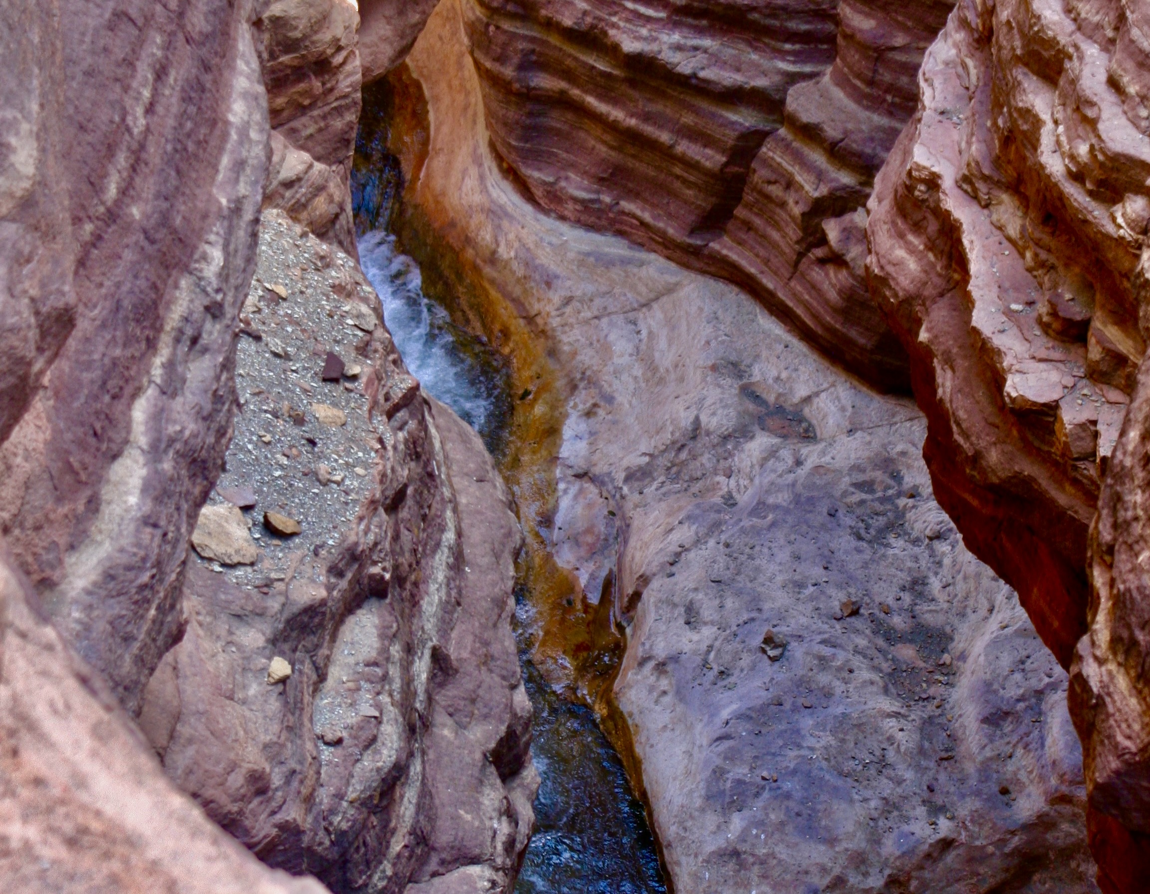
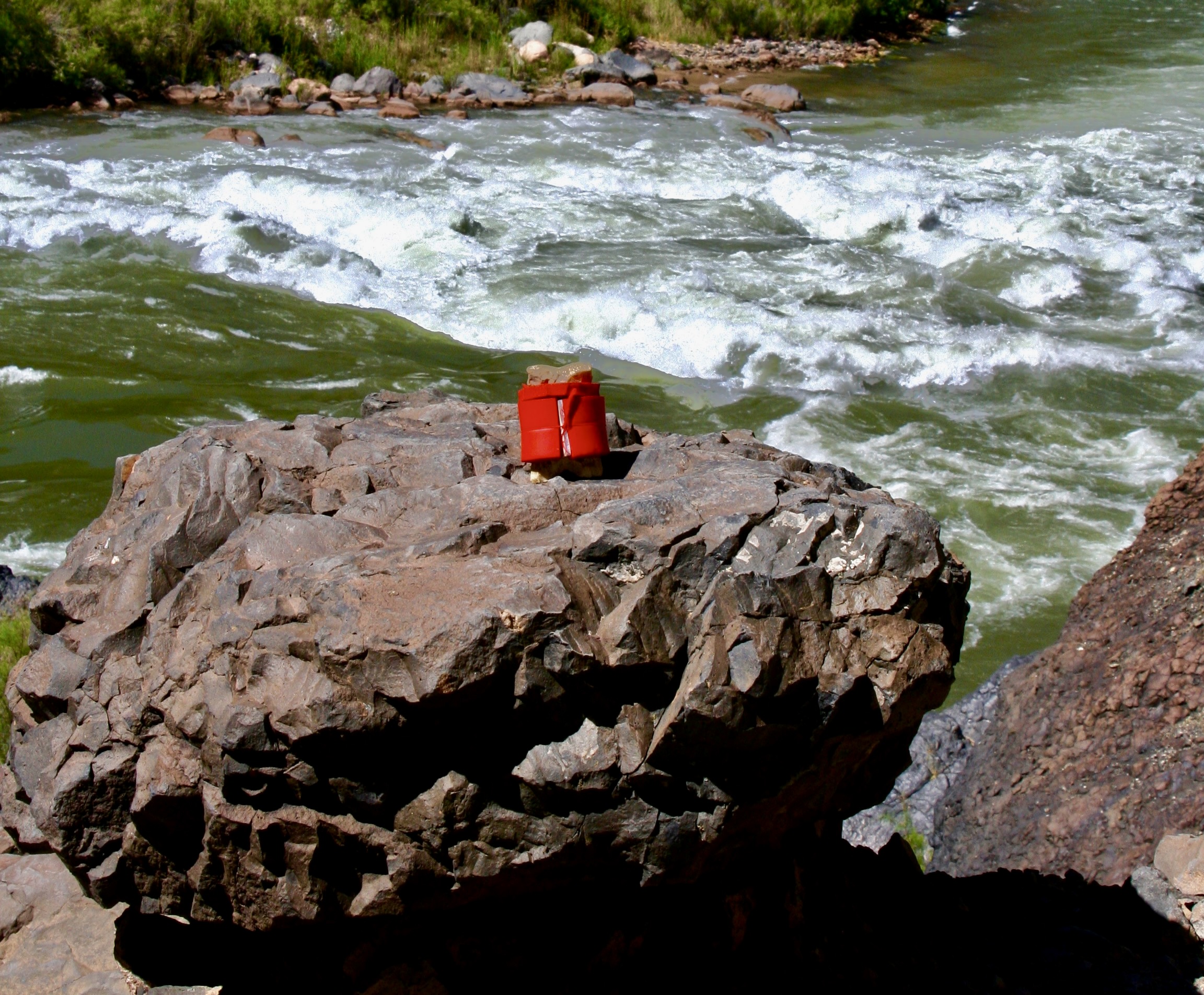
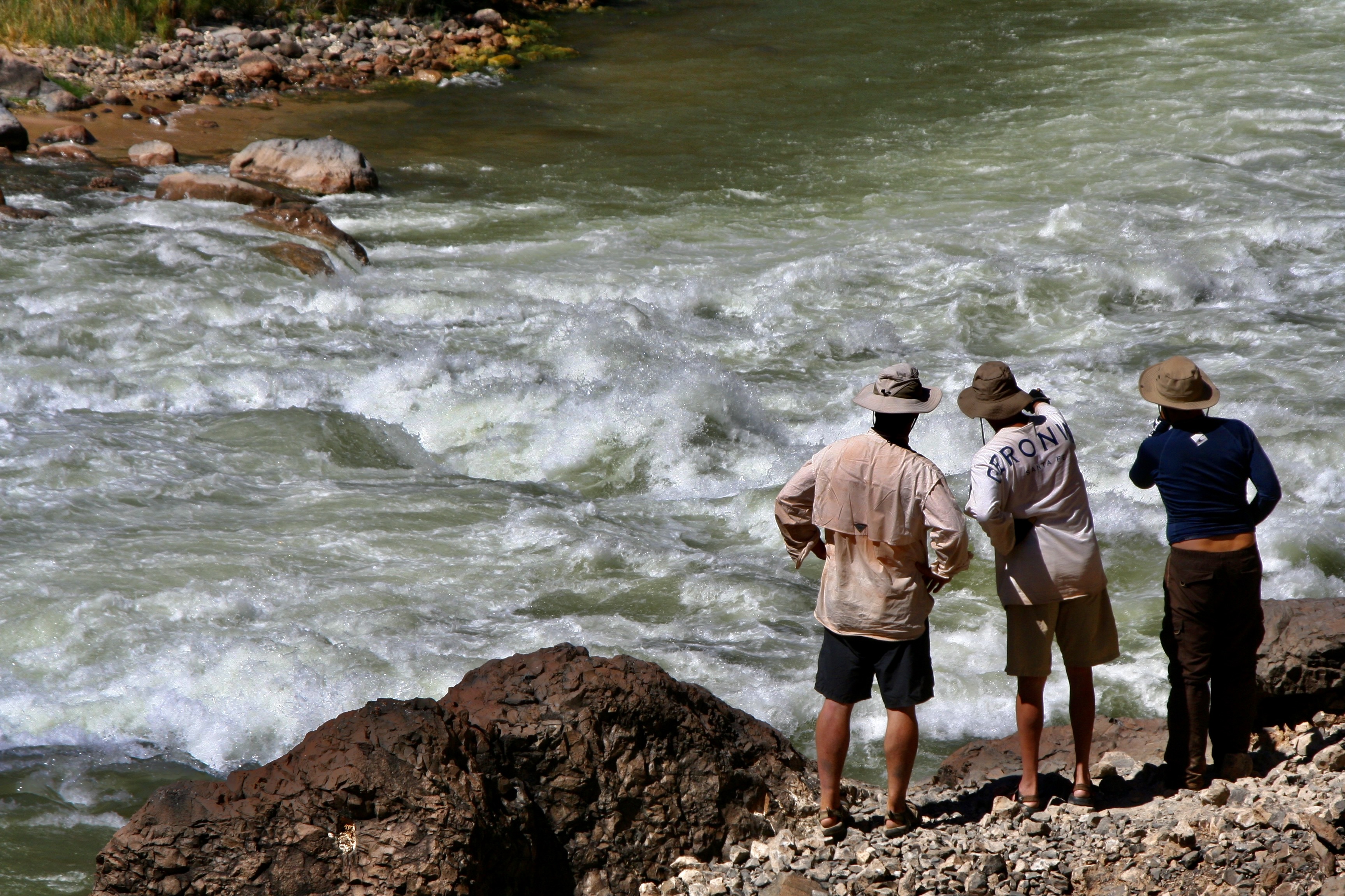
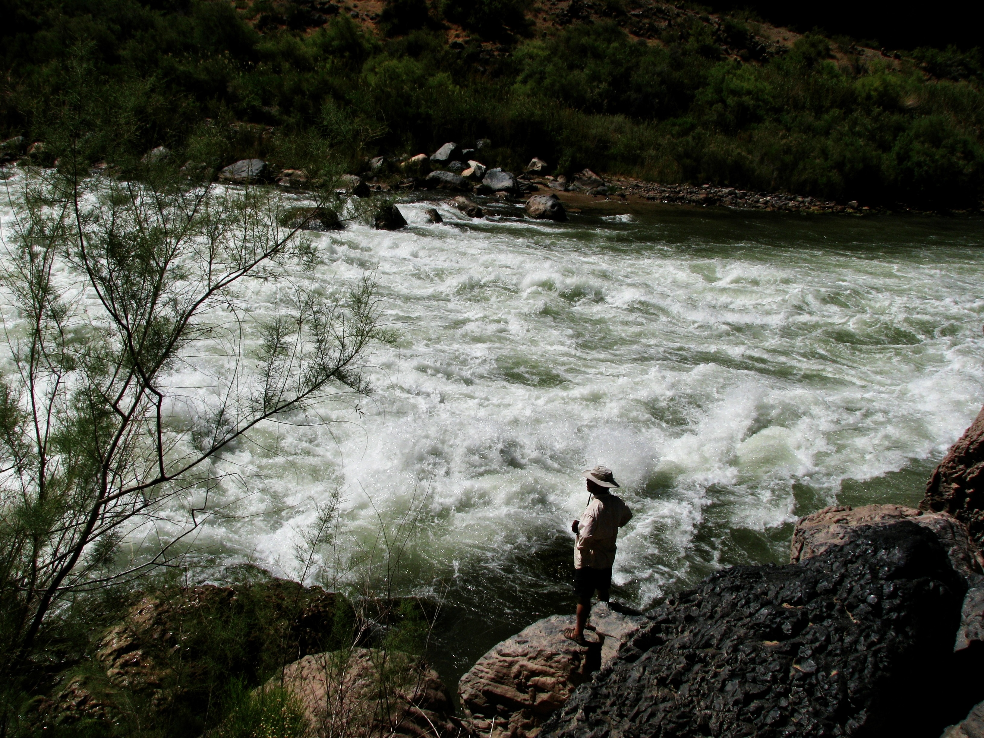
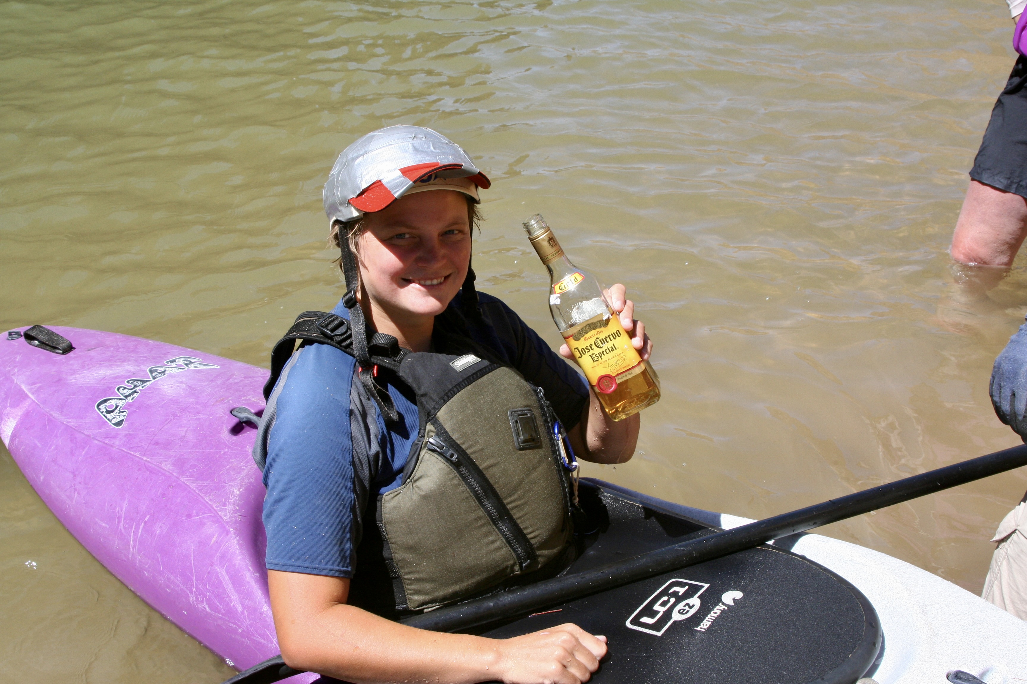
Deer Creek Falls and its 180 foot drop.Getting up to Deer Creek above the falls involved a substantial climb. You can see the trail as it makes its steep, windy way up.Don caught a photo of us high above the Colorado. (Photo by Don Green.)This Shangri-La with its welcome shade, magnificently carved rocks and cool water, made the trip up more than worthwhile.Or maybe I should say cold water. Susan obviously thought so.Beth Annon found another way to enjoy the coolness of Deer Creek. (Photo by Don Green)Bone wants to jump into the waterfall. Peggy is providing him with advice, “If you do that, it will be bye-bye Bone.”She also warned him to watch out for Tom and Don, the very definition of trouble.With good reason.After people got though playing in the waterfall, we all had time for R and R. Dave took it seriously. I’m convinced he can nap anywhere. The rope provided a rather unique pillow. Nice rubber band bracelet, too.Peggy and I took advantage of the time to capture some of the areas unique beauty.Deer Creek had cut an impressive canyon of its own.The colorful carved rocks and crystal clear creek made for fun photos.Another example.Our trip back down provided more views of the Colorado River…And our boats.Our continuing trip down the Colorado provided more views of the magnificent Grand Canyon.And another.When we reached Havasu Creek at mile 156.8, we weren’t alone. It’s a popular area and a commercial group was exploring the creek. They were wrapping up their visit, however, and we soon had the creek to ourselves. (Photo by Don Green.)The creek is known for its vibrant blue color and unique travertine formations, both of which are caused by large amounts of calcium carbonate in the water. The beauty of the area is jaw dropping. (Photo by Don Green.)Water flowing over a travertine formation.Whether flowing in a flat stream…Down a gentle rapid…Or through a carved canyon, it captured us.Even Bone found himself on edge over its beauty. We hiked up the creek along a narrow path. (Photo by Don Green.)While some continued to hike up the creek toward the Havasupai Village… (Havasu Creek is on the Havasupai land.)Others chose to luxuriate…..with a mud bath for example.Or quiet swim…Or seeking bliss. Peggy and I stayed behind because we had been to the Havasupai Village a few years earlier when our son Tony had flown us in by helicopter.While this looks weird, it’s a rafter tradition. The crew here is forming a butt dam. (Note Tom. I sometimes wondered if he had a hidden stash of magic mushrooms along.) When the ‘dam’ had created a lake…The crew dashed off to the side, creating a mini flood.Once again, we are floating down a beautiful calm river. That’s about to end. Lava Falls Rapid is waiting for us.First we camp, however. Don demonstrates how to be a pack animal. Was he planning to give up his day job as a probate judge and apply for a position as a Grand Canyon mule?You can hear the roar of Lava Falls Rapids long before you get there. Here we were floating down a calm river, came around a bend and there it was— churning! Waiting to eat our boats. We had been living in anticipation of this moment the whole 180 miles of our journey.Extremely careful scouting is called for.We look on in awe as our boatmen plotted out the best route. There was huge hole waiting to suck our boats in and a narrow pathway around it. Dave stood there for a long time, staring at the river, planning his route. He had been waiting for years for this opportunity, applying again and again for a permit. Don took this photo. I wish to thank him again for his superb job of capturing Peggy and me as we went through the rapids with Steve. Otherwise we wouldn’t have the record we do.This is Megan kayaking through the rapids. Can you imagine yourself being there? Shortly afterwards, she rolled. (Photo by Don Green.)And we begin one of the most intense experiences we have ever had. It’s the journey of a lifetime that lasts forever and takes approximately 20 seconds.I still get the jitters when I see this photo. Peggy and I were hanging on to special ties with all of the strength we had. Steve was rowing like a madman, using all of his considerable skills, trying to keep control of his boat. (Photo by Don Green.)Five seconds later we had disappeared under a wall of water on the edge of the massive hole. (Photo by Don Green.)And then emerged out the other side! Check out Peggy. I think she was hanging on with her teeth as well as her hands. (Photo By Don Green.)Even then our ride wasn’t over. Wait! Where’s Peggy? UH-OH. (Just kidding, she’s hidden on the other side of me.) Photo by Don Green.We made it to Tequila Point just below the rapids. The tequila was waiting!Folks helped Megan gather her equipment. She was fine, but definitely ready for a shot.Everyone was happy.Next post: The final hundred miles of our trip down the Colorado River.
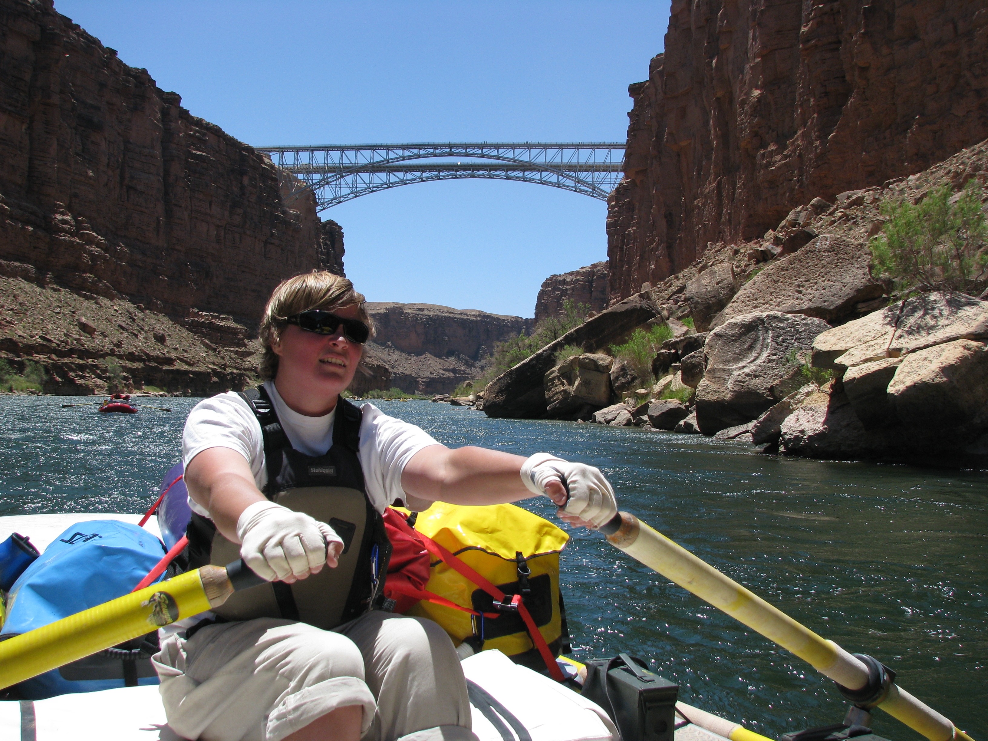
Megan rows toward Navajo Bridge at mile 4. It was our first notable landmark. Actually there are two bridges: an old one competed in 1929 to replace Lee’s Ferry and a new one finished in 1995 to accommodate modern traffic. The old one now serves as a a foot bridge. Crossing the bridge is how you get to the North Rim of the Grand Canyon from the South Rim. Or vice-versa. (Photo by Don Green.)
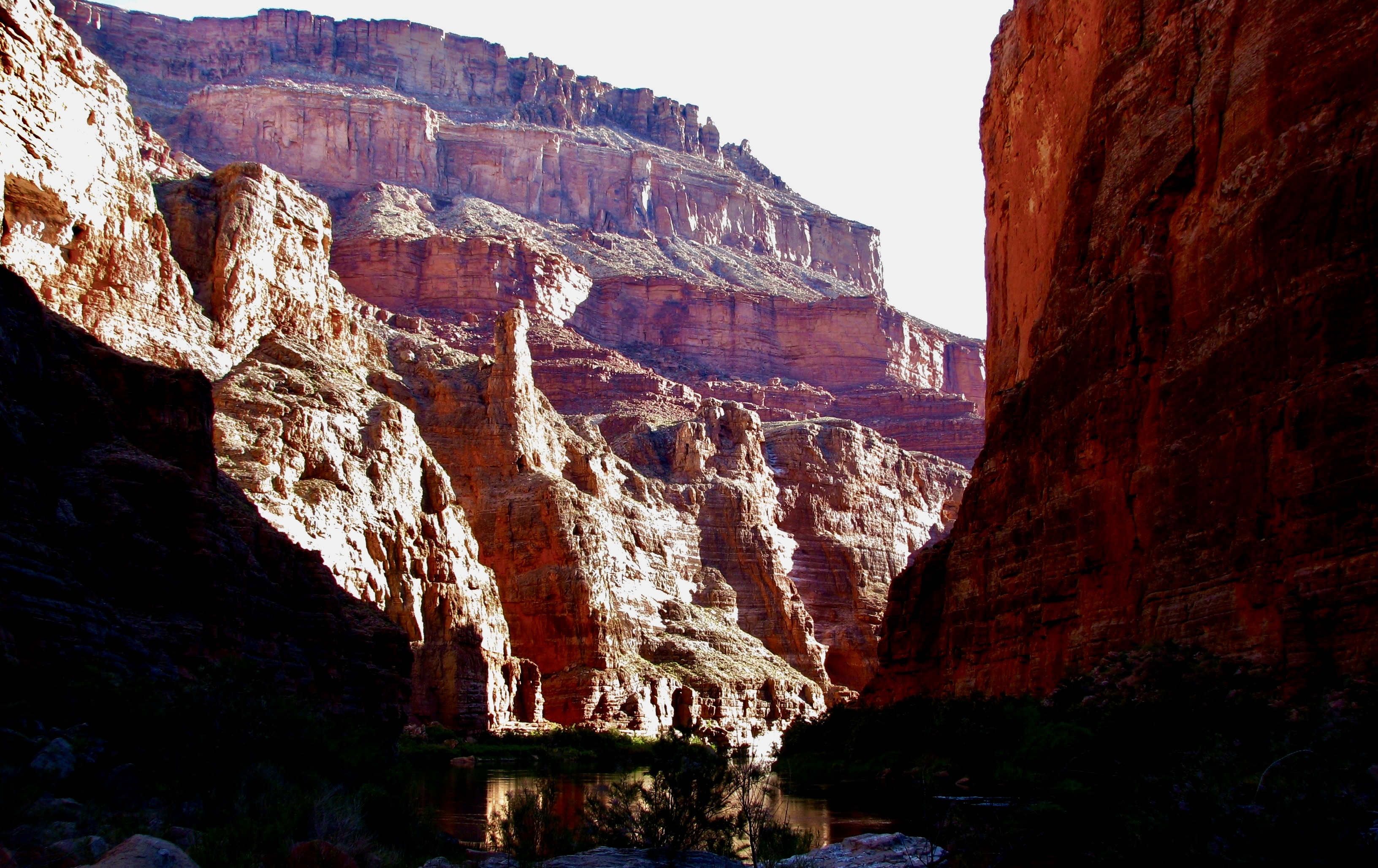
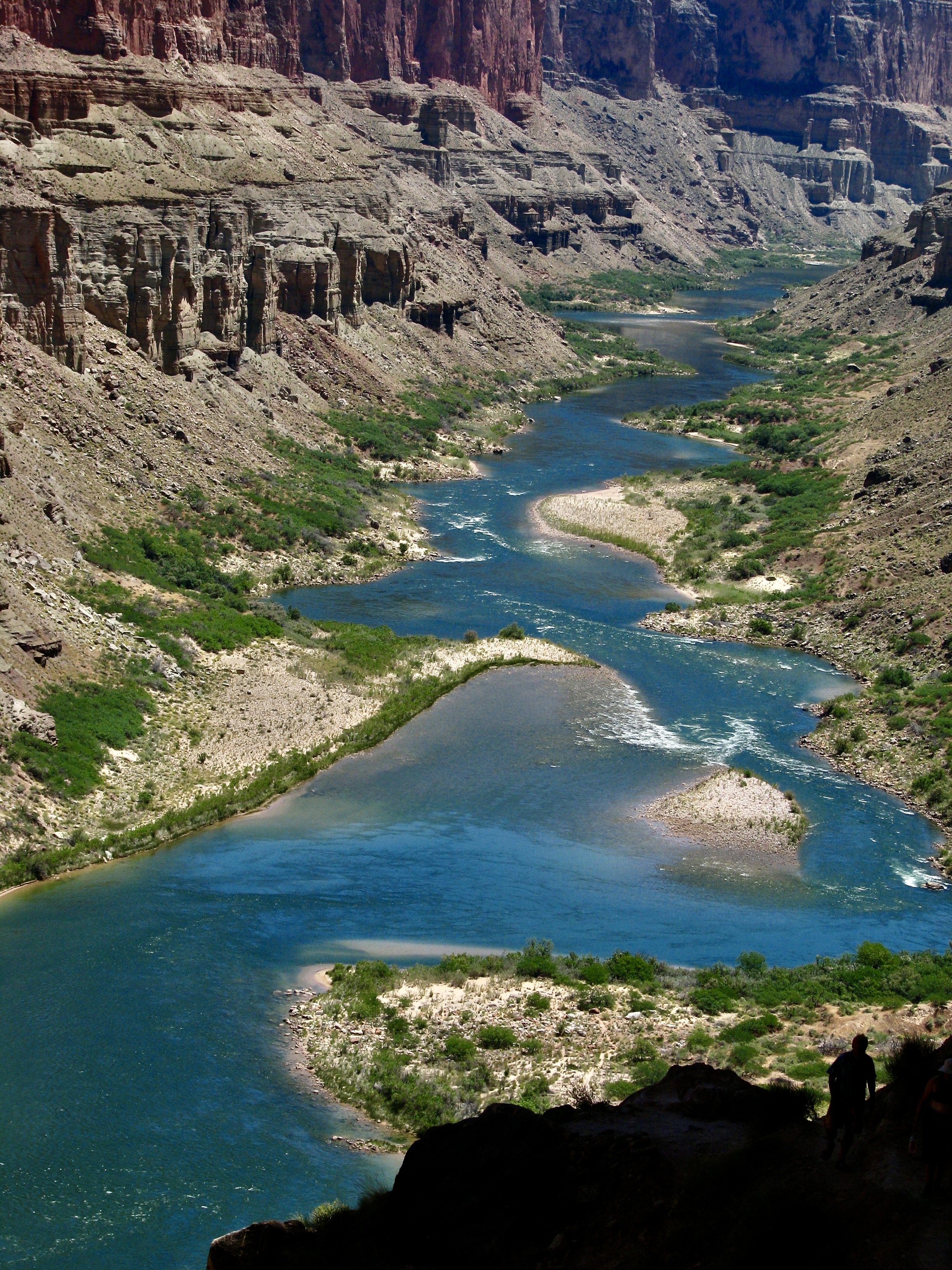
For those of you who like facts, here are a few about the river: The Colorado is 1,440 miles long from its headwaters in the Rocky Mountains to its mouth in the Gulf of California. I’ve backpacked through the area where it originates and kayaked in the Gulf of California. It ranks 6th in length among U.S. rivers. At its widest point it reaches 750 feet. At its deepest, 90. It flows along at 3-4 miles per hour but may reach 15 miles per hour in rapids. Given that the water comes out of the base of Glen Canyon Dam, it’s cold— an icy 46 degrees Fahrenheit during the upper part of our trip. Washing off in it usually elicited screams. Over the course of our adventure, it dropped 1700 feet in altitude, an average 8 feet per mile. That’s 25 times the average of the Mississippi River! Thus, the 250 rapids in the Grand Canyon.
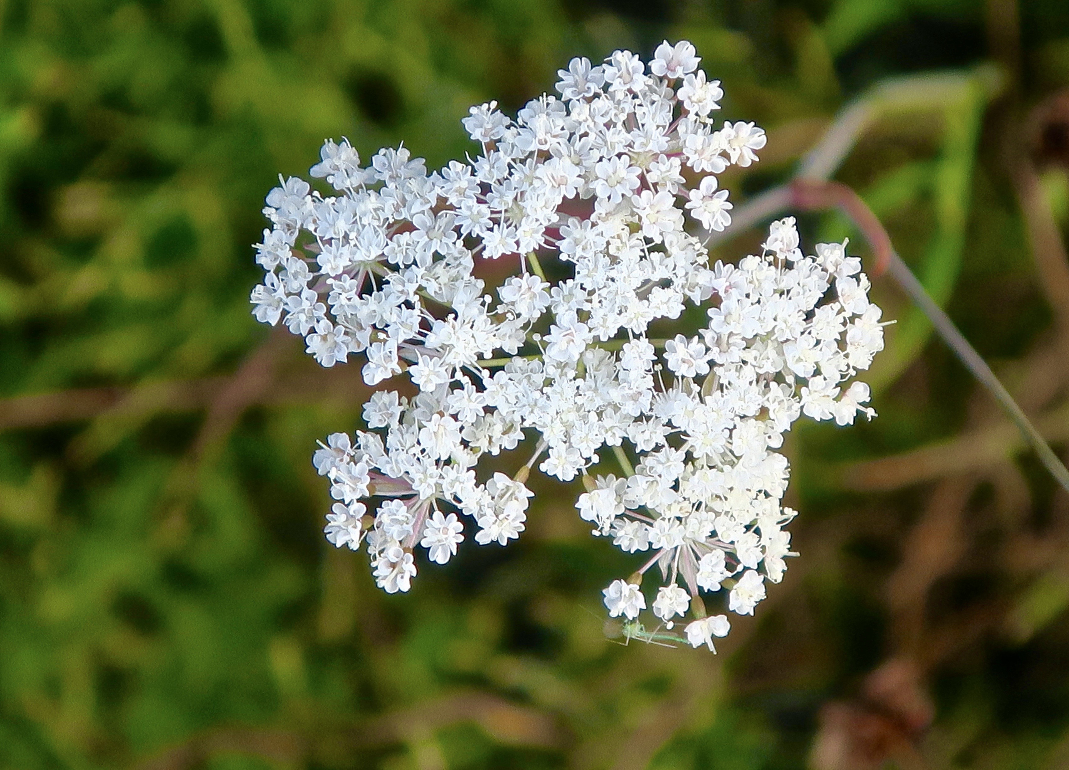
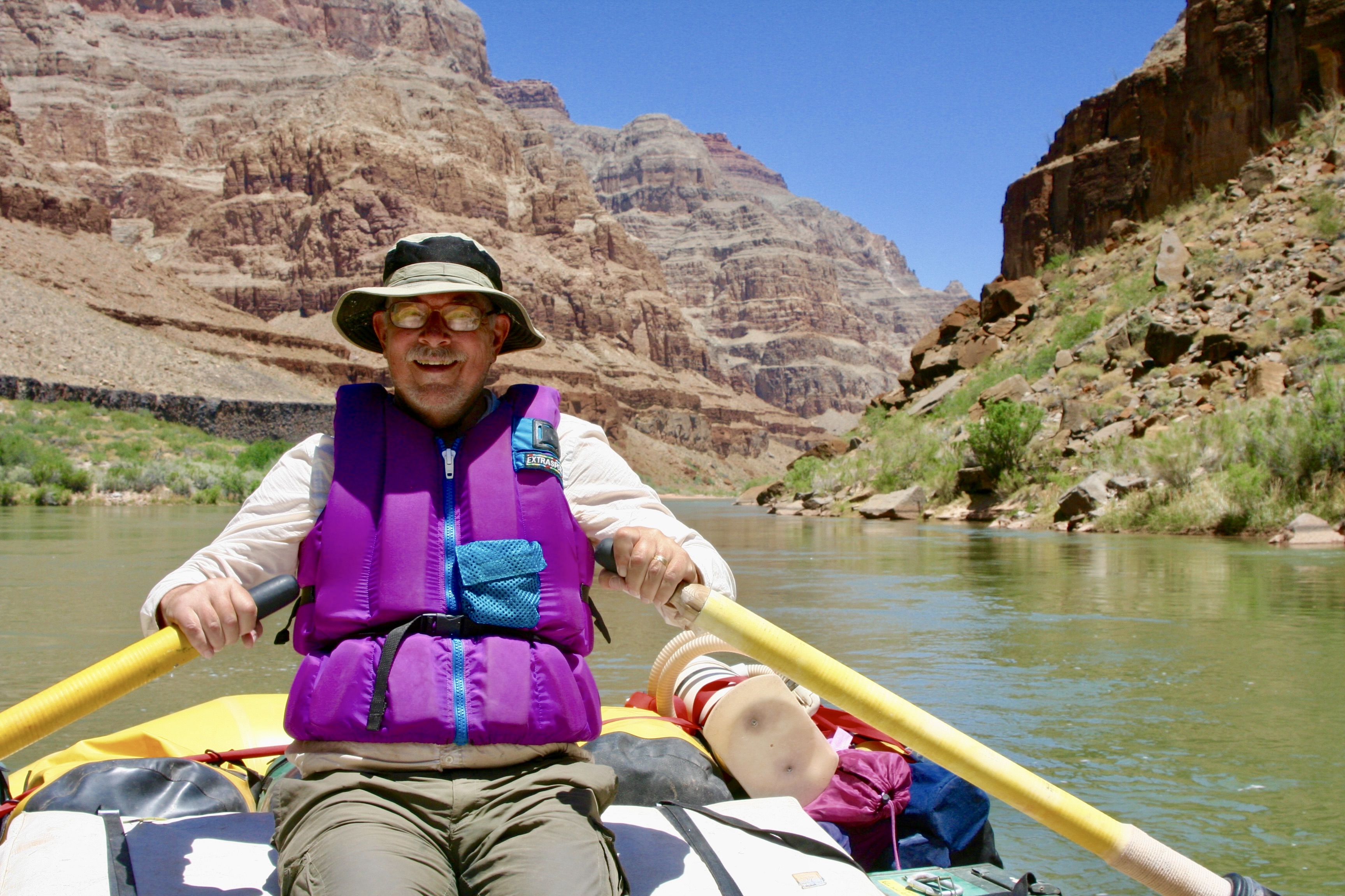
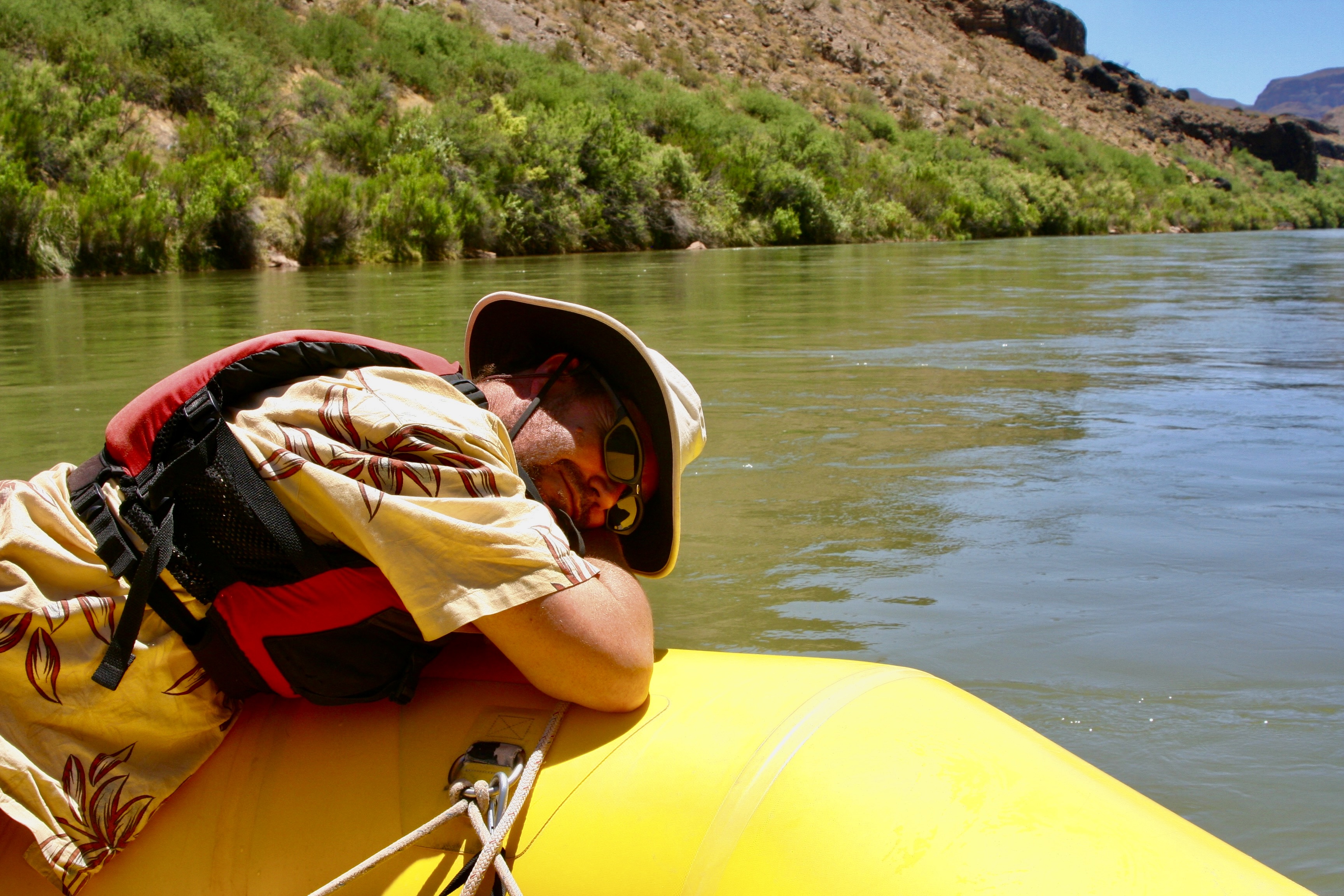
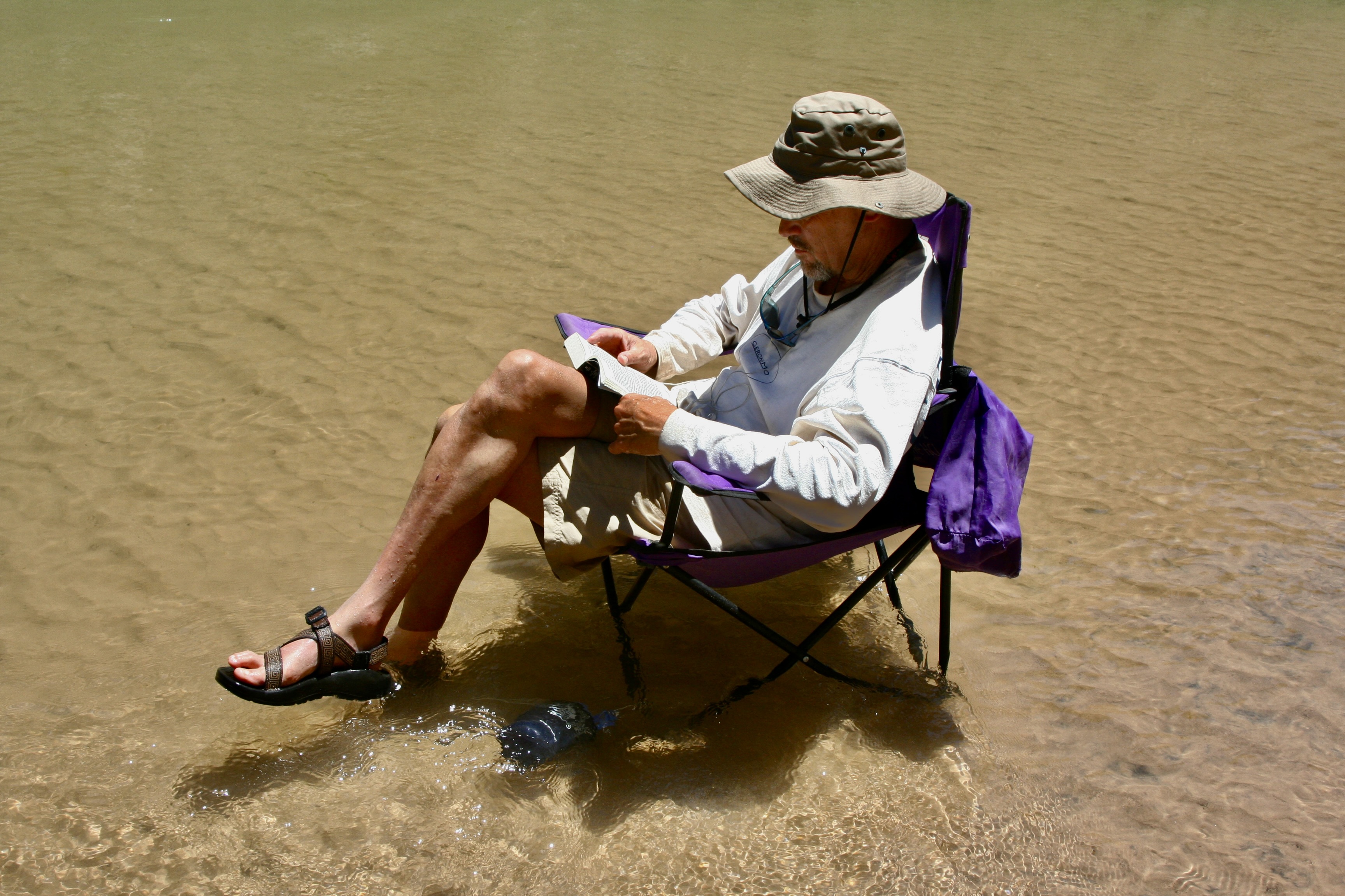
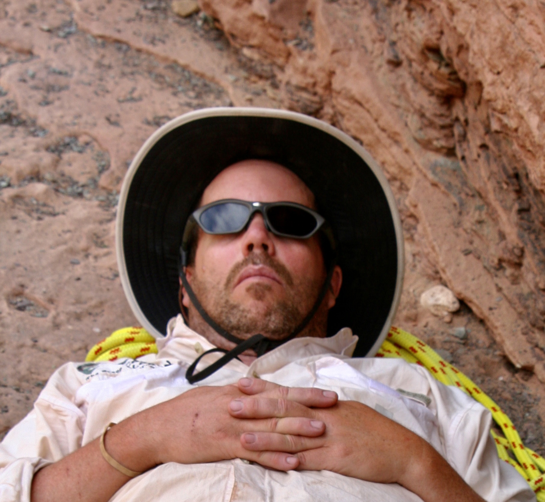
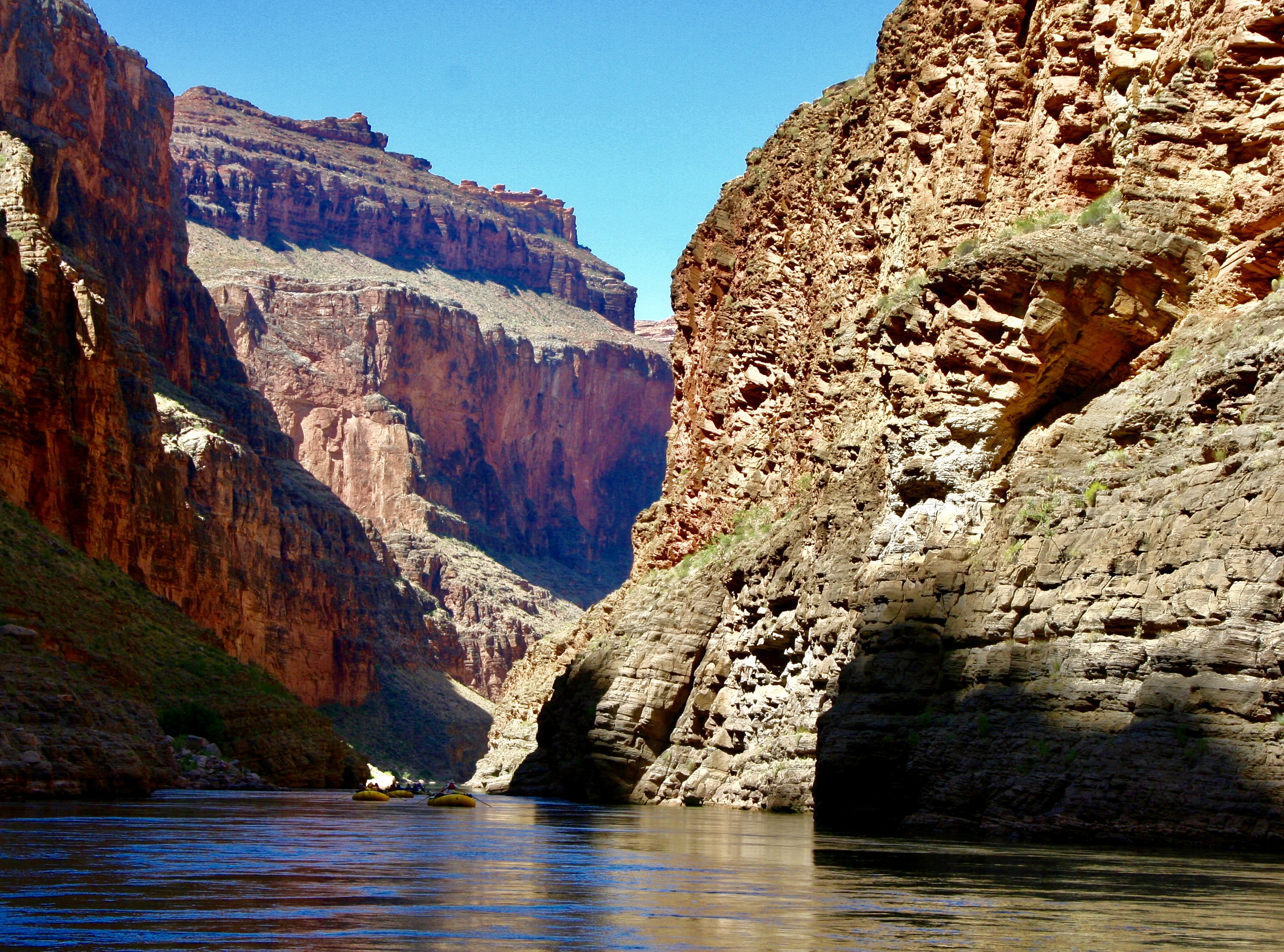
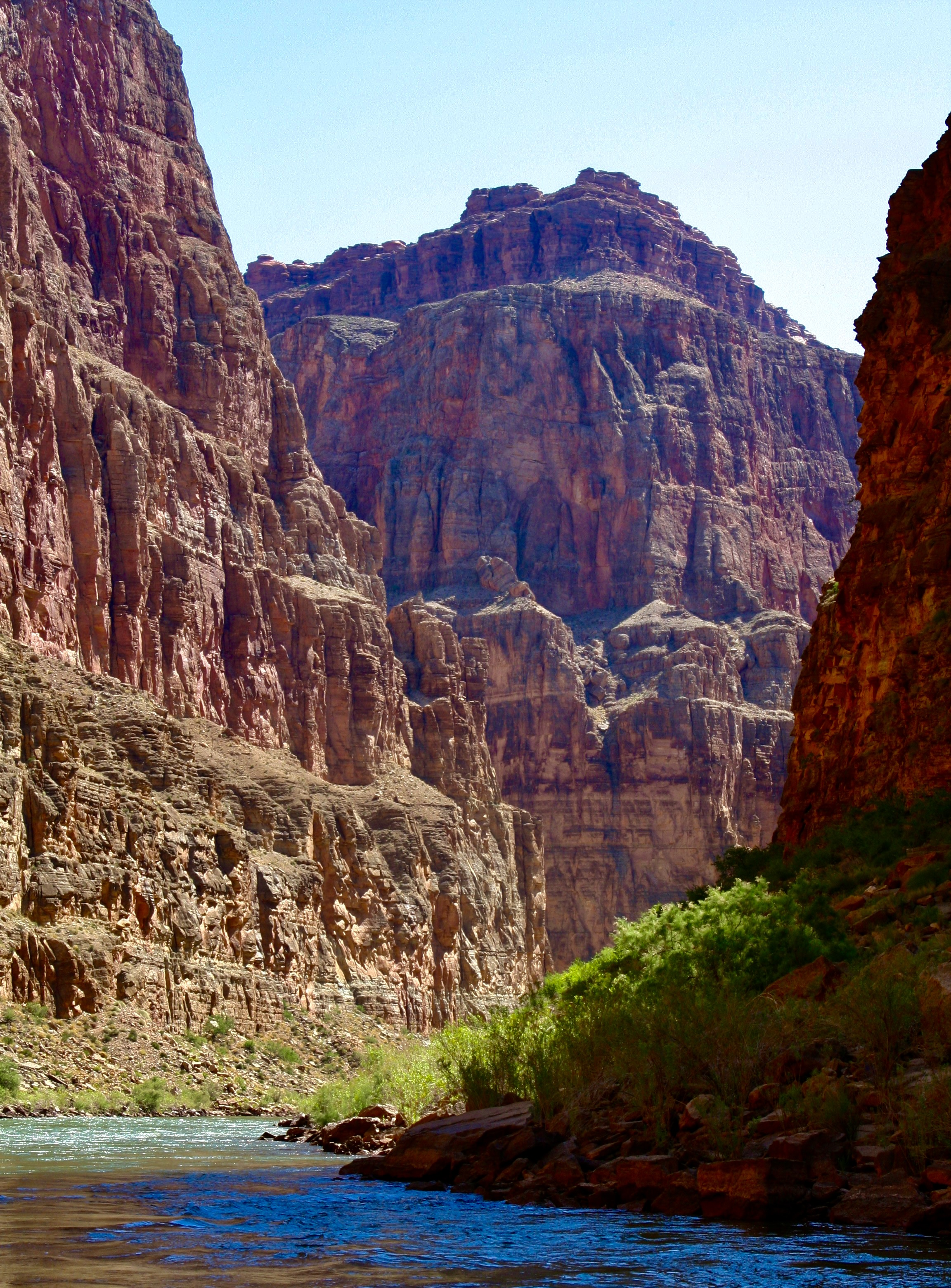
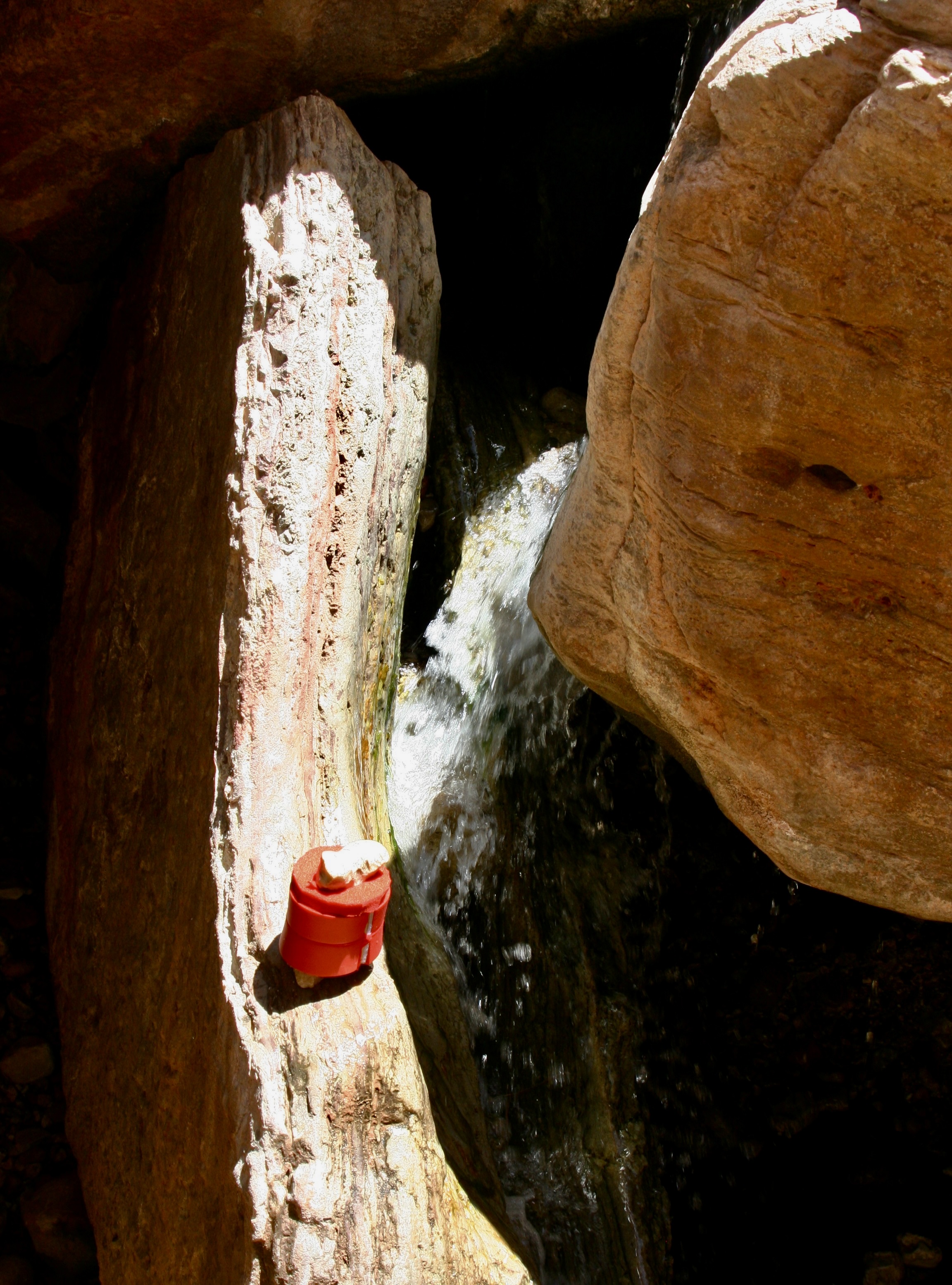
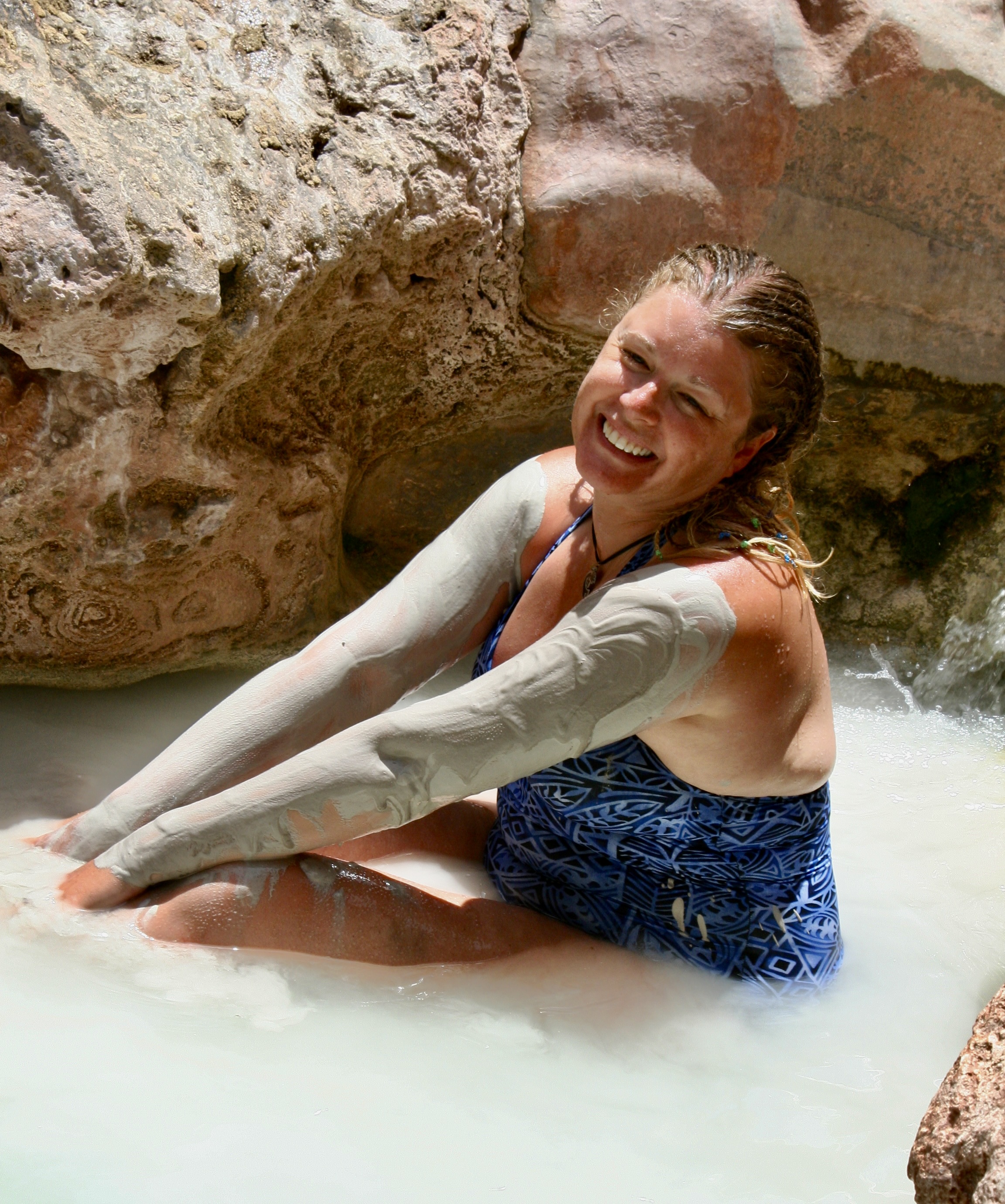
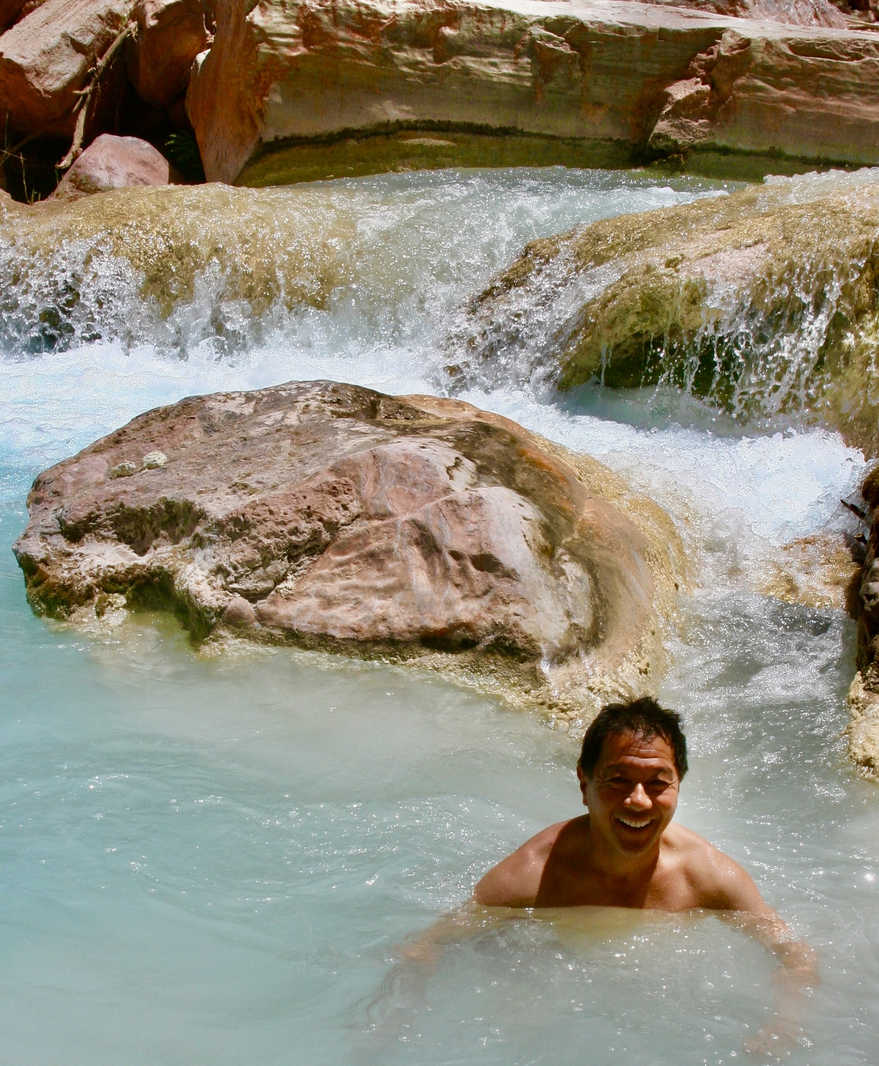
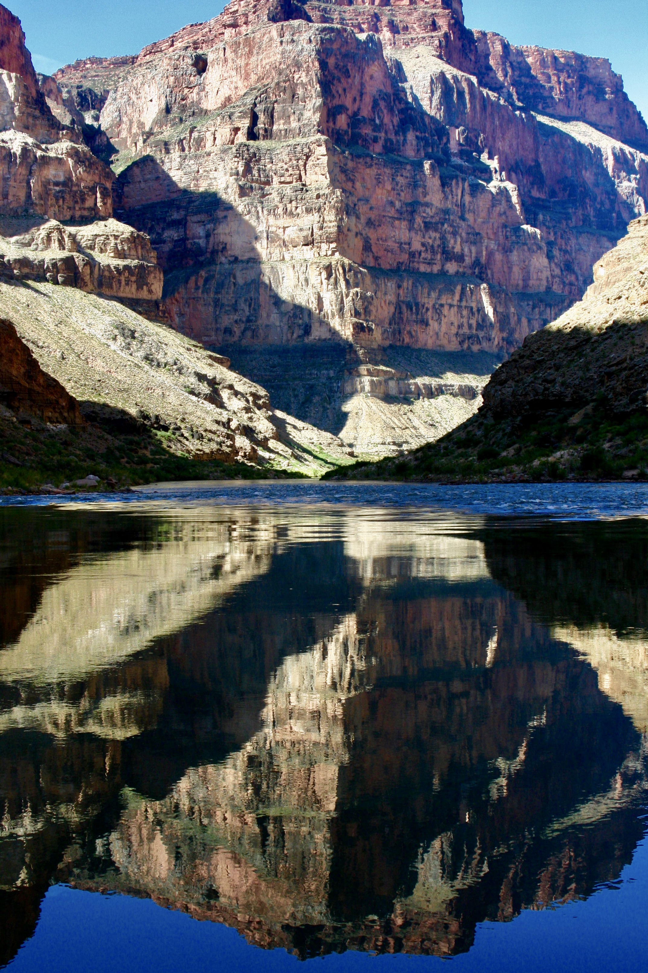
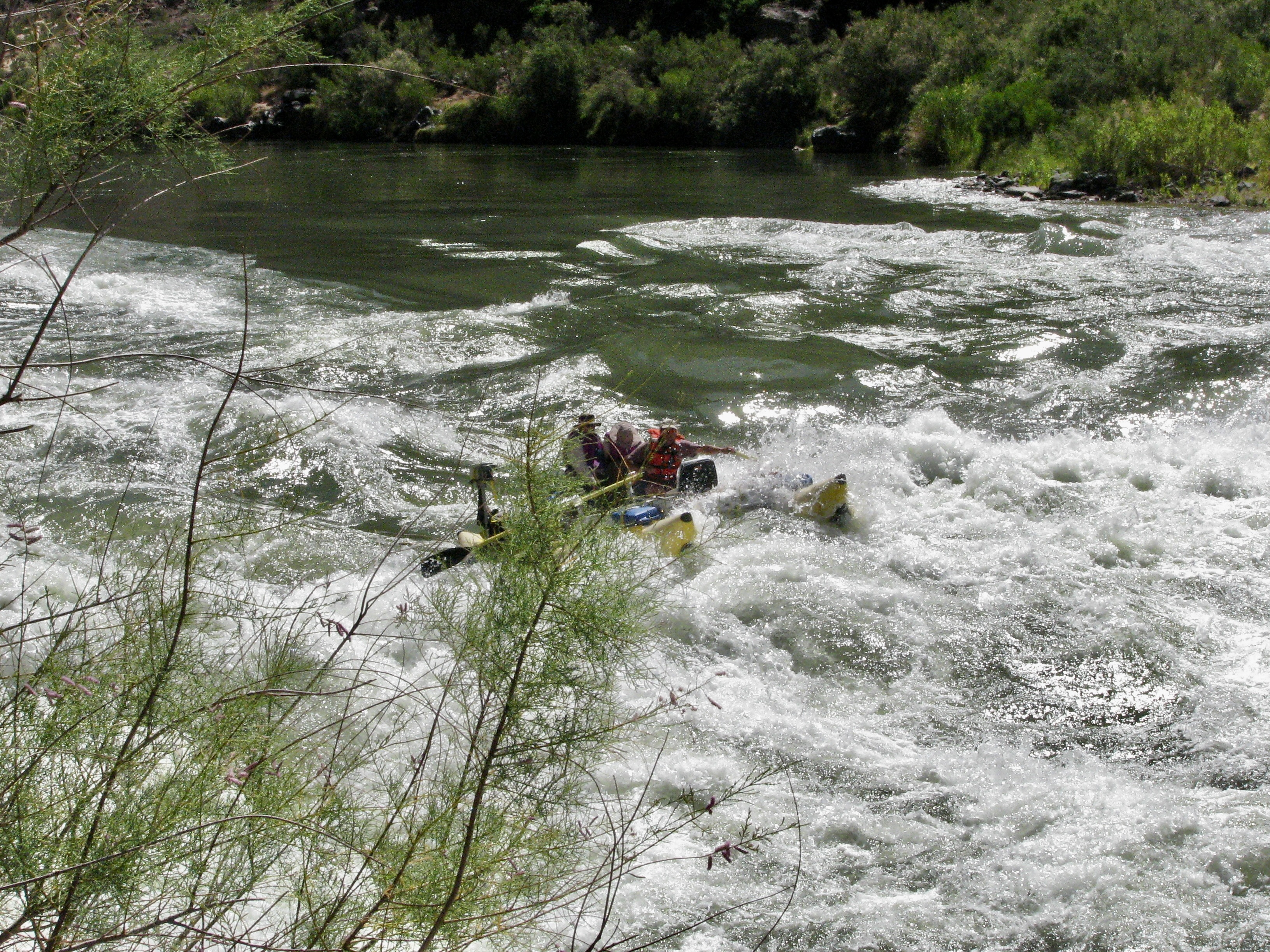
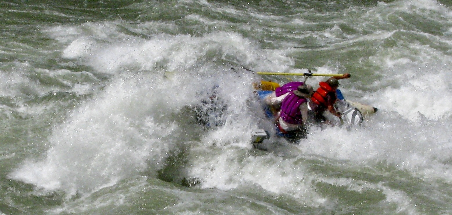
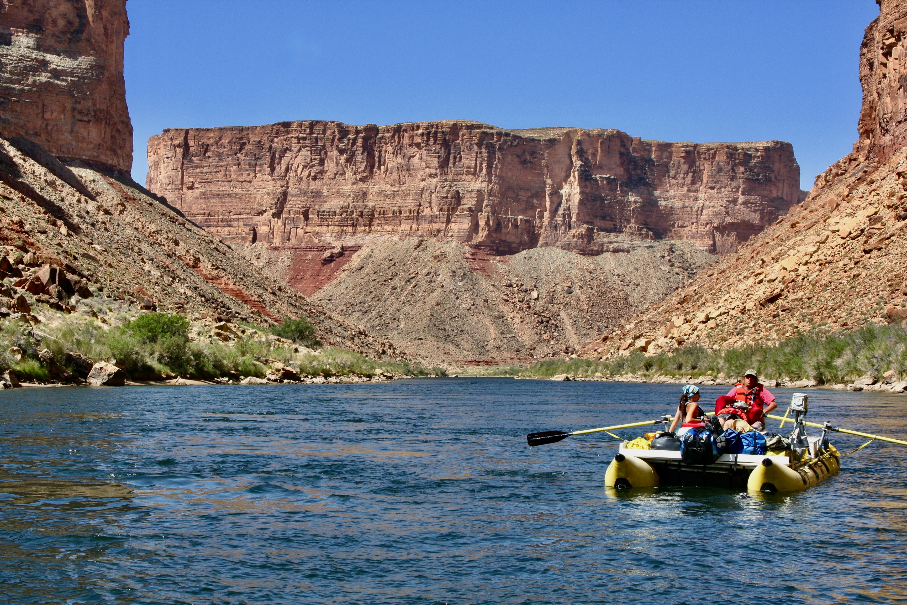
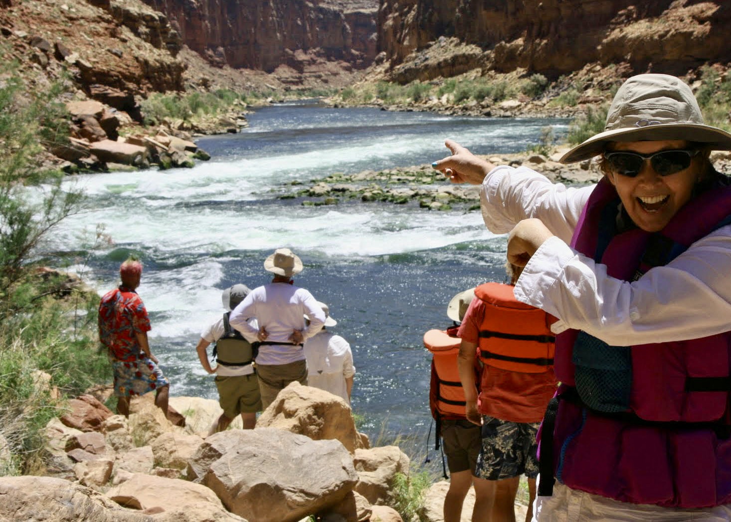
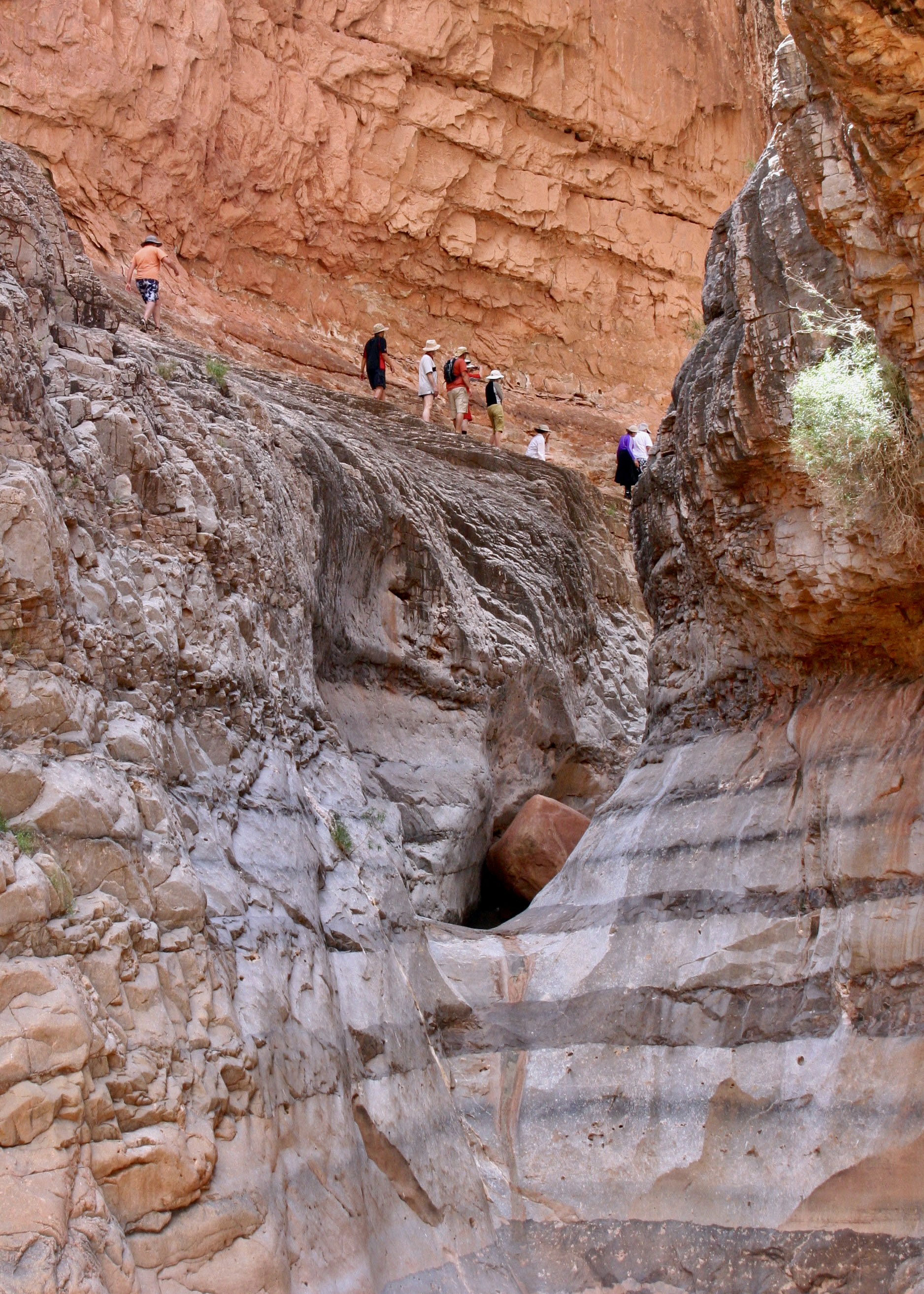
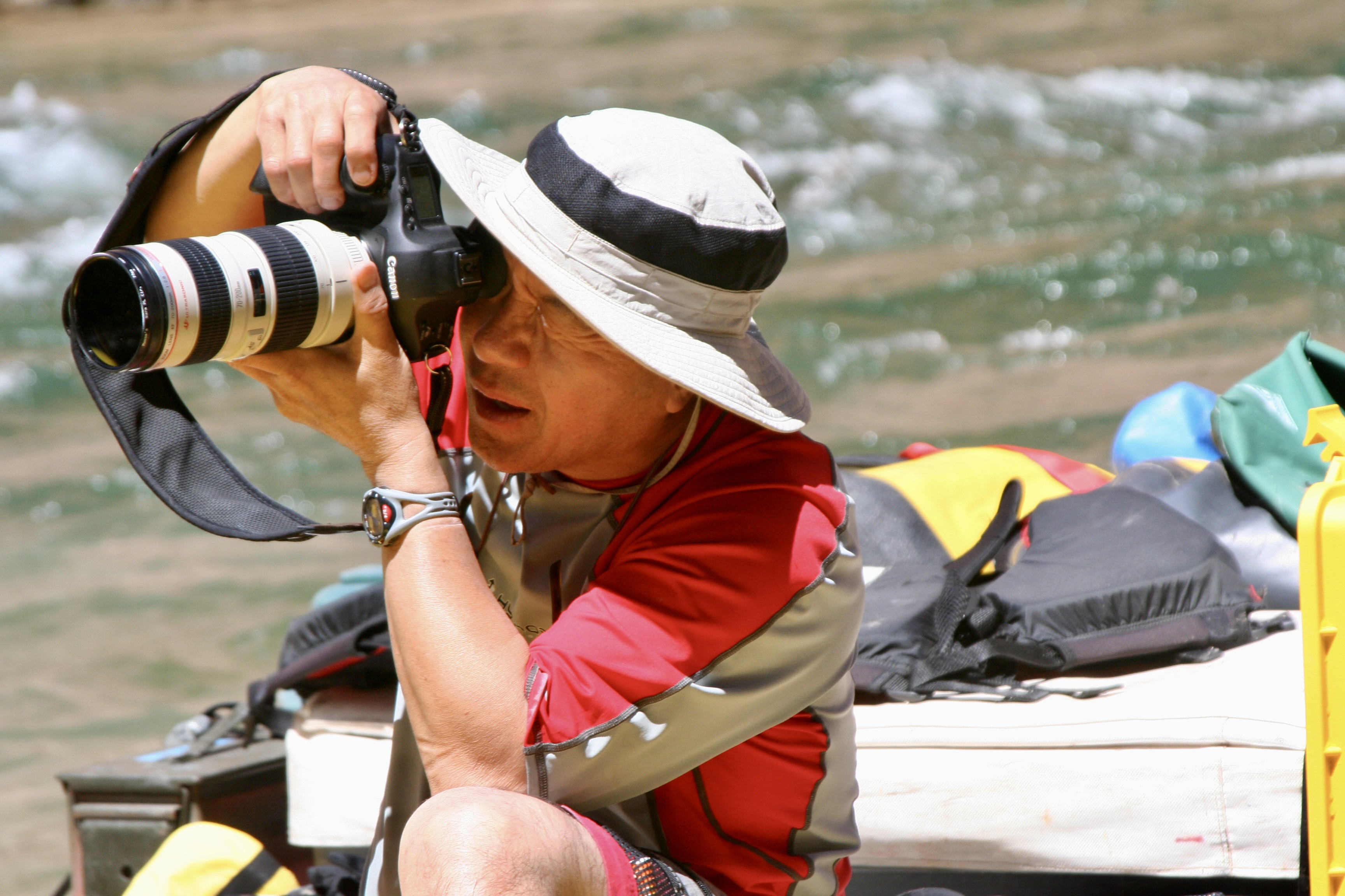
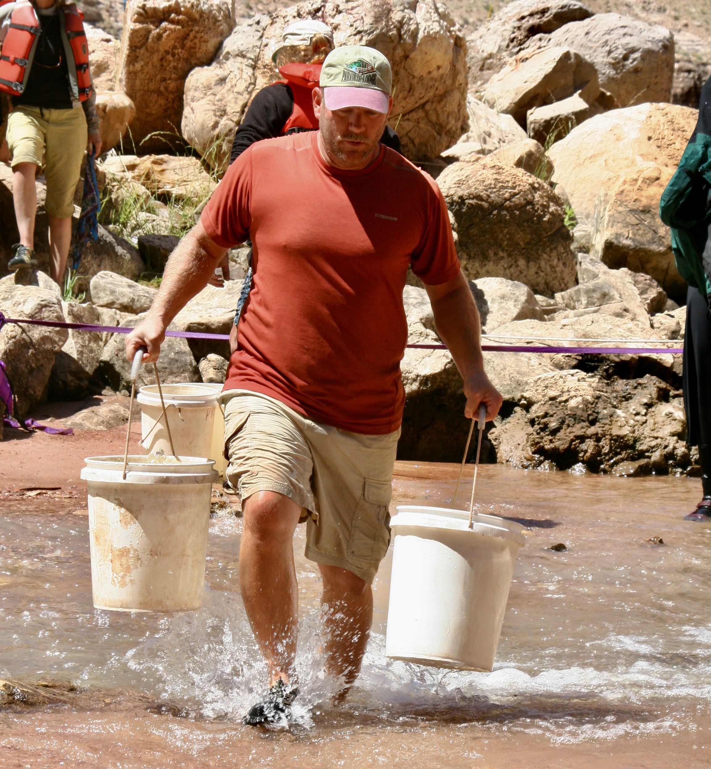
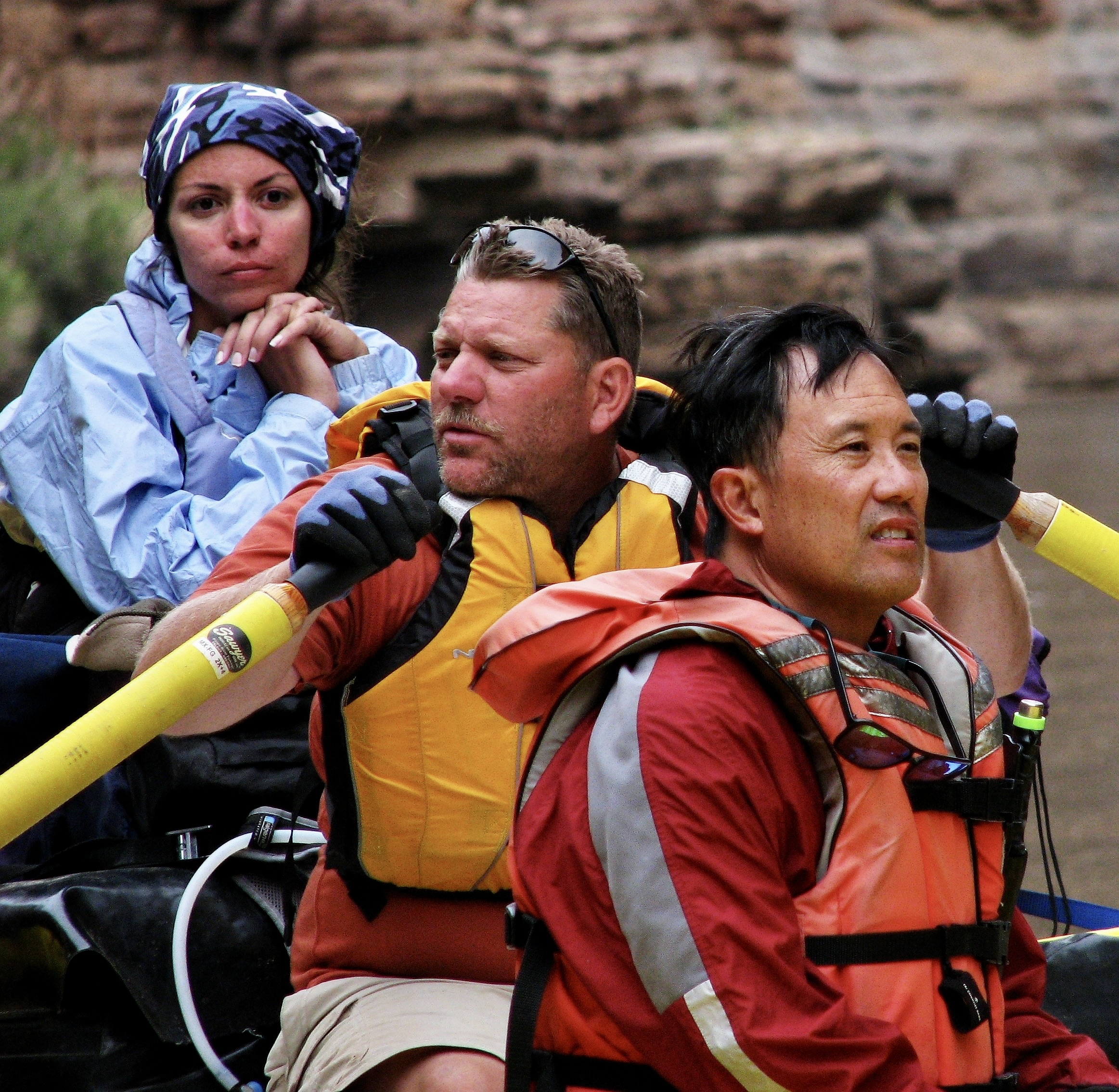
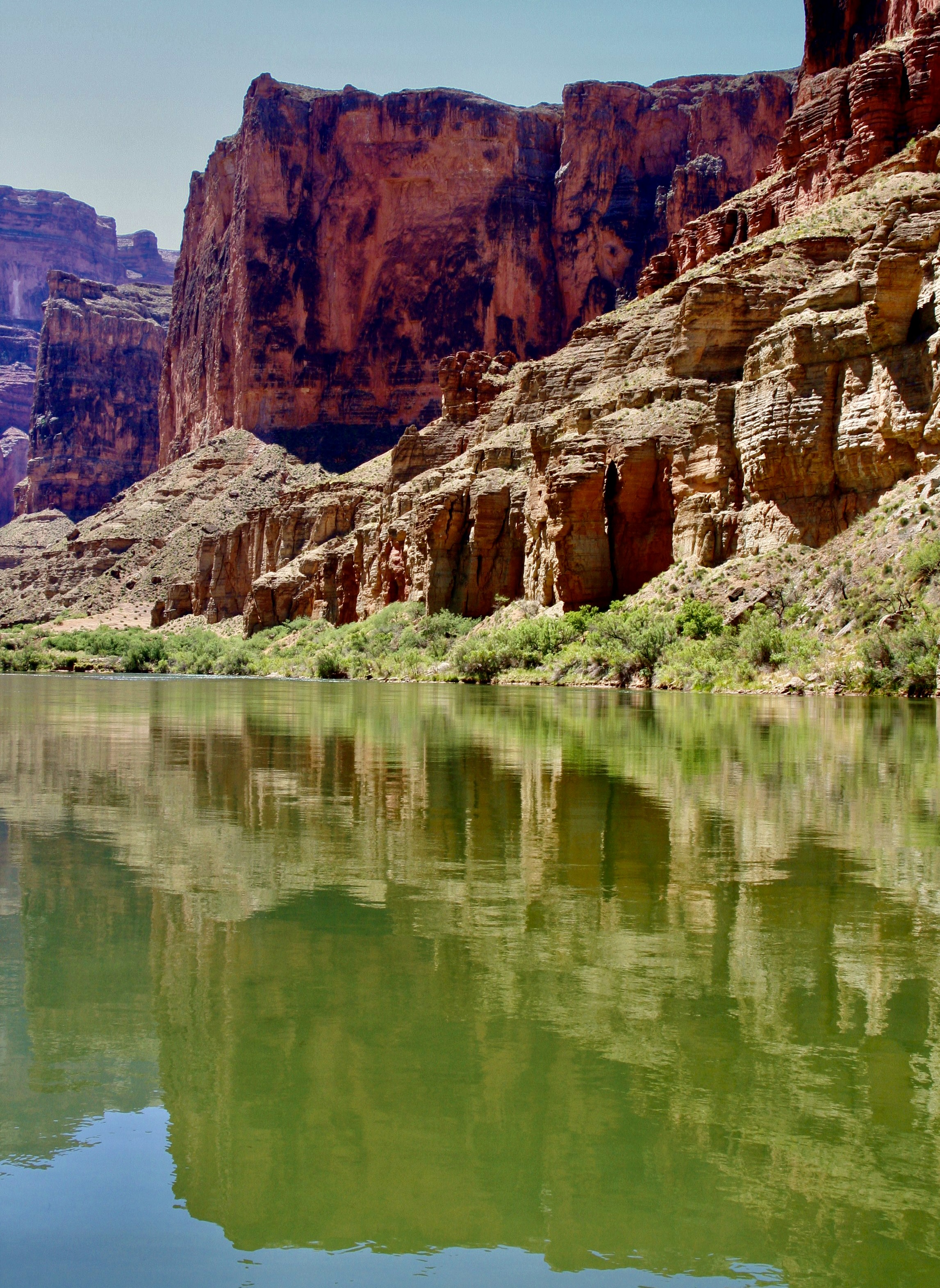
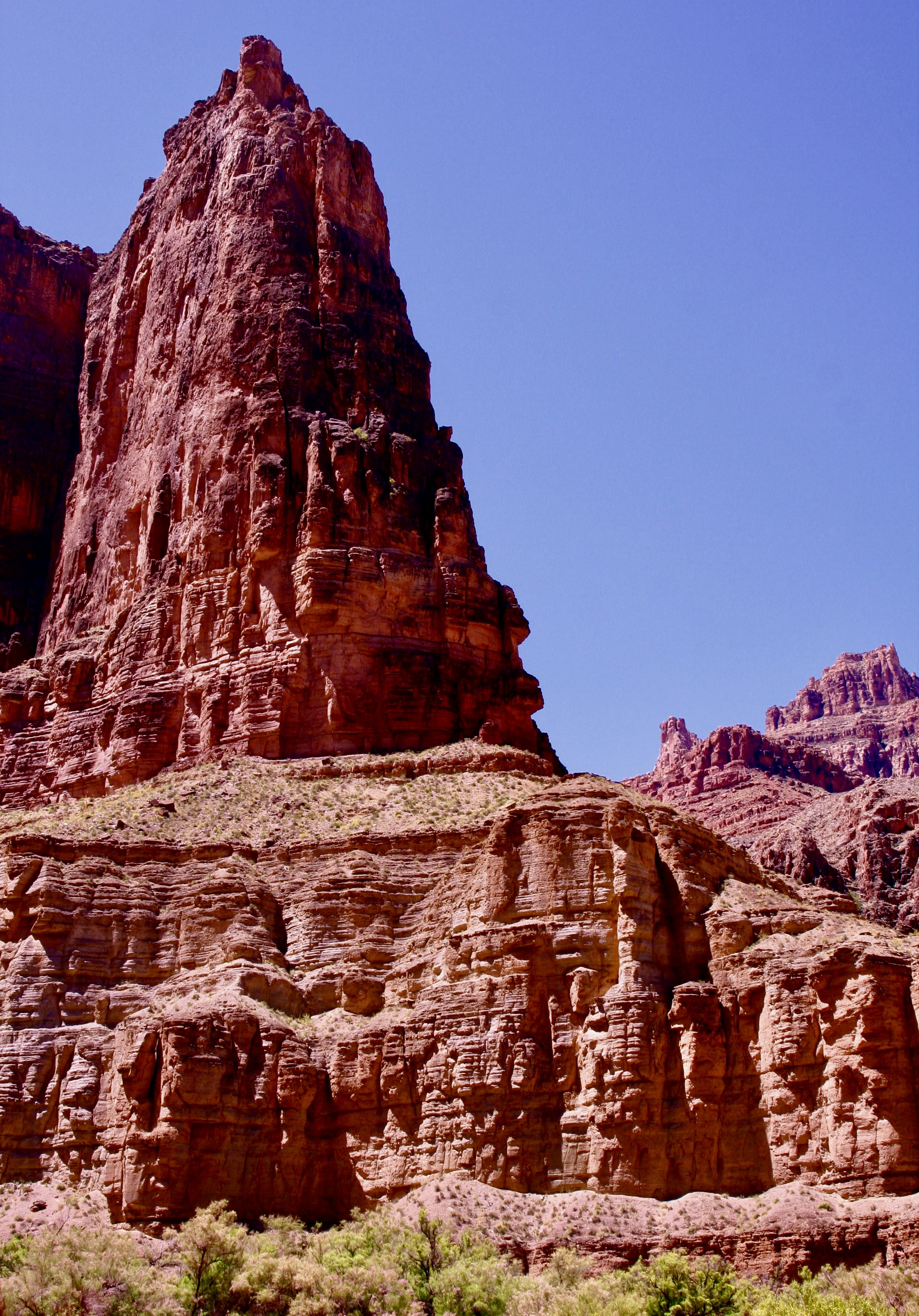
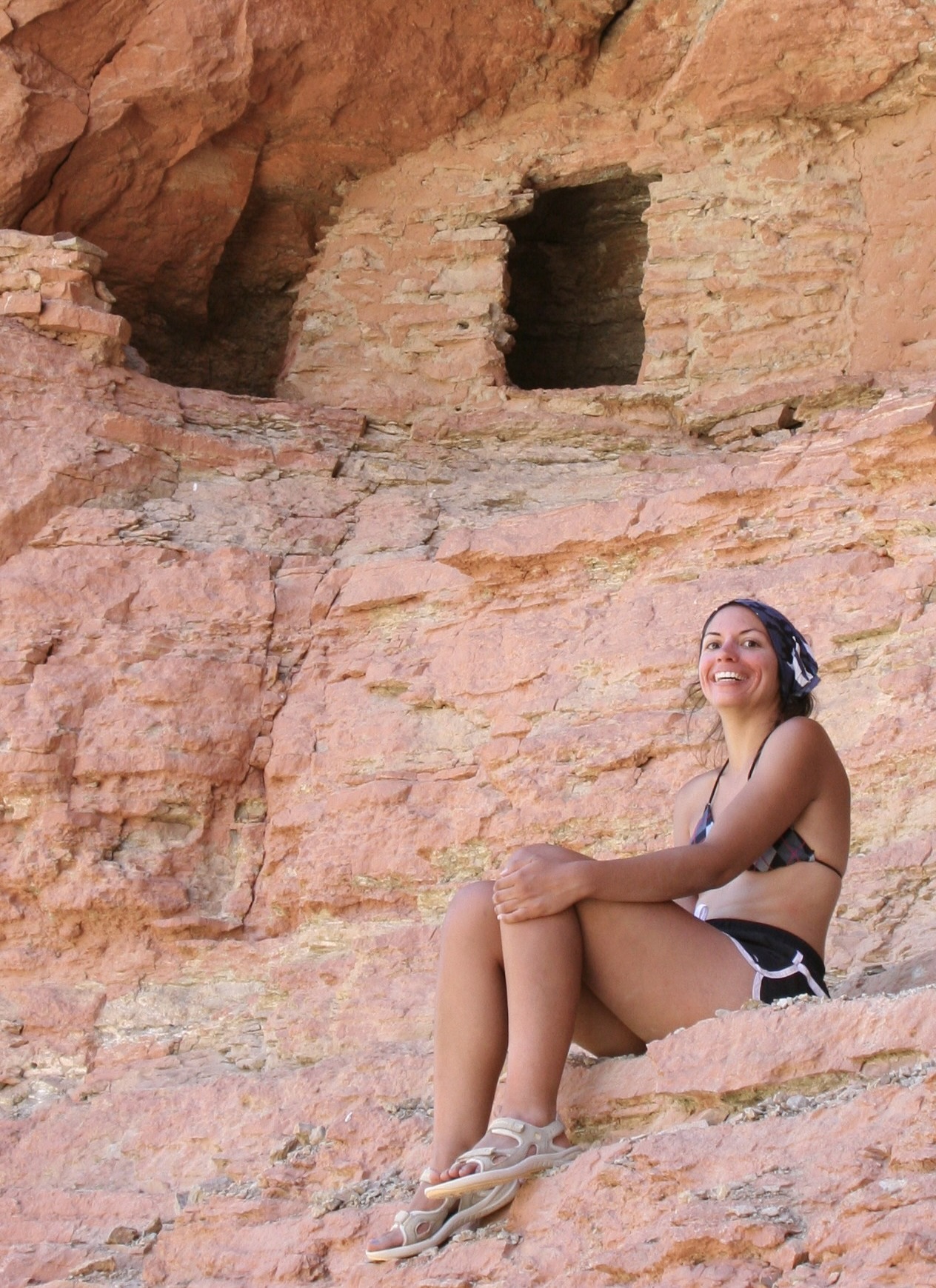
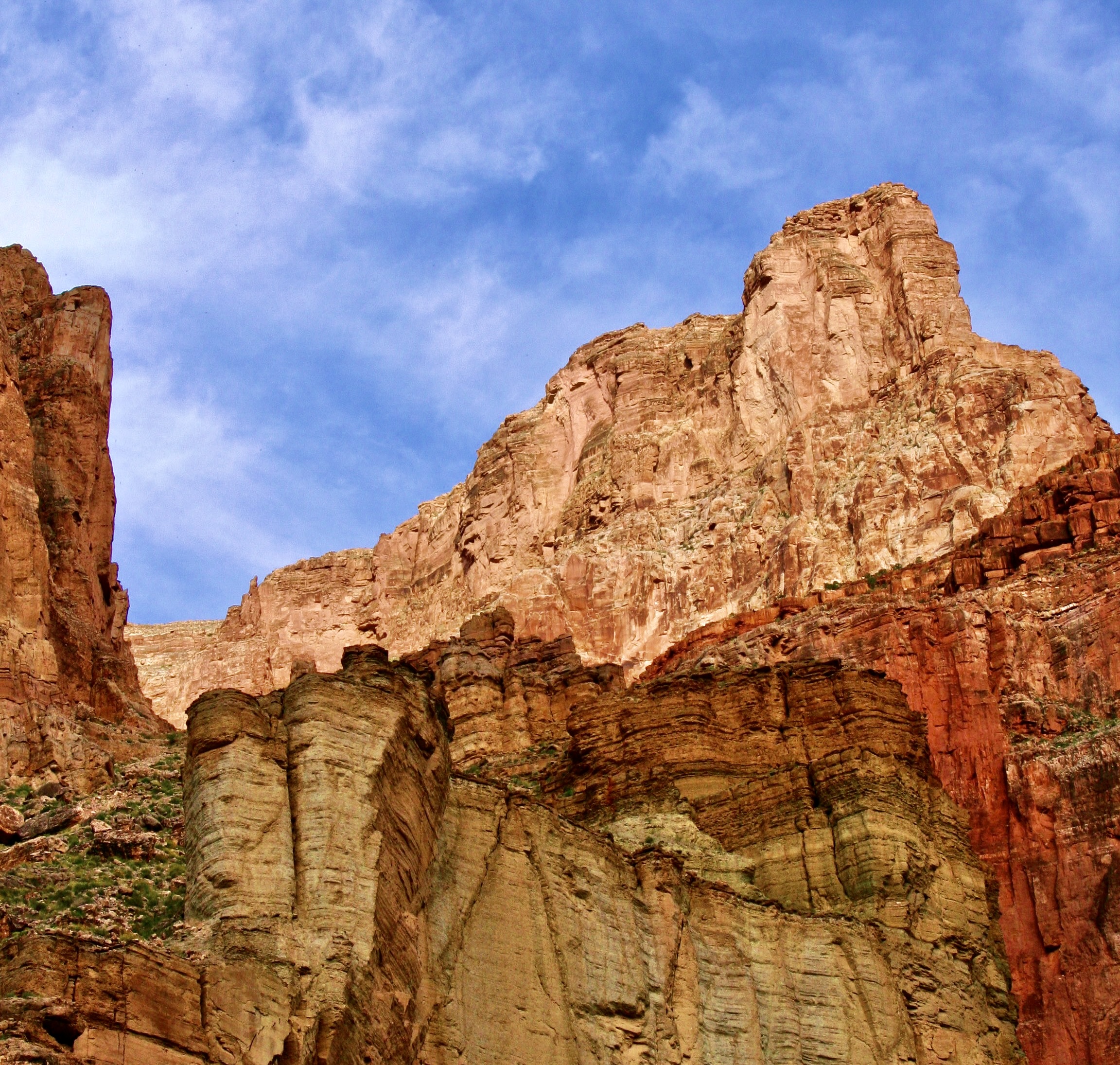
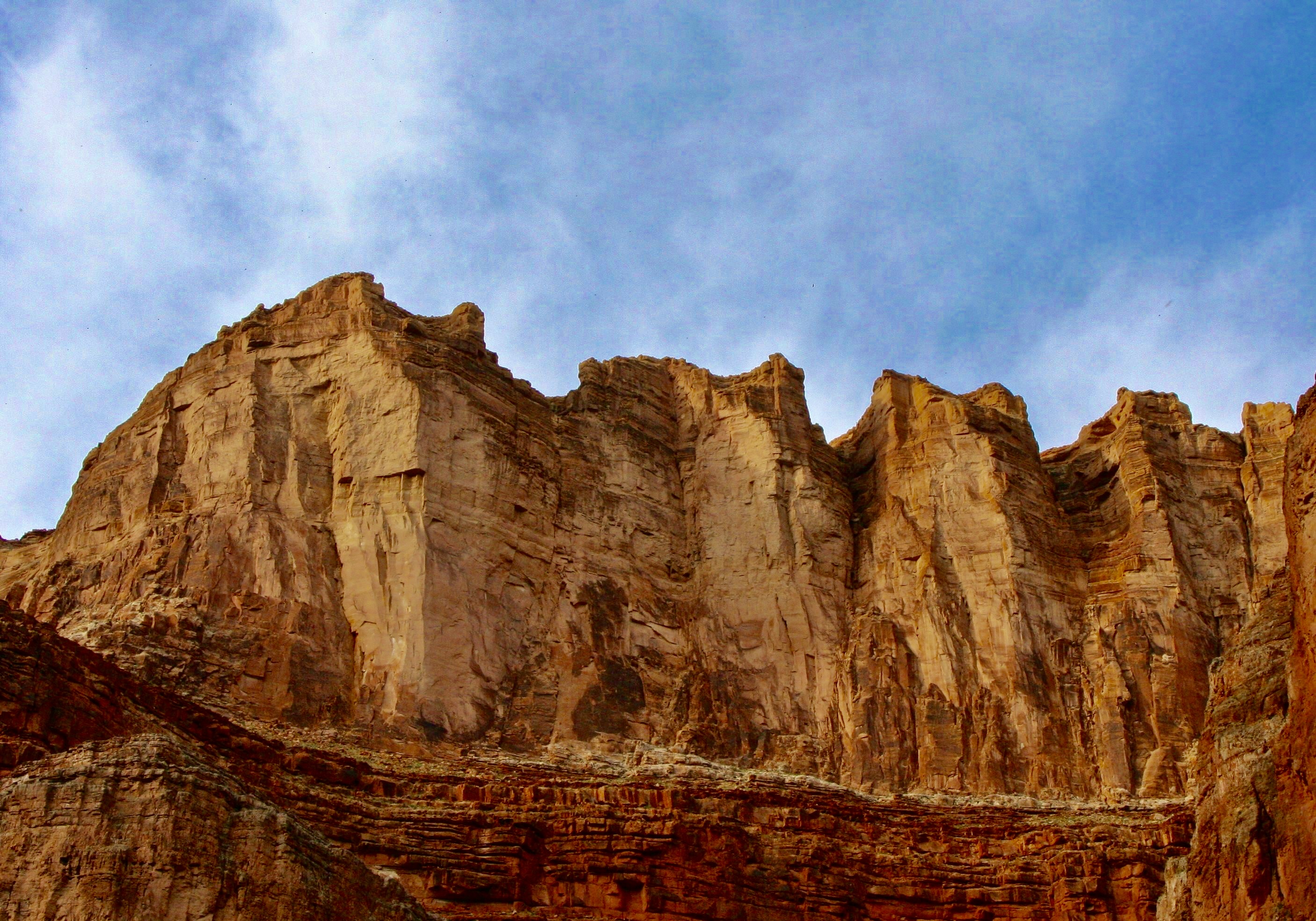
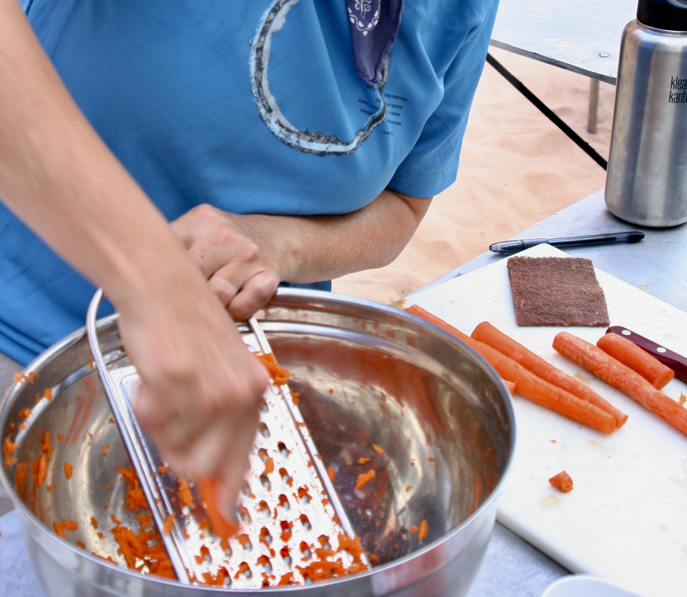
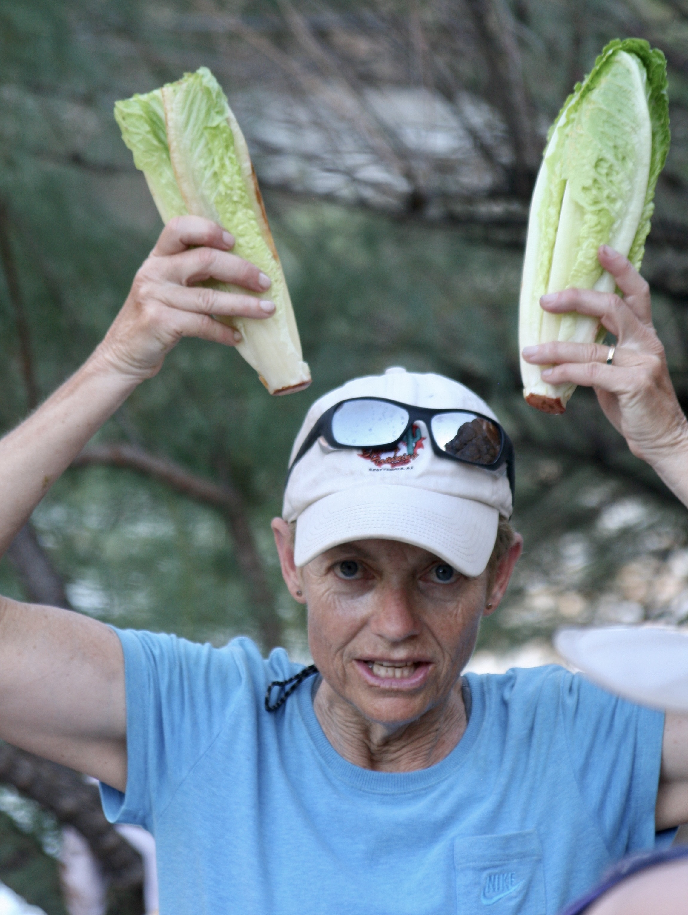
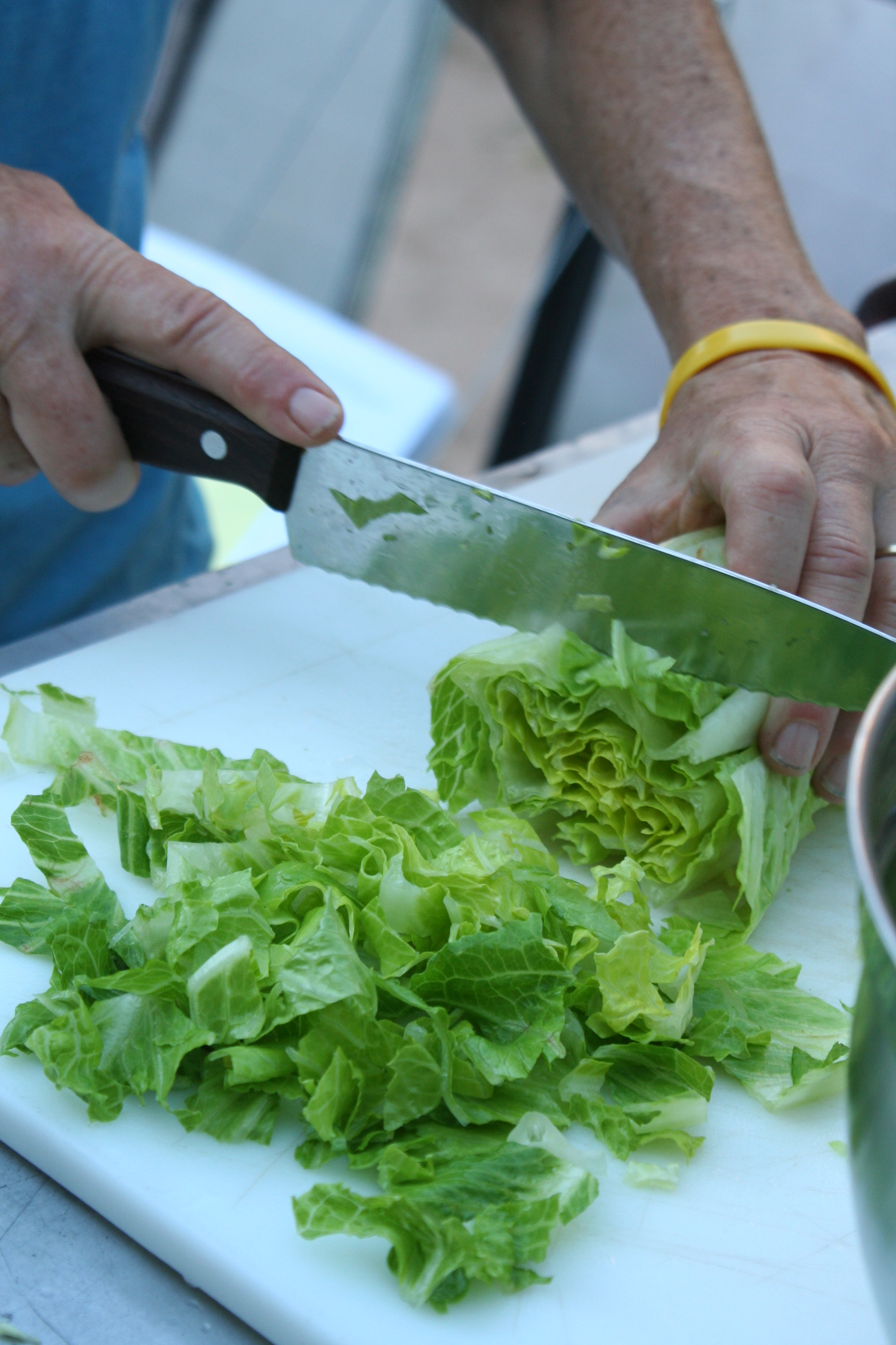
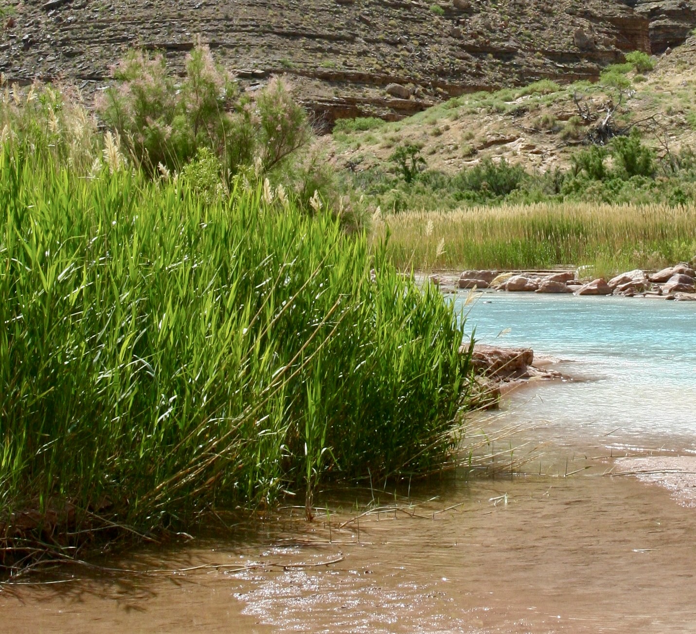
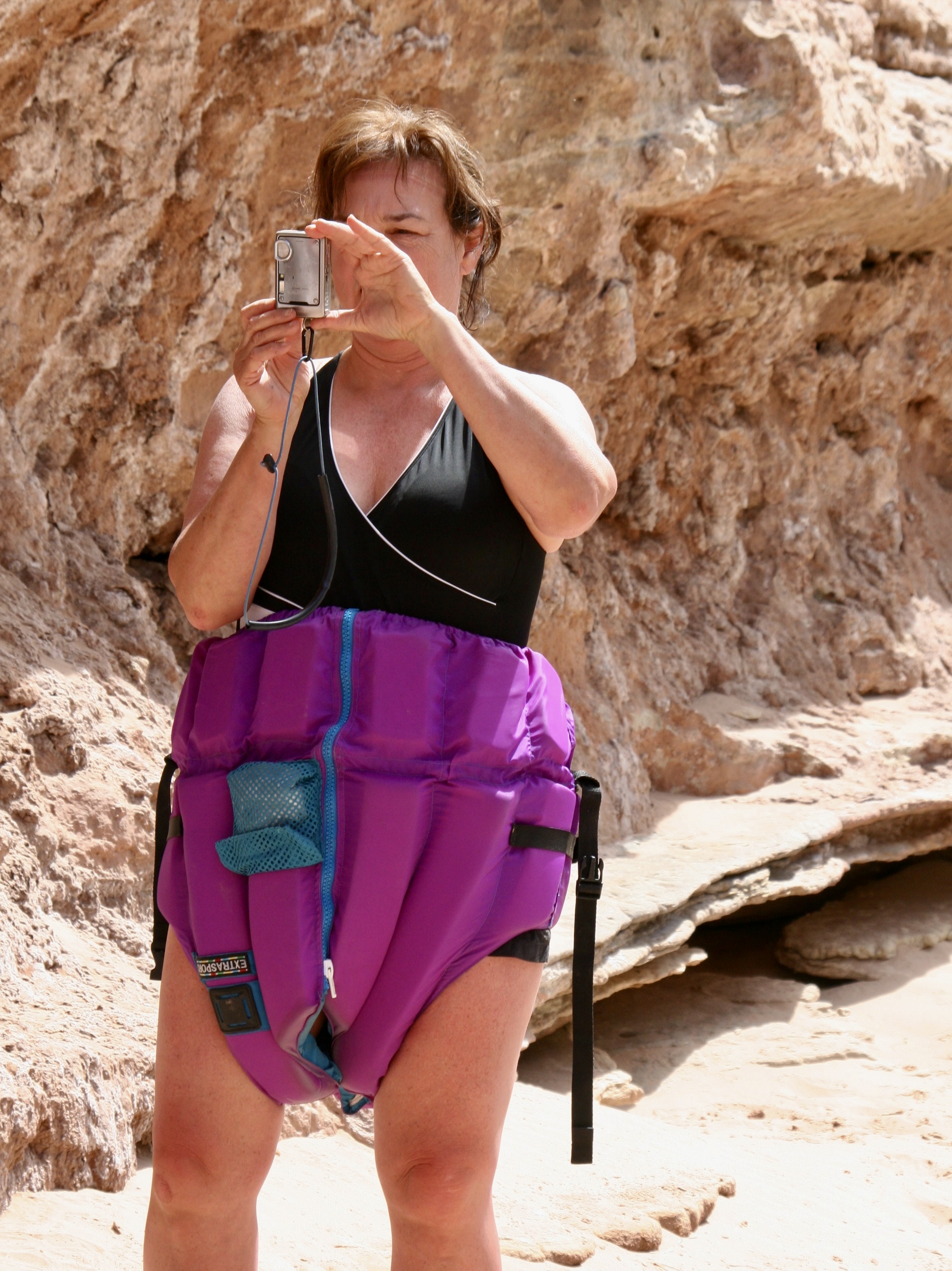
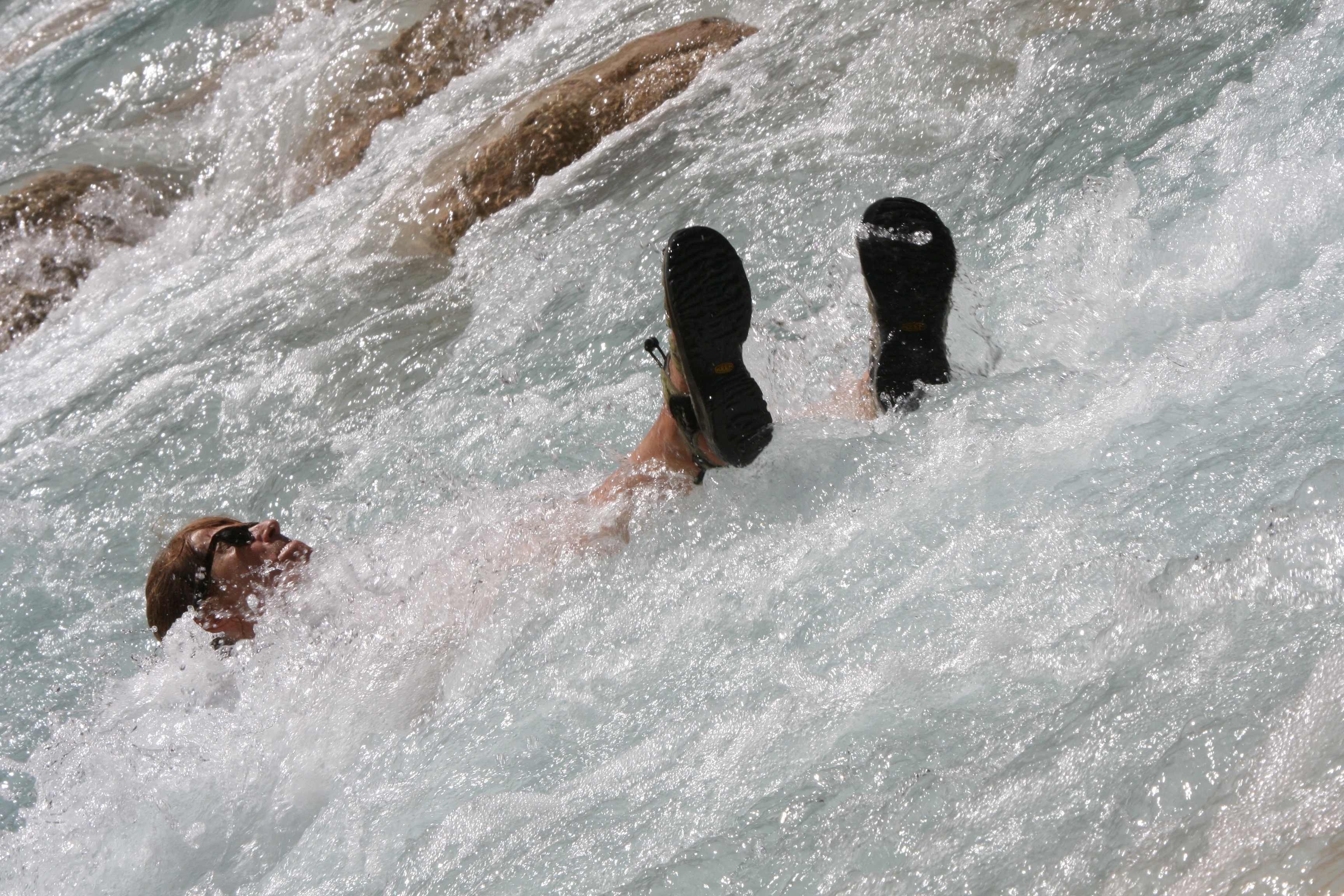
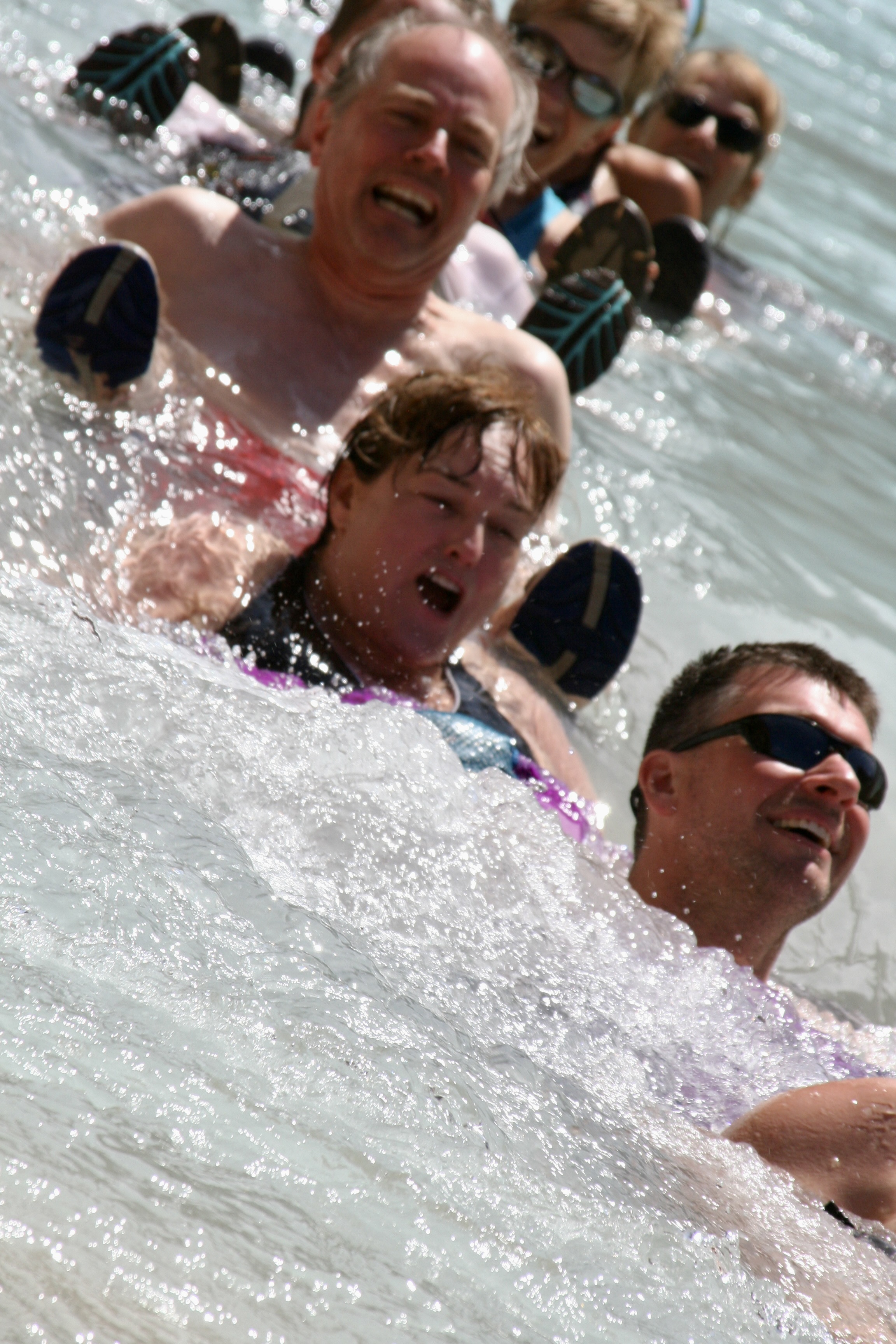
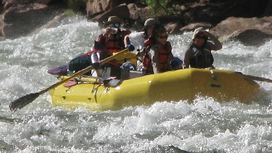
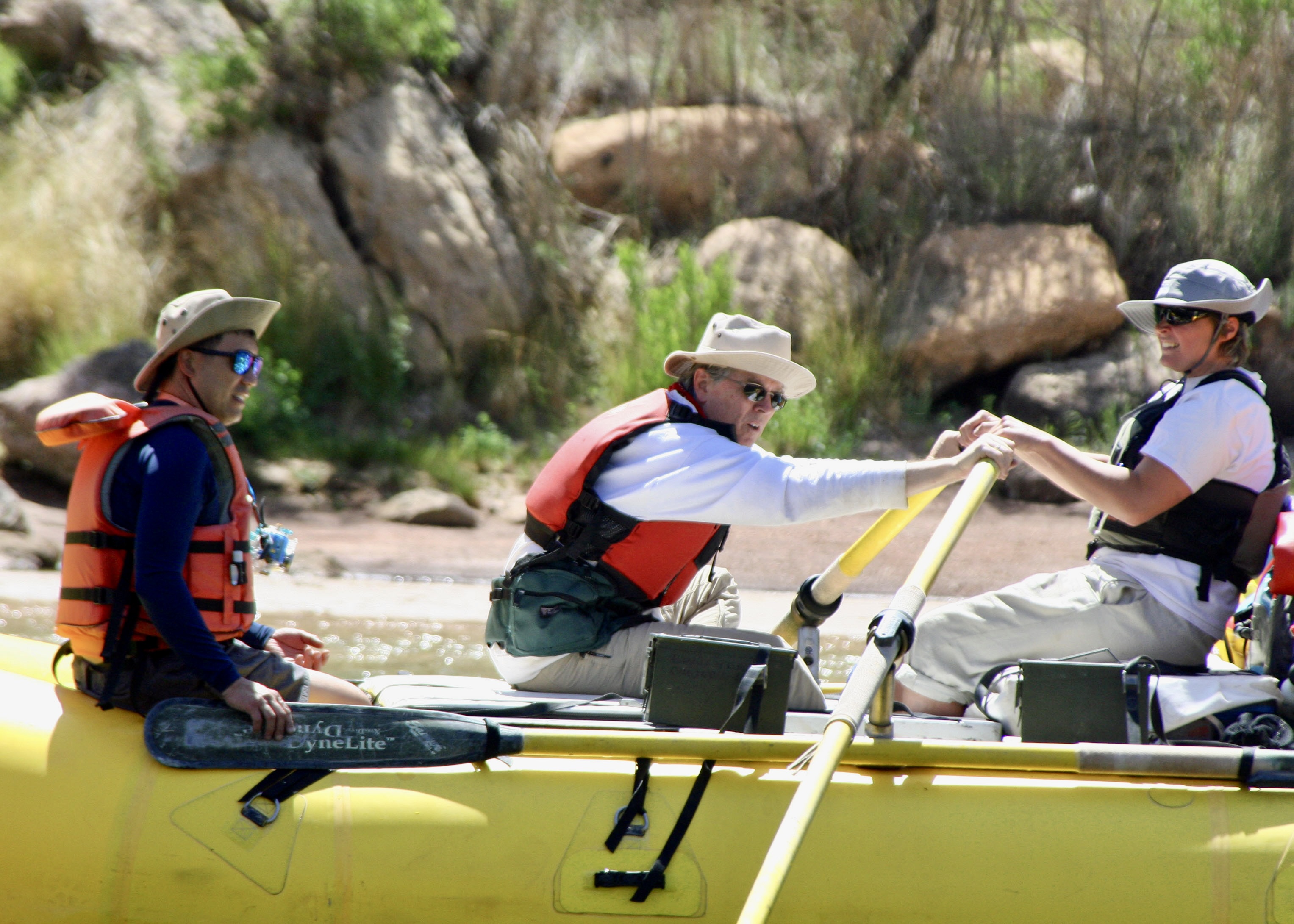
As we floated down the river, we were awed over and over by the surrounding beauty! The pontoon boat, BTW, is rowed by Steve Vandoor. Steve’s boat is rigged to carry groovers (honey buckets), which is something of a specialty of Steve’s. While it might seem strange, it guarantees that he is invited to join river trips on a regular basis. Does this mean Steve is groovy? More on groovers later.This huge slab of Coconino sandstone at mile 10 once stood hundreds of feet above the river before it came tumbling down and stuck— standing up. It’s a reminder of the constant geological forces involved in creating the canyon. As the river digs deeper, erosion brings rocks crashing down, widening the canyon. It’s also a reminder that one wouldn’t want to be anywhere near when it fell!This was one of our first rapids. It’s where Tom lost an oar and ended up rowing heroically to get us out. Afterwards was one of the first times I ever heard him be totally silent. (Photo by Don Green.)Major rapids like House Rock were always scouted by the most experienced boatmen. Peggy is obviously quite excited. “Listen to the roar, Curt!” I was thinking more about the ‘hole’ that we might be sucked into. The boatmen plot out the best way to avoid such obstacles. They were amazingly good.In addition to our raft trip down the river and camping, Tom had planned several excursions. This is in Silver Grotto, which was quite beautiful. I’d chosen to stay in camp for photography and a little ‘Curt Time.’ See the slot canyon. Tom had them hike to the upper rim and then slide down some 20 feet to a small pond in what was close to a straight drop. The rocks were wetted to assure a smoother slide. Everyone survived and had fun, but it did make me wonder about the ‘safety’ part of my responsibilities.I discussed the ‘thrill ride’ with a raven that came to visit me and perched on a boatman’s seat. It told me she would share her opinion for food. I declined. I’m pretty sure she would have said, “It’s easy. Just fly.”While the major rapids provided for a minute or two of pure adrenaline rush for both boatmen and passengers, floating on calm waters was a much more common experience for us.Every corner brought a new marvel such as this towering cliff. Check out our boats at the bottom for perspective.Vasey’s Paradise at mile 32 is one of the most beautiful waterfalls we saw on our journey. It flows out of what is known as the Redwall, one of the Grand Canyon’s most prominent features.As you might imagine, we all took photos. This is Leland Lee, who, in addition to being a talented photographer, is a periodontist.While we relaxed and enjoyed the falls, Jamie gathered the cold fresh water for our drinking and cooking needs. Gathering and pumping water through filters to purify it was one of our daily chores. Redwall Cavern, a mile or so beyond Vasey’s Paradise, is one impressive cave! We headed in for lunch.Some of our rafters and the lunch kitchen provide perspective on the cavern’s size. When John Wesley Powell, the one armed veteran of the Civil War and first dedicated explorer of the river, came on the cavern in 1869, he estimated it could hold 50,000 people. Modern estimates are closer to 5,000, but that is still a bunch!This is a view looking out from the Redwall Cavern at the surrounding canyon walls.I thought this was a great people shot by Don…And scenery shot. (Photo by Don Green.)Colorado means red, which is the color of the river after rainstorms (reddish brown). Obviously it hadn’t rained recently, and, as I recall, it didn’t rain at all during our trip. Quite the monument.Theresa provides perspective on the ancient Anasazi Granary we hiked up to visit high above the Colorado River near mile 53. (Photo by Don Green.)Looking down the Colorado River from the Anasazi Granary. One of us is making our way back toward the river in the shadows on the right. (Photo by Don Green.)A view looking up, downriver from the granary.And another.Food is quite important to river runners as I mentioned in my first post on the river. And why not, since the boats can carry massive amounts. It’s not like backpacking where every ounce matters. Here, Peggy is working on a carrot salad. Each of us was expected to do kitchen duty. Tom, who owned a popular Mexican restaurant in Davis at the time, the Cantina, was proud of what he had brought along to eat— and quite particular on how it was prepared. He hovered providing directions. Like a chef.For example, the correct way to cut romaine lettuce. Susan Gishi holds up the lettuce like rabbit ears on an old fashioned TV set. She is about to demonstrate how to cut it and looking much more serious than the rabbit ears would suggest.Like this.Tom discovered me tearing it up instead of cutting it and got quite excited. Being allergic to taking directions from Tom about cutting lettuce, I made a trade with Peggy. I would handle her groover duty if she would take my kitchen duty. Here’s the thing about groovers, you are required to carry your poop out. Peeing is done in the river. My duty was to work with Steve in finding a suitable private place for the men’s and women’s groovers when we landed in the evening and then loading them back on his boat in the morning. BTW, the reasons these large ammo cans are called groovers is because people sat on them directly until someone figured out how to attach toilet seats. Duh. They left grooves on your butt! (Photo by Don Green.)Our next great stop was at the Little Colorado River where it flows into the Colorado at mile 61. Its beautiful color is due to mineral content. The minerals settle out to form the rocks you are seeing. There is a cave a few miles up the river where Hopi mythology claims they made their entrance into this world.As always, my camera was kept busy.I suspect the Hopi would have seen these reeds as weaving material.Not a thong bikini. Bobbi Allen was busy taking photos as well, but more to the point, she is wearing her PFD upside down per Tom’s direction. The purpose was to enhance our floating down the Little Colorado. They seemed strange and looked like bloated diapers. I’m not sure Bobbi meant to serve as a model but I wasn’t up for a selfie. That would have been scary.People floated down as individuals or in groups. I couldn’t tell which one this was for sure, but If she looks a little out of control, you should have seen me. My PFD slipped down around my feet and I bounced down the river with my head removing rocks along the way. I think it was Jamie who waded in and pulled me out. My guess is that others thought of it as a Kodak moment, and Tom thought it might pound some sense into my head.Here’s a Conga Line with Tim Spann, Bobbi, and Don plus others.Even Bone gave it a try, but he preferred the calmer part of the river.A sucker found him amusing…Nancy Pape praised him for being so brave. Nancy and I go way back to the early 1980s when she joined me on one of the hundred mile backpack treks I led. And many more after that. She has also gone to Burning Man with Peggy and me, as have Tom, Don and Bone.And Jamie decided to teach Bone how to row.In fact Bone became so confidant in his rafting skills, he decided he could serve as a scout checking out rapids.Fortunately, no one drowned. That does it for today. Next Friday we will continue our trip down the river with its great beauty and wild adventures. (Photo by Don Green.)
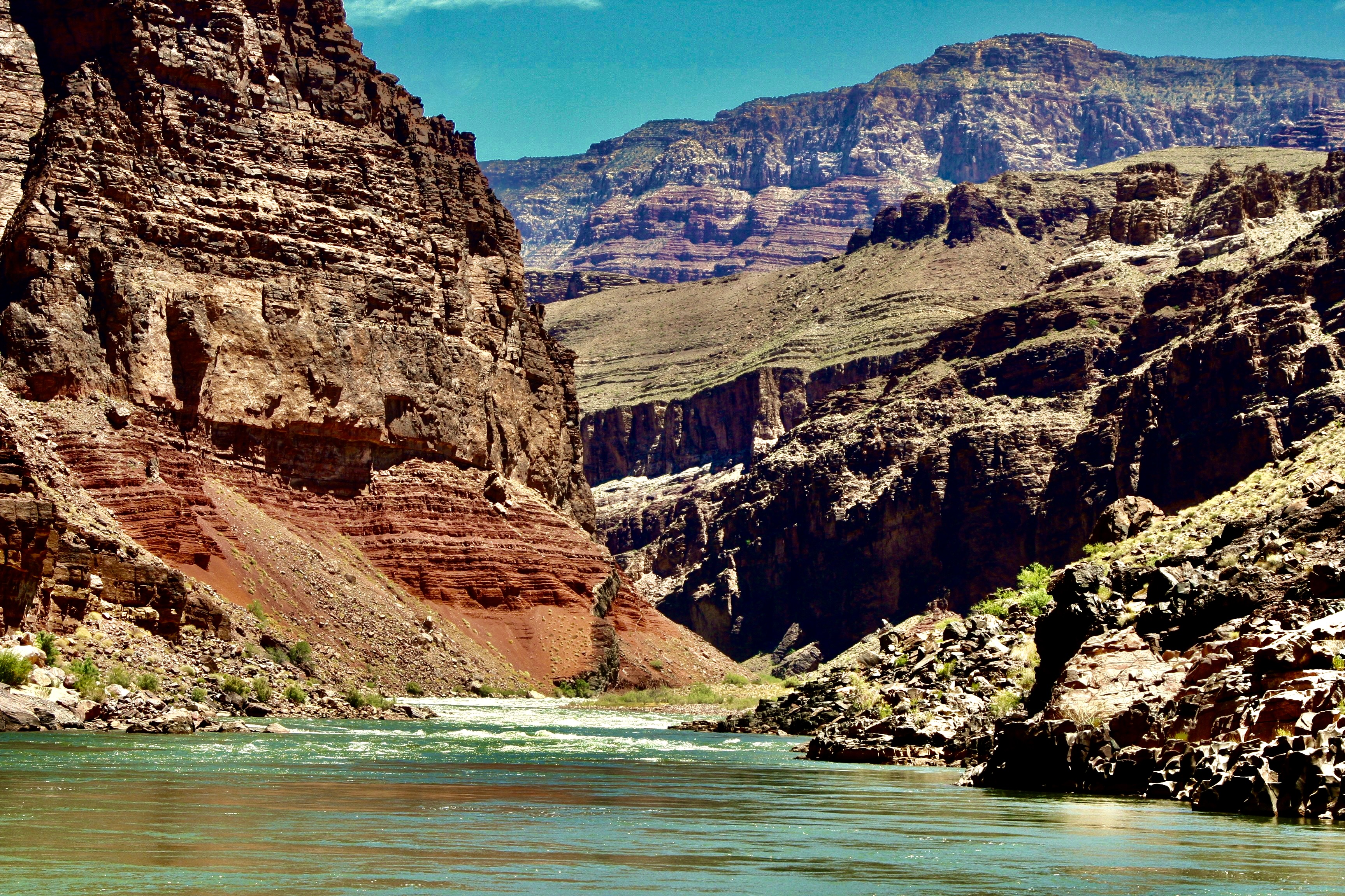
Over one billion years of the earth’s history, great beauty, and adventure await those who are lucky enough to raft through the Grand Canyon on the Colorado River.
Most of our adventures start with a fair amount of forethought. Our 18-day raft trip through the Grand Canyon was an exception. It started with a phone call from our friend Tom Lovering.
“Curt, you need to jump online right now and sign up for a chance to win a lottery permit to raft the Grand Canyon.” It was more in the nature of a command than a request. Tom was plotting. There are relatively few private permits granted every year in comparison to the ton of rafters who want them. Floating down the Colorado through the Canyon is one of the world’s premier raft trips, providing a combination of beauty and adventure that are rarely matched. Tom figured that the more people he persuaded to sign up for the lottery, the better the chances of getting a permit. He’d made the request to several friends.
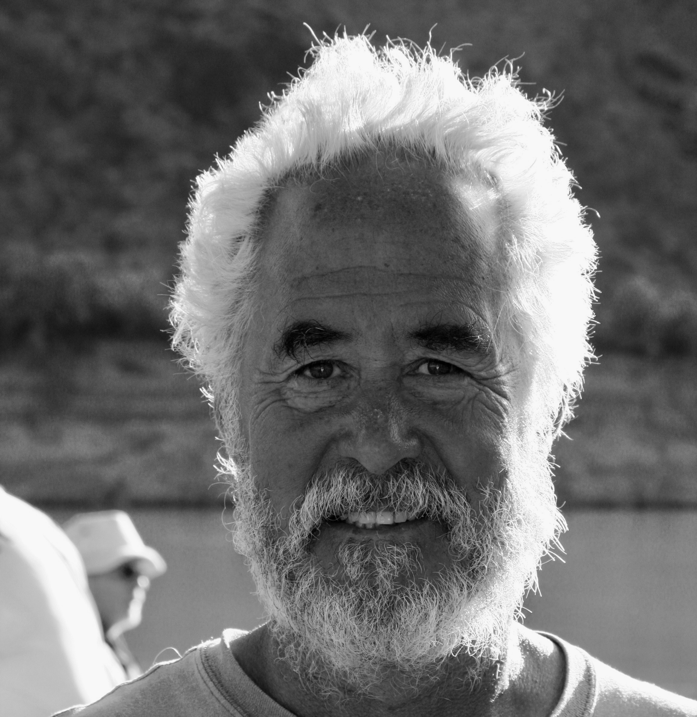
I would have probably skipped the opportunity. We were in the midst of wrapping up a three year exploration of North America and were seriously looking for a place to light— a semi-wilderness home. We were closed to settling on Southern Oregon. We had an hour to meet the filing deadline and the chances of winning, as I mentioned, were close to zilch. Plus I was woefully out of shape and 67 years old. I wasn’t sure that my body would have a sense of humor about the journey. Floating down the river on a private trip actually involves a substantial amount of work and everyone is expected to do their share. Rightfully so.
My child bride Peggy, however, who is seven years younger than I am and loves everything related to water, went straight to the site, filled out the required information in my name, filled out another in hers, and hit send. Fine, I thought to myself. That’s that. We can go merrily on our way and report back to Tom that we tried.
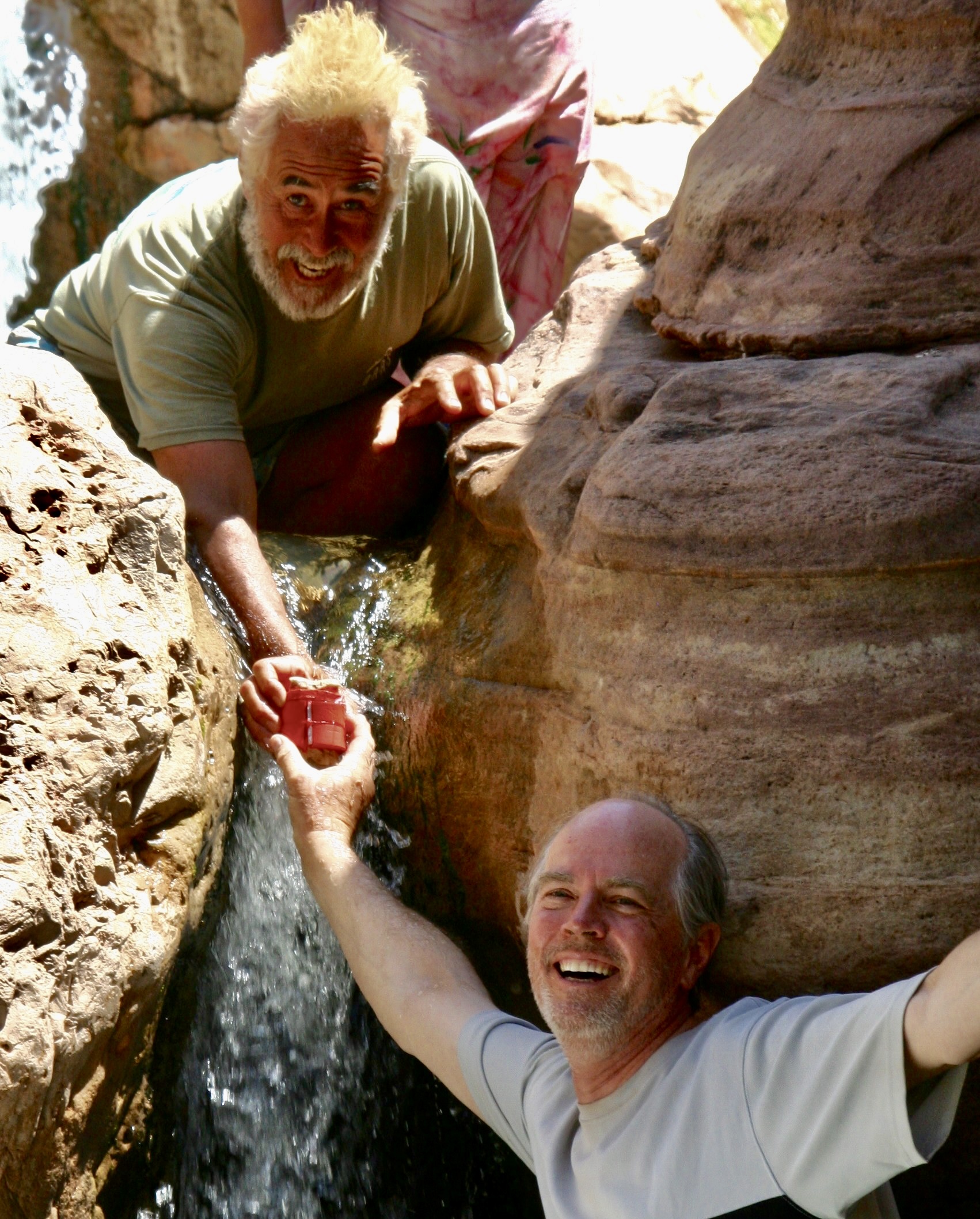
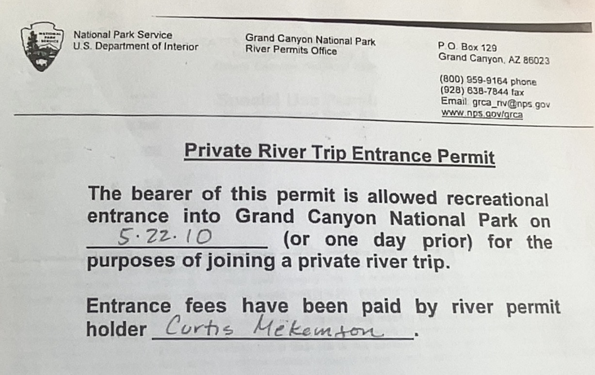
What I wasn’t expecting, as those of you have read my blogs about the trip know, was waking up the next morning and finding an email from the National Park Service announcing that I had won a permit. “Woohoo!” Peggy yelled. “Oh crap,” my fat cells responded. Tom didn’t believe me when I called him from somewhere in Nebraska. It took several minutes to convince him. And then he got excited. Here’s the actual permit:
My first task was to make sure that Tom would do the majority of the work in setting up the adventure. We didn’t have the time and I didn’t have the expertise for a white water raft trip. My experience was in organizing and leading long distance backpack and bicycle adventures. Tom, on the other hand, was an experienced white water enthusiast who had run the river several times and had boundless energy. Plus, he had volunteered. “There is a fair amount of paper work for you and certain responsibilities,” he mentioned in passing. Paper work, as I recall was a 40 page document, maybe it was 400. The responsibility, I learned was daunting. If we screwed up in some way by breaking the Park’s environmental or safety rules, I was accountable and subject to a large fine.
The raft trip in 2010 was the first blog series I ever did. I reposted it in 2018. Since I have already blogged extensively about the journey, I am going to use this and my next two posts as a summary of the trip and include many photos I didn’t use before.
I will note here that while the trip was even more physically challenging than I expected— and there were times I could have strangled Tom (and vice-versa, I’m sure)— I owe him a debt of gratitude for the opportunity. I love the Canyon and have explored it in many ways over the years including five backpacking trips into it. The river trip provided a whole new way to experience the beauty. Traveling with a great group was icing on the cake.
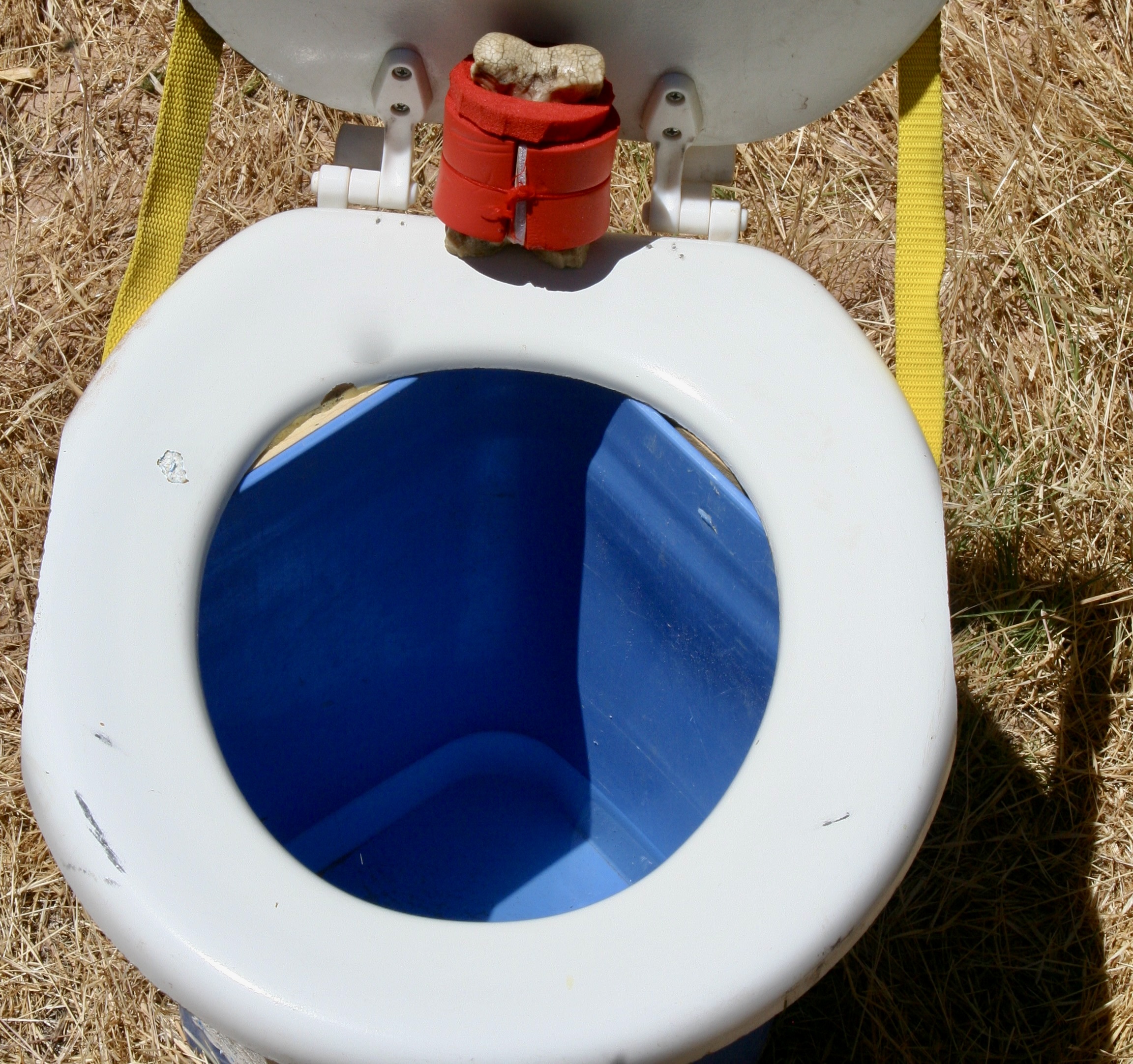
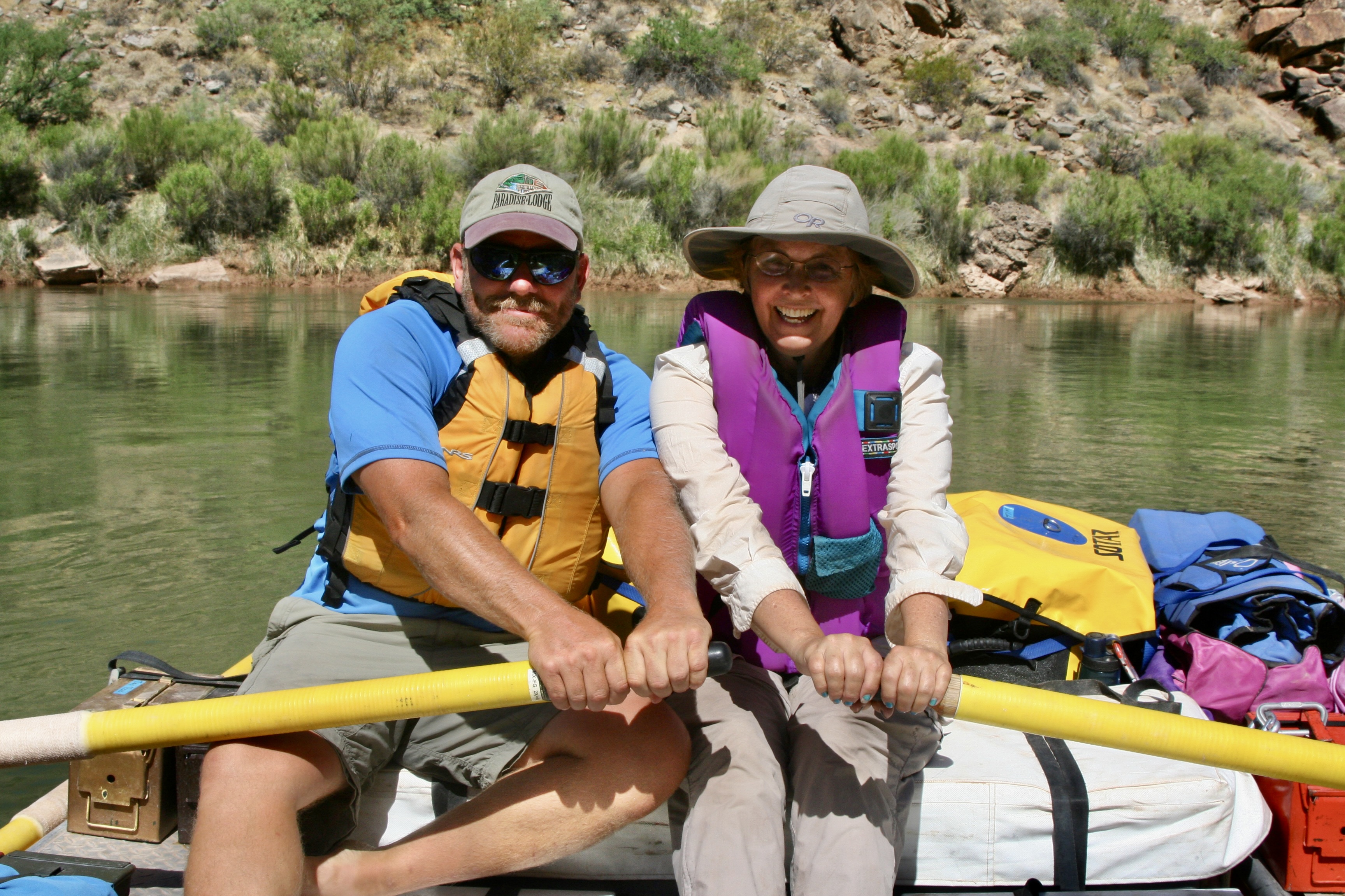
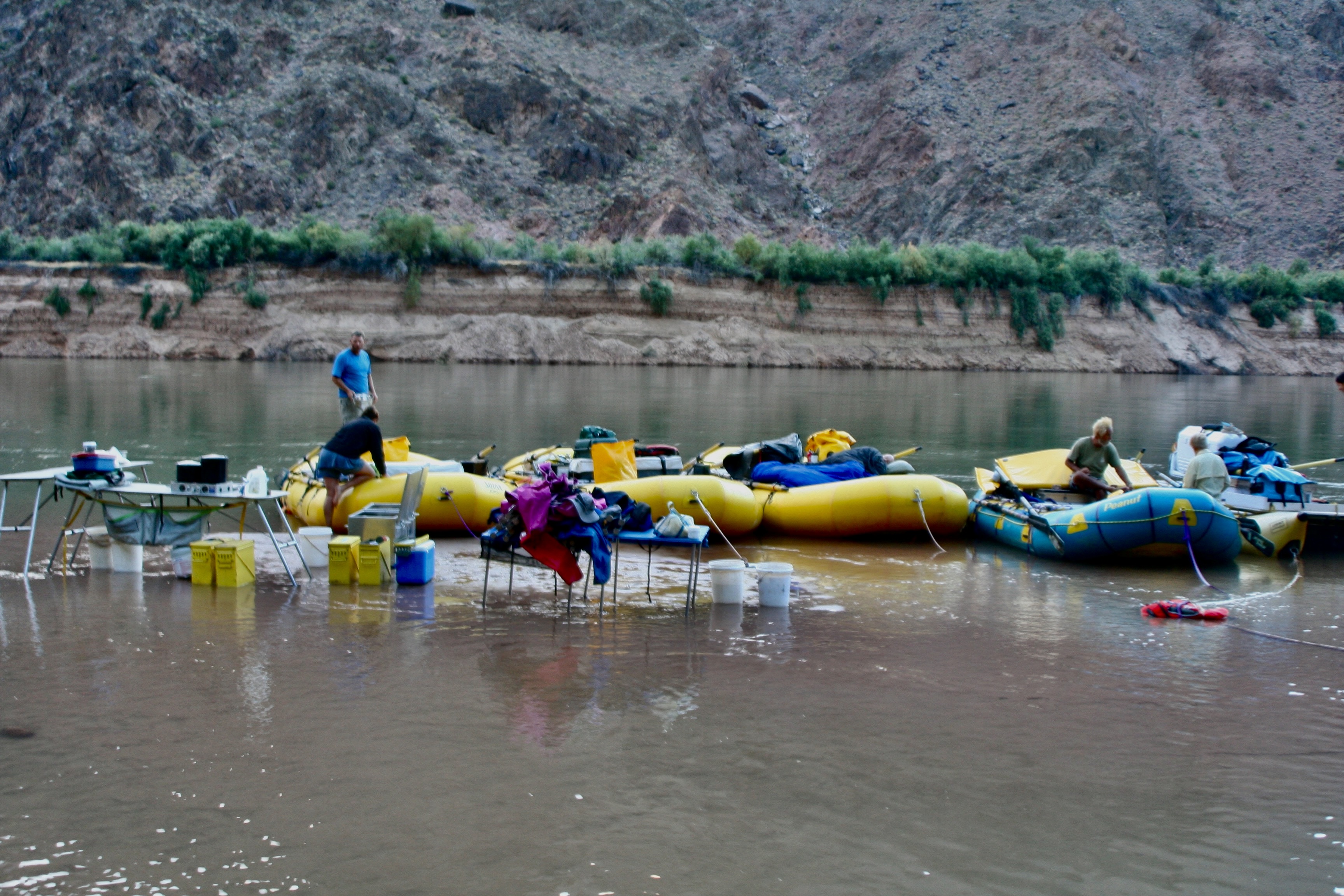
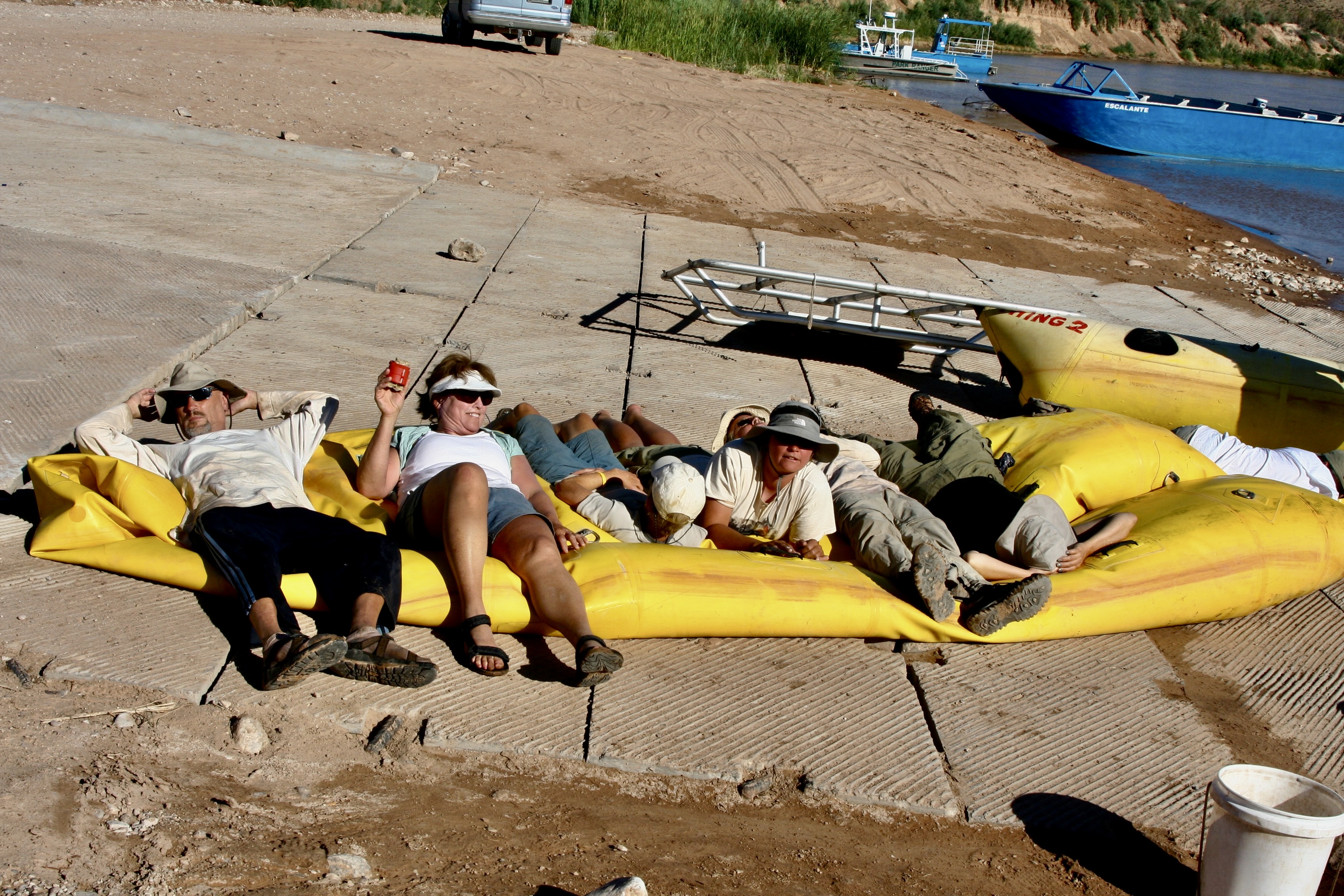
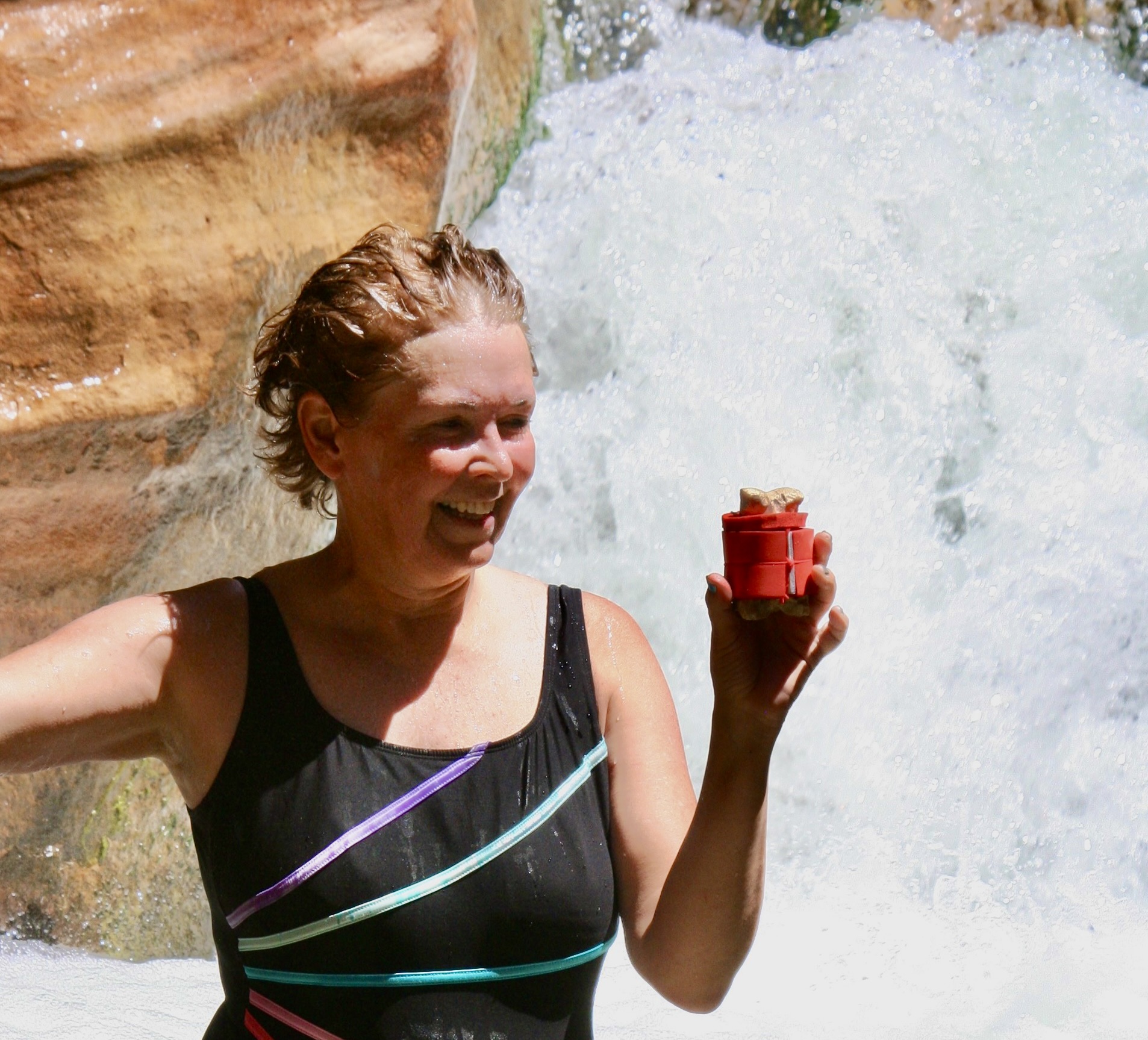
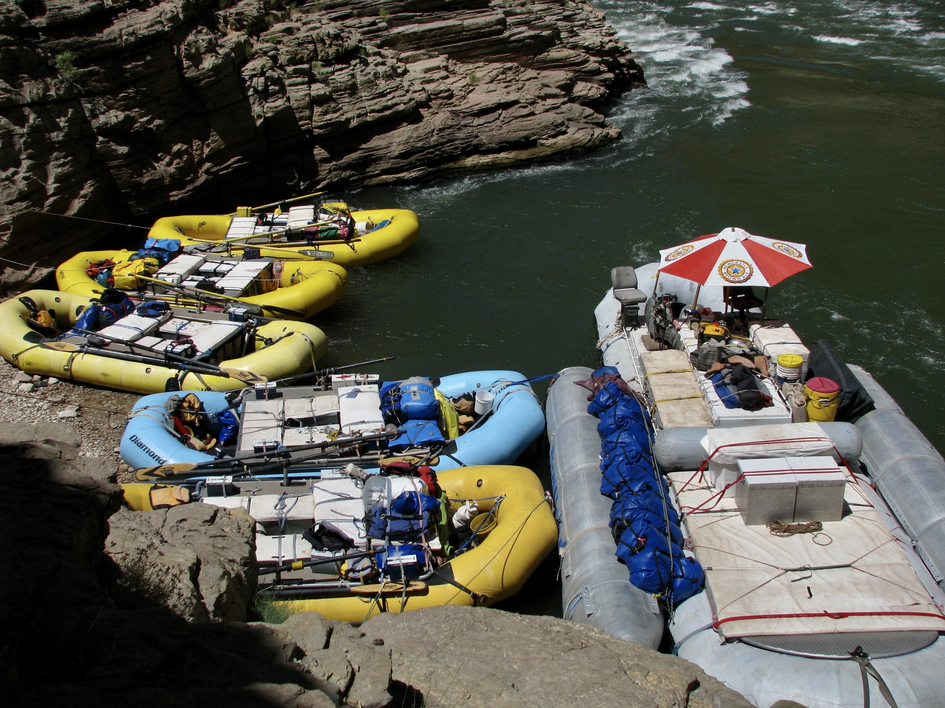
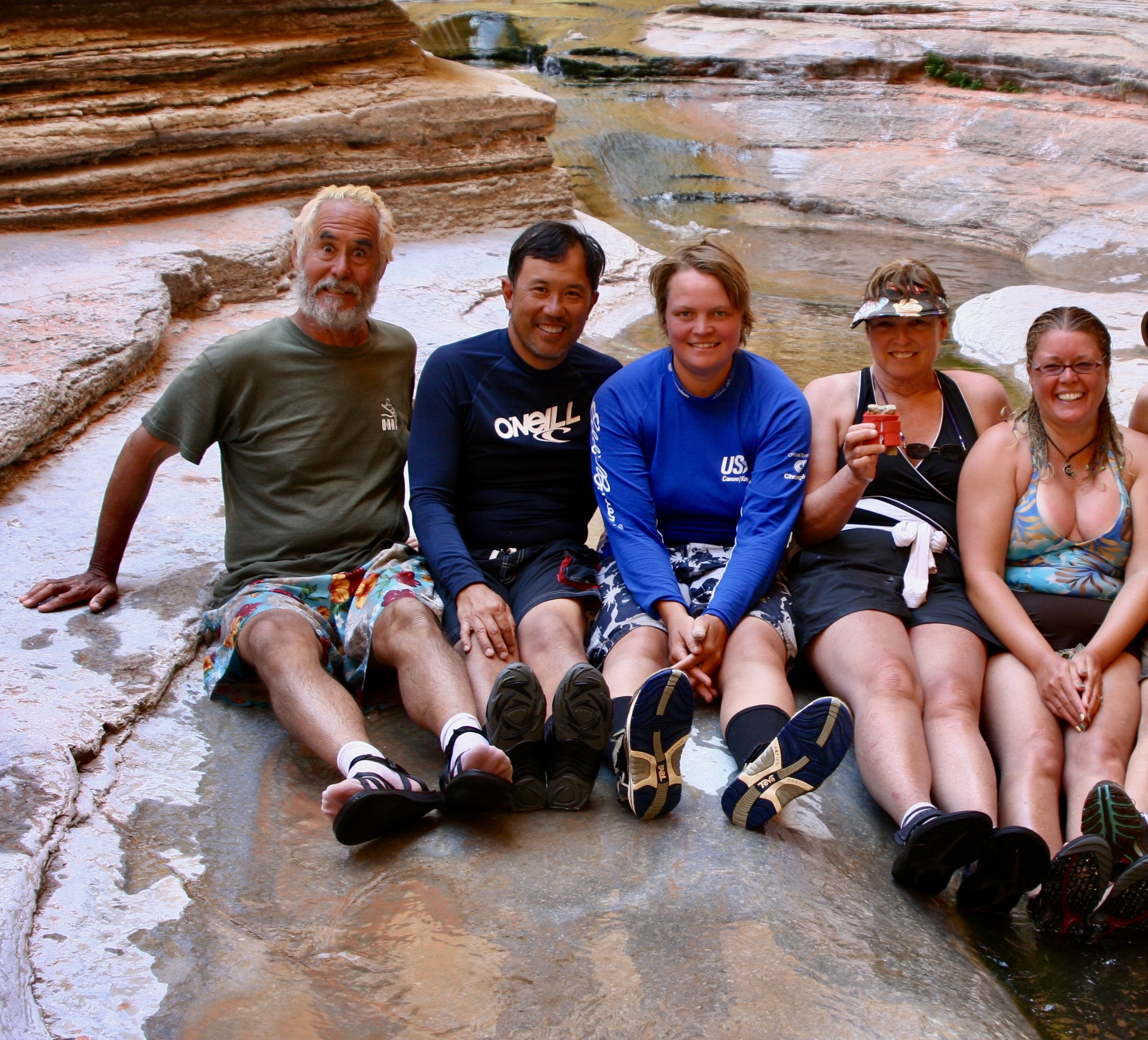
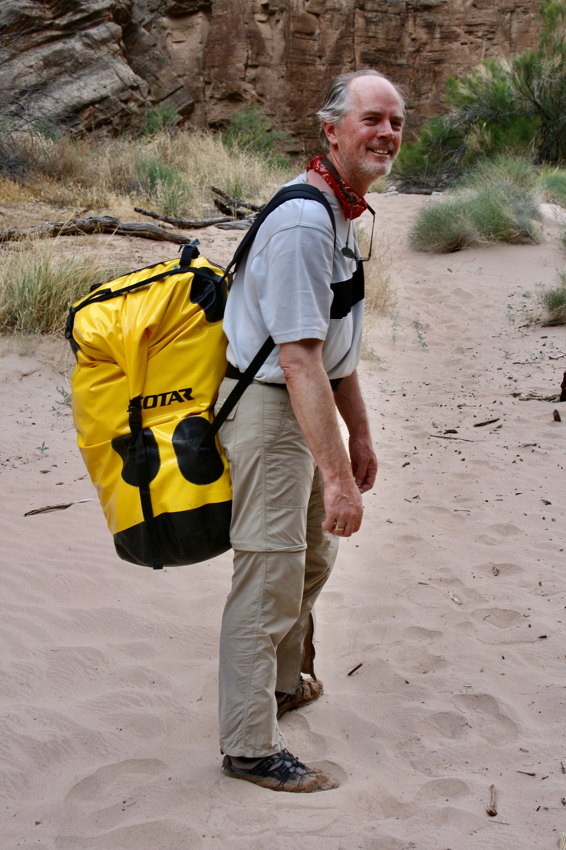
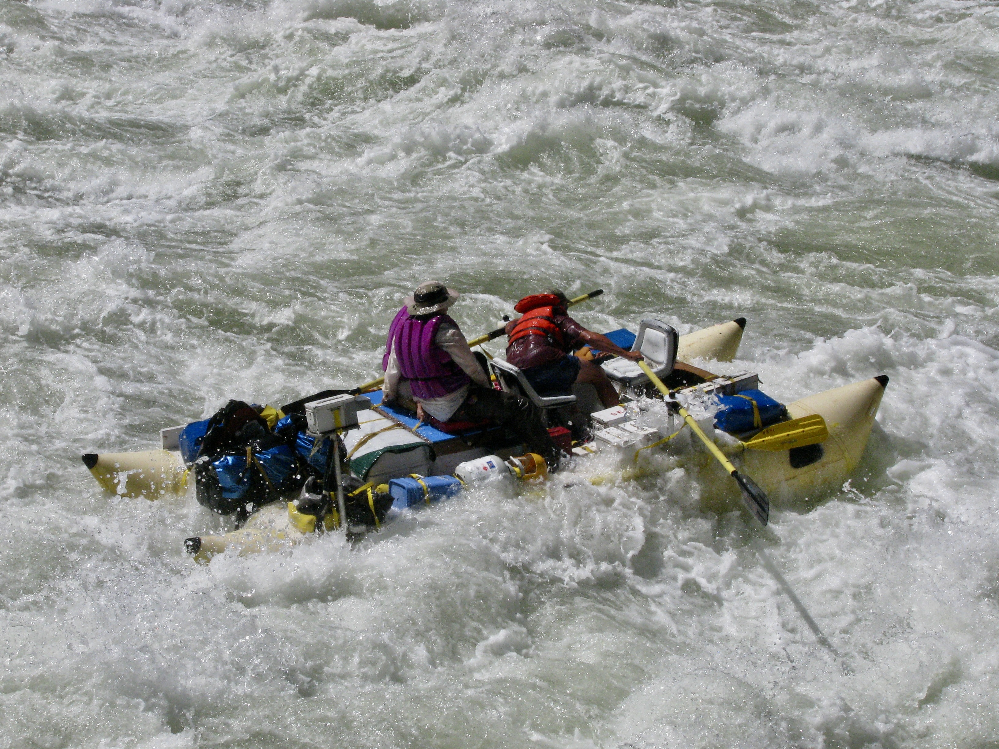
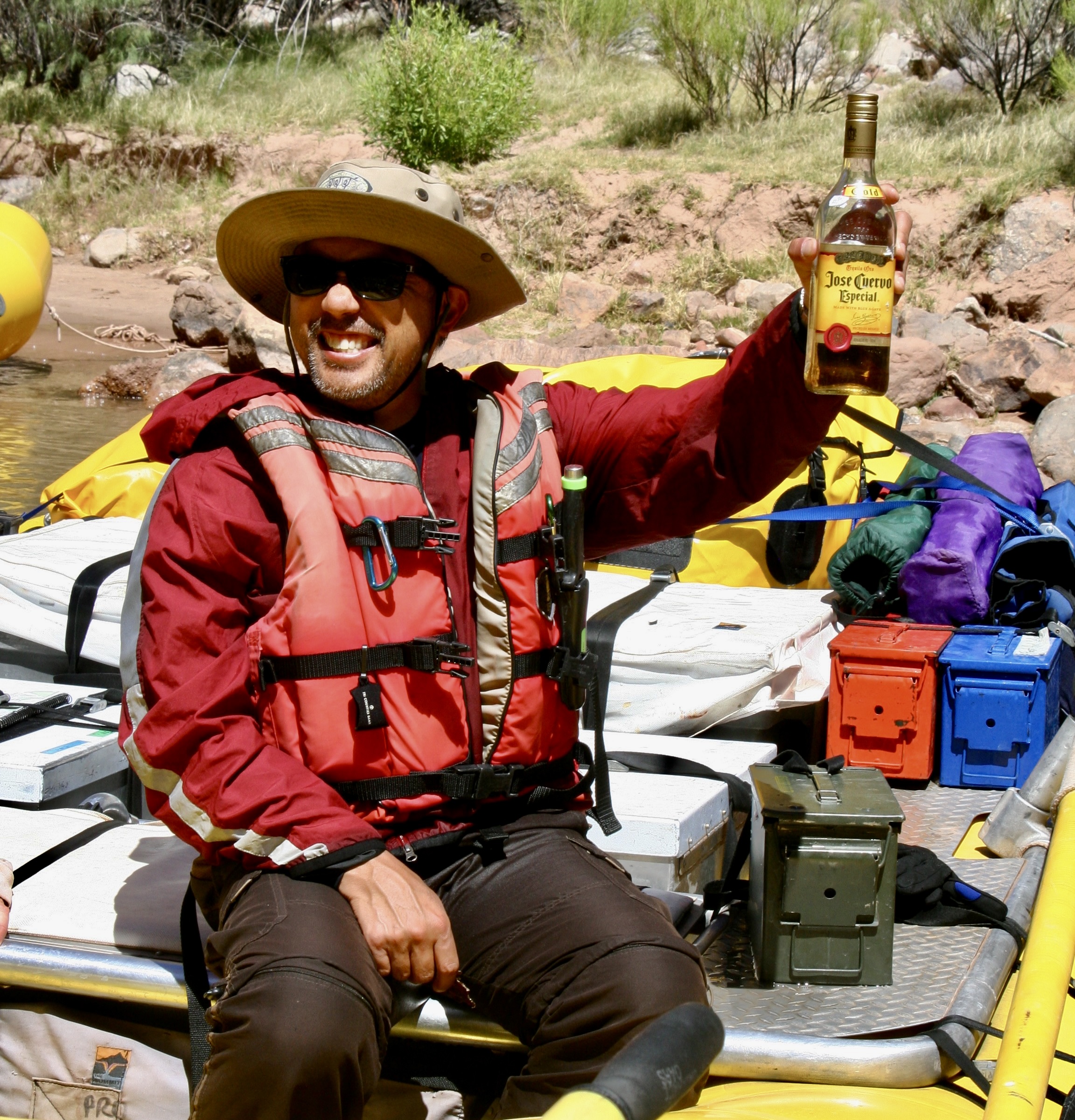
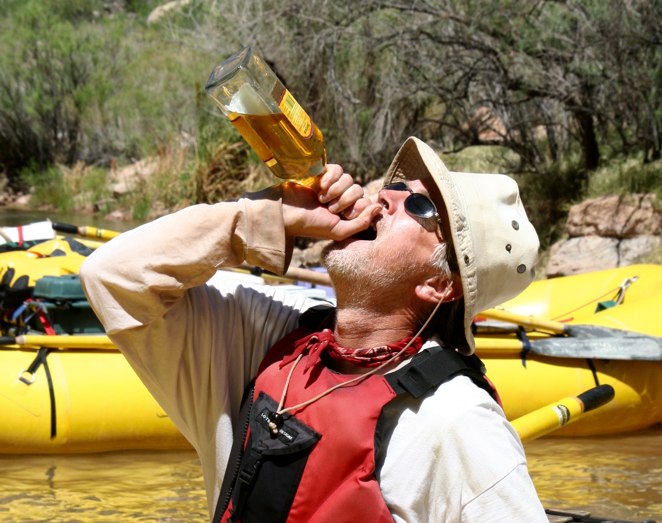
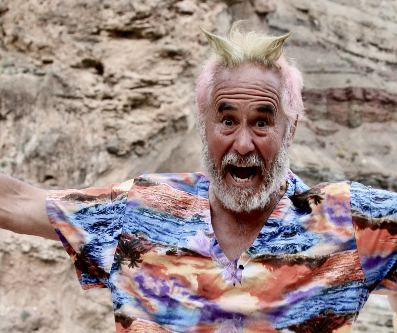
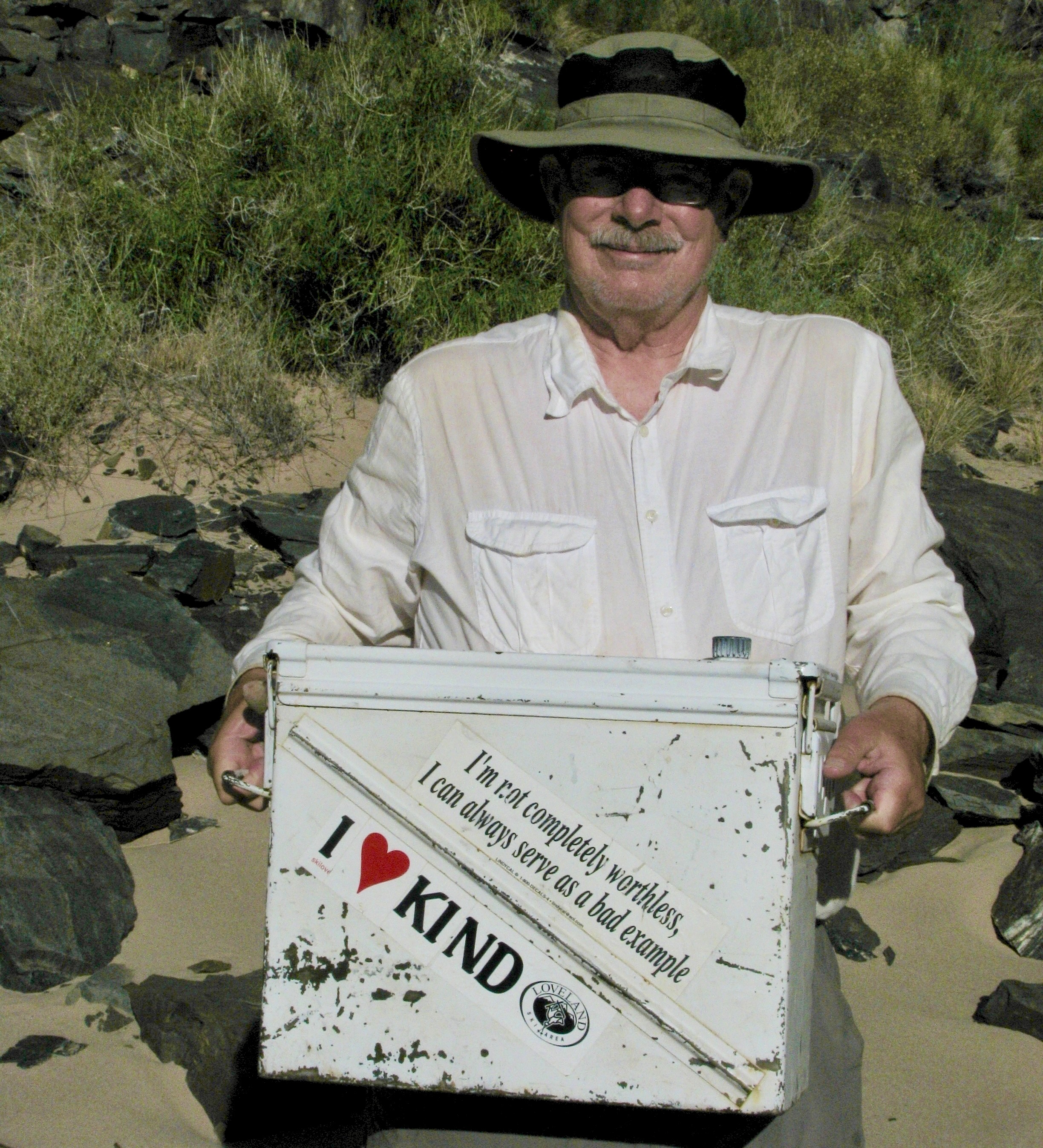
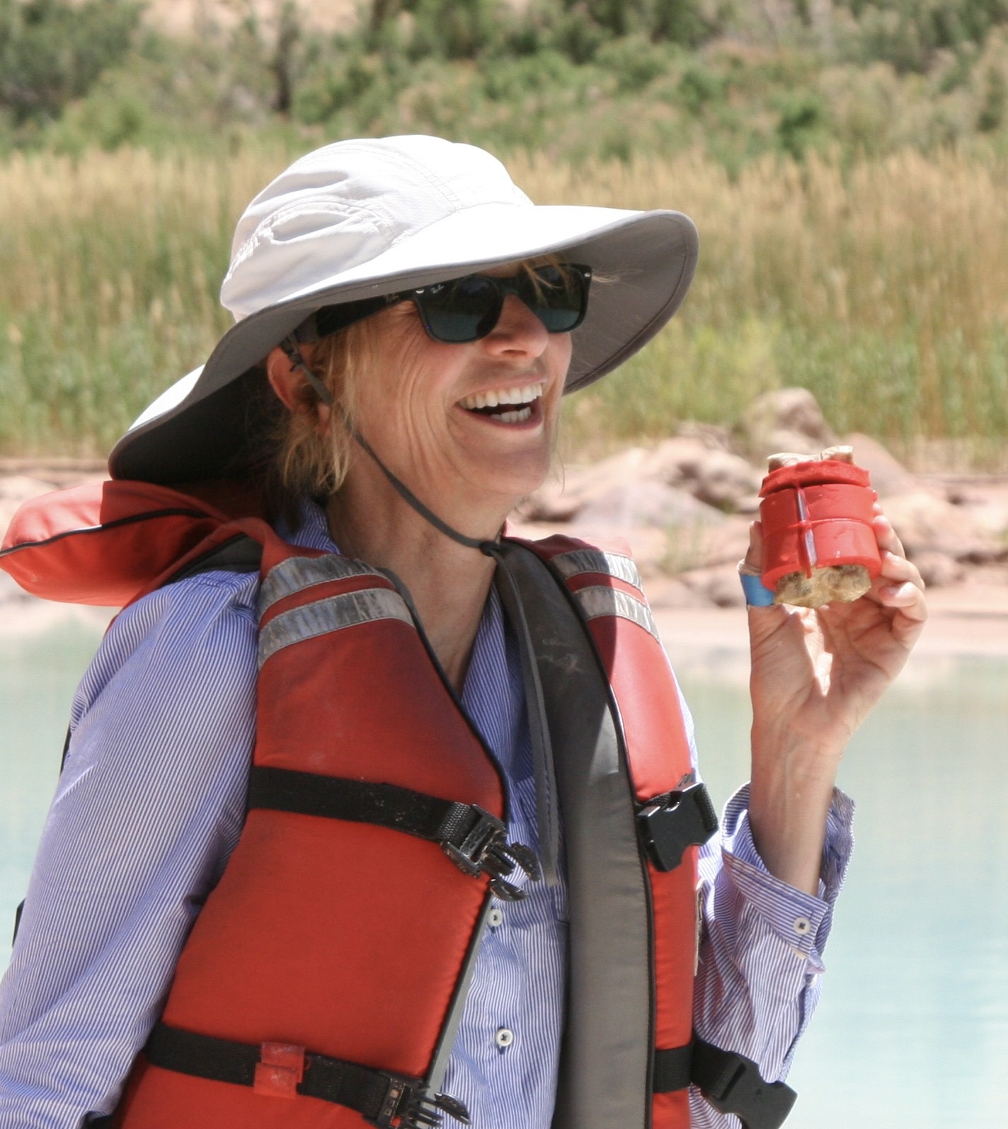
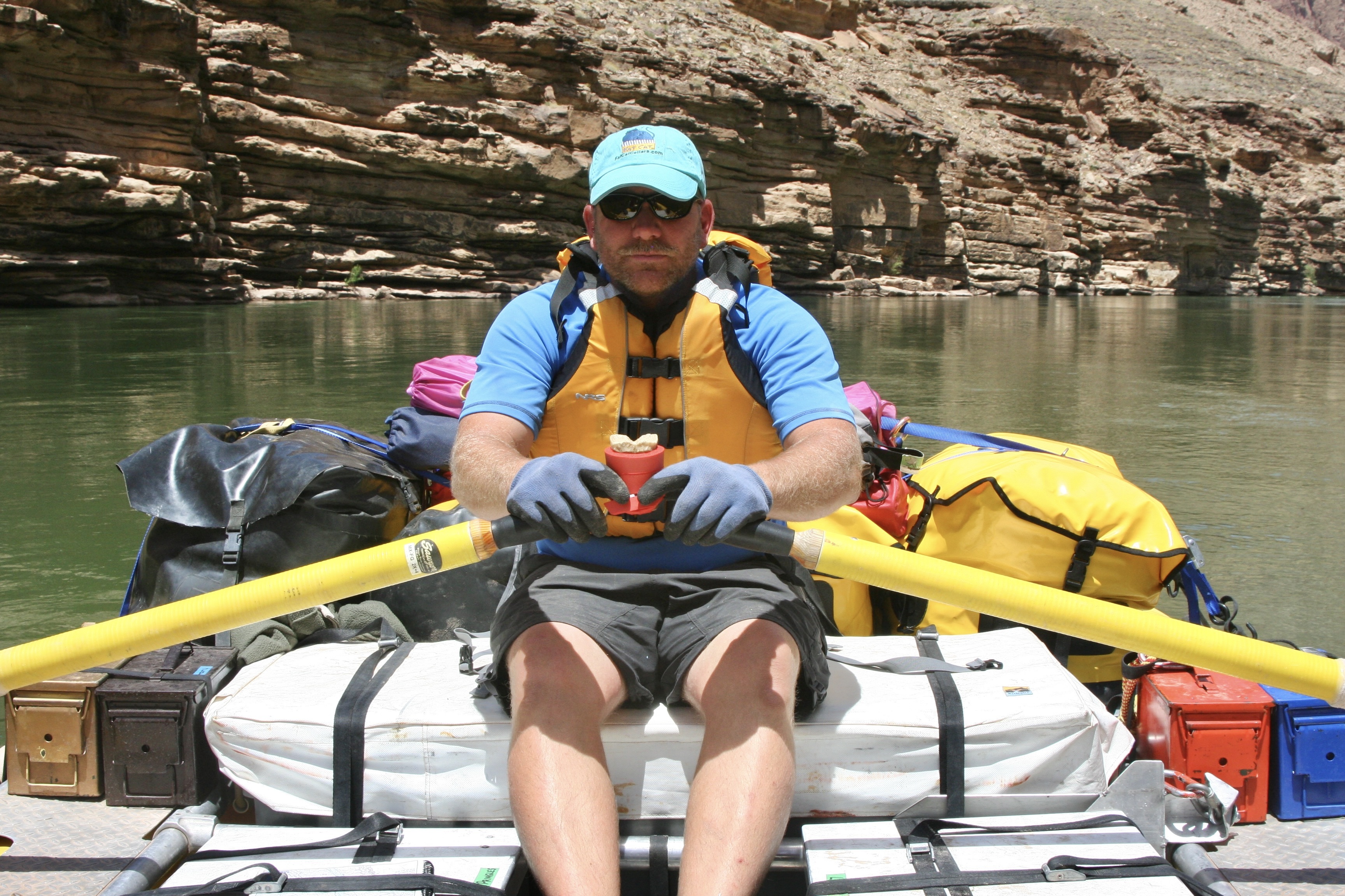
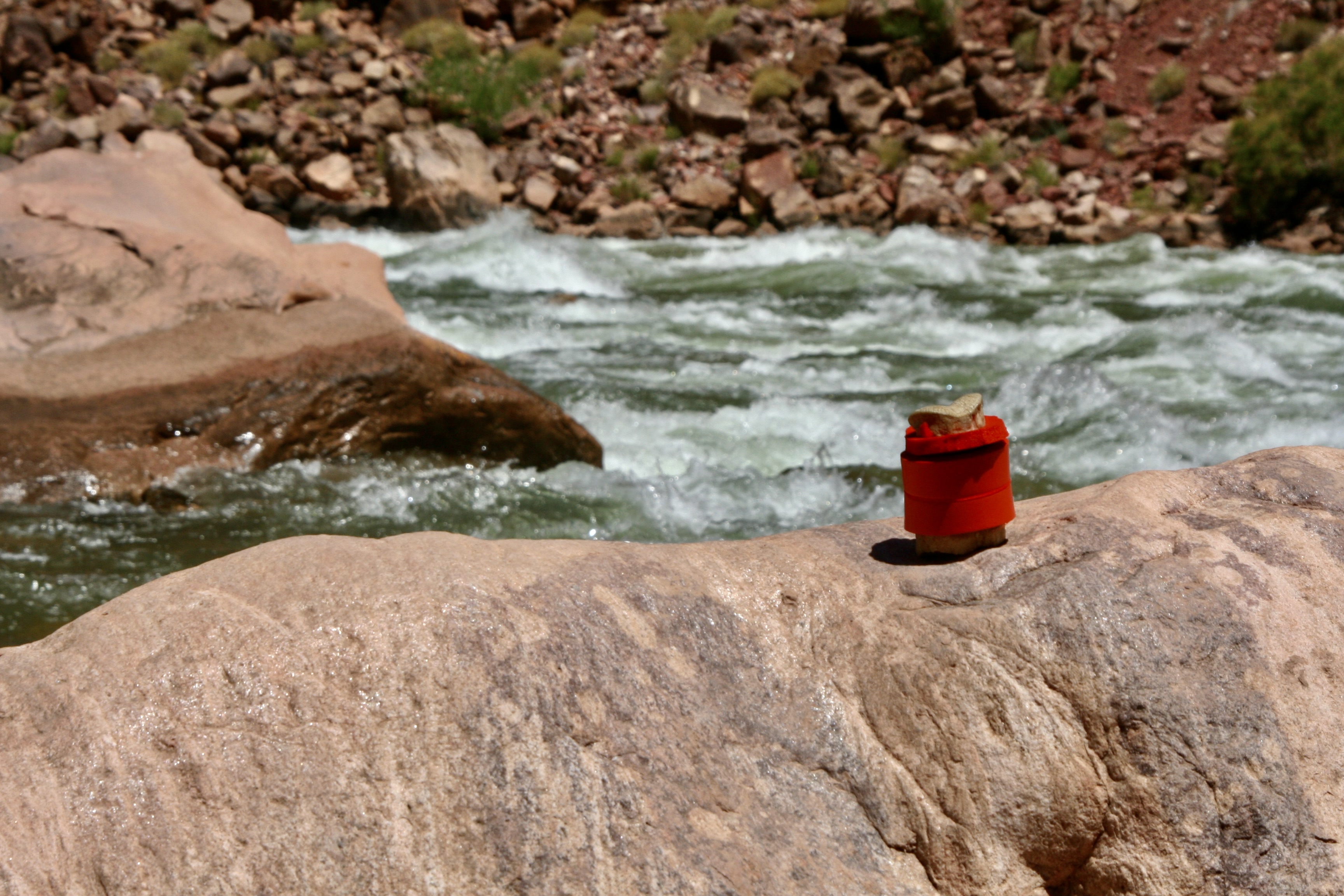
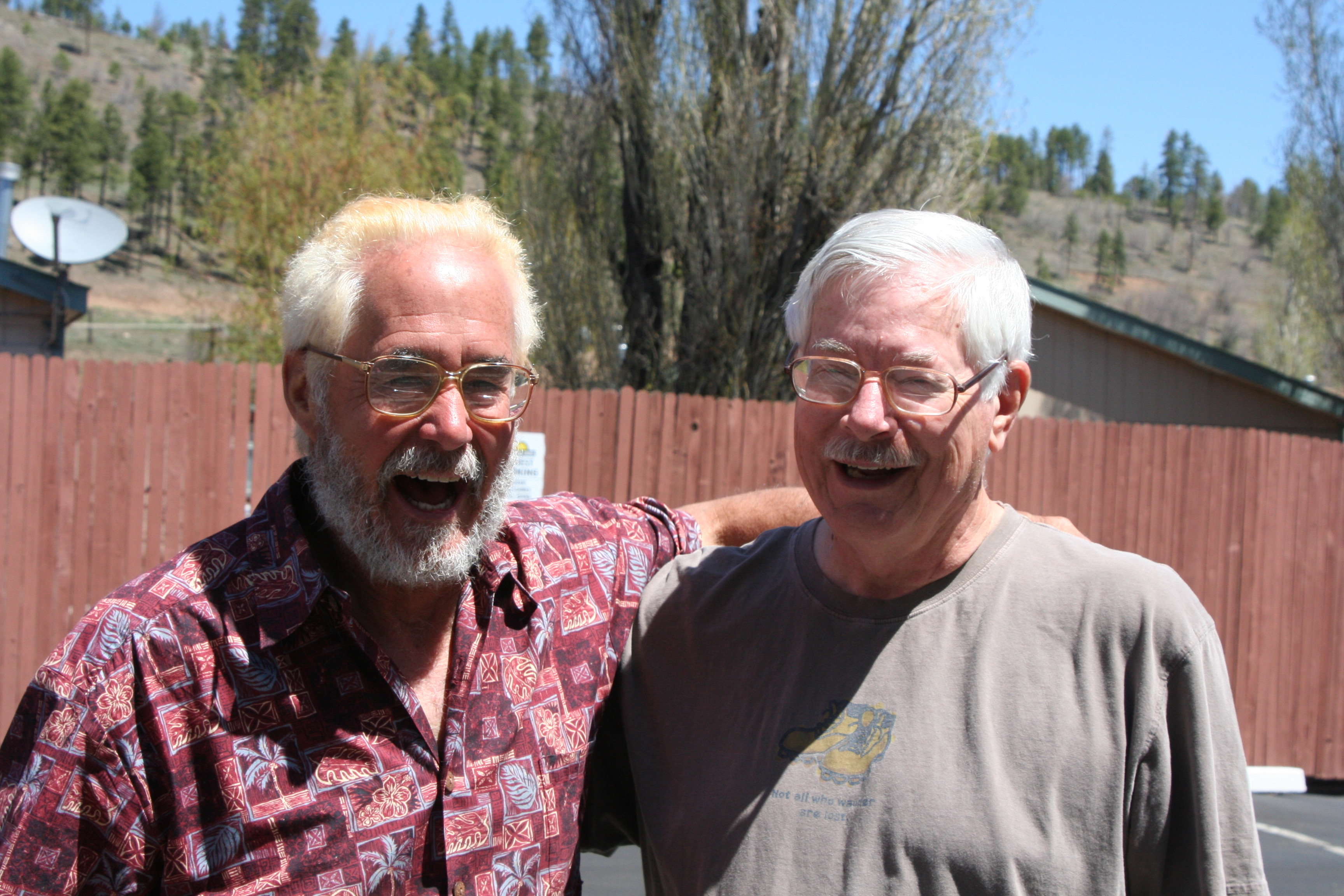
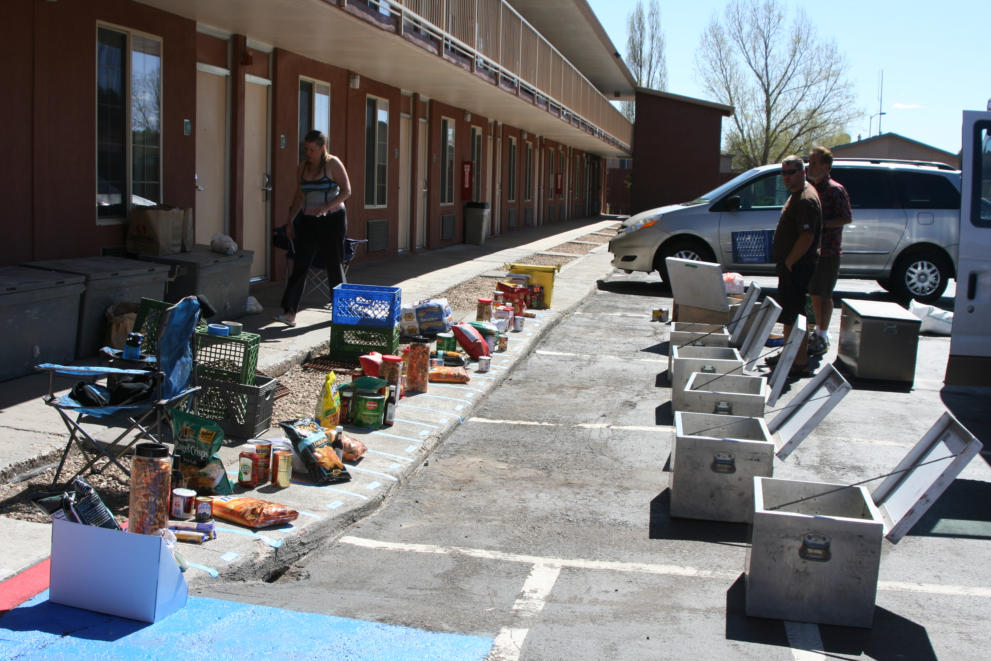
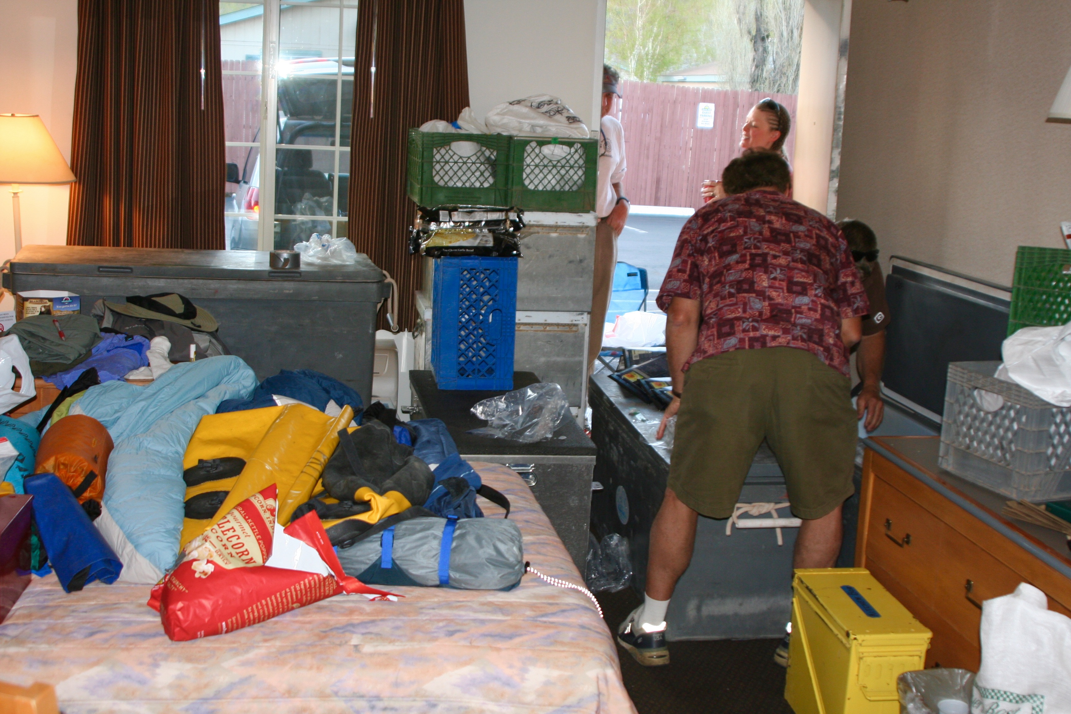
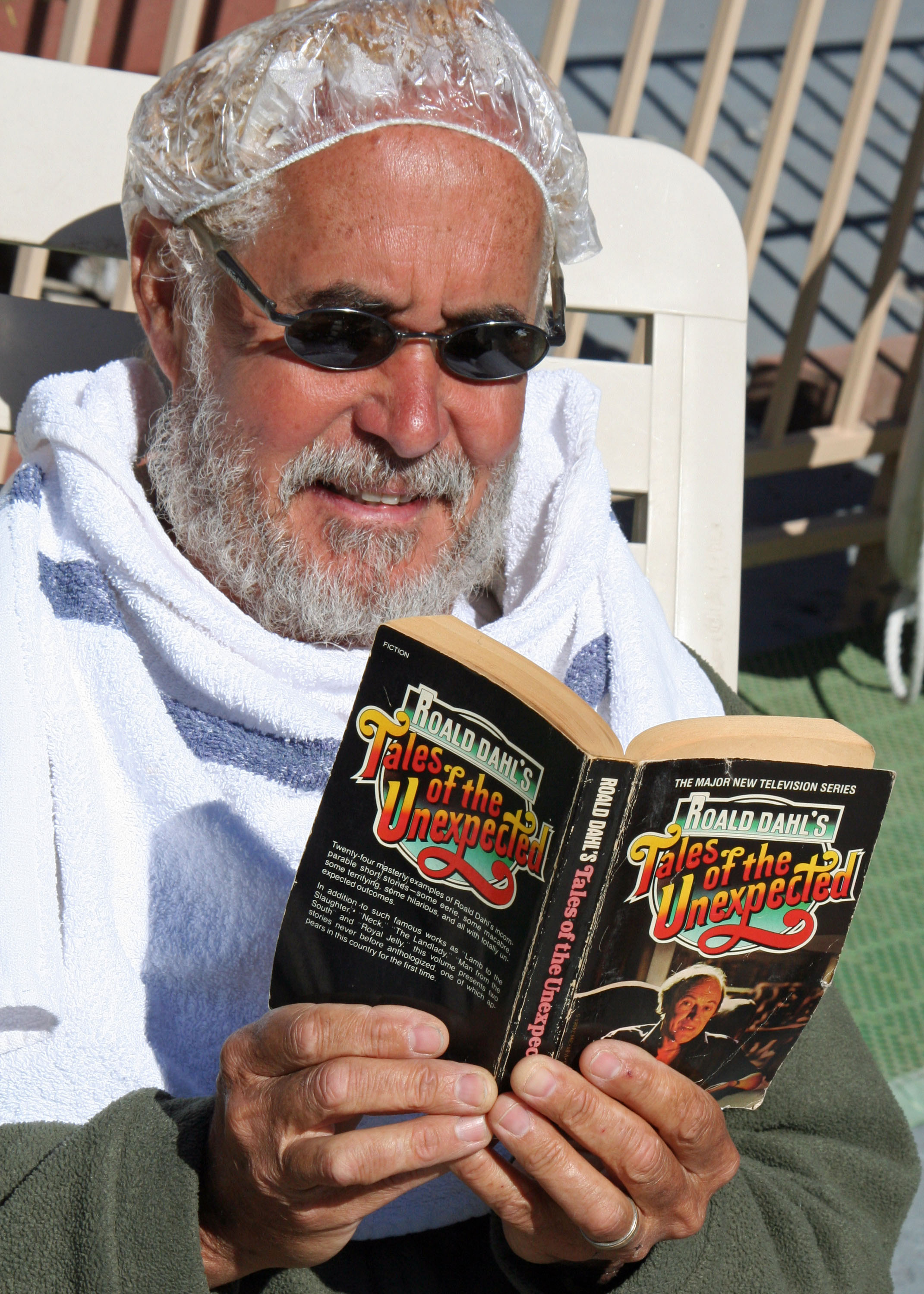
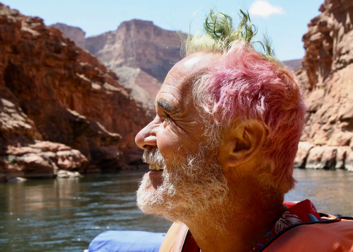
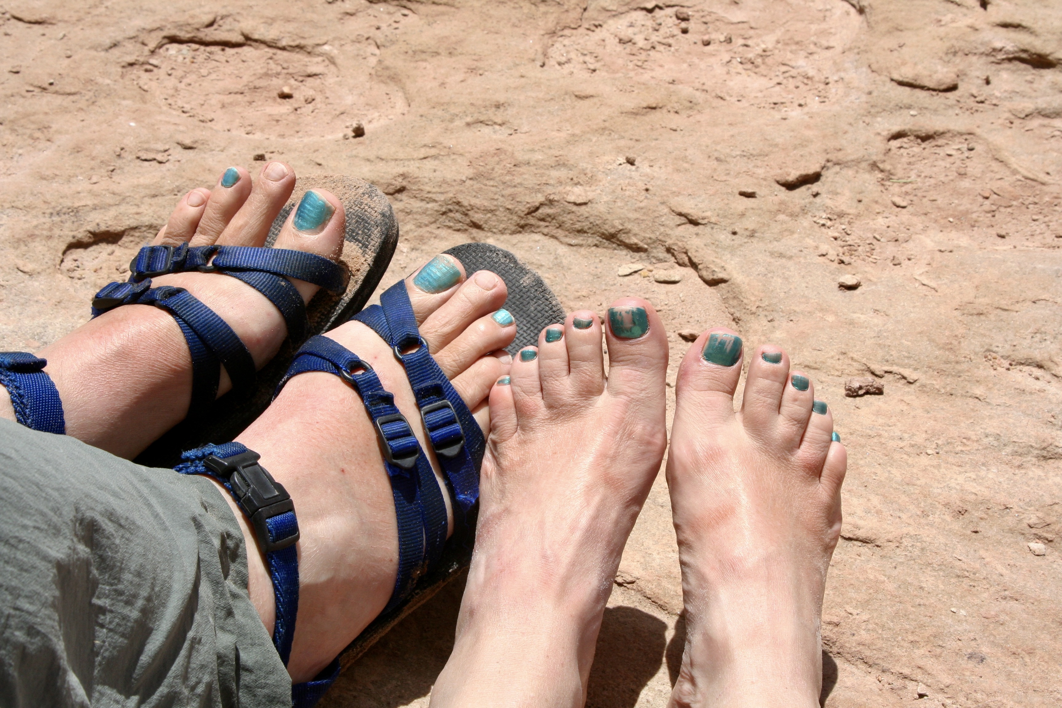
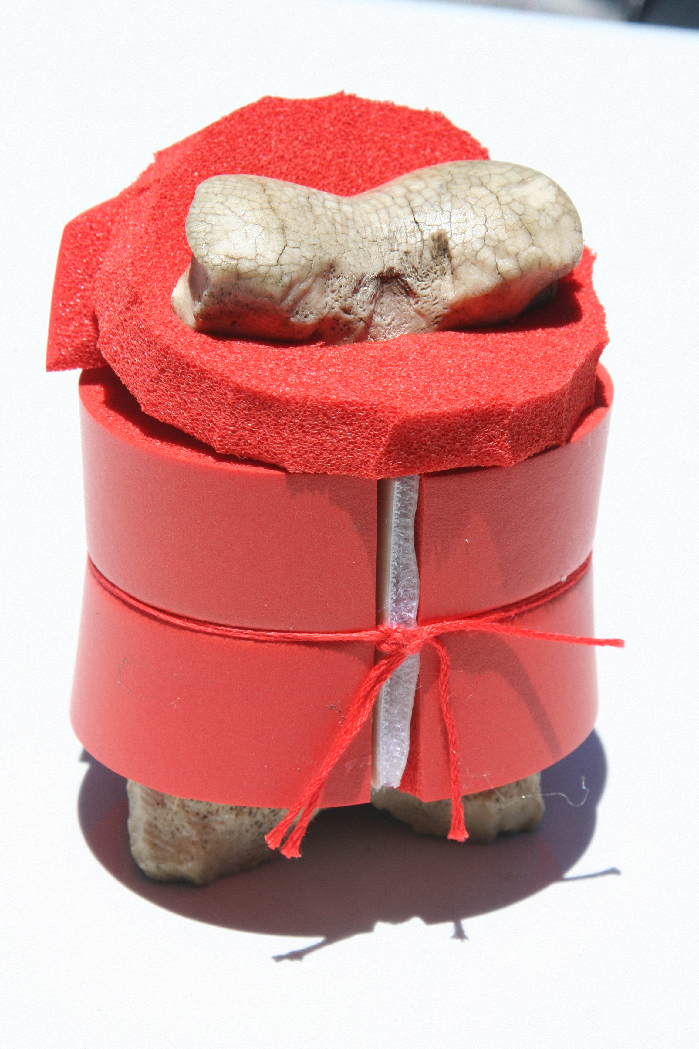
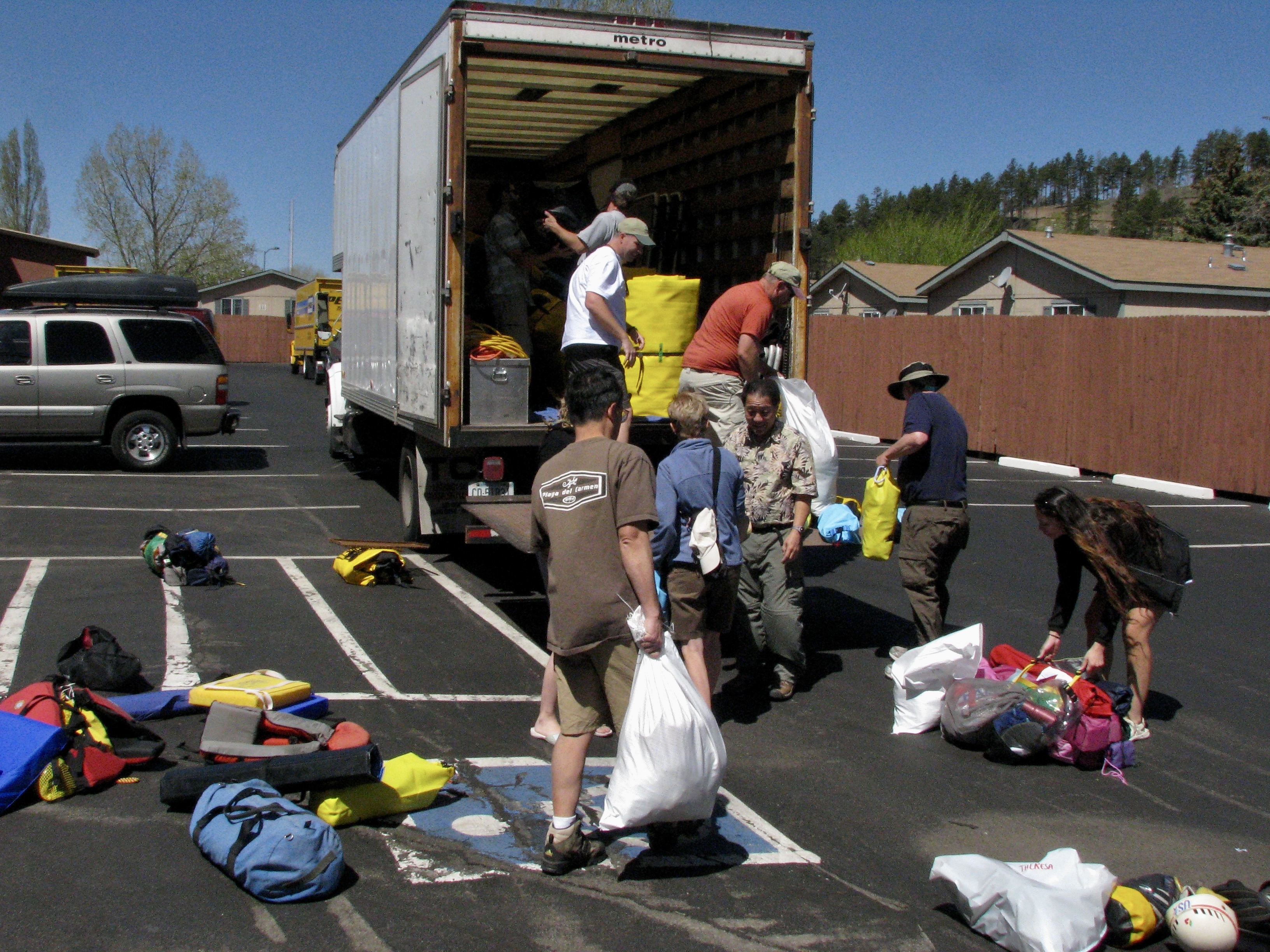
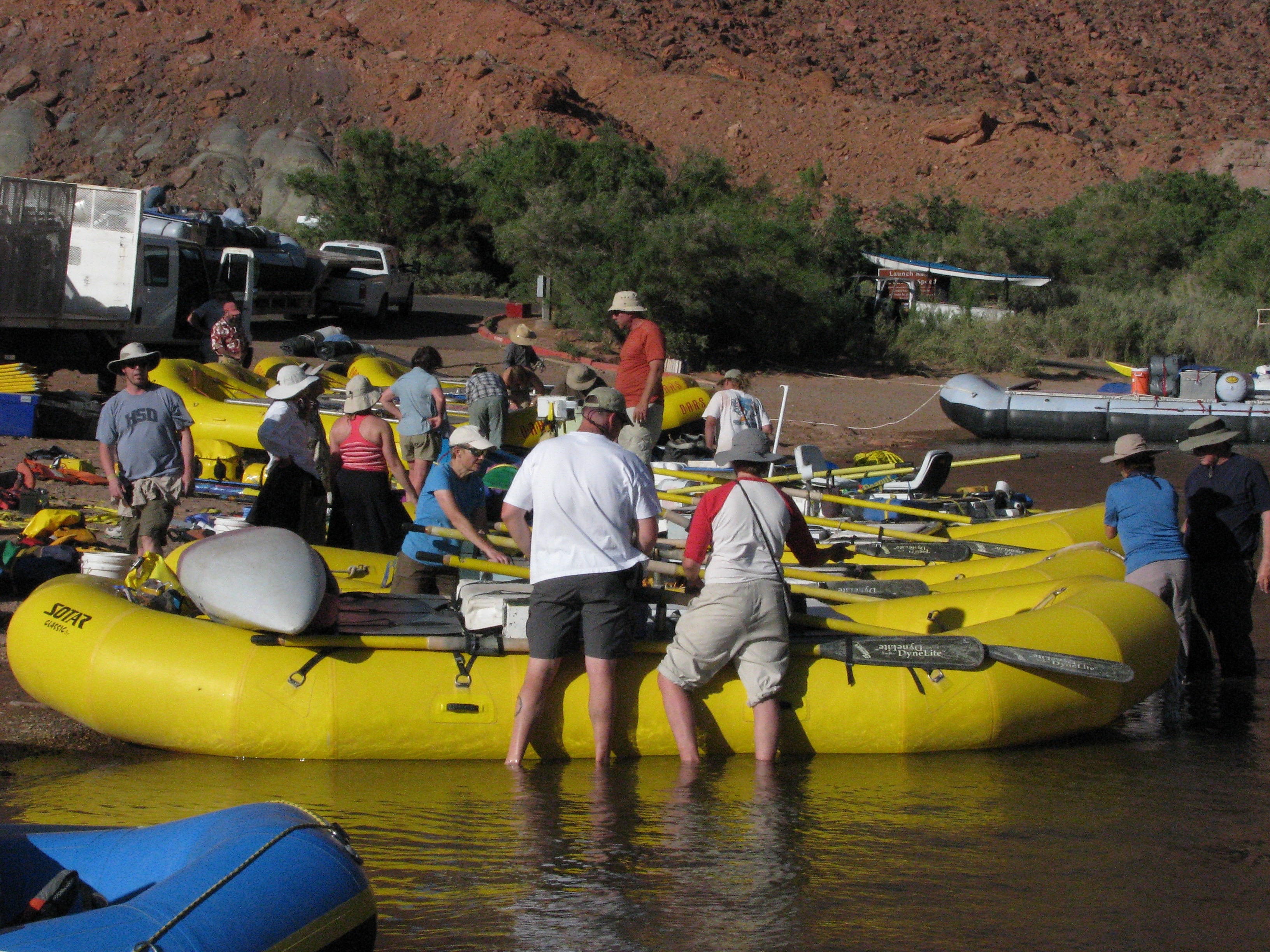
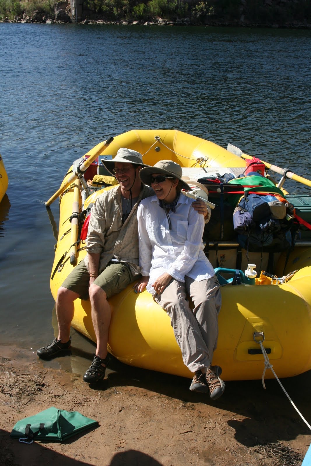
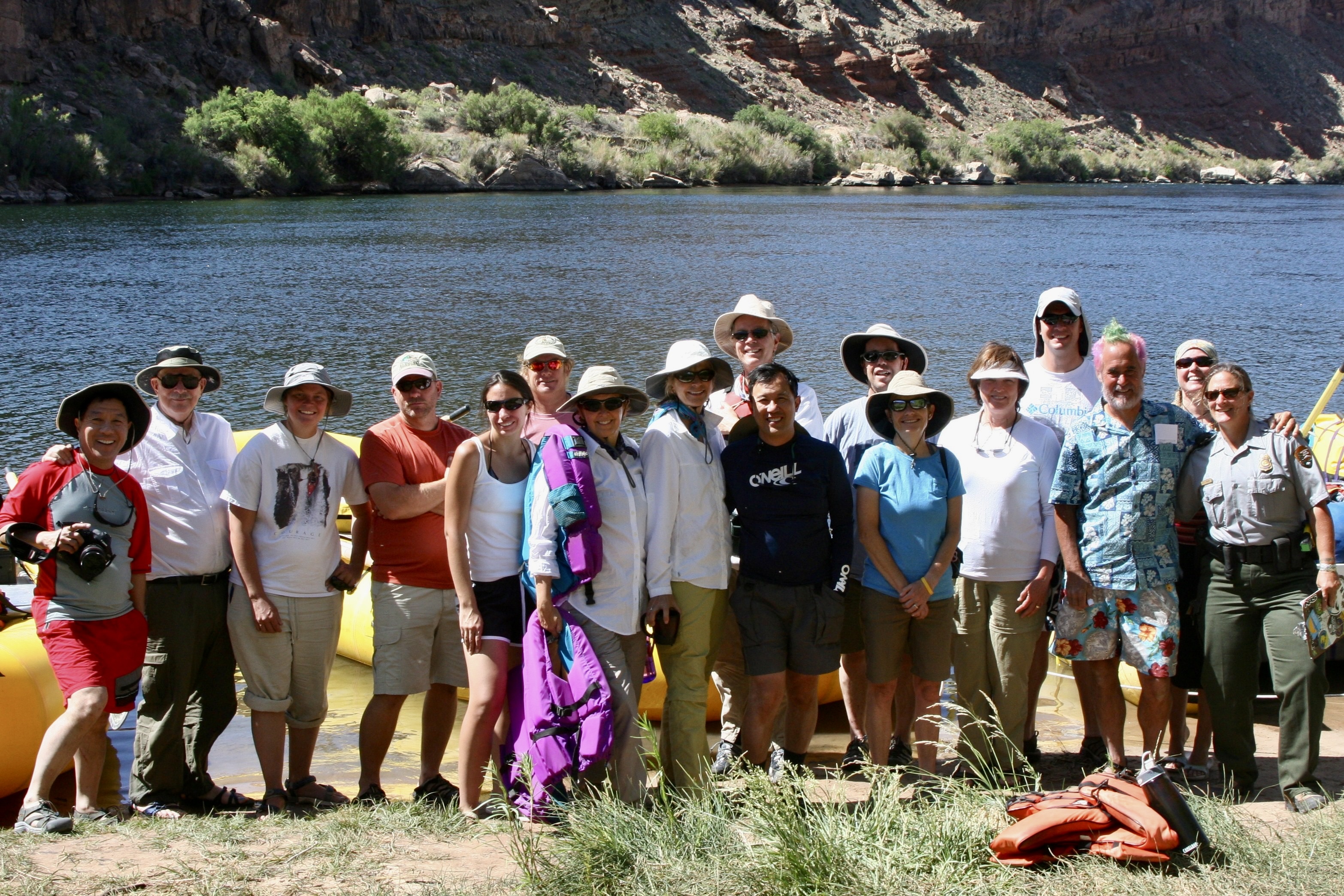
Tom had plenty to keep him busy in preparation for the trip. Finding qualified raftsmen and women was first up. The Park insists. Running the river is no joke. There are world-class rapids to negotiate. Food was another major item. River runners have a tradition of eating well, if not gourmet. He had a total of 54 meals to plan. Tom and his partner bought the nonperishables before coming. We bought the rest when we joined him in Flagstaff, Arizona, our base for the trip. Between Costco and Safeway, we packed our 22 foot Pleasure Way Van, twice.Tom and I in Flagstaff getting ready to go on the trip in 2010. Do I appear a little dubious?Large, specialized containers were required for the food. Each was labeled for what it would contain.Huge ice chests were necessary to keep perishable food cold for the 18 day journey. Our room had been the central storage point for food. Minus the Kettle Corn, the bed was covered with our camping gear for the trip. It would soon find its way into a large, waterproof dry sack. Things we would need during the day went into ammo cans like the yellow one on the right.Tom had other responsibilities as well. He’s getting his new “do” here, coloring his hair for the trip. Roald Dahl is one of his favorite authors. Tom likes weird, a trait I share. But coloring my hair isn’t one of them. Neither is painting my toenails.The results.One thing we were required to do was paint our toenails. River lore is it protects you from flipping your raft in rapids. “I won’t let you on my boat unless they are painted,” Tom warned ominously. I painted two of mine on each foot. We didn’t roll over in Tom’s boat when we went through a major rapid. But he did lose an oar. I might have felt guilty but it’s rumored that Tom travels through life without an oar. We had one more major responsibility: Get Bone ready for the trip. Tom and I had discovered him hanging out in the Sierra Nevada Mountain Range in 1977 and he has been wandering around with us and others ever since. He had to have a life vest. Finally everything was packed and the participants had arrived. We loaded the truck to the brim with what seemed like a ton of equipment, drove over to our starting point at Lee’s Ferry and unloaded the truck, all in 100° (38°C) plus weather. My body had some unpleasant, unprintable things to say to me about being out of shape. (Photo by Don Green, one of the participants and a long time friend of ours.)Next we had a quick lesson in rigging boats and went to work. (Photo by Don Green.)Dave Stalheim and Peggy pose on Dave’s boat. Dave was to be the first boatman that we traveled with. Dave came from the state of Washington where he worked as a county planner. The plan was to ride with different boatmen each day. Protocol involved that we ask for a ride and help in loading and unloading the boat.A bottle of tequila was slipped in among the oranges. It would be saved for drinking at Tequila Point, just below Lava Falls, where it would be needed! (Photo by Don Green.)That night we moved a couple of hundred yards down from where we had rigged and loaded the boats to a campground I had found. We went out for dinner and came back to a major wind and dust storm that was whipping our tents around and making them difficult to find. With the heat, wind, and dust, I was reminded of our trips to Burning Man. Here we are, ready to begin our adventure. Ranger Annie is down on the end. She’d been by the day before to check our gear. When Tom introduced me as the ticket holder, I commented, “We have an excellent leader in Tom.” She had looked at me steely eyed and said, “You are responsible.” My muttered response was, “I’ll try to keep Tom in line.” Yeah, like that’s possible. She came back that morning to remind us of all the safety and environmental rules.
That’s it for the preparations. Now the ‘fun’ begins. The wind was back! We spent our first day fighting headwinds with gusts up to 60 miles per hour. If my dreams of a leisurely float down the river hadn’t already been demolished, they were now. We actually took turns with our boatmen rowing double. All of the photos were taken by either Don, Peggy, or me. I’ll note which ones are Don’s.
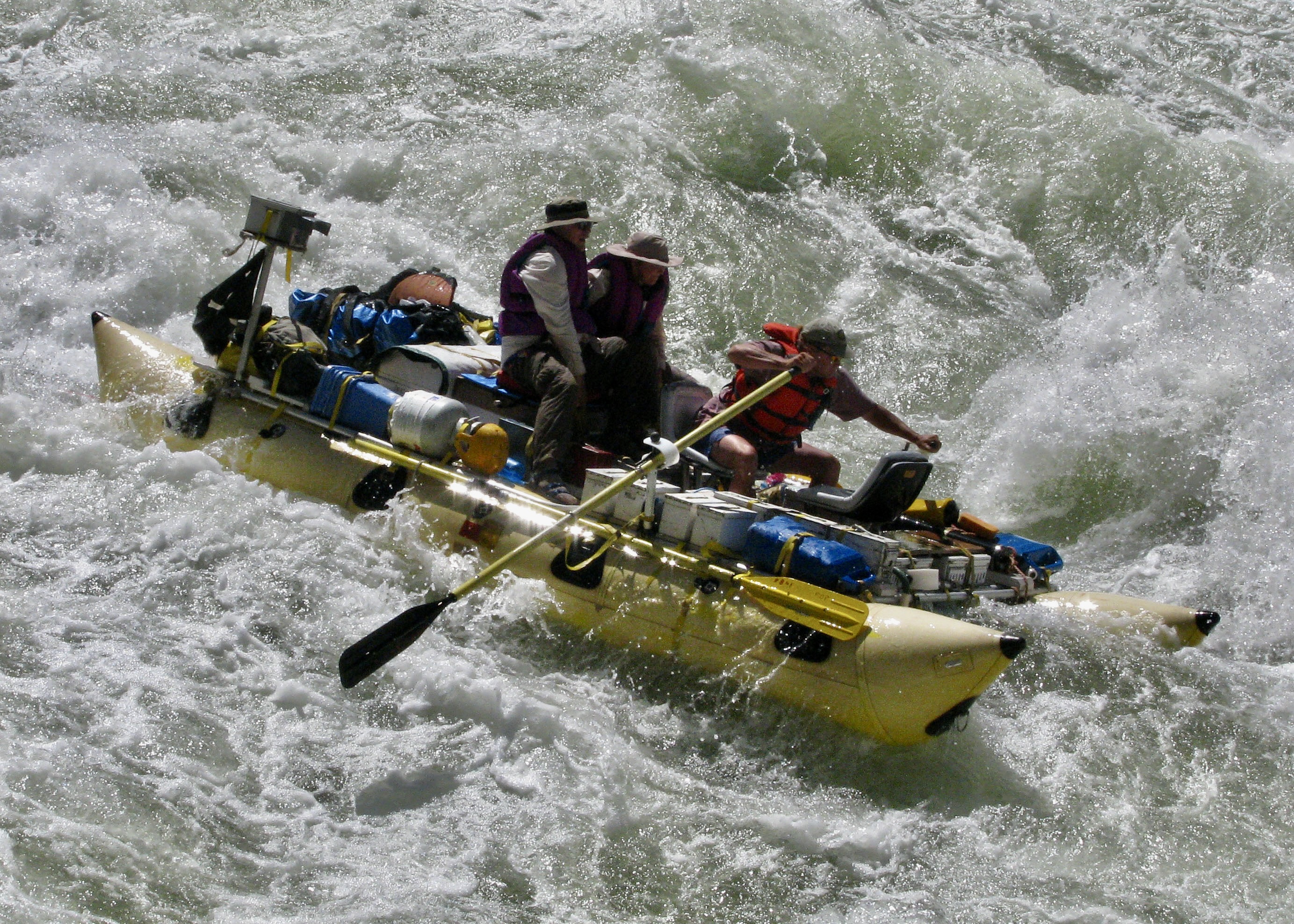
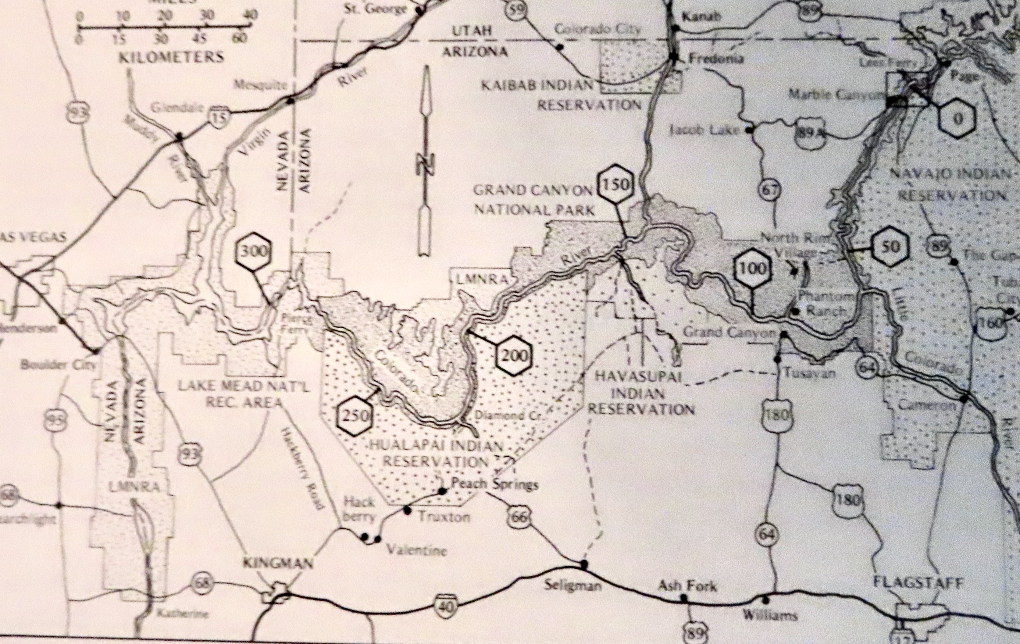
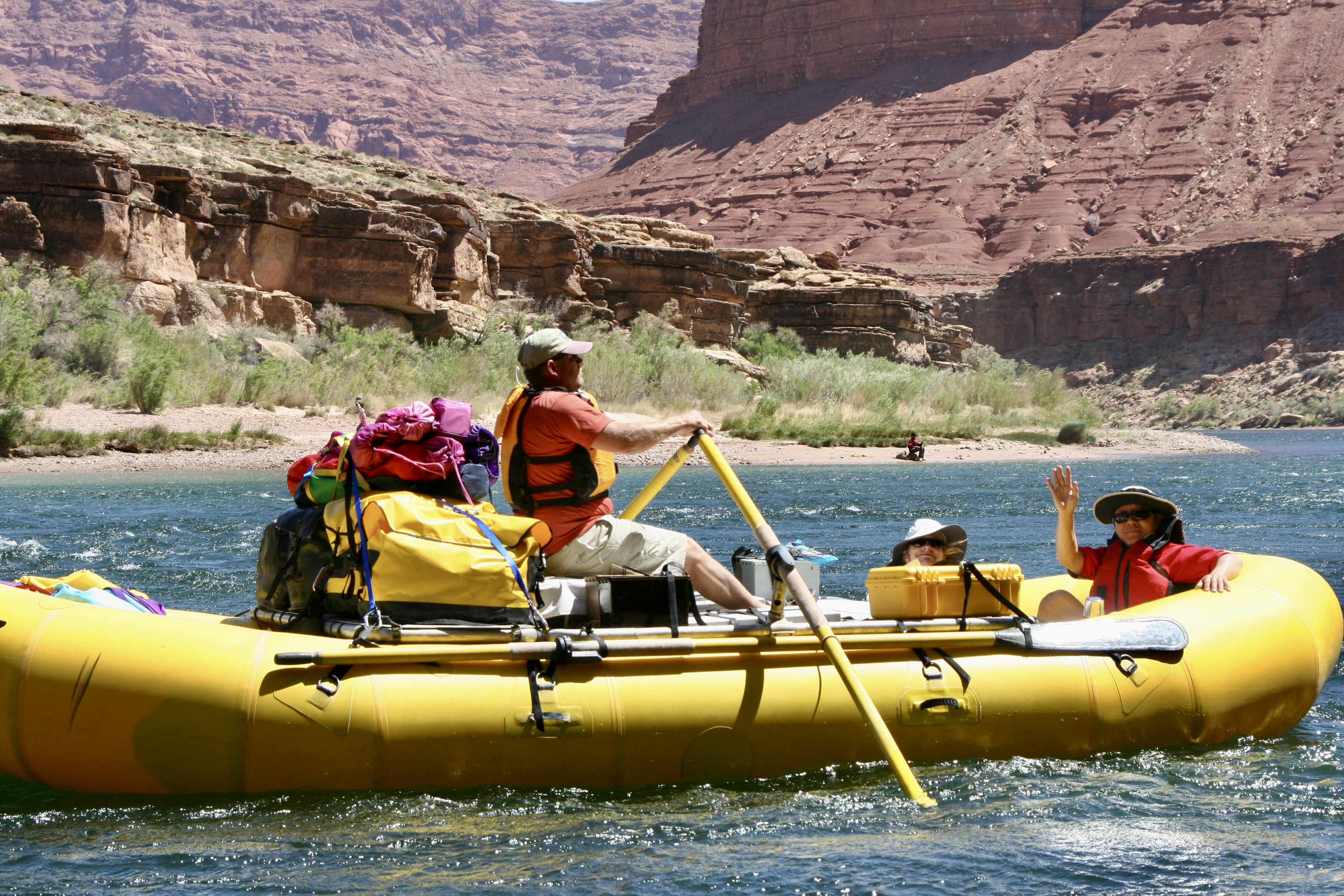
This map, which I took from the book The Colorado River in the Grand Canyon, an excellent guide by Larry Stevens, isn’t as clear in reproduction as I would like but still serves as a good reference for this and my next two posts. Our journey over 18 days would take us 280 miles down the Colorado River from mile 0 at Lee’s Ferry to mile 280 at Pierce Ferry, just this side of mile 300 at the beginning of Lake Mead. We finished putting the trip together in Flagstaff (lower right) and then followed Highway 89 up to Lee’s Ferry (upper right).Don Green and boatwoman Megan Stalheim double rowing to counter the strong head wind. Megan is David’s niece and, like me, was a former Peace Corps Volunteer in Africa. While rowing a raft was a new sport for Megan, her experience as an Olympic level white water kayaker gave her excellent knowledge of how to read and run a river.This photo of boatman Jame Wilson is a good example of what our fully loaded rafts looked like.
My post next Monday will take us from Lees Ferry to just below Phantom Ranch. Thursday is Halloween, however, and Peggy and I have a special treat for you, a tour of Dracula’s castle in Transylvania that we visited 2 1/2 weeks ago on our Danube River trip.