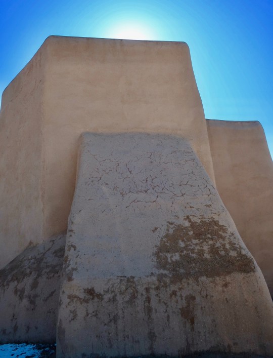
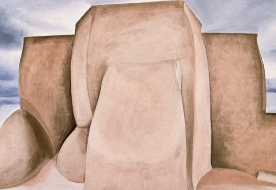
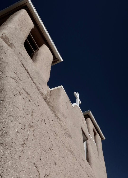
The Rancho de Taos Church of San Francisco de Asis was painted by Georgia O’Keeffe and photographed by her friend of 50 years, Ansel Adams. This is a photo I took of the church from the back.
It was in the fall of 1915 that I first had the idea that what I had been taught was of little value to me except for the use of my (art) materials as a language… I had been taught to work like others and after careful thinking I decided I wasn’t going to spend my life doing what was already done. –Georgia O’Keeffe in her autobiographical book on her art.
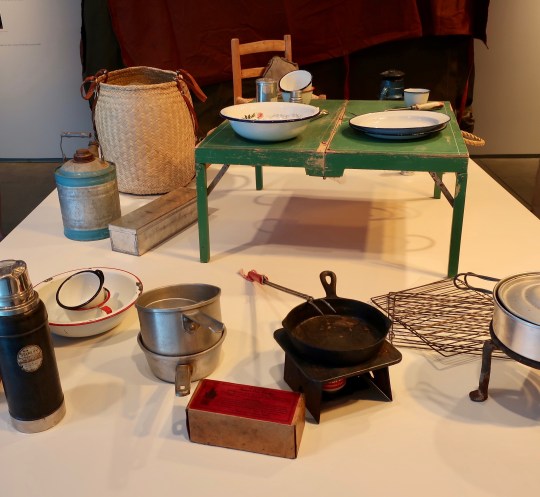
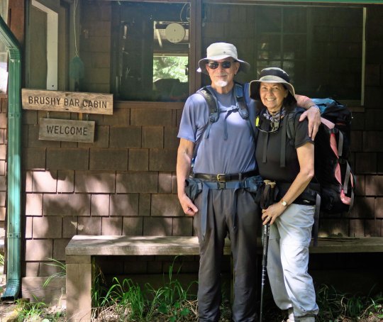
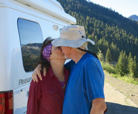
Georgia is on my mind. I had stopped off in Reno to check out the city’s River Walk on my road trip down Highway 395 this past summer when I saw a poster that the Nevada Museum of Art was featuring an exhibit on Georgia O’Keeffe titled Living Modern. There was no question in my mind. I had to go. O’Keeffe had been a favorite artist of mine ever since the 60s when I had been a student at Berkeley and first encountered her paintings of flowers. The exhibit in Reno was excellent, including several of her well-known works, but it also looked at her life, right down to her unique style of dress and the camping gear she carried when she made her painting expeditions into the remote parts of New Mexico.
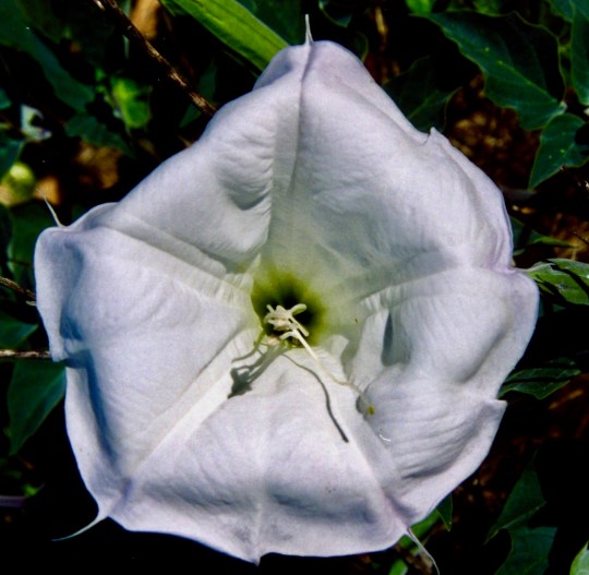
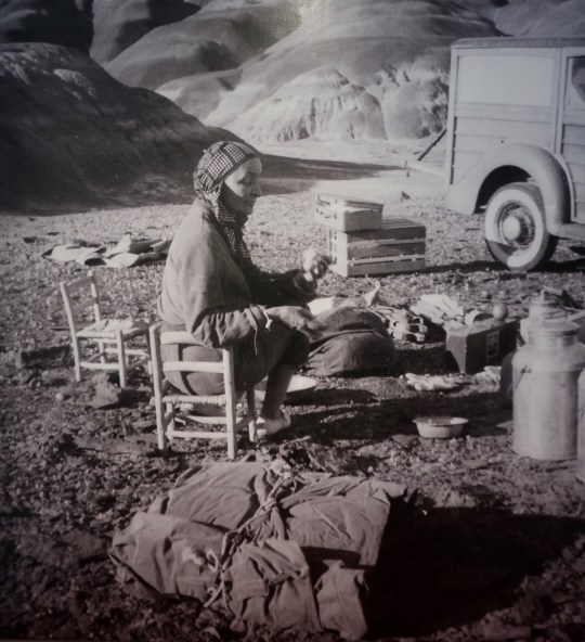
Georgia O’Keeffe’s paintings of wildflowers are recognizable world-wide. This 1932 painting by her of Jimson Weed was bought in 2014 for 44 million dollars by Alice Walton, the heiress of the Walmart fortune. The painting had hung in George Bush’s dining room at the White House. Funds generated are being used by the Georgia O’Keeffe museum in Santa Fe.Like Georgia O’Keeffe I have found Jimson weed, or Datura, to be a beautiful plant. I took numerous photos along the American River Parkway in Sacramento. Besides its beauty, Jimson weed is a highly toxic hallucinogenic plant that was used by the the shamans to aid their journeys to other worlds. (More on this when I do my posts on petroglyphs.)This is some of her original camping gear. Beyond my white gas Coleman stove, it doesn’t look much different that what I used on hunting and camping trips in the early 70s.Here’s a picture of O’Keeffe on one of her many photographic expeditions in the backcountry of New Mexico. She called this the “Black Place” because of the color of the rocks and did several paintings of the area.A painting by O’Keeffe of the Black Place that was featured at the Nevada Museum of Art.
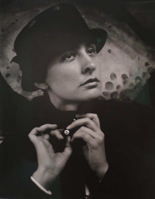
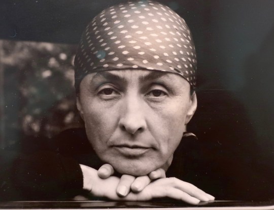
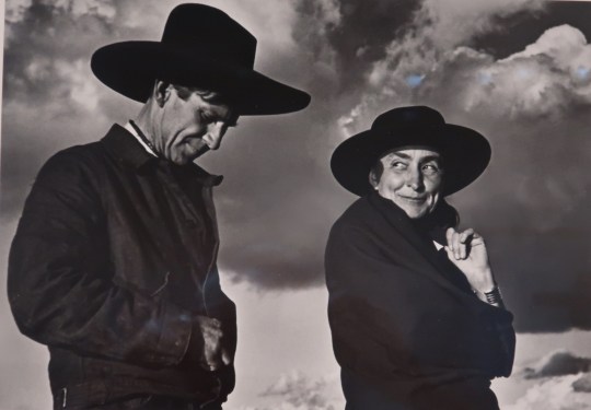
One thing that surprised me at the museum was the number of photos of O’ Keeffe. Starting with her husband, Alfred Stieglitz, and including her friend, Ansel Adams, a number of world class photographers were enticed by her unique looks. It might be argued that she was the world’s first super model.
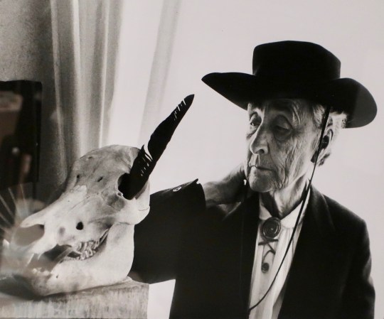
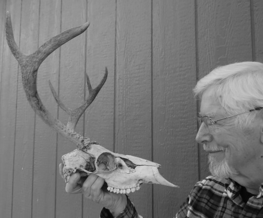
Alfrd Steiglitz met Georgia O’Keeffe in 1916 and was immediately taken by her art— and her. Steiglitz who was 24 years older than O’Keeffe was already famous for his photography and for his support of modern art. He would eventually marry Georgia and would continue to photograph her for the rest of his life.This is another photo by Steiglitz that is a favorite of mine.Arguably the most famous photo of Georgia, this was taken by Ansel Adams.The 80-year-old O”Keeffe continued to attract renowned photographers as she aged. The English photographer Cecil Beaton captured her with a skull, contemplating it like philosophers of old. Or maybe she was contemplating the feather she had stuck in its eye. Her necklace, BTW, was made for her by Alexander Calder. Alas, poor Bucky, I knew him well. (Apologies to Shakespeare.) Seeing Georgia’s photo, I couldn’t help myself. Bucky once hung out in our neighborhood until he met his unfortunate demise down on the road. Peggy wanted me to go cut off his head. Being reluctant (I wonder why), she bribed our neighbor, Jim the hunter, with a can of beer to do the job. The skull now guards our garden, warning deer of their possible fate if they eat our plants. (Photo by Peggy Mekemson.)
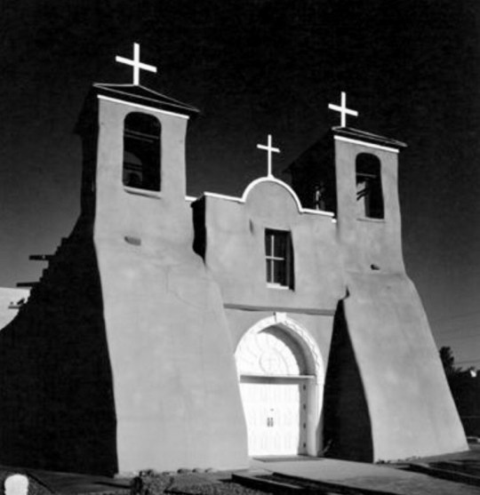
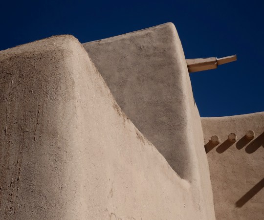
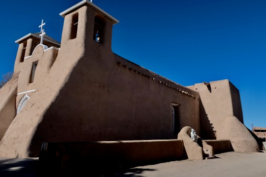
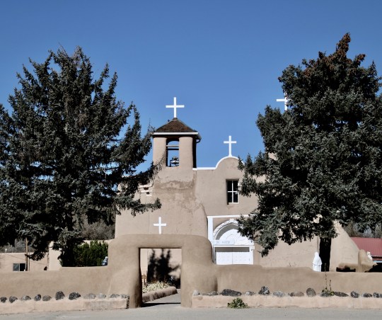
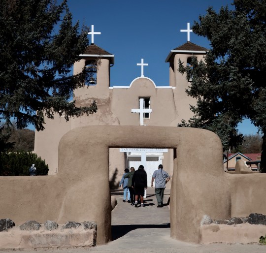
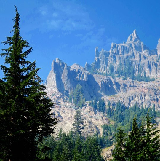
My visit to the Nevada Museum of Art started me thinking about our planned visit to the Southwest this fall. We would be traveling through O’Keeffe Country, as they call it in New Mexico. I —along with Peggy’s enthusiastic support— decided to make where she lived and what she painted one of the focuses of our trip, which we did. We stopped by the O’Keeffe Museum in Santa Fe, went to Taos where she was first introduced to New Mexico by Mable Dodge Luhan, and then visited her homes in Abiquiu and Ghost Ranch. Today, I am going to start at Taos with a post on the Rancho de Taos and the Church of San Francisco de Asis. Its considered a must stop for photographers and painters who visit the town.
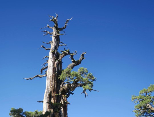
Like most photographers and painters who make the pilgrimage to Taos, O’Keeffe painted the historic and beautiful adobe church of St. Francisco de Asis. This perspective is from the back.Ansel Adams photographed the church from the back.And from the front..
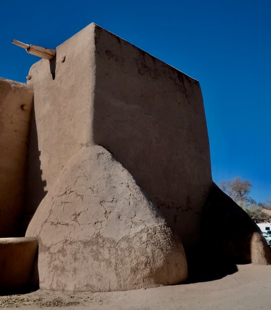
Naturally, Peggy and I had to wander around Rancho de Taos and take our own photos. I included one of mine at the top of the post. Here are a few more.
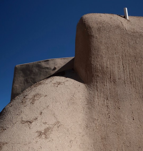
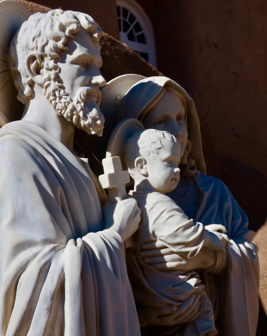
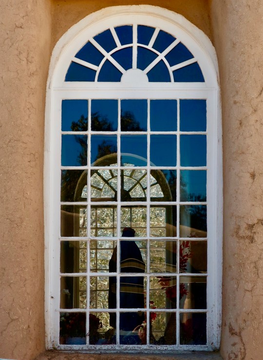
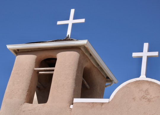
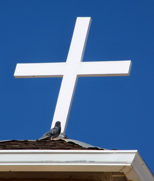
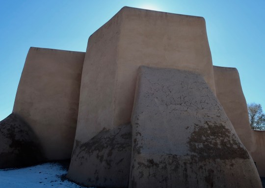
I was fascinated by the soft angles of the church.Here is another example.If a church could be said to have feet, the Rancho de Taos church seems to. Big guys!Walking around the church, I came on an interesting sculpture of Joseph, Jesus and Mary.And peeked in a window.A sideview of San Francisco de Asis including the sculpture and window.While I was working my way around the church, Peggy focused on the front. (Photo by Peggy Mekemson.)Playing with Peggy’s photo, I gave it more of an Ansel Adams look.Peggy also stood back beyond the arched entrance way and took a photo focusing on the left side of the church. (Photo by Peggy Mekemson.)Shooting up, she caught this shot of the belfry… (Photo by Peggy Mekemson.)And noticed a pigeon, which I thought made an interesting photo considering the backdrop. (Photo by Peggy Mekemson.)I took a shot lining up the front of the church and its crosses with the archway.And two photos looking up at the front of the church.I also caught a photo of people walking into the church for a Saturday service, a reminder that San Francisco de Asis is still a very active church.Peggy took this photo of an adobe ruin on the square surrounding the church. (Photo by Peggy Mekemson.)And this very red building. It’s for sale in case you are interested! (Photo by Peggy Mekemson.I’ll conclude my post on Rancho de Taos with a final photo I took of the back of the San Francisco de Asis church.
Next Post: I’ll write about the unusual patron of the arts, Mable Dodge Luhan, who brought the likes of Georgia O’Keeffe and D.H. Lawrence to Taos. Peggy and I will visit the Taos Pueblo that was also painted by O’Keeffe and photographed by Ansel Adams.
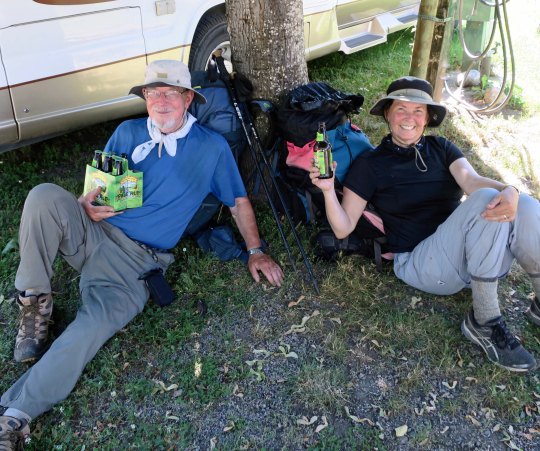
We met Jeanine (center) when we backpacked into Seiad. She had just hiked in from Castle Crags. In addition to being a PCT hiker, she is a ‘Trail Angel’ providing support to through hikers. Here, she makes Bone’s acquaintance.
The Trekker Telegraph
There were times that communication with Curt was critical. For example: Circumstances sometimes required that I change my location from where we had agreed to meet. That’s where the trekker telegraph came in handy! Curt was hiking north to south while most through-hikers were traveling south to north. This meant that the majority of hikers I met at the trailhead would pass Curt along the way. Much to my delight, I could send messages with them. They had a true appreciation of just how difficult the hike was and were more than supportive of Curt’s adventure. They were also used to sharing information with fellow hikers. (It didn’t hurt that I bribed them with apples, apple juice, fresh water, peanut butter, scones and beer.) I’d give them his card with his photo and away they would go. The more worried I was, the more hikers I gave the message to. Curt laughingly told me when he came out at Burney Falls that he had heard I was in a new location some 13 times! Good thing, since I was several miles away from where he was expecting me. Laugh all you want, Curt.
I truly enjoyed getting to know the through-hikers. I was amazed at the variety of ages, genders, nationalities, repeat trekkers, segment trekkers, first timers, and seasoned hikers. They all had stories to tell and were glad to share. They also wanted to hear about Curt. We had a sign on the back of our van that featured his adventure.
The sign on the back of our van often led curious people to ask me what the story was. These included through-hikers as well as people in campgrounds and towns along the way. Here the tale is a bit different. The photo includes our friends Tom and Leta. Tom helped Curt create the first Sierra Trek in 1974 and they have been causing mischief ever since.
More Support
The sign also drew people in at campgrounds and in the small towns where I shopped along the way. They would stop by to visit, ask questions, share personal or family stories about the PCT, and often ask how they might help out. I distributed lots of Curt’s cards.
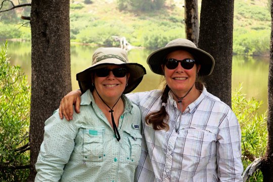
Trail angels are people who volunteer to support trekkers by providing water, food, lodging, and transportation along the way. We met a great one in Seiad Valley. Jeanine had hiked the PCT, as had her son. She lived near Burney Falls and regularly supported through hikers on the 30-mile section south of the Falls where there wasn’t any water. She immediately offered to help Curt, becoming a friend to be cherished! I saw her again near Burney Falls where I had a fun lunch with her and her friends. Later, she and her husband joined both of us for pizza in Burney. Her information about the trail was invaluable. The lack of water combined with 105 F temperatures ultimately persuaded Curt to save the Burney section for another time, however.
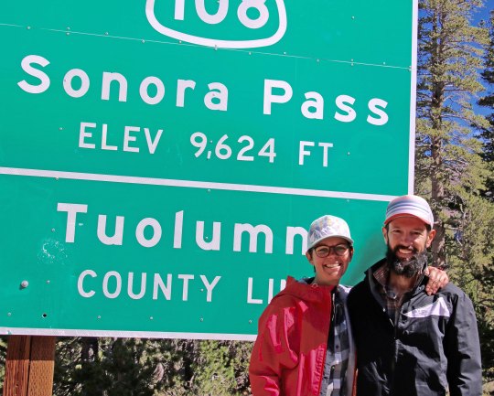
Other people jumped in to help whenever help was needed. My friend Barbara and her husband Carl, long time hikers, gave us a ride to Mt. Ashland where we started the TMT. Tim and Sandra Holt in Dunsmuir, friends from Curt’s past, offered to let our nephew Jay leave his car at their home when Jay joined Curt for a 100-mile segment. My own trail angel activities paid dividends. One couple I had given a ride to, drove all the way to Sonora Pass just to check on me and to see if there was any news from Curt!
RV Angels is a new category! I made that one up but I have a few stories of campground hosts and RV Park hosts who helped me out. I was traveling without reservations for most of the trip as I needed the flexibility to be where I was needed most. The challenge was finding space. One host (in Chester) who had no open spaces heard my story, told me to wait a moment, made a call, and then returned to tell me she had a spot. That night she returned and said I could stay as long as I needed! Another host (in Burney Falls) offered her private phone number for emergencies and her private internet server so that I would have consistent service. Another host (Lake Tahoe/Truckee) squeezed me in between some big rigs and said she would find a spot for me if I needed to stay longer.
Several friendships were made. Some will continue to grow over the next few years. A favorite story is about Linda. I had just returned to Quivera (the van) and saw Linda with her quilting supplies, sewing machine, and materials spread out over the picnic table. Yes, I love quilting so, of course, I had to introduce myself and rave about her skill! Next thing I know we are sharing a glass of wine and just having a great time talking a mile a minute! She and her husband Pete were part of a local group that RV together. The men would go fishing and the women would quilt. Then all would party in the evening. Turns out she grew up in the Lassen NP area and still had a summer home. We agreed we would tackle Lassen Peak next summer. When we finally returned home in September, Linda had sent me the quilt that I had so admired. What a gem!
Then there was the homemade coconut cream pie. Jeanine and her friends had recommended a restaurant in Falls River. It was known for its coconut cream pie. Curt was excited; he loves coconut cream pie. Bad news, they were out. Good news, when the baker heard Curt’s story, she headed into the kitchen and made another pie!! Little things mean a lot. Curt claimed it was it best he has ever eaten. (I wonder if that had anything to do with eating backpacking food for weeks?)
The Falls River Hotel where Curt got his Coconut Cream Pie.
Other Thoughts
Family connections:Yes, I worried about Curt on the trail. That is who I am. Our kids were great about checking in regularly. They were also receiving the evening messages from Spot, the GPS tracker, letting them know where Curt was and that all was well. What was best, though, was that our 13-year-old grandson Ethan joined Curt for one segment and Jay, our 30-year-old nephew, joined him for another. Now I could relax. A bonus came along with Ethan. Our daughter Tasha and her other son, Cody, joined me and we were able to play for a week.
Jay and I just before he and Curt took off to hike the hundred miles to Castle Crags.Here I am with my grandsons Cody and Ethan and my daughter Tasha above Emerald Bay Lake Tahoe after Ethan had come out from his hike with Curt due to a sprained ankle.We had introduced Tasha to backpacking several years earlier. She’s shown here just north of Yosemite on a trip we were on.
Birthday at Castle Crags:Believe it or not, I have never spent my birthday alone! I LOVE birthdays and have turned mine into a day per decade celebration. So, this summer was a bit different. However, there were a few surprises. Of course, the kids called. Then I received a phone call from Jay and Curt who stopped on top of a mountain and discovered a cell signal. I had answered concerned about an emergency and was greeted by a stirring rendition of Happy Birthday to you! What fun! To celebrate, I then called our friend Sandra Holt and invited her to join me for train-car dining at the Railroad Park where the wait staff spoiled me rotten. OK, I really was not alone.
On being by myself:One afternoon I was enjoying a beautiful spot at my campsite in a forest campground about ten miles from Sonora Pass. Shaded by pine trees and enjoying incredible mountain views, I pulled out my guitar and softly sang and played my favorite folk songs (Think 60s-70s.) I noticed a father and daughter standing behind the van and listening discretely. When I picked up some artistic word searches I had been designing, the two of them approached. The father said his daughter had a question: Was the TMT sign on the van true? Yes. Then what did I do with myself each day?
It was a good question. I had never really traveled on my own in the RV. There was plenty of down time while I waited for Curt. My day included reading (lots), playing the guitar, writing a daily journal, creating artistic word searches (the daughter got quite excited about this and offered to test them for me!), following the news, keeping the RV resupplied, researching campgrounds, hiking, and supporting Curt. I used social media when I had an internet connection to keep up with friends and my responsibilities as President of the Friends of Ruch Library.
Hiking alone in the woods by myself was also a first. Walking 2 to 3-miles daily on local trails wasn’t a problem. Longer hikes presented a bit more of a challenge. First, I had to get used to the quiet. Then there was the expectation of encountering large, furry animals on my own. Deer fine. The mama bear and her two cubs was another story— especially when they decided to walk toward me. Being directionally challenged, I am always concerned about getting lost. I paid real close attention every time the trail split, carried a whistle, and loaded up with water and snacks. My conclusion, I love hiking but I prefer to hike with Curt. (Grin.) We finished off our adventure by backpacking together in the Three Sisters Wilderness of Oregon.
While waiting for Curt I hiked up the trail toward Castle Crags. It was one of several longer hikes I took.
This wraps up my observations. I was reminded that being back in nature does rebalance the mind. The think time and quiet time when wandering in the woods cannot be matched. There is a good reason that Curt and I are soulmates. So, here’s to our next adventure. I am thinking the PCT in Oregon deserves much more of our attention!
Here I am on the PCT in the Three Sisters Wilderness of Oregon.
Curt’s extensive experience backpacking, didn’t prepare him to deal with the smoke and fires along the PCT last summer. This photo was taken near Chester, California.
Curt knew I would be nervous without detailed planning of trails, mileage, rendezvous points, and alternatives. With 50 years of backpacking experience including planning, organizing and leading backpack treks for 30, he is something of an expert on the subject. Having a GPS/Spot Gen 3 tracker along was a new experience for him, however. He could upload his location each night via satellite and I could track his progress on my maps. He could also use Spot to signal for emergency help if needed and carried a cell phone, which he could use in the rare times he had cell service or if he had to hike out for some reason.
Then there was the unexpected— lack of water, smoke, fire, and possible injuries on the trail plus my challenges on the road of finding campgrounds and spaces near trailheads, power outages, limited cell service, and RV repair issues.
The first part of the trek introduced us to water shortages! Following mountain ridges over much of its length, the PCT is noted for its limited supply. The mild winter of 2017-18 with its lack of snow fall in the Siskiyous, Cascades and Sierras made it worse. Streams that would normally have been running through July were dry. Springs were sometimes a mere trickle. Even though we had downloaded the most recent information from the PCT site on water sources, the situation was changing rapidly. Our first day on the trail from Mt. Ashland proved the point.
We had planned a 10-mile day since it was our first day out. There had been sufficient water over the first seven miles. It wasn’t the case when we came to our planned camp site. Curt parked me in a pleasant location and took our water bottles down into the canyon where a stream was located. And came back empty. The stream was dry. “The map shows that there’s a spring in about a quarter of a mile off on a side road,” he announced. “We can camp there.” I loaded my pack and away we went. The spring was also dry. Have I mentioned that I was getting grumpy? Our options now appeared to be hiking three miles back or three miles ahead on the trail. “Let’s try farther down the canyon,” he suggested as a third alternative. I dutifully followed along. Fortunately, we hit water in a half mile. Curt’s experience with all-things-woodsy had paid off. The creek, by the way, was the headwaters of the Applegate River, which runs past our front yard.
We had just set up our tent when crashing thunder announced a deluge. I made it inside dry. Curt came in soaked. Mother Nature was having fun at our expense!
The greatest surprise and challenge was fire and smoke. The thought of making a fast exit ahead of a fire was always on our minds, but smoke was the main problem. Curt’s many years of working with the American Lung Association had educated him to the danger. “Wildfire smoke can be extremely harmful to the lungs, especially for children, older adults and those with asthma, COPD and bronchitis or a chronic heart disease or diabetes,” ALA warns. “I resemble one of those categories,” Curt said. Older people are to stay inside and avoid strenuous exercise. Ha!
Fires started to impact the plan as soon as Castle Crags and smoke changed the trail plan totally in Chester when we couldn’t see a hundred yards into the forest. As Curt has shared on his blog, he had to alter his journey to avoid the worst of smoke and fire. Was I worried? Yes! The most difficult situation encountered was at Sonora Pass. I awoke the morning I was to meet him there to learn that a new fire had started on the far side of the pass. As I waited, I watched the smoke billowing from the fire grow larger and larger. When Curt hadn’t arrived several hours after I expected him, I became quite concerned. Fortunately, a long skinny fellow with the trail name of Bone came hiking up to our RV.
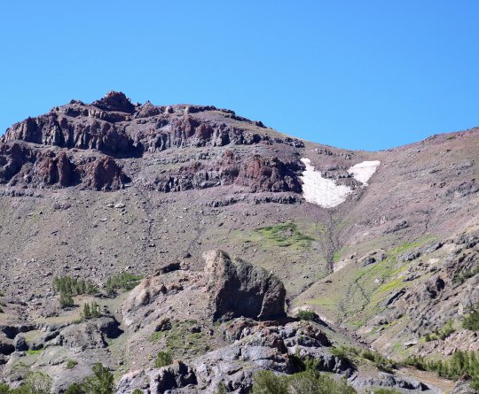
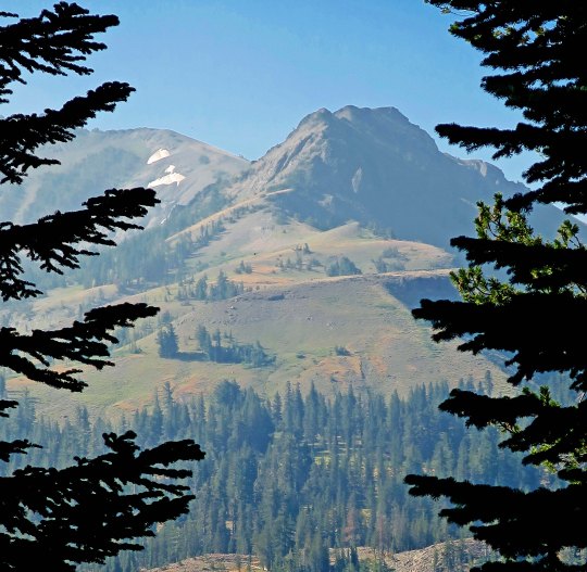
Sonora Peak as seen from Sonora Pass where I was waiting for Curt. He’d be coming around the peak to the right. I hiked up the trail for a couple of miles hoping I would meet him along the way. No luck.My worry about Curt being late increased substantially as smoke from a new fire filled the air.
“You must be Peggy,” he said. When I responded yes, he told me that he had passed my missing buddy on the trail. Curt had asked him to pass on the information that he was fine and should be along in an hour or two. Much relieved, I settled in to wait and invited Bone to charge his cell phone in our van and have a cold beer. After Curt’s safe arrival (he tells the story in his blog), we drove to an RV campground for the night and learned that the pass and the PCT trail had been closed after we left!
Bone wearing his Portland Blazer T-shirt with a small guitar attached to the back of his pack. Note how skinny Bone is, thus his trail name.
While Curt was facing challenges out on the trail, I also had my share doing back up. As I mentioned earlier, I’d had lots of experience in camping with the RV. But I was a newbie at camping alone. Fires and lightning caused outages at campgrounds and RV parks, cell phone service was often spotty, And Quivera, our RV, demanded attention. Internal lights, the awning, and the air conditioning unit all had issues.
Normally, this wouldn’t be a problem. We’d just find a shop that serviced RVs. But the local shops had a common response: “If you have a problem, call 30 days in advance for a reservation.” Does anyone else see a problem here? Repairs were up to me. Fine. The awning jammed, my solution? U-tube! I fixed it. Internal lights out? I read the manual, rewired the one I needed to read by and decided to let the other three go. AC servicing: well, other than pumping out playa dust from Burning Man— a forever problem— it was still working. Why worry?
There was a good ending to my efforts to find an RV service shop. I stopped by Camping World in Rockland near Sacramento and talked with the service staff. One of them walked out with me, confirmed that I would need to replace the awning eventually but told me bungee cords were a great temporary solution. He then replaced all the lights for me. Last but not least, he told me how to flush the AC with a hose. There was no charge for his good advice and help!
Next up: I will talk about the help that was generously offered to me along the way and a unique way of communicating with Curt: The Trekker Telegraph. Bone was a good example.
Curt and I had just started down the PCT when we came across this sign near Mt. Ashland
In the beginning: lots of questions!
When Curt first shared that he wanted to celebrate his 75thbirthday hiking on the Pacific Crest Trail, I was not surprised. He has 50 years of backpacking experience and loves wandering in the woods. Then he added the 1000-mile goal. That surprised me! There were so many questions. Reading about the challenges faced by Bill Bryson in A Walk in the Woodsand Cheryl Strayed in Wildadded more. Their combined ages when they started their adventures was less than Curt’s. The conversations and planning began.
The first question was, can we (yes, we) physically do this? I had every intention of joining Curt on the trail whenever possible. He had introduced me to backpacking in 1980 and I, too, had fallen in love with the sport. But there was this age thing— for both of us. I’m 68, a child bride perhaps from Curt’s perspective, but not in the reality of miles traveled in life. Off we went for a week’s backpacking trial run on the 40-mile Rogue River Trail. Other than Curt falling down a cliff (well, only 20 feet head first) after his trekking pole collapsed, suffering minimal damage to his arm, and bouncing back on the trail, it was a beautiful adventure and a confirmation that we could still backpack longer distances with a bit of practice and preparation.
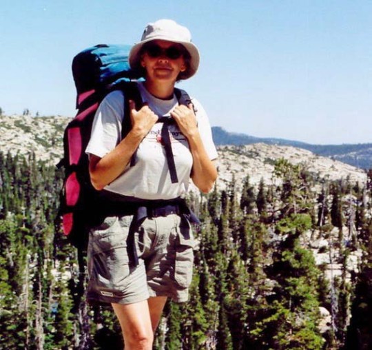
Here I am in the late 90s above Lake Tahoe. When Curt introduced me to backpacking by hiking through the Desolation Wilderness, he brought his 87 year old friend Orvis Agee along for inspiration. Plus, how could I complain?We trained for our trip by backpacking along the Rogue River Trail in southern Oregon. Not 30 minutes after this Curt’s trekking pole collapsed and he went off the cliff. I thought he had a heart attack and charged over the edge myself. Ten minutes later we had washed the blood off his arm, slapped on antibiotic cream and were back on the trail.Usually, our backpacking adventures have us wading across fast flowing streams or balancing precariously on logs. The Rogue River Trail provided beautiful bridges. My kind of river crossing!Hiking down a steep, narrow trail covered with loose rock to reach camp at the end of a long day was not my idea of a picnic, however! (“You, want me to hike down there!?”)A ranger cabin along the way provided a photo op for us.
The next question was how much could I backpack with Curt and still provide support along the way? I was to be his ‘trail angel’ in PCT lingo. I’d be driving our 22’ Pleasure Way RV/van as the support vehicle. We had been traveling in it for years sharing driving responsibilities, so I was confident I could manage. It was to be my first solo trip, however! My job included carrying three months of food and other backpacking necessities and resupplying Curt between trail segments. There was the fine print of course— and other duties as required (grin).One was that I’d greet Curt with a big smile, a hug, and a cold beer when he came off each segment. Given that my young/old husband had survived another 70 to 100 miles of backpacking through the wilderness over challenging terrain, the smiles and hugs were really easy! My presence would also offer a comfortable break from the trail and provide the flexibility of changing mileage, timelines, and length of breaks if needed. It was an advantage that few PCT hikers have. Curt is spoiled rotten, what can I say.
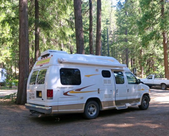
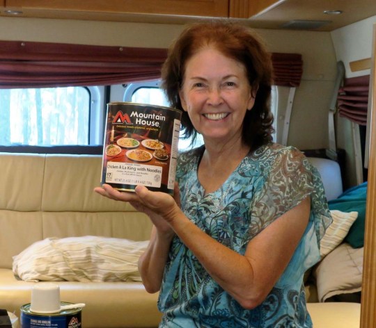
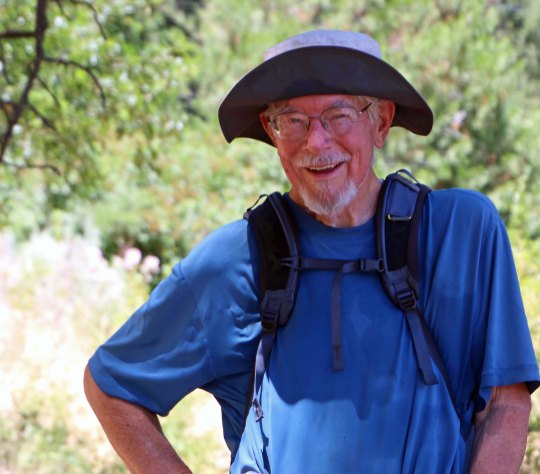
We used our 22-foot RV Quivera for back up. (Quivera was a mysterious Native American city that was supposedly full of treasure but was always moving around so no one could find it.) I’ve had plenty of experience driving it. We always take turns, but there is more. When Curt and I retraced his 1989, 10,000 mile solo bike trip around North America a couple of years ago, I drove the whole way so he could take notes and photos.A #10 can of Mountain House freeze dried food. The back of our van was packed to the brim with food when we began the trip. Each time Curt finished a segment of the trail, I would help him put his next resupply together. This will give you an idea of what Curt looked liked when he came off the trail: Skinny, disheveled and sweaty! (Here, he had just covered 16 miles in a little over four hours.) And I was supposed to hug this guy and give him a cold beer? Yep.Ah, the things that love will do to you.In my role as ‘Trail Angel’ I provided many a through hiker with a cold beer, which Curt fully supported… as long as I saved one for him!
Realistically, I would not be able to backpack much of the way without someone moving the van from Point A to Point B. However, we could backpack the first segment together from Mt. Ashland to Seiad Valley which would be a great confidence builder for both of us. The rest we would figure out on the run! Once we hiked into Seiad Valley, 6 days and 60 miles later, I was assured Curt could do anything he put his mind to! (So could I.) Still, waving goodbye to him as he left Seiad Valley on his first solo segment up through the Marble Mountains was hard. “If you don’t come out, Curt, I am coming in after you,” I told him and meant it. He had looked nervous and said, “Call Tony first.” I am geographically challenged when it comes to finding my way around in the woods. Tony is our Coast Guard pilot son who has participated in numerous rescue operations.
Our journey along the PCT from Mt. Ashland to the Seiad Valley brought us to the Oregon-California border. It is a major objective for the majority of through hikers who travel north. For Curt, it was just the beginning of his journey.While we were only hiking 60 miles, there were plenty of challenges. Here, I am hiking up the back of the Red Buttes. We can see the other side of these mountains from our home.A picture of the now snow-covered Red Buttes taken from our patio this morning.Of course there were occasional breaks. I couldn’t resist this convenient chair.Here we are celebrating at the small campground where we had left our RV in Seiad Valley. It appears that I was to get one beer and Curt five. Not.My emotions were mixed as Curt turned to wave goodbye before heading up into the Marble Mountains. For one, I was proud of him, proud of both of us, for undertaking this fantastic adventure. On the other hand, this was the first section of the trail he was hiking by himself. So many things could go wrong out there. He was no longer the 20, 30, 40, 50, or even 60-year old of his earlier backpacking days. Would he come out of the mountains at the place and time he had planned? I smiled bravely and waved goodbye.
NEXT POST: When the unexpected happens along the PCT. Peggy’s perspective: Part 2.
I started my trek down the PCT at Mt. Ashland this past summer. A few days ago, I revisited the area. It looks a bit different.
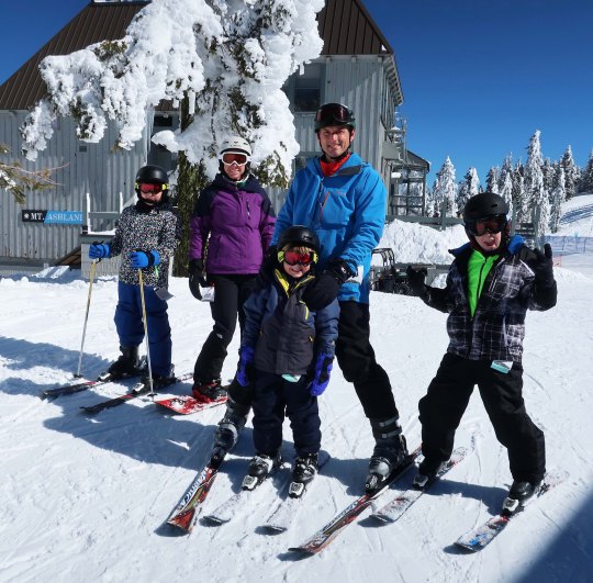
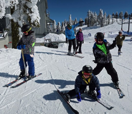
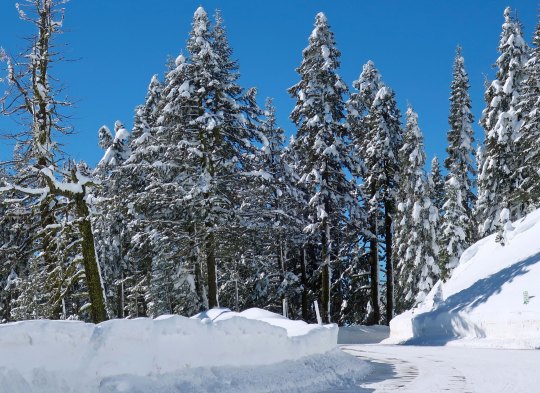
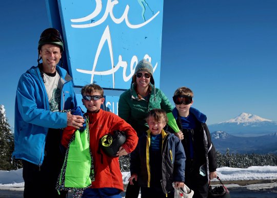
Our son Tony, his wife Cammie and our grandkids are visiting from Florida and wanted to go skiing, so we took them up to Mt. Ashland, which is where I started my journey south on the Pacific Crest Trail this past summer. It was a gorgeous day with lots of fresh snow so I thought I would share some of the photos.
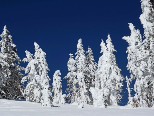
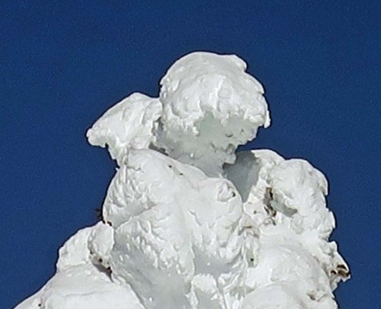
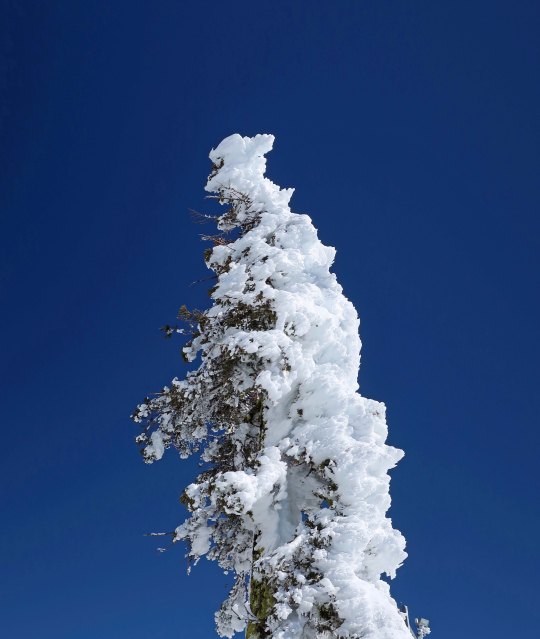
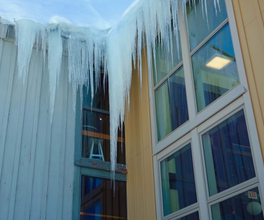
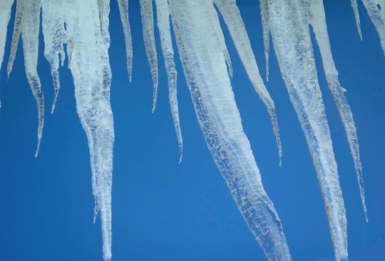
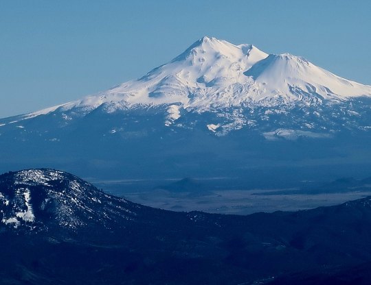
Tony, Cammie and the boys prepared to hit the slopes.Oops. (The kids actually did a great job of skiing regardless of the occasional face plant.)Wind driven snow had coated the trees the night before.Creating some interesting snow sculptures. Is that Cupid snuggling up to Big Foot in the center? Guess not.Deep blue skies and crystal white snow made for some dramatic photos. It was quite clear which way the wind had been blowing.Peggy and I had started our first segment of the PCT about a quarter mile down this road. Looking up toward Mt. Ashland with its weather dome for spotting incoming storms from the Pacific. It has had a busy winter.It was cold cold outside. These icicles were growing on the eves of the ski lodge.A view from inside the lodge where it was much warmer! I thought that the icicles looked a bit sinister. As we packed up to leave, I took a final photo of the family. Wait, what’s that poking out behind?Mt. Shasta, of course. If you followed my journey down the PCT you will have seen numerous photos of this beauty as I backpacked around it heading south. It’s a good place to end this post.
NEXT POST: A wrap up on Burning Man’s mutant vehicles.
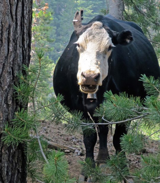
I stopped for a discussion with a cow about trail conditions in the Carson-Iceberg Wilderness.
I was late, like the white rabbit, for a very important date. Peggy was waiting for me at Sonora Pass and I had miscalculated the distance and difficulty of the trail. The night before I had found this lovely little campsite on the edge of a creek that I couldn’t resist. Later, as large ashes began falling on my tent, I began to question the wisdom of my decision. The 97,000 acre Ferguson fire near Yosemite and the 229,000 acre Carr fire near Redding that had been filling the skies with lung-choking smoke for the past month were now contained. Another fire was lurking out there— close by somewhere — and it was suggesting that I get on down the trail.
My goal, I decided, would to be get up at four and on the trail by five. But sleep had been as elusive as my knowledge about the fire. My eyes had popped open around 6:30. There would be no early start. The good news was that the smoke had partially cleared. All that remained of my previous night’s threat was a thin layer of ash. By 8:00 I was fed, watered, packed and raring to go. I figured the 1000-foot, three-mile drop into the East Fork of the Carson River would fly by. I figured wrong. The last part of the trail was steep and narrow over loose rock. It was not the type of trail that one flies over, at least not at 75 . I was ever so glad that I hadn’t tackled it the evening before when I was tired.
It was with relief that I began hoofing up the Carson River. While I had a 2500 foot climb ahead of me up to 10,000 feet, the first part of the trail was relatively gentle. I was making good time when a small root hiding out in the shade caught the toe of my boot and I went crashing down. This wasn’t one of those stumbles where you catch yourself, or at least slow your fall. It was a nose crunching, glass breaking fall. Thankfully, I bounce well. Lying there face down in the dirt, I reached up and touched my nose. It was solid and not spurting blood, although my finger came away bloody. Even my glasses had survived without a scratch. I picked myself up, shook the shock out of my head, and babied the scratch on my nose.
Right about then a through-hiker came hurrying by, going in my direction, moving out. We said hi as he disappeared down the trail. A thought passed my mind. “Can I ask a favor,” I called out to his disappearing back. He stopped immediately and walked back.
“My wife Peggy is waiting for me at Sonora Pass, I explained, “and I am running a couple of hours behind time. I know she will be worried. Could you carry a message for me?” I figured he would be there by mid-afternoon.
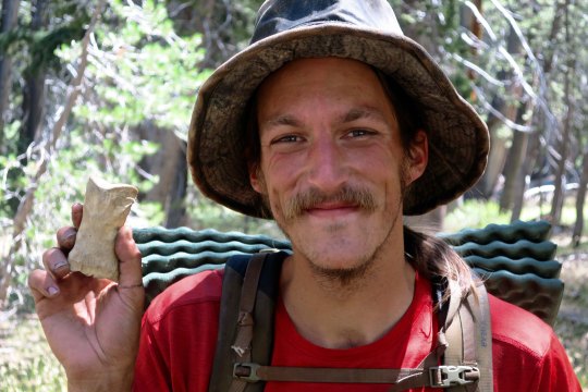
“Sure,” had been his response. I provided the details and we introduced ourselves using our trail names. “I’m Bone from Portland,” he told me. I imagined a small squeak in my pack and yanked Sierra Bone out. I made the introductions. “Bone meet Bone,” I said. Naturally there had to be a photo of Bone with Bone.
Bone and Bone.
Relieved that Peggy would get the word that I was alive and well, I continued my journey and started the slow, steep climb out of the river canyon. I spotted a couple near the top who were off the trail eating a snack. One called out, “You must be Wanderer,” she said. “Your wife is worried about you.” Of course. Turns out Camilla and Bastien were from Leon, France and Peggy had met them while they were waiting for resupply at Sonora Pass. She had fed them scones loaded down with peanut butter. Peggy, Camilla explained, was concerned because the parking lot closed at five and she would have to move. Bastien chipped in that he didn’t think I would get there in time.
Photo of a happy Camilla and Bastien after eating peanut butter with a scone attached. (Photo by Peggy Mekemson.)
I wasn’t concerned. I had two hours and it was only four miles. Still, I moved out and made it in a little over an hour. Bone was waiting with Peggy when I arrived. She had offered our van to charge his phone. He was enjoying a beer. While Peggy got me one, Bone and I discussed the wind we had encountered up on the mountainside. He had put his pack down and barely caught it as the wind had pushed it down the narrow trail toward the edge. My pack was fine but the wind had almost sent me tumbling off the cliff. We estimated that there were gusts between 50 and 60 miles per hour. I’d had to lean in toward the mountain to keep my balance.
The wind was having another impact as well, pushing a fire up the mountain. As we watched, a small plume of smoke had grown to cover half of the sky. It was the Donnell fire that had dropped ashes on my camp the night before. It was frightening to think of being out on the trail facing a fire pushed by 60-mile an hour winds. An hour after we left, the Sonora Pass road was closed. The next day, the PCT was closed between Ebbetts Pass and Sonora Pass, the trail I had just hiked.
The following photos are taken along the Pacific Crest Trail between Ebbetts Pass and Sonora Pass traveling south.
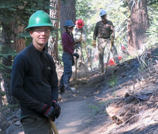
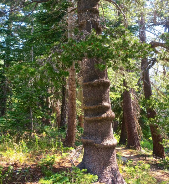
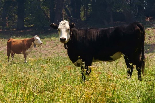
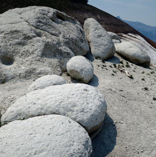
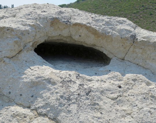
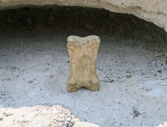
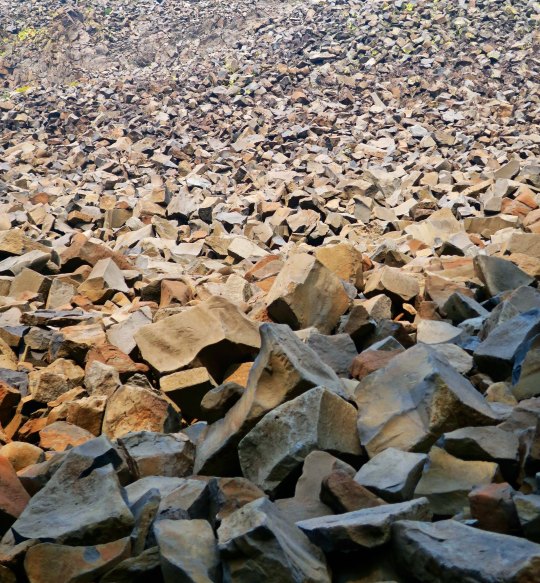
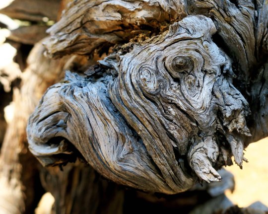
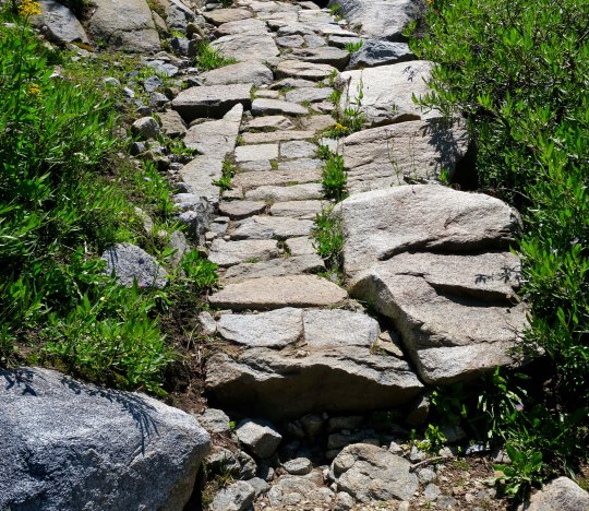
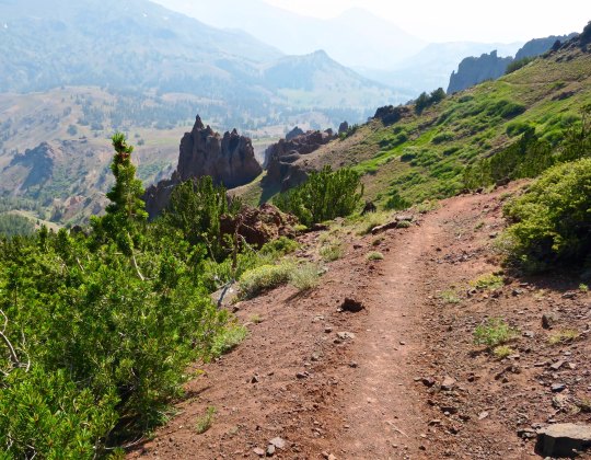
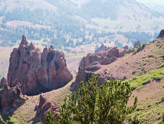
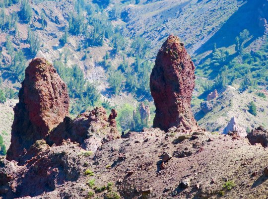
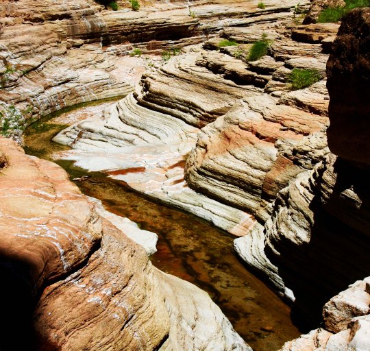
A smokey day along the PCT in the Carson Iceberg wilderness.A trail crew of volunteers from the Pacific Crest Trail Association. Much of the PCT trail work is carried out by volunteers.This was an interesting tree trunk. The ridges were caused when the tree grew over attached barbed wire. We have a few like it on out property.Cattle are not uncommon along the PCT. I always stop to chat with them.I was surprised to find rhyolite boulders along the trail. The boulder had an interesting little cave. I wondered what lived there.Guess who volunteered?A patch of asters was growing nearby.Here’s the reason why Boulder Mountain is called Boulder Mountain. It was one heck of a scree slope.A tree perched on a granite rock caught my attention…And I took several photos.Hiking down into the East Fork of the Carson River provided this view.I filled my water bottles here at a small creek crossing the trail.This is a photo of the Eastern Fork of the Carson River. The water falls were indicative of the fact that the trail had started to climb.When I stopped to photograph the river, I also caught these roots.And this knot with a personality.Climbing higher I came across some extensive trail work. I have nothing but admiration for the crews that placed these heavy rocks.A view of the trail after I left Camilla and Bastien.Looking down toward the Sonora Pass where Peggy was waiting.. This is where Portland Bone and I had encountered the high winds.Another view.I’ll conclude today with this shot of smoke boiling up from the Donnell Fire. Had it been like this an hour earlier, I might have made that last 4 miles in 30 minutes instead of an hour! (grin)
NEXT POST: You met the large mutant vehicle animals of Burning Man in my last post, now it is time to meet the small mutant vehicle animals.
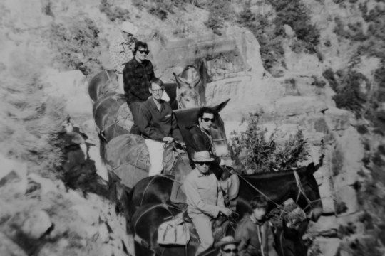
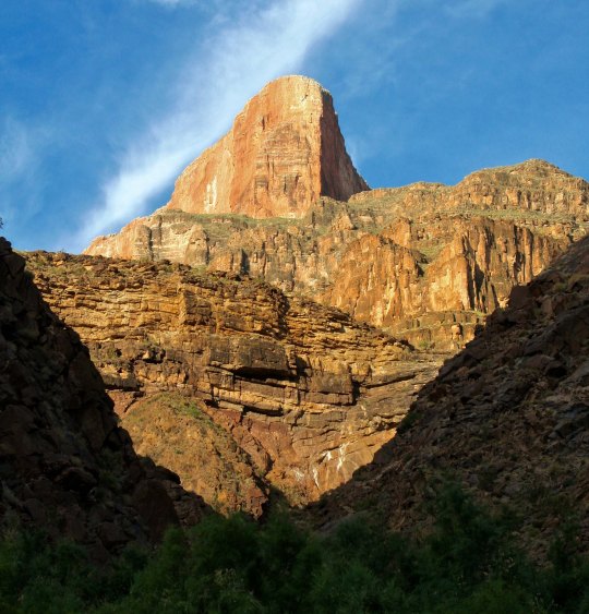
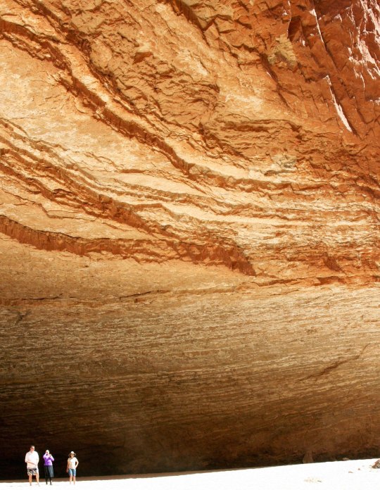
I have journeyed into the Grand Canyon several times over the years: on foot, by raft, and by helicopter. The first was by mule in the late 60s. That’s me, second from the top on Charlie. I was sore for a week afterwards. I was a pound over the weight limit, so Charlie kept trying to bite me, plus walk as close to the edge as he could!
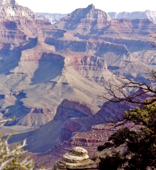
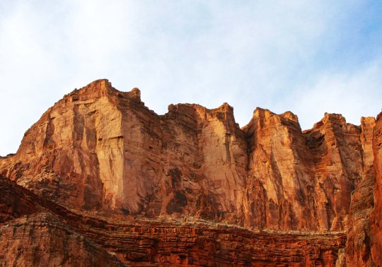
The Grand Canyon is truly one of the world’s great natural wonders. It’s celebrating its 100th Anniversary this year and I am quite pleased— and a little proud— that I have been returning there on a regular basis for 50 of those years. I’ve posted on my trips into the Canyon by foot and boat many times. Today, since I am still working on Burning Man photos and don’t have another Pacific Crest Trail post ready yet, I decided to reach back into my WordPress archives and put up some Grand Canyon photos. Happy 100th Grand Canyon!
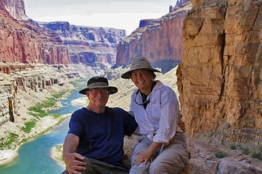
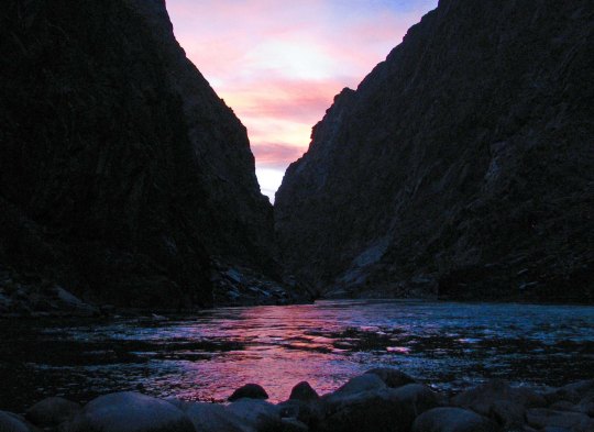
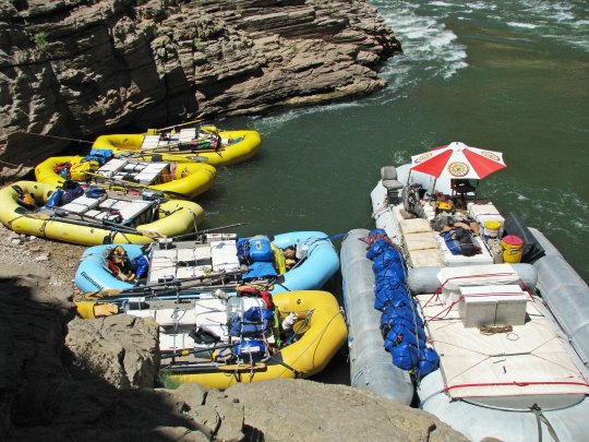
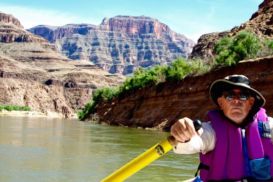
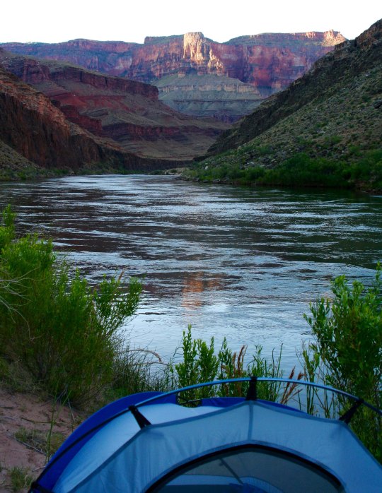
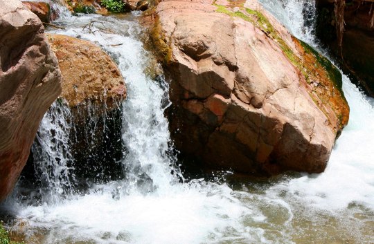
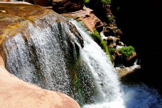
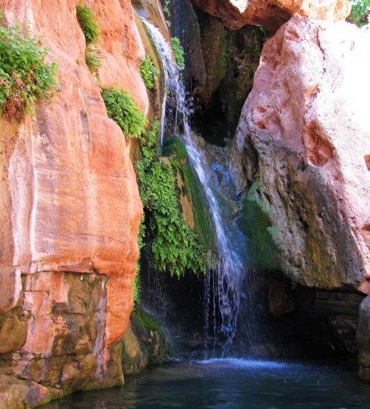
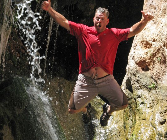
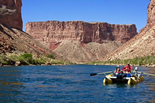
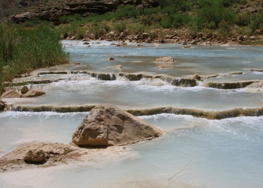
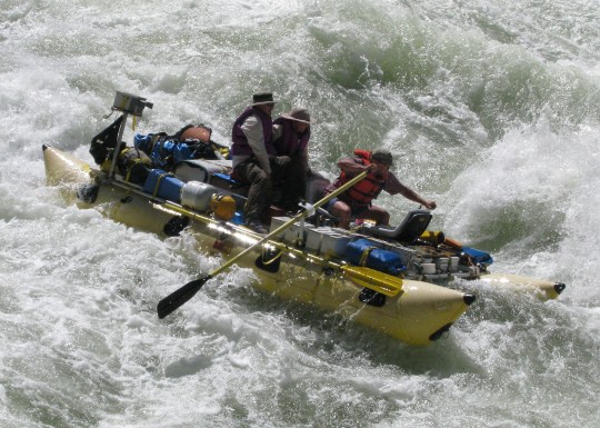
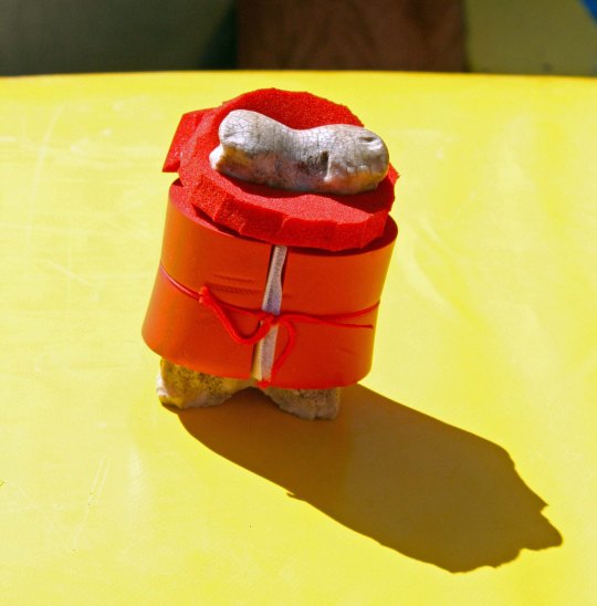
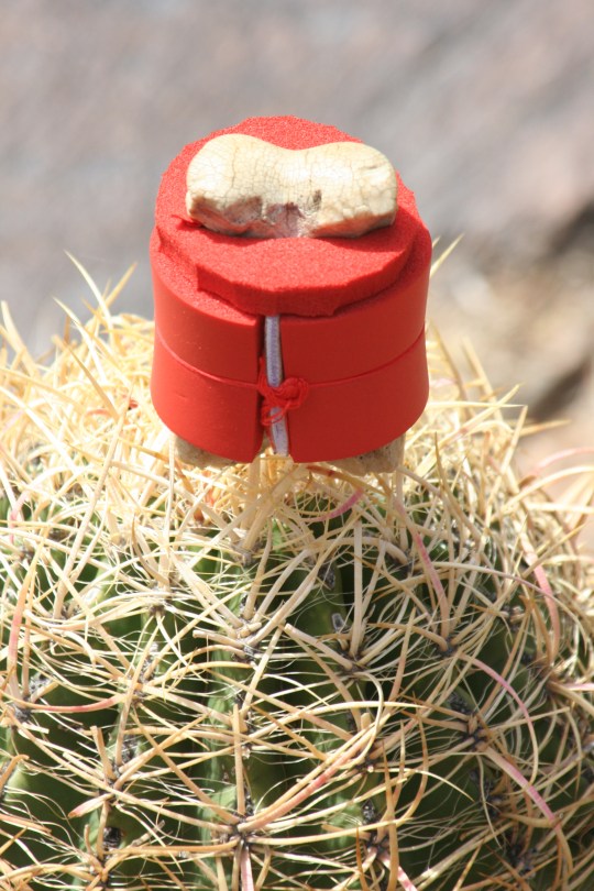
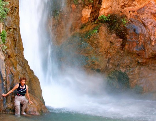
Sunsets in the Canyon are always spectacular, whether you are on the outside looking in or the inside looking out. This was from an 18 day rafting trip Peggy and I took down the Colorado River with a group of friends.Peggy and I are sitting above the Colorado River near an ancient Native American site.Sunset at Zoroaster Campsite on the Colorado River in the Grand Canyon. (Photo by Don Green.)You don’t have to hike or backpack, or raft, or fly, or ride grouchy mules to enjoy the beauty of the Canyon. You can drive up, and enjoy numerous pull-offs that give you incredible views.The mouth of Havasu Creek is a common stop for rafters in the Grand Canyon. Our rafts look small beside the large tour boat. Our trip was based on a lottery that I won for an 18-day private trip on the Colorado River through the Grand Canyon. Fortunately, I have friends with the expertise necessary to raft the Canyon.While a veteran crew of boatmen handled the more dangerous parts of our 18 day journey through the Grand Canyon, I was allowed near oars on some of the tamer sections.A morning view from out tent.. One of the fascinating things about the Grand Canyon is how it changes in the light. Numerous side trips away from the river provided opportunities to explore other parts of the Canyon.We were treated to views like this.Waterfalls along Deer Creek.This was a delightful waterfall, but I didn’t realize we were expected to jump off!Jamie Wilson demonstrates.This huge cavern is found along the river and is known as Redwall Cavern.Another river view.Looking up the Little Colorado River just above where it flows into the Colorado River. Note the water color and the mineral deposits. With Steve at the oars, Peggy and I enter the infamous Lava Falls on the Colorado River, a perfect ten… that’s 10 as in rapids don’t get any more serious. There was a point where we disappeared under the water. (Photo by Don Green)Bone, of course, went along on the raft trip and had his own life vest. Here, he decided that it was time for a photo op on the edge of a Sotar Raft.Here he enjoys a perch on top of a barrel cactus. Don’t try this at home, kids. Or anywhere else.Peggy stands next to Deer Creek Falls, a short walk from the Colorado River in the Grand Canyon.I’ll conclude with a final sunset view from one of our campsites.
NEXT POST: Either on Burning Man or the Pacific Crest Trail. Depends on what I get done. (grin)
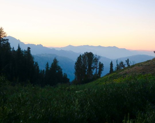
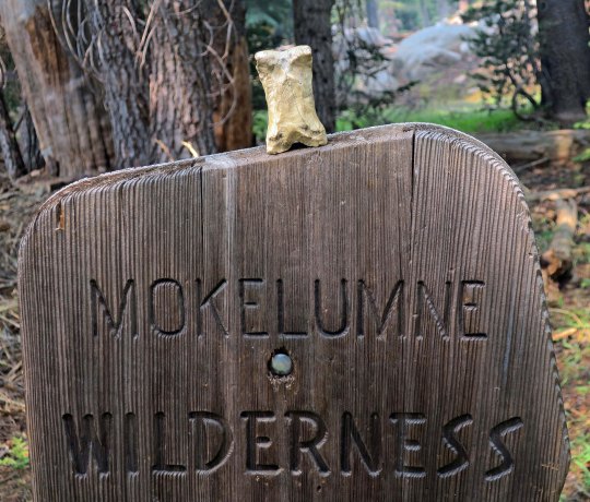
An evening view of the Mokelumne Wilderness from Noble Lake on the PCT.
I remembered Noble Lake from my 2003 trek when I backpacked 360 miles from Lake Tahoe to Mt. Whitney to celebrate my 60th birthday. For some reason, it didn’t seem as ‘noble’ this time. Maybe that’s because of all the other lakes I had passed on my hike down the PCT. But the views looking back toward the Mokelumne Wilderness were spectacular.
An afternoon view of Noble Lake. The lake is located south of Ebbetts Pass.
Another evening view of the Mokelumne Wilderness from Noble Lake. This is a situation where the smoke from the fires may have enhanced the photo.
Looking up from the lake, I caught this mountain glowing in the evening sun.
I was treated to more views of the Mokelumne Wilderness the next morning. It’s fun to think that I had been hiking through the area the previous day.
As I watched, the sun continued to rise, bathing the peaks in a soft glow.
I would have lingered, but Peggy expected me to be at Sonora Pass the next day, and I had miles to go. As I hiked up the early morning trail, I said goodbye to Noble Lake. Would I be back for my 80th birthday? (grin)
Up toward the pass, I was greeted by an old elevation sign. I think it told me I was at 9,980 something feet.
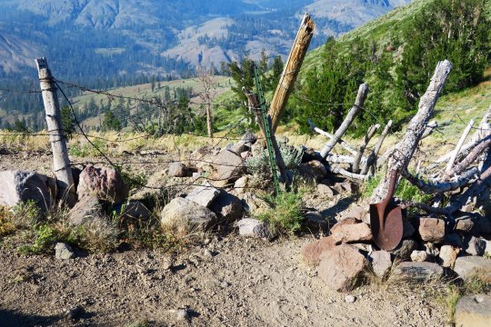
You know you are out West when you come to barbed wire fences. This provided a passage (sort of) that through-hikers could get through, but not cattle. The old shovel head spoke of earlier times.
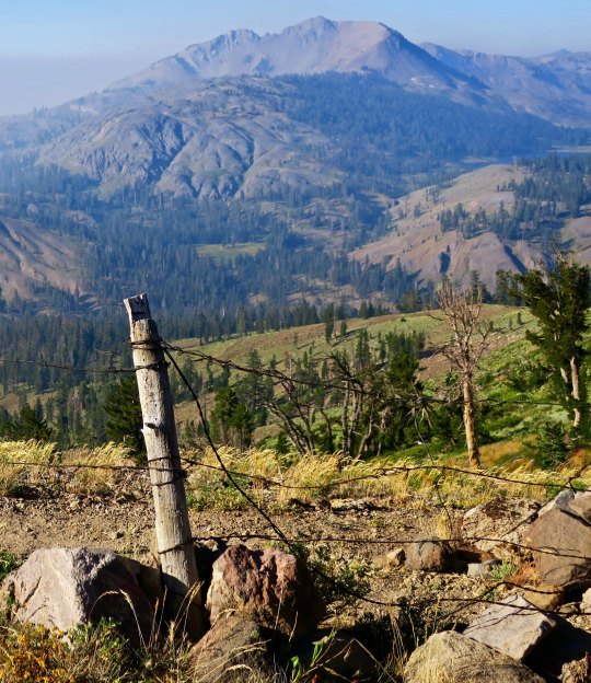
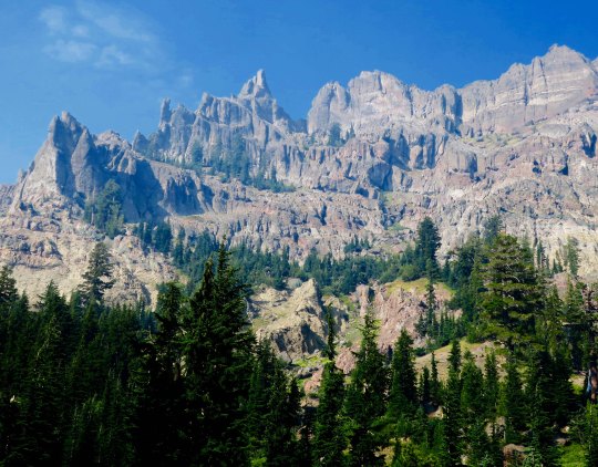
Looking through the wire, I could see my next destination, the Carson Iceberg Wilderness.
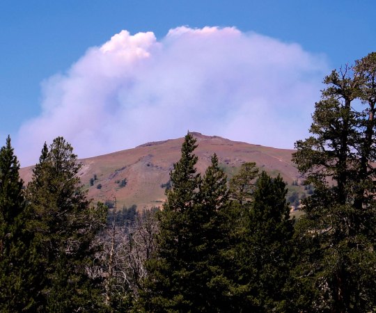
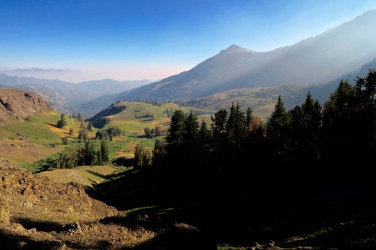
I’ll conclude today’s post with this view. It suggested another smoky day. Within 48 hours, the trail would be closed due to fire.
NEXT POSTS: Time’s limited since I am preparing for the San Francisco Writers’ Conference. I have one more post on this section of the PCT and then Peggy has two posts on her experiences as ‘trail angel.’ I think I will hold on these three posts until after the conference. In the meantime, I will put up some Burning Man eye candy since Peggy and I are hoping to go this year, assuming we can get tickets.
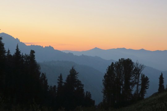
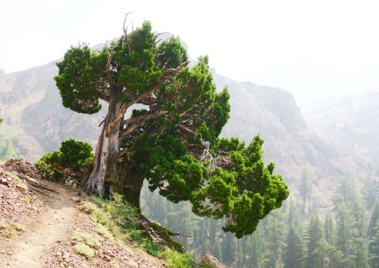
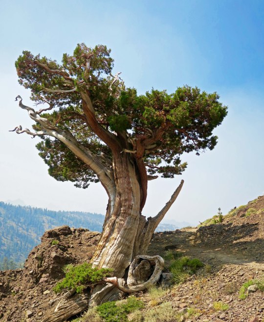
Another beautiful juniper along the PCT, this one just south of Ebbetts Pass. I was climbing up a very steep trail to Noble Lake. Check out the smoke. Excuse me while I go cough.
I left you in the last post about my hike down the PCT with photos of spectacular rocks and impressive trees. I say goodbye to the Mokelumne Wilderness in this post, hike across Highway 4 at Ebbetts Pass, and continue my journey southward. Of course there will be more pretty trees, but roots, snags, flowers, a family from Taiwan and through-hikers are the main subject for photos today.
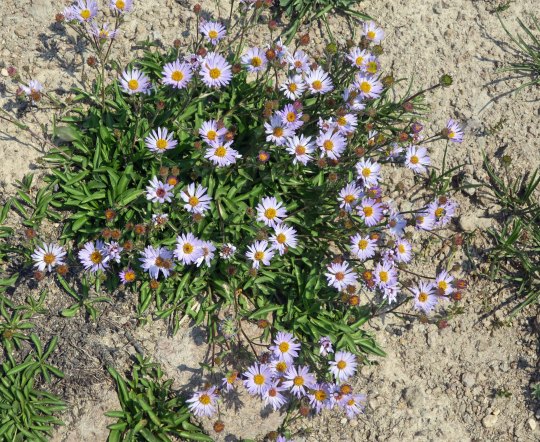
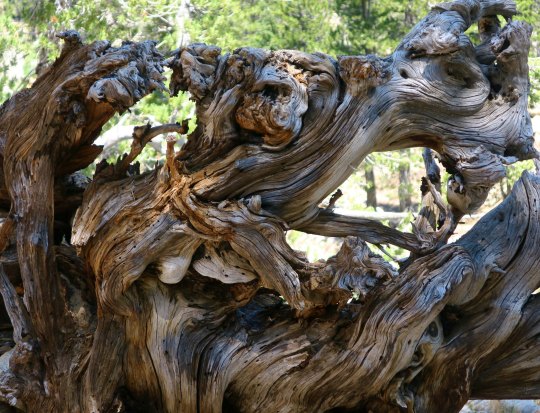
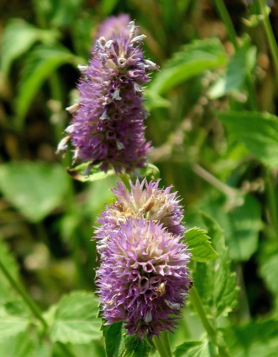
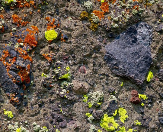
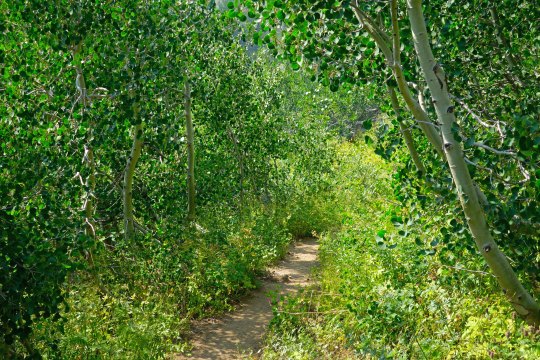
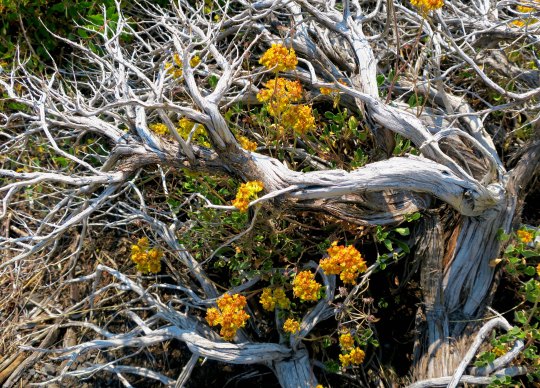
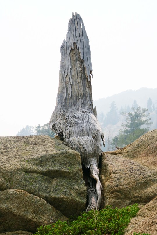
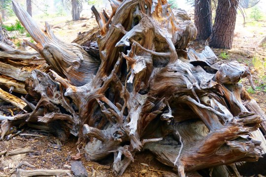
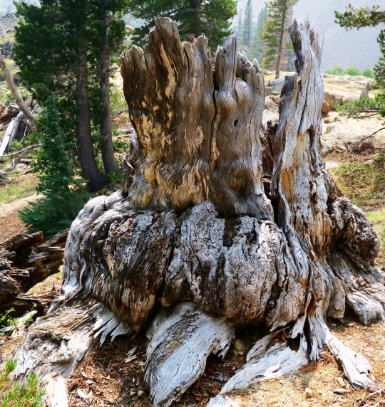
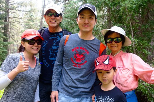
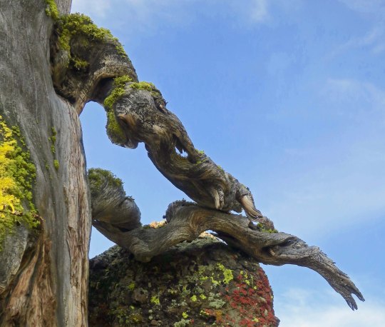
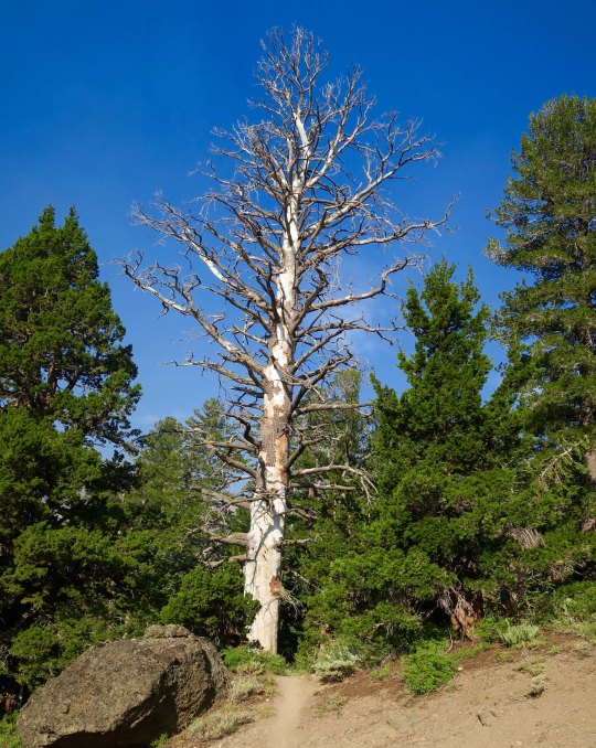
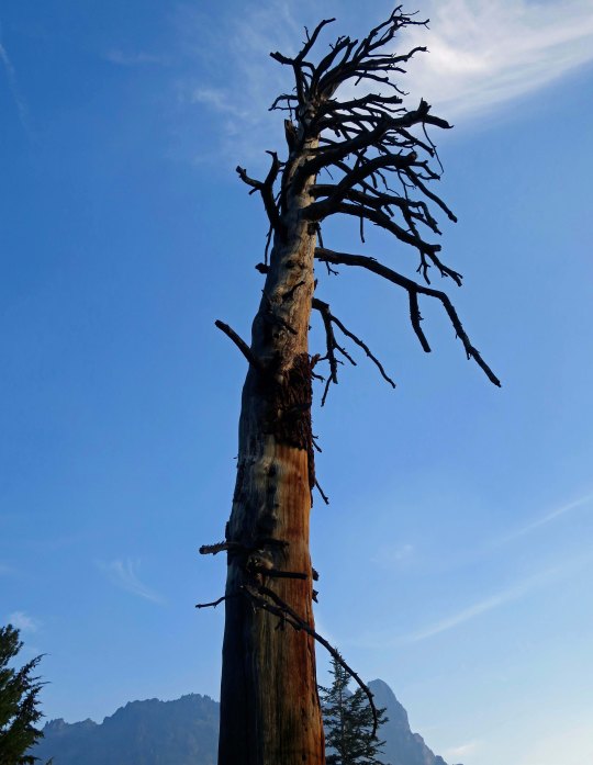
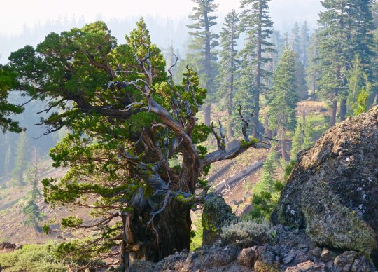
Have any aches and pains? Some people swear by this plant, self-heal, as being good for what ails you. I came across a list claiming it is good for ulcers, wounds, sore throats, hemorrhoids, high blood pressure, burns, insect bites, herpes and cancer. Woohoo. You might want to check with your doctor first. (grin)You’ve already met this fellow, flea bane, with its obvious name. Orange and yellow lichen— where algae and fungi co-habitate in a symbiotic relationship. An inviting green trail through aspen.A snag and dead flowers combine in a floral arrangement.This fellow was fun. I’ve never seen a snag sitting down with its tail hanging out behind. I was worried it might follow me home. How would I explain that to Peggy?Twisted roots!Stump with personality.Bone decided to get into the act when I left the Mokelumne Wilderness.These two sisters, Denise and Deborah were only doing part of the trail. Since we were hiking in the same direction, we kept crossing paths, so to speak. They were both carrying tents and explained to me, “We grew up having to share a room. That was enough.” They wrote me later saying that their hike was interrupted by the Sonora Pass fire. Mine too. I caught up with Wayne Chiang and his family along with their friend, Bass Chong, at Ebbetts Pass. They were out for a day hike. Wayne is a legislator with the Republic of Taiwan and has long term hopes of becoming Mayor of Taipei. Bass works at Ebay. This smiling fellow was from Germany and, I am sorry to say, I’ve misplaced his trail name. He wanted to take a photo of me to show friends and family back home that people of all ages hike the PCT. I was just glad that he didn’t say something like, “Really old people hike the PCT!” A final juniper photo for today.
NEXT POST: Adios, Puerto Vallarta… with a few spectacular sunsets.
I didn’t spot the tusks on this tree limb until I checked out my photos. There’s no doubt which is the dominant creature here! Or maybe they are just snuggling.
Peggy and I had lunch yesterday with Barbara and Carl, the couple that dropped us off at Mt. Ashland for the beginning of our trek south down the PCT. It was the first time I had seen them since the beginning of the adventure. There was a lot to tell.
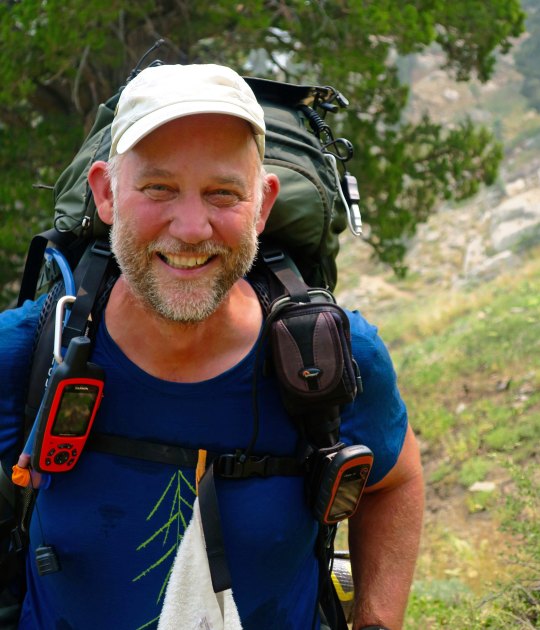
Naturally, I talked about both the challenges and the rewards of backpacking for 700 miles over difficult terrain at 75. I also discussed how 50 years of backpacking had prepared me for the trip, and threw in a few of my more humorous adventures from those years. They will be in my book.
“Knowing what you know now, would you do the PCT hike again?” Carl asked.
“Absolutely,” I replied. This doesn’t mean I will forget just how hard it was. It’s an important part of the story. But the beauty and the nature of the adventure are what will stick in my mind. I once had a woman who had been on one of my hundred mile treks tell me it was one of the most difficult tasks she had ever undertaken. But in the end, she said, it was an incredible, life-changing experience. The pain faded; the experience remained. “The only thing I can equate it with, Curt,” she had related, “was having my first baby.” Ouch, and then ‘Oh my!’
For the first 25 years or so of my backpacking, I hadn’t carried a camera. Those were the days before you could expect to obtain quality photos from a small camera, and I didn’t want to add the extra weight to the 60 pounds I was already carrying. I was also reluctant to spend the time that good photography required. And often I was leading groups that demanded my full attention.
I am sorry now. “I can’t believe you go to all of these beautiful places and don’t carry a camera,” my father had told me time and time again. He was right. I wish I had those photos now to remind me of where I had been and what I had seen. But there is more. Photography helps you see the world in different ways. It encourages you to focus in on details you might miss, it helps you notice the differences that light and varying perspectives make, and it forces you to stop and look around.
Today’s photos pick up where my last post left off, hiking down the PCT from Carson Pass on Highway 88 to Ebbetts Pass on Highway 4. The first four illustrate the value of stopping and looking around. They are all of the same scene from different perspectives.
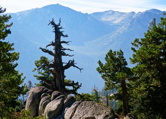
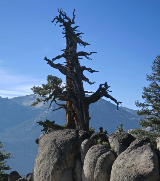
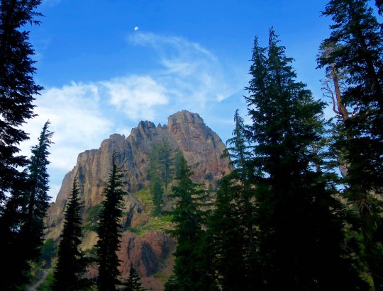
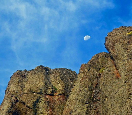
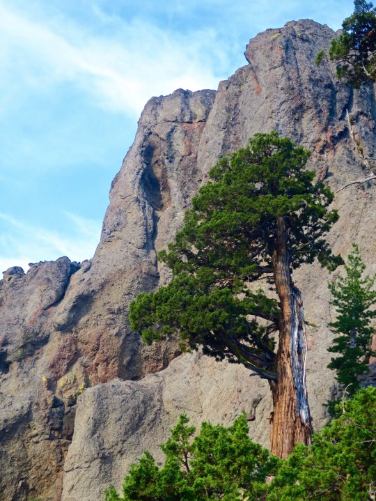
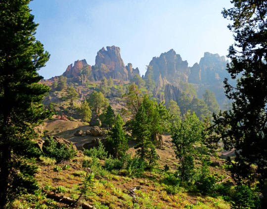
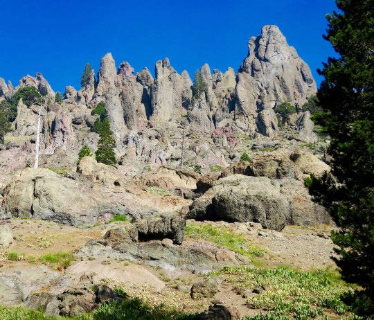
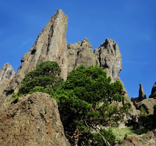
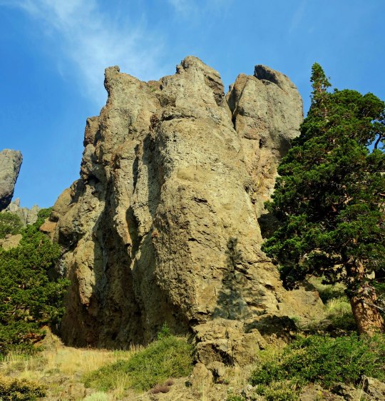
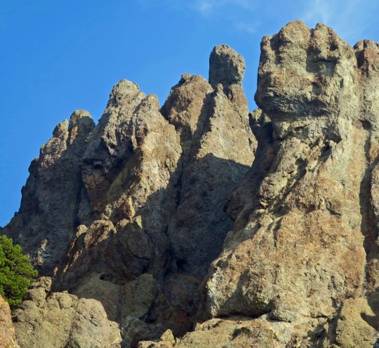
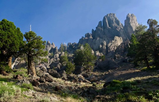
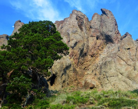
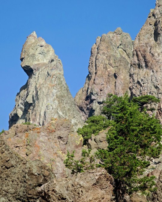
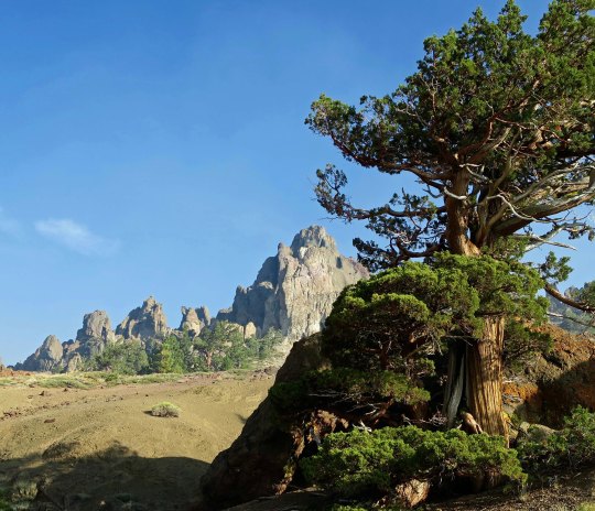
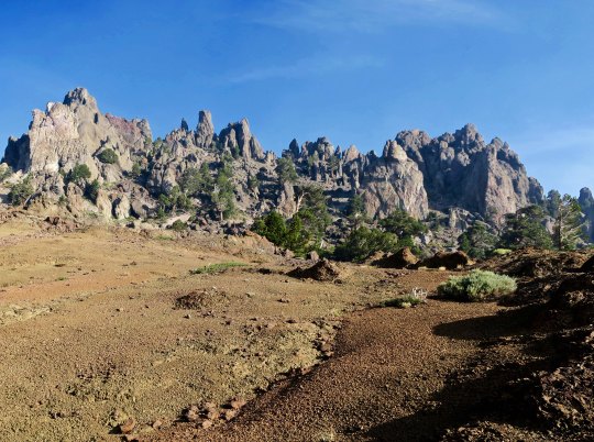
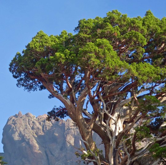
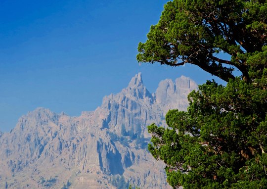
Once again, there were towering cliffs to admire. These were framed by hemlocks.A closer look showed junipers growing beneath the cliffs. A tiny moon appears in the upper left. And my telephoto brought the moon into perspective with the cliffs.While another photo featured one of the junipers standing tall against the cliff.One of the magical things about following a trail is that you never know what you will see next. It’s a thought that forever pulls me on. The PCT made its way around a large snag here and disappeared into the woods. I was assured that the views would just keep coming. The smoke did more than hassle my lungs; it also provided some interesting photos as it filtered the sun. This juniper is an example.And another smoke filtered scene.As might be expected from my last post on the PCT through the Mokelumne Wilderness, there was no end to magnificent rocks.Rounding a bend I came on a new view with a juniper, rock and open area leading to a distant peak.This perspective had the intensity of surrealism. I could see Dali carefully painting the rocks in the foreground and adding a melting clock.The contrast between a juniper and rock guaranteed that my camera came out.And then I was treated to my first view of Mt. Reynolds.Wow!I’ll conclude today with this view. I loved the contrast.
NEXT POST: Variety, being the spice of life, it’s back to Mexico.