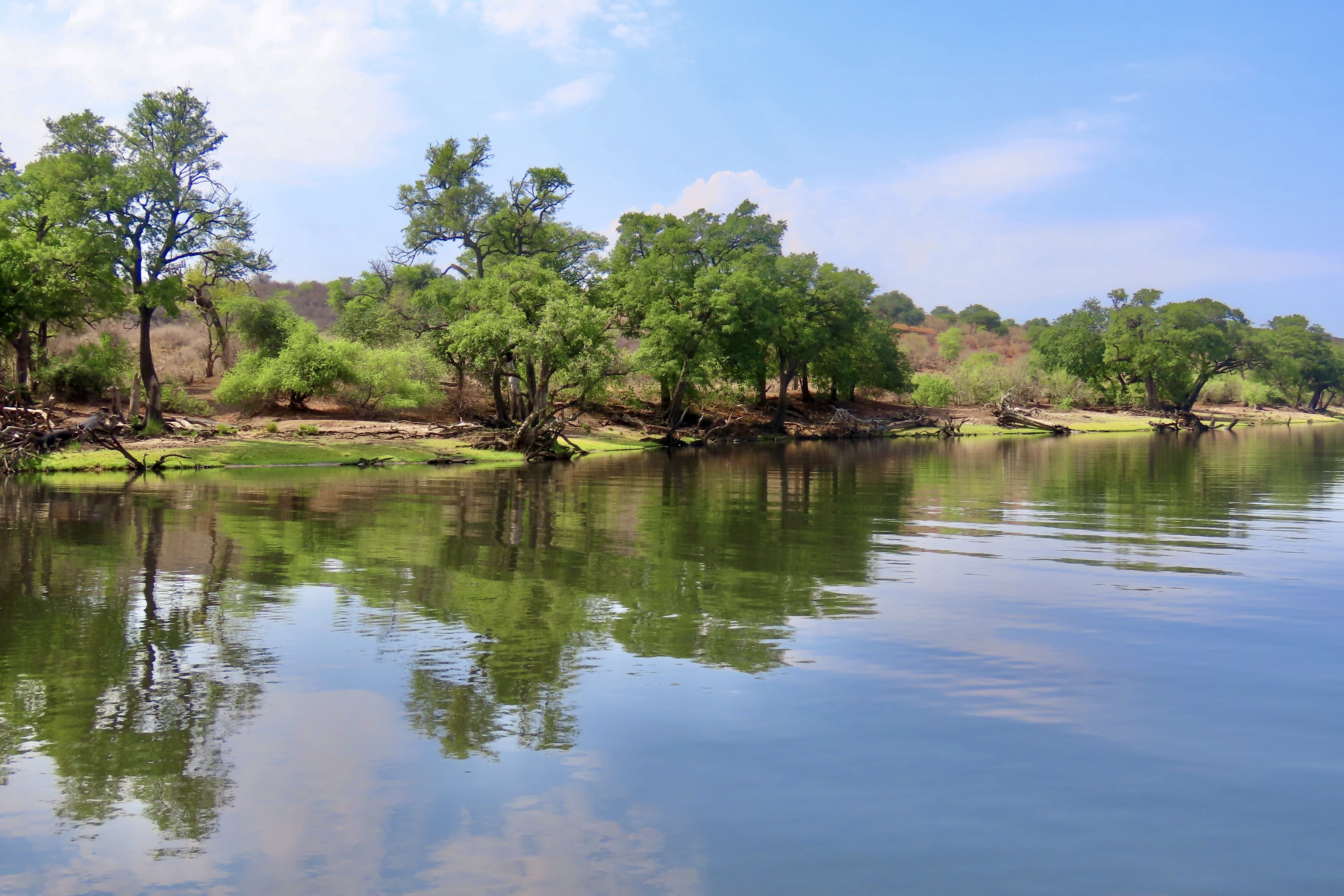
Pinnacles National Park is located inland from California’s Central Coast. Peggy and I followed a narrow, curvy, one lane road east of the small town of Soledad to get there, holding our breath each time we met another vehicle— especially if it was as large as our truck. While the location was a slight detour from our coastal focus, we are totally incapable of skipping a National Park.
Pinnacles National Park has a twin near the city of Santa Clarita some 200 miles to the south, the Neenach Volcanic Formation. Born of fiery rhyolite lava flows some 23 million years ago, they were ripped apart in their youth by the notorious San Andreas Fault. Pinnacles has been making its way north ever since: Inch by inch and earthquake by earthquake.
Noted for its personality-plus pinnacles, talus tunnels, and wild flowers, the region was declared a National Monument by Teddy Roosevelt in 1906. Legislation by Congressman Sam Far from the Monterey/Carmel area in 2012 led to its being established as a national park. (Sam, like me, was an early Peace Corps Volunteer. For a brief time, we worked together in the Western United States as Peace Corps Recruiters.)
The Pinnacles are something of a poster-child for Plate Tectonics. While the existence of the plates and their impact on geology and geography is a well-known and accepted theory today, the history of the concept is relatively recent. I remember sitting in a geology class I took at UC Berkeley in 1964 when the professor came in almost glowing. “I have something to share,” he declared, “please understand that it is still a theory. I’m late because I was just in a meeting where substantial evidence was given that the surface of the world is made up of giant plates that separate, crash into each other, move along each other’s edges.”
The close relationship between the rocks and minerals of Pinnacles and the Neenach Volcanic Formation helped to show that the Pacific Plate and North America Plate have been moving past each other via the San Andreas Fault for 20 some million years. Pt. Reyes National Seashore north of San Francisco, where we are now, also sits on the San Andreas Fault and is another example of the movement. In fact, our campground is sitting on top of the fault. Our fervent hope is that it stays in place, at least for another week!
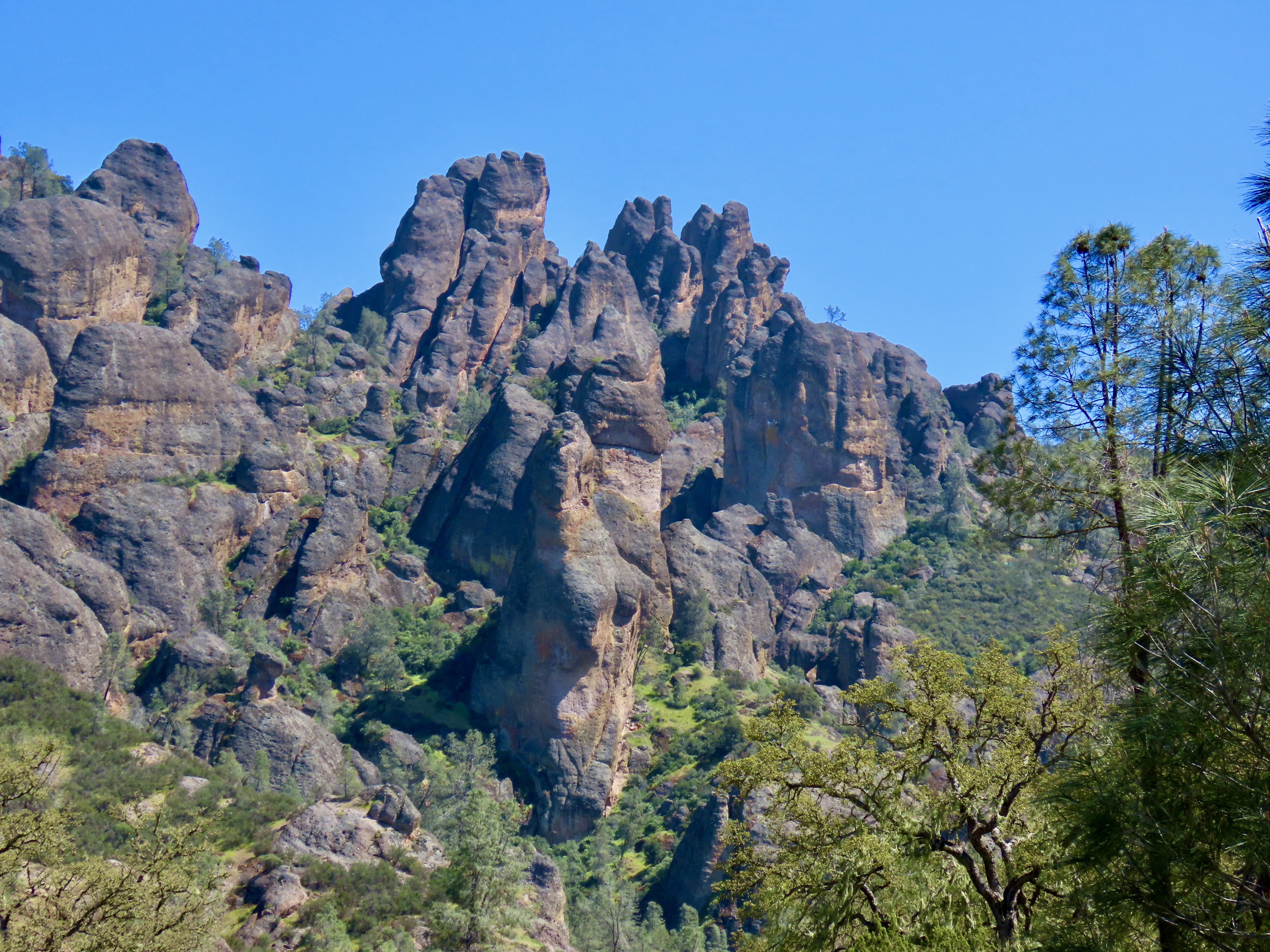
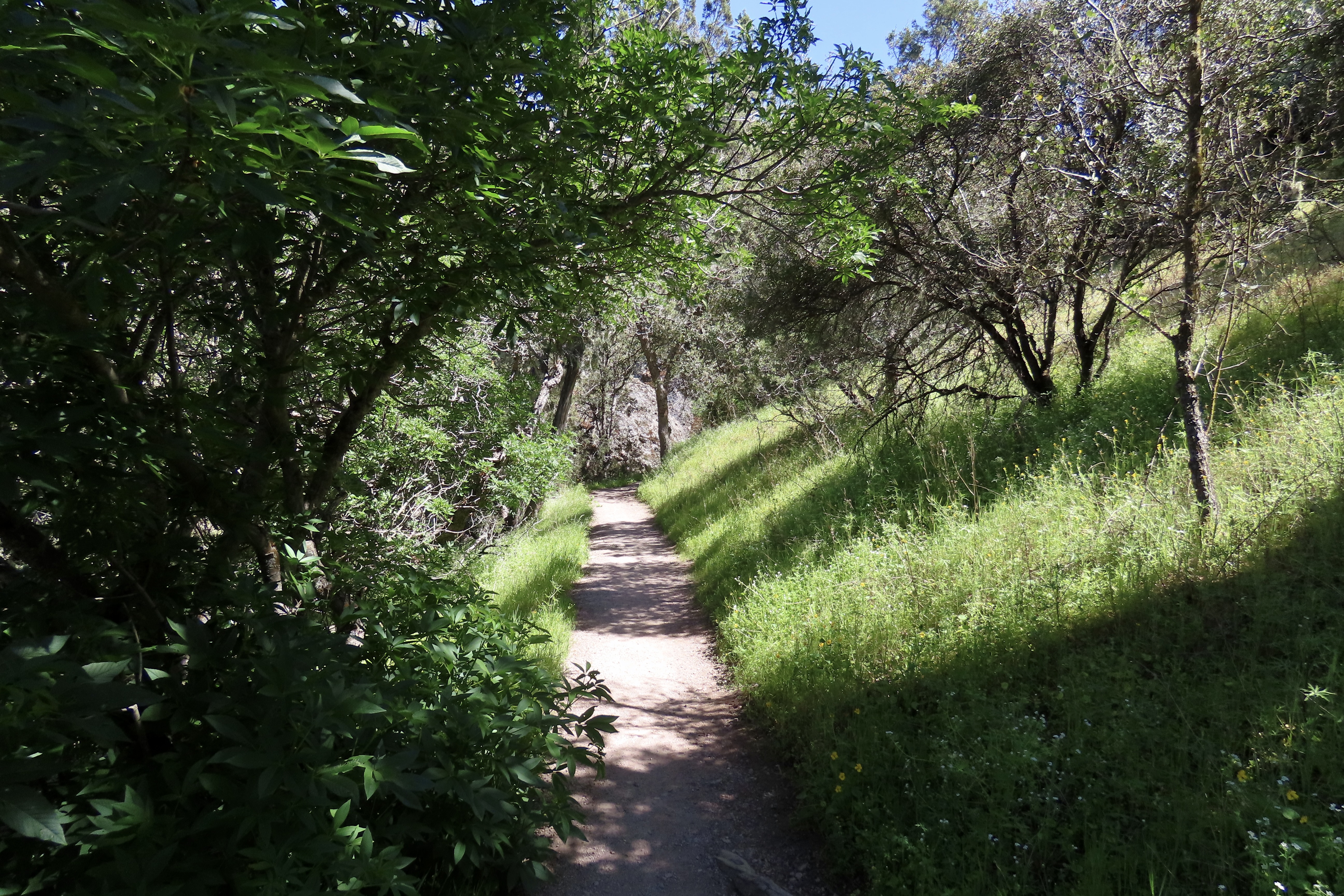
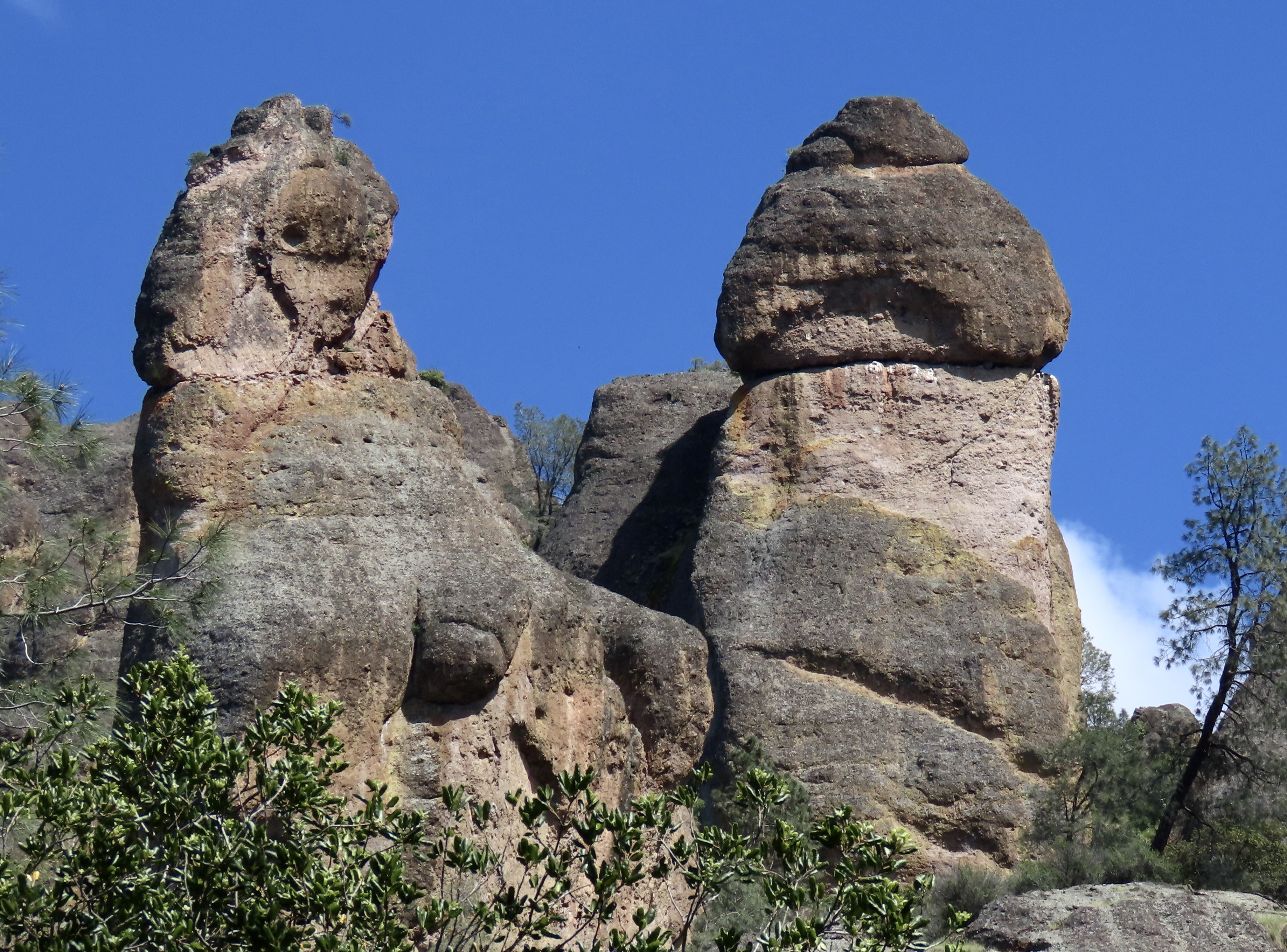
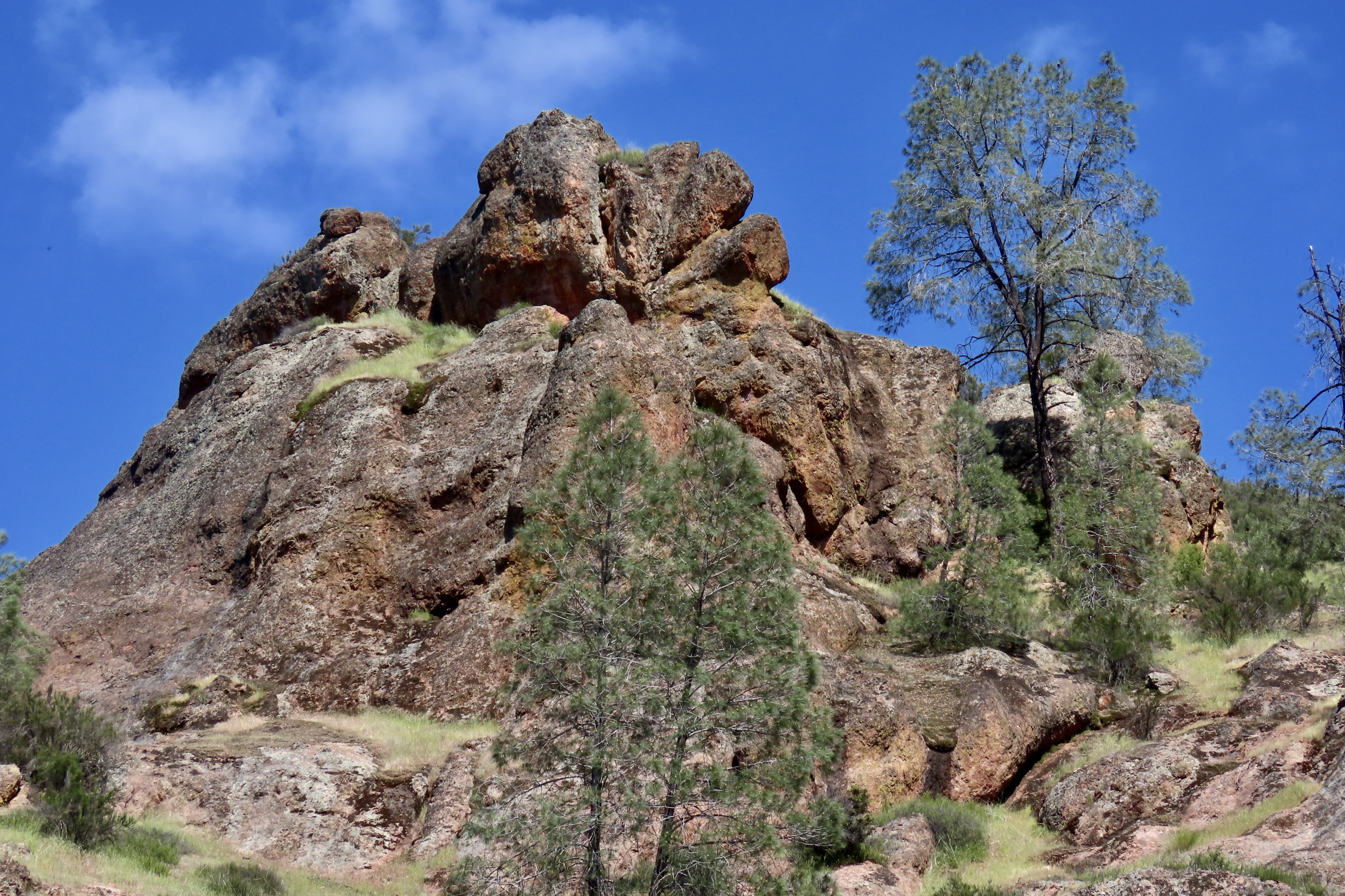
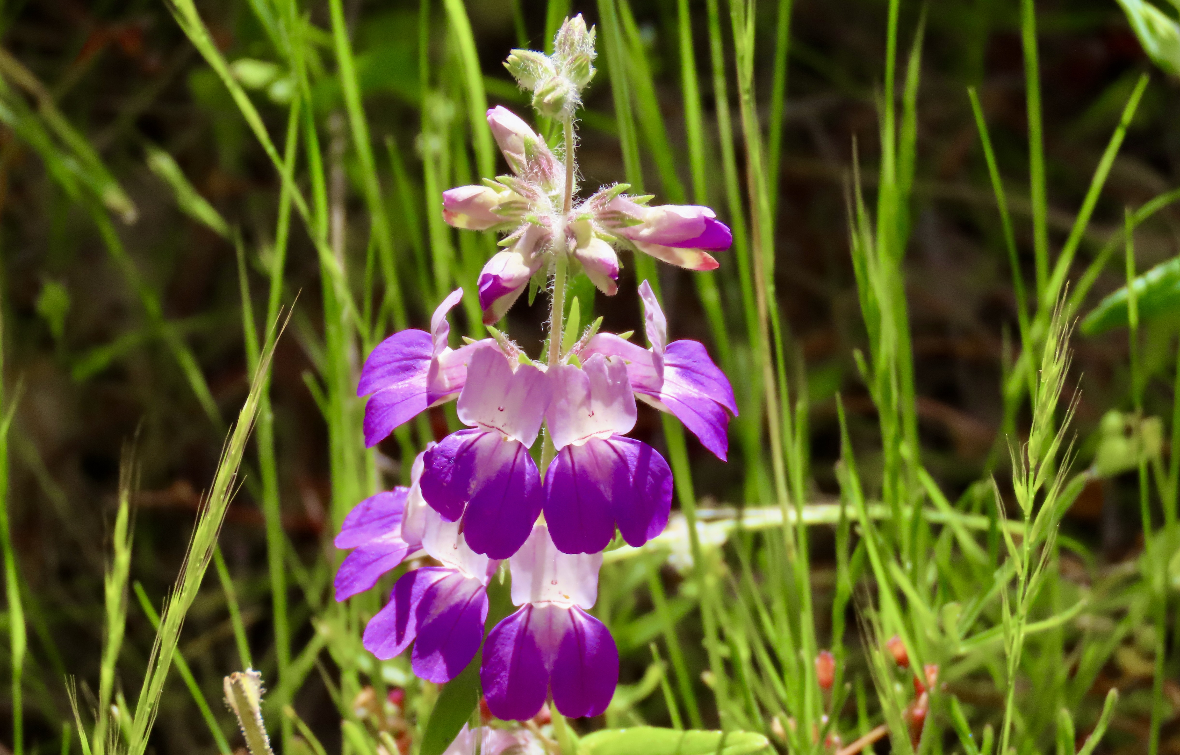
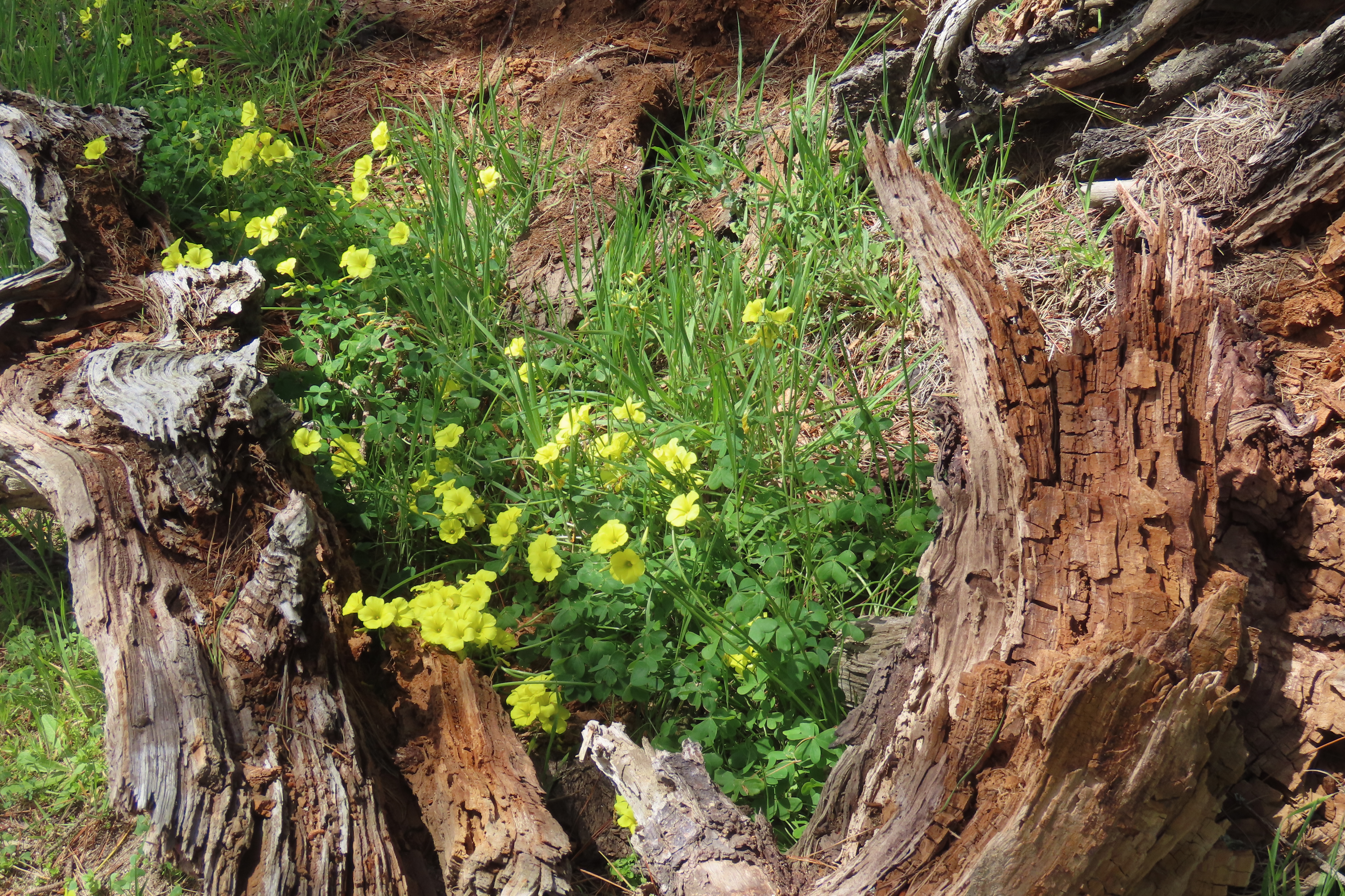
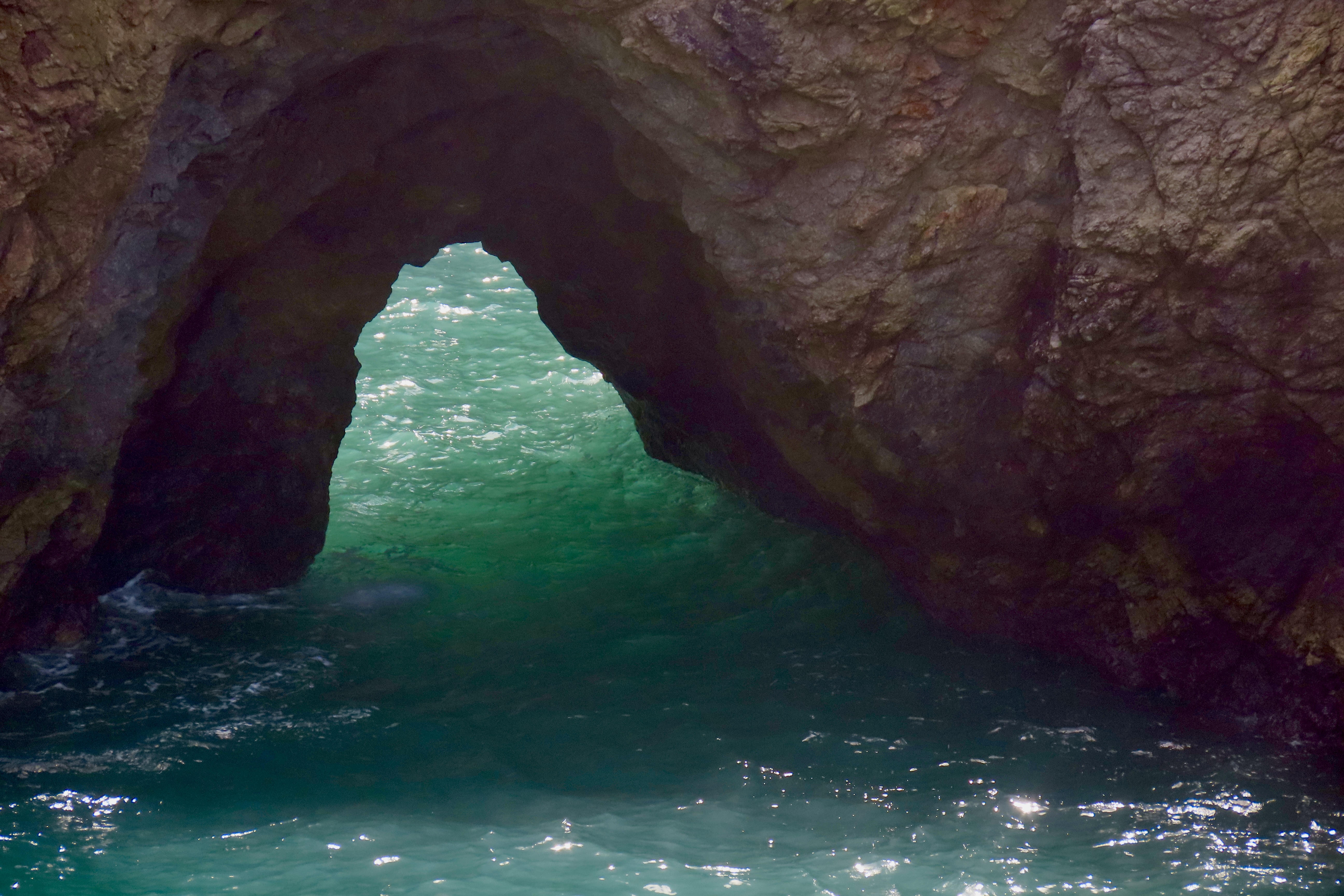
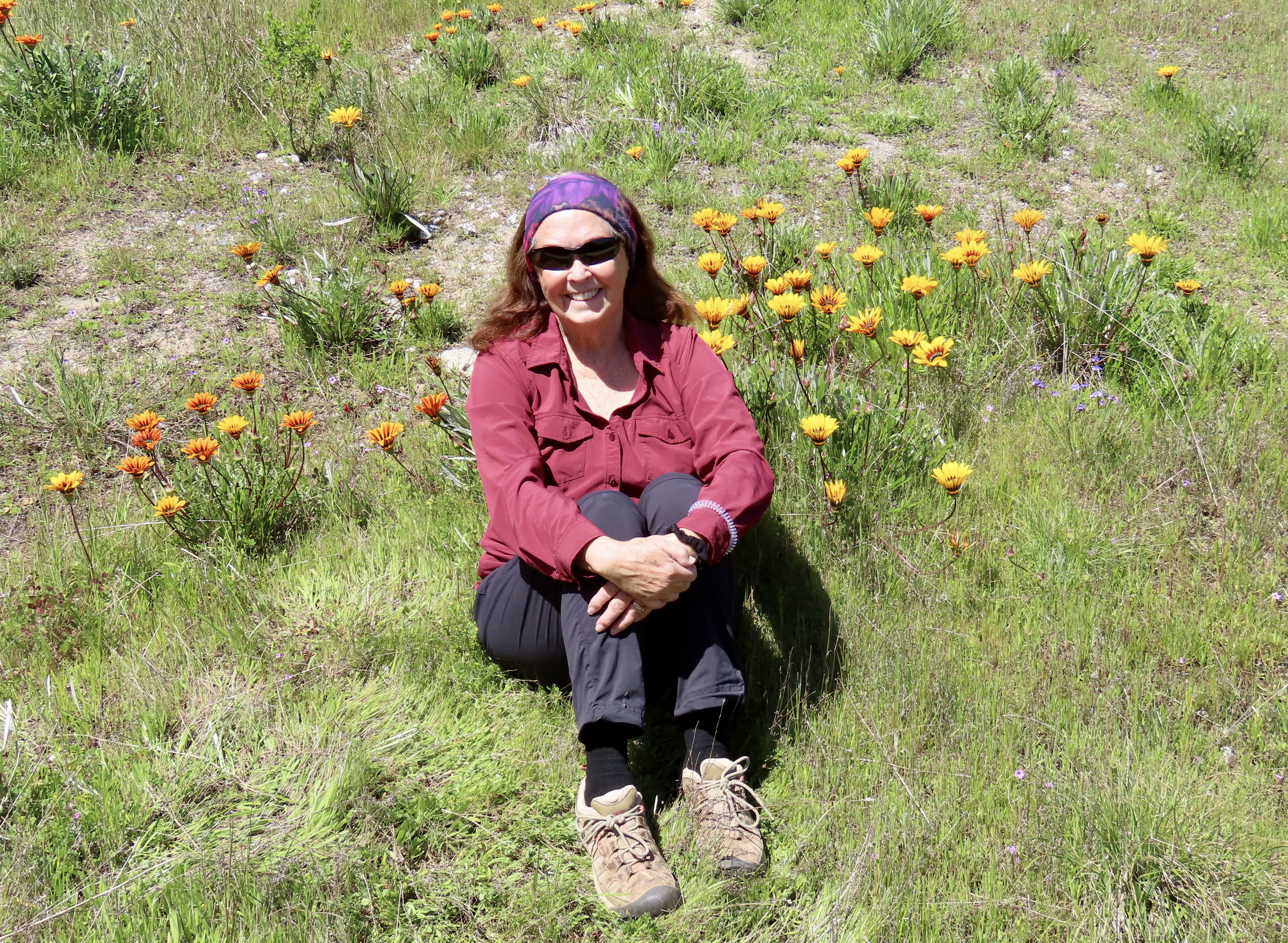
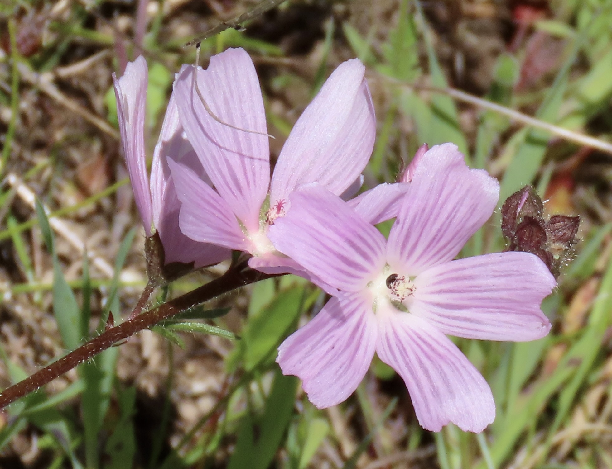
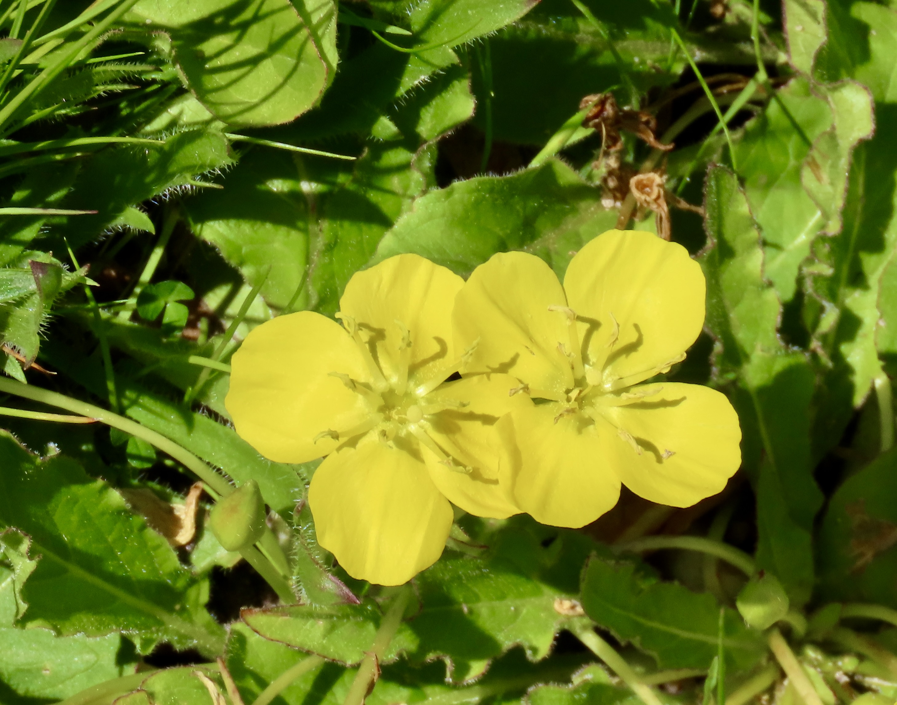
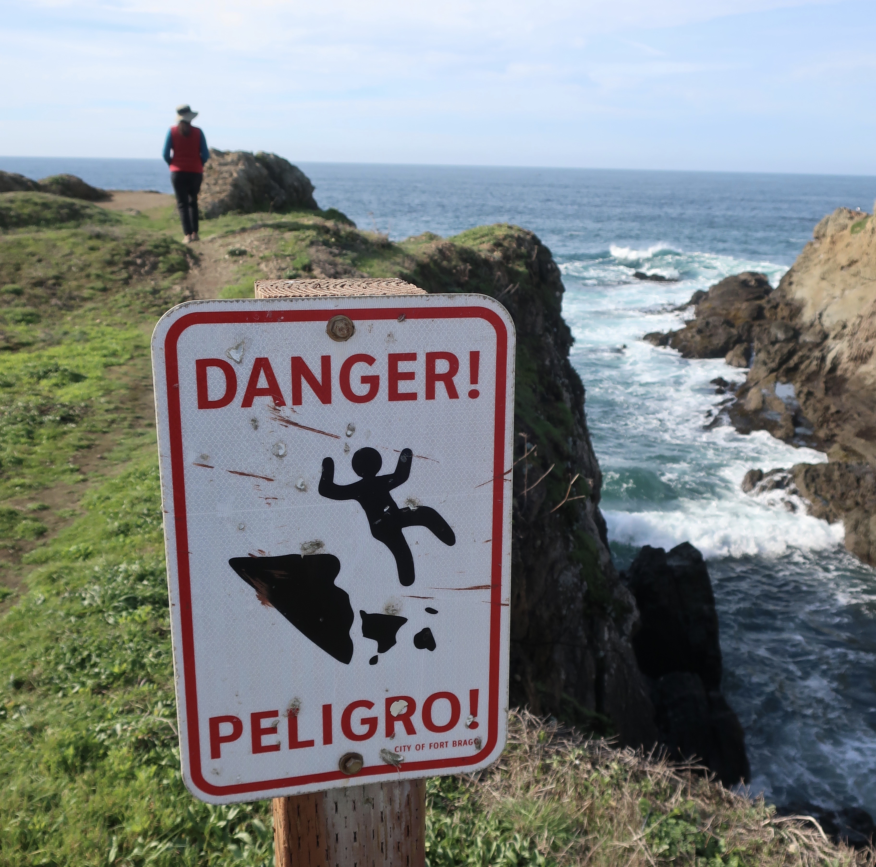
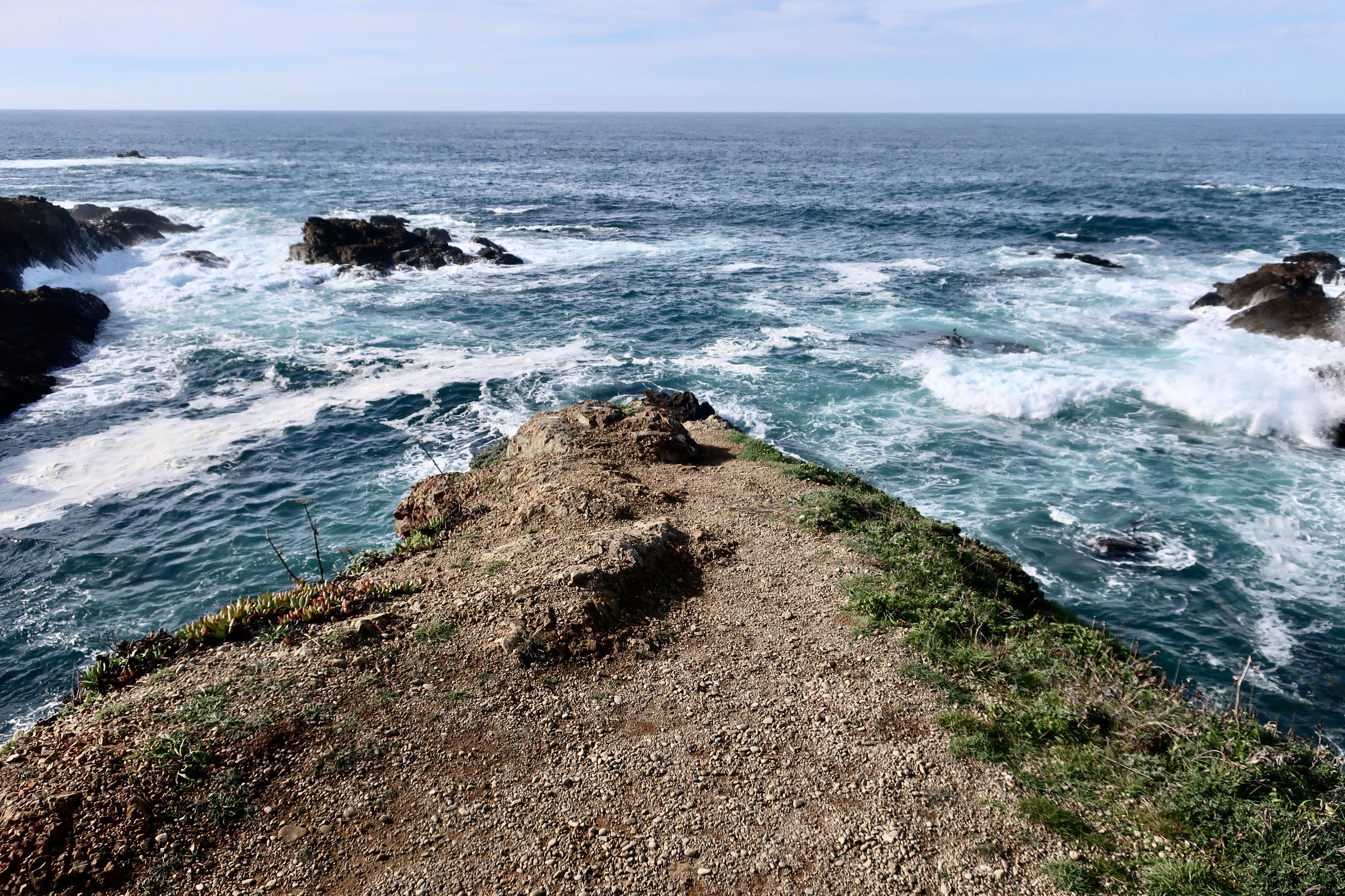
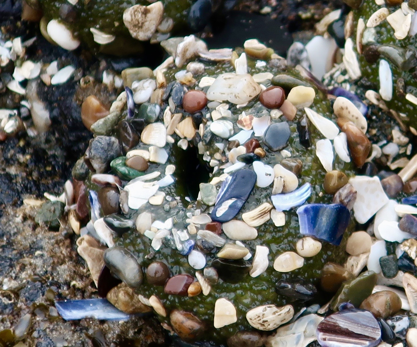
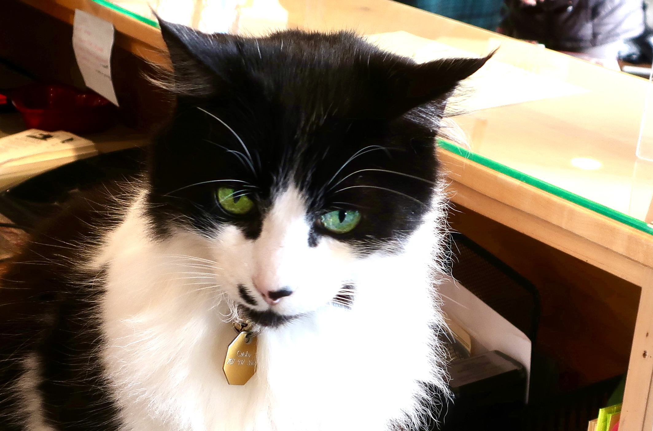
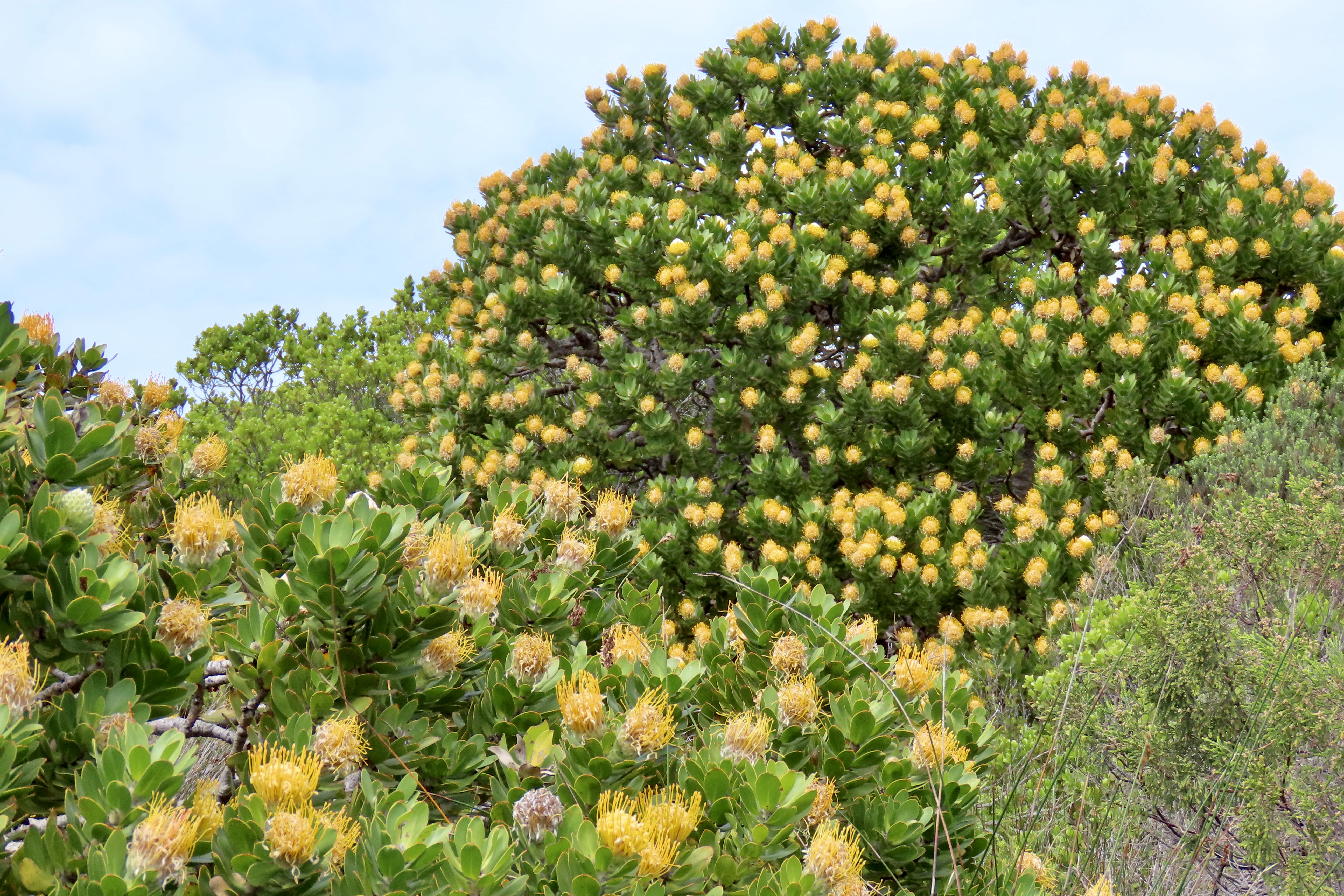
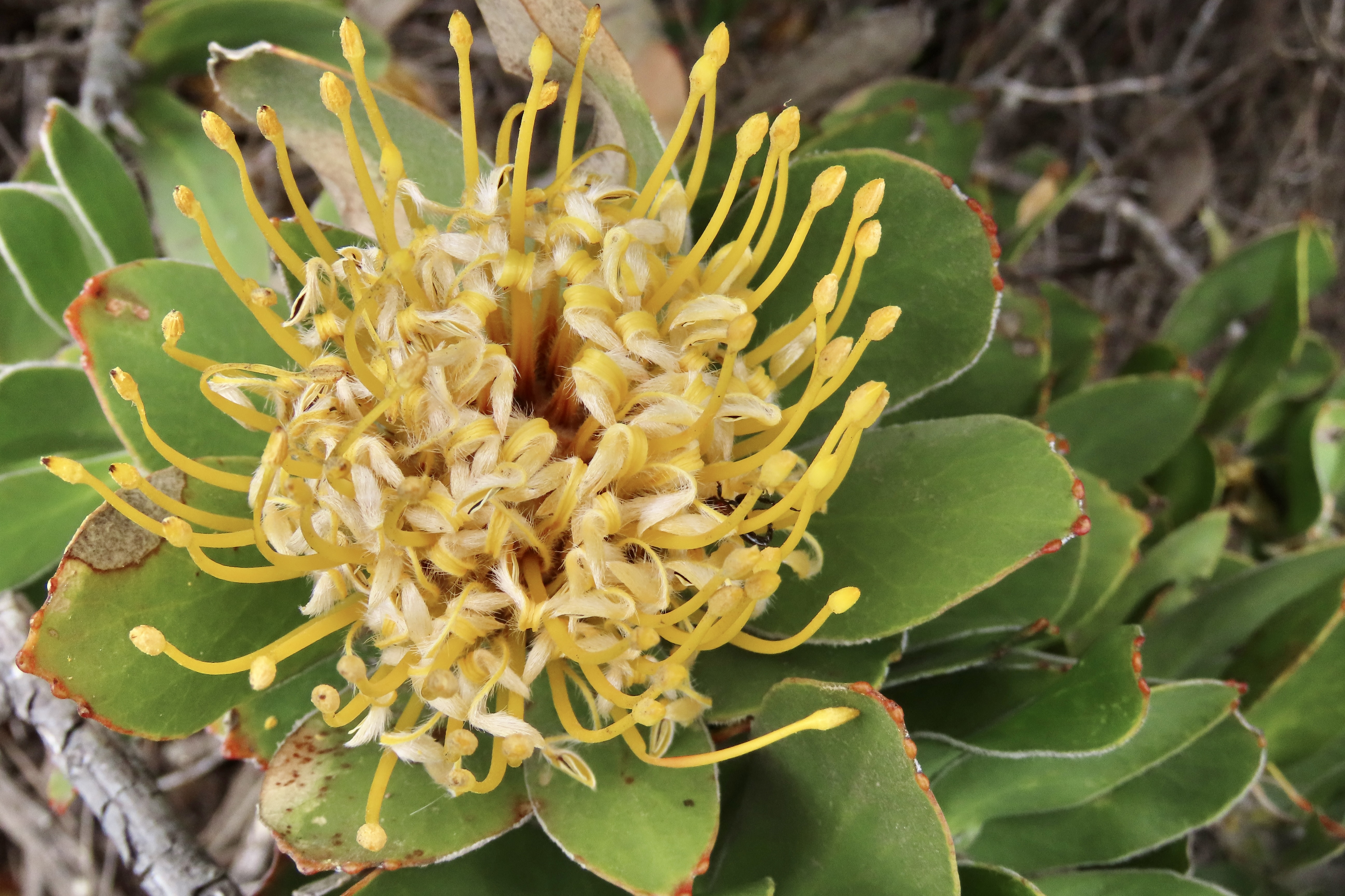
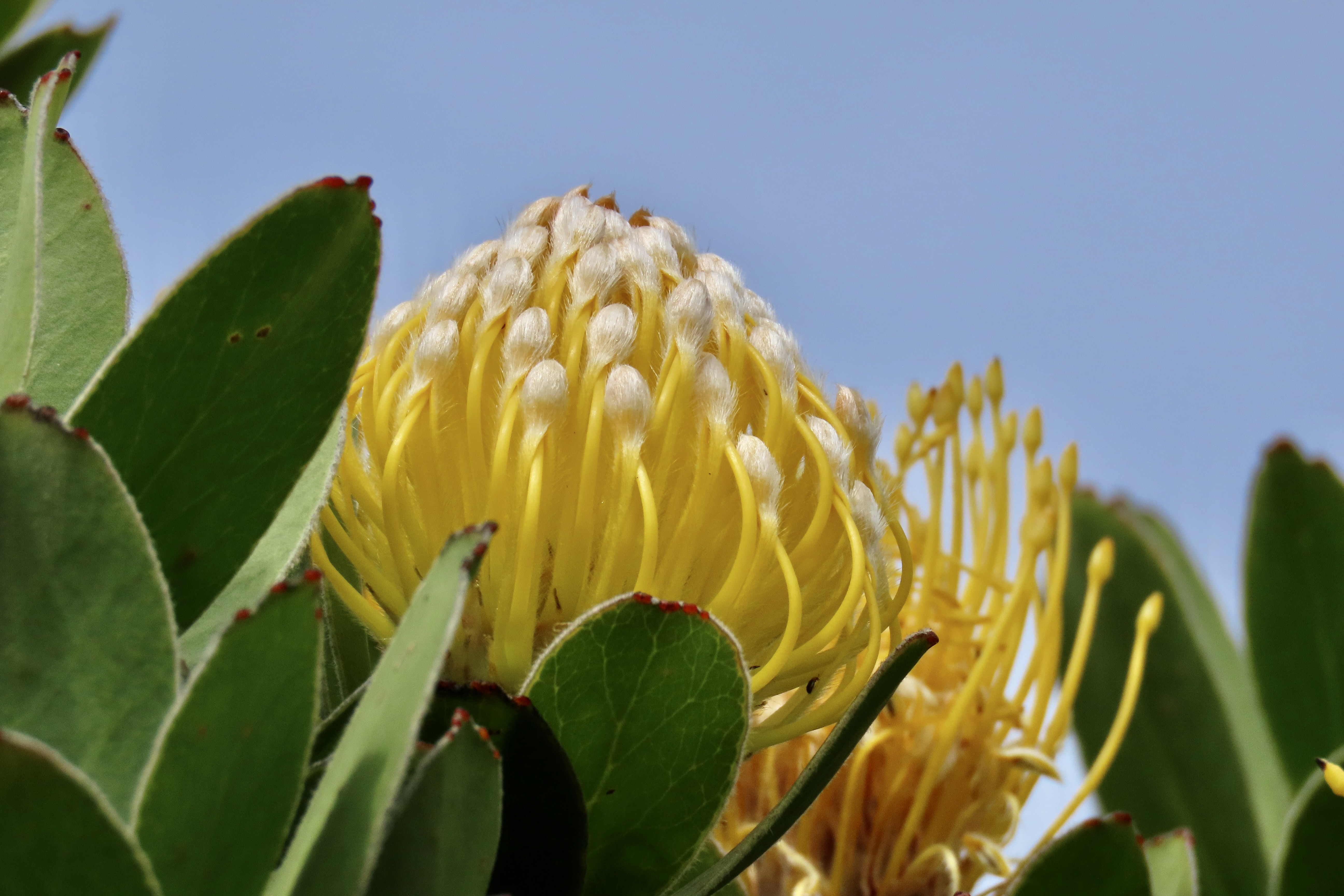
Our hike along Juniper Canyon Trail into the Park provided this view of the pinnacles. Not surprisingly, rock climbers get very excited about the challenges involved in climbing to the tops of the peaks. Here’s our trail. A small creek burbled along beside the trail.In places, the tiny creek was covered with huge boulders that had rolled down the mountain, possibly during earthquakes. They formed small tunnels known as talus caves. In other sections of the park, the talus caves can be miles long and people hike through them. This one was short enough I could stand on one end and photograph Peggy on the other. The embedded rocks in the rhyolite are breccia.Peggy’s perspective showed a colorful pool.What she couldn’t see was this magnificent bunch of shooting stars just beyond the pool. I’ve been admiring shooting stars for decades. I’ve never seen this many on a single stem. Our trip up the canyon provided numerous opportunities for Peggy and me to take close ups of the pinnacles.Each one was differentAnd had its own personality.Peggy called these “the fingers.”Can you spot the duck?Peggy became quite excited about her new camera’s ability to catch close-ups of lizards. This one was quite colorful. I believe it is one of several variations of a western fence lizard. We entered the Park from the West where this photo was taken. There is also an eastern entrance.This oak tree caught my attention.Wildflowers, like the shooting stars I featured above, were everywhere. Here are two more I found particularly charming. This is purple owl’s clover (Castilleja exserta), a species of Indian paint brush…And purple Chinese houses (Collinsia heterophylla), said to resemble fairytale pagodas.We were on the lookout for condors since they have been successfully reintroduced in Pinnacles National Park. Maybe…We hope you’ve enjoyed our introduction to the Pinnacles. If you are looking for a National Park experience without the crowds, this small park is definitely worth a visit. Next up: Pt. Reyes National Seashore, one of our all-time favorite parks.
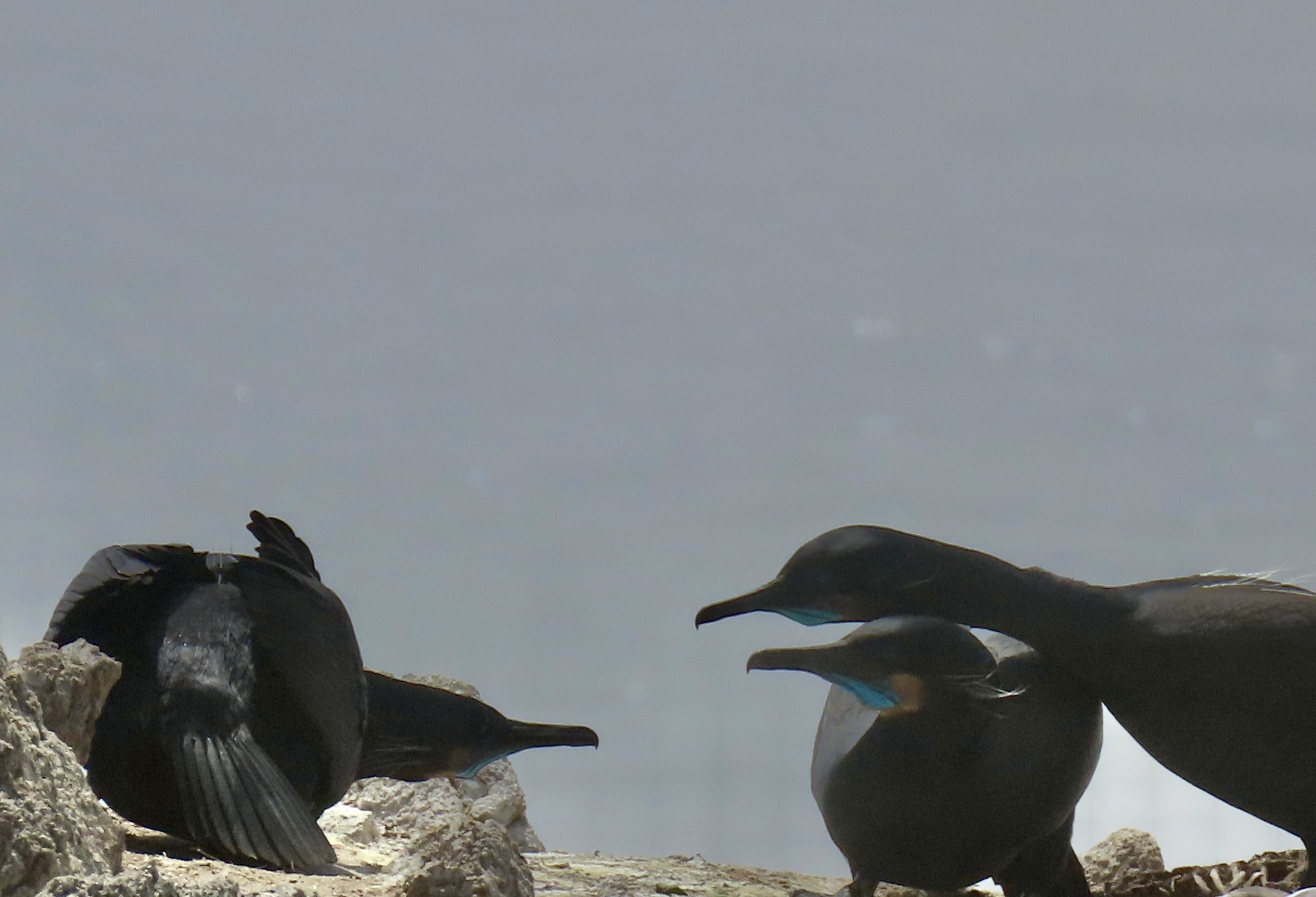
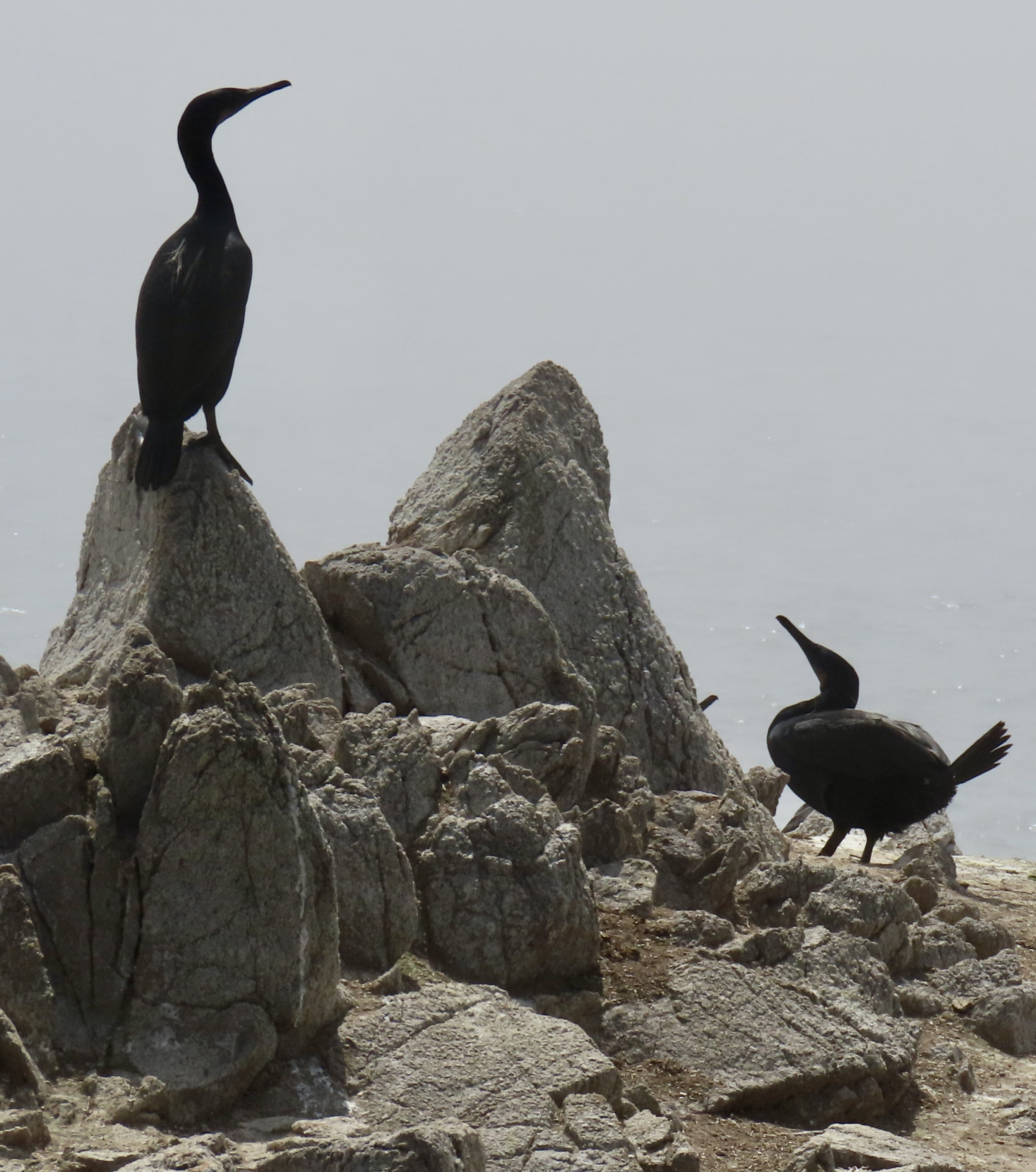
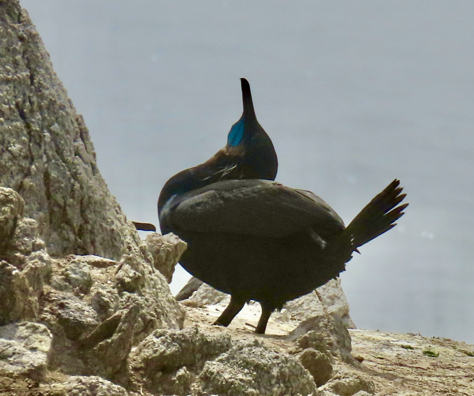
Peggy and I watched this pair of Brandt cormorants at the Point Lobos Reserve near Carmel, California as they shared a quiet snuggle. We had watched the two interacting for 10 minutes and we couldn’t help but think how human they seemed to be. The cobalt blue neck pouch and the white whisker-like feathers are both signs of mating season.
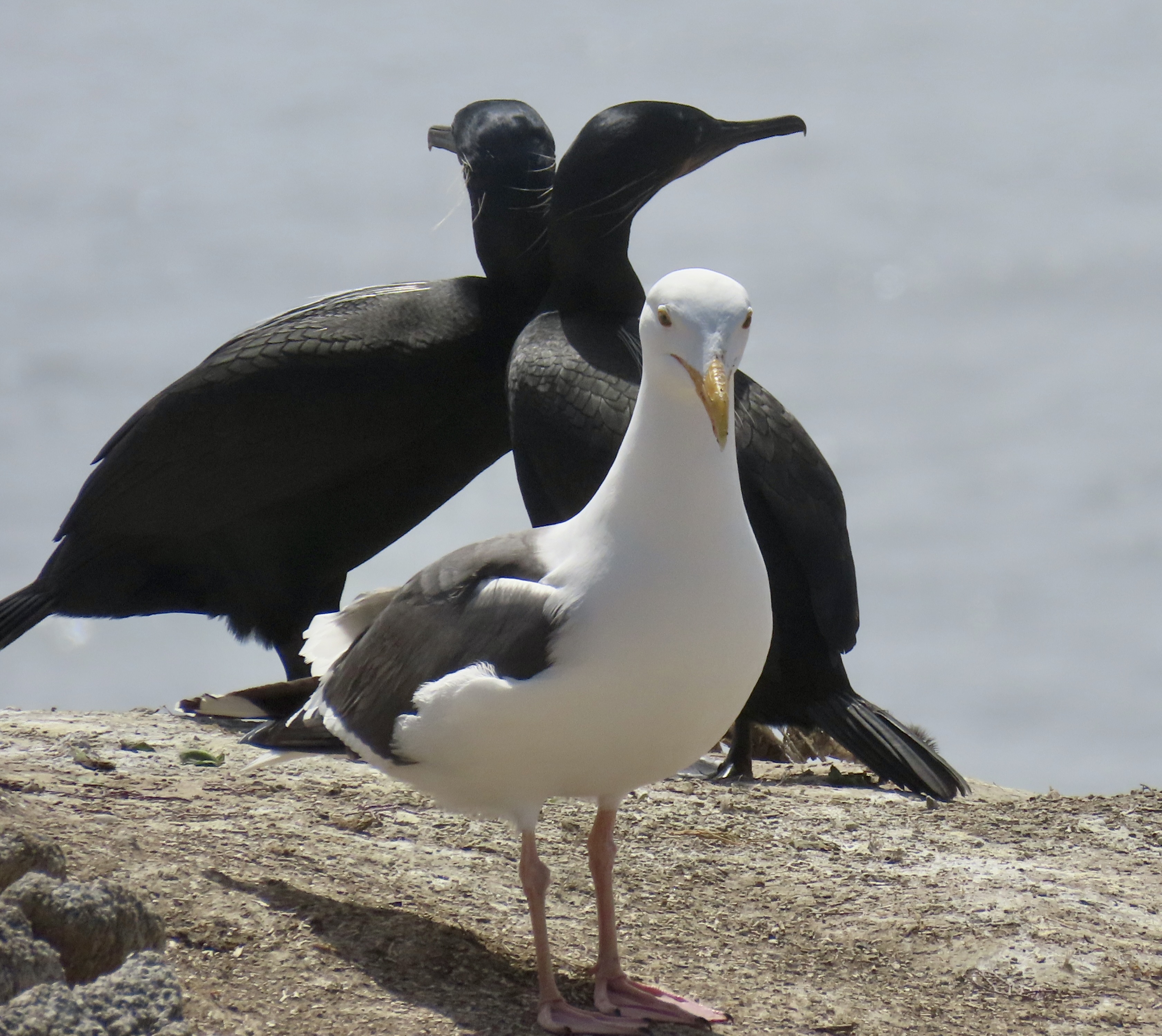
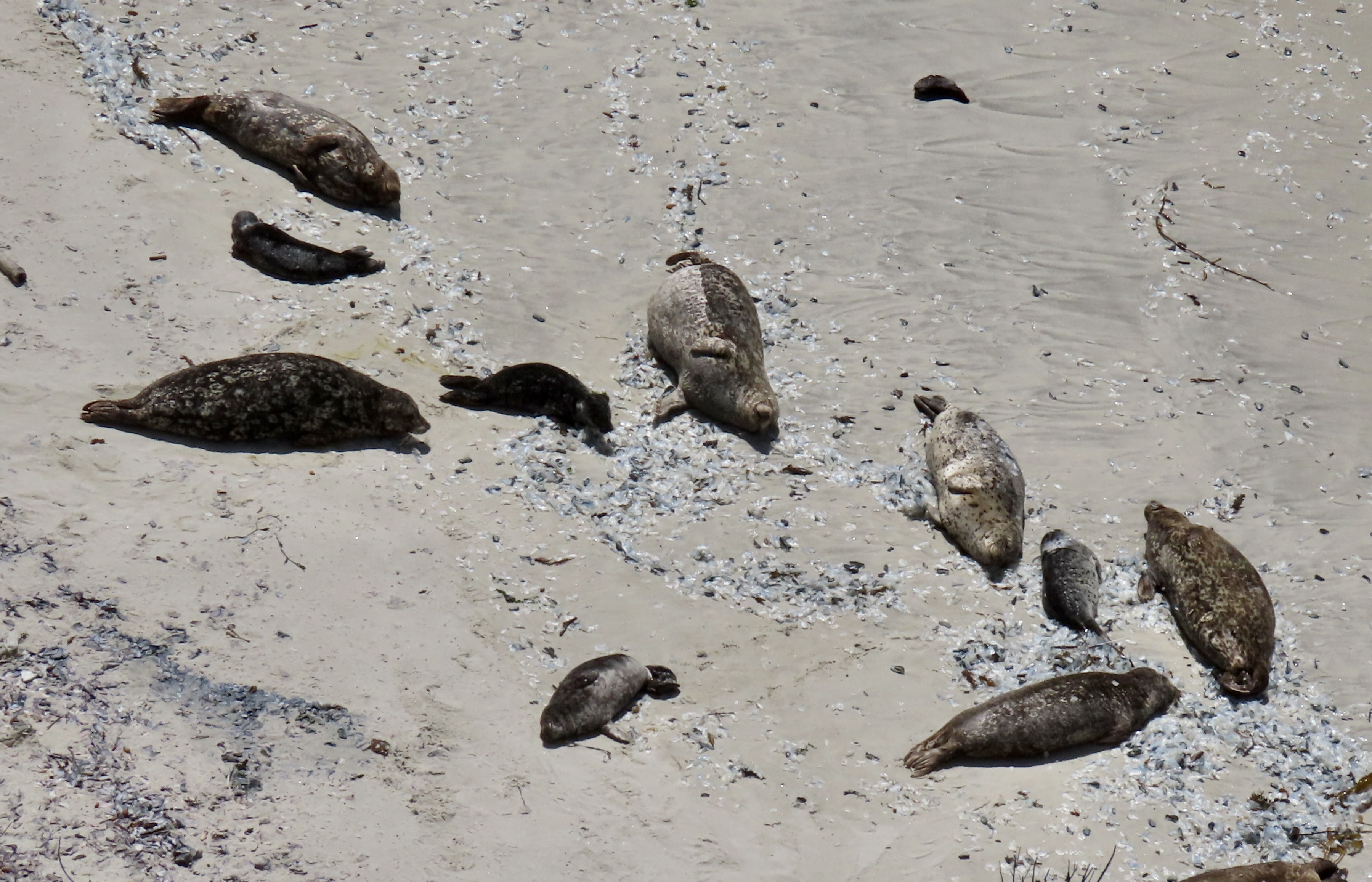
This is the second half of our series on Point Lobos. In my last post, we visited the northern part of the park and emphasized the natural beauty of the area. Today, we are going to explore the southern part of Point Lobos where we will feature the cormorants and seals. We had the opportunity— I might even say privilege— of watching cormorants as they went about the serious (and sometimes humorous) process of attracting and interacting with mates and mother seals as they watched over their babies. We will continue to explore the beauty of the park as well. How could we not? It’s Earth Day.
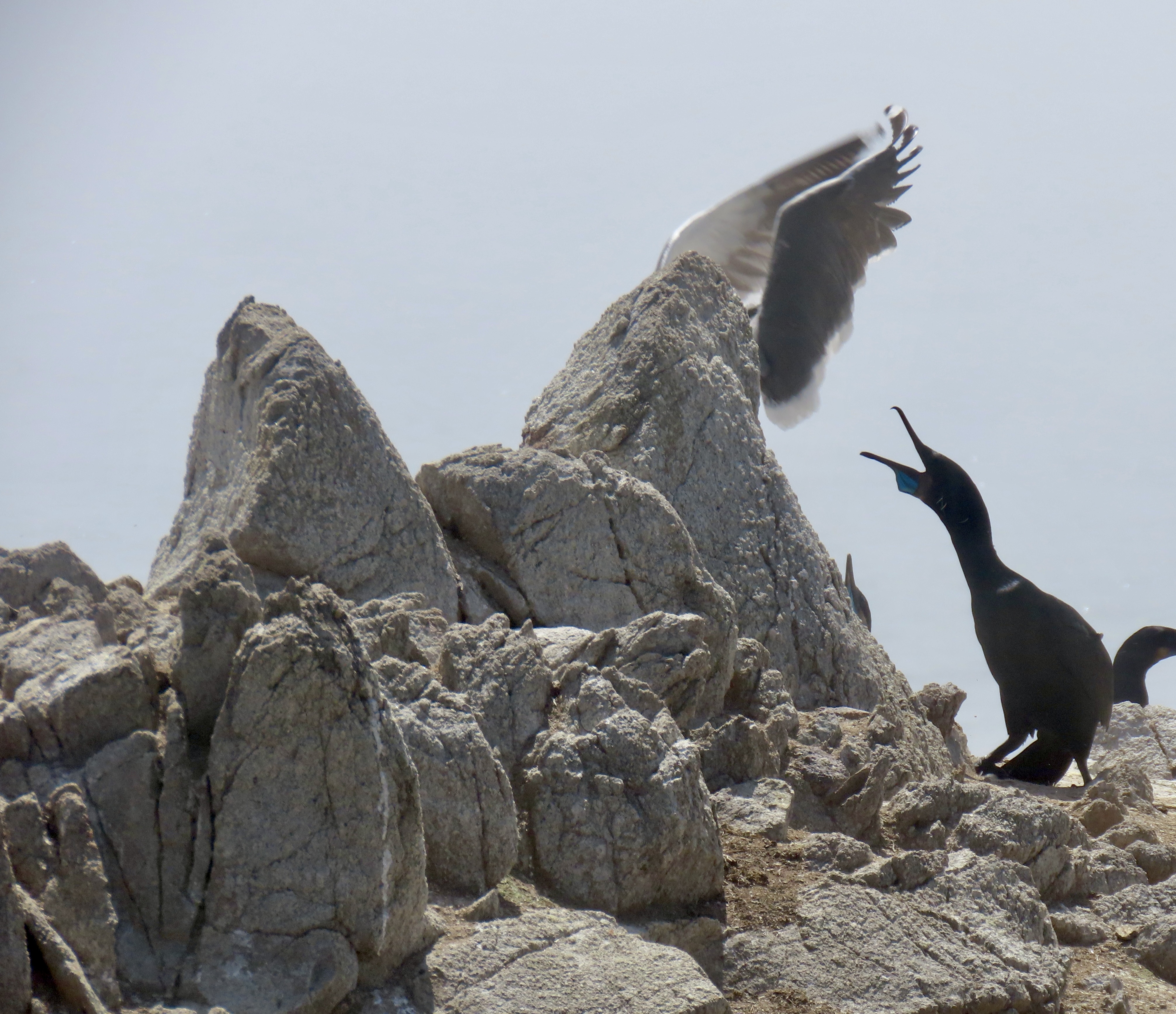
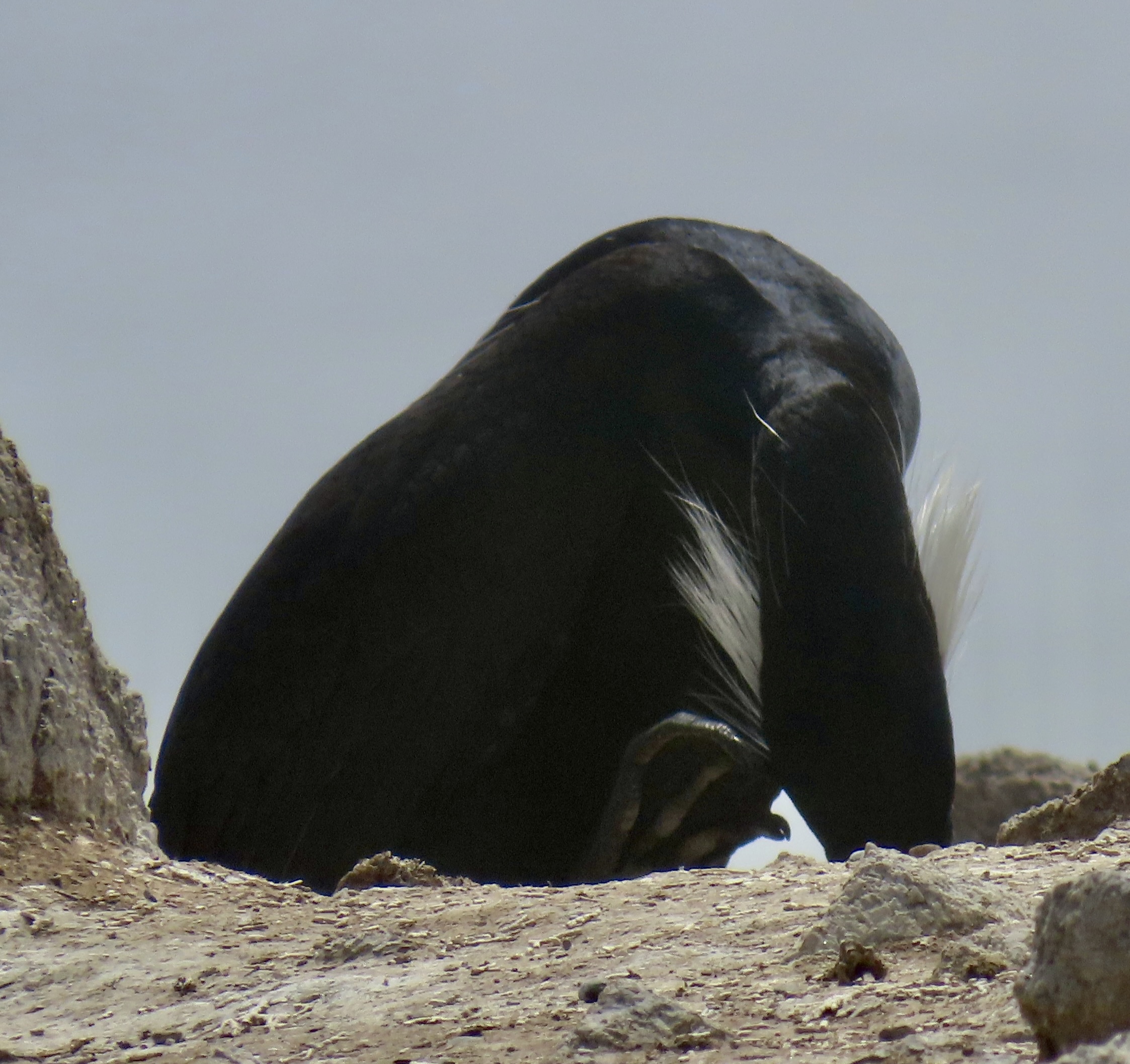
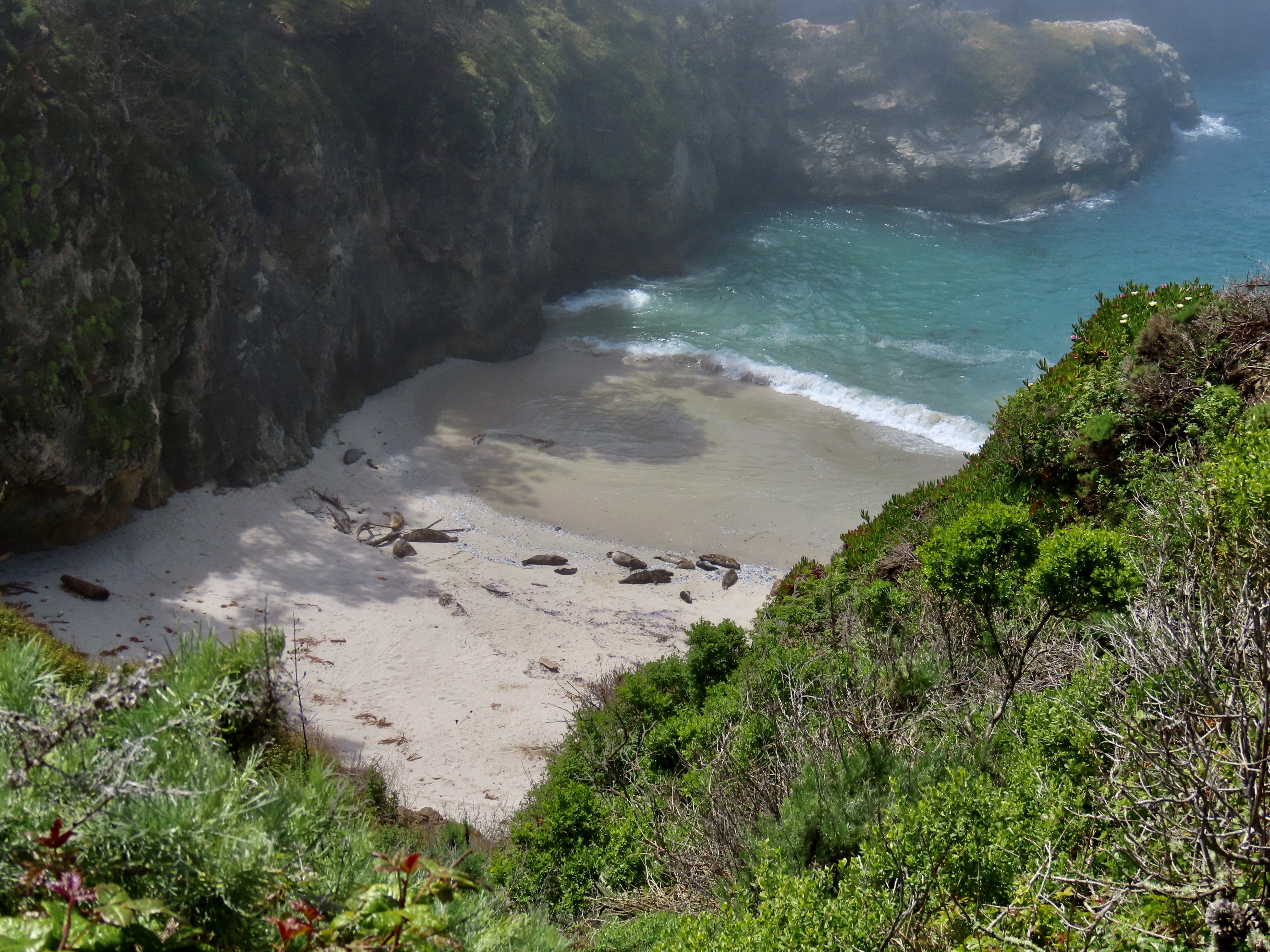
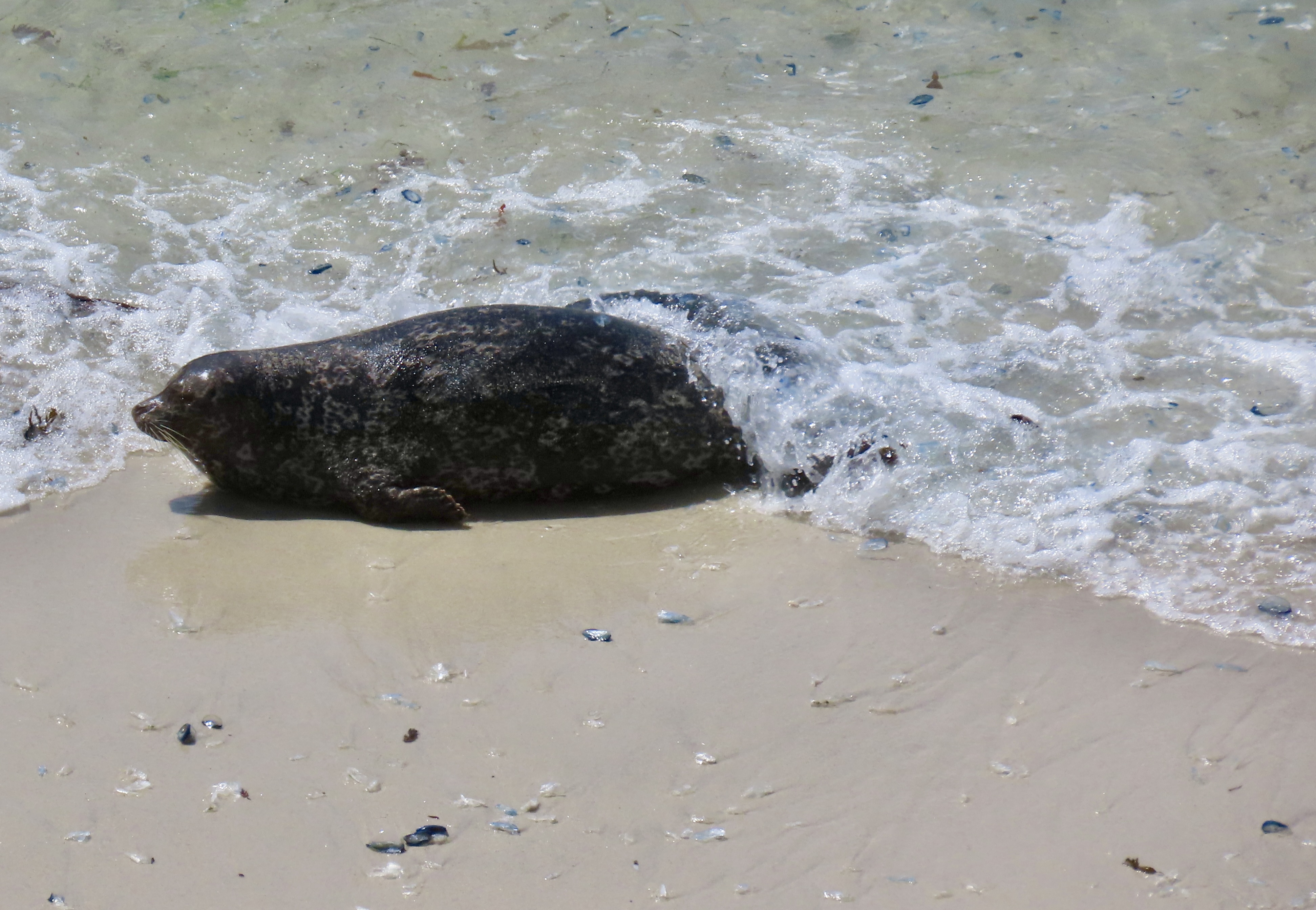
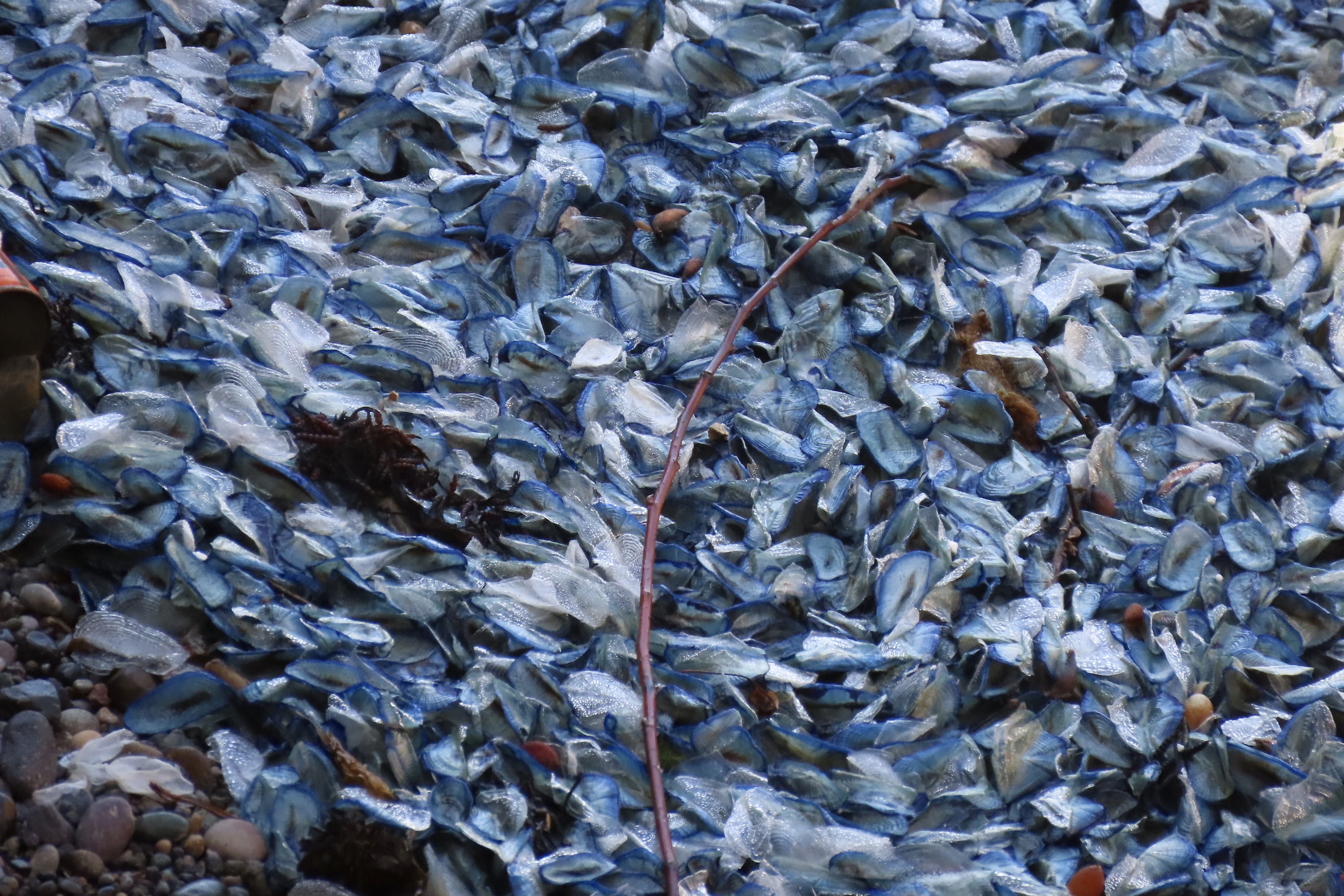
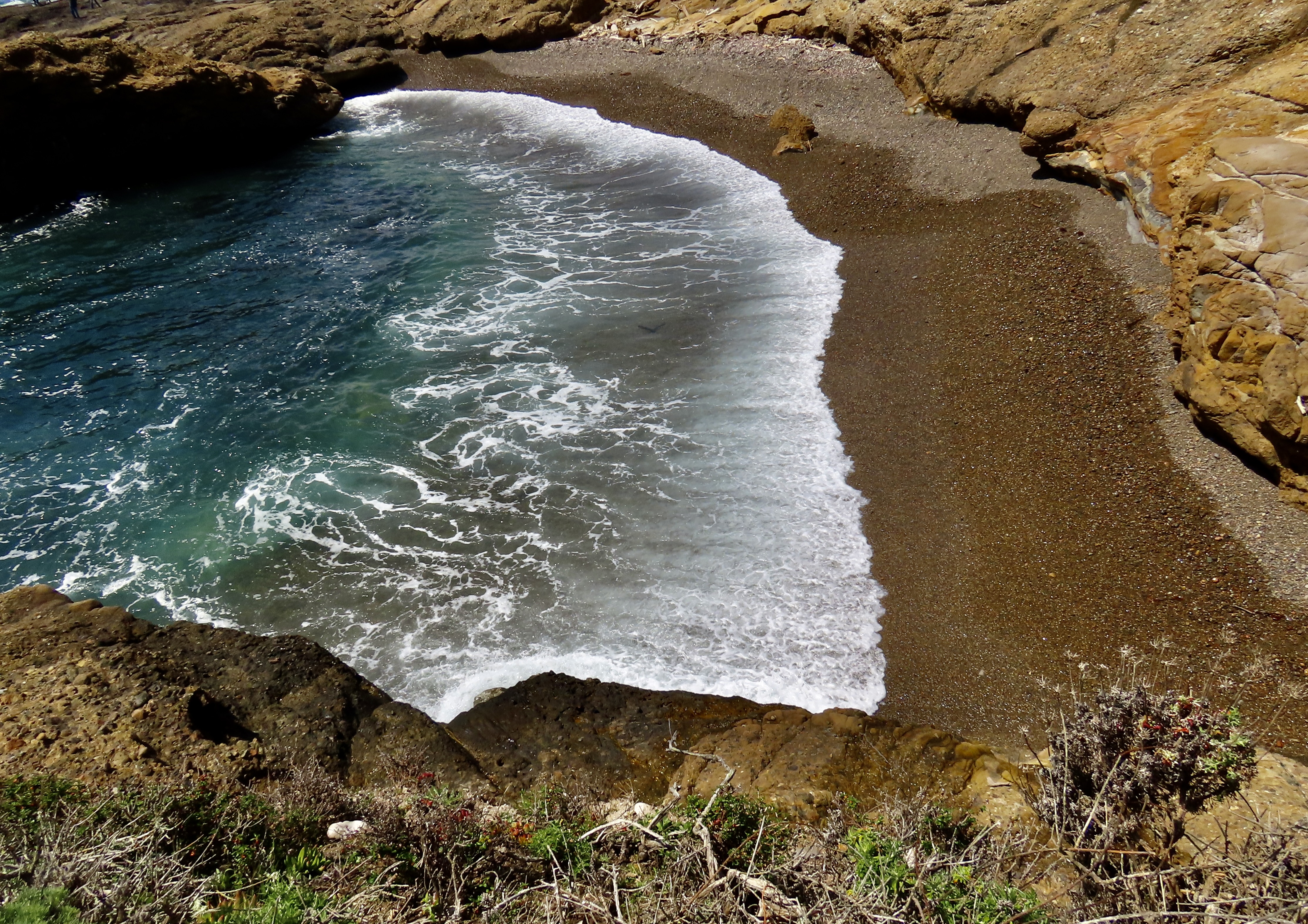
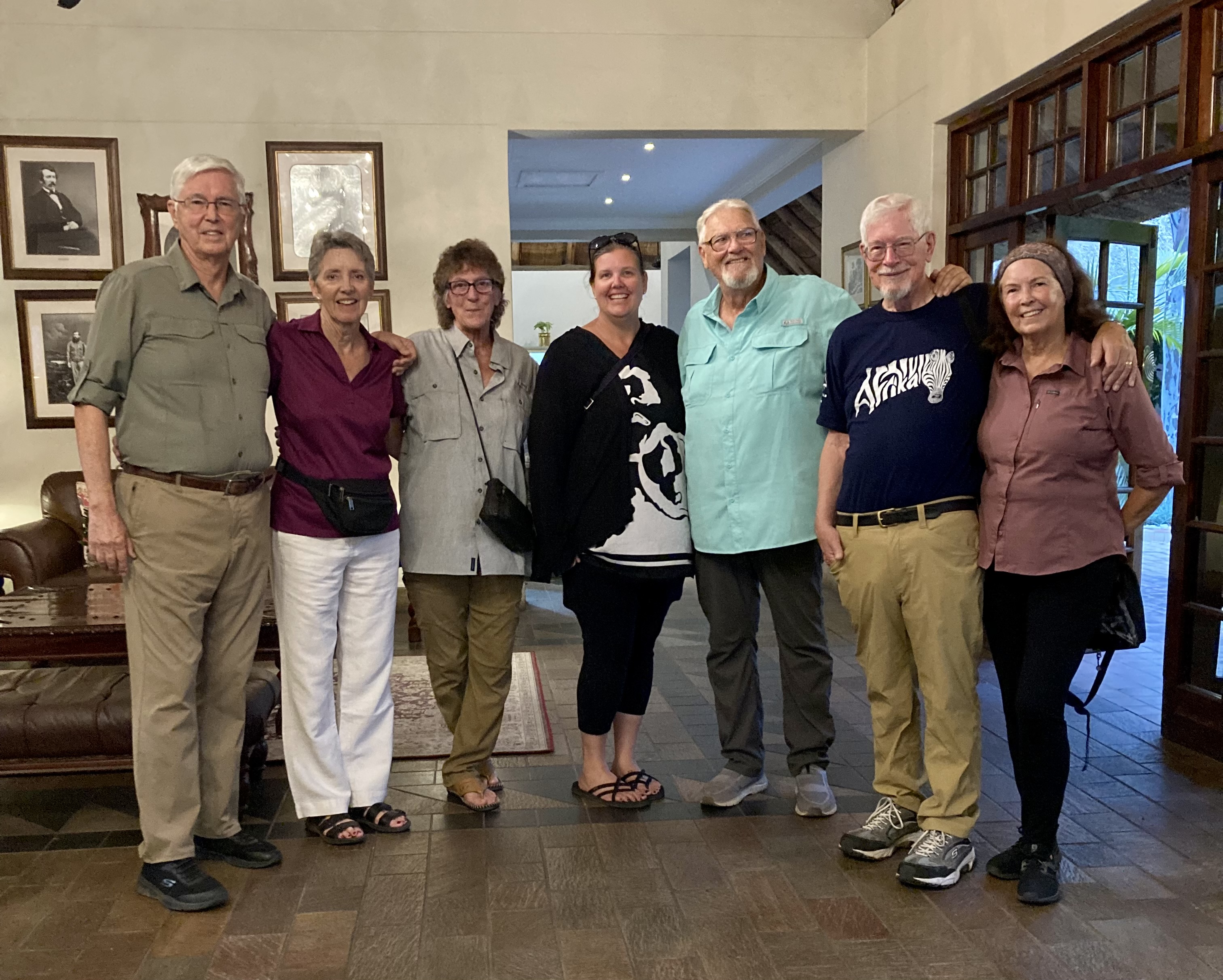
A California sea gull insisted on being in our first photos of the two cormorants shown above. The cormorants divided their attention between communicating with each other and checking their surroundings. Or maybe they were necking.They totally ignored the seagull. Is this a cormorant kiss?The gull decided to vacate the premises. It had gathered something in his beak that might have been nesting materials. It’s that time of the year. On the left, you can see another cormorant that apparently had something to say to the couple.In my imagination, she was seeking advice.Just before, the female had been eyeing a male on the rock above that seemed to be totally ignoring her. I imagined her asking, “How do I get his attention?”“You have to strut your stuff.”“We mean really strut your stuff.” Right about then, a pelican flew over and scared away her potential mate. She was not happy. Peggy caught the action.Meanwhile this pair went on with their discussion. Possibly they were discussing nest building. It’s the male’s responsibility. “You need to get busy, dear.” Was she egging him on?Actually, an important part of the mating ritual is for the male to build a nest with the hope of attracting a female to use it. We watched another male advertise his services. It appeared that the the nest was a little too makeshift. The female did not seem impressed. Maybe it was the fact that she had just watched him steal the materials from another cormorant! You can see the beak of the crime victim in the upper left hand corner about to deliver a peck.I liked this photo because it displayed the white whisker-feathers a Brandt cormorant grows during mating season. It also showed one of the big feet it uses for swimming. The cormorant is an excellent swimmer and can dive as deep as 200 feet in pursuit of fish.A final portrait of cormorants doing their thing.A seal birthing area was located right next to Bird Island where we watched the cormorants.This photo shows the steep cliffs that serve to protect the seals and their babies. It also shows the advantage of having a good telephoto lens to get close. Peggy and I happily snapped away.A mom and her baby had settled next to another seal that looked pregnant. The baby worked its way around to the other side of its mom. Was it looking for a hug?You may have wondered why we thought the other seal was pregnant. Well…There were several seals and pups in the area. I used this photo in my last post.We watched a mother seal swim in with her baby. A wave had washed the baby up against the mother.Peggy caught this shot of the mom checking up on her baby. Are you curious about all of the blue/grey/white stuff the seals are lying in?They are Velella, a small jelly fish that comes with a sail on its back. It normally lives offshore and uses the wind to move about in large numbers. Occasionally a strong Westerly will blow thousands of them ashore, however, where they die. And stink. I’ve seen and smelled them several times over the years. Apparently the odor does not bother the seals.Moving on from smelly jellies, here’s an Indian Paint Brush…And crashing waves…Lots of them…More…What they looked like close up. I don’t know which of us took this photo. It may have been a mistake, but I found it very interesting when I was looking through our photos for this post. Having expended its energy, a wave gently retreats back to the ocean.Neither Peggy nor I can ever resist stones that require little imagination to turn into creatures. We were sort of thinking Easter Island.Nor can we resist a flower garden framed like this?A series of sea caves were also quite photogenic. The water had a translucent quality.This rock offered two caves. Eventually the caves will cut all of the way through and create a sea stack. Of course the ‘eventually’ could mean a few hundred thousand or million years. Why hurry.The color of the water caught our attention here.These islands mark the southern boundary of Point Lobos.A final photo to wrap up our two posts on Point Lobos and another reminder of how beautiful and precious the world we live in is. And how important it is that we protect it. Next up: We go inland to Pinnacles National Park. One of the latest created in America’s great system.Peggy and I are in Sacramento now, heading out to our next Pacific Coast location: Pt. Reyes National Seashore. We came to town to visit with family and friends, which we always do when in the area. This time we had another special treat: Meeting with Jenny Collins, a fellow blogger on Word Press whose blog is Bulldog Travels/Photos by Jenny. Jenny and I started following each other 9 or 10 years ago. We have a lot in common. She loves traveling, nature, and photography, as many of us do. We also come from the same area, however, which adds another layer. This time we met at a restaurant in Auburn which Peggy and I used to frequent 30 years ago. It was the first time we met Jenny and we had a delightful time. I was reminded of just how valuable the friendships we make on WordPress are. Jenny’s last post was a gorgeous photo essay on Yosemite National Park. I recommend that you check it out at bulldog travels.com.
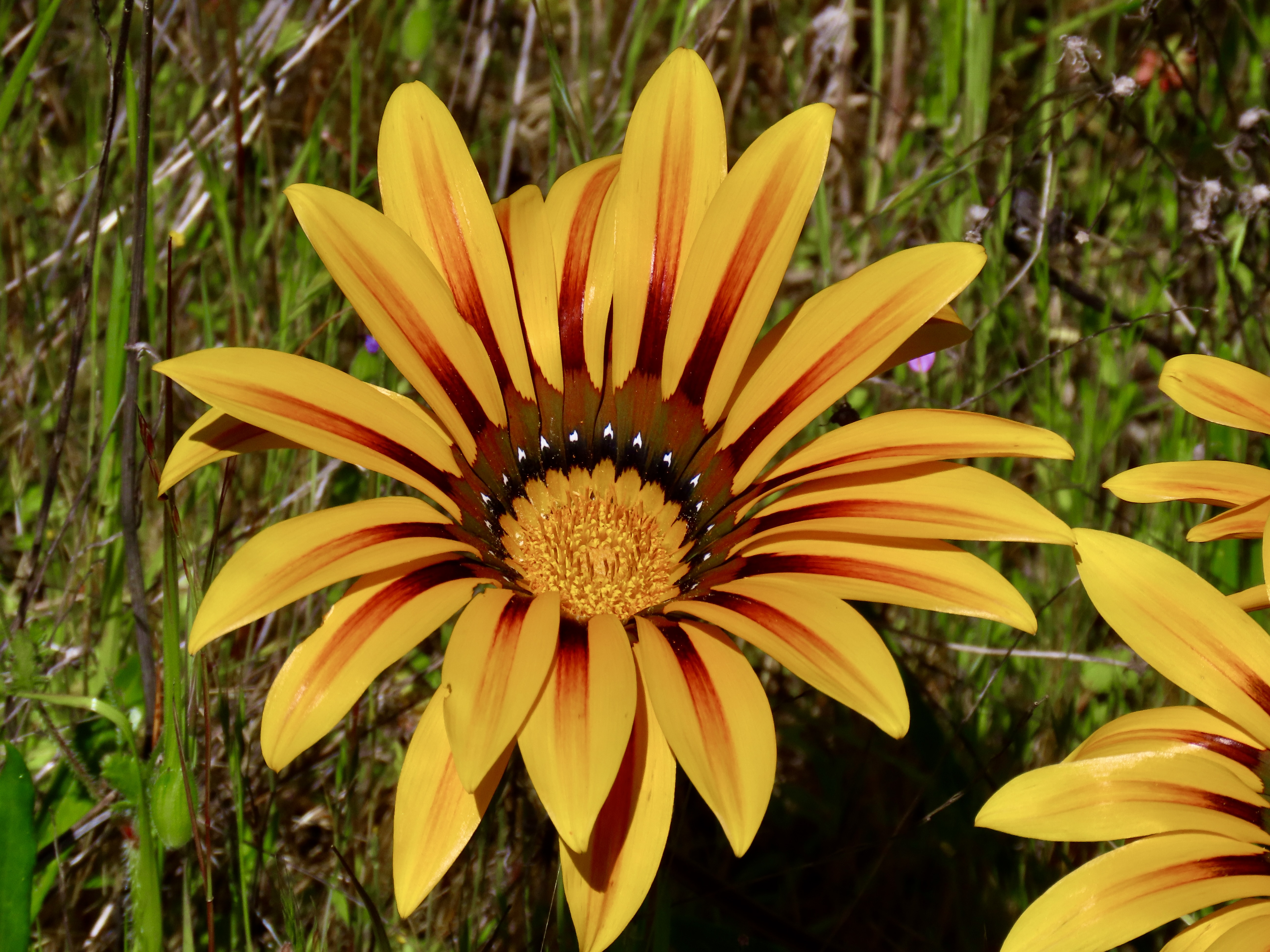
There is an entrance to the Fort Ord National Monument near us, a mere 20 minute walk from where we are camped at the Laguna Seca Regional Park. The monument was once an army base, rightfully billed as the most beautiful army base in America. Getting there from our camp requires climbing a steep hill and hiking along a ridge. We’ve been there twice. The first time we went without our cameras. Boy, was that a mistake. Wild flowers were bursting into bloom everywhere. Then we came upon a whole field of the eye popping beauties featured above. They came in multiple bright colors. Then and there, we vowed “We’ll be back!”
The next day found us climbing the hill again with my camera. Peggy’s camera, and our cell phone. Just in case. We entered the National Monument and I dutifully went to work, capturing wildflowers as I walked along the trail. Peggy took off like a greyhound. That woman can move when she has a mind to! I think she was afraid that the flowers we had so admired the day before would be past their prime, expired, and that somehow ten minutes was going to make all the difference. When I arrived a half hour later, the flowers were still in their prime, new ones had joined the crowd, and over a gazillion buds were waiting for their turn. Peggy quickly announced that she had taken over 20 photos of the flowers. She never takes 20 photos of any one thing. That’s what I do. Naturally, I had to add to her collection.
One challenge we faced was we didn’t recognize the flower. I knew it was a composite, a member of the vast family of sunflowers, daisies, asters, etc. Not a problem, we thought. Ha. That evening, I checked my National Audubon Field Guide to North American Wildflowers with its 666 entries. No luck. Okay, time to jump online. I typed in flowers of Fort Ord National Monument. Nope. How about flowers of Monterey County. Nothing. Flowers of the central Pacific Coast of California? Nada.
Then I remembered that we had added a flower ID app to our i-phone a few years back. Would it still be there? Peggy went searching and found it. She took a photo of my screen showing one of the flowers. And there was the answer: Gazania. What? We had never heard of it. Turns out it is a native of South Africa. I had taken photos of a number of flowers in South Africa on our safari trip there. But not Gazania.
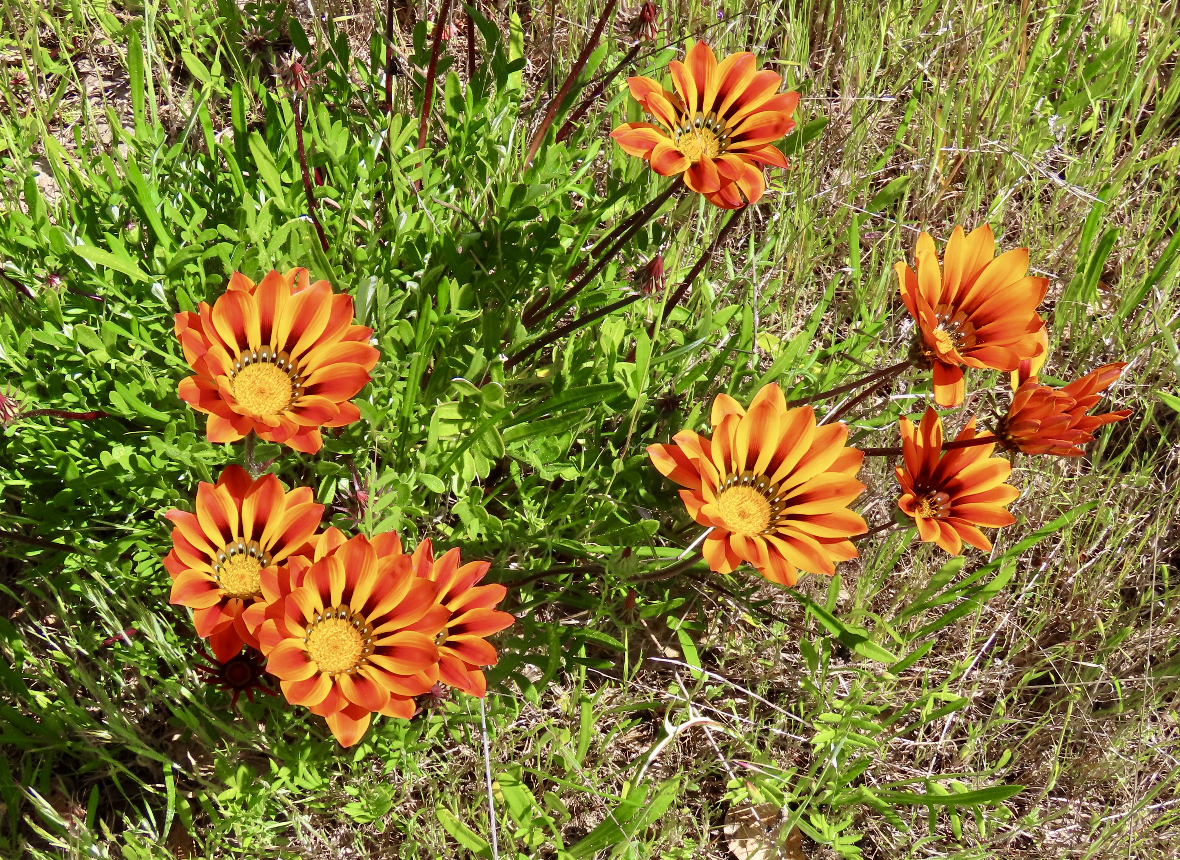
Its beauty meant that it had been imported to the US and numerous other countries to adorn flower gardens. Not surprisingly, it had escaped. Monterey was listed as one of the counties where it happened. Following are a number of photos that Peggy and I took of the Gazania and other flowers we found along our walk both wild and wild-domesticated.
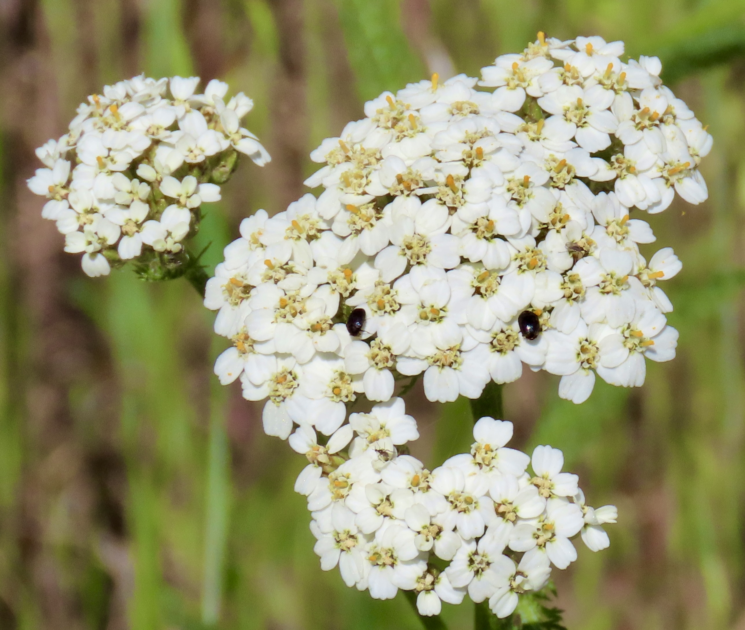
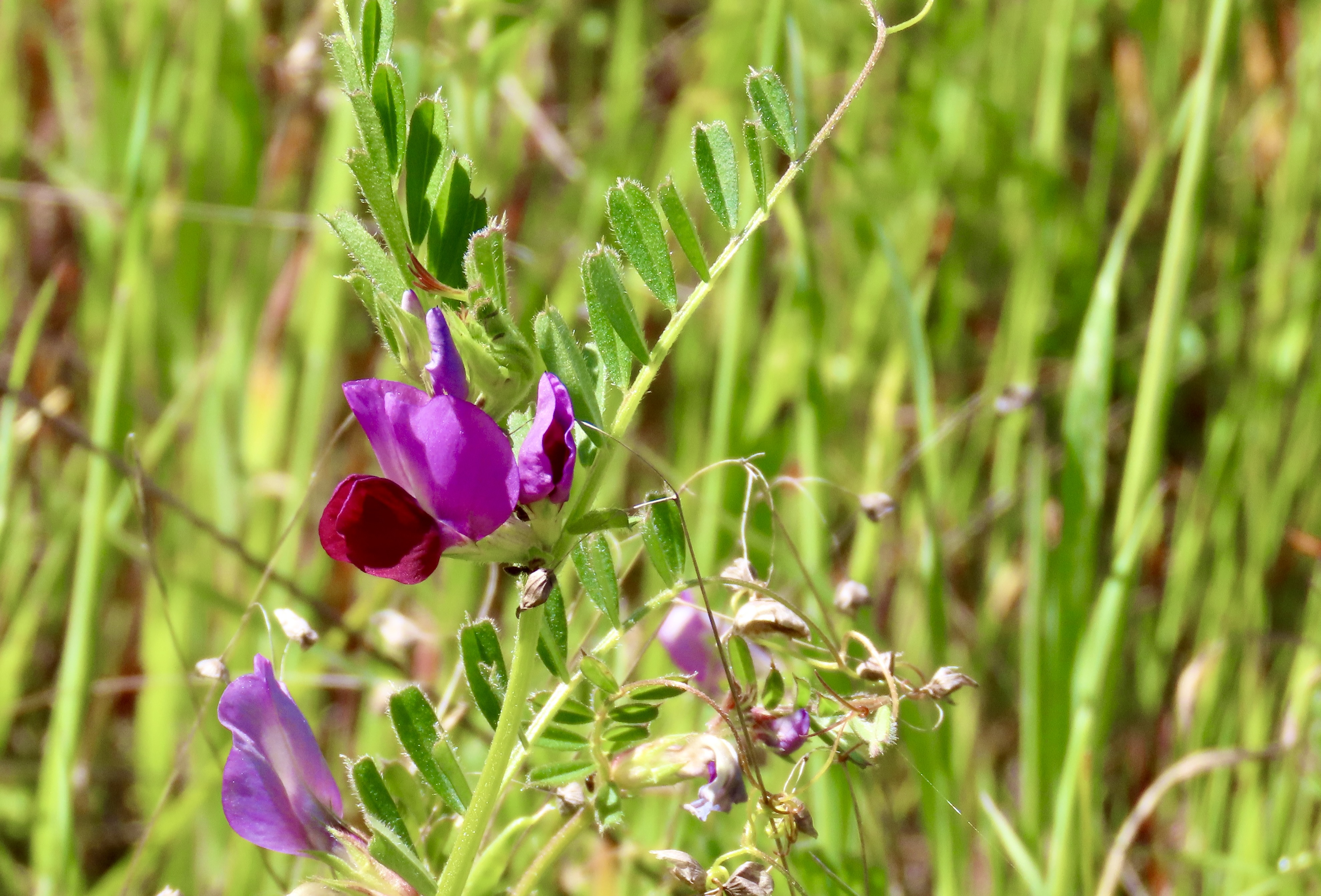
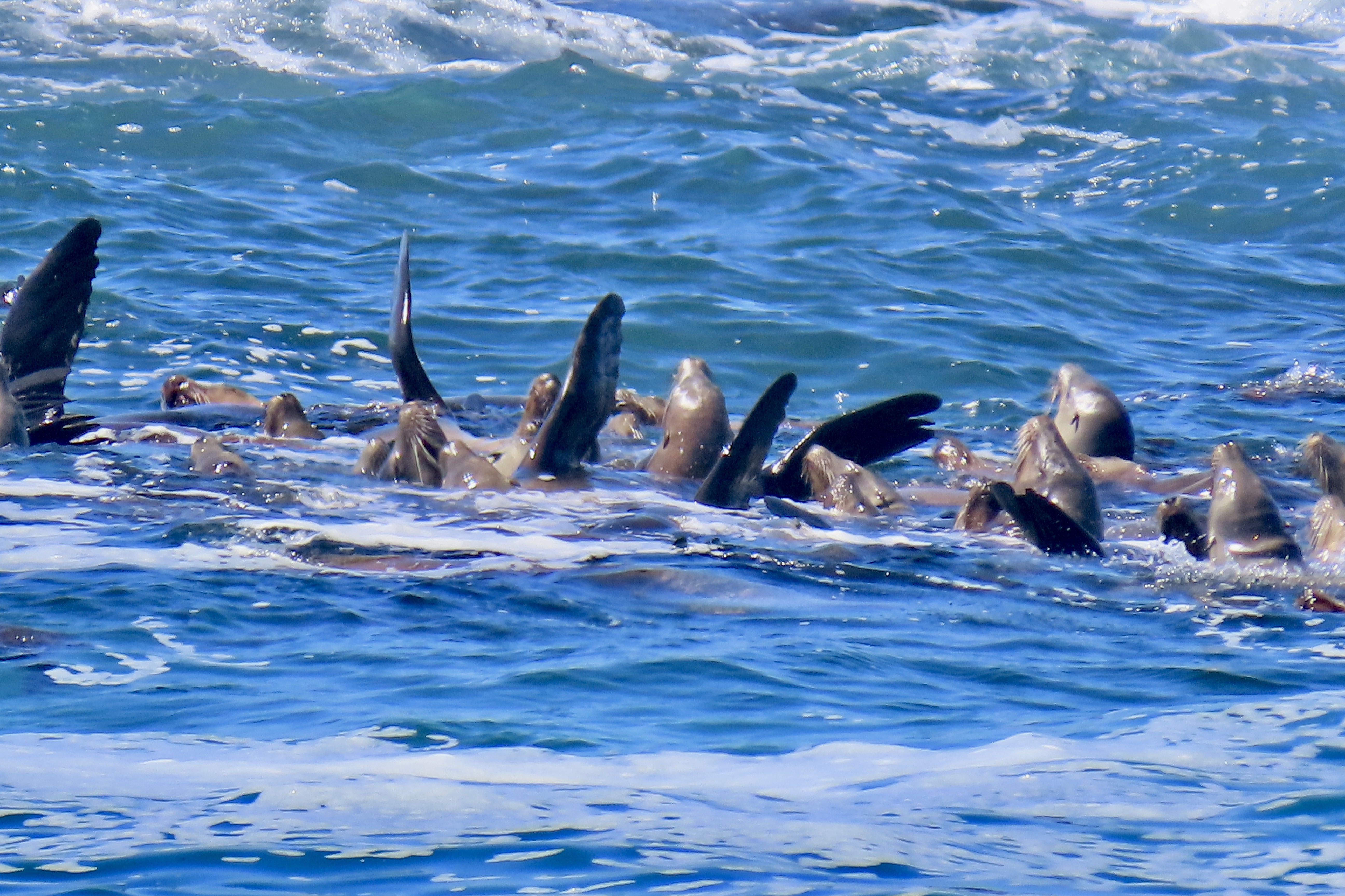
Yellow twins…Orange reddish triplets…A red single…A yellow single.A couple.A bouquet.Another bouquet.A field.A happy Peggy.Looking out from Fort Ord National Monument south toward the coast range and Big Sur.Coast live oaks on the edge of Fort Ord National Monument in Laguna Seca Regional Park. The top of a picnic table can be seen in the background. We walked through a very attractive tent campground on our way to the monument.We also found this flower growing on a bush in the campground just before we hiked into the monument. Our flower app described it as a gum Cistus.We were greeted by this sign as we walked into the park. With a rich military history behind it, the army base was closed in 1994 due to base realignment. In 2012, President Obama signed a proclamation declaring a portion of the former base as a national monument. Following are some of the wild flowers we saw. I knew most of them, but used the phone app to check.This golden violet was among the wild flowers I photographed along our trail.A member of the mallow family with spider. Can you find it?Bluedick with a bee.Yarrow with beetles.Vetch.Scarlet pimpernel.Golden eggs.It isn’t known for its beauty, but miner’s lettuce is noted for its edibility. The 49ers of the California Gold Rush mixed it into their salads regularly, as my mother did on occasion when I was growing up. I pulled a leaf and chomped down. Peggy nibbled a small bite cautiously.One of numerous members of the lupine family.Peggy and I were amused when we hiked back to our camp and found two Gazania perched above it that we had failed to notice previously. That’s it for today. Next up we will take you on two scenic drives: Ocean View Drive in Pacific Grove and the world famous 17 Mile Drive between Pacific Grove and Carmel.This view had Peggy and I both wondering what the heck we were looking at. Sea lions, yes. But doing what? I’ll explain what we learned in our next post.
An extended trip north up the Pacific Coast Highway from Carmel, California to Olympic National Park, Washington has been on my bucket list forever. It includes some of the most beautiful coastal lands in the world. Peggy and I have been to each of the places we will be visiting and they are all places we love. Starting at the bottom and working our way north for three months is new for us, however, a leisurely one way trip up the coast that promises to be uniquely rewarding. As always, you are invited to join us.
There is an ancient Chinese proverb from the Tao Te Ching that states “A journey of a thousand miles begins with a single step.” Although the distance and mode of travel may vary, it’s how all great adventures begin. I started my 750 mile backpack trek down the Pacific Coast trail to celebrate my 75th birthday with a single step and my 6-month, 10,000 mile solo bike trek around North America at 46 with the crank of a pedal. That was an adventure! An even greater one was waiting for me at the end… I met Peggy when I stepped off my bike in Sacramento. She gave me a dazzling smile and said, “You must be Curtis.” I was smitten and svelte at the same time. I’m still smitten…
I lucked out. Peggy loves adventures as much as I do and we have been on many over the past 30 years. In the past two years alone, we have traveled up the Rhine and Nile Rivers by boat, gone on an African safari, and explored 30,000 miles of North America in our pick-up, Iorek, and small trailer, Serafina. I’ve already blogged about these adventures, although I still have some catching to do.
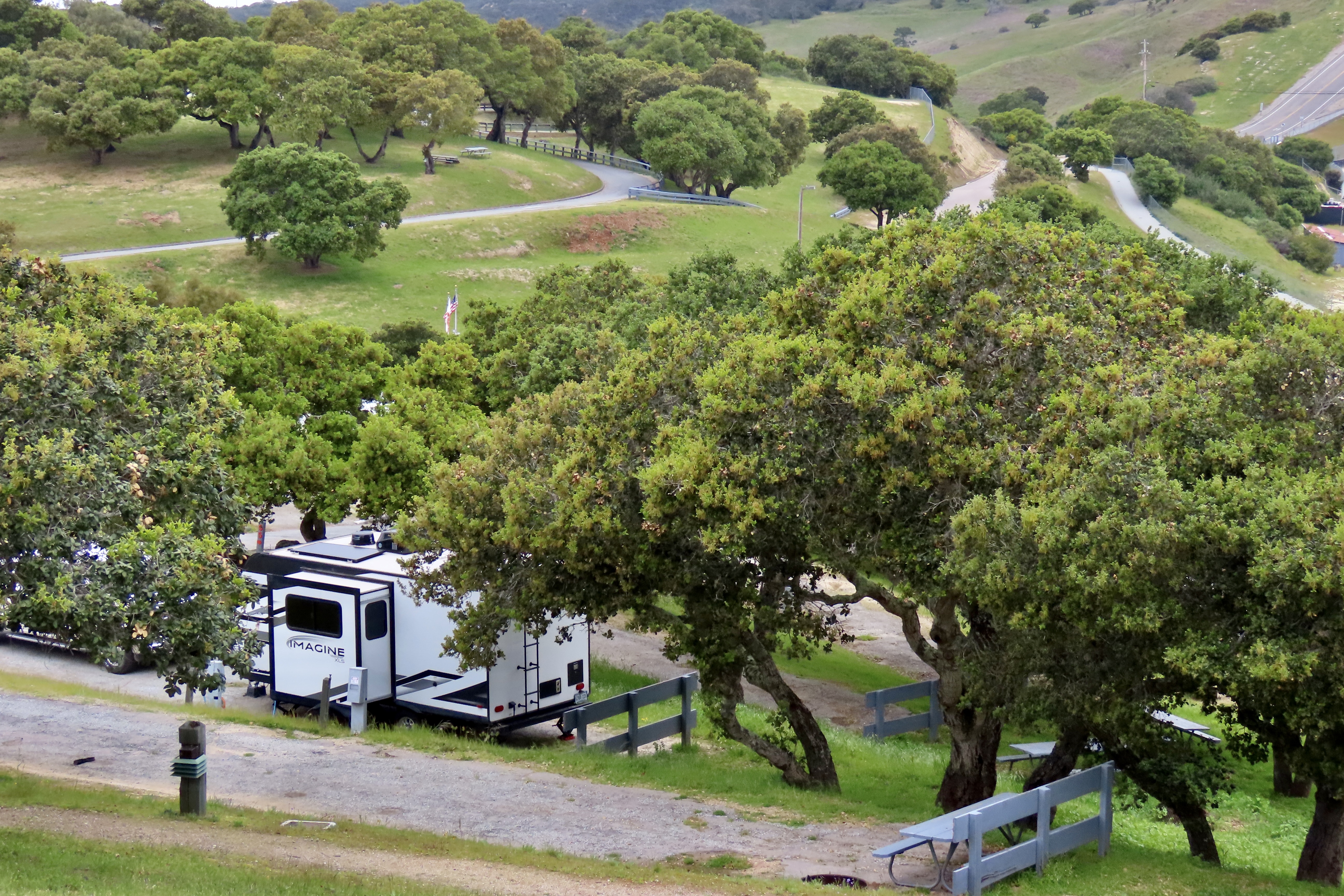
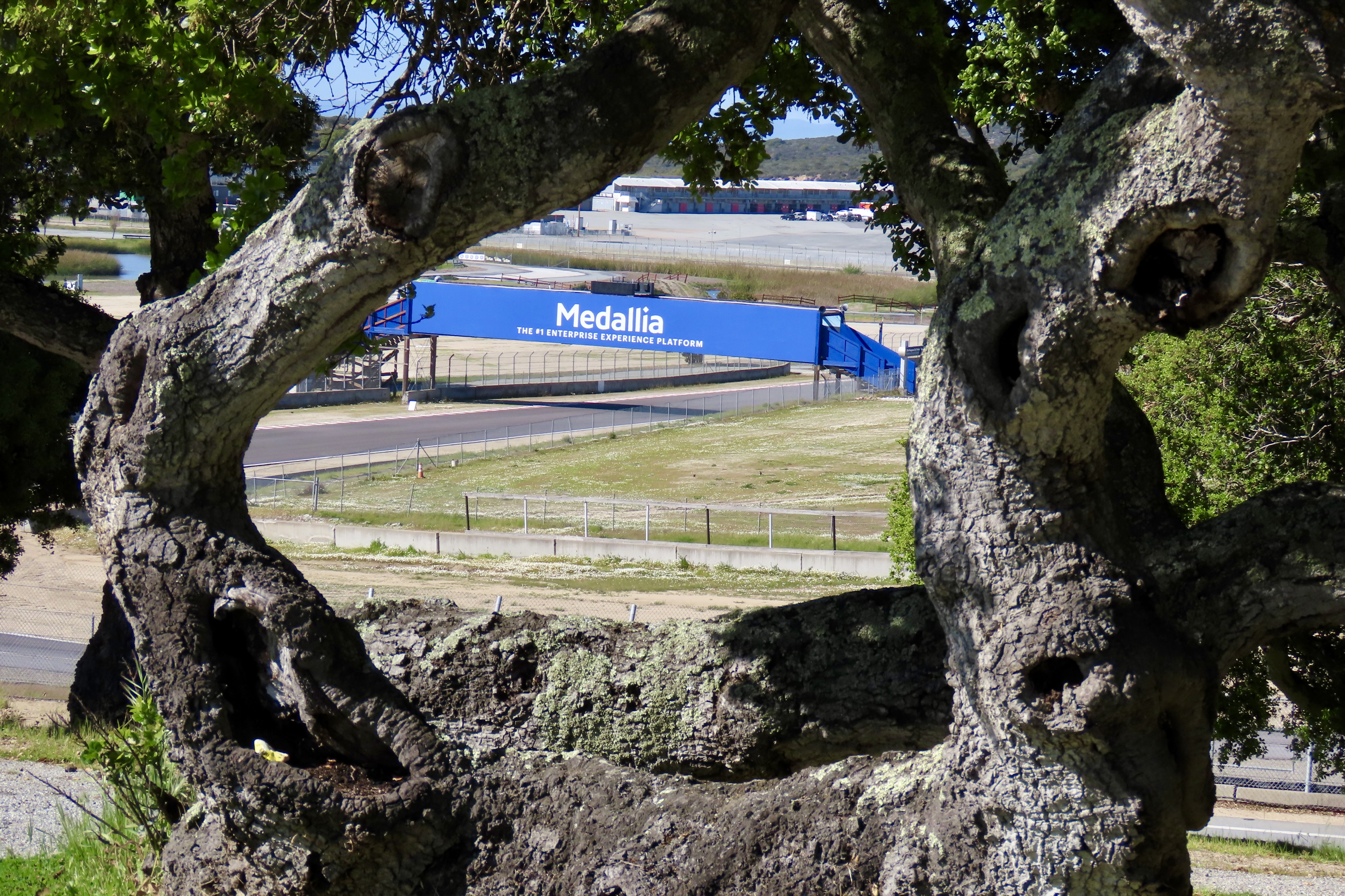
As I write this we are camped in a scenic site perched above the famous Laguna Seca (now Weather Tech) Raceway located between Salinas and Monterrey, California. An organization called Hooked On Driving— made up of a collection of passionate and dedicated high-performance driving enthusiasts and coaches— has rented the raceway for a weekend of fun and training. That’s not the big news here, however. The Sea Otter Classic starts in two weeks. Billed as the premier cycling event in the world, it will involve over 9,000 athletes, 77,000 fans and 1000 vendors! Mountain bike racing and road racing will be included with racers from beginner to pro participating.
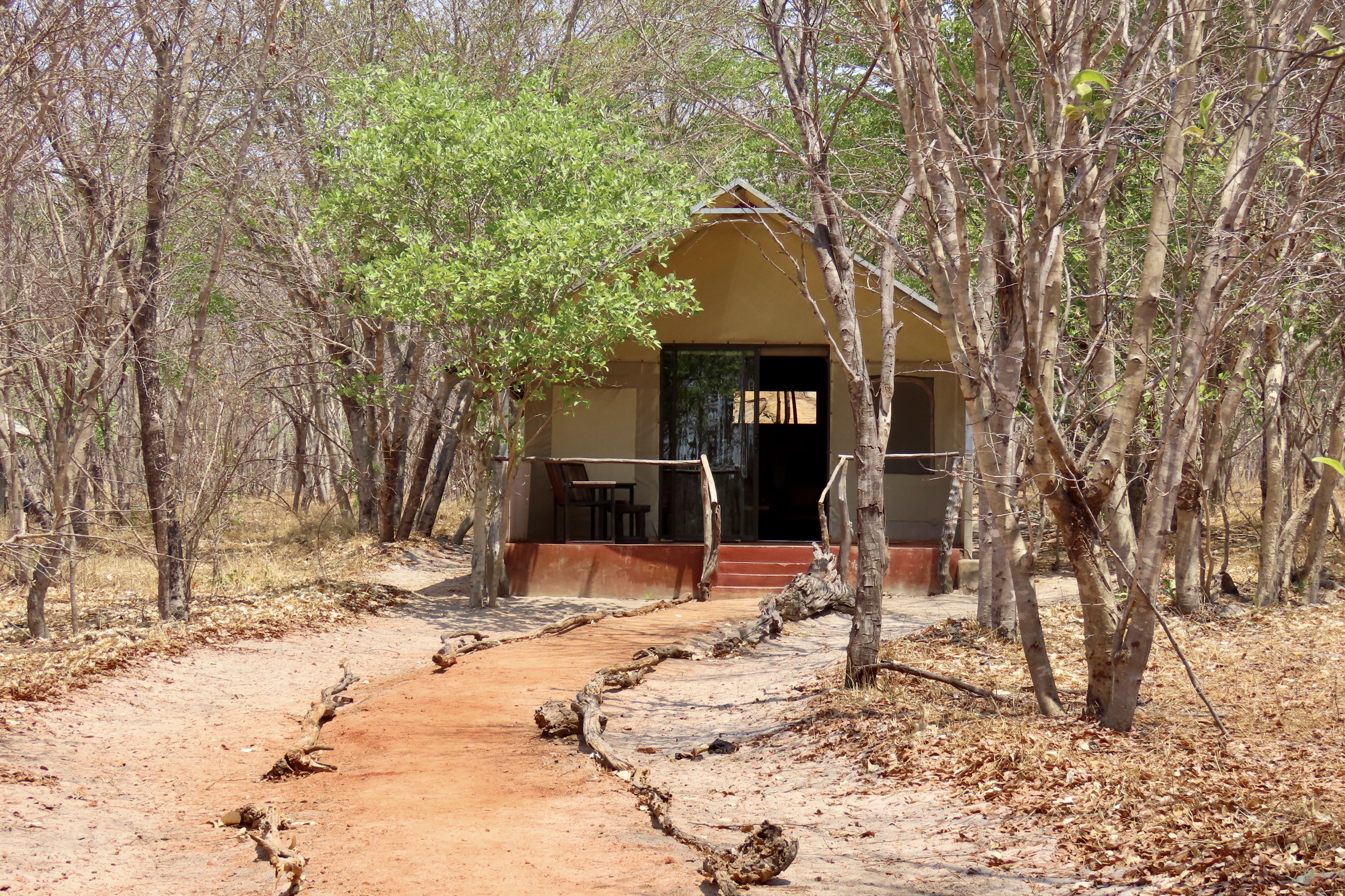
Our small Imagine trailer perched on the hill above the raceway.A view of the raceway from our campground. Fans of auto racing, motorcycle racing and bicycle racing would kill for this spot during major events.Here’s a map of the Weather Tech Raceway. We are camping at the small campground just to the right of the number 5 on the track. Fort Ord National Monument is just above us.
I suspect the participants down on the track roaring around its two mile course are having a blast. Assuming you are a fan of driving fast in a high performance automobile, imagine driving on one of the world’s top raceways. As camping spots go, however, it’s a bit noisy. Grin. Make that a lot noisy. I have my headphones on and am listening to Chopin. Peggy has hers on and is listening to songs from America’s Got Talent. Fortunately, the HOD folks will be out of here tomorrow and we will be gone before the cycling event starts. Linda, a volunteer who works at the entrance station, told us, however, that a TV crew is coming in to film a show in the next few days. I’m assuming it will involve noise. Will there be explosions?
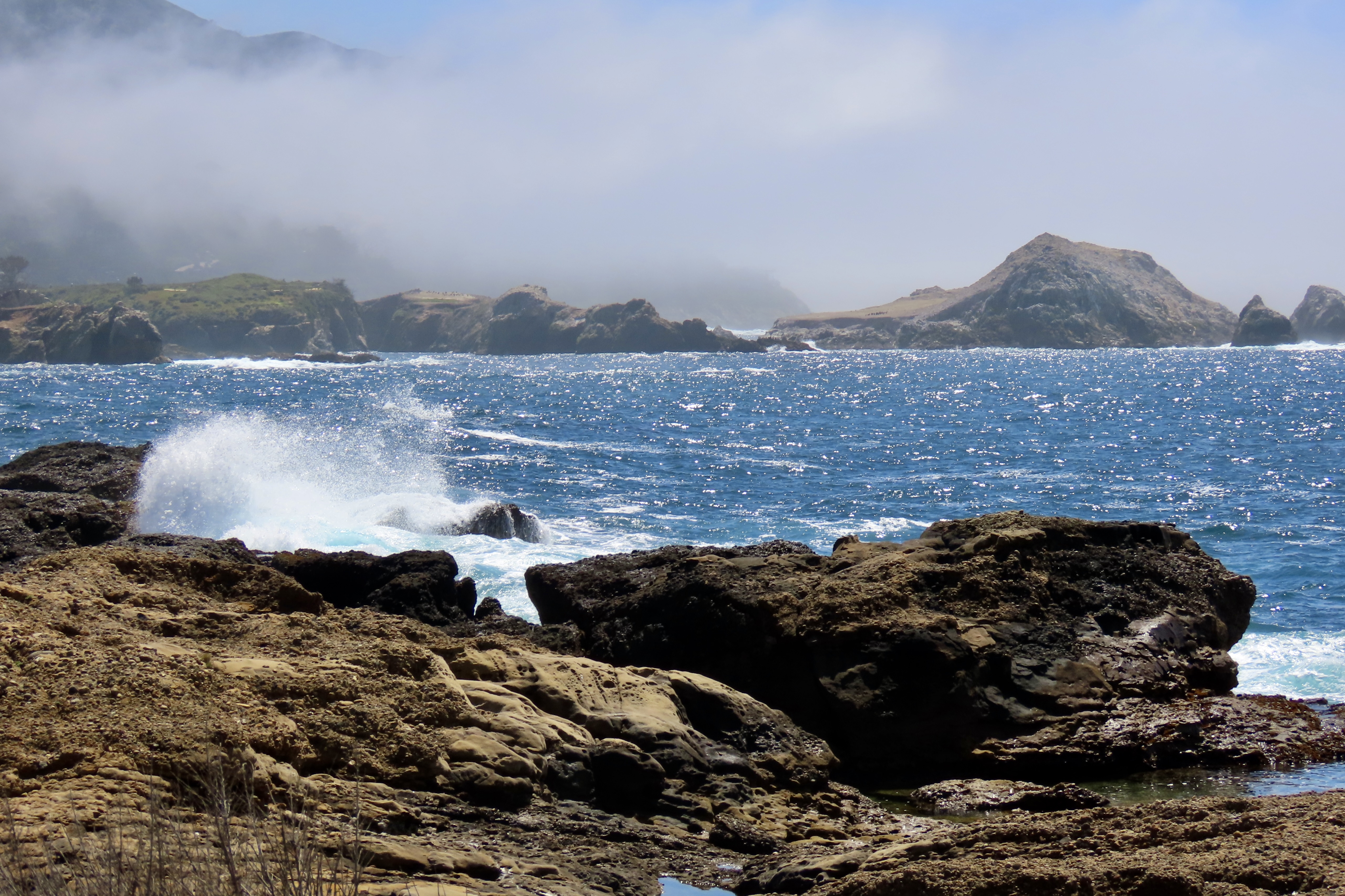
When the race track isn’t busy, this campground is quiet as well as beautiful. It’s also inexpensive and ideally located for exploring Monterey, Carmel and Big Sur. If you follow the news, you know that Big Sur is off our itinerary this time. Part of the road a few miles below Carmel decided to go to sea a couple of days before we arrived. We were busy avoiding the storm as it made its way across Nevada. In fact much of our 3000 mile drive to get to this campground was spent avoiding storms, which we did except for one night we spent in Missouri where severe weather warnings were up on a thunder and lightning storm, high winds, hail stones that could be as large as soft balls, and a tornados. That was a fun night to spend in a trailer.
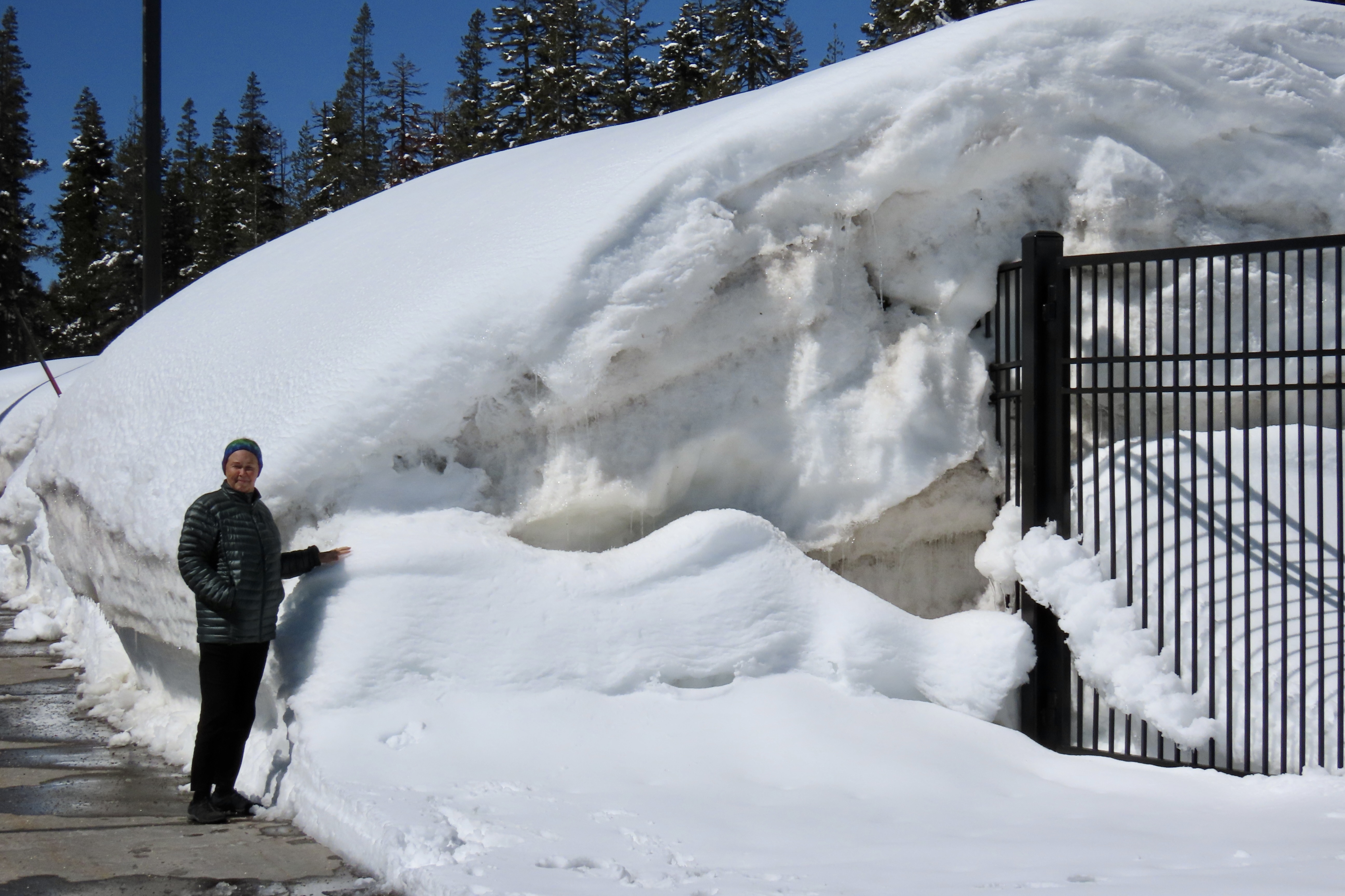
We hung out in Carson City, Nevada as the storm that closed the Big Sur Highway turned into a blizzard over the Sierra Nevada Mountains.
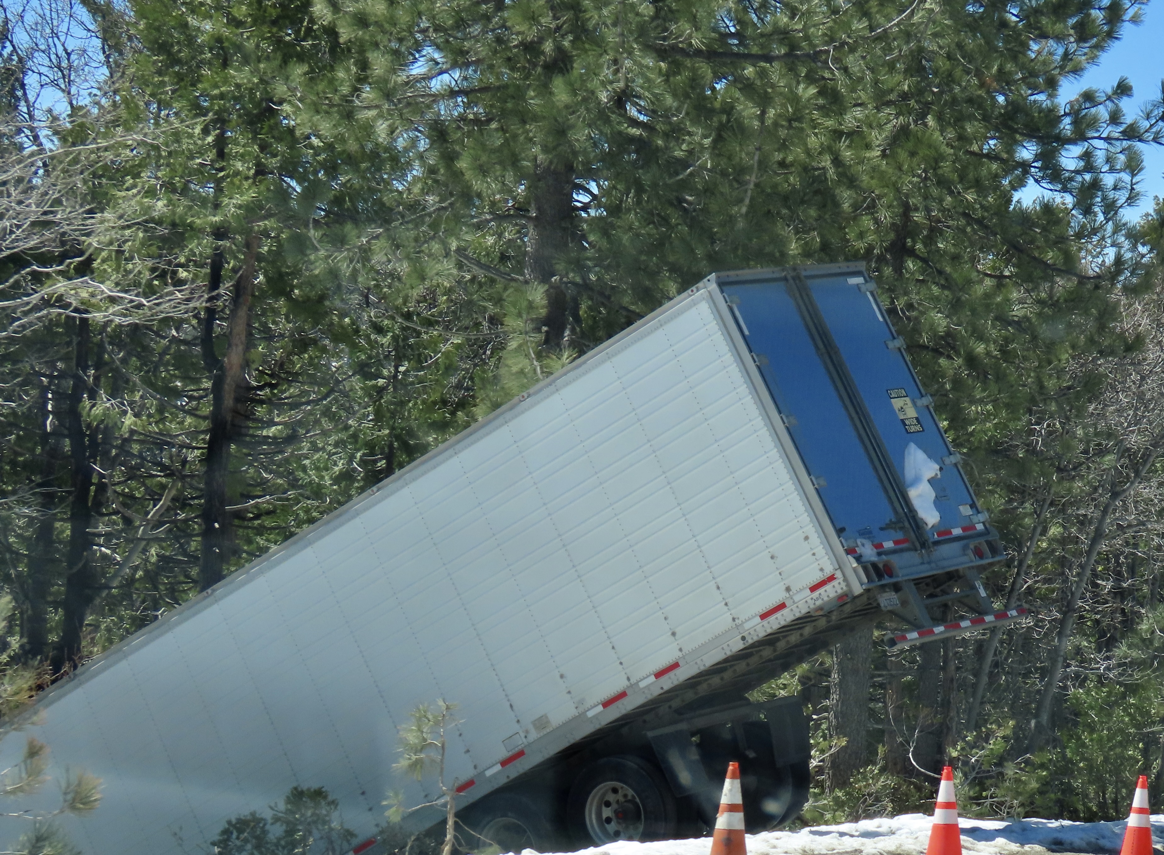
This is what Donner Summit looked like two days later.This big rig was a few miles down the road and Peggy snapped its photo. I imagine he was wishing he had hung out in Carson City with us.
Now, here are a few photos to show you what to expect over the next three months on Wandering Through Time and Place.
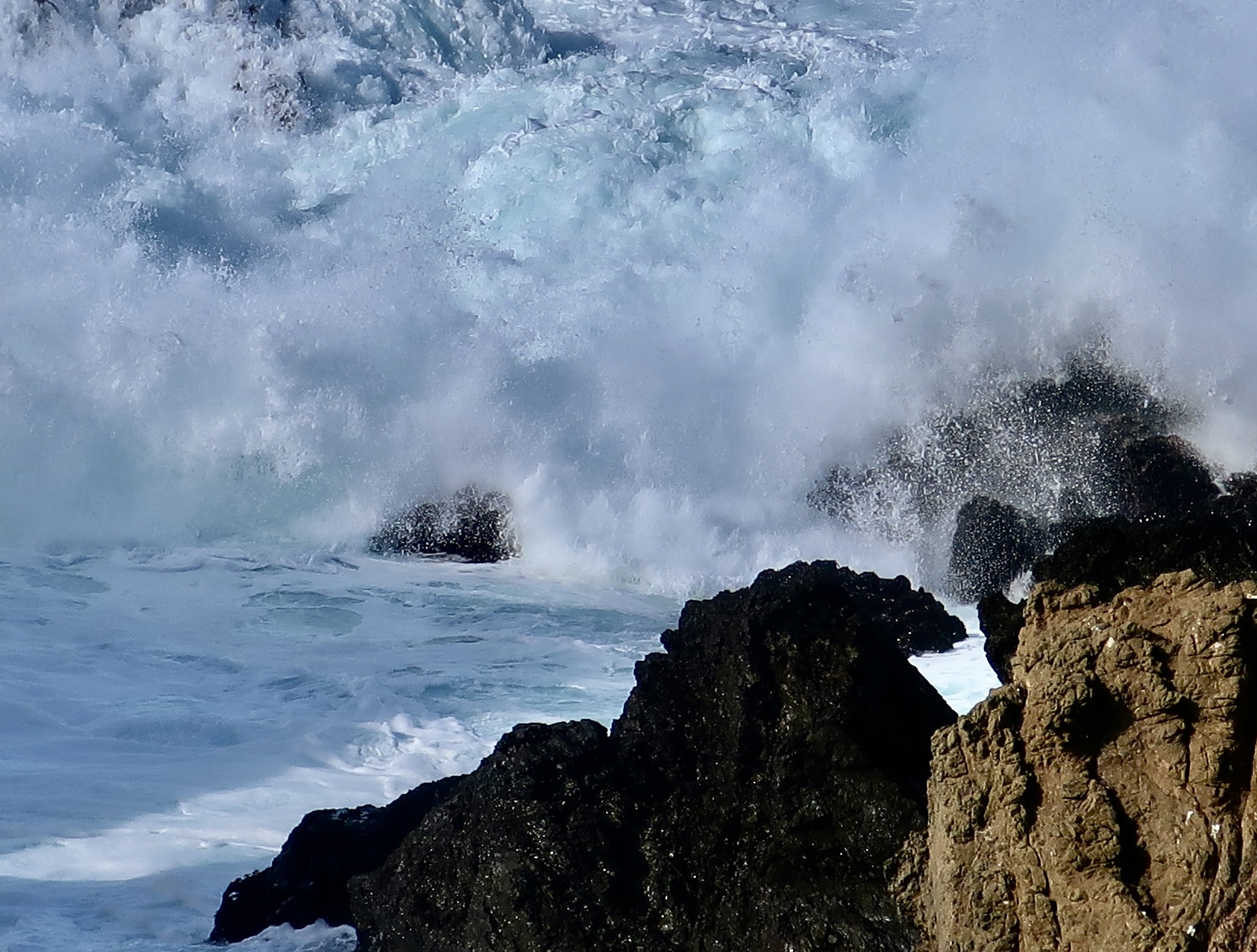
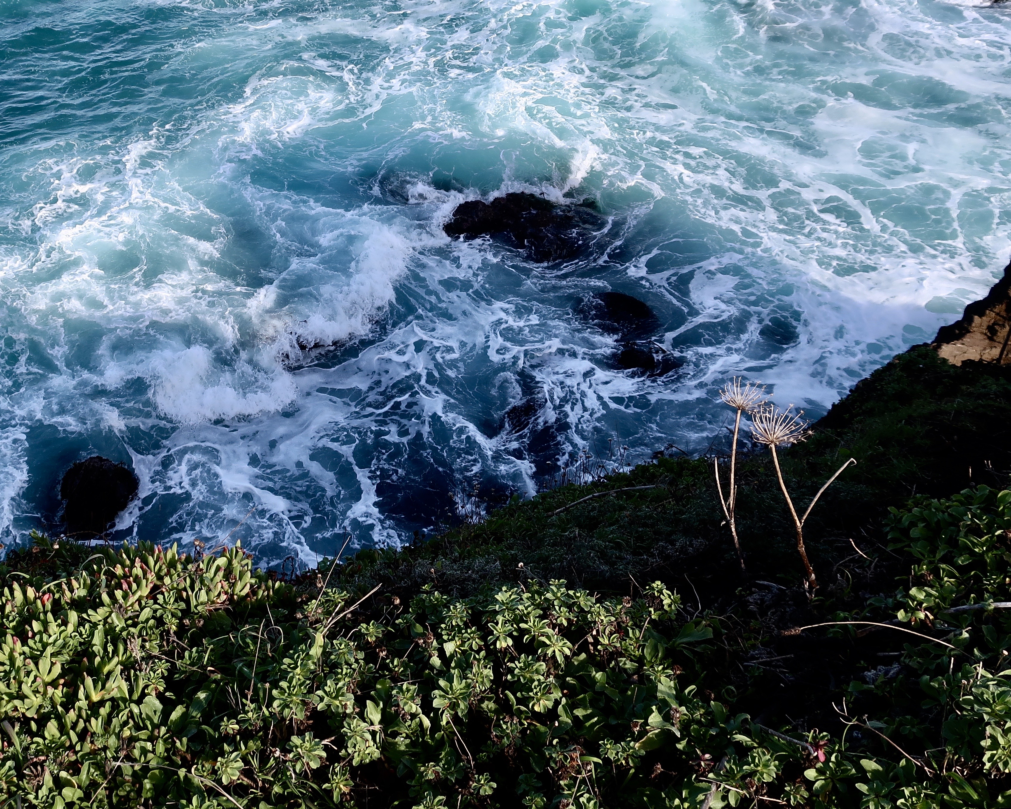
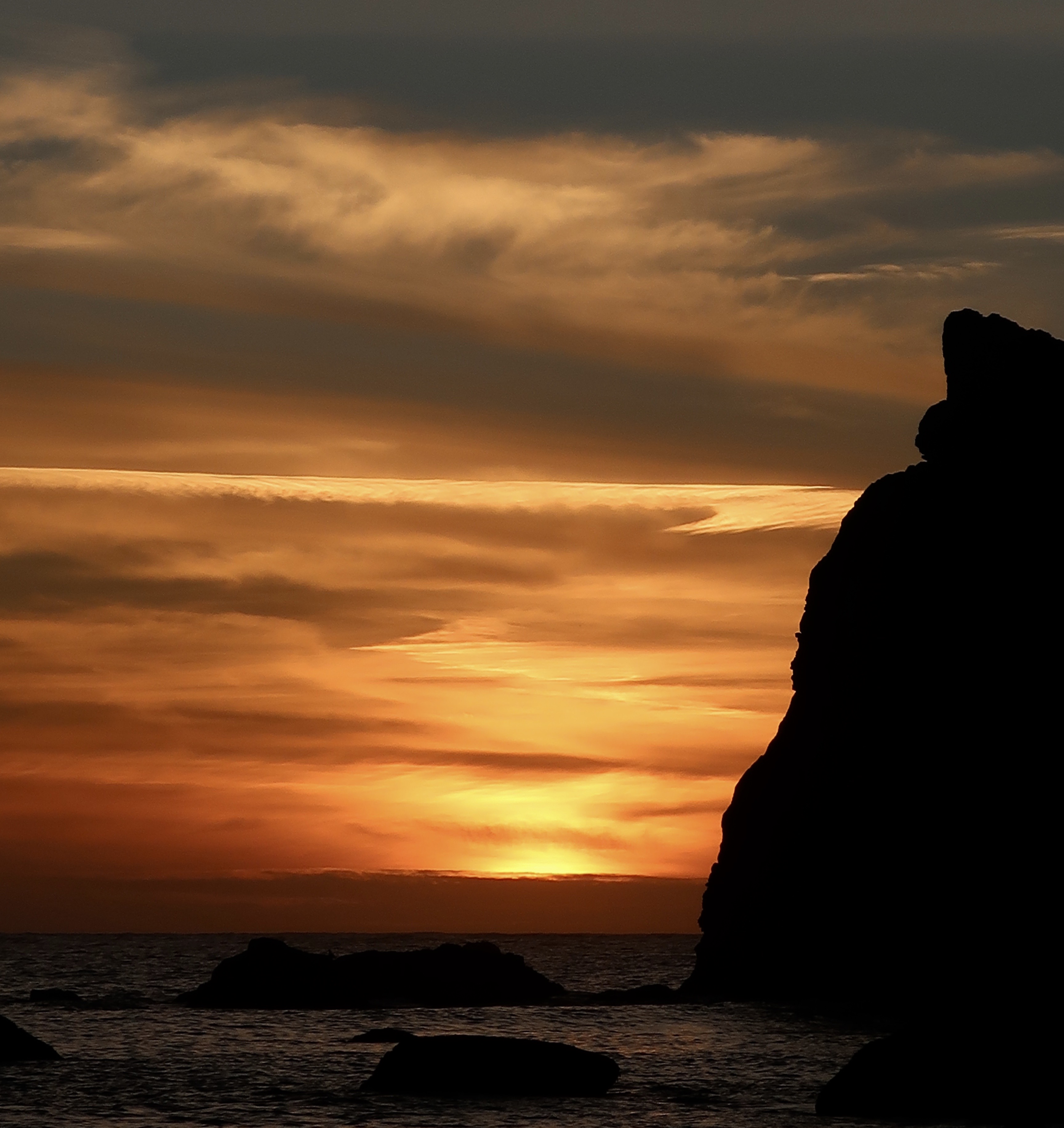
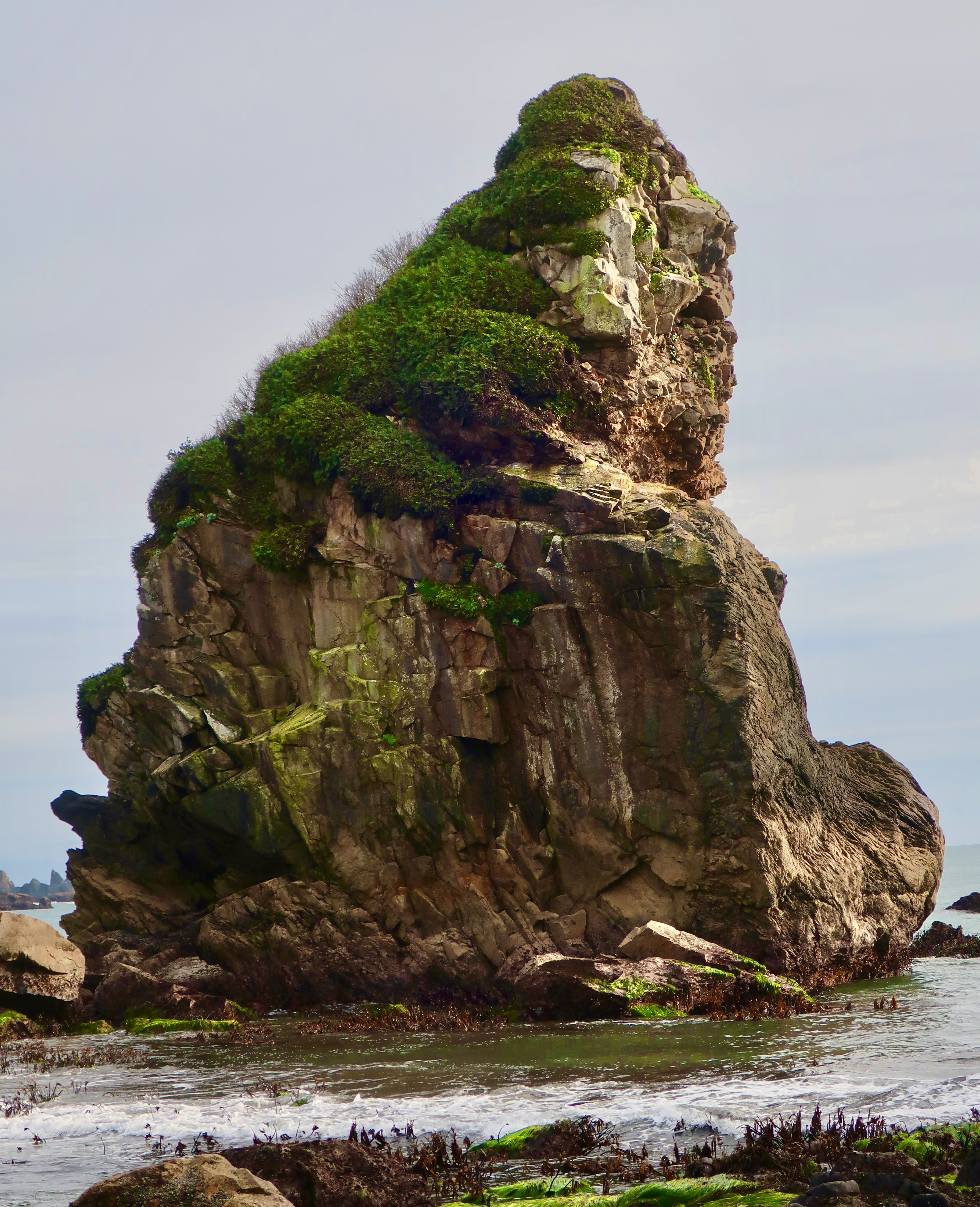
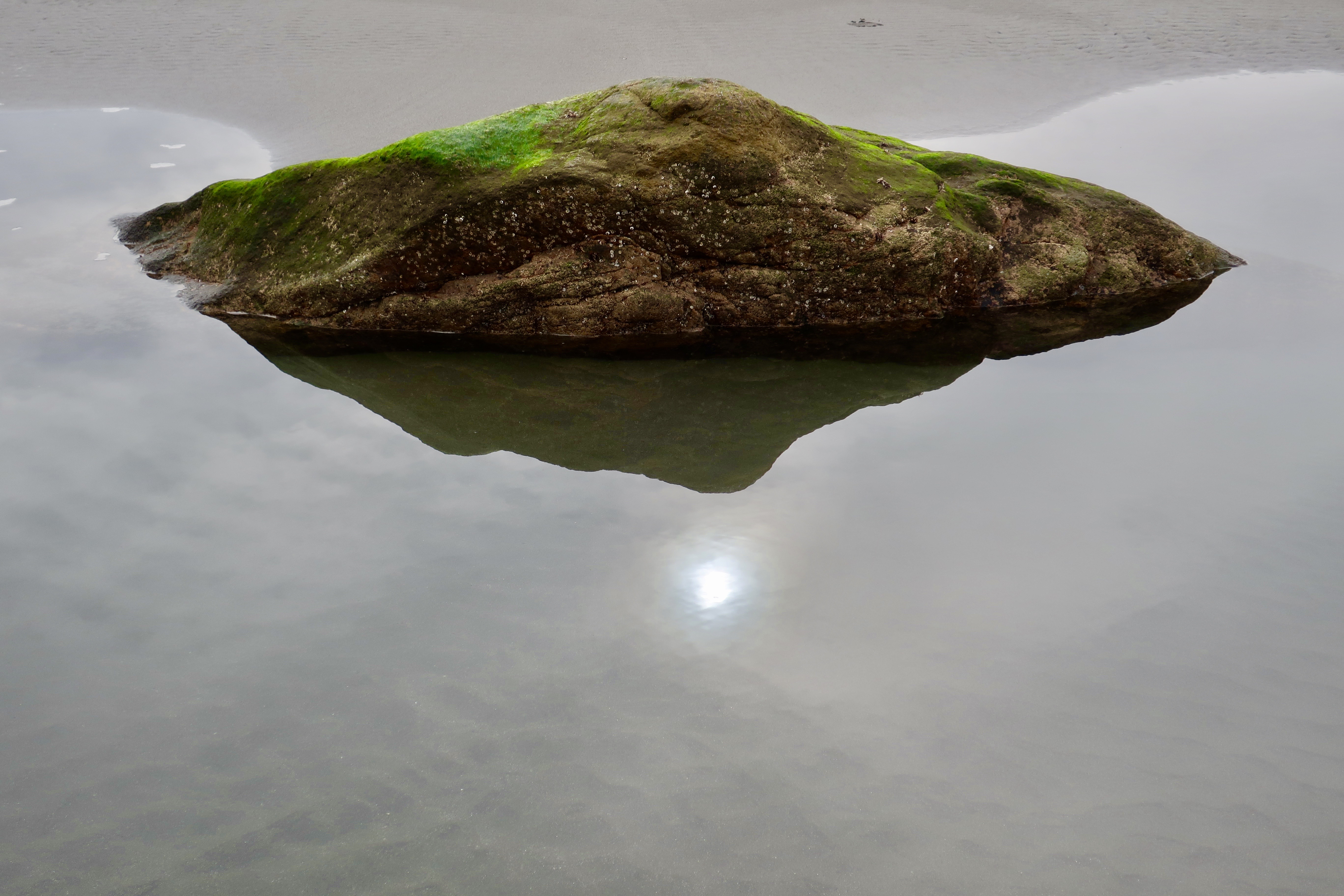
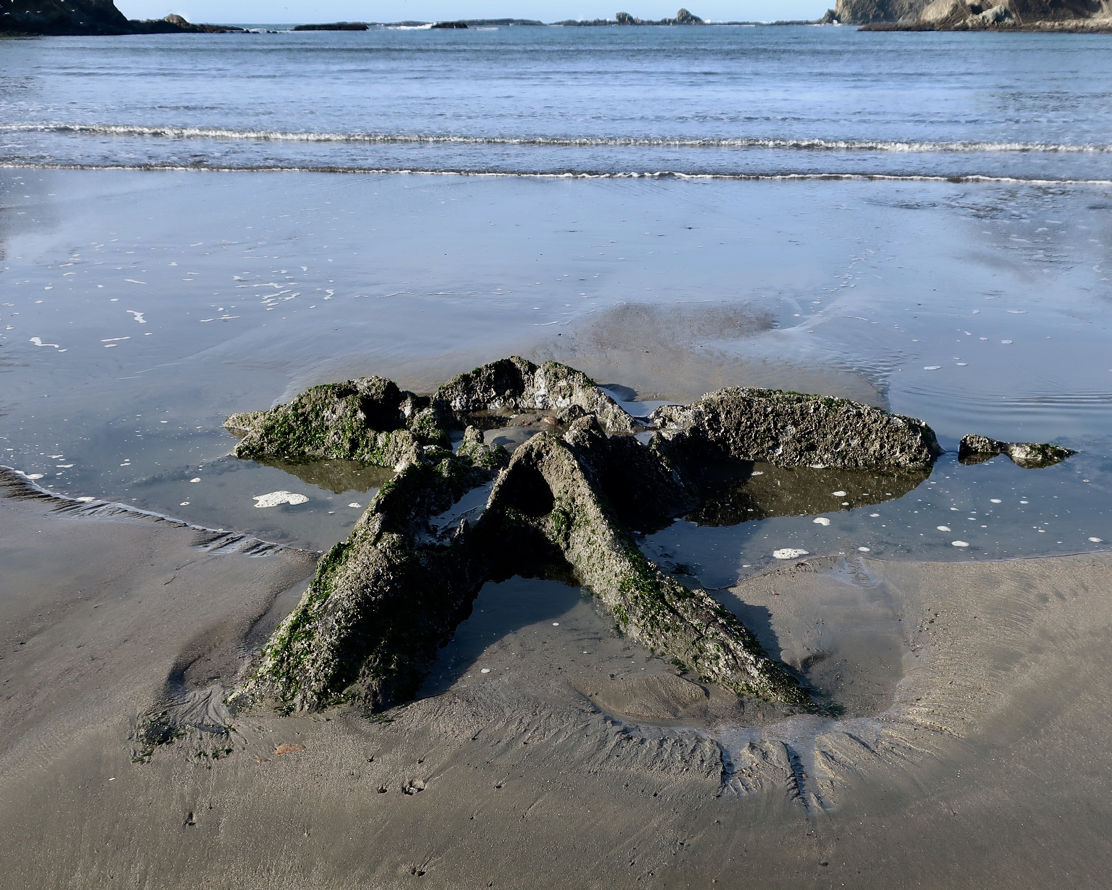
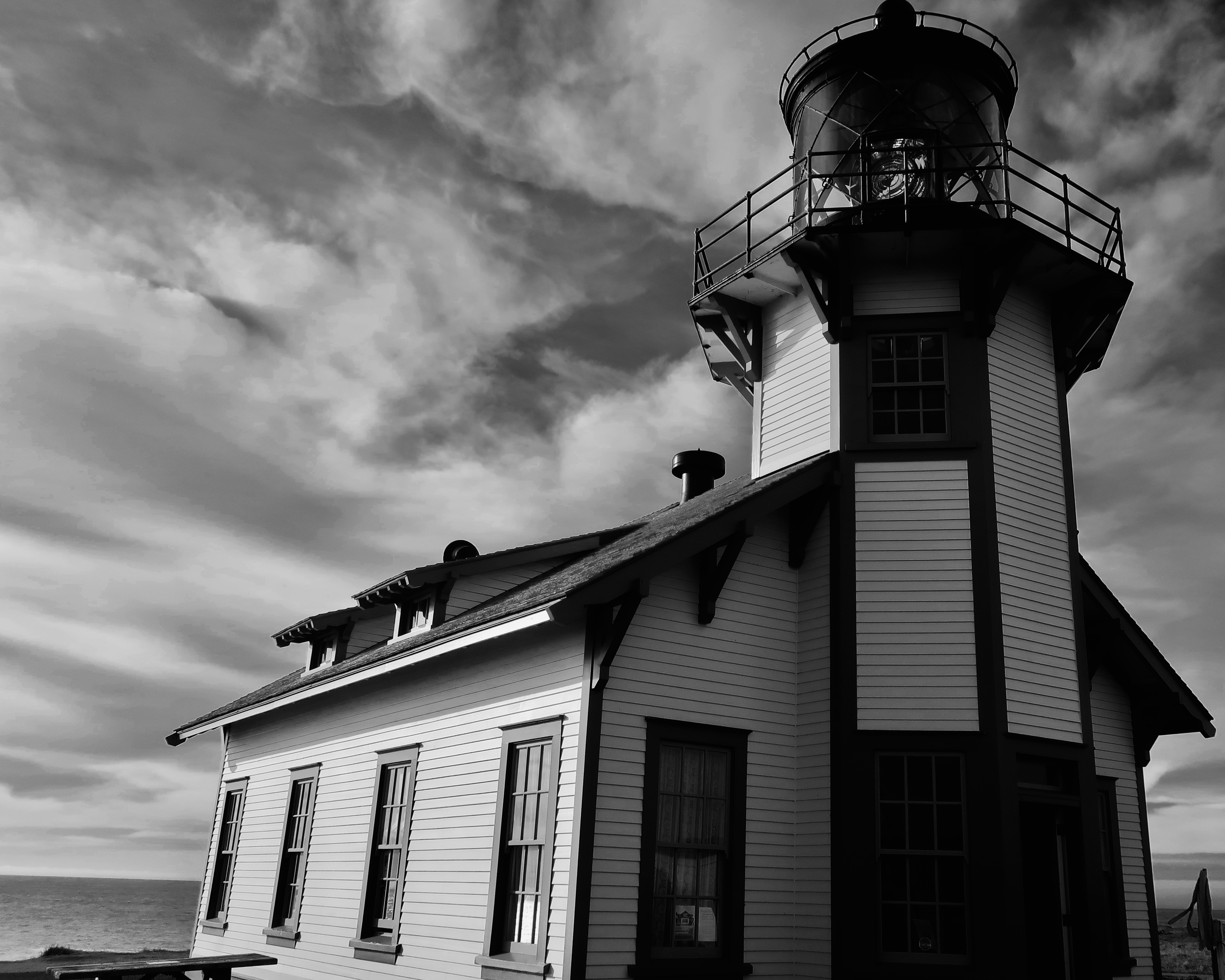
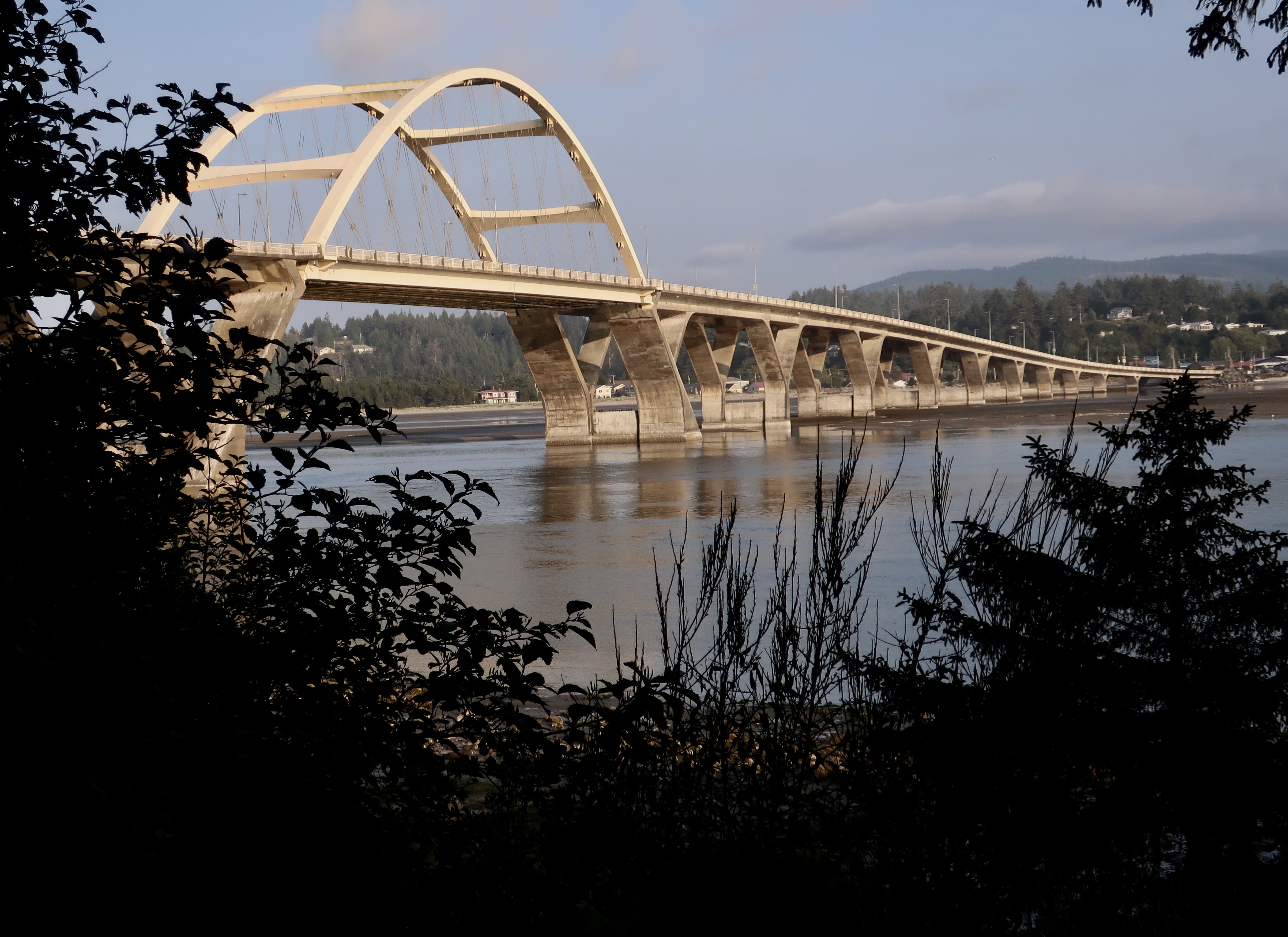
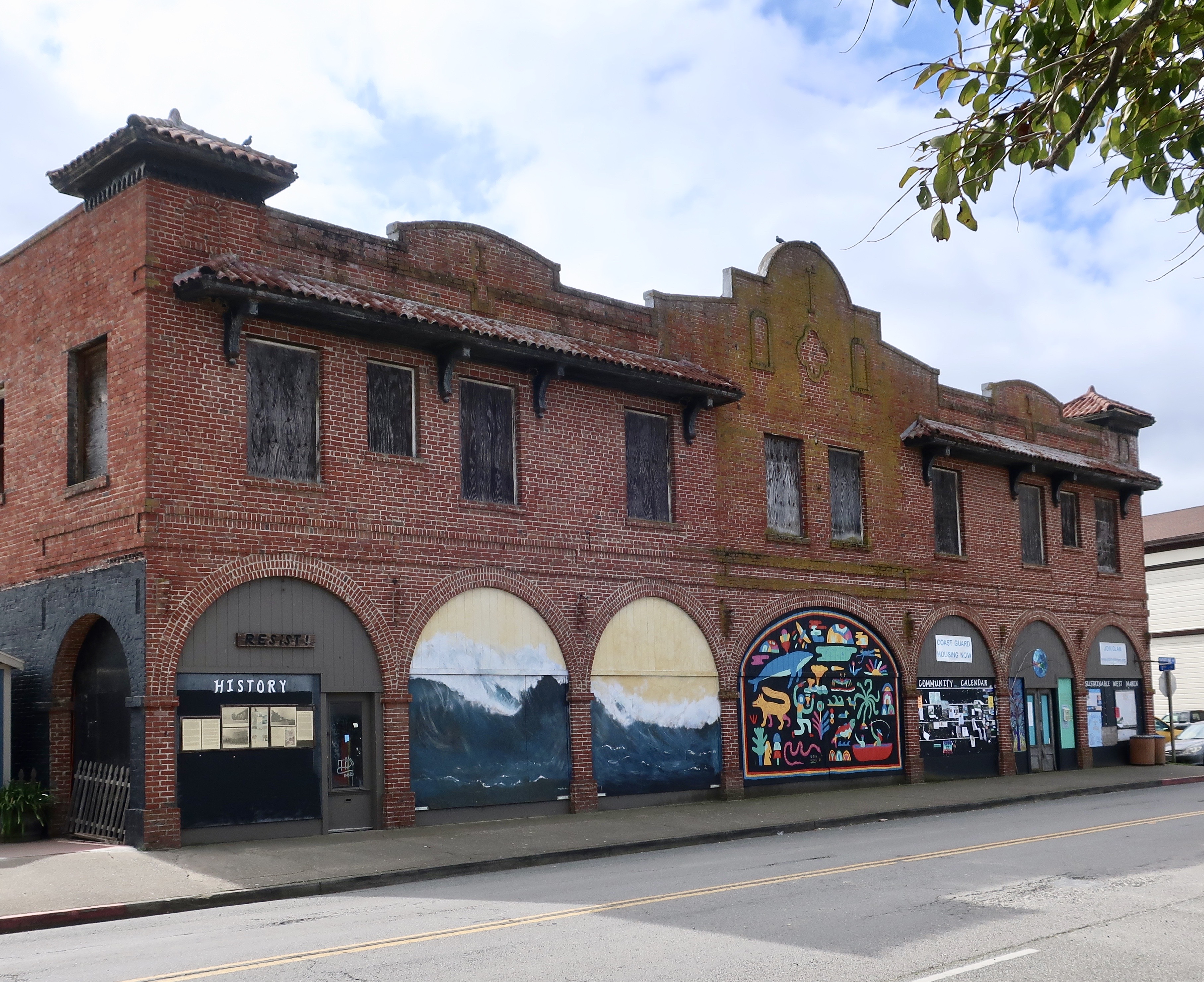
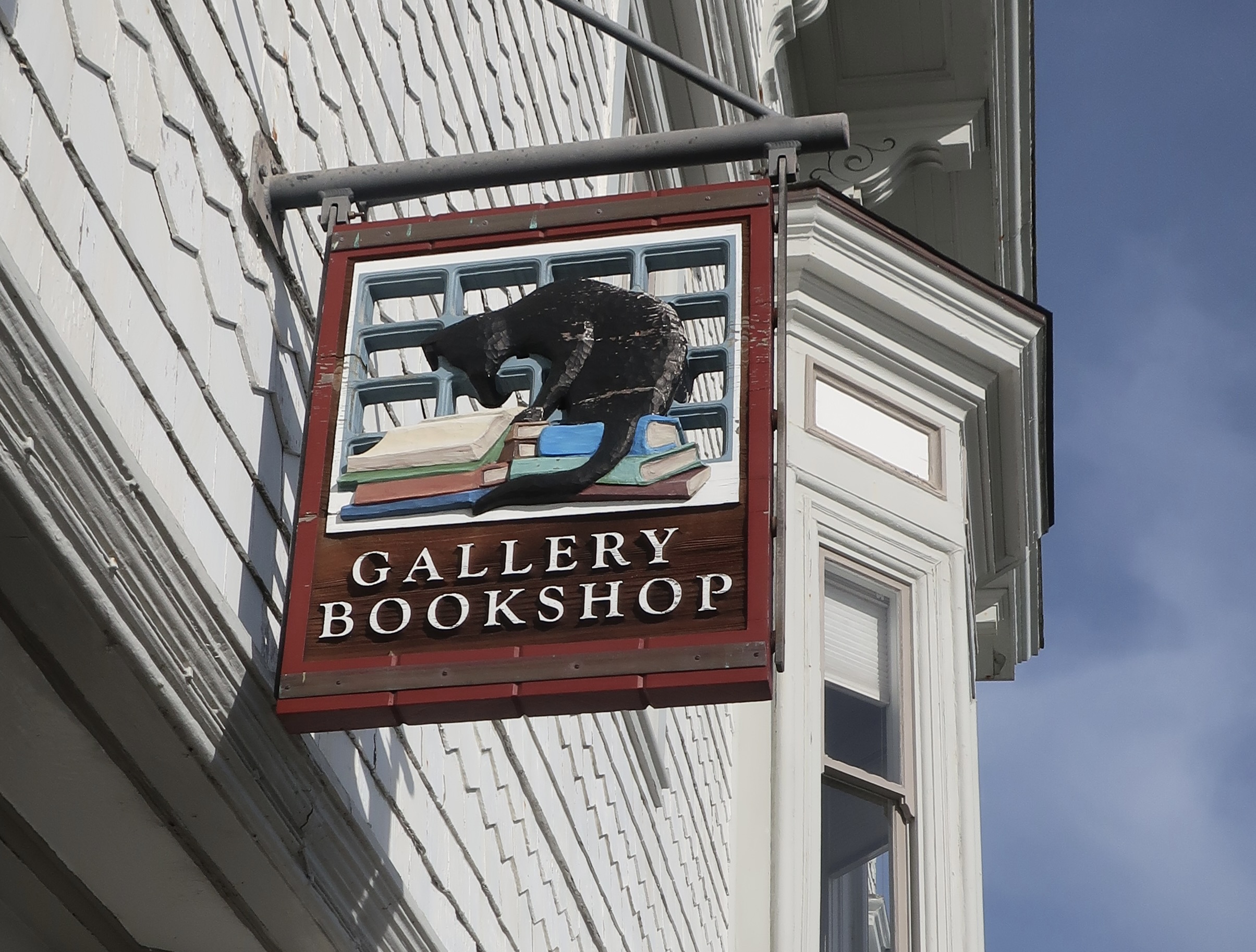
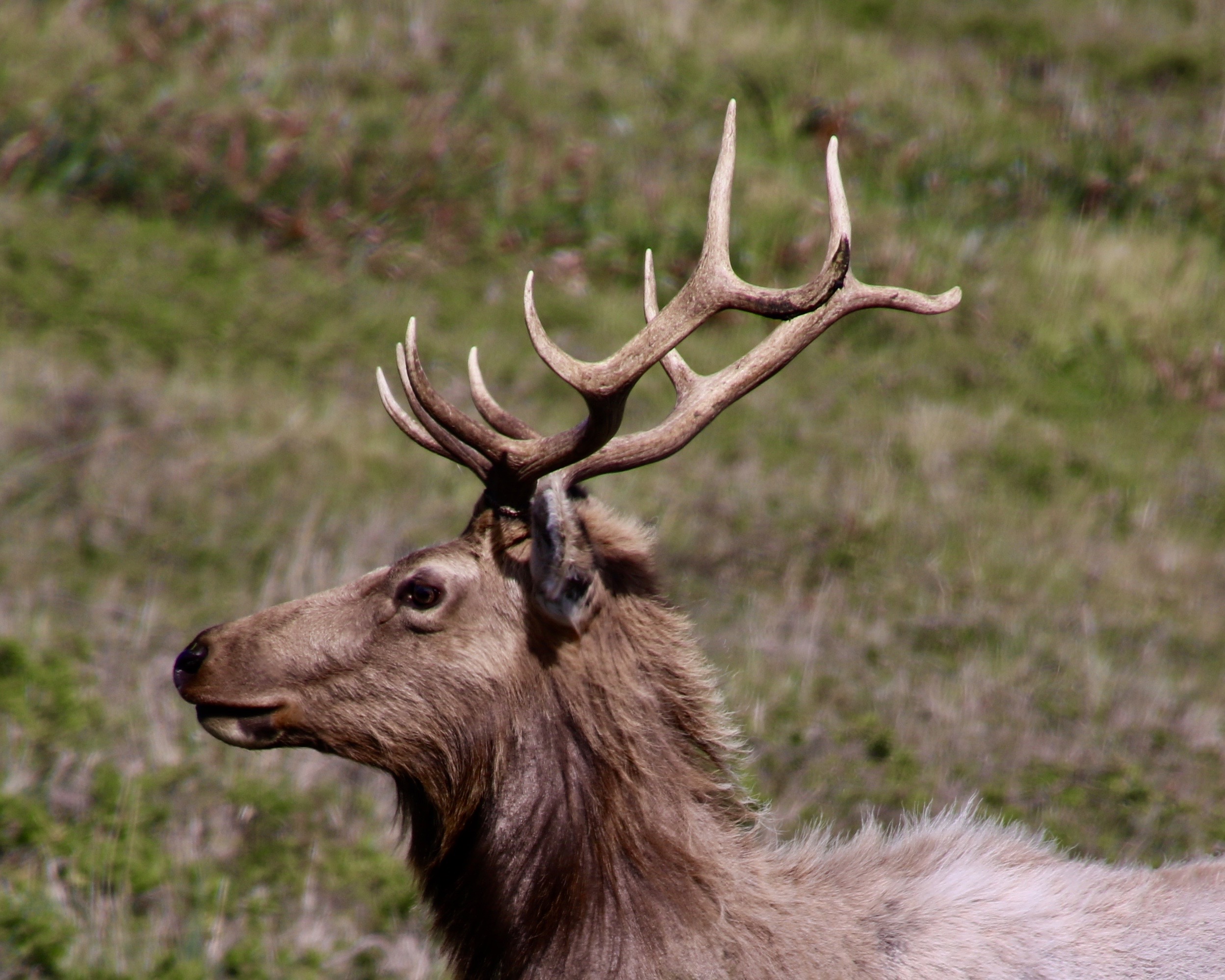
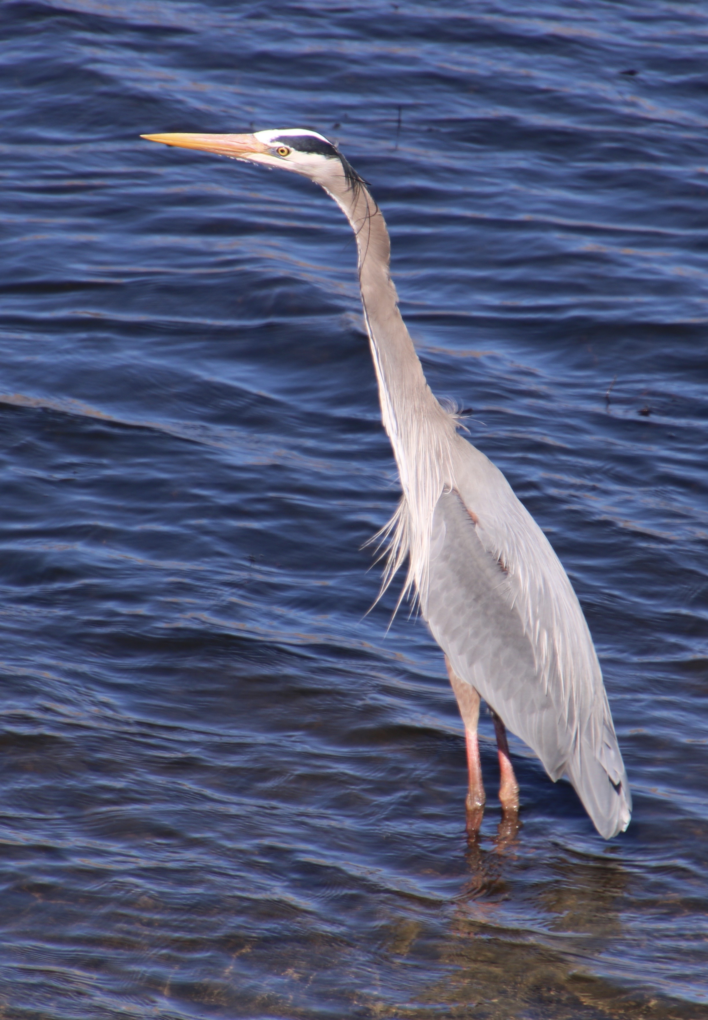
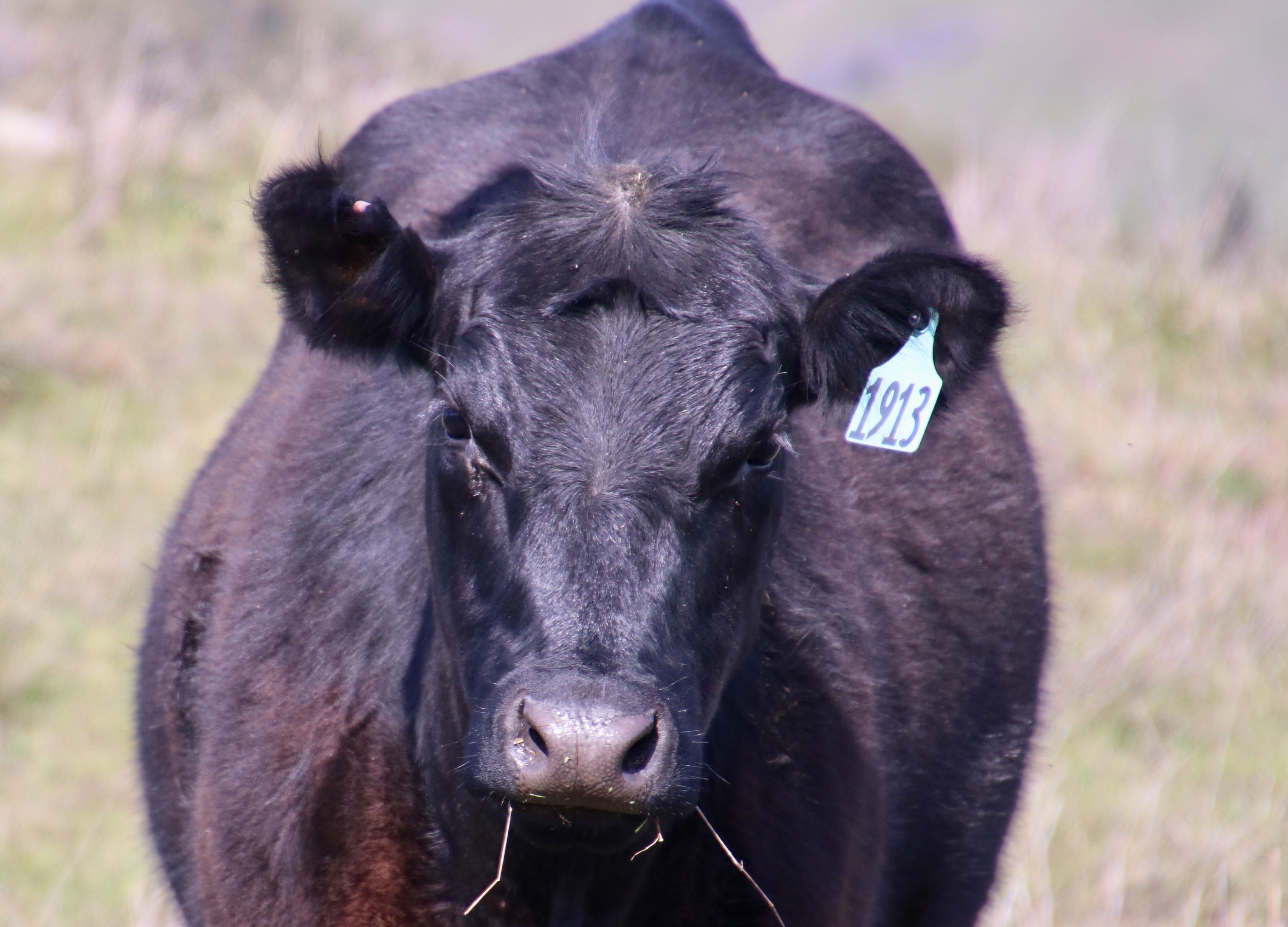
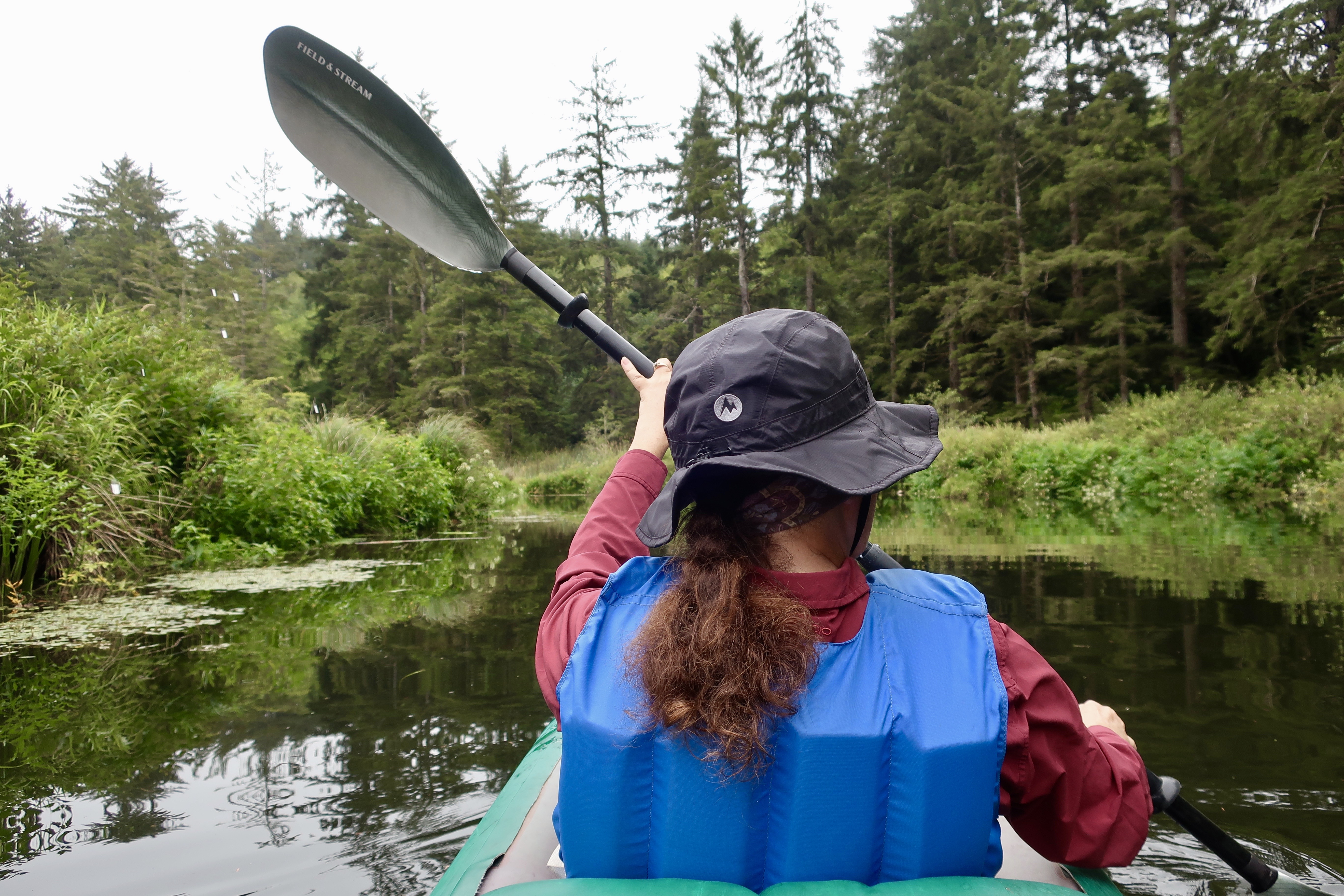
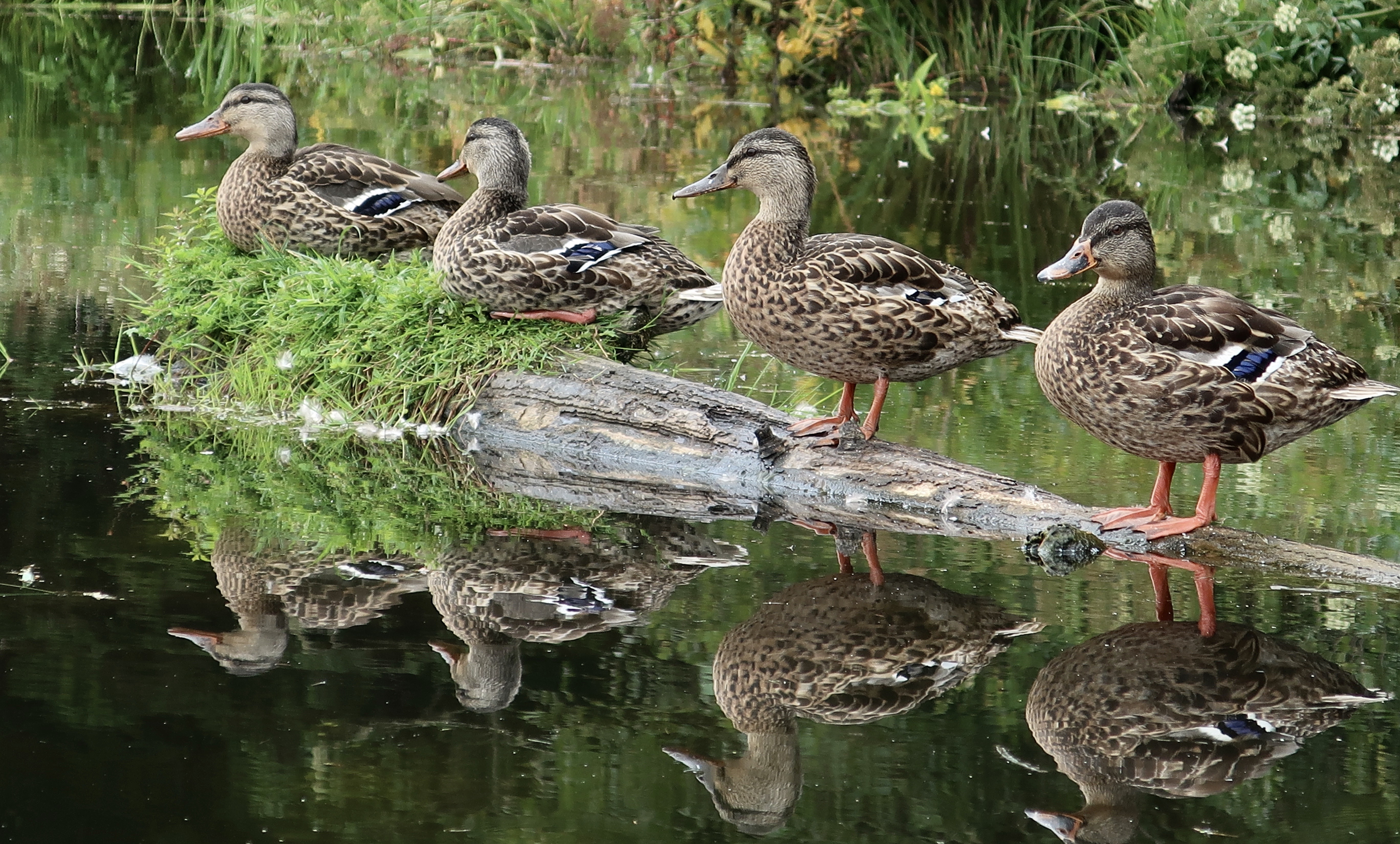
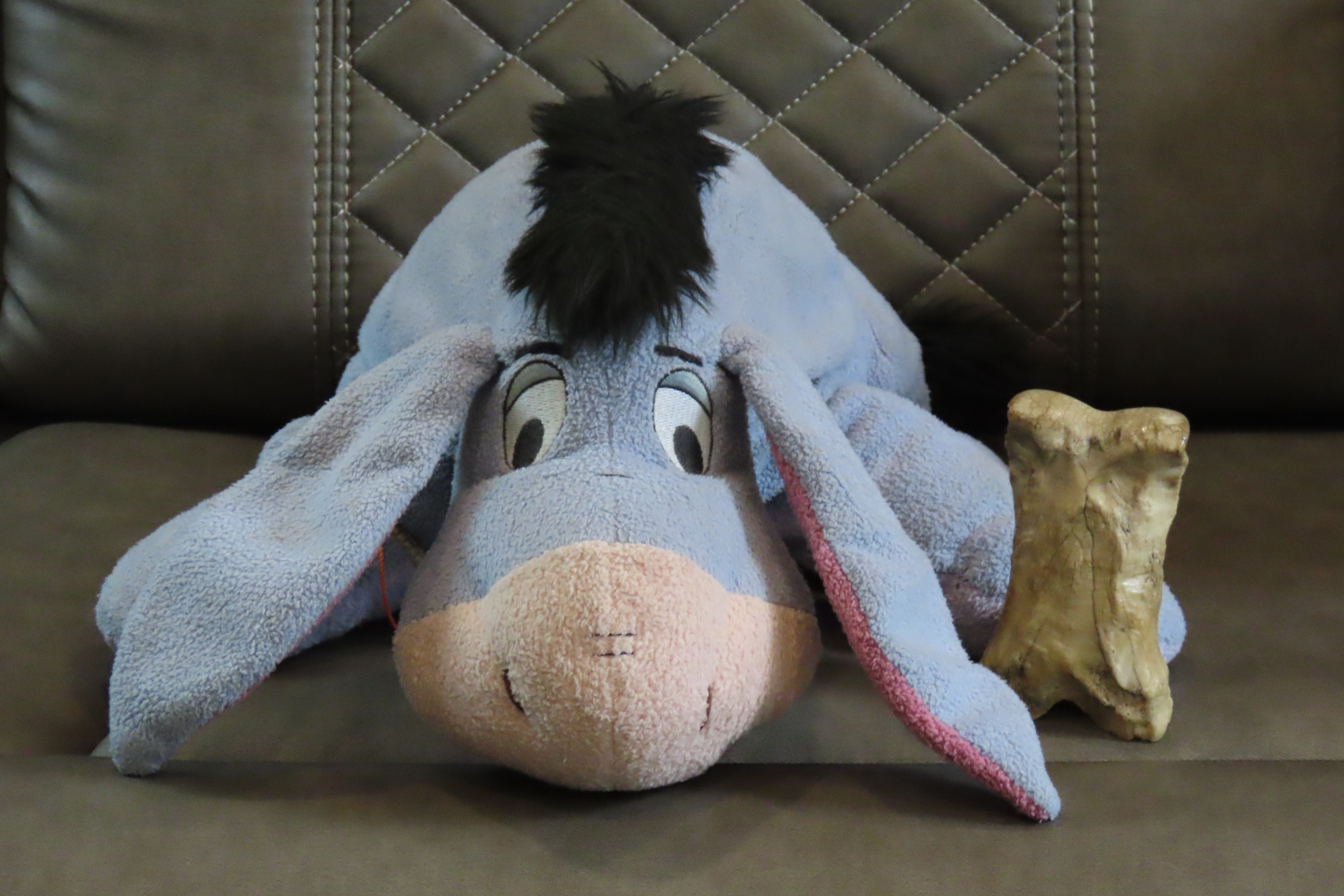
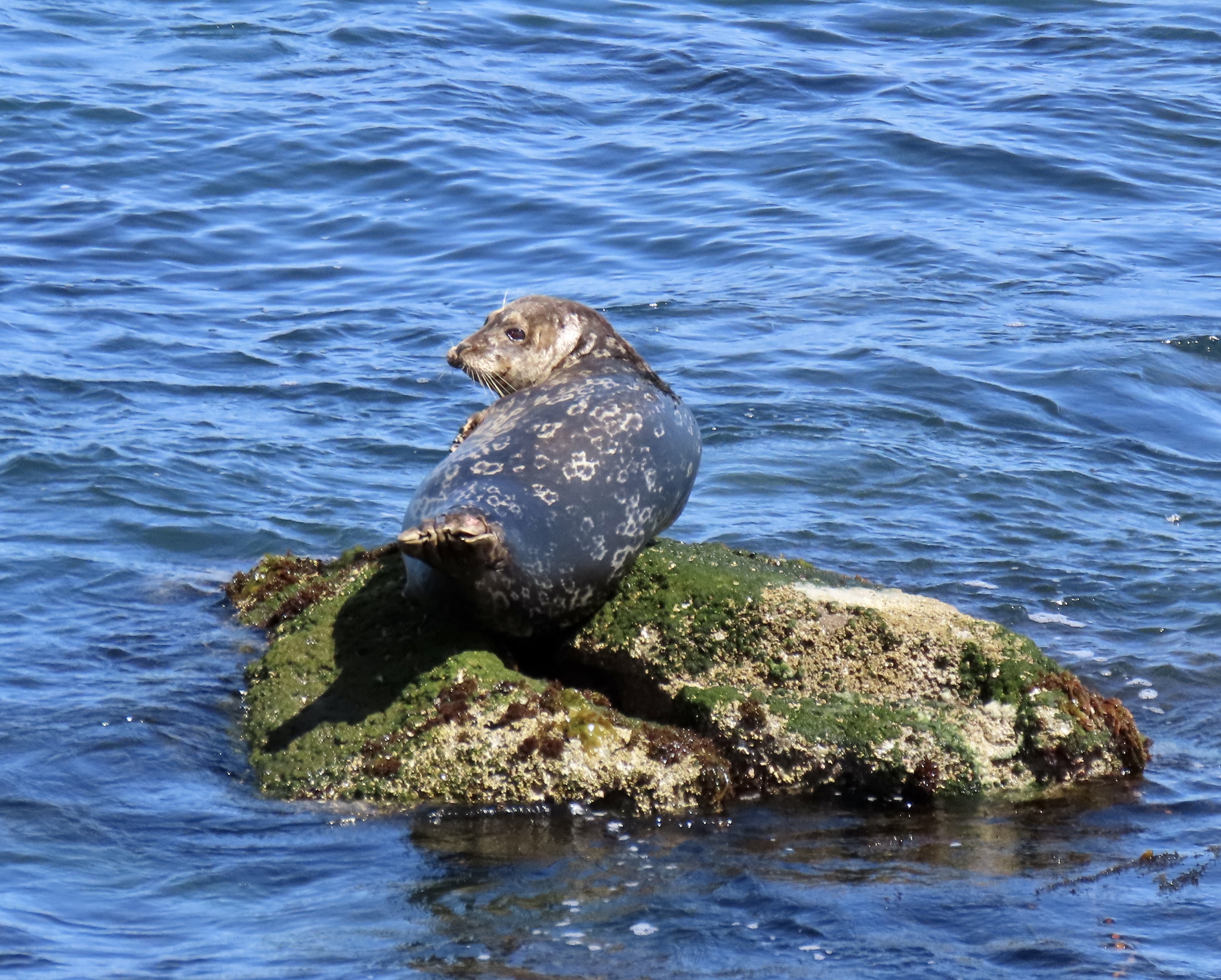
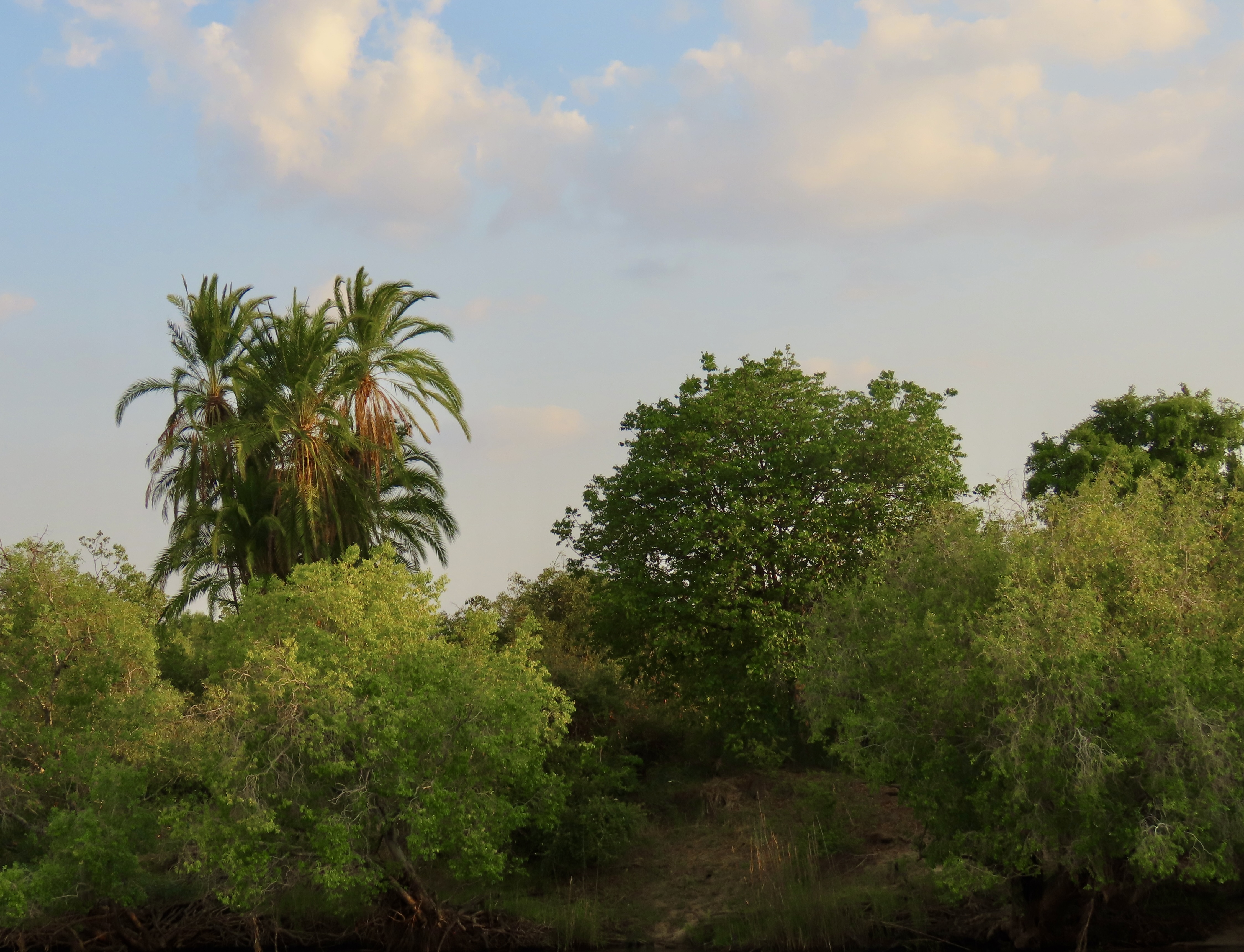
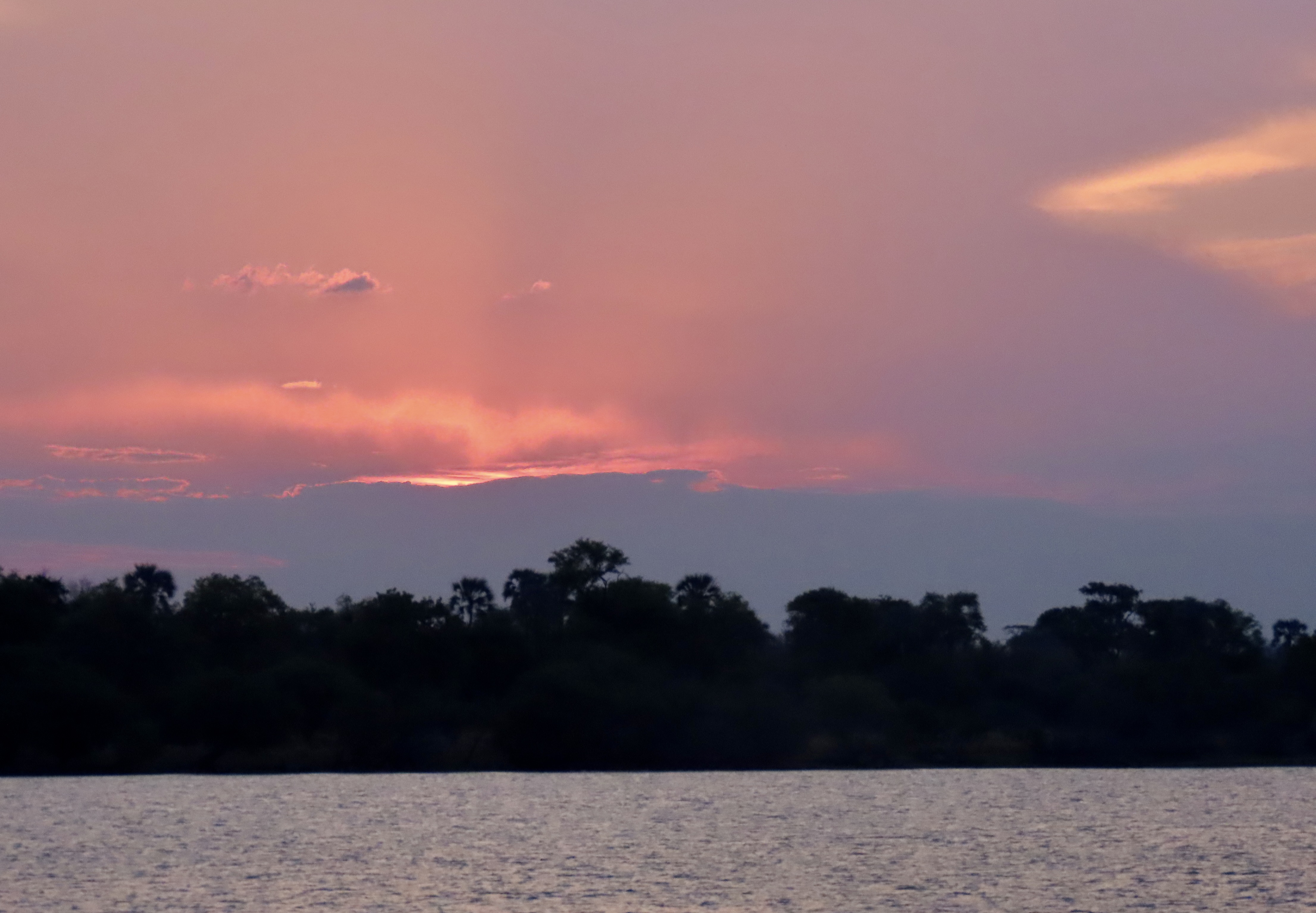
There will be huge waves crashing over rocks…Creating an infinite variety of swirling waters.You will join us as we hike out to the ocean’s edge— carefully. Does Peggy look worried???The edge, where she stood and took photos.The ocean will be calm as often as wild.With lots of gorgeous sunsets.Of course there will be tide pools. Peggy and I explore them with all the excitement of ten-year-olds. If you’ve ever spent time looking into them, you have probably seen a sea anemone…But have you ever seen one covered with shells and stones?Starfish…There will be dozens of magnificent sea stacks…As well as interesting smaller rocks…Any idea what this is? Once it was a tree that stood high above the ocean. A massive earthquake dropped the forest below sea level. This is what remains.Lighthouses are found all along the way.And beautiful bridges.Small coastal towns have special appeal to us. This is an historical building in Pt. Reyes Station above San Francisco.If there is an independent bookstore to be found, we will take you there. This is in Mendocino, California.And here is the bookstore cat. One way I judge a bookstore is whether it has a cat…Expect to meet many amazing creatures. This is a banana slug. Did you know that the banana slug is the school mascot for UC Santa Cruz?There will be magnificent wildlife such as this elk..Seals…And great blue heron.Expect a few cows as well.So here’s a question. Are these two butting heads or seeing eye to eye?We will have many adventures along the way, including kayaking.We may even get our ducks in a row.Eeyore and Bone are along for the trip…And, like us, hope you will join our journey. First up, we will be exploring the highways, byways and coast line of the Monterey/Carmel area, including the world famous 17 mile Drive. Peggy took this photo of a seal along Ocean View Blvd. in Pacific Grove, just before we climbed onto the 17 Mile Drive. I was so impressed with the photos my new camera took when we were on safari in Africa, I immediately bought one for Peggy. Expect lots more…
This is a view of the Cape of Good Hope as seen from on top of Cape Point. Portugal’s Bartolomeu Dias was the first to round it in 1488. He named it the “Cape of Storms,” for good reason. Ten years later, Vasco da Gama followed the same route and then sailed up the coast of Africa, prompting King John II of Portugal to rename it the “Cape of Good Hope.” It opened a sea route to fabulous wealth of the spice trade in India and the Far East.
Today marks my 25th and final post on our African Safari. As you read this, Peggy and I are driving between Carson City, Nevada and the Central Coast of California where we will spend the next two weeks exploring Big Sur, Carmel, Monterey, Pinnacles National Park and the surrounding area. The visit will kick off our next series: A three month, thousand mile journey following the Pacific Coast through Northern California, Oregon and Washington— one of the world’s most beautiful coastlines.
But first, a wrap up on South Africa where we will visit the Cape of Good Hope, Cape Town and Table Mountain.
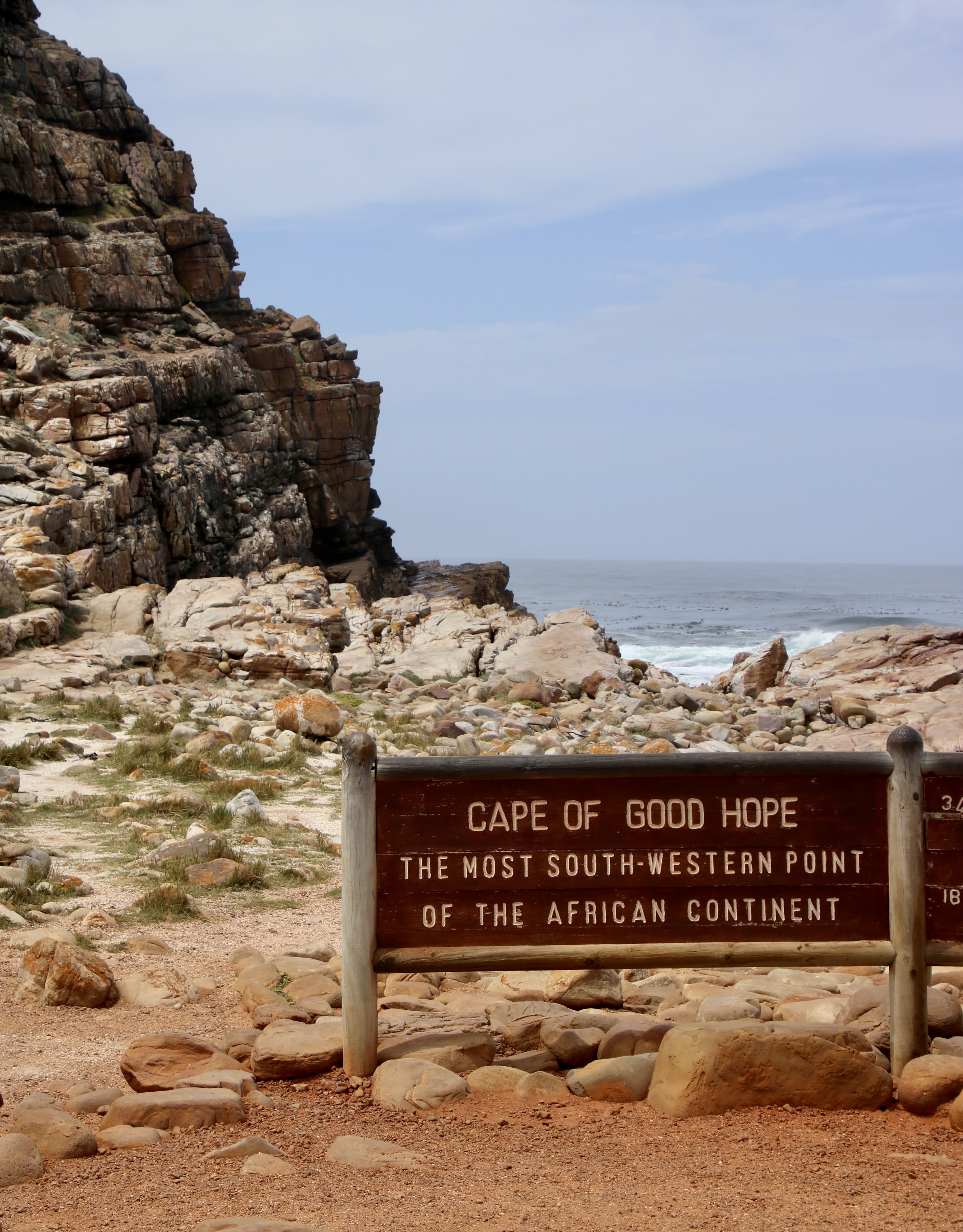
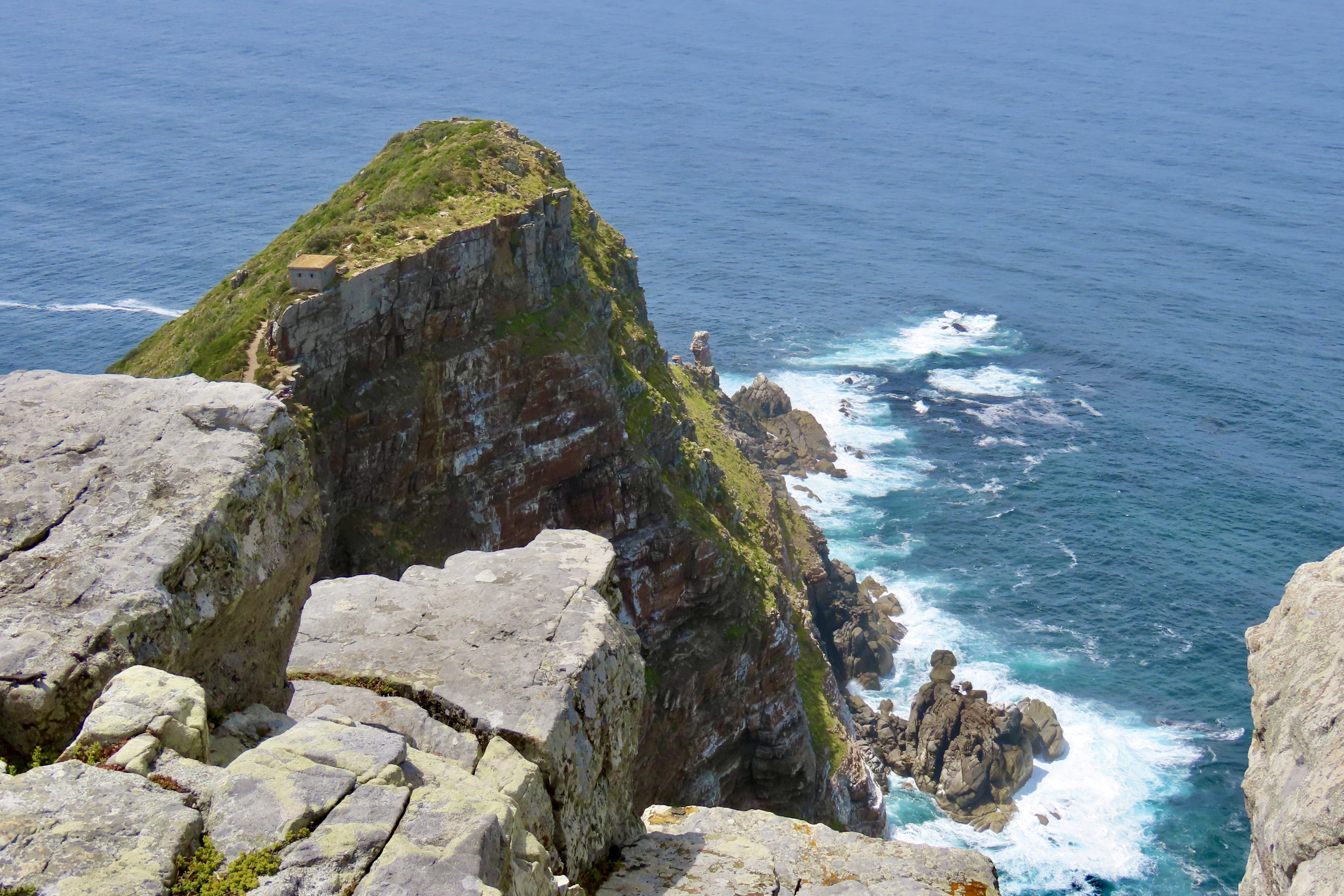
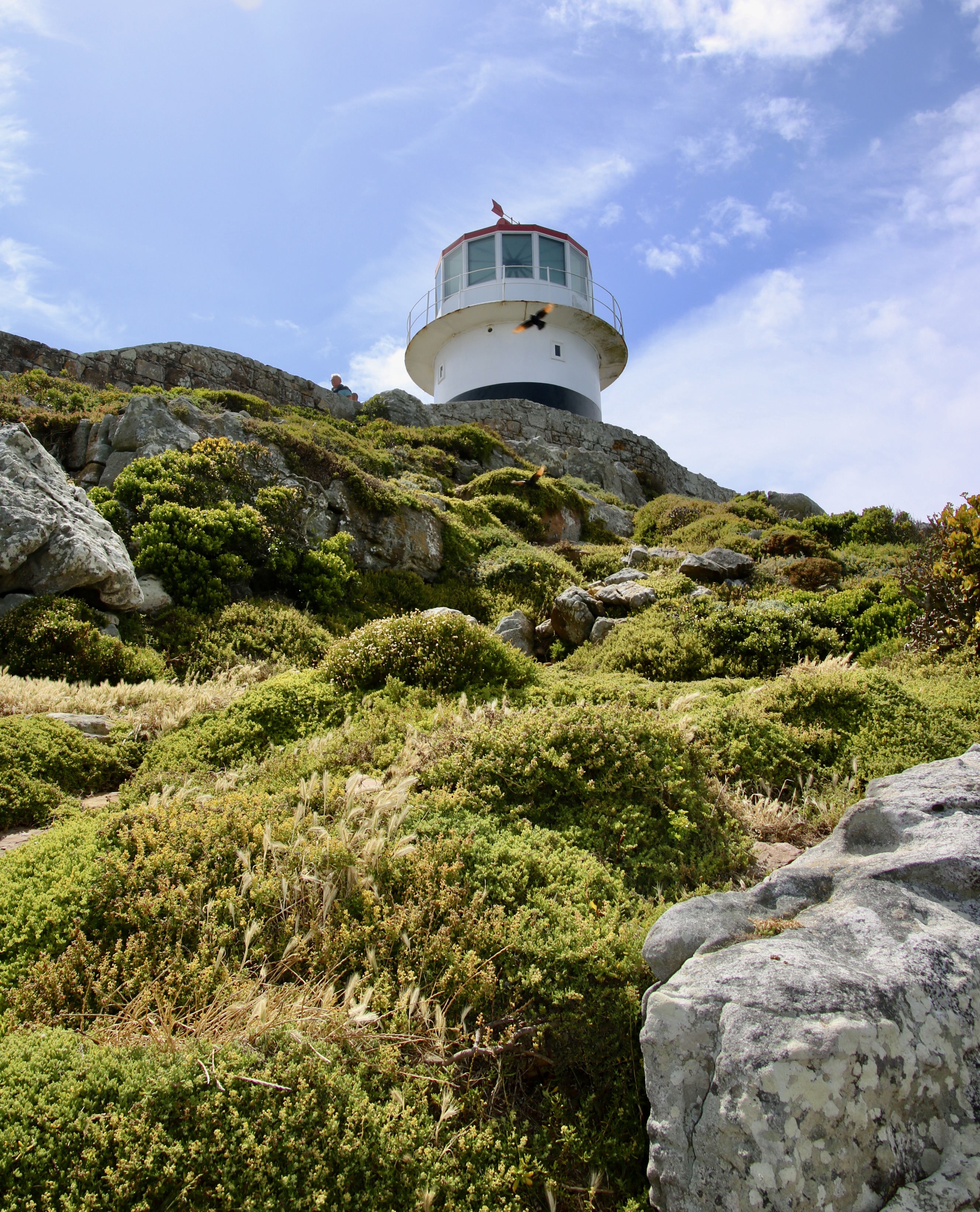
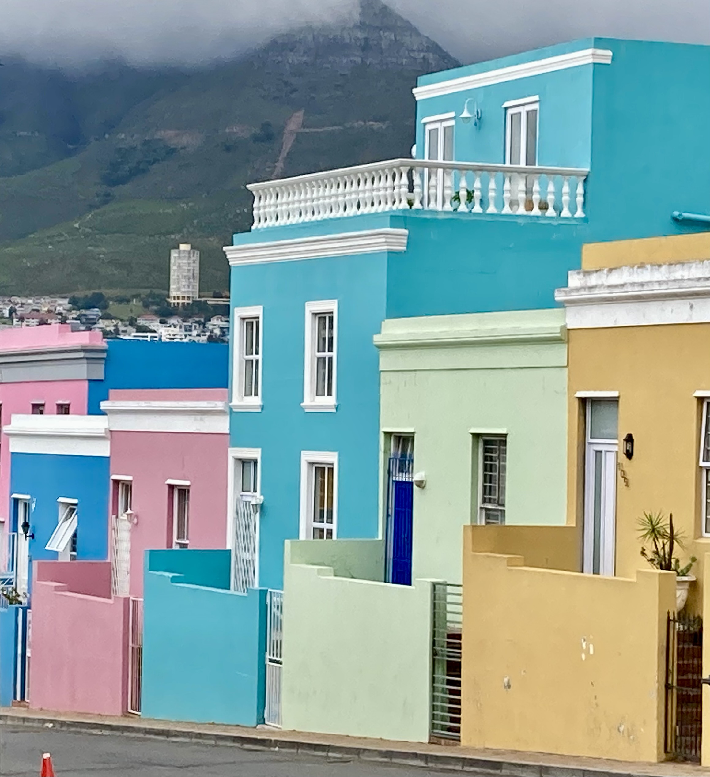
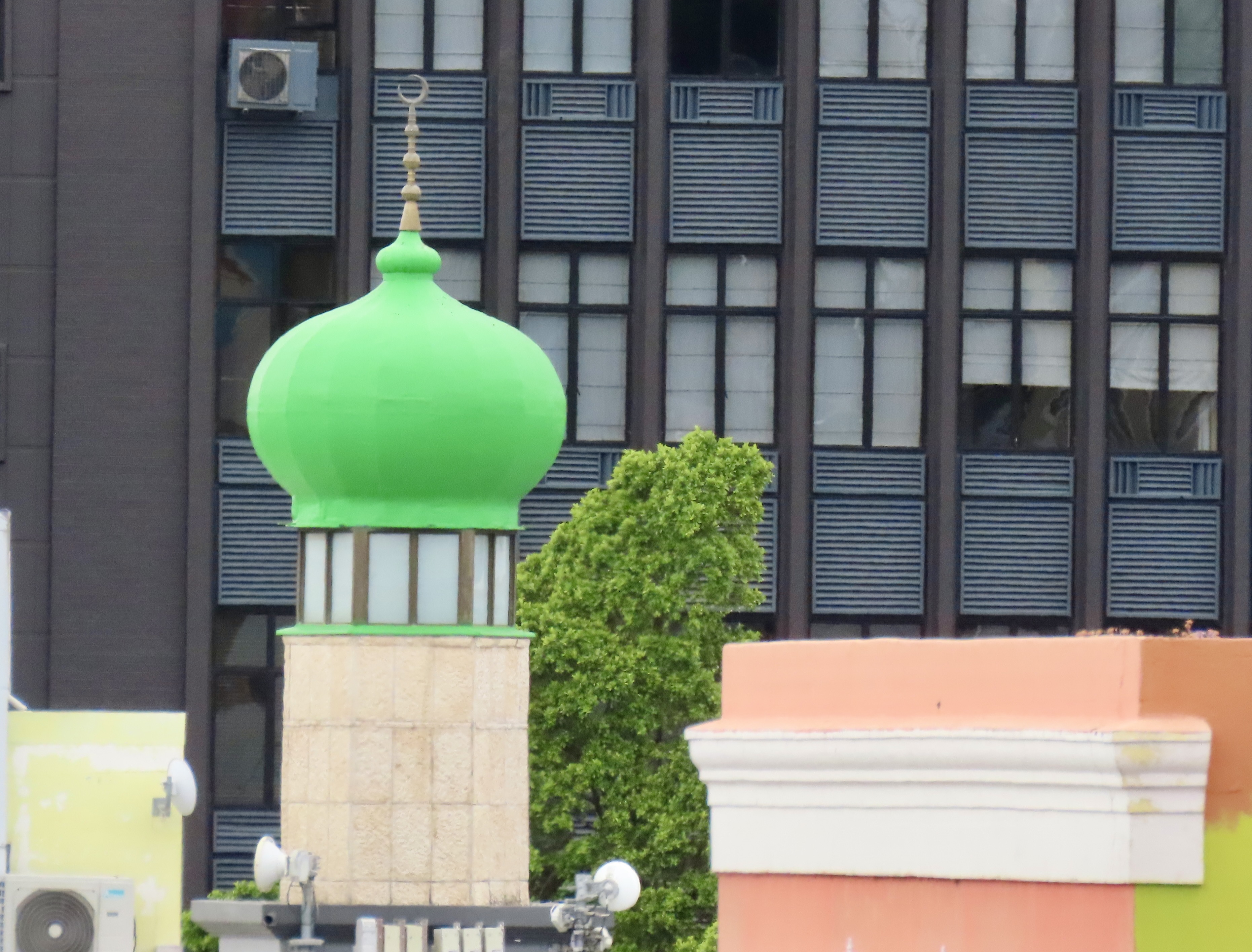
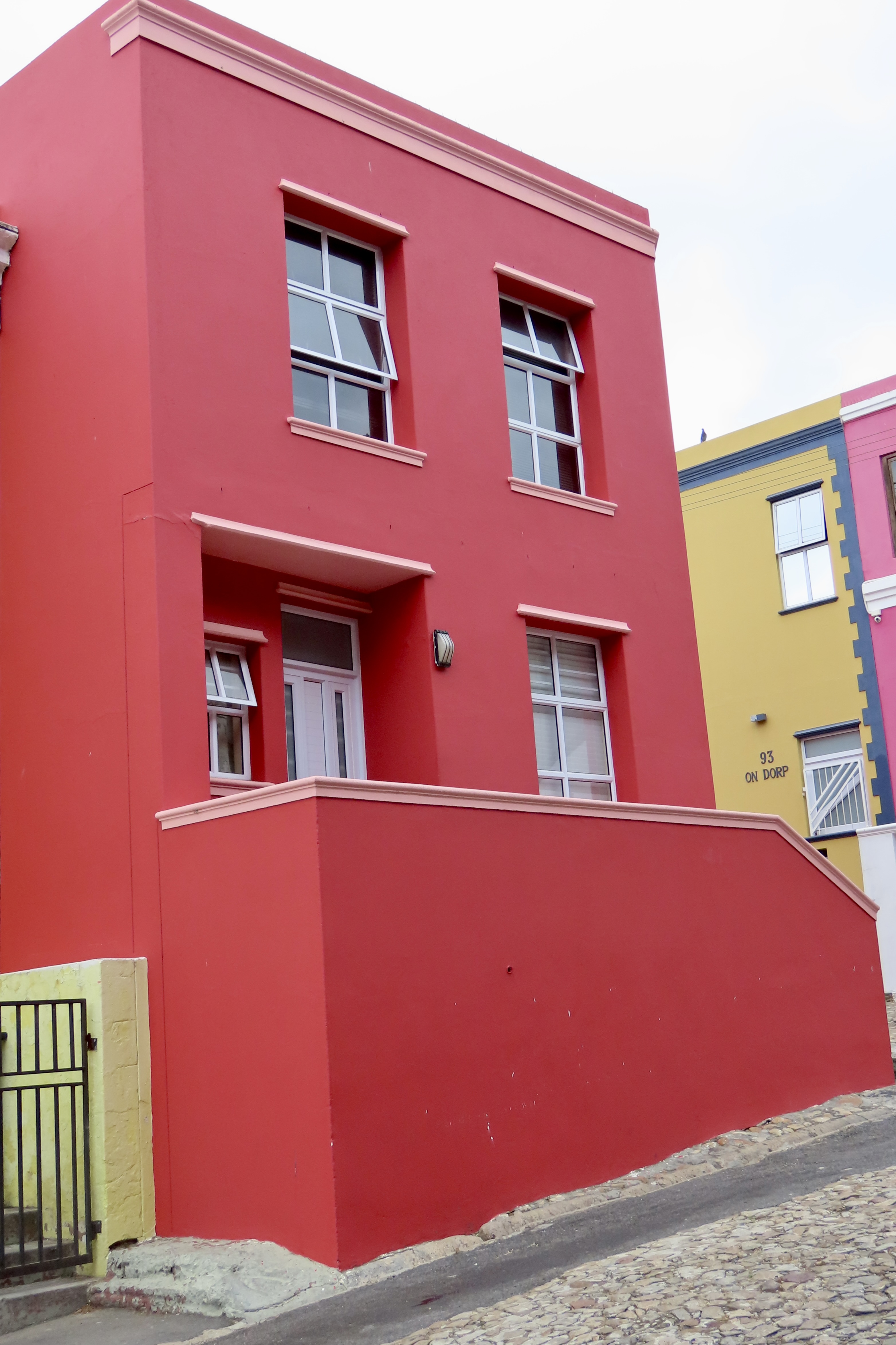
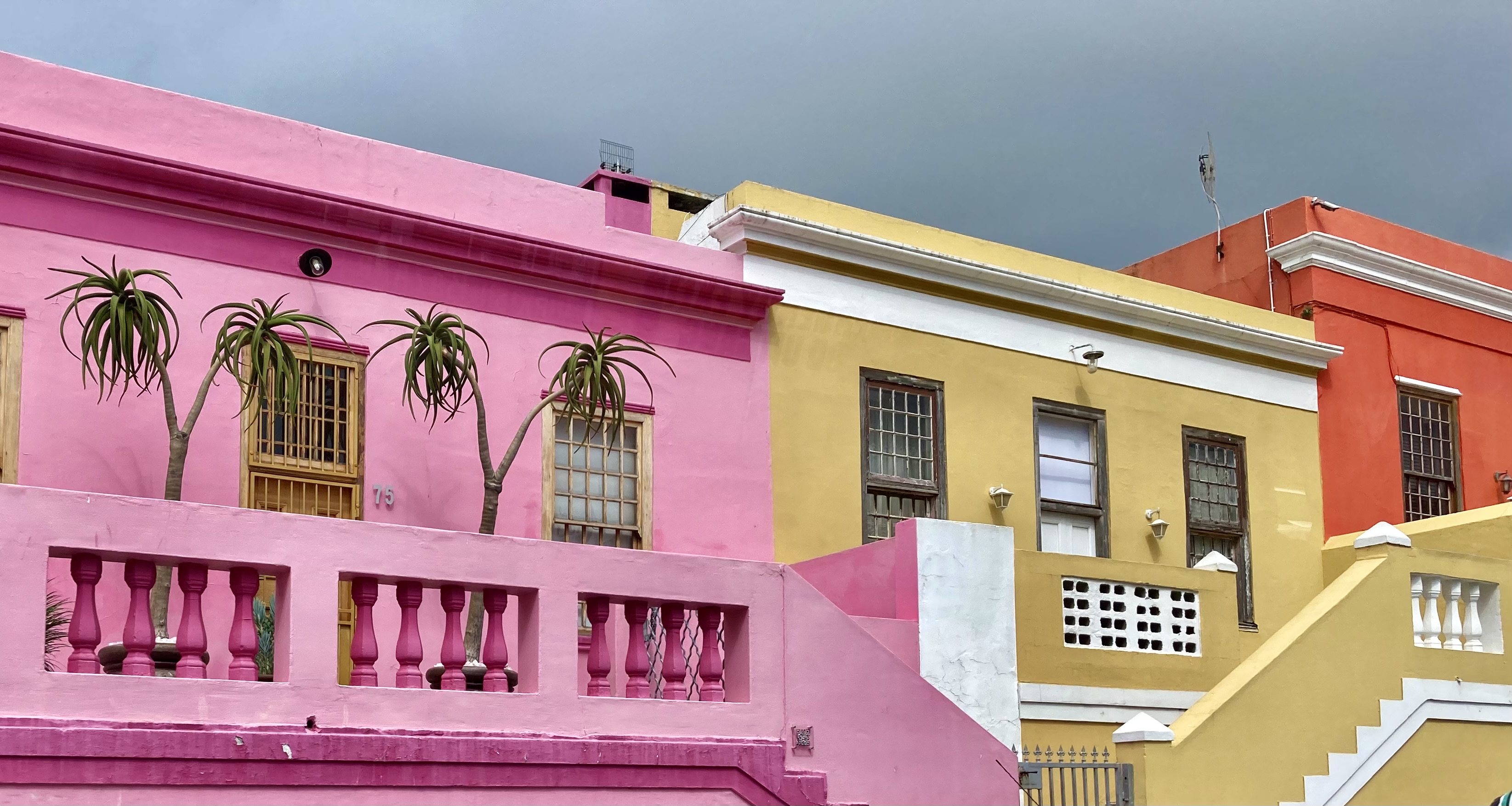
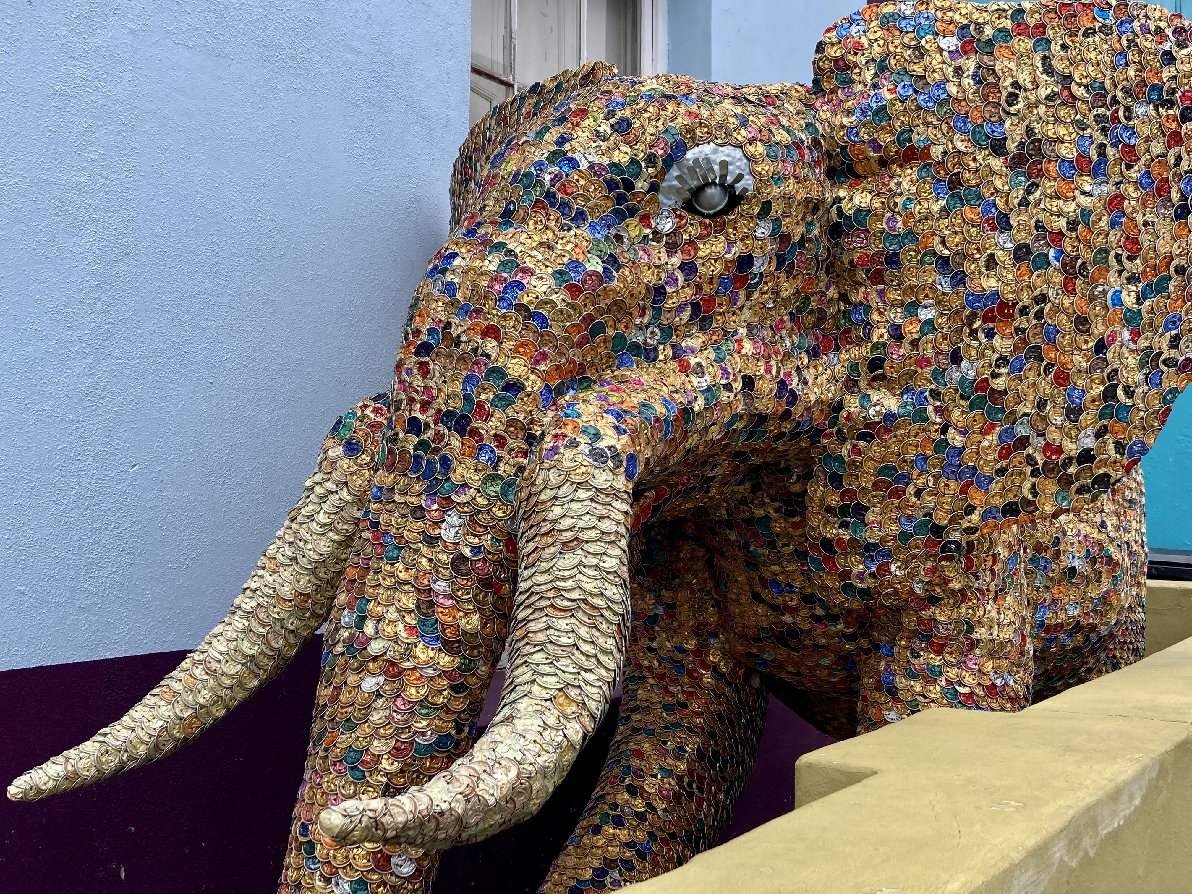
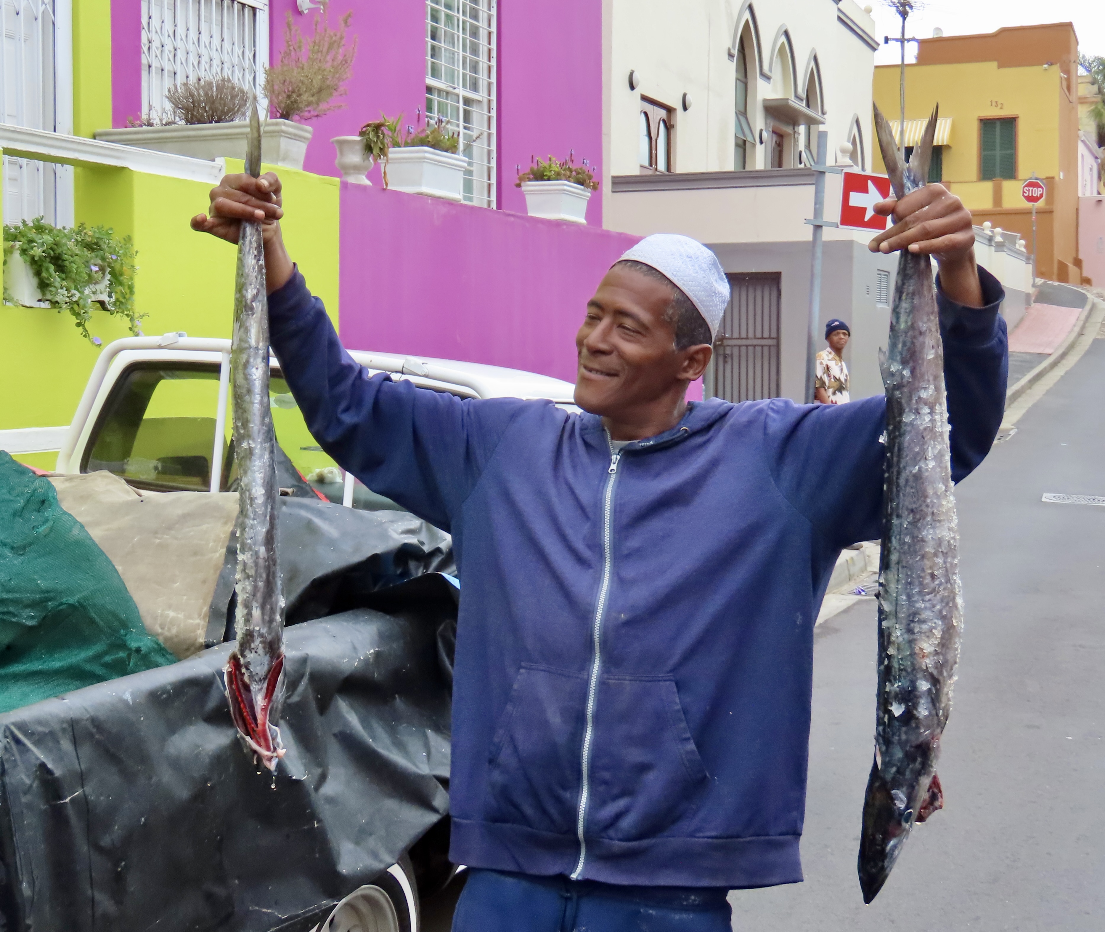
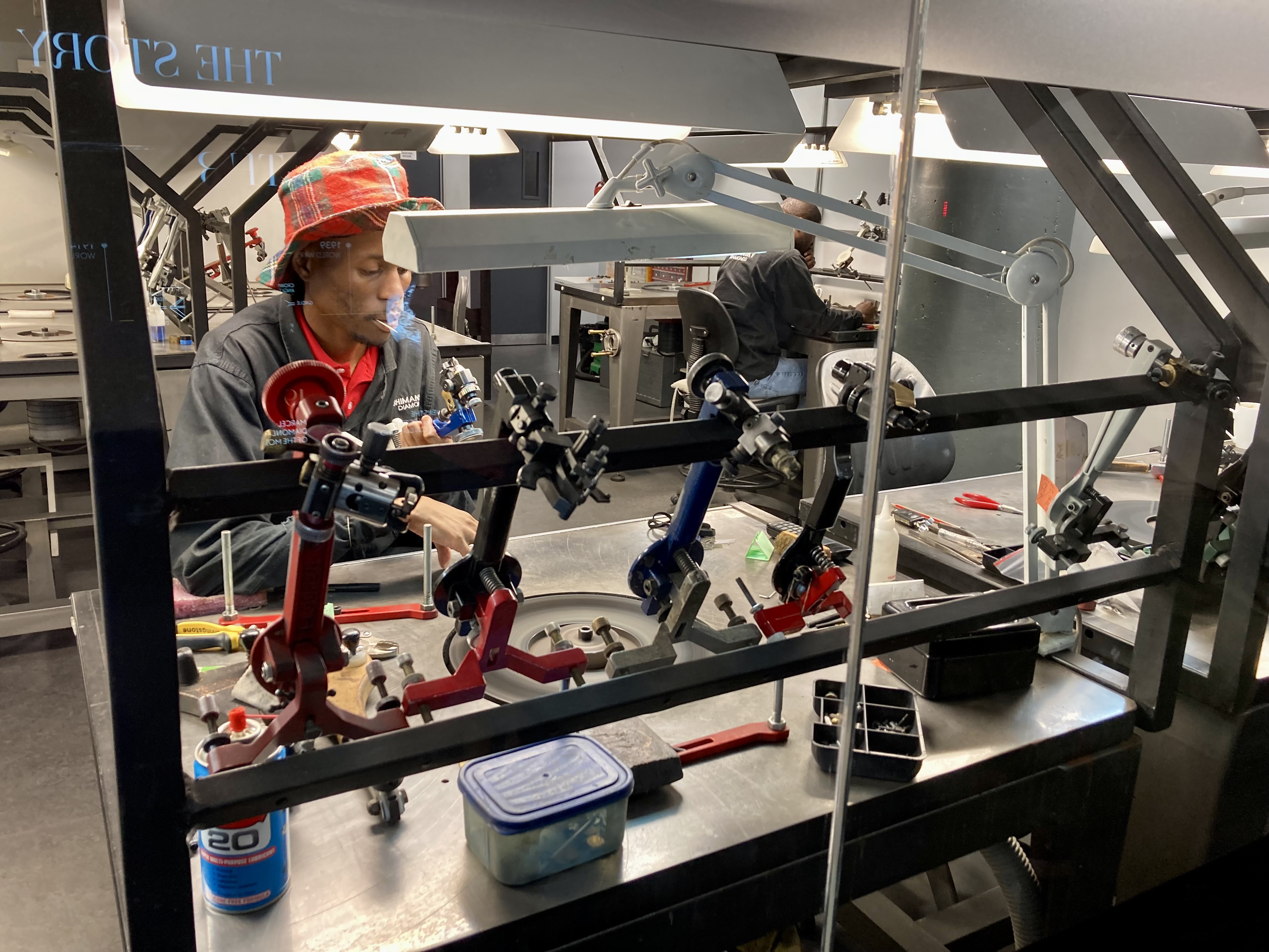
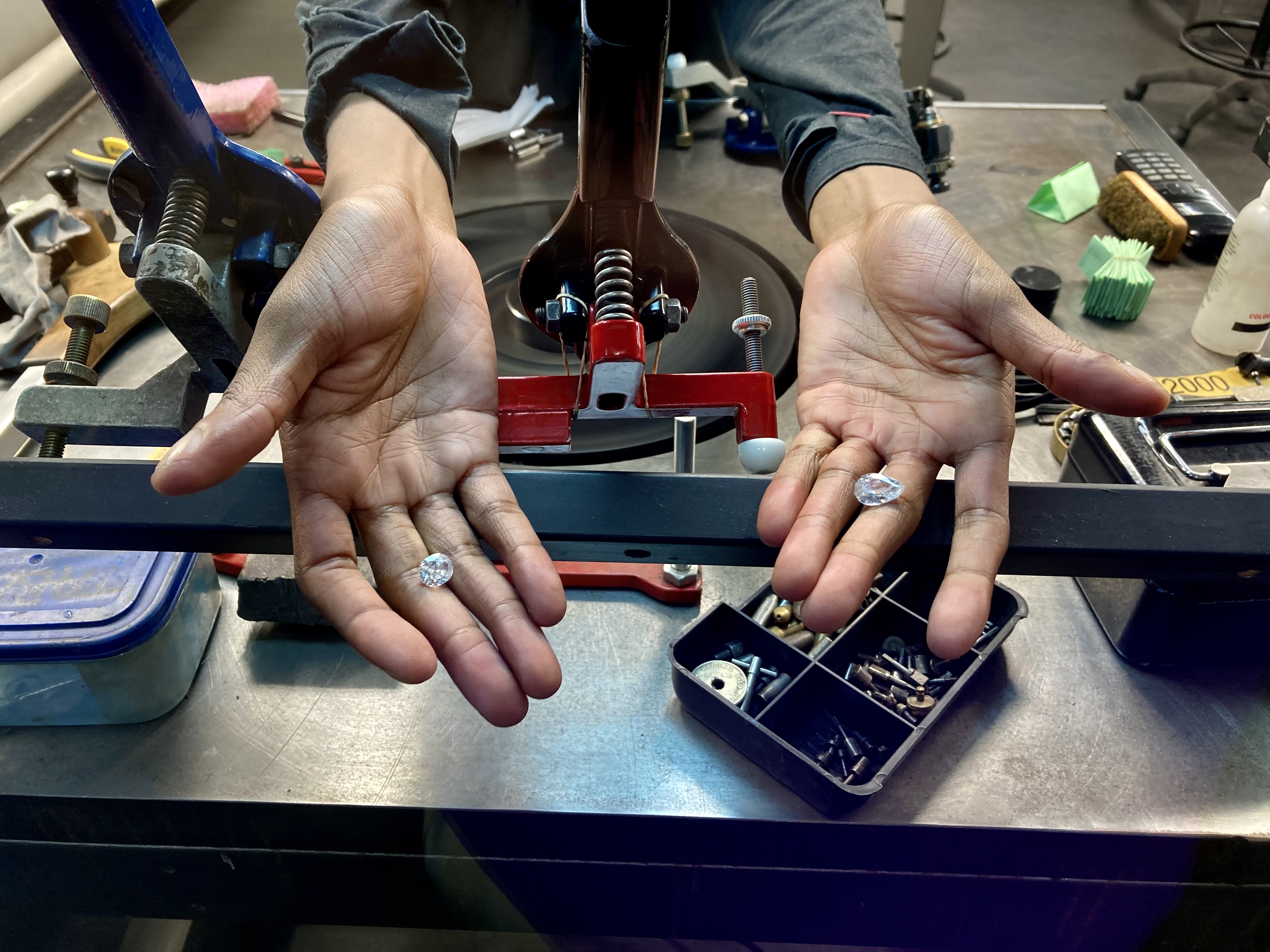
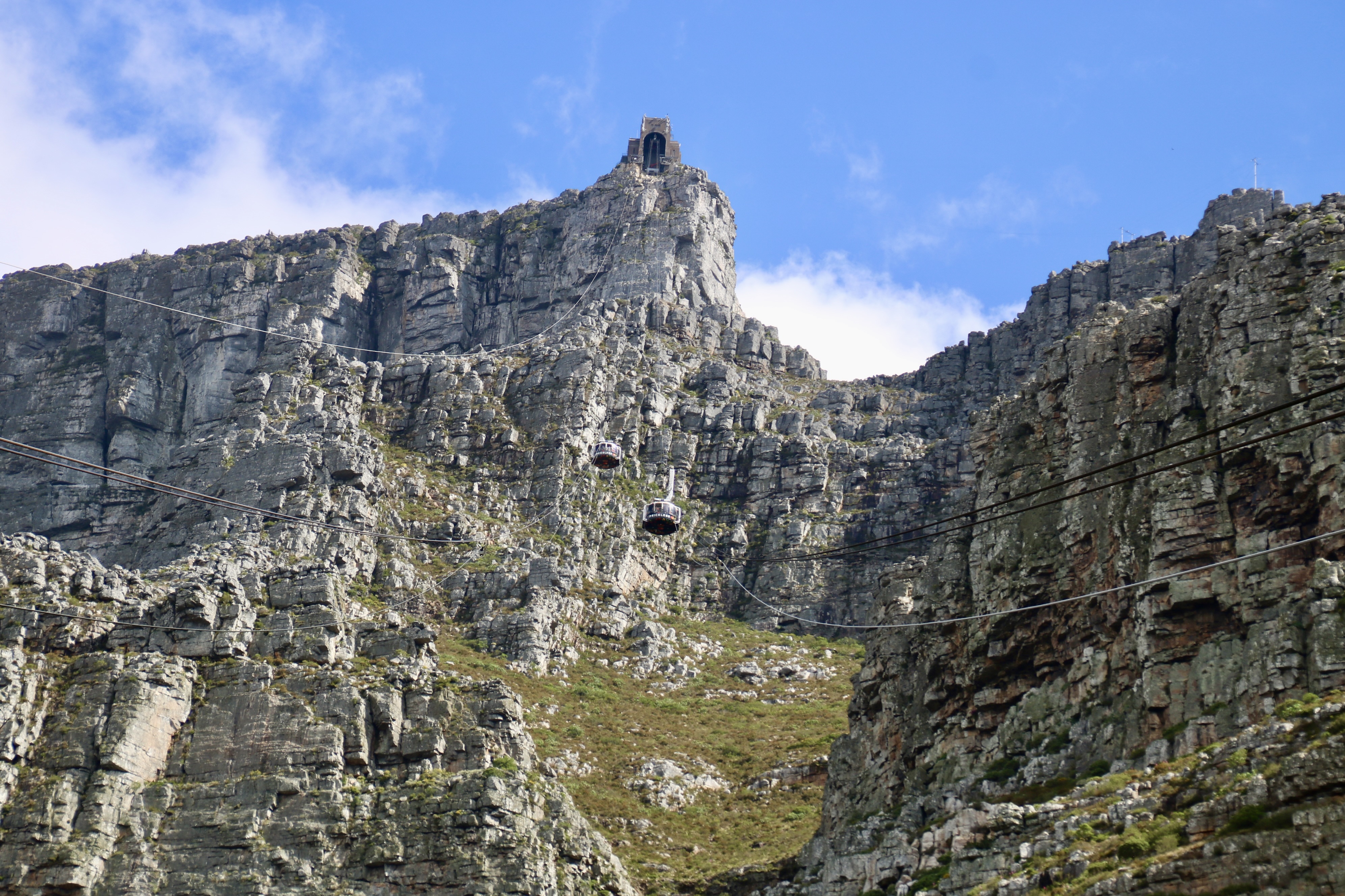
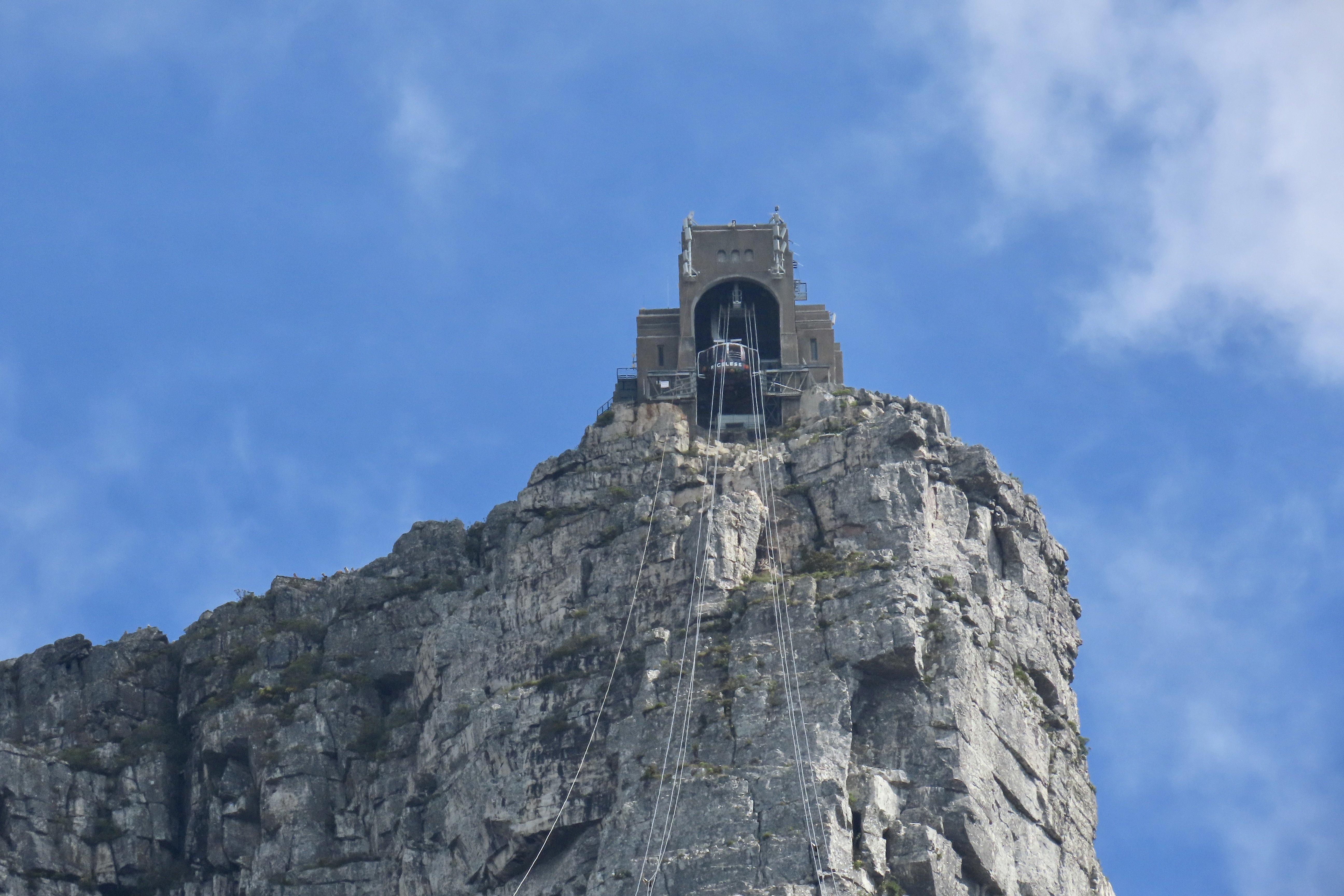
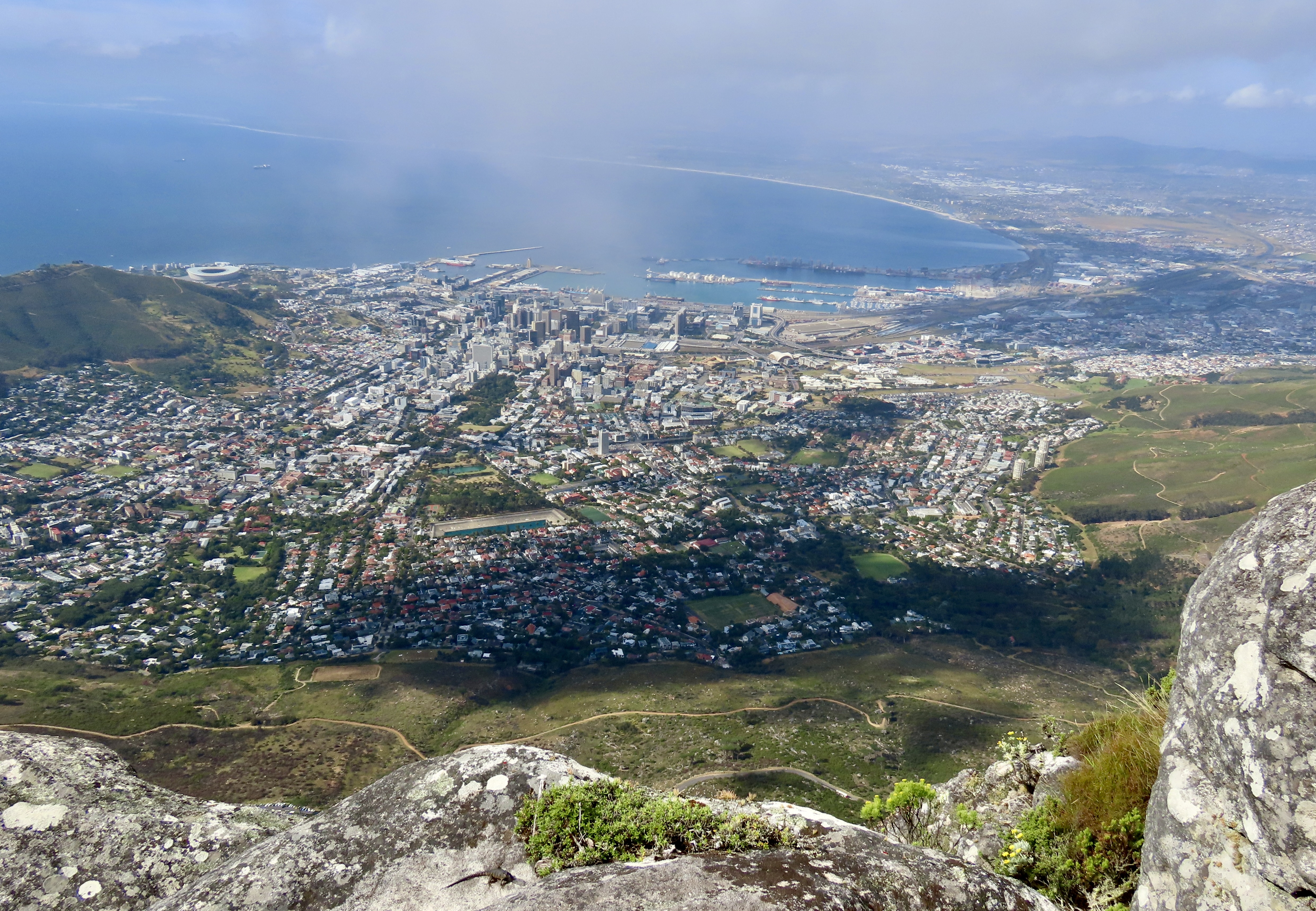
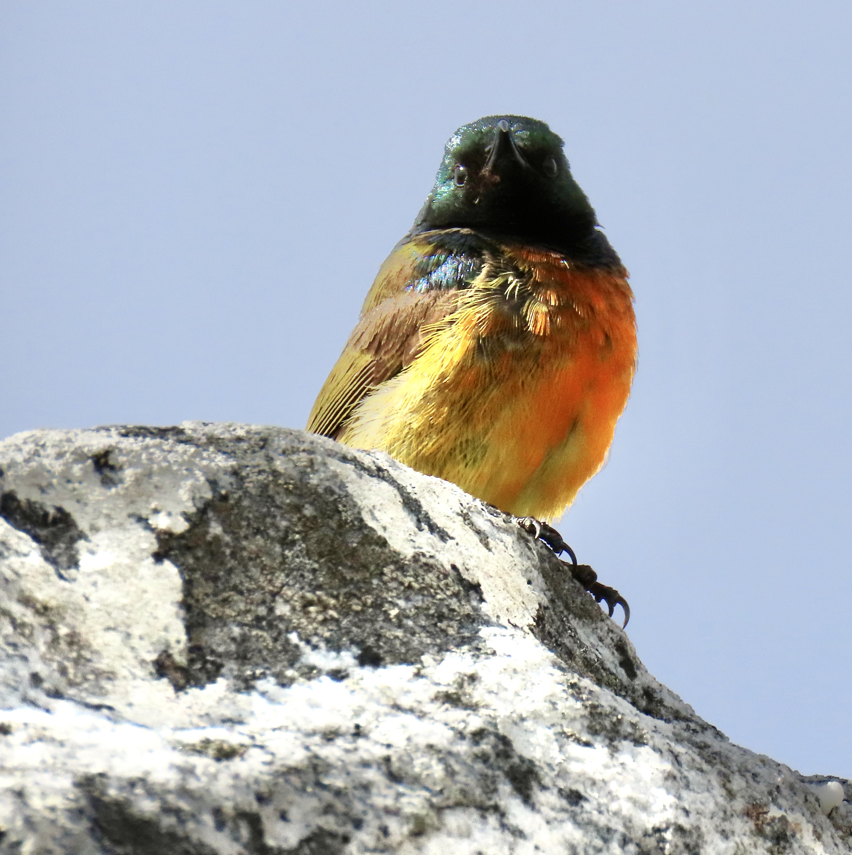
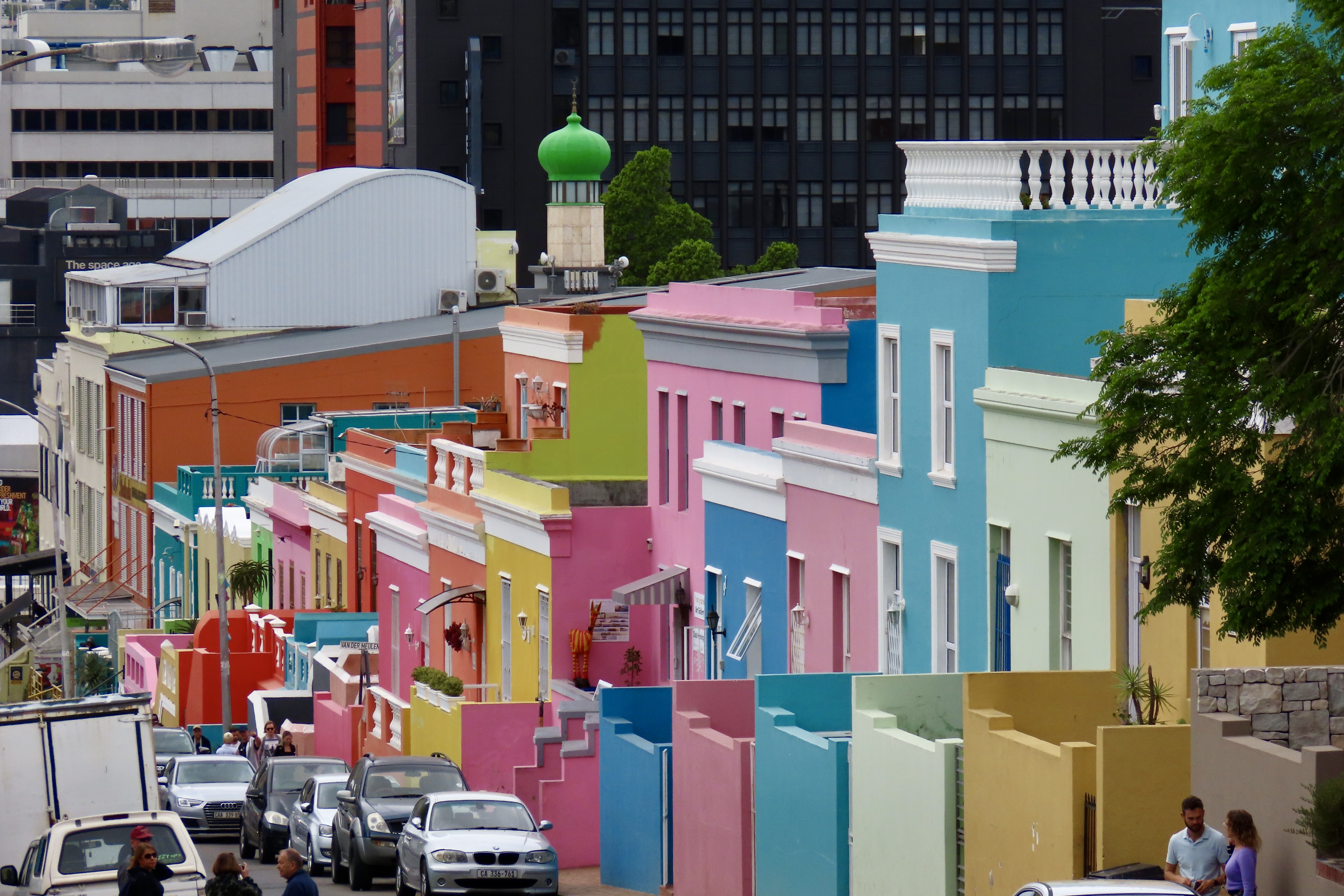
We took a full day excursion from Cape Town down to the Cape of Good Hope. Along the way, we were entertained by the ostrich, snakes, penguins and a lizard that you have already met in previous posts. This is the end of the road— as far as you can drive on the south-western coast of Africa without getting wet.This is Point Cape, just east of the Cape of Good Hope. Looking west, we had the view of the Cape that I showed in the first photo.This lighthouse was built was built in 1859 on Da Gama Peak, the summit of Cape Point, 780 feet (238m) above sea level, to protect sailors from the dangerous rocks off Cape Point and the Cape of Good Hope. It seemed like the ideal location. Unfortunately, it was often hidden by fog. A modern lighthouse is now located down Cape Point at 275 feet (78m). The hawk was a bonus.Our drive down to the Cape of Good Hope provided this view just south of Cape Town. We also saw this young caracal with its impressive long ears near the Cape. Our guide Johnathon was very excited and told us this was the first caracal he had ever seen in the wild. A member of the cat family, it hunts almost exclusively at night and is rarely seen by anyone! We were lucky. I moved quickly to get a shot before it disappeared into the brush.This rather impressive Peninsula Granite Fynbos wasn’t going anywhere, however. Peggy and I could take our time photographing it. It’s endemic to the Cape Town region and nowhere else.I managed to sneak up on one for a close up…And another. Now, back to Cape Town and the Springboks. I’m not talking about the attractive South African antelope known for its pronking, taking several 6 foot high leaps into the air in quick succession. I am talking about the South Africa’s Rugby Team that had just won the World Championship and was booked into our hotel for their Cape Town celebration.A large crowd had gathered around our hotel and was waiting their arrival. The police opened their cordon to let us through. Several people thought we were related somehow and snapped our photos. A number of teenage girls waited nervously. One actually managed to get a selfie with one of the stars. She tried to be cool when taking the photo but immediately screamed afterwards. So much for cool.Our guide, Jonathan, took us on a tour of Cape Town and Table Mountain in addition to taking us down to the Cape of Good Hope. Here, he is talking about the colorful homes in the small community known as Bo-Kaap that I featured at the end of my last post.The original residents of Bo-Kaap were descendants of slaves imported by the Dutch from Malaysia, Indonesia, India, and Sri Lanka during the 16th and 17th centuries.Because of their cultural heritage, Bo-Kaap is primarily a Muslim Community. Even the mosque was brightly painted, matching the brightly painted homes.One of the homes.It seemed that each one was painted a different color.A final exampleWe found this artistic elephant in Bo-Kaap…And this man selling freshly caught fish from the back of his pickup.Johnathon also took us to the Shimansky diamond jewelry shop where we watched diamonds being cut.The diamond cutters showed us two of the diamonds he was working on. Judging from their size, I’d say they were a bit beyond my budget. Quite a bit.Any trip to Cape Town should include a trip up to Table Mountain, the dramatic backdrop for the city. We got there by going up this tram.Almost there…Looking back at Cape Town from Table Top Mountain.Our hotel was mixed in among these tall buildings. View of the top of Table Top…And another view. A number of flowers demanded their photos be taken.Including one I had never seen: a peninsula conebush. The cone is tough and will only open and release its seeds as a result of fire. Cala Lilies were an old friend.These flowers created a pretty bouquet among the rocks.Peggy shows the mist rising up on the ocean side of Table Mountain. Her hair shows that it was accompanied by a breeze.This little beauty, an orange-breasted sunbird, was waiting for us as we neared the end of our time on Table Top Mountain.After all of the great people, incredible wildlife, and striking scenery, I think it is only appropriate that we end our African safari series with the small hyrax on Table Top Mountain, seemingly waving goodbye to us. The next morning we began our long air journey back to Virginia. I hope you enjoyed this series. We were ever so glad you decided to come along. Next up, an introduction to our thousand mile journey following the Pacific Coast.
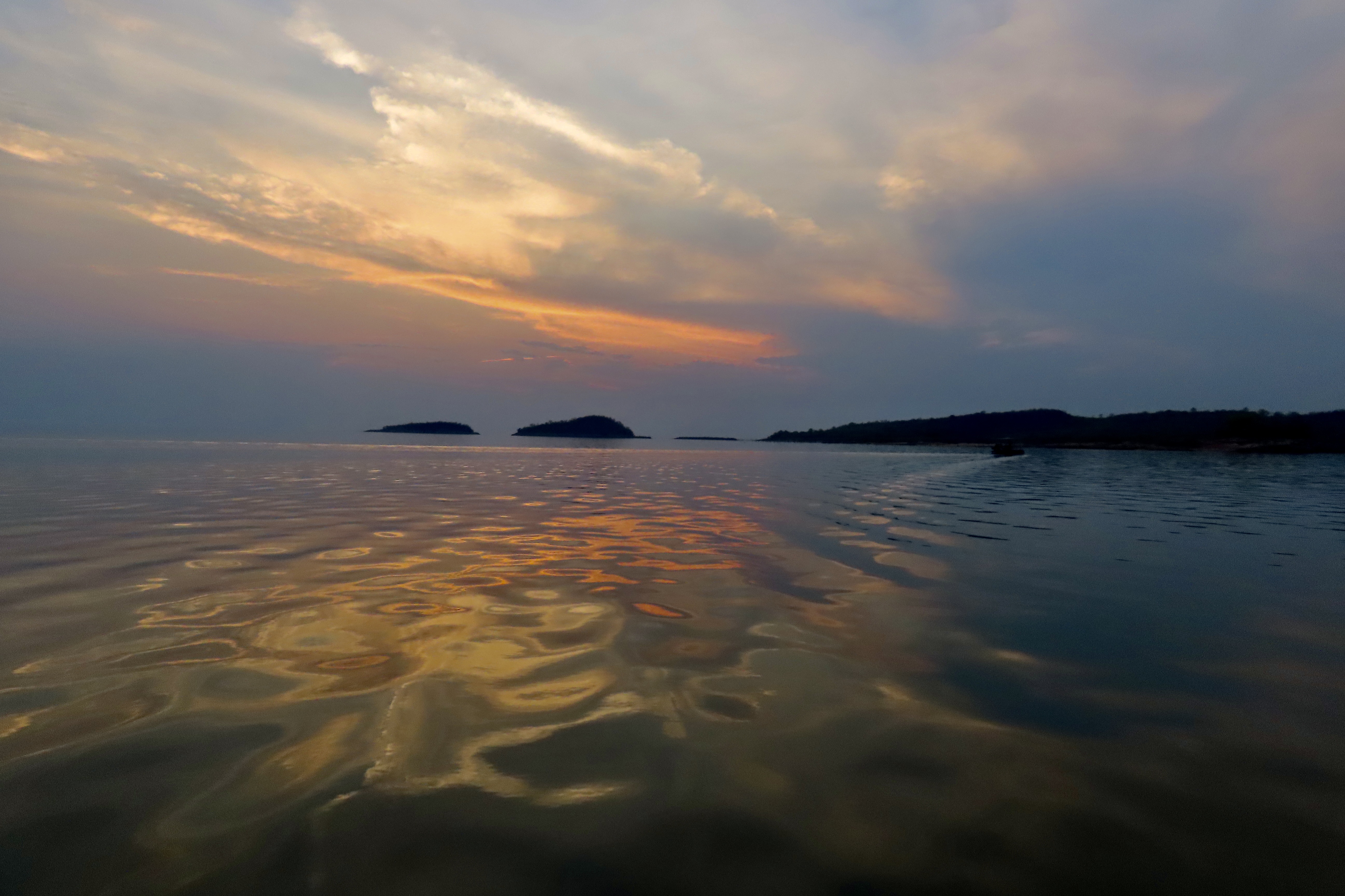
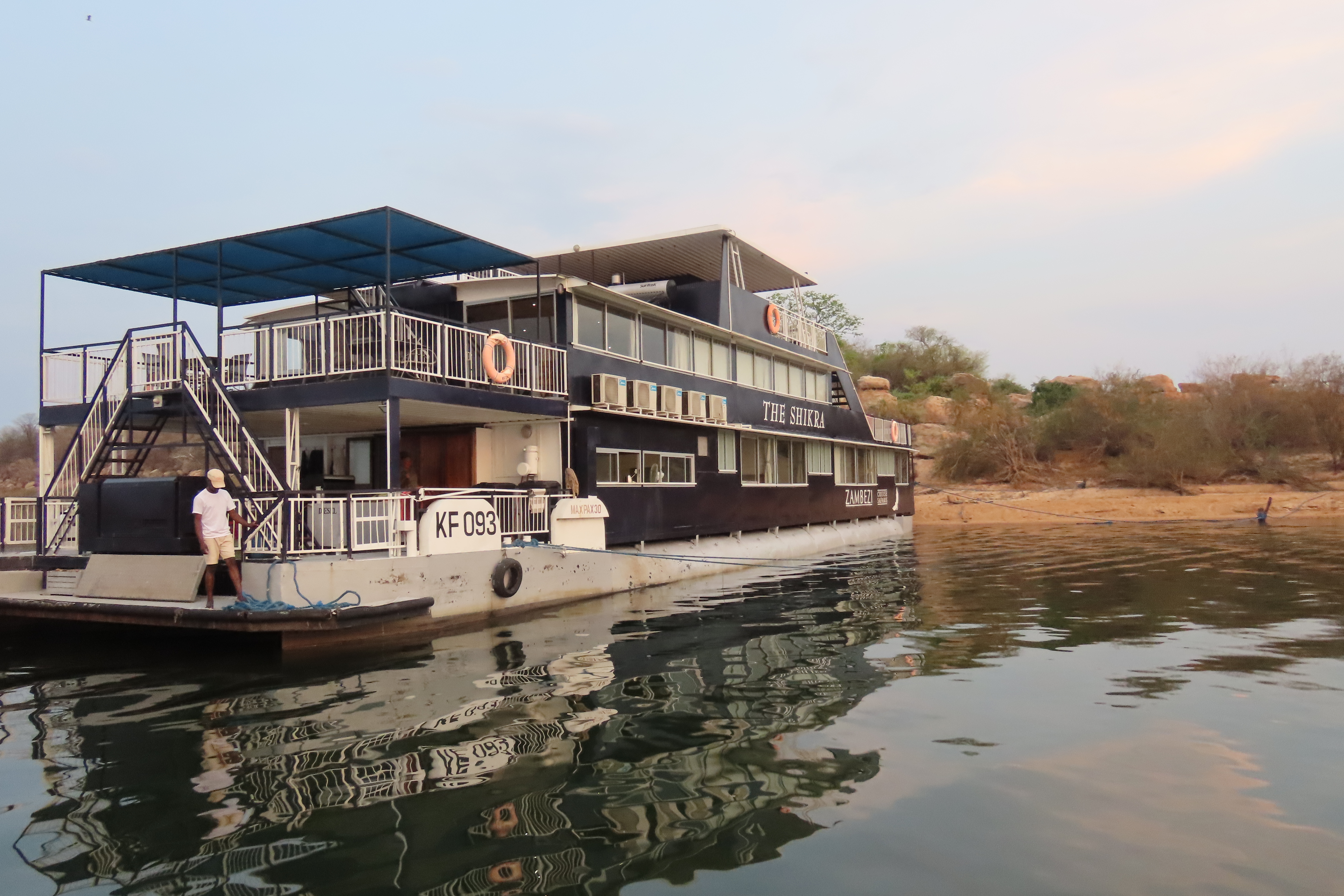
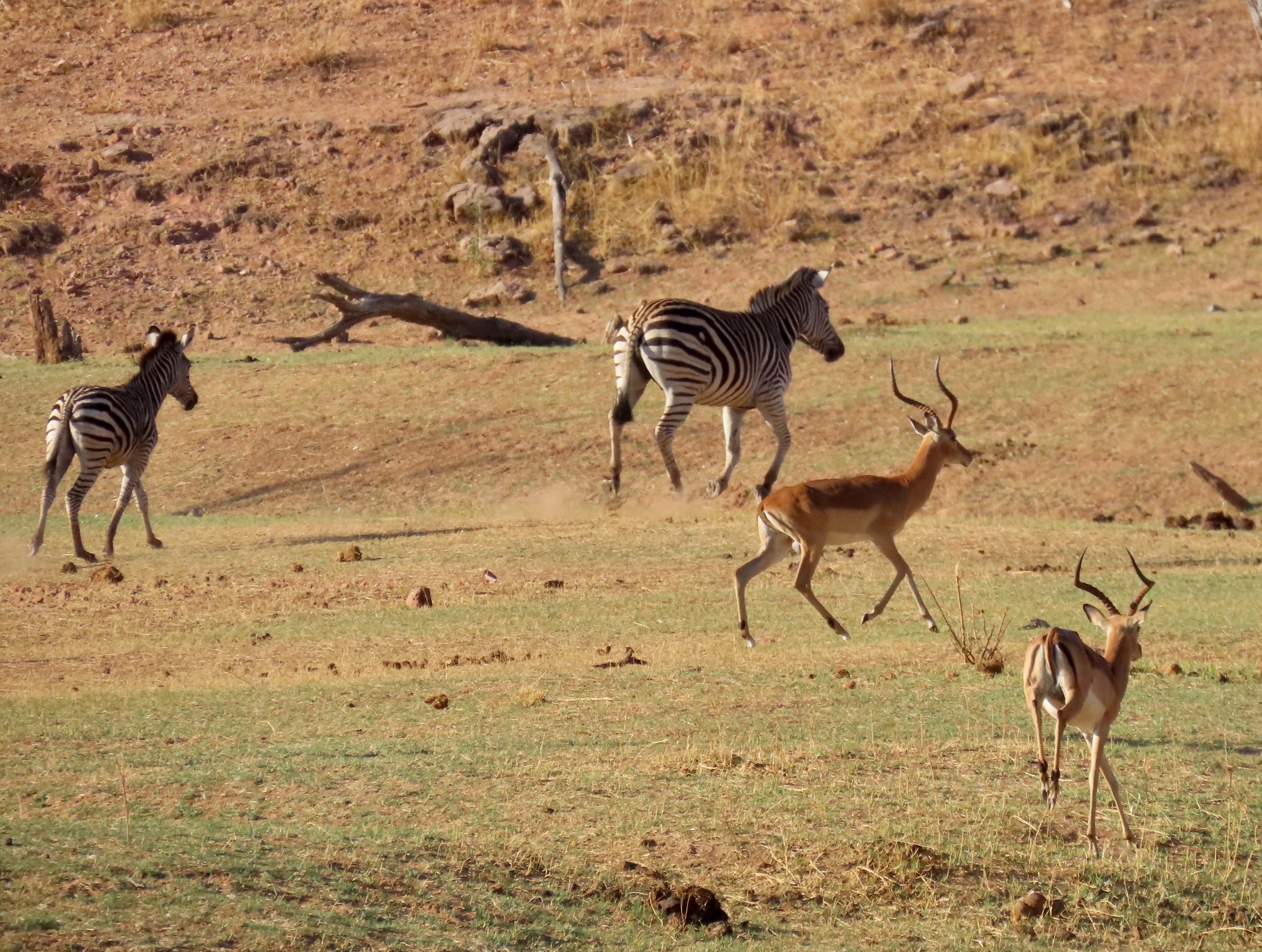
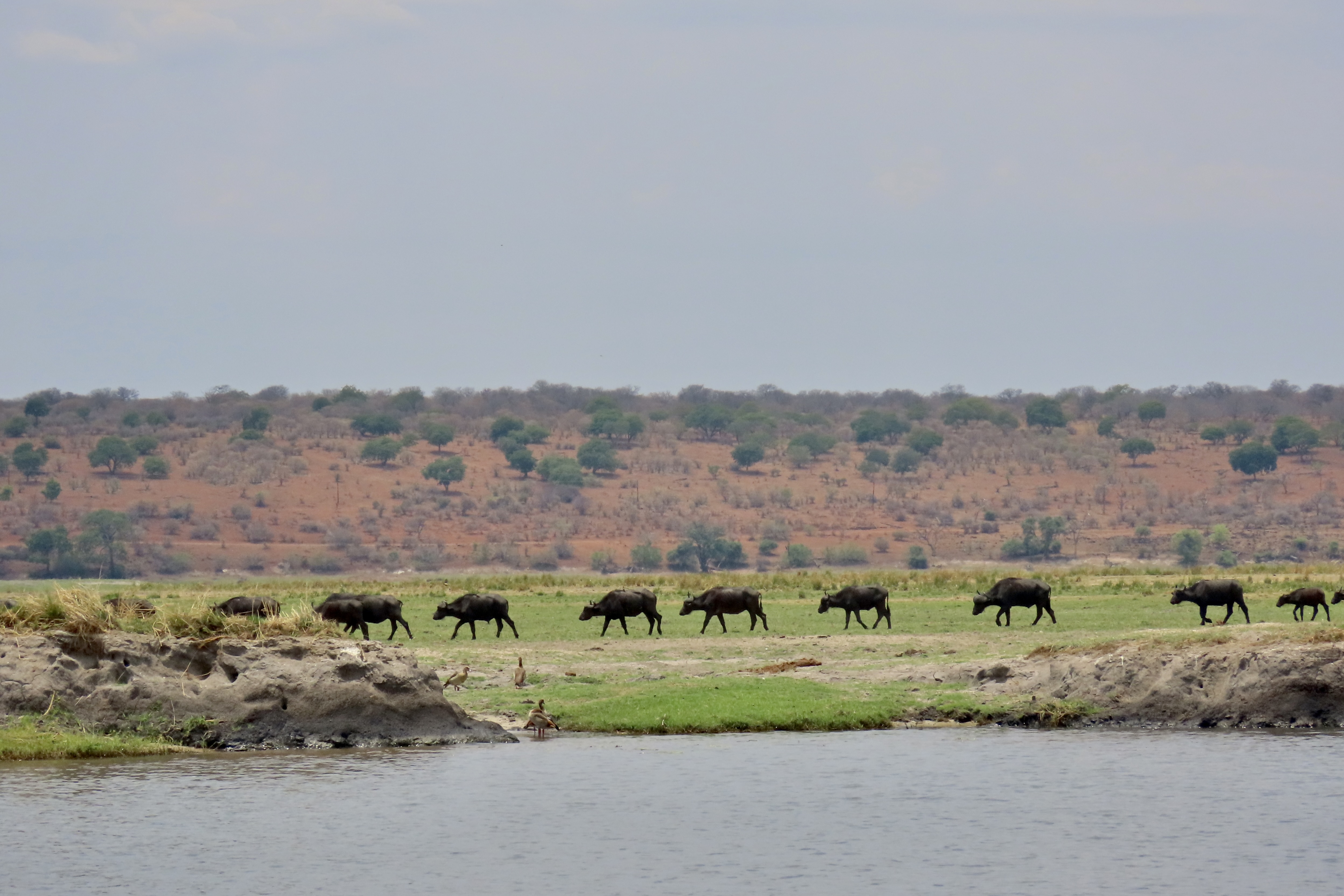
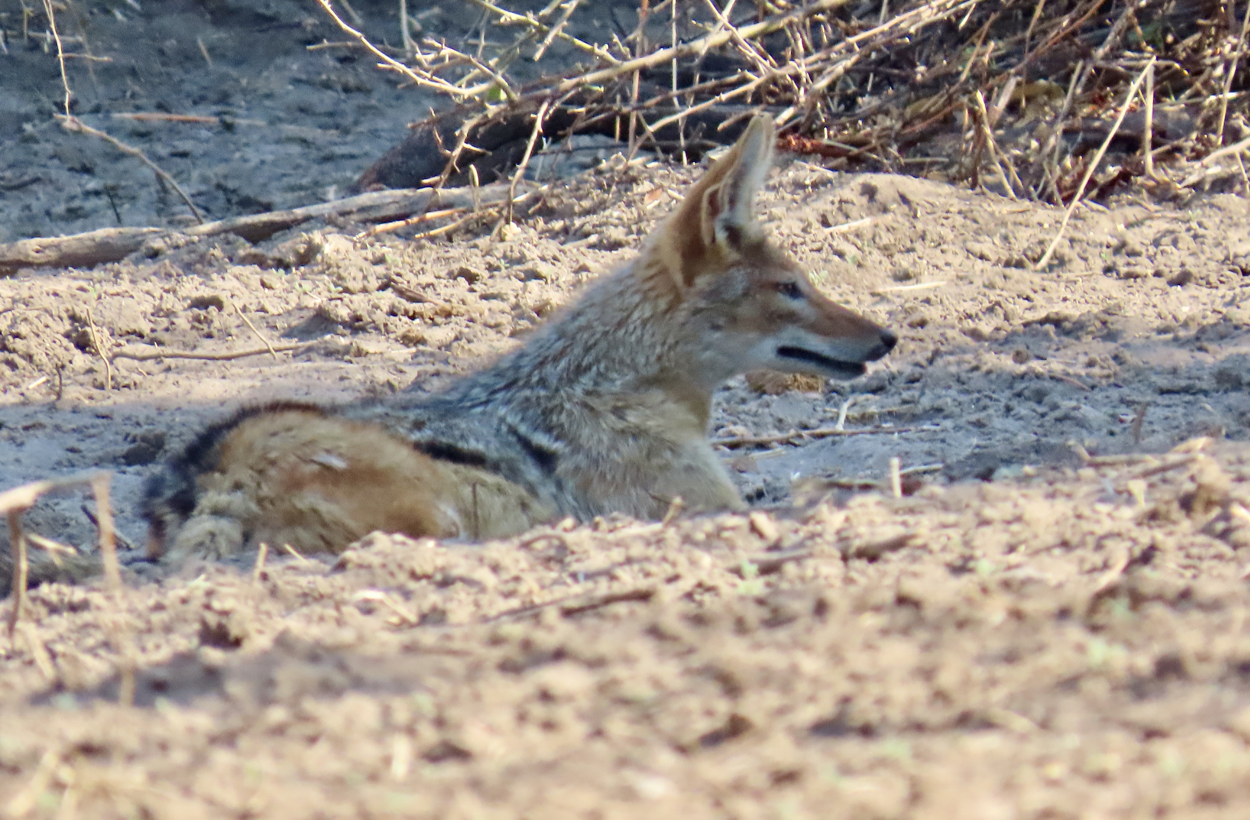
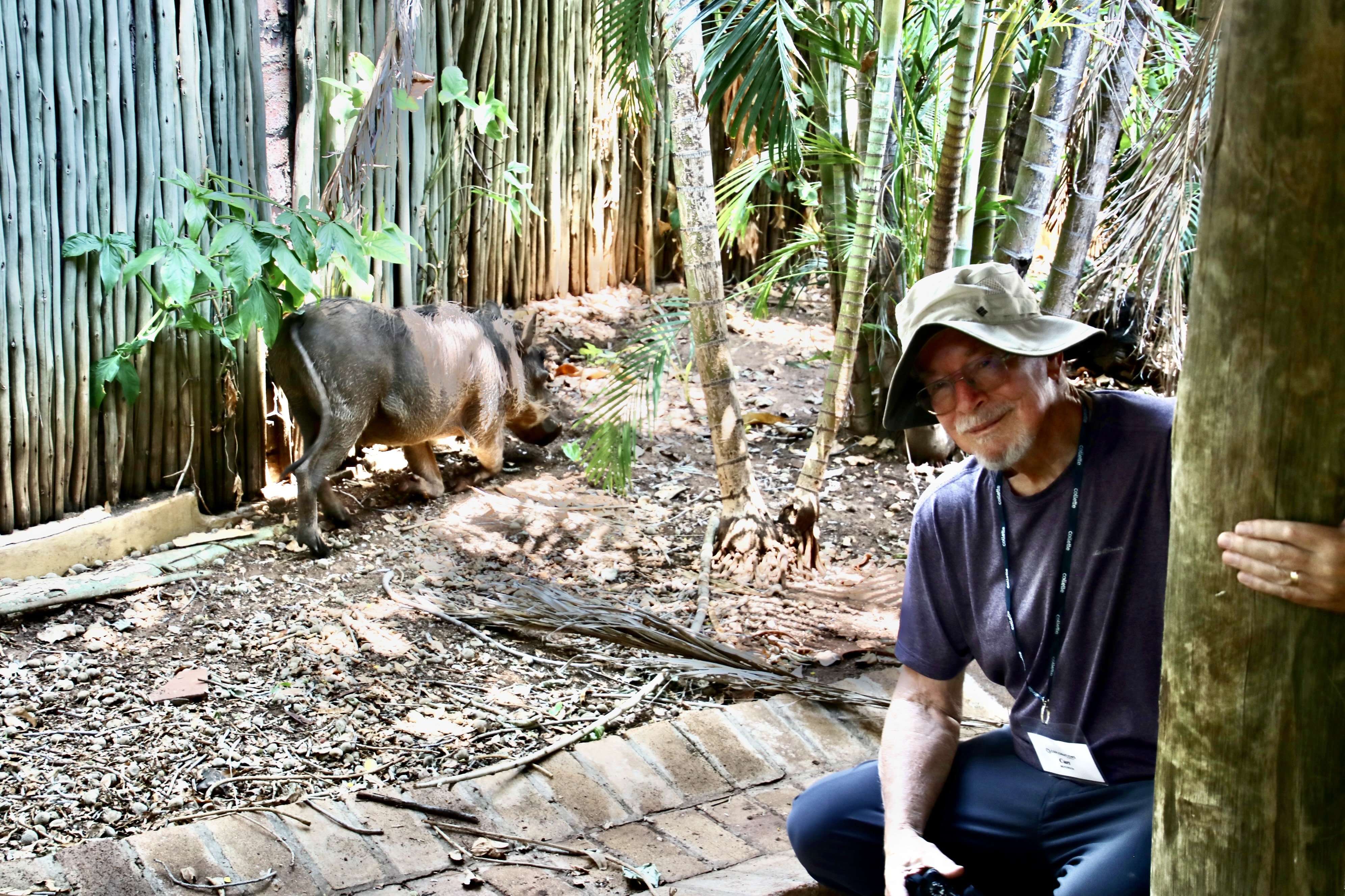
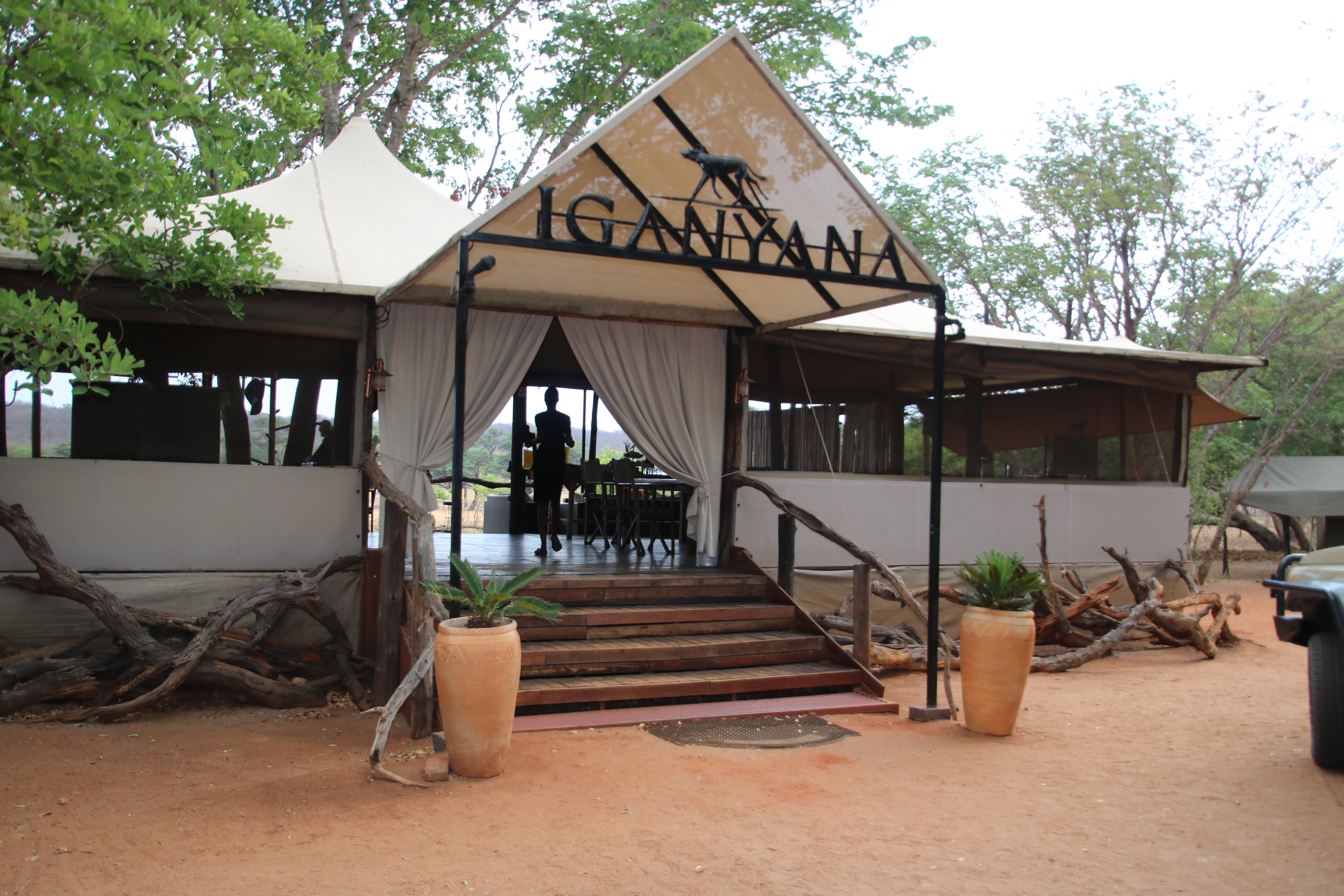
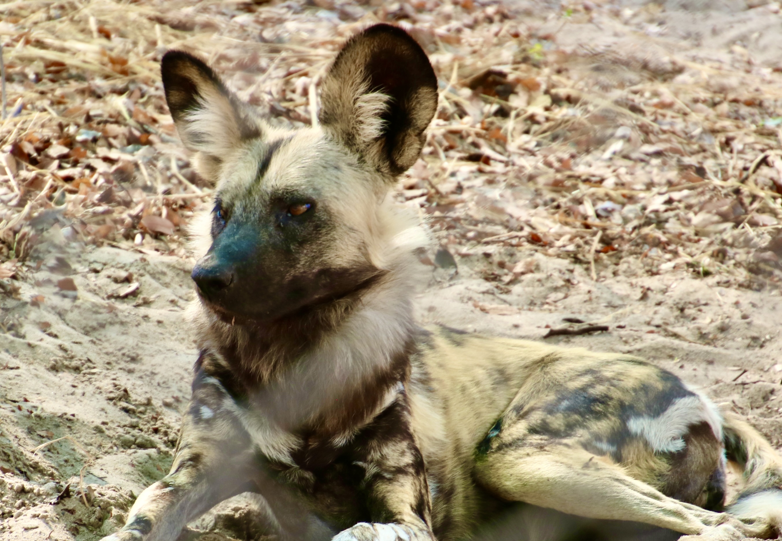
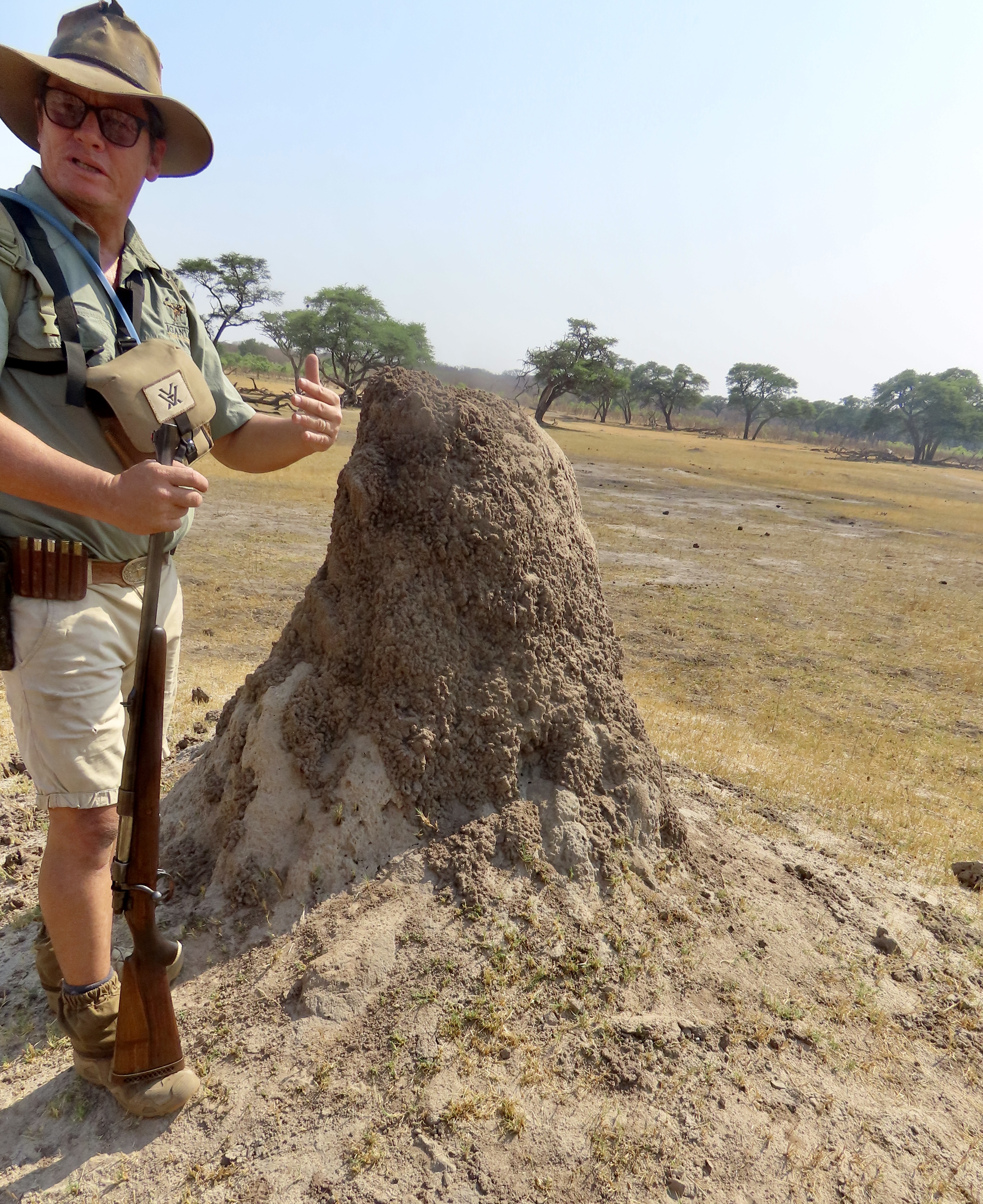
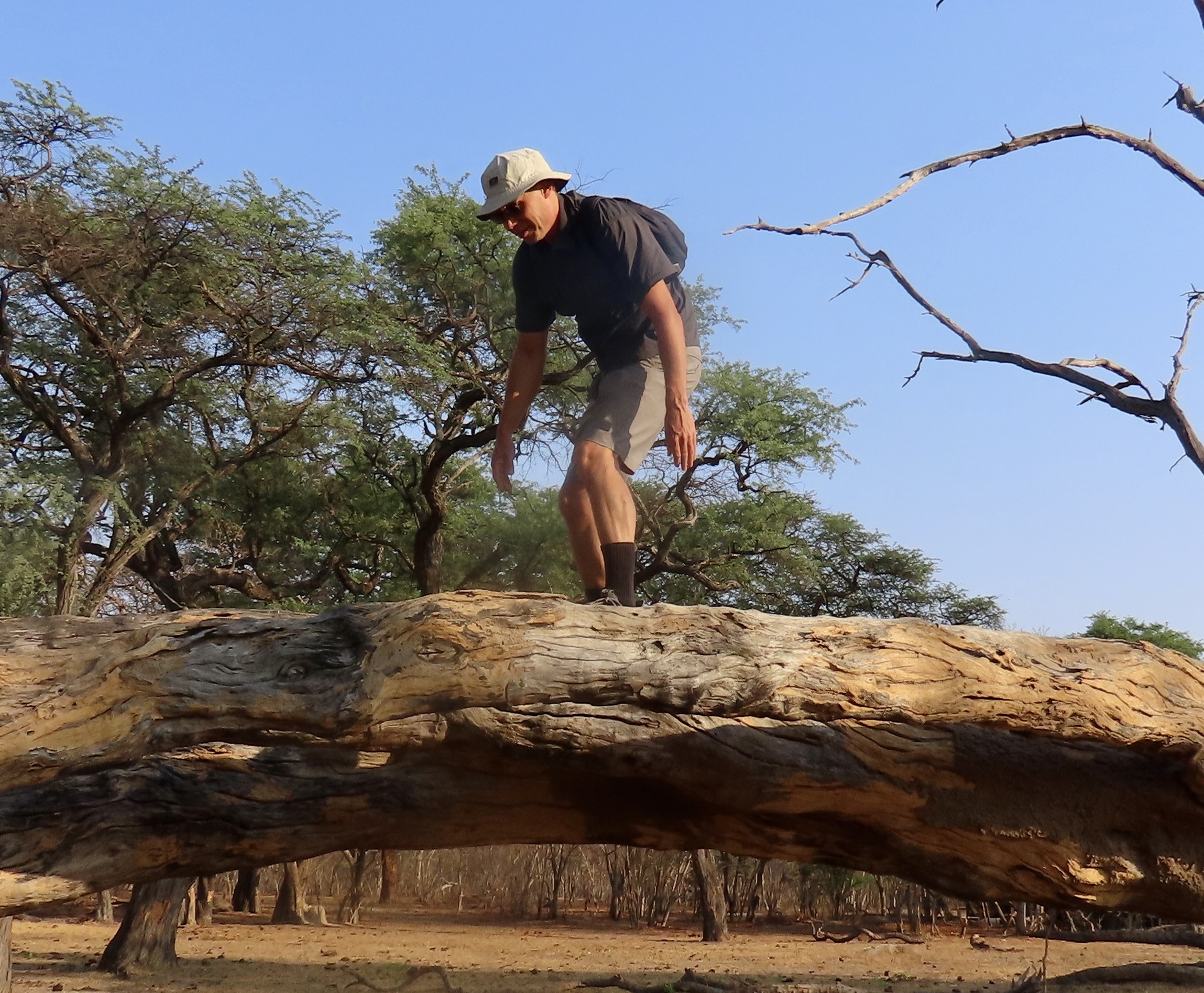
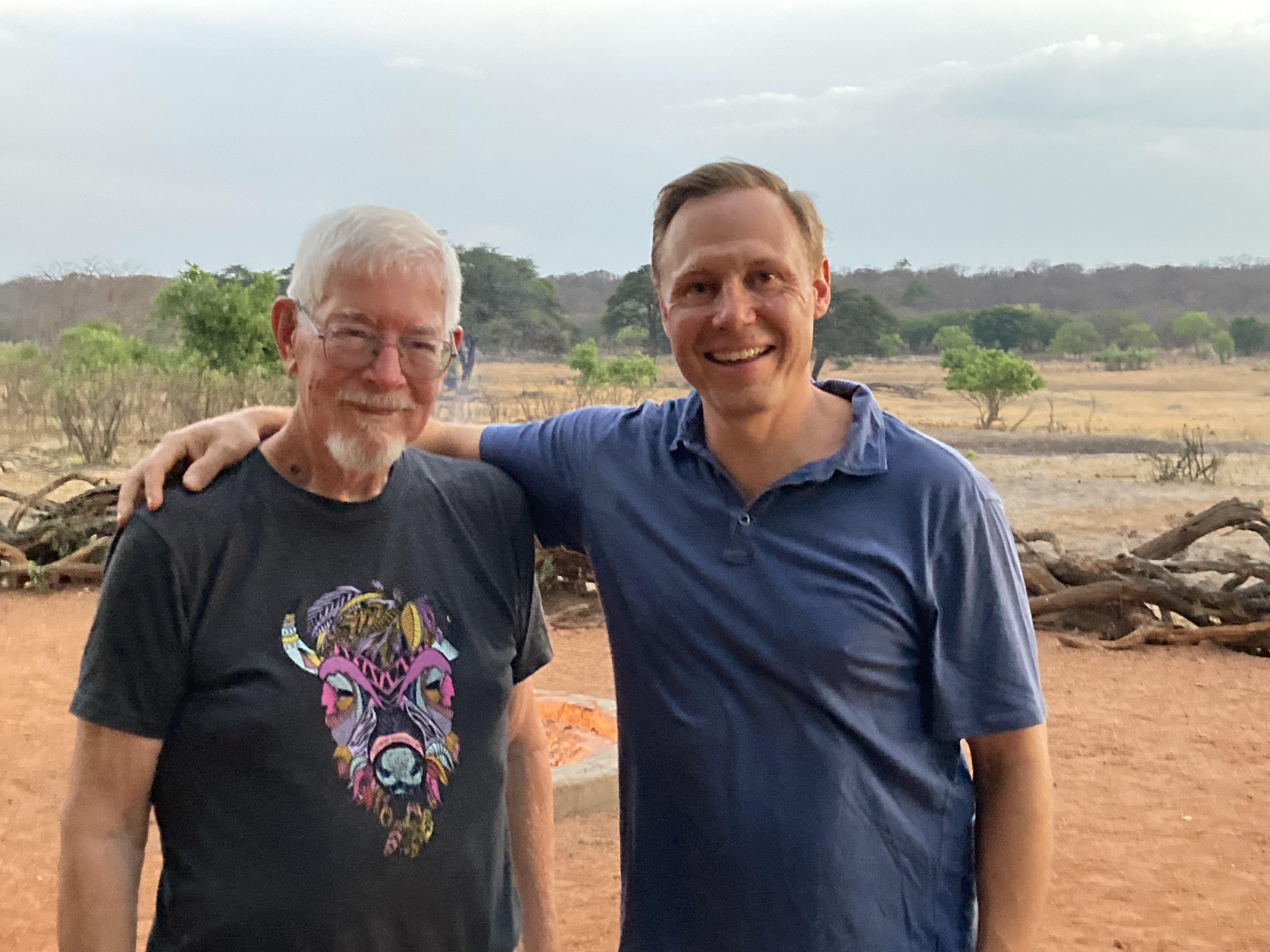
I promised more sunsets as I continue the wrap-up on our African safari. This one was on Lake Kariba in Zimbabwe. Today, I will be focusing on those photos from Lake Kariba, Chobe National Park and Hwange National Park that were blog-worthy but didn’t fit into our earlier posts.After sunset, it’s time for moonrise. Right? We were entertained by a full-moon at Lake Kariba one night, when we out exploring later than usual. That’s a weaver bird nest on the right, BTW.I was curious about how my new camera would handle a close-up.This was our houseboat on Lake Kariba.Numerous islands were on the lake.Most of the islands were covered in vegetation. This one featured acacia trees. Rangers from Matusadona National Park next to Lake Kariba took us on a trip back into the park that I covered in other posts. But I missed this photo of impala and zebras running. We found that the wildlife at Matusadona was much more skittish than it had been at other national parks. I figured it was because they saw far fewer tourists, either that or there were more poachers operating in the area. We woke up at 5:00 on the morning we were supposed to return to port because the boat was rocking and rolling. A major storm had come in overnight that none of the weather forecasts had predicted. This photo was taken from where we were anchored close to the shore. Big waves were rolling on the lake. Lake Kariba is the largest manmade lake in the world by volume. The captain took the boat out, looked at the waves, and brought the boat back in. It was too dangerous. There was talk of bringing another boat in that could handle the waves better. Eventually the waves calmed down enough that the captain was willing to make the trip. It was a rough crossing. We knew how rough when we tried to walk and when the liquor bottles came tumbling off the shelves in the bar. We survived!While we in Africa at the wrong time to see the massive migrations that take place, this herd of Cape buffalo moving along the Chobe River gave us a feel for what it might be like.A closer view of the Cape buffalo. A jackal in Chobe National Park.Here I am with the warthog at our lodge on the Chobe River. You can see how close I was and how unconcerned he was about my presence. There were several photos of this fellow when I did my post featuring warthogs. This photo provides a look at what much of the terrain looked like in Chobe National Park away from the river. We had stopped for a snack and potty break. You are looking at the restroom. It was called wander off into the bush where you couldn’t be seen and hopefully not eaten.Samantha demonstrates how to headload toilet paper. Guides make a tremendous difference in the success of any tour and Samantha is among the best that Peggy and I have ever had. She was knowledgeable, efficient, and fun. Hats off to the Collette Travel Agency for hiring her. The waterlilies along the Chobe River were magnificent. Before moving on to Hwange National Park, here’s a photo of sunset over the Chobe River.We stayed at Iganyana Tented Camp when we visited Hwange National Park. The swimming pool where the elephants came to drink while we were eating dinner is just off to the right. Iganyana is the name for the African painted dog. This one was located in a shelter designed to provide care for the painted dogs that had been injured. This was our tent, which was quite comfortable, glamping at its best! The dark spot to the right of the trail was where the Cape buffalo left its calling card.Terry Anders, who co-owns the Iganyana Tented Camp along with his wife Sheona, took us on a safari walk through the area surrounding the camp. He and one of his staff were both armed in case of a wildlife attack. Here he stopped to talk about termites. Peggy’s brother John and I were persuaded to sample what the termite mound tasted like. Dirt. Large termite mounds were found wherever we traveled in Botswana and Zimbabwe, as they were in West Africa when I served there as a Peace Corps Volunteer. We called them bug-a-bugs in Liberia.Cal Nyer, a photographer and videographer from the Collette Travel Agency joined us on our journey through Botswana and Zimbabwe and added a lot to our trip. Here he has climbed the stump near the Iganyana Tenanted Camp that the lions had climbed up to escape the rampaging Cape buffalo that I blogged about. I can pretty much guarantee that the lions got up there much more quickly than Cal. But had he been chased by an angry Cape buffalo…I’ll close today with this photo of Cal and me. Next up: South Africa and our last Safari post. Bo-Kaap is a colorful neighborhood in Cape Town South Africa.
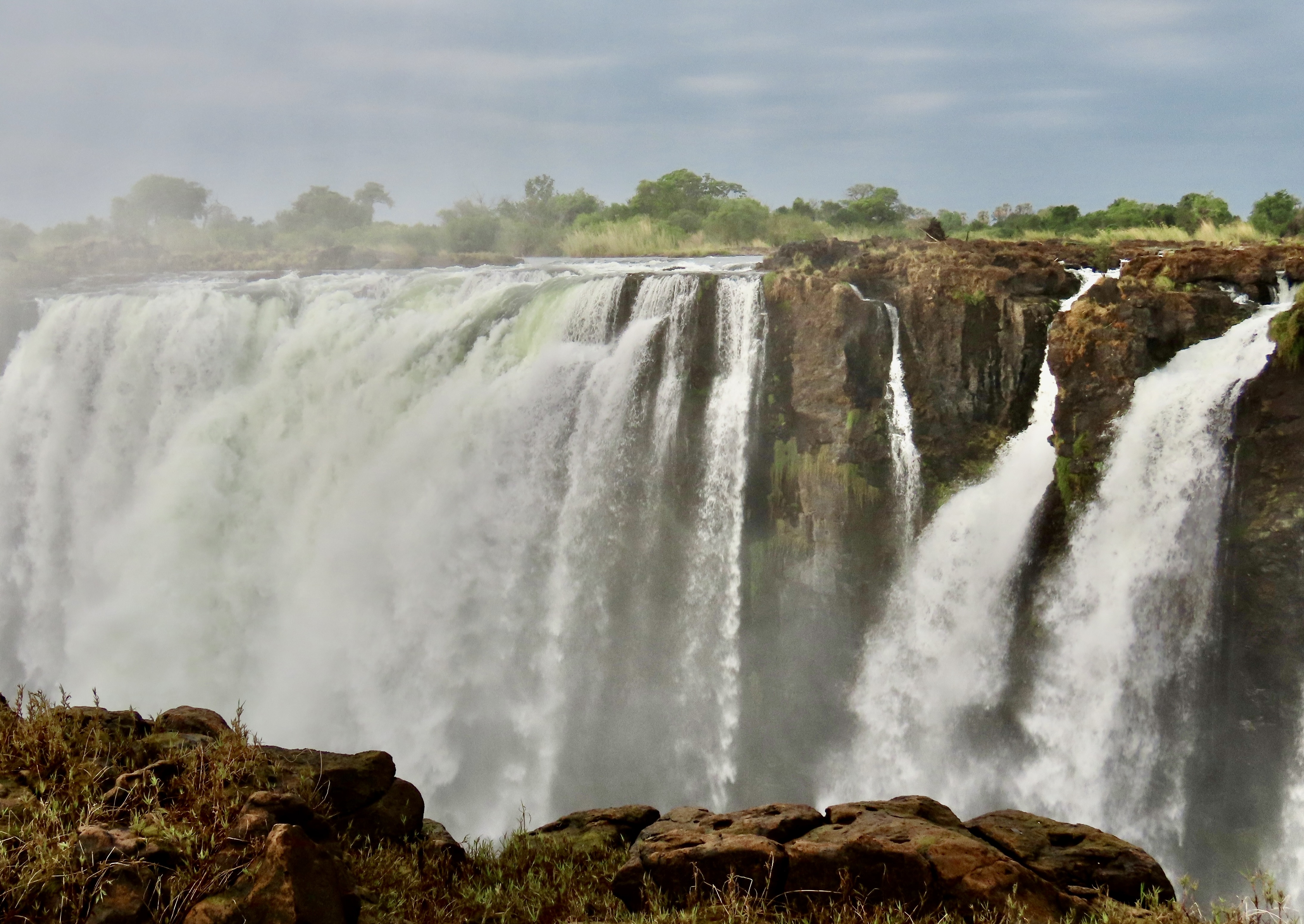
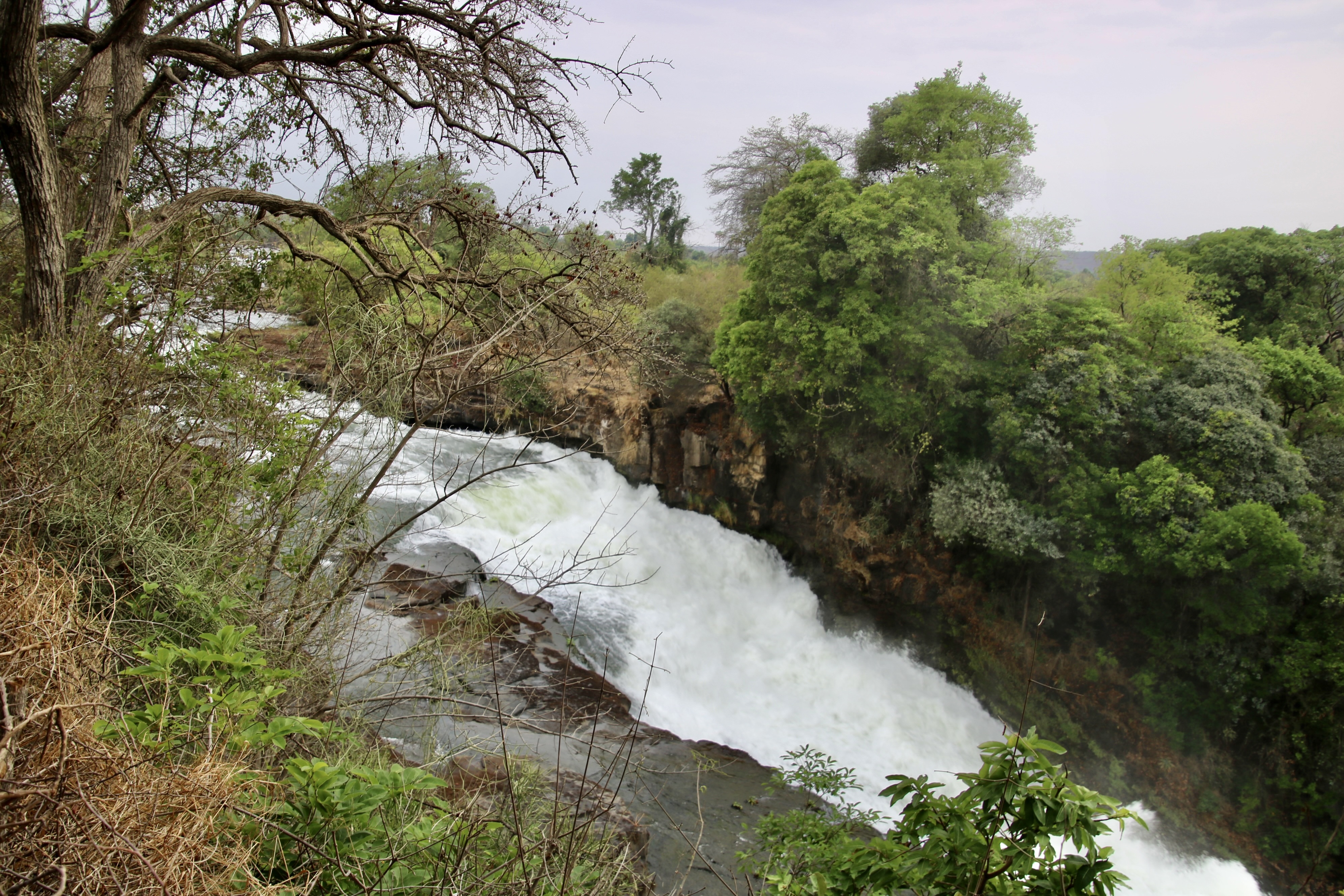
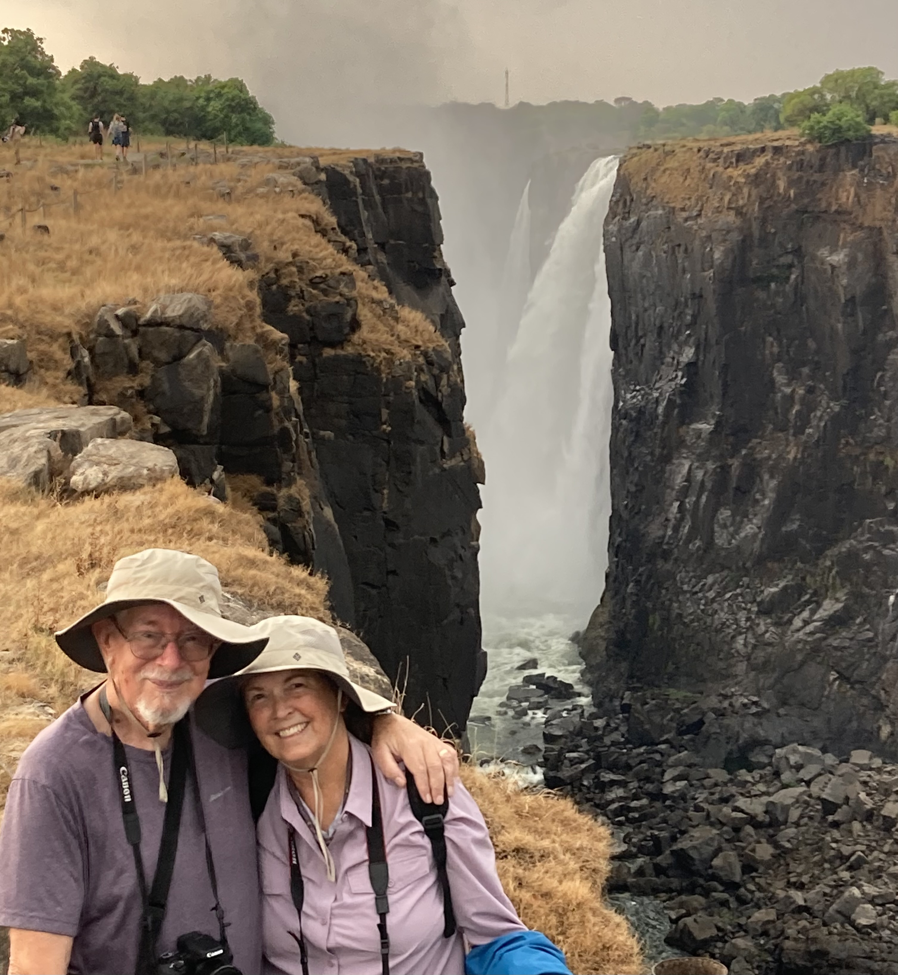
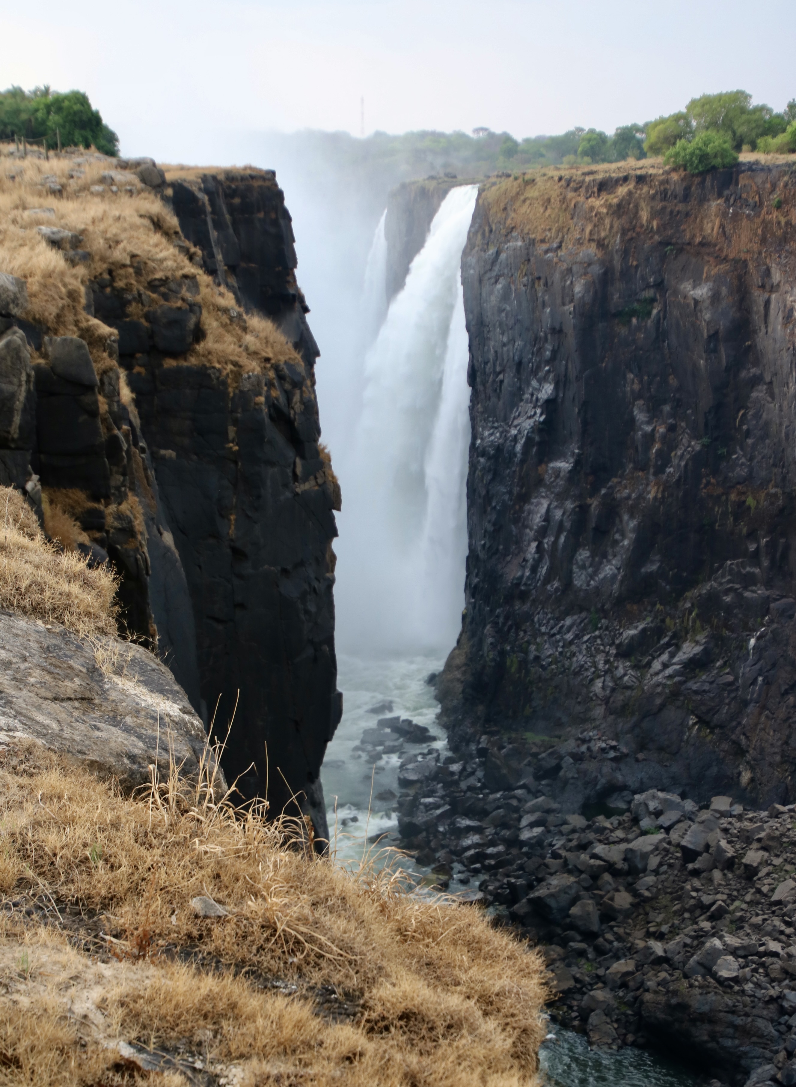
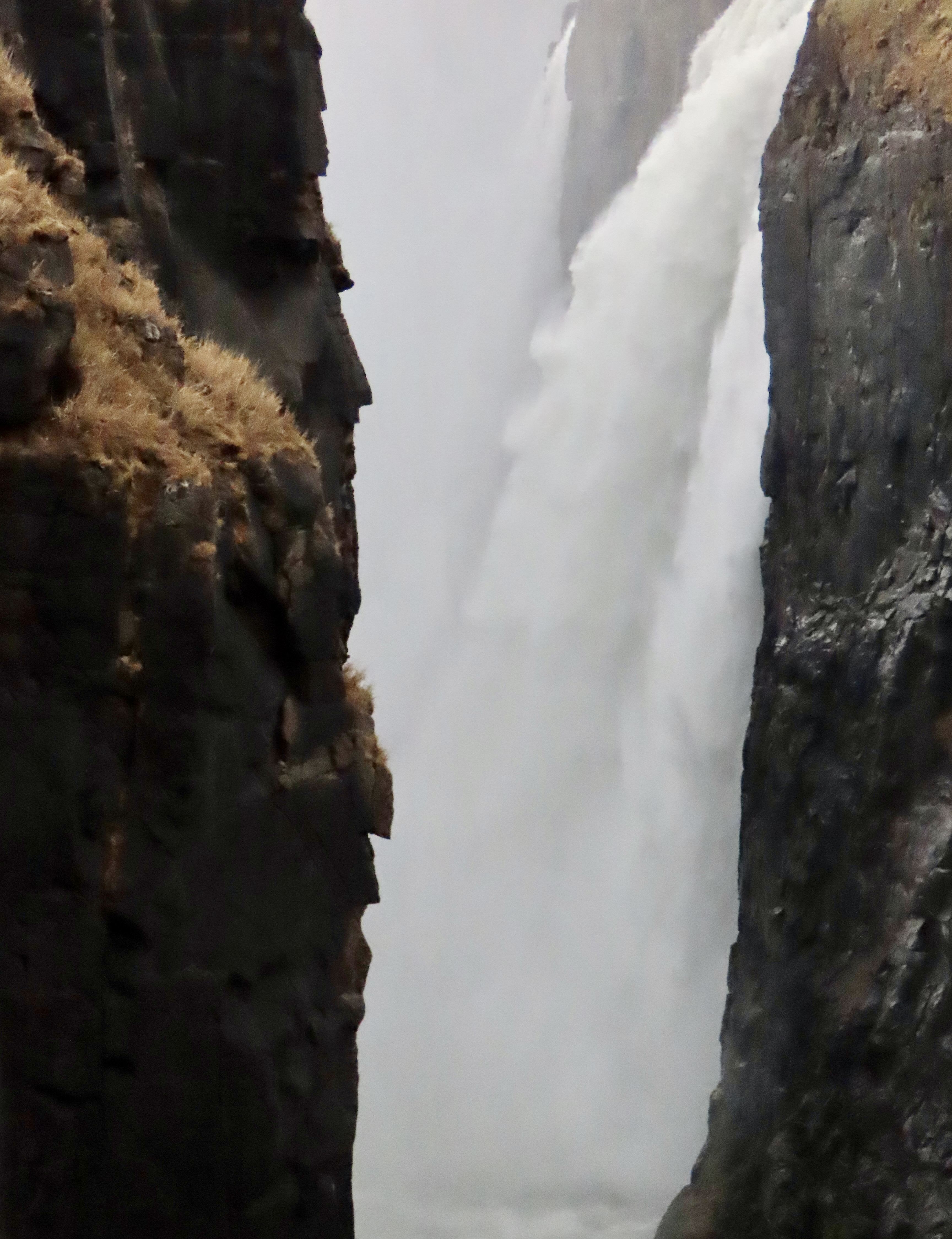
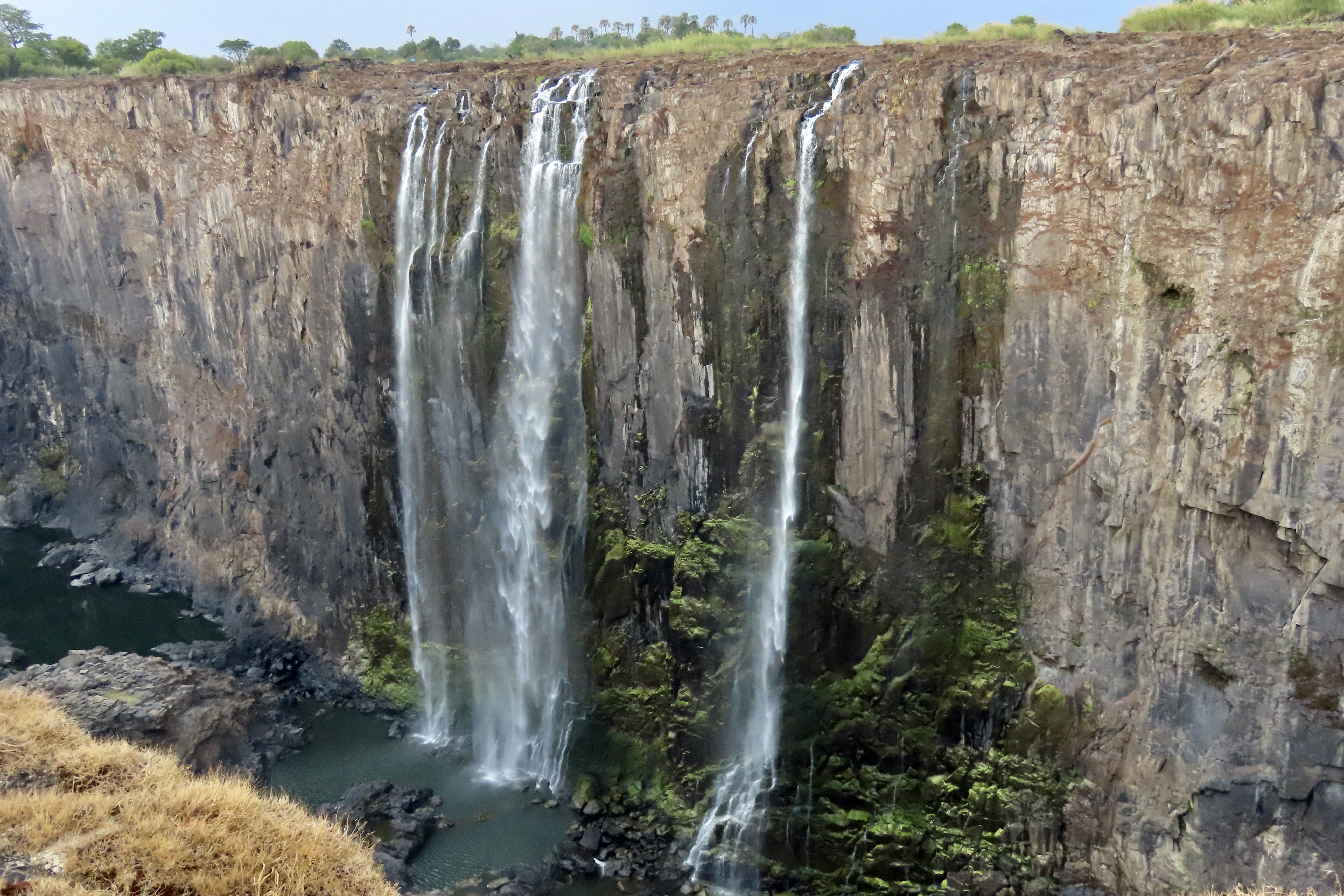
When David Livingston, the seasoned Scottish missionary and explorer, first came upon these roaring falls, one of the largest in the world, he was so impressed he named it after Queen Victoria, England’s long reigning monarch. To the natives of the region, however, the falls were Mosi-oa-Tunya, or “Thundering Smoke.”
I tried, I really did. This was supposed to be my last post on our African Safari. But when I looked through the last thousand photos of scenery, people, and a catch-all-miscellaneous that I considered blog worthy, I just couldn’t do it. Eventually, I got the thousand down to 82. I’ve divided them into three posts. Today I will focus on Victoria Falls and the surrounding area. The second post will wrap-up Chobe National Park, Hwange National Park and Lake Kariba. The last post will feature South Africa.
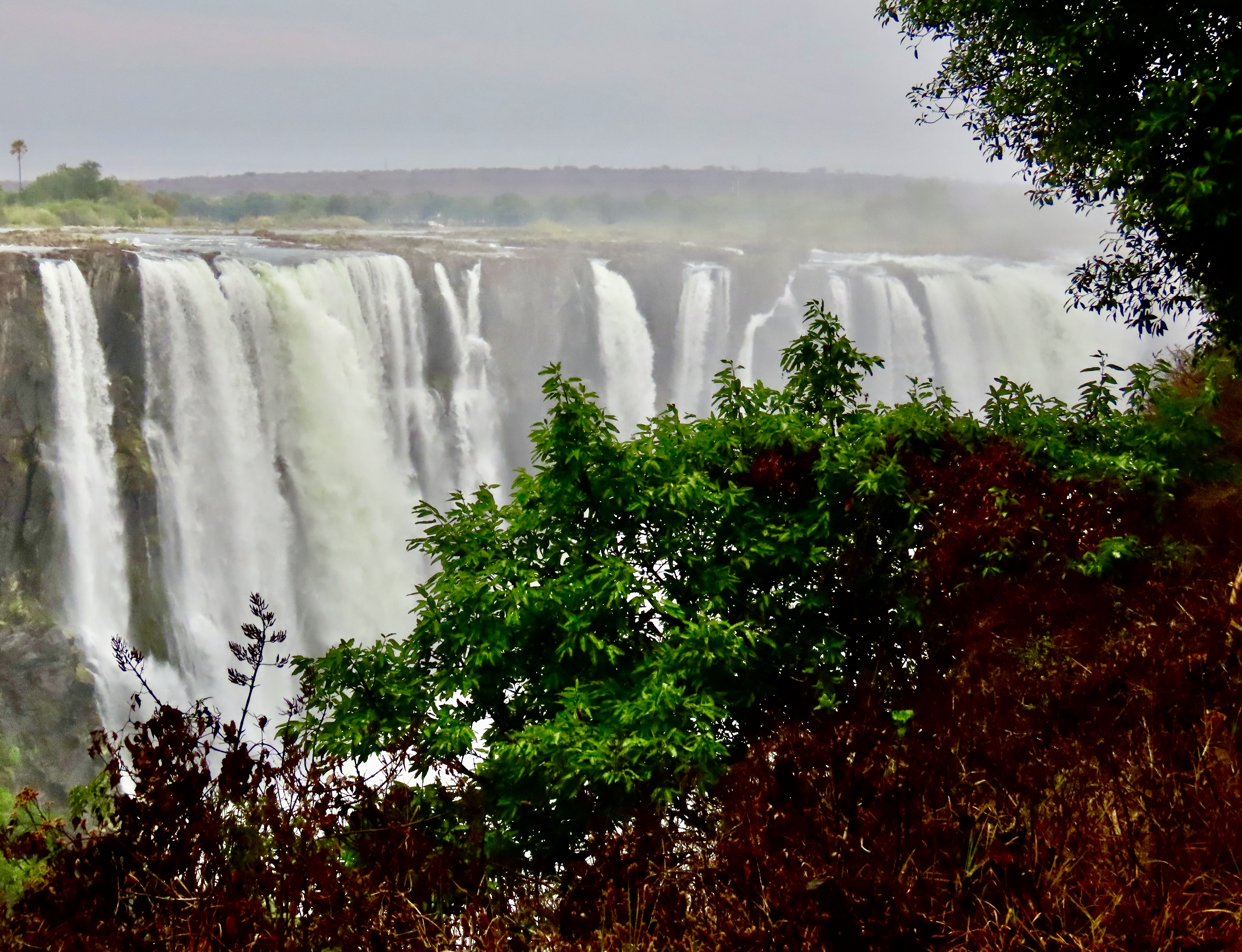
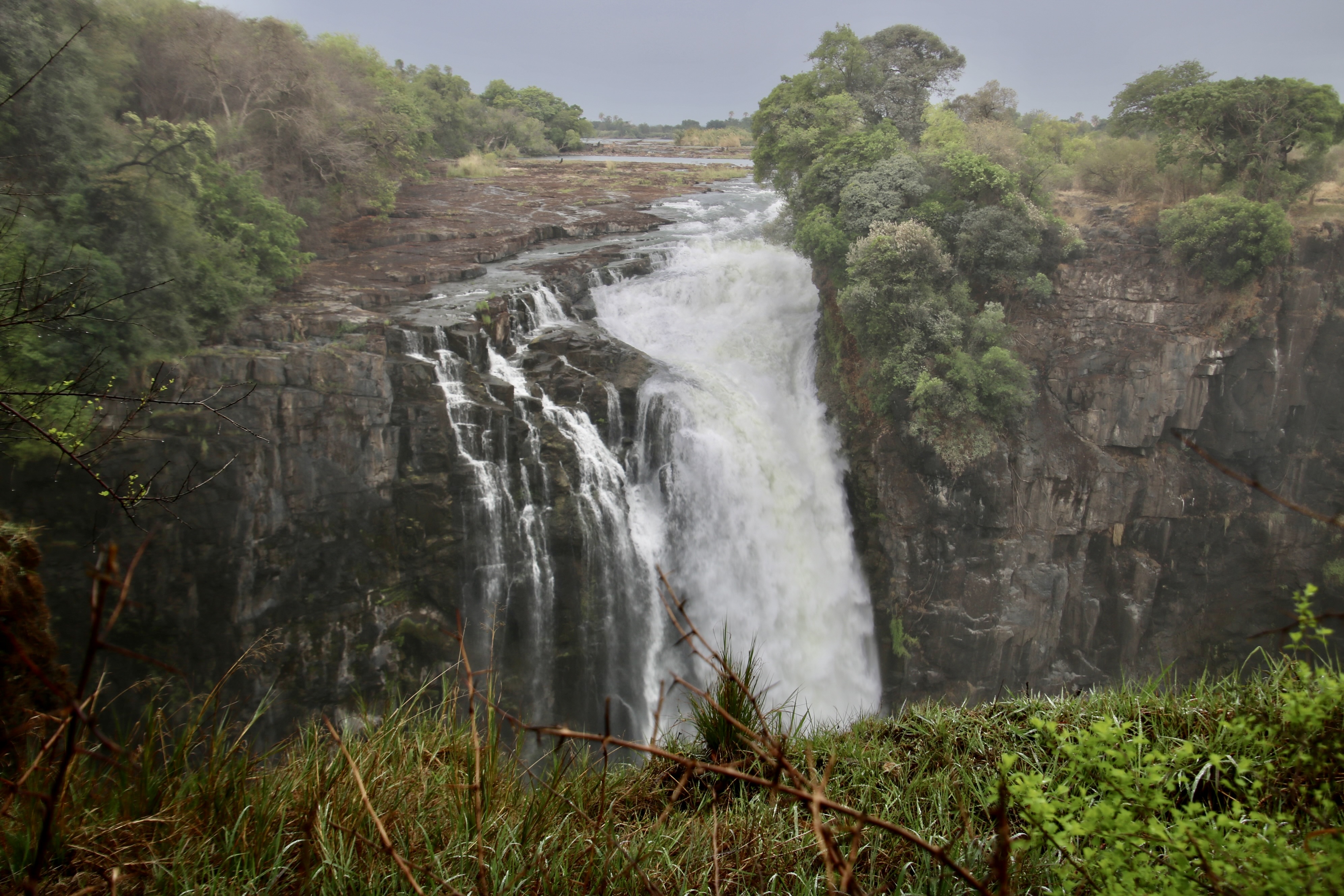
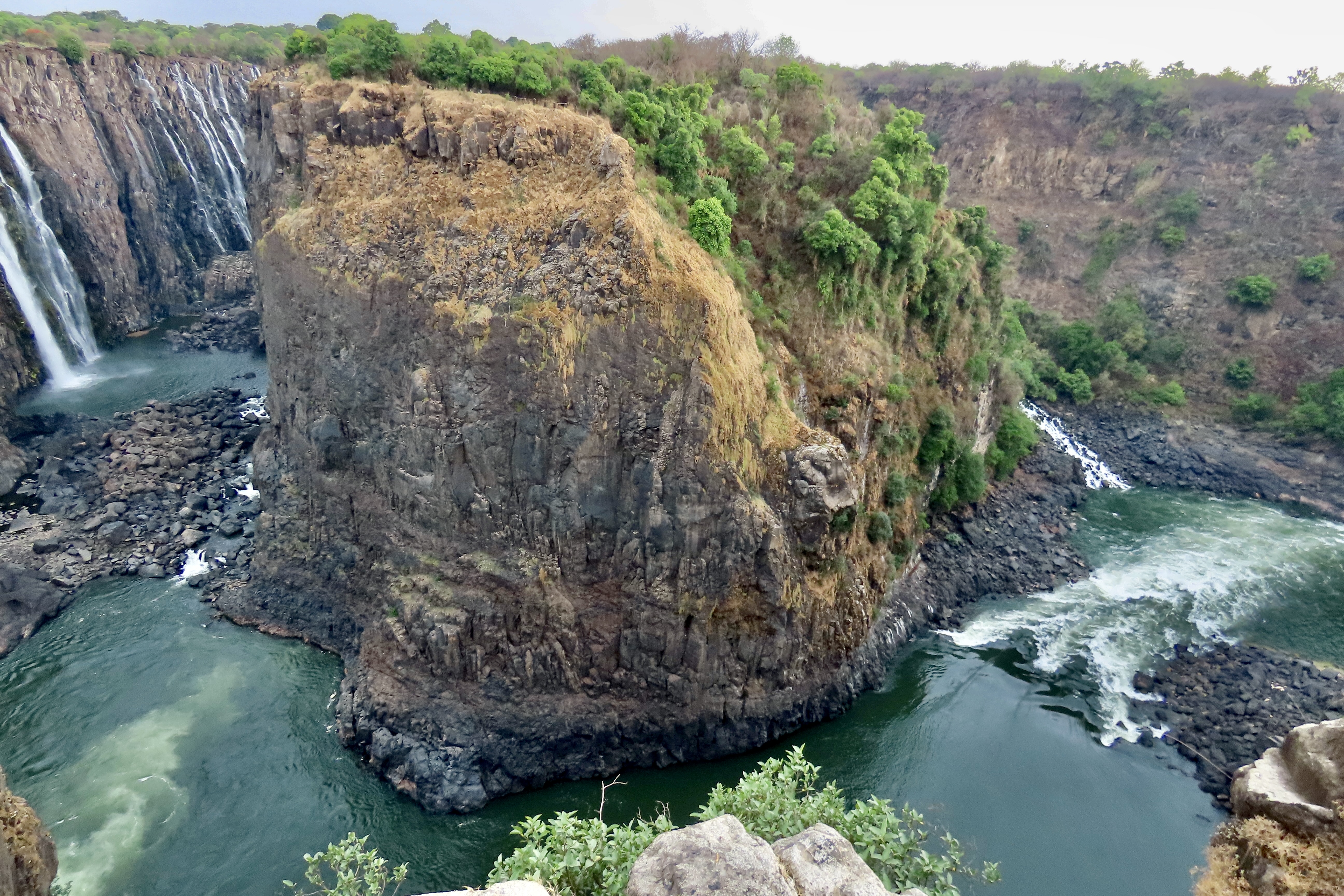
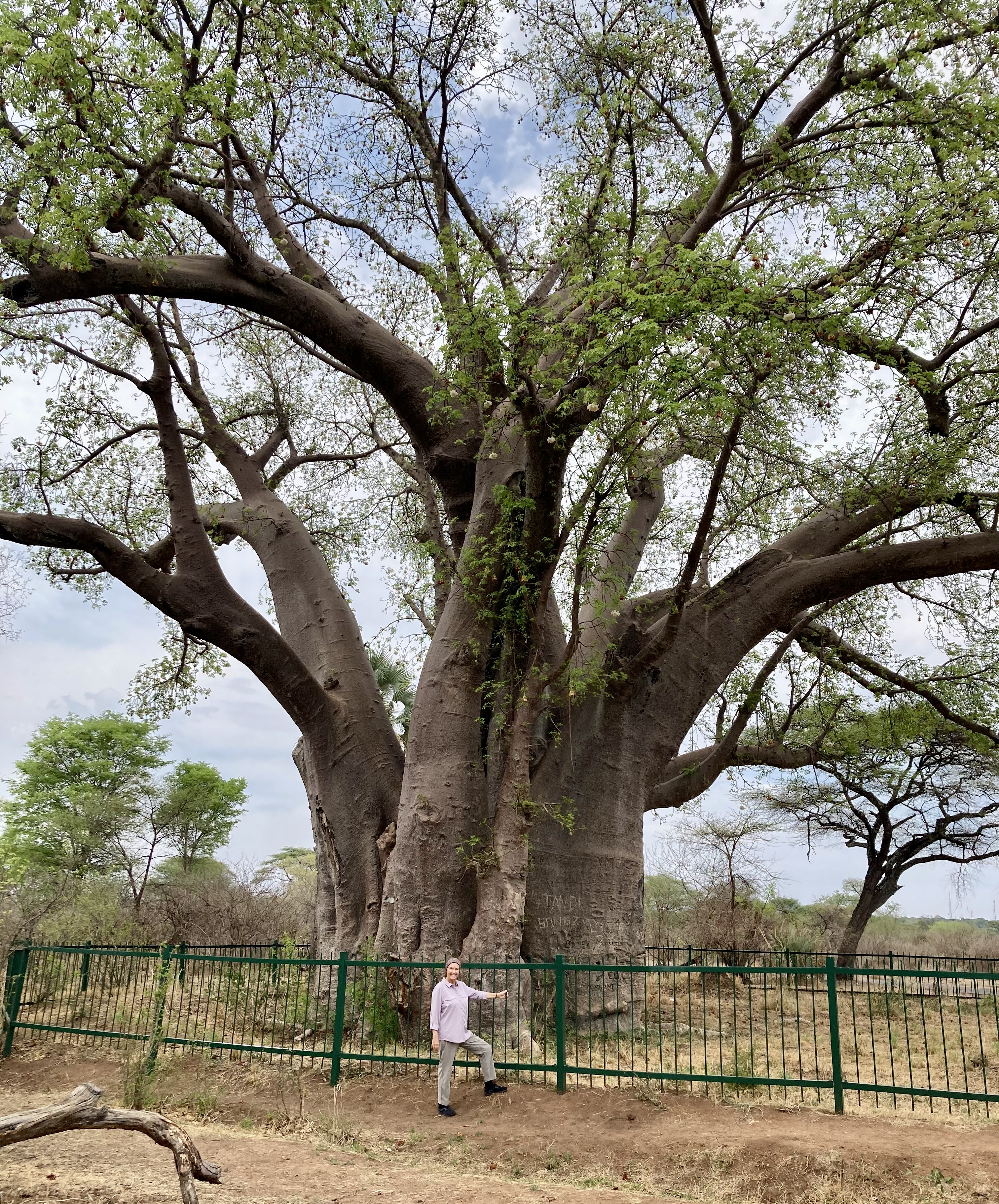
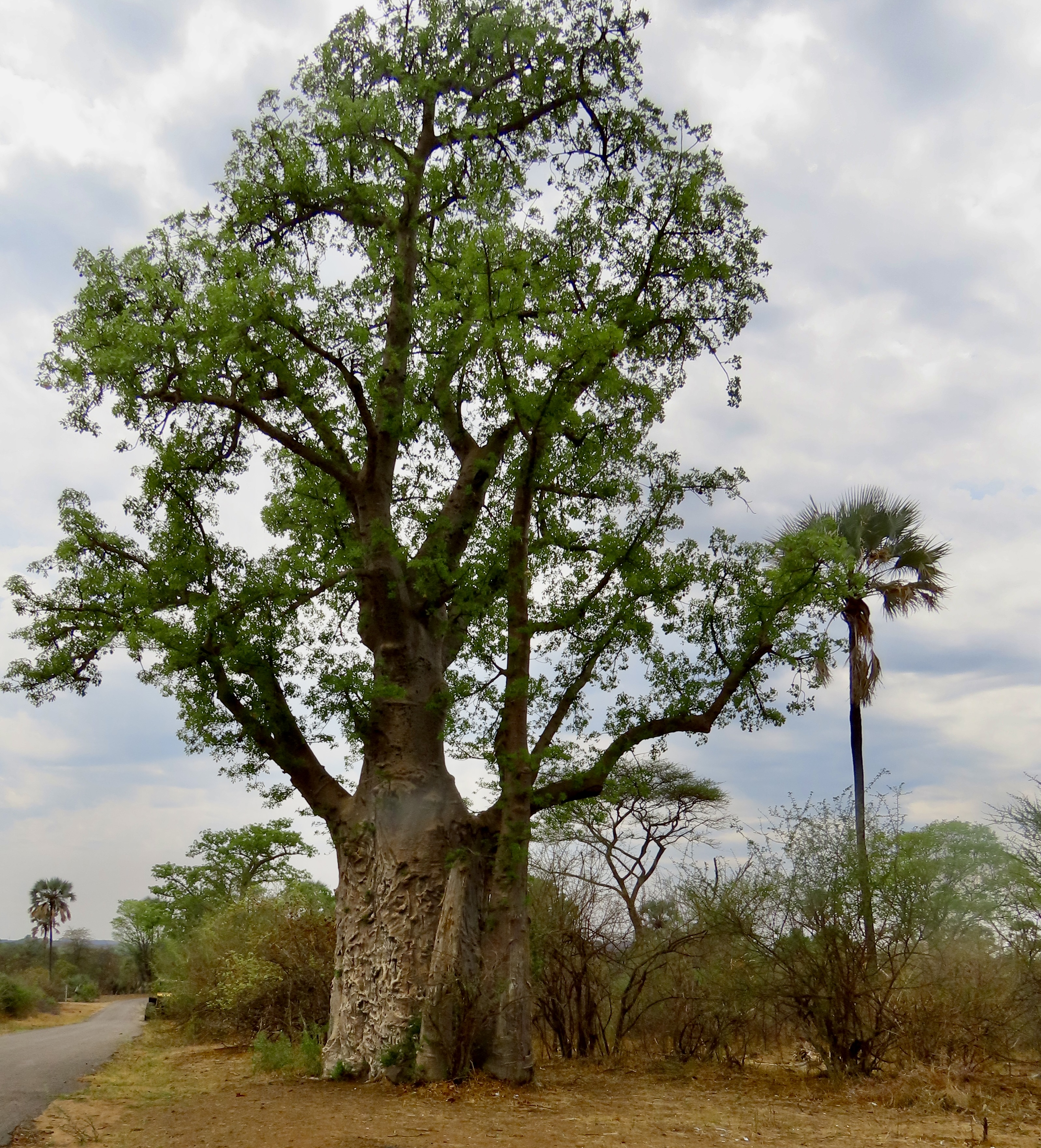
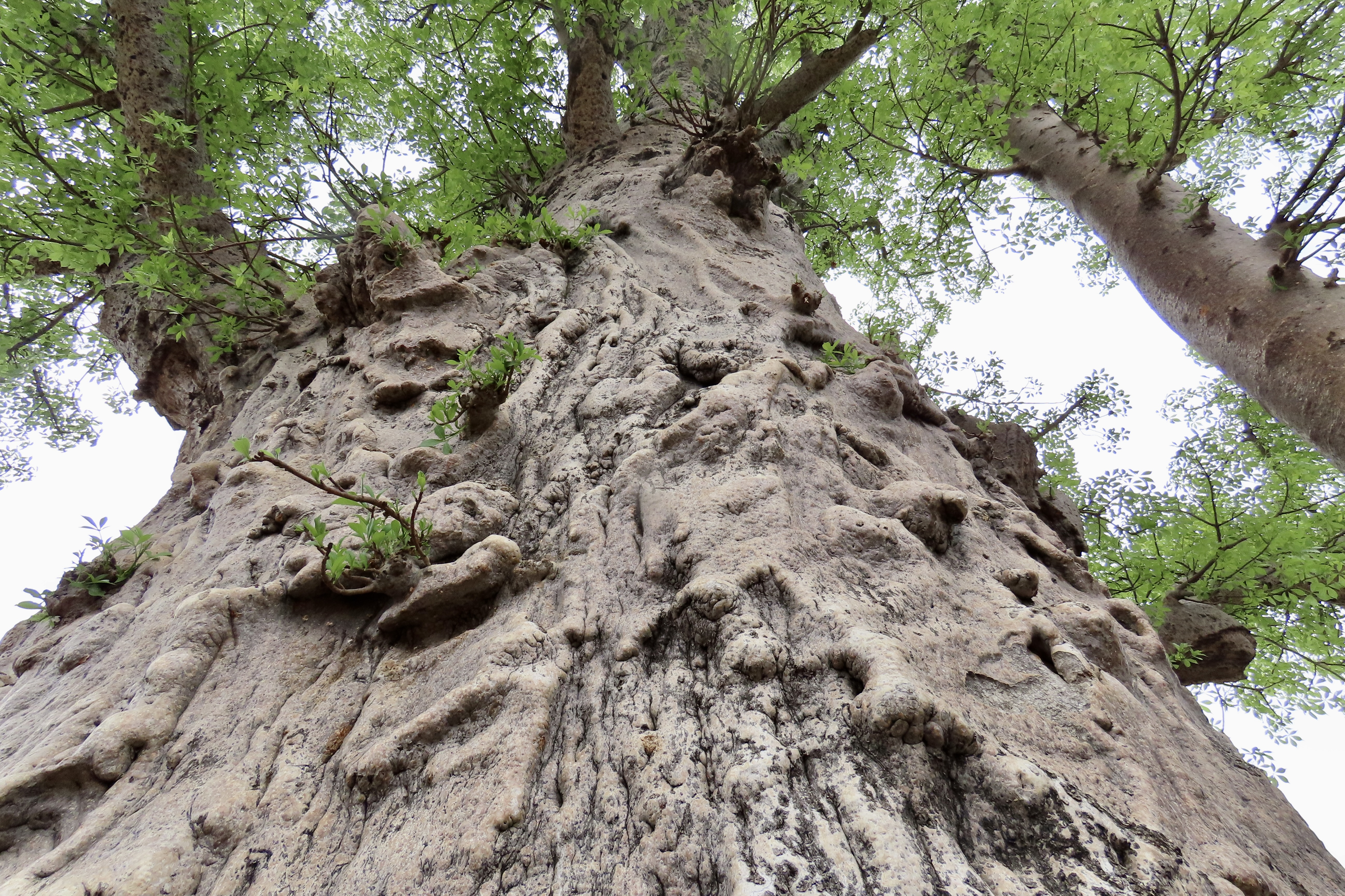
We arrived at Victoria Falls at the end of dry season when the water flow was close to its lowest. Imagine what this looks like at the height of rainy season! Based on its combined width, 5,604 ft (1,708 meters) and height, 354 feet (108 meters), Victoria Falls is considered the largest waterfall in the world. In April, when the river flow is at its peak, the spray sometimes reaches a height of over 2600 feet (800 meters) and can be seen from 30 miles (50k) away.A trail leads along the Zambezi River showing the main falls and several others such as this one that are part of the complex.Same falls, different view.Peggy absolutely loves falls. Whenever we are near one, we detour from our selected route. She was one one happy camper.Another view from where we were sitting. During rainy season, this view would be wiped out by the spray.And a close up. Can you hear the roar?Walking along the trail, we came on these jewels.The Zambezi River continues to cut a canyon. Eventually, this may be an island. For now, the river flows out, around this promontory, and on.We went on a dinner cruise on the Zambezi River above the falls. Clouds were threatening a beginning to the rainy season. You have already seen crocodiles, hippos, and various birds from this cruise on earlier posts.Peggy and I really liked the contrast created by this dead tree and the greenery behind it.Another view of the trees along the Zambezi.Our evening cruise also brought us a spectacular, ethereal sunset. It was one of many we experienced while we were in Africa. We will be featuring more of them in our final two posts.A view of the hotel we stayed at in Victoria Falls. This is the hotel where I was visited by the mongoose.The trees surrounding the hotel were bursting in color.We traveled with a great group of people on our safari through Botswana and Zambia. These are three of the friends we made along with Peggy’s brother John and his wife Frances joining us for a final photo in our Victoria Falls hotel. On our way to the airport to fly to South Africa, our guide, Samatha, took us to see this huge baobab tree on the outskirts of Victoria Falls. Peggy provides perspective on its size. This tree is estimated to be around 1200 years old. Its circumference is 73 feet and height 78 feet. A tree this size can hold over 120,000 liters of water, over 31,000 gallons.Another large baobab tree stood next to the giant.I took a photo from the base of the tree up. The scarification is likely caused by elephants that love to feed on its bark. That’s it for today. Our next post will feature final scenes from Chobe National Park, Hwange National Park and Lake Kariba.View along the Chobe River in Chobe National Park, Botswana.
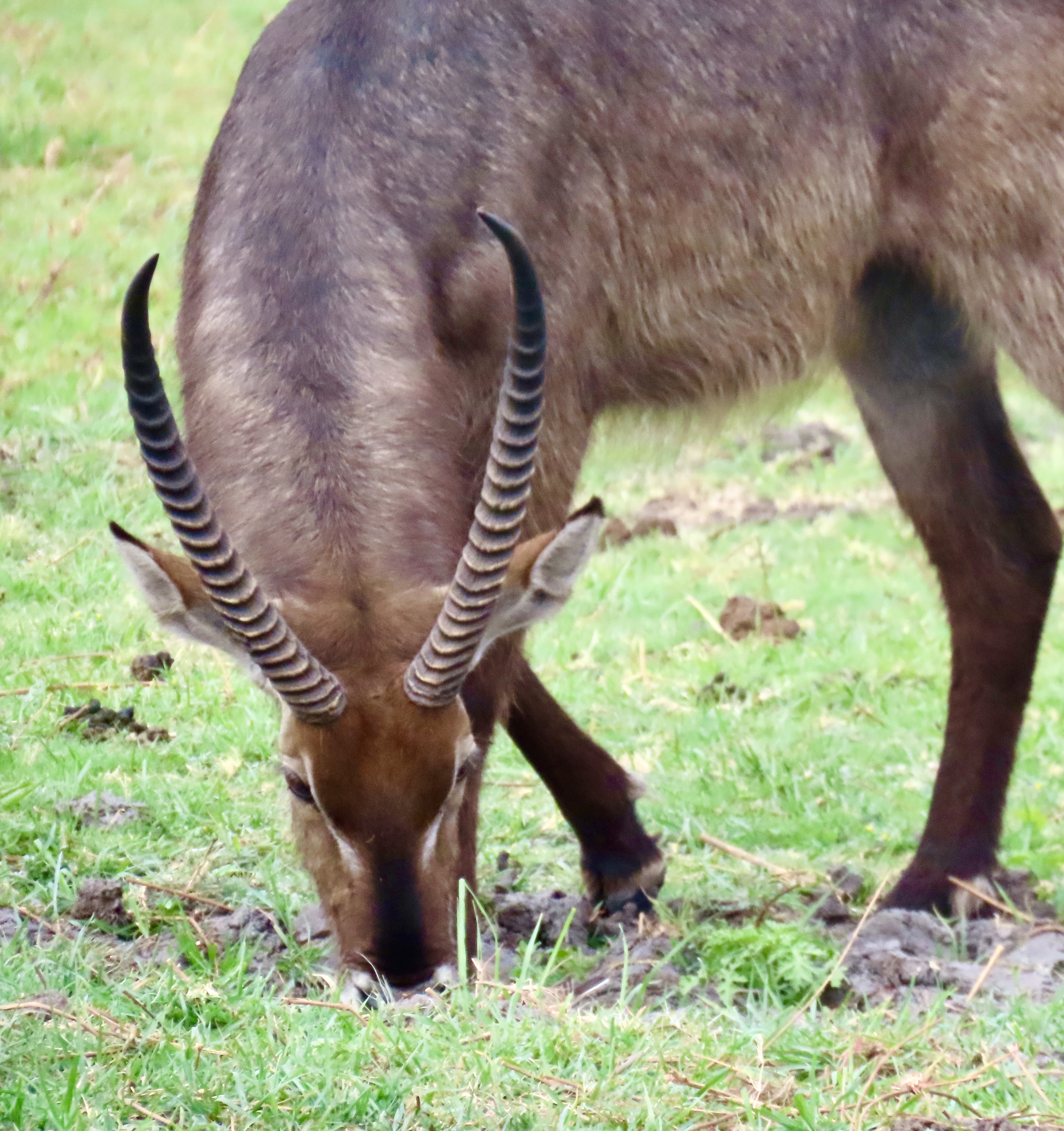
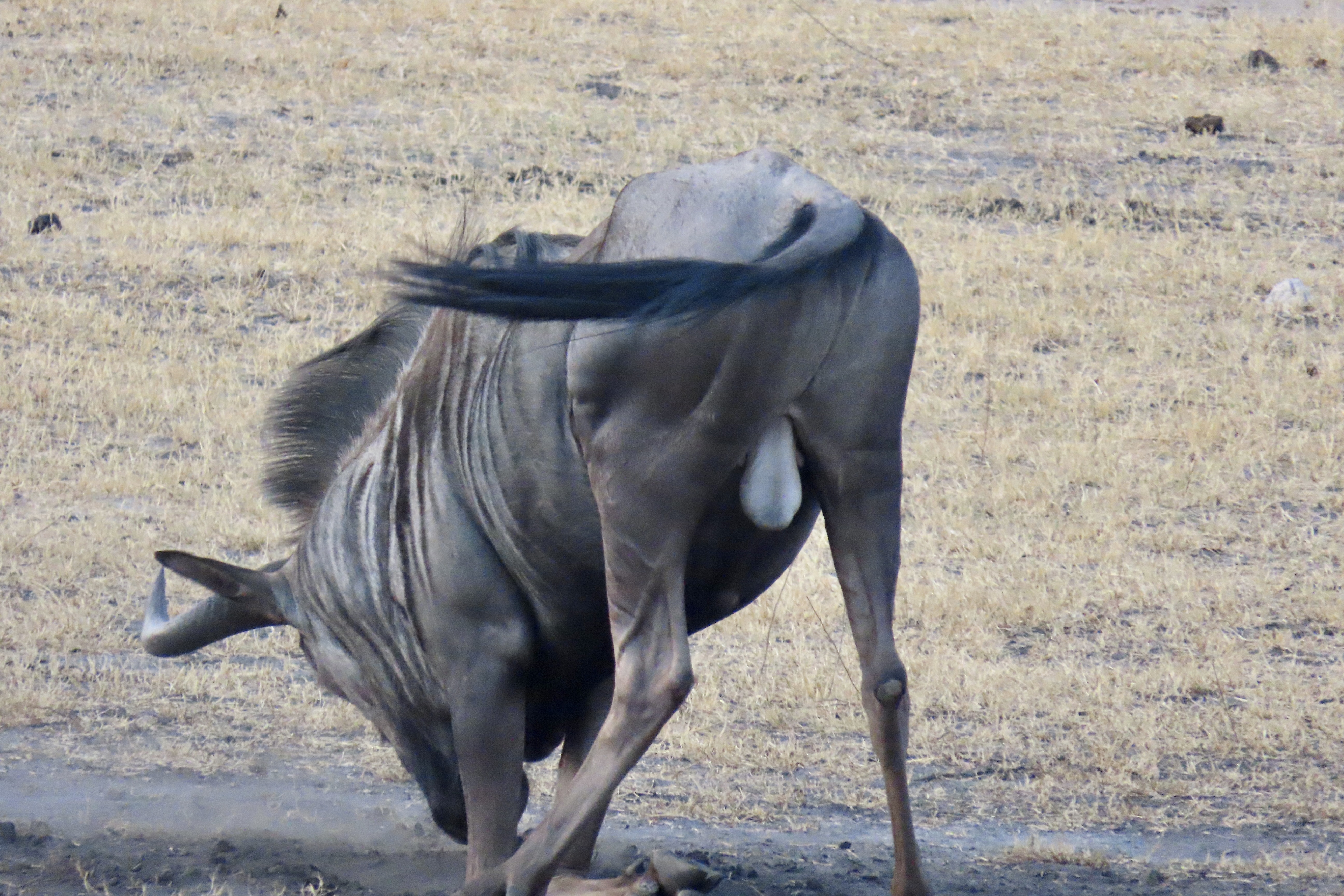
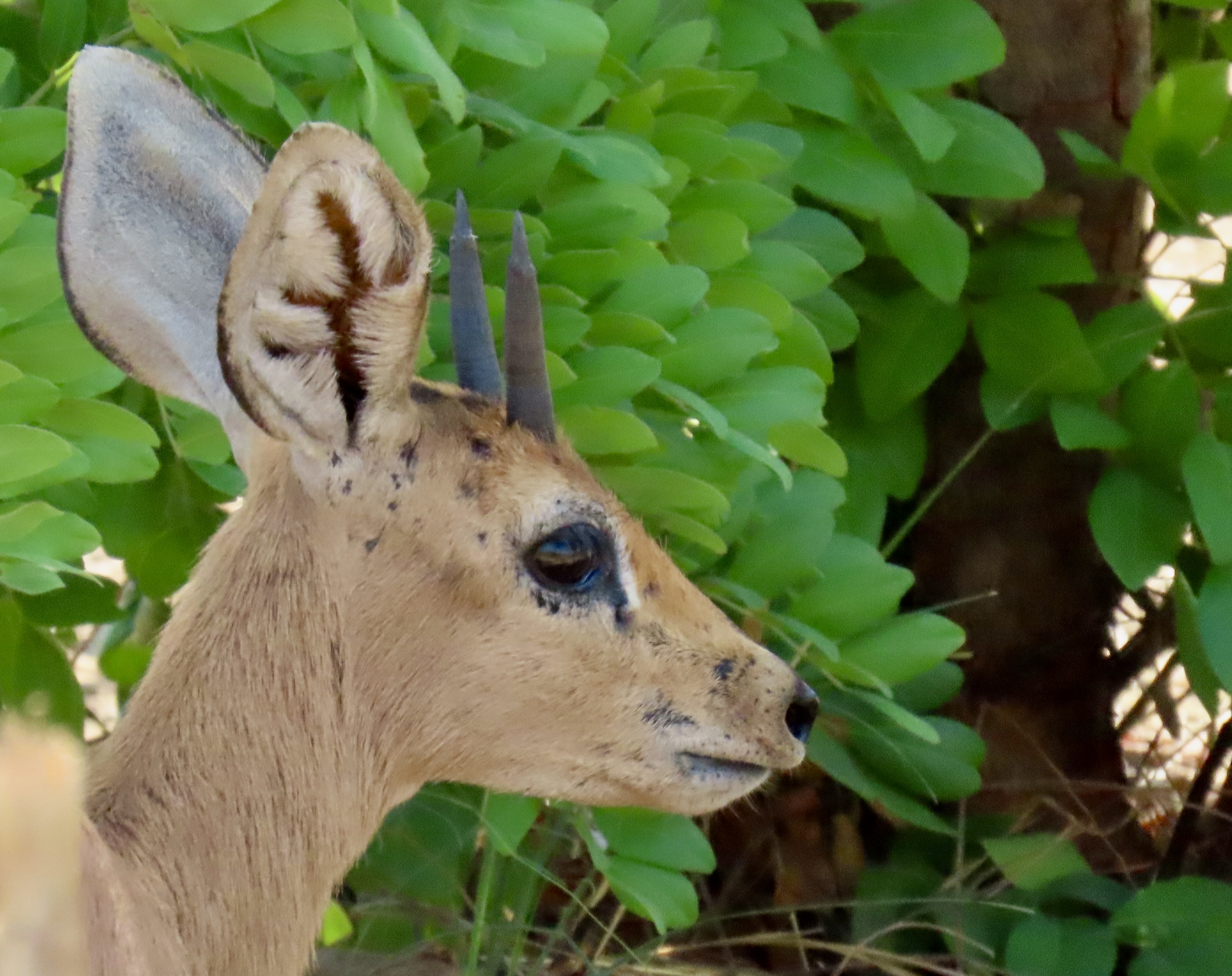
We saw only a handful of the numerous species of antelope found in Africa but the ones we saw were magnificent, such as this handsome male kudu that came in for water at the Iganyana Tent Camp where we were staying next to Hwange National Park in Zimbabwe.And brought his family of five with him including this mom and her baby.He watched over them as they drank.His spiral horns will continue to grow until they have made 2 1/2 twists. Note his large, and I think, beautiful ears. Their large size enables them to hear approaching predators. The horns of mature male kudus are used in traditional cultures as musical instruments.His female companion with her large brown eyes was as beautiful as he was handsome. A final family shot. Here’s a fun wrap-up fact: The sport of Kudu dung-spitting is practiced in southern Africa. (Think of watermelon seed spitting contests.) The winner is the person who is able to spit one of the antelope’s small, hard pellets the furthest. Our guides demonstrated for us. None of us volunteered to join them. I read that the world record is 51 feet. That person must have had one heck of a tailwind.Waterbuck: “Imagine sitting down on a freshly painted toilet seat,” our guide told us. Waterbucks are easily identifiable by the prominent ring around their tail as this female shows.A male waterbuck along the Chobe River displays his ring. This photo shows his impressive horns and rather attractive fur. When excited, the skin of a waterbuck secretes a greasy substance called “greasy kob”. It stinks so much it serves to discourage predators but it also serves as waterproofing when the waterbuck jumps into water as an escape route.Impala: The impala is another African antelope with a beautiful set of horns. We saw more of them than any other antelope.We found these elegant animals in fairly large herds. The buck behind was chewing on something.We came on this herd when we were out for an evening drive in Hwange National Park. Something had obviously alerted them. If they had spotted a predator, they would have been out of there at speeds reaching 50 miles per hour with prodigious leaps of over 30 feet in length and 10 feet in height. We were privileged to watch them leaping and running away from us at Lake Kariba. It was poetry in motion.Wildebeest: Wildebeest travel in large herds. We only saw one. Africans like to say that the wildebeest was the last antelope God created and he had run out of parts. So he took the leftovers from other animals including the stripes of zebras, bodies of hyenas and heads of buffalo and created the blue wildebeest. We found this fellow when we were on a safari hike in Hwange National Park.Later that evening we found him digging in the dirt to create a dust bath. I couldn’t help but wonder about where his spare parts came from here.He became a blur as he took his ‘bath.’ He certainly seemed to be enjoying it!Tsessebe: This was another strange looking dude. The straw in his mouth reminded me of a stereotypical country bumpkin. Tsessebe are nothing bumpkin-like when it comes to running however. They’ve been clocked at 60 mph(100k).Steenbok: And the final antelope we saw. It’s southern Africa’s smallest antelope, standing about 20 inches tall at its shoulder. It is a common but solitary animal. We found this cutie hidden alongside the road in Hwange National Park. Another view. Note the small horns and large ears. We weren’t sure what created the small scars. Our next post will be a wrap-up on our safari featuring the varied scenery, places we stayed, and the people met. Victoria Falls
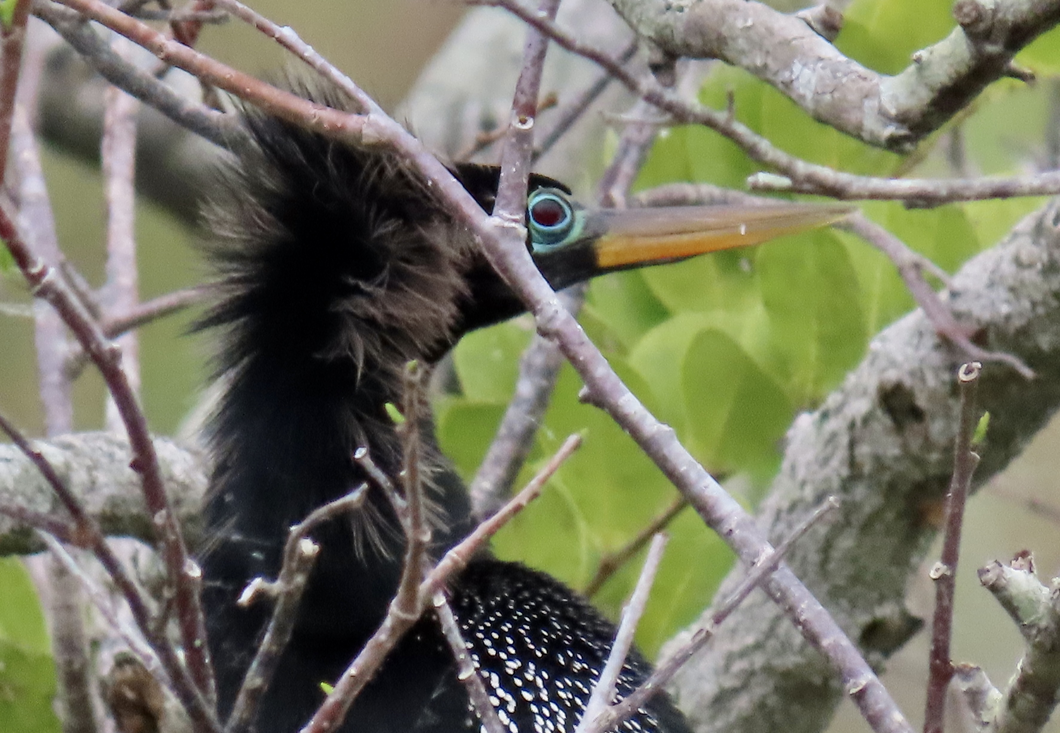
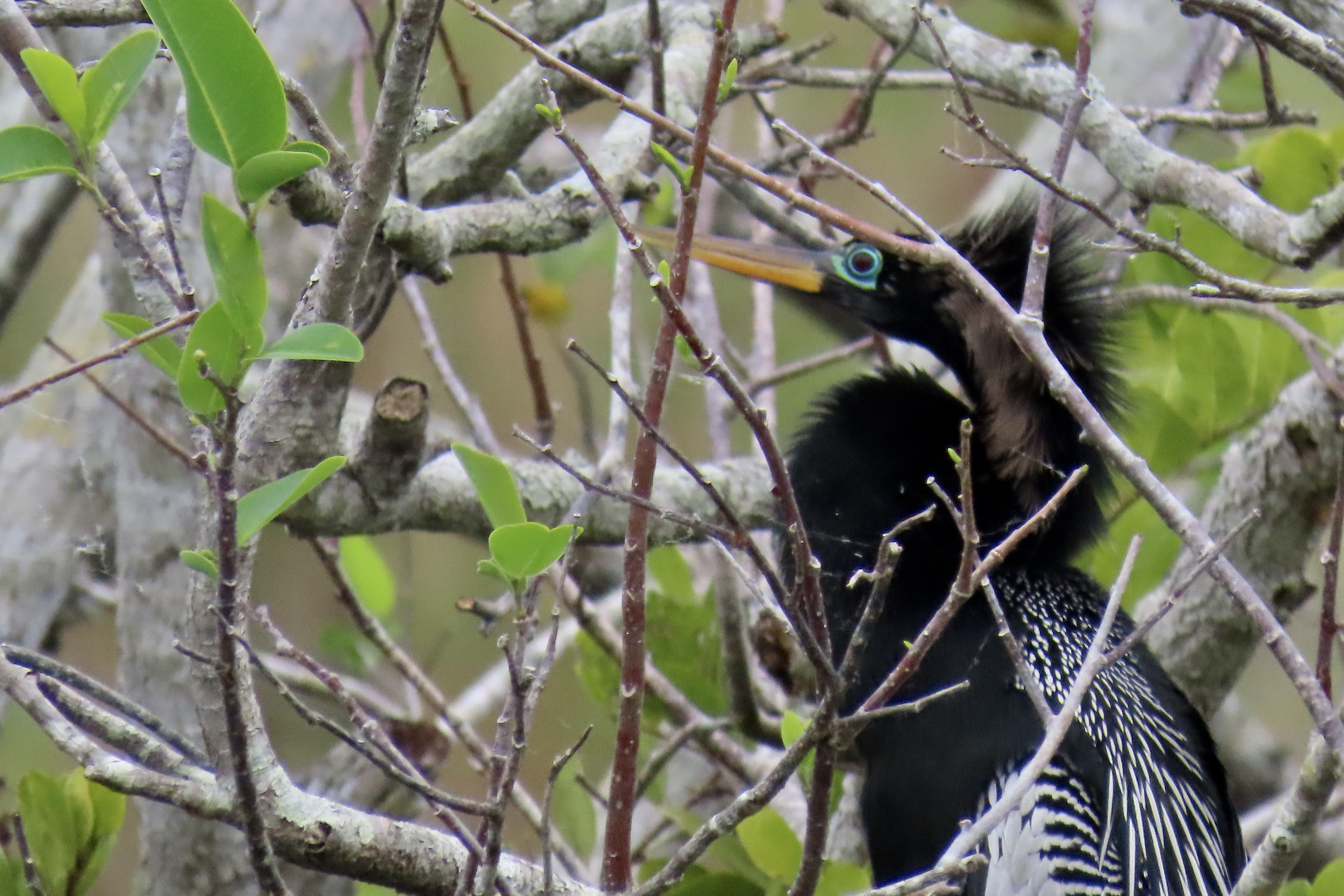
If you’ve been following my blog over the past couple of months, you have already met Anhingas: In Africa. I showed one demonstrating the proper way to eat a fish in Chobe National Park, Botswana. We found this fellow with its googly eyes along the Anhinga Trail in the Everglades National Park, Florida.
Peggy and I traveled to Everglades National Park a few weeks ago, came back to our basecamp in Virginia, spent two weeks rushing to prepare for our five-month road trip, and are now in Terre Haute, Indiana sitting on the border of Missouri. We were supposed to be continuing west today, but the National Weather Service had a severe thunder and lightning storm warning up for Missouri. It’s not the type of weather to be out on the road, especially when pulling a small, light trailer.
The storm introduced itself last night. We could hear it approaching from miles away, at first a distant constant rumble, it became an earth-shaking roar. We hunkered down and wondered if Armageddon had arrived. I worried about hail. Baseball size chunks were crashing down on Kansas City. Serafina, our trailer, would not have been happy. But the storm passed us by without any damage.
On top of that, we had a propane leak, which can be more dangerous than softball-size hail. My solution, other than a few chosen words, was to shut the tanks off and wait until we could find an RV service facility to fix it, which often takes days or even weeks to schedule. Fortunately, we have options that allow us to function without propane.
Peggy and I have learned in our recent travels that mobile techs can solve most RV problems, however, often on a same-day basis and at a fair cost. Since we were here for the day, I called a local business in Terre Haute: At Your Service— Mobile RV Repair. And boy did we luck out. I reached the owner, Allen Grota, and he told me he would be over as soon as the storm stopped. He went through everything, tanks, connections and regulator. Finally he found the problem. The hose to the trailer had been left hanging next to one of our levelers and the lowering and rising of the leveler had cut it. As soon as this had happened, the regulator had shut down the tank. We weren’t in danger, but neither would we have propane. Allen then ran downtown to get what he needed to fix the problem. The cost was incredibly reasonable. And it turns out, Allen is a heck off a nice guy.
I’ve already done three posts on our Everglades trip: One on white pelicans, one on osprey, and one on the area around Everglade City on the Gulf Coast. I’ll conclude today featuring more of the Atlantic Coast side where we found the osprey and white pelicans. We entered the park at the Ernest F. Coe entrance. After stopping off at the Visitor Center, we made a beeline for the Anhinga Trail, just inside the park. Peggy and I had been there before and were quite impressed with the alligators and birdlife.
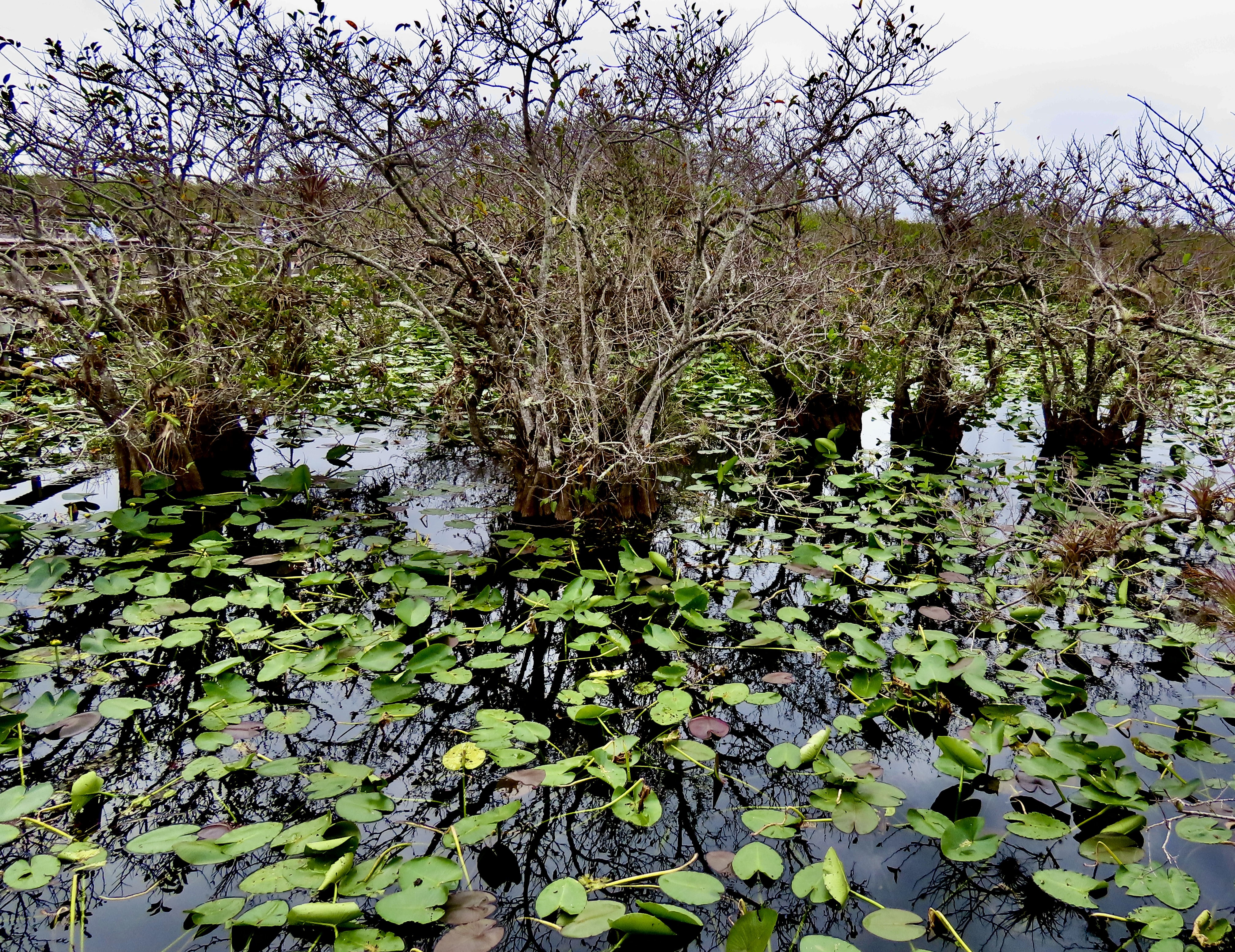
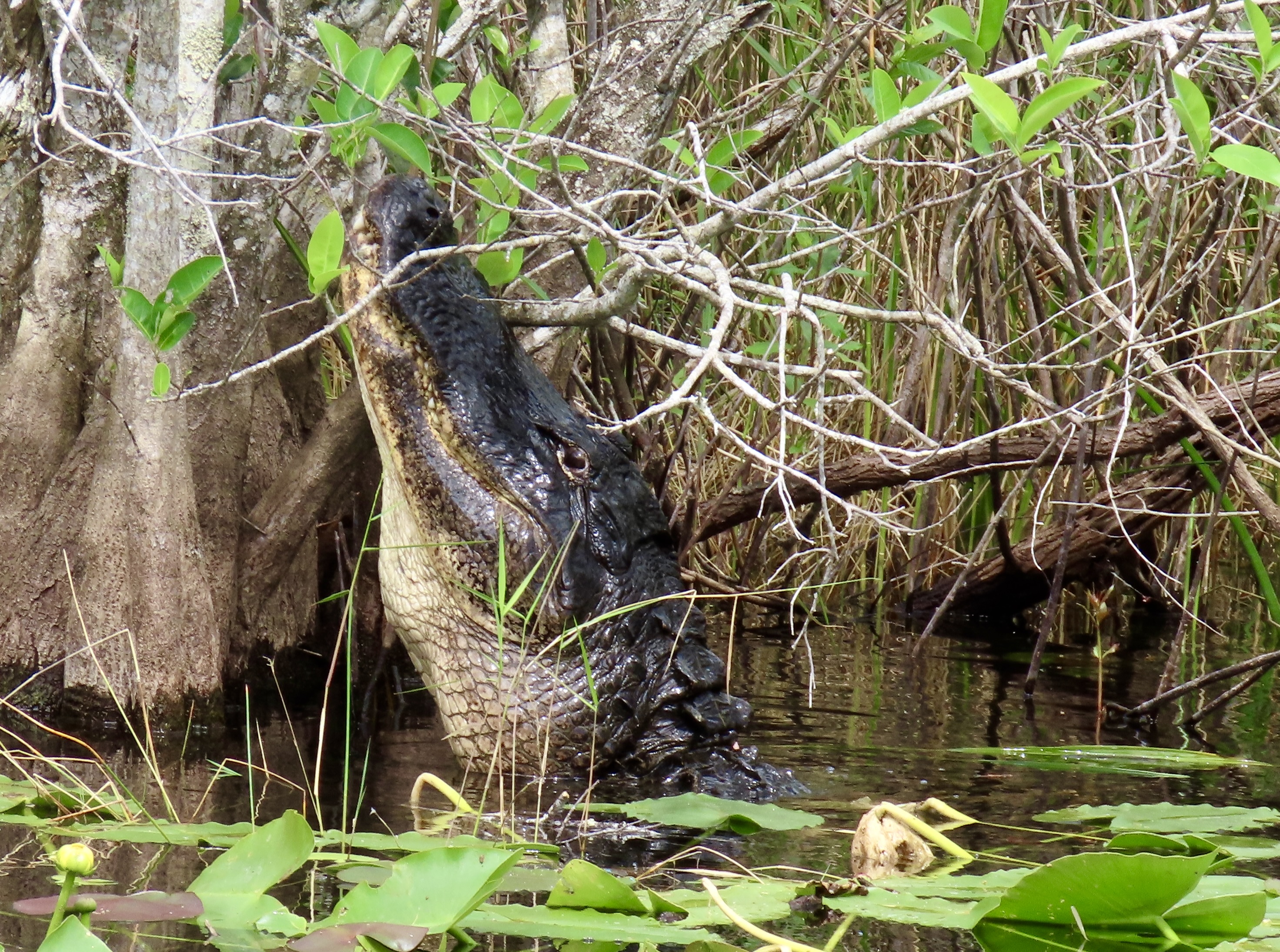
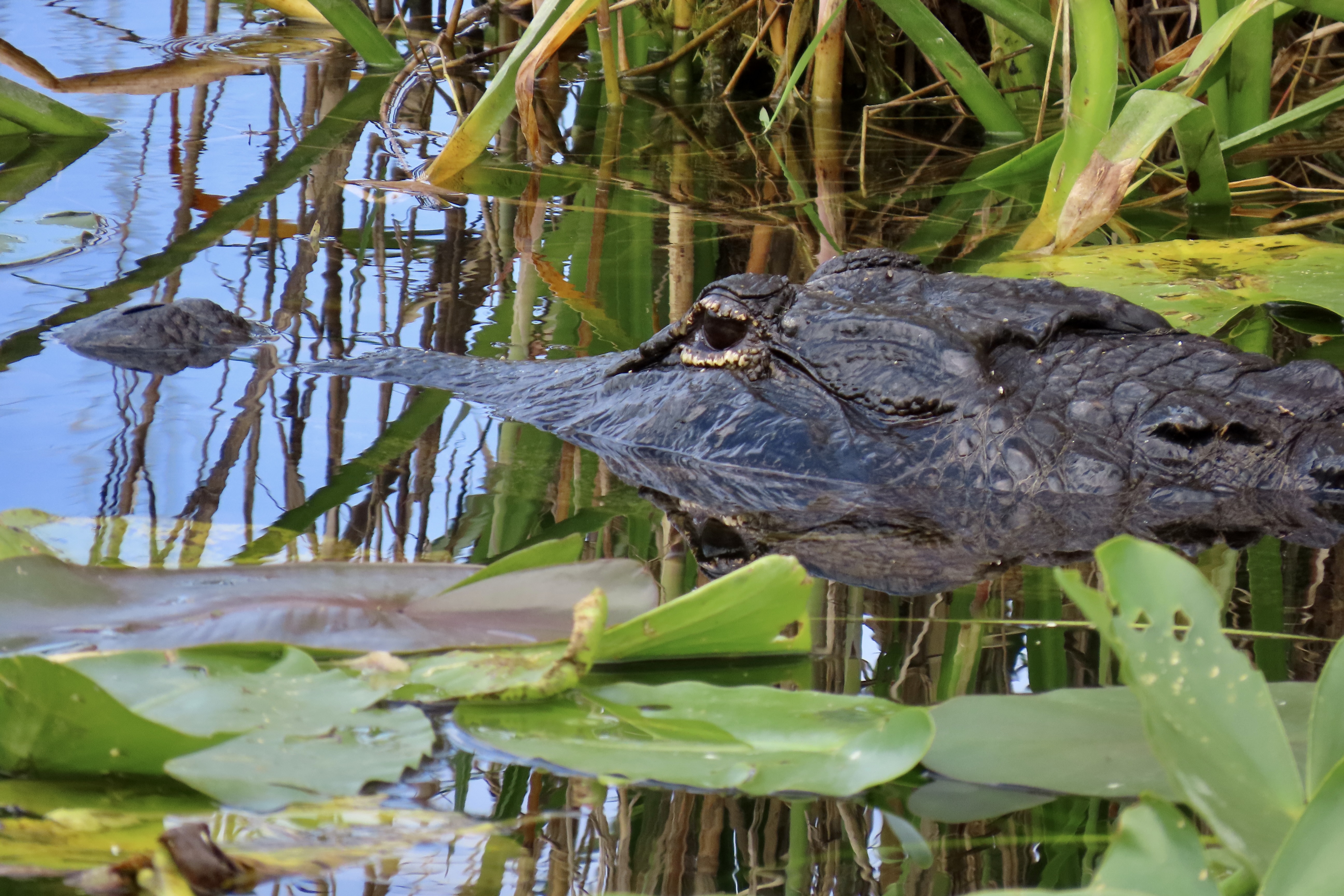
From there, we drove down through the park to Flamingo, where we would be glamping. We stopped along the way at various pulloffs to check out features of the Everglades emphasized by the National Park. First up, the Anhinga Trail.
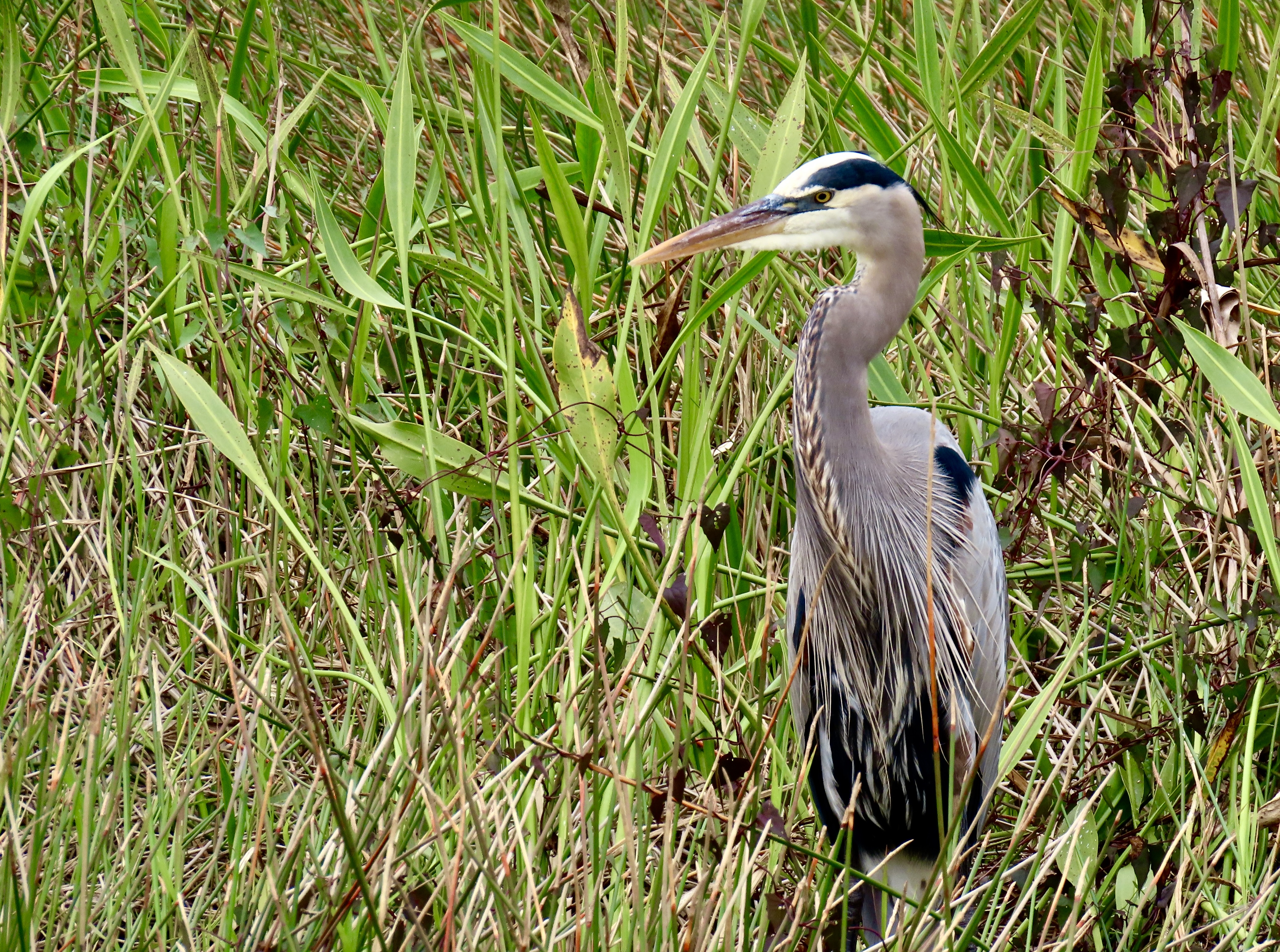
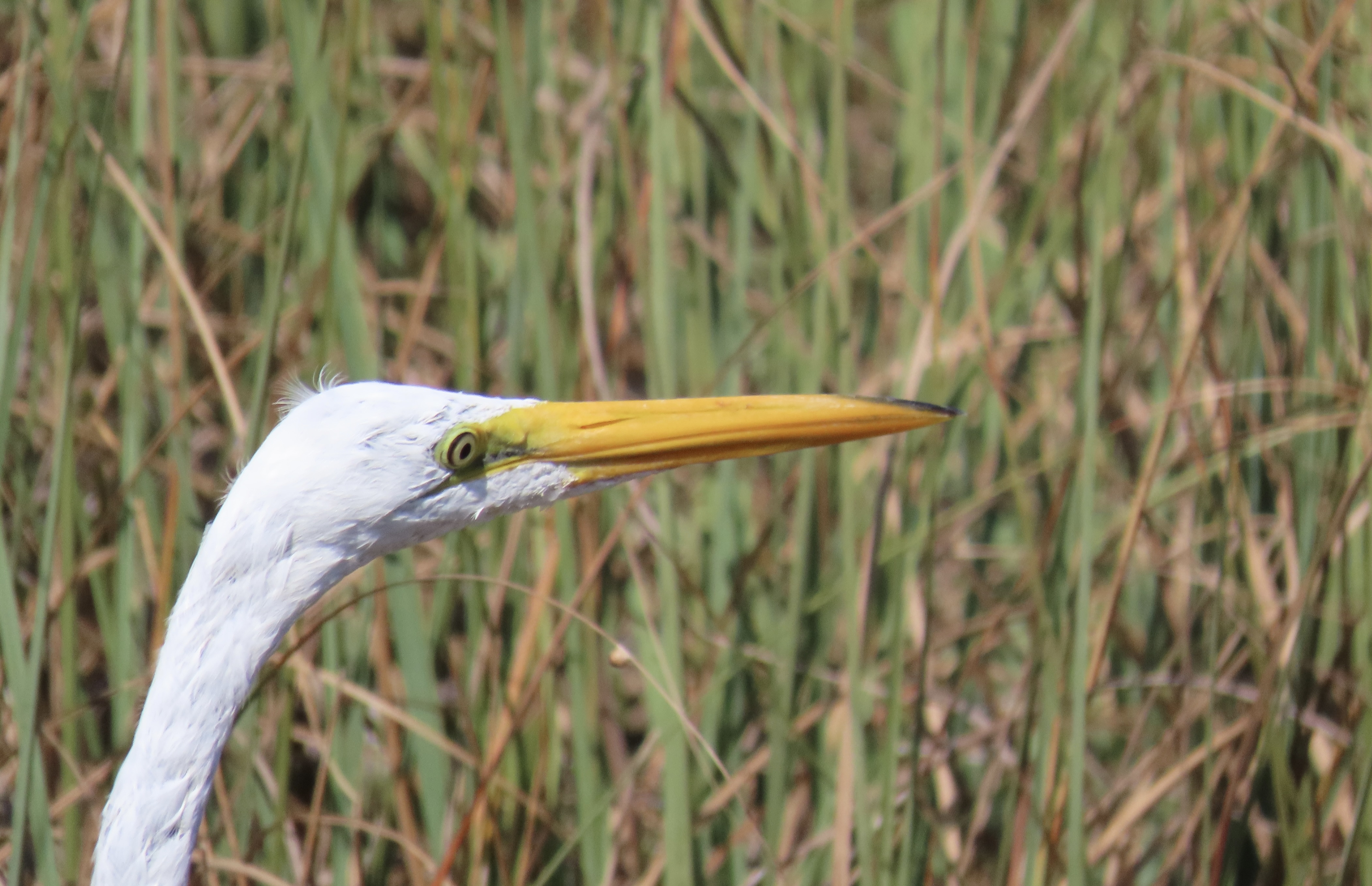
Our first stop was to admire this impressive mangrove. Peggy provided perspective. Shortly afterwards, we came on this colorful bird that was busily walking over lily pads. It’s a Purple Gallinule.Quite the stretch! Check out the feet.Pretty amazing, huh.Next on our list of colorful birds along the Anhinga Trail was this great blue heron.Head shot.Here’s another shot of the googly-eyed Anhinga. One of its relatives was busily fishing in the pond below.Anhinga style, only its head was above the water. We liked the shadow.It had been fishing under water and came up for air here.A turtle also swam by underwater while we were watching the Anhinga.In addition to the wildlife, the scenery along Anhinga Trail is also quite attractive. A loud noise in the middle of it caught our attention…A large alligator had raised its head among the trees and was bellowing.A close up. Remember, one way you can tell the difference between a crocodile and an alligator is that the crocodile shows its teeth. The alligator doesn’t. Another is the alligator has a shorter snout.Having made his point, whatever it was, the big fellow swam toward us. We liked this photo as well.One of our stops along the way toward Flamingo was the Mahogany Hammock Trail where we found this great egret. I called it scruffy neck. They say that great egrets have really long necks.That would certainly appear to be true from this photo. But it got longer…We wondered if it had inherited giraffe genes!A head shot. Our glamping tent in Flamingo. It had a good view of Florida Bay. Low tide brought in various birds to take advantage of the the feast it made available.Among them were these guys hungrily scarfing down miscellaneous delicacies, at least from their perspective. While they may seem like different birds, they are all white ibis in their various development stages from juvenile to adult. A reflection shot of one of the adults.A snowy egret joined the white ibis.I close with this shot of the egret. Next up, we take a look at some of the excellent wildlife carvings we found in Victoria Falls, Zimbabwe and take you to the workshop where they were made. You will be surprised.
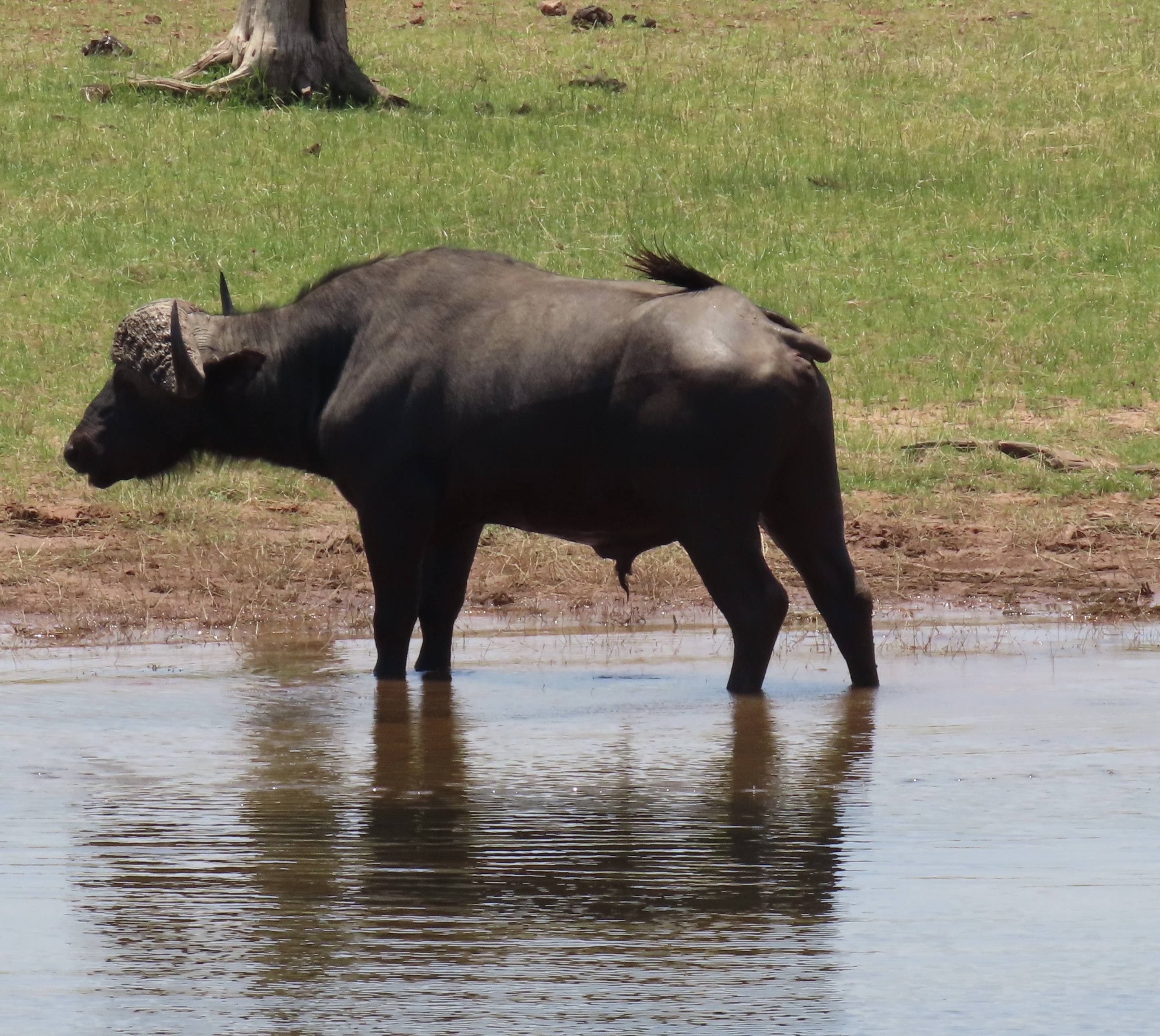
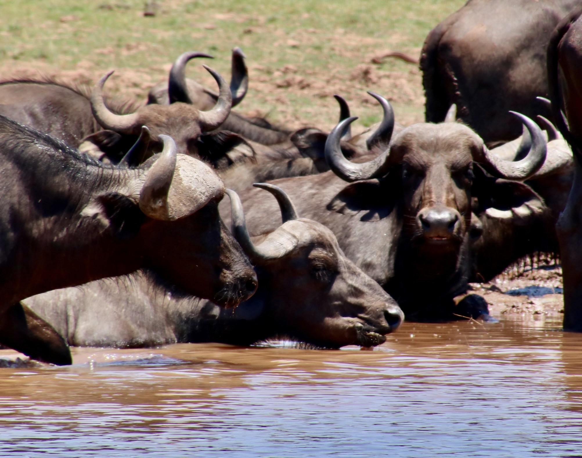
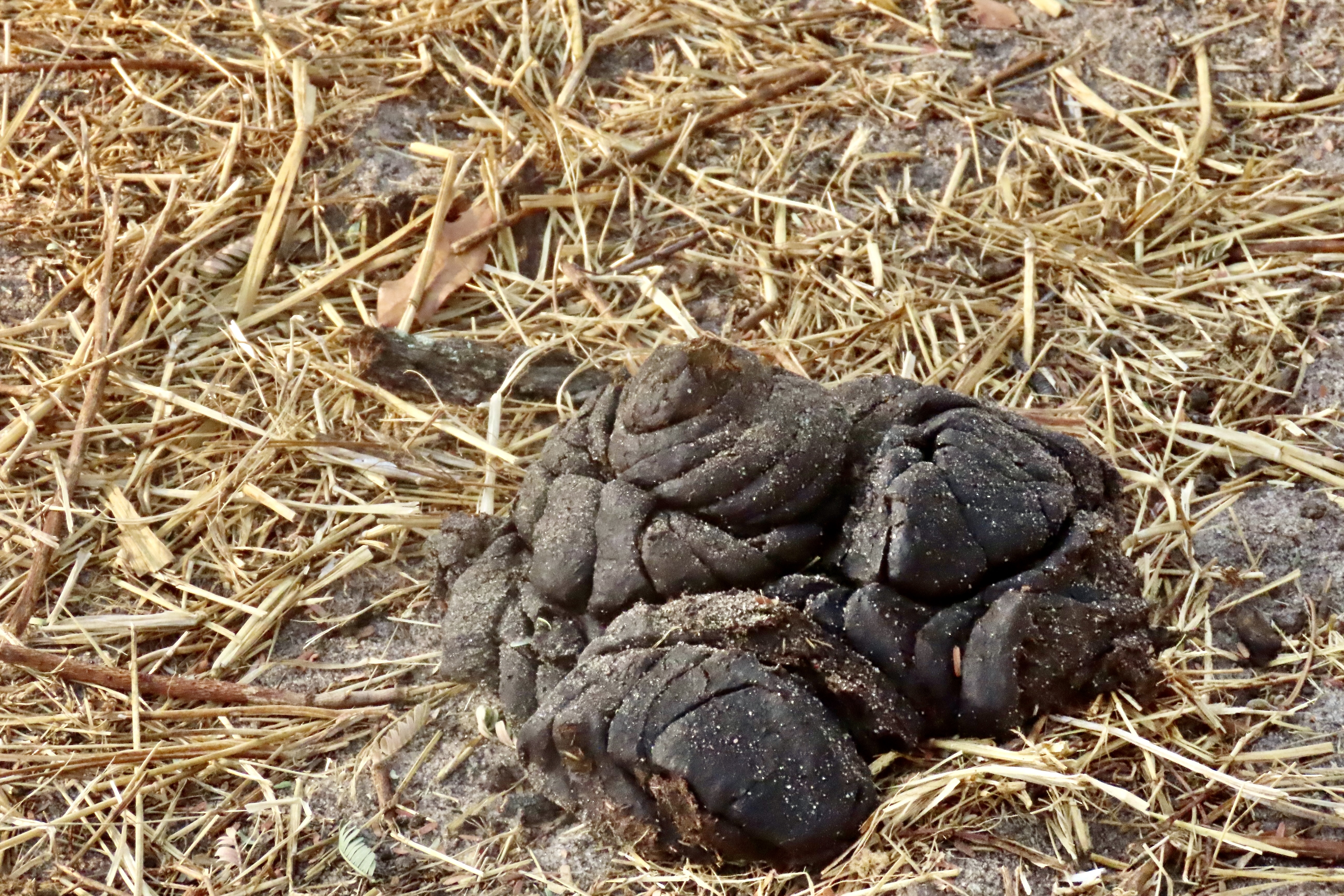
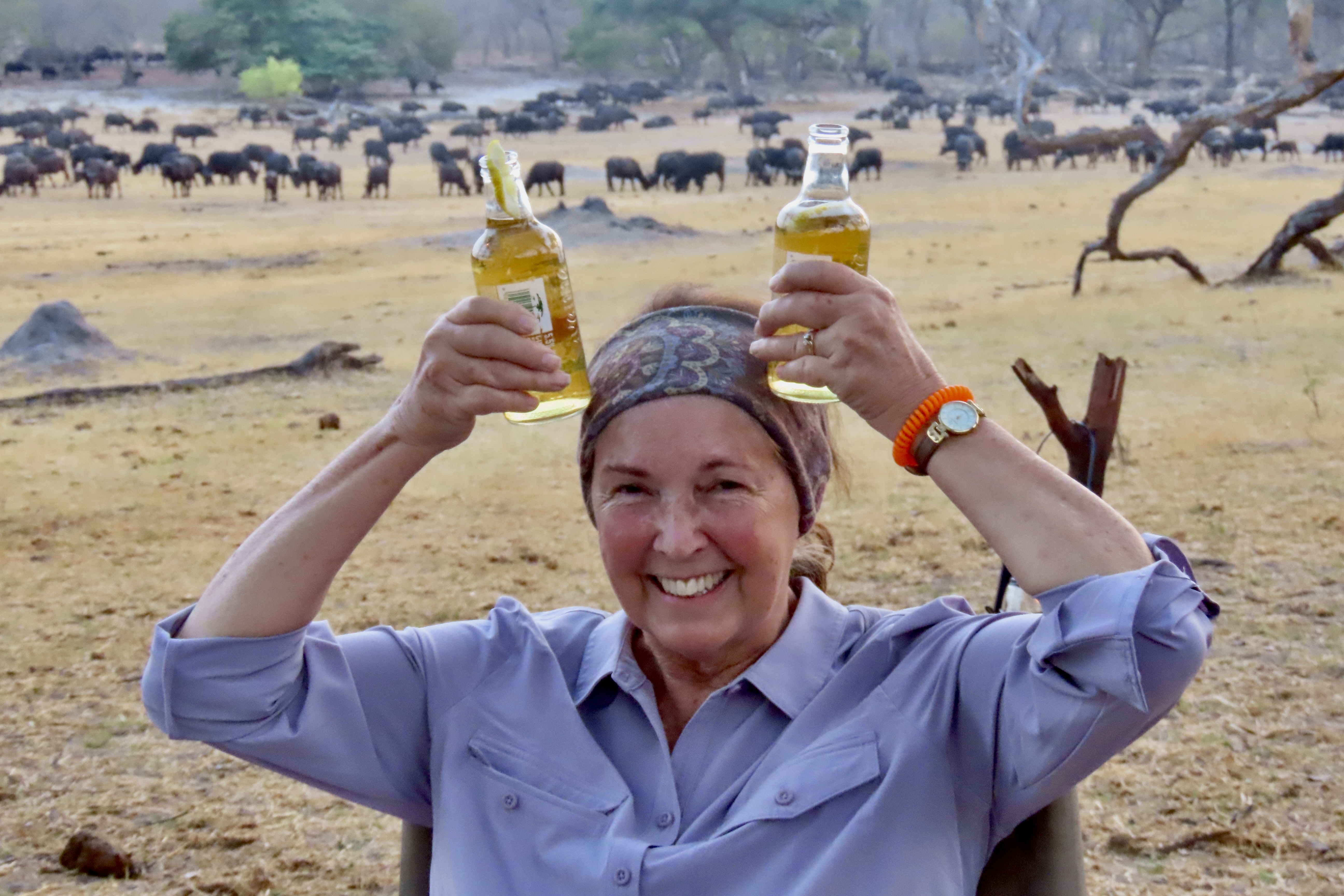
Cape buffalo are dangerous, no doubt about it. But what makes them so? The look alone says “Don’t mess with me.” The eyes, the horns, the ears and even the nose speak of danger! We were safely ensconced in our boat on the Chobe River. Did I mention that the buffalo are great swimmers…Size matters. The big bulls can weigh up to a ton. The really big ones can reach over 6 feet in height and 11 feet in length.Which, in no way, means that you would want to mess with a thousand pound female…And then there are the horns. No one, not even a lion, wants to be hooked by one.They are the boss. That is actually what the horn structure is called. The solid shield created where the horns meet is so tough that it can withstand the pressure of another large male crashing against it!They attack as a group. You won’t be dealing with one. It could be the whole herd. They protect each other, including the young, the old and the sick. The largest males form a circle around the vulnerable with their horns pointing out. When a calf cries in alarm, the bulls come charging.Terry, the co-owner of the Iganyana Tent Camp where we stayed on the edge of Hwange National Park, told us a story about this downed tree. His brother-in-law came to visit and went out for an evening walk. He called Terry and asked for a pick up because he heard lions. Terry jumped in his truck and rushed to the scene. He didn’t have to worry about the lions. They were up as high as they could get on the stump as the herd of buffalo ran in circles under it, threatening instant death if they dared to come down. That’s how scary they are. The week before we arrived, a herd of around a thousand came to visit the camp and stayed until 11 that night, Terry told us. No one could go back to their tent until the buffalo left! One of them left its calling card on the pathway up to the tent we were staying in. Peggy and I had a hard time imagining being in the tent while the herd roamed around outside.We were out for an evening drive with our guide when we came across the herd crossing the road. “Be quiet,” the guide told us. “Be very quiet.” The guide waited until there was a break and dashed through it.What our guided didn’t tell us was that the herd was coming to graze in the same field where a surprise party was being hosted for us! While Peggy made horns, I checked out the tree for a possible escape. Just in case, you know. I’m happy to report that the buffalo happily munched away on their side of the field while we drank on ours. Fortunately, there was a sufficient supply of alcohol with a great motto. Enough that Peggy changed her approach to making horns. That’s it for today. The next post will be about a fishing village we visited on an island in Lake Kariba, and a carving camp we shopped at in Victoria Falls.A few of the children from the fishing village gathered around me and demanded that I take their photo.