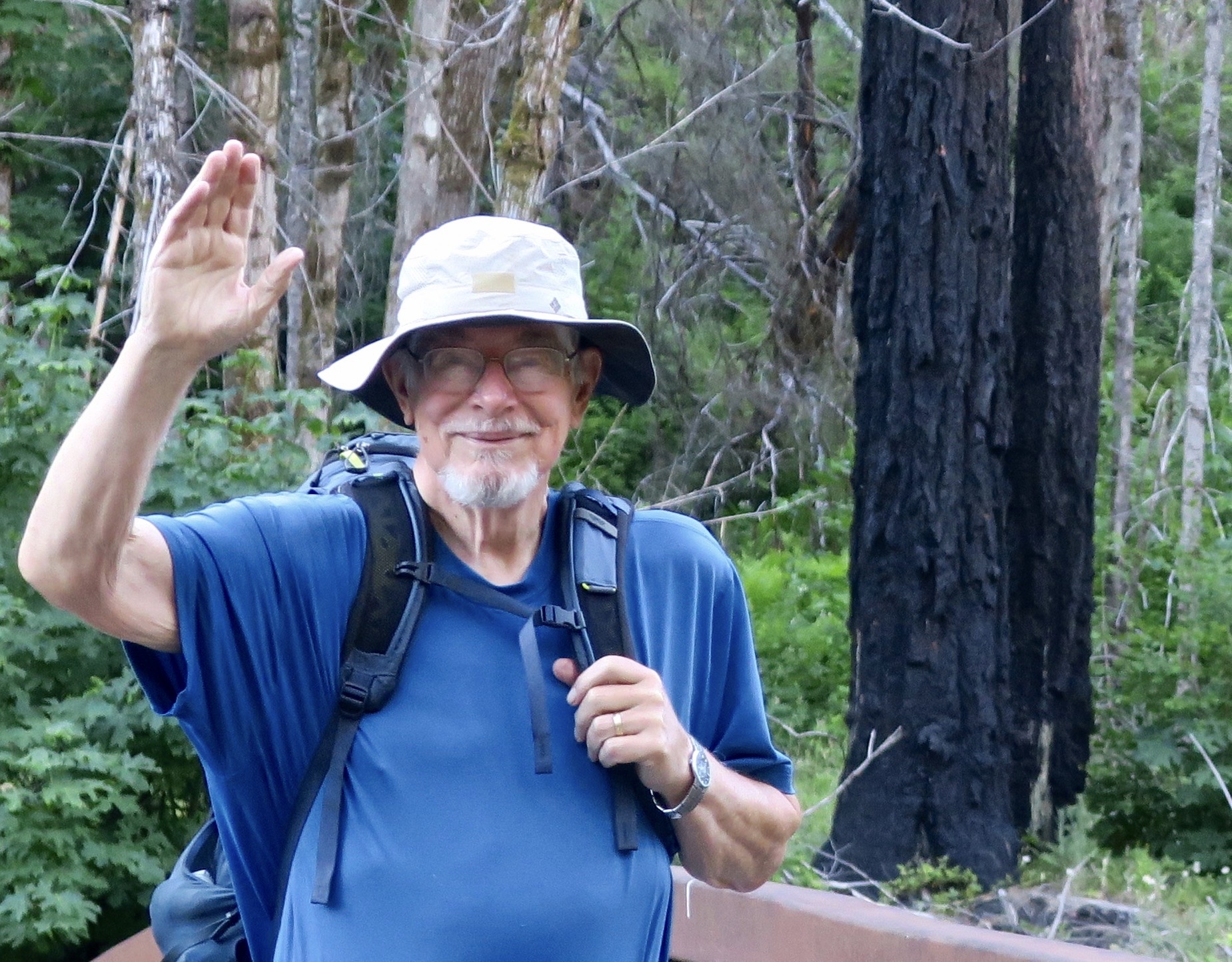
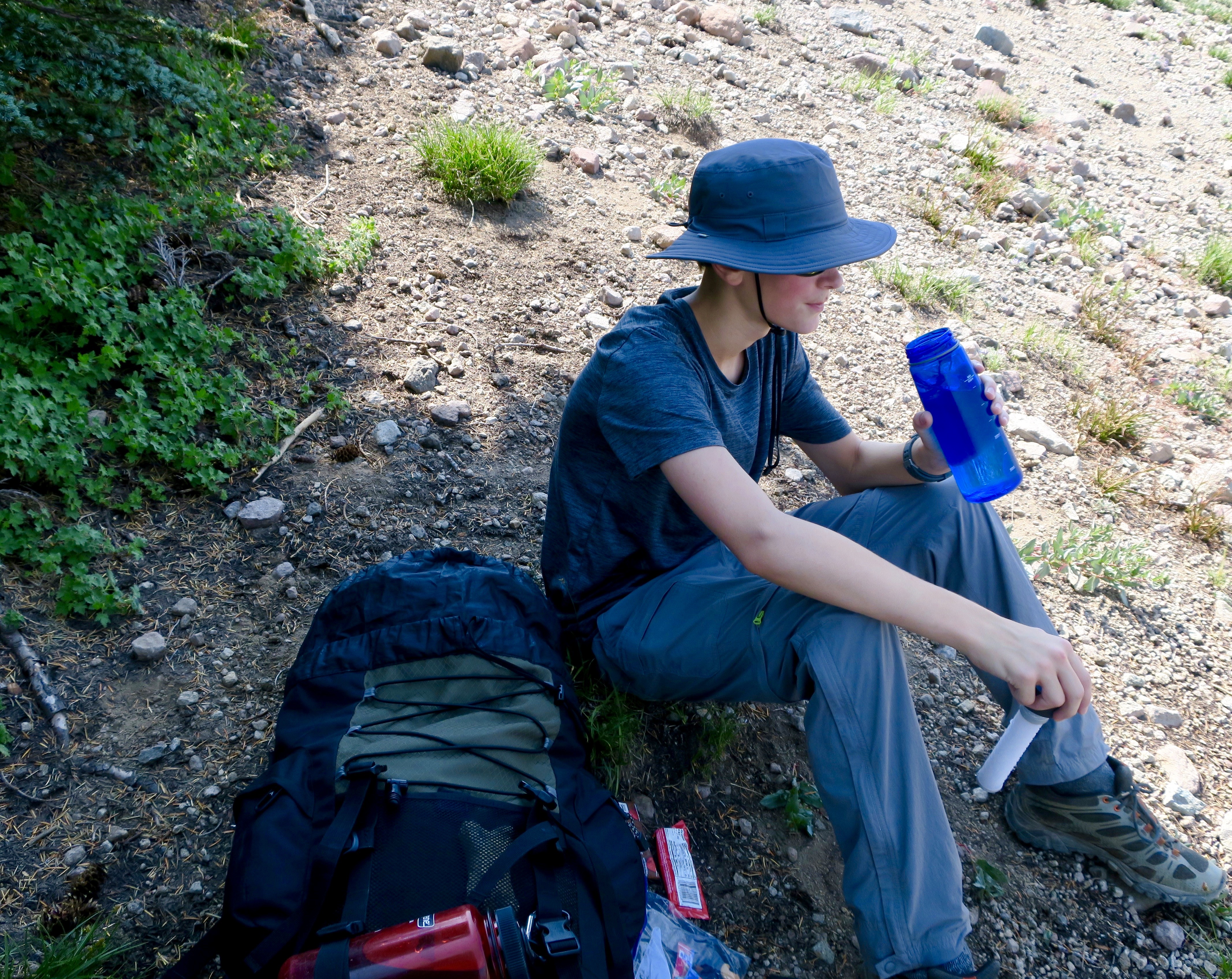
As we noted in last week’s post, our 2025 wrap-up is based on three trips we made during the year and blogged about. The first was Hawaii, which I posted last Monday. Today’s post features our Southwest journey where we wandered through the Southwestern US for five months visiting national parks, state parks, and national monuments. Next week’s post will cover our three week leaf-peeping trip through New England in the fall.
The photos used in the three posts are all from ones we selected to include in three calendars we developed for our extended family, each focused on one of out trips. (Not all of the photos here made it into the calendars, but it was a flip-of-the-coin type decision.)
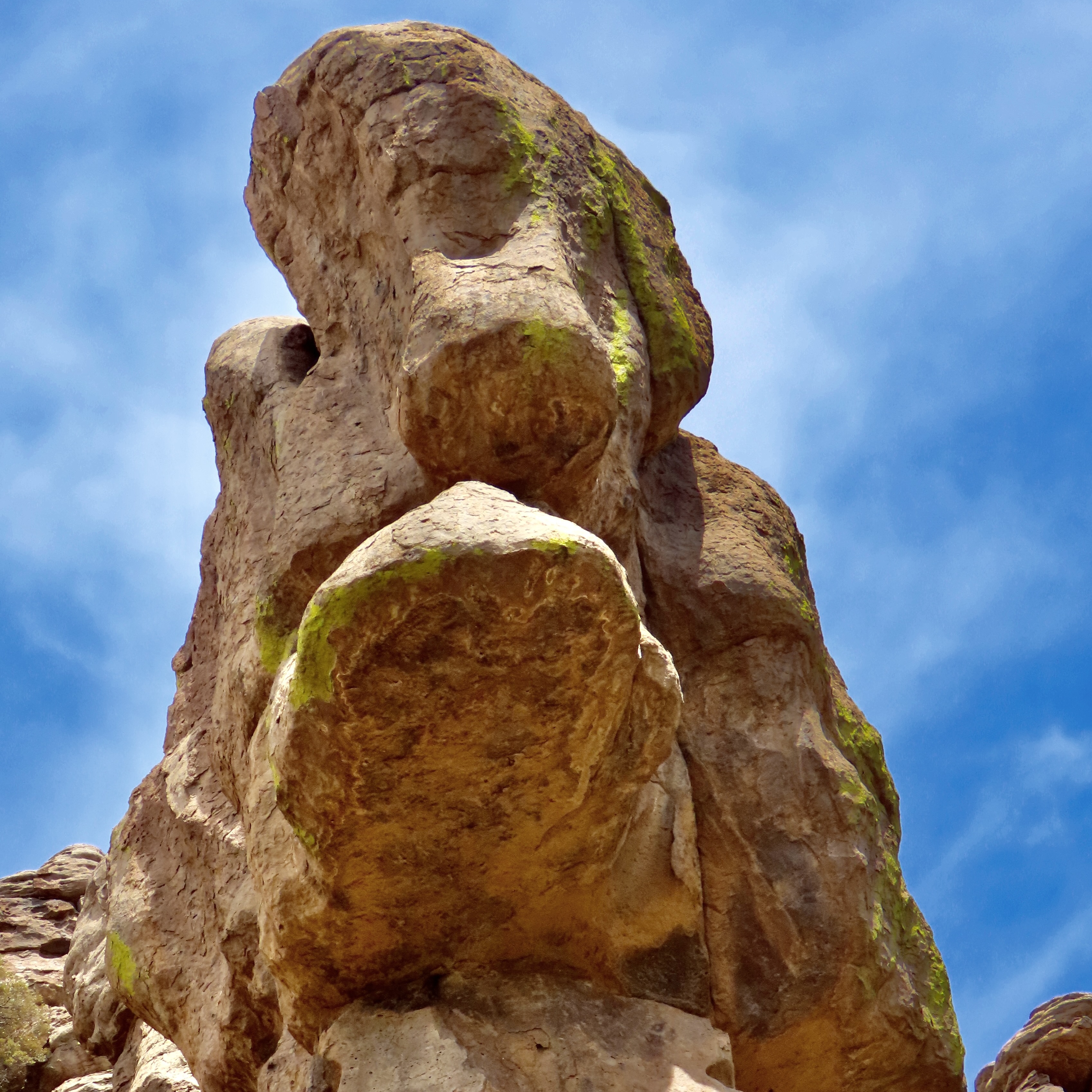
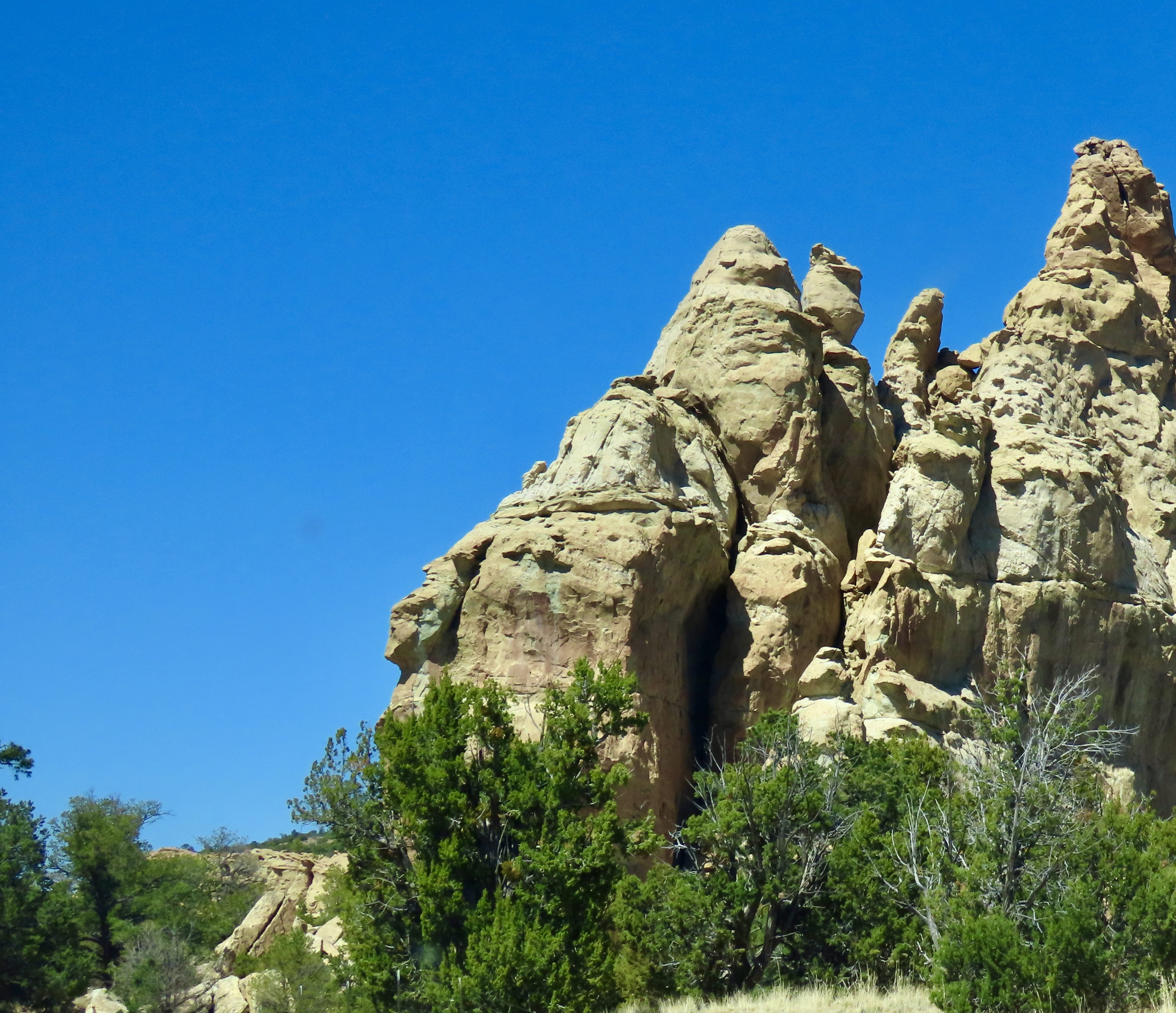
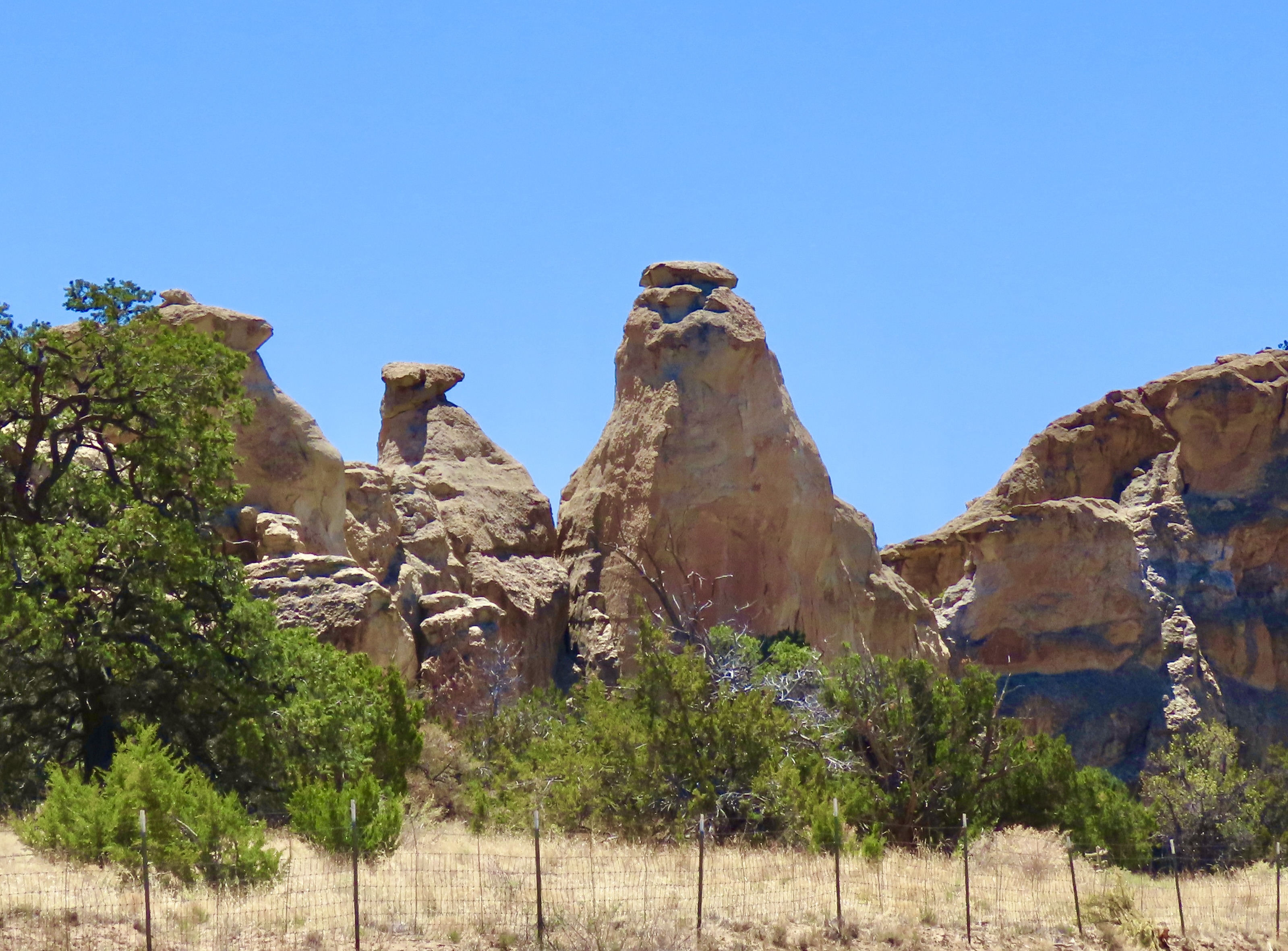
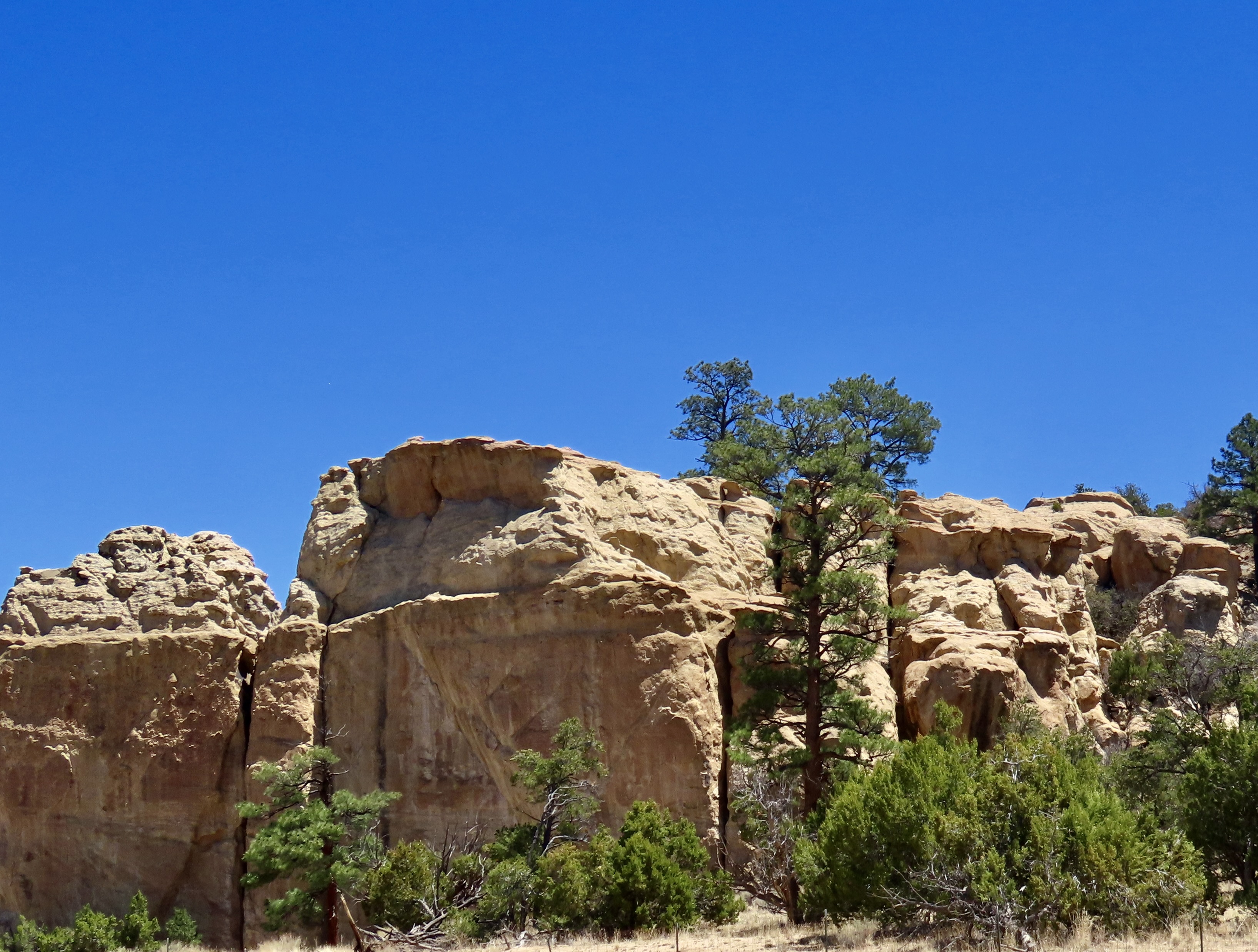
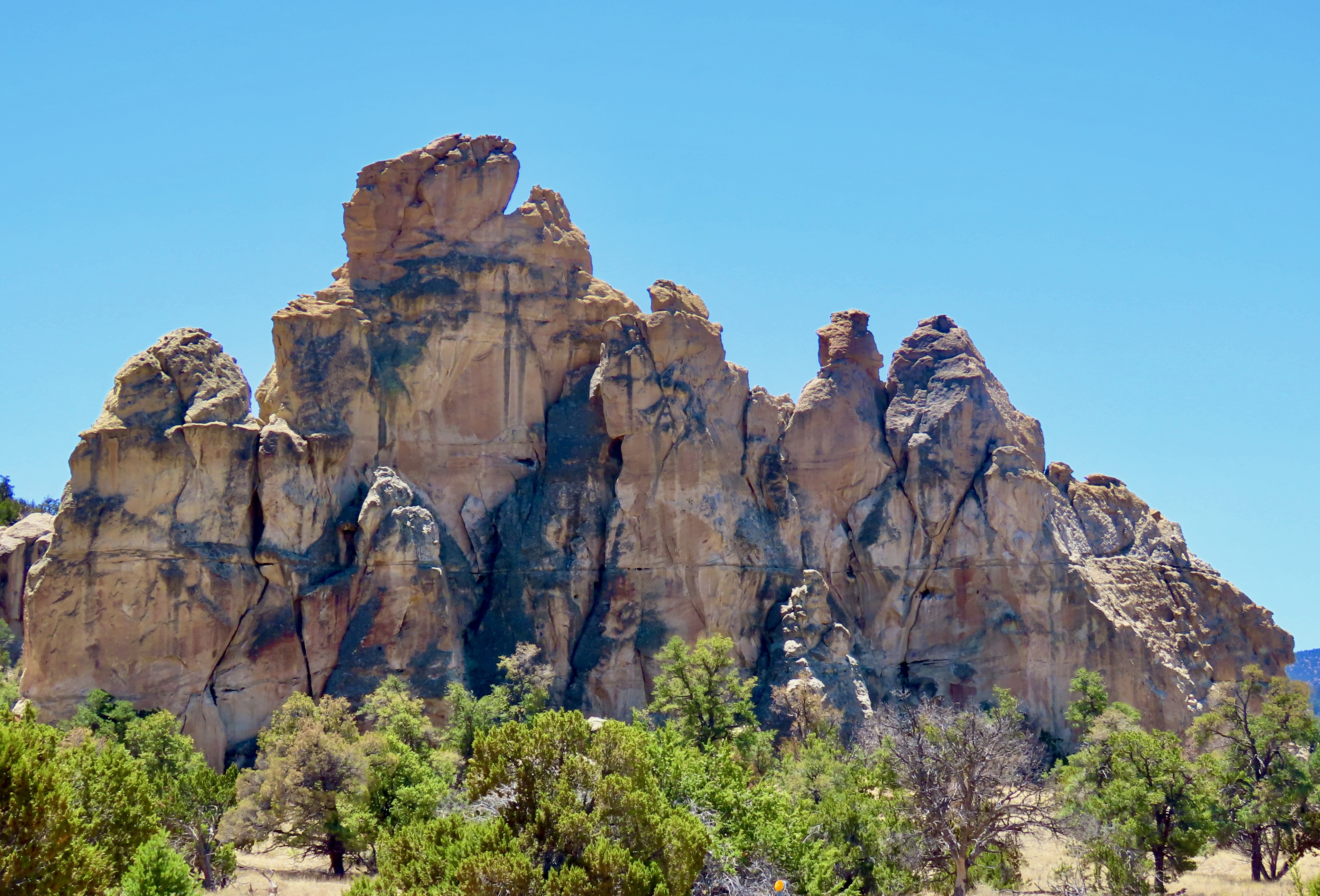
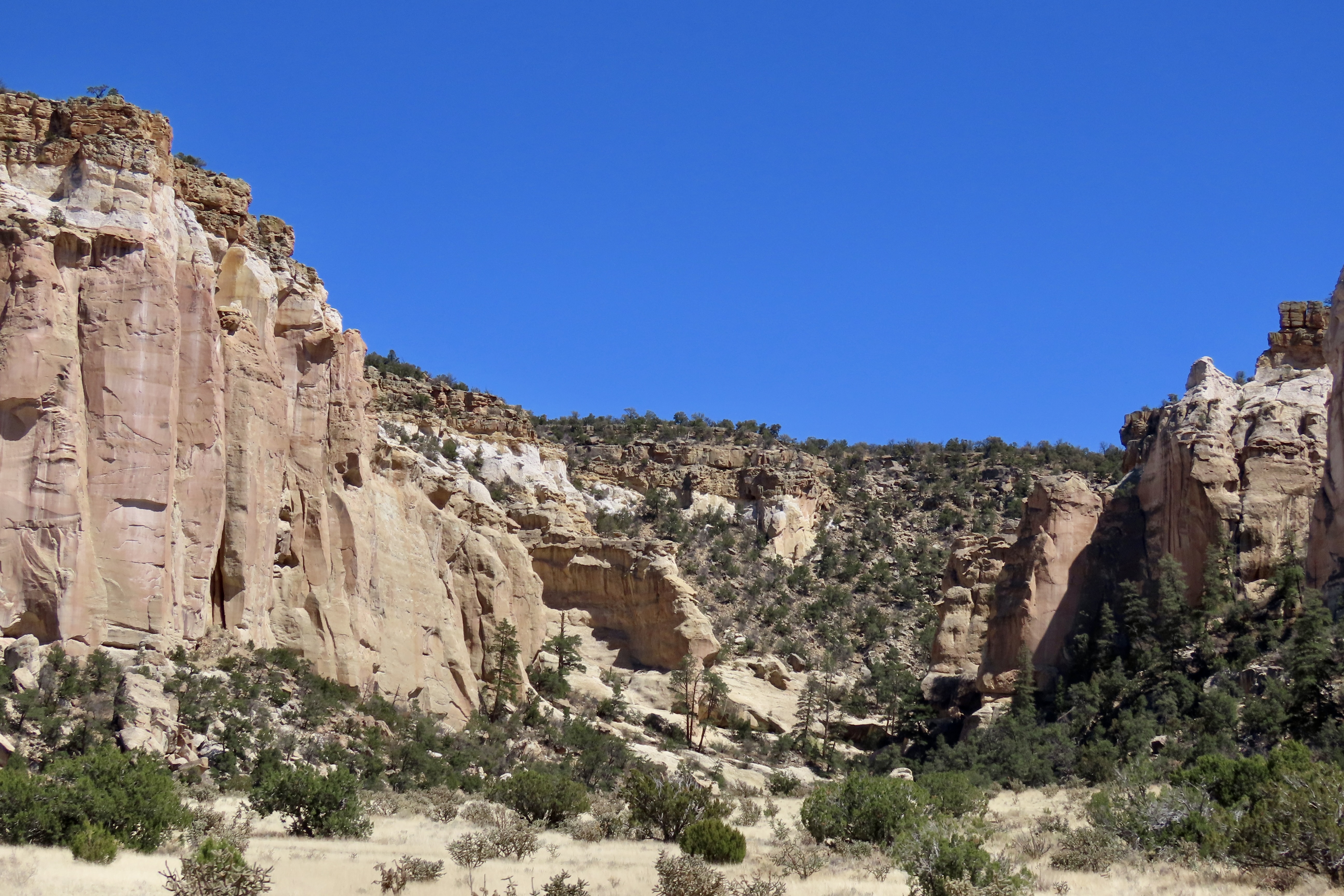
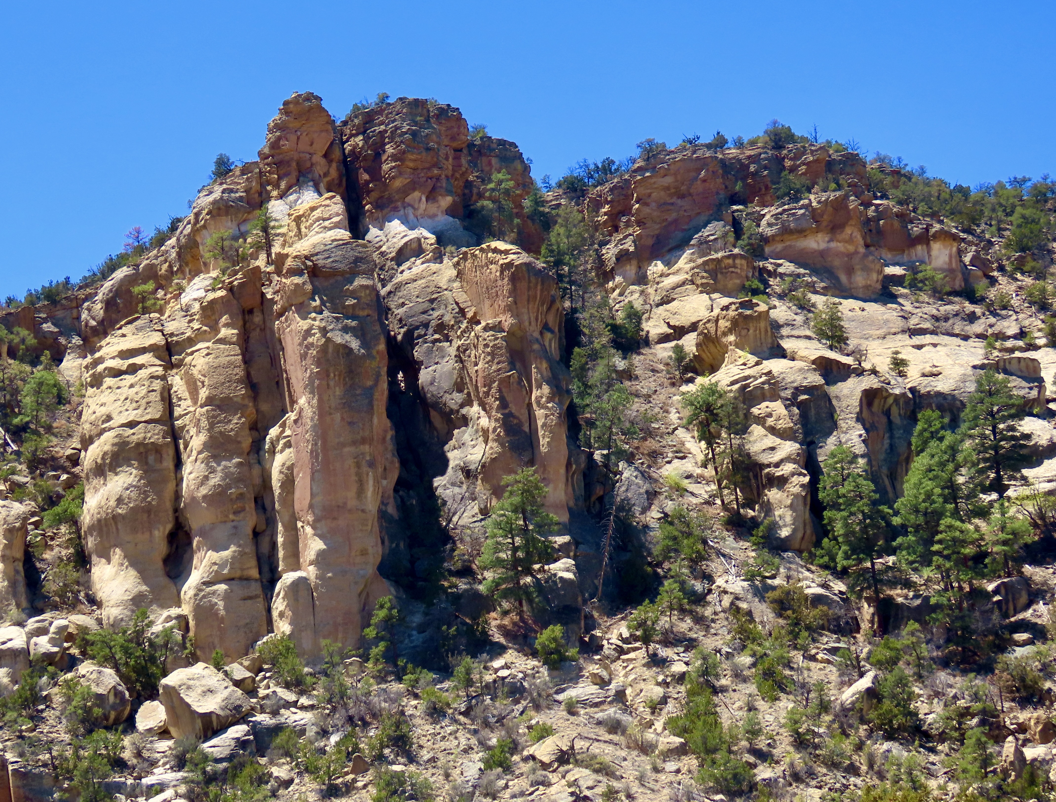
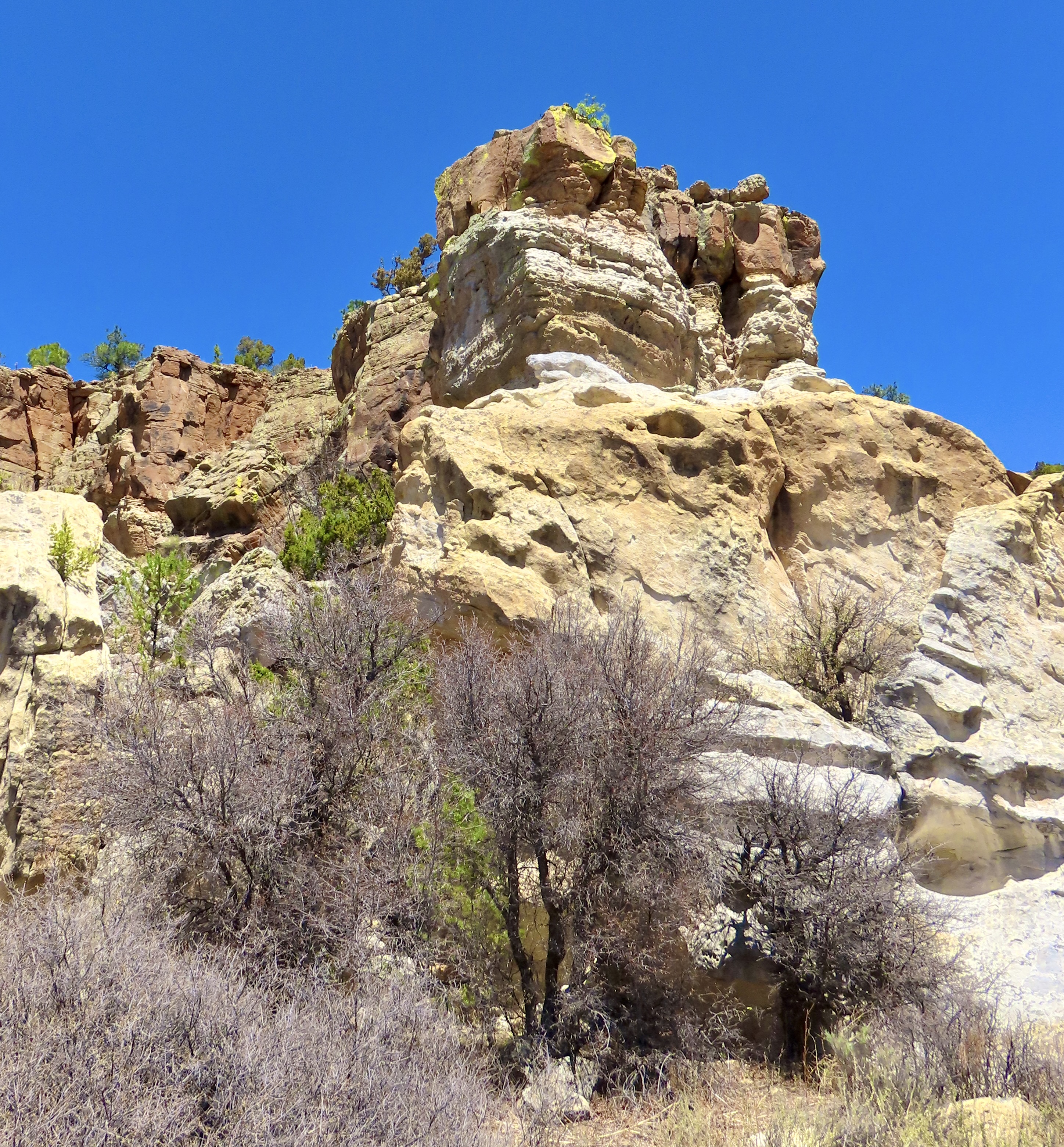
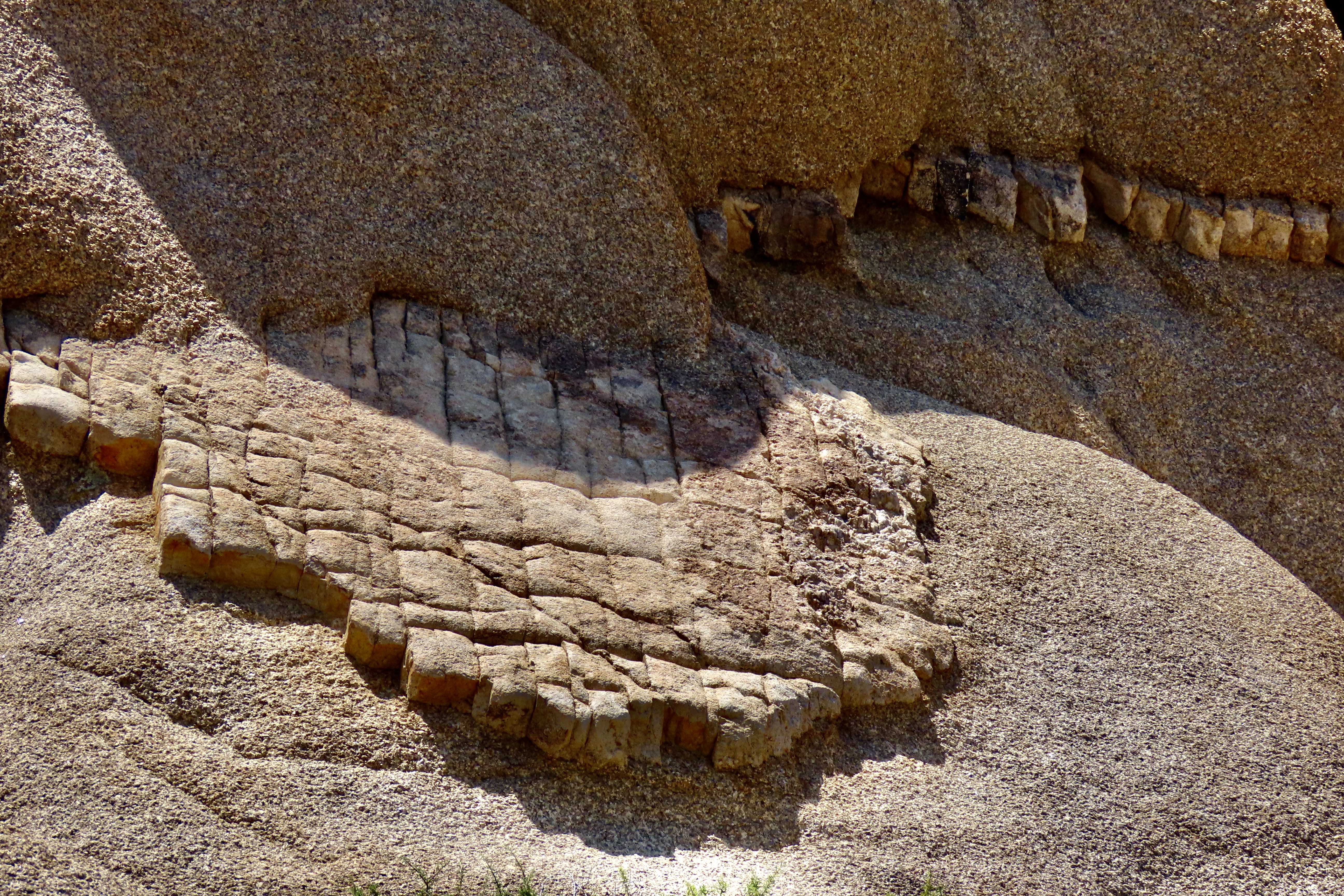
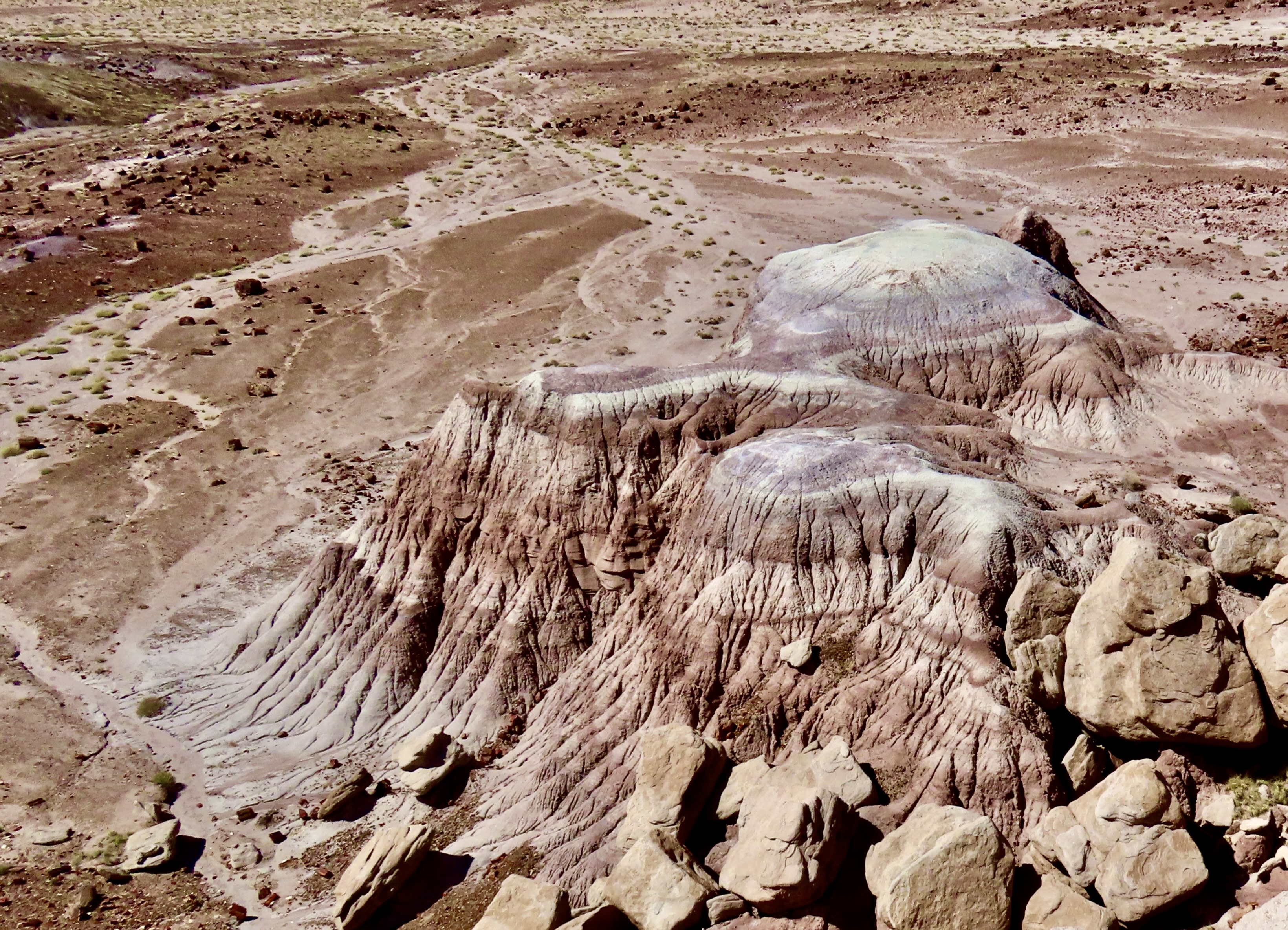
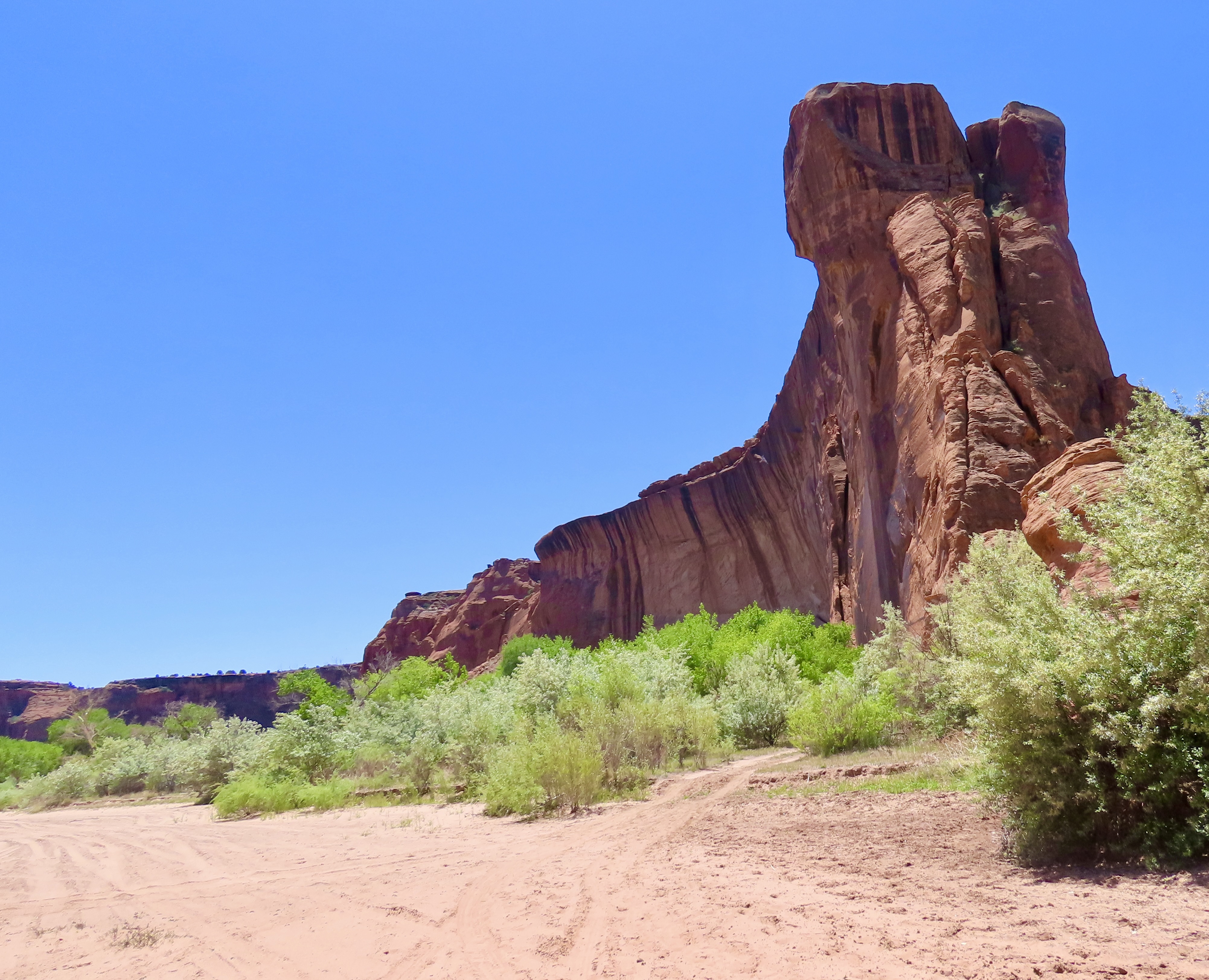
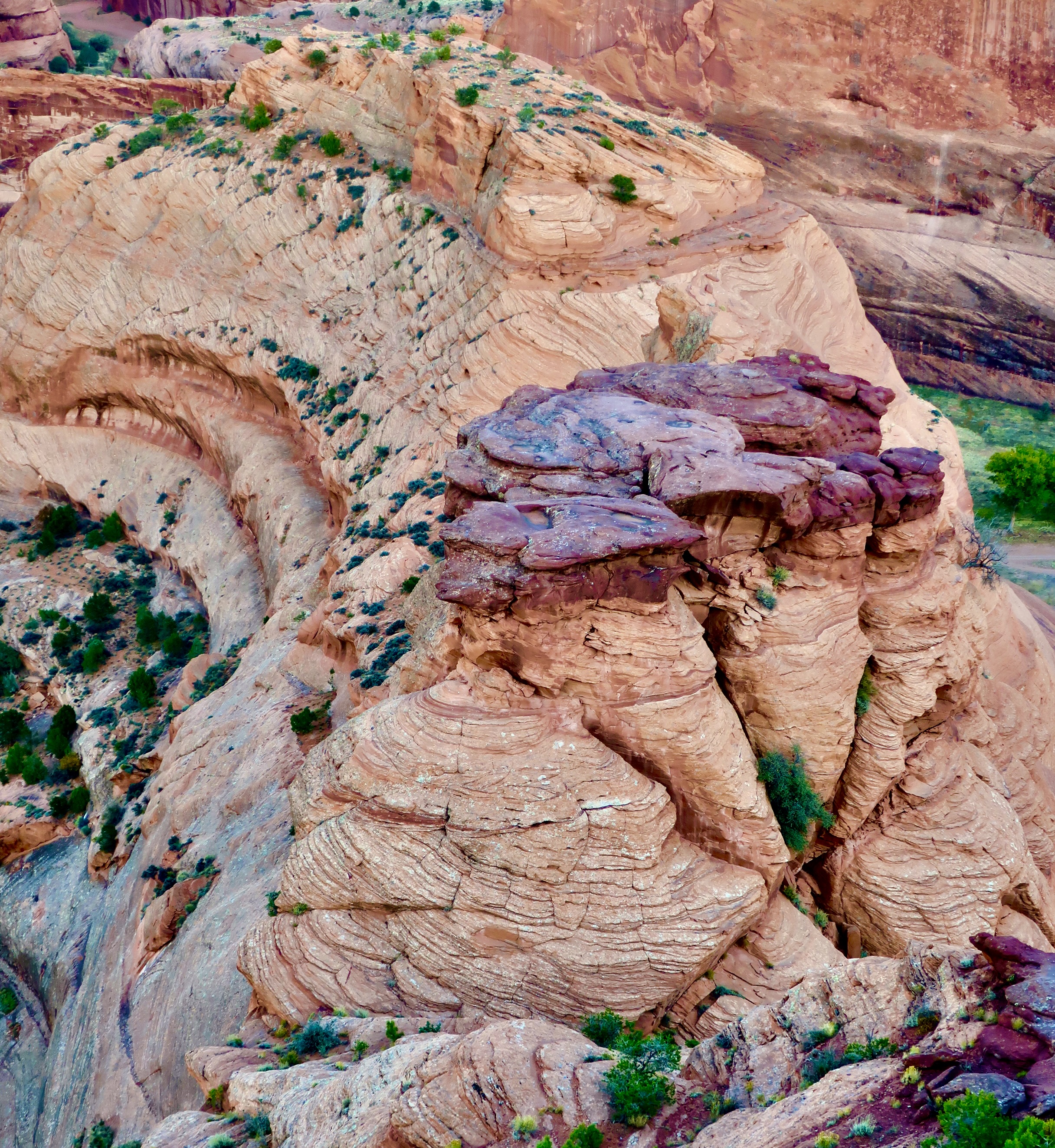
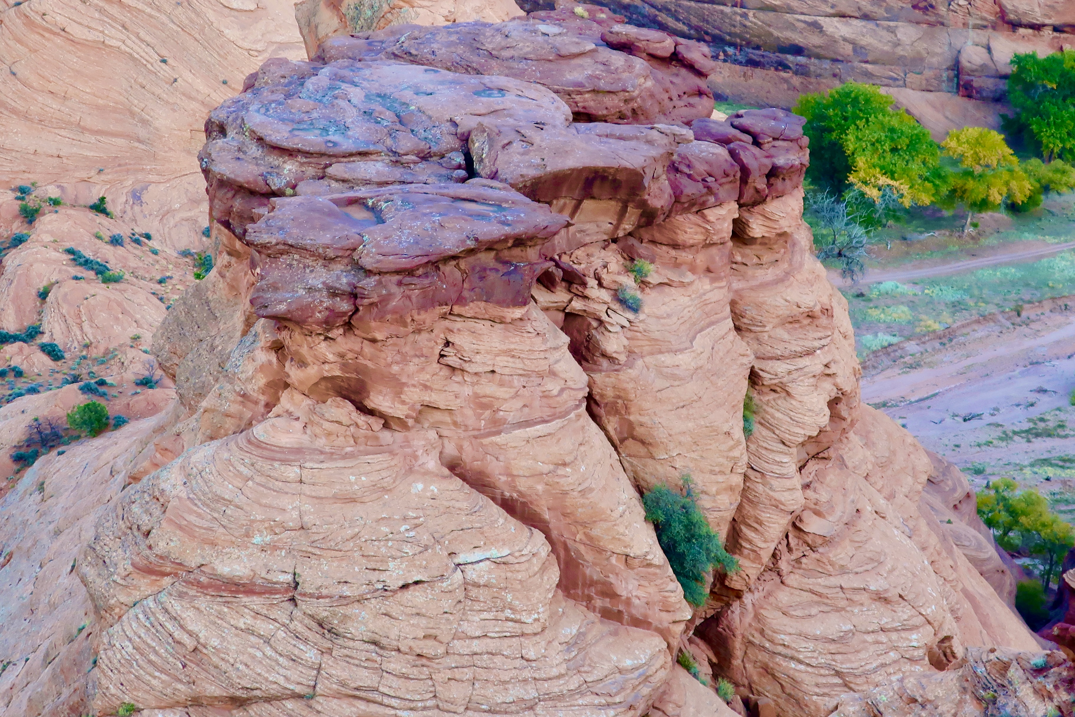
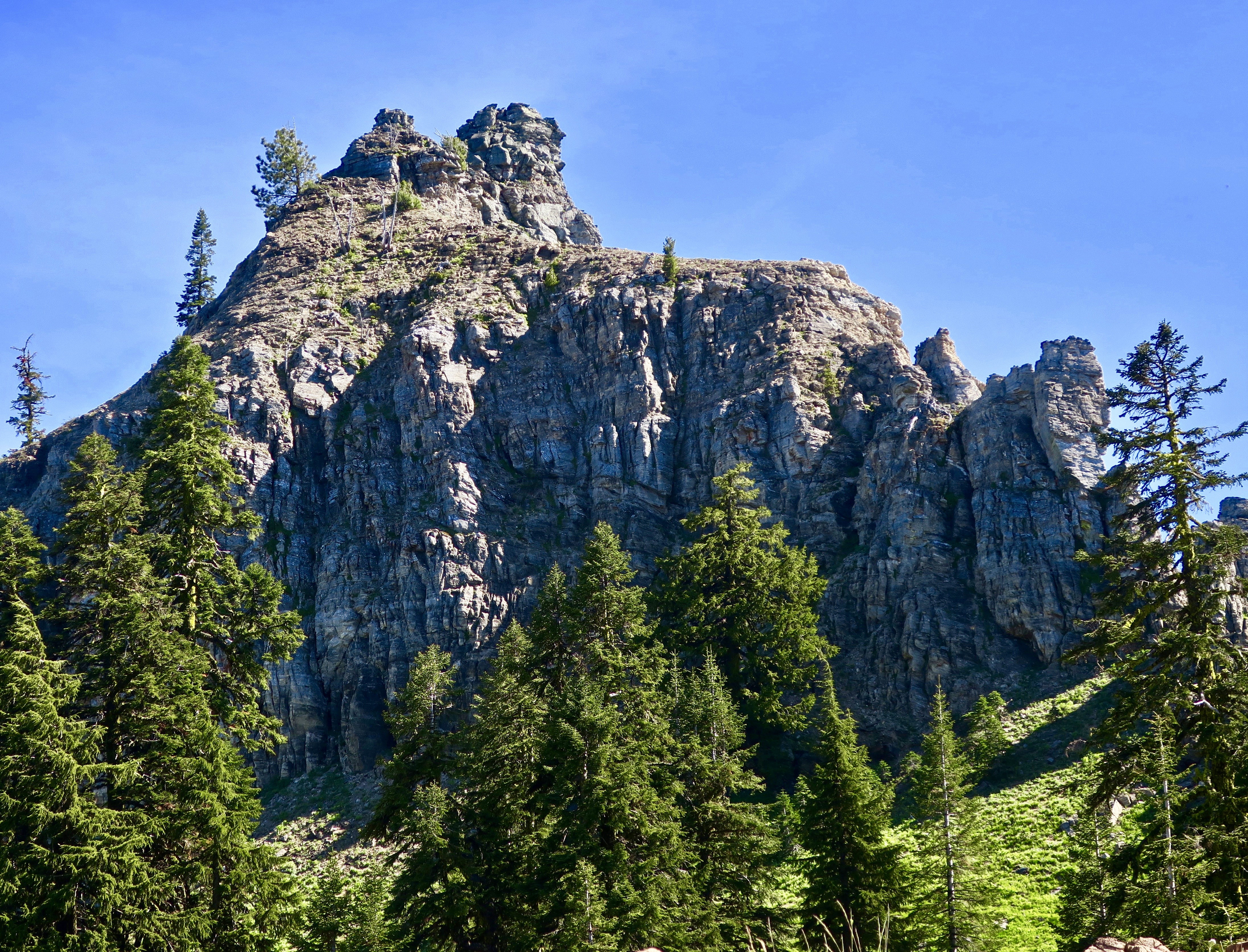
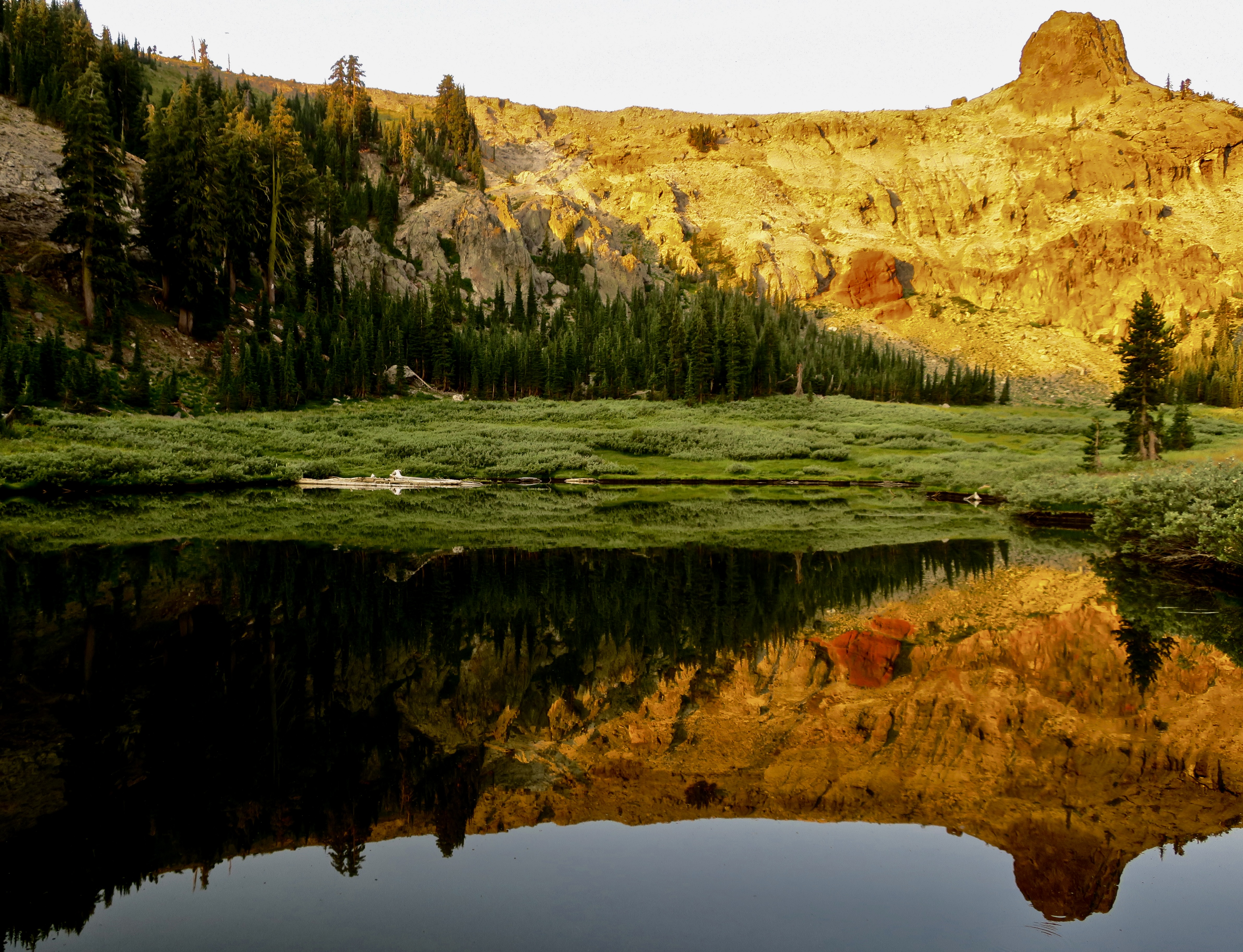
We discovered the towering rock above in Chiricahua National Monument, which is located in southeastern Arizona. The monument is named after the Chiricahua Apaches who roamed the area prior to it being occupied by pioneers from the eastern US. A couple of notes. One, the park is filled with a fascinating variety of rock structures. Two, we have discovered over the years that national monuments often include scenery, geology, history, plants and animals that easily match those found in national parks. They are definitely worth visiting and are usually far less crowded.
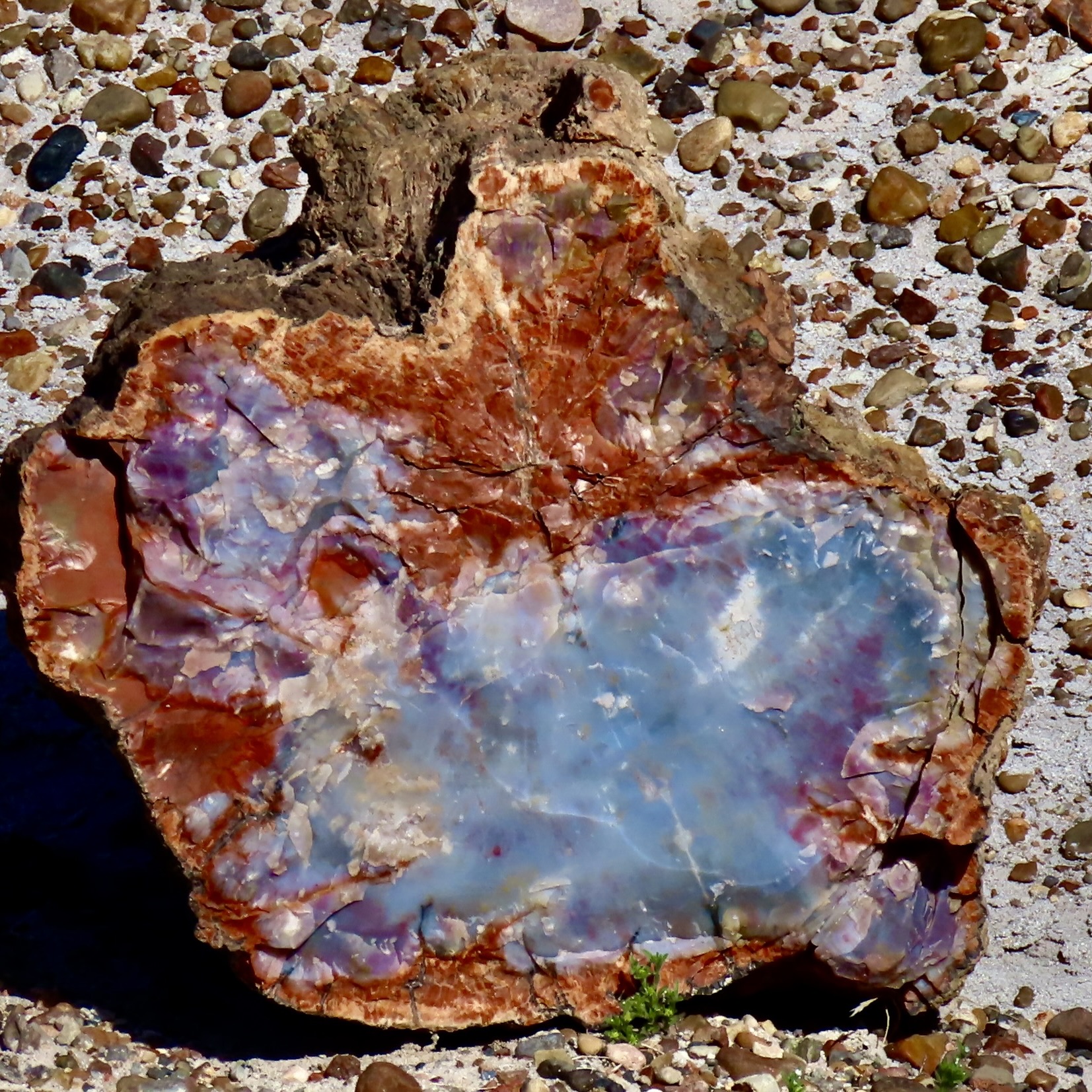
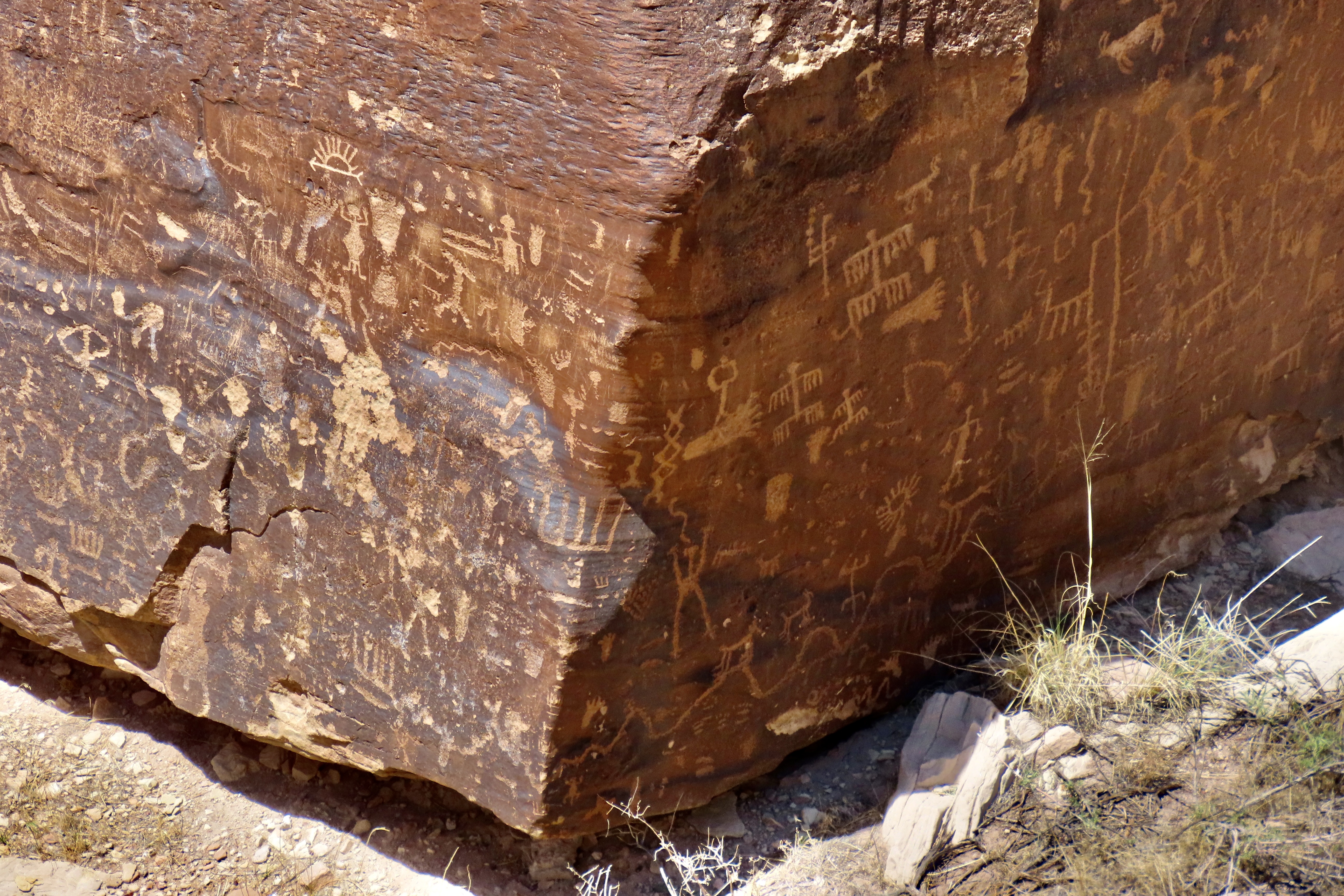
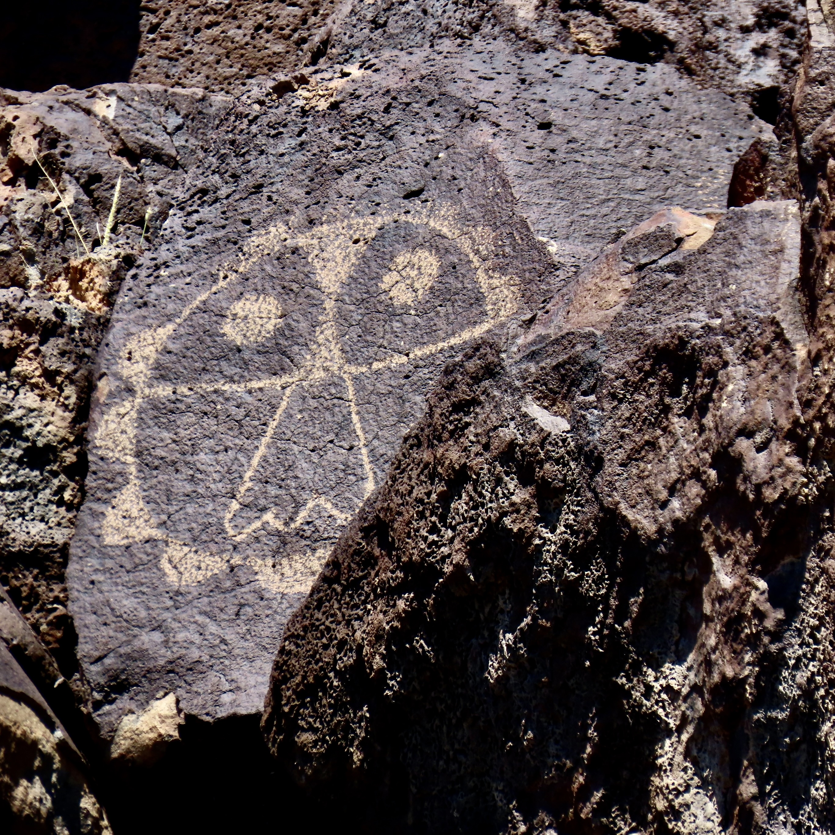
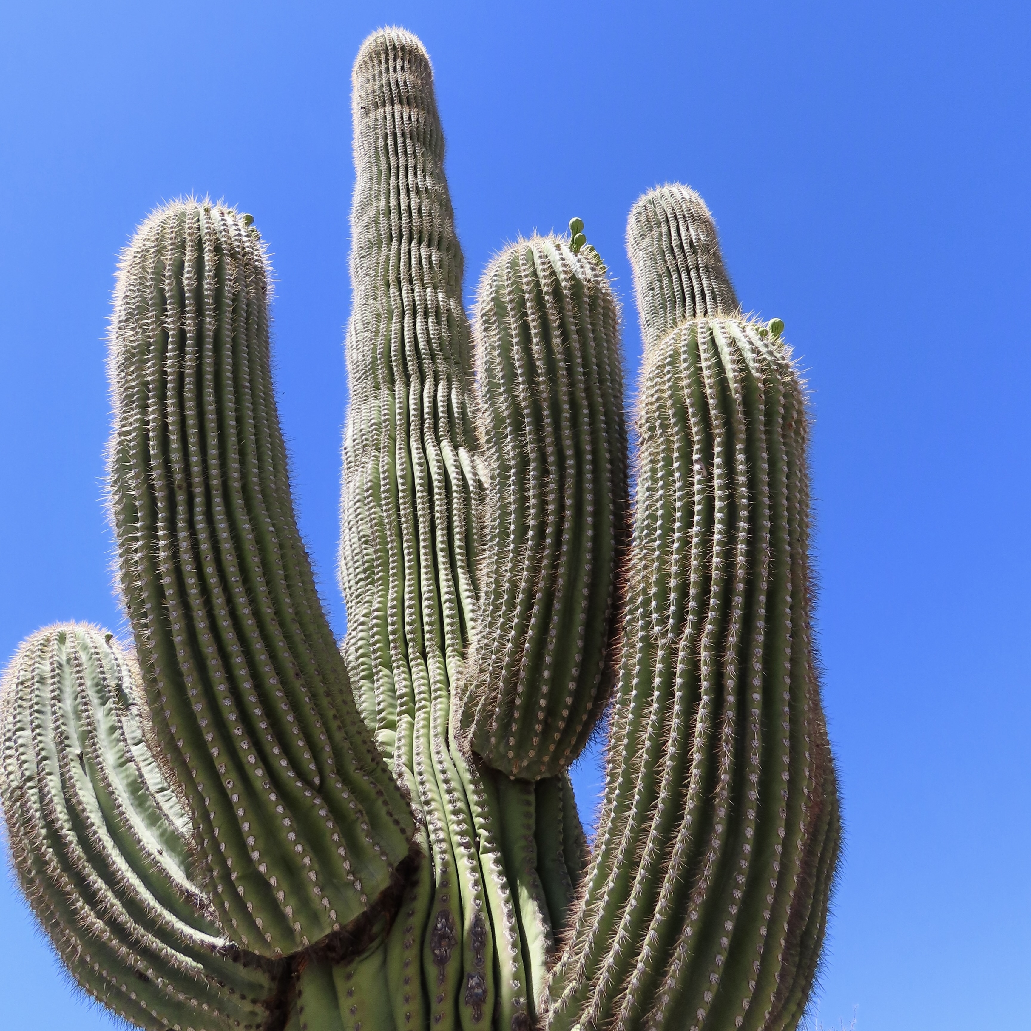
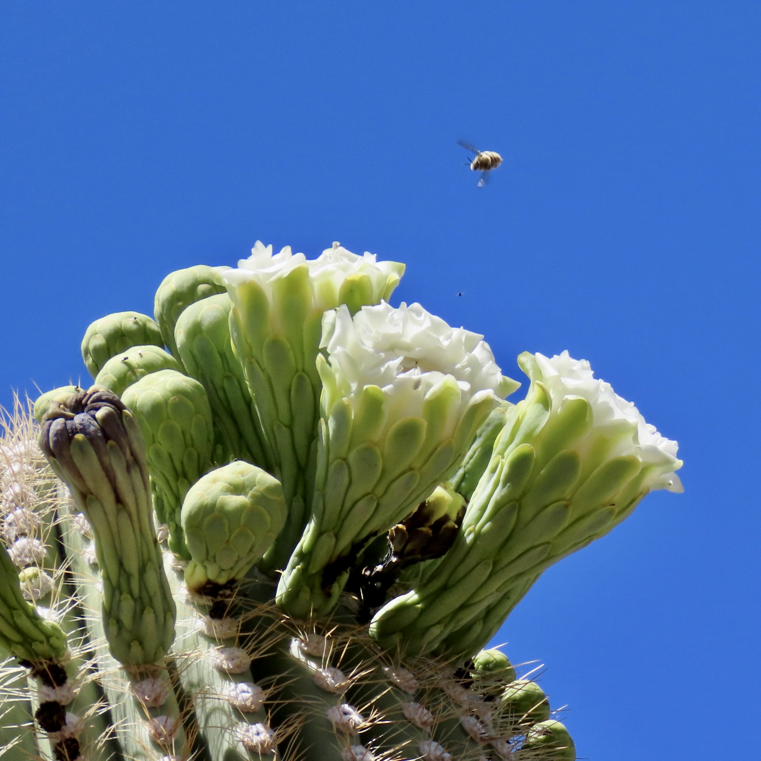
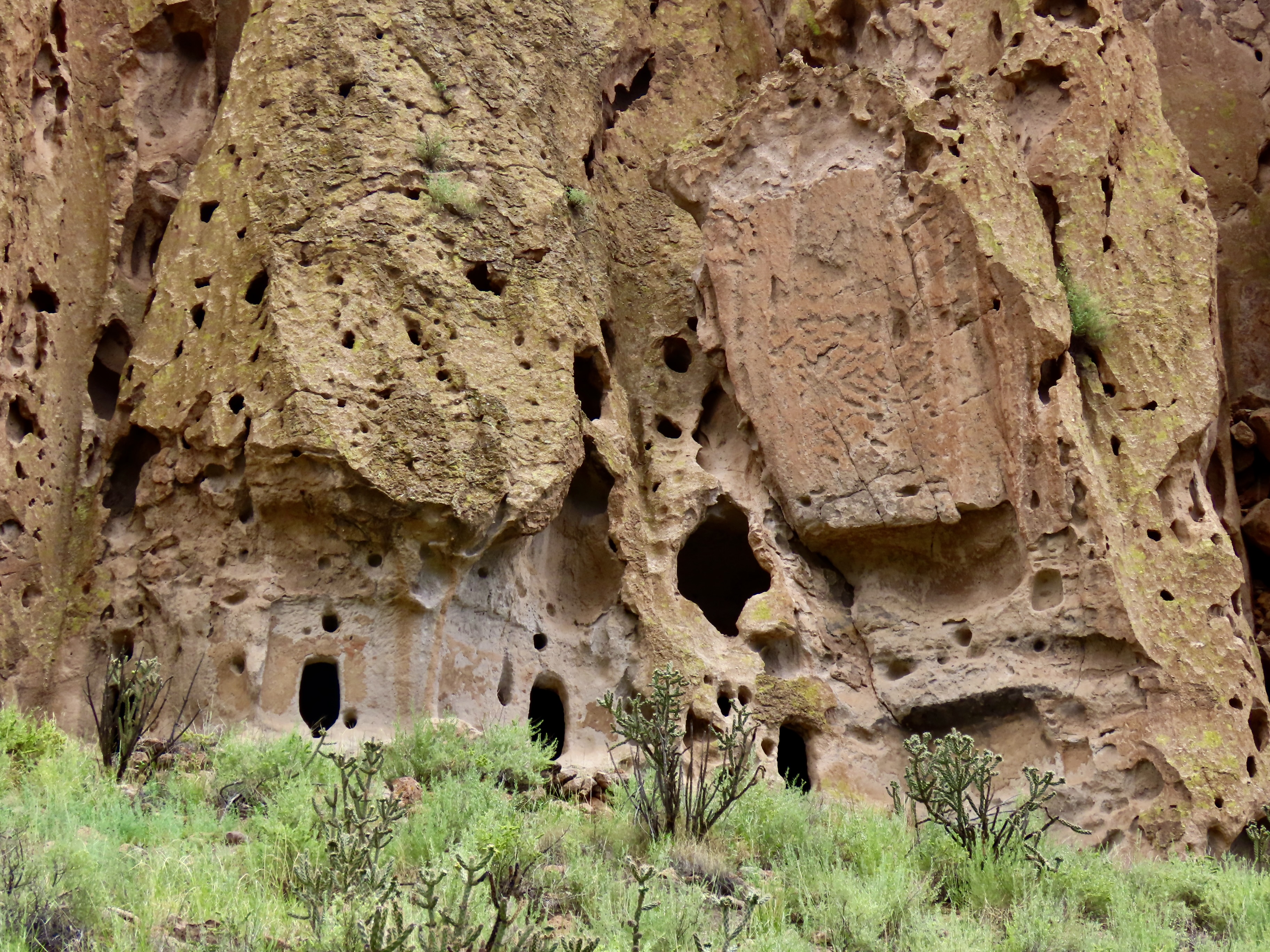
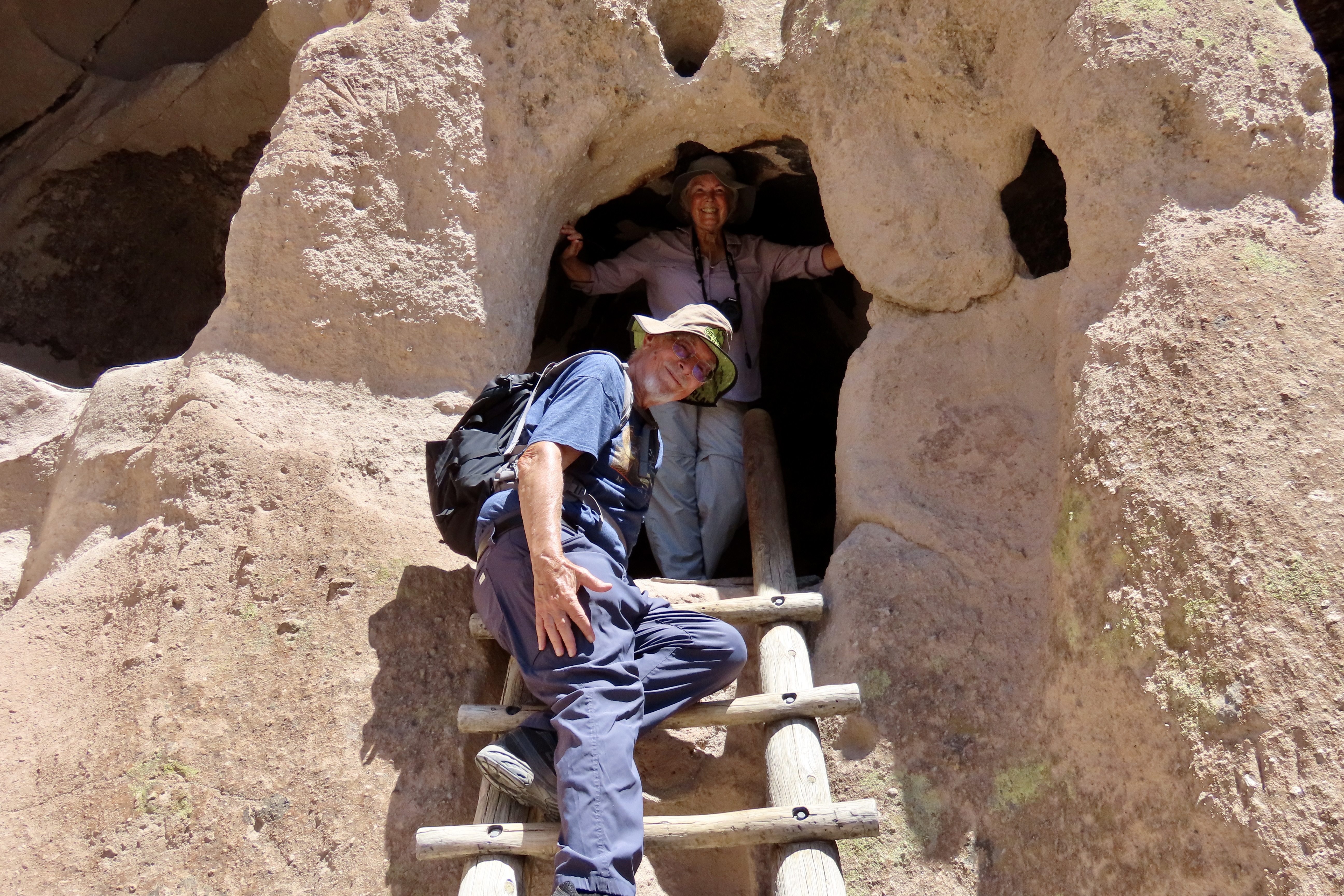
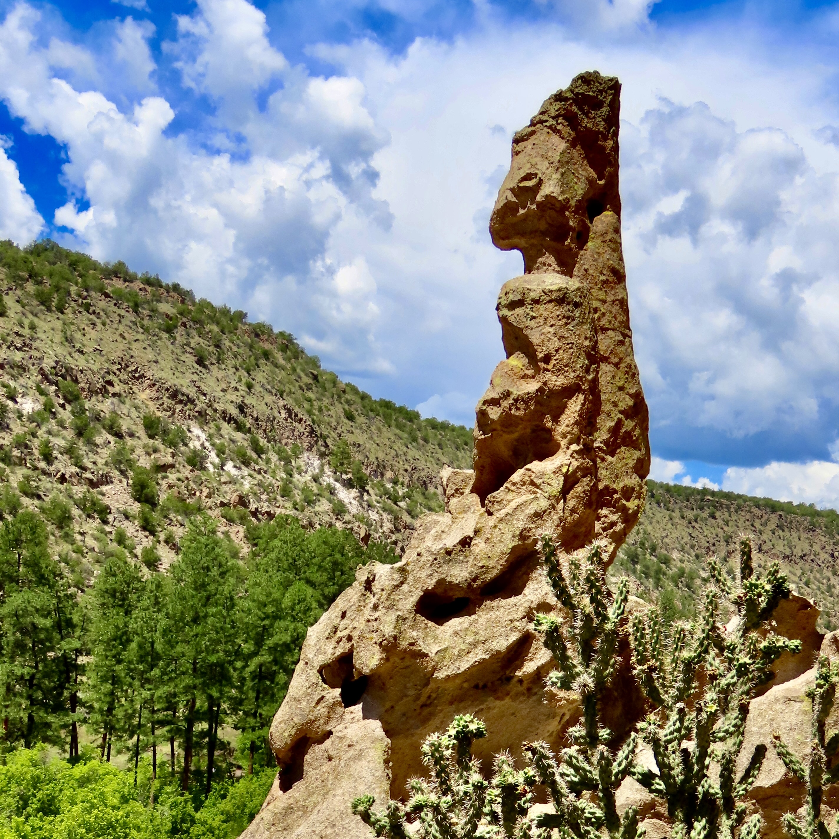
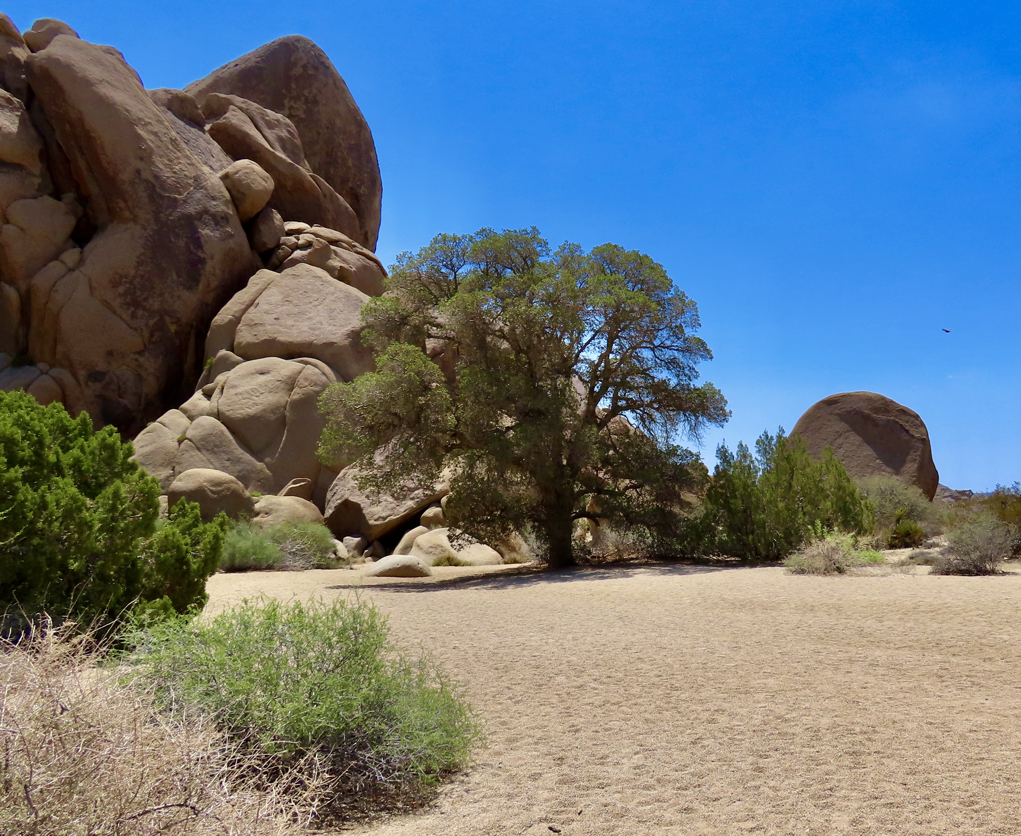
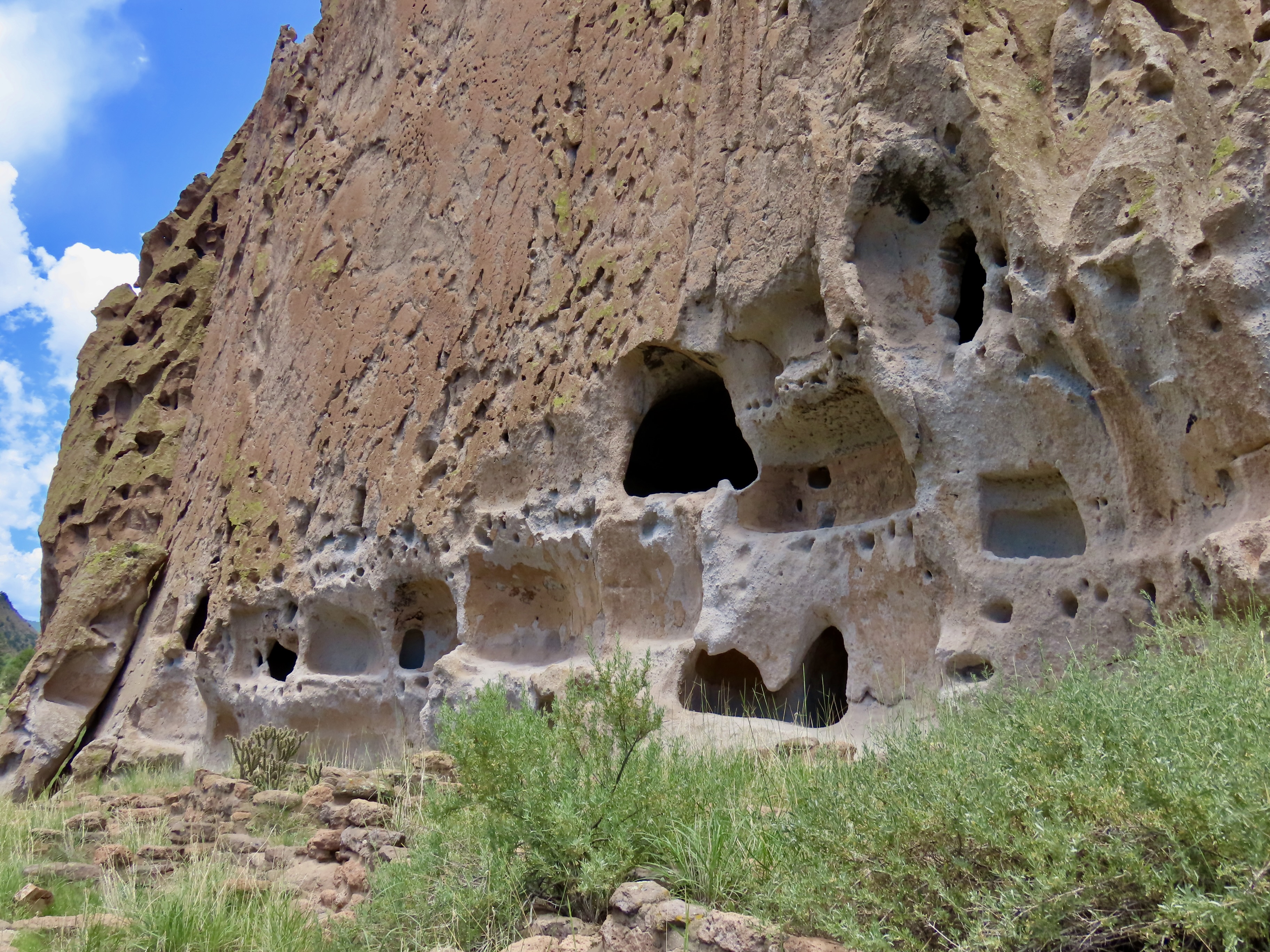
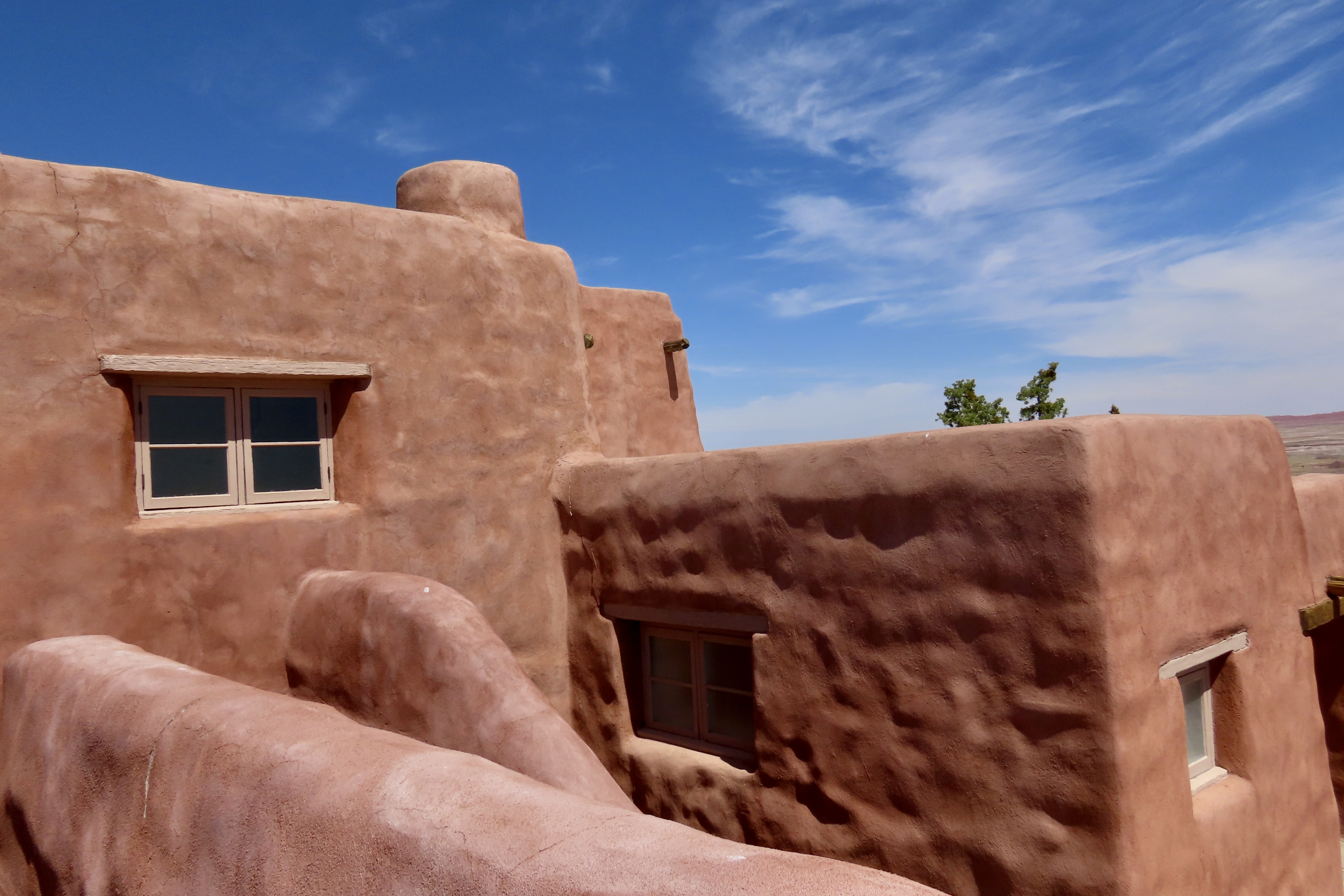
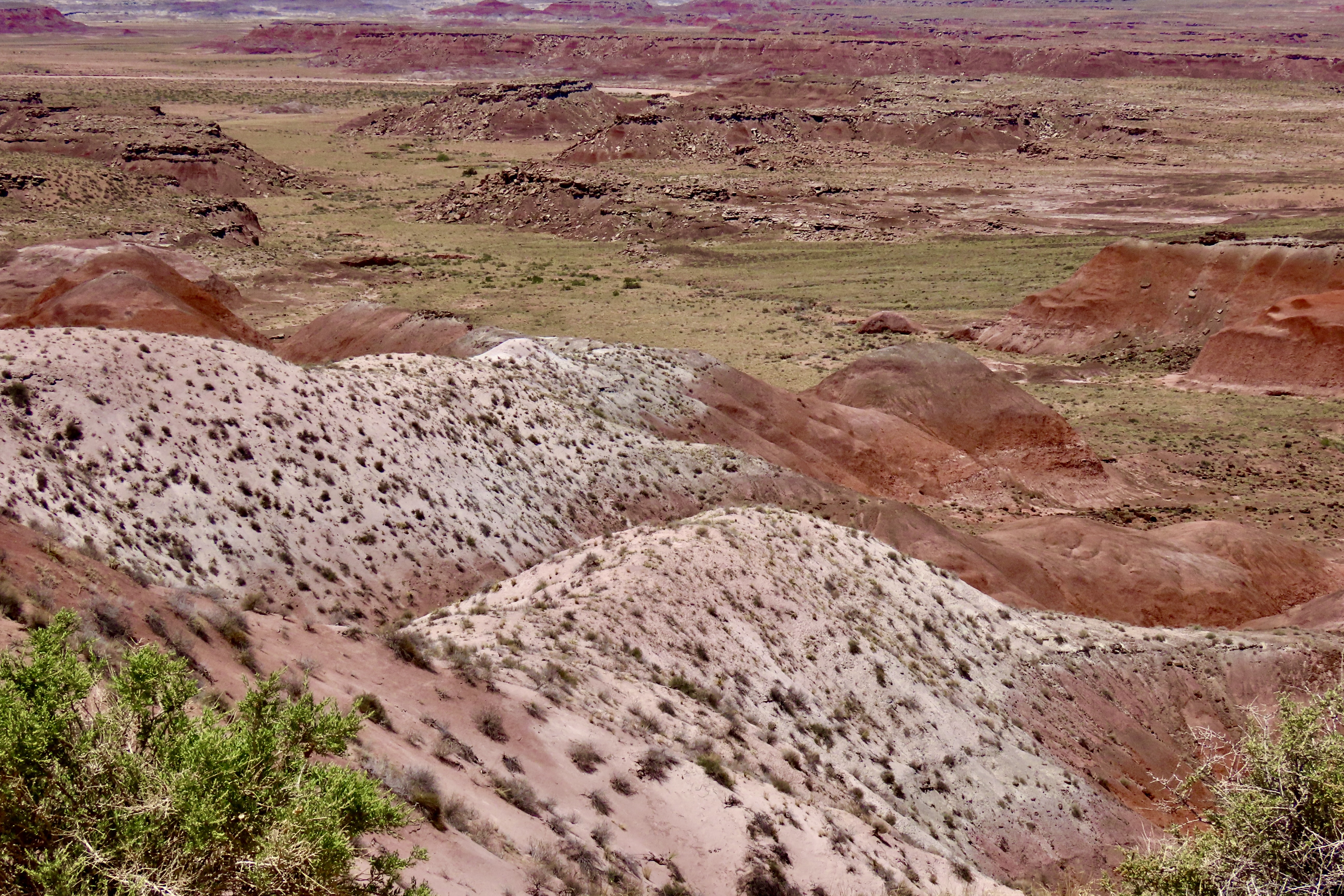
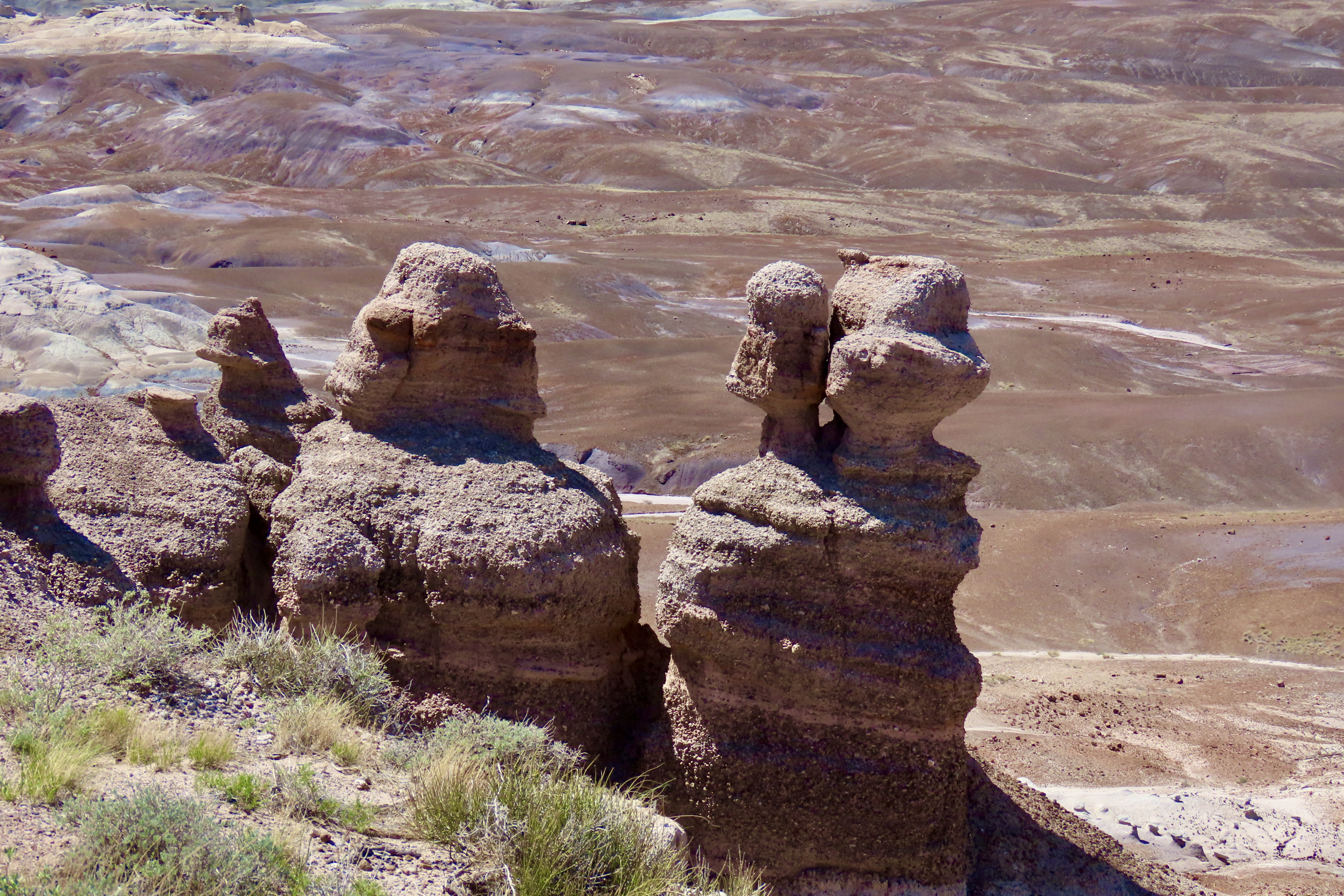
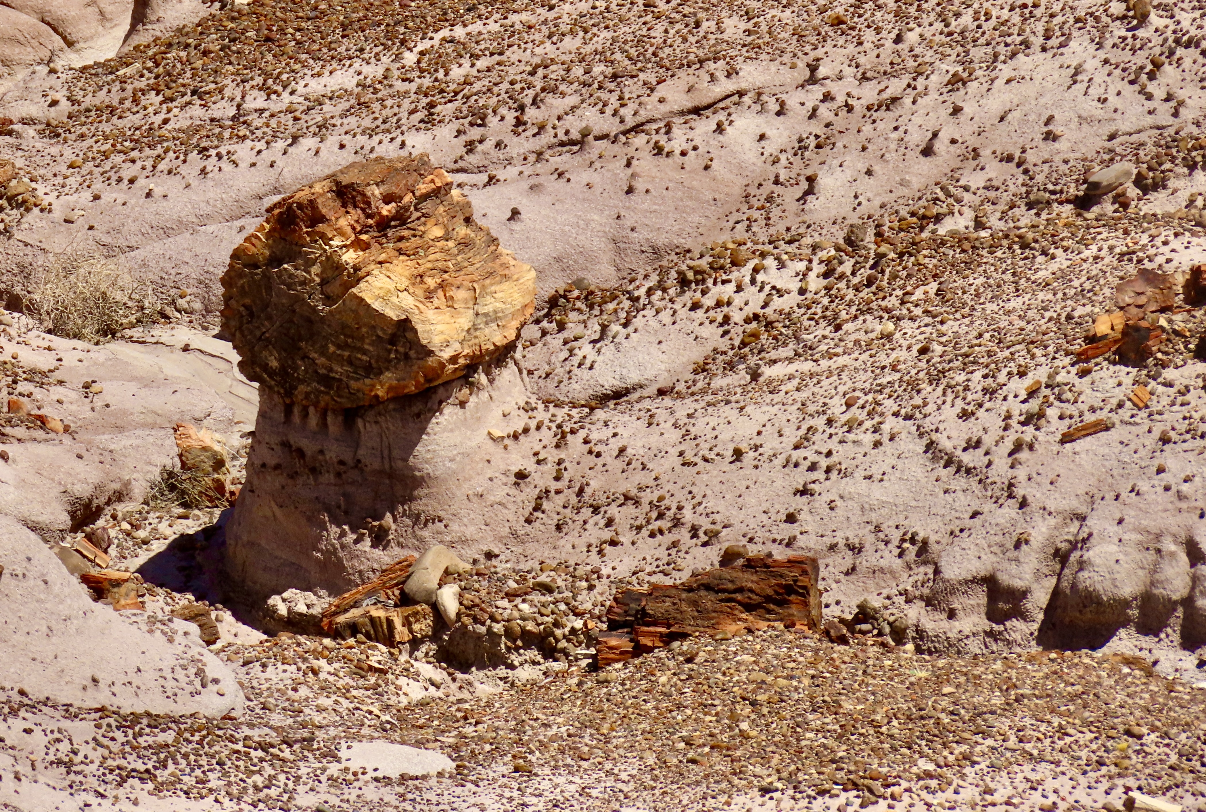
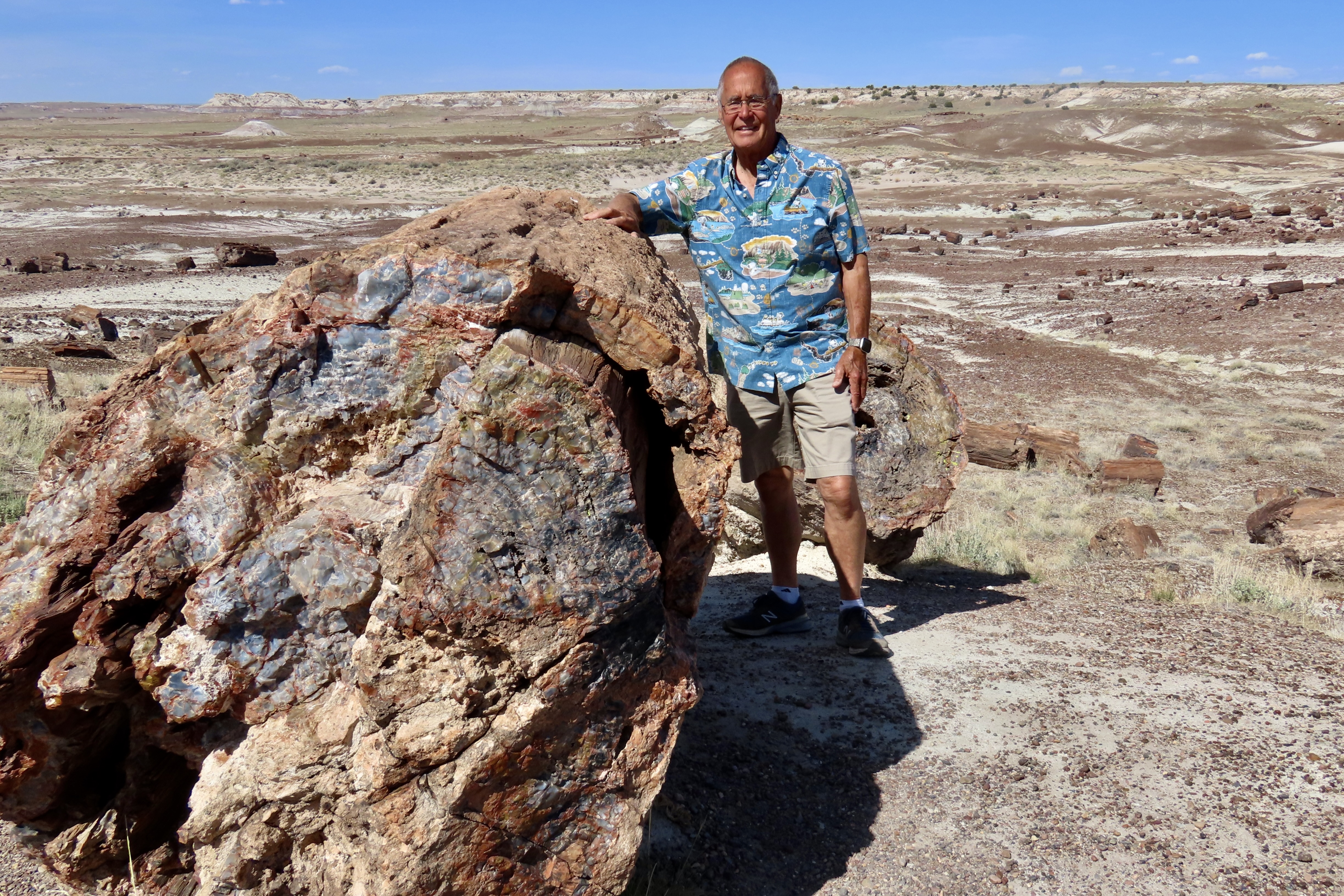
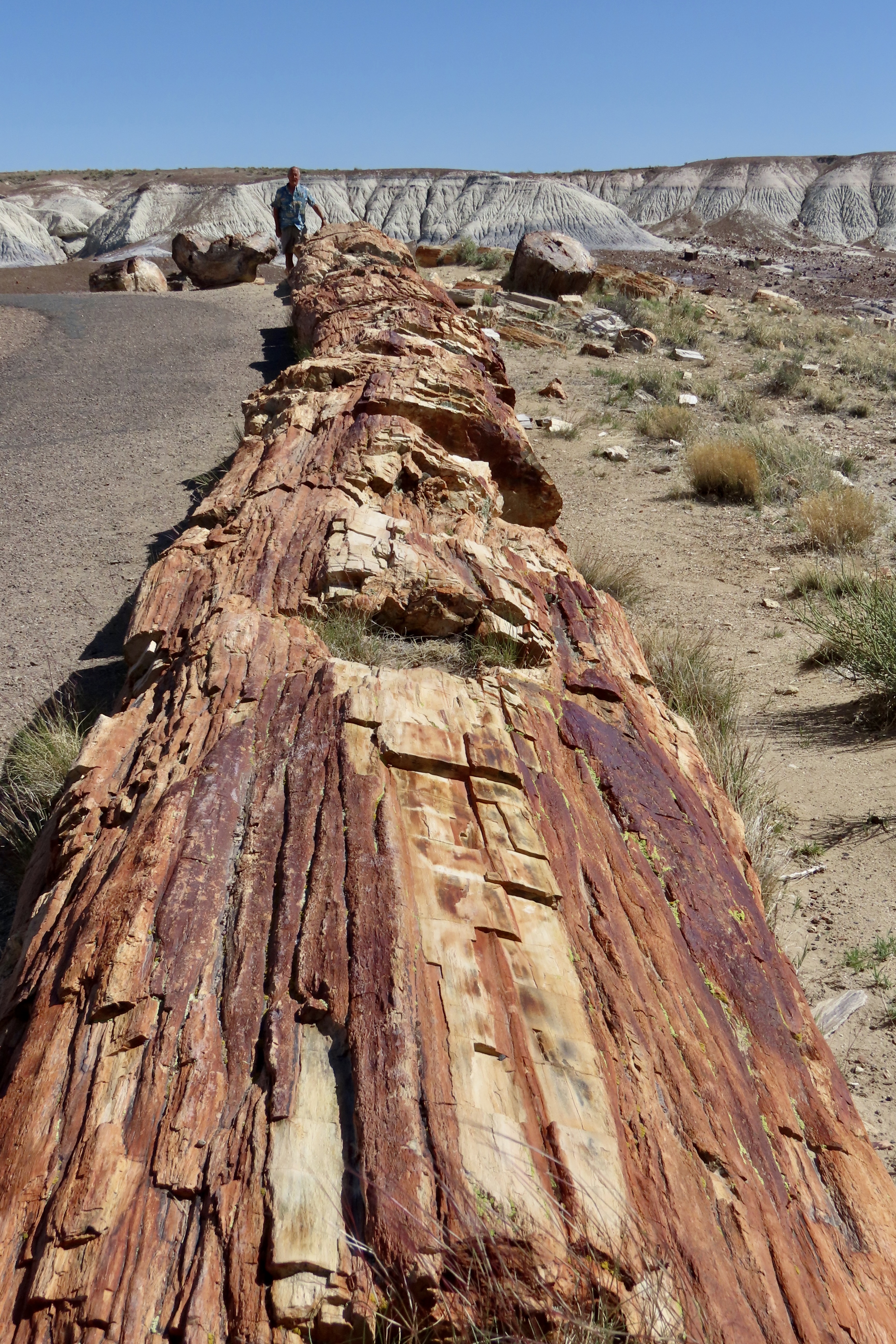
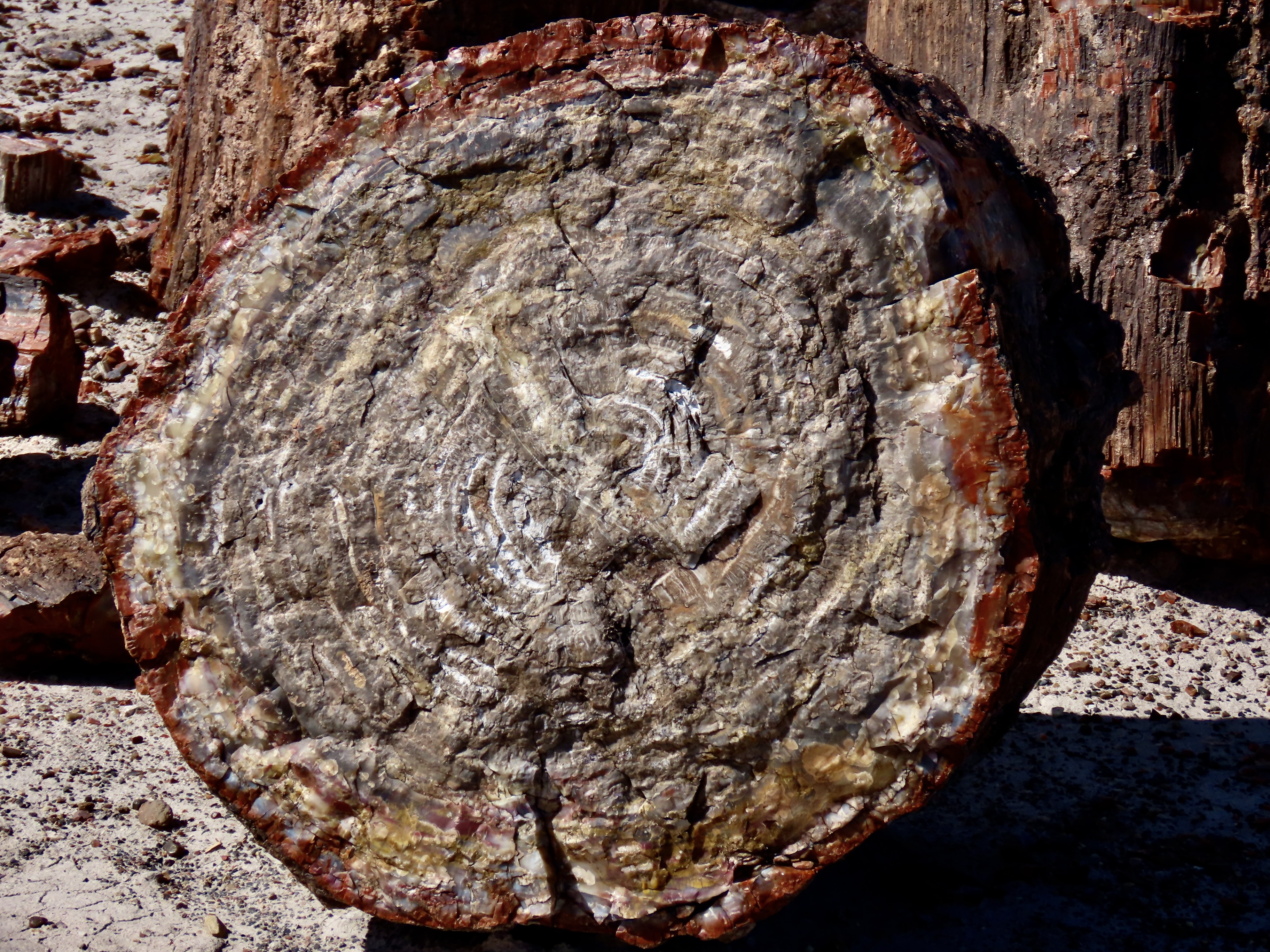
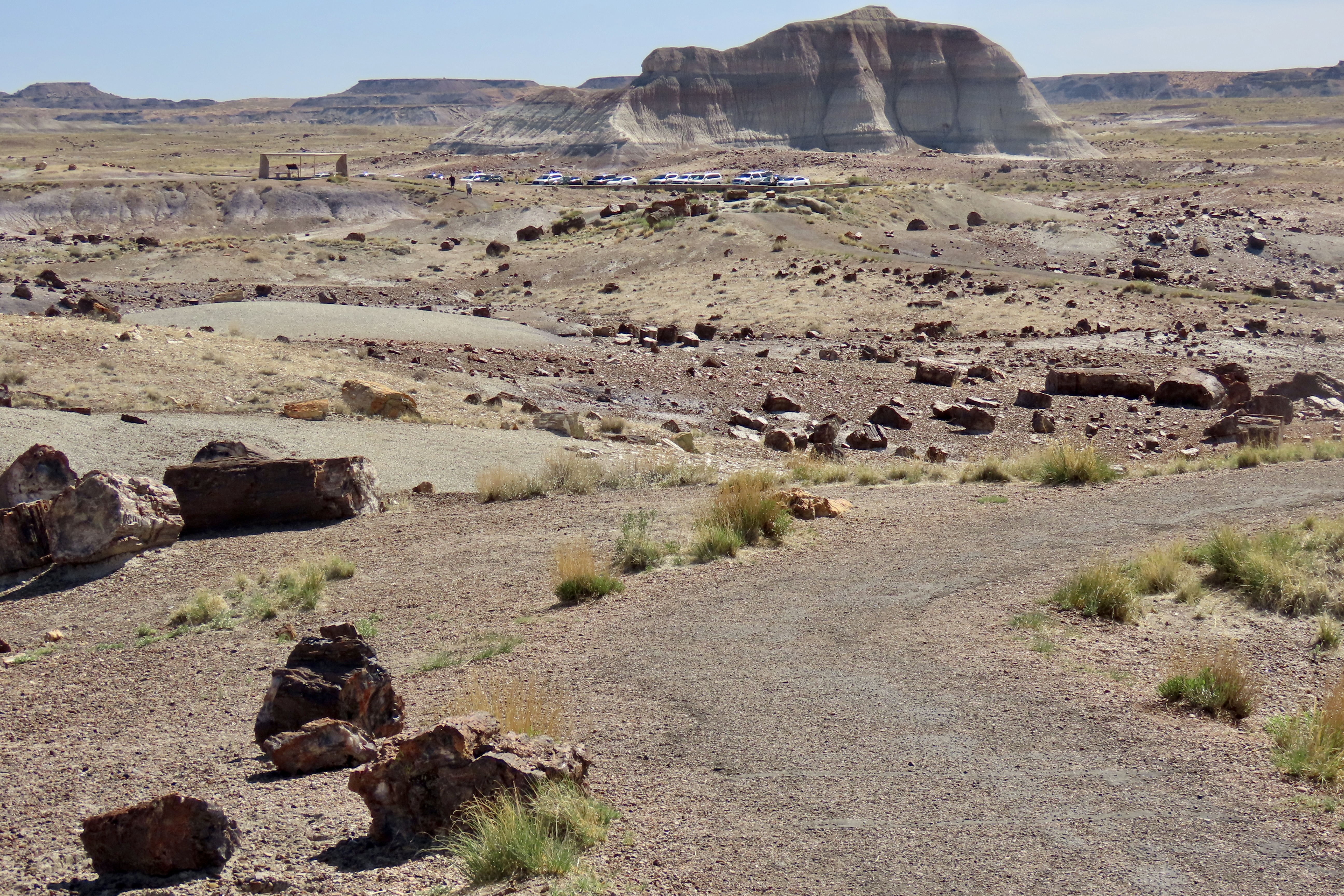
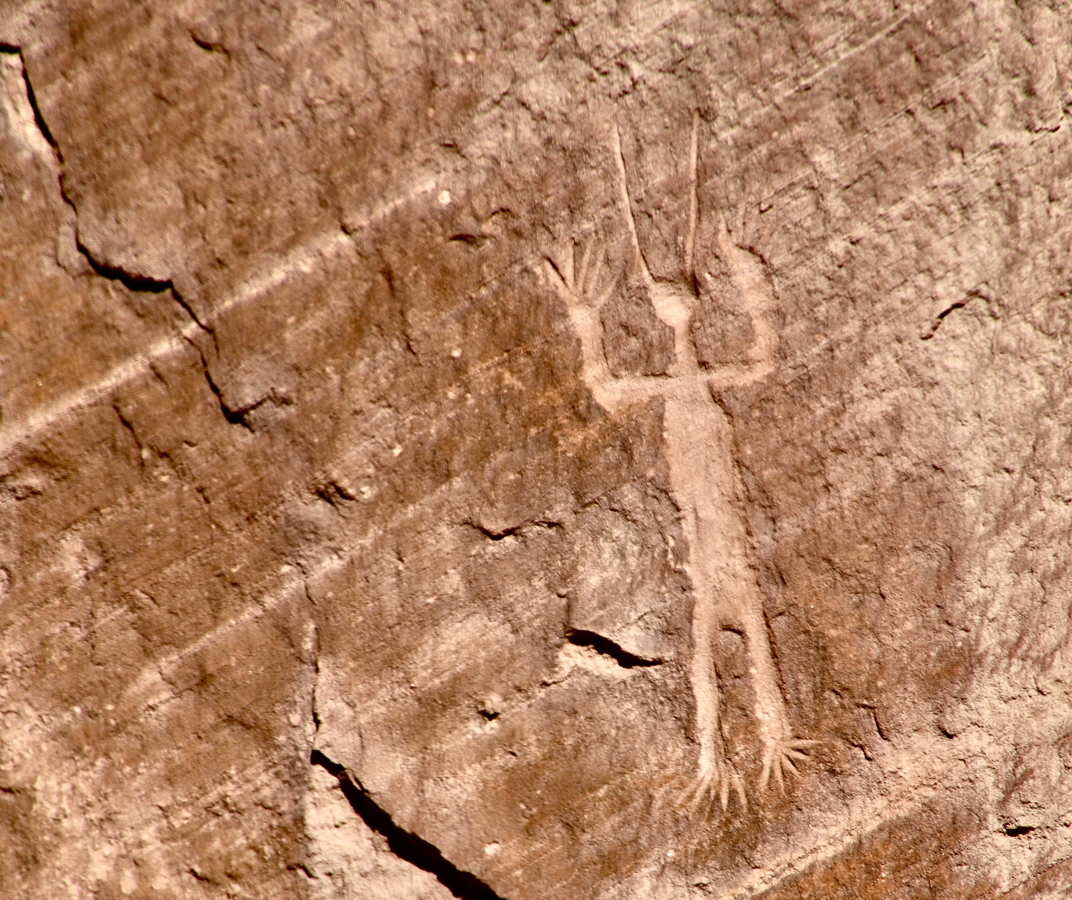
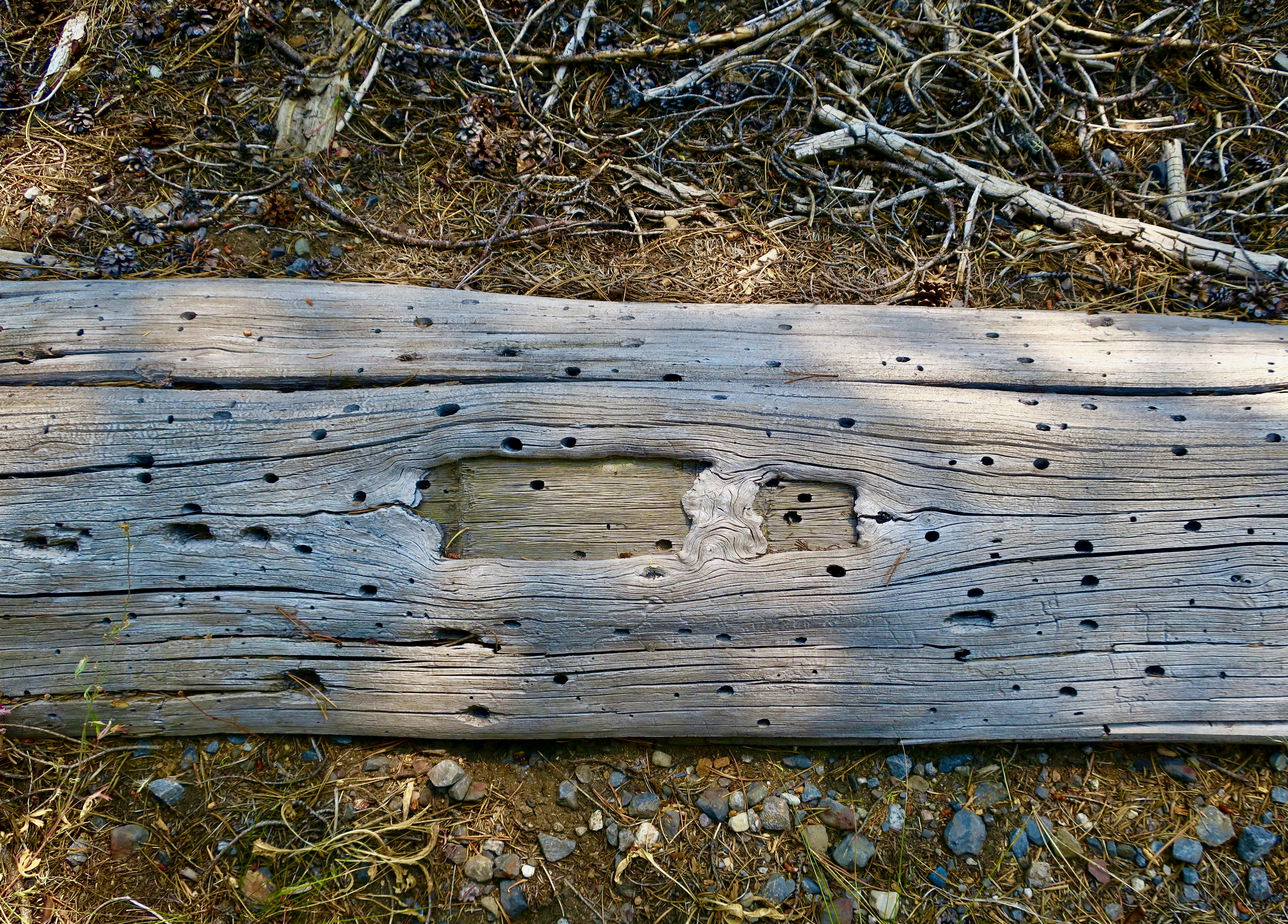
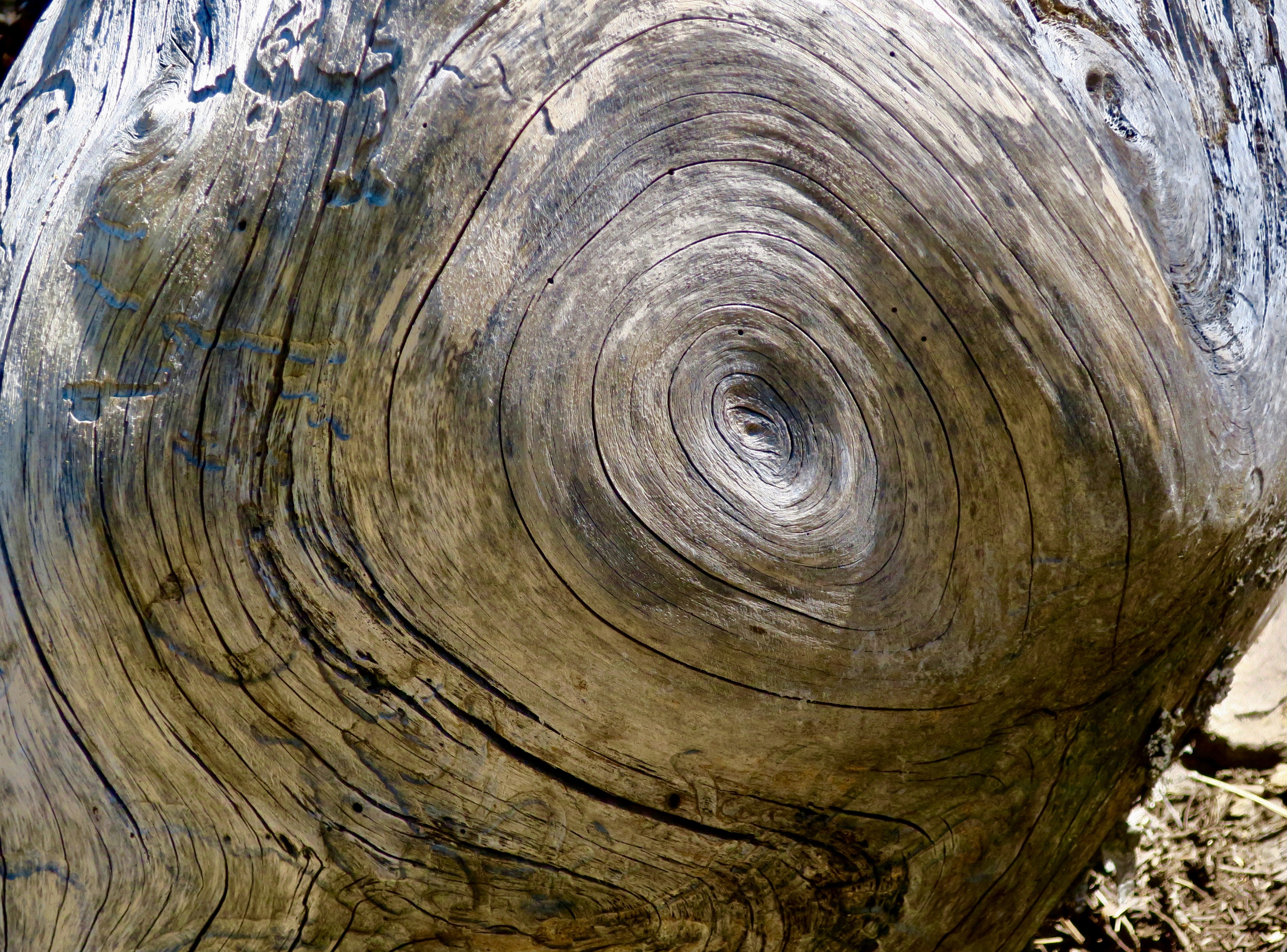
Petrified Forest National Park is found just off of I-40 in eastern Arizona. There are thousands of logs like the one above found in the park. You can still see the bark on this petrified wood that was once a tree that fell 200 million years ago.While most people come to the park to admire the petrified wood, there is also much beauty such as the colorful ‘Teepees’ found on the main road. Each color has a different story to tell representing millions of years in geological history.The Blue Mesa side road includes many other interesting and colorful land forms such as this. If you visit the park, be sure to take the short detour. A walk out in the desert on well maintained trails is definitely in order.Ancestral Puebloans and other indigenous tribes left a view of their ancient world in Petrified Forest NP in petroglyphs on Newspaper Rock. While our understanding of what they were communicating is limited, there is magic in contemplating the possibilities.While we are on the subject of petroglyphs, we found this unique one staring out at us in Petroglyph National Monument in Albuquerque, NM. Over 20,000 petroglyphs have been discovered in the monument. Peggy has plans to include this one in the revision of her word search book: Artistic Word Searches, Unique and Magical: Discovering Petroglyphs from the Southwest.Canyon De Chelly (pronounced shay) is located in northeastern Arizona. Jointly operated by the Navajo Nation that owns the property and the National Park Service, Canyon De Chelly features striking canyon views plus Ancestral Pueblo ruins and petroglyphs left behind by both the Pueblo peoples and Navajos.Our trip this past spring and summer took us into Califonia where we visited family and friends in San Diego, LA, and Sacramento. We also took time to visit Joshua Tree National Park in Southern California, known for its strange trees, after which it is named.We found the rock structures to be of equal, if not greater, interest. Some of which could be said to possess personalities.In addition to being known for its outstanding rock forms (think of the Grand Canyon, Zion, Bryce and Arches— plus what we visited this year), the Southwest is noted for its deserts and cacti, none of which is better known than the Giant Saguaro. We’ve often stopped to admire these huge plants in Saguaro National Park but have never been in Arizona when they are blooming. Things were about to change. Note the buds popping out on top of the arms.This time we were lucky. The blooms are almost other-worldly, in addition to being a source of food for numerous insects such as the bee coming in for a landing.A number of other cactus flowers also lit up the desert.Like plants, animals adjust to the deserts of the Southwest. Several birds choose to nest among the needles of various cacti including the curved bill thrasher Peggy found raising her family in a cholla cactus. The thrasher was not happy when she sneaked up to it and her hatchlings to catch a photo with her iPhone. It’s probably a good thing Peggy couldn’t understand what momma was saying.Bandelier National Monument, located mere miles away from where the first atom bomb was created at Los Alamos, New Mexico, features the ruins of homes built by Ancestral Puebloans that included natural and carved caves (cavates) with pueblo structures once built up against them.Peggy and I climbed up to one of the cavates. It was quite cozy inside. “Honey, I’m home.”Just beneath the cavate, this outcropping of rocks overlooked the large Tyuonyi Pueblo at Bandelier. A corner of the ruins can be seen here. It was built in a circle and contained contained 400 rooms.This tall rock was among the rocks in the outcropping. My first thought was wow! Nowhere in our travels though out the Southwest have we seen a statue like it carved by Ancestral Puebloans or any other indigenous tribes. We had a guide to the trail we were walking on, but there was no information on the statue. Nor was there anything in the information center. The emphasis was all on the scenery, cavates, petroglyphs and pueblos. Human or nature carved, I would think that the park’s literature would at least comment on it. That’s it for today. Next up:We wrapped up our year of travel with out trip to New England so it’s proper that we finish off 2025 with the trip.
Happy New Year to everyone and thanks for joining us on our adventures in 2025. It’s much appreciated. Costa Rica, Bali, and Scotland are coming up in 2026! Curt and Peggy
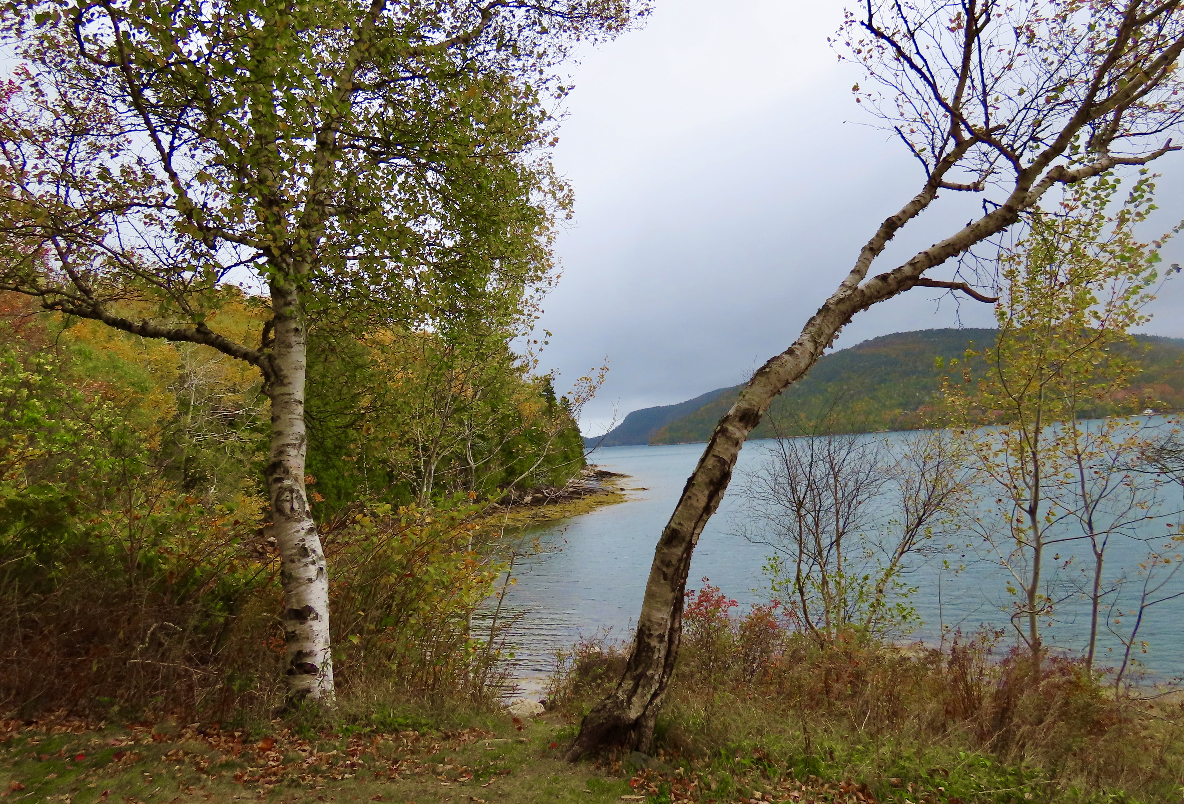
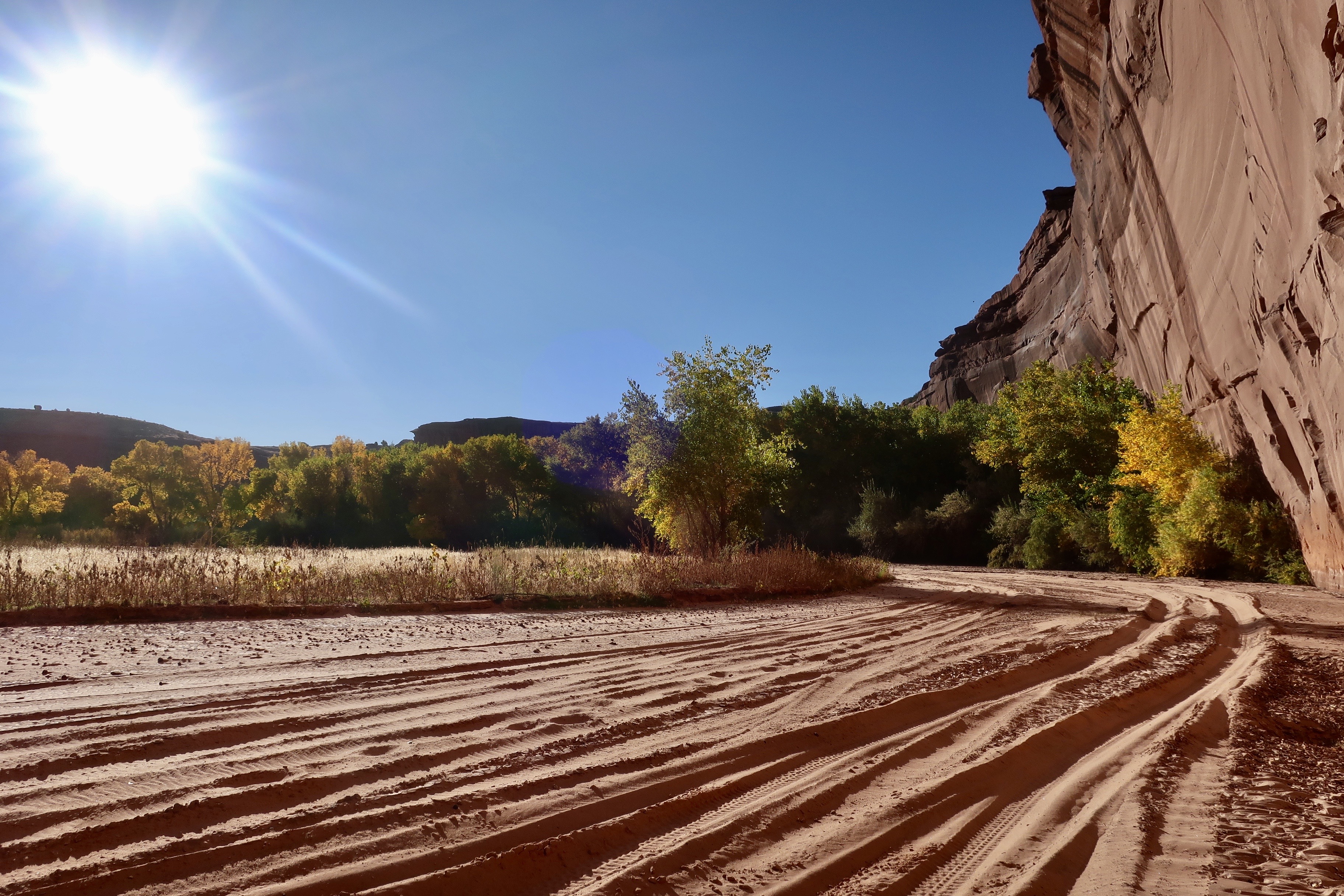
Whatever the sun was up to here, other than being the sun of course, its selective lighting created a colorful photo op that Peggy and I could not ignore— even though it involved fitting our long F-150 into a space it was clearly not designed for. “Good job!” I told Peggy. I was impressed. Had there been some park rangers around, they might have had another opinion. But given the government shutdown, none were to be found. Acadia National Park was packed with leaf-peepers and visitors were on their own. Our infraction was mild in comparison to some we saw.
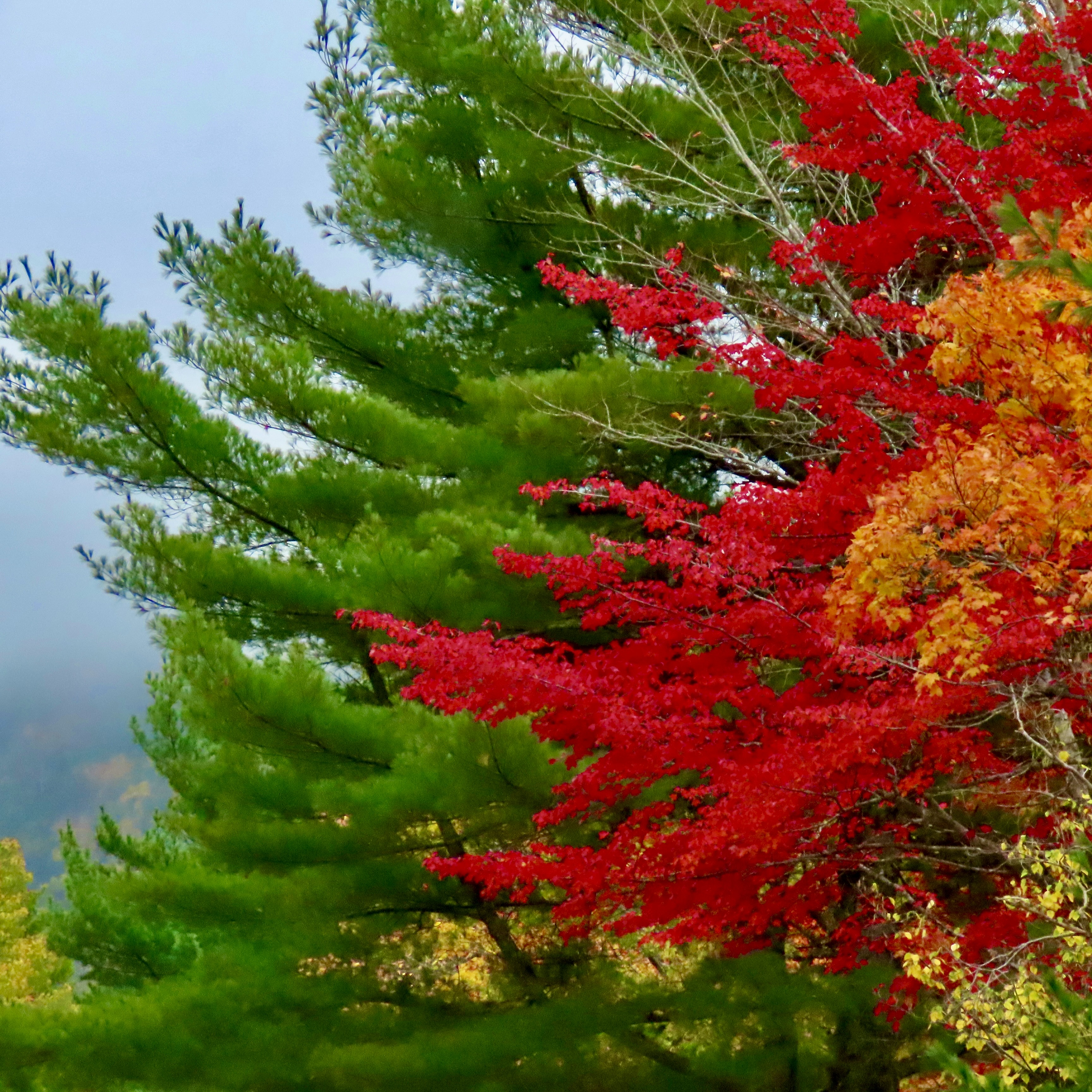
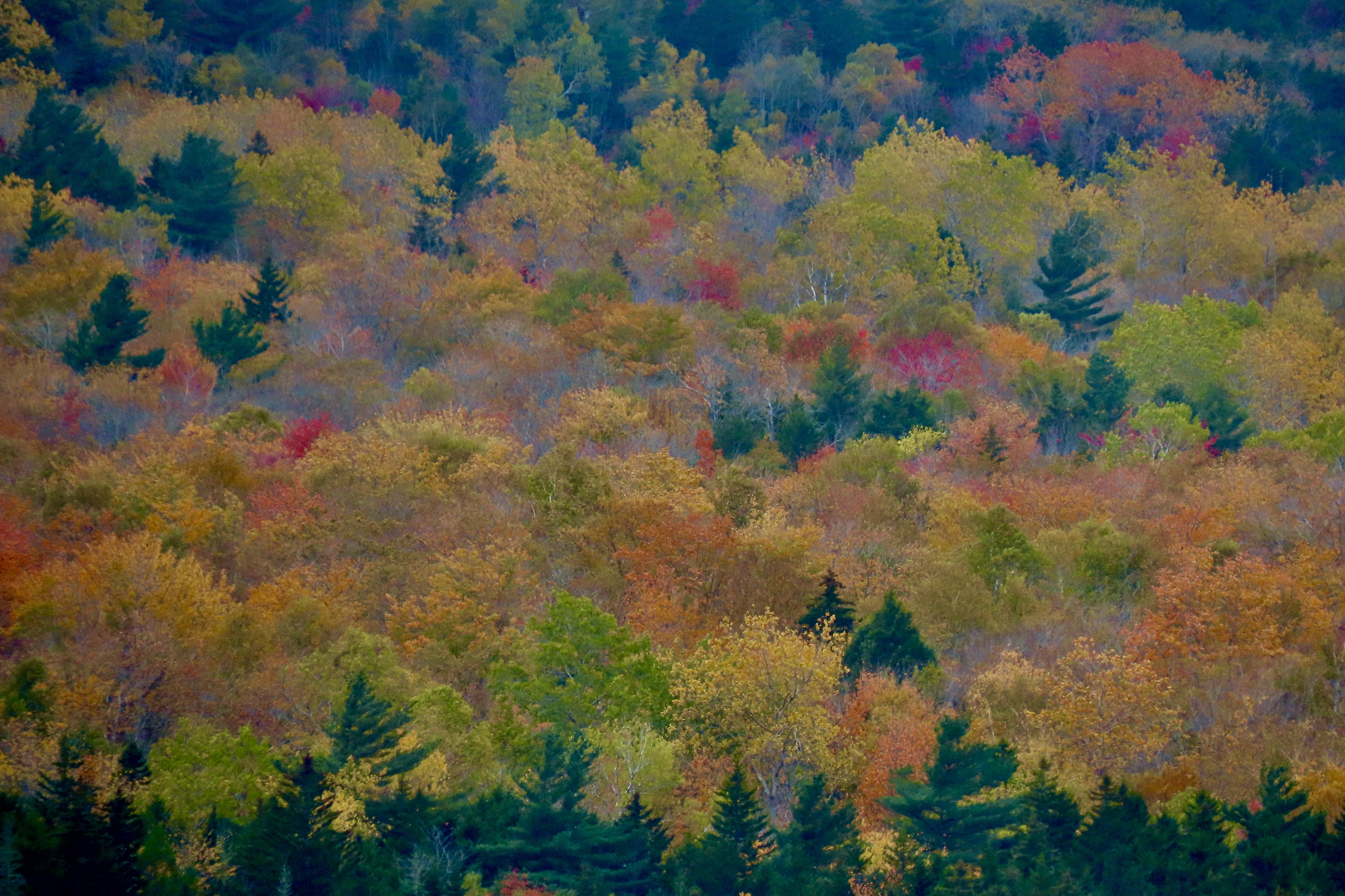
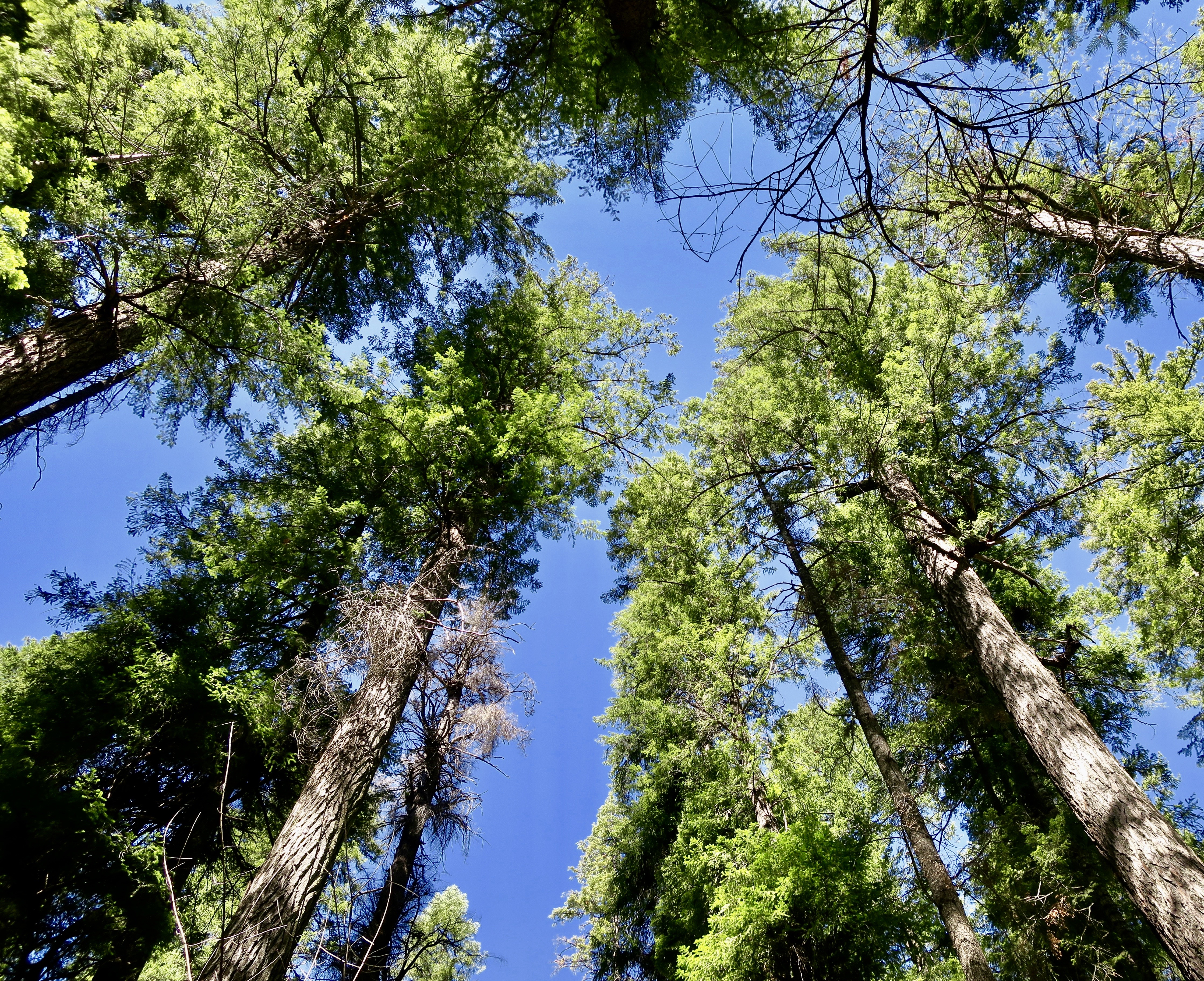
This was our second time visiting Acadia during leaf peeping season. The first took place in 1999 when Peggy and I both took sabbaticals from our jobs to explore North America with a focus on National Parks. (We visited 50.) Before reaching Maine, we had already been enjoying fall colors for three months! Our adventure had started in June with a drive up the Alaska Highway to Alaska. By the time we finished exploring the state, backpacking, and kayaking, it was mid-August. The leaves were already changing. We followed the advent of fall down through western Canada and across the northern tier of midwestern states to Maine. It was color the whole way. And It continued for another 2000 miles as we traveled down the Appalachian chain of mountains into Georgia.
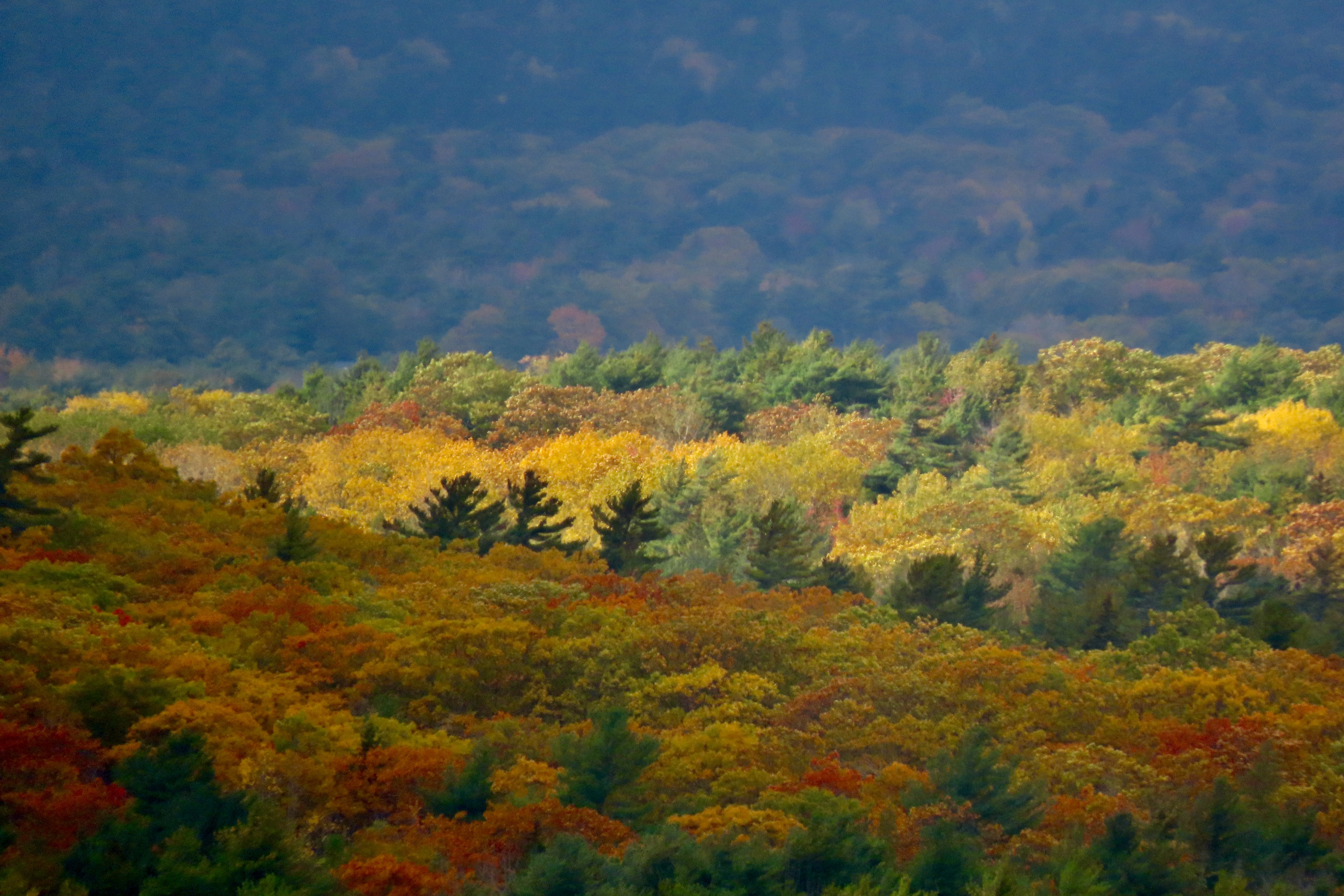
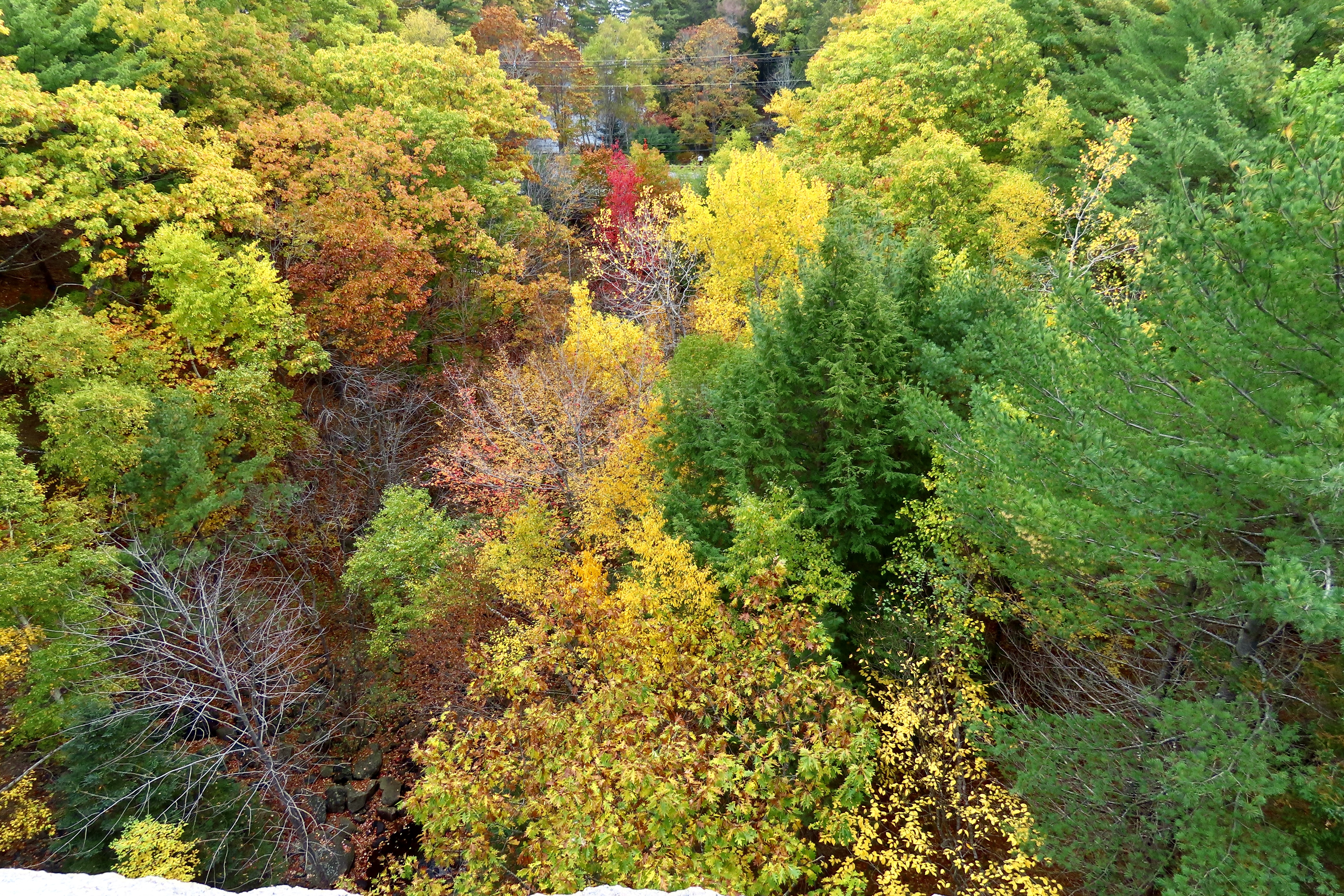
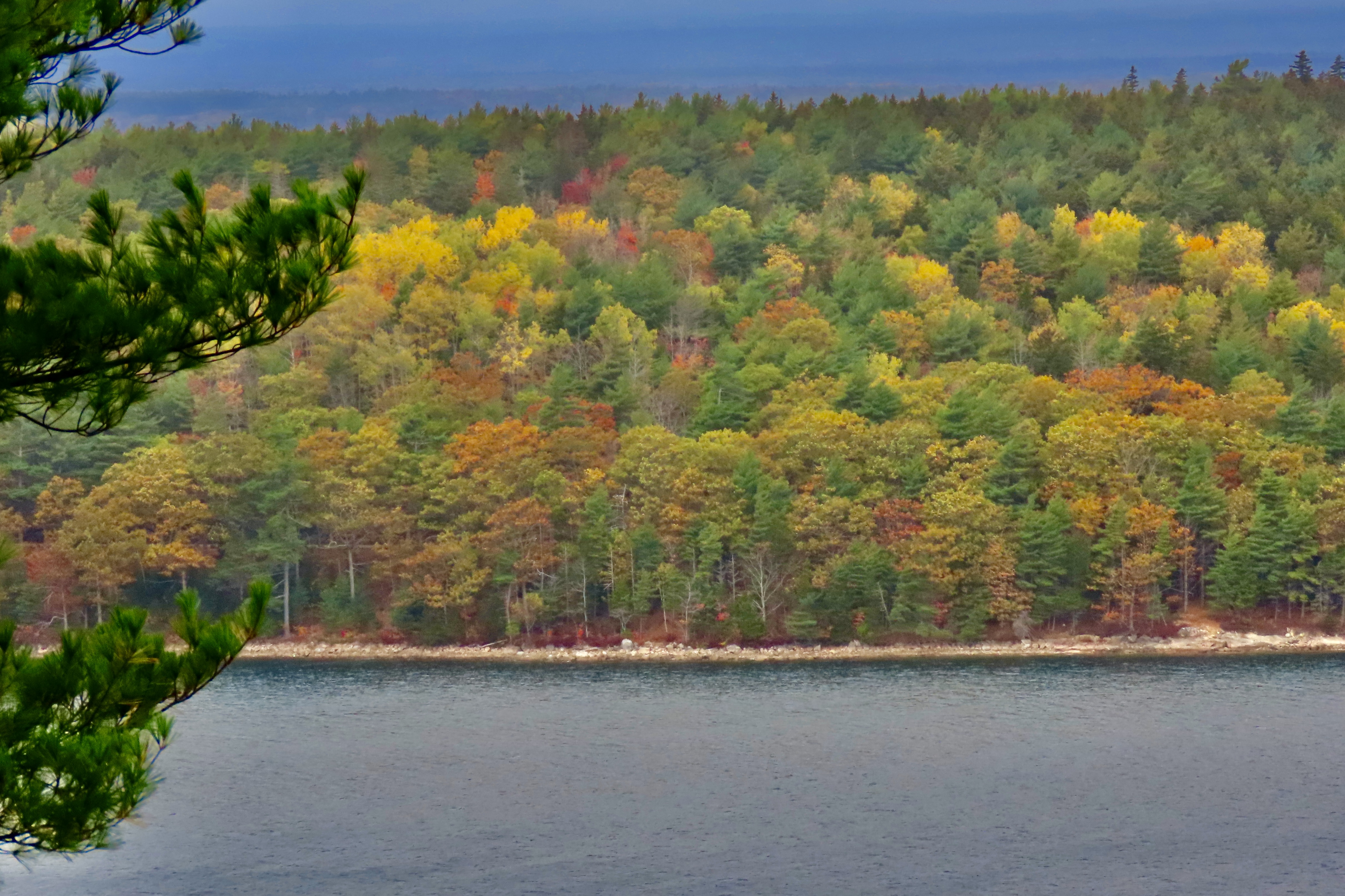
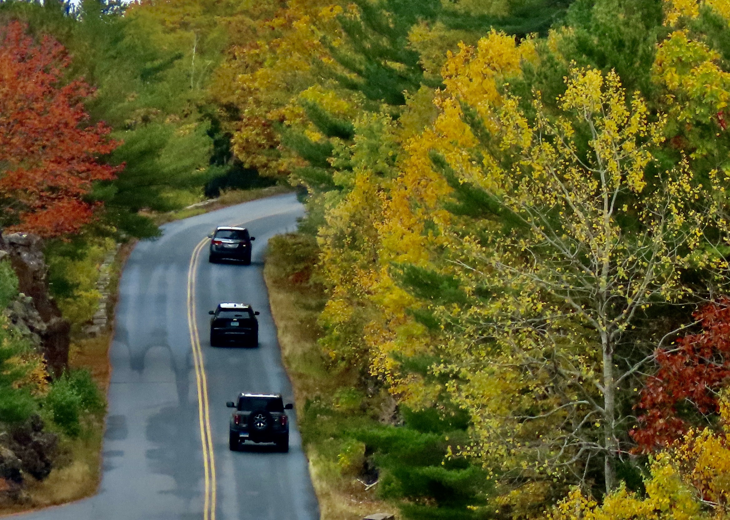
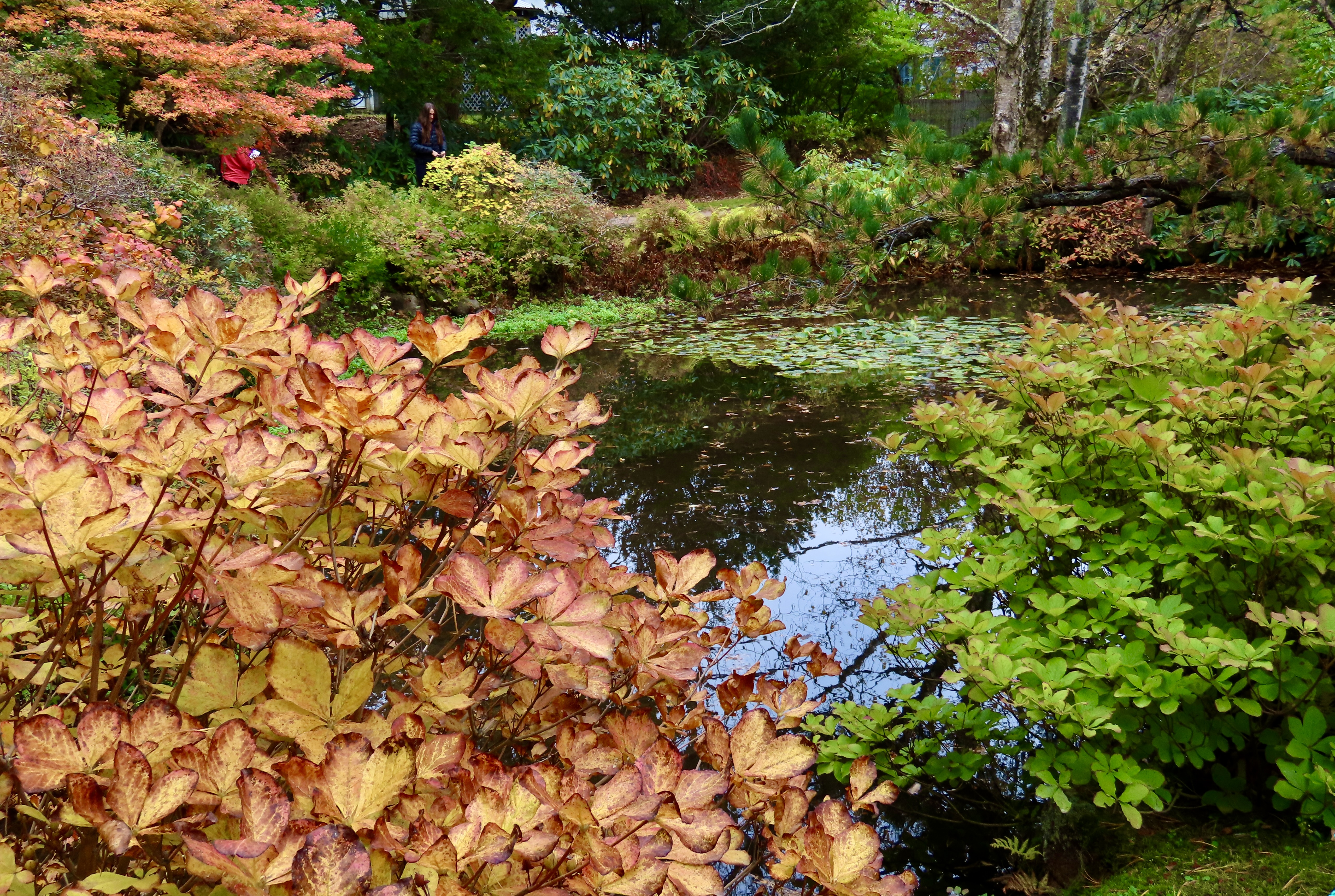
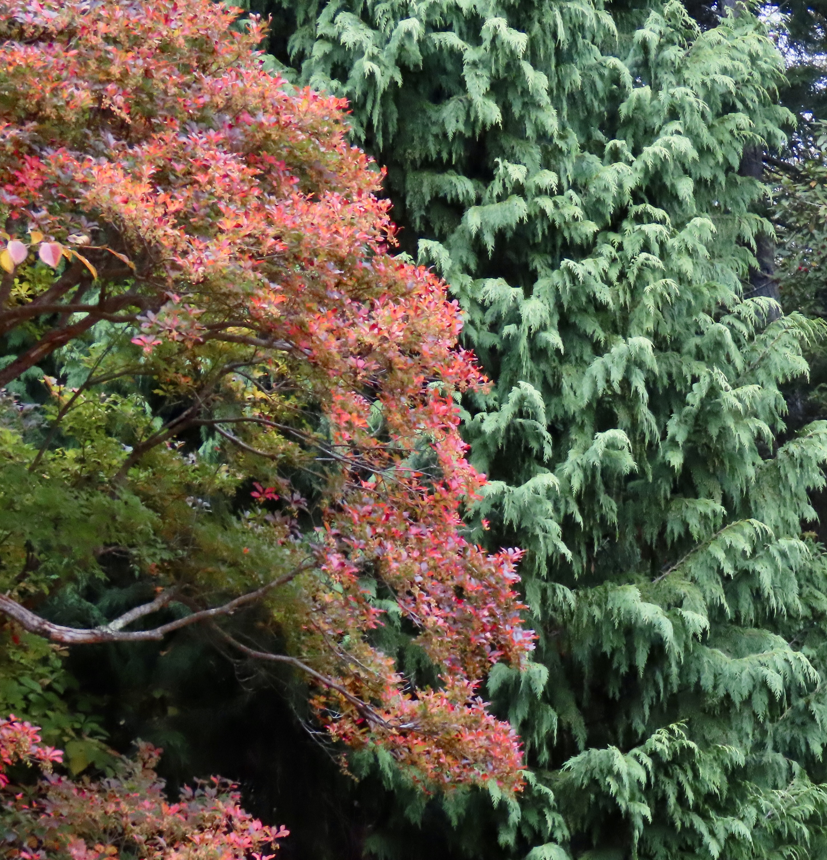
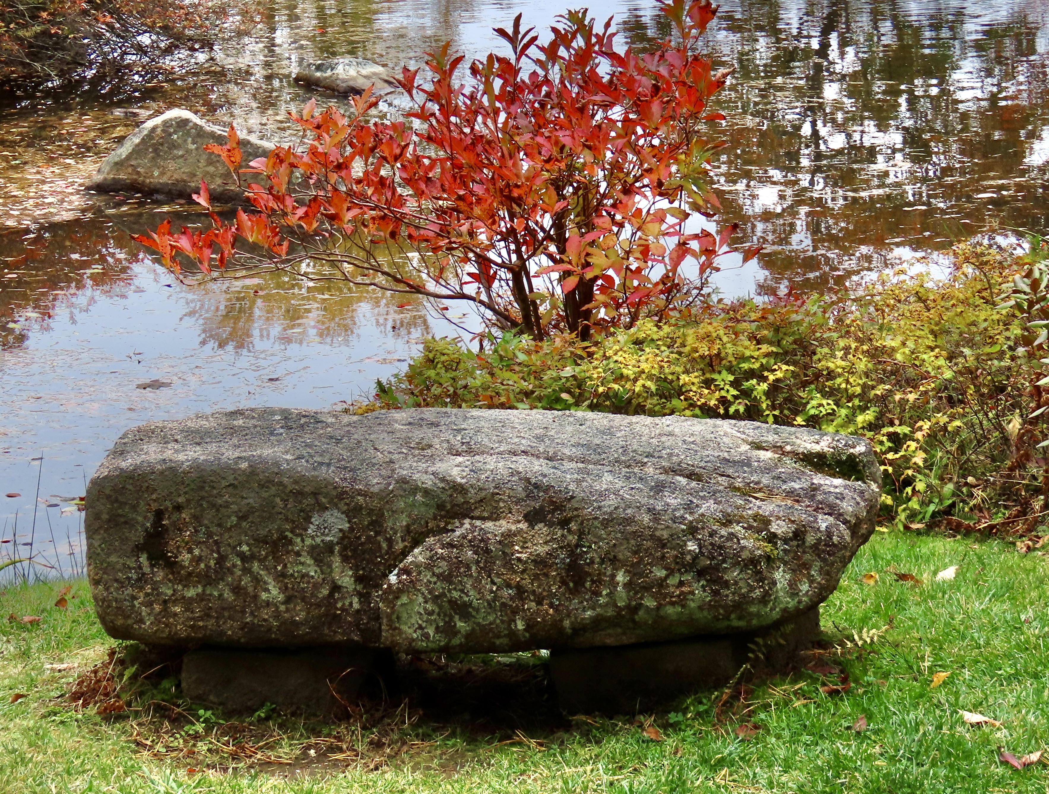
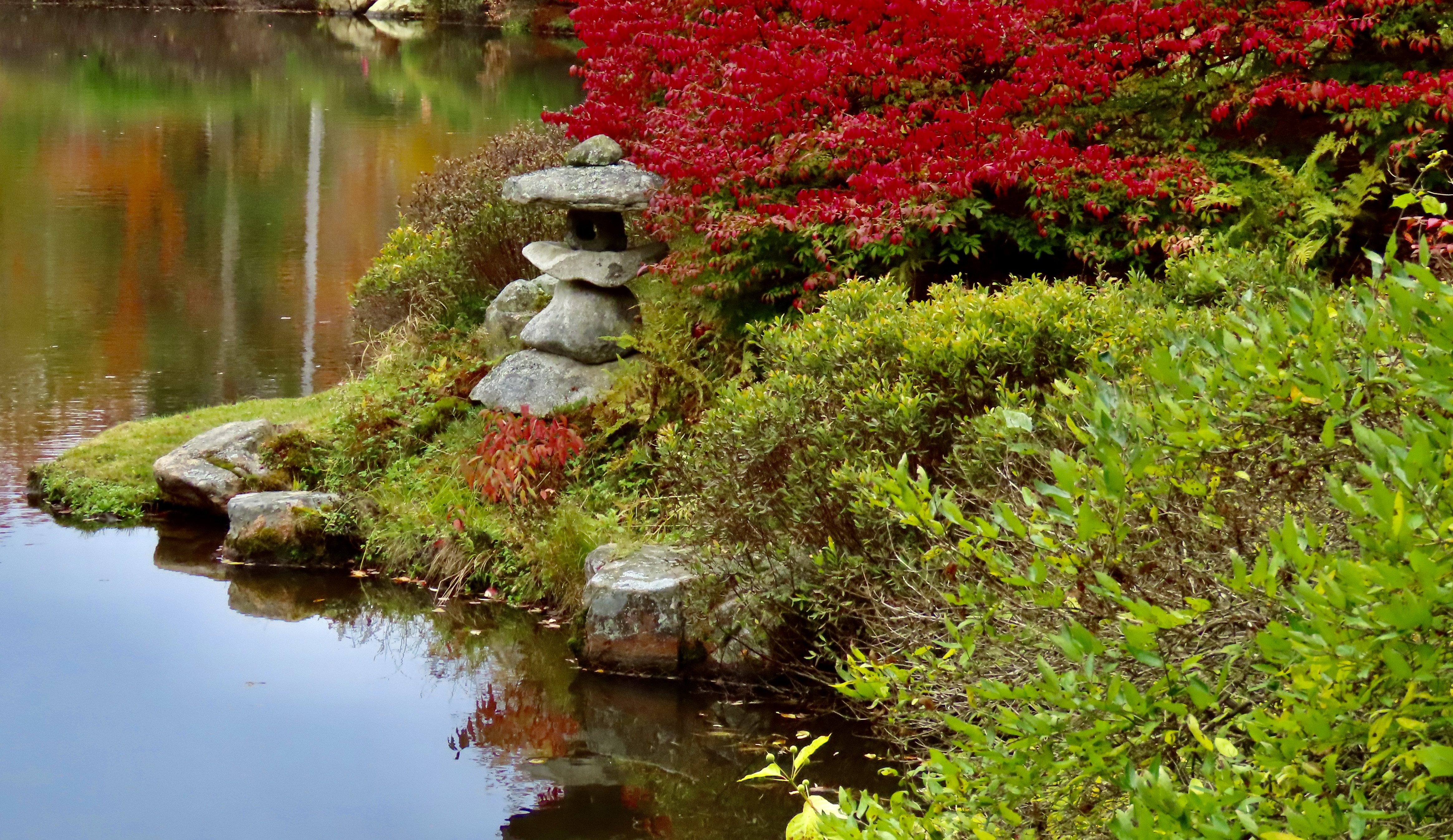
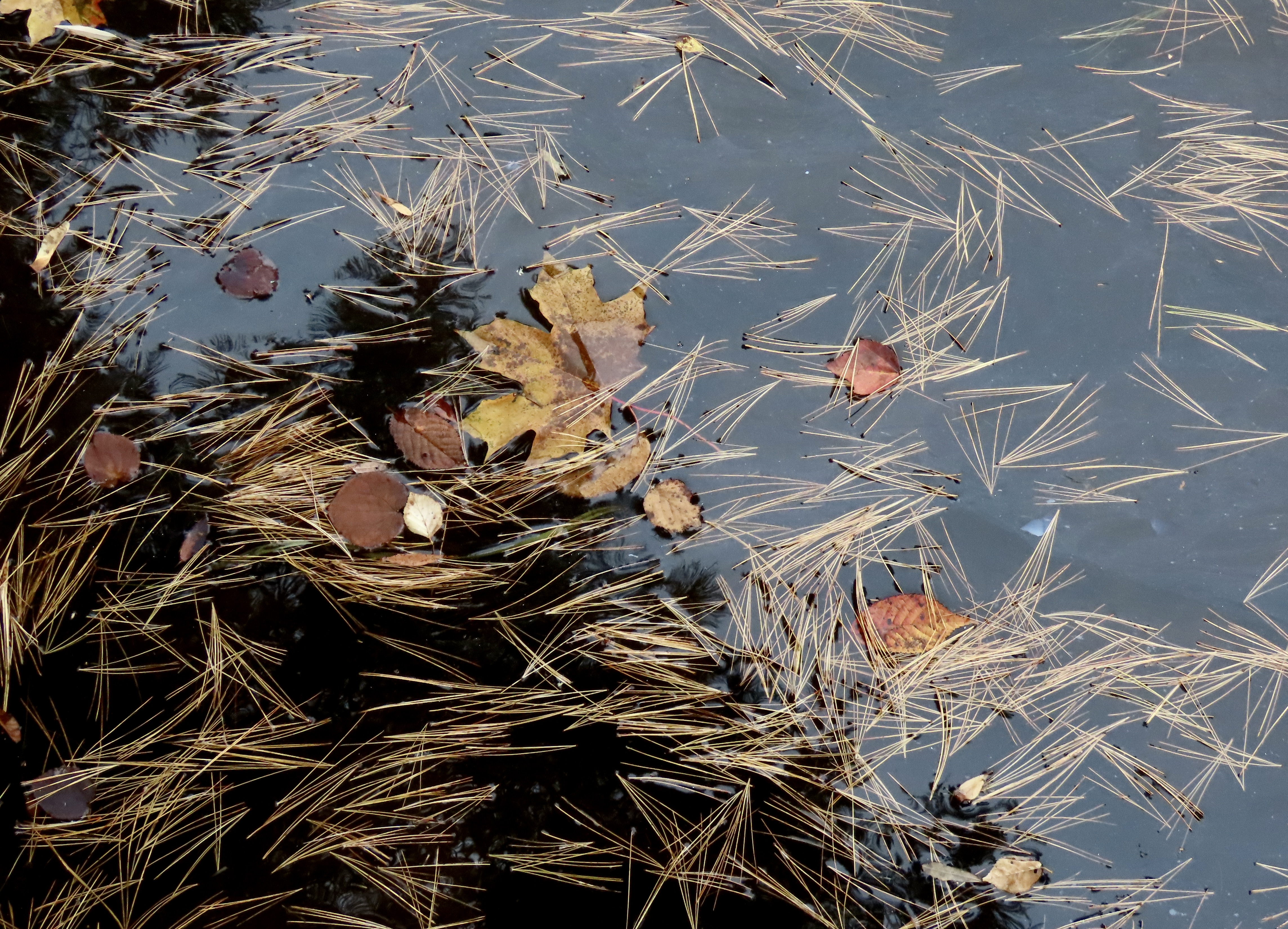
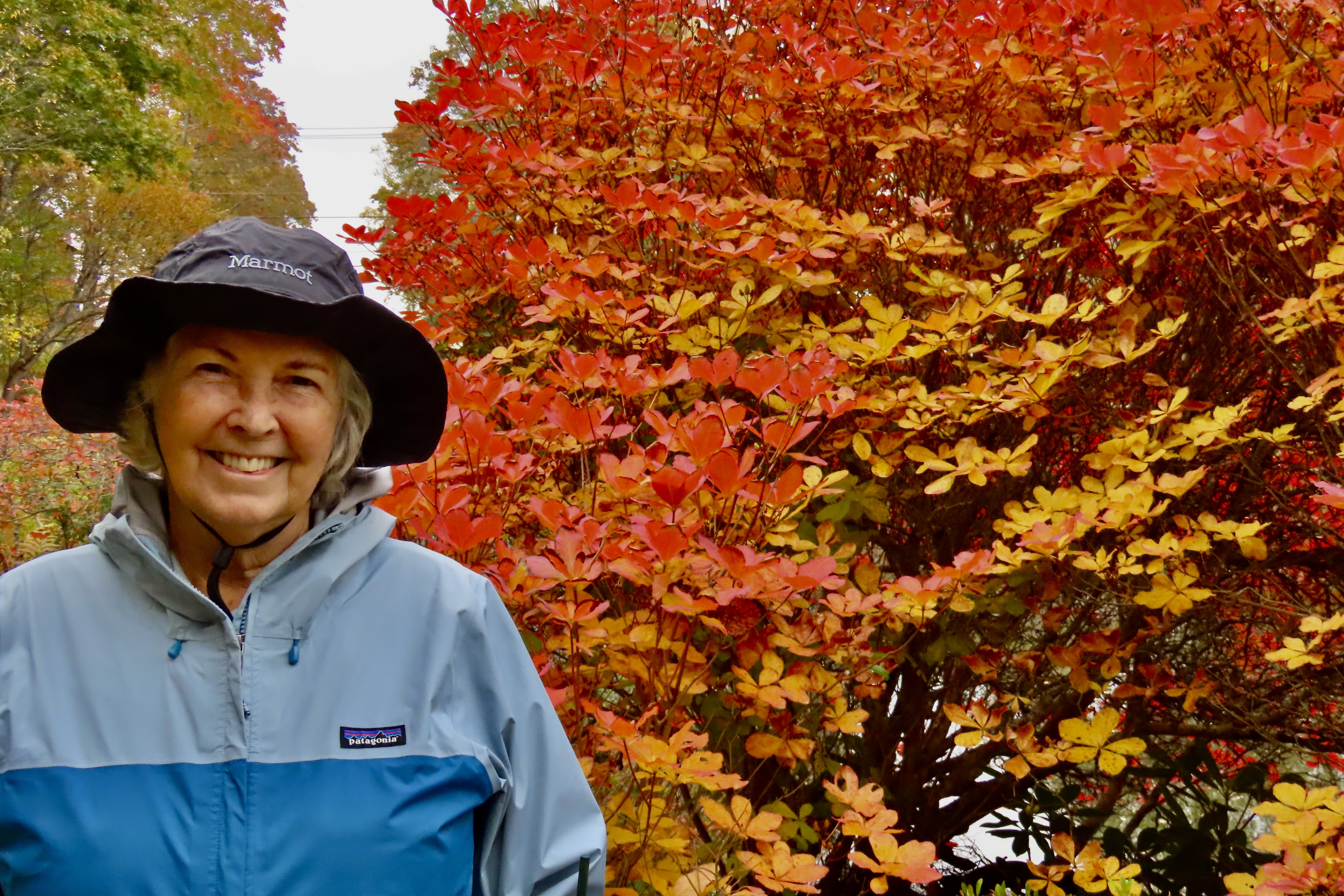
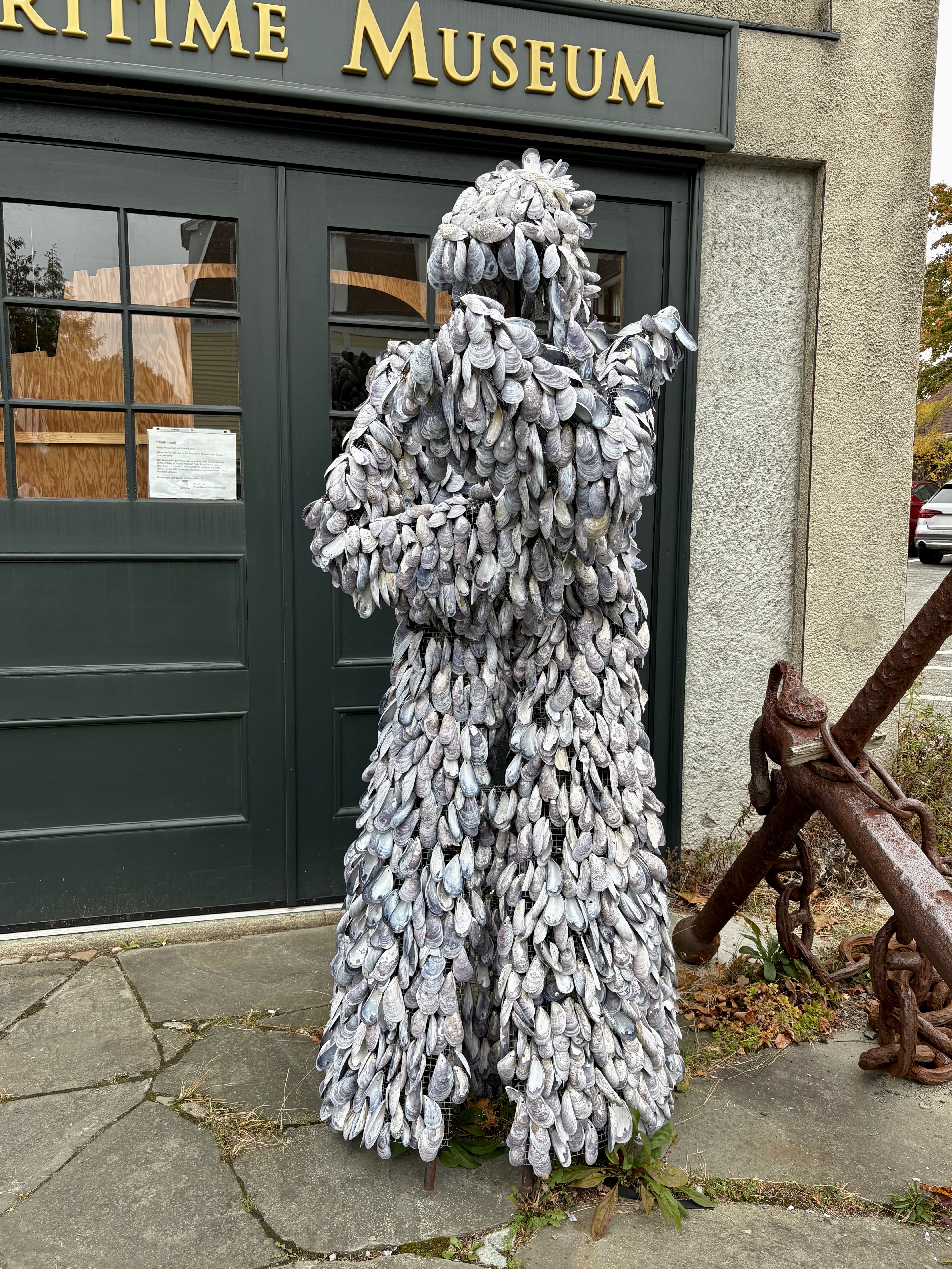
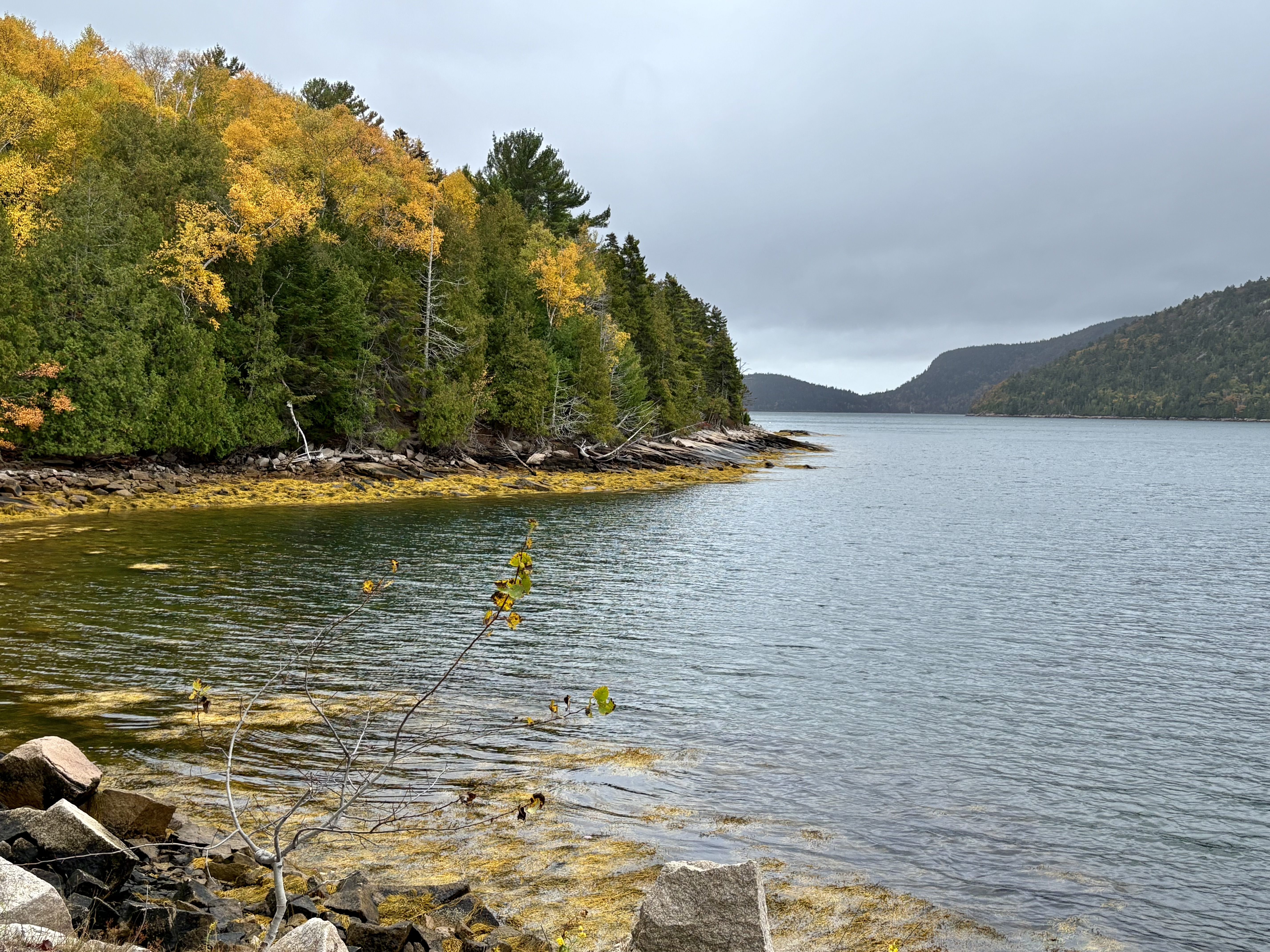
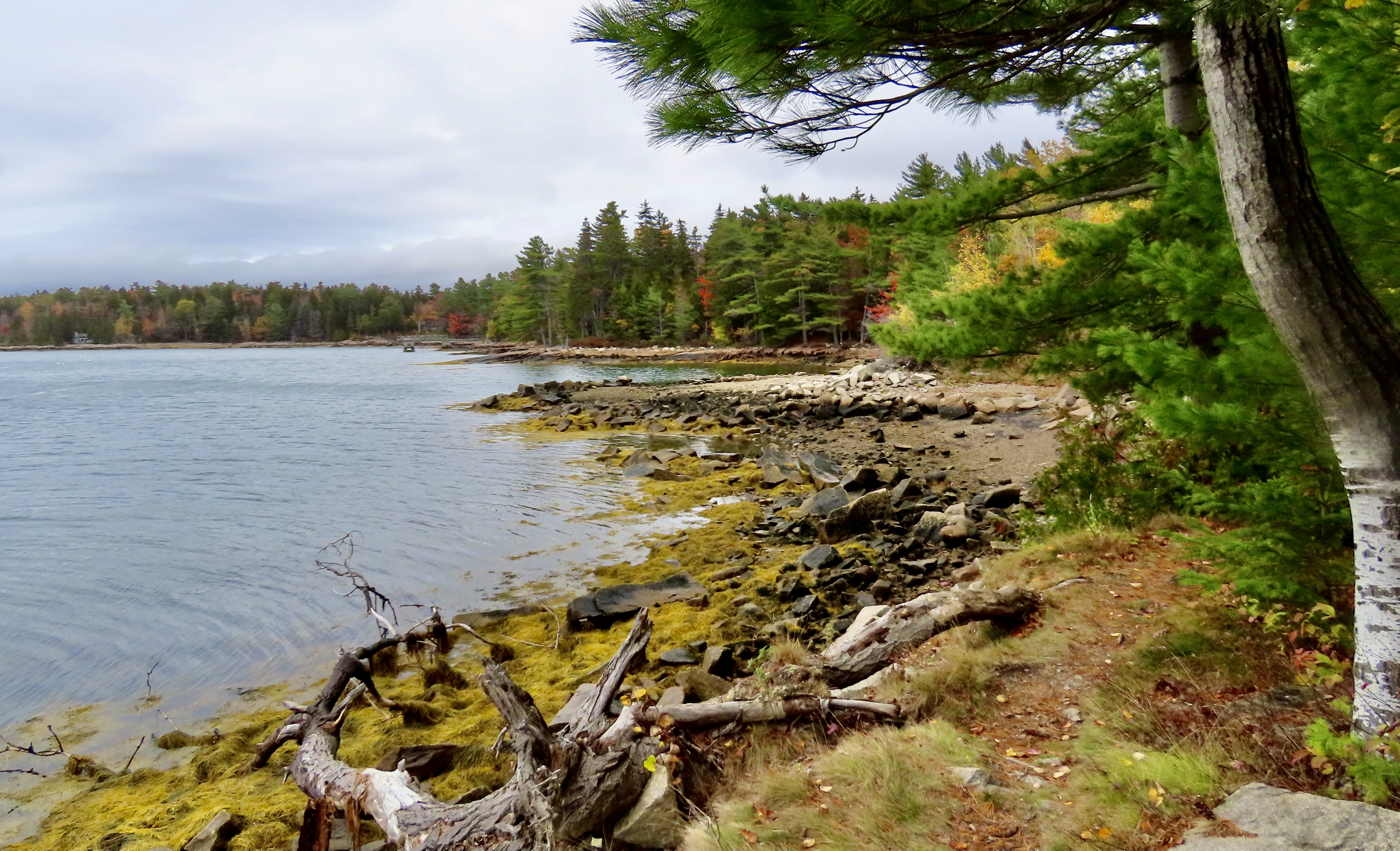
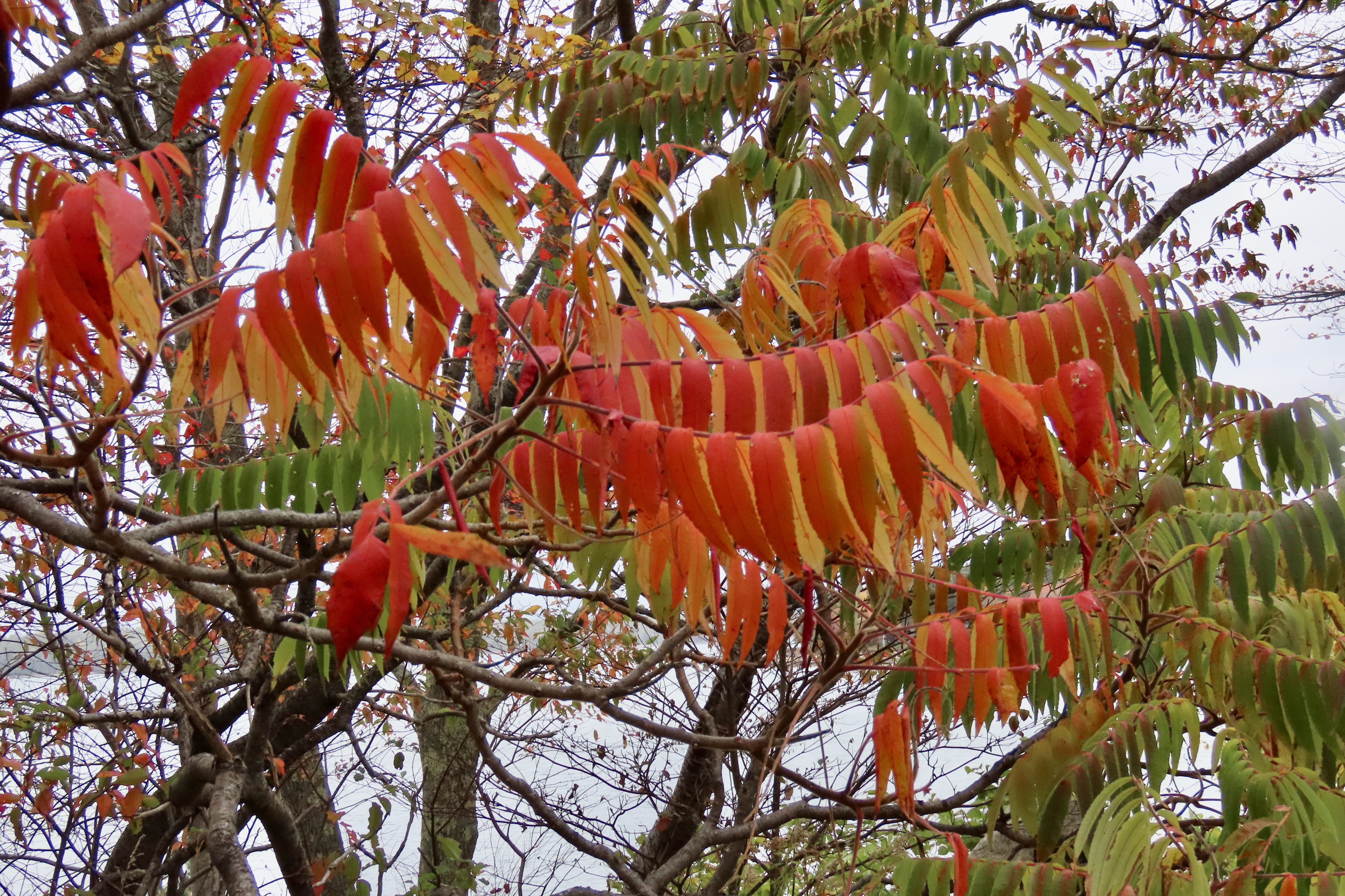
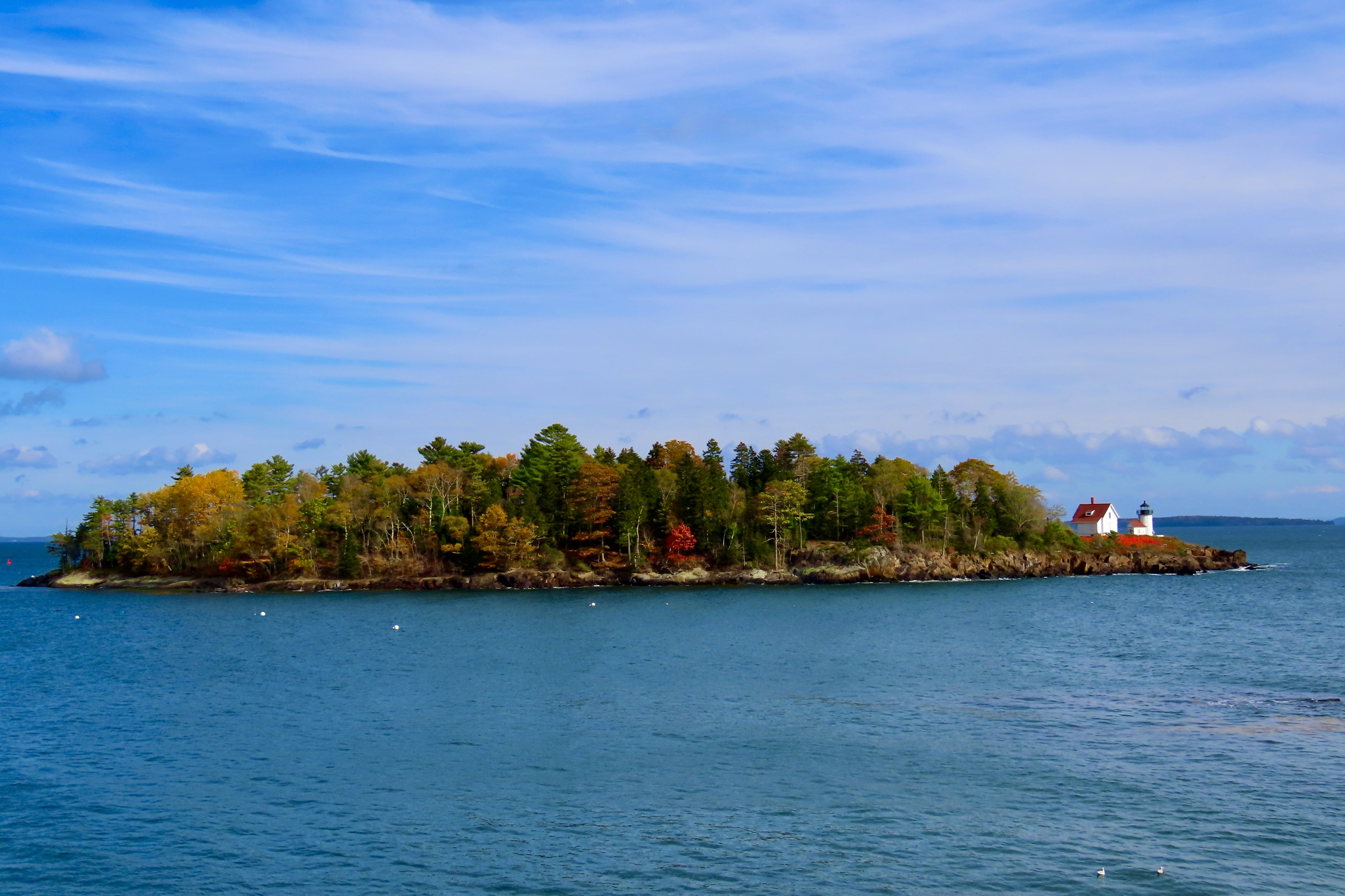
I concluded my last post with a photo of what we considered the most colorful section of the park. This was from the same area. The combination of being close to the trees and bright sunlight made the colors pop out.With distance and lack of sun, the colors faded in this view across Jordan Pond…And blended, like an impressionistic painting. Still beautiful.Roads continued to provide the opportunity to get up close and personal with the fall foliage, however— and traffic.The roads were full. Wherever there was a pulloff meant to feature the beauty of the park, it was packed. Even large parking areas were filled to the brim with people fighting to get into spaces whenever they opened up. While Peggy and I normally avoid national parks during peak season, we knew there was no option when peak-season is defined by peep-season. Still, it was a bit much for us. We headed for roads just outside of the park where the views were similar but traffic was minimal.We came on a small local park near Northeast Harbor named the Asticou Azalea Garden that demanded our attention. It was too late for the azaleas, but the fall colors made up for it…Cascading down…Providing a backdrop for a large granite boulder…And hosting an Oriental sculpture with brilliant red.The pond provided an interesting perspective on fallen leaves and pine needles floating on water while being divided between light and darkPeggy got into the act by providing an opportunity for a final photo of the garden’s colors.Having worked up an appetite, we headed into the nearby town of Northeast Harbor for lunch. It was busy shutting down for winter. Our waitress told us it was the restaurant’s last day for the year. After lunch, Peggy captured this colorful collection of pumpkins and squash on the sidewalk outside with her iPhone. Few things say ‘fall’ better.She was also attracted by a unique sculpture made out of shells in front of the Maritime Museum. It made us think of Davy Jones Locker in Pirates of the Caribbean.We found a small road (Sergeant Drive) leading out of Northeast Harbor along Somes Sound that fit our needs perfectly. It had all of the beauty of Acadia National Park with minimal traffic. Make that zero. We didn’t see any.It provided a number of views across the sound.Dark grey skies provided interesting silhouettes of the trees. I was particularly fascinated by the one on the right with its matching curves.Suminsby Park, created in memory of a beloved scoutmaster and selectman whose efforts helped preserve the area, provided us with closer views of Somes Sound and a peaceful stop.A golden, brown rockweed in the sound added to the fall colors.Looking down the sound from the park. Note the rockweed’s contribution.Looking up the sound.A wrap-up for today: Christmasy red and green leaves hovered above the memorial to Bob Suminsby. I couldn’t help but believe that the old scoutmaster and local leader would be well-pleased with the park that had been given his name. That’s it for today. Next up Peggy and I travel down the Maine coast to the town of Belfast, where we discover Curtis Island. I insisted we check it out.Curtis Island, Maine with its lighthouse. The island, btw, isn’t named after me, sigh, it’s named for Cyrus Hermann Kotzschmar Curtis, founder of the Saturday Evening Post.
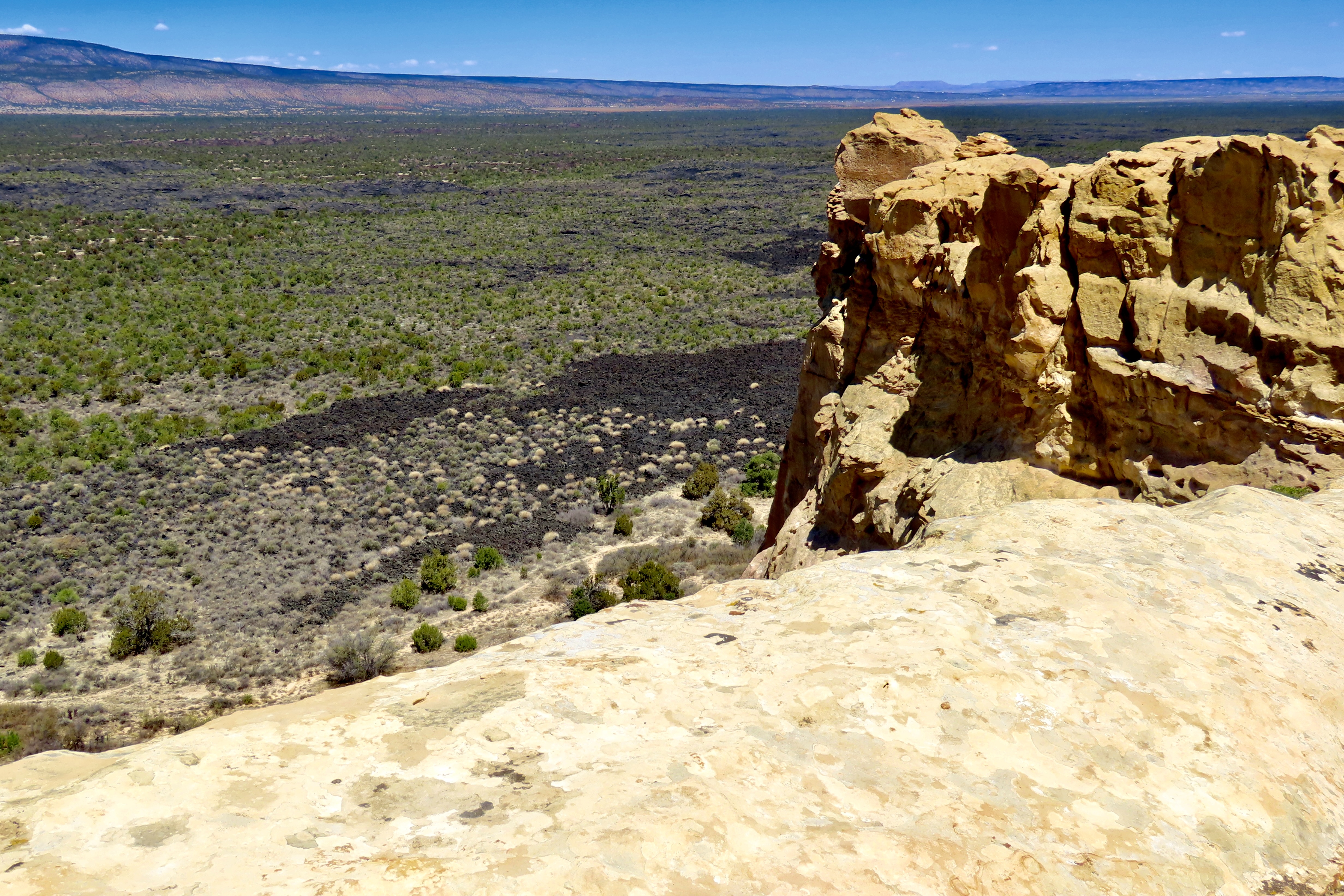
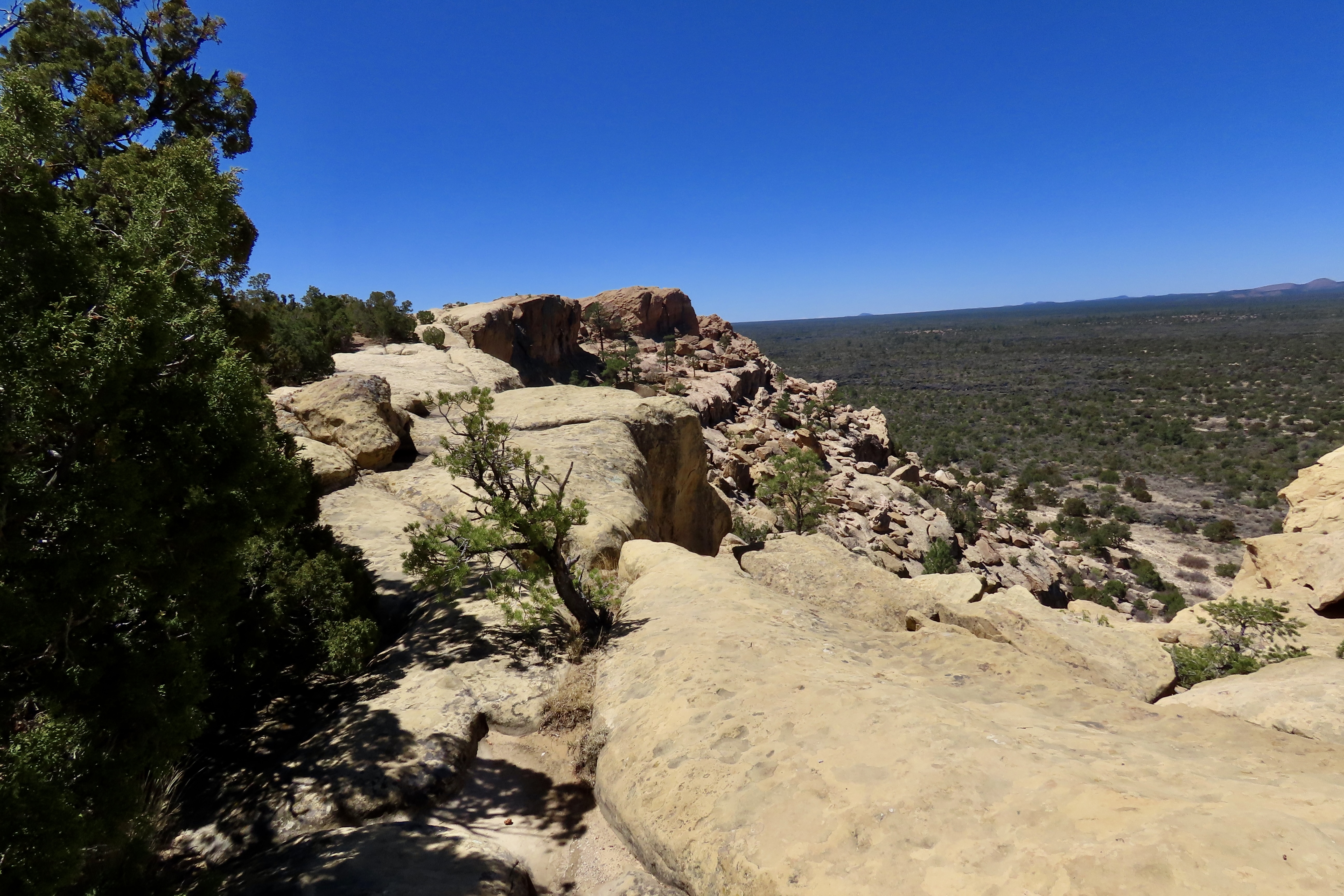
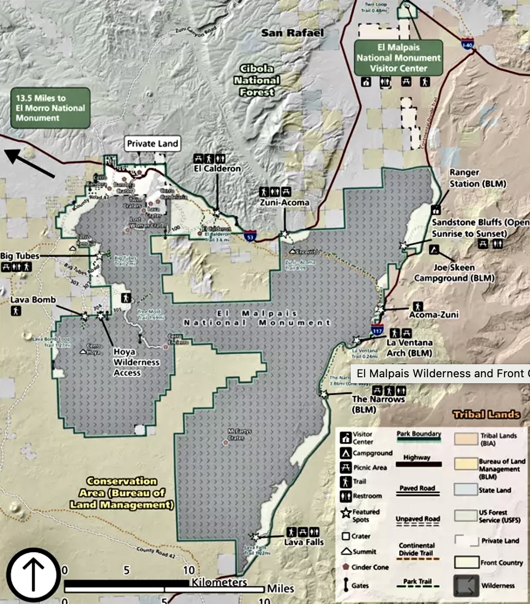
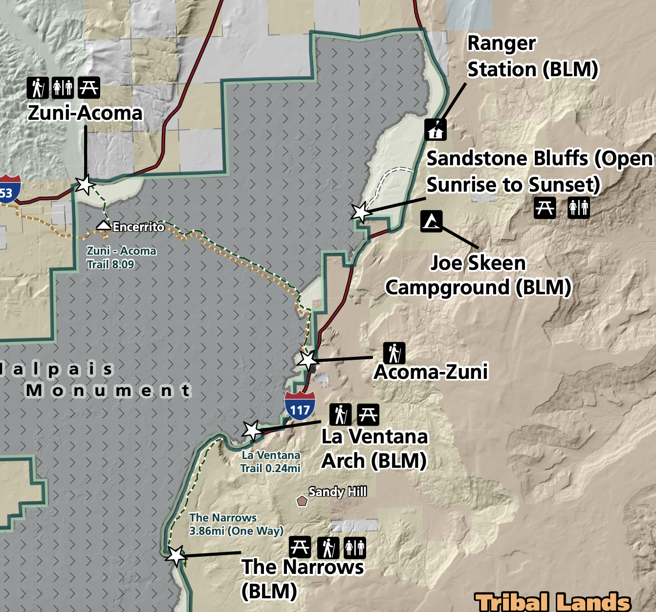
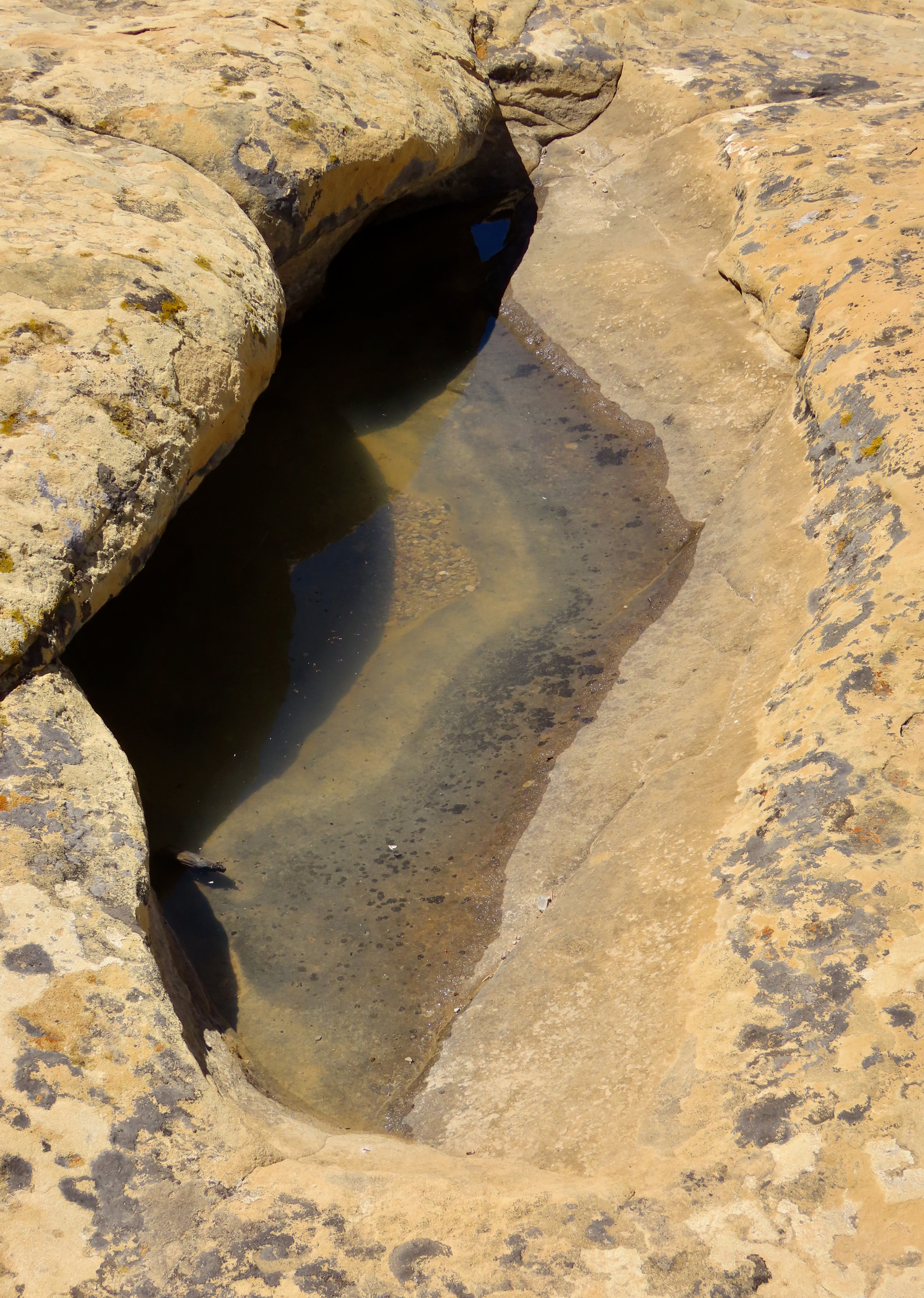
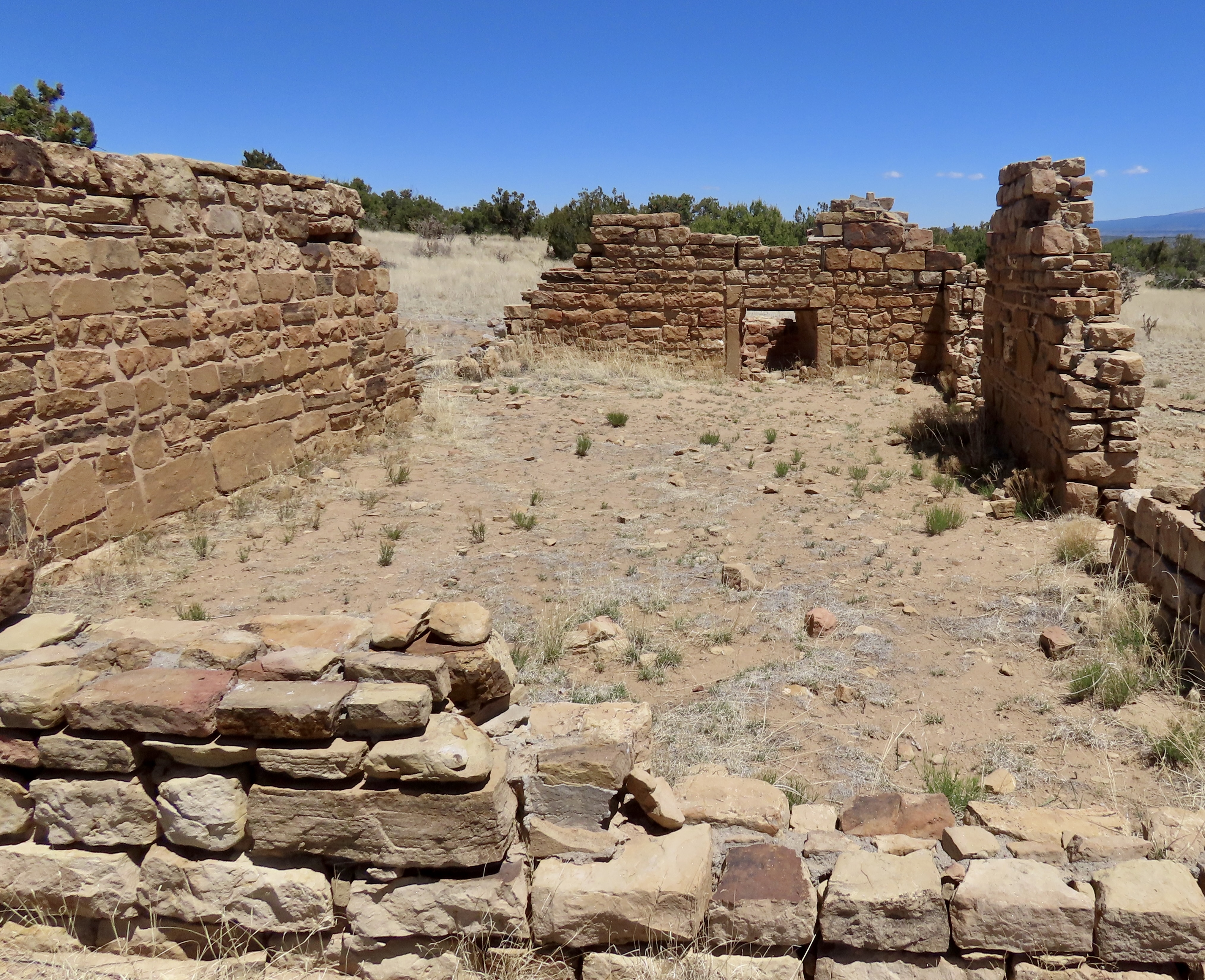
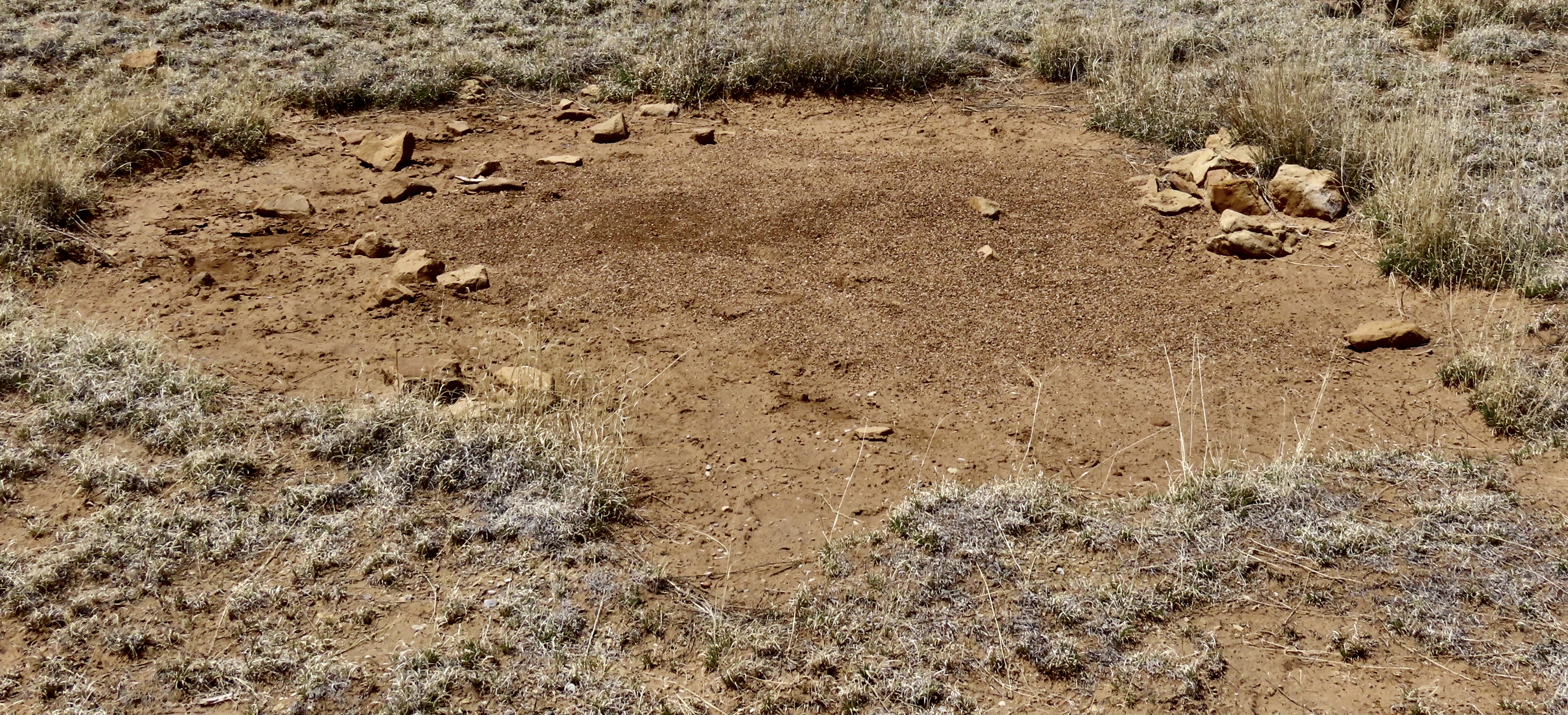
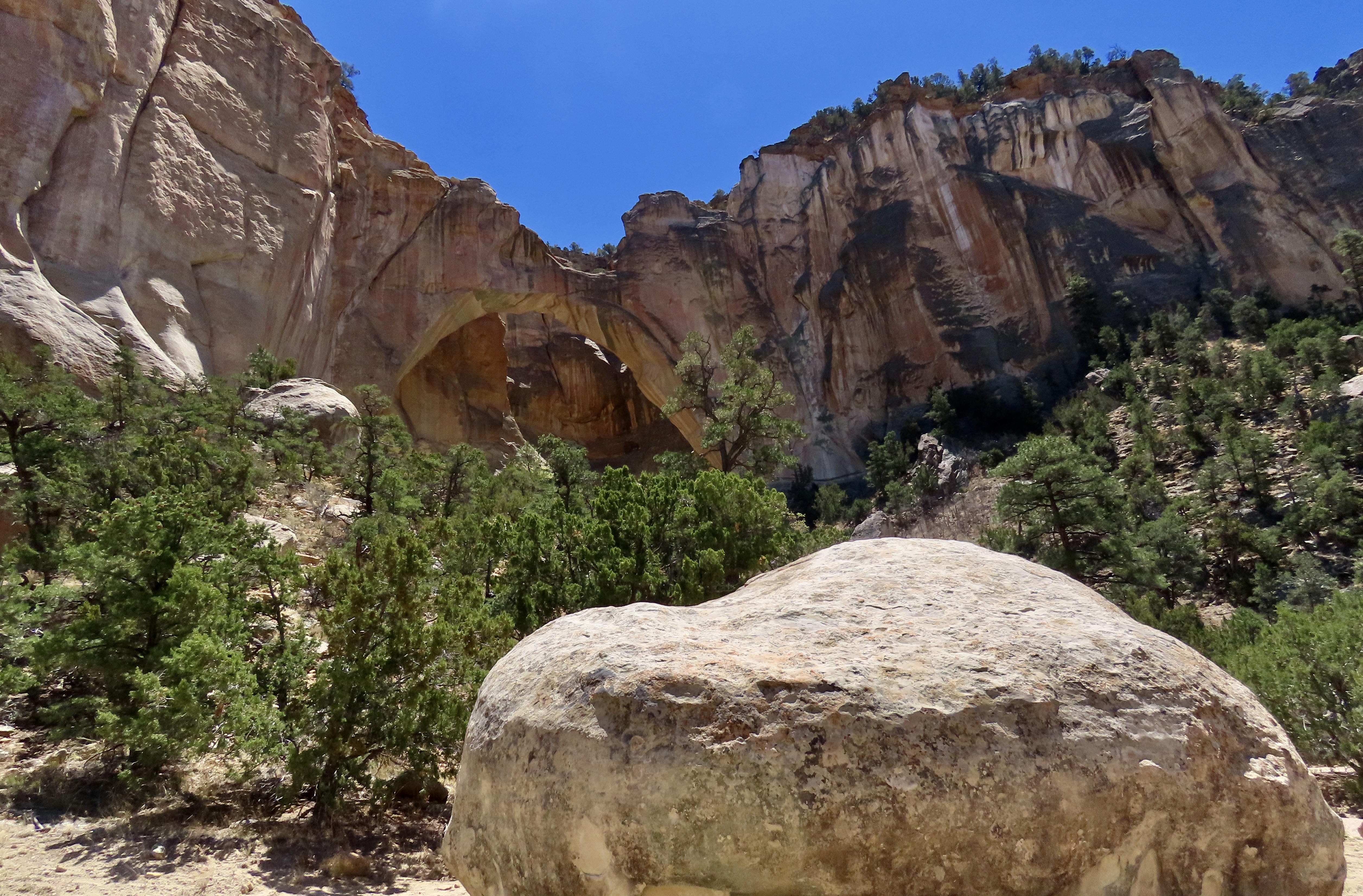
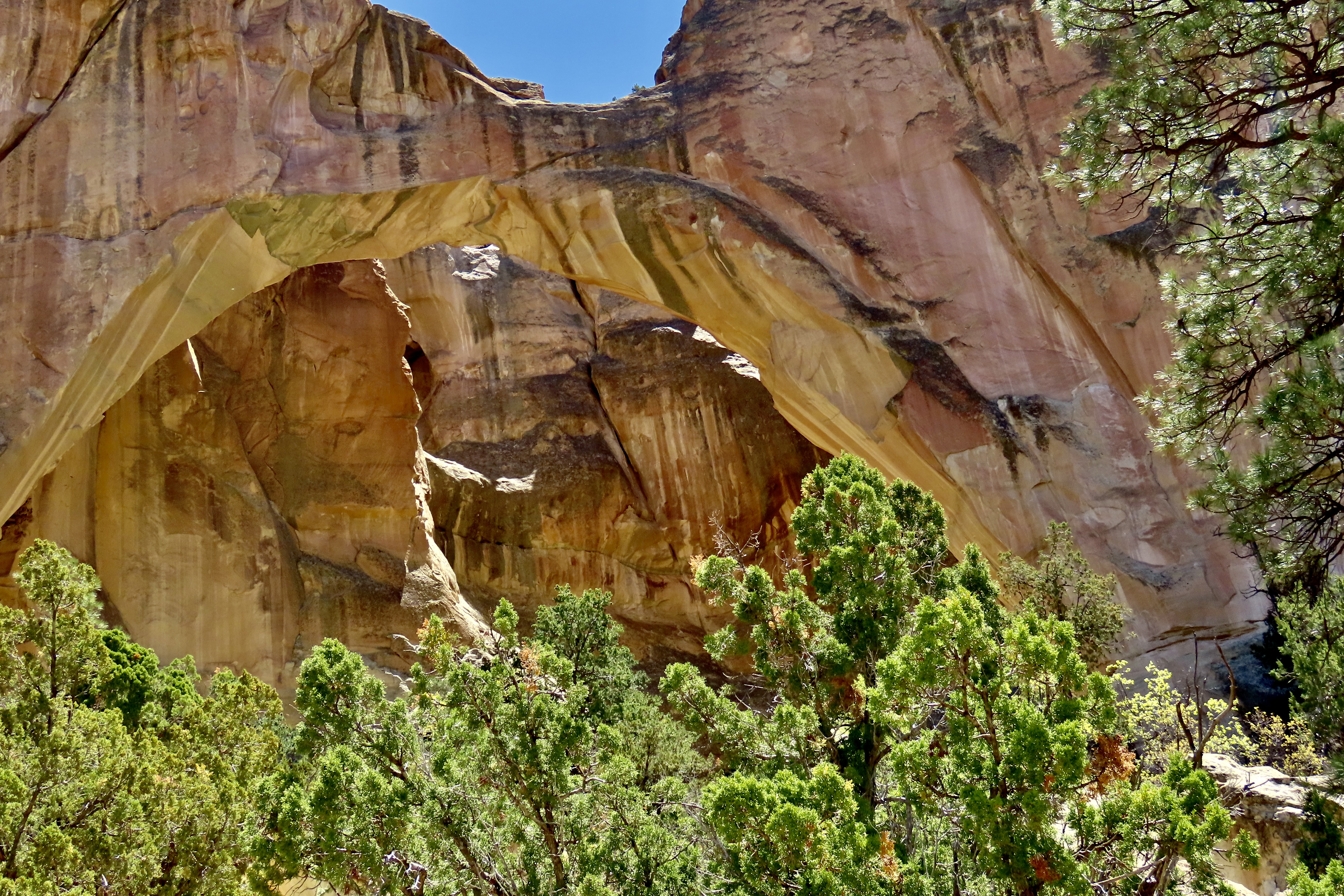
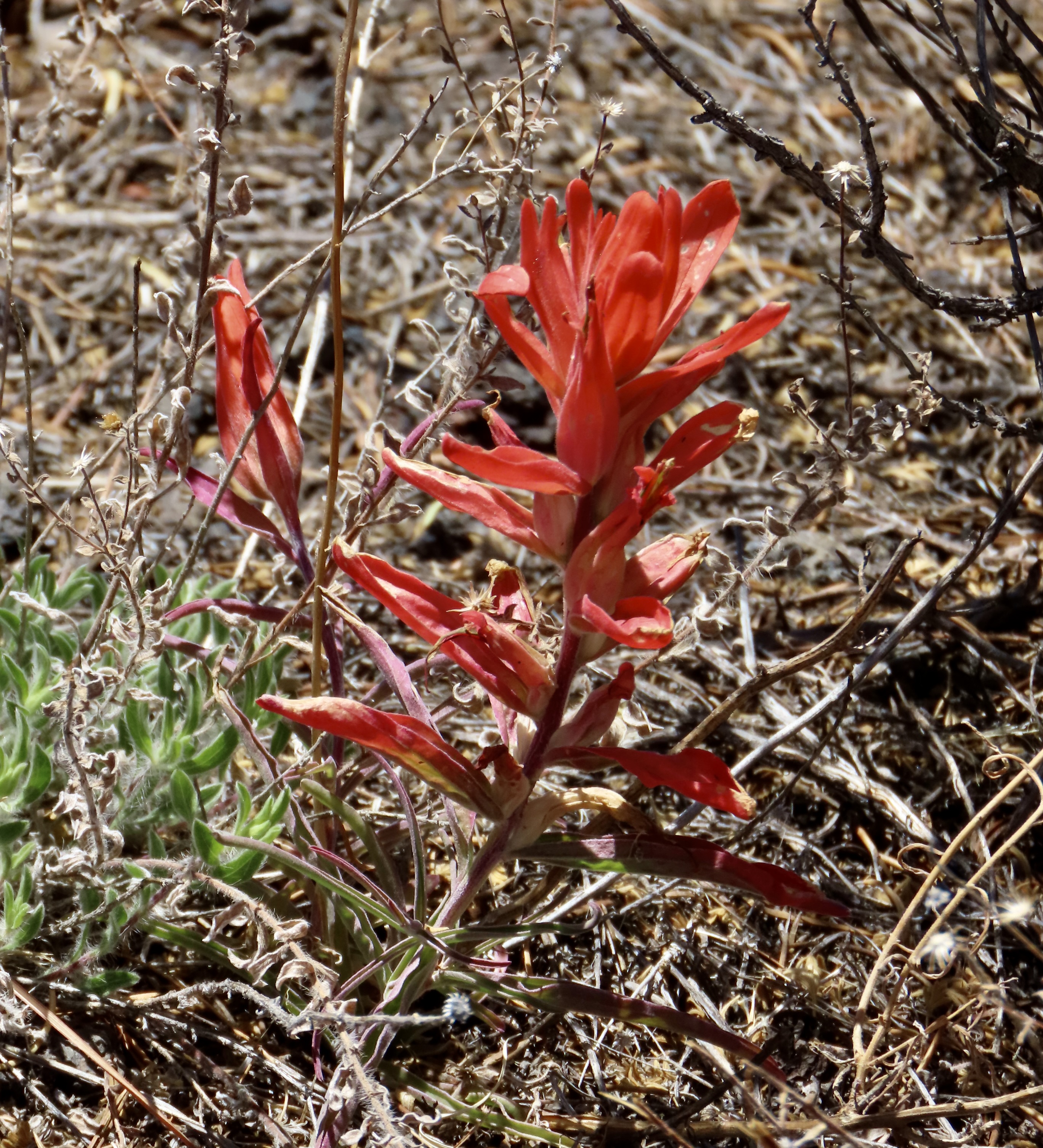
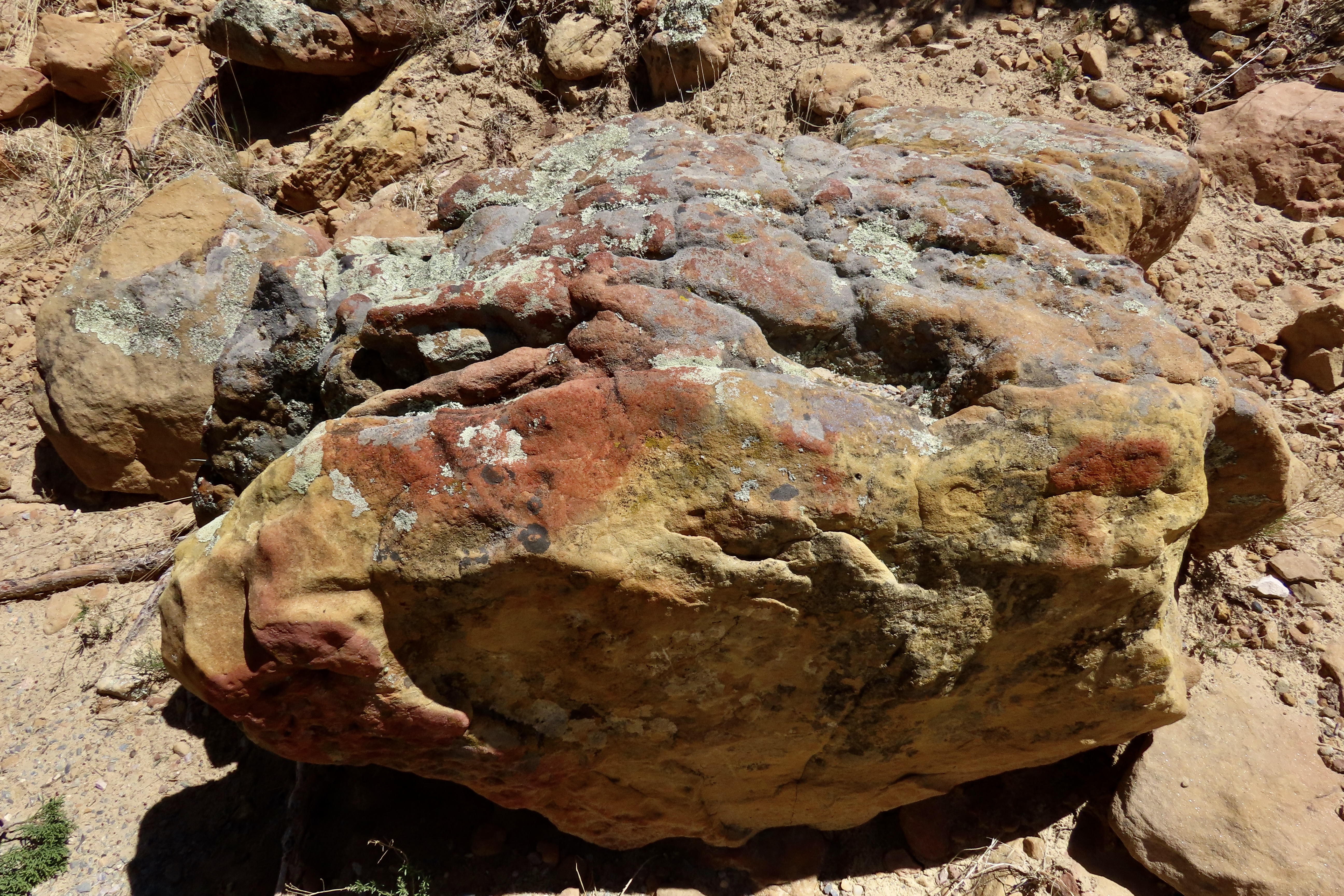
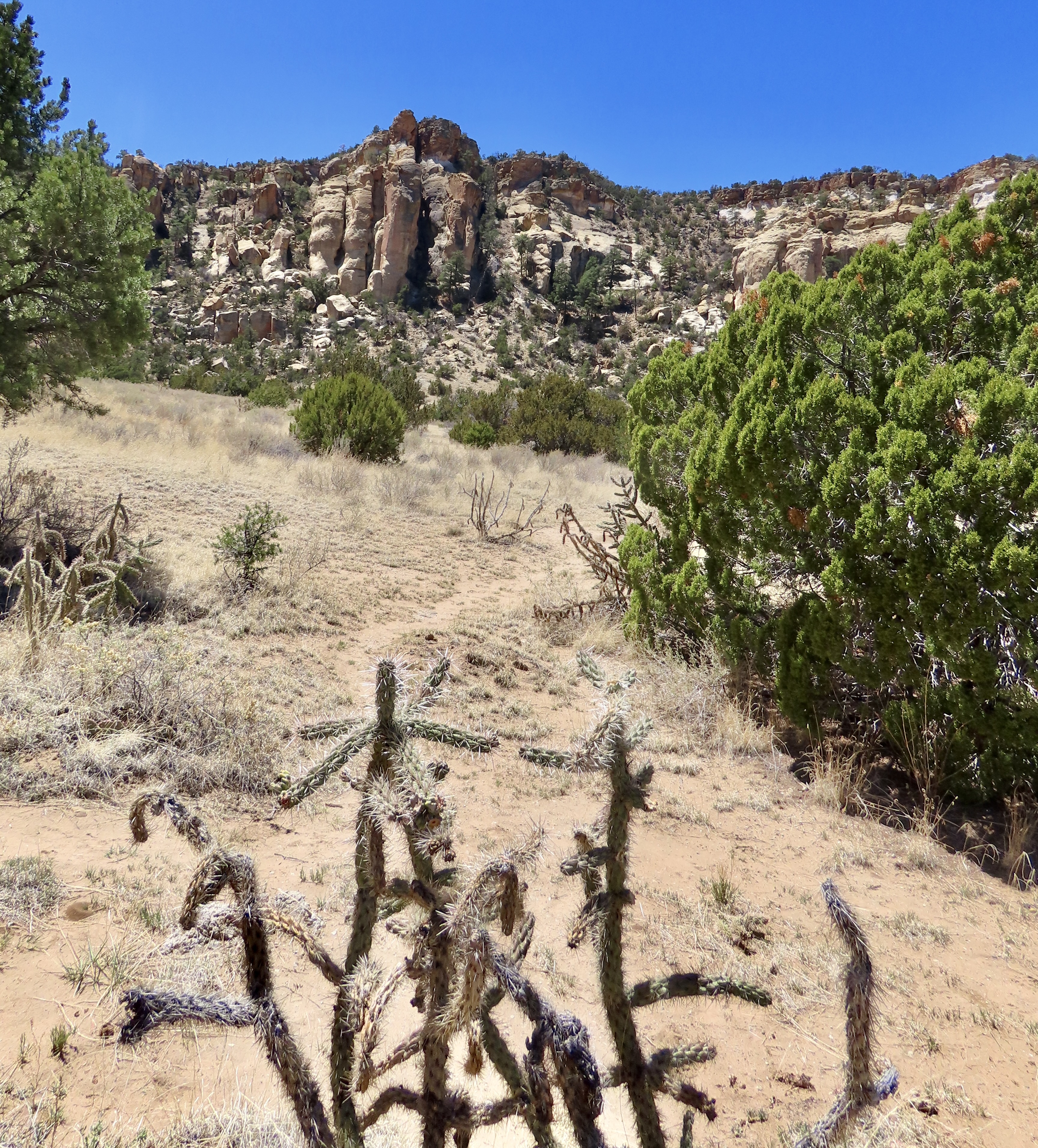
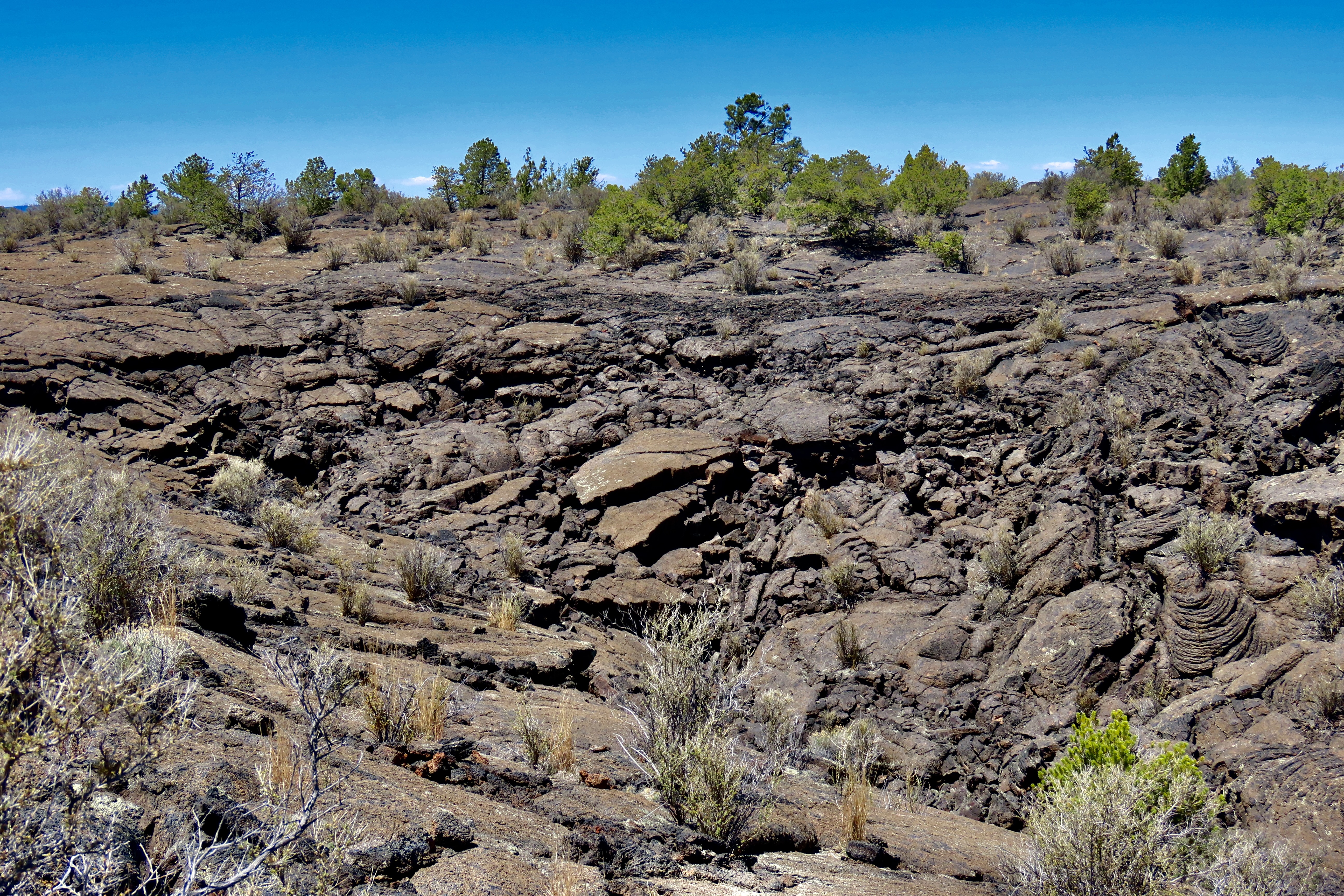
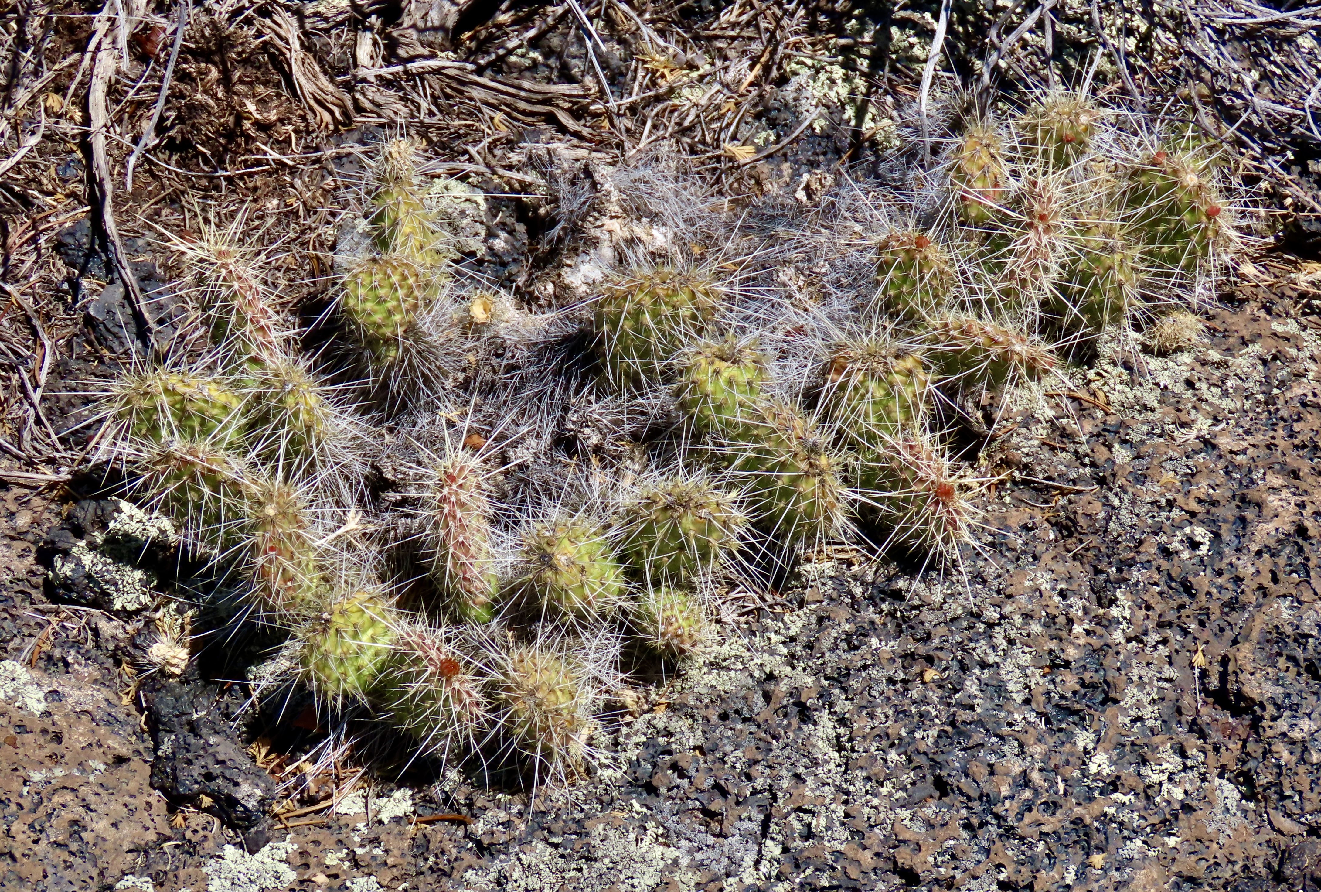
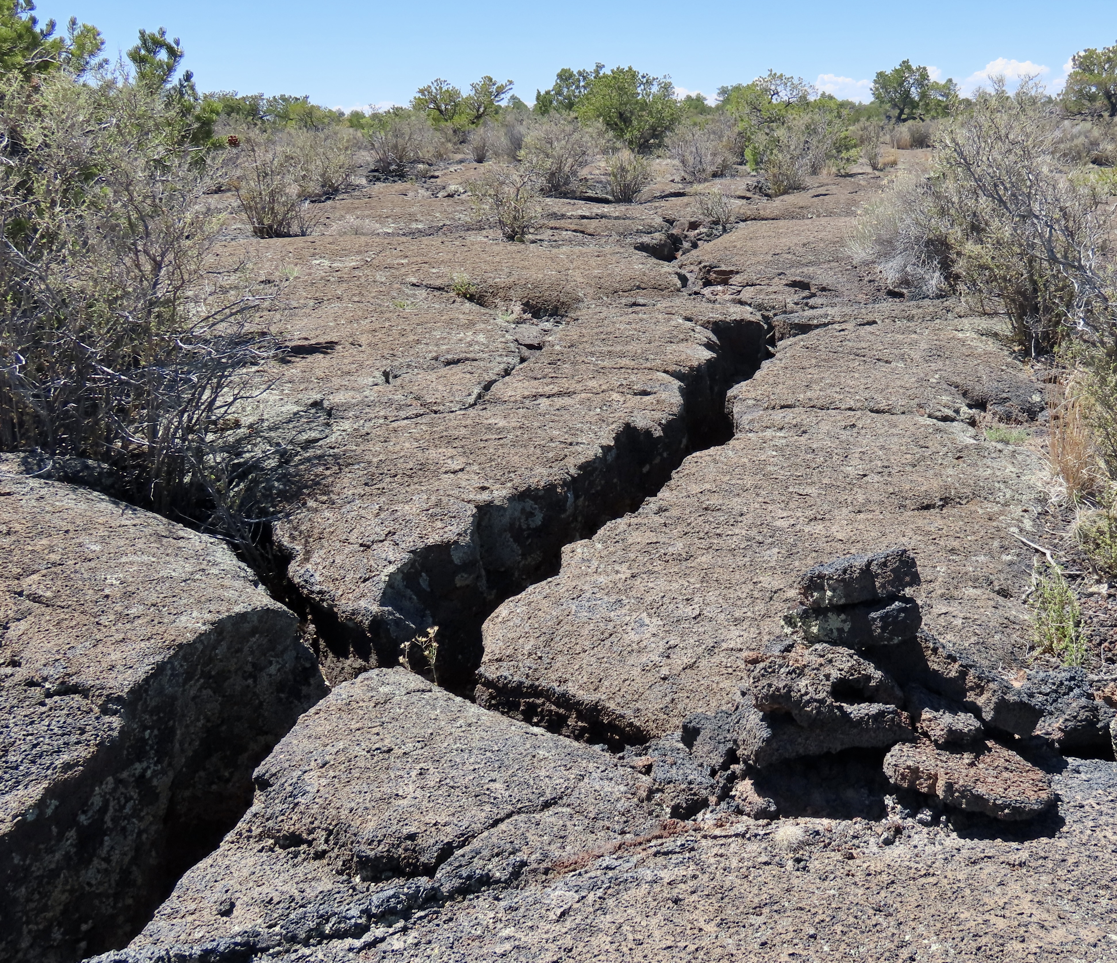
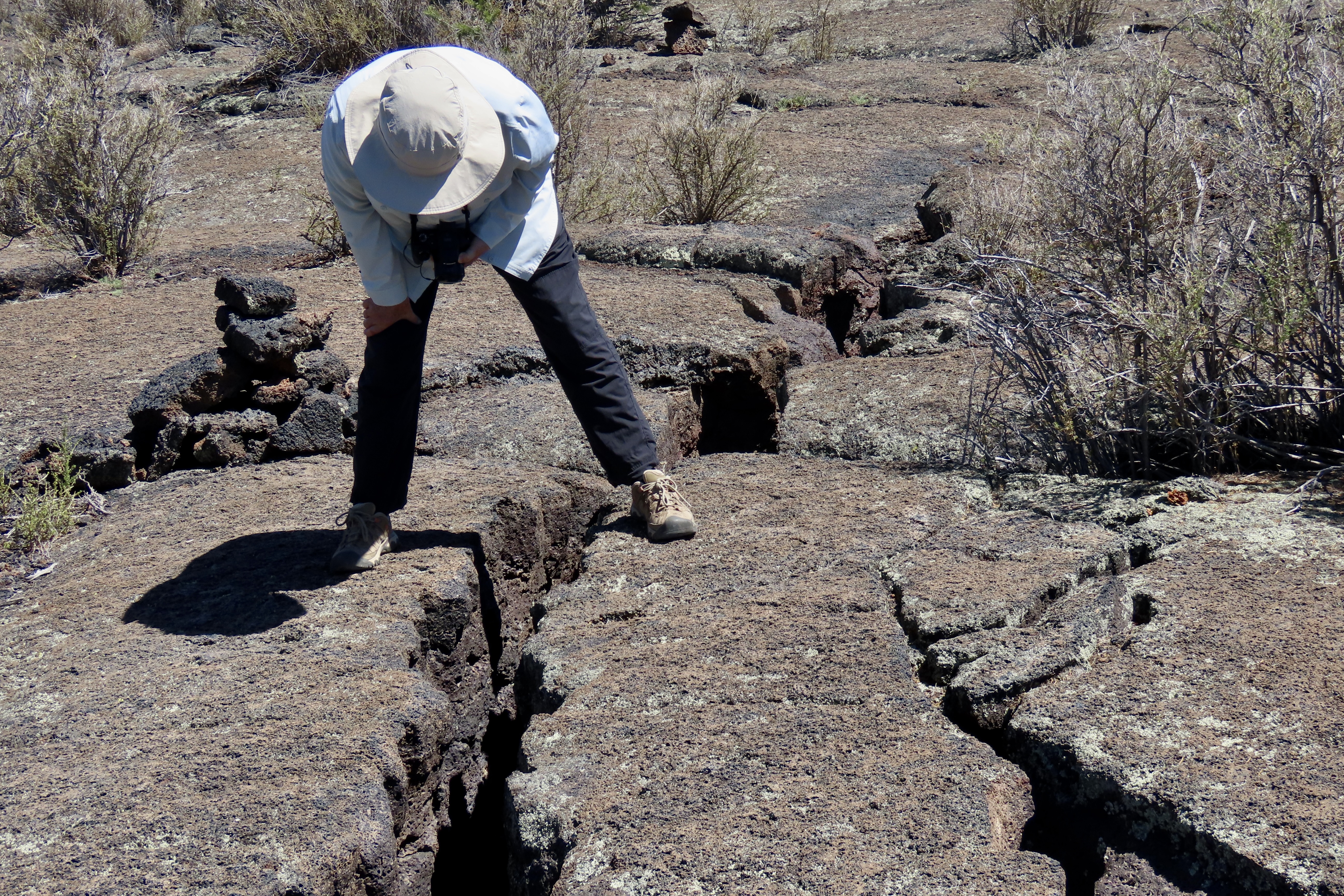
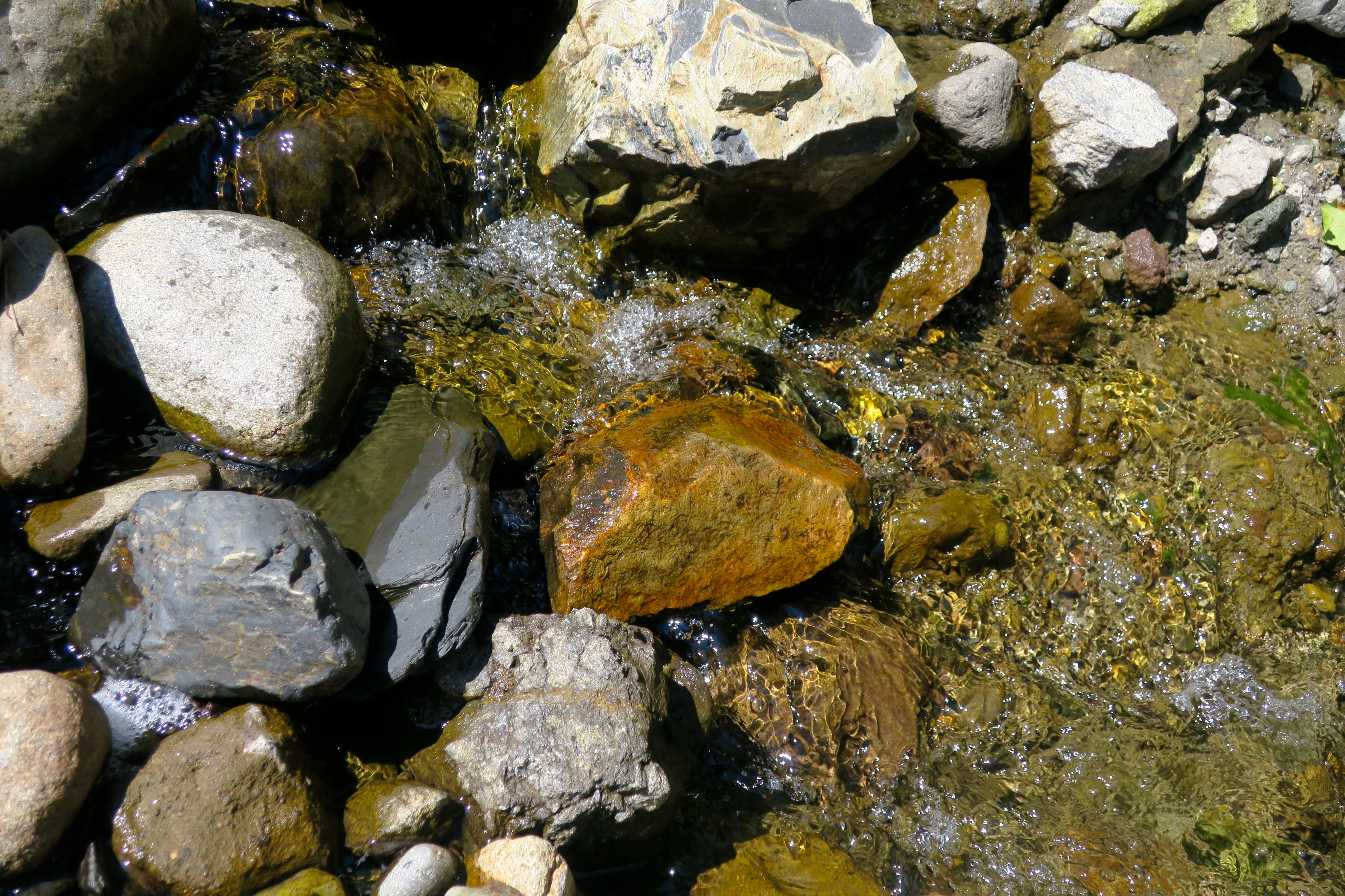
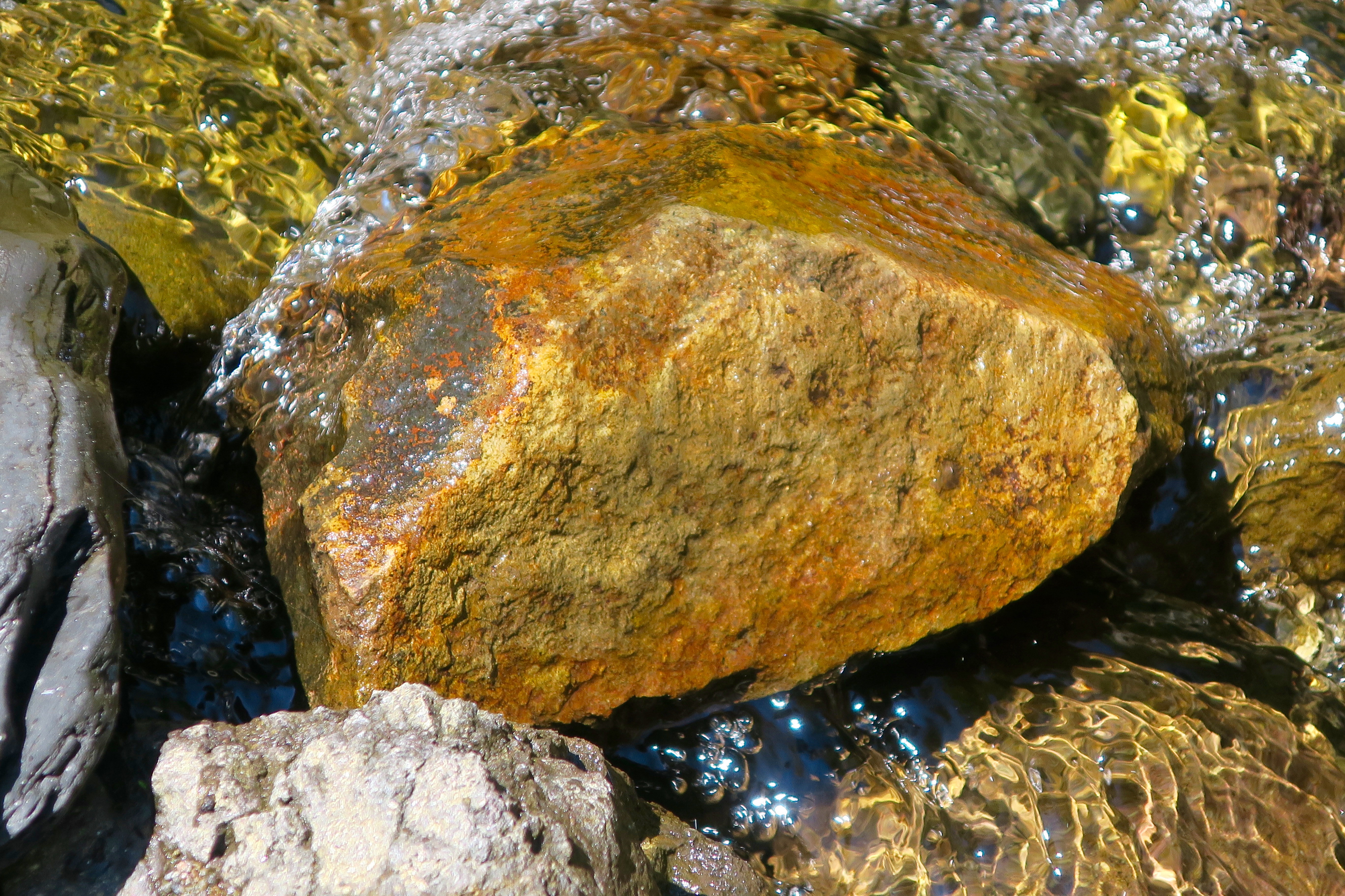
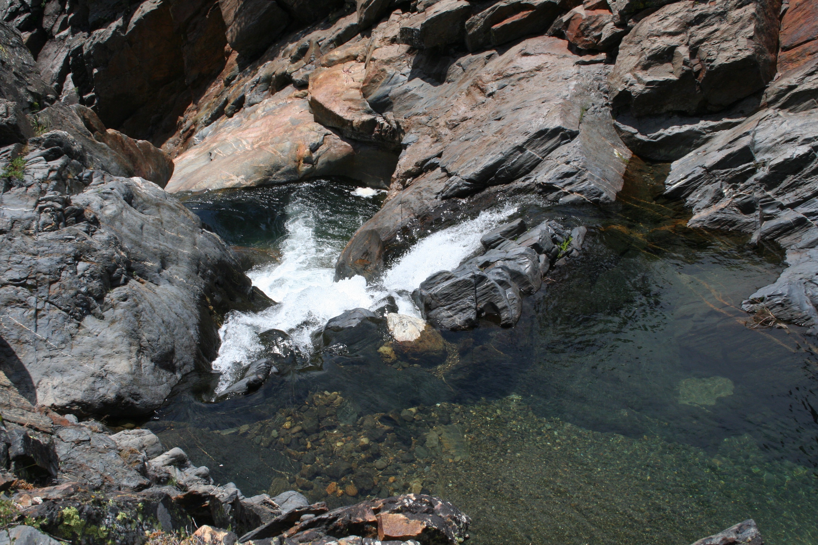
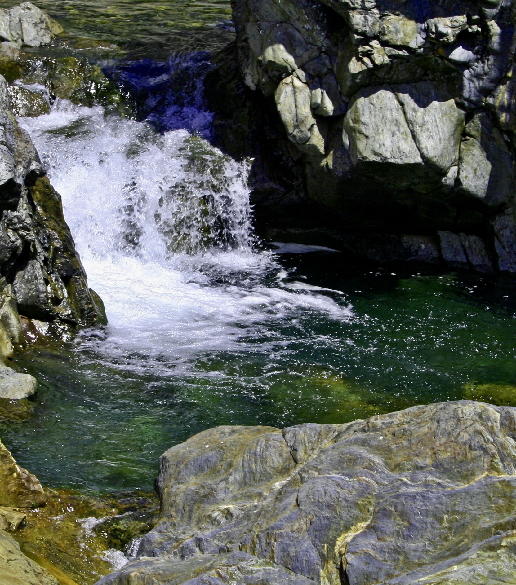
When the Spaniard explorers came through here in the 1500s searching for the Seven Cities of Cibola and untold (unfound) treasure, they looked at the lava covered fields below and declared them El Malpais, the badlands— good for nothing. They would travel around them instead of through them. The Zuni and Acoma, whose ancestors had arrived at least 700 years before the Spaniards, considered them part of their homelands. Food, water, shelter and medicine plants were here for those who knew where to find them. Their trails crisscrossed the ‘not-so badlands.’A road takes visitors out to Sandstone Bluff, shone here and above. Visitors can walk along the bluffs and look down into extensive volcanic flows of basaltic rock. While the sandstone that makes up the bluff dates back some 160 million years, the most recent lava flows are a mere 3000 years old, babies in geological time. If you go back to the first photo, the latest flow is the darkest.This map shows an overview or El Malpais National Monument. I-40 is at the top of the map, as is the Monument’s Visitor Center. El Morro National Monument, that I blogged about earlier, is off to the west. Most of our photos are from the Sandstone Bluffs, the Acoma-Zuni Trail, the La Ventana Arch, the Narrows and Lava Falls.The first four locations are shown above in the close up. The four photos below are from the Sandstone Bluff area.Water catchments such as this on top of Sandstone Bluff, provided a ready source of water after rainstorms for the Ancestral Puebloans, more ancient peoples, and wildlife that lived and wandered through the area. Various little water bugs took advantage of the pool when it was full. As did frogs, who laid eggs that turned into pollywogs. Looking at photo, I’m still trying to turn the stick into a skinny frog. Ruins of the Garret Home are found along the road to Sandstone Bluff. The family built their homestead in 1934 on the edge of El Malpais as a way to scratch out a living and survive the Great Depression.We found this barren space next to the house. It was about 6 feet across and interesting but we carefully avoided walking across. It marks the location/territory of a red ant nest. Had we walked over it, ants would have come boiling out to attack and bite us. And, believe me, their bite hurts! I know from experience. Various reasons are given for the cleared area. Among them: It makes it easier for the ants to leave and return to the nest when they are foraging, enemies, like other ants, have a harder time attacking, and the direct sun makes the nest warmer on cold days.Lunch? These ants seemed to be chowing down on this bug. Or maybe they were working cooperatively to drag it to their nest.Sandstone cliffs along New Mexico 117 on the eastern side of El Malpais National Monument provided us with numerous views of impressive rock monuments.This provides a good look at cap rocks. Being harder than the rocks immediately below them, they resist erosion more and provide for the multitude of interesting shapes one sees when traveling around the Southwest.We liked the contrast between the tall ponderosa pine and the cliffs here.Once again, we liked the contrast. But it was the sheer size of this monument combined with its coloration that insisted this was a photo op.This is a ‘draw’ in Western lingo and quite likely a box canyon. Cowboys liked them because they often provided water, shelter and forage for their cattle. If it’s a box canyon, it could also serve as a makeshift corral.Moo.This rock, peeking out from among the trees marks the beginning of the ancient Acoma-Zuni Trail on the eastern side of El Malpais. We found it amusing that it is named the Zuni-Acoma Trail if one starts from the west. Historically, and today, the Zuni lived/live on the west side of El Malpais and the Acoma on the east. The 7 1/2 mile trail provided the main route for the two groups to travel back and forth between their pueblos. It’s been in use for at least a thousand years. Today, people backpacking the 3100 mile (4989 km) Continental Divide trail are still using it! Some of the cairns (rock markers) used by the hikers to follow the route were set in place hundreds of years ago by the Acoma and Zuni.La Ventana (the window) Arch is found about halfway down New Mexico Highway 117 when driving the length of El Malpais National Monument. It’s the second largest natural arch in New Mexico and definitely worth a stop.A closer view. A short trail leads up to the arch from the parking lot. Picnic tables are available for those who would like to stop for lunch. We found a group of hikers who were doing the Continental Divide Trail, eating lunch at one of the tables.We also found: A single Indian paintbrush…A rather colorful rock…And a Cholla cactus on a trail leading up to another rock monument.A close up.Instead of eating lunch at La Ventana, we chose to drive down to the Narrows and eat lunch at a BLM park, where we treated to views like this. The brilliant white rock two thirds of the way up is sitting on a rock that is 60 million years older. In geological terms, it’s known as an unconformity. The intervening 60 million years of geological history were wiped out by erosion!Peggy and I finished our visit to El Malpais National Monument by driving down to the end of the park and going for a hike along the Lava Falls Trail (noted on the first map above). We quickly learned about the importance of following the route marked out with the rock cairns. One part of the lava flow looks pretty much like every other part. Getting lost is a distinct possibility. There are deep cracks in the ground.Large collapsed sections that would be difficult to cross and possibly dangerous.And prickly cactus to avoid.Fortunately, the cairns are relatively easy to follow. It’s important, however, to locate the next one before you leave the one you found! Its hard to see here but it was across the crack off to the left.Peggy stopped to take a photo of the crack while crossing it. Of course. That’s it for today’s post. We have two left in our Southwest series. The next one will be on the campgrounds we stayed at while following sections of our trip that took us along historic Route 66. Our last post will feature some of the interesting petroglyphs we found at Lyman Lake State Park in Arizona and the Petroglyph National Monument in Albuquerque.We stayed at a KOA campground just outside of Grants, New Mexico off of I-40 when we exploring El Morro and El Malpais National Monuments. Historic Route 66 ran through the town about a mile away. While at the campground, we were treated to this gorgeous rainbow.
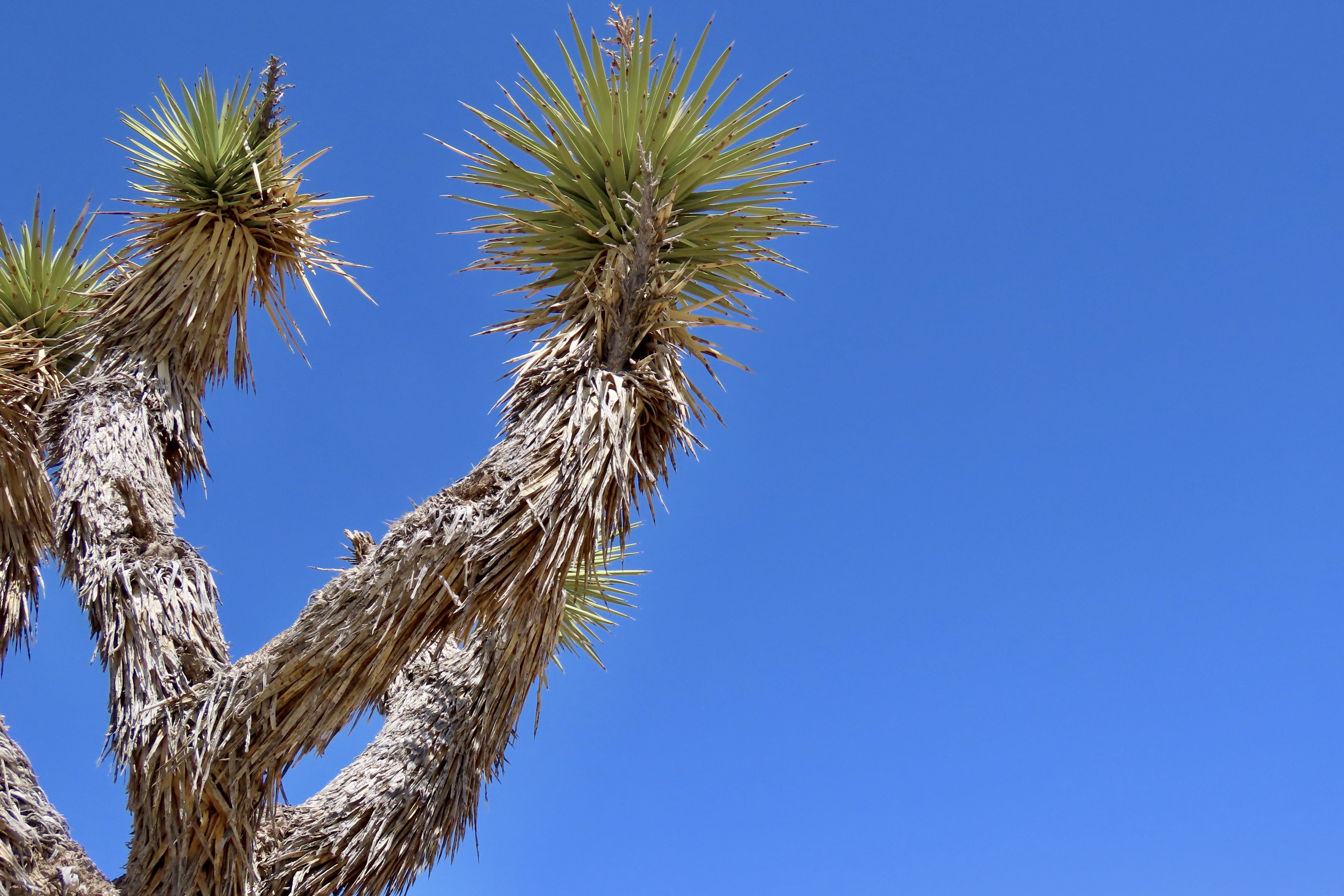
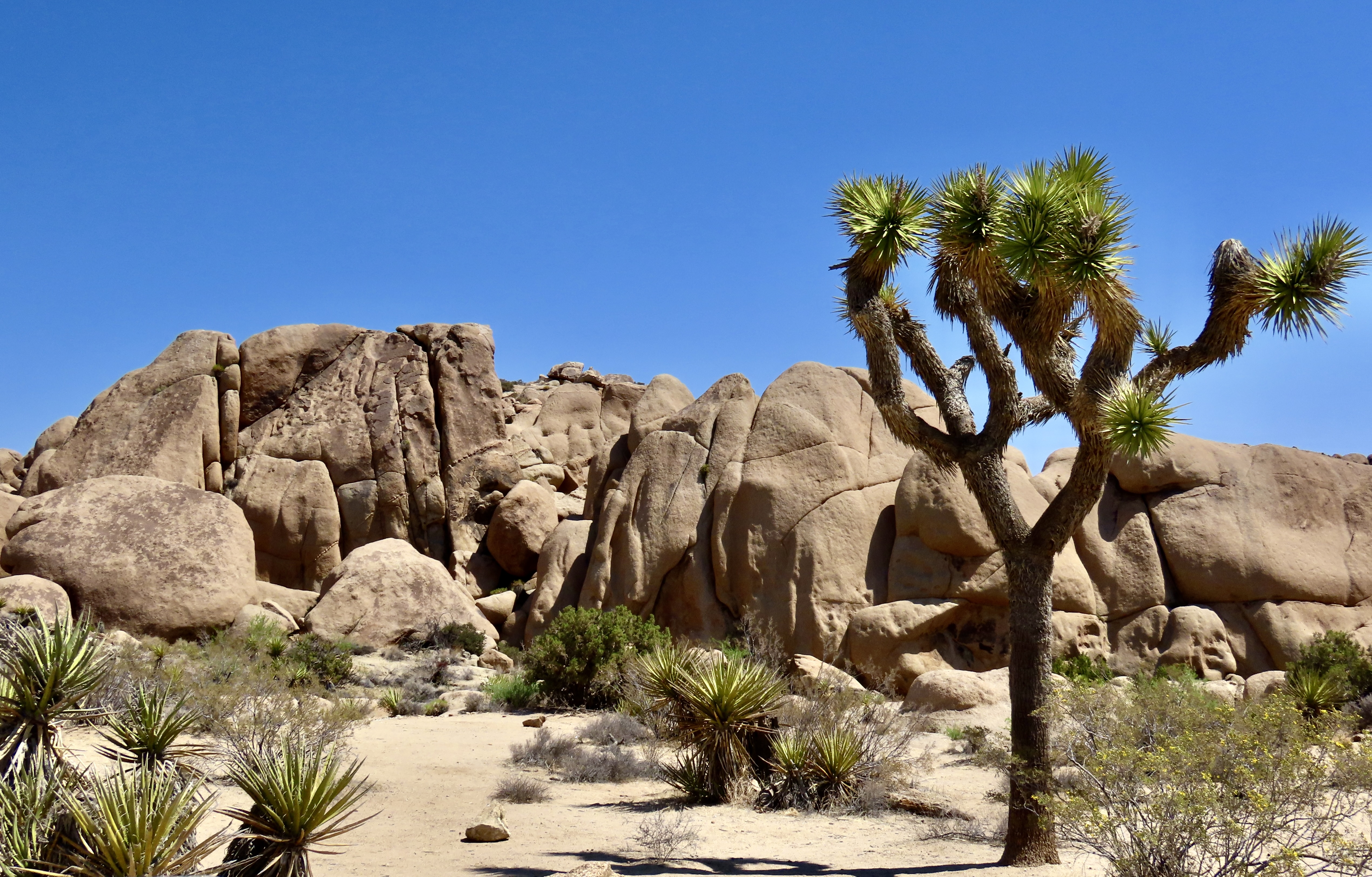
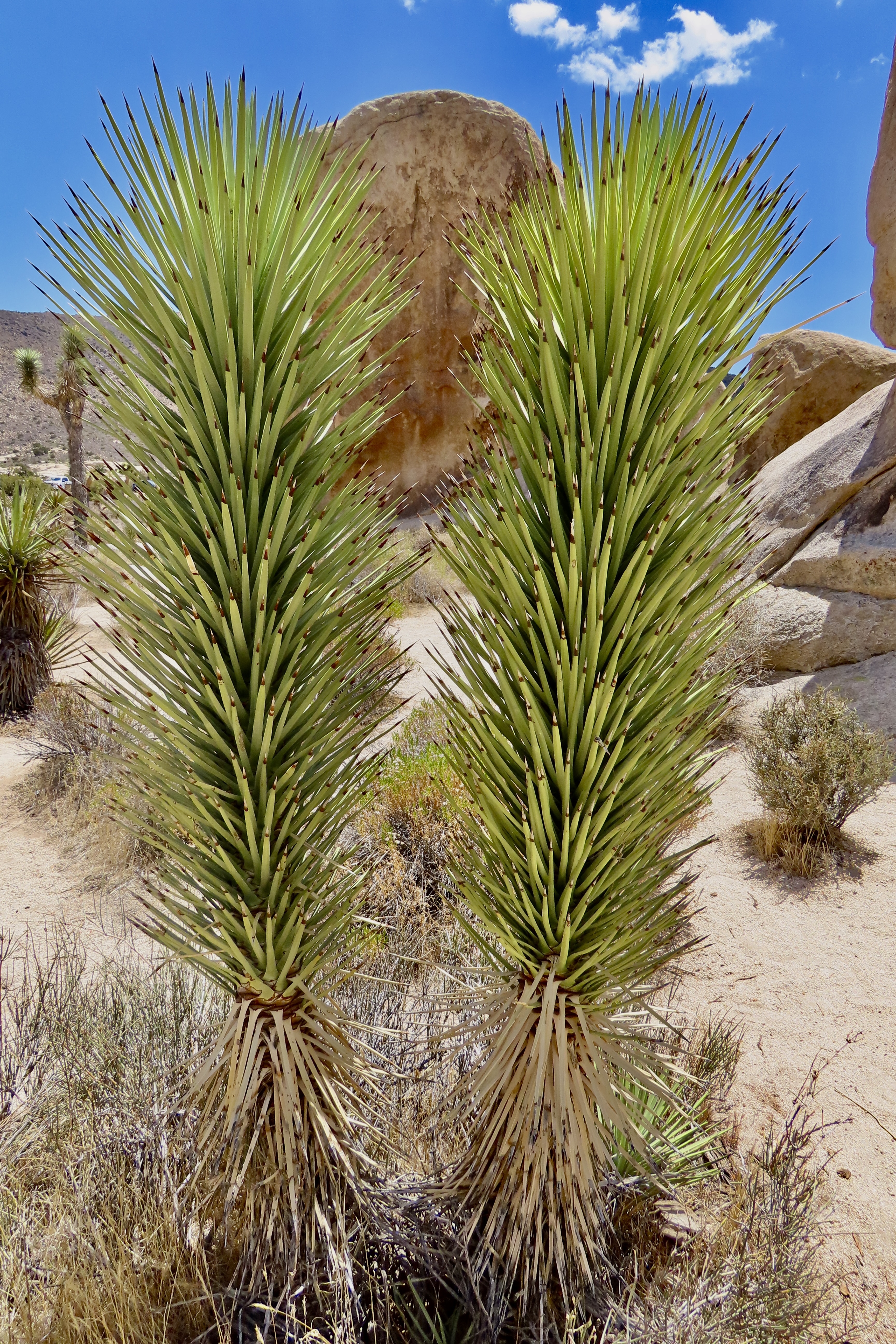
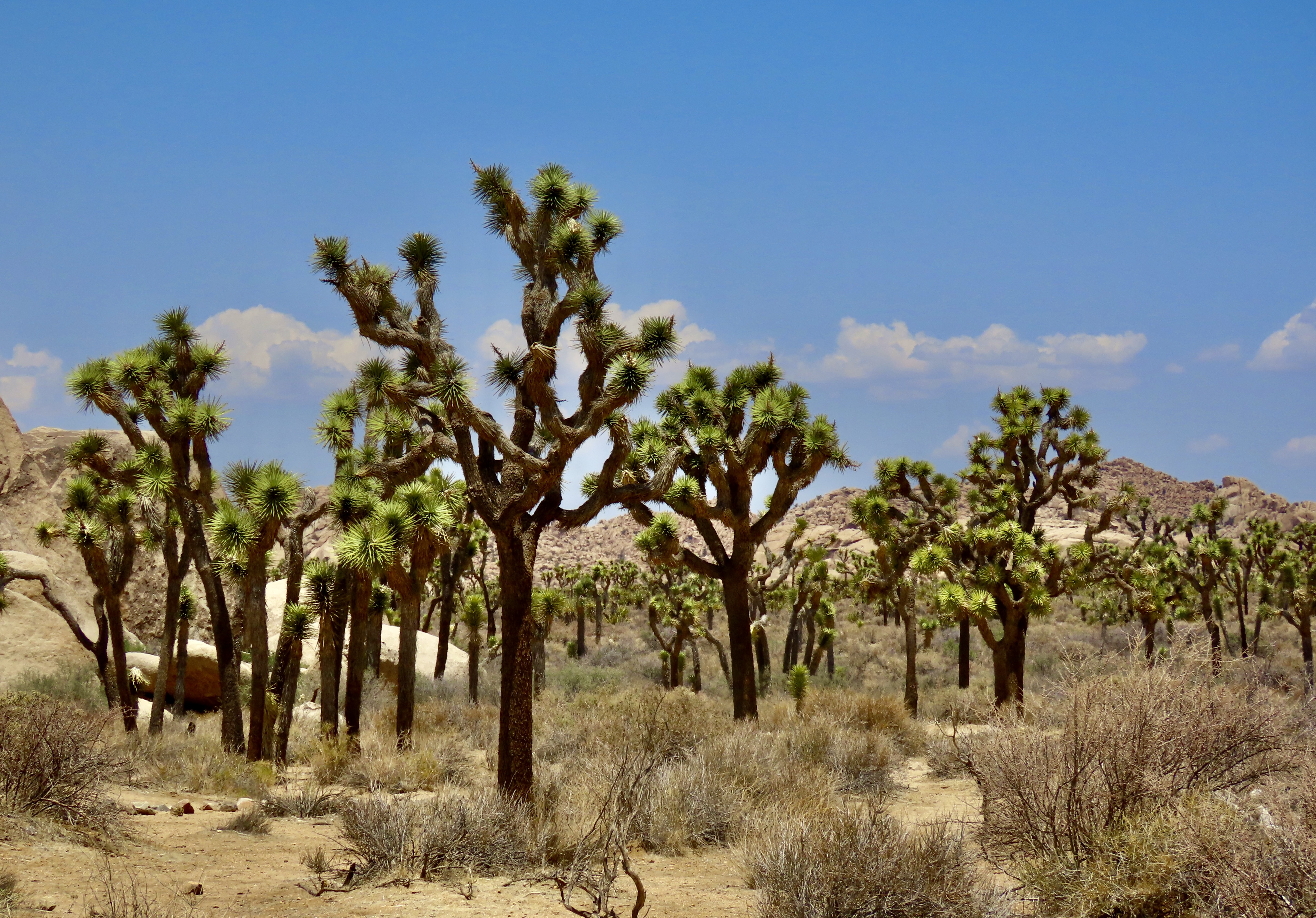
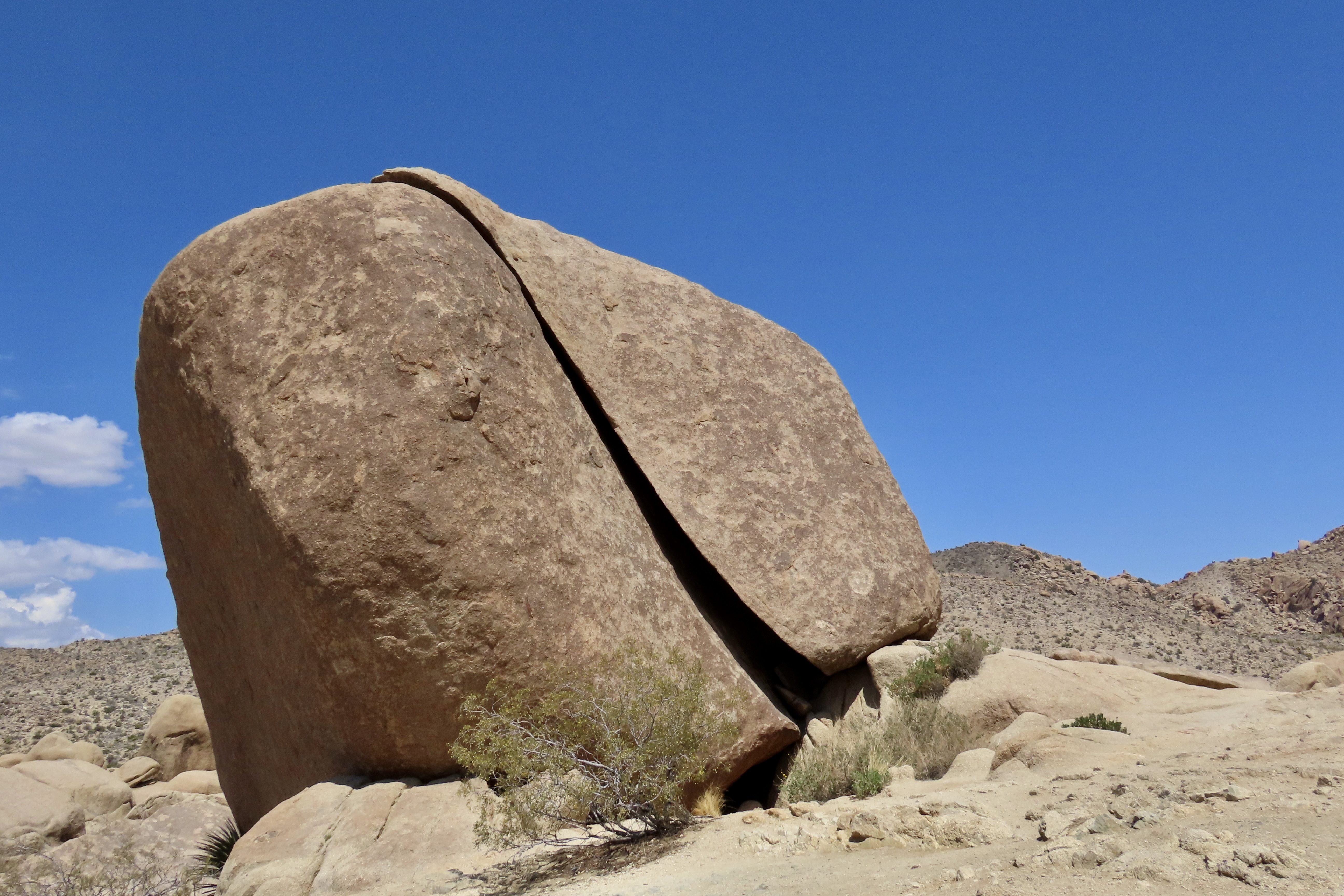
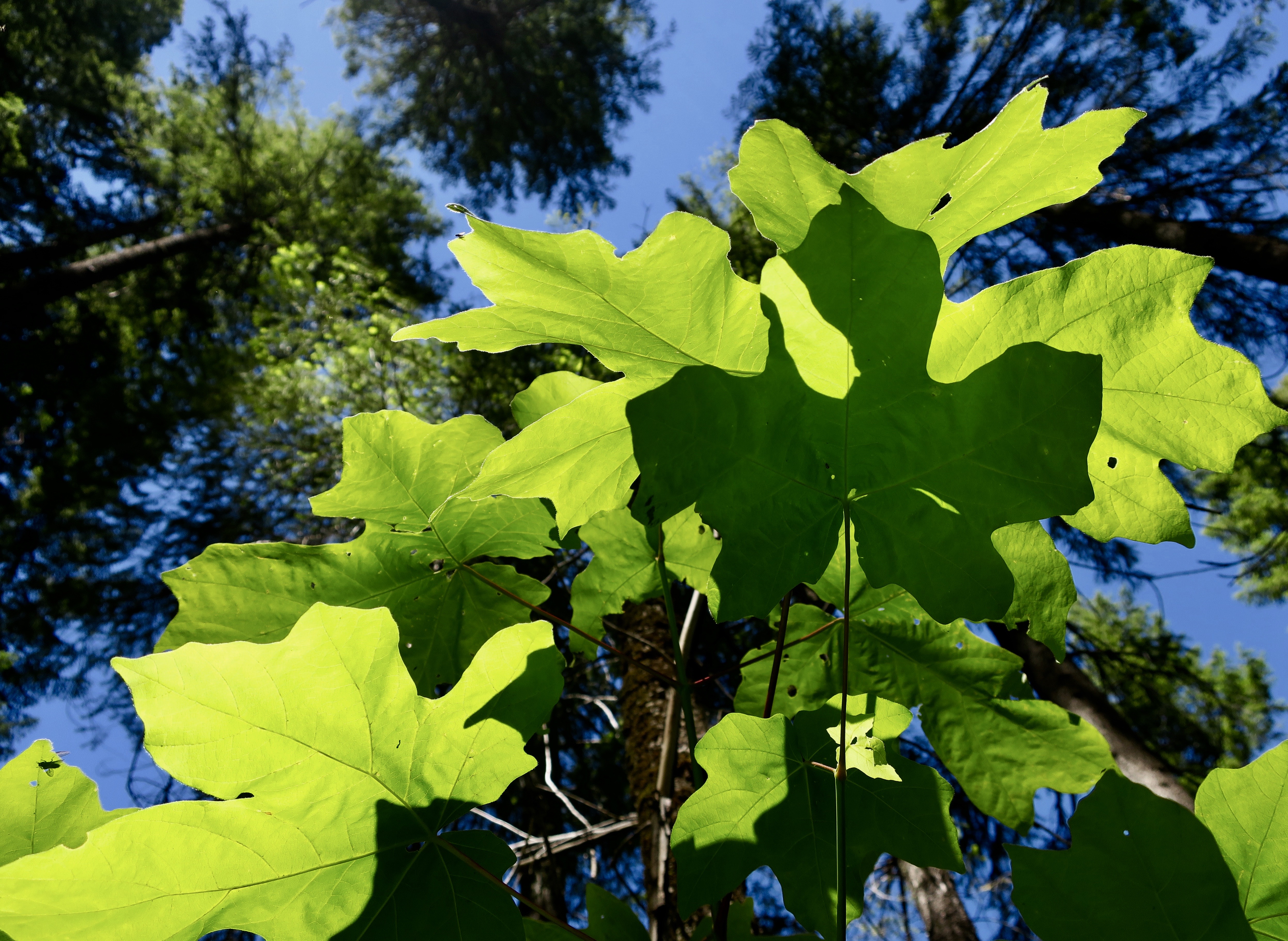
Joshua trees are a bit strange as trees go. They are actually monocots, more closely related to grass than trees. If that seems weird, up until recently they were thought to be lilies, related to onions and other members of the family. The park sign still claims the relationship.
As much as the trees are worth blogging about, we found the rocks of the park even more intriguing.
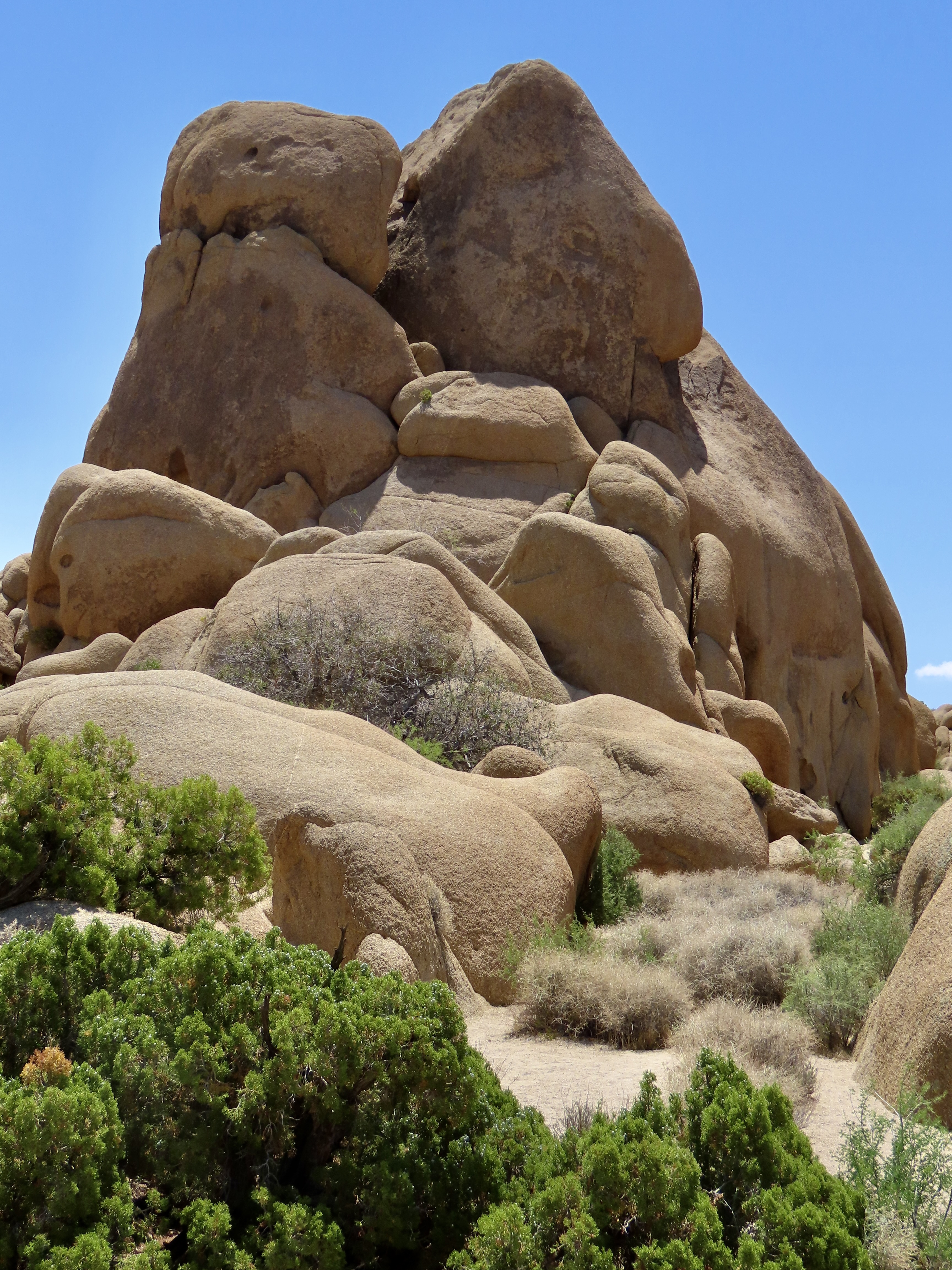
Massive piles of monzogranite boulders reach for the sky in the park. Originating far under the ground as lava oozing up from the earth’s mantle some 80-100 million years ago, the lava cooled and hardened into a batholith of granite. Nature in the form of earthquakes and water cracked it into rectangular blocks while mountain raising and erosion brought it to the surface. Along the way, erosion also wore the rectangular blocks into the massive rounded boulders that visitors admire today.
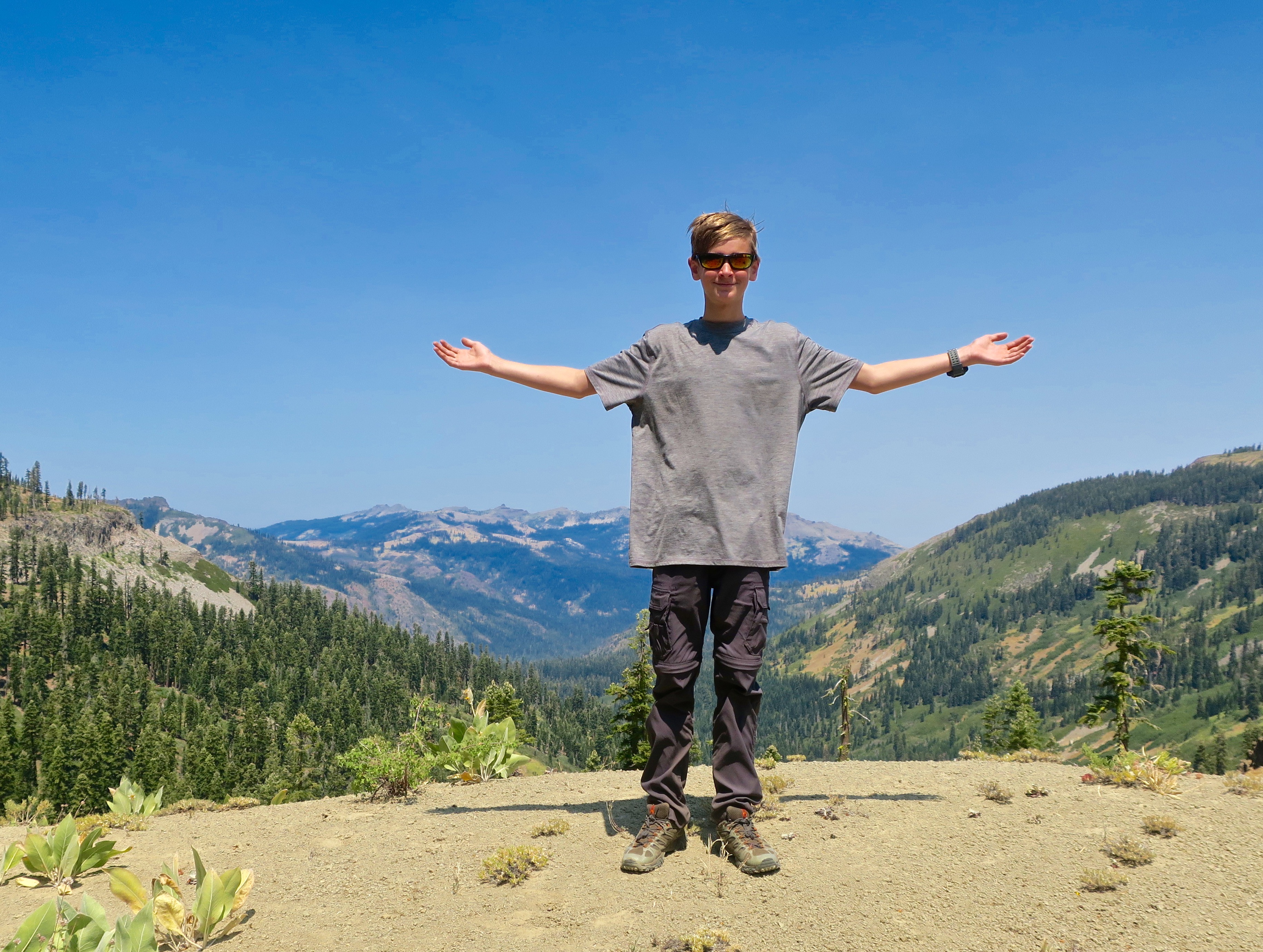
This was our second visit to the park. Peggy and I spent a whole day driving 30 miles through the northern portion of it. We stopped a lot.
An information board at the beginning of the park, made the following observation: “Look around you. Perhaps you see a stark land that nature never got around to finishing. Or you may see potential mineral wealth, defense testing grounds, alternative energy sources, or a vast recreational playground. Or maybe you see the desert for what it is— a diverse, thriving, ecosystem.”
I would add that deserts are a place of rare beauty and endless fascination, the equivalent of any of the other natural wonders we find in the world.
A quote from Edward Abbey was also included on the board: “It seems to me that the strangeness and wonder of existence are emphasized here, in the desert, by the comparative sparsity of the flora and fauna: life not crowded upon life, with a generous gift of space for each herb and bush and tree, each stem of grass, so that the living organism stands out bold and brave and vivid against the lifeless sand and barren rock.
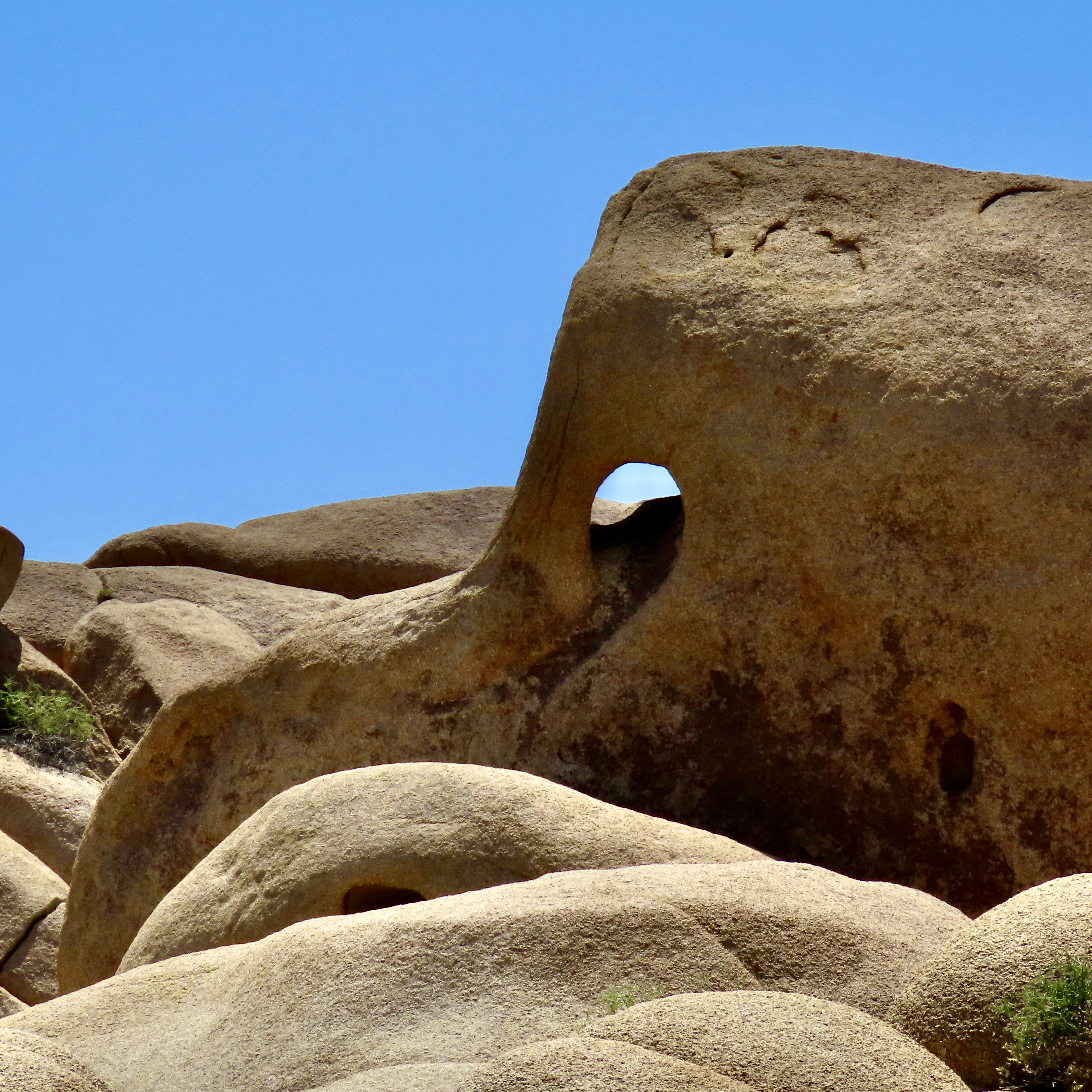
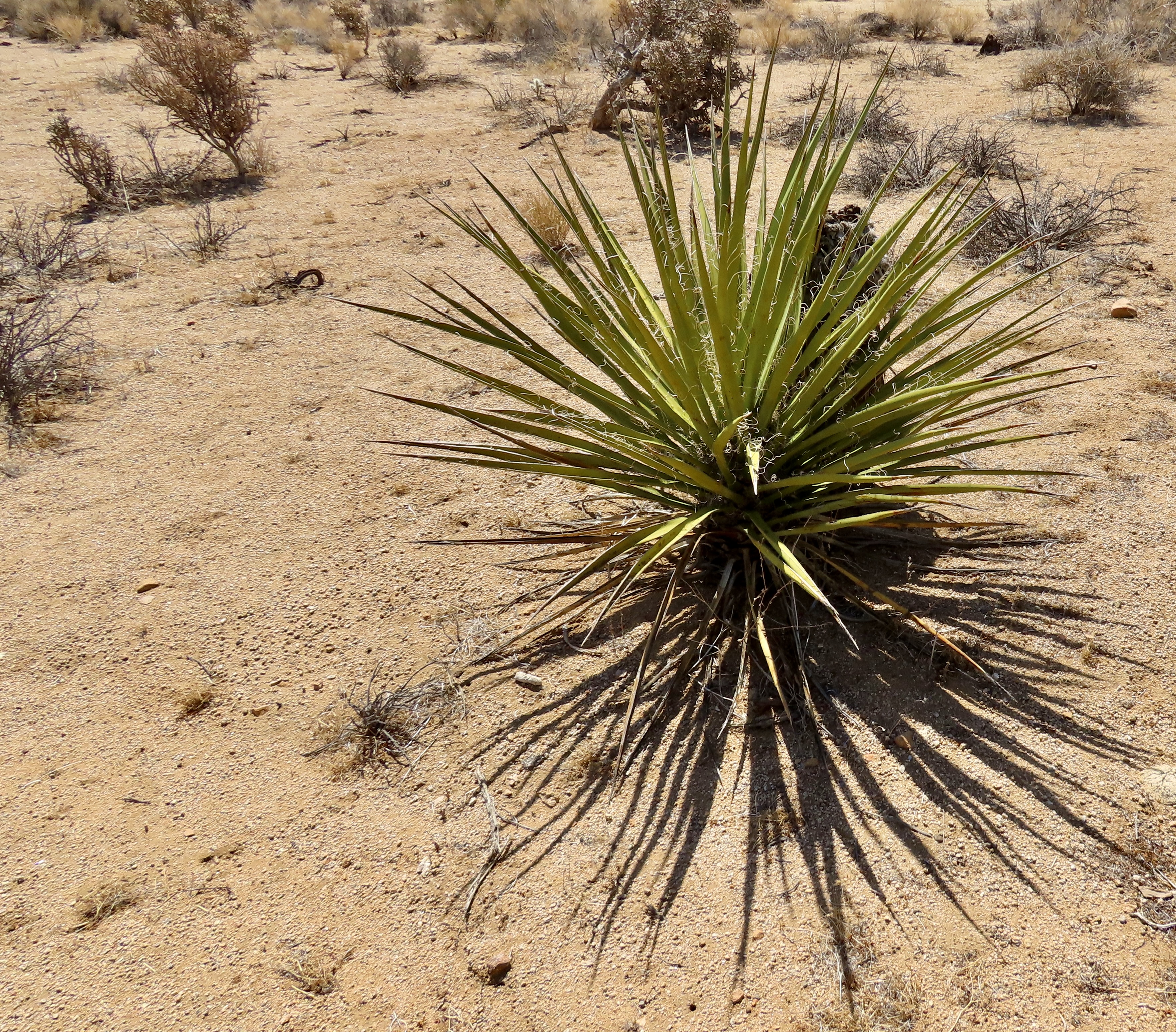
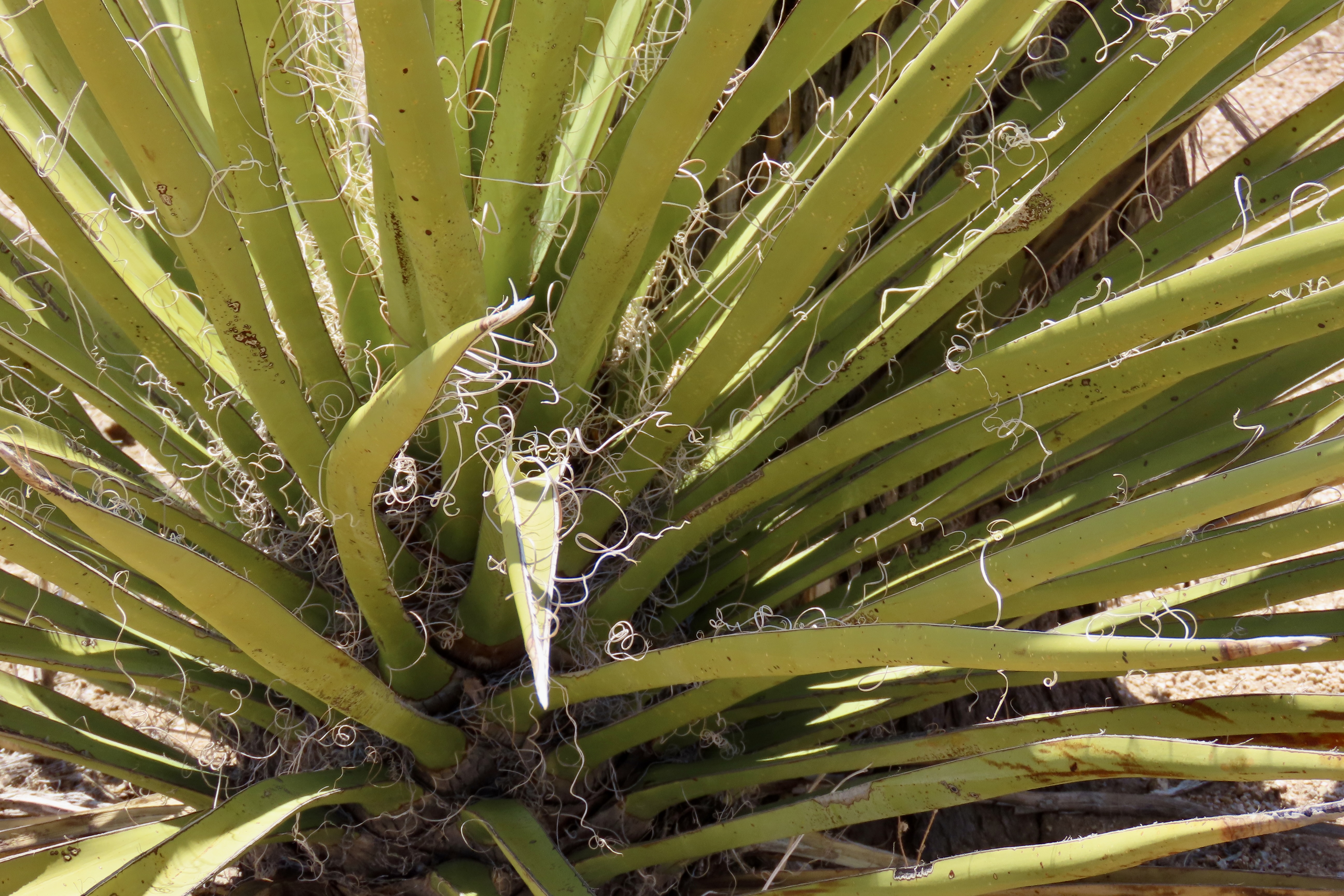
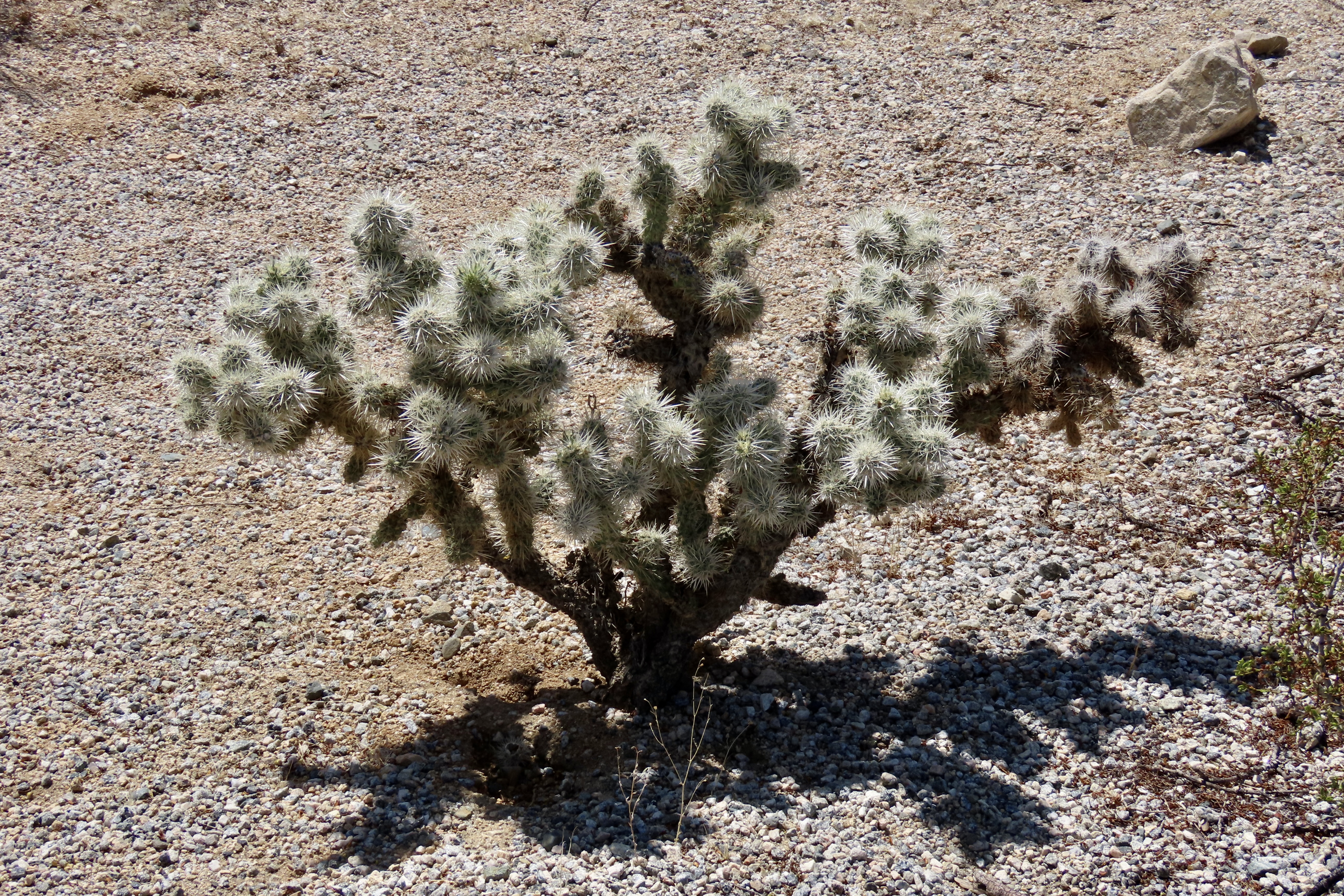
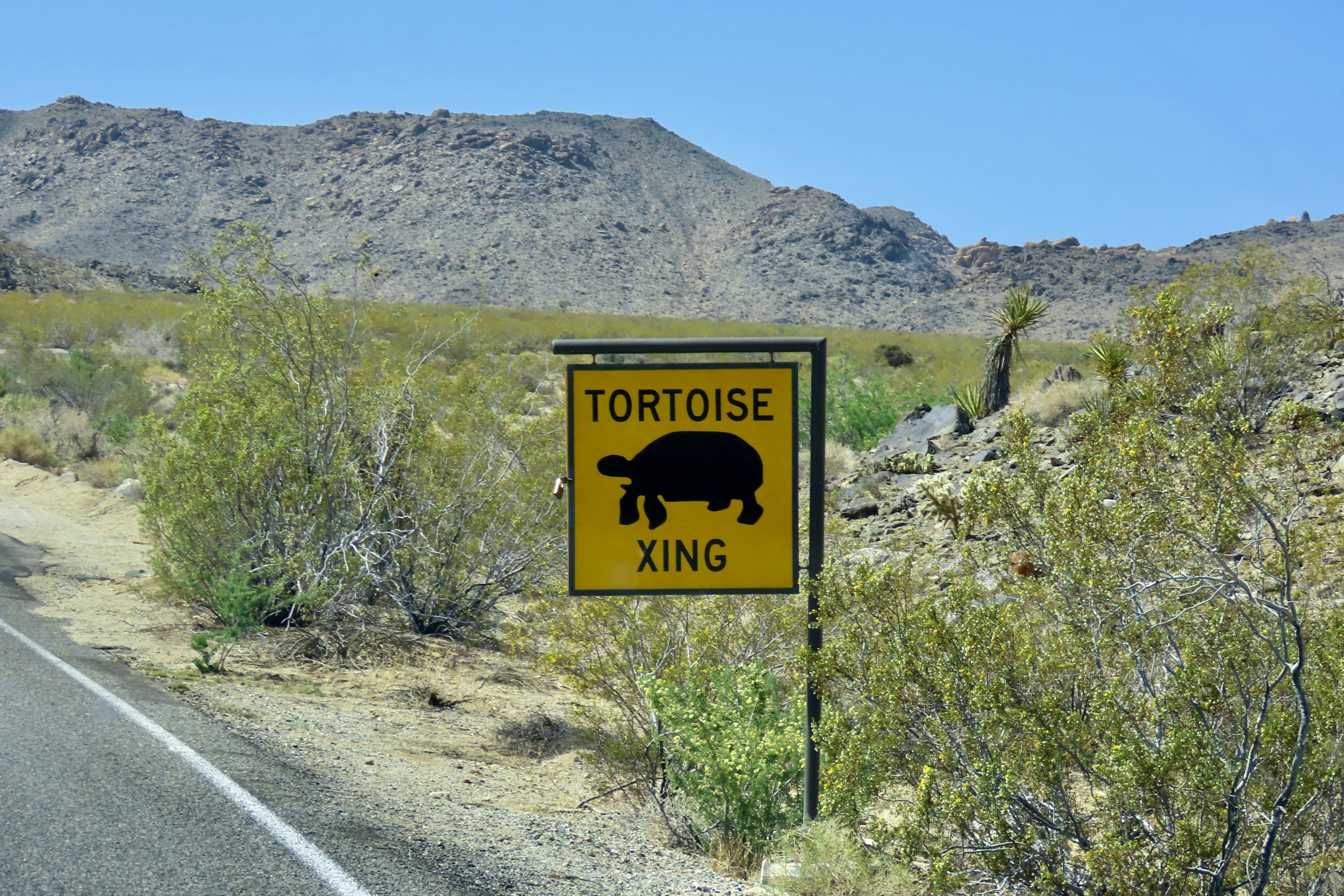
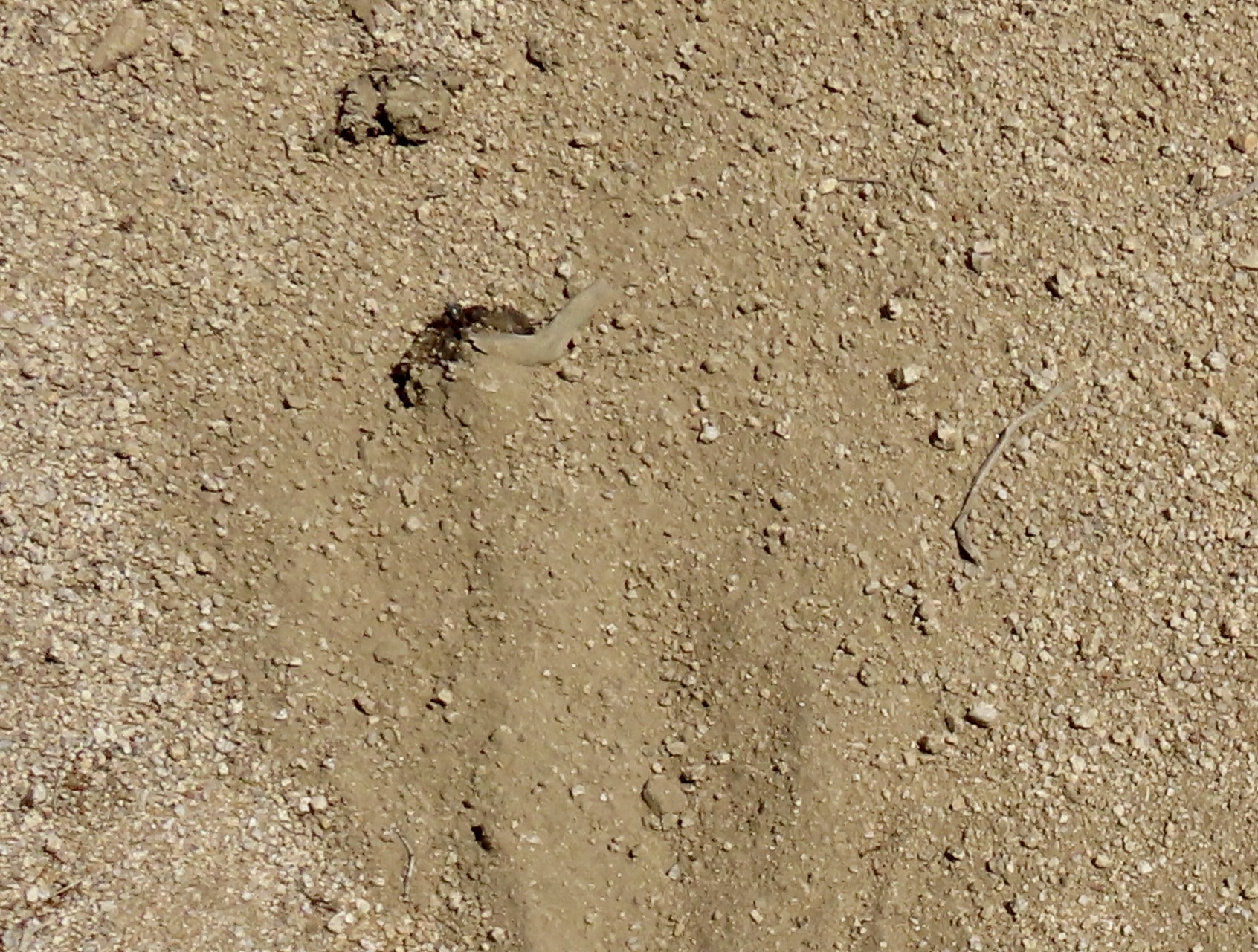
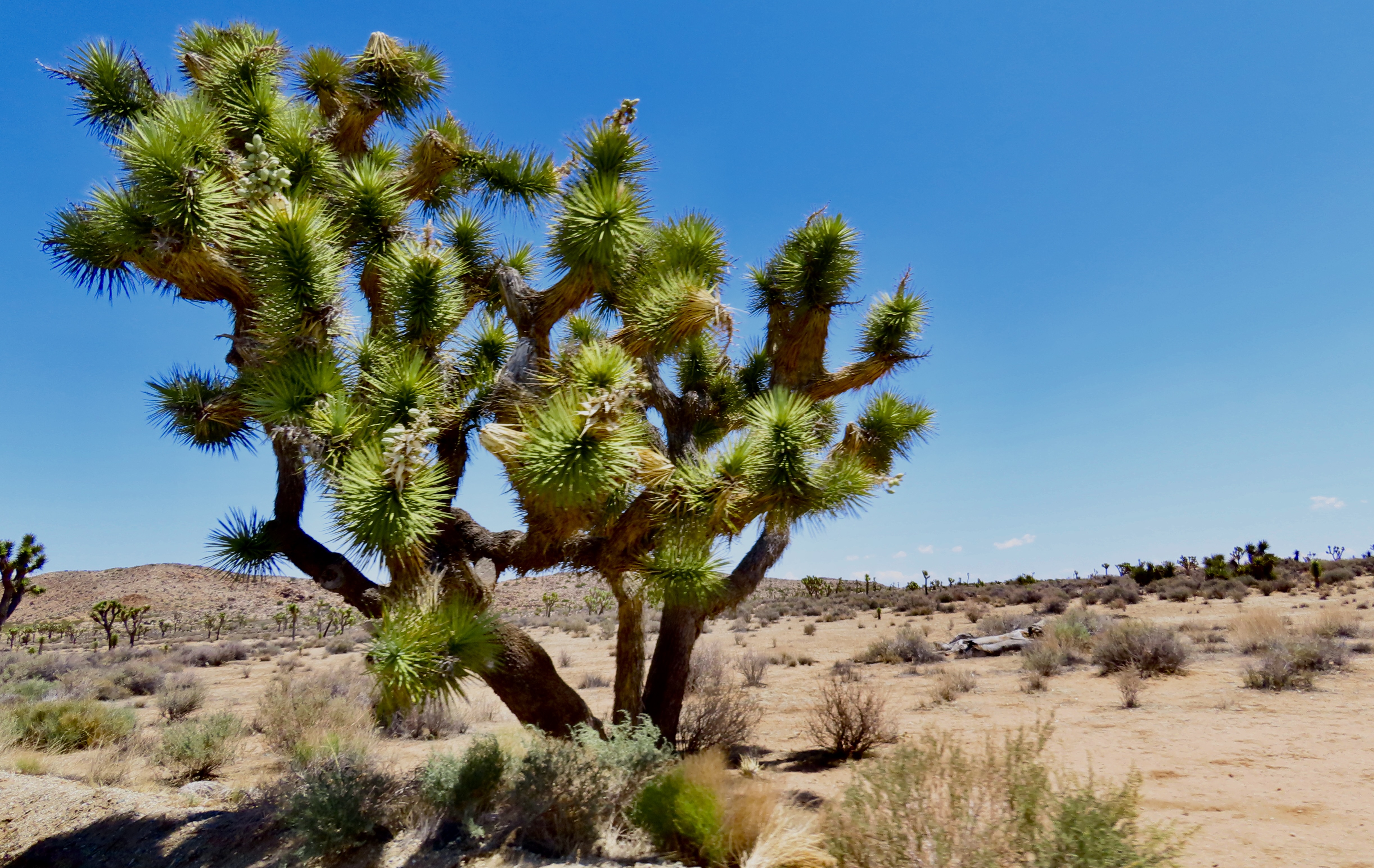
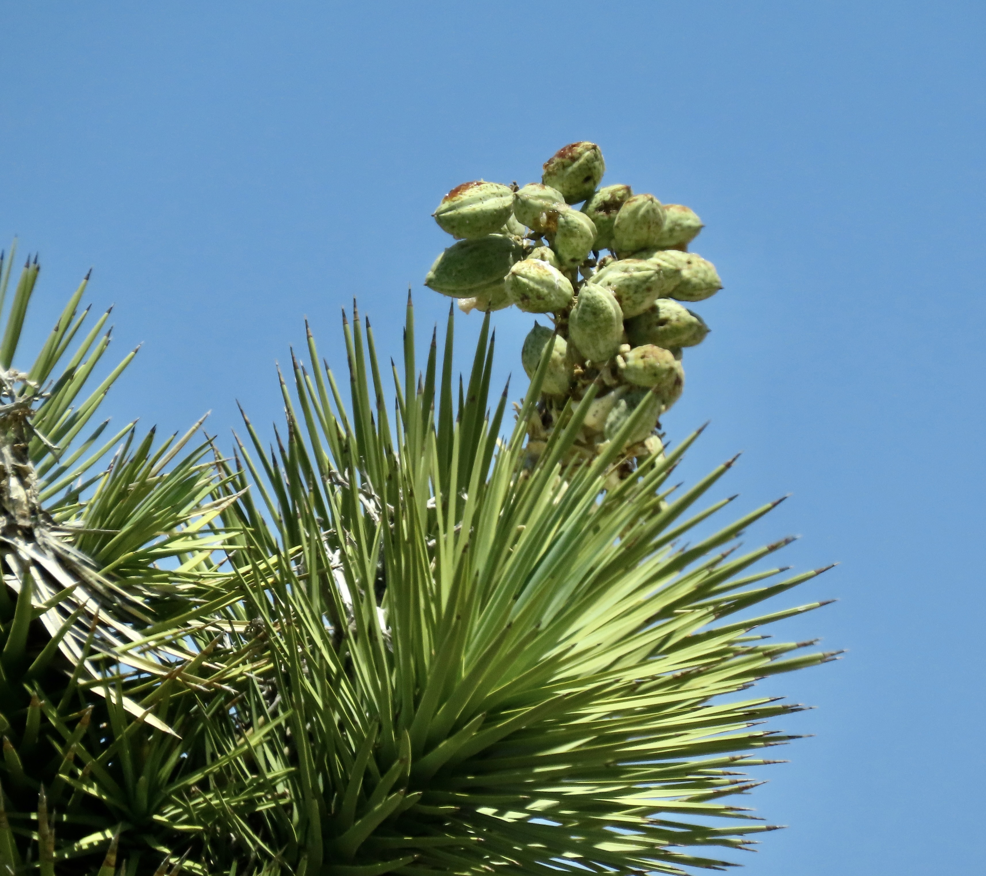
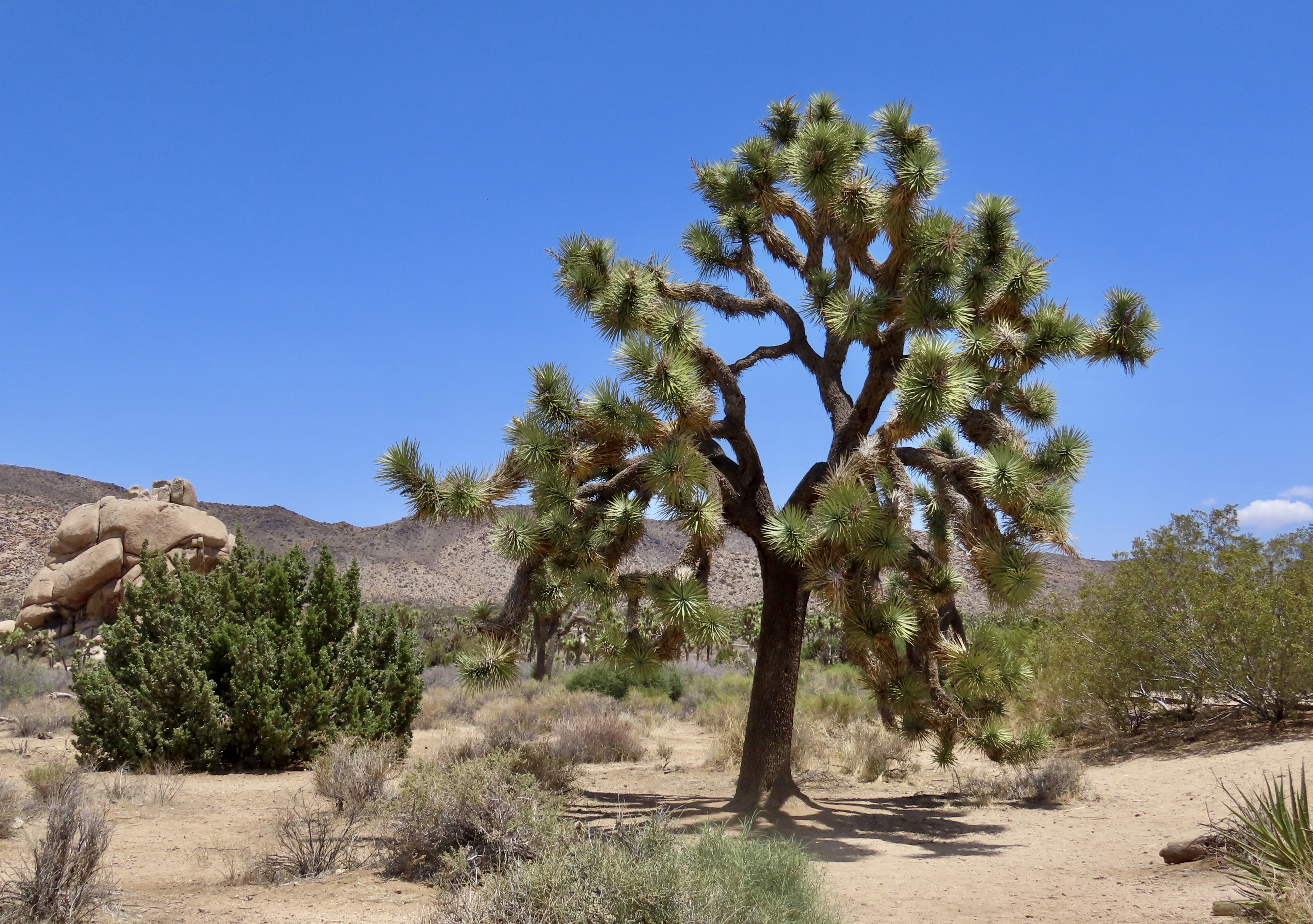
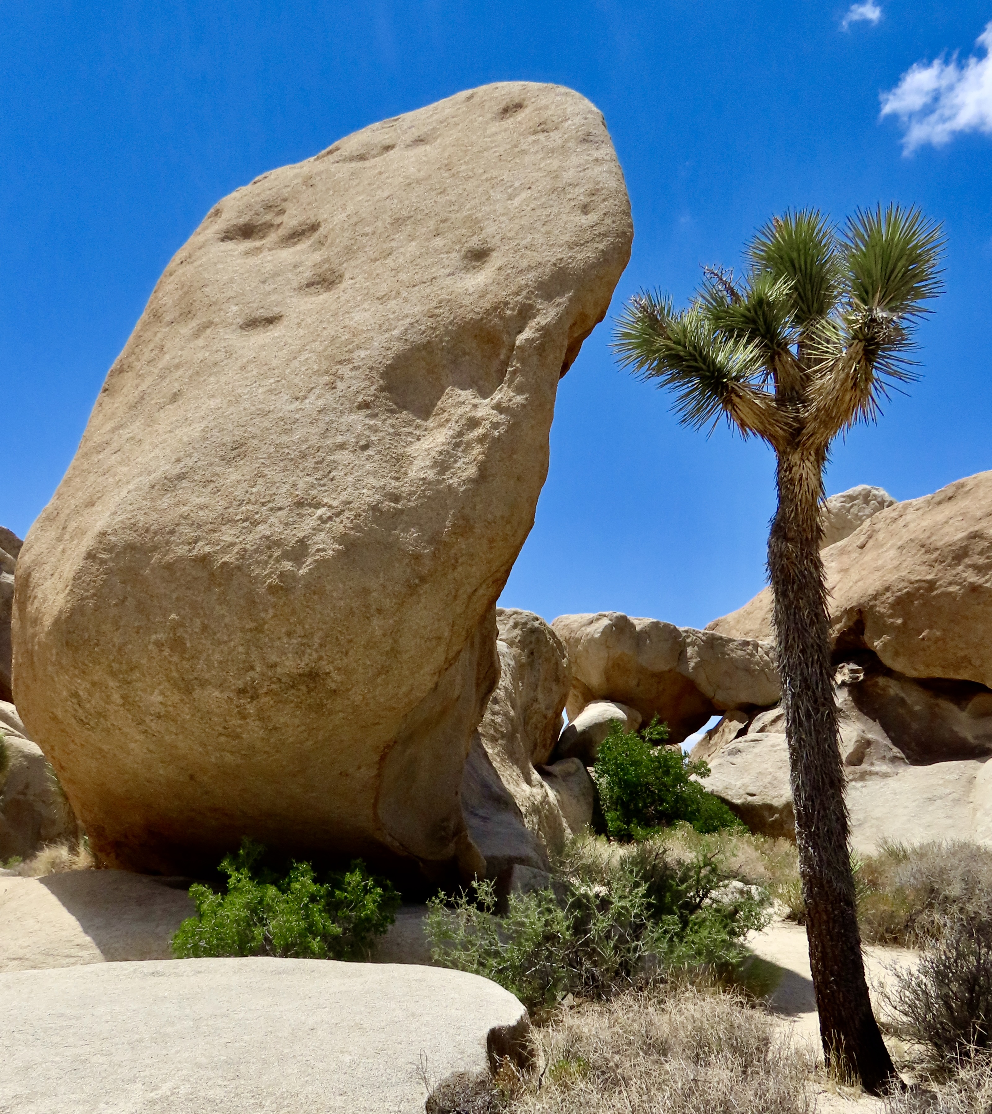
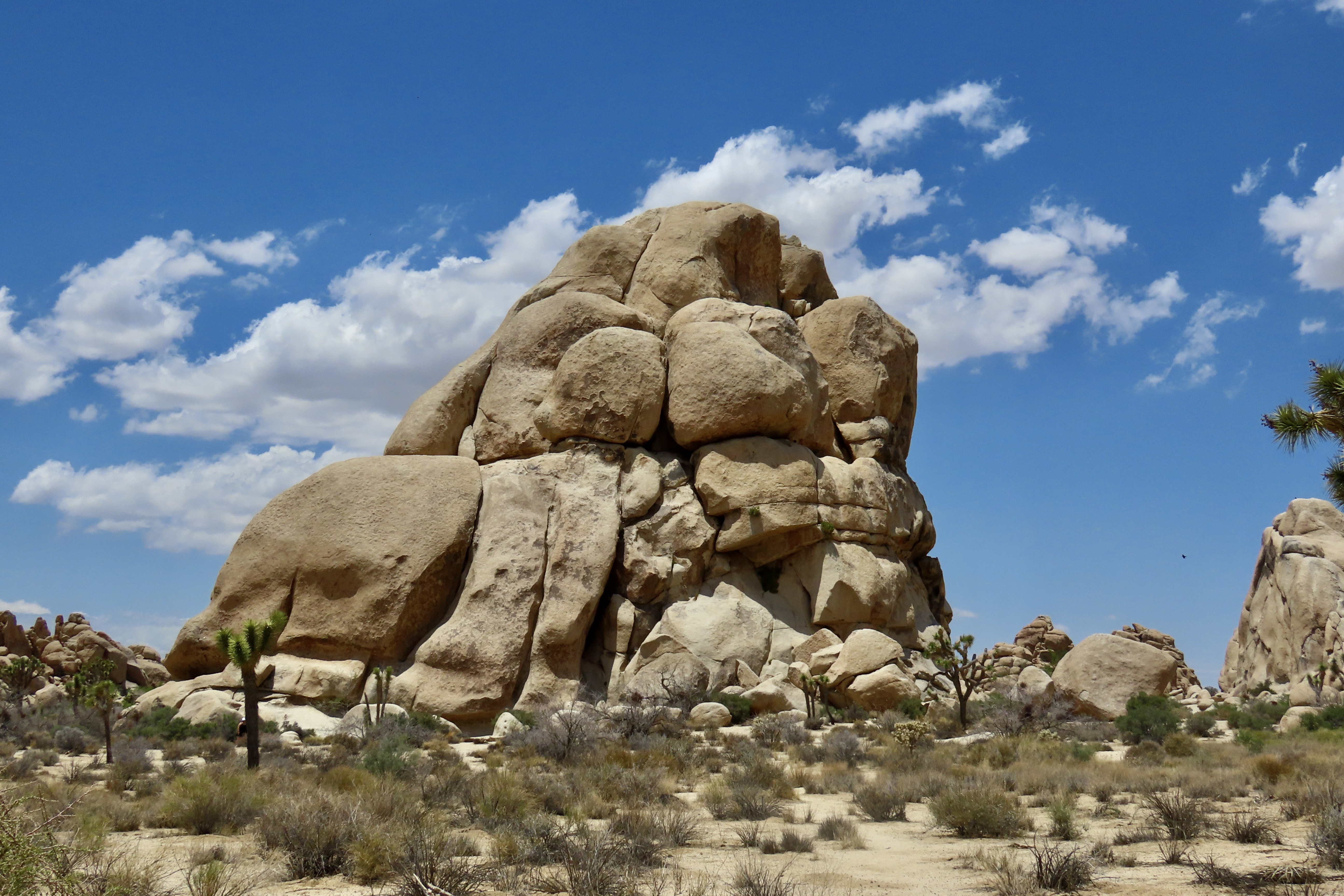
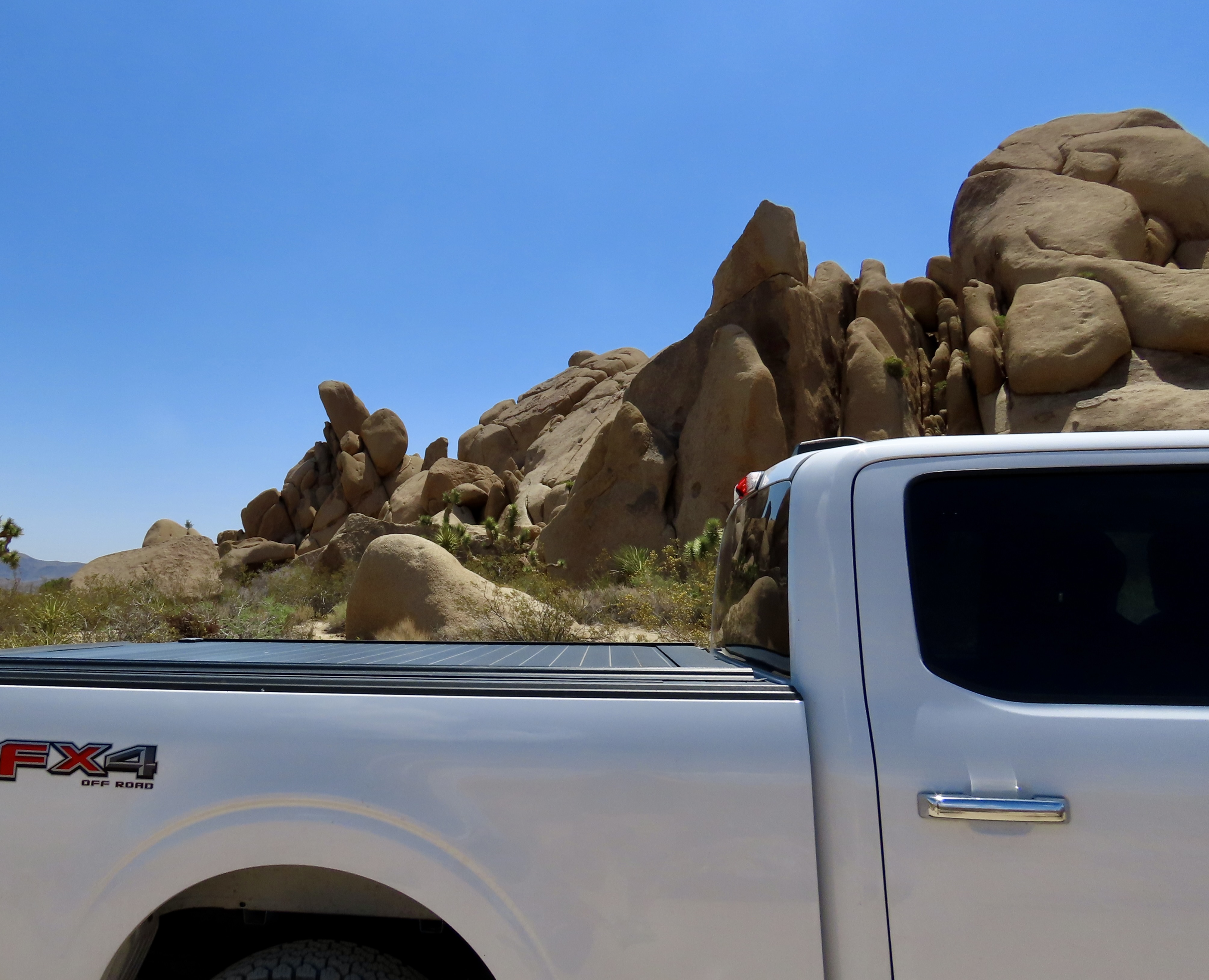
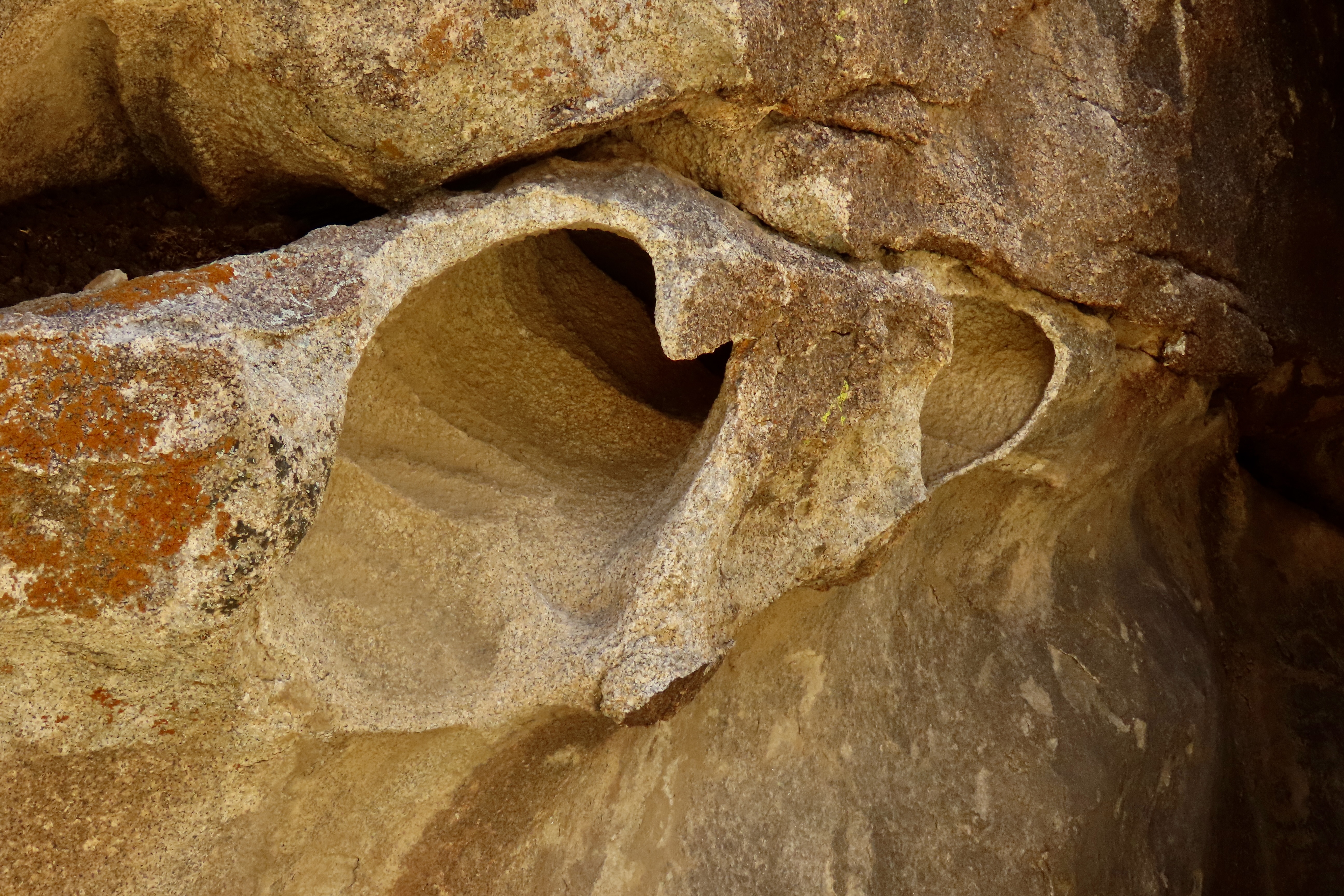
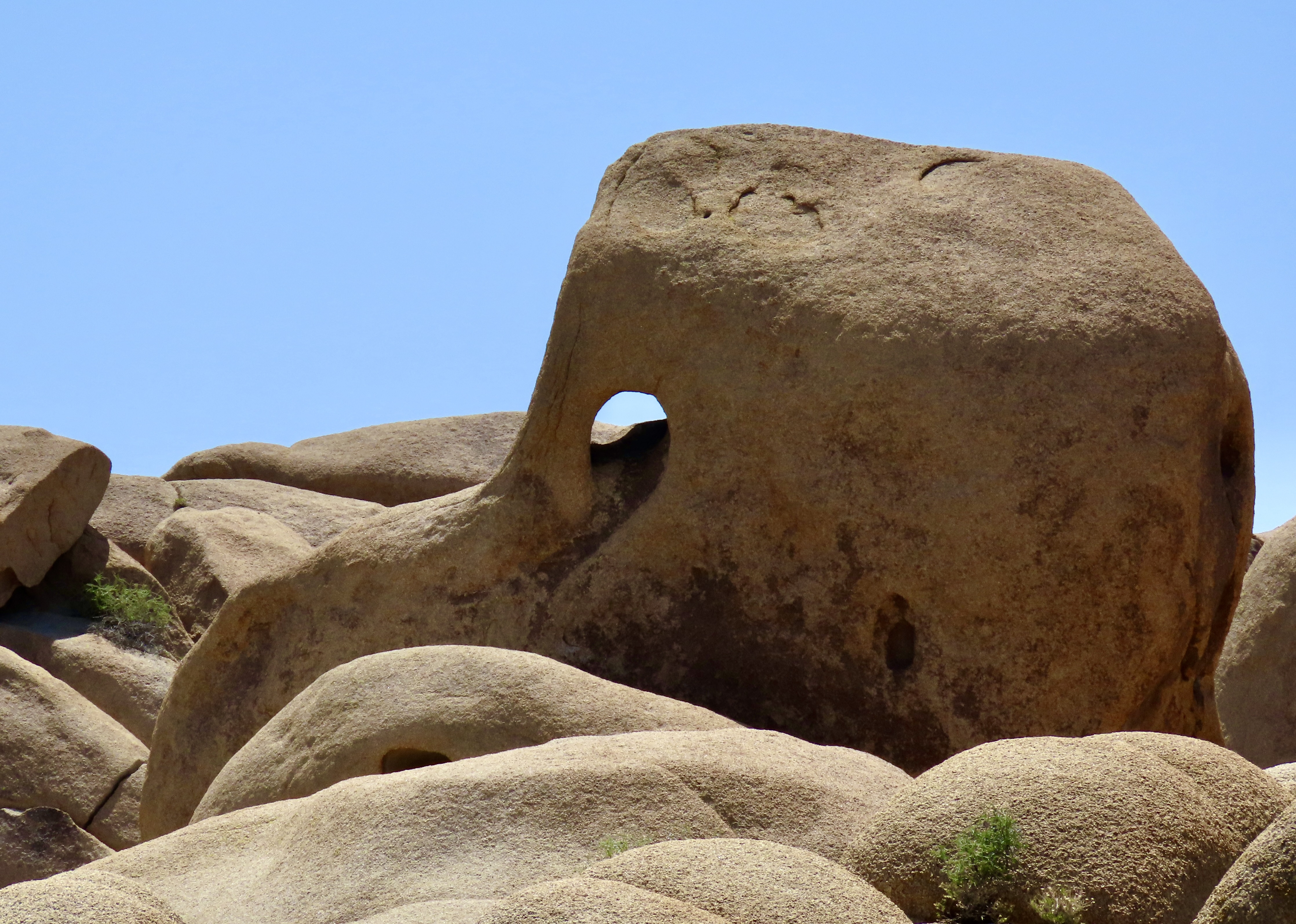
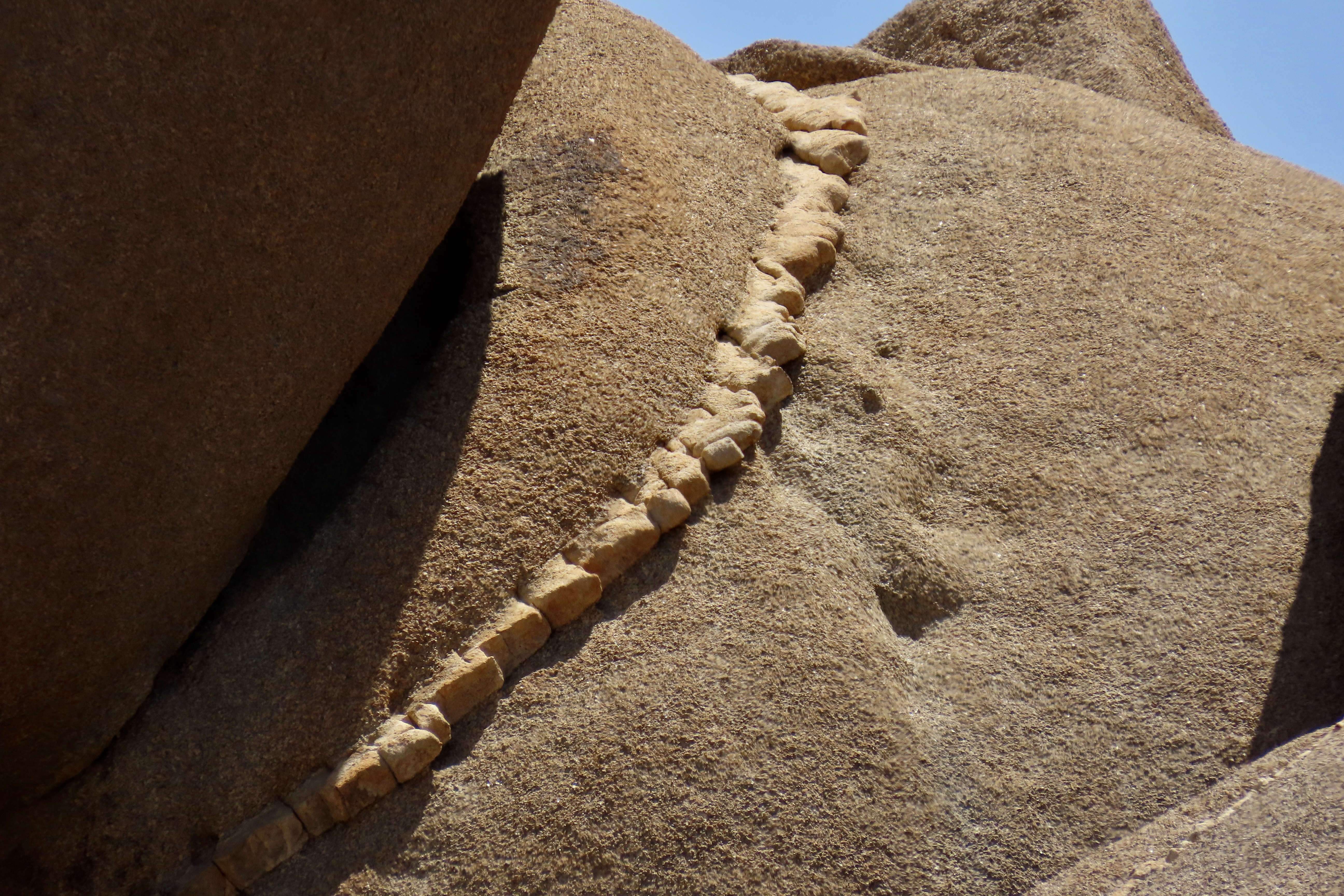
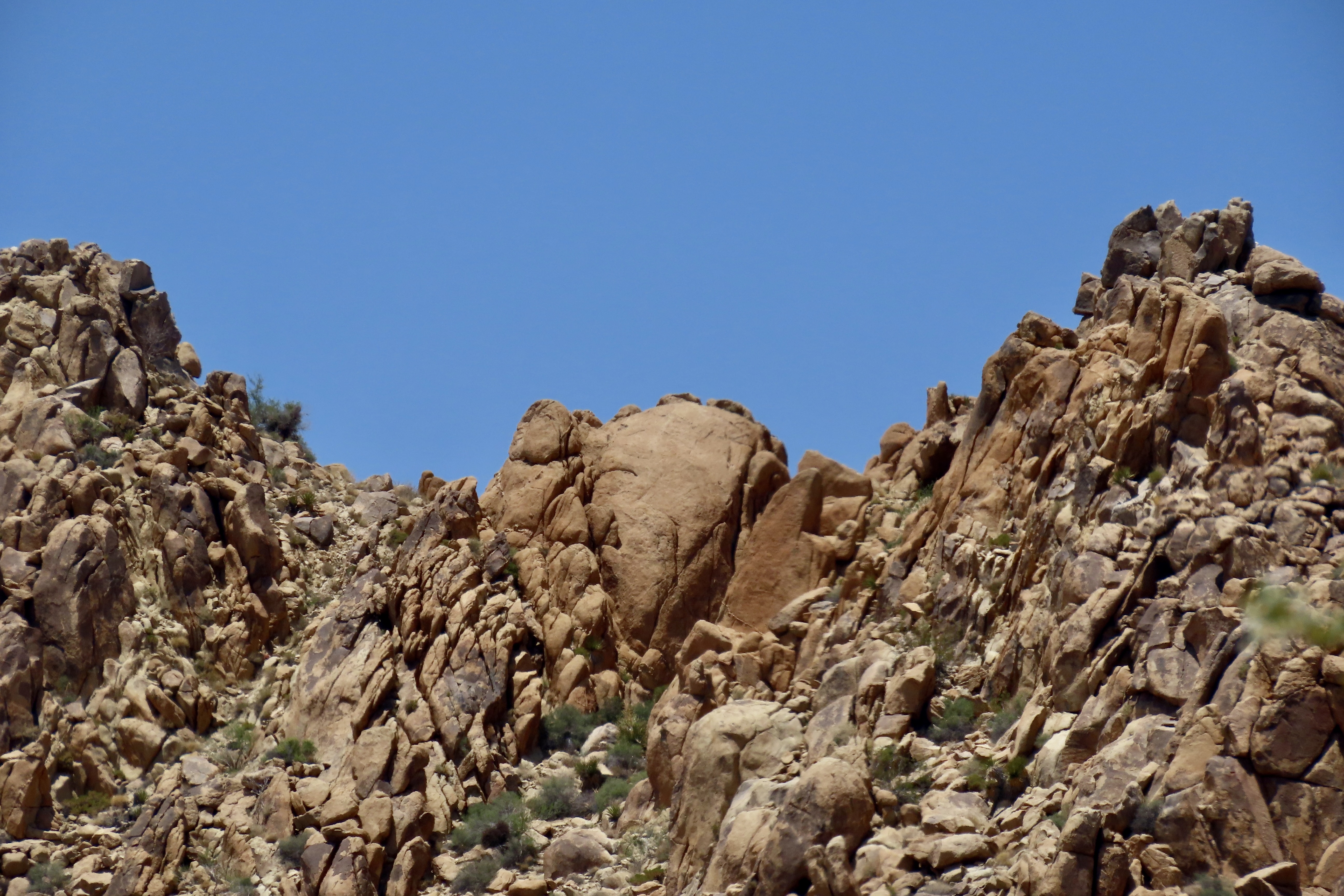
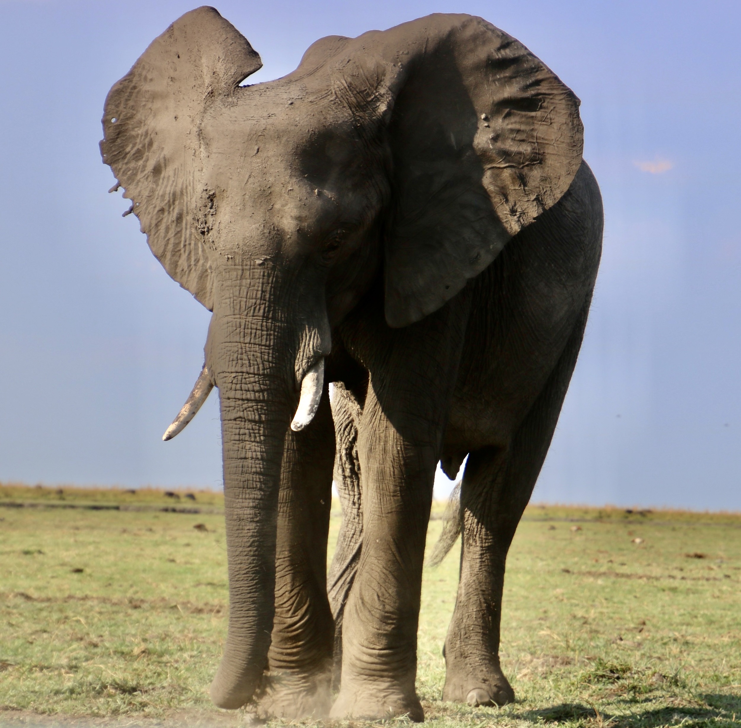
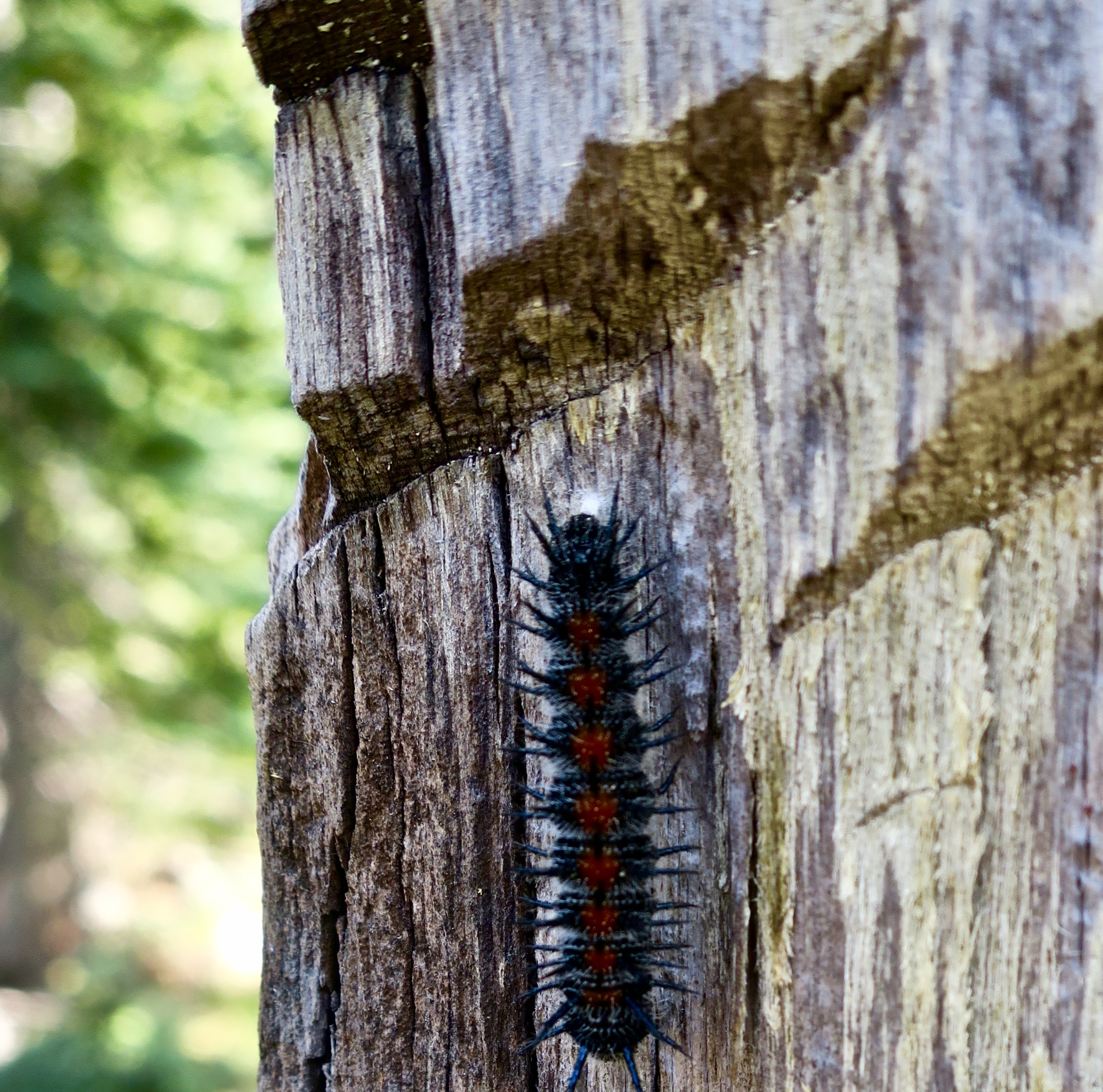
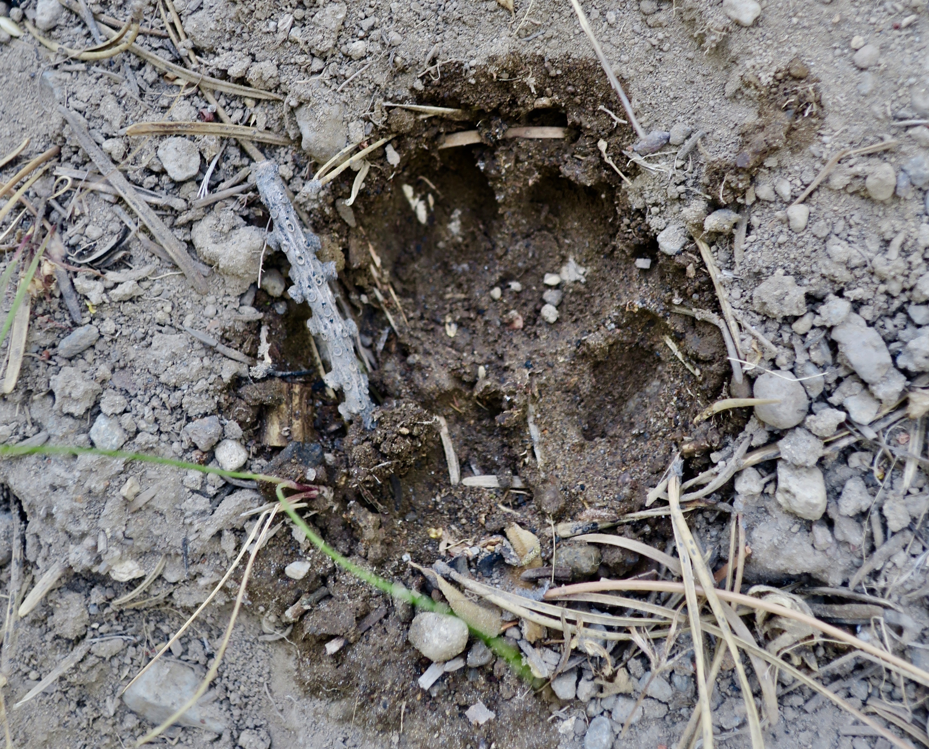
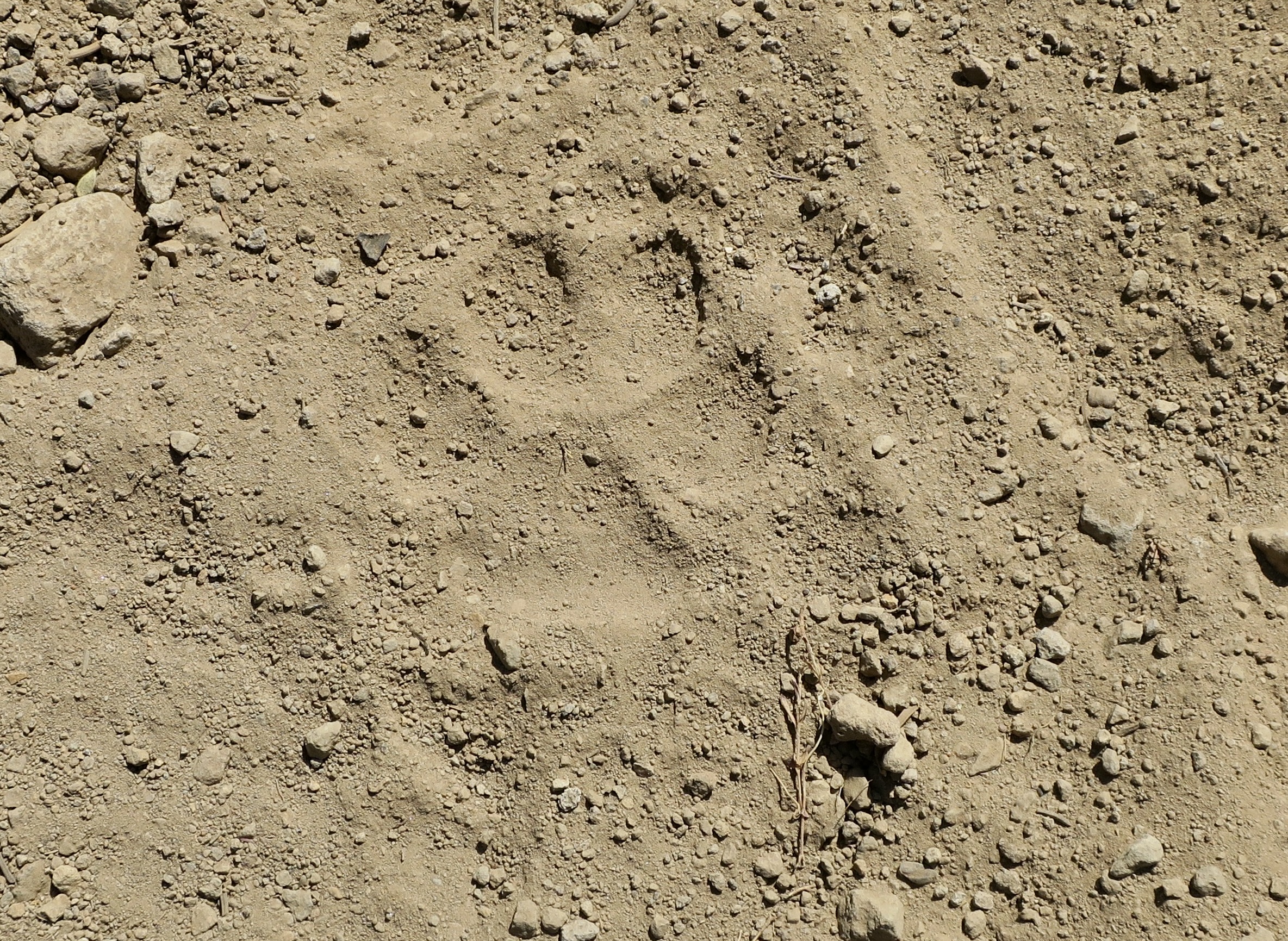
This single Joshua tree and sparce plant life backed up by a massive rock monument emphasize what Abby had to say.A yucca claimed its space on the desert floor.It featured curlicue fibers peeling off the edges. They are common to yuccas.Also claiming its space was a cholla and its shadow backlit by the sun. As untouchable as they appear, we found birds nesting in them throughout the Southwest. What spelled danger for most animals (including us), proved to be a safe haven for Curved Bill Thrashers and Cactus Wrens.This tortoise crossing sign reminded us of how much plants and animals that call desert home have adapted to life in an extreme hot, dry climate. Tortoises, for example, are experts at getting water from plants and conserving what water they get. When water is in short supply, they excrete their urine in a toothpaste-like form and hang on to the water! On a more prosaic note, I wondered how fast they can move. They are turtles after all. I learned that Bertie the Tortoise holds the Guinness record of .6 of a mile per hour. I also learned what a group of turtles are called: A creep. You can challenge your friends with this one.Careful observation informed us of other desert inhabitants. Something had scratched the ground here. But who— and what for. I noticed something partially buried at the end of the scratch and looked closer…It was fresh scat filled with berries. When one thinks of buried scat, the first thought that normally comes to mind is a cat, right? That led me to think bobcat. While they are mainly carnivorous, they won’t pass up berries if their favorite food isn’t on the menu. With that in mind, we left thinking it was probably a bobcat that had passed by the night before. That may be older cat-scat just above it. If so, the bobcat was likely marking its territory.Legend has it that the Mormons making their way through the desert named Joshua Trees after the Biblical Joshua who ‘lifted his arms’ to guide the Israelites. These youngsters ‘raising the arms’ may be sprouting from a fallen tree.The usual form of propagation is from seeds, however. We saw several Joshua trees sporting seed pods. A freeze is required for the tree to bloom and produce seeds. (Because of the requirement, global warming may endanger the plant. Forest fires have also taken a toll.)Seed pods. There is one more requirement: Yucca moths. The tiny, rice-sized insects are the trees sole pollinators and the trees flowers are the sole hosts for yucca moth eggs and caterpillars, thus forming an evolutionary, symbiotic relationship.While most Joshua trees seem rather skimpy, this one was a beauty. The trees normally grow to be around 40 feet tall and live around 150 years. Giants can top out at over 50 feet and live to be 300. Lacking tree rings, however, age is extremely difficult to determine. Some may be much older.A forest of Joshua trees.And now, on to the rocks. This skinny Joshua tree and massive rock seem to be having a conversation.The most impressive pile of boulders we saw.For fun, we took a photo of our truck, Iorek, in front of a rock pile. (Iorek is named after the Polar Bear in The Golden Compass. Our travel trailer is named Serafina, after the witch in the movie.) It wasn’t until I was putting together today’s post that I noticed the rock reflection in rear window. What a great optical illusion. It appears to be coming out of the window.This split rock was the most unusual stand-alone rock we saw. Holes in the rocks led to some interesting photo ops.Peggy playing around. Had she been 70 years younger, I can guarantee she would had been crawling through. In fact, there was no guarantee she wouldn’t at 75!We thought, “bird.”Close up. Snoopy’s friend Woodstock, perhaps.A necklace of rock cutting through the granite caught our attention. It was formed after the monzogranite formed and developed cracks. A subsequent flow of molten rock consisting of a mixture of quartz and potassium minerals were forced into the cracks and cooled as lighter colored rocks. When the rocks were exposed at the surface, they broke into blocks somewhat uniform in structure.As the granite eroded away, it left the harder dike rock on the surface.Nearby, a lone oak added a touch of beauty. We were surprised to find it here where Joshua trees dominate the landscape.We were also surprised to find an elephant. Grin. Can you spot its image? An elephant from our safari trip to Southern Africa two years ago. This is a good place to wrap up this blog. Next up: Bandelier NationalMonument in New Mexico.To the Ancestral Puebloans, this was home sweet home.
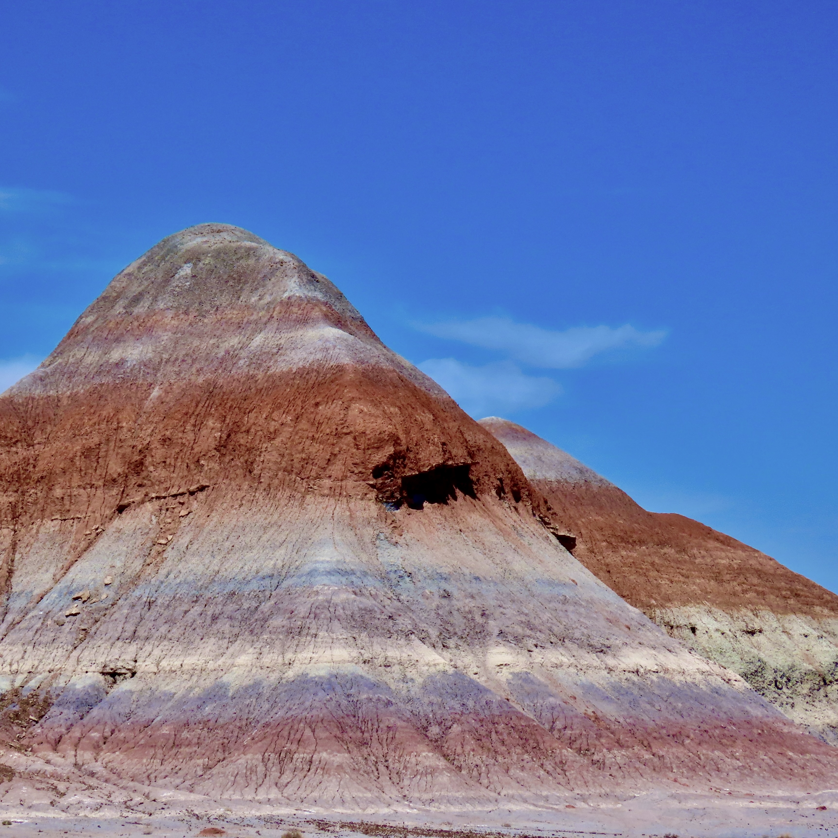
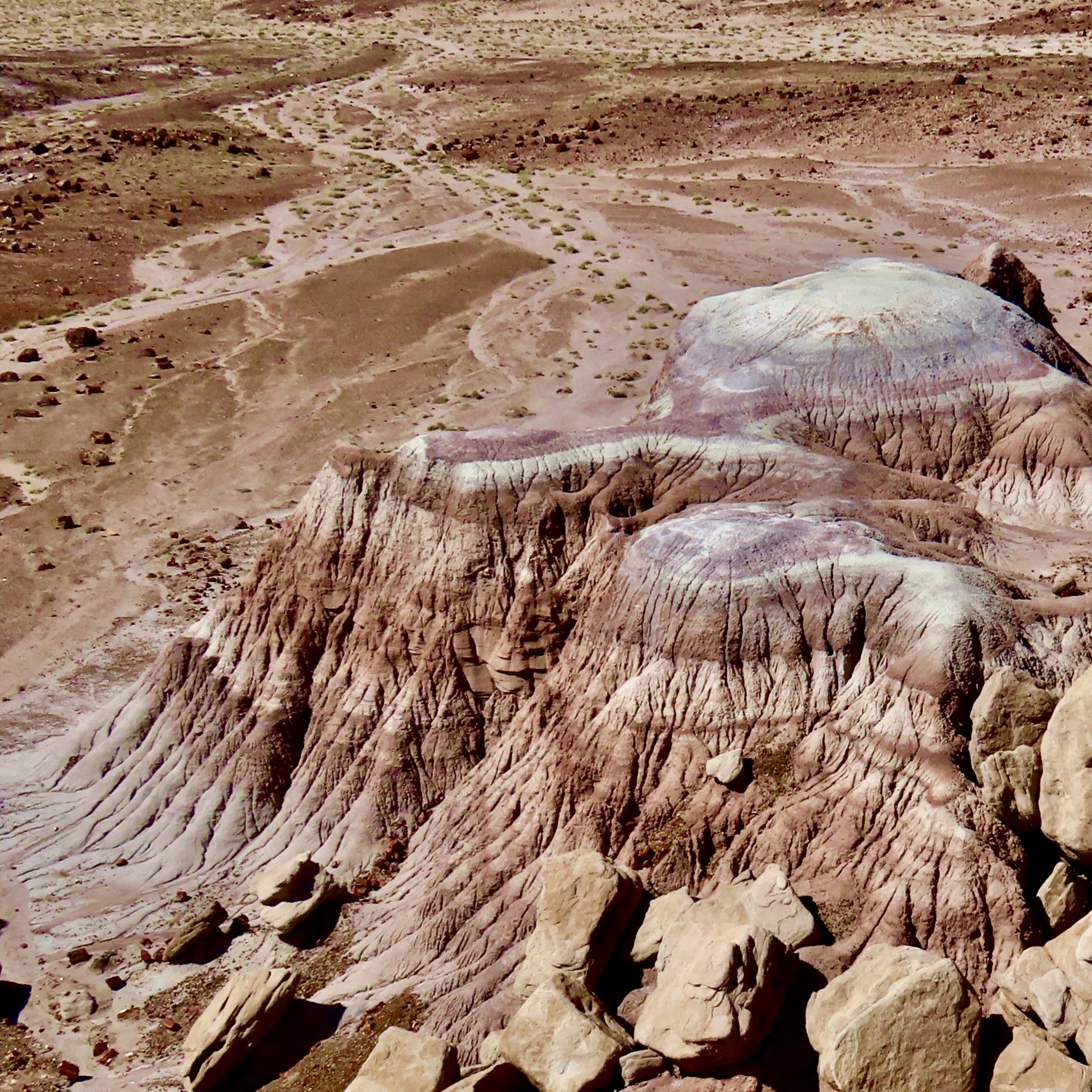
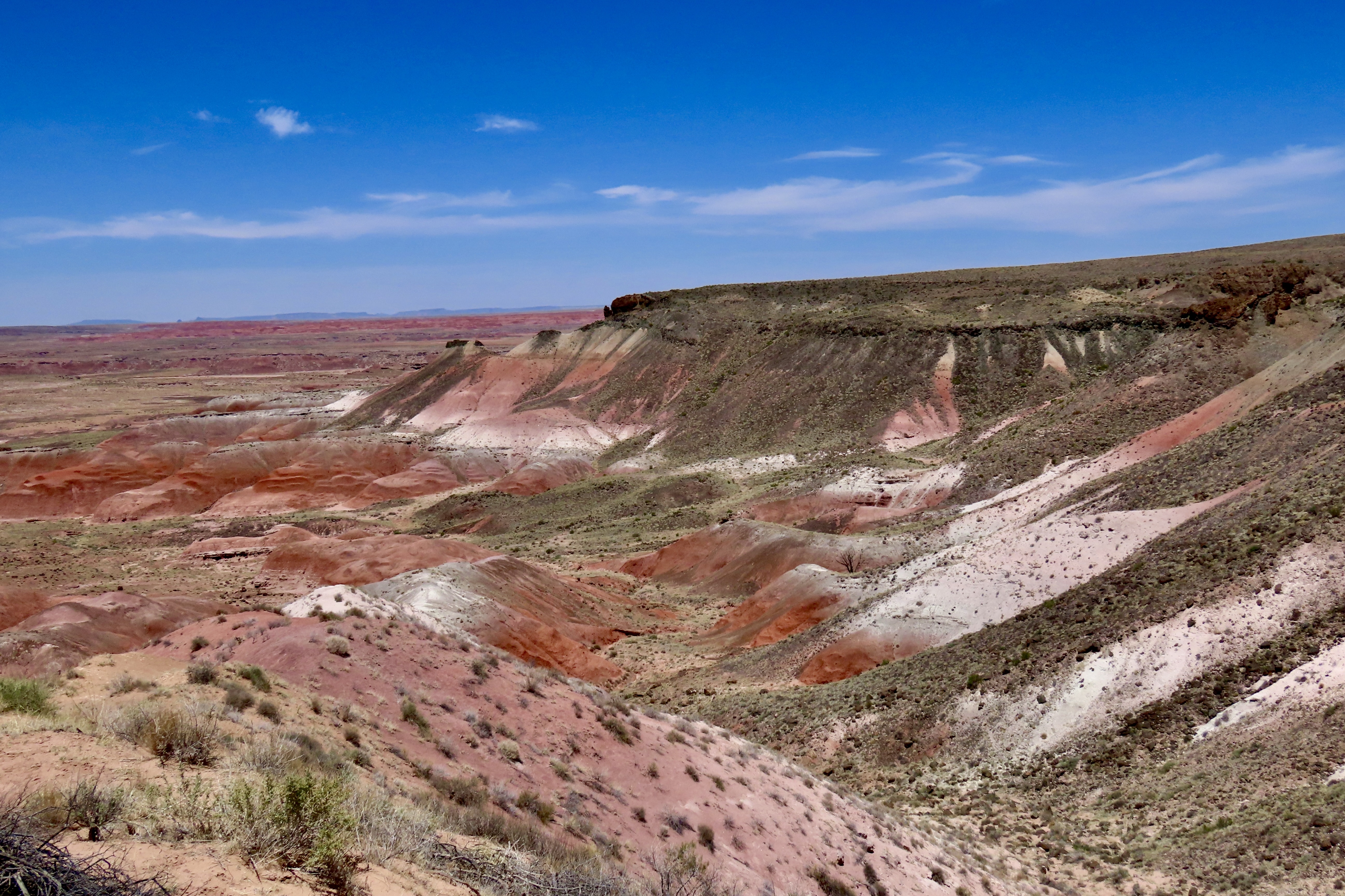
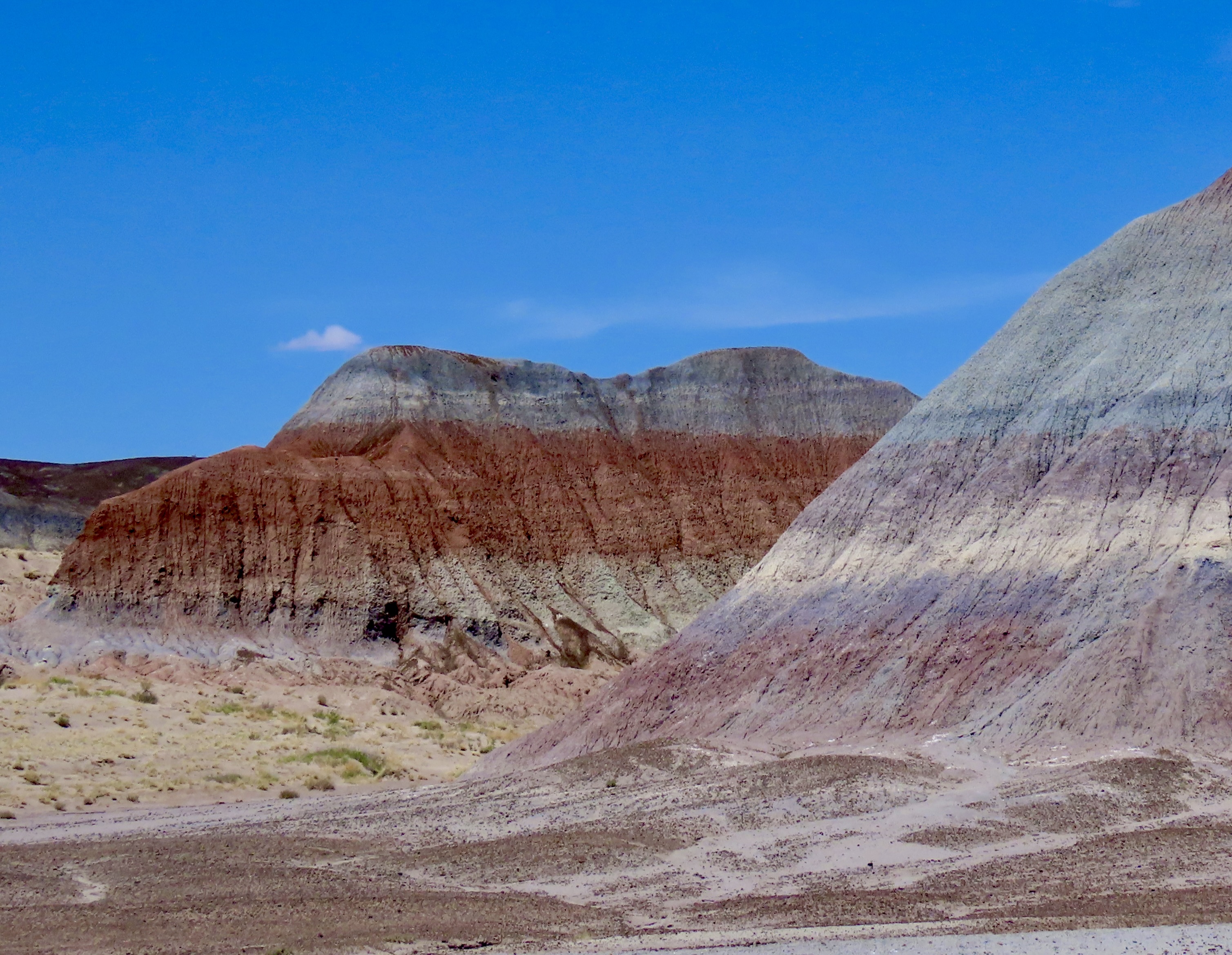
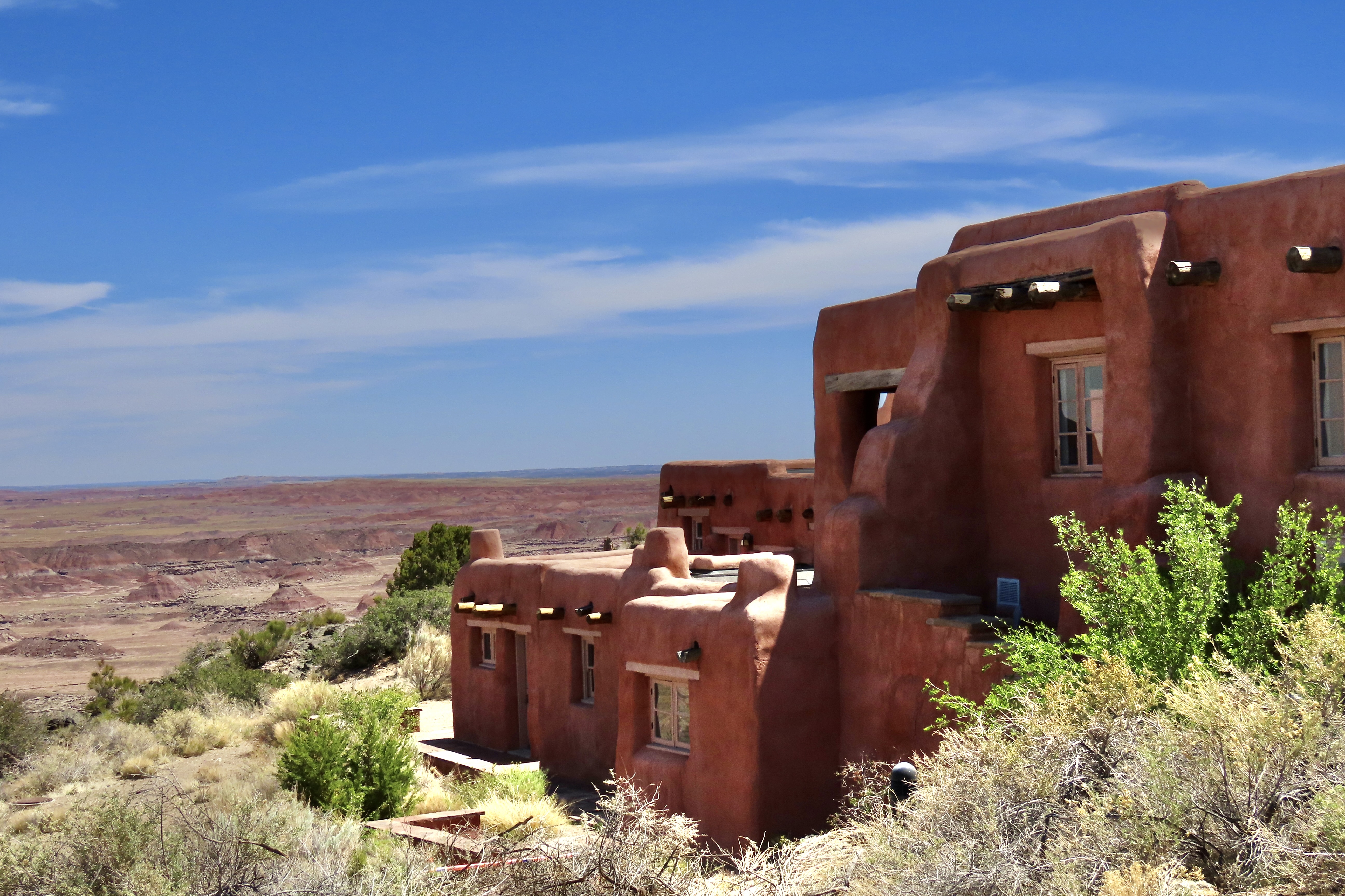
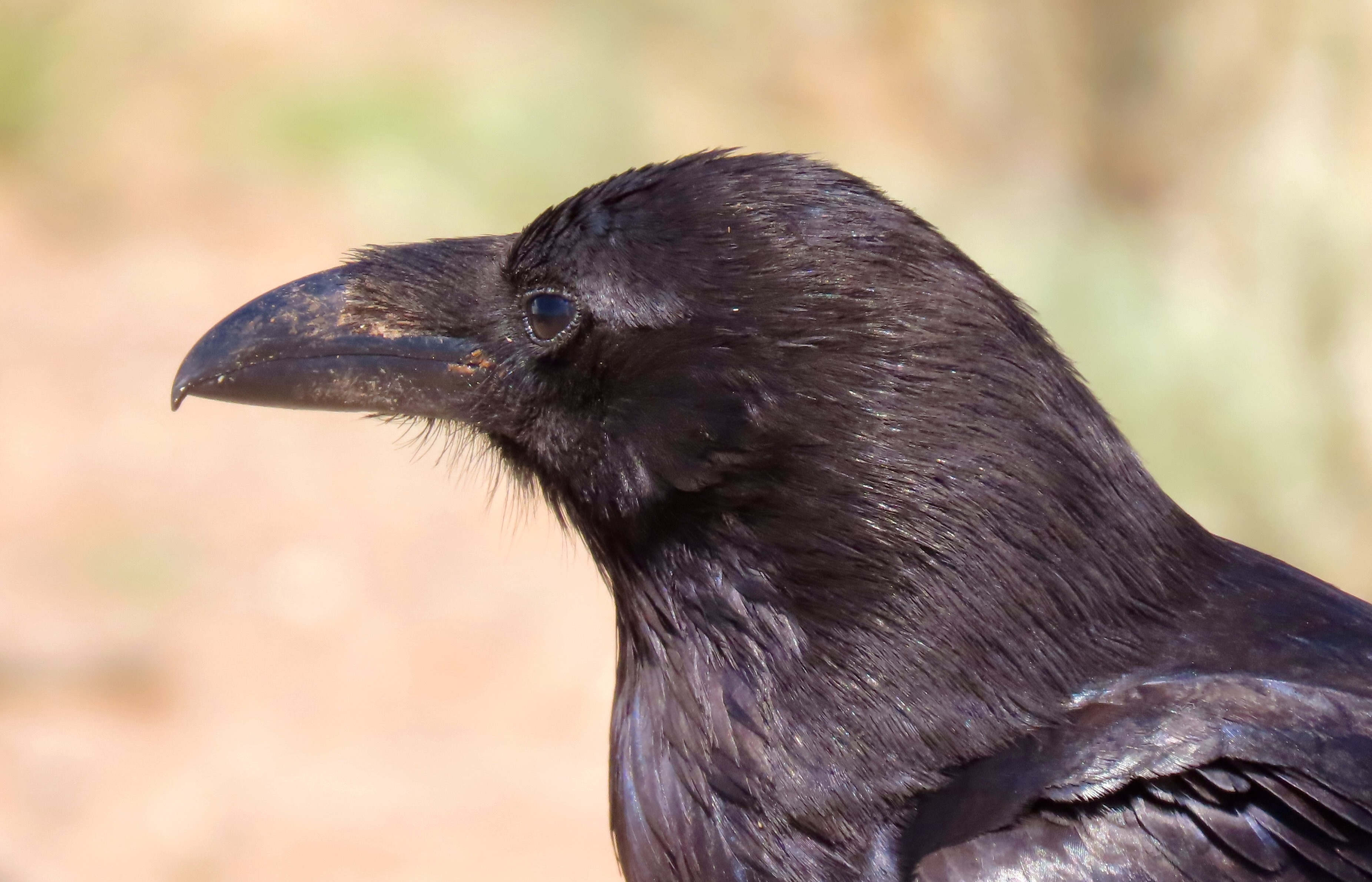
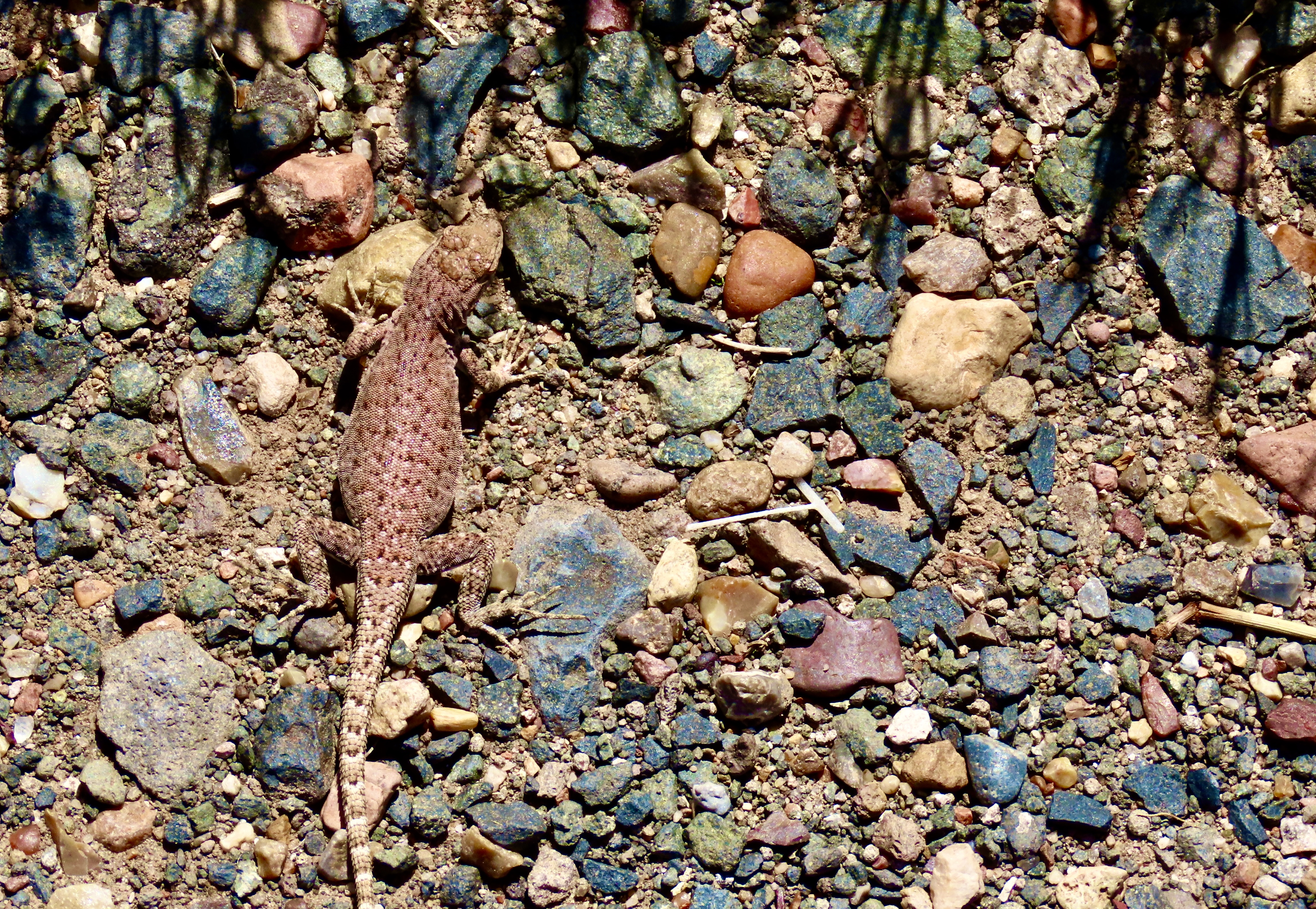
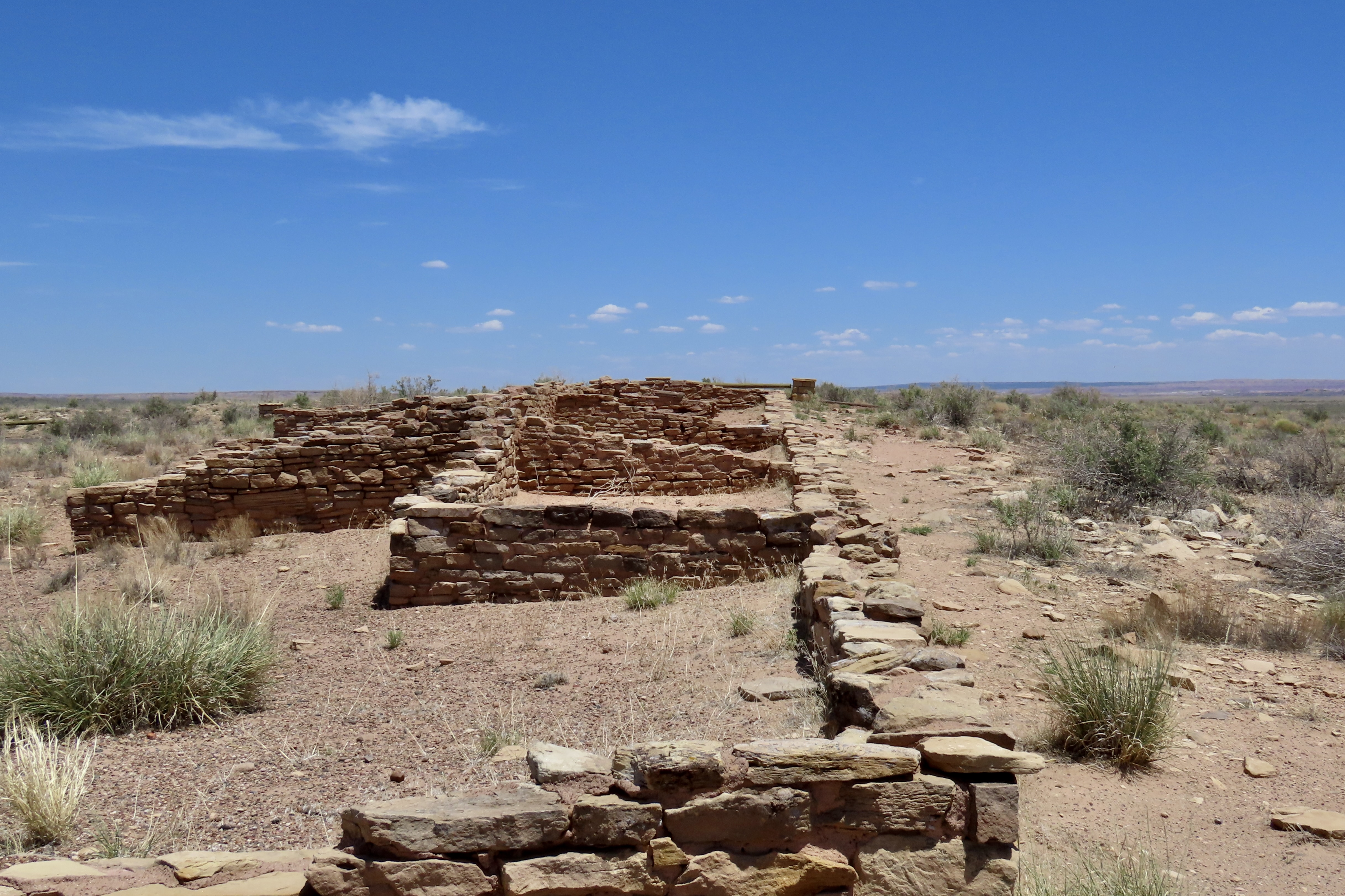
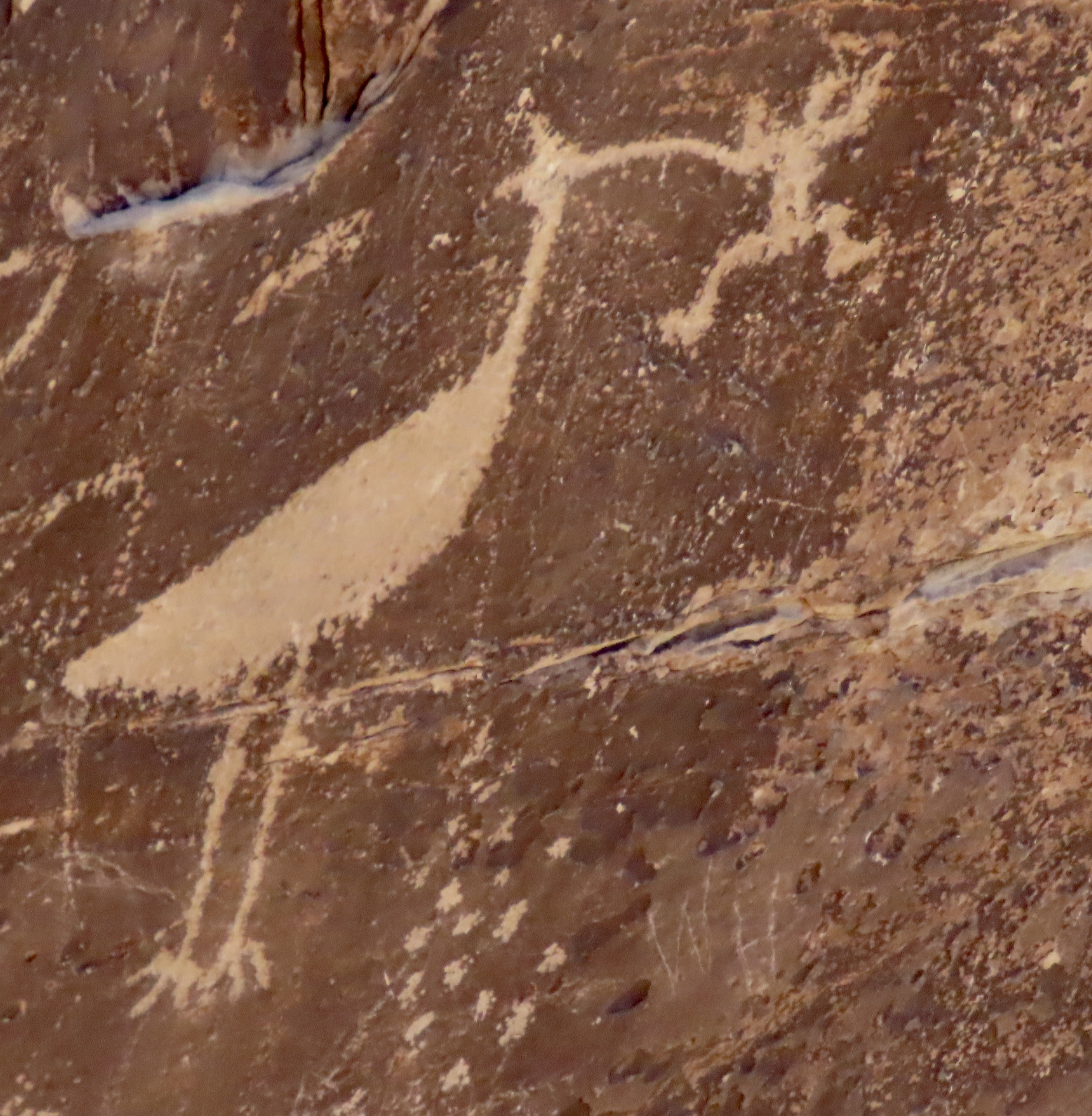
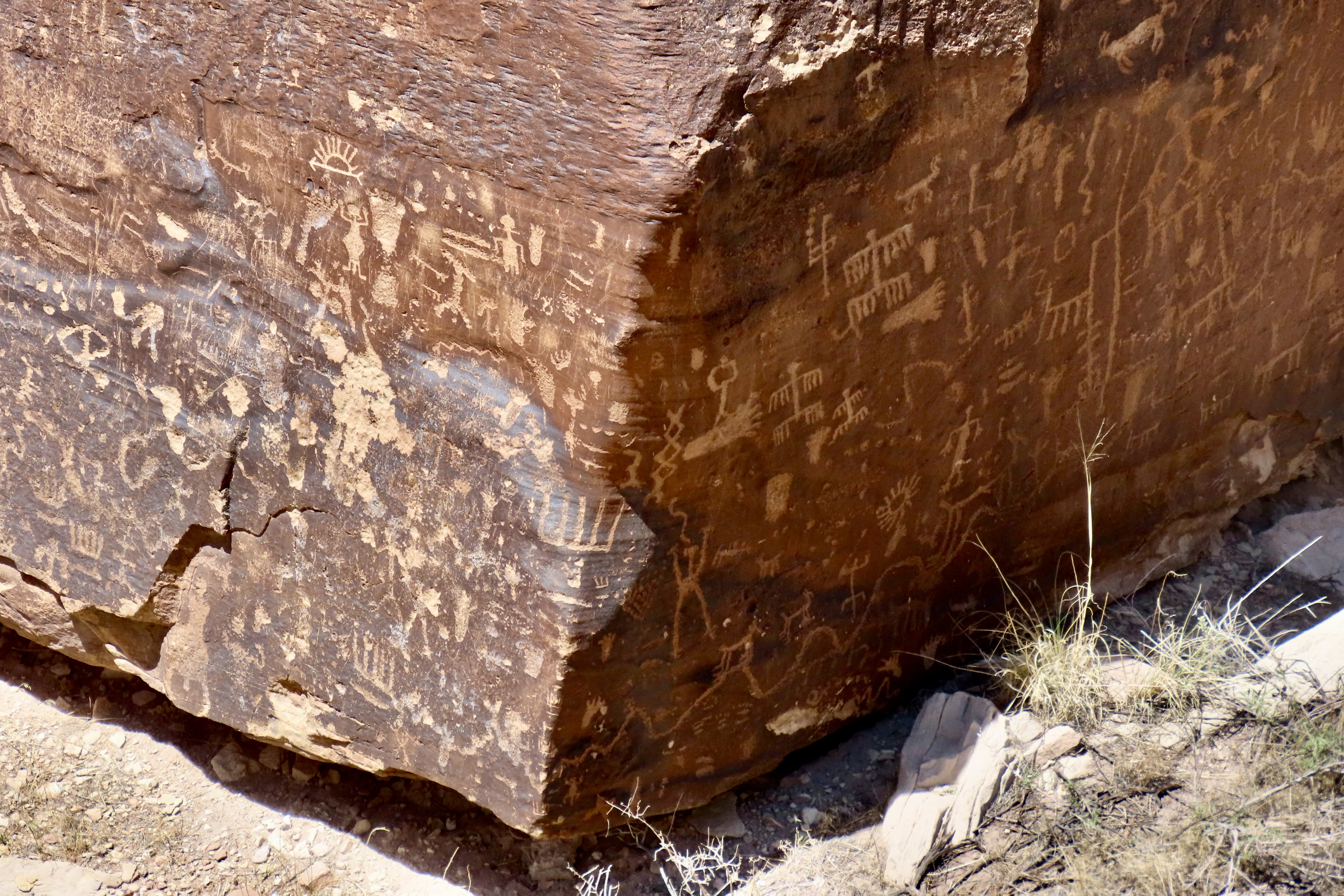
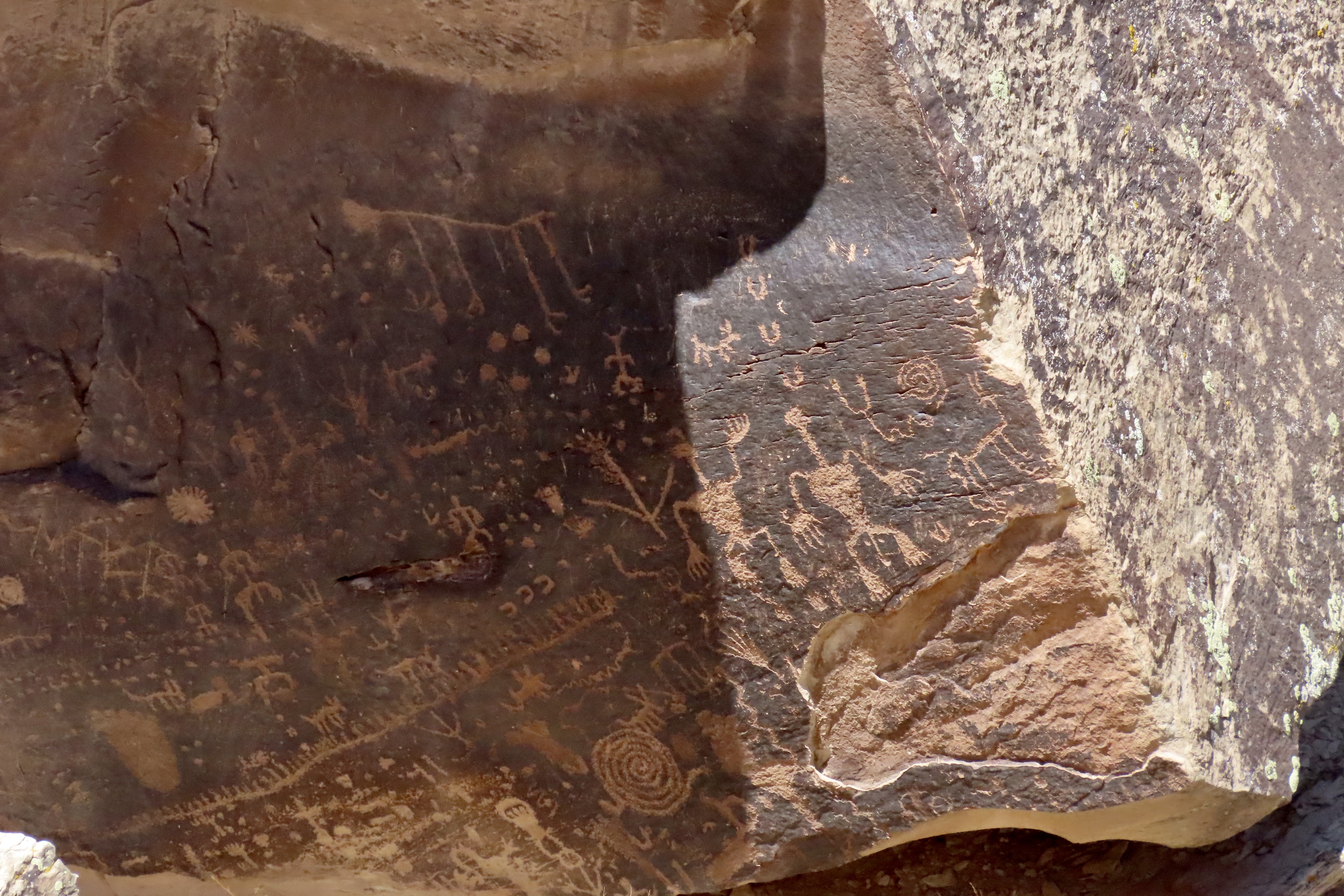
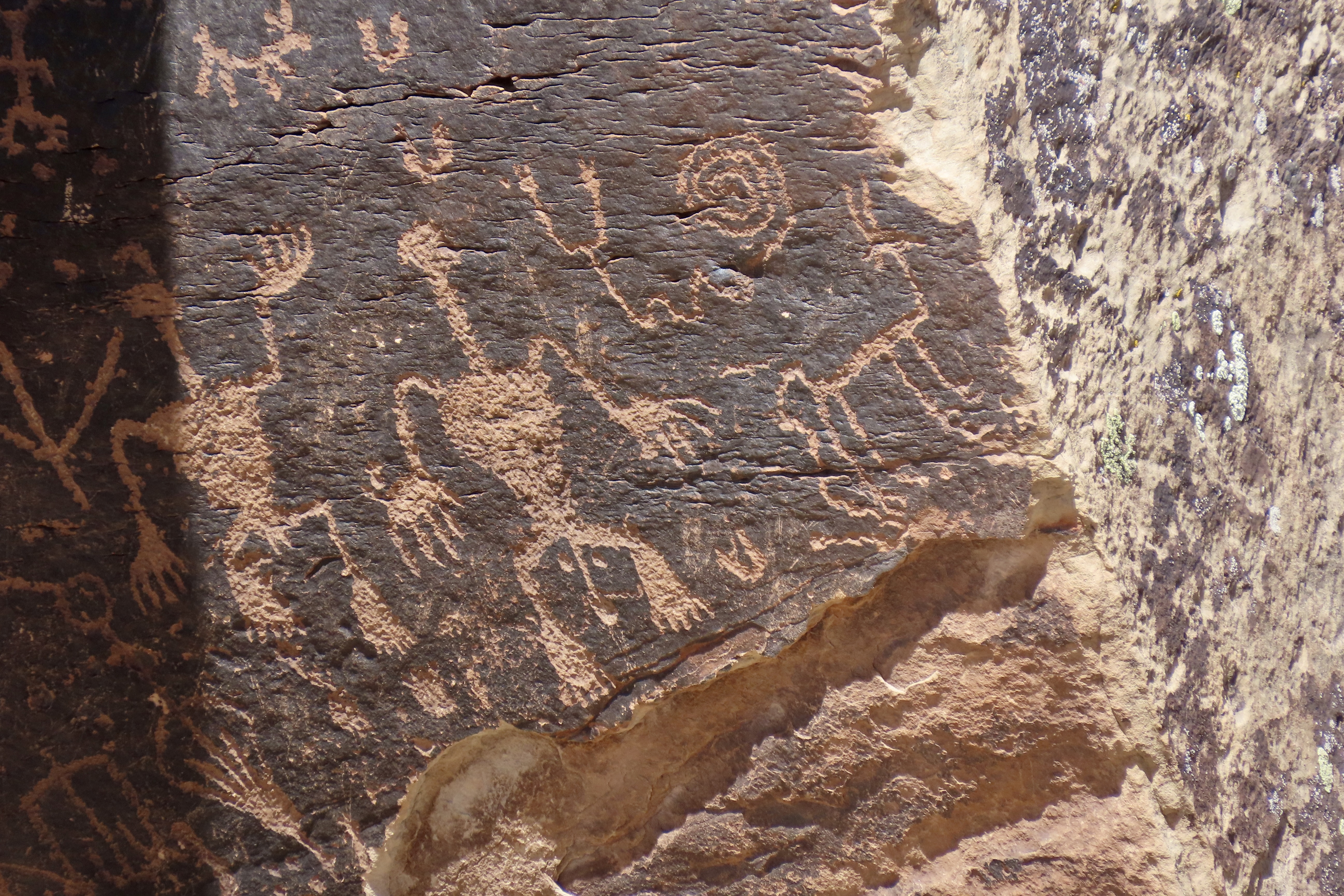
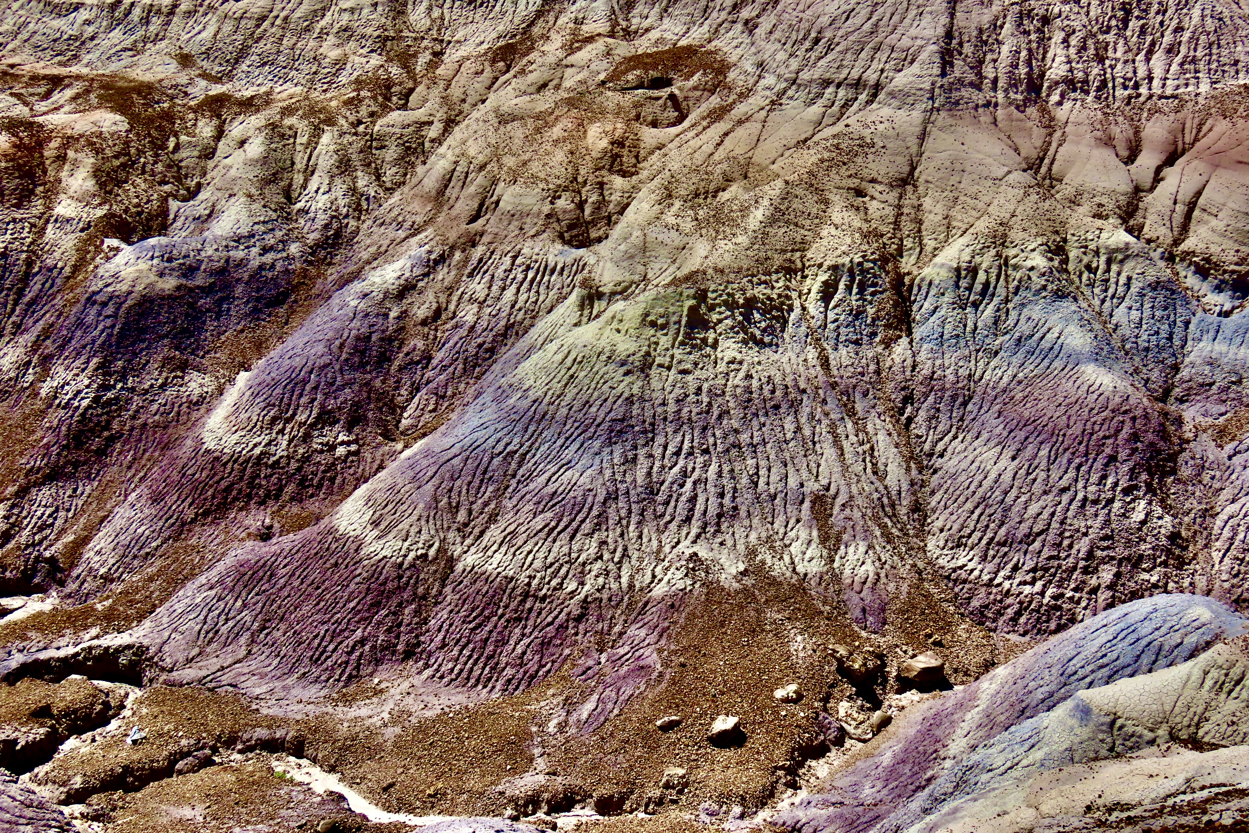
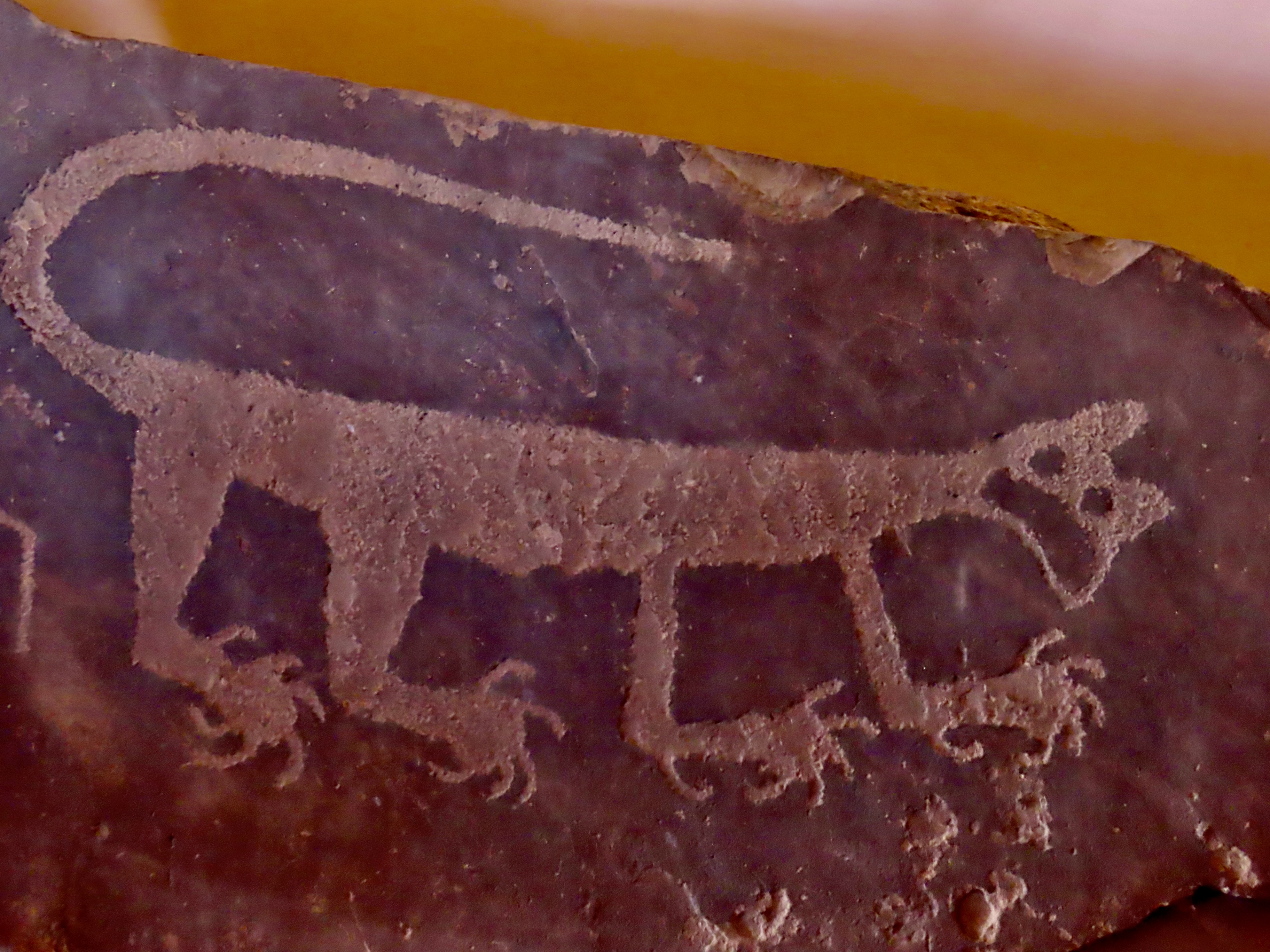
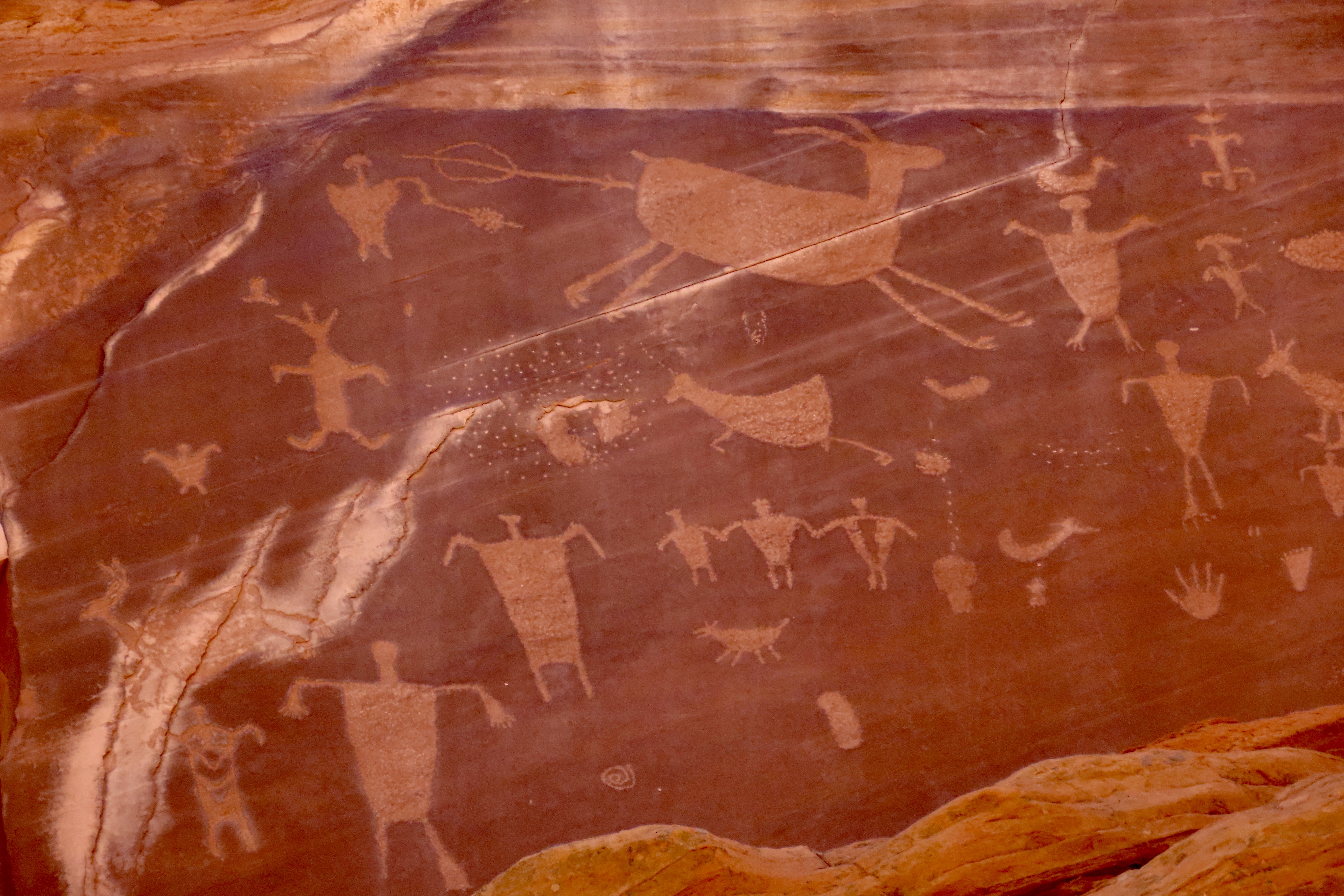
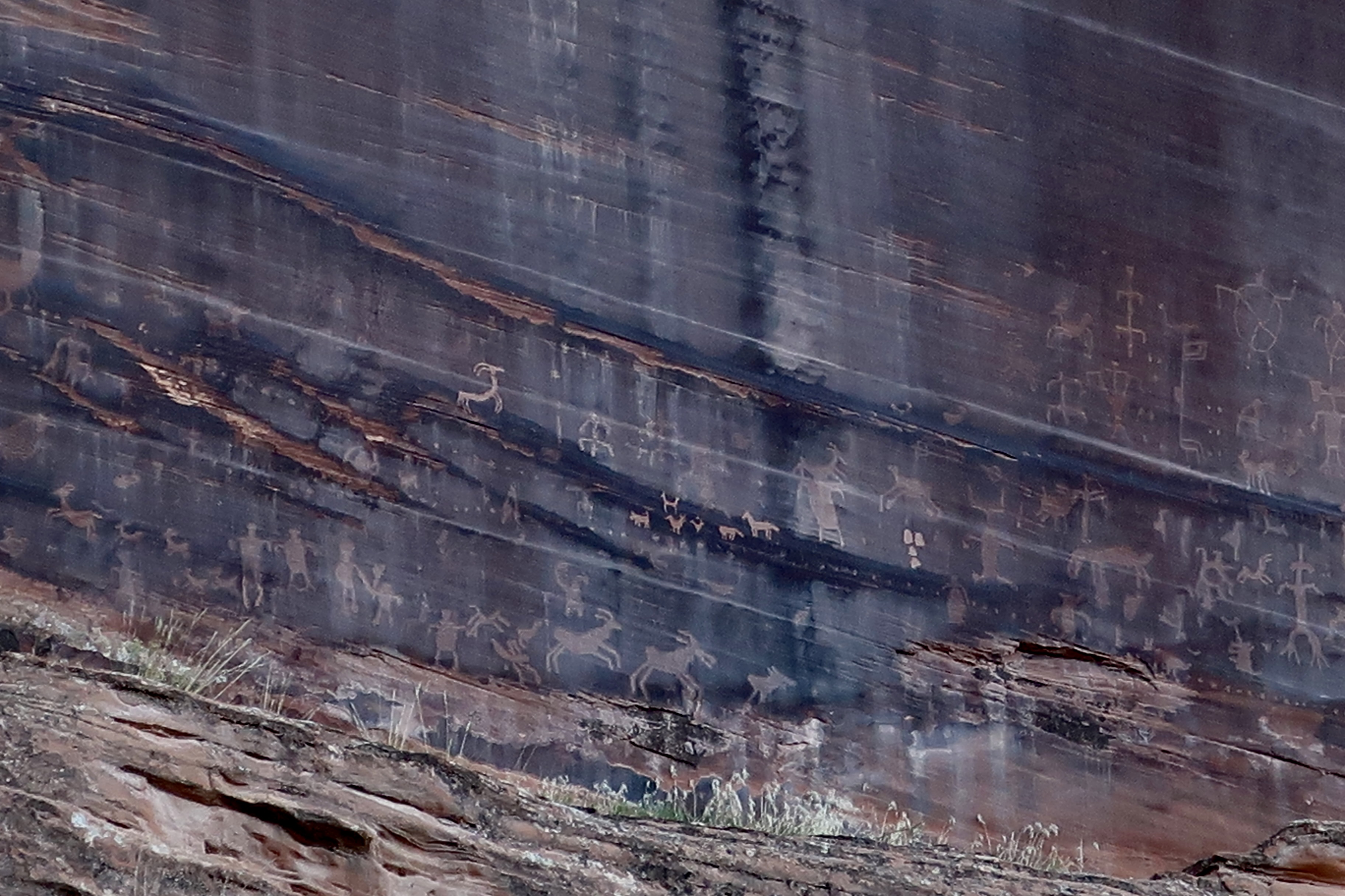
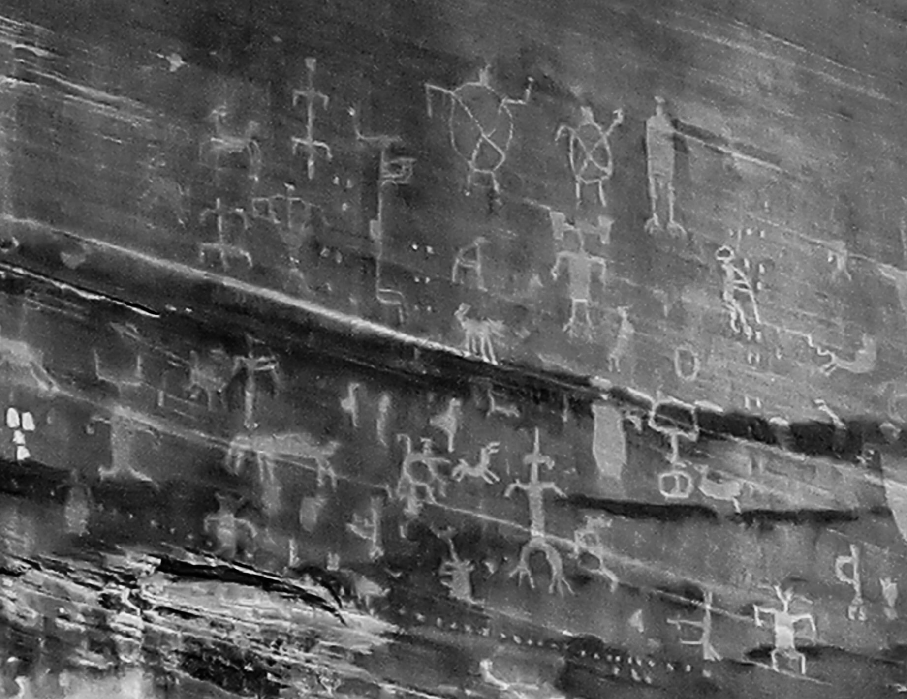
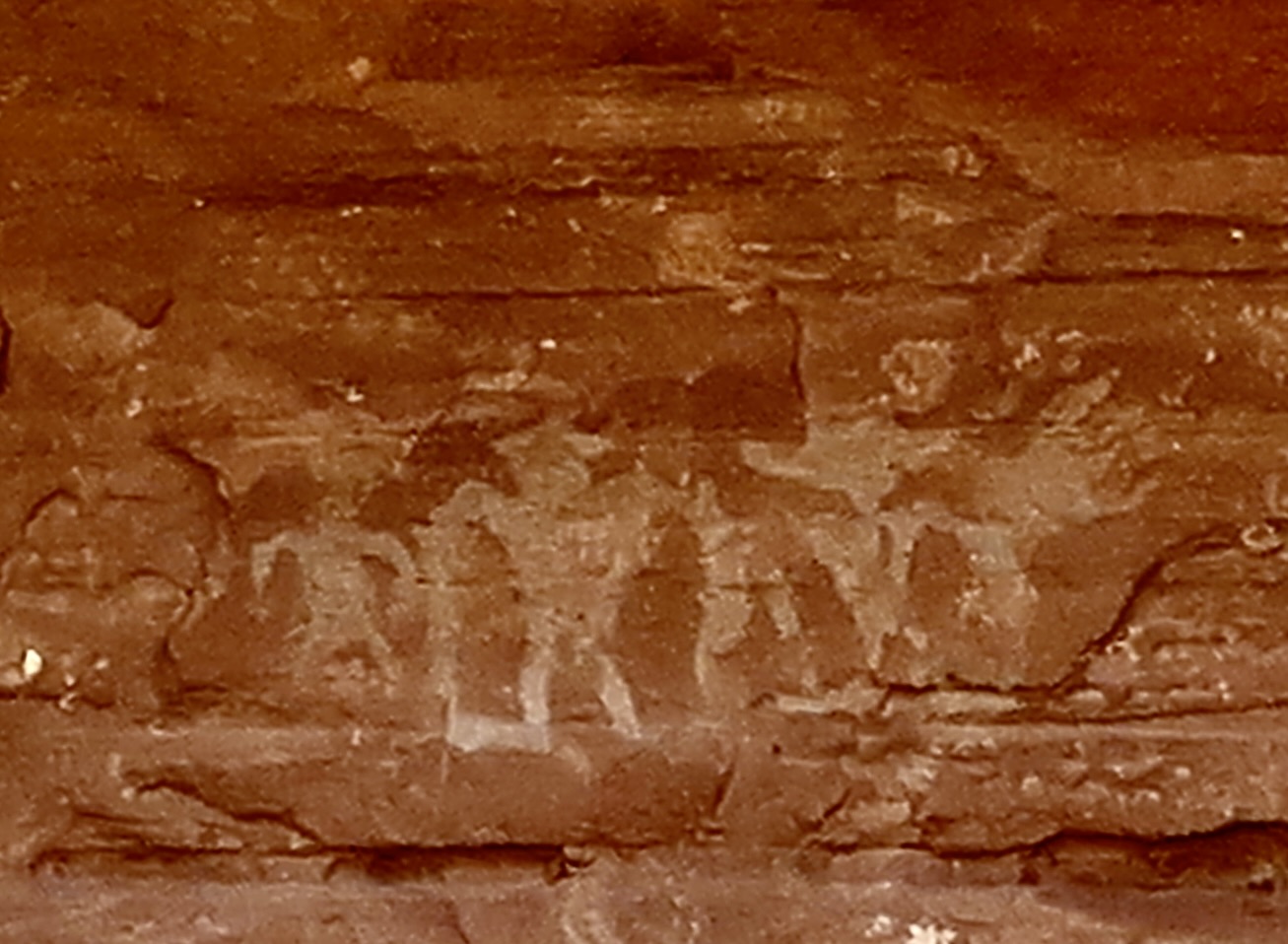
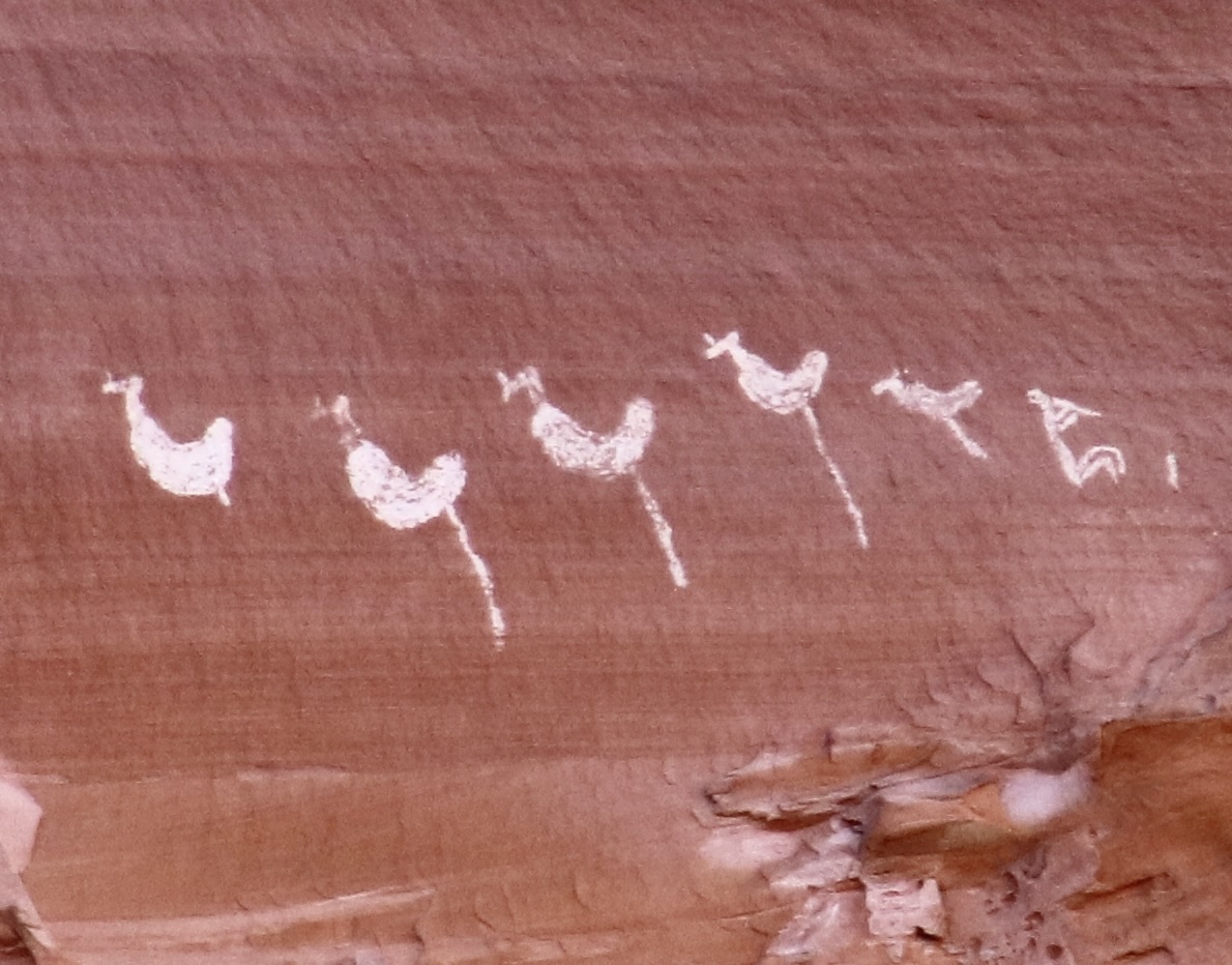
We used to think of Arizona’s Painted Desert and Petrified Forest as two separate units even though they are located next to each other and are part of Petrified National Park: We went to see petrified wood in the Petrified Forest and colorful landscapes in the Painted Desert. In actuality, they are both part of the same geological unit: The Painted Desert. They both display colorful landscapes and they both feature petrified wood. This photo is from one of the overlooks in the Painted Desert section north of I-40. Colorful? Yes. But it also includes chunks and logs of petrified wood. A petrified log can be seen on the lower center left.This is a section of Petrified Forest south of I-40 known as the Teepees. The colors are soft but close to otherworldly. Visitors have the option of entering the National Park from its north or south entrance. Peggy and I chose the north which makes a loop north of I-40 through the Painted Desert following the historic Route 66. One of our first stops was at the Painted Desert Inn. It sits above the Painted Desert providing visitors with a superb view of the surroundings. Originally opened by a private entrepreneur in 1920, the National Park bought it in the mid-30s and rebuilt it in Neo-pueblo style using CCC workers. Fred Harvey took over its management in the 40s utilizing the Harvey Girls to provide service to weary travelers. In 1947, the company’s architect, Mary Jane Colter, was brought on to remodel and renovate the facility. Today, it is a National Historic Site and museum, well worth a visit. The El Tovar Hotel and Desert View Tower of the Grand Canyon are among Colter’s many other notable projects.A local raven was seeking handouts near the Inn.I pointed out a nearby lizard and suggested that if he wanted food, he should hunt for it.He squawked at me. Something about wanting to be paid with in PB&J sandwiches if I was going to use him as a model.One of our favorite views of the Painted Desert.Our good friends from Sacramento, Tom Lovering and Lita Campbell, joined us on our visit to the Petrified Forest National Park. Here, they are perched on a 1932 Studebaker that the Park has placed along the Route 66 segment to symbolize the historic journey travelers followed along the route. The old car now provides a photo op for tourists. BTW, Studebaker got his start in Placerville (aka Hangtown), 3 miles from where I grew up in the Sierra foothills, making wheelbarrows for miners seeking wealth in California’s 1849 Gold Rush.Leaving the north side of I-40, we crossed over to the south side. Our first stop was at the Puerco Pueblo, a village built by Ancestral Puebloans and occupied between 1250 and 1380 CE. The pueblo had over 100 rooms at its peak. Located next to the Rio Puerco (Pig River), it had contacts from throughout the Ancestral Puebloan region and beyond. Artifacts and petroglyphs found at the site and nearby suggest these wide ranging connections.The best known petroglyph next to the pueblo is a water bird, possibly a white faced Ibis, about to chow down on a frog. The round, white petroglyphs may represent water dripping down from the bird.Numerous petroglyphs are found at the Petrified Forest’s Newspaper Rock located about a mile away from Puerco Pueblo.The petroglyphs found at the site Include a wide variety of subjects.The lower right section of the above series featured a naked man and woman. The ancients appear to have had few of the hang ups with nudity our modern society does. I thought of the woman saying, “Hi honey, I’m home.” As for the guy, apparently ‘size matters.’ We really liked the coyote on the right and immediately thought of Wile E Coyote and the Road Runner. The spiral above is thought to represent the journey of Ancestral Puebloans from the underworld in their search of a permanent home.
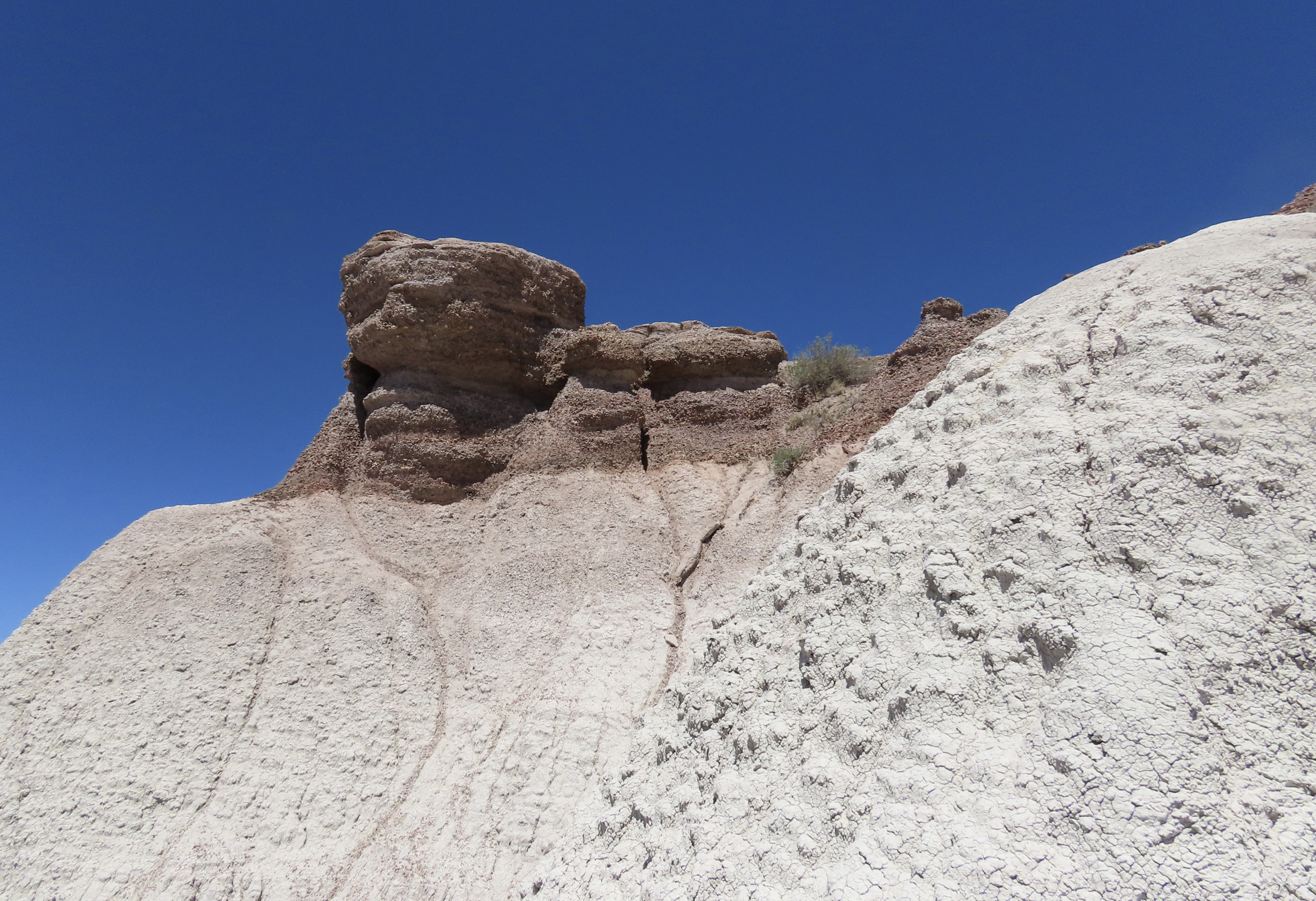
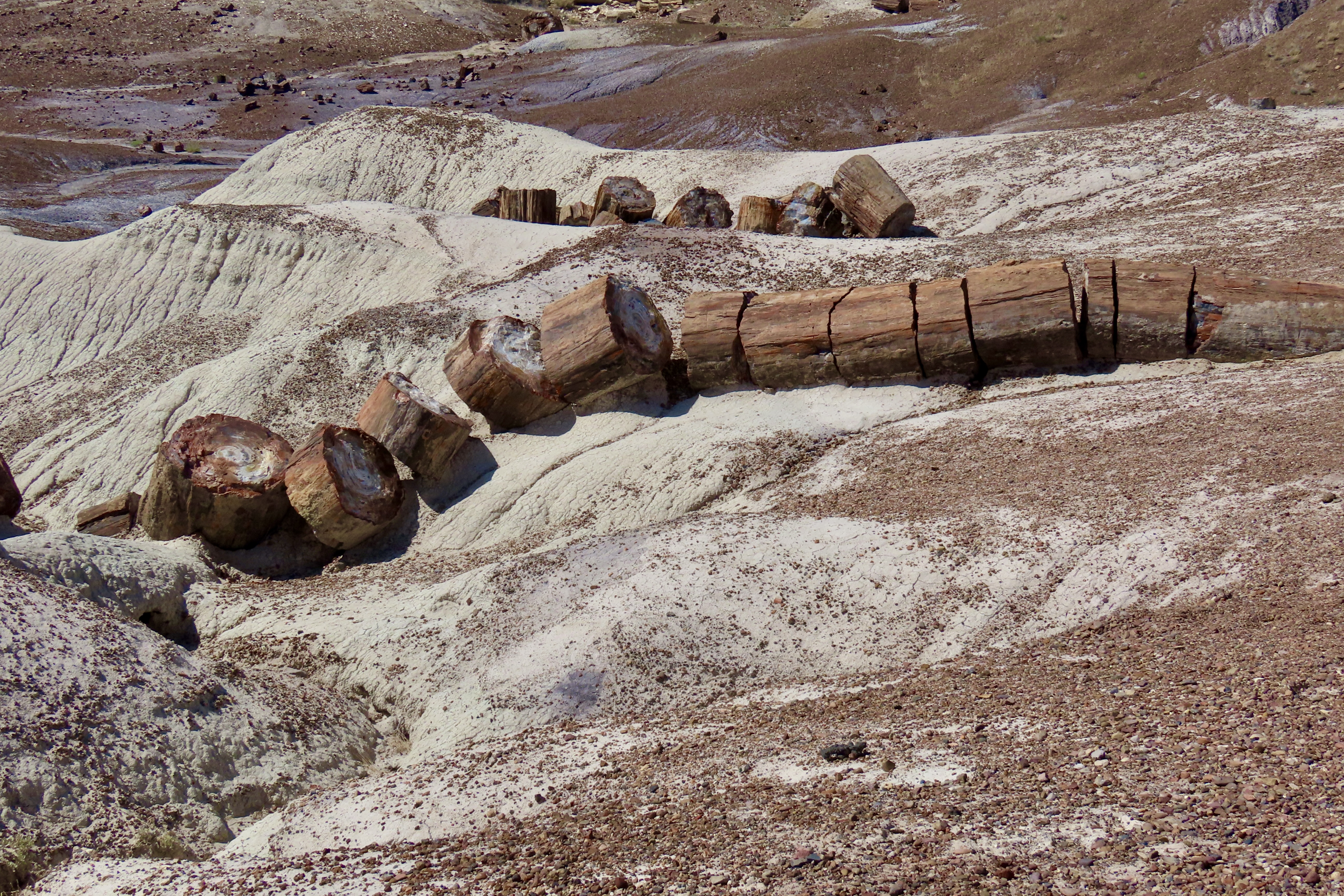
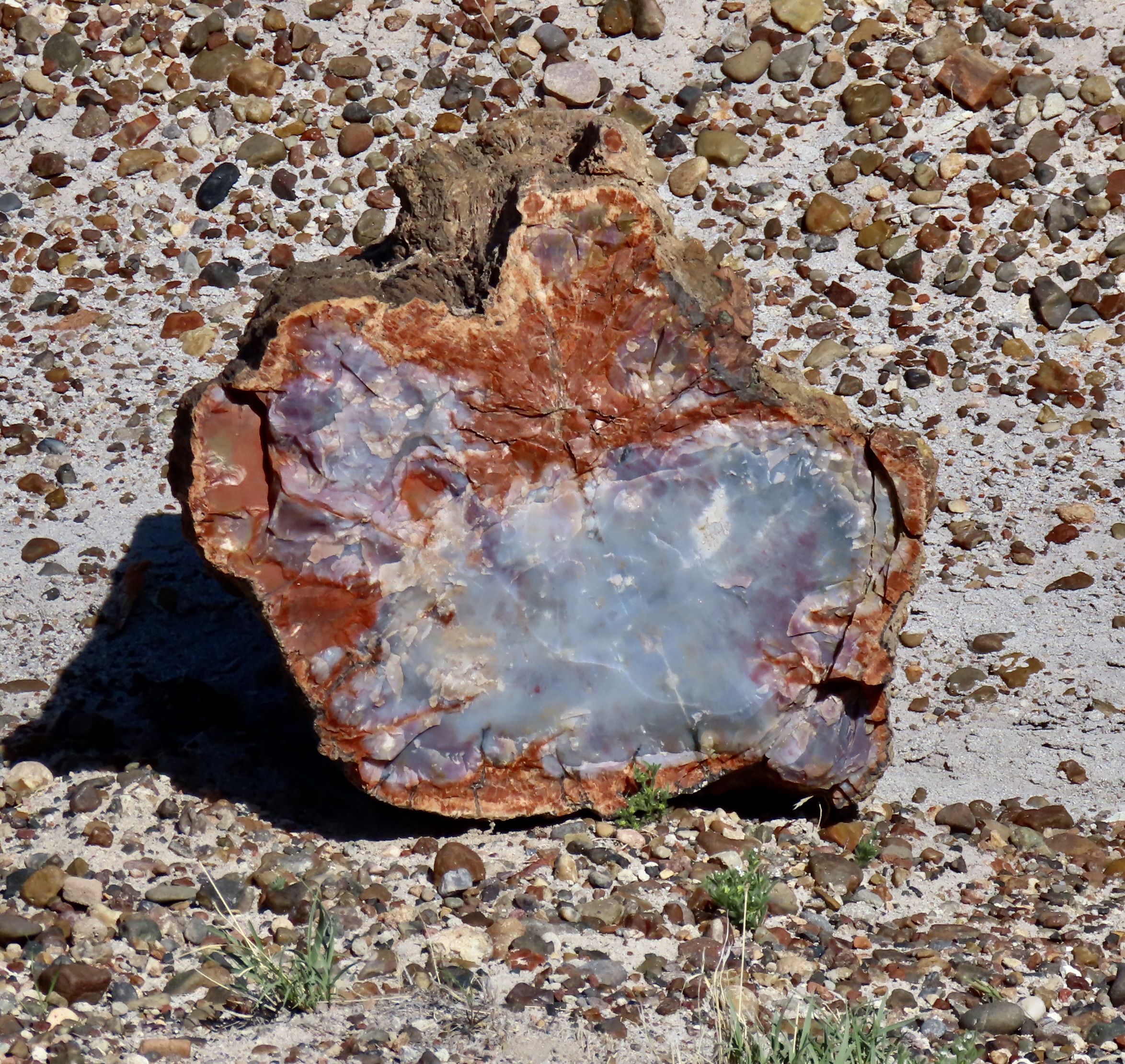
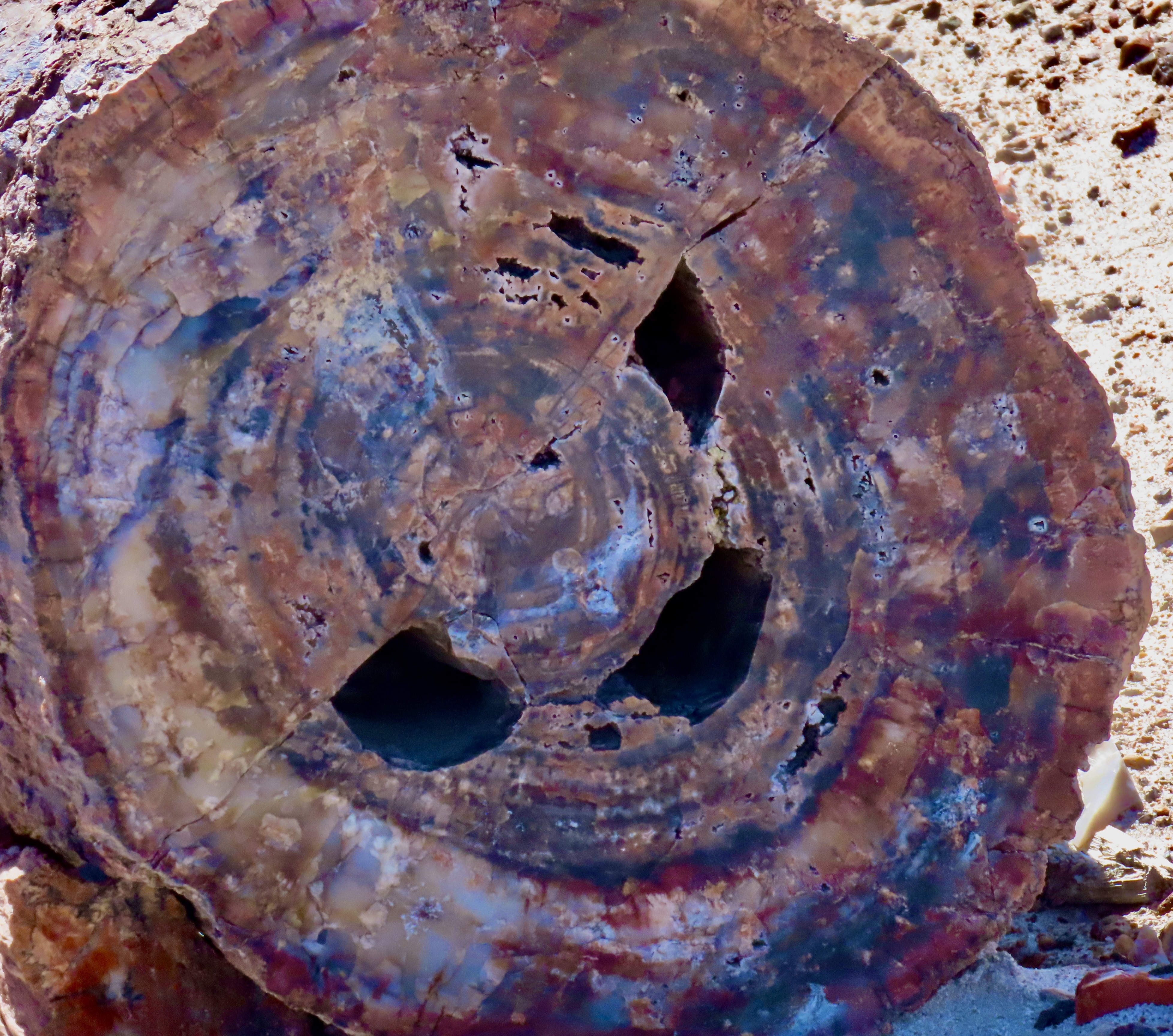
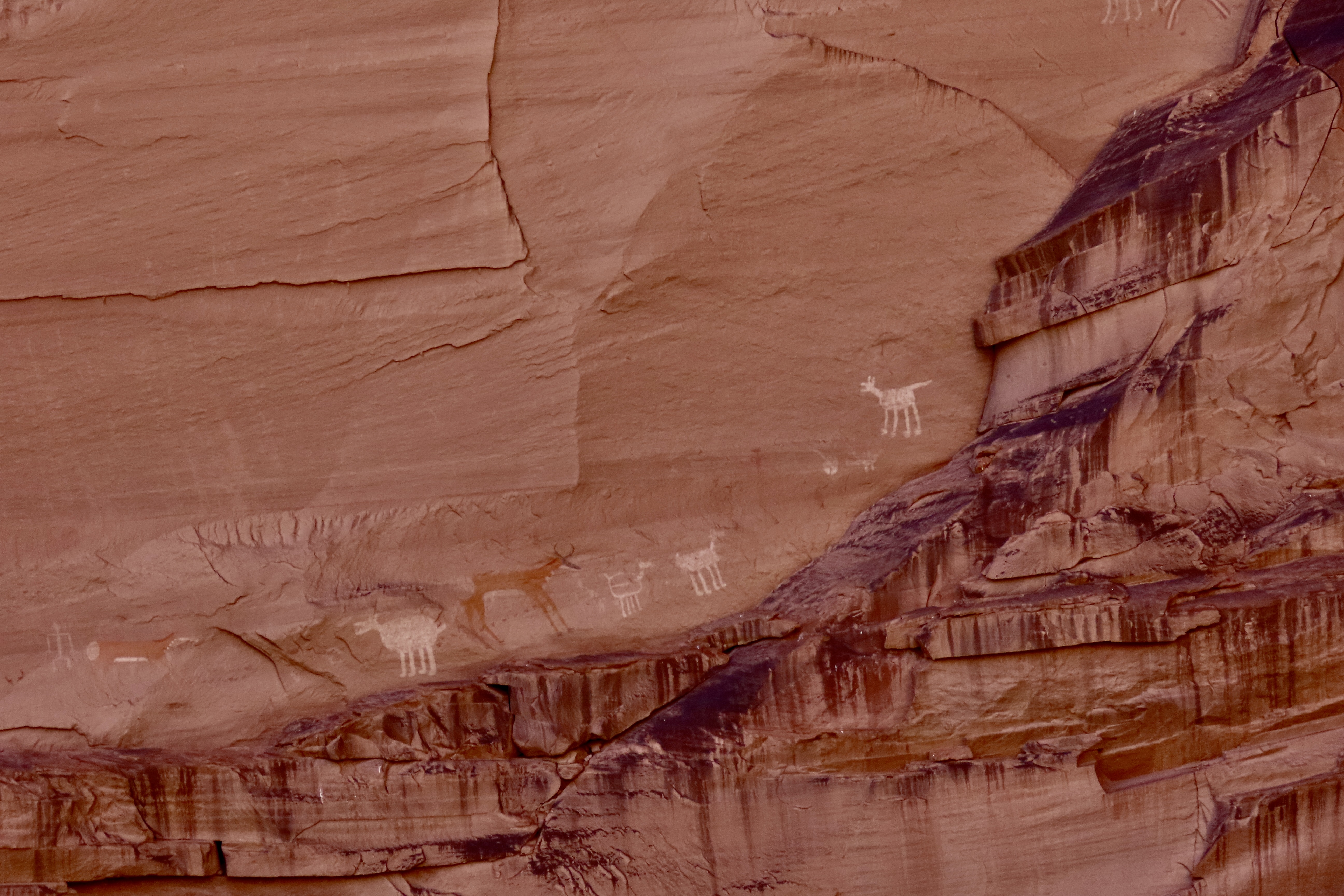
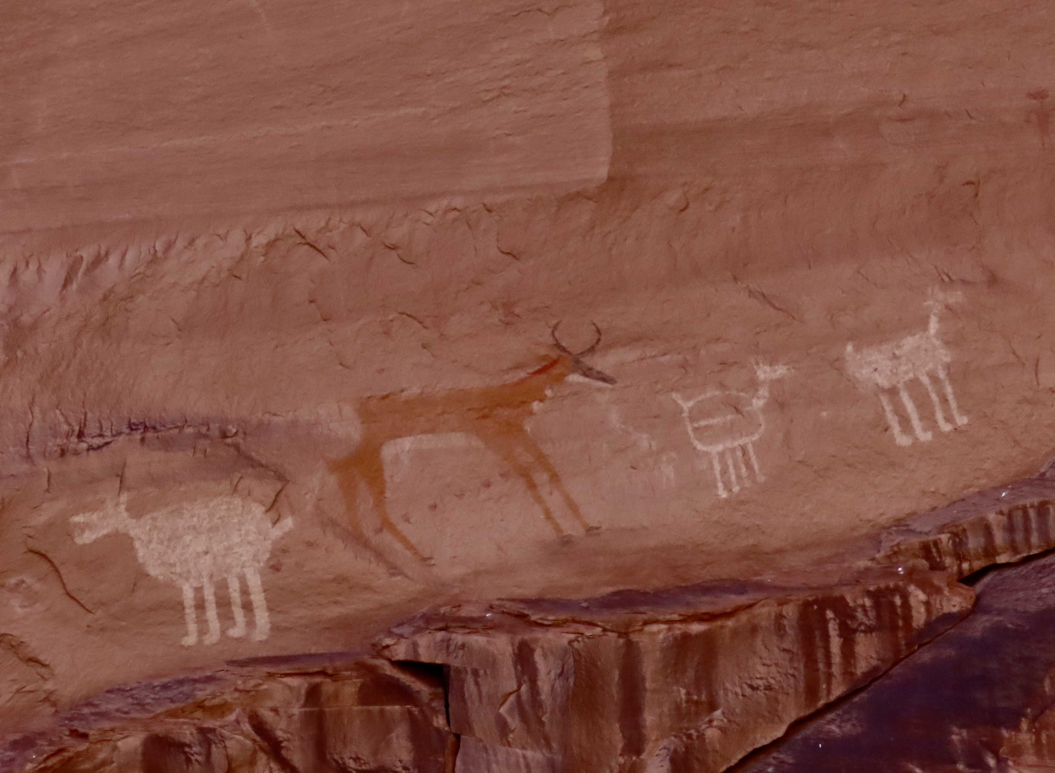
Peggy found several petroglyphs she might include in her next word search book— but don’t expect to find the naked couple.Next we arrived at the Teepee mountains, which I showed in the second photo. The colorful, layered rocks are part of the Chinle Formation deposited during Triassic period between 205-227 million years ago. The colors are determined by minerals in the rocks and the conditions at the time at the time they were deposited. A side road south of the Teepees takes visitors into the Blue Mesa, which provides an up-close perspective on the Chinle Formation. We highly recommend it. The following photos show why.Multiple colors,Including white.And interesting land formations.Another example.And tons of petrified wood. Perspective makes this log on a pedestal seem bigger than it is, but it is big! Broken off pieces surround the pedestal.This brings us to the petrified wood section of our post. I used Tom for perspective in this and my next photo to demonstrate how large some of the logs are.Tom appears tiny down at the end of this long, petrified log. Also, note the petrified bark that is still on the tree.This big fellow was making its way down a hill. Timber!One of the things fascinating about petrified wood is the variety of colors. They are created by different minerals that replace the wood in the petrification process. For example, red, brown and yellow come from iron oxide, white from silicon dioxide, black from carbon, blue and green from cobalt, chrome, and copper, etc.Not sure what made the holes but look how rich the blue is. You can also see the bark here.One can wander around for hours admiring the different logs.There are hundreds of them.A visit to the Rainbow Forest Museum concluded our visit. This large petroglyph of a mountain lion is one of the museum’s prime exhibits and serves as a symbol of the park. I have a T-shirt with it on the back.I persuaded Tom to take his photo with the skeletal remains the museum’s phytosaur, a large crocodile like reptile from 225 million years ago. It’s known as Smiley. That’s a wrap for today. Next up: The crazy trees and fabulous rocks of Joshua Tree National Park.
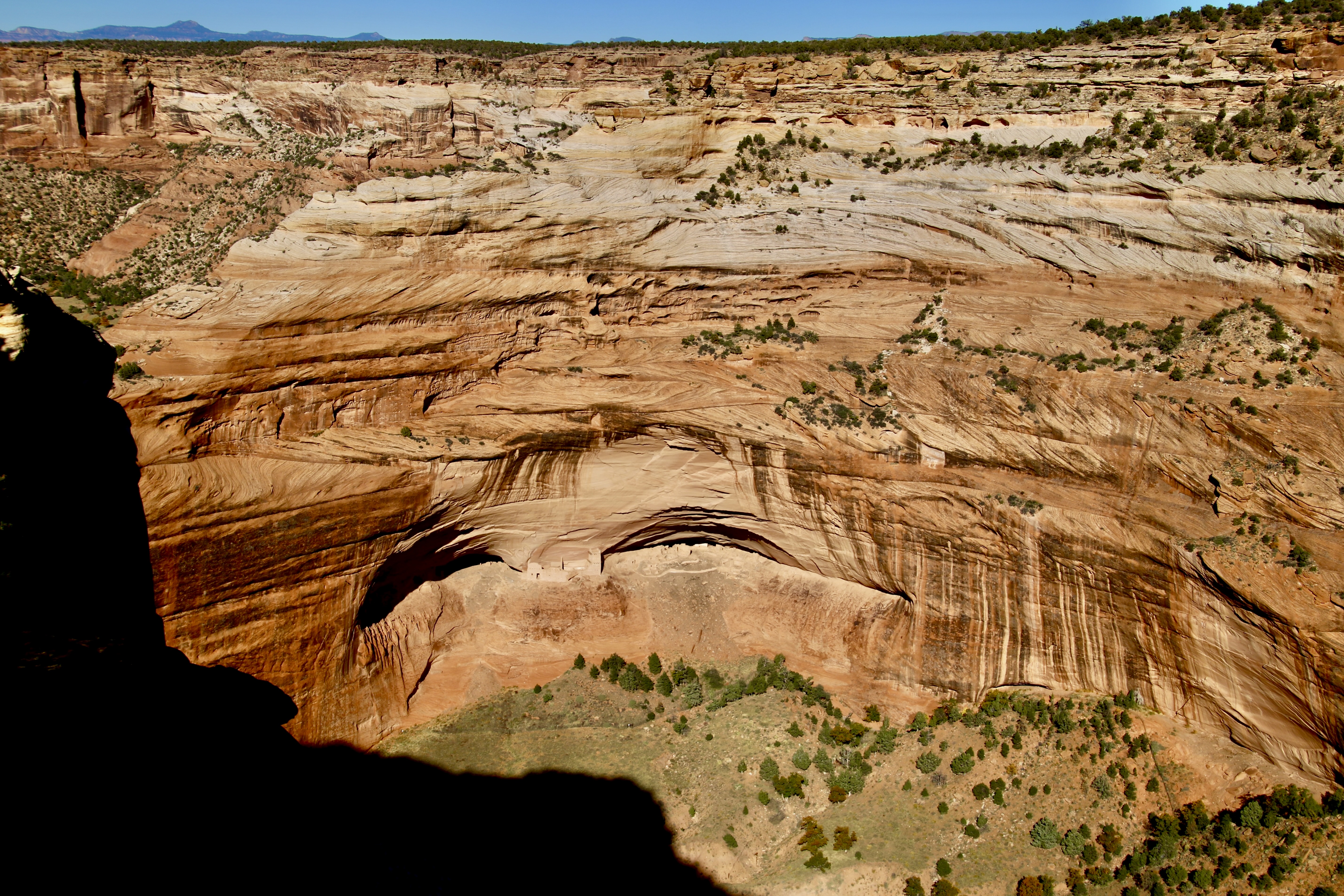
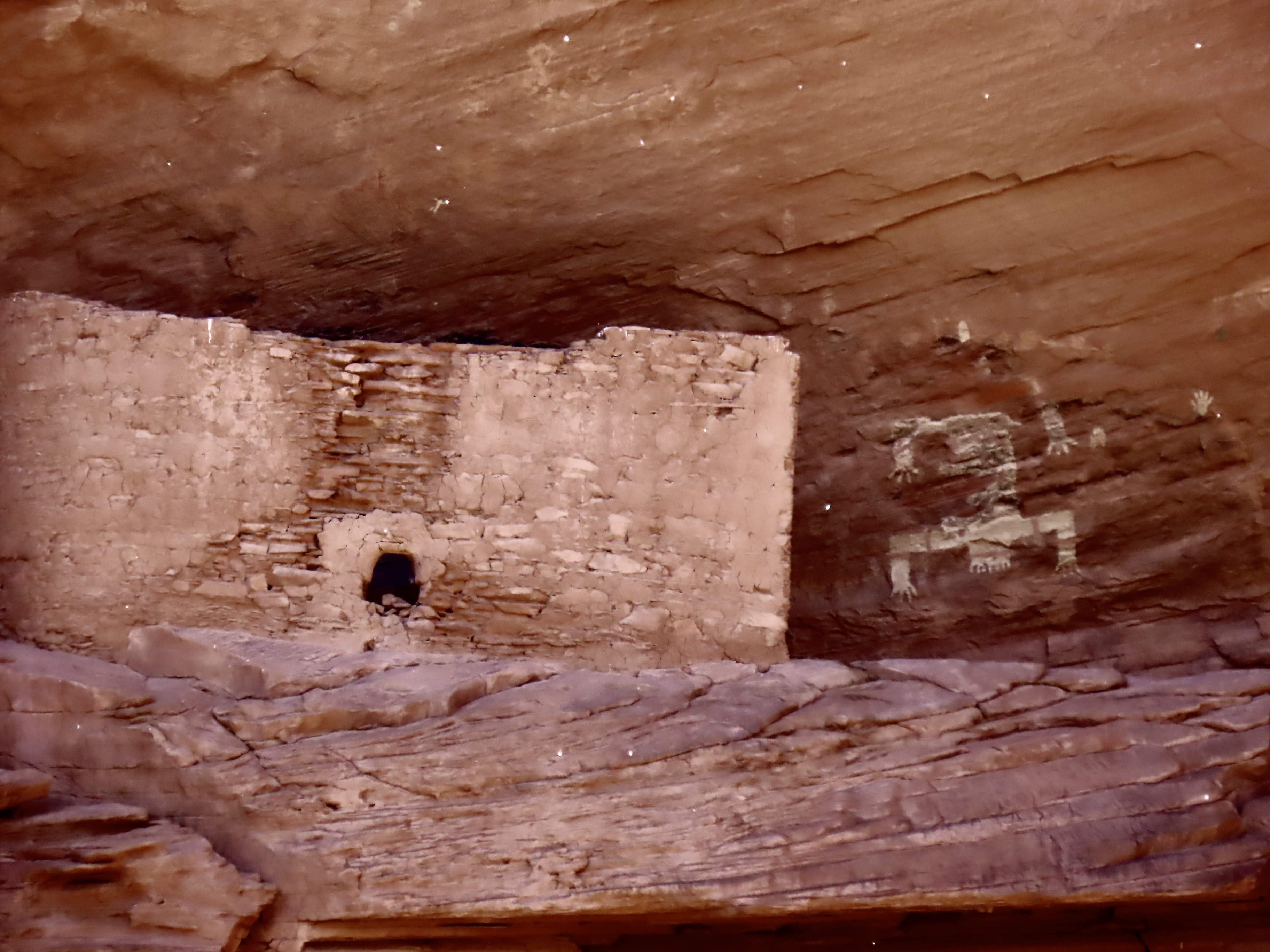
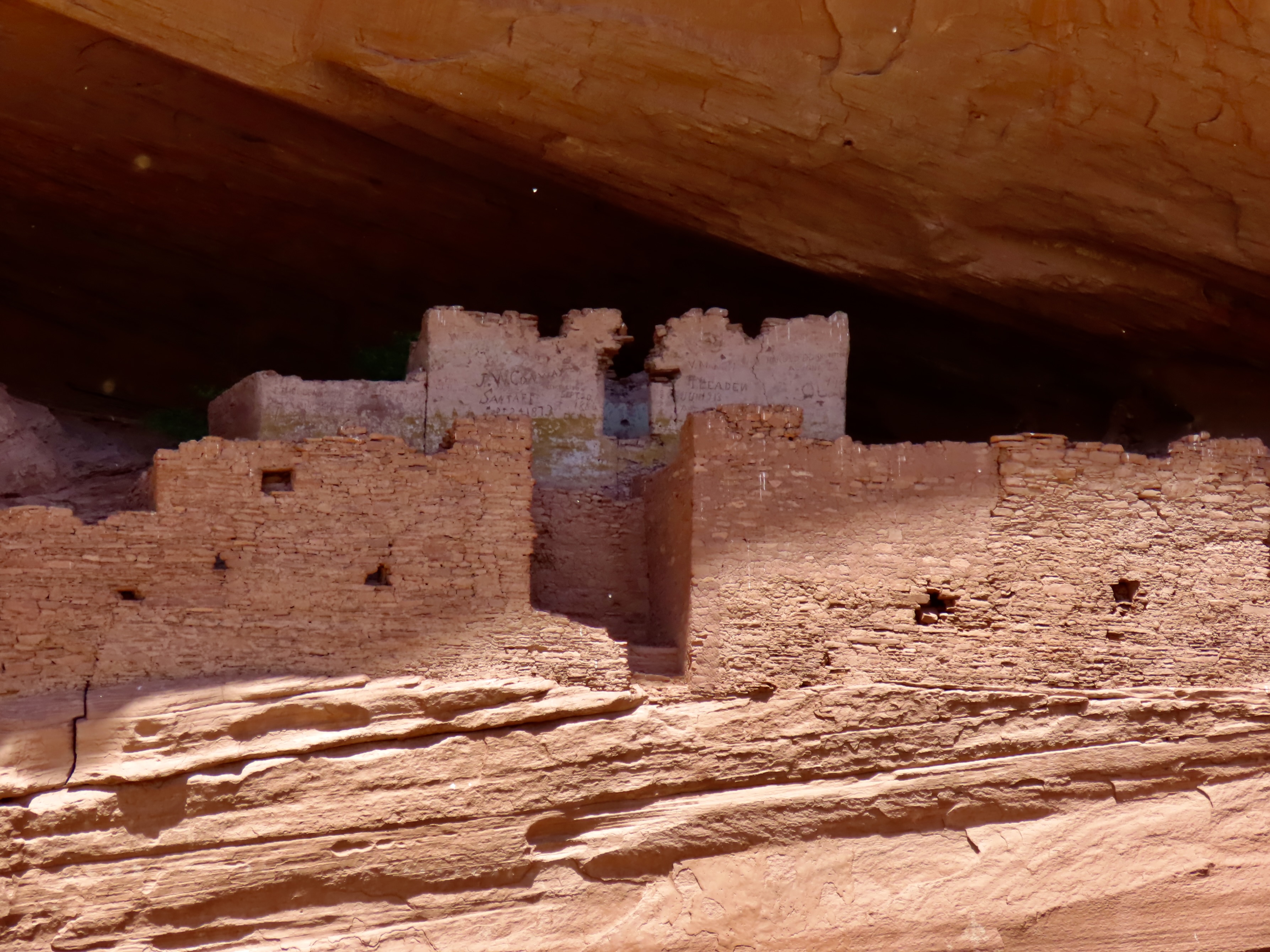
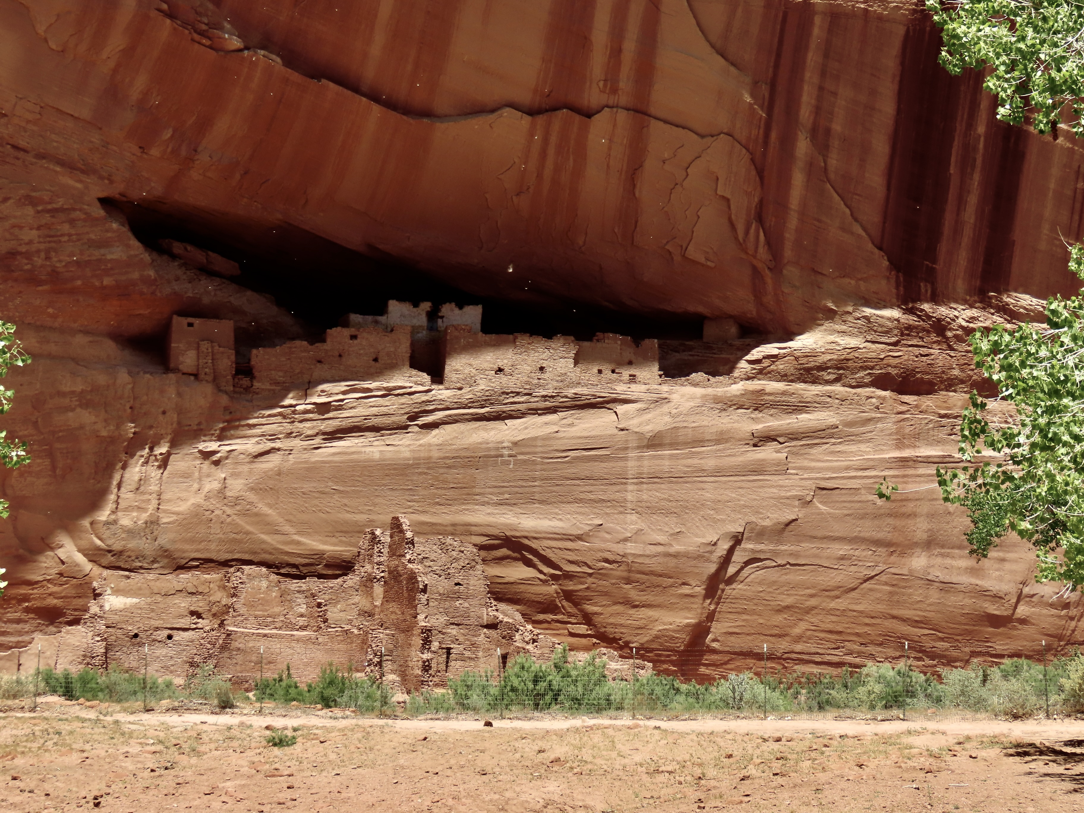
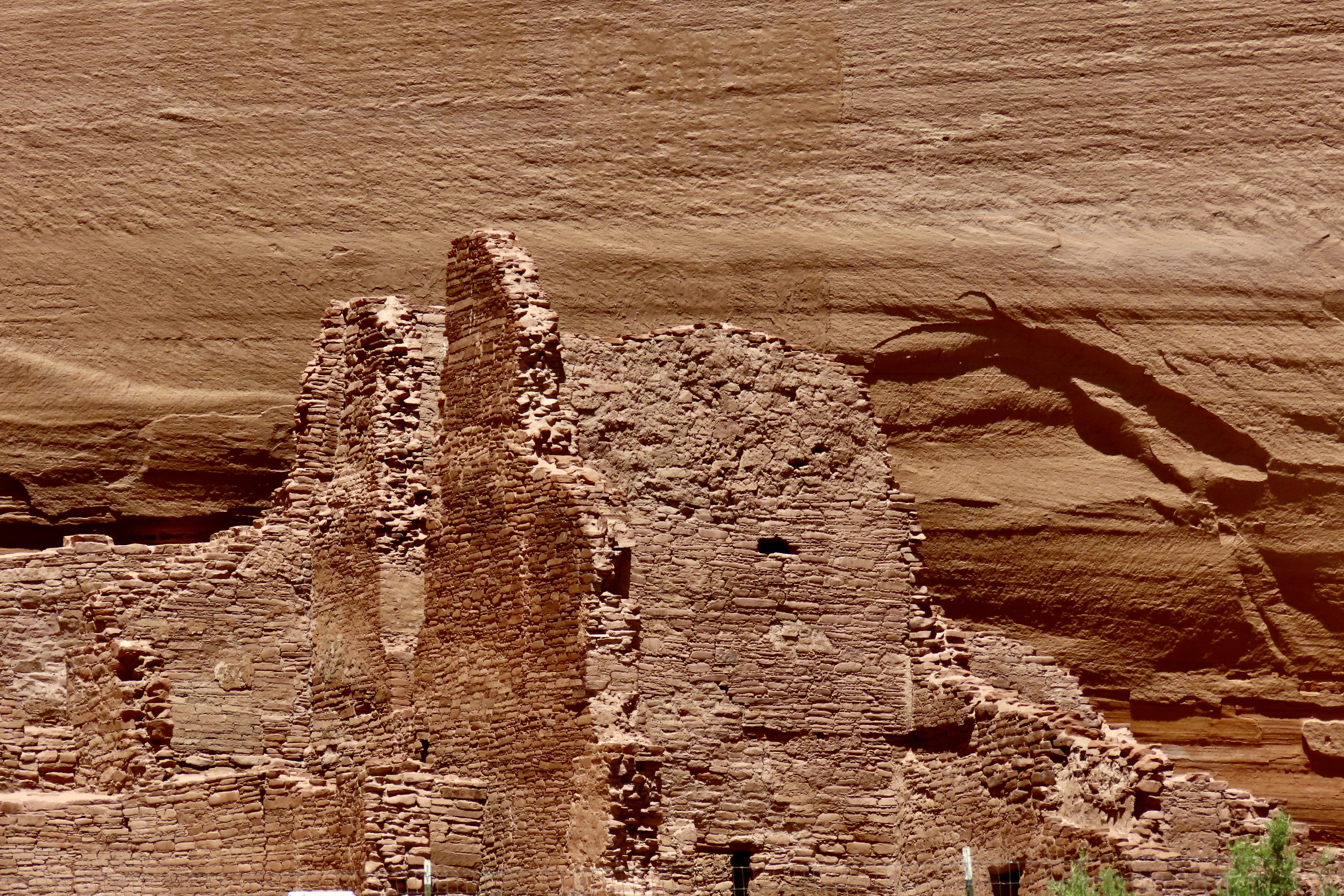
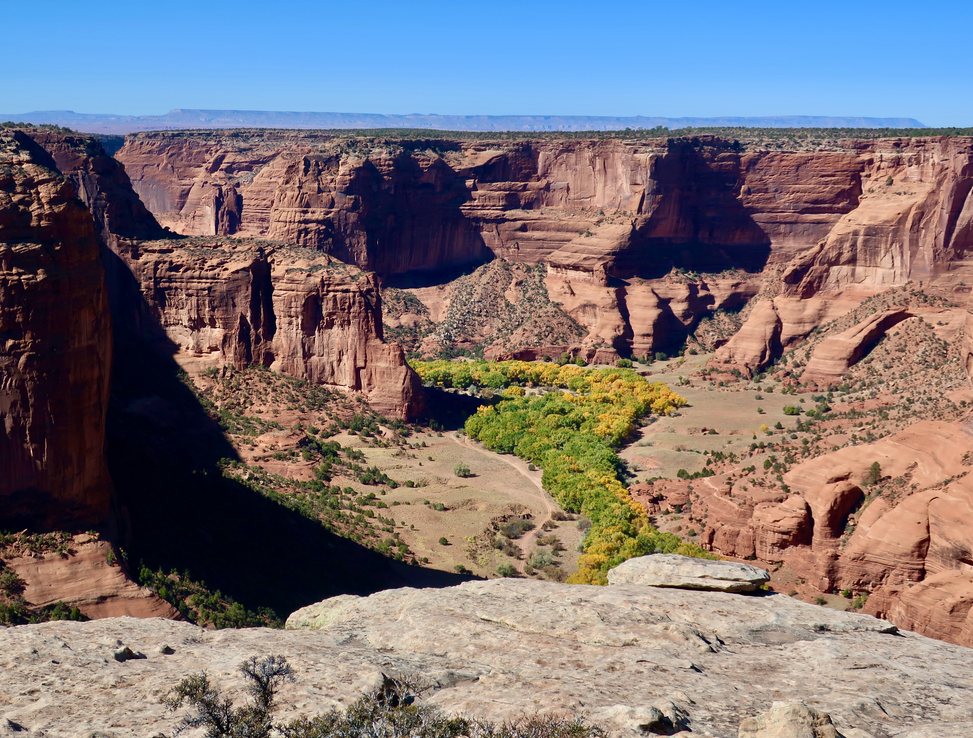
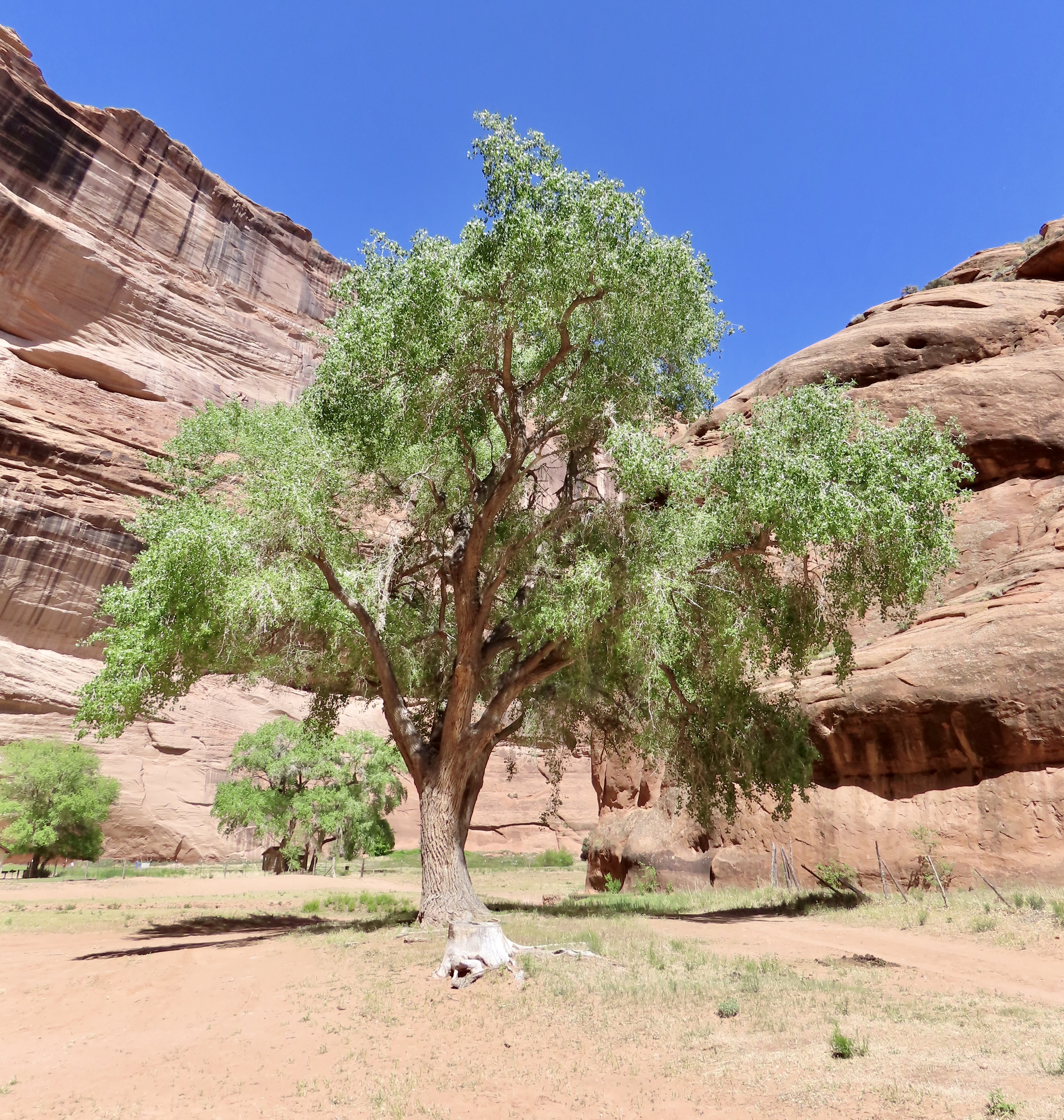
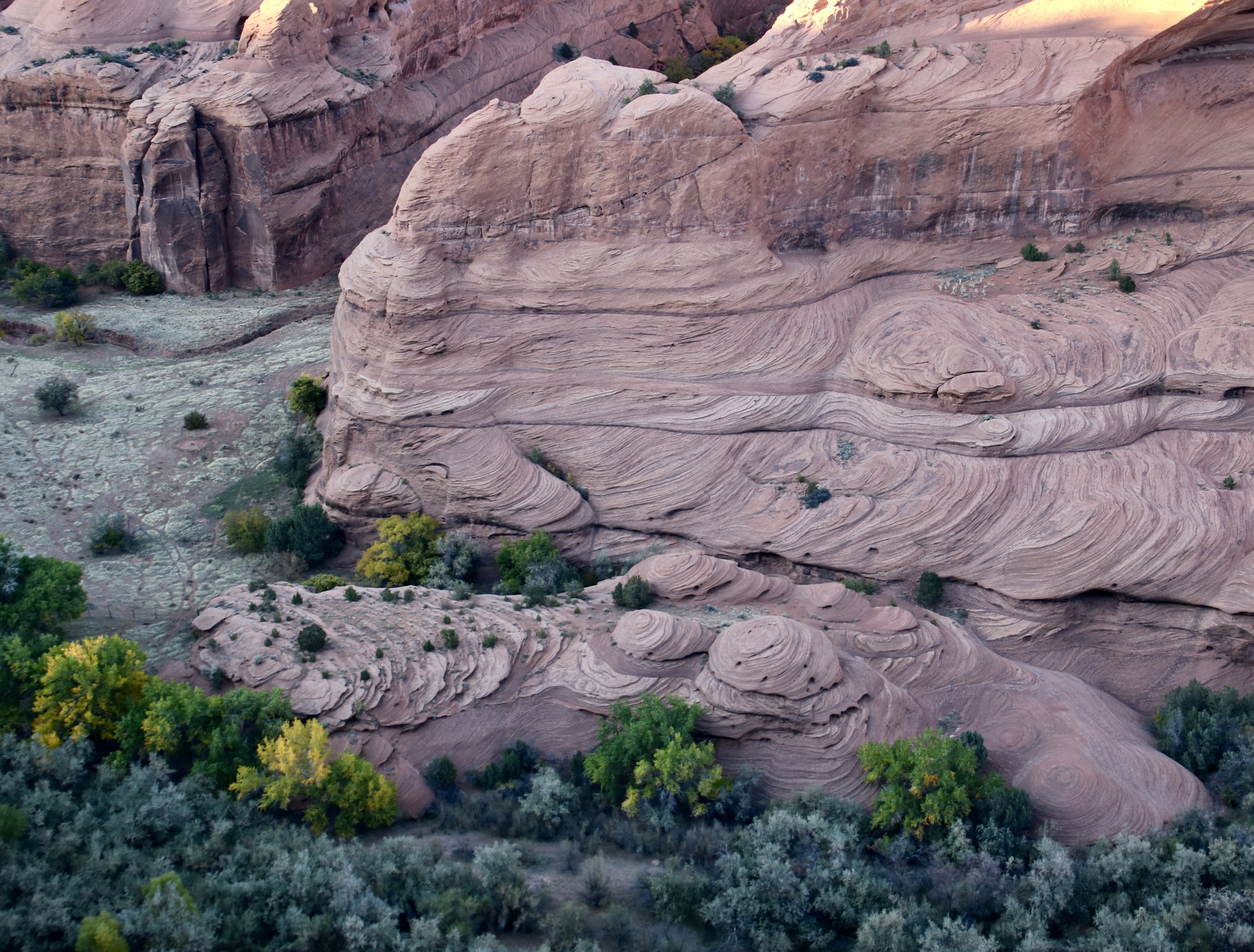
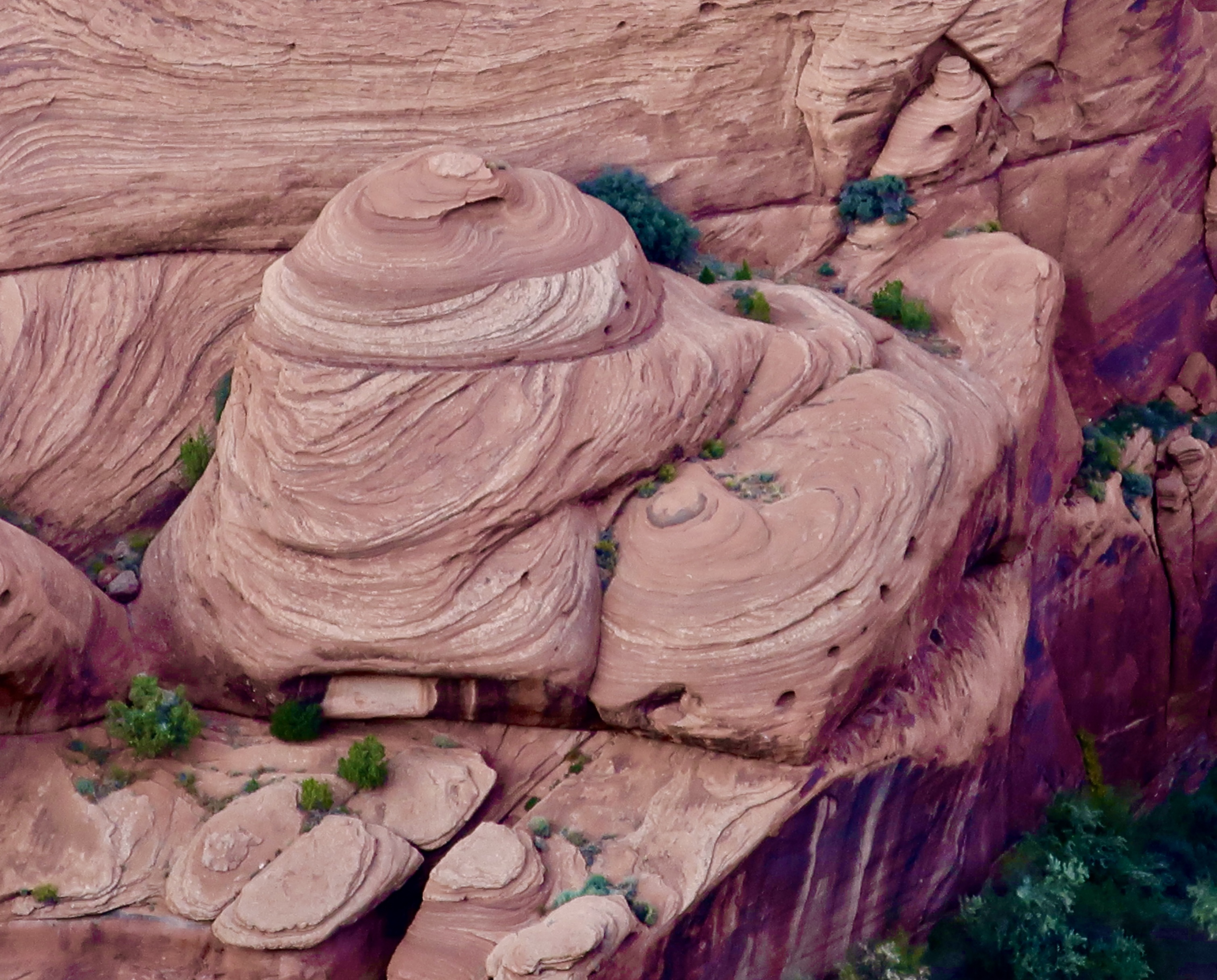
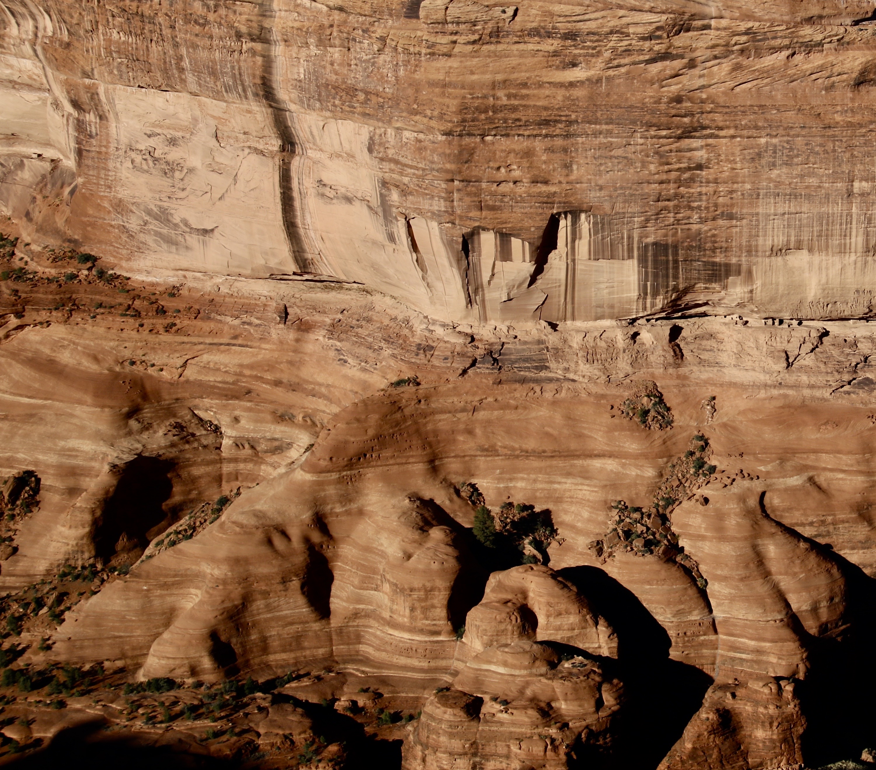
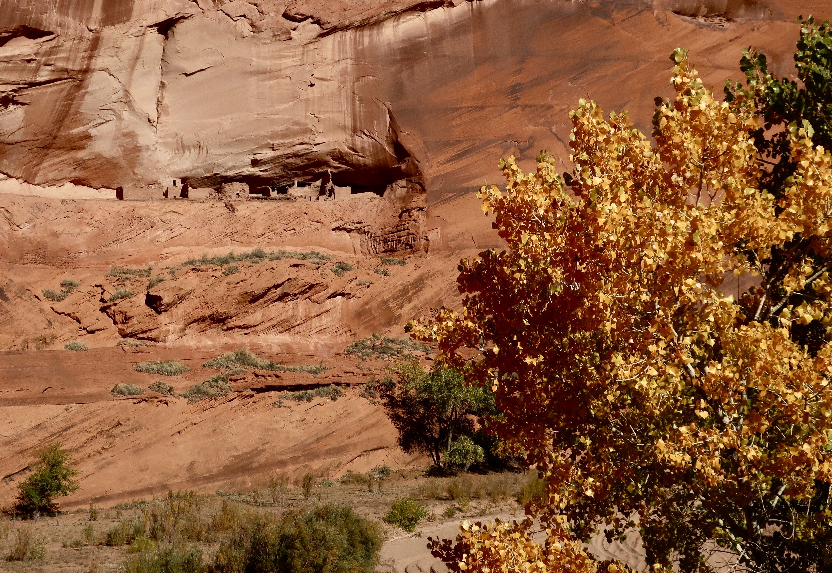
Canyon de Chelly has been occupied for five thousand years starting with various Archaic people. Ancestral Puebloans called it home from approximately 200 BCE to 1300 CE. Hopi lived there after 1300 up until 1700. Navajo people have occupied Canyon de Chelly since. Today, the canyon is owned by the Navajo Tribal Trust and jointly operated as a National Monument with the National Park Service. The photo above shows pueblos left behind by the Ancestral Puebloans (center caves). They are dwarfed by the high cliffs of the canyon. Their position on the cliff shows why they would have been difficult to attack.
The occupation by the Navajo has been interrupted twice. In 1805, Spanish forces under Antonio Narbona, the future governor of Spain’s New Mexico territory, attacked, killed and captured a number of Navajos because they refused to accept Spanish rule.
By the 1860s, the Navajo faced a new threat. American settlers from the eastern US were pouring into the newly acquired territory and the US Government developed a policy to make room for them by ousting the natives. The Navajos would be required to move to reservations, leaving their homelands behind for the newcomers. Not surprising, they refused. So a decision was made to force them out. The US Army under the command of James Henry Carleton ordered Kit Carson to subjugate the Navajo using a scorched earth approach that involved burning their homes, destroying their crops and killing their livestock.
Earlier, in his efforts to subdue the Mescalero Apaches, Carleton had given the following order to his subordinates: “All Indian men of that tribe are to be killed whenever and wherever you can find them. … If the Indians send in a flag of truce say to the bearer … that you have been sent to punish them for their treachery and their crimes. That you have no power to make peace, that you are there to kill them wherever you can find them”.
In 1864, facing starvation, the Navajo capitulated, signed a treaty, and began a forced march during the heart of winter to Fort Sumner’s Bosque Redondo Reservation in New Mexico. The 300 plus mile hike, the Long Walk as it came to be known by the Navajos, left numerous Navajo dead from exposure, starvation, and exhaustion. Bosque Redondo was equally bad if not worse. Food, space, water and sanitation facilities were limited in the extreme for the 8500 Navajo and 500 Mescalero Apache occupants. Furthermore, it was run like an internment camp instead of a reservation. An estimated one quarter of the population died during the four years of the camp’s occupation.
Finally, in 1868, a new treaty was signed with the Navajo that allowed them to return to a portion of their original homelands, including Canyon de Chelly. Today, the Long Walk, like the Cherokee’s Trail of Tears, is remembered by the Navajo an an important part of their history.
it isn’t a history that the Trump Administration wants remembered however. He has ordered the Department of the Interior to take action to ensure “descriptions, depictions, or other content that inappropriately disparage Americans past or living (meaning information like that above), and instead focus on the greatness of the achievements and progress of the American people.
Apparently, Carleton and Carson are not to be disparaged. My bad. History is to be remembered as Trump wants it remembered. George Orwell’s 1984 comes to mind.
If the administration has its way, books and displays like this are to be removed from national parks and monuments. A similar effort is underway at the Smithsonian.
Today, marks the end of my planned series on the Trump Administration’s threat to our national parks, monuments and other public lands. I believe that I have covered his primary focus and actions as they relate to our public lands. Having said that, I’ll still report on major threats as they emerge and, at some point, do a summary of how successful efforts to protect the parks have been.
I also have in mind doing a post on Mt. Rushmore National Monument. The President has repeatedly expressed a desire to have his image added to those of Washington, Jefferson, Lincoln, and Theodore Roosevelt. (At one point, Elon Musk even volunteered to carve it, but I suspect that’s off the table.) My objective is to look at the major accomplishments of each of these men who played such an important role in making the nation what it is today and then comment on how the President goal of Making America Great Again, relates to their accomplishments.
But for now, it’s back to sharing the beautiful and fascinating world we live in while Peggy and I continue to ‘wander through time and place.’
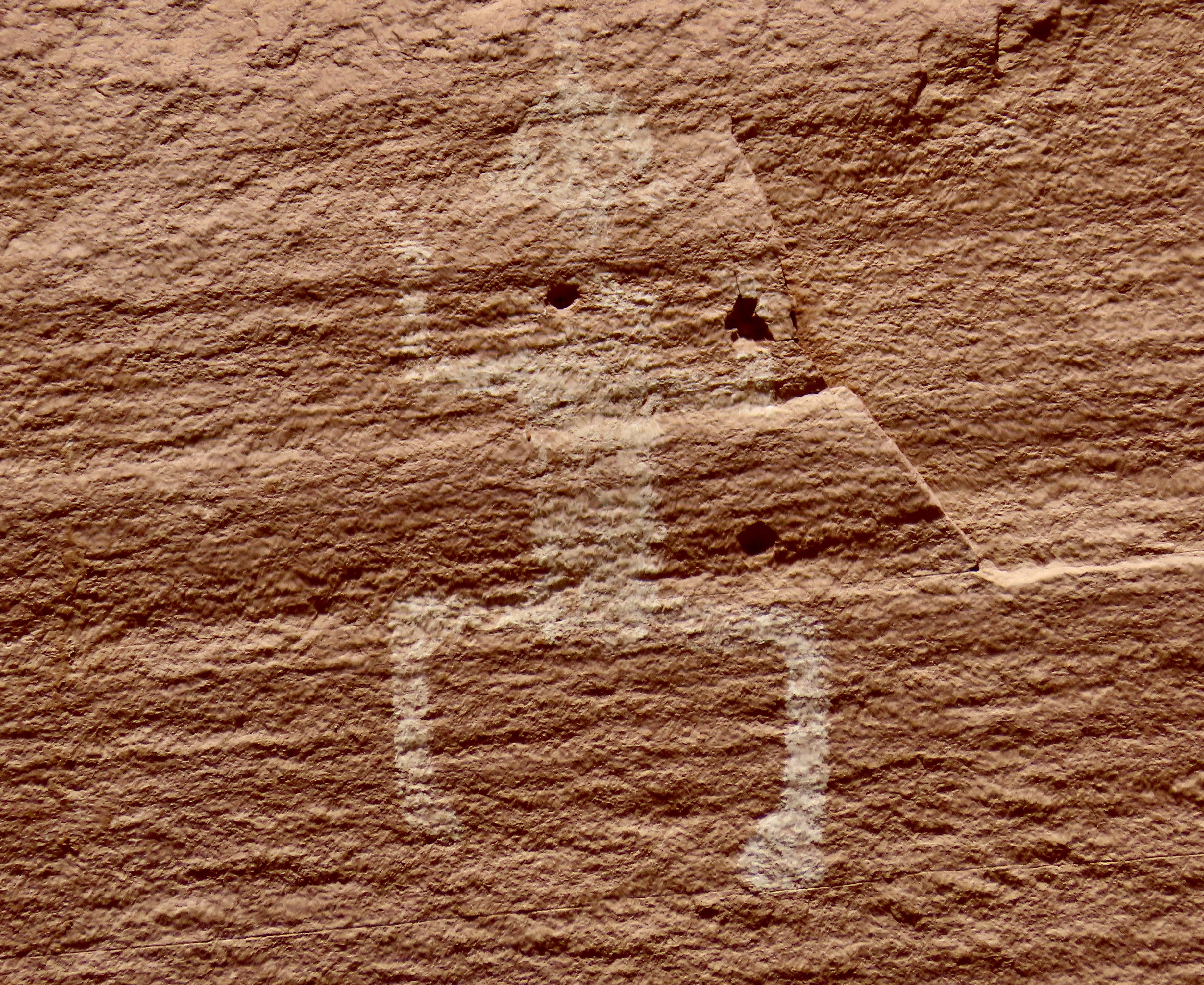
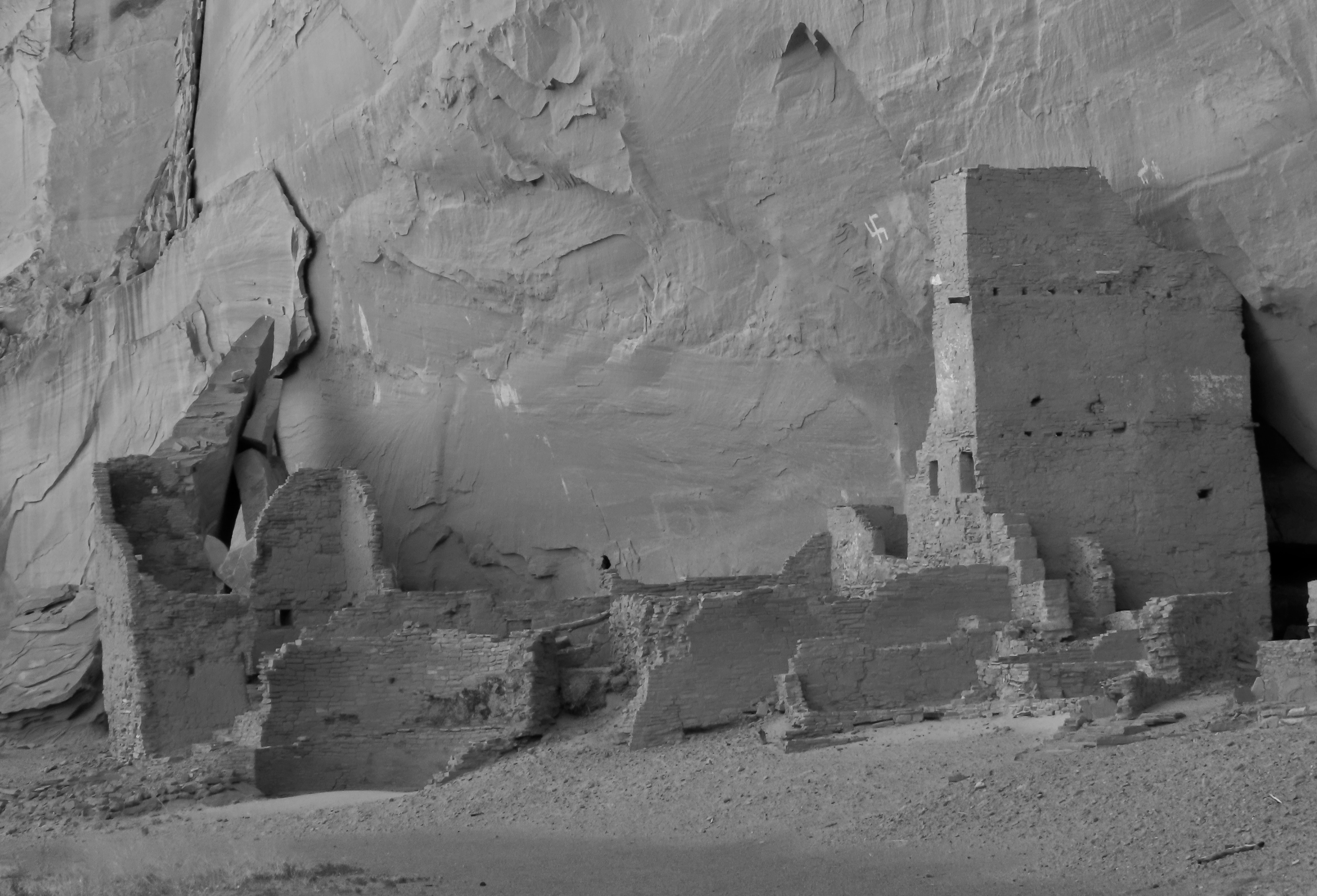
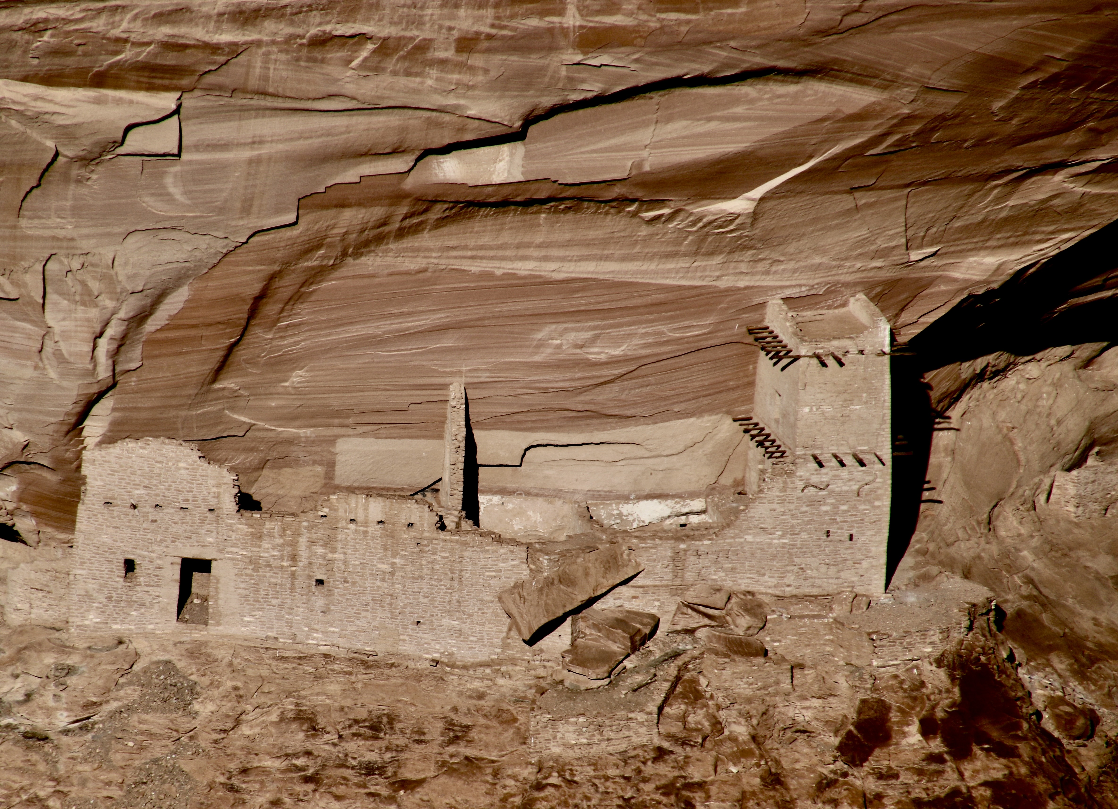
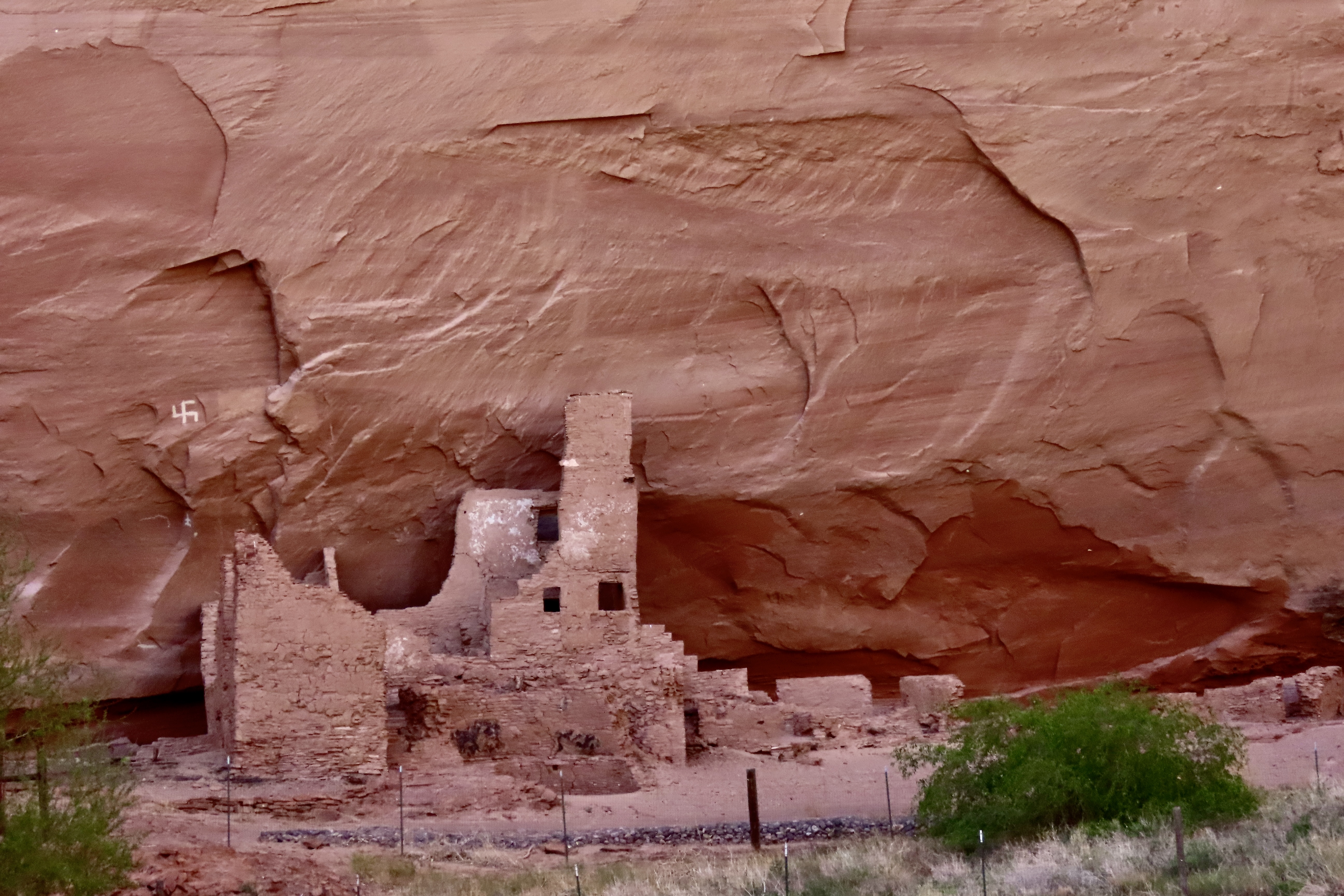
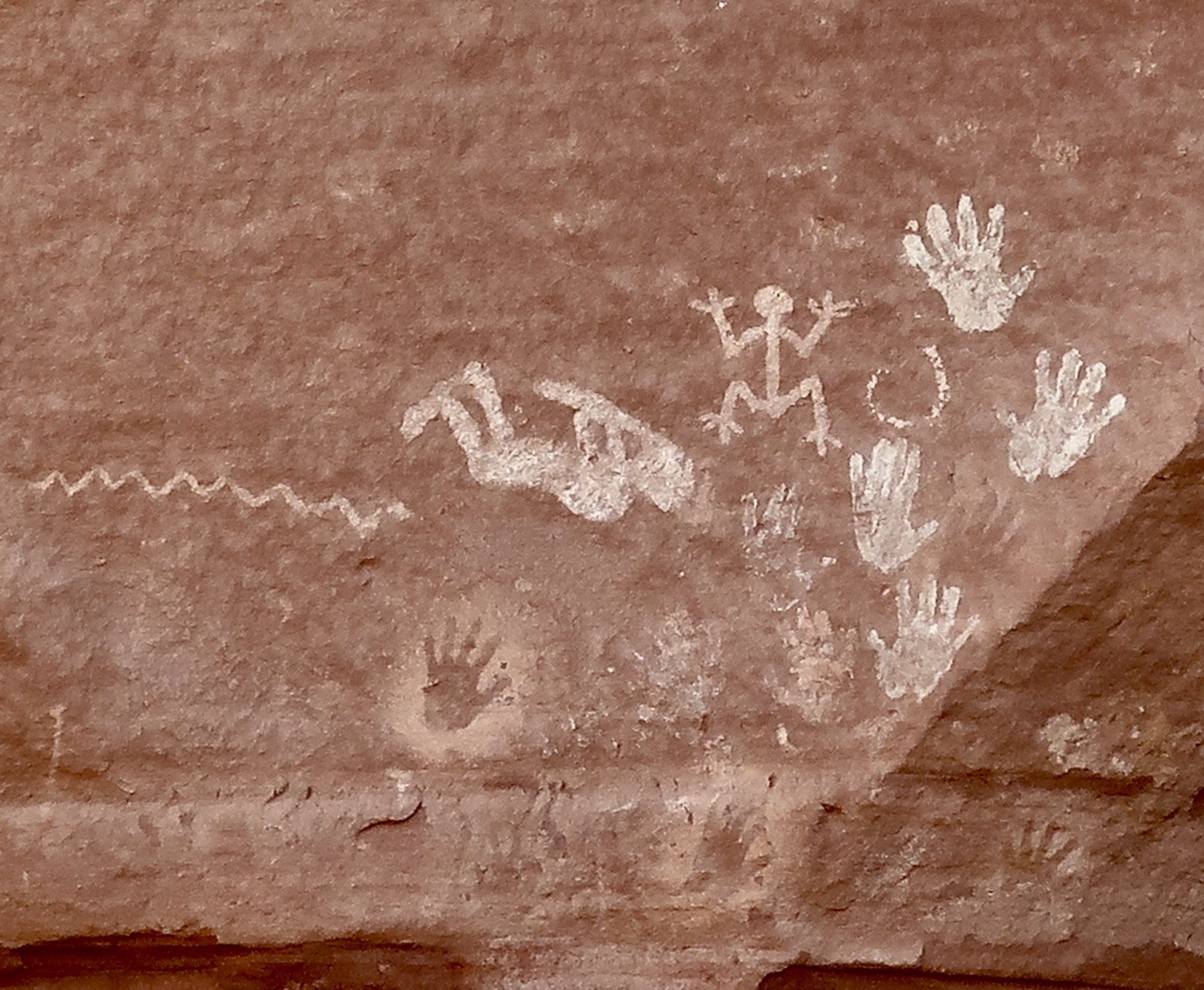
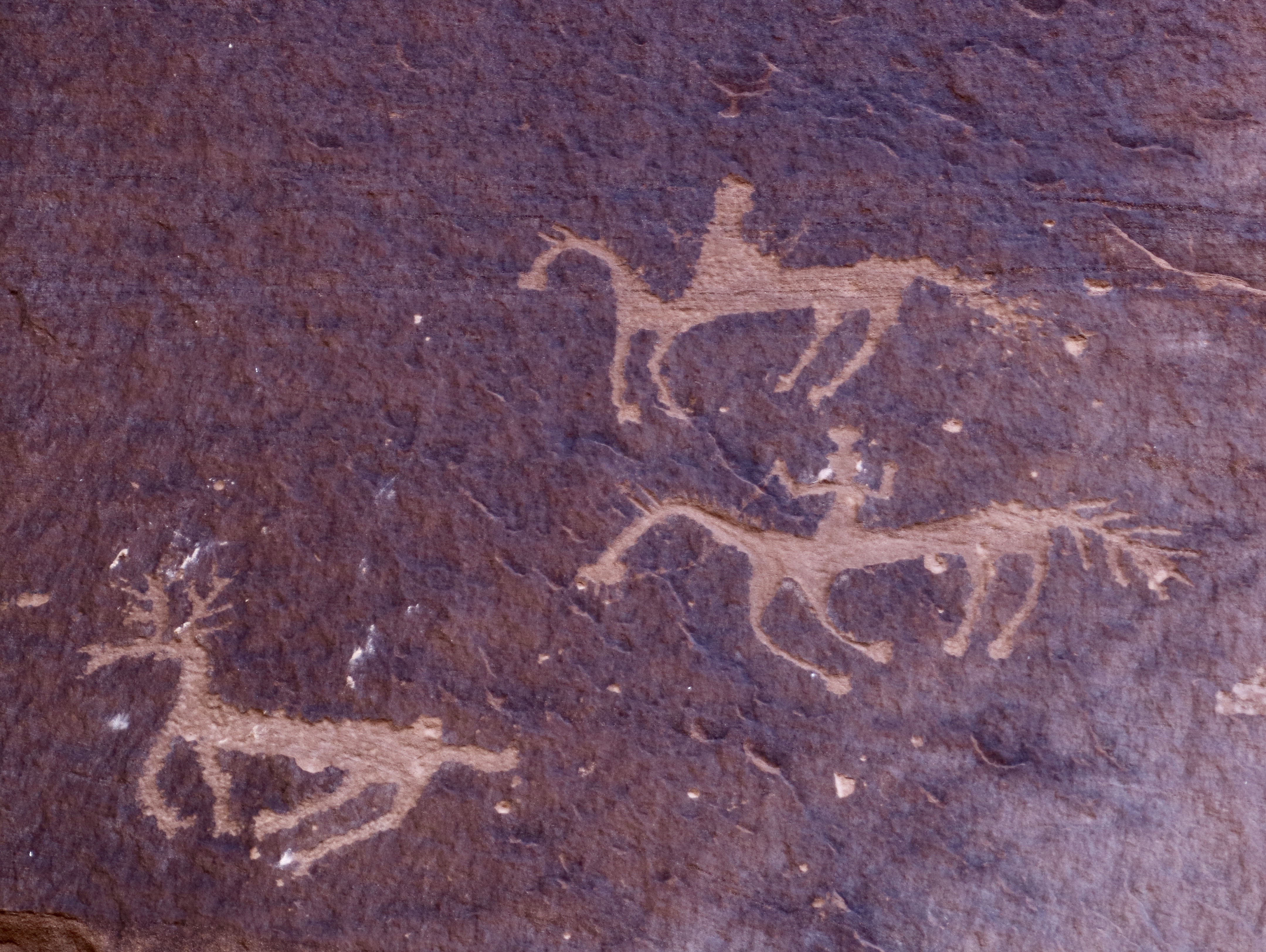
I was reading Baby Blues in the comics this past week and it made me think of this Ancestral Puebloan home and petroglyph in Canyon de Chelly. In the comic, Wanda is tucking her son in and says “Sweet Dreams, Hammie.” He responds, “Can you leave the light on? I had a really scary dream last night.” We can attribute his nightmare to stories his sister Zoe has told him about what hides in his room. Now, imagine you are a young boy or girl and your window opens out on the this creature climbing down the wall. Who needs a monster under the bed or in the closet? We really don’t know the meaning applied to this petroglyph, however. We can only guess. Mine is that the ‘monster’ wasn’t designed to scare children but may have been to discourage enemies from climbing up to the pueblo. If it encouraged children to be good, that was probably okay as well. But again, we can only guess at the meaning. The white dots, BTW, are cottonwood tree seeds. It was ‘snowing’ with them.The best known pueblo in Canyon de Chelly is named the White House Pueblo for the white color of the upper building. Initially built by Ancestral Puebloans in 1060 CE, they continued adding to it for the next 200 years. It is estimated there were more than 80 rooms when it was finished.Built on two levels, archeologists speculate that the botton level may have originally reached the upper level. The White House Pueblo is the only place in Canyon de Chelly that visitors can walk to without a guide. Have you spotted the petroglyph? Center on wall beneath the ’snowflake.’ Up close. There are others on the wall even more faint than this one. A view of the lower level of the White House Pueblo.Numerous other ruins left behind by the Ancestral Puebloans are found throughout the park. I rendered this one in black and white. The round building in front is a kiva.Another example.This ruin featured a prominent swastika. (There is also one on the pueblo I rendered in black and white above.) As I mentioned in a previous post, long before the Nazis adopted the symbol to their cause, it represented an heroic journey, good health, and well being to the Ancestral Puebloans and Navajos.Peggy was delighted to find a treasure chest of petroglyphs in Canyon de Chelly and searched “high and low’ so to speak for ones she might use in her next word search petroglyph book. I’m not sure this will make it, but you have to admit it’s unusual and perhaps a bit scary. You wouldn’t want one living under your bed.Speaking of scary, we almost missed these pictograph creatures. They seemed to be hiding in the rock, ready to pounce on us. Talk about Nightmare City. Check out the claws on the horned fellow.Not as scary but quite interesting. The pictograph figure on the left is the humped back Kokopelli lying on his back and playing his flute. We have numerous depictions of Kokopelli from different petroglyph sites throughout the Southwest but we have never seen him lying down. Given his role in fertility and protecting women in childbirth, it may have something to do with the woman on the right who is in the position that most petroglyphs relate to childbirth. Whatever his role, I would say it’s a hands-on experience. And then there is the snake slithering through the scene…This scene shows horsemen closing in on a deer. Since the use of horses in the Southwest by Native Americans depended on Spaniards bringing them to to America in the 1500s, these petroglyphs would have been created in the 1600s or later and are likely done by Navajos. I really like the sense of action portrayed by the deer and horses. And their ‘look.’The man on the bottom horse is holding onto the the reins in his right hand. Not sure what he is doing with his left. Waving. I’m surprised he wasn’t shown holding a spear.These pictographs by Ancestral Puebloans were at least 100 feet up on a canyon cliff. The top left scene shows how hunting was done prior to when horses, bows and arrows were introduced. A throwing stick, known as an atlatl, is being used to throw a spear with greater force and distance than a person normally could throw one. You can see the stick in the Puebloan’s hand. He has hit his target. Ouch. A number of other subjects are included on the panel. I’m intrigued by what looks like a very happy dog in the lower left hand corner complete with ears, nose, eyes, a smiling face and a wagging tale. Surely it’s my imagination.This large ‘canvas’ was similar to what are know as ‘newspaper rocks’ in Canyonlands and Petrified Forest National Parks. It is filled with petroglyphs showing a variety of animals and people. The lighter figure would have been a more recent addition.A closer look. Take a moment to explore the variety. Following are more pictographs that caught our attention:More anthropomorphic creatures coming forward out of the rock.Birds in a row. Are they doing the one legged turkey hop to Kokopelli’s flute music?We were interested in how these animals were positioned to walk on the edge of the broken off rock and even more interested in the reddish brown deer between them.A closer look at the deer.I’ll close today’s post with another unusual pictograph. Note the man holding up the two posts. Lightning seems to be emanating from the posts, or possibly being attracted to the posts in what may be some type of ceremony. Animals are attracted to the scene while the lighting cuts through a yellow shaman/man. Other men hike up the hill, leaving the area. I guess my comment is: What??? But that’s part of the magic of pictographs and petroglyphs.Next up: The ever attractive beauty and geology of the Painted Desert and Petrified National Park.
For those of you who keep track, Peggy and I are now back at our home/basecamp in Virginia. We still have several blogs from our journey into the Southwest that I will be posting over the next several weeks as we get ready for another adventure: Leaf peeping in New England, along the Blue Ridge Highway, and at Great Smoky National Park.
Canyon de Chelly (pronounced shay) is famous for its spectacular canyon views and ancient history. Today, the national monument is jointly operated by the Navajo Nation (who owns the land) and the US Government.
Peggy and I have visited Canyon de Chelly twice, first in 2019 in October and then this year in June. In 2019 we drove the South and North Rim roads and then explored the inner canyon. The two roads are open for anyone to drive. The tour of the inner canyon requires that visitors have a Navajo Guide along. Our friends Tom and Lita from Sacramento joined us in June where we did the inner canyon tour but, unfortunately, didn’t have time for the rim drives. I’ve opted to use photos from both visits.
We are going to feature the scenic side of the canyon today. Next week, we will look at the canyon’s ancient history in terms of pueblos that the Ancestral Puebloans built in the canyon and petroglyphs and pictographs from both the Puebloan and Navajo time periods. I also want to discuss the Long Walk where Navajo were forced to abandon their homelands to settlers pouring in from the eastern US. It’s the type of story that President Trump is now trying to ban from national parks and monuments because it detracts from his concept of a great America.
But first, the beauty.
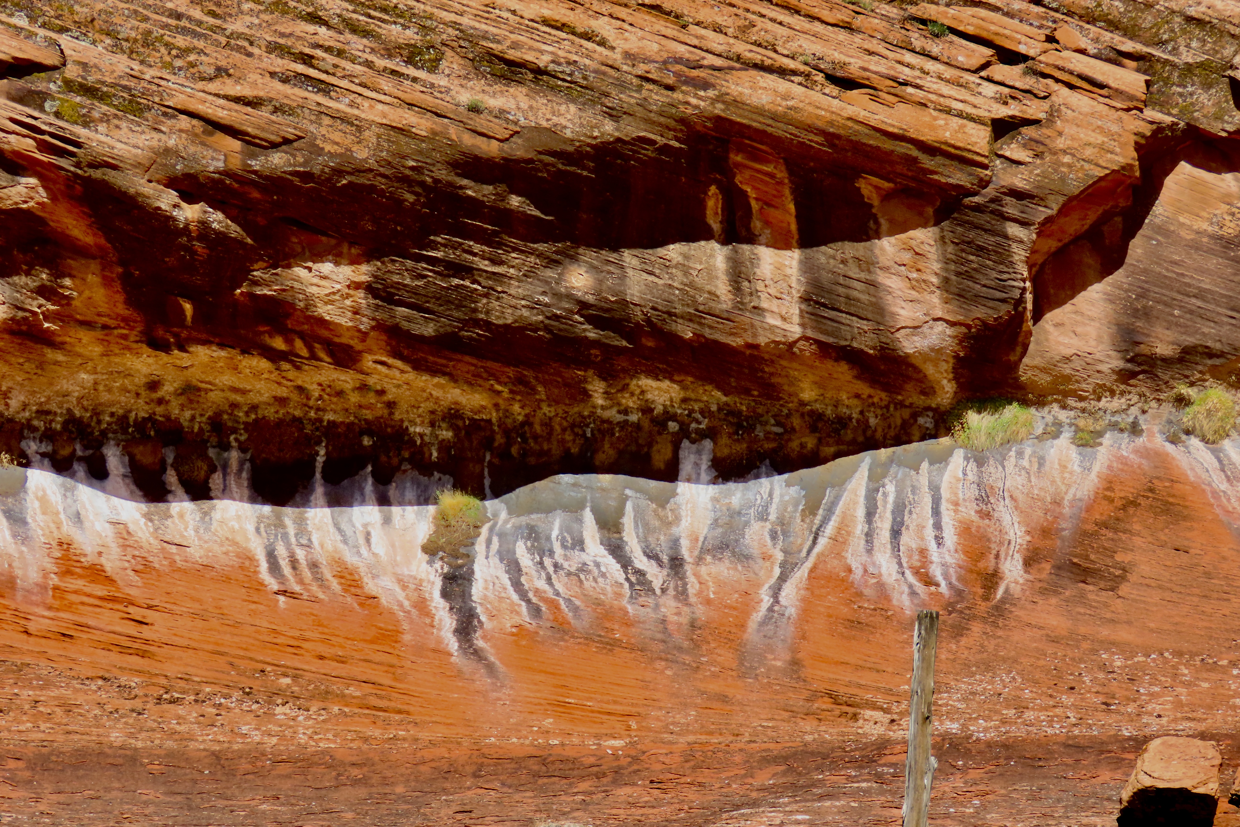
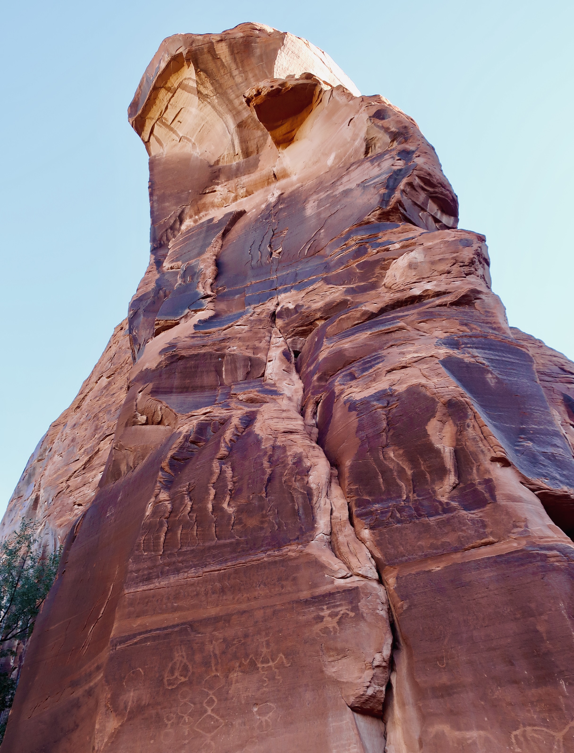
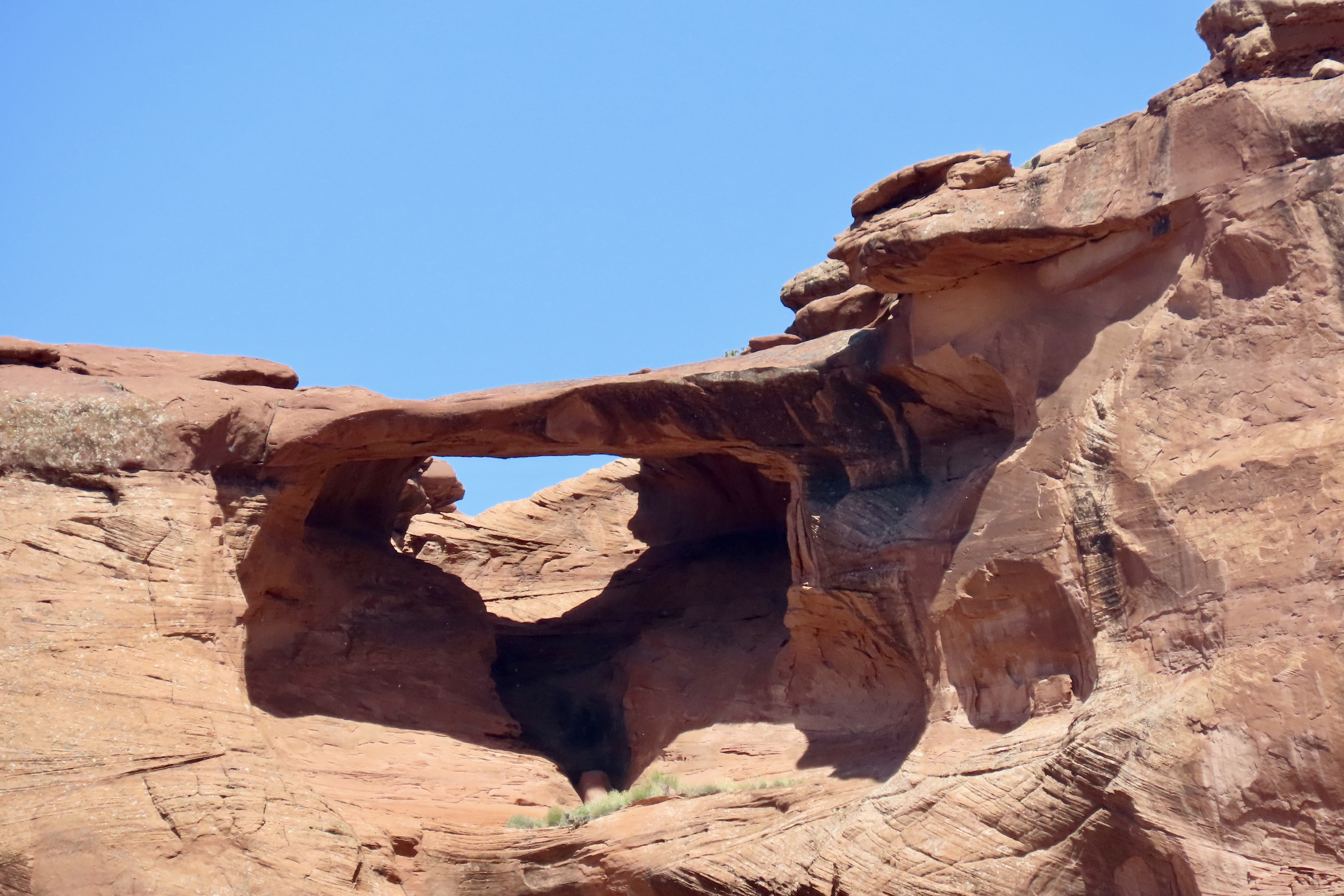
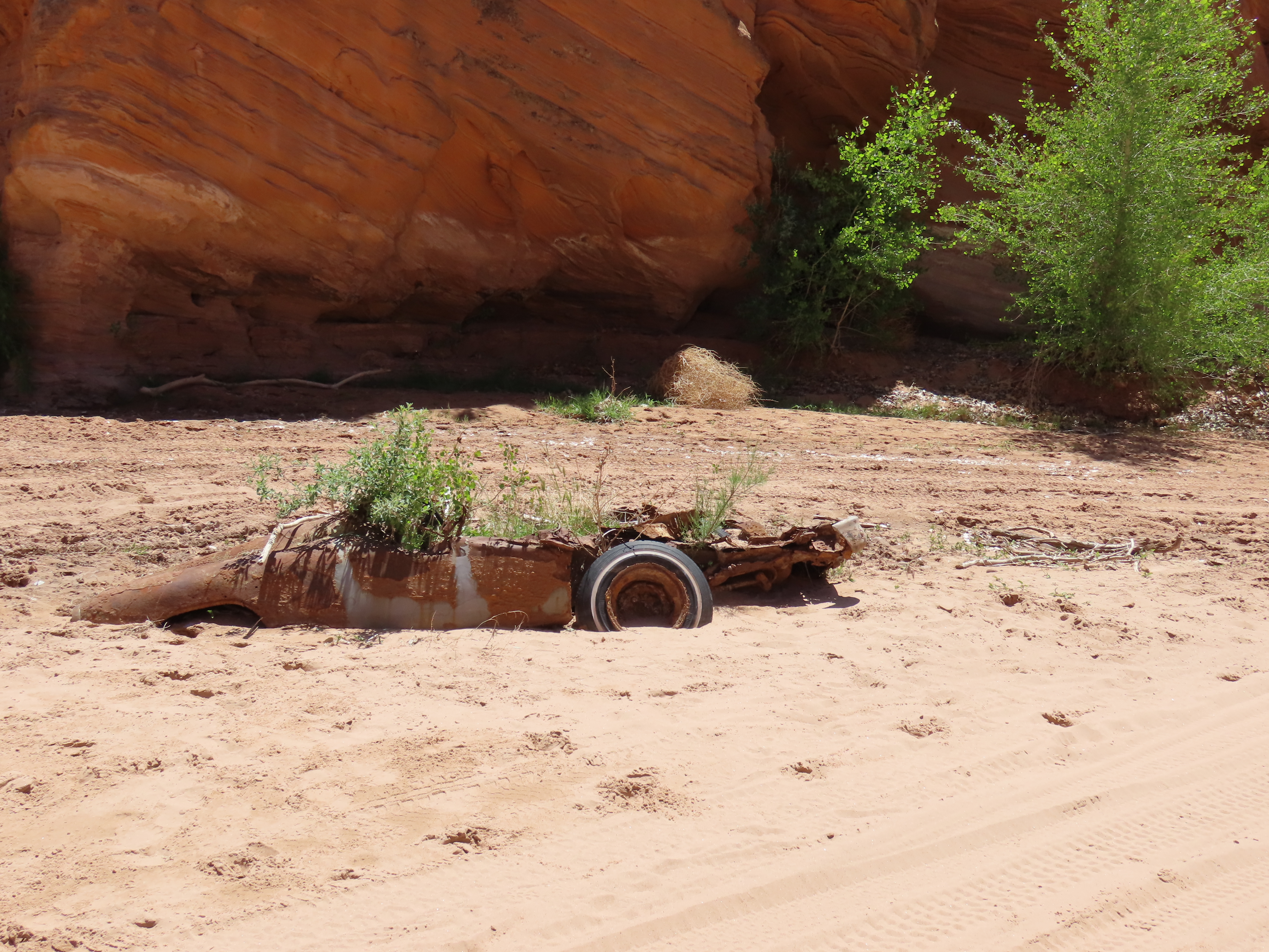
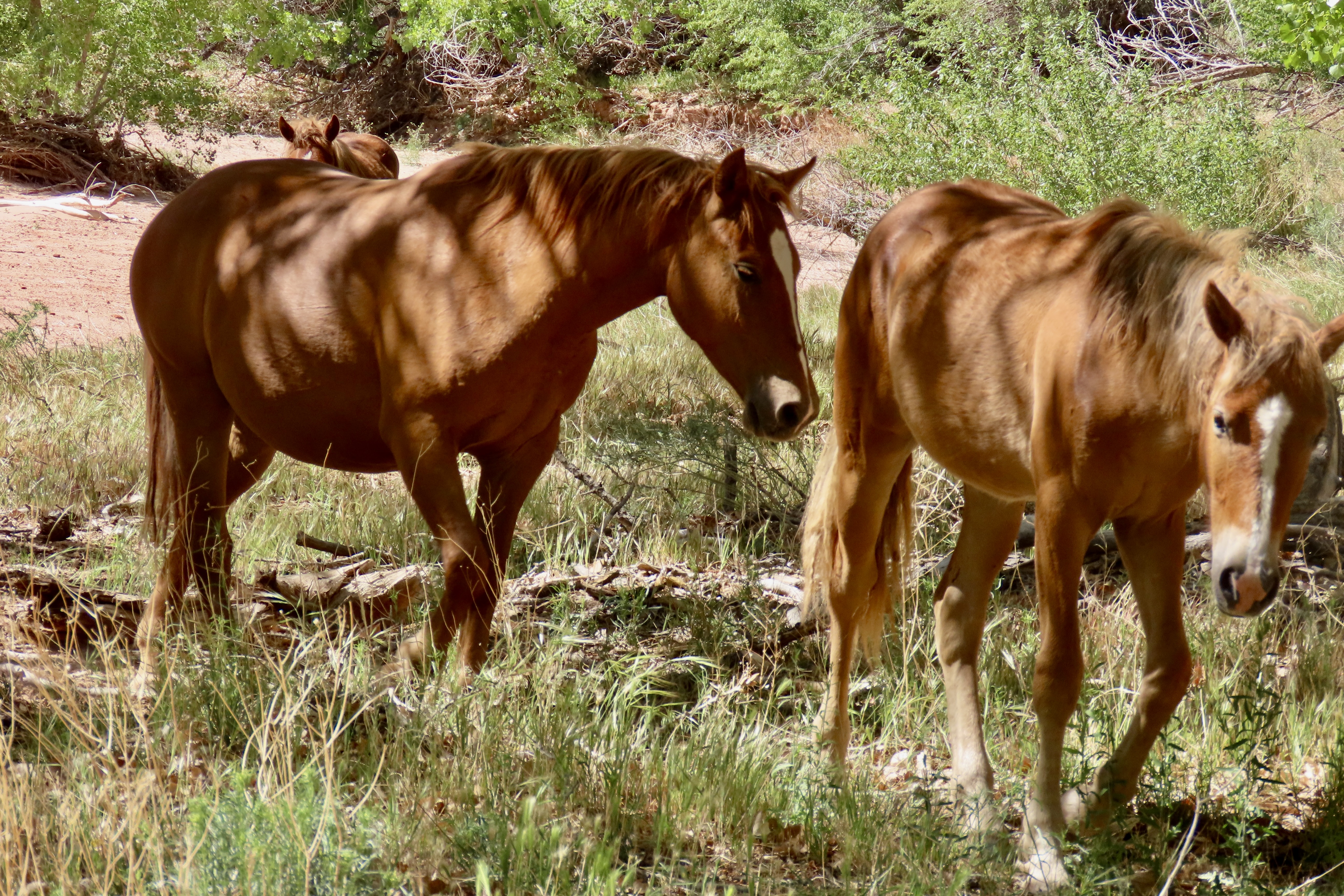
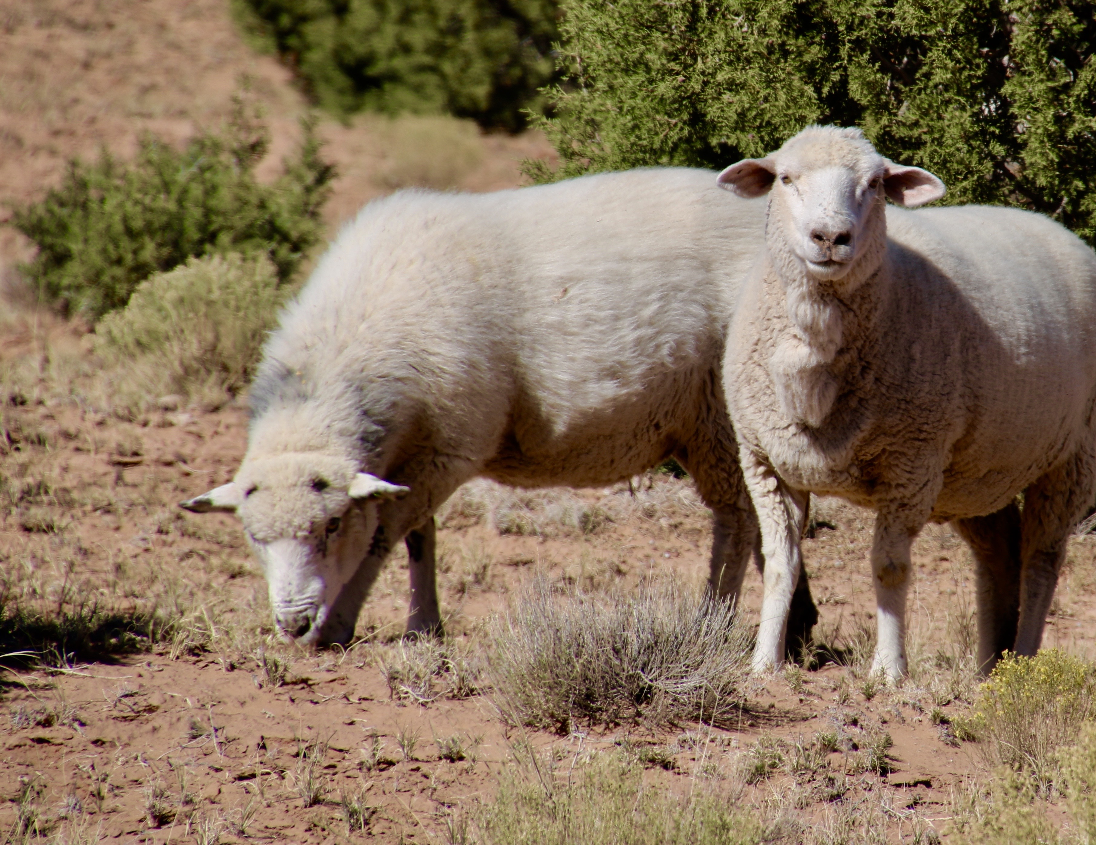
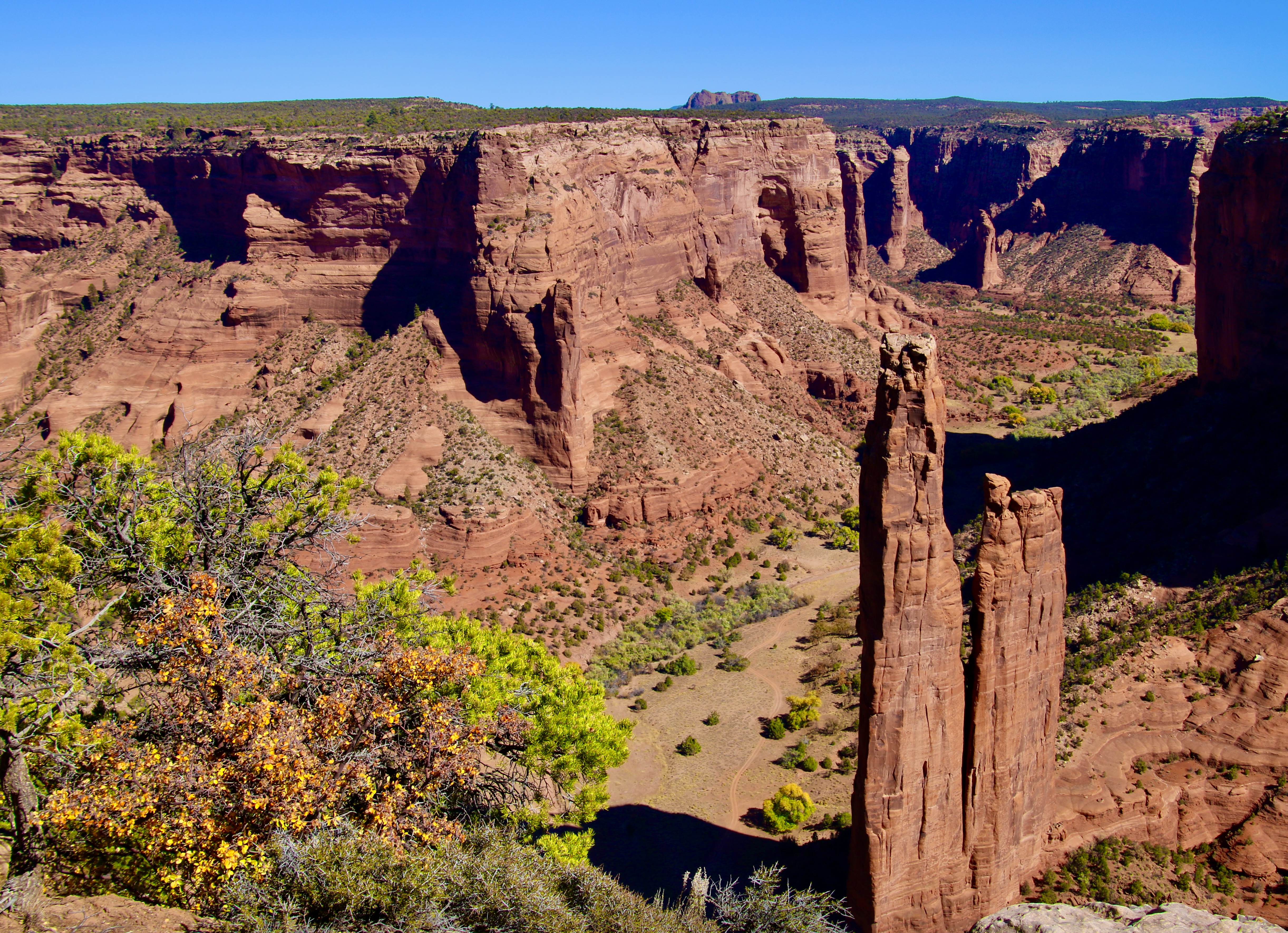
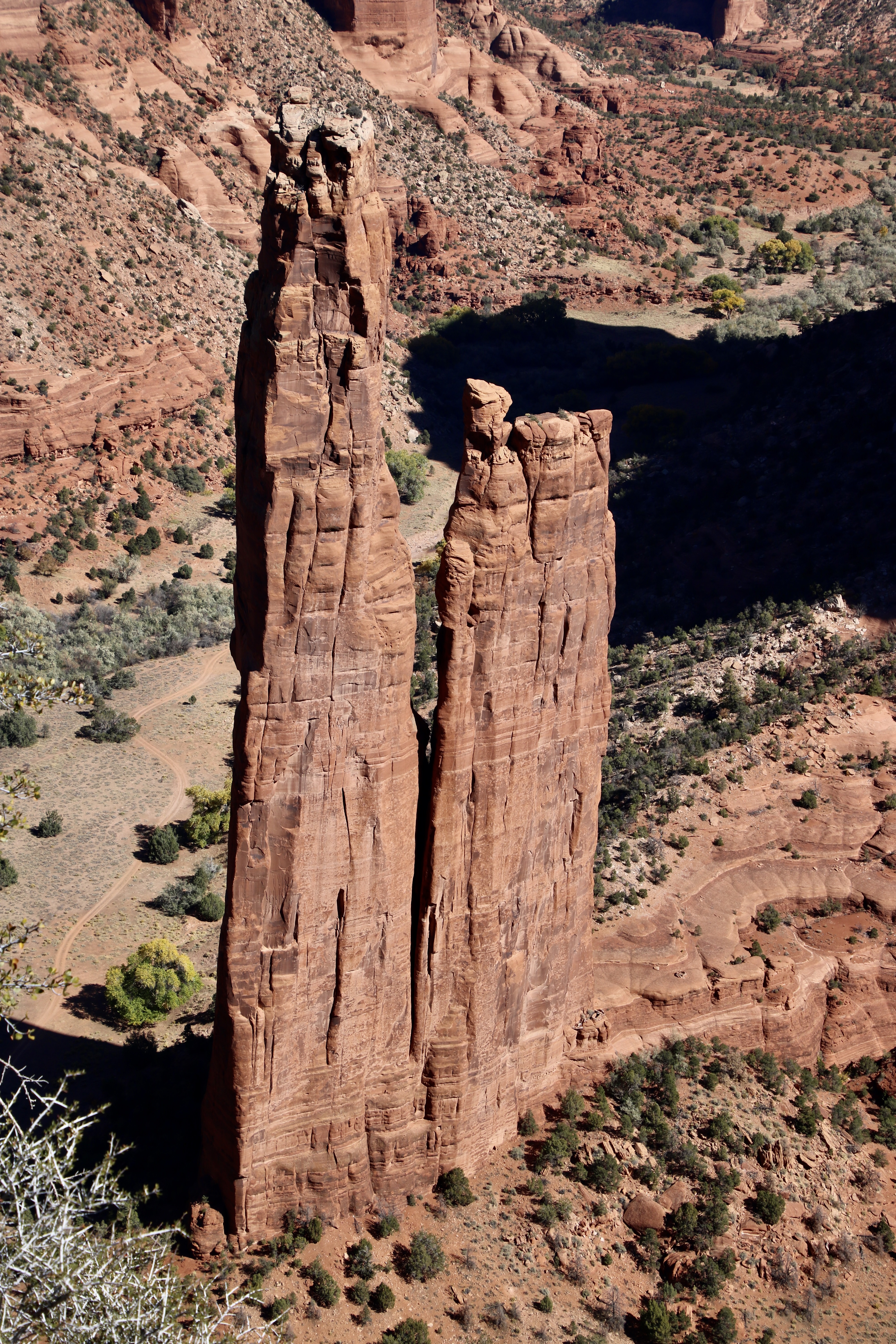
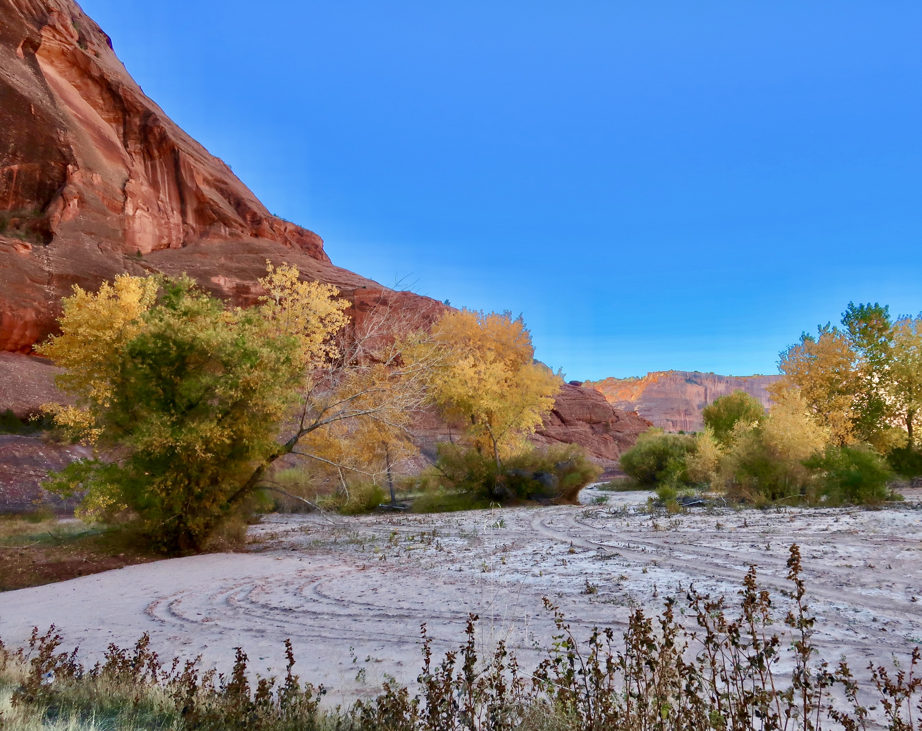
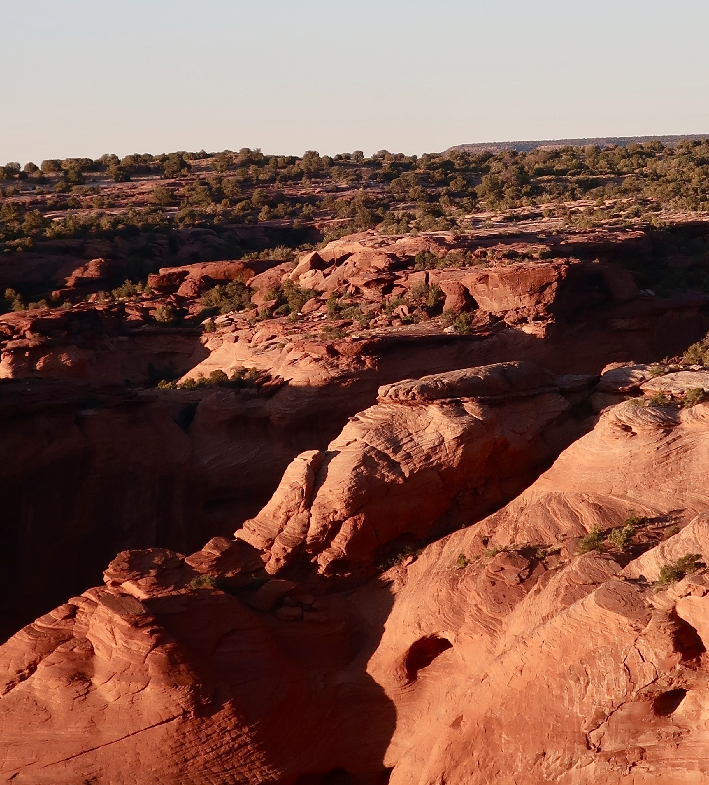
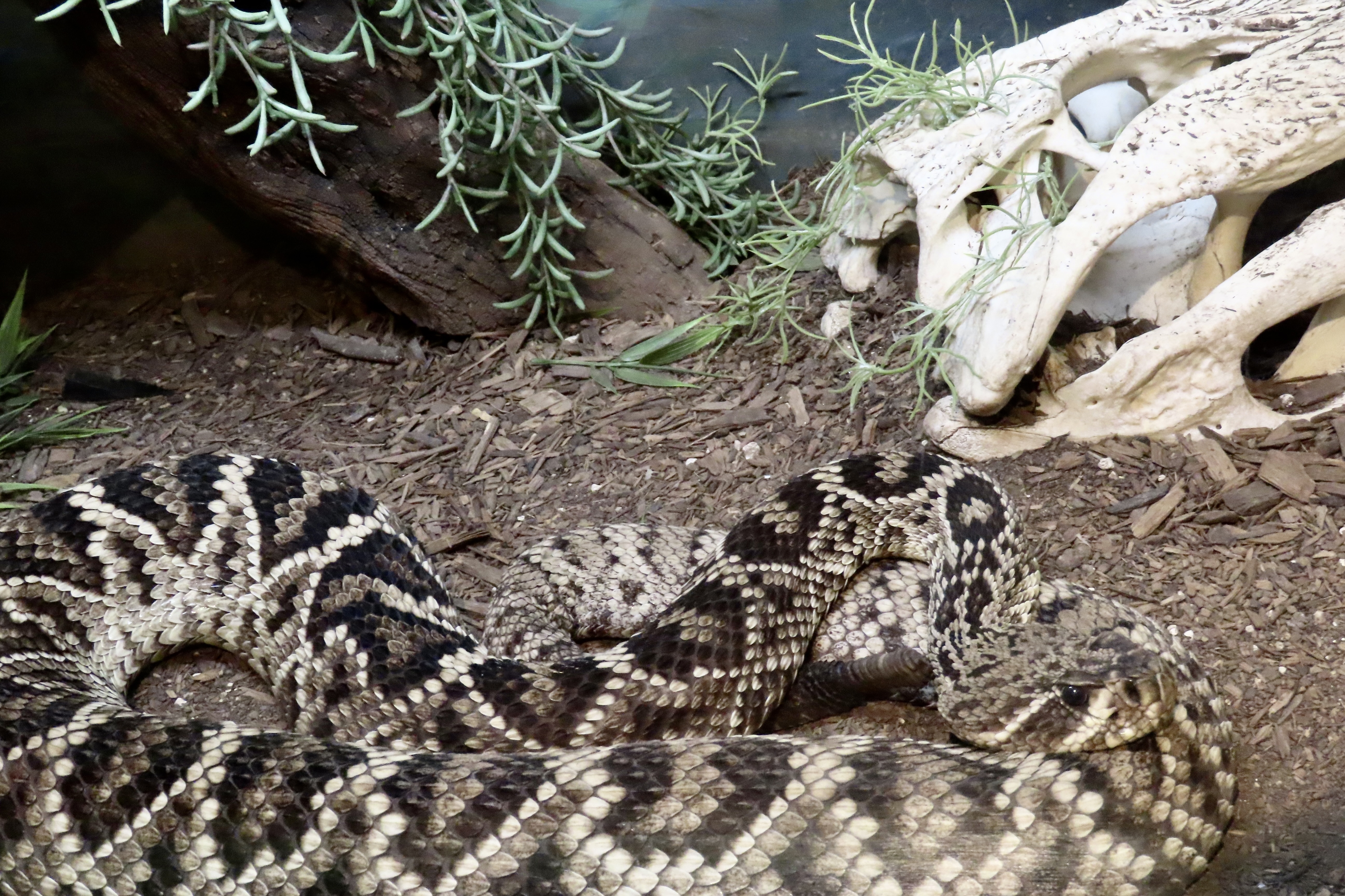
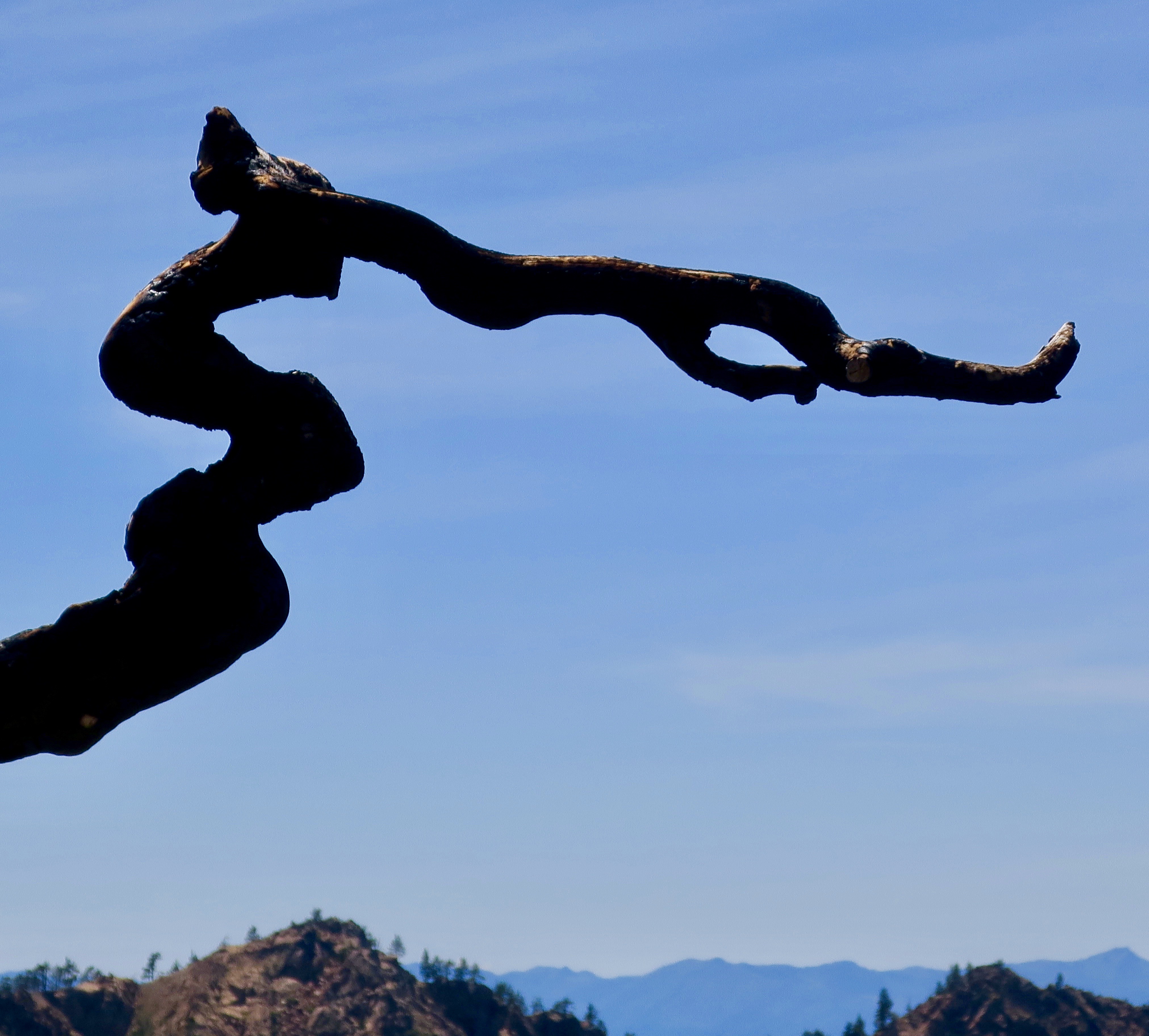
We admired this prominent landmark from inside the canyon in both the summer and fall. First summer…The long view. Not bad, huh.And now for fall.Both summer and fall were beautiful. Do you have a preference? I confess to being taken more by the contrast created by the fall foliage, but it’s close.Fall doesn’t get much more colorful than this.I thought green fit this tree well, however. The stripes on the wall are created by minerals left behind by flowing water.Here, they ‘painted’ an unusual picture worthy of a modern art gallery.This was one of many rock monuments found in the canyon. Note the petroglyphs on the bottom. It is no surprise that the Navajos and Ancestral Puebloans selected this dramatic rock as a canvas. Looking up provided this view of an arch.At first, I felt that the tracks left by all of the visitors took away from the beauty. There were bunches. But then I found the shadows created by the sun made them photogenic. Four wheel drive was essential.Another example.Rocks breaking off the walls add to the beauty and mystique of the canyon. It takes little imagine to turn these into a tree.Speaking of imagination, mine turned this old car into an alligator disguised as a flower box lurking in wait for a tourist dinner. ( Admittedly, my imagination can be a bit wild at times.)Navajos live and farm in the canyon. Some offer horse rides. Our guide on the fall trip raised horses and rented them out for Western’s. He had also performed in some of the movies.The Navajo raise sheep up on the rim of the canyon.Driving the south and north rim roads of Canyon de Chelly provides a totally different perspective on the canyon and its amazing rock formations.Close up.There was no end to the variety of patterns in the rock.Sometimes it looked as if the rock was melting.The most recognizable monument in Canyon de Chelly is Spider Rock, a 750 foot (230 m) spire that is said to be the home of Spider Woman, an important figure to several different Native American tribes. To the Navajo, she is a helper and protector. It’s also said that they tell their children that she will catch them in her web and eat them if they are bad. Way to go Spider Woman. Grin. You can see one of the canyon’s roads working its way up the canyon. A close up of Spider rock.More of the canyons interesting rocks lit up by the late afternoon sun.A last view of the inner canyon in fall.We’ll wrap this post up with a photo of sunset from the canyon rim. Our next post will be on the pueblos and petroglyphs of Canyon de Chelly. I may, however slip in a quick post on one of my favorite subjects: Rattlesnakes.
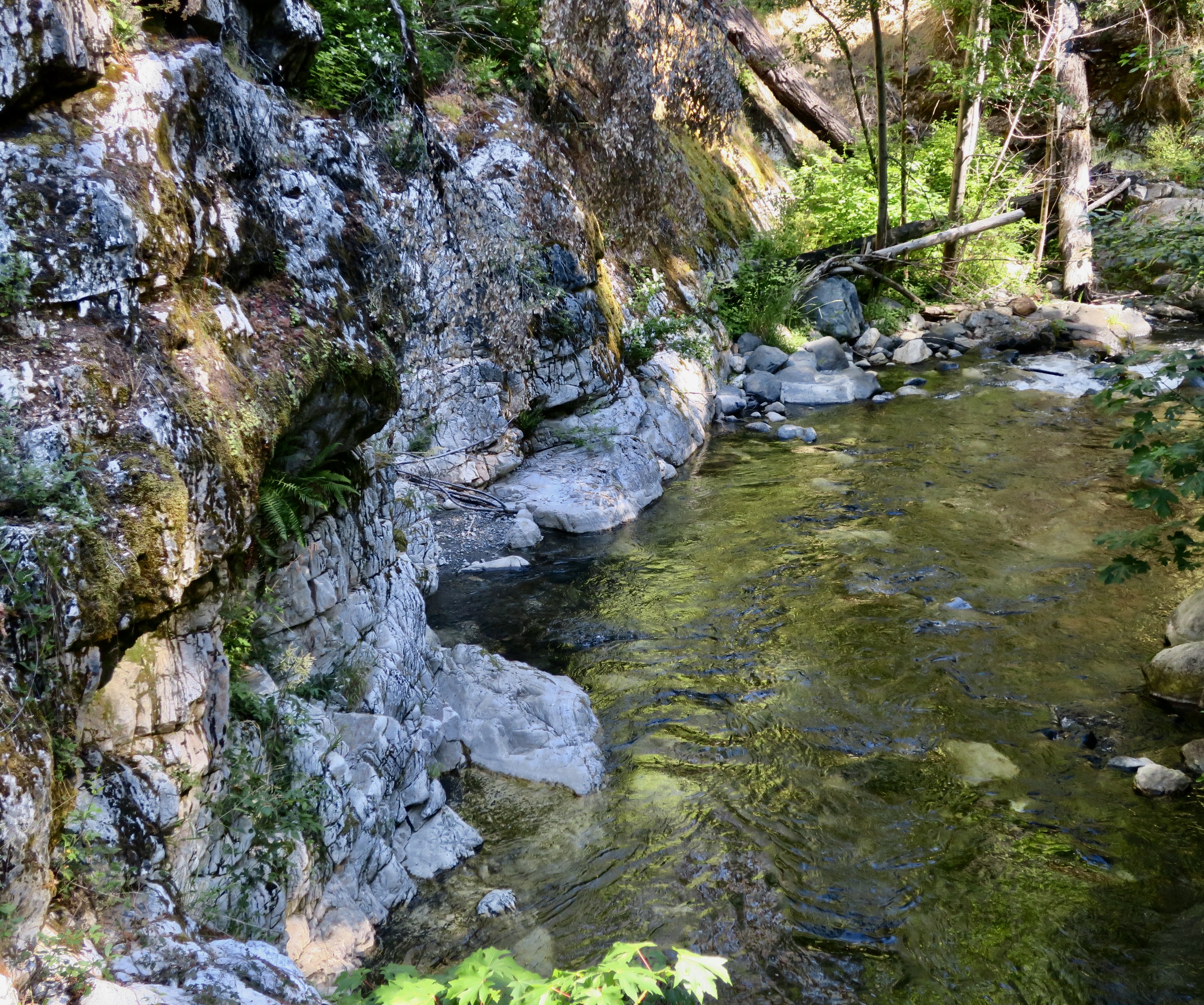
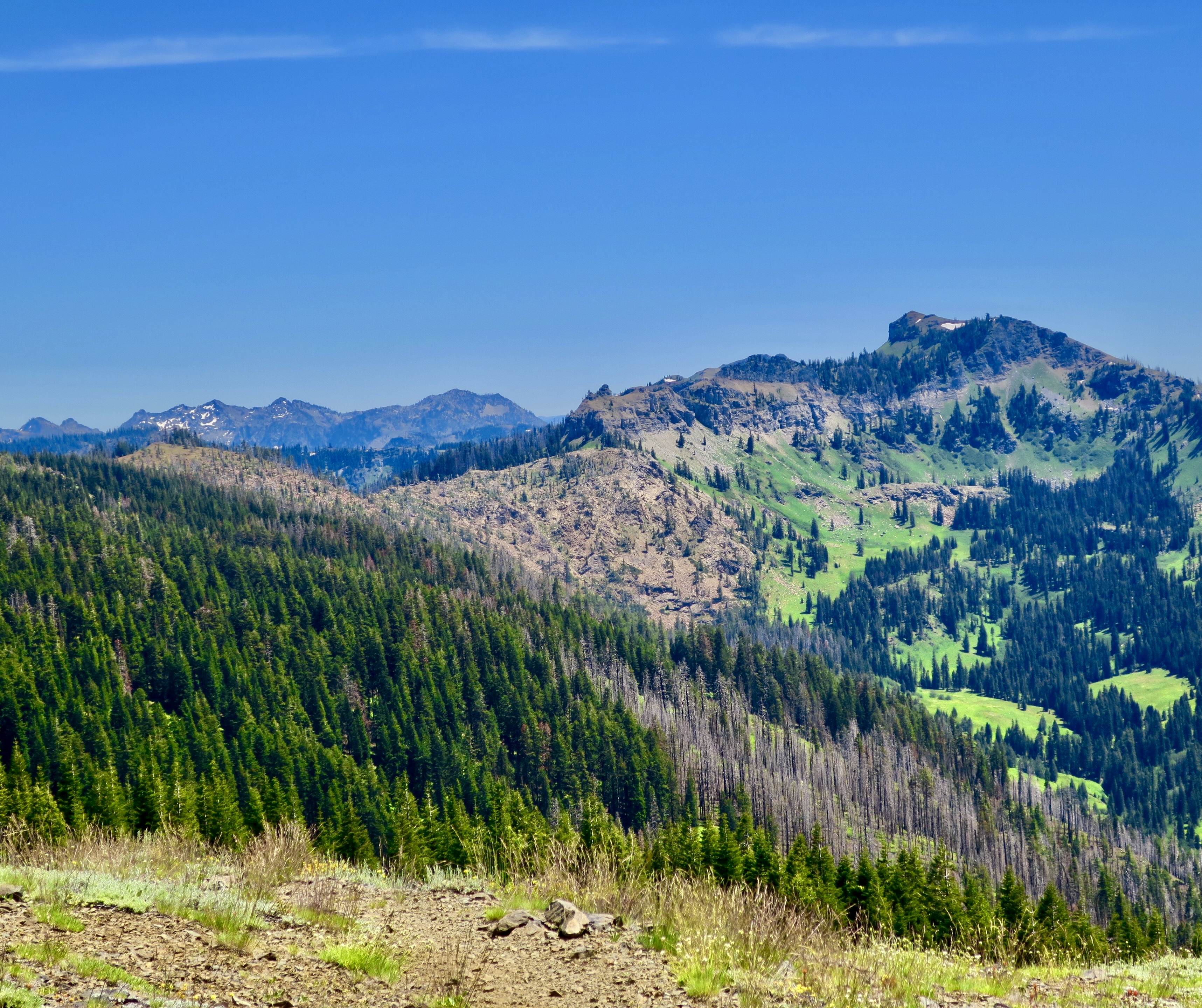
This is view of Mt. Shasta from the Marble Mountains Wilderness. My 750 mile trek down the PCT gave me northern views of the mountain, western views and and southern views. This was one of the best. Given its mystical/magical look, it’s hardly surprising that tales of beings like Bigfoot, Lemurians, and Lizard people are associated with it. The local Native American Modoc Tribe, whose legends include Bigfoot sightings around the mountain, refer to him as Matah Kagmi, meaning keepers of the woods.I like it. The Lemurians are a New Age creation connected to highly advanced lost continent of beings that live under the mountain. As for Lizard People, think aliens and UFOs.
As part of our series about protecting national parks, monuments and other public lands, I’ve been reading news releases from the directors appointed by President Trump who oversee these areas. It’s not a task I would wish on anyone. It isn’t surprising that the directors all support the president’s objective of significantly reducing many public lands in size and opening up others for profit making operations. That’s why they were appointed.
The news releases are full of statements designed to hide their real purpose. Here’s an example:
“President Trump promised to break the permitting logjam, and he is delivering,” said Energy Secretary Chris Wright.“America can and will build big things again, but we must cut the red tape that has brought American energy innovation to a standstill and end this era of permitting paralysis. These reforms replace outdated rules with clear deadlines, restore agency authority, and put us back on the path to energy dominance, job creation, and commonsense action. Build, baby, build!”
Let’s did a little deeper. By ‘permitting logjam’ and ‘red tape’ and ‘outdated rules,’ he means rules that have been developed to protect our air and water quality, save rare and endangered species from extinction, and maintain areas of great beauty and/or cultural significance that the majority of Americans support protecting. The Administration’s perspective is that these rules get in the way of progress. Who needs clean air or water. “Build, baby, build!”
And how about American energy innovation and dominance? Obviously, he’s not talking about solar, wind and water power. We’ve been moving ahead quickly in the development of clean energy. The Trump Administration is actively discouraging this progress. Incentives designed to encourage their use have been cut. His passion is for coal, gas and oil, all three of which are nonrenewable resources and have been prime factors in the development of global warming that has been having such devastating impacts on the US and the world. The Texas floods of this past week are but one of a multitude of examples.
Several countries in the world have now reached the point where 80-100% of their energy needs are supplied by renewable clean energy. I’d argue that they are the ones achieving energy dominance, one that will last long beyond our nonrenewable resources and is vital to our battle against global warming.
On another subject, it’s interesting that right-wing Republicans played an important role in blocking the administration’s plans to sell off millions of acres of public lands in the West. Here’s what Christopher Rufo, a culture warrior and leading supporter of Trump in in the state of Washington had to say:
“Pre-2016, you’d have the small government argument against a kind of federal domination over the land, but Trump and MAGA is a nationalist movement,” he said. “I think many conservatives are now reassessing these questions, and many of us in the West understand that part of a great nation is the preservation of its natural beauty.” There is hope.
The Marble Mountain Wilderness, the subject of this post, is an example of this beauty.
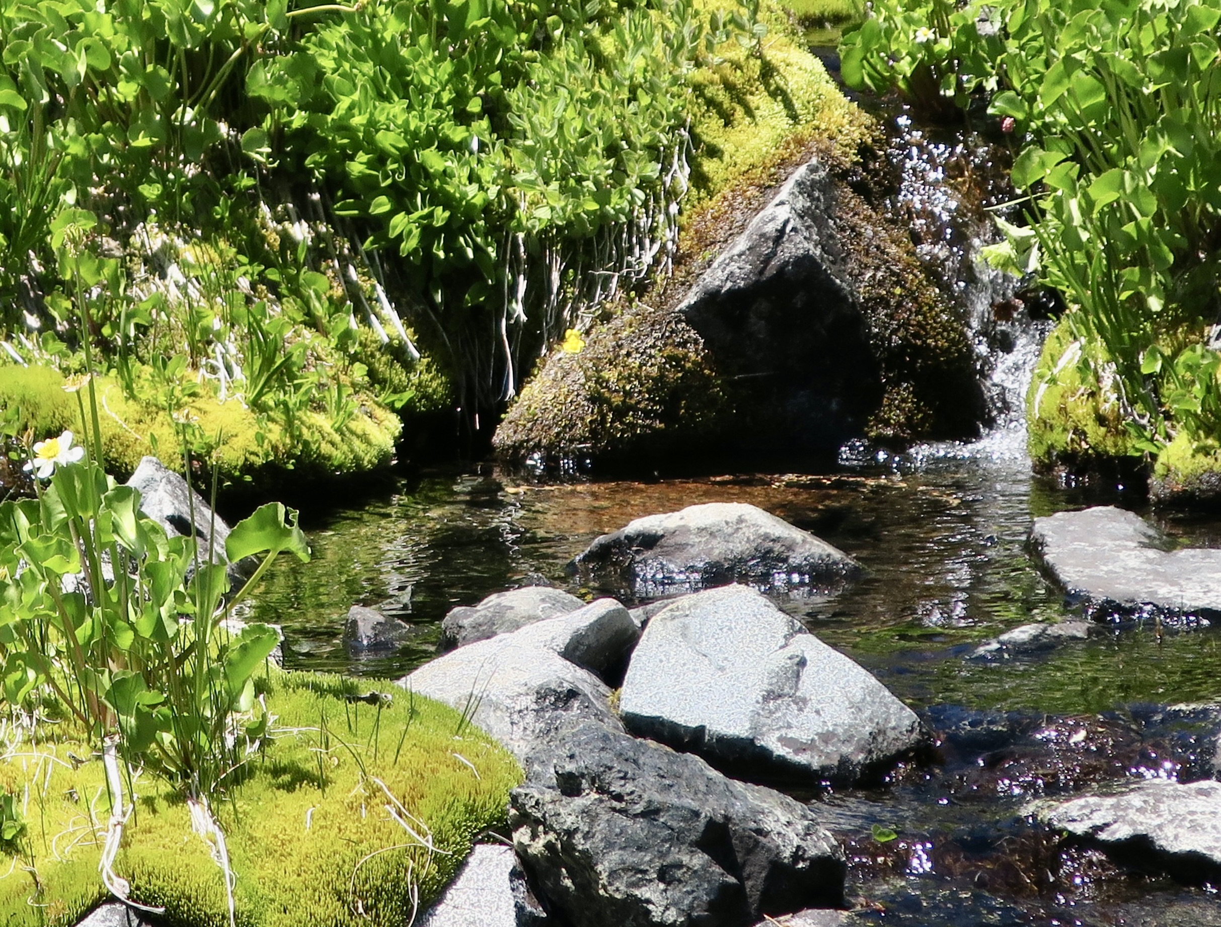
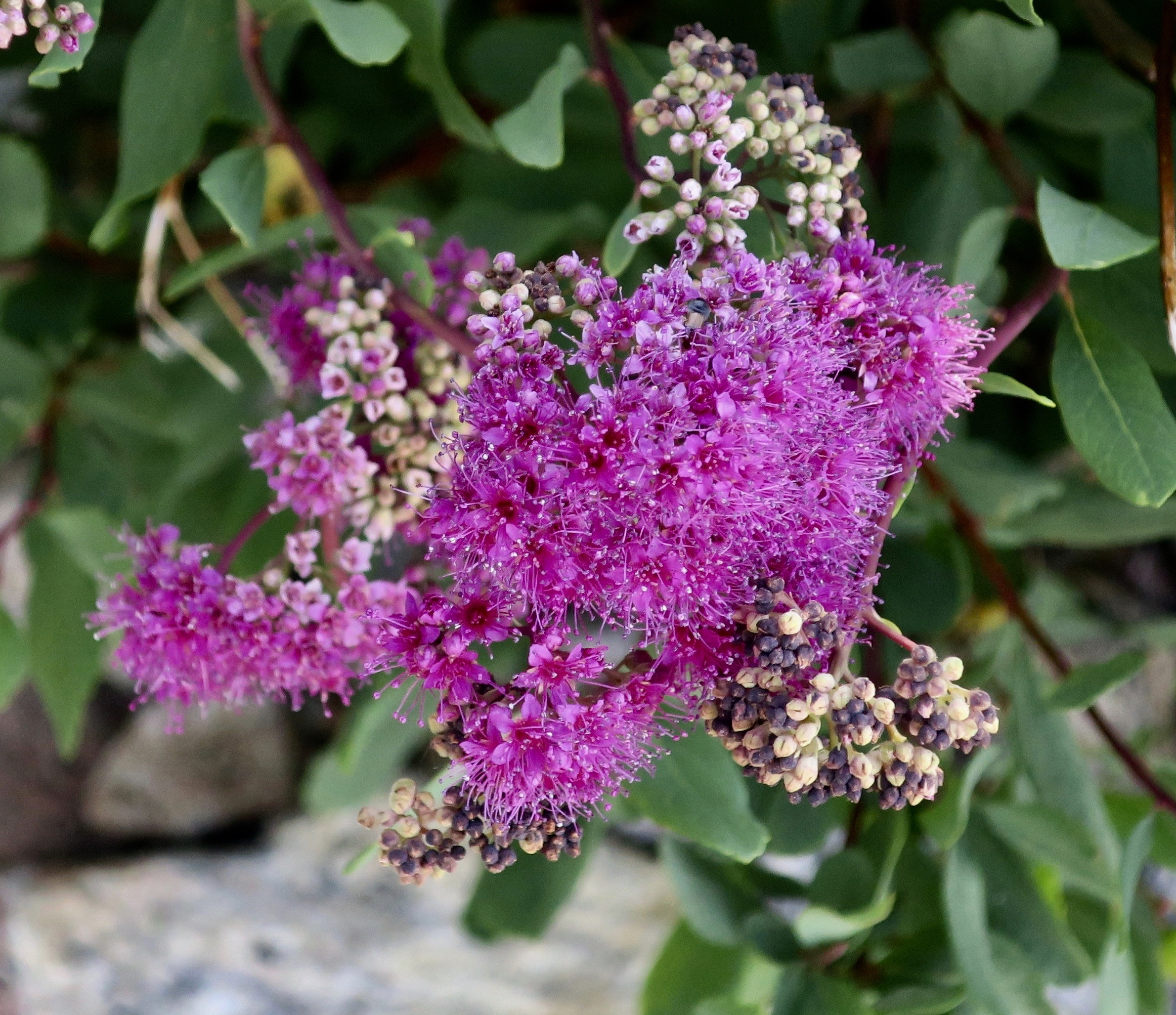
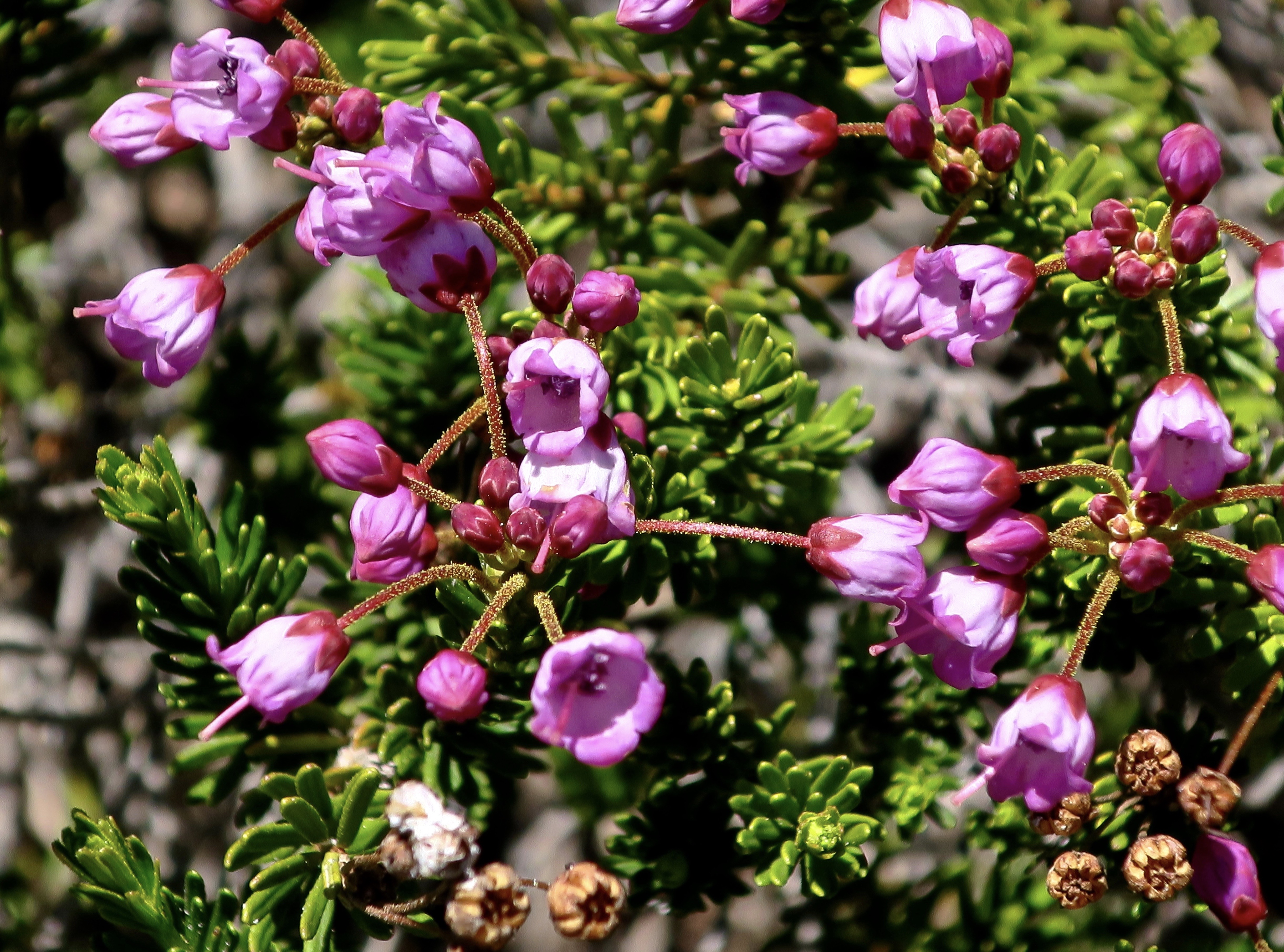
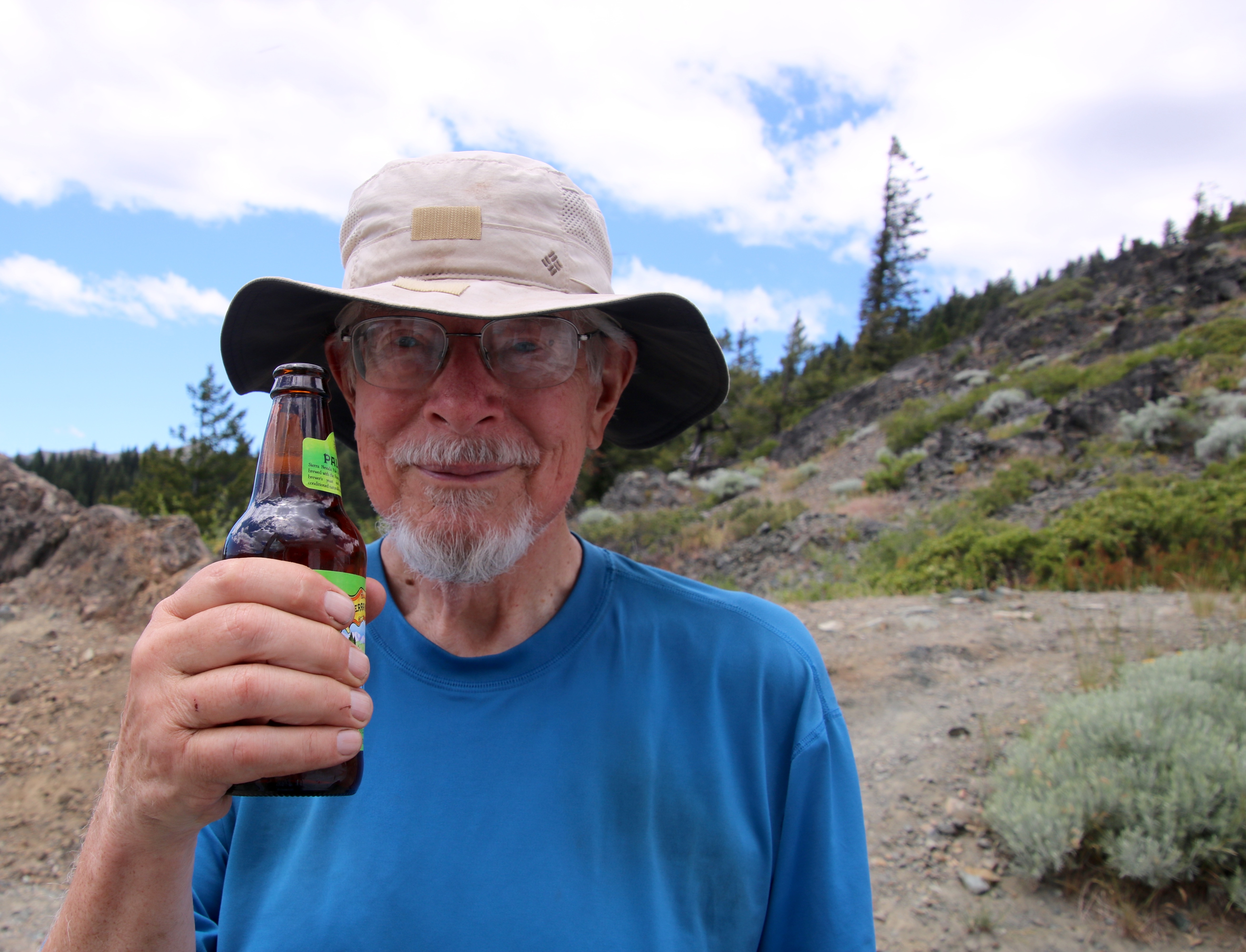
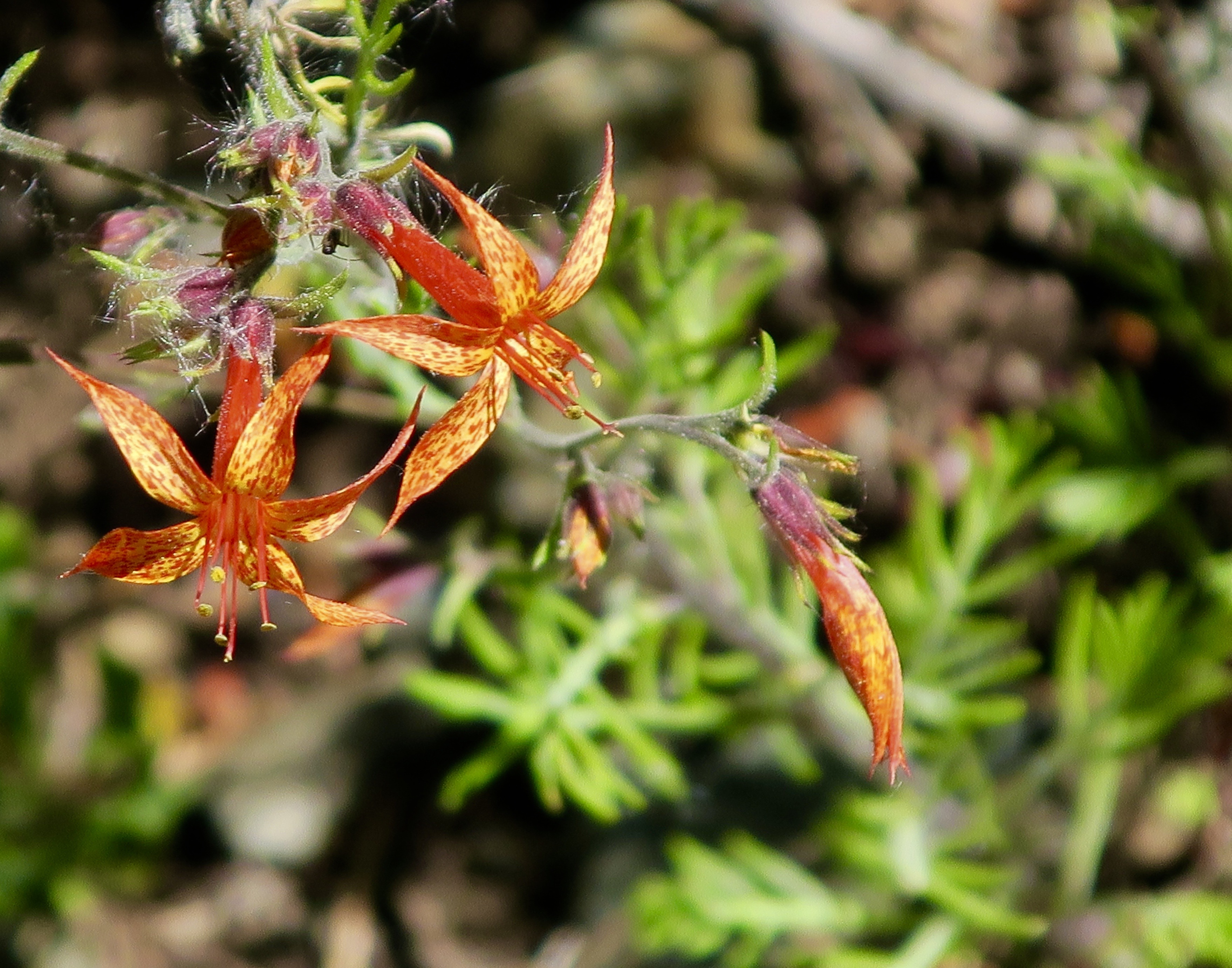
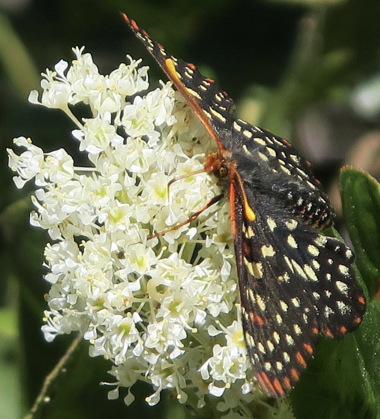
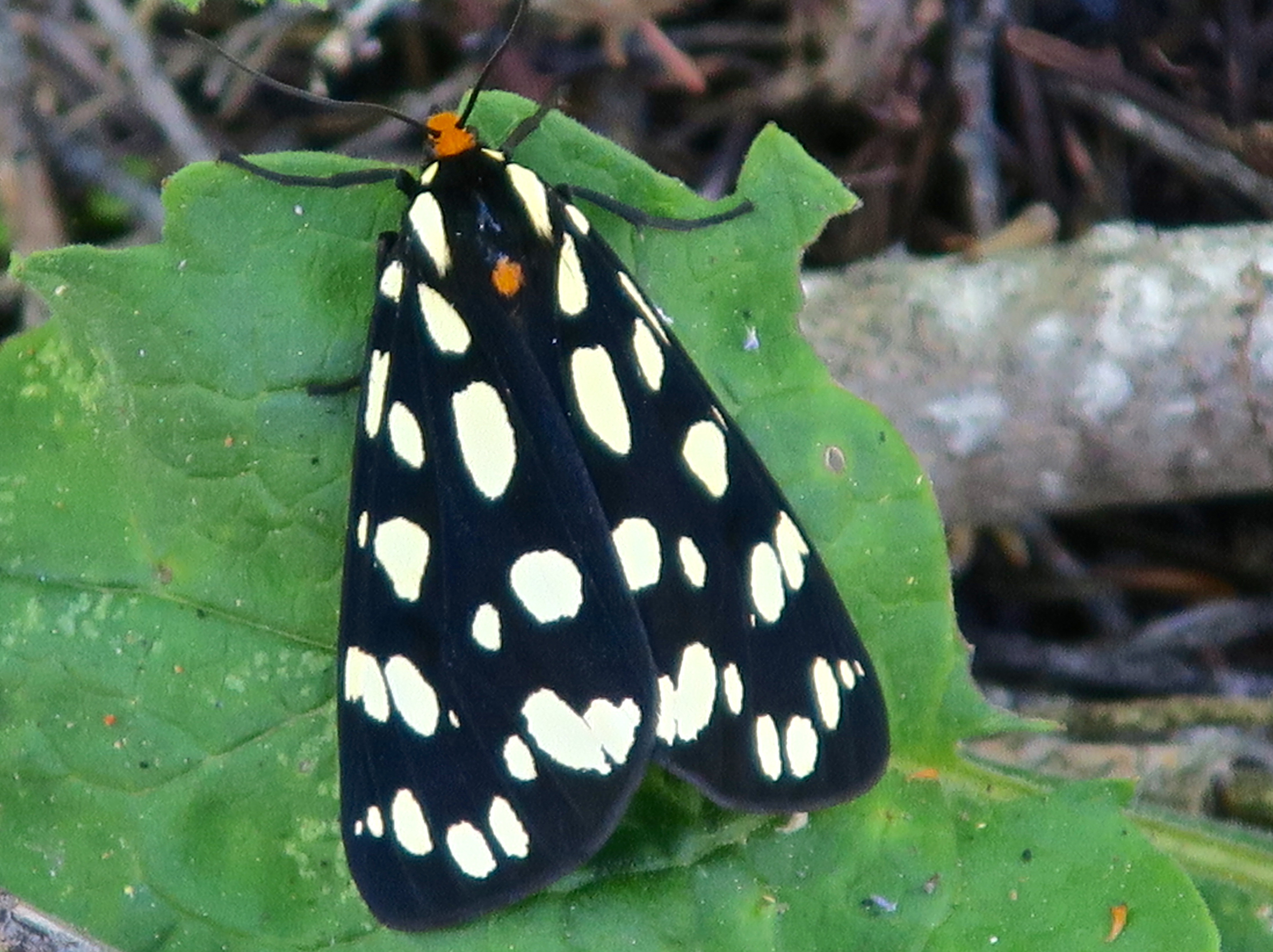
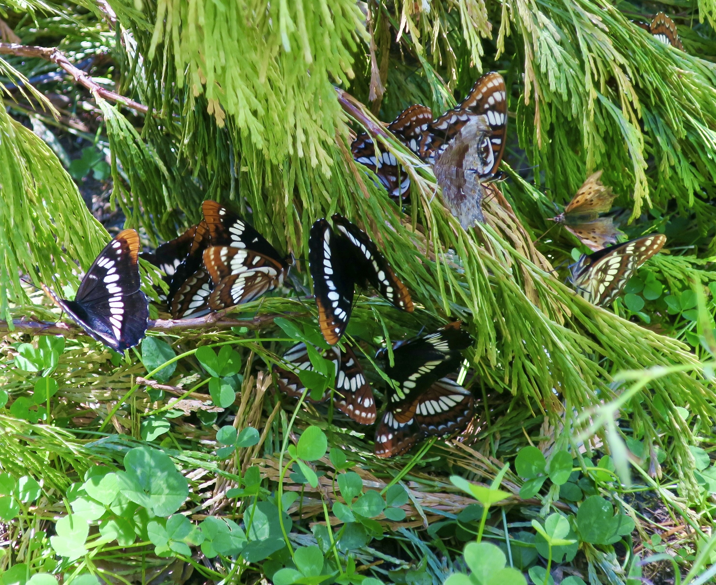
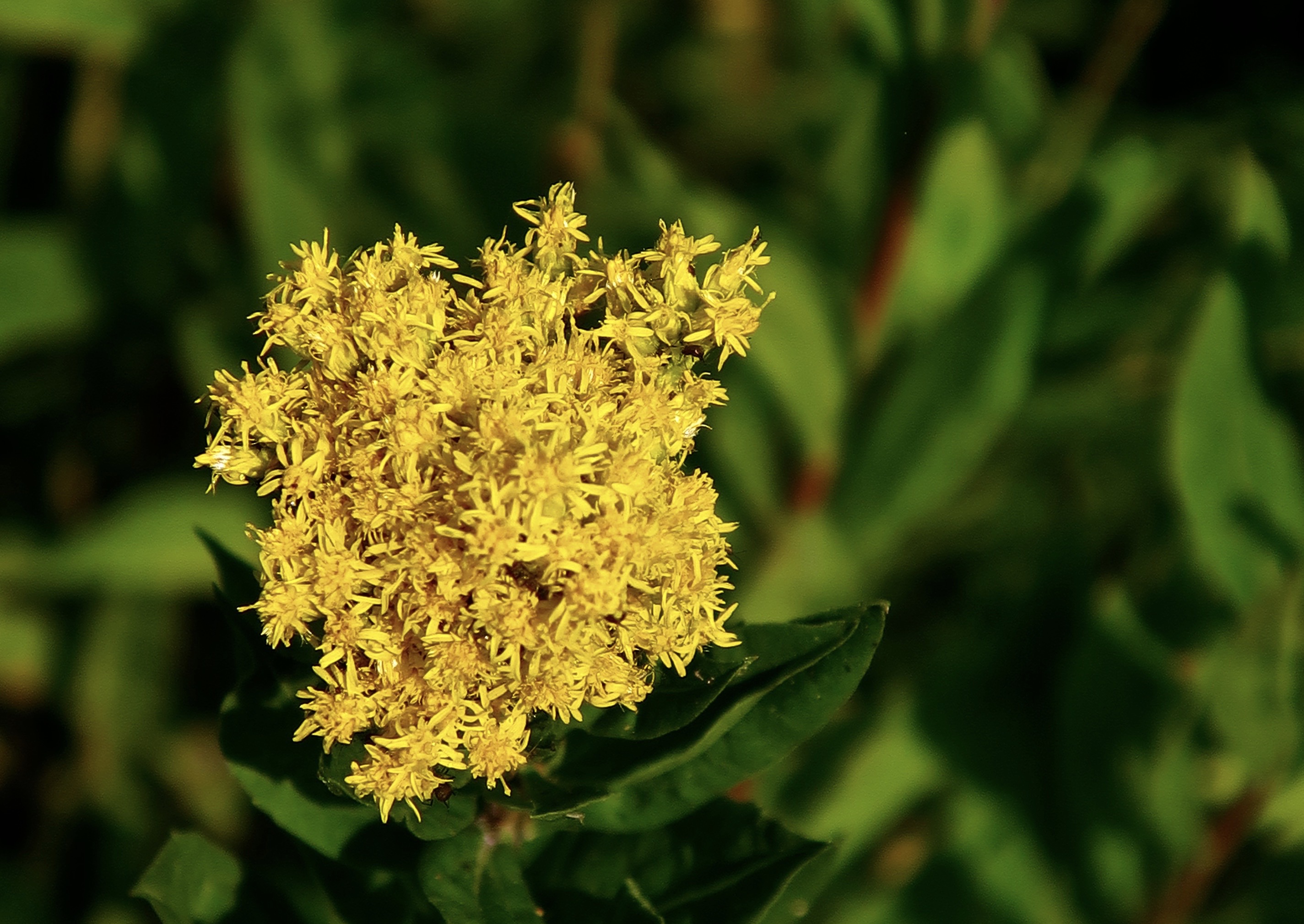
On the subject of ‘far away views’ seen from the PCT in the Marble Mountain Wilderness, here are two more. These are the Trinity Alps.Beautifully green.When I left off in my last post, I was just coming up to Paradise Lake. I was captured by the reflections, in the lake and……this outcrop of lime above the lake.The sign told me that I had left Paradise Lake and was on my way to Marble Valley. It seemed like an easy walk, but don’t quote me. Some photos from along the way.One of the names of this Mariposa Lily is cat’s ear. It’s easy to see why.Always a favorite: Penstemon.The value of this tree isn’t in its board feet, which is how the Trump administration sees it. It is in its beauty. Old growth forests deserve our protection.I’m glad I wasn’t around when this gorgeous chunk of limestone came rolling down the mountain.I came on this patch of snow shortly afterward. I planned my trip to allow time for most of the snow along the trail to melt. Hiking in snow is hard and requires extra caution in the summer when it often melts beneath the surface. The trail then took me past this limestone outcrop up close.Looking up, a view of Marble Mountain was one of the treats I found in Marble Valley.As was looking down. Dozens of butterflies in the mud next to a stream provided a photo op.Close up!My hike through the rest of the Marble Mountain Wilderness featured hiking across scree/talus covered slopes…Past serene mountain lakes…Through a high mountain meadow with an rock filled stream…And covered in flowers. Including rosy spiraea.Red mountain heather.Siskiyou lewisia.And Western Pasqueflower also known as Dr. Seuss mop heads.Past more old growth giants,More mountains,And forests.Until I came to this rock. “We’re all mad here. Be you!” Bone, who’s never been anything but, insisted on having his photo taken with the rock. I found several of these rocks along the way, usually near a trailhead. I was getting excited.Peggy would be somewhere near with her welcoming smile and cold beer.She caught a photo of me hoofing it up the mountain!I got an extra long and tight hug for having finished/survived my first solo section of my 750 mile Trek down the PCT. And a cold beer. Cheers.As you read this post, Peggy and I are on a backpack trip into the Five Lakes Basin north of I-80 in the Sierra Nevada Mountains. It’s where I made my first ever backpack trip in 1969, a while ago. It’s also the first place I ever took Peggy on a backpacking trip. That was in 1990 just after we met. She requested that we hike in to the basin as part of her 75th Birthday Celebration. This is a photo of the Black Buttes that overlook the basin at sunset. The trip will be our next post. Can a 75 year old and an 82 year old still pull it off? Grin. Wish us luck!Our post after the Five Lakes Basin will take you into the Canyon de Shelly with its towering cliffs and marvelous pictoglyphs and petroglyphs, which brings me to a reminder: If you enjoy word searches or know someone who does, Peggy’s new book on the unique and magical petroglyphs of the Southwest makes an excellent gift, either for yourself or a friend. It’s available on Amazon.
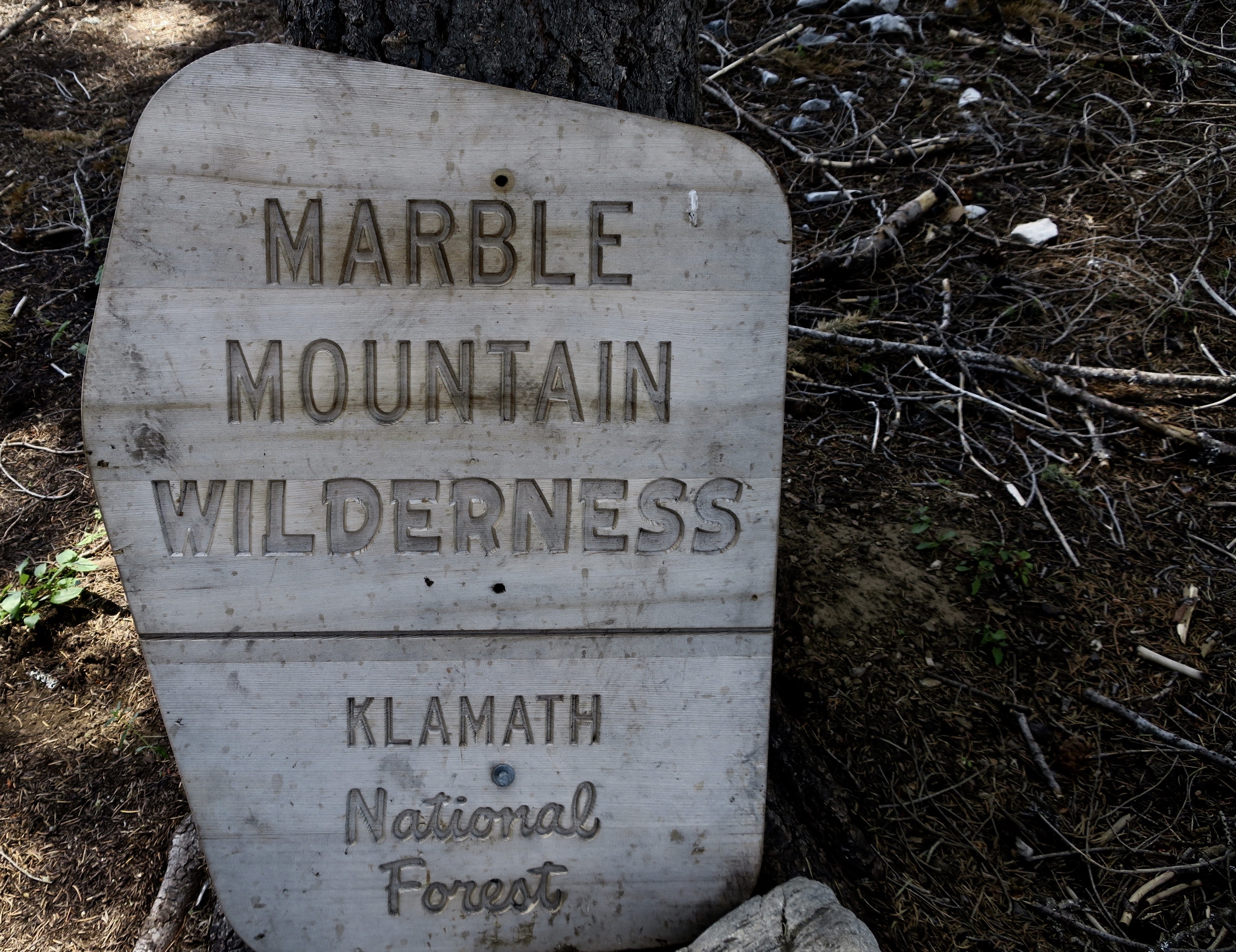
Today’s post is on California’s Marble Mountain Wilderness in northwestern California. I led backpacking treks through the area in the 80s and 90s but the photos on this blog were taken from my 750 mile backpack trip down the PCT in 2018. I started this section of the trail at the Grider Creek Campground in Klamath National Forest about 12 miles from the wilderness border. A significant portion of my trip up to the wilderness was a pleasant hike along the creek. Big Foot, towering forests, flowers galore, and butterflies entertained me along the way.
This post is part of Peggy and my series on national parks, monuments, wilderness areas and other public lands with an emphasis on their unique beauty, geology, flora, fauna and history that makes them so important to us today— and to our children, grandchildren and future generations.
There are a couple of interesting developments in the Trump Administration’s efforts to sell off public lands and post signs at national parks urging visitors to report on any negative historical signs or comments about the past. An example of the latter would be the forced removal of Native Americans from their homelands to make space for settlers from the East.
The Sierra Club reports that the plan to sell off public lands was stripped from the Administration’s ‘Big Beautiful, Mega-Deficit Bill’ in the Senate. This doesn’t mean that the Administration won’t move ahead in selling lands by claiming it doesn’t need permission from Congress.
As for public comments generated so far by the signs, an analysis done by the National Parks Conservation Association and summarized in the Washington Post shows strong support for the parks:
“The comments overwhelmingly praise the parks as beautiful national treasures, with dozens complimenting rangers for their knowledge and navigational help. Many called for undoing funding cuts and rehiring staff who were fired by the Trump administration.”
On the other hand, some felt that there were too many mosquitoes and not enough moose.
I think the message to the Administration might be “to watch what you ask for.” Whether the Administration chooses to report on the responses, select out the ones that support its policy, or simply bury the results, is another issue. I seriously doubt that it will report on the overwhelming support Americans show for national parks and other public lands.
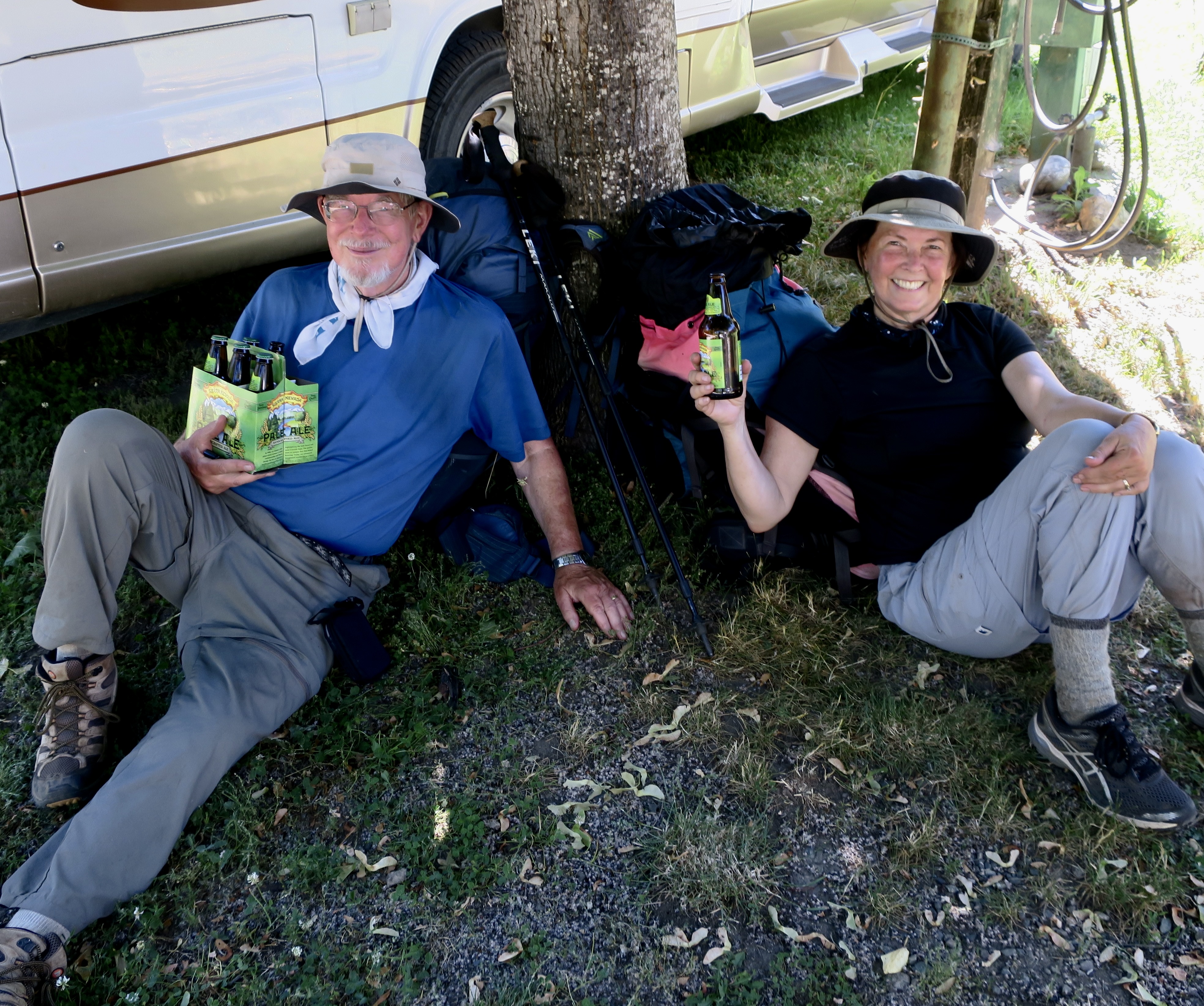
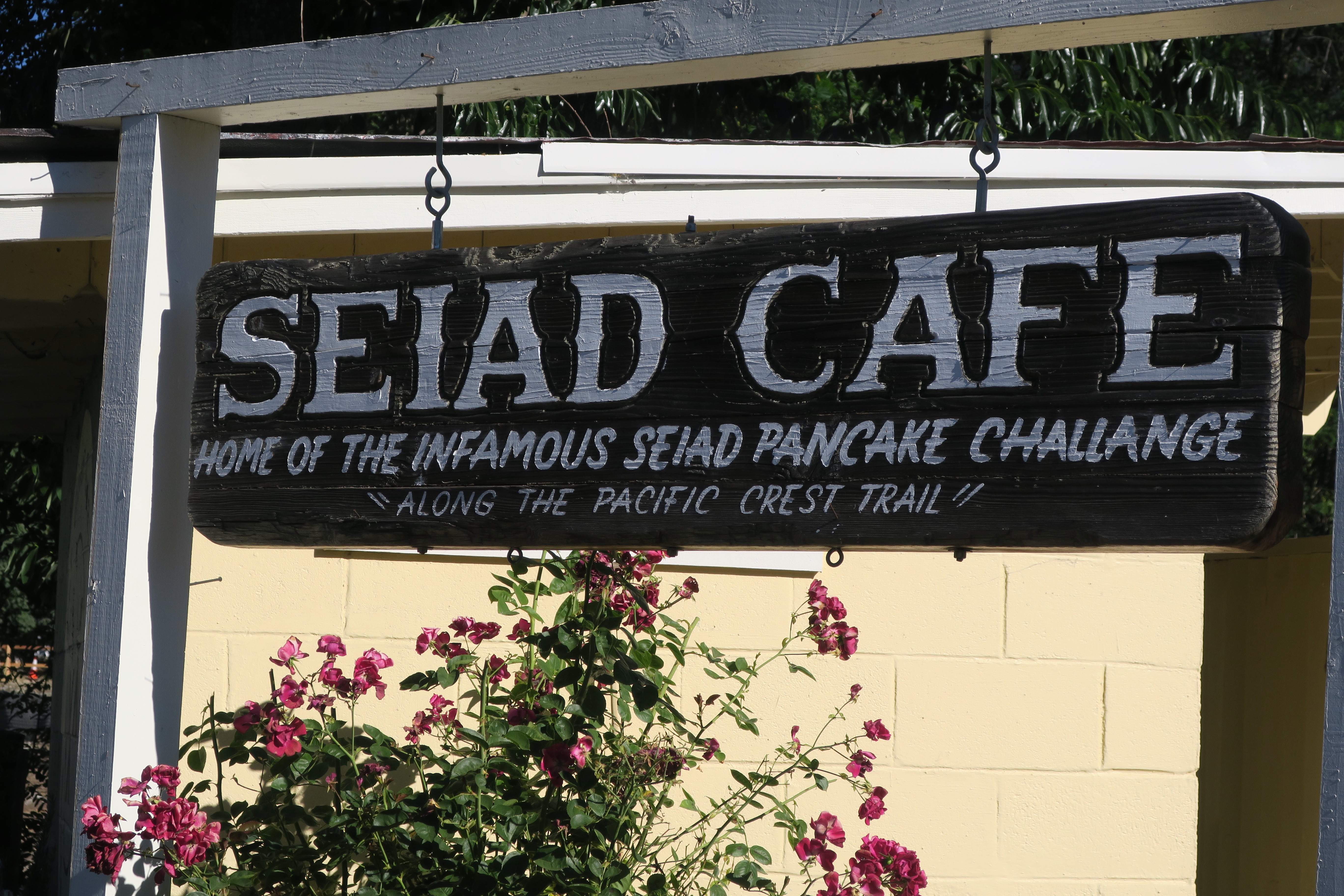
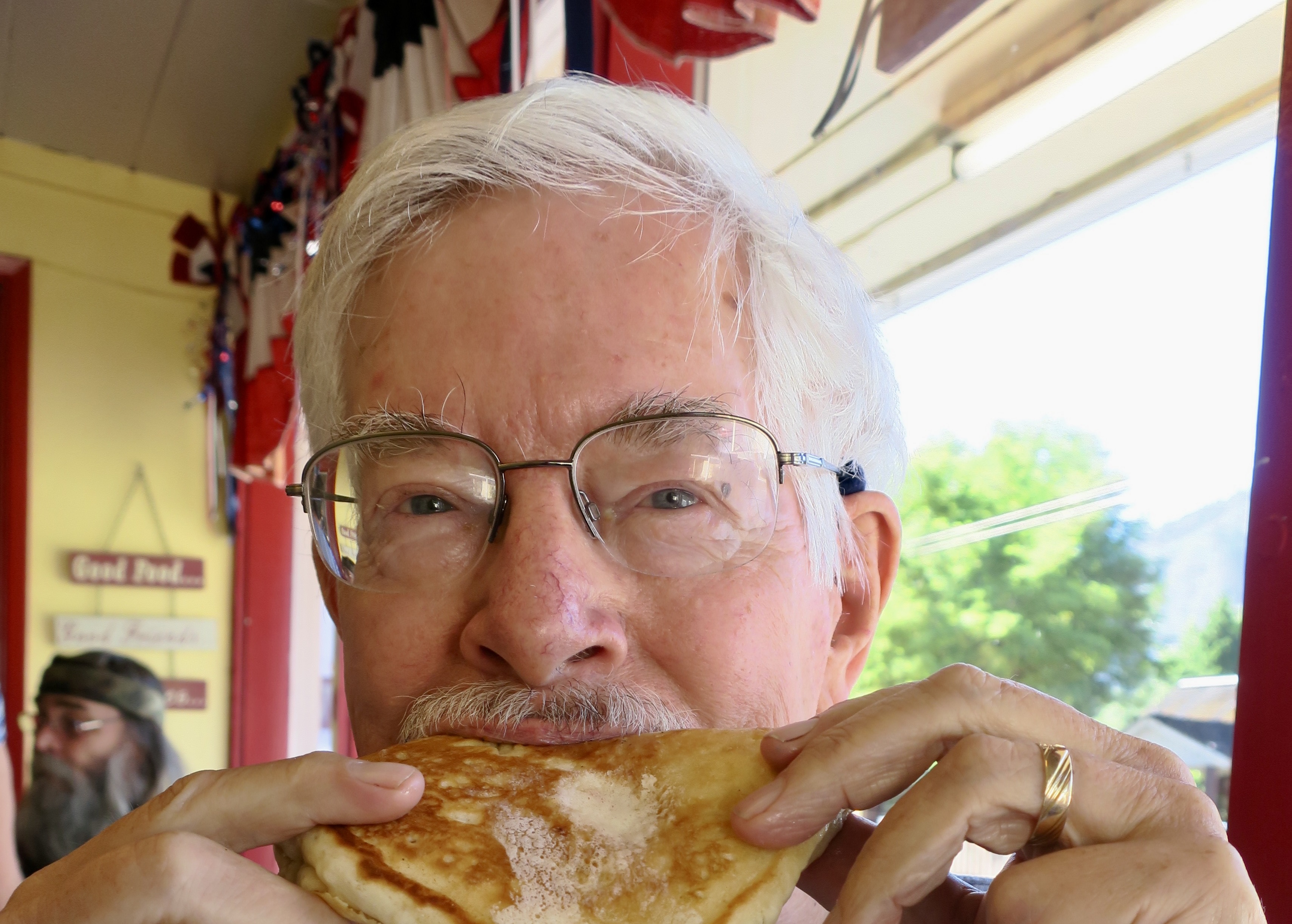
Just before my solo trip through the Marble Mountains, Peggy and I had concluded a 60 mile section of the PCT from Mt. Ashland in Southern Oregon to Seiad Valley in Northern California. Naturally, we had to reward ourselves. Cold beer was part of it. And no, I didn’t drink the other five! Just two. Our travel van is behind us. We had parked it in Seiad a few days earlier. Peggy would take over driving it from here as my backup ‘trail angel’ and meet me once a week for resupply and a break.Eating was another reward. The Seiad Cafe welcomed through hikers with its ‘Infamous Seiad Pancake Challenge.’There’s this thing about long distance hiking, you get hungry. Think about burning 5000 calories a day and taking in around 1500. There’s a deficit. By the end of my 750 mile trip, I resembled an escapee from a concentration camp. Each time I completed a section of the trail I stuffed myself. I had permission. I felt entitled. And manners? Grin. I was goofing around here. The actual pancake that the Seiad Cafe offers as its challenge is umpteen sizes bigger than the one I am chowing down on. Eat the whole thing and it’s free.A little hallucination can be expected when you are out on the trail for weeks or months. Especially if you are hiking by yourself. This handsome fellow was hanging out in the small Seiad Store where we bought the beer. That’s when I decided that a six pack was called for.Peggy drove me up the six miles to Grider Creek camp from Seiad. It was ‘cheating’ in PCT lingo, where every foot of the 2, 650 mile journey is supposed to be walked, even if it’s walking down a paved or dirt road. Through-hikers take that seriously. Admittedly, I was under pressure to reach my goal of backpacking 750 miles for my 75th birthday, but, truth be told, my trip was primarily an excuse to be out in the woods. This was the first section of the trail I would be hiking alone. Peggy was a bit nervous, as were our kids. Me? Not so much. I had done lots of solo trips over the years. Still, at 75… Okay, I was a little nervous.I started out slowly.
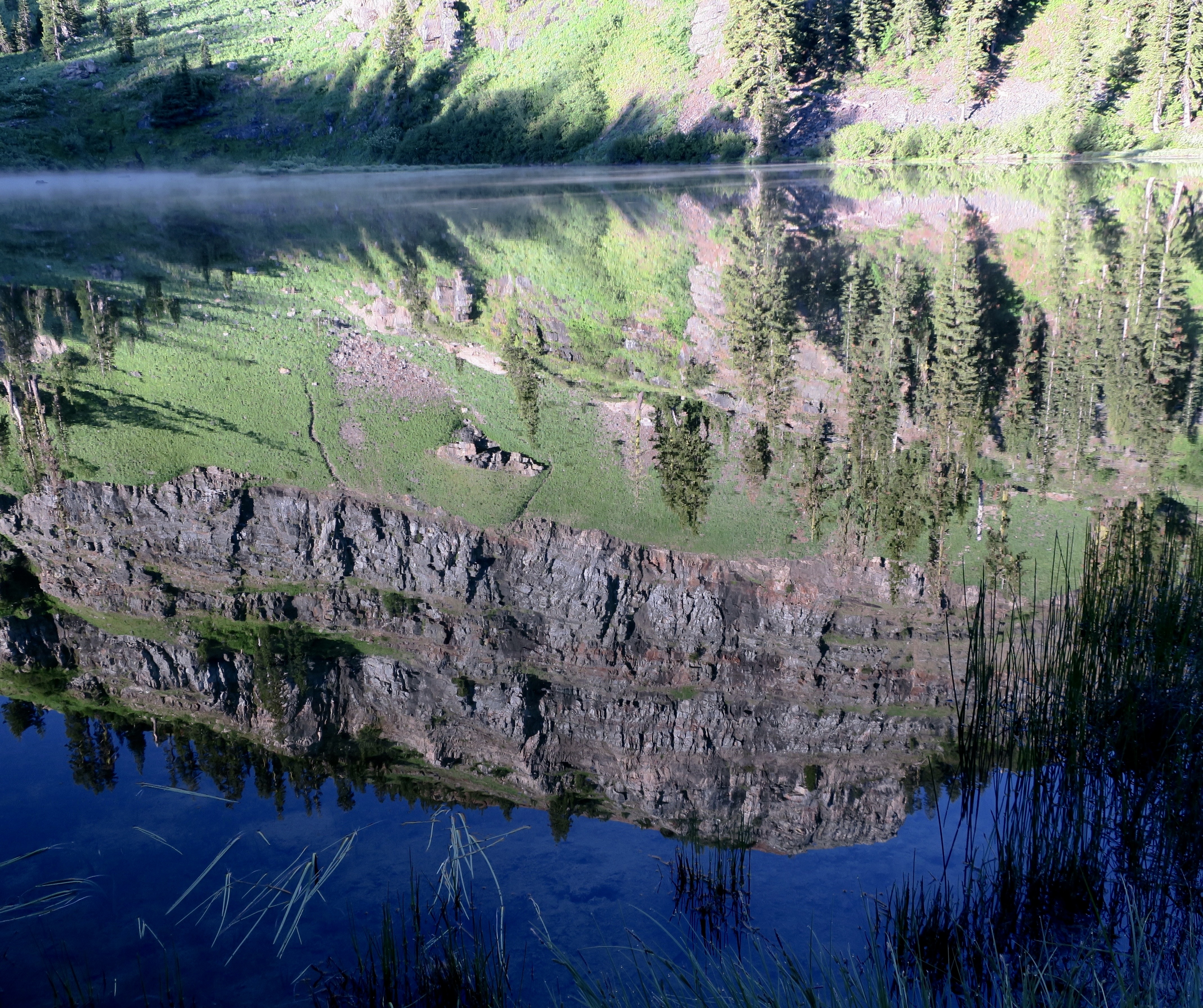
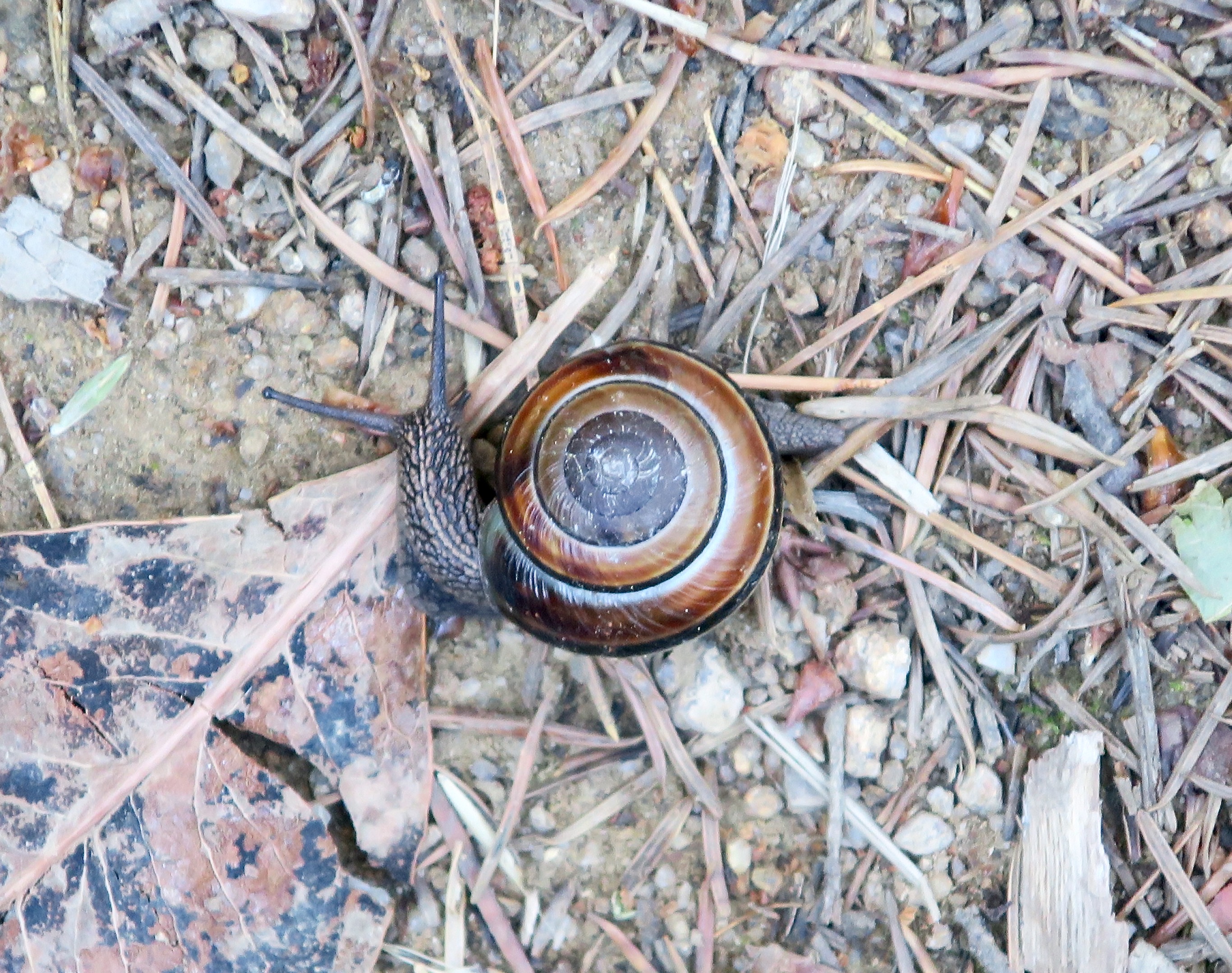
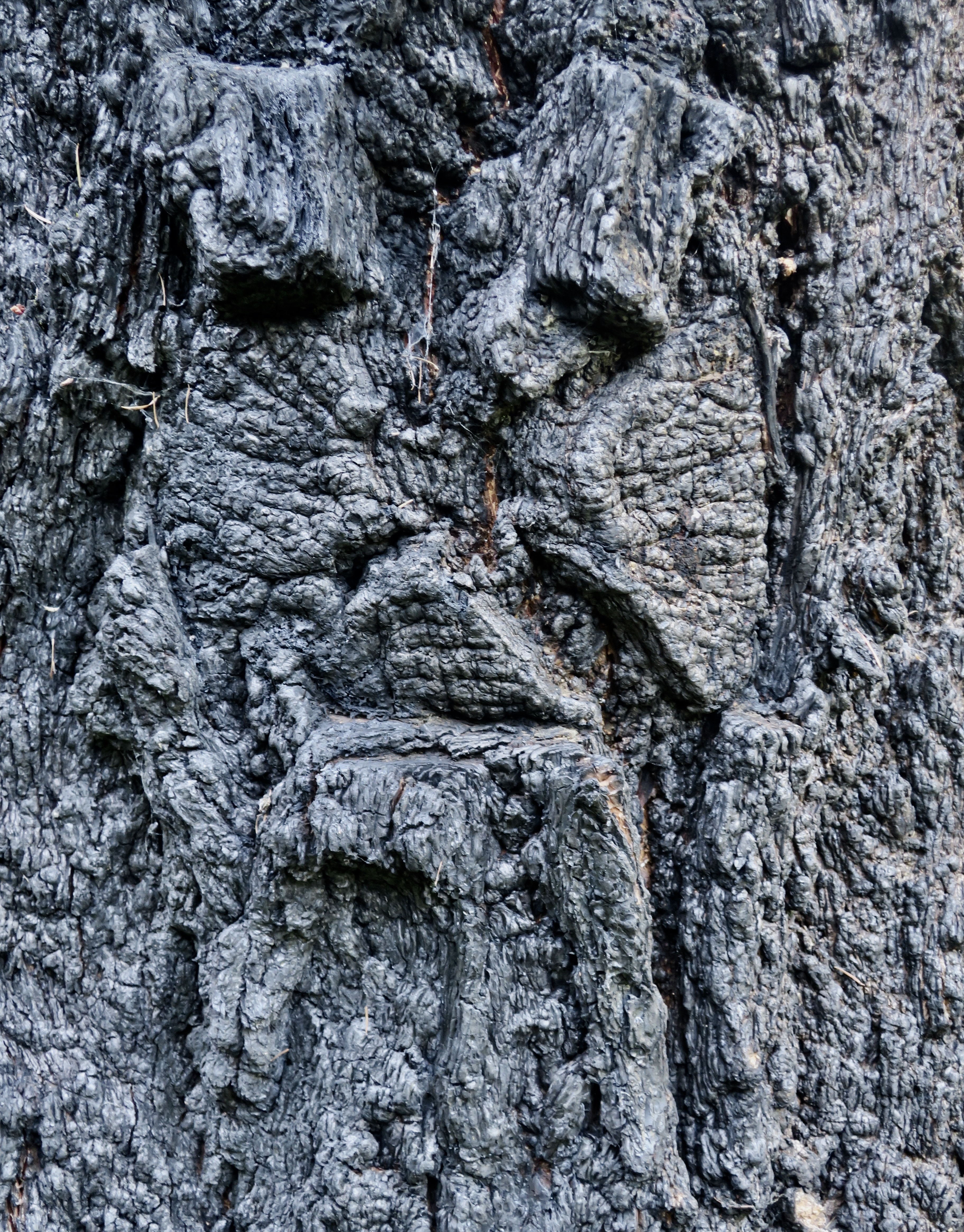
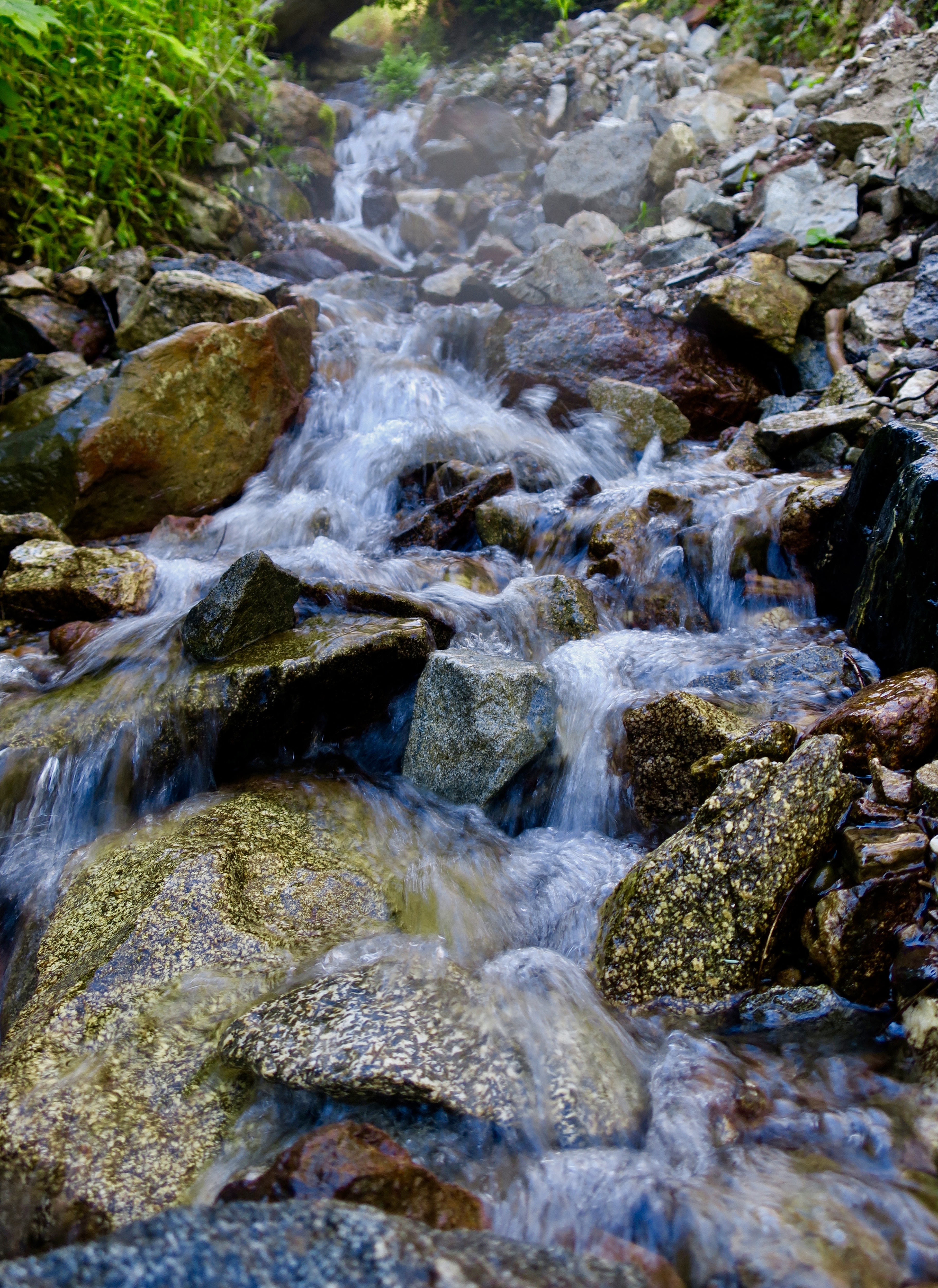
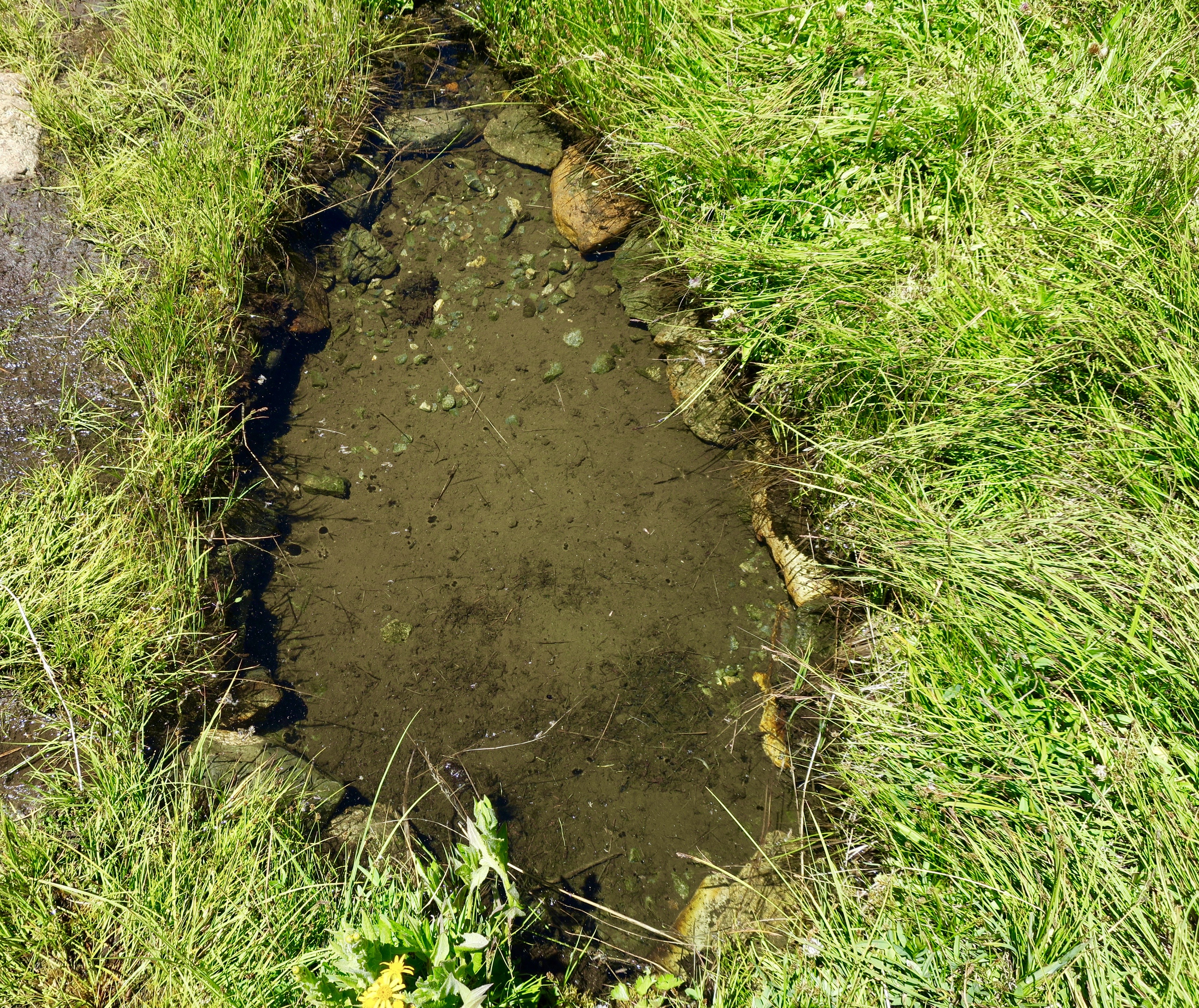
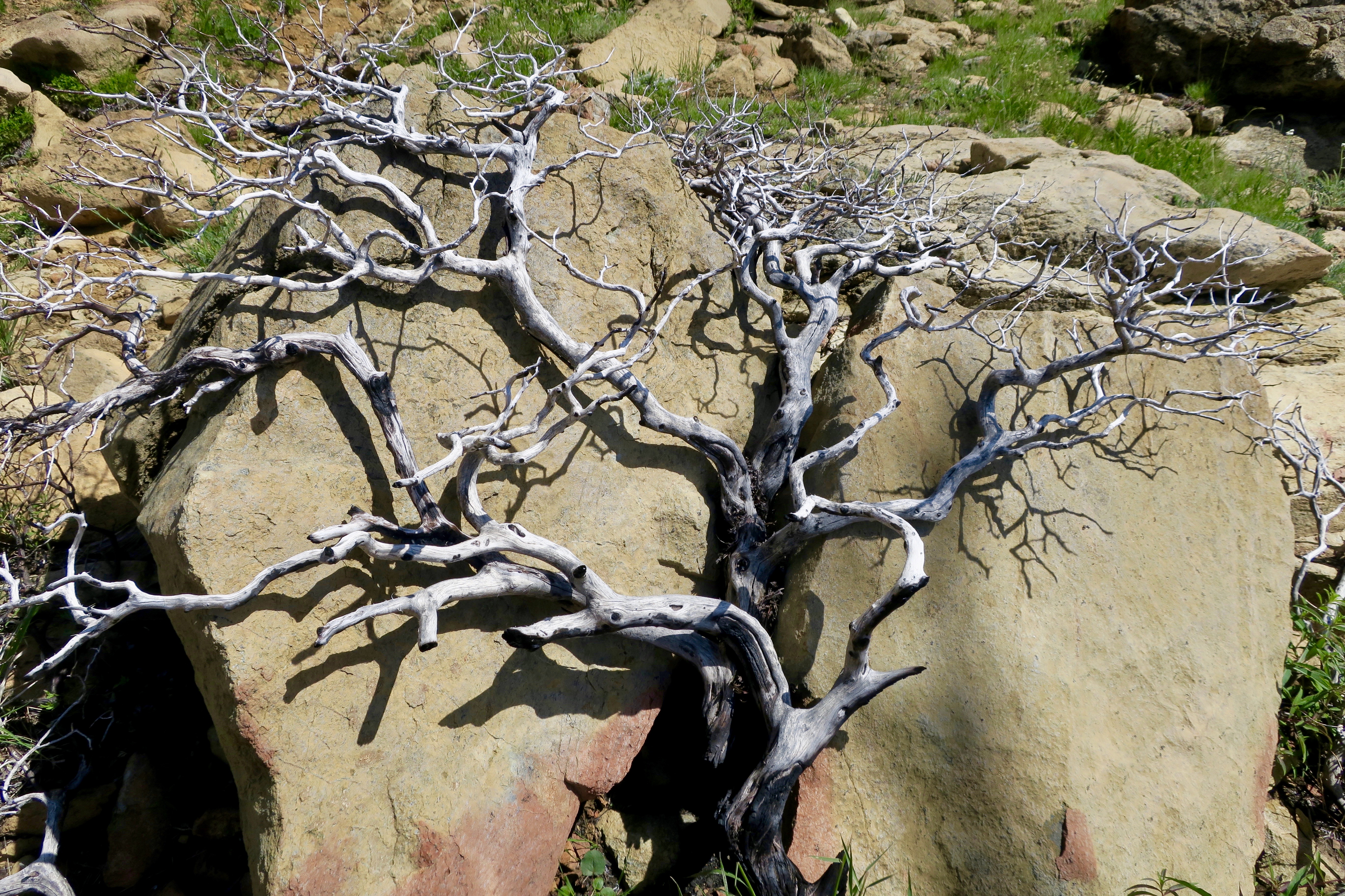
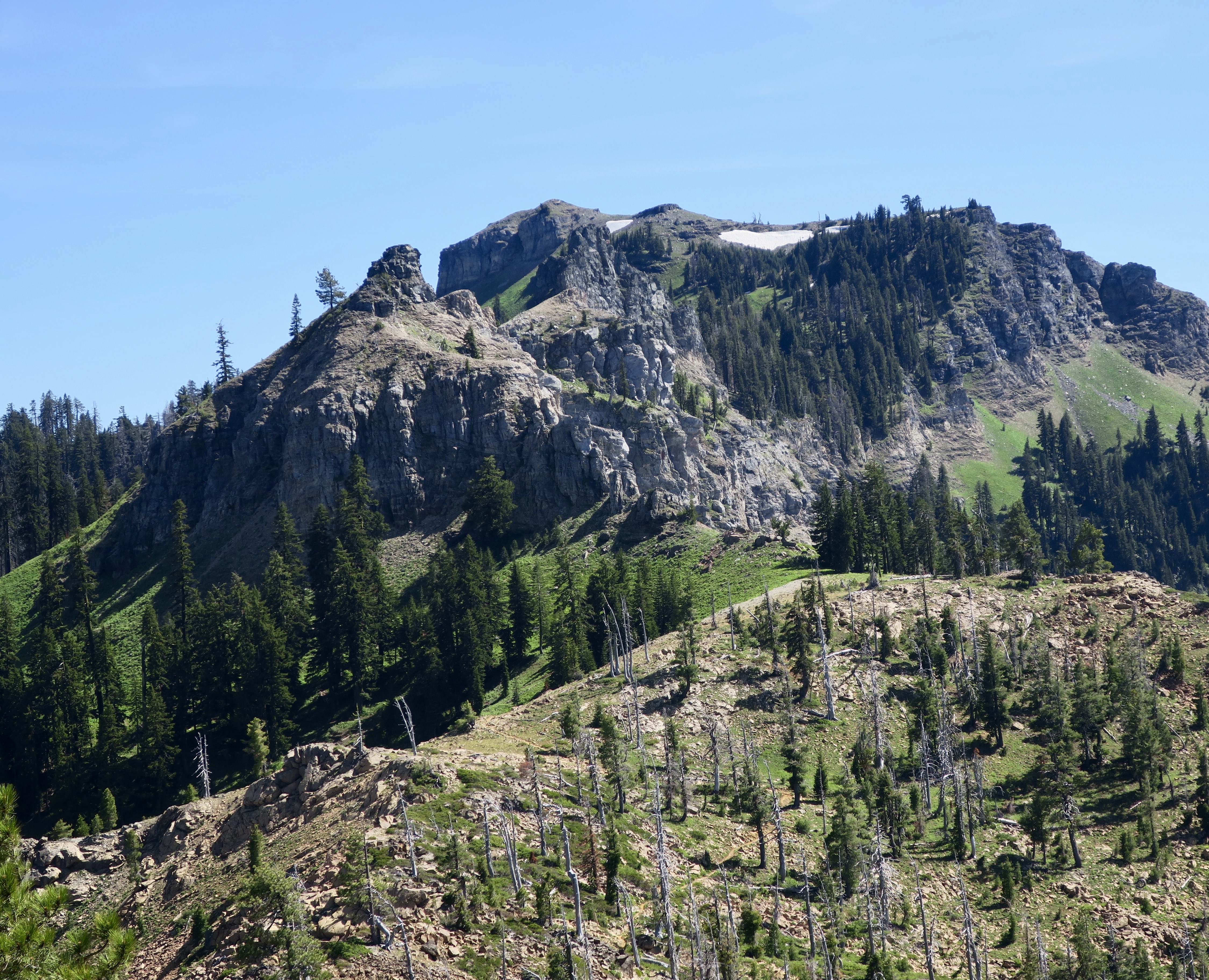
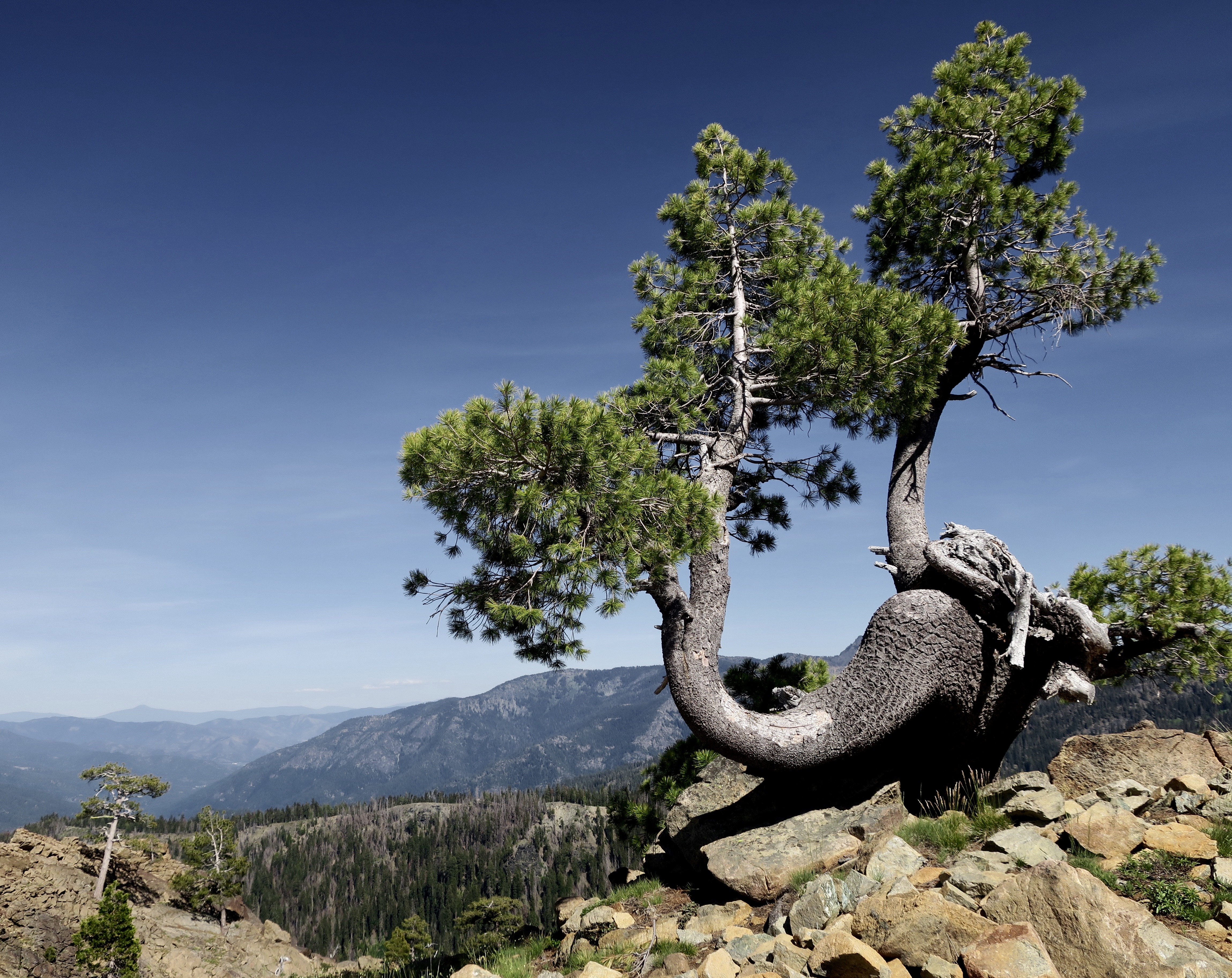
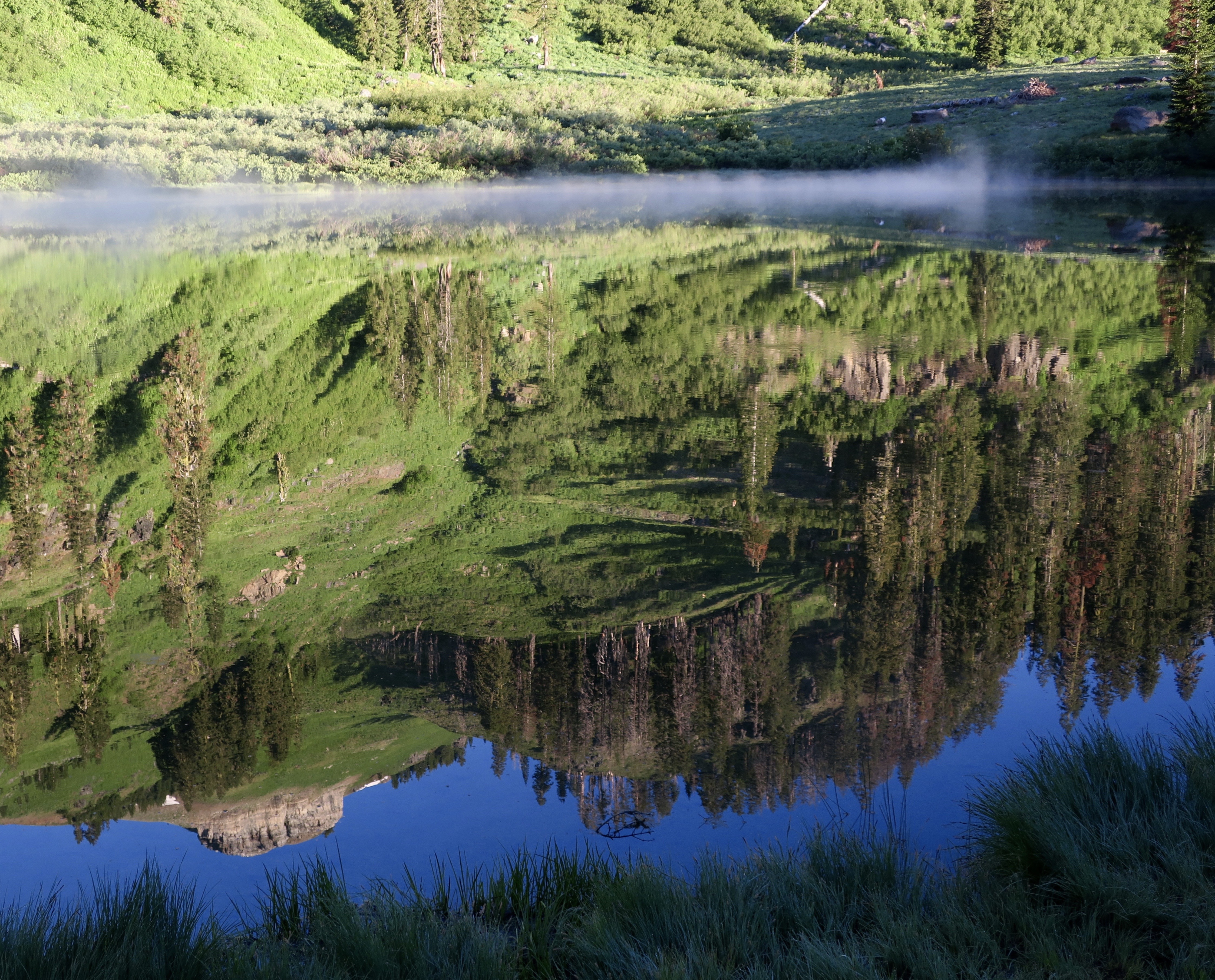
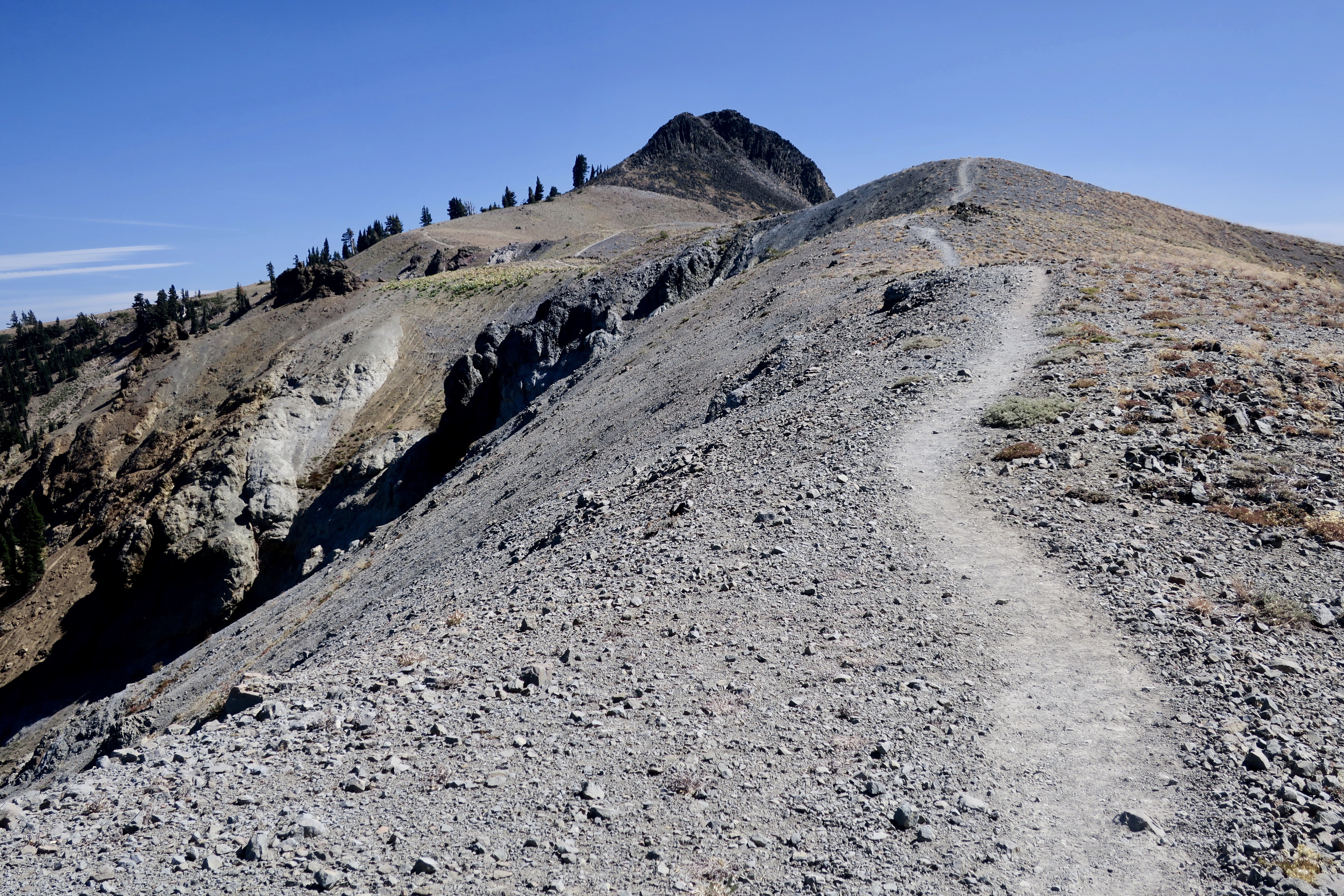
Once people got over their concern about my hiking alone, they wanted to know how in the world I would entertain myself. It’s easy. Just be aware. Walk quietly. Explore your surroundings in detail with your eyes, ears, nose, and even touch. There are always things to discover. They can be entertaining, educational, beautiful, or a combination—like this snail. Or they may present something of a conundrum, like the image below.This had a wow factor of 10. I came across the image in a burned tree trunk and could only wonder. Was it there before the tree burned? Was it a natural growth of the tree or had it been carved. I tend to think the latter, but over the years, Peggy and I have seem some amazing images created by nature. Then I let my imagination run wild. I was traveling though Bigfoot country. A number of ‘sightings’ had been reported in the Marble Mountains over the years. Could this be a self-portrait by Bigfoot!?The many moods of Grider Creek caught my attention many times: Its beauty, the unique character of a riparian habitat, the sound of rapids, even the cool touch of its water. I took a break and dangled my feet in the creek.Trees provided shade for my hike up the creek. The first one I stopped to admire was this madrone. If you come on one, be sure to run your fingers over the smooth bark. It borders on sensuous.Old growth trees reached for the sky. Hopefully, Trump’s plans to open up millions of acres of new forest service lands for cutting down trees won’t include these beauties. Lumber companies drool over these giants with their potential for high profits. So what if they took a couple of hundred years to reach their size. Or a thousand. Getting to the trees would involve bulldozing a road up the creek.Even the leaves were impressive. Some of them came close to rainforest size. I liked the light and shadow contrast here.Then there were flowers galore, a lot more than I can put in this post. But here are a few. This is golden brodiaea, sometimes known as prettyface.A thimbleberry with its future fruit in the center.Scarlet Gilia.And snow brush ceanothus that a butterfly has apparently captured and is claiming, “Mine, all mine!” What I noticed when I looked at the photo, however, was its long proboscis buried in a flower sucking up nectar. The proboscis rolls up when not in use, like a party noisemaker. This was the first of many butterflies I would meet along the trail.And finally, I have to say, the hike up into the mountains was one the most pleasant I’ve experienced over the years. In the Sierras, especially on the east side, it seems like the first day is always straight up.My first priority was water. It had been a few miles since I left the river behind. I drank the second third of my water supply and went in search of Buckhorn Spring, which as I recall was a few miles ahead. And here it is, the Buckhorn Spring— a 2 by 3 foot pool with a muddy bottom and a bunch of happy water bugs scurrying around. Appealing? You bet! The water was fresh and cold and I was carrying a water filter to take care of bugs, or more nasty things like Giardia. In 15 minutes I was sipping pure water that was a match for anything you might get out of a faucet or buy from a grocery store— or better. And much more appreciated. In addition to filling my water bottles, there was plenty for cooking. I had done my miles for the day and could settle in for the night. I was one happy camper!I was up early the next morning and on the trail by 7:00. Through-hikers, who have to average between 20-30 miles per day, tend to get up and be on the trail as soon as there is enough light to see by. Some even get up earlier and walk their first miles using a flashlight. I did 15, which accommodated my years and allowed time for lollygagging. My first objective of the day was to hike over a pass just to the right of the seemingly tiny peak in the middle of the photo. Part 1 of my post on the Marble Mountains ends there: Here are a few photos from along the way.A photo op I can never resist: A live or dead tree draped over a rock.This intriguing creature with its delightful ears obviously had something to say to me. I listened carefully. “Come closer,” it whispered. I declined.Almost there…The route up.One of my favorite photos from the Marbles. For me, this pine tree symbolized the power of nature to survive, thrive, and add beauty to a what was basically a rocky, barren peak.Arrived.The other side. My first good view of the ‘white’ of the Marble Mountains, which actually isn’t marble but is lime laid down by an ancient ocean. Given a few million years under intense pressure and heat far underground, however, it can become marble. And there are marble deposits in the Marble Mountains.Next post: I continue my hike along the PCT through the Marble Mountains. This is a reflection shot taken at Paradise Lake. There is mist on the Lake.
Peggy and I often get a question about where we are now, given that we wander a lot and our blogs may reflect a recent adventure or be back in time. Right now we are in Safety Harbor, Florida. Peggy and I flew out here from Sacramento to celebrate Peggy’s 75th Birthday with our son, Tony his wife, Cammie, their three sons: Connor, Chris and Cooper, plus…
Lyla, the Golden Poodle, who had interrupted her summer haircut for a photoshoot with Peggy’s foot. Actually, she was irritated about sharing the limelight with a foot. Here’s what she had to say about it….
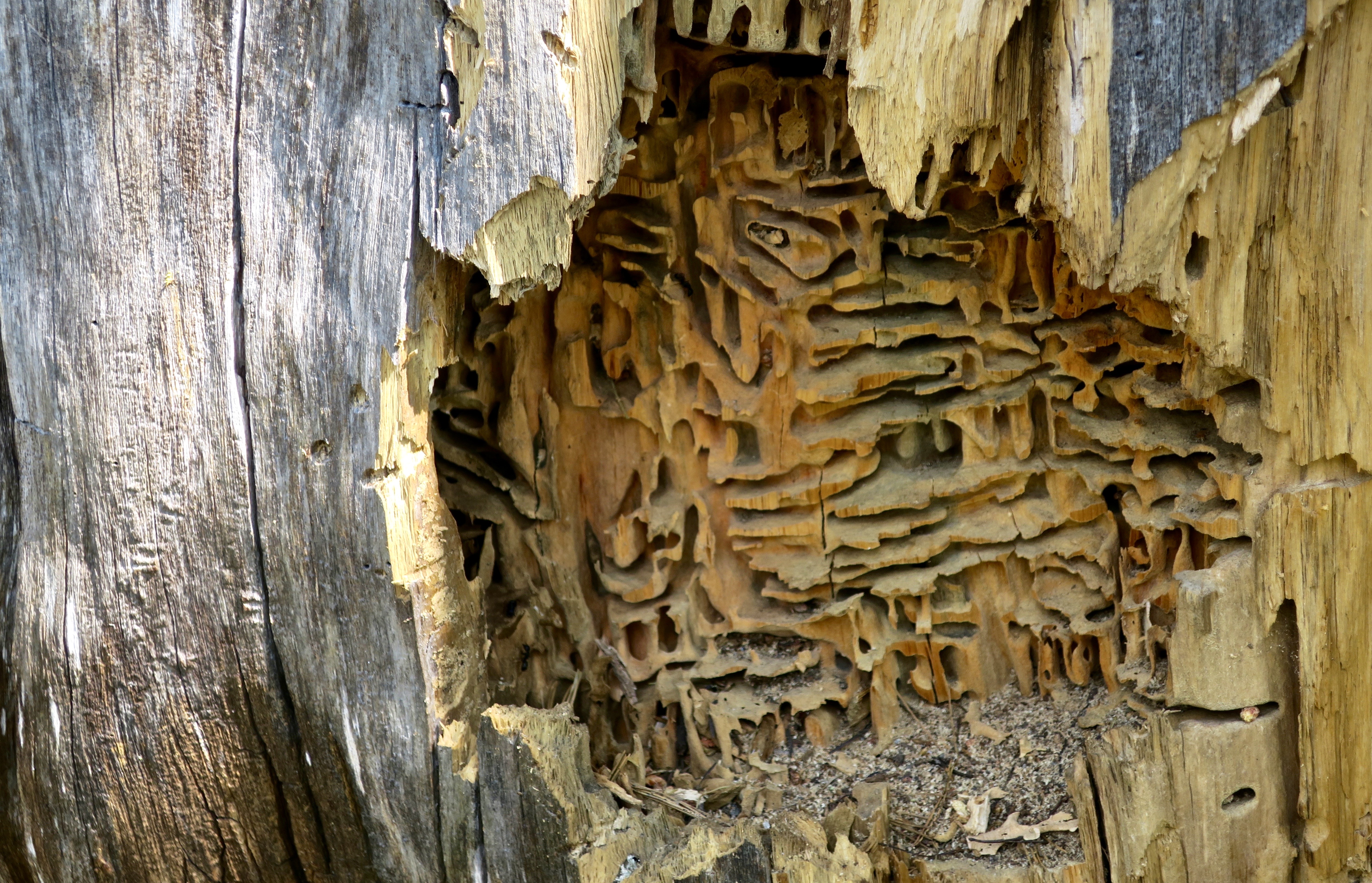
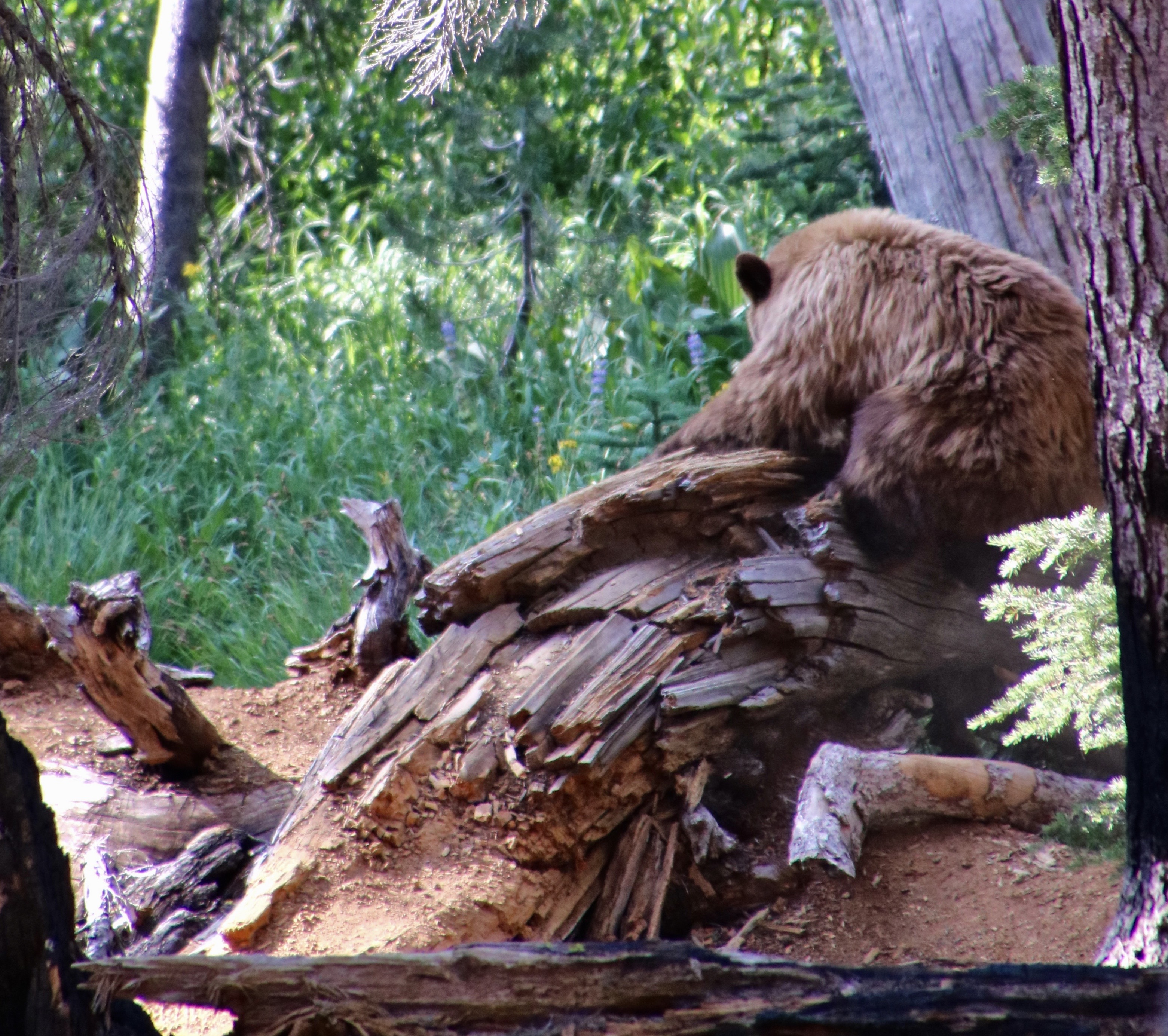
There is a fascinating world to be discovered on America’s pubic lands. For example, you will occasionally find a pile of sawdust next to a dead tree. Odds are that carpenter ants have been at work building an apartment complex. This ‘cut-away’ view in Granite Chief Wilderness provides an inside view of their home. If you are lucky, you will see the ants plying their carpenter trade. They appear out of a crack or hole in the wood with mandibles filled with sawdust, which they drop on their pile and then return to chew/break out another load. Unlike termites, they don’t actually eat the wood. The ants provide a valuable service in the forest breaking down dead wood (not so valuable when it’s the lumber in your house).So, who or what opened up the tree? Clue, it wasn’t me. Nor was it the caterpillar, obviously. I photographed it just above the ant apartment complex for perspective on the size of the slashes just above it. They tell the tale. They are bear claw marks. A bear had torn open the log for breakfast. Or was it lunch?While I was backpacking through Lassen National Park on my 750 mile/75th birthday trek in 2018, Peggy caught this photo of a bear and her cubs opening up a log on a trail near the park’s road. “Dust and wood were flying everywhere!” she told me. Peggy quickly vacated the premises. You do not want to get close to a mama bear with cubs!
Today, Peggy and I are continuing our series on national parks, monuments, wilderness areas and other public lands with an emphasis on their unique beauty, geology, flora, fauna and history that makes them so important to us today— and to our children, grandchildren and future generations. I can only repeat how vital it is at this point in history to let decision makers know how we feel about protecting and maintaining public lands.
In my last post, I discussed a bill by Republican Senator Mike Lee of Utah to be included in President Trump’s “Big Beautiful Bill” that would require the government to sell of 50-75% of BLM and National Forest Lands in America over the next five years. Here’s what the Southern Utah Wilderness Association has to say about the bill:
It bypasses public process, allowing public land to be sold with minimal transparency, and depriving the public of input on the future of their public lands. It also bypasses any environmental, cultural resources or endangered species reviews.
While Senator Lee attempts to make his bill more palatable by claiming that it will create opportunities for affordable housing, it does no such thing. There is no requirement that any housing developed on sold public lands would be affordable or meet any affordable housing requirements.
There is no provision to prevent lands sold under Lee’s bill from being developed into high-end vacation homes, Airbnbs, or luxury housing projects, which would be especially desirable near scenic or high-demand areas.
The bill will primarily benefit real estate developers and speculators rather than addressing real housing needs.
The Pacific Crest Trail Association also noted this week that the bill would have serious implications for the PCT by blocking access to the public lands that the trail now crosses over. The 750 mile trip I did for my 75th birthday would not be possible. But that’s nothing compared to the millions upon millions of people who would forever lose future access to these lands that now belong to all of us. Please, let your Senator know Lee’s bill will do irreparable damage.
But, now on to my post about hiking through the Granite Chief Wilderness on the Pacific Crest Trail.
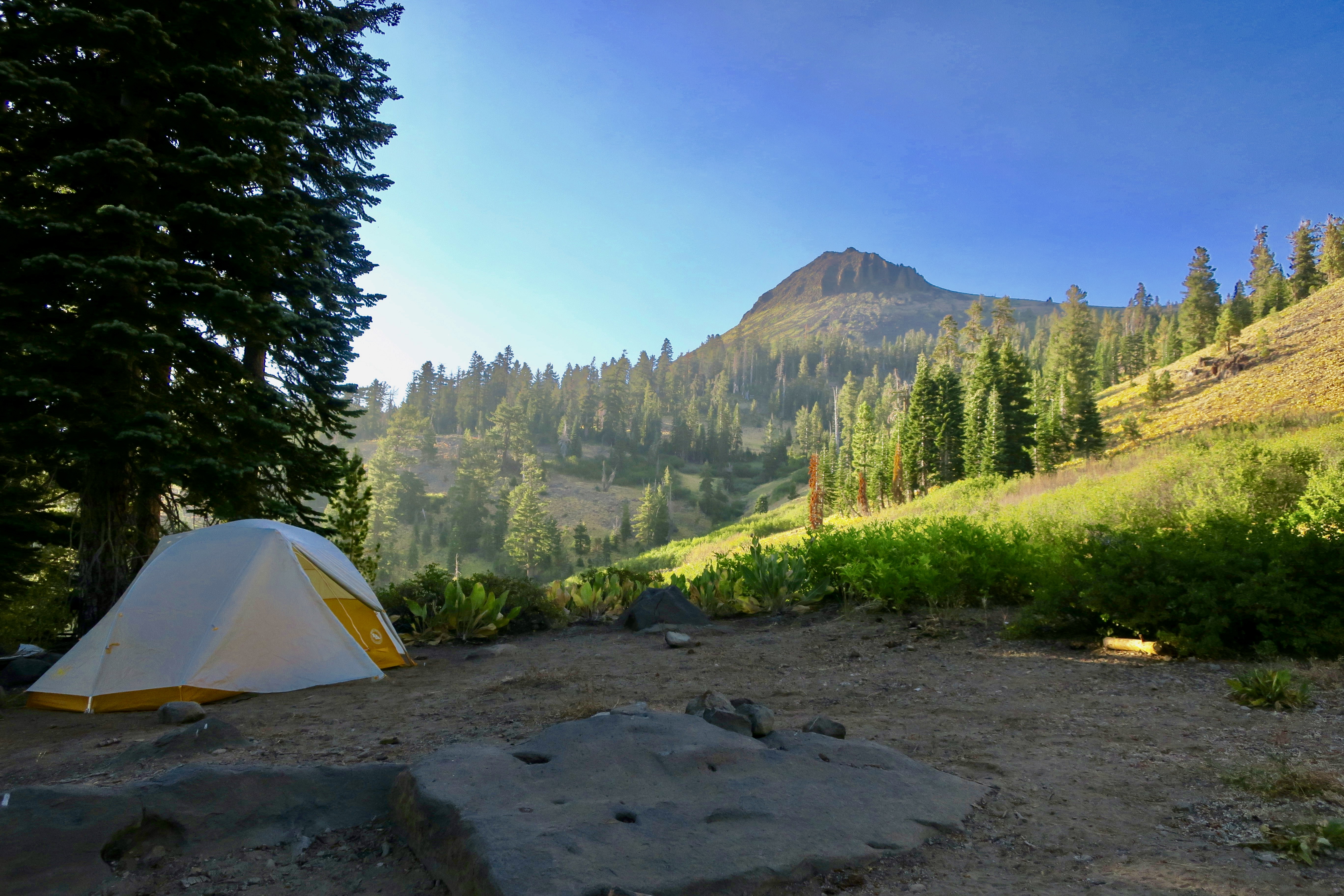
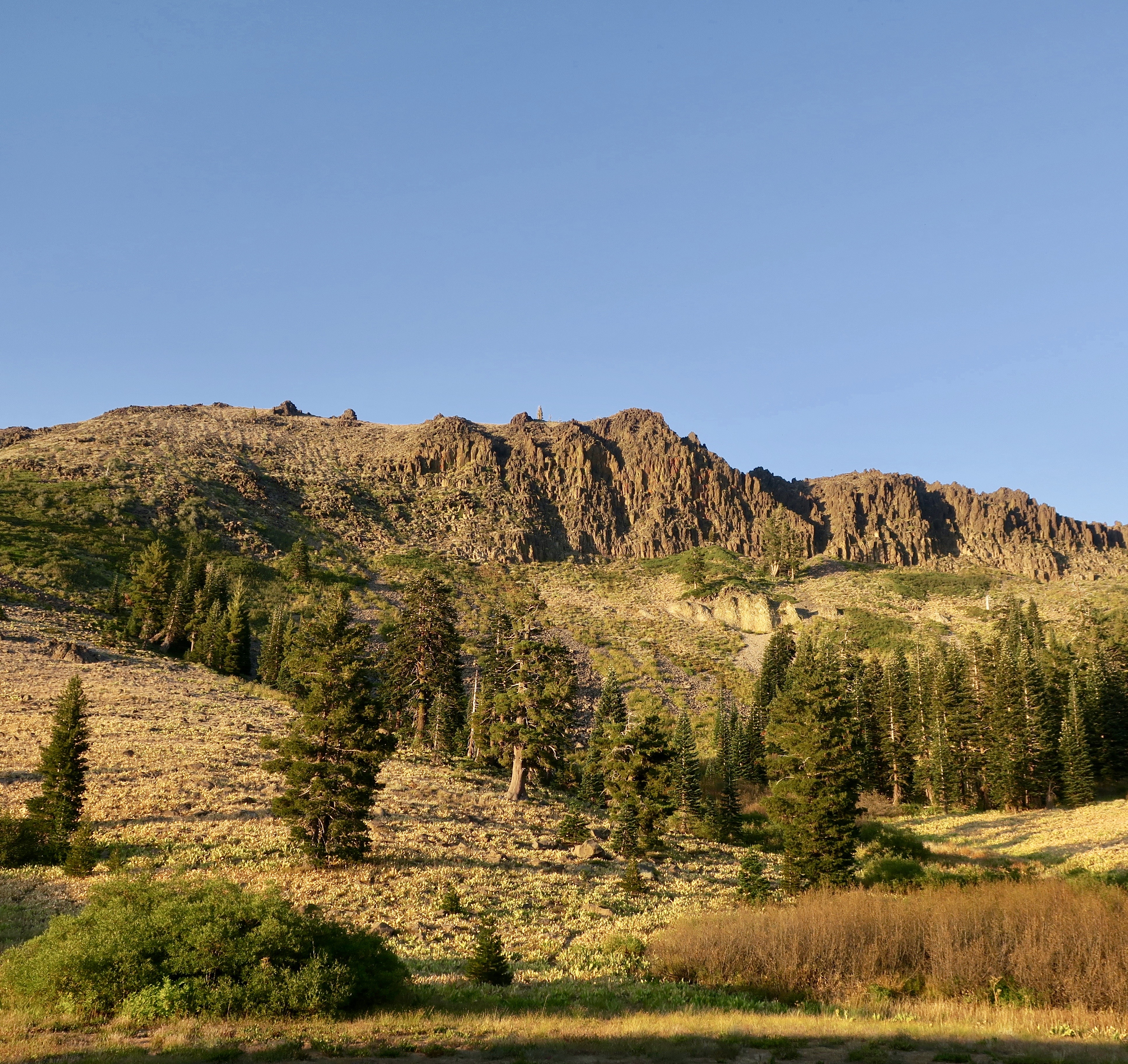
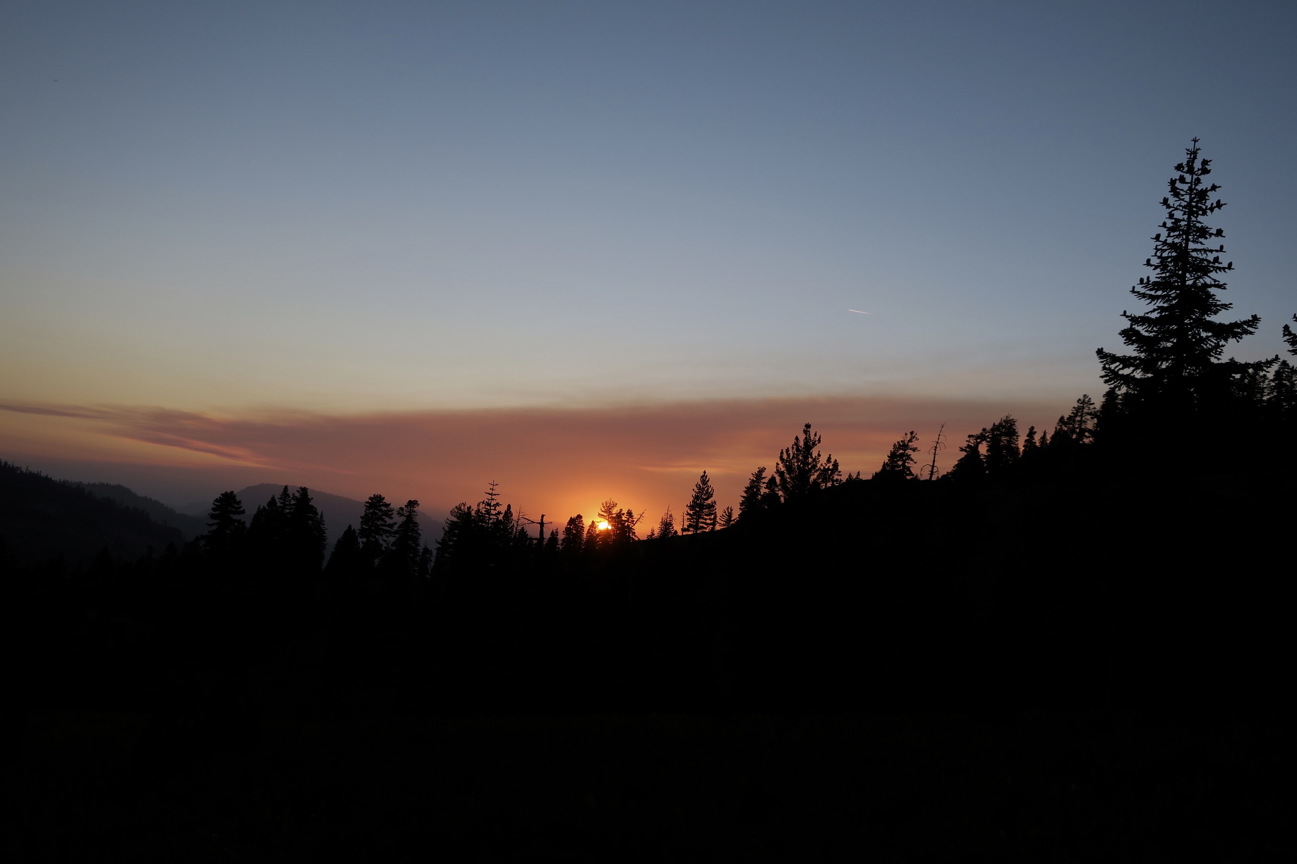
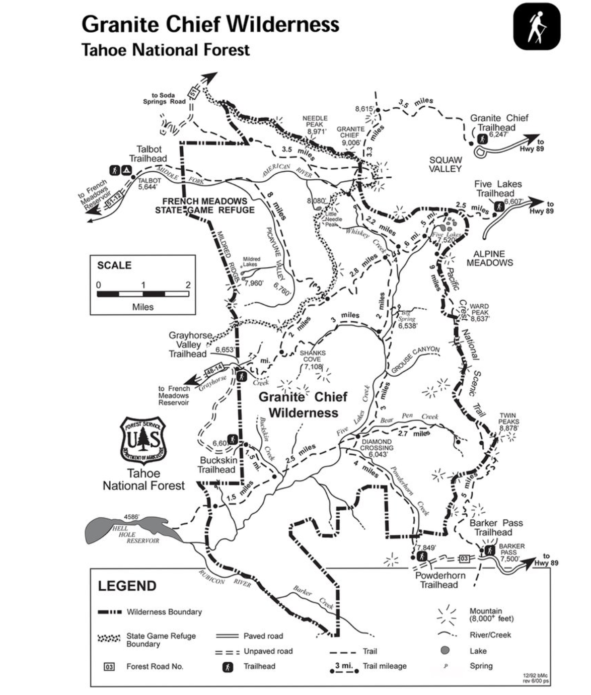
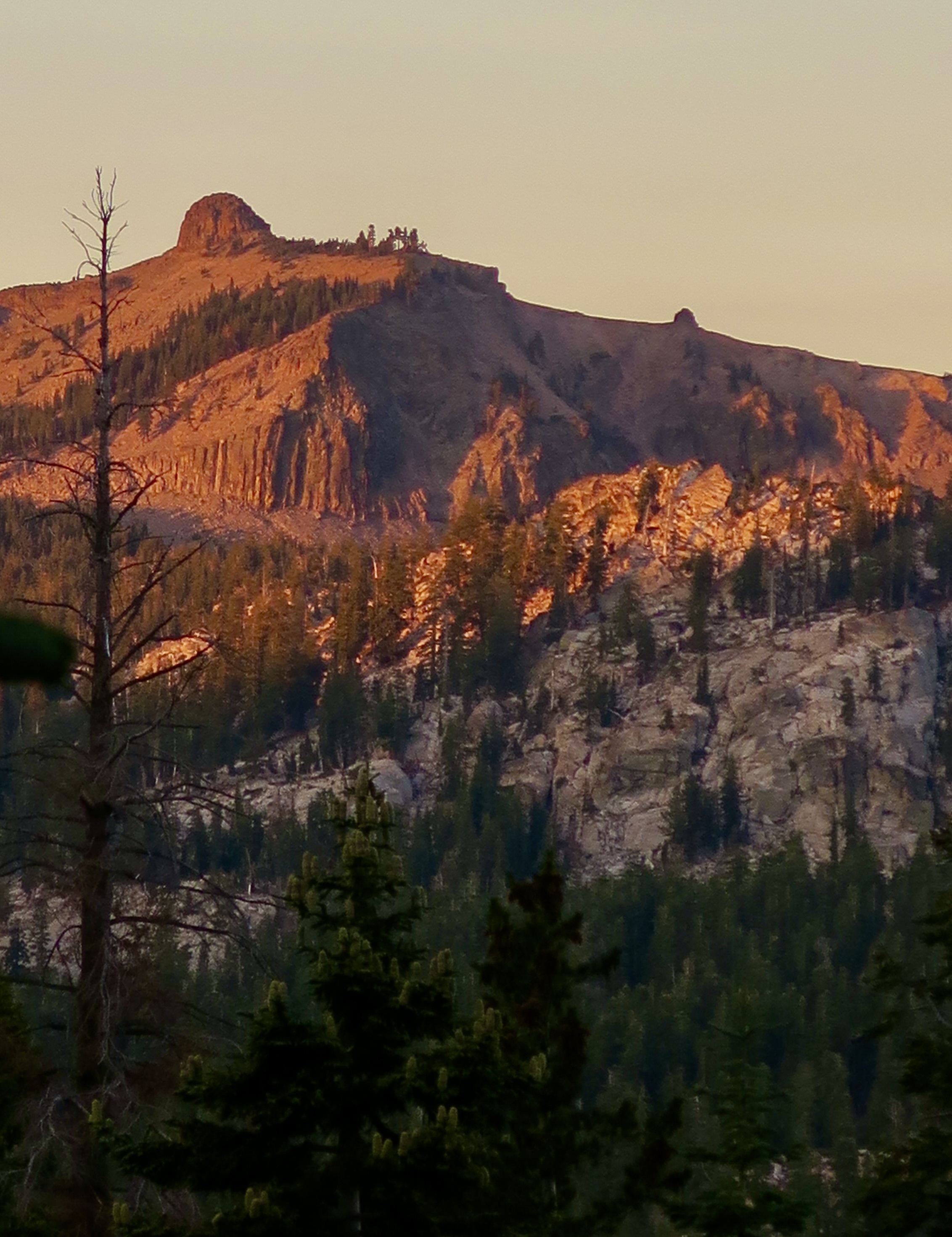
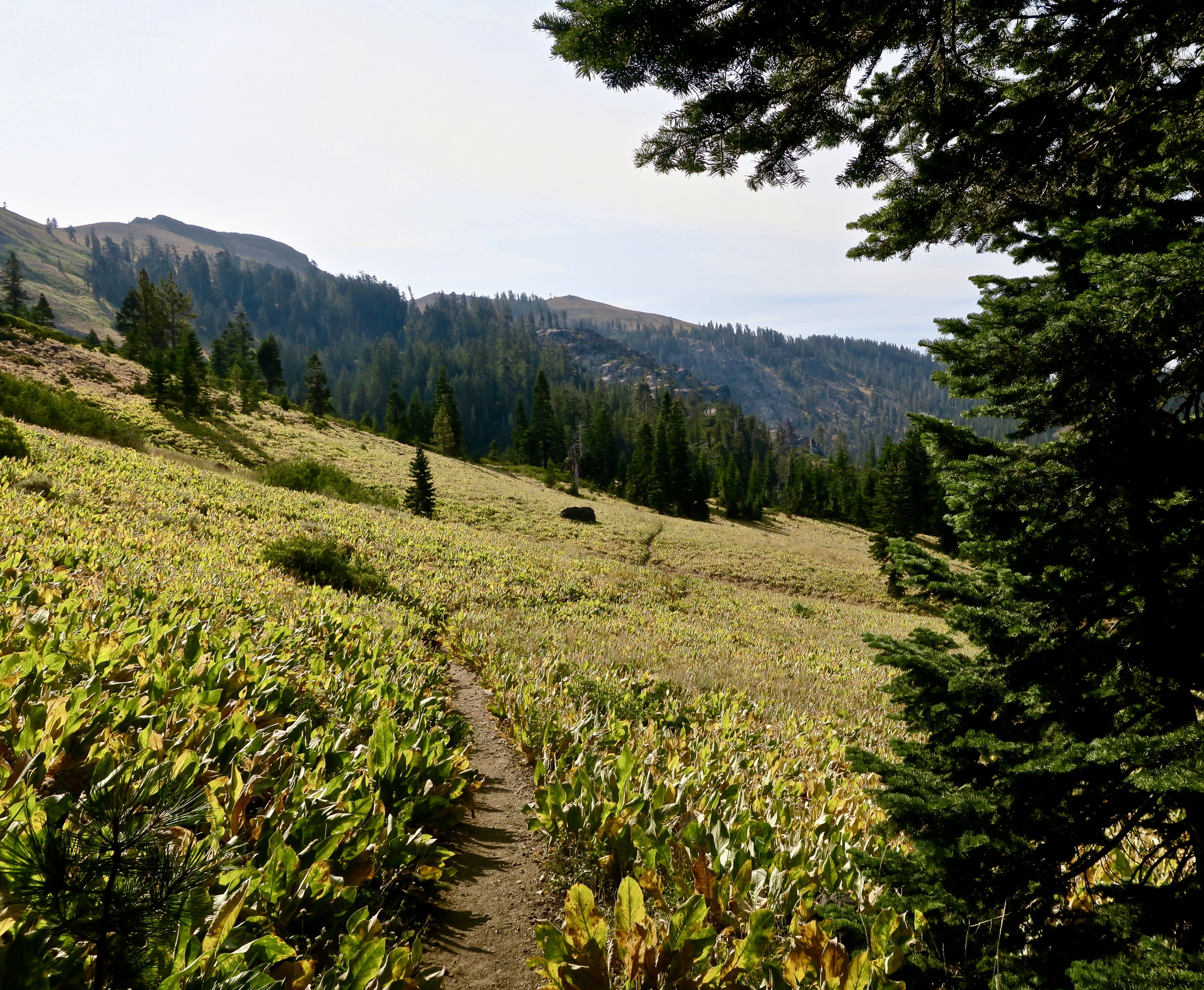
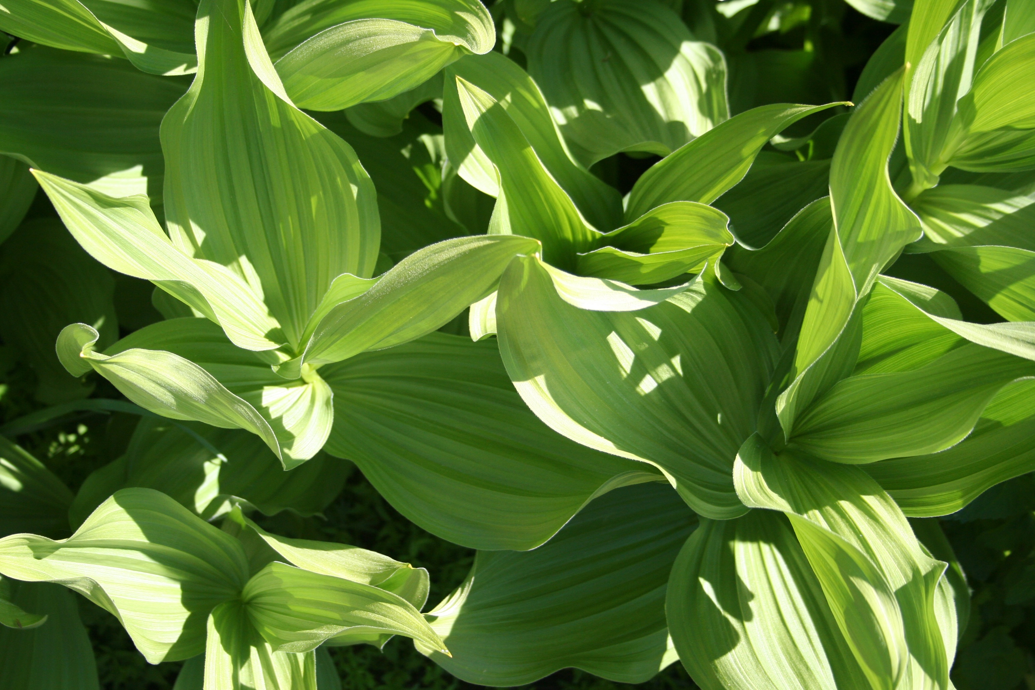
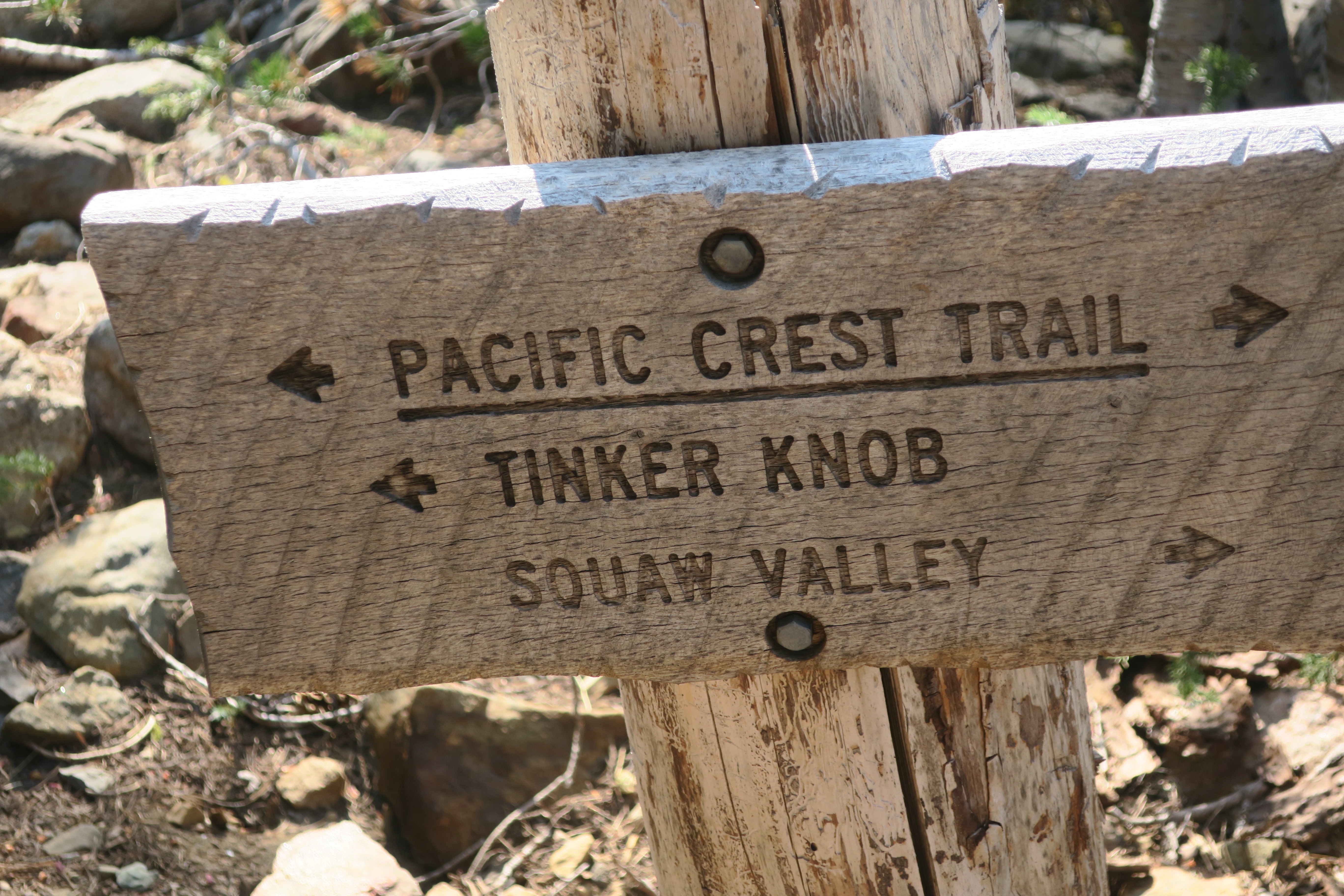
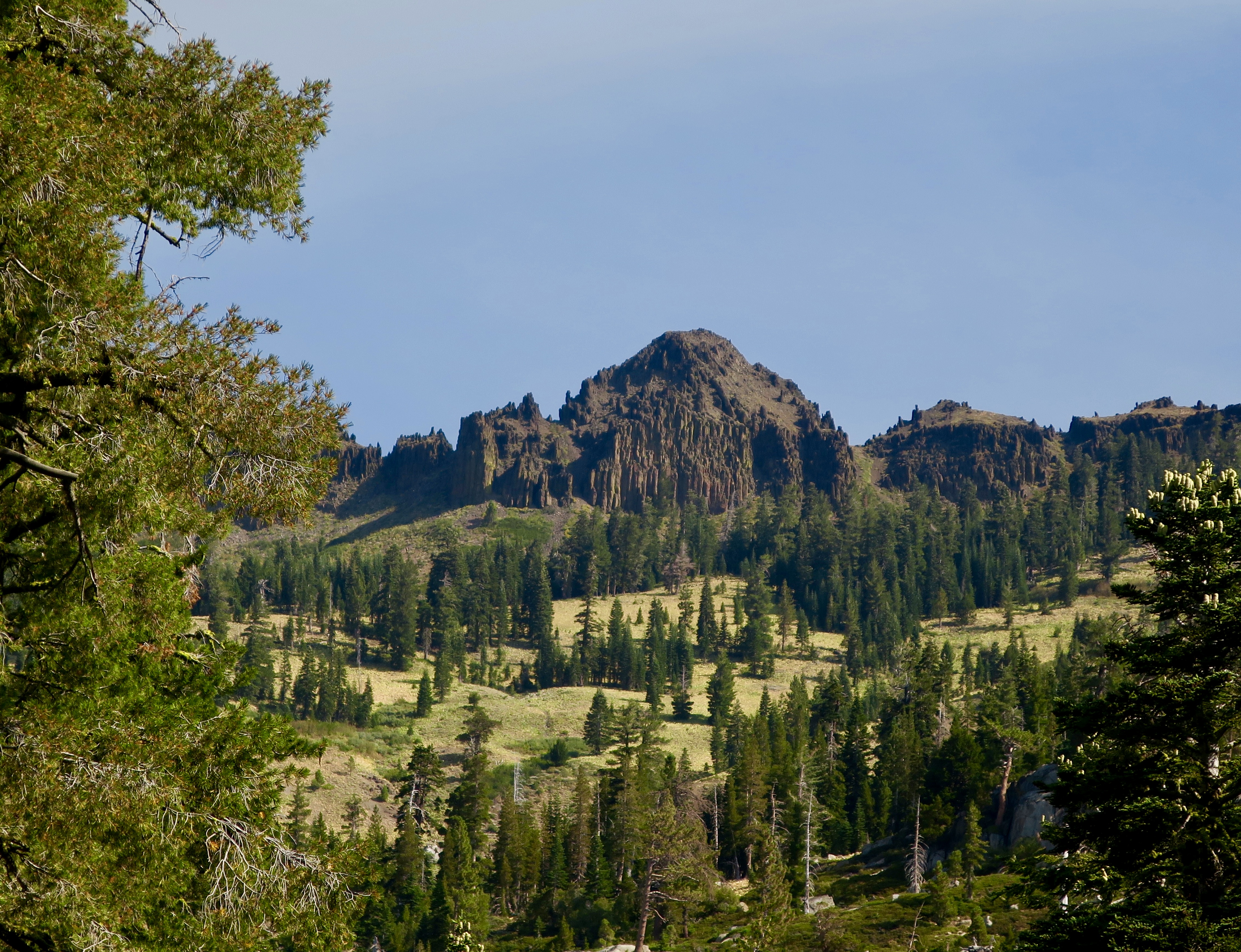
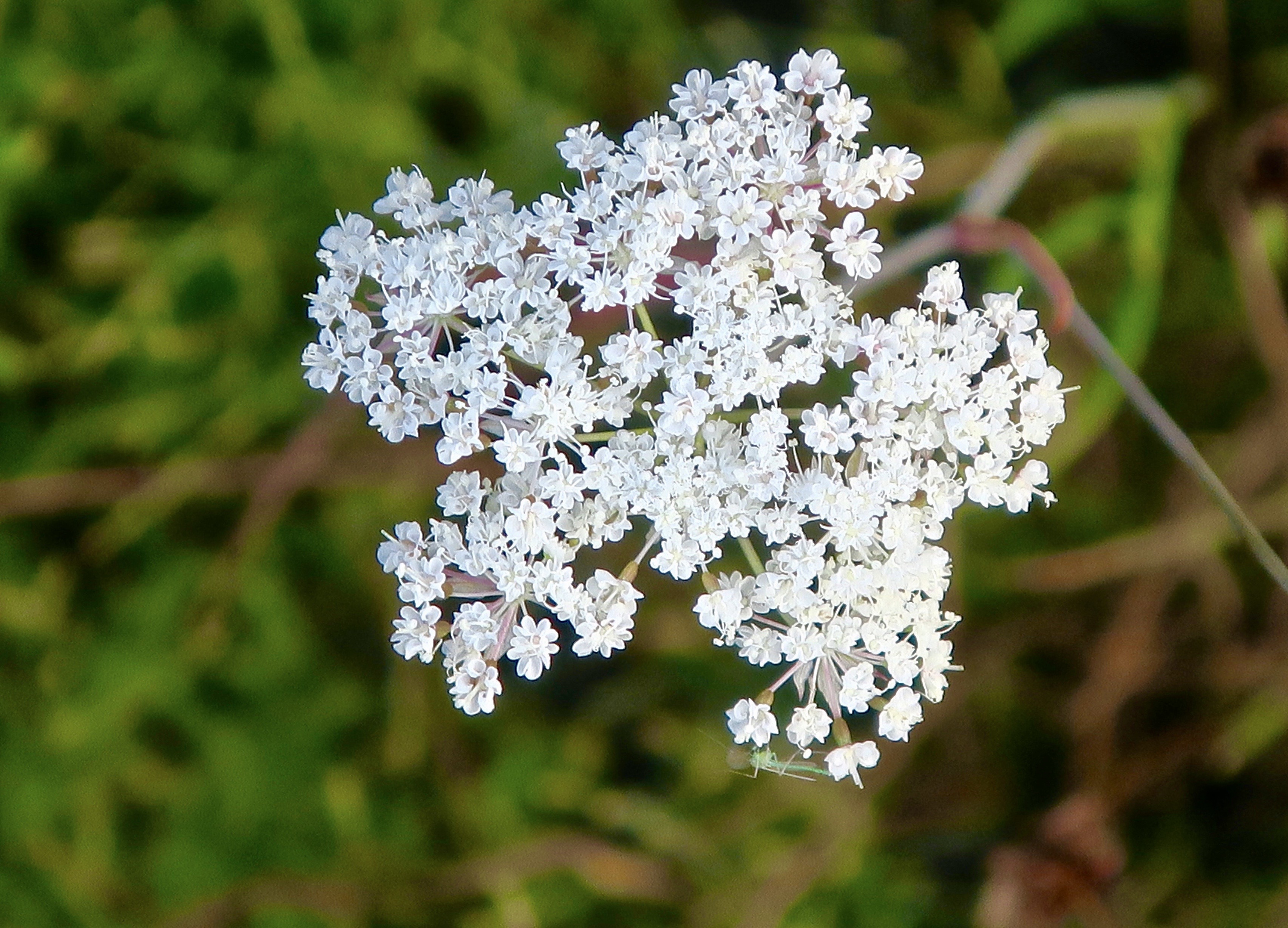
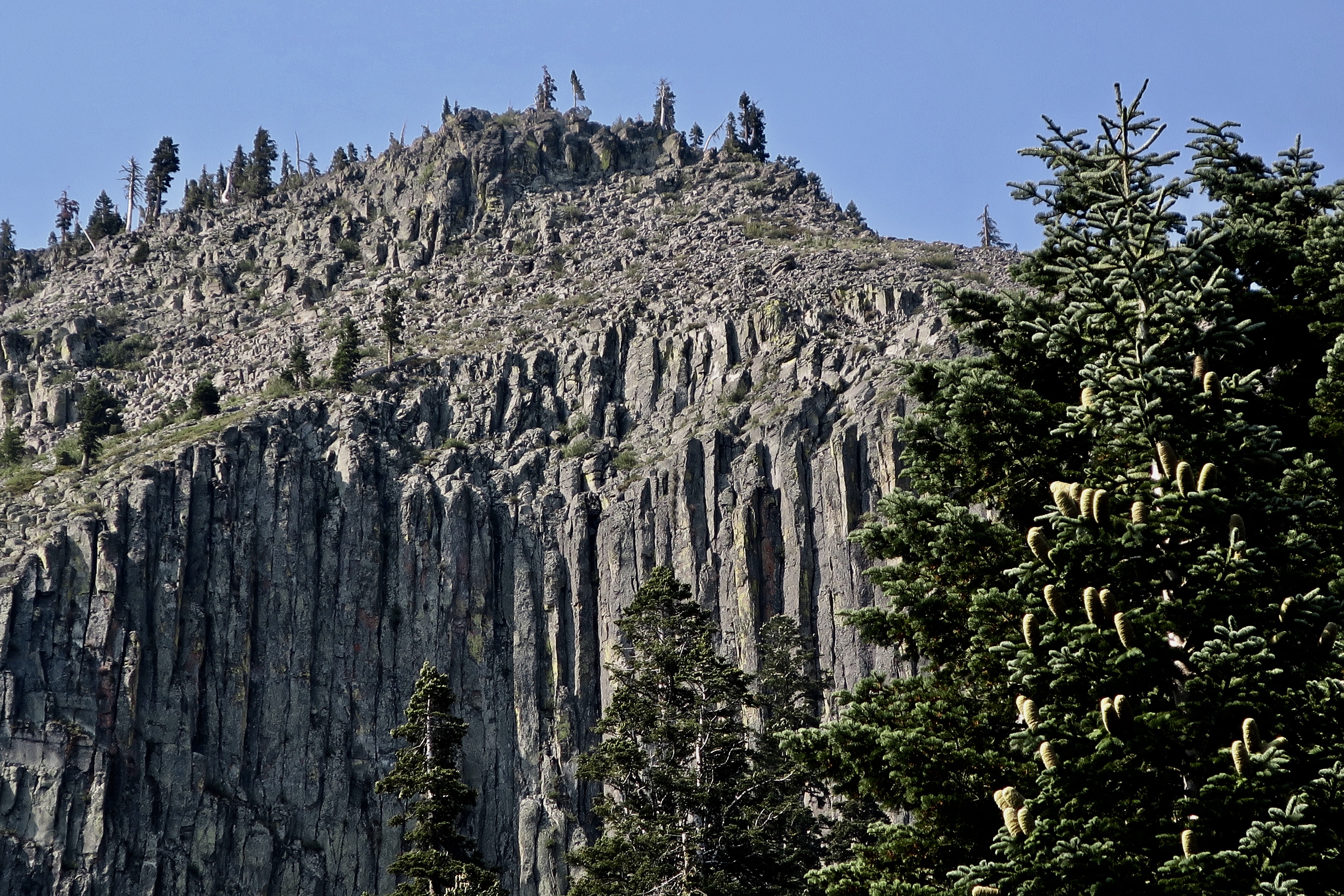
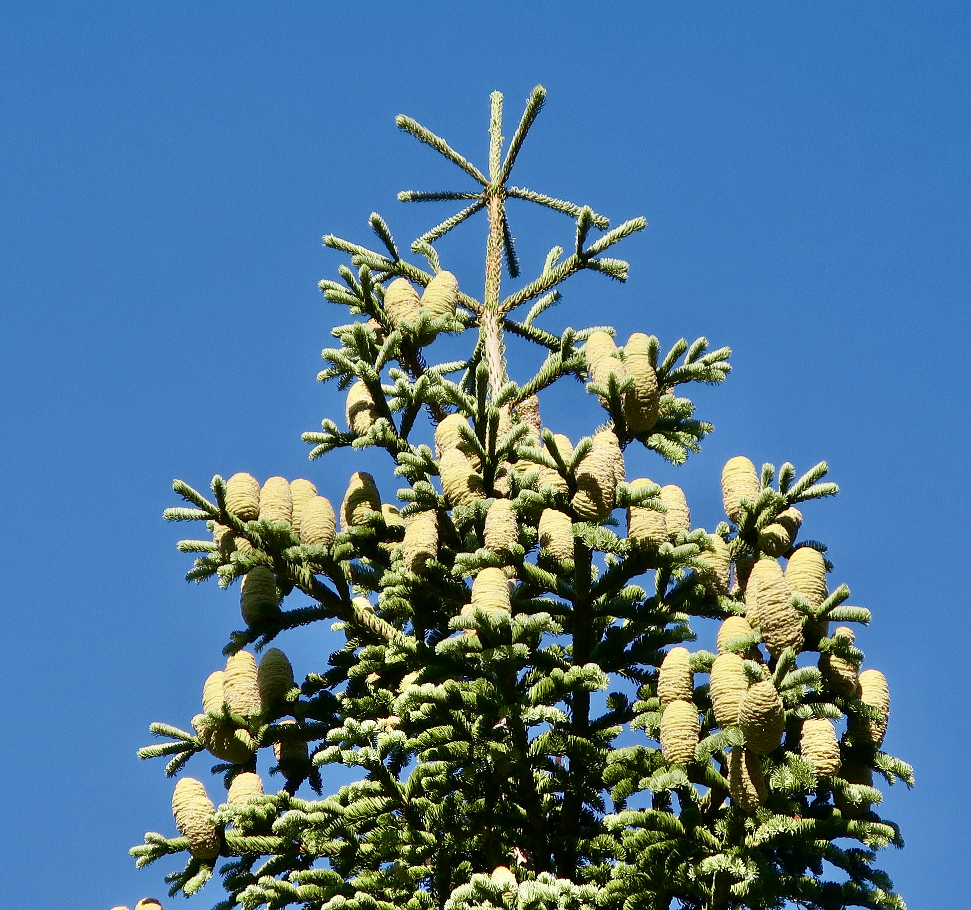
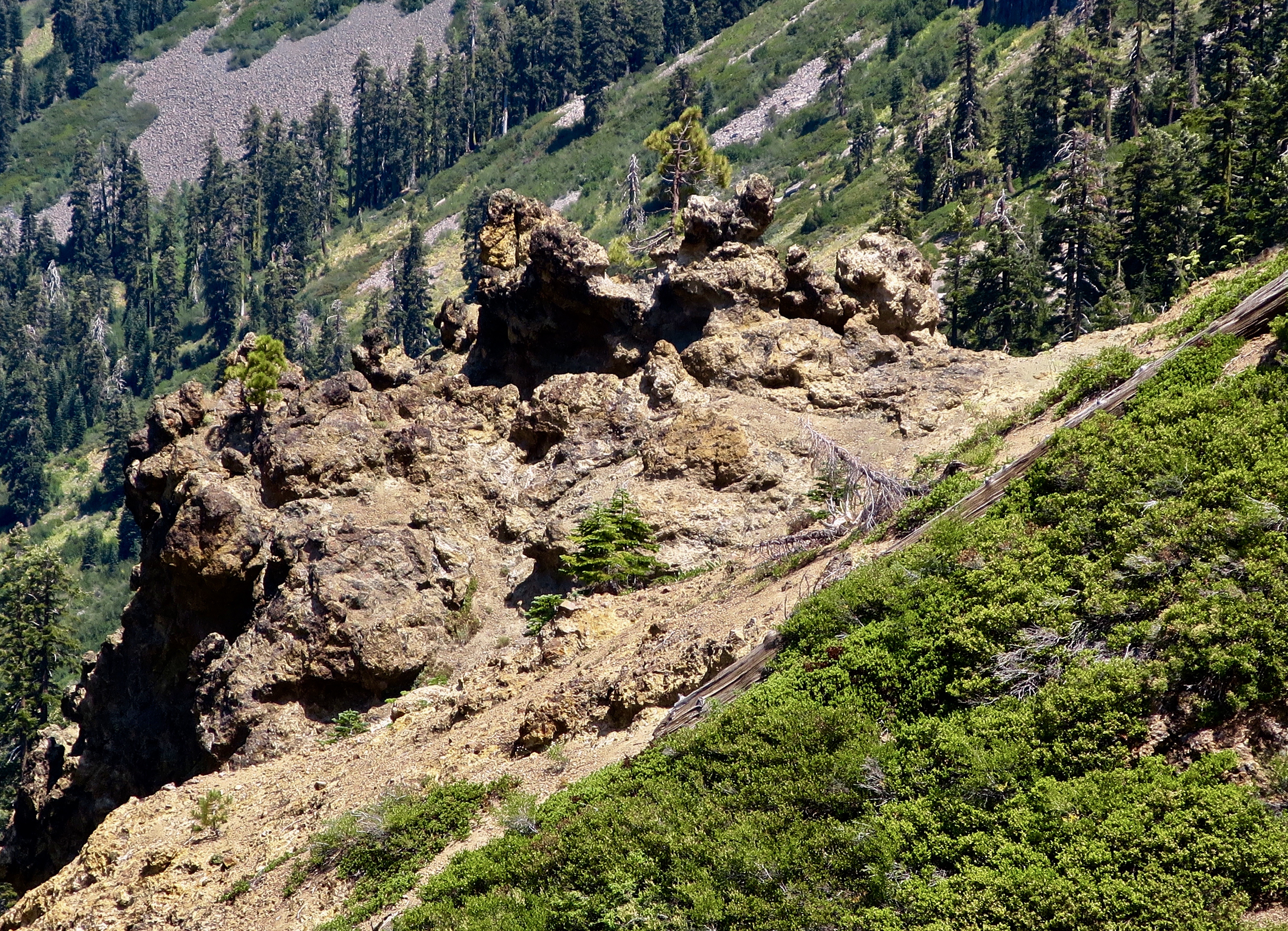
I began this section of the PCT where I hiked through the Granite Chief and Desolation Wilderness areas on historic Highway 40 near the Sugar Bowl and Donner Summit. Before it was replaced by I-80, it was part the Lincoln Highway, America’s first cross country road. Like most of the Sierra Trails I know, the PCT here begins with a climb. The peak you see up ahead is Tinker’s Knob. The Knob, BTW, was named after James A. Tinker, a freight-hauling teamster in the area. Legend has it that it was named after his nose, which was said to resemble the knob.Having got a late start after Peggy dropped me off, I camped that night with a view of Tinker’s Knob. As far as I know, not one other person was camped in the valley. That’s one of the beauties of backpacking.The views from my campsite were gorgeous.I watched as the sun set on Tinker’s Knob, outlining it in golden, warm colors.And then went for a short walk and watched the sun set in the west. A note here: Tinkers Knob is just outside of the Granite Chief Wilderness in the Tahoe National Forest. It’s part of the land that Lee’s bill might open for sale. I can see a land speculator grabbing this and making it available to developers for huge profits who would then sell it to multi-millionaires for homes at even greater profits. No trespassing signs would quickly follow.This map of the Granite Chief Wilderness provides a fairly accurate view of the trail system. Tinker’s Knob is on the top, just outside of the wilderness to the north of the 9005 Granite Chief Pass.I caught this photo the next morning. There are two Needle Peaks in the Granite Chief Wilderness. Needle Peak and Little Needle Peak. This is the former. Both are made up of volcano cores.Leaving my camp, the PCT took me through an extensive field of corn lilies.I came across this old PCT Trail sign placed before the name of Squaw Valley was changed. The name squaw had become controversial. Since the 1960 Winter Olympics were held at the Squaw Valley Ski Resort, the name was changed to Olympic Valley.The Granite Chief Wilderness is just behind the mountains. All I had to do was hike over them.I actually made two trips though the Granite Chief Wilderness on my 750 mile PCT Trek. The first was with my grandson Ethan. We took the tram up from the Olympic Valley floor to reach the wilderness area and then hiked through Granite Chief Wilderness and part of the Desolation Wilderness when Ethan sprained an ankle. I decided on a do-over starting at historic Highway 40. I needed the miles given the areas I had to skip because of forest fires. The following photos are from both trips.Ethan and I spent our first night at Little Needle Lake beneath Little Needle Peak. It’s a relatively short hike from where we got off the tram and an old favorite of mine going all the way back to the 1974 when I first started leading hundred mile backpack trips through the Sierras.Instead of following the PCT through the Granite Chief Wilderness, we dropped down off the ridge to Five Lakes Creek. Once, this trail marker, known as a blaze, would have marked the trail along the creek. It’s likely that carpenter ants carved the holes.Another old blaze on a tree that still lives. I’ve followed blazes many times over the years. Especially when the trail disappeared under the snow.A limb came out of this snag when the tree was young. The rings take you back in time to its youth. I thought it made a neat photo.A small amount of water was still flowing in Five Lakes Creek.The trail follows the creek for five miles and reaches what is known as Diamond Crossing where I have often camped.Earlier in the season there is a small, but photo-worthy waterfall just up Five Lakes Creek from Diamond Crossing.With a great swimming hole to cool off in.The trail leaves the canyon at Diamond Crossing and heads up a long steep climb following Powderhorn Creek. I heard something splashing in Powderhorn on my second trip when I was by myself. I snuck up and discovered two bobcats frolicking in the water. They took off before I could get my camera out but I was able to pick up one very wet track left behind.I continued to follow their trail out of the canyon. Here kitty, kitty, kitty.By late August most of the flowers were finished, but I did find abundant goldenrod…And Queen Anne’s Lace.There is ample evidence of volcanic activity throughout the Sierras. This view is of a basalt lava flow that cooled and contracted into vertical hexagonal columns can be seen from the upper section of the Powderhorn Creek trail. The tree on the right is a red fir. Unlike pine cones, red fir cones disintegrate. Another view of ancient volcanic activity: A volcanic mudflow. I believe the talus slope in the background is from the basaltic lava flow.The climb up from Diamond Crossing is no joke. Ethan had every reason to celebrate! The Granite Chief Wilderness stretches out to the farthest peaks in the background where Ethan and I started and I had hiked twice in a row. You can barely see Big Needle Peak below Ethan’s right arm. The Barker Pass road provides and easy exit or entry point for both the Powderhorn Creek Trail and the PCT.
Peggy and I will be taking a break from our blog over the next three weeks. We are in Sacramento this week visiting with friends and relatives. Next week we are flying to Florida where we celebrate Peggy’s 75th Birthday with our son and his family. The following week we fly back here and will continue to celebrate. This time with a backpack trip retracing the route of the first backpack trip I ever took— in 1969! Then we will continue our exploration of the southwest and blog series.