The Hottest, the Driest, the Lowest… Death Valley: Featuring Zabriskie Point

Today’s post marks the beginning of Peggy’s and my journey around North America. We will be sharing our insights into what it’s like to live full time on the road plus our adventures along the way. A special focus of the blog will be visiting some of the most spectacular wildlands remaining on our continent. Death Valley is up first, starting with an overview and featuring Zabriskie Point.

Peggy and I were greeted with this sign when we stopped at Death Valley National Park Visitor at Furnace Creek on our recent visit. As noted, Death Valley is a land of superlatives. The word I use is extremes. I reserve superlatives for the scenery. It’s why we have returned to Death Valley over and over again. 

Photo by Peggy Mekemson

I doubt that the Death Valley people included the price of gas as either an extreme or superlative, but we found it amusing. And we weren’t the only people taking photos of the sign. We made sure that we filled our tank in Bodie, a small Nevada town just outside of the park. Adding serious injury to insult, the price of a six pack of beer was $20 at the Furnace Creek store! Now that’s something worth whining about. 

But let’s get back to the hottest, driest, and lowest. By hottest, they mean the hottest place on earth. It holds the world record at 134° F (57° C). Death Valley is not a place you want to visit in the summer if you can help it. Here’s the bad news. It’s getting hotter. We can thank global warming. The following chart sums it up.

The impact of global warming can be seen clearly on the National Park graph that shows average summer temperatures.

The normal definition for a desert is a place that gets under ten inches of rain a year and has an evaporation rate that exceeds its rainfall. Death Valley averages under two inches and has an evaporation rate that is 75 times its rainfall.  Sit in the shade doing nothing for a day and you can lose up to two gallons of water. The Valley holds the record for being the driest place in the United Sates. There is a reason why the Park Service always warns people to carry and drink lots of water when they are visiting. 

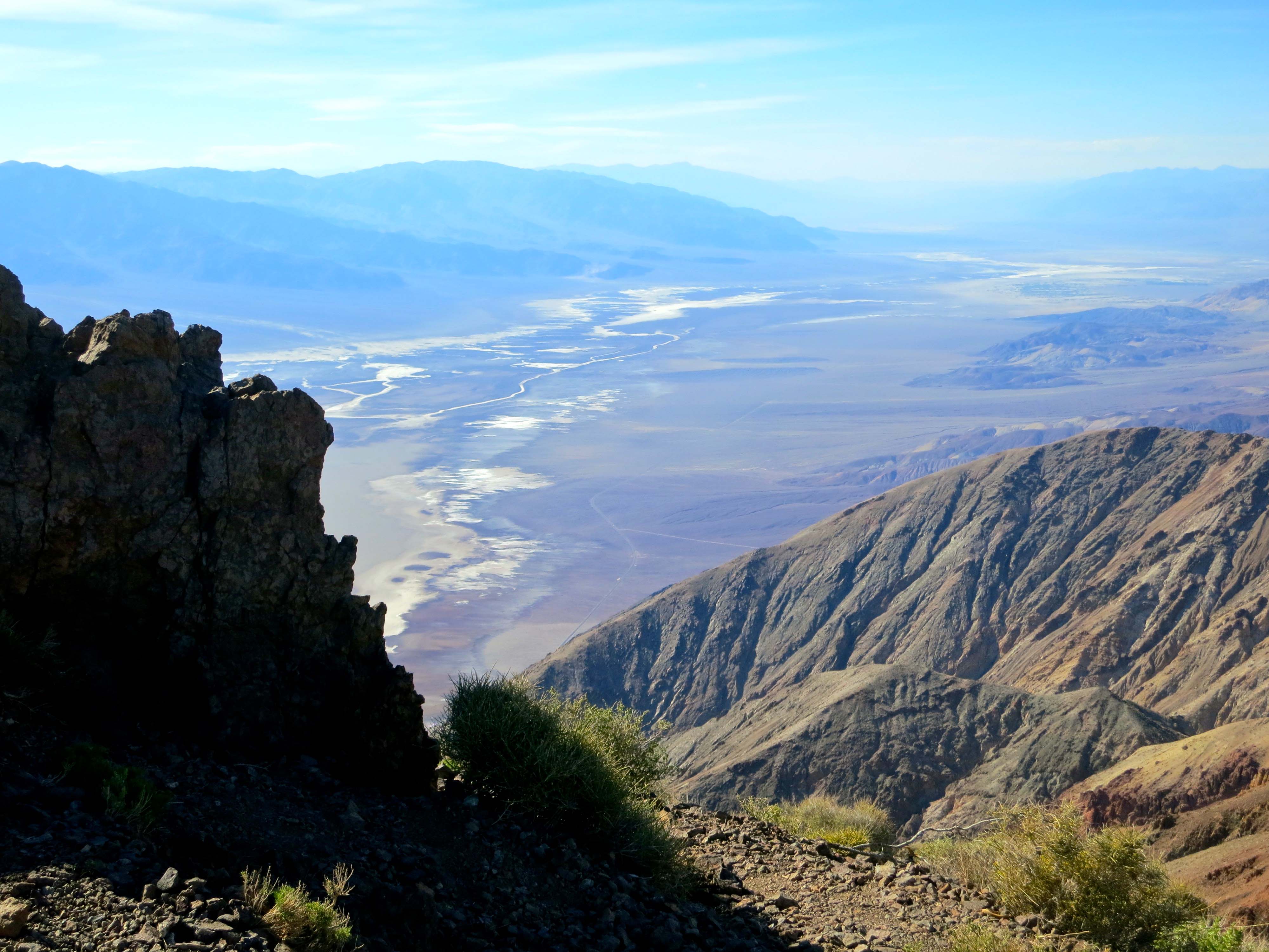
And finally, the lowest. At its lowest point, Death Valley is 282 feet below sea level, which just happens to be the lowest spot in North America. On an earlier trip, Bone was proud to pose on the Bad Water Basin Sign announcing the low point. 

Bone was feeling a little low that day…

I’m going to add another extreme. Wind. Death Valley doesn’t hold any records here as far as I know, but when I bicycled across the Valley on my 10,000 mile solo trip around North America, I remember being out of the saddle in low gear, and working my tail off— pedaling downhill. When I got back to camp, I discovered my tent had been blown a half mile away and was totally trashed. This time the wind was blowing so hard Peggy couldn’t get her door open on our truck! It took all my strength to force mine. Back at camp, I took a photo of “Cousin It.’

The wind gave Peggy a new hairdo. We decided to call her ‘do’ the Cousin It look. It’s the latest fashion in Death Valley.

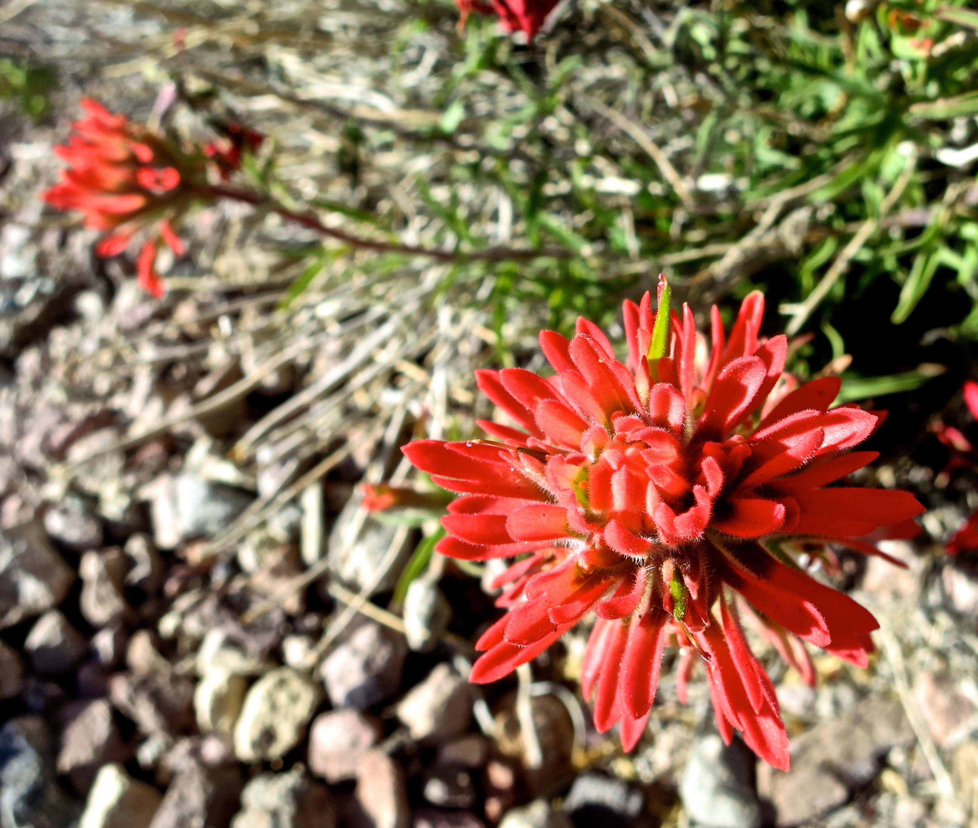
As I noted earlier, Peggy and I have returned to Death Valley many times, always in the fall, winter or spring. Each time we try to include something we haven’t done before. This time it was going in search of the rare and endangered, but not so elusive pup fish, and hiking up Mosaic Canyon. We also returned to some of our favorites: 20 Mule Canyon, Zabriskie Point, and the Artist’s Palette. Peggy and I were busy with our cameras the whole time. I’ll let our photos speak to the beauty of the park. 

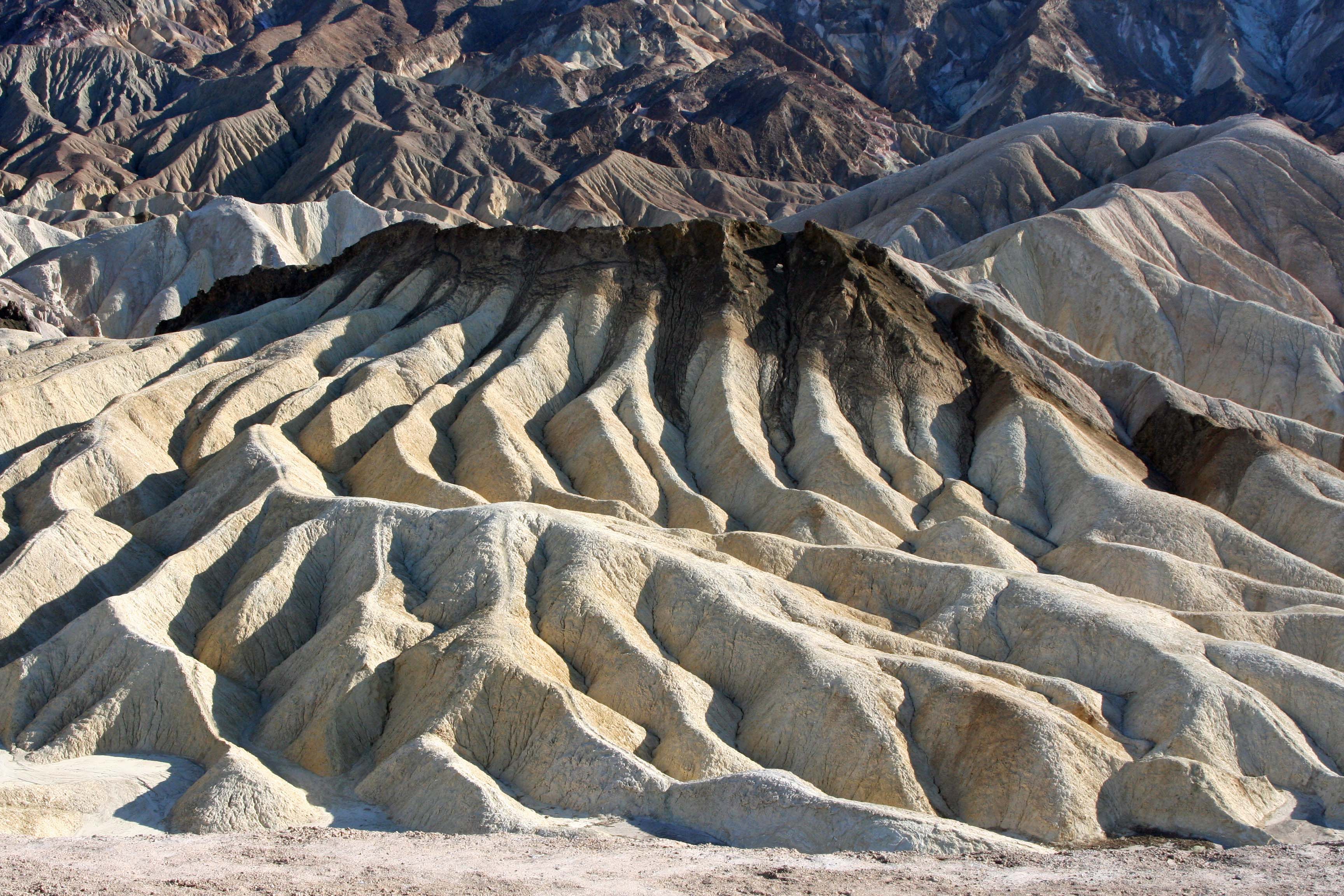
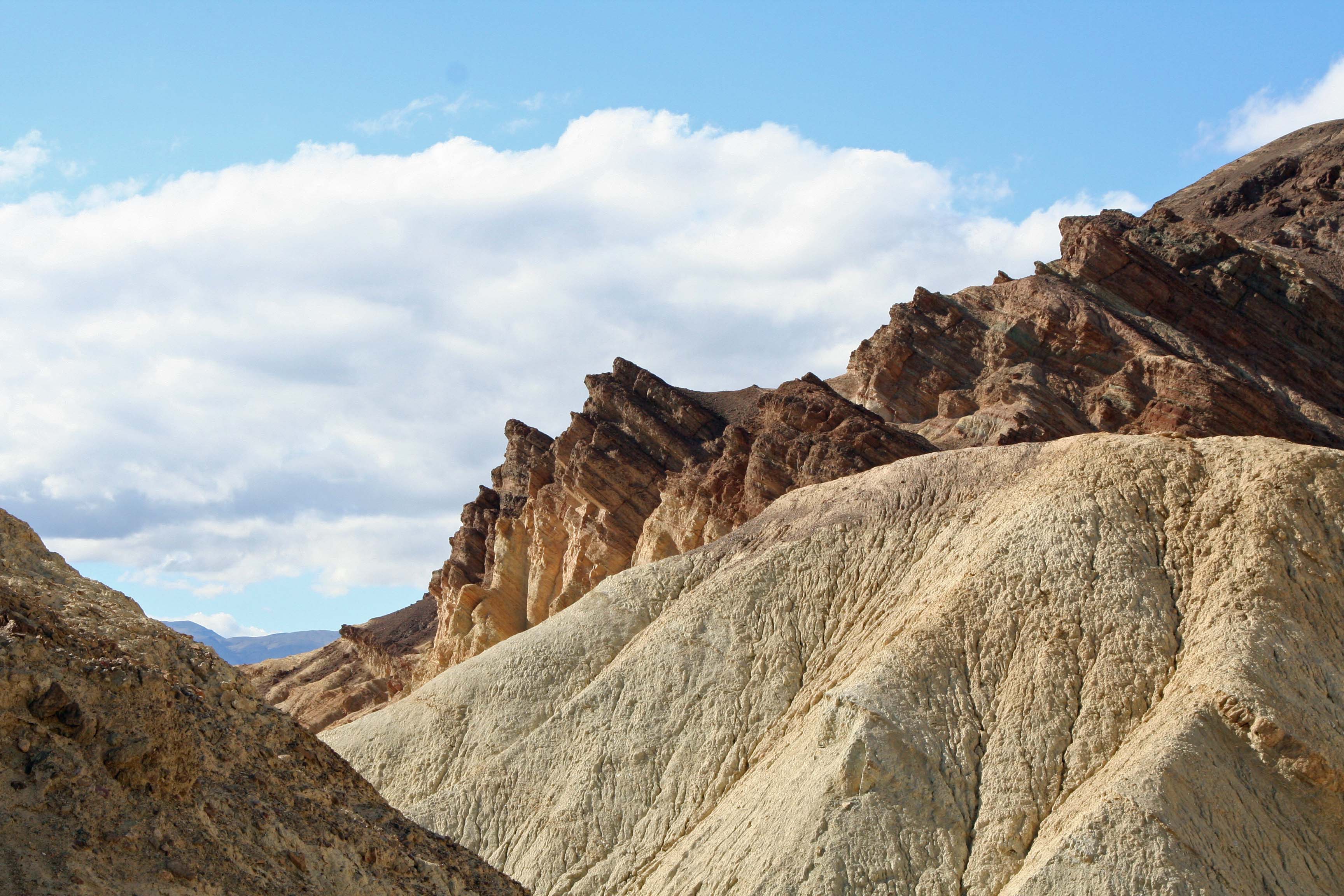
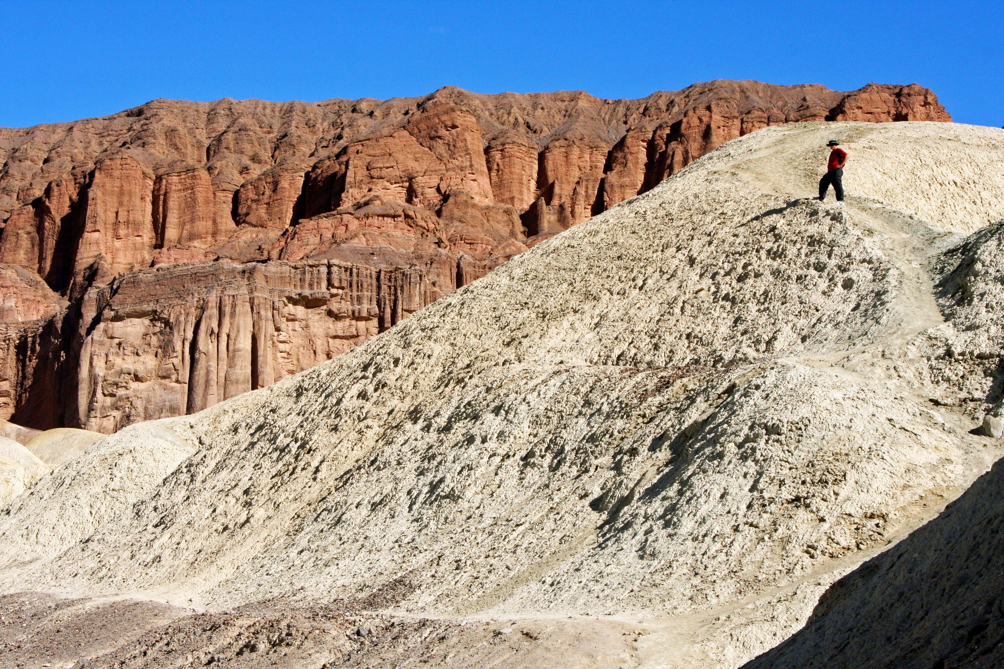
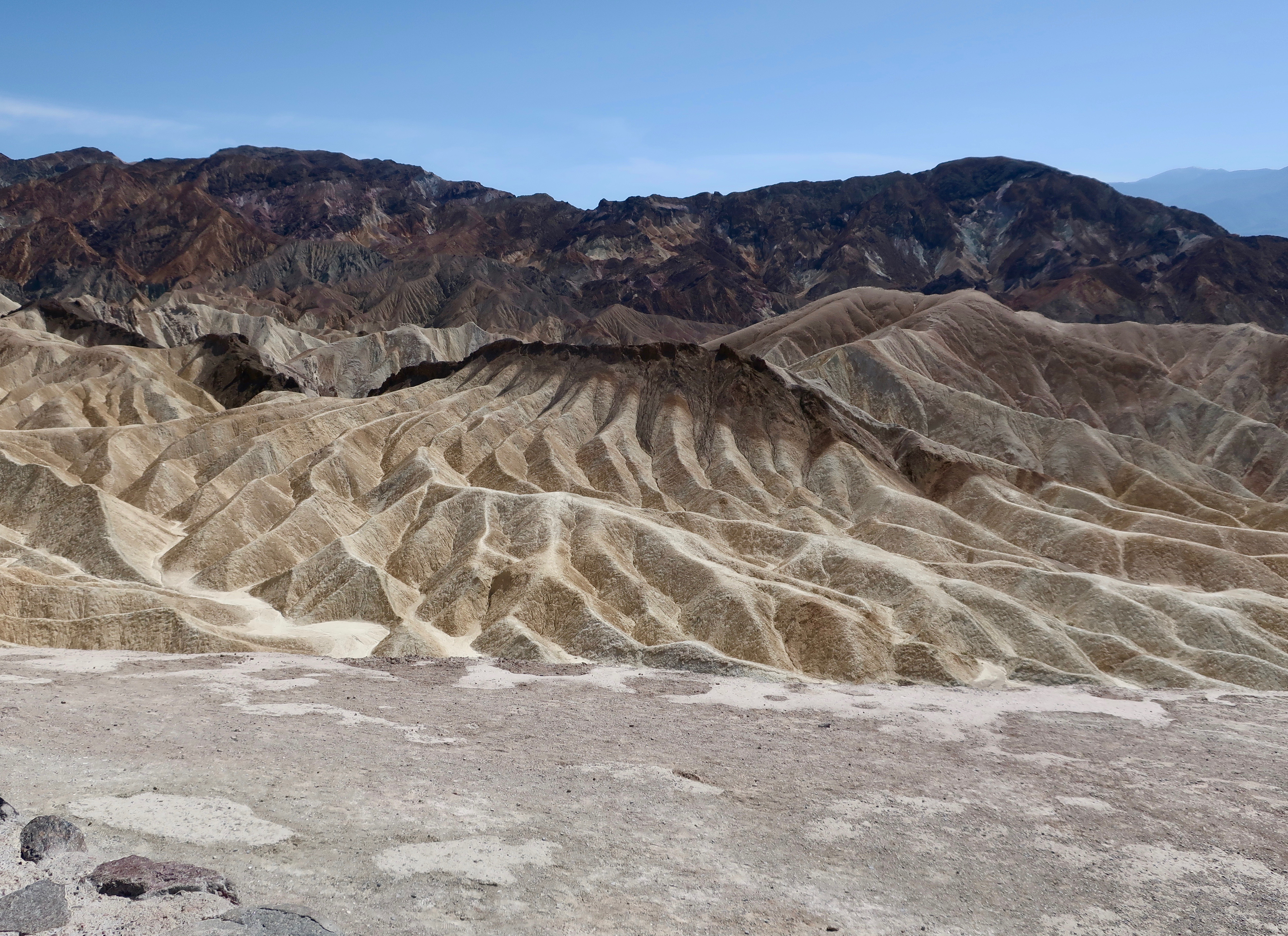
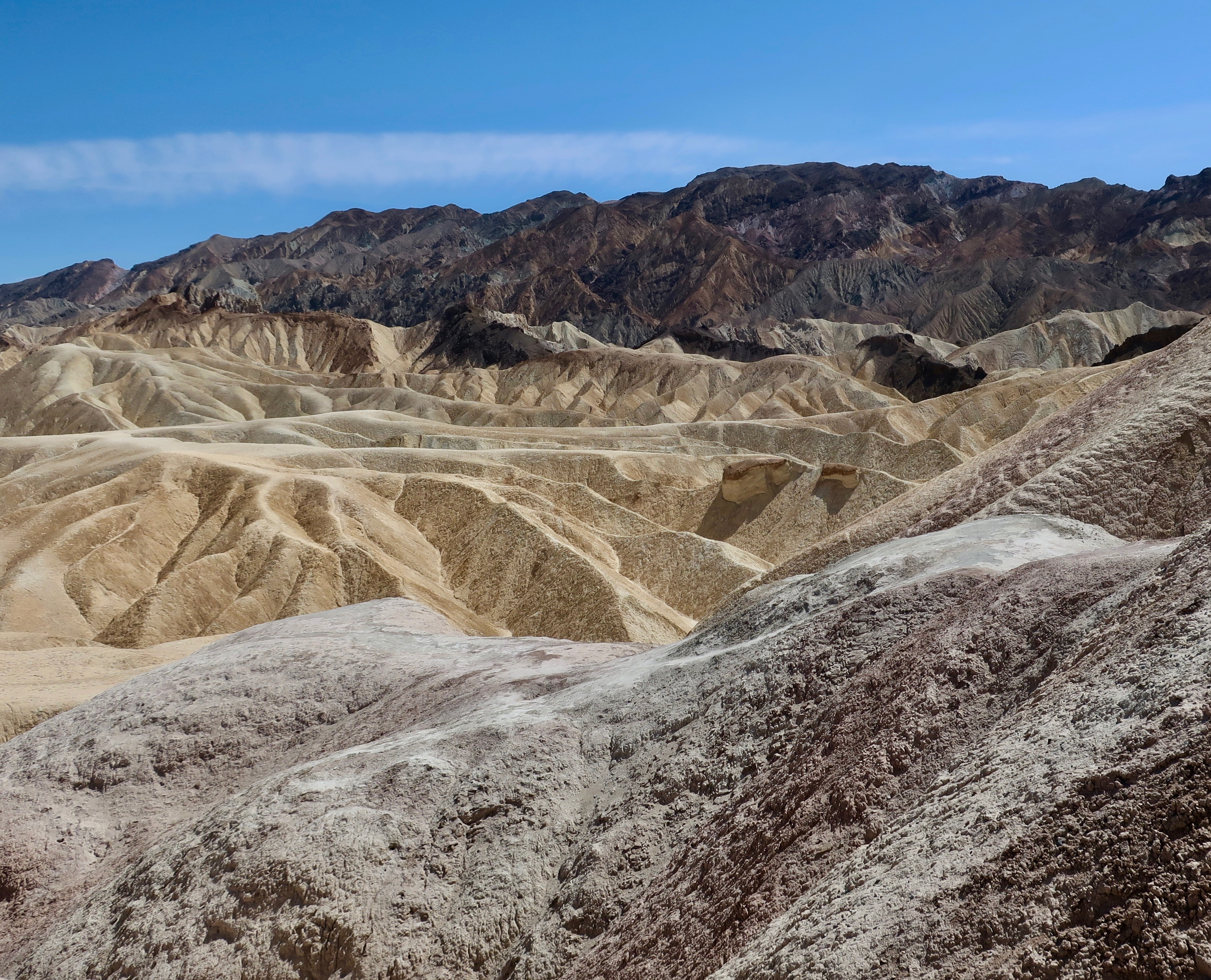
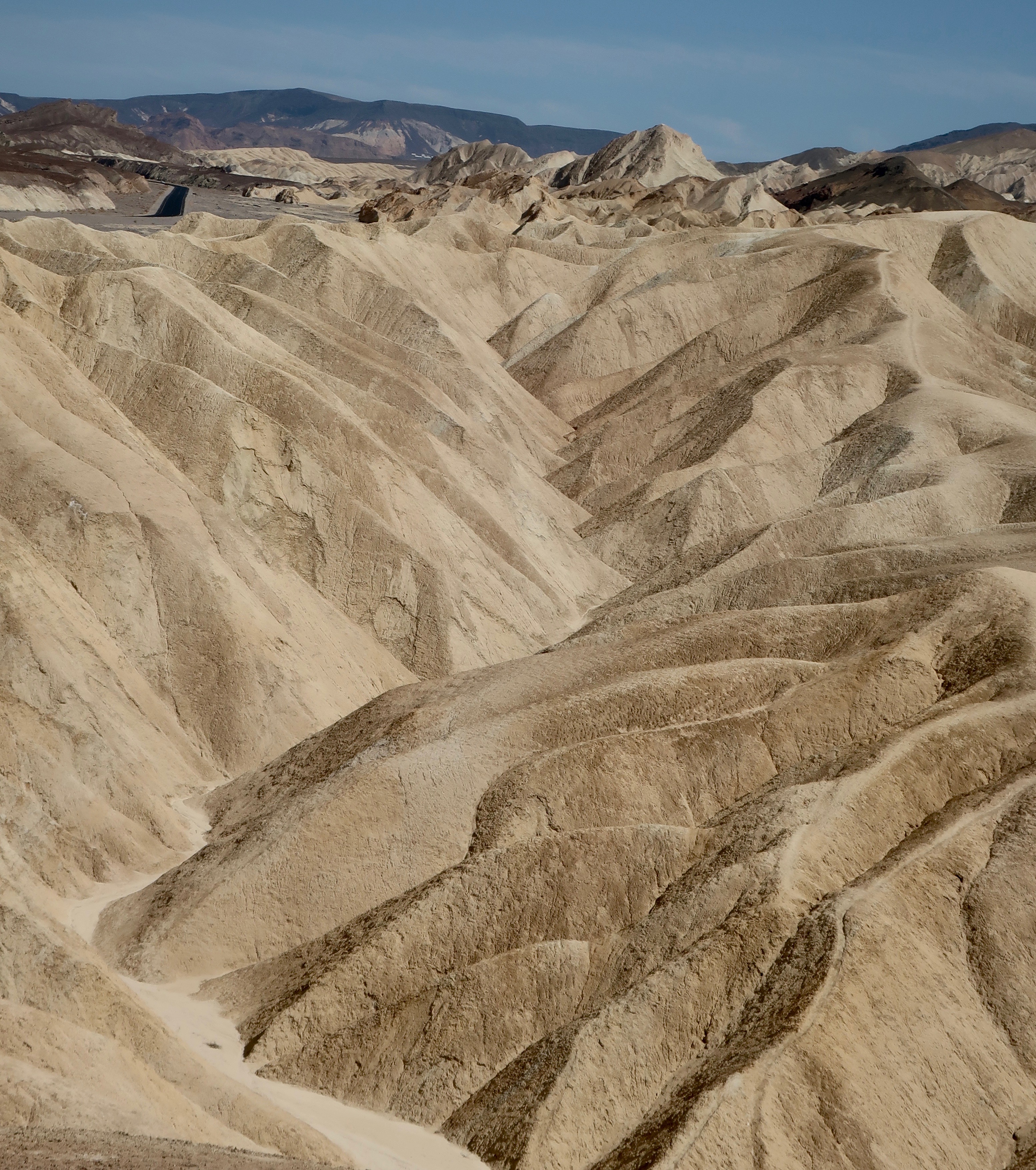
I’ll start with Zabriskie Point, a quick 15 minute drive away from Furnace Creek and the Park Visitor Center. Named after Christian Zabriskie, an early manager of the Pacific Coast Borax Company, it is probably the most photographed site in Death Valley. For good reason. It was once the site of an ancient lake where various sediments sank to the lake bed, giving the area its rich colors today. Early ancestors of both modern day horses and camels left their tracks along the shorelines. Tectonic plates moving beneath the valley lifted the mountains and dropped the valley, giving rise to the erosion which has done such an impressive job of carving out the ‘badlands’ shown in the photos below.

This photo captures the rich colors of Zabriskie Point. You are looking out on the Valley floor. The Panamint Range forms the background. (Photo by Peggy Mekemson.)
A popular photograph of the ‘badlands” at Zabriskie Point. The peak on the left is known as Manley Beacon. The cliff behind it is known as Red Castle.
This provides a close up of Manley Beacon. Manley is the person who rescued the prospectors who were crossing the desert in hope of finding gold in California in 1849. They were lucky. It was the miners who gave the valley its name, Death Valley.
I caught this picture of Red Castle at Zabriskie Point. Had we been there at sunset it would have been much more reddish.
One of many of the geological features of Death Valley are volcanoes and lava flows. The black lava here was part of a lava flow. Being a harder rock it provided a cap to the eroded rock below. (Photo by Peggy Mekemson.)
This provides a broader perspective.
This picture is particularly good at showing the various terrains, textures, and colors at Zabriskie Point. (Photo by Peggy Mekemson.)
I ‘ll conclude with one of my favorite views at Zabriskie Point.

NEXT POST: We will visit Artist’s Palette at Death Valley and then go in search of the rare pup fish at Salt Creek.

Death Valley Part II: We Are At Zabriskie Point but Where Is R2-D2… The Desert Series

Erosion of rocks created in an ancient lake bed gives Zabriskie Point its unique look.

Erosion of rocks gives Zabriskie Point its unique look.

Zabriskie Point is one of the most photographed spots in Death Valley. Tour busses stop here and disgorge thousands of passengers annually. Everyone comes armed with a camera, or at least a cell phone camera. Twenty shots or so later they are on their way, scurrying back to the bus and Death Valley’s next must-see sight. We are more leisurely in our approach, but we also take a more photos. Erosion is king here, wearing away rocks that were deposited in a lakebed some five million years ago– back before tectonic forces created Death Valley and back before the region became a desert.

Zabriskie Point Death Valley.

As in other parts of Death Valley, the rocks of Zabriskie Point are multi-hued. (Photo by Peggy Mekemson.)

Manly Beacon in Death Valley.

Manly Beacon or Point, is another popular view from Zabriskie Point. Justifiably so.

Peggy and I were at Zabriskie Point in the late afternoon. The rocks above Manly Beacon seemed to take on an inner glow.

Peggy and I were at Zabriskie Point in the late afternoon. The rocks above Manly Beacon seemed to take on an inner glow.

The volcanic caprock provides an interesting contrast. (Photo by Peggy Mekemson.)

The volcanic caprock provides an interesting contrast. (Photo by Peggy Mekemson.)

A three-mile trail leads down to the Valley floor from Zabriskie Point and passes through Golden Canyon on the way. For fans of Star Wars IV, segments of the movie were filmed in Golden Canyon. The diminutive, eye glowing Jawas captured R2-D2 and C-3PO there.  So you can think of Death Valley as Tatooine, the home planet of Luke Skywalker. (Tunisia was also used for scenes on Tatooine.)

Golden Canyon looking out toward Death Valley

Golden Canyon looking out toward Death Valley. This photo and the one below were taken from an earlier trip. R2-D2 and C-3PO were captured in the canyon by the Jawas.

Golden Canyon in Death Valley

Golden Canyon looking up toward Zabriskie Point. I am on the trail. (Photo by Peggy Mekemson.)

Here’s some Star Wars trivia I picked up when doing research for this blog that you can use to wow your friends: sounds made by dogs, bears, lions, tigers and walruses were combined to create Chewbacca’s voice.

The Twenty Mule Team Canyon that I blogged about in my last post starts a mile or so above Zabriskie Point. A few miles farther, a road jogs off to the right that leads to Dante’s View, which towers some 5000 feet above the valley floor. The last part of the road is steep and narrow but the view is worth it.

Looking down into Death Valley from Dante's View.

Looking down into Death Valley from Dante’s View.

Dante's View provides a spectacular view of Death Valley.

Another perspective.

Given the higher elevation at Dante's View, Spring Flowers were still blooming.

Given the higher elevation at Dante’s View, spring flowers were still blooming.

Indian Paintbrush at Dante's View in Death Valley National Park.

This is an Indian Paintbrush.

I took this photo to capture the very impressive alluvial fan spreading out on the Death Valley floor far below Dante's View. Debris coming down off the mountain had built this fan up over thousands of year.

I took this final photo from Dante’s View to capture the very impressive alluvial fan spreading out on the Death Valley floor far below. Debris coming down off the mountain had built this fan up over thousands of year.

NEXT BLOG: Traveling into the Panamint Range of Death Valley: wild flowers, huge charcoal kilns, and one very large, irritated rattlesnake.

The Beauty of Death Valley… The National Park Series

Perched above Gold Canyon off of Highway 190 , Zabriskie Point provides one of many beautiful views in Death Valley National Park.

Death Valley exists in a world of superlatives. It is the hottest, driest and lowest spot in North America. Temperatures often exceed 120° F in the summer and have climbed as high as 138° F.  Ground temperatures top out at 200° F! Annual rainfall averages less than two inches (5 cm.). The lowest spot in Death Valley is 282 feet below sea level in Badwater Basin.

Hottest, driest and lowest spot in North America are three superlatives applied to Death Valley. The Peripatetic Bone, who has been wandering the world since 1977, perches on the sign locating the lowest spot in North America in Badwater Basin Death Valley.

While hottest, driest and lowest are adjectives one normally associates with Death Valley National Park, there is one more: beautiful. I have tried to convey this beauty in my last several blogs. Today’s blog will feature several other places I find beautiful or unusual in Death Valley but have not yet featured.

I would also like to emphasize that this is National Park Week (April 21 – 29, 2012). National Parks in the United States (and throughout the world) protect and highlight many of our greatest natural and historical treasures for both present and future generations. They deserve our full support and are always worth visiting.

My wife Peggy and I have had the privilege of exploring most of the National Parks in the United States and several in Canada. My intention is to share our favorites over the next year or two as part of my blogging

Another view from Zabriskie Point. Pioneers designated such areas as Badlands... i.e. they weren't good for growing crops or grazing animals. Today, we realize their intrinsic beauty is a value in itself.

The nine-mile Artist's Drive and Palate off of Badwater Road provides a profusion of colored rocks as the name suggests. These colors are created by the different sedimentary rocks and oxides of various metals. This area was once volcanically active.

A closeup of Artist's Palate.

Two to four thousand years ago the floor of Death Valley was covered with a large lake up to 30 feet in depth. Then the climate changed (sound familiar?). The lake dried up and left behind the minerals that had been dissolved in the water... mainly salt. Today this salt works its way to the surface and forms pinnacles through capillary action. The result is the Devil's Golf Course. Peggy provides perspective on the size of the pinnacles.

A final view looking across Death Valley.