When Peggy and I arrived at the Perrine Bridge across the Snake River, a man was hanging by his fingers on the edge, 500 feet above the water.
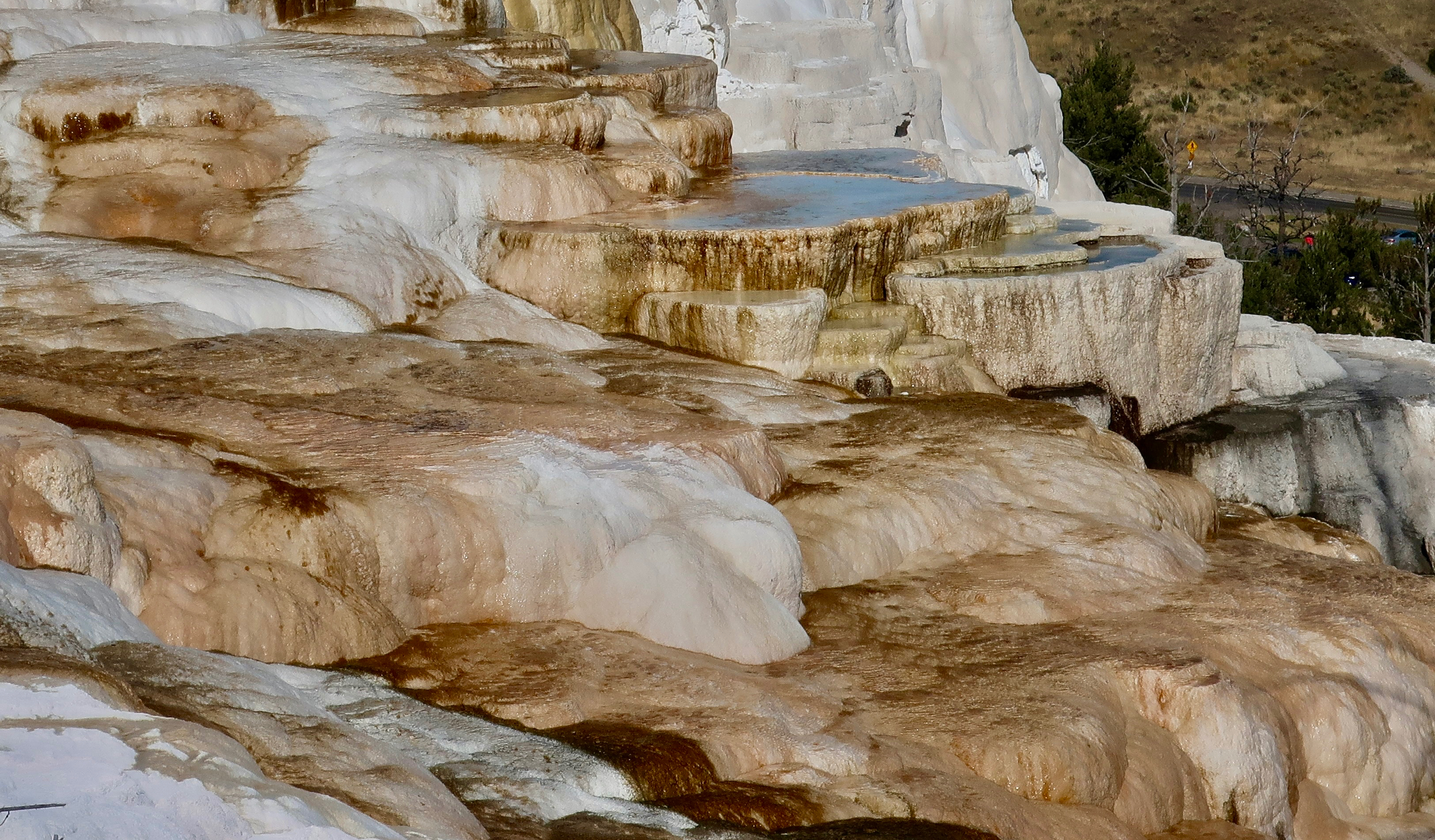
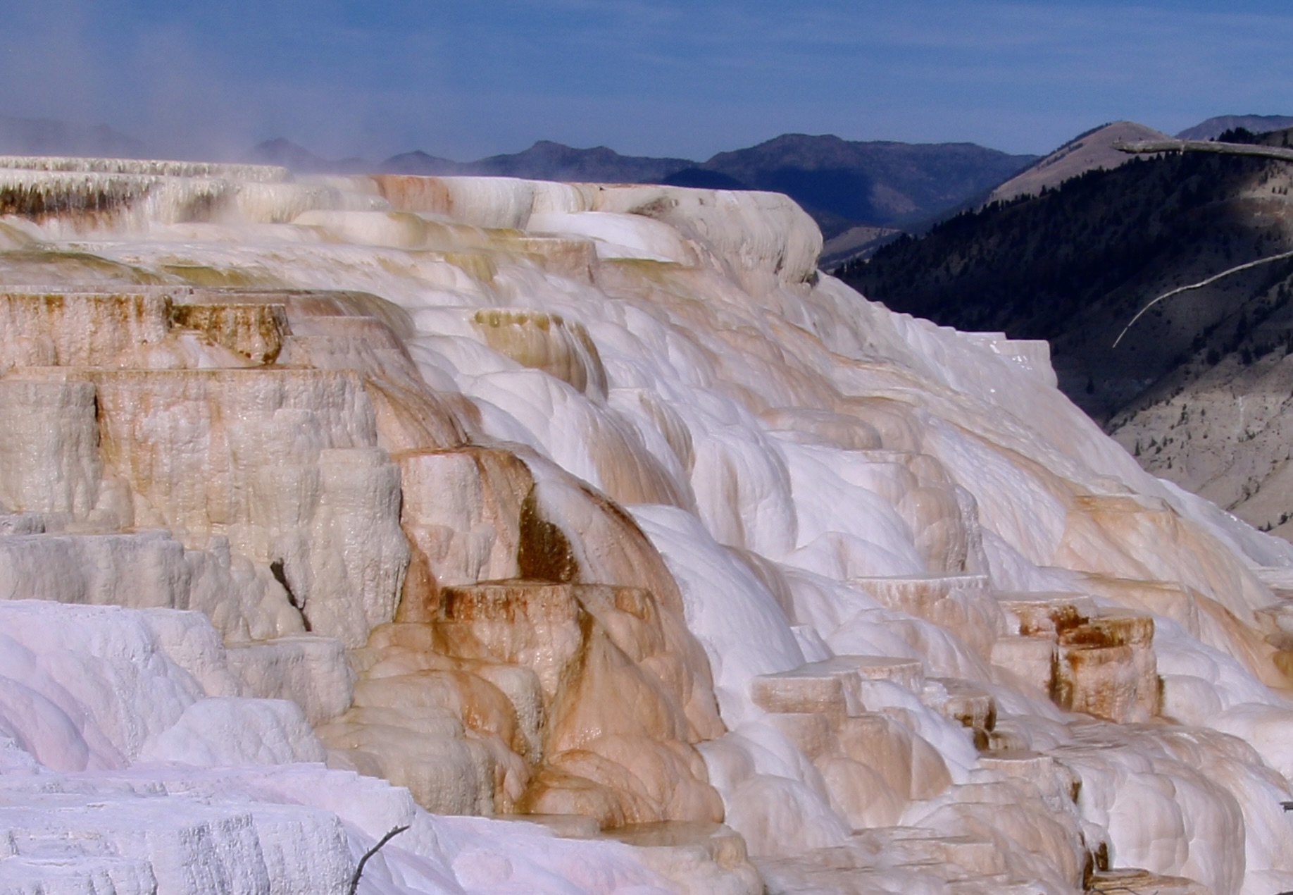
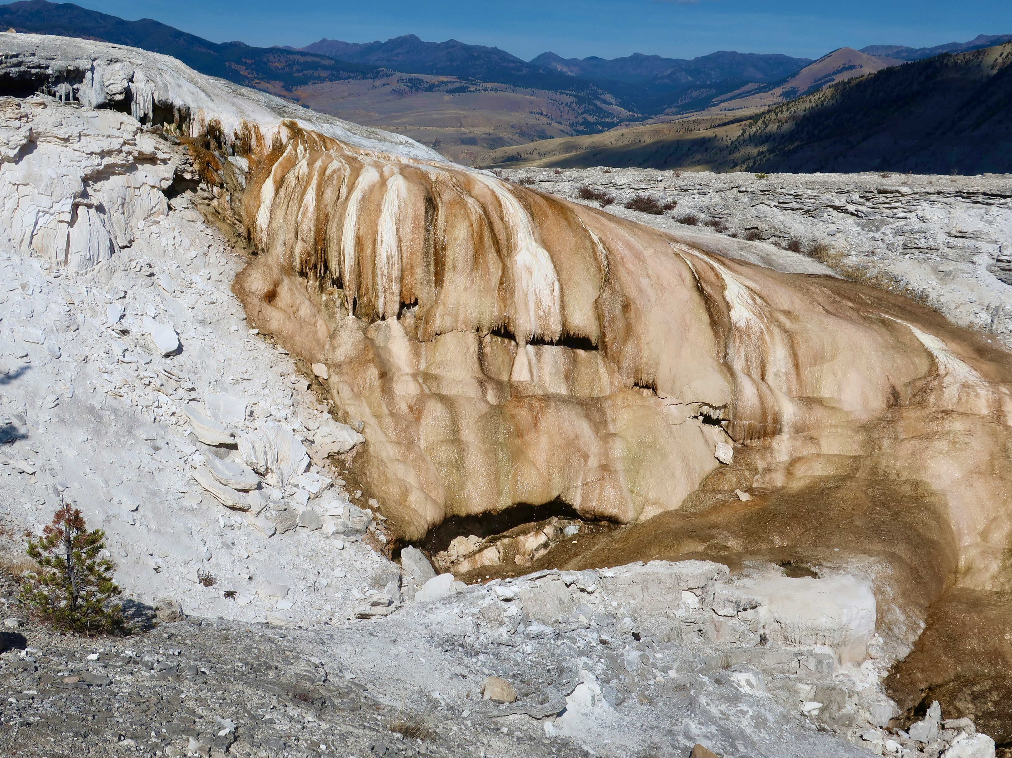
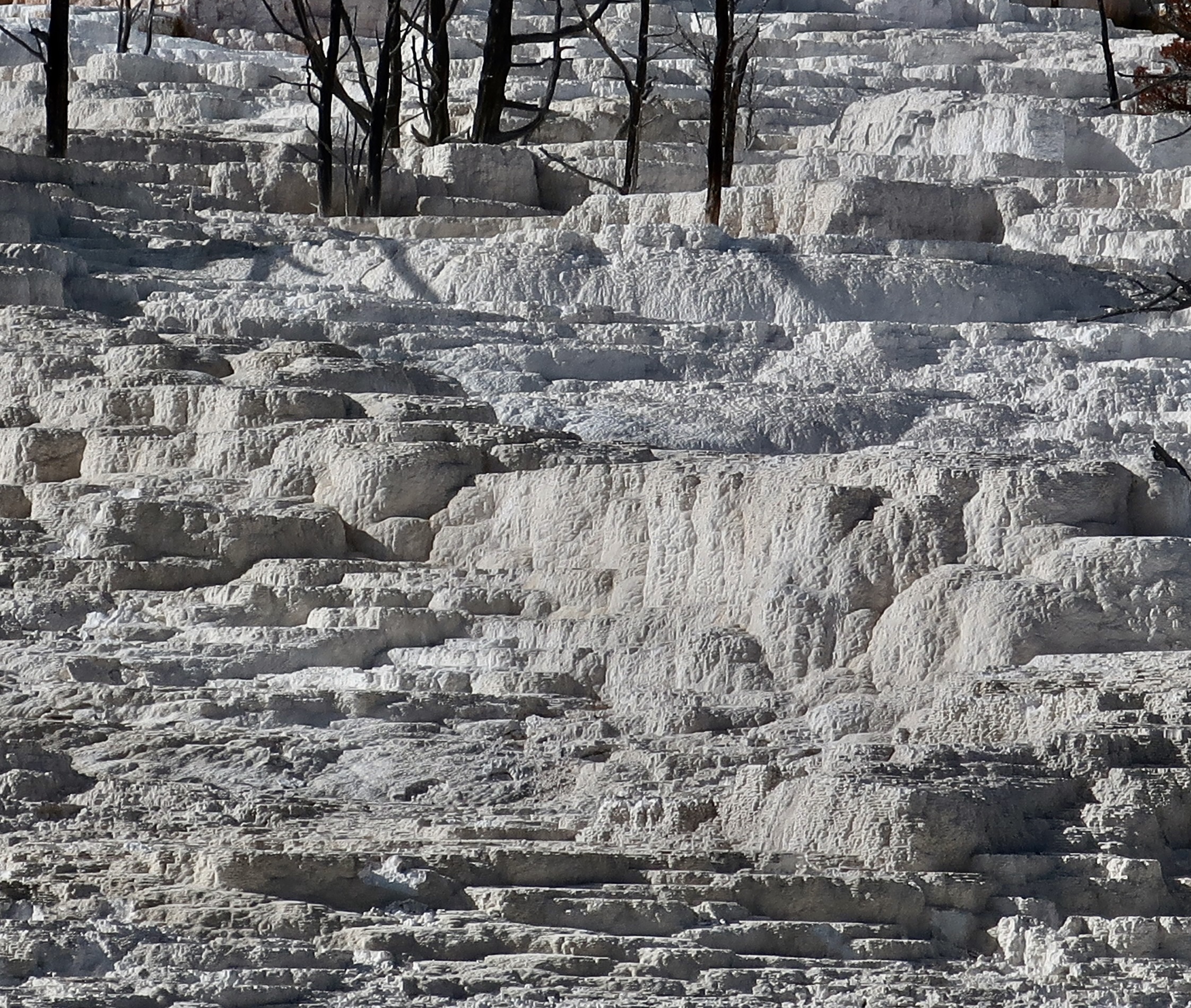
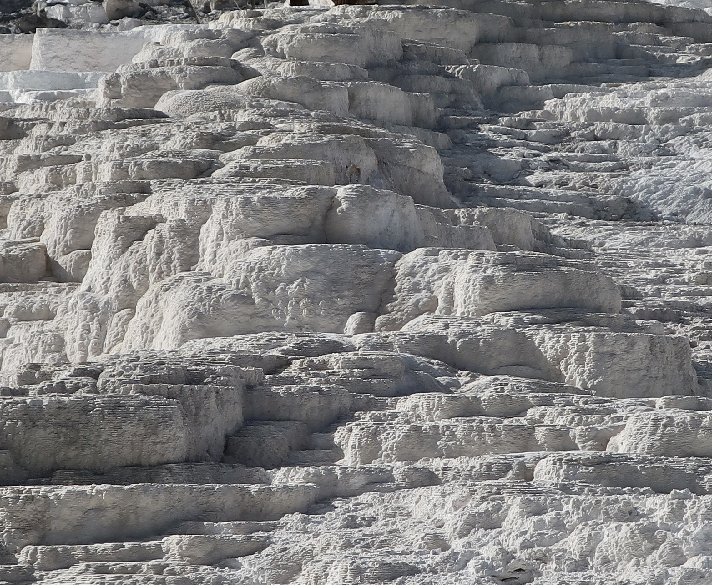
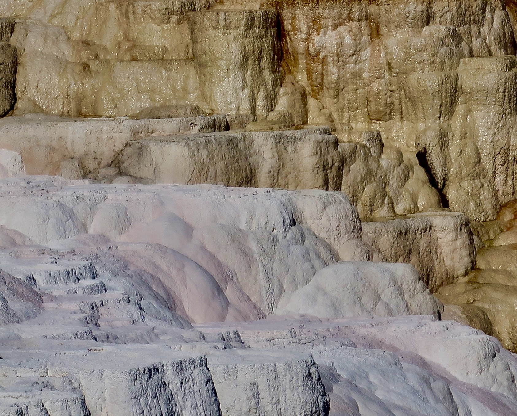
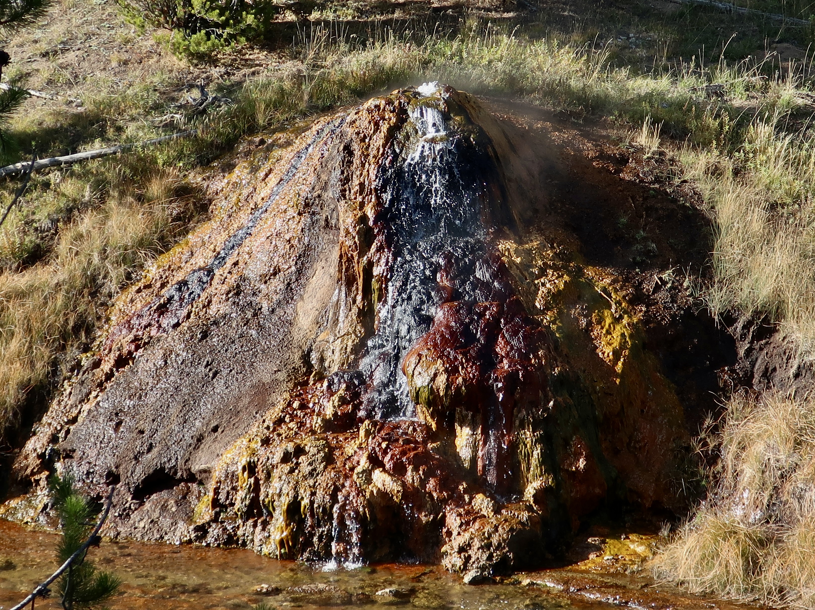
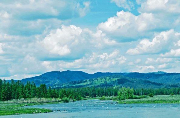
I biked out of Bozeman, Montana facing another climb across the Rockies. It turned out to be surprisingly easy. And beautiful. Highway 191 follows the scenic Gallatin River with its rushing waters up into the northwestern corner of Yellowstone National Park in Wyoming. Snowmelt during June turns this branch of the Missouri River into a seething whitewater-fantasy trip for rafters. Beyond its beauty and rapids, the river is also known for its world-class fly-fishing.

Snow melt turns the Gallatin River of Montana into a river runner’s dream.
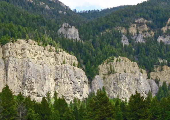
Cliffs along the Gallatin River on Montana’s Highway 191 add to the area’s scenic beauty.

As does the forest.

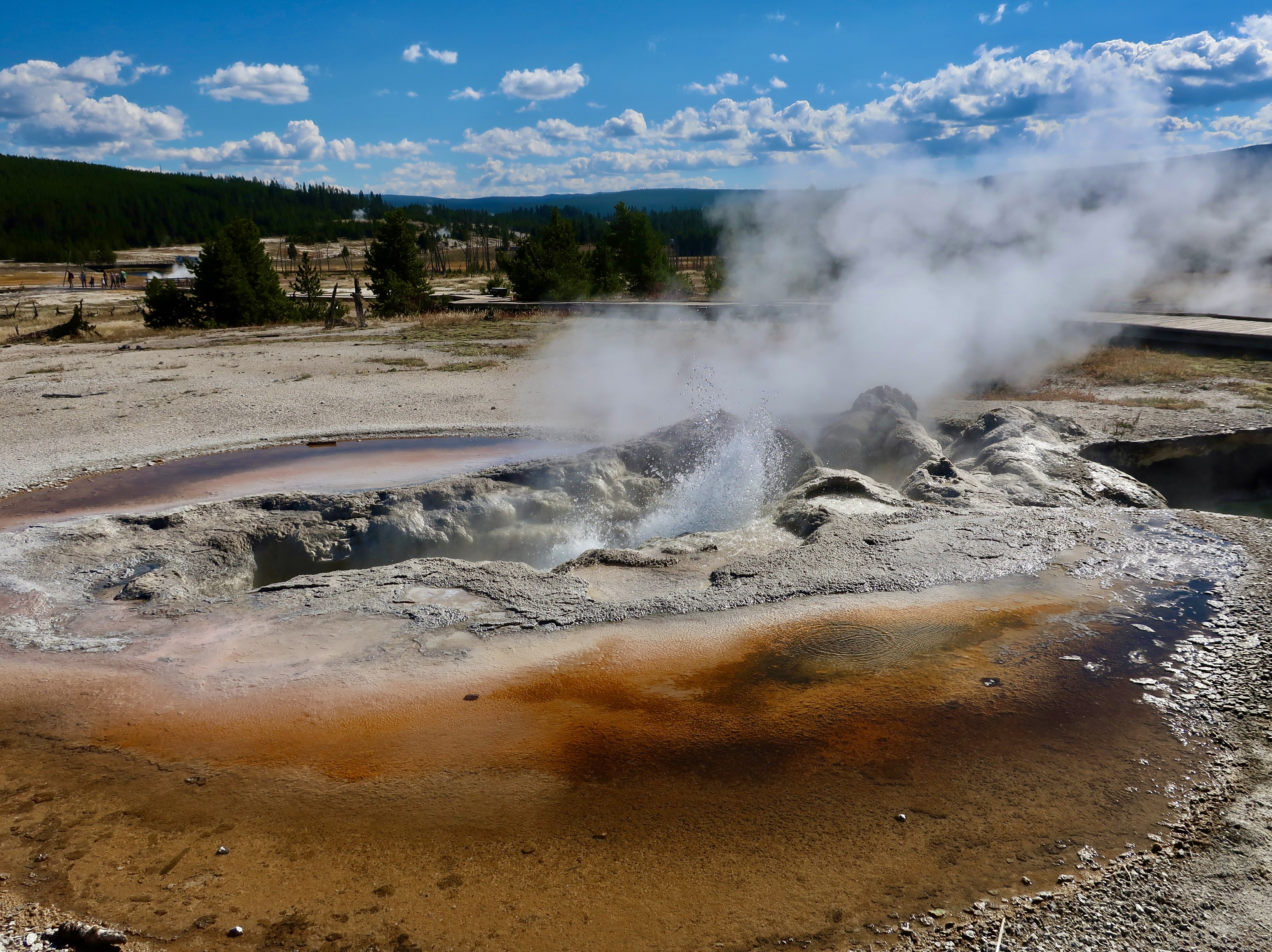
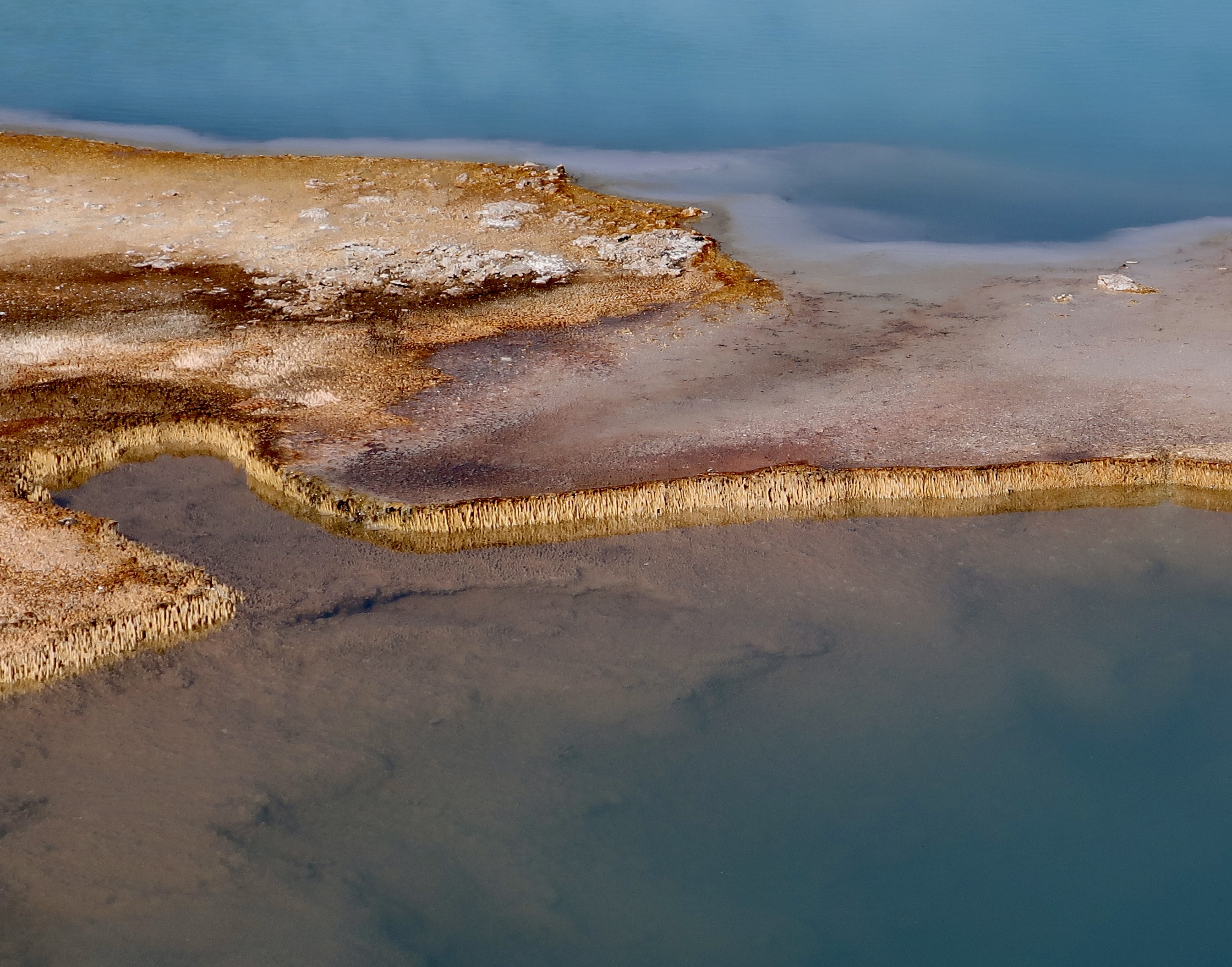
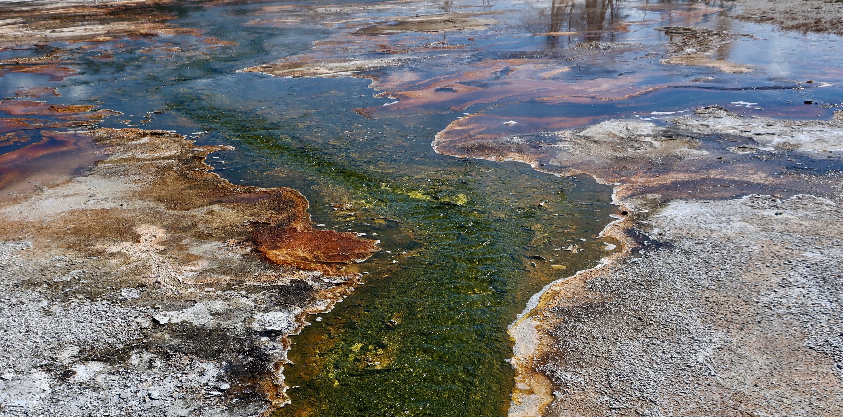
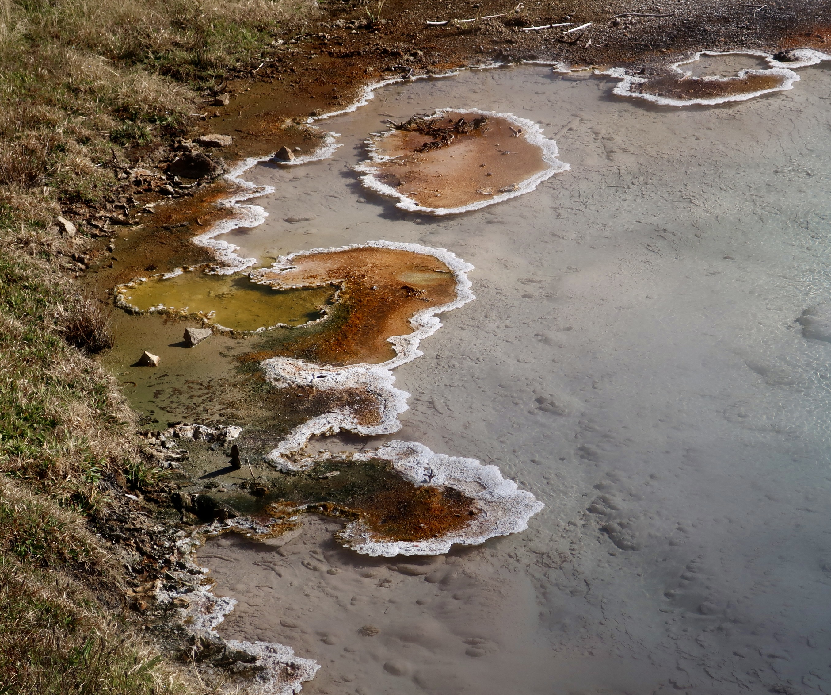
Fly fishermen try their luck in the upper waters of the Gallatin River in Wyoming’s Yellowstone Park.
By the time I had biked the route in August of 1989, the river had ceased its mighty roar but held onto its scenic beauty. Things were still roaring when Peggy and I drove up it in June as we re-traced my route. We stopped to admire the rapids and watch rafters. In the town of West Yellowstone, Peggy relived her youth by trying to find a bar she had once visited with a fake driver’s license in the early 70s.
She had obtained a summer job as a waitress in Yellowstone Park between her freshman and sophomore year at Mary Baldwin College in Virginia. (Mary Baldwin, once a finishing college for Southern Belles, was trying to make its way into the 20th Century. Peggy, a Northerner from Ohio, was much more interested in obtaining an education than becoming a ‘lady,’ and had only lasted for two years before transferring to the University of Tennessee in Knoxville. UT included certification for working with the hearing impaired as part of its curricula, which was where she wanted to focus.)
In the meantime, Yellowstone had provided a welcome reprieve from Mary Baldwin— plus first love. Between waitressing at the park’s lodge and watching Old Faithful shoot towering plumes of water skyward, Peggy had discovered Bill, who definitely wanted to show her a good time. Part of this had included the trip into West Yellowstone and barhopping with a fake driver’s license.
My bike route followed Highway 20 out of West Yellowstone up and over the Continental Divide at the 7072-foot Targhee Pass, which also served as the border of Idaho. From here on, rivers would be flowing into the Pacific Ocean. I continued on Highway 20 down to Rexburg following Henry’s Fork of the Snake River and then made my way west on Highways 33 and 93 to the Craters of the Moon National Monument.
Henry’s Fork flows into the Snake River, which flows into the Colombia River and then into the Pacific Ocean. I had left the great Mississippi-Missouri River drainage system behind.

The mountains of central Idaho loomed in the distance above what was probably a potato farm near Rexburg.

Idaho’s Highway 33 seemingly stretches on forever as so many roads did during my 10,000 mile bike trek around North America.

Pickle’s Place is one of many delightfully unique restaurants I found along the road. Located in Arco, Idaho (once known as Root Hog), it features the Atomic Burger in honor of the fact that Arco was the first place in the world to be lit with atomic power.
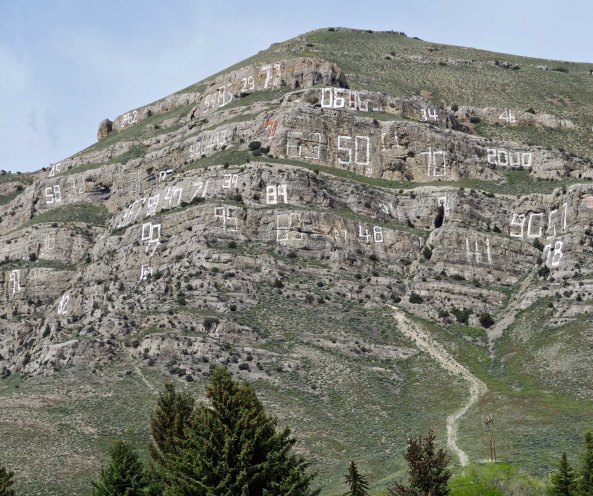
This mountain next to Arco features the local high school’s graduating classes going back to the early 1900s.
The Craters of the Moon National Monument encompasses a wonderfully weird lava flow on the Snake River Plain that covers 618 square miles and was formed between 15,000 and 2,000 years ago. Early astronauts, including Alan Shepard and Edgar Mitchell, had arrived here on August 29, 1969 to practice future landings on the moon— one month after Neil Armstrong had already taken his “one small step for man; one giant leap for mankind.”

Idaho’s Highway 93, winding its way through the northern part of Craters of the Moon National Monument, seemingly disappears here.
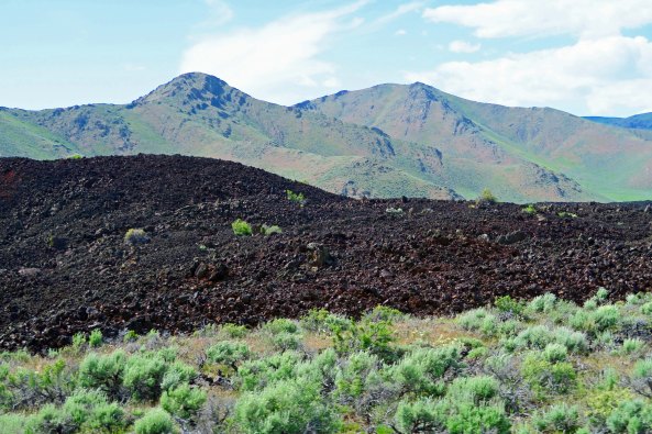
Nature, in her marvelous way, is gradually reclaiming the volcanic landscape. Sagebrush is the most obvious plant in the area.

But Peggy and I also found these flowers.
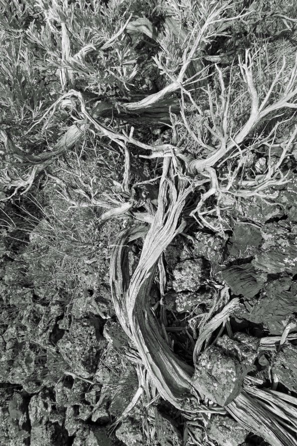
As well as this stark but beautiful reminder of how difficult it is to reclaim lava.

This sculpture added a colorful touch to the monument.

I also liked this perspective, which seemed to capture the strangeness of the monument. A small-explorer’s foot can be seen on the right.
From Craters of the Moon, it was a short 80-mile ride to the Snake River and Twin Falls over relatively flat country. The river features a dramatic 500 feet deep canyon, which was created by cascading water from melting glaciers. When Peggy and I arrived, a man was dangling on the edge of the Perrine Bridge by his fingers, ready to leap into the canyon (featured at top of this post). Fortunately he had a parachute on. Still, he plummeted for 200 feet or so before engaging it. Scary stuff.

See the shadow on the river. It’s made by the parachute, the small triangle located center-left above the shadow.

This view of the Snake River is looking west from the overlook next to the Perrine Bridge. Boats have created the wakes.
When I crossed the bridge on my bike in 1989, I was thinking of another leap across/into the canyon— that of Evel Knievel in 1974. Evel, at the time, was synonymous with the word daredevil. During his life he made some 275 motorcycle jumps over cars, busses, and trucks. Fifteen of the jumps involved spectacular accidents. He suffered numerous concussions and shattered his pelvis three times. Overall, he broke 35 bones. Maybe he should have pursued a much tamer sport, such as playing NFL football.
Knievel was always on the lookout for new ways to upgrade his act, obtain more publicity, and increase his income. Mainly this involved adding more vehicles to leap (for a number of years, he held the world record of 19 cars), but he also had a dream of jumping the Grand Canyon. Concerns with National Park regulations, however, eventually led him to the Snake River. The 1700-foot jump was a bit long for his Harley, though, and this is where Robert Truax came into the picture.
Truax was one of America’s premier, pioneer rocket engineers, beginning his career prior to World War II when a childhood interest in Robert Goddard led him to build rockets at his home in Alameda, California. He then went on to work with the Navy on rocket development during World War II and later helped build both the Thor and Polaris missiles. By the late 50s/early 60s, he had left the military and was heading up Aerojet-General’s advanced rocket development division in Sacramento, California. I met the man when I promised him I would have his daughter home by midnight.
Kathleen (Kathy) Truax was a dark-haired beauty with brains to match. She had transferred into El Dorado Unified High School in Placerville during my senior year. After graduation, I had worked up the nerve to ask her out on a date to the California State Fair in Sacramento. Her immediate “yes” had me kicking myself for not asking sooner.
The weekend turned into a marathon. I had worked ten hours on Friday hauling 50-pound boxes of pears out of an orchard and then gone to a party at a friend’s. My mother called at midnight to tell me that the forest service had just phoned wanting me to help fight a raging forest fire that was threatening to engulf the small foothill community of Foresthill. So away I had gone and spent from 2 a.m. until 10 a.m. chopping a fire trail across a steep American River canyon with a heavy pickaxe. The looming inferno encouraged fast work.
After a two-hour nap break and lunch, our crew chief had told us that the fire was burning back on itself and that we could leave if necessary. I’d buzzed home to Diamond Springs, showered, and taken off for Cameron Park where I picked up Kathy in my 54 Chevy, met her dad, and gone on to the State Fair. I returned her home promptly at midnight as promised. We’d had fun and I had won Kathy a large stuffed bear that hardly fit in the back seat.
Later that summer, we had gone on a date up into the Sierra foothills near Pleasant Valley where her grandmother lived. Kathy had told me that her dad shot off rockets in the area that he had built in his garage. His visionary dream was to build inexpensive rockets that would make space travel affordable for everyone. Eventually, 13 years after the summer I had dated Kathy, that dream would lead him to build the Volksrocket (Skycycle X3) designed to carry Evel Knievel across the Snake River Canyon. The rocket had worked fine, but the parachute had malfunctioned, deploying when the rocket took off, which allowed the wind to pull it back into the canyon. Evel had landed on the river’s edge with minimal injuries (for him), and Truax had taken responsibility for the accident.
While Knievel died in 2007 and Truax in 2010, their dream was finally realized on September 16th of this year. Professional Hollywood stuntman Eddie Braun working with Truax’s son Scott used an exact replica of the Skycycle X3 with a well-tested parachute to successfully jump the canyon. Children of both Knievel and Truax were there to witness the event. Had Peggy and I been a couple of months later in our route review, we would have been there as well.
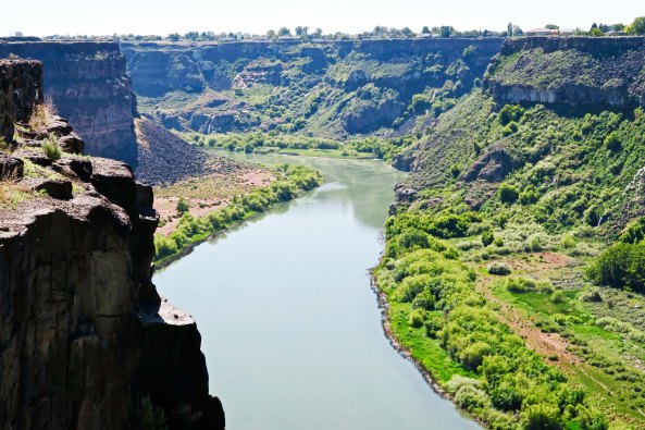
Looking east up the Snake River from the Perrine Bridge toward where Evel Knievel tried his 1974 leap across the river.
NEXT BLOG: I bicycle across Nevada and hear voices. Seriously. Were the desert gods trying to tell me it was time to end my journey?